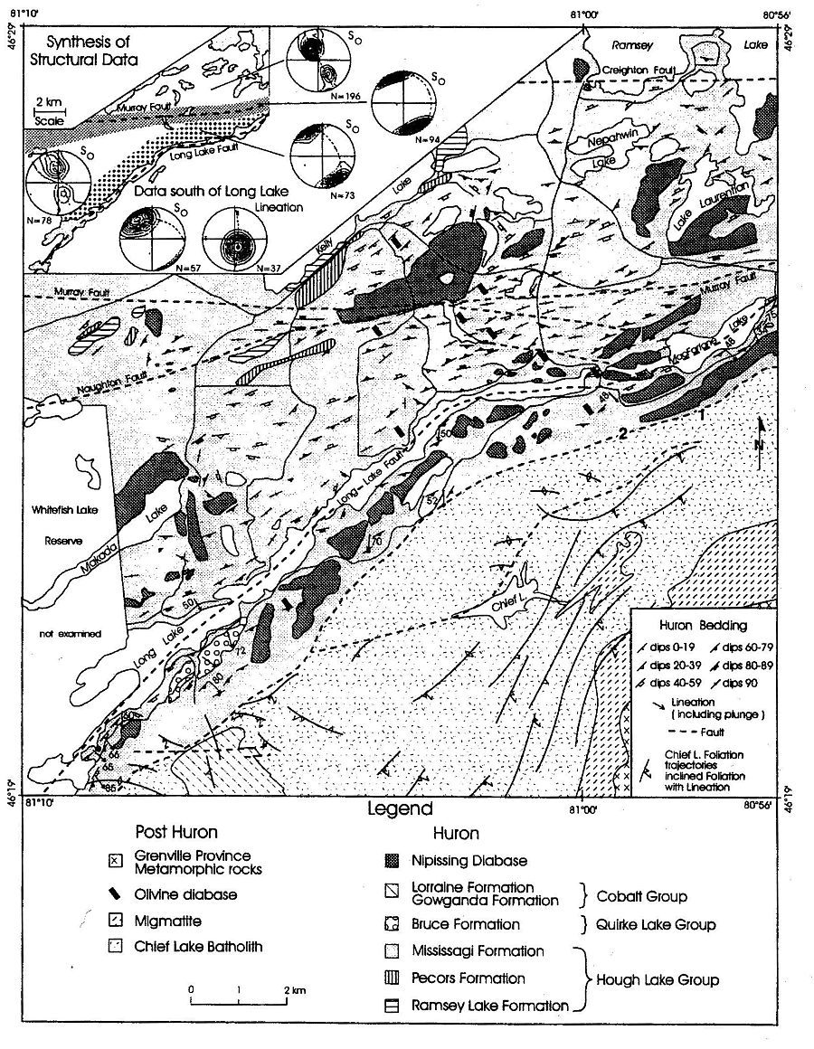
A geological map, espwedgegeolnad83.dwg,
of the 'Espanola Wedge' in the form of an Autocad .DWG file can be downloaded
from:
http://instruct.uwo.ca/earth-sci/fieldlog.
This map can be viewed with the VoloView viewing software, the installation
file, 'vve2setup.exe', for which can
be downloaded from the same site. Georegistered aerial photographs attached
to the map are archived at the same site as the map, whereas attached extraneous
geological maps and geological photographs can be downloaded from http://instruct.uwo.ca/earth-sci/200a-001.
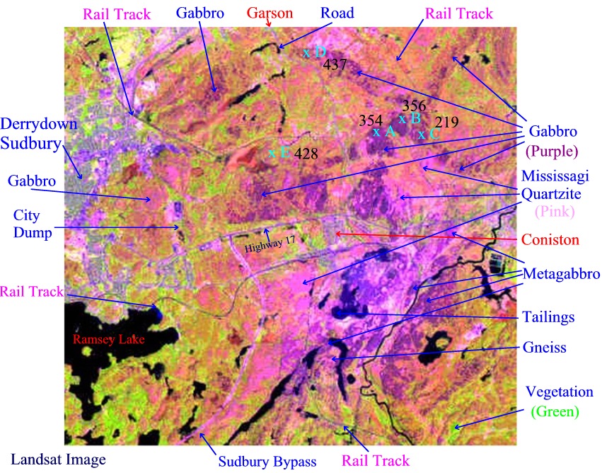
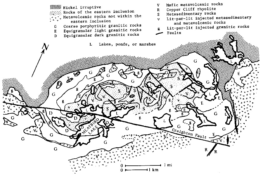
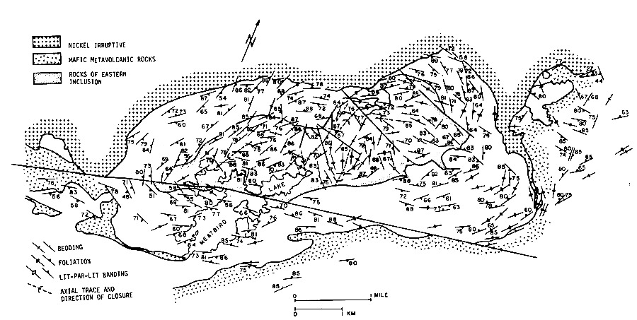
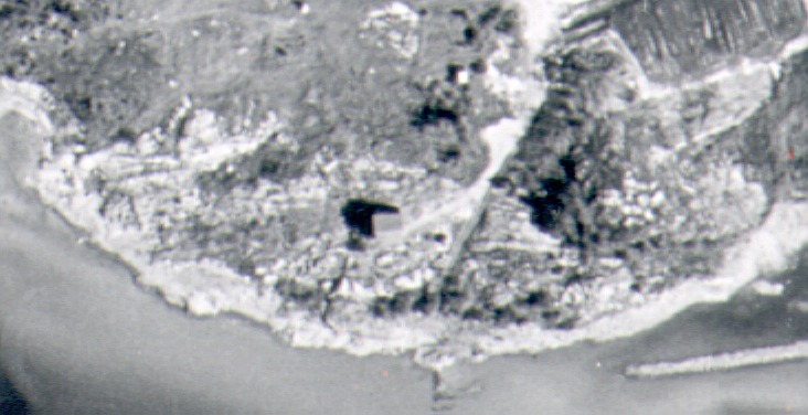
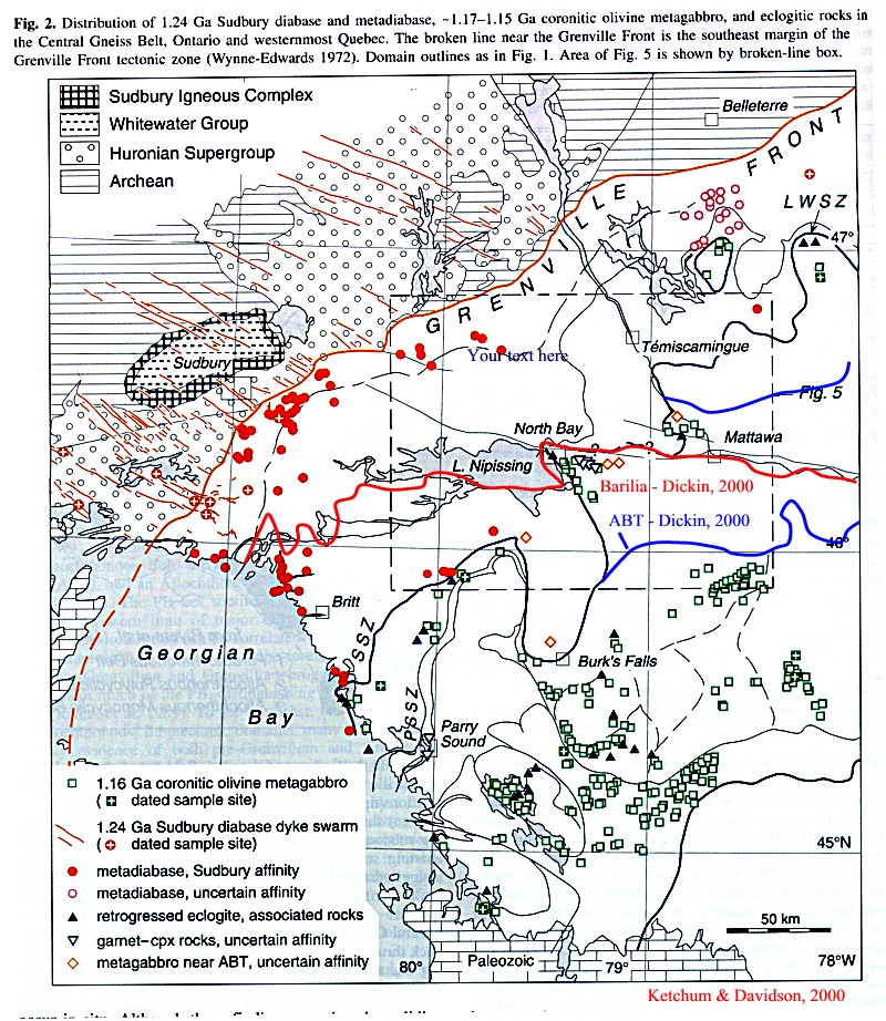
Landsat image of the East Sudbury - Coniston - Garson area of the Sudbury region
Huronian
Metasediments
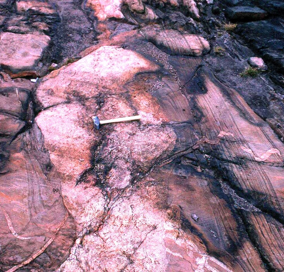
Cross
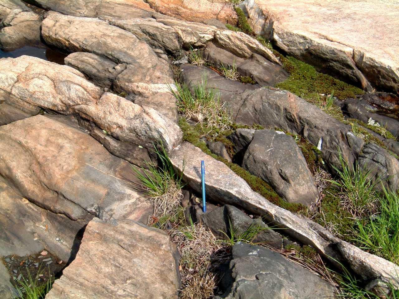
bedded Mississagi Formation, Bay of Island - 1506hurxbeds.jpg
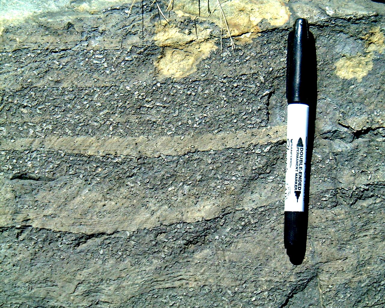
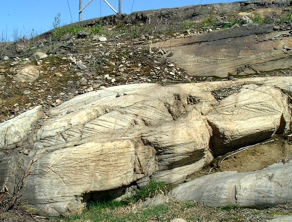
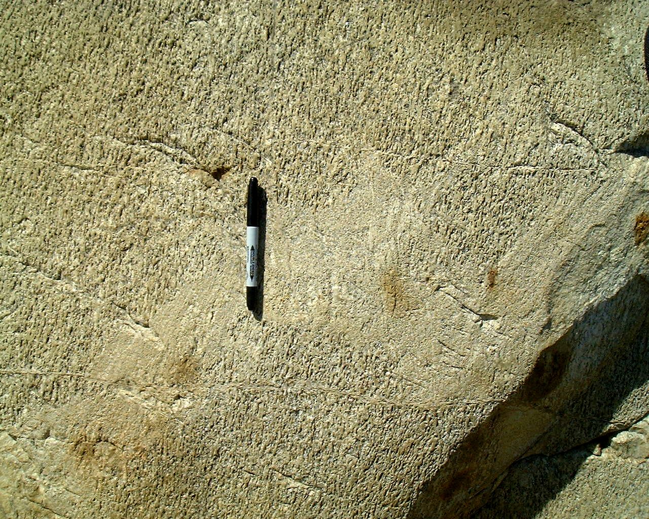
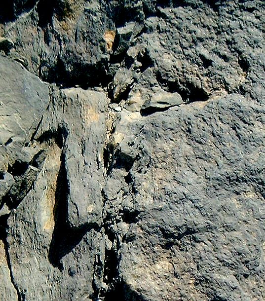
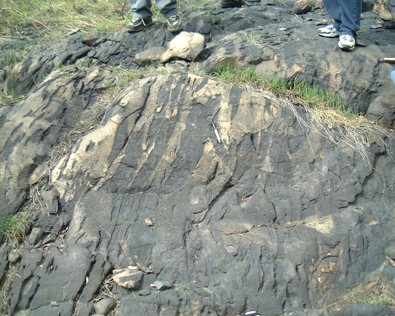
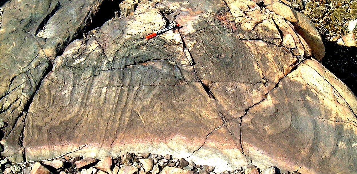
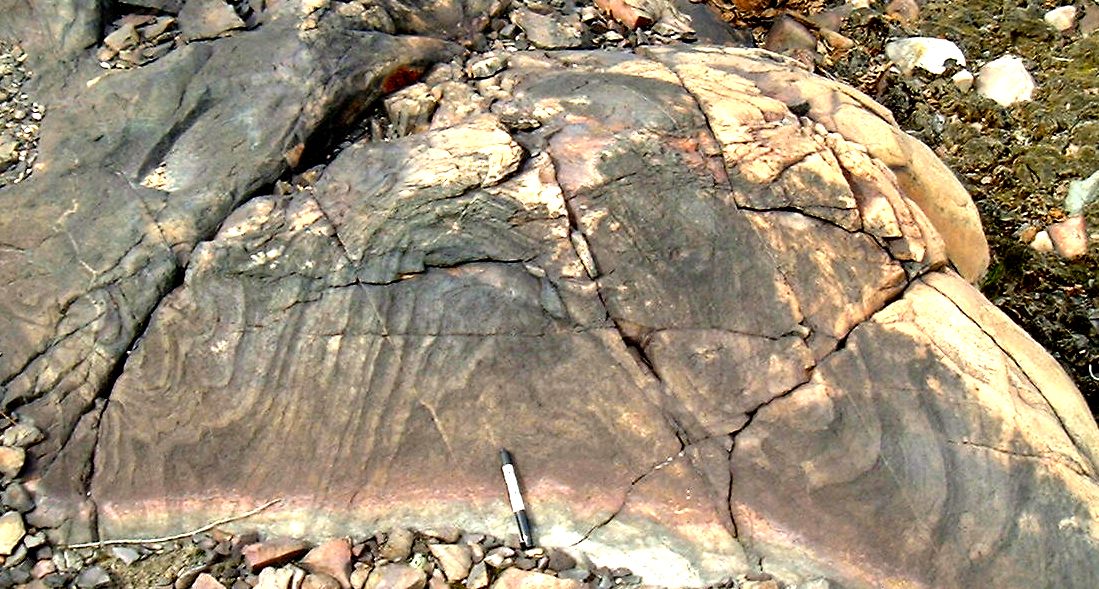
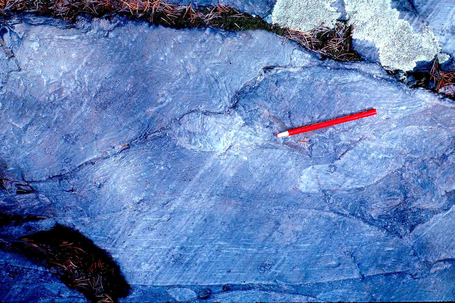
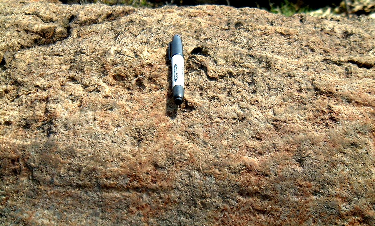
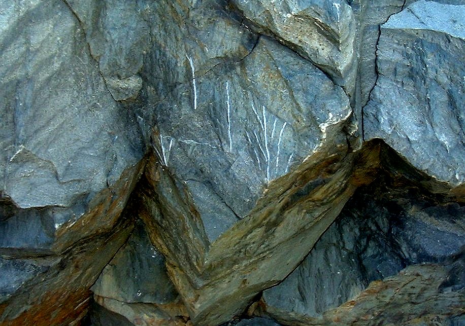
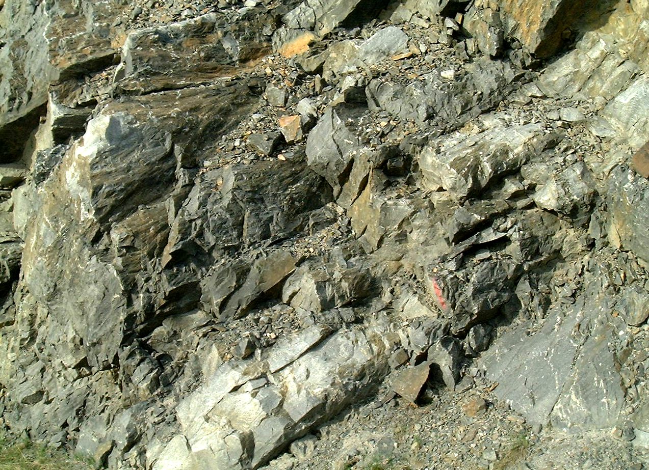
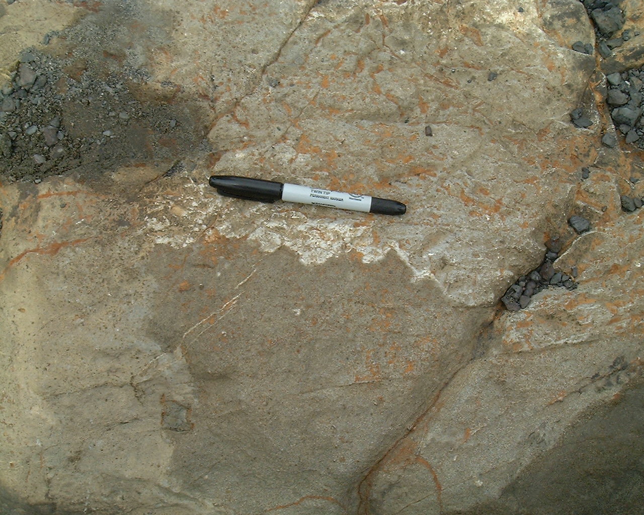
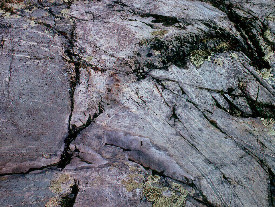
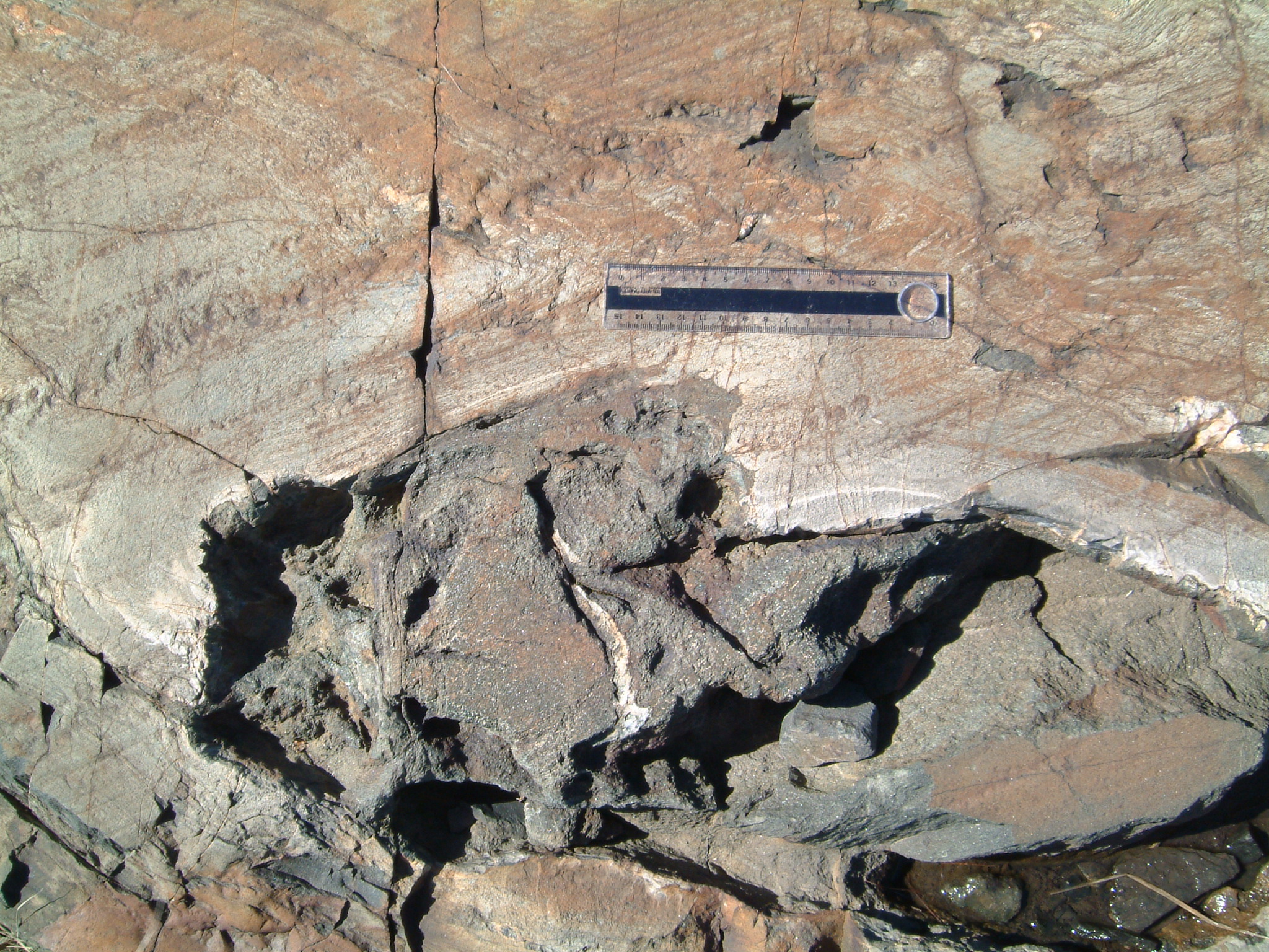
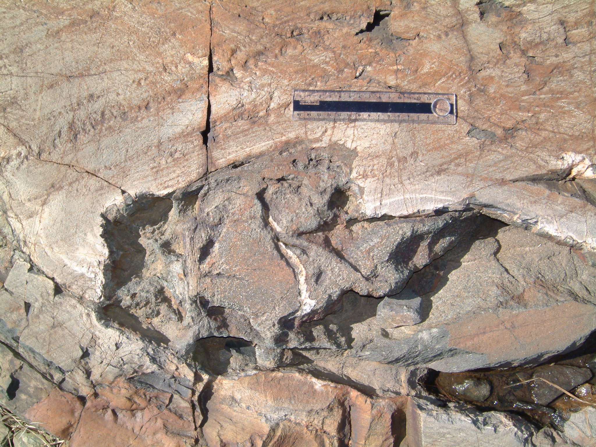
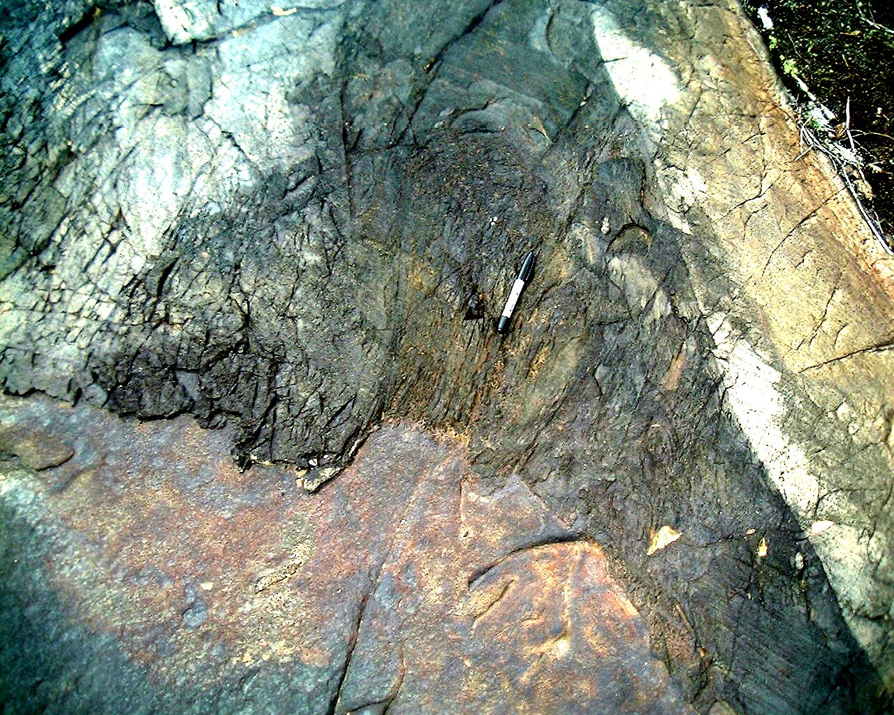
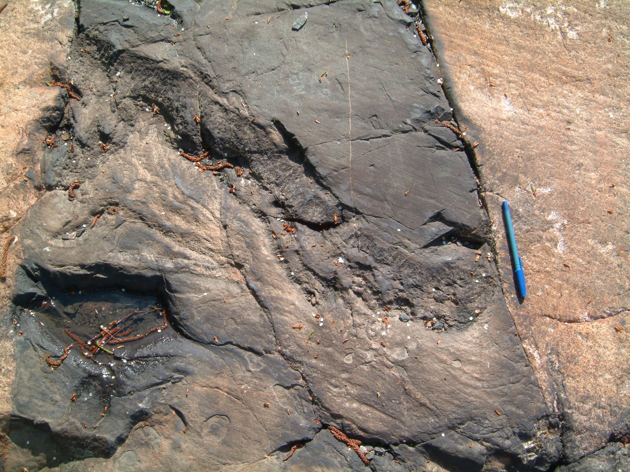
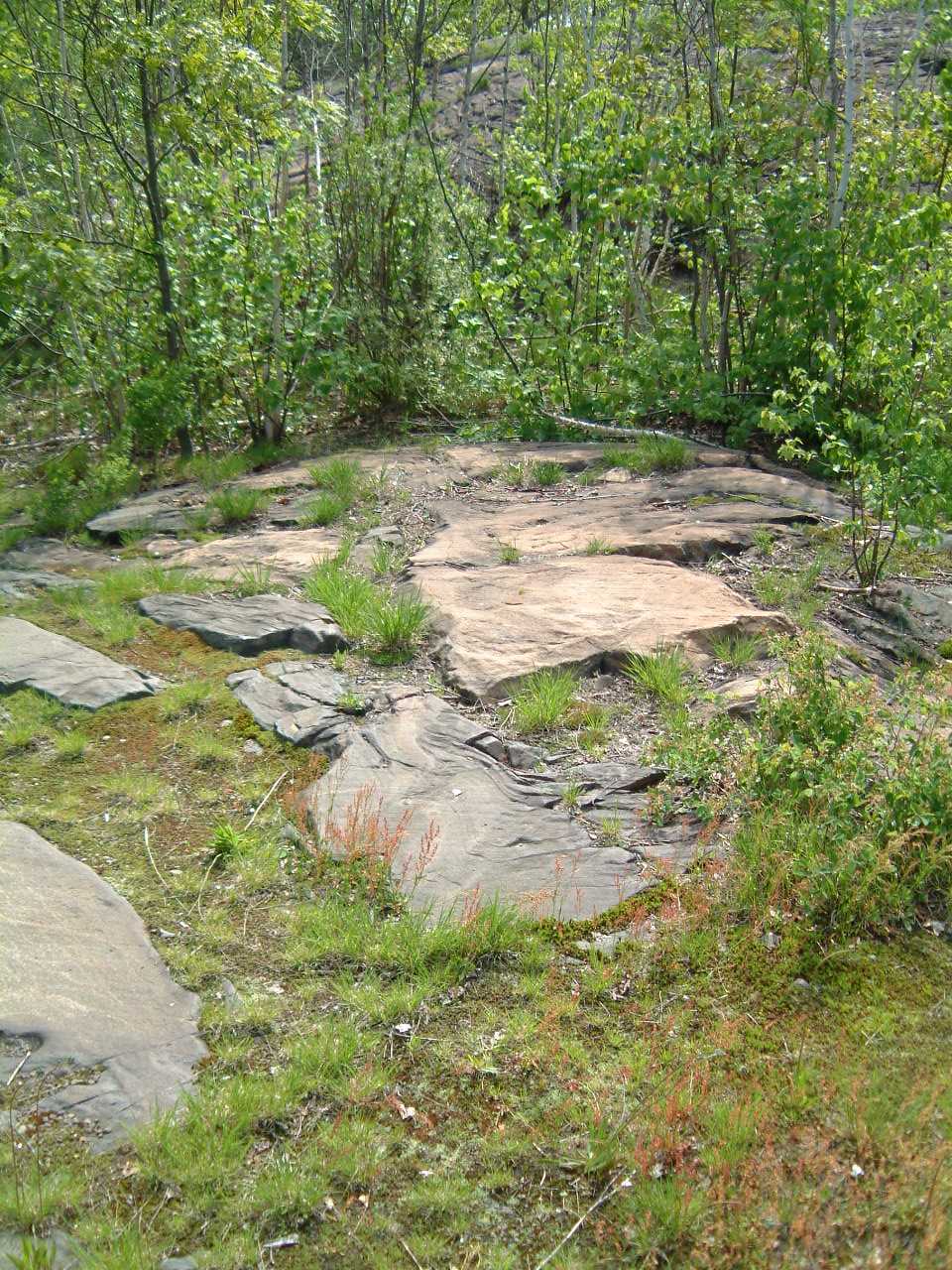
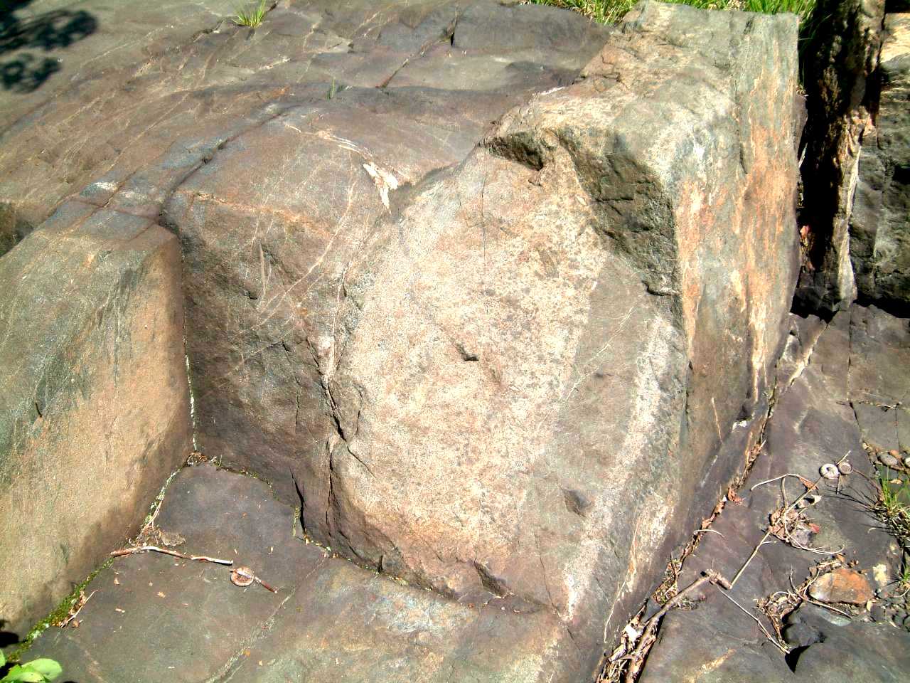
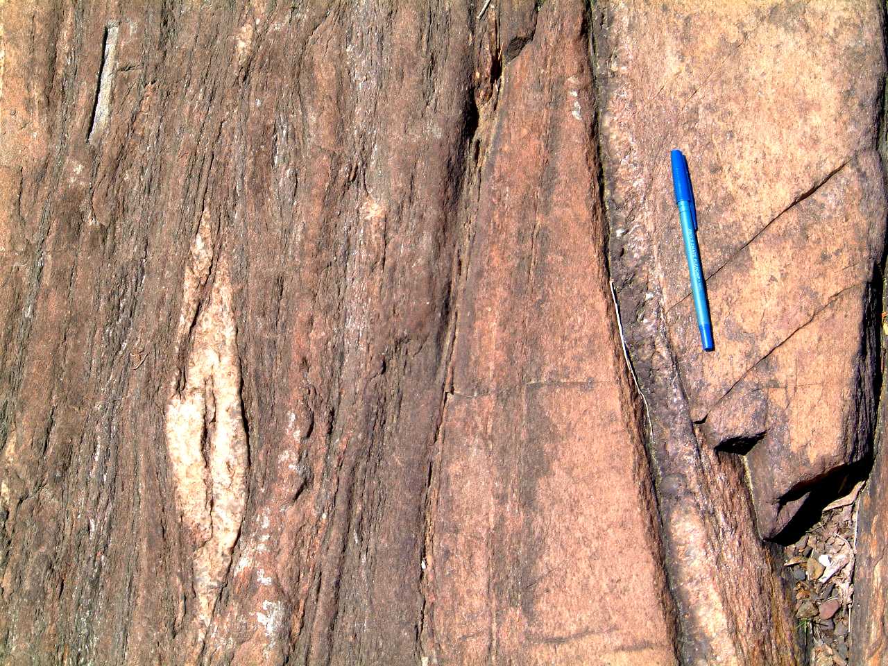
Well
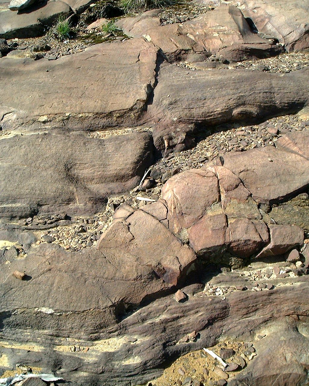
preserved ball and pillow structure in meta-arenites of the Stobie Formation
in the area between the Creighton and Murray granites; east side of road
near the Clara Belle - Highway 149 junction. No evidence of marked penetrative
deformation -
424stobiesed.jpg
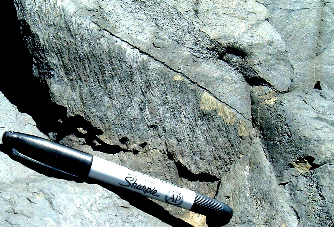
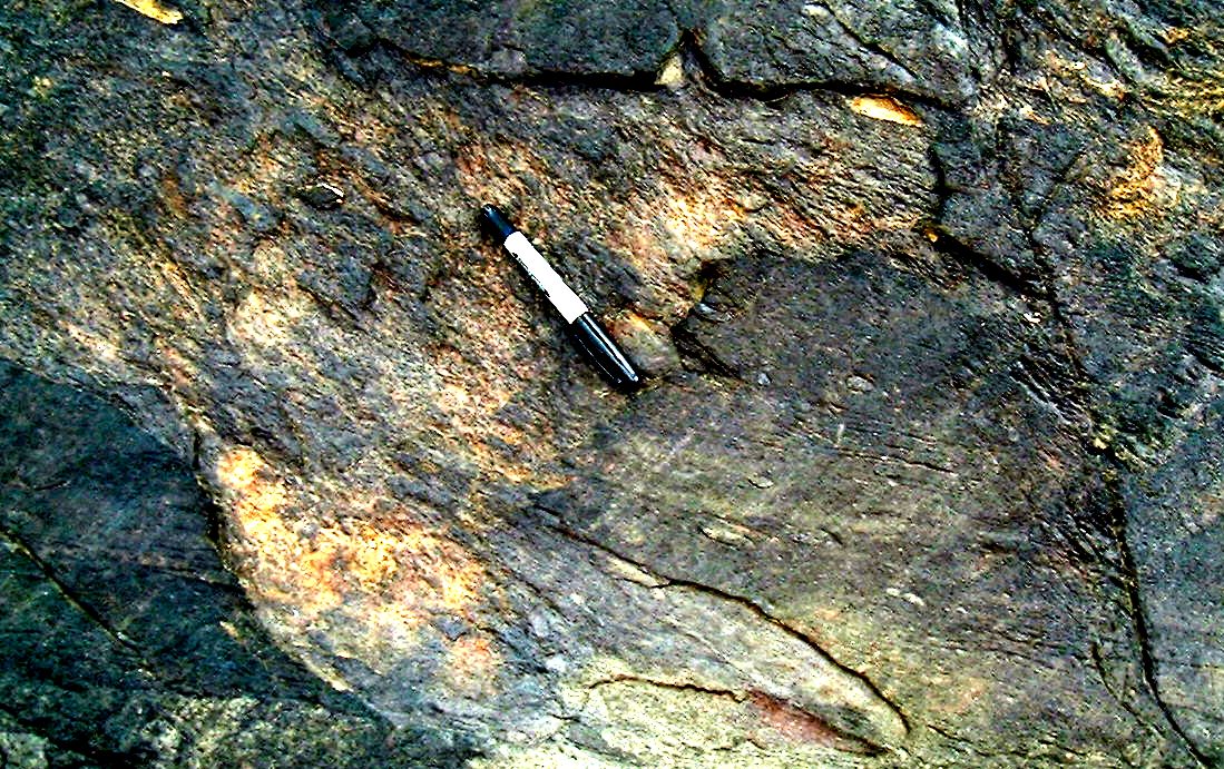
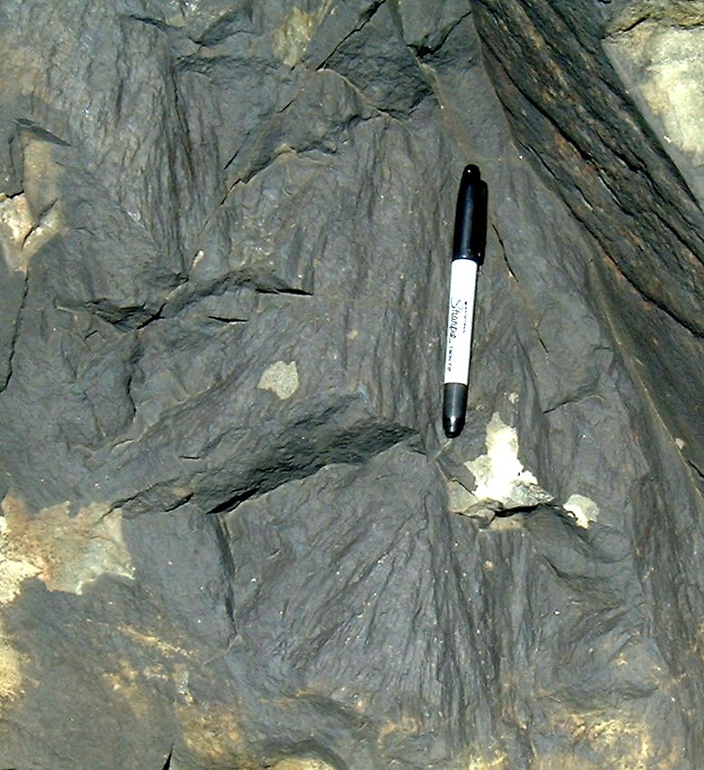
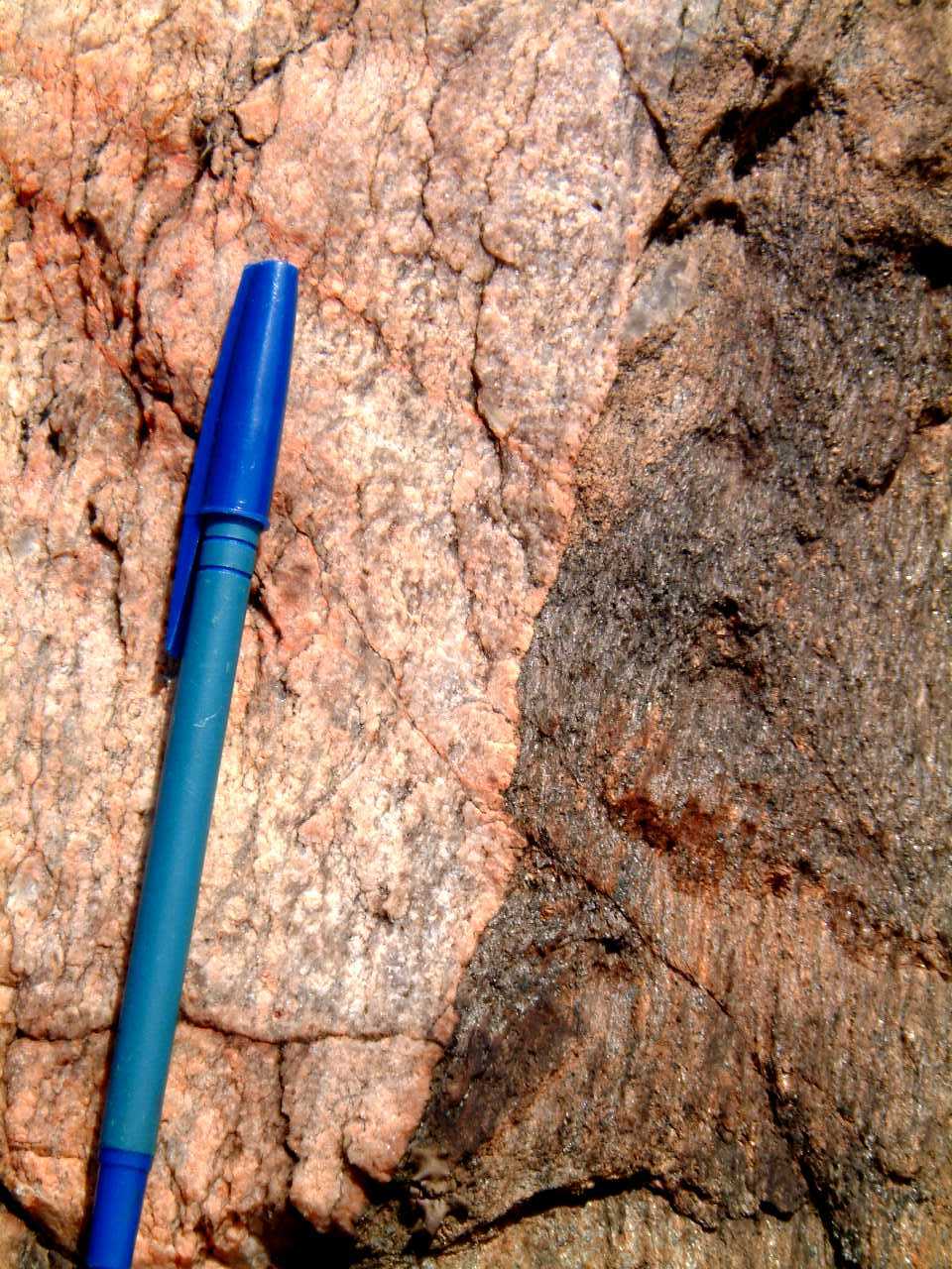
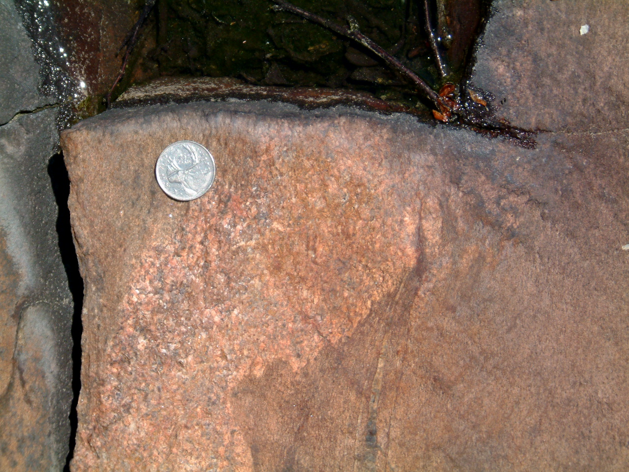
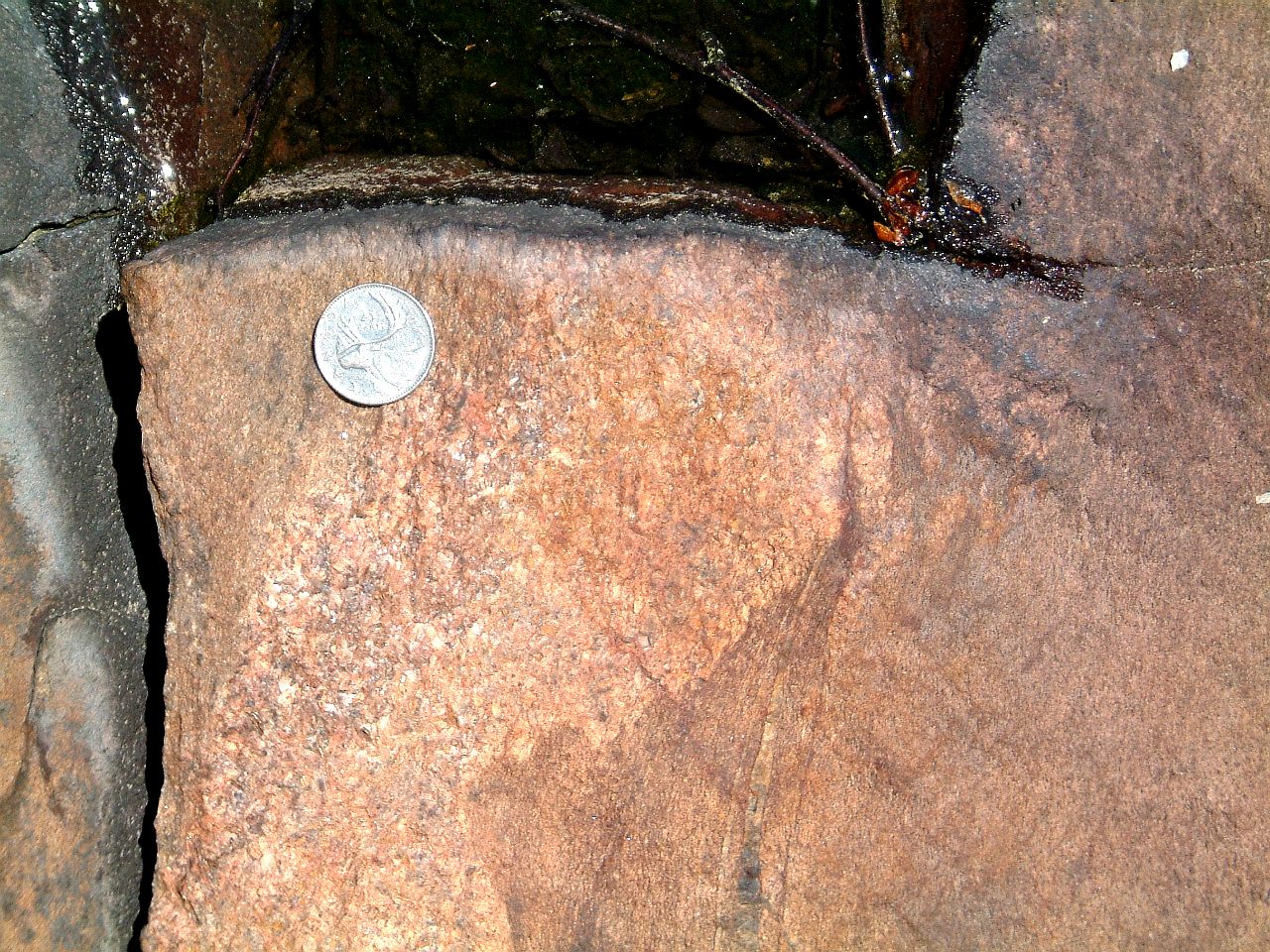
Staurolite in sediments
of the Stobie Formation in the area between the Creighton and Murray granites;
west side of road near the Clara Belle - Highway 149 junction; again, no
evidence of penetrative deformation of the staurolite - 423stobiestaur.jpg
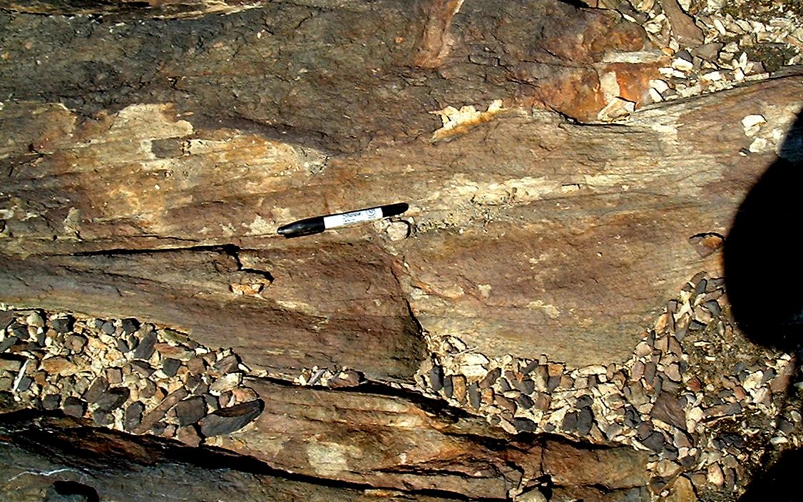
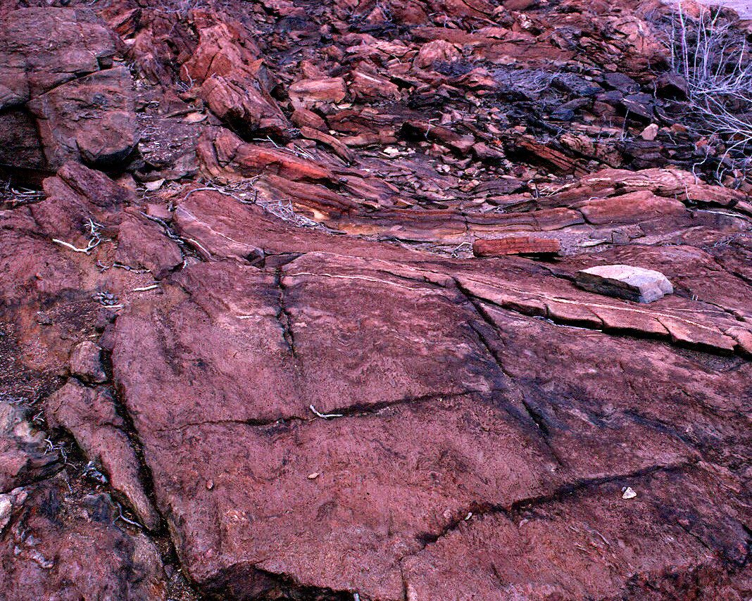
Rip up clasts in Mississagi Quartzite,
east side of the Coniston-Garson road - 352ripups2m.jpg
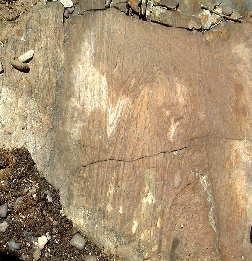
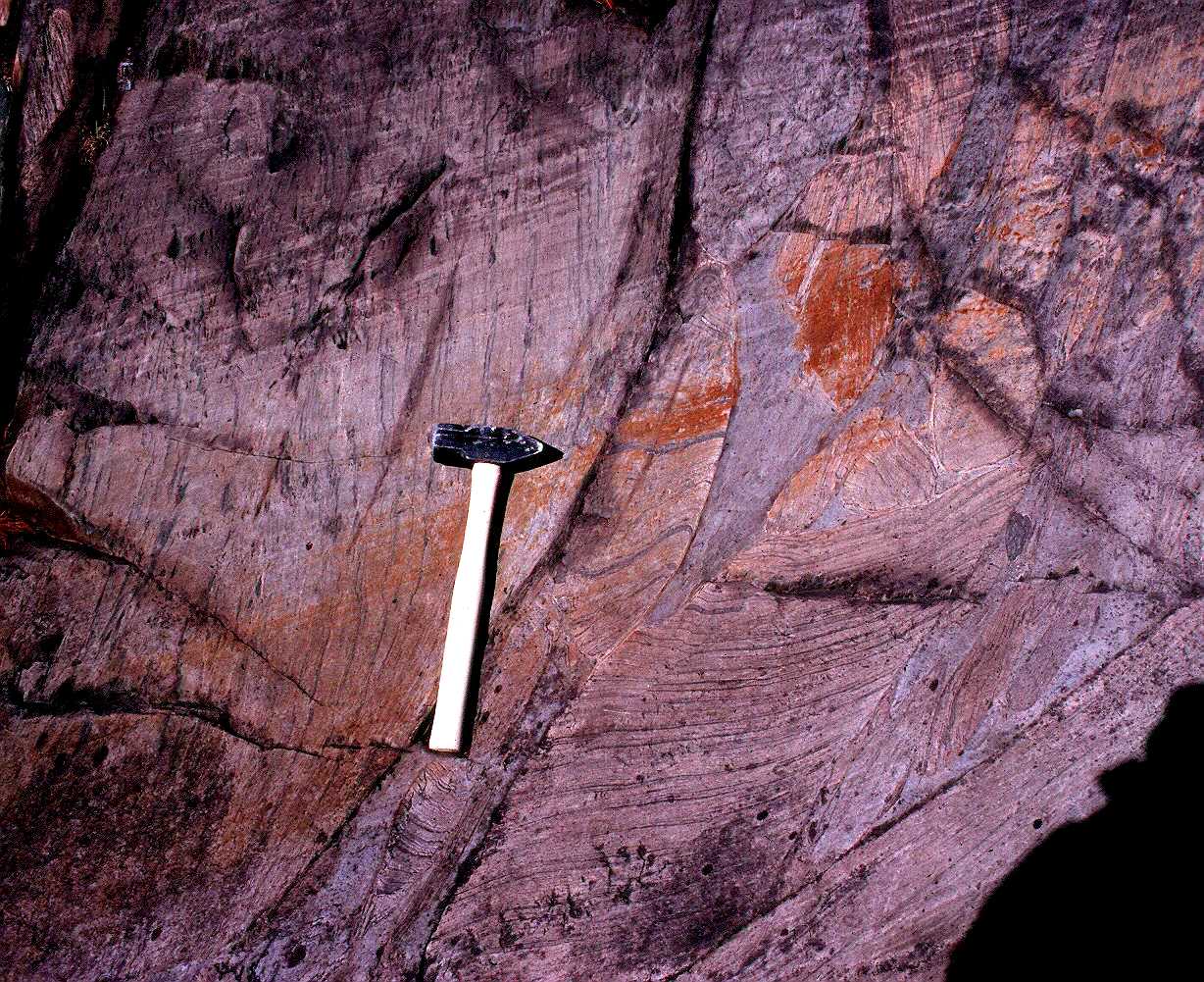
Repeated Bouma units of cross
laminated rippled sand units grading to argillite (now with staurolite),
McKim Fm., south side of Highway 17 at Balsam Street, Sudbury - 383gradedbedbalsamm.jpg
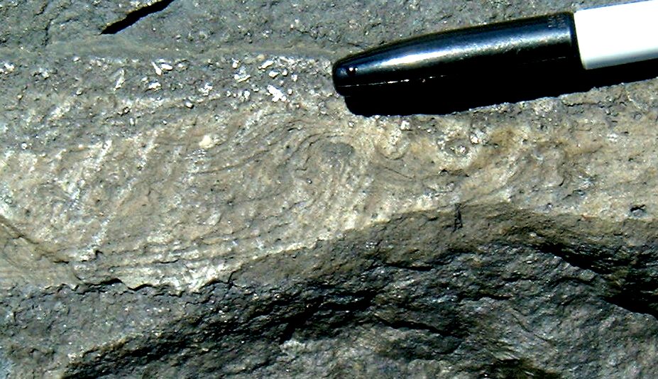
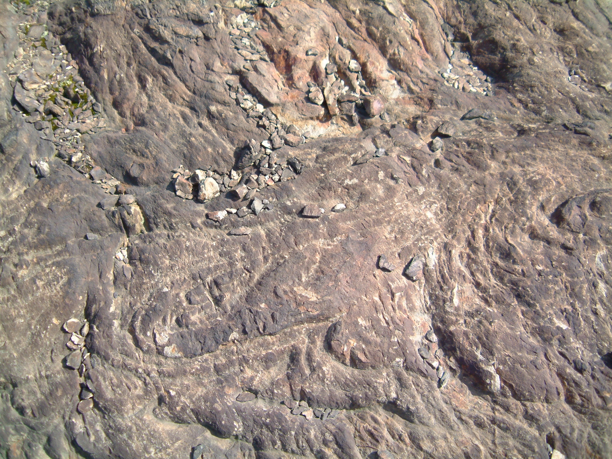
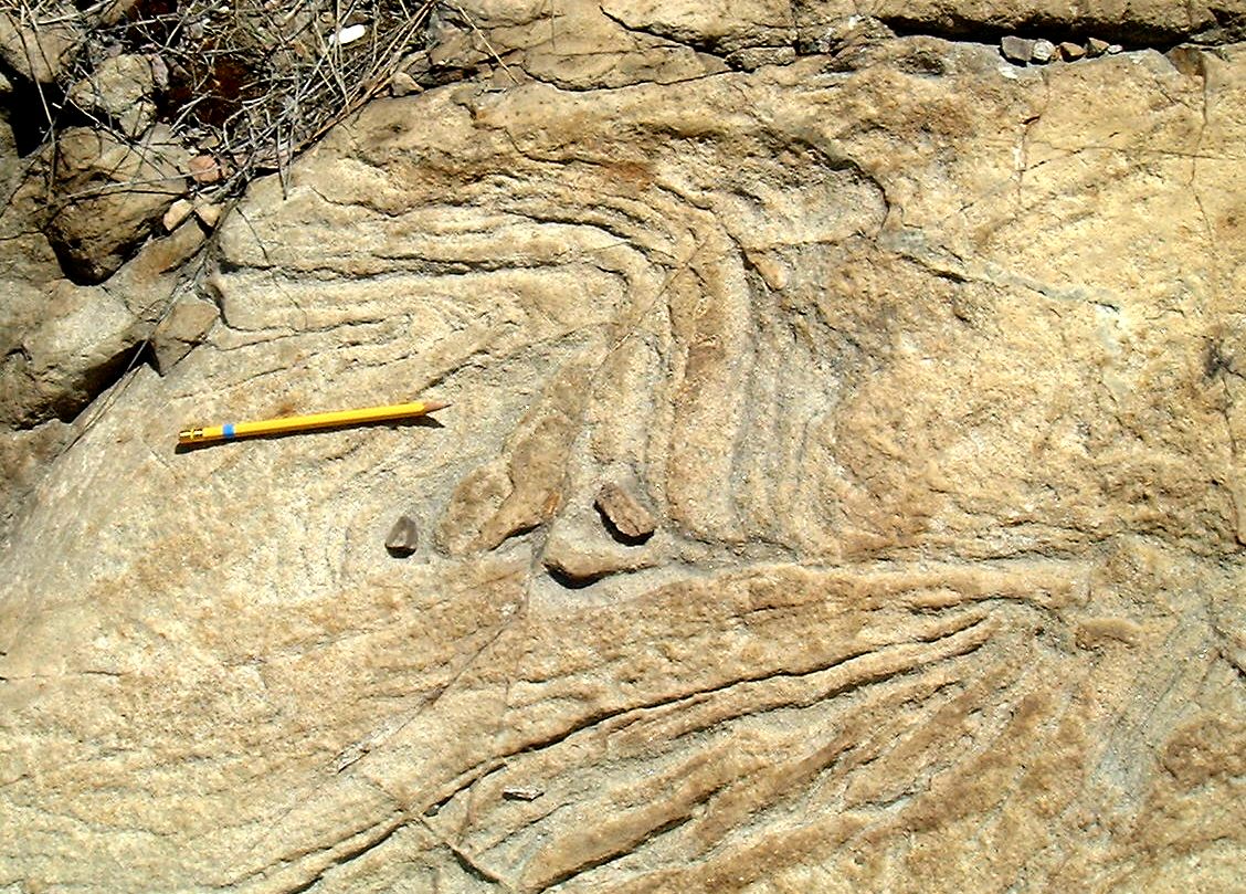
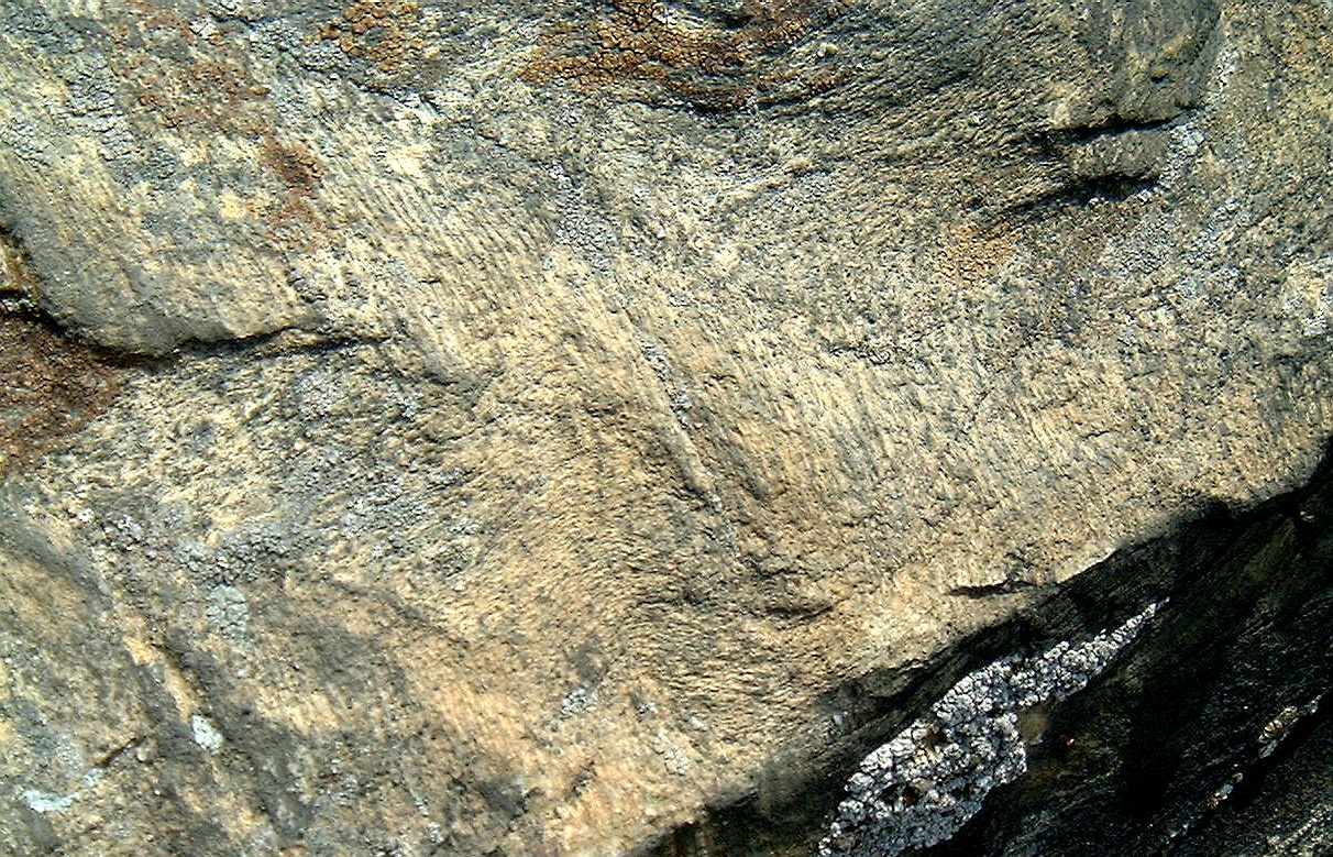
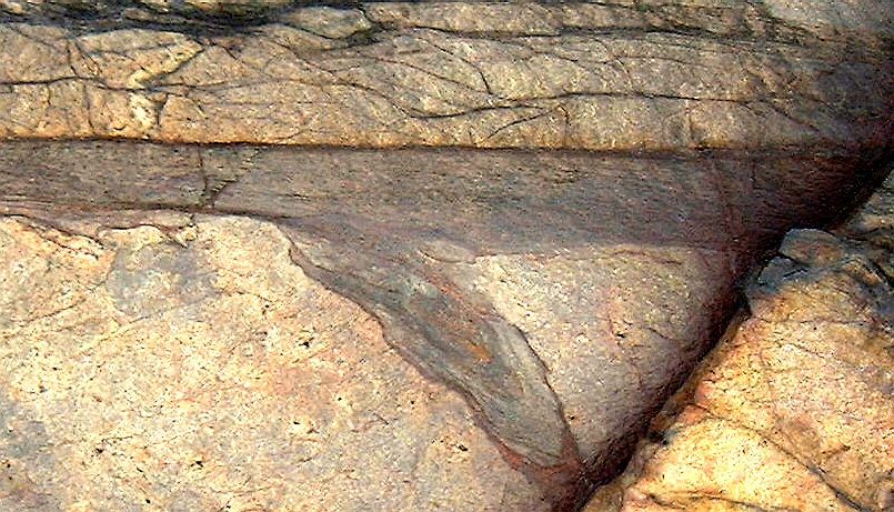
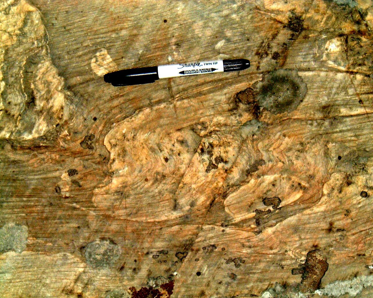
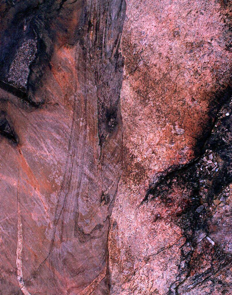
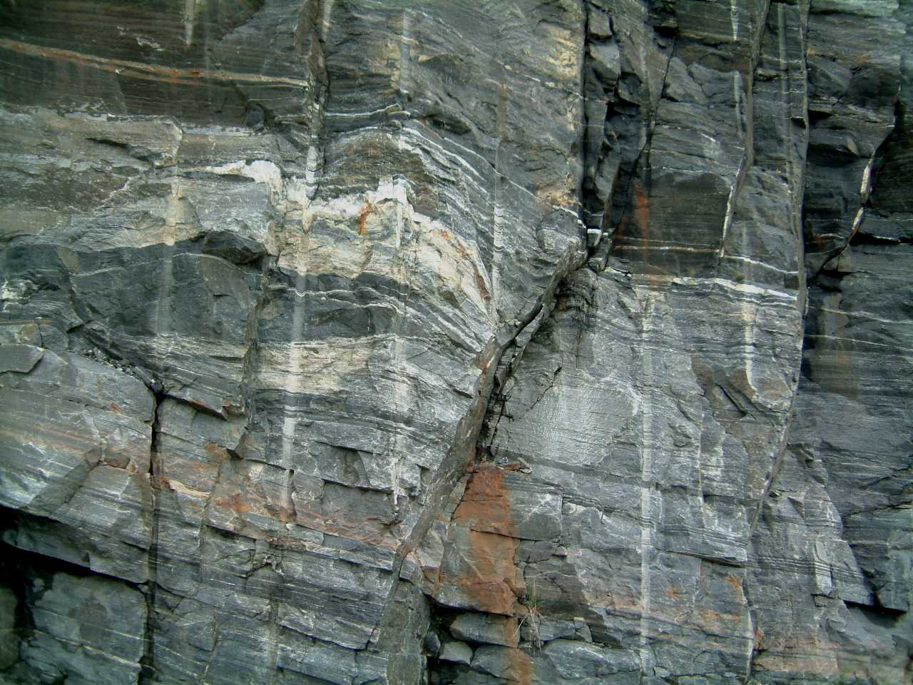
Delicate sedimentary structures
preserved in metamorphosed Mckim Fm -
384sedflamebalsamm.jpg
446xbedsyoungnorthnwofbridgem.jpg
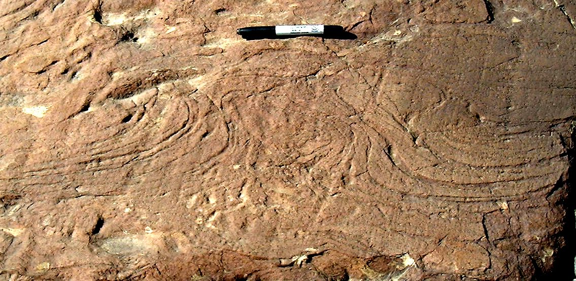
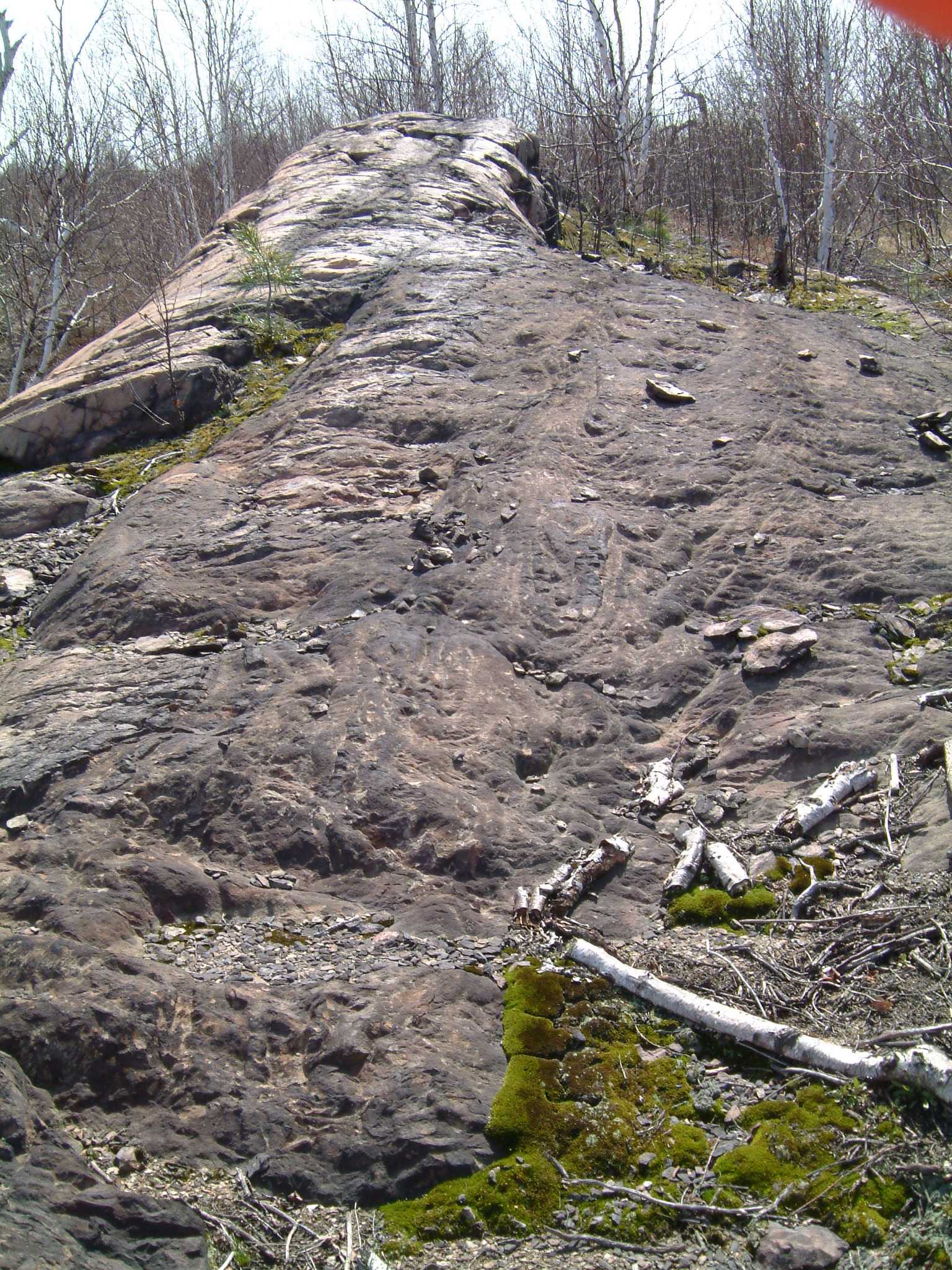
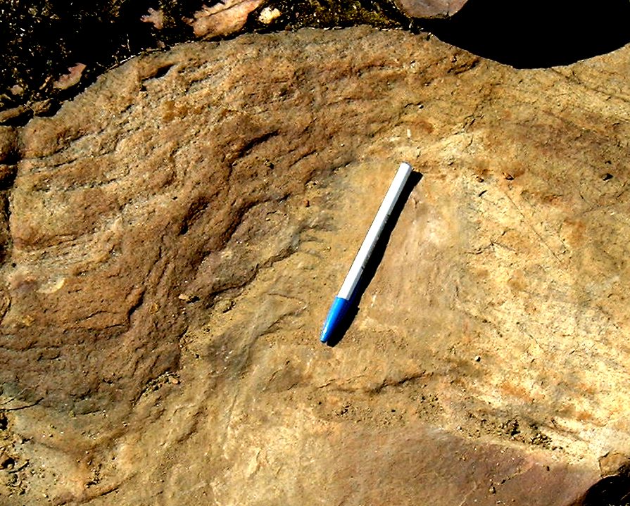
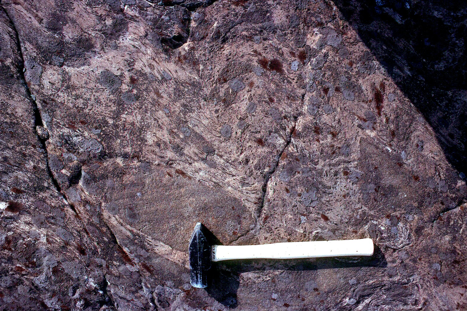
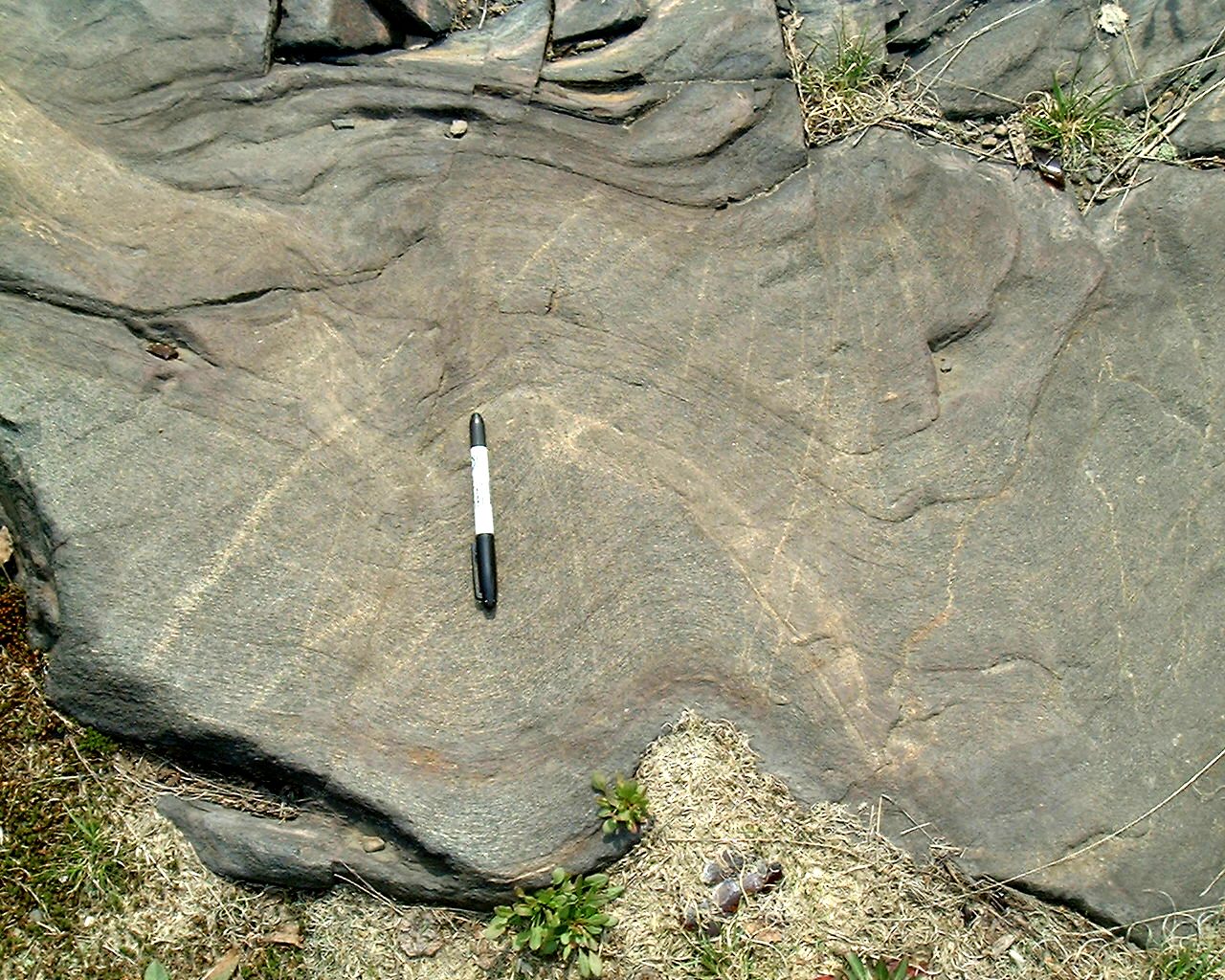
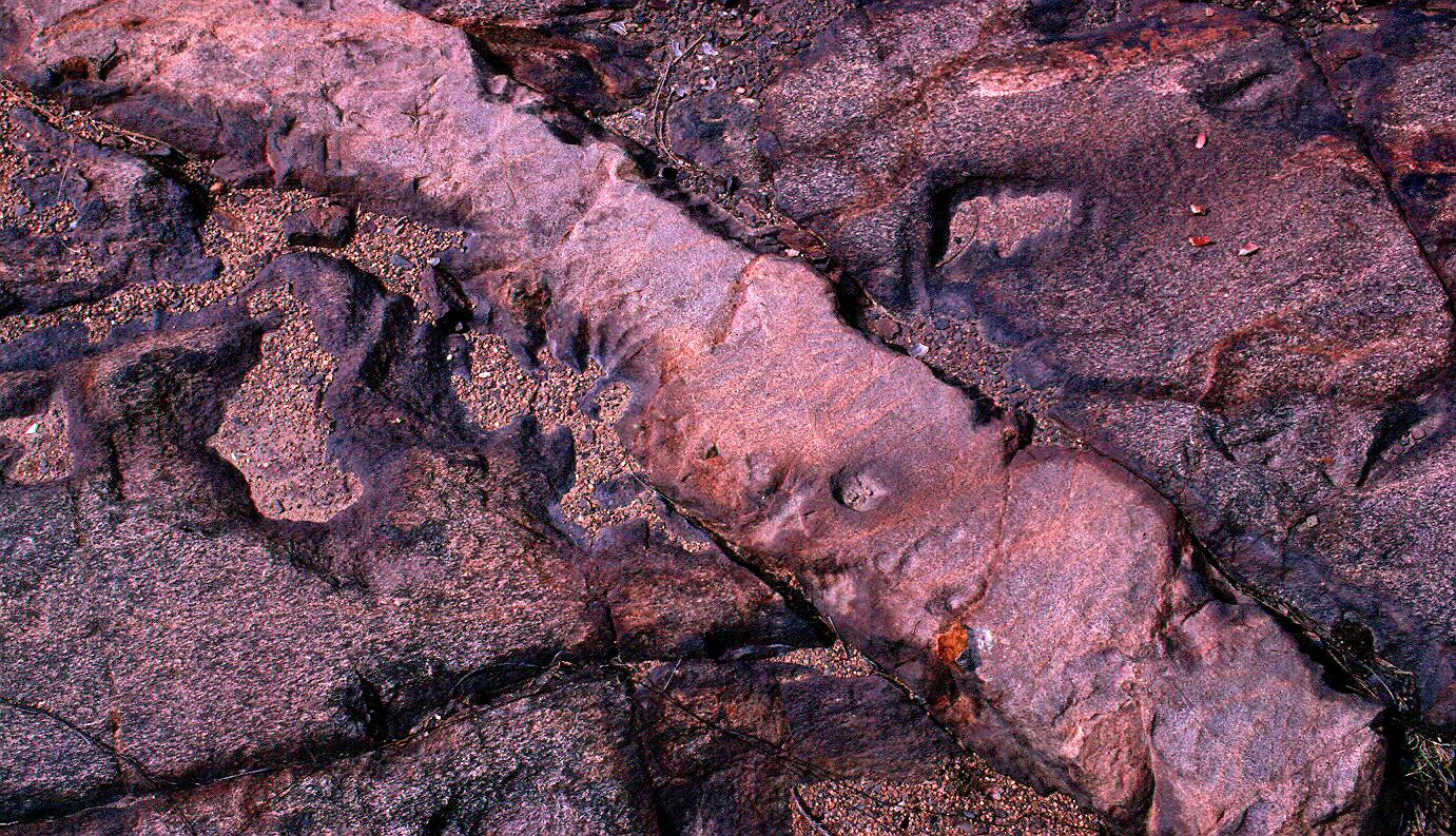
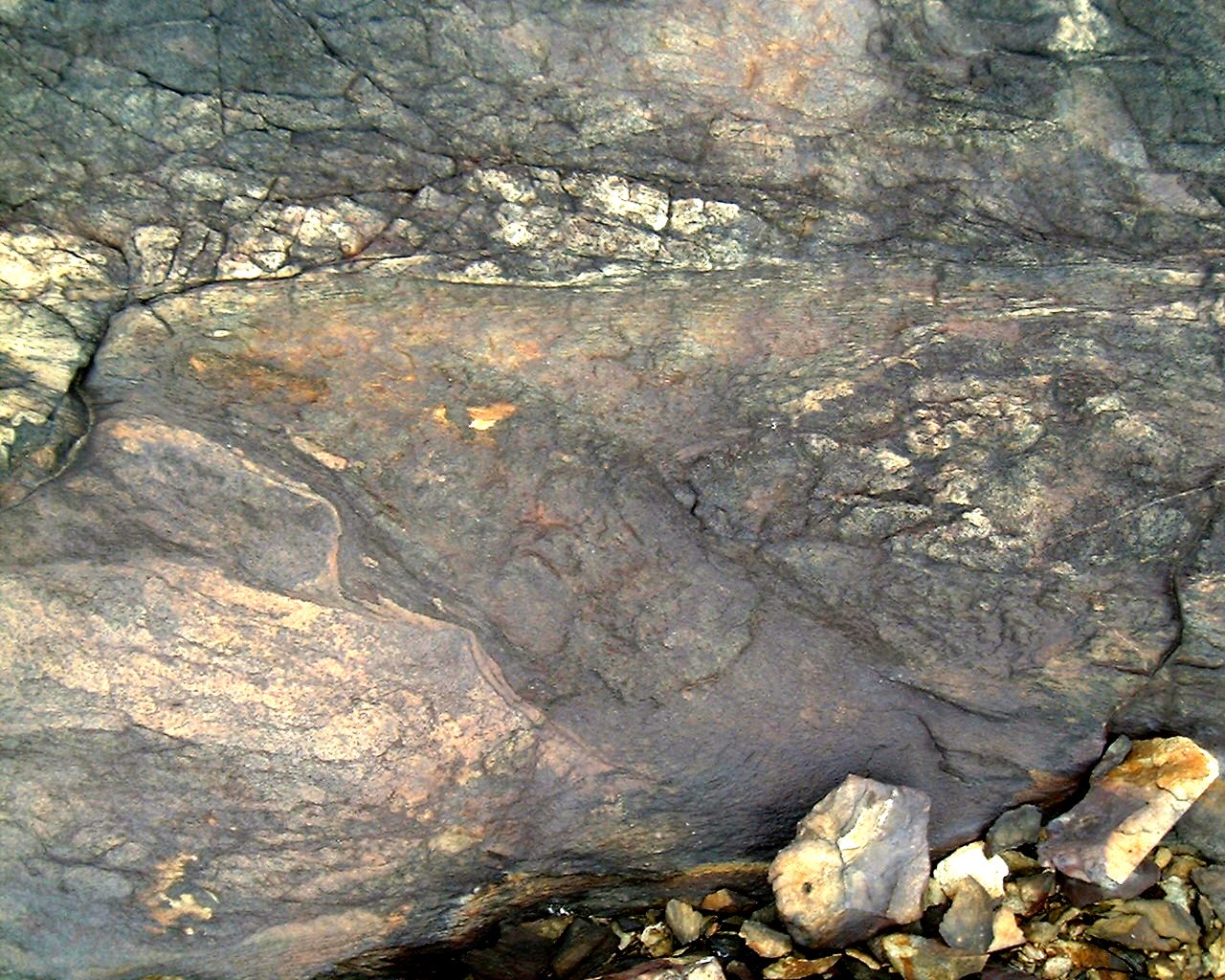
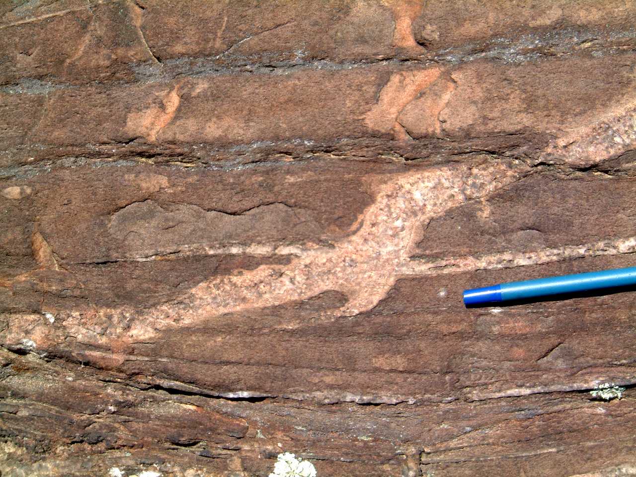
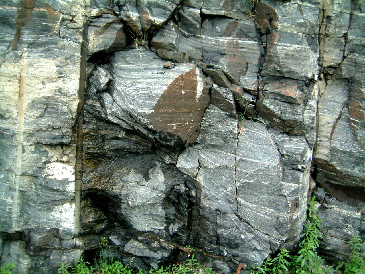
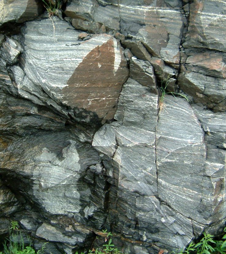
Ball and pillow structures preserved
in hornfelsed Mississagi Quartzites, east of the Garson road - 436sedflame2m.jpg
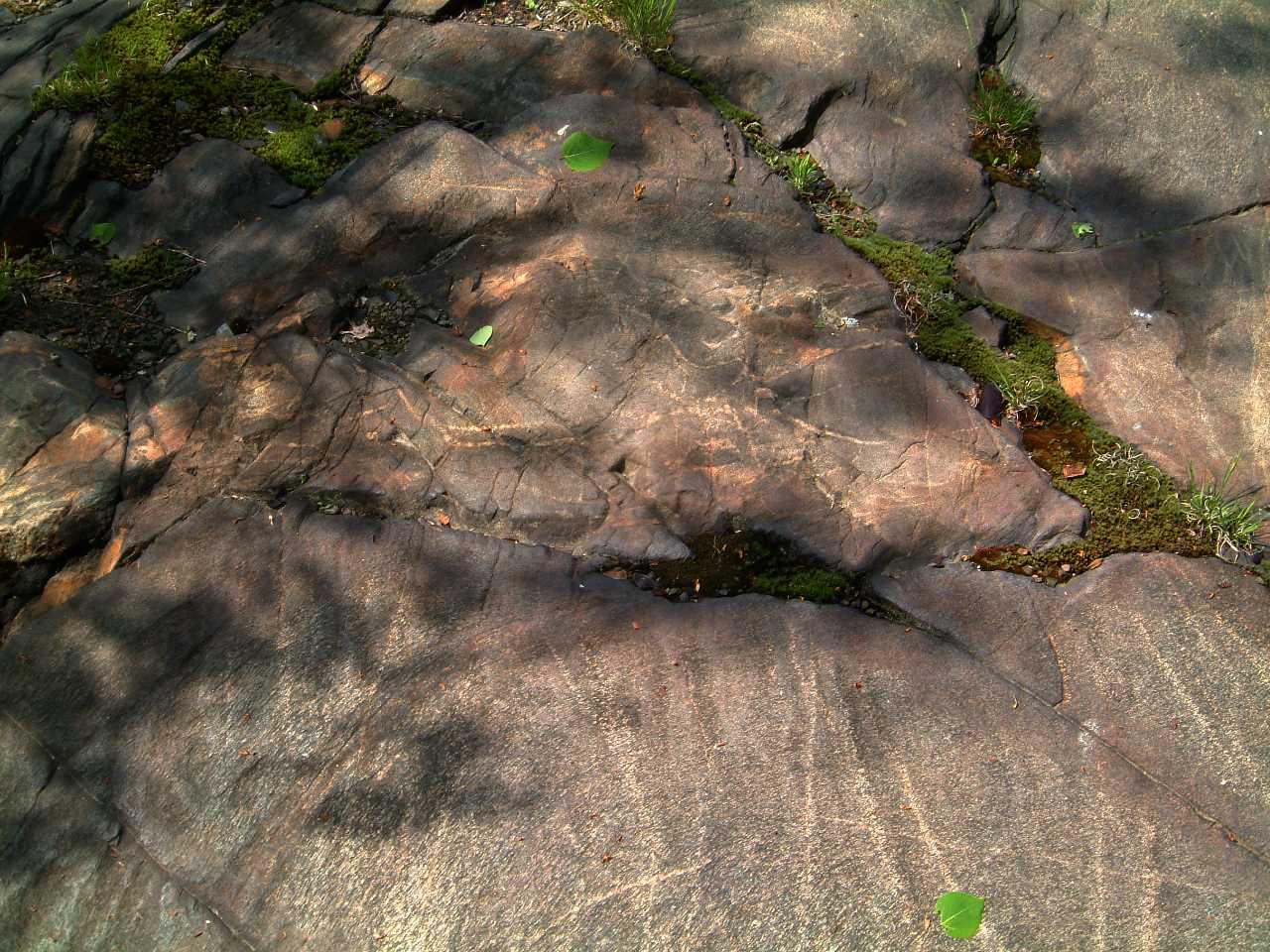
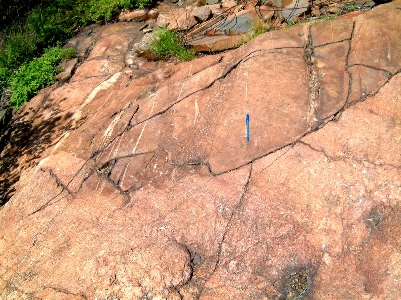
Typical cross-bedded Mississago
Quartzite preserved in nose of east plunging syncline, road cut east of the Garson Road at the power line - 447xbedseastsideofroadatpowerlinem.jpg
Sedimentary folds
Intraformational
syn-sedimentary isoclinal folds developed in Mississagi Quartzite, west
of the Coniston - Garson Road, east of Sudbury - 246sedfoldgarson.jpg247
, sedfoldgarson.jpg
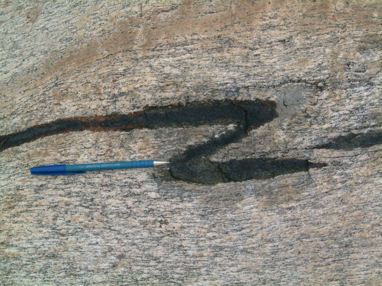
Chaotic
folding in Mississagi Quartzite, Garson road - 445synsedfoldingnwofbridge2m.jpg
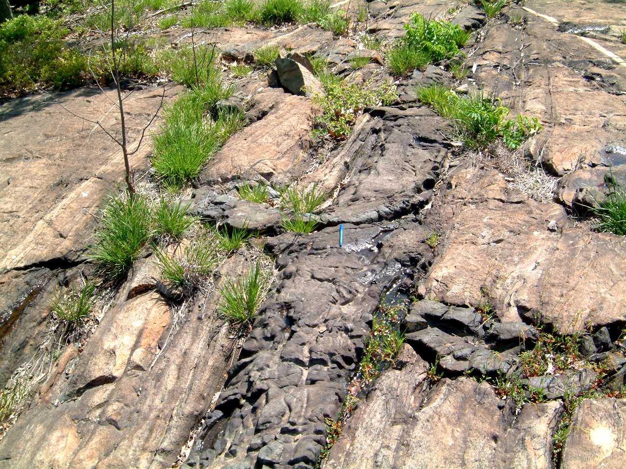
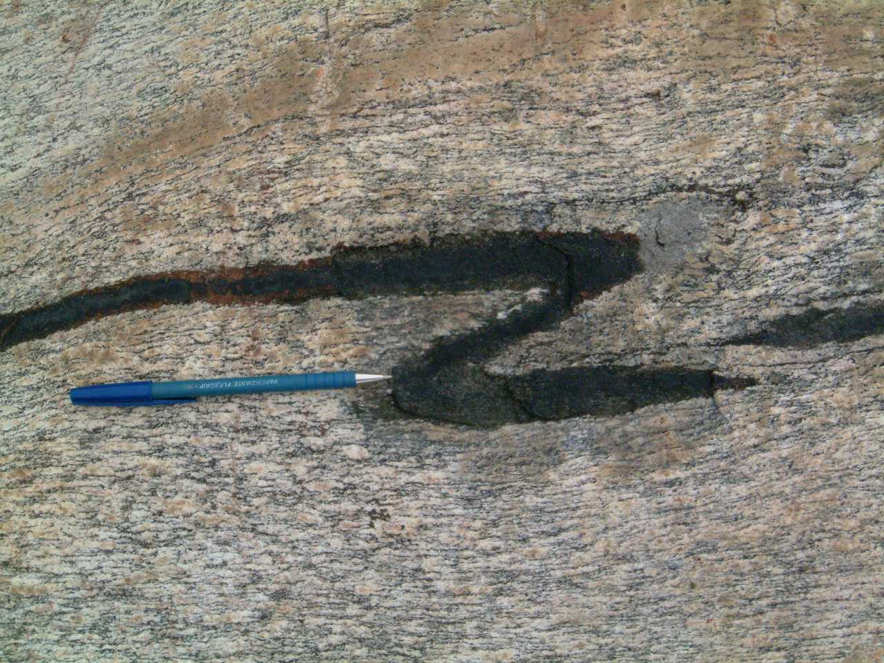
Syn-sedimentary deformation,
Mississagi Fm, east of Garson road - 435synsedfaultm.jpg
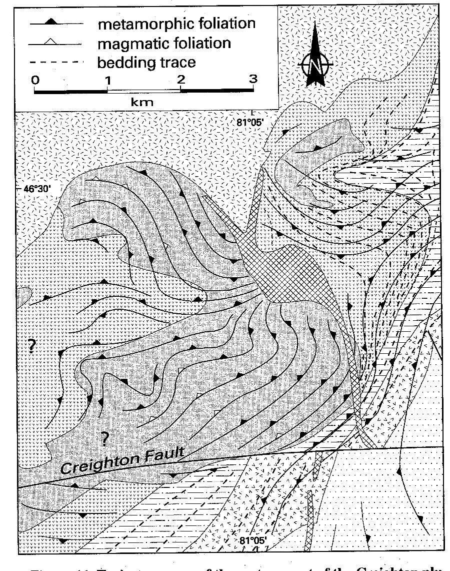
Ceighton
- Murray granite region
Maps
dutch1_900.jpg
dutch2_900.jpg
dutch3_900.jpg
dutch4_900.jpg
riller2.jpg
riller4.jpg
riller5b.jpg
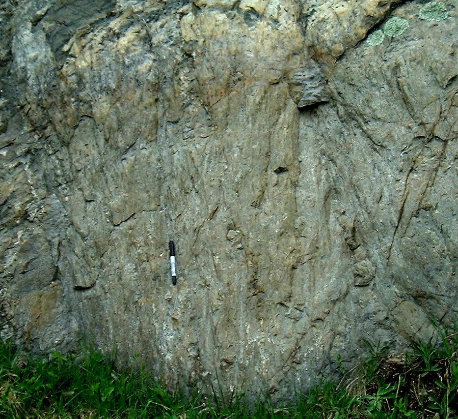
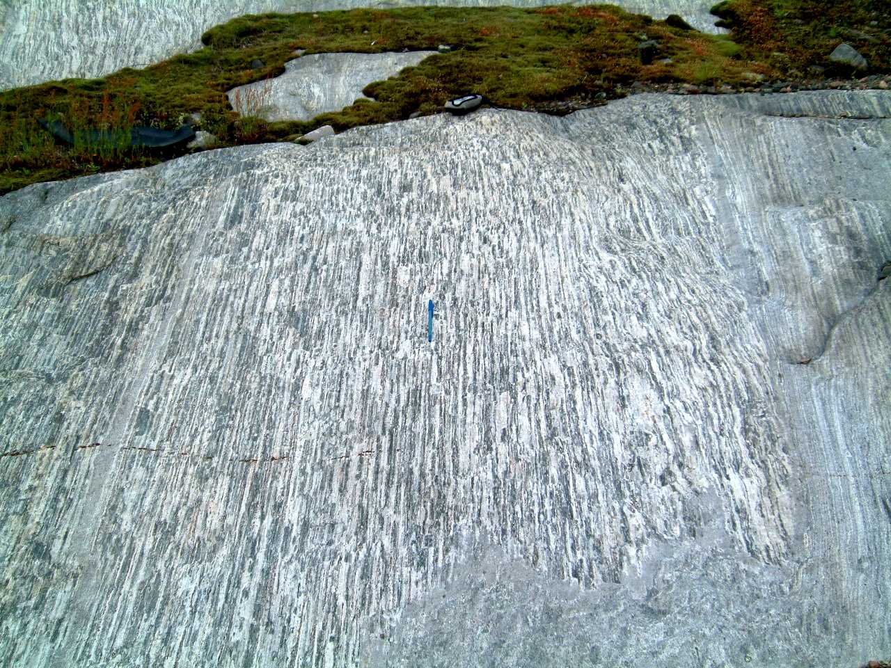
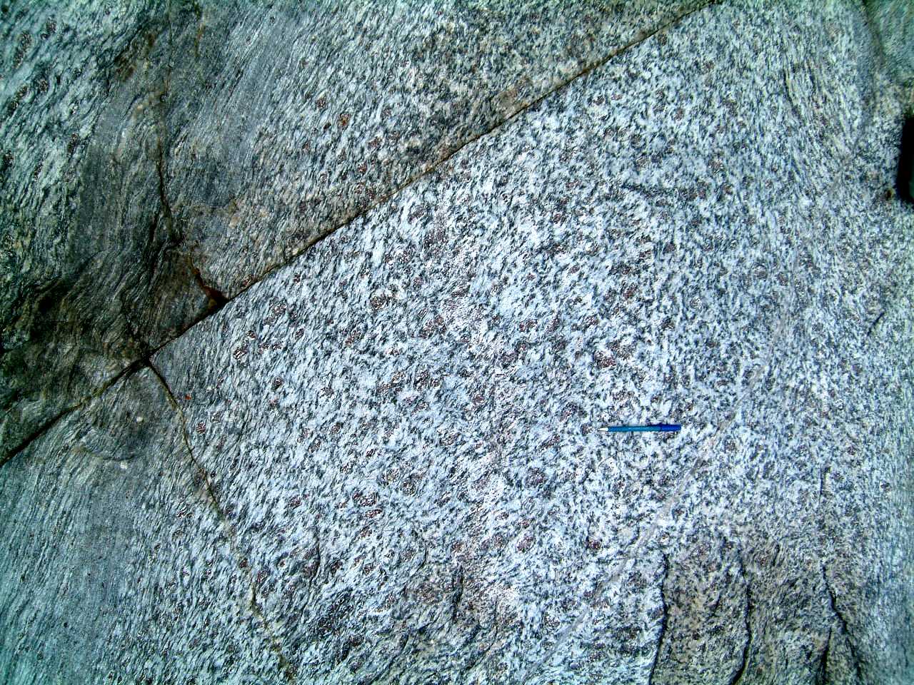
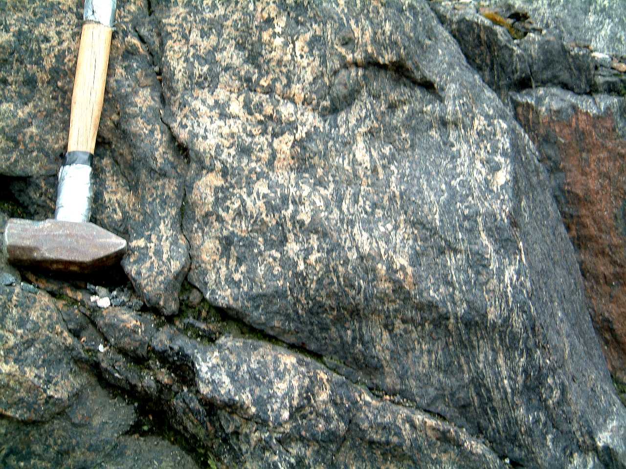
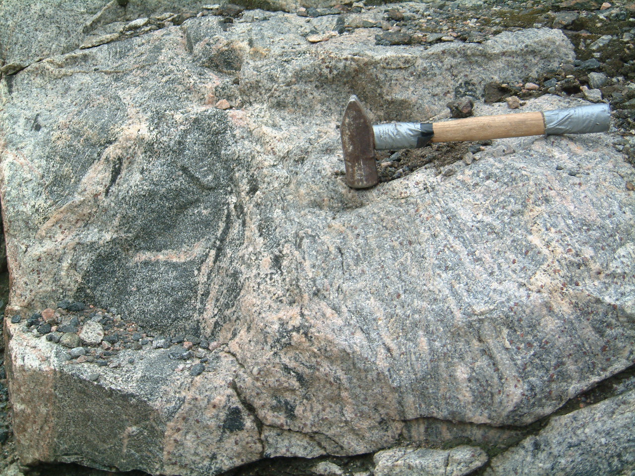
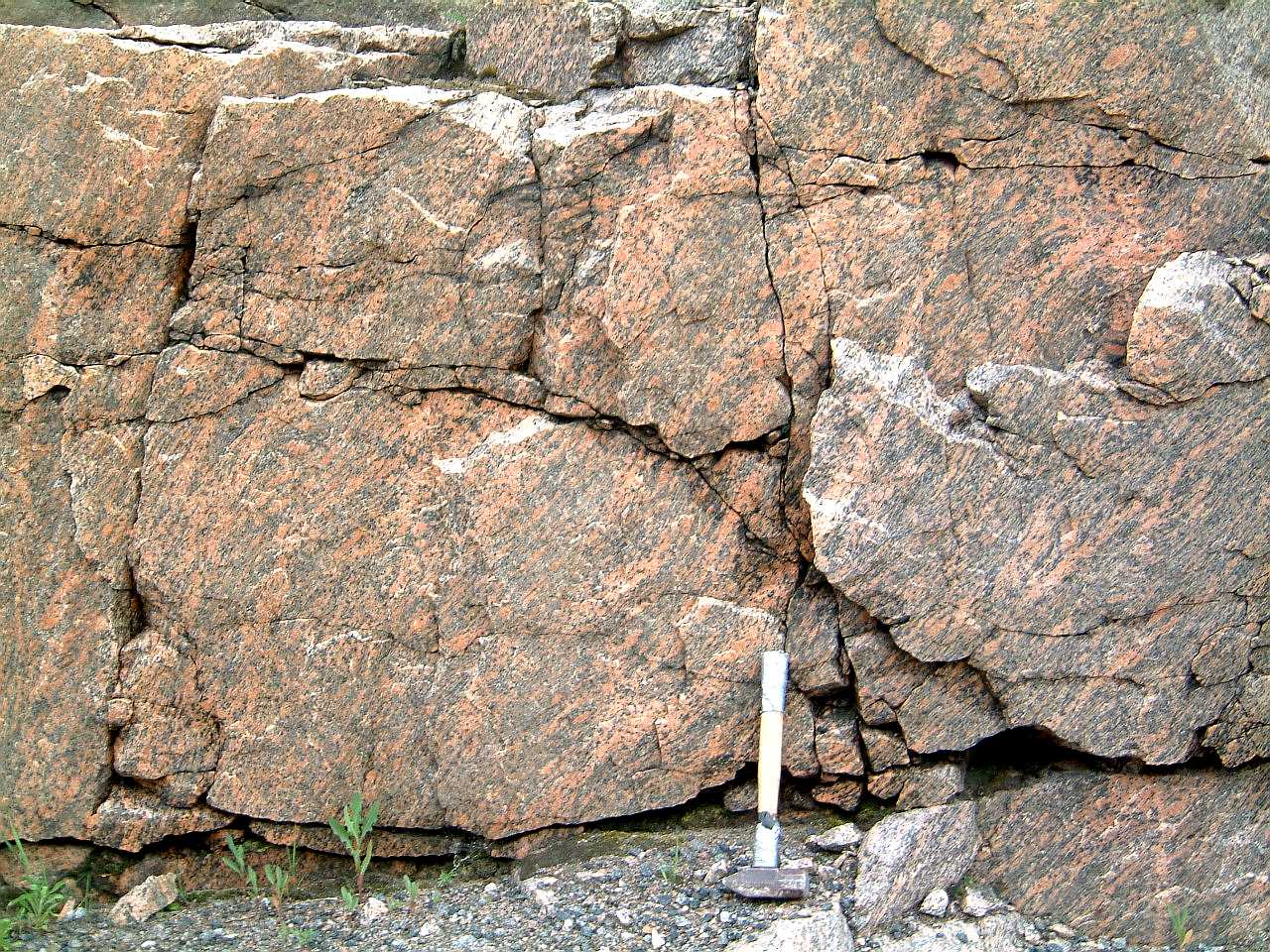
Oriented fabric displayed by K-feldspar
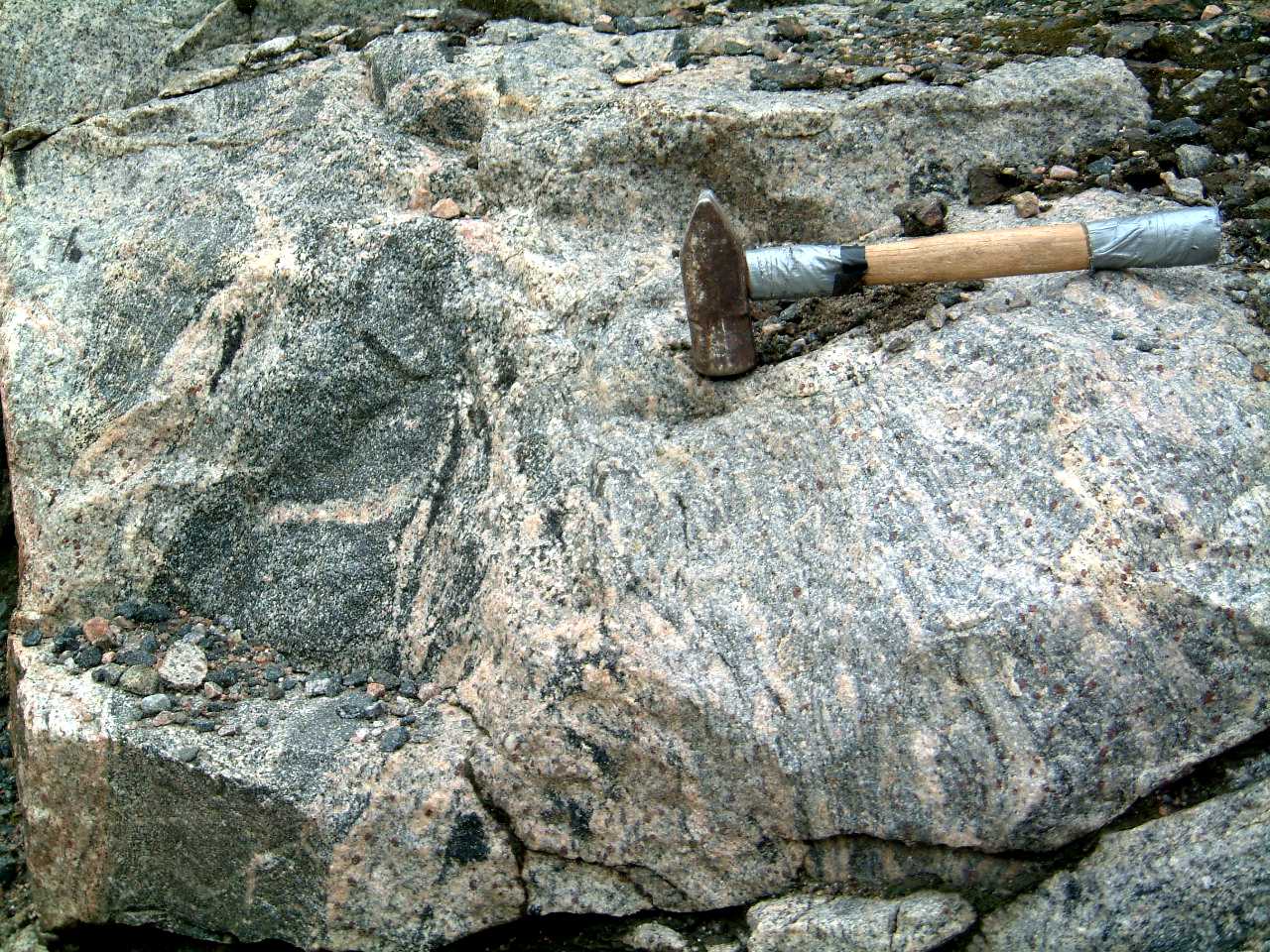
megacrysts in the Creighton granite - 376creightongran1m.jpg
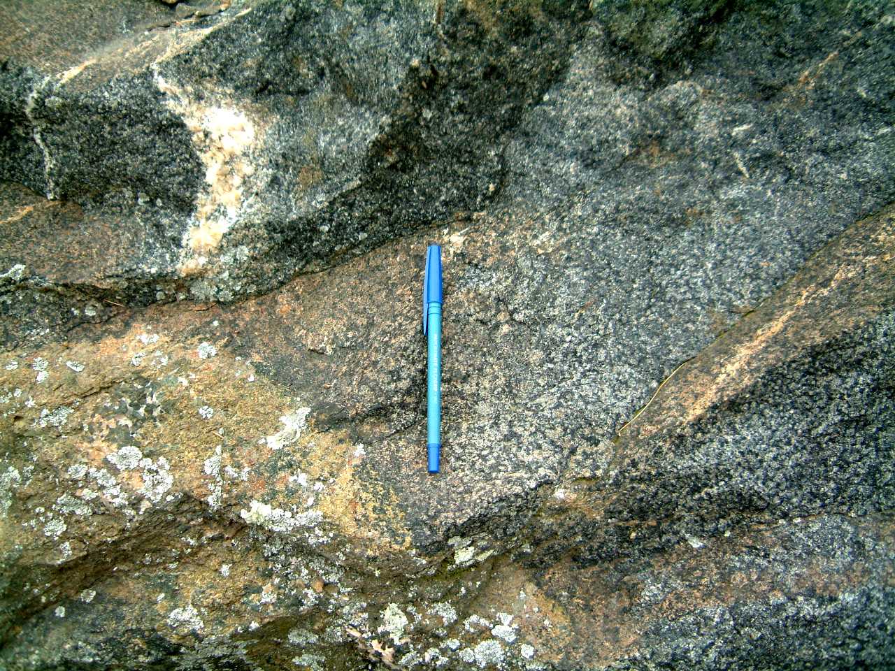
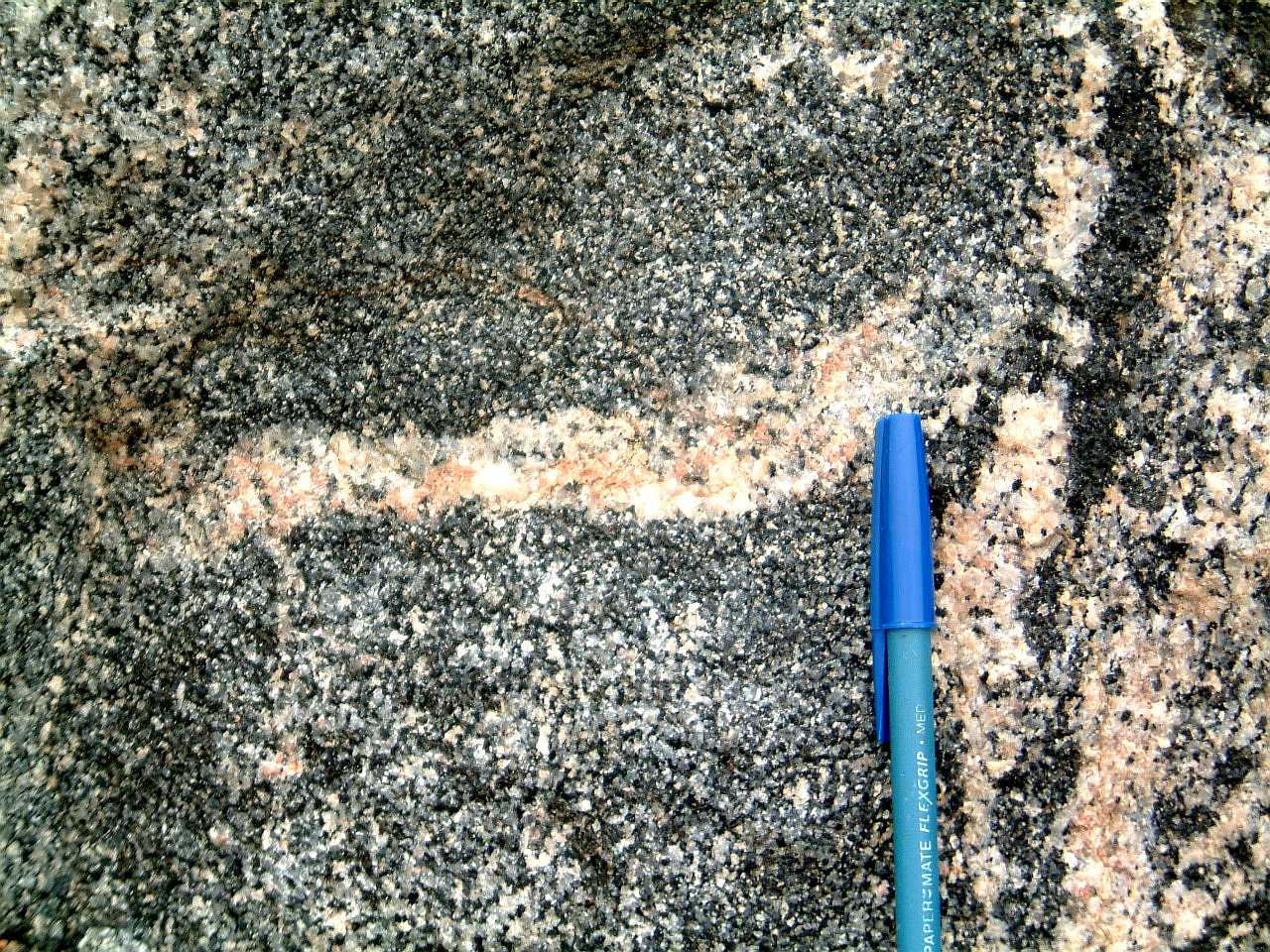
Folded? fine grained aplite in
foliated megacrystic Creighton granite - 378foliateddikeincreighton1m.jpg
Close-up of photograph 378 - 377foliateddikeincreighton2m.jpg
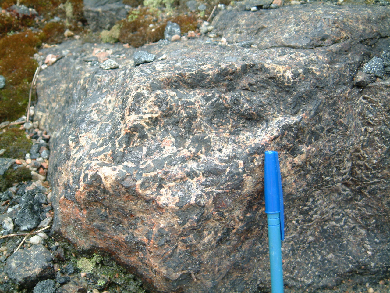
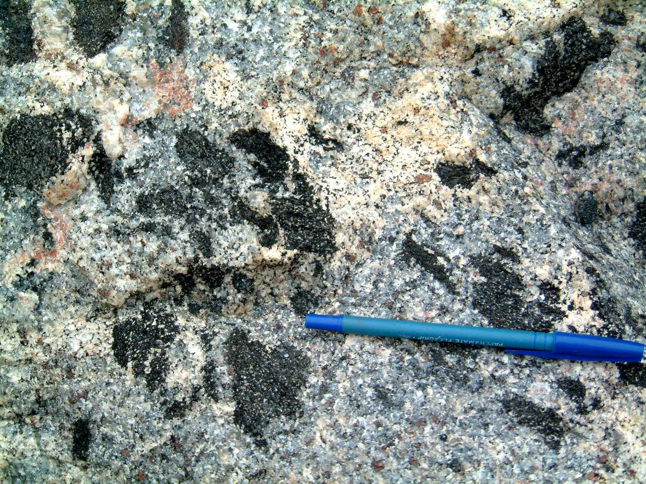
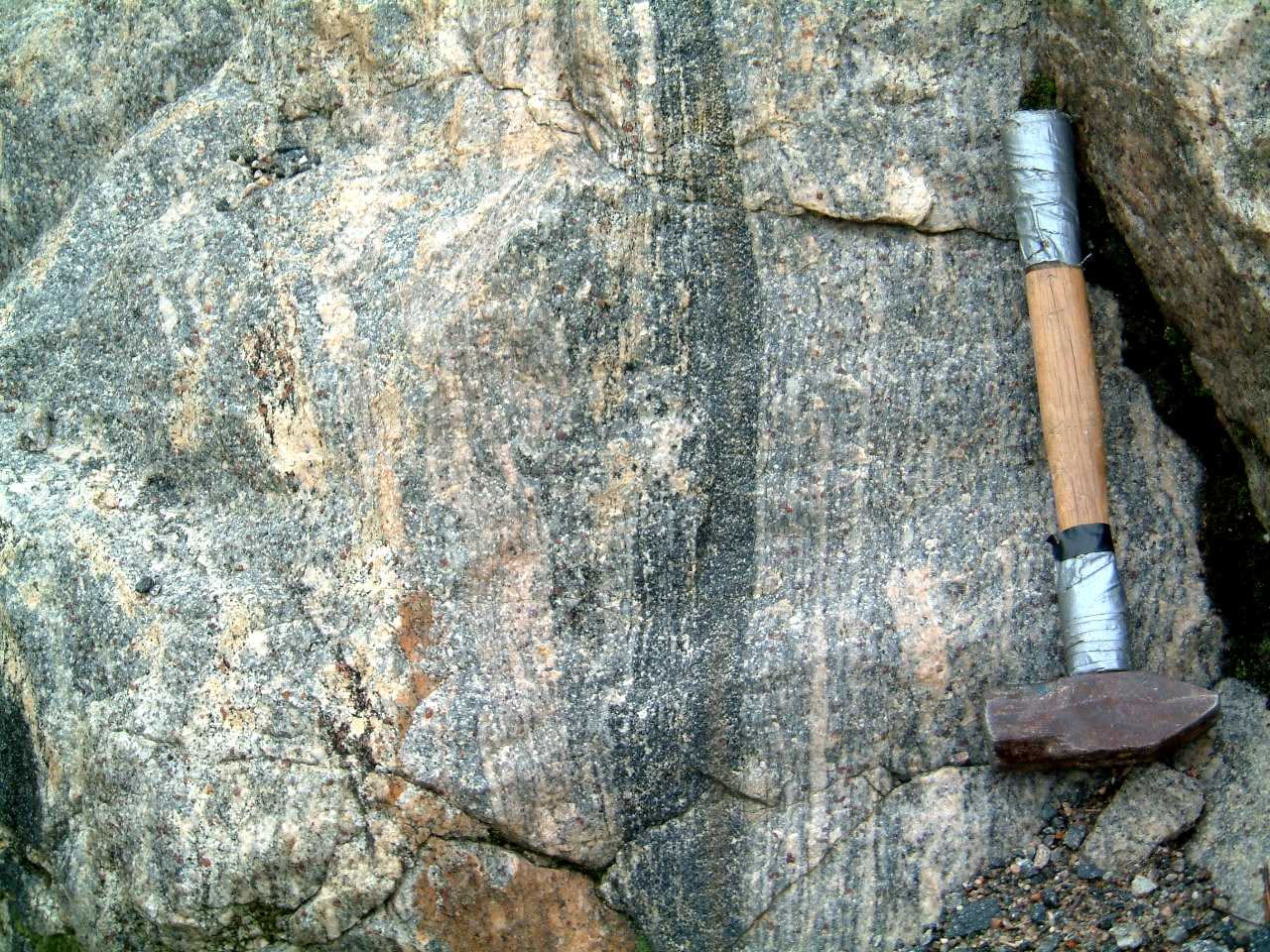
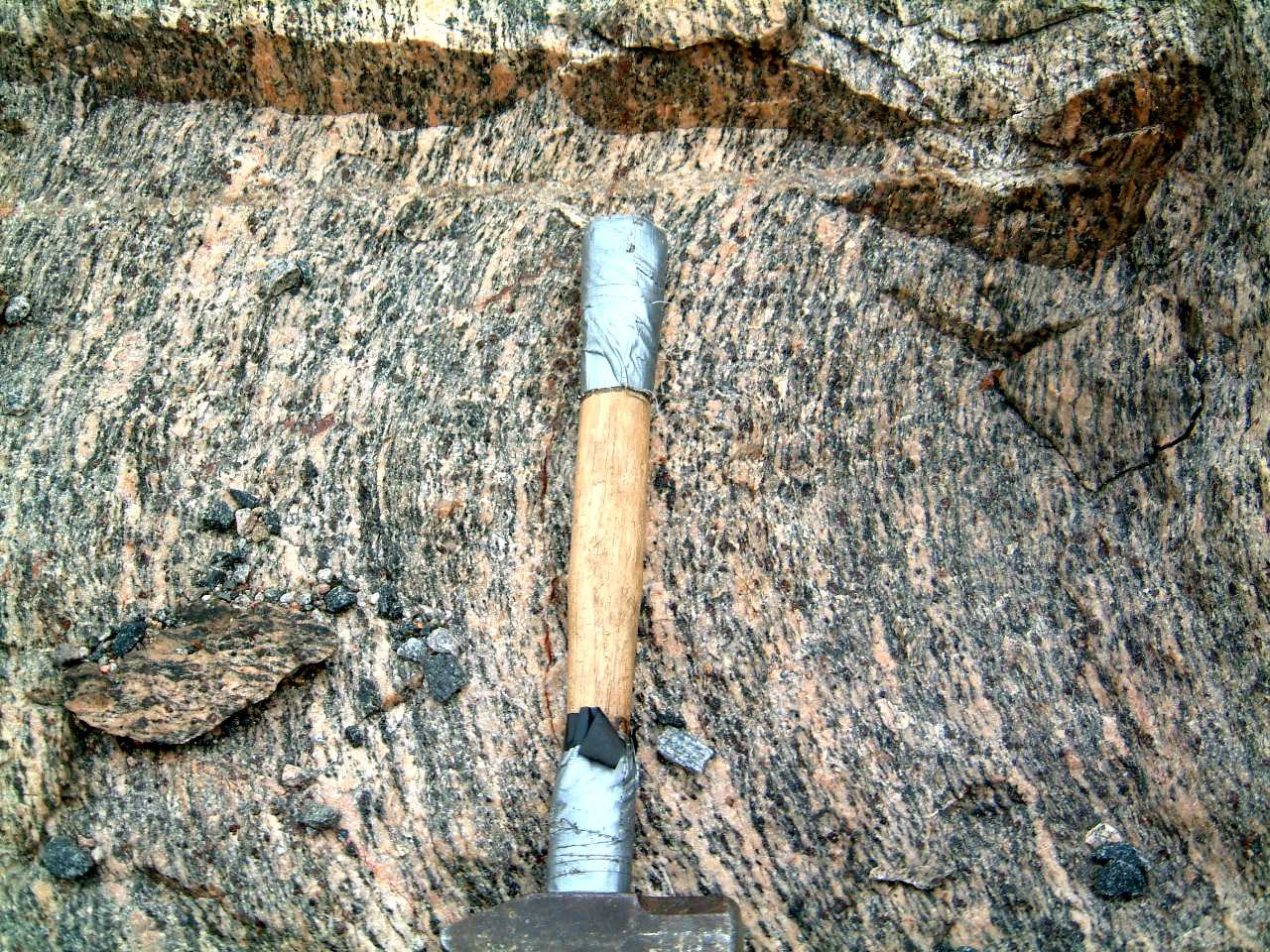
Sudbury breccia in foliated megacrystic
Creighton granite - 379sudbreccincreightonm.jpg
Sudbury breccia in foliated megacrystic
Creighton granite - 218creightonsudbrecc.jpg
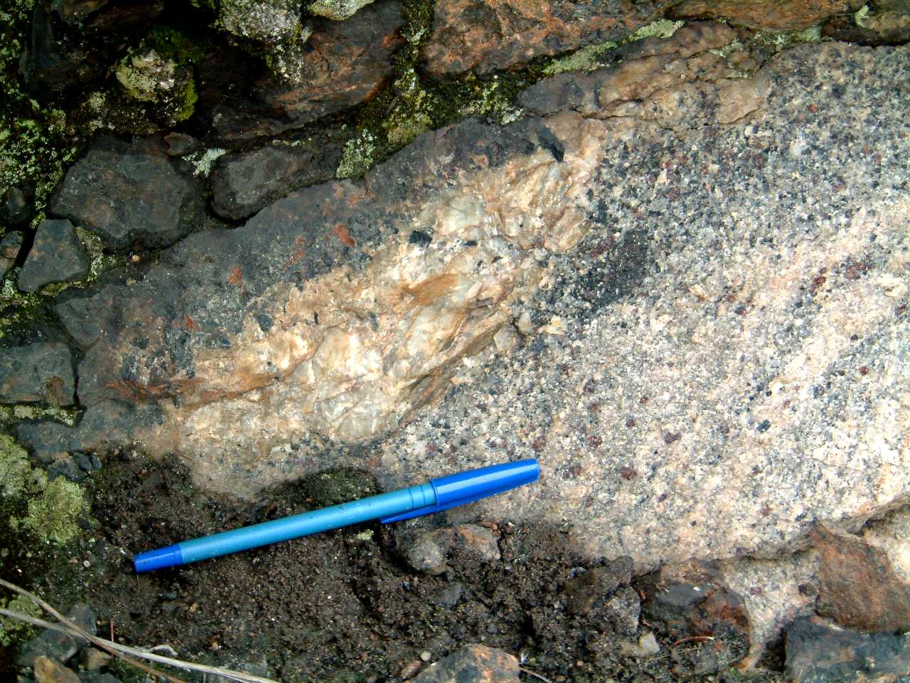
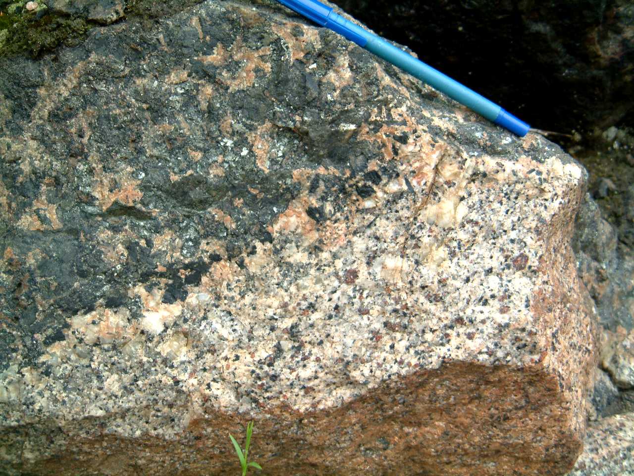
'Trap dike' in Creighton granite,
Copper Cliff - 382trapdikeincreightonm.jpg
Sharp contact of 'Trap dike' with
rocks of the Creighton granite; at the contact the 'Trap dike' is foliated;
Copper Cliff - 380trapdikecontactcreighton1m.jpg
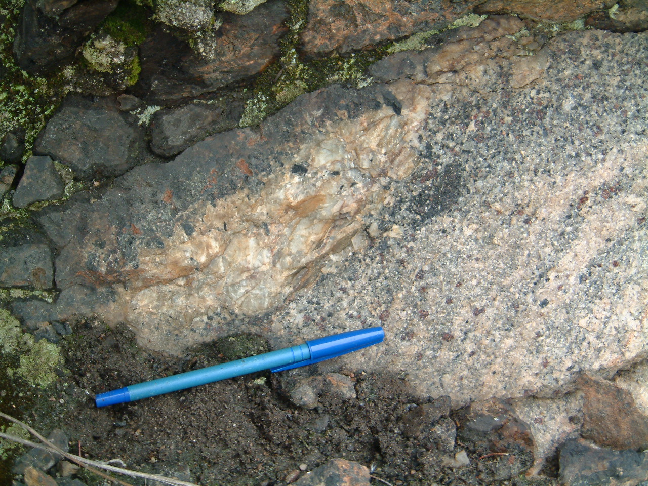
Foliated margin of 'Trap dike'
in contact with the Creighton granite, Copper Cliff - 381trapdikecontactcreighton2m.jpg
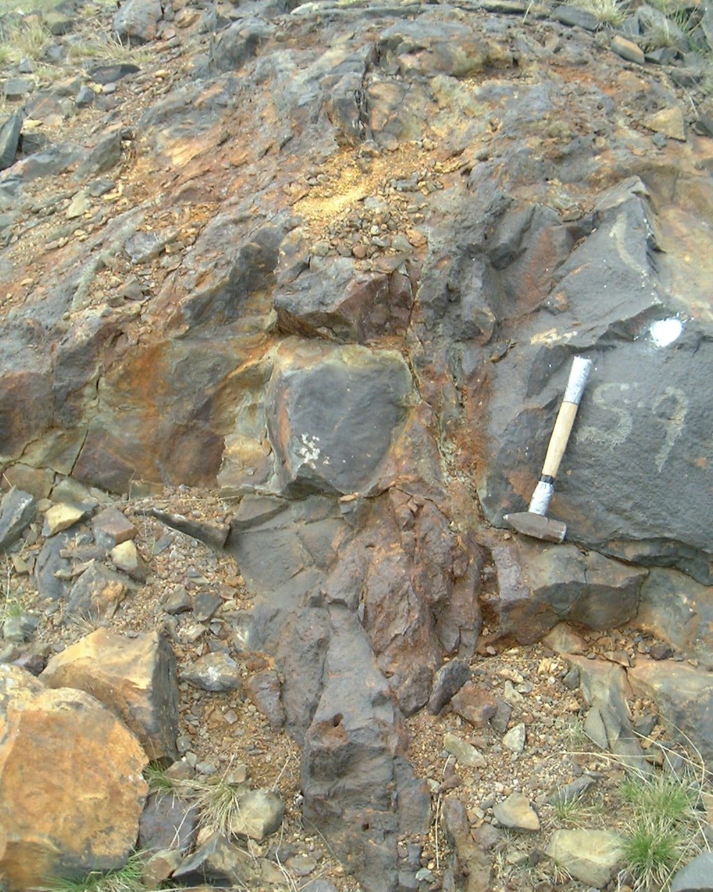
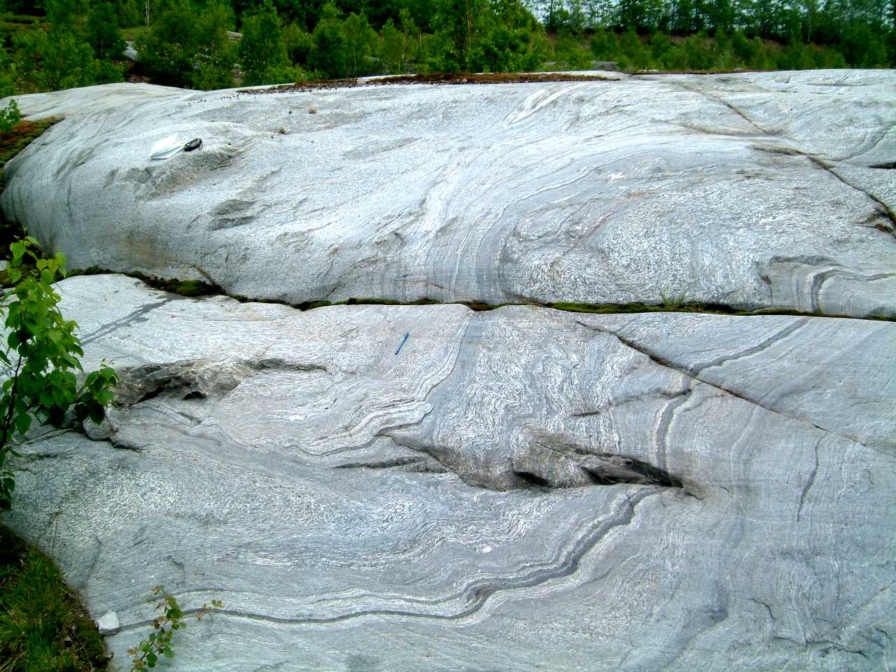
Marginal
agmatitic facies of the Murray granite, southwest end, southwest of the
trail tracks - 418agmatite1.jpg
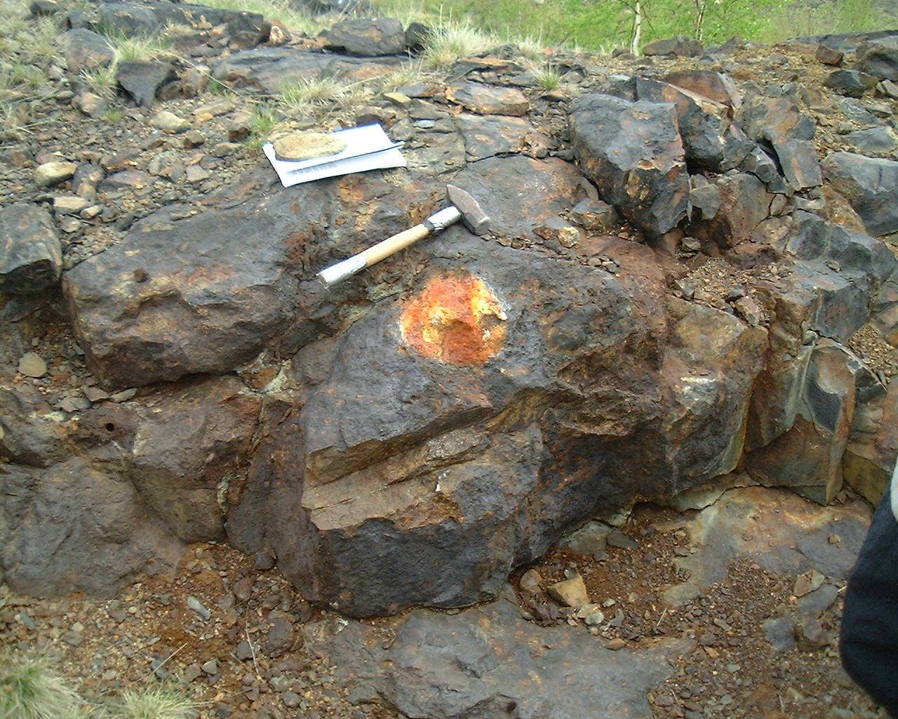
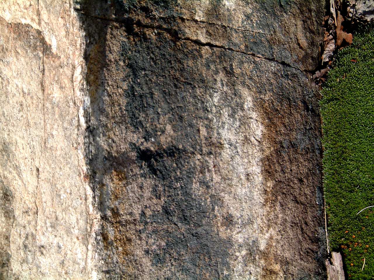
Hornfelsed metasediments (cordierite?)
associated with the agmatite of the southwest margin of the Murray granite
- 419cordierite1.jpg
Hornfelsed metasediments (cordierite?)
associated with the agmatite of the southwest margin of the Murray granite
- 420cordierite2.jpg
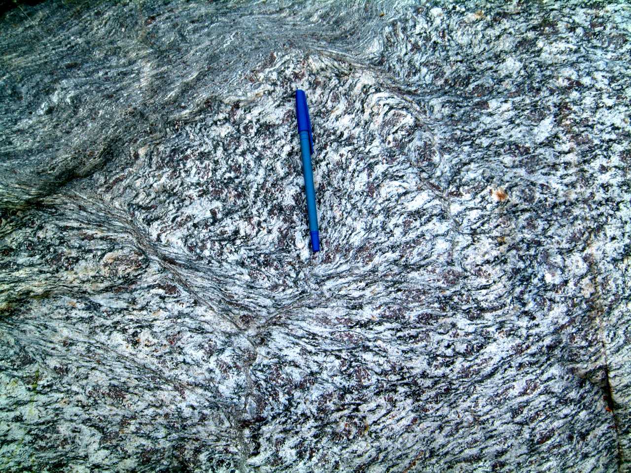
Strongly flattened mafic fragments
in agmatite of the southwest margin of the Murray granite - 421agmatite2.jpg
Close-up of flattened and foliated
mafic fragment in the Murray granite agmatite - 422defagmatite.jpg
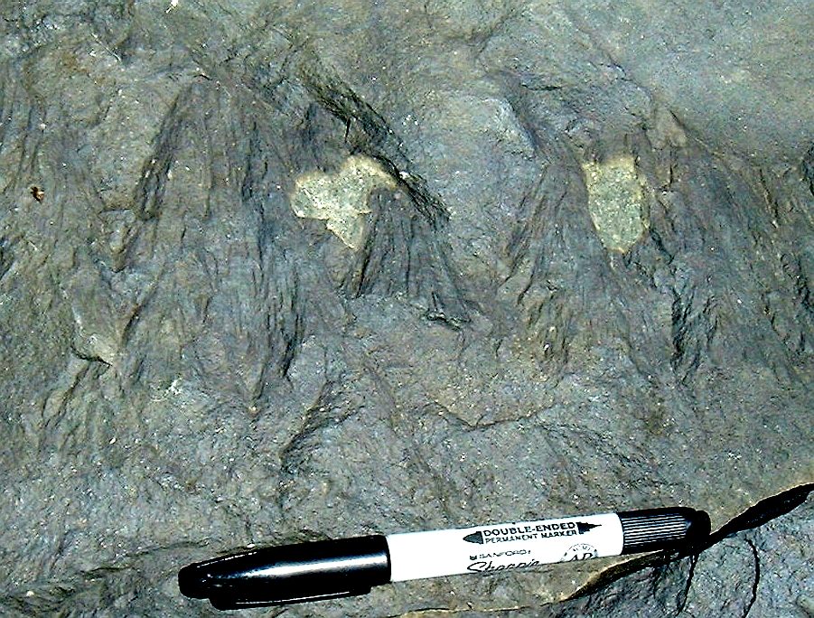
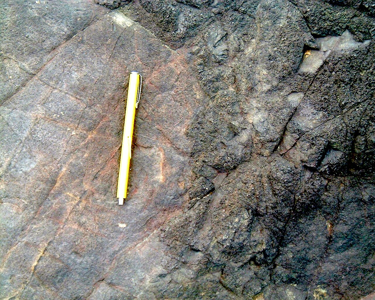
Minor fold in Huronian metasediment
of the Stobie Formation north of the Clara Belle mine - 238clara.jpg
Well preserved cross beds in meta-sandstones
of the Huronian unit north of the Clara Belle mine - 239clara.jpg
Staurolite in metasediments northe
of the Clara Belle mine - 242clara.jpg
Structure involving Huronian metasediments
and basaltic rock north of the Clara Belle mine - 244clara.jpg
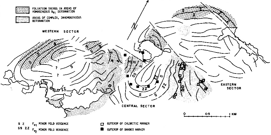
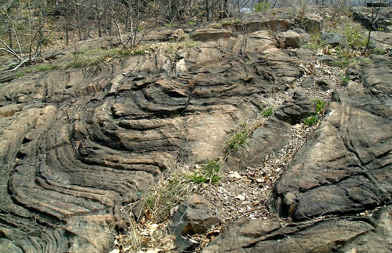
F1 Fold Event
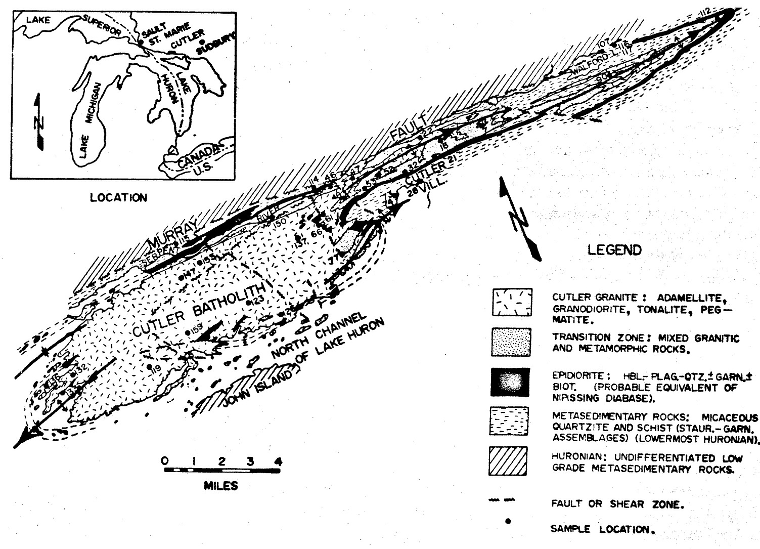
Whitefish Falls
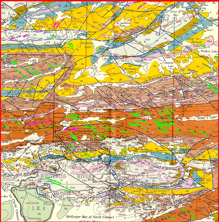
Map showing major folds
in Huronian of the Espanola - Manitoulin Island region (Raven Lake
Syncline, LaCloche syncline, Macgregor Bay Anticline) - dikes1.jpg
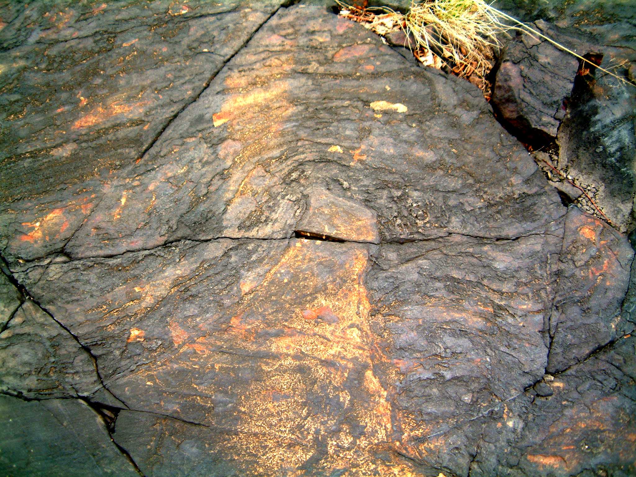
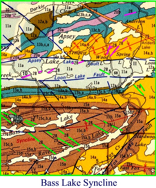
Map of the Raven Lake syncline
showing the fold transected by NW-SE dikes of the North Shore swarm; note
that north of the Loon Lake fault there is a suite of dikes (purple) trending
NE-SW, a trend typical of the 'Trap' diabase dike swarm - basslake.jpg
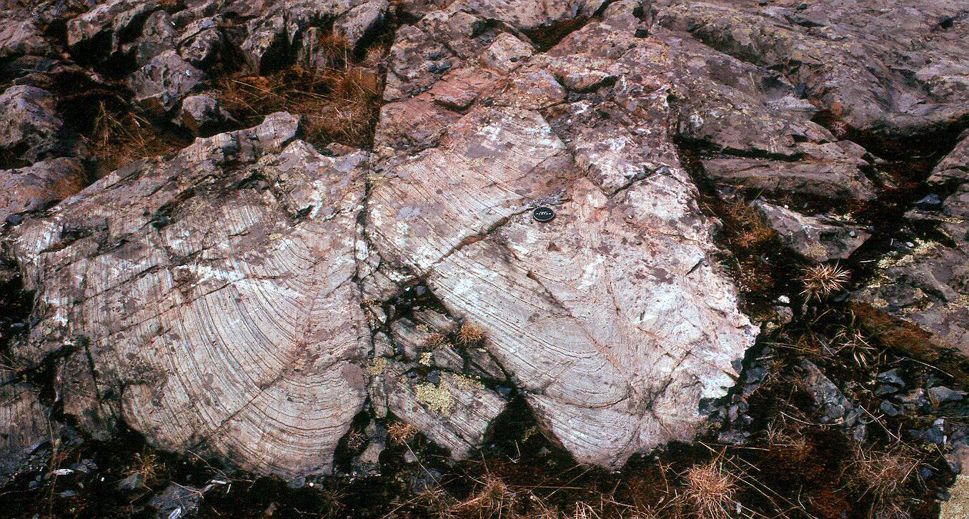
West
plunging S-shaped folds congruent with the major La Cloche syncline, Whitefish
Falls. Black rock to the right is a NW trending diabase dike.
Note the bleached baked margin of folded siltstone
in contact with the diabase - 1489whitefishff1folds.jpg
Coniston-Garson
region
Moderate
sized anticlinal fold in Mississagi Quartzite west of the Coniston-Garson
road - 344anticline2m.jpg
Metre
scale folds in Mississagi Quartzite west of the Coniston-Garson road
- 346parasitic1am.jpg
Small scale folding of Mississagi
Quartzite west of the Coniston-Garson road - 359parasitic1bm.jpg
Relatively tight fold in
the nose of the fold in Mississagi Quartzite west
of the Coniston-Garson road - 358parasite1am.jpg
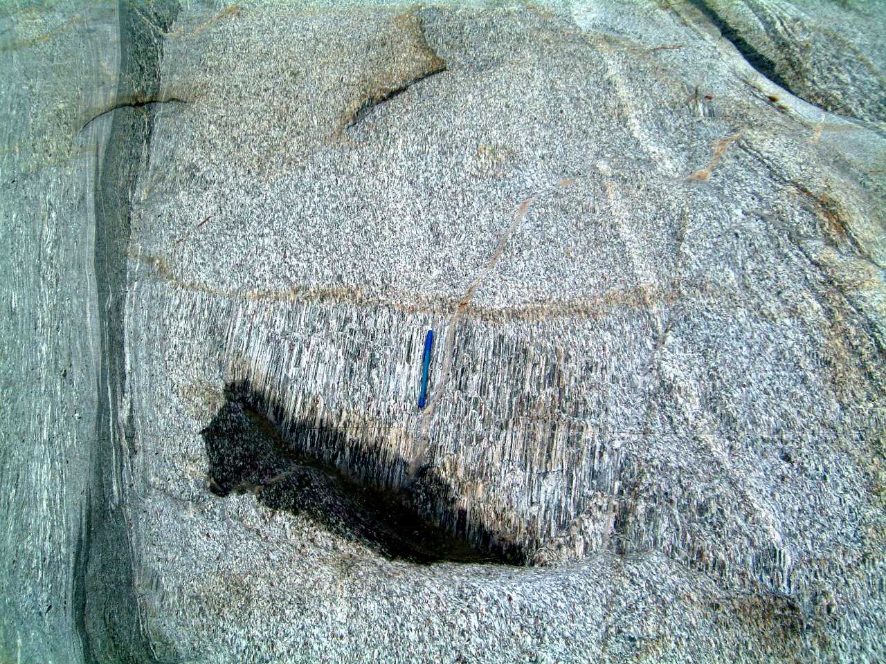
Fold of uncertain age in
hornfelsed Mississagi Quartzite west of the Coniston-Garson road - 353foldsm.jpg
Z-shaped fold in hornfelsed
Mississagi Quartzite, western margin of Nipissing gabbro, Coniston-Garson
road just south of the 'road metal' quarry - 442zfold2garsonroadm.jpg
Meso-scale Z-shaped fold
in hornfelsed Mississagi Quartzite, western margin of Nipissing gabbro,
Coniston-Garson road just south of the 'road metal' quarry - 434hornsfold1m.jpg
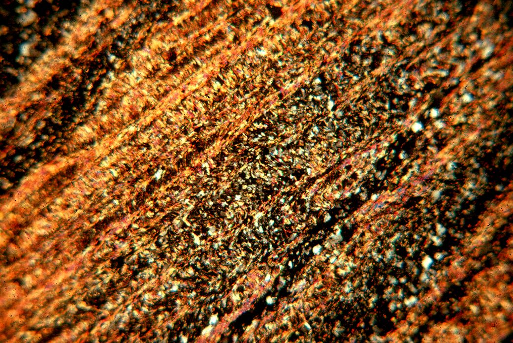
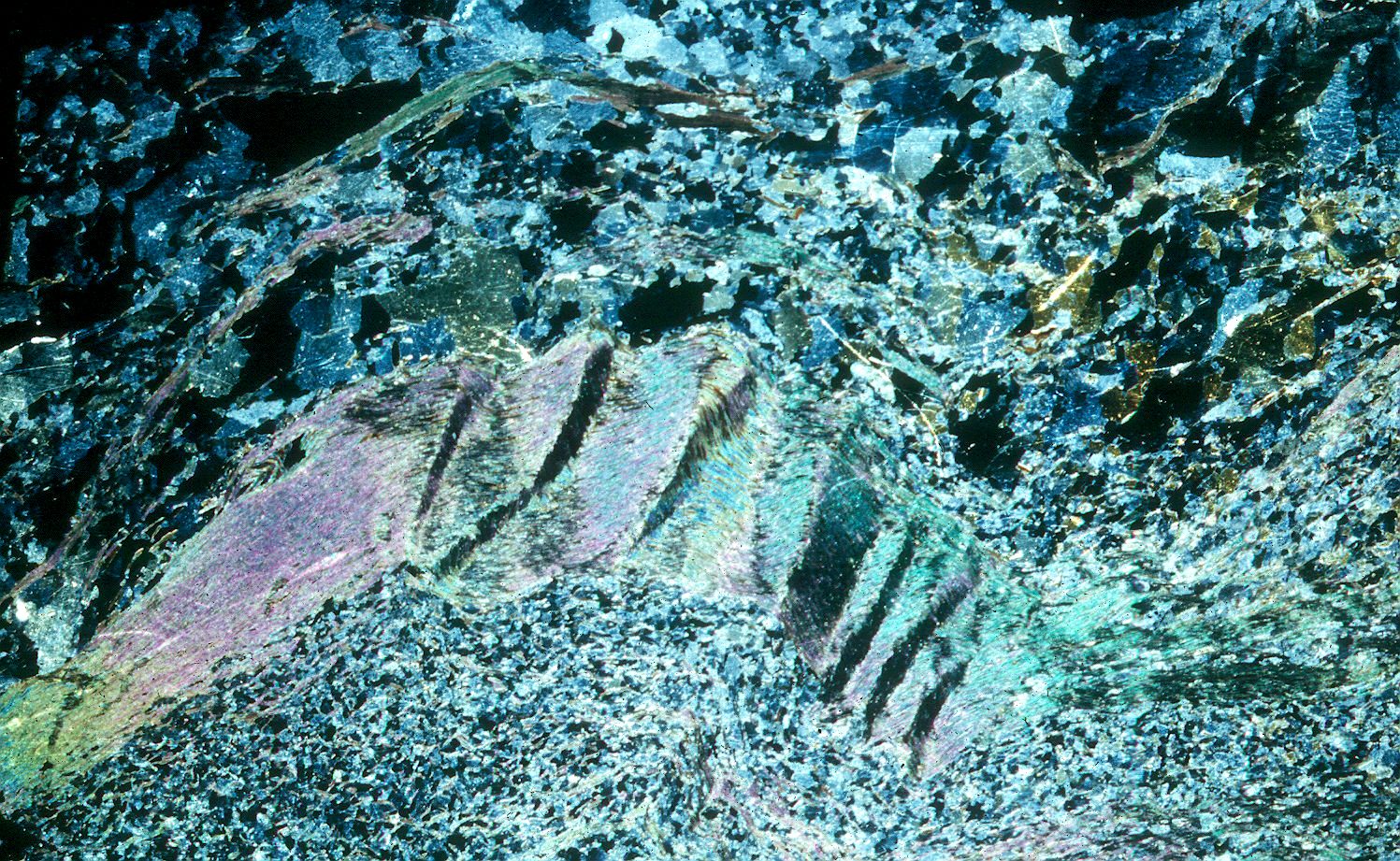
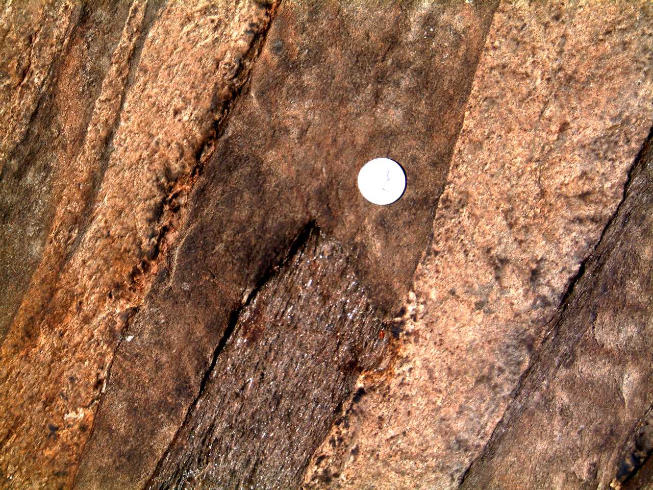
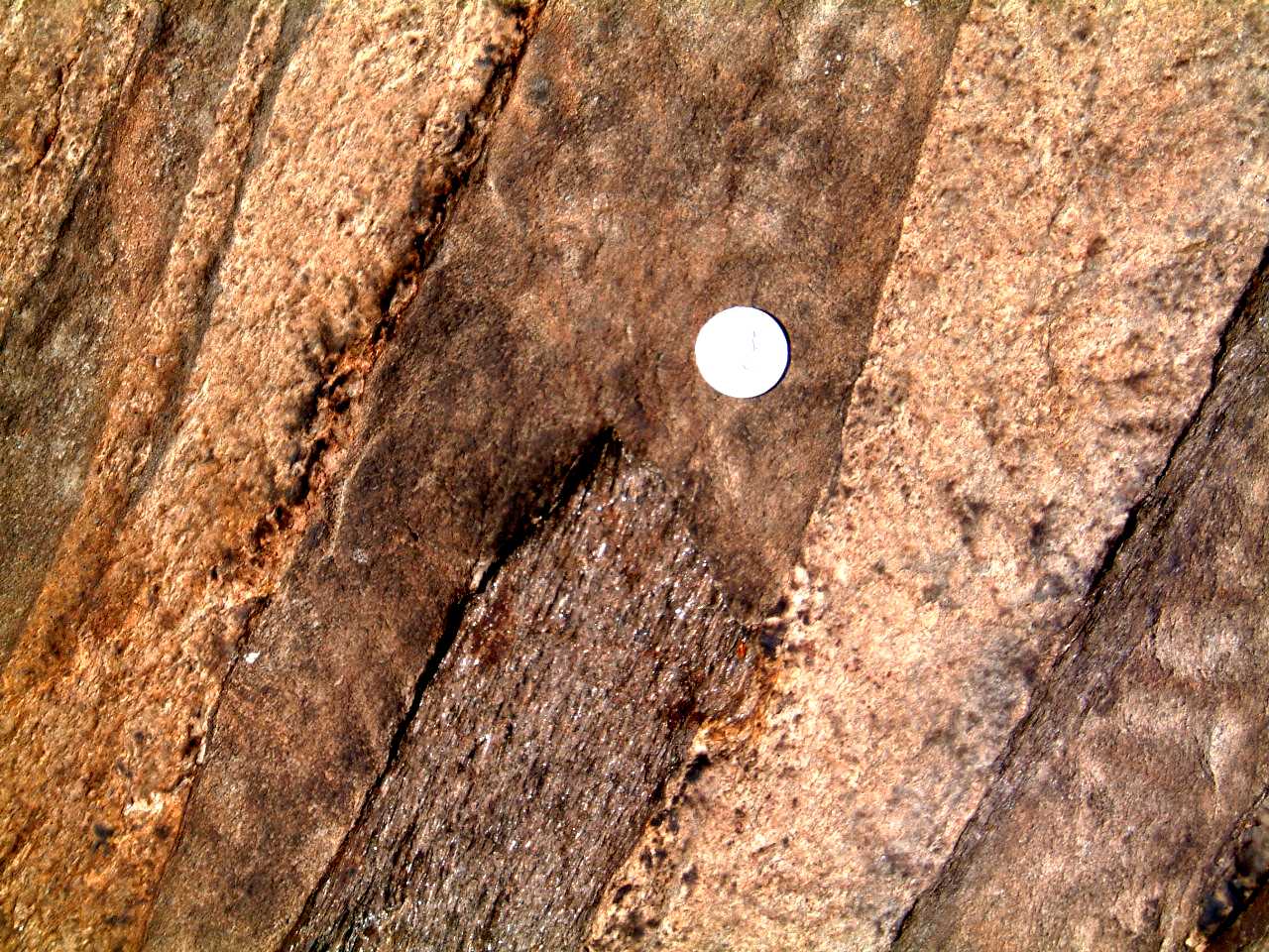
Thin
section showing F2 strain-slip cleavage (dipping to the left) superimposed
on an early cleavage (dipping to the right) related to the F1 folding -
1492f2whitefcleav1.jpg
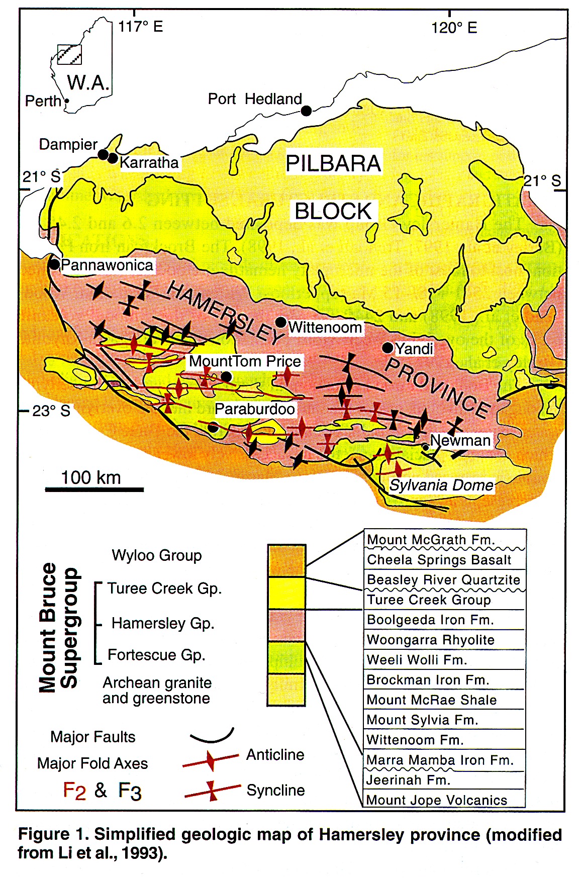
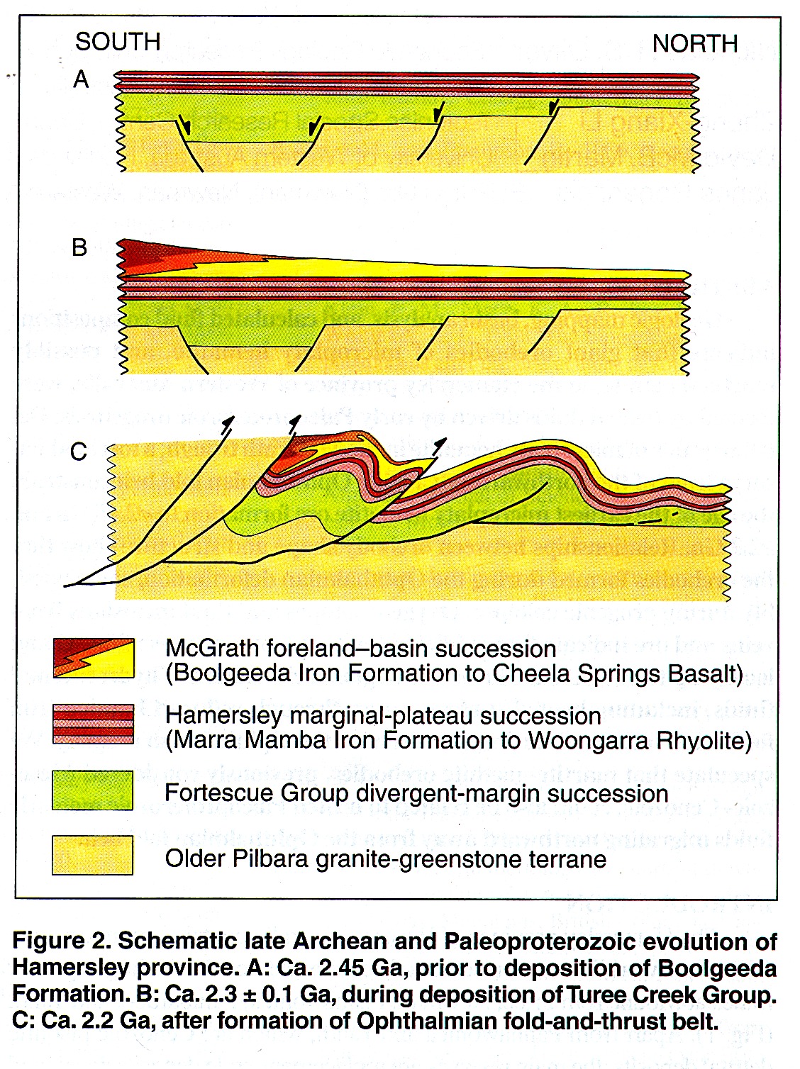
Hamersley Group
of Australia
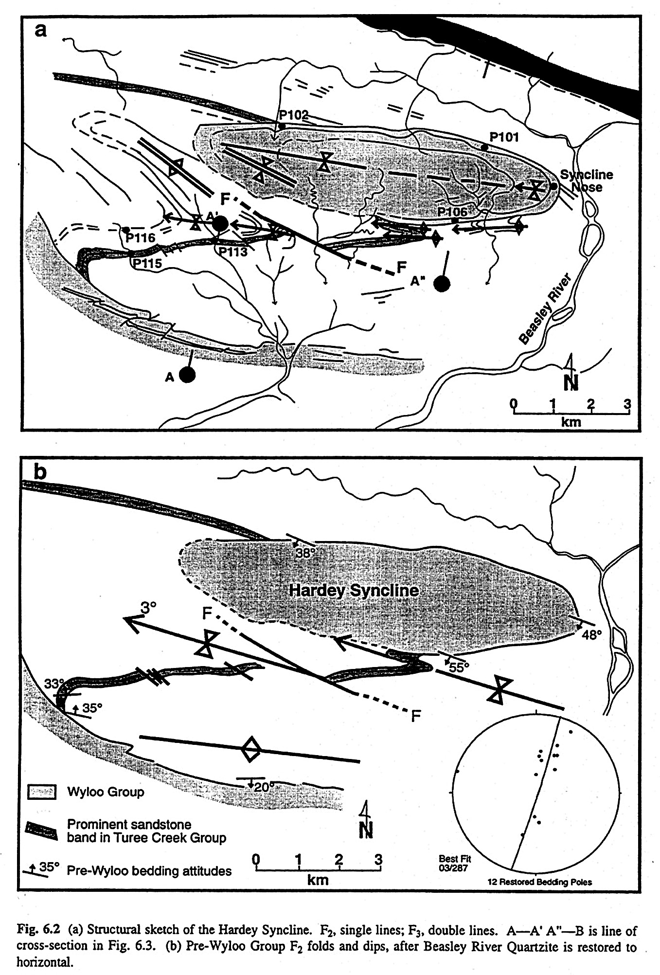
hamersleymap.jpg
hamersleysection.jpg
hamersleyhardeymap.jpg
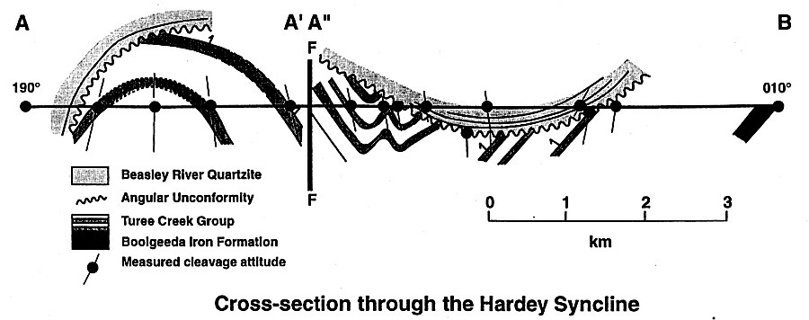
hamersleyhardeysect.jpg
Martin, D. McB., 1999.
Depositional setting and implications of Paleoproterozoic glaciomarine
sedimentation in the Hamersley Province, Western Australia. BGSA, 111, 2,
189-203.
Powell, C. McA., et al., 1999. Synorogenic hydrothermal origin for giant
Hamerslay iron oxide ore bodies. Geology, 27, 2, 175-178.
Powell, C. McA. and Horwitz, R.C., 1994. Late Archean and Early
Protoerozoic tectonics and basin formation of the Hamersley Ranges. Geol. Soc.
Australia (WA Division) Excursion Guidebook No. 4, 53 p.
Parker, A.K. et al. Mafic dyke swards of Austalia, in Mafic dyke swarms,
eds., Halls, H.C. and Fahrig, W.F., Geol. Assoc. Canada Spec. paper 34, p.
401-417.
F2 Fold Event
Tight
upright E-W trending F2 fold in Huronian rocks near the shore, just
east of Cutler village. The fold on the north limb of this fold (left in
the photograph) is a younger F3 structure. 1495f2f3folds1.jpg
Thin section showing F2 strain-slip cleavage (dipping to the left) superimposed on an early cleavage (dipping to the right) related to the F1 folding - 492f2whitefcleav1.jpg
F3 Fold Event
Open F3 fold
folding quartzites of the Espanola Formation and a fine grained S2 cleavage
present in the more argillitic beds (also in the matrix of nearby Sudbury
breccia), Anderson Lake south of Espanola - 1504espsstnee.jpg
F3 antiform folding Mississagi Quartzite and Sudbury
Breccia, Laurention campus, Sudbury - 245campusfold.jpg
Sudbury breccia transected,
fragments and matrix, by S2 foliation, folded by minor S3 folds, Whitefish
Falls - 1493breccwF2F3fold.jpg
Sudbury breccia transected,
fragments and matrix, by S2 foliation, folded by minor S3 folds, Massey
- 1494masseybreccf2f3folds.jpg
S2 folation folded
by F3 minor folds, Massey - 398masseycrencleavm.jpg
East-plunging S-shaped F3
fold, folding a prominent F2 cleavage. South side of the Cutler anticline
- 1496cutlerf3fold.jpg
S2 folation folded by F3 minor folds, Cutler - 399crencleavagecutler1m.jpg
S2 folation folded by F3 minor folds, Cutler - 400crencleavagecutler2m.jpg
S3 strain slip cleavage developed on S2 cleavage,
McKim Fm., south side of Highway 17 at Balsam Street, Sudbury - 385crencleavbalsamm.jpg
, 1505balsstf3.jpg
Photomicrograph of F3 microfolds folding coarse
F2 cleavage - 1503microphotof3onf2.jpg
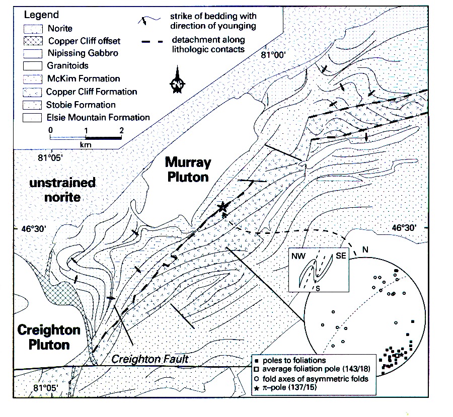
Nipissing Gabbro
Coniston - Garson - Falconbridge region
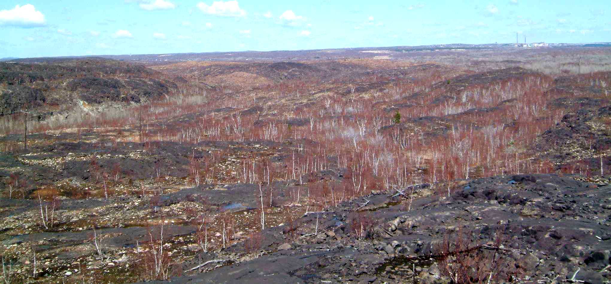
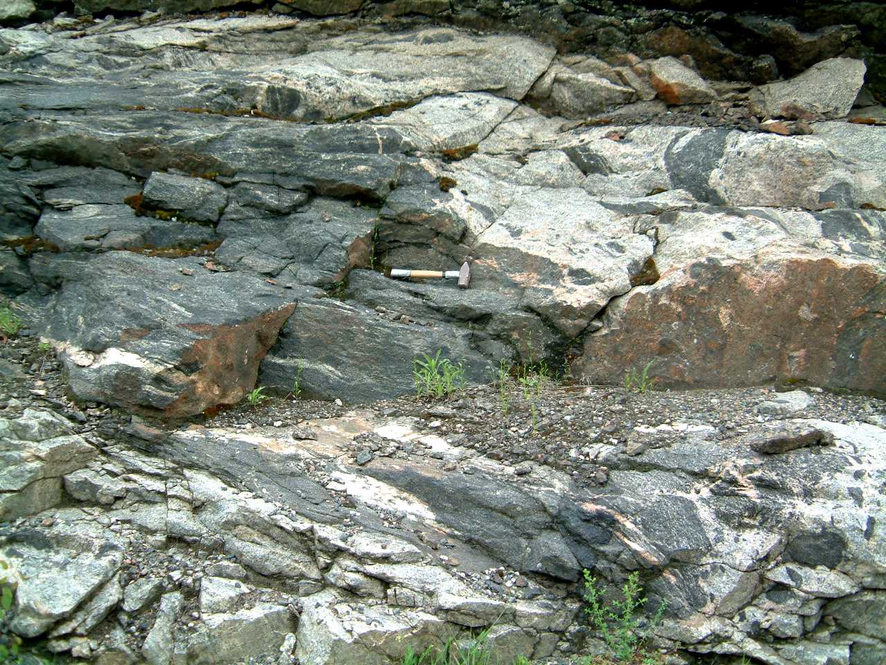
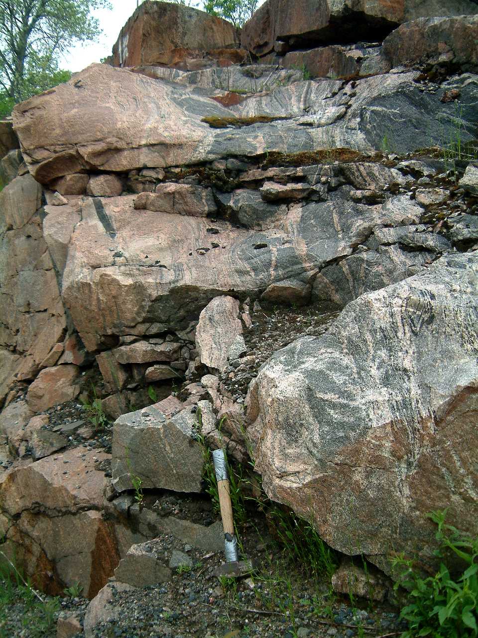
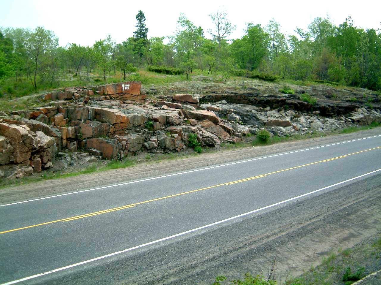
View of the ridges of black Nipissing
Gabbro surrounding folded Mississagi Quartzite; looking SE from location
A towards Highway 17 in the far distance; rail track to Falconbridge
in the centre right of
the photograph - 354viewseast1m.jpg
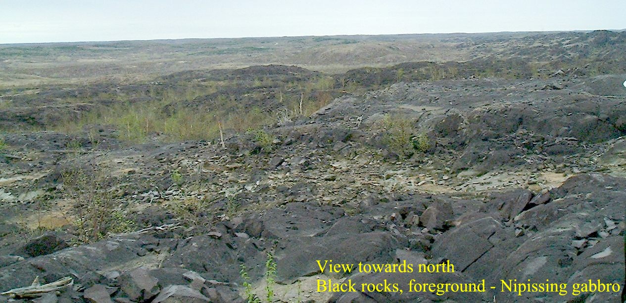
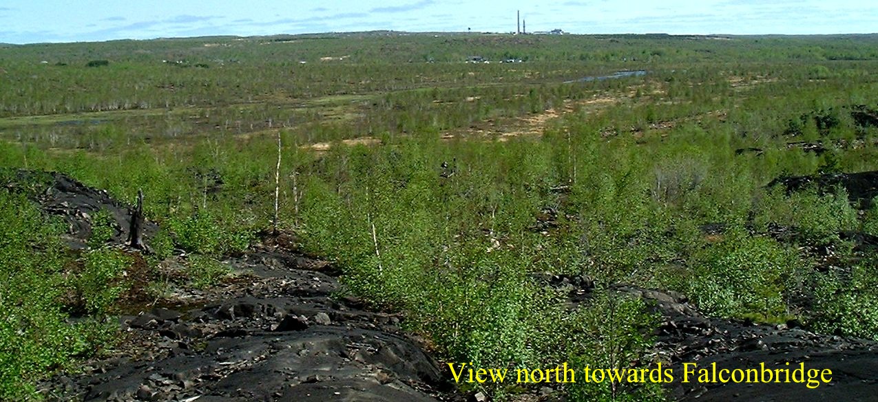
View to the north from location
A - 355viewnorth1m.jpg
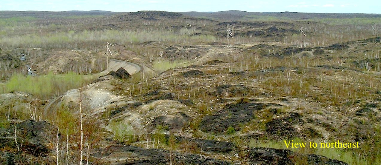
View to the northeast from
location
B; Coniston-Falconbridge rail track, seen centre left in the panorama
- 356viewne1m.jpg
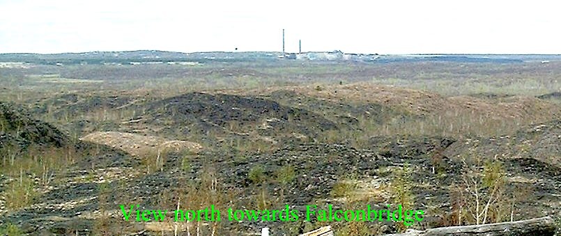
View from
location B north towards the Falconbridge Mine - 357viewfalconbridgem.jpg
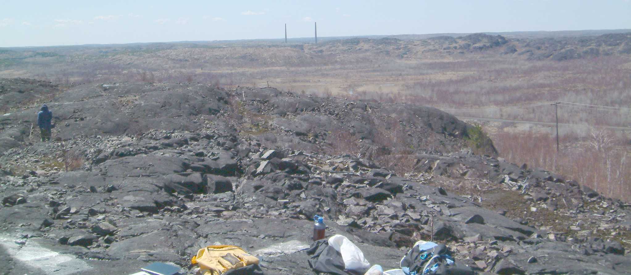
View from location
C (east of the Coniston-Falconbridge rail tracks) to northeast along
the NE-trending Nipissing Gabbro - 219viewtone.jpg
View from location
C north towards Garson-Falconbrige - 221viewfalcon.jpg
View from location
C towards Sudbury 222viewconiston.jpg
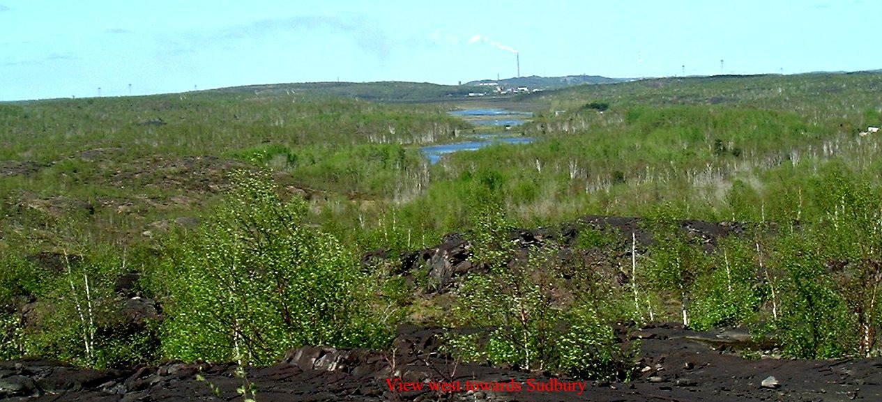
View from location
D west towards Sudbury - 437viewsudburym.jpg
View from location
D looking eastwards - 438vieweastm.jpg
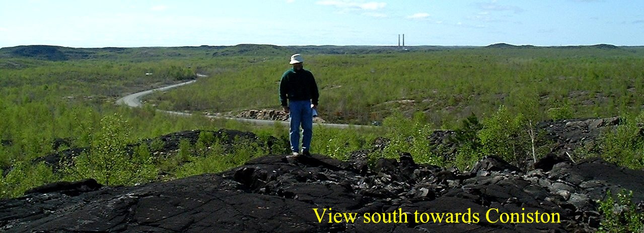
View from location
D south towards Coniston -
439viewconistonm.jpg
View from location
D towards Falconbridge - 440viewfalconbridge2m.jpg
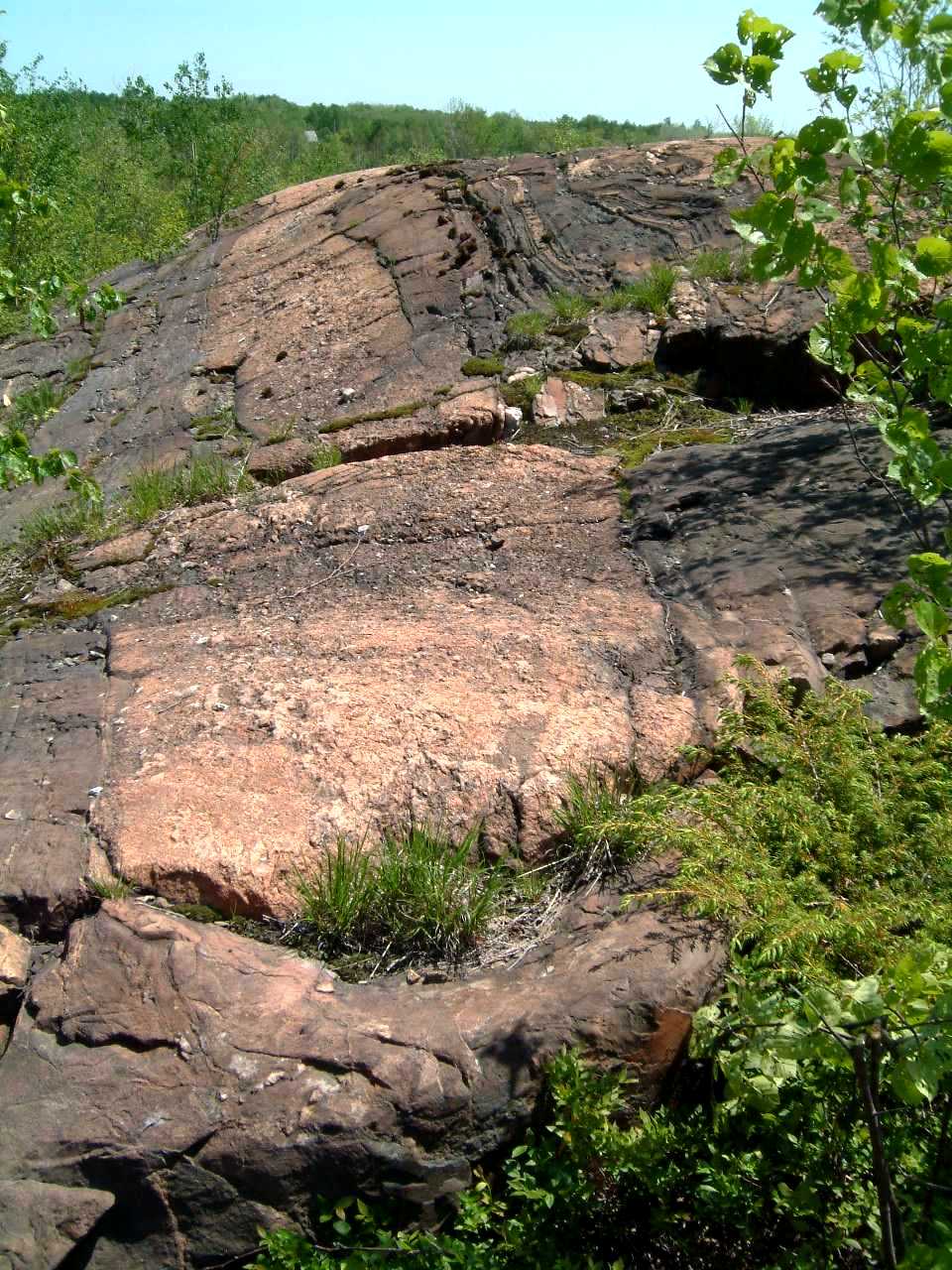
Folded Mississagi Quartzite surrounded
by Nipissing Gabbro - 220viewfold.jpg
Pegmatitic zone in the Nipissing
Gabbro, location D - 431spiralpeg3m.jpg
Pegmatitic zone in the Nipissing
Gabbro, location D - 432spiralpeg1m.jpg
Coarse crystals of clinopyroxene
in pegmatitic zone of the Nipissing Gabbro, location
D - 433spiralpeg2m.jpg
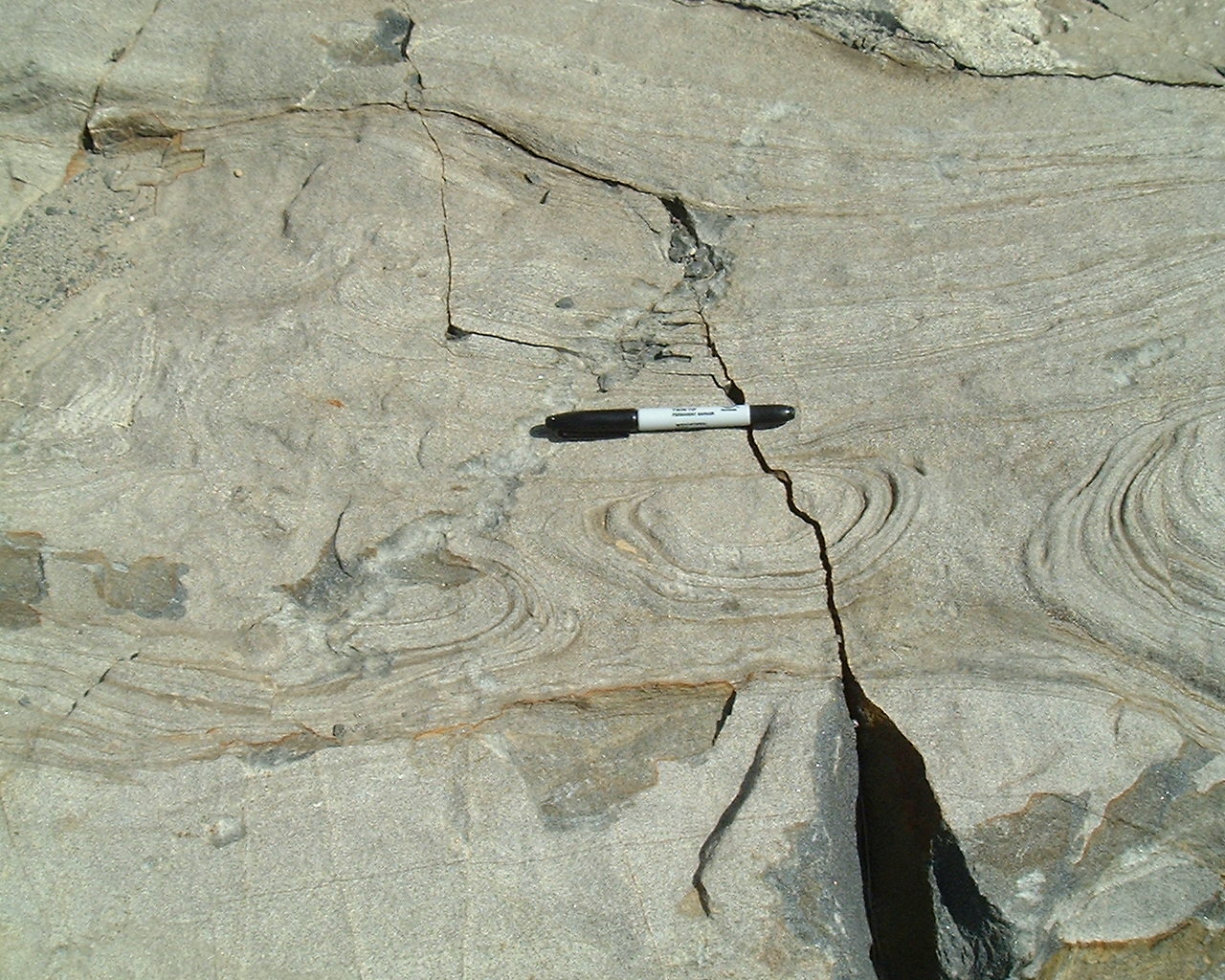
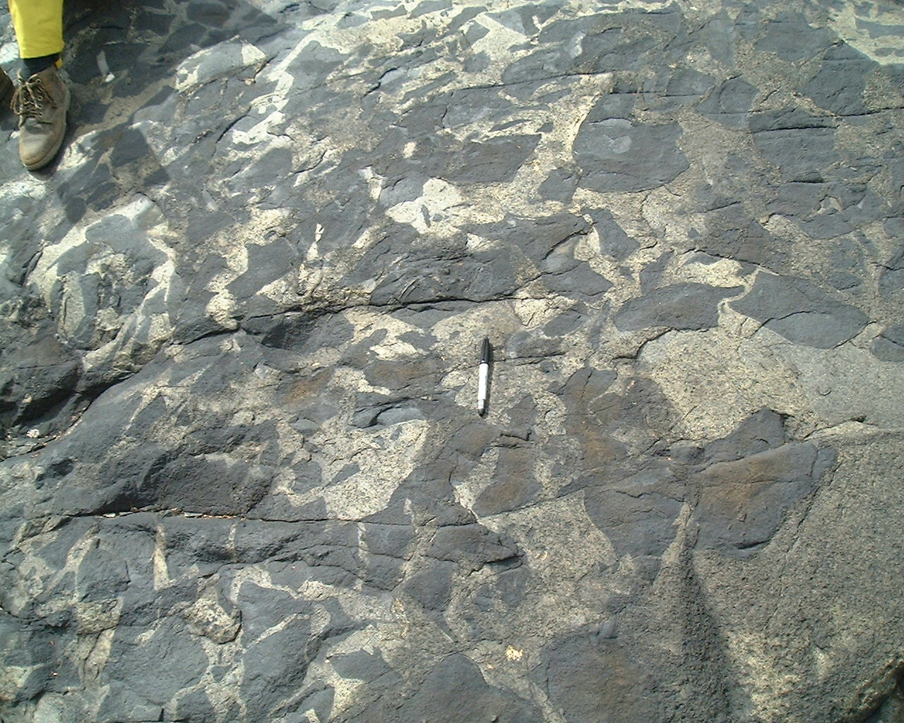
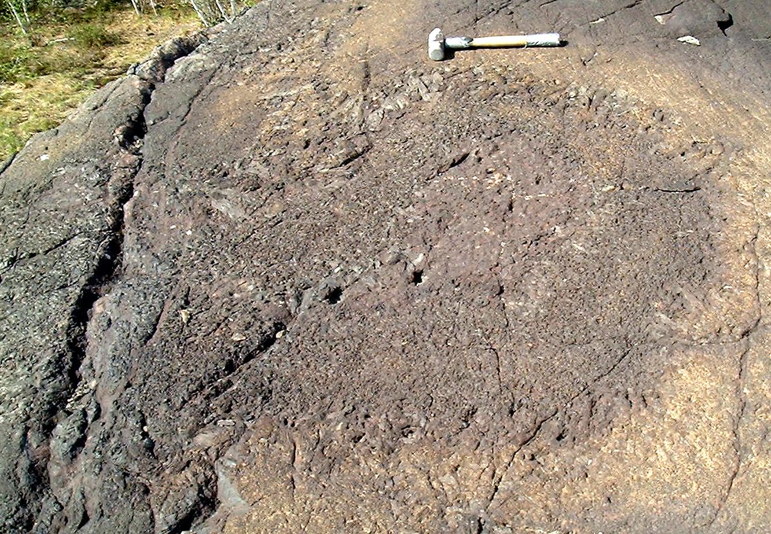
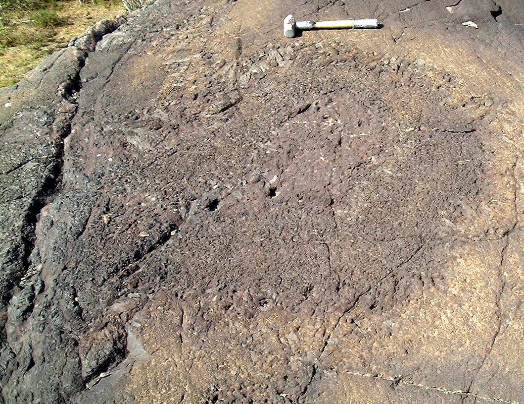
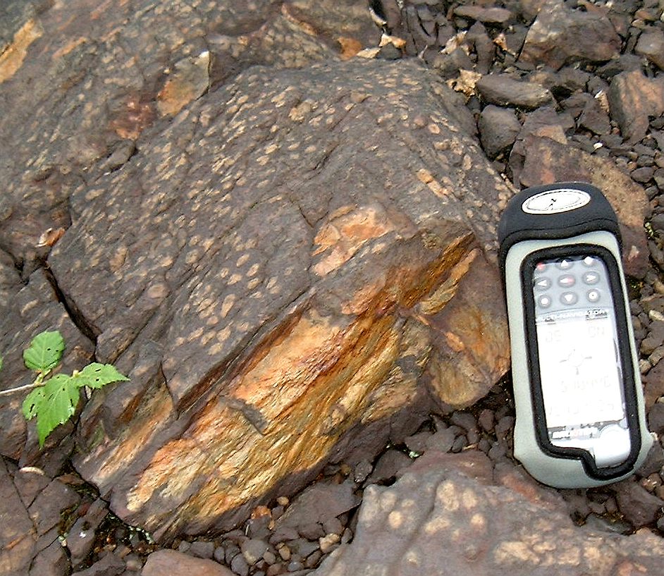
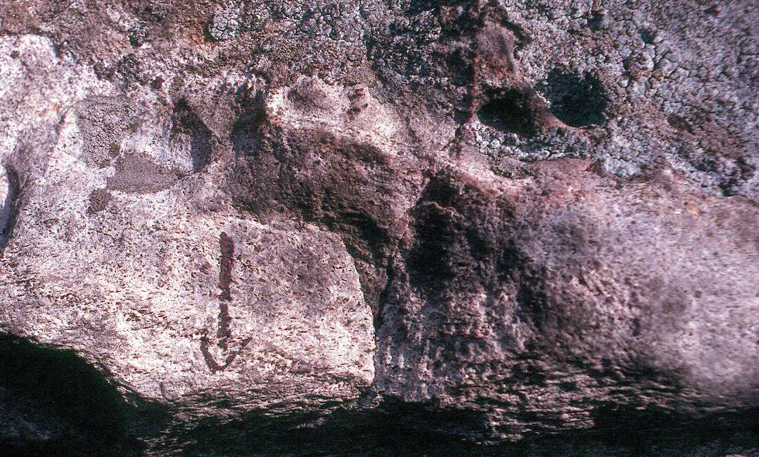
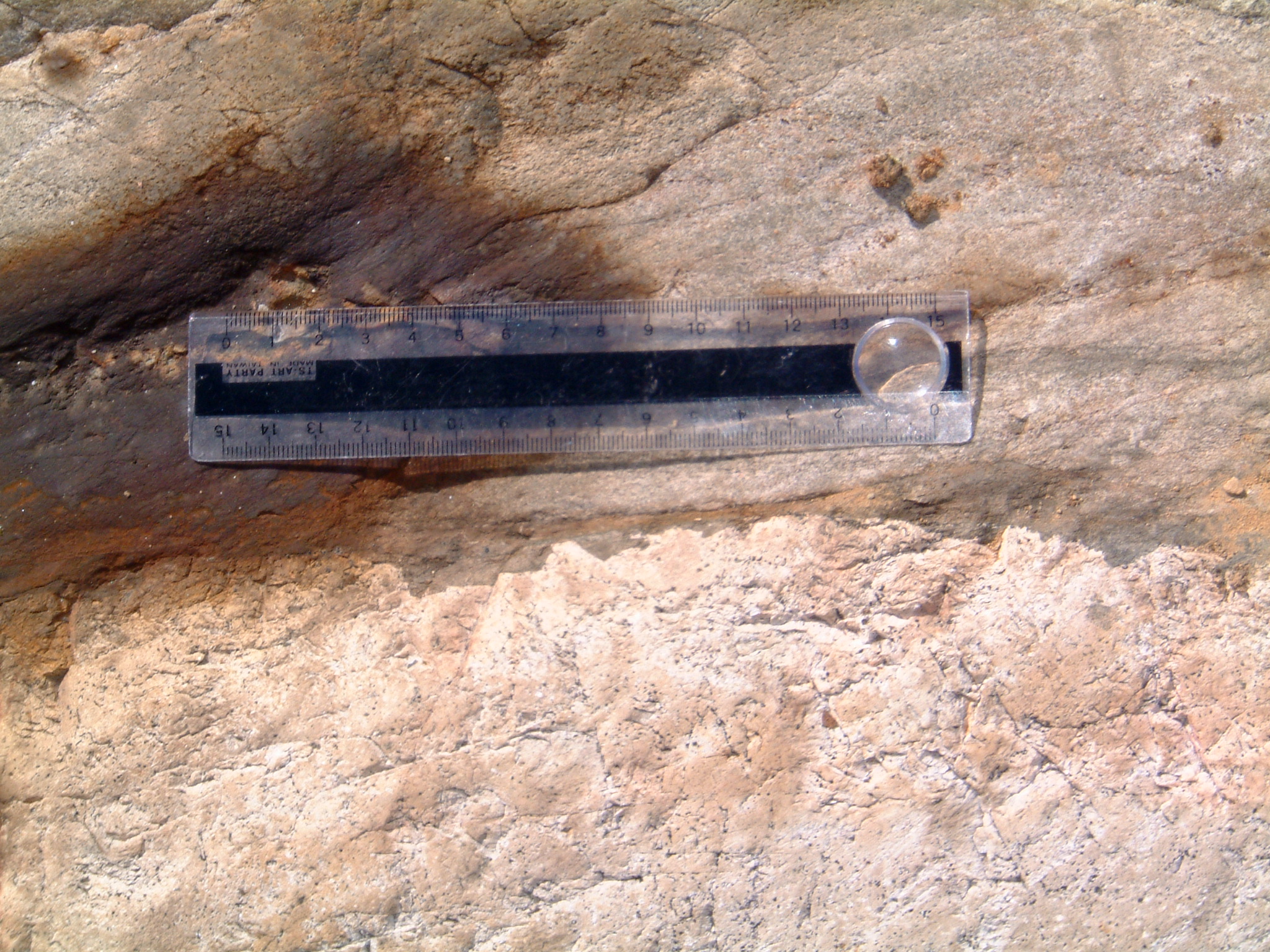
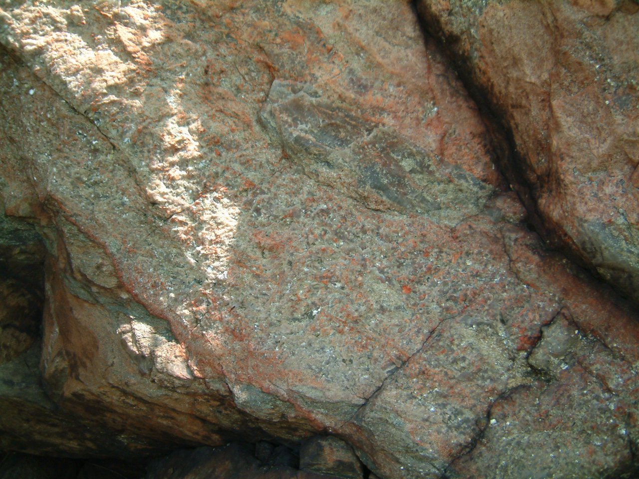
Hornfelsed globular Mississagi
Quartzite, location E (note shatter cone) -
428globules1m.jpg
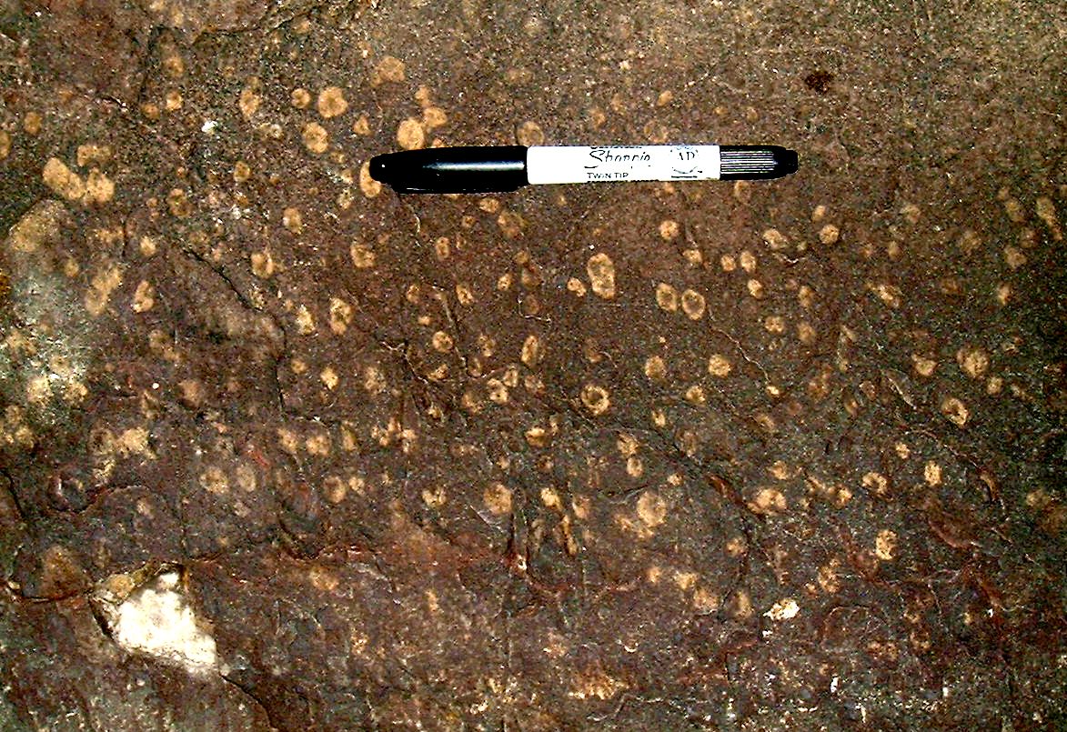
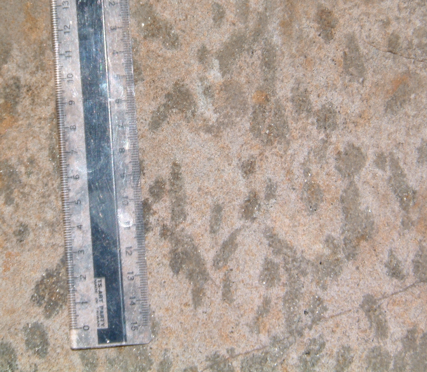
Globules in hornfelsed Mississagi
Quartzite, location E - 429globules2m.jpg
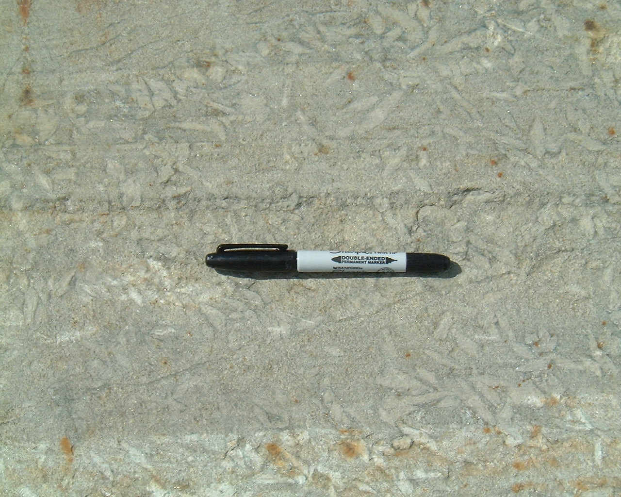
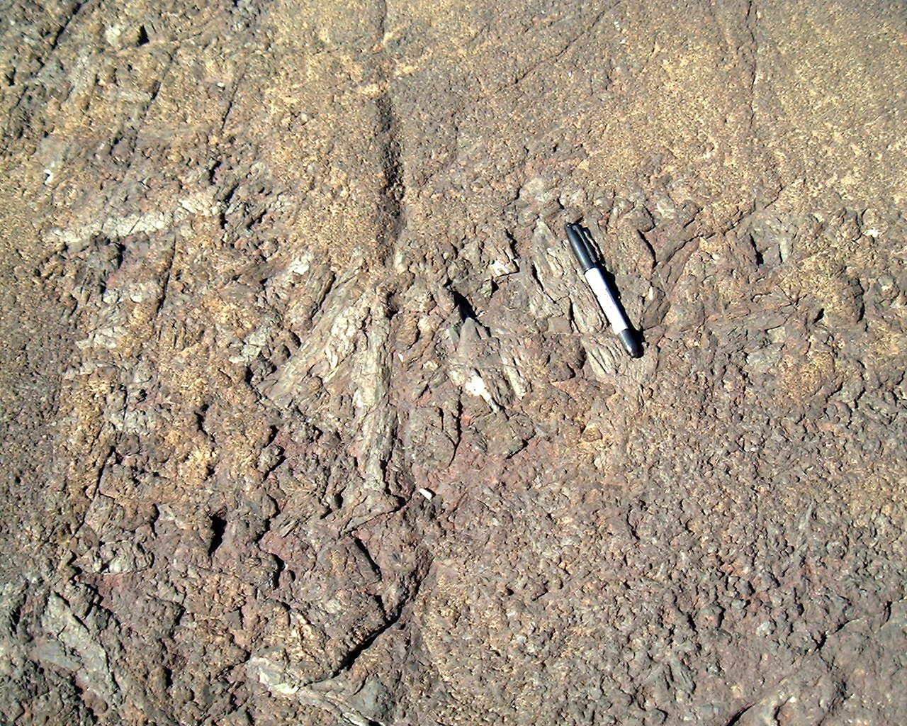
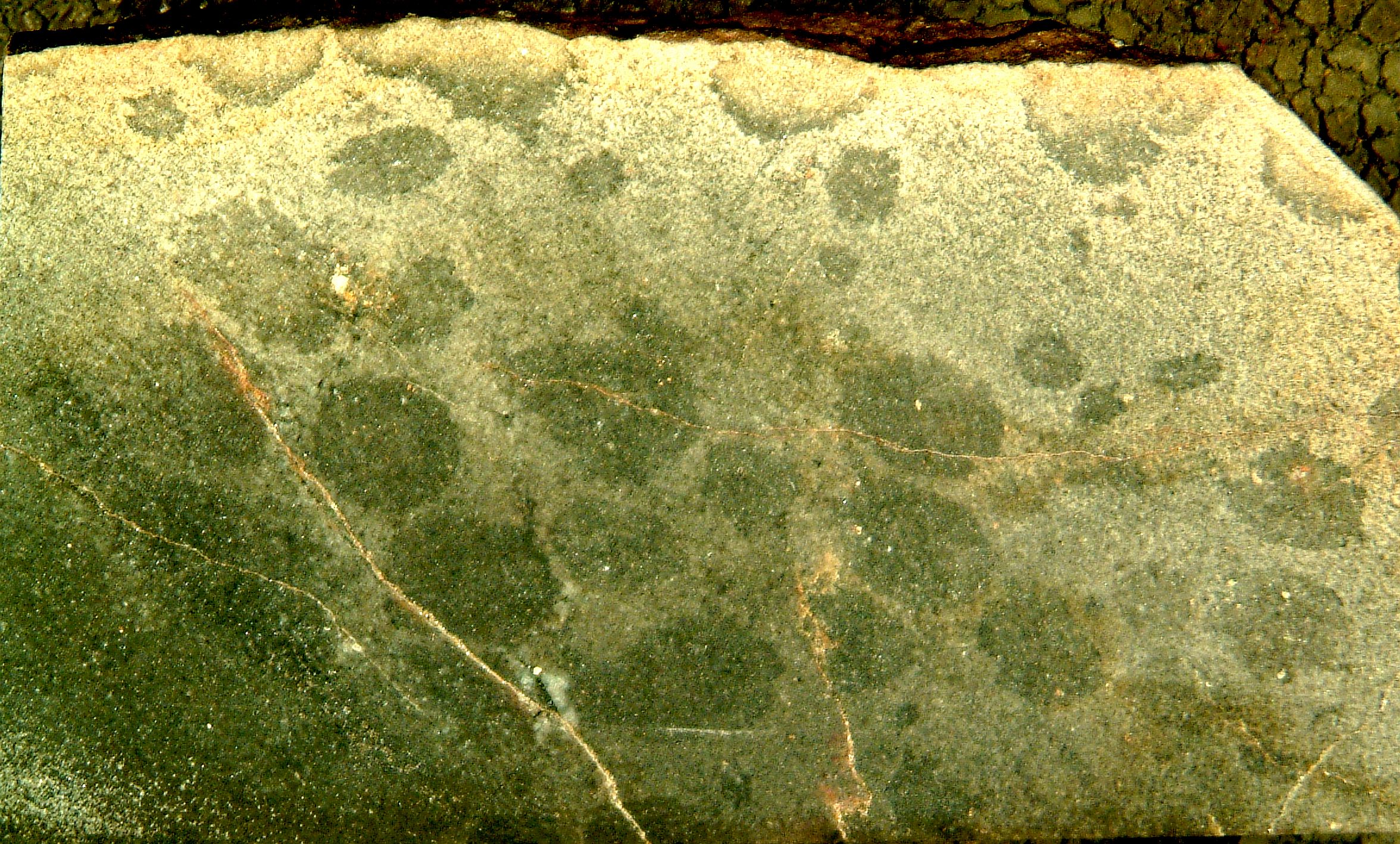
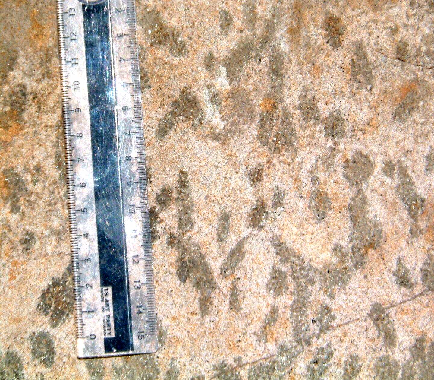
Polished slab showing globules
as irregular concentrations of biotite; note the preferencial removal of
biotite in the weathered rind of the sample, location
E - 58mweatheredhornfels.jpg
Cutler
F2 foliation
folded by F3 structures in Nipissing gabbro, Cutler -
403foldedcleavageinnippm.jpg
Nipissing
gabbro cut by 'North Shore' diabase, Cutler - 1498cutleramphib.jpg
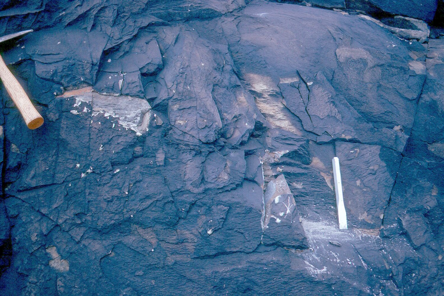
Sudbury Breccia
Sudbury breccia, SE shore of Raven
Lake - 1491ravenlsudbrecc1.jpg
Vein and apophysis, displaying internal
flow fabric, of Sudbury breccia
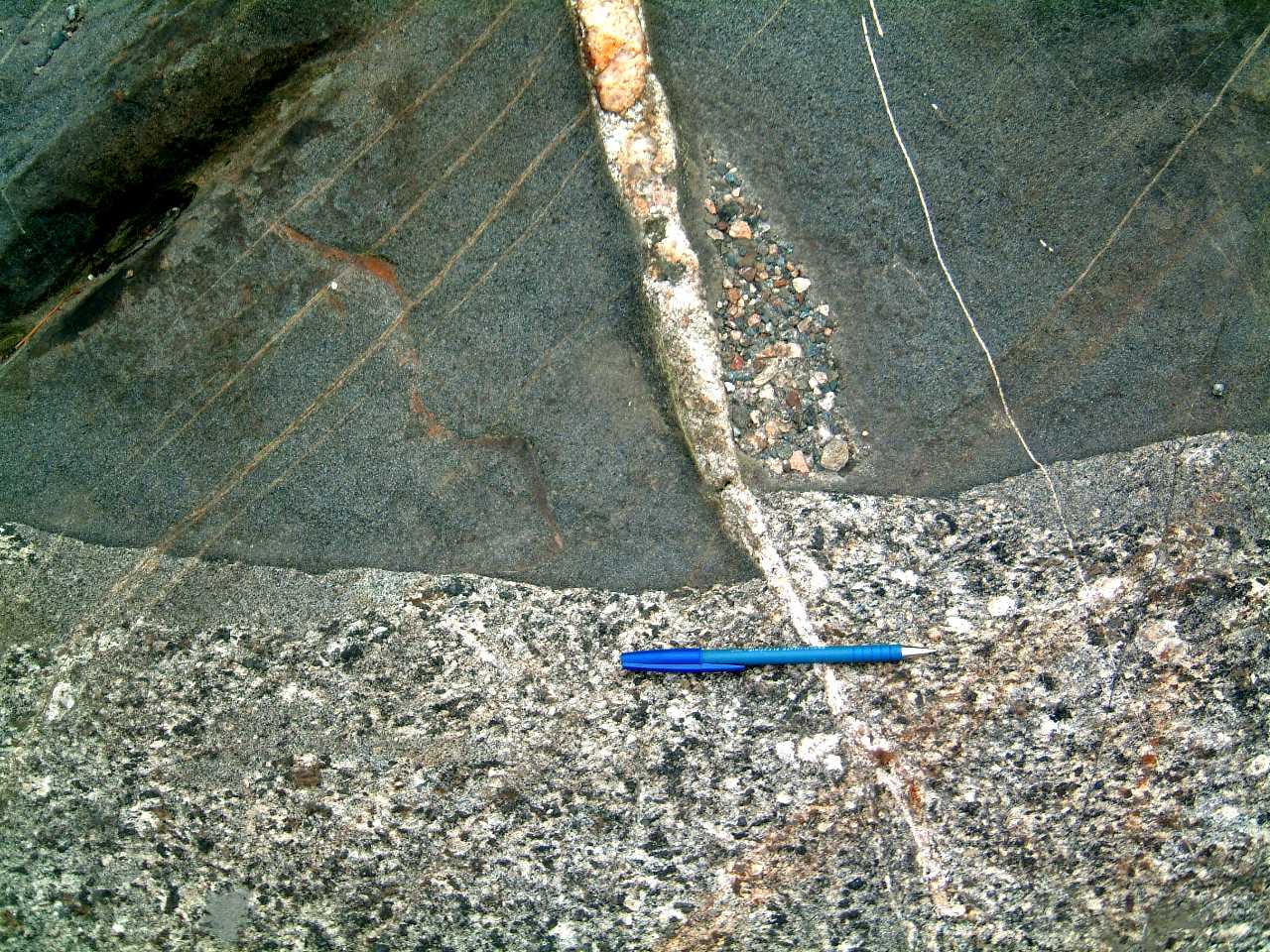
injecting Mississagi Quartzite - 340sudbreccapophm.jpg
Foliated matrix of Sudbury breccia,
north of Highway 17 east of Coniston - 342sudbrecfoliationm.jpg
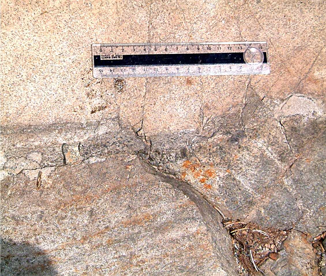
Sudbury breccia - 339sudbreccfelsdikelocalitym.jpg
F3 folds folding S2 foliation
penetratively cutting Sudbury breccia, Plane Table Lake - 407foldedcleavinsudbreccclastm.jpg
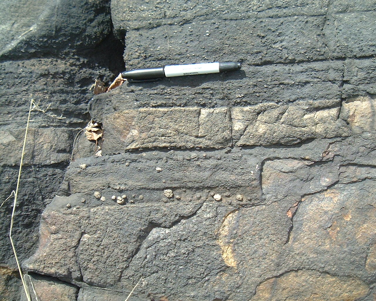
Road side exposure of shatter
cones in Espanola Quartzite, south of Espanola, near Anderson Lake - 405shatconeespm.jpg
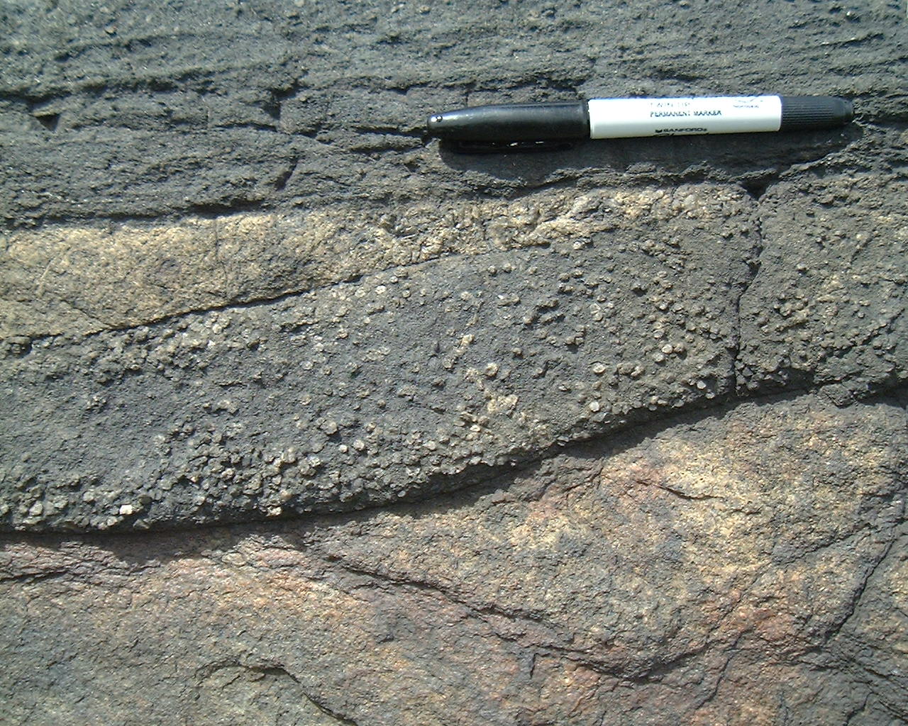
Small shatter cones in McKim Fm,
outcrops south side of junction of Balsam Street with Highway 17 and west
of the overpass -386shattconesbalsam1m.jpg
Upward pointing small shatter
cones in McKim Fm, outcrops south side of junction of Balsam Street with
Highway 17 and west of the overpass - 387shattconesbalsam2m.jpg
Downward pointing shatter cones
in Mississagi Quartzite, road cut at Laurentian University - 388shattconeslaurentianm.jpg
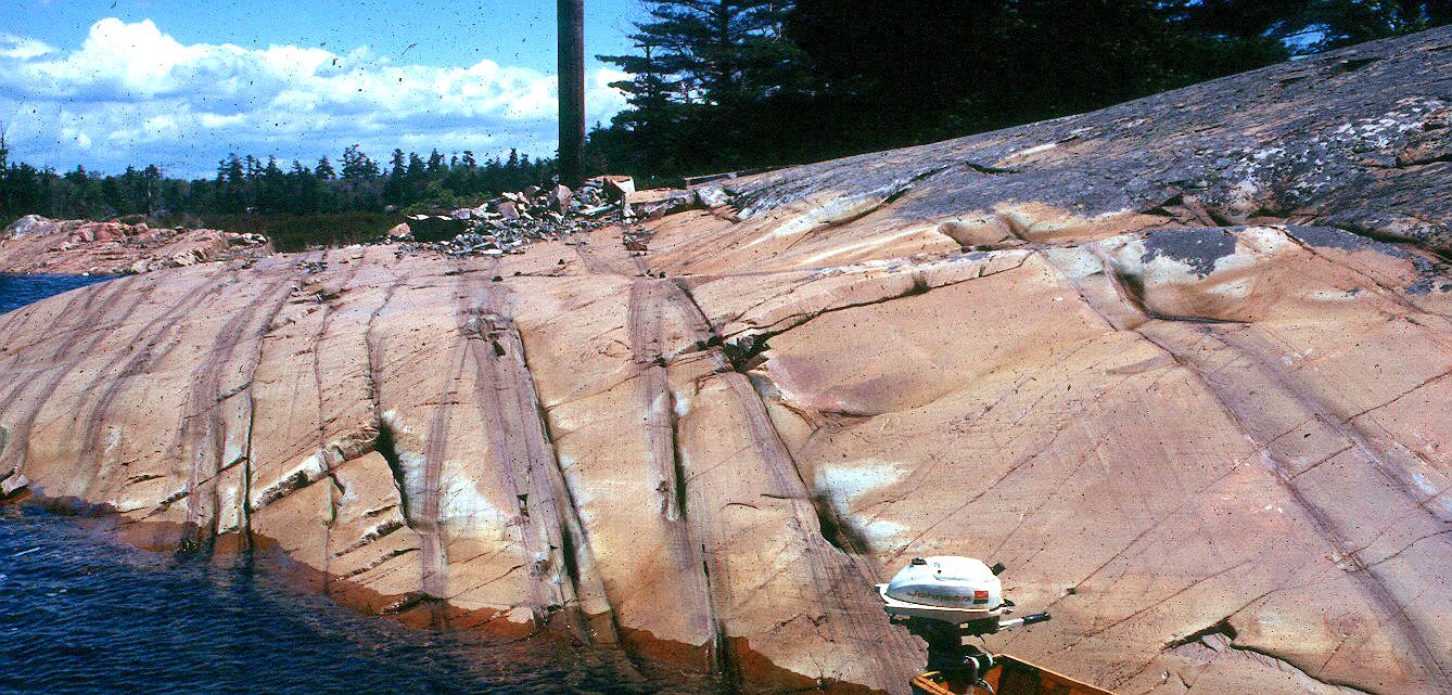
Down dip oriented shatter cones,
south of Sudbury by-pass junction with highway 17 - 425vertshattcones1m.jpg
Horizontal shatter cones, south
of Sudbury by-pass junction with highway 17 - 426horizshattcones1m.jpg
Horizontal shatter cones, south
of Sudbury by-pass junction with highway 17 - 427horizshattcones2m.jpg
Copper Cliff
Offset
850area.jpg
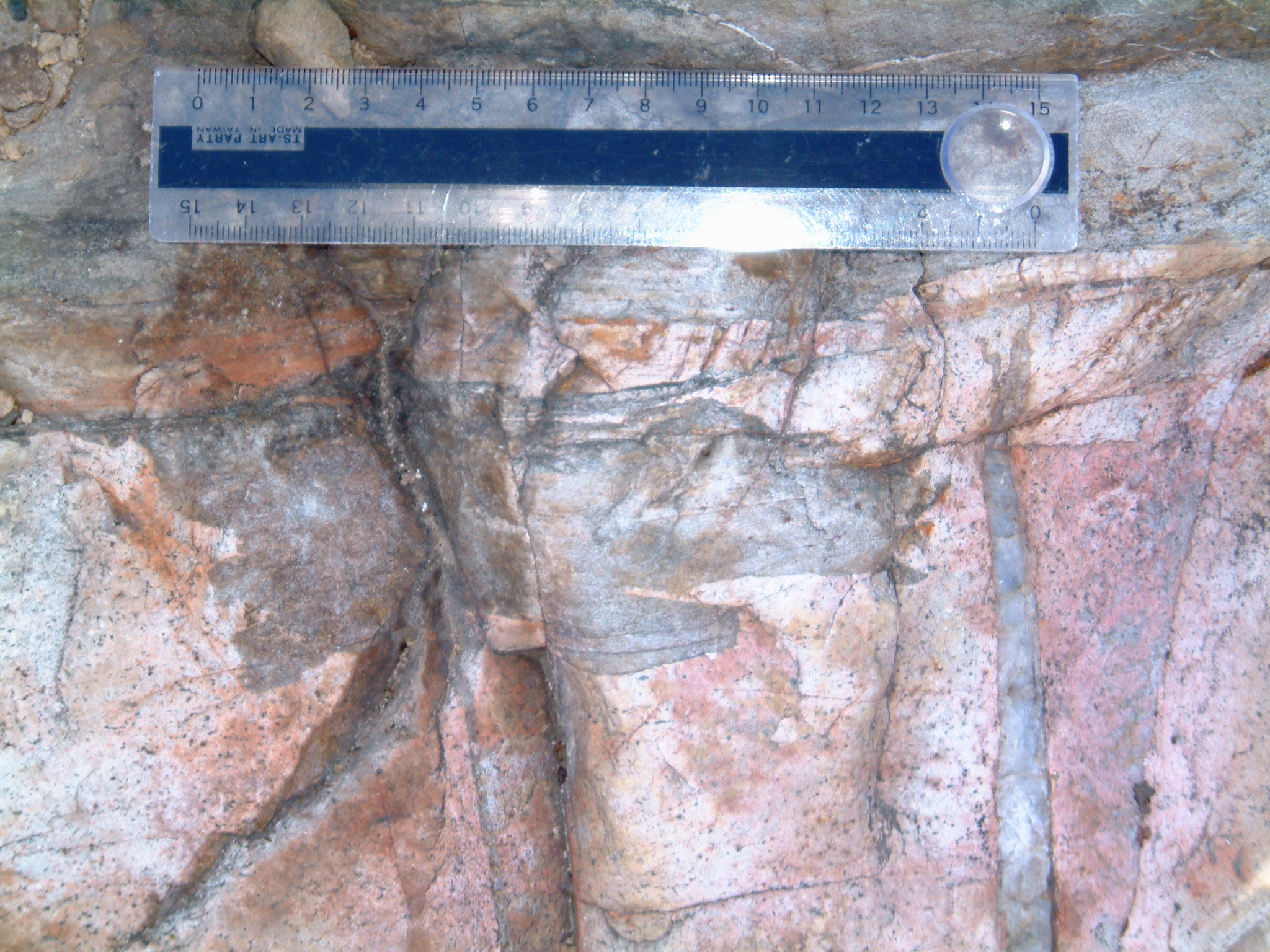
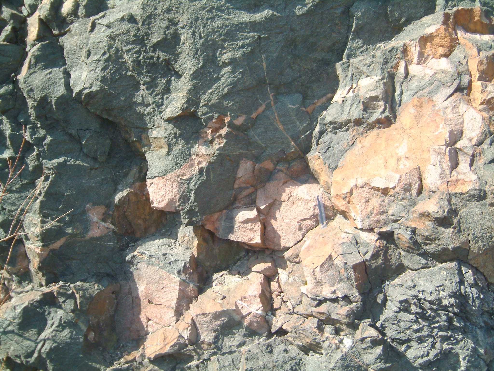
Mafic block in Sudbury breccia,
Coppr Cliff - 410irregcontdiabblockinsb1.jpg
Mafic block in Sudbury breccia,
Coppr Cliff - 411irregcontdiabblockinsb2.jpg
Rheomorphologically melted inclusions
of Sudbury breccia where it is in contact with the Copper cliff 'offset'
dike - 412rheomorphrhyoloffset.jpg
Irregular contact of the Coppercliff
'offset dike' with other rocks at its southern termination, near air shaft
- 413cucliffoffsetterm.jpg
Sulphide rich facies of the Copper
Cliff 'offset' dike - 414cucliffmin1.jpg
Ditto - 415cucliffmin2.jpg
Contact of the Coppercliff 'offset'
dike (top) with Sudbury breccia (bottom) - 416dikecuttingsb1.jpg
Ditto - 417dikecuttingsb2.jpg
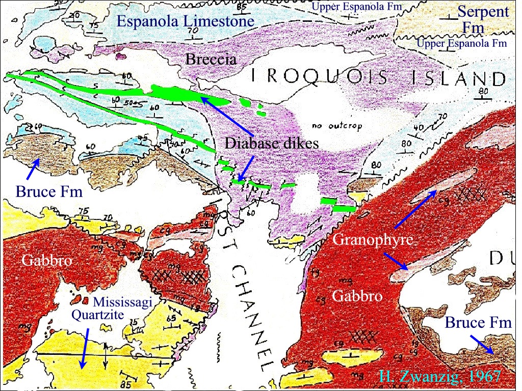
Mafic dikes
zwanzig2.jpg
408deformeddiabcontactwhitefishm.jpg
409diabboudinwhitefishm.jpg
shawmap2.jpg
shawf6.jpg
shawf7.jpg
shawf8.jpg
shawf9.jpg
1490whitefishff1foldsdiab2.jpg
1497masseycontaur.jpg
1498cutleramphib.jpg
1499cutlershearedtrap.jpg
401foldedfoldcutlerm.jpg
402curveddikecutlerm.jpg
F3 folds
folding F2 cleavage in Nipissing gabbro - 403foldedcleavinnippm.jpg
404diabcuttingfolnippm.jpg
224planetablediab1.jpg
225planetablediab2.jpg
226planetablediab3.jpg
Coniston Felsic
dikes
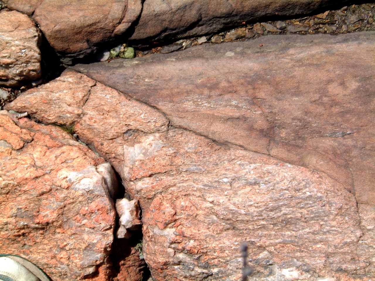
Felsic dike (top) contact with
Mississagi Quartzite - 336felsiccontact1m.jpg
Felsic dike (bottom) contact with
Mississagi Quartzite (note differential weathering) - 337felsiccontact2m.jpg
Felsic dike (bottom) transecting
contact of Mississagi Quartzite (top left and right) and Sudbury
breccia (top centre) -
341felsicdikesudbreccontactm.jpg
Felsic dike in Nipissing
Gabbro, east side of Coniston-Garson road, south of bridge - 349felsicnippcontact2m.jpg
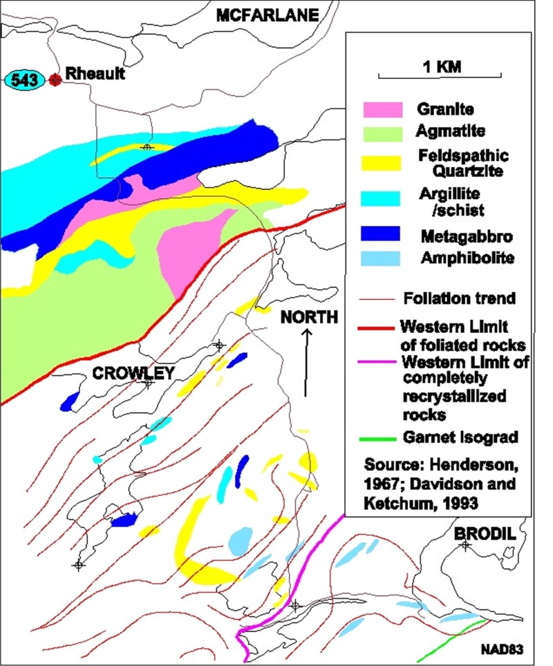
Rheault intrusives
fueten2.jpg
227rheaultfelsint1.jpg
228rheaultfelsint2.jpg
229arheaultfelsint3.jpg
229brheaultfelsintr3mag.jpg
231rheaultgraniteinnipp.jpg
Cutler Granite
cutlermap1.jpg
cutler1m.jpg
1500cutlerpeg1.jpg
1501cutlerpeg2.jpg
1502cutlerpeg3.jpg
301cutpeg1.jpg
302cutgrancuttingdiab.jpg
303cutf3schist&defpeg.jpg
304cutpeg&passgn.jpg
305cutamph.jpg
306cutdiab.jpg
307cutfolgab.jpg
308cutfolgab2.jpg
309cutfolgab1.jpg
310cut
f3folgab.jpg
311cutcrossdiab.jpg
312cutgabxen.jpg
315cutfolgab&diab.jpg
315cutfolgab&diabmod.jpg
316cutgranite.jpg
317cutf3schist&defgran.jpg
317cutf3schist&defgranmod.jpg
318cutdefpeg1.jpg
319cutirregpegcont2.jpg
319cutirregpegcont2m.jpg
320cutpeg3.jpg
321cutpeg3b.jpg
322cutpeg5.jpg
323cutf3cleav&peg.jpg
324cut
foldpeg.jpg
325cutpeg6.jpg
326cutfoldboudpeg7.jpg
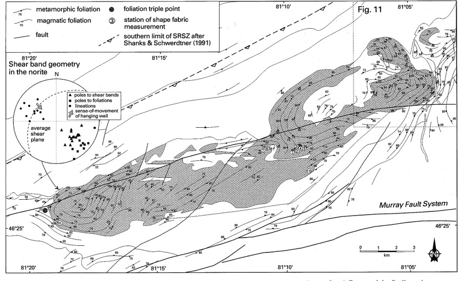
Murray
Fault - Long Lake Fault region, Sudbury
230rheaultanast.jpg
232arheaultflatstaurorig.jpg
232brheaultflatstaur.jpg
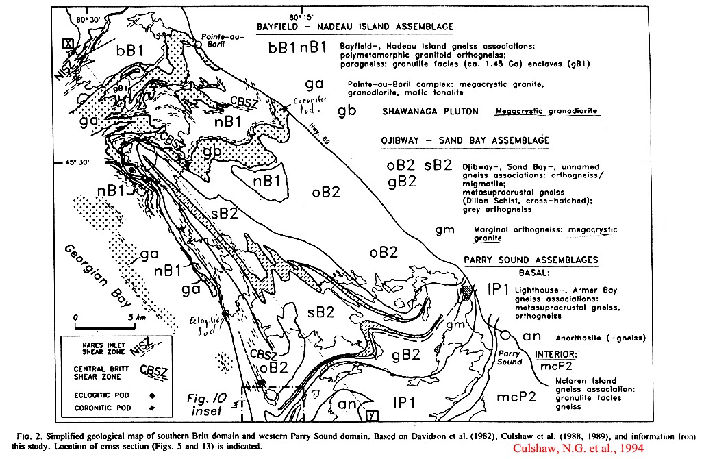
Grenville Front
grenbrodil83.jpg
Grenville
Whitestone
Anorthosite, Parry Sound
grenshawan.jpg
253psboudingabbro1a.jpg
254psnfault1b.jpg
254psnfault1bmod.jpg
255psmafboudin1c.jpg
256psfolgabpod2a.jpg
257psanorthlin3a.jpg
258psanorth3b.jpg
259psanorth3c.jpg
261psanorth3d.jpg
262psanorth3e.jpg
263psanorth3f.jpg
264psanorth3g.jpg
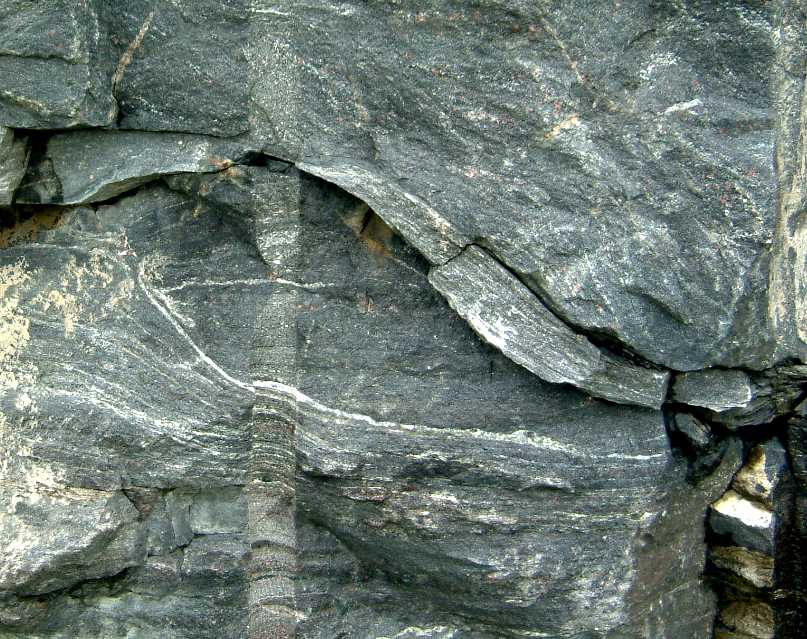
Nobel Eclogite
Locality
grendiabase.jpg
grenshawan.jpg
265nobelamphboudin.jpg
268nobelspotted
retroeclogite.jpg
270nobeleclogite1.jpg
271nobeleclogite2.jpg
Shawanaga
Metagabbro Locality
grendiabase.jpg
grenshawan.jpg
272shawan1.jpg
272shawan1m.jpg
273shawangabgncont.jpg
274shawangabb3.jpg
275shawanmagof3.jpg
276shawanundefgab5.jpg
277shawan6.jpg
277shawanbakedcont6.jpg
278.shawanbakedcont7.jpg
279shawanannealmig8.jpg
280shawanmig9.jpg
281shawan10.jpg
281shawanmig10.jpg
282shawanmig11.jpg
283shawanmig12.jpg
284shawansenmigcont13.jpg
285shawanstraightgn14.jpg
286shawanstgnsyencont15.jpg
287shawanhetdefsyen16.jpg
288shawandefsyen17.jpg
289shawanmyl18.jpg
290shawan19.jpg
290shawanoutcrop19.jpg
291shawan20.jpg
292shawanundefsyen21.jpg
293shawanannelpegindefsyen22.jpg
294shawancountgneisswestsideofrd23.jpg
Pointe de Baril Mafic Dikes
grenshawan.jpg
295pdebirregrheomorphdikes1.jpg
296pdebdikes2.jpg
296pdebfoldeddiabingrangn2.jpg
297pdebdiabcutxeningrangn3.jpg
298porphgrancontwgn1.jpg