Lec 11: Time and Maps
The Readings for Today’s Lecture were:
Ch. 8: Time and Maps
Ch. 9: Software for Map Retrieval
Comments or Questions?
(General, Lab, Assignment, Readings)
Today’s Lecture:
Final Exam — format and example
questions
Time and Maps — synopsis and snipets
Geographic Flight Simulation
Final Exam — format and example
questions
Scope of the Exam
Non cummulative:
Chapters: 12-15, D, 8, 9, 20
All
four (4) Lab Assignments
Mock Final Exam
How to Answer Essay Questions in an
Exam
Break
Time and Maps — synopsis and snipets
* TOC
To quote from E R Tufte’s opening
sentence in his book Envisioning Information —
“The world is complex, dynamic,
multidimensional; the paper is static, flat.
How are we to represent the rich visual world of experience and
measurement on mere flatland?”
From the introduction to our chapter:
“Being overworked but basically
clever, map makers have maintained their sanity by concentrating on phenomena
that change relatively slowly.”
And on the “arrow of time”:
“Unlike space, time is a directed
quality — it is irreversible.”
STATIC MAPS
The map maker’s ability to “freeze
motion”
is nothing but an illusion
Temporal Aspects of Maps
All static maps aren’t equally time
specific. Important differences between
line (vector) maps
and image maps
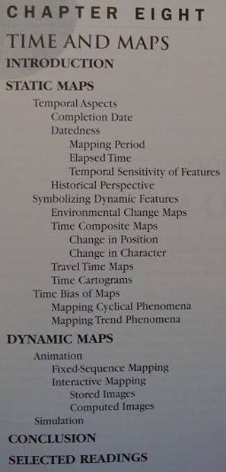
* Example of how image maps capture
changes in state (in lieu of
Fig. 8.1)
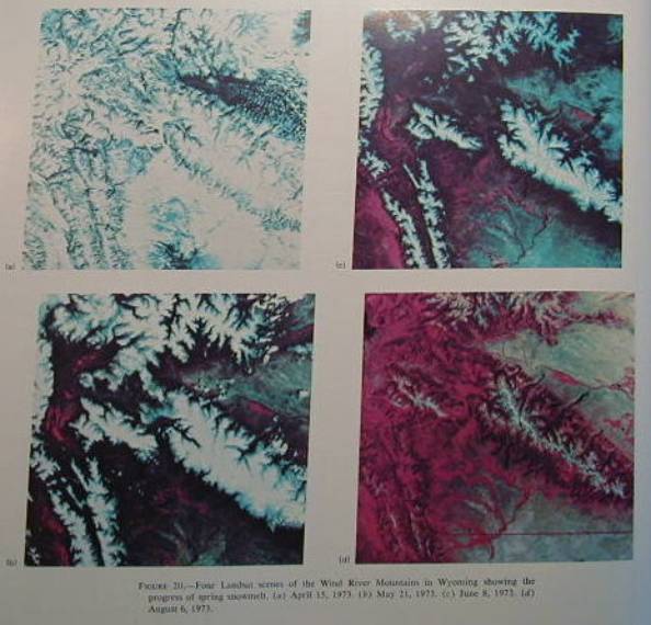
* Completion Date - Fig 8.2
Datedness: Three factors can make a map outdated:
Mapping Period
Elapsed time
Temporal Sensitivity of Features
Refer again to Fig. 8.2
Question: What can we do when maps don’t give us a completion date or the
mapping period (or both)?
Answer:
Think of certain features you know
have changed at certain dates
and check their condition on the map
Temporal Sensitivity of Features
varies among features on same map
varies also with respect to
short-tern, intermittent datedness (eg. road detours)
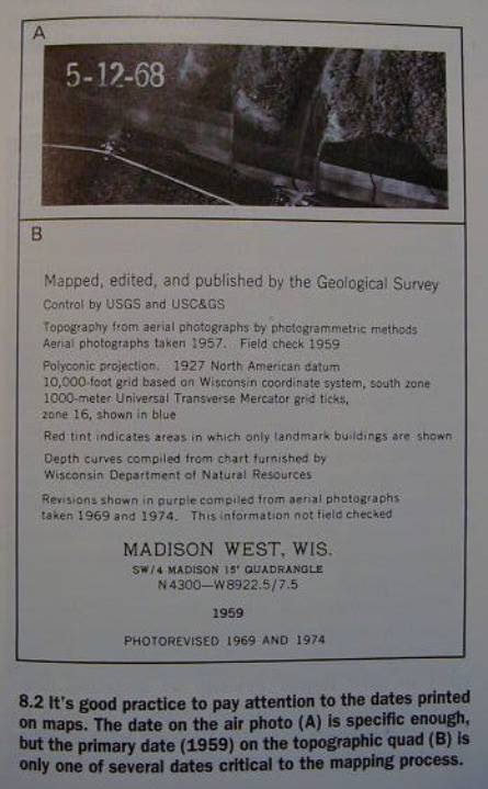
Historical Perspective
studying a time series of maps
* Fig. 8.4
Symbolizing Dynamic Features
modern technology promotes the
creation of more
time-related
maps
Environmental Change Maps
by subtracting Time(n) - Time(n-1)
by using more rigorous quantitative
modeling
Time Composite Maps
superimposing layers of information from different times on a single
map
Change in Position
* Point Features (Fig. 8.7)
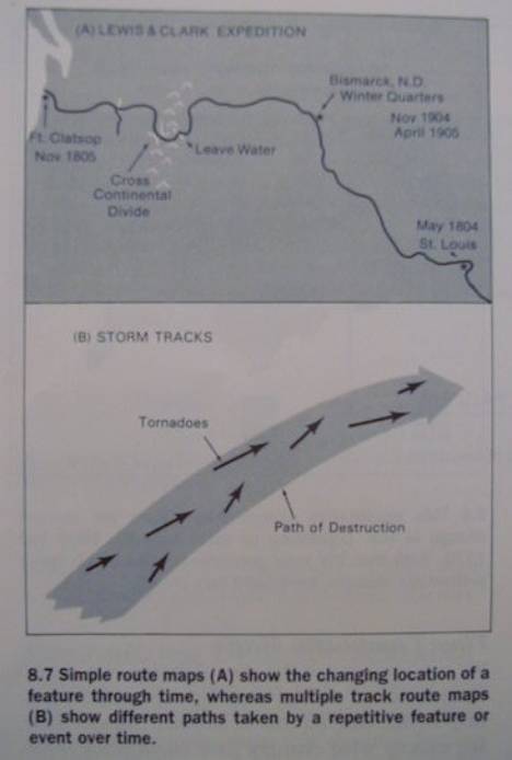
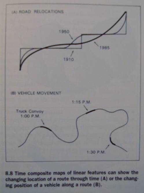
* Linear Features (Fig. 8.8)
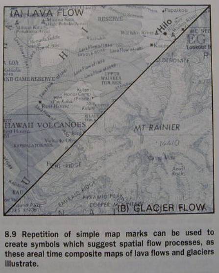
* Areal Features (Fig. 8.9)
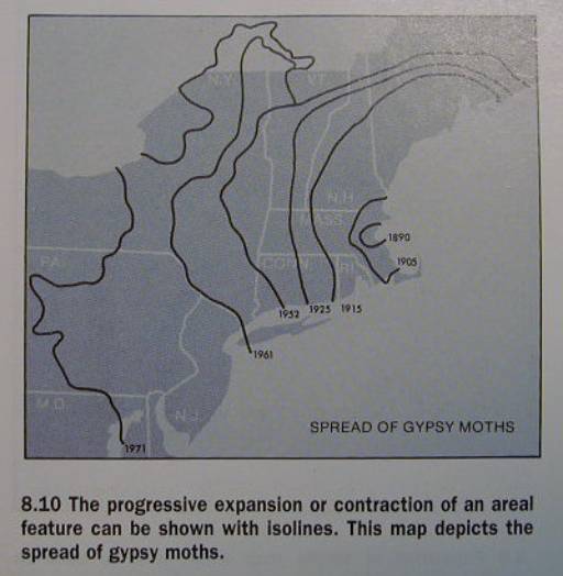
* Areal Spatial Diffusion (Fig. 8.10)
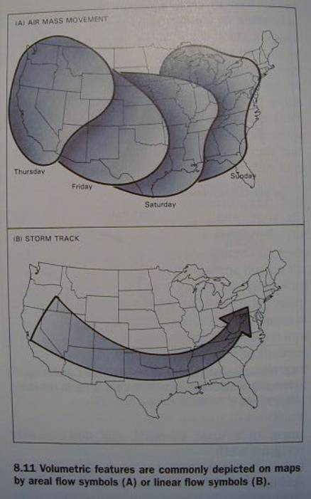
* Volumetric Features (Fig. 8.11A)
Change in Character
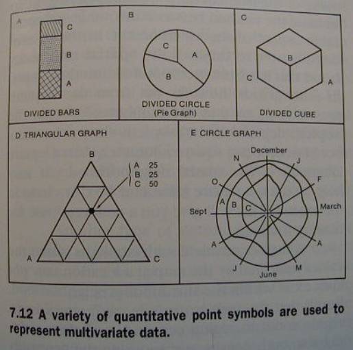
* Example: Fig 7.12
Travel Time Maps
Time Cartograms
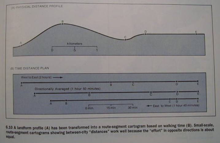
* Non -directional Example: Fig 6.10
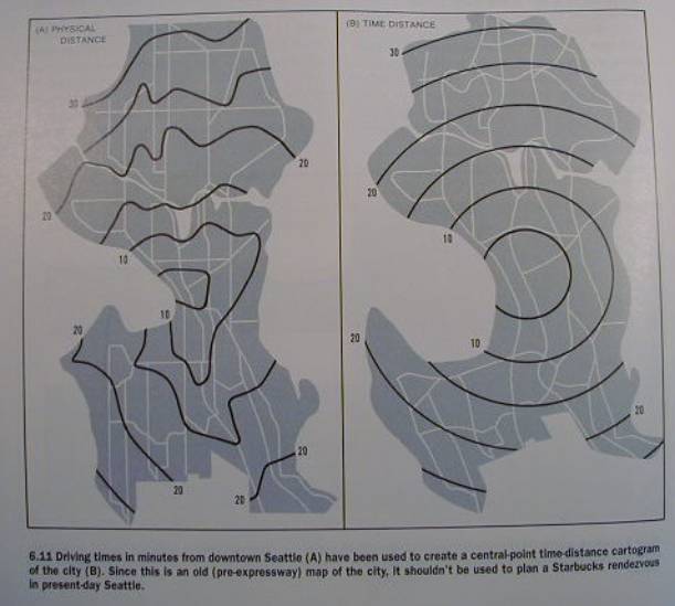
* Directional Example: Fig 6.11
Time Bias of Maps
Mapping Cyclical Phenomena
* Fig. 8.12
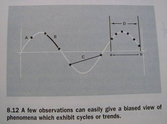
Mapping Trend Phenomena
DYNAMIC MAPS
Animation
Fixed-Sequence Mapping
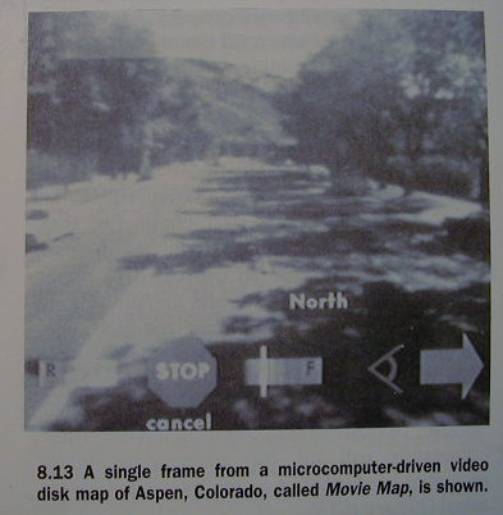
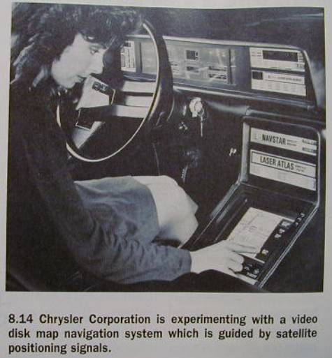
Interactive Mapping
Interactive Mapping
“As new technologies are developed,
cartographers are creating more interactive map forms — maps which
provide feedback to map user’s queries or respond to user’s commands. Modern map forms which fall into this
interactive category provide some ideas of what future map use will be like.
* Stored Images (Fig. 8.13)
* Fig. 8.14
Computed Images
“...this form of interactive map, is
in theory, the map of our dreams.”
“It will thrust map analysis and
interpretation fully into the electronic age.”
“It will do so by permitting a free
question and answer exchange between you and the map.”
“Through a series of prompts and queries
you can ask the computer to determine
such factors as
the area of a
lake,
elevation at a
point,
distance along a
route,
direction
between two points,
least effort
path, and so forth.”
“You use
the maps for visualization
and the map data for analysis.”
“In such an environment, map analysis
can actually be fun!
This is especially true if you can
interact with the computer through verbal commands or by pointing.”
Simulation
“What if?” scenarios
“The imaginative power of simulation
reaches its ultimate form with modern
electronic technology.
Special machines called simulators can
respond to a number of human commands.
When animated maps are used in these
machines,
the effect is one of actually moving
within or through a three-dimensional environment.”
Virtual Reality
The example given is pilot and
astronaut training.
*
Snapshot of GFS Scenery

Conclusion
Our R&D on Geographic Flight
Simulators
‘til next week!