Lecture 3: Terrain Representation
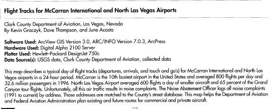
Las Vegas Flight Tracks
Caption
LA The Movie
Today’s Lecture
Terrain Representation
Announcements
This week’s Lab
In the Map Library
I’ll be there as your Trip Planning
Consultant
Attendance at this week’s lab is
optional
come if you want, and
use me as a resource if you wish
Questions?
Readings for Next Week are...?
The Readings for Today’s Lecture were?
What does Chapter 3 Map Abstraction
Process talk about?
What are some of the main topics under
which the chapter’s contents are organized?
Make sure to cover this Chapter as a
“self-study unit”
We won’t cover it in the lecture
It is an important part of your
readings
Terrain Representation
The organization of the chapter in the
text book
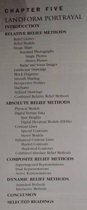
Relative Relief Methods
Relief Globes
and their vertical exaggeration
Relief Models
Example of Babcock College in
Wellesley MA
Raised relief topographic maps
(Hubbard ILL.)
Image Maps
Standard Photos
Single photos
terrain reversal in vertical and low
oblique air photos
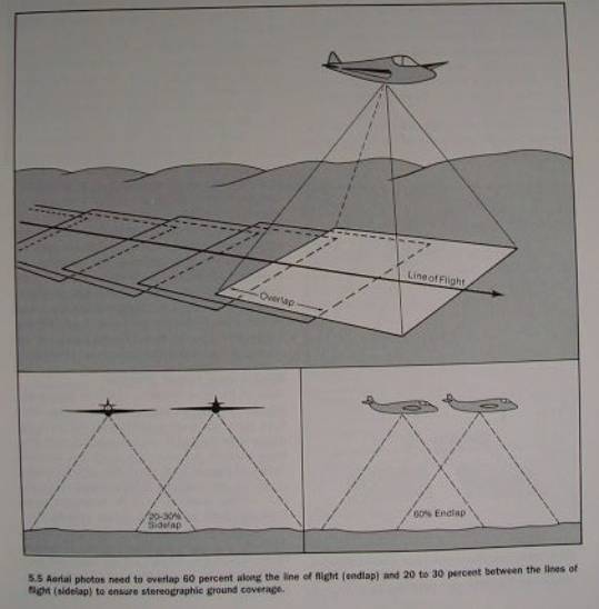
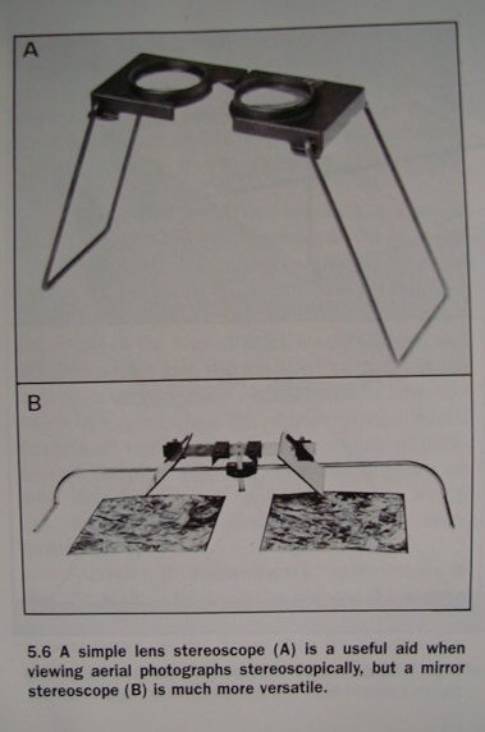
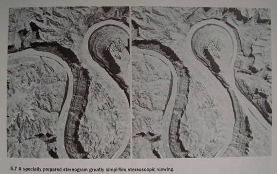
Stereo Photos
Fig 5.5
stereoscopes - Fig. 5.6
stereograms - Fig 5.7
Radar and Sonar Images
Landscape (Landform) Drawings
Block Diagrams - Fig5.10
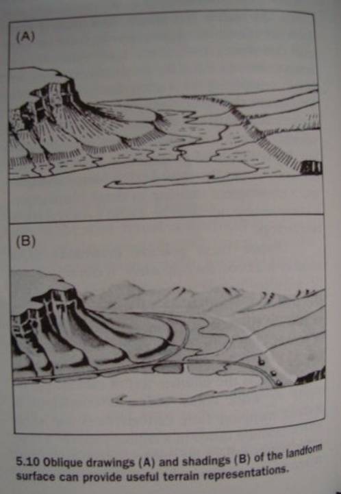
Vantage Point -
vertical: plan view
oblique: perspective views
horizontal: profiles
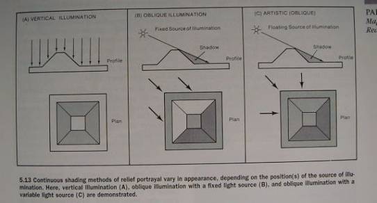
Smooth Shading
Shaded Relief techniques - also called
smooth or plastic shading
illumination effects - Fig 5.13
Perspective Profiles
line based representation of surfaces
also known as
fishnet maps, wireframe diagrams
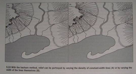
Hachures - Fig. 5.15
Stylized Drawings
Combined Relative Relief Methods
Break
Absolute Relief Methods
Quantative measure - not just
qualitative visual
tidal surface of reference
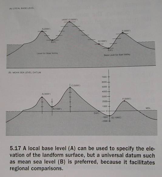
MSL Datum - Fig 5.17
Physical Models can be used
but these raised relief models are
impractical
Digital Terrain Data
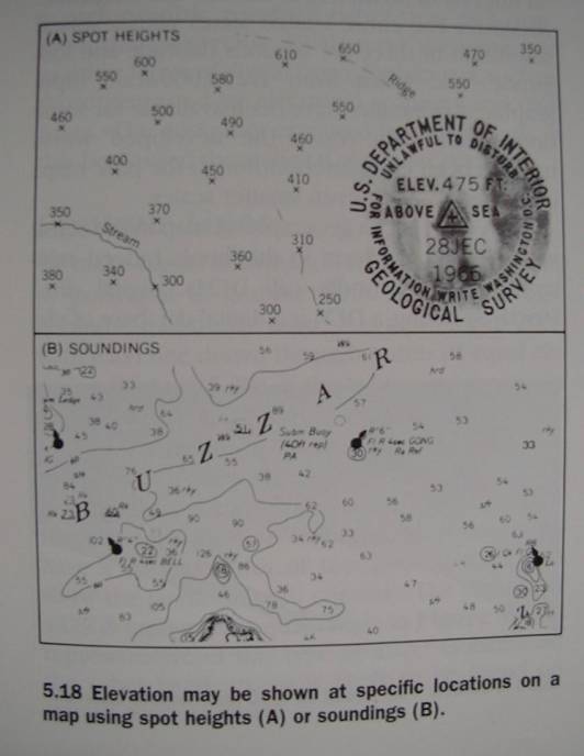
Spot Heights (Spot Elevations) - Fig.
5.18
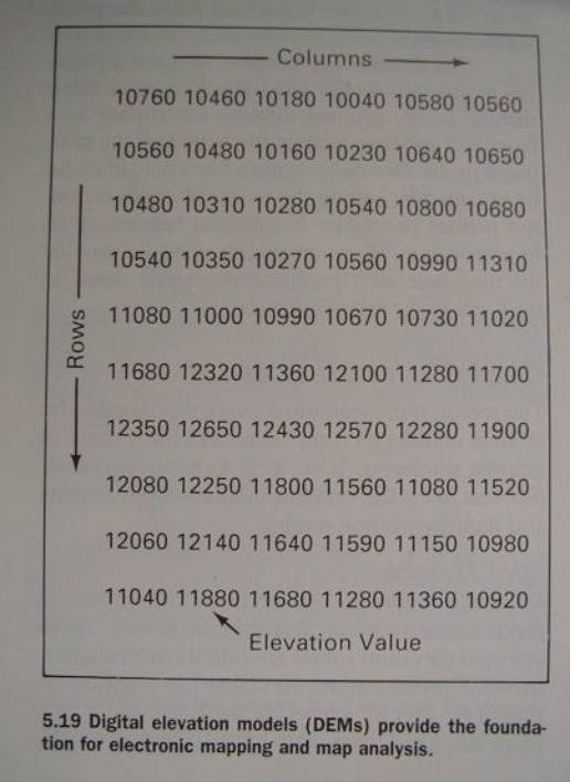
Digital Elevation Models (DEM) - Fig.
5.19
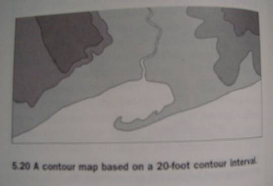
Contour Lines - Fig. 5.20
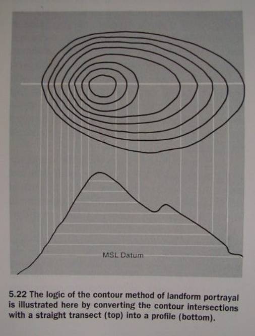
Making a profile reveals the logic
behind the contour representation: Fig.
5. 22
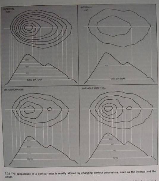
How biased: Fig. 5.23
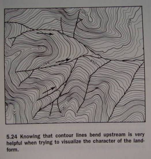
Why do contour lines bend
upstream? Fig. 5.24
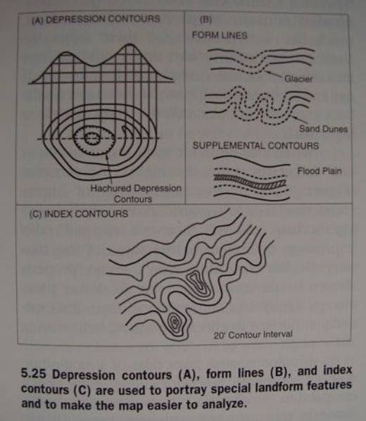
Special Contours - Fig. 5.25
Stereo Models
contour map stereopairs
Anaglyphs
A virtual stereo airphoto mission (on
the Moon) [Anaglyph]
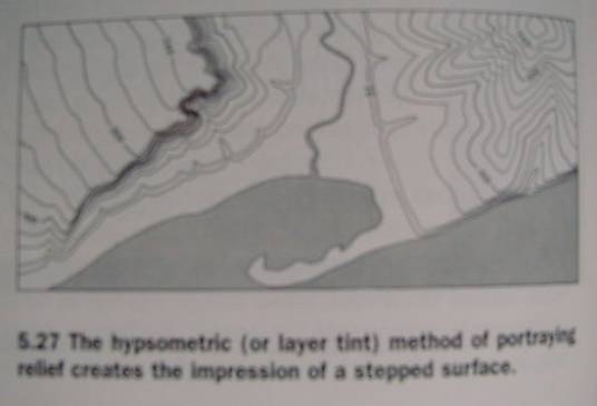
Enhanced Contour Lines
e.g. hypsometric layer tint (Fig.
5.27)
Combined Absolute Relief Methods
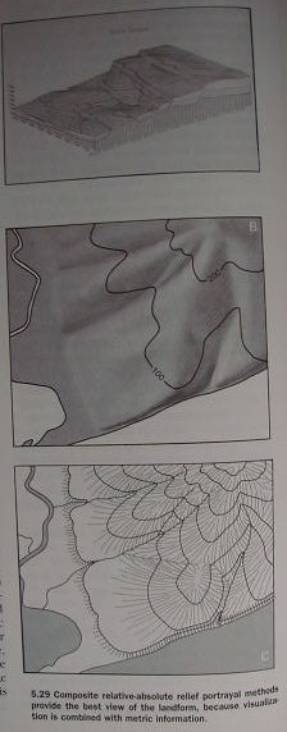
Composite Relief Methods:
Superimposed Representations - Fig
5.29
Another type of Superimposed Representations
-
“Drape image over terrain”
Example “Moon this is Cessna, OVER”
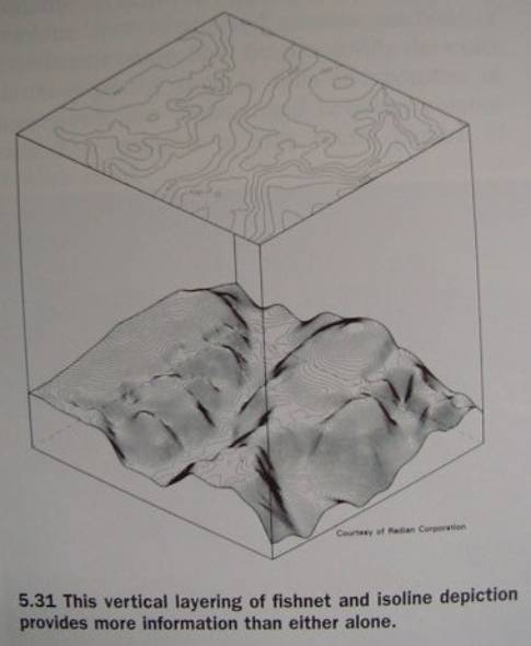
Dual Representations
Fig. 5.31
Active Representations
Interacting with or Querying a GIS
Dynamic Relief Methods
Animated Methods (Example: LA The Movie)
Interactive Methods
Example: Catalina Island Enhanced Relief
Conclusions
‘til next week!