![]()
The Pre-Cambrian Grenville
Mineral Deposit Geology of the AdirondacksBalmat - Sandford Lake - Gore Mountain
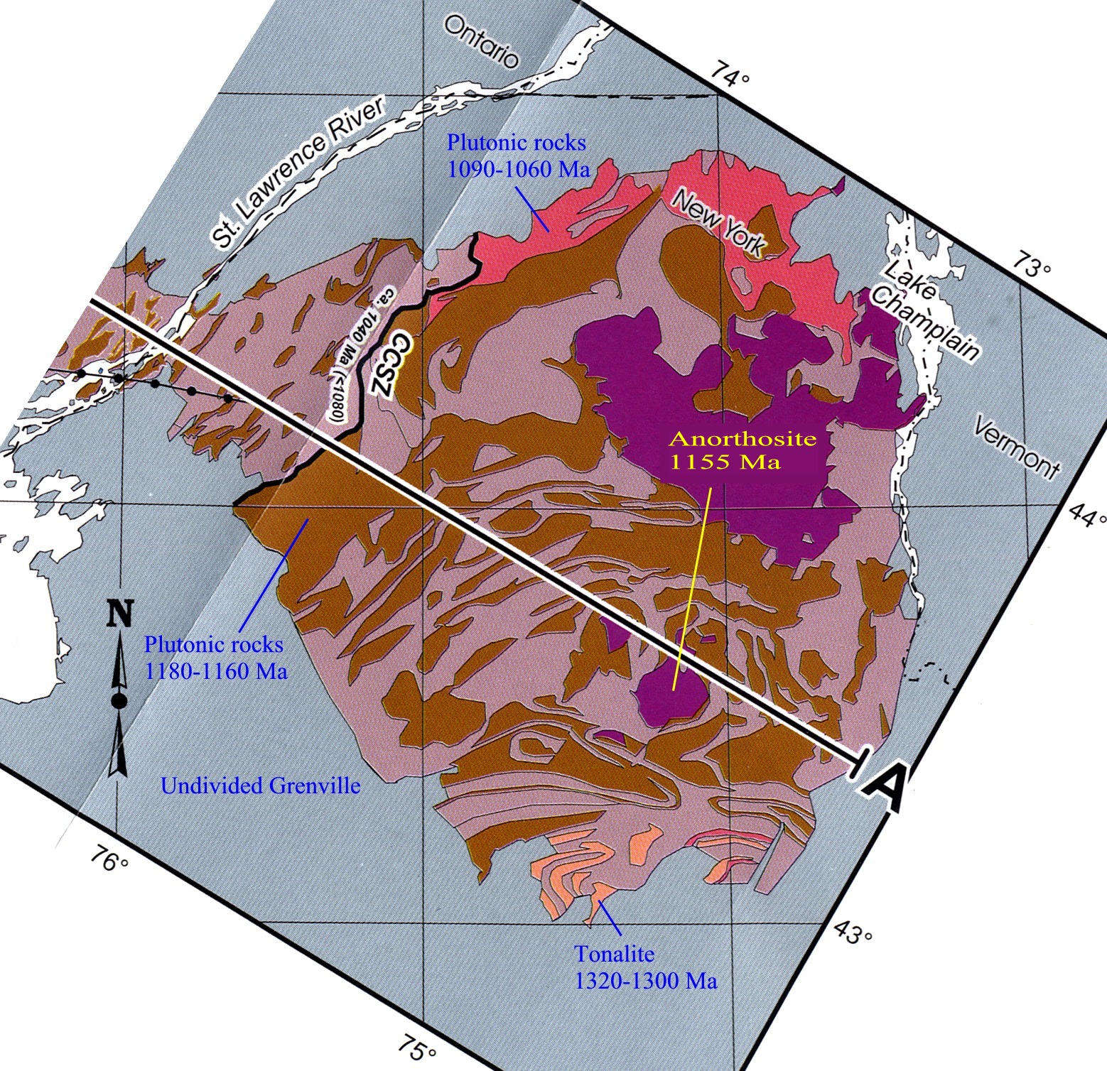
Frontispiece: modified from Carr,S.D., Easton, R.M., Jamieson, R.A., and Culshaw, N.G., 2000.
Geologic
transect across the Grenville Orogen of Ontario and New York. Canadian Journal
of Earth Sciences, 37, 2-3, p. 193-216.
Field trip itinerary:
DAY 1 - Leave London 1 pm; drive to Gouverneur via Kingston
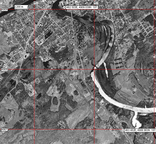
Airphoto of Gouverneur and the area to the south of the city.
DAY 2 - Governeur Talc and Balmat zinc mines
DAY 3 - Au Sable Forks anorthosite/syenite, and the Sandford Lake ilmenite and Barton garnet mines
Day 4 - return to London via Tweed/Marmora, Ontario
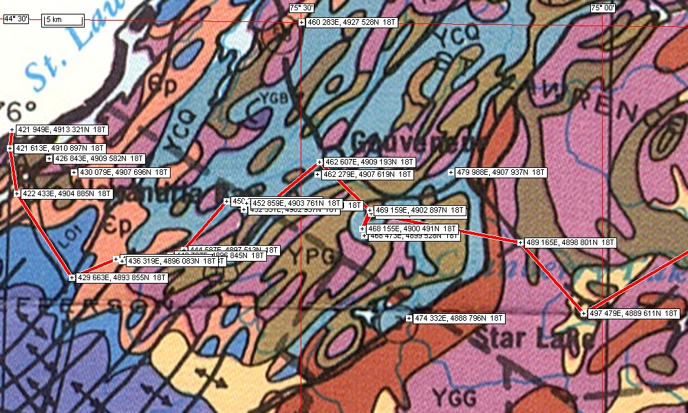
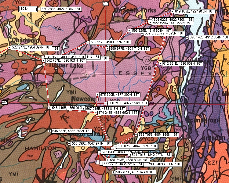
Map of route - from the US/Canada border to Star Lake via Gouverneur and Balmat
Field Trip Organiser: Professor Norman Duke;
Web site prepared by Professor W.R. Church (wrchurch@uwo.ca).
Airphotos were prepared using "EXPERTGPS" . Waypoints shown on the airphotos and topo maps were
determined also using "EXPERTGPS" and are given in WGS 84 UTM coordinates.
Internet links to maps and notes:
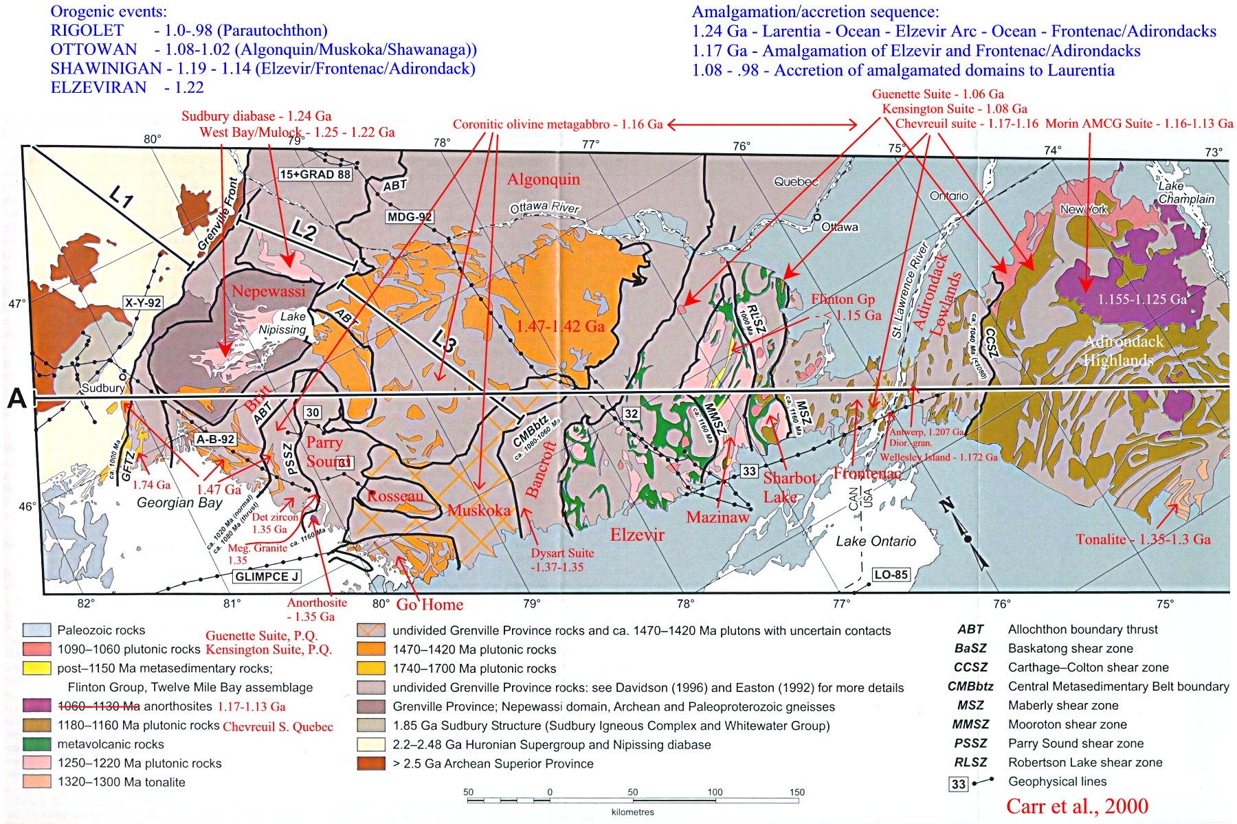
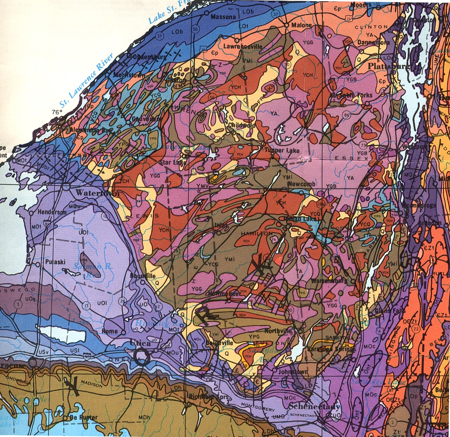
Annotated geologic map of the Grenville Structural Province - Carr et al., 2000
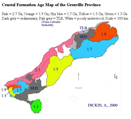
Crustal Formation age map of the Grenville
Structural Province by A. Dickin (
http://www.science.mcmaster.ca/geo/faculty/dickin/research/research.html#P1
)
General geologic map of the
Adirondack region showing ages of main rock units
Geological highway map of the Adirondack region - Geological Highway Map - Northeastern Region (AAPG National Bicentennial Edition)
Legend, Grenvillian rock units:
YA - anorthosite; YGB - gabbro-diorite; YG - granite; YCH - charnokites; Y-UI - ultramafic rocks;
YGG - granite gneiss; YPG - paragneiss; YC - marbles (stromatolitic at some localities in the Balmat area);
YMV - amphibolites (metavolcanics); YQ - quartzites; YMI - migmatites;
CP = Cambrian Potsdam Sandstone unconformable on Grenville age rocks
To view notes, maps and diagrams concerning the geology of the Grenville, go to:
http://instruct.uwo.ca/earth-sci/300b-001/grenv.htm
Other links:
http://gretchen.geo.rpi.edu/roecker/nys/adir_txt.html - Adirondack geology
http://www.union.edu/PUBLIC/GEODEPT/hollocher/kth/field_trips/nysga_2002.htm - Adirondack Field Trip
http://geology.about.com/library/bl/maps/newyorkmapmid.jpg - Geological map of New York State
DAY 2 - Geology of the Gouverneur Balmat zinc region
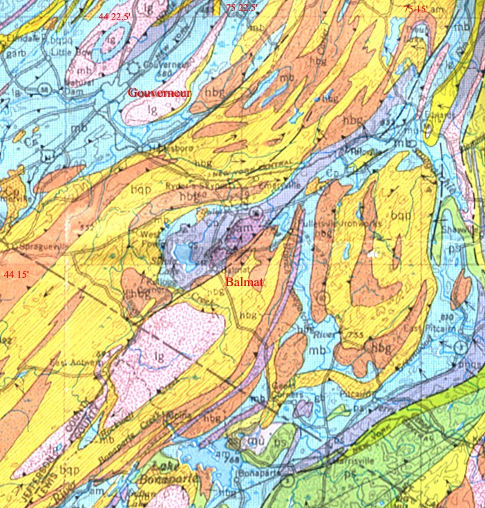
Geological map of the Gouverneur - Balmat region
The following maps, sections, and conceptual diagrams are from 'Balmat Mine Resource and Reserve Audit', by J.E. Steers, 2003:
Geology and Mineralization, Balmat Mine by John E.Steers - click to access this report and figures.
Geological map of the Sylvia Lake Syncline, Balmat - Fig 4-1
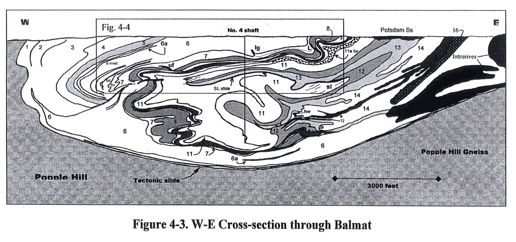
W-E cross-section through the Balmat area - Fig. 4-3
Table of formations, numbered as in the W-E cross section - Table 4-2
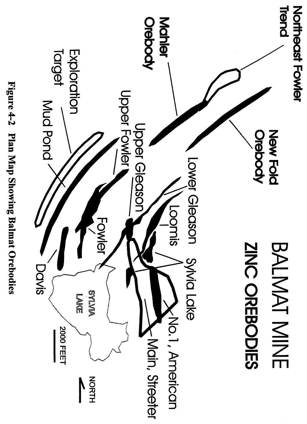
Plan map showing Balmat orebodies - Fig. 4-2
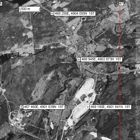
Plan map showing Balmat orebodies (Fig 4-2) and airphoto of the corresponding area
Idealized cross section illustrating the concept of 'parent/daughter' orebodies - Fig 4-4
Related Link:
The following is a link to a document by Michel Gauthier and Jean-Francois Lariviere concerning non-sulphidic Franklin-type zinc silicates and oxides in the Grenville Province - http://hercules.is.mcgill.ca/acfas72/C3402.htm :
Étude des processus dynamo-métamorphiques de bonification des gîtes de silicates et d'oxydes de zinc dans les marbres du Supergroupe de Grenville de la région de Bryson.
Abstract: L'une des principales tendances de la recherche des gîtes métallifères du zinc est aujourd'hui tournée vers des gisements non sulfurés. Pourquoi attaquer un tel sujet ? Premièrement parce que de nouvelles techniques hydrométallurgiques viennent de renouveler le potentiel commercial des minerais non sulfurés de zinc. De plus, ces minerais peuvent constituer des gisements plus riches (20 % Zn) que la majorité de leurs pendants sulfurés. Finalement, ces minerais contiennent généralement peu de plomb, de soufre et autres éléments délétères pour l'environnement. Dans la région de Bryson, nous avons trouvé localement des magnétites avec des exsolutions dendritiques de wurtzite, donnant à penser qu'elles proviennent de la déstabilisation de la franklinite. Dans ce même secteur, dans des marbres dépourvus de sulfures et de magnétite, des grains de serpentine réagissent à un réactif au zinc. Un examen approfondi à la microsonde des nodules de serpentine zincifère révèle la présence d'inclusions très fines de pyrophanite zincifère et de wurzite. Un spinel transitoire entre le pôle de l'hercynite et celui de la gahnite se présente sous forme de très rares reliques dans les nodules de serpentine. D'autres parts, la willémite s'altère également en serpentine. Elle possède la même formule chimique que l'olivine si ce n'est que le cation du zinc plutôt que du fer ou du magnésium. Nous soupçonnons alors que nous avions une paragenèse minérale semblable au gisement de Franklin (NJ) à Bryson.
Airphoto of the Balmat - Fowler area showing the UTM coordinates for stops 1-6.
Stop 1,2 - Gouverneur Talc Company talc mine (UTM 469180, 4901641) south of Fowler (wispy stromatolitic? carbonate exposed in the pit; photographs courtesy of Phil Geusebroek ).
The largest volume mineral mined here is a tremolitic talc, sold under the trade
names NYTAL® and CERAMITALC®. Chemically, tremolitic talc
is magnesium silicate (Mg3Si4O10(OH)2)
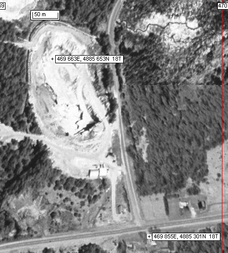
Stop 3 - Wollastonite mine (UTM:469663,
4885653) entrance is located about 200 metres north of the junction (UTM:
469855, 4885301, 18T) of the minor road leading to the mine from Highway
3, west of Remington Corners. (Airphoto:
apreming.jpg )
Wollastonite is sold under the trade name VANSIL®, and
chemically is calcium silicate (CaSiO3). At the Remington Corners locality it is
present as coarse radiating white crystals in sea-blue calcite. The mine is
located in carbonates immediately NW of the Colton shear zone which separates
the carbonates from the high grade charnokitic gneisses to the east.
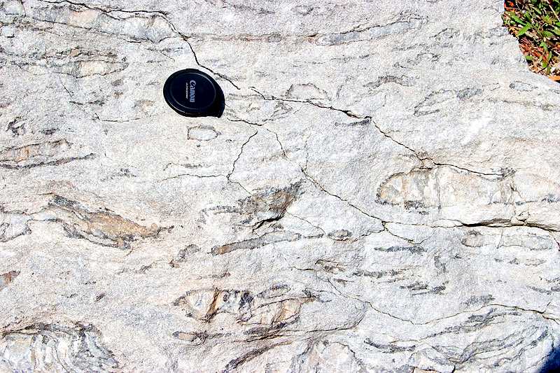
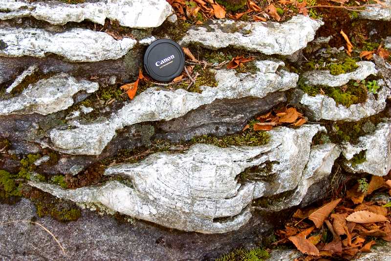
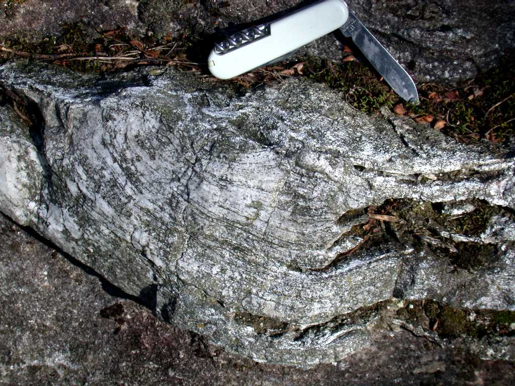
Stop 4 - Outcrops of inverted stromatolitic
carbonate , (stromatolitic carbonate 1,
stromatolitic carbonate 2 - the latter two
photographs courtesy of Jim Franklin) in unit 4
(Table of Formations) at the junction of the
Sylvia Lake road with the entrance road to the Balmat zinc mine (UTM 567460,
4901639). Supposed stromatolitic structures are preserved in blocks
floating in highly deformed marble.
http://www.csun.edu/~vcgeo005/gentry/tiny.htm - map showing location of stromatolites in the Grenville of Ontario, SE of Bancroft
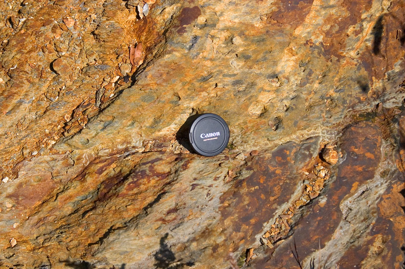
Stop 5 - Outcrop (UTM 468945, 4902873) on the east side of highway 58 to Gouverneur from Fowler of sulphidic staurolite-bearing schist (unit 2, Table of Formations).
Stop 6 - Road-side outcrops (UTM 468256, 4904050) near Poplar Hill of migmatitic gneiss underlying the Balmat carbonate units.
DAY 3 - Marcy Anorthosite, Au Sable Forks Syenite, and the Sandford Lake Ilmenite and Barton Garnet mines
http://132.203.220.37/cgi-bin/consultau.cgi?27&68&240&282&301&310&316&372&449&606&701&736& - abstracts of papers concerning Grenville anorthosites, unknown source
James M. McLelland, Cory C. Clechenko, John W. Valley, and Michael A. Hamilton. 2004.Direct dating of Adirondack massif anorthosite by U-Pb SHRIMP analysis of igneous zircon: Implications for AMCG complexes Geological Society of America Bulletin: Vol. 116, No. 11, p. 1299–1317.
Abstract: " The average age of this suite (the Marcy and Oregon Dome massifs) of 13 anorthositic samples is 1154 ± 6 Ma (MSWD [mean square of weighted deviates] = 0.26, probability = 0.99). In addition, eight associated granitoids have been dated by SHRIMP techniques and complement another five previously dated by multi-grain thermal-ionization mass spectrometry (TIMS) methods. The 13 granitoids yield an average age of 1158 ± 5 (MSWD = 0.89, probability = 0.60) and are broadly coeval with the massif anorthosite. The overlapping ages provide evidence that these rocks constitute a single, composite anorthosite-mangerite-charnockite-granite (AMCG) suite intruded at ca. 1155 Ma, an age corresponding to the ages of major AMCG suites in the Grenville province in Canada (e.g., Morin and Lac St-Jean)."
J.M. McLelland, J.W. Valley, and E.J. Essene, 2001. Very high temperature, moderate pressure metamorphism in the New Russia gneiss complex, northeastern Adirondack Highlands, metamorphic aureole to the Marcy anorthosite: Discussion
Can. J. Earth Sci. Vol. 38, p. 465-470.Extract: "Alcock and Muller (1999) assert four inferences regarding Grenville gneisses near New Russia, N.Y. (named "New Russia gneiss complex" by them) and the adjacent ca. 1130 Ma Marcy anorthosite massif. These four inferences follow: (1) metamorphism and anatexis of the New Russia complex were due to contact effects in the thermal aureole of the ca.1130 Ma Marcy anorthosite; (2) pressure estimates in the gneiss suggest anorthosite emplacement pressures of ~750 MPa; (3) heat from intrusion of the Marcy anorthosite and coeval anorthosite–mangerite–charnockite–granite (AMCG)plutons caused regional granulite-facies metamorphism of the Adirondack Highlands; and (4) the Marcy anorthosite massif, which commonly is only mildly deformed in its core, is a postkinematic intrusion, thus implying that the Adirondacks experienced no post-Marcy, Ottawan orogenesis at ca. 1090–1030 Ma. We consider all four assertions to be seriously flawed"
Conclusions : "The available evidence documents that the ca.1130 Ma Marcy massif was overprinted by the regional ca.1090–1030 Ma Ottawan Orogeny and contains fabrics and granulite-facies metamorphic assemblages due to that event. The polymetamorphic models previously established by the present authors, including a relatively shallow level of emplacement for the Marcy massif, continue to be the only ones consistent with a thorough and unbiased treatment of all the data."
*************************************************
Map of route - Tupper Lake, Au Sable Forks, Sandford Lake, and Gore Mountain regions
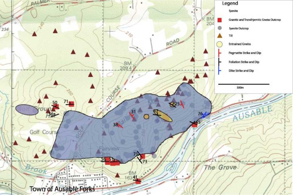
Geological map of the Au Sable syenite - Russel, S. 2003, B.Sc thesis ( http://publish.uwo.ca/~sdrussel )
Geology and Geochemistry of the Ausable and Wanakena Fayalite-Augite Syenites, Adirondack Mts., New York
Abstract: Fayalite-augite syenites are the latest intrusives in the Adirondack region of the Grenville Province (1047 ±2.2Ma from McLelland et al, 2001) ; accordingly, their petrogenesis provides insight into crustal conditions late in the Grenville Orogeny. Probable origins of these syenites are: (1) partial melt of Anorthosite-Mangerite-Charnockite-Granite suite rocks (AMCG) (McLelland et al., 2001) (2) a facies of the Lyon Mountain Gneiss (LMG) (Whitney et al., 1993).
Spatial, temporal, and geochemical association link s fayalite-augite syenites and LMG (granitic facies – a minimum temperature melt); however, lack of penetrative foliation in the Ausable syenite as well as the observation of deformed entrained enclaves of LMG requires that syenite intrusion occurred after metamorphism of the LMG.
Comparable major and trace element concentrations indicate that fayalite-augite syenites likely formed in similar crustal source regions under comparable P-T conditions. It has proven difficult to explain why fayalite-augite syenites show such high geochemical homogeneity. High temperatures of crystallization may explain anomalously high Ga contents (27-45 ppm). Whole rock and mineral compositions constrain melt temperatures ranging from 720-780oC. Comparison of pyroxene trace element concentrations with whole rock abundances shows that whole rock content is largely a reflection of the presence of this phase.
The Rb-Sr-Ba ternary system and Harker diagrams of AMCG and LMG data illustrate increasing concentrations in refractory and incompatible elements. Fayalite-augite syenites fall high in these trends and indicate that melts formed from partial melting.
Within AMCG granitic suites, fractional crystallization is the dominant process; however, since fayalite-augite syenites are so homogeneous they are difficult to group into these trends. With limited refractory phases and inclusions, as well as geochemical homogeneity, it is proposed that fayalite-augite syenites formed from high degrees of partial melting of a refractory quartzo- feldpathic source region that was dehydrated and reduced during prior metamorphic and partial melting extraction events.
*************************************************
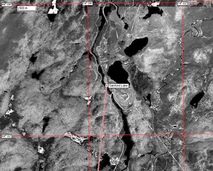
Newcomb - Sandford Lake Ilmenite region
Caveat - be mindful of 'No Trespassing' signs in the area of the now closed Sandford Lake mine - the Newcomb state
troopers are unremitting in their prosecution of unsuspecting tourists !!!
Airphoto of Sandford Lake Mine
Short history of mining in the Newcomb/Sandford Lake area - http://www.newcombny.com/history.htm
Archibald McIntyre sent his son John, and Duncan McMartin, to search for silver in the Adirondack Mountains.
According to legend a young Indian led them to the site where they found large quantities of iron ore on the outskirts of Newcomb Village. They formed the Adirondack Iron & Steel Company. Some of the buildings as well as the blast furnace are still on the site. Later, the Adirondack Steel Company mine was sold to The National Lead Company who discovered titanium in the area, which was used for paints during the Second World War. The property and developed titanium site is Previously owned by NL Industries. In 2003 the property was purchased by the Open Space Institute. In 1963, The National Lead Company moved the entire Village of Tahawus to the Winebrook area in Newcomb, so they could expand their mining operations. Many of the employees retired and live in Newcomb. In 1990 the Mine closed due to economics.
References:
Hayburn, M.M., 1960, Geological and geophysical investigations of the Sanford Hill orebody extension, Tahawus, New York: Unpubl. M.S. Thesis, Syracuse University, 48 p.
Kelly, W., 1979. Chemisty and genesis of titaniferous magnetite and related ferromagnesian silicates, Sanford Lake deposits, Tahawus, New York, Ph.D. thesis, University of Massachusetts, pp. 199.
Kolker, A., 1982. Mineralogy and geochemistry of Fe-Ti oxide and apatite (Nelsonite) deposits and evaluation of the liquid immiscibility hypothesis. Econ. Geol., 77: 1146-1158.
Lindsley, D.H., 1991, Origin of Fe-Ti oxide deposits in the LAC: in Geology and Geochronology of the Adirondacks and the Nature and Evolution of the Anorthosite-Mangerite-Charnockite-Granite (AMCG) Suite, McLelland, J. and Chiarenzelli, J., eds., IGCP-290 Anorthosite Conference, September 1991.
McLelland, J., Kelly, W.M., and Peterson, E.U., 1993, Magnetite-ilmenite ores at Sanford Lake: in E.U. Peterson, J.F. Slack , and T.W. Offield, ed., Selected Mineral Deposits of Vermont and the Adirondack Mountains, New York, Society of Economic Geologists Guidebook Series, 17, 10-16.
Related Links:
http://www.mrnfp.gouv.qc.ca/mines/quebec-minier/qc-minier-substances-ilmenite.jsp - ilmenite
http://www.ngu.no/prosjekter/Geode/Moi-information/REPORT%20GEODE%20ROG%202001%20_9%20okt_.pdf -
Field workshop in the Rogaland Anorthosite Province 8-12 July 2001. GEODE project: Ilmenite Deposits in the Rogaland Anorthosite Province
Subproject under the GEODE Fennoscandian Shield project.Report edited by: Are Korneliussen
http://www.mrn.gouv.qc.ca/english/mines/spots/spots-hot-diamonds-2003.jsp - Massive magmatic hemoilmenite deposit at Longue-Pointe-de-Mingan
By Abdelali Moukhsil, Resident Geologist, and Serge Perreault, Resident Geologist, June 10, 2003.
Abstract: The mineralization consists of a hemoilmenite assemblage (coarse grains of ilmenite with 25 to 35% hematite lamellae) with accessory spinel. Unlike the Tio Mine mineralization, magnetite is present between the grains of ilmenite. In addition, the MgO content is lower than at the Tio Mine (McCann, 1997).
The Mingan Titanium Option is underlain mainly by anorthosite and leuconorite, typical of the Havre-Saint-Pierre Anorthositic Suite (; Gobeil et al. 2002). Surface rocks and drilling also reveal a noritic facies and pegmatite dykes. The massive hemoilmenite mineralization is similar to the Tio Mine-type dykes and tabular masses of hemoilmenite. On surface, the mineralized massive hemoilmenite dykes are in sharp contact with the andesine anorthosite.
The Île Ménite deposit of the Mingan Titanium Option is part of a family of iron and titanium deposits associated with the Havre-Saint-Pierre Anorthositic Suite (Perreault, 2001 and Perreault et al. 2003). These deposits are divided into five groups:
the veins, dykes, and tabular accumulations of massive hemoilmenite associated with andesine anorthosite. Generally, this mineralization is closely associated with layers of leuconorite and oxide-rich norite;
the magnetite-, ilmenite-, and apatite-bearing jotunite (or ferrodiorite) dykes or intrusions, generally emplaced at the interface between the anorthosite and the mangerite;
the dykes and ilmenite-, magnetite-, and hercynite-bearing horizons of norite, with veins of hemoilmenite, emplaced in the labradorite anorthosite;
the horizons, accumulations, and dykes of massive titaniferous magnetite emplaced near the borders of the labradorite anorthosite. In certain places, they are associated with an iron- and titanium-oxide-rich jotunite or an oxide-rich gabbronorite;
ilmenite and titaniferous magnetite mineralization associated with the mangerite and monzonite surrounding the anorthositic rocks.
*************************************************
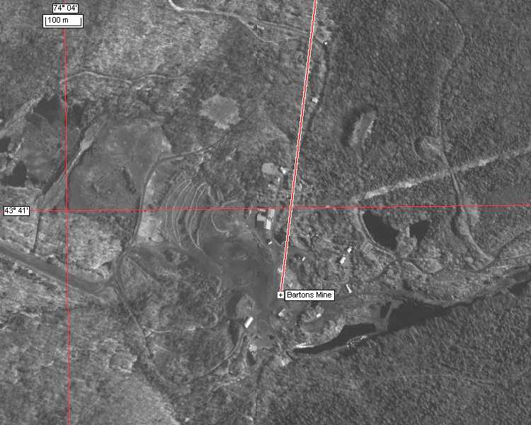
Airphoto of Barton Mine, Gore Mountain
References:
http://www.science.smith.edu/departments/SEM/pages/Erica/SEM.html - very good site on the nature and petrogenesis of the garnets at the Barton Garnet mine.
http://www.science.smith.edu/departments/Geology/Min_jb/AdirodackTrip.pdf - comprehensive field description and set of references for the Barton Garnet mine based on:
Kelly, W.M., and Peterson, E.U., 1993, Garnet ore at Gore Mountain, NY: in E.U. Peterson, J.F. Slack, and T.W. Offield, ed., Selected Mineral Deposits of Vermont and the Adirondack Mountains, New York, Society of Economic Geologists Guidebook Series, 17, 1-9.
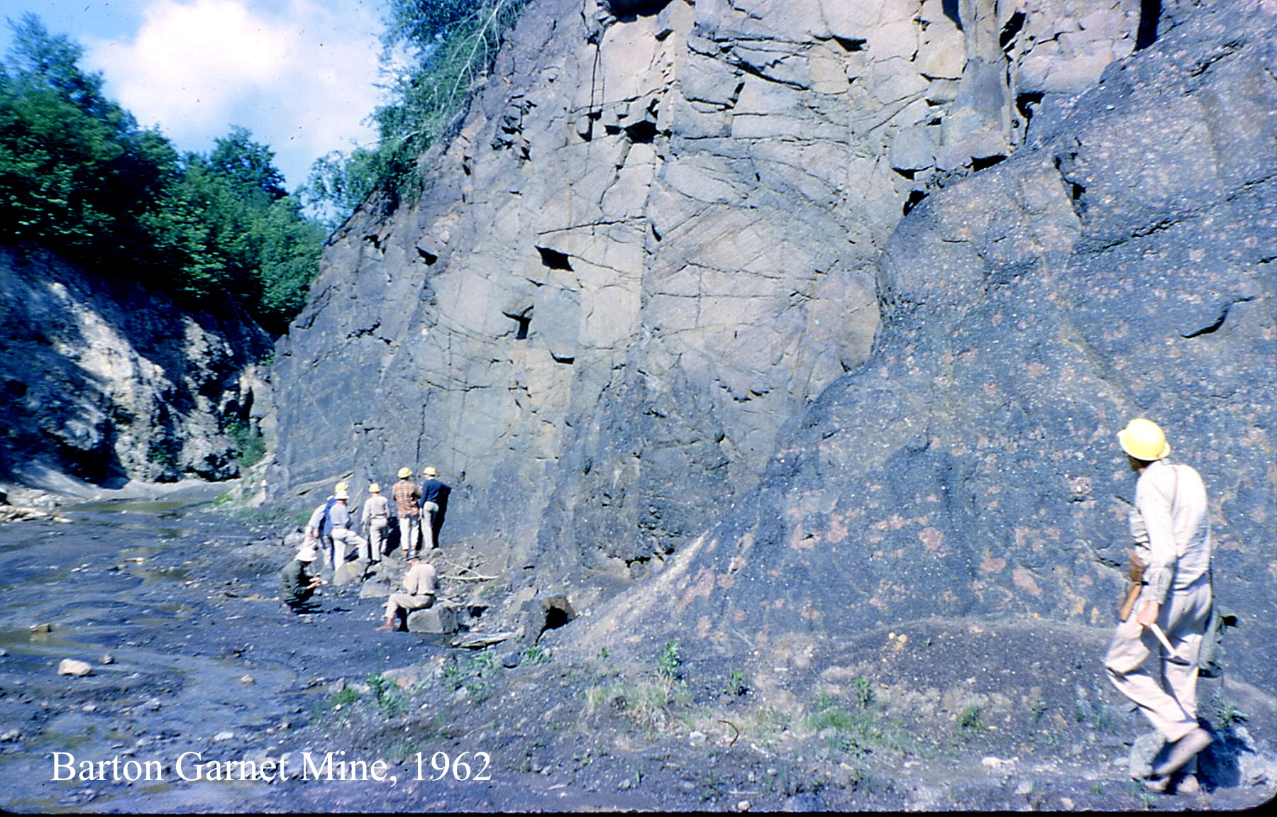
Photographs:
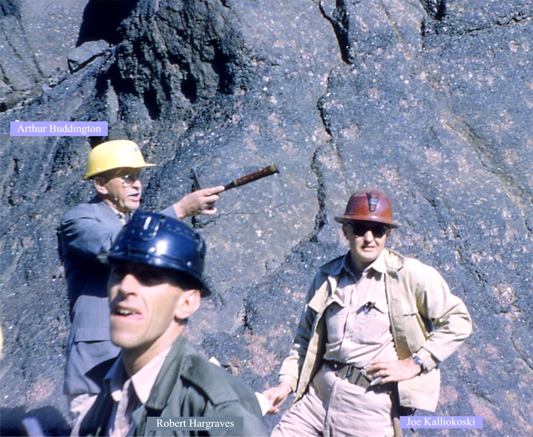
Princeton (Buddington) field trip to the Adirondacks, 1962:
Barton Garnet Mine as it was in 1962
(Read about Buddington connection to Orson Wells at: http://www.jd.gosling.btinternet.co.uk/wotw/radio.htm#top )
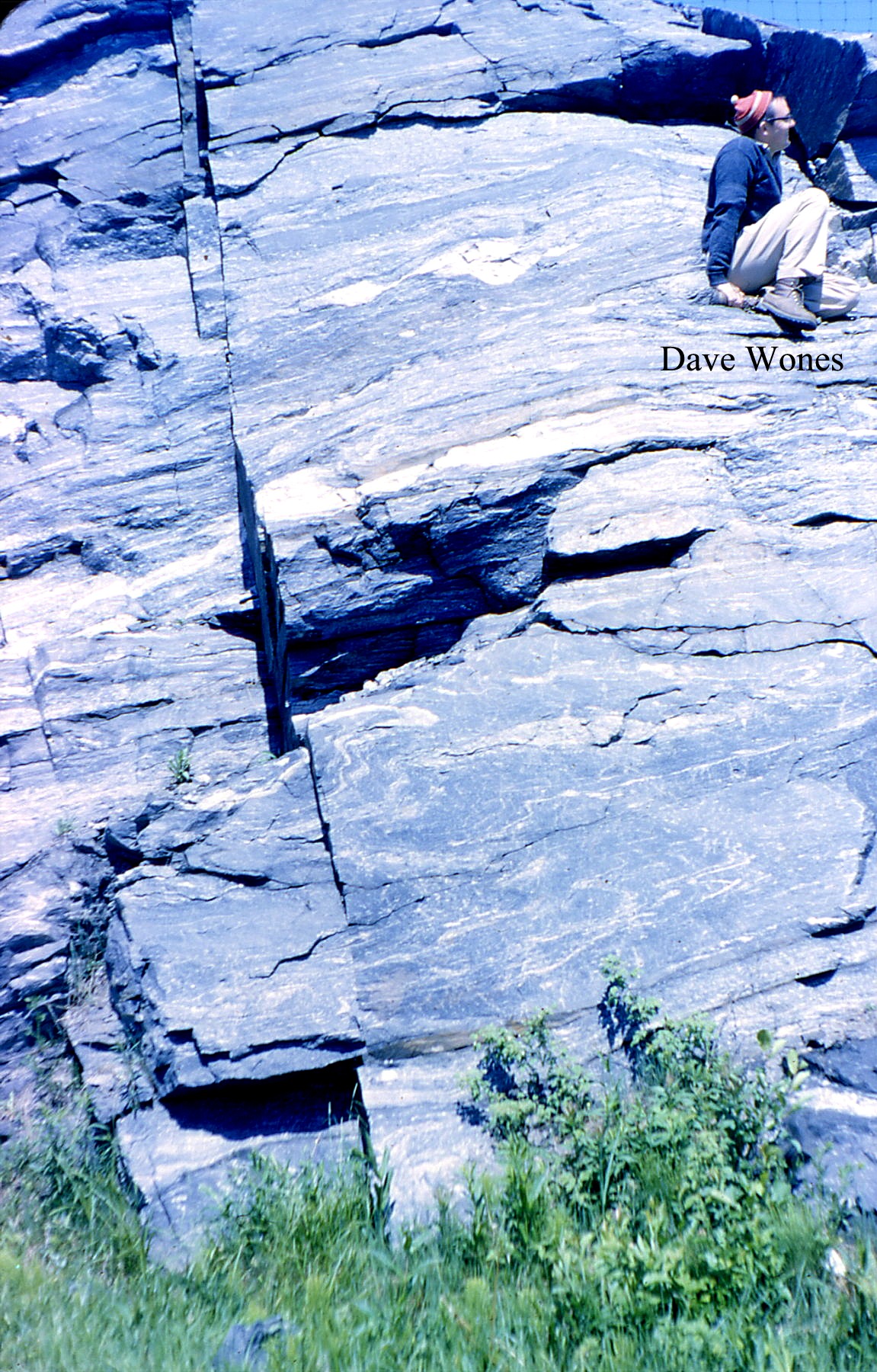
Professor David Wones resting on migmatitic paragneiss of the Grenville
Late afternoon: drive to Marmora iron mine, Tweed, Ontario.
Gold in the Madoc area of Ontario
DAY 4 - return to London
Related Guidebooks:
The Adirondack Mountains- A Section of Deep Proterozoic Crust:
P. M. Hanshaw, Field Trip Guide Book, Volume T164, 1989; , softbound, ISBN 0-87590-592-7, AGU CODE IG1645927. AGU Member Price - $ 14.70 | Nonmember Price - $ 21.00 | AGU Student Member Price - $ 14.70Other geological excursions:
The Southern
Appalachians (in preparation)
![]()
Geology/Geography Field Trip to SE California, Feb. 2004
Guide to aspects of Extensional Tectonics and Gold Mineralization in the SW USA