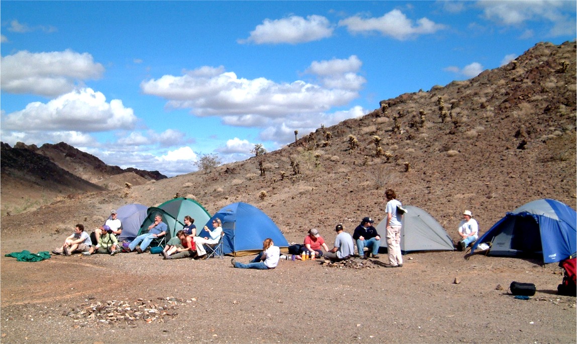
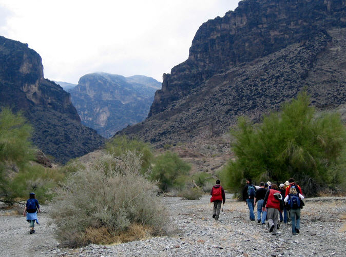
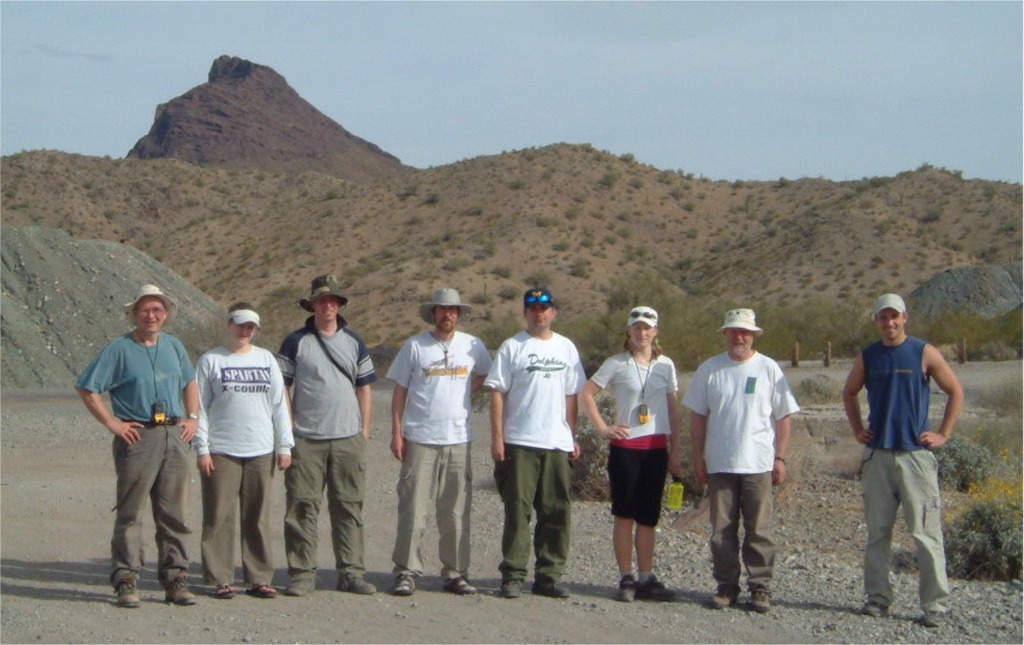
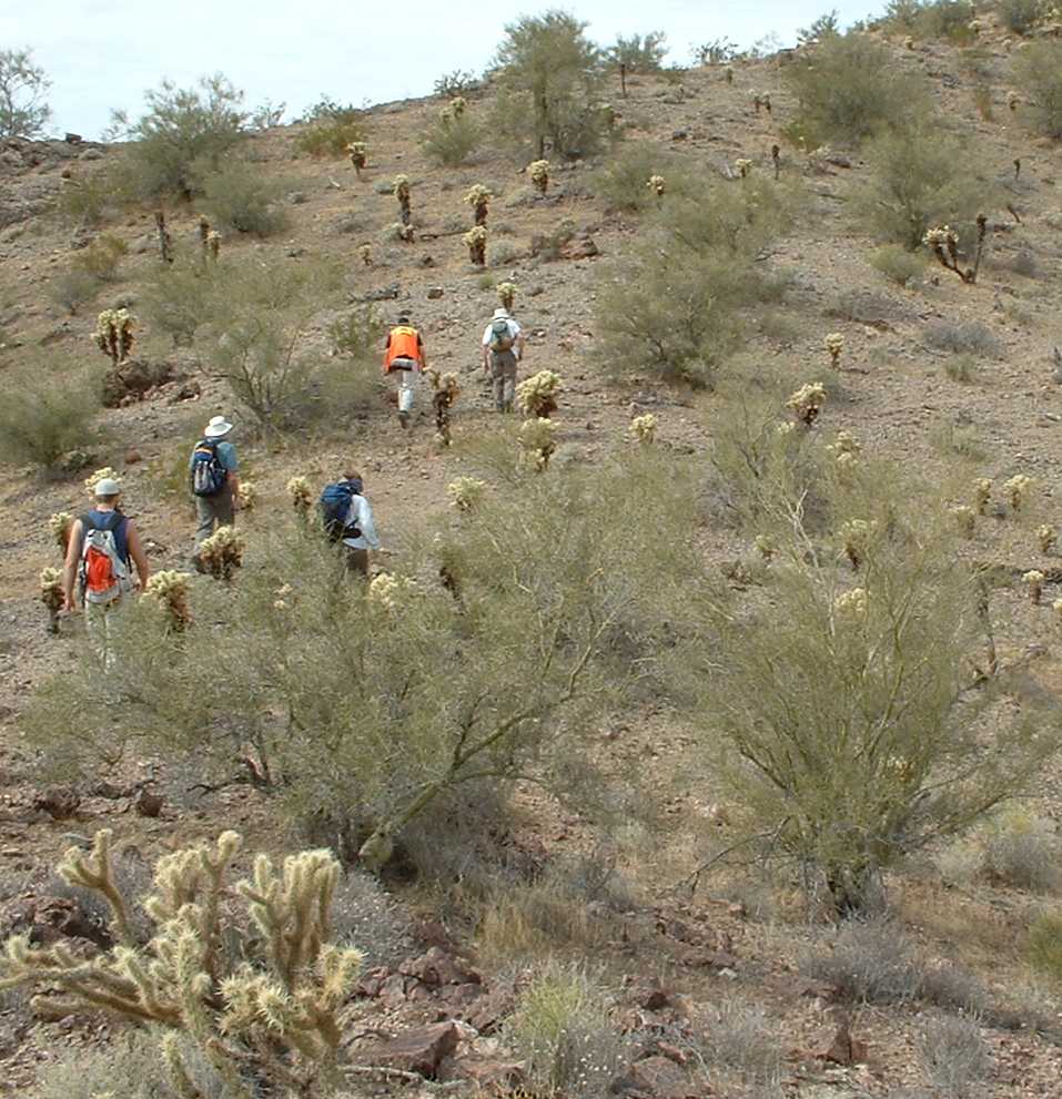
L to R: Mike, Miya, Ryan, Micha, Julie, Andrea, Amy, Emily, Sarah, Jordan, Lindsay, Jeff, Norm, (Bill, Phil, Alex)
hoovernorm&mica.jpg - Trip Leaders Dr. Norm Duke and Dr Micha Pazner at the Hoover Dam.
Many thanks to Ryan and Ian Power for contributed photographs.
E-mail: wrchurchabc@uwoabc.ca (remove the abc); WEB: http://publish.uwo.ca/~wrchurch/
2008 Feb 22 - March 1 Excursion,
Meriem, Norm, Ruikin, Jeffrey, Sonya, Brad, Christine, Alaina
(Click to enlarge)

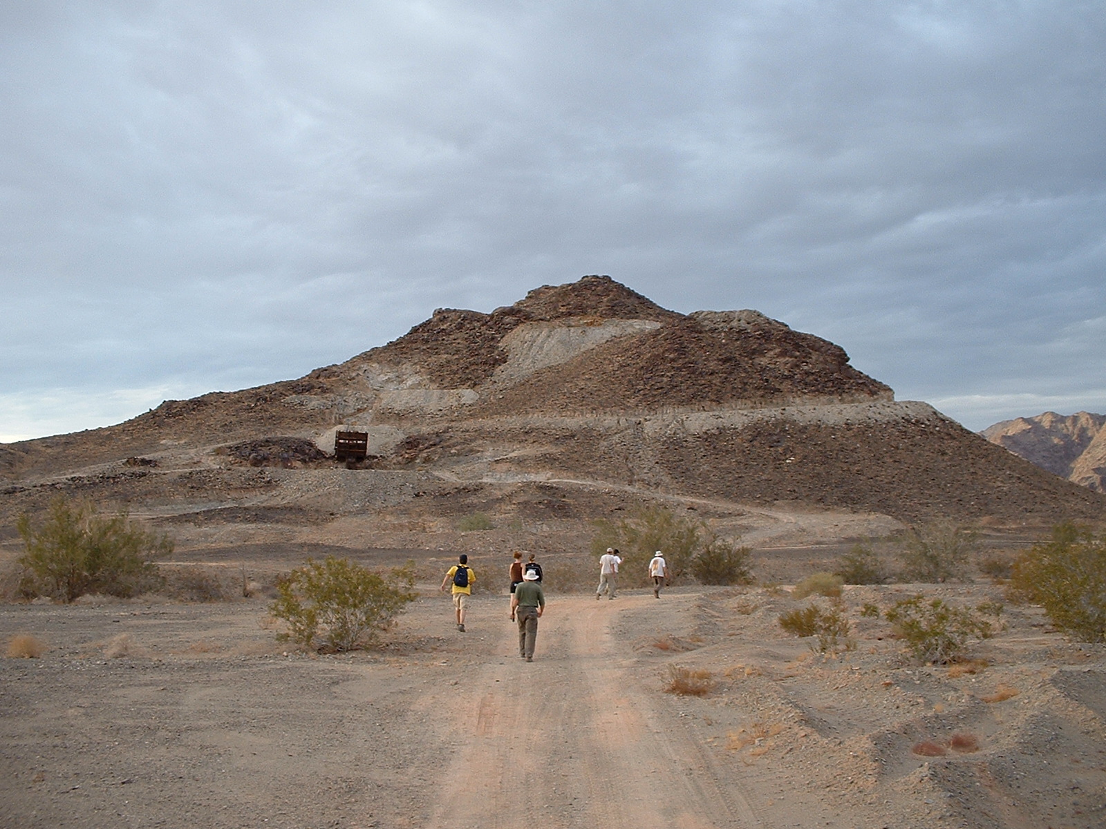
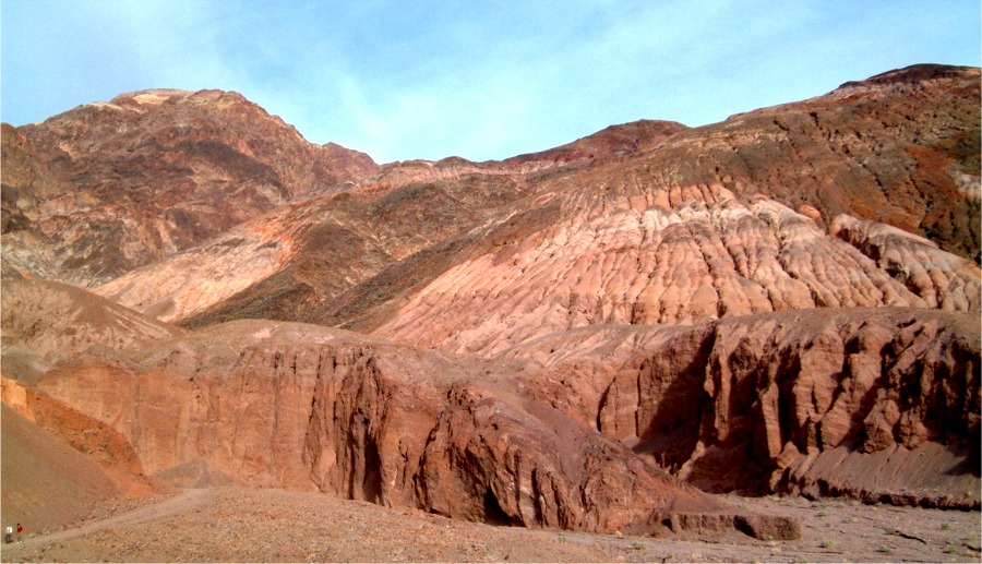
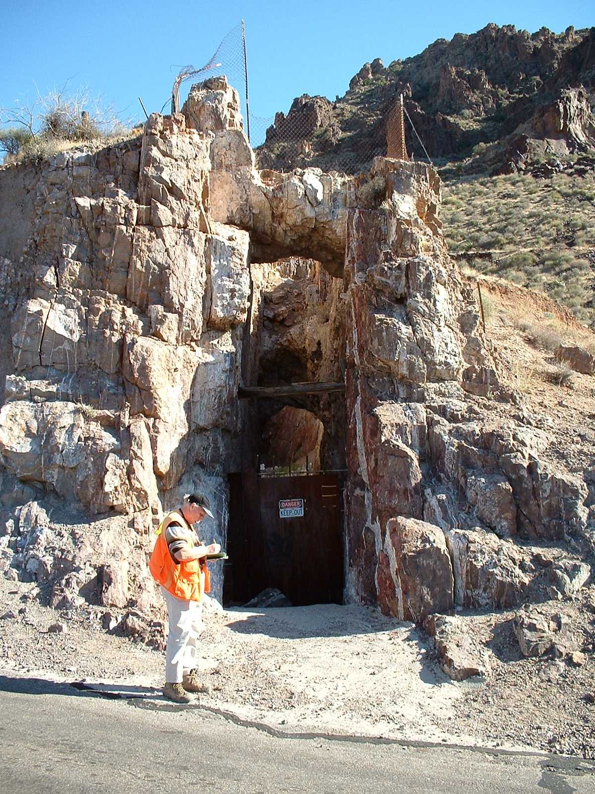
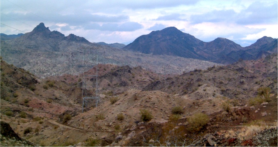
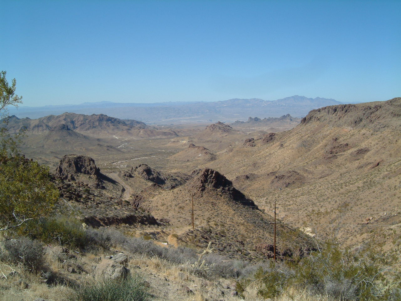
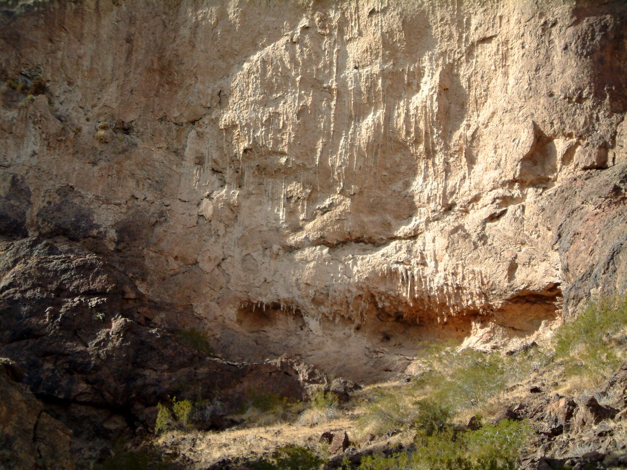
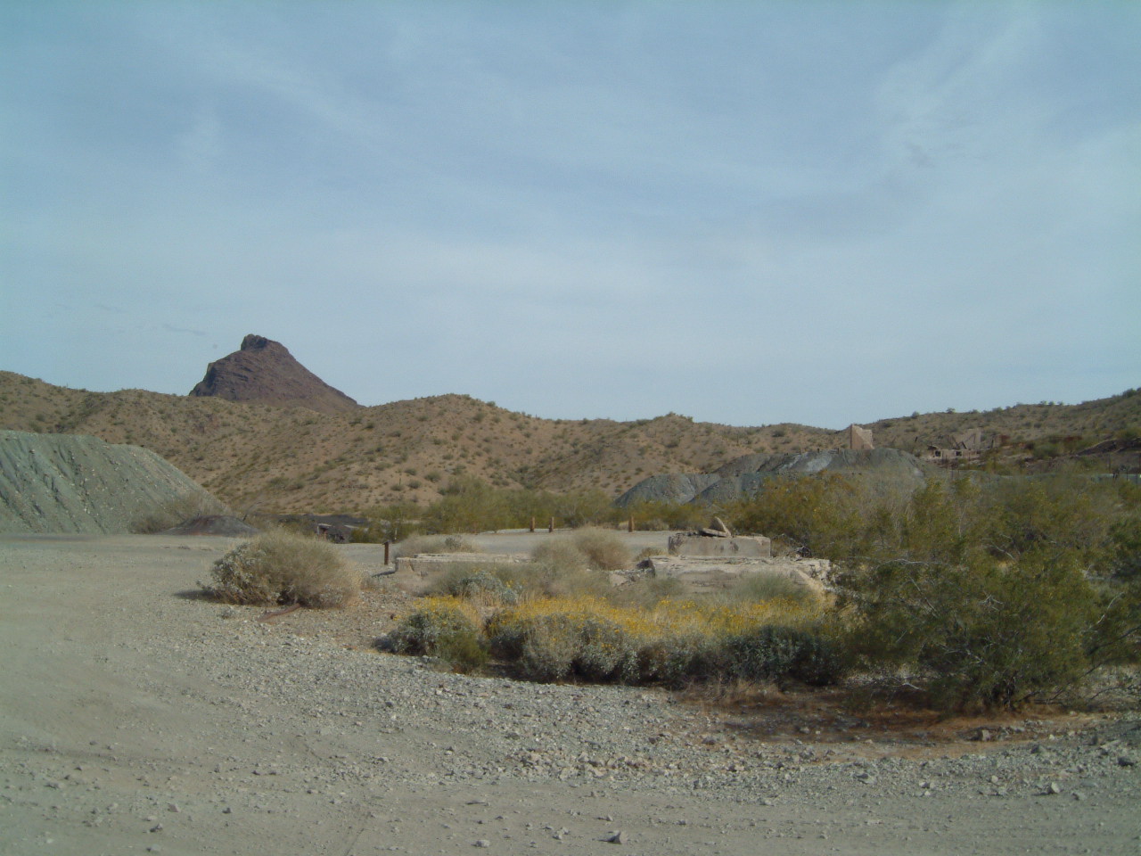
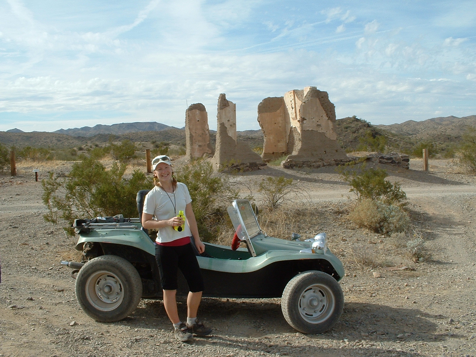
Oatman Mine


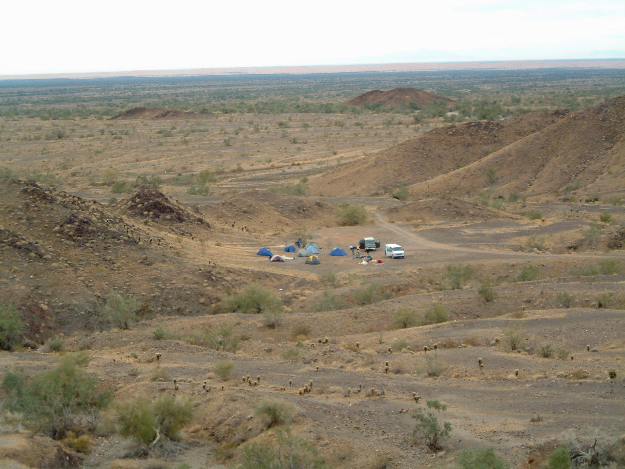
M&S Camping M&R Amargosa Chaos Spring Flowers Briggs Gold Mine
This website contains links to airphotos, topographic maps, satellite images, geologic maps, diagrams, and photographs, relevant to the joint Geology/Geography field trip to SE California in February, 2004/2006. It is not intended as a scientific treatise on extensional tectonics, nor has it yet achieved the status of a fully descriptive field trip guide. It may nevertheless be useful however to others contemplating a field trip to examine the extensional geology and gold deposits of the SW USA.
Airphotos and topo maps were prepared using "EXPERTGPS" . Waypoints shown on the airphotos and topo maps were determined also using "EXPERTGPS" and are given in WGS 84 UTM coordinates. The excursion can also be 'flown' with GOOGLE EARTH, and for this purpose a .kmz file "USA SW.kmz" with placemarks for locations relevant to this excursions can be downloaded from " http://instruct.uwo.ca/earth-sci/fieldlog/Google_Earth/ "
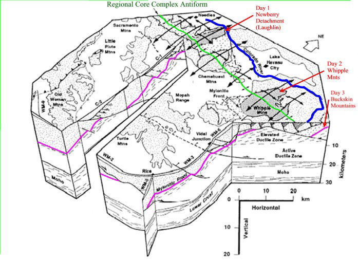
The aim of the field trip is to examine the physical effects of the 'extensional geology' of the Colorado River corridor (detachment faults, mylonites, breccias, etc) and the Death Valley region (turtle-backs, Armagoza 'chaos'); secondly, to ground-truth Aster satellite data in the southern Chocolate Mountains; and thirdly, to examine the temporal and physical relationship of extensional tectonics and gold mineralization in the Oatman and the Whipple, Buckskin, Cargo Muchacho, Black, and Chocolate Mountain regions of Nevada, Arizona and California. Secondary objectives were to examine the Algodones Dune belt, the Pliocene-Pleistocene Painted Canyon section (San Andreas Fault) near Mecca Hills, the recent obsidian domes of the Salton Sea, the hot springs of the Hesperia region, and the Ubehebe Volcanic Crater of the northern Death Valley region.
Keywords: Las Vegas, Lake Mead, Hoover Dam, Mojave, Laughlin, Newberry detachment, Oatman, Parker Dam, Cattail, Whipple, Buckskin, Swansea, Clara Peak, Boise, Lincoln Ranch, Yuma, Picacho, Cargo Muchacho, Chocolate Mountains, Black Mountains, Vitrifax, American Girl, Padre Madre, Hedges, Mesquite, Tumco, Winterhaven, Orocopia, Algodones Dunes, Salton Sea National Wildlife Refuge, Calipatria, Obsidian Butte, Rock Hill, Painted Canyon, Mecca Hills, San Andreas, Joshua Tree, Whitetank, Juniper Flats - Bowen Ranch hot springs, Saline Valley, Panamint Range, Mesquite Springs, Ubehebe, Death Valley, Natural Bridge, Armagoza 'chaos', Valley of Fire, petroglyphs, extension, detachment, dip domains, accomodation zone, breccia, mylonite, brittle/ductile, breakaway, core complex, .Landsat, Aster, gold, iron oxides, chlorite, kyanite, Colorado Plateau, Basin and Range.

![]()
Day 0
- Fly to Las Vegas from Detroit
Day 1
- Laughlin Newberry detachment; Oatman Gold
Day 2
- Whipple Wash detachment
Day 3
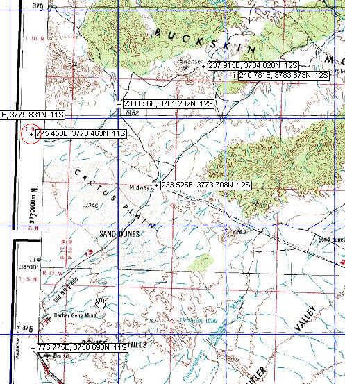
- Buckskin Mountains (Clara Peak/Swansea detachments)
Day 4 - Hess Gold Mine (Chocolate/Gatuna & Picacho
detachments);
Day 5 - Cargo Muchacho (Vitrifax, American Girl)
Day 6
- Mesquite Mine; Chocolate Mountains
Day 7
- Algodones Dunes; Salton Sea (Obsidian Butte); Painted Canyon; Joshua Tree National Park;
(Bowen Ranch Hot Springs, option); Barstow
Day 8 - Death Valley 'Chaos' and Turtlebacks; (Ubehebe Vocanic
Crater, option); Valley of Fire (Red Rock Canyon)
Day 9 - Las Vegas; return to London DAY
1 - Las Vegas to Parker Dam via Oatman and Laughlin (Newberry detachment)
Overnight - Buckskin Arizona State Park south of Parker Dam
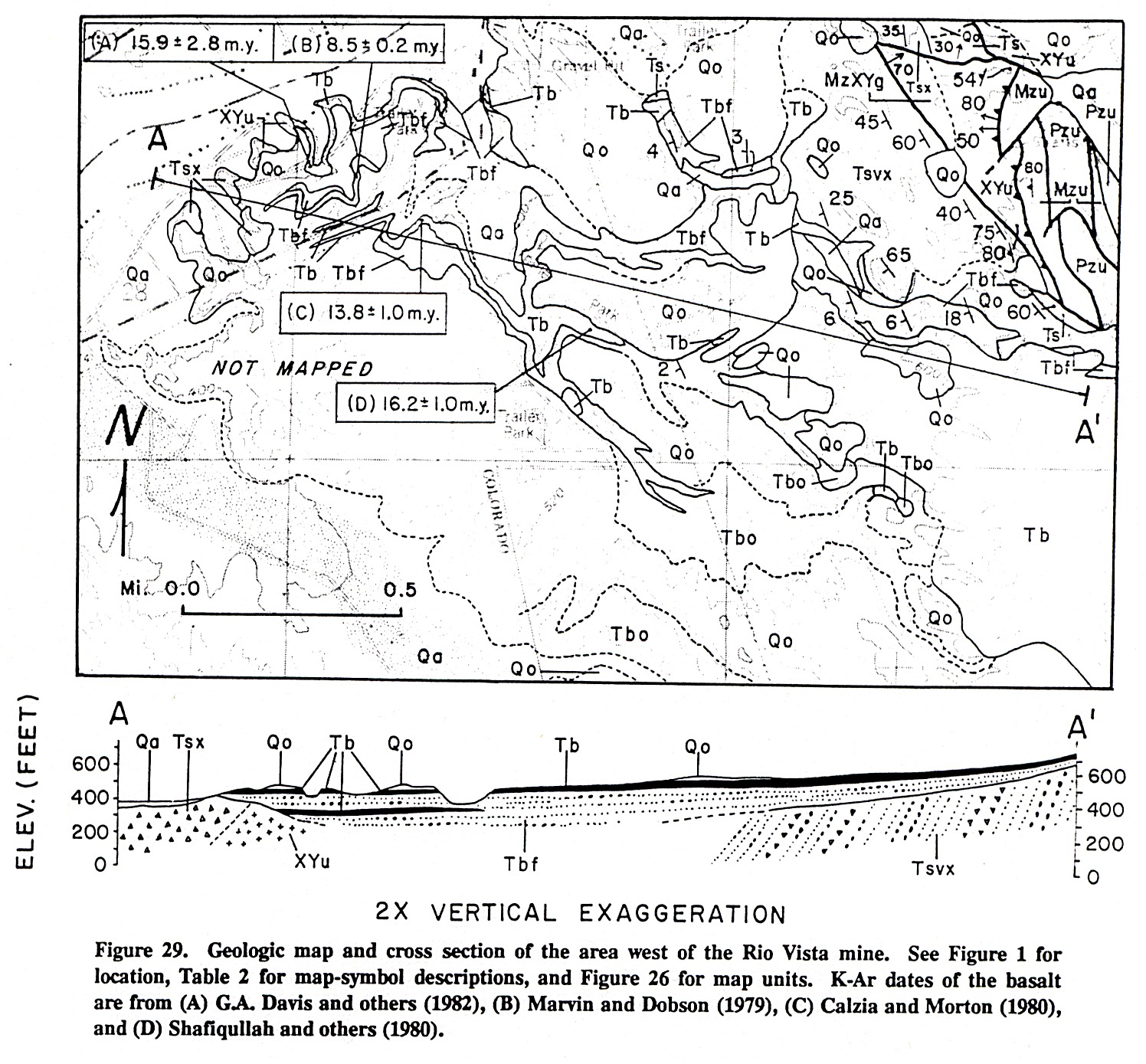
From Durning et al., 1998
http://www.gis.usu.edu/docs/data/nasa_arc/nasa_arc97/SDSU/LaCuesta.pdf
Fig 5
Chronology of events in the Colorado extensional corridor:
Ma
12
|
|
13
|
|
14
|
|
15
|
|
|
Footwall clasts in Breccias
16
|
|
|
Megabreccias
17
| Extension
|
Miocene
18
|
| Peak Slip
19 Volcanism |
|
20
|
|
|
21
|
|
22
|
|
23
| Early mylonitization
24
|
To
see an animation by McQuarrie and Wernicke (2005) of the extensional history of
the SW USA click:
click QuickTime animation link dx.doi.org/10.1130/GES00016.1.s1
at the bottom of the last page of the article.
MOST RECENT PUBLICATIONS
http://www.nbmg.unr.edu/staff/pdfs/NCREC.pdf CENOZOIC EVOLUTION OF
THE NORTHERN COLORADO RIVER EXTENSIONAL CORRIDOR, SOUTHERN
NEVADA AND NORTHWEST ARIZONA JAMES E. FAULDS1, DANIEL
L. FEUERBACH2*, CALVIN F. MILLER3, AND EUGENE I. SMITH4 4Department of
Geoscience, University of Nevada, Las Vegas, NV 89154 Utah Geological
Association Publication 30 - Pacific Section American Association of Petroleum
Geologists Publication GB78 The Geologic Transition,
High Plateaus to Great Basin - A Symposium and Field Guide, The Mackin Volume,
2001. ABSTRACT
The northern Colorado River extensional corridor is a 70- to 100-km-wide region
of moderately to highly extended crust along the eastern margin of the Basin and
Range province in southern Nevada and northwestern Arizona. It has occupied a
critical structural position in the western Cordillera since Mesozoic time. In
the Cretaceous through early Tertiary, it stood just east and north of major
fold and thrust belts and also marked the northern end of a broad, gently (~15
deg) north-plunging uplift (Kingman arch) that extended southeastward through
much of central Arizona. Mesozoic and Paleozoic strata were stripped from the
arch by northeast-flowing streams. Peraluminous 65 to 73 Ma granites were
emplaced at depths of at least 10 km and exposed in the core of the arch by
earliest Miocene time.
Calc-alkaline magmatism swept northward
through the northern Colorado River extensional corridor during early to middle
Miocene time, beginning at ~22 Ma in the south and ~12 Ma in the north. Major
east-west extension followed the initiation of magmatism by 1 to 4 m.y.,
progressing northward at a rate of ~3 cm/yr. The style of volcanism changed
during the course of east-west extension. Eruptions of calc-alkaline to mildly
alkaline mafic to intermediate magmas predated extension. Calcalkaline to mildly
alkaline mafic, intermediate, and felsic magmas were prevalent during major
extension. Tholeiitic and alkalic basalts were then erupted after significant
block tilting. The most voluminous volcanism occurred in early Miocene time and
was accompanied by mild north-south extension. Belts of east-west extension
bordered the region to both the north and south in early Miocene time.
Large-magnitude east-west extension engulfed nearly the entire region in middle
Miocene time, beginning in most areas ~16 Ma and ending by ~9 Ma. Tilt rates
commonly exceeded 80o/m.y. during the early stages of east-west extension.
Although less voluminous than that in
the early Miocene, volcanism generally spanned the entire episode of extension
south of Lake Mead. Thus, thick volcanic sections, as opposed to sedimentary
rock, accumulated in many growth-fault basins. The northward advancing magmatic
front stalled, however, in the Lake Mead area along the southern margin of the
southern Nevada amagmatic gap. Thus, Tertiary sections in the Lake Mead area are
dominated by sedimentary units, including alluvial fan, continental playa, and
lacustrine deposits. During middle Miocene extension, strain was partitioned
into a west-dipping normal-fault system in the north and an east-dipping system
in the south. The two fault systems and attendant opposing tilt-block domains
overlap and terminate within the generally east-northeast-trending Black
Mountains accommodation zone. Major east-west extension was contemporaneous on
either side of the accommodation zone. The west-dipping normal fault system in
the north is kinematically linked to major strike-slip faults along the northern
margin of the corridor, where a complex three-dimensional strain field,
involving both east-west extension and north-south shortening, characterized the
middle to late Miocene.
The transition between the Colorado
Plateau and the Basin and Range is unusually sharp along the eastern margin of
the northern Colorado River extensional corridor and is marked by a single
west-dipping fault zone, the Grand Wash fault zone.
Subhorizontal, relatively unfaulted
strata on the Colorado Plateau give way to moderately to steeply east-tilted
fault blocks across the Grand Wash fault zone. Topographic and structural relief
across this boundary developed during middle Miocene extension and was
established by 9 Ma. The location and abruptness of the Colorado Plateau-Basin
and Range transition in this region may have been controlled by an ancient
north-trending crustal flaw, inasmuch as it follows a diffuse boundary between
Early Proterozoic crustal provinces.
(Department of Geology and Geophysics, University
of Wyoming, Laramie, Wyoming 82070-3006)1999. Sedimentation patterns support
seismogenic low-angle normal faulting, southeastern California and western
Arizona. GSA Bulletin, v. 111, p. 1350–1370.
ABSTRACT
indicate deposition during seismically active
low-angle normal faulting. These data complement existing structural,
isotopic, and fission-track
studies, which show that the regionally developed
Chemehuevi-Sacramento detachment-fault system was initiated and allowed
movement of
the hanging wall over more than 18 km within the
seismogenic regime at moderate to low angles of dip (
detachment-fault system are corrugated parallel
to the east-northeast transport direction, resulting in broad mullion
structures (50–550 m
amplitude and 1.5–10 km wavelength). Slip
occurred along the rooted fault system between ca. 23 and 12 Ma; the
average slip rate was
at the base of the section constitute 40% to 50% of most basin fills.
Alluvial-fan conglomerate, sedimentary breccia, and megabreccia
(somewhat >15.5 to somewhat <13.9 Ma) dominate the unconformably
overlying sedimentary succession. Decreasing dip angles in
progressively younger strata through this volcanic-sedimentary
succession, and angular unconformities between units, form corroborative
evidence with geochronologic data and show that these strata accumulated
during extension. Sedimentary facies and clast types indicate
proximal deposition in small basins distributed along
east-northeast–trending regions that parallel and overlie synforms in
the underlying
corrugated Chemehuevi-Sacramento detachment fault. The composition,
thickness, and distribution of these volcanic and sedimentary strata
support their accumulation near a gently dipping normal fault. Clast
types show an inverted stratigraphy recording erosion to progressively
deeper structural levels in the source region. Emplacements of thick
(<750 m) megabreccias (rock-avalanche deposits), derived from both the
hanging wall and the footwall, were likely triggered by earthquakes.
Tilted and displaced conglomerate and megabreccia (younger than
ca. 15 Ma) contain footwall clasts and indicate breaching of the
detachment fault, erosion of the footwall, and late movement on the
gently
dipping Chemehuevi-Sacramento detachment fault at the Earth's surface.
active and allowed movement at and near the Earth's surface, controlled
the location and fill of basins during progressive extension.
Stratigraphic, structural, and thermal data therefore corroborate and
challenge the assumption that low-angle normal faults are aseismic.
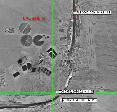
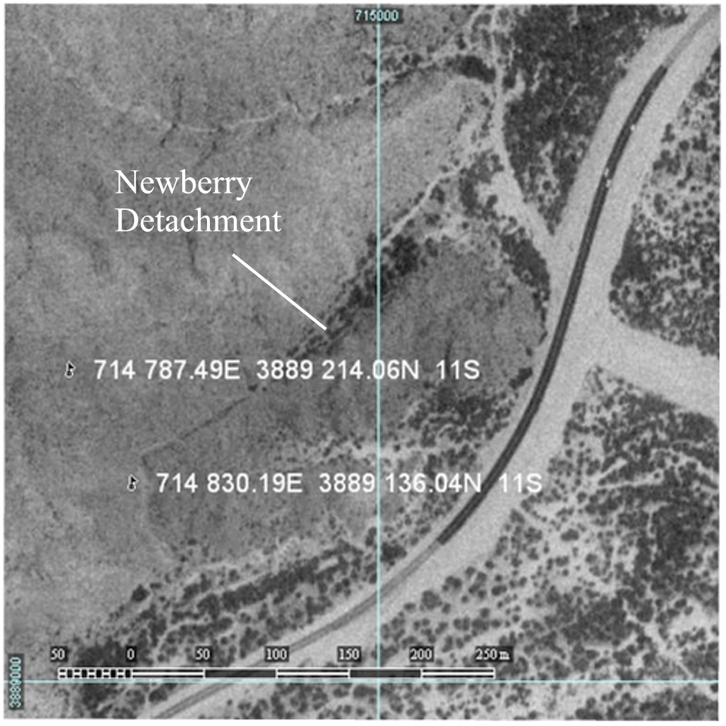
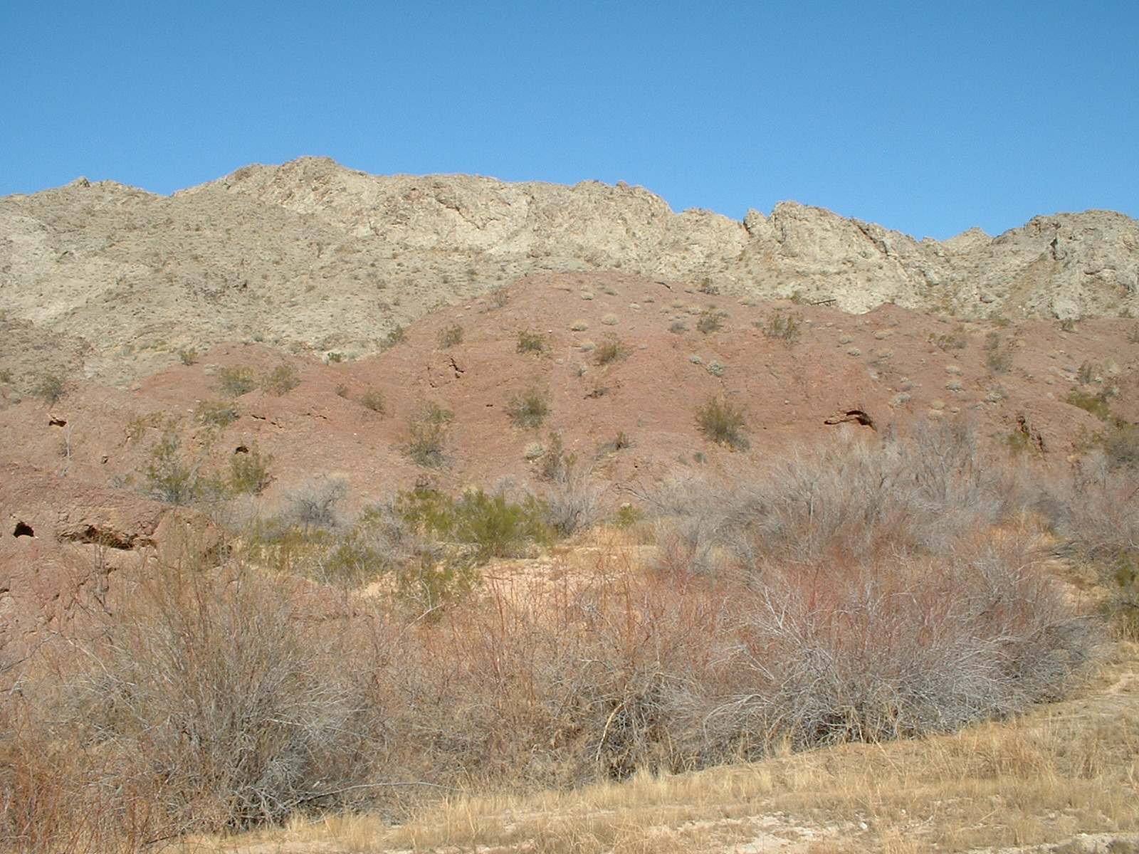
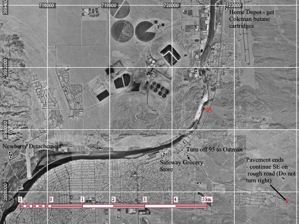
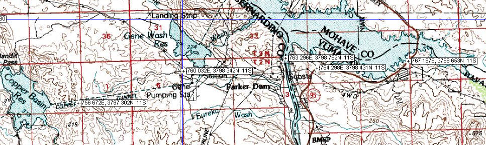
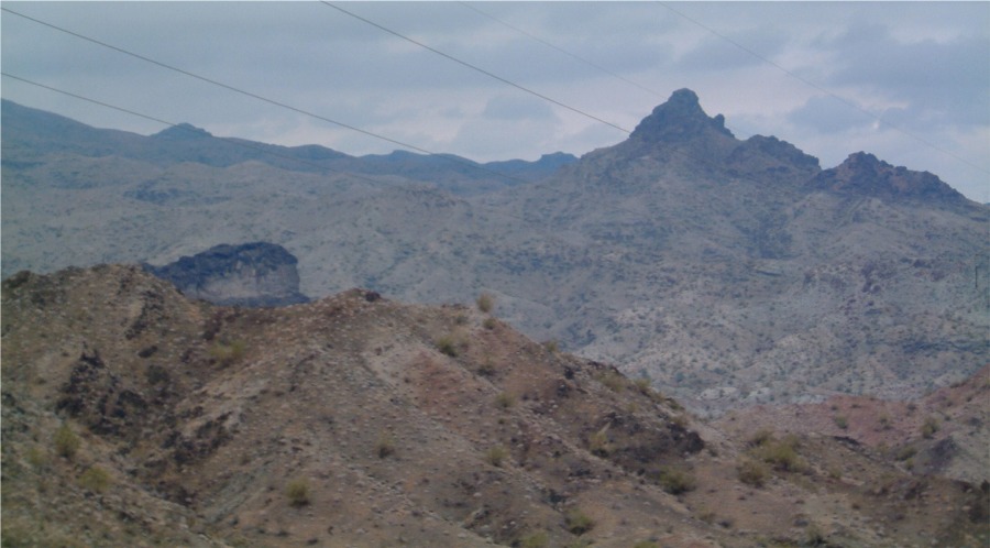
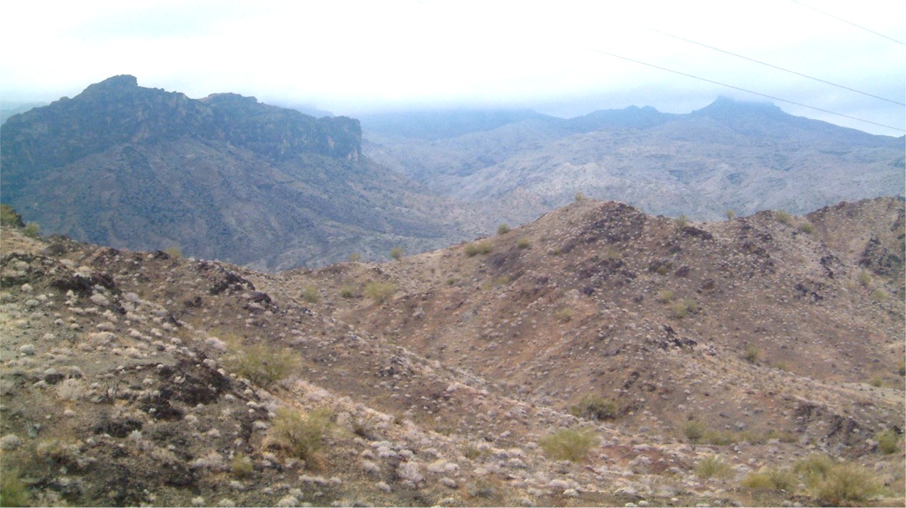
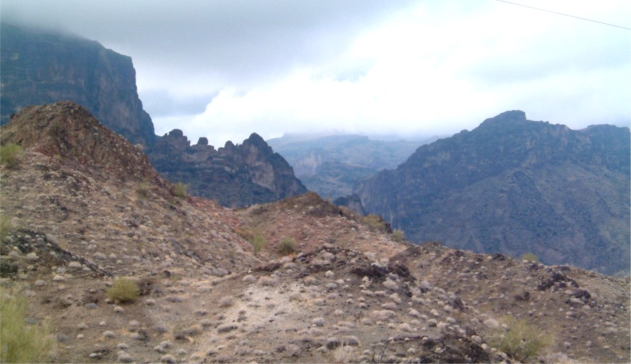
Day 1 route - Laughlin, Oatman, Buckskin Mountain State Park Stop 1 - Laughlin - the Newberry
detachment
Laughlin6ap.jpg - Airphoto of Laughlin,
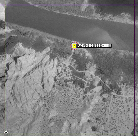
California, UTM: 721354, 3894849 (bridge across the Colorado at Laughlin)
Laughlin7ap.jpg - Airphoto of the approximate
location of the Newberry extensional fault, south of Laughlin, UTM: 714830,
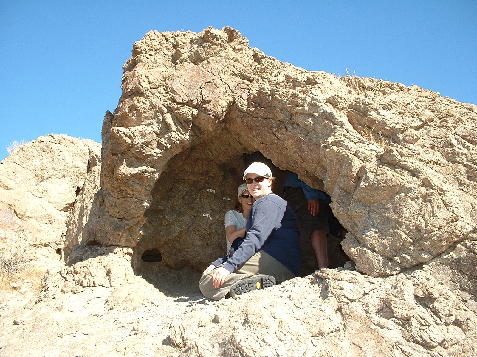
3889136 ian_newb1.jpg - red hematized
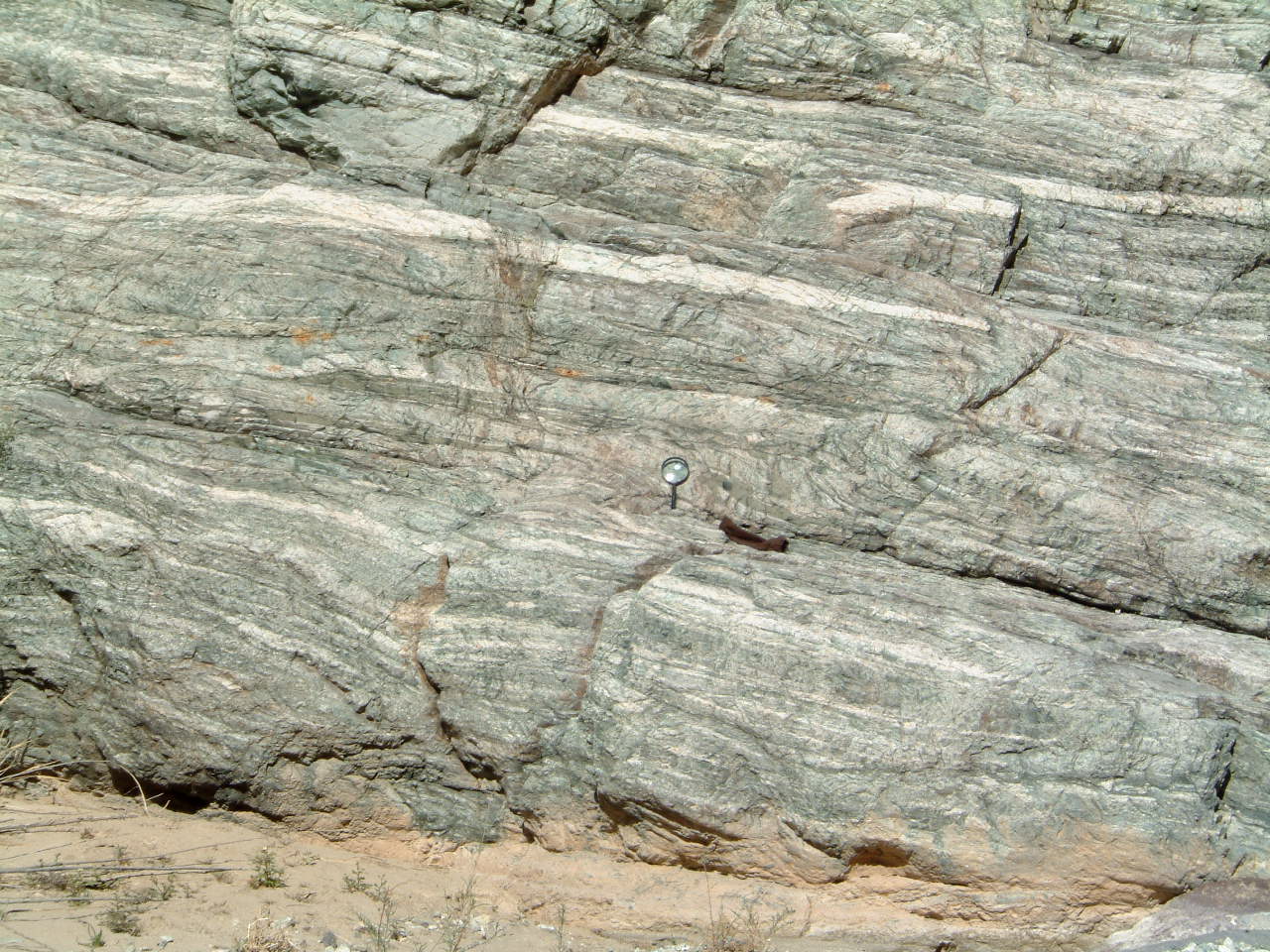
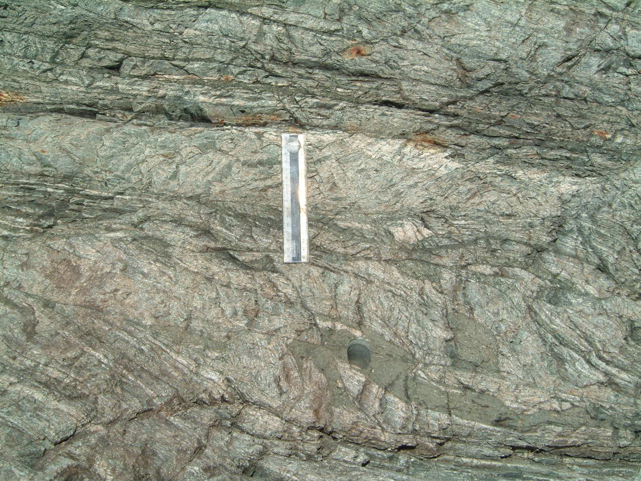
upper plate rocks overlying cataclastic lower plate mylonitic gneiss ian_newb3_bron -
cataclastic lower plate mylonitic gneiss (Cuddfan Bronwen)
Oatmansilvercreekturnoff.jpg
- Airphoto of the turnoff to Oatman from Hwy 95 in Laughlin, UTM: 720 321,
3889 337
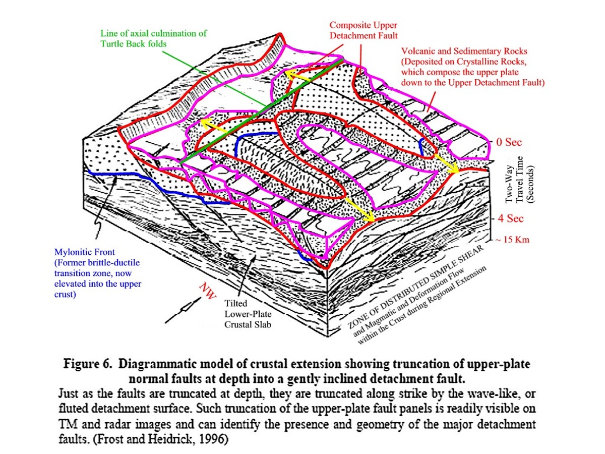
EXPLANATION:
Model of
Crustal Extension w. truncation of upper plate normal
faults by gently inclined detachment fault. (Durning et al.,
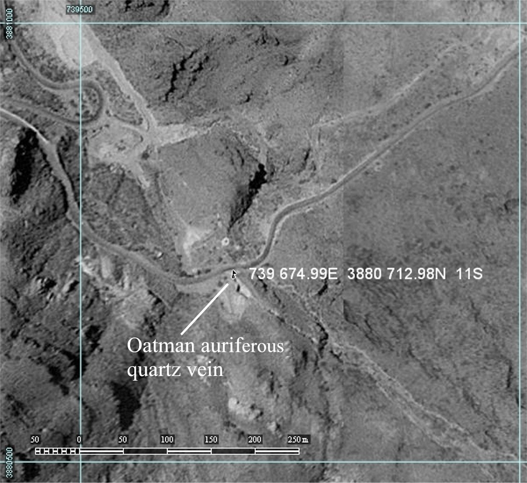
1998, Fig 6) Stop 2 - Oatman Goldroad Mine - gold
associated with a large epigenetic quartz vein
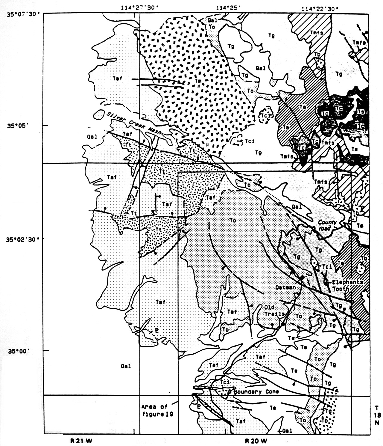
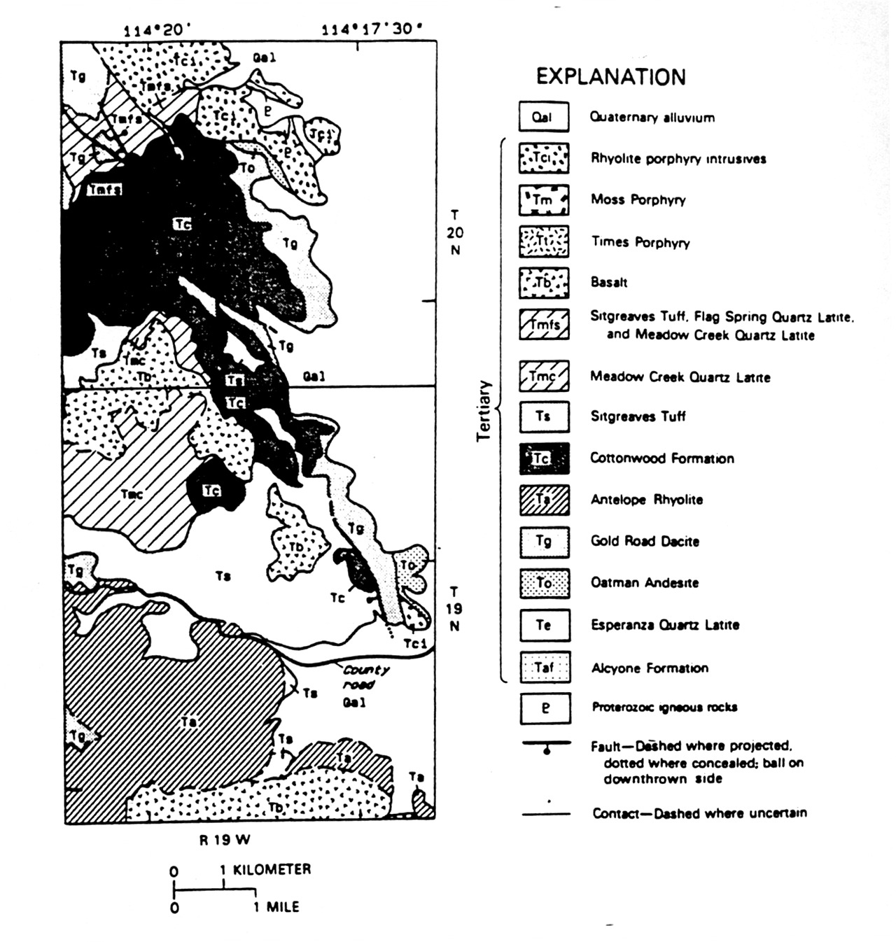
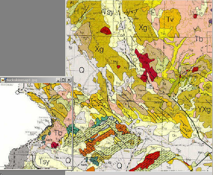
GEOLOGICAL MAPS Oatmangeolleg.jpg
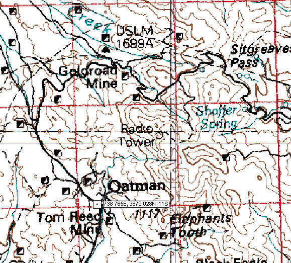
- Geological legend for the above map Oatmangeol.jpg Oatman1.jpg - Topo
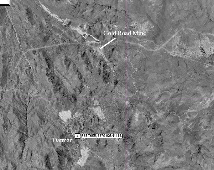
map of the Oatman - Goldroad Mine area OatmanAP.jpg -
Airphoto of the Oatman - Goldroad Mine area; Oatman = 738 765 E, 3879 028
N
OatmangoldroadmineAP.jpg - Airphoto of the auriferous quartz-vein mine site,
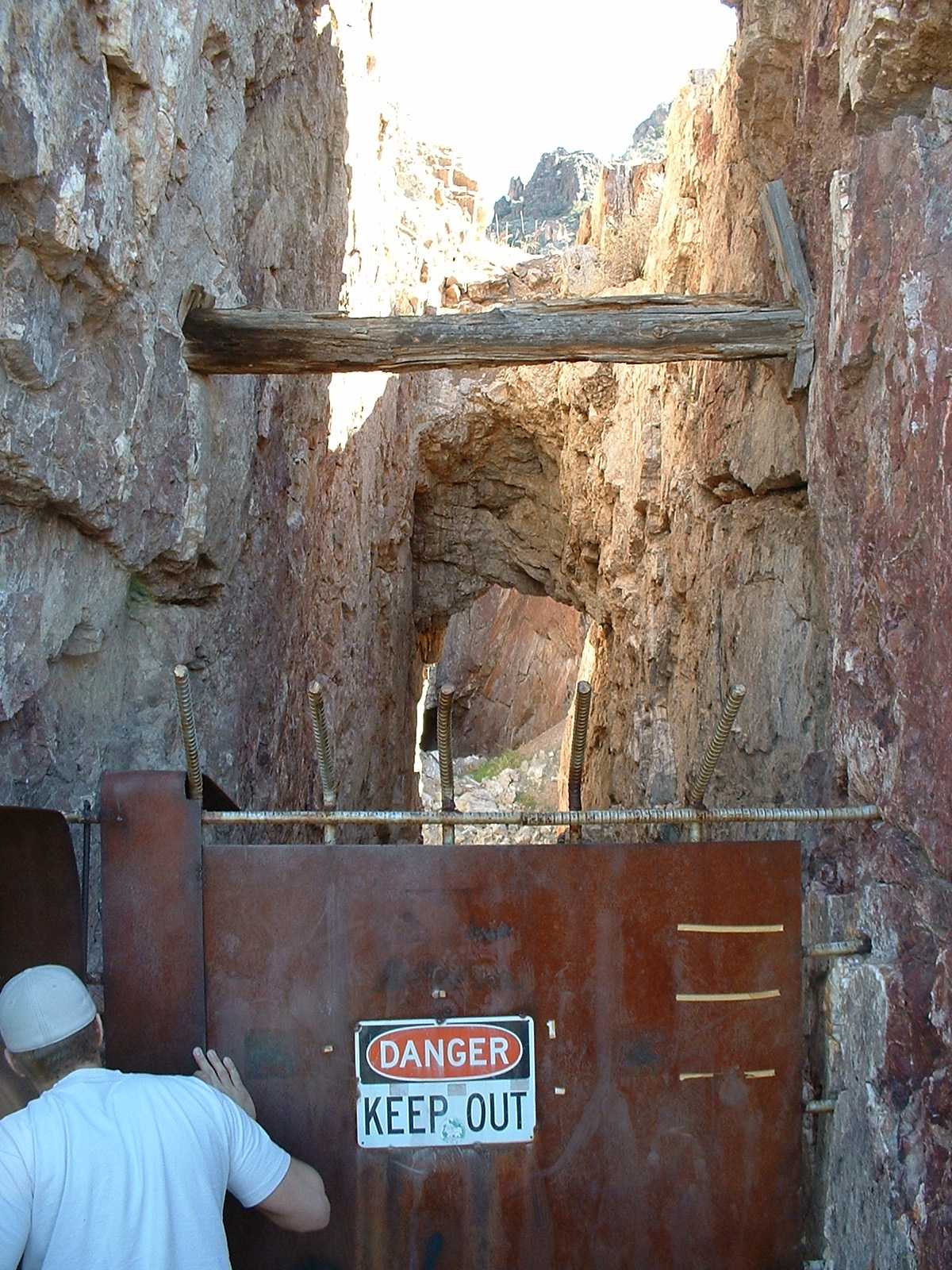
739 675 E, 3880 713 N ian_oat_mine.jpg - old
adit to the gold mine ian_oat_wrc.jpg - ditto
060224_03_oatmanm.JPG 06/04/2001 -
the explanation
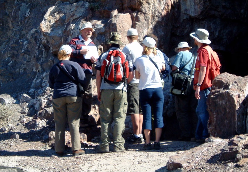
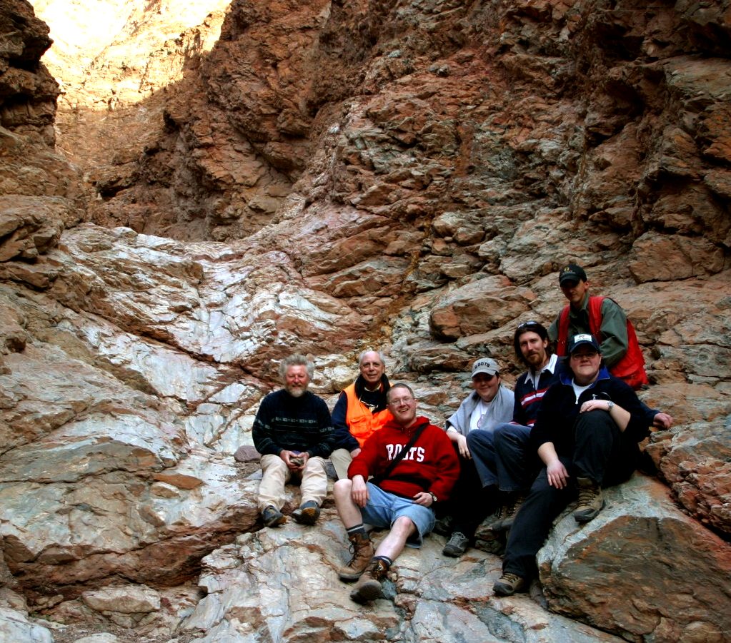
060224_02_oatmanm.JPG 06/04/2001 - the pose (l to r; Norm, Bronwen, James,
Ian, Duncan, Lindsay, Chad, Jeff)
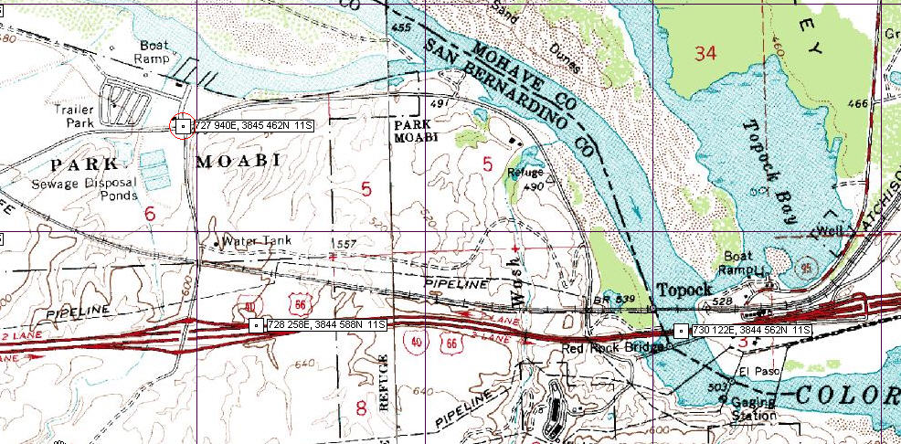
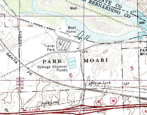
1) Topock Topock1.jpg
- Topo map of Topock Topock2.jpg Topo map
of Park Moabi in Topock topockAP.jpg
Airphoto of Park Moabi in Topock
2a)
Buckskin 2b) Cottonwood
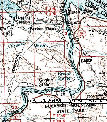
http://www.pr.state.az.us/Parks/parkhtml/buckskin.html Buckskin Mountain State
Park is located on Arizona Highway 95, about 12 miles north of Parker.
The River Island unit is one mile north of Buckskin Mountain State Park at
UTM 763498, 3793965 11S buckmntStprktopo.jpg
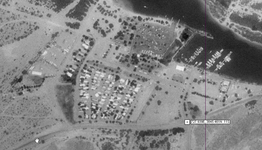
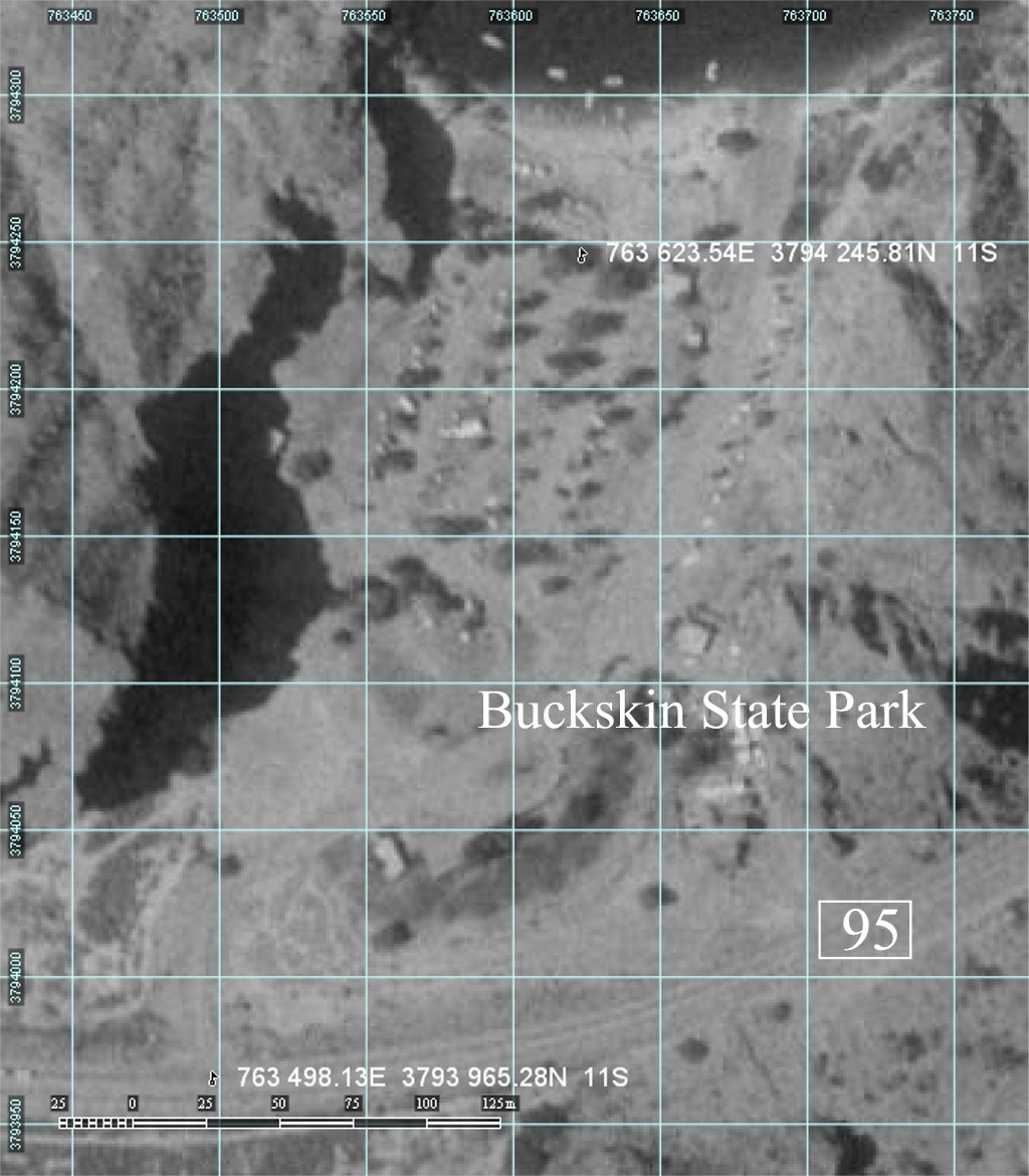
- Topographic map locating the Buckskin Mountains State Park BuckStPk1AP.jpg -
Airphoto of the Buckskin Mountains State Park south of Parker Dam at UTM 763498,
3793965 11S (If the BMSP is full try
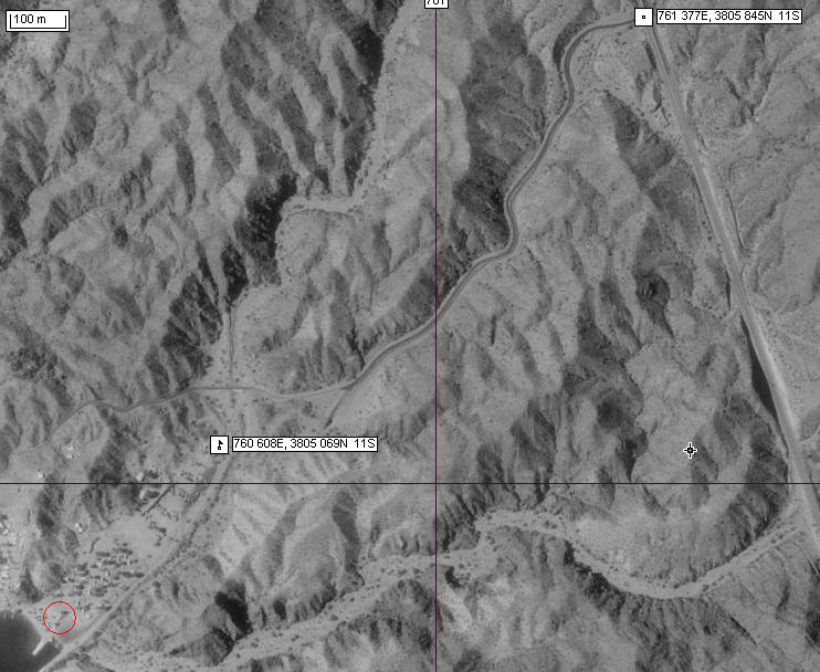
cattailAP.jpg - Cattail State Park, west off hwy 95 north of Parker
Dam at UTM: 761377,3805845 11S)
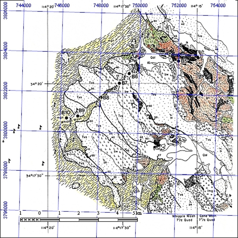
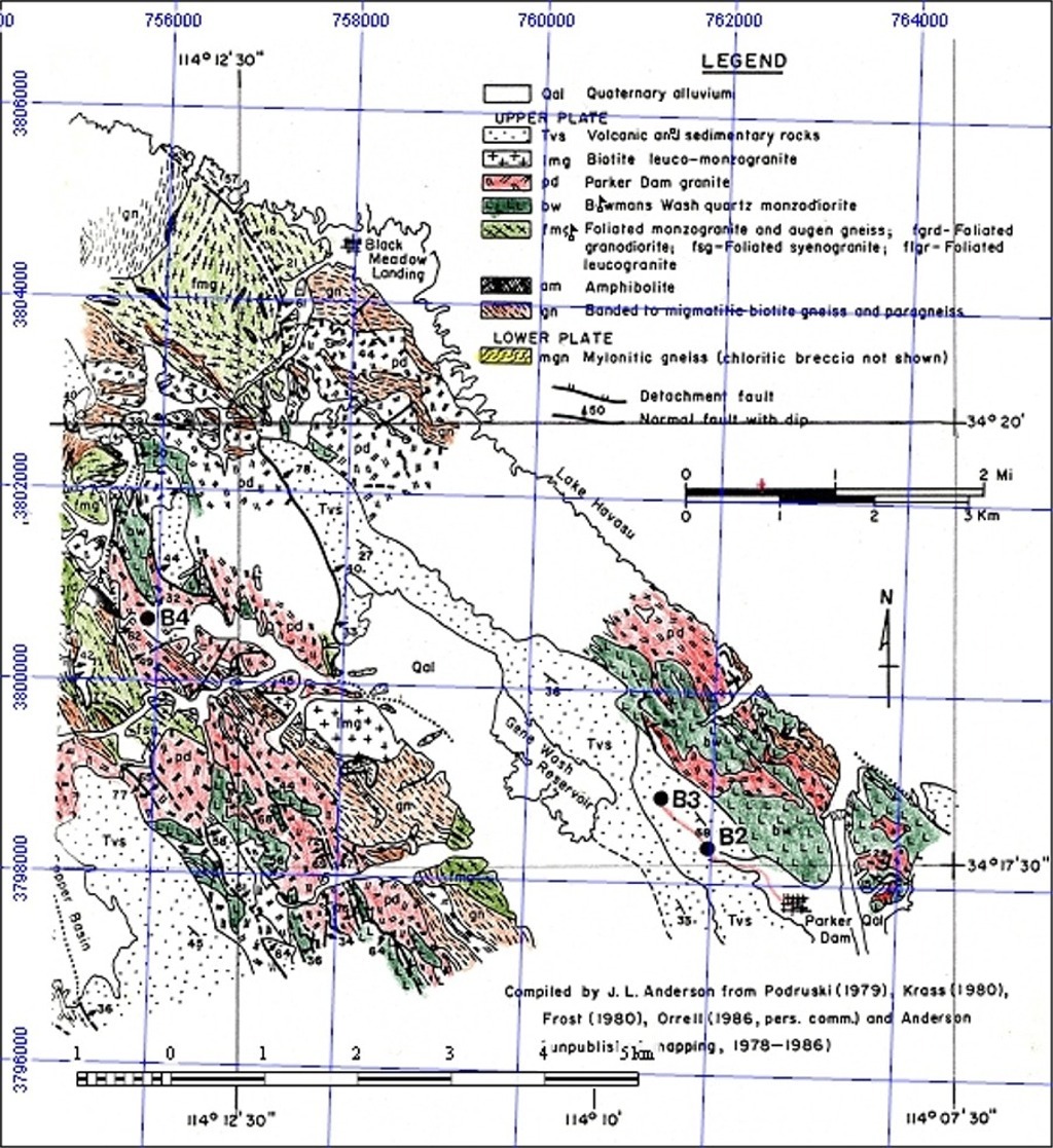
The main stop of interest in Whipple Wash is Stop 6 of Spencer et al. 1987. fig
2. - whipspenf2a.jpg
Access to Whipple Wash: cross the Colorado River at the
Parker Dam; turn left (North) at UTM 763211, 3797746 onto the Black Meadow
Landing road; turn left (West) off the Black Meadow Landing road at UTM 755453,
3800899; bear left at UTM 753215, 3802703; arrive
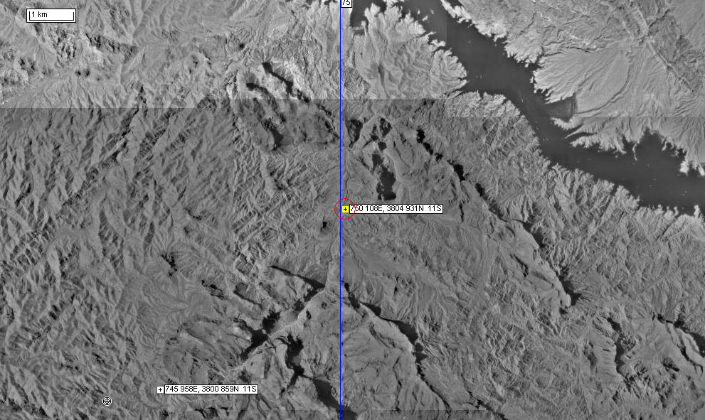
at Whipple Wash at UTM 750194, 3804715
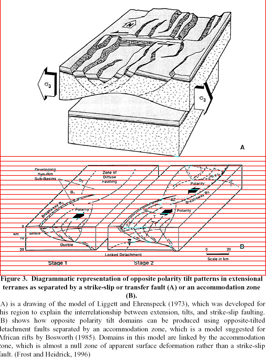
Models for Extensional Faulting in the Colorado River Corridor See:
http://www.colorado.edu/geolsci/courses/GEOL3120/metamorphiccomplexes.pdf
for an explanation of Metamorphic Core Complexes and The
following images are taken from Durning, W.P. et al., 1998
http://www.gis.usu.edu/docs/data/nasa_arc/nasa_arc97/SDSU/LaCuesta.pdf
Whipplefig3.jpg - Opposite polarity
tilt patterns in extensional terranes (During et al., 1998, Fig 3)
Fault_fold geometry Col Extens. Corridor - Fold geometry of the Colorado
Extensional Corridor (Durning et al., 1998, Fig 5)
Fault_fold geometry Col Extens. Corridor
- enlarged image
Crustal Extension w. truncation of upper
plate normal faults by gently inclined detachment fault. (Durning et
al., 1998, Fig 6)
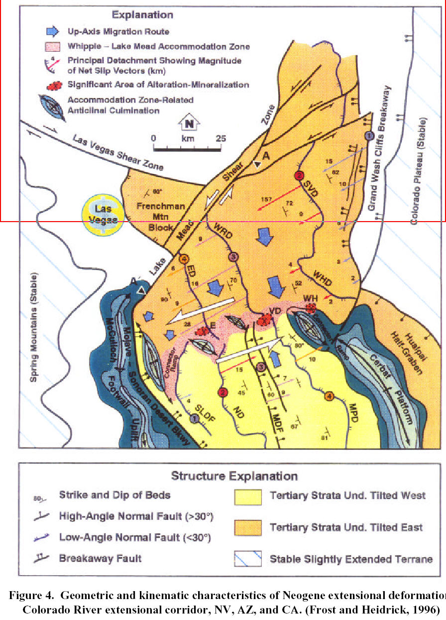
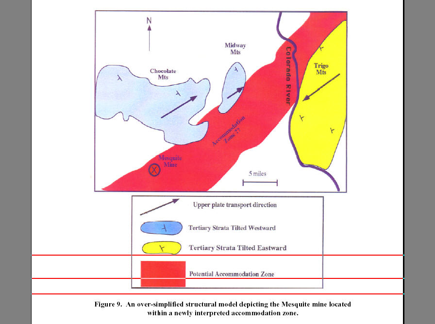
Accomodation Zones
Map, Colorado Extensional corridor
(Durning et al., 1998, Fig 4) Accomodation zone
(Mesquite Mine)
(Durning et al., 1998,
Fig 9)
Zones of dip-direction reversal
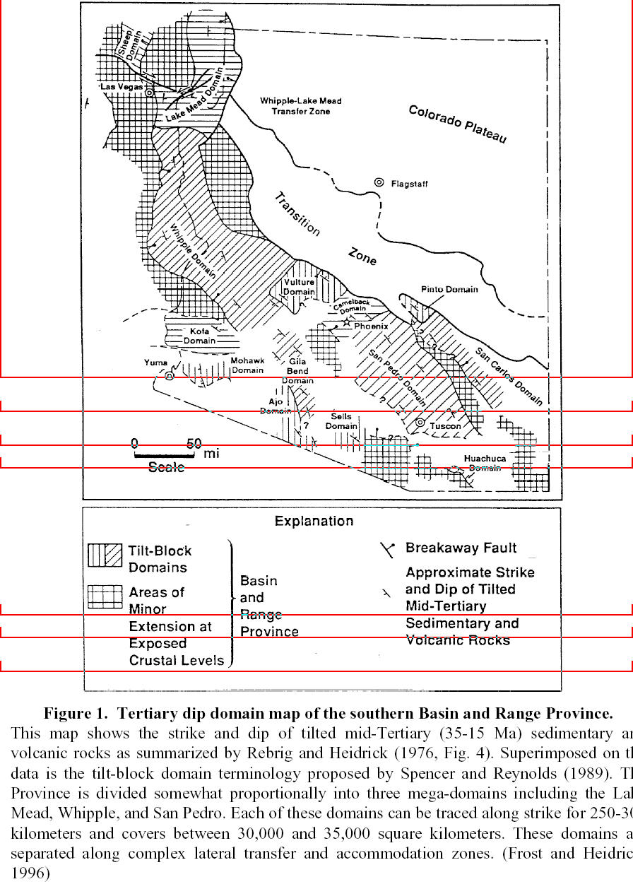
Whipplefig1_Meaddipzones.jpg - Tertiary dip domain map of the southern Basin
and Range (During et al., 1998, Fig 1)
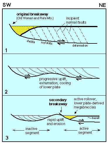
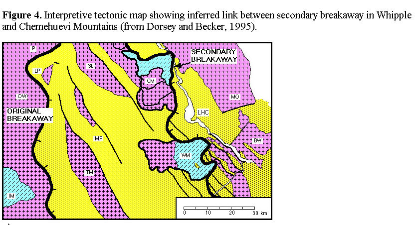
Break-Aways The following two images are taken from:
Dorsey, R.
http://darkwing.uoregon.edu/~rdorsey/Detach.html (Dorsey and Becker 1995)
Sections illustrating concept of 1st and 2nd 'breakaways'
Geological map, Whipple Mountains,
Primary & Secondary 'breakaways'
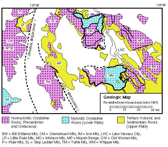
GEOLOGICAL MAPS Core complexes of the
Whipple Mountain and Chemehuevi regions -
From Dorsey, R. at
http://darkwing.uoregon.edu/~rdorsey/Detach.html (Dorsey and Becker 1995) Geol. map Whipple
Mountains; geology of Whipple Wash - From: Mueller, K. at
http://www.colorado.edu/geolsci/courses/GEOL3120/metamorphiccomplexes.pdf
whipspenf2b.jpg - Geological map, Gene Wash Quad., Spencer et al. 1987. fig
2, stops
B2-B5 (georegistered and gridded)
whipspenf2a.jpg - Geological map, Whipple Wash Quad., Spencer et al. 1987.
fig 2, stops
B6-B10 (georegistered and gridded)
******************************************************************************************************************************************************************************************** whipspenf3.jpg -
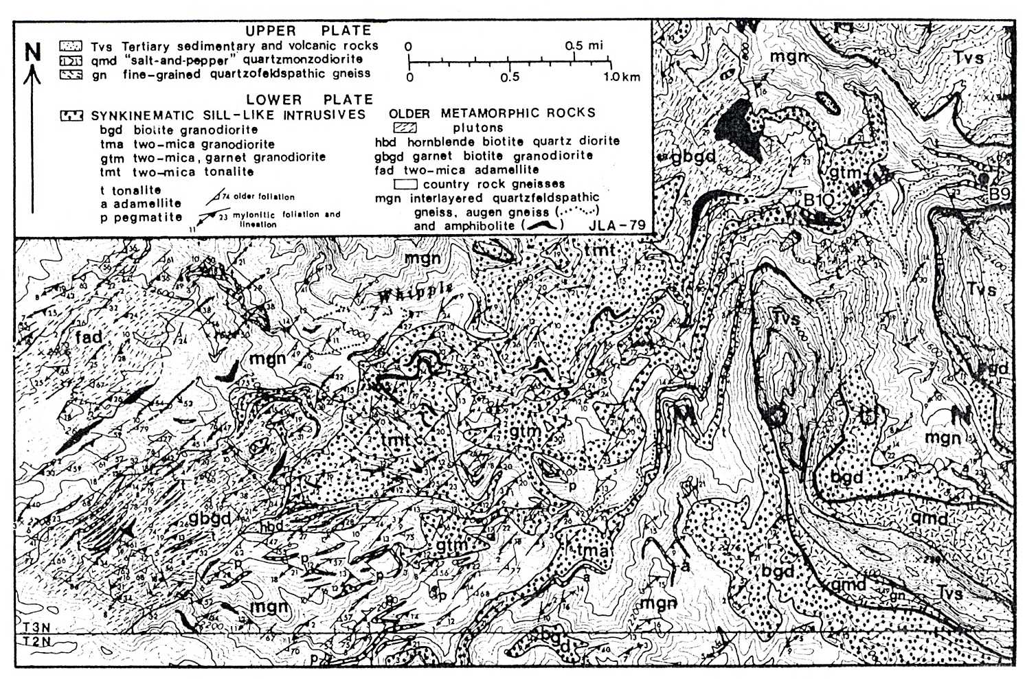
Geological map, Upper Whipple Wash, Spencer et al.
1987. fig
3, stops B9, B10
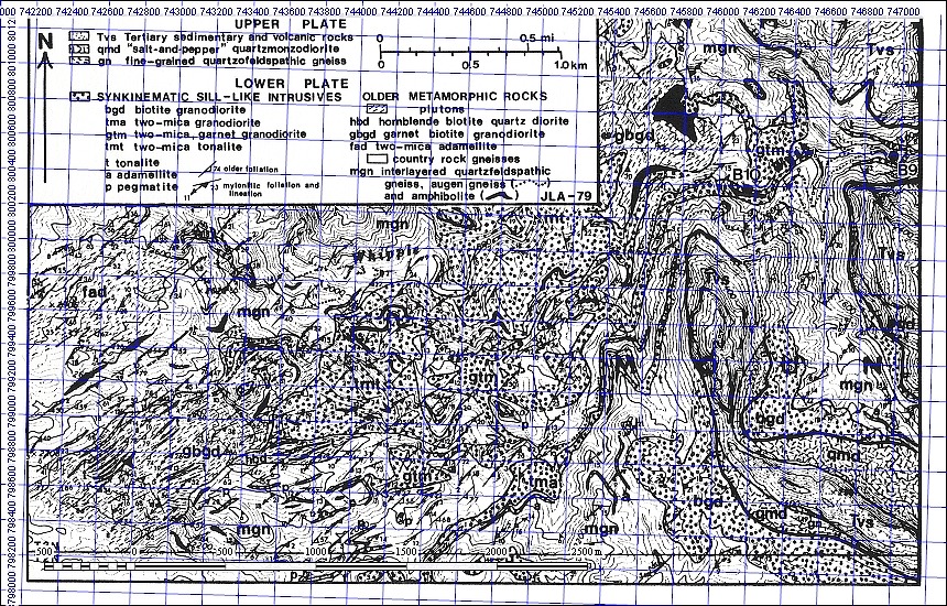
whipspenf3grida.jpg - Geological map, Upper Whipple Wash, Spencer et al.
1987. fig 3, stops B9, B10 (georegistered and
gridded) whipuppertopo.jpg Topo map
corresponding to whipspenf3.jpg geological map whipupperAP.jpg
Airphoto corresponding to whipspenf3.jpg geological map Topo map of
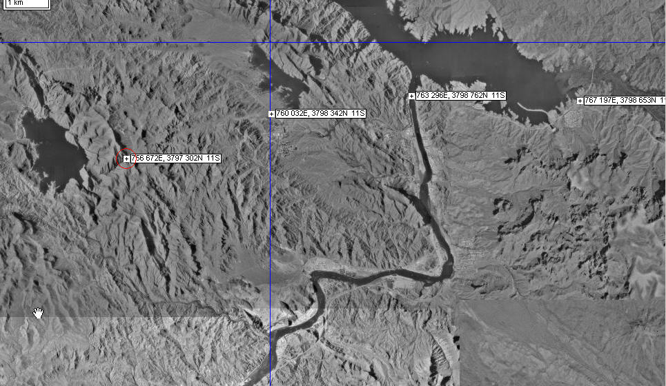
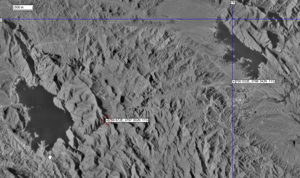
Parker Dam area - Copper Basin Reservoir. - Airphoto Parker Dam -
Copper Basin region Airphoto region east
of Copper Basin reservoir (Parker Dam landing strip, top centre-right of the
photo) Airphoto of traverse
to Copper Basin reservoir - intercalated strips of Upper Plate
Oligocene - Miocene Gene Canyon and Copper Basin Formations and Precambrian
crystalline rocks Airphoto of location
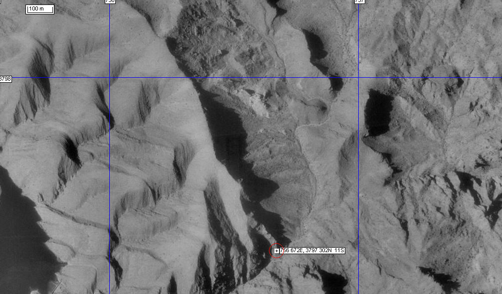
UTM: 756 672, 3797 302 - Upper Plate rocks dipping SW;
Precambrian basement exposed in topographic lows; Copper Basin Reservoir to
lower left Airphoto of
Whipple Wash area of the Whipple Mountains - Whipple Wash region whipuppertopo.jpg Topo map
corresponding to whipspenf3.jpg geological map whipupperAP.jpg
Airphoto corresponding to whipspenf3.jpg geological map
whipplegroup.jpg
-
Geology student group
whipplegeog.jpg - Geography
group on mylonites below the Whipple detachment (top of the photo)
whippleklippe3.jpg - View across Whipple Wash
from south to north; high hills upper plate rocks
whippleklippe1.jpg - View across Whipple Wash
from south to north; high hills upper plate rocks
whippleklippe6.jpg - Upper Plate rocks, Whipple
Wash
whippleklippe2.jpg - View across Whipple Wash
from south-east to north-west
whippleklippe4.jpg - View across Whipple Wash
from south-east to north-west
whippleklippe5.jpg - isolated mass of
upper plate rocks sitting on mylonitic gneiss, Whipple Wash
whipple2ryan.jpg
- Whipple Wash seen from the West looking down the wash whippleryan.jpg
- Traverse up Whipple Wash begins whipple3ryan.jpg -
High up in the Upper Plate, on the south side of Whipple Wash
060225_01_whipple.JPG 06/04/2006 - view of the lower
end of Whipple Wash
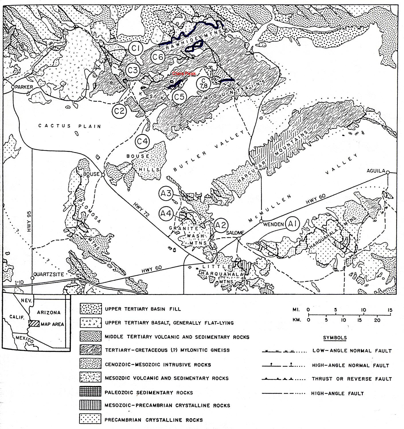
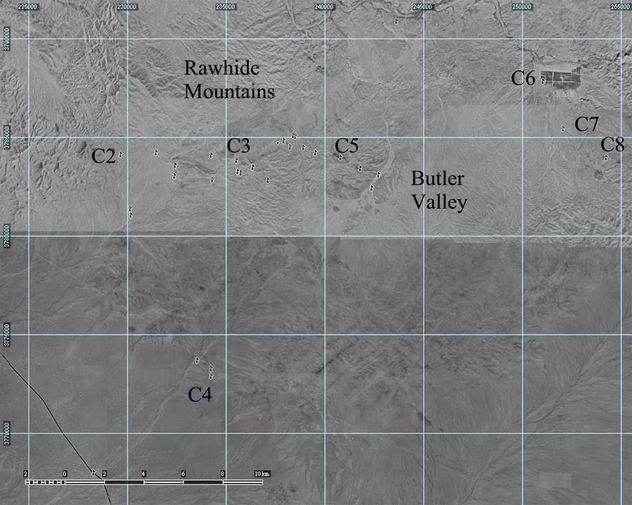
The Buckskin Mountains will be entered
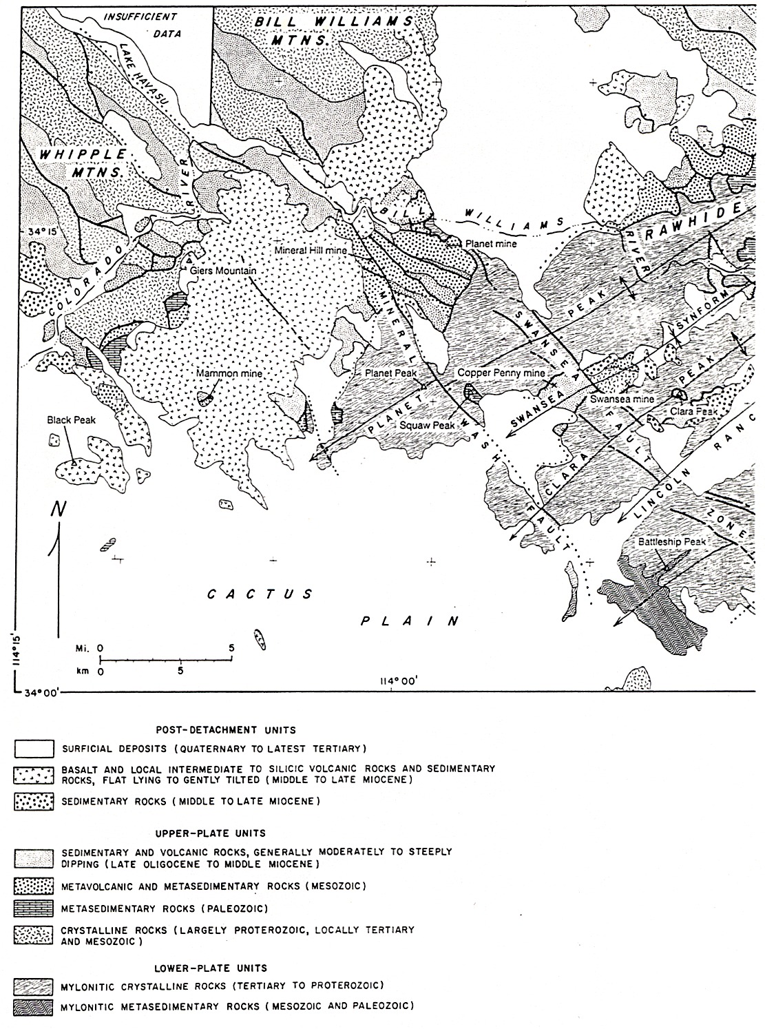
from the direction of Bouse, and will encompass stops C4, C5, C2, and C3 of
Reynolds and Marshak, 1987
Maps from Spencer, J.E. et
al., 1987 showing
location of stops C1 to C8:
whipspenf1.jpg - Geology map, Rawhide
Mountains, Spencer, J.E. et al. Field-trip Guide, Fig 1.
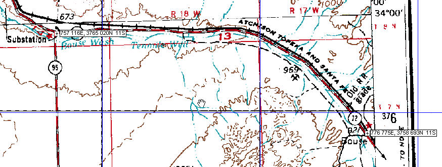
Topo,
Bouse Highway 72 to Highway 95
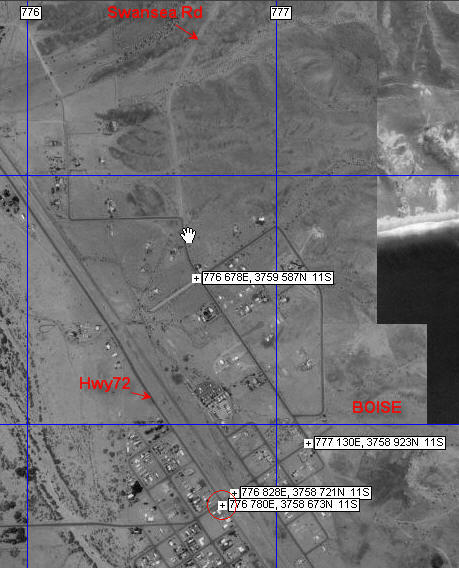
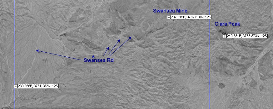
swangenap.jpg
- airphoto showing locations of stops C2 to C8 in the
Buckskin Mountains, Spencer, Reynolds and Marshak, 1987, p. 360-362 Airphoto,
Buckskin Montains
- airphoto showing road
from Bouse to Swansea
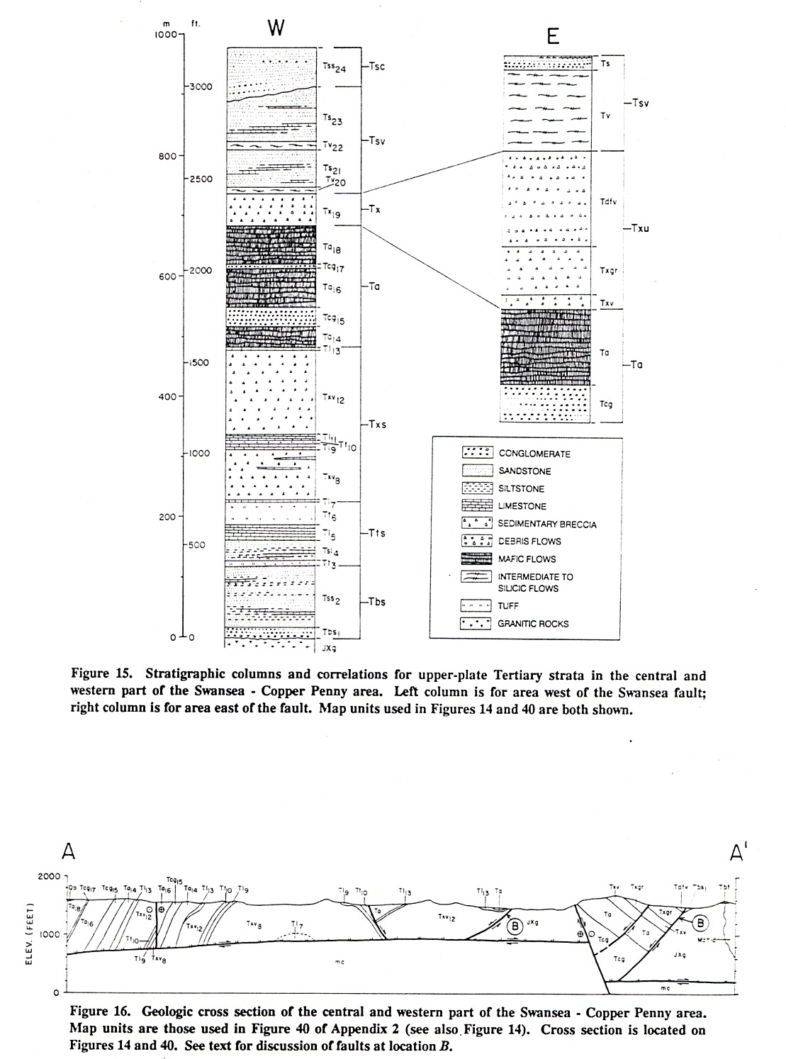
s&rclara_peakf14cgeol.jpg -
Stratigraphic columns for the Swansea - Copper Penny area, Fig 15; Cross section
A-A', Fig 16
Maps from: Spencer, J.E. and
Reynolds, S.J., 1989b.
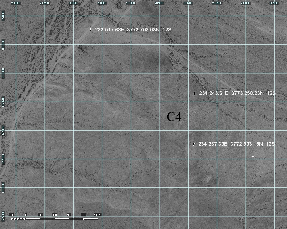
Stop C4 -
airphoto showing locations of
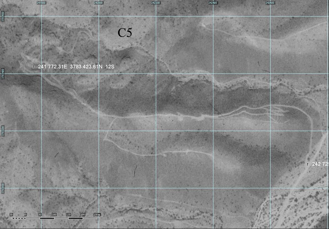
stop C4 in the Buckskin Mountains, Spencer, Reynolds and Marshak, 1987, p. 361 Stop C5 -
airphoto showing locations of
stop C5 (Clara Peak) in the Buckskin Mountains, Spencer, Reynolds and Marshak,
1987, p. 361
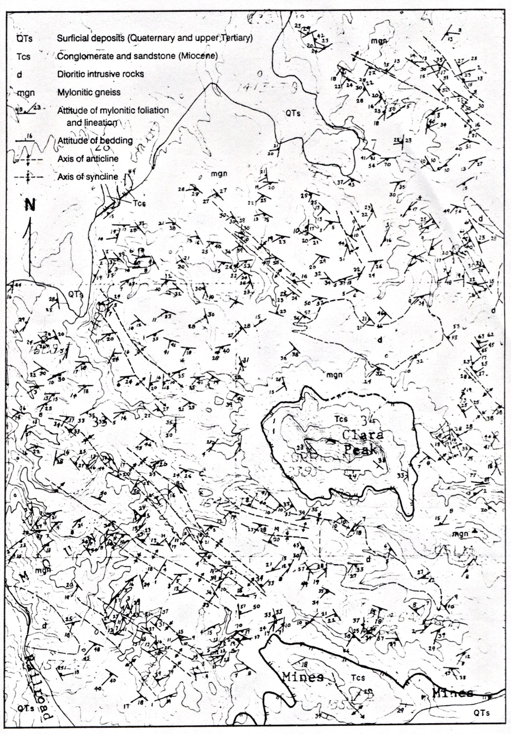
s&rclara_peakfolf5.jpg - Geologic map
of the Clara Peak area showing NW-trending folds of lower plate mylonitic
foliation, Fig 5.
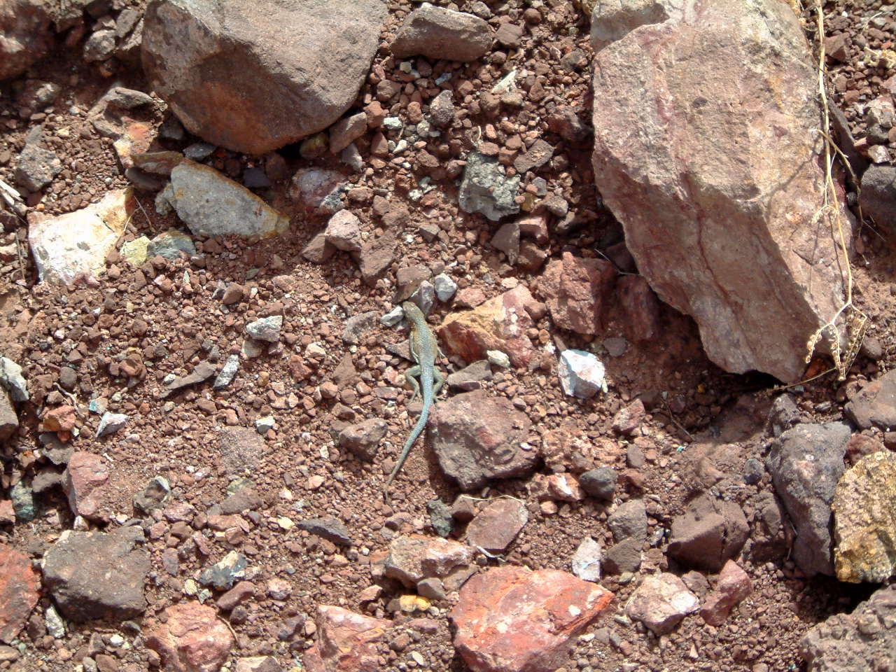
060226_10_clareliz.JPG 08/04/2006 - blue camouflaged lizard in an area of
abundant chrysocolla covered surfaces, Stop C5 Stop C2 -
airphoto showing locations of
stop C2 in the Buckskin Mountains, Spencer, Reynolds and Marshak, 1987, p. 360
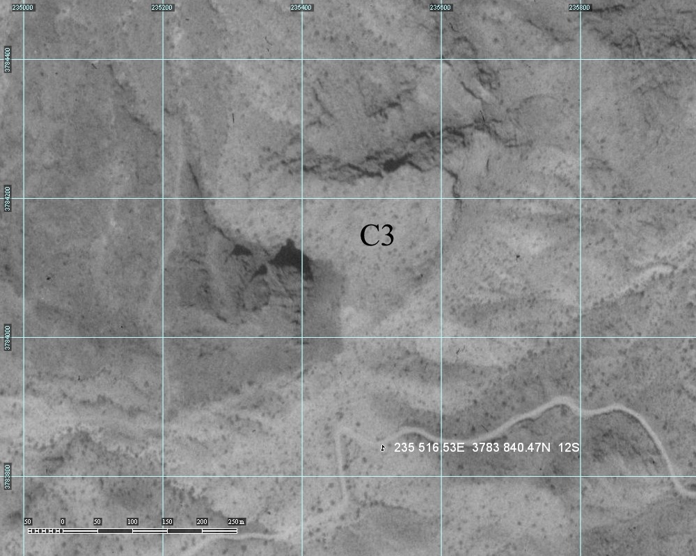
Stop C3 -
airphoto showing locations of
stop C3 in the Buckskin Mountains, Spencer, Reynolds and Marshak, 1987, p. 361
060226_14_swanseastud.JPG 09/04/2006 - Group photograph at the Swansea mine
site Rio Vista Maps
from: Spencer, J.E. and Reynolds, S.J.,
1989c.
GEOLOGY MAPS
Geol. Map. Arizona, Parker area
http://www-glg.la.asu.edu/%7Esreynolds/azgeomap/azgeomap_home.htm Geological Map of
Arizona, Steve Reynolds
Geol. Map Arizona, Swansea Mine region -
http://www-glg.la.asu.edu/%7Esreynolds/azgeomap/azgeomap_home.htm
Geological Map of Arizona, Steve Reynolds
Geol. Map composite Parker-Swansea
s&rclara_peakf14bgeol.jpg - Geologic map of the Swansea - Copper Penny area,
Fig. 14b
Maps from: Spencer, J.E. and
Reynolds, S.J., 1989b.
whipspenf1.jpg - Geology map, Rawhide
Mountains, Spencer, J.E. et al. Field-trip Guide, Fig 1.
Showing stops C1 to C8
buckskin3topo.jpg
- Topo, Swansea - Bouse Airphoto,
Buckskin Montains
- airphoto showing road
from Bouse to Swansea Airphoto,
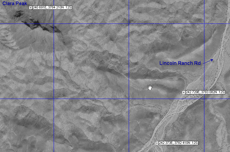
Swansea Mine - Clara Peak area (UTM: 237 915, 3784 828) Airphoto Clara
Peak area off Lincoln Ranch R REFERENCES Spencer, J.E. and Reynolds,
S.J. 1989a. Middle Tertiary Tectonics of Arizona and Adjacent Areas. in Geologic
Evolution of Arizona: Tucson, Arizona Geol. Soc. Digest, v. 17, p. 539-574. Spencer, J.E. et al. 1987.
Field-trip Guide to Parts of the Harquahala, Granite Wash, Whipple, and Buckskin
Mountains, West-Central Arizona and Southeastern California, p. 351-364. Spencer, J. E. and Reynolds, S.J. 1989b.
Introduction to the geology and mineral resources of the Bucksin and Rawhide
Mountains, p. 1-10, in Spencer, J.E. and Reynolds, S.J., eds., Geology and
mineral resources of the Bucksin and Rawhide Mountains, west-central Arizona:
Arizona Geological Survey Bulletin 198. Spencer, J.E. and Reynolds, S.J., 1989c. Tertiary
structure, stratigraphy, and tectonics of the Buckskin Mountains, p. 103-167, in
Spencer, J.E. and Reynolds, S.J., eds., Geology and mineral resources of the
Bucksin and Rawhide Mountains, west-central Arizona: Arizona Geological Survey
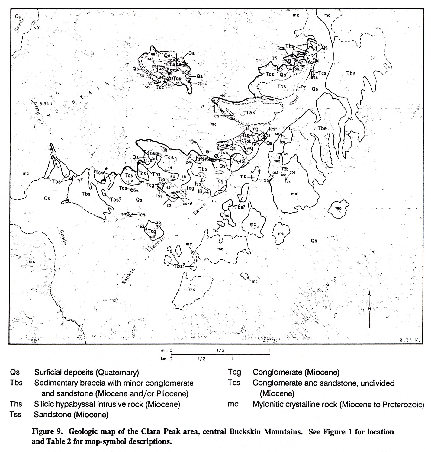
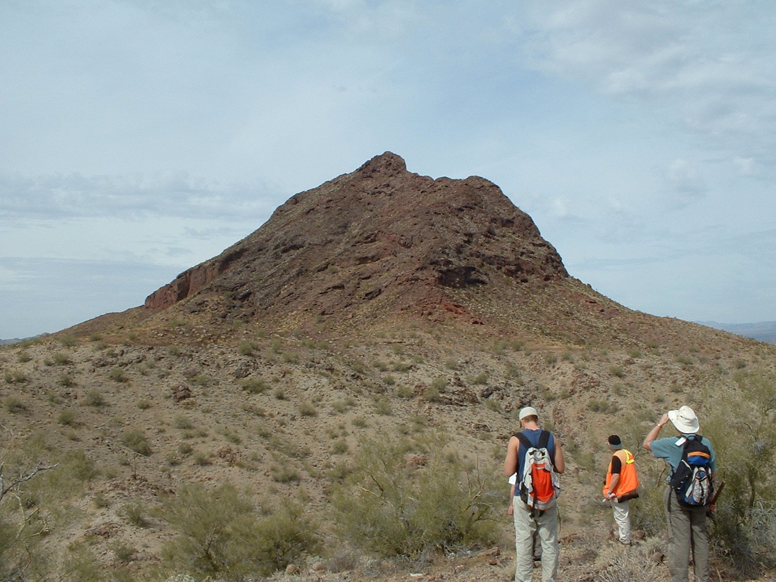
Bulletin 198, PHOTOGRAPHS ian_clara_1.jpg
- Clara Peak
ian_clara_2.jpg - on the way up
060226_10_clareliz.JPG 08/04/2006
060226_14_swanseastud.JPG 09/04/2006 The dreaded
'Jumping Cholla'
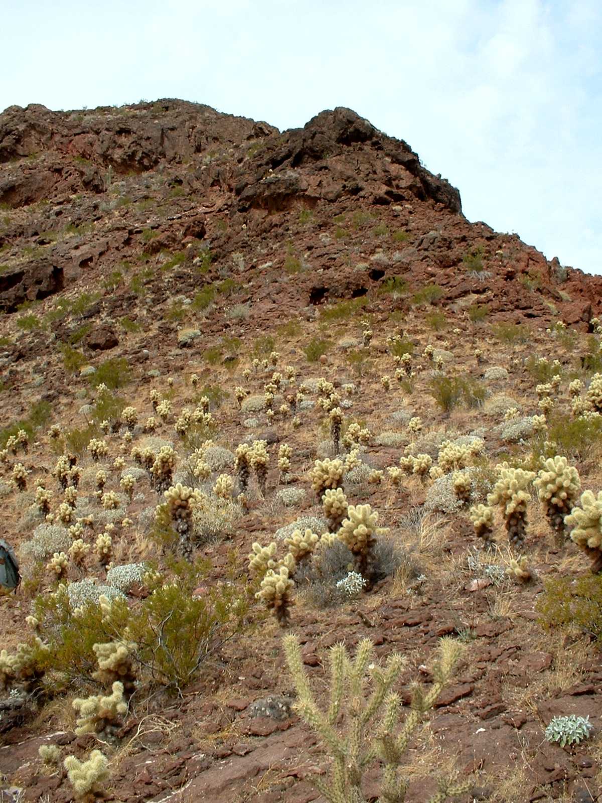
A Cholla field, Clara Peak
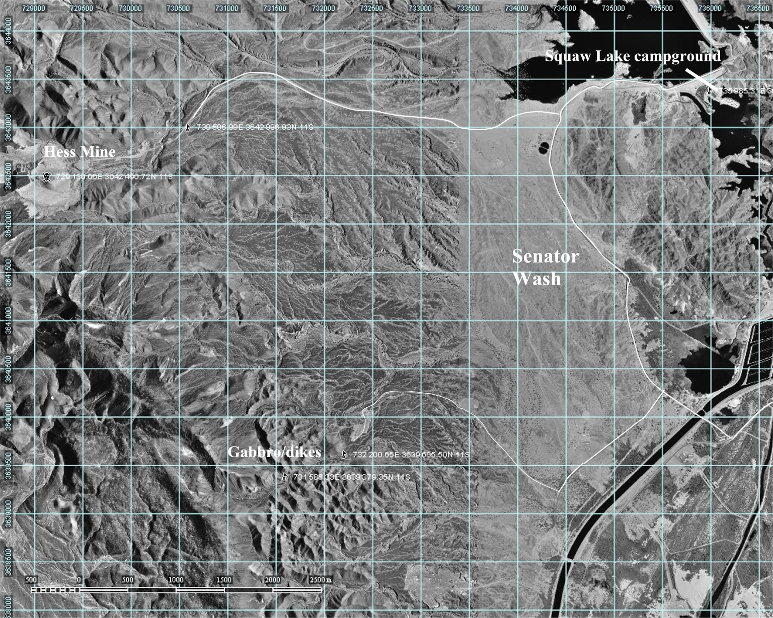
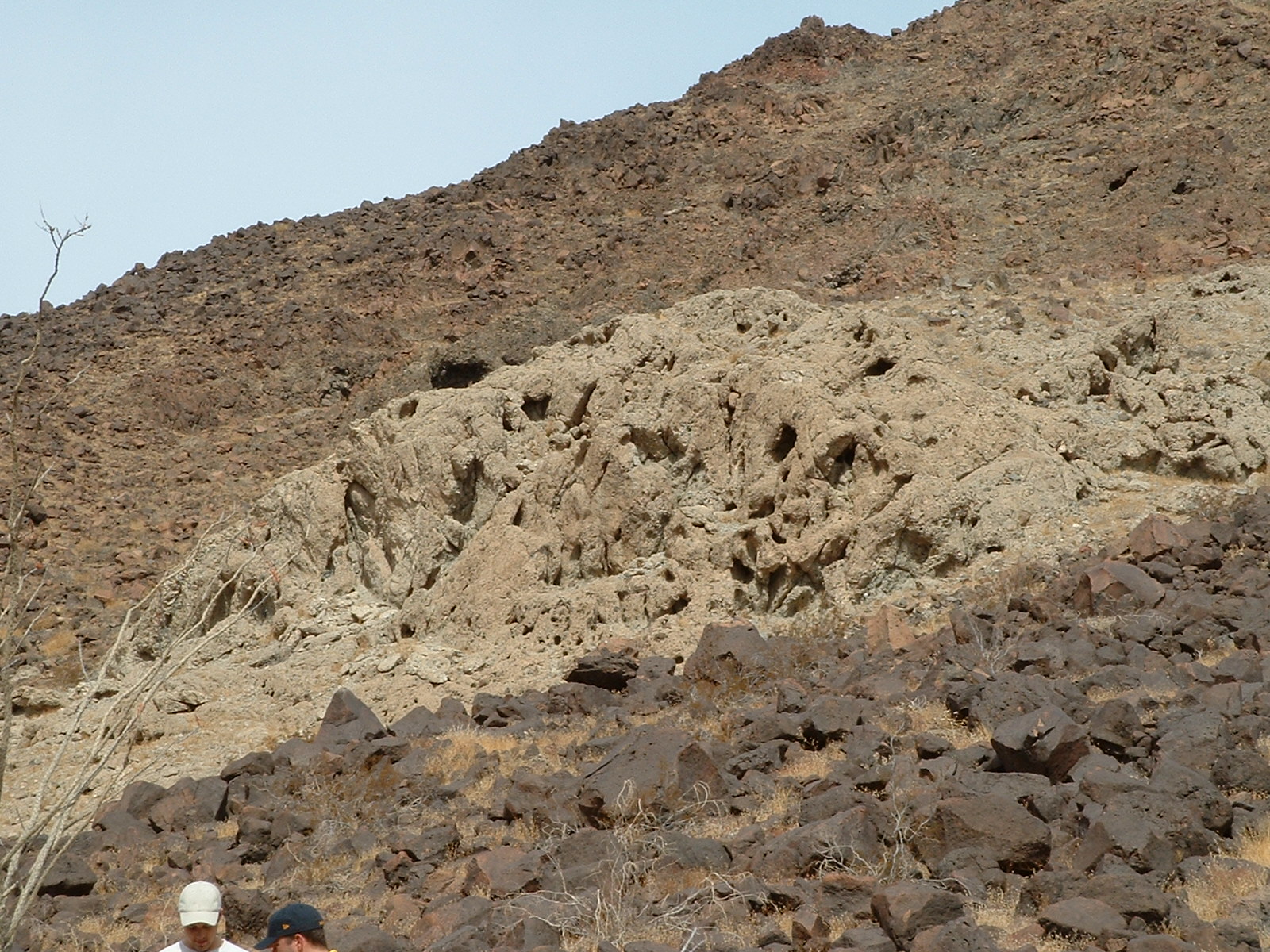
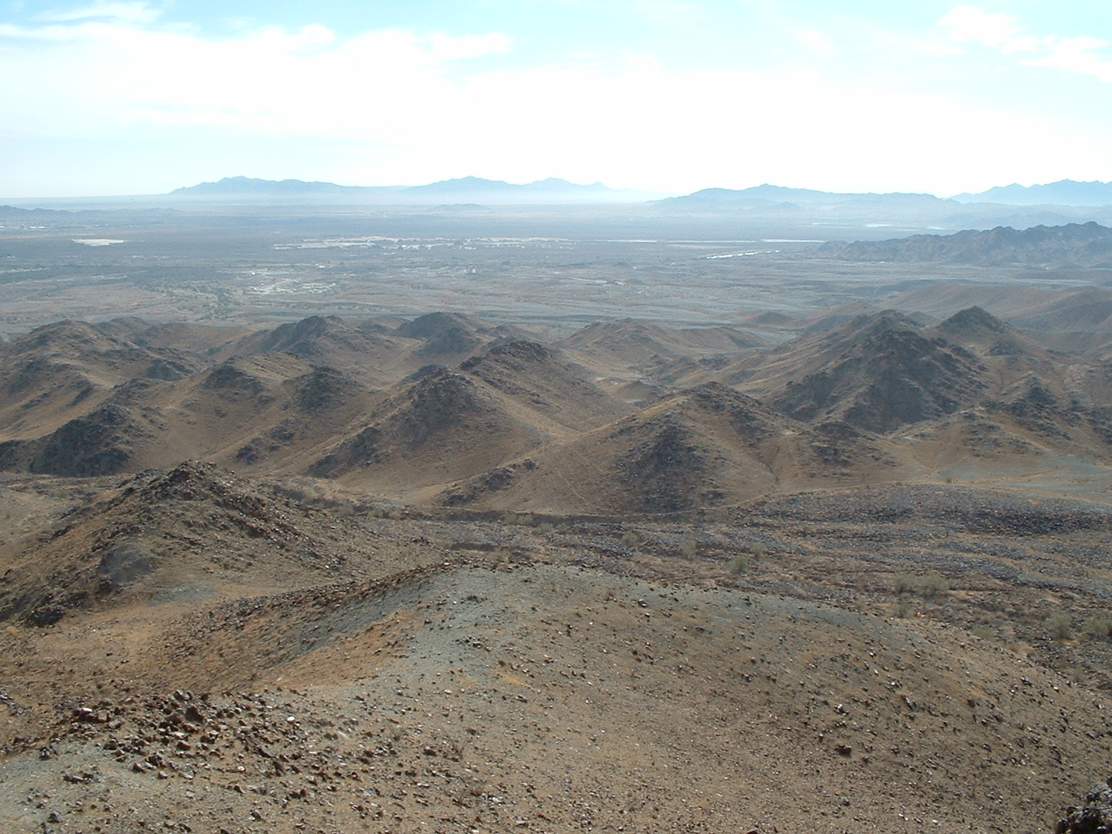
One way to travel! DAY 4
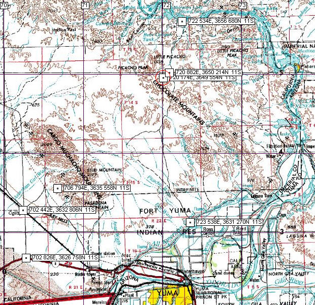
- Gold mines of the Senator Wash (Hess) and Picacho regions, north of Yuma
The main stops today will be the gabbros and
diabases south of the Hess Mine, the Hess mine itself, and the Picacho Mine site
(now closed).
GEOLOGY MAPS
hessgeolmap.jpg - after Morton, 1977, and Zang, 2005
AIRPHOTOS
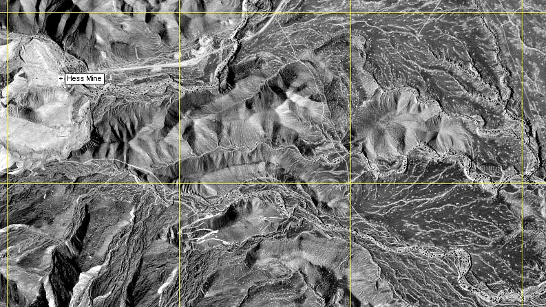
hess_min_GRD.jpg
- Hess mine is located in top left corner of the photo
Hess_minetbrext.jpg - Hess Mine
PHOTOGRAPHS
ian_hess_gabbro -
hummocky terrain composed of gabbro/diabase ian_hess_debflow1 -
elongated hill of debris flow material
CAMPSITE(s)
Hess_leave_hardtop.jpg - 'wild' campsite off paved road SW of Laguna Dam on
the north side of the American Canal. Alternatively, there is a convenient
campground (no grass but showers and toilets) at Squaw Lake -
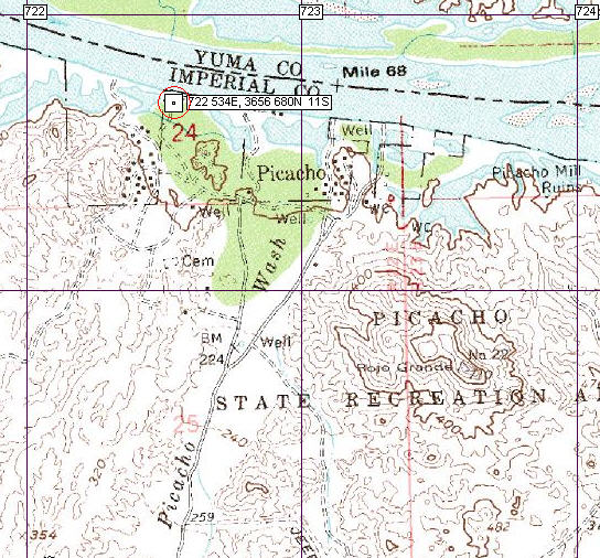
hess_mine_grd.jpg
Topo, route from
Winterhaven to the Picacho turnoff Topo, showing exit from
freeway 95 Airphoto showing exit
from freeway 95 Airphoto showing exit
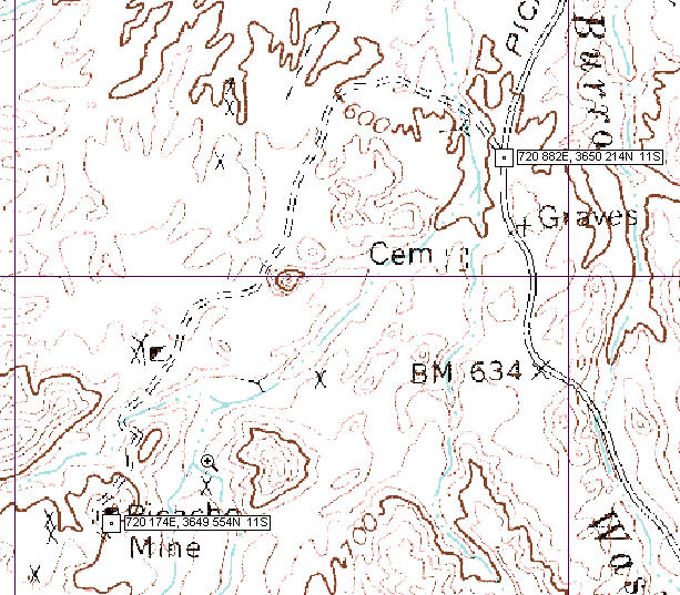
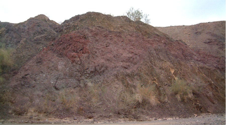
from freeway 95 + GPS stations PHOTOGRAPHS Picachobreccia.jpg -
Picacho Breccia CAMPSITE
REFERENCE Richard, Stephen M. and Spencer, Jon E. Geologic map of the Picacho mine
area, southeastern California. Scale 1:10,000. Arizona Geological Survey open
file report 96-30, pub. 1996. OCLC #37324717 Steven Losh, Dan Purvance, Ross Sherlock, E. Craig Jowett. 2005. Geologic and
geochemical study of the Picacho gold mine, California: gold in a low-angle
normal fault environment. Mineralium Deposita, 140, 137-155. Abstract The Picacho gold deposit, located in southeasternmost California, is
a low-grade gold deposit in a nearly flat-lying denudational fault of regional
extent and probable Oligocene age. The deposit is hosted by intensely fractured
and faulted Mesozoic leucogranite and by chloritic augen gneiss and schist, and
is overlain unconformably and in fault contact by unmineralized late Oligocene
Quechan volcanic rocks. The deposit is structurally characterized by normal and
normal-oblique faults of low to high dip at shallow depths in the mine, merging
downward with a synchronous, low-dipping
DAY 5 - Gold mines
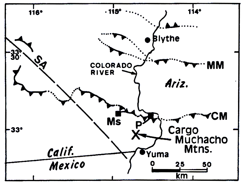
of the Cargo Muchacho and Chocolate Mountain regions
Overnight - Senator Wash (Squaw Lake camp ground)
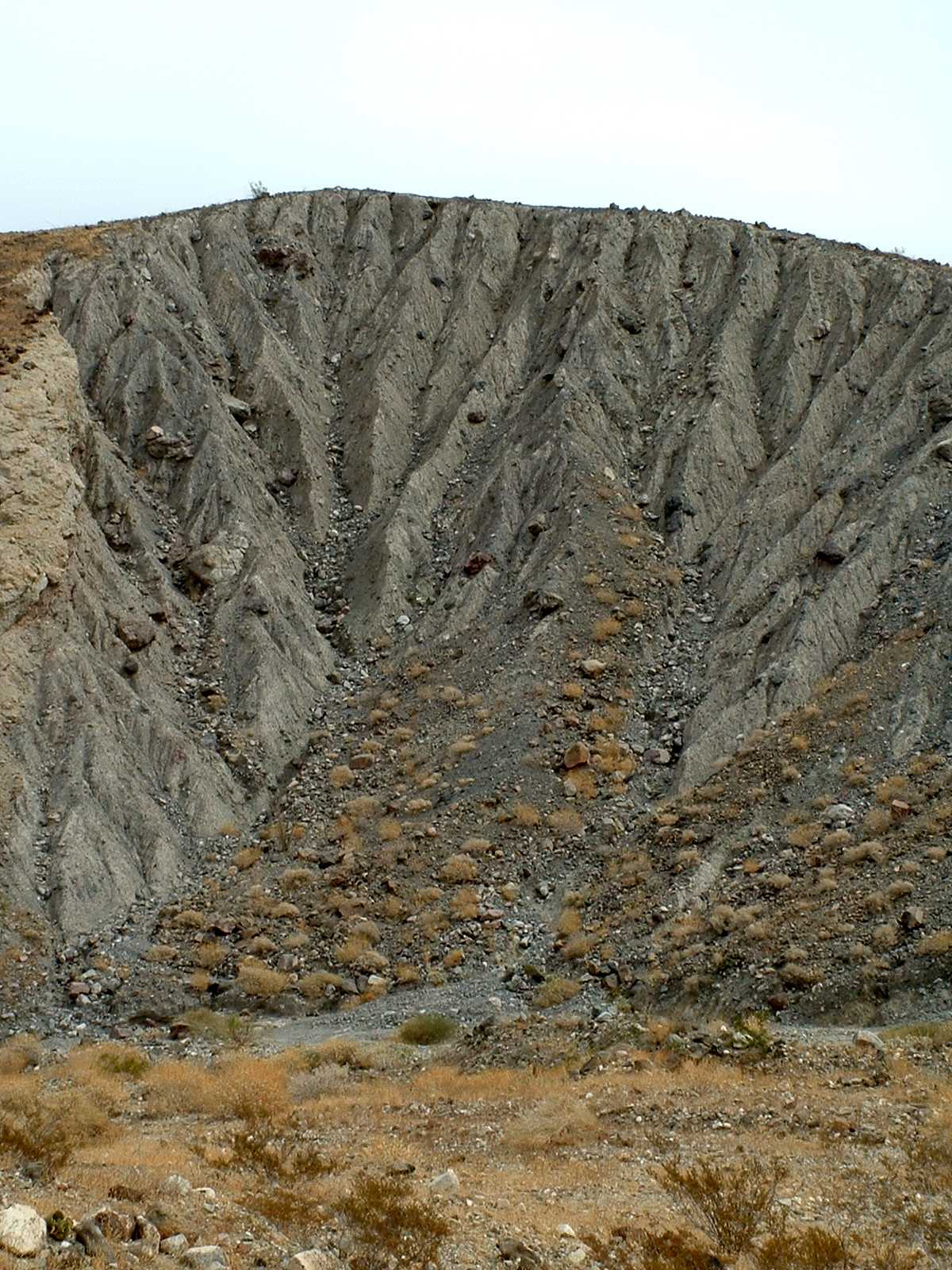
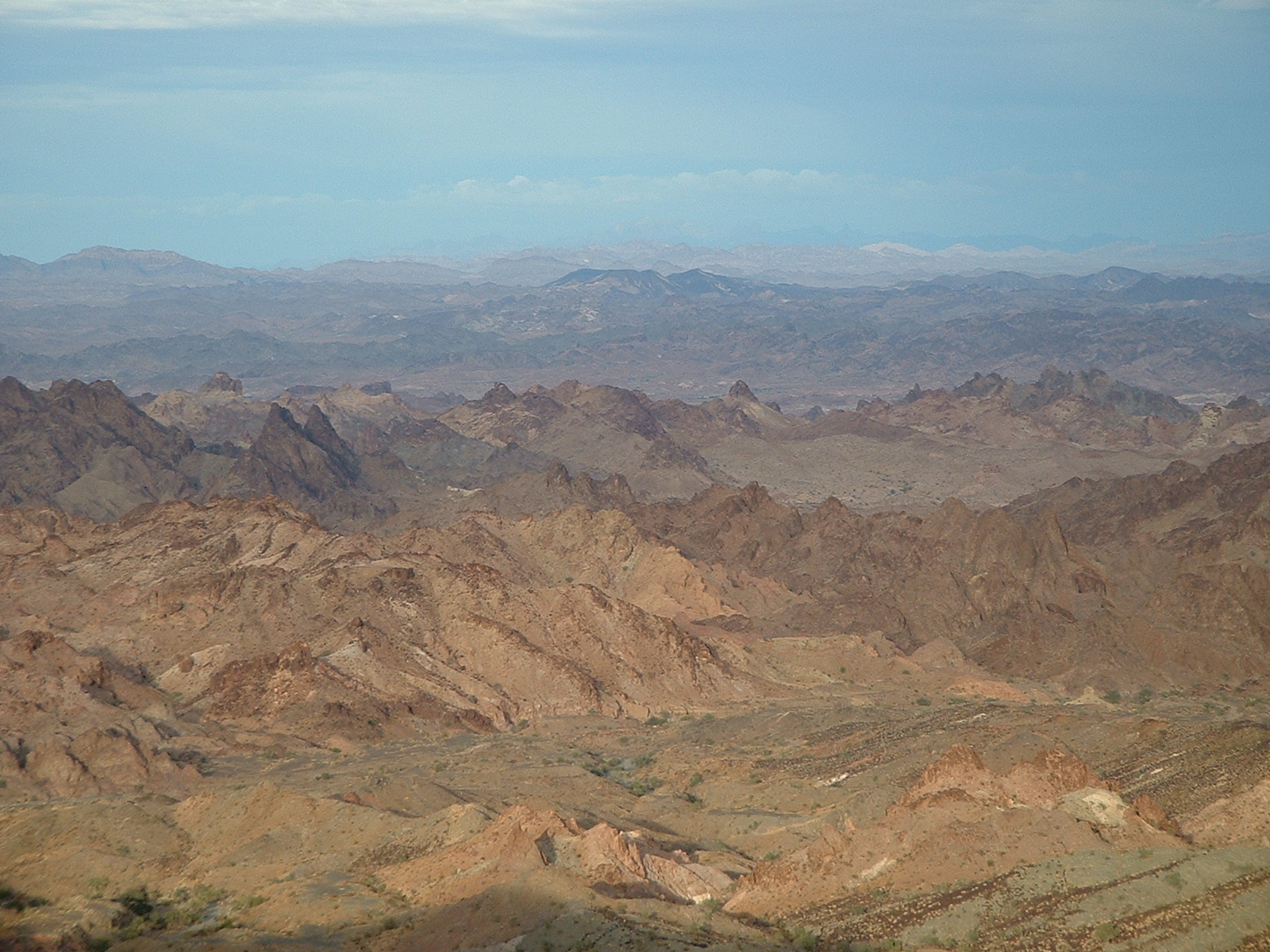
Why the Chocolate Mountains are called the
Chocolate Mountains!!
GEOLOGY MAPS
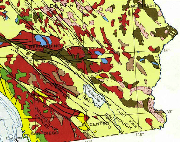
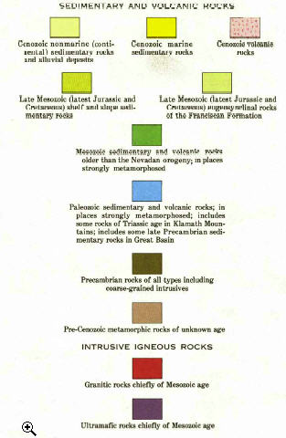
Generalized geological map of SE California
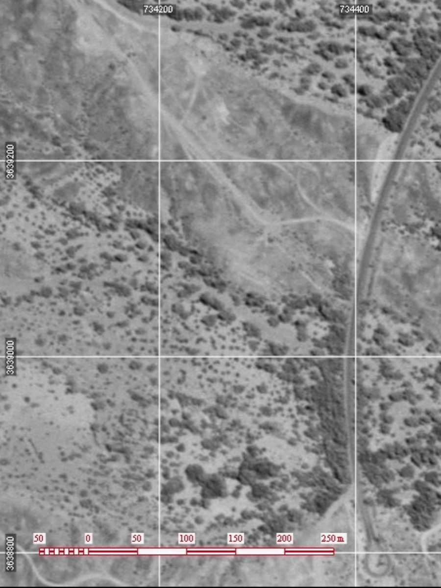
Map Legend Aster Map of the
Chocolate and Cargo M. region - Courtesy Dr. M. Pazner. Location Map, Cargo
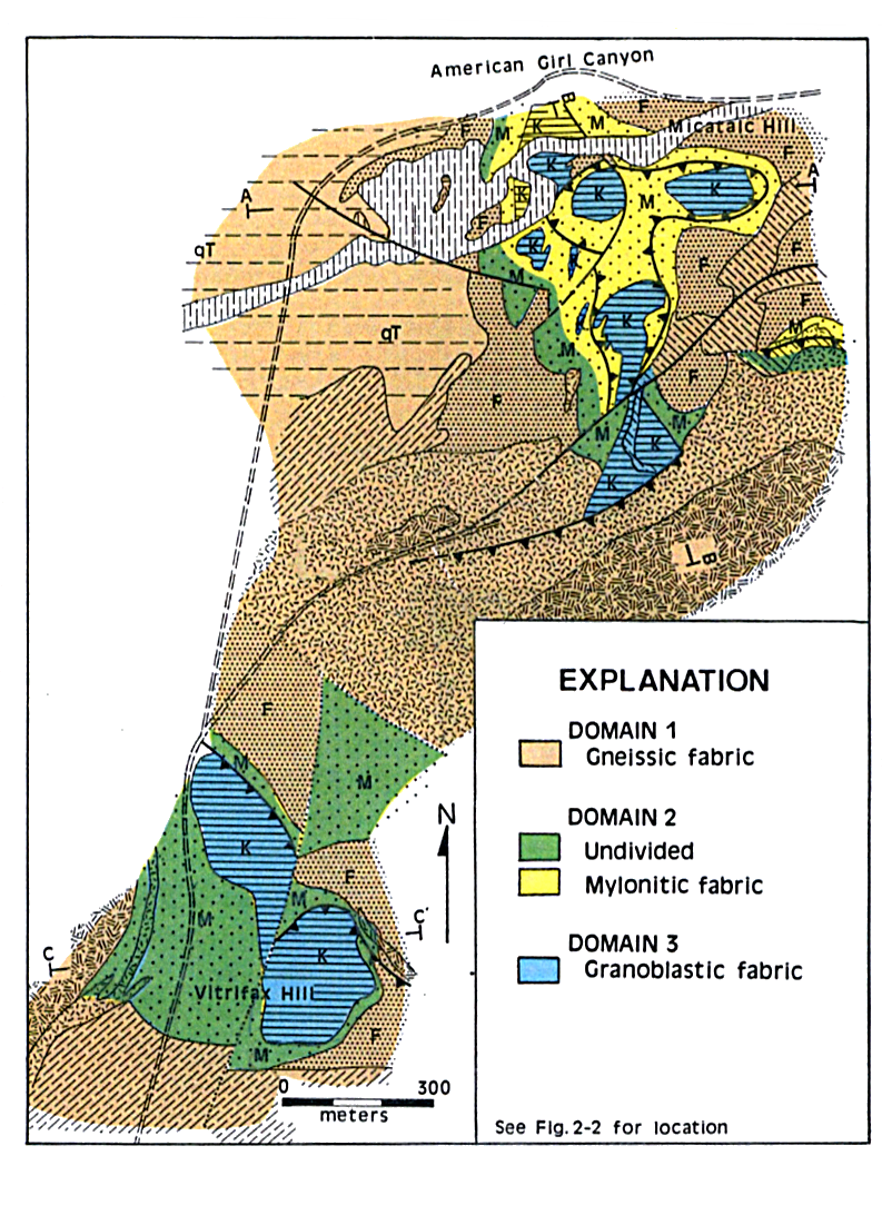
Muchachos Panorama to South from Vitrifax Hill
- 1,
2,
3 Geologic Map, regional,
Owens (1992),
Cargo Muchachos Zones of Al-Silicate
assemblages, Owens (1992), Cargo Muchachos
Vitrifax Hill Interpretive sections,
Owens (1992) - Cargo Muchachos Geologic map, Mica Talc
Hill, Owens (1992) - Cargo Muchachos Geologic domain map,
coloured, Vitrifax-American Girl - Gold Mines, Cargo Muchachos
Map of foliation orientation, Vitrifax/American
Girl,
Owens (1992)
- Cargo Muchachos
Vitrifax-American Girl, jpg - Airphoto of
Vitrix-American Girl area, Cargo muchachos
Vitrifax-American Girl, jpg
- Topographic map, Cargo Muchachos
Volcanic cone, east side of Cargo Muchachos,
UTM: 710 450, 3640 546 REFERENCES Owens, E., 1992. Magmatism, Deformation and
Mesothermal Metasomatism: Interpretation of Aluminosilicate Mineral Assemblages
in the Cargo Muchacho Mountains, Southeastern California. Ph.D. thesis,
University of Western Ontario, London, Canada.
Airphoto, Mesquite
Mine area, Hwy 78 Airphoto, Mesquite
Mine - mine is currently operational The following images are reproduced
from Durning, W.P. et al., 1998: http://www.gis.usu.edu/docs/data/nasa_arc/nasa_arc97/SDSU/LaCuesta.pdf
LSATcolour composite,
Colorado River region
Landsat map, east
and west of the Colorado River Landsat map,
Chocolate, Black and Midway Mountains Enlarged part
of Landsat map, Mesquite Mine Landsat TM ratio
colour ratio map
mesqite_alterGD.jpg - gridded false colour image of the region north of the
Mesquite showing potential argillic alteration zones; from Zang 2005 REFERENCES
Durning, W.P. et al., 1998: http://www.gis.usu.edu/docs/data/nasa_arc/nasa_arc97/SDSU/LaCuesta.pdf
PHOTOGRAPHS Mesquitecamp.jpg -
Mesquitecamp camp1.jpg - Mesquite camp orocopia1ryan.jpg -
Orocopia Schist south of the Black Mountains UMFrag.jpg - Fragment of
fuchsite schist in Orocopia Schist Blackmnt1ryan.jpg - Summit
of Black Mountain groupblackmntn.jpg - Group
(2004) photo on Black Mountain phil.jpg - Phil
photographing photo #1003 out of 2010 ian_blacktopicacho.jpg
- view from Black Mountain towards Picacho Peak (distant peak)
060228_18_mesqmine.jpg 10/04/2006 - pit at Mesquite Mine 060228_19_mesquite.JPG
10/04/2006 - 'Grenville' like gneisses in the Mesquite mine
CAMP SITE
(wilderness, Mesquite area)
Mesqminecmpst.jpg - off highway
78, north of the Mesquite Mine
AIRPHOTOS AND TOPOGRAPHIC MAPS
Choc_MntsGD.jpg -
gridded and georeferenced airphoto of the Indian Pass road area
Overnight - White Tank, Joshua National Park and/or Calico Ghost Mine
campground, Barstow,
and/or, Mesquite Springs, Death Valley
Campsites sites used during this field
trip
MAPS AND AIRPHOTOS Generalized geological map of
SE California
Map Legend Topo map of Rock Hill /
Obsidian Butte, Salton Sea, near Calipatria Topo map of Rock Hill /
Obsidian Butte, Salton Sea, near Calipatria (larger scale) Airphoto of Rock Hill /
Obsidian Butte, Salton Sea, near Calipatria
Goto:
http://vulcan.wr.usgs.gov/Volcanoes/California/Hazards/Bulletin1847/table_holocene_volcanoes.html
Topo map Mecca
Hills to Painted Canyon Airphoto Mecca
Hills to Painted Canyon Airphoto,
Painted Canyon, San Andreas fault See Aster satellite image -
road crossing dunes -> middle left of image; Mesquite mine -> top left of image LINKS
http://desertusa.com/sandhills/sandhillsorg.html The Imperial Sand
Dunes, DesertUSA Newsletter
http://fgms.home.att.net/salton.htm The Salton Sea by Richard Busch
http://www.sci.sdsu.edu/salton/SaltonSeaHomePage.html The Salton Sea
by Lisa Heizer PHOTOGRAPHS
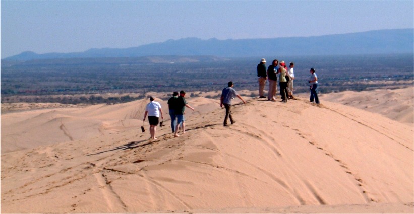
dunes.jpg - Algodones dunes, near Glamis
ian_dunes.jpg - Algodones dunes
ian_dune_Lynd.jpg - lost!!
paintcanryan.jpg - Dipping Cenozoic strata
in the vicinity of the San Andreas fault, Painted Canyon, Mecca Hills
Saltonobsidryan.jpg - Obsidian dome, Rock
Hill, east side of the Salton Sea ian_salton2.jpg - outcrops of obsidian,
Obsidian Butte CAMPSITES
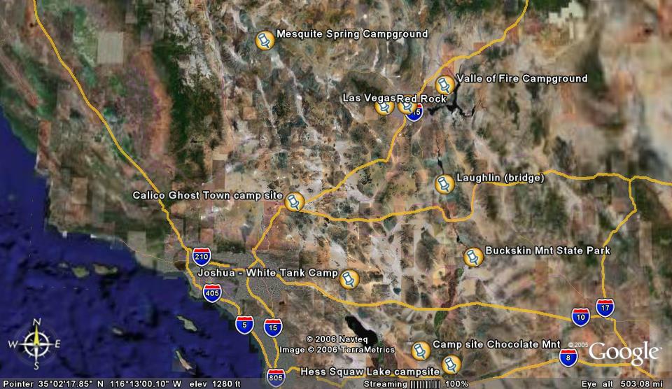
Google Earth image showing camp sites
Whitetank camp ground, Joshua Tree National Park whitetank1AP.jpg
- Airphoto, Whitetank camp ground, Joshua Park (no running water)
Airphoto Joshua Tree
570 941, 3759 950 Airphoto, small scale,
Joshua Tree
Calico
Ghost Town campsite, east of Barstow
Google Earth image showing location of the Calico Ghost Town campsite
relative to the town of Barstow, California
Google Earth image of the 29 Palms, Deep Creek
(Bowen Ranch) hotspring, Barstow area Topo, shows roads from
Lucerne Valley to Juniper Flats Topo, Juniper Flats
hot springs Topo, small scale,
Juniper Flats hot springs Airphoto Juniper
Flats hot springs Topo map with waypoints showing
route from Lucerne to Bowen Ranch at UTM 485422, 3802595 Bowen Ranch Airphoto - Airphoto
of the Deep Creek hot springs location, near Bowen Ranch, UTM 483711, 3799794 Bowen Ranch Airphoto - Airphoto
of Bowen Ranch (parking location UTM 484854, 38019191) PHOTOGRAPHS
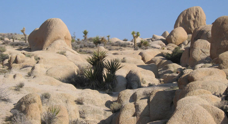
joshgranryan.jpg - Joshua Tree National
Park, Whitetank campsite
joshtree2ryan.jpg - Joshua Tree National
Park, Whitetank campsite
bowenraryan.jpg - track down to Deep Creek
hotsprings from Bowen Ranch
hotspringsryan.jpg - Deep Creek hot
spring ian_joshnatbridge.jpg - natural
bridge in granite
CAMPSITE
Mesquite Spring campground
death_valley.jpg - Google image of the
Death Valley showing location of Natural Bridge turtlebacks and the Mesquite
Spring camp ground
Mesquite Springs - Google image
showing location of Ubehebe Crater and the Mesquite Spring camp ground DAY
8 - Death Valley 'turtle backs' (Natural Bridge) and Ubehebe Crater.
Overnight - Valley of Fire Nevada State Park
(Alternative - Red Rock Canyon)
MAPS
califgeolmap1.jpg - generalized map of the Death
Valley - Panamint Valley region of the Great Basin
deathvalleygeolmap.jpg - taken from
http://darkwing.uoregon.edu/~millerm/DVscapes.pdf ; compiled by Miller and
Wright, 2004
deathvalleyT&Wfig2.jpg - map and cross-section of the Virgin Springs area by
Noble (1941), modified by Troxel and Wright, 1987 REFERENCES Troxel, B.W. and Wright, L.A. 1987. Tertiary
extensional features, Death Valley region, eastern California. GSA Centennial
Field Guide - Cordilleran Section, p. 121-132. Field guide to the Amargosa
Chaos along Highway 1728 from Shoshone to Death Valley PHOTOGRAPHS ian_salt1.jpg
- view of the salt flats of Death Valley
and the snow covered Panamint range in the background 060302_22_deatha1.JPG
12/04/2006 - view of the basement and 'chaos' rocks as
represented in Fig. 4 of Troxel and Wright
natbridgeryan.jpg - Natural Bridge, Death
Valley
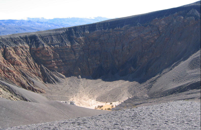
uheberyan.jpg - Ubehebe Crater uhebecrater1.jpg - Ubehebe
Crater uhebecrater2.jpg
- Ubehebe Crater scottyscastle.jpg
Scottys Castle CAMP SITE
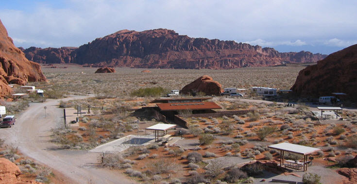
Valley of Fire, 50 km NE of Las Vegas voffirecampryan.jpg
- Valley of Fire
vfireAP.jpg - Airphoto of the
Valley of Fire State campsite vfiretopo.jpg - topo map of the
Valley of Fire region
OR, Red Rock Canyon, west of Las Vegas Topo, showing roads from
Las Vegas to Red Rock Canyon Topo, exit from hwy 95
to Charleston Boulevard Topo, intersection of
hwy 95 and hwy 15 & Charleston Boulevard Airphoto of Red Rock
Canyon region DAY 9 Sat Feb 28 04 - Flight out of Vegas, arrive
London mid-day. University of Nevada, Las Vegas, Dept of
Geoscience 4505 Maryland Parkway Box 454010 Las Vegas, NV 89154-4010
Telephone: (702) 895-3262 E-Mail: geodept@nevada.edu
http://www.unlv.edu/Campus_Map/ = Campus Map - Lily Fong Geoscience
Building is # 38 Campus is north of Airport, on east end of Harmon St, west of
the Rotunda; parking off west side of Maryland Parkway (N-S st); access to
parking at Harmon St (E-W street)
Arizona State Parks
http://www.pr.state.az.us/Parks/parkhtml/buckskin.html Buckskin Mountain State
Park is located on Arizona Highway 95, about 12 miles north of Parker. The River
Island unit is one mile north of Buckskin Mountain State Park.
Arizona Geology
http://www-glg.la.asu.edu/~sreynolds/home.htm - home page of
Stephen J. Reynolds; first-class web site
containing numerous color photographs, 3D perspectives, and information about
the Geology of Arizona, Landscapes of the Southwest, structural geology,
science-education reform, and using Bryce5 to illustrate geology. Maps of Arizona
http://www.azgs.state.az.us/about.htm Arizona Geological
Survey publications
http://www-glg.la.asu.edu/%7Esreynolds/azgeomap/azgeomap_home.htm Geological Map of
Arizona, Steve Reynolds
http://darkwing.uoregon.edu/~rdorsey/Detach.html Map of Whipple
Mountains, archived as Whipplemap.jpg in Cargo_Muchaco... file
http://www.colorado.edu/geolsci/courses/GEOL3120/metamorphiccomplexes.pdf
Geology3120 -
Metamorphic Core Complexes Site has maps and photos
of the Whipple Mountain and Buckskin-Rawhide detachments. Whipple Mountains
geologic map copied as whipplemap2.jpg in Cargo_Muchacho... file
http://www.lowell.edu/users/tweedr/thes_ch5.html no maps Spencer, J.E., and
Reynolds, S.J., 1987, Geologic map of the Swansea-Copper Penny area, central
Buckskin Mountains, west-central Arizona: Arizona Bureau of Geology and Mineral
Technology Open-file Report 87-2, 10 p., scale 1:12,000.
Field Guides/Map of California
http://geology.about.com/library/bl/maps/calmap.jpg Generalized geological
map of California, source site USGS Generalized geological
map of California, source site California Geological Survey
http://www.conservation.ca.gov/cgs/geotour/
The California Geotour - An Index to Online Geologic Field Trip Guides of
California
http://scamp.wr.usgs.gov/scamp/html/gm.html Southern California
Areal Mapping Project (SCAMP)
Howard, K.A., Nielson, J.E., Wilshire, H.G., Nakata, J.K., Goodge, J.W., Reneau,
S.L., John, B.E., and Hansen, V.L., 2000, Geologic Map of the Mohave Mountains,
western Arizona: U.S. Geological Survey Miscellaneous Investigations Series Map
I-2308, 1:48,000, with explanation.
LINKS
http://www.access.gpo.gov/cgi-bin/modalldep.cgi?cmd+CA USGS California
depository libraries Federal and state
government publications also are made available to the public at "depository
libraries" across the country. A complete list of depository libraries is
available. Many of these libraries are "selected" depositories and may not
contain earth science listings. Libraries listed as "Regional" received all
federal publications distributed by the Superintendent of Documents and will
have received USGS publications.
http://ngmdb.usgs.gov/ngmdb/ngm_SMsearch.html USGS map index
http://ngmdb.usgs.gov/ngmdb/ngmdb_home.html National Geologic Map
Database USGS map database
http://geology.wr.usgs.gov/docs/stateinfo/CA.html Geologic information
about California
http://rockyweb.cr.usgs.gov/acis-bin/choosebylocation.pl?statechoice=California
Map retailers california
http://ask.usgs.gov/products.html
usgs maps
http://www.gis.usu.edu/docs/data/nasa_arc/nasa_arc97/SDSU/LaCuesta.pdf
Integrated Use of Remote Sensing and GIS for Mineral Exploration: A Project
of the NASA Affiliated Research Center at San Diego State University
http://geology.csupomona.edu/drjessey/fieldtrips/calico/calico.htm The Calico Mining
district - silver barite
http://gateway.library.uiuc.edu/gex/bibs/geol315-415ariz.html UIUC Geology course
315/415 Field Trip Arizona and Southern California
http://www.johnmartin.com/earthquakes/eqsafs/safs_361.htm
T
http://earthview.sdsu.edu/trees/oroword.html Orocopia Mountains
Detachment System
http://earthview.sdsu.edu/trees/OROTOUR.html
TM image of the Orocopia
Mountains east of the Salton Sea
http://seis.natsci.csulb.edu/deptweb/SkinnyCalSites/TrnsverseRng/SanGabriels/SanGablOview2.html
Geological overviews of the SAN
GABRIEL MOUNTAINS Search of
National Geologic Map database for "California" "Imperial" county
Scale larger (more detail) than 1:24,000
Scale 1:24,000
Scale between 1:24,000 and 1:100,000
Scale between 1:100,000 and 1:500,000
http://ngmdb.usgs.gov/MapProgress/MapProgress_home.html
The "Geologic Mapping in Progress" database lists areas
that are now being mapped, and describes who to contact for more information.
http://ngmdb.usgs.gov/MapProgress/24k_01/24k_01.htm
Geologic Mapping in Progress - select a state
http://ngmdb.usgs.gov/MapProgress/100k_01/100k_01.htm
Select a state -- areas being mapped are in blue
http://ncgmp.usgs.gov/statemap/CA03.pdf
SUMMARY OF STATEMAP GEOLOGIC MAPPING PROGRAM IN CALIFORNIA
USGS
geologic map data model activities are changing over to
http://nadm-geo.org The USGS
is adding a Cartographic Resources page (map templates, etc) –It’s still under
construction, but will be officially added to the project site shortly
http://ngmdb.usgs.gov/Info/cartores/ The
standards and guidelines page is at
http://ngmdb.usgs.gov/Info/standards/ and the search page
for DMT papers is at
http://ngmdb.usgs.gov/dmt/search.html
DIGITAL MAPS
Saucedo, G.J., Bedford, D.R., Raines, G.L., Miller, R.J., Wentworth, C.M.,
Jennings, C.W., Strand, R.G., and Rogers,
T.H., 2000, GIS data for the geologic map of California: California Division of
Mines and Geology, CD 2000-007, scale
1:750000.
Vigil, J.F., Pike, R.J., and Howell, D.G., 2000, A tapestry of time and terrain:
U.S. Geological Survey, Geologic Investigations
Series Map I-2720, scale 1:1350000.
Rea, Alan and Cederstrand, J.R., 1994, GCIP reference data set (GREDS): U.S.
Geological Survey, Open-File Report OF-94-388,
scale 1:2500000.
Schruben, Paul G., Arndt, Raymond E., and Bawiec, Walter J., 1994, Geology of
the Conterminous United States at 1:2,500,000
Scale -- A Digital Representation of the 1974 P.B. King and H.M. Beikman Map:
U.S. Geological Survey, Digital Data Series
DDS-11, scale 1:2500000.
Barton, K.E., Howell, D.G., and Vigil, J.F., 2003, The North America tapestry of
time and terrain: U.S. Geological Survey,
Geologic Investigations Series Map I-2781, scale 1:8000000
Bedford, D.R., Ludington, Steve, Nutt, C.M., Stone, P.A., Miller, D.M., Miller,
R.J.Wagner, D.L., and Saucedo, G.J., 2003, :
U.S. Geological Survey, Open-File Report OF-03-135. Geologic database for the
digital geology of California, Nevada, and Utah - an application of the North
American data
model
GENERAL REFERENCES 1980. Dickey, D.D.,
Carr, W.J., and Bull, W.B. 1980 Geologic map of the Parker NW, Parker, and parts
of the Whipple Mountains SW and Whipple Wash quadrangles, California and Arizona
USGS I-1124 24 1986. Structural
evolution of the Whipple and South Mountains shear zones, southwestern United
States: Geology, v. 14, p. 7-10 (G. A. Davis, G. S. Lister, and S. J. Reynolds). 1987. Field trip guide
to parts of the Harquahala, Granite Wash, Whipple and Buckskin Mountains,
west-central Arizona and southeastern California, p. 351-364 in Geological
diversity of Arizona and its margins: excursions to choice areas (Davis, G. H.,
and VandenDolde, E. M., Eds.): Ariz. Bur. Geology and Min. Technology Special
Paper 5, 422 p. (J. E. Spencer, S. J. Reynolds, J. L. Anderson, G. A. Davis, S.
E. Laubach, S. M. Richard, and Stephen Marshak). 1988. Rapid upward
transport of mid-crustal mylonitic gneisses in the footwall of a Miocene
detachment fault, Whipple Mountains, southeastern California: Geologische
Rundschau, v. 77, no. 1, p. 191-209. 1989. The origin of
metamorphic core complexes and detachment faults formed during Tertiary
continental extension in the northern Colorado River region, U.S.A.: Jour.
Struct. Geol., v. 11, p. 65-95. (G. S. Lister and G. A. Davis). 1989. Seismic
reflectivity of the Whipple Mountain shear zone in southern California, Jour.
Geophys. Research, v. 94, p. 2985-3005. (Chi-Yuen Wang, D. A. Okaya, Charles
Ruppert, G. A. Davis, Tie-Shuan Guo, Zengqiu Zhong, and Hans-Rufolf Wenk). 1989. Terry Shackelford:
a retrospective view, p. 11-14 in Geology and mineral resources of the Buckskin
and Rawhide Mountains, west-central Arizona (Spencer, J. E., and Reynolds, S.
J., eds.): Arizona Geological Survey Bulletin 198 (Shackelford Volume), 279 p. 1991. Low-angle normal
faulting and rapid uplift of mid-crustal rocks in the Whipple Mountains
metamorphic core complex, southeastern California: discussion and field guide,
p. 417-446 in Geological excursions in southern California and Mexico
(Walawender, M. J., and Hanan, B. B., eds.), Dept. of Geological Sciences, San
Diego State University, 515 p. (G. A. Davis, and J. L. Anderson) Eric Frost - important site on crustal extension in SE
California Eric Frost -
Geologic database for the
digital geology of California, Nevada, and Utah - an application of the North
American data
Olmsted, F.H., 1972, Geologic map of the Laguna Dam 7.5-minute quadrangle,
Arizona and California: U.S. Geological Survey,
Geologic Quadrangle Map GQ-1014, scale 1:24000.
Smith, D.B., Berger, B.R., Tosdal, R.M., Sherrod, D.R., Raines, G.L., Griscom,
Andrew, Helferty, M.G., Rumsey, C.M., and
McMahan, A.B., 1987, Mineral resources of the Indian Pass and Picacho Peak
Wilderness Study Areas, Imperial County,
California: U.S. Geological Survey, Bulletin 1711-A, scale 1:24000.
Morton, P.K., 1977, Geology and mineral resources of Imperial County,
California: California Division of Mines and Geology,
County Report 7, scale 1:125000.
Mattick, R.E., Olmsted, F.H., and Zohdy, A.A.R., 1973, Geophysical studies in
the Yuma area, Arizona and California: U.S.
Geological Survey, Professional Paper 726-D, scale 1:250000.
Schell, B.A. and Wilson, K.L., 1982, Regional neotectonic analysis of the
Sonoran Desert: U.S. Geological Survey,
Open-File Report OF-82-57, scale 1:500000.
Smith, M.B., 1964, Map showing distribution and configuration of basement rocks
in California: U.S. Geological Survey,
Oil and Gas Investigations Map OM-215, scale 1:500000.
Powell, R.E., 1993, Balanced palinspastic reconstruction of pre-late Cenozoic
paleogeography, southern California: geologic
and kinematic constraints on evolution of the San Andreas fault system:
Geological Society of America, Memoir 178,
Chapter 1, scale 1:740000.
Blake, M.C., Howell, D.G., and Jones, D.L., 1982, Preliminary
tectonostratigraphic terrane map of California: U.S. Geological
Survey, Open-File Report OF-82-593, scale 1:750000.
Castle, R.O., Elliot, M.R., Church, J.P., and Wood, S.H., 1984, The evolution of
the southern California uplift, 1955 through
1976: U.S. Geological Survey, Professional Paper 1342, scale 1:750000.
Jennings, C.W., Strand, R.G., Rogers, T.H., Boylan, R.T., Moar, R.R., and
Switzer, R.A., 1977, Geologic map of California:
California Division of Mines and Geology, Geologic Data Map 2, scale 1:750000.
Albers, J.P. and Fraticelli, L.A., 1984, Preliminary mineral resources
assessment map of California: U.S. Geological
Survey, Mineral Investigations Resources Map MR-88, scale 1:1000000.
Vigil, J.F., Pike, R.J., and Howell, D.G., 2000, A tapestry of time and terrain:
U.S. Geological Survey, Geologic Investigations
Series Map I-2720, scale 1:1350000.
Feray, D.E., Oetking, Philip, and Renfro, H.B., 1968, Geological highway map of
the Pacific Southwest region: California,
Nevada: American Association of Petroleum Geologists, United States Geological
Highway Map Series 3, scale 1:1900800.
Barbat, W.F., 1971, Megatectonics of the Coast Ranges, California: Geological
Society of America, Bulletin v.82, n.6, p.1541,
scale 1:2000000.
Bayer, K.C., 1983, Generalized structural, lithologic, and physiographic
provinces in the fold and thrust belts of the
United States: exclusive of Alaska and Hawaii: U.S. Geological Survey, scale
1:2500000.
Crowe, B.M., 1978, Cenozoic volcanic geology and probable age of inception of
basin-range faulting in the southeasternmost
Chocolate Mountains, California: Geological Society of America, Bulletin v.89,
n.2, p.251, scale 1:83000.
Other geological excursions:
The Southern
Appalachians (in preparation)
Geology of the Adirondacks,
New York State, Oct. 2004
The
Meso-Protoerozoic Grenvillian geologic history of the Adirondacks region of New
York State
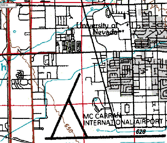
airport_University.jpg
- relative location of the McCarren Airport and the University of Nevada, Las Vegas.
![]()
![]()
![]()
Julia M. G. Miller (Department of Geology,
Vanderbilt University, Nashville, Tennessee 37235) and Barbara E. John
![]() Miocene
synextensional strata flanking the Chemehuevi and southern Sacramento
Mountains in southeastern California and western Arizona
Miocene
synextensional strata flanking the Chemehuevi and southern Sacramento
Mountains in southeastern California and western Arizona![]() 30°). Individual faults within the
30°). Individual faults within the![]() 7–8
mm/yr during peak tectonic extension from ca. 19 to 15 Ma.
7–8
mm/yr during peak tectonic extension from ca. 19 to 15 Ma. ![]() Tertiary strata
preserved in tilted hanging-wall blocks are between 2 and 3 km thick.
Mafic and intermediate volcanic rocks (ca. 23 to 18.5 Ma)
Tertiary strata
preserved in tilted hanging-wall blocks are between 2 and 3 km thick.
Mafic and intermediate volcanic rocks (ca. 23 to 18.5 Ma)![]() These data show
that the gentle dip and corrugated shape of the Chemehuevi-Sacramento
detachment-fault system, when it was seismically
These data show
that the gentle dip and corrugated shape of the Chemehuevi-Sacramento
detachment-fault system, when it was seismically
Oatmangeol.jpg - Geological map of
the Oatman area. Durning, W.P. and Buchanan, L.J., 1984 The Geology and Ore
Deposits of Oatman, Arizona.
Arizona Geol. Soc. Digest, v. 15, Fig. 2.
Overnight - Buckskin Arizona State Park
south of Parker Dam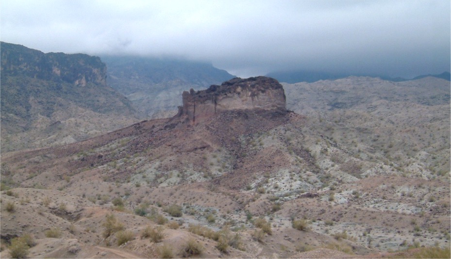
![]()
 gneissxenolith.jpg
- Gneiss xenolith in diabase intrusion, Whipple Wash
gneissxenolith.jpg
- Gneiss xenolith in diabase intrusion, Whipple Wash
060225_04_whipplemyl.JPG
07/04/2006 - retrogressively mylonitized basement gneisses below the Whipple
Wash Detachment
060225_05_whipplemyl.JPG
07/04/2006 - complex shear fabrics in the basement gneisses below the
Whipple Wash Detachment
060225_06_whipplestal.JPG
08/04/2006 - collapsed cavity in the the Tertiary sed/volc sequence with
hanging stalagmites
060225_07_whipple.JPG 08/04/2006 -
view from the NW side of Whipple Wash towards the SE, with the Bowmans Wash
quartz monzodiorite in the lower ground of the middle foreground, and the
fanglomerate/volcanic succession occupying the more distant mountains
060225_08_whippleunconf.JPG
08/04/2006 - Tertiary volcanic rocks unconformably overlying the Bowmans Wash
quartz monzodiorite, c. 748500E, 3802500 (see geological map
whipspenf2a.jpg
, NW of point B7)
060225_09_whipple.JPG 08/04/2006 -
inlier/window of Bowmans Wash basement rocks (centre-right) within Tertiary
fanglomerates and volcanic rocks
ian_whip_burros.jpg - Tertiary
fanglomerates; note burros on the scree slope (eye-sight test!)
ian_whip_palm.jpg - solitary native palm
tree in Whipple Wash
Overnight at Buckskin Mountain State Park south of Parker Dam
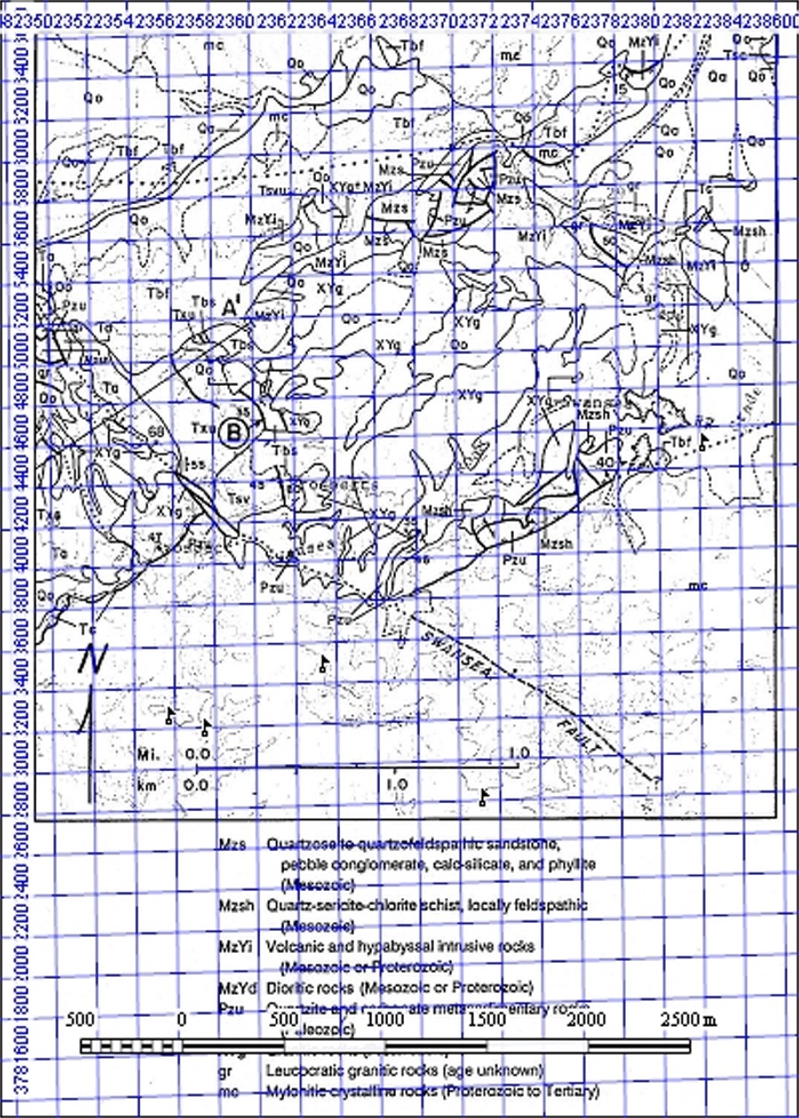
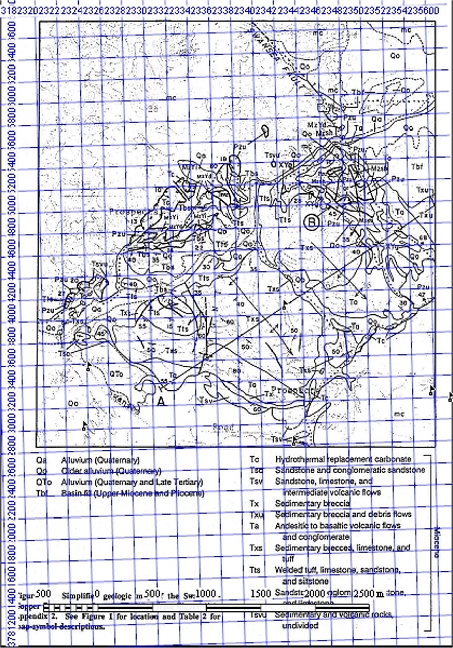
s&rclara_peakf4bgeol.jpg - Geologic
map of the Buckskin and Rawhide Mountains, Fig 4b (West)
s&rclara_peakf4ageol.jpg - Geologic
map of the Buckskin and Rawhide Mountains, Fig 4a (East)
s&rclara_peakf3bgeol.jpg - Geologic
map of the Buckskin and Rawhide Mountains showing locations of mines, Fig 3b
(East)
s&rclara_peakf3ageol.jpg - Geologic
map of the Buckskin and Rawhide Mountains showing locations of mines, Fig 3a
(West)
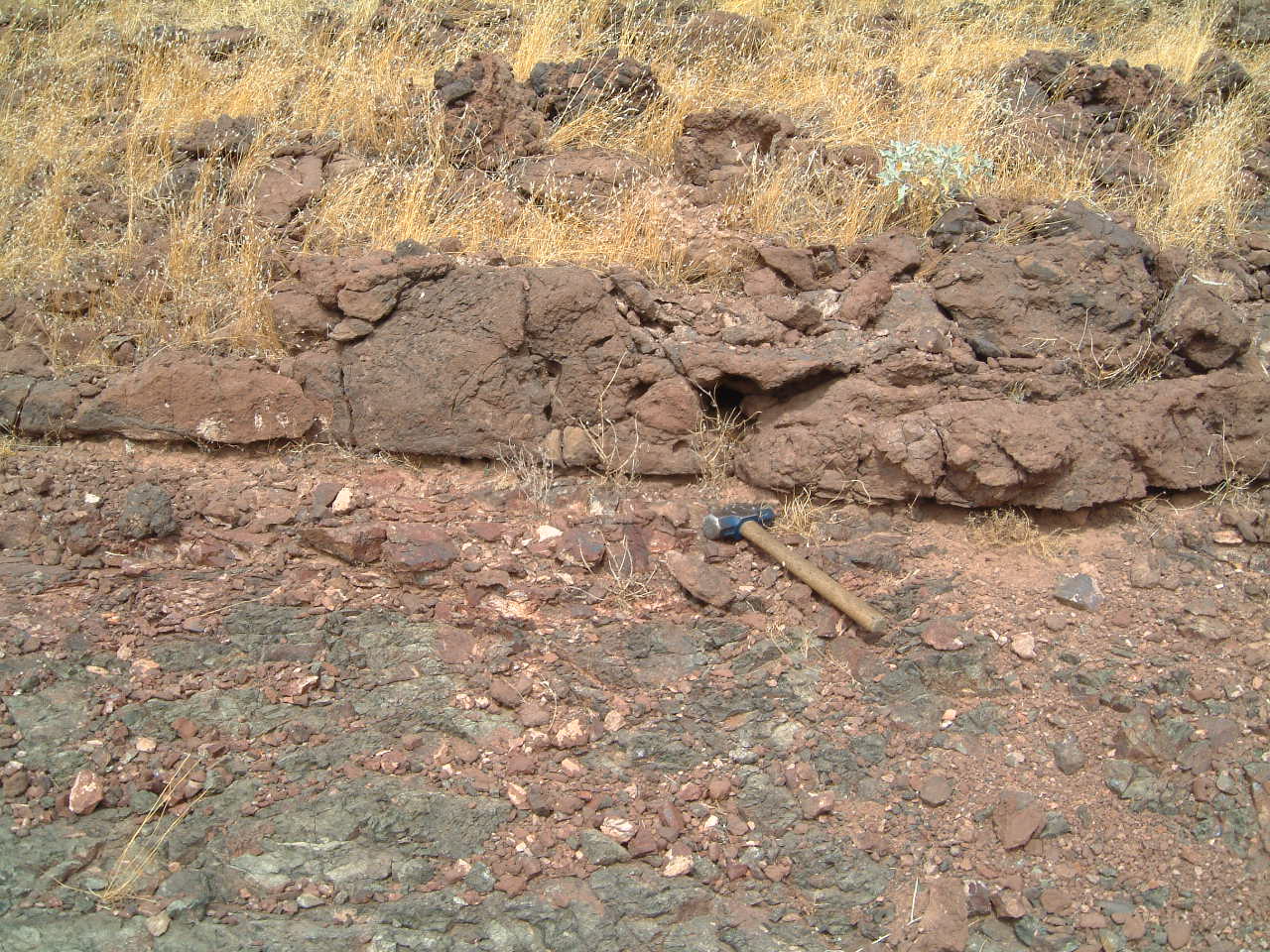
060226_11_claraunconf.JPG
08/04/2006 - contact between Tertiary fanglomerates and retrograde mylonitized
tectonites, Clara Peak
060226_12_clarased.JPG 08/04/2006
- Tertiary fanglomerates overlying retrograde mylonitized tectonites,
Clara Peak
060226_15_swanseato NE.JPG
09/04/2006 - view to the NE from the Swansea mine site
s&rriovistaf28geol.jpg -
Geologic map of the Rio Vista-Billy Mack area
s&rclara_peakf14ageol.jpg -
Geologic map of the Swansea - Copper Penny area, Fig. 14a
s&rclara_peakf9geol.jpg - Geologic
map of the Clara Peak area
s&rclara_peakf4bgeol.jpg - Geologic
map of the Buckskin and Rawhide Mountains, Fig 4b (West)
s&rclara_peakf4ageol.jpg - Geologic
map of the Buckskin and Rawhide Mountains, Fig 4a (East)
s&rclara_peakf3bgeol.jpg - Geologic
map of the Buckskin and Rawhide Mountains showing locations of mines, Fig 3b
(East)
s&rclara_peakf3ageol.jpg - Geologic
map of the Buckskin and Rawhide Mountains showing locations of mines, Fig 3a
(West)
Maps from: Spencer, J.E. et
al., 1987
AIRPHOTOS AND TOPOGRAPHIC MAPS
060226_11_claraunconf.JPG
08/04/2006
060226_12_clarased.JPG 08/04/2006
060226_13_swansea mine.JPG
09/04/2006
060226_15_swanseato NE.JPG
09/04/2006
Overnight -
Squaw Lake, Senator Wash![]()
![]()
ore-stage extensional fault system (the Chocolate Mountains/Gatuna Fault) of
probable Oligocene age in deeper portions of the
deposit. The fault system was infiltrated during much of its active life by hot,
dilute, highly exchanged meteoric water having temperatures of 170 –210 C,
salinity <2 wt% NaCl equivalent and calculated d18Ofluid between -2.6/mil and
+5.2/mil. This main-stage fluid precipitated
quartz, pyrite, and specular hematite, accompanied
by silicification and sericitization. Auriferous ore-stage
pyrite was precipitated late in the fault evolution
probably by mixing reducing ore fluid with
relatively oxidized main-stage fluid during
regional Oligocene extension on the Chocolate Mountains/ Gatuna Fault. The
Picacho deposit is characterized
by a gold–arsenic–antimony geochemical signature consistent with
bisulfide complexing of gold in reducing fluid, in
contrast with typical denudation fault-hosted base-metal-rich deposits
associated with high-salinity fluids elsewhere in the southwestern United
States. The deposit is overprinted by Miocene normal
faults having a wide range of dips. These post-ore faults are associated
with red earthy hematite precipitation, pyrite oxidation,
and supergene enrichment of gold.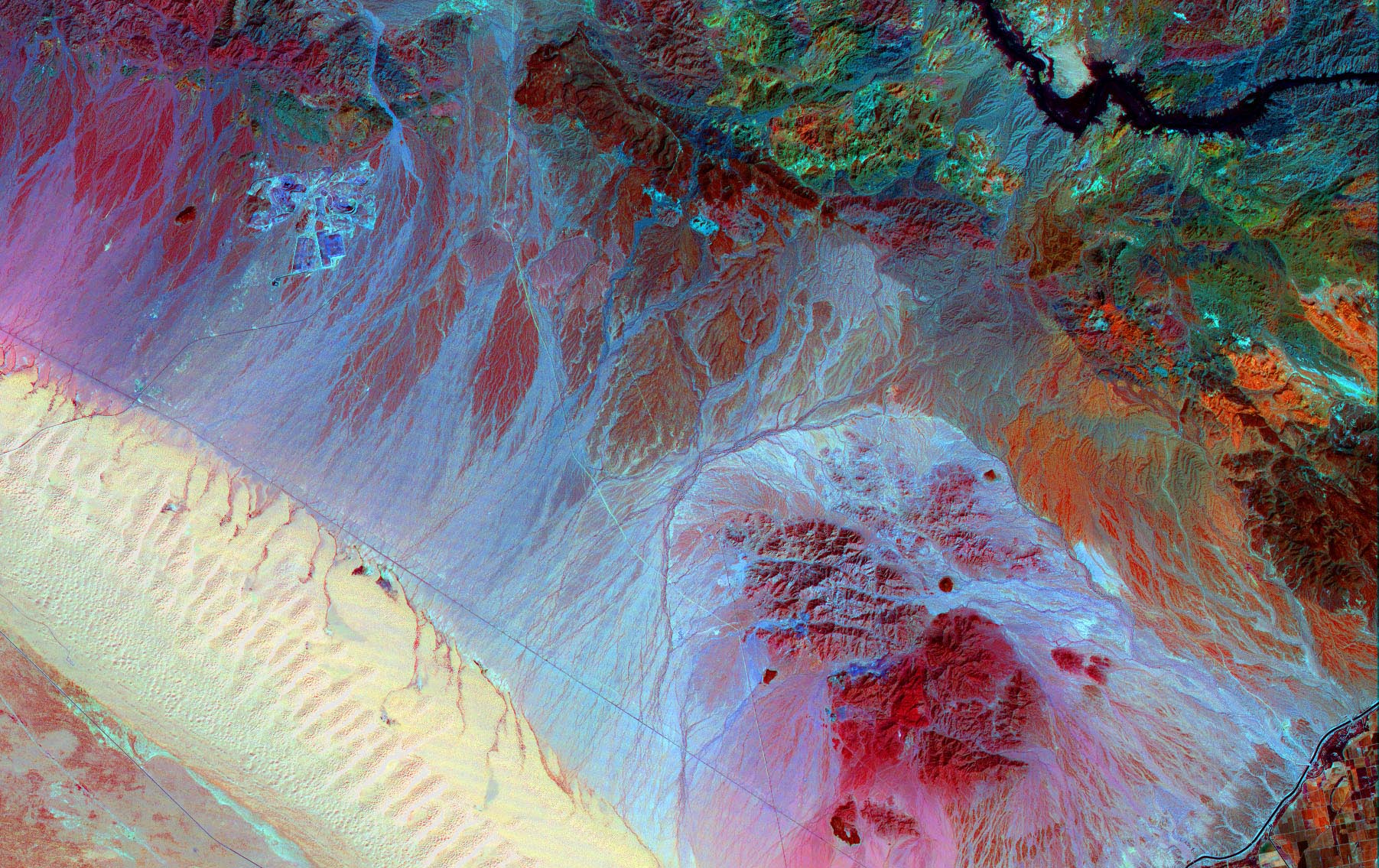
![]()
![]()
Overnight - Wilderness camping NE of Mesquite
![]()
060228_20_mesquite.JPG
10/04/2006 - folds in gneisses in the Mesquite mine
060228_21_campmine.JPG
11/04/2006 - old mine sunk in vicinity of argillized rocks associated with a
south dipping normal and a large NNW trending quartz-vein ![]()
![]()

![]()
ian_salt2.jpg
- view of Death Valley from Natural Bridge
060302_23_deatha2.JPG 12/04/2006 -
view of the basement and 'chaos' rocks as represented in Fig. 4 of Troxel and
Wright
060302_24_deatha3.JPG 12/04/2006 -
view of the basement and 'chaos' rocks as represented in Fig. 4 of Troxel and
Wright
060302_25_deatha4.JPG 12/04/2006 -
view of the basement and 'chaos' rocks as represented in Fig. 5 of Troxel and
Wright; viewed from point c in Fig 2
ian_virgsp.jpg - Virgin Spring chaos phase;
locality a of Troxel and Wright, 1987
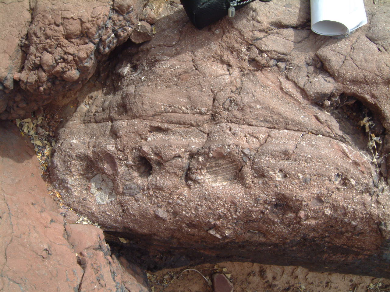
ian_armagouge.jpg - Breccia, Virgin Spring
chaos phase; locality a of Troxel and Wright, 1987
060302_27_deathc.JPG 12/04/2006 -
blocks of Tertiary fanglomerate in breccia of the Jubilee chaos phase; point c
of Fig 2 of T and W, 1987
060302_28_deathc.JPG 12/04/2006 -
blocks of basement mylonite in breccia of the Jubilee chaos phase; point c of
Fig 2 of T and W, 1987
060302_29_bad.JPG 13/04/2006 - Virgin
Spring phase breccia overlying mylonitic gneiss
060302_32b_bad.JPG 13/04/2006 -
carbonate breccia of the Virgin Spring (?) phase overlying altered (iron)
retrograded mylonitic gneiss
060302_31_badklippen.JPG
13/04/2006 - remnant klippen of Virgin Spring (mid-left pinkish patch) and
Jubilee (mid-right) 'chaos' material
060302_35b_badcongbrec.JPG
13/04/2006 - klippe of the Jubilee phase brecciated fanglomerates
060302_37a_badcongbrec.JPG
13/04/2006 - Jubilee phase breccias overlying altered mylonite
060302_37c_badcongbrec.JPG
13/04/2006 - close-up
060302_38_badchlormyl.JPG
13/04/2006 - highly chloritized mylonitized gneiss just below the detachment
surface of the Badwater 'turtleback'
060302_33b_badalluvbrec.JPG
13/04/2006 - brecciated alluvial fan deposits in contact with the lower plate
mylonitic gneiss
060302_33c_bad.JPG 13/04/2006 -
brecciated alluvial fan deposits
Goto:
http://vulcan.wr.usgs.gov/Volcanoes/California/Hazards/Bulletin1847/table_holocene_volcanoes.html
![]()
John, B.E., 1987, Geologic map of the Chemehuevi Mountains area, San Bernardino
County, California, and Mohave County, Arizona: U.S. Geological Survey Open-File
Report 87-666, (l:24, 000 with explanation).
Miller, D.M., John, B.E., Antweiler, J.C., Simpson, R.W., Hoover, D.B., Raines,
G.L., and Kreidler, T.J., 1983, Mineral resource potential of the Chemehuevi
Mountains Wilderness Study Area (CDCA-310), San Bernardino County, California:
U.S. Geological Survey Misc. Field Investigations Map MF-1584A (l:48,000).
Hadley, J.B. (valid link), 1942, Manganese deposits in the Paymaster mining
   district, Imperial County, California: U.S. Geological
   Survey, Bulletin 931-S, scale 1:6000.
Robinson, P.T. and Elders, W.A., 1976, Quaternary volcanism in
   the Salton Sea geothermal field, Imperial Valley, California:
   Geological Society of America, Bulletin v.87, n.3, p.347,
   scale 1:10000.
Clark, M.M., 1984, Map showing recently active breaks along
   the San Andreas fault and associated faults between Salton
   Sea and Whitewater River-Mission Creek, California: U.S.
   Geological Survey, Miscellaneous Investigations Series Map
   I-1483, scale 1:24000.
Olmsted, F.H., 1972, Geologic map of the Laguna Dam 7.5-minute
   quadrangle, Arizona and California: U.S. Geological Survey,
   Geologic Quadrangle Map GQ-1014, scale 1:24000.
Sharp, R.V., 1972, Map showing recently active breaks along
   the San Jacinto fault zone between the San Bernardino area
   and Borrego Valley, California: U.S. Geological Survey,
   Miscellaneous Geologic Investigations Map I-675, scale
   1:24000.
Sharp, R.V., 1977, Holocene traces of the Imperial fault in
   south-central Imperial County, California: U.S. Geological
   Survey, Open-File Report OF-77-815, scale 1:24000.
Smith, D.B., Berger, B.R., Tosdal, R.M., Sherrod, D.R., Raines,
   G.L., Griscom, Andrew, Helferty, M.G., Rumsey, C.M., and
   McMahan, A.B., 1987, Mineral resources of the Indian Pass
   and Picacho Peak Wilderness Study Areas, Imperial County,
   California: U.S. Geological Survey, Bulletin 1711-A, scale
   1:24000.
Haxel, G.B., Jacobson, C.E., Richard, S.M., Tosdal, R.M., and
   Grubensky, M.J., 2002, The Orocopia Schist in southwest
   Arizona: Early Tertiary oceanic rocks trapped or transported
   far inland: Geological Society of America, Special Paper
   365, p. 99, scale 1:45000.
Crowe, B.M., 1978, Cenozoic volcanic geology and probable age
   of inception of basin-range faulting in the southeasternmost
   Chocolate Mountains, California: Geological Society of
   America, Bulletin v.89, n.2, p.251, scale 1:83000.
Todd, V.R., Detra, D.E., Kilburn, J.E., Griscom, Andrew, Kruse,
   F.A., and Campbell, H.W., 1987, Mineral resources of the
   Fish Creek Mountains Wilderness Study Area, Imperial County,
   California: U.S. Geological Survey, Bulletin 1711-C, scale
   1:97000.
Babcock, E.A., 1974, Geology of the northeast margin of the
   Salton trough, Salton Sea, California: Geological Society
   of America, Bulletin v.85, n.2, p.321, scale 1:111000.
Bartholomew, M.J., 1970, San Jacinto fault zone in the northern
   Imperial Valley, California: Geological Society of America,
   Bulletin v.81, n.10, p.3161, scale 1:113000.
Morton, P.K., 1977, Geology and mineral resources of Imperial
   County, California: California Division of Mines and Geology,
   County Report 7, scale 1:125000.
Jennings, C.W., 1967, Geologic map of California : Salton Sea
   sheet: California Division of Mines and Geology, scale
   1:250000.
Mattick, R.E., Olmsted, F.H., and Zohdy, A.A.R., 1973, Geophysical
   studies in the Yuma area, Arizona and California: U.S.
   Geological Survey, Professional Paper 726-D, scale 1:250000.
Rogers, T.H., 1965, Geologic map of California : Santa Ana
   sheet: California Division of Mines and Geology, scale
   1:250000.
Smith, G.I. and Goodfellow, Robert, 1999, Transverse and
   longitudinal geologic cross-sections across parts of southeast
   California: U.S. Geological Survey, Open-File Report OF-93-387,
   scale 1:250000.
Strand, R.G., 1962, Geologic map of California : San Diego-El
   Centro sheet: California Division of Mines and Geology,
   scale 1:250000.
![]() Durning, Perry W., Polis, Stephen R., Frost, Eric G., and Kaiser,
John V., 1998, Integrated use of remote sensing and GIS for mineral Exploration:
NASA Affiliated Research Center at San Diego State University, Final Report,
25p.
Durning, Perry W., Polis, Stephen R., Frost, Eric G., and Kaiser,
John V., 1998, Integrated use of remote sensing and GIS for mineral Exploration:
NASA Affiliated Research Center at San Diego State University, Final Report,
25p. ![]() Rogers, K., Frost, E., Augustine, E., Barsumian, B., Borron, S., Klimcsak, E.,
and O'Connor, T., 1998, Mid-Tertiary crustal extension in the offshore
California Borderlands as demonstrated by major crustal tilt blocks from
industry seismic profiles, Cordilleran Section of Amer. Assoc. of Petroleum
Geologists, p.39-40.
Rogers, K., Frost, E., Augustine, E., Barsumian, B., Borron, S., Klimcsak, E.,
and O'Connor, T., 1998, Mid-Tertiary crustal extension in the offshore
California Borderlands as demonstrated by major crustal tilt blocks from
industry seismic profiles, Cordilleran Section of Amer. Assoc. of Petroleum
Geologists, p.39-40. ![]() Frost, E.G., Fattahipour, M., and Robinson, K.L., 1996, Neogene detachment and
strike-slip faulting in the Salton Trough region and their geometric and genetic
interrelationships, in P.L. Abbott and J.D. Cooper, eds., Amer. Assoc. of Pet.
Geol. Nat. Fieldguide 73, p.263-276.
Frost, E.G., Fattahipour, M., and Robinson, K.L., 1996, Neogene detachment and
strike-slip faulting in the Salton Trough region and their geometric and genetic
interrelationships, in P.L. Abbott and J.D. Cooper, eds., Amer. Assoc. of Pet.
Geol. Nat. Fieldguide 73, p.263-276. ![]() Frost, E.G. and Heidrick, T.L., 1996, Three-dimensional structural geometries of
the Colorado River extensional terrane and their regional exploration
implications, in Rehrig, W.A., Low-angle tectonic features of the southwestern
United States and their influence on mineral Resources, Assoc. of Economic
Geologists, p.1-64.
Frost, E.G. and Heidrick, T.L., 1996, Three-dimensional structural geometries of
the Colorado River extensional terrane and their regional exploration
implications, in Rehrig, W.A., Low-angle tectonic features of the southwestern
United States and their influence on mineral Resources, Assoc. of Economic
Geologists, p.1-64. ![]() Frost, E.G., Suitt, S., and Fattahipour, M., 1996, Emerging perspectives of the
Salton Trough region with an emphasis on extensional faulting and its
implications for later San Andreas deformation, in P.L. Abbott and D.C. Seymour,
eds., Sturzstroms and detachment faults, South Coast Geological Society,
p.81-121.
Frost, E.G., Suitt, S., and Fattahipour, M., 1996, Emerging perspectives of the
Salton Trough region with an emphasis on extensional faulting and its
implications for later San Andreas deformation, in P.L. Abbott and D.C. Seymour,
eds., Sturzstroms and detachment faults, South Coast Geological Society,
p.81-121. ![]() Frost, E.G., Suitt, S., and Fattahipour, M., 1996, Emerging perspectives of the
Salton Trough region with an emphasis on extensional faulting and its
implications for later San Andreas deformation: in P.L. Abbott and D.C. Seymour,
eds., Sturzstroms and detachment faults, South Coast Geological Society,
p.81-121.
Frost, E.G., Suitt, S., and Fattahipour, M., 1996, Emerging perspectives of the
Salton Trough region with an emphasis on extensional faulting and its
implications for later San Andreas deformation: in P.L. Abbott and D.C. Seymour,
eds., Sturzstroms and detachment faults, South Coast Geological Society,
p.81-121. ![]() Frost, E.G., Fattahipour, M., and Robinson, K.L., 1996, Neogene detachment and
strike-slip faulting in the Salton Trough region and their geometric and genetic
interrelationships, in P.L. Abbott and J.D. Cooper, eds., Amer. Assoc. of
Petroleum Geologists National Fieldguide 73, p.263-276.
Frost, E.G., Fattahipour, M., and Robinson, K.L., 1996, Neogene detachment and
strike-slip faulting in the Salton Trough region and their geometric and genetic
interrelationships, in P.L. Abbott and J.D. Cooper, eds., Amer. Assoc. of
Petroleum Geologists National Fieldguide 73, p.263-276. ![]() Robinson, K.L., and Frost, E.G., 1996, Orocopia Mountains detachment system, in
P.L. Abbott and J.D. Cooper, eds., Amer. Assoc. of Petroleum Geologists National
Fieldguide 73, p.277-284.
Robinson, K.L., and Frost, E.G., 1996, Orocopia Mountains detachment system, in
P.L. Abbott and J.D. Cooper, eds., Amer. Assoc. of Petroleum Geologists National
Fieldguide 73, p.277-284. ![]() Frost, E.G., and Heidrick, T.L., 1996, Three-dimensional structural geometries
of the Colorado River extensional terrane and their regional exploration
implications, in Rehrig, W.A., Low-angle tectonic features of the southwestern
United States and their influence on mineral resources, Assoc. of Economic
Geologists, p.1-64.
Frost, E.G., and Heidrick, T.L., 1996, Three-dimensional structural geometries
of the Colorado River extensional terrane and their regional exploration
implications, in Rehrig, W.A., Low-angle tectonic features of the southwestern
United States and their influence on mineral resources, Assoc. of Economic
Geologists, p.1-64. ![]() Frost, E.G., Heizer, L.A., Blom, R.G., and Crippen, R.E., 1996, The Western
Salton Trough detachment system, in F. V. Corona, ed., The San Andreas Fault
System: Identification of wrench-fault assemblages and their associated
hydrocarbon traps, Amer. Assoc. of Petroleum Geologists National Fieldguide,
p.163-178.
Frost, E.G., Heizer, L.A., Blom, R.G., and Crippen, R.E., 1996, The Western
Salton Trough detachment system, in F. V. Corona, ed., The San Andreas Fault
System: Identification of wrench-fault assemblages and their associated
hydrocarbon traps, Amer. Assoc. of Petroleum Geologists National Fieldguide,
p.163-178. ![]() Robinson, K., and Frost, E.G., Extension within the San Joaquin Hills and its
comparison to the Orocopia Mountains, submitted to Geological Society of America
Special Paper on Extension in Coastal California, 8-94.
Robinson, K., and Frost, E.G., Extension within the San Joaquin Hills and its
comparison to the Orocopia Mountains, submitted to Geological Society of America
Special Paper on Extension in Coastal California, 8-94. ![]() Frost, E.G., and Heidrick, T.L., Structural framework of crustal extension in
the Colorado River region as a template for extension in the California coastal
region, submitted to Geological Society of America Special Paper on Extension in
Coastal California, 11-94.
Frost, E.G., and Heidrick, T.L., Structural framework of crustal extension in
the Colorado River region as a template for extension in the California coastal
region, submitted to Geological Society of America Special Paper on Extension in
Coastal California, 11-94. ![]() Barstow, Daniel, and Frost, Eric, 1995, Do we really understand what w see?
Cognitive issues in remote sensing from the perspective of a scientist and an
educator, Int. Geoscience and Remote Sensing Symposium, 4p.
Barstow, Daniel, and Frost, Eric, 1995, Do we really understand what w see?
Cognitive issues in remote sensing from the perspective of a scientist and an
educator, Int. Geoscience and Remote Sensing Symposium, 4p. ![]() Frost, E.G., Heizer, Lisa A., Blom, Ron, and Crippen, Ron, 1993, The Western
Salton Trough Detachment System, ERIM Fieldguide to Remote Sensing of
Strike-Slip Fault Systems, p.186-198.
Frost, E.G., Heizer, Lisa A., Blom, Ron, and Crippen, Ron, 1993, The Western
Salton Trough Detachment System, ERIM Fieldguide to Remote Sensing of
Strike-Slip Fault Systems, p.186-198. ![]() Pridmore, Cindy, and Frost, Eric, 1992, California's Extended Past, California
Geology, v.45, p.3-17.
Pridmore, Cindy, and Frost, Eric, 1992, California's Extended Past, California
Geology, v.45, p.3-17. ![]() Frost, E.G., D.A. Okaya, T.V. McEvilly, E.C. Hauser, G.S. Galvan, J. McCarthy,
G.S. Fuis, C.M. Conway, R.G. Blom, and T.L. Heidrick, Crustal transect: Colorado
Plateau - Detachment terrane - Salton Trough, in Geologic diversity of Arizona
and its margins: excursions to choice areas, edited by G.H. Davis and E.M.
VandenDolder, Ariz. Bur. Geol. Special Paper 5, 398-422, 1987.
Frost, E.G., D.A. Okaya, T.V. McEvilly, E.C. Hauser, G.S. Galvan, J. McCarthy,
G.S. Fuis, C.M. Conway, R.G. Blom, and T.L. Heidrick, Crustal transect: Colorado
Plateau - Detachment terrane - Salton Trough, in Geologic diversity of Arizona
and its margins: excursions to choice areas, edited by G.H. Davis and E.M.
VandenDolder, Ariz. Bur. Geol. Special Paper 5, 398-422, 1987. ![]() Frost, E.G., and S.N. Watowich, The Mesquite and Picacho Gold Mines: epithermal
mineralization localized within Tertiary extensional deformation, in Geologic
diversity of Arizona and its margins: excursions to choice areas, edited by G.H.
Davis and E.M. VandenDolder, Ariz. Bur. Geol. Special Paper 5, 324-336, 1987.
Frost, E.G., and S.N. Watowich, The Mesquite and Picacho Gold Mines: epithermal
mineralization localized within Tertiary extensional deformation, in Geologic
diversity of Arizona and its margins: excursions to choice areas, edited by G.H.
Davis and E.M. VandenDolder, Ariz. Bur. Geol. Special Paper 5, 324-336, 1987.
![]()
![]() Henyey, T.E., D.A. Okaya, E.G. Frost, and T.V. McEvilly, CALCRUST (1985) seismic
reflection survey, Whipple Mountains detachment terrane, California: an
overview, Geophys. J.R. astr. Soc., 89, 111-118, 1987.
Henyey, T.E., D.A. Okaya, E.G. Frost, and T.V. McEvilly, CALCRUST (1985) seismic
reflection survey, Whipple Mountains detachment terrane, California: an
overview, Geophys. J.R. astr. Soc., 89, 111-118, 1987.
Guidebooks
![]() Heidrick, T.L., and Frost, E.G., 1994, Extensional structures in the lower
Colorado River area, geological field guide: Chevron structural geology school
on extension and fielduide, Revised Version with fieldguide on strike-slip
faulting.
Heidrick, T.L., and Frost, E.G., 1994, Extensional structures in the lower
Colorado River area, geological field guide: Chevron structural geology school
on extension and fielduide, Revised Version with fieldguide on strike-slip
faulting. ![]() Frost, E.G., and D.M. Frost, Crustal habitat of precious metal mineralization
within the extended terrane of southern California and western Arizona, in The
California Desert Mineral Symposium Compendium, U. S. Bureau of Land Management,
Special Publication, 135-137, 1989.
Frost, E.G., and D.M. Frost, Crustal habitat of precious metal mineralization
within the extended terrane of southern California and western Arizona, in The
California Desert Mineral Symposium Compendium, U. S. Bureau of Land Management,
Special Publication, 135-137, 1989. ![]() Dokka, R.K., M. McCurry, M.O. Woodburne, E.G. Frost, and D.A. Okaya, A field
guide to the Cenozoic crustal structure of the Mojave Desert, in this extended
land - geologic journeys in the southern Basin and Range, Weide, D.L., and
Faber, M.L., eds., Geol. Soc. Am. Guidebook, 21-44, 1988.
Dokka, R.K., M. McCurry, M.O. Woodburne, E.G. Frost, and D.A. Okaya, A field
guide to the Cenozoic crustal structure of the Mojave Desert, in this extended
land - geologic journeys in the southern Basin and Range, Weide, D.L., and
Faber, M.L., eds., Geol. Soc. Am. Guidebook, 21-44, 1988. ![]() Drobeck, P.A., F.L. Hillemeyer, E.G. Frost, and G.S. Liebler, The Picacho mine:
A gold mineralized detachment in southeastern California, Ariz. Geol. Digest,
16, 187-221, 1986.
Drobeck, P.A., F.L. Hillemeyer, E.G. Frost, and G.S. Liebler, The Picacho mine:
A gold mineralized detachment in southeastern California, Ariz. Geol. Digest,
16, 187-221, 1986.
![]() Frost, E.G., P. Drobeck, and B. Hillemeyer, Geologic setting of gold and silver
mineralization in southeastern California and southwestern Arizona, Geol. Soc.
Am., Guidebook, 70-119, 1986.
Frost, E.G., P. Drobeck, and B. Hillemeyer, Geologic setting of gold and silver
mineralization in southeastern California and southwestern Arizona, Geol. Soc.
Am., Guidebook, 70-119, 1986. ![]() Morris, R.S., E.G. Frost, and D.A. Okaya, Preliminary seismic reflection
interpretation of the overprint of Tertiary detachment faulting on the Orocopia
Schist-Chocolate Mountains thrust system, Milpitas Wash area of southeastern
California, Geol. Soc. Am., Guidebook, 122-126, 1986.
Morris, R.S., E.G. Frost, and D.A. Okaya, Preliminary seismic reflection
interpretation of the overprint of Tertiary detachment faulting on the Orocopia
Schist-Chocolate Mountains thrust system, Milpitas Wash area of southeastern
California, Geol. Soc. Am., Guidebook, 122-126, 1986.
Videos
![]() Simmons, G.B., Crippen, R.E., Blom, R.G., Okaya, D.A., Hussey, K.J., Beratan,
K.K., and Frost, E.G., From Space to the Moho, Visualization of Landsat Thematic
Mapper, digital elevation, and seismic profile data of Lake Havasu regional
detachment terranes, California and Arizona, Jet Propulsion Laboratory,
California Institute of Technology, video AVC-077-89C1D, 5 min., 45 sec, (1989,
revised, 1991).
Simmons, G.B., Crippen, R.E., Blom, R.G., Okaya, D.A., Hussey, K.J., Beratan,
K.K., and Frost, E.G., From Space to the Moho, Visualization of Landsat Thematic
Mapper, digital elevation, and seismic profile data of Lake Havasu regional
detachment terranes, California and Arizona, Jet Propulsion Laboratory,
California Institute of Technology, video AVC-077-89C1D, 5 min., 45 sec, (1989,
revised, 1991).
![]()
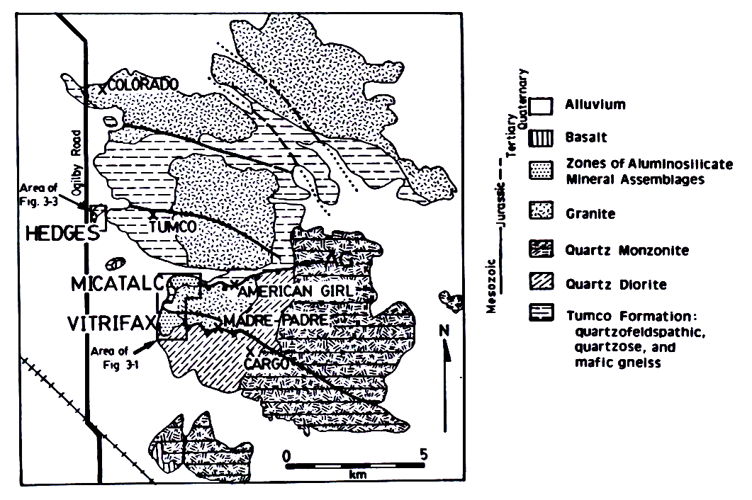
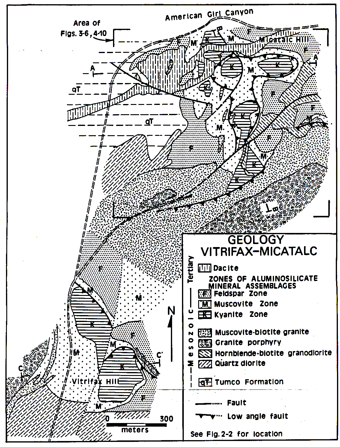
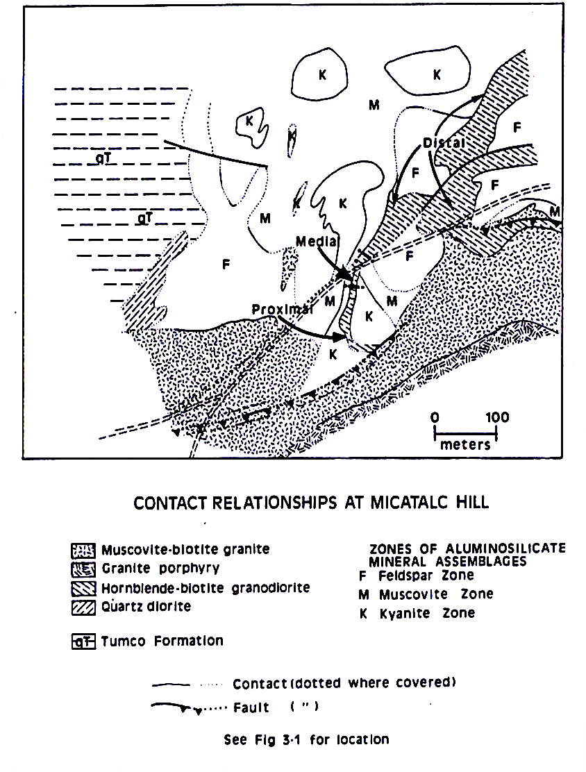
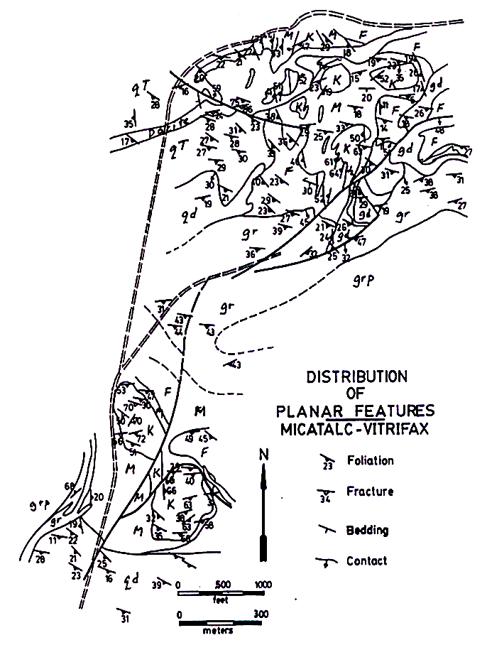
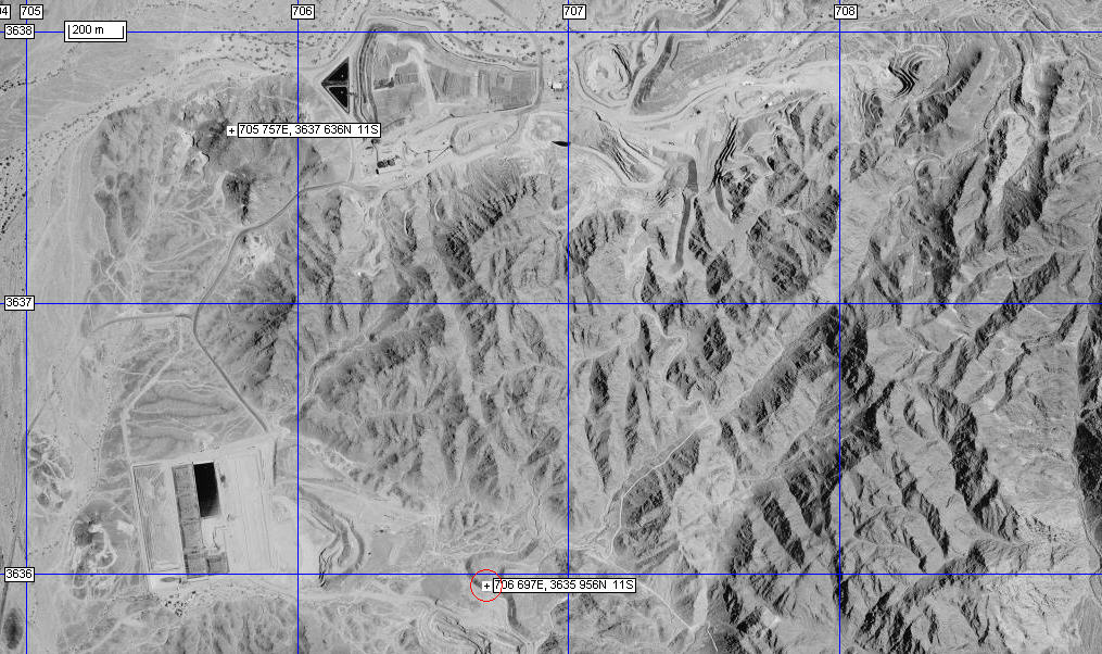
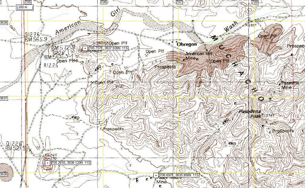
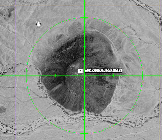
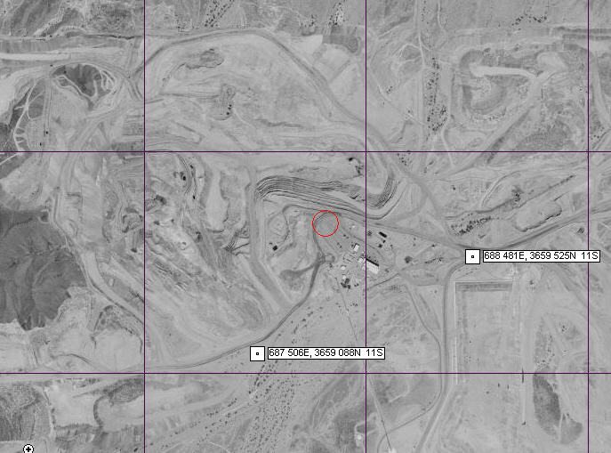
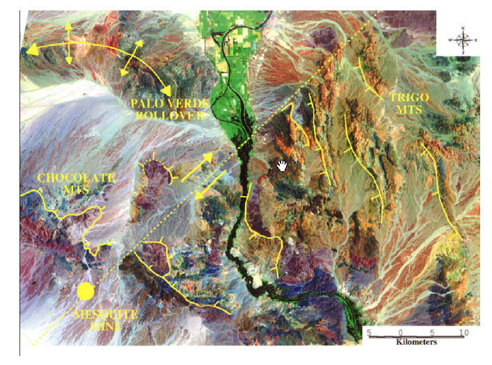
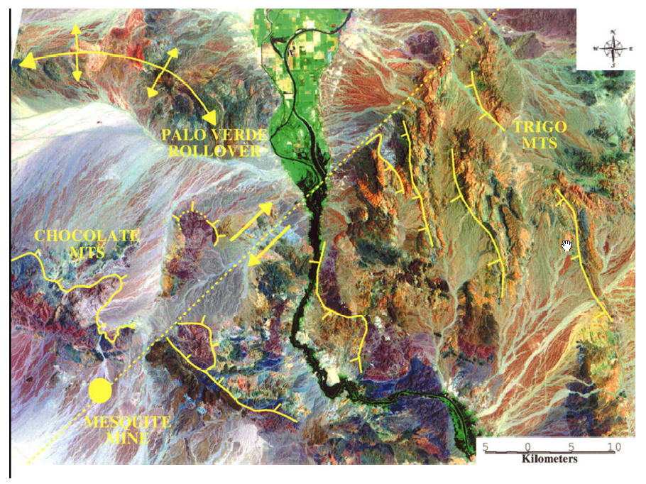
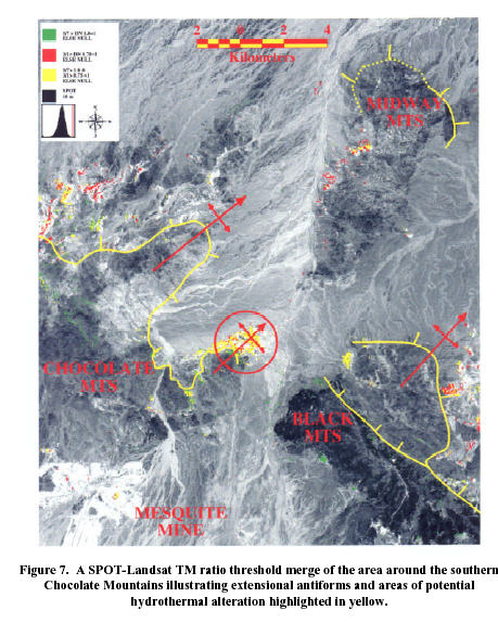
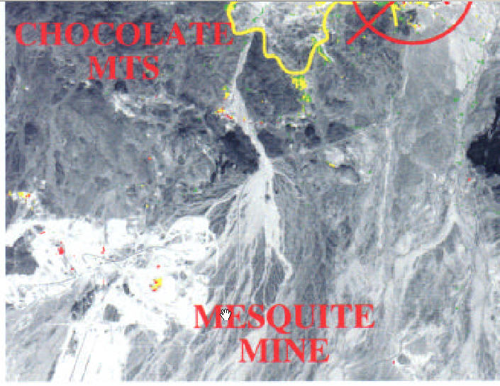
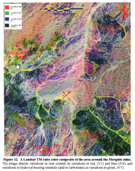
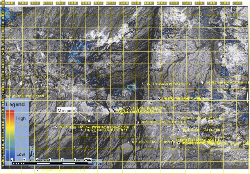
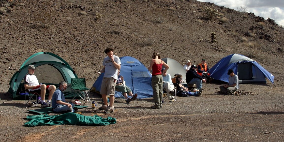
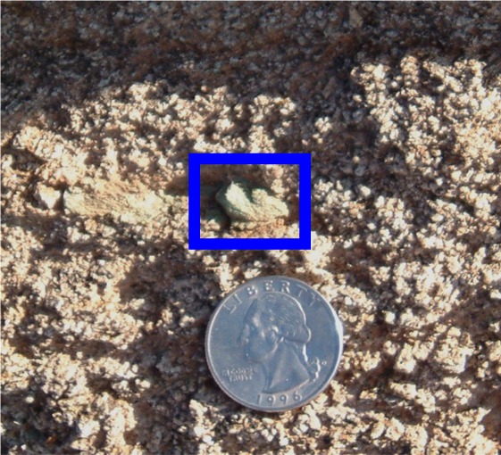
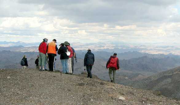
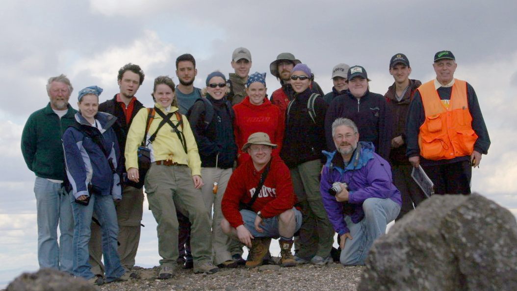
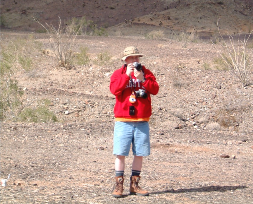
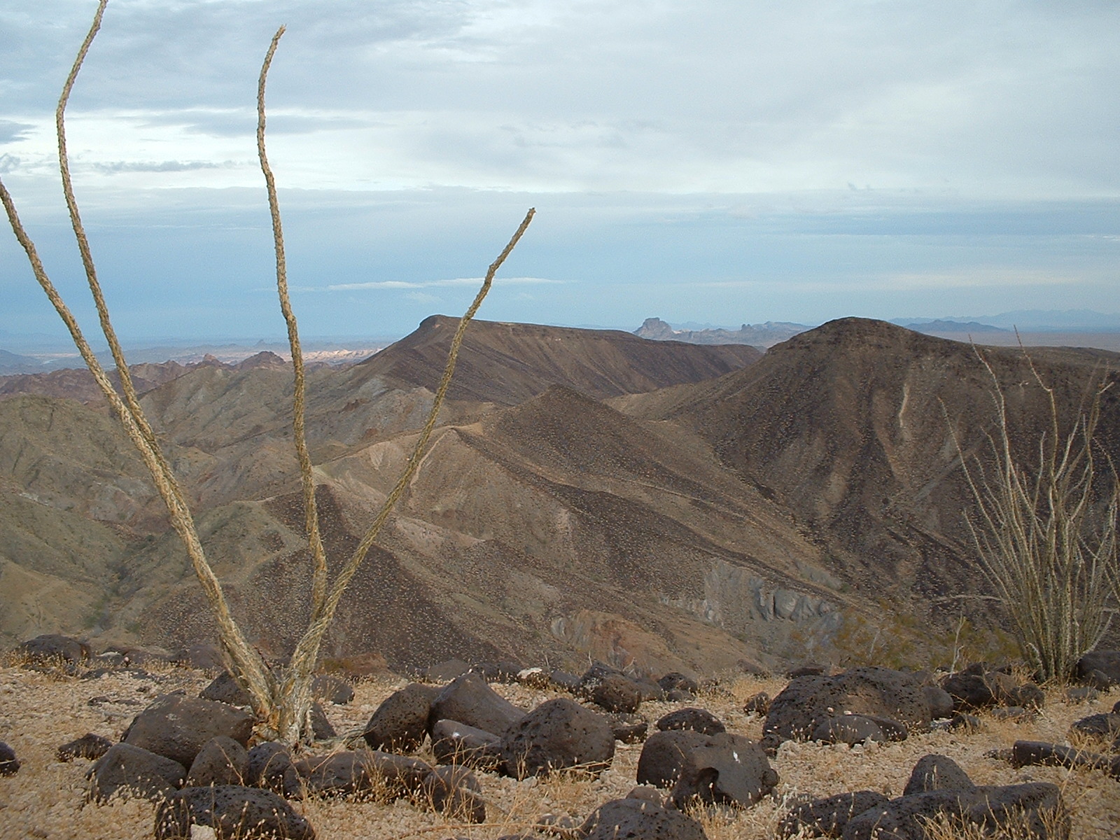
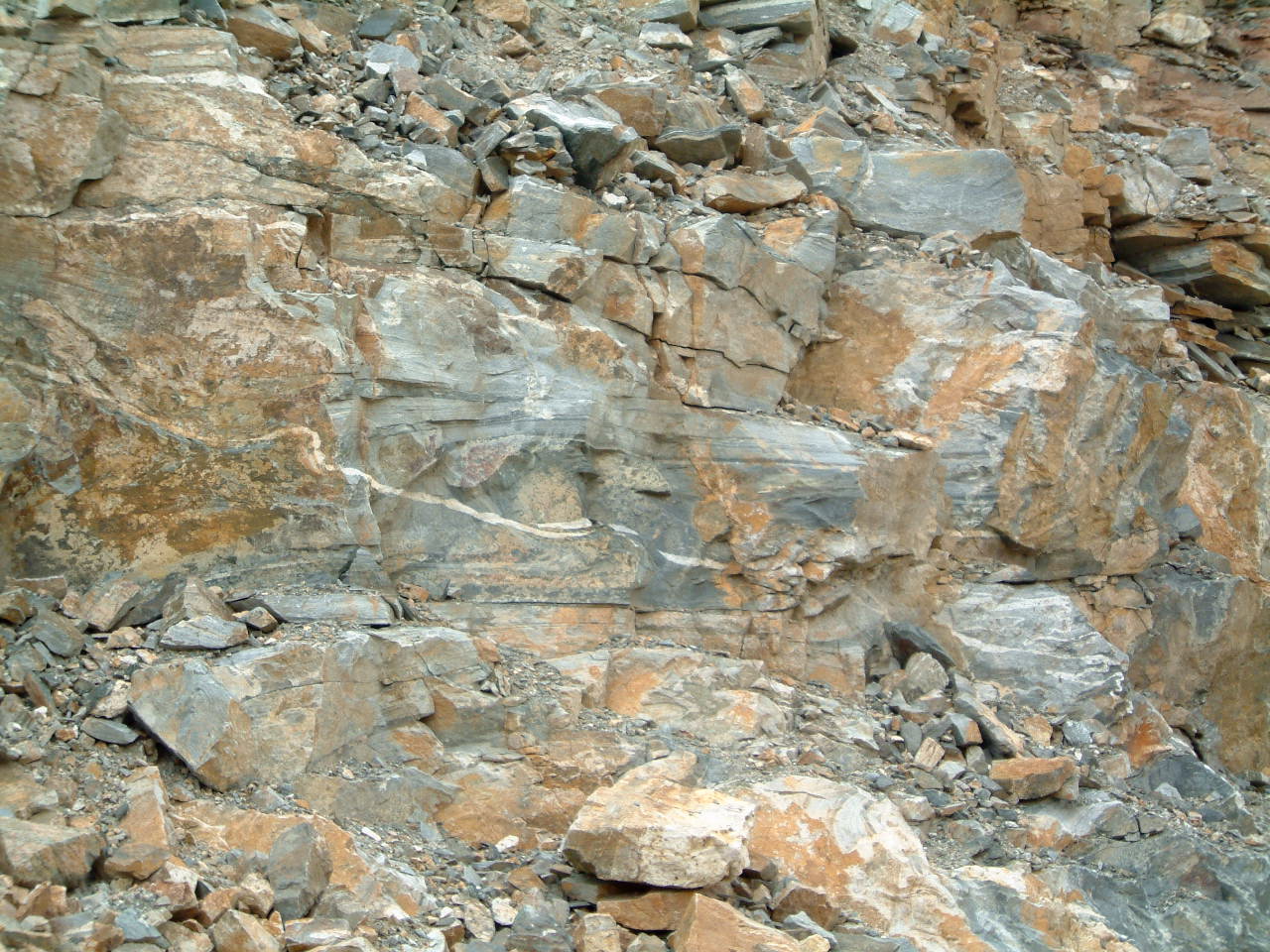
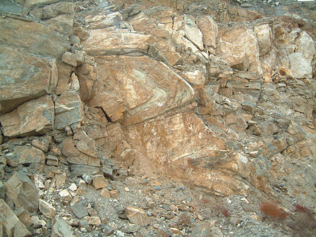
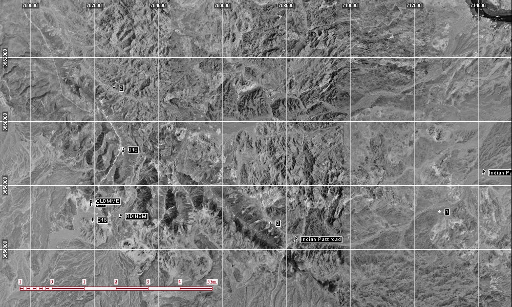
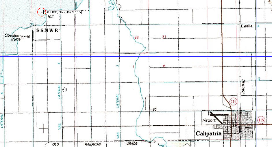
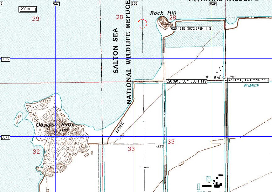
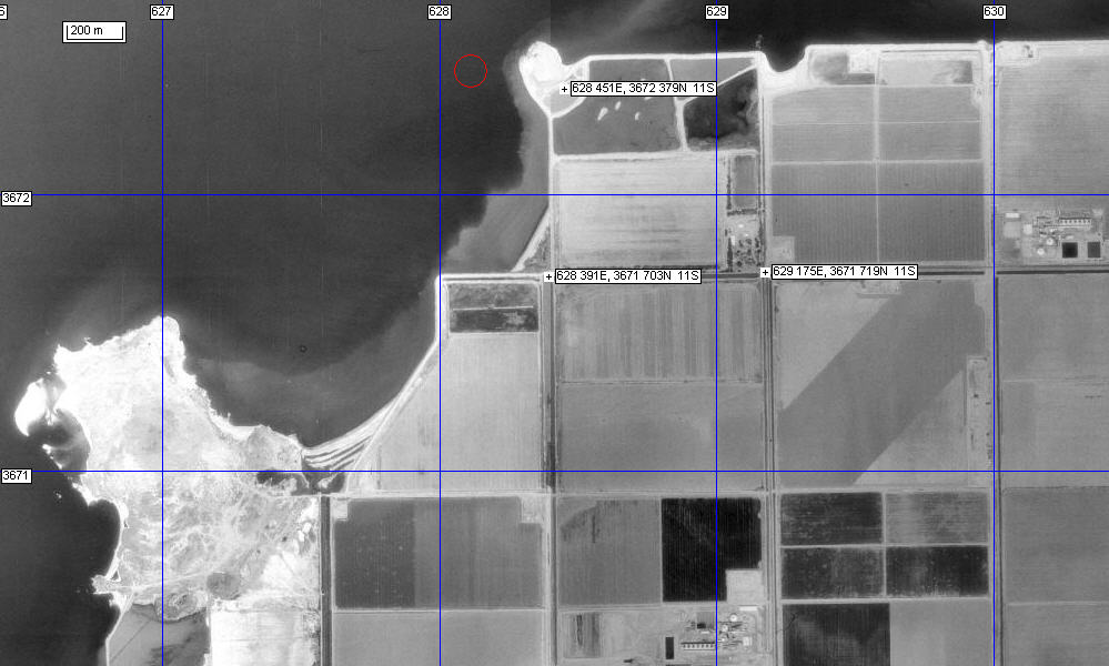
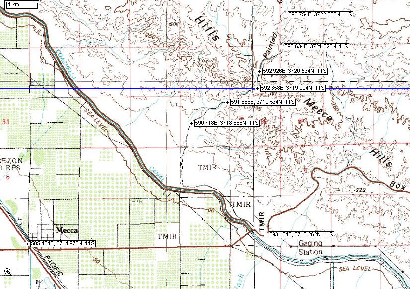
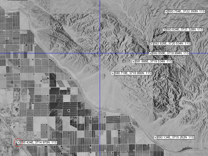
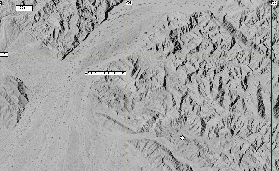
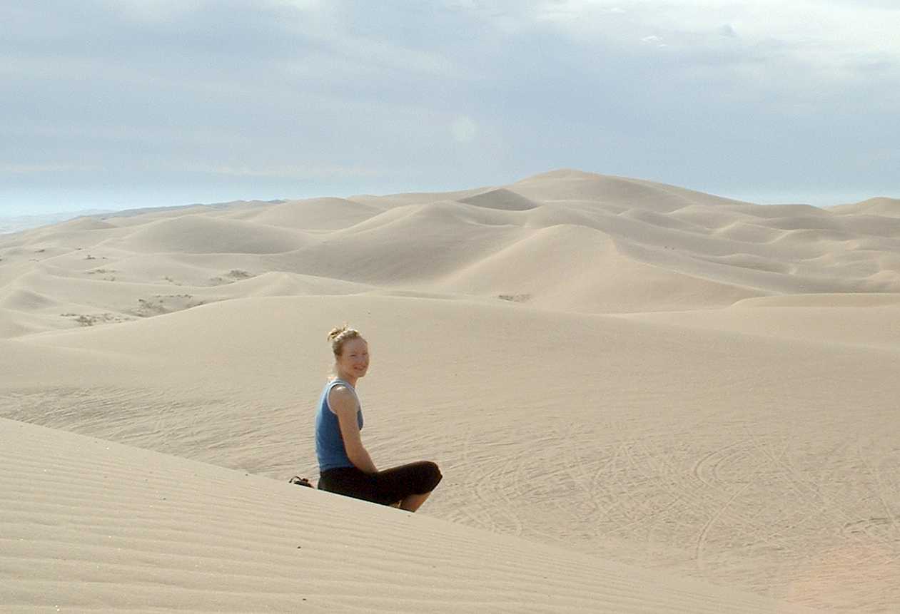
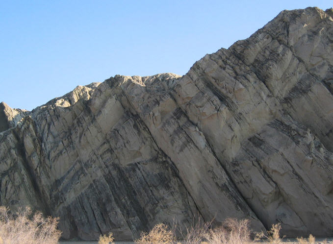
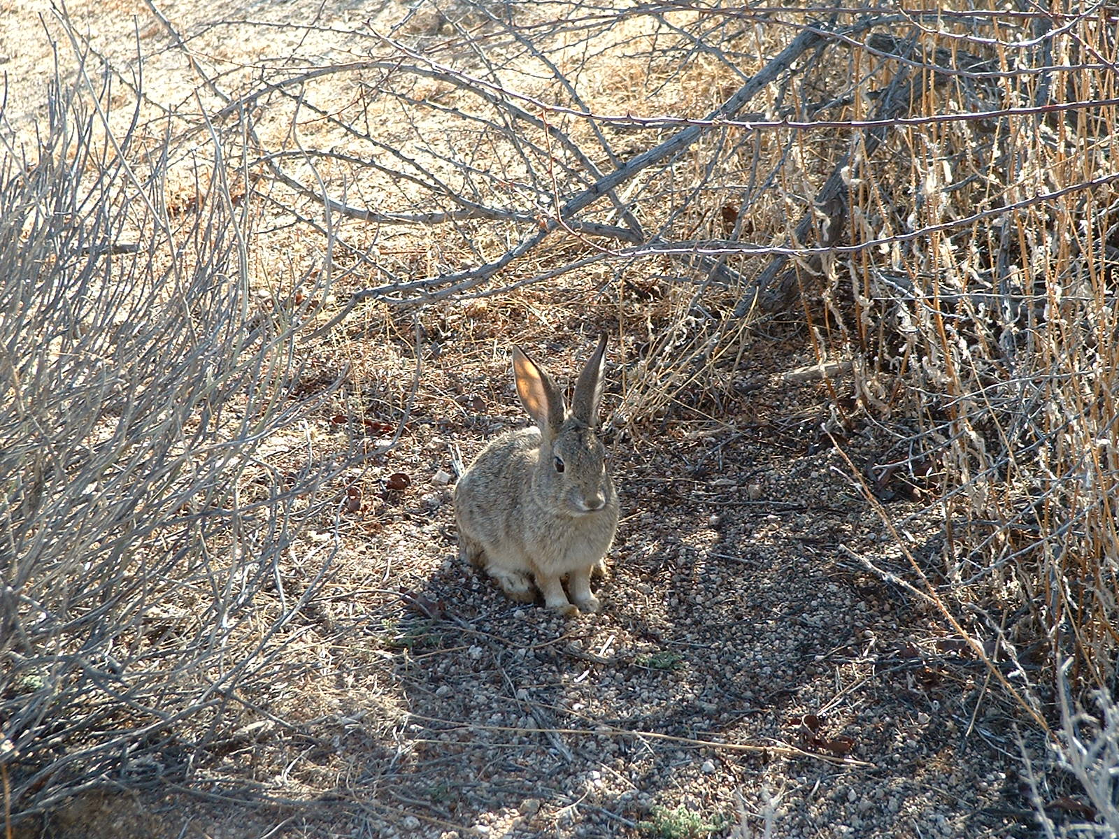
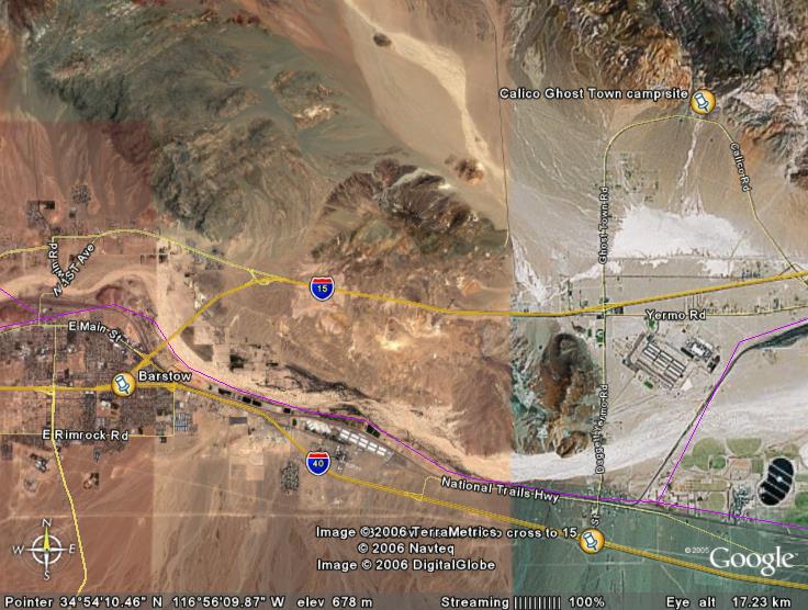
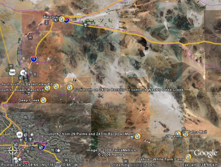
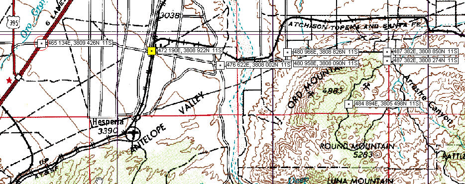
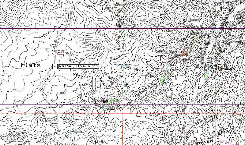
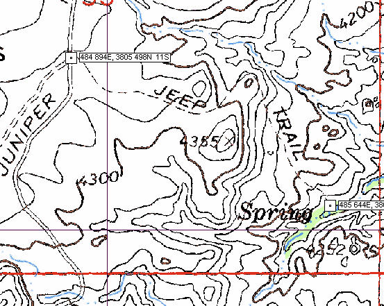
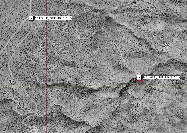
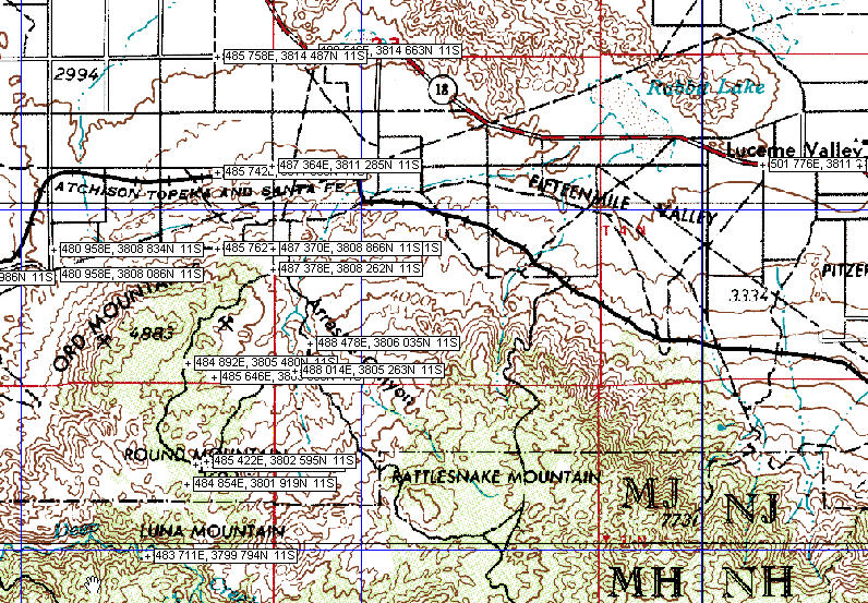
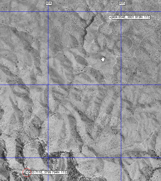
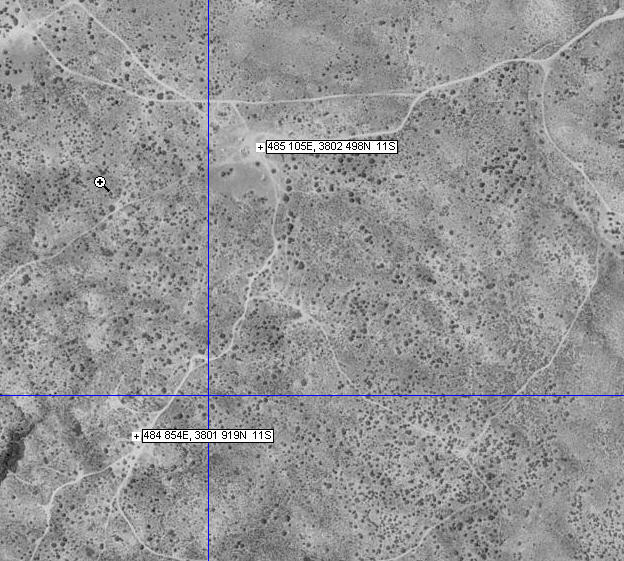
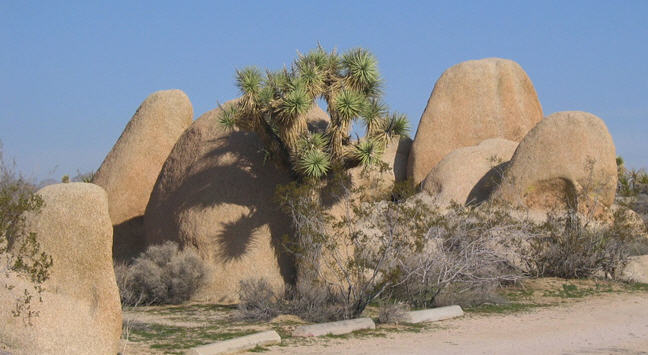
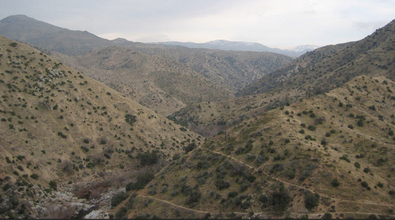
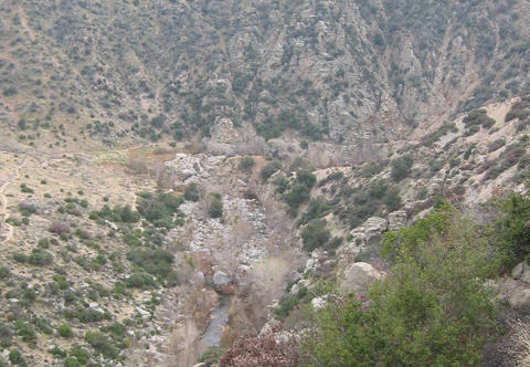
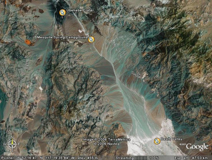
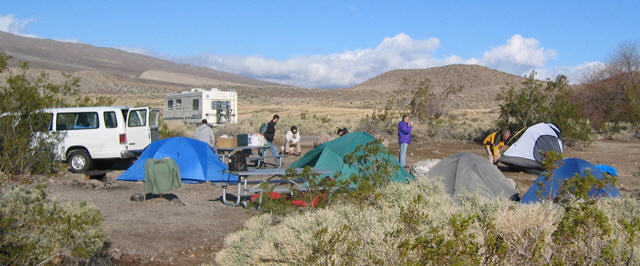
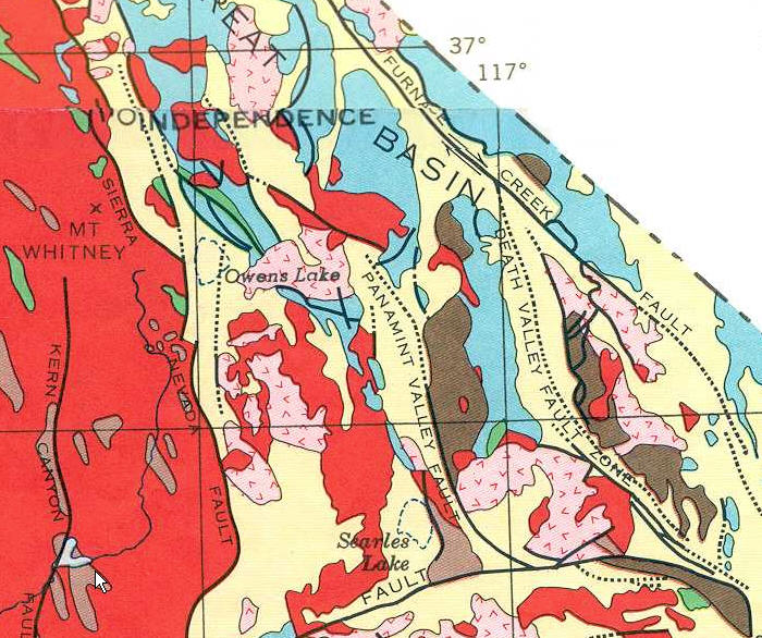
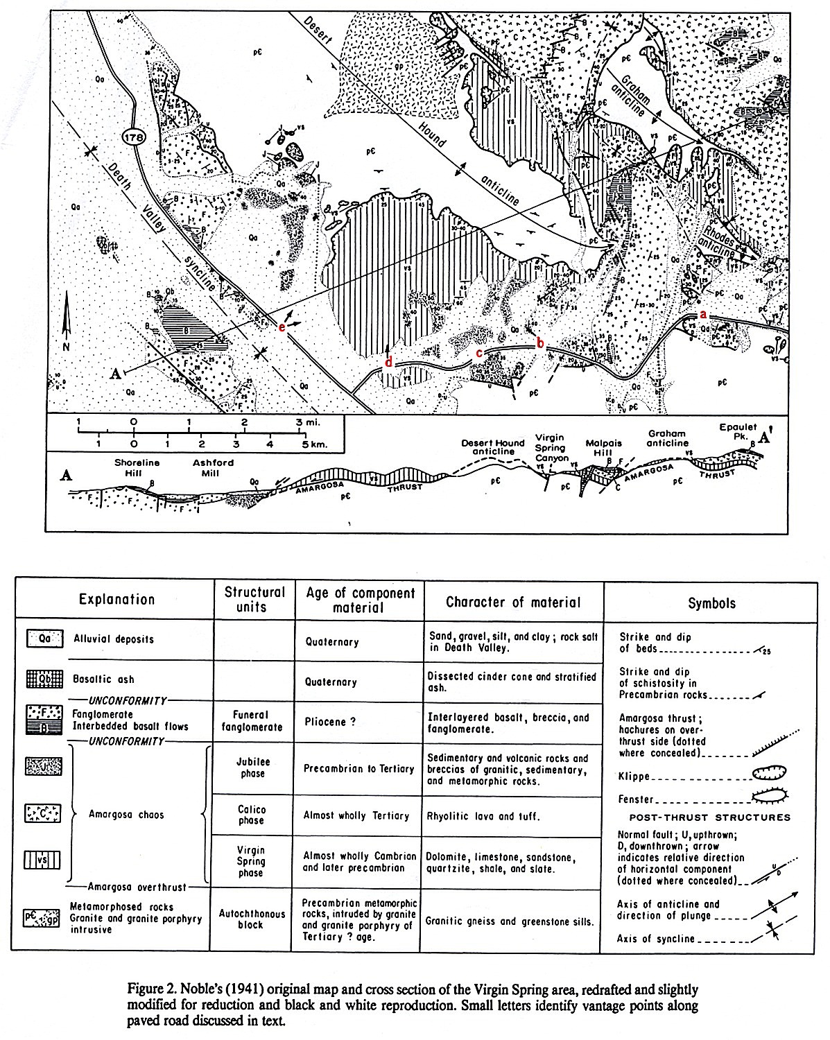
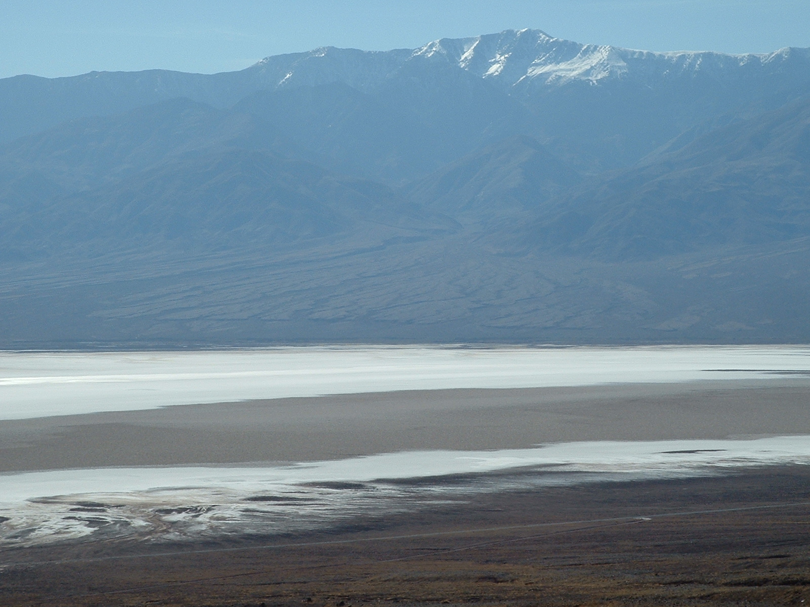
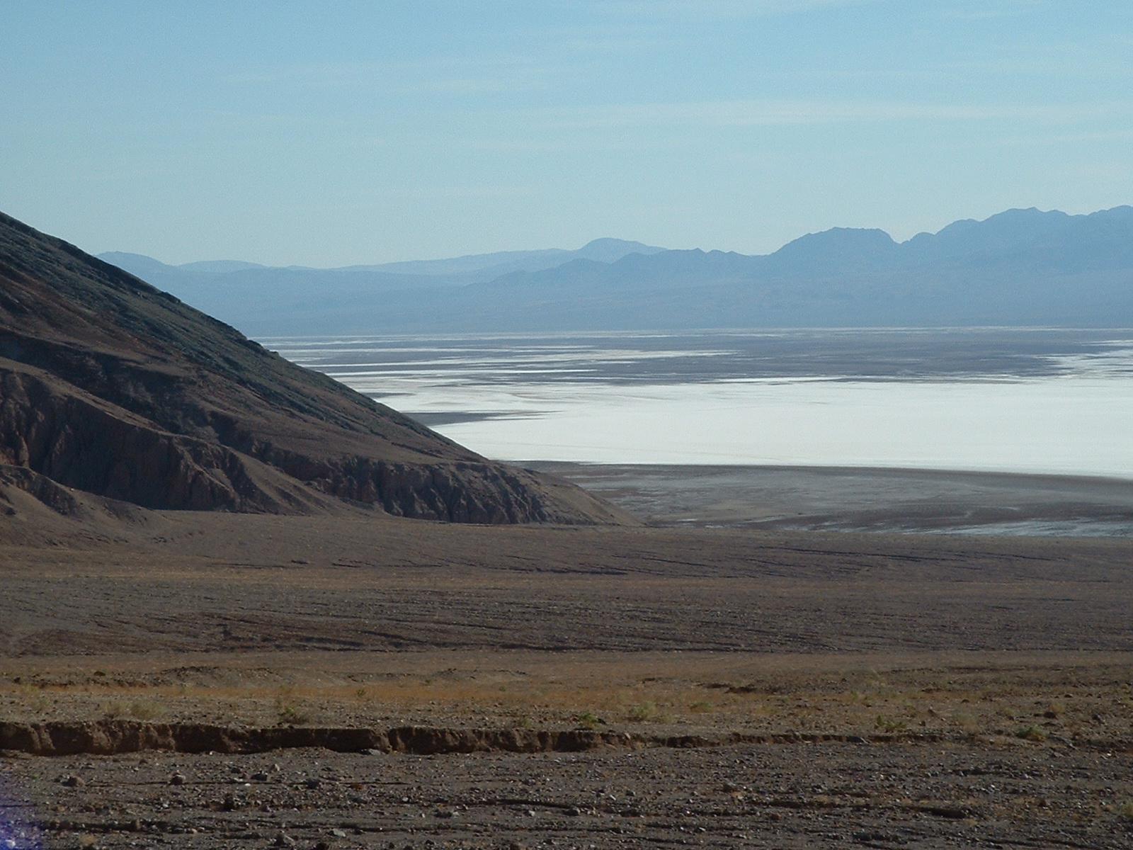
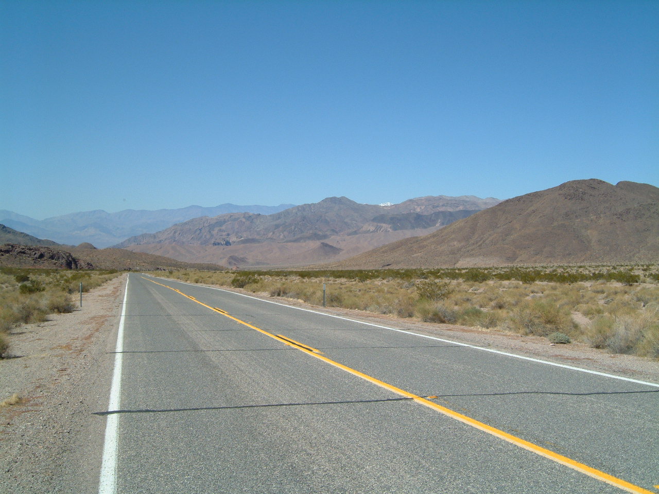
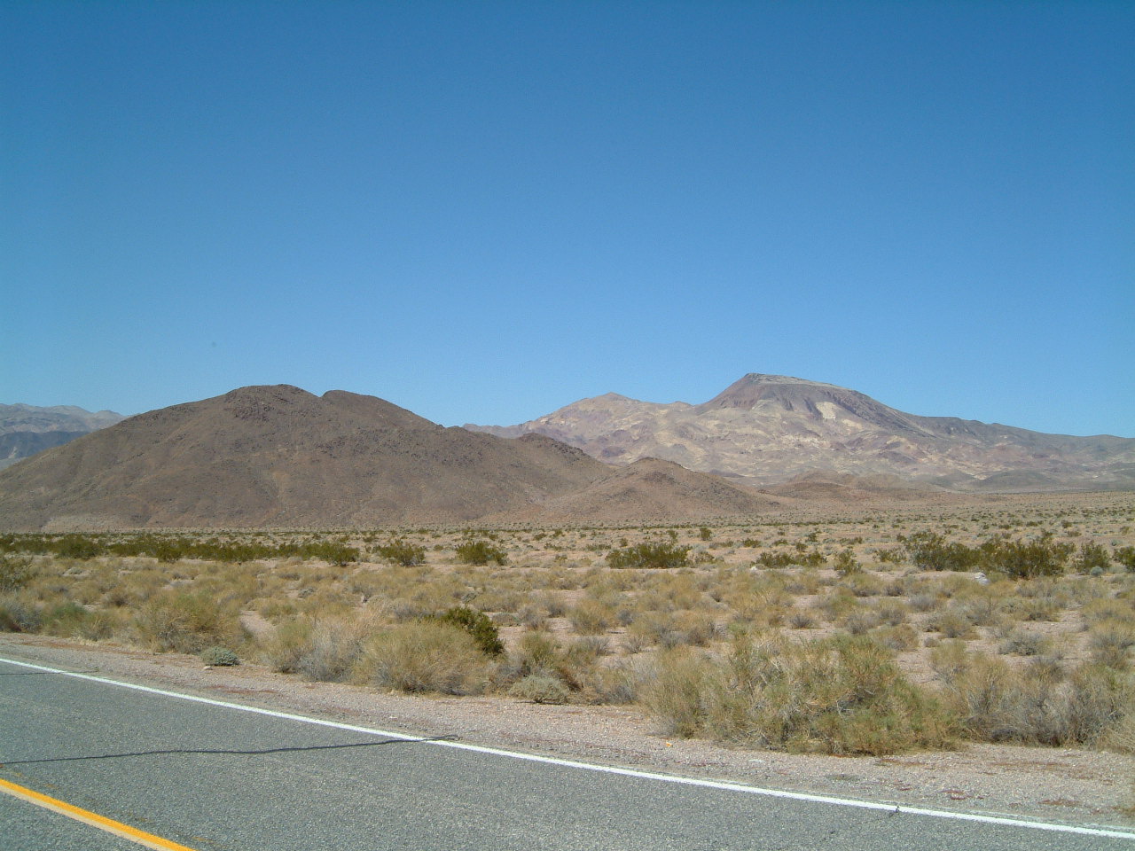
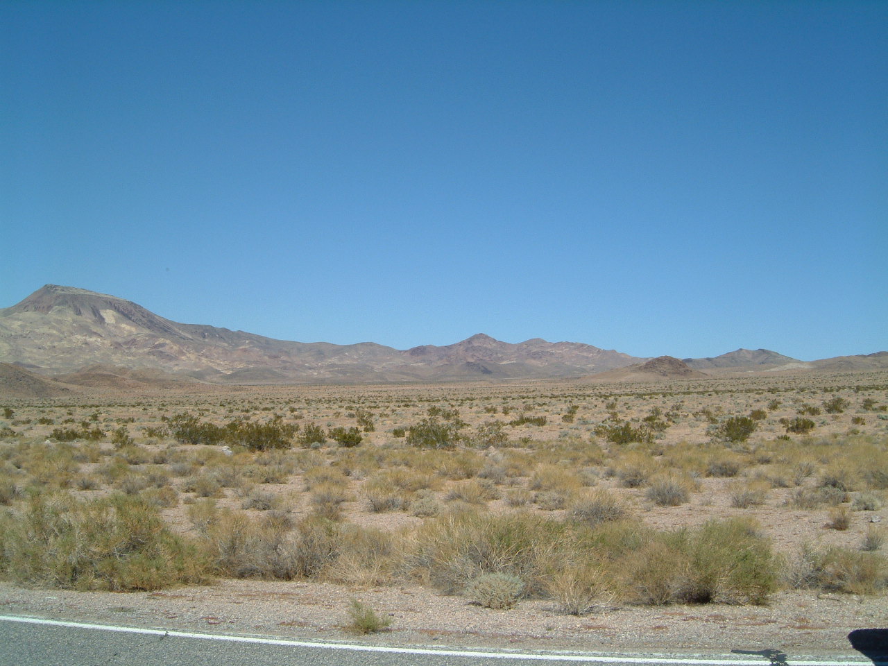
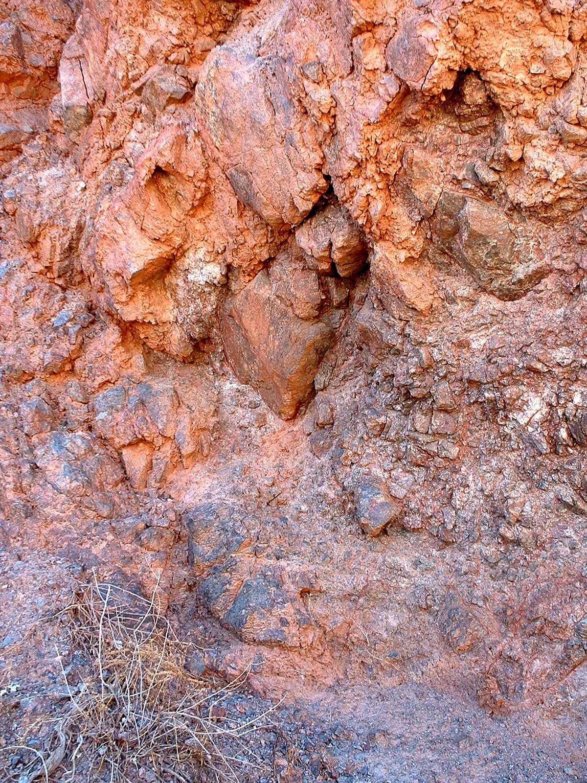
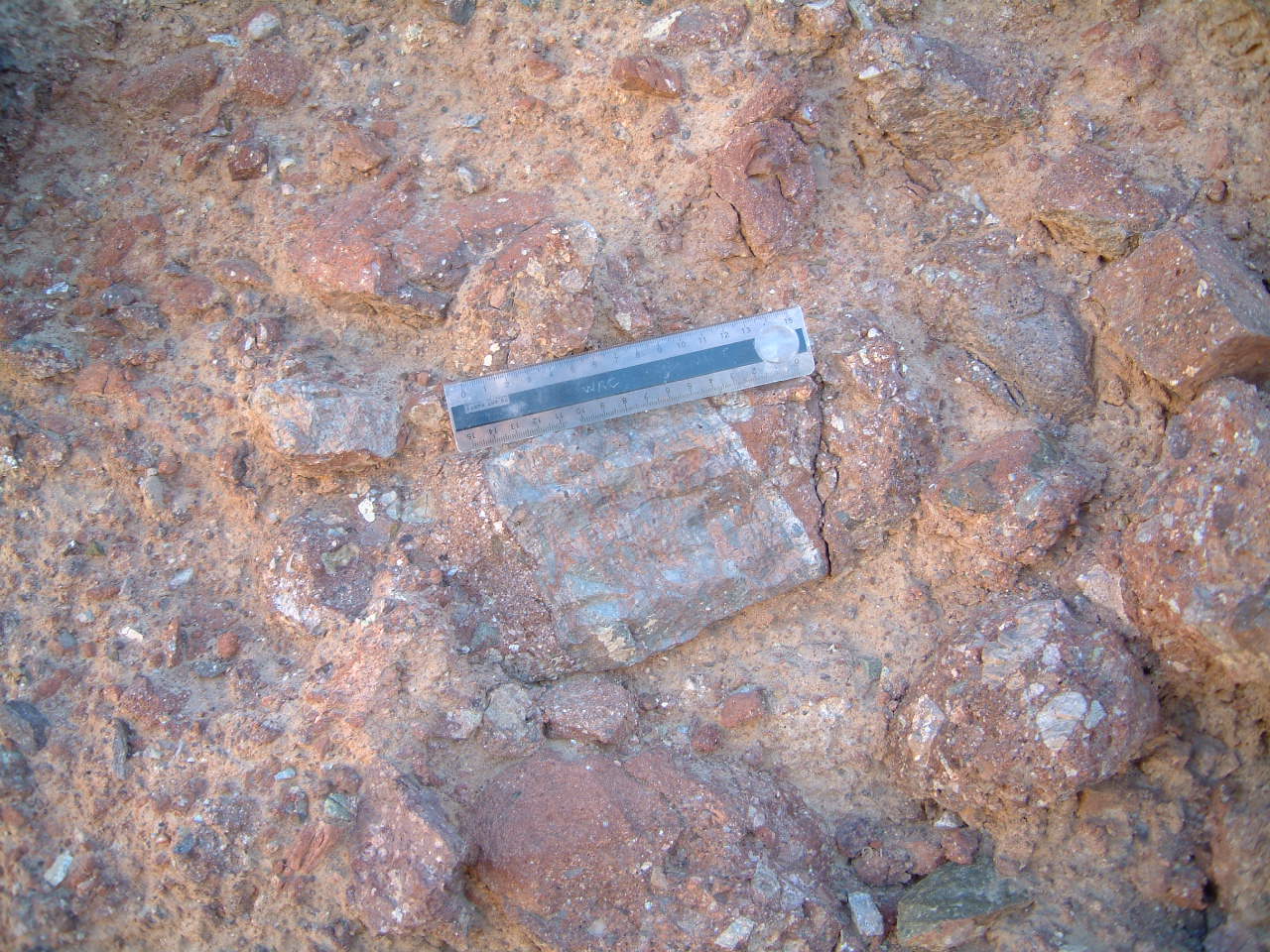
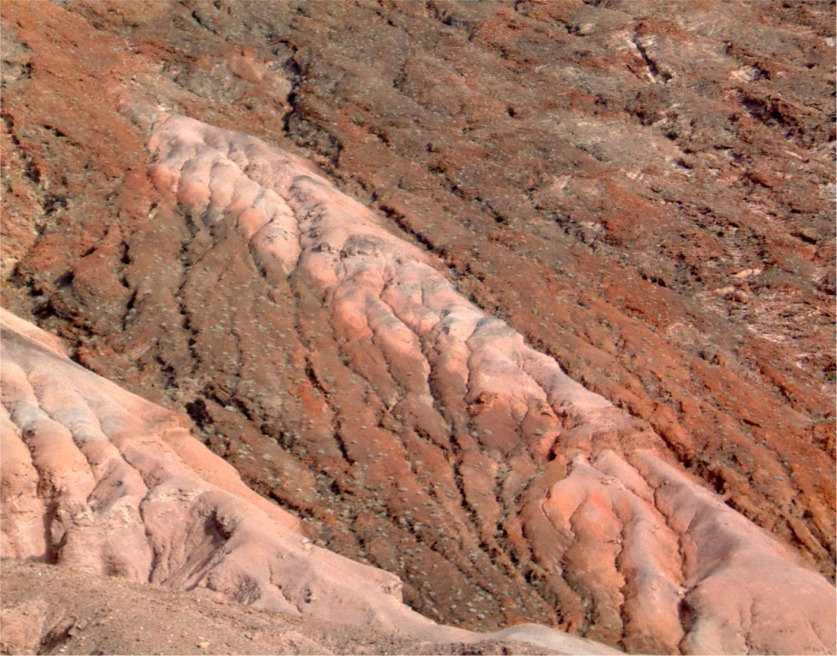
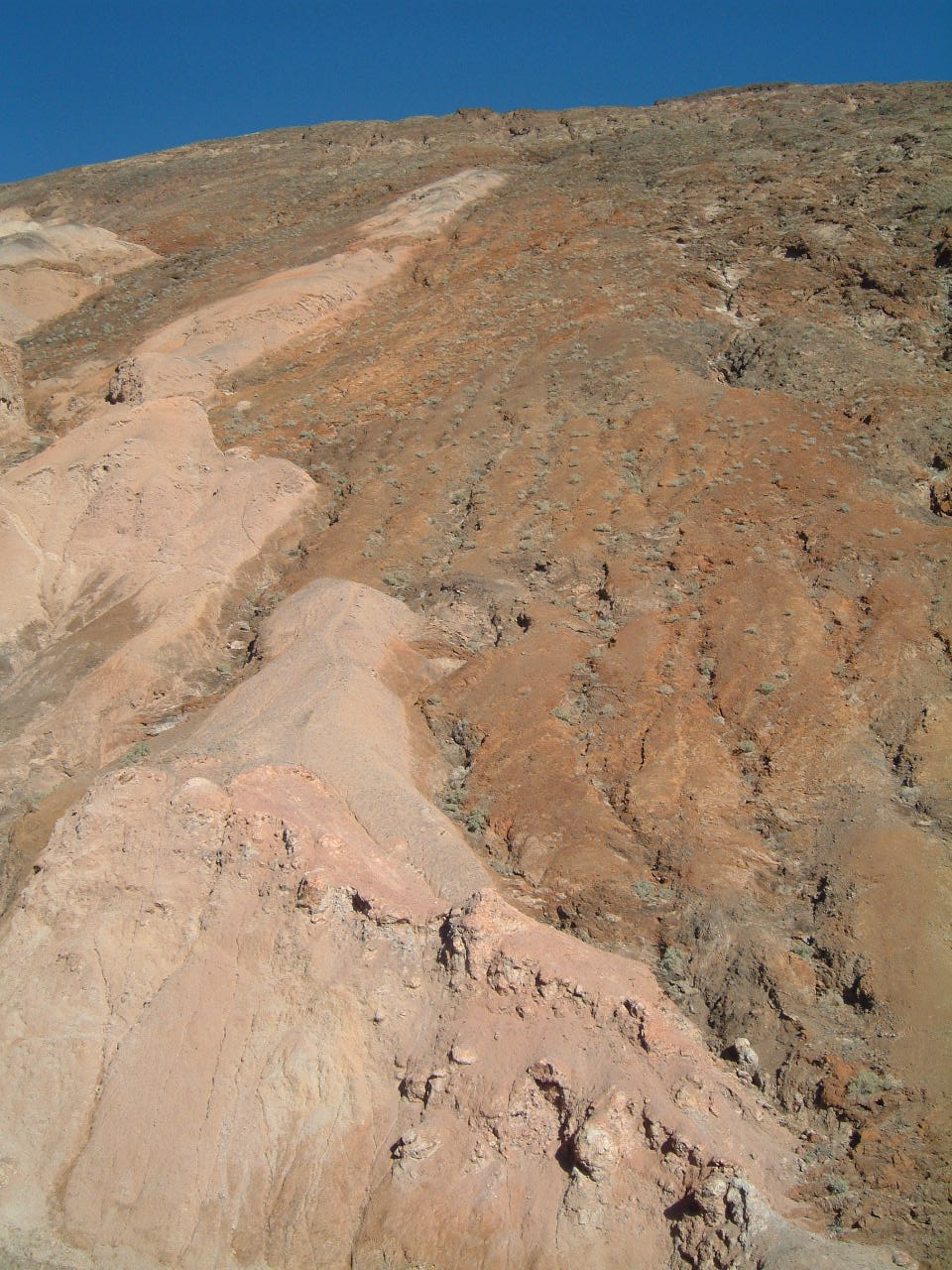
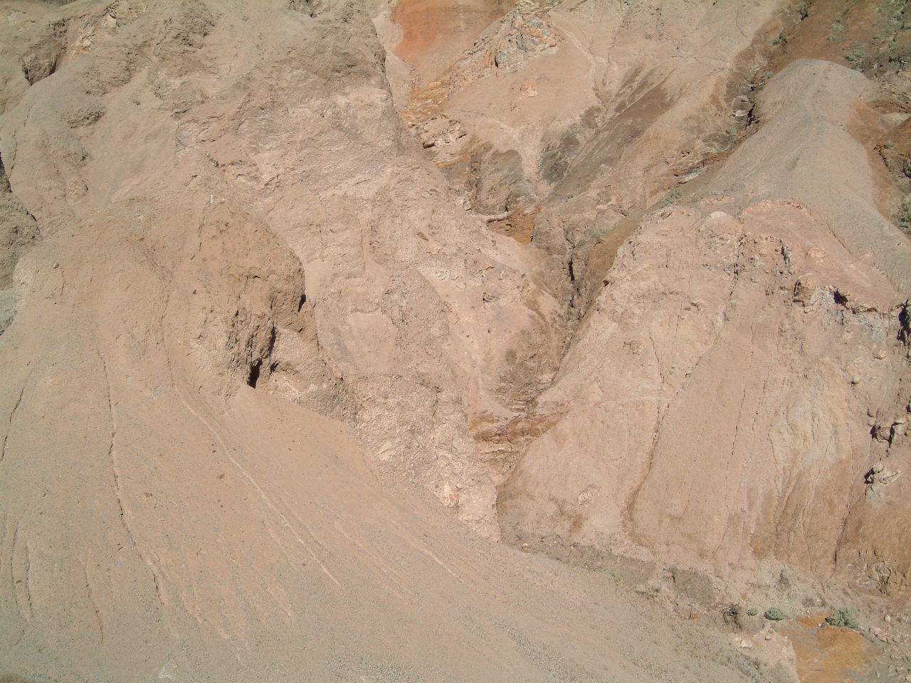
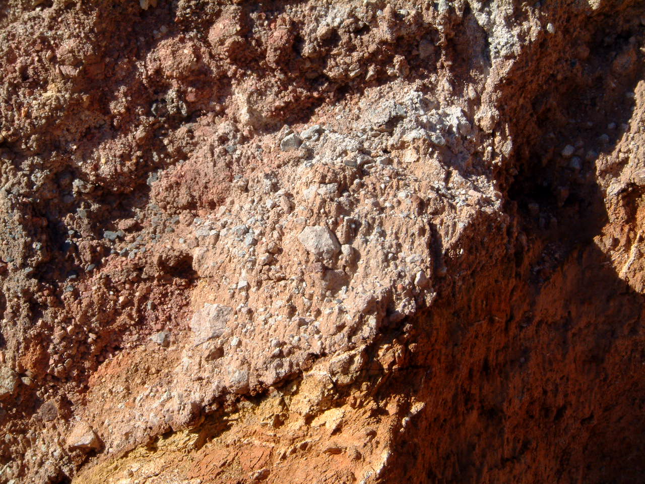
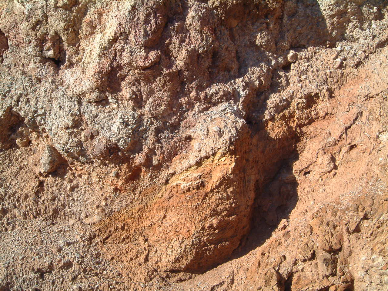
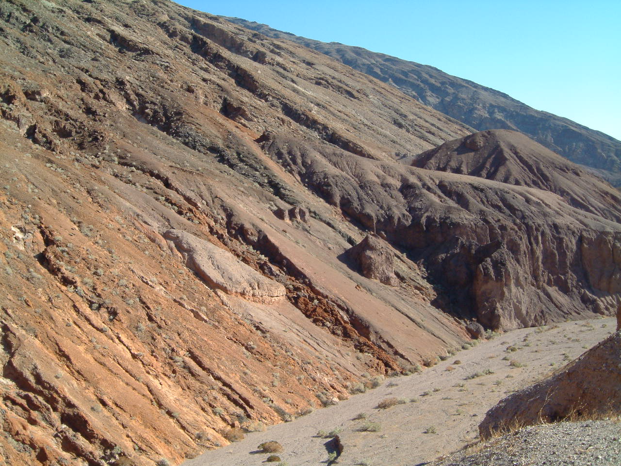
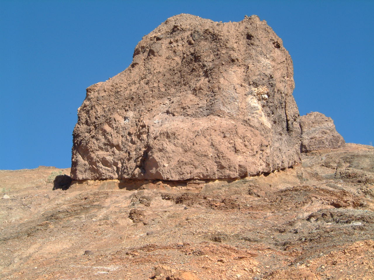
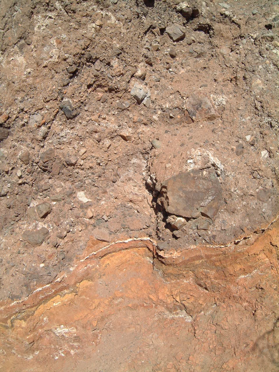
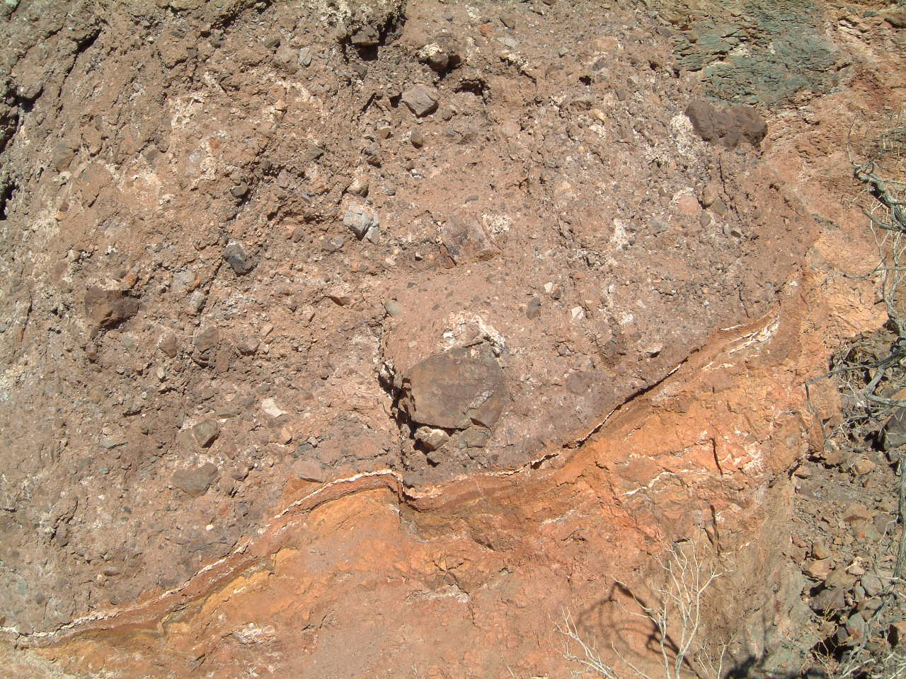
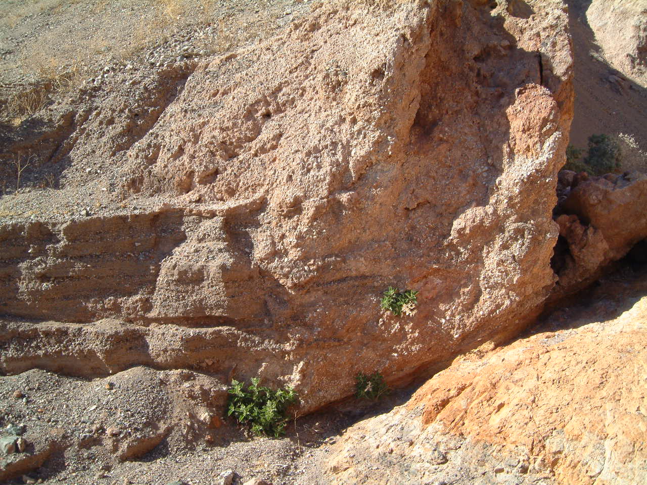
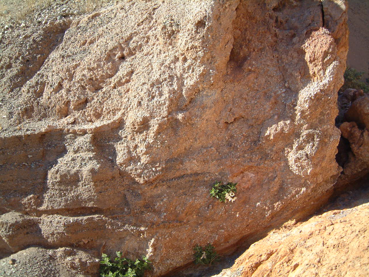
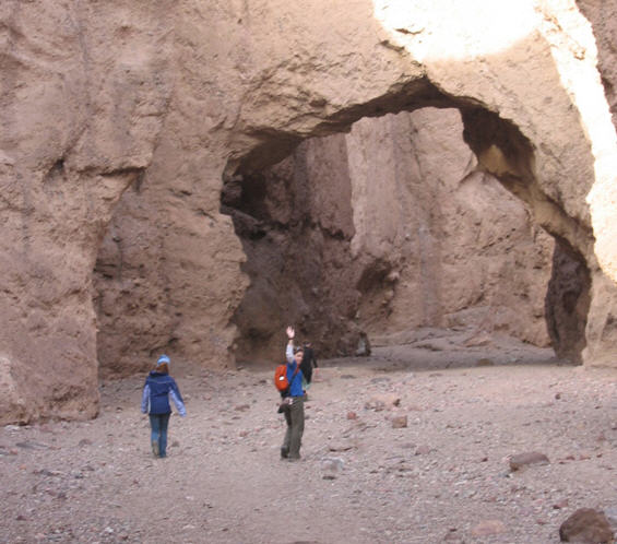
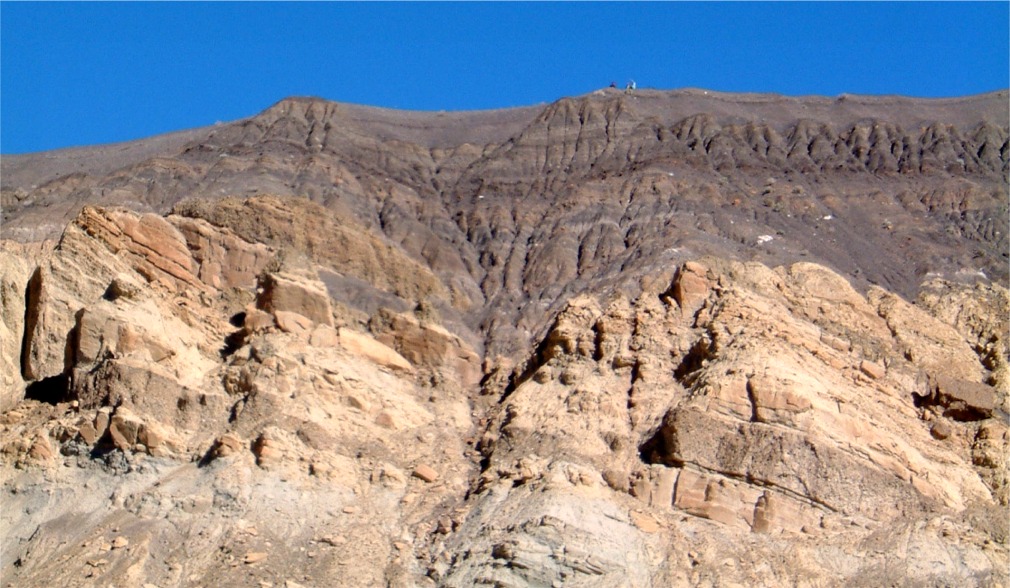
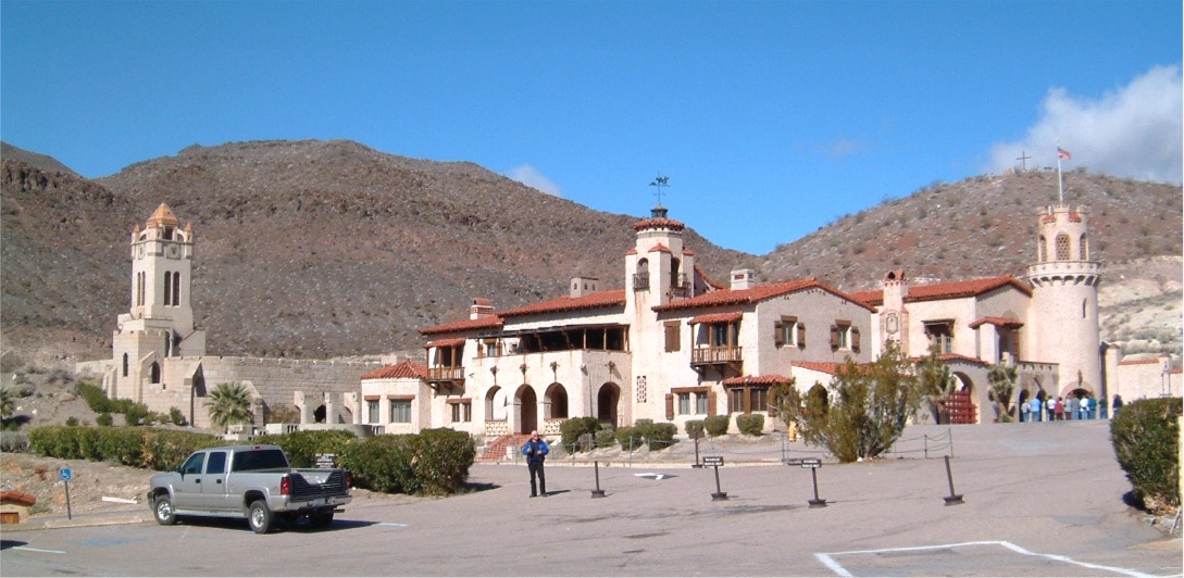
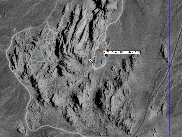
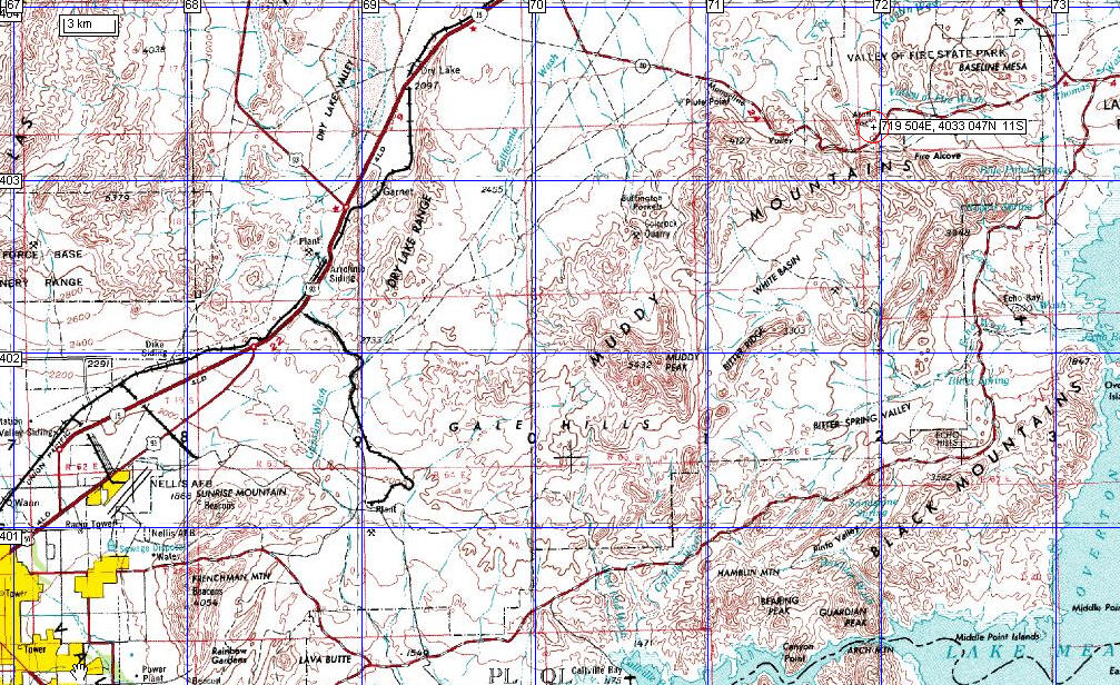
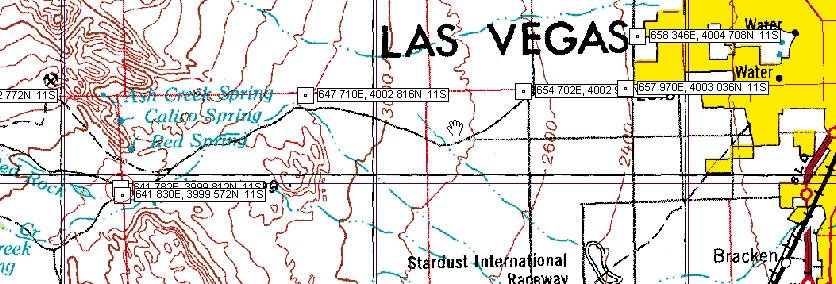
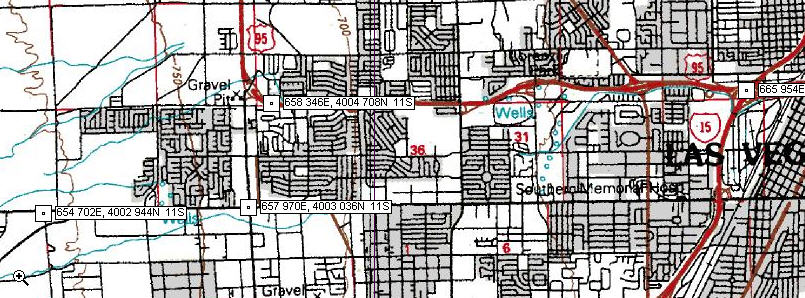
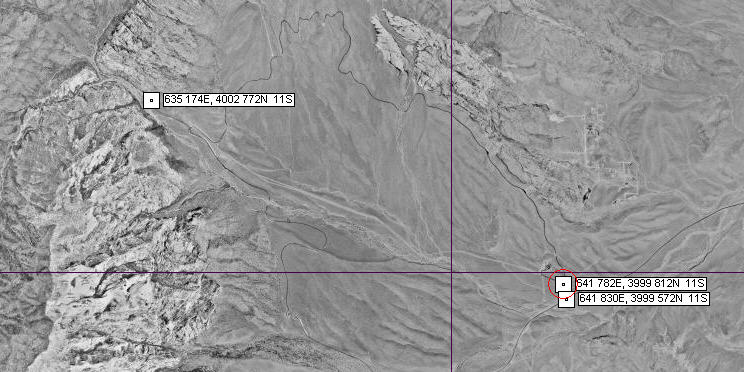