RETURN TO MAIN INDEX Geology
Add | Import | Import Email | Search | Entry Forms | Reports
Last update Jan 10 2016 This AskSam database has three main indexes:
GEOLOGY INDEX - an alphabetical listing of geological topics of interest to me, e.g. GIS; Gold.....
People - geological contacts grouped according to University or Country or topic,
e.g. Appalachians, Caledonides....
TECTONICS and other topics - an alphabetical listing of Tectonic topics, e.g. Cordillera, Pan-African.....
Prof. W.R. Church's geologic database:
http://instruct.uwo.ca/earth-sci/fieldlog/ - pdf, jpg, dwg, txt, etc files
.
***************************************************************************************************************************
FAQ Temp_Geology Chronostratigraphic chart = c:\fieldlog\chronostratchart2012.pdf
Time scales Geological Time Scale - http://instruct.uwo.ca/earth-sci/300b-001/cordtimescale.jpg
http://johnbetts-fineminerals.com/jhbnyc/referenc.htm - mineral listings with chemical formulae
QGIS_Course_for_Geologists Google Earth_Geology
Journals Evernote Instruct_Resources
Current topics: converting Android Google lollipop_back_to_Kitkat
Anthropogene/Anrhropocene Correspondance re Global Warming
Publications-WR Church Dad geology Personal_HISTORY Jordan_Laarman
Riccio_Bay_of_Islands Sharpe_Thetford Nexus_Maps Thesis Regulations
********************************************************************************************************
Ontario Geological Survey
Ontario Digital maps Paleozoic Ontario Ontario OGS
Ontario Ministry of Northern Development and Mines - http://www.mndm.gov.on.ca/en
http://www.mndm.gov.on.ca/en/mines-and-minerals/applications/geologyontario - Geology Ontario data
files
Geological Society of America
http://community.geosociety.org/home - GSA 'My Connected Community'
http://community.geosociety.org/communities/community-home?CommunityKey=5485bcb6-4859-402d-9283-d85ee36ccb4c - Climate Science Group
http://community.geosociety.org/communities/community-home?CommunityKey=854eb289-f0f9-4cd2-a91b-67ddb18362ac - Open Forum
http://rock.geosociety.org/sgt/SGT_FeaturedEssaySchedule_2013.htm - see Journals
Structural Geology & Tectonics Division featured essay schedule for 2013
Essays will be published on GSAÆs ōSpeaking of Geoscienceö blog on the 28th of each month.
"Speaking of Geoscienceö blog = http://geosociety.wordpress.com/
http://www.geosociety.org/ - Geol Soc America GSA Fellow name = # 1156554 ; pwd = Church
******************************************************************************************************************
Institutional Teaching and Research at UWO
http://uwo.ca/earth/ - website of the UWO Earth Science department
http://uwo.ca/earth/undergraduate/courses.html - courses Undergrad courses
Prof. W.R. Church's database:
http://instruct.uwo.ca/earth-sci/fieldlog/Asksam/Geology.htm - this asksam database as an on-line htm file (asksam documents are represented as items in a single htm file.)
http://instruct.uwo.ca/earth-sci/fieldlog/ - pdf, jpg, dwg, txt, etc files
http://instruct.uwo.ca/earth-sci/fieldlog/cal_napp/ - to .../fieldlog/cal_napp = location of pdf and jpg files
specifically related to Appalachian Geology
2nd year Field Camp, Whitefish Falls
http://instruct.uwo.ca/earth-sci/fieldlog/aaGE/Southern_Province/Whitefish_Falls/Plane-Table_Lake/ -
kmz files relevant to the 250y Field Camp mapping area at Plane Table Lake. The file PTL.kmz is the generalized kmz (maps, waypoints, photographs) suitable for viewing on Microsoft computers (XP, 7, 8), whereas the file aPTLphotos.kmz contains a map image of the road-side diabase locality at Plane Table Lake along with a set of photographs attached to waypoints marking localities with information pertinent to the tectonic/structural/impact history of the area. To be viewed in Windows the files can be downloaded to the local computer or run directly from the 'instruct' site, whereas in Android systems the files can be run directly from the 'instruct' site. To download and view the PTL.kmz file in Google Earth running on a Windows machine:
a), right click on the PTL.kmz file and select 'Copy link address'. e.g.
http://instruct.uwo.ca/earth-sci/fieldlog/aaGE/Southern_Province/Whitefish_Falls/Plane-Table_Lake/PTL.kmz -
b) Run Google Earth on your computer, click 'File' and enter the link address. Google Earth will run the file off the 'instruct' site.
To run the kmz directly from the 'instruct' site, right click on the PTL.kmz file and select 'Open link in new window' -> click Save -> your Browser window appear and Google Earth and the kmz file will load. (The first time this is done you may have to signal 'Open' in the bottom left download box.)
On an Android tablet, e.g. go to:
http://instruct.uwo.ca/earth-sci/fieldlog/aaGE/Southern_Province/Whitefish_Falls/Plane-Table_Lake/
and simply click the kmz file.
There are other Whitefish Falls kmz files at:
http://instruct.uwo.ca/earth-sci/fieldlog/aaGE/Southern_Province/Whitefish_Falls/ and
http://instruct.uwo.ca/earth-sci/fieldlog/aaGE/Southern_Province/ for the Southern Province in general.
see also http://instruct.uwo.ca/earth-sci/200a-001/25sudbur.htm
UWO Library
http://ir.lib.uwo.ca/about.html - Western Library Journals
http://www.lib.uwo.ca.proxy2.lib.uwo.ca:2048/ejournals/ejournals_A.shtml - access to UWO library.
Library off-campus access - need to logon and first go to the Catalog and then select ONLINE resource
Geo-Tectonics Newsgroup Archives
http://www.jiscmail.ac.uk/lists/GEO-TECTONICS.html - Geo-Tectonics
http://judithcurry.com/ - Climate_etc, Judith Curry
****************************************************************************************************************************
Askam data files not accessible online:
refasw.ask samples.ask panafr.ask Photographs MISC.ask
Monique_Toshiba Snug_Toshiba
C:\ directories : Church-3 Asus_EEE C:\-local
OCR documents are saved by Epson to CHURCH-3 (not available on line)
C:\Documents and Settings\churchlap\Application Data\EPSON\Smart Panel\ScanImg\mailfile
*****************************************************************************************************************************
Do's and Dont's
Don'ts: Snark; Partisan hackery; Ethnic pride; Political Correctness ; Ostentatious appeals to authority;
Obnoxious appeals to expertise; Specialization tunnel-vision; Social constructionism.
Do's: Respect for others; Google, google, google!; Think twice or thrice; Challenge your intuition;
Cite facts others can check; Always wonder "what-if I am wrong"; Consilience (act of concurring);
Methodological naturalism.
****************************************************************************************************************
THU 11/18/2004 07:45 AM key[ index ]
******************************************************************************************************************
Click to go to the index Tectonics and other topics
GEOLOGY OF NORTH AMERICA - http://instruct.uwo.ca/earth-sci/300b-001/300outlold.htm
Academia - http://lists.academia.edu/GeoTectonic
http://uwo.academia.edu/WilliamChurch wrchurch@ p.......1academia
Recent - reply from lee Melezhik aerobic biosphere
aawhere?_UWO_Folder_locations - Norm's room 48
BGS British Geological Survey
Chromite Chromitite Riccio Sharpe
Climate change_Global Warming_Atmosphere
Consulting - Round Table Group
Continental Drift - History of Plate Tectonics Cont_Drift_Sea_floor-Spreading_Hess_Dietz_DuToit
Courses 200 300
Drawing software Inkscape_Irfan_Photodraw
Dropbox
Earth_Science_Dpt Geology
Earth Systems - Tectonics, Earth Chemistry
Fieldlog C:\fieldlog
Field Trips/Guides (Norm's Lab) 250y 350y UWO_Field_Trips (= Norm SWUSA)
Geological_Society_of_America (GSA)
Geological Survey of Canada - Geoscan Search
Geology Earth_Science_Dpt
Geophysics (Sanchez)
Geosphere (New GSA electronic journal)
GIS GPS GSA Meetings Cartography
Global Warming_Atmosphere science geology environment environmental_links global warming atmosphere
Google Earth_Geology (\\earthsci.es.uwo.ca\public\aaGE; http://instruct.uwo.ca/earth-
sci/fieldlog/Google_Earth/ )
Historiography - boninites History of Plate Tectonics
Internet Links - What was said includes comments on WinSCP
Journals Geotectonics_mail_list
Linkedin Linked_In_MIN_Ex_Geo
MapTrack
Mendeley
Meteorites - Impact structures (Ludovic)
Minerals http://johnbetts-fineminerals.com/jhbnyc/referenc.htm - mineral listings with chemical formulae
Nexus 7 2nd Generation For a primer on the use of the Nexus 7 in association with Google Maps, Google
Satellite, Google Earth, and MapTrack see Nexus_Maps (in Misc.ask)
Nickel_Olivine Olivine-Ni
Ocean_crust-ophiolites - Plate Tectonics
Ontario Digital maps; Berdusco; Paleozoic
Ophiolites - see Ocean_crust-ophiolites, and MORB
Origin of the Earth chondritic iron core and oxygen
Panther permissions Unix
Papers_Discussions personal\home
Photographs - record of geology photos in geolphotos.ask
PHOTOS IN CAROUSELS and Books
(=-photo.ask) - for Egypt 1980, Egypt 1981, Egypt 1988, and Brazil
Plate Tectonics - see Ocean_crust-ophiolites History of Plate Tectonics
References, Geology - also, Geology_general in main index
References, Panafrican - also Geology_Panafrican in main index
Samples
SeaMonkey - HTML editor
Suffel_room 0155 UWO Norm folders
Teaching Wayne State University
Thinsections / Photography)
Wales_Mining (Great Orme Cu; Dolaucothi gold)
Web sites and journals + record of 35 mm photographs associated with the web sites
WinSCP see Internet Links - What was said
*******************************************************************************************************************
THU 11/18/2004 07:48 AM key[ FAQ ]
http://www.linkedin.com - LinkedIn
SeaMonkey - HTML editor
Printing colour photographs/airphotos/Google Earth images:
If the computer has a user whose name is different to that archived on the department server, e.g. admin_church rather than wrchurch, then:
START -> Search -> person or computer -> search for earthsci.es.uwo.ca -> double click on search result -> enter user as wrchurch@uwo.ca and password as 54.......... The printer files will than become available.
Front Page - how to use Front Page
Dad geology - history of research concerning Appalachian eclogites and ophiolite
Where are the geology photos on church-3 and in 'instruct'
Instructions for the Dept. projector
Departmental copier - 98142
Geological map of the USA - http:\\www.geosociety.org/bookstore/ select maps and charts
http://www.gsajournals.org/perlserv/?request=get-document&doi=10.1130%2F0016-7606(2000)112%3C4:PATHAT%3E2.0.CO%3B2
How to change NAD27 values to WGS84
there is a calculated standard difference in WGS84 (NAD83) and NAD27 datum readings for latitude (Y, Northing) and longitude (X, Easting); add 223 meters to the NAD27 Northing (Y), and 10 m to the NAD27 Easting (X) values to change from NAD27 to WGS84.
http://freegeographytools.com/category/google-earth - free geography tools; convert and import maps with worldfile data into Google Earth; also import xls
http://freegeographytools.com/2007/microdem-a-swiss-army-knife-of-terrain-and-gis-tools
http://freegeographytools.com/2008/creating-google-earth-ground-overlays-from-georeferenced-images#more-1439
****************************************************************************************************************************
THU 11/18/2004 07:49 AM key[ geology photographs ]
E:\aaMy Photos\Geology - jpg, tif images
Photos-Geology_I - = 35 mm geolphotos.ask in c:\archives
Grenville photographs
Appalachians - Southern photographs
Appalachians - Northern photographs
Caledonides photographs
Morocco photographs
Egypt-Sudan photographs
Saudi Arabia photographs
Alps photographs
SW-USA photographs
Cordillera photographs
****************************************************************************************************************************
THU 11/18/2004 11:01 AM key[ Field Guides ]
UWO_Field_Trips (= Norm SWUSA)
http://www.lib.utexas.edu/geo/onlineguides.html - Virtual and On-line Geologic Field Trip Guides
Aug 18 2006 - PDAC Bursary and Scholarship programme/Field Trip funding
Submit to Teresa Barrett, PDAC 34 King St. East 9th Floor, Toronto M5C 2X8 tbarrett@pdac.ca up to $3000 - app to be made by a student group contact information incl school, reasons, dates, location of field trip
Documentation_Maps - maps, guides and papers in Norm& Duke's lab
For on-line field expenses go to misc\uwo
http://www.canadiangeologicalfoundation.org/nl/FTpdf.html - pdf's of GAC Newfoundland section field guides
New England Intercollegiate Geological Conference
Hon and Hepburn NEGSA 2007 field trip
http://neigc.org/NEIGC/2004/index.html - NEIGC 2004 field trips to the Avalon, Nashoba terranes
http://neigc.org/NEIGC/Guidebooks.html - reference list of all NEIGC guidebooks 1988 to present
http://neigc.org/NEIGC/PreviousMeetings.html - list of all NEIGC meetings
Jan 23 2011 The Interrelationships Between Deformation and Metamorphism
to be held at Granada (Spain), from 23-26 May, 2011.
The meeting will mark the occasion of the retirement of professor Tim H. Bell. A special volume is planned to be published by the Journal of Metamorphic Geology.
The period for REGISTRATION AND ABSTRACT SUBMISSION is now open. Please visit the conference web site for more information about research topics, preliminary conference program, online registration and abstract submission. http://www.ugr.es/~aerden/conf/index.htm
Deadline for early registration and abstract submission: 15 April, 20
http://www.ucm.es/info/petrolog/personal/arenas_ricardo.html
Maroc
http://194.204.205.38/Des/Universites - Moroccan Universities http://www.um5a.ac.ma/etablissements/Facultes.htm - Rabat Sciences de la Terre
Ressources minķrales, ressources en eau et environnement dans le Maroc mķsetien et le gharb (Mohamed EL WARTITI)
- Les bassins sķdimentaires ; analyse gķodynamique et ressources naturelles (Mohamed BOUTAKIOUT)
- Gķosciences appliquķes Ó lÆenvironnement et Ó lÆamķnagement (Mohamed EL HATIMI)
- Gķologie du quaternaire appliquķe Ó lÆenvironnement et ressources naturelles (MÆhamed ABERKAN)
- Gķologie Structurale et appliquķe (Ahmed CHALOUAN)
- Les environnement marins de plate formes actuels et anciens (Naima HAMMOUMI)
http://www.israbat.ac.ma/geologie/depgeologie.htm#composition
http://www.usmba.ac.ma/formation/FPT/FSTU.html - Fes earth Science
France - Toulouse; Paris
Clermont Ferrand - Nicollet http://christian.nicollet.free.fr/ Corsica (Corse)
Portugal -
Spain -
Wales - Cardiff
Scotland - Glasgow
Egypt -
Saudi Arabia -
Ireland -
Oman
http://www.dstu.univ-montp2.fr/omanophiolite/omantrip/pages/1_sommaire/1_sommaire.htm - the Oman ophiolite
http://www.isteem.univ-montp2.fr/TECTONOPHY/ridge/ophiolite-ridge.html - Nicolas
http://www.uoregon.edu/~drt/Oman/mhhoman/omanemplacement.html - Hemphill
Mark Hemphill-Haley (mark@newberry.uoregon.edu) http://darkwing.uoregon.edu/~markhh
http://www.bris.ac.uk/Depts/Geol/vft/oman.html - photo quiz
http://pangea.stanford.edu/groups/SAP/Great%20Britain%20Itinerary.htm - field trip to Britain
Printing colour photographs/airphotos/Google Earth images:
If the computer has a user whose name is different to that archived on the department server, e.g. admin_church rather than wrchurch, then:
START -> Search -> person or computer -> search for earthsci.es.uwo.ca -> double click on search result -> enter user as wrchurch@uwo.ca and password as 54.......... The printer files will than become available.
London and east
http://www.uh.edu/~jbutler/anon/coursesandresources.html
****************************************************************************************************************************
WED 11/24/2004 01:11 AM key[ geology sapp ]
http://instruct.uwo.ca/earth-sci/fieldlog/Sapp/sappft.htm - FIELD TRIP
Blowing rock desciption
http://carolinageologicalsociety.org/GB%201998/Output/Gillon.html - url for a comprehensive site dealing with the Ridgway Mine - The Ridgeway Gold Deposits: A Window to the Evolution of a Neoproterozoic Intra-Arc Basin in the Carolina terrane, South Carolina
http://minerals.usgs.gov/east/staff.html - list of geologists at Reston with telephone #'s and e-mail addresses
Avery Drake, Scientist Emeritus 703-648-6931 has no e-mail address
Wrote to John Slack - he provided a guidebook reference but otherwise was not able to help.
"You might also want to look at field trips that were held in conjunction with the '89 ICG meetings here in Washington, which may have included one to this area (I'm not sure)."
http://www.mgs.md.gov/esic/geo/lgepm.html - Maryland Geological Survey
http://www.mgs.md.gov/esic/geo/index.html - online maps of Maryland
http://www.mme.state.va.us/DMR/home.dmr.html - Virginia Dept of Mines, Minerals and Energy
https://www.agu.org/cgi-bin/agubookstore?topic=FT
Geological Cross-Section Through Part of the Southern Appalachian Orogen
P. M. Hanshaw Field Trip Guide Book, Volume T365, 1989; , softbound, ISBN 0-87590-602-8, AGU CODE IG3656028. AGU Member Price - $ 14.70 | Nonmember Price - $ 21.00 | AGU Student Member Price - $ 14.70
Valley and Ridge and Blue Ridge Traverse, Central Virginia P. M. Hanshaw
Field Trip Guide Book, Volume T157, 1989; , softbound, ISBN 0-87590-591-9, AGU CODE IG1575919. AGU Member Price - $ 14.70 | Nonmember Price - $ 21.00 | AGU Student Member Price - $ 14.70 AGU Member Price - $ 14.70 | Nonmember Price - $ 21.00 | AGU Student Member Price - $ 14.70
Southern Appalachian Windows P. M. Hanshaw Field Trip Guide Book, Volume T167, 1989; , softbound, ISBN 0-87590-616-8, AGU CODE IG1676168. AGU Member Price - $ 14.70 | Nonmember Price - $ 21.00 | AGU Student Member Price - $ 14.70
Tectonics of the Virginia Blue Ridge and Piedmont P. M. Hanshaw Field Trip Guide Book, Volume T363, 1989; , softbound, ISBN 0-87590-655-9, AGU CODE IG3636559.
AGU Member Price - $ 9.10 | Nonmember Price - $ 13.00 | AGU Student Member Price - $ 9.10
Stratigraphy and Structure Across the Blue Ridge and Inner Piedmont in Central Virginia P. M. Hanshaw Field Trip Guide Book, Volume T207, 1989; , softbound, ISBN 0-87590-579-X, AGU CODE IG207579X. AGU Member Price - $ 9.10 | Nonmember Price - $ 13.00 | AGU Student Member Price - $ 9.10
Metamorphic Rocks of the Potomac Terrane in the Potomac Valley of Virginia and Maryland P. M. Hanshaw Field Trip Guide Book, Volume T202, 1989; , softbound, ISBN 0-87590-587-0, AGU CODE IG2025870. AGU Member Price - $ 9.10 | Nonmember Price - $ 13.00 | AGU Student Member Price - $ 9.10
Petrology and Structure of Gneiss Anticlines Near Baltimore, Maryland
P. M. Hanshaw Field Trip Guide Book, Volume T204, 1989; , softbound, ISBN 0-87590-585-4, AGU CODE IG2045854. AGU Member Price - $ 9.10 | Nonmember Price - $ 13.00 | AGU Student Member Price - $ 9.10
Ultramafite-Associated Cu-Fe-Co-Ni-Zn Deposits of the Sykesville District, Maryland Piedmont P. M. Hanshaw Field Trip Guide Book, Volume T241, 1989; , softbound, ISBN 0-87590-595-1, AGU CODE IG2415951. AGU Member Price - $ 4.20 | Nonmember Price - $ 6.00 | AGU Student Member Price - $ 4.20
Titanium-Mineral Deposits of the Roseland Anorthosite-Ferrodiorite Terrane, Blue Ridge Province of Central Virginia Field Trip Guide Book, Volume T244, 1989; , softbound, ISBN 0-87590-626-5, AGU CODE IG2446265. AGU Member Price - $ 4.20 | Nonmember Price - $ 6.00 | AGU Student Member Price - $ 4.20
The Adirondack Mountains- A Section of Deep Proterozoic Crust P. M. Hanshaw
Field Trip Guide Book, Volume T164, 1989; , softbound, ISBN 0-87590-592-7, AGU CODE IG1645927. AGU Member Price - $ 14.70 | Nonmember Price - $ 21.00 | AGU Student Member Price - $ 14.70
Tectonostratigraphic Terranes in the Northern Appalachians P. M. Hanshaw
Field Trip Guide Book, Volume T359, 1989; , softbound, ISBN 0-87590-560-9, AGU CODE IG3595609. AGU Member Price - $ 14.70 | Nonmember Price - $ 21.00 | AGU Student Member Price - $ 14.70
Northern Appalachian Transect: Southeastern Quebec, Canada, Through Western Maine, U.S.A. P. M. Hanshaw Field Trip Guide Book, Volume T358, 1989; , softbound, ISBN 0-87590-559-5, AGU CODE IG3585595. AGU Member Price - $ 19.60 | Nonmember Price - $ 28.00 | AGU Student Member Price - $ 19.60
Dr. Alexander E. Gates: agates@andromeda.rutgers.edu Tel: 973-353-5034
Gates, A.E., Muller, P.D., and Valentino, D.W., 1991, Terranes and tectonics of the Maryland and southeast Pennsylvania Piedmont, in Schultz, A., and Compton-Gooding, E., eds., Geologic evolution of the Eastern United States: Field Trip Guidebook for the Northeast-Southeast Sectional Meeting of the Geological Society of America, Virginia Museum of Natural History, v. 2, p. 1-28.
See misc.ask for letter to Alex Gates and to John Slack
http://geoweb.tamu.edu/Faculty/Miller/BREclogite/BREclogite.html - Lick Ridge eclogite is 459 Ma; titanite 394; rutile 335
****************************************************************************************************************************
WED 12/01/2004 03:26 PM key[ logan stevens ]
"Proud Heritage - People and Progress in Early Canadian
Geoscience", GAC Reprint Series Number 8
****************************************************************************************************************************
WED 12/01/2004 03:34 PM key[ papua eclogite ]
Papua eclogite Figures:
http://instruct.uwo.ca/earth-sci/fieldlog/cal_napp/eclogites/papuaeclogite2.jpg - extrusion model
http://instruct.uwo.ca/earth-sci/fieldlog/cal_napp/eclogites/papuaeclogite3.jpg - Explanation to Fig 2
http://instruct.uwo.ca/earth-sci/fieldlog/cal_napp/eclogites/papuaeclogite.jpg - D'Entrecasteaux map
Nature article on Papuan eclogite is in c:\aahtm\wrc\papuaeclogite.pdf
Suzanne L. Baldwin, Brian D. Monteleone, Laura E. Webb, Paul G. Fitzgerald, Marty Grove & E. June Hill, 2004, Pliocene eclogite exhumation at plate tectonic rates in eastern Papua New Guinea. Nature, Sept, v. 431, p. 263-267
http://su-thermochronology.syr.edu/baldwin/baldwin.html
http://su-thermochronology.syr.edu/nature02846.pdf
Professor Suzanne L. Baldwin
Dept. of Earth Sciences
204 Heroy Geology Laboratory
Syracuse University
Syracuse, NY 13244-1070 USA
Phone: 315 443 4920
Lab: 315 443 4917
Department: 315 443 2672
Fax: 315 443 3363
http://www-hl.syr.edu/depts/gol/scott.html - Scott Samson sapp cadomian thermogeochronology
Dear Suzanne,
Just a short note to apologise for the delay in acknowledging your reply to my earlier e-mail - I have a large family and over Xmas it gets even larger!!
Furthermore just before Xmas I had to give up my office at the University and the move to other 'quarters' was rather chaotic. Nevertheless, I can now say that I indeed do have thin sections as well as samples of the Fleur de Lys material, and I intend to move along and get them all sorted out, as soon as the weather lets me get out again - my means of transportation is my bicycle! Syracuse is not too far away, so you must be getting similar kind of weather.
The age data on the Irish material appeared in "Max, M.D., O'Connor, P.J., and and Long, C.B., 1984, New age data from the Pre-Caledonian basement of the northeast Ox Mountains and Lough Derg inliers, Ireland. Bull. Geol. Survey of Ireland, 3, 203-209.", and "Sanders, I.S., Daly, J.S., and Davies, G.R. 1987. Later Proterozoic high-pressure granulite facies metamorphism in the north-east Ox inlier, north-west Ireland. Journal of Metamoprhic Geology, 5, 69-85". I attempted to use these data in "Church, W.R. 1991. Discussion on a high precision U-Pb age for the Ben Vuirich granite: implications for the evolution of the Scottish Dalradian Supergroup, Jour. Geopl. Soc London, 148, 205-206.", as well as tentatively point out that the eclogite-bearing part of the Fleur de Lys Supergroup in Newfoundland could form the core of an extensional core complex." There has been some progress recently on this front, and I will, as soon as I can, assemble a coherent set of links to the relevant papers and send them on to you - I am still wading though the published and unpublished data. In the case of the Fleur de Lys, the paper to read is Dallmeyer, R.D.1977. 40Ar/39Ar age spectra of minerals from the Fleur de Lys terrane in northwest Newfoundland: their bearing on chronology of metamorphism within the Appalachian orthotectonic zone. Jour. Geology, 85, 89-104.
I was last in touch with Hugh Davies in 2001 regarding the structure of the Owen Stanley south of the ophiolite belt. I was interested in the fold architecture of the Owen Stanley ( http://instruct.uwo.ca/earth-sci/200a-001/papuafolds.jpg ) because the passive margin sediments of Huronian of the Southern Structural Province (north of Lake Huron here in Ontario) are deformed into a set of tight, upright but culminating (canoe shaped) folds with fold intensity decreasing towards the foreland. The folding was a singular event at about 2.2 Ga or earlier that was accompanied or followed by intrusion of low-Ti basalt. Significantly later collisional Penokean age folding in association with granite intrusion shows the reverse tendency with higher grades of metamorphism and folding associated with granite intrusion more intense towards the foreland. (The Australian Hamersley (Hamersley Iron Fm ) of more or less the same age as the Huronian seems to exhibit a similar structural architecture: http://instruct.uwo.ca/earth-sci/200a-001/hamersleypapua.htmI
In at least a superficial sense the fold structure of the Southern Province looks like that of the Owen Stanley and I was looking for Hugh to confirm that the sections he had presented in his earlier papers on the geology of Papua were indeed realistic. The other link I have with Papua concerns the similarity of the high grade dynamothermal aureole beneath the ophiolite in comparison with the dynamothermal aureole of the Bay of Islands ophiolite. In the latter case the cpx-garnet granulites form the top of an inverted upper part of an ophiolite which is overlain by mylonitized lherzolites with garnet, kaersutite, and Ti-biotite growing in the spinel pyroxenite layers, a nice example of element migration from the rocks of the aureole into the overlying lherzolite. Interestingly, it would seem that it is the mantle lherzolite/harzburgite section between the aureole/untramafic reaction zone and the upper dunite/gabbro that has accomodated all the thinning of the mantle section. At some point in time I plan to have a web page for this occurrence, as well as for a Late Proterozoic example in the southern Eastern Desert of Egypt. (A colleague of mine, Norm& Duke, is thinking of running a Southern Appalachian mineral deposits field trip sometime next term http://instruct.uwo.ca/earth-sci/fieldlog/Sapp/sappft.htm and I am hoping it will include a visit to the Bakerville eclogite 'olistostrome' locality. Should you ever be interested in this occurrence, the information I have gleaned is available as a set of links on the above excursion web site.) There is also a remnant 'dynamothermal aureole beneath parts of the Baie Verte ophiolite belt above the Fleur de Lys, but it is separated from the eclogite-bearing Fleur de Lys by a 'lower' sequence of inter-sheared psammites (staurolite grade) and ultramafic (serp and chrome actinolite schist) and mafic (clinopyroxenite/gabbro) material, and an upper unit of mafic schists (Birchy Schist complex).
Superficially, this belt has some features in common with the D'Entrecasteaux occurrence.
I will send a thin section as soon as I get my affairs sorted out.
Hope this is useful,
Regards,
Bill Church
http://www.nature.com.proxy.lib.uwo.ca:2048/cgi-taf/DynaPage.taf?file=/nature/journal/v411/n6840/full/411930a0_fs.html -
FERNANDO MARTINEZ, ANDREW M. GOODLIFFE & BRIAN TAYLOR, 2001. Metamorphic core complex formation by density inversion and lower-crust extrusion. Nature, 411, (21 June 2001), p.930 - 934.
These calculations are intended to illustrate general features of the proposed mechanisms of core complex formation by lower crustal flow and buoyant extrusion rather than constitute a rigorous modelling of the details of this area. We summarize below these features and their more general implications for continental rifting.
(1) Geological and geophysical observations indicate that the regional crustal structure surrounding the D'Entrecasteaux islands consists of ophiolite overlaying less-dense continental crust, creating a two-layer inverted crustal density profile.
(2) Overall crustal thinning is seismically observed in the area of the Goodenough basin and D'Entrecasteaux islands and is necessary to explain the subsidence of the basin, but uniform crustal thinning is inconsistent with heat-flow values, estimates of extension by faulting, and relative uplift of the islands.
(3) Low heat-flow measurements in the basin interior relative to model predictions for uniform crustal thinning suggest that preferential thinning of the lower crust relative to the upper crust occurs across the basin. We infer that this thinning occurs both by stretching and by crustal flow into the core complexes.
(4) Formation of the island core complexes is explained by buoyant extrusion of ductile lower crust enabled by splitting and pulling apart of the ophiolite layer, locally focusing the regional extension. The buoyancy of the lower crust alone would not probably be sufficient to breach the stronger upper layer.
(5) Because the core complex emplacement accommodates the locally focused extension it does not generate compression, as in gravity sliding models29, nor does it generate purely radial shearing patterns implied by models of forceful plutonic emplacement 30.
(6) A narrow zone of extension can produce very rapid vertical advection of the lower crust, and account for the nearly isothermal ascent of material followed by rapid cooling inferred from the metamorphic pressure¢temperature¢time studies. The rapid ascent of lower crust also produces a local heat-flow 'high' in broad agreement with the high thermal regime near the islands.
(7) Although lower crustal flow, implying a weak lower crust, is proposed to occur beneath the basin and islands, significant Moho relief, implying a strong lower crust, is nevertheless maintained between the peninsula and basin. We suggest that this dual behaviour is related to the subduction of the Solomon Sea slab (Fig. 2) that locally introduces heat associated with the arc line and hydrates the mantle and lower crust beneath the basin and islandsŚthis makes these areas weaker than those under the peninsula and cold forearc region.
(8) The mechanism of buoyant lower crustal extrusion may occur in other areas of extension and core complex formation where earlier obduction or thrusting has emplaced layers of greater density over less dense ones (Fig. 3a). It may also occur in areas of more uniform crustal composition where increasing temperatures with depth lowers crustal density by thermal expansion (Fig. 3b). In this case a cooler and more brittle surface layer may locally rupture in extension, allowing the deeper, hotter, less dense, and plastic layer to be rapidly extruded.
****************************************************************************************************************************
FRI 12/03/2004 02:07 PM key[ Blowing rock description ]
South on 221 to junction with 221/321. Turn left and continue north towrds Boone. Pass under the Blue Ridge Parkway.
Stop 2 - Tweetsie Railroad. Park in Tweetsie Railroad Parking lot on east side of 321/221. Continue along the highway 150 meters south towards Blowing rock. Outcrop is composed of Blowing Rock gneiss (1.06 Ma), a dark augen gneiss with megacryst fo of K-feldspar forming small shear pods within an anastomosing shear. The gneiss is cut by a felsic vein and a diabase dike, both of which are also involved in the shear deformation.
Stop 3 is a roadcut opposite the Payne Branch road intersection on the east side of 221/321. Park on grassy shoulder on east side of road at south of the outcrop. Outcrop is after the Country Crafts Antique shop towards Boone. Outcorp is composed of massive gritty turbidites, possibly graded, with conglomeratic channels
Go up hill by Wahoos Whitewater Rafts and come down other side on Highway 321 towards Boone. large outcrop on right is Granfather Mountain conglomerate.
****************************************************************************************************************************
SAT 12/04/2004 10:41 AM key[ Web sites ]
W.R. Church - personal internet file http://publish.uwo.ca/~wrchurch/ index.htm is archived in c:\aahtm\
http://www.jiscmail.ac.uk/lists/GEO-TECTONICS.html - Geo-Tectonics Newsgroup Archive
TecTask http://www.tectonique.net/tectask
TECTASK Username - wrchurch Password - porthtec
GENERAL
http://64.207.34.58/StaticContent/3/TPGs/2007_TPGNovDec.pdf - The Professional Geologist (added Jan 21 2010)
http://arizonageology.blogspot.com/ (added Jan 21 2010)
http://www.google.com/imgres?imgurl=http://geology.com/news/images/global-warming-graph.jpg&imgrefurl=http://geology.com/news/labels/Global-Warming.html&h=294&w=460&sz=93&tbnid=IEoTpuA93NoOCM:&tbnh=82&tbnw=128&prev=/images%3Fq%3Dglobal%2Bwarming%2Bgraphs%2Band%2Bcharts&usg=__fzGAMD_JBYuHtKmxTM-l8NLntfs=&ei=aHJYS8rQFZDWM6frmNoE&sa=X&oi=image_result&resnum=3&ct=image&ved=0CBEQ9QEwAg - Geology.com (added Jan 21 2010)
http://virtualexplorer.com.au/VEjournal/ - journal, Virtual Explorer
http://www.geoscienceworld.org/ - GSW Geoscience World
http://www.geologynet.com/ - Geologynet (Australia)
http://www.geologynet.com/news3.htm - News
APPALACHIANS
Northern Appalachians
Directory Burlington Peninsula - \fieldlog\cal_napp\newfoundland\burlington
http://instruct.uwo.ca/earth-sci/fieldlog/cal_napp/newfoundland/burlington/burlington.htm
Directory Western Newfoundland - \fieldlog\cal_napp\newfoundland\westnewf
http://instruct.uwo.ca/earth-sci/fieldlog/cal_napp/newfoundland/westnewf/westnewf.htm
Directory Quebec - \fieldlog\cal_napp\quebec
http://instruct.uwo.ca/earth-sci/fieldlog/cal_napp/quebec/southern_qubec.htm
Directory New England - \fieldlog\cal_napp\new_eng
http://instruct.uwo.ca/earth-sci/fieldlog/cal_napp/new_eng/new_england.htm
Logan - archived in c:\aahtm\logan http://publish.uwo.ca/~wrchurch/logan/logan.htm
Logan and the Taconic Problem - archived in c:\aahtim\logan with figures logan1.jpg, logan2_3.jpg, and logan4.jpg
Southern Appalachians - archived in c:\fieldlog\sapp
http://instruct.uwo.ca/earth-sci/fieldlog/Sapp/sappft.htm = Field Trip; see Southern Appalachians Field Trip
Directory \fieldlog\sapp Directory \fieldlog\sapp\expertgismaps
Directory \fieldlog\sapp\expertgismaps\airphotos - airphotos of selected areas in the Southern Appalachians used in sappft.htm
Directory of course 300 \aacrse\300\htm
Course notes for the Southern Appalachians - \aacrse\300\htm\300\sapp.htm -
(If modified this .htm file should be copied to instruct.uwo.ca/earth-sci/300b-001/sapp.htm via SSH secure file transfer)
CORDILLERA
Directory Nevada, Arizona, SE California - c:\fieldlog\cargo
http://instruct.uwo.ca/earth-sci/fieldlog/cargo/indexcargo.htm
Dear Dr. Church, (the recommended changes have been made!)
GREAT web sites you have.
http://instruct.uwo.ca/earth-sci/fieldlog/cargo/indexcargo.htm
Just a note to say that URLS for parts of our National Geologic Map Database project have been changed. For some reason, our IT-security people wouldnÆt allow us to provide ōredirectsö from our old pages, so IÆm going through various web sites and informing those, like yourself, of our new URLs
National Geologic Map Catalog ōState Mapsö Search page near the bottom of your page--
http://ngmsvr.wr.usgs.gov/ngmdb/ngm_SMsearch.html
USGS map index
The new URL is
http://ngmdb.usgs.gov/ngmdb/ngm_SMsearch.html
*****************
Your long list of maps from the catalog is probably really really old.
--Search of National Geologic Map database for "California" "Imperial" county--
Unfortunately, all links to the product description pages are out of date
For example, your link to ōManganese deposits in the Paymaster mining district, Imperial County, Californiaö http://ngmsvr.wr.usgs.gov/Prodesc/proddesc_21147.htm should be http://ngmdb.usgs.gov/Prodesc/proddesc_21147.htm
***********
http://ngmsvr.wr.usgs.gov/MapProgress/MapProgress_home.html
The "Geologic Mapping in Progress" database lists areas that are now being mapped, and describes who to contact for more information.
US geologic map data model activities are changing over to http://nadm-geo.org
Thank you very much for linking to our sites.
WeÆre adding a Cartographic Resources page (map templates, etc) ¢ItÆs still under construction, but will be officially added to our project site shortly http://ngmdb.usgs.gov/Info/cartores/
We have the standards and guidelines page http://ngmdb.usgs.gov/Info/standards/
WeÆve added a search for DMT papers page http://ngmdb.usgs.gov/dmt/search.html
Last, but not least, you wouldnÆt happen to know ōoff the cuffö if the Bolsa Quartzite extends into California would you?? I have a bit of a discrepancy in lexicon records that IÆm having difficulty in resolving.
Cheers!
-Nancy Stamm
NUBIAN SHIELD
Photographs
Directory Egypt - c:\fieldlog\pan_african\egypt
http://instruct.uwo.ca/earth-sci/fieldlog/pan_african/egypt/egypt.htm
http://www.traveljournals.net/explore/egypt/locations/h/1.html - lat longs of all locations in Egypt
Directory Saudi Arabia - c:\fieldlog\pan_african\saudi
http://instruct.uwo.ca/earth-sci/fieldlog/pan_african/saudi/saudi.htm
Directory Morocco - c:\fieldlog\pan_african\maroc
http://instruct.uwo.ca/earth-sci/fieldlog/pan_african/maroc/maroc.htm
****************************************************************************************************************************
gerf12:08 AM12:08 AMSUN 12/12/2004 04:31 PM key[ panafrican geology age dates ]
ĀĀĀĀĀĀĀĀĀĀĀĀChronology
ĀĀĀĀĀĀĀĀĀĀĀĀ523 Um Aud diorite (unpublished)
ĀĀĀĀĀĀĀĀĀĀĀĀ575 Rb-Sr, 579 zircon - Gebel Qattar granite (Stern and Hedge, 1985)
ĀĀĀĀĀĀĀĀĀĀĀĀ578 +/-15 - Nakhil Granite (Sultan et al. 1990)
580-570 - the Jibalah group deposited in small, isolated, pull-apart basins caused by strike- and dip-slip movements on faults of the Najd fault system.
ĀĀĀĀĀĀĀĀĀĀĀĀ583? Gattarian granites
ĀĀĀĀĀĀĀĀĀĀĀĀ583 Salah El Belih granodiorite (571 Rb-Sr) cuts the Hammamat (Stern and Hedge 1985)
ĀĀĀĀĀĀĀĀĀĀĀĀ585 +/- 13 Hammamat; youngest detrital ziron; U-Pb age peaks at 640and 680 Ma;
ĀĀĀĀĀĀĀĀĀĀĀĀalso 750 to 2630
ĀĀĀĀĀĀĀĀĀĀĀĀ585 +/-15 R-Sr Hammamat (Willis et al. 1988)
ĀĀĀĀĀĀĀĀĀĀĀĀ589 +/-9 - Rb-Sr dikes cutting the G Qattar granite
ĀĀĀĀĀĀĀĀĀĀĀĀ590 +/-11 Um Had granite (Ries and Darbyshire, unpub) cuts the Hammamat
ĀĀĀĀĀĀĀĀĀĀĀĀ592 +/-26 Rb-Sr Dokhan Gebel Dokhan (Stern & Hedge 1985)
ĀĀĀĀĀĀĀĀĀĀĀĀ593 +/-13 - youngest Dokhan volcanics (Wilde and Youssef, 2000);
ĀĀĀĀĀĀĀĀĀĀĀĀ602 +/-9 - oldest Dokhan volcanics (Wilde and Youssef, 2000);
606 - Hadabah pluton 606▒ 2 Ma Shearing on the Ibran shear zone in the central part of the terrane, constrained by the age of the Hadabah pluton, may have occurred as late as 605 Ma.
610 - Ar/Ar amphibole Ar Ridaniyah shear zone
610 - movement on the Umm Farwah shear zone, which cuts the eastern margin of the Ablah group, occurred about 610 Ma or later.
613 - Ablah group rhyolite. 613▒ 7 Ma (but see 641 below);
*ĀĀĀĀĀĀĀĀĀĀĀ616 +/-9 Dokhan? at Wadi Sodmein (Ries and Darbyshire, unpub)
*********634 zircon maxima in Hammamat H2
639 - Tathlith gneiss. Crops out on either side of the Nabitah fault zone, represent magmatic events approximately 100 million years later than the Tabalah shearing. Zircons from these plutons range in age from 710-361 Ma and 711-451 Ma, respectively, suggesting complex evolutionary and isotopic histories, including inheritance and lead loss. ****************************************************************************************************************
641 - age of rhyolite in the Ablah molasse basin;
620-640 - the Jurdhawiyah group and Hibshi formations were deposited in fault controlled basin (isolated fault-controlled lake). East-west convergence conceivably accounts for the creation of the Jurdhawiyah and Hibshi basins as a result of concomitant northward extension or tectonic escape. Basins closed and inverted during subsequent north-south shortening and north- and south-vergent reverse faulting.
****************************************************************************************************************
640 - Ash Shawhatah pluton 640▒ 3 Ma The Ash Shawhatah pluton (ID# 7) intrudes the Nabitah fault zone, indicating cessation of Nabitah orogeny ductile deformation in the eastern part of the terrane by 640 Ma, although brittle deformation occurred after 640 Ma, as evidenced by faulting at the contact of the granite.
640 - peak regional granulite facies metam. in Tanzania S. Muhongo et al. Jour Geol 2001 p. 171
645 - Ar Rayn Trondhjemite
646 - Junaynah granite 646▒ 10 Ma The Junaynah granite (ID# 4) has undergone brittle deformation by the Junaynah fault zone, and is considered as an evidence for brittle deformation in the central part of the terrane after about 645 Ma, comparable to the brittle faulting on the Nabitah fault zone.
*********Ā646 zircon maxima in Hammamat
650 - The basins were closed and inverted by folding. Northerly trend of Murdama and Bani Ghayy folds implies bulk east-west shortening.
650 - Ar Rayn tonalite
651 -Abss granodiorite 651▒ 4 Ma The Abss granodiorite and Tathlith gneiss which crop out on either side of the Nabitah fault zone, represent magmatic events approximately 100 million years later than the Tabalah shearing (>755 ma). Zircons from these plutons range in age from 710-361 Ma and 711-451 Ma, respectively, suggesting complex evolutionary and isotopic histories, including inheritance and lead loss. The Abss and Tathlith results in Table 1 are preferred formation ages, implying that the plutons belong to the suite of syn-Nabitah orogeny intrusions well known in the eastern part of the terrane (Stoeser and Stacey, 1988).
654 - Musayrah pluton 654▒ 3 Ma The Musayrah pluton has the same age, within error, as the Abss granodiorite. It intrudes the Abss granodiorite, but is evidently part of the same Nabitah -654orogeny magmatic event as the granodiorite.
******************************************************************************************************************
650-670 - 8000 m sandstone, conglomerate, bimodal volcanic rocks, and limestone(Murdama basin) and in narrow grabens (Bani Ghayy basins). Possibly >10 km uplift and erosion in parts of the region prior to deposition. Much of the region was at a low elevation soon after terraneamalgamation and orogeny. The two basins are foreland basins at subsided and extended parts of a newly amalgamated crust in the center of the study area that was downflexed (foreland basin) by the overthrusting of an ophiolite complex and other terranes from the east.
******************************************************************************************************************
667 - Ar Rayn trondhjemite
******** *671, 693 zircon maxima in Hammamat H1 and H2, respectively (Wilde & Youssef 2002)
ĀĀĀĀĀĀĀĀĀĀĀĀĀĀĀĀ686 +/- 56 Rb-Sr Dokhan? volcanics at Gebel Nuqrah (Stern & Hedge 1985)
ĀĀĀĀĀĀĀĀĀĀĀĀĀĀĀĀ685 +/- 16 (Wilde & Youssef, 2000) upper Dokhan weighted mean inherited zircon cores
ĀĀĀĀĀĀĀĀĀĀĀĀĀĀĀĀ690 single grain zircon with inheritance of 1.9-2.1; Uweinat, Gebel El Asr (Sultan et al. 1994)
ĀĀĀĀĀĀĀĀĀĀĀĀĀĀĀĀ
694 - Urdd ophiolite
******************************************************************************************************************
ĀĀĀĀĀĀĀĀĀĀĀĀĀĀĀĀ710-725 Midyan diorite; tonalite
ĀĀĀĀĀĀĀĀĀĀĀĀĀĀĀĀ711 - tonalite, Dixon 1981, Um Samiuki area
ĀĀĀĀĀĀĀĀĀĀĀĀĀĀĀĀ712 - Shadli (Um Samiuki) volcanics of southern Egypt (Stern et al. 1991)
ĀĀĀĀĀĀĀĀĀĀĀĀĀĀĀĀ720 - lower intercept (down to 663 Ma) of 2650-1065 Sabaloka granulite gneiss & migmatite
ĀĀĀĀĀĀĀĀĀĀĀĀĀĀĀĀ (Kroner et al 1987)
ĀĀĀĀĀĀĀĀĀĀĀĀĀĀĀĀ720 - lower intercept Duweishat 2.6 -1.23 gneisses (Wadi Halfa) (Stern et al. 1994)
728-782 Al Qarah tonalite
731 - Murat tonalite
740 - Late Precambrian (740 Ma) charnockite, enderbite, and granite from Jebel Moya, Sudan; a link between the Mozambique Belt and the Arabian-Nubian Shield
740 - Al Wask gabbros
743 +/-24 Al Wask, Sm/Nd age, Claesson, Pallister and Tatsumoto 1984
743 (Ledru) - 696 (Pallister) - Jar and Salajah tonalites
ĀĀĀĀĀĀĀĀĀĀĀĀĀĀĀĀ750 age of Nubian Wadi Gerf ophiolite, Eastern Desert
*********750 zircon maxima in Hammamat , both H1 and H2
750 - Siham arc (Khida region) (Whitehouse et al. 2001) old ages of 2.6-2.4, 1.9-1.65, 950-800
755 - Al Khalij pluton 755▒ 7 Ma, intrudes the Tabalah shear zone. Its age indicates that shearing occurred prior to 755 Ma and defines, in the west-central part of the terrane, the earliest deformation event documented. 760-780 Ma. The shear zone dates the onset of arc-arc convergence in what eventually became the Arabian-Nubian shield. Marks the beginning of the complex, heterogeneous process of terrane amalgamation and continental accretion that led to the eventual convergence of East and West Gondwana.
760 - lead loss Al-Mahfid 2550 granite gneiss with older components at 2938-2730;
coeval granite sheets (Whitehouse et al. 1998)
768 +/-61 - Abu Swayel (S&H, 1985), rhyodacite
779 +/-4 Um Ba'anib granite gneiss (Meatiq; has 1149 Ma orthoamphibolite xenolith)
ĀĀĀĀĀĀĀĀĀĀĀ(Loizenbauer et al 2001)ĀĀ788 +/-13 sediments overlying Meatiq gneiss
780 - J. Ess ophiolite (782+/-38, Sm/Nd age, Claesson, Pallister and Tatsumotom 1984)
**********804 , 823 zircon maxima in Hammamat H1 and H2 respectively
821 Iqwaq tonalite
816-847 Asir Terrane arc.
843 to 665 - oldest sed-volc in Pan-African of Tanzania S. Muhongo et al. Jour Geol 2001 p. 171
820-870 Ma - the BiÆr Umq-Nakasib suture zone, 5-65 km wide and over 600 km long.
900 - Abas terrane (Yemen) zircons w. weighted average age of 939+/-47; inherited core 2605+/-15
also met at 760 (Whitehouse et al 1998)
945 - Rabigh (Asir)
*********962 zircon maxima in Hammamat
ĀĀĀĀĀĀĀĀĀĀĀĀĀĀĀĀNew references (some unread)
ĀĀĀĀĀĀĀĀĀĀĀĀKroner, A., Stern, R.B., et al. 1987. The Pan-African continental margin of northern Africa: evidence from a geochronological study of granulites at Sabaloka, Sudan. EPSL, 85, 91-104.
ĀĀĀĀĀĀĀĀĀĀĀĀSultan, M., Chamberlain, K.R., Bowring, S.A., and Arvidson, R.E. 1990. Geochronologic and isotopic evidence for involvement of pre-Pan-African crust in the Nubian Shield, Egypt. Geology, 18, 764-761.
ĀĀĀĀĀĀĀĀĀĀĀĀStern and Dawoud; Univ. Tex. at Dallas, Programs Geosci., Dallas, TX, United States; Univ. Khartoum, Sudan. Late Precambrian (740 Ma) charnockite, enderbite, and granite from Jebel Moya, Sudan; a link between the Mozambique Belt and the Arabian-Nubian Shield? Journal of Geology 99, no. 5 (199109): 649-659
ĀĀĀĀĀĀĀĀĀĀĀĀKroener, A.; Todt, W.; Hussein, I. M., and others Universitaet Mainz, Institut fuer Geowissenschaften, Mainz, Federal Republic of Germany; Max-Planck-Institut fuer Chemie, Federal Republic of Germany; Geological Research Authority, Sudan; Egyptian Geological Survey and Mining Authority, Egypt. Dating of late Proterozoic ophiolites in Egypt and the Sudan using the single grain zircon evaporation technique. Precambrian Research 59, no. 1-2 (1992, 11): 15-32
ĀĀĀĀĀĀĀĀĀĀĀĀStern and Kroener. University of Texas at Dallas, Programs in Geosciences, Richardson, TX, United States; Johannes Gutenberg-Universitaet, Federal Republic of Germany. Late Precambrian crustal evolution in NE Sudan; isotopic and geochronologic constraints. Journal of Geology 101, no. 5 (1993 09): 555-574
ĀĀĀĀĀĀĀĀĀĀĀĀStern, R. J.; Abdelsalam, M. G. Univ. Texas at Dallas, Center Lithospheric Studies, Richardson, TX, United States Formation of juvenile continental crust in the Arabian-Nubian Shield; evidence from granitic rocks of the Nakasib Suture, NE Sudan. Geologische Rundschau 87, no. 1 (1998): 150-160
ĀĀĀĀĀĀĀĀĀĀĀĀEl-Sayed, M. M.; Furnes, H.; Hassanen, M. A., and others. 1999. Crustal evolution of the Egyptian Shield; a proposed new geotectonic model. Geological Society of America, 1999 Annual meeting Abstracts with Programs - Geological Society of America 31, no. 7, p. 179
ĀĀĀĀĀĀĀĀĀĀĀĀFowler, T. J.; Osman, A. F. Gneiss-cored interference dome associated with two phases of late Pan-African thrusting in the central Eastern Desert, Egypt. Precambrian Research 108, no. 1-2 (20010501): 17-43
ĀĀĀĀĀĀĀĀĀĀĀĀLoizenbauer, Juergen; Wallbrecher, E.; Fritz, H., and others Structural geology, single zircon ages and fluid inclusion studies of the Meatiq metamorphic core complex; implications for Neoproterozoic tectonics in the Eastern Desert of Egypt. Assembly and breakup of Rodinia Precambrian Research 110, no. 1-4 (200108): 357-383
ĀĀĀĀĀĀĀĀĀĀĀĀWhitehouse, M.J., Stoeser, D.B., and Stacey, J.S. 2001. The Khida terrane - geochronological and isotopic for Paleoproterozoic and Archean crust in the eastern Arabian Shield of Saudi Arabia. In Diva, R.S. and Yoshida, M., Tectonics and Mineralization in the Arabian Shield and its Extensions. IGCP 368 International Conference Abstracts, Jeddah, Saudi Arabia. Gondwana Research, 4, 200-202.
ĀĀĀĀĀĀĀĀĀĀĀĀGenna, A.; Nehlig, P.; Le Goff, E., and others Proterozoic tectonism of the Arabian Shield. Precambrian Research 117, no. 1-2 (2002 07 31): 21-40
ĀĀĀĀĀĀĀĀĀĀĀĀNeumayr, P.; Hoinkes, G.; Puhl, J. The Migif-Hafafit gneissic complex of the Egyptian Eastern Desert; fold interference patterns involving multiply deformed sheath folds. Tectonophysics 346, no. 3-4 (2002 03 15): 247-275
09:41:25 07 APR 98 key[ mailbase geo-tectonics geotectonics ]
Geotectonics_mail_list - contributions
May 2004 see http://www.jiscmail.ac.uk/help/commandref.htm#set
Fri, 30 Apr 2004 14:11:13
Your subscription to the GEO-TECTONICS list (Tectonics & structural
geology discussion list) has been accepted.
Please save this message for future reference, especially if this is the
first time you are subscribing to an electronic mailing list. If you ever
need to leave the list, you will find the necessary instructions below.
Perhaps more importantly, saving a copy of this message (and of all
future subscription notices from other mailing lists) in a special mail
folder will give you instant access to the list of mailing lists that you
are subscribed to. This may prove very useful the next time you go on
vacation and need to leave the lists temporarily so as not to fill up
your mailbox while you are away! You should also save the "welcome
messages" from the list owners that you will occasionally receive after
subscribing to a new list.
To send a message to all the people currently subscribed to the list,
just send mail to GEO-TECTONICS@JISCMAIL.AC.UK. This is called "sending
mail to the list," because you send mail to a single address and LISTSERV
makes copies for all the people who have subscribed. This address
( GEO-TECTONICS@JISCMAIL.AC.UK) is also called the "list address." You
must never try to send any command to that address, as it would be
distributed to all the people who have subscribed. All commands must be
sent to the "LISTSERV address," LISTSERV@JISCMAIL.AC.UK. It is very
important to understand the difference between the two, but fortunately
it is not complicated. The LISTSERV address is like a FAX number that
connects you to a machine, whereas the list address is like a normal
voice line connecting you to a person. If you make a mistake and dial the
FAX number when you wanted to talk to someone on the phone, you will
quickly realize that you used the wrong number and call again. No harm
will have been done. If on the other hand you accidentally make your FAX
call someone's voice line, the person receiving the call will be
inconvenienced, especially if your FAX then re-dials every 5 minutes. The
fact that most people will eventually connect the FAX machine to the
voice line to allow the FAX to go through and make the calls stop does
not mean that you should continue to send FAXes to the voice number.
People would just get mad at you. It works pretty much the same way with
mailing lists, with the difference that you are calling hundreds or
thousands of people at the same time, and consequently you can expect a
lot of people to get upset if you consistently send commands to the list
address.
You may leave the list at any time by sending a "SIGNOFF GEO-TECTONICS"
command to LISTSERV@JISCMAIL.AC.UK. You can also tell LISTSERV how you
want it to confirm the receipt of messages you send to the list. If you
do not trust the system, send a "SET GEO-TECTONICS REPRO" command and
LISTSERV will send you a copy of your own messages, so that you can see
that the message was distributed and did not get damaged on the way.
After a while you may find that this is getting annoying, especially if
your mail program does not tell you that the message is from you when it
informs you that new mail has arrived from GEO-TECTONICS. If you send a
"SET GEO-TECTONICS ACK NOREPRO" command, LISTSERV will mail you a short
acknowledgement instead, which will look different in your mailbox
directory. With most mail programs you will know immediately that this is
an acknowledgement you can read later. Finally, you can turn off
acknowledgements completely with "SET GEO-TECTONICS NOACK NOREPRO".
Following instructions from the list owner, your subscription options
have been set to "REPRO NOACK" rather than the usual LISTSERV defaults.
For more information about subscription options, send a "QUERY
GEO-TECTONICS" command to LISTSERV@JISCMAIL.AC.UK.
Contributions sent to this list are automatically archived. You can get a
list of the available archive files by sending an "INDEX GEO-TECTONICS"
command to LISTSERV@JISCMAIL.AC.UK. You can then order these files with a
"GET GEO-TECTONICS LOGxxxx" command, or using LISTSERV's database search facilities. Send an "INFO DATABASE" command for more information on the latter.
This list is available in digest form. If you wish to receive the
digested version of the postings, just issue a SET GEO-TECTONICS DIGEST
command.
Please note that it is presently possible for other people to determine
that you are signed up to the list through the use of the "REVIEW"
command, which returns the e-mail address and name of all the
subscribers. If you do not want your name to be visible, just issue a
"SET GEO-TECTONICS CONCEAL" command.
More information on LISTSERV commands can be found in the LISTSERV
reference card, which you can retrieve by sending an "INFO REFCARD"
command to LISTSERV@JISCMAIL.AC.UK.
Welcome to the geo-tectonics@jiscmail.ac.uk discussion list.
This list is for you if you are a geoscientist with interests in any aspects of
tectonics and structural geology and that includes everyone, doesn't it?
__________________________
Origin of Geo-tectonics
The list was set up by the Tectonic Studies Group section of the Geological
Society of London in February 1995. The Group use it to spread information
about its activities, including the programmes of any meetings which it
organises. The list now (July 2002) has around 950 members and postings over
the lifetime of the list have averaged a little over 1 per day but traffic
volume inevitably has marked peaks and troughs.
__________________________
Purpose of list
The most important role for the list is to promote the dissemination of
information and the discussion of all aspects of tectonics, structural geology
and any related disciplines. Success in this aim relies on you. If you have a
question to ask, or information to share, please, send a message to the list.
The details of how to do that are given below.
We particularly welcome details of any relevant conferences, workshops,
fieldtrips, etc. and the list would be the ideal place to tell people about
your recent publications, especially any that have appeared in journals that
structural geologists may not regularly read.
__________________________
Restrictions on use of list
The list can also be used to advertise job opportunities that are relevant to
the list membership. However, of necessity, such postings will often be from
commercial organisations and so open up the question of commercial use of
JISCmail facilities. JISCmail is government funded and must be used for
academic purposes but commercial organisations MAY use the list to disseminate
information that is of clear relevance to the professional and academic
interests of the membership. Such messages should be short, should not be
issued repetitively, and should primarily give details of a web site or other
contact point where interested members can find further details. Commercial
organisations MAY NOT use the list for general advertising.
Messages posted to the list must not contain offensive or slanderous material
and must not, in any respect, contravene UK law. The list owner is authorised
to remove from the list any member whose postings do not conform to the above
principles.
A full statement regarding the acceptable use of JISCmail can be found at
http://www.jiscmail.ac.uk/docs/policy.htm.
__________________________
Joining the geo-tectonics list
If you have accessed this introduction file via the World Wide Web, then you
may not ,yet, have joined the list. Do that now by re-visiting
http://www.jiscmail.ac.uk/lists/geo-tectonics.html
and following the 'Join or leave the JISCmail list' link. Having submitted
your details you will be sent a confirmation email. You must follow the
instructions in that email to confirm your membership, only after you
completed that step will you be a full member of geo-tectonics.
Alternatively, you can send an email message (no subject line necessary) to -
The text of the message should read -
join geo-tectonics <your-first-name> <your-last-name>
Do not include the brackets (<>) when entering your names.
__________________________
Sending messages to the list
A member can send a contribution to the geo-tectonics list by sending an
email message to -
Please use the subject line to give information about the content of your
contribution and be sure to include your email address as part of your
signature, not everyone's mailer can be relied upon to preserve your address
as part of the message header.
If you want to reply to a message on the list you should be able to use the
reply function built into your mailer. However, you must realise that
Geo-tectonics is configured so that replies are sent to the list, not to the
sender of the original message. In this way we can encourage discussion but it
places an obligation on members to ensure that private messages are not
accidentally sent to the entire membership. If you would prefer to send your
reply just to the originator of the message then you will need to find out
their email address, either from the header of their message or from the
signature at the end of their message.
If you post a request for information and feel that it may generate a lot of
responses it may be a good idea to ask for replies to be sent directly to you
and to offer to post a summary to the list.
__________________________
Communicating with the JISCmail system
>From time to time everyone needs to communicate with the software that
controls the Geo-tectonics (and lots of other) discussion lists. This can be
done using email messages (see below) but it is usually much more convenient
to use the WWW interface. Visit the Geo-tectonics homepage at
http://www.jiscmail.ac.uk/lists/geo-tectonics.html
and follow the 'Join or leave the JISCmail list (or change settings)' and then
the 'click here to view and change your current options' links. The first time
that you do this you will be prompted to set up a password to protect your
settings. You are unlikely to need to change most of the settings shown but a
few that are of interest are -
Subscription type You can opt to be sent a daily digest of list postings
rather than each individual message. This can be useful for busy lists but may
not be necessary given the volume of traffic on Geo-tectonics.
Miscellaneous When you are temporarily away from your email address it is
good practice to set your options to Nomail. As the name suggests no postings
will be sent to your address. When you return you can catch up on what you may
have missed by visiting the list archives (see below).
List members (but not non-members) may issue a REVIEW command to get a full
list of the Geo-tectonics membership. If you wish to withhold your details,
set the Conceal option.
Only a fraction of JISCmail commands are available from the WWW interface but
that will never be a concern for the majority of members. If, however, you are
unable to access the list homepage, or if you are simply unable to resist,
commands can also be issued using email messages. To do this messages must be
sent to -
You may, for example, though I can't think why, want to remove yourself from
the geo-tectonics list. To do this you would send the message -
leave geo-tectonics
If you wish to use the email commands then it's a good idea to acquire some
documentation. This can be found at -
http://www.jiscmail.ac.uk/docs
If you do not have WWW access, details of all the commands available to you
can be obtained by sending the command help in an email to
If you do use the email command system it is most important to remember that
list CONTRIBUTIONS are sent to geo-tectonics@jiscmail.ac.uk and JISCmail
COMMANDS are sent to jiscmail@jiscmail.ac.uk. A commands message sent to
geo-tectonics@jiscmail.ac.uk will be distributed to all members of the list,
extremely annoying for them, and it will not change your settings on the
JISCmail system, very frustrating for you.
__________________________
FAQ's
Many discussion lists keep a FAQ (frequently asked questions) file. At present
I doubt that this list will warrant such a beast, but the possibility exists
for the future. However, there are a couple of common problems that are worth
mentioning.
Rejected postings Members who have regularly been receiving messages
from the list are told that they are not a member when they attempt to post a
message to the list. This almost invariably arises because mail systems (or
their human adminstrators) change the exact form of an email address. The
JISCmail system identifies members on the basis of the From: header in a
message. If that doesn't match exactly the address in the membership list then
the posting will be rejected. The problem arises because your mail system will
keep all the previous versions of your email address and continue to deliver
mail to your mailbox that is addressed to any of those aliases. There is no
way that the JISCmail system can know about these aliases, hence a posting may
be rejected. Solution - contact the list owner at
geo-tectonics-request@jiscmail.ac.uk
Out of office replies Most mail systems allow you to set up an automatic
reply to all incoming messages. This is most commonly used when people are
unable to answer their email for a time. Such messages often cause problems
when the incoming message originates from a discussion list. When properly
configured, the autoreplies will be sent to the originator of the incoming
message, not to the list. However, this is not always the case and an out of
office reply sent to over 900 people is guaranteed to cause annoyance.
Solution - if you are setting up an out of office reply, also visit the
Geo-tectonics home page and set your membership options to NOMAIL (see above).
__________________________
List archives
All messages posted to Geo-tectonics are stored in a monthly archive. The
archives are accessed from the Geo-tectonics homepage,
http://www.jiscmail.ac.uk/lists/geo-tectonics.html
List file store
The JISCmail system can store files of information in many common formats
(word processed documents, spreadsheets, Acrobat reader files, various
graphical formats) as well as mail messages. You may be reading one such file
now. Members are strongly encouraged to use this facility as it provides a
means of avoiding posting long messages to the list. Please contact me if you
think that you have information which would be suitable for distribution in
this way.
You can see the files that are available by visiting the Geo-tectonics
homepage and following the 'Files associated with your list' link.
__________________________
What to do now?
When you join this list, it would be helpful to announce your arrival. Why not
send a brief message giving name, email address, location and a sentence or
two about what interests you?
__________________________
Who am I?
I'm the list owner, John Whalley at University of Portsmouth, UK. I'm a
lecturer in structural geology and also in computer applications in geology.
My research interests are broadly in the areas of thrust related folds,
basement shear zones and their mineralisation and in the application of GIS
and data integration and visualisation tools to geology in general but
tectonics in particular.
John Whalley (john.whalley@port.ac.uk)
July 2002.
08:19:09 28 APR 98 key[ geology Tanner Glasgow ]
Discussion of Henderson et al Highland Workshop field excursion is in C:\fieldlog\cal_napp\napp_cal_correlation \Henderson et al.doc (Chew ; Ian Alsop)
C:\fieldlog\cal_napp\napp_cal_correlation\Henderson et al.doc
sent 11/10/2009 in Geology/people/Harris_Henderson; he replied 11/10/2009
Peach and Horne abstract - Tay Nappe
Dear Geoff,
Just caught your latest JGS paper on the Highland Border complex, and I have a question for you.
(We corresponded briefly back in 1998 a short while after which I started to have health problems, eventually traced to prostate cancer. However I am now in remission after years of treatment, and so able to take an interest once again in what has been happening in Scotland and Ireland.)
In our earlier correspondance I broached the possibility that the chromite-bearing quartzo-feldspathic HBC clastic rocks and black shales (Loch Lomond, Balmaha, North Esk, Aberfoyle, Loch Fad), the olistostromal (?) phyllitic melange at Toward, and perhaps the Aberfoyle 'Basement Breccia' of Jehu and Campbell (1917), were potential foreland basin sediments deposited in front of and overthrust by the southerly derived obducting Highland Border ophiolite. We agreed that the Highland Boundary may have no particular paleogeographic significance. You didn't make these points in your recent paper, and I wonder therefore whether they have now gone by the board?
I notice that Draut and Clift have made the Tremadocian Lough Nafooey Gp allochthonous relative to the Dalradian - I have always preferred this, but is there any field evidence to support the idea? I also know that there are debris flows in the lower Murrisk loaded with ophiolite debris - as is also the case at Ballantrae, Baie Verte and Betts Cove in Newfoundland, and Thetford in Quebec. Are there any such rocks stratigraphically above the Highland Boundary ophiolite? This material could be coming from the leading edge of the obducting ophiolite or from blueschist/eclogite extrusions penetrating through the rear of the ophiolite, as per Papua-New Guinea, Oman, Cuba, etc.. Has anybody really searched for blueschist debris in the Murrisk olistostromes?
I have also been reading the views of Flowerdew and colleagues on the Irish Moinian, and of the older paper by Peter Friend et al on high pressure rocks associated with the Naver nappe in northern Scotland.
eclogite-bearing psammites are continental derived and pre- 475
The tectonic history of the Dalradian seems to have got a lot more complicated, with events at c.7-800, c. 600, 475, and 430 - even unconformities.
To: wrchurch@julian.uwo.ca
From: G.Tanner@geology.gla.ac.uk (Geoff Tanner)
Subject: Highland Border Complex
Date: Tue, 28 Apr 1998 13:06:43 +0100
Dear Prof Church,
Firstly, my sincere apologies for the long delay in responding to
your e-mail message to me on this topic in January. We are having a major
upheaval in the Glasgow Department, still not finally resolved, which
coupled with heavy teaching has distracted me from more important things!
I was very pleased to receive your message and can say at the
outset that I agree with most of your inferences about the structure etc.
of the Highland Border Complex in Scotland. Incidentally, I have a great
respect for J. G. C. Anderson's work and use his paper on the Highland
Border Complex as a 'bible' to refer to, when I am doing reconnaissance
work in an unfamiliar part of the zone. Unlike some others, he actually
states what can be seen at these various places.
I have been interested in the chromite-bearing arenites for some
time and have mapped and sampled those at Loch Lomond, Aberfoyle, and Bute
(the Loch Fad conglomerate and its equivalents), in the Loch Ard Forest SW
of Aberfoyle, and in the North Esk section. They are quite separate from
the pale arenites which have been previously classified with the HBC, but
which I believe are represent the upper part of the Dalradian
Neoproterozoic-Cambrian succession.
New petrographical and geochemical work on the Keltie Water Grits
has convinced me that they are part of the autochthonous Dalradian
sequence; they are probably separated by a tectonic break from the
chromite-bearing grits etc.(which could well represent foreland basin
deposits, as you suggest), with a further tectonic break between them and
the overlying HB ophiolite. The pale grits with limestones and black
slates are probably equivalent to the similar sequence found immediately
south of the Dalradian s.s. outcrop on Bute (as previously inferred by
Anderson). This area will be one of my mapping targets in the next few
weeks. There is certainly evidence of an upward-deepening to black shale
and chert in the 'Dalradian', if one includes in the latter those rocks
presently labelled as an 'L.Ordovician component' of the HBC, and there are
excellent olistromal melanges. I stumbled on a fine example of the latter
near Toward Point at the end of last season, not realising that it had
already been interpreted as such!
Despite a lot of careful searching (having seen the blueschists on
Achill Island) of some well-exposed sections such as at Stonehaven on the
NE coast, no high P assemblages have been found within the HBC in Scotland,
and I doubt that they are still preserved. With this exception, your
analogy with the internal obduction front in Quebec and Newfoundland is an
excellent one.
The earliest cleavages in the Dalradian and the HBC certainly
appear to be contemporaneous (with a possible pre-D1 cleavage being
recognised in both units - discussion and reply to appear in the Geol. Mag.
for July). D2 could represent a back-thrusting event, but there is at
present an unresolved dispute between those who interpret the S2 shear
bands as representing NW-directed shear, and those who consider that they
resulted from NW-directed shear. Regarding your final point, I agree
entirely that the present location of the outcrop of the HBC along the
'Highland Boundary Fault' is controlled by the geometry of, and interaction
between, the major structures to either side of it, and has no particular
paleogeographical significance.
I apppreciate your having taken time to share with me your ideas on
the evolution of the HBC, and will keep you posted on future findings and
developments.
With best wishes, Geoff Tanner
____________________________________________________________________________
__
Dr.P.W.G.Tanner (Geoff Tanner)
Department of Geology & Applied Geology, Lilybank Gardens,
University of Glasgow, GLASGOW G12 8QQ, Scotland.
Tel.No.Direct:+44-(0)141-330-5465; Secretary:+44-(0)141-339-8855 ext.5436
Fax No.+44-(0)141-330-4817. e-mail:G.Tanner@geology.gla.ac.uk
Dear Dr. Tanner,
ĀĀĀĀĀĀĀĀĀĀĀĀI have been following your work in the Dalradian and the consequent discussions with Brian Bluck over the significance of the Highland Border complex with some interest (I was a student of JGC Anderson!!), and particularly as it concerns the analogy of the HBC to the ophiolite belts of Newfoundland and Quebec. I think your arguments are impressive, and making the Dalradian deformation relatively late rather than relatively early, as I have been too willing to accept, certainly forces a re-evaluation of many other aspects of Appalachian-Caledonian geology. Looking at the problem from an Appalachian perspective, however, I wonder whether more consideration should not be given to the possibility that the chromite-bearing quartzo-feldspathic HBC clastic rocks and black shales (Loch Lomond, Balmaha, North Esk, Aberfoyle, Loch Fad), the olistostromal (?) phyllitic melange at Toward, and perhaps the Aberfoyle 'Basement Breccia' of Jehu and Campbell (1917), are potential foreland basin sediments deposited in front of and overthrust by the southerly derived obducting Highland Border ophiolite. From this point of view the Keltie Water unit should be considered autochthonous relative to the Dalradian, whereas the foreland basin and ophiolite units are potentially, but not necessarily in the case of the foreland basin material, far travelled allochthonous units assembled during the ophiolite obduction process.
ĀĀĀĀĀĀĀĀĀĀĀĀOne of the characteristic features of foreland basins formed during ophiolite obduction (e.g. Papua-New Guinea, the Alps, the Western Newfoundland and Quebec Appalachians, and the Late Proterozoic Eastern Desert of Egypt and Saudi Arabia), is the antithetical association of clastic grains of chromite or clasts of ultramafic rock with quartz-rich or arkosic sedimentary material, sometimes with K-feldspar clasts, of continental derivation. In explanation the chromite is thought to have been obtained from the dunitic component of the ophiolite and the quartzose material from continental-derived slope and rise sandstones dragged back up onto the continent during the obduction process. Consequently, the presence of chromiferous sediments at many localities within the HBC might suggest that part of the HBC also represents an obduction-related foreland basin. There are no preserved samples in Scotland of the autochthonous 'northern' LATE STAGE distal parts of the foreland basin (e.g. the Utica shale facies of Quebec and New England), and the DISTAL region could lie either much further to the north above or beyond the Dalradian, or to the south in the subsurface of the Midland Valley and the Southern Uplands. Similarly, the PROXIMAL region of the foreland basin during the INITIAL stage of its development may have been located at the Highland Border or even beyond the Southern Uplands. If the foreland basin succession is transitional with the Dalradian, the transition should be marked by an upwards-deepening to black shales and cherts succession in the Dalradian, followed by upward coarsening through distal flysch to coarse olistostromal melange in the HBC. There is perhaps a hint of this in the HBC??
ĀĀĀĀĀĀĀĀĀĀĀĀBy analogy with the internal obduction front in Quebec and Newfoundland, there should also be a zone of highly tectonized material (in places with high-pressure mineral assemblages) representing subducted slope and rise sediments (and perhaps continental basement). This unit should be located oceanward of the foreland basin and below the proximal ophiolite belt, and may have been in part the source of the quartzose clastic material in the foreland basin. As far as I know there are no surface exposures of this tectonic facies in Scotland, but it could be buried in the subsurface north of the Ballantrae ophiolite, and in Ireland could be represented by the allochthonous? Deer Park ophiolite - South Achill Group of the Clew Bay region. Since the age of the oldest back-basin olistostromes overlying the obducted Ballantrae ophiolite are Tremadocian, obduction must have been initiated by this time, and would have continued until at least mid-Ordovician time.
ĀĀĀĀĀĀĀĀĀĀĀĀIf the cleavage in the HBC including the ophiolitic and foreland basin rocks is congruent with the S1 cleavage of the Dalradian, as you would prefer, it would seem that the earliest deformation of the Dalradian must then post-date development of the foreland basin, and could be related to the southeast under northwest translation of the foreland basin coeval with the southeast to northwest subduction flip recorded by the arc volcanics of Bail Hill in the Southern Uplands and Slieve Aughty in Ireland. The Dalradian S2 would then represent a local shear contemporaneous with the the imbricate deformation of the Southern Uplands. Similar style movements (back folding) also occurred during the Ordovician in the Sutton-Bennet Taconic tectonites of the Quebec Appalachians, contemporaneous with post-obduction northeast directed subduction in the Newfoundland Notre Dame Bay region and the western Taconic margin of New England (as mentioned in my relatively recent discussion of Pinet and Tremblay's paper in Geology). The localization and preservation of the HBC must then be related to the HB downbend and the post-ORS movements that developed the Strathmore syncline; in other words, the HB fault zone has no special paleogeographic significance.
ĀĀĀĀĀĀĀĀĀĀĀĀShould the above be of interest to you, I would be happy to receive any comments on any of the above raised points.
Kind regards,
Bill Church
10:47:44 05 JUN 98 key[ Gondwana Pan-African ]
- A new insight into Pan-African tectonics in the East-West Gondwana collision zone by U-Pb zircon dating of granites from central Madagascar
Jean-Louis Paquette, Anne Nķdķlec
EPSL 155(1-2): 45-56
The assembly of Gondwana was the result of a major collision orogen, the East African Orogen, between East and West Gondwana during Neoproterozoic times. Madagascar, which represents a fragment of East Gondwana, is located in a key area of this Pan-African orogen. Granites of unambiguous tectonic setting have been dated using the U-Pb zircon method in order to constrain the timing of orogenic events. The central part of Madagascar is characterized by syntectonic alkaline granitic sheets, referred to as "stratoid" granites. These are of both mantle and crustal derivation. Their U-Pb zircon ages are well defined between 627 and 633 Ma for both plutonic suites, regardless of either mainly mantle or crustally origin. It is not surprising that the crustally-derived suite contains inherited zircons in the 2.2-2.4 Ga range attesting to the existence of Lower Proterozoic crust in northern central Madagascar. The generation of huge amounts of granitic magma is regarded as the result of post-collision extension under a high heat flow regime. Therefore, an age between 700 and 650 Ma is inferred for the beginning of Gondwana assemblyalong the collision zone between central Madagascar and Kenya, i.e., in the central part of the East African Orogen. Following this, brittle fracturing of the stratoid granite series permitted the emplacement of the Ambatomiranty granitic dyke swarm at a minimum age of 560 Ma, in possible connection with a nearby shear belt. The strike-slip tectonic regime at ~570-560 Ma is well known in southern Madagascar and in its Gondwana connections. This stage corresponds to intracontinental reworking and the final suturing of Gondwana.
08:38:04 08 JUN 98 key[ 350Y Fred]
Fred,
ĀĀĀĀĀĀĀĀĀĀĀĀĀĀĀĀĀĀĀĀĀĀĀĀĀI do not think 350Y as it is presently conceived is effective. Based on this year's experience, here are some reasons why?
ĀĀĀĀĀĀĀĀĀĀĀĀIn the geology component of the course, it was assumed that virtually all students had taken a basic course in structural geology and had attended the 2nd year field camp (use of compass, air photos, dips and strikes; Huronian stratigraphy). The first two days of the course were nevertheless used to instruct the students on the lithologies and structures present in and around the Sudbury basin and the Front region of the Grenville Province. (In spite of elaborate precautions, one of the vans representing 1/3 of the class, missed the rendez-vous at Parry Sound on the first day, and they therefore remained uninstructed with respect to structures present in high grade Grenville structures; for this reason no import was given to student evaluation as it concerned the mapping of the area of Grenville rocks east of Sudbury.) Students were also provided with reminders on the use of a compass to measure dips and strikes, to orient an air photo, and to determine locations on the photo.
ĀĀĀĀĀĀĀĀĀĀĀĀThe students were then divided into groups of four and asked to make a reconnaissance map of a well exposed area of folded sedimentary and mafic igneous rocks, and a preliminary assessment of a second area of high grade Grenville metamorphic rocks, both operations to be carried out within the time limit of 3 1/2 days (a half day was lost because of an unscheduled non-geological INCO mine tour that took up a morning). The first area contained cross bedded quartzites (rocks with younging criteria), variably textured gabbros, Sudbury breccias, two generations of diabase, a fold structure, and a fault with associated drag folds. The second area was composed of highly deformed high grade pelites, psammites, various kinds of amphibolite and felsic gneiss, all complexly folded, brecciated, and disrupted by anastomosing shear zones. The students had already prepared a coloured copy of the airphoto used for the first mapping area during the 300B course, and had been shown how to view stereo pairs of photographs. (However, only 2 studentsout of 16 had developed this ability by the time of the course.). The dip and strike data collected by each student was entered into the computer in the evening (two groups per day), and over the time of the mapping period an image of the variation in dip and strike across the whole area was gradually generated. Students were expected to analyse the image and incorporate their evaluation into their reports.
ĀĀĀĀĀĀĀĀĀĀĀĀAlthough for logistical and safety reasons the students mapped in groups of four under the surveillance of myself or a TA, they were expected to make their own observations, interpretations, and generate their own map report. For this reason it was deemed likely that the student reports would not be uniform and would contain varying interpretations of the geology of the area. This indeed proved to be the case, and in this respect it it important to note that the methodology of the geology component of the course was different from that of the geophysics part.
ĀĀĀĀĀĀĀĀĀĀĀĀProblems:
ĀĀĀĀĀĀĀĀĀĀĀĀ1) The geology and geophysics parts of the course have nothing in common. The geophysical survey largely involved a GPR experiment over an unexploited ore body in a sand covered area with no outcrop. While a valid exercise in the detection of solid rock beneath sand, it has no real bearing on the geology of the Sudbury Basin or the geology of the areas selected for geological mapping.
ĀĀĀĀĀĀĀĀĀĀĀĀThere was therefore confusion on the part of the students concerning the methodologies and aims of the geophysics and geology components of the field camp. The geophysics experiments followed a cook book procedure leading inevitably to the same 'correct' result. The results generated by each student group tended therefore to be the same, and because the experiments were group efforts the data reduction also tended to reflect the competence of one or two dominant persons in the group. It was difficult therefore not to produce a 'correct' report, and all marks therefore clustered in the 80-90% range. The same remarks apply to the non-analytical components of the GIS module. In contrast, in the geology part of the course the students were expected to make a subjective interpretation of geological observations they had recorded on their maps. Some students held that the methodology should have been the same in both cases.
ĀĀĀĀĀĀĀĀĀĀĀĀ2) Three days of mapping is an inadequate amount of time to spend on a course involving both the instruction of students with poor geological backgrounds, and the testing of a students ability to map. Where most students have inadequate backgrounds and who therefore exhibit a high anxiety quotient, the ratio of 16 students to 1 instructor is far too high to be able to provide all-day attention to individual students.
ĀĀĀĀĀĀĀĀĀĀĀĀ3) While there was no problem concerning the partition of time during the day between Geology and Geophysics, there was competition for the computers at night between Matlab and Fieldlog, and some students were still doing their geophysics data reduction up until the last moment on the day they were supposed to have been doing their geology report. Some students resented having to enter data after 9 pm. Clearly, geology and geophysics were competing for the students' attention.
ĀĀĀĀĀĀĀĀĀĀĀĀ4) Many students did not know how to use a compass, how to measure dip and strike, how to determine their location on an an airphoto (some even managed to walk the wrong way, off the photo??), or understand the rudiments of structural and igneous geology. For example, after three days in the field, and after having been reminded that their report would need to include a section on the relative age of the rocks units, some otherwise seemingly very good students wondered how they would know the relative age of sediments and gabbro, since the instructor hadn't actually told them - and this despite the gabbro having being mapped as cross cutting folded quartzites, and the gabbros having fine grained margins close to their contact, with the same kind of sediment on both sides of the gabbro!! After three years of geology courses!! Leading questions were often not considered an adequate response to a request for the 'right answer', and there was often a reluctance to ponder questions and the significance of observations.
ĀĀĀĀĀĀĀĀĀĀĀĀ5) Some students questioned the necessity of making the general orientation traverse across the Sudbury structure and the Grenville Front, since this trip had been made with them by Dr. Plint during 200Y. This complaint seemed to be related to the question of 'value for money' and perhaps to resentment at the imposition of the $200 course fee. (For some reason there was some tendency for this imposition to be blamed on the course instructor! Shoot the messenger syndrome, perhaps!) The complainants however were not actually able to identify what it was that they had learnt during their trip with Dr. Plint.
ĀĀĀĀĀĀĀĀĀĀĀĀ6) Students were differentiated in terms of the program in which they were registered (geophysicists, hydrogeologists, Hon. geologists, BA's, with some using the course as a fill-in rather than as a core requirement). They also differed in their physical ability and their enthusiasm for the outdoors - always complicating factors in these kinds of courses. There may also have been some resentment at the 'sergeant-majoring' required to get people into the vans at 8.10 am each morning (although I have to be up at 6 am!), and some were not entirely happy with the physical effort required in mapping. Others (but two only!) revelled in it. The weaker groups tended to wander around as a group, even mapped on a 'group airphoto' rather than their own photos, and betrayed their collusion when exactly the same tortured syntax and conclusions appeared in the reports of students from the same group. They tended to be slow in the field because every move required a consensual group decision. Other students tended to map as individuals, and relatively early in the day would become divorced from their group, travel further, and make more observations. Some students wanted everthing explained , that is, they wanted only to be instructed, and appeared resentful if they weren't, whereas others (unfortunately the few!) enjoyed having to carry out the exercise in logic required in geological interpretation. Similarly, some students were 'active' when entering data into the computer, others were disinterested, and others were actually annoyed at being taken away from the television program they happened to be watching! Some students were unwilling to be persuaded that the field mapping exercise beyond the first two days of demonstrations was not uniquely a 'show and tell' on the part of the instructor, but rather an opportunity for the student to demonstrate their observational and data collection skills, and their interpretive abilities.
ĀĀĀĀĀĀĀĀĀĀĀĀ7) There were no logistical problems concerning vehicles, accomodation, food, or equipment. All but one student used the cooking facilities at the motel. Clearly, however, while some were relatively skilled cooks, others were disinclined to have to fend for themselves and found feeding themselves a chore. I do not have a solution for this.
ĀĀĀĀĀĀĀĀĀĀĀĀ8) When students go to field camp resentful at some perceived injustice, one loses the sense of camaraderie and willingness to cooperate. Then every scenario that fails to meet someone's subjective very highest standard may end up being judged as the 'worst possible' rather than as the 'best possible under the circumstances'. We have to live with it I suppose. Some days you're the dog, some days you're the hydrant!
ĀĀĀĀĀĀĀĀĀĀĀĀ
ĀĀĀĀĀĀĀĀĀĀĀĀI would recommend that next year the geology and geophysics components of 350Y be held separately, allowing a normal 12 days for the Geology field camp as per:
1) Travel to Sudbury - deformation in high grade metamorphic terranes
2) Geology of the Sudbury region - stratigraphy, sedimentology, mafic and felsic intrusive igneous rocks, low to medium grade metamorphism, impact structures, Trap and Sudbury dikes, folding, faulting, cleavage formation, mylonites, mineral deposits, environmental impact of mining.
3) Mapping instruction - use of the compass, locating yourself on an aerial photo, pacing, dips and strikes, etc.
4) Mapping
5) Mapping
6) Mapping
7) Mapping
8) Archean overnight Noranda/Kirkland Lake Cu, Ni
9) Timiskaming/Cobalt Silver Camp
10) Grenville assessment map, compile mapping data, start to write report
11) Write report
12) Return to London
ĀĀĀĀĀĀĀĀĀĀĀĀSince the 4th year field trip is located in the Maritimes region, and since 250Y and 350Y covers Southern and Grenville Province, Paleozoic Platform, and Sudbury geology only, there is little chance for our students to examine the fundamentally important Archean volcanic geology of the Superior Province of Ontario. I would suggest therefore that two days of 350Y be assigned to a visit to the Archean. These two days would also provide a buffer in the case of bad weather.
ĀĀĀĀĀĀĀĀĀĀĀĀThe 350Y course should be restricted to students in the geology and applied geology programs, and allowed as an option for geophysics students. The geophysical experiments could just as well be given as labs in the 3rd year geophysics course, and carried out on campus.ĀĀĀĀĀĀĀĀĀĀĀĀ
Bill c.
ĀĀĀĀĀĀĀĀĀĀĀĀ
14:25:33 22 MAR 99 key[ Geology Paul Lindberg SEG Seminar March 18-20 1999]
205 Paramount Drive
Sedona, Arizona 86336, Tel: 520 282-1247, palindberg@sedona.net
Thursday March 18 1999 - Lower Proterozoic Gogebic iron formations (there are some, although rare carbonate horizons in the iron formations, which are not replaced by haematite), Hotchkiss Superdip Magnetometer, Lindberg thinks the haematite is primary and the magnetite secondary becase as one approaches the Duluth gabbro the ores become magnetic; Archean age Two Mile Lake, Nakina iron formation - cycles from magnetite rich through chert to clastic zones, seem to be unique to the Nakina; Britannia (Bonanza) copper, Fig 2., PAL Jan 29, 1968; Guichon copper (Cu disappears from outside to inside but Cu concentrations are in the depleted centre.
Friday March 19 - West Shasta (East Klamaths Devonian arc); Jerome; Nome, Alaska, Au and Alexander terrane Greens Creek Au; Con Mine shear zone, Yellowknife..
Saturday March 20
To remember:
Cretaceous in depresssions in the enriched Gogebic 'soft' iron gossans = silica removal (Gruner, 1946)
If pyrrhotite is not present there is no magnetic signature, therefore EM-Mag surveys without a magnetic signature is no guarantee that the EM signature is carbon - although of course it might be.
Jerome has a strong linear fabric and therefore does not appear to be foliated.
16:52:39 23 MAR 00 key[ Grenville Easton review of Davidson 2001 ]
Davidson. A. 2001.The Chief Lake complex revisited, and the problem of correlation across the Grenville Front south of Sudbury, Ontario. Precambrian Research. v. 107, 5-29 pdf can be accessed as Davidprecambres2001.pdf at c:\fieldlog\Grenville\Grenville_Front\Davidson\brodil
Map Fig 8 of the area between Highway 69 and Baby Lake is in ...\brodil\davidsonmaps\David01fig8.jpg. It has been linked in GEarth
Davidson - Rivers files in C:\personal\HOME\AAMANUS\GRENVILL
Brodil map is in F:\OGS\Geology\brodil28_1, brodil83_1.dwg; was originally registered using NAD27; modified NAD83 version is saved as brodil83_1.dwg; fueten.htm is in aarev\pub2\fueten
Maps and figures are in c:\fieldlog\mapimagesjpg
Mike,
Just a note to let you know that I have today mailed Davidson's manuscript to you.
With respect to his main conclusions there is little to disagree with, nor are they are very novel either.
Now if he had actually solved the problem of the isotopic age discrepancy?
The other deficiency in the paper, which I have not discussed in the report is that Lumbers placed the Grenville Front Boundary Fault as separating a western panel within which the foliation trend has relatively regular NE-SW trend from an eastern panel within which the foliation trends outline large Z-shaped fold structures which are continuous with similar folds east of the boundary of the granite with the gneiss, and which are also generally contiguous with other meso-scale folds mapped by Lumbers in eastern Tilton Township. The foliation trends shown on Henderson's map of the Brodil Lake area, which are shown in more detailed than on Davidson's map, do not seem to be offset across the Grenville Front boundary as delineated by Davidson, and the importance of the mylonite zone designated by Davidson as the Grenville Front may therefore be illusory. It is perhaps merely a late Grenville high strain singularity. Furthermore, contrary to the impression given by Davidson (3rd sentence of the abstract) it is Lumbers Grenville boundary that marks the abrupt disruption in the continuity of southeast-trending Sudbury Diabases, and not the granite-gneiss boundary. This criterion was also used by Bethune and Davidson to define a Grenville Front in the Tyson Lake area to the west of that of Lumbers and Card. I may be able to get a student to look into this during field camp in May. You wouldn't happen to have available an airphoto of the area around Brodil Lake, would you??
Hi Bill:
I received your review about a month ago now, and everything was sent back to
Tony who is working in revisions. The other reviewer was Nick Culshaw.
The only days I am tied up from 8AM to 6PM over the next couple of weeks are May
3, 8 & 9. I will be arround the office otherwise (705-670-5995; home phone
705-523-0948). Thus, it shouldn't be a problem getting together with you either
in the PM or in the field when you are in town.
I don't have a photo covering Brodil Lake, but I can check the Resident
Geologist's Office, as they do have some local photo coverage available.
In your message you noted "One point I didn't discuss is that Lumbers placed
the Grenville Front Boundary Fault as separating a western panel within which
the foliation trend has a relatively regular NE-SW trend, from an eastern panel
within which the foliation trends outline large Z-shaped fold structures which
are continuous with similar folds east of the boundary of the granite with the
gneiss, and which are also generally contiguous with other meso-scale folds
mapped by Lumbers in eastern Tilton Township."
This seems to be how Lumbers placed the Front in the River Valley area as well
(east of Hwy 805), at the change between a western panel showing dominant NE-SW
trends and an eastern panel showing no dominant trend in the anorthosite, but
which contains large folds in the host gneisses. I had trouble understanding why
he placed the Front where he did last summer (since there wasn't an obvious
change in metamorphic grade, there was no major fault, no mylonite zone), but
based on your comment, it seems clear that this change in structural pattern was
an important factor in his positioning of the Front not only southwest of
Sudbury, but to the east as well. This boundary may also mark the abrupt
disruption in the continuity of Sudbury diabase as well, unfortunately, we don't
have dikes right near the boundary to know this for sure.
The area of the River Valley intrusion and its country rock gneisses north of
the Sturgeon River and east of Highway 805 (Dana Township) are within the
Grenville Province according to Lumbers. Unlike much of the area to the SW,
however, strain and metamorphic recrystallization are not penetrative.
Deformation and metamorphic recrystallization are largely restricted to
high-strain zones, although the development of coronas in both the 2475 Ma River
Valley gabbronorite to norite and in Sudbury diabase attests to regional
Grenvillian metamorphism (after 1240 Ma at least). Something we can discuss
further when you are in town. Good PGE numbers are coming out of some of the
prospects in the River Valley intrusion and it will be receiving lots of
exploration work over the summer.
Have a good trip.
Mike Easton
*****************************
Precambrian Geoscience Section
Ontario Geological Survey
B7064, 933 Ramsey Lake Road
Sudbury, Ontario P3E 6B5
705-670-5995, Fax 705-670-5905
eastonrm@vianet.on.ca
sent June 15 2000
Mike,
Just a short note to express my regret that I didn't get to see you
during our Spring field camp. I got completely tied up keeping the field
camp going in the rain and trying (and mostly failing!!) to get the
computer hardware and software working. I did make a quick visit to the
Survey while bringing Norm& and Dave to a meeting they had with the
Laurentian people, but it was unfortunately on one of the days you were
unavailable.
Re the Grenville, the only new observations we made are that the
mylonitized granite at Alice Lake is cut by an equally deformed 1 ft
thick dike that has a 'trap' dike trend, and that about 1.5 km south of
the SE corner of Silver Lake on the road to Rheault, the deformed Huronian is
cut by an undeformed dike of microgranite. There is also a small swarm
of N-S garnet-bearing felsic dikes cutting the Huronian north of the
Sudbury water treatment plant near Coniston. Recently I have been busy
teaching myself and writing up a course module on 'heads-up'
georegistration and basemap\landsat\airphoto\mag integration in Autocad
(for the Sudbury region), and have appended a .jpg of a NAD83
georegistered .dwg version of Henderson's map of the Brodil/Chief Lake
area. I hope to find some time in August to break down and overlay
Davidson and Ketchum's data onto the same map, as well as enter the data
from this years fieldcamp - but as of next Wednesday it is cycling time
in Wales, France, and Spain!!
Regards,
Bill Church
ĀĀĀĀĀĀĀĀĀĀĀĀ
- The Chief Lake complex revisited, and the problem of correlation across the Grenville Front south of Sudbury, Ontario. A. Davidson.
Points Made:
Lower age limit for the Huronian is constrained by 2.47 age of the East Bull Lake intrusive suite Krogh et al 1984.
Fahrig, W.F., Gaucher, E.H., and Larochelle, A. 1965. Paleomagnetism of diabase dykes of the Canadian Shield, CJES 2, 278-298.
Small occurrences of ultramafic rock in hanging wall adjacent to the Chief Lake complex; also common to the NE - see Davidson, A., 1998 Current Research, and Easton et al., 1996 and 1999- Guide Book with Davidson.
Ultramafic rocks have zircons coeval in age with the East Bull Lake body at 2.47 Ga (Corfu and Easton 1998, Institute of Lake Superior Geology.
River Valley anorthosite data at 2.475 (Heaman, L.M. 1999, pers. comm to Davidson)
p. 10 few tight folds in Huronian at the Front, cites Fueten but should cite Henderson.
p. 10 conglomerate to south of Ramsay Lake was assigned by Colins 1936 to the Ramsay Lake.
p. 10 states that Nipissing cuts axial planar foliation
p. 11 close to the Front Huronian folds have been tightened and Nipissing diabase has been competently boudinaged.
p. 11 U-Pb titanite in granodiorite cutting Huronian at Long Lake is 1749+12/-8 Davidson and Van Breemen 1994.
p. 11 Eden Lake is 1747+/-3, Sullivan and Davidson 1993
p. 11 Killarney is 1742+/- 1.4 zircons Van Breemen and Davidson, 1988.
p.11 Cutler titanite is 1740+16/-6, Davidson et al 1992.
p. 32 " ..progressively deeper crustal level being exposed to the southeast. Displacement that brought this about was concentrated on faults, the greatest displacment being on the master fault referrred to as the Grenville Front Boundary fault."
Davidson's placing of the Grenville Front at the boundary between granitic rocks and 'Grenville' gneisses relocates the Front to where it was assigned by Phemister and Grant in 1958, and to approximately the same position as Henderson's 'Western Limit of Completely recrystallized Rocks'. He also confirms Henderson's western limit of penetrative fabric in the plutonic rocks, and the location of Henderson's garnet isograd in the 'Grenville'. Lumbers however placed the Grenville Front Boundary Fault as separating a western panel within which the foliation trend has relatively regular NE-SW trend from an eastern panel within which the foliation trends outline large Z-shaped fold structures which are continuous with similar folds east of theboundary of the granite with the gneiss and which are also generally contiguous with other meso-scale folds mapped by Lumbers in eastern Tilton Township. The foliation trends shown on Henderson's map of the Brodil Lake area are not offset across the Grenville Front boundary as delineated by Davidson, and the importance of the mylonite zone designated by Davidson as the Grenville Front may therefore be illusory. It is perhaps merely a late Grenville high strain singularity. Furthermore, contrary to the impression given by Davidson (3rd sentence of the abstract), it is Lumbers Grenville boundary that marks the abrupt disruption in the continuity of southeast-trending Sudbury Diabases, and not the granite-gneiss boundary. This criterion was also used by Bethune and Davidson to define a Grenville Front in the Tyson Lake area to the west of that of Lumbers and Card.
ĀĀĀĀĀĀĀĀĀĀĀĀKrogh (Yearbook 65) reported a whole-rock Rb-Sr age of 1750 Ma for samples collected along the Brodil Lake road crossing the Linton Lake granite as defined by Davidson. Muscovite from a small northeast trending granite dike that intrudes the Huronian section at the northwest margin of the granite gave a Rb-Sr age of 1600 ma and a zircon from the same rock an age of 1655 Ma. Krogh concluded that the granite underwent plastic and brittle deformation at 1700 Ma or at some time earlier than 1450 Ma. Krogh's isotopic studies in the Bell lake region also showed that deformation occurred between the time of intrusion of the 1700 Ma granites and intrusion of c. 1500 Ma granites at Bell Lake. More recently he has shown that undeformed in situ pegmatites that cut the front-parallel geneissic foliation have ages of c. 1450 Ma and contain monazite or zircon whose degree of discordance towards a Grenville age intercept varies according to their distance from the 'Grenville Front'. In the vicinity of the Front at Highway 69 muscovite from an undeformed (non-mylonitized) dyke has a Rb-Sr age of 1630 Ma, whereas a cataclastically deformed pegmatite contained monazite with an age of 988+/-2. Davidson and Van Breemen also reported a titanite age of 1749 for the Little Raft Lake granodiorite, but zircon from the Raft lake megacrystic granite has an age of 1464 Ma.
ĀĀĀĀĀĀĀĀĀĀĀĀA granitic dike also cuts deformed Huronian in exposures on the east side of the road south of the Murray fault. The granite is however not deformed???
Review of paper:
The Chief Lake complex revisited, and the problem of correlation across the Grenville Front south of Sudbury, Ontario by A. Davidson.
ĀĀĀĀĀĀĀĀĀĀĀĀDavidson's paper is a useful statement of his recent work in the Broder-Dill Township region of the Sudbury District, and the maps will be of interest at least to local workers: map Figure 3 does contain some revisions to map Figure 2 of Davidson and Ketchum (1993) - diorite-monzonite agmatite reappears as massive diorite comingled with granite, coarse pink granite is in some places now massive hornblende gabbro, medium to fine granite becomes equigranular granite, and 'grey tonalite, granodiorite' less informatively becomes Eden lake suite. On the other hand Davidson's maps do not show the large horseshoe-shaped screen of quartzite mapped by Henderson as occuring in the Linton Lake granite east of Brodil Lake, and which is even shown on Lumbers Burwash sheet. The conclusions are not novel, since I doubt that anyone in this day and age would pretend that the Grenville Front is a Grenvillian terrane boundary.
ĀĀĀĀĀĀĀĀĀĀĀĀTo be certain that the foliation in the Raft lake megacrystic granite is not a non-penetrative Grenville fabric would require demonstration that undeformed Sudbury dykes transect the foliation in the granite. However, the pattern of distribution of Sudbury diabase in Fueten and Redmond's map of the area show that the Sudbury diabase extending NW from the northeast end of Long lake shows the same sinistral stepped displacement pattern as the dykes mapped by Bethune at Tyson Lake. The existence of Grenville age faults and shear zones cannot therefore be ruled out as an element in the structural history of the rocks between Brodil Lake and the Murray Fault. Davidson's map does shows a Sudbury diabase cutting the north-west margin of the Raft Lake granite east of the NE end of Raft Lake, but no specific comment is provided on its relationship to deformation in the granite body.
ĀĀĀĀĀĀĀĀĀĀĀĀDavidson (p. 14) reiterates an earlier suggestion that the samples of granite that gave a 1.75 Ga age (Krogh 1967) for the Linton Lake granite may have been collected from unrecognized rafts of older granitoid rock. However, this would imply that the older granite is lithologically unrecognizable from the Linton granite. There is no indication of which outcrops were sampled by Henderson (1967, GAC Guidebook, p. 279) other than a statement that Krogh collected his samples between locations 6 and 8 on Henderson's field guide map. The contradiction between the isotopic ages and Davidson's assertion that the Linton Lake granite intrudes the Raft Lake granite could however be explained as a remobilization phenomena involving the intrusion of a mafic relatively high temperature Raft lake magma into a lower temperature melting Linton Lake. This would not be incompatible with Davidson's description of mafic phases of the Raft Lake incorporating crystals detached from partly consolidated granite.
ĀĀĀĀĀĀĀĀĀĀĀĀ
ĀĀĀĀĀĀĀĀĀĀĀĀĀĀĀĀĀĀĀĀĀĀĀĀĀ
ĀĀĀĀĀĀĀĀĀĀĀĀ
ĀĀĀĀĀĀĀĀĀĀĀĀ
ĀĀĀĀĀĀĀĀĀĀĀĀ
18:30:42 17 APR 00 key[ geology GIS Sudbury air aerial photos airphotos photographs ]
Coloured orthophotos of the Sudbury region:
http://www.city.greatersudbury.on.ca/pubapps/ortho/index.cfm?lang=en&option=indexmap
Firstly, full tiles were captured with Snagit from the above website, and placed on layers in Autocad, where the layer name includes the coordinates of the bottom left corner. The tiles were then registered. Secondly, smaller higher resolution images were captured and registered to locations on the full tile, including where possible one of the corner locations.
The Tiles are:
col490_5145, 495000, 5150000 copper
col490_5150, 495000, 5155000 azilda
col495_5145, 500000, 5150000 clara
col495_5150, 500000, 5155000 frood
col500_5145, 505000, 5150000 ramsey
col500_5150, 505000, 5155000 north
col510_5145, 515000, 5150000 coniston
col510_5150, 515000, 5155000 testmap area
col515_5145, 520000, 5150000 wahnapitei
col515_5150, 520000, 5155000 east of test area
see c:\arcfolders\orthophotomap.jpg map showing tiles with numbers
ĀĀĀĀĀĀĀĀĀĀĀĀGeology 350Y - Aerial Photos - Sudbury Grenville Front region.
Coloured orthophotos of the Sudbury region:
http://www.city.greatersudbury.on.ca/pubapps/ortho/index.cfm?lang=en&option=indexmap
The orthophotos are downloaded as MrSid files and can be added directly to an ArcGIS document without any need to georeference.
"The U.S. Geological Survey (USGS) provides the Microsoft« TerraServer site with images and maps of the United States. The images are in the public domain, and are freely available for you to download, use and re-distribute. If you download and use any images, the TerraServer team and the USGS appreciate a reference to our work on this project."
See http://terraserver-usa.com/about.aspx?n=aboutaboutimages
Airphotos for Brodil Lake and NW Sudbury have now been received (Nov 17th 2000) and are all in envelope marked Sudbury:
year =89 flight line = e.g. 4615 Roll e.g. 20 photos that have been scanned are marked (scan)
Brodil Lake
89-4613 18-152, 18-154(scan)
89- 4614 20-157(scan)
Sudbury NW
89-4615 20-25(scan)
89-4616 18-24(scan), 18-26(scan)
89-617 32-22(scan), 32-24(scan), 32-26
89-4618 32-194(scan), 32-196(scan)
Ordered airphotos for Hyman and Drury, and 1 photo each for Broder, Capreol and Falconbridge.
Photos have now been received (June 6th 2000) and are all in envelope marked AGNEW LAKE:
Agnew Lake
90/I-4615 ĀĀĀĀĀĀĀĀĀĀ27-58 27-60 27-62 27-64 27-66
90/I-4614ĀĀĀĀĀĀĀĀĀĀĀ21-119 21-121 21-123 21-125 21-127
Norduna Mine Northeast of Falconbridge
89-4621ĀĀĀĀĀĀĀĀĀĀĀĀĀĀ32-145(scan)
Rhealt (Brodil Lake road)
89-4614 20-155(scan)
Capreol
89-4624 24-35(scan)
4614-166 TIF Red Deer Lake shear pod.
4617-190 Dill Lake SE corner, Raft Lake (NW corner).
4617-191 Dill lake SW corner, Highway 69 NS (east side).
4618-94 Richard Lake (north side), Highway 69.
4618-95 Richard Lake (NW corner) Highway 69.
4618-96 Highway 69 (SW corner).
4618-97 Gravel pit (east central).
4618-98 Wanapitei River NS (centre).
4619-231 not done Richard Lake (south centre).
4619_232 $$not done Richard Lake Daisy Lake (along SW - NE diagonal); check Mississagi Quartzite along the NW shore of the lakes, seems to change character from layered in NW corner to white massive to the SE.
4619_233 TIF $$ Daisy Lake and railroad; complement of 4619-232.
4619_234 TIF NW end of Daisy Lake, Baby lake, Alice Lake, the Wanapitei River, and the railroad.
4619_235 TIF Alice Lake (NW corner), Wanapitei River (centre).
4619_236 TIF Wanapitei River, (NW and SW corners).
4619-237 not done Highway 532 (east side).
4619-238 not done Highway 532 (centre).
4619-239 not done Highway 532 (west side).
4619-240 Dryden road to Elbow Creek (centre).
4619-241 Dryden road to Elbow Creek, intersection with NS Dryden road (centre).
4619-242 TIF $$ Northeastern most end of Red Deer Lake; Dryden anorthosite and Sudbury meta-diabase.
4619-242 not done $$ Northeastern most end of Red Deer Lake and Elbow Creek Lakes; Dryden anorthosite and Sudbury meta-diabase.
4620_118 not done Ramsay Lake (west to centre).
4620_119 not done eastern Ramsay Lake (west) and Highway 17
4620_120 TIF Ramsay Lake (western edge); Baby Lake (SE corner).(scan)
4620_121 TIF Coniston (NE corner) Baby Lake (centre south edge).
4620_122 TIF Coniston (North edge); Wanapitei River (SE corner); Baby Lake and northern part of Alice Lake (SW corner).(scan)
4620_123 TIF Coniston (NW corner); Wanapitei River (Diagonal centre east to SW).(scan)
4620_124 TIF Wanapitei village (NE corner); Wanapitei River (diagonal).
4620_125 not done Wanapitei village (center North); Wanapitei River (diagonal North sector).
4620_126 not done Wanapitei village (NE corner); Wanapitei River (diagonal).
4620_127 not done Dryden Road (South sector).
4620_128 not done Dryden Road (south edge); gravel pits (east centre).
4620_129 not done Dryden Road cul-de-sac (SW corner).
4620_130 not done anorthosite body (NE-SW diagonal in east centre).
4621_8 not done Rest Haven/Highway 17 (south centre); Falconbridge - Airport Road (NW).
4621_9 not done Rest Haven (SW corner) /Highway 17; Garson Railroad (North edge).
4621_10 not done Coniston (SE corner); E W Highway 17 (Southern sector); E-W Garson Railroad (North edge).
4621_11 not done Coniston (south sector); N-S Coniston - Garson Mine road (east sector).(scan)
4621_12 TIF Coniston (SW corner); N-S Coniston - Garson Mine road (west centre).
4621_13 TIF N-S Falconbridge railroad (centre); Highway 17 (southern edge); Wanapitei (SE corner).
4621_14 TIF Wanapitei (south-east sector); N-S Falconbridge railroad (west edge); E - W Highway 17 (southern sector).
4621_15 TIF Wanapitei (SW corner) Wanapitei River (NE to SW diagonal).
4621_16 TIF Wanapitei River (NE - SW diagonal); Highway 17 (NE centre to SW corner diagonal).
4621_17 TIF Wanapiti Riverighway 17 (NW sector).
4621_18 not done Wanapitei River (NW corner); Highway 17 (North sector).
4621_19 not done Highway 17 (NW sector).
4622_62 not done Garson Junction - Lebel (NW sector)
4622_63 Garson Junction (north edge).
4622_64 Garson Junction railroad (Southern section).
4622_65 Garson Junction railroad (south section); N-S Coniston-Falconbridge Road (east sector) (scan)
4622_66 Garson Junction railroad (SW corner); N-S Coniston-Falconbridge Road (west sector)
4622_67 N-S Falconbridge railroad (centre); north of 4621-13.(scan)
4622_68 N-S Falconbridge railroad (western edge).
4622_69 Falconbridge refinery road (NE sector); large fold structure evident.
4622_70 Falconbridge refinery road (central sector); large fold structure evident.
4622_71 Falconbridge refinery road (southern sector).
4622_72 Wanapitei River (diagonal, SE sector); Highway 17 (SW corner).
4622_73 Wanapitei River (diagonal, central sector).
************************************************
The following photos are of regions in the Northern Grenville; stored in 350Y Grenville box
? should be north of Sudbury because Coniston photos are 4621
50-4630 18-18
West Tanner Lake
70-4609 9-3
Wanapitei diabase locality
70-4608 8-60
Tyson Lake area
73-4607 65-206 to 212
73-4606 10-78 to 84
73-4605 10-148 to 152
Highway 69 - Highway 64 Jamo area
70-4605 10-235 to 245
59-4604 59-61to 67 and 8-111 to 113
59-4603 8-146
French River
59-4601 35-47
The following photos have been converted to jpg images
12tiff600c.jpg
4614-155rheault2.jpg
4613-152linton.jpg
4613-154brodil.jpg
4614-157raft.jpg
4615-25mikkola.jpg
4616-24meatbird.jpg
4616-26coppersw.jpg
4617-22snider.jpg
4617-24clara.jpg
4617-26copperne.jpg
4618-194murray1700.jpg
4618-194murray.jpg
4618-196frood.jpg
4621-145norduna.jpg
4624-35capreol.jpg
4614-155rheault.jpg
4622_65.jpg
4622_67.jpg
4621_11tc.jpg
4621_11.jpg
4620_123.jpg
4620_122.jpg
21:20:52 06 MAY 00 key[ 350Y 2000b ]
350Y-2000
Joe Riddel James Masters Zoran Pejic Jaroslaw Kuczynski Simon Toogood
Sun April 30 Travel to Sudbury
Mon May 1 The Sudbury Basin and Southern Province to the Grenville Front (instructional day; all students)
Tue May 2 Geophysics (all students); checked out the Copper Cliff rhyolite and the Murray Granite;
Wed May 3 The northern Grenville (instruction)
Thu May 4 Group mapping exercise (instructional day in 13)
Fri May 5 The Espanola/Whitefish Falls region (instructional day) visited Raven Lake and Whitefish Falls (norm& had to return to Sudbury by 3 pm); visited Laurentian.
Sat May 6 Geophysics (geology students); morning - folded area 13 north of the Water Treatment; afternoon contact of the gabbro and quartzite in the Garson Road quarry (GPS reading on the road), and the fold in the quartzite sliver in the hill north of the quarry.
Sun May 7 Mapping further instruction in 13
Mon May 8 Mapping 13
Tue May 9 Mapping 13
Wed May 10 Mapping; morning rain; afternoon area 118
Thu May 11 check area around the Sudbury dump; afternoon map test area until 6 pm.
Fri May 12 Visited OGS until 10.15; picked up map by Steve Jackson
May 1, Monday
1 Highway 17 and the road to Coniston power generation station, 5 14 166,51 48 276 PDOP 2.7
Walked out a section from behind the Sudbury Water Treatment Plant to the north.
2 garnet bearing felsic dike striking 212, behind the Sudbury Water Treatment Plant, 5 13 917, 51 48 530 PDOP 3.4
3 a second felsic dike striking 192, 5 13 868, 51 48 616, 227m.
4 a vertical 10 metres wide Sudbury diabase trending 82
5 tight isoclinal fold closing to the north and plunging north at 50; cross bedding younging directions indicate the fold is an anticline; hinge exposed at one outcrop. Can be traced northwards through Sudbury breccas to the north but eventually may be cut out by a fault such that rocks on both sides of the fault young eastwards.
6 a third felsic dike strike 178, 5 13 746, 51 48 819 PDOP 2.7.
7 east younging quartzites cut by diabase trending 318; western end of the dike is located at 5 13 849, 51 48 716; the diabase has the same trend as the NW trending Bass Lake Syncline dikes; at western end of the dibase the diabase is transected by a foot scale, orange weathering, ragged dike of Sudbury diabase.
ĀĀĀĀĀĀĀĀĀĀĀĀThe Coniston - Garson road (Quarry)
8 quartzites at the side of the road south of the quarry display folds indicating the existence of an syncline to the east; the gabbro is fine grained near the contact and shows deformation only in the form of very minor non-penetrative shear zones.
9 quarry at 5 12 851, 51 50 113 displays quartzites in the form of a vertical syncline, cut to the east by diabase; the diabase at the contact is possibly finely foliated; Norm has sample of the contact; vague possibility ?? of an isoclinal fold refolded by the vertical fold in the face of the quarry.
10 rocks in the steep slope of the metasedimentary unit north of the quarry show strike variations indicating the existence of a steeply plunging syncline closing to the south. Younging include cross bedding and ball and pillow structures. The amplitude of the fold is not discernable and it seems to be cut off by a NE trending fault marked by a prominent gully, east of which the quartzites again young eastwards (These features need to be mapped on the photos.)
11 samples of metamorphosed quartzite numbered con001, 2a-e, 3a-c.
key[ 350y - 2001]
c:\fieldlog\Espanola wedge has Whitefish fall and Cutler data: espwedgebasenad83 and espwedgegeolnad83 .dwg files. The geology file has had the layers from the Ontario topographic (roads, rail) basemap as well as road and rail, etc, layers from the Garson, Coniston, etc, 1:100000 maps. It also has a layer for the Fieldcamp area photo localities/descriptions.
c:\fieldlog\sudbury region has OGS based sudburybasenad83.dwg and sudburygeolnad83.dwg files. The geology file has road, lake, etc layers attached from the 1:10000 basemaps, and will eventually the master project map for layers attached from the Brodil, Creighton, Drury and Map 1 projects.
c:\fieldlog\brodil has Grenville Front Sudbury to Brodil Lake data
c:\fieldlog\Map1 has field camp data
c:\fieldlog\drury has data being entered by Krista Blears
c:\fieldlog\creighton has data being entered by Ronnie Theriault
c:\aacrse\350\sudburywherewhat\sudburynad83.dwg has data concerning locations of airphotos, township boundaries, etc.
c:\aacrse\350\ogs_esp-sud has a subset of the data from the OGS lambert projection basemap and geology map for the Espanola wedge (SS Marie to Sudbury). The geology map Espgeonad83.dwg has the roads, shorelines, rivers added from the 1:10000 digital basemaps.
c:\aacrse\350\ogs has the original Ontario topographic basemap, township, tectonic, and geology files.
****************************************
Chiarello, MariaĀĀĀĀĀĀĀĀĀĀĀĀĀĀĀ001705359
Duncan, Emily S.ĀĀĀĀĀĀĀĀĀĀĀ000417394
Facey, Grant Richard ĀĀĀĀ001807478
Theresa Griffin (code=03)
Krista Blears (code=02)
WRC (code = 20)
Right-hand rule - dip direction is right hand from the azimuth direction
Previously mapped stations in c:\fieldlog\map1 were numbered 1001 to 7158
Station number values e.g 105200501 is coded 1=year, 05=month, 02=student, 06=day (traverse), , 001=station #; all orientation measurments are relative to grid north. (The coding in the relevant Excel file 01map1.xls and 01photosB.xls has been change to wrc = 20, krista 2). Copy the data to Word and sort according to fields in the Fieldlog table into which the data is to be imported.
C:\fieldlog\map1\00map1_01.xls and G:\fieldlog\map1\00map1_01.xls contains data including photos for 350y in 2001 (mine and Krista Blears); same data as in asksam 350y-2001
Day 1 May 1st Tue
ĀĀĀĀĀĀĀĀĀĀĀĀ10501 (Tue)
10501 Tues - Travel to Sudbury
1050201001 Parry Sound section
1050201002, 570000, 5030366, "Nobel eclogite? body"
1050201003, 557185, 5043199, "Shawanaga shear pod"
1050201-04, 51???,, "Sudbury diabase with plag xenoliths, converted to amphibolite"
1050201005, 515315, 5120706, "Sudbury diabase in 'fat' migmatites, Burwash locality"
*********************************
Day2 May 2nd Wed 73-12.dwg
ĀĀĀĀĀĀĀĀĀĀĀĀ10502 (Wed, eastern edge of the map area)
Location points of all students have been added to 4621-12maparea.dwg
10502 Wed - Eastern section of the mapping area
1050102001, 514165, 5148287, , , , ," Hydro road junction with 17 east of water works"
1050102002, 514521, 5148297, , , , ,"X-bedded sandstone 209/52, younging west, paleocurrentSW"
1050102003, 514575, 5148476, "sandstone", subed, 224, 80, " (north of the rail tracks)"
1050102004, 514486, 5148869, "sandstone", subed, 224, 80, "slump balls"
1050102005, 514739, 5149192, "sandstone", subed, 256, 50, "felsic dike with acicular amphibole 256/80", " (Photos - 335studs1.JPG - view looking west of Norman and the gang looking at the western end of the felsic dike locality, 336 felsiccontact1.JPG - contact of Felsic dike with quartzites)"
1050102006, 514862, 5149220, "sandstone", subed, 266, 90, "irregular felsic dike app. strike 244", "Photo - 337 felsiccontact2.JPG - irregular contact of felsic dike with quartzite, 338norm.jpg - view to the southwest of quartzites and felsic dike outcrops; mafic dike strike 200; cleaved Sudbury Breccia with matrix cleavage striking 265 (Photo - 339sudbreccfelsdikelocality.JPG, 340sudbreccapoph.JPG, 341felsicdykesudbreccontact.JPG; 342sudbrecfoliation.JPG)"
1050102007 Lunch stop
1050102008, 514604, 5149943, "Quartzite", subed, 312, 90
1050102009, 514858, 5150433, "gabbro", "Nipissing"
1050102010, 514685, 5150357, "sandstone", subed, 310, , "Contact, strike 303, of Nipissing and sandstone; abundant cleaved Sudbury Breccia" .
1050102011, 514052, 5150745, , , , , "E-W mafic trap dike strike 284"
1050102012, 513866, 5150732, "Photo - 346parasitic1.JPG; parasitic fold in a zone of macro folding"
1050102013, 513306, 5150407, "Hill on the pipe line track on way out to the Garson Road"
ĀĀĀĀĀĀĀĀĀĀĀĀPhotos 335-346
335studs1.JPG -Norman and the gang at the felsic dike locality, 514739, 5149192
336felsiccontact1.JPG - Felsic dike with quartzites 514739, 5149192;
337felsiccontact2.JPG - irregular contact of felsic dike with quartzite 514862, 5149220
338norm.JPG - Norman at lunch spot north of felsic dike locality 514862, 5149220
339sudbreccfelsdikelocality.JPG 514862, 5149220
340sudbreccapoph.JPG 514862, 5149220
341felsicdykesudbreccontact.JPG 514862, 5149220
342sudbrecfoliation.JPG 514862, 5149220
343anticline1.JPG
344anticline2.JPG
345anticline3.JPG
346parasitic1.JPG 513866, 5150732
*****************************
Day 3 May 3 Thur
ĀĀĀĀĀĀĀĀĀĀĀĀ10503 (Thur, southern and western margin of the mapping area)
Location points of all students have been added to 4621-12maparea.dwg
No photos; no's in brackets are Krista's numbers
1050203001 (21), 513904, 5148530, "dike 010/64 of plag, amph-needles, garnet + Sud Breccia, shatter cones; bedding 184/74"
1050203002, (22), 513810, 5148637, "Sud Breccia; 513670,5148622 bedding turns from 190 to 220"
1050203003, (23), 513617,5148575, "x-bedded sandstone; vein of pegmatite"
1050203004, (24), 513718, 5148717, "diabase either intruding or a clast in breccia; strike 120; dikelets cross cut Nipissing at 513642, 5148727"
1050203005, (25), 513560, 5148717, "sandstone", subed, 165, ,
1050203006, (26), 513688, 5148891, "(west end of a small black outcrop); 15m wide cross cutting dike of Sudbury diabase striking 268"
1050203007 (27), 513708, 5148950,""
1050203008 (28), 513717, 5149283, "sandstone", subed, 188, ,
10520203009 (29), 513913, 5149335, "sandstone", subed, 220, 50, "some breccia"
1050203010 (30), 514037, 5149459, "sandstone", subed, 198, 50"
1050203011 (31), 514101, 5149733, "sandstone", subed, 208, ,"Sudbury breccia; E-W foliation in brecciaparticularly when breccia is E-W trending; rocks potentially rotated by faulting or as part of a larger fold"
1050203012 (32), 514196, 5149698, "sandstone", subed, 202, ,
1050203013 (33), 514317, 5149677, "(near railway), fine grained, rounded biotite-qtz-feldspar boulders, imbricated towards the west (Current?); E-W strike with relatively shallow dip"
*****************************
Day 4 May 4 Fri
ĀĀĀĀĀĀĀĀĀĀĀĀ10504 (Fri, northern part of map exercise area)
10504 Fri Northern margin of the mapping area
Location points of all students have been added to 4621-12maparea.dwg
Data collected by Krista Blears (02):
1050204001 (41), 512652, 5150729, "gabbro", "Nipissing trending E-W"
1050204002 (42), 512769, 5150942, "contact strike 164 of Nipissing and Sudbury breccia"
1050204003 (43), 512803, 5150863, "contact strike 164 of Nipissing and Sudbury breccia"
10502041004 (44), 512846, 5150832, "contact 343/50 between Sud breccia and sandstone"
1050204005 (45), 512903, 5150722, "sandstone way up east (Flame structure)"
1050204006 (46), 513209, 5150690, "gabbro"
1050204007 (47), 513398, 5151028, "gabbro", "drill site 267"
1050204008 (48), 513444, 5151239, "contact striking 110 between Nipissing gabbro and sandstone"
1050204009 (49), 513533, 5151242, "sandstone", subed, 100, 66, "Sud breccia"
1050204010 (50), 513628, 5151288, "Sud breccia"
1050204011 (51), 513667, 5151237, "contact between Nipissing gabbro and 5 metre intermediate dike with amph. needles and garnet"
1050204-12 (52), 513807,5150998, "Nipissing gabbro"
1050204013 (53), 513785, 5151228, "cliff of Nipissing Gabbro"
1050204014 (54), 513016, 5150623, "sandstone"
1050204015 (55), 512480, 5150638, "sandstone", subed, 30, 68, E
1050204016 (56), 512461, 5150565, "Nipissing gabbro"
1050204017 (57), 512491, 5150444, "20 degree contact between sandstone (west) and Nipissing gabbro (east)"
1050204018 (58), 512907, 5150464, "contact of sandstone (with pyrrhotite) and Nipissing gabbro"
1050204019 (59), 513012, 5150460, "sandstone", subed, 170, 80
1050204020 (60), 513052, 5150457, "Nipissing gabbro - sandstone to the west"
Photos 348 - 359
105010401 349felsicnippcontact2.JPG
105010402 352ripups2.JPG
105010403 353folds.JPG
105010404 354vieweast1.JPG
105010405 355viewnorth1.JPG
105010406 356viewne1.JPG
105010407 357viewfalconbridge.JPG
105010408 358parasite1am.JPG (same as 346)
105010409 359parasitic1b.JPG
*****************************
Day 5 May 5 Sat
Photos 360 - 372
ĀĀĀĀĀĀĀĀĀĀĀĀ10505 (Sat, Grenville down to Red Deer Lake)
1052005001, 522995, 5143789, "Sudbury diabase crossing the Dryden anorthosite"
1052005002, 518717, 5140214, " Junction of the Red Deer Lake road and highway 537 Wahnapitae to St Cloud (ophiolite dikes???)"
1052005003, 520058, 5139091, "Junction of Landing road and the Deer Lake Road"
1052005004, 520585, 5139025, "Sudbury diabase outcrop, north side of road"
360anorthosite.JPG
361normemilygrenville1.JPG
362normemilygrenville2.JPG
363dikesreddeer1.JPG
364dikesreddeer2.JPG
365dikesreddeer3.JPG
366dikesreddeer4.JPG
367dikesreddeer5.JPG
368agmatitegrenv1.JPG
369agmatitegrenv2.JPG
370clasts&pebblessuddiabreddeer1.JPG
371clasts&pebbessuddiabreddeer2.JPG
372anorthclast in suddiab.JPG
****************************
Day 6 May 6 Sun
ĀĀĀĀĀĀĀĀĀĀĀĀ10506 (Sun Creighton granite (Clara Belle) to Brodil Lake)
1052006001, 494696, 5148117, "Augen granite of the Creighton pluton"
1052006002, 494700, 5147596, subed, 268, 80, "trap dike cutting granite; foliation in the chilled margin material of the dike
1052006003, 415395, 5146167,subed, 80, 50, S, "Balsam St intersection with highway 17; staurolite bearing meta-greywackes (turbidites); small shatter cones pointing 352 upwards"
1052006004, 501573, 5146130, subed, 90, 60, N, "Shatter cones point downwards to North; Laurentian University road side outcrops"
1052006005, 499187, 5140740, "deformed Sudbury breccia; granite sill in Mississagi Sandstones; highway to Long Lake"
1052006006, 499191, 5141069, subed, 90,90,S,"buff to pink weathering intermediate dike with small amphiolite needles; intrusion post-dates the regional shear deformation (foliation) seen in Sudbury breccia; sandstones dissected by anastomising shears"
1052006007, 500027, 5139680, "amphibolitized gabbro with patches of epidosite, cut by pink granite that has suffered subsequent brittle deformation;
1052006008, 499430, 5138198, subed, 60, 56, "crenulation (148/90) wraps the staurolite in schists at the side of the road
1052006009, 499491, 5138340, "total retrogression of flattened aluminsilicate porphyroblasts in the stream"
1052006010, 502390, 5137358, , , ,"isoclinally folded metasediments intruded by foliated granite; near small lake"
1052006011, 502721, 5134795, 58, 35 , , "western limit of completely recrystallized 'Grenville' gneisses; folded amphibolites; linear fabric oriented 140/490; Davidson's mylonite zone is located slightly north of the road junction"
Photos 376-395
373groupphoto01_1.JPG
374groupphoto01_2.JPG
375groupphoto01_3.JPG
376creightongran1.JPG
377foliateddikeincreighton2.JPG
378foliateddikeincreighton1.JPG
379sudbreccincreighton.JPG
380trapdikecontactcreighton1.JPG
381trapdikecontactcreighton2.JPG
382tapdikeincreighton.JPG
383gradedbedbalsam.JPG
384seddefbalsam.JPG
385crencleavbalsam.JPG
386shattconesbalsam1.JPG
387shattconesbalsam2.JPG
388shattconeslaurentian.JPG
389-397 photos of Long Lake section between Silver Lake and Brodil are missing
******************************
Day 7 May 7 Mon
ĀĀĀĀĀĀĀĀĀĀĀĀ10507 (Mon Cutler granite and Whitefish Falls photos)
1052007001, 415690, 5118000, subed, 36,32, ,"contact with folded amphibolitic metagabbro"
1052007002, 414830, 5117751, subed, 84, 82, , "trap dike trending 276, intruded post foliation; foliation also represented by pseudobedding; Sudbury breccia on top of the outcrop is pre-early foliation; F2 folds plunging 100/36 are the dominant structure"
1052007003, 387196, 5117273, "foliated amphibolite likely Nipissing gabbro cutting distal greywackes, now crenulated garnet-mica schist; foliated rocks and D2 folds are cut by trap dikes, which nevertheless display a foliation in their contact margins; trap dikes are cut by Cutler granite which is also foliated"
1052007004, 387294, 5117266, "trap dike locality"
1052007005, 440010, 5124494, "McKim turbidites; chloritoids wrapped in S2 foliation, predate the main foliation"
1052007006, 443212, 5120043, "Sudbury breccia cut by F2 foliation; Plane Table lake"
1052007007, 433294, 5118940, "downward pointing shatter cone locality near Anderson Lake
1052007008, 444000, 5117317, "highly (rutiliferous), 50 m wide, altered Loon Lake fault zone (87,86) separating the North and South deformation domains"
Photos 396-409
398masseycrencleav.JPG
399crencleavageculter1.JPG
400.crencleavagecutler2.JPG
401foldedfoldcutler.JPG
402curveddikecutler.JPG
403foldedcleavage in nipp.JPG
404diabcuttingfolnipp.JPG
405shatconeesp.JPG
406shattconesespanola.JPG
407foldedcleavinsudbreccclast.JPG
408deformeddiabcontactwhitefish.JPG
409diabboudinwhitefish.JPG
***************************
Day 8 May 8 Tue
ĀĀĀĀĀĀĀĀĀĀĀĀ10508 (Tues Morning - Copper Cliff Offset dike, afternoon - Murray granite)
Cobalt_805 Scanned text from Fedorowich, J., and Morrison, G., 1999
see also 350y Sudbury Geology papers since 1997 scanned in 1999
Maps from the F and M paper are in C:\aaGE\Southern_Province\Sudbury_KMZ\North_Range and
C:\aaGE\Southern_Province\Sudbury_KMZ\805_Guide
1052008001, 494263,5146413, , , ,"Sud breccia, McKim Sediments; E-W Trap dikes cross-cut breccia and quartz diorite; see INCO guidebook for this locality which is just west of a track accessed from Cobalt street (From INCO offices turn right onto Power St, cross highway 17, turn left onto Cobalt street and continue to end of the WNW leg of the street onto a rough track running parallel to but west of the NNE leg of Cobalt street.)
1052008002, 496009, 5151959, "Murray Mine plaque; south along the rail track one encounters aphyric and plag-phyric mafic units, pink granite,grey monzodiorite/granodiorite; Murray granite is magnetite bearing; extremely weak fabric if any fabric at all"
1052008003, 496241, 5151463, 292, 90, , "high strain zone in granite"
1052008004, 496241, 5151428, "agmatites with some bands of spotted (cordierite?) hornfels"
1052008005, 496246, 5151050, "strained agmatites"
1052008006, 496230, 5150361, "outcrops with large staurolite xls; on east side of the road are beautifully preserved soft sedimentary structures (sheath-like folds); these rocks display no penetrative deformation."
Photos 410 - 424 taken in 2001 are in C:\fieldlog\Southern_Province\Photographs\Sudbury_Coniston\Miscellaneous and photos 410 to 417 have also been transferred to:
http://instruct.uwo.ca/earth-sci/fieldlog/Sudbury/Cobalt_St_850_CoppC_Offset/
410irregcontdiabblcoinsb - irregular indented contact of diabase block in Sudbury Breccia, near stop 1.
411irregcontdiabblcoinsb2 - irregular indented contact of diabase block in Sudbury Breccia, near stop 1.
412rheomorphrhyoloffset - highly irregular felsic blebs in the margin of the offset dike; could originate as rheomorphic melts of the adjacent Copper Cliff rhyolite.
413cucliffoffsetterm - termination of the Copper Cliff offset dike in Sudbury Breccia, stop 5
414cucliffmin1 - sulphide mineralization, stop 7
415cucliffmin1 - sulphide mineralization, stop 7
416dikecuttinsb1 -irregular contact of dike with Sudbury breccia in McKim sediments, with injections of Sudbury breccia material into the diabase.
417dikecuttingsb2 - irregular contact of dike with Sudbury breccia in McKim sediments, with injections of Sudbury breccia material into the diabase.
418agmatite1 - agmatite mafic skialiths of Elsie Mountain mafic rocks in Murray granite
419cordierite1 - cordierite? in sedimentary layer in the Elsie Mountain basalts
420cordierite2 -cordierite? in sedimentary layer in the Elsie Mountain basalts
421agmatite2 - undeformed agmatites with skialiths of mafic Elsie Mountain
422defagmatite - deformed agmatite metres from 421agmatite2
423stobiestaur - coarse staurolite crystals in Stobie sediments; second outcrop north of the junction of the Clara Belle road with Highway 144
424stobiesed - slump balls in Stobie sediments east side of road opposite first outcrop north of the junction of the Clara Belle road with Highway 144; sediments young south.
Fedorowich, J., and Morrison, G., 1999, Sudbury Ni-Cu-PGE deposits, South Range (A1) and North Range (B1), Geol. Assoc. Canada -Mineralogical Association of Canada, Joint Annual Meeting, Sudbury.
map A1-4, p. Copper Cliff Offset, 850 Orebody area, 20.
**************************
Day 9 May 9 Wed
ĀĀĀĀĀĀĀĀĀĀĀĀ10509 (Wed - Spider Peak area (Norm& went to Laurentian))
Photos 425-427
425vertshattcones1.JPG
426horizshattcones1.JPG
427horizshattcones2.JPG
All of Grant's location points (red), and four of Krista's known location points (marked in bold below; Magenta on the .dwg photo) have been plotted on 4620-120spider.dwg
Data collected by Krista (02):
1050209001, ?, "sandstone", subed, 270, 45, "two sets of shatter cones point both west and downwards, 425vertshattcones1.JPG; 426horizshattcones1.JPG; 427horizshattcones2.JPG"
1050209002, 509193, 5147922, "junction of road and side road on south side of the railway tracks"
1050209003, 509233, 5147934, "centre of bridge of highway"
1050209004, 508824, 5145966, "?"
1050209005, 508754, 5146052, "sandstone", subed, 130, 42 ,SW, "rotated by folding to 76 to 120; fold axis 204, plunge 42; Sud breccia is foliated"
1050209006, 508613, 5146189, "Nipissing gabbro"
1050209007, 508822, 5146565, "foliated Sudbury breccia"
1050209008, 508911, 5146617, "sandstone 150/74"
1050209009,508854, 5146675, "sandstone 130/58"
1050209010, 508734, 5146688, "strike change 162/64 to 070; folds plunge 45; cross cut by Sud breccia"
1050209011, 508888, 5146446, "sandstone 146/84"
1050209012, 508901, 5146311, "Sud Breccia"
1050209013, 508794, 5146235, "contact, 030 between sandstone and Sud breccia"
1050209014, 508571, 5146070, "sandstone 70/50"
1050209015, 508406, 5145959, "sandstone 40/32, younging east; shatter cones point up"
1050209016, 508247, 5146070, "sandstone 214/50, younging SE"
1050209017, 508089, 5145963, "sandstone 70/78; Sudbury breccia"
1050209018, 507941, 5146090, "sandstone 260/70"
1050209019, 507696, 5146010, "Sud breccia in cross-bedded sandstone; sandstone 65/55, younging east"
1050209021, 508042, 5146240, "Sud breccia"
1050209022, 508128, 5146456, "Sud breccia"
1050209023, 508179, 5146625, "Sud breccia"
1050209024, 508122, 5146774, "sandstone 100/54"
1050209025, 508156, 5146840, "sandstone, 120/50, younging SW"
1050209026, 508002, 5146865, "Sud breccia"
1050209027, 507933, 5146981, "Sud breccia"
1050209028, 507310, 5147465, "road junction with train tracks"
1050209029, 507512, 5147919, "road junction"
**************************
Day 10 May 10 Thur
ĀĀĀĀĀĀĀĀĀĀĀĀ10510 (Thur, the Coniston Fold)
10510 Thur morning - Coniston fold; Thur afternoon - Impact Meeting at the OGS
Folds are outlined on paper blowup in platic case.
All location points collected by Krista, Grant, Therese, and Maria have been plotted in 4620-122coniston.dwg
Data collected by Krista Blears (02):
1050210001, 511464, 5147054, "Road intersection at parking location in Coniston near the gate to the dump road"
1050210002, 511373, 5146873, "fold structure, beds varying in orientation from 30/82 to 111/78; plunge 341"
1050210003, 511371, 5146882, "sandstone 220/67"
1050210004, 511320, 5146882, ""
1050210005, 511331, 5146973, "sandstone 214/72, younging west ?"
1050210006, 511292, 5146966. "folding, Sud breccia"
1050210007, 511261, 5146934, "sandstone, 212/83 younging west; folded to 085/72"
1050210008, 511286, 5146939, "folding from 217/85 (north limb) to 93/68 and back to 34/80"
1050210009, 511327, 5146771, "sandstone 208/74"
1050210010, 511190, 5146835, "sandstone 80/60 folded to 186/72 (plunging 098) returning to 87/76"
1050210011, 511207, 5146892, "sandstone 46/82"
1050210012, 511261, 5147028, "folding from 102/67 to 210/84, plunge east"
1050210013, 511212, 5147041, "fold plunge 54/52, varying from 188/58 to 275/60"
1050210014, 511331, 5147169, "sandstone 120/58, younging west"
1050210015, 511317, 5147243, "sandstone 206/58"
1050210016, 511371, 5147325, "sandstone 204/78"
1050210017, 511479, 5147404, "sandstone 120/74"
**************************
Day 11 May 11 Fri 4621-11.dwg
ĀĀĀĀĀĀĀĀĀĀĀĀ10511 (Fri morning - rain; afternoon - 'bleb' locality, south of rail tracks)
1052011001 X-bedded sandstone with blebs, strike 24/45, tops to east; 510491, 5151420
1052011002 photograph of metasandstone with a shatter cone and blebs, 510449, 5151328
Photos 428-430
428globules1.JPG
429globules2.JPG
430normjump.JPG
**************************
Day 12 May 12 Sat 4622-65.dwg
ĀĀĀĀĀĀĀĀĀĀĀĀ10512 (Sat, test day)
10512 Sat - exam day
1052012001, 512112, 5153620, "gabbro", , , "pegmatite spiral in Nipissing; photos 431-433"
1052012002 "S-fold in quartzite, strike 95/steep, younging south; photo 434 (looking south), 435, 436; views 437-440; no GPS, get value from registered photo"
1052012003, " Outcrops of X-bedded sandstone at the western margin of the Nipissing diabase east of the Garson road to the south of the gravel quarry; Z-folds plunging 205; at south end of the outcrops the sandstone has a strike of 164, dipping ENE; no GPS (battery run out)"
1052012004, 512023, 5149578, subed , 280, ,"outcrop west of rail track before the bend approaching Coniston; Sudbury breccia but some beds possibly striking 280"
1052012005, 511725, 5150711, "sandstone", subed, 246, 90, S, "contact of fine grained Nipissing diabase and x-bedded sandstone"
1052012006, , ,"sandstone", subed, 286, 60, N, " last outcrop in this sector before the rail tracks, just northwest (300) of the gas pumping station north of the bridge"
1052012007, 512399, 5150778, "location of bridge south of the pumping station"
1052012008, 511236, 5151718, " (this value is off by 1 km due to influence of the power line??)",
"outcrop east side of the road at the power line"
Data collected by Krista BLears (02):
1050212001, 512012, 5153218, "Point zero at road side "
1050212002, 511921, 5153302 , "gabbro", "Nipissing"
1050212003, 511747, 5153100, "sandstone", subed, 95,72, S
1050212004, 511747, 5153100, "sandstone", subed, 100, 87, "foliated"
1050212005, 511442, 5153214, "sandstone", subed, 100, 80, "foliated"
1050212006, 511355, 5153074, "sandstone", subed, 102, 80, "foliated"
1050212007, 511333, 5152915, "sandstone", subed, 95, 87, "foliated"
1050212008, 511411, 5152815, "sandstone", subed, 98, 85, "foliation", 310, 76
1050212009, 511130, 5152952, "sandstone", subed, 78, 82, "foliation", 108, 75, "Sud breccia"
1050212010, 511059, 5153100, "sandstone", subed, 272, 86
1050212011, 510960, 5153045, "sandstone", subed, 75, 73, "foliated"
1050212012, 511133, 5152759, "sandstone", subed, 56, 67, "foliation", 274, 80
1050212013, 511330, 5152849, "sandstone", subed, 91, 70, "foliation"
1050212014, (no data)
1050212015, 511508, 5152790, "sandstone", subed, 92, 70, "foliation", 321, 68
1050212016, 511955, 5152831, "sandstone", subed, 107, 82, "foliation", 298, 60
1050212017, 512186, 5153005, "sandstone", subed, 102, 80, "foliation", 300, 42
1050212018, 512287, 5152702, "sandstone", subed, 96, 68, "foliation", 310, 52
1050212019, 512146, 5152650, "sandstone", subed, 96, 68, "foliation", 302, 60
1050212020, 512379, 5152186, "sandstone", subed, 92, 70, "foliation", 300, 80
Photos 431-447
431spiralpeg3.JPG
432spiralpeg1.JPG
433spiralpeg2.JPG
434sfold1.JPG
435synsedfault.JPG
436sedflame2.JPG
437viewsudbury.JPG
438vieweast.JPG
439viewconiston.JPG
440viewfalconbridge2.JPG
441zfold1garsonroad.JPG
442zfold2garsonroad.JPG
443zfold3garsonroad.JPG
444synsedfoldingnwofbridge1.JPG
445synsedfoldingnwofbridge2.JPG
446xbedsyoungnorthnwofbridge.JPG
447xbedsastsideofroadatpowerline.JPG
***************************
Day 13 May 13th return to London
Photos 448-453
ĀĀĀĀĀĀĀĀĀĀĀĀ10513 (Sun)
448giblakemarble1.JPG - marbles on highway 69 at Gibson Lake, UTMNAD83 596426, 4978235 (13105)
449giblakemarble2.JPG
450giblakemarble3.JPG
451giblakemarble4.JPG
452flattire1.JPG
453flattire2.JPG
*******************************************************************************
Photographs
ĀĀĀĀĀĀĀĀĀĀĀĀ10502 (Wed)
335studs1.JPG -Norman and the gang at the felsic dike locality, 4621-12,13
336felsiccontact1.JPG - contact of felsic dike with quartzites, east side of railroad, 4621-12,13
337felsiccontact2.JPG - irregular contact of felsic dike with quartzite
338norm.JPG - Norman at lunch spot north of felsic dike locality, looking south, Highway 17 in far distance
339sudbreccfelsdikelocality.JPG
340sudbreccapoph.JPG
341felsicdukesudbreccontact.JPG
342sudbrecfoliation.JPG
343anticline1.JPG
344anticline2.JPG
345anticline3.JPG
346parasitic1.JPG
ĀĀĀĀĀĀĀĀĀĀĀĀ10503 (Thur, southwest part of map exercise area)
no photos
ĀĀĀĀĀĀĀĀĀĀĀĀ10504 (Fri, northern part of map exercise area)
348felsicnippcontact1.JPG
349felsicnippcontact2.JPG
350felsicnippcontact3.JPG
351ripups1.JPG
352ripups2.JPG
353folds.JPG
354vieweast1.JPG
355viewnorth1.JPG
356viewne1.JPG
357viewfalconbridge.JPG
358parasite1.JPG
359parasitic1b.JPG
ĀĀĀĀĀĀĀĀĀĀĀĀ10505 (Sat)
360anorthosite.JPG
361normemilygrenville1.JPG
362normemilygrenville2.JPG
363dikesreddeer1.JPG
364dikesreddeer2.JPG
365dikesreddeer3.JPG
366dikesreddeer4.JPG
367dikesreddeer5.JPG
368agmatitegrenv1.JPG
369agmatitegrenv2.JPG
370clasts&pebblessuddiabreddeer1.JPG
371clasts&pebbessuddiabreddeer2.JPG
372anorthclast in suddiab.JPG
ĀĀĀĀĀĀĀĀĀĀĀĀ10506 (Sun)
373groupphoto01_1.JPG
374groupphoto01_2.JPG
375groupphoto01_3.JPG
376creightongran1.JPG
377foliateddikeincreighton2.JPG
378foliateddikeincreighton1.JPG
379sudbreccincreighton.JPG
380trapdikecontactcreighton1.JPG
381trapdikecontactcreighton2.JPG
382tapdikeincreighton.JPG
383gradedbedbalsam.JPG
384seddefbalsam.JPG
385crencleavbalsam.JPG
386ahattconesbalsam1.JPG
387shattconesbalsam2.JPG
388shattconeslaurentian.JPG
389-397 photos of Long Lake section between Silver Lake and Brodil are missing
ĀĀĀĀĀĀĀĀĀĀĀĀ10507 (Mon)
398masseycrencleav.JPG
399crencleavageculter1.JPG
400.crencleavagecutler2.JPG
401foldedfoldcutler.JPG
402curveddikecutler.JPG
403foldedcleavage in nipp.JPG
404diabcuttingfolnipp.JPG
405shatconeesp.JPG
406shattconesespanola.JPG
407foldedcleavinsudbreccclast.JPG
408deformeddiabcontactwhitefish.JPG
409diabboudinwhitefish.JPG
ĀĀĀĀĀĀĀĀĀĀĀĀ10508 (Wed - Murray granite)
410irregcontdiabblcoinsb - irregular indented contact of diabase block in Sudbury Breccia, near stop 1.
411irregcontdiabblcoinsb2 - irregular indented contact of diabase block in Sudbury Breccia, near stop 1.
412rheomorphrhyoloffset - highly irregular felsic blebs in the margin of the offset dike; could originate as rheomorphic melts of the adjacent Copper Cliff rhyolite.
413cucliffoffsetterm - termination of the Copper Cliff offset dike in Sudbury Breccia, stop 5
414cucliffmin1 - sulphide mineralization, stop 7
415cucliffmin1 - sulphide mineralization, stop 7
416dikecuttinsb1 -irregular contact of dike with Sudbury breccia in McKim sediments, with injections of Sudbury breccia material into the diabase.
417dikecuttingsb2 - irregular contact of dike with Sudbury breccia in McKim sediments, with injections of Sudbury breccia material into the diabase.
418agmatite1 - agmatite mafic skialiths of Elsie Mountain mafic rocks in Murray granite
419cordierite1 - cordierite? in sedimentary layer in the Elsie Mountain basalts
420cordierite2 -cordierite? in sedimentary layer in the Elsie Mountain basalts
421agmatite2 - undeformed agmatites with skialiths of mafic Elsie Mountain
422defagmatite - deformed agmatite metres from 421agmatite2
423stobiestaur - coarse staurolite crystals in Stobie sediments; second outcrop north of the junction of the Clara Belle road with Highway 144
424stobiesed - slump balls in Stobie sediments east side of road opposite first outcrop north of the junction of the Clara Belle road with Highway 144; sediments young south.
ĀĀĀĀĀĀĀĀĀĀĀĀ10509 (Wed - 'Spider Peak' orienteering exercise)
425vertshattcones1.JPG
426horizshattcones1.JPG
427horizshattcones2.JPG
ĀĀĀĀĀĀĀĀĀĀĀĀ10510 (Thur morning - Coniston Fold; afternoon INCO COnference)
no photos
ĀĀĀĀĀĀĀĀĀĀĀĀ10511 (Fri morning - rain; afternoon - 'bleb' locality, south of rail tracks)
428globules1.JPG
429globules2.JPG
430normjump.JPG
ĀĀĀĀĀĀĀĀĀĀĀĀ10512 (Sat, test day)
431spiralpeg3.JPG
432spiralpeg1.JPG
433spiralpeg2.JPG
434sfold1.JPG
435synsedfault.JPG
436sedflame2.JPG
437viewsudbury.JPG
438vieweast.JPG
439viewconiston.JPG
440viewfalconbridge2.JPG
441zfold1garsonroad.JPG
442zfold2garsonroad.JPG
443zfold3garsonroad.JPG
444synsedfoldingnwofbridge1.JPG
445synsedfoldingnwofbridge2.JPG
446xbedsyoungnorthnwofbridge.JPG
447xbedsastsideofroadatpowerline.JPG
ĀĀĀĀĀĀĀĀĀĀĀĀ10513 (Sun)
448giblakemarble1.JPG - marbles on highway 69 at Gibson Lake, UTMNAD83 596426, 4978235 (13105)
449giblakemarble2.JPG
450giblakemarble3.JPG
451giblakemarble4.JPG
452flattire1.JPG
453flattire2.JPG
21:44:22 06 JAN 02 key[ Newfoundland geology]
-
L.B. Goodwin and P.F. Williams
Deformation path partitioning within a transpressive shear zone, Marble
Cove, Newfoundland;
J. Structural Geol., 18, 975-990.
18:01:26 22 JAN 02 key[ geology huronian penokean Zolnai ]
Andrew,
ĀĀĀĀĀĀĀĀĀĀĀĀThanks for your note and my apologies for being so late acknowledging its receipt. Teaching and adiministration, and an extended family, take up so much of my time that it is difficult to pause for thought.
ĀĀĀĀĀĀĀĀĀĀĀĀ I rarely get to think about the Huronian as a problem except for one lecture in November
( http://instruct.uwo.ca/earth-sci/200a-001/25sudbur.htm ) and during the two week field camp in May. Perhaps when I retire I will have more time.
ĀĀĀĀĀĀĀĀĀĀĀĀOur primary third-year field camp area is located between Coniston and Garson with secondary interests in the Grenville Front in the Rheault - Brodil area, the Cutler area at the western end of the Espanola wedge, and the Whitefish Falls area where I taught a second year filed course for many years.. At Coniston we are interested in mapping out the relationship between early large scale tight folds, Nipissing gabbros, the large scale aureoles to the gabbros, Sudbury breccia, the NW-SE foliation present only in the matrix to the Sudbury breccia, the trap dikes, a suite of amphibole-garnet bearing felsic dikes, and rare pegmatites, and the structural relationship of this block to the seemingly more open post-breccia folded rocks west of the east end of Ramsey Lake.
ĀĀĀĀĀĀĀĀĀĀĀĀWith respect to the Murray Fault, my attitude has been that in the Sudbury area apparent horizontal displacements are only a few kilometeres, where between Spanish and Bruce Mines the apparent horizontal offset
The following is archived on the zip drive in G:\aareview\forpub2\penokean\huron.rtf and ponty/C:\aarev\pub2\Penokean\huron.rtf
The Southern Province of Ontario, the GLIMPCE line, and the A-B-C, MID, and GLTZ structural boundaries.
To be modified by adding 'badwater.doc' and something on Hofmann.
ĀĀĀĀĀĀĀĀĀĀĀĀCurrent models of the tectonic evolution of the Southern Province are based largely on the structural syntheses of Zolnai et al. (1984) for Ontario and Sims et al. (1989) for Michigan/Wisconsin, the GLIMPCE seismic data for Lake Huron (Green et al. 1988) and Lake Michigan (Cannon et al. 1991), and the Nd-Sm isotopic studies of Barovitch et al. (1989) and Dickin et al. (1990). In Ontario, Zolnai et al. (1984) proposed that the Huronian succession was folded at about 2.33 Ga, and later during a period of intense orogeny at 1.89-1.83 Ga. The latter event was considered to involve collision of the Huronian continental margin with a northerly transported allochthonous mass of Archean gneiss possibly represented by gneissic rock recovered in drill core from Manitoulin Island. As a result of the collision the Huronian was depressed to mid-crustal depth, metamorphosed to greenschist-amphibolite facies, folded about east-west axes, and thrust northward over a crustal ramp along the edge of the Superior craton. The model of Zolnai et al. (1984) was predicated on the assumption that the collision boundary in Michigan is represented by the Great Lakes Tectonic Zone (Sims et al. 1980), and that the colliding masses were the Superior Province and an older Archean gneiss terrane.
ĀĀĀĀĀĀĀĀĀĀĀĀIn following Zolnai et al. (1984), Green et al. (1988) suggested that the A-B-C reflector in the GLIMPCE I seismic transect probably outlines the master decollement separating the Huronian from an overthrust "thick wedge of highly deformed Huronian strata and displaced Archean basement or, more likely, the allochthonous mass" thrust from the south. Green et al. (1988) follow Zolnai et al. (1984) in presuming that the allochthonous material could be represented by samples of gneissic rocks from Manitoulin Island, but allow that the allochthon could be a "magmatic arc complex similar to that south of Lake Superior?" In this case the extrapolated surface expression of the A-B-C reflector would presumably be the Manitoulin Island Discontinuity of Van Schmus et al. (1975; Green et al. 1988, Fig. 1), which has also been tentatively identified as the Penokean Suture by Dickin et al. (1990). Green et al. (1988) also drew an analogy between the A-B-C reflector and the seismic expression found in the Quebec Appalachians where a detachment delineated by strong reflections separates highly reflective continental margin basement from an overlying, less reflective magmatic arc complex and exotic microcontinental mass, the amalgamation of which took place during the final closing stages of the Iapetus ocean.
ĀĀĀĀĀĀĀĀĀĀĀĀMore recently, Barovitch et al. (1989), Sims et al. (1989) and Cannon et al. (1991) have proposed that in Michigan/Wisconsin the main terrane boundary separating a northern continental margin domain (Marquette Range Supergroup) from a southern Pembine-Wasau arc terrane is represented by the Niagara fault rather than by the Great Lakes Tectonic zone, and that the Pembine-Wasau arc is itself separated from another even more southern continental margin domain by the Eau Pleine shear zone.
In summary, current models suggest that the Southern Province of Michigan/Wisconsin/Minnesota and the northern Grenville of Ontario is composed of a southerly Penokean arc juxterposed against a northern continental margin terrane, the uppermost units of which were deposited in a foreland basin fed by the arc.
ĀĀĀĀĀĀĀĀĀĀĀThe Huronian of the 'Espanola Wedge' represents an early continental clastic wedge juxterposed directly against the arc. In evaluating the above scenario particular consideration should be given to the concept of the Mid line and the A-B-C boundary of the GLIMPCE line as a continuation of the Niagara and Penokean sutures.
THE MID LINE
ĀĀĀĀĀĀĀĀĀĀĀĀVan Schmus et al. (1975) defined the Manitoulin Island discontinuity (MID line) as the southern limit of the Huronian Supergroup. The location and East-West orientation of the MID line was in part based on an analysis of the geomagnetics of Manitoulin Island (Van Schmus et al. 1975, Fig. 2). However, the more recent GSC Magnetic Anomaly Map NL-16/17-M shows that the MID line is not coincident with the anomaly pattern across Manitoulin Island. The orientation of the magnetic boundary better correlates with the contact between the Huronian and Killarney granite/porphyry terrane. In this case the drill holes from which the Manitoulin gneiss samples of the 'allochthonous mass' were obtained clearly occur north of the extrapolated magnetic boundary. Other granitic rocks retrieved from wells 1, 5, and 6 south of the MID line on Manitoulin Island (Van Schmus et al., 1975) represent apparently non-magnetic basement of the supposed allochthonous mass. However, non-magnetic granitoids occur within the Huronian of the Cutler and Killarney regions of the Southern Province. Furthermore, it should be noted that the 1.5 Ga quart-monzonite body which overlies the Manitoulin gneisses considered to represent the allochthonous mass also contains xenoliths of "presumably older Huronian quartzite" (Van Schmus et al., 1975, p. 1186). Consequently, the presence of deformed gneisses and granitoid bodies beneath Manitoulin Island cannot without supplementary Sm/Nd data be considered prima facie evidence for the existence of allochthonous Archean basement or Lower Proterozoic arc material.
ĀĀĀĀĀĀĀĀĀĀĀĀThe Huronian occupies the north limb of a synclinorium with progressively younger Huronian units preserved in the cores of synclines from north to south. If the axis of the synclinorium should coincide with the North Channel negative magnetic anomaly, which lies within the present exposure of Huronian rocks, an important consequence is that the sheet dip of Huronian rocks south of the North Channel anomaly may be to the North. A similar argument was used by Van Schmus et al. (1975) - "assuming normal southward progression downward through the Huronian sequence, the southern boundary would fall at about the position indicated." - in placing the MID line. The volcanic rocks sampled in well 17 on Manitoulin Island (Van Schmus et al. 1975, Table 4) could be early Huronian in age, which would support a northerly sheet dip, or they could be equivalent to the 1.9 ? Ga high-TiO2 volcanics of the Baraga Group of the Marquette Range Supergroup of Michigan, or they could represent oceanic or arc volcanics equivalent to those of the Pembine arc terrane of Wisconsin. There is presently no data supporting any of these options.
ĀĀĀĀĀĀĀĀĀĀĀĀThe GLIMPCE profile
ĀĀĀĀĀĀĀĀĀĀĀĀGreen et al. (1988) reported the existence of a prominent north-dipping reflector underlying the region to the south of Manitoulin Island. The surface location of the reflector coincides approximately with the projected trace of the magnetic boundary between the Huronian and Killarney granite terrane. If this magnetic boundary is related to the formation of the Killarney terrane at about 1.75 Ga, it must be younger than the arc amalgamation event at 1.86 Ga (Sims et al., 1989; Cannon et al. 1991). Green has pointed out (previous letter) that this reflector is unlikely to be the A-B-C reflector of profile I, since at shotpoint 800 where the I reflection profile transects the J profile the north dipping reflector lies at a depth of about 25 km. Furthermore, the A-B-C band of reflections lies to the east of the extrapolated Huronian-Killarney magnetic boundary, and is not known to extend into Manitoulin Island. Since the dip of the reflector is not known, the A-B-C reflector could be older, younger, or coeval with the 1.7 Ga plutonic activity of the Killarney terrane, and its relationship to the structure of the Huronian is ambiguous. It may even be argued, on the basis of the suggestion of Dickin et al. (1990) that the Penokean arc terrain may have underthrust the Killarney region, that the A-B-C reflection boundary may mark a zone of underthrusting. Furthermore, the difference in the seismic character of the crust above and below the A-B-C reflector is similar to that exhibited by the crust beneath the Northern Domain of the Penokean of northern Lake Michigan. The Northern Michigan crust is thicker but the densities of the lower and overlying crust is roughly the same. Since the Northern Domain lies north of the Niagara fault, which does not exhibit a seismic image, the A-B-C reflector may represent the upper - lower crust boundary rather than a terrain thrust boundary. The Huronian is heavily injected by mafic intrusives, and the prominence of the A-B-C boundary could reflect the presence of an important horizon of mafic intrusive material. It is not unequivocally a thrust.
ĀĀĀĀĀĀĀĀĀĀĀĀWithin the Huronian, the surface expression of a major decollement surface may be represented by the Loon Lake fault. Major fold structures to the south of the fault are isoclinal and dips are invariably steep; structures to the north of the fault are more open and dips are commonly gentle. The structures to the south pre-date intrusion of Nipissing diabase and Sudbury breccia and are older than 2.1 Ga (but not necessarily older than 2.33 Ga; Dutch, 1979), whereas both these rock units are implicated in the major folding to the north of the Loon Lake fault. The age of the northern folds is constrained to be between the age of the Nipissing diabase and the Sudbury Irruptive. The fold structures show little tendency to verge northwards as would be expected if they had been overthrust by an allochthonous terrane from the south. In this respect the structure of the Huronian is more similar to the structure of the Connecticut Valley - Gaspe synclinorium - Frontenac anticline (Cheve, 1978; Ebinger, 1985) as shown on Figure 11 of Spencer et al., the Loon Lake fault being equivalent to the Guadeloupe Fault, and the north dipping reflectors equivalent to the Western Boundary fault system. The interpretation of Green et al. (1988) favours a structural analogy with the Appalachian section between Logans Line and the Brompton Line. This is difficult to accept in view of the very dissimilar nature of the units (ophiolites, arcs, melanges, flysch) making up these complexes to the Huronian. The shortening of the Huronian may be a reflection of lower crustal imbrication during A-type subduction within the crust underlying the Huronian rather than overthrusting of an allochthonous mass or arc (e.g. Gray et al. 1991).
REFERENCES CITED
Barovich, K.M., Patchett, P.J., Peterman, Z.E., and Sims, P.K., 1989, Nd isotopes and the origin of 1.9-1.7 Ga Penokean continental crust of the Lake Superior region: BGSA, v. 101, p. 333-338.
Cannon, W.F., Lee, M.W., Hinze, W.J., Schulz, K.J., and Green, A.G., 1991, Deep crustal structure of the Precambrian basement beneath northern Lake Michigan, midcontinent North America: Geology, v. 19, p. 207-210.
Dickin, A.P., McNutt, R.H., and Clifford, P.M., 1990, A neodymium isotope study of plutons near the Grenville Front in Ontario, Canada: Chemical Geology, v. 83, p. 315-324.
Gray, D.R., Wilson, C.J.L., and Barton, T.J., 1991, Intracrustal detachments and implications for crustal evolution within the Lachlan fold belt, southeastern Australia: Geology, v. 19, p. 574-577.
Green A.G., Milkereit, B., Davidson, A., Spencer, C., Hutchinson, D.R., Cannon, W.F., Lee, M.W., Agena, W.F., Behrendt, J.C., and Hinze, W.J., 1988, Crustal structure of the Grenville Front and adjacent terranes. Geology, v. 16, p. 788-792.
Sims, P.K., Van Schmus, W.R., Schulz, K.J., and Peterman, Z.E., 1989, Tectono-stratigraphic evolution of the Early Proterozoic Wisconsin magmatic terranes of the Penokean orogen: CJES, v. 26, p. 2145-2158.
Spencer, C., Green, A., Morel-a-l'Huissier, P., Milkereit, B., Luetgert, J., Stewart, D., Unger, J., and Phillips, J., 1990, Allochthonous units in the Northern Appalachians: results from the Quebec-Maine seismic reflection and refraction surveys: Tectonics, v., p. in press.
Van Schmus, W.R., Card, K.D. and Harrower, K.L., 1975, Geology and ages of buried Precambrian rocks, Manitoulin Island, Ontario: CJES, v. 12, p. 1175-1189.
Zolnai, A.I., Price, R.A., and Helmstaedt, H., 1984, Regional cross section of the Southern Province adjacent to Lake Huron, Ontario: implications for the tectonic significance of the Murray Fault Zone. Canadian Journal of Earth Sciences, v. 21, p. 447-456.
***************************************
***************************************************
Bill
I noted with interest your posting on post-Subury events in S Province in
the Espanola area, begging to differ on my interpretation. On my thesis @
Queen's I worked mainly with Ken Card and Murray Frarey @ GSC, liaised with
John Wood and Pete Fralick @ OMNR, but missed you and Grant Young @ UWO
(missed a meetingwhen one of us got the time/place wrong, and I returned to
Calgary in 18 mo. before I returned). Tho lithotectonic studies you posted
are far more detailed than mine, may I suggest you look up John Dixon @
Queen's, who I copied, and ask for my rock samples and thin sections in the
area that may interest you - perhaps also a copy of my thesis for more
detailed data than published?
While mine is all it is, an interpretation, I will stand by three points:
a) the 15 or so km relief across Murray Fault Zone (a crustal step
down-to-the south)
b) Murray Fault continues under Lake Huron not onshore, linking to Penokean
foldbelt in Michigan
c) significant crustal contrast S of present Manitoulin Isl. to make it
likely an allochtonous terrane to the S (tho only sporadic deep drill holes
reported by Zel Peterman, Isie Zietz's poorly detailed aeromag and Alan
Green's seismic studies failed to elucidate this, as did Berndt Milkereit's
further studies E of Grenville Front).
What encouraged me is Paul Hoffman's insertion of my less interpretive data
in the DNAG volume incl. S Provice (can get exact ref. if you wish): both he
and I realised the latter point at the same time... Indeed he dropped the
idea of an aulacogen @ Wopmay orogen near Yellowknife... just as Grant Young
proposed his for S Province!
Coauthors Herb Helmstaedt and Ray Price retired I think, I moved onto
petrol. GIS which I now manage @ ESRI's in Redlands CA, and Paul Hoffman's @
Harvard now. Happy retirement in 2002!
Cheers
Andrew Zolnai
www.esri.com/petroleum
azolnai.home.att.net
****************************************************************************************************************************
08:23:51 25 MAR 02 key[ geology jgs website]
Up to five times more water may be stored in deep rocks than in the global ocean.
Laboratory tests by Japanese researchers indicate a large amount of water may be trapped in mineral lattices in the lower mantle (406 to 1800 miles beneath the Earth's surface). Motohiko Murakami and team (Tokyo Institute of Technology) report the synthesis of hydrated lower mantle minerals such as perovskite and magnesiowustite under high temperatures and pressure. The results of their subsequent analysis of the amount of water by weight carried in these minerals (published this week in the US journal Science) suggest that a lower mantle consisting of 79% magnesium-perovskite, 16% magnesiowustite, and 5% calcium-perovskite could hold up to five times more water than the global ocean
Lithosphere takes on the mantle March 7, 2002
Super deep rock formations and the upper mantle seem to move in concert
In a finding that contradicts conventional wisdom, results (reported in the current issue of Geophysical Research Letters) from a new technique to survey the super-deep upper mantle of southern Africa show that very deep volcanic rock formations have shifted with the lithospheric plates in the area.
Previously, geologists had believed that the motion of two such regions would be decoupled.
Vinnik and Farra analysed seismic recordings down to 360 kilometers and were able to create images of two areas exposed to similar basalt emplacement more than 200 million years ago. They then compared the known motions of the upper mantleÆs plates to the location of the two rock formations and found that the formation seemed to have migrated along with the plates.
Their novel technique uses shear waves converted to compression mode to examine the low-velocity layer of the craton; waves that are often distorted or too weak for accurate signal detection. The observation indicates that the mantle in these regions is quite viscous relative to the convecting upper mantle.
Reference: Subcratonic low-velocity layer and flood basalts. Geophysical Research Letters Lev Vinnik, Institute of Physics of the Earth, Moscow, Russia; Veronique Farra, Institut de Pysique du Globe de Paris.
Species differences get the drift March 1, 2002
Researchers at Sussex University think they have identified a ratio of 45:55 for the effects of natural selection vs. genetic drift in creating species differences
The question of what proportion of the differences between similar species came about as a result of natural selection versus "random genetic drift has vexed evolutionary biology for a century and a half. In a paper in this weekÆs issue of Nature, University of Sussex biologists put the ratio at 45:55.
The DNA sequences of humans and chimpanzees differ by less than 2% but this adds up to about 350,000 amino acid differences. A central problem for evolutionary biologists has been to determine what proportion of this very large number of amino acid differences came about as a result of natural selection and how many are the result of random genetic drift.
In the example of humans and chimpanzees, how many of the differences actually helped humans or chimpanzees to adapt to their environment? Nick Smith and Dr. Adam Eyre-Walker from the Centre for the Study of Evolution at the University of Sussex in the UK tackled the problem by looking at the divergence between two species of fruit-fly: Drosophila melanogaster and D. yakuba, a close relative.
These two species are thought to have separated about 6 million years ago (about when
human and chimpanzee ancestors separated) and to have a roughly similar number of differences to those that divide humans and chimpanzees.
Using DNA sequence databases, Smith and Eyre-Walker calculated that about 270,000, or 45%, of all the amino acid differences between these species are adaptive, helping the flies to do better in their own particular environments.
Presumably, these differences have been maintained in the two genomes as a result of natural selection, which would favour individuals with beneficial mutations and "punish" those with harmful ones. They calculate that, on average, one such adaptive substitution must have occurred every 45 years during the past six million. The other 55% of differences seem to be relatively neutral in their effect and are probably due to random genetic drift.
If the proportion is the same in the case of humans, say the Sussex researchers, we would have about 160,000 adaptive differences from chimpanzees: a small part of the total genome, but nevertheless a very large number of differences.
(Reference: Nick G.C. Smith and Adam Eyre-Walker: Adaptive Protein Evolution in Drosophila, Nature, 415, 1022-1024 28 Feb 2002)
Core values March 5, 2002
New analysis of anomalous seismic waves passing through the EarthÆs core supports layered model New evidence from short-period earthquake waves may solve a long-standing mystery of Earth's inner core and offers additional support for a layered inner core model, say seismologists at the University of Illinois (UI).
For about a decade, the cause for anomalous waves passing through the innermost portion of the planet has been a mystery. Seismic waves that traverse the solid inner core along north-south paths have a much smaller amplitude and a more complex waveform than those that travel along east-west paths.
As reported in the February 19 online edition of Geophysical Research Letters (and in the February 15 issue to be distributed in early March), UI professor of geology Xiaodong Song and graduate student Xiaoxia Xu have analysed new data that may help solve the mystery.
"Seismic waves travelling through the inner core along a north-south direction are faster than those travelling along an east-west direction, a feature known as the anisotropy of the inner core" Song said. "Understanding the source of anisotropy in the inner core could be crucial to explaining other phenomena, such as how Earth's magnetic field arises and how the core formed and evolved. Using seismic waves generated by earthquakes, we found the structure of the inner core to be much more complicated than we originally thought."
Earth's core consists of a solid inner core about 2400 kilometres in diameter and a liquid outer core about 7000 kilometres in diameter. In addition, the solid inner core also appears to be layered into a lower inner core and an upper inner core. The upper inner core creates a transition zone about 250 to 400 kilometres thick, Song said.
The layered inner core model was first proposed in 1998 by Song and Donald Helmberger, director of the Seismological Laboratory at the California Institute of Technology.
"At that time, we relied heavily upon long-period, broadband data collected from several earthquakes but recorded at very few seismic stations" Song said. "To enhance the model, we needed more short-period data -- which is where most of the anomalies occur."
Song and Xu filled the void by studying seismic waves from an earthquake that occurred on Oct. 5, 1997, in the South Sandwich Islands off the coast of South America. After travelling through Earth's inner core, the short-period waves were recorded by more than 100 stations of the Alaska Seismic Network.
The new evidence from the short-period waves offers additional support for a layered model of Earth's inner core, Song said. "But, to our surprise, we found that such a model could explain the anomalous short-period waves."
The upper part of the inner core is isotropic, but the lower part of the inner core is anisotropic, Song said. "That means seismic waves travelling through the lower inner core will travel at different velocities in different directions."
Because the anisotropy in the lower inner core is aligned in the north-south direction, seismic waves traveling along north-south paths will speed up and spread out, producing complicated waveforms with varying arrival times. The smaller amplitudes are a result of the energy being split into multiple branches of waves, Song said.
Seismic waves travelling along east-west paths are unaffected.
Based on the new earthquake data, the scientists conclude that the anisotropy in the lower inner core is much higher than they previously believed.
"Our waveform modelling indicates that the speed of seismic waves in the north-south direction is about 8 percent faster than in the east-west direction," Song said.
This result raises new questions on the source of the inner core anisotropy, which many scientists believe is caused by a preferential alignment of iron crystals, Song said. "To explain the amplitude of the anisotropy would require nearly perfect alignment of the iron crystals, according to most recent measurements and predictions of the elasticity of inner-core iron."
Late Heavy Bombardment was asteroidal, not cometary March 4, 2002
The bombardment that resurfaced the Earth 3.9 billion years ago was produced by asteroids, not comets, according to David Kring (University of Arizona Lunar & Planetary Laboratory) and Barbara Cohen (University of Hawaii). Their findings appear in the February 28 edition of the Journal of Geophysical Research published by the American Geophysical Union.
The significance of this conclusion is that the bombardment was so severe that it destroyed older rocks on Earth. Which, Kring says, is the reason why the oldest rocks found are less than 3.9 billion years (Ga) old. Additionally, they argue, impact-generated hydrothermal systems would have been excellent incubators for pre-biotic chemistry and the early evolution of life, consistent withprevious work that shows life originated in hot water systems around or slightly before 3.85 Ga ago.
This same bombardment affected the entire inner solar system, producing thousands of impact craters on Mercury, Venus, the Moon and Mars. Most of the craters in the southern hemisphere of Mars were produced during this event. On Earth, at least 22,000 impact craters with diameters greater than 20 kilometres were produced, including about 40 impact basins with diameters of about 1000 kilometres in diameter. Several impact craters of about 5,000 kilometres were created as well - each one exceeding the dimensions of Australia, Europe, Antarctica or South America. The thousands of impacts occurred in a very short period of time, potentially producing a globally-significant environmental change at an average rate of once per 100 years. Also, the event is recorded in the asteroid belt, as witnessed by the meteoritic fragments that have survived to fall to Earth today.
Kring has been involved in the research and measurements of the Chicxulub impact crater located near Merida, Yucatan, Mexico. He has collaborated on and led various international research teams which have drilled to unearth evidence of the Cretaceous-Tertiary (K/T) impact which is thought to have led to mass extinctions on Earth, including dinosaur extinction.
Earlier this month, Kring returned from a drilling operation at the impact site where crews worked around the clock to recover core samples to determine what the impactor was and details of the catastrophic event that wiped out more than 75% of all plant and animal species on Earth.
EarthÆs core chemistry is silicon enhanced January 16, 2002
Chemistry at the centre of the Earth is surprisingly complicated, according to high-temperature, high-pressure experiments.
A team of scientists led by Jung-Fu Lin, a doctoral student in geophysical sciences at the University of Chicago, has found experimental evidence suggesting that the Earth's inner core largely consists of two exotic forms of iron instead of only one. These exotic forms of iron now appear to be alloyed with silicon. A previous study had once practically eliminated silicon as a candidate lighter element of the inner core.
"Earth may not be quite as simple as we think in its very deepest parts" says Dion Heinz, Associate Professor in Geophysical Sciences. Lin, Heinz, (and fellow University of Chicago co-authors Andrew Campbell, James Devine and Guoyin Shen) report their findings in the 11 January issue of the journal Science.
"Meteorites tell us that iron is a very abundant element in the solar system" Heinz says. The Earth's magnetic field further indicates that the core must be made of a conducting substance. Iron is the only element that is abundant enough and which also conducts at the high pressures and temperatures
characteristic of Earth's core.
Seismologists have made further deductions about the characteristics of Earth's core from the way that seismic waves travel through Earth from earthquakes and explosives.
"They noticed that there has to be about 10 weight percent of a lighter element in the outer core and anywhere from zero to 4 weight percent of a lighter element in the inner core" Heinz explained. The lighter element in the core could be oxygen, sulphur, silicon, hydrogen or carbon.
"Oxygen, sulphur and silicon are the three most-studied light elements" Lin says. "Hydrogen and carbon aren't well-studied, yet some studies have shown that these two elements can be ruled out because of their high-pressure properties." A 1995 study by researchers at the University of California, Santa Cruz, seemed to rule out silicon, as well. That study was based on a compound containing an equal amount of iron and silicon.
Picture - And we thought it was complicated on the outside...
But it now appears that a lesser proportion of silicon is more appropriate for
understanding the possible effect of silicon on the properties of iron under
conditions at Earth's core. The Chicago study now makes silicon the leading candidate, Lin says,
because of its high abundance in the solar system, because it alloys with iron readily, and
because it lowers the density of iron under high pressure.
The Chicago research team simulated searing subsurface temperatures of approximately 4,200 degrees Fahrenheit and crushing pressures of 840,000 atmospheres with a laser-heated diamond anvil cell. The diamond anvil cell was developed in the late 1950s by the late John Jamieson of the University of Chicago and others at the National Bureau of Standards. A diamond anvil cell is designed to apply a large force to a very small sample squeezed between two diamonds. "One can reach to ultrahigh pressure with a small force" Lin says. "The force is applied mechanically by tightening the screws." The diamonds themselves sometimes break under the high pressures.
The atomic structure of iron changes under intense temperatures and pressures. The Chicago team found that iron may take on two different atomic structures together in one tiny sample under conditions that would be found at a depth of more than 1,800 miles beneath the Earth's surface.
The existence of two exotic forms of iron at the Earth's core could influence the interpretation of seismic data from there, according to the Chicago team. "The only direct evidence about the core comes from seismic studies" Heinz says. "Our experiments try to reproduce conditions in Earth's deep interior. We compare the in situ measurements of the materials that we study with the seismic observations."
Primodial air may have been 'breathable' January 10, 2002
The Earth may have had an oxygen-rich atmosphere as long ago as three billion years and possibly even earlier, three leading geologists have claimed. Their theory challenges long-held ideas about when the Earth's atmosphere became enriched with oxygen, and pushes the likely date for formation of an atmosphere resembling today's far back into the early history of the planet. It may also revolutionise the worldwide search for gold and other minerals, and raises new questions about when and how life could have arisen.
Evidence for the presence of oxygen in the primitive atmosphere was put forward
by the Chief of CSIRO Exploration and Mining Professor Neil Phillips, Australian-based South African geologist (picture) Mr Jonathan Law and US gold mining consultant Dr Russell Myers in a publication by the Society for Economic Geology.
"These findings may have enormous economic implications in that we may simply
have been looking in the wrong places for massive gold deposits like South Africa's Witwatersrand," says Professor Phillips.
"Or we may actually have found them - and not recognised them for what they are, because we did not understand the processes involved in their formation."
The scientists base their case on the presence of iron-rich nodules in the deep strata of the Witwatersrand - nodules they believe are pisoliths, small balls containing ferric iron produced by exposure to an oxygen-rich air.
Pisoliths still form nowadays and provide important clues in the search for minerals, including gold. Those found in the Rand come from levels 3-4 kilometres down, which are securely dated at 2.7 to 2.8 billion years old.
The researchers' theory has been lent additional weight by evidence from the Western Australian Pilbara region for the presence of sulphates in rocks up to 3.5 billion years old. These, too, could not have formed without an oxygen-rich atmosphere.
Pisoliths have been a vital tool in the discovery of A$5 billion worth of new gold deposits in WA in recent years, using techniques developed by CSIRO's Dr Ray Smith, Dr Charles Butt and Dr Ravi Anand. The small iron-rich balls form from iron in groundwater and 'scavenge' traces of other minerals in the local environment. They provide clues, like fingerprints, which point to deposits lying hidden beneath metres of inscrutable surface rubble.
By analysing pisoliths over a wide area for gold content, geologists can construct a pattern of steadily enriching traces, with the hidden deposit lying like a bullseye at the heart of it, usually a bit uphill.
Some geologists believe living organisms may play a part in the formation of pisoliths, raising tantalising questions about the nature and role of life in shaping the Earth's early surface and mineralisation.
The presence of pisoliths in the deep strata of the Rand suggests that the conditions for mineral formation 3 billion years or so ago were different to what many geologists have believed for the past half-century, the team say. These ideas have already been integrated into a new exploration model for the formation of the Rand deposits by the same researchers.
The Rand is unique on Earth - a vast body of rock very rich in gold. The mightiest gold deposit ever found. Nothing like it has been discovered elsewhere.
Professor Phillips says that this may be because we didn't know what to look for, because we made wrong assumptions about the conditions in which it formed.
In other words, fresh Rands may still await discovery. Some geologists speculate one of them, at least, lies in central Western Australia .
18:40:40 04 DEC 02 key[ geology Huronian discussion ]
Dutch, S.I., 1979, The Creighton Pluton, Ontario: an unusual example of a forcefully emplaced intrusion, CJES v. 16, p. 333-349.
Card, K. discussion, Dutch, S.I. reply, 1979, The Creighton Pluton, Canadian Journal of Earth Sciences, v. 16 p. 2181.
Fueten, F. and Redmond, D.J., 1997, D.J.Documentation of a 1450 Ma contractional orogeny presrved between the 1850 Ma Sudbury impact structure and the 1 Ga Grenville orogenic front, Ontario, BGSA v109 no3, p. 268-279.
Riller, U., and Schwerdtner, W.M., 1997, Mid-crustal deformation at the southern flank of the Sudbury basin, central Ontario, Canada, BGSA, v. 109, no. 7, p. 841-854.
Davidson. A. 2001.The Chief Lake complex revisited, and the problem of correlation across the Grenville Front south of Sudbury, Ontario. Precambrian Research. v. 107, 5-29
Discussion in preparation.
Riller and Schwerdtner (1997) suggest that the 2.3 Ga-old Creighton and Murray plutons intrusive into Huronian rocks of the south rim of the Sudbury Basin were syn-tectonically emplaced during a 'Blezzardian' tectonic pulse at 2.4-2.22 Ga.
Main points of disagreement.
1) The deformation of the Creighton granite and its envelope is a local non-penetrative event that may be
related to extension early in the depositional history of the Huronian, rather than a penetrative
compressional or gravity-driven event as represented by the major folds in the Huronian of the 'Espanola
triangle.'
2) The use of the term 'Blezzardian' is inappropriate to designate either deformation in the Creighton
granite or the major deformation of the Huronian. It might be useful to designate the non-penetrative
deformation associated with the South Range shear zone.
3) The authors have underestimated the complexity of the sequence of deformation events that have affected
the Huronian regionally, and locally within the Sudbury area.
07:32:19 21 JAN 03 key[ promotion King Saud University Al-Saleh Pan-African Nubian Saudi Arabia age dates]
King Saud University Academic Council
Evaluation Summary
Dr A. M.A. Al-Saleh
Brief Justification for Recommendation
I am impressed that Dr Al-Saleh publications are mostly single authored, and that one of the papers - not withstanding that it is now 5 years out of date - is an attempt to comprehend the overall geology of the eastern Saudi Shield. I am also satisfied that Dr Al-Saleh's research endeavours include his participation in instrumental analysis. I am less impressed by the actual value of the data generated by Dr Al-Saleh, and the use of this data to fit the evolution of the eastern Saudi Shield into a simple two phase tectonic model.
ĀĀĀĀĀĀĀĀĀĀĀĀ I would also note that in Dr Al-Saleh's most recent papers (2001-2003) the only papers referenced more recently than 1997 are all authored by Dr Al-Saleh. Dr Al-Saleh seems to have entered a large vaccuum in Saudi geology!! There are also notable reference omissions bordering on the scandalous in some of his other papers. Overall I feel therefore that I am being generous in giving Dr Al-Saleh a score of 75%. Nevertheless, I wish him all the best in the continuation of his research, and recommend his promotion to Associate Professor.
Of the 6 publications Dr Al-Saleh has submitted for evaluation, four papers are single authored by Dr. Saleh and two are joint papers with Dr Saleh as senior author. Five of the papers deal with aspects of the geology of the eastern Arabian Shield, and one jointly written paper is a literature review of PGE potential in the Arabian Shield.
ĀĀĀĀĀĀĀĀĀĀĀĀTwo of the papers are reports in University Research Centre Journals, three papers are published as reports in the regional publications 'Annals of the Geological Survey of Egypt' and 'Arabian Gulf Journal of Scientific Research', and only one paper represents publication in an international journal (Journal of African Earth Sciences).
ĀĀĀĀĀĀĀĀĀĀĀĀ
ĀĀĀĀĀĀĀĀĀĀĀĀ1998 The PGE potential of the Arabian Shield........
ĀĀĀĀĀĀĀĀĀĀĀĀDr Al-Saleh was the first author of this jointly written paper which is essentially a 1998 5-page resume on the pre-1995 literature concerning PGE exploration in the Arabian Shield. It contains no data contributed directly by the authors or any new ideas concerning PGE mineralization, and reads more like a research proposal. It is therefore of minor importance in the authors publication record.
ĀĀĀĀĀĀĀĀĀĀĀĀ1998 Terrane Amalgamation and the Later Proterozoic Growth...
TERRANE AMALGAMATION AND THE LATE PROTEROZOIC GROWTH OF THE EASTERN ARABIAN SHIELD AL-SALEH A. M. ; Arab gulf journal of scientific research (Arab gulf j. scient. res.) ISSN 1015-4442 1998, vol. 16, no2, pp. 283-295 [13 page(s) (article)]
......
ĀĀĀĀĀĀĀĀĀĀĀĀThis paper is a review of regional tectonic relationships in the Eastern Arabian Shield.
ĀĀĀĀĀĀĀĀĀĀĀĀDr Al-Saleh emphasises his opinion that the "Ar Rayn block is merely a rifted fragment of the Afif microcontinent, etc". Given that this was exactly the model proposed by Nawab (1979) for the Ar Rayn it is unfortunate that no reference is made to Nawab in the paper. In fact, in none of Dr Al-Saleh's papers is reference made to Nawab, and this notwithstanding that Nawab's model is prominently displayed in the comparison made by Pallister et al (1988, p. 27) of plate tectonic models proposed for the eastern Arabian shield. The failure to cite Nawab may be an oversight on Al-Saleh's part, but it does seem to border on plagiarism!
ĀĀĀĀĀĀĀĀĀĀĀĀIt is also difficult to understand the point made by Dr Al-Saleh concerning the Hail. Dr Al-Saleh says that the Hail terrane in comparison to the 'Nabitah Suture' possesses a much longer history of almost continuous volcanomagmatic activity from 740-565 Ma. However, the map of Pallister et al. (1988, Fig. 17) shows three bodies in the 'Nabitah Suture' terrane with ages of 729, 732, 782 Ma.
ĀĀĀĀĀĀĀĀĀĀĀĀ Al-Saleh also describes the boundary between the Hail and the Afif as the Afif crust thrust over the southern rim of the Hail terrane whereas Pallister et al (1988) clearly show the boundary as the Hail thrust over the Afif - there is no discussion of this point.
ĀĀĀĀĀĀĀĀĀĀĀĀ Al-Saleh says that late successions such as the Zarghat and Hadn formations do not exist with the Nabitah suture. Given the existence of the Jabilah basin with the Afif terrane it is not obvious why this is a relevant point of difference.ĀĀĀ
ĀĀĀĀĀĀĀĀĀĀĀĀ2001 Tectonic Setting of the Hummah Gabbro........
ĀĀĀĀĀĀĀĀĀĀĀĀIn an attempt to determine whether the Hummah Gabbro formed in an oceanic or an island arc environment Al-Saleh presents in graphic form (no tables of the data!) the variation in abundance of Cr, Ti, Ni, and Y in non-layered augite and hornbende gabbros of the sampled suite. Although the paper provides no petrographic descriptions, Dr Al-Saleh assumes that the isotropic gabbros of the suite represent liquids rather than cumulates. However, the fact that the Y and TiO2 abundances of four of the gabbros lie outside the IAB liquid field suggests that these rocks are cumulates, perhaps adcumulate - intercumulate mixtures, in which case the use of Cr, Ni, Y, and Ti as elemental discriminants for these rocks is of doubtful validity. Furthermore, where TiO2 and Y abundances fail to discriminate Hummah and Jifarah gabbros, Dr Al-Saleh allows that the latter may be cumulates. The best indication that these gabbros formed in a relatively mature island arc is the apparent presence in the gabbros of primary amphibole, a simple fact not elaborated by Al-Saleh. A better test for the environment of formation would have been to analyse the clinopyroxenes for Ti v FeO/MgO.
ĀĀĀĀĀĀĀĀĀĀĀĀAlthough it is possible if not likely that the Hummah Gabbro formed within a mature component of the Ar Rayn arc, Al-Saleh's data is not very persuasive in drawing this conclusion.
ĀĀĀĀĀĀĀĀĀĀĀĀ2001 Structural rejuvenation of the Eastern Arabian Shield....
Structural rejuvenation of the eastern Arabian Shield during continental collision: 40Ar/39Ar evidence from the Ar Ridayniyah ophiolitic melange Al-Saleh A.M. and Boyle A.P.
Journal of African Earth Sciences, Volume 33, Number 1, July 2001, pp. 135-141(7)
The Ar Ridayniyah ophiolitic melange is one of a number of such complexes found within or at the peripheries of the Neoproterozoic Al-Amar Suture of the eastern Arabian Shield. This suture is sandwiched between the Ar Rayn island-arc terrane on the east and the much larger Afif continental block to the west, and is thought to represent the site of a 695-680 Ma back-arc basin that separated the two terranes. A thick and monotonous unit of metagraywacke (Abt Schist) underlies most of the suture along with scattered outcrops of metavolcanics and ophiolitic melange. One of these bodies is the Ar Ridayniyah melange, which occurs as a longitudinal belt of sheared ultramafic schists enclosing abundant blocks of oceanic serpentinites, as well as subordinate gabbros and basalts. The western boundary of this melange is defined by the Ar Ridayniyah thrust fault. The 610-600 Ma ages obtained from the metagabbros of this complex are considered to record the reactivation of the Ar Ridayniyah Fault during continental collision, 60 Ma after ophiolite emplacement.
ĀĀĀĀĀĀĀĀĀĀĀĀThis paper presents the results of Ar-Ar dating of amphibole in gabbro blocks within the Ar Ridayniyah ophiolitic melange. The time range of 610-600 Ma of the amphiboles records the last time the gabbros were cooled below the blocking temperature of hornblende, and this age marks the exhumation of the melange along the Ar Ridayniyah fault, itself a manifestation of regional strike-slip faulting of the Najd system during collision of the Arabian Craton with a large continental mass east of the Ar Rayn arc.
The author argues that collision of the Afif and Ar Rayn terranes along the Al-Amar suture delineated by the outcrop of the Abt formation was coeval with the emplacement of the Urd ophiolite onto the eastern border of the Afif 690-680 Ma ago, and that the period between 680 Ma and 620 Ma was a period of tectonic quiescence. Tectonic activity then resumed at c. 620-610 as the result of collision of the accreted Arabian Craton and a large continental mass east of the Ar Rayn arc, leading to thrust stacking and folding in the Al-Amar zone, high grade metamorphism of the Hillit (and Anjal Groups?), and extensive granite magmatism between 620 and 575 Ma.
ĀĀĀĀĀĀĀĀĀĀĀĀ However, to the contrary it would seem that development of major transpressional fault systems and associated magmatism in the Saudi Shield (Junayah and Nabitah shear zones) had already begun been initiated by 654 Ma following the formation of the Murdama (including volcanics) and Bani Ghayy basins marginal to the thrust front demarcated by the Urd ophiolite belt, and that the magmatism (Musayrah, Abss, Junayah, Tathlith, etc, etc) continued through to 580 Ma and later. The formation of the Jurdhawiyaj and Hibshi basins between 640 Ma and 620 Ma, and the Jibalah basin at 580-570 Ma mark the surface manifestation of the faulting. It would seem therefore that the data presented in this paper is of only local significance, and unfortunately provides no basis for any major reorganisation of thought concerning the development of the Arabian Shield.
NOT EVALUATED
Metamorphism and 40Ar/39Ar dating of the Halaban Ophiolite and associated units: evidence for two-stage orogenesis in the eastern Arabian Shield AL-SALEH A.M.; BOYLE A.P.; MUSSETT A.E2
Journal of the Geological Society, Volume 155, Number 1, 1998, pp. 165-175(11)
The Arabian Shield has long been recognized as a region where plate-tectonic processes have been in action during most of the Late Proterozoic resulting in the amalgamation of the shieldÆs five constituent terranes along four major suture zones. Studies thus far carried out on these collisional belts have concentrated on the origin and dating of intermediate to acidic igneous rocks, and very little emphasis has been placed on the understanding of metamorphic processes operative during plate convergence. The Al-Amar Suture separates the Afif microplate from the Ar Rayn Block in the easternmost section of the Shield. Among several ophiolite occurrences in this suture, the Halaban Belt is by far the largest and preserves within and around it a record of a number of thermal/structural events related to the opening and eventual closure of a supra-subduction zone back-arc basin that existed in the period 695¢680 Ma. The bimodal nature of 40Ar/39Ar dates from the Halaban Ophiolite and associated units is indicative of a two-stage orogenesis climaxing at 680 and 600 Ma, instead of the previously proposed model of a single orogenic episode between 670 and 630 Ma. The first stage (680 Ma) is believed to be related to basin closure and ophiolite emplacement as the Ar Rayn island arc collided with the Afif microcontinent. The second episode (600 Ma) was the outcome of a major collisional event between the Arabian craton and a large continental mass east of the Ar Rayn Block.
ĀĀĀĀĀĀĀĀĀĀĀĀ2002 Origin of manganese and base metal anomalies.......
ĀĀĀĀĀĀĀĀĀĀĀĀThis is an interesting and well reasoned paper. It does contain original data and with some embellishment could well have been published in an international journal.
ĀĀĀĀĀĀĀĀĀĀĀĀ2003 Metamorphic History of Gabbroic Blocks within the Ar Ridayniyah.......
ĀĀĀĀĀĀĀĀĀĀĀĀThis paper is the most recent of Dr Al-Saleh's contributions concerning the Ar Ridayniyah fault zone, and reports the observation that gabbros of the Ar Ridayniyah serpentinite melange have suffered both an early retrograde metamorphism and a late-stage epidote-amphibolite metamorphism. Based on this single observation, Dr. Al-Saleh proposes that the serpentinites and gabbros, depicted as isolated oceanic diapirs injected into back-arc basin sediments (Abt Schist), were buried to a depth of more than 10 km during westward thrusting c. 610 Ma ago, and then rapidly exhumed by faulting, represented by the Ridayniyah Fault, during "the final collisional orogeny between the Ar Rayn and Afif terranes" (p. 77). In this respect Dr Al-Saleh seems to have change his mind concerning his earlier proposition that the Ar Ridayniyah fault was formed during collision "between the Arabian Craton and a large continental mass east of the Ar Rayn arc" (Al-Saleh and Boyle, 2001).
ĀĀĀĀĀĀĀĀĀĀĀĀThe main problem in drawing these conclusions concerns Dr Al-Saleh's supposition that the Abt sediments were layed down on the Urd - Al-Amar ocean floor. Given the presence of both continental (including garnet) and ultramafic (chromite) detritus in the Abt turbidites and associated debris flows of the Al-Amar - Idsas region, the Abt sediments are unlikely to be 'primary' oceanic abyssal deposits. The Abt sediments must be entirely younger than any ophiolite obduction event, but older than the culminating Afif/Ar Rayn collisional event, and they could have been laid down in a successor basin developed above the obducted ophiolite foreland sequence following the initial phase of accretion of the Ar Rayn to the Afif. In this case the Abt would be located stratigraphically above the ophiolitic sequences, and the Ridayniyah Fault would be located along the western margin of the melange. Dr Al-Saleh should provide good reason as to why the Abt is not coeval (670-650) with the sediments and volcanic rocks of the Murdama basin west of the 'Urd line'.
ĀĀĀĀĀĀĀĀĀĀĀĀAlternatively, the Abt turbidites may have been deposited in a foreland basin during the obduction process, in which case the eastern Abt Formation would initially be structurally located beneath the obducted oceanic material. As in the case of the complex structure of the ophiolite and the Abt and Abu Sawarir sedimentary formations along the line of the Idsas - J. Rugain (Selib) structural front, one can envisage that the Ar Ridayniyah ophiolitic melange may be bounded to the west by a primary obduction thrust, and to the east by a relatively young collisional, out-of-sequence thrust represented by the Ridayniyah fault.
`ĀĀĀĀĀĀĀĀĀĀĀOne other difficulty concerning this paper concerns that fact that the Abt Schist is invaded by numerous granite bodies, some which are thought to be derived from the melting of the Abt sediments. The author gives no major consideration to the possibility that this thermal event may be responsible for the localized growth of prograde amphibolite assemblages in the melange gabbros.
ĀĀĀĀĀĀĀĀĀĀĀĀIt should also be noted that amphibole may also overgrow low grade actinolite in ophiolitic metagabbros during the development of inverted thermal aureoles related to the subduction/obduction process, and the Ar-Ar age of 610 Ma may therefore not represent the actual crystallization age of the amphiboles, but rather the age of exhumation of the melange along the fault.
ĀĀĀĀĀĀĀĀĀĀĀĀProfesor W.R. Church
ĀĀĀĀĀĀĀĀĀĀĀĀDepartment of Earth Sciences
ĀĀĀĀĀĀĀĀĀĀĀĀUniversity of Western Ontario
ĀĀĀĀĀĀĀĀĀĀĀĀLondon, Ontario
ĀĀĀĀĀĀĀĀĀĀĀĀCanada N6A 1Y8
******************************************************************************************************************
ĀĀĀĀĀĀĀĀĀĀĀĀSaudi Chronology Jan 2003
ĀĀĀĀĀĀĀĀĀĀĀĀ523 Um Aud diorite (unpublished)
557 +/-15 Ar/Ar on biotite Jabal Kirsch (Al Saleh, in press, 2010)
ĀĀĀĀĀĀĀĀĀĀĀĀ575 Rb-Sr, 579 zircon - Gebel Qattar granite (Stern and Hedge, 1985)
ĀĀĀĀĀĀĀĀĀĀĀĀ578 +/-15 - Nakhil Granite (Sultan et al. 1990)
580-570 - the Jibalah group deposited in small, isolated, pull-apart basins caused by strike- and dip-slip movements on faults of the Najd fault system.
ĀĀĀĀĀĀĀĀĀĀĀĀ583? Gattarian granites
ĀĀĀĀĀĀĀĀĀĀĀĀ583 Salah El Belih granodiorite (571 Rb-Sr) cuts the Hammamat (Stern and Hedge 1985)
ĀĀĀĀĀĀĀĀĀĀĀĀ585 +/- 13 Hammamat; youngest detrital ziron; U-Pb age peaks at 640and 680 Ma;
ĀĀĀĀĀĀĀĀĀĀĀĀalso 750 to 2630
ĀĀĀĀĀĀĀĀĀĀĀĀ585 +/-15 R-Sr Hammamat (Willis et al. 1988)
ĀĀĀĀĀĀĀĀĀĀĀĀ589 +/-9 - Rb-Sr dikes cutting the G Qattar granite
ĀĀĀĀĀĀĀĀĀĀĀĀ590 +/-11 Um Had granite (Ries and Darbyshire, unpub) cuts the Hammamat
ĀĀĀĀĀĀĀĀĀĀĀĀ592 +/-26 Rb-Sr Dokhan Gebel Dokhan (Stern & Hedge 1985)
ĀĀĀĀĀĀĀĀĀĀĀĀ593 +/-13 - youngest Dokhan volcanics (Wilde and Youssef, 2000);
ĀĀĀĀĀĀĀĀĀĀĀĀ602 +/-9 - oldest Dokhan volcanics (Wilde and Youssef, 2000);
606 - Hadabah pluton 606▒ 2 Ma Shearing on the Ibran shear zone in the central part of the terrane, constrained by the age of the Hadabah pluton, may have occurred as late as 605 Ma.
610 - Ar/Ar amphibole Ar Ridaniyah shear zone
610 - movement on the Umm Farwah shear zone, which cuts the eastern margin of the Ablah group, occurred about 610 Ma or later.
613 - Ablah group rhyolite. 613▒ 7 Ma (but see 641 below);
*ĀĀĀĀĀĀĀĀĀĀĀ616 +/-9 Dokhan? at Wadi Sodmein (Ries and Darbyshire, unpub)
*********634 zircon maxima in Hammamat H2
639 - Tathlith gneiss. Crops out on either side of the Nabitah fault zone, represent magmatic events approximately 100 million years later than the Tabalah shearing. Zircons from these plutons range in age from 710-361 Ma and 711-451 Ma, respectively, suggesting complex evolutionary and isotopic histories, including inheritance and lead loss. ****************************************************************************************************************
641 - age of rhyolite in the Ablah molasse basin;
620-640 - the Jurdhawiyah group and Hibshi formations were deposited in fault controlled basin (isolated fault-controlled lake). East-west convergence conceivably accounts for the creation of the Jurdhawiyah and Hibshi basins as a result of concomitant northward extension or tectonic escape. Basins closed and inverted during subsequent north-south shortening and north- and south-vergent reverse faulting.
****************************************************************************************************************
640 - Ash Shawhatah pluton 640▒ 3 Ma The Ash Shawhatah pluton (ID# 7) intrudes the Nabitah fault zone, indicating cessation of Nabitah orogeny ductile deformation in the eastern part of the terrane by 640 Ma, although brittle deformation occurred after 640 Ma, as evidenced by faulting at the contact of the granite.
645 - Ar Rayn Trondhjemite
646 - Junaynah granite 646▒ 10 Ma The Junaynah granite (ID# 4) has undergone brittle deformation by the Junaynah fault zone, and is considered as an evidence for brittle deformation in the central part of the terrane after about 645 Ma, comparable to the brittle faulting on the Nabitah fault zone.
*********Ā646 zircon maxima in Hammamat
650 - The basins were closed and inverted by folding. Northerly trend of Murdama and Bani Ghayy folds implies bulk east-west shortening.
650 - Ar Rayn tonalite
651 -Abss granodiorite 651▒ 4 Ma The Abss granodiorite and Tathlith gneiss which crop out on either side of the Nabitah fault zone, represent magmatic events approximately 100 million years later than the Tabalah shearing (>755 ma). Zircons from these plutons range in age from 710-361 Ma and 711-451 Ma, respectively, suggesting complex evolutionary and isotopic histories, including inheritance and lead loss. The Abss and Tathlith results in Table 1 are preferred formation ages, implying that the plutons belong to the suite of syn-Nabitah orogeny intrusions well known in the eastern part of the terrane (Stoeser and Stacey, 1988).
654 - Musayrah pluton 654▒ 3 Ma The Musayrah pluton has the same age, within error, as the Abss granodiorite. It intrudes the Abss granodiorite, but is evidently part of the same Nabitah -654orogeny magmatic event as the granodiorite.
******************************************************************************************************************
650-670 - 8000 m sandstone, conglomerate, bimodal volcanic rocks, and limestone(Murdama basin) and in narrow grabens (Bani Ghayy basins). Possibly >10 km uplift and erosion in parts of the region prior to deposition. Much of the region was at a low elevation soon after terraneamalgamation and orogeny. The two basins are foreland basins at subsided and extended parts of a newly amalgamated crust in the center of the study area that was downflexed by the overthrusting of an ophiolite complex and other terranes from the east.
******************************************************************************************************************
667 - Ar Rayn trondhjemite
******** *671, 693 zircon maxima in Hammamat H1 and H2, respectively (Wilde & Youssef 2002)
ĀĀĀĀĀĀĀĀĀĀĀĀĀĀĀĀ686 +/- 56 Rb-Sr Dokhan? volcanics at Gebel Nuqrah (Stern & Hedge 1985)
ĀĀĀĀĀĀĀĀĀĀĀĀĀĀĀĀ685 +/- 16 (Wilde & Youssef, 2000) upper Dokhan weighted mean inherited zircon cores
ĀĀĀĀĀĀĀĀĀĀĀĀĀĀĀĀ690 single grain zircon with inheritance of 1.9-2.1; Uweinat, Gebel El Asr (Sultan et al. 1994)
ĀĀĀĀĀĀĀĀĀĀĀĀĀĀĀĀ
694 - Urdd ophiolite
******************************************************************************************************************
ĀĀĀĀĀĀĀĀĀĀĀĀĀĀĀĀ710-725 Midyan diorite; tonalite
ĀĀĀĀĀĀĀĀĀĀĀĀĀĀĀĀ711 - tonalite, Dixon 1981, Um Samiuki area
ĀĀĀĀĀĀĀĀĀĀĀĀĀĀĀĀ712 - Shadli (Um Samiuki) volcanics of southern Egypt (Stern et al. 1991)
ĀĀĀĀĀĀĀĀĀĀĀĀĀĀĀĀ720 - lower intercept (down to 663 Ma) of 2650-1065 Sabaloka granulite gneiss & migmatite
ĀĀĀĀĀĀĀĀĀĀĀĀĀĀĀĀ (Kroner et al 1987)
ĀĀĀĀĀĀĀĀĀĀĀĀĀĀĀĀ720 - lower intercept Duweishat 2.6 -1.23 gneisses (Wadi Halfa) (Stern et al. 1994)
728-782 Al Qarah tonalite
731 - Murat tonalite
740 - Al Wask gabbros
743 (Ledru) - 696 (Pallister) - Jar and Salajah tonilites
ĀĀĀĀĀĀĀĀĀĀĀĀĀĀĀĀ750 age of Nubian Wadi Gerf ophiolite
*********750 zircon maxima in Hammamat , both H1 and H2
750 - Siham arc (Khida region) (Whitehouse et al. 2001) old ages of 2.6-2.4, 1.9-1.65, 950-800
755 - Al Khalij pluton 755▒ 7 Ma, intrudes the Tabalah shear zone. Its age indicates that shearing occurred prior to 755 Ma and defines, in the west-central part of the terrane, the earliest deformation event documented. 760-780 Ma. The shear zone dates the onset of arc-arc convergence in what eventually became the Arabian-Nubian shield. Marks the beginning of the complex, heterogeneous process of terrane amalgamation and continental accretion that led to the eventual convergence of East and West Gondwana.
760 - lead loss Al-Mahfid 2550 granite gneiss with older components at 2938-2730;
coeval granite sheets (Whitehouse et al. 1998)
ĀĀĀĀĀĀĀĀĀĀĀĀ768 +/-61 - Abu Swayel (S&H, 1985), rhyodacite
780 - J. Ess ophiolite
ĀĀĀĀĀĀĀĀĀĀĀĀ779 +/-4 Um Ba'anib granite gneiss (Meatiq; has 1149 Ma orthoamphibolite xenolith)
ĀĀĀĀĀĀĀĀĀĀĀ(Loizenbauer et al 2001)ĀĀ788 +/-13 sediments overlying Meatiq gneiss
**********804 , 823 zircon maxima in Hammamat H1 and H2 respectively
821 Iqwaq tonalite
816-847 Asir Terrane arc.
820-870 Ma - the BiÆr Umq-Nakasib suture zone, 5-65 km wide and over 600 km long.
900 - Abas terrane (Yemen) zircons w. weighted average age of 939+/-47; inherited core 2605+/-15
also met at 760 (Whitehouse et al 1998)
945 - Rabigh (Asir)
*********962 zircon maxima in Hammamat
ĀĀĀĀĀĀĀĀĀĀĀĀĀĀĀĀNew references (unread) 1987-2002
ĀĀĀĀĀĀĀĀĀĀĀĀNeumayr, P.; Hoinkes, G.; Puhl, J. The Migif-Hafafit gneissic complex of the Egyptian Eastern Desert; fold interference patterns involving multiply deformed sheath folds. Tectonophysics 346, no. 3-4 (2002 03 15): 247-275
ĀĀĀĀĀĀĀĀĀĀĀĀGenna, A.; Nehlig, P.; Le Goff, E., and others Proterozoic tectonism of the Arabian Shield. Precambrian Research 117, no. 1-2 (2002 07 31): 21-40
ĀĀĀĀĀĀĀĀĀĀĀĀLoizenbauer, Juergen; Wallbrecher, E.; Fritz, H., and others Structural geology, single zircon ages and fluid inclusion studies of the Meatiq metamorphic core complex; implications for Neoproterozoic tectonics in the Eastern Desert of Egypt. Assembly and breakup of Rodinia Precambrian Research 110, no. 1-4 (200108): 357-383
ĀĀĀĀĀĀĀĀĀĀĀĀFowler, T. J.; Osman, A. F.Gneiss-cored interference dome associated with two phases of late Pan-African thrusting in the central Eastern Desert, Egypt. Precambrian Research 108, no. 1-2 (2001 0501): 17-43
Whitehouse, M.J., Stoeser, D.B., and Stacey, J.S. 2001. The Khida terrane - geochronological and isotopic for Paleoproterozoic and ARchean crust in the eastern Arabian Shield of Saudi Arabia. In Diva, R.s. and Yoshida, M., Tectonics and Mineralization in the Arabian Shield and its Extensions. IGCP 368 International Conference Abstracts, Jeddah, Saudi Arabia. Gondwana research, 4, 200-202. ..
ĀĀĀĀĀĀĀĀĀĀĀĀEl-Sayed, M. M.; Furnes, H.; Hassanen, M. A., and others Crustal evolution of the Egyptian Shield; a proposed new geotectonic model. Geological Society of America, 1999 annual meeting Abstracts with Programs - Geological Society of America 31, no. 7 (1999): 179
ĀĀĀĀĀĀĀĀĀĀĀĀStern, R. J.; Abdelsalam, M. G. Univ. Texas at Dallas, Center Lithospheric Studies, Richardson, TX, United States Formation of juvenile continental crust in the Arabian-Nubian Shield; evidence from granitic rocks of the Nakasib Suture, NE Sudan. Geologische Rundschau 87, no. 1 (1998): 150-160
ĀĀĀĀĀĀĀĀĀĀĀĀStern and Kroener. University of Texas at Dallas, Programs in Geosciences, Richardson, TX, United States; Johannes Gutenberg-Universitaet, Federal Republic of Germany. Late Precambrian crustal evolution in NE Sudan; isotopic and geochronologic constraints. Journal of Geology 101, no. 5 (1993 09): 555-574
ĀĀĀĀĀĀĀĀĀĀĀĀKroener, A.; Todt, W.; Hussein, I. M., and others Universitaet Mainz, Institut fuer Geowissenschaften, Mainz, Federal Republic of Germany; Max-Planck-Institut fuer Chemie, Federal Republic of Germany; Geological Research Authority, Sudan; Egyptian Geological Survey and Mining Authority, Egypt. Dating of late Proterozoic ophiolites in Egypt and the Sudan using the single grain zircon evaporation technique. Precambrian Research 59, no. 1-2 (1992 11): 15-32
ĀĀĀĀĀĀĀĀĀĀĀĀStern and Dawoud; Univ. Tex. at Dallas, Programs Geosci., Dallas, TX, United States; Univ. Khartoum, Sudan. Late Precambrian (740 Ma) charnockite, enderbite, and granite from Jebel Moya, Sudan; a link between the Mozambique Belt and the Arabian-Nubian Shield? Journal of Geology 99, no. 5 (1991 09): 649-659ĀĀĀĀĀĀĀ
Sultan, M., Chamberlain, K.R., Bowring, S.A., and Arvidson, R.E. 1990. Geochronologic and isotopic evidence for involvement of pre-Pan-African crust in the Nubian Shield, Egypt. Geology, 18, 764-761.
ĀĀĀĀĀĀĀĀĀĀĀĀKroner, A., Stern, R.B., et al. 1987. The Pan-African continental margin of northern Africa: evidence from a geochronological study of granulites at Sabaloka, Sudan. EPSL, 85, 91-104.
SW_USA15:29 13 Feb 2004 key[ SW_USA geology faults Whipple Buckskin detachment ]
Dec 14 2016 SWUSA_Kompozer_winSCP
ĀTO CREATE, MAKE LINK TO, AND RUN A KMZ FILE IN GOOGLE EARTH DIRECTLY FROM THE UNIVERSITY WEB SITE of Professor W.R. Church
--------------------------------------------------------------------------------------------------------------
Dec 3 12 Special Paper 489
Grand Canyon Geology: Two Billion Years of Earth's History
Edited by J. Michael Timmons and Karl E. Karlstrom
http://www.azgs.az.gov/services_azgeomap.shtml - Arizona Geological Survey map of Arizona
Map has been downloaded to C:\aaGE\Cordillera_USA_SW\SW_USA\General SW\GeologicMapOfArizona.kmz
and paper C:\fieldlog\cargo\Arizona\Mineral Resources in Buckskin and Rawhide Mtns in 1989.pdf
Google Earth kml heirarchy-SWUSA - SW-USA kml and jpg files referenced by the Kmls
http://instruct.uwo.ca/earth-sci/fieldlog/Google_Earth/USA_SWanti.kmz - link to USA_SWanti, which includes Arizona, on Panther
http://www.gsajournals.org/gsaonline/?request=get-document&doi=10.1130%2FGES00016.1#i1553-040x-1-3-147-f1001 - SW USA extensional animation; click animation link at the bottom of the article dx.doi.org/10.1130/GES00016.1.s1
ES_Geography Field Trip Picacho Mine Arizona_06 Arizona_09 Arizona_11
\fieldlog\cargo orocopia Franciscan Whipple_Mntns
ĀĀĀĀĀĀĀĀĀĀĀĀĀĀĀĀĀĀĀĀĀĀĀĀĀĀĀĀĀĀĀĀĀĀĀĀĀĀĀĀĀĀĀĀĀĀĀĀĀĀĀ
I have created a website detailing a recent student camping trip to examine crustal extension in relationship to gold mineralization within extensional fault zones in the SW USA. The website - which will continue to be developed as more photographic material becomes available - contains topomaps, airphotos, UTM grids, Aster satellite images, geologic maps, details of camp sites, as well as waypoints recorded as UTM coordinates, that might be of use to others contemplating a similar trip to the extensional/gold belts of Arizona, Nevada, and SE California.
Bill Church
UWO
I was recently in Arizona on a camping trip with a party of a dozen geology students from Canada. We arrived improptu at Cattail Cove park (Buckskin park was closed) very late and in the rain, and set our tents up in the beach area. In spite of this being somewhat against the park regulations, the next morning the park rangers were very obliging and treated us in a very pleasant way - even allowing us to stay another night on the same spot. I want you to know that our welcome under these circumstances was very much appreciated, and we look forward to coming down again. FYI, our trip is recorded at: http://instruct.uwo.ca/earth-sci/fieldlog/cargo/indexcargo.htm It is perhaps the most comprehensive existing web site for the 'extensional tectonic/gold' geology of the Whipple/Buckskin/Oatman region. Thanks again to the park staff!!
Picacho Mine
Richard, Stephen M. and Spencer, Jon E. Geologic map of the Picacho mine area, southeastern California. Scale 1:10,000. Arizona Geological Survey open file report 96-30, pub. 1996. OCLC #37324717
Steven Losh1 ( losh@geology.cornell.edu) , Dan Purvance (Glamis Gold Inc, Yuma), Ross Sherlock (SRK Consulting, Suite 800, 580 Hornby Street, Vancouver, BC, Canada, V6C 3B6) and E. Craig Jowett (Waterloo Centre for Groundwater Research, University of Waterloo, Waterloo, ON, Canada, N2L 3G1) 2005. Geologic and geochemical study of the Picacho gold mine, California: gold in a low-angle normal fault environment Journal Mineralium Deposita Publisher Springer Berlin / Heidelberg ISSN 0026-4598 (Print) 1432-1866 (Online) Subject
Earth and Environmental Science Issue Volume 40, Number 2 / August, 2005
p. 137-155 Online Date Tuesday, May 31, 2005. Downloaded to c:\fieldlog\cargo\geol\picacho.pdf
Abstract The Picacho gold deposit, located in southeasternmost California, is a low-grade gold deposit in a nearly flat-lying denudational fault of regional extent and probable Oligocene age. The deposit is hosted by intensely fractured and faulted Mesozoic leucogranite and by chloritic augen gneiss and schist, and is overlain unconformably and in fault contact by unmineralized late Oligocene Quechan volcanic rocks. The deposit is structurally characterized by normal and normal-oblique faults of low to high dip at shallow depths in the mine, merging downward with a synchronous, low-dipping ore-stage extensional fault system (the Chocolate Mountains/Gatuna Fault) of probable Oligocene age in deeper portions of the deposit. The fault system was infiltrated during much of its active life by hot, dilute, highly exchanged meteoric water having temperatures of 170░¢210░ C, salinity <2 wt% NaCl equivalent and calculated d18Ofluid between -2.6ē and 5.2ē. This main-stage fluid precipitated quartz, pyrite, and specular hematite, accompanied by silicification and sericitization. Auriferous ore-stage pyrite was precipitated late in the fault evolution probably by mixing of reducing ore fluid with relatively oxidized main-stage fluid during regional Oligocene extension on the Chocolate Mountains/Gatuna Fault. The Picacho deposit is characterized by a gold¢arsenic¢antimony geochemical signature consistent with bisulfide complexing of gold in reducing fluid, in contrast with typical denudation fault-hosted base-metal-rich deposits associated with high-salinity fluids elsewhere in the southwestern United States. The deposit is overprinted by Miocene normal faults having a wide range of dips. These postore faults are associated with red earthy hematite precipitation, pyrite oxidation, and supergene enrichment of gold.
Richard, Stephen M. and Spencer, Jon E. Geologic map of the Picacho mine area, southeastern California. Scale 1:10,000. Arizona Geological Survey open file report 96-30, pub. 1996. OCLC #37324717
Haxel, G.B., Jacobson, C.E., Richard, S.M., Tosdal, R.M., and
Grubensky, M.J., 2002, The Orocopia Schist in southwest
Arizona: Early Tertiary oceanic rocks trapped or transported
far inland: Geological Society of America, Special Paper
365, p. 99, scale 1:45000.
Morton, P.K., 1977, Geology and mineral resources of Imperial
County, California: California Division of Mines and Geology,
County Report 7, scale 1:125000.
http://www.access.gpo.gov/cgi-bin/modalldep.cgi?cmd+CA
USGS California depository libraries
Federal and state government publications also are made available to the public at "depository libraries" across the country. A complete list of depository libraries is available. Many of these libraries are "selected" depositories and may not contain earth science listings. Libraries listed as "Regional" (see map below) received all federal publications distributed by the Superintendent of Documents and will have received USGS publications.
http://ngmsvr.wr.usgs.gov/ngmdb/ngm_SMsearch.html
USGS map index
http://ngmdb.usgs.gov/ngmdb/ngmdb_home.html
National Geologic Map Database
USGS map database
http://geology.wr.usgs.gov/docs/stateinfo/CA.html
Geologic information about California
http://rockyweb.cr.usgs.gov/acis-bin/choosebylocation.pl?statechoice=California
Map retailers california
http://ask.usgs.gov/products.html
usgs maps
http://www.lib.utexas.edu/geo/onlineguides.html
Listing of virtual field trips US and Canada
http://geology.wr.usgs.gov/docs/usgsnps/deva/devaft.html
USGS Virtual Field trip to Death Valley
http://wrgis.wr.usgs.gov/open-file/of99-34/hpk_map.pdf
Example of an internet accessible map of th e Hart Peak 7.5 minute quadrangle, California/Nevada border area:
West_Bounding_Coordinate: -115.13
East_Bounding_Coordinate: -115.00
North_Bounding_Coordinate: 35.38
South_Bounding_Coordinate: 35.25
URL: http://instruct.uwo.ca/earth-sci/fieldlog/cargo/indexcargo.htm
University of Nevada, Las Vegas, Dept of Geoscience
4505 Maryland Parkway Box 454010 Las Vegas, NV 89154-4010
Telephone: (702) 895-3262
E-Mail: geodept@nevada.edu
http://www.unlv.edu/Campus_Map/
Campus Map - Lily Fong Geoscience Building # 38
North of Airport, on east end of Harmon St, west of the Rotunda; parking off west side of Maryland Parkway (N-S st); access to parking at Harmon St (E-W street)
Peggy Thompson, Technical Manager Building Construction, BMI Complex, P.O. Box 127, Henderson, Nevada 89015; 800 374 -2907; 702 565- 3833; fax 702 565-7473
Go to Cargo Muchachos
http://www.pr.state.az.us/Parks/parkhtml/buckskin.html
Buckskin Mountain State Park is located on Arizona Highway 95, about 12 miles north of Parker. The River Island unit is one mile north of Buckskin Mountain State Park.
Maps of Arizona
http://www.azgs.state.az.us/about.htm
Arizona Geological Survey publications
http://www-glg.la.asu.edu/%7Esreynolds/azgeomap/azgeomap_home.htm
Geological Map of Arizona, Steve Reynolds
http://darkwing.uoregon.edu/~rdorsey/Detach.html
ĀĀĀĀĀĀĀĀĀĀĀĀMap of Whipple Mountains, archived as Whipplemap.jpg in C:\fieldlog\cargo\geol\Whipple
http://www.colorado.edu/geolsci/courses/GEOL3120/metamorphiccomplexes.pdf
ĀĀĀĀĀĀĀĀĀĀĀĀ Geology3120 - Metamorphic Core Complexes
ĀĀĀĀĀĀĀĀĀĀĀĀSite has maps and photos of the Whipple Mountain and Buckskin-Rawhide detachments.
ĀĀĀĀĀĀĀĀĀĀĀĀ Whipple Mountains geologic map copied as whipplemap2.jpg in C:\fieldlog\cargo\geol\Whipple
Map of California
http://geology.about.com/library/bl/maps/calmap.jpg
Largest scale general map of California
http://geology.about.com/gi/dynamic/offsite.htm?site=http://www.consrv.ca.gov/cgs/information/geologic%5Fmapping/maps/geology/big%5Fgeo1.pdf
Smaller scale generalized map of California
http://scamp.wr.usgs.gov/scamp/html/gm.html
Southern California Areal Mapping Project (SCAMP)
ĀĀĀĀĀĀĀĀĀĀĀĀ1980. Dickey, D.D., Carr, W.J., and Bull, W.B. 1980 Geologic map of the Parker NW, Parker, and parts of the Whipple Mountains SW and Whipple Wash quadrangles, California and Arizona USGS I-1124 24
ĀĀĀĀĀĀĀĀĀĀĀĀ1986. Structural evolution of the Whipple and South Mountains shear zones, southwestern United States: Geology, v. 14, p. 7-10 (G. A. Davis, G. S. Lister, and S. J. Reynolds).
ĀĀĀĀĀĀĀĀĀĀĀĀ1987. Field trip guide to parts of the Harquahala, Granite Wash, Whipple and Buckskin Mountains, west-central Arizona and southeastern California, p. 351-364 in Geological diversity of Arizona and its margins: excursions to choice areas (Davis, G. H., and VandenDolde, E. M., Eds.): Ariz. Bur. Geology and Min. Technology Special Paper 5, 422 p. (J. E. Spencer, S. J. Reynolds, J. L. Anderson, G. A. Davis, S. E. Laubach, S. M. Richard, and Stephen Marshak).
ĀĀĀĀĀĀĀĀĀĀĀĀ1988. Rapid upward transport of mid-crustal mylonitic gneisses in the footwall of a Miocene detachment fault, Whipple Mountains, southeastern California: Geologische Rundschau, v. 77, no. 1, p. 191-209
ĀĀĀĀĀĀĀĀĀĀĀĀ1989. The origin of metamorphic core complexes and detachment faults formed during Tertiary continental extension in the northern Colorado River region, U.S.A.: Jour. Struct. Geol., v. 11, p. 65-95. (G. S. Lister and G. A. Davis).
ĀĀĀĀĀĀĀĀĀĀĀĀ1989. Seismic reflectivity of the Whipple Mountain shear zone in southern California, Jour. Geophys. Research, v. 94, p. 2985-3005. (Chi-Yuen Wang, D. A. Okaya, Charles Ruppert, G. A. Davis, Tie-Shuan Guo, Zengqiu Zhong, and Hans-Rufolf Wenk).
ĀĀĀĀĀĀĀĀĀĀĀĀ1989. Terry Shackelford: a retrospective view, p. 11-14 in Geology and mineral resources of the Buckskin and Rawhide Mountains, west-central Arizona (Spencer, J. E., and Reynolds, S. J., eds.): Arizona Geological Survey Bulletin 198 (Shackelford Volume), 279 p.
ĀĀĀĀĀĀĀĀĀĀĀĀ1991. Low-angle normal faulting and rapid uplift of mid-crustal rocks in the Whipple Mountains metamorphic core complex, southeastern California: discussion and field guide, p. 417-446 in Geological excursions in southern California and Mexico (Walawender, M. J., and Hanan, B. B., eds.), Dept. of Geological Sciences, San Diego State University, 515 p. (G. A. Davis, and J. L. Anderson)
http://www.lowell.edu/users/tweedr/thes_ch5.html no maps
ĀĀĀĀĀĀĀĀĀĀĀĀSpencer, J.E., and Reynolds, S.J., 1987, Geologic map of the Swansea-Copper Penny area, central Buckskin Mountains, west-central Arizona: Arizona Bureau of Geology and Mineral Technology Open-file Report 87-2, 10 p., scale 1:12,000.
http://geology.csupomona.edu/drjessey/fieldtrips/calico/calico.htm
The Calico Mining district - silver barite
http://gateway.library.uiuc.edu/gex/bibs/geol315-415ariz.html
UIUC Geology course 315/415 Field Trip Arizona and Southern California
http://www.nbmg.unr.edu/staff/pdfs/NCREC.pdf
CENOZOIC EVOLUTION OF THE NORTHERN COLORADO RIVER EXTENSIONAL CORRIDOR, SOUTHERN NEVADA AND NORTHWEST ARIZONA JAMES E. FAULDS, DANIEL L. FEUERBACH, CALVIN F. MILLER,
AND EUGENE I. SMITH Department of Geoscience, University of Nevada, Las Vegas, NV 89154
ABSTRACT
The northern Colorado River extensional corridor is a 70- to 100-km-wide region of moderately to highly extended crust along the eastern margin of the Basin and Range province in southern Nevada and northwestern Arizona. It has occupied a critical structural position in the western Cordillera since Mesozoic time. In the Cretaceous through early Tertiary, it stood just east and north of major fold and thrust belts and also marked the northern end of a broad, gently (~15o) north-plunging uplift (Kingman arch) that extended southeastward through much of central Arizona. Mesozoic and Paleozoic strata were stripped from the arch by northeast-flowing streams. Peraluminous 65 to 73 Ma granites were emplaced at depths of at least 10 km and exposed in the core of the arch by earliest Miocene time.
Calc-alkaline magmatism swept northward through the northern Colorado River extensional corridor during early to middle Miocene time, beginning at ~22 Ma in the south and ~12 Ma in the north. Major east-west extension followed the initiation of magmatism by 1 to 4 m.y., progressing northward at a rate of ~3 cm/yr. The style of volcanism changed during the course of east-west extension. Eruptions of calc-alkaline to mildly alkaline mafic to intermediate magmas predated extension. Calcalkaline to mildly alkaline mafic, intermediate, and felsic magmas were prevalent during major extension. Tholeiitic and alkalic basalts were then erupted after significant block tilting. The most voluminous volcanism occurred in early Miocene time and was accompanied by mild north-south extension. Belts of east-west extension bordered the region to both the north and south in early Miocene time. Large-magnitude east-west extension engulfed nearly the entire region in middle Miocene time, beginning in most areas ~16 Ma and ending by ~9 Ma. Tilt rates commonly exceeded 80o/m.y. during the early stages of east-west extension.
Although less voluminous than that in the early Miocene, volcanism generally spanned the entire episode of extension south of Lake Mead. Thus, thick volcanic sections, as opposed to sedimentary rock, accumulated in many growth-fault basins. The northward advancing magmatic front stalled, however, in the Lake Mead area along the southern margin of the southern Nevada amagmatic gap. Thus, Tertiary sections in the Lake Mead area are dominated by sedimentary units, including alluvial fan, continental playa, and lacustrine deposits. During middle Miocene extension, strain was partitioned into a west-dipping normal-fault system in the north and an east-dipping system in the south. The two fault systems and attendant opposing tilt-block domains overlap and terminate within the generally east-northeast-trending Black Mountains accommodation zone. Major east-west extension was contemporaneous on either side of the accommodation zone. The west-dipping normal fault system in the north is kinematically linked to major strike-slip faults along the northern margin of the corridor, where a complex three-dimensional
strain field, involving both east-west extension and north-south shortening, characterized the middle to late Miocene.
The transition between the Colorado Plateau and the Basin and Range is unusually sharp along the eastern margin of the northern Colorado River extensional corridor and is marked by a single west-dipping fault zone, the Grand Wash fault zone.
Subhorizontal, relatively unfaulted strata on the Colorado Plateau give way to moderately to steeply east-tilted fault blocks across the Grand Wash fault zone. Topographic and structural relief across this boundary developed during middle Miocene extension and was established by 9 Ma. The location and abruptness of the Colorado Plateau-Basin and Range transition in this region may have been controlled by an ancient north-trending crustal flaw, inasmuch as it follows a diffuse boundary between Early Proterozoic
crustal provinces.
ĀĀĀĀĀĀĀĀĀĀĀĀBassett, A.M., and Kupfer, D.H. 1964 A geologic reconnaissance in the southeastern Mojave Desert, California DMG SR 83, pl. 1 1:125000 (1cm = 1.25 km)
ĀĀĀĀĀĀĀĀĀĀĀĀCalzia, J.P., and others 1983 Mineral resource potential of the Coxcomb Mountains Wilderness Study Area (CDCA-328), San Bernardino and Riverside counties, California USGS MF-1603-A 1:62000 (1cm = 0.62 km)
ĀĀĀĀĀĀĀĀĀĀĀĀCarr, W.J. 1991 A contribution to the structural history of the Vidal-Parker region, California and Arizona USGS P 1430, pl. 1 1:125000 (1cm = 1.25 km)
ĀĀĀĀĀĀĀĀĀĀĀĀCrowe, B.M. 1978 Cenozoic volcanic geology and probable age of inception of basin-range faulting in the southeasternmost Chocolate Mountains, California GSA Bull. v. 89, no .2, p. 251-264, 1:81000 (1cm = 0.81km)
ĀĀĀĀĀĀĀĀĀĀĀĀHamilton, W.B. 1984 Generalized geologic map of the Big Maria Mountains, northeastern Riverside County, California USGS OF 84-407 1:48000 (1cm = 0..48km)
ĀĀĀĀĀĀĀĀĀĀĀĀHaxel, G.B., and others 1988 Mineral resources of the Orocopia Mountains Wilderness Study Area, Riverside County, California USGS B 1710-E 1:100000 (1cm = 1 km)
ĀĀĀĀĀĀĀĀĀĀĀĀKahle, J.E., and others 1984 Preliminary geologic map of the California-Baja border region, Imperial and San Diego counties, California DMG OFR 84-59 1:250000 (1cm = 1.25 km)
ĀĀĀĀĀĀĀĀĀĀĀĀKupfer, D.H., and Bassett, A.M. 1962 Geologic reconnaissance map of part of the southeastern Mojave Desert, California USGS MF-205 1:125000 (1cm = 1.25 km)
ĀĀĀĀĀĀĀĀĀĀĀĀMetzger, D.G., Loeltz, O.J. , Irelan, B. 1973 Geohydrology of the Parker-Blyth-Cibola area, Arizona and California USGS PP 486-G 1:125000 (1cm = 1.25 km)
ĀĀĀĀĀĀĀĀĀĀĀĀPowell, R.E. 2001 Geologic Map and Digital Database of the Conejo Well 7.5 minute Quadrangle, Riverside County, Southern CA USGS OF 01-031 1:24000 (1cm = 0.24km)
ĀĀĀĀĀĀĀĀĀĀĀĀPowell, R.E. 2001 Geologic Map and Digital Database of the Porcupine Wash 7.5-minute quadrangle, Riverside County, Southern CA USGS OF 01-030 1:24000 (1cm = 0.24km)
ĀĀĀĀĀĀĀĀĀĀĀĀSmith, D.B., and others 1987 Mineral resources of the Indian Pass and Picacho Peak Wilderness Study Areas, Imperial County, California USGS B 1711-A, pl. 1 1:24000 (1cm = 0.24km)
ĀĀĀĀĀĀĀĀĀĀĀĀStone, P. 1990 Preliminary geologic map of the Blythe 30-min. x 60-min. quadrangle, California and Arizona USGS OF 90-497 1:100000 (1cm = 1 km)
ĀĀĀĀĀĀĀĀĀĀĀĀStone, P., and Kelly, M.M. 1989 Geologic map of the Palen Pass quadrangle, Riverside County, California USGS MF-2070 1:24000 (1cm = 0.24km)
http://www.gis.usu.edu/docs/data/nasa_arc/nasa_arc97/SDSU/LaCuesta.pdf
Integrated Use of Remote Sensing and GIS for Mineral Exploration:
A Project of the NASA Affiliated Research Center at San Diego State University
http://ngmsvr.wr.usgs.gov/MapProgress/MapProgress_home.html
The "Geologic Mapping in Progress" database lists areas that are now being mapped, and describes who to contact for more information.
http://ngmsvr.wr.usgs.gov/MapProgress/24k_01/24k_01.htm
Geologic Mapping in Progress - select a state
http://ngmsvr.wr.usgs.gov/MapProgress/100k_01/100k_01.htm
Select a state -- areas being mapped are in blue
http://ncgmp.usgs.gov/statemap/CA03.pdf
Digital
Saucedo, G.J., Bedford, D.R., Raines, G.L., Miller, R.J.,
Wentworth, C.M., Jennings, C.W., Strand, R.G., and Rogers,
T.H., 2000, GIS data for the geologic map of California:
California Division of Mines and Geology, CD 2000-007, scale
1:750000.
Vigil, J.F., Pike, R.J., and Howell, D.G., 2000, A tapestry of
time and terrain: U.S. Geological Survey, Geologic Investigations
Series Map I-2720, scale 1:1350000.
Rea, Alan and Cederstrand, J.R., 1994, GCIP reference data set
(GREDS): U.S. Geological Survey, Open-File Report OF-94-388,
scale 1:2500000.
Schruben, Paul G., Arndt, Raymond E., and Bawiec, Walter J.,
1994, Geology of the Conterminous United States at 1:2,500,000
Scale -- A Digital Representation of the 1974 P.B. King and
H.M. Beikman Map: U.S. Geological Survey, Digital Data Series
DDS-11, scale 1:2500000.
Barton, K.E., Howell, D.G., and Vigil, J.F., 2003, The North
America tapestry of time and terrain: U.S. Geological Survey,
Geologic Investigations Series Map I-2781, scale 1:8000000
Bedford, D.R., Ludington, Steve, Nutt, C.M., Stone, P.A., Miller,
D.M., Miller, R.J.Wagner, D.L., and Saucedo, G.J., 2003,
: U.S. Geological Survey, Open-File Report OF-03-135.
Geologic database for the digital geology of California,
Nevada, and Utah - an application of the North American data
model
PAPERGeologic database for the digital geology of California,
Nevada, and Utah - an application of the North American data
Olmsted, F.H., 1972, Geologic map of the Laguna Dam 7.5-minute
quadrangle, Arizona and California: U.S. Geological Survey,
Geologic Quadrangle Map GQ-1014, scale 1:24000.
Smith, D.B., Berger, B.R., Tosdal, R.M., Sherrod, D.R., Raines,
G.L., Griscom, Andrew, Helferty, M.G., Rumsey, C.M., and
McMahan, A.B., 1987, Mineral resources of the Indian Pass
and Picacho Peak Wilderness Study Areas, Imperial County,
California: U.S. Geological Survey, Bulletin 1711-A, scale
1:24000.
Morton, P.K., 1977, Geology and mineral resources of Imperial
County, California: California Division of Mines and Geology,
County Report 7, scale 1:125000.
Olmsted, F.H., Loeltz, O.J., and Irelan, Burdge, 1973, Geohydrology
of the Yuma area, Arizona and California: U.S. Geological
Survey, Professional Paper 486-H, scale 1:125000.
Brown, J.S., 1923, The Salton Sea region, California, a
geographic, geologic, and hydrologic reconnaissance with a
guide to desert watering places: U.S. Geological Survey,
Water-Supply Paper 497, scale 1:250000.
Loeltz, O.J., Irelan, Burdge, Robison, J.H., and Olmsted, F.H.,
1975, Geohydrologic reconnaissance of the Imperial Valley,
California: U.S. Geological Survey, Professional Paper 486-K,
scale 1:250000.
Mattick, R.E., Olmsted, F.H., and Zohdy, A.A.R., 1973, Geophysical
studies in the Yuma area, Arizona and California: U.S.
Geological Survey, Professional Paper 726-D, scale 1:250000.
Strand, R.G., 1962, Geologic map of California : San Diego-El
Centro sheet: California Division of Mines and Geology,
scale 1:250000.
Hills, F.A., 1984, Map showing outcrops of granitic rocks and
silicic, shallow-intrusive rocks, Basin and Range province,
southern California: U.S. Geological Survey, Water-Resources
Investigations Report 83-4116-D, scale 1:500000.
Jenness, J.E. and Lopez, D.A., 1984, Map showing outcrops of
pre-Quaternary ash-flow tuffs, Basin and Range province,
southern California: U.S. Geological Survey, Water-Resources
Investigations Report 83-4116-F, scale 1:500000.
Johnson, W.D., 1984, Map showing outcrops of thick, dominantly
argillaceous sedimentary and metasedimentary rocks, Basin
and Range province, southern California: U.S. Geological
Survey, Water-Resources Investigations Report 83-4116-E,
scale 1:500000.
Roggensack, Kurt and Lopez, D.A., 1984, Map showing outcrops
of basaltic rocks of Early Quaternary and Tertiary age, Basin
and Range province, southern California: U.S. Geological
Survey, Water-Resources Investigations Report 83-4116-G,
scale 1:500000.
Schell, B.A. and Wilson, K.L., 1982, Regional neotectonic
analysis of the Sonoran Desert: U.S. Geological Survey,
Open-File Report OF-82-57, scale 1:500000.
Smith, M.B., 1964, Map showing distribution and configuration
of basement rocks in California: U.S. Geological Survey,
Oil and Gas Investigations Map OM-215, scale 1:500000.
Powell, R.E., 1993, Balanced palinspastic reconstruction of
pre-late Cenozoic paleogeography, southern California: geologic
and kinematic constraints on evolution of the San Andreas
fault system: Geological Society of America, Memoir 178,
Chapter 1, scale 1:740000.
Blake, M.C., Howell, D.G., and Jones, D.L., 1982, Preliminary
tectonostratigraphic terrane map of California: U.S. Geological
Survey, Open-File Report OF-82-593, scale 1:750000.
Castle, R.O., Elliot, M.R., Church, J.P., and Wood, S.H., 1984,
The evolution of the southern California uplift, 1955 through
1976: U.S. Geological Survey, Professional Paper 1342, scale
1:750000.
Jennings, C.W., Strand, R.G., Rogers, T.H., Boylan, R.T., Moar,
R.R., and Switzer, R.A., 1977, Geologic map of California:
California Division of Mines and Geology, Geologic Data Map
2, scale 1:750000.
Albers, J.P. and Fraticelli, L.A., 1984, Preliminary mineral
resources assessment map of California: U.S. Geological
Survey, Mineral Investigations Resources Map MR-88, scale
1:1000000.
Anderson, T.W., Freethey, G.W., and Tucci, Patrick, 1992,
Geohydrology and water resources of alluvial basins in
south-central Arizona and parts of adjacent states: U.S.
Geological Survey, Professional Paper 1406-B, scale
1:1000000.
Vigil, J.F., Pike, R.J., and Howell, D.G., 2000, A tapestry of
time and terrain: U.S. Geological Survey, Geologic Investigations
Series Map I-2720, scale 1:1350000.
Feray, D.E., Oetking, Philip, and Renfro, H.B., 1968, Geological
highway map of the Pacific Southwest region: California,
Nevada: American Association of Petroleum Geologists, United
States Geological Highway Map Series 3, scale 1:1900800.
Barbat, W.F., 1971, Megatectonics of the Coast Ranges, California:
Geological Society of America, Bulletin v.82, n.6, p.1541,
scale 1:2000000.
Bayer, K.C., 1983, Generalized structural, lithologic, and
physiographic provinces in the fold and thrust belts of the
United States: exclusive of Alaska and Hawaii: U.S. Geological
Survey, scale 1:2500000.
Crowe, B.M., 1978, Cenozoic volcanic geology and probable age
of inception of basin-range faulting in the southeasternmost
Chocolate Mountains, California: Geological Society of
America, Bulletin v.89, n.2, p.251, scale 1:83000.
http://www.johnmartin.com/earthquakes/eqsafs/safs_361.htm
TRANSVERSE RANGES AND THE SALTON TROUGH
http://earthview.sdsu.edu/trees/oroword.html
Orocopia Mountains Detachment System
http://earthview.sdsu.edu/trees/OROTOUR.html
TM image of the Orocopia Mountains east of the Salton Sea
http://seis.natsci.csulb.edu/deptweb/SkinnyCalSites/TrnsverseRng/SanGabriels/SanGablOview2.html
Geological overviews of the SAN GABRIEL MOUNTAINS
12:16 2004/04/14 key[ geology faults shear Jiang ]
Hi everybody,
- I'm workin on the Southern Iberian shear zone (SISZ), a ductile shear zone which has been traditionally considered as a transpressional one, mostly because it has developed under a oblique continental collision setting. The SISZ is not vertical and, considering that it constitutes a former subducted oceanic slab, it is realistic to believe that was never vertical. Within this shear zone, mylonitic foliation (S) and stretching lineation (L) are oriented in such a way that nicely fits foliation and lineation orientations predicted theoretically by different models (see Lin et al., 1998 or Jones and Holdsworth, 1998) for vertical transpressional shear zones, once they are rotated towards the current position of the SISZ. In these models, a vertical shear zones is defined and the pure shear is divided into two components: thinning accros the shear zone (X2) and stretching along the dip direction (X3). Furthermore, the simple shear obliquity (fi) is defined as the angle between simple shear direction and the shear plane azimuth (X1). If a vertical transpressional shear zone is passively rotated by late folding, the main deformation directions are rotated in the same sense, so if we rotate X1, X2 and X3 in the same sense as foliations and lineations, X1 and X3 are no longer the azimuth and the dip direction of the shear plane. Some questions arise:
- Should I assume that the stretching due to pure shear is parallel to the new position of X3 or the stretching of the pure shear is always parallel to the dip direction of the shear zone, regardless of the shear zone orientation?
Jiang: No, the maximum stretching direction of the pure shear component does not have to be parallel to the current dipline of the shear zone. It might have been parallel to the dipline of the zone initially, but since the shear zone has been reoriented, the initial dipline and the current dipline are in general not the same material line any more, and the X1 direction need not be the strike line of the current zone either.
- The angle fi between the simple shear direction and X1, once that this is rotated is the same, but now is meaningless. A new angle, between the simple shear direction (which has been rotated as well) and the real current shear plane azimuth should be measured, or , alternatively, a new simple shear direction with the same original obliquity (fi) with respect to the shear zone azimuth must be defined (the original obliquity of the model needs to be maintained even after rotation)?
Jiang: I don't know how to define the coordinate axes (X1X2X3) precisely for a shear zone, but if you wish to apply the modeling results of Lin et al (1998) and Jiang and Williams (1998, JSG), you can make use of the modeling observation that in simple-shear concentrated domains and/or high finite strain domains, the strain geometry approximates monoclinic. This allows you to constrain the orientation of the vorticity, vorticity-normal section etc. You can then use the overall strain geometry, such as lineation pattern across the zone etc. to place a limit on the possible orientation range of the pure-shear component.
- In any case, what do you think about a more general transpressional model in which the shear plane is not vertical?
Jiang: If a zone is not vertical and the shear direction is not parallel to the dip direction or the strike direction, then the kinematics within the zone has to be triclinic. To compare predicted strain pattern with observed pattern requires that the coordinate axes for a natural zone be defined as you have realized.
A more general model of transpression will need to, in my opinion, include investigating how boundary non-steadiness affect the strain geometry, and how migration of boundaries through material (widening zone of W. Means 1995 Tectonophysics) affect the strain geometries etc.
Thank you all in advance,
Manuel
Manuel DĒaz Azpiroz
Dpto. Ciencias Ambientales
Universidad Pablo de Olavide
Crtra. Utrera, km 1
41013 Sevilla
-----------------------------------------------------------------
Comments by Dazhi Jiang, Assistant Professor
Department of Geology
University of Maryland
College Park, MD 20742
Phone:(301) 405-6979, Fax:(301)314-7970
e-mail: dzjiang@geol.umd.edu
http://www.geol.umd.edu/~dzjiang/LSGT/
Manuel's message (see below) raises some interesting questions about the
triclinic transpression model of Lin et al. (1998) and its application to natural shear zones. His specific questions have been addressed by Dazhi Jiang and Richard Jones in their replies to the message. I will add a few points here. A manuscript version of the paper Lin et al.
(1998) in .pdf format is available on http://www.science.uwaterloo.ca/earth/faculty/lin/lin.html, for those who donÆt have access to it.
In the model of Lin et al. (1998), as well as that of Jiang and Williams (1998), the shear zones donÆt need to be vertical. Although the zones are shown as vertical for convenience of presentation in the papers, geometry predicted for non-vertical shear zones can be obtained by rotating the diagrams like Fig. 9 of Lin et al. (1998), as is explicitly pointed out in the figure caption to this diagram. This was what Lin et al. did when they applied the modeling results to the Roper Lake shear zone (their Fig. 11). The Alpine fault in New Zealand is interpreted by Jiang et al. (2001) as another example of triclinic non-vertical transpression zone. In these models, the reference frame x1x2x3 are fixed to the shear zone boundary (and therefore should be rotated with the boundary), and x1, x2 and x3 are parallel to the three principal stretchings defined therein. They donÆt have to be horizontal or
vertical (i.e. can be oblique). This is especially true for the unified model of Jiang and Williams (1998). What really matters is the angle (phi) between the boundary-parallel simple shear (gamma) and x1, as well as the values of the simple shear and the three principal stretchings.
Lin et al.Æs theoretical model is based on a homogeneous domain (not a homogenous shear zone). A domain can be infinitesimal in size. Parameters such as strain magnitude, the angle phi and the simple shear/pure shear ratio can vary from domain to domain (or from point to point) in a shear zone (Lin et al., p. 53). Lin et al. (1998) especially emphasize the variation of simple shear/pure shear ratio across a shear zone, a phenomenon referred to as deformation path partitioning by Lin
et al. (1999). Czeck and Hudlestone (2003) suggest that the orientation of principal stretchings can also vary in a shear zone. Such variations lead to variation in lineation orientation in a shear zone, and lineations orientations can potentially vary continuously from subhorizontal to downdip (see, e.g., Fig. 9 of Lin et al. 1998, and natural examples described in Lin et al. 1998, Lin and Jiang 2001). (It should be noted that the statement in a recent paper on transpression that the triclinic model of Lin et al. (1998) ōpredicts an obliquely plunging lineation orientation that is fixed across the boundaryö is NOT correct.)
Because there is more than one variable that can contribute to the variation in lineation orientation in a shear zone, the modelling results should be applied to natural shear zones with care.
Shoufa Lin
Jiang, D., and Williams, P.F., 1998, High-strain zones: A unified model: Journal of Structural Geology, v. 20, p. 1105-1120.
Jiang, D., Lin, S. & Williams, P.F. 2001. Deformation path in high-strain zones, with reference to slip partitioning in transpressional plate-boundary regions. Journal of Structural Geology,
v. 23, p. 991-1005.
Lin, S., Jiang, D., & Williams, P.F. 1998. Transpression (or transtension) zones of triclinic symmetry: natural example and theoretical modelling. In: Holdsworth, R.E., Strachan, R.A. & Dewey, J.F. (eds) 1998. Continental transpressional and transtensional tectonics. Geological Society, London, Special Publications, No. 135, p. 41-57.
Lin, S., Jiang, D. & Williams, P.F. 1999. Discussion on transpression and transtension zones. Journal of the Geological Society, London, v. 156, p. 1045-1048.
Lin, S. & Jiang, D. 2001. Using along-strike variation in strain and kinematics to define the movement direction of curved transpressional shear zones: an example from northwestern Superior Province, Manitoba. Geology, v. 29, p. 767-770.
Czeck, D. & Hudleston, P.J. 2003. Testing models for obliquely plunging lineations in transpression: a natural example and theoretical discussion. Journal of Structural Geology, 25, 959-982.
*********************************************************
Dr. Shoufa Lin, Associate Professor
Department of Earth Sciences
University of Waterloo
200 University Avenue West
Waterloo, Ontario, Canada N2L 3G1
Tel: +1 (519) 888-4567, ext. 6557
Fax: +1 (519) 746-7484
E-mail: shoufa@uwaterloo.ca
http://www.science.uwaterloo.ca/earth/faculty/lin/lin.html
**********************************************************
Azpiroz
Hi Shoufa Lin and others. With respect to inclined (i.e., non-vertical) transpressional shear zones, Shoufa Lin pointed out that "In the model of Lin et al. (1998), as well as that of Jiang and Williams (1998), the shear zones donÆt need to be vertical. Although the zones are shown as vertical for convenience of presentation in the papers, geometry predicted for non-vertical shear zones can be obtained by rotating the diagrams like Fig. 9 of Lin et al. (1998), as is explicitly pointed out in the figure caption to this diagram. This was what Lin et al. did when they applied the modeling results to the Roper Lake shear zone (their Fig. 11). The Alpine fault in New Zealand is interpreted by Jiang et al. (2001) as another example of triclinic non-vertical transpression zone." This is true. Nevertheless, some questions about obliquity remain uncertain.Comparison between strain geometry of natural shear zones and strain geometry predicted for theoretical models, by rotating the latter from a vertical position to a new orientation that fits the geometry of the former seems reasonable. The reference frame X1, X2, X3 of these models is fixed in such a way that X1 is parallel to the shear zone strike. As we rotate the entire structure (shear zone, shear direction and
reference frame, as Shoufa Lin proposes), the angle phi between the boundary-parallel simple shear (gamma) and x1 remains constant, but the new direction x1 has no meaning in the new situation. It is only an axis included in the shear plane but with no significance in the strain
geometry. On the other hand, the angle between the rotated gamma (which is, actually, the "real" shear direction) and the actual observed shear plane direction should be considered as the real obliquity of the shear zone (it is important to keep in mind that shear zone didn' t developed
in a vertical position and zone was later passively rotated to the current orientation, but deformation took place in the observed inclined position), as it is monstrated in figure 10 of Jiang et al (2001). In a general case, this angle is not equal to phi in the predicted vertical shear zone before rotation. This doesn't mean that obliquity of the shear zone has changed due to passive rotation, and gives place to a paradox: the obliquity of the natural shear zone, which has been deduced from a theoretical model, differs from the obliquity of the theoretical model that I've used to deduce the obliquity of the natural shear zone. Moreover, we must suppose that the "new" real obliquity of the inclined shear zone would lead to a different strain geometry than the strain geometry of the natural shear zone, and then, do you think it would possible to calculate this strain geometry directly from the inclined position of the shear zone if the shear direction is unknown?
Jiang
You are right in stating that it is impossible from strain geometry alone to determine the "paleo-" X1-direction of a transpressional zone. But, fortunately, you do not need to know the initial phi to test theoretical predictions with observations. From the variation of strain geometry across the zone, you may constrain the VNS (vorticity-normal section) and that combined with the shear plane will serve as an internal reference frame for you to perform the rotation (either of field data or theoretical results) required to do the comparison.
In essence, choosing a coordinate system for strain modeling can be arbitrary, for the strain and kinematics of a model is INDEPENDENT of the coordinate system one happens to adopt (otherwise the results are fortuitous). To answer your paradox, if you do wish to apply Lin et al. (1998) and Jiang and Williams (1998) type of modeling but with the current strike of the shear zone as the X1-direction (thus your "new" real obliquity), you certainly will arrive at identical strain geometries AS LONG AS you accordingly adjust the pure shear component orientations in this coordinate system! It is the obliquity between the pure shear component and the simple shear component (a coordinate system independent property of the flow) that leads to the triclinic strain geometry. This point is missed in some transpression papers.
Lin
> The reference frame X1, X2, X3 of these models is fixed in such a way that X1 is parallel to the shear zone strike. As we rotate the entire structure (shear zone, shear direction and reference frame, as Shoufa Lin proposes), the angle phi between the boundary-parallel simple shear (gamma) and x1 remains constant, but the new direction x1 has no meaning in the new situation. It is only an axis included in the shear plane but with no significance in the strain geometry. On the other hand, the angle between the rotated gamma (which is, actually, the "real" shear direction) and the actual observed shear plane direction should be considered as the real obliquity of the shear zone
I think the key here is to fully understand what the angle phi really is in our papers (Lin et al. 1998, Jiang and Williams 1998). It is really the angle between the boundary-parallel simple shear direction and one of the principal stretching axes of the pure shear component. For convenience in presentation, this axis is shown as horizontal in the papers, and in this case only, the angle phi is equal to the angle between the strike of the shear zone and the shear direction. This may not be explicit in Lin et al., but is clear is Jiang and Williams (1998, p. 1106, paragraph 3). With this original definition of angle phi (as the angle between the boundary-parallel simple shear direction and one of the principal stretching axes of the pure shear component), the angle does not change in value with rotation of the shear zone in the way you mentioned. It should be emphasized that, it is the obliquity between the boundary-parallel simple shear direction and the principal stretching
axes of the pure shear component that leads to triclinic kinematics and geometry. Because this obliquity is generally present, we believe that the kinematics of shear zones are general triclinic. Even if the direction of simple shear is horizontal, the kinematics can still be triclinic if the principal stretching axes are oblique to the shear direction. A potential example is that of Czeck, & Hudleston (2003).
> In a general case, this angle is not equal to phi in the predicted vertical shear zone before rotation. This doesn't mean that obliquity of the shear zone has changed due to passive rotation, and gives place to a paradox: the obliquity of the natural shear zone, which has been deduced from a theoretical model, differs from the obliquity of the theoretical model that I've used to deduce the obliquity of the natural shear zone.
With the above understanding of the angle Phi, there is no real paradox, as far as I can see.
Shoufa Lin
Jiang, D., and Williams, P.F., 1998, High-strain zones: A unified model: Journal of Structural Geology, v. 20, p. 1105-1120.
Lin, S., Jiang, D., & Williams, P.F. 1998. Transpression (or transtension) zones of triclinic symmetry: natural example and theoretical modelling. In: Holdsworth, R.E., Strachan, R.A. & Dewey, J.F. (eds) 1998. Continental transpressional and transtensional tectonics. Geological Society, London, Special Publications, No. 135, p. 41-57. see
http://www.science.uwaterloo.ca/earth/faculty/lin/lin%20paper.pdf for a copy of the paper.
Czeck, D. & Hudleston, P.J. 2003. Testing models for obliquely plunging lineations in transpression: a natural example and theoretical discussion. Journal of Structural Geology, 25, 959-982.
http://www.geology.sdsu.edu/visualstructure/vss/htm_hlp/index.htm
Incremental strains are the increments of distortion that affect a body during deformation. Finite strain represents the total strain experienced by a rock body. It is the summation of all of the incremental components. If the increments of strain are a constant volume process, the overall mechanism of distortion is termed plane strain. Pure shear and simple shear are two end members of plane strain (Davis and Reynolds, 1996).
The components of deformation of a rock body are rotation, translation, distortion, and dilation
Strain is only synonymous with deformation if there has been distortion without any volume change, translation, or rotation. In short, strain represents only one of four possible components involved in the overall deformation of a rock body where it has been transformed from its original position, size, and shape to some new location and configuration
Stretch = S = ratio of the new dimension to the original dimension = e + 1 where e is the fractional extension
ie e = (L1 - L)/L and e+ 1 = (L1 - L)/L = L1/L - 1 + 1 = L1/L = the stretch
The quadratic elongation lamba is the square of the stretch = (L1/L)2
Flinn diagram represents K = ln(lamba1/lambda2) / ln(Lambda2/lambda3)
Lambda1/Lambda2 = L1/L2 = the ratio of the length of the major axis to the intermediate axis; and Lambda2/Lambda3 = L2/L3 = the ratio of intermediate axis to the short axis
where K = 1 then LI/L2 = L2/L3 and L2 - L, ie it does not change, and the increase in L1 iscompensated only by a commensurate decrease in L3; e.g. if L1 = 2 then L3 = .5. Note that in this case ln 2 (= .69) = - ln .5 (= -.69). Where L2=L3 the result is a prolate ellipsoid if L1 > L3, and an oblate elllipsoid if L1 < L3.
Pure shear (gamma) - flattening
Simple shear (epsilon) - shearing
Large gamma/epsilon values = preponderance of flattening
http://www.science.uwaterloo.ca/earth/faculty/lin/lin%20paper.pdf
Interpretation and discussion
Application of theoretical modelling results
The results of the theoretical modelling should be applied to natural shear zones with care and the
following points should be kept in mind.
(1) The present model assumes both isochoric (A line upon a thermodynamic diagram so drawn as to represent the pressures corresponding to changes of temperature when the volume of the gas operated on is constant) deformation and constant strike length of the shear zone. A more general model that includes triclinic flow, volume change and strike-length change is given in Jiang & Williams (in press).
(2) The theoretical model is for a homogeneous domain and a steady period, and the more closely these conditions are approximated by a natural shear zone the better the comparison will be. Heterogeneously deformed shear zones are best treated by dividing them into domains that better approximate the homogeneous condition, as is generally done in structural analysis, and the results of the present modelling can be readily applied to such shear zones. The heterogeneity arises in a number of ways. Not only strain magnitude, but also phi and gammaprime/epsilonprime, may vary from point to point. Thus different parts of a shear zone may have different phi value paths, different gammaprime/epsilonprime paths, and/or have been at different positions along any one of these paths. Structural data from natural shear zones do not necessarily, and generally do not, define complete paths as shown in Fig. 9.
(3) We have assumed here that lineation and foliation are approximately parallel to the finite strain axes (lambda1 and lambda1 lambda2, respectively). This is not always true and the theoretical models should only be applied where there is good reason to believe that the assumption is valid. Taking the Roper Lake shear zone as an example (Fig. 4a), finite strain-related stretching lineations (Ls) were carefully differentiated from the "ridge-in-groove"-type striations (Lc). Only Ls and poles to S-foliations are compared with the theoretical results. But C-surfaces give an approximation of the shear zone boundary and plots of Lc indicate the shear direction (Figs. 4a and 11). The scatter of Ls plots reflects the heterogeneity of the shear zone. The most significant point of this data is that the statistically defined mean for the stretching lineation of the marginal domain deviates from the great circle girdle defined by the data of the central domain.
Interpretation of the Roper Lake shear zone
The structural geometry of the Roper Lake shear zone is characterized by variable orientations of the lineations and relatively constant orientations of foliations. Comparison with the results of the theoretical modelling indicates that the shear zone can be interpreted as a transpression zone with oblique boundary-parallel motion (i.e. oblique transpression) and a higher gammaprime/epsilonprime ratio (flattening) in the central domain than in the marginal domain (Figs. 11 and 12). The latter explains why the stretching lineation is shallower in the former domain and steeper in the latter domain. As described earlier, C-surfaces, asymmetrical mica fish and an oblique shape fabric in recrystallized quartz grains are much more intensely developed or only observed, and quartz c-axis fabrics are stronger, in the central domain. These all indicate localization of the simple shear component ( gammaprime) there. Thus, we suggest that variation in the gammaprime/epsilonprime ratio is due more to the localization
of the simple shear ( gammaprime) than variation in the pure shear (epsilonprime) across the shear zone (Fig. 12). As discussed below, ratio in the central domain than in the marginal domain (Figs. 11 and 12). The latter explains why the stretching lineation is shallower in the former domain and steeper in the latter domain. As described earlier, C-surfaces, asymmetrical mica fish and an oblique shape fabric in recrystallized quartz grains are much more intensely developed or only observed, and quartz c-axis fabrics are stronger, in the central domain. These all indicate localization of the simple shear component ( gammaprime) there. Thus, we suggest that variation in the gammaprime/epsilonprime ratio is due more to the localization
of the simple shear ( gammaprime) than variation in the pure shear (epsilonprime) across the shear zone (Fig. 12). As discussed below, oblique transpression (0 < phi < 90) (and thus a triclinic movement picture) and variation in the gammaprime/epsilonprime ratio due to localization of gammaprime are probably common features.
Oblique transpression and triclinic movement picture
Observations of present plate motions suggest that most convergent plate boundaries have an oblique displacement vector (e.g. Liu et al. 1995). Such an oblique convergence is often heterogeneously accommodated as a result of slip partitioning; i.e., the net oblique displacement is partitioned into a more dipslip component accommodated at the subduction zone and a component accommodated in the overriding and underriding plates via intraplate deformation (e.g. Fitch
1972; Demets 1992; McCaffrey 1992; Shen-Tu et al. 1995). The intraplate deformation shows evidence of further slip partitioning (e.g. Gao & Wallace 1995). However, a complete partitioning where the net oblique slip is partitioned into two end members: pure dip-slip and pure strike-slip components, as argued in e.g., Tikoff & Teyssier (1994 and references therein), may be
rare. Liu et al. (1995) defined a parameter to measure the degree of slip partitioning for a subduction zone. K = 0 (e.g. in northeastern Japan) and K = 1 (e.g. in New Hebrides) represent zero and complete partitioning respectively (Liu et al. 1995, fig. 6). It is probable that K generally lies between 0 and 1, as for example in the Aleutians where K = 0.34 (Liu et al. 1995, fig. 6). The
general incompleteness of slip partitioning implies that the imposed boundary displacements for many deformation zones are oblique; the boundary displacement vector may lie anywhere in the spectrum from dip-slip (phi = 90 degrees) to strike-slip (phi = 0 degrees). This gives rise to triclinic movement pictures for the internal deformation. Shear zones with triclinic movement
pictures are probably far more common than reported in the literature. The observed monoclinic symmetry in natural deformation zones could well be reflecting a high gammaprime/epsilonprime ratio rather than a true monoclinic movement picture. As demonstrated above, when the ratio of gammaprime/epsilonprime is high, the structures and fabrics in an oblique transpressional zone (having a triclinic movement picture) will exhibit monoclinic symmetry within the resolution of observation. It is likely that many natural shear zones described in the literature are only the
equivalents of the central domain of the Roper Lake shear zone described above, in the sense that they only represent more intensely deformed portions (with higher ratios of gammaprime/epsilonprime) of much wider shear zones. Without the less intensely deformed portions (or the equivalents of the marginal domain of the Roper Lake shear zone) being considered together with the more deformed portions, the potential triclinicity of these shear zones cannot be easily recognized, as exemplified by the Roper Lake shear zone.
Strain rate
Localization of simple shear
Studies of ancient shear zones (including the Roper Lake shear zone described above) and observations of current plate-boundary deformation indicate that in shear zones and orogens alike the component of boundary-parallel motion (simple shear component ) tends to be localized whereas the component of boundary-normal motion (pure shear component ) tends to be widely distributed (see Gordon 1995 and references therein). Shear zones are localized features of much wider orogenic belts (Fig. 13). Theoretical models lead to the same conclusion. For example, for power law rheology with stress exponents n =3 and n =10, the length/width ratio for a pure compression or extension zone is 1 and 2 respectively whereas it is 5 and 10 respectively for a simple shear zone (England et al. 1985; Sonder & England 1986; England & Jackson 1986). This means that boundary parallel motions are approximately 5 times more localized than boundary-normal motions. frictional) an increasingly effective deformation mechanism. Pure shear on the other hand aligns grain boundaries progressively more perpendicular to the shortening direction. Thus grain boundary sliding becomes increasingly difficult and further deformation requires stronger intragranular mechanisms to operate. We therefore conclude that localization of boundaryparallel motion within a wider zone of compression or extension perpendicular to the zone boundary is a general phenomenon. Localization does not require pre-existing surfaces of weakness (e.g. faults, shear zones, lithological boundaries, weak layers and/or rheological anisotropy) (c.f. Jones & Tanner 1995), although the presence of such surfaces or zones will facilitate the process.
There are other factors that may contribute to this phenomenon. (1) Boundary-normal motion results in thickening or thinning of the crust leading to buoyancy forces that make further thickening or thinning more difficult (see also England et al. 1985; England & Jackson 1989). (2) Simple shear is believed to be a fabric weakening process whereas pure shear is believed to be a fabric hardening process (Williams & Price 1990; Williams & Vernon submitted). Much of deformation at the granular scale tends to take place along weak grain boundaries. Simple shear aligns elongate minerals and therefore makes grain boundaries ever closer to the shear plane orientation thus making grain boundary sliding (diffusion dependant or frictional) an increasingly effective deformation mechanism. Pure shear on the other hand aligns grain boundaries progressively more perpendicular to the shortening direction. Thus grain boundary sliding becomes increasingly difficult and further deformation requires stronger intragranular mechanisms to operate. We therefore conclude that localization of boundaryparallel motion within a wider zone of compression or extension perpendicular to the zone boundary is a general phenomenon. Localization does not require pre-existing surfaces of weakness (e.g. faults, shear zones, lithological boundaries, weak layers and/or rheological anisotropy) (c.f. Jones & Tanner 1995), although the presence of such surfaces or zones will facilitate the process.
09:52 2004/06/24 key[ travel Aster St Cast St_Cast Brittany Bretagne France 2004 ]
Thur July 8th 04 Travel to France
Fri July 9th 04 Arrrive France - met by Jannik
Sat July 10th Paris - Notre Dame; Sorbonne;
Sun July 10th Brocants de Pontault
Mon July 11th Conciergerie; St Chapelle; Louvre
Tues July 12th rest day (rain)
Wed July 13th Versailles
Thur July 14th Brocantes de Guerard; Voulangis
Fri July 15th 04 Jeannine
Sat July 16th 04 Paris - Les Invalides; Tour Eiffel; Regine (missed train to Guerard)
Sun July 17th 04 Washing and packing
Mon July 18th 04 Paris - Monmartre; overnight at Francine's
Tue July 20th 04 Travel to St Cast
Wed July 21th 04 Cap Frehel
Thur July 22nd 04 Forte la Latte
Fri July 23rd 04 St Malo
Sat July 24th 04 Return to Paris
Sun July 25th 04 Yvette Joinville le Pont; Tour de France
Mon July 26th 04 Return to Canada
Mme Jannik Coutant, 119 Av de la Republique, Pontault Combault, Seine et Marne 77340, France tel: from Canada 011-33-1-60.28.16.36; portable 011-33-1-64.63.72.54 (Lisette -friend of Jannik, portable -
011-33-6-14.42.32.72
email: "Jannick" <jannik.coutant@wanadoo.fr>
M. Nelly Levesque, Bouleurs, Crecy La Chapelle, Seine et Marne; tel[011 33 1 64 63 72 43]
Mme Regine Lebouvier, Montherand, Seine et Marne; tel[64.04.78.09; portable 06.82.00.69.09]
Mme Jeannine Alary, 9 bis Rue J. Dore, Chennevieres sur Marne, 94 430; tel[011-33-1-45.94.98.78
Departure
Leave from Pearson International, toronto, Terminal 3,Thursday, July 8, 2004Āat 7:10 PM. air transatĀflight TS 410.Āarrive at paris, Charles De Gaulle, Terminal T3Āat 10:10 AM, Friday, July 9, 2004 .
Return
Leave from Paris, Charles De Gaulle, Terminal T3, Monday, July 26, 2004Āat 2:55 PM. Air TransatĀflight TS 713.Āarrive at Toronto, Pearson International, Terminal 3Āat 5:25 PM, Monday, July 26, 2004 .
Train to Brittany:
Aller : le 20/07 Ó 9h05 arr Lamballe 11.57
TGV 08693 voiture 8 places 21, 25, 26
Retour : le 24/07 Ó 9h39 arr Rennes 10.45 lv Rennes 11.05 arr Paris13.25
TER 55624 -> TGV Ā08232 voiture 5 places 35, 36, 37
Nicole et Andre Brignon
Le Cķdre Bleu, 52 Boulevard DUPONCHEL
22380 St Cast Le Guildo, CotĻs-d'Amor
Tel: 0296418693
http://www.meteo.fr/meteonet/#
http://www.lachainemeteo.com/MeteoJ0.asp?CodeVille=ST_BRIEUC&Commune=SAINT-CAST-LE-GUILDO&CP=22380&Pop=3291&Alt=49&Partner=LCM
http://oiswww.eumetsat.org/IDDS-cgi/listImages?a=1,m=8,f=1,c=9,o=1,s=2,n=12,d=0,v=400,p=0
ST CAST links:
http://www.ot-st-cast-le-guildo.fr/
http://www.saint-cast.com/plan.htm?langue=french
Archeology
Les premiers bretons d'armorique. 246p., Coll. Archķologie et Culture, PUR ķd
A l'initiative de P.-R. Giot qui lĶgue dans cet ouvrage posthume la synthĶse d'un demi-siĶcle de recherches sur la Bretagne, les auteurs y prķsentent les modalitķs du peuplement de la Bretagne, ses diffķrentes causes, son importance numķrique et ethnique, ses effets linguistiques, culturels, ķconomiques, technologiques et religieux, ceci en prenant en compte les nouvelles donnķes archķologiques, bio-anthropologiques et environnementales acquises ces derniĶres annķes. Les milieux naturels ayant participķ des choix, des succĶs et des insuccĶs des maniĶres de vivre des habitants d'une rķgion Ó la gķologie aussi diversifiķe, celle-ci est prķsentķe en dķbut d'ouvrage par quelqu'un qui fut Ó l'origine gķologue.
Aster Satellite Imagery
Registered on June 24 2004; user - password porthaster; user name Church8750 (8750 = phone#)
http://asterweb.jpl.nasa.gov/application/geology/default.HTM
http://asterweb.jpl.nasa.gov/documents/aster_user_guide_v2.pdf
Simple browser window is at: http://glovis.usgs.gov/
Lat Long for St Cast is: 48.63, -2.25
Lat Long for Erquy is: 48.635, -2.4665
For St Cast the VNIR scene is:
ASTER L1B REGISTERED RADIANCE AT THE SENSOR V003
VNIR; WRS-2 Path/Row 202/26 Lat/Long 48.6/-2.3
ID: AST_L1B.003:2015416589; Cloud Cover: 0%; Date: 2003/7/14
Landsat WRS-2 Path/Row 202/26 Lat/Long 48.9/-2.3
ID: 7202026000310650 Cloud Cover: 0% Date: 2003/4/16
The following is taken from: http://asterweb.jpl.nasa.gov/APAA/ASTER.htm
ASTER itself takes about 600 pictures ("scenes") a day, each covering an area of 60 x 60 km. A separate image is created for each color (or more precisely, each wavelength range, or "band"). ASTER has a total of 14 bands. When an image is "processed", each band can be treated separately, leading to some very powerful (and sometimes very complicated) analysis techniques. To keep things simple, and to save space, the images on this disk are "composite" images derived from bands 1, 2, and 3. A website is planned that will provide the full multi-band images along with some simple tools to help analyze them.
The Images
All digital images, whether from personal digital cameras or from those in space, are composed of pixels (picture elements). Each ASTER image on this disk has about 16 million pixels (4200 x 4200), and is a "composite" color image derived from bands 1, 2, and 3, which are sensitive to green, red, and near-infrared, respectively. Each pixel in these images corresponds to about a 15 x 15 m patch on the ground. The jpg format was chosen to decrease the size of the images so a sufficient number of them could be placed on a single CD. Because a substantial amount of compression is required to sufficiently reduce the file size there is some loss of image quality.
In these images live vegetation appears red--the brighter and redder the more healthy the vegetation. Man-made materials like concrete and buildings tend to be a light blue or gray. Bare soil can vary in color and brightness depending on what materials it is made of. Water is very dark.
Many people wonder why the scenes are not displayed in their natural colors, and there are several reasons for this. The first is due to historical reasons. Much early remote sensing work used infrared-sensitive film because healthy vegetation strongly reflects those wavelengths (a plant cannot use them for photosynthesis). The human eye can not see infrared, yet some visible color has to be used to represent it if the images are going to be useful. For infrared-sensitive film, that color was red, and so red has been used to represent the infrared ever since, even for digital images that use no film, such as ASTER.
The second is that ASTER does not have a band that detects blue light (this is because blue light tends to be scattered much by the atmosphere), so a real "natural color" image is not possible. Although natural color can be simulated using some image processing tricks, it is rather difficult to automate those tricks and create consistently good images. Because automated image processing was necessary to create the 50+ images on this disk, we decided to use these "vegetation is red" representations (though you may find a couple exceptions).
The third answer is that this is the way the "color assignments" have been made. The color red is assigned to band 3 (sensitive to part of the infrared spectrum), green is assigned to band 2 (sensitive to red) and blue is assigned to band 1 (sensitive to green). So, a piece of ground that reflects highly in band 3 will appear bright red in the processed image, one that reflects highly in band 2 will appear bright green, and one that reflects highly in band 1 will appear bright blue. Of course, most things are actually a combination of these, though often one band predominates.
The Full ASTER Data Archive
All ASTER scenes (currently numbering roughly one million) are archived at a data center in South Dakota, USA (as well as at the equivalent data center in Tokyo). Access to the data in the US archive is by one or both of the following tools (the first provides both search and order capability, the second only search--but a much friendlier search-- and an easy path to ordering):
ĘĀĀĀĀĀĀĘĀĀĀĀĀĀEOS Data Gateway (EDG)
ĘĀĀĀĀĀĀĘĀĀĀĀĀĀGlobal Visualization Viewer
Tourism
http://www.tourismebretagne.com/document/telechargement/pat_nat/P24a37.pdf
Geology of the Armorican Massif -
http://www.sgmb.univ-rennes1.fr/DOSSIERS/bibliographie/BIBLIOGRAPHIEfeuille.htm
Sociķtķ gķologique et minķralogique de Bretagne,
Gķosciences Rennes, Universitķ de Rennes 1, Campus de Beaulieu, 263, av. du gķnķral Leclerc - CS 74205, 35042 Rennes Cedex
adresse ķlectronique
Le Prķsident
president-sgmb@univ-rennes1.fr
Tķlķphone 02 23 23 65 12
Saint-Cast, 206 COGNE (J.) Orlķans : Bureau de Recherches Gķologiques et MiniĶres 1980, 1 feuille
Erquy
map section
608 ▒ 7 Millions d'annķes Ó la sķrie spilitique d'Erquy (domaine cadomien breton, Massif armoricain, France).
COCHERIE A., CHANTRAINE J., FANNING C. M., DABARD M. P., PARIS F., LE HERISSE A. & EGAL E., 2001 - U/Pb dating: Brioverian age of the Erquy series (Armorican massif, France) C. R. Acad. Sci. Paris, 333 (8), 427-434
http://www.brgm.fr/geofrance3d/presentation/colloque_21_11_95/armorc.html
CARTOGRAPHIE 3D DE CIBLES REGIONALES
LE MASSIF ARMORICAIN :
DE L'ACCRETION CADOMIENNE, D'UN ARC VOLCANIQUE
A LA COLLISION CONTINENTALE HERCYNIENNE
J.P. Brun et P. Guennoc
Composition du groupe thķmatique :
M. BallĶvre, J.P. Brun, J. Chantraine, A. Galdeano, D. Gapais, P. Guennoc, B. Le Gall, E. Le Goff, C. Truffert, J. Van Den Driessche.
1. Zonation gķologique et gķophysique
Le Massif Armoricain, en premiĶre approche, est un segment ķtroit de la collision continentale hercynienne, intermķdiaire entre une syntaxe au NW de la Pķninsule Ibķrique et un segment trĶs large, le Massif central. Il est dķcoupķ en trois domaines ķtroits (Fig. 1) d'orientation moyenne EW par deux zones de dķcrochement hercyniens majeures (dķcrochements Nord et Sud Armoricain).
Ces trois domaines sont du Nord au Sud :
1) Le domaine Nord Armoricain qui vers l'Est est majoritairement occupķ par les formations Cadomiennes, Socle prķcambrien tardif (Panafricain de la ChaŅne hercynienne). C'est cette zone qui fait l'objet du projet ARMOR/GEOFRANCE 3D, actuellement en cours.
Ce domaine prķcambrien est caractķrisķ par une tectonique d'accrķtion d'arc volcanique, processus gķologique particuliĶrement original et probablement unique dans tout l'Ouest Europķen.
2) Le domaine Centre Armoricain qui est bordķ, au Nord comme au Sud, par les deux zones de dķcrochement ķvoquķes plus haut contient des formations sķdimentaires palķozo’ques reposant en discordance sur les sķdiments du Briovķrien dont l'Ōge partiellement Cambrien pourrait descendre dans le Prķcambrien terminal. L'ensemble, trĶs mķtamorphique, est affectķ par des plis droits en ķchelon associķs aux dķcrochements hercyniens d'Ōge CarbonifĶre moyen Ó supķrieur.
Tant l'origine des sķdiments dit "Briovķriens" que l'absence globale d'information sur les formations sur lesquelles elles reposent (Socle Cadomien?) font du domaine Centre Bretagne une des ķnigmes majeures du domaine hercynien franńais.
3) Le domaine Sud Armoricain, (Fig. 2) , situķ au Sud du cisaillement Sud Armoricain, est majoritairement caractķrisķ par des sķries mķtamorphiques de haute Ó trĶs haute (20 Kb) pression d'Ōge Silurien Ó Dķvonien infķrieur et de basse Ó moyenne pression partielle d'Ōge Dķvonien Ó CarbonifĶre. Ce domaine contient peu de traces structurales des ķpisodes compressifs prķcoces, trĶs fortement repris par une extension CarbonifĶre supķrieur Ó Permien.
D'un point de vue gķophysique, on note que le compartimentage en trois domaines, distinguķ ci-dessus par leurs caractĶres gķologiques, est clairement soulignķ par les cartes gravimķtriques et magnķtiques (Fig. 3) Ceci atteste d'une structure moyenne de la cro¹te, diffķrente d'un compartiment Ó l'autre. Le domaine Nord est marquķ par de fortes anomalies magnķtiques de faible longueur d'onde corrķlķes Ó une forte anomalie gravimķtrique, l'ensemble ķtant liķ aux formations de l'arc volcanique Cadomien de la Baie de St.-Brieuc. Le Domaine Centre est marquķ par des anomalies magnķtiques intenses le plus souvent Ó l'aplomb des plis des formations palķozo’ques (ferrifĶres) et par un fort gradient gravimķtrique parallĶle au dķcrochement Sud Armoricain, et aux granites associķs. Le Domaine Sud est marquķ par de fortes anomalies magnķtiques d'orientation NW-SE associķes le plus souvent aux roches basiques et ultrabasiques et par une anomalie faible Ó l'aplomb des nappes de Champtoceaux.
Les donnķes de sismique rķflexion grand-angle (profil complķmentaire Ó ECORS Nord de la France) acquises dans l'Est du Massif Armoricain montrent que la cro¹te infķrieure est partout trĶs rķflective avec un moho situķ entre 30 et 35 km. Le Domaine Centre est caractķrisķ par une cro¹te moyenne trĶs rķflective (Fig. 4), correspondant trĶs probablement aux structures du Socle Cadomien non affleurant du Domaine Nord Armoricain et soulignent l'intķrĻt d'une exploration gķophysique approfondie de ce domaine.
2. Cibles pour un projet d'imagerie 3D dans la cro¹te
Sur la base des ķlķments qui prķcĶdent, il ne fait aucun doute que l'Est du Massif Armoricain prķsente, dans la connaissance actuelle que nous en avons, quelques traits caractķristiques de la premiĶre importance pour justifier un projet GķoFrance 3D (Fig. 5).
1) Du point de vue de la "connaissance rķgionale" de la ChaŅne Hercynienne, le Massif Armoricain prķsente Ó l'affleurement la zone de suture de la ChaŅne. Il contient les roches mķtamorphiques de plus haute pression connue dans la ChaŅne Hercynienne, et c'est la seule zone de la ChaŅne Hercynienne o∙ est observable le socle antķcambrien, peu perturbķ par les dķformations et les mķtamorphismes hercyniens.
Enfin du Nord de la Bretagne, dķjÓ couvert par le projet ARMOR, Ó la Vendķe, il offre la coupe quasi-complĶte la plus courte de la zone de collision hercynienne.
2) Du point de vue des processus gķologiques reprķsentķs, et outre les intķrĻts purement rķgionaux ķvoquķs au paragraphe prķcķdent, un projet GķoFrance 3D concernant l'Est du Massif Armoricain permettrait de traiter quelques-uns des problĶmes les plus actuels de la gķodynamique continentale :
- Nature et signification des dķcrochements d'ķchelle continentale Ó l'ķchelle crustale
NB : le cisaillement Sud-Armoricain est mondialement connu pour avoir ķtķ le site pilote o∙ furent dķcouvertes les fameuses structures C/S des granites mylonitiques et o∙ furent ķlaborķs les concepts modernes de la base de la cinķmatique et de la mķcanique de mise en place des plutons dans les grandes zones de dķcrochements.
Approfondir Ó l'aide de l'imagerie gķophysique 3D ce site exemplaire est un objectif en soi.
- Mķcanismes de l'exhumation des roches mķtamorphiques de trĶs haute pression pendant l'extension synconvergence.
Les donnķes actuellement disponibles montrent que le mķtamorphisme de trĶs haute pression (20 Kb) de Champtoceaux est synchrone du dķp¶t, dans le mĻme domaine de la chaŅne, de sķries marines.
Illustrer par la gķophysique la gķomķtrie d'ķchelle crustale des structures qui ont permis l'exhumation de roches trĶs profondes pendant la convergence est aussi un objectif majeur qui dķpasse largement son intķrĻt purement rķgional.
- Mķcanismes d'amincissement par extension, dans une direction parallĶle Ó la chaŅne, de toutes les sķries mķtamorphiques du domaine prķalablement ķpaissi de la zone de suture.
Cette extension se fait Ó la faveur d'une combinaison de dķcollements, d'ampleur rķgionale dans certains niveaux lithologiques favorables (ex. : porphyro’des), et de dķtachements, permettant la remontķe des noyaux migmatitiques.
Ici encore l'illustration gķophysique Ó l'ķchelle crustale de ce phķnomĶne est de la premiĶre importance tant sur le plan de la comprķhension du mķcanisme que de ses retombķes gķophysiques (il s'agit trĶs probablement, comme l'ont suggķrķ plusieurs auteurs, du mķcanisme principal qui est Ó l'origine du litage de la cro¹te infķrieure observķ sur les profils sismiques en ķcoute longue).
3. En rķsumķ
Un prolongement vers le SE, jusqu'en Vendķe, de la zone ķtudiķe par le projet ARMOR utilisant la mĻme mķthodologie (Aķromagnķtisme, Gravimķtrie, Sismique, Gķologie) permettrait :
- d'obtenir une coupe complĶte de la zone de la collision hercynienne, y inclus la structure Cadomienne de son socle,
- de contribuer Ó la comprķhension de la dynamique de grands dķcrochements continentaux, de l'exhumation synconvergence de la cro¹te profonde, et de l'extension tardi Ó post-orogķnique des chaŅnes de montagnes.
Bibliographie
BALLEVRE M., PARIS F. et ROABETD M. (1992). Corrķlations ibero-armoricaines au Palķozo’que : une confrontation des donnķes palķobiogķographiques et tectonomķtamorphiques. C.R. Acad. Sci., t. 315, Sķr. II, pp. 1783-1789.
BALLEVRE M., MARCHAND J., GODARD G., GOUJOU J.C. and WYNS R. (1994). Eo-Hercynian events in the Armorican Massif. In "Pre-Mesozoic Geology in France and related areas", J.D. Keppie edit., p. 183-194.
AUTRAN A., LEFORT J.P., DEBEGLIA N., EDEL J.-B. and VIGNERESSE J.-L. (1994). Gravity and magnetic expression of terrannes in France and their correlations beneath overstep sequences. In "Pre-Mesozoic Geology in France and related areas", J.D. Keppie edit., p. 49-72.
BOIS C., CAZES J., CHOUKROUNE P., GARIEL O., HIRN A., LE GALL B., LEFORT J.-P., MATTE P., and PINET B. (1994). Seismic reflection images of the pre-Mesozoic crust in France and adjacent areas. In "Pre-Mesozoic Geology in France and related areas", J.D. Keppie edit., p. 33-47.
BRUN J.P. and BALE P. (1990). Cadomian tectonics in Northern Brittany. In "The Caledonian Orogeny" D'Lermos RS., Strachan R.A., Topley C.G. Edit., Geol, Soc. Spec. Pub. 51 : 95-114.
GAPAIS D.and LE CORRE C. (1980). Is the Hercynian belt of Brittany a major shear zone ? Nature 288-579 : 574-576.
GAPAIS D., LAGARDE J.-L., LE CORRE C., AUDREN C., JEGOUZO P., CASAS SAINZ A., et VAN DEN DRIESSCHE J. (1993). La zone de cisaillement de Quiberon. Tķmoin d'extension de la ChaŅne Varisque en Bretagne mķridonale au CarbonifĶre. C.R. Acad. Sci., t. 316, Ser. II, p. 1123-1129.
JEGOUZO P. (1980). The South Armoricain Shear Zone. Jour. Struct. Geol. 2 : 39-47.
LE CORRE C. (1977). Le Briovķrien de Bretagne Centrale : essai de synthĶse lithologique et structurale. Bull. Bur. Rech. Geol. Min. 1-3 : 299-254.
MATTE P. and HIRN A. (1988). Seismic signature and tectonic cross section of the Variscan Ouest in Western France. Tectonics 7,2 : 141-155.
Fig. 1 - Schķmas du Massif Armoricain montrant la zonation en trois bandes d'orientation E-W, dķlimitķes par les dķcrochements Nord et Sud Armoricain.
Le domaine Nord (Projet Armor) est subdivisķ en deux domaines, Domnonķen (contenant les formations d'arc volcanique) et Mancellien, qui caractķrisent le bloc Cadomien. La tectonique hercynienne y est faible Ó modķrķe.
Le domaine Centre est caractķrisķ par l'absence de Socle antķ-ordovicien (en blanc). En grisķ apparaissent les formations sķdimentaires du Briovķrien dont l'Ōge est, en majeure partie, trĶs probablement Cambrien.
Le domaine Sud ne contient que quelques ķvidences locales gķochronologique de formations prķcambriennes. Pour la structure de dķtail voir figure 2.
Fig. 2 - Carte structurale du Domaine Sud-Armoricain montrant l'existence de grands contacts tectoniques extensifs d'Ōge CarbonifĶre entre les unitķs mķtamorphiques de bas grade et les unitķs de haut grade Ó ķclogites et schistes bleus. Seule l'unitķ de Champtoceaux montre un contact chevauchant incontestable (au Nord de Nantes). D'aprĶs Gapais et al. (1993).
Fig. 3 - Carte de l'anomalie de Bouguer (a) et du champ magnķtique total rķduit au p¶le (b).
Fig. 4 - Extrait du profil de sismique grand angle ECORS tirķ dans l'Est du Massif Armoricain, Matte et Hirn (1988), montrant la forte rķflectivitķ de la cro¹te moyenne dans le Domaine Centre Armoricain. Les structures inclinķes associķes pourraient Ļtre d'Ōge Cadomien, d'un type comparable Ó celles du Domaine Nord Armoricain.
Fig. 5 - Coupe submķridienne du Massif Armoricain avec caractķrisation des trois domaines (Nord, Centre et Sud) et des objectifs d'un projet d'imagerie 3D Ó l'ķchelle crustale.
Seawater-sediment-basalt interactions : Stable isotope (H, O) and elemental fluxes within the Ordovician volcano-sedimentary sequence of Erquy (Brittany, France)
LECUYER C. ; GRANJEAN P. ; MARTINEAU F.
Contribution to Mineralogy and Petrology 1995, 120 (3/4), p. 249-264
The Ordovician volcano-sedimentary succession of Erquy (northern Brittany) is made of immature sediments thermally metamorphosed at the contact of intruding basic sills. Pillow lavas constitute the upper part of the sequence. The trace element geochemistry of sills and pillow lavas suggests that they were derived from a tholeiitic source located beneath a passive margin. This volcanic sequence was metamorphosed under low to moderate greenschist facies conditions. In this study the direction and amplitude of chemical and isotopic fluxes in the basalt-sediment-water system were established and the oxygen and hydrogen isotope compositions of the aqueous fluid that reacted with the volcanic rocks were characterized. Cationic thermometry on chlorites and isotopic thermometry on plagioclase-chlorite pairs indicate closure metamorphic temperatures in the range 200-250░C for the basaltic sills. Stable isotope compositions of iron-rich chlorites ('18O = 5.5Ź; 'D from -60 to -50Ź) and plagioclases ('18O from +9 to +10Ź) reveal that the source of the fluid was certainly seawater. The '18O variations within the sills are strongly correlated with the rate of progress of the main metamorphic reaction:clinopyroxene + plagioclase + ilmenite M chlorite + albite + epidote + quartz + sphene that produced major element mobility at the scale of the volcano-sedimentary sequence. Calculation of elemental fluxes by mass balance combined with oxygen isotopic compositions of basalts shows that the highest water-rock ratios (S1) were at sill-sediment boundaries and within pillow lavas at the top of the pile. The volcanosedimentary sequence of Erquy was a net sink for Na and a source for Ca. No Mg uptake could be detected whereas the hydrothermal alteration of the sediments released Fe, Si, and K trapped by the volcanic rocks. The '18O value of the fluid reacting with sills appears to have shifted no more than +4Ź after percolation at low temperature through immature sediments ('18O , +12Ź). The Erquy volcano-sedimentary sequence represents a marine hydrothermal system dominated by low-temperature exchange which allowed a general 18O-enrichment of the volcanic rocks and a 18O-depletion of sediments.
SuitcaseĀĀĀĀĀĀĀĀĀĀĀĀĀĀĀĀĀĀĀĀĀĀĀĀĀĀĀĀĀĀĀĀĀĀĀĀĀĀĀĀĀĀĀĀĀĀĀĀĀĀToilet bagĀĀĀĀĀĀĀĀĀĀĀĀĀĀĀĀĀĀĀĀĀĀĀĀĀĀĀĀĀĀĀBike bagĀĀĀĀĀĀĀĀĀĀĀĀĀĀĀĀĀĀĀĀĀĀĀĀĀĀĀĀĀĀĀĀĀWear
Pyjamas+TSĀĀĀĀĀĀĀĀĀĀĀĀĀĀĀĀĀĀĀĀĀĀĀĀĀĀĀĀĀĀĀĀĀĀĀĀĀĀĀĀĀĀĀtalc powderĀĀĀĀĀĀĀĀĀĀĀĀĀĀĀĀĀĀĀĀĀĀĀĀĀĀĀĀĀmaps
ponchoĀĀĀĀĀĀĀĀĀĀĀĀĀĀĀĀĀĀĀĀĀĀĀĀĀĀĀĀĀĀĀĀĀĀĀĀĀĀĀĀĀĀĀĀĀĀĀĀĀĀĀĀĀĀtweezersĀĀĀĀĀĀĀĀĀĀĀĀĀĀĀĀĀĀĀĀĀĀĀĀĀĀĀĀĀĀĀĀĀcamera ĀĀĀĀĀĀĀĀĀĀĀĀĀĀĀĀĀĀĀĀĀĀĀĀĀĀĀĀĀĀĀĀĀĀĀĀlong pantsĀĀĀĀĀĀĀĀĀĀĀĀĀ
pillowĀĀĀĀĀĀĀĀĀĀĀĀĀĀĀĀĀĀĀĀĀĀĀĀĀĀĀĀĀĀĀĀĀĀĀĀĀĀĀĀĀĀĀĀĀĀĀĀĀĀĀĀĀĀĀĀĀscissorsĀĀĀĀĀĀĀĀĀĀĀĀĀĀĀĀĀĀĀĀĀĀĀĀĀĀĀĀĀĀĀĀĀĀflannel+glassĀĀĀĀĀĀĀĀĀĀĀĀĀĀĀĀĀĀĀĀĀĀĀĀĀslip
1 short pantsĀĀĀĀĀĀĀĀĀĀĀĀĀĀĀĀĀĀĀĀĀĀĀĀĀĀĀĀĀĀĀĀĀĀĀĀĀĀĀĀĀĀbladesĀĀĀĀĀĀĀĀĀĀĀĀĀĀĀĀĀĀĀĀĀĀĀĀĀĀĀĀĀĀĀĀĀĀĀĀĀĀclothĀĀĀĀĀĀĀĀĀĀĀĀĀĀĀĀĀĀĀĀĀĀĀĀĀĀĀĀĀĀĀĀĀĀĀĀĀĀĀĀĀĀshirt
4Xyellow shirts+tieĀĀĀĀĀĀĀĀĀĀĀĀĀĀĀĀĀĀĀĀĀĀĀĀĀĀĀĀĀĀĀelec. razorĀĀĀĀĀĀĀĀĀĀĀĀĀĀĀĀĀĀĀĀĀĀĀĀĀĀĀĀĀĀĀtoothbrush/pasteĀĀĀĀĀĀĀĀĀĀĀĀĀĀĀĀĀĀĀsocks
4xsocksĀĀĀĀĀĀĀĀĀĀĀĀĀĀĀĀĀĀĀĀĀĀĀĀĀĀĀĀĀĀĀĀĀĀĀĀĀĀĀĀĀĀĀĀĀĀĀĀĀĀĀĀrazor cableĀĀĀĀĀĀĀĀĀĀĀĀĀĀĀĀĀĀĀĀĀĀĀĀĀĀĀĀĀĀkfsĀĀĀĀĀĀĀĀĀĀĀĀĀĀĀĀĀĀĀĀĀĀĀĀĀĀĀĀĀĀĀĀĀĀĀĀĀĀĀĀĀĀĀĀĀred sweater
4xslipsĀĀĀĀĀĀĀĀĀĀĀĀĀĀĀĀĀĀĀĀĀĀĀĀĀĀĀĀĀĀĀĀĀĀĀĀĀĀĀĀĀĀĀĀĀĀĀĀĀĀĀĀĀĀrazor brushĀĀĀĀĀĀĀĀĀĀĀĀĀĀĀĀĀĀĀĀĀĀĀĀĀĀĀĀĀflashlightĀĀĀĀĀĀĀĀĀĀĀĀĀĀĀĀĀĀĀĀĀĀĀĀĀĀĀĀĀĀĀĀĀjacket
shorts/bathingĀĀĀĀĀĀĀĀĀĀĀĀĀĀĀĀĀĀĀĀĀĀĀĀĀĀĀĀĀĀĀĀĀĀĀĀĀĀĀĀsoapĀĀĀĀĀĀĀĀĀĀĀĀĀĀĀĀĀĀĀĀĀĀĀĀ ĀĀĀĀĀĀĀĀĀĀĀĀĀĀĀAA batteriesĀĀĀĀĀĀĀĀĀĀĀĀĀĀĀĀĀĀĀĀĀĀĀĀĀĀĀĀwatch
ĀĀĀĀĀĀĀĀĀĀĀĀĀĀĀĀĀĀĀĀĀĀĀĀĀĀĀĀĀĀĀĀĀĀĀĀĀĀĀĀĀĀĀĀĀĀĀĀĀĀĀĀĀĀĀĀĀĀĀĀĀĀĀĀĀĀĀĀĀĀĀĀĀĀĀĀĀĀĀĀĀĀĀĀĀĀĀĀĀĀĀĀĀĀĀĀĀĀĀĀĀĀĀĀĀĀĀĀĀĀĀĀĀĀĀĀĀĀĀĀĀĀĀĀĀĀĀĀĀĀĀĀĀĀĀĀĀĀĀĀĀĀĀĀĀĀĀĀĀĀĀĀĀĀĀĀĀĀĀĀĀĀĀĀĀĀĀĀĀglassesĀĀĀĀĀĀĀĀĀĀĀĀĀĀĀĀĀĀĀ
ĀĀĀĀĀĀĀĀĀĀĀĀĀĀĀĀĀĀĀĀĀĀĀĀĀĀĀĀĀĀĀĀĀĀĀĀĀĀĀĀĀĀĀĀĀĀĀĀĀĀĀĀĀĀĀĀĀĀĀĀĀĀĀĀĀĀĀĀĀĀĀĀĀĀĀĀĀĀĀĀĀĀĀĀĀĀĀĀĀĀĀĀĀĀĀĀĀĀĀĀĀĀĀĀĀĀĀĀĀĀĀĀĀĀĀĀĀĀthermos+cup+teaĀĀĀĀĀĀĀĀĀĀĀĀĀĀĀĀĀĀĀĀĀĀĀĀĀĀĀĀĀĀĀĀĀ
tire repair kitĀĀĀĀĀĀĀĀĀĀĀĀĀĀĀĀĀĀĀĀĀĀĀĀĀĀĀĀĀĀĀĀĀĀĀĀĀĀĀĀĀĀĀĀarnicanĀĀĀĀĀĀĀĀĀĀĀĀĀĀĀĀĀĀĀĀĀĀĀĀĀĀĀĀĀĀĀĀĀĀĀĀĀbread&cheeseĀĀĀĀĀĀĀĀĀĀĀĀĀĀĀĀĀĀĀĀĀĀĀĀĀĀĀĀĀĀĀĀĀĀĀĀĀĀĀĀ
gel seatĀĀĀĀĀĀĀĀĀĀĀĀĀĀĀĀĀĀĀĀĀĀĀĀĀĀĀĀĀĀĀĀĀĀĀĀĀĀĀĀĀĀĀĀĀĀĀĀĀĀĀĀĀbeclamethasoneĀĀĀĀĀĀĀĀĀĀĀĀĀĀĀĀĀĀĀslippers (under)ĀĀĀĀĀĀĀĀĀĀĀĀĀĀĀĀĀĀĀĀ
glovesĀĀĀĀĀĀĀĀĀĀĀĀĀĀĀĀĀĀĀĀĀĀĀĀĀĀĀĀĀĀĀĀĀĀĀĀĀĀĀĀĀĀĀĀĀĀĀĀĀĀĀĀĀĀĀvisineĀĀĀĀĀĀĀĀĀĀĀĀĀĀĀĀĀĀĀĀĀĀĀĀĀĀĀĀĀĀĀĀĀĀĀĀĀĀĀĀIce-pack+bottleĀĀĀĀĀĀĀĀĀĀĀĀĀĀĀĀĀĀĀĀĀĀ
ĀĀĀĀĀĀĀĀĀĀĀĀĀĀĀĀĀĀĀĀĀĀĀĀĀĀĀĀĀĀĀĀĀĀĀĀĀĀĀĀĀĀĀĀĀĀĀĀĀĀ ĀĀĀĀĀĀĀĀĀĀĀĀĀĀĀĀfloss ĀĀĀĀĀĀĀĀ
ĀĀĀĀĀĀĀĀĀĀĀĀĀĀĀĀĀĀĀĀĀĀĀĀĀĀĀĀĀĀĀĀĀĀĀĀĀĀĀĀĀĀĀĀĀĀĀĀĀĀĀĀĀĀĀĀĀĀĀĀĀĀĀĀĀĀĀtylenolĀĀĀĀĀĀĀĀĀĀĀĀĀĀĀĀĀĀĀĀĀĀĀĀĀĀĀĀĀĀĀĀĀĀĀĀĀĀĀĀĀĀĀĀĀĀĀĀĀĀĀĀĀĀĀĀĀĀĀĀĀĀĀĀĀĀĀĀĀĀĀĀĀĀĀĀĀĀĀĀĀĀĀĀĀĀĀĀĀĀ
spare glassesĀĀĀĀĀĀĀĀĀĀĀĀĀĀĀĀĀĀĀĀĀĀĀĀĀĀĀĀĀĀĀĀĀĀĀĀĀĀĀaspirinĀĀĀĀĀĀĀĀĀĀĀĀĀĀĀĀĀĀĀĀĀĀĀĀĀĀĀĀĀĀĀĀĀĀĀĀĀĀĀĀĀĀĀĀĀĀĀĀĀĀĀĀĀĀĀĀĀĀĀĀĀĀĀĀĀĀĀĀĀĀĀĀ
2 of AC/AC plugĀĀĀĀĀĀĀĀĀĀĀĀĀĀĀĀĀĀĀĀĀĀĀĀĀĀĀĀĀĀĀĀĀĀĀĀĀĀsaltĀĀĀĀĀĀĀĀĀĀĀĀĀĀĀĀĀĀĀĀĀĀĀĀĀĀĀĀĀĀĀĀĀĀĀĀĀĀĀĀĀĀĀĀComputerĀĀĀĀĀĀĀĀĀĀĀĀĀĀĀĀĀĀĀĀĀĀĀĀĀĀĀĀĀĀĀWaist Bag
bungy cord.ĀĀĀĀĀĀĀĀĀĀĀĀĀĀĀĀĀĀĀĀĀĀĀĀĀĀĀĀĀĀĀĀĀĀĀĀĀĀĀĀĀĀĀĀĀsunscreenĀĀĀĀĀĀĀĀĀĀĀĀĀĀĀĀĀĀĀĀĀĀĀĀĀĀĀĀĀĀToshiba M30ĀĀĀĀĀĀĀĀĀĀĀĀĀĀĀĀĀĀĀĀĀĀĀĀĀĀfold bag
flashing lightĀĀĀĀĀĀĀĀĀĀĀĀĀĀĀĀĀĀĀĀĀĀĀĀĀĀĀĀĀĀĀĀĀĀĀĀĀĀĀĀĀĀĀbacteomyceneĀĀĀĀĀĀĀĀĀĀĀĀĀĀĀĀĀĀĀĀĀĀĀexternal batteryĀĀĀĀĀĀĀĀĀĀĀĀĀĀĀĀĀĀĀĀĀĀpassport/money
Gerber toolsĀĀĀĀĀĀĀĀĀĀĀĀĀĀĀĀĀĀĀĀĀĀĀĀĀĀĀĀĀĀĀĀĀĀĀĀĀĀĀĀĀĀĀzoviraxĀĀĀĀĀĀĀĀĀĀĀĀĀĀĀĀĀĀĀĀĀĀĀĀĀĀĀĀĀĀĀĀĀĀĀĀĀĀĀDVD'sĀĀĀĀĀĀĀĀĀĀĀĀĀĀĀĀĀĀĀĀĀĀĀĀĀĀĀĀĀĀĀĀĀĀĀĀĀĀĀ
lock (key in bike bag and wallet)ĀĀĀĀĀĀĀĀĀĀĀĀĀĀĀĀĀĀĀĀĀĀĀĀĀĀĀĀĀĀĀĀĀĀĀĀĀĀĀĀĀĀĀĀĀĀĀĀĀĀĀĀĀĀĀĀĀĀsmart card readerĀĀĀĀĀĀĀĀĀĀĀĀĀĀĀĀBack_Pack
ĀĀĀĀĀĀĀĀĀĀĀĀĀĀĀĀĀĀĀĀĀĀĀĀĀĀĀĀĀĀĀĀĀĀĀĀĀĀĀĀĀĀĀĀĀĀĀĀĀĀĀĀĀĀĀĀĀĀĀĀĀĀĀĀĀĀĀĀĀĀĀĀĀĀĀĀĀĀĀĀĀĀĀĀĀĀĀĀĀĀĀĀĀĀĀĀĀĀĀĀĀĀĀĀĀĀĀĀĀĀĀĀĀĀĀĀĀĀradioĀĀĀĀĀĀĀĀĀĀĀĀĀĀĀĀĀĀĀĀĀĀĀĀĀĀĀĀĀĀĀĀĀĀĀĀĀĀĀĀĀtoilet bag
ĀĀĀĀĀĀĀĀĀĀĀĀĀĀĀĀĀĀĀĀĀĀĀĀĀĀĀĀĀĀĀĀĀĀĀĀĀĀĀĀĀĀĀĀĀĀĀĀĀĀĀĀĀĀĀĀĀĀĀĀĀĀĀĀĀĀĀĀĀĀĀĀĀĀĀĀĀĀĀĀĀĀĀĀĀĀĀĀĀĀĀĀĀĀĀĀĀĀĀĀĀĀĀĀĀĀĀĀĀĀĀĀĀĀĀĀĀĀearphonesĀĀĀĀĀĀĀĀĀĀĀĀĀĀĀĀĀĀĀĀĀĀĀĀĀĀĀĀĀĀfootwear
ĀĀĀĀĀĀĀĀĀĀĀĀĀĀĀĀĀĀĀĀĀĀĀĀĀĀĀĀĀĀĀĀĀĀĀĀĀĀĀĀĀĀĀĀĀĀĀĀĀĀĀĀĀĀĀĀĀĀĀĀĀĀĀĀĀĀĀĀĀĀĀĀĀĀĀĀĀĀĀĀĀĀĀĀĀĀĀĀĀĀĀĀĀĀĀĀĀĀĀĀĀĀĀĀĀĀĀĀĀĀĀĀĀĀĀĀĀĀĀĀĀĀĀĀĀĀĀĀĀĀĀĀĀĀĀ
ĀĀĀĀĀĀĀĀĀĀĀĀĀĀĀĀĀĀĀĀĀĀĀĀĀĀĀĀĀĀĀĀĀĀĀĀĀĀĀĀĀĀĀĀĀĀĀĀĀĀĀĀĀĀĀĀĀĀĀĀĀĀĀĀĀĀĀ
ĀĀĀĀĀĀĀĀĀĀĀĀĀĀĀĀ
Things left in France 2000 (bikes and bags are at Olivier's) - Monique's front bag and saddle bags; Dad's 2 side bags.
ĀĀĀĀĀĀĀĀĀĀĀĀ Monique - front bag :
front pocket = elastoplasts; right side pocket = floss; small type of presun 30; cure dents;
left side pocket = chewing gum;
main pocket = front light; 2 cups; 1 glass; set of 3 electrical adaptors bought in Spain; 2 packs of surgical tape + a pack of bandages; 2 dish clothes; calamine; whistle; Kleenex; cologne; Shampoo; water spray bottle; washing powder; spot remover; white Gilligan hat.
ĀĀĀĀĀĀĀĀĀĀĀĀ Saddle bags :
top pocket = cycle gloves; 'sensible shoes'; 3 large bungy cords, red, yellow, white;
right small pocket = empty;
right medium pocket = blue espadrilles;
right large pocket = Cannes towel; large orange Cologne bottle; purple overpants; spare small plastic poncho; Logis de France guidebook and Poitou-Vendee -Charente Michelin Guide; Coppertone 25 sun tan lotion; plastic bags
left small pocket = suntan protection; talcum;
left medium sized pocket = green poncho;
left large pocket = whisk; pink bag; multicoloured hooded sweater; large towel;
Dad - left bag: small blue bag = washing powder; electric water heater; knife; flashlight without batteries; 4 small bungy cords; rear flashing red light; repair bag = rustines; glue; plastic bag of punctured inner tubes; 1 good spare inner tube; spare cable; first aid kit; bike tools; pump + new adaptor for Monique's inner tubes; plastic bag with KNF+ oyster knife + tea bags + black whistle + front and back lights that came with the bicycle; blue 'glass thermos'; Monique's lock + key (Monique has other key); bicycle manuals and invoices; plastic water bottle.
ĀĀĀĀĀĀĀĀĀĀĀĀright bag: cycle gloves; Olivier's shirt; old long pants for cycling or repair work (has a patch); swim suite; Cannes Towel; small towel; cycling shorts and cycling underwear (bought at Decathlon in 2000); 1 serviette; red windcheater; blue Gilligan's hat; blue poncho.
Travelling iron with adaptor, bicycle pump and repair kit, are in left side of top draw in guest room at Jannick's.
14:09 2004/09/01 key[ geology deformation coaxial strain ]
>> John Whalley: I'll start it off by drawing your attention to the symposium put together by Rob Butler and Stefano Mazzoli - Styles of continental compression: thin-skinned, thick-skinned, simple shear and pure shear. In some aspects this revisited the pure shear/simple shear debate that we had on Geo-tectonics a couple of years back. I want to offer up a point that Rob himself made during his talk - have we concentrated too much on the patently non-coaxial strain zones of thrust belts and overlooked the part played by broader zones of near coaxial strains, often associated with vertical stretching?
***************************
> Mark Brandon: Now to the science comment by you John on simple shear vs. pure shear. I fully agree with statement below. The focus on shear zones has caused us to overlook the role of penetrative deformation in orogenic settings. With our work on exhumed subduction complexes, we find that the deformation within many subduction wedges is commonly coaxial, including both ductile and brittle deformation. This result suggests that the base of the wedge is very weak (so that little to no vorticity is created there) and that strain softening is uncommon within the wedge. There were two topics that received attention in the exhumation sessions at Florence.
1) There remains a split between those who want to use discrete normal faults to account for all aspects of unroofing HP and UHP metamorphic rocks, and those who envision a combination of ductile thinning, faulting, and surface erosion.
2) There seems to be much disagreement about the timing of exhumation relative to convergence. Does deep exhumation occur during convergence and collision? Or does it represent a late-orogenic or post-orogenic process, as the gravity collapsers would have it? Or does it mainly occur by plate divergence, as documented in the Woodlark Basin east of New Guinea.
***************************
Tim Bell: Our experience in the high metamorphic grade cores of several orogens around the world, where we have quantitatively examined the inclusion trail asymmetry in porphyroblasts both across and along the orogen, suggests that orogenesis is essentially coaxial during horizontal bulk shortening and gravitational collapse events. One dominant asymmetry is rare. This may indicate that significant translational deformation is always very discreetly partitioned. We have very little information on the uplift path because the start of uplift is accompanied by just the last gasps of porphyroblast growth. Why should gravitational collapse occur only at the end of orogenesis if what we see currently in mountain belts forming in active plate margins around the world is a key to the past?
16:53 2004/10/10 key[ Mantle Plumes ]
Plates Plumes and Paradigms 2005 Foulger Natland Presnall, Anderson GSA SPE388 ISBN 0-8137-2388-4
http://www.gsajournals.org/gsaonline/?request=get-abstract&doi=10.1130%2FG22135.1 - dating mantle rootsof young continental crust by Lu-Hf systematics - Massif Centrale
http://www.mantleplumes.org/Chapman/GPDFinalReport.pdf
Foulger, G.R., Natland, J.H., and Anderson, D.L. 2004. ĀĀĀĀPenrose conference Report: Plume IV: Beyond the Plume Hypothesis - Tests of the plume paradigm and alternatives. GSA Today, 14, 1, p. 26-28.
Ernst, R.L. and Buchan, K.L., 2004. Mantle Plumes: their identification through time. GSA Special Publication 352, 575 p. ISB 0-8137-2352-3 http://www.geosociety.org
http://www.mantleplumes.org - the anti-plume group
http://www.largeigneousprovinces.org/ - large igneous province subcommission
http://www.geolsoc.org.uk/template.cfm?name=NakedEmperor - Geol soc webpage 'Wot no plumes'
http://www.google.ca/search?q=cache:MEM7dQMMlYMJ:www.mantleplumes.org/WebDocuments/TheRowOver.pdf+Ophiolites+in+Earth+History&hl=en
]
Basalts erupted from the Hawaian volcano Mauna Loa contain minerals whose isotopic ratios prove they originated from recycled ocean crust, scientists say.
The olivines of Mauna Loa basalts contain strontium-enriched melt inclusions whose complete trace-element patterns strongly resemble those of layered gabbros, similar to those found in ophiolites. Ophiolites, or fossilized ocean floor crust, are characterized by cumulus plagioclase which is very rich in the element strontium.
The major-element compositions of these melt inclusions indicate that they are not the result of the assimilation of present-day oceanic crust, through which the melts have travelled to the surface. Rather, an original gabbro has been transformed into a (high-pressure) eclogite by subduction and recycling, and subsequently incorporated into the Hawaiian mantle plume - the "hot spot" that rises, probably from the mantle/core boundary, and gives rise to the volcanism at the mid-Pacific islands. Hawaii is thousands of miles from the nearest point of subduction.
The trace-element signature of the original cumulus plagioclase is present as a so-called "ghost" signature, which allows scientists to identify precisely the recycled rock type. The ghost signature shows that the former gabbro can retain much of its original chemical identity through the convective cycle, without completely mixing with other portions of the former oceanic crust.
ALEXANDER V. SOBOLEV, ALBRECHT W. HOFMANN & IGOR K. NIKOGOSIAN: Recycled oceanic crust observed in 'ghost plagioclase' within the source of Mauna Loa lavas. Nature 404, 986 - 990 (2000)
******************
The region worst affected by dust in the State is the Far North, with about 60 dusty days per year, followed by Port Pirie with19, Lincoln, the West Coast and Whyalla with 17, the Riverland and Murray Mallee with 12 and Adelaide, the Barossa and Yorke Peninsula with eight. The last two severe dust storms to occur in SA during the past 20 years were on February 16, 1983 and May 24,1994.
******************
Wobbles within wobbles probe planet's core January 31, 2001
Millimetre deviations from the expected wobble of the Earth's axis are giving geophysicists clues to what happens at the boundary between the Earth's mantle and its iron core.
A new theory proposes that iron-rich sediments are floating to the top of the Earth's core and sticking like gum to the bottom of the mantle, creating drag that throws the Earth's wobble off by a millimetre or two over a period of about 18.6 years.
ĀĀĀĀĀĀĀĀĀĀĀĀ"The wobble is explained by the presence of metal patches attached to the core-mantle boundary," explained Raymond Jeanloz, professor of geology and planetary science at the University of California, Berkeley. "As the outer core turns, its magnetic field lines are deflected by the patches and the core fluid gets slowed down, just like mountains rubbing against the atmosphere slows the Earth down."
Light elements are segregated into the outer core as the inner core grows by solidification. The increasing concentration of light elements in the outer core causes excess light elements to precipitate as a sediment. The sediment accumulates in depressions at he top of the core, which may account for the ultra-low-velocity zones (ULVZs) inferred from seismological observations. The theory, first proposed by Bruce A. Buffett of the Department of Earth and Ocean Sciences at the University of British Columbia, also explains a peculiar slowing of seismic waves that ripple along the core-mantle boundary.
Buffett laid out the theory at the December meeting of the American Geophysical Union and in an article with Jeanloz and former UC Berkeley post-doctoral fellow Edward J. Garnero, now at Arizona State University's Department of Geological Sciences in Tempe, in the Nov. 17 issue of Science. Much of the work was done while Buffett was on sabbatical at UC Berkeley.
The wobble values explained by the theory have been adopted by the International Astronomical Union as its standard for calculating the position of the Earth's axis into the past as well as the future. As the Earth spins on its axis the moon and sun tug on its bulging equator and create a large wobble or ōprecessionö, producing the precession of the equinoxes with a period of 25,800 years. Other periodic processes in the solar system nudge the Earth, too, creating small wobbles - called ōnutationsö - in the wobble. The principal components of the nutation are caused by the Earth's annual circuit of the sun and the 18.6-year precession of the moon's orbit.
While these nutations have been known for many years, extremely precise geodetic measurements of the pointing direction of the Earth's axis have turned up unexplained deviations from the predicted nutation.
An annual deviation that lagged behind the tidal pull of the sun first suggested to Buffett 10 years ago that strange processes may be going on at the boundary between the mantle, made up of viscous rock that extends 1,800 miles below the crust, and the outer core, which is thought to be liquid iron with the consistency of water. The inner core, made of very pure, solid iron, rotates along with the outer core, dragging the Earth's magnetic field with them.
"The Earth is getting pulled and tugged at regular periods, but we observe a difference in the way the Earth responds to these tugs and pulls and what we predict," Buffett said. "One of the ways you could explain that is by having some dissipation in the vicinity of the core-mantle boundary as the fluid moves back and forth relative to the mantle. But the viscosity of the fluid core is comparable to water, and having water slosh back and forth relative to a rigid mantle wasn't going to produce the kinds of dissipation we needed to see."
He hit on another way the rotating core could dissipate energy: via electrical drag.
Based on experiments Jeanloz had performed on the chemistry of rocks at the high temperatures and pressures characteristic of the core-mantle boundary, Buffett suggested that silicon-containing minerals would float to the top of the liquid outer core, carrying iron with it. Together they would form iron-rich, porous sediment at the mantle boundary that would stick to the mantle, settling into depressions.
Because the Earth's core rotates about a slightly different axis than the mantle (due to the tug of the Sun and Moon), the core's magnetic field is dragged through the mantle, passing unhindered because the mantle does not conduct electricity. The porous, iron-containing sediment stuck to the mantle, however, would resist the rotation of the magnetic field, creating just enough tug to perturb the Earth's rotation.
"As the core rotates it sweeps the magnetic field with it, which easily slips through the mantle with no resistance," said Buffett. "But if the bottom of the mantle has conductivity, then it's not so easy to slip the magnetic field lines through the mantle. The magnetic field tends to stretch and shear or pull out right across the interface. That generates currents, and those currents damp out the motion and create the kind of dissipation we need to explain this lag in response."
The sediment layer would have to be less than a kilometre thick (about half a mile) in order to have the observed effect, and would probably cover only patches of the outer core.
Support for the idea that a thin layer of iron-rich silicates may be plastered to the underside of the mantle came from the work of Arizona State University's Garnero and his colleagues, who use seismic waves to probe the mantle and core. They had observed very thin layers at the core-mantle boundary in which seismic waves slow to a crawl. Using Buffett's ideas, Garnero modelled what a thin silicate layer would do to seismic waves and found agreement with the data.
The team subsequently predicted where these patches are located, based on where seismic waves slow down substantially and where they do not.
"Think of it as a fuzzy boundary between the mantle and the core, with patches perhaps 10 to 20 kilometres across and up to a thousand metres thick," Jeanloz said.
The rising sediment eventually would squeeze out the iron, leaving the silicate sediments tucked to the bottom of the mantle as the iron falls toward the solid iron inner core. The rising of the silicate contaminants and the subsequent fall of metallic iron would create a convection in the outer core consistent with what geologists think to be the source of the core's magnetic field. Thus, the rising sediments and falling iron could rev up the Earth's dynamo.
"In one of the popular models, created by Gary Glatzmaier and Paul Roberts, the dynamo is powered mainly by the growth of the inner core as light elements get excluded and float up through liquid iron, driving convection that powers the dynamo," Buffett said. "If this idea about sediments is right, the sediments would add a component to drive flow from the top down. This is going to have a pretty important effect on the style of fluid motions in the core, and even in the way in which the magnetic field gets generated."
The silicates stuck to the mantle also might be caught up in mantle convection and carried to the surface, accounting for reports of core material in lava erupting from hot spot plumes like that under Hawaii.
Though Buffett first proposed his theory 10 years ago in his PhD thesis, the data to prove it were not available. In particular, long-term measurements were needed to accurately determine an out-of-phase anomaly in the 18.6 period wobble.
"Now, with more than 20 years of data, we can confirm that the discrepancy is there and is explained very nicely by the Earth's magnetic field causing friction at the bottom of the mantle," Jeanloz said. The work was supported by the National Science Foundation, the University of California Institute of Geophysics and the Natural Sciences and Engineering Research Council of Canada.
*********************
17:06 2004/10/10 key[ structure deformation strain ]
Mohr's circle Rogeiro_Monteiro
Styles of Continental Contraction 2006 Mazzoli and Butler ISBN-10 0-8237-2414-7
The large wavelength deformation of the lithosphere: materials for a history of the evolution of thought from the earliest times to plate tectonics 2003 Sengor GSA Mem MWR196 ISBN 0-8137-1196-7
http://www.geol.umd.edu/~dzjiang/LSGT/publications/ - Jiang
http://www.sci.uidaho.edu/cyber/documents/cSIS_report-draft.doc - future of structural geology
March 26 11 http://imechanica.org/node/5014#comments
Debate with Falk Mostly agree with RKoenemann
From Google "What is" vorticity geology -atmosphere
http://www.google.ca/search?q=cache:bghNmZNytZYJ:www.geology.yale.edu/~dberco/papers/2003/EPSL-Frontiers-PlateGen.pdf+%22What+is%22+vorticity+geology+-atmosphere&hl=en - vorticity; generation of plate tectonics from mantle convection
http://www.google.ca/search?q=cache:SwP6Q3cVmmYJ:www.earthsciences.uq.edu.au/~rodh/publications/NZ_Abs_2001.pdf+%22What+is%22+vorticity+geology+-atmosphere&hl=en - MIDDLE CRUSTAL PROCESSES OF OBLIQUE COLLISION IN THE CENTRAL SOUTHERN ALPS, NEW ZEALAND: WHAT RECORD IS PROVIDED BY DUCTILE FABRICS IN THE ALPINE SCHIST?
http://www.google.ca/search?q=cache:aOhjVNeXgc0J:www.geo.tu-freiberg.de/~merkel/vorlesung/OS2001/siegers_ingrid.pdf+%22What+is%22+vorticity+geology+-atmosphere&hl=en - porphyroblast rotation
see also "geology deformation coaxial strain"
Co-axial deformation
If during an experiment the principal axes of a series of finite strains are parallel to the principal axes of incremental strain, then the experiment is an example of coaxial progressive strain. On the other hand if the principal axes of a series of finite strains are not parallel to the principal axes of incremental strain, then the experiment exemplifies non-coaxial progressive strain.
Which of the two experiments (progressive simple or progressive pure shear) is an example of coaxial strain and which is an example of non-coaxial strain?
Rotational/Irrotational and Coaxial/Noncoaxial Deformation
Ģ rotational deformation is progressive deformation that involves the rotation of finite strain
axes over time (otherwise it is called irrotational deformation)
Ģ coaxial deformation is progressive deformation in which the incremental and finite strain
axes are parallel during each time increment of deformation (otherwise it is called
noncoaxial deformation)
http://www.geo.cornell.edu/geology/classes/RWA/GS_326/LecNotes/326-99_lecture_01-20.pdf - structural geology, Allmendinger, Cornell
Coaxial if the axes of the finite and infinitesimal strain ellipses are parallel. ( Non-rotational - the axes in the restored and final states are parallel - refers just to finite strain.)
Finite StrainĀĀĀĀĀĀĀĀĀĀĀĀĀĀĀĀĀĀĀĀĀĀĀĀĀĀĀĀĀĀĀĀĀĀĀĀĀĀĀĀĀĀĀĀĀĀĀĀĀĀĀĀĀĀĀĀĀĀĀInfinitesimal Strain
Non-rotational -> pure shearĀĀĀĀĀĀĀĀĀĀĀĀĀĀĀĀĀĀĀĀĀĀĀĀĀĀĀĀĀĀĀĀĀĀCoaxial -> progressive pure shear
Rotational -> simple shearĀĀĀĀĀĀĀĀĀĀĀĀĀĀĀĀĀĀĀĀĀĀĀĀĀĀĀĀĀĀĀĀĀĀĀĀNon-coaxial -> progressive simple shear
In practice it is difficult to apply these distinctions. Deformation could however be non-coaxial in terms of infinitesimal strain and non-rotational in terms of finite strain.
see Jiang - discusssion on transpressional shear zones
http://www.earthsciences.uq.edu.au/~rodh/courses/ERTH2004/ - Rod Holcombe, Queensland
http://www.kuleuven.ac.be/geology/hsg/SG&T/SG&T-project13.html - An integrated study of the interaction between deformation and fluids in a tectonic wrench context - Monts d'Arrķe, Brittany, France
http://ic.ucsc.edu/~casey/eart150/Lectures/Strain/10def&strain.htm - Cowell
http://www.tcd.ie/Geology/shiptonz/Pakistan.html - strain Nanga Parbat, Butler
http://www.geol.vt.edu/research/gssrs/gssrs2003/abstracts/cook.doc - vorticity
To[ GEO-TECTONICS@JISCMAIL.AC.UK ] From[ John Ramsay <Ramsay-Dietrich@WANADOO.FR> ] Date[ Thu, 2 Sep 2004 16:35:09 +0200 ]
Subject[ pure vs. simple shear ] John Ramsay Cratoule, Issirac, F-30760 St. Julien de Peyrolas France Tel.: +33 4 66 82 32 28 E-mail<ramsay-dietrich@wanadoo.fr>
Dear John, Mark and Tim
I am very surprised that the controversy of whether geological processes are of simple shear or of pure shear nature still continues to come up in discussions. These two types of deformation are singular end members of a great spectrum of possibilities for finite and progressive strain. Simple
shear, or something close to it, can occur in certain types of shear zones but pure or irrotational strains are most unlikely to be important in tectonic processes. Most finite strains arising from tectonic processes lie between the two end members and almost all will have significant rotational components
The reason for this conclusion is clear when one studies the types of displacement equations arising in tectonic processes. If rocks involved in deformation processes form a continuum (which from my field experience is generally the case), if originally planar marker surfaces such as bedding are curved or folded and if the finite strain states one observes are heterogeneous then practically all strains must have rotational components.
This is not to say that these strains have the specific rotations arising in simple shear and, in fact, generally have rotational components less than those of simple shear. These conclusions arise directly from the nature of the displacement gradient equations. Irrotational finite strains can only arise when the displacement gradient matrix is symmetric, a situation that is generally not attained with the geometric constraints of all practical tectonic situations. Discussions of this irrefutable mathematical argument can be found in Ramsay and Graham 1970, (pp. 792,794 and 795) and Ramsay and Lisle 2000 (pp 917 and the following worked examples).
References:-
Ramsay, J.G. and Graham, R.H., 1970. Strain variation in shear belts. Canad J; Earth Sci. 7, 786-813.
Ramsay, J.G. and Lisle, R.J., 2000. The Techniques of modern structural geology Vol.3, Applications of continuum mechanics in structural geology.
John Ramsay
To[ GEO-TECTONICS@JISCMAIL.AC.UK ] From[ Tim Bell <tim.bell@JCU.EDU.AU> ]
Date[ Fri, 3 Sep 2004 12:04:53 +1000 ] Subject[ Re: pure vs. simple shear ]
Dear John, Mark, John and Falk
I prefer not to be lumped in with the pure and simple shearers (no sheep and sheriff jokes - please!). Surely progressive heterogeneous simple shear is only possible in a ductile environment on a vertical transform fault. In any other environment there will be a component of bulk shortening across the zone of deformation due to plate collision or gravitational collapse.
Furthermore, progressive pure shear is a silly concept for ductilely deforming rocks since they are heterogeneous and always deform inhomogeneously.
Presumably most people using the terms pure and simple shear know their strict definitions and realize this but do it as a broad brush approach to simplify conceptually what I describe below. Using these terms rests uneasily with me though as heterogeneities provide the key to all the
structural and metamorphic processes that I have ever observed in rocks.
What I mean by overall coaxial deformation is that in spite of the heterogeneity of the crust, porphyroblasts record roughly equal numbers of both asymmetries of inclusion trails across the core of an orogen. We know this from quantitative work comparing asymmetries for successive generations of FIAs (foliation inflection/intersection axes preserved within the porphyroblasts). The deformation is always quite heterogeneous, very partitioned, and at some scale non-coaxial, yet, in general, both asymmetries are developed for long periods of geologic time across large tracts of porphyroblast bearing rocks independent of regional folds. This
makes sense at a whole orogen scale because orogen topography and presumably therefore, deformation, is close to symmetrical at that scale, probably because plates appear to be only partially coupled across the subduction zone. Therefore, both horizontal shortening and gravitational collapse generated structures should be somewhat coaxial at orogen scale. However, gravitational collapse structures must be quite asymmetrical well away from
the orogen core, e.g., thrusts. Perhaps the answer is that porphs generally do not grow very far out from the orogen core. Alternatively, translational deformation may be so discretely partitioned that porphs can never grow, even at the very start of deformation, in that environment. However, in general the bulk of rock in the portion of an orogen where porphs can grow records an over all coaxial history. So it may not be surprising if people are finding evidence for this in environments other than orogen cores. Dramatic translations may be confined to very spatially
restricted fault like zones. This is obviously the case with thrusts on orogen margins. Why not in orogen cores as well.
To[ GEO-TECTONICS@JISCMAIL.AC.UK ] From[ Shoufa Lin <shoufa@SCIBORG.UWATERLOO.CA> ] Date[ Thu, 2 Sep 2004 22:07:08 -0400 ]Subject[ Re: pure shear vs. simple shear, and the role of coaxial deformation ]
Hi all,
Concerning pure shear vs. simple shear and the role of coaxial deformation, I would like to offer the following comments:
1. Simple shear and pure shear are two end members of infinite number of deformation paths, and most natural deformations contain both components, i.e. are of general shear. ōPureö simple shear and ōpureö pure shear are special cases and are probably rare.
2. Both theoretical considerations and field observations indicate that simple shear is generally more localized than pure shear and the simple shear/pure shear ratio often varies across a high-strain zone (a phenomenon referred to as deformation-path partitioning by Lin et al. 1999). Because shear zones are, by definition, zones of localized strain, many shear zones described in the literature are likely only the higher-strained part (with higher simple shear/pure shear ratio) of a much wider zone, and the lower-strained parts on both sides (with lower simple shear/pure shear ratio) are considered as the wall rocks. It is necessary to consider both the higher-strained and the lower-strained parts for a full kinematic interpretation of a high-strain zone. This is further discussed by Lin et al. (1998) based on theoretical considerations and a natural example (particularly the last two sections under the subheadings of ōoblique transpression and triclinic movement pictureö and ōlocalization of simple shearö, respectively).
3. Pure shear is coaxial and simple shear is non-coaxial. For this reason, strain related to pure shear accumulates more efficiently than that related to simple shear. Therefore, pure shear may contribute significantly to the finite strain even where the simple shear/pure shear ratio is high.
4. Because simple shear and pure shear are independent of one another, for a deformation of general shear (with both simple shear and pure shear components), the simple shear direction is most likely oblique to all of the 3 principal axes of the pure shear component, which means that the resulting kinematics is generally of triclinic symmetry. Deformations with kinematics of monoclinic symmetry (where the simple shear direction is parallel to any of the 3 principal axes of the pure shear component or where the pure shear component is zero) are special cases. In triclinic high-strain zones, variation in simple shear/pure shear ratio, as well as in strain intensity and shear direction, can lead to variation in orientation of stretching lineations across a high-strain zone, and stretching lineations in such zones can vary continuously from subhorizontal to down dip. This is discussed extensively by Lin et al. (1998) and Jiang and Williams (1998), based on theoretical modelling and a natural example (see also Lin and Jiang 2001).
References:
Lin, S., Jiang, D., and Williams, P.F., 1998, Transpression (or transtension) zones of triclinic symmetry: Natural example and theoretical modelling, in Holdsworth, R.E., et al., eds, Continental transpressional and transtensional tectonics: Geological Society [London] Special Publication 135, p. 41-57. (This paper can be down-loaded from http://www.sci.uwaterloo.ca/earth/about/people/facdir/lin/pubresearch.html )
Jiang, D., and Williams, P.F., 1998, High-strain zones: A unified model: Journal of Structural Geology, v. 20, p. 1105-1120.
Lin, S., Jiang, D., and Williams, P.F., 1999, Discussion on transpression and transtension zones: Journal of the Geological Society [London], v. 156, p. 1045-1048.
Lin, S. & Jiang, D. 2001. Using along-strike variation in strain and kinematics to define the movement direction of curved transpressional shear zones: an example from northwestern Superior Province, Manitoba. Geology, v. 29, p. 767-770.
Shoufa Lin
To[ GEO-TECTONICS@JISCMAIL.AC.UK ]
From[ Mark Brandon <mark.brandon@YALE.EDU> ]
Date[ Thu, 2 Sep 2004 22:34:05 -0400 ]
Subject[ Re: pure vs. simple shear ]
I would like to reply briefly to comments by John and Falk. Please recognize that my comments are offered only for intellectual exchange, and that I have no intent to challenge my good colleagues, who I hold in high respect.
To John: my comments were concerned with deformation at the full scale of an orogen, not at the outcrop scale. You have argued in the past that the Alps were deformed in a simple-shear fashion at the regional scale.
To both John and Falk: In continuum mechanics, it is well known that there is always a unique irrotational velocity field that can account for the distribution of fluxes around an orogen--that is influxes due to accretion and outfluxes due to erosion.
To state this in another fashion, there is always a coaxial solution for an orogen. Furthermore, vorticity is produced only at boundaries, such as the boundaries at the base of an orogen (e.g., coupling at the basal thrust), or at local scales due to contrasts in rheology. Those contrasts can be initial (i.e. due to lithology) or evolutionary (i.e. due to strain softening leading to localization). Thus, the degree of coxiality at the regional scale tells about the degree of vorticity generation and/or strain localization at the regional scale.
To Falk: It has often been noted that there is less work needed to create a strain by simple shear than by pure shear (see discussion by Arpad L. Nadai in his book on plasticity). Unfortunately, this question is incomplete. To calculate work, we would need to know both strain and stress, and stress requires that the rheology is known. Second, there are other contributions to work in an orogen, such as the work against gravity. Third, the conditions may not be correct to create a simple-shear deformation (e.g. strong boundaries bounding a weaker material). Finally, it has never been established that a process will always be able to find its minimum work solution. Thus, the minimum work argument for simple shear is, I think, a red herring.
Mark Brandon
To[ GEO-TECTONICS@JISCMAIL.AC.UK ] From[ Stefano Mazzoli <s.mazzoli@GEO.UNIURB.IT> ]
Date[ Sat, 4 Sep 2004 10:14:19 +0200 ] Subject[ Re: pure vs. simple shear ]
Dear all,
that "simple shear and pure shear" in the title of our IGC32 session on Styles of Continental Compression" was indeed a (over?)simplified concept concerned with orogen-scale deformation. John's argument is clearly irrefutable (and I'm sure not only to a former John's student like myself!) when dealing with finite strain states in rocks at the outcrop scale. The debate we wished to raise with the session was perhaps more on the role of localised (along narrow, 'weak' zones of (quasi-) simple shear) vs distributed deformation in orogens. The examples of broad deformation zones discussed in the session were apparently dominated by bulk coaxial strain (e.g. Nanga-Parbat), and this has led the discussion towards an analysis of the relative importance of non-coaxial (high) strain zones vs broader zones of (relatively low) near coaxial strains associated with vertical stretching in orogens. Although near coaxial strain does not need to be the rule for bulk deformation at the orogen scale (see, e.g., orogen-scale simple shear models for the Helvetic Nappes by John and co-workers), it appears indeed to be important in many instances (including subduction complexes, as also mentioned by Mark). In any case, the fundamental question of the role played by distributed and localised deformation in orogens still remains, and so does the possibility that structural geologists have sometimes overlooked the former to concentrate on the latter. And, as Mark pointed out, this is probably the case not only for contractional deformation, but also for syn- to post-convergence extensional deformation - and related tectonic exhumation - for which a combination of roughly coaxial bulk vertical shortening and localised deformation along extensional detachments appears to be common.
As session convener and Italian geologist, let me finally thank all of you who made it to Florence and contributed to a very good conference with quite a bit of high-level science, particularly in structural geology and tectonics.
Stefano Mazzoli
To[ GEO-TECTONICS@JISCMAIL.AC.UK ] From[ Richard Jones <r.r.jones@DURHAM.AC.UK> ]
Date[ Tue, 7 Sep 2004 03:02:40 +0100 ] Subject[ Re: pure vs. simple shear ]
John (and other contributors to the pure vs. simple shear debate),
The recent "pure shear vs simple shear" session at IGC was interesting and thought provoking, and the subsequent discussion here on Geotectonics suggests that there is still some degree of controversy, despite the fact that all of us have been brought up on a healthy diet of Ramsay (1967), Ramsay & Graham, Ramsay & Huber etc.! I guess this means that some of us still canÆt adequately explain all observed structures entirely in terms of simple shear (▒ volume change), or
something close to it.
While mathematical arguments based upon the equations of strain compatibility may be irrefutable, in using these equations as a starting point for analyzing crustal deformation we have to assume that the continuum approximation is valid at all scales of analysis, from outcrop scale to whole orogens. I donÆt think it's been adequately proven that this is necessarily always the case. Sure, in many areas there are structures for which the approximation is valid across the whole outcrop, area, or large-scale nappe, and the standard methods of quantitative structural geology can be applied. But in some areas, it isnÆt always clear that there really is mechanical continuity throughout the region, at all scales of observation ¢ i.e. it always seems possible to find some continuity at some (arbitrary) scales, but not always possible to find continuity at all scales! As long as we choose an area of sufficiently homogeneous continuous strain, then the continuum assumption may be valid at that scale, but that doesn't prove that the assumption holds at larger scales.
I donÆt think thereÆs any fundamental law of physics which means that rocks have to obey the laws of strain compatibility ¢ but with the limits of our current understanding of rock deformation, it's convenient for us to impose this requirement (strain compatability) upon them in order to be able to analyse them adequately in a quantitative way. A more realistic model for crustal deformation might be based on discontinuum mechanics.
Plate motion on a sphere must inevitably give rise to long lengths of plate margin in which bulk deformation is non-coaxial and non-plane strain - and in these regions the overall deformation cannot be described as simple shear (or anything remotely close to it), even if some individual shear zones within the orogen are zones of localised simple shear. Bulk strains must have significant components of pure shear (not just a slight departure from simple shear), even if that makes them problematical for us to understand in terms of strain compatibility.
Richard Jones e-Science Research Institute University of Durham
P.S. See here for handy hints on how to get started with "cream-cake
tectonics" analogue modelling:
http://www.globalgourmet.com/food/ilc/0499/profit.html
To[ GEO-TECTONICS@JISCMAIL.AC.UK ] From[ Rob Butler <butler@EARTH.LEEDS.AC.UK> ]
Date[ Tue, 7 Sep 2004 09:31:08 +0100 ] Subject[ Pure vs simple shear (is it really what we're discussing?) ]
Interesting discussions. IÆd like to re-iterate what my fellow convenor of the "Styles of continental compression" symposium at IGC stated as to its background. Stefano and I were interested (and remain interested!) in examining the different styles of continental deformation. As Stefano points
out ¢ the really key issue seems to be about localisation. So hereÆs my tuppence-worth to the debate. ItÆs 2-dimensional (some may say one).
If we buy into a Dewey & Bird (for the old-timers) or Houseman/England view of Tibet for example ¢ we donÆt need very large strains (at an outcrop scale) to thicken the crust ¢ and hence accommodate say 75% of the total convergence in the India-Asia collision system ¢ because the strain is distributed across (now) 2000+km across-trend crust. In contrast, the Himalayas (say 25% of the convergence) is narrow and the thrust zones (e.g. MCT) narrow too (with locally very high strains appropriately consistent sense-of-shear indicators). Of course we can argue that distributed strain is accommodated through an array of anastamosing simple-shear-dominant shear zones ¢ but is that just a convenience? The localisation behaviour is different ¢ the controls on partitioning, the timing and evolution of partitioning remain interesting issues. Looking through my slide collect I find IÆve lots photos of narrow deformation zones that have the qualitative/semi-quantitative aspects of dominant simple shear. They probably have integrative displacements across the whole lot of <1km! By way of illustrationģon the field trip to the Outer Hebrides that preceded the Mike Coward meeting in May, we visited the North Uist coast home to the classic Ramsay and Graham shear zones. Rod led the visit. Something like 40 man hours were spend scouring the immediate vicinity of Caisteal Odair ¢ the two classic examples are still there (oneÆs in a boulder). TheyÆre very beautiful of course and we all photographed them. But there are only 2. Of the dozens of other, narrow deformation zones, no others seemed to have a simple foliation pattern ¢ so perhaps do not approximate closely to simple shear zones. TheyÆre less elegant (and largely unstudied). Furthermore ¢ the area sits in a tract of gneisses ¢ many km acrossģ with very little asymmetry evident. Mike Coward interpreted this lot (and many other examples, as have others since) as very broad (and therefore crustal-scale, big-displacementģso orogenically important) simple shear-dominated deformation zones. But are they? IÆve spent lots of time in thrust belts ¢ only have had only passing interests in slate belts. Both types of structure existģ.and they are different beasts. Even bits of thrust belts are different ¢ parts of the Moine Thrust Belt for example show km-wide zones of layer-parallel shortening, others have none at all. For me the issues are not whether various end-member strains exist but the application of mixtures to real settings. 25 years ago there was a bandwagon looking at strain in thrust belts (a few brave souls have continued). Then this became unfashionable. People "realised" that thrust displacements are more important (in thrust belts!) at accumulating the bulk convergence. 20 years on there are still cross-sections drawn on a crustal scale that extrapolate discrete thrusts to the Moho (although everyone recognises that these, if they exist, will actually be shear zones rather than cataclastic, discrete faults at depth). There are advantages in this simplicity, but surely not if they generate simple kink-geometry dip-changes at the surface (an issue the John Ramsay raised way back). How sensitive are these models to subtle changes in the model at depthģ? What if the thrusts passed back down into distributed strain (check out Adrian PfiffnerÆs papers from the mid 80s on this one) - or even down onto sub-vertical stretchingģ?
When Dave Prior and I worked on the structure of Nanga Parbat in the mid80s we were taken (distracted?) by lots of shear criteria and a dramatic discrete fault. But it only represents the edge of the massif. ThereÆs lots of moderate sub-vertical stretching throughout which, if you speculate/integrate the strains, proves to accommodate more shortening than the attractive "shear zone" on the edge. Doubtless old hands will chuckle at this "road to Damascus" like conversionģ.
To return to the issue ¢ what are the key controls and their sensitivities ¢ for influencing the degree of deformation localisation (partitioning) within the continents? Is it the number, orientation and linkage of pre-existing weakness? Is it the influx of fluids (or the hydrated state of minerals
within the crust), is it heat,, are the reasons intracrystalline? Or is it down to erosion or other "external" factors? I suspect that the phenomena we should be discussing are not merely those exhumed deeper crustal materials we photograph at outcrop but also information from geodetic surveys, seismic reflection data, seismology (anisotropy and earthquake distributions). But
surely we must be open to the wide range of approaches ¢ particularly in trying to link across scales, not to mention make adequate mechanical descriptions/predictions of structures. A bit of an
apple-pie/grandmother/eggs statement I know. These are some of the issues our session tried to capture. WeÆre putting together a proceedings ¢ with provisional acceptance for a Special Paper of
GSA. We can take some extra contributions (subject to approval/review etc) so if youÆve been aroused by the discussions¢ send a title and abstract to Stefano (Stefano Mazzoli <s.mazzoli@geo.uniurb.it>) who is taking the lead in editing the volume. The article submission deadline will be the end of December 2004.
Cheers, Rob Butler
From: "Tim Bell" < tim.bell@JCU.EDU.AU> To: < GEO-TECTONICS@JISCMAIL.AC.UK>
Sent: Monday, September 13, 2004 11:03 PM Subject: Re: Pure vs simple shear (is it really what we're discussing?)
I enjoyed reading Rob╣s note. We are all coming to similar realizations about what is taking place during deformation at the larger scale.
The degree of partitioning of multiple successive foliation producing events that we observe using porphyroblasts is extreme within single large outcrops. This generates local highly non-coaxial strains against porphyroblast rims, but not necessarily distributed away from them into the matrix as each foliation developed. That is, away from porphyroblast margins the deformation intensity may be minimal for each event. However, the actual strain accumulated across many such zones could be significant, over many deformations and periods of porph growth. It could even be
different in its non-coaxial large-scale displacive effects to that suggested by the porphyroblast inclusion trail asymmetry. The reason for this is that porphs always grow very early during deformation. They do not track the deformation as it intensifies in one event. The non-coaxial
component of the deformation always increases as the strain increases. Potentially it could go more non-coaxial in the matrix with the opposite shear sense after the porph has formed and as the deformation intensifies.
However, the most important point with regards to Robs comments is that matrix foliations preserve almost none of the very lengthy history that is trapped in the porphyroblasts. Sections perpendicular to lineation or parallel to lineation but perpendicular to foliation commonly show inclusion trails that appear to be continuous with the matrix when they are actually truncated if one looks at other section orientations. This is dealt with to some degree in Cihan (2004) just out in JSG on web. This lengthy history has all been wrapped into the inevitable schistosity parallel to compositional layering in the rocks that we deal with from orogen cores. Such S0//S1 hides
the bulk of the deformation history in our experience. If S0 is //S1 in non-porphyroblastic rocks then there is probably a very lengthy deformation and thus displacive history that cannot be extracted. The displacive history can be extracted, to some degree, by probing garnet cores that formed in successive FIA sets from a confined region, and plotting Mn, Ca and Fe isopleths on pseudosections constructed using THERMOCALC. The resulting path of PTs is much more extended than available by other means. Where we have done this it tracked an extended downwards path into the orogen in some detail. Porph growth stopped soon after uplift began.
Regionally, the distribution pattern of all FIA trends on a total rose plot can be remarkably similar (Bell et al, 2004 Ł JSG) with overall relatively uniform distributions of inclusion trail asymmetries between FIA sets. Where we have seen regional variation in partitioning in terms of FIA distribution (same paper as above) is around terrains underlain by thick large feldspar granitic gneisses that apparently behaved more competently at lower temperatures earlier in the metamorphic history.
In summary,
1. Locally the deformation can be very intense, and very non-coaxial particularly at small scales. Yet the distribution of this small-scale non-coaxiality as preserved by porphs is such that the bulk deformation appears to be relatively coaxial.
2. If the same thing happens at a whole range of scales then local mesoscopic shear zones (which only track very late history) may average out relatively coaxial at a bigger scale, or have minimal translational effects compared to the bulk, but much lower strains occurring in intervening zones.
3. Since the bulk of such a prolonged foliation development history undergone by multiply deformed rocks now lies in the foliation parallel to S0, so may too the bulk of displacement history. In that case matrix shear zones would tell us absolutely nothing about the large-scale displacement
history!
11:36 2004/10/24 key[ Fieldlog structural symbols ]
BEDDING
ĀĀĀĀĀĀĀĀĀĀĀĀĀĀĀĀĀĀĀĀĀĀĀĀĀĀĀĀĀĀĀĀĀĀĀĀĀĀĀĀĀĀĀĀĀĀĀĀĀĀĀĀĀĀĀĀĀĀĀĀĀĀĀĀsubed
ĀĀĀĀĀĀĀĀĀĀĀĀĀĀĀĀĀĀĀĀĀĀĀĀĀĀĀĀĀĀĀĀĀĀĀĀĀĀĀĀĀĀĀĀĀĀĀĀĀĀĀĀĀĀĀĀĀĀĀĀĀĀĀĀs-bed
ĀĀĀĀĀĀĀĀĀĀĀĀĀĀĀĀĀĀĀĀĀĀĀĀĀĀĀĀĀĀĀĀĀĀĀĀĀĀĀĀĀĀĀĀĀĀĀĀĀĀĀĀĀĀĀĀĀĀĀĀĀĀĀĀsobed
ĀĀĀĀĀĀĀĀĀĀĀĀĀĀĀĀĀĀĀĀĀĀĀĀĀĀĀĀĀĀĀĀĀĀĀĀĀĀĀĀĀĀĀĀĀĀĀĀĀĀĀPILLOW
ĀĀĀĀĀĀĀĀĀĀĀĀĀĀĀĀĀĀĀĀĀĀĀĀĀĀĀĀĀĀĀĀĀĀĀĀĀĀĀĀĀĀĀĀĀĀĀĀĀĀĀPILLOW
ĀĀĀĀĀĀĀĀĀĀĀĀĀĀĀĀĀĀĀĀĀĀĀĀĀĀĀĀĀĀĀĀĀĀĀĀĀĀĀĀĀĀĀĀĀĀĀĀĀĀĀĀĀĀĀĀĀĀĀĀĀĀĀĀsuplw
ĀĀĀĀĀĀĀĀĀĀĀĀĀĀĀĀĀĀĀĀĀĀĀĀĀĀĀĀĀĀĀĀĀĀĀĀĀĀĀĀĀĀĀĀĀĀĀĀĀĀĀĀĀĀĀĀĀĀĀĀĀĀĀĀs-plw
ĀĀĀĀĀĀĀĀĀĀĀĀĀĀĀĀĀĀĀĀĀĀĀĀĀĀĀĀĀĀĀĀĀĀĀĀĀĀĀĀĀĀĀĀĀĀĀĀĀĀĀĀĀĀĀĀĀĀĀĀĀĀĀĀsoplw
ĀĀĀĀĀĀĀĀĀĀĀĀĀĀĀĀĀĀĀĀĀĀĀĀĀĀĀĀĀĀĀĀĀĀĀĀĀĀĀĀĀĀĀĀĀĀĀĀĀĀĀIGNEOUS LAYERING
ĀĀĀĀĀĀĀĀĀĀĀĀĀĀĀĀĀĀĀĀĀĀĀĀĀĀĀĀĀĀĀĀĀĀĀĀĀĀĀĀĀĀĀĀĀĀĀĀĀĀĀIGNEOUS LAYERING
ĀĀĀĀĀĀĀĀĀĀĀĀĀĀĀĀĀĀĀĀĀĀĀĀĀĀĀĀĀĀĀĀĀĀĀĀĀĀĀĀĀĀĀĀĀĀĀĀĀĀĀĀĀĀĀĀĀĀĀĀĀĀĀĀsulay
ĀĀĀĀĀĀĀĀĀĀĀĀĀĀĀĀĀĀĀĀĀĀĀĀĀĀĀĀĀĀĀĀĀĀĀĀĀĀĀĀĀĀĀĀĀĀĀĀĀĀĀĀĀĀĀĀĀĀĀĀĀĀĀĀs-lay
ĀĀĀĀĀĀĀĀĀĀĀĀĀĀĀĀĀĀĀĀĀĀĀĀĀĀĀĀĀĀĀĀĀĀĀĀĀĀĀĀĀĀĀĀĀĀĀĀĀĀĀĀĀĀĀĀĀĀĀĀĀĀĀĀsolay
ĀĀĀĀĀĀĀĀĀĀĀĀĀĀĀĀĀĀĀĀĀĀĀĀĀĀĀĀĀĀĀĀĀĀĀĀĀĀĀĀĀĀĀĀĀĀĀĀĀĀĀFLOW CONTACT
ĀĀĀĀĀĀĀĀĀĀĀĀĀĀĀĀĀĀĀĀĀĀĀĀĀĀĀĀĀĀĀĀĀĀĀĀĀĀĀĀĀĀĀĀĀĀĀĀĀĀĀFLOW CONTACT
ĀĀĀĀĀĀĀĀĀĀĀĀĀĀĀĀĀĀĀĀĀĀĀĀĀĀĀĀĀĀĀĀĀĀĀĀĀĀĀĀĀĀĀĀĀĀĀĀĀĀĀĀĀĀĀĀĀĀĀĀĀĀĀĀsuflow
ĀĀĀĀĀĀĀĀĀĀĀĀĀĀĀĀĀĀĀĀĀĀĀĀĀĀĀĀĀĀĀĀĀĀĀĀĀĀĀĀĀĀĀĀĀĀĀĀĀĀĀĀĀĀĀĀĀĀĀĀĀĀĀĀs-flow
ĀĀĀĀĀĀĀĀĀĀĀĀĀĀĀĀĀĀĀĀĀĀĀĀĀĀĀĀĀĀĀĀĀĀĀĀĀĀĀĀĀĀĀĀĀĀĀĀĀĀĀĀĀĀĀĀĀĀĀĀĀĀĀĀsoflow
ĀĀĀĀĀĀĀĀĀĀĀĀĀĀĀĀĀĀĀĀĀĀĀĀĀĀĀĀĀĀĀĀĀĀĀĀĀĀĀĀĀĀĀĀĀĀĀĀĀĀĀFOLIATION
ĀĀĀĀĀĀĀĀĀĀĀĀĀĀĀĀĀĀĀĀĀĀĀĀĀĀĀĀĀĀĀĀĀĀĀĀĀĀĀĀĀĀĀĀĀĀĀĀĀĀĀFOLIATION
ĀĀĀĀĀĀĀĀĀĀĀĀĀĀĀĀĀĀĀĀĀĀĀĀĀĀĀĀĀĀĀĀĀĀĀĀĀĀĀĀĀĀĀĀĀĀĀĀĀĀĀĀĀĀĀĀĀĀĀĀĀĀĀĀsufol
ĀĀĀĀĀĀĀĀĀĀĀĀĀĀĀĀĀĀĀĀĀĀĀĀĀĀĀĀĀĀĀĀĀĀĀĀĀĀĀĀĀĀĀĀĀĀĀĀĀĀĀĀĀĀĀĀĀĀĀĀĀĀĀĀs-fol1
ĀĀĀĀĀĀĀĀĀĀĀĀĀĀĀĀĀĀĀĀĀĀĀĀĀĀĀĀĀĀĀĀĀĀĀĀĀĀĀĀĀĀĀĀĀĀĀĀĀĀĀĀĀĀĀĀĀĀĀĀĀĀĀĀs-fol2
ĀĀĀĀĀĀĀĀĀĀĀĀĀĀĀĀĀĀĀĀĀĀĀĀĀĀĀĀĀĀĀĀĀĀĀĀĀĀĀĀĀĀĀĀĀĀĀĀĀĀĀĀĀĀĀĀĀĀĀĀĀĀĀĀs-fol3
ĀĀĀĀĀĀĀĀĀĀĀĀĀĀĀĀĀĀĀĀĀĀĀĀĀĀĀĀĀĀĀĀĀĀĀĀĀĀĀĀĀĀĀĀĀĀĀĀĀĀĀĀĀĀĀĀĀĀĀĀĀĀĀĀs-fol4
ĀĀĀĀĀĀĀĀĀĀĀĀĀĀĀĀĀĀĀĀĀĀĀĀĀĀĀĀĀĀĀĀĀĀĀĀĀĀĀĀĀĀĀĀĀĀĀĀĀĀĀĀĀĀĀĀĀĀĀĀĀĀĀĀs-fol5
ĀĀĀĀĀĀĀĀĀĀĀĀĀĀĀĀĀĀĀĀĀĀĀĀĀĀĀĀĀĀĀĀĀĀĀĀĀĀĀĀĀĀĀĀĀĀĀĀĀĀĀFAULT
ĀĀĀĀĀĀĀĀĀĀĀĀĀĀĀĀĀĀĀĀĀĀĀĀĀĀĀĀĀĀĀĀĀĀĀĀĀĀĀĀĀĀĀĀĀĀĀĀĀĀĀFAULT
ĀĀĀĀĀĀĀĀĀĀĀĀĀĀĀĀĀĀĀĀĀĀĀĀĀĀĀĀĀĀĀĀĀĀĀĀĀĀĀĀĀĀĀĀĀĀĀĀĀĀĀĀĀĀĀĀĀĀĀĀĀĀĀĀfu
ĀĀĀĀĀĀĀĀĀĀĀĀĀĀĀĀĀĀĀĀĀĀĀĀĀĀĀĀĀĀĀĀĀĀĀĀĀĀĀĀĀĀĀĀĀĀĀĀĀĀĀĀĀĀĀĀĀĀĀĀĀĀĀĀfd
ĀĀĀĀĀĀĀĀĀĀĀĀĀĀĀĀĀĀĀĀĀĀĀĀĀĀĀĀĀĀĀĀĀĀĀĀĀĀĀĀĀĀĀĀĀĀĀĀĀĀĀĀĀĀĀĀĀĀĀĀĀĀĀĀfs
ĀĀĀĀĀĀĀĀĀĀĀĀĀĀĀĀĀĀĀĀĀĀĀĀĀĀĀĀĀĀĀĀĀĀĀĀĀĀĀĀĀĀĀĀĀĀĀĀĀĀĀĀĀĀĀĀĀĀĀĀĀĀĀĀfn
ĀĀĀĀĀĀĀĀĀĀĀĀĀĀĀĀĀĀĀĀĀĀĀĀĀĀĀĀĀĀĀĀĀĀĀĀĀĀĀĀĀĀĀĀĀĀĀĀĀĀĀĀĀĀĀĀĀĀĀĀĀĀĀĀfr
ĀĀĀĀĀĀĀĀĀĀĀĀĀĀĀĀĀĀĀĀĀĀĀĀĀĀĀĀĀĀĀĀĀĀĀĀĀĀĀĀĀĀĀĀĀĀĀĀĀĀĀSHEAR ZONE
ĀĀĀĀĀĀĀĀĀĀĀĀĀĀĀĀĀĀĀĀĀĀĀĀĀĀĀĀĀĀĀĀĀĀĀĀĀĀĀĀĀĀĀĀĀĀĀĀĀĀĀSHEAR ZONE
ĀĀĀĀĀĀĀĀĀĀĀĀĀĀĀĀĀĀĀĀĀĀĀĀĀĀĀĀĀĀĀĀĀĀĀĀĀĀĀĀĀĀĀĀĀĀĀĀĀĀĀĀĀĀĀĀĀĀĀĀĀĀĀĀxu
ĀĀĀĀĀĀĀĀĀĀĀĀĀĀĀĀĀĀĀĀĀĀĀĀĀĀĀĀĀĀĀĀĀĀĀĀĀĀĀĀĀĀĀĀĀĀĀĀĀĀĀĀĀĀĀĀĀĀĀĀĀĀĀĀxd
ĀĀĀĀĀĀĀĀĀĀĀĀĀĀĀĀĀĀĀĀĀĀĀĀĀĀĀĀĀĀĀĀĀĀĀĀĀĀĀĀĀĀĀĀĀĀĀĀĀĀĀĀĀĀĀĀĀĀĀĀĀĀĀĀxs
ĀĀĀĀĀĀĀĀĀĀĀĀĀĀĀĀĀĀĀĀĀĀĀĀĀĀĀĀĀĀĀĀĀĀĀĀĀĀĀĀĀĀĀĀĀĀĀĀĀĀĀĀĀĀĀĀĀĀĀĀĀĀĀĀxn
ĀĀĀĀĀĀĀĀĀĀĀĀĀĀĀĀĀĀĀĀĀĀĀĀĀĀĀĀĀĀĀĀĀĀĀĀĀĀĀĀĀĀĀĀĀĀĀĀĀĀĀĀĀĀĀĀĀĀĀĀĀĀĀĀxr
ĀĀĀĀĀĀĀĀĀĀĀĀĀĀĀĀĀĀĀĀĀĀĀĀĀĀĀĀĀĀĀĀĀĀĀĀĀĀĀĀĀĀĀĀĀĀĀĀĀĀĀJOINT
ĀĀĀĀĀĀĀĀĀĀĀĀĀĀĀĀĀĀĀĀĀĀĀĀĀĀĀĀĀĀĀĀĀĀĀĀĀĀĀĀĀĀĀĀĀĀĀĀĀĀĀJOINT
ĀĀĀĀĀĀĀĀĀĀĀĀĀĀĀĀĀĀĀĀĀĀĀĀĀĀĀĀĀĀĀĀĀĀĀĀĀĀĀĀĀĀĀĀĀĀĀĀĀĀĀĀĀĀĀĀĀĀĀĀĀĀĀĀju
ĀĀĀĀĀĀĀĀĀĀĀĀĀĀĀĀĀĀĀĀĀĀĀĀĀĀĀĀĀĀĀĀĀĀĀĀĀĀĀĀĀĀĀĀĀĀĀĀĀĀĀĀĀĀĀĀĀĀĀĀĀĀĀĀj
ĀĀĀĀĀĀĀĀĀĀĀĀĀĀĀĀĀĀĀĀĀĀĀĀĀĀĀĀĀĀĀĀĀĀĀĀĀĀĀĀĀĀĀĀĀĀĀĀĀĀĀDYKE
ĀĀĀĀĀĀĀĀĀĀĀĀĀĀĀĀĀĀĀĀĀĀĀĀĀĀĀĀĀĀĀĀĀĀĀĀĀĀĀĀĀĀĀĀĀĀĀĀĀĀĀDYKE
ĀĀĀĀĀĀĀĀĀĀĀĀĀĀĀĀĀĀĀĀĀĀĀĀĀĀĀĀĀĀĀĀĀĀĀĀĀĀĀĀĀĀĀĀĀĀĀĀĀĀĀĀĀĀĀĀĀĀĀĀĀĀĀĀd
ĀĀĀĀĀĀĀĀĀĀĀĀĀĀĀĀĀĀĀĀĀĀĀĀĀĀĀĀĀĀĀĀĀĀĀĀĀĀĀĀĀĀĀĀĀĀĀĀĀĀĀNEXT/PREV
ĀĀĀĀĀĀĀĀĀĀĀĀĀĀĀĀĀĀĀĀĀĀĀĀĀĀĀĀĀĀĀĀĀĀĀĀĀĀĀĀĀĀĀĀĀĀĀĀĀĀĀĀĀĀĀĀĀĀĀĀĀĀĀĀAXIAL PLANE
ĀĀĀĀĀĀĀĀĀĀĀĀĀĀĀĀĀĀĀĀĀĀĀĀĀĀĀĀĀĀĀĀĀĀĀĀĀĀĀĀĀĀĀĀĀĀĀĀĀĀĀĀĀĀĀĀĀĀĀĀĀĀĀĀAXIAL PLANE
ĀĀĀĀĀĀĀĀĀĀĀĀĀĀĀĀĀĀĀĀĀĀĀĀĀĀĀĀĀĀĀĀĀĀĀĀĀĀĀĀĀĀĀĀĀĀĀĀĀĀĀĀĀĀĀĀĀĀĀĀĀĀĀĀĀĀĀĀĀĀĀĀĀĀĀĀĀbuax
ĀĀĀĀĀĀĀĀĀĀĀĀĀĀĀĀĀĀĀĀĀĀĀĀĀĀĀĀĀĀĀĀĀĀĀĀĀĀĀĀĀĀĀĀĀĀĀĀĀĀĀĀĀĀĀĀĀĀĀĀĀĀĀĀĀĀĀĀĀĀĀĀĀĀĀĀĀb-ax1
ĀĀĀĀĀĀĀĀĀĀĀĀĀĀĀĀĀĀĀĀĀĀĀĀĀĀĀĀĀĀĀĀĀĀĀĀĀĀĀĀĀĀĀĀĀĀĀĀĀĀĀĀĀĀĀĀĀĀĀĀĀĀĀĀĀĀĀĀĀĀĀĀĀĀĀĀĀb-ax2
ĀĀĀĀĀĀĀĀĀĀĀĀĀĀĀĀĀĀĀĀĀĀĀĀĀĀĀĀĀĀĀĀĀĀĀĀĀĀĀĀĀĀĀĀĀĀĀĀĀĀĀĀĀĀĀĀĀĀĀĀĀĀĀĀĀĀĀĀĀĀĀĀĀĀĀĀĀb-ax3
ĀĀĀĀĀĀĀĀĀĀĀĀĀĀĀĀĀĀĀĀĀĀĀĀĀĀĀĀĀĀĀĀĀĀĀĀĀĀĀĀĀĀĀĀĀĀĀĀĀĀĀĀĀĀĀĀĀĀĀĀĀĀĀĀĀĀĀĀĀĀĀĀĀĀĀĀĀb-ax4
ĀĀĀĀĀĀĀĀĀĀĀĀĀĀĀĀĀĀĀĀĀĀĀĀĀĀĀĀĀĀĀĀĀĀĀĀĀĀĀĀĀĀĀĀĀĀĀĀĀĀĀĀĀĀĀĀĀĀĀĀĀĀĀĀĀĀĀĀĀĀĀĀĀĀĀĀĀb-ax5
ĀĀĀĀĀĀĀĀĀĀĀĀĀĀĀĀĀĀĀĀĀĀĀĀĀĀĀĀĀĀĀĀĀĀĀĀĀĀLINEAR
ĀĀĀĀĀĀĀĀĀĀĀĀĀĀĀĀĀĀĀĀĀĀĀĀĀĀĀĀĀĀĀĀĀĀĀĀĀĀLINEAR
ĀĀĀĀĀĀĀĀĀĀĀĀĀĀĀĀĀĀĀĀĀĀĀĀĀĀĀĀĀĀĀĀĀĀĀĀĀĀĀĀĀĀĀĀĀĀĀĀĀĀĀL-FABRIC
ĀĀĀĀĀĀĀĀĀĀĀĀĀĀĀĀĀĀĀĀĀĀĀĀĀĀĀĀĀĀĀĀĀĀĀĀĀĀĀĀĀĀĀĀĀĀĀĀĀĀĀL-FABRIC
ĀĀĀĀĀĀĀĀĀĀĀĀĀĀĀĀĀĀĀĀĀĀĀĀĀĀĀĀĀĀĀĀĀĀĀĀĀĀĀĀĀĀĀĀĀĀĀĀĀĀĀĀĀĀĀĀĀĀĀĀĀĀĀĀlu
ĀĀĀĀĀĀĀĀĀĀĀĀĀĀĀĀĀĀĀĀĀĀĀĀĀĀĀĀĀĀĀĀĀĀĀĀĀĀĀĀĀĀĀĀĀĀĀĀĀĀĀĀĀĀĀĀĀĀĀĀĀĀĀĀl-1
ĀĀĀĀĀĀĀĀĀĀĀĀĀĀĀĀĀĀĀĀĀĀĀĀĀĀĀĀĀĀĀĀĀĀĀĀĀĀĀĀĀĀĀĀĀĀĀĀĀĀĀĀĀĀĀĀĀĀĀĀĀĀĀĀl-2
ĀĀĀĀĀĀĀĀĀĀĀĀĀĀĀĀĀĀĀĀĀĀĀĀĀĀĀĀĀĀĀĀĀĀĀĀĀĀĀĀĀĀĀĀĀĀĀĀĀĀĀĀĀĀĀĀĀĀĀĀĀĀĀĀl-3
ĀĀĀĀĀĀĀĀĀĀĀĀĀĀĀĀĀĀĀĀĀĀĀĀĀĀĀĀĀĀĀĀĀĀĀĀĀĀĀĀĀĀĀĀĀĀĀĀĀĀĀĀĀĀĀĀĀĀĀĀĀĀĀĀl-4
ĀĀĀĀĀĀĀĀĀĀĀĀĀĀĀĀĀĀĀĀĀĀĀĀĀĀĀĀĀĀĀĀĀĀĀĀĀĀĀĀĀĀĀĀĀĀĀĀĀĀĀĀĀĀĀĀĀĀĀĀĀĀĀĀl-5
ĀĀĀĀĀĀĀĀĀĀĀĀĀĀĀĀĀĀĀĀĀĀĀĀĀĀĀĀĀĀĀĀĀĀĀĀĀĀĀĀĀĀĀĀĀĀĀĀĀĀĀBOUDINAGE AXIS
ĀĀĀĀĀĀĀĀĀĀĀĀĀĀĀĀĀĀĀĀĀĀĀĀĀĀĀĀĀĀĀĀĀĀĀĀĀĀĀĀĀĀĀĀĀĀĀĀĀĀĀBOUDINAGE AXIS
ĀĀĀĀĀĀĀĀĀĀĀĀĀĀĀĀĀĀĀĀĀĀĀĀĀĀĀĀĀĀĀĀĀĀĀĀĀĀĀĀĀĀĀĀĀĀĀĀĀĀĀĀĀĀĀĀĀĀĀĀĀĀĀĀl-bdn1
ĀĀĀĀĀĀĀĀĀĀĀĀĀĀĀĀĀĀĀĀĀĀĀĀĀĀĀĀĀĀĀĀĀĀĀĀĀĀĀĀĀĀĀĀĀĀĀĀĀĀĀĀĀĀĀĀĀĀĀĀĀĀĀĀl-bdn2
ĀĀĀĀĀĀĀĀĀĀĀĀĀĀĀĀĀĀĀĀĀĀĀĀĀĀĀĀĀĀĀĀĀĀĀĀĀĀĀĀĀĀĀĀĀĀĀĀĀĀĀĀĀĀĀĀĀĀĀĀĀĀĀĀl-bdn3
ĀĀĀĀĀĀĀĀĀĀĀĀĀĀĀĀĀĀĀĀĀĀĀĀĀĀĀĀĀĀĀĀĀĀĀĀĀĀĀĀĀĀĀĀĀĀĀĀĀĀĀĀĀĀĀĀĀĀĀĀĀĀĀĀl-bdn4
ĀĀĀĀĀĀĀĀĀĀĀĀĀĀĀĀĀĀĀĀĀĀĀĀĀĀĀĀĀĀĀĀĀĀĀĀĀĀĀĀĀĀĀĀĀĀĀĀĀĀĀĀĀĀĀĀĀĀĀĀĀĀĀĀl-bdn5
ĀĀĀĀĀĀĀĀĀĀĀĀĀĀĀĀĀĀĀĀĀĀĀĀĀĀĀĀĀĀĀĀĀĀĀĀĀĀĀĀĀĀĀĀĀĀĀĀĀĀĀINTERSECTION LINEATION
ĀĀĀĀĀĀĀĀĀĀĀĀĀĀĀĀĀĀĀĀĀĀĀĀĀĀĀĀĀĀĀĀĀĀĀĀĀĀĀĀĀĀĀĀĀĀĀĀĀĀĀINTERSECTION LINEATION
ĀĀĀĀĀĀĀĀĀĀĀĀĀĀĀĀĀĀĀĀĀĀĀĀĀĀĀĀĀĀĀĀĀĀĀĀĀĀĀĀĀĀĀĀĀĀĀĀĀĀĀĀĀĀĀĀĀĀĀĀĀĀĀĀluint
ĀĀĀĀĀĀĀĀĀĀĀĀĀĀĀĀĀĀĀĀĀĀĀĀĀĀĀĀĀĀĀĀĀĀĀĀĀĀĀĀĀĀĀĀĀĀĀĀĀĀĀĀĀĀĀĀĀĀĀĀĀĀĀĀl-int1
ĀĀĀĀĀĀĀĀĀĀĀĀĀĀĀĀĀĀĀĀĀĀĀĀĀĀĀĀĀĀĀĀĀĀĀĀĀĀĀĀĀĀĀĀĀĀĀĀĀĀĀĀĀĀĀĀĀĀĀĀĀĀĀĀl-int2
ĀĀĀĀĀĀĀĀĀĀĀĀĀĀĀĀĀĀĀĀĀĀĀĀĀĀĀĀĀĀĀĀĀĀĀĀĀĀĀĀĀĀĀĀĀĀĀĀĀĀĀĀĀĀĀĀĀĀĀĀĀĀĀĀl-int3
ĀĀĀĀĀĀĀĀĀĀĀĀĀĀĀĀĀĀĀĀĀĀĀĀĀĀĀĀĀĀĀĀĀĀĀĀĀĀĀĀĀĀĀĀĀĀĀĀĀĀĀĀĀĀĀĀĀĀĀĀĀĀĀĀl-int4
ĀĀĀĀĀĀĀĀĀĀĀĀĀĀĀĀĀĀĀĀĀĀĀĀĀĀĀĀĀĀĀĀĀĀĀĀĀĀĀĀĀĀĀĀĀĀĀĀĀĀĀĀĀĀĀĀĀĀĀĀĀĀĀĀl-int5
ĀĀĀĀĀĀĀĀĀĀĀĀĀĀĀĀĀĀĀĀĀĀĀĀĀĀĀĀĀĀĀĀĀĀĀĀĀĀĀĀĀĀĀĀĀĀĀĀĀĀĀFOLD AXIS
ĀĀĀĀĀĀĀĀĀĀĀĀĀĀĀĀĀĀĀĀĀĀĀĀĀĀĀĀĀĀĀĀĀĀĀĀĀĀĀĀĀĀĀĀĀĀĀĀĀĀĀFOLD AXIS
ĀĀĀĀĀĀĀĀĀĀĀĀĀĀĀĀĀĀĀĀĀĀĀĀĀĀĀĀĀĀĀĀĀĀĀĀĀĀĀĀĀĀĀĀĀĀĀĀĀĀĀĀĀĀĀĀĀĀĀĀĀĀĀĀl-fold1
ĀĀĀĀĀĀĀĀĀĀĀĀĀĀĀĀĀĀĀĀĀĀĀĀĀĀĀĀĀĀĀĀĀĀĀĀĀĀĀĀĀĀĀĀĀĀĀĀĀĀĀĀĀĀĀĀĀĀĀĀĀĀĀĀl-fold2
ĀĀĀĀĀĀĀĀĀĀĀĀĀĀĀĀĀĀĀĀĀĀĀĀĀĀĀĀĀĀĀĀĀĀĀĀĀĀĀĀĀĀĀĀĀĀĀĀĀĀĀĀĀĀĀĀĀĀĀĀĀĀĀĀl-fold3
ĀĀĀĀĀĀĀĀĀĀĀĀĀĀĀĀĀĀĀĀĀĀĀĀĀĀĀĀĀĀĀĀĀĀĀĀĀĀĀĀĀĀĀĀĀĀĀĀĀĀĀĀĀĀĀĀĀĀĀĀĀĀĀĀl-fold4
ĀĀĀĀĀĀĀĀĀĀĀĀĀĀĀĀĀĀĀĀĀĀĀĀĀĀĀĀĀĀĀĀĀĀĀĀĀĀĀĀĀĀĀĀĀĀĀĀĀĀĀĀĀĀĀĀĀĀĀĀĀĀĀĀl-fold5
ĀĀĀĀĀĀĀĀĀĀĀĀĀĀĀĀĀĀĀĀĀĀĀĀĀĀĀĀĀĀĀĀĀĀĀĀĀĀĀĀĀĀĀĀĀĀĀĀĀĀĀZ FOLD
ĀĀĀĀĀĀĀĀĀĀĀĀĀĀĀĀĀĀĀĀĀĀĀĀĀĀĀĀĀĀĀĀĀĀĀĀĀĀĀĀĀĀĀĀĀĀĀĀĀĀĀZ FOLD
ĀĀĀĀĀĀĀĀĀĀĀĀĀĀĀĀĀĀĀĀĀĀĀĀĀĀĀĀĀĀĀĀĀĀĀĀĀĀĀĀĀĀĀĀĀĀĀĀĀĀĀĀĀĀĀĀĀĀĀĀĀĀĀĀbuz
ĀĀĀĀĀĀĀĀĀĀĀĀĀĀĀĀĀĀĀĀĀĀĀĀĀĀĀĀĀĀĀĀĀĀĀĀĀĀĀĀĀĀĀĀĀĀĀĀĀĀĀĀĀĀĀĀĀĀĀĀĀĀĀĀb-z1
ĀĀĀĀĀĀĀĀĀĀĀĀĀĀĀĀĀĀĀĀĀĀĀĀĀĀĀĀĀĀĀĀĀĀĀĀĀĀĀĀĀĀĀĀĀĀĀĀĀĀĀĀĀĀĀĀĀĀĀĀĀĀĀĀb-z2
ĀĀĀĀĀĀĀĀĀĀĀĀĀĀĀĀĀĀĀĀĀĀĀĀĀĀĀĀĀĀĀĀĀĀĀĀĀĀĀĀĀĀĀĀĀĀĀĀĀĀĀĀĀĀĀĀĀĀĀĀĀĀĀĀb-z3
ĀĀĀĀĀĀĀĀĀĀĀĀĀĀĀĀĀĀĀĀĀĀĀĀĀĀĀĀĀĀĀĀĀĀĀĀĀĀĀĀĀĀĀĀĀĀĀĀĀĀĀĀĀĀĀĀĀĀĀĀĀĀĀĀb-z4
ĀĀĀĀĀĀĀĀĀĀĀĀĀĀĀĀĀĀĀĀĀĀĀĀĀĀĀĀĀĀĀĀĀĀĀĀĀĀĀĀĀĀĀĀĀĀĀĀĀĀĀĀĀĀĀĀĀĀĀĀĀĀĀĀb-z5
ĀĀĀĀĀĀĀĀĀĀĀĀĀĀĀĀĀĀĀĀĀĀĀĀĀĀĀĀĀĀĀĀĀĀĀĀĀĀĀĀĀĀĀĀĀĀĀĀĀĀĀS FOLD
ĀĀĀĀĀĀĀĀĀĀĀĀĀĀĀĀĀĀĀĀĀĀĀĀĀĀĀĀĀĀĀĀĀĀĀĀĀĀĀĀĀĀĀĀĀĀĀĀĀĀĀS FOLD
ĀĀĀĀĀĀĀĀĀĀĀĀĀĀĀĀĀĀĀĀĀĀĀĀĀĀĀĀĀĀĀĀĀĀĀĀĀĀĀĀĀĀĀĀĀĀĀĀĀĀĀĀĀĀĀĀĀĀĀĀĀĀĀĀbus
ĀĀĀĀĀĀĀĀĀĀĀĀĀĀĀĀĀĀĀĀĀĀĀĀĀĀĀĀĀĀĀĀĀĀĀĀĀĀĀĀĀĀĀĀĀĀĀĀĀĀĀĀĀĀĀĀĀĀĀĀĀĀĀĀb-s1
ĀĀĀĀĀĀĀĀĀĀĀĀĀĀĀĀĀĀĀĀĀĀĀĀĀĀĀĀĀĀĀĀĀĀĀĀĀĀĀĀĀĀĀĀĀĀĀĀĀĀĀĀĀĀĀĀĀĀĀĀĀĀĀĀb-s2
ĀĀĀĀĀĀĀĀĀĀĀĀĀĀĀĀĀĀĀĀĀĀĀĀĀĀĀĀĀĀĀĀĀĀĀĀĀĀĀĀĀĀĀĀĀĀĀĀĀĀĀĀĀĀĀĀĀĀĀĀĀĀĀĀb-s3
ĀĀĀĀĀĀĀĀĀĀĀĀĀĀĀĀĀĀĀĀĀĀĀĀĀĀĀĀĀĀĀĀĀĀĀĀĀĀĀĀĀĀĀĀĀĀĀĀĀĀĀĀĀĀĀĀĀĀĀĀĀĀĀĀb-s4
ĀĀĀĀĀĀĀĀĀĀĀĀĀĀĀĀĀĀĀĀĀĀĀĀĀĀĀĀĀĀĀĀĀĀĀĀĀĀĀĀĀĀĀĀĀĀĀĀĀĀĀĀĀĀĀĀĀĀĀĀĀĀĀĀb-s5
ĀĀĀĀĀĀĀĀĀĀĀĀĀĀĀĀĀĀĀĀĀĀĀĀĀĀĀĀĀĀĀĀĀĀĀĀĀĀĀĀĀĀĀĀĀĀĀĀĀĀĀU FOLD
ĀĀĀĀĀĀĀĀĀĀĀĀĀĀĀĀĀĀĀĀĀĀĀĀĀĀĀĀĀĀĀĀĀĀĀĀĀĀĀĀĀĀĀĀĀĀĀĀĀĀĀU FOLD
ĀĀĀĀĀĀĀĀĀĀĀĀĀĀĀĀĀĀĀĀĀĀĀĀĀĀĀĀĀĀĀĀĀĀĀĀĀĀĀĀĀĀĀĀĀĀĀĀĀĀĀĀĀĀĀĀĀĀĀĀĀĀĀĀbuu
ĀĀĀĀĀĀĀĀĀĀĀĀĀĀĀĀĀĀĀĀĀĀĀĀĀĀĀĀĀĀĀĀĀĀĀĀĀĀĀĀĀĀĀĀĀĀĀĀĀĀĀĀĀĀĀĀĀĀĀĀĀĀĀĀb-u1
ĀĀĀĀĀĀĀĀĀĀĀĀĀĀĀĀĀĀĀĀĀĀĀĀĀĀĀĀĀĀĀĀĀĀĀĀĀĀĀĀĀĀĀĀĀĀĀĀĀĀĀĀĀĀĀĀĀĀĀĀĀĀĀĀb-u2
ĀĀĀĀĀĀĀĀĀĀĀĀĀĀĀĀĀĀĀĀĀĀĀĀĀĀĀĀĀĀĀĀĀĀĀĀĀĀĀĀĀĀĀĀĀĀĀĀĀĀĀĀĀĀĀĀĀĀĀĀĀĀĀĀb-u3
ĀĀĀĀĀĀĀĀĀĀĀĀĀĀĀĀĀĀĀĀĀĀĀĀĀĀĀĀĀĀĀĀĀĀĀĀĀĀĀĀĀĀĀĀĀĀĀĀĀĀĀĀĀĀĀĀĀĀĀĀĀĀĀĀb-u4
ĀĀĀĀĀĀĀĀĀĀĀĀĀĀĀĀĀĀĀĀĀĀĀĀĀĀĀĀĀĀĀĀĀĀĀĀĀĀĀĀĀĀĀĀĀĀĀĀĀĀĀĀĀĀĀĀĀĀĀĀĀĀĀĀb-u5
ĀĀĀĀĀĀĀĀĀĀĀĀĀĀĀĀĀĀĀĀĀĀĀĀĀĀĀĀĀĀĀĀĀĀĀĀĀĀĀĀĀĀĀĀĀĀĀĀĀĀĀVEIN
ĀĀĀĀĀĀĀĀĀĀĀĀĀĀĀĀĀĀĀĀĀĀĀĀĀĀĀĀĀĀĀĀĀĀĀĀĀĀĀĀĀĀĀĀĀĀĀĀĀĀĀVEIN
ĀĀĀĀĀĀĀĀĀĀĀĀĀĀĀĀĀĀĀĀĀĀĀĀĀĀĀĀĀĀĀĀĀĀĀĀĀĀĀĀĀĀĀĀĀĀĀĀĀĀĀĀĀĀĀĀĀĀĀĀĀĀĀĀv
ĀĀĀĀĀĀĀĀĀĀĀĀĀĀĀĀĀĀĀĀĀĀĀĀĀĀĀĀĀĀĀĀĀĀĀĀĀĀĀĀĀĀĀĀĀĀĀĀĀĀĀSLICKEN STRIAE
ĀĀĀĀĀĀĀĀĀĀĀĀĀĀĀĀĀĀĀĀĀĀĀĀĀĀĀĀĀĀĀĀĀĀĀĀĀĀĀĀĀĀĀĀĀĀĀĀĀĀĀSLICKEN STRIAE
ĀĀĀĀĀĀĀĀĀĀĀĀĀĀĀĀĀĀĀĀĀĀĀĀĀĀĀĀĀĀĀĀĀĀĀĀĀĀĀĀĀĀĀĀĀĀĀĀĀĀĀĀĀĀĀĀĀĀĀĀĀĀĀĀl-ss
ĀĀĀĀĀĀĀĀĀĀĀĀĀĀĀĀĀĀĀĀĀĀĀĀĀĀĀĀĀĀĀĀĀĀĀĀĀĀOTHER
ĀĀĀĀĀĀĀĀĀĀĀĀĀĀĀĀĀĀĀĀĀĀĀĀĀĀĀĀĀĀĀĀĀĀĀĀĀĀOTHER
ĀĀĀĀĀĀĀĀĀĀĀĀĀĀĀĀĀĀĀĀĀĀĀĀĀĀĀĀĀĀĀĀĀĀĀĀĀĀĀĀĀĀĀĀĀĀĀĀĀĀĀoutcrop
FRI 12/17/2004 05:06 PM key[ geology Fieldlog Brodaric e-mail ]
11
Dec 17 2004 5:28
At 11:27 AM 2/6/97 EST, you wrote:
>Thanks for the info. The crashing is unacceptable. Can you send me the
>ascii files and I will try to duplicate the problem. You are using the
>snowemp database ?
From: "Prof. W.R.Church" < wrchurch@uwovax.uwo.ca>, on 2/6/97 11:20 PM:
Boyan,
I retried the full installation of the snowemp database (with the addition of longitude, latitude, and elevation fields to STATI, and lithcode and metals fields to LITHO) along with the import of the two attached files, on my computer at home (same hardware as at the University but with 64 Meg RAM); and when it crashed during the Query plotting procedure got the message 'Internal Error: General Protection Exception (at 97:0027F3)'. I could not however replicate the error related to the use of Palette from within the Plot menu. I will have the 12 grad students carry out the same procedure as a test next Wednesday and Friday.
Regards,
Bill
12
Dec 17 2004 5:30
Boyan,
Yesterday I replaced the Fieldlog version I downloaded last May with the current version and had six students redo the import exercise as a midterm test. After importing the stati and litho tables, checking them with STATI and LITHO Query macros, and saving the setup, I had them logoff without trying to plot the data through Query. In all cases, irrespective of the hardware or operating system, Fieldlog crashed at the point of hitting the OK button in logoff!! After recovery (I now have a bat file that allows recovery relatively painlessly, and that doesn't require Autocad reconfigeration) and logging back on, Fieldlog behaves without problem. On the good side the students have had lots of practice recovering from Acad crashes, and I have fourteen students who can now at last flawlessly customize snowemp.exe, carry out the tranformation, import, and plot procedures, and draw a vector map of non overlapping geologic units from the plotted data!
One other point. It would seem that each time one logs on to Fieldlog, it is necessary to run through the Map Setup procedure before plotting data from Query. It doesn't seem to remember the parameters set in the previous session. Is there a reason for this?
Thanks,
Bill c.
At 11:48 AM 2/7/97 EST, you wrote:
>I will try it here also. Sounds like a bug. I've been free of those for
>some time now - just your bad luck. I thought it was actually bug-free by
>now. Have you a recent version ? If you don't have one from late fall,
>try downloading a more current version.
>
>I won't be able to look at it until next week sometime.
>Boyan
>Boyan Brodaric
>Geological Survey of Canada
>615 Booth St., room 234B
>Ottawa, Ontario, Canada, K1A 0E9
>tel: (613)992-3562
>fax: (613)995-9273
>email: brodaric@gsc.nrcan.gc.ca
13
Dec 17 2004 5:32
Boyan,
Attached are my student instruction notes (imptofl3.rtf) detailing the procedure for the setting up and modifying of 'snowemp' for the importation of two ascii files into the STATI and LITHO tables. I have run it now for about 40 students, and the only problem I have had is that in spite of judiciously saving the setup before carrying out the plotting step via Query, the very final step of actually activating the plot invariably causes Autocad to crash, to the point that it has to be reconfigured (deleting acad.pwd etc.). Also, changing the field parameters via Palette from the plot menu rather than from within Setup, also causes Autocad to crash badly!
Once the system has been rebooted and reloaded, everything seems to work fine.
Thought you might be interested. Regards, Bill c.
At 11:27 AM 2/6/97 EST, you wrote:
Thanks for the info. The crashing is unacceptable. Can you send me the ascii files and I will try to duplicate the problem. You are using the snowemp database ?
From: "Prof. W.R.Church" < wrchurch@uwovax.uwo.ca>, on 2/6/97 11:20 PM:
Boyan,
I retried the full installation of the snowemp database (with the addition of longitude, latitude, and elevation fields to STATI, and lithcode and metals fields to LITHO) along with the import of the two attached files, on my computer at home (same hardware as at the University but with 64 Meg RAM); and when it crashed during the Query plotting procedure got the message 'Internal Error: General Protection Exception (at 97:0027F3)'. I could not however replicate the error related to the use of Palette from within the Plot menu. I will have the 12 grad students carry out the same procedure as a test next Wednesday and Friday.
Regards,
Bill
At 11:48 AM 2/7/97 EST, you wrote:
I will try it here also. Sounds like a bug. I've been free of those for
some time now - just your bad luck. I thought it was actually bug-free by
now. Have you a recent version ? If you don't have one from late fall,
try downloading a more current version.
I won't be able to look at it until next week sometime. Boyan
FRI 12/17/2004 09:14 PM key[ geology fieldlog email Brodaric ]
From: "Prof. W.R.Church" < wrchurch@uwovax.uwo.ca>, on 11/4/96 12:03 AM:
Boyan,
Just a short note to let you know that FLOG3 has been successfully
integrated into my current GIS course, and I have been promoting its use in
various field studies around her. I currently have a 2nd year class of 50
students who have taken instruction in Flog v2.83 with CorelDraw, and will
have a graduate class of about 12 graduate students, and a 3rd year
undergraduate class of 18 undergraduates, taking FLOG3, Acad, and IDRISI
next term. I am still using Autocad v12 c2 patched to C3 in Windows95 (the
trick was to get the right statements in the Config.sys, a tip I got off
the autocad newsgroup, and to set the tablets to interrupt mode). FLOG3 has
been relatively stable, although one student managed to crash it by getting
binary characters to appear in the Query Condition Options box -we don't
know how he did it - and it has also crashed twice when logging off after
using a UTM projection.
There are however two item about which I would like to get your
advice. I successfully imported an old Flog 2.83 database into the FLOG3 Snowemp, and
then subsequently set up a projection scheme from the user grid to an
arbitrary UTM projection (using a simple linear transformation). When I add
new data to the database, the software makes the correct entry into both
the GridX, etc, and UTM, etc, fields. I am however unable to get FLOG3 to batch
translate the imported data, from User grid to UTM? I tried setting up the
transformation before importing, but that didn't help! Also, if the
Tablesetup:Projection-> Table-> Stati-> Points table contains a reference
to both the GRID and UTM projections, the records in the database without UTM
values will not plot; it is necessary to remove the reference to the UTM
projection from the Tablesetup to get the data to plot.
Secondly, if Acad v. 10 .DXF files are generated in Flog 2.83 with
structural features output as lines rather than blocks or library shapes,
it was possible to import the DXF's vector layers directly into CorelDraw and
Idrisi. V. 12 vector files can be translated into v 10 with dxfix but this
is not helpful for files with library shapes. Is it possible in FLOG3
therefore to generate structural features as lines rather than shapes?
You might be interested to know that we are now getting c. 1 metre
resolution with our Trimble Geoexplorer GPS units using one of them as a
base station, and recording 300 locations (5 mins, one station file) at
1/sec on both the rover and base station units. There are two limitations
however: 1) the memory of the data loggers is limited and data acquisition
on the base station at 1 reading per second can only accomodate about 2.5
hours of data; 2) although one can associate a station number with the
location data on the rover unit, that information is lost when the Trimble
file .SSF file is translated to ASCII for import into Fieldlog. The
corrected, averaged and chronologically sorted data has to be imported into
Excel in order to add a stationnum. On the other hand, it does then become
convenient to add other housekeeping fields, Traverse #, date, time, etc.,
before importing into Fieldlog.
Regards,
Bill Church
Hi Bill,
Glad to hear that you've had some success with v3.0. It was used quite
successfully in several GSC, provincial and industry field camps this
summer. Several bugs appeared which I have corrected - you should
retrieve a more current version (http://gold.gsc.emr.ca). I inadverantly
included some experimental items in this latest compilation (additional
operators, OLDER, YOUGER, DURING, in the query and additional plot types -
MAP UNITS) which you should ignore as they will be removed for the final
release.The manual will be completed this month (??) and final release
should be in Jan./Feb. The web site will be kept up to date as these
things unfold. An r13 version may also be developed over the winter.
Your questions:
1. Grid<->UTM tramsforms: I don't completely understand your problem. I
take it you are using the Snowlake data structure which contains reference
to the user grid defined on the sample map. Presumably you are
substituting your own map(s) which is also in some grid system, though it
could be in UTM. If your map(s) is in UTM then delete all grid references
>from the database and corodinate setup, and simply label your map as UTM
via fl-setup:Map Setup:Map Projection, and ensure that your database
contains fields for UTM which are labelled as such via fl-add:Point or
TableSetup:Point. I included the grid demo to demonstrate the ability to
use grids, particularly because of mining company interest, however, most
maps and coords would be in a standard projection such as UTM. If you are
intentionally using grids then ensure in your transform setup that you
include transforms between your grid and a standard projection in both
directions, grid->projection and projection->grid, as Fieldlog does not
calculate the reverse transform automatically - see the Snowlake example.
This could be part of your import and plotting problems. When Fieldlog
plots to the map it utilizes the first point fields in the query result as
the plotting coord. If these are UTM and you have not defined the
UTM->grid transform then the plotting of each point would fail. If the
grid coords. were to appear before the UTM, and you have the grid->UTM
transform defined then it would work; likewise, if you don't include the
UTMs in the query result, and only include the grid coords it would also
work. I suspect you need to define the transform both ways. Fieldlog is
rather stupid in this respect, but I had to cut a few corners to get it out
the door.
2. symbol composition: v3.0 allows you to plot symbols as SHAPEs or
BLOCKs but not lines as it would be difficult to retain the composite
nature of the symbol. Blocks should import to Corel. If they don't, then
you can explode them, temporarily, for export as lines to Corel. Symbols
shouldn't remain decomposed as lines as the database linkage is lost. You
will need to re-visit each symbol assignment and use Palette to change it
>from SHAPE to BLOCK. Symbolization can occur at the field and dictionary
levels. In Snowlake or SnowEmp you will need edit each item in the
structural profile via fl-add:struc:feature:List:Palette or
fl-setup:DictionarySetup:Target:Load (FEATD and FEATP dictionary/profiule).
In addition you will need to edit the Stati:Statype:Palette and any other
field that plots as a symbol. This will allow any new data to be added as
BLOCKs. For old data, simply run fl-update on the old data and this should
convert existing SHAPEs to BLOCKs.
3. GPS: I encountered the same things re: GPS accuracy in a large Cominco
field project. The GPS accuracy was great to have. I believe Cominco
purchased a full field base station and thereby avoided the memory
constraints you encountered with the GPS base station. I seem to remember
that they were able to retain the station number during the ascii dump from
the Trimbles, but also remember that it wasn't straight-forward... but
eventually did work automatically. You may want to contact Vicki Bannister
at Cominco Vancouver on this (76371.714@compuserve.com). In addition to
recording GPS locations, we (GSC) and they (Cominco) also utilized Apple
Newtons for pen-based on-outcrop data entry (also used at Queens by Rob
Harrap). It worked quite well after some intial adjustment by the mappers.
I developed an interface from Fieldlog to the Newton software (Fieldworker
- http://www.fieldworker.com). The interface generates forms for the
Newton which exactly replicate a Fieldlog database structure, including
profiles as pick-lists, so you effectively see your Fieldlog database on
the Newton. After date entry, the data is then downloaded to the PC via
serial communications. The fl-import command then properly parses this
resultant ascii file into the database using the 'Fieldworker' option under
fl-import:text:import. On the outcrop, the Newton can be connected to a
GPS and the FIeldworker software will capture a station location, allowing
for full on-outcrop data entry. We used this in 2 projects. Cominco used
both this and the post-processing method, where they kept separate the
Newton and the GPS, and imported 2 sets of files into Fieldlog - from the
post-processed GPS and the Newton. Overall, and almost surprisingly, it
worked quite well. The Cominco project ended up with about 15 Newtons and
roughly the same number of GPS in the field each day. These were
downloaded into 2 FIeldlog databases in separate base-camps. Thier
resultant database contained >8000 stations. In our (GSC) largest
Newton-GPS implementation we had 4 Newtons and GPS in the field and 1
system which absorbed the data, for a total of >1000 stations. The Newton
is $1000 and Fieldworker is $400. In addition to Trimbles we used Garmin
GPS which cost <$500 but can't post-process. The latest Newton model is
the MessagePad 1.30 which we used. I understand that they have just
announced a superior product. The drawback to the 1.30 was speed. It
would take 1-2 seconds for some processing which required patience on the
outcrop. Apparently the new product has a significantly faster processor
which corrects this. The hand-writing recognition was good - however, some
people didn't carry out the training excercises and used the pop-up
electronic keyboard instead. The screen did scratch but not break. We did
drop them and they survived. For water-proofing we enclosed them in
zip-lock type bags. Ruggedized versions are available from 3rd party
vendors for double the cost. The Fieldworker software was adequate but
could be improved - this is also in the works for next year. Overall, the
Newton proved to be adequate whereas I'm hoping it will be better than that
next year.
Thank you the information and the feedback. I hope these comments are
useful and forgive my lack of brevity. Please get back to me with any
other problems or useful procedures.
Boyan
From: "Prof. W.R.Church" < wrchurch@uwovax.uwo.ca>, on 11/4/96 11:20 PM:
Boyan,
>1. Grid<->UTM tramsforms: I don't completely understand your problem. I
>take it you are using the Snowlake data structure which contains reference
>to the user grid defined on the sample map. Presumably you are
>substituting your own map(s) which is also in some grid system, though it
>could be in UTM.
Yes I used the Snowemp as a base, and the data imported into the STATI
table
was simply a stationnum, Gridx, and Gridy, plus some data added to the
Lithology table.
>If your map(s) is in UTM then delete all grid references
>from the database and corodinate setup, and simply label your map as UTM
>via fl-setup:Map Setup:Map Projection, and ensure that your database
>contains fields for UTM which are labelled as such via fl-add:Point or
>TableSetup:Point. I included the grid demo to demonstrate the ability to
>use grids, particularly because of mining company interest, however, most
>maps and coords would be in a standard projection such as UTM. If you are
>intentionally using grids then ensure in your transform setup that you
>include transforms between your grid and a standard projection in both
>directions, grid->projection and projection->grid, as Fieldlog does not
>calculate the reverse transform automatically - see the Snowlake example.
>This could be part of your import and plotting problems.
Following the Snowlake example, transforms were set up in both directions,
and the Map Setup projection was set to the user grid. Stations added to
the database with fl-add were correctly recorded in both the user Grid and UTM
fields. I know therefore that the projections transformation is not the
problem.
>When Fieldlog plots to the map it utilizes the first point fields
>in the query result as the plotting coord.
> If these are UTM and you have not defined the
>UTM->grid transform then the plotting of each point would fail. If the
>grid coords. were to appear before the UTM, and you have the grid->UTM
>transform defined then it would work;
This may be the crux of the matter, in which case, if the Map setup projection is a user grid, I should reorganize the STATI table such that GRIDX, etc. appear before UTMX, etc, so that GRIDX appears first in the Query results. (Presently, the empty UTMs are the first coordinate fields in the Query result table, and the GridX defined points only plot if reference to the UTM projection is removed from the TableSetup:Point menu.) I will give it a try and let you know.
Thanks,
Bill
Bill,
Why are there empty UTM's in your table ? FIeldlog should fill both UTM and GRID coords during fl-import and fl-add, provided both have been designated as Points. In fl-import only one x,y coord should be selected for importing, usually the first, and the others should be automatically calculated and inserted. If you have empty UTMs sequentially first in the query results then plotting these resuls should fail.
Just wondering if I need to fix anything,
Boyan
Boyan,
Problem solved! In most of the setup entry boxes there appears to be a default designation. However, you are expected to confirm the default selection, and in the case of Fieldlog:mapsetup for example, if you don'tyou are warned with an ERROR: invalid projection statement. Similarly, the apparent defaults have to be confirmed in Query and Fieldlog:POINTS. In thecase of the Fieldlog:Import text file box however, the import will be
carried out even if you do not confirm the default in the Projection box; but, if you are importing a user grid, the conversion to UTM will not be carried out. If the default is confirmed, the transformation takes place and everything works fine. I think that you will have to put in big bold
letters somewhere at the beginning of the manual, that what appear to be default values in selection boxes are not really defaults and consequently always need to have their status confirmed as such by being clicked on. The interest in this, as you have noted, comes from industries tendency to set up user grids, and a query I got about about transposing an obscure
projection from Kazakstan, the parameters for which are supposedly secret, into something more recognisable. We are also working with a company here in London who have a property with a user grid in the NWT and who want to digitize their geological data; and who also have lots of flown geophysical data to which we can have access for GIS teaching purposes.
I hope this comment is helpful to you. I really like the Query function in 3, and overall 3 is a big step up from 2.83, although I still use the latter in the 2nd year course because it doesn't need Autocad and will work with Coreldraw. I still have to work on the importation of structural vector features into IDRISI but that is not really vital because in order to carry out the integration and analysis of geological and geophysical and other image data we really only want the unadorned raster image of the geological map created in Autocad. Final assembly of layers
>from both Autocad and Idrisi, map embellishment and tidying up, can be done in CorelDraw. I should also be able to import the Fieldlog database into the IDRISI database, but I have not looked too closely at this as yet - next term?
Anyway, thanks very much Boyan. Everything much appreciated.
Bill
Bill,
My apologies for going on about this, but one final comment:
You are absolutely correct about the defaults. I suspect you are using the DOS version of AutoCAD r12. Its dialog box interface acts as you describe - it seemingly presents a default value in pop-up lists which in fact is ignored and must actually be selected. This is a shortcoming/bug of the AutoCAD r12 DOS dialogs. The AutoCAD r12 Windows dialogs act properly. The manual is written using screen captures from the WIndows version. We must document the DOS problem as well. I am encouraged that you find the software still useful, and your students are quite lucky to have such a progressive set of options - I speak with many places that are struggling to acheive the same and I may recommend they speak with you, with your permission.Thanks again, Boyan
From: "Prof. W.R.Church" < wrchurch@uwovax.uwo.ca>, on 11/6/96 9:48 AM
:P.S. (one last time):
1. If you wish to add a more database oriented component to your courses,
I have succesfully used MS-Access on a Fieldlog generated database where
Access and Fieldlog are running simulataneously on the same data. The data
can remain in dBase format and be manipulated by Access, or it can be
imported into Access in which case ODBC needs invoking. We found fl-Access
to be a powerful combination.
2. I am using fl in the ACAD r12 c4 Windows version under Windows 3.1, 95
and NT quite happily.
Boyan,
Yesterday I replaced the Fieldlog version I downloaded last May with the current version and had six students redo the import exercise as a midterm test. After importing the stati and litho tables, checking them with STATI and LITHO Query macros, and saving the setup, I had them logoff without trying to plot the data through Query. In all cases, irrespective of the hardware or operating system, Fieldlog crashed at the point of hitting the OK button in logoff!! After recovery (I now have a bat file that allows recovery relatively painlessly, and that doesn't require Autocad reconfigeration) and logging back on, Fieldlog behaves without problem. On the good side the students have had lots of practice recovering from Acad crashes, and I have fourteen students who can now at last flawlessly customize snowemp.exe, carry out the tranformation, import, and plot procedures, and draw a vector map of non overlapping geologic units from the plotted data!
One other point. It would seem that each time one logs on to Fieldlog, it is necessary to run through the Map Setup procedure before plotting data from Query. It doesn't seem to remember the parameters set in the previous session. Is there a reason for this?Thanks,Bill c.
Bill,
My sincere apologies for not responding quicker. We have a new baby here
and life has become rather unstructured and momentarily topsy-turvy. In
any case, I finally had a chance to investigate your latest communications:
1. 'point' export: I will include the ability to use points as well as
shapes and blocks to symbolize data in the ACAD r13 version of Fieldlog
which should be ready by June. I am uncertain whether it will make it into
the r12 version - at least for now - as I concentrating on getting the r13
going. The r13 version is virtually identical to r12 except for some
project setup simplifications.
Eric de Kemp worked around this 'points' issue by generating a text file of
x,y locations from Fieldlog which he read into a customized AutoLISP
program that created 'points' at the exported locations. I'm sure he would
forward this LISP routine to you if you wanted. His email is
2. Plot crash: I did your excercise about 10-15 times and was able to
re-create the crash about 3 times. This didn't allow me to track the
problem down. Because it works if you logoff and logon to the project,
prior to plotting, I am sure that the bug is related to interrelationships
between the data and the setup being/not being destroyed - but I can't
isolate the exact the problem. For the time being my head is too sore to
keep banging against this - I am sure I will get it eventually. Are you
able to replicate the problem each time ? Do you have any other useful
info ?
3. How is Fieldlog working out otherwise ? Do you like v3.0 ? Any other
problems ?
Boyan
Boyan,
Thanks for the reply, it contains all the information I need. And congratulations on the new baby - I know all about the trials and tribulations of parenting, having at one time had four children all under the age of 5 years. And even last night you would have found me nursing my latest grandchild to sleep to the soothing 18th C French court music of Rameau - a hint for you!
The point problem has turned out not to be too bad. There is an IDRISI module that will produce a vector image and doc file from an X, Y, STATNUM text file, and there is no way around the necessity of writing separate attribute value files because that is how Idrisi operates.
The ability to output a point entity to Autocad would nevertheless be very useful. To some extent I obviated the crash problem with a simple bat file that deleted the acad.pwd file and then renamed a backup duplicate. On the other hand it useful for the students to have some familiarity with Autocad crash control and configuration. The crash only seems to happen after having gone through the transformation setup + import + plot. If I import without setting up a USER to UTM transformation, there doesn't appear to be a problem. Otherwise everything else with v 3.0 has gone splendidly, including its use by a couple of Brazilian colleagues teaching GIS who are on a visit with us. They would however have appreciated the ability to transform coordinates from geographic (lat.long) to UTM and vice versa. I have tended to emphasise the use of USER grids and the coordinate transformation abilities of Fieldlog, particularly because at field camp they will be mapping using a USER grid on uncorrected air photos that they themselves have scanned and converted to pseudo-coloured images using Idrisi's palette blend function. The most common mistake in setting up Fieldlog has been the tendency to forget the 'set STATI points' operation before importing. The most difficult concepts for them to grasp has been the Query operation in Fieldlog (don't ask me why, it seems easy enough to me!!), the concept of geographic feature identifiers re vector and raster images and attribute files in IDRISI, and of course file formats. But we are getting there! I am also beginning to notice a greater familiarity with computers by the undergraduates compared with the graduates. Presumably we are in a computer generational transition phase?
Thanks again. Best wishes, Bill c.
From: "Prof. W.R.Church" < wrchurch@uwovax.uwo.ca>, on 2/6/97 11:20 PM:
Boyan,
I retried the full installation of the snowemp database (with the addition of longitude, latitude, and elevation fields to STATI, and lithcode and metals fields to LITHO) along with the import of the two attached files, on my computer at home (same hardware as at the University but with 64 Meg RAM); and when it crashed during the Query plotting procedure got the message 'Internal Error: General Protection Exception (at 97:0027F3)'. I could not however replicate the error related to the use of Palette from within the Plot menu. I will have the 12 grad students carry out the same procedure as a test next Wednesday and Friday.
Regards,Bill
At 11:27 AM 2/6/97 EST, you wrote:
Thanks for the info. The crashing is unacceptable. Can you send me the ascii files and I will try to duplicate the problem. You are using the snowemp database ? Boyan
At 11:48 AM 2/7/97 EST, you wrote:
I will try it here also. Sounds like a bug. I've been free of those for
some time now - just your bad luck. I thought it was actually bug-free by
now. Have you a recent version ? If you don't have one from late fall,
try downloading a more current version.
I won't be able to look at it until next week sometime.
Boyan
WED 12/22/2004 07:07 AM key[ "Ophiolites in Earth history" ]
http://www.google.ca/search?sourceid=navclient&ie=UTF-8&rls=GGLD,GGLD:2003-41,GGLD:en&q=Ophiolites+in+Earth+History
Book by Dilek:
Ophiolites in Earth history: introduction, Y Dilek and P T Robinson
Ģ Ophiolite pulses, mantle plumes and orogeny, Y Dilek
Ģ Arc-trench rollback and forearc accretion: 1. A collision-induced mantle flow model for Tethyan ophiolites, M F J Flower and Y Dilek
Ģ Arc-trench rollback and forearc accretion: 2. A model template for ophiolites in Albania, Cyprus, and Oman, Y Dilek and M F J Flower
Ģ Melt migration in ophiolites: the message from Alpine-Apennine peridotites and implications for embryonic ocean basins, O. Muntener and G. B. Piccardo
Ģ Petrology and evolution of the Brezovica ultramafic massif, Serbia, B A Bazylev, S Karamata and G S Zakariadze
Ģ Triassic mid-ocean ridge basalts from the Argolis Peninsula (Greece): new constraints for the early oceanization phases of the Neo-Tethyan Pindon basin, E Saccani, E Padoa and A Photiades
Ģ Structural and micro-structural analysis of a palaeo-transform fault zone in the Neyriz ophiolite, Iran, K Sarkarinejad
Ģ Stratigraphic and sedimentological constraints on the age and tectonic evolution of the Neotethyan ophiolites along the Yarlung Tsangpo suture Zone, Tibet, J C Aitchison, A M Davis, A V Abrajevitch, J R Ali, J Liu, H Luo, I R C McDermid and S V Ziabrev
Ģ Yarlung Zangbo ophiolites (Southern Tibet) revisited: geodynamic implications from the mineral record, R Hebert, F Huot, C Wang and Z Liu
Ģ Geochemical and geochronological constraints on the origin and emplacement of the Yarlung Zangbo ophiolites, Southern Tibet, J Malpas, M-F. Zhou, P T Robinson and P H Reynolds
Ģ Tectonic implications of boninite, arc tholeiite, and MORB magma types in the Josephine Ophiolite, California-Oregon, G D Harper
Ģ Forearc extension and sea-floor spreading in the Thetford Mines Ophiolite complex, J M Schroetter, P Page, J H Bedard, A Tremblay and V Becu
Ģ Cr-spinel compositions, metadunite petrology, and the petrotectonic history of Blue Ridge ophiolites, Southern Appalachian orogen, USA, L A Raymond, S E Swanson, A B Love and J F Allan
Ģ Multi-stage evolution of the Tertiary Mineoka ophiolite, Japan: new geochemical and age constraints, N Hirano, Y Ogawa, K Saito, T Yoshida, H Sato and H Taniguchi
Ģ The nature of faulting and deformation in the Mineoka Ophiolite, NW Pacific Rim, A Takahashi, Y Ogawa, Y Ohta and N Hirano
Ģ Oxygen Isotope and chemical studies on the origin of large plagiogranite bodies in Northern Oman, and their relationship to the overlying massive sulphide deposits, D S Stakes and H P Taylor Jr.
Ģ Ophiolites and global geochemical cycles: implications for the isotopic evolution of seawater, R T Gregory
Ģ Hydrothermal circulation and metamorphism in crustal gabbroic rocks of the Bay of Islands ophiolite complex, Newfoundland, Canada: evidence from mineral and oxygen isotope geochemistry, E Giguere, R Hebert, G Beaudoin, J H Bedard and A Berclaz
Ģ Ophiolites as faithful records of the oxygen isotope ratio of ancient seawater: the Solund-Stavfjord Ophiolite Complex as a late Ordovician example, K Muehlenbachs, H Furnes, H C Fonneland and B Hellevang
Ģ Bioalteration recorded in ophiolitic pillow lavas, H Furnes and K Muehlenbachs
Ģ What constitutes 'emplacement' of an ophiolite?: mechanisms and relationship to subduction initiation and formation of metamorphic soles, J Wakabayashi and Y Dilek
Ģ Ophiolite obduction and the Samail Ophiolite: the behaviour of the underlying margin, R T Gregory and D R Gray
Ģ Subduction zone polarity in the Oman Mountains: implications for ophiolite emplacement, M P Searle, C J Warren, D J Waters and R R Parrish
Ģ Geodynamic patterns of ophiolites and marginal basins in the Indonesian and New Guinea regions, R Harris
Ģ Forearc ophiolites: a view from the western Pacific, J Milsom
Ģ Tethyan and Cordilleran-type ophiolites of eastern Australia: implications for the evolution of the Tasmanides, C V Spaggiari, D R Gray and D A Foster
http://www.google.ca/search?q=cache:Ic-L8gBCV70J:www.tsrc.uwa.edu.au/__data/page/28316/pub251.pdf+%22Ophiolites+in+Earth+History%22&hl=en
Ģ Ophiolites in China: their distribution, ages and tectonic settings, Q Zhang, Y Wang, G Q Zhou, Q Qian and P T Robinson
Ģ Mineral chemistry of ultramafic massifs in the southern Uralides orogenic belt (Russia) and the petrogenesis of the Lower Palaeozoic ophiolites of the Uralian Ocean, P Spadea, A Zanetti and R Vannuci
Ģ Petrological diversity and origin of ophiolites in Japan and far East Russia with emphasis on depleted harzburgite, A Ishiwatari, S D Sokolov and S V Vysotskiy
http://earth.s.kanazawa-u.ac.jp/ishiwata/profile.htm
Ģ Ophiolites in accretionary complexes along the Early Cretaceous margin of NE Asia: age, composition, and geodynamic diversity, S D Sokolov, M V Luchitskaya, S A Silantyev, O L Morozov, A V Ganelin, B A Bazlev, A B Osipenko, S A Palandzhyan and I R Kravchenko-Berezhnoy
Ģ Rocas Verdes ophiolites, southernmost South America: remnants of progressive stages of development of oceanic-type crust in a continental margin back-arc basin, C R Stern and M J De Wit
Ģ Proterozoic ophiolites of the Arabian Shield and their significance in Precambrian tectonics, Y Dilek and Z Ahmed
Refertilization of mantle peridotite in embryonic basins - http://www.google.ca/search?q=cache:UnB_EX1_fykJ:www.unige.ch/sciences/terre/mineral/isotopes/publications/2004_muentener_peridotite.pdf+%22Ophiolites+in+Earth+History%22&hl=en
Piccardo - Mantle processes during ocean formation:
http://www.google.ca/search?q=cache:nLaFj32zeQcJ:www.episodes.org/backissues/263/193-199-06-PICCARDO.pdf+%22ophiolites+in+earth+history%22&hl=en
WED 12/22/2004 07:17 AM key[ norwegian caledonides eclogites ]
Apr 6 2009 - http://www3.interscience.wiley.com/journal/118838315/abstract?CRETRY=1&SRETRY=0 - eclogite, ophiolite, core complex (get Pdf)
Norway
HANNES K. BRUECKNER1,2 & HERMAN L.M. VAN ROERMUND. 2007. Concurrent HP metamorphism on both margins of Iapetus: Ordovician ages foreclogites and garnet pyroxenites from the Seve Nappe Complex, Swedish Caledonides. JGS, 164, 1 (Jan), 117-128. pdf copy in \fieldlog\cal_napp\eclogites
http://jgs.geoscienceworld.org.proxy1.lib.uwo.ca:2048/cgi/reprint/164/1/117
Hartz, E.H., Concon, D., Austrheim, H. & Erambert, M. 2005. Rediscovery of the Liverpool Land Eclogites (Central East Greenland): a post- and suprasubduction UHP province (abstract). Mitteilungen der O © sterreichischen Mineralogischen Gesellschaft, 150, 50.
Gilotti, J.A., Nutman, A.P. & Brueckner, H.K. 2004. Devonian collision and HP/UHP metamorphism along the north-eastern margin of Laurentia, Greenland Caledonides. Contributions to Mineralogy and Petrology, 148, 216¢235,
Hartz, E.H. & Torsvik, T.H. 2002. Baltica upside down: a new plate tectonic model for Rodinia and the Iapetus Ocean. Geology, 30(3), 255¢258.
http://earth.leeds.ac.uk/norway/introduction/ - virtual field trip to the Western Gneiss region of Norway.
http://earth.leeds.ac.uk/norway/allochthon/norwaysect.htm - section through the Western Gneiss region
Dr. James Lee, Queen's University, Kingston. Title -- Rapid orogenic cycles: using geochronology to probe thermal disequilibrium in the lower crust of Norway
http://www.nature.com.proxy1.lib.uwo.ca:2048/nature/journal/v435/n7046/full/nature03643.html - Short-lived orogenic cycles and the eclogitization of cold crust by spasmodic hot fluids Alfredo Camacho, James K. W. Lee, Bastiaan J. Hensen and Jean Braun Nature 435, 1191-1196 (30 June 2005)
Eclogites, confined to Caledonian shear zones within Proterozoic unreacted dry granulites and anorthosites, formed at temperatures of 700C. and depths of 60 kmPhlogopite in undeformed ultramafic lenses surrounded by Caledonian eclogite, however, preserves Proterozoic Rb-Sr ages. Because the temperature of eclogite formation was assumed to reflect the ambient thermal regime in the subducted crust at 60 km depth, this unexpected result was inferred to indicate a Rb-Sr phlogopite closure temperature of 700C under dry static conditions.
New Caledonian eclogite province in Norway and potential Laurentian (Taconic) and Baltic links. Mark Steltenpohl, Willis Hames, Arild Andresen, Gregor Markl, pages 985-988. Geology 2003, 31 nov., p. 987. NOT REFERENCED BY BRUECKNER 2007
Keywords: eclogites, Caledonian, Appalachian, 40Ar/39Ar isotopes, Laurentian, Baltica
ĀĀĀĀĀĀĀĀĀĀĀĀField observations and 40Ar/39Ar isotopic dating indicate that eclogites exposed in the Lofoten Islands, north Norway, formerly presumed to be Proterozoic features, most likely formed as a result of early to middle Paleozoic, i.e., Caledonian, metamorphism. The Lofoten eclogites occur in shear zones that cut Baltic Precambrian continental basement. This unusual style of occurrence is shared only with Caledonian shear-zone eclogites of the allochthonous Bergen arcs of western Norway. Our findings help to link Scandinavian eclogites with those on the Laurentian side of this collisional zone in East Greenland. Ordovician to Silurian eclogites also are found locally throughout the southern, Appalachian continuation of the orogen in eastern North America. We compare the pressures, ages, and tectonic and structural settings of the eclogites along the ~10,000 km length of the Appalachian-Caledonian system. Our synthesis supports the idea that Laurentian Taconic elements may be preserved in high-level nappes in Norway. The rare, deep-crustal metamorphic relicts also appear to be shared between Baltica and Laurentia, offering a new perspective in which to view the geodynamic evolution of this once-Earth-spanning orogenic system.
Field observations and 40Ar/39Ar isotopic dating indicate that eclogites exposed in the Lofoten Islands, north Norway, formerly presumed to be Proterozoic features, most likely formed as a result of early to middle Paleozoic, i.e., Caledonian, metamorphism. The Lofoten eclogites occur in shear zones that cut Baltic Precambrian continental basement. This unusual style of occurrence is shared only with Caledonian shear-zone eclogites of the allochthonous Bergen arcs of western Norway. Our findings help to link Scandinavian eclogites with those on the Laurentian side of this collisional zone in East Greenland. Ordovician to Silurian eclogites also are found locally throughout the southern, Appalachian
continuation of the orogen in eastern North America. We compare the pressures, ages, and tectonic and structural settings of the eclogites along the ;10,000 km length of the Appalachian-Caledonian system. Our synthesis supports the idea that Laurentian Taconic elements may be preserved in high-level nappes in Norway. The rare, deep-crustal metamorphic relicts also appear to be shared between Baltica and Laurentia, offering a new perspective in which to view the geodynamic evolution of this once-Earth-spanning orogenic system.
Caledonian (i.e., Carboniferous) palinspastic reconstructions place western Norway against East Greenland (Figs. 1 and 2), where recent discovery of a Caledonian eclogite province challenges the model for wholesale Silurian subduction of western Baltica (see Brueckner et al., 1998). Farther south along the Laurentian side of the orogen, Ordovician to Silurian eclogites occur mainly in extended, transitional (i.e., from continental to oceanic) crust or in high-level Appalachian terranes (discussed subsequently). These Taconic and/or Acadian eclogites generally are more retrograde in comparison with their Scandinavian counterparts (the Caledonides lack the late Paleozoic Alleghanian overprint), but they extend into the southernmost parts of the exposed Appalachians.
DISCUSSION
Caledonian eclogites in Scandinavia appear to fall broadly into two temporal groups (Fig. 3), an early group with ages between 505 and450 Ma (M°rk et al., 1988) and a late group with ages of ca. 425 Ma (Griffin and Brueckner, 1980). Lofoten eclogites, which formed
prior to their retrograde metamorphism ca. 430 Ma, share at least four characteristicsŚ some of which are unusualŚwith early Caledonian eclogites of the Bergen arcs (i.e., ca. 500¢450 Ma; M°rk et al., 1988). (1) Lofoten and the Bergen arcs are the only known places where shear-zone eclogites occur within orthogneisses (Wade, 1985; Austrheim, 1987; Kullerud, 1992; Markl and Bucher, 1997), and both occur in coarse-grained gabbros and anorthositic rocks. (2) Both areas are cited as important opportunities to investigate fluid flow in the deep crust (Austrheim, 1987; Kullerud, 1992, 1996; Markl and Bucher, 1998). (3) Eclogites from both areas have similar,
variable degrees of retrograde metamorphism (Austrheim, 1987; Markl and Bucher, 1997). (4) Pressures of eclogitization in these two areas are much less (Lofoten: ;14¢15 kbar; Bergen arcs: .17 kbar) than the 14 kbar estimated for the minimum pressures of the Western Gneiss region (see Austrheim, 1987; Markl and Bucher, 1997). Figure 2 shows that the Lofoten eclogite province fits between the North-East Greenland (Brueckner et al., 1998) and the Western Gneiss region eclogite provinces; two additional, highly retrograde, undated eclogite occurrences were found on two coastal islands between Lofoten and the Western Gneiss region (see Fig. 2; Skµr and Petersen, 2000).
The North-East Greenland province is dated as ca. 439 Ma (Brueckner et al., 1998), between the ages of the early and late groups of eclogites. North-East Greenland eclogites occur as lenses within Precambrian gneisses similar to those of the Western Gneiss region and Lofoten, but shear-zone eclogites are not reported. Pressures of eclogitization estimated for North-East Greenland samples (;15¢23.5 kbar; see Brueckner et al., 1998) approach the lower end of those estimated for the Lofoten eclogites (Markl and Bucher, 1997). Lofoten and North-East Greenland eclogites share a long, protracted cooling history (into the Permian and Carboniferous, respectively; cf. Hames and Andresen, 1996; Brueckner et al., 1998) that contrasts with the rapid cooling history of the Western Gneiss region eclogites (Andersen and Jamtveit, 1990). It may therefore be likely that the Lofoten eclogites similarly formed between the early and late periods of eclogitization. Late Cambrian to Silurian eclogites also occur in the Spitsbergen Caledonides and in the Appalachians, which apparently were positioned northeast and southwest of Lofoten, respectively, during end-Caledonian time (Fig. 1). In Spitsbergen, eclogites of two different ages occur in two settings: early (ca. 455 Ma) eclogites (12¢18 kbar) are interpreted as Iapetan rift basalts (Gromet and Gee, 1997), and later ones (14 kbar) formed within a pre¢Late Silurian subduction complex (Ohta et al., 1986). Progressing southward, eclogites of the East Pond Metamorphic Suite of Newfoundland also are interpreted as eclogitized (10¢12 kbar), Iapetan rift basalts, in this case intruded into Laurentian (Grenville) basement, but the timing of eclogitization is loosely bracketed (i.e., either Taconic [Ordovician] or Acadian [Silurian]: Jamieson, 1990; Vance and OÆNions, 1990). In the New England Appalachians, retrograded eclogites within thrust nappes resulted from early Taconic subduction (ca. 468¢505 Ma, ;12.5 kbar; see Bothner and Laird, 1991). Early Taconic eclogites (ca. 460 Ma, 13¢17 kbar) are structurally interleaved with extended Laurentian transitional crust of the southern Appalachian eastern Blue Ridge belt (Stewart and Miller, 2001). Formation of retrograded eclogite discovered in the exotic (peri-Gondwanan) Carolina-Avalon terrane ($13 kbar) is loosely constrained to between the Neoproterozoic and the Silurian (Shervais et al., 2003). Ordovician relicts in the Scandinavian nappe stack (i.e., mostly intrusions and metamorphic features) are increasingly recognized as Laurentian Taconic features that were thrust eastward onto Baltica during Silurian Scandian collision (see Roberts, 2003). The eastern Blue Ridge belt and New England eclogites in the Appalachians formed during the Ordovician (Fig. 3), as did the early Spitsbergen eclogites and those of the Norwegian Troms° nappe complex (Corfu et al., 2002), leading us to hypothesize that the latter may also have a Laurentian origin. Similarities in lithologies, styles, and timing of eclogitization between the eastern Blue Ridge belt and the Troms° nappe complex are remarkable enough to suggest their correlation, supporting Scandian incorporation of Laurentian elements within the highest-level nappes of Norway. On either side of the orogen, younger eclogitization affected mostly continental crust (Western Gneiss region, Newfoundland, and possibly Lofoten), whereas older eclogites occur mainly in more distal, transitional crust (eastern Blue Ridge belt, Troms° nappe complex, and New England). Ordovician eclogites today occur in high levels of either thrust stack (cf. eastern Blue Ridge belt and Troms° nappe complex), consistent with the general principle that the higher nappes are farthest transported.
CONCLUSIONS
The 40Ar/39Ar dates, coupled with field and petrographic observations, indicate that the Lofoten eclogites likely resulted from Caledonian metamorphism rather than a Proterozoic event. The only remaining Proterozoic eclogite province in Scandinavia is one in Sweden (M°ller et al., 2000), and it is far re-moved from the collisional zone where all the Caledonian provinces occur; Lofoten conspicuously occupies the most internal position within the north-central Caledonides (Fig. 2). Eclogites in the Caledonian and Appalachian mountains formed during overlapping periods of time and they can be correlated within the general plate-tectonic context of this ancient orogenic system. The earliest eclogites (Seve nappe complex; Fig. 2) formed during the Cambrian (we prefer the term Eocaledonian for this early Caledonian event) as Iapetan crust along the nascent Baltic margin was subducted westward beneath an evolving arc. At roughly the same time, on the other side of Iapetus, the Avalonian margin was colliding with an arc (Penobscotian). During the Ordovician, eclogites (eastern Blue Ridge belt, New England, and Troms° nappe complex?) formed as transitional Laurentian crust was subducted beneath an arc to the east (the Taconic orogeny). Subduction of the Baltic margin progressed to the point that continental crust was eclogitized (Bergen arcs and Lofoten?). During the Late Ordovician to Early Silurian, calc-alkaline batholiths evolved in the arc west of Baltica, while the North-East Greenland (and perhaps Lofoten?, Newfoundland, and later Spitsbergen) eclogites formed. During Silurian continent-continent collision (Scandian), deeper levels of subduction and eclogitization of Baltic continental crust culminated in ultrahigh pressures achieved in the Western Gneiss region. Taconic eclogites in Laurentia may have beenincorporated into the upper parts of the evolving, Caledonian nappe stack at this time. In the north, subduction and eclogitization appear to have proceeded from early B type (i.e., Benioff or oceanic) at relatively low pressures to later A type (i.e., Ampferer or continental) at high to ultrahigh pressures (Fig. 3) before density (or gravitational) effects caused cessation of subduction and the orogenic welt gravitationally collapsed (Andersen and Jamtveit, 1990).
ACKNOWLEDGMENTS
Supported by the National Science Foundation (grant EAR-950698 to Hames and Steltenpohl), Norges Geologiske Unders°kelse Basin Analysis and Thermochronology (BAT) project and the Norwegian Marshall Foundation (Steltenpohl). We thank K. Kullerud for field assistance and suggestions, K.V. Hodges for access to the Cambridge Laboratory for Argon Isotopic Research and C. MacNiocaill and P.A. Cawood for helpful reviews.
REFERENCES CITED
Andersen, T.B., and Jamtveit, B., 1990, Uplift of deep crust during orogenic extensional collapse: A model based on field studies in the
Sogn-Sunnfjord region of western Norway: Tectonics, v. 9, p. 1097¢1112.
Austrheim, H., 1987, Eclogitisation of lower crustal granulites by fluid migration through shear zones: Earth and Planetary Science Letters,
v. 81, p. 221¢232.
Bothner, W.A., and Laird, J., 1991, Iapetan crustal edges and the preservation of high-pressure metamorphism in Vermont: Geological Society
of America Abstracts with Programs, v. 23, no. 1, p. 10.
Brueckner, H.K., Gilotti, J.A., and Nutman, A.P., 1998, Caledonian eclogite-facies metamorphism of Early Proterozoic protoliths from the
North-East Greenland eclogite province: Contributions to Mineralogy and Petrology, v. 130, p. 103¢120.
Corfu, F., Ravna, E., and Kullerud, K., 2002, A Late Ordovician U-Pb age for the Tromsdalstind eclogite, uppermost allochthon of the Scandinavian Caledonides: 12th Annual Goldschmidt Conference, Davos, Switzerland, August 18¢ 23: Geochimica et Cosmochimica Acta, v. 77,
p. A153.
Cumbest, R.J., Johnson, E.L., and Onstott, T.C., 1994, Argon composition of metamorphic fluids: Implications for 40Ar/39Ar geochronology:
Geological Society of America Bulletin, v. 106, p. 942¢951.
Dobrzhinetskaya, L.F., Eide, E.A., Larsen, R.B., Sturt, B.A., Tronnes, R.G., Smith, D.C., Taylor, W.R., and Posukhova, T.V., 1995, Microdiamonds in high-grade metamorphic rocks of the Western Gneiss region, Norway: Geology, v. 23, p. 597¢600.
Griffin, W.L., and Brueckner, H.K., 1980, Caledonian Sm-Nd ages and a crustal origin for Norwegian eclogites: Chemical Geology, v. 285,
p. 315¢321.
Griffin, W.L., Taylor, P.N., Hakkinen, J.W., Heier, K.S., Iden, I.K., Krogh, E.J., Malm, O., Olsen, K.I., Ormassen, D.E., and Tveten, E., 1978,
Archean and Proterozoic crustal evolution of Lofoten-Vestera░len, north Norway: Geological Society [London] Journal, v. 135, p. 629¢647.
Gromet, L.P., and Gee, D.G., 1997, Age of highpressure metamorphism in the high arctic Caledonides: U-Pb results from Biskayerhalvoya,
northwest Svalbard: Geological Society of America Abstracts with Programs, v. 29, no. 6, p. 49.
Hames, W.E., and Andresen, A., 1996, Timing of orogeny and extension in the continental shelf of north-central Norway as indicated by laser
40Ar/39Ar muscovite dating: Geology, v. 24, p. 1005¢1008.
Hodges, K.V., Bartley, J.M., and Burchfiel, B.C., 1982, Structural evolution of an A-type subduction zone, Lofoten Rombak area, northern
Scandinavian Caledonides: Tectonics, v. 1, p. 441¢462.
Jamieson, R.A., 1990, Metamorphism of an early Paleozoic continental margin, western Baie Verte Peninsula, Newfoundland: Journal of
Metamorphic Geology, v. 8, p. 269¢288.
Klein, A., Steltenpohl, M.G., Hames, W.E., and Andresen, A., 1999, Ductile and brittle extension in the southern Lofoten archipelago, north
Norway: Implications for differences in tectonic style along an ancient collisional margin: American Journal of Science, v. 299, p. 69¢89.
Kullerud, K., 1992, Metamorphism and fluid-rock interaction in shear zones within the Flakstad°y basic complex, Lofoten, northern Norway
[Ph.D. thesis]: Oslo, Norway, University of Oslo, 151 p.
Kullerud, K., 1996, Chlorine-rich amphiboles: Interplay between amphibole composition and an evolving fluid: European Journal of Mineralogy,
v. 8, p. 355¢370.
Markl, G., and Bucher, K., 1997, Proterozoic eclogites from the Lofoten Islands, northern Norway: Lithos, v. 42, p. 15¢35.
Markl, G., and Bucher, K., 1998, Composition of fluids in the lower crust inferred from metamorphic salt in lower crustal rocks: Nature,
v. 391, p. 781¢783.
M°ller, C., S°derlund, U., Johansen, L., Andersson, J., and S°derlund, P., 2000, Eclogites and high-P granulites in the southeast Sveconorwegian
provinceŚA structural and tectonic perspective [abs.]: 24th Nordic Winter Meeting, Trondheim, 6¢9 January 2000: Geonytt, v. 1, p. 123.
M°rk, M.B., Kullerud, K., and Stabel, A., 1988, Sm-Nd dating of eclogites, Norbotten, SwedenŚEvidence for early Caledonian (505 Ma) subduction: Contributions to Mineralogy and Petrology, v. 99, p. 344¢351.
Ohta, Y., Hirajima, T., and Hiroi, Y., 1986, Caledonian high-pressure metamorphism in central western Spitsbergen, in Evans, B.W., and Brown, E.H., eds., Blueschists and eclogites: Geological Society of America Memoir 164, p. 205¢216.
Roberts, D., 2003, The Scandinavian Caledonides: Event chronology, paleogeographic settings and likely modern analogues: Tectonophysics,
v. 365, p. 283¢299.
Shervais, J.W., Dennis, A.J., McGee, J.J., and Secor, D.T., 2003, Deep in the heart of Dixie: Pre- Alleghanian eclogite and granulite metamorphismin the Carolina terrane, South Carolina, USA: Journal of Metamorphic Geology, v. 21, p. 1¢17.
Skµr, ž., and Petersen, R.B., 2000, U-Pb geochronological results from the basement windows in Nordland, NorwayŚEvidence for a late Caledonian migmatization event [abs.]: 24th Nordic Winter Meeting, Trondheim, 6¢9 January 2000: Geonytt, v. 1, p. 155.
Stewart, K.G., and Miller, B.V., 2001, The tectonic implications of 460 Ma eclogite along the Taconian suture in the eastern Blue Ridge of
North Carolina: Geological Society of America Abstracts with Programs, v. 33, no. 6,p. A-65.
Tull, J.F., 1978, Geology and structure of Vestva░g°y, Lofoten, north Norway: Norges Geologiske Unders°kelse, v. 42, 109 p.
Vance, D., and OÆNions, R.K., 1990, Isotopic chronometry of zoned garnets: Growth kinetics and metamorphic histories: Earth and Planetary Science Letters, v. 97, p. 227¢240.
Wade, S.J.R., 1985, Radiogenic isotope studies of crust-forming processes in the Lofoten- Vesteralen province of north Norway [Ph.D.
thesis]: Oxford, Oxford University, 281 p.
Manuscript received 11 April 2003
Revised manuscript received 30 July 2003 Manuscript accepted 31 July 2003
Cuthbert - references
Cuthbert, S.J., Harvey, M.A. & Carswell, D.A. (1983) A tectonic model for the metamorphic evolution of the Basal Gneiss Complex, Western South Norway. Journal of Metamorphic Geology vol. 1, pp. 63-90.
Carswell, D.A. & Cuthbert, S.J. (1986) "Eclogite-facies metamorphism in the lower continental crust. In: Dawson, J.B. et al. (eds) "The Nature of the Lower Continental Crust.ö Geological Society Special Publication No. 24, pp. 193-209.
Cuthbert, S.J. & Carswell (1990) Formation and exhumation of eclogites in the Scandinavian Caledonides. In: Carswell, D.A. (ed) "Eclogite Facies Rocks" pp. 180-203. Blackie, Glasgow.
Cuthbert, S.J. (1991) Evolution of the Devonian Hornelen Basin, west Norway: new constraints from petrological studies of metamorphic clasts. In: Morton, A.C., Todd, S.P. & Haughton, P.D.W. (eds) "Developments in Sedimentary Provenance Studies." Geological Society Special Publication No. 57, pp. 343-360.
Wilks, W.J. & Cuthbert, S.J. (1994) The evolution of the Hornelen Basin detachment system, western Norway: implications for the style of late orogenic extension in the southern Scandinavian Caledonides. Tectonophysics vol. 238, pp.1-30.
Cuthbert, S.J. (1995) Trondjhemite veins in eclogite from the Western Gneiss Region, Norwegian Caledonides: evidence for partial melting. Chinese Science Bulletin vol. 40, p. 103-4. Abstract.
D.A. Carswell, S.J. Cuthbert & E.J. Krogh-Ravna (1999). Ultrahigh-Pressure metamorphism in the Western Gneiss Region of the Norwegian Caledonides. International Geology Review 41, 955-966.
S Cuthbert, D.A Carswell, E.J. Krogh-Ravna, A. Wain (2000). Eclogites & Eclogites in the Western Gneiss Region, Norwegian Caledonides. Lithos 52, 165-19.
Cuthbert, S., Ballevre, M., 2002, Exhumation of Metamorphic Terranes: Introduction, Mineralogical Magazine, 66, 1-3.
Carswell, D.A., Cuthbert, S.J., Krabbendam, M., Medaris, L.G. Jr. & Brueckner, H.K. (2003) Guidebook to the Field Excursions in the Nordfjord ¢ Stadlandet ¢ Almklovdalen Area. NGU Open Report no. 2002.056. Norwegian Geological Survey.
D A Carswell & S J Cuthbert (2003) Ultrahigh pressure metamorphism in the Western Gneiss Region of Norway. In R. Compagnoni (ed) Ultrahigh pressure metamorphism. EMU Notes in Mineralogy No. 5. pp. 51-74. European Mineralogical Union / E÷tv÷s University Press.
Carswell, D.A., Brueckner, H.K., Cuthbert, S.J., Mehta, K., OÆBrien, P.J. (2003) The timing of stabilisation and exhumation rate for ultra-high pressure rocks in the Western Gneiss Region of Norway. Journal of Metamorphic Geology, 21, pp. 601-612.
Cuthbert, S.J. & Buckman, J.O. (2005) Charge Contrast Imaging of Fine-scale Microstructure and Compositional Variation in Garnet Using the Environmental Scanning Electron Microscope. American Mineralogist, 90, 701-707.
MON 12/27/2004 11:39 PM key[ caledonides_scotland ]
C:\fieldlog\cal_napp\caledonides\Scotland - directory
http://instruct.uwo.ca/earth-sci/fieldlog/cal_napp/ - to fieldlog/cal_napp on instruct
NEGSA 07 Durham Schofield Ordovician ages
Ballantrae Southern Uplands Highland Border Moine_Dalradian
Instruct web site Letters/abstracts to Tanner Waldron_08 Bail Hill
http://www.pubmedcentral.nih.gov/articlerender.fcgi?artid=1266104 - Dewey 2005
New high-pressure granulite event in the Moine Supergroup, northern Scotland: Implications for Taconic (early Caledonian) crustal evolution
C.R.L. Friend1, K.A. Jones1 and I.M. Burns1
Relict high-pressure granulite-facies assemblages have been discovered in mafic sheets within Neoproterozoic Moine Supergroup psammites of northern Scotland. Minerals and fabrics associated with the main 440¢430 Ma Caledonian deformation and metamorphism (D2) overprint these assemblages, which preserve peak pressure-temperature (P-T) conditions of 11¢12 kbar at 650¢700 ░C, indicating burial to ~35 km. The maximum age of the sheets is constrained by the post-Grenvillian ca. 1000 Ma age of the youngest detrital zircons in the host psammites. The high-P assemblage is constrained by the age of anatexis in the psammites at 467 ▒ 10 Ma. Assembling these data with P-T and chronological data for the D2, D3, and later cooling events, two partial clockwise P-T-t-D (time-deformation) paths emerge, demonstrating that the high-P event is not part of the evolution of the <440 Ma Caledonian thrust nappes. The high-P granulite assemblages are interpreted to be a relict of an earlier, Taconic 470¢460 Ma history. This new evidence suggests that the tectonic evolution of the Caledonian nappes east of the Moine thrust is more complex than previously thought.
http://geology.gsapubs.org/content/28/6/543.abstract
THU 12/30/2004 10:10 AM key[ papua davies emo ]
From: "Hugh L Davies" < hdavies@upng.ac.pg>
To: "William R. Church" < wrchurch@uwo.ca>
Cc: "trilobite society" < webmaster@papua.mail22.com>
Sent: Saturday, November 24, 2001 5:49 AM
Subject: Re: Folding of the Own Stanley sialic metamorphics
> Hi Bill
>
> Yes I recall the Huronian, from my first summer with kennecott in the '60s. Beautiful rocks.
> It occurs to me to add that in SE PNG faulting is a big factor. This may relate to the
> difference in strength and greater variability of the PNG rox vs. the Huronian, and the many
> discontinuities in the PNG rock sequence, which includes pelitic, immatuure (muddy)
> psammitic, slabs of limestone and of volcanic sequences. All respond differently to stress,
> obviously.
>
> Another example of similar structure is the foreland fold belt of the Papuan Basin at say
> 142 deg E,the Strickland River area, where faulted and simply folded Mz-Cz sed sequence
> gives way northwards to thick weakly metamorphosed and progressively tighter-folded
> (northwards) Jurassic mudstone sequence.
>
> Regards
> hugh
>
> "William R. Church" wrote:
>
> > Dear Hugh,
> > The reason I am interested is that here in Canada there is a Lower
> > Proterozoic sequence of passive margin sediments (Huronian of the
> > Southern Structural Province)which have been deformed into a set of
> > tight, upright but culminating (canoe shaped) folds with fold intensity
> > decreasing towards the foreland. Later folding in association with
> > granite intrusion shows the reverse tendency with higher grades of
> > metamorphism and folding associated with granite intrusion more intense
> > in that direction.
> > The Australian Hamersley (Hamersley Iron Fm )of more or less the same age as the Huronian
> > seems to exhibit a similar structural architecture. You can best see
> > what I mean by looking at the maps I have scanned at :
> > http://instruct.uwo.ca/earth-sci/200a-001/hamersleypapua.htm
> > I have recently been looking for an analogy that might explain this
> > kind of structural architecture, and I was wondering therefore how
> > diagrammatic your 1980 section of the Papuan sialic metamorphics
> > actually was!!
> > I am very close to retirement now, and my interest is only to satisfy
> > my curiosity! If you have any thoughts, let me know.
> > Anyway, nice to have caught up with you - you do come to mind at least
> > once a year when I talk about Papua-New Guinea in my ophiolite obduction
> > lecture!!!
> > Regards,
> >
> > Bill c.
> >
> > davieshl@upng.ac.pg wrote:
> > >
> > > Dear Bill
> > > I have made 2 crossings of OSRa and the dips in the felsic mtmcs gen are steep,
> > > whereas the overlying Emo metabasites seem to be a simple monoclinal slab
> > > (doubtlss with some isoclinal folding if ever mapped in detail.
> > > The felsi mtms grade into (or it appears to be gradational) lower greade
> > > southwestwards. I am sure the structure shown in thet 1980 diagram is not correct
> > > but the overall picture is correct, of simpler structures and lower grade mtmm
> > > SW-wards.
> > > Good to be in touch again after all these years!
> > > Best wishes
> > > hugh
> > >
> > > Dear Prof Bill church,
> > > >
> > > > I am sendig a copy of your comments and querys to Prof. Hugh Davies
> > > > at hdavies@upng.ac.pg . Prof Davies is currently the head of department at the
> > > Univerisity
> > > of Papua New Guinea.
> > > >
> > > > Cheers
> > > > Henry Aufa
> > > > haufa@slb.com
> > > >
> > > > http://aufa.tripod.com (Student page at the UPNG Geology department)
> > > >
> > > >
> > > > >Date: Mon, 19 Nov 2001 12:18:48 -0500
> > > > > "William R. Church" < wrchurch@uwo.ca> webmaster@papua.mail22.com Folding of the Own
> > > Stanley sialic metamorphics
> > > > >Greeting from Canada,
> > > > >In Hugh Davies 1980 AJS paper, Figure 2, apparently based on Pieters
> > > > >1974 map notes, shows the sialic metamorphic belt between Port Moresby
> > > > >and the base of the ophiolite as being vertically folded with an
> > > > >increase in wavelength of the folds towards the low grade rocks of the
> > > > >Port Moresby area. The folds are indicated to be diagrammatic. Has
> > > > >anybody published anything specifically on the folding in more recent
> > > > >times? If you can point me towards any information on this topic,
> > > > >perhaps with a more comprehensive cross section, I would be very
> > > > >grateful. And, incidentally, where is Hugh Davies now - our paths did
> > > > >cross about 30+ years ago.
> > > > >Thanks again (I enjoy the joke section of your site!!).
> > > > >
> > > > >Prof. Bill Church
> > > > >Dept. of Earth Sciences,
> > > > >University of Western Ontario
> > > > >London, Ontario, Canada
> > > >
> > > >
> > > >
> > > > "The Land of the Unexpected"
12:19:24 30 NOV 02 key[ geology iron formations oxygen and serpentinite kasting]
Meghan MacLeod (Committee Bay, Arcelor-Mittal) Sean Fulcher
http://www.see.leeds.ac.uk/research/igs/people/raiswell/iron.htm - R.M Raiswell
Canfield, D. E., Lyon, T. W., and Raiswell, R., 1996, A model for iron deposition to euxinic Black Sea sediments: American Journal of Science, 296, 818-834.
Raiswell , R., and Canfield, D. E., 1998, Sources of iron for pyrite formation: American Journal of Science, 298, 219-245.
Raiswell , R., Newton , R., and Wignall, P. B., 2001, An indicator of water-column anoxia: resolution of biofacies variations in the Kimmeridge Clay (Upper Jurassic, U.K. : Journal of Sedimentary Research, 71, 286-294.
Poulton , S. W., and Raiswell, R., 2002, The low temperature geochemical cycle of iron: From continental fluxes to marine sediment deposition: American Journal of Science, 302, 774-805.
Konhauser , K.O., Hamade, T., Raiswell, R., Morris, R.C., Ferris, F.G. ,Southam, G. and Canfield, D.E., 2002. Could bacteria have formed the Precambrian banded iron formations? Geology, 30, 1079-1082.
Banded iron formations (BIFs) are prominent sedimentary deposits of the Precambrian, but despite a century of endeavor, the mechanisms of their deposition are still unresolved. Interactions between microorganisms and dissolved ferrous iron in the ancient oceans offer one plausible means of mineral precipitation, in which bacteria directly generate ferric iron either by chemolithoautotrophic iron oxidation or by photoferrotrophy. On the basis of chemical analyses from BIF units of the 2.5 Ga Hamersley Group, Western Australia, we show here that even during periods of maximum iron precipitation, most, if not all, of the iron in BIFs could be precipitated by iron-oxidizing bacteria in cell densities considerably less than those found in modern Fe-rich aqueous environments. Those ancient microorganisms would also have been easily supported by the concentrations of nutrients (P) and trace metals (V, Mn, Co, Zn, and Mo) found within the same iron-rich bands. These calculations highlight the potential importance of early microbial activity on ancient metal cycling.
Hamade , T., Konhauser, K.O., Raiswell, R., Goldsmith, S. and Morris, R.C., 2003. Using Ge/Si ratios to decouple iron and silical fluxes in Precambrian banded iron formations. Geology, 31, 35-38.
http://72.14.207.104/search?q=cache:IfbV_wTrUGMJ:www.geo.lsa.umich.edu/relw/groupmembers/satoshi/homepage2/GCA-paleo03.pdf+livingstone+creek+Huronian+age&hl=en
- anoxic weathering of the Thessalon volcanics; no Ce anomalie;
Livingston Creek is upper fine medium grained arkose overlying a clast supported polymictic conglomerate.
aerobic biosphere - during the Archean-Proterozoic transition (Melezhik et al. 2005)
Kirschvink, Joseph-L; Gaidos, Eric-J; Beukes, Nic-J; Gutzmer, Jens. The Paleoproterozoic snowball Earth; cyanobacterial blooms and the deposition of the Kalahari manganese field. Geological Society of America, 1999 annual meeting. Abstracts with Programs - Geological Society of America. 31; 7, Pages 372. 1999.
Geological, geophysical, and geochemical data suggest that Earth experienced several intervals of intense, global glaciation ("snowball Earth" conditions) during Precambrian time, including at least one event in the Paleoproterozoic and perhaps four events during the Neoproterozoic. The abrupt, greenhouse-induced termination of these events would lead to the rapid deposition of both banded iron formations (BIFs) and cap carbonates. However, melting of the oceanic ice should also induce an immediate and massive bloom in the cyanobacteria, as deep-sea hydrothermal vent fluids are remarkably similar in composition to the nutrient media needed for cyanobacterial growth. This "green Earth" condition should produce an oxygen spike in the euphotic zone leading to the oxidative precipitation of ferric iron followed by manganese. We show that a particularly severe Paleoproterozoic snowball Earth at approximately 2.4 Ga would produce the geological pattern observed in the economically important Paleoproterozoic Kalahari Manganese Field (KMF) in Southern Africa. A newly-discovered drop-stone layer at the base of the Hotazel Formation (which contains the KMF) argues that the low-latitude glacial interval signaled by the Makganyene diamictite - Ongeluk volcanic sequence broke up just prior to KMF deposition. Due to the lower solar luminosity at this time, nearly 0.6 bar of CO (sub 2) would be needed in the atmosphere to break the snowball condition, which would require between 35 and 70 Myr to build up (at the present and twice the continental outgassing rates, respectively). If this scenario is correct, it represents a singular event in Earth history of a magnitude dwarfing later catastrophes such as the Cretaceous-Tertiary impact.
Hamersley see - Hamersley Iron Fm
Chemical Weathering
Serpentinization would keep oceans warm in spite of reduced solar energy; serpentinization of fayalite hedenbergite would form magnetite and release H2 to form HCl and subsequently convert NaAlSi2O6 and CaAl2SiO6 to NaCl - CaCl2 and chlorite (garnet). The CaCl2 would deposite as carbonate once the
activity of CO2 increased to the relevant level. Released HCl would convert albite to salt and clay.
http://leme.anu.edu.au/NewsEvents/News/Archive/2002/Rego_2002_Plenary.pdf - The regolith ¢ a view from within by Tony Eggleton Closing Plenary talk to the 2002 Regional Regolith Conference, Canberra, ACT
"Here is an unexpectedly Fe-rich amorphous interface ¢ the Fe:Si ratio is about 1:1.
There is no iron in the feldspar, so the amorphous material must be soaking it up from
regolith solutions. As the smectite crystallizes from it, the iron must be lost, since the
smectite is iron poor. (For more detail see Banfield, J.F. and Eggleton, R.A. (1990)
Clays and Clay Minerals 38, 77-89). But all over the surfaces of weathering feldspars
there is such a reactive adsorbing metastable phase, and its influence on the behaviour
of regolith solutions and process is most profound."
"Another common reaction - olivine to clay, shows (Figure 3) minute channels filled
with clay, again, an unexpected labile and adsorbing phase that exists at the weathering
face of the olivine. (For more information see Eggleton, R. A. (1984) The formation
of iddingsite rims on olivine: a TEM study: Clays and Clay Minerals, 32 1-11)"
"In these three examples you see there are labile, or metastable phases within the altering
primary mineral. There is another, much more common transient regolith mineral - ferrihydrite. This
mineral forms wherever ferruginous ground-waters oxidize or undergo pH change
toward neutral or where certain bacteria thrive or when ferruginous water simply
evaporates. It stays around for a year or two and then either redissolves or
recrystallizes into goethite or hematite. As you can see from the TEM image, Figure 4,
the crystals of ferrihydrite are very very small, and their surface area is correspondingly
very large. Ferrihydrite has phenomenal adsorption ability, and can suck up many cations and
anions, such as Cu, Au, phosphate or arsenate. When it redissolves, so do its adsorbed
elements; when it recrystallizes, many of those elements become held in the stable
goethite or hematite. Depending on the local regolith-water chemistry, ferrihydrite can
be a sink or a source, it can hold cations or anions. I think that if you want to
understand laterite, or pathfinder element distribution, or regolith biota, understanding
ferrihydrite is probably quite useful."
http://www.lpi.usra.edu/meetings/lpsc2002/pdf/1985.pdf - Microbial weathering of olivine T.G. Longazo1, S.J. Wentworth2, G. Southam3, D.S. McKay, 1Hernandez Engineering, Houston TX 77062, tlongazo@ems.jsc.nasa.gov, 2Lockheed Martin, Houston, TX 77058, 3Western University of Ontario, Canada, 4NASA JSC, Houston, TX 77058 Lunar and Planetary Science XXXIII (2002).
"....the biofilm is what affects the biotic nanoetching. The biofilm produced for this species of bacillus under conditions of neutral pH and temperature and aerobic nutrient enrichment. Although given a rich C and N source in the media, the bacteria were deficient of free Fe and Mg in solution. Both Fe and Mg are essential for colonization. Since the growth of cfu was prevalent, the only optional source for Fe and Mg is the olivine itself. However the nanoetching was abundant under and around cfu in the bacteria inoculated trials and not present in the controls. Given these observations, suggests the biofilm production and accumulation is the critical in the formation of the style of nanoetching observed and further suggests the uptake of Fe and/or Mg is extracted from localized dissolution etching [3]."
http://www.geology.yale.edu/~ajs/1999/07-09.1999.07Velbel.pdf - BOND STRENGTH AND THE RELATIVE WEATHERING RATES OF SIMPLE ORTHOSILICATES MICHAEL A. VELBEL
AMERICAN JOURNAL OF SCIENCE, VOL. 299, SEPT./OCT./NOV., 1999, P. 679¢696
"Wogelius and Walther (1992) reported that Fo6 olivine weathered about six times
faster than Fo91 olivine under similar experimental conditions."
The natural weathering of some common orthosilicates (for example, olivine) is
reasonably well studied (see review by Velbel, 1993a - 1993a, Formation of protective surface layers during silicate-mineral weathering under well-leached, oxidizing conditions: American Mineralogist, v. 78, p. 408¢417.)
http://iacgu7.chemie.uni-mainz.de/klingelhoefer/projekt/weathering/weathering_results.htm - ? M÷ssbauer transmission spectrum of olivine after weathering for 3 days at 800░C in CO2 gas flow. An Fe(3+) dublett is visible next to two sextetts corresponding to maghemite and hematite. Also a dublett indicating superparamgnetic hematite appears
http://www.earthsci.gla.ac.uk/staff/ml/sa99.html - SEM and TEM characterisation of terrestrial weathering products in equilibrated ordinary chondrite finds from hot and cold deserts. M. R. Lee and P. A. Bland
Our results show that weathering takes place in two distinct stages. The first stage is characterised by partial dissolution of minerals including olivine and pyroxene and precipitation of hydrous silicates. Some of this material is poorly crystalline, but narrow channels in olivine and pyroxenes contain topotactic smectites, characterised by their ~1.0 nm lattice fringe spacing. Alteration has taken place selectively along planes parallel to a*olivine, producing textures strikingly similar to those in aqueously altered CV3 falls such as Vigarano [3]. Hydrous silicates are especially abundant in ALH 77002, and are more common in Antarctic finds generally, an observation that is confirmed by M÷ssbauer data. In this first stage, water/rock ratios are probably very low, and this is reflected in the rate of d18O enrichment, which changes by an order of magnitude in a meteorite sample as it moves from the regime of incipient silicate alteration to more macroscopic alteration in stage 2 [2].
Mineralogically, stage 2 is characterised by oxidation of Fe0 and precipitation of Fe-hydroxides in veins. As alteration proceeds, these veins are dilated, leading to extensive internal brecciation. In contrast to hot desert finds, Fe-hydroxide veins in the Antarctic stones are intergrown with a material that has a much lower Fe/Si ratio (~65 wt% Fe2O3 and ~18 wt% SiO2). TEM data show that this material contains coarse aggregates of minerals with a ~0.7 nm basal spacing, probably serpentines
http://www.minsocam.org/MSA/AmMin/TOC/Articles_Free/1997/Bland_p1187-1197_97.pdf - American Mineralogist, Volume 82, pages 1187¢1197, 1997 Artificial weathering of the ordinary chondrite Allegan: Implications for the presence of Cl2 as a structural component in akagane┤ite P.A. BLAND,1,* S.P. KELLEY,2 F.J. BERRY,3 J.M. CADOGAN,4 AND C.T. PILLINGER1
The results confirm weathering mechanisms proposed for naturally weathered meteorites and suggest that temperature is the major factor controlling the stability of the observed oxide mineral assemblage. Akagane┤ite was observed as a major oxidation product in the experimentally weathered sample. This finding is interesting because it is widely accepted that b-FeOOH requires Cl2 for stability: The sample weathered in deionized water showed only trace amounts of Cl2 in both the fresh and weathered meteorite. We suggest that both Cl2 and OH2 may be effective in filling tunnel sites and that a complete solid solution is possible between these end-members.
Archean Iron Formations
Oxygen isotopes in the Archean
http://www.cseg.ca/conferences/2000/2000abstracts/1189.PDF - Archean quartzite-banded iron formation-komatiite sequences: indicators of rifting of Mesoarchean supercratons
Wouter Bleeker* (Geological Survey of Canada, 601 Booth Street, Ottawa, wbleeker@nrcan.gc.ca)
John Ketchum (Dept. of Earth Sciences, Memorial University of Newfoundland, St. JohnÆs)
Kirsty Tomlinson (Dept. of Earth Sciences, Laurentian University, Sudbury)
Phil Thurston (Ontario Geological Survey 933 Ramsey Lake Road, Sudbury)
Keith Sircombe (Geological Survey of Canada, 601 Booth Street, Ottawa)
Richard Stern (Geological Survey of Canada, 601 Booth Street, Ottawa)
Don Davis (Jack Satterly Geochronological Laboratory, Royal Ontario Museum, Toronto)
http://scholar.google.com.proxy.lib.uwo.ca:2048/scholar?hl=en&lr=&q=cache:mY-FOhf8wucJ:africa.geomic.uni-oldenburg.de/biogema/htdocs/upload/aaa/PDF/Walsh_20.pdf+westall+cyanobacteria
Westall, F, and Walsh, M.M. Archean biofilms preserved in the Swaziland Supergroup, South Africa
Fossilized biofilms are contained within carbonaceous cherts, rocks composed almost entirely of microcrystalline quartz that are black or dark gray in color because of the presence of kerogen, degraded organic matter. The carbonaceous cherts formed by the early silicification of biogenic deposits of
organic matter (Lowe, 1999). Total organic carbon in the cherts examined in this study ranges from 0.10 to 14.6 mg C/ g (Hayes et al., 1983; Walsh and Lowe, 1999). This paper describes the results of a petrographic investigation of the carbonaceous cherts of the Barberton Greenstone Belt, South Africa. Over 400 petrographic thin sections were examined using light microscopy in an effort to characterize the mode and environment of formation of the sediment precursors to the carbonaceous cherts. Scanning electron
microscopy has also been employed in examining some of the samples and the results reported in Westall et al. (2002Śthis volume).
2.
GEOLOGIC AND ENVIRONMENTAL SETTING
The Barberton Greenstone Belt is located in the eastern part of the Kaapvaal Craton, South Africa. The predominantly volcanic supracrustal sequence that makes of up the belt is the Swaziland Supergroup, which includes three major lithostratigraphic subdivisions: the Onverwacht, Fig Tree, and Moodies Groups. Single zircon evaporation ages at 3445 +/- 4 Ma have been determined for the felsic volcanics of the uppermost Hooggenoeg Formation (Kroner et al., 1991). The lowermost Kromberg chert has been dated at 3416 +/- 4 Ma (Kroner et al., 1991; Byerly et al., 1996) and the upper chert of the Kromberg Formation has also been recently dated at 3334 +/- 6 Ma (Byerly et al., 1996). The uppermost dated unit of the Onverwacht
Group is a chert within the Mendon Formation dated at 3298 +/- 6 Ma. Ages for the overlying Fig Tree Group range from 3258 +/- 3 Ma to 3225 +/- 3 Ma (Kroner et al., 1991).
The Swaziland Supergroup is made up of a lower predominantly volcanic succession, the Onverwacht Group, and an upper, mainly sedimentary succession, the Fig Tree and Moodies Groups. The Onverwacht Group is subdivided into the Sandspruit, Theespruit, Komati, Hooggenoeg, Kromberg and Mendon Formations (Lowe and Byerly, 1999). The depositional settings for the cherts of the Onverwacht Group are of two major types: platformal and basinal (Lowe, 1999). The platform deposits of the Hooggenoeg, Kromberg and lower cycles of the Mendon Formation were deposited either in shallow-water and subaerial environments, where they tend to be asociated with komatiitic or dacitic volcanic units, or under quiet, slightly deeper-water conditions associated with basaltic volcanism (Lowe, 1999). The upper cycles of the Mendon Formation represent fine-grained basinal sediments deposited mainly in deep, quiet water. The Fig Tree Group preserves sediments representing basinal, fan delta, and shallow water deposits and contains both volcaniclastic, terrigneous and orthochemical units. The Moodies Group is a quartz-rich sedimentary sequence deposited
Page 3
ARCHEAN BIOFILMS IN THE SWAZILAND SUPERGROUP
309
in alluvial to marginal marine to shallow-marine settings on stable continental crust (Heubeck and Lowe, 1999; Heubeck, 2001). Asteroid impacts were also an important factor in the early Archaen environment. Calculations indicate that large asteroid impacts may have periodically extinguished the EarthÆs surface biota prior to approximately 3.8 Gyr (Sleep et al., 1989; Sleep and Zahnle, 1998; Ryder et al., 2000). Several
deposits of impact-generated spherules indicate that impacts of substantial size occurred during during the time period represented by the Onverwacht Group (Lowe and Byerly, 1986; Lowe et al., 1989).
3.
PLANAR MICROBIAL MATS
Fine kerogenous laminations that alternate with pure silica laminations are a common form of fossilized biofilm in the black and white banded cherts that cap ultramafic volcanic rock sequences. The kerogenous
laminations that comprise the mats are 1-20 microns thick and the layers of pure siica (now represented by microcrystalline quartz) are slightly thicker (Figure 1A ). The laminations are slightly wavy, with relief on the order of a few millimeters. On the micron scale the laminations are commonly discontinuous, but on a larger scale many can be traced across sample surfaces several cm wide. They are wavy or crinkly on a small scale, with maximum relief of a few mm. The gross structure of the layers is similar to that of modern microbial mats, with the alternation of organic-rich layers with layers of detritus or precipitate. Evidence for intermittent wave activity and subaerial exposure, including the presence of fold-over structures and
rip-up clasts (Figure 1B), suggests that the planar mats formed in shallow
subaqueous environments.
The resence of preserved filamentous microbes within fine kerogenous
laminations further supports the contention that such laminations are
preserved microbial mats. Filamentous fossils were reported from one
location in the Hooggenoeg Formation, a 4m-thick section of upper
Hooggenoeg chert in a locality on the east limb of the Onverwacht Anticline
(Walsh, 1992). The microstructures are present in an approximately 60-cm-
thick black and white banded chert overlying silicified volcaniclastic sands.
The chert containing filamentous fossils is made up mainly of fine
kerogenous laminations interlayered with thin accumulations of detrital
kerogenous grains. Pyrite grains 5-25 Ąm in size are scattered throughout the
thin section. Solid threadlike filaments composed of kerogen and fine pyrite
grains occur maily in clusters within both the fine laminae and the detrital
layers. The filaments are have cross- sectional diameters ranging from less
than 0.2 Ąm to 2.5 Ąm and lengths up to 200 Ąm.
Page 4
WALSH, WESTALL
310
A more complex community of filamentous microbes is preserved in a sample from the Kromberg Formation (Walsh, 1992). The microfossils are preserved within layers of fine carbonaceous laminae that contain some
lithic (intraclast?) fragments. Hollow cylindrical filaments range from 1.4 to 1.2 Ąm in diameter and 10-150 Ąm in length and solid threadlike filaments range from less than 0.2 than 0.2 Ąm to 2.5 Ąm and lengths up to 200 Ąm . Most are non-septate, with a few exhibiting slight constrictions at intervals of approximately 1 Ąm, or breakage at intervals of several Ąm. The walls of the filaments are composed of carbonaceous matter and fine pyrite grains. The filaments are commonly oriented subparallel to bedding (Figure 1C ), but in some cases extend downward between layers, or radiate from a tangle of filaments (Figure 1D). The filamentous microbes may represent only a portion of the original community, but seem to have had a role in the construction of the mats. Morphologically the preserved microbes are similar to both filamentous cyanobacteria and to filamentous sulfur bacteria, but their size range is closer to that of filamentous bacteria. Fine kerogenous laminations are common in the carbonaceous cherts of the Hoogenoeg and Kromberg formations and are associated with shallow water deposits that formed over volcanic flows (Walsh and Lowe, 1999).
Page 5
ARCHEAN BIOFILMS IN THE SWAZILAND SUPERGROUP
311
They are rare in the upper Mendon and Fig Tree formation, which generally represent deeper water deposits with more clastic input. Wrinkly laminations that appear to be kerogenous have been reported associated with shallow-water quartzose sandstone of the Moodies Formation (Heubeck, 2001). The laminations, less than 1 mm in thickness, drape ripple structures. Some contain domal or bulbous cm-size upward protrusions that appear to have had cohesive strength. They may represent the remains of microbial mats that formed on ripples and sand waves in a shallow subtidal environment during quiet intervals between sediment deposition.
4.
COMPOSITE KEROGENOUS PARTICLES
Commonly associated with the flat-lying mats are lobate particles that are made up of smaller carbonaceous particles connected by a silica film. Lobate, usually more-or-less equant clumps of kerogen that are made up of smaller, commonly rounded carbonaceous particles are here termed composite grains (Fig. 2). They range from about 100 Ąm to over 1000 Ąm in diameter. Individual component carbonaceous particles, ranging from 25 to 100 Ąm in diameter, are commonly surrounded and cemented by botryoidal, coarsely crystalline microquartz that, in rare cases, shows relict fibrous texture. Isolated flakes of sericite are common within the particles. Composite grains are most common in bands of carbonaceous laminations and in detrital layers composed of mixtures of simple and composite grains. In some beds, composite grains are mixed with sand-sized lithic grains. In others, composite grains are so loosely packed within pure translucent chert that there are few grain-grain contacts. Their occurrence in sedimentary layers with chert intraclasts suggests that the silica coating formed while the particles were in the water column. Unlike simple carbonaceous grains, composite grains are typically associated with lithic grains of approximately the same size, indicating that the density of the composite grains was similar to that of the lithics, possibly because of a mineral coating. A modern analogy may be the flocculent material found in the vicinity of the Juan de Fuca hydrothermal vents which contains cells uniformly coated with iron and silica and has been interpreted to represent microbial cells that inhabitated the sub-seafloor hydrothermal system and were coated with mineral precipitates as they made contact with cooling fluids (Juniper et al., 1995). Fossil microbes have not been located within composite grains. Like the fine kerogenous laminations considered to represent planar microbial mats, composite grains are common in the Hooggenoeg and lower Kromberg Formations. The presence of biofilms is suggested by the cohesion of the kerogenous particles, the eivdent trapping of kerogenous and lithic particles within the layers, and the close environmental association of the composite particles with the microbial mats.
Figure 2. Composite kerogenous grains. A: Hooggenoeg Formation (MW55-3; 25o57Æ12ö;
30o52Æ35ö) B. Kromberg Formation (MW45-26; 26o01'45"S, 30o59'21"E . Scale bar equals
100 microns in each.
5.
STROMATOLITES?
The third type of probable biofilm preserved in the Swaziland Supergroup, rare in comparison with the other two, is flat-laminated and domal structures resembling stromatolites (Byerly et al., 1986; for discussion
see Lowe, 1994, Buick et al., 1995). The stromatolites are variable in morphology, occuring as low relief laterally linked domes 0.5 to 6 cm in height or, rarely, as pseudocolumns (Figure 3A). The individual laminae
range in thickness from 50 to 100 Ąm. The stromatolitic layers, which range from less than 1 to about 20 cm thick, directly overlie volcanic flows and are in many place overlain by a subsequent volcanic flow. Intraclasts of the stromatolitic layers are commonly found in association with the intact layers,
suggesting that disruption, possibly by desiccation, and local transport of the particles has occurred. The stromatolites are made up of mainly microcrystalline quartz, with tourmaline, fine rutile, and rare carbonaceous matter (Figure 3B). No microfossils have been located in the stromatolites
with light microscopy (for a fuller discussion of the fine detail of the structures, see Westall et al., 2002-- this volume). Boron isotopic analyses of the tourmaline suggest that a two-stage boron enrichment occurred, in which marine evaporitic boron was hydrothermally remobilized (Byerly and Palmer, 1991). The combination of the evidence of erosion and local transport of stromatolite fragments and the hydrothermal isotopic signature
Page 7
ARCHEAN BIOFILMS IN THE SWAZILAND SUPERGROUP
313
suggest that the stromatolites most likely formed in the vicity of
hydrothermal vents in shallow water environments.
Figure 3. Stromatolite-like structures in the Mendon Formation. A. Cut surface of
stromatolite-like structure. Scale is in cm. B. Detailed view of tourmaline-rich layers of
stromatolite-like structure in petrographic thin section (25░54'10.5"S, 31░02'41"E). Scale bar
equals 40 Ąm.
6.
DISCUSSION AND CONCLUSIONS
A variety of morphologies of probable fossilized biofilms is present in
the Swaziland Supergroup. The biofilms are found in shallow-water deposits
that formed in the intervals between volcanic eruptions and asteroid impacts.
The morphological similarities between the planar kerogenous laminations
and modern microbial mats, as well as the presence of fossils microbes in
some examples, strongly argues for their interpretation as preserved
biofilms/microbial mats. The resemblance of composite kerogenous particles
to flocculent particles containing colonies of microbes and associated with
deep-sea vents suggests that the Archean structures may have formed in a
similar manner, though precipitation of silica on cells in the water column.
This implies that Arhcean life may have had a planktonic component as well
as a substrate-bound component Stromatolite-like structures lack the internal
feature and associated microbes of the planar mats. Their interpretation as
biofilms requires further study, focusing on chemical signatures that might
constrain conditions of formation. The variety of probable biofilm types
suggests that microbes adapted to diverse ecological niches on the early
Earth.
Animikie Iron Formations
Oct 23 08 Geological Map of the Marquette region
http://instruct.uwo.ca/earth-sci/300b-001/lowprot.htm#APPENDIX%20A
http://www.geo.umn.edu/people/grads/davi0919/srthesis/rifting%20to%20iron%20formations.html - Early Penokean Orogeny: From Rifting to Iron Formations
http://jersey.uoregon.edu/~mstrick/RogueComCollege/RCC_Lectures/Banded_Iron.html
Iron Formation Correspondance
Dear Gordon,
ĀĀĀĀĀĀĀĀĀĀĀĀHere are couple of thoughts provoked by Frances Westall's talk and Grant Young's question concerning Archean iron formations.
ĀĀĀĀĀĀĀĀĀĀĀĀ"Iron other than that present in primary igneous silicate minerals is dominantly present in unaltered oceanic basaltic rocks as sulphide rather than as magnetite, whereas in altered oceanic crust the iron in silicate phases is scavenged by sea water sulphate and accomodated as ferric iron in epidote and haematite or as sulphide in black-smokers and associated sulphide vein systems. Both the oxygen and the sulphur is derived from sea-water sulphate acting as a reservoir for both elements.
ĀĀĀĀĀĀĀĀĀĀĀĀ Very little iron in the form of magnetite therefore seems to come directly from the mantle. However, secondary magnetite is commonly associated with serpentinised ultramafic rocks, with fayalite in olivine (ferrosilite in orthpyroxene) as the primary sourceof the iron - and where the serpentinising reactions are:
ĀĀĀĀĀĀĀĀĀĀĀĀ3 Mg2SiO4 + SiO2 + 4H2O = 2 Mg3Si2O5(OH)4
ĀĀĀĀĀĀĀĀĀĀĀĀ3Fe2SiO4 + O2 = 2Fe3O4 + 3SiO2
ĀĀĀĀĀĀĀĀĀĀĀĀDuring the Archean, olivine in komatiite could therefore have been a major source of iron for the Archean banded magnetite-chert iron formations, with the required oxygen derived from carbon dioxide via bio-mediated (bacterial?) reactions. In this respect it may be important that the serpentinization reaction is exothermic, that is, it is an energy releasing reaction. Archean iron-formations, which usually form in relatively small depositional environments, may therefore represent 'energy grazing fields' for early bacterial life, and Archean iron formations may represent a specific Archean niche related to the prominance of komatiitic material in the Archean. Perhaps the iron formations are there because of the biogenic activity (bacteria?), and not vice versa, and there is no need for the existence of a general oxygenic environment during the formation of the iron formations by standard thermodynamically controlled chemical processes. In our present oxygenic environment, the serpentinization reactions would of course require no special biogenic source for the oxygen. Furthermore, the major crustal forming event, the Kenoran orogeny, at c. 2.7 Ga may have caused extensive exposure of komatiitic terranes, thereby catalyzing a burst in activity of oxygen producing cyanobacteria, which led in turn to the development of an oxygen-bearing atmosphere at the Archean/Lower Proterozoic boundary. Questions that arise from this theory include "How did the cyanobacteria spread from water body to water body - via hurricanes, as aerosols?; If oxygen was being produced in komatiitic grazing fields, may not the atmosphere have become oxygenic before the major ocean basins, the main reservoirs for the ferrous iron that was released as iron formations only later in the Lower Proterozoic?; What are the links between the oxyatmoinversion, the change in the sulphur isotope composition of oceanic sulphide, and the change from relatively cool atmospheric conditions of the Archean to the hot (intense chemical-weathering) conditions of the Lower Proterozoic?"
ĀĀĀĀĀĀĀĀĀĀĀĀOr is there something I don't understand?
ĀĀĀĀĀĀĀĀĀĀĀĀCould you pass this comment on to Frances for her reaction.
ĀĀĀĀĀĀĀĀĀĀĀĀThanks,
ĀĀĀĀĀĀĀĀĀĀĀĀBill Church
Scugog lecture
Distinguished Professor of Geosciences & Astrobiology
Pennsylvania State University
see http://www.geosc.psu.edu/people/faculty/personalpages/jkasting/index.html
The cyanobacteria that produced the first O2 appear to have been around since at least 2.8 Ga (J. Brocks et al., Nature, 1999). Why, then, did it take another half billion years or more for atmospheric O2 to increase? One possibility is that the mantle oxidation state increased slightly as a consequence of loss of hydrogen to space. This change could have made volcanic gases more oxidizing, thereby reducing the geologic sink for O2. However, this hypothesis is apparently contradicted by data on redox-sensitive metals (V and Cr) in ancient rocks, which suggest hat the mantle oxidation state has remained constant for the last 3.5 Ga. Thus, this topic remains an area of research interest.
We are also interested in long-term climate evolution. One of the questions is: which greenhouse gases were responsible for counteracting lower solar luminosity in the past? This question is often referred to as the "faint young Sun problem." High CO2 concentrations are one possible solution (, , ); however, high CH4 levels may have been important as well (, , , ). We are currently in the process of deriving new absorption coefficients for all of the important greenhouse gases (CO2, CH4, and H2O) so that the accuracy of our climate modeling can be improved.
A third area of interest is Snowball Earth. Paleomagnetic evidence suggests that the oceans may have frozen over entirely at least 3 times during Earth's history: once at ~2.3 Ga (the same time that O2 levels rose) and twice or more in the Late Proterozoic, around 600 Ma and 750 Ma. The first of these Snowball Earth episodes can be naturally explained if rising O2 concentrations caused the collapse of a methane greenhouse that existed during the Archean/Paleoproterozoic Eras (). The Late Proterozoic glaciations have been studied most extensively by Paul Hoffman at Harvard University. These glaciations are interesting both from the standpoints of both climatology and biology. We think that Earth escaped from such glaciations by building up volcanic CO2 in its atmosphere, thereby increasing the greenhouse effect (). How the photosynthetic algae and other light-dependent organisms made it through this catastrophe is still largely unexplained, however. We have been trying to show that Chris McKay's thin-ice model (C. P. McKay, Geophys. Res. Lett., 2000) is viable, and that significant sunlight penetrated through the ice in the tropics. A new paper on this topic has just been submitted for publication.
Scugog abstract
The central problem in EarthÆs early climate history is to explain why our planet remained warm despite the faintness of the young Sun. High atmospheric CO2 concentrations may have been important at first, but soon after life evolved methane probably became a dominant greenhouse gas as well. Methane remained abundant throughout the Archean and early Paleoproterozoic while atmospheric O2 remained low. The rise of O2 around 2.3 billion years ago, which was caused by another biological innovation, brought an abrupt end to the methane greenhouse and may have triggered EarthÆs first major glaciations.
Sugog lecture - Sun was at 70% brightness during the Archean ; CO2 present atmosphere = 376 ppm; present CO2 = 1/300 Archean;
Sulphides
James Farquhar,* Huiming Bao, Mark Thiemens 2003. Atmospheric Influence of Earth's Earliest Sulfur Cycle. Science, Vol 289, Issue 5480, 756-758 , 4 August 2000
jfarquha@ucsd.edu <jfarquha@ucsd.edu>
http://www.sciencemag.org.proxy.lib.uwo.ca:2048/cgi/content/full/289/5480/756
Mass-independent isotopic signatures for sigma33S, sigma34S and sigma36S from sulfide and sulfate in Precambrian rocks indicate that a change occurred in the sulfur cycle between 2090 and 2450 million years ago (Ma). Before 2450 Ma, the cycle was influenced by gas-phase atmospheric reactions. These atmospheric reactions also played a role in determining the oxidation state of sulfur, implying that atmospheric oxygen partial pressures were low and that the roles of oxidative weathering and of microbial oxidation and reduction of sulfur were minimal. Atmospheric fractionation processes should be considered in the use of sulfur isotopes to study the onset and consequences of microbial fractionation processes in Earth's early history.
Two basic models have been suggested for Earth's early sulfur cycle. The first is that the Archean sulfur cycle did not differ significantly from the preanthropogenic sulfur cycle and that the dominant source of oceanic sulfate was oxidative weathering of continental sulfides and weathering of continental sulfates. The second is that oxidative weathering did not play a significant role in the Archean sulfur cycle and that the principal source of oceanic sulfate was photochemical oxidation of volcanogenic sulfur species in the Archean atmosphere. Our mass-independent sulfur isotope data strongly support a pre-2090-Ma sulfur cycle that was influenced by atmospheric chemical reactions.
We infer that the transition to a sulfur cycle more like the modern preanthropogenic sulfur cycle occurred after 2090 Ma, when higher levels of atmospheric oxygen overwhelmed the atmospheric sources of oceanic sulfate through oxidative and microbial weathering of continental sulfides. Further insight into the nature of this transition will be obtained once the atmospheric reaction (or reactions) responsible for producing the effect are identified.
If this is the case, the buildup of atmospheric oxygen may have helped shut down the atmospheric chemical reactions that were responsible for generating isotopically anomalous sulfur-bearing reservoirs. An alternative explanation of the oxygen isotope data is that the original atmospheric oxygen isotopic signature has been lost because of exchange processes that occurred after sulfate formation.
Pavlov, AA, M. Hurtgen, JF Kasting, MA Arthur, Methane-rich Proterozoic atmosphere?,
Geology 31, 87-90, 2003.
http://www.geol.vt.edu/paleo/Xiao/GEOL5014/6_Greenhouse/PavlovKastingMethanRickProterozoicAtmosphereGeology2003.pdf
Methane mixing ratios of 100¢300 ppm in the Proterozoic atmosphere (0.75¢2.3 Ga)
would have been sufficient to offset the climatic effects of the faint early sun and maintain
the warm climate during those ;1.5 b.y. The major argument against this type of the
atmosphere is the short atmospheric oxidation time of methane after the first oxygenation
event ca. 2.3 Ga. Here we argue that the net methane flux from the oxygen-poor Proterozoic
ocean could have been 10¢20 times higher than the present total biological methane
flux. We demonstrate that increased methane production would have been sufficient to
maintain methane concentrations at 100¢300 ppm, which would keep the surface warm
throughout the Proterozoic without invoking high CO2 levels (although the CO2 abundance
could have been higher as well). A second oxygenation event at the end of the
Proterozoic would have resulted in a decrease of methane flux and could have caused the
first Neoproterozoic ææsnowballÆÆ glaciation.
ĀĀĀĀĀĀĀĀĀĀĀĀ
Contrary to James Kasting assertion that the Huronian represents a period of cooling of the Earth system relative to the Archean I would suggest that the Huronian other than the exceptional Gowganda Formation represents a period characterised by intense tropical conditions which produced large amounts of clay minerals, residual quartz grains, and non-labile minerals such as chromite and topaz. The pre-Gowganda McKim Formation is particularly enriched in clay minerals, and the post-Gowganda Lorraine Quartzite are typified by the presence of aluminous (kaolinite) and chromite detrital-bearing quartzites, rock types which also typically appear in Lower Proterozoic successions of North America, Brazil, and India. It would seem that the change in atmospheric conditions from Archean to Lower Proterozoic was from cool to tropical. The change may therefore have been from methane producing bacteria to CO2 producing bacteria, to oxygen producing bacteria during the Lower Proterozoic. Bacterial activity may have been mediated less by atmospheric conditions than by oceanic 'black smokers, and hot spring activity related to serpentinization of large quantities of Archean komatiite.
Kasting correspondance
Dear Jim,
I attended the SCUGOG lecture you gave here at Western back in October, and was thoroughly enlightened by your take on the very old, for me, problem of the Lower Proterozoic oxyatmoinversion event. You certainly reignited my interest!! I meant to write you soon after your talk but unfortunately I got laid up as a result of a pulmonary embolism, from which I have now recovered well enough to get back to work!!
I don't really have a direct interest in atmospheric problems - I left that mostly to my colleague Grant Young - but I did work, and continue to work on the tectonic problems of the Southern Province Huronian, and in this context I would appreciate your consideration of the following points.
In your SCUGOG abstract you mention that "The rise of O2 around 2.3 billion years ago, which was caused by another biological innovation, brought an abrupt end to the methane greenhouse and may have triggered EarthÆs first major glaciations." In this respect it is perhaps unfortunate that the literature on the Huronian pays so much attention to the Gowganda glacial event - although somewhat inevitable in as much as it provides some spice to what otherwise might appear to be a rather unremarkable stratigraphic succession - and less emphasis on the fact that the argillitic components of the Huronian are clay rich [kaolinite - now kaolinite, pyrophyliite, kyanite, andalusite - orthquartzites are an important (world-wide Brazil, India) component of the Lorraine Fm.] Even the sediments intercalated with the oldest volcanic part of the Huronian succession are clay rich (now mostly staurolite schists), indicating that even at the time of initiation of the Huronian rift basin, the climate permitted intense tropical chemical weathering. In contrast the Archean sediment (Pontiac Group) of the adjacent Abitibi belt show little evidence of chemical weathering, and aluminosilicate minerals seem to be restricted to hydrothermal alteration aureoles within the volcanics.
On this basis I would therefore suggest that the Gowganda was a one-off event that took place for a limited time (?) during a generally hot-house Lower Proterozoic, the Archean to Lower Proterozoic marking a change from cool to hot and not vice versa. In this respect the Gowganda problem is akin to that of the Pleistocene or Late Proterozoic glaciations. The real problem is how to link the cold to hot climatic change, the CO2 to O2 conversion mechanism, the methane buffer effect, the sulphur isotope transition, the europium transition of the clastic sediments, the relatively late appearance of major iron-formations in the Huronian - Animikie, and perhaps even the Huronian folding singularity at c. 2.2 Ga that maybe marks a major phase of oceanic crustal (peridotitic) obduction. If the change going from Archean to Lower Proterozoic is from cool to hot, the implication of the loss of methane as a hot house gas and oxygen buffer in the change may not be of significance - but you may be able to resolve my problem in this respect.
I would also appreciate your comments on the following argument (been sitting in my top drawer for several years now):
"Iron, other than that present in primary igneous silicate minerals, is dominantly present in unaltered oceanic basaltic rocks as sulphide rather than as magnetite. Furthermore, the iron in silicate phases in altered oceanic crust is scavenged by sea water sulphate and accomodated as ferric iron in epidote and haematite and as sulphide in black-smokers and associated sulphide vein systems. Both the oxygen and the sulphur is derived from sea-water sulphate acting as a reservoir for both elements. Very little iron in the form of magnetite therefore seems to come directly from the mantle. However, secondary magnetite is commonly associated with serpentinised ultramafic rocks, with fayalite in olivine (ferrosilite in orthpyroxene) as the primary source of the iron - and where the oxygen consuming conversion of olivine to serpentine involves the reactions:
3 Mg2SiO4 + SiO2 + 4H2O = 2 Mg3Si2O5(OH)4
3Fe2SiO4 + O2 = 2Fe3O4 + 3SiO2
During the Archean, olivine in komatiite could therefore have been a major source of iron for the Archean banded magnetite-chert iron formations, with the required oxygen derived from carbon dioxide via cyanobacterial reactions. In this respect it may be important that the serpentinization reaction is an exothermic, energy releasing reaction. Archean iron-formations, which usually form in relatively small depositional environments, may therefore represent 'energy grazing fields' for early forms of bacterial life, the iron formations representing an Archean niche related to the prominance of komatiitic material in the Archean. The iron formations are there because of the biogenic activity, and not vice versa, there being no need for the existence of a general oxygenic environment during the formation of the iron formations by thermodynamically controlled chemical processes. Furthermore, the major crustal forming event, the Kenoran orogeny at c. 2.7 Ga, may have caused extensive exposure of komatiitic terranes, thereby catalyzing a burst in activity of oxygen producing cyanobacteria, which led in turn to the development of an oxygen-bearing atmosphere at the Archean/Lower Proterozoic boundary. Questions that arise from this theory include "How did the cyanobacteria spread from water body to water body - via hurricanes, as aerosols? (generalized violent atmospheric conditions)"; "If oxygen was being produced in komatiitic serpentinization fields, may not the atmosphere have become oxygenic and capable of participating in the chemical weathering of continental derived sulphides before the major ocean basins developed photosynthetic mechanisms capable of oxidising the main reservoirs of ferrous iron that would eventually be released as iron formations only later in the Lower Proterozoic?"; "Does the existence of an oxyatmosphere coupled with hot house chemical weathering explain the change in the sulphur isotope composition of oceanic sulphide during the Lower Proterozoic?".
Anyway, thanks in advance for your response.
And many thanks again for the stimulating lecture.
Happy New Year to you and yours.
Bill Church
----- Original Message -----
From: Jim Kasting
To: William Church
Sent: Monday, January 10, 2005 11:51 AM
Subject: Re: Frm Bill Church 050106 Jim Kasting - the Archean/Lower Proterozoic transition
Dear Bill,
Thanks for your letter. I'm afraid I don't have time to address all of your points just at the moment. However, let me say first that I totally agree that the details of the anoxic-oxic transition near 2.3 Ga remain to be worked out and that the story I told in my SCUGOG lecture may be oversimplified, or even wrong. The actual climate story is more complex than I had time to go through. As you say, the Proterozoic (including the mid-Proterozoic) appears to have been warm as well. Indeed, it could have been warmer than the Archean, as you suggest. After all, the Sun was somewhat brighter by that time. More importantly, there is no evidence for glaciation for about 1.5 billion years, between 2.3 Ga and 0.8 Ga. We think that CH4 may have played a significant role during the Proterozoic, as well as during the Archean. (See attached PDF.) This is particularly true if the Proterozoic deep oceans were anoxic, and sulfidic, as Don Canfield and others have suggested. The Archean climate could have been cooled by the anti-greenhouse effect of organic haze, so there is no requirement that it was warm at that time even if CH4 levels were high.
As for the formation of magnetite and other oxide-facies BIFs, I don't think that free O2 is necessarily required to do this. Magnetite is stable down to ridiculously low pO2's, and even hematite can be stabilized if dissoved H2 levels are drawn down by bacteria. I have a student working on this problem as well.
That probably doesn't address all your questions but it should give you something to pursue. Thanks again for your interest in my talk, and I'm glad to hear that your health is once again better.
Regards,
Jim
----- Original Message -----
From: William Church
To: Jim Kasting
Sent: Thursday, January 13, 2005 12:03 PM
Subject: Re: Frm Bill Church 050106 Jim Kasting - the Archean/Lower Proterozoic transition
Jim,
Thanks for taking the time to reply, much appreciated. Thanks also for making the point about the magnetite stability. The point however is that one still needs oxygen whether it is free or not, and you still need bugs to produce it. And given that we need anoxic oceanic basins to create reservoirs for the iron that don't make into near shore environments as major siderite/haematite iron formations until the Late Lower Proterozoic, we also need more local environments for the relatively shallow water Archean magnetite formations. We can obviate getting the iron from the deep basins by creating it locally through serpentinization of the abundant ultramafic material of Archean volcanic terranes. There is not need to involve atmospheric oxygen. The problem is more to do with physical geography!
Thanks again,
Bill
ĀĀĀĀĀĀĀĀĀĀĀĀ
----- Original Message -----
From: Jim Kasting
To: William Church
Sent: Thursday, January 13, 2005 1:12 PM
Subject: Re: Frm Bill Church 050106 Jim Kasting - the Archean/Lower Proterozoic transition
Dear Bill,
Ah, but the point about magnetite stability (or hematite stability) is that you do NOT need oxygen--at least, not as O2. You can get all the oxygen you need from H2O (H2O <--> H2 + 0.5 O2) as long as bugs are available to draw down H2 and keep fO2 below the thermodynamic stability limit for the particular mineral. We think that the earliest oxide BIFs were produced in this manner. Note that BIFs date back to at least 3.8 Ga, whereas O2-producing cyanobacteria probably evolved after that time. This is debated, of course, but I see no need to invoke cyanobacteria in order to explain BIFs.
Jim
----- Original Message -----
From: William Church
To: Jim Kasting
Sent: Thursday, January 13, 2005 1:56 PM
Subject: Re: Frm Bill Church 050106 Jim Kasting - the Archean/Lower Proterozoic transition
Jim,
I get the point of everything you say, but if the iron comes from komatiite the serpentinization reaction involves a net gain of oxygen whether it is sourced in H2O or CO2 - I am not competent to argue the choice of bugs. However, the serpentinization reaction is exothermic, and rather then using deep water black smokers etc as an energy source, serpentinization in relatively shallow environments may be useful instead - fayalite + biomediated oxygen + ergs = magnetite + chert. If someone says bugs existed back as early as 3.8 Ga, I'm not going to contradict them. Biofilms in Swaziland cherts go back to at least 3.5 Ga.
Bill
----- Original Message -----
From: "Jim Kasting" < kasting@geosc.psu.edu>
To: "William Church" < wrchurch@uwo.ca>
Sent: Thursday, January 13, 2005 8:38 PM
Subject: Re: Frm Bill Church 050106 Jim Kasting - the Archean/Lower Proterozoic transition
> Bill,
> I don't think we actually disagree on anything. Yes, you could form
> magnetite or hematite in a shallow environment from serpentinization
> reactions. The required oxygen would then come from H2O. This would not
> explain BIFs, however. As indicated by their name, BIFs show regular
> banding. This must be explained in addition to their oxidation state. The
> best explanation that I know of for the mm-scale microbanding is that it
> is caused by annual upwelling of Fe++-rich water from the deep ocean. So,
> I don't think you can attribute BIFs to serpentinization reactions.
>
> Jim
----- Original Message -----
From: William Church
To: Jim Kasting
Sent: Friday, January 14, 2005 2:14 PM
Subject: Re: Frm Bill Church 050106 Jim Kasting - the Archean/Lower Proterozoic transition
Jim,
I spent a little time checking the literature re the BIF problem. The
idea that the Early Proterozoic BIF's were derived from deep oceanic Fe
reservoirs following establishment of an oxygenic atmosphere is the
generally accepted one - and the banded nature of the deposits has even
engendered the idea that "as the biomass expanded beyond the capacity for
the available iron to neutralize the waste O2 the oxygen content of the sea
water rose to toxic levels. This eventually resulted in large-scale
extinction of the algae population, and led to the accumulation of an iron
poor layer of silica on the sea floor. As time passed and algae populations
re-established themselves, a new iron-rich layer began to accumulate." or
"Photosynthetic organism (cyanobacteria), which came to exist more than 3
billion years ago, irrupted 2.5 billion years ago. Iron ion which had been
dissolved in seawater until then, started to deposit by oxidation in the
wake of a sudden increase in the number of photosynthetic organism. Iron
precipitated under water while photosynthetic was active in certain seasons
or times of a day, whereas ordinary sediments (chert) deposited while
photosynthetic was inactive. Constant change in biological activities like
this have played a role in forming the stripe pattern of iron ore." or as, Morris
prefers, on-off variation in sunlight as a result of cyclic volcanic activity.
The Bar River Quartzites of the Huronian include sandstone units with haematite as
the intragranular matrix material, and the Bar River is pre-2.4 Ga ( ca.
same age as the Hamersley iron formation) and not oceanic, so some of the
deep oceanic Fe waters were getting up onto the shelf even at this time,
which is perhaps 400 Ma before the deposition of the main Animikie
cherty/carbonate iron formations. The supposedly rift (volcanic)
Slave province 2.85 Ga magnetite BIFS and the 2.95 Ga
western Superior province BIFs overlie komatiite fuchsite-quartzite sequences, the chromite-bearing quartzites indicating episodes of substantial solution of komatiite. This raises the question whether, in as much as the Proterozoic was generally warm but suffered singular cold periods, it is possible that the later Archean could suffer singular hot periods within a generally cool climate. Also the relevance of the labile and even bug weathering friendly nature of olivine solution (both Fe and Mg are essential for colonization), the role of metastable phases, and the possibility that the iron in BIFs relate to the nature of the particular olivine eating bug (an iron bug!!). I agree the periodicity of BIF needs to be accounted for, but there may be a myriad ways of doing so - with little evidence remaining. All very interesting.
Regards,
Bill
----- Original Message -----
From: "Jim Kasting" < kasting@mcfeely.geosc.psu.edu>
To: < wrchurch@uwo.ca>
Sent: Friday, January 14, 2005 3:46 PM
Subject: Re: Frm Bill Church 050106 Jim Kasting - the Archean/Lower Proterozoic transition
> Bill,
> There is, as you probably know, an enormous literature on BIFs. This is
> a consequence of their economic importance as a source of iron. The
> description that you found for the banding sounded pretty specific. I
> wouldn't agree with all of it, particularly the idea that one needs to
> have O2 in the surface water. That's not true, as we have already dis-
> cussed. You do need an extremely regular, repeatable process, however,
> to generate the mm-scale banding. These bands can be traced continuously
> for tens or even hundreds of km in places like the Hamersely Basin. The
> only cycle that I know of that is regular enough to do this, and that
> gives reasonable sedimentary deposition times to produce mm-thick bands,
> is the annual cycle. An annual photosynthetic bloom of cyanobacteria, and
> accompanying O2 production, driven by sunlight had been suggested, but
> this now seems unlikely because the Hamerseley BIFs are low-latitude;
> thus, the seasonal variation in sunlight would have been small. Annual
> upwelling of deep water, driven by annual shifts in prevailing wind
> directions, is the one process that I know of that fits with the data. If
> you can think of another, let me know. The details of exactly how the iron
> is precipitated in surface water are also important; however, these need
> not be the same for all BIFs. Indeed, the early Archean BIFs were almost
> certainly precipitated by a different mechanism than the early Proterozoic
> ones; nevertheless, annual upwelling may have been involved in both cases.
>
> Jim
ĀĀĀĀĀĀĀĀĀĀĀĀ
08:46:20 30 JAN 01 key[ 350y Sudbury Geology papers since 1997]
Sudbury 1997 - : GEOREF, searched on Sept 1st 1999
BK: Alkalic rocks of the Sudbury region. BA: Sage-R-P (leader) SO: Proceedings and Abstracts - Institute on Lake Superior Geology, Annual Meeting. 43, Part 6; 1997. PB: Institute on Lake Superior Geology, United States. Pages: 41. 1997. PY: 1997 AN: 98-23150
TI: Revisiting the disappearance of the Huronian in the Sudbury-Crerar area; insight from the geochemistry of amphibolites and paragneisses. AU: Easton-R-M; James-R-S BK: In: Institute on Lake Superior Geology, 43rd annual meeting; proceedings. BA: Sage-Ron (editor); Meyer-Wilf (editor) SO: Proceedings and Abstracts - Institute on Lake Superior Geology, Annual Meeting. 43, Part 1; Pages 19-20. 1998. PB: Institute on Lake Superior Geology. Eau Claire, WI, United States. 1998. PY: 1998 AN: 99-03783
TI: The geochemistry and petrogenesis of the Agnew Intrusion, Canada; a product of S-undersaturated, high-Al and low-Ti tholeiitic magmas. AU: Vogel-D-C; Keays-R-R; James-R-S; Reeves-S-J SO: Journal of Petrology. 40; 3, Pages 423-450. 1999. PB: Clarendon Press. Oxford, United Kingdom. 1999. PY: 1999 AN: 99-34201
TI: The nature, age and petrogenesis of the Cartier Batholith, northern flank of the Sudbury Structure, Ontario, Canada. AU: Meldrum-A; Abdel-Rahman-A-F-M; Martin-R-F; Wodicka-N SO: Precambrian Research. 82; 3-4, Pages 265-285. 1997. PB: Elsevier. Amsterdam, International. 1997. PY: 1997 AB: The Cartier Batholith, exposed about 50km northwest of Sudbury, Ontario, Canada, is a late Archean K-rich granitic batholith. Along with the Levack Gneiss Complex, it forms the footwall of the North Range of the Sudbury Igneous Complex. The Cartier Batholith, dominantly monzogranitic to granodioritic, is relatively homogeneous, unfoliated, and contains K -feldspar megacrysts. It shows several distinctive chemical features, including high concentrations of Zr, Th, U and LREE, and low concentrations of Nb, Ti, and HREE. Several discriminants suggest a post -orogenic tectonic environment for the batholith. This inference is consistent with a U-Pb age of 2642+ or -1 Ma obtained on zircon, only slightly younger than the inferred timing of high-grade metamorphism of the Levack Gneiss Complex. The Cartier Batholith could have formed as a result of approximately 33% partial melting of the Levack Gneiss Complex. AN: 97-63626
TI: Raman study of carbonaceous matter and anthraxolite in rocks from the Sudbury, Ontario, impact structure. AU: Heymann-Dieter; Dressler-Burkhard-O BK: In: Abstracts of papers presented to the Twenty-eighth lunar and planetary science conference. BA: Black-David (chairperson); Blanchard-Douglas (chairperson) SO: Abstracts of Papers Submitted to the Lunar and Planetary Science Conference. 28, Part 2; Pages 563-564. 1997. PB: Lunar and Planetary Science Conference. Houston, TX, United States. 1997. PY: 1997 AN: 97-59503
Grenville
TI: Zircon, monazite and titanite U-Pb isotopic systematics in polymetamorphic rocks of the Grenville Front tectonic zone near Sudbury, Ontario. AU: Corfu-F; Easton-R-M; Murphy-E BK: In: Geological Society of America, 1998 annual meeting. BA: Anonymous SO: Abstracts with Programs - Geological Society of America. 30; 7, Pages 215. 1998. PB: Geological Society of America (GSA). Boulder, CO, United States. 1998. PY: 1998
AB: U-Pb geochronology was carried out in conjunction with mapping and metamorphic petrology to examine the timing of metamorphism along the Grenville Front (GF) in Street Township, east of Sudbury. The area is underlain by metasedimentary and intrusive rocks of the Paleoproterozoic Huronian Supergroup. Metamorphic assemblages in rocks within 1.5 km south of the Grenville Front near Crerar indicate a progressive southward increase in peak metamorphic conditions. A ms-bi-ky-gt-st gneiss yields PT conditions of 685 degrees C and 8.1 kb (TWEEQU). This metamorphic event is dated by monazite and zircon at 990-985 Ma. Besides coexisting Archean detrital zircon the gneiss also contains zircon tips formed during an earlier Mesoproterozoic metamorphism. A gt-bi-st-(trace ky) schist slightly to the north yields 660 degrees C and 7. 3 kb and a monazite age of about 986 Ma. This event did not completely reset titanite in an adjacent Huronian-age granite. In another area, about 8 km farther south, zircon (and titanite) date folded leucosome veins at 995 Ma and cross -cutting late pegmatites at 989 Ma. In contrast, titanite in the host granite underwent strong Pb loss but no new growth at 990 Ma; this titanite was formed during an earlier 1.7 Ga metamorphism. The 1.7 Ma event and possibly an earlier Penokean (1.9 Ga) event left an imprint on the Pb loss pattern of the coexisting primary 2475 Ma zircon. An opx -hornblendite at the GF contains primary magmatic 2468 Ma zircon, coexisting with two distinct metamorphic zircon generations formed at 1471 Ma and subordinately at about 1052 Ma. Together, these data demonstrate that subdomains of the Street Tp. area were variously affected by all the major events known in the region prior to the intense but short-lived metamorphism related to the terminal Grenvillian collisional phase. The study emphasizes the importance of combining multi-mineral isotopic work with a well documented geological framework in order to properly understand complex geological histories. AN: 99-32580
TI: Questions of correlation across the Grenville Front east of Sudbury, Ontario. AU: Davidson-A BK: In: Canadian Shield--Bouclier canadien. SO: Current Research - Geological Survey of Canada. Pages 145-154. 1998. PB: Geological Survey of Canada. Ottawa, ON, Canada. 1998. PY: 1998 RN: 1998-01C AN: 98-64127
TI: Grenvillian metamorphism of the Sudbury diabase dyke-swarm; from protolith to two-pyroxene--garnet coronite. AU: Bethune-Kathryn-M; Davidson-Anthony BK: In: Tectonometamorphic studies in the Canadian Shield; Part 1. BA: Berman-Robert-G (prefacer); Easton-Robert-M (prefacer) SO: The Canadian Mineralogist. 35; 5, Pages 1191-1220. 1997. PB: Mineralogical Association of Canada. Ottawa, ON, Canada. 1997. PY: 1997 AN: 98-56203
TI: Revisiting the position of the Grenville Front in the Timmins Creek area, Sudbury, Ontario. AU: Murphy-E-I; James-R-S; Easton-R-M BK: In: Geological Society of America, 1998 annual meeting. BA: Anonymous SO: Abstracts with Programs - Geological Society of America. 30; 7, Pages 95. 1998. PB: Geological Society of America (GSA). Boulder, CO, United States. 1998. PY: 1998
AB: In the Timmins Creek area, located in Street Twp., roughly 30 km ENE of Sudbury, Ontario, a 750-1000 m wide Transitional zone (TZ) of metasedimentary and metavolcanic schists occurs between the Southern Province (SP) (marked by the Ess Creek Fault) and the Grenville Province (GP) (marked by the Grenville Fault Boundary Fault (GFBF)). Structural, petrographic, metamorphic and geochronological data suggest that the boundary between the two provinces occurs at the Ess Creek Fault, rather than the GFBF; the former is marked by mylonites, the latter by hematitic, chlorite alteration and fault gouge. This places the Grenville Front 1 to 1. 5 km further north than previously indicated in a 25 km long stretch between Timmins Creek and River Valley. Our data show (1) that fold patterns in the GP and TZ are similar and are distinct from those in the SP. (2) Mineral chemistry and whole rock geochemistry indicate that rocks in the TZ and GP have a similar origin and metamorphic history. (3) the presence of migmatites in the GP are the key feature that distinguishes TZ from GP rocks. (4) Thermobarometry using a variety of calibrations ,as well as TWEEQU and INVEQ, using staurolite-kyanite-garnet-biotite -muscovite assemblages indicate conditions of 7-8 kb, 630-680 degrees C in the TZ and 8-9 kb, 685-725 degrees C in the GP. For the SP, mineral paragenesses indicate T approximately 350 degrees C. Pressures are not well constrained, but are likely 2-5 kb. (5) Best estimates of timing of partial melting and closure through 700 degrees C is 995+ or -2 Ma from zircon (U-Pb) in folded leucosome of metagranites in the GP. D2 is constrained between 995-990 Ma based on U-Pb zircon ages of folded and unfolded leucosome in the GP. U-Pb dates of metamorphic monazite from pelites in both the GP and TZ give an age of 986+ or -2 Ma, representing closure through 700 degrees C, and confirm that the GP and TZ have had similar tectonic histories. CHIME microprobe dates of monazite from the matrix of the metapelites in both the GP and TZ yield ages of ca. 989 Ma, however, monazites included within garnet and kyanite in metapelites within the GP yield CHIME ages of ca. 1060-1070 Ma, suggesting either a protracted period of metamorphism, or incomplete resetting of an earlier metamorphic event. AN: 99-17274
TI: Origin of metapyroxenites and high-Al chromitites from the Grenville Front tectonic zone near Sudbury, Ontario. AU: Hubbard-Laura; James-R-S; Easton-R-M; Corfu-F BK: In: Geological Society of America, 1998 annual meeting. BA: Anonymous SO: Abstracts with Programs - Geological Society of America. 30; 7, Pages 96. 1998. PB: Geological Society of America (GSA). Boulder, CO, United States. 1998. PY: 1998
AB: A suite of 25-30 metapyroxenite bodies, generally less than 500 m in size, occur within the Grenville Front tectonic zone east of Sudbury, Ontario. The metapyroxenites generally occur along the flanks of metagabbroic and meta-anorthositic rocks of the East Bull Lake intrusive suite (EBLI), at the contact with host migmatitic gneiss. The better preserved bodies have a general podiform shape, and contain a blackwall alteration zone present at the contact with the migmatitic gneiss. Some bodies occur in tectonic contact with the adjacent gneisses, but are nonetheless spatially associated with EBLI rocks. Mineralogically, these bodies consist of roughly equal amounts of orthopyroxene phenocrysts (0.5-5 cm in size) in a matrix of fine-grained Mg-cummingtonite, cummingtonite, magnesium hornblende and tremolite; locally, olivine is preserved in bodies proximal to the Grenville Front. Little variation in grain size and phenocryst content is observed between bodies. Zircons present within orthopyroxene from a body near the Grenville Front give an emplacement age of 2468+ or -5 Ma, consistent with the age of the EBLI suite (2.47-2.49 Ga), whereas zircons from the matrix give Mesoproterozoic ages. The SiO (sub 2) content of the metapyroxenite is 46-50.5 wt. %, MgO 21-27 wt. %, Ni 0.75-1. 1 wt. %, with 37-63 ppm Zr, 5-19 ppm Y and (REE = 30 ppm. The bodies contain 2.9 -4.7 wt. % Cr, present as Cr-spinel, Fe-chromite and chromite inclusions in olivine and orthopyroxene. Mg are 78-82 and Cr are 20-38. CIPW norms suggest a primary mineralogy dominated by olivine (4-22%), hypersthene (32 -62%) and anorthite (13-21%). Mesonorms suggest a metamorphic mineralogy dominated by pyroxene and amphibole, as observed. The bodies have chemical affinities to high-Al chromitites from ophiolitic complexes, most notably Cr0, TiO (sub 2) >0.2%, CaO>1. 5%, and Al (sub 2) O (sub 3) >1.2%. High-Al chromitites are found in back-arc spreading and rifting environments, consistent with the previously determined rift-setting for the lower Huronian Sgp. and the EBLI suite. Chromite precipitation was likely triggered by mixing of evolved and primitive magmas, which is suggested by the moderate Zr, Y and REE contents of these rocks. In addition, removal of the pyroxene from the host would increase the silica content of the melts, moving melts from the olivine-chromite cotectic into the primary phase field of chromite. AN: 99-17273
Impact
TI: Diamonds in suevites of the Sudbury impact structure, Canada. AU: Masaitis-V-L; Shafranovsky-G-I; Grieve-R-A-F; Peredery-W-V; Balmasov-E-L; Fedorova-I-G SO: Journal of Gemmology. 26; 4, Pages 266. 1998. PB: Gemmological Association and Gem Testing Laboratory of Great Britian. London, United Kingdom. 1998. PY: 1998 AN: 99-28152
TI: Testing theoretical shatter cone models using data from the Kentland, Indiana Dome, and Sudbury, Ontario structure. AU: Heller-Nicole-A; Weber-John; Sivron-Ran; Pope-Mike BK: In: Abstracts of papers presented; Annual meetings of the Michigan Academy of Science. BA: Duke-Kathleen-F SO: Michigan Academician. 30; 3, Pages 259. 1998. PB: Michigan Academy of Science, Arts and Letters. Ann Arbor, MI, United States. 1998. PY: 1998 AN: 98-75097
TI: Meteorite impact cratering as an agent in ore deposit formation. AU: Hamilton-Lloyd-H BK: In: New developments in research for ore deposit exploration; Third national conference of the Specialist Group in Economic Geology. BA: Anonymous SO: Abstracts - Geological Society of Australia. 44; Pages 36. 1997. PB: Geological Society of Australia. Sydney, N.S.W., Australia. 1997. PY: 1997 AN: 97-64413
Sudbury
TI: Fluid-inclusion characteristics of hydrothermal Cu-Ni-PGE veins in granitic and metavolcanic rocks at the contact of the Little Stobie Deposit, Sudbury, Canada. AU: Molnar-Ferenc; Watkinson-David-H; Everest-John-O BK: In: Pan-American conference on Research on fluid inclusions. BA: Brown-Philip-E (editor); Hagemann-Steffen-G (editor) SO: Chemical Geology. 154; 1-4, Pages 279-301. 1999. PB: Elsevier. Amsterdam, Netherlands. 1999. PY: 1999
AB: Cu- and precious-metal-enriched massive ore and veins occur at contacts of two Fe-Ni-Cu sulfide orebodies of the Little Stobie Mine, Sudbury, with metavolcanic rocks of the Elsie Mountain Formation, and the Murray granite. Veins contain chalcopyrite, pyrrhotite, pentlandite, platinum -group minerals, quartz, carbonate, chlorite, amphibole and other minerals. A granitic dike, resulting from partial re-melting of the Murray Granite, cuts back into the Sudbury Igneous Complex near Little Stobie Mine, and contains barren veinlets with similar mineralogy but no sulfides. Quartz from ore veins contains fluid inclusions that were trapped during several stages. Early high-temperature fluids (at least 180-270 degrees C in orebody 1 and 280-350 degrees C in orebody 2) were extremely saline and occur as polyphase, isolated and fracture-controlled inclusions with halite, sylvite, Fe-Mn-, as well as Pb-Ba-chloride daughter minerals and other unknown solids. Late secondary aqueous inclusions are not chloride -saturated; they were trapped at a minimum of 80-150 degrees C. Their microthermometric behavior may be modeled in the CaCl (sub 2) -NaCl-H (sub 2) O system with salinity of 21-27 CaCl (sub 2) equiv. wt.%. Very late secondary inclusions have either Ca-rich saline, or very dilute (about 1 equiv. wt.% NaCl) compositions and homogenization temperatures of 200-300 degrees C. With the exception of these very late secondary inclusions, the association of CO (sub 2) -(CH (sub 4) )-rich inclusions with aqueous ones was usually observed. The density of these carbonic fluids decreased from early to late stages. Microthermometric data from barren veins are fundamentally different from those of early inclusions from orebodies; this implies that these heavy-metal-rich fluids were responsible for ore deposition in veins. The minimum pressure of entrapment for early fluids was 1800-2200 bars. Late Ca-rich brines were trapped at lower minimum pressure (200-900 bars). High-pressure data are in agreement with the estimated minimum paleodepth of crystallization of South Range ores. Later fluids were probably trapped during the uplift of orebodies and their host rocks. Comparison of data to other Cu-PGE-Au-rich ore of the Sudbury Structure suggests that the presence of CO (sub 2) -rich fluids in South Range deposits and their absence in North Range deposits may be related to different metamorphic histories. The high-temperature hydrothermal fluids were driven by the heat of the Sudbury Igneous Complex; these very saline fluids interacted with primary magmatic ores, remobilized metals and redeposited them along convenient structures such as fracture zones and breccias in and along various units near the footwall contact. The identification of such highly saline fluid inclusions with high heavy -metal content may be useful in the exploration for Cu-PGE-Au-enriched, footwall vein-type ores in the Sudbury Structure. AN: 99-22514
TI: Multiple fluid generations in the Sudbury igneous complex; fluid inclusion, Ar, O, H, Rb and Sr evidence. AU: Marshall-Dan; Watkinson-David; Farrow-Catharine; Molnar-Ferenc; Fouillac -Anne-Marie BK: In: Pan-American conference on Research on fluid inclusions. BA: Brown-Philip-E (editor); Hagemann-Steffen-G (editor) SO: Chemical Geology. 154; 1-4, Pages 1-19. 1999. PB: Elsevier. Amsterdam, Netherlands. 1999. PY: 1999
AB: The elliptically zoned Sudbury Structure in northern Ontario is host to world-class nickel-copper-PGE deposits, which are generally regarded as the products of a single magmatic event. However, there is increasing evidence of multi-episodic fluid rock (including Ni-Cu sulphide) interactions in the Sudbury Structure that range from early remobilization of the cooling ores (ca. 1850 Ma), through metamorphism and deformation related to the Penokean Orogeny to neotectonic fracturing (ca. 5-13 Ma). Previous fluid inclusion studies have identified an H (sub 2) O-NaCl+ or -CO (sub 2) + or -KCl fluid of highly variable phase ratios intimately associated with the ores, and a distinct population of primary two-phase fluid inclusions associated with post-intrusion metasomatic alteration. This study introduces two new distinct populations of fluid inclusions: (1) a population represented by two-phase CO (sub 2) -bearing fluid inclusions hosted along healed-fracture planes in quartz that offset ore minerals, that was trapped between 280-340 degrees C and 1750 to 3500 bars pressure. As the fluid inclusion trails offset and therefore post-date the ore, their genesis is consistent with a late Penokean (1.83-1.89 Ga) or later (ca. 1450) contractional event; (2) a two-phase highly-saline (>16 wt.% NaCl equivalent) fluid hosted within neotectonic (5-13 Ma Rb-Sr) galena-sphalerite-calcite-quartz-chlorite veins. Inclusions of this fluid were trapped at temperatures ranging from 60 to 135 degrees C and maximum confining pressures of 950 bars. Stable isotope data (delta O, delta D) from biotite, amphibole and epidote from the alteration assemblages of remobilized veins within the Sudbury Structure show distinct evidence of a mixing trend of fluids originating within or near the "magmatic water box" and trending towards a metamorphic fluid of isotopic composition similar to an evolved Sudbury Structure groundwater. Ar-Ar data from the amphiboles within Sudbury Intrusive Complex (SIC) footwall breccia from the Craig Mine are consistent with a mixed Ar-Ar spectrum. The step -heating Ar release spectrum yields ages ranging from ca. 1800 Ma at the low temperature end to approximately 2640 Ma for high temperature steps. These dates are in agreement with the ca. 1850 and 2647 Ma ages for the SIC and Levack gneisses, respectively, and are interpreted as the reinjection of country rocks partially melted by the SIC back into the Sudbury Structure. The isotopic evidence for mixed fluids derived from a combination of a magmatic fluid and a regional groundwater/metamorphic fluid suggests that the highly variable phase-ratio fluid inclusions associated with the ore may be divided into two end-member fluids represented by an exsolved SIC fluid and a regional groundwater/metamorphic fluid. This is consistent with at least five distinct fluids being present during the evolution of the Sudbury structure. AN: 99-22500
TI: Diversity of precious-metal mineralization in footwall Cu-Ni-PGE deposits, Sudbury, Ontario; implications for hydrothermal models of formation. AU: Farrow-Catharine-E-G; Watkinson-David-H SO: The Canadian Mineralogist. 35; 4, Pages 817-839. 1997. PB: Mineralogical Association of Canada. Ottawa, ON, Canada. 1997. PY: 1997 AN: 98-42203
BK: Sublayer and offset dikes of the Sudbury igneous complex; an introduction and field guide. BA: Lightfoot-P-C; Naldrett-Anthony-J; Morrison-Gordon SO: Open File Report - Ontario Geological Survey. 1997. PB: Ontario Geological Survey. Toronto, ON, Canada. Pages: 36. 1997. PY: 1997 RN: 5965 AN: 98-20811
TI: Fluid inclusion evidence for hydrothermal enrichment of magmatic ore at the contact zone of the Ni-Cu-platinum-group element 4b Deposit, Lindsley Mine, Sudbury, Canada. AU: Molnar-Ferenc; Watkinson-David-H; Jones-Peter-C; Gatter-Istvan SO: Economic Geology and the Bulletin of the Society of Economic Geologists. 92; 6, Pages 674-685. 1997. PB: Economic Geology Publishing Company. Lancaster, PA, United States. 1997. PY: 1997 AN: 98-08260
TI: Fractional crystallisation of sulfide melts as illustrated at Noril'sk and Sudbury. AU: Naldrett-Anthony-J; Ebel-Denton-S; Asif-Mohammed; Morrison-Gordon; Moore -Chester-M BK: In: EMPG-VI; Experimental mineralogy, petrology and geochemistry. BA: Burke-E-A-J (editor); Chopin-C (editor); Maresch-W-V (editor); Ungaretti-L (editor); Willaime-C (editor) SO: European Journal of Mineralogy. 9; 2, Pages 365-377. 1997. PB: Schweizerbart'sche Verlagsbuchhandlung (Naegele u. Obermiller). Stuttgart, Federal Republic of Germany. 1997. PY: 1997 AN: 97-36950
00:05:29 27 JAN 98 key[ geology Burgess dynamic topography ]
- Pete,
ĀĀĀĀĀĀĀĀĀĀĀĀĀĀĀĀYou are quite right that lack of vulcanism does not disprove shallow slab dip, and I am sorry if you got the impression that I implied the opposite. Rather, the problem is that there WAS arc volcanism related to the mid-Ordovician subduction flip, not that there was no volcanism. When I said that there was no evidence for the evidence of volcanism on the adjacent shelf or craton , I meant to imply that it was unlikely that the arc ever shallowed out to a low angle under the craton. In other words, there was no general non-volcanism, so to speak, that would indicate that Ordovician subduction was always shallow and far-penetrating - although of course there may well have been times as in the Andes when it was indeed segmented and shallow and induced no volcanism in the arc itself. The locus of arc activity was however located within or east of the already formed obduction related Taconic orogen, and the lack of evidence for arc activity on the adjacent shelf or craton suggests that the related subduction was steep and did not penetrate far beneath the continent. There is also the question of scale - the Michigan basin is a relatively small feature within the continental margin, and it is surely therefore a local feature that has no obvious physical relationship to continental margin events in the Maritimes or Quebec - or even Ontario for that matter. Furthermore, during the period of post arc-flip activity, the foreland basin development and Tippecanoe transgression does not change essential character from that related to the obduction event. I am willing to believe however that uplift of the seaward margin of the basin, progression of the basin onto the craton, and cratonward slip of the obducted oceanic slabs may have been accentuated by the subduction flip event . As for McKerrow's views, I would note that he has recently (Geol Mag. 1997, p.627; compare Cocks and Mckerrow, 1993, JGS, p. 1039) changed his mind concerning the location of Iapetan arc systems, and now agrees that the Bronson Hill - Tetagouche arc was part of Avalonia and not Laurentia. McKerrows insistence on locating the Celtic faunas of Avalonia on the Laurentian margin have deviled most people's interpretation of Ordovician paleogeography of the Appalachian/Caledonides (see The trace of the Iapetus suture in Ireland and Britain: discussion, p. 1048-1049, 1992, JGS, 149, 6), and is the main reason why Dalziel's interpretation of the Chilean connection is incorrect !
ĀĀĀĀĀĀĀĀĀĀĀĀĀĀĀĀConcerning the 'obduction model', I was struck that the concept was not mentioned in your paper since it is not at all the same as the foreland basin model based on Stanley and Ratcliffe's interpretation of the Taconic orogeny as a collision between the Laurentian slope-and-rise and a Bronson Hill arc. (see Is the Taconian orogeny of southern Quebec the result of an Oman-type obduction? 285-287, 1996, Geology, 24, 3). Consequently, when you take issue with the foreland basin model in your paper, I was not sure which of these two models you were taking issue with. In your paper you also say that 'The polarity of this subduction is crucial in the model', whereas in your email you indicate that only the angle is a matter of contention.ĀĀĀĀĀĀĀĀĀĀĀĀ
ĀĀĀĀĀĀĀĀĀĀĀĀĀĀĀĀThanks for taking the time to clarify these matters - I have to teach this stuff in a couple of weeks!!
THU 12/30/2004 10:48 AM key[ geology nicollet eclogite ]
NICOLLET C., LEYRELOUP A. et DUPUY C. (1979) - Petrogenesis of high
pressure trondhjemitic layers in eclogites and amphibolites from Southern
Massif Central, France. in "Trondhjemites, Dacites and related Rocks", F.
Barker ed. Elsevier, 14 : 435-463.
NICOLLET Christian, Professeur
Laboratoire Magmas et Volcans
UMR 6524 - CNRS
5, Rue Kessler - 63038
Clermont - Ferrand Cķdex - FRANCE
Tķl. 04-73-34-67-31 - Fax. 04-73-34-67-44.
http://christian.nicollet.free.fr/
THU 12/30/2004 10:52 AM key[ metamorphism CO2 granulites ]
From: "Timo G. Nijland" < tgnyland@XS4ALL.NL>
To: < GEO-METAMORPHISM@JISCMAIL.AC.UK>
Sent: Wednesday, October 30, 2002 1:32 PM
Subject: Re: CO2 and granulites
Dear Bruno
Whether or not CO2 is important: See the short selection below
Cheers, Timo
Andersen, T., 1998. Fluid inclusions in Scourian granulites from the
Lewisian complex of NW Scotland: Evidence for CO2-rich fluid in late
Archaean high-grade metamorphism. Lithos 40:93-104.
Aranovich, L.Y. & Newton, R.C., 1999. Experimental determination of CO2 -
H2O activity - composition relations at 600 - 1000░C and 6 -14 kbar by
reversed decarbonation and dehydration reactions. Amer. Mineral.
84:1319-1332.
Aranovich, L.Y., Shmulovich, K.I., & Fedkin, V.V. 1987. The H2O and CO2
regime in regional metamorphism. Geochem. Int. 29:1379-1401.
Baker, A.J. & Fallick, A.E., 1988. Evidence for CO2 infiltration in
granulite facies marbles from Lofoten - VestrÕlen, Norway. EPSL 91:132-140.
Bakker, R.J. & Jansen, J.B.H., 1993. Calculated fluid evolution path versus
fluid inclusion data in the COHN system as examplified by metamorphic rocks
from Rogaland, south?west Norway. J. Metam. Geol. 11:357?370.
Bolder-Schrijver, L.J.A., Kriegsman, L.M. & Touret, J.L.R., 1997. Carbonate
/ CO2 inclusions in sapphirine-bearing granulites from Hakurutale, Sri
Lanka. In: Boiron, M.C. & Pironon, J., eds., Proceedings of the 14th
ECROFI, 46-47.
Bradshaw, J.Y., 1989. Early Creataceous vein-related garnet granulite in
Fiordland, southwest New Zealand: A case for infiltration of mantle-derived
CO2-rich fluids. J. Geol. 97:697-717.
Broekmans, M.A.T.M., Nijland, T.G. & Jansen, J.B.H., 1994. Are stable
isotopic trends in amphibolite to granulite facies transitions metamorphic
or diagenetic ? - An answer for the Arendal area (Bamble sector, SE Norway)
from Mid-Proterozoic carbon-bearing rocks. Amer. J. Sci. 294:1135-1165.
Clemens, J.D., 1993. Experimental evidence against CO2-promoted deep
crustal melting. Nature 363:336-338.
Farquhar, J. & Chacko, T., 1991. Isotopic evidence for involvement of
CO2-bearing magmas in granulite formation. Nature 354:60-63.
Gibert, F., Guillaume, D. & Laporte, D., 1998. Importance of fluid
immiscibility in the H2O-NaCl-CO2 system and selective CO2 entrapment in
granulites: Experimental phase diagram at 5-7 kbar, 900░C and wetting
textures. Eur. J. Mineral. 10:1109-1123.
Giorgetti, G., Frezzotti, M.L., Carosi, R., Meccheri, M. & Touret, J.L.R.,
1997. Carbonic fluid evolution in syntectonic veins in metapelites and
marbles from Priestley formation (Northern Victoria Land, Antarctica). In:
Ricci, C.A., ed., The Antarctic region; geological evolution and processes.
Proceedings of the 7th International Symposium on Antarctic Earth Sciences.
Cambridge Univ. Press, Cambridge, 279-282.
Glassley, W.E., 1982. Fluid evolution and graphite genesis in the deep
continental crust. Nature 295:229-231
Glassley, W.E., 1983. The role of CO2 in the chemical modification of deep
continental crust. Geoch. Cosm. Acta 47:597-616.
Glassley, W.E., Ryerson, F.J., Shaw, H. & Abeysinghe, P.B., 1989. Chemical
changes associated with formation of granulite and migration of complex
C-O-H-S fluids, Sri Lanka. In: Bridgwater, D., ed., Fluid movements -
element transport and the composition of the deep crust. Kluwer, Dordrecht,
39-49.
Graphchikov, A.A., Konilov, A.N. & Clemens, J.D., 1999. Biotite
dehydration, partial melting, and fluid composition: Experiments in the
system KAlO2 - FeO - MgO - SiO2 - H2O - CO2. Amer. Mineral. 84:15-26.
Harley, S.L. & Santosh, M., 1995. Wollastonite at Nuliyam, Kerala, southern
India: A reassessment of CO2-infiltration and charnockite formation at a
classic locality. Contr. Mineral. Petrol. 120:83-94.
Harris, N.B.W., Jackson, D.H., Mattey, D.P., Santosh, M. & Bartlett, J.,
1993. Carbon-isotope constraints on fluid advection during contrasting
examples of incipient charnockite formation. J. Metam. Geol. 11:833-846.
Hoefs, J., Coolen, J.J.M. & Touret, J., 1981. The sulfur and carbon isotope
composition of scapolite-rich granulites from southern Tanzania. Contr.
Mineral. Petrol. 78:332-336.
Johnson, E.L., 1991. Experimentally determined limits for H2O - CO2 - NaCl
immiscibility in granulites. Geology 19:925-928.
Kaszuba, J.P. & Wendlandt, R.F., 2000. Effect of carbon dioxide on
dehydrtion melting reactions and melt compositions in the lower crust and
the origin of alkaline rocks. J. Petrol. 41:363?386.
Lamb, W.M. & Moecher, D.P., 1992. CO2-rich fluid inclusions in the
Whitestone anorthosite: Implications for the retrograde history of the
Parry Sound shear zone, Grenville province, Canada. J. Metam. Geol. 10:763-776
Lamb, W. & Valley, J.W., 1984. Metamorphism of reduced granulites in
low-CO2 vapour-free environment. Nature 312:56-58.
Lamb, W.M. & Valley, J.W., 1985. C-O-H fluid calculations and granulite
genesis. In: Tobi, A.C. & Touret, J.L.R., eds., The deep Proterozoic crust
in the North Atlantic provinces. D. Reidel, Dordrecht, 119-131.
Litvinovskiy, B.A., 1995. H2O - CO2 fluids in the lower and middle crust:
Their role in magma formation and metamorphism. Dokl. Ross. Ak. Nauk
333:80-84
Moecher, D.P., 1993. Scapolite phase equilibria and carbon isotopes ?
Constraints on the nature and distribution of CO2 in the lower continental
crust. Chem. Geol. 108:163?174.
Moecher, D.P. & Essene, E.J., 1990. Scapolite phase equilibria: Additional
constraints on the role of CO2 in granulite genesis. In: Vielzeuf, D. &
Vidal, P., eds., Granulites and crustal evolution. Kluwer, Dordrecht, 385-396.
Moecher, D.P. & Essene, E.J., 1990. Phase equilibria for calcic scapolite
and implications for variable Al-Si disorder for P-T, T-XCO2 and a-X
relations, J. Petrol. 31:997-1024.
Moecher, D.P. & Essene, E.J., 1992. Calculation of CO2 activities using
scapolite phase equilibria: Constraints on the presence and composition of
a fluid phase during high-grade metamorphism. Contr. Mineral. Petrol.
108:219-240.
Newton, R.C., 1989. Metamorphic fluids in the deep crust. Ann. Rev. Earth
Plan. Sci. 17:385-412
Newton, R.C., 1990. Fluids and shear zones in the deep crust. Tectonoph.
182:21-37.
Newton, R.C., 1992. Charnockitic alteration: Evidence for CO2 infiltration
in granulite facies metamorphism. J. Metam. Geol. 10:383-400.
Newton, R.C. & Manning, C.E., 2000. Quartz solubility in the H2O - NaCl and
H2O - CO2 solutions at deep crust- upper mantle pressures and temperatures:
2 - 15 kbar and 500 - 900░C. Geochim. Cosmochim. Acta 64:2993-3005.
Newton, R.C., Smith, J.V. & Windley, B.F., 1980. Carbonic metamorphism,
granulites and crustal growth. Nature 288:45-50.
Perchuk, L.L. & Gerya, T.V., 1992. The fluid regime of metamorphism and the
charnockite reaction in granulites: A review. Int. Geol. Rev. 34:1-58.
Perchuk, L.L. & Gerya, T.V., 1993. Fluid control of charnockitization.
Chem. Geol. 108:175?186.
Peterson, J.W. & Newton, R.C., 1989. CO2-enhanced melting of
biotite-bearing rocks at deep-crustal pressure - temperature conditions.
Nature 340:378-380.
Peterson, J.W. & Newton, R.C., 1990. Experimental biotite-quartz melting in
the KMASH-CO2 system and the role of CO2 in the petrogenesis of granites
and related rocks. Amer. Mineral. 75:1029-1042.
Rumble III, D., Chamberlain, C.P., Zeitler, P.K. & Barreiro, B., 1989.
Hydrothermal graphite veins and Acadian granulite metamorphism, New
Hampshire, USA. In: Bridgwater, D., ed., Fluid movements - element
transport and the composition of the deep crust. Kluwer, Dordrecht, 117-119.
Santosh, M., 1992. Carbonic fluids in granulites: Cause or consequence ? J.
Geol. Soc. India 39:375-399.
Santosh, M., Jackson, D.H. & Harris, N.B.W., 1993. The significance of
channel and fluid-inclusion CO2 in cordierite: Evidence from carbon
isotopes. J. Petrol. 34:233-258.
Santosh, M., Jackson, D.H., Harris, N.B.W. & Mattey, D.P., 1991. Carbonic
fluid inclusions in south Indian granulites: Evidence for entrapment during
charnockite formation. Contr. Mineral. Petrol. 108:318-330.
Santosh, M. & Wada, H., 1993. Microscale isotopic zonation in graphite
crystals ? Evidence for channelled CO2 influx in granulites. EPSL 119:19?26.
Santosh, M. & Wada, H., 1993. A carbon isotope study of graphites from the
Kerala khondalite belt, southern India: Evidence for CO2 infiltration in
granulites. J. Geol. 101:643-651.
Satish-Kumar, M. & Santosh, M., 1998. A petrological and fluid inclusion
study of calc-silicate-charnockite associations from southern Kerala,
India: Implications for CO2 influx. Geol. Mag. 135:27-45
Schalkwyk, J.F. van & Reenen, D.D. van, 1992. High-temperature hydration of
ultramafic granulites from the Southern marginal zone of the Limpopo belt
by infiltration of CO2-rich fluid. Precamb. Res. 55:337-352
Schuiling, R.D. & Kreulen, R., 1979. Are thermal domes heated by CO2-rich
fluids from the mantle. EPSL 43:298-302.
Srikantappa, C., Raith, M. & Touret, J.L.R., 1992. Synmetamorphic
high-density carbonic fluids in the lower crust: Evidence from the Nilgiri
granulites, southern India. J. Petrol. 33:733-760.
Srikantappa, C. & Valley, J.W., 1992. Oxygen and carbon isotopic
composition of Precambrian carbonates from Karnataka and Tamilnadu, India.
J. Geol. Soc. India 40:341?346
Stevens, G., 1997. Melting, carbonic fluids and water recycling in thee
deep crust: An example from the Limpopo belt, South Aftica. J. Metam. Geol.
15:141-154.
Touret, J.L.R., 1970. Le faciĶs granulite, mķtamorphisme en milieu
carbonique. C. R. Ac. Sci. Paris 271D:2228-2231.
Touret, J.L.R., 1971. Le faciĶs granulite en NorvĶge mķridionale. II Les
inclusions fluides. Lithos 4:423-436.
Touret, J.L.R., 1971. Controle du faciĶs granulite dans le Bamble par le
CO2 de la phase fluide. C. R. Sommaire Soc. Fr. Gķol. 3:143-146.
Touret, J.L.R., 1974. FaciĶs granulite et fluides carboniques. In:
BelliĶre, J. & Duchesne, J.C., eds., Gķologie des domaines cristallins.
Soc. Belg. Gķol., LiĶge, 267-287.
Touret, J.L.R., 1985. Fluid regime in southern Norway: the record of fluid
inclusions. In: Tobi, A.C. & Touret, J.L.R., eds., The deep Proterozoic
crust in the North Atlantic provinces. D. Reidel, Dordrecht, 517-549.
Touret, J.L.R., 1986. Fluid inclusions in rocks from the lower continental
crust. In: Dawson, J.B., Carswell, D.A., Hall, J. & Wedepohl, K.H., eds.,
The nature of the lower continental crust. Geol. Soc. Spec. Publ. 24:161-172.
Touret, J.L.R., 1995. The role and nature of fluids in the continental
lower crust. In: Yoshida, M. & Santosh, N., eds., India and Antarctica
during the Precambrian. Geol. Soc. India Mem. 34:143-160.
Touret, J.L.R. & Hartel, T.H.D., 1990. Synmetamorphic fluid inclusions in
granulites. In: Vielzeuf, D. & Vidal, P., eds., Granulites and crustal
evolution. D. Reidel, Dordrecht, 397-417.
Valley, J.W., Bohlen, S.R., Essene, E.J. & Lamb, W., 1990. Metamorphism in
the Adirondacks: II. The role of fluids. J. Petrol. 31:555-596.
Valley, J.W., McLelland, J., Essene, E.J. & Lamb, W.M., 1983. Metamorphic
fluids in the deep crust: Evidence from the Adirondacks. Nature 301:226-228.
Vry, J.K., Brown, P.E. & Valley, J.W., 1990. Cordierite volatile content
and the role of CO2 in high-grade metamorphism. Amer. Mineral. 75:71-88.
Wendlandt, R.F., 1981. Influence of CO2 on melting of model granulite
facies assemblages: A model for the genesis of charnockites. Amer. Mineral.
66:1164-1174.
Yardley, B.W.D. & Valley, J.W., 1997. The petrologic case for a dry lower
crust. J. Geophys. Res. 102B:12173-12185.
Valley, J.W. & O'Neil, J.R., 1984. Fluid heterogeneity during granulite
facies metamorphism in the Adirondacks: Stable isotope evidence. Contr.
Mineral. Petrol. 85:158-173.
At 15:05 30-10-2002 +0100, you wrote:
>Dear all,
>I would appreciate it very much if you could send me any references
>about the role of CO2, and models for its genesis/occurrence, in
>granulites.
>I already searched in Georef and WoS, but I wouldn't want to miss
>important contributions.
>
>Thank you very much for your help,
>B. Cesare
>--
>
>******************************************************
>Bernardo Cesare
>Dipartimento di Mineralogia e Petrologia, Universita' di Padova
>Corso Garibaldi, 37, I-35137 PADOVA ITALY
>Tel: ++39-49-8272019 Fax: ++39-49-8272010
>bernardo.cesare@unipd.it
>http://dmp.unipd.it/bernardo/bernardo.html
19:00:58 03 SEP 98 key[ HOME ]
PENSION TAXES BANK CREDIT AGRICOLE WHERE WHAT
HA = Desk; blue files
HA1 = HOME - FILING CABINET A - DRAW 1
- Benefits, Maritime Life; claim forms
- Bicycles; brochures
- Cathy
- City; Councellors, Noise Control Byelaw, Parking correspondance (Doidge, Crossleys, St Joseph's, Heritage, and 294 Grosvenor Lease are in red Sealtest box)
- CPP Canada Pension Plan 99 includes application forms for CPP/OAP/assignment/letters of reference re-sabbatical/Landed Immigrant record/birth certificate
- Family Correspondance (letter from Richard Watkins to Mam)
- Family Clare/Liam
- Family Eric (In-Tuition; receipt for Granny's cheque foreign exchange 1000P to $2271.20)
- Family Gregory ( SIN card 290-016-898 , birth certificate, In-Tuition; receipt for Granny's cheque foreign exchange 1000P to $2177.10+ 40P to $86.79)
- Finances fixed charges and expenditures for 1997/98
- Furnace high efficiency
- Hellmuth Heritage District
- House - sewers windows furnace (Accuvac; Sears) chimney brick work (Dowling) painting (College Pro)
- Invoices
- Miscellaneous
ĀĀĀĀĀĀĀĀĀĀĀĀinstructions for making a gardening potting or work bench; Gerber Needlenose pliers #97530 leaflet
- Monique spousal
- Monique registered
- Monique non registered, B of M
- Monique non registered, CIBC see HC3 CIBC
- Mutual funds
- New invoices (Iomega)
- Pension, New documents
- Pension, Old documents
- Richard RRSP and taxes
- Scotia MacCloed/Lerkowictz
403 to the end but transfer to the QEWand then get off at Trafalgar.
- Taxes Federal, last year
- Taxes Federal, next year
- Taxes France, Monique 2001
- Taxes Local
- Traders General Insurance (the Personal Insurance); has Cannondale cart invoice
- Travel Car rental Invoices - Europcar; Enterprise; for rentals made with an AMEX card invoices are kept with the relevant AMEXstatement in the HC3 AMEX file.
- Will mortgage
HA2 - ENVELOPES OF ARCHIVED MATERIAL; STEPHEN;
HA3 - CABLES - SPARE IOMEGA CONVERTER AND CABLE + DOCUMENTATION (spare iomega cable also behind GIS6 in room 53); 9 PIN AND 25 PIN FEMALE AT BOTH ENDS = CONECTION BETWEEN TWO RS232 MALE PORTS; TWO 3 PRONG COMPUTER HARDWARE POWER CABLES; 9 PIN FEMALE AT ONE END, 25 PIN MALE CABLE AT THE OTHER, TO CONNECT A 9 PIN MALE TO 25 PIN FEMALE; Logitech three button PS/2 - serial Mouseman that came with the 1999 University computer, with mouseware version 8.2 (would not work on Monique's computer); Hewlett-Packard CD-Writer software and book; Gold plated Video cable Radioshack 15-1531X; TV FM 4-way Distribution Amplifier RadioShack 15-1119X;
Red/Black/White plastic bag has set of converters: Go Universal variable 3 - 12 v, 800 mA, exchangeable tips kept in HC1; Sony 3 v DC 300 mA, male; Hoover 4.5 v AC, 300mA; Koss 3 v DC, 200 mA, cylinder tip; Archer variable 3 - 12 v DC 300 mA, 4 tips;
HA4 - DISKETTES
HA5 -
HA6 - Archer 110v 12-3 v, 300mA multiadaptor converter; spare bulb for the slide projector
HA7 -
HA8 - CD's - Windows NT, Windows Ofice, Idrisi, Java, Visual Basic, ABBA,
HB = filing cabinet near door; green
HB1 - PROFESSIONAL ALLOWANCE; GRANNY'S AFFAIRS; PACFED; TARGET DATE FUNDS; REPLY FROM LIBRARY OF CONGRESS RE- THE BRION DE LA TOUR MAP OF NORTH AMERICA; DEPARTMENT OF EARTH SCIENCE ANNUAL REPORT JULY 1996;
HB2 - RRSP FILES; Pentax camera lenses and microscope adaptors
HB3 - ES300 EXAM FOR 1997, SHOULD BE SHREDDED
- Alumni Newsletter, Cardiff University
- Brunton; readme on how_to upgrade the Brunton software to 2.16; Procedure to follow in downloading waypoint data from the Brunton to ExpertGPS and Fieldlog. Brunton manual is in the banana containing the Brunton.- Beaufort Street maps etc
- Cardiff University Magazines
- Computer Invoices Toshiba M30; Valence Ncharge Saphion Technology
- Computers, miscellaneous, estimates; Dell Inspiron, Latitude
- Department
- Geological Society
- Inovagis Visual Basic Active-X
- Newspaper clippings; arthritis, Science wars, Orwell, artificial intelligence
- Teaching
- Miscellaneous, General; Richard's Kodak DC50 User's Guide
- Miscellaneous, Geology; Rock Ware
HC = filing cabinet nearest window; pink
HC1 - TREASURE TROVE; TRANSFORMERS; FLASHLIGHT BULBS 2.2V .25 AMPS, 2.5V .3 AMPS, SOME BULBS ALSO IN THE WORKSHOP MEDICAL CABINET; MOUTH ORGAN; OLD BRITISH TWO SHILLING PIECES AND ITALIAN LIRA; GENEX MICRO SPEAKERS; METAL PICTURE FRAME; CLIP ON SUN GLASSES; 15 jewel SHELEX HEIRLOOM WATCH; PEPE'S KNIFE+ 2 small knives; bicycle flasking red lights; hand lens; 220v heater; 2 spare compasses; welsh pins (dragon, leek); 2 Cardiff parking vouchers;
HC2 - ENVELOPES AND CHRISTMAS CARDS;
HC3 - ROCKY MOUNTAIN BICYCLE FILE;
AIR MILES;
AMEX STATEMENTS including most car rental invoices
BANK OF MONTREAL STATEMENTS OF ACCOUNT;
BELL; - also hasa copy of the Primus globe card
CANADA TRUST TD-CITI (Richard) - has Richards old bank book 101 525702; CITI gold Mastercard accounts; and TC Canada Trust Access card and inof on Easyweb banking (see Bank info in Identity Cards/Serial Numbers)
CIBC;
GLOBE AND MAIL
Lanier Fax Machine documentation and manual;
MASTERCARD;
PAYSLIPS, UNIVERSITY;
PUC;
RICHARD CITI
ROGERS;
ROYAL BANK - VISA
UNION GAS +UNION ENERGY
BOX WITH LLOYDS BANK STATEMENTS AND OLD CHEQUE BOOKS;
HD = filing cabinet next to bed; purple
HD1 - OLD and NEW CHEQUE BOOKS; UNIVERSITY STATIONARY
HD2 - COMPUTER SOFTWARE;
HD3 - CREDIT AGRICOLE;
- Monique's correspondance with Credit agricole
- Monique's correspondance with French Consulat in Toronto
- Monique's correspondance with the Mairie de Saint Maurice, Service naissance
HD1 = filing cabinet in the basement
HD2 = filing cabinet in the basement
HD3 = filing cabinet in the basement
HD4 = filing cabinet in the basement
Richard's (Richard) telephone is on desk in back room downstairs
Richards stamp collection and boxes of stamps are on west shelves in Monique's room
ar001 - four engravings of locations in Glamorgan 1830; Le Puit, an engraving by Bauchamp, from Monique's meme; framed photo of Grandpa's father in cobblers shop during the 1926 strike; framed 'devil' photo of Stephen; old coins; the framed Lyminge photo of grandpa's grandpa; Ton Grammar panoramic photo; Chantal Gibour's thesis;
old exam papers, grade 13, 1959, Ontario, and University of Wales c. 1954-57; old letters - Francine, Nicole, Jannick, granny, etc; Air Canada menus for July 29th 1981, celebrating marriage of Charles and Diana; old receipts, Eatons, Simpsons, etc; two old watches; commodore dongle for expansion chip; old commodore RS232 cables; old joystick
Samsonite attache case - square, 18" metal ruler, 3 6" plastic rulers, black/blue/green/red lumocolour .4 mm pens, 1 lumoclour red, 1 Sharpie, 1 Sharpie Twin tip, 2 white gel pens, Brunton multinavigator owners manual, thinsulate gloves (need repair), NORCAT contractors pass.
Jeddah 1982 black IGCP conference bag contains Cuba files etc; kept in home back room.
The Grundig instruction booklet is in the left draw of the table in the backroom.
16:14:59 23 MAY 97 key[ Radarsat GIS ]
-
BACKGROUND ON IMAGE FORMAT:
The image pixel data is represented by a series of CEOS Processed Data Records,each record containing one complete line of the image. Each image
line contains auxiliary infomation which includes the lat/long of the first, mid, and last pixel of the line.
Products
Now that you know about the satellites and their applications, and have seen some sample images, click on the above tabs to learn about the products and services we offer for each of the satellites.
Prices
Each satellite offers important features and benefits to clients with different requirements. The technical specifications - such as viewing angles, coverage area and resolution - of these satellites vary considerably and must be taken into account when evaluating prices.
The approximate price for a full scene, Path Image product, on CD-ROM, is:
RADARSAT Standard $3,000 US Dollars $4,050 Canadian Dollars
ERS $1,600 $2,200
JERS $1,400 $1,900
Spot Panchromatic $2,000 $2,700
Landsat Thematic Mapper $3,700 $5,000
Prices exclude premiums for programming, processing and delivery. RSI can provide you with a customized solution to your unique information requirements. Please contact Client Services for a complete Price List.
Ordering Data - Placing an Order
In choosing the appropriate satellite data source and product, you will need to consider the following:
Location: geographic area and type of terrain
Scale: level of detail required
Application: type of information to be extracted from data
Quality: reliability of the data sources
Timing: how quickly the data is required
Format: appropriate data format
Contact an area Sales Director or Client Services Representative for more information.
********************************************************************************
RADARSAT - Processing Levels
RADARSAT data can be processed to six different levels, depending on your application requirements.
Path Image
Path Image processing aligns the image parallel to the satellite's orbit path. Latitude and longitude positional information has been added to represent the first, mid, and last pixel positions of each line of data. The data is also calibrated.
Path Image Plus
The difference between Path Image and Path Image Plus processing lies in the procedure used to calibrate the data. Path Image Plus uses a smaller pixel spacing to retain full RADARSAT beam mode resolution which will enhance your ability to measure point targets. However, it will create a digital file which is considerably larger than a Path Image product.
Map Image
Map Image processing orients the image with "north up" and corrects the image to a user-requested map projection: we offer 23 map projections. The positional accuracy of Map Image processing depends on the terrain relief and the beam mode.
Precision Map Image
Precision Map Image processing provides even greater positional accuracy than Map Image processing. Ground Control Points (GCPs) as well as a map projection are used to spatially align the image. Note: For areas outside of Canada and the United States, Client Services must be provided with suitably scaled maps or GCPs.
Signal Data
Signal Data cannot be viewed as an image. It is an unprocessed matrix of time delays that has been repackaged to fit into standard CEOS format. Clients will require SAR processing capabilities to use Signal Data.
Single Look Complex
Single Look Complex processing stores the data in slant range, corrects for satellite reception errors, includes latitude/longitude positional information, and is calibrated. In addition, Single Look Complex data retains the optimum resolution available for each beam mode and the phase and amplitude information of the original SAR data.
********************************************************************************
RADARSAT - Products
RADARSAT data can be acquired in seven different beam modes and processed to six different levels. The following table summarizes the available digital products.
Processing Level
Beam Mode /Path Image/Path Image Plus/Map Image/Precision Map Image/Signal Data/Single Look Complex Fine
Standard
Wide
ScanSAR Narrow Not Available Not Available Not Available Not Available
ScanSAR Wide Not Available Not Available Not Available Not Available
Extended High
Extended Low
Media
Digital products are available on CD-ROM, 8mm Data Cartridge, or 9-Track CCT
Format
All products are produced in CEOS format
Film
Digital data can be produced as a film negative or positive.
Prints
Prints can be produced from films, at a wide range of user-defined scales. Contact Client Services for more information about suggested output scales and prices.
**********************************************************************************
RADARSAT's responsiveness to surface features
Click on applications tabs to view sample images. Additional RADARSAT images can be viewed by simply selecting the
"Imagery" icon on the right side of the screen.
This site has been designed to be navigated by the links provided, click here to return to the top
Overview
"Applications of RADARSAT" provides general information which will help you:
define where RADARSAT can be useful;
understand the type of information RADARSAT can provide;
select the products and services that will be most valuable to you, and; determine how to get the most out of RADARSAT.
This site has been designed to be navigated by the links provided, click here to return to the top
The RADARSAT Advantage : Reliable, Fast, Global Coverage.
1.All-weather radar provides cloud-free, timely data acquisition.
2.SAR's sensitivity to surface roughness, topography, land/water boundaries, man-made features, and soil moisture provide unique and complementary
information.
3.Wide field of view and "steerable" antenna enable frequent revisits of a given site, and help fulfill a range of user requests.
4.On-board tape recorders and network of receiving stations provide global coverage and fast turnaround.
This site has been designed to be navigated by the links provided, click here to return to the top
RADARSAT's responsiveness to the earth's surface features
RADARSAT was designed to respond to a diverse range of application requirements. The following highlights RADARSAT's responsiveness to the earth's surfacefeatures.
Surface Roughness
The amount of energy returned to the satellite is strongly influenced by surface roughness. RADARSAT can distinguish textural differences created by forest clearcuts, agricultural tillage, and crop practices to name a few.
Topography
Radar backscatter is greater for slopes facing the radar sensor than for slopes facing away from the sensor. This creates a "shaded relief" image from which geological and geomorphological information can be derived.
Land/Water Boundaries
Smooth water surfaces tend to reflect microwave energy away from the satellite sensor. Land surfaces tend to be rougher and reflect more energy back to
the satellite. As a result, RADARSAT provides sharp contrast between land/water boundaries.
Anthropogenic Features
Anthropogenic features such as buildings and ships strongly reflect microwave energy back to the SAR sensor. These appear as bright point targets on
RADARSAT images.
Moisture
The amount of moisture in the soil or on vegetation affects the amount of SAR backscatter. This is represented as tonal variations in the image.
Output Scale
Recommended maximim output scale for each RADARSAT beam mode.
Beam Mode Nominal Resolution (metres) Area (kilometres) Recommended Maximum Output Scale
Fine 10 50x50 1:50,000
Standard 30 100x100 1:100,000
Wide 30 150x150 1:100,000
ScanSAR Narrow 50 300x300 1:200,000
ScanSAR Wide 100 500x500 1:250,000
Extended Low 35 170x170 1:200,000
Extended High 25 75x75 1:100,000
Note: Tape recorded data may cover smaller area
***************************************************************************************
Right Product
Getting the Most out of RADARSAT
Sample Images
Geology - Applications
Geologic Mapping
Mapping of geological structure, lineaments and lithology.
Quaternary Mapping
Delineation of landforms and assessment of surface material.
Hazard Identification
Identification of seismic zones and fracture systems. Assessment of landslide hazards and coastal erosion.
Geology - The Right Information
1.SAR provides information on surface roughness and structure, which is often not detected by optical sensors.
2.SAR's sensitivity to moisture can be used to identify drainage patterns and provide information on sediment type and porosity.
This site has been designed to be navigated by the links provided, click here to return to the top
Geology - The Right Product
1.Steep to shallow incidence angles (10-60 degrees) provide optimum structural information under a range of terrain conditions.
2.Use Fine beam mode for detailed studies, ScanSAR beam modes for reconnaissance mapping.
3.Precision Map Image processing and Orthocorrection service provide the best geographic accuracy
********************************************************************************
Education- RADARSAT Resource Centres
RADARSAT International held its first Train the Trainer workshop for the RADARSAT Resource Centres on September 15 - 20, 1996. The five-day workshop took
place at the Canada Centre for Remote Sensing (CCRS) in Ottawa, Canada, and featured presentations and discussions on RADARSAT's key applications. CCRS
presented highlights of its excellent work on RADARSAT's applications in geological mapping, rice crop monitoring, flood mapping and damage assessment, ship
detection, and coastal monitoring.
Providing support for RADARSAT distributors and clients worldwide, members of the RSI-appointed Centres have worked with SAR remote sensing for many years
and offer valuable experience in the delivery of training programs.
At present, four RADARSAT Resource Centres have been established in Australia, France, Netherlands and Thailand.
Similar arrangements with institutions in Brazil, Canada, China, and the United States will soon be in place. Thus, representatives from the following organizations
attended the workshop:
Instituto Nacional de Pesquisas Espaciais - BRAZIL
University of Sherbrooke - CANADA
Institute of Remote Sensing Applications - CHINA
University of Texas at El Paso - USA
As well, we were pleased to welcome several companies who are involved in developing and delivering RADARSAT training programs:
Threetek - BRAZIL
AERDE Environmental Resources & Geomatics International - CANADA
Logicon Geodynamics - USA
Background: Discussions held last October with our international distributors led to the development of an exciting new concept in RADARSAT training and
education. RSI has forged links with Canadian companies and educational institutions worldwide to develop SAR training materials and training modules. These
initiatives have established a closely-linked international network of resource centres, which in turn has provided expert support for training.
The purpose of these centres is to:
Deliver training programs in radar remote sensing or applications oriented topics. Support local clients and distributors on application questions and research projects.
Provide RSI and the distributor network with new and interesting information on RADARSAT's use in a local environment.
Resource Centre List:
AUSTRALIA: University of New South Wales (UNSW), Centre for GIS and Remote Sensing
Founded in 1981, the Centre for Remote Sensing is the preeminent educational institution in Australia for education and research in remote sensing. The UNSW officially became the South Pacific Region RADARSAT Resource Centre on March 27, 1996. The Centre has the largest postgraduate program of its kind in Australia, offering three course work degrees; the Graduate Diploma in Remote Sensing, Master of Applied Science in Remote Sensing and the Master of Engineering Science in Remote Sensing. Approximately 50% of graduate students are from overseas, particularly from the Asian Pacific region. Staff and associates have particular interest in urban, environmental and coastal monitoring, data synergism, image processing, arid land and geological applications, GIS integration, mapping, radar modelling and atmospheric correction.
FRANCE: Groupement pour le Dķvelopment de la Tķlķdetection Aķrospatiale (GDTA)
The GDTA Training Center, founded in 1973, is situated in Toulouse, France, in the scientific complex of Toulouse Rangueil-adjacent to some major organizations in remote sensing: CNES, IGN, SPOT IMAGE, SCOT CONSEIL, businesses, research centres and laboratories. Over the years, GDTA has established itself as an experienced training institute for remote sensing studies. GDTA's main objectives include: professional training in remote sensing; technical cooperations with foreign agencies; distribution of space imagery with relevant partners and; airborne data acquisition.
Training programs in remote sensing, GIS, and image processing are held each year at the GDTA training center in Toulouse, in both English and French.
Due to the diverse backgrounds of its members, GDTA has become a multidisciplinary research/training institute. In order to meet the usersÆ requirements in the most suitable and flexible way, GDTA offers different types of regular courses and customized training services. Each individual can therefore set out his/her own training schedule with the personal help of the GDTA staff.
****************************
Training
Training Services
RSI has taken an active interest in the development of training and education materials. RSI delivers customized training programs to support the utilization of RADARSAT data within various applications. Training components include:
Basic SAR interpretation skills
Digital Analysis using RADARSAT data
Optimizing the Choice of RADARSAT products
Utilizing RADARSAT within Various Applications
RSI's training programs are focussed on the need of the client group and often are collaborative efforts between RSI and other Value Added Industries who have specialized expertise using RADARSAT data.
RADARSAT Resource Centres
RSI has initiated the development of a RADARSAT Resource Centre network. This network provides regional training and support to many geographic regions in the world. The Resource Centres were chosen based on their expertise in radar remote sensing and their prominence the in the region.
The current network include:
GDTA, France
Aurķlie Sand
aurelie@venus.gdta.cnes.fr
INPE, Brazil
Maycira Pereira de
Farias Costa
maycira@itid.inpe.br
IITC, Department of Earth Resources
Surveys, The Netherlands
Tsehaie Woldai
woldai@itc.nl
Space Technology Applications &
Research Program, Asian Institute of
Technology, Thailand
Jean-Pierre del Sol
TRADEGLOBE, Beijing, China
Herman Poon
The University of New South Wales,
Australia
A.K. Milne
t.milne@unsw.edu.au
Universitķ de Sherbrooke, Canada
Q. Hugh J. Gwyn,
Ph.D
hgwyn@courrier.usherb.ca
The University of Texas at El Paso, USA
Rebecca L. Dodge,
Ph.D
dodge@geo.utep.edu
Training Products
RSI has developed and distributes a number of products to support the training and educational
activities of RADARSAT. As well, a number of products developed by others are also distributed:
RADARSAT Illuminated: Your Guide to Products and Services
This RADARSAT user guide provides a comprehensive overview of the RADARSAT satellite, and helps you order the right RADARSAT product based on your operations/project requirements. This resource is downloadable on this Web Site under the Support Centre/Downloadable Devices.
RADARSAT Image Samples CD-ROM
This CD-ROM allows you to view over 30 RADARSAT image subscenes highlighting a variety of applications, features and terrains using different RADARSAT beam modes and incidence angles. Also included are three RADARSAT full scenes which can be viewed and exported using ProView software. Cost: $5.30/each.
RADARSAT Curriculum Guideline for Trainers
This package provides educators/trainers with the information they need to incorporate RADARSAT into training programs. The package contains specific RADARSAT information, training approaches and digital case studies. The text is available from this Web Site under the Support Centre/Downloadable Resources. For hard copy and digital case studies the cost is $50 + shipping.
Radar Remote Sensing: A Training Manual
A radar manual ideal for post secondary education which includes a suggested workshop agenda, lecture materials, over 80-35 mm slides, sample imagery with exercises, detailed interpretation, questions and answers. (Available in English and French). Cost $478.00.
RADARSAT; Canada's Earth Observation Satellite Slide Pack
First series, easy-to-follow "story book" text with 24 colour, 35 mm slides presenting the features of RADARSAT, and the benefits the data will offer the user community. Four application examples are presented including SAR Imagery and Interpretations. Cost $40.00.
Data
RSI is the exclusive commercial distributor of RADARSAT data world wide. RSI has developed a Distributor network available in many countries through out the world to support the commercial use of the data. A number of products are available from RSI to support the needs of many clients. These products are further described in RADARSAT FACTS within this WEB site and include:
Signal Data
Single Look Complex
Path Image
Path Image Plus
Map Image
Precision Map Image
NETHERLANDS: International Institute of Aerospace Survey and Earth Sciences (ITC)
The International Institute for Aerospace Survey and earth Sciences (ITC) is the largest institute for international higher education in the Netherlands. It is based in Enschede, with a branch in Delft. Its main objective is to assist developing countries in human resources development in aerospace surveys, remote sensing applications, the establishment of GIS and the management of geoinformation.
ITC concentrates on three main activities: education/training, research and advisory services. In-house expertise covers an extensive range of disciplines in the fields of aerospace data acquisition and processing, photogrammetry, cartography, land resource surveys, earth sciences and urban surveys.
More than 40 different courses are offered annually with a training capacity of 500 participants per year. ITC has increased its involvement with developing and newly industrialized countries. The centre has built up an extensive network of international contacts, including the United Nations organizations, universities and research groups, resource survey and map production services, as well as various professional associations.
THAILAND: Asian Institute of Technology (AIT)
The institute originated in 1959 to help meet the needs for advanced engineering education in Asia. In 1967, under its present name (the Asian Institute of Technology (AIT), the institute became an autonomous international group empowered to award degrees and diplomas. The Institute's mission is as
follows:
AIT will take a leadership role in the promotion of technological change and its management for sustainable development in the Asia-Pacific region, through high-level education, research and outreach activities which integrate technology, planning and management. The focus of the Institute's activities is in
technology, with special emphasis on the interdisciplinary interface among the above three fields, and will include attention to environmental and
socio-economic considerations.
AIT's 400 acre campus is located 42 kilometres north of Bangkok, Thailand, and has an enrollment of 1000 students, and 200 faculty and staff. The Institute is sponsored by donor governments, foundations, international agencies, business organizations and various individuals. This support acknowledges AIT's successful academic endeavour, an endeavour recognized in several international awards, including, in its 30th anniversary year (1989), the Ramon Magsaysay Award for international understanding.
Education- Materials Responsive, relevant and user-friendly materials are the key to an effective learning environment. The following is a compiled list of materials developed on SAR technology, that you may find useful for your teaching or research purposes.
Items Available from RSI
Please contact Client Services to receive a copy of the following publications:
RADARSAT Literature
RADARSAT Geology Handbook
RADARSAT Illuminated: Your Guide to Products and Services
RADARSAT Education Slide Booklet (in English, French, Spanish)
REFLECTIONS Newsletter
Application Brochures
Geology Print Pack (beam mode comparison)
RADARSAT Information Solutions
Sea Ice Monitoring
Agriculture (China-GlobeSAR)
Case Studies
Geological Mapping - Venezuela
Digital Elevation Models
Mineral Exploration: British Columbia
Posters
The Choice is Yours
Complementary Information Solutions
SPOT Information Solutions
LANDSAT Information Solutions
ERS Information Solutions
CD-ROMS
RADARSAT Images (Samples)
SAR-101
Radar Imagery of Coastal Regions
CD-ROM Package (ERS-1)
RADARSAT Lithocards
Hydrology
Disaster Assessment
Environmental Monitoring
Geology
Forestry
Agriculture
Ice
Coastal
Teaching Aids
RADARSAT Teachers Package
RADARSAT: Satellite Slide Package
Catalogue of Recent Radar Research
Introduction to Spaceborne Radar Remote Sensing
Radar Remote Sensing: Training Manual
Radar Remote Sensing: Updates
RADARSAT Tutor
Image-Mate
Landsat Sample Datasets
SPOT Sample Datasets
Understanding SAR Images
DESCRIPTION
RSI Teacher's Package:
To assist educators who wish to introduce their students to satellite remote sensing, RSI has assembled a learning kit which includes:
2 RADARSAT Illuminated User Guides
1 RADARSAT slide package
Assorted posters, imagery samples, and application brochures
RADARSAT blueprints for construction of scale models
The RSI Teacher's Package is an excellent supplement for existing post-secondary remote sensing.
Understanding SAR Images:
The package contains animations which cover the basic principles of SAR, and discusses the interpretation skills needed to analyze radar imagery
(developed by Vantage Point International of Ottawa, Ontario, Canada).
******************************************************************************
RADARSAT HANDBOOK FOR GEOLOGISTS NOW AVAILABLE
RADARSAT International (RSI) of Richmond, British Columbia, Canada is pleased to announce the availability of the RADARSAT Geology Handbook, a new
education and training resource designed for geologists who are thinking about using RADARSAT imagery in their projects.
The Handbook will be especially valuable as a desktop reference for those geologists making the transition from using optical data to successfully utilizing radar data.
To aid geologists in understanding the major advantages of RADARSAT, the Handbook features more than 20 imagery examples and is organized into six distinct
chapters:
Chapter 1: Comparison of Satellite Imaging Systems
Chapter 2: The RADARSAT Satellite
Chapter 3: Visual Interpretation of RADARSAT Imagery
Chapter 4: Image Enhancement of RADARSAT Data
Chapter 5: Value-added RADARSAT Products
Chapter 6: Summary
Rounding out the information offered in these chapters is a glossary of terms and list of reference materials. The RADARSAT Geology Handbook can be purchased for (CAN) $20.00/(US) $15.00 including shipping and handling by contacting RSIÆs Client Services Department at tel: 1-(604) 244-0400, fax: 1-(604) 244-0404, email: info@rsi.ca.
ōThe benefits of this new educational resource are twofold: the Handbook highlights some of the excellent work being carried out by Canadian geologists who are utilizing RADARSAT data, and it illustrates RSIÆs commitment to tailoring our approach to meet the needs of specific application communities,ö noted RSI Education
Manager Wendy BRANSON.
Funding for the development of the Handbook was provided in part under a two-year Canadian International Development Agency (CIDA) Inc. project between
Venezuela and Canada on hydrocarbon potential using RADARSAT. Led by RSI, the Handbook was developed with input contributed by Dekker Remote Sensing
and the Canada Centre for Remote Sensing, and printed with financial support provided by the Canadian Space Agency through the RADARSAT User Development
Program (RUDP).
As the world's first operationally-oriented radar satellite, RADARSAT is equipped with an advanced Synthetic Aperture Radar (SAR). RADARSAT's unique capabilities open a vast new array of applications around the world.
RADARSAT International (RSI) is a world leader in providing information solutions from space. RSI has the exclusive license to distribute RADARSAT products worldwide, and distributes ERS products in North America, and SPOT, LANDSAT and JERS products in Canada. RSI has its headquarters in Richmond (British
Columbia, Canada) and offices in Ottawa (Ontario, Canada), Gatineau (Quķbec, Canada), and Farnborough (United Kingdom).
*********************************************************************************
DEMs - ANOTHER RADARSAT SOLUTION
Irvine, CA, USA and Papua New Guinea
Digital elevation models (DEMs) are fast becoming vital tools for geographic information users. Independent of application, DEMs provide users with new opportunities to optimize
terrain interpretation potential, improve visualization capability, and serve as a foundation layer for geographic information system (GIS) coverages.
Producing DEMs from RADARSAT stereopairs provides an excellent cost-effective method of generating elevation data, and provides the means of correcting the geometric
distortions inherent in SAR imagery.
The following table provides some of the beneficial characteristics of RADARSAT for DEM generation.
RADARSAT Features
DEM Generation Benefits
Ability to adjust the SAR viewing geometry
- optimize stereo acquisition
Range of imaging resolutions and coverage areas
- maximize DEM detail or coverage
Timely data acquisitions
- plan mapping programs and maintain schedules
Global coverage
- access data in remote or cloud-covered regions, and in areas where local data reception is not available
Click here to view DEMs of Irvine, California, USA
Click here to view DEMs of Papua New Guinea
To plan your RADARSAT stereopair acquisitions, please contact:
RSI's Client Services Department at tel: 1-(604) 244-0400, fax: 1-(604) 244-0404, e-mail: info@rsi.ca.
Canada's PCI Enterprises and Intermap Technologies have developed software to support the generation of DEMs from
RADARSAT imagery. For additional information please contact:
PCI at: tel: 1-(905) 764-0614, fax: 1-(905) 764-9604
Intermap Technologies at tel: 1-(403) 266-0900, fax: 1-(403) 265-0499.
Orthorectified RADARSAT Image of Papua New Guinea (PNG)
Standard beam position 7
This image of Papua New Guinea (PNG) was acquired using RADARSAT's Standard beam position 7. The orthorectification was performed by Intermap Technologies using a DEM derived from a RADARSAT stereopair. The approximate area of this subscene is 16 x 15 kilometres. The print scale is nominally 1:75,000.
roducts
Now that you know about the satellites and their applications, and have seen some sample images, click on the above tabs to learn about the products and services we offer for each of the satellites.
Manager, Education
Wendy Branson
Tel: +1-(613) 238-5424 Ext. 13
Fax: +1-(613) 238-5425
E-Mail: wbranson@rsi.ca
**********************************************************************************
RADARSAT - How to Use RADARSAT Products
RADARSAT Endorsement Program
Under the RADARSAT Endorsement Program, RADARSAT International supplies participating companies with RADARSAT product specifications, sample
products containing simulated data, and technical support. Once the vendor demonstrates that the image processing software can read and manipulate
RADARSAT data, RSI issues a Certificate of Endorsement and includes the vendor in a directory of RADARSAT-compatible software suppliers.
Three levels of endorsement are currently offered:
Display Level : Automatic loading, ingest and display of RADARSAT data.
Level 1 : Display Level + filters, texture analysis, edge and radiometric enhancement, image arithmetic, plotting.
Level 2 : Level 1 + data integration (i.e., registration to vectors or other images, geocoding, mosaicking, RGB to IHS conversions).
Status of Software Endorsement: New versions of popular image processing systems and Geographic Information Systems (GIS) are able to directly read and interpret the data and ancillary information from RADARSAT products. The following image processing software products have obtained Level 2 endorsement, the highest level available:
EarthView 4.4
For Windows and Unix operating systems. Developed by Atlantis Scientific Systems Group Inc., EarthView offers an advanced precision software
which includes features such as map projection and mosaicking.
EASI/PACE 6.0.1, RADARSOFT 6.0.1 and Image Works 6.0.1
For Windows, OS/2, Macintosh, Unix and Vax/VMS. Developed by PCI, these programs feature comprehensive image processing, and the capability to link raster and vector to most GIS formats. Future additions to RADARSOFT include RADARSAT DEM extraction, interferometric SAR, geological data integration system, and precision radar GCP collection.
ENVI 2.5
For Unix, Windows and Macintosh platforms. Developed by Research Systems Group, Inc., highlights of this program include linked windows dynamic display, and numerous options for georeferencing and image registration.
ER Mapper 5.0 and ER RADAR 5.0
For Windows and UNIX platforms. Developed by Earth Resource Mapping, these programs support applications such as crop monitoring, mineral exploration and GIS integration.
IMAGINE 8.3
For UNIX platforms (Windows version to be released in 1997). Developed by ERDAS, Inc., this image processing program now supports GeoTIFF raster formats and includes a graphically driven interface for mosaicking.
Other image processing software packages are under evaluation and include: GeoImage (Geoimage Consulting and Software Development) for
Windows, MGE Base Imager 06.00.03 and MGE Advanced Imager 06.00.02 (Intergraph Corporation) for Windows, OCAPI (Fleximage) for UNIX, and
VI_STA (International Imaging Systems) for UNIX.
For more information on commercial software products, please contact the respective vendors. Vendor contact information, technical notes and the
RADARSAT CEOS Reader are available from RSI Client Services. For more information on the RADARSAT Endorsement Program contact:
Jeff Hurley
Applications Analyst
RADARSAT International
Tel: +1-(604)-231-4963
Fax: +1-(604)-231-4940
E-Mail: jhurley@rsi.ca
he Teacher / Trainer
Need information on the RADARSAT program for your classes?
Visit RADARSAT THE FACTS for details on the program, the satellite and the products.
Not enough time to formally teach a course about radar remote sensing?
Let your students loose on "Learning the Basics of Radar" under LEARNING THE BASICS for an introduction to SAR remote sensing. For an
applications focus, let your students explore RADARSAT in ACTION.
Need some imagery to use in your classes?
Visit the "Image Gallery" within RADARSAT in ACTION. The images can be extracted from the Web page, however they have been drastically
reduced in quality to enhance the speed of display through the Internet. And if you are using it in printed form, please remember to include the
copyright statement shown below the image.
Additional Resources?
As resources for teachers/trainers become available, they will be posted in "Downloadable Resources" within the SUPPORT CENTRE.
09:36:36 21 AUG 97 key[ notes 1987 to 1995]
July 27th 1987
Chaired M.Sc. examination of Arvid Rincus.
Wrote reply Lowe2.let of letter from Lowe received today.
Cleaned up the norm and norm.bas programs.
July 28
norm.cia changed to input 22 fields
Obtained rebate from Tilden; William's dental cheque put in bank; payed Bell $73.00;
Expenses: taxi $5; Bus $27; Tokens $6; Lunch and coffee $6;
Cheque #112, for $1700, dated Aug 11th to Rasheed Ahmed (Lincoln Wong, Trustwell Realty Inc., 186 Spadina Ave., Unit 5, tel. 416-861-9292
Cheque #111, for $400, dated Aug 11th to George Mantadee, 128 Kenwood Avenue , tel. 652-3013
Cheque #106, for $175, dated Aug. 11th to Ben Vidmar, tel. 585-4459; evenings 361-0636
Harold Cunningham , Walkerton, home 881 0740, bus 881 2034, will send cheque for $850 to cover first and last; and a set of post-dated cheques.
U of T Housing, Kofler Student Centre, College and St George St, tel. 978-8045. Phone in telephone number of Apt. #2, 1015 Bathurst St. Indicate: unfurnished, to share with one other female student, no pets, non-smoker, available Fri Aug. 21, but could be made available immediately; references/interview; $425/month; first and last months rent to be paid prior to possession.
Eaton Bell Phone Centre tel. 519-432-8750
ref. # 087900 C409 R01; Rental 11.60; Service chge 28.50
Monthly costs:
Catherine 425 Richard 275 rent
75 utilities
6 3 phone
40 40 transport pass
Sub total 471 393 Total
Total = 864/2= 432
Fees 1st term: William 800
Richard 700
Catherine 375
Total Fees 1875/2= 933
Total costs 1st month/parent 1365
Fixed costs:
Insurance 35
Bell 50
PUC 75
Gas 125
Taxes 125
Transport120 (4*30)
Total - 530
Income 3270
Balance 2740
Rent - 864
Balance 1876
Food - 900/6=150
Balance 976/6=163 (150) for clothing and expenses
Thur Aug 13th 1987
Finished typing in Geology references July 86 to July 87, 138 ref; start on CJES
Tues Aug 18 1987 Transferred insurance, medben, dentben, tax, finance, bank, and address files to a Tron diskette; and komatiites, arcs, obduction, margbas, Troodos, Oman, and Maroc ophiolite files to the volcanics diskette.
Tues 25th August
kettle 16.95 tape 1.09 inner tube 2.99 batteries 6.98 tax 1.96 total 29.97
worked on Pikwitonei file
Wed 26th August
worked on CV
Thur 28th August
worked on CV
Fri 28th August
completed CV; converted box files to seq; made cheques out for Catherine and Richard
paid Mastercharge and paid in H. Cunningham's cheque for $850
Sat 29th
reprogrammed all the save/gets
Sept 3rd
Converted oceanarcs to temp97.dat; finished writing xytosam.bas and converted temp97.dat to new97.dat; (check to see if source file has any fields with '[ 0 0.?]' and if so remove first zero); xytosam adds a '^' to end of each record to facilitate importation into asksam; new97.dat imported into asksam as volcanic.ask; asksam program to output data in vertical format called :pgvert is stored as a record in volcanic.ask and as a file called vert.pg on the SAM analysis disk; asksam program :pg1 illustrates that justify will work if 'long' command is not used.
Fri Sept 4th
sent Oshin discussion paper to Jarrard, and Oshin, REE and Saudi ophiolite papers to Clague; letter to Mahmoud; submitted Dental and Major Medical;
Sat Sept 5th
added cm[] fields to volcanic.ask and filled cm[] with relevant data e.g. cm[morb]; rf[] field (reference) to be added.
Tues Faculty meeting. Off Promotion and Tenure, stay on Graduate vetting Committee; Letter to 1015 Bathurst landlord via Trustwell; letter to Jeanette, Marilyn and Mahmoud.
Thur Letter to Nancy Poole re a letter of reference for Richard.
Fri Sept 11th
sent letter to Iwasaki + Oshin and Arabian ophiolite reprints; asking for an official invitation; letter to XYWrite (XYWrite2.let) asking for XYWrite III plus (US$75);
met with Grant and Guy re-sedimentary courses; prepared course outlines; Hercules patch to ?; finished entering CJES journals; now only abstracts and GSC to do; entered Paterson and Coney's analyses of Pinal metasedimentary schists, and plotted CIA triangel and Zr v Hf.
Sat Sept 12th
sent membership fees for GSA (97$US MCharge) and Geol. Soc. London (·43); modified norm programs with subroutine to plot text as graphics (lines 19000-); triangles when plotted are also now equiangular.
Thur 15th Oct
442a 1) Ca=Cao/x, F=1/x; therefore Ca=Cao.F
If element b is also incompatible then Cb = F.Cbo
2) Described mass balance fractionation calculation of 3-18 and 2-10.
Cao (Conc. of a in original liquid) - amount of a in solid = amount of a in liquid; a x F = Caf (f-fractionated)
3) Fe Factor - Al Factor diagrams of Cramer and Nesbitt;
4) Ca = Cb.Ca0/Cb0, lnCa=lnCb+ln(Ca0/Cb0)
5) Ratio diagrams using incompatible elements Ti/Zr v Y/Zr - although on a normal Ti v Y plot there would be scatter of points, on the ratio plot all the data plot as one point;
e.g.
CaO 6 12 24
Zr 50 100 200
TiO2 1 2 4
6) fractionation vectors using Mg/Ti v Ca/Ti
Thur 10th Dec 1987
Sent passport to Egyptian Embassy and returned Toteu manuscript to Stauffer; wrote and copied 442a exam;
Wed 16th Dec 1987 - put ·500 from Mam into Monique's Commerce account (=$1187 @ 2.370/·); $425 rent money; and $8319.50 transferred from Lloyd's Cardiff (·3500 @ 2.377/·);
Total = 9931.50; Monique wrote me a cheque for $441 to cover the cost of the siding; the bed and mattress to be paid for out of Granny's ·500;
Thur 17th Dec sent telegram to Fawzi at 4.30 pm:
Arrive Cairo Jan 5th 10pm flight BA 157; stay 6 weeks max
Copied Autocad discs from Dave Webb; transferred contents of Oshin data diskette
************************************
We Feb 24th 1988
Sent letter to break lease on 1015 Bathurst to Saeed Ahmed by registered post; letter on Personal 2 disc
Th Feb 25th 1988
changed order fields on all1.ask;
note: when outputting a long field with field name appended in order to re-import in the order being output, the end ']' of the field is eliminated; therefore it is necessary to write output field e.g. au2[ in the form {long au2[ bsp ']'}; set defaults to Sam, Name, and Stream.
Fri March 18th
Copied all Oshin disks; mantle; geothermometry; spinel
Sat 19th March
Copied Sims1 disk to MSDOS but not SIMS 2 and 3
Mon 21 March
entered GSA NE Section abstracts for 1987
submitted amph-cumm-garnet J. Nagy rock for probing
examined Jour Met. Geol. volumes 1 to 4- good paper on Norwegian eclogites; computer program of 10 pound being offered by Powell and Holland in 2nd issue for 1988
Fri 25 March
Sent data base to Bill Cambray; 410y course outline to Marg;
Sat 26 March
Wrote Triangular and Spidergram plots for grapher; data for the triangular plot can be input as two percent values;
To plot several sets of data on the Spidergram plot:
1) call in spidergram file 'spider' and save to another file, named say 'egypt1.spid', with the save function;
2) call the new file 'egypt1.spid' and define field in data file to correspond to Y; save the file;
3) do the same for 'egypt2.spid' etc., and then append the files into a single plot file
Mon 11th April
Graduate exam for Greg Browne
Tues 12 April
Finished transfer of commodore analytic data to Dos; all the files have been edited;
Cpx1, Amph1, Garnet, temp2 and Saxellis are on 'Geothermom';
Cpxvolc, amph,volc, olivine, orthopyroxene, spinel, and the program xytosam.bas are on 'Minerals'
majors, traces, boninmaj, and bastamaj are on 'Rocks'
April 13th
converted amphvolc, cpxvolc, opx and olivine to sam files with xytosam2.bas, and majbast to sam files with xytosam3.bas.
Thurs 21st April - sent letter to Prof Badawy re El-Bedawi's thesis
Fri 22nd April - Peter Macleans thesis; phoned reservation confirmations to Noranda and Mont Laurier; sent letter of confirmation to all hotels; luncheon for Jackie; fixed letter quality printer problem; created address.ask on letters diskette and made :pgscreen, 2 x :pgenvel to print envelopes and :pgdisk to output ascii address files (one field per line) as temp.add.
Sat 23rd - wrote 'klear' saveget in k saveget to eliminate unwanted carriage returns in reference files from AskSam.
Change i saveget to append defined text segments to notes.doc.
Sun April 24th returned from Toronto 9 am train; wrote insert xy sgt and letter of reference for Hayri Koral; started on annual report
Mon April 25th when retrieving text from asksam to insert into text in window 1, first go to window 2 and then to asksam. Otherwise you will lose the text in window 1. Then load the file into window 2 and move it window 1 using define and F8. In the :pgdisk file on AskSam the margins must be set to 1 60. Use Alt K to take out the unwanted carriage returns. Use Alt X to return to the c:XY directory, and CTRL B to set the B drive as the default drive.
April 25, 1988 11:21 PM Sent references for Hayri to Williams and Rafferty; left him a note asking for more information for the Cal Tech reference; finished annual report; started to write amphibole garnet geobarometer program; wrote the 'harddate' XY program and inserted it into the 'insert' program
April 26, 1988 1:02 PM started petition to save the green area adjacent to Fine Arts; fetched 410y notebooks; fetched University NSERC applications.
Wrote 410y exam
this is a test
April 26, 1988 1:11 PMthis is another test
April 26, 1988 2:15 PM Gave copy of 410y examination to Norm;
April 26, 1988 3:24 PMI want to record this
April 27, 1988 6:00 PM went to look at the NEC laptop at Land of Software; can be connected to and use the 5+ disk drive of another computer; electricity is supplied by a converter, which however is not changeable to 220 v; includes dual drive and some software includ. Dos 3.2;
May 1, 1988 7:18 PM
F1 spell check spell check document
F2 define block centering
F3 copy(then paste) left justify
F4 cut(remove) right justify
F5 paste(insert) change font
F6 set TAB, INDENTĀĀĀĀĀĀimport
F7 searchĀĀĀĀĀĀĀĀĀĀĀĀĀĀĀĀĀĀĀĀĀĀĀexport
F8 replaceĀĀĀĀĀĀĀĀĀchange screen size
F9 delete wordĀĀĀundelete word
F10 delete lineĀĀĀundelete line
To get the directory with load, save or append, when prompted for file name press one of the cursor keys.
When you select pop from setupt, setting 0 disables the function
To save battery select fdc in setp
RAM64OR.COM disables the RAM disk and reserved areas for pop up.
COLD.COM restores and initializes all of the RAM disk
May 17, 1988 6:33 PM transferred 410y.ref from the 3.5 disk and updated and edited 410y.bib; erased 410y.ref from all disks; transferred .bib back to the 3.5 disk; added Dalrymple and Clifford references; modified outline file for 1989 to account for change in itinerary, and added a homily re behaviour; file named outline.new; old file with Southern Province itinerary is filed as outline.old;
May 17, 1988 6:35 PM modified the insert program so that notes.doc disk is to be put in drive a;
May 18, 1988 5:36 PM merged old.ask and precamb.ask into all1.ask; copies on the two 5+, the 3+ and sam harddisk; precamb.ask on geology 410y diskettes changed to 410y.ask; the old.ask diskettes put in personal box.
May 18, 1988 10:21 PM eliminated duplicate records from all1.ask and added a cd1[1] field to mark all records that are contained in all1.ask on the 5+ disks; new records should be tagged as cd1[2] in the template record to mark post 410y 1988 additions.
May 19, 1988 1:23 PM edited the records in all.ref on the miscref disk (which now has the original file all.ref - granites, analytical, statistics, tectonics, bentonites, anorthosites, extraterrestrial, tillites, metamorphism, paleogeography, sediments, min deposits, cocorp, general, structure, Atlantic, landsat, fluids - and a separate file for Alan Wight's notes on the Australian New england granites, whitegra.doc) - in the subject references box, and added them to all1.ask on the C drive sam directory; the total no. of records in all1.ask is 1471; the complete file has been copied to the 3+ disk, and this disk will be used to copy the file ontothe harddisk of the portable computer in the department; records for 1987 and for 1988 as of today, coded as cd1[1], were copied onto a 5+ disk entitled 8788.ask. New references entered as of today will be kept on a new 5+ disk named 8889.ask, beginning with ref. 1508; these records will be coded as cd1[2].
May 20, 1988 12:01 PM deposited tax rebate and Lisa's rent in BofM University Gates branch; handed in dental and medical claims to 'benefits'; gave Joan letter indicating Kesner's mark; made a 'Grenville Front' reference set for a geophysics student; submitted 410y expense form for $224.47
June 8, 1988 4:02 PM new.kbd modified with respect to French characters and cursor control. Home- (- on cursor pad) sends the cursor to the end of the previous line and home+ sends the cursor to the end of the next line. Home-End is now an Execute key; home-esc a define a block key; home-backspace a define column key; home- the thesaurus key; home= a check one word spell key; home\ a se\ key; home-Ins an F5 and home-Del an F10 key; and home-end a go to column 150 key (see alt-d).
converted box.doc on 'sample boxes' to a SAM file, and started to edit the sample.doc file. Collected eclogite references on Eclogite diskette.
June 17, 1988 11:56 AM sent reference for Reidar Tronnes to U of Alberta Edmonton, by FAX at 11.30am
received notification of election to Sciences Library Committee 'did' library acquisition list
June 23, 1988 15:40 AM finished entering the 1987 GSA Phoenix abstracts
June 23, 1988 15:50 AM-samples.ask is now complete and contains records for samples collected in Egypt 1988
June 24, 1988 1:23 PM entered 1988 BGSA April May, Geology April May , Geol Soc. Newsletter 3
July 26, 1988 10:21 PM to compile a reference list from references sited in a manuscrip, write the refrences in the form (Vail,_1985) or (Bakor_et_al._1976) or (Stoeser_and_Camp,_1985) - the connectors can be later removed with a search and replace - and mark each reference with a f5 x3 RTN. Format an index with F5 i3 RTN followed by F5 sr ix RTN and F3. Output the marked references to ref.dat with F5 ix3 ,b:ref.dat.
S & R the ',_' to {and}, '_and_' to {and} and '_et_al._' to {and}. S & R 'CR' to {or}, erase the final {or}, and terminate the record with a'^' and a CR. Save the file and enter the data base. Import ref.dat and copy the contents of the new record to :pgscreen or :pgdisk (make sure the {or} and {and} commands are not split between lines). Run the program.
August 26, 1988 10:08 PMentered data from Harnois' article.
August 29, 1988 12:06 AM Gave Richard post dated cheques for $500 for Sept. Oct. Nov. Dec.. Also gave him the Epson printer and cable.
Lost DeanYork. let on letters diskette.
August 30, 1988 7:12 PMFastback has been installed on the hard disk directory 'fast back'. The hard disk was backed up on Aug 30th 1988 prior to the 3+ drive being installed, and the fatback catalogue created at this time was copied to this disk as fastback.cat. Fastback was also copied onto this diskette, and ramkey.com was copied to the hard disk. Fastback can be used without the distribution diskette if ramkey is executed before fastback. Instructions concerning the use of frestore are contained in the readme file in the fastback directory.
August 30, 1988 9:16 PM cleaned 341a files and rewrote the course outline.
September 2, 1988 10:03 PM started to write letter to copyright department of Astrapi.
September 2, 1988 10:21 PM finished review of Harnois' paper; plotted Cr v Fm, Cr v TiO2 and TiO2 v Zr, and colour coded plots. Copied title page, rock, cpx and amph analyses, sample location map and petrographic descriptions, to send to Harnois; copied title page, abstract, analyses, and references from Harnois. Finshed letter to Astrapi and installed French character set on the Fx printer
September 2, 1988 10:32 PM copied all of Orford 3+ disk onto 5+ Mount Orford disk kept in Grapher box; files include Harnois.rev and all PLT files.
September 14, 1988 11:33 PMsorted the files of analyses onto the 3.5 inch diskettes, and started to edit the majors.sam and traces.dat fileson the analyses disk. ASK files are now on the hard disk, on one of the floppies, and 3.5 analyses diskette. The low -Ti data sets are on the low-Ti 3.5 diskette, including anderman, troodos, marianas, papua, and oshin and orford. Nauru, somali, seds, jolly, jn2, morb and minerals are in subdirectories on the 3.5 analyses diskette, along with the unedited appalachian analyses in majors.sam and traces.dat. The egyptian data of Um Aud, Fawzi Basta, and Elbedawi are in subdirectories on this diskette. The seds directory has subdirectories for floyd and pinal, including the .graf files.
September 17, 1988 10:58 PM Demonstrated the workings of the computer to Catherine.
September 19, 1988 12:36 PM Using batch files in grapher - load grapher and set the path in the configure menue to correspond to the subdirectory containing the grf and dat files. In the batch file enter line 1 as:
grapher filename (no grf extension)
without including the path as part of the file name;
enter line 2 as:
plot b:\?\filename/b
this time however including the path as part of the file name!!!!!! This is an inconsistency on the part of Golden Graphics.
September 26, 1988 8:35 PM phoned ? Holman, Property Division, City Hall, concerning the Crossely easment.
October 6, 1988 9:00 AM received letter from lawyer B. Scott
Transferred Rashad's major element data from the commodore to the 3.5 Egypt diskette.
October 8, 1988 2:41 PM Rewrote xytosam.bas to correspond to the input template of volcdat.ask, and recreated volcdat.ask from oceanarc, siegers, noble, morb, dixonste, Tarney1, and Tarney2, and inserted fm[] field; put estimated values in Zr[ field, based on the relation Zr = 35 * Hf obtained from a plot of Zr v Hf using Floyd's data (Floyd15.dat on the Letters diskette; hfzrstd.grf file is on the 3.5 grapher diskette); created crzrstd.grf using andean dat of Siegers et al., noble (Zr obtained from Hf - see above), and Korombasanga. Korombasango data includes the alkalic and tholeiitic analyses. Plot shows that below c. 100 Cr, zircon is a solidus phase. Above 100 Cr there is a good correlation between Cr and Zr. All the Korombasanga rocks must have Zr on the solidus.
October 14, 1988 7:42 AM installed 3nec2200.prn printer file received from XYwritetwo days ago. Set up macros for printing envelopes in asksam.
Oct 26th, 1988 9:00 PM submitted EMR grant application; sent EMR and ADF forms to Oliver for signing;
Start to prepare lithoprobe application;
There is an abstract on garnet amphibole Fe-Mg partitioning in 1988 GSA abstracts
Wrote 442a test for Thur Oct 27th88 and 341A test for Mon 31st.
copied manuscript and Appalachian manuscript files onto manus and manus\appal subdirectory of hard disk
Determined that gwbasic and grapher will run using Xywrite's 'do' command. Must however set the path correctly in the 'do' command. If path is changed in grapher likely have to rechange back to grapher subdirectory before leaving grapher.
October 27, 1988 9:09 PM backed up the hard disk; most of back up is on disks 1-27 (History file 881027_A on the Fastback directory) the remainder are backed up separately on disk 28 (881027_C).
October 27, 1988 10:21 PM transferred modified 'insert', hardate and 'util' including modified insert to b drive notes diskette.
October 28, 1988 8:55 AM changed 'insert' and 'util' on the laptop so that 'harddate' is run of the 'notes' diskette in the B drive.
December 12, 1988 3:20 PM completed ACF diagram for Jabal Nagy amphibolites; for programs to send files from SAm to Grapher see the modules :pgout on volcdat.ask;
volcdat.ask also has programs for convertion of wt% data to cation proportions and then percents for triangular plots; note that it is not possible to run a program module twice without emptying the relevant fields with :pgempty. Restored xywrite to the hard sisk from fastback and modified the NEC printer file.
December 12, 1988 3:56 PM When recovering files with fast back, first check the history file to determine the diskette(s) on which the files reside. Then the restore menu select the change directory option; press F6, and change to the directory to be restored; then exit RTN to return to restore; select restore and press esc when the last disk has been recovered; if files in several different directories are on the disks selcted, only the files belonging to the directory indicated in the change directory option will be restored.
July 21, 1989 6:22 PM April 13th 1989 M.Carlos Construction Inv. # 1076 basement walls - 1270
May 19th 1989 Consumers Dist. Tex. Inst TI-35 SLR, cat# 209429 - 24.99+2
July 8th 1989 Corner furniture 4 oak chairs - 519.8 + 2 oak chairs - 319.90 = 839.7+67.17; paid MC 5600611; took delivery of 5 chairs, the 6th to be delivered.
July 8th 1989 Collegiate Sports Nike soccer shoes 59.99+4.80; paid MC 5451310.
July 10th 1989 Colour Your World - Flextile Easycare tiles 272.80+21.82
CMHC Acceptance # - 8593; lot # -6103-7A8C; paid MC 5792658.
July 10th 1989 Shortens of London Dad's Tuxedo - 399.99 + Bow tie - 7.50 + alterations - 15 = 422.49 + 33.80; paid MC 5512488.
July 12 1989 Shortens of London Richards suite - 399.99 + shirts 30.99 44.99 + ties 20 27.50 + alterations 25 = 557.47+44.60; paid MC 5512498.
July 18th 1989 M.Carlos Const. Inv. 1107 concrete sidewalk - 1430 by cheque 500 in cash.
July 25, 1989 10:24 AM Shortens of London dress shirt; paid MC 5179366 $75.60+5.60
Paid cheque Catherines dental bill to Harper - $508;
Paid Bell $92.18
July 27, 1989 6:44 PM cleaned the dehumidifier.
August 23, 1989 4:13 PM to draw non-graph graphics with grapher set x,y of axes to 0,0, axes length to .01, and x max and Y max to 11 abd 8.5, respect..
September 7, 1989 5:03 PM put a sample of Advocate mine serpentinite #24? from draw 33 in Mike Powell's box.
September 9, 1989 6:05 PM when printing a series of records with each record on a separate page and where the record contains several {output} commands, set the total number of lines in the record to the page spec. Make sure any sort command and retrieval specification precedes the print request. (Note that although 'page 50' states the page length of an ASKSAM page to be 50, the printer will still go to 67 line when it has printed the 50th line, since the printer thinks the page is 66 lines long. The ASKSAM and printer line counters are then reset to zero. To change the printer page length use 'print 27 67 6' (e.g. to change printer page length to 6).) That is the ASKSAM and printer page lengths are independent variables.
October 3, 1989 9:09 PM
386 SX Motherboard 1Mb - 795
1 extra MB RAM 305
AT Multi I/O Card 150
AT Controller 125
1375
Tax 110
Total 1485
Invoice No. L003996 26th Sept 1989 Future Tron Paid cheque
1.44 MBFloppy Drive 175
14
Total 189
Invoice No. L004010 3rd Oct 1989 Future Tron Paid MC 092589
Hard disk files backed up as ascii files on disks 1-15 + a basp and basp.dat files disk
3.5 disk root dir of the courses disk cleaned up.
Manuscript files put onto two 3.5 disks and six 5+ disks.
All regional disks are on 5+ disks.
October 10, 1989 5:26 PM A-1 Rocket, 110 Burnside Drive, London N5V 1B5 455-8440 Invoice No 10559 cheque for $110
Sent Int. Coop. Res. Grant application
October 13, 1989 9:13 PM sent 2 pm. a certified cheque for $650.48 to Hamilton/Avnet Computer in Mississauga for one Connors 40 Meg hard drive. Paid Mastercard bill.
March 20, 1990 8:59 PM March 12th 1990 Visit to New Orleans, return on Fri 16th
March 20, 1990 9:02 PM received thesis from Cairo to review; letter from Jim Hall; visit of Dan Kontak; reviewed REE shale paper in Marhc issue of Geology
March 22, 1990 10:21 AM Productivite et rentabilite ne sont pas, en effet, les maitres mots de l'universite, qui prefere ceux de comprehension, reflexion, recherche et analyse.
des post-graduates; donner le gratin des entraineurs; bosser; b_cher; le plus pointu; se goupiller; grabuge;
March 31, 1990 1:23 PM Paris a la vin mauvais par Jean-Claude Vrinat, propri_taire de "Taillevent", L'Express, 1989, 21 juillet, no. 1984; les guinguettes; estaminets; Argenteuil
March 31, 1990 1:23 PM letter to Sudbury
April 29, 1990 8:56 PM copy c:Panafr palliste, azzer, behre, stern to 3.5 reviews disk
May 21, 1990 7:15 AM stop Sydenham 198 apt 4; start Richmond 1086
June 21, 1990 2:10 PM p. 26 Corel draw cannot reimport an exported EPS or TIFF file
p. 12 For imported CGM files if screen is largerthanthe printed page area, zoom to all, and then reduce map to page size. All segments will grouped when file is imported. To manipulate the segments window select the map and ungroup. If exported and then re-imported text in files CGM files cannot be edited
March 27, 1990 10:21 AMĮFL Sent letter to rev.Canada, Sudbury re Monique's Tax Return; paid balance of account to Byron Swayze.
March 27, 1990 10:21 AM transferred Oshin data into an oshin.ask file and made 3 sa cr ti y zr fm si data files for cr v y cr v ti cr v fm ti v zr frafs; copied orford quebec and oshin subdirectories onto a 3.5 diskette and made up out.bat graf files for each directory
July 18th 1990 to Wales and France; return August 18th
August 30, 1990 12:43 AM Changed Util and New.kbd:
CTRL S changes path to next lowest directory (the opposite of CTRL Z);
CTRL Z changes path to the next highest directory;
CTRL Q sets the path to the ROOT directory and displays the directory;
CTRL W gets directory of the current path
CTRL A,B,C,D,E,F sets the drives
CTRL R clears a current empty window
ALT X sets path to c:\XY and gets the XY directory
August 30, 1990 1:26 AM changed directory names on boston 3.5 disks to correspond to those on the C drive, and updated the 3.5 disks.
August 30, 1990 12:36 PM To:
Dr. Abdul Aziz Radain, Dean
Faculty of Earth Sciences
King Abdulaziz University
Jeddah, Saudi Arabia
Telex 601141 KAUNI SJ
Just back from field. Willing to examine student but not possible in September. Earliest date is January, perhaps mid-December.
Regards
W.R. Church
Geology Dept.,
B&G, U.W.O.
August 30, 1990 1:09 PM sent letter to Cherry re the Keene discussion paper
August 30, 1990 3:01 PM sent Bou Azzer discussion to Marc Leblanc.
September 10, 1990 1:16 PM letter to Jensen; relevant papers in the Noranda file in the 410y box.
September 10, 1990 1:17 PM letter to Cherry pointing out the Caldwell - Coleraine error; letter in Keen file.
September 11, 1990 10:21 AM letter to Gariepy re locations of shale samples in Dia et al; Dia paper in Tremblay file.
October 18, 1990 9:05 PM lent $4000 to Will and Tracy to be repaid in four installments of $1090 at an annual interest rate of 9%; cheques in Dad's Rich's wallet.
October 18, 1990 9:47 PM all xy editor.exe changed to version 3.56, and postscript files changed to 3post35N.prn
October 30, 1990 4:57 PM converted pension fund bonds to money market.
December 11, 1990 11:34 PM on the 7th of Dec sent letters to Pallister, Behre, Nigel Harris (with proofs of the Behre discussion paper).
Today sent Taylor's thesis to Tremblay
Wrote letter pctoron1.let in personal\pers\rich file to Toronto Small Claims Court; will send copy to London Small claims court with a covering letter see pclond1.let.
Received reprints of Keen discussion from Geosience Canada.
December 16, 1990 10:24 PM Futuretron Invoice dated 11the December 1990, recording purchase of 387-sx math co-processor for $495; a connors 40Mb hard drive for $595, total 1090 + 8% tax = 1177.20
Visited William and Trace on Sat 15th Dec. 1990, returned on the 16th; rented a Discoutn car - 2 * 31 + 2 * 10 ins + 13.12 mileage (3929-3565 = 364-200 free = 164 * .08 = 13.12) + 18 gas = 122.16 (bus = 4 * 25 = 104; therefore bus is 18$ cheaper)
January 15, 1991 6:41 PM to print 4 spidergrams on a single sheet use half scale and 0,0; 0,5.5; 4,0; and 5.5,4 as plot origins; then after selecting plot, offset origin of whole plot by .75 and .75, and rescale the whole plot to .85. When using the Apple laser printer, use the set 10 font, not 7.
January 16, 1991 6:55 PM all spider files (MORB Scotia arc, Sarmiento) have been transferred from the 5.25 disks to volcdat.ask on c:\sam.
Instructions for using the digitizer are contained in the root directory of the 3.5 XY/sam diskette in file digitizer.doc.
January 17, 1991 9:26 AM wrote to Vicki Hansen, hansen.let
January 19, 1991 8:36 PM crochet hook is in the pen and pencil box in Monique's room.
ref on 31/2 disk file newref1.ask are coded cd1[1] and newref2.ask cd1[2]; cd1[2] begins with record #[2320]
To release xonxoff type 'do xonxoff/r' or to toggle to parallel printer 'do xonxoff/t'; to display status type 'do xonxoff/s'
January 28, 1991 8:00 AM bought copy of Windows 3.00 (3.5) 50-00-752-10-01/5*D7 from Computers Are Us; 99$+tx+Gst = $106; serial # 7LVEB Y;
Product # - 050-031AV300. Registration sent to Microsoft (see address in address.ask, also Kurta).
January 28, 1991 10:52 PM submitted faculty claim form for $300 for repair of laptop.
January 30, 1991 12:52 PM March break is on Monday March 5 to Sunday 11th
Train fare London to Quebec city not Fri and Sunday is $62, otherwise $104
January 30, 1991 1:38 PM sent letter to Tremblay tremb2.let
January 31, 1991 6:09 PM changed student.ask and vuirinich, and pension
February 9, 1991 7:07 PM Bought Tefal kettle type 39130, cost $63.99+4.48+5.12, from Eatons, invoice # 688672; Guarantee # F93913052D
February 11, 1991 11:48 AM sent letter PCTORON#.LET in PERSONAL\PERS\RICH to Toronto Small Claims court
February 21, 1991 4:00 PM retrieved computer from Tron; installed new
Connor's drive; old drive only 1 year 4 months old.
February 22, 1991 4: PM visited London small Claims Court re letter from the Toronto Court. They photocopied the earlier Toronto Court letter indicating that they had cancelled the February date. Stated that the London examination had resulted in dismissal of the Toronto claim which was initiated by the Toronto Court and not by Kumar.
February 27th 1991 sent letter to Tremblay re transportation from Toronto.
May 22, 1991 5:07 PM copied c:\files and c:\bat files to the D: drive; modified UTIL and copied to c:\xy\utilit1 and c:\xy, and the 5+ disk.
June 3, 1991 11:17 PM repaired laundry pump; bought 3 new gaskets and pump seals; new garden hose spray; 410y expenses
June 11, 1991 1:32 PM
F1 F2 F3 F4 F5 F6 F7 F8
Alt Column Show SGT Undelete Delete Delete Delete Copy Move
Direct. EOL Line Block Block Block
Ctr Next Para Show SGT Define Define Define Delete Delete Delete
Program Word Sentence Para. Word Sentence Para.
July 17, 1991 11:36 PM to print coreldraw diagrams on the laser printer the time retry function of the print manager must be set to 600 or greater, and the print manager disabled.
July 17, 1991 11:47 PM modified the insert program.
Sept 01, 1991 2.30 PM NOTE: stored on 386 and 3.5 FDD; there may be more recent notes on the 486 harddisk.
Aug 28th 1991 Comtronic computer Centre 600 Oxford Street, London N5Y 3J1, Invoice # 12343, 80486 Motherboard - 1150; 8Mb ram - 560; CM-4000Case/ 200W power supply - 95; 3.5 1.44 FDD - 75; MFM Controller - 85; VGA Wonder Card w/512 110; AT I/O card 35; Super VGA Monitor 375; Total 2485, PST 198.80, GST 173.95, Total 2857.75; 1 year Warranty parts and service carry in warranty; paid by check #202.
Aug. 30th 1991 Comtronic CC, Invoice # 12387, Keytronic keyboard - 62 + 5.96 + 4.34; Mastercard, 1 year warranty
Aug 30th Comtronic CC, invoice # 12388, Upgrade to VGA 1024 - 95 + 7.6 + 6.65; Mastercard, 1 year warranty.
September 5, 1991 6:16 PM September 5th Comtronic Power supply $75 + Keyboard drawer +8.72+ 7.63, Mastercard invoice no 12459
To invoke SuperVGA need to boot, then reboot using CTRL-ALT-DELETE.
Submitted detailed course description for Geology 241a.
September 21, 1991 1:17 PM purchased a Bell cycle helmet for Catherine, Champion Bicycle store, 85 + 12.7, Mastercard
September 26, 1991 7:36 PM examined Mumin on Wed Sept 25th and Arthur on Mon Sept 30th
October 17, 1991 6:30 PM Ocelot Industries Ltd., Calgary based producer of methanol, deals with Metallgesellschaft AG of Germany; G & M Oct 17th 1991, recommended by Frank Mersch of Altamira Management Ltd; can be a major world supplier of methanol
October 24, 1991 6:49 PM purchased NBCC laptop from S.I.R. computers, 483 Richmond
St. London N6A 3E4; cash sale invoice # 339 on Oct 23rd 1991; computer 2395, ram upgrade 400, math copro 315, keyboard 65 total 3175, gst 222.25, PST 254,; paid deposit of 200, and cheque of 3260.35; model 386sx-NB, serial # 014891;
October 24, 1991 6:50 PM 9-25 pin adaptor returned to exchange for a 25-9 converter; not available, invoice initialed.
October 26, 1991 6:50 PM NBCC 386 computer: copied dos5 to the NBCC and to a set of 3.5 diskettes.
Ran HMA20.EXE to disable the address bit A20.
ACAD: transferred ACAD to the NBCC, and reconfigured in VGA mode since I could not find the ACAD ADI driver R4V480.EXE on the NBCC driver disk. Reconfigured to MS Mouse. Note: there is no postscript driver on ACAD.
Transferred DBASE to c:\dbase
WINDOWS: renamed keyboard.drv to keyboard.old in C:\win386\system\ and replaced with a renamed copy of KBUS.DRV in c:\nbcc\util\win30\. NKEY.COM and MPOINT.COM (the mouse pointer utility) implemented in the autoexec.bat file.
Ran Windows SETUP to change the video driver to Cyrrus VGA 640x40; set printer to POSTSCRIPT on COM2.
XY: Modified the NEW.KBD in XY to accomodate the extended AT keyboard for the NBCC; the cursor keys on the NBCC correspond to the non-numeric cursor keys on the AT keyboard; that is, on the NBCC there are no equivalents to the cursor keys on the AT's numeric keypad.
Transferred LAPLINK, GRAPHER, and ASKSAM; reinstalled ASKSAM and chosed postscript for GRAPHER. LAPLINK and CORELDRW is set for COM2, and MOUSE is set for COM1.
October 27, 1991 1:28 PM made up a boot disk for the NBCC with the dos 5 hidden files and command.com, the autoexec.bat and config.sys files, and all the files used in the autoexec.bat and config.sys files. Copied the NORTON files onto a 1.44 disk. Both disks are kept in the Dos 5.O 3.5 box.
October 27, 1991 6:54 PM M.Sc. max of 2 years support, Ph.D. with M.Sc. no more than 4 years, 5 years without M.Sc.
Students receiving GTA's or TA's will receive full amount + some top up to achieve $1000/month.
NSERC or OGS holders not required to demonstrate, but should be encouraged to do so, for which they will receive half a TA. 4/5 year max holds irrespective of the source of funding. Geology receives 10 TA's.
November 20, 1991 8:36 PM sent Harper manuscript to CJES; copies to Van Staal, van der Pluijm; Henry Williams, Hank Williams, and Colman-Sadd
copy of Geology letter to Mullins.
November 24, 1991 10:34 AM shoes or boots with steel toes or other safety features reimbursed upto $60.00. Prescription eyewear can be obtained thourgh Imperial Optical; Univeristy will be billed directly.
December 1, 1991 4:06 PM Mastercraft Tub Pump Model 62-3002-0 Purchased 30th Nov 1991 Westow Plaza Mall 122.88 tax 19.12 GST # R100928605; Paid with Mastercard (pump must not be run dry);
Parts list : motor 750120; gasket 150820; water seal 151405; seal spacer 57081; water slinger 57082;
December 9, 1991 10:27 AM send letter to Ball; Shanks' correspondance; Sudbury map; Huronian notes; Lumbers' map; samples disk; Schwerdtner's Grenville paper; Davidson and Bethune paper;
December 11, 1991 10:05 PM received letter from Colman-Sadd; paid GSA and Geol soc fees;
December 25, 1991 1:32 PM Purchased from Masonville Canadian Tire Dec 23rd 1991 - Philips Electric Knife/scissors sharpener model HR2471, Ser # 91203, $26.87 3year warranty; Black and Decker Spacemaker Electric Slicing knife, $30.77 2 year Warranty.January 4, 1992 10:33 PM Comtronic Invoice 14544 2000, upgrade from ATI 1Mb card to ATI Advantage $350 Mastercard, 1 year warranty; AT adaptor 6.95
January 8, 1992 11:33 PM trackball is in the draw in the laser printer room.
extlisp will only work if himem.sys is removed from the config.sys file, otherwise all memory is mapped as expanded memory; solution - create two config.sys files, gowin.sys and goacad.sys.
April 17, 1992 6:17 PM KURTA upgade files are in F:/KURTA/WIN31 and in WIN31 subdirectory on Kurta disks in the Windows/Coreldraw box and the 3.5 Dataware box. The file KURTA31.EXE is the compressed file received from KURTA; the other files are the uncompressed files. To select the KURTA driver, follow the windows SETUP procedure from DOS.
April 17, 1992 7:18 PM sent tax and letter from Richard re- his T4.
June 11, 1992 11:34 AM Fieldlog on the hard disk has been upgraded to v 2.83; the old v 2.7 version has been retained on 3.5 disks; note that the coordinates in degrees must be changed to UTM before upgrading, and the field name DATE must be changed to WHEN or TIME; template is 1 and GRENVILL is 10
June 19, 1992 7:05 PM received $1207.39 Tax refund.
June 25, 1992 4:11 PM sent for ASKSAM update
June 25, 1992 6:32 PM BYTE June 1992 - p. 100 mathcad 3.1, Treasury of Methods and Formulas, Standard Handbook of Engineering Calculation and The CRC Materials Science and Engineering Handbook, free demo 1-800-MATHCAD; p. 100 TK solver for back solving, diff. equations, statistics, algorhythms; p. 116 Sony miniature CD-Rom and Microsoft multimedia viewer; p. 191 Mthematica 2.0; p. 197 Stanford graphics for windows - links directly top spreadsheets and does stat. analysis; p. 120 Quarterdek desqview qemm-386 v.6; p. 235 picture window real time TV; p. 236 in Windows 3.1 eahc port has an unique IRQ number; p. 303 asksam; p. 331 ventura; p. 357 file compression; p. 359 OS/2 and Windows NT; p.
July 4, 1992 2:28 PM wrote letter to Boyan re- 'invalid field name DATE in STATI' and 'Proc new data line 0, field numeric overflow' error message when trying to convert UTM to Lat Long; it seems that it is only possible to change Lat-long to UTM and not vice versa; when converting projection put cursor on the LOCation field and invoke F4. Original v2.7 'GRENVILL' and 'TEMPLATE' files are on the tutorial disk; the current grenville and backup files in D:\Field contain location data as lat-long; the acad.mnu file in autocad is the 2.7 version.
July 8, 1992 9:13 AMCCS - System = Vax; programmer # = 701; password = efail; login name = W R Church; Project classification and funding = instruction, $100; application completed July 7th 1992
July 21, 1992 5:10 PM Duracell equiv. watch battery for the Seiko SR41W is the Duracell D392B.
September 6, 1992 1:05 PM - set up Windows, Word, and Excel on all three computers, and implemented Superstor on the notebook.
The NBCC NOTEBOOK
In order to use HIMEM.SYS on the NBCC notebook, the address bit A20 must be disabled by running HMA20.EXE in c:\nbcc\util (see p. 34 in NBCC Users guide); this is taken care of in the GOWIN.BAT file; if running Autocad, it must be enabled (GOACAD.BAT file) to allow use of the NEAT expanded memory manager LEAPEMM.SYS. For Autocad the ADI driver R4V1480.EXE must be run in the CAD.BAT file.
The notebook has been set up to run in Windows with the Cirrus VGA640.DRV 640x480 driver, installed with Windows setup and selected from c:\nbcc\util\win30. Windows includes drivers for Logimouse and Microsoft Mouse, and the Calcomp driver has been loaded from CALDB (the DBM and Mouse drivers were not implemented). Do not implement mpoint.com, nkey.com, or ega.sys.
The trackball mouse can be used with Windows by selecting the Microsoft Mouse option in Setup run from within Windows and connecting the trackball before selecting the re-run Windows menu instruction. To change to the Calcomp tablet, select the Calcomp driver in Setup run from within Windows, and connect the tablet before the re-run Windows menu instruction.
Begin the Tablet Manager and select button macros; in the Button Assignment menu designate button 2 to represent an Absolute/Relative toggle. If set to absolute, the screen dimensions exactly represents the dimensions of the Tablet. In this case, the screen position of a drawing traced using Coreldraw will always correlate with the location of the diagram being traced on the tablet. A map or diagram can therefore be easily relocated to its screen position if the location of the map is marked (non-permanent ink) on the plastic tablet surface, or by using the cursor to correlate locations on the screen with locations on the tablet.
WINDOWS - the permanent swap files include a hidden file in the boot directory, 386spart.par, and in the Windows directory, spart.par. The temporary swap files are also hidden files in the c:\windows\temp file. They can be seen and removed using DM (Magic); highlight the file name, press Alt F6 and type '-H' or '-R', etc.
In the case of fieldlog and autocad the default buttons on the tablet have been set to Summagraphics for fieldlog, Calcomp 2000 for autocad.
If the NBCC notebook crashes to point that it fails to boot from the C: drive or if the screen fails to turn on or is only faint, first try turning the machine on while holding down the INS key. If this doesn't work, you will need to reset the CMOS (press DEL after a system restart) to reinstall the C: and A: drives, and then run HMA20.EXE to disable the A20 bit and NBSETUP.EXE to set the extended memory card. These programs are all on the NBCC 1.44 bootable disk, as well as on the D: drive (which is the C: drive before Superstor kicks in).
KURTA Tablet - the Kurta tablet drivers can be loaded for Windows by following carefully the instructions in the README file in the c:\KURTA\win30 directory. It is not necessary to install the old KURTA files, only to run the UPDATE c:\windows file and Windows setup. It is important to follow the instructions for configuring the COM PORT to 9600 baud, 12x17, 1000 resolution.
September 17, 1992 7:08 PM to run non-Windows applications in full screen the Pif file must be set with Execution set to Exclusive. In this mode Windows runs more efficiently in Full Screen see p. 268. When running Xtalk on the NBCC via the hardwire connection (DIRECT) the D:\ccm path must be set in the Autoexec.bat PATH statement, and communications set to MODEM 9600, 7,o,1; ALT-B 'ENTER' 'ENTER' to connect (see ccm.txt on the \ccm directory).
September 21, 1992 7:57 AM when windows went down at one point it returned the ror "call to undefined Dynalink"; could only be removed by rerunning update on the Kurta disk.
January 4, 1980 6:38 PM If files are opened and saved as .txt files, the spike command cannot be used because it copies and re-inserts the text as Word format 1and not format 2 (text files). Use Cut and Past instead.
October 2, 1992 10:38 PM Copied Cross Talk Communicator to a 2MB disk using xcopy on Charlie Wu's computer; disk marked CCM1; this should serve as a backup disk to the 51/4 master diskette; kept at home; also installed the Cross Talk Comm. on another 2 MB disk in :\ccm; and copied install.com into the root directory :\. The installed version in :\ccm was then copied onto the hard disk d:\ccm. this disk is kept with the notebook. It would appear that when using Kermit it is necessary to set the communication word format to 8-N-1, not 7-O-1 (7-odd-1; 7 is used if system requires a parity setting of odd or even). To use the automatic login with SCRIPT with the Kermit protocol, the latter must be set to text not binary.
30th Oct 1992 letters to Michel Malo and Walter Trzcienski.
30th Oct 1992 Letter to M,L. Metras, Councillor Ward 2, re Granny Flat legislation, see metras2.doc.
16th Nov 1992 Comtronics Computer Centre, 600 Oxford St N5Y 3J1, 679-2922 ; repair # 5867; half-size motherboard QD-U386DX -40, version 1.0 w. 64 Cache , 10033066 (Ser# 161192) ; Ami Bios 1992 AAO107687; Cyrix Fasmath CX83D87-40-Gp, AHE241B; $275;
4 Megabytes of Ram -1X9070SIM @ 55 = $220
Cyrix Faqsmath Copro $120
Labour 25; pst 51.20, GST 44.80 Total $736 Invoice # 21824; Paid MC.
Received replies from Trzcienski and Cousineau.
Dec 1992 Idea: evaporites can only form in basins not receiving clastics; if so the evaporites of the Red Sea must have formed as a result of extension, prior to the marginal uplift of the Red Sea Hills and Red Sea rift.
Dec. 1992 Gervaise, 1956 Drame rķalisķ par Renķ Clķment. Set in 1852 Paris - possibly a story by Zola in the Rougont - Maquart.
Idea: was the Ce anomaly of sea water formed along the Birriam gondites?
26 December, 1991 The Sony Store #1 660 Richmond St., London, N6A 3G8. 1 Radio Cassette with Cd, model CFD703; Ser # 181272; 499 + 34.93 + 39.92 = 573.85; invoice 447100; purchased Dec 24 1992, MC
Consumers, Cheapside; jerrold starcom 7 converter; 79.98 + 13.84; order 88609, purchased Dec 24 1992, mc
Consumers, Cheapside; Juice extractor, 74.88 + 15%; order 08599, purchased Dec 06 1992, cash
Consumers, Cheapside; Rowing Machine Exec II Rx350; 168.68 + 15%; order 08599, purchased Dec 06 1992, cash
Radio Shack, Galleria; SCP-43 Walkman, Stock # B 141-1082; 149.94 + 15%; Salesman Stacey; Invoice # 35908124; purchased Dec 22 1992;
8 Tyrol lead crystal Vinum glasses model 416/1 Young White Wine, Riesling petillant; bout de la langue ou l'on sent le gas carbonique; de la , le gout du vin parvient au milieu, puis jusqu'au fond de la langue. Le bouquet souligne l'acidite fine des fruits; rempli a moitie;
8 Tyrol glass Vinum glasses model 416/5 Chardonnay; forme 'Calice' ; Sauvignon Blanc, Chardonnay. Pinot blanc, Soave, Orvieto
Note: The champagne saucer is for sweet sparkling wine; champagne, Muscat, Asti Spumanti; with Madeira cake; flute a champagne, Calice elancee - for drier champagne, permet aux fines bulles de s'epanouir pleinement.
Dec 1993 the macro files are stored in normal.dot in \Winword. When using graphics with the Hercules card it is necessary to run vset mg2, and when using the track-ball with Autocad it is necessary to run ktrak in the autoexec.bat file. However when using the track-ball with Windows it is not necessary to install Ktrak.
Jan 1993 the document and letter relating the $10000 investment made in the name of Monique to be paid on the death of Meme is in the steel coffre
16 Jan 1993 Purchase AAMAZING 8428SX SVGA Monitor , Comtronic Computing Centre, Invoice No: 23508; shipping date 01/16/93; cost 325+ 15% MC. 160193 5738951 Sales Person CTO2
March 1993 NBCC On board COM2 port must be set to the standard port (enabled) not to the Expansion board
CCM the port com 1 or com 2 must be configured if changed.
March 1993 Express 2171 La France vit a present etouffee sous le conformisme prisonniere de l'opinion des masses, victime d'un consensus social a la fois mou et nocif.
lunaire; passible; recel d'abus des biens sociaux; ont fautķ
Place aux "gagneurs", qui se moquent des moyens, du moment qu'ils parviennent a leurs fins!
se laisser griser; la coupure entre les "gens qui savent" et un vote populaire.
jouant aux sherifs, distribuant les prķbendes.; degouliner - trickle; dķraper - slide off to the side, to skid;
p. 36 Le PIB francaise a augmentķ de 60% entre 75 et 90 et le nombre de snas emploi est passķ de un Ó trois millions.
30 March 1993 implemented 386max on the 486 and the NBCC. See notes in Crash.doc in C:\notes. Note that com2 on the NBCC must be set for 9600 8,O,1, for CCM, and the laser printer set to Com2 at 9600,8,O1 as must also be Com2 for the Apple laser printer. The Kurta board is set for COM2:9600,7,n,1,hardware. To set com for the printer use 'connect' in the printers menu in the control panel menu.
1 April 1993 Went to Remote Sensing meeting on April 1st 1993. Cost $150 + Train $69 + $20 to return 1st class.
Books on remote sensing: Remote Senisng by Sabins; ? by Drury (Soft Cover); ? Gillespie (Comprehensive)
GIS systems - ArcView sold by Environmental systems Research Institute, Toronto 441-6035, $675; ARCAD software for linking Autocad to GIS costs $3500.
I IDRISI GIS (Version 4.0):
Graduate School of GeographyClark University950 Main Street Worcester, Massachusetts 01610-1477PHONE: (508) 793-7526FAX: (508) 793-8842
Annual publication entitled the International GIS Sourcebook that
contains comparisons of practically all GIS software packages, company profiles,
educational opportunities, etc.
GIS World Inc.
155 E. Boardwalk Drive
Suite 250
Fort Collins, CO
80525
PHONE: (303) 223-4848
FAX: (303) 223-5700
David Viljoen
Geological Survey of Canada1 Observatory Cres.Ottawa, Ont.K1A 0Y3PHONE: (613) 995-1207FAX: (613) 947-1819
Contact User Assistance and Industrial Liaison Unit, Canada Centre for Remote Sensing, EMR Canada, Ottawa, Ont., K1A 0Y7, Tel: 613-952-2717 re the Geological Analysis Aid Package (GAAP). GIS for DOS also distributed by PCI 50 West Wilmot Street, Richmond Hill, Ontario, L4B 1M5; Tel 416-764-0614; Fax 416-764-9604
18th May 1993 Globe and Mail Tues May 18th 1993 p. A15 United Nations 1993 Human Development Report Japan first, Canada second but in the USA "In terms of race, whites in America would be ahead of Japan, blacks would be 31st alongside Trinidad, and Hispanics would be 35th below the Bahamas, south Korea and Estonia.""Global poverty will begin to travel, without passport, in many unpleasant forms: drugs, diseases, terrorism, migration." "Poverty anyware is a threat to prosperity everywhere." "One of the greatest challenges to human development will be the new economic phenomenon called "jobless growth"." "Between 1960 and 1987 less than one-third of the increased economic output in developing countries came from more labour. Meanwhile the south's labour force grew by 400 million, and according to the report will grow by another billion in the next decade."
May 1993 TO CLEAN OVEN - set the clock to the correct time. If the oven is being used manually, all the dials should be indicating the same time, and the knob of the right hand 'period timer' dial should already be depressed. To initiate ocen clean, turn the oven dial clockwise to the 'LOCK' position. Turn the already depressed right 'period timer' dial knob clockwise so that the needle lies on ,say for 2.5 hours, half way between 2 and 3 on the innner set of markings from 0 to 6. The right oven indicator light will lightup. Press the left 'start timer' knob to initiate the oven clean, (or press and turn clockwise to the desired startup time if the oven clean is to carried out at some later time). The door will lock and the left lock indicator light will lightup. If left to the end the door will open automatically once the oven has cooled down. To unlock the door prior to the end of the 2.5 hour period, turn the right hand 'period timer' knob clockwise so that the needle returns to the present time. The knob will click out and the door will unlock. Return the oven temperature control knob to '0', and depress the 'period timer' knob to return to manual operation.
May 1993 When saving text as a text file to transfer to the vax using Crosstalk and Kermit the text must be saved as a 'DOS text with layout' file with an extension of *.asc. If an attempt is made to transfer the file as a DOS textfile Crosstalk will not complete the transfer and will end with a 'LastError: Bad Packet' error message. Also the file must be terminated with a blank last line, since the last line of the text is not transferred.
To turn of Print Manager, call setup, then Printers, and blank the 'Use Print Manager' box in the bottom left hand corner of the menu.
31st May 1993 Paid city taxes and sorted out Monique's tax problem at the Tax Office; Mike Gunning's Ph.D. qualifying exam - mentioned that old detrital zirocns found in intrusives cutting the Stikine.
1st June 1993 Purchase Comtronics invoice 27488, Customer No. WC8750 Dated 06/01/93, salesperson Cyalice: TTX 1460 14ins Monitor, $385 + 57.75 = 442.75, paid by Mastercard.
June 1993 placed Tax refund of 1553.83 in the bank; RRSP contribution limit for 1993 = $1,083
Paid $500 deposit and $80 insurance with P. Lawson Travel.; sent fax to John, Sales, Microage.
June 1993 Statistical examination of Monique's B of E test results are contained in c:\excel\examples\bofetest.xls. Histogram saved as bofetest.xlc.
June 1993 Board of Education report Card template is in d:\person\pers\perslet\rptcard.doc. Note: it is important to use Table to set up a template. the width of the cells can be modified by draging the mouse and depressing the SHFT key (the position of the leftmost and righmost cell boundaries do not change,only the dimension of the selected and adjacent cell changes) or CTRL key (the changes in dimension of the adjacent cells are proportional. To print the borders select the grid option in Format/Border. This option becomes available when a cell or group of cells has been selected. The height can be regulated with the 'row height' option in the Table menu. The position of text in the cell can be regulated in the 'Before After' spacing option in Paragraph menu.
June 1993 American Express - billing address is 294 Grosvenor; no deductible; UWO contact is Ruse Travel Dept.; if a vehicle claim needs to be made phone American Express to ask them to send a claims form.
14 June 1993 Received Asksam for Windows upgrade, invoice 0014113-In; serial # 100-07403-96016; Paid with Mastercard, $79.95 + 25 freight
18 June, 1993 Purchase Black and Decker Electric Shrub and Hedge Trimmer Model HT300-04 delux, Canadian Tire, June 18 1993, $52.99+GST+PST; Registration card # 9306-E sent June 19th 1993; 2 year warranty.
22 June, 1993 logitech mouse from Comtronics $149 + and 10 #M diskettes. Invoice in computer file.
25 June 1993 Strange event all except a few date stamps in Notes.doc and even notes@.txt back to Nov 1992 were set to 25 June 1993.
27 June 1993 Phoned Sun Alliance Insurance re their letter of June 21st received June 25th, requesting that they obtain repair details directly from Hertz, and that there was no police report. Adjuster Madeline Thieman agreed to obtain itemized repair invoice from Hertz.
20 June 1993 reimbursed $3043.71 for 410y expenses, ref 69758; cheque dated June 18th 1993
28 June 1993 increased voluntary Personal accident insurance plan benefits to $100000, cost $3/month
Received papers to review from Tectonics and Precambrian Research.
Increased RRSP's for Monique.
09 July 1993 received CorelDraw v. 4, serial # CD4-112-176-256
11 July, 1993 Will reported that his controller card was not working correctly.
15 July, 1993 BIOS failed. Received the message 'Error encountered initializing hard drive' when the bios attempted to initialize the hard drives and subsquently' Disk boot failure, no boot device, insert system disk' . Remedy, put system disk in the A drive and following intial testing of memory press CTR-ALT-ESC to enter the CMOS when the CTRL-ALT-ESC message is displayed. Reset the time etc., and setup the A drive as a 5.25inch 360kb, the B drive as a 3.5 ins 1.44Mb, and the 202 Mb hardrive as 47 202Mb 989 12 35 none 989 and the 40 Mb drive as 48 40 Mb 977 5 17 300 977. Press F10 and then F5.
purchase July 20th 1993 Stan C. Read 1 Pentax K100 camera body $238.89 and soft case 40; total 279.99 + tax = 321.99; paid cheque; invoice # A 25661; sales rep DB; 1 year Warranty
Purchase July 20th 1993Clancy's 4L Benjamin Moore high gloss exterior ultra white enamel 110-0-1 07KB07, $41.95; painters Tape 6.99; 4L Paint Finish remover $22.95
Purchase July 16th 1993 4L Benjamin Moore low odour alkyd enamel interior primer White 217-00 06KB06 + 1 Simms 4" brush
Collected Monique's passport; paid Lawson for Train and Ferry tickets.
Oc 9th 1993 Purchase London Major Appliances, invoice 13540; purchase date Oct 9th 1993; installation date Oct 12th 1993. Almond Maytag Washer modle LAT9593ABL, serial # B8301661H5; Almond Maytag Gas Dryer model LDG7500ABL, serial # A5525843HK; price 1309 - 3% Cash sale = 1269 + 88.83 GST + 101.52 PST = 1459.35. (Plumber , Clare Skinner).
Oct 14th 1993 Purchase Future Shop invoice 094770, Oct 14th 1993, Salesperson George Penman; 1 HP 4L, printer, item No. 61708674, Serial # SUBB366893, $858.99 + 2 year warranty to Oct 14 1995 $109.99 + JV diskettes $8.89 + Step Cube diskette box $4.99 + GSt 68.8 + PST 78.63 totoal 1130.29
Oct 16th 1993
To use the Screen Capture function of CorelDraw (CCapture).
Via the control panel convert colours to White from Church.
Click Ccapure in Coreldraw
Click outside the Ccapture box
Load Paintbrush
Run application
Do whatever.
Press 'Printscreen' to copy the screen.
Go to Paintbrush
Paste the screen image.
Modify the image.
Print and/or Save the image as a .bmp file.
March 30th 1994 CMOS 200MB harddisk = #47 989 12 35; 40MB hardisk 48 977 5 17 (same parameters as #17)
April 20th 1994 the lock number of the Samsonite briefcase is 544.
May 26th 1994 Focus v. 8 no. 4 X11 MicorX-Win Windows sockets Trumpet Winsock (FTP from /pub/micro/pc/winsock; SLIP available Aug 31, p. 11; Kermit, get using FTP to ftp.uwo.ca from /pub/micro/pc/Km = MS-DOS Kermit 3.13; phone 1-800 numbers to US using 1-700 from University Hospital.
June 3rd 1994 Mielage allowance is 28 / km; Meals without receipts is $36/day; receipt required for accomodation, $20 /night with friends or relatives
July 10th Marks and spencer pants Waist 36 ins/91cm EUR 46 $35
July 13th Deluxe treepruner Canadian tire 59-5017-4 $24.99 +1.75+2 GSTREG# 121687131Invoice # 425 (502099 Cash 1 7387 0425 011)
Sept 16th 1994
Create in Norton by selecting Creat an icon for each application in Norton by selecting 'Open Quick Acess' in the Windows menu, then clicking Group and New Group, etc. Place an icon for winsock etc in the Slip group by going to Icon View' in 'View Group As'; click on Group and 'New Item'. Enter the program name by scrolling the file menu and clicking on the EXE file.
To obtain mosaic, create a mosaic subdirectory and copy and unzip wmosa6r1.zip from the MOSAIC diskette. Will need to download win32s.zip to c;\windows\temp obtained from ftp.ncsa.uiuc.edu. When unzipped two directories are created (disk1 and disk2) and a readme.txt file is created in the c:\temp. Go to disk1 and run setup.exe in Windows. Subsequently all the files and subdirectories can be deleted.
ĀĀĀĀĀĀĀĀĀĀĀĀĀĀĀĀArchie can be obtained directly form the UWO ftp listing. You must change the directory name in the INI file as per
[FTP]
Command=c:\slip\ftp\ws_ftp %h:%d/%f
FtpUserName=anonymous
FtpPassword=unknown@
FtpDirectory=c:\slip\ftp
.
ĀĀĀĀĀĀĀĀĀĀĀĀĀĀĀĀThe Gif and Postscript viewer application is on the ? diskette (Will has). Copy to the WGOPHER subdirectory and change the Disable section of the hgopher.ini file to:
[Disabled]
image/gif=no
image=no
Click on Winsocket, go to 'File', then 'Setup', and set the baud rate to 57600, and click on 'Internal slip'. Select Dialler, Edit Scripts, login.cmd and add or change to the following:
output at&f&c1&v\n0\13
atdp 661-3513\13
output wrchurch\13
Nov 26th 1994 QC data international Ltd partner with Schlumberger-Geoquest, technical data base, well log information, for the British oil and gas industry. Part of Emergo group of companies based in Calgary. Geoquest is a division of Schlumberger Ltd of New York.
Dec 6th 1994 NOTE: ERMAPPER - $2000, GEOSOFT, 4160971-7700, ask to speak with Christie Webb.
Dec 30 1994 Wines - Cellaring: dark, vibration free, odour free, humidity 50-80 (below 50 corks dry, above 80 labels will damage), ideal temperature 55F (13C), maximum upper limit 68-70 (21); lie bottles down to keep corks moist, no need to worry about mold under the capsule or neck of foil, or outside top of the cork, mold forms naturally under ideal conditions.
Opiminian Society - Sharon Assis 519-681-1842; non-profit, members receive Wine Tidings
'How to buy a bottle' by William Munnelly, $8.95 41 York St., Stratford, N5A 6T7
23 April 1995 Free 15 minute delayed quotes at http://www.secapl/com/ogi-bin/qs or hto://www.secapl.com/secapl/Welcome.html
need netscape, slip/ppp connection and slip/ppp communications software
quotes for the TSE can be obtained from SECURITY APL by entered by adding a space and a T after the stock achronym , e.g. for a quote for DOFASCO on the TSE, enter DFW T. Without the T you will get a quote for a US stock on a US exchange. Also http://www/quote/com/, where FTP is at ftp.quote.com (Email = services@quote.com)
May 31st 1995 three soccer ball inflators; one in red backsack (lost), and one each in the desk treasure drawers upstairs bedroom and downstairs backroom.
June 1994 Re Grad Studies regulations: courses with 3 or more students must be evaluated at the termination of the course, of both the course and effectiveness of the instructor. Copies to the Chair and instructor. Grad students to be evaluated annually on their general performance and progress.
95/6/6 can.politics, ont.general, tor.general, http://idirect.com/election/index.html, http://www.fed.ndp.ca/fndp/
95/8/31 ĀĀĀI was told recently by someone living in the Cardiff area that the
hill/mountain in question is the 307m high Garth Hill just north of the
village of Pentyrch. On 18th century maps of the area the hill is named
'Arthur's Butts'; perhaps a Norman joking reference to the tumuli (twmps) on
the top of the mountain as King Arthur's 'buttes de tir'.
95/8/31 On early 19th Century maps Garth Hill/Mountain is named 'Arthur's Butts';
perhaps a Norman joke in reference to the tumuli (twmps, pimples, buttes a
tir) on the top of the Garth. Also note that Taffs Well is the location of the
only (?) warm water source in South Wales, and as such was known to the
Romans.
*****************************************************************************************************************
15:36:40 23 SEP 97 key[ Laurentian Web Page]
http://www.laurentian.ca/geology
16:34:12 08 OCT 97 key[ letters of reference ]
For Kristi Peterson
- I taught Ms Perreault in a general second-year course in which she achieved a mark of low B. In spite of her low mark I consider Ms. Perreault to be a bright and engaging person who is enthusiastic about her desire to enter the field of mineral exploration geology, and who merits applause for her very active participation in the affairs of the Earth Science Department 'Outcrop Club'. As such she deserves consideration for a Sophia Wood award.
I am currently teaching Ms Batten in a general second-year course in which I have given two tests. In the first test she achieved a mark of 94% and in the second a more average mark of 75%. Ms. Batten is a bright and engaging person who is an active class participant, and the person most likely to produce a correct answer to questions asked in class. I recommend her consideration for a Sophia Wood award.
Kelly Batten, CSPG/Chevron Scholarship Appraisal
In what capacity have you known the candidate:
Instructor - 2nd year course Geology 200A, Tectonics and Lithology.
ĀĀĀĀĀĀĀĀĀĀĀĀI taught Ms Batten in a general second-year course in the spring term of 1997. In class tests Miss Batten achieved marks of 94%, 75%, and 85%. She is a bright, engaging, and mature person who is an active class participant, and the person most likely to produce a correct answer to questions asked in class.
She is clearly of superior quality and I recommend that she be given every consideration for a CSPG/Chevron Undergraduate Scholarship.
ĀĀĀĀĀĀĀĀĀĀĀĀI taught Ms Batten in a general second-year course in the spring term of 1997. In class tests Miss Batten achieved marks of 94%, 75%, and 85%. She is a bright, engaging, and mature person who is an active class participant, and the person most likely to produce a correct answer to questions asked in class. She is clearly of superior quality and I recommend that she be given every consideration for financial assistance by the Sophia Wood Education Fund Committee.
ĀĀĀĀĀĀĀĀĀĀĀĀMs. DiMenna was a student in my second year course 200A in the Fall term of 1997, and also participated in a voluntary field excursion I led to Cuba in February of 1998. She achieved a grade of 83% in the 200A course, ranking 8th in a class of 45, and during the excursion to Cuba demonstrated a high degree of interest in the mineral deposit geology of the island.
I consider Ms. DiMenna to be an able student who has yet to develop her full academic potential, and would therefore like to recommend that she be given every consideration for financial assistance by the Sophia Wood Committee.
***********************************************************
Report on Applicant for Admission to Graduate Studies
Department of Journalism
University of British Columbia
TO WHOM IT MAY CONCERN:
I have taught Ms. DiMenna at the second-year and third-year undergraduate levels. She achieved a grade of 83% in the second-year course (ES 200A), ranking 8th in a class of 45, and a grade of 93% in the third-year course (ES 300B), where she ranked second out of 30 students.
She also participated in a two-week voluntary field excursion I led to Cuba in February of 1998. During the excursion to Cuba Ms DiMenna was the most motivated and interested of the students, not only concerning the geology of Cuba but also with respect the political and social history of the island.
Ms DiMenna was also active in the organization of the Central Canadian Geological Conference in the Spring of 1998, as well as a keen participant in other 'extracurricular' geological activities. She is also to be commended for her initiative in undertaking part of her undergraduate program in Sweden.
Ms. DiMenna is a very able student, and it is without reservation that I recommend her acceptance into your journalism program.
Professor W.R. Church
Dept of Earth Sciences
University of Western Ontario
London, Ontario
N6A 5B7
***********************************************
Jessica Braden, Program Officer
International Exchange Student Affairs
Centre for New Students
The University of Western Ontario
London, Ontario, N6A 5B8
Dear Ms. Braden,
ĀĀĀĀĀĀĀĀĀĀĀĀI am writing to you at the request of Ms. Jodi DiMmenna who wishes to participate in the UWO foreign exchange program with Stockholm University in Sweden.
ĀĀĀĀĀĀĀĀĀĀĀĀMs. DiMenna was a student in my second year course ES 200A in the Fall term of 1997 and is currently enrolled in my ES 300B course. She achieved a grade of 83% in the 200A course, ranking 8th in a class of 45, and obtained a mark of 82% in a recent mid-term exam in ES 300B. Ms DiMenna also participated in a voluntary field excursion I led to Cuba in February of 1998, during which she demonstrated that she could be quite at ease in a foreign environment. Ms DiMenna was also an active student participant in the Central Canadian Geological Conference in the Spring of 1998. Although her overall marks fell slightly (1.6%) below an A average in 1997/98, I feel there were mitigating circumstances relating to her 'extracurricular' geological activities. Also, her one low mark of 71% should be looked at in the light of a very low class average.
ĀĀĀĀĀĀĀĀĀĀĀĀMs. DiMenna is a quite able student, one who has yet perhaps to develop her full academic potential. I would therefore recommend that her request to participate in the foreign student exchange be given every consideration.
ĀĀĀĀĀĀĀĀĀĀĀĀĀĀĀĀĀĀĀĀĀĀĀĀĀĀĀĀĀĀĀĀĀĀĀĀĀĀĀĀĀĀĀĀĀĀĀĀĀĀĀĀĀĀĀĀĀĀĀĀĀĀĀĀĀĀĀĀĀĀĀĀĀĀĀĀĀĀĀĀĀĀĀĀĀĀĀĀĀĀYours sincerely,
ĀĀĀĀĀĀĀĀĀĀĀĀĀĀĀĀĀĀĀĀĀĀĀĀĀĀĀĀĀĀĀĀĀĀĀĀĀĀĀĀĀĀĀĀĀĀĀĀĀĀĀĀĀĀĀĀĀĀĀĀĀĀĀĀĀĀĀĀĀĀĀĀĀĀĀĀĀĀĀĀĀĀĀĀĀĀĀĀĀĀProf. W.R. Church
ĀĀĀĀĀĀĀĀĀĀĀĀĀĀĀĀĀĀĀĀĀĀĀĀĀMs. DiMenna was a student in my second and third year courses 200A and 300B held in the Falland Winter terms of 1997 and 1998 respectively. She also participated in a voluntary field excursion I led to Cuba in February of 1998. She achieved a grade of 83% in the 200A course and 93% in the 300B course, ranking amongst the highest in a class of 45, and during the excursion to Cuba demonstrated a high degree of interest in the mineral deposit geology of the island. Ms DiMenna was also an active student participant in the Central Canadian Geological Conference in the Spring of 1998. Although her overall marks fell slightly (1.6%) below an A average in 1998, I feel there were mitigating circumstances relating to her 'extracurricular' geological activities. Also, her one low mark of 71% should be looked at in the light of a very low class average.
ĀĀĀĀĀĀĀĀĀĀĀĀĀĀĀĀĀĀĀĀĀĀĀĀĀMs. DiMenna is a very able student, and one who has yet to develop her full academic potential. I would therefore like to recommend that every consideration be given to her request for a National Scholarship.
22:31:43 02 DEC 97 key[ geology Tasmania australia]
- Tony Crawford et al., Economic Geology, 87, (1992), p 597-619 (1992)
.............geochemistry
Keith Corbett, Ibid. p 564-586 ..............stratigraphy (a bit dated now
in a few details, but generally good)
Jocelyn McPhie and Rod Allen, Ibid., p 587-596 ..............facies
analysis.
There are in-house data resulting from regional mapping programs that have
not yet been published. The people involved have been informed of your
enquiry.
Alistair
Dr Alistair Reed
Metallic Minerals Group
Mineral Resources Tasmania
22:40:21 02 DEC 97 key[ Education]
Quality Assessment in Geology: University of Glasgow
Particular strengths were considered to be the:
commitment of staff to their students, producing excellent student-staff relations and a good environment for teaching and learning
wide range of expertise amongst academic staff and a strong cohort of research workers which permits the department to deploy expertise in all areas of its teaching
course which was completely redesigned after the formation of the new Department in 1989 in which a wide range of transferable skills were fully integrated into the teaching programme
continual re-evaluation of course content and delivery
good accommodation and teaching facilities
laboratory-based element of research projects
use of the Hunterian Museum and the contribution of the Hunterian staff to geology teaching new Civil Engineering with Geology degree.
Areas in which improvements could be made were the:
early identification of and support for weaker students at levels one and two further thought about the integration of basic science into courses
operation of the continuous assessment system
provision of computers and the development of computer-based learning.
Overall, the quality educational provision in Geology at the University of Glasgow was judged to be EXCELLENT.
18:46:54 11 DEC 97 key[ Malpas Stevens Atlantic Geologic Society]
Bob Stevens Dr. R.K. Stevens, 45 Smith Road, Brookfield, NS B0N 1C0, Nova Scotia
- Geology 1997 v. 26 part 2, Mike Parkhill, AGS Awards
He demonstrated that the crust-mantle boundary, the Moho discontinuity, is a very complex feature and clearly showed the difference between the seismic Moho and the petrologic Moho.
His models for oceanic crustal construction, including coeval magmatism and crustal deformation are now accepted by the marine geoscience community worldwide.
Dear Mike,
ĀĀĀĀĀĀĀĀĀĀĀĀHaving just read your report in Geology on the AGS Awards for 1997, I feel compelled to write to you on the historicity of ophiolite research in Newfoundland as it concerns the reported contributions of John Malpas.
ĀĀĀĀĀĀĀĀĀĀĀĀI have no doubt that John Malpas is a really good guy, or that he is, as one of the foremost earth scientists in Canada today, indeed worthy of the Atlantic Geoscience Society's Gesner Medal. Unfortunately, the write up of Dr. Malpas's accomplishments in Geolog is not quite accurate. Many of the important contributions attributed to Dr. Malpas belong in fact to Dr. Robert Stevens, a long time colleague of Dr. Malpas' at Memorial. For example, when it is said that 'John ....has completely changed our views on these important features. His early work on the Bay of Islands ophiolite stands as a classic in its field. He demonstrated that this body is clearly an uplifted piece of oceanic lithosphere, not an ultramafic intrusion as earlier thought.', and that 'John also elucidated the processes by which ophiolites are emplaced on continental margins,', this is in disregard or ignorance of the truth that representation of the ophiolites of Western Newfoundland as oceanic crust thrust forming the uppermost unit of the Taconic nappe thrust onto the Laurentian margin was first reported at the Annual Meeting of the Geological Society of America meeting in Atlantic City in 1969, and was first published by Bob Stevens in July 1970. I don't think John was even in Newfoundland at that time. Recognition of the sheeted units both at Betts Cove and Blow Me Down immediately followed Reinhardt's seminal description of the sheeted diabase dike unit of the Semail ophiolite of Oman and its significance in the generation of ocean crust (Reinhardt, 1969). Furthermore by 1971 Stevens had already proposed that : 1) the closure of Iapetus involved ocean consumption along a southeasterly (present coordinates) dipping subduction zone, and 2) that the obduction event was early and unrelated to the collisional event that marked the final closure of the Proto-Atlantic (Iapetus) ocean. Furthermore, with respect to the claim that John Malpas had 'demonstrated that they must have formed near their point of emplacement, a view now widely held. ', this view, based on the Newfoundland and Quebec ophiolite occurrences, had already been publicized at the 1970 Flagstaff Ophiolite meeting, and had appeared in the Flagstaff JGR symposium volume of 1971. And with reference to the comment that 'As a result of this work, ophiolites were seen to be produced by plate tectonic processes and to mark ancient sutures in the earth's crust.', it is quite certain that 1) the similarity of the Fleur de Lys, Caldwell, and Chain Lakes schist belts and of the Betts Cove and Thetford Mines ophiolites of Newfoundland and Quebec had been established, and along with Stevens' ophiolite model had been extended to the Quebec-New England Taconic region, and 2) Appalachian workers there were quite aware of these developments. However, the origins of the model was ungenerously if not indecently ignored by the Laval group in Quebec; and has continued to be so even quite recently by Pinet and Tremblay in their Geology paper on Quebec ophiolites. For example, St. Julien and Hubert (1975) did reference Stevens' 1969 ophiolite obduction emplacement paper - they therefore had clearly read it! - but only commented on his views concerning the presence of wildflysch units associated with the Taconic klippen in western Newfoundland; they gave no attribution to his far more important proposals concerning ophiolites as oceanic crust or the relationship of the klippen to the ophiolites as obducted oceanic material. Worst, the idea that the ophiolites were of oceanic origin was attributed by St-Julien and Hubert to an abstract published by Laval geologist Roger Laurent in 1973! Nor were the lateral correlations between Newfoundland and Quebec admitted at this time by New England-Quebec workers, although they were later enthusiastically embraced under the erroneous concept of the Baie Vert - Brompton line as the western boundary of the Iapetus ocean, again without any reference to the work of Stevens. Ironically of course, both for Stevens and Malpas, and even more recently for our Laval colleagues Pinet and Tremblay, we now know that ophiolites do not represent oceanic crust formed at mid-ocean ridges!!
ĀĀĀĀĀĀĀĀĀĀĀĀI do think all this is strictly unfair to Bob Stevens, and since I have no reason to believe that John Malpas has himself misrepresented his contributions to Newfoundland ophiolite geology, it is also unfair to John. The misrepresentation may have been unwitting, but nevertheless, misrepresentation it is; and as such it is an embarrassment. Perhaps you could pass this note on to your Atlantic colleagues with a recommendation that they perhaps award Stevens the Gesner Medal next year - with the same attributions they gave to Malpas; and, perhaps Pierre St-Julien could share his Tribute with Stevens at the 1998 Quebec GAC meeting?!!
ĀĀĀĀĀĀĀĀĀĀĀĀĀĀĀĀĀĀĀĀĀĀĀĀĀĀĀĀĀĀĀĀĀĀĀĀĀĀĀĀĀĀĀĀĀĀĀĀĀĀĀYours sincerely,
ĀĀĀĀĀĀĀĀĀĀĀĀĀĀĀĀĀĀĀĀĀĀĀĀĀĀĀĀĀĀĀĀĀĀĀĀĀĀĀĀĀĀĀĀĀĀĀĀĀĀĀProfessor W.R. Church
From: "Robert Stevens" <>
To: <>
Sent: Friday, February 21, 2003 7:58 AM
Subject: Request
pursue
> Hi Bill,
> This is your ancient student calling. I know that you are at least partially retired now and may be off in France for the Winter but in case you are not, here goes.
> There are two attachments, one describes John Malpas' achievements, the other is one I sent to the producer of a St. John's CBC show called Land and Sea that did a program
> on Hank Williams and his supposed role in the working out of the geology of Gros Morne. I was called "The truth lies in the Rocks" . If you rearrange the words, you will
> have some idea of what it was like.
> Well to make along story short, I need a copy of the History of Investigation bit from my thesis and the references or, the whole thesis. I never did get a copy. Do you
> still have a copy, or do I have to go though
> Interlibrary Loans?
> If you are away and see this on your return, I will have contacted Grant with this request.
> Any chance you will make it down this any time?
> Regards ,
> Bob
>
> My Phone# 1-902-897-0311
>
> 45 Smith Rd,
> Brookfield,
> NS. B0N 1C0
From Bob Stevens Feb 21 2003
Subject: "The Truth Lies in the Rocksö
ĀĀĀĀĀĀĀĀĀĀI have just finished watching your January 29th program-- "The Truth Lies in the Rocks" with some interest, since I have worked on the geology of Western Newfoundland for 40 years.
ĀĀĀĀĀĀĀĀĀĀSeveral comments need to be made. Williams had nothing to do with working out the broad aspects geology of western Newfoundland. All of the geological features that led to the recognition of Gros Morne as a Word Heritage Site were in fact recognized and published by me in scientific journals before Williams even started work in the area. In fact I introduced my former colleague Harold Williams to the intricate geology of western Newfoundland.
ĀĀĀĀĀĀĀĀĀĀIn 1972, I demonstrated the geology of Gros Morne to J.T Wilson, the Father of the Proto Atlantic Ocean referred to in your program, whose Post Doctoral fellow I had been.
ĀĀĀĀĀĀĀĀĀĀSome of the things previously recorded before Williams entered the scene include:-
ĀĀĀĀĀĀĀĀĀĀ1)The recognition of an ancient continental margin of North America in west Newfoundland.
ĀĀĀĀĀĀĀĀĀĀ2)The recognition of on land ancient oceanic crust and mantle in west
Newfoundland.
ĀĀĀĀĀĀĀĀĀĀ3)The recognition of the role of the closure of an ancient ocean in the telescoping
and preservation of the margin.
ĀĀĀĀĀĀĀĀĀĀI also recorded the fossils at Green Point and the significance of the rocks at Lobster Cove Head and Cow Head.
ĀĀĀĀĀĀĀĀĀĀThe clear implication of the program is that William's was the first to recognize, many if not all, of the above. This is just not true.
ĀĀĀĀĀĀĀĀĀĀIt would be tedious to discuss every detail the program touches upon although this will probably have to be done at some later date.
ĀĀĀĀĀĀĀĀĀĀThis is not just a case of quibbling over details of precedence but a case of misrepresentation and theft of my intellectual property. Something will have to be done to rectify this situation since it is highly embarrassing and damaging on several counts.
ĀĀĀĀĀĀĀĀĀĀI can provide documentation proving all of the above statements and would like discuss with you what can be done about the situation.
Regards
R.K. Stevens
1-902-897-0031
From Bob Stephens Feb 27 2003 - reply to above letter
Bob Wakeham wrote:
Dear Mr. Stevens,
Thanks for your E-Mail, and my apologies for not having gotten back to you sooner.
It's unfortunate you found our program on Hank Williams to have
constituted a "theft" of your "intellectual property".
All I can say to you, Mr. Stevens, with all due respect, is that "The
Truth Lies in the Rocks" was, in fact, a documentary about Mr. Williams, and not any of the other scientists, including you, who have had, to one degree or another, an involvement in geological studies in Western Newfoundland. So the focus of the program was Hank Williams, and nobody else.
Having said that, I believe the program did make clear the notion
that while Dr. Williams made significant contributions to science, he
certainly did not act alone. For example, in the section on the map of the Appalachian system, we noted that Williams relied upon the research done by scores of scientists.
Also, the show didn't say or suggest that Williams was the first to
record particular fossils or geological features in various places. Rather, the focus of the show was his collection of all that date (including his own field research).
As well, we wanted to acknowledge the significant contribution Dr.
Williams has made to geoscience and to the public's understanding of these issues. These were comments made with some vigour by Anne Marceau and Robert Grantham, who both appear in the program.
Our intention certainly wasn't to ignore the work of others; indeed,
we made a point of acknowledging the role of other scientists at several points during the program.
But, again, to reiterate: this was a documentary about Hank
Williams.
Sincerely yours,
Bob Wakeham
Executive Producer--Land and Sea.
From Bob Stephens Feb 27 2003 reply to above letter from Wakeham
Dear Mr. Wakeham,
Certainly ō The Truth Lies in the Rocksö was a program about Dr. Williams and
it couldn't have done a better job showing his approach to life and science. The
only problem is that the approach to life and science you documented is
somewhat less than objective and far more self serving than it should be. That
is not to say you had any ulterior motives as far as I presently know, but you
simply had the wool pulled over your eyes. This however, is no excuse.
According to my non geological friends who saw the show, there is no doubt
that the program gives the impression, intended or not, that Williams was
mainly responsible for working out the geological history of Gros Morne and
that it was a difficult, lonely task. Even if this was not the intended effect, it
must be little embarrassing, even for him, as well as others who know the Gros
Morne story.
I hope to show you that he had a minor role, if any at all, in the original unfolding
of the ideas that have helped make Gros Morne famous. To claim otherwise is
a misrepresentation of what actually happened. It cannot be used help bolster
Williams' reputation; nor should it be used to make him better known to the
general public.
It is hard to see why did you picked Gros Morne of all the places in
Newfoundland as the backdrop for this geological outing? I have no problem
giving Williams credit where such is due, for his summary of the Canadian
Appalachians, in the GSA Centennial Volume, for example, but you did not
even mention this.
The ideas that eventually contributed to Gros Morne being chosen as a World
Heritage Site, were developed before Williams even set foot in the Park.
As for making Gros Morne better known to the world, keeping in tune with the
"money is what it's all about" aspects of the show, I wish I had a dollar from
everybody I have shown around the area. This included Williams himself.
There is a pdf file almost ready to send to you. It summarizes the history of
ideas on west Newfoundland Geology up to the point of seeing it as an ancient
continental margin with ocean floor and continental margin sediments thrust on
top, the concept that helped make Gros Morne a World Heritage Site. It may be
a little hard going but it was written in 1976 for quite a different purpose. There
are some recent additions and modifications but these are clearly noted.
It does not touch upon the many years that followed during which several of us
at Memorial and others worked to fill in the details, work that is also carefully
documented. Please feel free to show the file and this letter to Robert
Grantham I have not contacted him about this matter though I had intended to
do so. If you have any evidence that my summary is wrong, please let me
know. Anne Marceau will get a copy of the pdf as well as this letter as will
several others.
It seemed a little strange that the only people you had commenting on Williams'
contribution to Newfoundland geology was a boatman, for the glacial scratches,
a botanist, Anne for the so called Harry Hibbs effect, and a relative newcomer
to the island, the paleontologist, Robert.
You say that the program was not about Gros Morne but all about Williams but
the fact of the matter is that you used Gros Morne as a backdrop and as an
example of Williams' achievements. What is the general public and geologists,
such as Robert, not familiar the chronology of research in the area supposed to
conclude about who is responsible for working out the fabulous Gros Morne
Story?
You also say that "the focus of the show was about William's collection of all
that data". My point is that that all that data was already collected and
synthesized before Williams appeared upon the west Newfoundland scene.
Williams used that synthesis in his own work and, gradually over the years,has
claimed to have fathered it. Time permits discussion of only one example of
what I mean, You can rest assured that there are several other examples of
equal or greater importance.
The Ophiolite/ Telescoped Continental Margin Story
In 1970,I published a paper reinterpreting the geology of west Newfoundland.
The main conclusions are summarized in the pdf file to follow
To quote Williams himself in the 1995 GSA Centennial Volume (p.101) referred
to above.
"Stevens' (1970) analysis of the Humber Arm Allochthon as a sampling of
rocks from a continental margin and adjacent ocean has been
substantiated by all subsequent work"
Some of this "subsequent work" is Williams' own. More of it was done by his
assistants and students. Much more was done by other members of the
Memorial faculty, which included me at the time, and their students as well as
geologists from other places.
A few months later in 1971, a second paper, published with my Ph.D.
supervisor W.R. Church. It emphasized the recognition and importance of the
oceanic crust and mantle sequences exposed on land in Newfoundland
including those in the Gros Morne Park. These rocks were later described as
the ōEighth Wonder of the Worldö by a noted Canadian commentator.
Please note that we are not talking here about the trivial recording ōa particular
fossil here or there nor the description of geological features in various
placesö as you so nicely put it or if a particular line should be here or there on a
compilation map, but an major overall geological sea change in the
understanding of west Newfoundland geology. I am sure that you understand
this point. By 1970, I had spent seven years working on west Newfoundland
geology and nobody knew more about it. My conclusions were not based on
quick guided tours or lucky guesses
Several aspects of my interpretation received favorable editorial comment
published in the international science journal "Nature" (See Nature, Phy.Sci.
1971 v. 233, p.105). These ideas are at the very heart of the ParkÆs reputation
as a showcase of plate tectonics and have global implications.
To quote the Nature commentator, an independent person still unknown to me:-
ö....It is thus surprising that in two recent papers the link between the true
ophiolite suite and the oceanic crust and mantle and the manner in which
the latter may be incorporated in orogenic belts have been convincingly
demonstrated.
and later
... ōThe recent breakthrough in correlating the ophiolitic sequence of
orogenic zones with oceanic crust and mantle has also given the
geologist a powerful tool for the understanding of the development of
ocean basins and their subsequent destruction.
All of WilliamsÆ later compilations are entirely based on these general concepts.
It is a rare event for a Canadian published geological paper to get this sort of
editorial comment in Nature and it shows that our work was widely known and
appreciated at the time of publication. It is even more unusual that a studentÆs
work be so picked out. I was a student at the time of these events. As far as I
know nothing Williams has ever done has received such treatment from Nature.
{You should note that of the two papers mentioned by Nature only one was ours
but ours was the first published and has priority. But thatÆs another story)
You should also note that 1971 is also the date on WilliamsÆ first published
paper on west Newfoundland geology that uses some original work. That is a
matter of record.
.
I am afraid that the claims made or implied by the program on WilliamsÆ behalf
take it far beyond the realm of ōthe program was (about) Hank Williams, and
nobody else.ö If you had made a program featuring a Canadian admiral and he
claimed credit for half of what the Coast Guard does you would hear from the
ōnobody elsesö soon enough even though the program was not about the Coast
Guard. Before you broadcast a program featuring such an extraordinary claim, I
am sure that you would have checked your sources very carefully indeed.
The questions you should ask yourself are ō When I produced the episode, did I
believe that Williams was mainly responsible for our present scientific
understanding of the geology of Gros Morne and is this one more spectacular
things he should be better known for?ö
Even if the answers are ōnoö and this was not your motivation, the spreading of
that erroneous view has been the result of your efforts. WilliamsÆ face, opinions
and life history have been indelibly associated in the viewerÆs mind with the
Gros Morne story. Most of the program was taken up with this aspect of
WilliamsÆ work.
It is this misrepresentation that I strongly object to and would like to see
remedied. I can no longer freely discuss Gros Morne in some geological circles
or even with my non geological friends without the fear of being called a liar, at
best to my face but more likely behind my back.
Since my early work in west Newfoundland is an important part of my
professional record that I am proud of, and given the fact that this work
profoundly changed the interpretation of Newfoundland geology, you can
probably see why I am somewhat upset to see it used to advance the fame and
fortune of a third party.
Excuse the ramblings, but I hope that my position is a little clearer now, and
that we can continue this discussion with a bit more data at hand.
The pdf file will follow later today or tomorrow. Please excuse any typos.
Dr. R. K. Stevens.
************************************************************
From Bob Stevens Feb 21 2003
DR. JOHN MALPAS RECEIVES GESNER
MEDAL
The Atlantic Geoscience Society awards the Distinguished
Scientist Award - Gesner Medal to a person who through their own efforts (maps, publications, memoirs, etc.) has developed and promoted the advancement of an aspect of geoscience in the Atlantic Region. The contribution of the person should be of large enough scope to have made an impact beyond the immediate Atlantic Region. This year's award has been presented to Dr. John G. Malpas formerly of Memorial University and now working in Hong Kong.
Dr. Malpas is one of the foremost earth scientists in Canada today and is a recognized world leader in igneous petrology, particularly that of ancient and modern ocean crust. He is an internationally recognized scientist who has made many contributions to geoscience in the Atlantic region. He meets or exceeds all the criteria for this award.
John has devoted more than 20 years to the study of ophiolites in Atlantic Canada and elsewhere and has completely changed our views on these important features. His early work on the Bay of Islands ophiolite stands as a classic in its field. He demonstrated that this body is clearly an uplifted piece of oceanic lithosphere, not an ultramafic intrusion as earlier thought. As a result of this work, ophiolites were seen to be produced by plate tectonic
processes and to mark ancient sutures in the earth's crust. John also elucidated the processes by which ophiolites are emplaced on continental margins and demonstrated that they must have been formed near their point of emplacement, a view now widely held. He demonstrated that the crust-mantle boundary, the Moho discontinuity, is a very complex feature and clearly showed the difference between the seismic Moho and the petrologic Moho.
John has applied his experience from Newfoundland to ophiolite occurrences around the world. His expertise allowed him to be among the first to participate in marine studies and to make comparisons between ophiolites and in situ ocean crust. His models for oceanic crustal construction, including coeval magmatism and crustal deformation, are now accepted by the marine geoscience community worldwide. However, John's interest in Atlantic geology is not confined to ophiolites. He has also published extensively on volcanic rocks of the Avalon Zone, on acid/basic plutonism in northeastern Newfoundland, particularly Fogo Island, and on alkaline intrusions with kimberlite affinities in Labrador. His publication list contains more than 50 papers and abstracts related to the regional geology of Atlantic Canada.
The importance of John's contributions has been widely
recognized by the scientific communitiy. In 1989, he received the Past President's Medal from the Geological Association of
Canada, and in 1991, he was appointed President of the GAC. In the latter position, he was responsible for promoting the Geosicences in Canada and anticipating the future needs of the community. In 1992,he was elected a member of the Canadian Institute for Advanced Research. He has held many important committee positions in the scientific community and has supervised Canadian participation in the International Ocean Drilling Program for the last 6 years.
John has also been instrumental in training many Atlantic
geoscientists, having supervised more than 30 graduate students at Memorial University. In recent years, he has also served as the Dean of Graduate Studies at Memorial and has tirelessly promoted the Atlantic region in Canada and abroad.
In summary, John Malpas is a world-renowned geoscientist who made his reputation through studies in Atlantic Canada. He is an enthusiastic and dedicated teacher and a leader in the national and international scientific community. As a commanding figure in science, he is a truly deserving recipient of the Gesner Medal.
Paul T. Robinson
********************************************************************************************
10:53:07 27 DEC 97 key[ ken jaqueline]
- Dear Ken and Jaqueline,
ĀĀĀĀĀĀĀĀĀĀĀĀMany thanks for your Xmas card, your good wishes, and the commentary on the Welsh rugby scene. Our mail got cut off by a pre-Xmas postal strike, so we are a little behind this year. Also we were not sure exactly where you would be at Xmas - myself I would be in France, but then you may have strange priorities! ĀĀOurselves, we are still at home in the freezing cold - although the winter so far has been relatively mild, Xmas day was green, and even now there is only the very lightest of snow covering the ground, which will probably be all melted by mid-day with the sun shining brightly as it is today. We are all very well, although overworked (but we love it!), with Monique running round being the best teacher in the whole wide World (that's why I am the worst Professor, as a sort of balance, dont you see?), still mothering children who are in their thirties, coddling the two grandchildren when she can, and hassling me into learning Spanish (do you still have your Cunard 'Idioma Espanol', Jaqueline) and having to dance the Paso Doble all the time. I have to take some students to Cuba for a week in February, and this was La Passionaria's chance to Spanishfy my Xmas with Spanish tapes, grammars, dictionaries, two dozen CD's of Spanish music, etc, etc. Fair play, she did also get me a very large wine rack for my home-made wine - unfortunately, the week before Xmas I dropped 20 litres of Pinot Grigot in the carpeted basement back room - well I still thinks the basement smells lovely, but not everyone agrees! After an hour in basement there is enough alcohol in the atmosphere to make you come out quite wobbly - well that's my excuse! After that accident I daren't try to lift the the 20 litres of Beaujolais! Not that I want to give the impresssion that I am a drunk, but it was a nasty shock to see that 20 litres wasted!
ĀĀĀĀĀĀĀĀĀĀĀĀWhen we left you last summer for France, we had a glorious holiday, taking the train down to Briancon and then cycling up and down over the Alps to Sestriere in Italy, and then down, down, down to Saluzzo, a couple of days in the Valle Varaita (geology), then all the way back up to the Col de Tende (Limone), train to Cannes, a couple of days on the beach to recover, and then a very nice ride along the coast to St Raphael (didn't you have an apartment somewhere round there?) - at which point we were getting fit enough to go on for ever, in factMonique did the climb from Theole to Miramar in one go (Quelle femme!), but duty called and we had to go home - all too short a holiday. Still only 6 more months to go before we do Paris - Tours - I presume there is a train from Tours to Louche?
ĀĀĀĀĀĀĀĀĀĀĀĀAt the moment we are enjoying the no-deadlines-to-meet Xmas break - in November Monique was on placard-carrying strike against the Governments attempt to break the teachers hold on the education system, and we in the Universities are next. Having undergone a University evaluation in November, we now are to undergo a Provincial evaluation in March, and without a doubt the squeeze is on to close departments and even Universities. Fortunately, this will be the last one I will have to undergo since I have only four more years to go after this one. ĀĀĀĀĀĀĀĀĀĀ
Many thanks for your kind good wishes and remembrance of our meeting in Strasbourg. We thought of you last summer because we cycled over the Alps from Briancon in France to Italy via Sestriere, Saluzzo, and Ventemiglia, and then back to Cannes - St Raphael. We had a lovely time, and enjoyed Italy very much.
We send you our best and most cordial wishes for the New Year.
Piacere per vostri tanti auguri et per i vostri souvenir de i nostri incontrare a Strasbourg. Abbiamo pensato di voi l'estate ultima quando abbiamo cyclato per les Alps di Briancon in la Francia a l'Italia via Sestriere, Saluzzo, and Ventemiglia, e ritorno a Cannes-St Raphael. Abbiamo una passeggiata magnifica! Un belle introduction a l'Italia!
Dear Margaret and Haydn,
ĀĀĀĀĀĀĀĀĀĀĀĀMany thanks for your Xmas card, your good wishes. Our mail got cut off by a pre-Xmas postal strike, so we are more than a little behind this year. Exams were very late this year, and with the time Monique lost while on strike in November, we were still marking papers and writing report cards almost up until Xmas day - in other words we were hopelessly behind anyway!! Although often overworked (but we love it!) we are both well, and enjoying the Xmas break, including the relatively mild weather (Xmas day was green with no snow). The children and the two grandchildren are also very well - the baby will be one year on Dec 29th and is as cute as cute with his large mop of curly hair, and Clare is just a joy when she comes to stay over for the night. We enjoy them very much.
ĀĀĀĀĀĀĀĀĀĀĀĀXmas was very pleasant, but with a Spanish touch. I have to take some students to Cuba for a week in February, and since Monique is a Spanish enthusiast it was La Passionaria's chance to Spanishfy my Xmas with Spanish tapes, grammars, dictionaries, and many CD's of Flamenco, etc, etc. Fair play, Santa did also bring me a very large wine rack for my home-made wine. Unfortunately, the week before Xmas I dropped 20 litres of Pinot Grigot in the carpeted basement back room - I still thinks the basement smells lovely, but not everyone agrees! There is enough alcohol in the atmosphere that an hour in basement can get you quite wobbly - well that's my excuse! After that accident I haven't dared to lift the 20 litres of Beaujolais! Not that I want to give the impresssion that I am a drunk, but it was a nasty shock seeing that 20 litres disappear into the wet vaccum!
ĀĀĀĀĀĀĀĀĀĀĀĀWe had a glorious holiday last summer, taking the train down to Briancon and then cycling up and down over the Alps to Sestriere in Italy, and then down, down, down to Saluzzo, a couple of days in the Valle Varaita (geology), then all the way back up to the Col de Tende (Limone), train to Cannes, a couple of days on the beach to recover, and then a very nice ride along the coast to St Raphael - at which point we were getting fit enough to go on for ever - all too short a holiday. Still, only six months to go!!
ĀĀĀĀĀĀĀĀĀĀĀĀ
15:21:45 29 DEC 97 key[ PERSONAL_HISTORY events family history Dad travel samples]
This doc is not updated - see misc.ask for the updated copy.
Go to Holidays
Photos1 - to asksam file Photographs, index of slides in 35 mm slide boxes Photos2 - list of slide boxes
Geology Photographs (are in Print FIle Archival Preserver plastic sheets):
July 63?? T RĀĀĀĀĀF1
Aug 63ĀĀĀĀĀĀĀĀĀĀĀĀĀĀĀM1
Sep 63 T
Dec 65ĀĀĀĀĀĀĀĀĀĀĀĀĀĀĀF1
July 65 T BĀĀĀĀĀĀF1
Sept 66 T5ĀĀĀĀĀĀĀĀĀF1
Oct 66 T4 BĀĀĀĀĀĀĀF2, F3 #'s 34, 35
Oct 66 T4 RĀĀĀĀĀĀĀF3
June 67 T2 RĀĀĀĀĀF4
July 67 T2ĀĀĀĀĀĀĀĀĀM2 Green Head
Aug 67 T1 BĀĀĀĀĀĀM1, M3, F4
Aug 67 T2 BĀĀĀĀĀĀF4
Aug 67 T6ĀĀĀĀĀĀĀĀĀĀM4
Aug 67 T7ĀĀĀĀĀĀĀĀĀĀM4 Woodstock ĀĀĀĀĀĀĀĀĀĀĀĀĀ
May 68 T3ĀĀĀĀĀĀĀĀĀF4
Oct 68 T4
Sep 69 T6ĀĀĀĀĀĀĀĀĀĀM5, F5
Aug 70 T5 RĀĀĀĀĀĀF5
Aug 70 T7ĀĀĀĀĀĀĀĀĀĀN1
Jan 71 T3 ĀĀĀĀĀĀĀĀĀF5 Chain Lakes
Aug 71 T6 BĀĀĀĀĀĀN1 Rouge Hbr, Louil Hills; F6
Aug 71 T6 RĀĀĀĀĀĀF6
July 72 T6ĀĀĀĀĀĀĀĀĀF5 Rogues Hbr, Mings Bight; F6
Aug 75 T2ĀĀĀĀĀĀĀĀĀĀN1 Paquet Hbr, Dunmaggon, King's Point, Nova Scotia, Manson Cove, Roberts;
ĀĀĀĀĀĀĀĀĀĀĀĀĀĀĀĀĀĀĀĀĀĀĀĀĀF7 Arm, Gander Lake, Cole Hill
Aug 76 T6ĀĀĀĀĀĀĀĀĀĀF7
yr[1957] lc[] cm[ -1957, Monique employed by Cunard; Dad graduated from Cardiff]
yr[1958] lc[Scotland Glenelg eclogites] cm[]
yr[1959] lc[France, Puy Ferrier eclogites,] cm[]
yr[1960] lc[Ireland, Ballyshannon eclogites] cm[]
yr[1961] lc[Ireland, Ballyshannon eclogites] cm[]
yr[1961] lc[Ireland, Ballyshannon?] cm[]
yr[1961] lc[Ireland, Ballyshannon eclogites] cm[]
yr[1961] lc[Ireland, Ballyshannon eclogites] cm[]
yr[1961] lc[Ireland, Ballyshannon eclogites] cm[To Columbia University, New York, Sept 1961; met Monique]
yr[1962] lc[France, Sauviat eclogite] cm[Summer in France, Musee d'Histoire Naturelle; August, attended with Monique wedding of Jean ? in Brittany; bought a Ford Anglia, returned to New York with Ford Anglia, sent from Bristol; Sept emigrated to Canada (letter from Carol Weissburger dates this as pre September 19 1992)]
yr[1963] lc[Austria, Sau Alpe, Otzdahl, eclogites (June-July),] cm[by car to Austria with Monique; ]
yr[1963] lc[Newfoundland (Aug)] cm[drove for 1st time to Newfoundland in the blue Anglia, failed to find eclogites; married Sept 21st, Sean Ward, Jackie Ainge]
yr[1964] lc[Italy Alpe Arami (July)] cm[]
yr[1964] lc[Spain Cabo Ortegal (w. John Lovering from Australia)] cm[]
yr[1964] lc[Lizard w. Monique(+Will)] cm[]
yr[1965] lc[India, IGC (January); birth of William Jan 6th] cm[]
yr[1965] lc[Manitoba, Archean 1965 Bruce Lake Mines, Winnipeg GAC Exc.] cm[]
yr[1965] lc[Huronian (may)] cm[]
yr[1965] lc[Newfoundland, Baie Verte (August)] cm[]
yr[1966] lc[Huronian, Plane Table Lake, Ontario (May)] cm[]
yr[1966] lc[Huronian] cm[]
yr[1966] lc[Grenville Front Highway 69] cm[]
yr[1966] lc[Richard born July 13th] cm[]
yr[1967] lc[Huronian (May) Whitefish Falls, Baldwin Cutler, Espanola] cm[]
yr[1967] lc[ Newfoundland, Burlington Pen. (July)] cm[ took Will and Rich to Newfoundland, stayed in Baie Verte teacher's apartment; Gander Conference; Richard very ill with gastroenteritis ]
yr[1967] lc[Newfoundland, Conception - Love Cove groups, Avalon Peninsula] cm[]
yr[1968] lc[Southern Appalachians, Baltimore Gabbro ] cm[]
yr[1968] lc[Michigan, Lake Superior Institute] cm[]
yr[1968] lc[Huronian; Grenville at Bell Lake] cm[]
yr[1968] lc[Ireland, Ballyshannon] cm[]
yr[1968[ lc[IGC Prague, Czechoslovakia] cm[ Russian occupation of Czechoslovakia; Davies publishes his Papua ophiolite paper]
yr[1968] lc[Catherine born Nov 21st] cm[]
yr[1969] lc[Grenville, Card's Grenville Excursion to Killarney; CBK highway 69] cm[]
yr[1969] lc[Grenville, Samples of Grenville Marble , quarry near Renfrew,] cm[]
yr[1969] lc[NYIGC in Albany] cm[]
yr[1969] lc[Newfoundland (with Bob Stevens, Betts Cove)] cm[ publication of discovery of Betts Cove sheeted diabase and their recognition as ophiolite - GSA Atlantic City]
yr[1969] lc[La Baule France, Huronian] cm[]
yr[1969] lc[Stephen born December 1969] cm[]
yr[1970] lc[Newfoundland, Baie Verte Western Arm Nippers Harbour (Schroeter, Riccio) Goose Cove Trout River Hare Bay ] cm[]
yr[1970?] lc[Newfoundland Peralkaline Granite; see box 21] cm[]
yr[1970] lc[Grenville] cm[]
yr[1970] lc[Grenville Front] cm[]
yr[1971] lc[Scotland, Ballantrae] cm[]
yr[1971] lc[Spain Cabo Ortegal (excursion with Shackleton and Rogers, Den Tex)] cm[]
yr[1971] lc[Portugal, Braganza] cm[first met Antonio]
yr[1971] lc[Italy, Lanzo; Monte Tobbi; Monte Santa Colma; Tossiglione (w. Bezzi and Piccardo)] cm[]
yr[1971] lc[Italy, Gruzza; Monte San Nicolao; Cava di Scogna] cm[]
yr[1971] lc[Italy, Finero; Balmuccia] cm[]
yr[1971] lc[Keweenawan (Preparation visit for the IGC 1972)] cm[]
yr[1972] lc[Michigan, Lake Superior Institute Excursion, Houghton] cm[]
yr[1972] lc[Michigan, Animikie] cm[]
yr[1972] lc[Huronian (first run for IGC 1972)] cm[]
yr[1972] lc[Huronian, Sudbury Shatter cones] cm[]
yr[1972] lc[Huronian, International Geological Congress 72, Montreal] cm[]
yr[1972] lc[Grenville, Tomiko Tyson Lake (June)] cm[]
yr[1972] lc[Quebec, Sherbrooke Thetford Nadeau Hill ] cm[]
yr[1972] lc[Newfoundland, Burlington Trout River Hare Bay] cm[]
yr[1972] lc[Newfoundland Trout River Contact Aureole, collected by L.Riccio] cm[]
yr[1972] lc[Cordillera, Cassiar, Ariegite Peak, Nahlin Mountain, Peridotite Peak and Zus Mountain ] cm[]
yr[1972] lc[Italy, Gruzza (L. Riccio)] cm[]
yr[1972] lc[California, Cenozoic volcanic rocks Oregon and California (Ophiolite Conference)] cm[]
yr[1972] lc[California, Canyon Mountain Ophiolite Seiad Complex Callaghan ophiolite ] cm[]
yr[1973] lc[Quebec, Beauce, St. George (Asbestos)] cm[1st visit to contact aureole and Burbank Hill, w. Luca]
yr[1973] lc[Wales, Anglesey, Pembrokeshire ] cm[]
yr[1973] lc[France, Haut Allier, Massif Centrale - start of sabbatical ] cm[arrival of Harvey]
yr[1973] lc[Morocco IGCP excursion - Choubert ] cm[]
yr[1973] lc[Newfoundland, Rogues Harbour, collected by R. Coish] cm[]
yr[1974] lc[Morocco (Bou Azzer) dikes with Leblanc] cm[]
yr[1974] lc[Italy, Lanzo, Balmuccia, Finero, Lanzo, Pont St.Martin , Ciorneva, (with Harvey)] cm[]
yr[1974] lc[France, Montagne Noire Lherz Castillon Rouerge Brittany (Rennes)] cm[ returned home from Sabbatical]
yr[1974] lc[Keweenawan (fall graduate field trip)] cm[]
yr[1975] lc[Newfoundland] cm[]
yr[1975] lc[Grenville] cm[]
yr[1975] lc[Quebec, Richmond, Asbestos,] cm[]
yr[1975] lc[Quebec, Thetford and East Lake] cm[]
yr[1975] lc[Newfoundland] cm[]
yr[1975] lc[Newfoundland/Quebec] cm[]
yr[1975] lc[New Brunswick - Appalachian conference St John?] cm[]
yr[1976, Oct] lc[Egypt] cm[1st visit to Egypt w. Gast, Shackleton, Nasseef]
yr[1976] lc[Newfoundland] cm[]
yr[1976] lc[Grenville] cm[]
yr[1976] lc[Newfoundland] cm[]
yr[1976] lc[Manitoba, Paint Lake] cm[]
yr[1976] lc[ 410y photos on my web site http://publish.uwo.ca/~wrchurch/]
yr[1977?] lc[France-Italy] cm[]
yr[1978] lc[Quebec 410y excursion ] cm[]
yr[1978] lc[Scotland-Ireland, Bail Hill] cm[]
yr[1978] lc[Newfoundland (Catchers Pond, Burlington Fleur de Lys)] cm[]
yr[1978] lc[Grenville, Huntsville, Sudbury, Ontario (Dwight, Wanapitei, Tyson Lake)] cm[]
yr[1979, Jan] lc[Egypt; visit of Rashad El-Bayoumi] cm[]
yr[1979] lc[Newfoundland] cm[]
yr[1979] lc[Maine, Chain Lakes] cm[]
yr[1979] lc[Quebec, Mount Orford] cm[]
yr[1979] lc[410y] cm[]
yr[1980] lc[Egypt, Fawkhir] cm[ Monique graduated with B.A.]
yr[1980] lc[Newfoundland] cm[]
yr[1980] lc[Saudi Arabia, Fawara] cm[]
yr[1981] lc[Egypt, Wadi Ghadir, Wadi Mayr; Sudan; June visit of Fawzi; Monique Catherine and Stephen to Paris] cm[Monique managed Chapter one Bookstore]
yr[1982] lc[Saudi Arabia (examined Mohamed's thesis) Jebel Ess] cm[Monique, self-employed translator]
yr[1982] lc[Egypt] cm[Monique, contracted as translator by the London Board of Education, till 1984]
yr[1983] lc[Egypt, Khairiya and Ezzat at Aswan, Fawzi, and Abu Swayel with Ibrahim] cm[wrote to Sturchio re the Meatiq]
yr[1984] cm[ no samples recorded]
yr[1985] lc[] samples[ GF85 1g]
yr[1986] (no samples recorded; set of overexposed slides dated APR 86T1]]
yr[1987] lc[ volvo car crash Feb 17; policy # 0302287, Personal Ins. of Canada] cm[Monique B. Ed., May, Althouse; granted Ontario Teacher's Certificate June 30th 1987; death of Monique's father]
yr[1988] lc[Egypt; visit Maharaby and Hadel at Marsa Alam; and Rasmy Romani at Abu Swayel; slides in box marked Egypt Jan 1988] cm[Monique started as a probationary teacher with the London School Board in September, salary $23,685]
yr[1989] lc[Egypt Nagy, Haimur Wells, Wadi Alaqui; London, Ken and J; Chablis, Tonnere] cm[cut down cherry tree; visit Fanshaw village with Monique's class; visit to Rheims, Box N1 photos 27-30; slides Xmas 1988]
yr[1990] lc[Wales - the Bwlch, Llantrisant Billywint, Brecon Beacons; France - Poitiers, Moncoutant, La Tranche sur Mer] cm[Monique gained permanent status with the London Board of Education.; box of slides Winter 1990, dated July 6 90, Will and Tracy's wedding, 1-11; New Orleans, 22-32; Monique and Stephen ]
yr[1991] lc[Arizona, Las Vegas-Grand Canyon-Flagstaffe-Jerome-Havasu City; Tulle to Cahors, Banyuls;] cm[]
yr[1992] lc[birth of Clare February 24th; Barbados; Lake District (Margaret and Haydn); Dax to Arcachon;] cm[slides of shatter cones south of Espanola, agmatite at road junction Red Deer Lake (Lori Anne?), diabase transecting gneiss, Baby Lake? in box marked Espanola Sudbury May 1992]
yr[1993] lc[Barbados - St. Vincent; Cambridge; Pyrenees Font Romeu, Carcassonne, Collioure] cm[]
yr[1994] lc[Ty Mawr; Stan; Strasbourg; Plombier les Bains; Besancon] cm[]
yr[1995] lc[Glyn St. Fagans; Glyn Corrwg; Marilyn Stan; Cantal, St. Hippolyte, La Rochelle] cm[]
yr[1996] lc[Dec 29th birth of Liam; Luxembourg, Belgium' cm[]
yr[1997] lc[Gerry Lemon; Carreg Cennan; Abergaveny; Stan; cars vandalized; Hay on Wye; Briancon, Sestriere, Saluzzo, Limone, Cannes, St Raphael] cm[Monique registered with the Ontario College of Teachers on May 20, registration # 258174]
yr[1998] lc[Cuba - February; Wales walked towards Bridgend, visited Swansea market and the supposed birth place of the elder Samuel Jones at Llwyndu, near Glais; France - Tours, Loche, Sainte, l'Ile d'Oleronne, La Rochelle, Paris] cm[Monique unofficially retired as of March 14th; on leaved of absence (1/2 time equivalent for Sept 1998/June1999 and Sept 1999/June2000]
yr[1999] lc[death of Meme Coutant in April; Gryphia specimens from Southerndown] cm[France - Paris (Dreux) to Fougere to Granville to Cherbourg to Poole to Taunton to Wales; Wales - Southerndown; Cardiff, Bute Street, Ann Wood bridge scene on the Brecon Canal; visit to Darren and Lon in Swansea]
yr[2000] lc[cycled to Swansea; Paris to Seu D'Urgell to Taragonna to Barcelona; Monique officially retired and started to receive OTS pension on July 2000]
yr[ 2001] lc[cycled Tonyrefail to Paris via Folkestone- Dieppe and Gisors]
yr[ 2002 ] lc[ March, visited Granny October 10-17th and Richard in Paris, Oct 17-23rd; Stan Oct 23, return to Canada Oct 24; Granny died night of October 31st 2002; Funeral Thursday Nov 7th 2002; travel to funeral Oct 5-8th 2002 ]
yr[2003] lc[ March - Montreal twice; depression; May, Sudbury 350y; Birth of Julia Nov 26th ]
yr[ 2004 ] lc[ May Sudbury 350y; Catherine's visit in June; Birth of Adele June 24th, Monique to Laval; France, Paris, Clare, July 8th -26th; St Cast July 19 - 24th ]
20:53:57 02 JAN 98 key[department review Barnes 1998 ]
- p. 03 para 1. 'the future of earth science lies in the more quantitative not less'
p. 03 para 3. 'It has also been the subject of a series of discussion papers on the AGU Web page in the last year or so'. The Barnes Report specifically, or the "Earth System Science" model.
p. 03 para 4. undergraduate students, only two showed for the interview. I know who they are. Is anybody interested in their status in the department?
p. 04 para 1. 'More theory in the GIS course (too cookbook)'. Why has no-one told me, and was this a criticism of the top or the bottom students.
p. 04 para 1. 580/680. 'it is not a popular course. Some question the merit, others thought the principal good, (sic) but the execution of the course (was) not so good. We heard that participation by faculty was 'spotty'. Some felt the 8:00 am slot worked against the course.' The 8.00 am slot was the only one available - what other possibility did the students advance?
p. 04 para 2. 'scrap 580/680 and make seminars an important part of the core curriculum.' OK.
p 05 para 1. '...the relentless growth of the world's population will mean that our environment's degradation will be an ever increasing concern for us all. Earth Science in its broadest sense, will be a dominant science in the next century.' ????
Barnes:
p. 004, 1. 'more unified and seamless Department of Earth Sciences than a unit with separate geology and geophysics streams and philosophies.' ????
p. 005. 'personal bias towards an earth science curriculum that addresses the earth systems (as opposed to the traditional/separate geology and geophysics programs, and which includes aspects of the atmospheric and oceanographic components of the earth system.
p.006 e) require more math and chemistry beyond Year 1;
p 006 f) reduce overlap on content in 200A and 201A; reduce the Precambrian component that dominates 300B and 400A/B.??? consider making the senior thesis (490)worth 3.0 rather than 1.5 credits.
p 006 g) reduce the strong amphasis on mineralogy-petrology-economic geology-Precambrian and replace with other courses, and/or hydrogeology, petroleum geology, statistics and other environmental geology courses (as in applied Geosciences stream).
p. 006 i) overall, most of the programs have too much classical geology as opposed to a wider earth sciences content.???
p. 006 j) review curious course titles such as in 200A, 201A.
reduce the number of year 4 electives, partiucarly those that are highly specialized and narrow in focus.
p. 010 para 3. '...new emerging areas of the earth sciences.' ????
Fred Longstaffe.
p. 5 para 1. .... All of these activities undoubtedly serve an important role by themselves, but the raison d'etre for a University, and the central position of academic departments within such institutions should not change. Our clear priorities must remain scholarship, learning and the education of students.
p. 5. para 3. We cannot afford to permanently overload, burn-out or drive out recent faculty and staff appointments, not to mention our handful of mid-career faculty members whose scientific careers should just be reaching high gear.
p. 12 para 2. Students have not responded well to the teaching of our new Introductory Mineralogy course (earth Sc. 210)
p. 12. para 3. Our undergraduate courses in economic geology require reconsideration.
06:38:52 11 FEB 98 key[ Cuba1 ]
- Cuba (Canada, Ontario)
Cuba Tourist Board
55 Queen St. E. #705
Tourist, ON M5C 1R5
+1-416-362-0700; FAX +1-416-362-6799
Cubatur
156 Calle 23
Vedaado, Havana
+53-7-324521
Cuba(Canada, Ontario)
Cuba Tourist Board
55 Queen St. E. #705
Tourist, ON M5C 1R5
+1-416-362-0700;; FAX +1-416-362-6799
Consular services are available from the Canadian Embassy, Calle 30, No. 518
Esquina a 7a Avenida, Miramar, Havana (country and area code: 53-7/tel:
24-2516/cellular: 80-2262/fax: 24-2044) or the Canadian Consulate in
Varadero, Calle 13, 1st Avenida and Camino Del Mar, Varadero, Mantanzas (area
code: 5/tel: 80-2462/fax: 66-7395). Assistance may be obtained
from Cuban-based representatives of Canadian tour companies, or from Aistour
a Cuban firm which has a radio system from Havana to major tourist centres
and will transmit (for a fee) a message to the Embassy.
These organizations report that hepatitis A, tuberculosis, dengue fever and typhoid fever can occur in Cuba. On June 16 1997, the Ministry of Health officially reported that 826 cases of dengue (3 deaths) have occurred in the city of Santiago de Cuba, located in the southernmost part of the island.
Cuban money is worthless and tourists won't even see it. US dollars can only be
spent by Cubans in certain stores. For this reason, high tipping will not
generate better service. Because of severe shortages in Cuba, cigarettes, soda,
soap, pens, gum, toothbrushes, paper, rum, medicine, etc. may be of more value
to use as tips for maid service. The social staff at the hotels appreciate tee
shirts and souvenirs such as caps and sunglasses. The people will not beg. I'd
suggest that if someone has made a special Cuban friend, to ask, if they need
something specific or offer to buy for them at tourist stores which they may
not enter.
The US Dollar is the currency used in Cuba and while they will accept other
currencies, their exchange rate is not great and they hold another 3-4% as a
transaction fee. It is better for Canadians to change their money to US dollars
in Canada.
All prices are set by the government. It doesn't seem to make much difference
where you buy cigars, rum, or coffee. Airport prices are reasonable. Monte
Cristo and Romeo & Juliet cigars are $3 each. We purchased a box of 10 for $20.
It is possible that they are less expensive in Canada. Rum is $4-6 a bottle
depending on age. Shopping in Varadero is limited (4 stores) but they are open
7 days a week from 9- 7P.M. Prices are fixed and there is no bartering.
Hotels do not supply washcloths or beach towels. I would also recommend taking
extra soap and toilet paper. While we had no problems, these items are in short
supply in Cuba and if you don't need them you can always leave them for the
maid.
We found the food at Sol Palmeras' buffet quite acceptable. For breakfast:
fruit, juice, coffee, pastries, pancakes, bacon, and eggs cooked 6 different
ways. For dinner each night we had chicken, fish, pork, and beef and pasta
prepared in different ways. Bread and butter, potatoes, rice, carrots, peas,
broccoli, cauliflower, pickles, olives, onions, beets, cabbage, potato salad
and cold cuts were available nightly. A dessert table usually consists of four
cakes, pastries, cookies, fruit, four kinds of ice cream and pudding. Expresso,
European and American coffee, instant decaf, tea, many varieties of beer, wine,
and juice are available.
- From Chery Pearce; SEG; copy given to Norm& Duke
Here is some of the information you need for Cuba.
I would recommend you contact Professor Ricardo Seco, Faculty of Geography,
University of Havana as he is a geomorphologist well trained (I think) in
geology. He also has an interest in RS/GIS. The Faculty's telephone
number (as I have it) is: 537-651305 and their address is Faculty of
Geography, Universidad de la Habana, Alamar, Cuba (Alamar is a suburb of
Havana near where Hemingway spent his time).
They have a FAX, too, but I seem to have misplaced that number. Better
have someone who can speak Spanish do the telephoning.
Also, you must contact Fred Keenan about the trip because we have an
agreement signed with certain faculties at the University of Havana. He
can let you have a look at the agreement and may have more numbers/contacts
for you.
CMP
07:05:33 17 FEB 98 key[ 350y costs]
-
Fred,
I have asked Launa for the details of last years 350Y, but she seems busy at the moment. In the meantime here is a revised upwards maximum estimate with the addition of a software component needed by Dave, and an estimate based on a 'simple mapping' scenario with 12 students and no TA and 18 students with 1 TA.
ĀĀĀĀĀĀĀĀĀĀĀĀI spoke with the students yesterday and explained how their $200 dollars sat with respect to the overall budget, what the major budget items were, and the size of those items relative to the total student contribution. I also explained that the funding for field camp was fixed by the funds made available by the University via the Dean of Science and your goodself, and that beyond a certain number of students, field courses can end up in a 'deficit situation', and that therefore a fee is required to balance the books. While this explains "What is the extra fee for?
How much the Department is contributing?', I am unable to explain ' What does it include?' if this means stating how their $200 dollars is specifically partitioned, and am not willing to discuss ' What happens to the tuition fees that have been paid already to be enrolled into the program?", or who pays for the TAs , or whether TAs should be dispensed with and faculty enlisted as drivers (see below), or the partitioning of the departmental budget, etc, etc. I amy be wrong but it would seem to me that there are only three factors that affect the need to set a fee - the proportion of the total department budget to be allowed for field schools (or is that set by the Dean?), the number of students, and the use of TAs as drivers and aids. In this case costs are controlled by increasing the budget comensurate with the number of students, decreasing the number of students, or not using TAs, everything else is fixed. For example, if we use INCO property, we are committed to a charge of $600; if we use computers, another $600 + $600, and so on.
Take care.
Bill
Number of students - 19; TA's - 3; instructors - 2; Total # of participants - 24
Number of nights - 13; number of vehicles - 4 ( 7 person/vehicle + equipment);
New Estimate
1 ĀĀĀĀĀ 42.95 1030.8ĀĀĀĀĀĀĀĀĀĀ7 people, unlimited km, 7th day free, two Winstars from OC&TĀĀĀĀĀ
2ĀĀĀĀĀĀĀĀĀĀĀ 34.95ĀĀ 454.35ĀĀĀĀĀĀĀĀ2 people, cargo van from OC&T, will carry
ĀĀĀĀĀĀĀĀĀĀ geophysical equipment + luggage, 200 km/day free, then 0.12 per km
3ĀĀĀĀĀĀĀĀĀĀĀ 69.95ĀĀ 1049.25ĀĀĀĀĀĀĀĀ100 km/day free, then 0.25 per km, 11-passenger van from Thrifty
SubtotalĀĀĀĀĀĀĀĀĀĀĀĀĀĀĀĀĀĀĀĀĀĀĀĀĀ 2534.40 (Feb. 17 estimate was $2880)
TaxesĀĀĀĀĀĀĀĀĀĀĀĀĀĀĀĀĀ 380.16 (PST and GST)ĀĀĀĀĀĀĀĀĀĀĀĀĀĀĀ
TotalĀĀĀĀĀĀĀĀĀĀĀĀĀĀĀĀĀĀ ĀĀĀĀĀĀĀĀĀĀĀĀĀĀĀĀĀĀĀĀĀĀĀĀĀĀĀĀĀĀĀĀĀĀĀĀĀĀĀĀĀĀĀĀĀĀĀĀĀĀĀ $ 2914.56ĀĀĀĀĀĀĀĀĀĀĀĀĀĀĀĀĀĀĀĀĀĀĀĀĀĀĀĀĀĀĀĀĀĀ
GasolineĀĀĀĀĀĀĀĀĀĀĀĀ- 4 vehicules, 2 weeksĀĀĀĀĀĀĀĀĀĀĀĀĀĀĀĀĀĀĀĀĀĀĀĀĀĀĀĀĀĀĀ $ 600ĀĀĀĀĀĀĀĀĀĀĀĀĀĀĀĀĀĀĀĀĀĀĀĀĀĀĀĀĀĀĀĀĀĀĀĀĀĀĀ
AccomodationĀĀĀĀ- 24 people x $20 x 13 nightsĀĀĀĀĀĀĀ $ 6830ĀĀĀĀĀĀĀĀĀĀĀĀĀĀĀĀĀĀĀĀĀĀĀĀĀĀĀ
Teaching roomĀĀĀ- 13 nights x $45+ĀĀĀĀĀĀĀĀĀĀĀĀĀĀĀĀĀĀĀĀĀĀĀĀĀĀĀĀĀĀĀĀĀĀĀĀ $ 585+
ExpensesĀĀĀĀĀĀĀĀĀĀ- 6 people x $12?x 13 nightsĀĀĀĀĀĀĀĀ $ 936??ĀĀĀĀĀĀĀĀĀĀĀĀĀĀĀĀĀĀĀĀĀĀĀĀĀĀĀĀĀĀĀĀĀĀĀ
TA'sĀĀĀĀĀĀĀĀĀĀĀĀĀĀĀĀĀĀĀ- 3 x $1200??ĀĀĀĀĀĀĀĀĀĀĀĀĀĀĀĀĀĀĀĀĀĀĀĀĀĀĀĀĀĀĀ $ 3600??ĀĀĀĀĀĀĀĀĀĀĀĀĀĀĀĀĀĀĀĀĀĀĀĀĀĀĀĀĀĀĀĀĀĀĀ
TrainingĀ**ĀĀĀĀĀĀĀĀĀĀ- 24 x $25ĀĀĀĀĀĀĀĀĀĀĀĀĀĀĀĀĀĀĀĀĀĀĀĀĀĀĀĀĀĀĀĀĀĀĀĀ $ 600
Computer lease ĀĀĀĀĀĀĀĀĀĀĀĀĀ- 2 x $200ĀĀĀĀĀĀĀĀĀĀĀĀĀĀĀĀĀĀĀĀĀĀĀĀĀĀĀĀĀĀĀĀĀĀĀĀ $ 400
TotalĀĀĀĀĀĀĀĀĀĀĀĀĀĀĀĀĀĀĀĀĀĀĀĀĀĀĀĀĀĀĀĀĀĀĀĀĀĀĀĀĀĀĀĀĀĀĀĀĀĀĀĀĀĀĀĀĀĀĀĀĀĀĀĀĀĀĀĀĀĀ $16465+??ĀĀĀĀĀĀĀĀĀĀĀĀĀĀĀĀĀĀĀĀĀĀĀĀĀĀĀĀĀĀĀĀĀĀ
One time cost of digital tiles of the Garson regionĀĀ $ 400
Grand totalĀĀĀĀĀĀĀĀĀĀĀĀĀĀĀĀĀĀĀĀĀĀĀĀĀĀĀĀĀĀĀĀĀĀĀĀĀĀĀĀĀĀĀĀĀĀĀĀĀĀĀĀĀĀĀĀĀĀĀĀ $16865+??
Total cost per studentĀĀĀĀĀĀĀĀĀĀĀĀĀĀĀĀĀĀĀĀĀĀĀĀĀĀĀĀĀĀĀĀĀĀĀĀĀĀĀĀĀĀĀĀ $ 888 ĀĀĀĀĀĀĀĀĀĀĀĀĀĀĀĀĀĀĀĀĀĀĀĀĀĀĀĀ
Student contribution at $200 per student ĀĀĀĀĀĀĀĀĀĀĀĀĀĀ $ 3800ĀĀĀĀĀĀĀĀĀĀĀĀĀĀ
Net cost to departmentĀĀĀĀĀĀĀĀĀĀĀĀĀĀĀĀĀĀĀĀĀĀĀĀĀĀĀĀĀĀĀĀĀĀĀĀĀĀĀĀĀĀ $13065+??ĀĀĀĀĀĀĀĀĀĀĀĀĀĀĀĀĀĀĀĀĀĀĀĀĀĀĀĀĀĀĀĀĀĀ
Cost per student to the departmentĀĀĀĀĀĀĀĀĀĀĀĀĀĀĀĀĀĀĀĀĀĀĀĀĀĀĀĀĀĀĀĀĀĀĀĀ $ 688ĀĀĀĀĀĀĀĀĀĀĀĀĀĀĀĀĀĀĀĀĀĀĀĀĀĀĀĀ
1st estimate
Costs:ĀĀĀĀĀĀĀĀĀĀĀĀĀĀĀĀĀĀĀĀĀĀĀĀĀĀĀĀĀĀĀĀĀĀĀĀĀĀĀĀĀĀĀĀĀĀĀĀĀĀĀĀĀĀĀĀĀĀĀĀĀĀĀĀĀĀĀĀ350Y 1998, 24 peopleĀĀĀĀĀ410Y 1995, 11 people
VehiclesĀĀĀĀĀĀĀĀĀĀĀĀĀĀĀĀĀĀĀĀĀĀĀĀĀ- 4 x $360 x 2 weeksĀĀĀĀĀĀĀĀĀĀĀĀĀĀĀĀĀĀĀ= $ 2880ĀĀĀĀĀĀĀĀĀĀĀĀĀĀĀĀĀĀĀĀĀĀĀĀĀĀĀĀĀĀĀĀĀĀĀĀĀ$ 1132
GasolineĀĀĀĀĀĀĀĀĀĀĀĀ- 4 vehicules, 2 weeksĀĀĀĀĀĀĀĀĀĀĀĀĀĀĀĀĀĀĀĀĀĀĀĀĀĀĀĀĀĀĀ $ 500ĀĀĀĀĀĀĀĀĀĀĀĀĀĀĀĀĀĀĀĀĀĀĀĀĀĀĀĀĀĀĀĀĀĀĀĀĀĀĀ$ 613
AccomodationĀĀĀĀ- 24 people x $20 x 13 nightsĀĀĀĀĀĀĀ= $ 6240ĀĀĀĀĀĀĀĀĀĀĀĀĀĀĀĀĀĀĀĀĀĀĀĀĀĀĀĀĀĀĀĀĀĀĀĀĀ$ 2516
Teaching roomĀĀĀ- 13 nights x $45+ĀĀĀĀĀĀĀĀĀĀĀĀĀĀĀĀĀĀĀĀĀĀĀ ĀĀĀĀĀĀĀĀĀĀĀĀ$ 585+
ExpensesĀĀĀĀĀĀĀĀĀĀ- 6 people x $12? x 13 nightsĀĀĀĀĀĀĀ= $ 936ĀĀĀĀĀĀĀĀĀĀĀĀĀĀĀĀĀĀĀĀĀĀĀĀĀĀĀĀĀĀĀĀĀĀĀĀĀ$ 400
TA'sĀĀĀĀĀĀĀĀĀĀĀĀĀĀĀĀĀĀĀ- 4 x $1200??ĀĀĀĀĀĀĀĀĀĀĀĀĀĀĀĀĀĀĀĀĀĀĀĀĀĀĀĀĀĀĀ= $ 4800??ĀĀĀĀĀĀĀĀĀĀĀĀĀĀĀĀĀĀĀĀĀĀĀĀĀĀĀĀĀĀĀĀĀ$ 2600
TrainingĀ**ĀĀĀĀĀĀĀĀĀĀ- 24 x $25ĀĀĀĀĀĀĀĀĀĀĀĀĀĀĀĀĀĀĀĀĀĀĀĀĀĀĀĀĀĀĀĀĀĀĀĀ= $ 600
Computer lease ĀĀĀĀĀĀĀĀĀĀĀĀĀ- 2 x $200ĀĀĀĀĀĀĀĀĀĀĀĀĀĀĀĀĀĀĀĀĀĀĀĀĀĀĀĀĀĀĀĀĀĀĀĀ= $ 400
TotalĀĀĀĀĀĀĀĀĀĀĀĀĀĀĀĀĀĀĀĀĀĀĀĀĀĀĀĀĀĀĀĀĀĀĀĀĀĀĀĀĀĀĀĀĀĀĀĀĀĀĀĀĀĀĀĀĀĀĀĀĀĀĀĀĀĀĀĀĀĀ= $ 16941+??ĀĀĀĀĀĀĀĀĀĀĀĀĀĀĀĀĀĀĀĀĀĀĀĀĀĀĀĀĀĀĀ$ 7261
One time cost of digital tile of the Garson regionĀĀĀ= $ 400
Grand totalĀĀĀĀĀĀĀĀĀĀĀĀĀĀĀĀĀĀĀĀĀĀĀĀĀĀĀĀĀĀĀĀĀĀĀĀĀĀĀĀĀĀĀĀĀĀĀĀĀĀĀĀĀĀĀĀĀĀĀĀ= $ 17341+??
Total cost per studentĀĀĀĀĀĀĀĀĀĀĀĀĀĀĀĀĀĀĀĀĀĀĀĀĀĀĀĀĀĀĀĀĀĀĀĀĀĀĀĀĀĀĀĀ= $ 963ĀĀĀĀĀĀĀĀĀĀĀĀ ĀĀĀĀĀĀĀĀĀĀĀĀĀĀĀĀĀĀĀĀĀĀĀĀĀĀĀĀĀĀĀĀĀĀĀĀĀĀ$ 907
Student contribution at $200 per student ĀĀĀĀĀĀĀĀĀĀĀĀĀĀ= $ 3600ĀĀĀĀĀĀĀĀĀĀĀĀĀĀĀĀĀĀĀĀĀĀĀĀĀĀĀĀĀĀĀĀĀĀĀĀĀ$ 1600
Net cost to departmentĀĀĀĀĀĀĀĀĀĀĀĀĀĀĀĀĀĀĀĀĀĀĀĀĀĀĀĀĀĀĀĀĀĀĀĀĀĀĀĀĀĀ= $ 13741+??ĀĀĀĀĀĀĀĀĀĀĀĀĀĀĀĀĀĀĀĀĀĀĀĀĀĀĀĀĀĀĀ$ 5661
Cost per student to the departmentĀĀĀĀĀĀĀĀĀĀĀĀĀĀĀĀĀĀĀĀĀĀĀĀĀĀĀĀĀĀĀĀĀĀĀĀ= $ 763ĀĀĀĀĀĀĀ(963)ĀĀĀĀĀĀĀĀĀĀĀĀĀĀĀĀĀĀĀĀĀĀĀĀĀĀĀĀĀĀĀ$ 707
For comparison:
Cost per student to the department, 1997 350YĀĀĀĀ= $ 578 (782)
Note: the geophysical component of the course was held on campus. I do not know the details of the cost distribution.
Cost per student to the department, 1997 250YĀĀĀĀ= $ 602ĀĀĀĀĀĀĀĀĀĀĀĀ(782)ĀĀĀĀĀ
Cost per student to the department, 1997 450YĀĀĀĀ= $ 645 (844)
Figures in brackets are the total cost per studentĀĀĀĀĀĀĀĀĀĀĀĀĀĀĀ
** - cost of training provided by Cambrian College, necessary for students to have access to INCO property.
This is an alternative budget for a simple airphoto mapping course based on the following assumptions:
1) course limited to12 students in the geology program;
2) no geophysics and no computers (or computer demonstration only);
3) a designated faculty member as one of the drivers, the course instructor being the other.
VehiclesĀĀĀĀĀĀĀĀĀĀĀĀĀĀĀĀĀĀĀĀĀĀĀĀĀ- 2 x $360 x 2 weeksĀĀĀĀĀĀĀĀĀĀĀĀĀĀĀĀĀĀĀ= $ 1440ĀĀĀĀĀĀĀĀĀĀĀĀĀĀĀĀĀĀĀĀĀĀĀĀĀĀĀĀĀĀĀĀĀĀĀĀĀ
GasolineĀĀĀĀĀĀĀĀĀĀĀĀ- 2 vehicules, 2 weeksĀĀĀĀĀĀĀĀĀĀĀĀĀĀĀĀĀĀ= $ 250ĀĀĀĀĀĀĀĀĀĀĀĀĀĀĀĀĀĀĀĀĀĀĀĀ
AccomodationĀĀĀĀ- 14 people x $20 x 13 nightsĀĀĀĀĀĀĀ= $ 3640ĀĀĀĀĀĀĀĀĀĀĀĀĀĀĀĀĀĀĀĀĀĀĀĀ
ExpensesĀĀĀĀĀĀĀĀĀĀ- 2 people x $12 x 13 nightsĀĀĀĀĀĀĀĀ= $ 312ĀĀĀĀĀĀĀĀĀĀĀĀĀĀĀĀĀĀĀĀĀĀĀĀ
TotalĀĀĀĀĀĀĀĀĀĀĀĀĀĀĀĀĀĀĀĀĀĀĀĀĀĀĀĀĀĀĀĀĀĀĀĀĀĀĀĀĀĀĀĀĀĀĀĀĀĀĀĀĀĀĀĀĀĀĀĀĀĀĀĀĀĀĀĀĀĀ= $ 5642
Total cost per studentĀĀĀĀĀĀĀĀĀĀĀĀĀĀĀĀĀĀĀĀĀĀĀĀĀĀĀĀĀĀĀĀĀĀĀĀĀĀĀĀĀĀĀĀ= $ 470
For 18 students and 1 TA:
VehiclesĀĀĀĀĀĀĀĀĀĀĀĀĀĀĀĀĀĀĀĀĀĀĀĀĀ- 3x $360 x 2 weeksĀĀĀĀĀĀĀĀĀĀĀĀĀĀĀĀĀĀĀĀ= $ 2160
GasolineĀĀĀĀĀĀĀĀĀĀĀĀ- 3 vehicules, 2 weeksĀĀĀĀĀĀĀĀĀĀĀĀĀĀĀĀĀĀ= $ 375ĀĀĀĀĀĀĀĀĀĀĀĀĀĀĀĀĀĀĀĀĀĀĀĀ
AccomodationĀĀĀĀ- 20 people x $20 x 13 nightsĀĀĀĀĀĀĀ= $ 5200ĀĀĀĀĀĀĀĀĀĀĀĀĀĀĀĀĀĀĀĀĀĀĀĀĀ
1 TAĀĀĀĀĀĀĀĀĀĀĀĀĀĀĀĀĀĀĀ-ĀĀĀĀĀĀĀĀĀĀĀĀĀĀĀĀĀĀĀĀĀĀĀĀĀĀĀĀĀĀĀĀĀĀĀĀĀĀĀĀĀĀĀĀĀĀĀĀĀĀĀ= $ 1200
ExpensesĀĀĀĀĀĀĀĀĀĀ-3 people x $12 x 13 nightsĀĀĀĀĀĀĀĀĀ= $ 468ĀĀĀĀĀĀĀĀĀĀĀĀĀĀĀĀĀĀĀĀĀĀĀĀĀ
TotalĀĀĀĀĀĀĀĀĀĀĀĀĀĀĀĀĀĀĀĀĀĀĀĀĀĀĀĀĀĀĀĀĀĀĀĀĀĀĀĀĀĀĀĀĀĀĀĀĀĀĀĀĀĀĀĀĀĀĀĀĀĀĀĀĀĀĀĀĀĀ= $ 9403
Total cost per studentĀĀĀĀĀĀĀĀĀĀĀĀĀĀĀĀĀĀĀĀĀĀĀĀĀĀĀĀĀĀĀĀĀĀĀĀĀĀĀĀĀĀĀĀ= $ 522
12:38:59 01 MAR 98 key[ cuba fieldtrip ]
Sept 2 11 http://www.sciencedirect.com/science/article/pii/S0895981108000503
Tectonic evolution of the Sierra Maestra Mountains, SE Cuba, during Tertiary times: From arc-continent collision to transform motion
A structural study was carried out along the southern Sierra Maestra mountain range, SE Cuba. This was aimed to monitor the effects of Paleogene island arc formation and collision due to convergence of the Caribbean and North American plates and subsequent Neogene disruption of the arc by initiation of the North Caribbean Transform Fault. In the Sierra Maestra two different and unrelated volcanic arcs are exposed, one of Cretaceous age (pre-Maastrichtian) and the other of Paleogene age, the latter forming the main expression of the mountain range. The volcanic arcs are overlain by Middle¢Upper Eocene siliciclastic, carbonate and terrigenous rocks. Six distinct phases of deformation were recognized in this area (D1¢D6). The first phase (D1) is related to the intrusion of a set of extensive subparallel, N-trending subvertical basalt-andesite dikes which record mainly E¢W extension and N¢S shortening during the Late Paleocene to Middle Eocene. The final stage of collision of eastern Cuba (Caribbean plate) with the Bahamas Platform (North American plate) began in the Middle Eocene and coincided with cessation of magmatism in the Sierra Maestra. Following uplift in the Sierra Maestra, coarse clastic sediments were deposited along the northern edge with clast provenance from the uplifted, southerly located, areas. Between Late Middle Eocene and Early Oligocene, rocks of the Sierra Maestra were deformed by nearly east-west trending folds and north-vergent thrust faults (D2) in an overall antiformal structure. This deformation was linked to a shift in the stress regime of the Caribbean plate from mainly N¢S to NE¢SW compression. Subsequent shifting in plate motion caused the abandonment of the Nipe-Guacanayabo fault system in the Early Oligocene and initiation of a deformation front to the south where the Oriente fault is now located. Shortening structures within the Sierra Maestra were overprinted in the Oligocene to Early Miocene by widespread extensional structures (D3), represented mainly by normal faults with southward-directed displacement. These faults resulted from a major S-directed detachment system, probably associated with regional isostatic readjustment, and developed in a transtensional regime during initiation of the Oriente fault. During this period, the plate boundary jumped to the Oriente fault. This event was followed by transpressive and transtensive structures (D4¢D6) due to further development of the sinistral E-trending Oriente transform wrench corridor (OTWC). These structures are consistent with oblique convergence in a wide zone of mainly left-lateral shear along an E¢W-oriented transform fault, during a short period of dextral motion. Our new structural data provide evidence for a Middle Eocene to Early Miocene transition from regional NNE- to NE-directed compression to left-lateral transform deformation along the OTWC in the northern Caribbean realm.
2003
Sent: Tuesday, August 26, 2003 3:26 PM
Subject: Cuban Geology
> Professor Church:
> I found your website during a search of "Cuba and Geology". I'm interested
> in knowing a bunch more about the geology of Cuba; particularly the North
> coast of Cuba between Havana and Matanzas. I was hoping you could help by
> giving me some contact names or publication names. We've been asked to bid
> on a project in that part of the country and need to do some research.
> Thanks in advance.
> James W. Kenny, P. Eng.
> bus.: (403) 258-7205
> fax.: (403) 252-3464
Reply to "Jim Kenny" < jim_kenny@cimarron.ab.ca>
Jim,
I am not sure how helpful it may be, but you might try contacting :
Instituto de Geologia y Paleontologia, Via Blanca y Carretera Central, Ciudad de La Habana, 11000, Cuba Tel 99 5790, 98 6111; Telex 511325 511558Minbas.Cu. They provided all sorts of services, and maps at 1:250000. My contact there was: Dalia J. Carrillo Perez, M.Sc., Geologo S.I.G., Instituto de Geologia y Paleontologia, Via Blanca y Carretera Central, San Miguel del Padron, Ciudad de La Habana, Cuba. Numero de telefono: 53 ( = Cuba) 7 (= Habana) 99-5790 or 98-6111; fax: 33-3833; email: igpcnig@cenialinf.cu Mention dollars and they will become very interested!!
Two other names of mining geologists that I have (and which may well be out of date given the way explorationists move around) are:
Pedro Vegas (Joutel geologist) cellular phone 5(cuba) 37(Habana) 80-2179; Joutel Resources Ltd - Geominera. S.A., Calle 5a, #13 e/Paseo y Parqueo, Rpto Riviera, Santa Clara.
Francisco Formell Cortina, Vice Gerente General, Mineria Siboney Goldfields S.E.A., #101 Hotel Sevilla, 55 Trocadero, La Habana, Cuba. Tel: 53 7 33-8982; Fax: 53 7 33-8982. Exploration Office (Oficina de Exploracion), Villa Maraguan, Camaguey, Cuba, tel: 53 (=Cuba) 32 (=Camaguey) 27-1614; Immarsat: T: (874) 68302-0327; fax: (874) 683020329; Canadian Office: 172 King St East, 2nd Floor, Toronto, Ontario, Canada M5A 1J3, tel: 416-955-4554; fax: 416-955-1206.
The ground between Habana and Matanzas is composed of a basement of structurally imbricated oceanic (ophilitic and arc) and foreland basin (olistostromal material) emplaced over the Bahamas carbonate platform in Cretaceous to Middle Eocene times, and which appear as inliers within a general cover of late Eocene to Recent sediments. I have most of the 1:250000 maps of Cuba but I am not sure I have the Habana-Matanzas sheet. My recollection is that they are gridded and it should be possible to convert them to a UTM coverage. The following paper on the region is in Spanish: Iturralde-Vinent, M.A., 1996. Estratigrafia del arco volcanico Cretacico en Cuba: Vulcanitas de Bahia Honda, La Habana y Matanzas, p. 190-196. (My notes: Fig 1 shows distribution of granitoids; basement to the arc is thought to be Felicidades, Mabujina, Guira de Jauco, Sierra de Rompe; epiclastic sediments include Bahia Honda, Pina (north of Camaguey), Holguin, and Baraco; effusives occur mostly between Santa Clara and Camaguey- Las Tunas-Holguin; pyroclastic sediments occur at Turquino on the south east coast; Purial is shown as a special case.) How is your Spanish??
Sincerely,
Bill Church
Cuban papers (IUGS Project 364) and maps are in King Abdulaziz University (Jeddah 1982) black leather folder
Fieldtrip
- Cuba left Saturday 21 Februrary, 6 am, Signature Vacations (Advantage Executive Travel, 529 Richmond St., N6A 3E8, Terminal 1 (YYZ 1), flight (Royal Airlines) QN762, arrive Varadero 9.25; returnedSaturday 28 February, 10.40 am, flight QN763, arrive Toronto, 14.00; met by Craig Finnegan.
Saturday Toronto to Varadero to Camaguey - left Varadero about 11 am arrive Camaguey 7 pm; Sunday Camaguey; Golden Hill high-sulphidisation epithermal gold deposit and podiform chromite deposits in the Camaguey area
Monday Camaguey, left for Santa Clara at 4pm, arrived 7.30 pm; Hotel Las Caneyes
Tuesday, ophiolites and the Escambray;
Wednesday travelled to Pinar del Rio, Vidales, Hotel Rancho San Vicente; 011 537 33 5679
Thursday - gold mine and cave; Holmer Gold Mines Ltd, lateritic mineralization in rift facies clastics and karsted limestone (Matahambre Cu, Santa Lucia Pb-Zn District)
Friday travel to Havana, Hotel Colina; purchase maps, US$145;
Saturday return home.
Hotel Horizontes Colina, L Y 27. Vedado, Ciudad Habana; tel 33-4071 32-3535.
Pedro Vegas (Joutel geologist) cellular phone 5(cuba) 37(Habana) 80-2179.
Joutel Resources Ltd - Geominera. S.A., Calle 5a, #13 e/Paseo y Parqueo, Rpto Riviera, Santa Clara.
Dalia J. Carrillo Perez, M.Sc., Geologo S.I.G., Instituto de Geologia y Paleontologia, Via Blanca y Carretera Central, San Miguel del Padron, Ciudad de La Habana, Cuba. Numero de telefono: 53 ( = Cuba) 7 (= Habana) 99-5790 or 98-6111; fax: 33-3833; email: igpcnig@cenialinf.cu
Francisco Formell Cortina, Vice Gerente General, Mineria Siboney Goldfields S.E.A., #101 Hotel Sevilla, 55 Trocadero, La Habana, Cuba. Tel: 53 7 33-8982; Fax: 53 7 33-8982. Exploration Office (Oficina de Exploracion), Villa Maraguan, Camaguey, Cuba, tel: 53 (=Cuba) 32 (=Camaguey) 27-1614; Immarsat: T: (874) 68302-0327; fax: (874) 683020329; Canadian Office: 172 King St East, 2nd Floor, Toronto, Ontario, Canada M5A 1J3, tel: 416-955-4554; fax: 416-955-1206. On back of card also has Milaciros 456 Vibora, Havana 41-5926, which could be his home address and phone #.
Ron Smith, Airborne Operations Manager, Company Aviation Safety Officer, Ottawa Office, Geoterrex-Dighem, Airborne and Ground Geophysical Services, 2060 Walkely road, Ottawa, Ont., K1G 3P5; Tel: 613-731-9571; cell: 613-850-2399; fax: 613-731-0453; email: rsmith@geoterrex.ca
Soy Senor Professor William Church de Canada y estuve quedarse en su hotel, habitacion numero 315, el noce de viernes pasada (el 27 febrero). Ayer he marchado el hotel a las seis ora por la manana (el 28 febrero) y he dejado un rollo de mapas geologicas muy valioso en mi habitacion numbero 315 (trei cientos quince). Dicere algunas venir recobrar las mapas. O sera Senor Pedro Vegas, Geominera. S.A., numero de telefono (cellular) 802179, o Dalia Perez, Geologo a el Instituto de Geologia y Paleontologia, Via Blanca y Linea del ferrocaril, San Miguel del Padron, Ciudad de La Habana, Cuba. Su numero de telefono es 99-5790 o 98-611.
Telefono de Canada - quisiera habla en ingles, por favor.
Phoned Pedro Vegas several times Sunday March 1st, but could not make contact.
Phoned Hotel Colina at 4 pm Sunday March 1st, but could not make myself understood.
Email message sent 4.30 pm Sunday March 1 1998:
Please forward the following message to Dalia Perez, Instituto de Geologia y Paleontologia:
Dear Dalia,
This is a message from Professor Bill Church, London, Canada. You will remember me and my colleague Norman Duke from when we visited the Geological Institute last Friday (27 feb) to buy some maps of Cuba.
Unfortunately, one roll of maps was left behind in room 315 at the Hotel Horizontes Colina (across from the University in Habana) on Saturday morning when we returned to Canada. I phoned the hotel but my Spanish was too poor for me to make myself understood to the hotel housekeeper. Could I therefore ask you to do me a big favour by contacting the hotel (tel 334071/323535) to see if they have found my maps. If they still have them, could you ask them to hold the maps until they can be picked up by someone. I am sure Pedro Vegas would do this for me, but today (Sunday) I have not been able to make telephone contact via his cellular phone(802179). I will try to phone him again tomorrow, but could you also phone hime him in Habana and explain the situation, and also ask if he could pick up the maps for me. I think he is coming to Canada in the week after next, and perhaps could bring the maps with him to Toronto. Otherwise would it be possible to send them by post, at my expense of course.
ĀĀĀĀĀĀĀĀĀĀĀĀThanks in advance for your help.
ĀĀĀĀĀĀĀĀĀĀĀĀProfessor Bill Church.
11:59:48 13 MAR 98 key[ Geology Program ]
- Correspondance between MacRae and the Deans office is in the 1998 calendar.
Geology Programmes
To change according to the wishes of the Dean's office separate honours and general programs would have to be specified for each stream. The changes made by the Dean have effectively wiped out the Honours programme prior to the fourth year. Note MacRae's comment that the '3 + 1' structure is referred to in UWO Senate minutes (S. 1226) as an "honours program pattern". To deny that the Earth Science pattern is illegitimate implies an attempt at dictatorship by the Dean's office - administration from the top down.
21:03:01 26 MAR 98 key[ science 200A Planets Solar system chondrites nebula planetoids asteroides Jupiter]
Ross Taylor, The Origin of the Earth, Journal of Australian Geology and Geophysics, 1997, 17 (1), p. 27-31.
- ĀĀĀĀĀĀĀĀĀĀTerrestrial planets - Mercury, Venus, Earth, Mars; gas and volatile element removal associated with violent solar activity in the early stages of nebular evolution; planets accreted from left over planetismals once gas had been dissipated.
ĀĀĀĀĀĀĀĀĀĀĀĀGas giants - Jupiter and Saturn; formed earlier than the inner planets and prior to the volatile depletion of the inner part of the solar system.
ĀĀĀĀĀĀĀĀĀĀĀĀIce giants - Uranus amd Neptune
ĀĀĀĀĀĀĀĀĀĀĀĀPluton is one of the larger ice bodies from the Kuiper asteroid belt, and is only 20% of the mass of the Moon, and is similar to Neptunes satellite Triton.
ĀĀĀĀĀĀĀĀĀĀĀĀPlanets rotate anticlockwise looking from above, in the ecliptic plane (= spinning disk of dust and gas).
Correspondance between the composition of the solar photsphere and the C1 chondritic meteorites.
Depletion in volatile elements K, Rb, Pb, noble gases, etc took place before 4566 Ma, when the Sun reached critical mass and T Tauri and FU Orionis activity swept out the volatile elements from the the inner nebula. Metre size planetismals survived to form the terrestrial planets. Water condensed as ice at 160 K at the 'snow line' at 4-5 A.U (Astronomical Unit = mean distance between the Earth and the Sun, 1.496 10^8 km). A massive core of about 15 Earth masses formed Jupiter from this material before the formation of the terrestrials. It depleted the asteroid belt of material and increased the orbital inclinations and eccentricities of the remaining asteroids so that they were unable to collect themselves into planets.The absence of a planet in the asteroid belt is due to the presence of Jupiter. Mars formed in a region starved by Jupiter.
ĀĀĀĀĀĀĀĀĀĀĀĀMercury formed by impact of a planetismal about 1/6th its size with most of its silicate mantle ejected into space. Many planetismals had already gone through core formation before accretion to one another.
ĀĀĀĀĀĀĀĀĀĀĀĀ1000 tons of meteorite dust falls on the Earth per day.
Inner planets are chondritic in a broad sense, but they were not formed by the currently sampled classes ofmeteorites.
ĀĀĀĀĀĀĀĀĀĀĀĀMoon
Lunar orbit is not in the equatorial plane and at 5.1 degrees to the ecliptic. Bulk density is 3.35 compared to 5.54 for the Earth, due to its low metallic iron content. The angular momentum of the Earth-Moon pair was increased (spun up) but not sufficient to cause fission. Moon is depleted in volatile elements by a factor of 50 compared to a factor of 10 for the Earth, or by a factor of 200 compared to primitive solar abundances, and is enriched in refractory elements Ca, Al, Ti, and U by a factor of 1.5 compared to the Earth. The bulk lunar composition contains about 50% more FeO than current estimates of the terrestrial mantle. It is bone dry.
ĀĀĀĀĀĀĀĀĀĀĀĀOriginated as a result of a giant collision close to when the Earth had achieved its present size. Object of .14 Earth masses, over 30% larger than Mars, grazed the Earth a 5 km/sec. Both already had cores. Most of the compacting core entered the Earth. The material in lunar orbit either coalesced to form a totally molten moon or or broke into several moonlets that accreted to form a partly molten Moon. The feldspathic highland crust crystallized from this magma ocean. The impact event was sufficient to vaporise most of the material which subsequently recondensed to make up the Moon. The event probably tiggered or enhanced complete mantle melting. The accretion of the Earth from large planetismals guaranteed planetary melting, since the heat liberated by such events cannot readily be lost.
ĀĀĀĀĀĀĀĀĀĀĀĀSepartion of core and mantle occurred soon after accretion; may have been coinncident with accretion. No early sialic crust. Some cores may have been still molten wehn they wre accreted. However melting of large planetismals and their accretion likely took place (128Hf -> 182W) over a period of 50 to 100 million years, and separation of metal may have been delayed for such a period.
REE, Au, Ni, Co, and the Plat Group elements are abundant in the upper mantle, thus the present upper mantle did not achieve equilibrium with the core. Commonly explained as late accretion of planetismals rich in these siderophile elements. Similar explanation for H2O. Also possible that part of the lunar impactor mixed with the mantle.
ĀĀĀĀĀĀĀĀĀĀĀĀPresent atmosphere is entirely secondary formed by degassing or late accretion of comets and asteroids.
ĀĀĀĀĀĀĀĀĀĀĀĀIsotopic composition of noble gases Helium, Argon and Xenon indicate there was a sudden early degassing. Most of the primitive volatiles were degassed from the mantle in the first half billion years. This is consistent with a molten mantle developed as a result of the accretion of large planetismals, and by the massive collision that formed the Moon.
ĀĀĀĀĀĀĀĀĀĀĀĀSource of water is an interesting problem. It represents only 500 ppm of the Earth. Most probably came as a late veneer of planetismal material originating from beyond Mars. Carbonaceous chondrites typical of asteroid compositions beyond about 3 A.U. contain up to 20% H2O. If comets comprise 10% of the bodies responsible for the bombardment between 4.4. and 3.8 billion years they could supply the appropriate amount of water for terrestrial oceans. Such a model is not without problems since comets impact at high velocity and may remove earlier atmospheres and hydrospheres.
09:38:54 07 APR 98 key[ mailbase ]
- From: mailbase-admin@mailbase.ac.uk
Date: Tue, 7 Apr 1998 14:39:14 +0100 (BST)
To: wrchurch@julian.uwo.ca
Subject: Subscription to Mailbase list geo-metamorphism
DO NOT REPLY TO THIS AUTOMATED MESSAGE (see below)
PLEASE KEEP FOR FUTURE REFERENCE
You have been added to the Mailbase list geo-metamorphism.
If this list is open for review by non-members, your email address
will be publicly-available.
List description:
This list has been set up under the auspices of the Metamorphic
Studies Group and aims to act as an electronic information point
for scientists working in all aspects of metamorphic geology.
DO NOT REPLY TO THIS AUTOMATED MESSAGE WITH A COMMAND
MEANT FOR THE MAILBASE SYSTEM.
To send a message to the list, send email to
geo-metamorphism@mailbase.ac.uk
All queries relating to this particular list should be sent to
geo-metamorphism-request@mailbase.ac.uk
All queries relating to the Mailbase service should be sent to
mailbase-helpline@mailbase.ac.uk
All commands should be sent to the Mailbase SERVER at
mailbase@mailbase.ac.uk
To leave this list send the command
LEAVE geo-metamorphism
to the Mailbase SERVER at mailbase@mailbase.ac.uk
11:39:08 17 APR 98 key[ GIS GSC Quat ]
To: Bert Struik, Geol. Surv. Canada
Pacific Division, 101-605 Robson, 14th Floor, Vancouver, BC. V6B 5JB
email: bstruik@gsc.nrcan.gc.ca
- Dear Bert,
ĀĀĀĀĀĀĀĀĀĀĀĀI received a letter from Marianne Quat indicating that you would like to know how we have integrated GIS into our program here at UWO.
ĀĀĀĀĀĀĀĀĀĀĀĀWe begin with a lab exercise at the 2nd year level in a course largely devoted to an examination of hand-specimen suites characteristic of the main plate tectonic environments. The exercise uses the older stand-alone Fieldlog and involves entering stati/litho/structural data into Fieldlog tables, generating a point DXF file of the lithologic data, importing the DXF into CorelDraw, and drawing a polygon geologic map with the CorelDraw drawing tools.
ĀĀĀĀĀĀĀĀĀĀĀĀAt the 3rd-yr level we introduce the Fieldlog interface with Autocad (Autocad_Map in future years once we raise the $12000), using the the Snowlake database as a sample data set. This is followed by instruction in modifying the tables, the projection transformation, the import of data sets, the plotting of the data in Autocad, and the drawing of geologic units with topology using the Autocad drawing tools (BPOLY, Change-Properties). We then introduce raster images, DXF and XYZ import from Autocad and Fieldlog, respectively, vector to raster conversion, interpolation, Boolean image analysis, and on screen colouring and 3-D interpration of air photos. Students in the geology/geophysics programs then use Fieldlog/Autocad during a two week field course in an area of well bedded but highly deformed quartzite, gabbro, felsite, breccia, and diabase; and an area of kyanite-schist, q-f-gneiss, quartzite, amphibolite and meta-diabase. They map during the day and perform data entry in the evening.
ĀĀĀĀĀĀĀĀĀĀĀĀAt the 4th year and graduate level (most graduates are GIS retarded relative to the undergraduates at this stage!), we re-do everything and add GPS, NTDB-DLG-DEMdata sets, georegistration, remote sensing systems (PCI, ERMAPPER, TNT), and now Autocad_Map topology, ARC/INFO file structure, SQL, the IDRISI database, integrating and analysing geological and geophysical images (GXF conversion).
ĀĀĀĀĀĀĀĀĀĀĀĀIn as much as we have been following the GSC and OGS, we are proceeding along the Autocad_Map route rather than ARC/INFO as favoured by the USGS, but we have been able to import the ARC/INFO coverages used in the Geological Map of Canada into Autocad Map, and a course in ARC/INFO is available in the Geography Department. It may be possible to get the best of all possible worlds. We have not tried CARIS because of our link with the GSC and because they were not very amenable from the point of view of cost and willingness to let us examine the software. Also, now that it is no longer necessary to sacrifice the Z coordinate in Autocad to designate topology, it will be feasible to use the 3-D drawing capabilities of Autocad Map. The emphasis at the undergraduate level has and will continue to be GIS as applied to integrating geology and geophysical data rather than remote sensing, although I contemplate introducing a remote sensing course at the graduate level possibly in cooperation with the geographer/biologists. There is just too much to learn!
ĀĀĀĀĀĀĀĀĀĀĀĀHope this is of interest to you.
ĀĀĀĀĀĀĀĀĀĀĀĀBill c.
ĀĀĀĀĀĀĀĀĀĀĀĀ
07:56:25 03 JUN 98 GSMCAD key[ Autocad_Map arcview arc/info ]
Microstation
http://www.bentley.com/products/
http://www.bentley.com/products/geographics/
http://www.bentley.com/products/discover/map.htmlMicroStation GeoGraphics
MicroStation GeoGraphics is a comprehensive mapping toolbox that bridges the gap between CAD and GIS. MicroStation GeoGraphics combines MicroStation's industry-standard data capture and editing tools with a comprehensive database interface and a powerful spatial analysis engine. MicroStation GeoGraphics integrates seamlessly with MicroStation 95, and provides tools to input, validate, manage, analyze, and visualize geographical information. MicroStation GeoGraphics also has
the ability to manage a diverse combination of vector data, raster data, and non-spatial attributes.
Intergraph
http://www.intergraph.com
http://www.intergraph.com/software/gis/default.asp
http://www.intergraph.com/software/geomedia%5Fpro/default.asp
GeoMedia Pro is compatible with standard Windows development tools, including PowersoftÆs
Powerbuilder, MicrosoftÆs Excel (with VBA), Visual Basic,« and Visual C++«. These
tools let you drive GIS applications directly through OLE automation for faster application
prototyping. No longer is a proprietary development language necessary to change the
user interface or develop customized functionality.
Built with the same powerful analysis capabilities as GeoMedia, GeoMedia Pro includes tools that let you perform expert, complex spatial analyses. You can use buffer zones to query in a specified area, query spatial and linear segmented data, and create thematic maps that are color-coded or patterned to help you communicate geographically.
Accessing multiple databases, you can take data in its native format and create topology on the fly to analyze the exact datasets you need. You can integrate satellite imagery with other geographical information and expand your datasets by adding new features. GeoMedia Pro letsyou create dynamic maps that integrate multimedia and GIS using hyperlinks to files containing sound, images, or text. At any time, you can print and plot to scale with WYSIWYG feature symbology.
GeoMedia Pro features:
Data Capture, Automation, and
Maintenance
Full suite of capture and editing tools
Integrated and dynamic vector and raster snaps
Designed for GIS workflows
Fast data capture/automated error detection
Smart feature placement and editing tools
Dynamic queued editing
Enterprise Data Management
Feature-centered data management
Unified data model with spatial data
Industry-standard relational databases
Live connections to data warehouses
Spatial Analysis
Spatial and attribute query
Thematic mapping
Proximity analysis
Feature buffering
On-the-fly projection operations
Integrated multimedia
Map Production
Map composition editing tools
Cartographic display tools
Cartographic templates to support graphic
composition
Output format support for CGM, PostScript, and
HPGL
Industry-Standard Development
Environment
Customization with industry-standard development
languages
Graphical user interface/application customization
ODBC communication
Client/server archite
USGS GSMCAD - http://ncgmp.cr.usgs.gov/ncgmp/gsmcad/GSMCWWW.HTM
Digitizing, labeling, placement of symbols, general editing, correcting topology, attributing of lines and symbols, tagging of polygons, and output of page-size figures and draft maps to open-file standards can be efficiently done on GSMCAD. The actual building of polygons, GIS analysis of data, and publication quality
output is probably done more efficiently in ARC/INFO, although the GSMAP system does have some of those capabilities.
GSMCAD, as the name implies, functions as a CAD program operating on GSMAP format files. It is the result of porting parts of Selner's Qbasic, DOS-based GSMAP computer code to the Windows environment using the Visual Basic 3.0 programming system. The primary improvements over the DOS- based system are a more user-friendly work environment, increased efficiency and speed of most common tasks through shortcut keys and faster computer algorithms, increased flexibility and options for output to printers and plotters by using windows drivers, and the integration of capabilities from a variety of programs into a single program. Development of GSMCAD and the rest of the GSMAP system offer substantial advantages to the U.S.G.S.. It builds on a substantial world-wide training effort over the last 10 years and allows that training to function as a base to step up to competency in ARC/INFO.
Designed specifically for making geologic maps
Modest computer resource requirements (386 DX+, Windows 3.1 to Windows 95, 2 MB disk space, 4 MB RAM; digitizer and plotter optional)
Ideal for combining data from source maps having different scales and different projections
Automatically handles projections for all standard USGS-map-series scales and supports a variety of other projections
Corrects for stretching of paper source maps
Stores coordinates in geodetic (lat lon) or cartesian (inches, UTM, State Plane, etc) formats
Includes standard USGS structure symbols
Supports special geologic text characters for Triassic, Pennsylvanian, Cambrian, etc
Special functions for explanations including standard unit label box and age range bracket
Displays text and photographs linked to observation points
Structural data and symbols such as strike and dip are easily included in the data base by digitizing maps, from field notes, or from tabular data.
Plots analytical data at sample points from tabular text files
Statistical plotting utilities available for structural and analytical data
Output to Windows printers, HPGL2 pen plotters, inkjet plotter
Plots can be registered to draw on paper or film basemaps mounted in pen plotters
Node editing functions and screen display of snapped and dangling nodes,
Imports GPS data
Import scanned linework that has been vectorized to DXF
Export/import to/from ESRI ARC/INFO«, MapInfo«, Idrisi«, and other GIS applications
Includes ESRI ARC/INFO« AML programs to produce ARC coverages and colored geologic maps directly from GSMCAD export files
Export/import lines to/from CAD programs via DXF files
User-friendly Windows interface including common CAD editing functions
Developed from GSMAP system in widespread use for over 10 years
Used to compile the new GSA DNAG Geologic Map of North America and the National Geologic Map of Brazil
Best available version FREE on line!
Autocad_Map
http://www.autodesk.com/search97cgi/vtopic?action=view&VdkVgwKey=%2E%2E%2F%2E%2E%2F%2E%2E%2F%2E%2E%2F%2E%2E%2Fw3%2FWebdocs%2F%2Fproducts%2Facadmap%2Foverview%2Ehtm&doctype=raw&Collection=www&
Built on AutoCAD« Release 14 software, AutoCAD Map provides double-precision accuracy and a full suite of map creation and maintenance tools in the AutoCAD environment. In addition to full GIS topology creation and analysis, thematic mapping, and extensive plotting capabilities, Release 2 offers dramatic speed and data-capacity enhancements, integrated raster support, and expanded file import and export.
Supported vector file formats include ESRI ARC/INFO« Coverage and ESRI ArcView« SHP, MapInfo« MIF/MIDÖ, Microstation« DGNÖ, as well as Autodesk MapGuideÖ SDF and DXFÖ. Fifteen common
raster file formats are also supported.
Autodesk MapGuide Virtual World
World
http://www.mapguide.com/mgdemo_wor.htm
Canada
http://www.mapguide.com/mgdemo_can.htm
It is required that the user download the Viewing program mp3230.exe from http://www.autodesk.com/products/mapguide/vdwnload.htm. (Zoom down to Grosvenor St in London, Canada!!)
Map Guide demos are at:
http://www.gridnorth.com/virtdemo/index.htm
and geology demo can be accessed at:
http://www.gridnorth.com/interdemo/index.htm
The maps are prepared with Map Guide Author, relayed to the internet from the NT server through the Map Guide Server interface, and viewed with Map Guide Viewer.
The server must operate through the NT platform.
ARCVIEW/ARCINFO
ARCVIEW
http://www.esri.com/base/products/arcview/arcview.html
ARCINFO
http://www.esri.com/base/products/arcinfo/arcinfo.html
ARC COGO
Coordinate geometry tools
ARC GRID
Full-featured raster GIS for spatial modeling
ARC NETWORK
Tools for modeling and analyzing linear networks
ARC TIN
3-D visualization and surface analysis tools
ArcScan
Tools for scan digitizing and raster-to-vector conversion
ArcPress
Graphics rasterization and plotting utilities
ArcStorm
Tools for storing spatial data and managing transactions in a continuous databas
PC ARC/INFO
http://www.esri.com/base/products/pcarc/pcarc.html
PC ARC/INFO is a series of six integrated software modules that combine fundamental geographic information system (GIS) tools and utilities for cartographic design and query, data entry and editing, data translation, polygon overlay and buffering, and network analysis and modeling.
Automate and manage your graphic and tabular map data
Perform high-quality digitizing and data entry. Convert all your geographic data. Easily generate and update correct topology for your new map coverages and create attribute tables that store thematic data about coverage features.
Analyze your cartographic data
Manipulate and analyze your geographic information via polygon overlay, line and point-in-polygon overlay, buffer creation, dissolve functionality, and more.
Produce high-quality cartographic output
Create presentation quality hard-copy maps or build interactive on-screen applications.
Query your data
Perform multiple "what if" and "where is" queries on your cartographic or tabular data. Search for areas that meet a given set of criteria.
Customize to your exact needs
Use PC ARC/INFO software's Simple Macro Language (SML) to customize the user interface or automate repetitive tasks.
Perform network analysis
Analyze your network data such as roads, rivers, or electric power grids. Locate optimum paths to move resources through a network. Locate centers, such as schools or power substations, serving a given network. You can also perform address matching.
11:28:58 03 JUN 98 key[ Autodesk MapGuide Virtual World]
For the World:
http://www.mapguide.com/mgdemo_wor.htm
For Canada:
http://www.mapguide.com/mgdemo_can.htm
Your new Web Site Id is: VWD0005685.
Richards password is cocodog.
Right click the mouse button to get menu of map commands
Demos are at:
http://www.gridnorth.com/virtdemo/index.htm
Geology demo can be accessed at:
http://www.gridnorth.com/interdemo/index.htm
It is required that the user download the Viewing program mp3230.exe (archived on Iomega 300BLAB) from http://www.autodesk.com/products/mapguide/vdwnload.htm. The maps are prepared with Map Guide Author, relayed to the internet from the NT server through the Map Guide Server interface, and viewed with Map Guide Viewer.
The server must operate through the NT platform.
10:51:28 26 JUN 98 key[ Geology Geotectonics Brazil ]
- I'm a geologist of the Geological Survey of Brazil, Recife Agency. My
field of interest is terrane analysis, particularly of Grenville-age and
Neoproterozoic fold belts, and the reconstruction of the Rodinia and
Gondwana supercontinents. Terrane analysis of fold belts of other ages
are also wellcomed for comparison and discussion of models. My field of
work is the Meso- to Neoproterozoic Borborema Province, Northeast
Brazil. My name and e-mail are:
Santos, Edilton J. dos
edilton@elogica.com.br
11:55:00 26 AUG 98 key[ ENCORE ASKSAM ]
Present name is W.R. Church, user-id SCIWRC, password Aug 26th, 1998 = 'animal'
Encore Installation
ĀĀĀĀĀĀĀĀĀĀĀĀNeed a USERID from Administrative systems - fill out an Access to Corporate Information form to be signed by the Dean of Science; deliver to Gerri Harness. Will be given Supersession userid: SCIWRC and a ONETIME Dialin Password (need to change after single usage). Can get a new ONETIME password by phoning 661-2111 ext 5600. Encore HELP (Eric Dag.) is at 661-2111 ext 5500; but his personal extension is 6432. Change password by selecting Change Administrative Password on the Main Menu - temporary password is the 'old' password.
4. Encore is installed from a: by entering 'install n n y'; copy 6 disks.
Use TAB to move around the screen, NOT ENTER
8. The Hardware screen will be displayed. Leave 3270 Emulation Adapter type to None; change Modem Port to 3 and IRQ to 5 (but 0 and 0 if using a network).
10. ENTER to save any changes and bring the next screen. (use c:\simpc hardware to make changes to the hardware file from DOS.)
12. Press Alt-S to get the LOGON Menu
13. Select 'tick' userid Your name Here with the spacebar
14. ENTER to continue to the Full Menu.
16 TAB to Setup and 17. ENTER.
19. Select Configuration File
20. TAB to relevant field and type in SCIWRC for Userid and W.R. Church for name; enter (use spacebar cursor keys and spacebar) PENTIUM as Processor type, DIALIN for Connection type and the default 'N/A' for the PACX Hub Number
26 press ENTER to save the changes.
For DIALIN:
1. Select Dialin Maintenance in the setup menu (see 16. above)
select Connection File Maintenance
A. Press F5 and select IBM (spacebar) and ENTER to retrieve the file definition.
B. Change Phone type to Pulse and both phone numbers to 661-0010 at 19200 baud. Press ENTER Press Enter
D. Esc
E. Select Personal File Maintenance
Ue the TAB to move to and enter the Access Id wrchurch and password ****** Access-Id and Password are the same as used in accessing the PACX (i.e. wrchurch and 54Efail) for the Internet, THE PASSWORD IS NOT THE ENCORE PASSWORD.
F. Press F3 and ENTER to save the personal setup
F Press ESC to return to the ENCORE -FULL MENU and select SETUP
Press F8 and enter 'set background off'. Press ENTER.
Choose Corporate Services to acces the class lists.
To change password, get a temporary password from 661-5600; from the main menu select 'Change administrative password' and enter the temporary password as the old password. Provide a new password that is different from the last password used.
DOWNLOADING CLASS LISTS FROM ENCORE
Eric D. is at the help desk at 661 2111 ext 5500 or ext 6432 (his personal extension)
Can get a new temporary password at ext 5600; Aug 26th 1998 = animal
Click on the ENCORE icon (Neil) or telephone icon (Maria)
Choose (Tick)scidm name (e.g. scidm Neil MacRae) ENTER
Choose Corporate Services ENTER
Choose Class List (Variable Format) ENTER
If you are selecting a file for transfer for the first time, choose [N] ENTER
Otherwise enter [Y] ENTER , select the file to use as default (use the cursor key and the space bar to
highlight and select!) and change only the name of the 'Description' and 'Course' in the next menu, and
select delimited ascii in the next again menu.
Enter the following as default values:
Description [Geology 081a]
Term [W]
Year [95]
Subject [154]
Course [081a]
Sections [ALL]
Location [UW]
Press ENTER
Enter password if not already entered (Neil - sparkle; Maria - paper; wrc porth)
WAIT for password to be verified!!
In the next menu, tab to the lower menu box : Flat ASCII
Delimited ASCII
Cursor to Delimited ASCII and press the SPACE BAR.
Cursor to the output name and change output directory to ?:\register\raw\filename (without the leading
L154).
Press ENTER
Enter the following as default values:
Last Name 01
1st name 02
Student # 03
Course 04
Section 05
Press ENTER
The class list will be downloaded to the server.
The computer will next give you the option of downloading other files.
When you are finished accessing the files, press ESC then F2, and then F5 to batch download the files to
your hardisk.
If when you press F2 the upper menu box contains the name of files that have not been downloaded to
the hardisk and you do not want to download these files with the F5 batch command, it will be necessary to
remove them as follows:
Go the the Program manager (CTRL TAB).
Click the MSDOS icon to go into DOS.
Load the directory C:\SIMPC
Delete the files 'requests.data' (and 'requests.log' if it exists).
Reload ENCORE.
Note that pressing F3 removes the name of the files that have been downloaded to the hardrive, from the
lower menu box, but not the files waiting to be transferred in the upper menu box.
ASKSAM - REGISTRATION
NOTES for the old asksam version, Jan 1996 - wait list for 023B established on Fri Jan 12, but only latest wait listed turned up at the end, 4 pm on Jan 16. Big rush for 025B at the end.
ASKSAM stores both text and numeric data in records composed of user defined and named fields, e.g. nm[Duke] 1stnm[Neil] #[1234] lect[001 lab[003]. The records and fields can be manipulated by writing programs that are stored as records along with the data records. (The program records are identified as programs by the presence of a colon (":") as the first character of the record.)
ASKSAM uses two menus for the selections of operations: a Main Menu listing the basic operations available, and a Hypertext menu which lists customized operations. Loading ASKSAM from the boot directory by entering the command 'regist' takes you directly to the Hypertext Menu, whereas loading ASKSAM with the command 'as filename' brings the ASKSAM Main Menu to the screen. When the Hypertext Menu is dsplayed, the Main Menu can be accessed by pressing the ESC key. Conversely, to obtain the Hypertext Menu from the Main Meny press the 'H' key.
All the operations on the Main Menu are accessed by pressing mnemonic keys, e.g. 'a' for 'add', 'q' for 'query', 'u' for 'update'. However, to select a Hypertext operation, cursor to the operation you wish to carry out (the keyword or phrase will become highlighted) and press the ENTER key.
The retrieval of information concerning the number or organization of the records (e.g. the number of students in a given lab section) is executed directly following selection of the operation and the pressing of the ENTER key, whereas the retrieval of specific records (a student or group of student records) or fields (a student #) for examination is carried out following the entry of a keyword (student name or number) in response to the appearance of a query box (e.g. selecting ':get student record' brings the box 'Enter Student Name or #' to the screen). Return to the Hypertext menu is attained by pressing the ENTER or ESC keys. However, because ADD, DELETE, AND UPDATE functions entail modification of the record, these operations can only be accessed semi-transparently from the Hypertext menu. This means 1) that you must use the ADD, DELETE, and UPDATE functions of the Main menu and 2) that when the operation is completed you will be returned to the ASKSAM Main menu rather than directly to the Hypertext menu. To return to the Hypertext menu requires the futher step of pressing the 'H' key.
Relatively complex searches can be carried out using the ':get student record' function. For example, entry of 'and*' will retrieve the records of all students whose first or surname begins with 'and', whereas 'nm[and*' will retrieve only students whose surnames begin with 'and'.
Searches involving the output of sorted records can be carried out by entering the ASKSAM Main menu and selecting the 'Q' (QUERY) function, e.g. 'lect[1] {sort nm[} nm[ #[' will retrieve a sorted list of student surnames and numbers in lecture section 1. Fields can be added for marking schemes, programs to calculate weighted totals, and programs to output listings of exam results, etc.
It is advisable to periodically return to the ASKSAM Main menu to 'pack' the data file by pressing the 'P' key and following the screen instructions.
Waiting lists
It is difficult to be both fair and efficient in setting the rules for waiting lists. The least fair method is as follows:
Once a section becomes full, add all new student requests to the course list, placing the code 'y' in the delete[] field and 'wait#', e.g. wait1, wait2 etc., in the cm[] field, and tell the student to return at 4 p.m. when the available spaces will be distributed. Placing a 'y' in the delete field will stop the record being added to the interim totals. If a space becomes available as a result of a drop, assign it to the next student who comes along, even if they are not on the wait list. The wait list at the end of the day then only becomes relevant if there are more drops than adds at that time.
A fairer method would entail the following more complicated procedure:
Once a section is full, place all new applicants on the wait list and put 'wait#' in the cm[] field and 'y' in the delete[] field. Tell the student to return at 4 p.m. If a student drops a course, put 'drop#' in his cm[] field and leave the delete[] field empty. In this case the course section will still appear to be full. At 4 p.m. each day match the waits with the drops as follows:
select 'wait list' to see the list of waits. For example, wait1 wants course 020 section 001 lab 004, 006, or 008. Press ESC and then Q and type drop* {and} 020 {and} 001 {and} 004 {or} 006 {or} 008. ENTER. If someone has dropped this course, the record will appear on the screen. Press U and cursor down to the record, remove drop# in the cm[] field and put 'y' in the 'delete[]' field. In the record of the student being added, remove wait# and 'y'.
TO ADD A STUDENT
Click on green hypertext course name e.g. 081A3 or 2ndyr3, etc.
ALT -D E (=Enter) to load the template.
Fill in the template using the tab key to move from field to field.
(NOTE 1: CTRL-E to change to word processor mode if you need to correct or edit the record.)
(NOTE 2: When adding 2nd, 3rd and 4th year students, remember to enter the course number in the course[ field.)
ALF-F S (=Save) to save the record.
ALT-V F (=First hypertext record) to return to the hypertext menu.
ALT-F K (=Pack) to pack the file (not necessary but recommended).
ALT-F L (=Last) to go to the last student record added.
TO DELETE A STUDENT
Click the Search menu bar to the right of the Search button, and type in the name or number of the student.
Press the ENTER key.
Tab to the delete[ field, delete the 'n' and replace with 'y'.
ALT-F S (=Save) to save the correction.
ALT-V F (=First hypertext record) to return to the hypertext menu.
ALT-F K (=Pack) to pack the file.
TO CHECK THE LECTURE OR LAB SIZE
Click the items lecsize or labsize on the hypertext menu.
ALT-F C (=Close) to close the document on the screen and return to the hypertext menu.
TO SEE THE CLASS LIST FOR A COURSE
Click the hypertext item Class; type in the number of the course if requested to do so.
ALT-F C (=Close) to close the document on the screen and return to the hypertext menu.
TO SEE THE LAB SECTIONS FOR A COURSE
Click the hypertext item Labs.
ALT-F C (=Close) to close the document on the screen and return to the hypertext menu.
TO SEE THE RECORDS OF STUDENTS WHO HAVE DROPPED COURSES
Click the hypertext item Deletes
ALT-F C (=Close) to close the document on the screen and return to the hypertext menu.
TO SEE ALL COURSES (INCLUDING DELETES) TAKEN BY A 2ND, 3RD OR 4TH YEAR STUDENT
Click the hypertext item Find
ALT-F C (=Close) to close the document on the screen and return to the hypertext menu.
TO CREATE A WAIT LIST
Add the student record to the file but place a 'y' in the wait[ field and a 'y' in the delete[ field. Ask the student to return at 4 pm. In the records of subsequent students who drop out of a lab section that is full, place a 'n' in the wait[ field but do not alter the delete[ field; that is, do not replace 'n' with 'y' in the delete field.
TO OUTPUT A REPORT TO A FILE
Run class or labsort to generate a report. ALT-F E to run the Export module. Click on 'Current Document' in the menu that will appear, and answer yes to the query 'Save changes to document?'. Save it as a dummy file 'dummy.ask' or some other convenient name to some temporary directory, eg. c:\aa; and in the subsequent 'Export-Current Document' menu save as an RTF file, e.g. 020.rtf, or whatever. If the dummy file 'dummy.ask' already exists in the filename box, click on it and answer yes to the replacement query.
BASIC CONVERSION PROGRAMS
sam.bas allows individual .ALL files to be processed.
sam123.bas contains lines 1-28 for 1st, second and third year courses only.
sam4geol.bas contains lines 29-47 for 4th year geology courses only.
sam4geop.bas contains lines 48-54 for 4th year geophysics and special courses only.
Check all .ALL files to make sure they contain valid data.
07:36:35 07 OCT 98 key[ Geology technol Virtual Coffee Room Butler ]
- There is an excellent mailing list, The Virtual Coffee Room, that deals with
geoscience teaching, particularly multimedia, web-based, etc, that might be
a good resource if you're planning to incorporate computer exercises. Below
is some information on joining. This is run by John Butler and the
University of Houston.
Cheers,
Jud
------
Dr. Judson L. Ahern
School of Geology & Geophysics
University of Oklahoma
Norman, OK 73019
jahern@ou.edu
http://www.gcn.ou.edu/~jahern
W5JA
___________________________________________________________________________
To subscribe, send mail to LISTSERV@LISTSERV.UH.EDU with the
following command in the body (not the subject) of your message:
SUBSCRIBE VirtualCoffeeRoom
**Note: All commands must be sent to the server --
LISTSERV@LISTSERV.UH.EDU, and place the command(s) in the body (not the
subject) of the
message.
____________________________________________________________
To send messages to the list, you must address them to:
VirtualCoffeeRoom@listserv.uh.edu
The subject of your message should reflect the point of your message.
Since this list is archived, messages will be sorted by subject, sender,
and date.
____________________________________________________________
If you are not familiar with the Listserv application, a good resource is
[http://www.lsoft.com/manuals/index.html]. The list will be open to all
who subscribe and only subscribers will be able to post messages to the
server. You will receive a daily digest [which will include all
messages sent within the last 24 hours]. A public archive is available at
[http://listserv.uh.edu/] where you will be able to review all postings to
this LISTSERV. If we use logical SUBJECT descriptors it will be quite easy
to recall previously posted information. Note that you will be able to
sort by author, date and topic (the table of contents comes from the
SUBJECT).
11:25:13 20 NOV 98 key[ autocad Cad resources London ]
Gordon.McElravy@autodesk.com; 905 946 0928 ext 242; Barry Kelly ext 233
Visual Arts Terry Wallace 6197
Dear Mr. McElravy,
ĀĀĀĀĀĀĀĀĀĀĀĀI am writing to you at the urging of Bob McGillivray at Cad Resources Centre in London, Ontario.
ĀĀĀĀĀĀĀĀĀĀĀĀThere are four groups of Autocad users on campus here at the University of Western Ontario, including a large group in Engineering. Although the group in Earth Sciences is relatively small, with only three Autocad licenses, we are nevertheless trying to obtain funding directly from the University Administration, or through the University student levy fund, to purchase a ten seat Autocad lab pack . Unfortunately, the administration has recently requested us to accomodate a further 3% cut in departmental funding, and consequently, obtaining the money through departmental resources has become 'difficult'.
ĀĀĀĀĀĀĀĀĀĀĀĀCurrently I provide training in Autocad by running lab exercises in three sections ( 9 students), and although I have not yet had the chance to evaluate the software, I am contemplating providing instruction in Autocad World by having the students register for the 60 day evaluation license. (I assume that the same downloaded copy of World can be used by all the students as long as they have their own authorization code - and that Autocad does not find this practice unethical in any way. We are after all providing Autocad with a free advertising service!!) The department also owns one copy each of ERMapper and PCI, which we nevertheless use for demonstration purposes rather than instruction, and also a 10 seat lab pack for IDRISI.
ĀĀĀĀĀĀĀĀĀĀĀĀThere is also pressure building, largely through the department of Geography, to persuade the University to obtain an ESRI institutional site licence. I am not entirely unhappy with this because the US Geological Survey uses Arc/Info as their primary GIS system in conjunction with its GSMCAD freeware (which we utilise, at least temporarily, for teaching GIS at the 3rd year undergraduate level). We are also under pressure to go in the direction of Intergraph because they have recently linked up with MapFactory, a UWO sponsored raster GIS developed at the Research Park here at UWO. On the other hand, the Geological Survey of Canada has an interest in Autocad through their Fieldlog software - which I introduce to students at the 2nd year level - and I have a large personal investment in Autocad in terms of course notes specifically written for Earth Scientists. In cooperation with Laurentian University, we also intend developing a Masters program in Exploration Geology, which would be centered around core courses in GIS.
ĀĀĀĀĀĀĀĀĀĀĀĀThe outcome of all this is that I would be interested in some feedback concerning Autocad's interest in promoting its products on this campus, and particularly what it might be able to provide in the way of a University wide site license and support for the use of those products in the teaching of earth science at UWO.
Sincerly,
Professor Bill Church
Earth Sciences
Recent circular concerning the move to get a ESRI site license:
ĀĀĀĀĀĀĀĀĀĀĀĀ
- >To all with interests in the Institute for Catastrophic Loss Reduction (and
>>a few others):
>>
>>An issue that will have direct relevance on our abilities to produce some
>>of the proposed products for the Institute for Catastrophic Loss Reduction
>>(including the decision support system and expert system) has arisen and I
>>would like to draw you attention to it.
>>
>>ESRI Canada distributes state-of-the-art technologies in geographic
>>information systems, facilitating both spatial and network analysis of
>>information.
>>
>>Professor Michael Bauer, Director of Information Technology Services, will
>>be requesting from the various faculties an indication of interest for
>>software products from ESRI Canada (including ARC/INFO, ARC/VIEW for both
>>UNIX and PC based platforms). If adequate interest is expressed, Professor
>>Bauer will then proceed with attempting to acquire an institutional site
>>license for these products. As the annual maintenance fees for individual
>>users is generally prohibitive, an institutional site license would open
>>the door for many academics to use these products both for research and
>>teaching. I strongly urge you to express strong support for this
initiative.
>>
>>If you have any questions regarding ESRI products or their potential use
>>for the Institute for Catastrophic Loss Reduction or other research, i
>>would be happy to answer them.
>>
>>Irena Creed
21:38:58 15 DEC 98 key[ Bakor King Abdulaziz University Jeddah ]
Evaluation sent Dec 16 1998; papers and documents, including the postal registration receipt, are in a purple 'BAKOR' file in filing cabinet, room 8. Remember to return the thesis.
Evaluation of the research papers submitted by Dr. A.R. Bakor in support of his request for academic promotion to the rank of Full Professor in the field of "Igneous rocks and Field Geology".
ĀĀĀĀĀĀĀĀĀĀĀĀThe research papers submitted for evaluation by Dr. Bakor include:
1. Vertical distribution and alteration of dikes in a profile through the Troodos Ophiolite. Nature, 1987.
2. Recent basaltic activity along the Red Sea Coast: the Al-Birk lava field in Saudi Arabia. Accad. Naz. Dei Lincei, Rome, 1980.
3. Recent volcanism with the Arabian Plate, preliminary data from Harrats Hada and Nawasief Al-Buqum. Accad. Naz. Dei Lincei, Rome, 1980.
4. Petrography and palaeomagnetism of the basalts , southwest Harrat Rahat, Saudi Arabia. Geophysical Journal Inter, 1989.
5. Paleomagnetism and petrography of the Cretaceous ophiolitic sheeted volcanics at Kapdehes, Cyprus. JKAU: EarthSci. 1991.
6. The magnetization of oceanic crust: contribution to knowledge from the Troodos, Cyprus, ophiolite. CJES, 1991.
7. Urban mapping of Jeddah City, Kingdom of Saudi Arabia, on the basis of remotely sensed data integration. Egyptian Geological Survey and Mining Authority, 1998.
ĀĀĀĀĀĀĀĀĀĀĀĀAll the submitted papers are multi-authored papers, none were published independantly by Dr. Bakor. However, two of the multi-authored papers (5, 7) include attestations that Dr. Bakor was the principal author, and his application therefore fulfills the requirement that the applicant be the principal researcher in at least two of the papers. (However, paper 7 has no volume, series or year indicator and it is therefore not clear whether it is an externally refereed publication or merely a copy of an internal report of the Egyptian Geological Survey.) The applicant also fulfills the requirement that at least three of the papers be published in refereed journals (Nature, CJES, Geophysical Jour. Int.).
ĀĀĀĀĀĀĀĀĀĀĀĀDr. Bakor's publications covers three research areas:
ĀĀĀĀĀĀĀĀĀĀĀĀa) the Tertiary basalts of the Arabian Plate; until 1989; largely under the aegis of the Pisa research group.
ĀĀĀĀĀĀĀĀĀĀĀĀb) the petrographic/magnetic characteristics of the Troodos ophiolite; until 1991; largely under the aegis of the Canadian Cyprus research group;
ĀĀĀĀĀĀĀĀĀĀĀĀc) remote sensing using 30 metre resolutionTM data to produce urban planning maps; 1998-.
It is evident therefore that Dr. Bakor's research activity has been minimal since the early 1990's. Nevertheless his productivity is within the limits contained in the guidelines for promotion, and I therefore recommend that Dr. Bakor be promoted to the status of Full Professor.
Summary of Evaluation Report
SerialĀĀĀĀ Submitted Research WorkĀĀĀĀĀĀĀĀĀĀĀĀĀĀĀĀĀĀĀĀĀĀĀĀĀ GradeĀ Remarks
ĀĀĀĀĀĀĀĀĀĀĀĀ
1. Vertical distribution and alteration of dikes in aĀĀĀĀĀĀĀĀĀĀĀ 4ĀĀ1 of 9 authors; of
profile through the Troodos Ophiolite.ĀĀĀĀĀĀĀĀĀĀĀĀĀĀĀĀĀĀĀĀĀĀĀĀĀĀĀĀĀĀĀĀĀĀĀĀĀinternational interest
2. Recent basaltic activity along the Red Sea Coast:ĀĀĀĀĀĀ 3ĀĀ1 of 14 authors.
the Al-Birk lava field in Saudi Arabia.ĀĀĀĀĀĀĀĀĀĀĀĀĀĀĀĀĀĀĀĀĀĀĀĀĀĀĀĀĀĀĀĀĀĀĀĀĀĀLimited interest relative
ĀĀĀĀĀĀĀĀĀĀĀĀĀĀĀĀĀĀĀĀĀĀĀĀĀĀĀĀĀĀĀĀĀĀĀĀĀĀĀĀĀĀĀĀĀĀĀĀĀĀĀĀĀĀĀĀĀĀĀĀĀĀĀĀĀĀĀĀĀĀĀĀĀĀĀĀĀĀĀĀĀĀĀĀĀĀĀĀĀĀto number of authors
3. Recent volcanism with the Arabian Plate,ĀĀĀĀĀĀ 3ĀĀ1 of 14 authors.
preliminary data from Harrats Hada and Nawasief
Al-Buqum.
4. Petrography and palaeomagnetism of the basalts,ĀĀĀĀĀĀ 3ĀĀ1 of two authors; of some
southwest Harrat Rahat, Saudi Arabia.ĀĀĀĀĀĀĀĀĀĀĀĀĀĀĀĀĀĀĀĀĀĀĀĀĀĀĀĀĀĀĀĀĀĀĀInternational interest.
5. Paleomagnetism and petrography of the Cretaceous 3ĀĀĀĀĀĀĀ1st of 2 authors; of
ophiolitic sheeted volcanics at Kapedhes, Cyprus.ĀĀĀĀinternational interest
6. The magnetization of oceanic crust: contributionĀĀĀĀĀĀĀĀ 4ĀĀ1 of 5 authors; almost
to knowledge from the Troodos, Cyprus, ophiolite.ĀĀĀĀĀa repeat of 1 above
7. Urban mapping of Jeddah City, Kingdom of Saudi 2ĀĀĀĀĀĀĀĀĀ1st of two authors.
Arabia, on the basis of remotely sensed dataĀĀĀĀĀĀĀĀĀĀĀĀĀĀĀĀĀĀĀĀĀĀĀĀĀĀlimited interest
integration.
I have examined the candidates thesis and am able to testify that none of the works submitted for evaluation are based on the content of any part of the thesis.
19:09:59 29 JAN 99 key[ geology Marc St. Onge ]
diagrams and paper will be made available on:
http://www.esd.mun.ca/~gac/TOURS/howard.htm
Geology of Ungava and Baffin Island
Ages: Watts 2100; Povungnitik 2000-1950; Chukotat (juvenile volcanics) 1920
Dikes in Archean Basement of Northern Quebec: 2209 Klok; 2230 Maguire; 2216 Senneterre
Narsajuaq arc: 1840-1820; 1870-1800; 1850; Parent 1870
Detrital zircons 2700 to one at 3200; same age range as the Archean of Northern Quebec.
From ophiolite to suture = 400 km
13:09:46 04 FEB 99 key[ letters reference Clare Perry ]
Faxed 4 times between 10 am and 1 pm; letter sent
- ĀĀĀĀĀĀĀĀĀĀĀĀĀĀI have known Miss Perry as an undergraduate since the Fall of 1996, and was her instructor in three courses in Geotectonics and Field Geology. I am not however her main thesis advisor, nor have I instructed her in her main field of interest.
ĀĀĀĀĀĀĀĀĀĀĀĀĀĀĀĀIn her second year I would not have considered Miss Perry to be an exceptionally strong student, since she obtained only an upper B in my second-year course dealing with the geological characteristics of Plate Tectonic environments. However, in her third and fourth years she has proven herself to be remarkably well motivated and ambitious, and her marks have been by far the best of the students in her year. The courses she has taken as an undergraduate have, I think, very well prepared her to work at the interface between Geology and Geophysics, but perhaps not so well prepared her to work on some of the more theoretical aspects of Geophysics. Her general background in Mathematics and Physics is good but not exceptional, and she has little background in Chemistry other than the Geochemistry she took as part of a 3rd year course in Plate Tectonics.
Miss Perry is a very charming person, well balanced, happy, and cooperative - a really very nice person, who has never displayed even the slightest hint of anti-social behaviour. Since Canadians speak the least deformed English of the English-speaking world (I am not Canadian!), she is of course a very able communicator. I would be delighted to have Miss Perry as a graduate student, and I have no hesitation in unreservedly recommending her to CalTech.
11:02:31 18 FEB 99 key[ people John Weissenberg ]
Bsc Western 1982, Masters Universite de Montreal 1984; Ph.D. Calgary 1988, Frasnian sedimentology and conodont biostratigraphy of the west-central Alberta Rockies.
Imperial Oil, exploration in the Devonian, basin wide reserve assessments.
Joined PanCanadian in 1994 - Devonian through Triassic of the BC foothills, Western Newfoundland and Quebec.
Current interest: carbonate sequence stratigraphy
Talk sponsored by the Canadian Association of Petroleum Geologists
Structural Geometry of the Taconic- Acadian thrust system in the Cambro -Ordovician of Western Newfoundland.
Triangle zone problem dates from 1990 based on geophysical surveys in the area dating back to the mid 1970's.
It give me great pleasure to introduce John Weissenberger, mostly perhaps because John is one of ours, graduating from Western in 1982, proving therebye that it is possible to graduate from Western and yet still be quite successful.
John's talk today is concerned with the geology of Western Newfoundland, and I would point out that we also have numberous associations with this area. Dr Norm& Duke, for example, did his batchelors thesis on stockwork mineralization in part of the Blow Me Down ophiolite, and well known alumni Bob Stevens, Luca Riccio, Tom Schroeter, and Ray Coish also did Ph.D. theses in this area.
John's talk will undoubtedly involve some stratigraphy, some paleontology, some geophysics and some structural geology, so it is going to contain something of interest to most of us. John obviously provides a nice example of someone who has managed to straddle a number of specializations, and the result of that synthesis is what we are going to learn about today.
In this respect I am reminded of the adage:
A specialist is someone who knows:
more and more about less and less, so that he ends up knowing everything about nothing.
whereas the non-specialist is someone who knows:
less and less about more and more, and ends up knowing nothing about everything.
John is clearly not representative of either group.
The problem John is going to discuss, originates back to about 1990 and the discovery of the so-called triangle zone revealed in some off-shore seismic data. The 'Stockmal/Waldron' interpretation was strongly contested by the 'Cawood/Stevens' interpretation - and perhaps today we are going to learn the truth.
08:51:54 19 MAR 99 key[ GIS gsmcad ]
- Van Williams correspondance
Dear Van,
ĀĀĀĀĀĀĀĀĀĀĀĀI am trying to introduce GIS into geology courses I teach at the undergraduate and graduate level, mostly using Boyan Brodaric's FIELDLOG DBF/plotting interface for Autocad_Map, IDRISI and PCI, where software selection is dictated by the fact that we are a Canadian University (Fieldlog and meters) and by cost (ARC/INFO is too expensive and too complicated to teach to large undergraduate classes, and we only have three copies of Autocad Mapl!). I have recently taken the time to learn GSMCAD however, and I think it might be an excellent piece of softrware from a instructional point of view to introduce into my courses. It runs in NT with no trouble, and it is possible to import point data from Fieldlog by running the latter as a stand alone in an NT DOS window, getting Fieldlog to generate a report with records in the format 'location, X, Y, lithology (or any other) attribute', running the report file through a simple QBASIC program in a second DOS window to change the data into GSmap ascii format, and importing the resulting file into GSMCAD. I suppose it would be possible to write a VB module that would set up a menu listing these options, but at the moment, outside of MO97 Excel I have no knowledge of Visual Basic procedures for generating a DOS window - and perhaps it is good for the soul of the students to make them go through this procedure including writing the conversion program!!
The Fieldlog to GSM Map ascii convertion program is (excuse my own simple minded programming):
10 rem to convert .txt Fieldlog data files into GSM map format files
1930 a$ = "out.txt":rem name of Fieldlog data file with statum, X, Y, and attribute value
1940 d$ = "c:\" + a$
1950 b$ = "gsmcad.asc":rem name of GSMCAD output file
1960 j$ = "c:\" + b$
2440 OPEN d$ FOR INPUT AS #2
2450 OPEN j$ FOR OUTPUT AS #3
2451 print #3, "CARTESIAN"
2452 print #3, "11 X 17 SHEET"
2453 print #3, "000.000 011.000"
2454 print #3, "000.000 000.000"
2455 print #3, "017.000 000.000"
2456 print #3, "017.000 011.000"
2470 IF EOF(2) THEN 4060
2480 INPUT #2, a, b, c, d:rem statnum, x, y, attribute
1486 rem a = a + 500: rem to increment the station numbers if importing several different sets of fields into GSMCAD
4040 PRINT #3, a; "2 "; "100"; d; "0"
4042 PRINT #3, b; c
4043 PRINT #3, b; c
4050 goto 2470
4060 CLOSE 2
4070 CLOSE 3
5000 END
I have successfully been able to carry out a GSMCAD import of DXF files generated in ACAD r12 and Autocad_Map. However, it would seem that they have to be converted to r10 format with DXFIX before they can be imported. When I try to import r12 DXF files created in Autocad_Map, GSMCAD gives me an 'Overflow' error message. (You might like to make a note of that in your GSMCAD Help file.)
ĀĀĀĀĀĀĀĀĀĀĀĀAnyway I thought you might like to know of our interest in GSMCAD.
ĀĀĀĀĀĀĀĀĀĀĀĀKind regards,
ĀĀĀĀĀĀĀĀĀĀĀĀBill Church.
The equvivalent program written in Excel V Basic is:
Dim a As Integer
Dim b As Integer
Dim c As Integer
Dim d As Integer
stra$ = "out.txt": Rem name of Fieldlog data file with statum, X, Y, and attribute value
strd$ = "c:\" + stra$
strb$ = "gsmcad.asc": Rem name of GSMCAD output file
strj$ = "c\:" + strb$
Open strb$ For Input As #2
Open strj$ For Output As #3
Print #3, "CARTESIAN"
Print #3, "11 X 17 SHEET"
Print #3, "000.000 011.000"
Print #3, "000.000 000.000"
Print #3, "017.000 000.000"
Print #3, "017.000 011.000"
100 If EOF(2) Then GoTo 300
Input #2, a, b, c, d: Rem statnum, x, y, attribute
Rem a = a + 500: rem to increment the station numbers if necessary
Print #3, a; "2 "; "100"; d; "0"
Print #3, b; c
Print #3, b; c
200 GoTo 100
300 Close 2
Close 3
End Sub
12:00:30 22 JUN 98 Van Williams USGS Visual Basic GSMCAD Fieldlog
- Bill,
ĀĀĀĀĀĀĀĀĀĀĀĀThanks for sharing the information about your use of GSMCAD. I am always surprised when users pop up in unexpected places. If you will work with me a little perhaps we can improve the program and make life simpler for your students. I know Boyan (actually expect to see him here later today). I experimented a little with fieldworker, which is the Newton based forms program that Boyan uses for field input to field log. I have attempted to do two things to support fieldworker. One is to connect directly with the newton to download the data into an ASCII CSV file under the File/import/download GPS/download from fieldworker option. This duplicates what could also be done with a terminal emulator program. The other is under the FILE/import/import from coordinate table option. This is a general purpose function for importing data in a variety of CSV or ARC generate tabular formats. Ideally it should recognize the fieldworker CSV format (not much tested). If the points are read in as CODE100 type points with the station number as the P1 value, they will be linked to the fieldworker table, which can then queried, edited, and used for labeling points on the map. If the points are strike and dip observations, the appropriate symbols can also be generated in the map.
The table import function will not automatically recognize the table you are writing from fieldlog, so it will ask you to identify the columns for x and y coordinates, their format, etc. I don't think your utility for conversion to GSM ASCII format is really necessary, but the table function works to import into an existing database, so the FILE/create database will also have to be used initially.
ĀĀĀĀĀĀĀĀĀĀĀĀYou will note that GSMCAD offers a shell to DOS option, so DOS programs can be run while GSMCAD is running without the necessity of opening a separate DOS window (although they don't run simultaneously in that case).
ĀĀĀĀĀĀĀĀĀĀĀĀI make a continuing effort to improve my DXF import to work with the variety of DXF flavors. I made one fix in January and another in May so perhaps the problem you reported has been fixed. I suggest you download the most recent GSMCAD update off the WEB or anonymous FTP ftpmap.cr.usgs.gov pub/gsmcad_files. If there is still a problem, please send me a copy of a DXF file that won't read and I will find the problem and change the program.
ĀĀĀĀĀĀĀĀĀĀĀĀI have set the create database option to easily handle standard US basemap formats. I would also like to included standard Canadian formats, but they are not familiar to me. What are the most common quadrangle dimensions and projections that you use?
ĀĀĀĀĀĀĀĀĀĀĀĀIf you send me a phone number I might call you to learn more about your needs from GSMCAD. My documentation lags far behind, so there may be useful features that are not obvious, such as displayng a scanned topomap in background.
Van Williams
10:32:53 23 JUN 98 GSMCAD
As of July 1st 98 http://ncgmp.cr.usgs.gov/ncgmp/gsmcad/gsmcwww.htm is giving 'HTTP/1.0 404 Object Not Found' message
- Van,
ĀĀĀĀĀĀĀĀĀĀĀĀThanks very much for taking the time to reply, your response was very helpful. The DOS window makes it easy to run the stand-alone DOS version of Fieldlog, and the table import does indeed obviate the necessity of an external conversion to a GSMap file. I did get hung up for a while on the fact that the database has to be opened after it has been created before carrying out the import; the database is not automatically opened after its creation. One minor bug with respect to import is that if the option to draw a rectangle is not accepted when creating the database, the use of 'zoom/show all entries' after the 'append from tables' import generates a error message 'Window too small; Overflow Error'. However, if the 'PAN Centre Point' is called before the ZOOM 'show all entries,' the image displays without complaint!
On the other hand, all attempts to import a GSMap ascii file with 'New from Gsmap ascii' prompted the message 'Bad file name or number'. (Does it help for you to know that the GSMCAD executable is in a c:\gsmcad folder whereas the data (out.txt, gsmcad.asc), .plt and .ndx/.lsf/.nod files are in a seperate sub-folder c:\gsmcad\wrc?)
ĀĀĀĀĀĀĀĀĀĀĀĀAnother oddity is that if I replicate the defaultg.plt file as wrc.plt within the gsmcad\wrc directory,and with the .ndx file called wrc.ndx, and change some of the parameters (e.g. symbol size) in wrc.plt, they always manage to revert back to the default parameter values when the program is run? Copies changed and saved under another name do not revert to the default values. Now I've got used to it!!
ĀĀĀĀĀĀĀĀĀĀĀĀI retried the DXF import, and obtained the same results as before (the GSMCAD.EXE is dated 5/26/98 and is therefore the most recently updated version). The r10 version again imported successfully, the only problem here being that I again had not fully realised that to display the image required re-opening the file following the import!! However the r 12, r13 and r14 dxfs could not be imported; they continued to give the 'Overflow' error. I have appended the files including the r10 version for you to look at.
ĀĀĀĀĀĀĀĀĀĀĀĀWith respect to basemap formats, digital basemap tiles in Canada are dimensioned in UTM coordinates, but mining companies may use a Cartesian user grid. One of my GIS teaching exercises involved resampling 'User Cartesian' to UTM and Lat/Long in Boyan's Fieldlog. Most of my Brazilian colleagues also prefer UTM (and of course meters!).
ĀĀĀĀĀĀĀĀĀĀĀĀI have not used fieldworker - it's beyond our teaching budget - and given our experience with Trimble GPS (and batteries) it may still be handier to keep a paper record and put the data in with a tablet in the evening?
ĀĀĀĀĀĀĀĀĀĀĀĀI looked at the background display function in GSMCAD but the file extensions listed, .DOQ, .NWS, etc, were not familiar to any of my graphics convertion programs, and .BMP, although indicated, was not actually one of the choices in the dialog box. This is a very handy feature however, and I indeed would be interested in having it work.
ĀĀĀĀĀĀĀĀĀĀĀĀI have started writing a Fieldlog-GSMCAD lab module and I look forward to teaching it in September. At moment I am home in the morning, 519-432-8750 and in school in the afternoons, 519-661-3192, leaving on vacation for a month on July 8th.
ĀĀĀĀĀĀĀĀĀĀĀĀĀĀĀĀĀĀĀĀĀĀĀĀĀThanks once again - things look good!
Bill Church ĀĀĀĀĀĀĀĀ
09:09:15 19 SEP 98
- Van,
ĀĀĀĀĀĀĀĀĀĀĀĀSchool has started once again and I am back to refining the GSMCAD course notes made back in July, and I have a question/suggestion for you. If I use the following ascii coordinate table, with the station coordinates in fields in 2 and 3, the station number in column 1, a rock unit code in 4, and azimuth and strike of bedding in 5 and 6,
001 ,12 ,27 ,1ĀĀĀĀĀĀĀĀĀĀĀ25,ĀĀĀĀĀĀĀĀ35
I can use the 'append from coordinate table' facility to plot a location symbol, station number, rock unit code, and a bedding symbol by carrying out three separate imports and specifying a 100 code for the station number, a 101 code for the rock unit code, and a 201 code for the bedding symbol. Any or all can then be turned on or off by placing ' -2' in the third field of the second line in the 100 code definition of the .PLT file or *-ing the code lines. No problem!
However, I cannot figure out how to get the angle of dip to be imported into the P2 field of the database. I can add the data manually to the database file, and the plot works fine if I do this, but it would be convenient to have an option to import a field from the coordinate table into P2 directly. Or is there another way? At the moment this is the only problem that has turned up - the DXF imports are now working fine.
Hope you had a nice summer - the leaves are starting to change colour here, but no frost as yet.
Regards,
Bill church
I was confused about your trials in getting the data into adresi. Are you actually building polygons in GSMCAD that you want to transfer? I have never used Adresi and am unfamiliar with its import capabilities. The GSMGIS utility has an option to convert GSMAP into idresi vector format, but I have never used it. The arc /info ungenerate function does have a polygon option, and you can retain the attribute information by using the tables unload command on the pat file. That is how I bring arc coverages into GSMCAD. The coordinate table import function will read the generate file and link to the unloaded table. I will attach the AML I use for that purpose.
I am working on improving Gary Selner's GSMAP polygon building program. It works fine on small projects but is so unfriendly and intolerant of small imperfections that I discourage people from using it on full size maps.
The GSA meeting I referred to is in October. I am tentatively thinking of flying to Detroit (where my daughter is) and driving on to Toronto, which would actually take me through London.
Van,
ĀĀĀĀĀĀĀĀĀĀĀĀSorry for not getting back to you sooner, and thanks for being so patient with me - I hadn't really looked at GSMGIS ardently enough to recall that there was an IDRISI output facility, and confusing the weeks and months is merely one more sign of my impending dotage. Knowing very little about ArcInfo I have also needed a little time to play with its file structure, and the various import/export and options between IDRISI, USMCAD/GSMGIS, ARC/INFO, and AUTOCAD MAP. The exercise I have in mind would involve drawing a set of rock units bounded by 100- lines, generate a polygon topology from the lines, generate a set of polygons from the topology, import the polygons as vector objects into IDRISI, change them to raster images, and carry out a boolean analysis with various geophysical data.
ĀĀĀĀĀĀĀĀĀĀĀĀĀĀĀĀĀĀĀĀĀĀĀĀĀThe GSMGIS IDRISI export program will output lines in IDRISI format with the object identified according to the 100- line codes. In contrast the export to a .gen file, which can as easily be imported into IDRISI, sets the line attribute as the record number. In this case the lines can be ascribed a different attribute value within IDRISI via an attribute values table (constructed either as a simple values file or as an external Access database). GSMGIS also nicely outputs IDRISI polygons drawn as polygons in GSMCAD with 400- codes corresponding to different rock types or units.
ĀĀĀĀĀĀĀĀĀĀĀĀ IDRISI will not import polygon .gen files because to quote the IDRISI Help file: " 2. The Arc/Info UNGEN procedure does not support polygons or transfer attribute codes with lines or points. If you wish to transfer polygons, use Arc/Info's ARCDLGN command to create a DLG file.". Perhaps IDRISI has been misinformed about ARCInfo's capabilities. IDRIS will however import .shp files.
ĀĀĀĀĀĀĀĀĀĀĀĀIt would nevertheless be far more convenient to draw a polygon map in GSMCAD using 100- contact lines with 500- tags, and create the polygons by generating a vector topology. I tried out Gary Selner's GSMAP polygon building program GSMPBLD but it returned an error "Bad record # in line 426 of module DB10CLIB at address 0AC3:0A9D". Another possibility would be to use the IDRISI Cartalinx software ($195) to convert the vector line image to a vector polygon image via the GSMGIS arc/info generate export, (When I tried the ARC/INFO export in GSMCAD, it returned an error "Cannot fine LCASE.BAT, but seemed to create all to the files just the same.) I don't have a copy of Cartalinx yet but their literature says it will rebuild an Arc/Info coverage of arcs with label points and an attribute table. I am also able to export GSMCAD 100- code lines as a DXF file for import into Autocad, create a topology from which to generate the polygons on a polygon layer, give the polygons an identifier, and re-export/ import into IDRISI.
ĀĀĀĀĀĀĀĀĀĀĀIt's about 2 1/2 hours from Detroit to London and about the same from London to Detroit, so if it is at all feasible you would be welcome to break your journey and have lunch with me the day you travel to Toronto. I live about 20 minutes from the 401 highway on a direct line - except for one zig-zag where the road meets a railway line - from the highway exit, and fairly close to down-town. The 401 highway is located south of the town centre whereas I live about a kilometre north of the centre.
Regards,
Bill Church
19:26:50 22 MAR 99 key[ GIS Radarsat Singroy Branson Crevier St-Jean]
Date: Thu, 03 Feb 2000 10:19:58 -0500
Verne,
Yes, we bought the Sudbury data set as part of the RadarSat Curriculum
Guideline for Trainers appended to which are the names Wendy Branson,
Yves Crevier of Radarsat, and Ron Brown and Laurence Gray of CCRS
(although my correspondance at CCRS has been with Robert St-Jean). The
RadarSat, TM and Mag images provided includes one set of PCI .pix and
two sets of IDRISI files. The IDRISI images do not have any boundary
coordinate information but the .pix files do - although the coordinate
information is completely incorrect, as has been admitted by CCRS. An
image-to-image correction was performed by (?)on the RADARSAT, Tm and
Mag data, and to the unknowledgable eye there doesn't appear to be
anything wrong with the images so produced - in fact there is nothing
wrong with the Radarsat and TM images. However the mag image is
incorrectly registered and the claim in the documentation that "strong
correlations can be seen between the topographic details provided by the
RadarSat data and the patterns and detail supplied by the aeromagnetic
data" is simply not true. Unfortunately the documentation does not
provide any information on the corner coordinates of the Mag scene, and
the coordinate data in the PCI .pix files is wrong, so resampling of the
scene is not possible. The reference image is Fig. 5.7 in the RadarSat
Geology Handbook ( and also the GAC poster), where it is tagged as being
copywrited by the Canadian Space Agency, received by the CCRS, processed
and distributed by RadarSat, and enhanced and interpreted by CCRS - so
there must be a good data set around somewhere??? Wendy Branson claims
the you provided the data, and that she doesn't recall doing anything
more than resample the data to a more manageable size. (But who made the
.pix files?)
Anyway, if there is someway I could get either the mag data correctly
registered to the Radarsat and TM images, or a complete and correct set
of the data (saves me having to constantly explain to the students that
remote sensing is not completely useless!!!), I would be very much
obliged. I would also still be interested to know, and please ignore
this if it is a bother, what sort of things you were hoping to
demonstrate on your aborted Sudbury field trip - I am always ready to
pick up on tips to hand on to my students!
Kind regards,
Bill Church
Date: Sun, 30 Jan 2000 17:34:50 -050
Bill,
Thanks for you note. I did not attend the Sudbury GAC- MAG meeting. I was on
sabbatical at the International Space University in Strasbourg during last
year. However the organizing committee did use our Sudbury- SAR-Mag data
integration poster, and give us (CCRS) a lot of publicity. The field trip
never did take place due to my absence, so I could not help you. From the
notes below, you certainly had a difficult time using the data RADARSAT
passed on to you. Did you buy the data set from RSI?, since my lab passed
the final product to RSI, as a demonstration product only. Please let me
know.
Vern
Vern Singhroy.
CCRS, Ottawa
1 613 947-1215.
Dear Verne,
ĀĀĀĀĀĀĀĀĀĀĀĀThe following is the correspondance engendered by our purchase over a year ago of the RadarSat teaching package for the Sudbury area that I am trying to use in my GIS course (partly written up in http:\public.uwo.ca\~wrchruch\505\505outl.htm). I presume you are familiar with this RadarSat initiative since your name is mentioned by Wendy Branscom in one of the letters below. When you read the correpspondance I am sure you will undertand the problem. Given that I am unlikely to obtain satisfaction from RadarSat or anyone else involved in the making of the Radarsat Sudbury CD, I wonder therefore if it would be possible for you to make available, or arrange to have made available to us, the equivalent, but apparently correct, dataset used to make the remote image calendar for the GAC Sudbury meeting last Spring? We are using Idrisi as our teaching software in remote sensing (but we do have one copy each of PCI and ERMAPPER), and I have a unit on the Sudbury area to give on February 15th. Also our Spring (May) field camp area is located around Coniston, and the Sudbury data set is therefore used in preparation for the computer based (Fieldlog/Autocad) mapping course.
ĀĀĀĀĀĀĀĀĀĀĀĀBecause of other commitments I am usually unable to attend GAC-MAC meetings, but I do have a recollection that you led a Remote Sensing field trip at the Sudbury Meeting. If so, would it be possible for you to let me have a copy of the guide. I would be very interested and grateful to see what I could use from it in my course work. In fact would it even be possible to have you visit with us during our early May field camp?
ĀĀĀĀĀĀĀĀĀĀĀĀSorry to put you to so much bother,
ĀĀĀĀĀĀĀĀĀĀĀĀKind regards,
ĀĀĀĀĀĀĀĀĀĀĀĀBill Church
Letter to Wendy Branson, January 1999
Manager, International Project Development
RADARSAT International
e-mail: wbranson@rsi.ca
tel: 613-238-5424 x13, fax: 613-238-5425, www.rsi.ca
265 Carling AVe, Suite 204,
Ottawa, Ont. K1S 2E1
>Dear Wendy,
>
>ĀĀĀĀĀĀĀĀĀĀI am writing with regards to the teaching package for the Sudbury region
>that we recently bought from Radarsat.
>ĀĀĀĀĀĀĀĀĀĀThere is one problem I would like to draw to your attention. I have had
>no difficulty carrying out the IHS transformation in Idrisi for the Radar,
>TM, and magnetic data. The Radar and TM images are perfectly registered in
>both the 1024 and the 1700 column data sets. However, in comparison with
>the IHS transformation shown in Fig 5.7 in the Radarsat Geology Handbook
>(p. 5-10), although matching the Radar and TM images in pixel size and
>coverage area, the radar image is rotated and offset south by about 100 -
>200 pixels relative to the Radarsat/TM images. The magnetic component of
>the composite image therefore does not match with the geology of the
>Sudbury region, which is rather disconcerting for my students! I know I can
>resample the radar and TM images because lakes are visible in both images,
>but I do not know how to handle the magnetic data? Has perhaps the magnetic
>data been incorrectly processed? Help!
>ĀĀĀĀĀĀĀĀĀĀWith reference to the magnetic data, the module description states that
>"Approximate corner coordinates for the subscene which matches the TM scene
>are: ....................... . Is this refering to a magnetic subscene
>matching a TM full scene or magnetic subscene matching one of the TM
>subscenes on the CD package?
>
>ĀĀĀĀĀĀĀĀĀĀI am sorry if I am sending this to the wrong person - if so could you pass
>it along, or send me the relevant email address.
>
>ĀĀĀĀĀĀĀĀĀĀYours truly,
>
>ĀĀĀĀĀĀĀĀĀĀProfessor Bill Church
>ĀĀĀĀĀĀĀĀĀĀEarth Sciences
>ĀĀĀĀĀĀĀĀĀĀUniversity of Western Ontario
*************************************************
At 09:27 AM 2/2/1999 -0500, you wrote:
>Dear Wendy,
>We are having difficulty with our email system here at UWO. Could you
>therefore please acknowledge receipt of the message I sent last week.:
>Thanks.
>Bill Church
***********************************************
X-Sender: wbranson@ns2.trytel.com
X-Mailer: QUALCOMM Windows Eudora Pro Version 3.0.3 (32)
Date: Tue, 02 Feb 1999 10:37:45 -0800
To: "W.R. Church" <wrchurch@julian.uwo.ca>
From: Wendy Branson <wbranson@rsi.ca>
Subject: Re: IHS, Sudbury
Cc: ycrevier@rsi.ca
Yes I did receive it and have forwarded it to Yves Crevier whom was one of
the people working on the Curriculum Guideline package. We were provided
the data from Vern Singroy at CCRS, and I don't recall doing anything more
than resample the data to a more manageable size. Vern Singroy whom
provided the data is on sabatitcal in Europe and Yves is just back from a
trip so once he cleans up his in basket he will be able to look at your
questions.
I am glad to see that someone is making use of the data and I hope we can
answer your questions.
***********************************************
To: ycrevier@rsi.caĀĀĀĀĀĀĀĀ10:12 PM 3/22/99 -0500ĀĀRadarsat Sudbury teaching data set
Dear Mr. Crevier,
Back in later January I corresponded with Wendy Branson concerning a problem with the Sudbury teaching data set that we had purchased from Radarsat. In reply she said that she would forward my note to you and that I could expect a reply shortly. However, two months have almost past and I yet to hear from you. In as much as I would like to use the data set in preparation for our field school in the Sudbury area in early May, I am therefore repeating my request to have this problem acknowledged. I have attached bitmaps of the IHS transformation image published in the Radarsat Geology Handbook (Figure 5-7; radar1.bmp) to be compared with an IHS image (ccvgrsvg.bmp) derived from the Radarsat Sudbury database. While even the magnetic anomalies in Figure 5-7 of the Radarsat Geology Handbook seem to be poorly registered and offset by about a kilometre to the SE of the mapped magnetic units, the vertical magnetic image supplied with the Sudbury database seems to be even more hopelessly offset!! There is a possibility that I have misunderstood something, so please do let me have your opinion.
I would appreciate immediate acknowledgment of your receipt of this message.
Thank you for your attention.
Professor W. R. Church
************************************************
From: Yves Crevier <YCrevier@rsi.ca>
To: "'W.R. Church'" <wrchurch@julian.uwo.ca>
Cc: "'St-Jean, Robert'" <Robert.St-Jean@geocan.NRCan.gc.ca>
Subject: RE: Radarsat Sudbury teaching data set
Date: Mon, 29 Mar 1999 10:12:24 -0800
X-Mailer: Internet Mail Service (5.5.2448.0)
Dear Mr Church,
The data set you are looking at as been put together as a demonstration tool
to illustrate the integration of multiple data sources for exploration
purposes. The example of Sudbury was created by the geology lab at CCRS -
They have never claimed any level of accuracy on the final product. As you
know, this is a very difficult task since the Magnetic information does not
display surficial reference that could be attached to the high resolution
SAR. In order to register the Mag with the SAR data, you have to rely on
the geo-referencing information provided with the data set - which is what
CCRS have done.
Now, if you are telling me that there is a bad registration between the two
data sets, I have two comments: 1- how can you tell? and 2- can you correct
it?
Again, this example was created to demonstrate data integration techniques
for geology - it is an educational example.
I am missing some information to really help you - (is it registration, is
it resampling, is it resolution, !?!). I have forwarded your message to Mr.
Robert Saint-Jean of CCRS - he will be in a better position to help you
since he had processed the data.
Regards,
Yves
............................................................................
Yves CREVIER
Coordinator, Project Management and Technical Support
RADARSAT International
(604) 231 4908 Ph.
(604) 231 4940 Fax
*******************************************************
From: "St-Jean, Robert" <Robert.St-Jean@CCRS.NRCan.gc.ca>
To: "'WR Church'" <wrchurch@julian.uwo.ca>
Cc: "'Crevier, Yves'" <ycrevier@rsi.ca>
Subject: FW: Radarsat Sudbury teaching data set
Date: Mon, 29 Mar 1999 13:43:02 -0500
X-Mailer: Internet Mail Service (5.5.2448.0)
Dr. Prof. Church
Having work extensively over the last few years on the Sudbury dataset, I
have been asked by RADARSAT International to try to understand your concern
and provide you with a satisfying answer over the "SAR + VG Mag" IHS
integration image of the Sudbury bassin.
The MAG data was already referenced when we obtained it quite a while ago.
As for the SAR imagery, we georeferenced it using GCPs obtained from the
1:50 000 topo maps. Before I can formulate a reply to your concern, I want
to know how you can estimate the misregistration. I am also interested in
seeing the second image you are talking about named (ccvgrsvg.bmp) which I
do not have so I cannot comment on. Can you send me by e-mail a full
resolution example of both the images you are talking about? A small window
(512x512 pixels) should be sufficient if properly choosen.
I would also appreciate appropriate references of the material you are
using. I have here a copy of the RADARSAT geology handbook but you are
talking of the "Sudbury Database" that I do not have here. can you also
provide me with something that shows that the MAG is misregistered (another
map ?) from which you base yourself to express your concern.
Please understand that these products were put together for the purpose of
demonstrating the value of the data integration technique are not meant to
be use as exploration or field positioning tools.
Regards
Robert Saint-Jean,
BSc. Geology, MSc. Remote Sensing
MIR Tķlķdķtection Inc.
Room 209
Geological Applications Laboratory
Canada Center for Remote Sensing
588 Booth St.
Ottawa, Ontario
K1A 0Y7
Phone:ĀĀĀĀĀĀĀĀĀĀĀĀĀĀĀ(613) 947-1306
FAX:ĀĀĀĀĀĀĀĀĀĀĀĀĀĀĀĀĀĀ(613) 947-1385
email:ĀĀĀĀĀĀĀĀĀĀĀĀĀĀĀĀĀstjean@ccrs.nrcan.gc.ca
WWW:ĀĀĀĀĀĀĀĀĀĀĀĀĀĀĀhttp://www.ccrs.nrcan.gc.ca
*************************************************************
> From: ĀĀĀĀĀĀĀĀĀĀĀĀW.R. Church[SMTP:wrchurch@julian.uwo.ca]
> Sent: ĀĀĀĀĀĀĀĀĀĀĀĀĀWednesday, March 31, 1999 10:30 AM
> To: ĀĀĀĀSt-Jean, Robert
> Subject: ĀĀĀĀĀĀĀĀRe: FW: Radarsat Sudbury teaching data set
>
> <<File: radar1.bmp>><<File: vgb3b5.bmp>><<File: ccvgrsvg.bmp>>
> Dear Mr St. Jean,
> The Radarsat Geology Handbook (Figure 5.7 on page 5-10) shows an example of
> an IHS transformation involving the fusion of a magnetic image with the
> June 4th 1996 Radarsat image of the Sudbury Basin. For comparison I attach
> 3 bitmaps: a scanned image ( radar1.bmp) of Figure 5.7 in the Handbook, a
> bitmap image (vgb4.b5.bmp), of a colour composite of the vertical magnetic
> gradient and the TM Bands 4 and 5, and an IHS fused impage (ccvgrsvg) of
> the vertical magnetic gradient and the June 4th Radarsat images, Both
> latter files were created in Idrisi from the data supplied on the CD
> accompanying the RADARSAT Curriculum Guideline for trainers.
> ĀĀĀĀĀĀĀĀĀThe descriptions of the files on the CDROM provided by RADARSAT says
> that files Rdrtmamg.pix and all1024.pix are 7 channel files of RADASAT April 11
> and June 04, 1996, Landsat TM June bands 3, 4, and 5, and 1024x1024
> aeromagnetic data. These PCI images provides coordinate locations as lat
> longs and UTMs. The circular island called Galliard Island in
> east-southcentral Ramsey lake is located at approxiately 498550 E, 5153392
> N, whereas Map Sudbury 41-I (1:250000) shows this location (to within 125
> metres) at 504350 E, 5146500 N. The PCI location is therefore off by more
> than 5 km East and North, whereas the south end of Wanpaitei Lake is off
> by 13 km. Whether or not these distortions are intentional is not evident in
> the Guideline instructions. These errors can however be roughly corrected
> by georeferencing to published maps of the area - if you happen to have
> copies of the maps!
>
> How can I estimate the misregistration of the magnetic data set? The
> Rdrtmamg.pix and all1024.pix data sets show the southern high intensity
> magnetic stripe on the vertical magnetic channel passing through the
> northern part of Ramsey Lake and the northern high intensity stripe as
> passing through Whitewater Lake and way to the south of Whitson Lake.
> However, in the Radarsat Geology Handbook the two magnetic stripes bracket
> these two lakes, and it would appear that the PCI magnetic image is
> translated and rotated clockwise out of position relative to the image in
> the Handbook. As geologists we also know that the southern magnetic strip
> marks the norite unit of the Sudbury Irruptive, as indicated on the
> geological map of Sudbury, showing the impossibility of its location as
> shown on the PCI and the other images. Since there are no control points
> for the magnetic image I don't see an easy way of georeferencing the mag
> data to the radarsat/Tm data. The upper left and lower right corner
> coordinates of the Radarsat/TM scenes in the .pix files do not correspond
> to the upper left and lower cornet coordinates of the magnetic data as
> reported on page 8-17 of the Radarsat Training Module Description provided
> with the CD..
> The literature supplied with the image set also says (p. 8-12) that "
> Strong correlations can be seen between the topographic details provided
> by the Radarsat data and the pattern and detail supplied by the
> aeromagneticdata." This obviously cannot be true if the magnetic data is
> not correctly registered!
> We are also interested in the training set as much for its educational
> value concerning the geology of the Sudbury area as for its use in
> illustrating the technicalities of image analysis. In this respect, it
> might have been useful, giving that we are talking geology not forestry,
> to have provided TM Band 7 as well as bands 3, 4, and 5, or at least band 7
> instead of band5!!
>
> Sincerely,
>
> Professor Church
************************************************************
From: "St-Jean, Robert" <Robert.St-Jean@CCRS.NRCan.gc.ca>
To: "'WR Church'" <wrchurch@julian.uwo.ca>
Cc: "'Crevier, Yves'" <ycrevier@rsi.ca>
Subject: RE: FW: Radarsat Sudbury teaching data set
Date: Wed, 31 Mar 1999 09:42:54 -0500
Mr. Church,
I just had a quick look at the three images you provided and there is
obviously something very bad in there. I will analyse the data and the
information you have just provided me. I will be back to you in the next few
days.
Regards
Robert Saint-Jean
************************************************************
From: "St-Jean, Robert" <Robert.St-Jean@CCRS.NRCan.gc.ca>
To: "'WR Church'" <wrchurch@julian.uwo.ca>
Cc: "'Crevier, Yves'" <ycrevier@rsi.ca>
Subject: RE: FW: Radarsat Sudbury teaching data set
Date: Tue, 6 Apr 1999 14:08:26 -0400
Mr. Church,
I have been looking at the files we have here at CCRS on the Sudbury area
and specially at the files that were sent to several co investigators
wishing to study the Sudbury area. I have been looking at the UTM
coordinates of Gilliard Island located in Ramsey Lake. The coordinates I
have fit very well with the ones you obtained from the 1:250 000 topo map. I
have been looking also at the high resolution airborne SAR image that was
used to geocorrect several spaceborne image (ERS-1 and RADARSAT).
I do not understand where the mistake was made. Quite a while ago (May 1996)
I sent a CDROM to PCi who were to use these files to create a promotional
CDROM on data integration. All files were in original format (as received
i.e. not georeferenced, except for the airborne SAR image). These files
included ERS1 SAR, Airborne SAR, Landsat TM 3,4,5 (by the way, these were
the only available bands... from an image acquired 15 years ago. At CCRS, we
also have to buy the imagery !) MAG and a DEM. As this CDROM was to be used
for the purpose of image analysis, we felt that the user were to use these
datasets georeference them and come out with a suitable final product. At
this point, we have no control on the quality or on the outcome of the final
product. We made the data available, the result are out of our hand.
You are mentionning the CD accompanying the RADARSAT Curriculum Guidelines
for trainers. I have never seen this CD therefore cannot evaluate the
content or come out with an answer regarding a potential problem ... in fact
from the .bmp files you have included here, I understand your concern as
these files are useless.
What I suggest is that you use the original files, geocorrect them using a
topo map and redo the integration. The georeferencing information included
in the original files is definitely wrong and cannot be used as is.
Hope that these few comments were usefull. I think that the files I gave
away were good but I cannot give any insurance on the outcome of the data
after it leaves CCRS. I will try to put my hands on this "CDROM RADARSAT
Curriculum Guidelines for trainers".
Regards
Robert Saint-Jean
21:27:53 06 APR 99 key[ Geology Powell Hamersley ]
- Dear Chris,
ĀĀĀĀĀĀĀĀĀĀĀĀI read with some interest your recent Geology paper on the Hamersley ore bodies. In particular however, given the general structural similarity of the Hamersley with the Lower Proterozoic Huronian/'Animikie' of the Great Lakes region here in North America, your reference to a F1 pre-main F2 cleavage event affecting the Hamersley caught my eye. Here in Ontario I would claim that the main large scale isoclinal but round nosed folding in the Huronian predates intrusion of the 2.2 Ga Nipissing diabases, but that the main cleavage producing event post-dates the diabase intrusion, and that this cleavage is folded by F3 folds not unsimilar to but somewhat more open than the F1 folds. Cleavage associated with the early large scale folds is very poorly defined but tends to show up in the preferred orientation of ilmenite needles parallel to bedding planes in argillite units. Consequently I would like to know more about the F1 - F2 relationship in the Hamersley. If you can find the time, and I realise you may be very, very busy, could you let me know if this information is available in any source other than your GSAust. guidebook, which is not easily available to us. Alternatively, if the guidebook is the main or only source, could I ask you - and I hate to do this, so please don't feel obliged - to e-mail me a jpeg or gif of the more relevant pages in the guidebook while I try to get a copy on interlibrary loan (usually takes several months!!).
Thanks, and best wishes.
Bill Church
Department of Earth Sciences
University of Western Ontario
London, Ontario
09:34:41 19 APR 99 350y 1999 key[ 350y ]
AĀĀĀĀĀĀĀĀĀĀĀĀĀĀĀĀĀĀĀĀĀĀĀĀĀĀĀĀĀĀĀĀĀĀĀĀĀĀĀĀĀĀĀĀĀĀĀĀĀĀĀĀĀĀĀĀĀĀĀĀĀĀĀMagnetĀĀĀĀĀĀHammerĀĀĀCompassĀĀĀGlassesĀĀĀĀĀHardhat
MargaretĀĀĀ ĀĀĀĀĀĀĀĀĀĀĀĀĀĀĀĀ BagbyĀĀĀĀĀĀĀĀĀĀĀĀĀĀĀĀĀĀĀĀĀĀxĀĀĀĀĀĀĀĀĀĀĀĀĀĀĀxĀĀĀĀĀĀĀĀĀĀĀĀĀĀxĀĀĀĀĀĀĀĀĀĀĀĀĀĀĀxĀĀĀĀĀĀĀĀĀĀĀĀĀĀĀx
MelanieĀĀĀĀ ĀĀĀĀĀĀĀĀĀĀĀĀĀĀĀĀ BathalonĀĀĀĀĀĀĀĀĀĀĀĀĀĀĀĀĀĀĀxĀĀĀĀĀĀĀĀĀĀĀĀĀĀĀxĀĀĀĀĀĀĀĀĀĀĀĀĀĀxĀĀĀĀĀĀĀĀĀĀĀĀĀĀĀxĀĀĀĀĀĀĀĀĀĀĀĀĀĀĀx
JulieĀĀĀĀĀĀĀĀĀĀĀĀĀĀĀĀĀĀĀĀĀĀĀĀĀĀ ShaverĀĀĀĀĀĀĀĀĀĀĀĀĀĀĀĀĀĀĀĀĀĀxĀĀĀĀĀĀĀĀĀĀĀĀĀĀĀxĀĀĀĀĀĀĀĀĀĀĀĀĀĀxĀĀĀĀĀĀĀĀĀĀĀĀĀĀĀxĀĀĀĀĀĀĀĀĀĀĀĀĀĀĀx
B
JodiĀĀĀĀĀĀĀĀĀĀĀĀĀĀĀĀĀĀĀĀĀĀĀĀĀĀĀ DimennaĀĀĀĀĀĀĀĀĀĀĀĀĀĀĀĀĀĀĀxĀĀĀĀĀĀĀĀĀĀĀĀĀĀĀxĀĀĀĀĀĀĀĀĀĀĀĀĀĀxĀĀĀĀĀĀĀĀĀĀĀĀĀĀĀxĀĀĀĀĀĀĀĀĀĀĀĀĀĀĀx
MaiclaireĀĀ ĀĀĀĀĀĀĀĀĀĀĀĀĀĀĀĀ BoltonĀĀĀĀĀĀĀĀĀĀĀĀĀĀĀĀĀĀĀĀĀĀxĀĀĀĀĀĀĀĀĀĀĀĀĀĀĀxĀĀĀĀĀĀĀĀĀĀĀĀĀĀxĀĀĀĀĀĀĀĀĀĀĀĀĀĀĀxĀĀĀĀĀĀĀĀĀĀĀĀĀĀĀx
ChristaĀĀĀĀĀ ĀĀĀĀĀĀĀĀĀĀĀĀĀĀĀĀ ProphetĀĀĀĀĀĀĀĀĀĀĀĀĀĀĀĀĀĀĀĀxĀĀĀĀĀĀĀĀĀĀĀĀĀĀĀxĀĀĀĀĀĀĀĀĀĀĀĀĀĀxĀĀĀĀĀĀĀĀĀĀĀĀĀĀĀxĀĀĀĀĀĀĀĀĀĀĀĀĀĀĀx
C
ArethaĀĀĀĀĀĀ ĀĀĀĀĀĀĀĀĀĀĀĀĀĀĀĀ CrawfordĀĀĀĀĀĀĀĀĀĀĀĀĀĀĀĀĀĀĀxĀĀĀĀĀĀĀĀĀĀĀĀĀĀĀxĀĀĀĀĀĀĀĀĀĀĀĀĀĀxĀĀĀĀĀĀĀĀĀĀĀĀĀĀĀxĀĀĀĀĀĀĀĀĀĀĀĀĀĀĀx
SandrineĀĀĀĀĀĀĀĀĀĀĀĀĀĀĀĀĀĀĀĀ SageĀĀĀĀĀĀĀĀĀĀĀĀĀĀĀĀĀĀĀĀĀĀĀĀĀĀĀĀĀĀĀĀĀĀĀĀĀĀĀĀĀĀĀĀĀĀĀĀĀĀĀĀĀĀĀĀĀĀĀĀĀĀĀĀĀĀĀĀĀĀĀĀĀĀxĀĀĀĀĀĀĀĀĀĀĀĀĀĀĀx
LawrenceĀĀĀĀĀĀĀĀĀĀĀĀĀĀĀĀĀĀĀDistefanoĀĀĀĀĀĀĀĀĀĀĀĀĀĀĀĀĀĀĀxĀĀĀĀĀĀĀĀĀĀĀĀĀĀĀxĀĀĀĀĀĀĀĀĀĀĀĀĀĀxĀĀĀĀĀĀĀĀĀĀĀĀĀĀĀxĀĀĀĀĀĀĀĀĀĀĀĀĀĀĀx
DĀĀĀĀĀĀĀĀĀĀĀĀĀĀĀĀĀĀĀĀĀĀĀĀĀĀĀĀĀĀ
BalwantĀĀĀĀ ĀĀĀĀĀĀĀĀĀĀĀĀĀĀĀĀ ArjuneĀĀĀĀĀĀĀĀĀĀĀĀĀĀĀĀĀĀĀĀĀĀxĀĀĀĀĀĀĀĀĀĀĀĀĀĀĀxĀĀĀĀĀĀĀĀĀĀĀĀĀĀxĀĀĀĀĀĀĀĀĀĀĀĀĀĀĀxĀĀĀĀĀĀĀĀĀĀĀĀĀĀĀx
JasonĀĀĀĀĀĀĀĀĀĀĀĀĀĀĀĀĀĀĀĀĀĀĀĀ DurandĀĀĀĀĀĀĀĀĀĀĀĀĀĀĀĀĀĀĀĀĀxĀĀĀĀĀĀĀĀĀĀĀĀĀĀĀxĀĀĀĀĀĀĀĀĀĀĀĀĀĀxĀĀĀĀĀĀĀĀĀĀĀĀĀĀĀxĀĀĀĀĀĀĀĀĀĀĀĀĀĀĀx
JimĀĀĀĀĀĀĀĀĀĀĀĀĀĀĀĀĀĀĀĀĀĀĀĀĀĀĀ RenaudĀĀĀĀĀĀĀĀĀĀĀĀĀĀĀĀĀĀĀĀĀxĀĀĀĀĀĀĀĀĀĀĀĀĀĀĀxĀĀĀĀĀĀĀĀĀĀĀĀĀĀxĀĀĀĀĀĀĀĀĀĀĀĀĀĀĀxĀĀĀĀĀĀĀĀĀĀĀĀĀĀĀx
31
KevinĀĀĀĀĀĀĀĀĀĀĀĀĀĀĀĀĀĀĀĀĀĀĀĀĀ BartlettĀĀĀĀĀĀĀĀĀĀĀĀĀĀĀĀĀĀĀĀĀxĀĀĀĀĀĀĀĀĀĀĀĀĀĀĀxĀĀĀĀĀĀĀĀĀĀĀĀĀĀxĀĀĀĀĀĀĀĀĀĀĀĀĀĀĀxĀĀĀĀĀĀĀĀĀĀĀĀĀĀĀx
NeilĀĀĀĀĀĀĀĀĀĀĀĀĀĀĀĀĀĀĀĀĀĀĀĀĀĀĀ DoucetteĀĀĀĀĀĀĀĀĀĀĀĀĀĀĀĀĀĀĀxĀĀĀĀĀĀĀĀĀĀĀĀĀĀĀxĀĀĀĀĀĀĀĀĀĀĀĀĀĀxĀĀĀĀĀĀĀĀĀĀĀĀĀĀĀxĀĀĀĀĀĀĀĀĀĀĀĀĀĀĀx
MichaelĀĀĀĀĀĀĀĀĀĀĀĀĀĀĀĀĀĀĀĀĀ LanevilleĀĀĀĀĀĀĀĀĀĀĀĀĀĀĀĀĀĀĀxĀĀĀĀĀĀĀĀĀĀĀĀĀĀĀxĀĀĀĀĀĀĀĀĀĀĀĀĀĀxĀĀĀĀĀĀĀĀĀĀĀĀĀĀĀxĀĀĀĀĀĀĀĀĀĀĀĀĀĀĀx
32
TylerĀĀĀĀĀĀĀĀĀĀĀĀĀĀĀĀĀĀĀĀĀĀĀĀĀ HayesĀĀĀĀĀĀĀĀĀĀĀĀĀĀĀĀĀĀĀĀĀĀxĀĀĀĀĀĀĀĀĀĀĀĀĀĀĀxĀĀĀĀĀĀĀĀĀĀĀĀĀĀxĀĀĀĀĀĀĀĀĀĀĀĀĀĀĀxĀĀĀĀĀĀĀĀĀĀĀĀĀĀĀx
Jason ĀĀĀĀĀĀĀĀĀĀĀĀĀĀĀĀĀĀĀĀĀĀĀ PloegerĀĀĀĀĀĀĀĀĀĀĀĀĀĀĀĀĀĀĀĀĀxĀĀĀĀĀĀĀĀĀĀĀĀĀĀĀxĀĀĀĀĀĀĀĀĀĀĀĀĀĀxĀĀĀĀĀĀĀĀĀĀĀĀĀĀĀxĀĀĀĀĀĀĀĀĀĀĀĀĀĀĀx
MichaelĀĀĀĀ ĀĀĀĀĀĀĀĀĀĀĀĀĀĀ RutterĀĀĀĀĀĀĀĀĀĀĀĀĀĀĀĀĀĀĀĀĀĀĀxĀĀĀĀĀĀĀĀĀĀĀĀĀĀĀxĀĀĀĀĀĀĀĀĀĀĀĀĀĀxĀĀĀĀĀĀĀĀĀĀĀĀĀĀĀxĀĀĀĀĀĀĀĀĀĀĀĀĀĀĀx
33
JeffĀĀĀĀĀĀĀĀĀĀĀĀĀĀĀĀĀĀĀĀĀĀĀĀĀĀĀĀTebbensĀĀĀĀĀĀĀĀĀĀĀĀĀĀĀĀĀĀĀĀxĀĀĀĀĀĀĀĀĀĀĀĀĀĀĀxĀĀĀĀĀĀĀĀĀĀĀĀĀĀxĀĀĀĀĀĀĀĀĀĀĀĀĀĀĀxĀĀĀĀĀĀĀĀĀĀĀĀĀĀĀx
NicoliĀĀĀĀĀĀĀ ĀĀĀĀĀĀĀĀĀĀĀĀĀĀĀĀ GarnerĀĀĀĀĀĀĀĀĀĀĀĀĀĀĀĀĀĀĀĀĀĀxĀĀĀĀĀĀĀĀĀĀĀĀĀĀĀxĀĀĀĀĀĀĀĀĀĀĀĀĀĀxĀĀĀĀĀĀĀĀĀĀĀĀĀĀĀxĀĀĀĀĀĀĀĀĀĀĀĀĀĀĀx
RobĀĀĀĀĀĀĀĀĀĀĀĀĀĀĀĀĀĀĀĀĀĀĀĀĀĀĀ NeroĀĀĀĀĀĀĀĀĀĀĀĀĀĀĀĀĀĀĀĀĀĀĀĀĀxĀĀĀĀĀĀĀĀĀĀĀĀĀĀĀxĀĀĀĀĀĀĀĀĀĀĀĀĀĀxĀĀĀĀĀĀĀĀĀĀĀĀĀĀĀxĀĀĀĀĀĀĀĀĀĀĀĀĀĀĀx
34
DerekĀĀĀĀĀĀĀĀĀĀĀĀĀĀĀĀĀĀĀĀĀĀĀĀ LemonsonĀĀĀĀĀĀĀĀĀĀĀĀĀĀĀĀĀĀĀĀĀĀĀĀĀĀĀĀĀĀĀĀĀxĀĀĀĀĀĀĀĀĀĀĀĀĀĀxĀĀĀĀĀĀĀĀĀĀĀĀĀĀĀxĀĀĀĀĀĀĀĀĀĀĀĀĀĀĀxĀĀĀĀĀĀĀĀĀĀĀĀĀĀx
Angus ĀĀĀĀĀĀĀĀĀĀĀĀĀĀĀĀĀĀĀĀĀĀMacAuleyĀĀĀĀĀĀĀĀĀĀĀĀĀĀĀĀĀĀxĀĀĀĀĀĀĀĀĀĀĀĀĀĀĀxĀĀĀĀĀĀĀĀĀĀĀĀĀĀxĀĀĀĀĀĀĀĀĀĀĀĀĀĀĀxĀĀĀĀĀĀĀĀĀĀĀĀĀĀĀx
KendallĀĀĀĀĀ ĀĀĀĀĀĀĀĀĀĀĀĀĀĀĀ RogersĀĀĀĀĀĀĀĀĀĀĀĀĀĀĀĀĀĀĀĀĀxĀĀĀĀĀĀĀĀĀĀĀĀĀĀĀxĀĀĀĀĀĀĀĀĀĀĀĀĀĀxĀĀĀĀĀĀĀĀĀĀĀĀĀĀĀxĀĀĀĀĀĀĀĀĀĀĀĀĀĀĀx
35
MarkĀĀĀĀĀĀĀĀĀĀĀĀĀĀĀĀĀĀĀĀĀĀĀĀĀ PelechatyĀĀĀĀĀĀĀĀĀĀĀĀĀĀĀĀĀĀĀĀĀĀĀĀĀĀĀĀĀĀĀĀĀĀxĀĀĀĀĀĀĀĀĀĀĀĀĀĀxĀĀĀĀĀĀĀĀĀĀĀĀĀĀĀxĀĀĀĀĀĀĀĀĀĀĀĀĀĀĀxĀĀĀĀĀĀĀĀĀĀĀĀĀĀx
KurtisĀĀĀĀĀĀĀ ĀĀĀĀĀĀĀĀĀĀĀĀĀĀĀĀ ThompsonĀĀĀĀĀĀĀĀĀĀĀĀĀĀĀĀxĀĀĀĀĀĀĀĀĀĀĀĀĀĀĀxĀĀĀĀĀĀĀĀĀĀĀĀĀĀxĀĀĀĀĀĀĀĀĀĀĀĀĀĀĀxĀĀĀĀĀĀĀĀĀĀĀĀĀĀĀx
TimĀĀĀĀĀĀĀĀĀĀĀĀĀĀĀĀĀĀĀĀĀĀĀĀĀĀĀ SchoenhalsĀĀĀĀĀĀĀĀĀĀĀĀĀĀxĀĀĀĀĀĀĀĀĀĀĀĀĀĀĀxĀĀĀĀĀĀĀĀĀĀĀĀĀĀxĀĀĀĀĀĀĀĀĀĀĀĀĀĀĀxĀĀĀĀĀĀĀĀĀĀĀĀĀĀĀx
D1
GregĀĀĀĀĀĀĀĀĀĀĀĀĀĀĀĀĀĀĀĀĀĀĀĀĀ ClarkĀĀĀĀĀĀĀĀĀĀĀĀĀĀĀĀĀĀĀĀĀĀĀĀĀĀĀĀĀĀĀĀĀĀĀĀĀĀĀĀĀĀĀĀĀĀĀĀĀĀĀĀĀĀĀĀĀĀĀĀĀĀĀĀĀĀĀĀĀĀĀĀĀĀxĀĀĀĀĀĀĀĀĀĀĀĀĀĀĀx
Phil ĀĀĀĀĀĀĀĀĀĀĀĀĀĀĀĀĀĀĀĀĀĀĀĀĀĀ McClauslandĀĀĀĀĀĀĀĀĀĀĀĀĀĀĀĀĀĀĀĀĀĀĀĀĀĀĀĀĀĀĀĀĀĀĀĀĀĀĀĀĀĀĀĀĀĀĀĀĀĀĀĀĀĀĀĀĀĀĀĀĀĀxĀĀĀĀĀĀĀĀĀĀĀĀĀĀĀx
D2
W.R.ĀĀĀĀĀĀĀĀĀĀĀĀĀĀĀĀĀĀĀĀĀĀĀĀĀ ChurchĀĀĀĀĀĀĀĀĀĀĀĀĀĀĀĀĀĀĀĀĀĀĀĀĀĀĀĀĀĀĀĀĀĀĀĀĀĀĀĀĀĀĀĀĀĀĀĀĀĀĀĀĀĀĀĀĀĀĀĀĀĀĀĀĀĀĀĀĀĀĀxĀĀĀĀĀĀĀĀĀĀĀĀĀĀĀx
Norm&ĀĀĀĀĀĀĀĀĀĀĀĀĀĀĀĀĀĀĀĀĀĀ DukeĀĀĀĀĀĀĀĀĀĀĀĀĀĀĀĀĀĀĀĀĀĀĀĀĀĀĀĀĀĀĀĀĀĀĀĀĀĀĀĀĀĀĀĀĀĀĀĀĀĀĀĀĀĀĀĀĀĀĀĀĀĀĀĀĀĀĀĀĀĀĀĀĀĀxĀĀĀĀĀĀĀĀĀĀĀĀĀĀĀx
S1
Dave ĀĀĀĀĀĀĀĀĀĀĀĀĀĀĀĀĀĀĀĀĀĀĀĀ EatonĀĀĀĀĀĀĀĀĀĀĀĀĀĀĀĀĀĀĀĀĀĀĀĀĀĀĀĀĀĀĀĀĀĀĀĀĀĀĀĀĀĀĀĀĀĀĀĀĀĀĀĀĀĀĀĀĀĀĀĀĀĀĀĀĀĀĀĀĀĀĀĀĀxĀĀĀĀĀĀĀĀĀĀĀĀĀĀĀx
Total students = 26 (7F, 19M)
TA's = 3
Faculty = 3
Total = 32
4 SuitesĀĀĀ12
5 triplesĀĀĀĀ15
2 doublesĀ 4
1 singleĀĀĀĀ 1
TotalĀĀĀĀĀĀĀĀ32
1 vanĀĀĀĀĀĀĀĀĀĀĀĀĀĀĀĀĀĀĀĀĀĀĀĀĀĀĀĀĀĀĀ 2
4 windstarsĀĀĀĀĀĀĀĀĀĀĀĀĀĀĀĀĀĀĀĀĀ28
3 carsĀĀĀĀĀĀĀĀĀĀĀĀĀĀĀĀĀĀĀĀĀĀĀĀĀĀĀĀĀ6
TotalĀĀĀĀĀĀĀĀĀĀĀĀĀĀĀĀĀĀĀĀĀĀĀĀĀĀĀĀĀĀĀ36
5 Drivers - Eaton, Duke, McCausland, Sage, Clarke, Church (cars - Tebbens, MacAuley, Bagby, Rogers)
ĀĀĀĀĀĀĀĀĀĀĀĀĀĀĀCourse schedule:
Sat May 1ĀĀĀĀĀĀĀĀĀĀĀĀĀĀĀĀĀĀĀĀĀĀĀĀĀĀĀĀĀĀĀĀĀTravel to Sudbury
Sun May 2ĀĀĀĀĀĀĀĀĀĀĀĀĀĀĀĀĀĀĀĀĀĀĀĀĀĀĀĀĀĀĀĀSeismic survey (gravel road near Capreol)
Mon May 3ĀĀĀĀĀĀĀĀĀĀĀĀĀĀĀĀMine Orientation Course + positional survey for main grid.
Tue May 4ĀĀĀĀĀĀĀĀĀĀĀĀĀĀĀĀĀĀĀĀĀĀĀĀĀĀĀĀĀĀĀĀĀGeophysical Surveys at McConnell.
Wed May 5ĀĀĀĀĀĀĀĀĀĀĀĀĀĀĀGeophysical Surveys at McConnell
Thu May 6ĀĀĀĀĀĀĀĀĀĀĀĀĀĀĀĀĀĀĀĀĀĀĀĀĀĀĀĀĀĀĀĀĀGeophysics report
Fri May 7ĀĀĀĀĀĀĀĀĀĀĀĀĀĀĀĀĀĀĀThe Sudbury Basin.
Sat May 8ĀĀĀĀĀĀĀĀĀĀĀĀĀĀĀĀĀĀĀĀĀĀĀĀĀĀĀĀĀĀĀĀĀThe Espanola/Whitefish Falls region.
Sun May 9ĀĀĀĀĀĀĀĀĀĀĀĀĀĀĀĀĀĀĀĀĀĀĀĀĀĀĀĀĀĀĀĀThe northern Grenville and the Grenville Front.
Mon May 10ĀĀĀĀĀĀĀĀĀĀĀĀĀĀGeology mapping exercise.ĀĀĀĀĀĀĀĀĀ
Tue May 11ĀĀĀĀĀĀĀĀĀĀĀĀĀĀĀGeology mapping exercise.ĀĀĀĀĀĀĀĀĀĀĀĀĀĀĀĀĀĀĀĀĀĀĀĀĀ
Wed May 12ĀĀĀĀĀĀĀĀĀĀĀĀĀGeology mapping exercise orĀĀĀĀĀĀĀĀĀĀĀĀĀĀĀĀĀĀĀĀĀĀTo Kirkland Lake via Timmins
Thu May 13ĀĀĀĀĀĀĀĀĀĀĀĀĀĀĀGeology report. orĀĀĀĀĀĀĀĀĀĀĀĀĀĀĀĀĀĀĀĀĀĀĀĀĀĀĀĀĀĀĀĀĀĀĀĀĀĀĀKirkland Lake to Sudbury via Cobalt
Fri May 14ĀĀĀĀĀĀĀĀĀĀĀĀĀĀĀĀReturn to London.ĀĀĀĀĀĀĀĀĀĀĀĀĀĀĀĀĀĀĀĀĀĀĀĀĀĀĀĀĀĀĀĀĀĀĀĀĀĀĀSudbury to London
Dear Lalu and Bill,
Below is my cost estimate for ES 350Y, and a detailed update on
the geophysics component of the course. I have already spoken to
Greg Clarke and Sandrine Sage about TA'ing the geophysics course.
With 24 students, I will need 3 TA's on Monday - Wednesday;
I assume that the geology TA could give us a hand.
-Dave
-------------------------------------------
Cost Estimate:
Vehicles(1)ĀĀĀĀĀĀĀĀĀĀĀĀĀĀĀĀĀĀĀĀĀ$2470.67
Gas (est.)ĀĀĀĀĀĀĀĀĀĀĀĀĀĀĀĀĀĀĀĀĀĀĀ$600.00
Accommodation(2)ĀĀĀĀĀĀĀĀĀ$7280.00
Meals(3)ĀĀĀĀĀĀĀĀĀĀĀĀĀĀĀĀĀĀĀĀĀĀĀĀĀ$936.00
TA salary(4)ĀĀĀĀĀĀĀĀĀĀĀĀĀĀĀĀĀĀĀĀ$3500.00
NORCAT course(5)ĀĀĀĀĀĀĀĀĀ$1391.00
Seismic contract(6)ĀĀĀĀĀĀĀĀ$1227.83
Total:ĀĀĀĀĀĀĀĀĀĀĀĀĀĀĀĀĀĀĀĀĀĀĀĀĀĀĀĀĀĀ$17675.50
Cost per student:ĀĀĀĀĀĀĀĀĀĀĀ$736.48
Notes:
All costs include 7% GST except for accomm.
No extra training room needed for geophysics - Bill, is one needed for your
stuff?
I have been able to secure free loan of geophysics equipment from Cambrian
College, resulting in considerable cost savings plus advantages for the
students.
1. Renting 4 minivans at $39.99 per day (unlimited mileage) for 14 days
+ 1 cargo van for 7 days at $45.99 per day (unlimited mileage)
2. $20 pp per night
3. $12 pp per deim for instructors + TA's
4. $1000 for 2 weeks - Sandrine is there for just 1 week, so $500
5. Surface mine orientation course needed for official clearance from
INCO to work at Garson offset location: $50 pp
6. Seismic contract is 50% dept., 50% geophysics funds. Amount shown is
half of the total contract amount.
-------------------------------------------------------
Geophysics Field School
BACKGROUND INFORMATION
Equipment:
ĀĀĀĀĀĀĀĀĀĀĀĀNikkon total station, Magellan GPS units
ĀĀĀĀĀĀĀĀĀĀĀĀPulseEKKO 100 GPR system
ĀĀĀĀĀĀĀĀĀĀĀĀMaxMin II EM system
ĀĀĀĀĀĀĀĀĀĀĀĀ* Lacoste-Romberg G-type gravity meters (2)ĀĀĀĀĀĀĀĀ
ĀĀĀĀĀĀĀĀĀĀĀĀ* Scintrex Omni-mag mag-VLF system + base station
ĀĀĀĀĀĀĀĀĀĀĀĀ4 laptop computers with printers and software (matlab, etc.)
Schedule, related information and contacts:
Saturday May 1: Drive to Sudbury
ĀĀĀĀĀĀĀĀĀĀĀĀĀĀĀĀĀĀĀĀĀĀĀĀĀ- shuttle to pick up drivers at UWO (9:00 am) to
ĀĀĀĀĀĀĀĀĀĀĀĀĀĀĀĀĀĀĀĀĀĀĀĀĀgo to Enterprise office for completing contracts
ĀĀĀĀĀĀĀĀĀĀĀĀĀĀĀĀĀĀĀĀĀĀĀĀĀ- 4 mini vans + 1 cargo van
ĀĀĀĀĀĀĀĀĀĀĀĀĀĀĀĀĀĀĀĀĀĀĀĀĀ- contact: Enterprise car rental, London West (Steve)
ĀĀĀĀĀĀĀĀĀĀĀĀĀĀĀĀĀĀĀĀĀĀĀĀĀ681-8500
ĀĀĀĀĀĀĀĀĀĀĀĀĀĀĀĀĀĀĀĀĀĀĀĀĀ- earliest realistic departure time from UWO is 10:30 am ...
Sunday May 2: Seismic survey (gravel road near Capreol)
ĀĀĀĀĀĀĀĀĀĀĀĀĀĀĀĀĀĀĀĀĀĀĀĀĀ- data acquisition to be done with contractor (GAPS)
ĀĀĀĀĀĀĀĀĀĀĀĀĀĀĀĀĀĀĀĀĀĀĀĀĀ- 96 channel system, 40 Hz geophones, 4 m spacing,
ĀĀĀĀĀĀĀĀĀĀĀĀĀĀĀĀĀĀĀĀĀĀĀĀĀĀĀĀĀĀĀĀĀĀĀĀĀĀ400 m line (min.), elastic wave generator source
ĀĀĀĀĀĀĀĀĀĀĀĀĀĀĀĀĀĀĀĀĀĀĀĀĀ- students will assist with deployment and operation
ĀĀĀĀĀĀĀĀĀĀĀĀĀĀĀĀĀĀĀĀĀĀĀĀĀ- we will do positional survey (GPS and total station)
ĀĀĀĀĀĀĀĀĀĀĀĀĀĀĀĀĀĀĀĀĀĀĀĀĀ- contacts:
ĀĀĀĀĀĀĀĀĀĀĀĀĀĀĀĀĀĀĀĀĀĀĀĀĀĀĀĀĀĀĀĀĀĀĀĀĀĀAcquisition: D. Schieck, Geophysical Applications
ĀĀĀĀĀĀĀĀĀĀĀĀĀĀĀĀĀĀĀĀĀĀĀĀĀĀĀĀĀĀĀĀĀĀĀĀĀĀĀĀĀĀĀĀĀĀĀĀĀĀĀand Processing Services, Guelph, 519-763-3437
ĀĀĀĀĀĀĀĀĀĀĀĀĀĀĀĀĀĀĀĀĀĀĀĀĀĀĀĀĀĀĀĀĀĀĀĀĀĀPermits: Ron Norton, Commissioner of Physical
ĀĀĀĀĀĀĀĀĀĀĀĀĀĀĀĀĀĀĀĀĀĀĀĀĀĀĀĀĀĀĀĀĀĀĀĀĀĀĀĀĀĀĀĀĀĀĀĀĀĀĀServices, Valley East Municipality, 705-897-4938
ĀĀĀĀĀĀĀĀĀĀĀĀĀĀĀĀĀĀĀĀĀĀĀĀĀĀĀĀĀĀĀĀĀĀĀĀĀĀGeology: Dr. Darrel Long, Laurentian University
Monday May 3: Mine Orientation Course + positional survey for main grid
ĀĀĀĀĀĀĀĀĀĀĀĀĀĀĀĀĀĀĀĀĀĀĀĀĀ- Mine Orientation Course at NORCAT office, Sudbury
ĀĀĀĀĀĀĀĀĀĀĀĀĀĀĀĀĀĀĀĀĀĀĀĀĀ9:00 - 12:00
ĀĀĀĀĀĀĀĀĀĀĀĀĀĀĀĀĀĀĀĀĀĀĀĀĀ- D. Eaton to pick up equipment from Cambrian College
ĀĀĀĀĀĀĀĀĀĀĀĀĀĀĀĀĀĀĀĀĀĀĀĀĀ(contact: Tony Insinna, tel: 705-566-8101, ext. 7555)
ĀĀĀĀĀĀĀĀĀĀĀĀĀĀĀĀĀĀĀĀĀĀĀĀĀ- Short on-site orientation by INCO at Garson Mine (1:00 pm)
ĀĀĀĀĀĀĀĀĀĀĀĀĀĀĀĀĀĀĀĀĀĀĀĀĀ- rest of afternoon will be spent establishing a grid of
ĀĀĀĀĀĀĀĀĀĀĀĀĀĀĀĀĀĀĀĀĀĀĀĀĀ9 lines + 3 cross lines at the McConnell Ore Deposit (Garson
ĀĀĀĀĀĀĀĀĀĀĀĀĀĀĀĀĀĀĀĀĀĀĀĀĀOffset) - must do a positional survey with total station to
ĀĀĀĀĀĀĀĀĀĀĀĀĀĀĀĀĀĀĀĀĀĀĀĀĀget accurate elevation data, plus GPS for one or two points
ĀĀĀĀĀĀĀĀĀĀĀĀĀĀĀĀĀĀĀĀĀĀĀĀĀfor absolute positioning
ĀĀĀĀĀĀĀĀĀĀĀĀĀĀĀĀĀĀĀĀĀĀĀĀĀ- night - familiarize with Lacoste-Romberg gravity meters
ĀĀĀĀĀĀĀĀĀĀĀĀĀĀĀĀĀĀĀĀĀĀĀĀĀplus Omnimag mag-VLF system and base station from Cambrian!
Tuesday May 4 and Wednesday May 5: Geophysical Surveys at McConnell
ĀĀĀĀĀĀĀĀĀĀĀĀĀĀĀĀĀĀĀĀĀĀĀĀĀ- working in 4 groups (1 TA per group, incl. D. Eaton)
ĀĀĀĀĀĀĀĀĀĀĀĀĀĀĀĀĀĀĀĀĀĀĀĀĀ- gravity, mag-VLF, HLEM, GPR
Thursday May 6: Geophysical report
ĀĀĀĀĀĀĀĀĀĀĀĀĀĀĀĀĀĀĀĀĀĀĀĀĀ- work at motel (Rest Haven Motel) in groups to
ĀĀĀĀĀĀĀĀĀĀĀĀĀĀĀĀĀĀĀĀĀĀĀĀĀcomplete geophysics report - TA's assist
ĀĀĀĀĀĀĀĀĀĀĀĀĀĀĀĀĀĀĀĀĀĀĀĀĀ- report due, 5:00 pm, May 6
Friday May 7: Sandrine and David return to London. Greg remain with
ĀĀĀĀĀĀĀĀĀĀĀĀĀĀĀĀĀĀĀĀĀĀĀĀĀgroup for geology part of field camp.
Mapping areas:
A
MargaretĀĀĀ ĀĀĀĀĀĀĀĀĀĀĀĀĀĀĀĀ Bagby
BalwantĀĀĀĀ ĀĀĀĀĀĀĀĀĀĀĀĀĀĀĀĀ Arjune
KurtisĀĀĀĀĀĀĀ ĀĀĀĀĀĀĀĀĀĀĀĀĀĀĀĀ Thompson
TylerĀĀĀĀĀĀĀĀĀĀĀĀĀĀĀĀĀĀĀĀĀĀĀĀĀ Hayes
B
JodiĀĀĀĀĀĀĀĀĀĀĀĀĀĀĀĀĀĀĀĀ Dimenna
JasonĀĀĀĀĀĀĀĀĀĀĀĀĀĀĀĀĀĀĀĀĀĀĀĀ Durand
MarkĀĀĀĀĀĀĀĀĀĀĀĀĀĀĀĀĀĀĀĀĀĀĀĀĀ Pelechaty
MichaelĀĀĀĀ ĀĀĀĀĀĀĀĀĀĀĀĀĀĀ Rutter
C
JimĀĀĀĀĀĀĀĀĀĀĀĀĀĀĀĀĀĀĀĀĀĀĀĀĀĀĀ Renaud
ArethaĀĀĀĀĀĀ ĀĀĀĀĀĀĀĀĀĀĀĀĀĀĀĀ CrawfordĀĀĀĀĀĀĀĀĀĀĀĀĀĀĀĀĀĀĀ
LawrenceĀĀĀĀĀĀĀĀĀĀĀĀĀĀĀĀĀĀĀDistefanoĀĀĀĀĀĀĀĀĀĀĀĀĀĀĀĀĀĀĀ
KendallĀĀĀĀĀ ĀĀĀĀĀĀĀĀĀĀĀĀĀĀĀ Rogers
DĀĀĀĀĀĀĀĀĀĀĀĀĀĀĀĀĀĀĀĀĀĀĀĀĀĀĀĀĀĀ
MichaelĀĀĀĀĀĀĀĀĀĀĀĀĀĀĀĀĀĀĀĀĀ Laneville
MelanieĀĀĀĀ ĀĀĀĀĀĀĀĀĀĀĀĀĀĀĀĀ Bathalon
JeffĀĀĀĀĀĀĀĀĀĀĀĀĀĀĀĀĀĀĀĀĀĀĀĀĀĀĀĀTebbens
RobĀĀĀĀĀĀĀĀĀĀĀĀĀĀĀĀĀĀĀĀĀĀĀĀĀĀĀ Nero
E
JulieĀĀĀĀĀĀĀĀĀĀĀĀĀĀĀĀĀĀĀĀĀĀĀĀĀĀ Shaver
KevinĀĀĀĀĀĀĀĀĀĀĀĀĀĀĀĀĀĀĀĀĀĀĀĀĀ BartlettĀĀĀĀĀĀĀĀĀĀĀĀĀĀĀĀĀĀĀĀĀ
NeilĀĀĀĀĀĀĀĀĀĀĀĀĀĀĀĀĀĀĀĀĀĀĀĀĀĀĀ DoucetteĀĀĀĀĀĀĀĀĀĀĀĀĀĀĀĀĀĀĀ
DerekĀĀĀĀĀĀĀĀĀĀĀĀĀĀĀĀĀĀĀĀĀĀĀĀ Lemonson
F
MaiclaireĀĀ ĀĀĀĀĀĀĀĀĀĀĀĀĀĀĀĀ Bolton
Jason ĀĀĀĀĀĀĀĀĀĀĀĀĀĀĀĀĀĀĀĀĀĀĀ Ploeger
G
ChristaĀĀĀĀĀ ĀĀĀĀĀĀĀĀĀĀĀĀĀĀĀĀ Prophet
Angus ĀĀĀĀĀĀĀĀĀĀĀĀĀĀĀĀĀĀĀĀĀĀMacAuleyĀĀĀĀĀĀĀĀĀĀĀĀĀĀĀĀĀĀ
TimĀĀĀĀĀĀĀĀĀĀĀĀĀĀĀĀĀĀĀĀĀĀĀĀĀĀĀ Schoenhals
NicoliĀĀĀĀĀĀĀ ĀĀĀĀĀĀĀĀĀĀĀĀĀĀĀĀ Garner
10:40:34 15 APR 99 key[ geology inco ]
Inco Limited, , Copper Cliff, P0M 1NO
PH: (705) 682-5204 , F: (705) 682-5319
22:50:02 23 APR 99 key[ geology education professional geology ]
Definition of the Practice of Professional Geoscience
The following definition of the Practice of Professional Geoscience reflects a consensus of views on the minimum content of what should be included in any definition of Professional Geoscience. Because the Canadian Council of Professional Geoscientists (CCPG) has no legislative authority to define Professional Geoscience on behalf of its provincial and territorial members associations, the definition is presented for information and guidance only.
The definition was developed by a task group of the CCPG and has been approved for circulation by the Canadian Geoscience Standards Board and the Board of Directors of CCPG.
The "practice of professional geoscience" means the performing of any activity that requires application of the principles of the geological sciences, and that concerns the safeguarding of public welfare, life, health, property, or economic interests, including, but not limited to:
a. investigations, interpretations, evaluations, consultations or management aimed at discovery or development of metallic or non-metallic minerals, rocks, nuclear or fossil fuels, precious stones and water resources;
b. investigations, interpretations, evaluations, consultations or management relating to geoscientific properties, conditions or processes that may affect the well-being of the general public, including those pertaining to preservation of the natural environment.
January 11, 1999
Canadian Council of Professional Geoscientists
Appendix 1
Canadian Geoscience Standards Board
Outlines of Required Knowledge
1.Purpose and Definitions
These are minimum knowledge requirements for practicing professional geoscience. They are not a definition of the best possible education. They are recommendations to assist registering associations in assessing knowledge qualifications of geoscientist applicants from anywhere in the world. It is not within the CGSB's mandate to advise either constituent associations of the CCPG or educational institutions as to whether or how any educational institution should modify its curriculum to conform with the recommended knowledge standard.
The fundamental unit of each outline is the educational unit (EU). One educational unit in a subject is defined as formal instruction equivalent to a one-term (one semester) course in an honors B.Sc. degree program at a Canadian university, of three hours of lecture per week (generally with three additional hours of laboratory work) for approximately thirteen weeks.
Each outline specifies 10 EUs of fundamental knowledge and 20 EUs of geoscience. The EU, as used here, does not address the manner in which material in each subject area is presented in university programs. Its purpose is to provide a qualitative statement about the knowledge and skills expected of an applicant, when knowledge and experience qualifications are evaluated as a whole for professional registration.
Subject areas identified below (e.g., calculus, physics, mineralogy, structural geology, etc.) represent knowledge which the CGSB considers relevant. The CGSB does not specify detailed content within individual subject areas. It leaves to the board of examiners or registration committee of each constituent association the decision as to which courses have adequate coverage to qualify as EUs. As a guideline, courses in each subject area in honors B.Sc. degree programs in Canadian universities are considered by the CGSB to satisfy the content standard recommended for each subject area at present.
Significant differences exist in the knowledge and skills required in the area broadly defined as geology and the area of geophysics. Separate outlines have been prepared for each area. Outlines are presented in three sections. Section 1 applies to all geoscientists. One of either Section 2 or Section 3 also applies.
2. Outlines
Section 1
Fundamental Knowledge Required by all Geoscientists (10 EUs required):
A. Specified Sciences (6 EUs required):
Mathematics 2 EUs
Physics 2 EUs
Chemistry 2 EUs (= 1 year)
(6 EUs)
B. Other Sciences (3 EUs required, with not more than one EU credited in each subject):
Biology
Statistics
Computing
Intermediate mathematics
Intermediate chemistry (1 year)
Intermediate physics (1 term)
(3 EUs)
C. Professional practice (1 EU required):
Technical writing and oral communication
Awareness of regulatory and legal issues of
practice
(1 EU)
AND for Geophysics, go to Section 3; for all other geoscience, go to Section 2)
Section 2
Geology Outline Includes, in addition to fundamental knowledge (20 EUs required):
A. Specified Subjects (7 EUs required):
Physical geology*
Historical geology
Mineralogy
Stratigraphy and sedimentation
Structural geology
Petrology
Field techniques
(7 EUs)
* Can be introductory geology, earth-system science, or general geoscience
B. Core Subjects (5 EUs required, with not more than one EU credited in each subject):
Geomorphology
Glacial or Quaternary geology
Hydrogeology
Surface hydrology
Soil science
Advanced mineralogy
Advanced petrology
Paleontology
Geochemistry
Geophysics (5EU)
C. Advanced Subjects (8 EUs required):
The following is a list of creditable EU subject areas which match courses offered at Canadian universities as upper-year Honors courses.
Contaminant hydrogeology
Groundwater remediation
Analytical geochemistry
Water resource analysis
Fluvial geomorphology
Hill-slope geomorphology
Coastal geomorphology
Permafrost and periglacial geomorphology
Quaternary paleoenvironments
Natural hazards analysis
Rock mechanics
Soil mechanics
Snow and ice mechanics
Advanced geophysics
Advanced soil science
Biogeochemical cycles
GIS applications
Remote sensing
Advanced field techniques
Regional geology of North America
Geotectonics and global geology
Clastic sedimentology
Carbonate sedimentology
Petrogenesis
Exploration geochemistry
Analytical geochemistry
Exploration geophysics
Petroleum and natural gas
Industrial minerals and coal
Metallic minerals
Micropaleontology
Paleobotany
Marine geology
Engineering geology
Environmental geology
Photogeology
Earth-system science
Geostatistics
Planetary geology
Bachelor's or honors thesis in geoscience
(8 EUs)
Other advanced geoscience courses may be credited to meet Advanced Subject requirements.
Section 3
Geophysics Outline Includes, in addition to fundamental knowledge (20 EUs required):
A. Specified Subjects (4 EUs required):
Basic gravity and magnetic methods
Seismic refraction and reflection methods
Electrical, electromagnetic, and radiometric methods
Field techniques in geophysics
(4 EUs)
B. Core Subjects (4 EUs required, with not more than one EU credited in each subject):
Physical geology
Historical geology
Mineralogy
Stratigraphy and sedimentation
Structural geology
Petrology
Field techniques
Geomorphology
Glacial or Quaternary geology
Hydrogeology
Surface hydrology
Soil science
Advanced petrology
Geochemistry
Electronic and electric circuits
(4 EUs)
C. Advanced Subjects (12 EUs required):
Twelve EUs are required at an advanced level. Three are to be from at least two of the areas listed below (gravity-magnetics, seismic, data processing and analysis, and electrical- electromagnetics-radiometrics, complementary knowledge), with at least one chosen from the area of data processing and analysis. A Bachelor's or Honors research thesis may be credited as one EU, but may not be used to satisfy the specific-three EU requirement.
Gravity and magnetics
Advanced methods in gravity
Advanced methods in magnetics, including rock and paleomagnetics
Seismic
Advanced methods in seismic refraction
Advanced methods in seismic reflection
Data processing and analysis
Geophysical data processing and analysis
Inversion methods in geophysics
Geophysical image processing and analysis
Electrical/electromagnetics and radiometrics
Advanced geophysical methods in electromagnetics
Advanced methods in radiometric interpretation
Complementary knowledge
Soil and rock mechanics
Science of materials
GIS and GPS applications
Additional EUs to make twelve can be credited from Geology Advanced Subjects listed above. Other advanced geoscience courses can be credited to meet Advanced Subject requirements. In addition, advanced physics, mathematics, or computer science EUs may be accepted to satisfy requirement in this section. (12 EUs)
08:26:07 30 APR 03 key[ 350Y equipment]
ĀĀĀĀĀĀĀĀĀĀĀĀInventory
Miscellaneous
ĀĀĀĀĀWrist watch; two-way radios for students; pepper spray for bears;
(make sure students bring several waterproof Sharpies (they must be Sharpies!), they get lost; bring as many as there are students.)
Personal
ĀĀĀĀĀBedding; pillow; dressing gown; pyjamas; slips; black insulation underpants; shirts; tie; pants; socks; scarf; Rainwear: poncho; rubber pants; wind jacket; downjacket; gloves;over pants;
Toilet bag: - scissors; tweezers; Polysporin; pills; Tylenol 3; Gravol; deodorant; Steri-Sol mouth antiseptic; red-eye antiseptic; razor
Footwear (Leather bag):
ĀĀĀĀĀboots; rubber boots; slippers; (hammer chisel)
ĀĀĀĀĀĀĀĀĀĀĀĀ
Student equipment to be given out before leaving:
ĀĀĀĀĀHardhats; safety glasses; hammers; notebooks; safety vests (new)
In departmental cardboard box:
ĀĀĀĀCompasses; pencil magnets; Garmins; 1 first aid kit
Computer equipment:
ĀĀĀĀĀComputer + 2 power bars + extension cord; External drive; USB flash card; Belkin RS2323 to USB converter
Software: AutoCad + ntflg14; ArcGIS9; Belkin drivers for ME W2K; XP; coloured orthophoto jpg's; 05wrc (blank) ; flogtemp (blank); uwowrc (sample project); uwocamp (blank); PERSONAL.XLS (macros); installation instructions
Other:
ĀĀĀĀĀcalculator; digital camera plus charger;
ĀĀĀĀĀcoloured pencils; coloured marking pens; pens; pencils; metal ruler; set squares; magic tape
ĀĀĀĀĀlarge magnifying glass; dongle; compass; hand lens; pliers; pocket microscope; calculator;
ĀĀĀĀĀlarge scissors; Brunton GPS; stapler+staples; rechargeable batteries and battery charger; spare glasses; radio/alarm;
WaistbandĀĀĀĀĀĀĀĀĀ
ĀĀĀĀĀFirst aid kit (band aids, antiseptic wipes); pills; money; measuring tape;
Backpack:
ĀĀĀĀĀĀĀĀĀĀĀĀĀMain pocket: - kettle; tea; milk; large thermos; bowl; plate; KFS; sharp knife; china mug; drinking glass; toilet paper; kitchen paper; corkscrew+can opener; frying pan; pot; salt; pepper; garlic; dish cloth; 3 napkins;
Map case:
ĀĀĀĀĀPaper topo maps of the Sudbury region: Coniston, Capreol, Copper Cliff, Chelmsford, Espanola
Cardboard box 1:
ĀĀĀĀĀMylar sheets; exam papers; evaluation forms
ĀĀĀĀĀPaper; clipboard+inventory
ĀĀĀĀĀSudbury geology + Sudbury Quiz
ĀĀĀĀĀAirphotos; student photos; maps of Sudbury; and Sudbury papers
Cardboard box 2:
ĀĀĀĀĀGrenville geology
07:15:46 27 MAY 99 key[ student bsc thesis vitella]
submitted report is archived in c:\aapers\univ\aaugrad\vitella.rtf
- Michela Vitella - A Geological and Environmental Assessment of the Halton Waste Management Site, 89 p.
Supervisor - S. Hicock.
Acknowledgments - S. Hicock; Steve Holysh, informant; K. Rowe, reports; Norman R. Lee, tour of landfill;
Chapters 1, 2, and 3 provided a review of
ĀĀĀĀĀĀĀĀĀĀĀĀThe thesis is essentially a review of existing literature concerning the engineering design of landfill sites, and relies heavily in this respect on reports by Trow, 1986, and Rowe et al., 1986. No new data was collected or generated by the writer, although she did make a visit to the Halton landfill site. Nor did I observe any attempt to significantly re-interpret existing data. The aim of the thesis is claimed to be an evaluation of the relatively new 'engineering designed' landfill site at Halton, on which basis decisions might be made concerning the location of other new landfill sites in the same region.
ĀĀĀĀĀĀĀĀĀĀ I learnt from the thesis that the 'landfill problem' is essentially one of leachate control, and that simply digging a hole in till - notwithstanding its assumed low permeability - in order to fill the hole with waste is neither adequate or permissible. I also learnt that 'till...provides an adequate continengency plan for the engineered design of the landfill', meaning that if the engineering plan for containing the leachate should fail, it is to be hoped that locating the site within till would help to control if not nullify any contamination of useable water sources within or beneath the till. I cannot conceive that these 'conclusions' would not have been impressed upon students in any standard course in Civil Engineering, Pleistocene geology, or Environmental Science, and that consequently I do not see that Ms. Vitella has provided any original information or insight into the problem.
Ms Vitella's writing is often loose or immature, e.g. " ...the standard of living enjoyed by present society has led to the vast amount of waste that is generated by modern civilization:, " ...There are now strict laws and regulations that must be observed when searching for a potential land fill site"; and she often has difficulty with her syntax, e.g. "Use reusable materials such as cloth diapers and ceramic instead of foam cups."( Ever tried to drink coffee out of a cloth diaper??)
The thesis tends to be repetitious. For example, sequential paragraphs on page 52 include essentially the same information, and the geology of the Halton landfill site is described in both sections 4.3 and 6.2. The constant reminders to the leachate problem also tends to reach nuisance levels.
References kept in unmarked purple file in HD3
Claudine Lee - Suitability of the Port Stanley Drift as a Host for London's Sanitary Landfill site, 79 p.
Supervisor - S. Hicock
Acknowledgments - S. Hicock.
ĀĀĀĀĀĀĀĀĀĀĀĀAim of the thesis was to examine the characteristics of the Port Stanley drift with respect to contaminant movement in tills, on which basis decisions could be made concerning the potential location of future landfill sites in the London area. Qualitatively Ms Lee's thesis is very similar to that of Ms. Vitella, Ms Lee's thesis purporting to answer the question of the suitability of till, and particularly the Port Stanley drift, as a contamination buffer for the control of leachates emanating from landfill sites.
ĀĀĀĀĀĀĀĀĀĀĀĀThe syntax employed by Ms Lee is as loose and immature as that of Ms Vitella, e.g. "The area was mapped for surficial geology and much of the area has been studied before, but the amalgamation of many aspects of this area has not been extensively researched.", "..extensively examined in its characteristics in the 1970's". Overall however, the standard of writing of Ms Lee is poorer than that of Ms. Vitella.
ĀĀĀĀĀĀĀĀĀĀĀĀAs in the case of Ms Vitell, Ms. Lee presents no
Chackungal made field observations, collected samples, did petrography; chemical data provided by Thibault
Greiner made field observations, collected samples, did petrography and SEM, chemical data provided by Thibault and Wu; thin sections by Wood.
Peacey made lab measurements on samples provided by Palmer; helped by Lacina
Nahrgang collected field data, made equipment.
Vitella, no field observations, no new data, no measurements, literature survey.
Lee , no field observations, no new data, no measurements, literature survey.
08:32:12 27 MAY 99 key[ 350Y motel costs ]
field camp motel costs Rest Haven Motel 350 Moonlight Ave, P3B 3W3
Room 6 1 day @ 40Ā 40 Geophysics
Room 14 1 day @ 60ĀĀ 60 Geophysics
Room 14 2 days @ 60ĀĀ120 Computers
TotalĀĀĀĀĀĀĀĀĀĀĀĀĀĀĀĀĀĀĀĀĀĀĀĀĀĀĀĀĀĀĀ220
Room 2 6 days @ 40 ĀĀĀĀĀĀĀĀĀĀĀĀĀ240 D. Eaton
Room 10 13 days @ 50ĀĀ650 WRC and ND
Room 21 13 days @ 60ĀĀ780 3 TA's and L. Disteffano
TotalĀĀĀĀĀĀĀĀĀĀĀĀĀĀĀĀĀĀĀĀĀĀĀĀĀĀĀĀĀĀĀ1670
Cost per faculty per night = 21.60
Room 16 13 days @ 60ĀĀ780 DiMenna, Bolton, Prophet
Room 17 13 days @ 60ĀĀ780 Arjune, Renaud, Durand
Room 22 13 days @ 60ĀĀ780 Crawford, Bathalon, Distefano
Room 23 13 days @ 60ĀĀ780 Shaver, Bagby
Room 7 13 days @ 50ĀĀ650 Pelechaty, Thompson, Schoenhals
Room 8 13 days @ 50ĀĀ650 Hayes, Pleoger, Rutter
Room 9 13 days @ 50ĀĀ650 Bartlett, Doucette, Laneville
Room 11 13 days @ 50Ā650 Lemonson, Rogers, MacAuley
Room 12 13 days @ 50Ā650 Nero, Tebbens, Garner
Total ĀĀĀĀĀĀĀĀĀĀĀĀĀĀĀĀĀĀĀĀĀĀĀĀĀĀĀĀĀĀ6370
Cost per student per night = 18.85
Total cost = 8260 + 413 PST + 578.20 GST = 9251.20
Extraneous costs, geology: 1 map, 1 disk
Vehicules: 4 Windstars and 1 van
08:13:12 29 MAY 99 key[ education webCT]
ĀĀĀĀĀĀĀĀĀĀĀĀAn 'INSTRUCT' area has been set up a http:/instruct.uwo.ca/earth-sci/505, from which files can be downloaded. To upload files to this site use your FTP Explorer to go to the root directory, then web (at the bottom), then instruct, earth-sci, 505. Drag the files into the 5050 area.
ĀĀĀĀĀĀĀĀĀĀĀĀThe white board occupies a separate browser from WebCT whereas the Chat room has its own frame. Therefore open the course module first, then Chat, and finally the White board. Can move from one to the other with the Alt-Tab toggle. The bell only signals when someone enters the chat room, not when someone sends a message.
------------------------------------
Received Nov 3rd 2000
The webct course area es505 has been set up as requested.
https://webct.uwo.ca/webct/public.pl
The area has been set up to start with 'course builder'. This
template is to help you quickly and easily mount a course. Course builder
is only available the first time you log into the area. Of course, all
the features and functions of webct will be available to you in succeeding
sessions, even if you choose to exit course builder without using it.
a test student account for course 505 has been added to your course area to help
with testing. the login id is: stu_wc
the password is: ST(9one
jane for webct-admin
Received Nov 2 2000
Name: William R. Church
Department: Earth Sciences
Campus Mailing Address: room 8, Biology and Geology
Phone #: 661-3192
Course Name: GIS in Geology and Geophysics
Course #: ES505
Section #: 001
Are there other course sections? no
Approximate Enrollment: 6
Setup Comments:
--------------
also distance studies with Laurentian University
Scope of Course:
----------------
Half course
Type of Course: on-campus
Panther Login name: wrchurch
E-Mail Address: wrchurch@julian.uwo.ca
-------------------------------------------------------------------------------------------
-------------------------------------------------------------------------------------------
- Download the tutorial files:
go to the following url: http://www.webct.com/quickstart/
HAVE PRINTED A COPY OF 'KICKSTART'
-----------------------------------------------------------------------
Transferring files to WebCT
Split the outl.htm into several separate .htm files, e.g. 200outl.htm to 200out1.htm, 200schedule.htm,
and 200figures.htm.
Select all the files and then File -> Add to Zip giving the name 200 to the zip file, i.e. 200.zip.
-----------------------------------------------------------------------
Upload files using file manager
Add pages to a ōpathö (outline) or tools page.
Organize information
Add other WebCT features to your webpages.
Opening The File Manager
When you open your WebCT folder, one of the 8 buttons on the bottom of your designerÆs
screen is for the file manager. Click this button to activate the file manager.
Using the file manager
Notice that the file manager has 3 windows:
on the left: directories
on the right: files in a directory
on the bottom: buttons to access the file manager tools.
File Manager Tools
Copy
Move
Rename
Delete
Upper (converts file name to uppercase)
Lower (converts file name to lowercase)
Zip (zips files together to save space)
Unzip (unzips files so you can use them)
Edit
Create
Upload (move files from your computer to WebCT)
Download (move files from WebCT to your computer)
Make Dir (make a directory)
Remove Dir
Settings
To upload files to WebCT
Click the upload button.
Click ōbrowseö to locate the file to upload on your computer.
Click ōcontinue.ö
The computer will tell you in the bottom box if the upload was successful.
To work with files already uploaded
Click the check box next to the file you want to rename/ move/ etc.
Click the appropriate button for the tools you need in the bottom box.
Creating & Editing files in WebCT
You can also create & edit your files in WebCT by clicking on ōcreateö to create a
file and ōeditö to edit the file.
WebCT does not provide you with an HTML editor. If you edit your file in WebCT, you
must know how to code in HTML.
Important Note!!
Using the file manager to upload files does not add them to your course folder. It just
adds them to the files stored on WebCT. In order to use the files youÆve uploaded with
your students, you now will have to add the files to your course folder.
Adding a single page
From your main page (or any tools page) click on the ōorganize icon buttonö in the
button window on the bottom of your screen. Now click ōaddö and now ōsingle pageö
Give your page a name & choose an icon for it. Click ōbrowseö next to ōPage File Nameö to
find the file you wish to add in the file manager. Click ōaddö underneath ōPage File Nameö
and the computer will add it to your tools page.
Adding a Path (outline of files)
On the tools page, click ōorganize iconsö Now click ōaddö and ōpathö
Put in a title for your path and choose an icon for it. Click ōaddö under ōicon file nameö & the
computer will add a path to your tools page.
Adding files to your path
From your tools page, click on the path you have created to activate the path editor.
Clicking ōadd fileö will bring up a list of the files you can add on the right hand side of the
screen. Highlight the file you want & click ōinsert file.ö You should see it appear on the left side
of the screen. If you already have files on the path, click the radio button next to the file that goes before
the one you are uploading.
Organizing your Paths
From your tools page, click on the path you have created to activate the path editor.
Click the ōorganizeö button to bring up the organizing tool. You should get a bunch of
buttons on the right side of your screen. Click the radio button next to file you want
to move & click the button on the right to move it whatever way you choose.
Indenting will make the file a subtopic of the file above it.
Adding features to your pages
Click on a file in the path to bring up the page editor. You can attach links for a glossary, an index, goals statements, Internet links, audio, video, quizzes, and self test questions.
DonÆt forget!
After youÆve made your changes, donÆt forget to click ōupdate student viewö so that
students will be able to see the changes that youÆve made.
Additional Resource
WebCT Tutorial
http://www.webct.com/webct/tutorial/
WebCT help files
http://homebrew.cs.ubc.ca:8900/web-ct/help/index.html
Instructor Guide from University of South
Texas.
http://courses.unt.edu/webct/instructorguide/contents1.html
WebCT learnerÆs guide
http://homebrew.cs.ubc.ca:8900/public/learner/
Self registration
If the course has been configured to allow self registration, a link to the Create
myWebCT screen displays next to the course title on the Course Listing
screen. The link for self registration looks like a key.
1.From the Course Listing screen, click the link (a key), or from the
Welcome Page click Create Account. The myWebCT Entry screen
appears.
2.Click Create myWebCT. The myWebCT:Setup screen appears.
3.Complete all fields. Note: duplicate or illegal User IDs are rejected.
4.Click Continue. The myWebCT screen appears with the course ID.
5.To access the course Homepage, click the course ID.
6.Type your User ID and password, then click OK.
10:27:38 03 JUN 99 key[ geology Sudbury impact astroblemes]
- NEW PROJECTS AT SUDBURY
OFFERED BY THE IMPACT GEOLOGY GROUP AT
THE UNIVERSITY OF NEW BRUNSWICK, CANADA
Posting: 3 June 1999
Sudbury is one of the world's largest known impact structures and is also the site of a truly giant Cu- Ni-PGE (platinum-group element) mining camp. It contains the world's single largest Cu-Ni-PGE deposit: the Frood-Stobie ore body, from which 600 million tonnes of sulphides have been extracted over the last century. Many of the original ore discoveries have been mined out, or are approaching the end of their productive existence. Frood -Stobie is nearly extracted, and, critically, this deposit has been the mainstay of Inco operations over the last hundred years. Consequently, there is a real need to discover new giant ore bodies at Sudbury. Key to any exploration program is the recognition that Sudbury is a large impact structure. Furthermore, many, if not most, of the ore is located in tectonic settings that were created as a direct result of the impact process. In order to identify potential ore zones, the Impact Geology Group at the University of New Brunswick has been working in collaboration with industry and the Ontario Geology Survey (OGS) to understand how the generation of a large impact structure can create and control the siting of large ore bodies. We are seeking new graduate students at the MSc or PhD levels to undertake multifaceted projects involving detailed field mapping, followed by sample evaluation via microprobe, major, trace and REE geochemistry and geochronology. These projects provide excellent all-round training for future careers in industry or research. Three projects are currently available:
1. Geological setting of the Foy Offset
The Foy Offset is a radial dyke extending from the Sublayer of the Sudbury Igneous Complex (SIC) in the north range of the Sudbury impact structure. It is probably the largest radial dyke of the structure, extending for at least 25 km into Archean footwall rocks beyond the SIC. The proximal Foy probably feeds the concentric Hess Offset dyke, while the Foy's distal portion is itself fed via Hess (Wood and Spray, 1998). Little work has been done on Foy, and virtually none on its distal segment. There are no publications dealing exclusively with Foy, though there are internal reports available produced by mining companies for parts of the dyke. Considerable mineralization occurs along the proximal 9 km length, where the dyke is widest, and there is now renewed interest in reassessing Foy's mineral potential. The project will assess the geological setting of Foy (i.e., the nature of the host fracture/fault zone), the relationship of Sudbury Breccia (pseudotachylyte) and especially Footwall Breccia to the quartz diorite of the main Foy dyke and establish the geochemical signatures of these lithologies. Detailed mapping will form an important part of the project via 3-4 month field seasons each year, followed by analytical work to be carried out in Fredericton. The project may involve camping, canoeing and helicopter support, as well as 4x4 vehicle usage. The project will be financed in collaboration with Falconbridge and NSERC, preferably at the PhD level. Ideally, the project should start this summer (1999).
2. Geological setting of the Ministic Offset and related regional geology
The Ministic Offset is a radial dyke located in the northwest of the SIC in the north range. Virtually no work has been done on this dyke and its full radial extent has not been established. Furthermore, the geology of the northwest sector of the impact structure is poorly known, with few regional maps being available. Provisional work by the Impact Geology Group indicates that the Ministic dyke may be considerably more extensive than previously considered, and that it may link with the Hess Offset (Wood and Spray, 1998). The project will involve a field-based program of mapping (3-4 months per season), with emphasis on establishing dyke-wall rock relations and dyke extent. Regional structure will also be studied, particularly regarding impact-generated radial and concentric fault systems and their interrelations. Analytical studies will include microprobe work and geochemical analysis based in Fredericton. Field work will involve canoeing (with excellent access via Ministic Lake), camping and 4x4 usage, as well as helicopter support where necessary. This project offers the potential for realizing new insights into Sudbury geology for this part of the impact structure. The project will, in its initial phases, be NSERC supported at the MSc or PhD level with assistance from the OGS.
3. The metamorphic aureole of the Sudbury impact structure
As a 2.5 km thick, originally 100 km diameter subcircular melt body, the SIC would have been expected to metamorphose subjacent footwall rocks. Energy transformation calculations indicate that if the SIC was generated by impact melting, it was most probably superheated to >2000░C. Such a temperature would be expected to induce extreme contact effects beneath the SIC. It is therefore puzzling that the aureole is thin (<1.5 km) and poorly developed. In places it is apparently non- existent. Although some work has been done on the aureole (e.g., Dressler 1984; James et al. 1992), there has been no detailed, systematic study made of contact effects at Sudbury along the length of the less-disturbed North Range contact. In the Levack Township area, Dressler (1984) does document an innermost pyroxene hornfels facies zone (~100 m), followed by a hornblende hornfels facies zone (~200 m), then merely recrystallization textures in plagioclase (~1000 m). In the Windy Lake area, provisional work by our group indicates that only static recrystallization has occurred, with no new mineral growth occurring, even adjacent to the SIC. There could be several reasons for the diminished nature of the aureole: (1) the lower part of the melt sheet was rapidly cooled in a buffer zone comprising melt mixed with relatively cold rock fragments (which together now comprise the Footwall Breccia); (2) the effects of contact metamorphism were overprinted and partly erased by Penokean tectonometamorphism. Overprinting is known to have affected the South Range (along with Grenvillian effects), though these effects have traditionally been considered minimal in the North Range; (3) the present contact between the SIC and footwall is locally tectonic (i.e., the contact is, in places, a fault/thrust). In order to test the above and thoroughly characterize the aureole for the first time, a graduate student at the PhD level will be dedicated to determining the conditions of formation and width of the aureole. This will be done primarily in the less altered North Range via the sampling and mapping of several <3 km long swaths radiating out from the SIC-footwall contact. Core material from Falconbridge and Inco will also be made available. Different lithologies will be sampled, including Levack gneiss and migmatites, Cartier granitoids, basic-ultrabasic rocks exposed in Wisner Township, greenstones in Trill Township and Footwall Breccia. These different rock types will be used to establish PT conditions of metamorphism using established thermobarometers via electron microprobe analysis. For example, exchange (e.g., garnet-ilmenite) and solvus (e.g., two-pyroxene) thermometers, and net transfer equilibria (e.g., garnet-plagioclase-hornblende-quartz), as well as hornblende barometry. Mapping the distribution of the aureole will also help determine the degree of post-impact disturbance and so complement the proposed structural studies in the Western and Eastern Sectors. This subproject will also address the origin of the Levack gneisses which abut the SIC in the North Range: were they exhumed from granulite facies conditions prior to impact or elevated by the impact event itself?
Reference
Wood, C.R. and Spray, J.G. 1998. Origin and emplacement of Offset Dykes in the Sudbury impact structure: constraints from Hess. Meteoritics and Planetary Science 33, 337-347.
*****************************************************************************************************************
15:53:04 09 JUN 99 key[ soft html 200A Web htm files]
Made htm's for 200a lectures 2-9; created beginning and ending template files for 200 tmpbeg.htm and tmpend.htm and copied them to Winnt/profiles/Administrators/Personal because when the files are inserted using the Word INSERT function, this is the default file
Separated the course outline description 200outl.htm into a 'aims' (course description) file 200aims.htm and a file containing the lecture sequence 200lects.htm
Modified 200loutl.htm by removing all http:\\... references in front of the gif files - makes it easier to edit the file when not connected to the internet, but all files must occupy the same directory. Also copied the list of gif files in 200outl.htm into giflist.htm (also copied to Winnt/.../Personal).
Sequence :
Convert the rtf file into an htm file. Replace/Insert the tmpbeg and tmpend files at the begining and end of the file, respectively. Move the FIGURE line into the correct location. Change to View -> HTMLSource code, add the line <BODY BACKGROUND=image1.gif">, and insert any rtf formatted tables as PRE sections. Save the file. Load into Netscape and view in Composer's Edit Page. Make any cosmetic changes in font size, underline, bold, spacing, etc.
<!doctype html public "-//w3c//dtd html 4.0 transitional//en">
<html>
<head>
<meta http-equiv="Content-Type" content="text/html; charset=iso-8859-1">
<meta name="Generator" content="Microsoft Word 97">
<meta name="Template" content="D:\Program Files\Microsoft Office\Office\html.dot">
<meta name="GENERATOR" content="Mozilla/4.6 [en] (WinNT; U) [Netscape]">
<title>TENTATIVE Course Outline: - Geology 200a</title>
</head>
<body link="#0000FF" vlink="#800080">
<BODY BACKGROUND="../IMAGE1.GIF">
ĀĀĀĀĀĀ<A NAME="Begin"></A>
<IMG WIDTH=538 HEIGHT=457 ALIGN="right" SRC="sudman.gif">
<center><b><u><font size=+2>COURSE OUTLINE: - GEOLOGY 200A</font></u></b></center>
ĀĀĀĀĀĀ<a href="#Lecture">Go to lecture schedule.</a><p>
ĀĀĀĀĀĀĀĀĀĀĀĀĀ<a href="#Figures">Go to 'figures/overhead' section.</a><p>
ĀĀĀĀĀĀ<a NAME="Lecture"></a>
<a href="#Begin">Return to beginning.<</a>
<p><a href="#Figures">Go to 'figures/overhead' section.</a>
ĀĀĀĀĀĀĀĀĀĀĀĀĀ<a NAME="Figures"></a>
ĀĀĀĀĀĀ<a href="http://publish.uwo.ca/~wrchurch/200/22grenv1.gif">The GrenvilleFront Boundary Zone.</a>
<p><a href="#Begin">Return to beginning.<</a>
<p><a href="http://www.uwo.ca/earth/ugrad/courses.html">Return to course
list.</a></dir>
</body>
15:13:05 24 AUG 99key[ GIS OGS Berdusco Ontario Map Projections]
Ontario Digital Maps - out of date Autocad files
From Brian Berdusco OGS Ontario geological survey GIS
Brian Berdusco GIS Geoscientist Ontario Geological Survey B7-933 Ramsey Lake Rd.
Sudbury, Ontario Canada P3E 6B5
Tel: (705)670-5725 Fax: (705)670-5905 berdusco@sympatico.ca
Files created in f:\OGS:
topographic map of Ontario
sudtlarge.dwg is a version of baseseam.dxf in c:\OGS\topodata (Ontario basemap) which includes the larger area around Sudbury.
esp1.dwg is a version of baseseam.dxf in c:\OGS\topodata which is a smaller area including the Espanola wedge and Sudbury.
esptwnlam.dwg is a version of Ont_lamb.dxf (townships map) which includes only the townships of the Espanola wedge and Sudbury.
esptwnutm.dwg is a version of TWP_z17.dxf which includes only the townships of the Espanola wedge and Sudbury.
Note: to convert one projection to another, the .dxf files must be converted to .dwg files and then have a projection associated with them. Load autocad and set the current project to the relevent projection; then open the DXF file and save it as a .dwg file, the projection parameters will be saved with the file. All .dwg files must be assigned a projection recognised by Autocad. If the projection does not exist, as in the case of the OGS files, then a projection must be defined.
Once a project is assigned to the current project, other .dwg maps with different projections that are attached and queried will automatically be converted. These files however must have a valid projection associated with them.
Software kindly made available by the Ontario Geological Survey under the Survey's Digital Data Royalty Licence Agreement:
All sets have been unzipped on room 8 computer F:\OGS but not elswhere.
You can find more info and metadata for some sets at:
http://www.mndmf.gov.on.ca/mines/ogs/ims/pub/digcat/erlis_e.asp
Data Set 6 ĀĀĀĀĀĀĀĀĀĀĀĀĀĀĀĀĀĀĀĀĀĀĀĀĀĀĀĀĀ Bedrock Geology of OntarioĀĀĀĀĀĀĀĀĀĀĀĀĀĀĀĀĀĀĀĀĀĀĀĀĀĀĀĀĀĀbedseam.dxf (converted to .dwg with LCC-Ontario meter projection, archived in churchone c:\aacrse\350\ogs\geology) and copied to H:)
Data Set 11ĀĀĀĀĀĀĀĀĀĀĀĀĀĀĀĀĀĀĀĀĀĀĀĀĀĀĀĀTectonic AssemblagesĀĀĀĀĀĀĀĀĀĀĀĀĀĀĀĀĀĀĀĀĀĀĀĀTecseam.dxf; unzipped on computer GIS6 in
ĀĀĀĀĀĀĀĀĀĀĀĀĀĀĀĀĀĀĀĀĀĀĀĀĀĀĀĀĀĀĀĀĀĀĀĀĀĀĀĀĀĀĀĀĀĀĀĀĀĀĀĀĀĀĀĀĀĀĀĀĀĀĀĀĀĀĀĀĀĀĀĀĀĀĀĀĀĀĀĀĀĀĀĀĀĀĀĀĀĀĀĀĀĀĀĀĀĀĀĀĀĀĀĀĀĀĀĀĀĀĀĀĀĀĀĀĀĀ room 53
Data Set 12 ĀĀĀĀĀĀĀĀĀĀĀĀĀĀĀĀĀĀĀĀĀĀĀĀĀĀĀ Township and Areas of Ontario ĀĀĀĀĀLambert Conf.- Ont_lamb.dxf; UTM - Twp_z15,16,17,18.dxf (both Lambert and UTM zone 17 converted to .dwg files with associated projections on 'room 8 F:\OGS').
ĀĀĀĀĀĀĀĀĀĀĀĀĀĀĀĀThe UTM's are NAD27 but a Sudbury subset has been created for NAD83; in comparison with the paper basemaps they are only accurate to 50 m (see room 8 f:\OGS).
Data Set 13ĀĀĀĀĀĀĀĀĀĀĀĀĀĀĀĀĀĀĀĀĀĀĀĀĀĀĀĀDrill Hole DatabaseĀĀĀĀĀĀĀĀĀĀĀĀĀĀĀĀĀĀĀĀĀĀĀĀĀĀĀĀĀĀĀĀĀĀĀĀĀĀĀĀĀĀĀĀĀĀĀASCII text files
Data Set 22 ĀĀĀĀĀĀĀĀĀĀĀĀĀĀĀĀĀĀĀĀĀĀĀĀĀĀĀ Topographic Map of OntarioĀĀĀĀĀĀĀĀĀĀĀĀBaseseam.dxf (converted to .dwg with associated LCC-Ontario meter projection on 'room 8 F:\OGS' and on 'home E:\ontopo' but on latter not yet associated
with LCC-Ontario meter projection).
Data 36 ĀĀĀĀĀĀĀĀĀĀĀĀĀĀĀĀĀĀĀĀĀĀĀĀĀĀĀĀĀĀĀĀĀĀĀGeological compilation of the Timmins area, Abitibi Greenstone beltĀĀĀĀĀĀUTM NAD1927 1:20,000
ĀĀĀĀĀĀĀĀĀĀĀĀĀĀĀĀMAP PROJECTION SPECIFICATIONS FOR LAMBERT CONFORMAL - Data sets 12, 6, and 22
The Township and Areas were digitized from hardcopy 1:50,000 scale NTS maps and assembled into an Ontario-wide fabric in Lambert Conic Conformal map projection. The following parameters define the planimetric reference grid:
Clarke 1866 ellipsoid a=6, 378,206.4 (equatorial radius) e=0.006768658 (eccentricity squared)
Standard parallels 49 degrees N latitude 77 degrees N latitude
True origin 92 degrees W longitude; 0 degrees N latitude;
Central Meridian 92 degrees W longitude
False Easting 1,000,000 metres (= X coordinate for true origin)
The Central Meridian at 92 degrees runs through just west of Atikoken, Rainy River; the western limit of the area has an easting of 750 km and the eastern limit an easting of 2500 km; the false easting is approximately at the longitude of Duluth.
A lambert conical projection has been created in Autocad Map using the above parameters as LC-Ontarioogs meter, and Bedseam.dxf has been converted to geologylamb.dxf. A cropped version covering the Southern Province (Sudbury Sault St Marie northern Grenville) has also been produced as espgeolmb.dwg
Note that the older compilation maps such as Card's Manitoulin and Lumber' Burwash maps use a Lambert CC with standard parallels at 44 30 and 53 30.
TRIANGULATION DATA FOR THE SUDBURY REGION
ERLIS data set 1009 - Airborne Mag. and Electromag data for the Wawa area, Dighem III, CENTURION Data Display
ĀĀĀĀĀĀĀĀĀĀĀOGS Centurion Wawa (Need to install the software)
Data set wizard allows you to select data by windowing an area on a regional map
Data sets are:ĀĀĀĀwawa.oep, the grid file showing the flight lines; Binary OGS Format Profile Database data
ĀĀĀĀĀĀĀĀĀĀĀĀĀĀĀĀĀĀĀĀĀĀĀĀĀwwmag2vd.omgĀĀ2VD Magnetic; ĀĀBinary OGS Format Grid File
ĀĀĀĀĀĀĀĀĀĀĀĀĀĀĀĀĀĀĀĀĀĀĀĀĀwwmaonl.omg ĀĀĀTotal Mag Field; ĀĀĀĀĀĀĀĀĀĀĀĀBinary OGS Format Grid File
ĀĀĀĀĀĀĀĀĀĀĀĀĀĀĀĀĀĀĀĀĀĀĀĀĀwwres.omgĀĀĀĀĀĀĀĀResistivity;ĀĀĀĀĀĀĀĀĀBinary OGS Format Grid File
ĀĀĀĀĀĀĀĀĀĀĀĀĀĀĀĀĀĀĀĀĀĀĀĀĀ
ĀĀĀĀĀĀĀĀĀĀĀĀĀĀĀĀĀĀĀĀĀĀĀĀĀWW ĀĀĀĀĀĀĀĀĀĀĀĀĀĀĀĀĀĀWWFDEM Profile
CD-ROM CONTENTS (readme.txt on CDROM)
Wawa.oep Binary OGS Format Profile Database data
Wawa.bdh Binary OGS Format Profile Database header
Result.a Profile database QC file
Wwmagonl.omg Binary OGS Format Grid File
Wwmag2vd.omg Binary OGS Format Grid File
Wwres.omg Binary OGS Format Grid File
Wwreport.wp6 Wordperfect 6 format report text
Wwfigure.wp6 Wordperfect 6 format figures
Wwanomly.ldb MS-Access Format Anomaly Database file
Wwanomly.mdb MS-Access Format Anomaly Database file
****************************************************************************************************************************
10:08:12 04 SEP 99 key[ ES department courses curriculum ]]
Rob/Neil,
ĀĀĀĀĀĀĀĀĀĀĀĀThese are my comments on the memo sent by Rob on Sept 3rd.
1. Agree
2. Agree
3. Have no objections.
4. I think 260B should be stratigraphy - basics of sedimentology, paleontology, biostratigraphy and paleogeography. Should be taught by someone with a seds-paleo orientation.
ĀĀĀĀĀĀĀĀĀĀĀĀRemove the physics condition and put whatever physics is required into the new 225a for geologists. The physics condition is too onerous for those students with a biological orientation.
In principle, teaching our own physics is no different from teaching our own thermo.
ĀĀĀĀĀĀĀĀĀĀĀĀLet us admit that specialization begins in the 3rd year - otherwise it would seem to me that the hard rock/mineral deposits students are getting short changed. Consequently:
ĀĀĀĀĀĀĀĀĀĀĀĀ1) assign 310a/b, 312ig, 312met, 314sed, 350y as core courses;
ĀĀĀĀĀĀĀĀĀĀĀĀ2) let students choose at least two courses among 340a/b, 361a/b , 370 metallogeny, Petroleum , 375a (or even 300b). I would imagine bio/seds students might choose 361a and petroleum, water guys 340 and petroleum, and mineral deposits and hard-rock students 370, 375a or even 300.
ĀĀĀĀĀĀĀĀĀĀĀĀMake computer science 126a/b a recommended but not required course, but put it as a prerequisite in those speciality courses that require it.
ĀĀĀĀĀĀĀĀĀĀĀĀThe 'demonstration of techniques' aspect of 350y could be carried as a lab component of 375a, and 350Y made into a Geophysics or Geology option. A one week mapping field course including GIS is not viable. Or make 350Y a recommended but optional course for which some other Earth Science course could be substituted. I do not see why students interested in a career in mapping/exploration should be denied this opportunity. On the other hand not all students are keen on the physical rigours of field work. Why not allow a choice of two courses amongst 350y geophysics, 350y geology and 450y. The field mapping course could be run without involving GIS, but if GIS were to be used, students would be required to have taken the GIS component of 300B.
ĀĀĀĀĀĀĀĀĀĀĀĀOverall these proposals provide students with a greater latitude, but also more responsibility, in making their course choices.
5. Bear in mind that 400a/b is NOT a general course in Earth Systems Science, it is actually quite a specialised 'last stage' soft rock course.
ĀĀĀĀĀĀĀĀĀĀĀĀI see no particular reason to have Quaternary as a mandatory course. Make it an optional course as in: Two of Earth Sciences 411a/b, 412a/b, 460a/b, 462a/b.
Note:
1) there is no place for Geological GIS in the Geology program other than as a 300B general option in the 3rd year, or a graduate course option in 4th year.
2) students who do not select 431a as their choice in one of the three course options in 4th year, will leave this department knowing nothing about isotope geology - note that I am deliberately differentiating between isotope geology and isotope geochemistry.
10:33:15 13 OCT 99 key[ 200A 350y geology GIS Hyman Drury Township lab]
Some areas of NW-SE trending conglomerate just northwest of Worthington do not appear on Cards Sudbury - Manitoulin compilation although they do occur, although drawn crudely, on both the old and new Sudbury compilations. The associated NW-SE trending Nipissing diabase bends eastward to trend E-W towards its north end, but its easterly extension is not correctly shown on any of the extensions.
(Hyman-Drury map 1 is in Sudbury-Manitoulin memoir #4).
Make dip, foliation, fold, Ramsay Lake and Nipissing layers.
****************************************************************************************************************************
10:14:30 20 OCT 99 key[ geology dimensional units ]
USEFUL FACTS CONCERNING THE EARTH
'^' means 'to the power of'
pi - 3.14159; e = 2.718228; Surface area of a sphere - 4piR^2
1 micron (micrometre) = 10^-6 metres; millimicron = 10^-9 metres = 1 nanometre
1 gram = 10^-3 kg; = 10^-6 megagrams (tonnes); 10^-9 gigagrams; = 10^-12 teragrams (Tgrams); = (femto);= (atto).
1 gram = 10^3 milligrams; = 10^6 micrograms; = 10^9 nanograms; = 10^12 picograms
1 kg = 10^3 grams; = 10^-3 tons; = 10^-9 Tgrams
1 kg = 10^6 milligrams = 10^9 micrograms = 10^12 nanograms = 10^15 picograms
1 litre = 10^3 millilitres (ccs) = 10x10x10 decametres = 10^-12 km^3 (1 km^3 = 10^12 litres)
1 short ton =.907184 tonnes; 1 long ton = 1.0160469 tonnes
1 ppm = 1 kg / 10^6 kg or 1 gram / 10^6 grams, etc.; = 1 mgram/kg.
Conversion of SI units to cm bar units
1 bar = 105 pascals;ĀĀĀĀĀ1 metre3 = 106 cm3;ĀĀĀĀĀ1 calorie (heat energy units) = 4.814 joules
Energy/Pressure = ms2t-2 / ms-1t-2 = s3 = Volume
1 metre3 = 1 joule / 1pascal;
106 cm3 = 1 joule / 10-5 bars;
and 1 cm3 = 1 joule / (10-5 * 106) = 0.1 joule / bar = 1 / 48.14 calories
1 bar cc = .1 joules = 1/41.84 calories
1 joule = 10^7 ergs
Atomic mass, major elements: Si - 28.09; Ti - 47.88; Al - 26.98; Fe - 55.85; Mg - 24.31; Ca - 40.08; Na - 22.99; K - 39.1; P - 30.97;
oxygen - 16; Cl - 35.45; carbon - 12.01; S - 32.07
Concentration - micromoles/litre = 10^-6 moles/litre = 10^-9 moles/millilitre
(Mass concentration = Atomic mass x micromoles/litre x 10^-9 kg/kg;
e.g. Ca, 558000 x 35.45 x 10^-9 = 0.0198 kg/kg)
Concentration - millimoles/litre = 10^-3 moles/litre = 10^-6 moles per millilitre
(Mass concentration, e.g. Mg, = 54 x 24 x 10^-6 = .00129 kg/kg)
Equatorial radiusĀĀĀĀĀĀĀĀĀĀĀĀĀĀĀĀĀĀĀĀĀĀĀĀĀĀĀĀĀĀĀĀĀĀĀĀĀĀĀĀĀĀĀĀĀĀĀĀĀĀĀĀĀĀĀĀĀ6,378.137 km
Polar radiusĀĀĀĀĀĀĀĀĀĀĀĀĀĀĀĀĀĀĀĀĀĀĀĀĀĀĀĀĀĀĀĀĀĀĀĀĀĀĀĀĀĀĀĀĀĀĀĀĀĀĀĀĀĀĀĀĀĀĀĀĀĀĀĀ6,356.752 km
Equivolume sphere radiusĀĀĀĀĀĀĀĀĀĀĀĀĀĀĀĀĀĀĀĀĀĀĀĀĀĀĀĀĀĀĀĀĀĀĀĀĀĀĀĀĀ6,371 km (4 pi R^2)
Surface areaĀĀĀĀĀĀĀĀĀĀĀĀĀĀĀĀĀĀĀĀĀĀĀĀĀĀĀĀĀĀĀĀĀĀĀĀĀĀĀĀĀĀĀĀĀĀĀĀĀĀĀĀĀĀĀĀĀĀĀĀĀĀ5.1 x 10^8 km^2
CircumferenceĀĀĀĀĀĀĀĀĀĀĀĀĀĀĀĀĀĀĀĀĀĀĀĀĀĀĀĀĀĀĀĀĀĀĀĀĀĀĀĀĀĀĀĀĀĀĀĀĀĀĀĀĀĀĀĀĀĀĀĀ40,030 km (2 pi R)
Mass, MĀĀĀĀĀĀĀĀĀĀĀĀĀĀĀĀĀĀĀĀĀĀĀĀĀĀĀĀĀĀĀĀĀĀĀĀĀĀĀĀĀĀĀĀĀĀĀĀĀĀĀĀĀĀĀĀĀĀĀĀĀĀĀĀĀĀĀĀĀĀĀ5.97369 x 10^24 kg
Mean DensityĀĀĀĀĀĀĀĀĀĀĀĀĀĀĀĀĀĀĀĀĀĀĀĀĀĀĀĀĀĀĀĀĀĀĀĀĀĀĀĀĀĀĀĀĀĀĀĀĀĀĀĀĀĀĀĀĀĀĀĀĀĀ5.5148 x 10^3 kg / m^3
Density of continental crustĀĀĀĀĀĀĀĀĀĀĀĀĀĀĀĀĀĀĀĀĀĀĀĀĀĀĀĀĀĀĀĀĀĀĀĀĀĀ2.7500 x 10^3 kg / m^3
Gravity at equatorĀĀĀĀĀĀĀĀĀĀĀĀĀĀĀĀĀĀĀĀĀĀĀĀĀĀĀĀĀĀĀĀĀĀĀĀĀĀĀĀĀĀĀĀĀĀĀĀĀĀĀĀĀĀ9.7803267 m / s^2
Gravity at polesĀĀĀĀĀĀĀĀĀĀĀĀĀĀĀĀĀĀĀĀĀĀĀĀĀĀĀĀĀĀĀĀĀĀĀĀĀĀĀĀĀĀĀĀĀĀĀĀĀĀĀĀĀĀĀĀĀĀ9.832186 m / s^2
Mean land elevationĀĀĀĀĀĀĀĀĀĀĀĀĀĀĀĀĀĀĀĀĀĀĀĀĀĀĀĀĀĀĀĀĀĀĀĀĀĀĀĀĀĀĀĀĀĀĀĀĀĀĀĀĀĀĀĀĀĀĀĀĀĀĀĀĀĀĀĀ825 m
Mean ocean deptĀĀĀĀĀĀĀĀĀĀĀĀĀĀĀĀĀĀĀĀĀĀĀĀĀĀĀĀĀĀĀĀĀĀĀĀĀĀĀĀĀĀĀĀĀĀĀĀĀĀĀĀĀĀĀĀ3,770 m
Depth of ridge crests below sea levelĀĀĀĀĀĀĀĀĀĀĀĀĀĀĀĀĀĀĀĀĀ2,500 m
Area of oceans excluding continental marginsĀĀĀĀĀĀĀ3. 1 x 10^8 km^2
Land area of continental crustĀĀĀĀĀĀĀĀĀĀĀĀĀĀĀĀĀĀĀĀĀĀĀĀĀĀĀĀĀĀĀĀĀĀĀĀĀĀĀĀĀĀĀĀĀĀĀĀĀĀ1.48 x 10^8 km^2
Continental crust plus continental marginsĀĀĀĀĀĀĀĀĀĀĀĀĀĀĀĀĀĀĀĀĀĀĀĀĀĀĀĀĀĀĀ2 x 10^8 km^2
Average thickness of continental crustĀĀĀĀĀĀĀĀĀĀĀĀĀĀĀĀĀĀĀ38 km
Average thickness of oceanic crustĀĀĀĀĀĀĀĀĀĀĀĀĀĀĀĀĀĀĀĀĀĀĀĀ6 km
Volume of continental crustĀĀĀĀĀĀĀĀĀĀĀĀĀĀĀĀĀĀĀĀĀĀĀĀĀĀĀĀĀĀĀĀĀĀĀĀĀĀ7.6 x 10^9 km^3
Volume of continental sediments on ocean floors Ā1.6 x 10^8 km^3
Age of the EarthĀĀĀĀĀĀĀĀĀĀĀĀĀĀĀĀĀĀĀĀĀĀĀĀĀĀĀĀĀĀĀĀĀĀĀĀĀĀĀĀĀĀĀĀĀĀĀĀĀĀĀĀĀĀĀĀĀ4.5 Ma
Total length of active ocean ridgesĀĀĀĀĀĀĀĀĀĀĀĀĀĀĀĀĀĀĀĀĀĀĀĀĀĀ56,000 km
Average rate of prod, oceanic crust (Mes. - Cen.)ĀĀĀĀĀĀĀĀĀĀĀĀĀĀĀĀ25 km^3 /yr
Present day production of oceanic crustĀĀĀĀĀĀĀĀĀĀĀĀĀĀĀĀĀĀĀĀĀĀĀĀĀĀĀĀĀĀĀĀĀ17 km^3 /yr
Ave product / km of ridge length (Mes. - Cen.)ĀĀĀĀĀĀĀ450 km^3 /km /Ma
Total length of destructive marginsĀĀĀĀĀĀĀĀĀĀĀĀĀĀĀĀĀĀĀĀĀĀĀĀĀĀ37,000 km
Average velocity of subductionĀĀĀĀĀĀĀĀĀĀĀĀĀĀĀĀĀĀĀĀĀĀĀĀĀĀĀĀĀĀĀĀĀĀĀĀĀĀĀĀĀĀĀĀĀĀĀĀ80 km /Ma
Ave subduction rate / km of margin (Mes. - Cen.)ĀĀ675 km^3 /km /Ma
Average area of the oceans is 3.6 x 10^8 km^2 = c. 71% of the surface of the Earth.
Volume of rain water entering the oceans from rivers 4 x 10^16 kg = 4 x 10^4 km^3
Calculated surface of oceans at 71% of 5.1 x 10^8:ĀĀĀĀĀĀĀĀĀĀĀĀĀ3.62 x 10^8 km^2
Calculated volume of the oceans if depth is 3.73ĀĀĀ1.354 x 10^9 km^3
Calculated surface of the continents at 29%:ĀĀĀĀĀĀĀĀĀĀĀĀĀĀĀĀĀĀĀĀĀĀĀĀĀĀ1.479 x 10^8 km^2
Sources: Pinet, P.R. 1992. Oceanography. West Publishing Co.,
p. 152, Water Reservoirs (in units of 10^6 km^3)
ĀĀĀĀĀĀĀĀĀĀĀĀĀĀĀĀĀĀĀĀĀĀĀĀĀĀĀĀĀĀĀĀĀVolumeĀĀĀĀĀĀĀĀĀĀĀĀĀĀĀĀĀĀĀĀĀĀ %
OceansĀĀĀĀĀĀĀĀĀĀĀĀĀĀĀĀĀĀĀĀĀ1370ĀĀĀĀĀĀĀĀĀĀĀĀĀĀĀĀĀĀĀĀĀĀĀĀĀĀ97.25
Ice massesĀĀĀĀĀĀĀĀĀĀĀĀĀĀĀĀĀĀĀĀĀĀĀĀĀĀĀĀĀĀĀ29ĀĀĀĀĀĀĀĀĀĀĀĀĀĀĀĀĀĀĀĀĀĀĀĀĀĀĀĀĀĀ2.05
GroundwaterĀĀĀĀĀĀĀĀĀĀĀ9.5ĀĀĀĀĀĀĀĀĀĀĀĀĀĀĀĀĀĀĀĀĀĀĀĀĀĀĀĀĀ0.68ĀĀĀĀĀĀĀĀĀĀ
LakesĀĀĀĀĀĀĀĀĀĀĀĀĀĀĀĀĀĀĀĀĀĀĀĀ0.125ĀĀĀĀĀĀĀĀĀĀĀĀĀĀĀĀĀĀĀĀĀĀĀĀĀ0.01
AtmosphereĀĀĀĀĀĀĀĀĀĀĀĀĀ0.013ĀĀĀĀĀĀĀĀĀĀĀĀĀĀĀĀĀĀĀĀĀĀĀĀĀ0.001
RiversĀĀĀĀĀĀĀĀĀĀĀĀĀĀĀĀĀĀĀĀĀĀĀ0.0017ĀĀĀĀĀĀĀĀĀĀĀĀĀĀĀĀĀĀĀĀĀĀĀ0.0001
BiosphereĀĀĀĀĀĀĀĀĀĀĀĀĀĀĀĀĀĀĀĀĀĀĀĀĀĀĀĀĀĀĀĀĀ0.0006ĀĀĀĀĀĀĀĀĀĀĀĀĀĀĀĀĀĀĀĀĀĀĀ0.00004
p. 154, Water Fluxes, (in km^3/yr)
Precip on landĀĀĀĀĀĀĀĀĀĀĀĀĀĀĀĀĀĀĀĀĀĀĀĀĀĀĀ110300
Evap from land ĀĀĀĀĀĀĀĀĀĀĀĀĀĀĀĀĀĀĀĀĀĀĀĀ 72900
Water entering rivers ĀĀĀĀĀĀĀĀĀĀĀĀĀ ĀĀĀĀĀĀĀĀĀĀĀĀĀĀĀĀ 37400 (c. 4 x 10^4 km^3/yr) (4 x 10^16 kg)
Precip on oceansĀĀĀĀĀĀĀĀĀĀĀĀĀĀĀĀĀĀĀĀĀ385700
Evap from oceansĀĀĀĀĀĀĀĀĀĀĀĀĀĀĀĀĀĀĀĀ423100
Total precipĀĀĀĀĀĀĀĀĀĀĀĀĀĀĀĀĀĀĀĀĀĀĀĀĀĀĀĀĀĀĀ496000
Total evapĀĀĀĀĀĀĀĀĀĀĀĀĀĀĀĀĀĀĀĀĀĀĀĀĀĀĀĀĀĀĀĀĀĀĀĀĀĀĀĀĀĀĀĀĀĀĀĀĀĀ496000Salt
Surface area of the Earth = 4piR^2 = (4 x 3.1416 x (6378)^2) km^2 = 5.1119 x 10^8 km^2
Continental area = 4piR^2 x 0.29 = (4 x 3.1416 x (6378)^2) km^2 x 0.29 = 1.4824 x 10^8 km^2
Ocean area = 4piR^2 x 0.71 = (4 x 3.1416 x (6378)^2) km^2 x 0.71 = 3.6294 x 10^8 km^2
Ratio of oceanic area to continental area = 2.4483
1 m = 100 cm;ĀĀĀĀĀĀĀĀĀĀĀĀĀĀĀĀĀĀĀĀĀĀĀĀ1 km = 1000 m;
1 L(iter)= 1000 cm^3 = 1 dm3ĀĀĀĀĀĀĀĀĀĀĀĀĀĀ1 km^3 = 109 m3 = 1012 dm^3 (litres) = 10^12 kg (SG = 1)ĀĀĀĀ
Ocean vol. = 4piR2 x depth x %ocean surface = 4 x 3.1416 x (6378)^2 x 3.73 x 0.71 = 1.354x10^9 km^3. (S x 4 x 0.71 km^3 = S x 2.8 km^3)
SG of seawater is 1.0265 at 5 degC and salinity of 35, and therefore mass of sea water =
1.354x 10^9 x 1.0265 x 10^12 kg = 1.39 x 10^9 x 10^12 kg = 1.39 x 10^21 kg
(S x 4 x 0.71 x 1 x 10^12 kg = S x 2.8 x 10^12)
Salt (all principal ions) content of sea water is .035 kg/kg of seawater)
therefore total mass of salt is .035 x 1.39 x 10^21 kg = 4.86 x 10^19 kg
ĀĀĀĀĀĀĀĀĀĀĀĀĀĀĀĀ(S x 4 x 0.71 x 1 x 10^12 x .035 kg = S x 0.1 x 10^12)
and since SG of salt is c. 2.17
the total volume of salt = 4.86 x 10^19 x 1 x 10^-12 / 2.17 = 2.224 x 10^7 km^3
ĀĀĀĀĀĀĀĀĀĀĀĀĀĀĀĀ(S x 4 x 0.71 x 1 x .035 / 2 km^3 = S x 0.05 x 10¹²)
If all the salt in the oceans were spread over only the continents, its thickness would be:
(2.224 x 10^7) km^3 / (1.4824 x 10^8) km^2 = 151 m.
Calculated another way using approximations, where S is the surface area of the Earth, the salt thickness would be:
(Surface area of the Earth x oceanic prop x depth of oceans x salt conc. x SG of sea water x SG salt) / (Surface area of the Earth x continent proportion) = (S x 0.71 x 4 x 1 x 0.035 / 2) / (S x 0.29) km = 0.05 / 0.3 = c. 0.165 km = 165 metres.
The calculated thickness is similar to the estimate of 500 feet (170 m) of Swensen
(If the salt in the sea could be removed and spread evenly over the Earth's land surface it would form a layer more than 500 feet thick, salty.ref)
If the salt were spread over the whole of the Earth, its thickness would be :
(2.224 x 10^7 / 5.10101 x 10^8 x 1000) metres = 44 metres
The thickness in the oceans only would be 2.224 x 10^7 km^3 / 3.63 x 10^8 x 1000 metres = 61 metres
Sources: Data extracted from Open University Publications:
The Ocean Basins, p. 26
Lithsphere is 250 km thick under the continents.
Lithosphere is 100 km thick under the oceans.
ĀĀĀĀĀĀĀĀĀĀĀĀĀĀĀĀ
The Ocean Basins, p.27
Maximum height - 8.5 km
Average height = 0.8 km
Averge depth of sea - 3.7 km
Maximum depth - 11.04
21% of earth's surface lies between sea level and 1 km
23.2% lies between 4 - 5 km depth
The Ocean Basins, p. 28
ĀĀĀĀĀĀĀĀĀĀĀĀĀĀĀĀĀĀĀĀĀĀĀĀĀĀĀĀĀĀĀĀĀĀĀĀĀĀĀĀĀĀĀĀĀĀĀĀĀĀPacificĀĀĀĀĀĀAtlanticĀĀĀĀĀIndianĀĀĀĀĀĀĀWorldĀĀĀĀĀĀĀMediter.
Oceanic area 10^6,ĀĀĀĀĀĀĀĀĀĀĀĀĀĀĀĀĀĀ180ĀĀĀĀĀĀĀĀĀĀĀ107ĀĀĀĀĀĀĀĀĀĀĀ74ĀĀĀĀĀĀĀĀĀĀĀĀĀ361ĀĀĀĀĀĀĀĀĀĀĀ2.5
Land area drained 10^6ĀĀĀĀĀĀĀĀĀĀ19ĀĀĀĀĀĀĀĀĀĀĀĀĀ69ĀĀĀĀĀĀĀĀĀĀĀĀĀ13ĀĀĀĀĀĀĀĀĀĀĀĀĀ101
Ocean/drainage area ĀĀĀĀĀĀĀĀĀĀĀĀĀĀĀĀĀĀĀĀĀĀĀĀĀĀĀĀĀĀ9.5ĀĀĀĀĀĀĀĀĀĀĀĀ1.6ĀĀĀĀĀĀĀĀĀĀĀĀ5.7ĀĀĀĀĀĀĀĀĀĀĀĀ3.6
Average depth, kmĀĀĀĀĀĀĀĀĀĀĀĀĀĀĀĀĀĀĀ3.94ĀĀĀĀĀĀĀĀĀĀ3.31ĀĀĀĀĀĀĀĀĀĀ3.84ĀĀĀĀĀĀĀĀĀĀ3.73ĀĀĀĀĀĀĀĀĀĀ1.5
Ave volumeĀĀĀĀĀĀĀĀĀĀĀĀĀĀĀĀĀĀĀĀĀĀĀĀĀĀĀĀĀĀĀĀĀĀĀĀĀĀĀĀĀĀĀĀĀĀĀĀĀĀĀĀĀĀĀĀĀĀĀĀĀĀĀĀĀĀĀĀĀĀĀĀĀĀĀĀĀĀĀĀĀ1.346x10^9 km^3
ĀĀĀĀĀĀĀĀĀĀĀĀĀĀĀĀĀĀĀĀĀĀĀĀĀĀĀĀĀĀĀĀĀĀĀĀĀĀĀĀĀĀĀĀĀĀĀĀĀĀĀĀĀĀĀĀĀĀĀĀĀĀĀĀĀĀĀĀĀĀĀĀĀĀĀĀĀĀĀĀĀĀĀĀĀĀĀĀĀĀĀĀĀĀĀĀĀĀĀĀĀ = 1.345x10^21 litres
Ave mass (Vol x 1.0265)ĀĀĀĀĀĀĀĀĀĀĀĀĀĀĀĀĀĀĀĀĀĀĀĀĀĀĀĀĀĀĀĀĀĀĀĀĀĀĀĀĀĀĀĀĀĀĀĀĀĀĀĀĀĀĀĀĀĀĀ1.382x10^21 kg
Area as % of total:
Mid-ocean ridges, % ĀĀĀĀĀĀĀĀĀĀĀĀĀĀĀĀĀĀĀĀĀĀĀĀĀĀĀĀĀĀĀ35.9ĀĀĀĀĀĀĀĀĀĀ31.2ĀĀĀĀĀĀĀĀĀĀ30.2ĀĀĀĀĀĀĀĀĀĀ32.7
Trenches, %ĀĀĀĀĀĀĀĀĀĀĀĀĀĀĀĀĀĀĀĀĀĀĀĀĀĀĀĀĀ2.9ĀĀĀĀĀĀĀĀĀĀĀĀ.7ĀĀĀĀĀĀĀĀĀĀĀĀĀĀ.3ĀĀĀĀĀĀĀĀĀĀĀĀĀĀ1.7
Shelf and slope, %ĀĀĀĀĀĀĀĀĀĀĀĀĀĀĀĀĀĀĀ13.1ĀĀĀĀĀĀĀĀĀĀ19.4ĀĀĀĀĀĀĀĀĀĀ9.1ĀĀĀĀĀĀĀĀĀĀĀĀ15.3
Rise, %ĀĀĀĀĀĀĀĀĀĀĀĀĀĀĀĀĀĀĀĀĀĀĀĀĀĀĀĀĀĀĀĀĀĀĀĀĀĀ2.7ĀĀĀĀĀĀĀĀĀĀĀĀ8.5ĀĀĀĀĀĀĀĀĀĀĀĀ5.7ĀĀĀĀĀĀĀĀĀĀĀĀ5.3
Abyssal deeps, %ĀĀĀĀĀĀĀĀĀĀĀĀĀĀĀĀĀĀĀĀ42.9ĀĀĀĀĀĀĀĀĀĀ38.1ĀĀĀĀĀĀĀĀĀĀ49.3ĀĀĀĀĀĀĀĀĀĀ41.9
Volcanic edifices, %ĀĀĀĀĀĀĀĀĀĀĀĀĀĀĀĀĀĀĀĀĀĀĀĀĀĀĀĀĀĀĀĀ2.5ĀĀĀĀĀĀĀĀĀĀĀĀ2.1ĀĀĀĀĀĀĀĀĀĀĀĀ5.4ĀĀĀĀĀĀĀĀĀĀĀĀ3.1
Meditteranean
Surface area - 2.5 10^ km^2
Average depth 1.5 km
Volume 3.75 x 10^6 km^3
Amount of salt = 3.75 x 10^6 x 10^12 x .035 = 1.3 x 10^17 kg
Area of the floor of the Meditteranean - 2 x 10^6 km^2
Equivalent thicknes of salt - 32.8 m
Thickness of salt in the Miocene Messinian deposits - 1 km
Loss of water from the Mediterranean by evaporation - 4.7 x 10^3 km^3
Precipitation in the Medit. - 1.2 x 10^3 km^3
Rivers contribute to the Med - 0.25x10^3 km^3
Net loss through precipitation - 3.25 x 10^3 km^3, made up by addition of Atlantic water.
Time to dry up if no replacement = 1.15 x 10^3 yearsThe Ocean Basins, p. 100 - Hydrothermal/normal sea water compositions:
Hydrothermal vent solution at c. 350C at 21N on the East Pacific Rise, ppm by weight;
pH of the vent solution is 4.0 whereas normal seawater is about 8.
If 1.7 x 10^14 kg of seawater circulates through th oceanic crust each year and if it picks up 460 ppm (460 ppm = 4.60 x 10^-4 kg / kg) then 7.8 x 10^10 kg of Ca is added to the seas, compared with 5 x 10^11 kg introduced from rivers.
ĀĀĀĀĀĀĀĀĀĀĀĀĀĀĀĀvent,ĀĀĀĀĀĀĀĀĀĀĀĀĀĀĀĀĀĀĀĀĀĀĀĀĀĀĀĀĀĀĀĀĀĀĀĀĀĀĀĀĀĀĀseawater,ĀĀĀĀĀĀĀĀĀĀĀĀĀĀĀĀ
ĀĀĀĀĀĀĀĀĀĀĀĀĀĀĀĀppmĀĀĀĀĀĀĀĀĀĀĀĀĀĀĀĀĀĀĀĀĀĀĀĀĀĀĀĀĀĀĀĀĀĀĀĀĀĀĀĀĀĀĀĀppm
ClĀĀĀĀĀĀĀĀĀĀĀĀĀ17300 = 0.0173 kg/kgĀĀĀĀĀĀĀĀĀĀĀĀĀĀĀĀĀĀĀĀĀĀĀĀĀĀĀĀĀĀĀ19500 = 0.0195 kg/kg
NaĀĀĀĀĀĀĀĀĀĀĀĀ9931 = 0.0099 kg/kgĀĀĀĀĀĀĀĀĀĀĀĀĀĀĀĀĀĀĀĀĀĀĀĀĀĀĀĀĀĀĀ10500 = 0.0105 kg/kg
MgĀĀĀĀĀĀĀĀĀĀĀĀ -ĀĀĀĀĀĀĀĀĀĀĀĀĀĀĀĀĀĀĀĀĀĀĀĀĀĀĀĀĀĀĀĀĀĀĀĀĀĀĀĀĀĀĀĀĀ1290 = 0.00129 kg/kg
SO42-ĀĀĀĀĀĀ -ĀĀĀĀĀĀĀĀĀĀĀĀĀĀĀĀĀĀĀĀĀĀĀĀĀĀĀĀĀĀĀĀĀĀĀĀĀĀĀĀĀĀĀĀĀ905
H2SĀĀĀĀĀĀĀĀĀĀ210ĀĀĀĀĀĀĀĀĀĀĀĀĀĀĀĀĀĀĀĀĀĀĀĀĀĀĀĀĀĀĀĀĀĀĀĀĀĀĀĀĀĀĀĀĀ -
CaĀĀĀĀĀĀĀĀĀĀĀĀ860ĀĀĀĀĀĀĀĀĀĀĀĀĀĀĀĀĀĀĀĀĀĀĀĀĀĀĀĀĀĀĀĀĀĀĀĀĀĀĀĀĀĀĀĀĀ400
KĀĀĀĀĀĀĀĀĀĀĀĀĀĀ975ĀĀĀĀĀĀĀĀĀĀĀĀĀĀĀĀĀĀĀĀĀĀĀĀĀĀĀĀĀĀĀĀĀĀĀĀĀĀĀĀĀĀĀĀĀ380
SrĀĀĀĀĀĀĀĀĀĀĀĀĀ8ĀĀĀĀĀĀĀĀĀĀĀĀĀĀĀĀĀĀĀĀĀĀĀĀĀĀĀĀĀĀĀĀĀĀĀĀĀĀĀĀĀĀĀĀĀĀĀĀĀ8
SiĀĀĀĀĀĀĀĀĀĀĀĀĀ600ĀĀĀĀĀĀĀĀĀĀĀĀĀĀĀĀĀĀĀĀĀĀĀĀĀĀĀĀĀĀĀĀĀĀĀĀĀĀĀĀĀĀĀĀĀ3
BaĀĀĀĀĀĀĀĀĀĀĀĀ5-13ĀĀĀĀĀĀĀĀĀĀĀĀĀĀĀĀĀĀĀĀĀĀĀĀĀĀĀĀĀĀĀĀĀĀĀĀĀĀĀĀĀĀĀ2x10^-2
ZnĀĀĀĀĀĀĀĀĀĀĀĀ7ĀĀĀĀĀĀĀĀĀĀĀĀĀĀĀĀĀĀĀĀĀĀĀĀĀĀĀĀĀĀĀĀĀĀĀĀĀĀĀĀĀĀĀĀĀĀĀĀĀ5x10^-3
MnĀĀĀĀĀĀĀĀĀĀĀĀ33ĀĀĀĀĀĀĀĀĀĀĀĀĀĀĀĀĀĀĀĀĀĀĀĀĀĀĀĀĀĀĀĀĀĀĀĀĀĀĀĀĀĀĀĀĀĀĀ1x10^-4
FeĀĀĀĀĀĀĀĀĀĀĀĀ101ĀĀĀĀĀĀĀĀĀĀĀĀĀĀĀĀĀĀĀĀĀĀĀĀĀĀĀĀĀĀĀĀĀĀĀĀĀĀĀĀĀĀĀĀĀ2x10^-4
Ocean Chemistry, p. 6
SedimentsĀĀĀĀĀĀĀĀĀĀĀĀĀĀĀĀĀĀĀĀĀĀĀĀĀĀĀĀĀĀĀĀĀAtlanticĀĀĀĀĀPacificĀĀĀĀĀĀIndianĀĀĀĀĀĀĀWorld
Calcareous oozeĀĀĀĀĀ65.1ĀĀĀĀĀĀĀĀĀĀ36.2ĀĀĀĀĀĀĀĀĀĀ54.3ĀĀĀĀĀĀĀĀĀĀ47.1
Pteropod oozeĀĀĀĀĀĀĀĀĀ2.4ĀĀĀĀĀĀĀĀĀĀĀĀ0.1ĀĀĀĀĀĀĀĀĀĀĀĀ -ĀĀĀĀĀĀĀĀĀĀĀĀĀĀ0.6
Diatom oozeĀĀĀĀĀĀĀĀĀĀĀĀĀ6.7ĀĀĀĀĀĀĀĀĀĀĀĀ10.1ĀĀĀĀĀĀĀĀĀĀ19.9ĀĀĀĀĀĀĀĀĀĀ11.6
Radiolarian oozeĀĀĀĀĀĀ -ĀĀĀĀĀĀĀĀĀĀĀĀĀĀ4.6ĀĀĀĀĀĀĀĀĀĀĀĀ.5ĀĀĀĀĀĀĀĀĀĀĀĀĀĀ2.6
Pelagic clayĀĀĀĀĀĀĀĀĀĀĀĀĀ25.8ĀĀĀĀĀĀĀĀĀĀ49.0ĀĀĀĀĀĀĀĀĀĀ25.3ĀĀĀĀĀĀĀĀĀĀ38.1
Rel % size of oceanĀĀĀĀĀĀĀĀĀĀĀĀĀĀĀĀ23ĀĀĀĀĀĀĀĀĀĀĀĀĀ53.4ĀĀĀĀĀĀĀĀĀĀ23.6ĀĀĀĀĀĀĀĀĀĀ100
Ocean Chemistry, p.15
Ratio of illite to quartz = 4, except South Pacific = 7
Illite: N Atlantic 60; S. Atlantic 50; North Pacific 40; Indian 35; S. Pacific 28
Ocean Chemistry, p.18
ĀĀĀĀĀĀĀĀĀĀĀĀĀĀĀĀConcentrationĀĀĀĀĀĀĀĀĀĀTotal Amount
ĀĀĀĀĀĀĀĀĀĀĀĀĀĀĀĀin the oceansĀĀĀĀĀĀĀĀĀĀĀin the oceans
ĀĀĀĀĀĀĀĀĀĀĀĀĀĀĀĀppmĀĀĀĀĀĀĀĀĀĀĀĀĀĀĀĀĀĀĀĀĀĀĀĀĀĀĀtonnes (1 tonne = 10^3 kg)
ClĀĀĀĀĀĀĀĀĀĀĀĀĀ 1.95x10^4ĀĀĀĀĀĀĀĀĀĀĀĀĀĀĀ2.57x10^16 kgĀĀĀĀĀĀĀĀĀĀĀĀĀĀĀĀĀĀĀĀĀĀĀĀĀĀĀĀĀĀĀĀĀĀĀĀĀĀĀĀĀĀĀĀĀĀĀĀĀĀĀĀĀĀĀĀĀĀĀĀCl-
ClĀĀĀĀĀĀĀĀĀĀĀĀĀ0.0195 kg/kgĀĀĀĀĀĀĀĀĀĀĀĀ2.57x10^19 kg (1.95x10^-2 x 1.32 x10^21)
NaĀĀĀĀĀĀĀĀĀĀĀĀ 1.077x10^4ĀĀĀĀĀĀĀĀĀĀĀĀĀ1.42x10^16 kgĀĀĀĀĀĀĀĀĀĀĀĀĀĀĀĀĀĀĀĀĀĀĀĀĀĀĀĀĀĀĀĀĀĀĀĀĀĀĀĀĀĀĀNa+
MgĀĀĀĀĀĀĀĀĀĀĀĀ 0.129ĀĀĀĀĀĀĀĀĀĀĀĀĀĀĀĀĀĀĀĀĀĀĀĀ"0.71ĀĀĀĀĀĀĀĀĀĀĀĀĀĀĀĀĀĀĀĀĀĀĀĀĀĀĀĀĀĀĀĀĀĀĀĀĀĀĀĀĀĀĀĀĀĀĀĀĀĀĀĀĀĀĀĀĀĀĀ"Mg2+
CaĀĀĀĀĀĀĀĀĀĀĀĀ 0.0412ĀĀĀĀĀĀĀĀĀĀĀĀĀĀĀĀĀĀĀĀĀĀ"0.0545ĀĀĀĀĀĀĀĀĀĀĀĀĀĀĀĀĀĀĀĀĀĀĀĀĀĀĀĀĀĀĀĀĀĀĀĀĀĀĀĀĀĀĀĀĀĀĀĀĀĀĀĀĀĀĀ"Ca2+
KĀĀĀĀĀĀĀĀĀĀĀĀĀĀ 0.038ĀĀĀĀĀĀĀĀĀĀĀĀĀĀĀĀĀĀĀĀĀĀĀĀ"0.0502ĀĀĀĀĀĀĀĀĀĀĀĀĀĀĀĀĀĀĀĀĀĀĀĀĀĀĀĀĀĀĀĀĀĀĀĀĀĀĀĀĀĀĀĀĀĀĀĀĀĀĀĀĀĀĀ"K+
SĀĀĀĀĀĀĀĀĀĀĀĀĀĀ 0.0905ĀĀĀĀĀĀĀĀĀĀĀĀĀĀĀĀĀĀĀĀĀĀ"0.12ĀĀĀĀĀĀĀĀĀĀĀĀĀĀĀĀĀĀĀĀĀĀĀĀĀĀĀĀĀĀĀĀĀĀĀĀĀĀĀĀĀĀĀĀĀĀĀĀĀĀĀĀĀĀĀĀĀĀĀ"SO42- (= 2.7 ppm )
BrĀĀĀĀĀĀĀĀĀĀĀĀĀ67ĀĀĀĀĀĀĀĀĀĀĀĀĀĀĀĀĀĀĀĀĀĀĀĀĀĀĀĀĀĀ8.86x10^13ĀĀĀĀĀĀĀĀĀĀĀĀĀĀĀĀĀĀĀĀĀĀĀĀĀĀĀĀĀĀĀĀĀĀĀĀĀĀĀĀĀĀĀĀĀĀĀĀBr-
BrĀĀĀĀĀĀĀĀĀĀĀĀĀ67x10^-6 kg/kgĀĀĀĀĀĀĀĀ8.86x10^16 kg
CĀĀĀĀĀĀĀĀĀĀĀĀĀĀ28ĀĀĀĀĀĀĀĀĀĀĀĀĀĀĀĀĀĀĀĀĀĀĀĀĀĀĀĀĀĀ3.7ĀĀĀĀĀĀĀĀĀĀĀĀĀĀĀĀĀĀĀĀĀĀĀĀĀĀĀĀĀĀĀĀĀĀĀĀĀĀĀĀĀĀĀĀĀĀĀĀĀĀĀĀĀĀĀĀĀĀĀĀĀĀĀHCO3-, CO32-, CO2
NĀĀĀĀĀĀĀĀĀĀĀĀĀĀ11.5ĀĀĀĀĀĀĀĀĀĀĀĀĀĀĀĀĀĀĀĀĀĀĀĀĀĀĀ1.5ĀĀĀĀĀĀĀĀĀĀĀĀĀĀĀĀĀĀĀĀĀĀĀĀĀĀĀĀĀĀĀĀĀĀĀĀĀĀĀĀĀĀĀĀĀĀĀĀĀĀĀĀĀĀĀĀĀĀĀĀĀĀĀN2, NO3-, NH4+
SrĀĀĀĀĀĀĀĀĀĀĀĀĀ8ĀĀĀĀĀĀĀĀĀĀĀĀĀĀĀĀĀĀĀĀĀĀĀĀĀĀĀĀĀĀĀĀ1.06
OĀĀĀĀĀĀĀĀĀĀĀĀĀĀ6ĀĀĀĀĀĀĀĀĀĀĀĀĀĀĀĀĀĀĀĀĀĀĀĀĀĀĀĀĀĀĀĀ7.93x10^12
BĀĀĀĀĀĀĀĀĀĀĀĀĀĀ4.4ĀĀĀĀĀĀĀĀĀĀĀĀĀĀĀĀĀĀĀĀĀĀĀĀĀĀĀĀĀ5.82
SiĀĀĀĀĀĀĀĀĀĀĀĀĀ2ĀĀĀĀĀĀĀĀĀĀĀĀĀĀĀĀĀĀĀĀĀĀĀĀĀĀĀĀĀĀĀĀ2.64
PĀĀĀĀĀĀĀĀĀĀĀĀĀĀ6x10^-2ĀĀĀĀĀĀĀĀĀĀĀĀĀĀĀĀĀĀĀĀĀ7.93x10^10ĀĀĀĀĀĀĀĀĀĀĀĀĀĀĀĀĀĀĀĀĀĀĀĀĀĀĀĀĀĀĀĀĀĀĀĀĀĀĀĀĀĀĀĀĀĀĀĀHPO42-, PO43-, H2PO4-
PĀĀĀĀĀĀĀĀĀĀĀĀĀĀ6x10^-8 kg/kgĀĀĀĀĀĀĀĀĀĀ7.93x10^13
TiĀĀĀĀĀĀĀĀĀĀĀĀĀĀ1x10^-3ĀĀĀĀĀĀĀĀĀĀĀĀĀĀĀĀĀĀĀĀĀ1.32x10^9ĀĀĀĀĀĀĀĀĀĀĀĀĀĀĀĀĀĀĀĀĀĀĀĀĀĀĀĀĀĀĀĀĀĀĀĀĀĀĀĀĀĀĀĀĀĀĀĀĀĀĀĀĀĀĀĀĀĀĀĀĀĀĀĀĀĀĀTi(OH)4
AlĀĀĀĀĀĀĀĀĀĀĀĀĀ4x10^-4ĀĀĀĀĀĀĀĀĀĀĀĀĀĀĀĀĀĀĀĀĀ5.29x10^8ĀĀĀĀĀĀĀĀĀĀĀĀĀĀĀĀĀĀĀĀĀĀĀĀĀĀĀĀĀĀĀĀĀĀĀĀĀĀĀĀĀĀĀĀĀĀĀĀĀĀĀĀĀĀĀĀĀĀĀĀĀĀĀĀĀĀĀAl(OH)4-
AlĀĀĀĀĀĀĀĀĀĀĀĀĀ4x10^-10 kg/kgĀĀĀĀĀĀĀĀ5.29x10^11 kg
MnĀĀĀĀĀĀĀĀĀĀĀĀ1x10^-4ĀĀĀĀĀĀĀĀĀĀĀĀĀĀĀĀĀĀĀĀĀ1.32x10^11 kg (1x10^-10 x 1.32 x10^21) ĀĀĀĀĀĀĀĀĀĀĀĀĀĀMn2+, MnCl+
CuĀĀĀĀĀĀĀĀĀĀĀĀ1ĀĀĀĀĀĀĀĀĀĀĀĀĀĀĀĀĀĀĀĀĀĀĀĀĀĀĀĀĀĀĀĀ1.32
FeĀĀĀĀĀĀĀĀĀĀĀĀ5.5x10^-5 ĀĀĀĀĀĀĀĀĀĀĀĀĀĀĀĀĀĀĀĀĀĀĀĀĀĀĀĀĀĀĀĀĀ7.26x10^7
ZrĀĀĀĀĀĀĀĀĀĀĀĀĀ3ĀĀĀĀĀĀĀĀĀĀĀĀĀĀĀĀĀĀĀĀĀĀĀĀĀĀĀĀĀĀĀĀ3.97
NbĀĀĀĀĀĀĀĀĀĀĀĀ1ĀĀĀĀĀĀĀĀĀĀĀĀĀĀĀĀĀĀĀĀĀĀĀĀĀĀĀĀĀĀĀĀ1.32
BeĀĀĀĀĀĀĀĀĀĀĀĀ5.6 x10^-6 ĀĀĀĀĀĀĀĀĀĀĀĀĀĀĀ7.4 x10^6
AuĀĀĀĀĀĀĀĀĀĀĀĀ4ĀĀĀĀĀĀĀĀĀĀĀĀĀĀĀĀĀĀĀĀĀĀĀĀĀĀĀĀĀĀĀĀ"5.29ĀĀĀĀĀĀĀĀĀĀĀĀĀĀĀĀĀĀĀĀĀĀĀĀĀĀĀĀĀĀĀĀĀĀĀĀĀĀĀĀĀĀĀĀĀĀĀĀĀĀĀĀĀĀĀĀĀĀĀAuCl2-
LaĀĀĀĀĀĀĀĀĀĀĀĀ3ĀĀĀĀĀĀĀĀĀĀĀĀĀĀĀĀĀĀĀĀĀĀĀĀĀĀĀĀĀĀĀĀ"3.97ĀĀĀĀĀĀĀĀĀĀĀĀĀĀĀĀĀĀĀĀĀĀĀĀĀĀĀĀĀĀĀĀĀĀĀĀĀĀĀĀĀĀĀĀĀĀĀĀĀĀĀĀĀĀĀĀĀĀĀLa(OH)3
NdĀĀĀĀĀĀĀĀĀĀĀĀ3ĀĀĀĀĀĀĀĀĀĀĀĀĀĀĀĀĀĀĀĀĀĀĀĀĀĀĀĀĀĀĀĀ"3.97
PbĀĀĀĀĀĀĀĀĀĀĀĀ2ĀĀĀĀĀĀĀĀĀĀĀĀĀĀĀĀĀĀĀĀĀĀĀĀĀĀĀĀĀĀĀĀ"2.64
CeĀĀĀĀĀĀĀĀĀĀĀĀ1ĀĀĀĀĀĀĀĀĀĀĀĀĀĀĀĀĀĀĀĀĀĀĀĀĀĀĀĀĀĀĀĀ"1.32
YĀĀĀĀĀĀĀĀĀĀĀĀĀĀ1.3ĀĀĀĀĀĀĀĀĀĀĀĀĀĀĀĀĀĀĀĀĀĀĀĀĀĀĀĀĀ"1.73
YbĀĀĀĀĀĀĀĀĀĀĀĀ8x10^-7ĀĀĀĀĀĀĀĀĀĀĀĀĀĀĀĀĀĀĀĀĀ1.06
SmĀĀĀĀĀĀĀĀĀĀĀ5x10^-8ĀĀĀĀĀĀĀĀĀĀĀĀĀĀĀĀĀĀĀĀĀ6.61x10^4
EuĀĀĀĀĀĀĀĀĀĀĀĀ1ĀĀĀĀĀĀĀĀĀĀĀĀĀĀĀĀĀĀĀĀĀĀĀĀĀĀĀĀĀĀĀĀ1.32
Seawater, p. 30
Ave % of 10 most abundant elements in the Earths crust, wt %, compared with seawater, kg/kg or kg/litre):
ElementĀĀĀĀĀĀĀĀĀĀĀĀĀĀĀĀĀĀĀĀĀCrustĀĀĀĀĀĀĀĀin seawaterĀĀĀĀĀĀĀĀĀĀĀĀĀ% in solution
SiĀĀĀĀĀĀĀĀĀĀĀĀĀĀĀĀĀĀĀĀĀĀĀĀĀĀĀĀĀĀ28.2
AlĀĀĀĀĀĀĀĀĀĀĀĀĀĀĀĀĀĀĀĀĀĀĀĀĀĀĀĀĀĀ8.2
FeĀĀĀĀĀĀĀĀĀĀĀĀĀĀĀĀĀĀĀĀĀĀĀĀĀĀĀĀĀ5.6
CaĀĀĀĀĀĀĀĀĀĀĀĀĀĀĀĀĀĀĀĀĀĀĀĀĀĀĀĀĀ4.2ĀĀĀĀĀĀĀĀĀĀĀĀ0.000412 kg/kgĀĀĀĀĀĀĀĀ1.7
NaĀĀĀĀĀĀĀĀĀĀĀĀĀĀĀĀĀĀĀĀĀĀĀĀĀĀĀĀĀ2.4ĀĀĀĀĀĀĀĀĀĀĀĀ0.01076ĀĀĀĀĀĀĀĀĀĀĀĀĀĀĀĀĀĀĀĀĀ74.7 %
KĀĀĀĀĀĀĀĀĀĀĀĀĀĀĀĀĀĀĀĀĀĀĀĀĀĀĀĀĀĀĀ2.1ĀĀĀĀĀĀĀĀĀĀĀĀ0.000387ĀĀĀĀĀĀĀĀĀĀĀĀĀĀĀĀĀĀĀ3.1
MgĀĀĀĀĀĀĀĀĀĀĀĀĀĀĀĀĀĀĀĀĀĀĀĀĀĀĀĀĀ2.3ĀĀĀĀĀĀĀĀĀĀĀĀ0.001294ĀĀ
TiĀĀĀĀĀĀĀĀĀĀĀĀĀĀĀĀĀĀĀĀĀĀĀĀĀĀĀĀĀĀĀ0.6
MnĀĀĀĀĀĀĀĀĀĀĀĀĀĀĀĀĀĀĀĀĀĀĀĀĀĀĀĀĀ0.1
PĀĀĀĀĀĀĀĀĀĀĀĀĀĀĀĀĀĀĀĀĀĀĀĀĀĀĀĀĀĀĀ0.1
Sources: Pinet, P.R. 1992. Oceanography. West Publishing Co., p. 134
Dissolved substance in river water, ppm
BicarbonateĀĀĀĀĀĀĀĀĀĀĀĀĀ58.8ĀĀĀĀĀĀĀĀĀĀ5.88 x10^-5 kg/kgĀĀĀĀ48.7 %
Ca2+ĀĀĀĀĀĀĀĀĀĀĀĀĀĀĀĀĀĀĀĀĀĀĀĀĀ15ĀĀĀĀĀĀĀĀĀĀĀĀĀ1.50 x10^-5 kg/kgĀĀĀĀ12.4
SiO2ĀĀĀĀĀĀĀĀĀĀĀĀĀĀĀĀĀĀĀĀĀĀĀĀĀĀ13.1ĀĀĀĀĀĀĀĀĀĀ1.31 x10^-5 kg/kgĀĀĀĀ10.8
SO42-ĀĀĀĀĀĀĀĀĀĀĀĀĀĀĀĀĀĀĀĀĀĀĀ1.2ĀĀĀĀĀĀĀĀĀĀĀĀ1.20 x10^-6 kg/kgĀĀĀĀ9.3
ClĀĀĀĀĀĀĀĀĀĀĀĀĀĀĀĀĀĀĀĀĀĀĀĀĀĀĀĀĀĀ7.8ĀĀĀĀĀĀĀĀĀĀĀĀ7.80 x10^-6 kg/kgĀĀĀĀ6.5
Na+ĀĀĀĀĀĀĀĀĀĀĀĀĀĀĀĀĀĀĀĀĀĀĀĀĀĀĀ6.3ĀĀĀĀĀĀĀĀĀĀĀĀ6.30 x10^-6 kg/kgĀĀĀĀ5.2
Mg2+ĀĀĀĀĀĀĀĀĀĀĀĀĀĀĀĀĀĀĀĀĀĀĀĀĀ4.1ĀĀĀĀĀĀĀĀĀĀĀĀ4.10 x10^-6 kg/kgĀĀĀĀ3.4
K+ĀĀĀĀĀĀĀĀĀĀĀĀĀĀĀĀĀĀĀĀĀĀĀĀĀĀĀĀĀ2.3ĀĀĀĀĀĀĀĀĀĀĀĀ2.30 x10^-6 kg/kgĀĀĀĀ1.9
NO3-ĀĀĀĀĀĀĀĀĀĀĀĀĀĀĀĀĀĀĀĀĀĀĀĀĀ1.0ĀĀĀĀĀĀĀĀĀĀĀĀ1.00 x10^-6 kg/kgĀĀĀĀ0.8
(Fe,Al)2O3ĀĀĀĀĀĀĀĀĀĀĀĀĀĀĀ0.9ĀĀĀĀĀĀĀĀĀĀĀĀ9.00 x10^-7 kg/kgĀĀĀĀ0.8
RemainderĀĀĀĀĀĀĀĀĀĀĀĀĀĀĀĀĀĀĀĀĀĀĀĀĀĀĀĀĀĀĀĀ0.3ĀĀĀĀĀĀĀĀĀĀĀĀ3.00 x10^-7 kg/kgĀĀĀĀ0.3
Total per year delivered to oceans = c. 4 billion tonnes (10^-4 kg/kg x 4 x 10^16 kg)
Photic zone rarely extend below 200m of the ocean
3/4 of organic matter in sinking particles that leave the photic zone are decomposed and recycled in the upper 500-1000 m of
the water column. At the compensation depth the oxygen produced by phytoplankton during photosynthesis equals the amount
they consume in respiration over a 24 hour period.
Sources: The following tables are from Berner, E.K. and Berner, R.A.,
1987,
The Global Water Cycle, Prentice Hall, New Jersey.
TABLE 8.3 Replacement Time with Respect to River Addition, Tau(r) , for Some Major and Minor Dissolved Species in Seawater.
Concentration - micromoles/litre = 10^-6 moles/litre = 10^-9 moles/millilitre
(Mass concentration = Atomic mass x micromoles/litre x 10^-9 kg/kg;
e.g. 558000 x 35.45 x 10^-9 = 0.0198 kg/kg)
ComponentĀĀĀĀĀĀĀĀĀĀĀĀĀĀRiverĀĀĀĀĀĀĀĀSeawaterĀĀĀTau(r) (1000 yr)
ĀĀĀĀĀĀĀĀĀĀĀĀĀĀĀĀĀĀĀĀĀĀĀĀĀĀĀĀĀĀĀĀĀWater
Cl-ĀĀĀĀĀĀĀĀĀĀĀĀĀĀĀĀĀĀĀĀĀĀĀĀĀĀĀĀĀ230ĀĀĀĀĀĀĀĀĀĀĀ558,000ĀĀĀĀ(= 0.0198 kg/kg)ĀĀĀĀĀĀĀ87,000
Na-ĀĀĀĀĀĀĀĀĀĀĀĀĀĀĀĀĀĀĀĀĀĀĀĀĀĀĀĀ315 ĀĀĀĀĀĀĀĀĀĀ479,000ĀĀĀĀĀĀĀĀĀĀĀĀĀĀĀĀĀĀĀĀĀĀĀĀĀĀĀĀĀĀĀĀĀĀĀĀĀĀ55,000
Mg--ĀĀĀĀĀĀĀĀĀĀĀĀĀĀĀĀĀĀĀĀĀĀĀĀĀĀ150ĀĀĀĀĀĀĀĀĀĀĀ54,300ĀĀĀĀĀĀĀĀĀĀĀĀĀĀĀĀĀĀĀĀĀĀĀĀĀĀĀĀĀĀĀĀĀĀĀĀĀĀĀĀ13,000
S04--ĀĀĀĀĀĀĀĀĀĀĀĀĀĀĀĀĀĀĀĀĀĀĀĀĀ120ĀĀĀĀĀĀĀĀĀĀĀ28,900ĀĀĀĀĀĀĀĀĀĀĀĀĀĀĀĀĀĀĀĀĀĀĀĀĀĀĀĀĀĀĀĀĀĀĀĀĀĀĀĀ 8,700
Ca++ĀĀĀĀĀĀĀĀĀĀĀĀĀĀĀĀĀĀĀĀĀĀĀĀĀ367ĀĀĀĀĀĀĀĀĀĀĀ10,500ĀĀĀĀĀĀĀĀĀĀĀĀĀĀĀĀĀĀĀĀĀĀĀĀĀĀĀĀĀĀĀĀĀĀĀĀĀĀĀĀ 1,000
K+ĀĀĀĀĀĀĀĀĀĀĀĀĀĀĀĀĀĀĀĀĀĀĀĀĀĀĀĀĀ 36ĀĀĀĀĀĀĀĀĀĀĀ10,400ĀĀĀĀĀĀĀĀĀĀĀĀĀĀĀĀĀĀĀĀĀĀĀĀĀĀĀĀĀĀĀĀĀĀĀĀĀĀĀĀ10,000
HCO3-ĀĀĀĀĀĀĀĀĀĀĀĀĀĀĀĀĀĀĀĀĀĀ870ĀĀĀĀĀĀĀĀĀĀĀ 2,000ĀĀĀĀĀĀĀĀĀĀĀĀĀĀĀĀĀĀĀĀĀĀĀĀĀĀĀĀĀĀĀĀĀĀĀĀĀĀĀĀ 83
H4SIO4ĀĀĀĀĀĀĀĀĀĀĀĀĀĀĀĀĀĀĀĀĀ170ĀĀĀĀĀĀĀĀĀĀĀ 100ĀĀĀĀĀĀĀĀĀĀĀĀĀĀĀĀĀĀĀĀĀĀĀĀĀĀĀĀĀĀĀĀĀĀĀĀĀĀĀĀ 21
NO-3ĀĀĀĀĀĀĀĀĀĀĀĀĀĀĀĀĀĀĀĀĀĀĀĀĀ 10ĀĀĀĀĀĀĀĀĀĀĀ 20ĀĀĀĀĀĀĀĀĀĀĀĀĀĀĀĀĀĀĀĀĀĀĀĀĀĀĀĀĀĀĀĀĀĀĀĀĀĀĀĀ 72
Orthoph- ĀĀĀĀĀĀĀĀĀĀĀĀĀĀĀĀĀĀĀĀĀĀĀĀĀĀĀĀĀĀĀĀĀĀ 0.7ĀĀĀĀĀĀĀĀĀĀ 1ĀĀĀĀĀĀĀĀĀĀĀĀĀĀĀĀĀĀĀĀĀĀĀĀĀĀĀĀĀĀĀĀĀĀĀĀĀĀĀĀ 50
osphate
Sources:ĀĀĀBased on Tables 8.1 and 8.2 and data of Meybeck 1979, 1982 for world average river water.
Tau(r) = ([SW]/[RW])Tau(w), where Tau(w) = replacement (residence) time of H2O = 36,000 yr;
RW = river water; SW = seawater, and concentration in micromoles per litre = VtM.
TABLE 8.4 Major Processes of Organic Matter Decomposition in Marine Sediments.
ĀĀĀĀĀĀĀĀĀĀĀĀReactions succeed one another in the order written as each oxidant is completely consumed
ĀĀĀĀĀĀĀĀOxygenation (oxic)
ĀĀĀĀĀĀĀĀCH2O + O2 = CO2 + H2O
ĀĀĀĀĀĀĀĀNitrate reduction (mainly anoxic)
ĀĀĀĀĀĀĀĀ5CH2O + 4NO3- = 2N2 + CO2 + 4HCO3- + 3H2O
ĀĀĀĀĀĀĀĀManganese oxide reduction (mainly anoxic)
ĀĀĀĀĀĀĀĀCH2O + 2MnO2 + 3CO2 + H2O = 2Mn++ + 4HCO3-
ĀĀĀĀĀĀĀĀFerric oxide (hydroxide) reduction (anoxic)
ĀĀĀĀĀĀĀĀH2O + 4Fe(OH)3 + 7CO2 = 4Fe++ + 8HCO3- + 3H2O
Sulfate reduction (anoxic)
ĀĀĀĀĀĀĀĀĀĀĀĀĀĀĀĀ2CH2O + SO4- - = H2S + 2HCO3-
ĀĀĀĀĀĀĀĀĀĀĀĀĀĀĀĀMethane formation (anoxic)
ĀĀĀĀĀĀĀĀĀĀĀĀĀĀĀĀ2CH2O = CH4 + CO2
Note: Organic matter schematically represented as CH2O.
TABLE 8.7 Concentration Changes of Some Major Seawater Constituents Upon Reacting with Basalt at High Temperatures
Concentration (a mM = a millimoles/litre = a x 10^-3 moles/litre = a x 10^-6 moles per millilitre, and e.g. concentration in
kg/kg of Mg = 54 x 24 x 10^-6 = .00129 kg/kg)
ĀĀĀĀĀĀĀĀĀĀĀĀĀĀĀĀConstituent Seawater Galapagos Delta (mM)
ĀĀĀĀĀĀĀĀĀĀĀĀĀĀĀĀMg++ĀĀĀĀĀĀĀĀĀĀĀĀĀĀĀĀĀĀĀĀĀĀĀĀĀ54ĀĀĀĀĀĀĀĀĀĀĀĀĀ0ĀĀĀĀĀĀĀĀĀĀĀĀĀĀĀ- 54
ĀĀĀĀĀĀĀĀĀĀĀĀĀĀĀĀCa++ĀĀĀĀĀĀĀĀĀĀĀĀĀĀĀĀĀĀĀĀĀĀĀĀĀĀ10ĀĀĀĀĀĀĀĀĀĀĀĀĀ35ĀĀĀĀĀĀĀĀĀĀĀĀĀ 25
ĀĀĀĀĀĀĀĀĀĀĀĀĀĀĀĀK+ĀĀĀĀĀĀĀĀĀĀĀĀĀĀĀĀĀĀĀĀĀĀĀĀĀĀĀĀĀ10ĀĀĀĀĀĀĀĀĀĀĀĀĀ19ĀĀĀĀĀĀĀĀĀĀĀĀĀ 9
ĀĀĀĀĀĀĀĀĀĀĀĀĀĀĀĀSO4--ĀĀĀĀĀĀĀĀĀĀĀĀĀĀĀĀĀĀĀĀĀĀĀĀĀ29ĀĀĀĀĀĀĀĀĀĀĀĀĀ 0ĀĀĀĀĀĀĀĀĀĀĀĀĀ- 29
ĀĀĀĀĀĀĀĀĀĀĀĀĀĀĀĀH4SiO4ĀĀĀĀĀĀĀĀĀĀĀĀĀĀĀĀĀĀĀĀĀĀ0.1 ĀĀĀĀĀĀĀĀ~20ĀĀĀĀĀĀĀĀĀĀĀ~20
ĀĀĀĀĀĀĀĀĀĀĀĀĀĀĀĀDelta Ca++ minus
ĀĀĀĀĀĀĀĀĀĀĀĀĀĀĀĀDelata S04--ĀĀĀĀĀĀĀĀĀĀĀĀĀ-ĀĀĀĀĀĀĀĀĀĀĀĀĀĀĀ-ĀĀĀĀĀĀĀĀĀĀĀĀĀĀĀ 54
Note: mM = ~millimoles per liter. Sources: data are for the Galapagos spreading center at 350C and are taken from the extrapolation of
Edmond et al. (1979).
Delta = concentration difference between 350' C ~Galapagos water and ~seawater.
Delta Ca++ minus Delta S04-- = total Ca++ released to solution.
TABLE 8.9 Change in Concentration in Interstitial Water for Various Ions versus
Depth in a Sediment from the Brazil Basin, South Atlantic Ocean (Station CH 1 1 ~5-DD)
ĀĀĀĀĀĀĀĀĀĀĀĀĀĀĀĀSediment Concen Change - Pore Water Overlying Seawater (mM)
ĀĀĀĀĀĀĀĀĀĀĀĀĀĀĀĀDepthĀĀĀĀĀĀĀ-tration
ĀĀĀĀĀĀĀĀĀĀĀĀĀĀĀĀ(cm)ĀĀĀĀĀĀĀĀĀpHĀĀĀĀĀĀĀĀĀĀĀĀDNa+ĀĀĀĀĀĀĀĀDMg++ĀĀĀĀĀDCa++ĀĀĀĀĀĀDK+ĀĀĀĀĀĀĀĀĀDHCO3- DS04--
ĀĀĀĀĀĀĀĀĀĀĀĀĀĀĀĀ0ĀĀĀĀĀĀĀĀĀĀĀĀĀĀĀ7.4ĀĀĀĀĀĀĀĀĀĀĀĀ0.00ĀĀĀĀĀĀĀĀĀĀ 0.00ĀĀĀĀĀĀĀĀĀ0.00ĀĀĀĀĀĀĀĀĀĀ 0.00ĀĀĀĀĀĀĀĀĀ0.00ĀĀĀĀĀĀĀĀĀĀ 0.00
ĀĀĀĀĀĀĀĀĀĀĀĀĀĀĀĀ5ĀĀĀĀĀĀĀĀĀĀĀĀĀĀĀ7.5ĀĀĀĀĀĀĀĀĀĀĀĀ0.07ĀĀĀĀĀĀĀĀĀĀ-0.04ĀĀĀĀĀĀĀĀ0.17ĀĀĀĀĀĀĀĀĀĀ-0.05ĀĀĀĀĀĀĀĀ0.19ĀĀĀĀĀĀĀĀĀĀ 0.05
ĀĀĀĀĀĀĀĀĀĀĀĀĀĀĀĀ15ĀĀĀĀĀĀĀĀĀĀĀĀĀ7.3ĀĀĀĀĀĀĀĀĀĀĀĀ0.09ĀĀĀĀĀĀĀĀĀĀ-0.35ĀĀĀĀĀĀĀĀ0.45ĀĀĀĀĀĀĀĀĀĀ-0.11ĀĀĀĀĀĀĀĀ0.25ĀĀĀĀĀĀĀĀĀĀ 0.04
ĀĀĀĀĀĀĀĀĀĀĀĀĀĀĀĀ30ĀĀĀĀĀĀĀĀĀĀĀĀĀ7.5ĀĀĀĀĀĀĀĀĀĀĀĀ0.46ĀĀĀĀĀĀĀĀĀĀ-0.42ĀĀĀĀĀĀĀĀ0.50ĀĀĀĀĀĀĀĀĀĀ-0.08ĀĀĀĀĀĀĀĀ0.34ĀĀĀĀĀĀĀĀĀĀ 0.06
ĀĀĀĀĀĀĀĀĀĀĀĀĀĀĀĀ60ĀĀĀĀĀĀĀĀĀĀĀĀĀ7.5ĀĀĀĀĀĀĀĀĀĀĀĀ0.45ĀĀĀĀĀĀĀĀĀĀ-0.58ĀĀĀĀĀĀĀĀ0.76ĀĀĀĀĀĀĀĀĀĀ-0.11ĀĀĀĀĀĀĀĀ0.68ĀĀĀĀĀĀĀĀĀĀ 0.06
ĀĀĀĀĀĀĀĀĀĀĀĀĀĀĀĀ100ĀĀĀĀĀĀĀĀĀĀĀ7.2ĀĀĀĀĀĀĀĀĀĀĀĀ0.56ĀĀĀĀĀĀĀĀĀĀ-0.78ĀĀĀĀĀĀĀĀ0.97ĀĀĀĀĀĀĀĀĀĀ-0.16ĀĀĀĀĀĀĀĀ0.82ĀĀĀĀĀĀĀĀĀĀ-0.01
ĀĀĀĀĀĀĀĀĀĀĀĀĀĀĀĀ195ĀĀĀĀĀĀĀĀĀĀĀ7.4ĀĀĀĀĀĀĀĀĀĀĀĀ0.95ĀĀĀĀĀĀĀĀĀĀ-1.09ĀĀĀĀĀĀĀĀ1.18ĀĀĀĀĀĀĀĀĀĀ-0.26ĀĀĀĀĀĀĀĀ1.12ĀĀĀĀĀĀĀĀĀĀ-0.13
Sources: Adapted from F. L. Sayles. "The Composition and Diagenesis of Interstitial Solutions. 1. Fluxes Across the
Seawater-Sediment Interface in the Atlantic Ocean,". Geochimica et Cosmochimica Acta, 43. p. 532. Copyright 1979
by Pergamon Press, reprinted by permission of the publisher. Note: Negative Delta values refer to uptake by the sediment
(loss from pore water). mM = millimoles per litre; = 10^-3 moles per litre.
TABLE 8.12 Rates of Addition via Rivers of Major Elements to the Ocean (as Dissolved Species) and Rates of Net Loss from the Ocean by Transfer of Sea Salt to the Continents via the Atmosphere
ĀĀĀĀĀĀĀĀĀĀĀĀĀĀĀĀĀĀĀĀĀĀĀĀĀĀĀĀĀĀĀĀĀRate of AdditionĀĀĀĀĀĀĀRate of Net Sea Salt Loss
ĀĀĀĀĀĀĀĀĀĀĀĀĀĀĀĀSpeciesĀĀĀĀĀĀfrom Rivers, (Tg/yr)Āto Atmosphere (Tg/yr)
ĀĀĀĀĀĀĀĀĀĀĀĀĀĀĀĀCl-ĀĀĀĀĀĀĀĀĀĀĀĀĀĀĀĀĀĀĀĀĀĀĀĀĀĀĀĀĀ 308ĀĀĀĀĀĀĀĀĀĀĀĀĀĀĀĀĀĀĀĀĀĀĀĀĀ40
ĀĀĀĀĀĀĀĀĀĀĀĀĀĀĀĀNa+ĀĀĀĀĀĀĀĀĀĀĀĀĀĀĀĀĀĀĀĀĀĀĀĀĀĀĀ 269ĀĀĀĀĀĀĀĀĀĀĀĀĀĀĀĀĀĀĀĀĀĀĀĀĀ21
ĀĀĀĀĀĀĀĀĀĀĀĀĀĀĀĀS04- - -SĀĀĀĀĀĀĀĀĀĀĀĀĀĀĀĀĀĀĀĀ 143ĀĀĀĀĀĀĀĀĀĀĀĀĀĀĀĀĀĀĀĀĀĀĀĀĀĀ 4
ĀĀĀĀĀĀĀĀĀĀĀĀĀĀĀĀMg++ĀĀĀĀĀĀĀĀĀĀĀĀĀĀĀĀĀĀĀĀĀĀĀĀĀ 137ĀĀĀĀĀĀĀĀĀĀĀĀĀĀĀĀĀĀĀĀĀĀĀĀĀĀ 3
ĀĀĀĀĀĀĀĀĀĀĀĀĀĀĀĀK+ĀĀĀĀĀĀĀĀĀĀĀĀĀĀĀĀĀĀĀĀĀĀĀĀĀĀĀĀĀ 52ĀĀĀĀĀĀĀĀĀĀĀĀĀĀĀĀĀĀĀĀĀĀĀĀĀĀ 1
ĀĀĀĀĀĀĀĀĀĀĀĀĀĀĀĀCa++ĀĀĀĀĀĀĀĀĀĀĀĀĀĀĀĀĀĀĀĀĀĀĀĀĀĀ 550ĀĀĀĀĀĀĀĀĀĀĀĀĀĀĀĀĀĀĀĀĀĀĀĀĀĀ0.5
ĀĀĀĀĀĀĀĀĀĀĀĀĀĀĀĀHCO3-ĀĀĀĀĀĀĀĀĀĀĀĀĀĀĀĀĀĀĀĀĀĀĀ1980ĀĀĀĀĀĀĀĀĀĀĀĀĀĀĀĀĀĀĀĀĀĀĀĀĀĀ--
ĀĀĀĀĀĀĀĀĀĀĀĀĀĀĀĀH4SiO4-SiĀĀĀĀĀĀĀĀĀĀĀĀĀĀĀĀĀĀĀĀĀĀĀĀĀĀĀĀĀĀĀĀĀĀ 180ĀĀĀĀĀĀĀĀĀĀĀĀĀĀĀĀĀĀĀĀĀĀĀĀĀĀ--
ĀĀĀĀĀĀĀĀĀĀĀĀĀĀĀĀSources: River-water data from Meybeck 1979; cyclic salt data from
Chapter 5 of Berner and Berner 1987. Note: Tg = 1012 g. Based on river water input of 37,400 km3/yr; includes pollution.
TABLE 8.13 The Oceanic Chloride Budget (Rates in Tg/yr)
Present-Day Budget
ĀĀĀĀĀĀĀĀĀĀĀĀĀĀĀĀĀĀĀĀĀĀĀĀĀĀĀĀĀĀĀĀĀĀĀĀĀĀĀĀĀĀĀĀĀĀĀĀĀĀInputsĀĀĀĀĀĀĀĀĀĀĀĀĀĀĀĀĀĀĀĀĀĀĀĀĀĀĀĀĀĀĀĀĀĀĀĀĀĀĀĀĀĀĀĀĀĀĀĀĀĀĀĀĀĀĀĀĀĀOutputs
ĀĀĀĀĀĀĀĀĀĀĀĀĀĀĀĀRivers (natural)ĀĀĀĀĀĀĀĀĀ215ĀĀĀĀĀĀĀĀĀĀĀĀĀĀĀĀĀĀĀĀĀĀĀĀĀĀĀĀNet sea-air transferĀĀĀ40
ĀĀĀĀĀĀĀĀĀĀĀĀĀĀĀĀRivers (pollution)ĀĀĀĀĀ 93ĀĀĀĀĀĀĀĀĀĀĀĀĀĀĀĀĀĀĀĀĀĀĀĀĀĀĀĀPore-water burialĀĀĀĀĀĀ17
ĀĀĀĀĀĀĀĀĀĀĀĀĀĀĀĀTotalĀĀĀĀĀĀĀĀĀĀĀĀĀĀĀĀĀĀĀĀĀĀĀĀĀ308ĀĀĀĀĀĀĀĀĀĀĀĀĀĀĀĀĀĀĀĀĀĀĀĀĀĀĀĀTotalĀĀĀĀĀĀĀĀĀĀĀĀĀĀĀĀĀĀĀĀĀĀĀĀĀ57
Long-Term (Balanced) Budget
ĀĀĀĀĀĀĀĀĀĀĀĀĀĀĀĀĀĀĀĀĀĀĀĀĀĀĀĀĀĀĀĀĀĀĀĀĀĀĀĀĀĀĀĀĀĀĀĀĀĀInputsĀĀĀĀĀĀĀĀĀĀĀĀĀĀĀĀĀĀĀĀĀĀĀĀĀĀĀĀĀĀĀĀĀĀĀĀĀĀĀĀĀĀĀĀĀĀĀĀĀĀĀĀĀĀĀĀĀĀOutputs
ĀĀĀĀĀĀĀĀĀĀĀĀĀĀĀĀRiversĀĀĀĀĀĀĀĀĀĀĀĀĀĀĀĀĀĀĀĀĀĀĀĀ215ĀĀĀĀĀĀĀĀĀĀĀĀĀĀĀĀĀĀĀĀĀĀĀĀĀĀĀĀNaCl evaporative
ĀĀĀĀĀĀĀĀĀĀĀĀĀĀĀĀĀĀĀĀĀĀĀĀĀĀĀĀĀĀĀĀĀĀĀĀĀĀĀĀĀĀĀĀĀĀĀĀĀĀĀĀĀĀĀĀĀĀĀĀĀĀĀĀĀĀĀĀĀĀĀĀĀĀĀĀĀĀĀĀĀĀĀĀdepositionĀĀĀĀĀĀĀĀĀĀĀĀĀĀĀĀĀĀĀĀĀĀĀĀĀĀĀĀĀĀĀĀĀĀ166
ĀĀĀĀĀĀĀĀĀĀĀĀĀĀĀĀĀĀĀĀĀĀĀĀĀĀĀĀĀĀĀĀĀĀĀĀĀĀĀĀĀĀĀĀĀĀĀĀĀĀĀĀĀĀĀĀĀĀĀĀĀĀĀĀĀĀĀĀĀĀĀĀĀĀĀĀĀĀĀĀĀĀĀĀNet sea-air transferĀĀĀ 40
ĀĀĀĀĀĀĀĀĀĀĀĀĀĀĀĀĀĀĀĀĀĀĀĀĀĀĀĀĀĀĀĀĀĀĀĀĀĀĀĀĀĀĀĀĀĀĀĀĀĀĀĀĀĀĀĀĀĀĀĀĀĀĀĀĀĀĀĀĀĀĀĀĀĀĀĀĀĀĀĀĀĀĀĀPore-water burialĀĀĀĀĀĀ 9
ĀĀĀĀĀĀĀĀĀĀĀĀĀĀĀĀĀĀĀĀĀĀĀĀĀĀĀĀĀĀĀĀĀĀĀĀĀĀĀĀĀĀĀĀĀĀĀĀĀĀĀĀĀĀĀĀĀĀĀĀĀĀĀĀĀĀĀĀĀĀĀĀĀĀĀĀĀĀĀĀĀĀĀĀTotalĀĀĀĀĀĀĀĀĀĀĀĀĀĀĀĀĀĀĀĀĀĀĀĀĀ215
Note:ĀĀĀĀĀĀĀĀTg = 1011 g. Replacement time for Cl- is 87 million years.TABLE 8.14 The Oceanic Sodium Budget (Rates in Tg/yr)
Present-Day Budget
ĀĀĀĀĀĀĀĀĀĀĀĀĀĀĀĀĀĀĀĀĀĀĀĀĀĀĀĀĀĀĀĀĀĀĀĀĀĀĀĀĀĀĀĀĀĀĀĀĀĀInputsĀĀĀĀĀĀĀĀĀĀĀĀĀĀĀĀĀĀĀĀĀĀĀĀĀĀĀĀĀĀĀĀĀĀĀĀĀĀĀĀĀĀĀĀĀĀĀĀĀĀĀĀĀĀĀĀĀĀOutputs
ĀĀĀĀĀĀĀĀĀĀĀĀĀĀĀĀRivers (natural)ĀĀĀĀĀĀĀĀĀ193ĀĀĀĀĀĀĀĀĀĀĀĀĀĀĀĀĀĀĀĀĀĀĀĀĀĀĀĀCation exchangeĀĀĀĀĀĀĀ42
ĀĀĀĀĀĀĀĀĀĀĀĀĀĀĀĀRivers (pollution)ĀĀĀĀĀ76ĀĀĀĀĀĀĀĀĀĀĀĀĀĀĀĀĀĀĀĀĀĀĀĀĀĀĀĀĀĀNet sea-air transferĀĀĀ21
ĀĀĀĀĀĀĀĀĀĀĀĀĀĀĀĀĀĀĀĀĀĀĀĀĀĀĀĀĀĀĀĀĀĀĀĀĀĀĀĀĀĀĀĀĀĀĀĀĀĀĀĀĀĀĀĀĀĀĀĀĀĀĀĀĀĀĀĀĀĀĀĀĀĀĀĀĀĀĀĀĀĀĀĀPore-water burialĀĀĀĀĀĀ11
ĀĀĀĀĀĀĀĀĀĀĀĀĀĀĀĀTotalĀĀĀĀĀĀĀĀĀĀĀĀĀĀĀĀĀĀĀĀĀĀĀĀĀ269ĀĀĀĀĀĀĀĀĀĀĀĀĀĀĀĀĀĀĀĀĀĀĀĀĀĀĀĀTotalĀĀĀĀĀĀĀĀĀĀĀĀĀĀĀĀĀĀĀĀĀĀĀĀĀ74
Long-Term Budget
ĀĀĀĀĀĀĀĀĀĀĀĀĀĀĀĀĀĀĀĀĀĀĀĀĀĀĀĀĀĀĀĀĀĀĀĀĀĀĀĀĀĀĀĀĀĀĀĀĀĀInputsĀĀĀĀĀĀĀĀĀĀĀĀĀĀĀĀĀĀĀĀĀĀĀĀĀĀĀĀĀĀĀĀĀĀĀĀĀĀĀĀĀĀĀĀĀĀĀĀĀĀĀĀĀĀĀĀĀĀOutputs
ĀĀĀĀĀĀĀĀĀĀĀĀĀĀĀĀRiversĀĀĀĀĀĀĀĀĀĀĀĀĀĀĀĀĀĀĀĀĀĀĀĀ193ĀĀĀĀĀĀĀĀĀĀĀĀĀĀĀĀĀĀĀĀĀĀĀĀĀĀĀĀNaCl depositionĀĀĀĀĀĀĀĀ108
ĀĀĀĀĀĀĀĀĀĀĀĀĀĀĀĀĀĀĀĀĀĀĀĀĀĀĀĀĀĀĀĀĀĀĀĀĀĀĀĀĀĀĀĀĀĀĀĀĀĀĀĀĀĀĀĀĀĀĀĀĀĀĀĀĀĀĀĀĀĀĀĀĀĀĀĀĀĀĀĀĀĀĀĀNet sea-air transferĀĀĀ21
ĀĀĀĀĀĀĀĀĀĀĀĀĀĀĀĀĀĀĀĀĀĀĀĀĀĀĀĀĀĀĀĀĀĀĀĀĀĀĀĀĀĀĀĀĀĀĀĀĀĀĀĀĀĀĀĀĀĀĀĀĀĀĀĀĀĀĀĀĀĀĀĀĀĀĀĀĀĀĀĀĀĀĀĀCation exchangeĀĀĀĀĀĀĀ21
ĀĀĀĀĀĀĀĀĀĀĀĀĀĀĀĀĀĀĀĀĀĀĀĀĀĀĀĀĀĀĀĀĀĀĀĀĀĀĀĀĀĀĀĀĀĀĀĀĀĀĀĀĀĀĀĀĀĀĀĀĀĀĀĀĀĀĀĀĀĀĀĀĀĀĀĀĀĀĀĀĀĀĀĀPore-water burialĀĀĀĀĀĀ 6
ĀĀĀĀĀĀĀĀĀĀĀĀĀĀĀĀĀĀĀĀĀĀĀĀĀĀĀĀĀĀĀĀĀĀĀĀĀĀĀĀĀĀĀĀĀĀĀĀĀĀĀĀĀĀĀĀĀĀĀĀĀĀĀĀĀĀĀĀĀĀĀĀĀĀĀĀĀĀĀĀĀĀĀĀBasalt-seawater
ReactionĀĀĀĀĀĀĀĀĀĀĀĀĀĀĀĀĀĀĀĀ37
ĀĀĀĀĀĀĀĀĀĀĀĀĀĀĀĀĀĀĀĀĀĀĀĀĀĀĀĀĀĀĀĀĀĀĀĀĀĀĀĀĀĀĀĀĀĀĀĀĀĀĀĀĀĀĀĀĀĀĀĀĀĀĀĀĀĀĀĀĀĀĀĀĀĀĀĀĀĀĀĀĀĀĀĀTotalĀĀĀĀĀĀĀĀĀĀĀĀĀĀĀĀĀĀĀĀĀĀĀĀĀ193
Note: Tg = 1012 g. Replacement time for Na+ is 55 million years.
TABLE 8.16 The Oceanic Magnesium Budget (Rates in Tg/yr)
(Balanced) Budget for Past 100 Million Years
ĀĀĀĀĀĀĀĀĀĀĀĀĀĀĀĀĀĀĀĀĀĀĀĀĀĀĀĀĀĀĀĀĀĀĀĀĀĀĀĀĀĀĀĀĀĀĀĀĀĀInputsĀĀĀĀĀĀĀĀĀĀĀĀĀĀĀĀĀĀĀĀĀĀĀĀĀĀĀĀĀĀĀĀĀĀĀĀĀĀĀĀĀĀĀĀĀĀĀĀĀĀĀĀĀĀĀĀĀĀOutputs
ĀĀĀĀĀĀĀĀĀĀĀĀĀĀĀĀRiversĀĀĀĀĀĀĀĀĀĀĀĀĀĀĀĀĀĀĀĀĀĀĀĀ137ĀĀĀĀĀĀĀĀĀĀĀĀĀĀĀĀĀĀĀĀĀĀĀĀĀĀĀĀVolcanic-seawater
ĀĀĀĀĀĀĀĀĀĀĀĀĀĀĀĀĀĀĀĀĀĀĀĀĀĀĀĀĀĀĀĀĀĀĀĀĀĀĀĀĀĀĀĀĀĀĀĀĀĀĀĀĀĀĀĀĀĀĀĀĀĀĀĀĀĀĀĀĀĀĀĀĀĀĀĀĀĀĀĀĀĀĀĀreactionĀĀĀĀĀĀĀĀĀĀĀĀĀĀĀĀĀĀĀĀĀ119
ĀĀĀĀĀĀĀĀĀĀĀĀĀĀĀĀĀĀĀĀĀĀĀĀĀĀĀĀĀĀĀĀĀĀĀĀĀĀĀĀĀĀĀĀĀĀĀĀĀĀĀĀĀĀĀĀĀĀĀĀĀĀĀĀĀĀĀĀĀĀĀĀĀĀĀĀĀĀĀĀĀĀĀĀIn biogenic CaCO3ĀĀĀĀ 15
ĀĀĀĀĀĀĀĀĀĀĀĀĀĀĀĀĀĀĀĀĀĀĀĀĀĀĀĀĀĀĀĀĀĀĀĀĀĀĀĀĀĀĀĀĀĀĀĀĀĀĀĀĀĀĀĀĀĀĀĀĀĀĀĀĀĀĀĀĀĀĀĀĀĀĀĀĀĀĀĀĀĀĀĀNet sea-air transferĀĀĀ 3
ĀĀĀĀĀĀĀĀĀĀĀĀĀĀĀĀĀĀĀĀĀĀĀĀĀĀĀĀĀĀĀĀĀĀĀĀĀĀĀĀĀĀĀĀĀĀĀĀĀĀĀĀĀĀĀĀĀĀĀĀĀĀĀĀĀĀĀĀĀĀĀĀĀĀĀĀĀĀĀĀĀĀĀĀTotalĀĀĀĀĀĀĀĀĀĀĀĀĀĀĀĀĀĀĀĀĀĀĀĀĀ137
Note:ĀĀĀĀĀĀĀĀTg = 1012 g. Replacement time for Mg++ is 13 million years.
TABLE 8.17 The Oceanic Potassium Budget (Rates in Tg/yr)
Long-Term (Balanced) Budget
ĀĀĀĀĀĀĀĀĀĀĀĀĀĀĀĀĀĀĀĀĀĀĀĀĀĀĀĀĀĀĀĀĀĀĀĀĀĀĀĀĀĀĀĀĀĀĀĀĀĀInputsĀĀĀĀĀĀĀĀĀĀĀĀĀĀĀĀĀĀĀĀĀĀĀĀĀĀĀĀĀĀĀĀĀĀĀĀĀĀĀĀĀĀĀĀĀĀĀĀĀĀĀĀĀĀĀĀĀĀOutputs
ĀĀĀĀĀĀĀĀĀĀĀĀĀĀĀĀRiversĀĀĀĀĀĀĀĀĀĀĀĀĀĀĀĀĀĀĀĀĀĀĀĀ52ĀĀĀĀĀĀĀĀĀĀĀĀĀFixation on clay
ĀĀĀĀĀĀĀĀĀĀĀĀĀĀĀĀĀĀĀĀĀĀĀĀĀĀĀĀĀĀĀĀĀĀĀĀĀĀĀĀĀĀĀĀĀĀĀĀĀĀĀĀĀĀĀĀĀĀĀĀĀĀĀĀĀĀĀnear river mouthsĀĀĀĀĀĀĀĀĀĀĀĀĀĀĀĀĀĀĀĀĀĀ 4
ĀĀĀĀĀĀĀĀĀĀĀĀĀĀĀĀVolcanic-seawaterĀĀĀĀĀĀĀĀĀĀĀĀĀĀĀĀĀĀĀĀĀĀSea-air transferĀĀĀĀĀĀĀĀĀĀĀĀĀĀĀĀĀĀĀĀĀĀĀĀĀĀ 1
ĀĀĀĀĀĀĀĀĀĀĀĀĀĀĀĀreaction (high-
ĀĀĀĀĀĀĀĀĀĀĀĀĀĀĀĀtemperatureĀĀĀĀĀĀĀĀĀĀĀĀĀĀ30
ĀĀĀĀĀĀĀĀĀĀĀĀĀĀĀĀTotalĀĀĀĀĀĀĀĀĀĀĀĀĀĀĀĀĀĀĀĀĀĀĀĀĀ82ĀĀĀĀĀĀĀĀĀĀĀĀĀLow-temperature volcanic-
ĀĀĀĀĀĀĀĀĀĀĀĀĀĀĀĀĀĀĀĀĀĀĀĀĀĀĀĀĀĀĀĀĀĀĀĀĀĀĀĀĀĀĀĀĀĀĀĀĀĀĀĀĀĀĀĀĀĀĀĀĀĀĀĀĀĀĀseawater reaction or
ĀĀĀĀĀĀĀĀĀĀĀĀĀĀĀĀĀĀĀĀĀĀĀĀĀĀĀĀĀĀĀĀĀĀĀĀĀĀĀĀĀĀĀĀĀĀĀĀĀĀĀĀĀĀĀĀĀĀĀĀĀĀĀĀĀĀĀslow fixation in deep
ĀĀĀĀĀĀĀĀĀĀĀĀĀĀĀĀĀĀĀĀĀĀĀĀĀĀĀĀĀĀĀĀĀĀĀĀĀĀĀĀĀĀĀĀĀĀĀĀĀĀĀĀĀĀĀĀĀĀĀĀĀĀĀĀĀĀĀsea or reverse weatheringĀĀĀĀĀĀĀĀĀĀ77
ĀĀĀĀĀĀĀĀĀĀĀĀĀĀĀĀĀĀĀĀĀĀĀĀĀĀĀĀĀĀĀĀĀĀĀĀĀĀĀĀĀĀĀĀĀĀĀĀĀĀĀĀĀĀĀĀĀĀĀĀĀĀĀĀĀĀĀTotalĀĀĀĀĀĀĀĀĀĀĀĀĀĀĀĀĀĀĀĀĀĀĀĀĀĀĀĀĀĀĀĀĀĀĀĀĀĀĀĀĀĀ82
Note:ĀĀĀĀĀĀĀĀTg = 1012 g. Replacement time for K+ is 10 million years.
TABLE 8.18 The Oceanic Calcium Budget (Rates in Tg/yr)
Present-Day Budget
ĀĀĀĀĀĀĀĀĀĀĀĀĀĀĀĀĀĀĀĀĀĀĀĀĀĀĀĀĀĀĀĀĀĀĀĀĀĀĀĀĀĀĀĀĀĀĀĀĀĀInputsĀĀĀĀĀĀĀĀĀĀĀĀĀĀĀĀĀĀĀĀĀĀĀĀĀĀĀĀĀĀĀĀĀĀĀĀĀĀĀĀĀĀĀĀĀĀĀĀĀĀĀĀĀĀĀĀĀĀOutputs
ĀĀĀĀĀĀĀĀĀĀĀĀĀĀĀĀRiversĀĀĀĀĀĀĀĀĀĀĀĀĀĀĀĀĀĀĀĀĀĀĀĀ550ĀĀĀĀĀĀĀĀĀĀĀCaCO3 deposition:
ĀĀĀĀĀĀĀĀĀĀĀĀĀĀĀĀVolcanic-seawaterĀĀĀĀĀĀĀĀĀĀĀĀĀĀĀĀĀĀĀĀĀĀShallow waterĀĀĀĀĀĀĀĀĀĀĀĀĀĀĀĀĀĀĀĀĀĀĀĀĀĀĀĀĀ520
ĀĀĀĀĀĀĀĀĀĀĀĀĀĀĀĀreactionĀĀĀĀĀĀĀĀĀĀĀĀĀĀĀĀĀĀĀĀĀ191
ĀĀĀĀĀĀĀĀĀĀĀĀĀĀĀĀCation exchangeĀĀĀĀĀĀĀ 37ĀĀĀĀĀĀĀĀĀĀĀDeep seaĀĀĀĀĀĀĀĀĀĀĀĀĀĀĀĀĀĀĀĀĀĀĀĀĀĀĀĀĀĀĀĀĀĀĀĀĀ440
ĀĀĀĀĀĀĀĀĀĀĀĀĀĀĀĀTotalĀĀĀĀĀĀĀĀĀĀĀĀĀĀĀĀĀĀĀĀĀĀĀĀĀ778ĀĀĀĀĀĀĀĀĀĀĀTotalĀĀĀĀĀĀĀĀĀĀĀĀĀĀĀĀĀĀĀĀĀĀĀĀĀĀĀĀĀĀĀĀĀĀĀĀĀĀĀĀĀĀ960
Budget for Past 25 Million Years
ĀĀĀĀĀĀĀĀĀĀĀĀĀĀĀĀĀĀĀĀĀĀĀĀĀĀĀĀĀĀĀĀĀĀĀĀĀĀĀĀĀĀĀĀĀĀĀĀĀĀInputsĀĀĀĀĀĀĀĀĀĀĀĀĀĀĀĀĀĀĀĀĀĀĀĀĀĀĀĀĀĀĀĀĀĀĀĀĀĀĀĀĀĀĀĀĀĀĀĀĀĀĀĀĀĀĀĀĀĀOutputs
ĀĀĀĀĀĀĀĀĀĀĀĀĀĀĀĀRiversĀĀĀĀĀĀĀĀĀĀĀĀĀĀĀĀĀĀĀĀĀĀĀĀ550ĀĀĀĀĀĀĀĀĀĀĀCaCO3 deposition:
ĀĀĀĀĀĀĀĀĀĀĀĀĀĀĀĀVolcanic-seawaterĀĀĀĀĀĀĀĀĀĀĀĀĀĀĀĀĀĀĀĀĀĀShallow waterĀĀĀĀĀĀĀĀĀĀĀĀĀĀĀĀĀĀĀĀĀĀĀĀĀĀĀĀĀ240
ĀĀĀĀĀĀĀĀĀĀĀĀĀĀĀĀreactionĀĀĀĀĀĀĀĀĀĀĀĀĀĀĀĀĀĀĀĀĀ191ĀĀĀĀĀĀĀĀĀĀĀDeep seaĀĀĀĀĀĀĀĀĀĀĀĀĀĀĀĀĀĀĀĀĀĀĀĀĀĀĀĀĀĀĀĀĀĀĀĀĀ440
ĀĀĀĀĀĀĀĀĀĀĀĀĀĀĀĀCation exchangeĀĀĀĀĀĀĀ19ĀĀĀĀĀĀĀĀĀĀĀĀĀEvaporitic CaSO4
ĀĀĀĀĀĀĀĀĀĀĀĀĀĀĀĀĀĀĀĀĀĀĀĀĀĀĀĀĀĀĀĀĀĀĀĀĀĀĀĀĀĀĀĀĀĀĀĀĀĀĀĀĀĀĀĀĀĀĀĀĀĀĀĀĀĀĀdepositionĀĀĀĀĀĀĀĀĀĀĀĀĀĀĀĀĀĀĀĀĀĀĀĀĀĀĀĀĀĀĀĀĀĀ ĀĀĀĀĀĀĀĀĀĀĀĀĀĀĀ49
ĀĀĀĀĀĀĀĀĀĀĀĀĀĀĀĀTotalĀĀĀĀĀĀĀĀĀĀĀĀĀĀĀĀĀĀĀĀĀĀĀĀĀ760ĀĀĀĀĀĀĀĀĀĀĀTotalĀĀĀĀĀĀĀĀĀĀĀĀĀĀĀĀĀĀĀĀĀĀĀĀĀĀĀĀĀĀĀĀĀĀĀĀĀĀĀĀĀĀ729
ĀĀĀĀĀĀĀĀĀĀĀĀĀĀĀĀNote: Tg = 1012 g. Replacement time (rivers only) for Ca is 1 million years.TABLE 8.19 The Oceanic Bicarbonate Budget (Rates in Tg/yr)
Present-Day Budget
ĀĀĀĀĀĀĀĀĀĀĀĀĀĀĀĀĀĀĀĀĀĀĀĀĀĀĀĀĀĀĀĀĀĀĀĀĀĀĀĀĀĀĀĀĀĀĀĀĀĀInputsĀĀĀĀĀĀĀĀĀĀĀĀĀĀĀĀĀĀĀĀĀĀĀĀĀĀĀĀĀĀĀĀĀĀĀĀĀĀĀĀĀĀĀĀĀĀĀĀĀĀĀĀĀĀĀĀĀĀOutputs
ĀĀĀĀĀĀĀĀĀĀĀĀĀĀĀĀRiversĀĀĀĀĀĀĀĀĀĀĀĀĀĀĀĀĀĀĀĀĀĀĀĀ1980ĀĀĀĀĀĀĀĀĀCaCO3 deposition:
ĀĀĀĀĀĀĀĀĀĀĀĀĀĀĀĀBiogenic pyriteĀĀĀĀĀĀĀĀĀĀĀĀĀĀĀĀĀĀĀĀĀĀĀĀĀĀShallow waterĀĀĀĀĀĀĀĀĀĀĀĀĀĀĀĀĀĀĀĀĀĀĀĀĀĀĀĀĀ1580
ĀĀĀĀĀĀĀĀĀĀĀĀĀĀĀĀformationĀĀĀĀĀĀĀĀĀĀĀĀĀĀĀĀĀĀ 145
ĀĀĀĀĀĀĀĀĀĀĀĀĀĀĀĀĀĀĀĀĀĀĀĀĀĀĀĀĀĀĀĀĀĀĀĀĀĀĀĀĀĀĀĀĀĀĀĀĀĀĀĀĀĀĀĀĀĀĀĀĀĀĀĀĀĀĀDeep seaĀĀĀĀĀĀĀĀĀĀĀĀĀĀĀĀĀĀĀĀĀĀĀĀĀĀĀĀĀĀĀĀĀĀĀĀĀ1340
ĀĀĀĀĀĀĀĀĀĀĀĀĀĀĀĀTotalĀĀĀĀĀĀĀĀĀĀĀĀĀĀĀĀĀĀĀĀĀĀĀĀĀ2125ĀĀĀĀĀĀĀĀĀTotalĀĀĀĀĀĀĀĀĀĀĀĀĀĀĀĀĀĀĀĀĀĀĀĀĀĀĀĀĀĀĀĀĀĀĀĀĀĀĀĀĀĀ2920
Budget for Past 25 Million Years
ĀĀĀĀĀĀĀĀĀĀĀĀĀĀĀĀĀĀĀĀĀĀĀĀĀĀĀĀĀĀĀĀĀĀĀĀĀĀĀĀĀĀĀĀĀĀĀĀĀĀInputsĀĀĀĀĀĀĀĀĀĀĀĀĀĀĀĀĀĀĀĀĀĀĀĀĀĀĀĀĀĀĀĀĀĀĀĀĀĀĀĀĀĀĀĀĀĀĀĀĀĀĀĀĀĀĀĀĀĀOutputs
ĀĀĀĀĀĀĀĀĀĀĀĀĀĀĀĀRiversĀĀĀĀĀĀĀĀĀĀĀĀĀĀĀĀĀĀĀĀĀĀĀĀ1980ĀĀĀĀĀĀĀĀĀCaCO3 deposition:
ĀĀĀĀĀĀĀĀĀĀĀĀĀĀĀĀBiogenic pyriteĀĀĀĀĀĀĀĀĀĀĀĀĀĀĀĀĀĀĀĀĀĀĀĀĀĀShallow waterĀĀĀĀĀĀĀĀĀĀĀĀ ĀĀĀĀĀĀĀĀĀĀĀĀĀĀĀĀ 730
ĀĀĀĀĀĀĀĀĀĀĀĀĀĀĀĀformationĀĀĀĀĀĀĀĀĀĀĀĀĀĀĀĀĀĀ 145
ĀĀĀĀĀĀĀĀĀĀĀĀĀĀĀĀĀĀĀĀĀĀĀĀĀĀĀĀĀĀĀĀĀĀĀĀĀĀĀĀĀĀĀĀĀĀĀĀĀĀĀĀĀĀĀĀĀĀĀĀĀĀĀĀĀĀĀDeep seaĀĀĀĀĀĀĀĀĀĀĀĀĀĀĀĀĀĀĀĀĀĀĀĀĀĀĀĀĀĀĀĀĀĀĀĀĀ1340
ĀĀĀĀĀĀĀĀĀĀĀĀĀĀĀĀTotalĀĀĀĀĀĀĀĀĀĀĀĀĀĀĀĀĀĀĀĀĀĀĀĀĀ2125ĀĀĀĀĀĀĀĀĀTotalĀĀĀĀĀĀĀĀĀĀĀĀĀĀĀĀĀĀĀĀĀĀĀĀĀĀĀĀĀĀĀĀĀĀĀĀĀĀĀĀĀĀ2070
Note: Tg =1012 g. Replacement time for HCO3- (river input only) is 83,000 years.
TABLE 8.20 The Oceanic Silica Budget (Rates in Tg/yr).
Present-Day Budget
ĀĀĀĀĀĀĀĀĀĀĀĀĀĀĀĀĀĀĀĀĀĀĀĀĀĀĀĀĀĀĀĀĀĀĀĀĀĀĀĀĀĀĀĀĀĀĀĀĀĀInputsĀĀĀĀĀĀĀĀĀĀĀĀĀĀĀĀĀĀĀĀĀĀĀĀĀĀĀĀĀĀĀĀĀĀĀĀĀĀĀĀĀĀĀĀĀĀĀĀĀĀĀĀĀĀĀĀĀĀOutputs
ĀĀĀĀĀĀĀĀĀĀĀĀĀĀĀĀRiversĀĀĀĀĀĀĀĀĀĀĀĀĀĀĀĀĀĀĀĀĀĀĀĀ180ĀĀĀĀĀĀĀĀĀĀĀBiogenic silica deposition:
ĀĀĀĀĀĀĀĀĀĀĀĀĀĀĀĀBasalt-seawaterĀĀĀĀĀĀĀĀĀĀĀĀĀĀĀĀĀĀĀĀĀĀĀĀĀĀAntarctic OceanĀĀĀĀĀĀĀĀĀĀĀĀĀĀĀĀĀĀĀĀĀĀĀĀ117
ĀĀĀĀĀĀĀĀĀĀĀĀĀĀĀĀreactionĀĀĀĀĀĀĀĀĀĀĀĀĀĀĀĀĀĀĀĀĀ 30ĀĀĀĀĀĀĀĀĀĀĀBering SeaĀĀĀĀĀĀĀĀĀĀĀĀĀĀĀĀĀĀĀĀĀĀĀĀĀĀĀĀĀĀĀĀĀĀĀĀĀĀĀĀĀĀĀĀĀĀĀĀĀĀĀ 13
ĀĀĀĀĀĀĀĀĀĀĀĀĀĀĀĀTotalĀĀĀĀĀĀĀĀĀĀĀĀĀĀĀĀĀĀĀĀĀĀĀĀĀ210ĀĀĀĀĀĀĀĀĀĀĀNorth Pacific OceanĀĀĀĀĀĀĀĀĀĀĀĀĀĀĀĀĀĀ 7
ĀĀĀĀĀĀĀĀĀĀĀĀĀĀĀĀĀĀĀĀĀĀĀĀĀĀĀĀĀĀĀĀĀĀĀĀĀĀĀĀĀĀĀĀĀĀĀĀĀĀĀĀĀĀĀĀĀĀĀĀĀĀĀĀĀĀĀSea of OkhotskĀĀĀĀĀĀĀĀĀĀĀĀĀĀĀĀĀĀĀĀĀĀĀĀĀĀ 7
ĀĀĀĀĀĀĀĀĀĀĀĀĀĀĀĀĀĀĀĀĀĀĀĀĀĀĀĀĀĀĀĀĀĀĀĀĀĀĀĀĀĀĀĀĀĀĀĀĀĀĀĀĀĀĀĀĀĀĀĀĀĀĀĀĀĀĀGulf of CaliforniaĀĀĀĀĀĀĀĀĀĀĀĀĀĀĀĀĀĀĀĀĀĀĀ 5
ĀĀĀĀĀĀĀĀĀĀĀĀĀĀĀĀĀĀĀĀĀĀĀĀĀĀĀĀĀĀĀĀĀĀĀĀĀĀĀĀĀĀĀĀĀĀĀĀĀĀĀĀĀĀĀĀĀĀĀĀĀĀĀĀĀĀĀWalvis BayĀĀĀĀĀĀĀĀĀĀĀĀĀĀĀĀĀĀĀĀĀĀĀĀĀĀĀĀĀĀĀĀ 3
ĀĀĀĀĀĀĀĀĀĀĀĀĀĀĀĀĀĀĀĀĀĀĀĀĀĀĀĀĀĀĀĀĀĀĀĀĀĀĀĀĀĀĀĀĀĀĀĀĀĀĀĀĀĀĀĀĀĀĀĀĀĀĀĀĀĀĀEstuariesĀĀĀĀĀĀĀĀĀĀĀĀĀĀĀĀĀĀĀĀĀĀĀĀĀĀĀĀĀĀĀĀĀĀĀĀĀ 38
ĀĀĀĀĀĀĀĀĀĀĀĀĀĀĀĀĀĀĀĀĀĀĀĀĀĀĀĀĀĀĀĀĀĀĀĀĀĀĀĀĀĀĀĀĀĀĀĀĀĀĀĀĀĀĀĀĀĀĀĀĀĀĀĀĀĀĀOther areasĀĀĀĀĀĀĀĀĀĀĀĀĀĀĀĀĀĀĀĀĀĀĀĀĀĀĀĀĀĀĀĀ<13
ĀĀĀĀĀĀĀĀĀĀĀĀĀĀĀĀĀĀĀĀĀĀĀĀĀĀĀĀĀĀĀĀĀĀĀĀĀĀĀĀĀĀĀĀĀĀĀĀĀĀĀĀĀĀĀĀĀĀĀĀĀĀĀĀĀĀĀTotalĀĀĀĀĀĀĀĀĀĀĀĀĀĀĀĀĀĀĀĀĀĀĀĀĀĀĀĀĀĀĀĀĀĀĀĀĀĀĀĀĀĀ190~-203
Source:ĀĀĀĀĀOutputs from DeMaster 1981.
Notes:ĀĀĀĀĀĀTg = 1012g. To convert to Tg of SiO2, multiply by 2.14. The replacement time for riverborne H4SIO4 is 21,000 years. The removal value for estuaries may be a maximum.
TABLE 8.21 The Oceanic Phosphorus Budget (Rates in Tg/yr)
Present-Day Budget
ĀĀĀĀĀĀĀĀĀĀĀĀĀĀĀĀĀĀĀĀĀĀĀĀĀĀĀĀĀĀĀĀĀĀĀĀĀĀĀĀĀĀĀĀĀĀĀĀĀĀInputsĀĀĀĀĀĀĀĀĀĀĀĀĀĀĀĀĀĀĀĀĀĀĀĀĀĀĀĀĀĀĀĀĀĀĀĀĀĀĀĀĀĀĀĀĀĀĀĀĀĀĀĀĀĀĀĀĀĀOutputs
ĀĀĀĀĀĀĀĀĀĀĀĀĀĀĀĀRivers:ĀĀĀĀĀĀĀĀĀĀĀĀĀĀĀĀĀĀĀĀĀĀĀĀĀĀĀĀĀĀĀĀĀĀĀĀĀĀĀĀOrganic P burialĀĀĀĀĀĀĀĀ ĀĀĀĀĀĀĀĀĀĀĀĀĀĀ2.0
ĀĀĀĀĀĀĀĀĀĀĀĀĀĀĀĀNatural dissolved PĀĀĀĀĀĀĀĀĀĀĀĀĀĀĀĀĀĀĀĀCaCO, depositionĀĀĀĀĀĀ ĀĀĀĀĀĀĀĀĀĀĀĀĀĀ0.7
ĀĀĀĀĀĀĀĀĀĀĀĀĀĀĀĀ(organic plus ~ortho-P)1.0
ĀĀĀĀĀĀĀĀĀĀĀĀĀĀĀĀDissolved P fromĀĀĀĀĀĀĀĀĀĀĀĀĀĀĀĀĀĀĀĀĀĀĀAdsorption on volcano-
ĀĀĀĀĀĀĀĀĀĀĀĀĀĀĀĀpollutionĀĀĀĀĀĀĀĀĀĀĀĀĀĀĀĀĀĀĀĀ1.0ĀĀĀĀĀĀĀĀĀĀĀĀgenic Fe oxidesĀĀĀĀĀĀĀĀĀ ĀĀĀĀĀĀĀĀĀĀĀĀĀĀ0.11
ĀĀĀĀĀĀĀĀĀĀĀĀĀĀĀĀParticulate reactive PĀĀĀĀĀĀĀĀĀĀĀĀĀĀĀĀĀĀĀĀĀĀĀĀĀĀĀĀĀĀĀĀPhosphorite formationĀĀĀĀĀĀĀĀĀĀĀĀĀĀĀĀĀĀĀĀĀĀĀĀĀĀĀĀĀĀ<0.11
ĀĀĀĀĀĀĀĀĀĀĀĀĀĀĀĀ(mostly pollution)ĀĀĀĀ2.0
ĀĀĀĀĀĀĀĀĀĀĀĀĀĀĀĀRain (plus dryĀĀĀĀĀĀĀĀĀĀĀĀĀĀĀĀĀĀĀĀĀĀĀĀĀĀĀĀFish debris depositionĀĀĀĀĀĀĀĀĀĀĀĀĀĀĀĀĀĀĀĀĀĀĀĀĀĀĀĀĀĀĀĀĀ<0.02
ĀĀĀĀĀĀĀĀĀĀĀĀĀĀĀĀfallout)ĀĀĀĀĀĀĀĀĀĀĀĀĀĀĀĀĀĀĀĀĀĀ0.2
ĀĀĀĀĀĀĀĀĀĀĀĀĀĀĀĀTotalĀĀĀĀĀĀĀĀĀĀĀĀĀĀĀĀĀĀĀĀĀĀĀĀĀ4.2ĀĀĀĀĀĀĀĀĀĀĀĀTotalĀĀĀĀĀĀĀĀĀĀĀĀĀĀĀĀĀĀĀĀĀĀĀĀĀĀĀĀĀĀĀĀĀĀĀĀĀĀĀĀĀĀ2.8-2.9
Long-Term (Balanced) Budget
ĀĀĀĀĀĀĀĀĀĀĀĀĀĀĀĀĀĀĀĀĀĀĀĀĀĀĀĀĀĀĀĀĀĀĀĀĀĀĀĀĀĀĀĀĀĀĀĀĀĀInputsĀĀĀĀĀĀĀĀĀĀĀĀĀĀĀĀĀĀĀĀĀĀĀĀĀĀĀĀĀĀĀĀĀĀĀĀĀĀĀĀĀĀĀĀĀĀĀĀĀĀĀĀĀĀĀĀĀĀOutputs
ĀĀĀĀĀĀĀĀĀĀĀĀĀĀĀĀRivers:
ĀĀĀĀĀĀĀĀĀĀĀĀĀĀĀĀDissolved ortho-PĀĀĀĀĀ0.4ĀĀĀĀĀĀĀĀĀĀĀĀOrganic P burialĀĀĀĀĀĀĀĀĀĀĀĀĀĀĀĀĀĀĀĀĀĀĀĀĀ0.5
ĀĀĀĀĀĀĀĀĀĀĀĀĀĀĀĀDissolved organic PĀĀ0.6ĀĀĀĀĀĀĀĀĀĀĀĀCaCO3 depositionĀĀĀĀĀĀĀĀĀĀĀĀĀĀĀĀĀĀĀĀĀĀ0.5
ĀĀĀĀĀĀĀĀĀĀĀĀĀĀĀĀĀĀĀĀĀĀĀĀĀĀĀĀĀĀĀĀĀĀĀĀĀĀĀĀĀĀĀĀĀĀĀĀĀĀĀĀĀĀĀĀĀĀĀĀĀĀĀĀĀĀĀAdsorption on volcano-
ĀĀĀĀĀĀĀĀĀĀĀĀĀĀĀĀParticulate reactive PĀĀĀĀĀĀĀĀĀĀĀĀĀĀĀ0.1ĀĀĀĀĀĀĀĀĀĀĀĀgenic Fe oxidesĀĀĀĀĀĀĀĀĀĀĀĀĀĀĀĀĀĀĀĀĀĀĀĀĀĀ0.1
ĀĀĀĀĀĀĀĀĀĀĀĀĀĀĀĀRain (plus dry fallout)ĀĀĀĀĀĀĀĀĀĀĀĀĀĀĀ0.1ĀĀĀĀĀĀĀĀĀĀĀĀPhosphorite formationĀĀĀĀĀĀĀĀĀĀĀĀĀĀĀĀĀĀĀĀĀĀĀĀĀĀĀĀĀĀ0.1
ĀĀĀĀĀĀĀĀĀĀĀĀĀĀĀĀTotalĀĀĀĀĀĀĀĀĀĀĀĀĀĀĀĀĀĀĀĀĀĀĀĀĀ1.2ĀĀĀĀĀĀĀĀĀĀĀĀTotalĀĀĀĀĀĀĀĀĀĀĀĀĀĀĀĀĀĀĀĀĀĀĀĀĀĀĀĀĀĀĀĀĀĀĀĀĀĀĀĀĀĀ1.2
Source:ĀĀĀĀĀRiver input data from Meybeck 1982; data from Froelich et al. 1982.
Note:ĀĀĀĀĀĀĀĀTg = 1012 g. The replacement time for phosphorus via river addition (of dissolved orthophosphate only) is 50,000 years.
TABLE 8.22 The Oceanic Nitrogen Budget (Rates in Tg/yr)
Present-Day Budget
ĀĀĀĀĀĀĀĀĀĀĀĀĀĀĀĀĀĀĀĀĀĀĀĀĀĀĀĀĀĀĀĀĀĀĀĀĀĀĀĀĀĀĀĀĀĀĀĀĀĀInputsĀĀĀĀĀĀĀĀĀĀĀĀĀĀĀĀĀĀĀĀĀĀĀĀĀĀĀĀĀĀĀĀĀĀĀĀĀĀĀĀĀĀĀĀĀĀĀĀĀĀĀĀĀĀĀĀĀĀOutputs
ĀĀĀĀĀĀĀĀĀĀĀĀĀĀĀĀRivers:ĀĀĀĀĀĀĀĀĀĀĀĀĀĀĀĀĀĀĀĀĀĀĀĀĀĀĀĀĀĀĀĀĀĀĀĀĀĀĀĀOrganic N burial in
ĀĀĀĀĀĀĀĀĀĀĀĀĀĀĀĀĀĀĀĀĀĀĀĀĀĀĀĀĀĀĀĀĀĀĀĀĀĀĀĀĀĀĀĀĀĀĀĀĀĀĀĀĀĀĀĀĀĀĀĀĀĀĀĀĀĀĀsedimentsĀĀĀĀĀĀĀĀĀĀĀĀĀĀĀĀĀĀĀĀĀĀĀĀĀĀĀĀĀĀĀĀĀĀĀĀ14
ĀĀĀĀĀĀĀĀĀĀĀĀĀĀĀĀNatural dissolvedĀĀĀĀĀĀĀĀĀĀĀĀĀĀĀĀĀĀĀĀĀĀĀĀDenitrificationĀĀĀĀĀĀĀĀĀĀĀĀĀĀĀĀĀĀĀĀĀĀĀĀĀĀĀ40- 120
ĀĀĀĀĀĀĀĀĀĀĀĀĀĀĀĀinorganic N (88% asĀĀĀĀĀĀĀĀĀĀĀĀĀĀĀĀĀĀTotalĀĀĀĀĀĀĀĀĀĀĀĀĀĀĀĀĀĀĀĀĀĀĀĀĀĀĀĀĀĀĀĀĀĀĀĀĀĀĀĀĀĀ54- 134
ĀĀĀĀĀĀĀĀĀĀĀĀĀĀĀĀNO3- -N)ĀĀĀĀĀĀĀĀĀĀĀĀĀĀĀĀĀĀĀ 4.5
ĀĀĀĀĀĀĀĀĀĀĀĀĀĀĀĀNatural dissolved
ĀĀĀĀĀĀĀĀĀĀĀĀĀĀĀĀorganic NĀĀĀĀĀĀĀĀĀĀĀĀĀĀĀĀĀĀĀ 10
ĀĀĀĀĀĀĀĀĀĀĀĀĀĀĀĀPollutive dissolved NĀĀĀĀĀĀĀĀĀĀĀĀĀĀĀĀ 7
ĀĀĀĀĀĀĀĀĀĀĀĀĀĀĀĀParticulate organic NĀĀĀĀĀĀĀĀĀĀĀĀĀĀĀĀ 21
ĀĀĀĀĀĀĀĀĀĀĀĀĀĀĀĀRain and dry deposition 20
ĀĀĀĀĀĀĀĀĀĀĀĀĀĀĀĀFixation of N2ĀĀĀĀĀĀĀĀĀĀ10-90
ĀĀĀĀĀĀĀĀĀĀĀĀĀĀĀĀTotalĀĀĀĀĀĀĀĀĀĀĀĀĀĀĀĀĀĀĀĀĀĀĀĀĀ73-153
Note:ĀĀĀĀĀĀĀĀTg = 1012 g. The replacement time for NO3- added by rivers is 72,000 years.
10:26:20 24 NOV 99 key[ geology volcanos Winerupt ]
- the zipped file is eruptexe.zip.
Necessary Files:
ĀĀĀĀĀĀĀĀĀĀĀĀdoserupt.exe (DOS)
ĀĀĀĀĀĀĀĀĀĀĀĀwinerupt.exe (Windows)
ĀĀĀĀĀĀĀĀĀĀĀĀwinerupt.hlp (Windows)
ĀĀĀĀĀĀĀĀĀĀĀĀerupt.top (DOS and Windows)
ĀĀĀĀĀĀĀĀĀĀĀĀerupt.txt (DOS)
ĀĀĀĀĀĀĀĀĀĀĀĀreadme.txt (this file)
ĀĀĀĀĀĀĀĀĀĀĀĀvbrun300.dll (Windows)
ĀĀĀĀĀĀĀĀĀĀĀĀcmdialog.vbx (Windows)
ĀĀĀĀĀĀĀĀĀĀĀĀthreed.vbx (Windows)
An unzipped version is in a WINERUPT diskette in 66.
11:00:15 03 DEC 99 key[ geology NORMIN Armstrong churchill]
The geological map of Canada is located in c:\fieldlog\normin; it was imported into Autocad as a GSCLCC projection (49 77 parallels, -95 49 origin, NAD 27 Clarke 1866, false 0,0). The field log files have also been imported as lat long and lambert lat long (NOT UTM). A new lat long/UTM fieldog directory needs to be created with the GSCLCC projection imported into a UTM projection.
HOW to import GSC shape and Normin files into Autocad
NORMIN.DB - NWT Geology Division, Northern Minerals Database at www.inacnt.internorth.ca
Username: inacwebuser
Password: inacwebuser
Email: normindb@inac.gc.ca
Database on 3.5 disk in school
Copy on home and school c:\aacrse\505\gscmap\normin
ĀĀĀĀĀĀĀĀĀĀĀĀThe original uncorrected normin database and the readme files were archived in HOME e:\fieldlog\normin but were subsequently removed. The packed dbf files are version 4. The original A:diskette is in school. Read the NORMIN.rtf file on this diskette for the file descriptions. The files have been successfully read into Access following the above procedure.
ĀĀĀĀĀĀĀĀĀĀĀĀ
ĀĀĀĀĀĀĀĀĀĀĀĀThe expanded files bsc75md.xls, etc, are located in CHURCHONE_c:\aacrse\505\gscmap\normin\075m. The NMI ID data for Kennedy Lake 075MSE0039 (row 28) in basic75m was misplaced, but has been corrected only in the .xls and csv (comma delimited) files and the modified .txt files derived from this data. All single quotes, e.g. 1950's in 075MSE0019 record 13, and double quotes " have also been removed. Note: in the original and modified files, text is enclosed in quotes only if the text happens to contain a comma ","; this is normal in EXCEL. A record (row 63) for the cityof Yellowknife has been added to bsc75md.xls.
ĀĀĀĀĀĀĀĀĀĀĀĀCreated NORMIN txt file for import into Fieldlog (located in d:\acadmap2\fieldlog\normin; which is a modified copy of snowemp) as bsc75md.txt. The file has all the columns of the original file basic75m.xls:
NTS
ID
Name
Latitude
Longitude
ProvinceCommodities
Development Stage(s)
CANMINDEX ID
NMI ID
Date Record Created
Location
Location Accuracy
General Comment
Access
Regional Defm/Metm
Lithotectonic Setting
NTS,ID,Name,Latitude,Longitude,Province,Commodities,Development Stage(s),CANMINDEX ID,NMI ID,Date Record Created,Location,Location Accuracy,General Comment,Access,Regional Defm/Metm,Lithotectonic Setting
but to allow importation into Fieldlog, the field order in basic75m.xls has been changed as below, and the file saved as D:\acadmap2\fieldlog\bsc75md.xls(txt):
Latitude
Longitude
Elevation (new field, 0)
ID (moved)
Statype (new field, outcrop)
Name (moved)
NTS (moved)
Province
Commodities
Development Stage(s)
CANMINDEX ID
NMI ID
Date Record Created
Location
Location Accuracy
General Comment
Access
Regional Defm/Metm
Lithotectonic Setting
ĀĀĀĀĀĀĀĀĀĀĀĀThe .xls and corresponding .txt files, basic_md.xls/txt, basics76.xls/txt, and bsc75md.slx/txt, that have been modified according to the above field arrangement (also all ' and " symbols removed) are located in d:\acadmap2\fieldlog\normin, g:\normin, and home_c:\acadmap2\fieldlog\normin. The .txt files can be imported into Fieldlog.
Number of records that Fieldlog reports importing:
basic_md = 183; bsc75md = 62; basic76g - 122; geol_md = 244; geol75m = 72; geol76g = 243
Number of records in Excel file:
basic_md = 183; bsc75md = 62; basic76g - 122; geol_md = 244; geol75m = 72; geol76g = 243
ĀĀĀĀĀĀĀĀĀĀĀĀAny single quotes in any field to be imported into Fieldlog e.g. " 1950's ", must be removed before importation. The first two fields must be in the order lat, long. When imported into Fieldlog they will be automatically converted into the order long, lat, because longitude = X and latitude = Y. Consequently, the first two fields in Fieldlog should be listed in the order (long, lat). On the other hand UTM coordinates in Fieldlog should be in the order UTMX and UTMY. To convert the lat, longs to Lambert Conformal conical coordinates (parallels 49 and 77N; origin 95W, 49N; metres;clarke 1866) setup lamblong, lamblat, lambz numeric fields (12,2 decimals), create a lambert conformal projection (gsclamb), and make a 'gsclamb' projection set in STATI 'Points', in Fieldlog before importing the data. Include a test record for Yellowknife at -114.527, 62.491 to confirm the conversion. Make sure there are a sufficient number of characters for each field; if ID is a character string, query with NOT= 0. If any of the fields are extended text fields, set the field length to 254 characters, make the field into which the text is to be imported a MEMO field, and re-register the table containing the field. Note: the maximum number of characters that can be imported in any field is 254 (this is also true of Access files), and there can only be one memo field in any given table.
ĀĀĀĀĀĀĀĀĀĀĀ On the digital Geological Map of Canada the Slave Province is incorporated into the Churchill Province .SHP files. The source files for the Churchill and Grenville provinces have been copied to c:\aacrse\505\gscmap\gscmap\shp\chu and to iomegaGISdiskette\gscmap\shp\chu, whereas the Churchill .DWG files created in AutocadMap from the source files are in c:\aacrse\505\gscmap\chur\dwg\ (and church1cd:\chur\dwg) (rivshore.dwg, lakschur.dwg, boundchur.dwg, gscunits.dwg {includes the lakes, rivers, boundaries, faults, cities, and the normin statnum and stattype layers for NORMIN}, faultschur.dwg, archvolcchur, archsedchur.dwg, archmetchur.dwg, archintchur.dwg) for the conformal conical projection,
and archvolcchur.dwg, archsedchur.dwg, archmetchur.dwg, archintchur.dwg.
In c:\aacrse\505\gscmap\churlatlong\ are faultschurltlg.dwg, topochurltlg.dwg, unitschurchltlg.dwg for the lat-long projection.
ĀĀĀĀĀĀĀĀĀĀĀĀThe folder ..:\fieldlog\normin contains a gscunits.dwg file that contains the data from the roxchuun.asx, rivchu..., lakeschu...faultchur source files as individual layers, as well as solid fill layers for archvolcchur, archsedchur., archmetchur., archintchur, and the stati and statype layers created by Fieldlog. Several combinations of layers have been created using the Layer Manager in BONUS, e.g. topoall+stati contains the lakes, rivers, boundaries, faults, stati.. and the arch..chur layers
ĀĀĀĀĀĀĀĀĀĀĀĀTo setup the Excel ODBC and access an Excel file from Autocad Map see key[ Excel Autocad_Map]
ĀĀĀĀĀĀĀĀĀĀĀĀTo import a layer from an external .DXF file, attach the file (Map -> Drawings -> Define/Modify Drawing set, etc) and query the layer via Map -> Query -> Define Query -> Property -> Layer -> Values -> select the layer(s) to import. Note that once a layer has been added to the current drawing, it cannot be deleted from layer list.
ĀĀĀĀĀĀĀĀĀĀĀĀAccess
ĀĀĀĀĀĀĀĀĀĀĀĀTo open a .dbf file or Excel in Access; either click the Blank database button in the Microsoft Access box following by OK or open a new file with File -> New Database. A NEW window will appear with a 'Blank Database' icon in the General folder. Double click the icon to fetch the 'File New Database' window. Click the 'Create button to get the db2:Database window. Import the DBF file with File -> Get External Database -> Import. In the Import window select dBASE 4 or EXCEL in the 'Files of Type' scroll down, and select the folder containing the dbf or xls file to import. Double click the file name. A report will appear saying the import was successful, and the file name and icon will appear in the db2:Database window. Close the Import window and double click the icon to reveal the data
- Comments (cut and paste this into an email to normindb@inac.gc.ca, if you like, or
mail: Geology Division, Box 1500, Yellowknife, NT, x1a 2r3 or
phone: 867 669 2646 or 2645 or
fax: 867 669 2725):
The file format I used (out of csv, xls, dbf, dif) was:
The spreadsheet or database program I used it with was:
I wish you had this file format:
I couldn't use any of your formats:
I couldn't decompress your zipfile because:
The most important data fields you had (besides lat-long and commodities) were:
I want you to include these important data fields next time:
Problems I had:
20:58:08 05 DEC 99 key[ GIS fieldlog]
-
You have reached the email address of Boyan Brodaric. I am currently on
temporary leave from the GSC and at the PennState University. My new email
adress is bmb184@psu.edu. Otherwise:
Department of Geography
302 Walker Building
Penn State University
University Park, PA 16802
For Fieldlog problems and questions please contact fieldlog@gis.nrcan.gc.ca.
Boyan,
It is that time of year when I teach Fieldlog using the Snow Lake
database in Autocad Map... no problem. However, when I load Autocad, I
get the message 'Loading Projections...** No projections', and
consequently if I should try to set up a new project from scratch, there
are no options presented in the ellipsoid and projection setup windows.
If I logon and then logoff to Snowemp,the options will appear with
Snowemp logged on and remain even after Snowemp has been logged off. The
new project can then be setup, but the selected projection settings are
not saved with the project. Is it meant to be this way or am I missing
something? Second problem, how can I get fieldlog to plot a true Autocad
point rather than an outcrop symbol?
Hope you are having a successful year 'down south'.
Merry Xmas to you and your family.
Bill Church
My Geology GIS course is very, very, very slowly coming together at
http://publish.uwo.ca/~wrchurch/505/505outl.htm. Hope to get a complete
first draft finished next term.
10:47:11 19 DEC 99 key[ photographs photos Web_pages slides 35_mm]
Photos1 - index of slides in 35 mm slide boxes
ĀĀĀĀĀĀĀĀĀĀĀĀ - c:\aacrse\350\350photos (= sudbury 2001)
ĀĀĀĀĀĀĀĀĀĀĀĀ - \geology photos
ĀĀĀĀĀĀĀĀĀĀĀĀ - \photostemp
ĀĀĀĀĀĀĀĀĀĀĀĀ - My pictures\steve35mm includes all Pic St Loup photos
ĀĀĀĀĀĀĀĀĀĀĀĀ - My pictures\Stevephotostiff b&w photos of Steve in Palavas
ĀĀĀĀĀĀĀĀĀĀĀĀ - \poupoush
ĀĀĀĀĀĀĀĀĀĀĀĀ - \aapowerpnthtm
ĀĀĀĀĀĀĀĀĀĀĀĀaaaphotos contain miscellaneous photos:Grant, Wayne, St. pierre.
ĀĀĀĀĀĀĀĀĀĀĀĀMy Pictures\c&l contains photos of Liam and Clare.
ĀĀĀĀĀĀĀĀĀĀĀĀMy Pictures\family\009808richard contains composite photos of all members of the family.
ĀĀĀĀĀĀĀĀĀĀĀĀc:\aacrse\505\HTM\505gis contains 505his.mix, .jpg, and .htm photos for the 505GIS Web page.
ĀĀĀĀĀĀĀĀĀĀĀĀc:\aacourses\350\350photos\350phot99 contains photos of 350 fieldcamp for May 1999.
ĀĀĀĀĀĀĀĀĀĀĀĀPhotos of the Italy-Canne cycle vacation are posted on the cork board in Monique's office.
Sorted paper photographs into two boxes, one sorted by name, the other by vacation.
ĀĀĀĀĀĀĀĀĀĀĀĀNegatives are in an envelope called 'Negatives' or in original envelopes; they have not be sorted or identified.
ĀĀĀĀĀĀĀĀĀĀĀĀOld photos are sorted in envelopes in a carboard box in the upstairs backrooom walk-in cupboard.
ĀĀĀĀĀĀĀĀĀĀĀĀ35 mm slides
ĀĀĀĀĀĀĀĀĀĀĀĀAdded missing slides to the green box, and corrected photo.ask.
ĀĀĀĀĀĀĀĀĀĀĀĀOriginal boxes are in the backroom south middle shelf; these have been sorted, and annotated on the lid of the box, but have not been entered into the database. Yellow slide box marked Espanola/Sudbury May 1992 contains slides:
ĀĀĀĀĀĀĀĀĀĀĀĀ 1-9 = slides of shatter cones at the 'shatter cone' locality;
ĀĀĀĀĀĀĀĀĀĀĀĀ10-15 = slides of Sudbury diabase cutting Grenville gneiss at Alice Lake, Coniston ??, and agmatite at red Deer Lake??.
There is a slide of 410Y with Collinson, Peter Stewart, Alan Pratt, etc. (now in plastic sheet).
ĀĀĀĀĀĀĀĀĀĀĀĀBox marked N1 Jan 1989 contains photos
ĀĀĀĀĀĀĀĀĀĀĀĀ10-15 of school visit to Fanshawe Park village;
ĀĀĀĀĀĀĀĀĀĀĀĀ16-17 Monique in back garden;
ĀĀĀĀĀĀĀĀĀĀĀĀ18-20 paris, rue de la Haute Pave (painting in Middle room;
ĀĀĀĀĀĀĀĀĀĀĀĀ21- Monique and meme cutting down cherry tree at Voulangis just before Meme moved into upper house;
ĀĀĀĀĀĀĀĀĀĀĀĀ27-30 visite to Reims with Janick and ?;
ĀĀĀĀĀĀĀĀĀĀĀĀ31 Ken Jaqueline and Monique in London; 32-38 family at Xmas 1988.
ĀĀĀĀĀĀĀĀĀĀĀĀBox marked Monique, wedding dress, France, contains slides of Monique wearing her wedding dress at her final fitting with Francine's mother.
ĀĀĀĀĀĀĀĀĀĀĀĀBox marked Egypt S. Arabia 1980 contains slides of the street which Aleya lived.
ĀĀĀĀĀĀĀĀĀĀĀĀBox with slides marked Apr86T1 contain slides of rock outcrops, but they are all overexposed; can recognise cascade folded gneiss in one section and some are therefore likely to be Grenville at Alice Lake; 14 could be Grenville marble north of Mont Laurier.
ĀĀĀĀĀĀĀĀĀĀĀĀGeology.ask in c:\Archive contains data on 35 mm slides of the Eastern Desert and ophiolite in the 35 mm trays on shelf 5. Not all slides in the trays are recorded and some referred to in geology.ask are in Multiplex slide cabinet (72) in room 8. The numbering is not consistent with order of slides in the box.
ĀĀĀĀĀĀĀĀĀĀĀĀSix slide boxes at the University, room 8:
1) Morocco-Eastern Desert (handwritten slide descriptions in box);
2) ophiolites + mixture of slides like Pleistocene, Brioverian, Dalradian, etc (with projector);
3) Precambrian: Archean (incl. komatiites) - Medicine Bow - Thompson - Grenville - Keweenawan; 4) Huronian (typed list of slides in the box);
5) Recent volcanic rocks - Mountains - Mantle (Lherz - Monte Tobbio - Ciorneva - Hare Bay, etc);
6) Miscellaneous - 1-11 = 410y 1977, Noranda and Sudbury (with MaCrae);
ĀĀĀĀĀĀĀĀĀĀĀĀ12-14 - ? 1985, Grenville mylonite at Alice Lake???;
ĀĀĀĀĀĀĀĀĀĀĀĀ15-19 410Y 1985, Kirkland Lake spinifex;
ĀĀĀĀĀĀĀĀĀĀĀĀ20-24 (22 Kushida and Larry Jensen); 25-28 1985, Southern Appalachians field trip;
ĀĀĀĀĀĀĀĀĀĀĀĀ29-30 Oct??T2 Ramsey Lake conglomerate at Alice Lake;
ĀĀĀĀĀĀĀĀĀĀĀĀ31-33 1962 Field trip to the Adirondacks with Buddington (31 Dave Wones), (32 Buddington, Joe Kulikowski (Kaliokoswksi?), Hargraves), (33 Barton Garnet Mine); they have been scanned and added to the Adirondacks web site; other slides of this set in slide box name Adirondacks on shelf 57 room 8;
ĀĀĀĀĀĀĀĀĀĀĀĀSlides in Multiplex 72:
ĀĀĀĀĀĀĀĀĀĀĀĀ1
ĀĀĀĀĀĀĀĀĀĀĀĀ2
ĀĀĀĀĀĀĀĀĀĀĀĀ3
ĀĀĀĀĀĀĀĀĀĀĀĀ4
ĀĀĀĀĀĀĀĀĀĀĀĀ5
ĀĀĀĀĀĀĀĀĀĀĀĀ6
ĀĀĀĀĀĀĀĀĀĀĀĀ7
ĀĀĀĀĀĀĀĀĀĀĀĀ8
ĀĀĀĀĀĀĀĀĀĀĀĀ9
ĀĀĀĀĀĀĀĀĀĀĀĀ10
ĀĀĀĀĀĀĀĀĀĀĀĀ11
ĀĀĀĀĀĀĀĀĀĀĀĀ12
ĀĀĀĀĀĀĀĀĀĀĀĀ13
ĀĀĀĀĀĀĀĀĀĀĀĀ14
ĀĀĀĀĀĀĀĀĀĀĀĀ15
ĀĀĀĀĀĀĀĀĀĀĀĀ16
ĀĀĀĀĀĀĀĀĀĀĀĀ17
ĀĀĀĀĀĀĀĀĀĀĀĀ18
ĀĀĀĀĀĀĀĀĀĀĀĀ19
ĀĀĀĀĀĀĀĀĀĀĀĀ20
ĀĀĀĀĀĀĀĀĀĀĀĀ21
ĀĀĀĀĀĀĀĀĀĀĀĀSlides in Multiplex 73
ĀĀĀĀĀĀĀĀĀĀĀĀ1
ĀĀĀĀĀĀĀĀĀĀĀĀ2
ĀĀĀĀĀĀĀĀĀĀĀĀ3
ĀĀĀĀĀĀĀĀĀĀĀĀ4
ĀĀĀĀĀĀĀĀĀĀĀĀ5
ĀĀĀĀĀĀĀĀĀĀĀĀ6
ĀĀĀĀĀĀĀĀĀĀĀĀ7
ĀĀĀĀĀĀĀĀĀĀĀĀ8
ĀĀĀĀĀĀĀĀĀĀĀĀ9
ĀĀĀĀĀĀĀĀĀĀĀĀ10
ĀĀĀĀĀĀĀĀĀĀĀĀ11
ĀĀĀĀĀĀĀĀĀĀĀĀ12
ĀĀĀĀĀĀĀĀĀĀĀĀ13
ĀĀĀĀĀĀĀĀĀĀĀĀ14
ĀĀĀĀĀĀĀĀĀĀĀĀ15
ĀĀĀĀĀĀĀĀĀĀĀĀ16
ĀĀĀĀĀĀĀĀĀĀĀĀ17
ĀĀĀĀĀĀĀĀĀĀĀĀ18
ĀĀĀĀĀĀĀĀĀĀĀĀ19
ĀĀĀĀĀĀĀĀĀĀĀĀ20
ĀĀĀĀĀĀĀĀĀĀĀĀ21
ĀĀĀĀĀĀĀĀĀĀĀĀ
11:07:49 13 JAN 00 key[ geology precambrian ]
ĀĀĀĀĀĀĀĀĀĀĀĀTABLES
(Note: in the following .asx file names, X stands for acronym given to the Structural Province being referred to, e.g. app = Appalachians and therefore roxapper.asx; chu = Churchill, etc.)
ERA - roxXer.asx = rocks divided according to geological Era (unknown, Precambrian, Paleozoic);
PERIOD - roxXpe.asx = rocks divided according to geological Period;
AGERXTP - roxXra.asx = rocks coarsely divided according to age (Archean; PaleoProterozoic, etc) and rock type (intrusive; metamorphic; sedimentary; volcanic; sedimentary/volcanic;
RXTP - roxXrc.asx = rocks coarsely divided according to rock type (unkown; intrusive, metamorphic; volcanic; sedimentary/volcanic; sedimentary;
SUBRXTP = roxXrs.asx = rocks divided according to subordinate rock type (gabbro-anorthosite; anorthosite; syenite,-monzonite; ultramafic; mafic-ultramafic; mafic diorite-gabbor; qtz-monzonite-granite; rapakivi granite; undivided gneiss; orthgneiss; para-orthogneiss; paragneiss; undivided volcanics; bimodal volcanics; alkali; mafic; intermediate; felsic;
UNITS - roxXun.asx = rocks divided according to rock unit (age and rock type).
ĀĀĀĀĀĀĀĀĀĀĀĀPRECAMBRIAN ROCK UNITS
Abbreviations - a = anorthosite; f = felsic; g = granite; i = intermediate; m = mafic; n = undivided gneiss; gn = orthogneiss; sgn = paragneiss; s = sedimentary; v = volcanic; vk = alkaline volcanics; y = syenite; no suffix means sedimentary rocks.
AsvĀĀĀĀĀĀĀArchean sedimentary/volcanic rocks
ĀĀĀĀĀĀĀĀĀĀĀĀPALEOARCHEAN
UnĀĀĀĀĀĀĀĀPaleoArchean undivided gneiss
UgnĀĀĀĀĀĀĀPaleoArchean orthogneiss
UWnĀĀĀĀĀPaleoArchean-NeoArchean undivided gneiss
ĀĀĀĀĀĀĀĀĀĀĀĀMESOARCHEAN
VnĀĀĀĀĀĀĀĀMesoArchean orthogneiss
VsvĀĀĀĀĀĀĀMesoArchean sedimentary/volcanic rocks
VWnĀĀĀĀĀMesoArchean-NeoArchean undivided gneiss
VWsvĀĀĀĀMeso-NeoArchean sedimentary/volcanic rocks
ĀĀĀĀĀĀĀĀĀĀĀĀNEOARCHEAN
WmaĀĀĀĀĀNeoArchean gabbro-anorthosite
WaĀĀĀĀĀĀĀNeoArchean anorthosite
WyĀĀĀĀĀĀĀNeoArchean syenite
WmĀĀĀĀĀĀNeoArchean mafic intrusive rocks
WgĀĀĀĀĀĀĀNeoArchean undivided intrusive granite
WgnĀĀĀĀĀĀNeoArchean orthogneiss
WsgnĀĀĀĀNeoArchean paragneiss
WsnĀĀĀĀĀĀNeoArchean paragneiss
WsvĀĀĀĀĀĀNeoArchean sedimentary/volcanic rocks
WĀĀĀĀĀĀĀĀĀNeoArchean sedimentary rocks
WvĀĀĀĀĀĀĀĀNeoArchean volcanic rocks
WvmĀĀĀĀĀNeoArchean mafic volcanic rocks
WviĀĀĀĀĀĀĀNeoArchean intermediate volcanic rocks
WvfiĀĀĀĀĀĀNeoArchean intermediate to felsic volcanic rocks
WvfĀĀĀĀĀĀĀNeoArchean felsic volcanic rocks
ĀĀĀĀĀĀĀĀĀĀĀĀNEOARCHEAN-PALEOPROTEROZIC
WXaĀĀĀĀĀĀNeoArchean-PaleoProterozoic anorthosite
WXmĀĀĀĀĀNeoArchean-PaleoProterozoic intrusive mafic rocks
WXgĀĀĀĀĀĀNeoArchean-PaleoProterozoic granites
WXnĀĀĀĀĀĀNeoArchean-PaleoProterozoic undivided gneiss
WXgnĀĀĀĀNeoArchean-PaleoProterozoic undivided granite
WXsvĀĀĀĀNeoArchean-PaleoProterozoic sedimentary/volcanic rocks
WXĀĀĀĀĀĀĀNeoArchean-PaleoProterozoic sedimentary rocks
WXvĀĀĀĀĀĀNeoArchean-PaleoProterozoic volcanic rocks
ĀĀĀĀĀĀĀĀĀĀĀĀ
ĀĀĀĀĀĀĀĀĀĀĀĀPALEOPROTEROZOIC
X1ĀĀĀĀĀĀĀĀĀLower PaleoProterozoic
X2ĀĀĀĀĀĀĀĀĀMiddle PaleoProterozoic
X3ĀĀĀĀĀĀĀĀĀUpper PaleoProterozoic
ĀĀĀĀĀĀĀĀĀĀĀĀPALEOPROTEROZIC-MESOPROTEROZOIC
X3YĀĀĀĀĀĀĀPaleoproterozic-Mesoproterozoic
ĀĀĀĀĀĀĀĀĀĀĀĀMESOPROTEROZOIC
Y1ĀĀĀĀĀĀĀĀLower MesoProterozoic
Y2ĀĀĀĀĀĀĀĀMiddle MesoProterozoic
Y3ĀĀĀĀĀĀĀĀUpper MesoProterozoic
ĀĀĀĀĀĀĀĀĀĀĀĀMESOPROTEROZOIC-NEOPROTEROZOIC
Y3ZĀĀĀĀĀĀĀMesoproterozoic-Neoproterozoic
ĀĀĀĀĀĀĀĀĀĀĀĀNEOPROTEROZOIC
Z1ĀĀĀĀĀĀĀĀĀLower Neoproterozoic
Z2ĀĀĀĀĀĀĀĀĀMiddle Neoproterozoic
Z3ĀĀĀĀĀĀĀĀĀUpper Neoproterozoic
07:20:06 17 JAN 00 key[ soft cd-roms ]
all photograph files are on CD-RW church1
COURSES
Church1 Memorex - empty
Church3 Memorex - empty
Church200A Memorex - RW: 200a, aahtm, as_win, aarev\pub2
Church300B HP - RW: (disk is marked CHURCH2 but contains aacrse\300)
Church350 Memorex - RW:
ĀĀĀĀĀĀĀĀĀĀĀĀ350digbasemaps (both composite .dwg and dxf,dwg files for layers in ramsey, garson, coniston, nsudbury, reddeer)
ĀĀĀĀĀĀĀĀĀĀĀ 350photos (350phot99; conistonthermal; may 2nd01-may 13th01)
ĀĀĀĀĀĀĀĀĀĀĀ equipment (invent.rtf);
ĀĀĀĀĀĀĀĀĀĀĀ OGS (Drillholedb; geology; tectonic; Timmisn; topodata; twnships; Wawamag);
ĀĀĀĀĀĀĀĀĀĀĀ ogs_northernont (nontgeollamb.dwg and nontgeolnad83.dwg, nontbaselamb.dwg and nontnad83base.dwg; legend.dwg; .lay; notes.txt
ĀĀĀĀĀĀĀĀĀĀĀ ogs_sault2cgeolbase (salut2sudgeolbasenad83.dwg);
ĀĀĀĀĀĀĀĀĀĀĀ OLD (old course outlines for 97 and 98);
ĀĀĀĀĀĀĀĀĀĀĀ reddeer (complee set of ODBM DXF/DWG files only; for composite .dwg files see350digbasemaps);
ĀĀĀĀĀĀĀĀĀĀĀĀSudburywherewhat (Sudburynad83.dwg; sudbury.jpg; also in c:\fieldl\map1)
Fieldlog (2 copies)
350 airphotos
ĀĀĀĀĀĀĀĀĀĀĀĀairphotos;
ĀĀĀĀĀĀĀĀĀĀĀĀairphotostif_largejpg
ĀĀĀĀĀĀĀĀĀĀĀĀmapimagesjpg
ĀĀĀĀĀĀĀĀĀĀĀĀmapimagesmixtif
350 photos
ĀĀĀĀĀĀĀĀĀĀĀĀ350digbasemaps
ĀĀĀĀĀĀĀĀĀĀĀĀphotos
ĀĀĀĀĀĀĀĀĀĀĀĀphotosoriginal
Church505 Memorex - RW
350Y2000-1 contains files for fieldlcamp: Maxell CD-R 350Sudbury = Coniston .tif airphotos; copy of AskSam diskettes (need to copy to computer and then setup); Calcomp tablet driver; ArcInfo coverage for Grenville; ArcView .shp files for the Grenville and .dwg files indwg folder; flg14 zipped and expanded, snow14, map1, etc; ghostview; gsmcad6 (install6.exe); Guest; ntIomega; odbm -509v12.dwg, 51-v12.dwg, 51514 folder; ogs - geology (.dwg files of brodil, espgeolmb, geologylamb, legend; topodata - espbaselamb.dwg, ontbaselamb.dwg; twnships - espwdglamb.dwg, espwdgutm.dwg, twp_z17.dwg); Blowups of photos -tif files; Pfpro; Qkplan; reddeerlake dig base map - 52005140.zip; studmaps - Map1, Map2_3 (these canot be changed and copied back to the CD); wordpad.exe will execute Wordpad from the CD; Pfinder.bat; Inspfpro.txt;
350Y2000-2 is a copy of 350Y2000-1for Field camp
Photo1 Maxell - CD-R - geology (empty)
ENTERTAINMENT
ABA - original
Alagna and Gheorghiu - copy
GEOLOGY
AAPG paper on Western Newfoundland
Illustrated Dictionary of Earth Science, TASA - original
Illustrated Dictionary of Earth Science, TASA - copy
Ontario Geological Survey aeromagnetic data, Erlis Data Set 1:
USGS Oil and Gas
USGS Gold, Silver, Copper, Lead and Zinc
GIS
Arcview 3.2 - backup
Autocad Map release 2 - original
Autocad Map release 2 - copy
Autocad Map 2000 release 4 - original
Autodesk World Demo - FujiFilm CD-R - Autocad world including PDF Tutorial and User files; 3 Pinery .dwg files; Snagit zipped; Autocadvoloviewer zipped; Sudbury dxf/dwg files for 10174250 47850; 10174300 47850; 10174300 47900;
Cumberland Resources GAC Talk
Geological Map of Canada - copy
Idrisi - original
Intergraph GIS Executive Overview
Nunavut Geoscience Sampler
PCI , EASI/PACE 6.0 - original
Radarsat - original
HARDWARE
Compaq Emergency Recovery CD (in the event of system failure)
Finepix 6800 - original in box
Finepix 6800 - copy
Hewlett-Packard external cd-writer 8200 series installation software (in box)
Hewlett-Packard internal cd-drives, churchone and ponty
Kodak DC40/DC50 (Richard)
Network Everywhere Fast Ethernet PC card, 3.5 disk in box
Hewlett-Packard Printer HP LaserJet 4L in drawer
Epson printer, in drawer in Monique's room
Scanner, Monique
INFORMATION
Encarta Interactive World Atlas, distributed with Compaq
Infopedia - original
Larousse - original
Larousse - copy
PHOTOGRAPHS
the Sepia photographs of Tonyrefail are in Walter Jones book on Tonyrefail p. 54.
Family Photos1 Fujifilm CD-R: blank
Family Photos2 HP CD-R - family photographs
Family Photos of 2C 2001 BASF CD-R: \Europe 2001\Fuji photos of Tonyrefail, London, Paris taken in June 2001
SOFTWARE
Microsoft Office Pro 97 - original
Microsoft Office 2000 disk 1 (William)
Microsoft Office 2000 disk 2 (William)
Microsoft Office 2000 disk 1, French (Richard)
Microsoft Office 2000 disk 2, French (Richard)
Microsoft VisualJ
Microsoft Windows NT - original
Microsoft Windows NT - copy
Microsoft Windows 2000 - original, kept in box
Photodraw 2000 - original (2 disks)
PhotoDraw 2000 - copy (2 disks)
Trend PC-Cillin - original (also 5 recovery 3.5 diskettes)
BLANKS
HP CD-RW
Fujifilm CD-R
12:11:46 20 JAN 00 key[ travel geology cuba ]
Cuba maps archived in c,g,h:\aacrse\300\cuba; check layer manager to see which layers are open.
ĀĀĀĀĀĀĀĀĀĀĀĀThe grid was moved from 0,0 to 10,14, where each grid unit measures 100 km; all lines were made orthogonal. Lock the grid layer and select and record the coordinates of a set of grid points on the gridded map sheets that you can correlate with points on the screen image. Go to Map -> Map Tools -> Rubber sheet, click one of the selected points on the screen image and enter the reference coordinate as an X, Y coordinate value. Repeat for the other points. Then chooose S for Select followed by 'all' to select all objects, then ENTER, and close the error report stating that the grid layer could not be stretched. The image will now be rubber sheeted but the locked layers will be unaffected.,
Geology of Cuba
Most recent:
Kerr, A.C., Iturralde-Vinent, Saudners, A.D., Babbs, T.L., and Tarney, J., 1999, A new plate tectonic model of the Caribbean: implications from a geochemical reconnaissance of Cuban
Mesozoic volcanic rocks. BGSA, 111, 11, 1581-1599.
Papers in:
Iturralde-Vinent, M.A., ed., 1996, Ofiolitas y Arcos Volcanicos de Cuba, IUGS Project 364: Caribbean Ophiolites and Volcanic Arcs, Special Contribution No. 1.
Iturralde-Vinent, A., 1996. Introduction to Cuban Geology and Geophysics, p. 3-35.
Rosencrantz, E., Basement Structures and Tectonics in the Yucatan Basin, p. 36-47.
Iturralde-Vinent, M., Millan, G., Korpas, L., Nagy, E., and Pajon, J., 1996. Geological interpretation of the Cuban K-Ar database, p. 48-69.
Echarte, M.P., 1996. Zonacion Gravimagnetica y modelo fisico-geologico conceptual del Cinturion Plegado Cubano, p. 70-82.
Iturralde-Vinent, M.A., 1996. Geologia de las Ofiolitas de Cuba, p. 83-120.
Iturralde-Vinent, M.A., 1996. Magmatismo de margen continental de Cuba, p. 121-130.
Trujillo, G.M., Geologia del Complejo Mabujina, p. 147-153.
Ando, J., Harangi, S., Szkmany, B., and Dosztaly, L. 1996. Petrologia de la asociacion ofiolitica de Holguin, p. 154-178.
Iturralde-Vinent, M.A., 1996. Cuba: El arco de Islas volcanicas del Cretacico, p. 179-189.
Iturralde-Vinent, M.A., 1996. Estratigrafia del arco volcanico Cretacico en Cuba: Vulcanitas de Bahia Honda, La Habana y Matanzas, p. 190-196.
(Fig 1 shows distribution of granitoids; basement to the arc is thought to be Felicidades, Mabujina, Guira de Jauco, Sierra de Rompe; epiclastic sediments include Bahia Honda, Pina,
north of Camaguey, Holguin, and Baraco; effusives occur mostly between Santa Clara and Camaguey- Las Tunas-Holguin; pyroclastic sediments occur at Turquino on the south east
coast; Purial is shown as a special case.)
Iturralde-Vinent, M.A., 1996. Estratigrafia del arco volcanico Cretacico en Cuba: Region de San Juan y Martinez, p. 197.
Iturralde-Vinent, M.A., 1996. Estratigrafia del arco volcanico Cretacico en Cuba: Vulcanitas de Sabana Grande, p; 197.
Falcon, C. P., 1996. Estratigrafia del arco volcanico Cretacico en Cuba: Vulcanitas de la Region de Pina, Ciego de Avila, p. 200.
Iturralde-Vinent, M.A., 1996. Estratigrafia del arco volcanico Cretacico en Cuba: Region Ciego-Camaguey-Las Tunas, p. 201-210.
Trujillo, G.M., 1996. Estratigrafia del arco volcanico Cretacico en Cuba: Anfibolitas Sierra de Rompe, p. 211. (amphibolites considered to be equivalent to those of the Mabujina
amphibolite complex of Escambray to the west of the Sierra de Rompe.)
Kozak, M., 1996. Estratigrafia del arco volcanico Cretacico en Cuba: Vulcanitas de la region de Holguin, p. 212-217.
Trujillo, G.M., 1996. Estratigrafia del arco volcanico Cretacico en Cuba: Metavulcanitas del Purial, p. 218-221.
( Most easterly Cretaceous arc rocks in Cuba)
Iturralde-Vinent, M.A., 1996. Estratigrafia del arco volcanico Cretacico en Cuba: Vulcanitas Cretacicas del Turquino (Sierrra Maestra), p. 222-224. (exposures of Cretaceous arc rocks
south of the Paleogene Sierra Maestra arc.)
Iturralde-Vinent, M.A., 1996. Estratigrafia del arco volcanico Cretacico en Cuba: Region de Mayari-Baracoa, p. 225-226.
Iturralde-Vinent, M.A., 1996. Estratigrafia del arco volcanico Cretacico en Cuba: Evidencias de un arco primitivo (Cretacio Inferior) en Cuba, p. 227-230. (description of localities
displaying evidence of early Cretaceous arc activity.)
Iturralde-Vinent, M.A., 1996. Estratigrafia del arco volcanico Cretacico en Cuba: Cuba: el archipielago volcanico Paleocene-Eoceno, p. 231-246. (Fig. 6 illustrates the postulate that the
late Paleocene Sierra Maestra arc of eastern Cuba formed above a north dipping subduction zone. Axial zone of the arc to the south includes Eocene intrusions; to the north the axial zone
is flanked by volcanogenic sediments separating the arc from arc basement to the north. Further North in the area of Holguin rocks of this age (Danian-Lower Eocene) also include
carbonates.)
Notes: Fig. 8, p. 15. The Bahama platform carbonate facies is represented by the Canal Viejo de Bahamas, Cayo Coco, and Remedios belts (lower to middle Jurassic siliciclastics, Late Jurassic evaporites, shallow water Cretaceous carbonates (deep water in the case of the Cayo Coco, a Paleocoene hiatus, and Eocene calcareous shaly flysch), the slope by the Camajuani Belt (Cretaceous pelagic limstones, shales and cherts, a hiatus, and Paleocene olistostromes), and the deep water basin by the Placetas belt (Grenville basement overlain by Jurassic siliciclastic rocks and Nueva Maria basalts, Cretaceous carbonates, a hiatus, and Paleocene olistostromes. Units of the Guaniguanico also have Jurassic siliciclastic units and basaltic units (El Sabalo rift Fm) but lack the Late Jurassic evaporites of the Bahamas platform rocks.
The late Jurassic - Cretaceous age units of the Guaniguanico are largely composed of pelagic limestones, separated by a hiatus from sandy-shale flysch, another hiatus, and south to north transgressive olistostromes containing serpentinite debris. Some coarse grained debris from the Cretaceous arc is present only in the olistostromes of the most southerly located Quninones and Felicidade belts. The Guaniguanico units are dominantly deep water carbonates and correspond most closely to the Placetas belt of the Bahamas Platform. They were originally arranged from south to north in the order: Felicidades mafic volcanic rocks overlain by sediments similar to those of the Rosario belt, the Quinones belt , Rosario South belt , the Rosario North belts, and the Los Organos belt, originally the most northerly located belt. The highest structural unit, the Felicidades belt, is composed of Aptian-Albian rift and plume Encrucijada basalts overlain by pyroclastic sedimentary rocks. The highest structural unit in western Cuba are the Bahia Honda and Havana/Matanzas allochthons composed of high-Sr rift and plume Encrucijada basalts, overlain by the late Cretaceous Orozco/Margot Fm volcanics and volcanogenic sedimentary rocks. These are the most southerly derived units.
ĀĀĀĀĀĀĀĀĀĀĀĀThe late Cretaceous-Eocene age of the flysch (distal foreland facies) and olistostromes (proximal foreland facies) indicates that obduction of the overlaying ophiolites began in late Cretaceous time, with imbrication of the carbonate platform, foreland basin sediments, and ophiolites taking place in the Middle Eocene.
At Escambray the Cretaceous volcanics overlie the ophiolite to the north and amphibolite to the south. Both units are intruded by Cretaceous arc granitoids (Fig. 1, p. 149).
At Camaguey the sequence (Fig. 13, p. 105) is shown as platform overlain by ophiolite, olistostrome and then Cretaceous volcanics.
In the Holguin region ( Fig 1, 9, p. 155, 212) the autochthonous platformal carbonates are overlain by Paleocene-Eocene sediments, supposedly olistostromes laid down during Middle
Eocene thrusting. They are overthrust by Paleogene tectonic breccias made up of Upper Cretaceous 'accretionary prism' rocks, followed to the south by imbricated middle to late
Cretaceous volcanics and ophiolites. The Imbricate unit is overlain to the south by Campanian to Maastrichtian sediments, followed by Middle to upper Paleocene olistostromes overlain
by Lower to Middle Eocene volcanogenic sediments, interpreted as back-arc sediments of the Sierra Maestra Paleogene arc to the south.
In the Baracoa Purial region however, the sequence appears to be (Fig 14, p. 107; Fig. 3a,3b, p. 139) platform rocks, melange (tipo Asuncion-Guira de Jauco) overlain by Cretaceous
volcanics followed by olistostrome, with ophiolite at the top. Figure 5c (p. 243) of Iturralde-Vinent shows Lower Eocene (Paleogene volcanics) thrust from the south over ophiolite, itself
thrust over a sequence of south facing and dipping Cretaceous and L-U Eocene sediments. This can be reconciled as out of sequence thrusting of ophiolite over the younger units as in
the Fig 14 (p. 107) A-B section.
Map Legend:
Black vertical/horizontal hatched = ophiolites
Cyan limestone/brick pattern = Jurassic-Cretaceous continental/platformal carbonates overlain by Late Cretaceous - Eocene olistostromal deposits.
Yellow horizontal pattern = Northern Cretaceous volcanics and fore-arc or foreland sediments, structurally intercalated with the Northern Ophiolites.
Red V pattern = Southern Cretaceous arc volcanics; Paeleogene Sierra Maestra arc in the very south-east of Cuba.
Magenta honeycomb pattern - Mabujina amphibolite complex occurs at the top of the Escambray inverted metamorphic complex.
Some geological terms in Spanish:
Cuenca antepais - foreland basin; calizas - carbonates; calciruditas - calcirudites; retroarco - back-arc; tobas - pyroclastic; margas - marls?; tufitas - tuffs; conglomerados - conglomerates;
olistostromas - olistostromes; grauvacas - greywackes; escamas - (scales) slices; corrimiento - thrust; planos - planes;
a menudo metamorfizado - often metamoprhosed; epiclastico sedimentarias - epiclastic sediments;
dichas - said; ambos - both; mismo - same; decansan - rest (on); sin embargo - however, nevertheless;
mezclar - mix; veces - intercalated; cortes - sections; alto - pronounced; en almohadillas - pillowed;
desarollada - displayed; pobre - poor;llegan - reach; edad - age; a fin de - in order to; fall - fault;triturar - crush; Raices (raiz) - roots;
Miscellaneous Papers
Computerized data processing in regional geochemical exploration of the Sagua-Baracoa Massif, eastern Cuba. Kovacs-Gabor-P; Perez-Gisela; Nunez-Esperanza In: International
symposium on Computer applications in geoscience. Huang-Xude (prefacer) Pages 378-380.1991. . Minist. Geol. and Miner. Resour.. Beijing, China. 1991.
Comment-
The effect of nickel mining and metallurgical activities on the distribution distribution of heavy metals in Levisa Bay, Cuba. Gonzalez-Humberto; Ramirez-Marta In: Heavy metal aspects
of mining pollution and its remediation. Allan-Rod-J (editor); Salomons-Wim (editor) Journal of Geochemical Exploration.52; 1-2, Pages 183-192. 1995.
Comment- The distribution of Ni, Co, Fe, Mn, Cu, Pb and Zn was investigated in surface and core sediment samples and in the leaves of the red mangrove (Rhizophora mangle) from
Levisa Bay, an area affected by nickel mining and metallurgical activities. The results revealed that these activities have seriously polluted the sediments, especially by Ni, Fe, Co and Mn,
with concentrations decreasing with increasing distance from discharge sources. The concentrations of Fe(0.64-22.66%) and Co, Mn and Ni (7.7-324, 125-2957 and 69- 4764 mu g/g,
respectively) were up to two orders of magnitude greater than those of non-polluted coastal areas in Cuba. Rhizophora mangle was shown to be a useful useful bioindicator of heavy
metal pollution in the studied ecosystem.
Cuba-Bahamas arc/ margin collision; constraints on timing of suturing. Hempton-Mark Bulletin - Houston Geological Society. 36; 8, Pages 13. 1994.
Comment-
Petrochemistry and tectonic significance of Cretaceous island-arc rocks, Cordillera Oriental, Dominican Republic. Lebron-Maria-Cristina; Perfit-Michael-R Tectonophysics.229; 1-2,
Pages 69-100. 1994.
Comment- Cretaceous island-arc rocks of the Caribbean island-arc system have been exposed by Cenozoic faulting in the Cordillera Oriental in eastern Hispaniola. High-K (sub 2) O
intermediate to felsic volcanic rocks (Loma la Veg volcanics) are interbedded with marine epiclastic sedimentary rocks and tuffs (Las Guajabas tuffs) and unconformably overlie
pre-Aptian sedimentary rocks, low- K (sub 2) O volcanic rocks (Guamira volcanics) and a granodioritic to tonalitic intrusion (El Valle pluton). The petrology and geochemistry of these
units, in in conjunction with regional stratigraphic data, are used to speculate on the the tectonics of the newly developing Caribbean island-arc system during Early and Late Cretaceous
time. The Loma la Vega volcanics are characterized by the presence of large phenocrysts of sanidine, and minor amounts of clinopyroxene, opaque oxides, and rare leucite in a devitrified
matrix of chlorite and clay. Although the volcanic rocks have undergone some low-temperature alteration/metamorphism, which redistributed some major elements and large-ion-lithophile
trace elements, the high-field-strength elements, rare-earth elements, and radiogenic isotopes appear to have been minimally affected. Based on abundances of the relatively immobile
elements, trace-element enrichment patterns and isotopic compositions, the Loma la Vega volcanics are considered part of the high-K, calc-alkaline (CA) or shoshonitic island-arc
volcanic series. In contrast, pre- Aptian (Early Cretaceous?) volcanic and plutonic rocks of the underlying Los Ranchos Formation have chemical characteristics similar to rocks in the
island- arc tholeiitic or "primitive island-arc" (PIA) series that form coeval and along-strike sections of the Early Cretaceous Caribbean island arc in other parts of present-day Hispaniola,
Cuba, Puerto Rico and the Virgin Islands. An abrupt and regional change in composition from island-arc tholeiites to high-K, calc-alkaline rocks is coincident with a hypothesized reversal
in subduction polarity in pre-Aptian time. As inferred from previously published tectonic models, polarity reversal may have been triggered by attempted subduction of the Caribbean
oceanic plateau beneath this segment of the Caribbean island arc. The observed magmatic and tectonic effects of the proposed Cretaceous Caribbean arc reversal are similar to the better
documented Neogene subduction subduction reversal event in the Solomon Islands arc in the southwest Pacific.
Comment-
Cuban geology; a new plate-tectonic synthesis. Iturralde-Vinent-M-A Journal of Petroleum Geology.17; 1, Pages 39-69. 1994.
Comment-
Eclogitic rocks from ophiolitic melange in the Holguin area (Oriente, eastern-Cuba). Szakmany-G; Ando-J; Kubovics-I Abstracts of the ...General Meeting of the International
Mineralogical Association. 16; Pages 401. 1994.
Comment-
Controles de la mineralizacion en la Mina Cobriza Translated Title: Mineralization controls in the Cobriza Mine. Castro-Carlos-Cuba Geomimet.21; 191, Pages 24-26, 28-30, 32. 1994.
Comment-
Interrelationship of the terranes in western central Cuba. Piotrowska-Krystyna Tectonophysics.219; 4, Pages 273-282. 1993. .: , , , .
Comment-
Tectonics of oblique arc-continent collision in western Cuba; 2, Structural constraints. Caceres-D; Gordon-M-B; Mann-Paul; Flores-R Eos, Transactions, American Geophysical
Union.74; 43, Suppl., Pages 546. 1993.
Comment-
El complejo volcano-sedimentario Cretacico de Cuba central (unificacion litoestratiggrafica y ambiente paleogeodunamico) Translated Title: The Cretaceous volcano-sedimentary
complex of central Cuba, lithostratigraphic synthesis and paleogeodynamic context. Ianev-S-N; Tchounev-D-L; Tzankov-T-V In: Paleontologie et stratigraphie d'Amerique latine; table
ronde europeenne Translated Title: Paleontology and stratigraphy of Latin America; European Gayet-M (editor) Documents des Laboratoires de Geologie, Lyon.125; Pages 223-240. 1993.
Comment-
Caracteristicas y perspectivas del cuarzo filoneano en la region oriental de de Cuba Translated Title: Characteristics and perspectives of quartz veins from the eastern region of Cuba.
Rodriguez-Carlos-A-Leyva; Kulachkov-Leonid-V; Garcia-Roberto-Vargas Mineria y Geologia.3:
Comment-
A short note on the Cuban late Maastrichtian megaturbidite (an impact-derived deposit?). Iturralde-Vinent-Manuel-A Earth and Planetary Science Letters.109; 1-2, Pages 225-228. 1992.
Comment-
Tectono-magmatic development of central Cuba. Stanek-K-P; Cabrera-R In: 12th symposium on Latin-American geosciences. Miller-H (editor); Rosenfeld-U (editor);
Weber-Diefenbach-K (editor) Zentralblatt fuer Geologie und Palaeontologie, Teil I: Allgemeine, Angewandte, Regionale und Historische Geologie.1991; 6, Pages 1571-1580. 1992.
Comment-
Age and tectonic significance of high-pressure metamorphic rocks of Cuba. Somin-M-L; Arakelyants-M-M; Kolesnikov-E-M-(Kolesnikov-Ye-M) International Geology Review.34; 2,
Pages 105-118. 1992.
Comment-
Seismic stratigraphy and geologic history of Mid-Cretaceous through Cenozoic Cenozoic rocks, southern Straits of Florida. Denny-Walter-M III 1992.
Comment - Multifold and singlefold seismic data, industry wells, and DSDP/ODP sites are used to study the mid-Cretaceous-Cenozoic history of the southern Straits of Florida. Since the
late Albian(?), the southern Straits of Florida has evolved evolved from a shallow-water platform to a deep water trough. Persistent Florida Current flow has existed since the early
Paleocene and has produced a complex history of deposition and erosion. Initiation of Florida Current flow and evolution of the Straits of Florida is related to the Late Cretaceous-middle
Eocene collision between the North America plate and the Cuban island arc. During the Early Cretaceous, a shallow-water carbonate platform-complex extended from the West Florida
Shelf across what is now the Straits of Florida and northern Cuba to the Bahamas. Drowning and breakup of this broad platform began during the late Albian(?) to middle Cenomanian.
During this drowning event, shallow-water buildups continued to develop at the Lower Cretaceous platform margin, around Cay Sal Bank, and along the southern margin of the South
Florida basin. The Mid-Cretaceous Sequence Boundary (MCSB), a regional seismic horizon, is recognized in the southern Straits of Florida and marks the demise of shallow-water
carbonate production at the Lower Cretaceous platform margin. During the Late Cretaceous to early Paleocene, a deep-waterseaway, a proto-Straits of Florida, separated carbonate banks
at Cay Sal and along the South Florida basin. As the Cuban island arc converged on the North American plate during the Late Cretaceous-middle Eocene, the southern Straits of Florida
were downbuckling to the south in response to loading. Most of the deformation occurred along an east-west flexure. Regional dip towards the Cuban fold-and-thrust belt indicates that
the southern Straits can be considered an extension of the north Cuban foreland previously identified in the southeastern Gulf of Mexico. Seismic facies indicate that bottom-currents
were active along the northern limb of this foreland basin during the early Paleocene to middle Eocene, producing a variety of bedforms and erosion surfaces. These current-deposits are
interpreted to be reworked, distal equivalents of flysch, olistostromes, and debris flows shed from the island arc complex. After Cuba was welded to the North American plate during the
late Eocene, there was a major change in depositional regimes from current-produced deposition to drape deposition in the southern Straits. A major late-middle Eocene seismic
unconformity separates current-deposited sediments from predominantly pelagic and hemipelagic sediments interbedded with distal turbidites. Since the Late Eocene, the axis of Florida
Current flow appears to have been concentrated above the east-west trending flexure. During the middle Miocene, shallow-water shallow-water carbonate sediments were deposited
along the Miami and Pourtales terraces. Since the middle Miocene, sediment drifts have continued to be deposited basinward of the Miami and Pourtales terraces.
La constitucion geologica de macizo Isla de la Juventud y su metalogenia endogena vinculada al magmatismo acido Translated Title: Geologic structure of the Isla de la Juventud
Massif and its endogene metallogeny with acidic magmatism. Pardo-Echarte-Manuel-E Transactions of the 12th Caribbean geological conference. Larue-David-K (editor);
Draper-Grenville (editor) Transactions of the Caribbean Geological Conference = Memorias - Conferencia Geologica del Caribe. 12; Pages 68-81. 1990.: , , , .
Comment-
Lineaments of eastern Cuba; experiment in geological interpretation of aerospace images. Makarov-V-I; Trifonov-V-G; Volchkova-G-I; Formel-F; Brezhnyanskii-K-
(Brezhnyanskiy-K); Oro J; Peres-K Soviet Journal of Remote Sensing.6; 4, Pages 611-627. 1990. Harwood Academic Publishers. New York-Chur, International. 1990.
Comment-
Geology and tectonic evolution of the northern Caribbean margin. Lewis-John-F; Draper-Grenville; Bourdon-C; Bowin-Carl; Mattson-P-O; Maurrasse-F; Nagle-F; Pardo-G In: The
Caribbean region. Dengo-Gabriel (editor); Case-J-E (editor) The geology of North America. 1990. H;Pages 77-140. 1990. Geol. Soc. Am.. Boulder, CO, United States. 1990.
Comment-
Miocene phosphorites of Cuba. Ilyin-A-V; Ratnikova-G-I In: Phosphate deposits of the world; Neogene to modern phosphorites. Burnett-William-C (editor); Riggs-S-R (editor)
Burnett-W-C (editor); Riggs-S-R (editor) Pages 116-121.1990. Cambridge Univ. Press. New York, NY, United States. 1990.
Comment-
Late Cretaceous volcanic arc in the Bahia Honda Terrane, western Cuba. Pszczolkowski-Andrzej Geological Society of America, 1990 annual meeting. Abstracts with Programs -
Geological Society of America. 22; 7, Pages 338. 1990.
Comment-
Correlacion de las metavulcanitas de la Sierra del Purial (Cuba Oriental) con las rocas de la asociacion ofiolitica Translated Title: Correlation of metavolcanic rocks of the Sierra del Purial
(eastern Cuba) with its ophiolite association. Campos-Mario; Hernandez-Margarita Transactions of the 12th Caribbean geological conference. Larue-David-K (editor); Draper-Grenville
(editor) Transactions of the Caribbean Geological Conference = Memorias - Conferencia Geologica del Caribe. 12; Pages 95-98. 1990.
Comment-
Evolucion de la estructura de Macizo de Escambray, sur de Cuba Central Translated Title: Structural evolution of the Escambray Massif, south of central Cuba. Millan-Trujillo-Guillermo
In: Transactions of the 12th Caribbean geological conference. Larue-David-K (editor); Draper-Grenville (editor) Transactions of the Caribbean Geological Conference = Memorias -
Conferencia Geologica del Caribe. 12; Pages 82-94. 1990.
Comment-
El uso del modelaje fisico-geologico en el pronostico de minerales solidos;, solidos;, un ejemplo, Isla de la Juventud, Cuba Translated Title: The use of physico-geologic modeling in
the prediction of mineral resources, an example; Isla de la Juventud, Cuba. Pardo-Echarte-Manuel-E Ciencias de la Tierra y del Espacio.18; Pages 1-17. 1990. . Academia de Ciencias de
Cuba. Havana, Cuba. 1990.:
Comment-
Geoquimica de la associacion ofiolitica de Cuba Translated Title: Geochemical association of ophiolites in Cuba. Fonseca-E; Castillo-F; Uhanov-A; Navarrete-M; Correa-G In:
Transactions of the 12th Caribbean geological conference. Larue-David-K (editor); Draper-Grenville (editor) Transactions of the Caribbean Geological Conference = Memorias -
Conferencia Geologica del Caribe. 12; Pages 51-58. 1990.
Comment-
Interpretacion de los datos geofisicos con fines de la cartografia geologo-estructural de la Republica de Cuba Translated Title: Interpretation of the geophysical data with the goal of
the geologic-structural mapping of Cuba. Pardo-Manuel; Bello-Verania; Amador-Hilda; Taba-Sandor; Sousin-Oleg; Matamoros-y-Irio-de-Moya-Ileana Transactions of the 12th Caribbean
geological conference. Larue-David-K (editor); Draper-Grenville (editor) Transactions of the Caribbean Geological Conference = Memorias - Conferencia Geologica del Caribe. Pages
43-50. 1990.
Comment-
Chromite in the hyperbasite belt of Cuba. Murashko-V-I; Lavandero-R-M International Geology Review.31; Pages 90-99. 1989.
Comment-
Recognition of oceanic and arc terranes in Hispaniola and Cuba. Lewis-John-F The Geological Society of America, South-central Section, 23rd annual meeting. Abstracts with Programs
- Geological Society of America. 21; 1, Pages 33. 1989.
Comment-
1995 Actively evolving microplate formation by oblique collision and sideways motion along strike-slip faults; an example from the northeastern Caribbean Plate margin. Mann-Paul;
Taylor-F-W; Edwards-R-Lawrence; Ku-Teh-Lung Tectonophysics, 246; 1-3, Pages 1-69. 1995.
Comment- The pattern of folding, faulting, and late Quaternary coral-reef uplift rates in western and central Hispaniola (Haiti and Dominican Republic) suggest that the elongate Gonave
microplate, a 190,000-km (super 2) area of the northeastern Caribbean plate, is in the process of shearing off the Caribbean plate and accreting to the North American plate. Late Cenozoic
transpression between the southeastern Bahama Platform and the Caribbean plate in Hispaniola has inhibited the eastward motion of the northeastern corner of the plate. Transpression
is manifested in western and central Hispaniola by the formation of regional scale folds that correspond to present-day, anticlinal topographic topographic mountain chains continuous
with offshore anticlinal ridges. Areas of most rapid Quaternary uplift determined from onland coral reefs 125 ka and younger, coincide with the axial traces of these folds. Offshore data
suggest recent folding and faulting of the seafloor. Onshore reef data do not conclusively require late Quaternary folding, but demonstrate that tectonic uplift rates of the axial areas of
the anticlines decrease from the Northwest Peninsula of Haiti (0.37 mm/yr) to to the central part of the coast of western Haiti (0.19 mm/yr) to thesouth-central part of western Haiti (0
mm/yr). Formation of the 1200-km-long Enriquillo-Plantain Garden-Walton fault zone as a "bypass" strike-slip fault has isolated the southern edge of the Gonave microplate and is
allowing continued, unimpeded eastward motion of a smaller Caribbean plate past the zone of late Neogene convergence and Quaternary uplift of coral reefs in Hispaniola. Offshore
seismic reflection data from the Jamaica Passage, the marine strait separating Jamaica and Haiti, show that the Enriquillo-Plantain Garden fault zone forms a narrow but deep, active
fault-bounded trough beneath the passage. The active fault is continuous with active faults mapped onshore in western Haiti and eastern Jamaica; the bathymetric deep is present
because the Jamaica Passage fault segment represents a 50-km-wide, transtensional left-step of the fault trace between Haiti and Jamaica. Onshore satellite imagery and field observations
suggest that the Enriquillo-Plantain Garden fault forms a continuous trace extending from central Hispaniola east of Lake Enriquillo, Dominican Republic, to the westernmost end of the
southern peninsula of Haiti. The regional lineament corresponds to a recent fault scarp in Quaternary alluvium of the Clonard pull-apart basin in the central part of the southern peninsula
of Haiti and suggests that at least this part of the lineament has undergone recent slip. Calmus (1983) has suggested a total offset of 30-50 km of the Enriquillo-Plantain Garden fault zone
in the southern peninsula of Haiti using the apparent offset of lithologic units. Seismic reflection data from Lake Enriquillo document recent deformation of Quaternary lake sediments
where the lineament crosses the lake. Leveling of the crest of a late Holocene coral reef and associated algal tufa around Lake Enriquillo demonstrate late Holocene vertical movement and
tilting in a 1500-m-wide zone parallel to the fault trend. Lateral offset is difficult to show in the Enriquillo Valley area because of rapid recent sedimentation into the valley. The pattern of
inactive strike-slip faults and fold belts of Cenozoic age in Cuba and the Yucatan basin suggest that two elongate microplates were sheared off the proto-Caribbean plate and accreted to
the North American plate by a similar process in Paleocene and Eocene times. Age of terminal deformation in western, central and eastern Cuba is consistent with southeastward
younging and migration of arc collision. The similarity of the size and sequence of events in Cuba suggests that the process of oblique collision and sideways motion of the plate along a
new strike-slip fault towards a free face may be an important process of microplate formation and interplate transfer in other areas.: Tectonophysics.
Lidiak, E.G. and Larue, D.K., 1998 Tectonics and geochemistry of the northeastern Caribbean: Geol. Soc. America Special Paper 322, 1-215.
Comment-
ĀĀĀĀĀĀĀĀĀĀĀĀ
17:10:19 26 JAN 00 key[ geology 350y Sudbury INCO Nickel]
Nickel Mining in the Sudbury Basin
The mining and processing of nickel metal is a worldwide industry. Major nickel deposits are found in a number of countries around the globe, including Canada, Indonesia, Russia, Australia, New Caledonia and Cuba.
Although each of these regions has its own rich lore as to how nickel was discovered and the investment that was made (and is stillbeing made) to bring it into production, few can match the story of Canada's Sudbury Basin of Northern Ontario. The basin is aunique geological formation some 60 kilometres long and 26 kilometres across at its widest point. It is believed the basin was created two billion years ago when a huge meteorite struck the earth at that location. According to one theory, the impact of the collision was so great it forced an upward welling of molten rock from deep within the earth, carrying with it a king's ransom of nickel, copper, gold, platinum and other metals.
These riches lay undiscovered until 1883, when workers building the Canadian Pacific Railway stumbled upon a mineral outcrop just west of what is now Sudbury, in what was then wilderness. Their discovery set off an exploration stampede. In 1886, the Canadian Copper Company was formed to mine copper in the Sudbury Basin, shipping ore to refineries in the United States and Wales for processing. However, the refiners soon discovered there was more than copper in the ore. To their surprise, it also contained nickel, and they could not isolate the two metals. The ore had the potential to be doubly valuable because of its nickel content, but remained worthless, for all practical purposes, unless the two metals could be separated.
Finally, in 1891, the Orford Copper Company developed a method of separation. Eleven years later, the Canadian Copper Company and the Orford organization merged to form the International Nickel Company (Inco) -- and that is how we got our start, quickly becoming the leading nickel producer in the world. We continue to produce copper in Sudbury, but the nickel content of our ores -- viewed initially by the Canadian Copper Company as a hindrance -- is today approximately three times more valuable on a
pound-for-pound basis than the copper.
Cobalt is another of the valuable elements in our Sudbury ores. We are one of North America's largest producers of this hard, silver-white metal. Cobalt is used to harden steel and as a catalyst in such processes as the manufacture of gasoline. Blue pigments made from cobalt compounds add color to paints, while cobalt-60 isotope is used to treat cancer.
Incidentally, it was not until 1965 that Inco scientists perfected a process to recover the 15th and final element, osmium, from our Sudbury ores. Found primarily in the Sudbury Basin, osmium is a hard, brittle metal used to make alloys for pen points and phonograph needles. Its compounds are used to detect fingerprints and to stain tissues for microscopic examinations.
14:20:48 07 MAR 00 key[ geology Armstrong]
ĀĀĀĀĀĀĀĀĀĀĀĀSEG Homepage
ĀĀĀĀĀĀĀĀĀĀĀĀJohn Armstong
John Armstrong's SEG powerpoint files are in c:\aacrse\300\armseg\powerpnt\seg_pres.ppt
The powerpoint files have been converted to htm (+.gif) and are in: c:\aacrse\300\armseg\htm.
Note: the index.htm in c:\aacrse\300\armseg\htm references the sld???.htm files, which in turn references the img???.gif and other button .gifs. The tsld???.htm files are the optional text files with text rather than graphic links. The image files have also been converted to gif files and are stored in folder c:\aacrse\300\armseg\gif.
ĀĀĀĀĀĀĀĀĀĀĀĀAbstracts
John Armstong's, Dave Scott's and Carolyn Relf's abstracts have been scanned and are in c:\aacrse\300\Armseg\abstract as rtf files ( Dave's and Carolyn's have also been converted to .htm files in the same subdirectory and copied to c:\aacrse\300\Armseg\htm. ) John's abstract has a link in his index.htm file.
ĀĀĀĀĀĀĀĀĀĀĀĀMeadow.
John Alexander's Meadowbank Gold powerpoint and htm files are in c:\aacrse\300\alexsand\ppt(also htm)\GACtalkUofW, and have been transferred to public_html in 300/meadow.
On the Prof. CHURCH homepage a reference has been added for the seg.htm, Armstong, Relf, Scott, and Alexander (meadow) pages, as well as to the SEG index.htm file.
A seg.htm webpage was created and is stored in c:\aacrse\300\Armseg\htm with seg.mix, seg.jpg, seg0.jpg, with the seg.htm copied to public_html/300/seg.
________________________________________________________________________________
Note: if the image is saved as a single image (Save As -> htm web page -> options -> 'save picture as one image' ) objects in the image can have links but not rollovers; three files will be created a??o.jpg for the background, a???.jpg for the background and other objects added over the background, e.g. text, and an htm file with references to the two latter images, e.g.
<html>
<head>
ĀĀĀĀĀĀ<meta http-equiv="Content-Type" content="text/html; charset=iso-8859-1">
ĀĀĀĀĀĀ<meta name="Generator" content="Microsoft PhotoDraw 2000 version 2">
ĀĀĀĀĀĀ<title>seg</title>
</head>
<!-- Please see PhotoDraw Help for information on using PhotoDraw HTML output. -->
<body background="seg0.jpg" leftmargin="8" topmargin="8">
ĀĀĀĀĀĀ<map name="map00aab9a80001">
ĀĀĀĀĀĀ<area shape=polygon coords="98,461,98,496,703,496,703,461" href="index.htm">
ĀĀĀĀĀĀ<area shape=polygon coords="112,350,112,420,691,420,691,350" href="relf1.htm">
ĀĀĀĀĀĀ<area shape=polygon coords="49,276,49,311,754,311,754,276" href="scott.htm">
ĀĀĀĀĀĀ</map>
ĀĀĀĀĀĀ<img src="./seg.jpg" border="0" usemap="#map00aab9a80001">
</body>
</html>
ĀĀĀĀĀĀOn the other hand if the image contains rollovers the web page will be composed of an htm file and a folder called images containing the multiple jpg images that make up the web image. In this case when Saving As you must in the options select 'Slice picture into separate images'; this is usually the default.
19:13:48 10 MAR 00 key[ geology directory nunavut files ]
Directory of H:\shapefiles
Canada basemap
23/02/00 07:14a 163,774 canbase_n83.dbf
23/02/00 07:14a 12,372 canbase_n83.sbn
23/02/00 07:14a 724 canbase_n83.sbx
23/02/00 07:14a 409,496 canbase_n83.shp
23/02/00 07:14a 3,828 canbase_n83.shx
Canadian rivers
27/02/00 10:29a 717,038 canriv_n83.dbf
27/02/00 10:29a 29,828 canriv_n83.sbn
27/02/00 10:29a 3,116 canriv_n83.sbx
27/02/00 10:29a 792,708 canriv_n83.shp
27/02/00 10:29a 18,836 canriv_n83.shx
Canadian Waters
27/02/00 10:30a 599,398 canwat_n83.dbf
27/02/00 10:30a 25,164 canwat_n83.sbn
27/02/00 10:30a 2,452 canwat_n83.sbx
27/02/00 10:30a 1,833,964 canwat_n83.shp
27/02/00 10:30a 14,892 canwat_n83.shx
Nunavut Geology
22/02/00 01:30p 9,245,774 geoclip_83sh.dbf
22/02/00 01:30p 63,532 geoclip_83sh.sbn
22/02/00 01:30p 3,316 geoclip_83sh.sbx
22/02/00 01:30p 6,660,496 geoclip_83sh.shp
22/02/00 01:30p 52,476 geoclip_83sh.shx
23/02/00 07:14a 8,361,862 geoclip_n83.dbf
Inuit owned lands
23/02/00 07:13a 358,130 iol_n83.dbf
23/02/00 07:13a 37,028 iol_n83.sbn
23/02/00 07:13a 2,252 iol_n83.sbx
23/02/00 07:13a 3,149,824 iol_n83.shp
23/02/00 07:13a 26,852 iol_n83.shx
North baffin borders
23/02/00 07:13a 209 nbborder_n83.dbf
23/02/00 07:13a 132 nbborder_n83.sbn
23/02/00 07:13a 116 nbborder_n83.sbx
23/02/00 07:13a 172,188 nbborder_n83.shp
23/02/00 07:13a 108 nbborder_n83.shx
North Baffin Geology
23/02/00 07:13a 400,260 nbgeo_n83.dbf
23/02/00 07:13a 39,028 nbgeo_n83.sbn
23/02/00 07:13a 3,436 nbgeo_n83.sbx
23/02/00 07:13a 4,081,644 nbgeo_n83.shp
23/02/00 07:13a 27,924 nbgeo_n83.shx
North Baffin Lineaments
23/02/00 07:12a 1,390,395 nblin_n83.dbf
23/02/00 07:12a 107,196 nblin_n83.sbn
23/02/00 07:12a 6,396 nblin_n83.sbx
23/02/00 07:12a 1,377,260 nblin_n83.shp
23/02/00 07:12a 84,988 nblin_n83.shx
North baffin mineralization
27/02/00 09:18a 29,829 nbmin_legend.avl
27/02/00 09:04a 40,946 nbmin_n83.dbf
27/02/00 09:04a 6,604 nbmin_n83.sbn
27/02/00 09:04a 340 nbmin_n83.sbx
27/02/00 09:04a 3,236 nbmin_n83.shp
27/02/00 09:04a 996 nbmin_n83.shx
North baffin Normal faults?
23/02/00 07:12a 27,434 nbnorm_n83.dbf
23/02/00 07:12a 2,956 nbnorm_n83.sbn
23/02/00 07:12a 340 nbnorm_n83.sbx
23/02/00 07:12a 26,132 nbnorm_n83.shp
23/02/00 07:12a 932 nbnorm_n83.shx
Legend
27/02/00 08:20a 32,451 nb_legend.avl
Normin
26/02/00 12:35p 22,180 normin_legend.avl
23/02/00 07:12a 1,450,981 normin_n83.dbf
23/02/00 07:12a 21,620 normin_n83.sbn
23/02/00 07:12a 900 normin_n83.sbx
23/02/00 07:12a 45,040 normin_n83.shp
23/02/00 07:12a 12,940 normin_n83.shx
Faults
26/02/00 10:49a 733,770 nunafault_n83.dbf
26/02/00 10:49a 22,724 nunafault_n83.sbn
26/02/00 10:49a 1,732 nunafault_n83.sbx
26/02/00 10:49a 313,172 nunafault_n83.shp
26/02/00 10:49a 13,252 nunafault_n83.shx
Lakes
23/02/00 07:10a 127,736 nunalake_n83.dbf
23/02/00 07:10a 10,980 nunalake_n83.sbn
23/02/00 07:10a 812 nunalake_n83.sbx
23/02/00 07:10a 162,708 nunalake_n83.shp
23/02/00 07:10a 2,676 nunalake_n83.shx
Nunavut
16/02/00 11:23a 20,667 nuna_legend.avl
03/03/99 01:12p 1,894 nuna_legend.txt
River
23/02/00 07:09a 196,622 rivclip_n83.dbf
23/02/00 07:09a 13,164 rivclip_n83.sbn
23/02/00 07:09a 1,244 rivclip_n83.sbx
23/02/00 07:09a 150,060 rivclip_n83.shp
23/02/00 07:09a 4,316 rivclip_n83.shx
Study area
23/02/00 07:08a 303 study_n83.dbf
23/02/00 07:08a 172 study_n83.sbn
23/02/00 07:08a 124 study_n83.sbx
23/02/00 07:08a 1,292 study_n83.shp
23/02/00 07:08a 124 study_n83.shx
Towns
21/02/00 12:29p 2,282 townclip.dbf
21/02/00 12:29p 912 townclip.shp
21/02/00 12:29p 332 townclip.shx
Gravity
22/02/00 12:19p 222 nunagrav.tfw
25/02/00 04:28p 5,433,941 nunagrav.tif
Magnetics
22/02/00 12:27p 222 nunamag.tfw
25/02/00 04:31p 5,433,941 nunamag.tif
90 File(s) 54,657,665 bytes
0 bytes free
Data Set Information
Bedrock Geology (geoclip_n83), Faults (nunafault_n83) polygons, lines
Modified from Geology of Nunavut poster-map by Eric A. de Kemp, Geological Survey of Canada, May 1999, dekemp@nrcan.gc.ca; originally derived from Wheeler et al., Geological Survey of Canada Map D1860A (ver. 1.0; Jan. 97) Geology, scale 1:5,000,000, has been clipped to 1:250,000 coastline. Geology of small coastal islands is inferred only. Rock type and faults shown
Celine Gilbert or Kathryn Parlee, GIS Technologists
Canada-Nunavut Geoscience Office
P.O.Box 2319
Iqaluit, NU, Canada, X0A 0H0
phone: 867-979-3539
cgilbert@nrcan.gc.ca
kaparlee@nrcan.gc.ca
North Baffin (nbgeo_n83, nblin_n83, nbnorm_n83, nbmin_n83)
polygons, lines, points Rock type, dykes, faults, and mineral occurences shown
Note: The legend colours for both the North Baffin Geology and North Baffin Mineral Occurences are different from their Nunavut counterparts.
Comprehensive geological data for this area is available on CD-ROM. Contact the Geological Survey of Canada bookstore, toll-free at 1-888-252-4301, fax 1-613-943-0646, or on the Internet: gsc_bookstore@gsc.NRCan.gc.ca. Geoscience Compilation of Northern Baffin Island and Northern Melville Peninsula, Northwest Territories: Geological Survey of Canada, Open File D3636 (Volume I-II). Digital Compilation by E.A. de Kemp and D.J. Scott. December 1998. General inquiries to Celine Gilbert or Kathryn Parlee, Canada-Nunavut Geoscience Office
Inuit Owned Land (iol_n83)
polygons Parcels shown
Glen Kilian, GIS Coordinator
Nunavut Tunngavik Incorporated
Lands & Resources Department
Cambridge Bay, NU, Canada
phone: 867-983-2517, fax: 867-983-2723
gkilian@polarnet.ca
Mineral Occurences (normin_n83) points, polygons. Mineral Occurences (NORMIN) showings as of November 18, 1999. Contact Beth Sage. Mineral Occurences: commodityA
DIAND, NWT Geology Division
P.O.Box 1500
Yellowknife, NT, Canada
phone:867-669-2645, fax: 867-669-2725
normindb@inac.gc.ca
www.inactnt.internorth.ca
Magnetic (nunamag.tif, nunamag.tfw) and Gravity (nunagrav.tif, nunagrav.tfw)
georeferenced tiff images. These images, and their accompanying georeference files, are provided in each of the data folders (shapefiles, coverages, e00)
General inquiries to Celine Gilbert or Kathryn Parlee, Canada-Nunavut Geoscience Office
Warner Miles
Regional Geophysics
Continental Geoscience Divivsion
Geological Survey of Canada
Rm 235, 615 Booth St.
Ottawa, ON, Canada, K1A 0E9
phone: 613-992-6634, fax: 613-952-8987
wmiles@nrcan.gc.ca
Remaining Data Sets (townclip, study_n83, nbborder_n83, nunalake_n83, rivclip_n83, canbase_n83, canwat_n83, canriv_n83) points, polygons, lines
Modified from Geology of Nunavut poster-map by Eric A. de Kemp, Geological Survey of Canada, May 1999, dekemp@nrcan.gc.ca; originally derived from Wheeler et al., Geological Survey of Canada Map D1860A (ver. 1.0; Jan. 97)
Celine Gilbert or Kathryn Parlee, GIS Technologists
Canada-Nunavut Geoscience Office
P.O.Box 2319
Iqaluit, NU, Canada, X0A 0H0
867-979-3539
cgilbert@nrcan.gc.ca
11:44:23 14 MAR 00 key[ geology Nunavut Geoscience Sampler - Canada-Nunavut Geoscience Office, March 2000 ]
Dec 12 07 2113A
Geology, Ottawa Islands, eastern Hudson Bay, Nunavut (eastern part of NTS 44 P; lat. 59░02'¢59░54'N, long. 79░54'¢80░42'W); W.R.A. Baragar, 1 colour map, scale 1:75 000.
Price: $11.45 (Canada), $14.90 (outside Canada)
2114A
Geology, Sleeper Islands, eastern Hudson Bay, Nunavut (part of NTS 34 E; lat. 57░20'¢57░38'N, long. 79░35'¢79░55'W); W.R.A. Baragar, 1 colour map, scale 1:75 000.
Price: $11.45 (Canada), $14.90 (outside Canada)
ĀĀĀĀĀĀĀĀĀĀĀĀGo to File list
ĀĀĀĀĀĀĀĀĀĀĀĀThe users guide (nunavut user guide.html) provides a data summary, information on hardware/software requirements and the setup procedure, the data formats, the projection used (Lambert Conformal Conical), the source of the various data sets used, and the contact adresses of personel at the Canada-Nunavut Geoscience Office .
ĀĀĀĀĀĀĀĀĀĀĀĀThe Project files !Nunavut_AV.AVP', and '!Nunavut_AE.AEP' on the CD may be viewed in either ArcView® or ArcExplorer®,' respectively. If either ArcView® or ArcExplorer® are installed, double-clicking the respective file, found on the CD, will open the project.
ĀĀĀĀĀĀĀĀĀĀĀĀ To install ArcExplorer® double-click on 'Aeclient.exe' found in the 'ArcExplorer' folder. Once ArcExplorer® is installed, it is advisable that Chapter 2 of the "Using ArcExplorer" pdf file, which can now be found on the start-menu, is read. This pdf file can also be viewed from the Welcome html page via the 'Using ArcExplorer' link. To open the project in ArcExplorer®, from the CD double-click '!Nunavut_AE.AEP'
ĀĀĀĀĀĀĀĀĀĀĀĀThe bedrock Geology (polygons) for Nunavut is found in geoclip_n83, and Faults (lines) in nunafault_n83. The data base was modified from Geology of Nunavut poster-map by Eric A. de Kemp, Geological Survey of Canada, May 1999, dekemp@nrcan.gc.ca; which was originally derived from Wheeler et al., Geological Survey of Canada Map D1860A (ver. 1.0; Jan. 97)
The Geology map at a scale 1:5,000,000 has been clipped to 1:250,000 coastline. The geology
of small coastal islands is inferred only.
The geology of North Baffin specifically is stored as nbgeo_n83 (geology), nblin_n83 (lineaments), nbnorm_n83 (??), nbmin_n83 (mineral occurrences)
polygons, lines, points
Rock type, dykes, faults, and mineral occurences shown
Note: The legend colours for both the North Baffin Geology and North Baffin Mineral Occurences are different from their Nunavut counterparts.
Comprehensive geological data for this area is available on CD-ROM.
Contact the Geological Survey of Canada bookstore, toll-free at 1-888-252-4301, fax 1-613-943-0646, or on the Internet: gsc_bookstore@gsc.NRCan.gc.ca .
Geoscience Compilation of Northern Baffin Island and Northern
Melville Peninsula, Northwest Territories: Geological Survey of
Canada, Open File D3636 (Volume I-II). Digital Compilation by E.A.
de Kemp and D.J. Scott. December 1998.
General inquiries to Celine Gilbert or Kathryn Parlee, Canada-Nunavut Geoscience
Office
Inuit Owned Land (iol_n83)
polygons
Parcels shown
Glen Kilian, GIS Coordinator
Nunavut Tunngavik Incorporated
Lands & Resources Department
Cambridge Bay, NU, Canada
phone: 867-983-2517, fax: 867-983-2723
Mineral Occurences (normin_n83)
points, polygons
Mineral Occurences (NORMIN) showings as of November 18, 1999. Contact Beth
Sage.
Mineral Occurences: commodityA
DIAND, NWT Geology Division
P.O.Box 1500
Yellowknife, NT, Canada
phone:867-669-2645, fax: 867-669-2725
http:\\www.inactnt.internorth.ca
Magnetic (nunamag.tif, nunamag.tfw) and Gravity (nunagrav.tif,
nunagrav.tfw)
georeferenced tiff images
These images, and their accompanying georeference files, are provided in each of
the data folders (shapefiles, coverages, e00)
General inquiries to Celine Gilbert or Kathryn Parlee, Canada-Nunavut Geoscience
Office
Warner Miles
Regional Geophysics
Continental Geoscience Divivsion
Geological Survey of Canada
Rm 235, 615 Booth St.
Ottawa, ON, Canada, K1A 0E9
phone: 613-992-6634, fax: 613-952-8987
Remaining Data Sets (townclip, study_n83, nbborder_n83, nunalake_n83,
rivclip_n83, canbase_n83, canwat_n83, canriv_n83)
points, polygons, lines
Modified from Geology of Nunavut poster-map by Eric A. de Kemp, Geological
Survey of Canada, May 1999, dekemp@nrcan.gc.ca ; originally derived from
Wheeler et al., Geological Survey of Canada Map D1860A (ver. 1.0; Jan. 97)
Celine Gilbert or Kathryn Parlee, GIS Technologists
Canada-Nunavut Geoscience Office
P.O.Box 2319
Iqaluit, NU, Canada, X0A 0H0
867-979-3539
08:12:47 16 MAR 00 key[ geology Professional Geoscientist ]
- We have just received a draft for the Professional Geoscientist from Hon.
Tim Hudak, Minister Northern Development and Mines. Comments are
requested, with a deadline of April 20. If you need a copy, please let
Cheri know. The draft document can also be downloaded from:
www.gov.on.ca/MNDM/MINES/OGS/reg/introe.htm
Rob Schincariol is coordinating the Department's response.
Lalu
*****************************************************************************************************************
16:16:01 16 MAR 00 key[ geology 350y huronian ]
north contact is mapped on Shedden sheet PGM 318, diabases cross as high as the Espanola; Salter Township PGM 378 has an example of a dike in gneisses crossing the unconformity and becoming a bedding parallel sheet.
-
09:03:44 25 MAR 00 key[ geology hudsonian 300]
- Downloaded Herman Zwanzig's Hudsonian images; tif's are in school and home c:\aacrse\300\gif\hudsoniantif, mixs are in /mix and gifs in /gif; zips, mixs, tifs and gifs are also archived on CD CHURCH1:\aacrse\300\gif\hudsonian. Need to write an absttract and links with references and page numbers.
21:26:51 12 APR 00 key[ geology Sudbury huronian map espanola_wedge]
Espanola wedge map is in:
c:\aacrse\300\figures\sudman1,2.dwg,dxf; grey scale image is in sudmangrey.cdr
but coloured version is in home c:\aareview\forpub2\fueten\sudmapcol.cdr
sdumancol.gif of sudmapcol.cdr is in home C:\aahtm
Maps used include:
OGS Map 2360 Sudbury Manitoulin 1:126720 (1 in. to 2 miles) Lambert Conformal parallels 44 30, 53 30
http://www.geologyontario.mndm.gov.on.ca/mndmfiles/pub/data/imaging/M2360//m2360.pdf
is stored as C:\aaGE\Southern_Province\Whitefish_Falls\m2360.pdf
OGS Map 2108 Sault Ste Marie-Elliot Lake 1:253440 (1 in. to 4 miles) Lambert Conformal parallels 44 30, 53 30
****************************************************************************************************************************
11:25:10 25 APR 00 key[ 350Y maps map1 map2_3]
see also 10:16:40 28 APR 99 for 350Y geodetic survey triangulation bench mark mapping.
GPS Trimble PFPRO/PFINDER
Fieldlog and Autocad authorization codes
350y map1 = index
Ontario Lambert Map Projection
Student maps are in d:\acadmap2\fieldlog\map1.
The OGS Township Index, Gammaray spectrometer index map and the Magnetic index map are in the paper file '350Y - aerial photos'.
HARD COPY Base Maps
ĀĀĀĀĀĀĀĀĀĀĀĀSudbury 41-I, edition 2, 1977; 1:250,000; Datum - NAD 27; UTM Zone 17T, bottom left
4 30000, 510000, top right 571000, 520000; 10 km grid.
ĀĀĀĀĀĀĀĀĀĀĀĀCapreol 41-I/10, edition 6, 1995; 1:50,000; Datum - NAD 83; UTM Zone 17T, bottom left
5 00000, 51 50000, top right 5 38000, 51 77000; 1 km grid.
ĀĀĀĀĀĀĀĀĀĀĀĀConiston 44-I/7, edition 5, 1983; 1:50,000; Datum - NAD 27; UTM Zone 17T, bottom left 500000, 5122000, top right 538000, 5149000, 1 km grid.
ĀĀĀĀĀĀĀĀĀĀĀĀConiston 44-I/7, edition 6, 1995; 1:50,000; Datum - NAD 83; UTM Zone 17T, bottom left
5 00000, 51 22000, top right 5 38000, 51 50000, 1 km grid.
ĀĀĀĀĀĀĀĀĀĀĀĀCopper Cliff 44-I/6, edition 6, 1995; 1:50,000; Datum - NAD 83; UTM Zone 17T, bottom left
4 62000, 51 22000, top right 5 00000, 51 50000, 1 km grid.
ĀĀĀĀĀĀĀĀĀĀĀĀChelmsford 44-I/11, edition 6, 1995; 1:50,000; Datum - NAD 83; UTM Zone 17T, bottom left 4 62000, 51 50000, top right 5 00000, 51 77000, 1 km grid.
ĀĀĀĀĀĀĀĀĀĀĀĀEspanola 44-I/5, edition 6, 1995; 1:50,000; Datum - NAD 83; UTM Zone 17T, bottom left
4 23000, 5122 000, top right 4 62000, 51 50000, 1 km grid.
ĀĀĀĀĀĀĀĀĀĀĀĀDelamere 44-I/2, edition 6, 1995; 1:50,000; Datum - NAD 83; UTM Zone 17T, bottom left
5 00000, 50 94000 000, top right 5 38000, 51 22000, 1 km grid.
ĀĀĀĀĀĀĀĀĀĀĀĀĀĀĀĀĀĀĀĀĀĀĀĀĀ 4 23 000ĀĀĀĀĀĀĀĀĀ 4 62 000ĀĀĀĀĀĀĀĀĀĀĀĀĀĀĀĀĀĀĀ5 00 000ĀĀĀĀĀĀĀĀĀĀĀĀ 5 38 000ĀĀĀĀĀĀĀĀĀĀĀĀĀĀĀĀĀĀ
ĀĀĀĀĀĀĀĀĀĀĀĀ51 77 500 |ĀĀĀĀĀĀĀĀĀĀĀĀĀĀĀĀĀĀĀ |ĀĀĀĀĀĀĀĀĀĀĀĀĀĀĀĀĀĀĀĀĀĀĀĀĀĀĀĀĀ |
ĀĀĀĀĀĀĀĀĀĀĀĀĀĀĀĀĀĀĀĀĀĀĀĀĀ | |ĀĀĀĀĀĀĀĀĀChelmsford I11ĀĀĀ |ĀĀĀĀĀĀĀCapreol I10
ĀĀĀĀĀĀĀĀĀĀĀĀ51 50 000 |----------------------------------------------------------------------
ĀĀĀĀĀĀĀĀĀĀĀĀĀĀĀĀĀĀĀĀĀĀĀĀĀ |ĀĀĀĀĀEspanola I5 |ĀĀĀCopper Cliff I6ĀĀĀĀĀ |ĀĀĀĀĀĀĀConiston I7
ĀĀĀĀĀĀĀĀĀĀĀĀ51 22 000 |----------------------------------------------------------------------
ĀĀĀĀĀĀĀĀĀĀĀĀĀĀĀĀĀĀĀĀĀĀĀĀĀĀĀĀĀĀĀĀĀĀĀĀĀĀĀĀĀĀĀĀĀĀĀĀĀĀĀ |ĀĀĀĀĀĀĀĀĀĀĀĀĀĀĀĀĀĀĀĀĀĀĀĀĀĀĀĀĀ |ĀĀĀĀĀĀĀDelamere I2
ĀĀĀĀĀĀĀĀĀĀĀĀ50 94 000
ĀĀĀĀĀĀĀĀĀĀĀĀ1:200000 maps
ĀĀĀĀĀĀĀĀĀĀĀĀMap library has 1:20000 coverage for Ontario on microfiche, with each fiche. Each sheet is 10 km x 10 km and there are 5 sheets on each fiche, e.g.
ĀĀĀĀĀĀĀĀĀĀĀĀFiche OBM 87-03-09 Index 12 A-7 20 17 - 5000, 51500 to 5400, 51500
would have 5 sheets.
ĀĀĀĀĀĀĀĀĀĀĀĀĀĀĀĀĀĀĀĀĀĀĀĀĀ 5 00 000ĀĀĀĀĀĀĀĀĀĀĀĀĀĀĀĀĀĀĀĀĀĀĀĀĀĀĀĀĀĀĀĀĀĀĀĀĀĀĀĀĀĀĀĀĀĀĀĀ5 50 000
ĀĀĀĀĀĀĀĀĀĀĀĀ51 60 000ĀĀĀĀĀĀĀĀĀĀĀĀĀĀĀĀĀĀĀĀĀĀĀĀĀĀĀĀĀĀĀĀĀĀĀĀĀĀĀĀĀĀĀĀĀĀĀĀĀĀĀĀĀĀĀĀĀĀĀĀĀĀĀĀĀĀĀĀĀĀĀĀĀĀĀ51 60 000
ĀĀĀĀĀĀĀĀĀĀĀĀ51 50 000ĀĀĀĀĀĀĀĀĀĀĀĀĀĀĀĀĀĀĀĀĀĀĀĀĀĀĀĀĀĀĀĀĀĀĀĀĀĀĀĀĀĀĀĀĀĀĀĀĀĀĀĀĀĀĀĀĀĀĀĀĀĀĀĀĀĀĀĀĀĀĀĀĀĀĀ51 50 000
ĀĀĀĀĀĀĀĀĀĀĀĀĀĀĀĀĀĀĀĀĀĀĀĀĀ 5 00 000ĀĀĀĀĀĀĀĀĀĀĀĀĀĀĀĀĀĀĀĀĀĀĀĀĀĀĀĀĀĀĀĀĀĀĀĀĀĀĀĀĀĀĀĀĀĀĀĀ5 50 000
ĀĀĀĀĀĀĀĀĀĀĀĀ
ĀĀĀĀĀĀĀĀĀĀĀĀCoverage at 1:20000 is required for:
ĀĀĀĀĀĀĀĀĀĀĀĀĀĀĀĀĀĀĀĀĀĀĀĀĀĀĀĀĀĀĀĀĀĀĀĀĀĀĀĀĀĀĀĀĀĀĀĀĀĀĀĀĀĀĀĀĀĀĀĀĀĀĀĀ51 78 000
ĀĀĀĀĀĀĀĀĀĀĀĀĀĀĀĀĀĀĀĀĀĀĀĀĀĀĀĀĀĀĀĀĀĀĀĀĀĀĀĀĀĀĀĀĀĀĀĀĀĀĀĀĀĀĀĀĀĀĀĀĀĀĀĀĀĀĀĀĀĀĀĀĀĀĀĀĀĀĀĀĀĀĀĀĀĀĀĀĀĀ| Capreol |Wanap. |
ĀĀĀĀĀĀĀĀĀĀĀĀĀĀĀĀĀĀĀĀĀĀĀĀĀĀĀĀĀĀĀĀĀĀĀĀĀĀĀĀĀĀĀĀĀĀĀĀĀĀĀĀĀĀĀĀĀĀĀĀĀĀĀĀĀĀĀĀĀĀĀĀĀĀĀĀĀĀĀĀĀĀĀĀĀĀĀĀĀĀ500000ĀĀ 510000
ĀĀĀĀĀĀĀĀĀĀĀĀĀĀĀĀĀĀĀĀĀĀĀĀĀĀĀĀĀĀĀĀĀĀĀĀĀĀĀĀĀĀĀĀĀĀĀĀĀĀĀĀĀĀĀĀĀĀĀĀĀĀĀĀĀĀĀĀĀĀĀĀĀĀĀĀĀ51 70 000
ĀĀĀĀĀĀĀĀĀĀĀĀĀĀĀĀĀĀĀĀĀĀĀĀĀĀĀĀĀĀĀĀĀĀĀĀĀĀĀĀĀĀĀĀĀĀĀĀĀĀĀĀĀĀĀĀĀĀĀĀĀĀĀĀĀĀĀĀĀĀĀĀĀĀĀĀĀĀĀĀĀĀĀĀĀĀĀĀĀĀ51 70 000
ĀĀĀĀĀĀĀĀĀĀĀĀĀĀĀĀĀĀĀĀĀĀĀĀĀĀĀĀĀĀĀĀĀĀĀĀĀĀĀĀĀĀĀĀĀĀĀĀĀĀĀĀĀĀĀĀĀĀĀĀĀĀĀĀĀĀĀĀĀĀĀĀĀĀĀĀĀĀĀĀĀĀĀĀĀĀĀĀĀĀĀĀĀĀĀĀĀĀĀĀĀĀĀ |Airport |
ĀĀĀĀĀĀĀĀĀĀĀĀĀĀĀĀĀĀĀĀĀĀĀĀĀĀĀĀĀĀĀĀĀĀĀĀĀĀĀĀĀĀĀĀĀĀĀĀĀĀĀĀĀĀĀĀĀĀĀĀĀĀĀĀĀĀĀĀĀĀĀĀĀĀĀĀĀĀĀĀĀĀĀĀĀĀĀĀĀĀ51 60 000
ĀĀĀĀĀĀĀĀĀĀĀĀĀĀĀĀĀĀĀĀĀĀĀĀĀĀĀĀĀĀĀĀĀĀĀĀĀĀĀĀĀĀĀĀĀĀĀĀĀĀĀĀĀĀĀĀĀĀĀĀĀĀĀĀĀĀĀĀĀĀĀĀĀĀĀĀĀĀĀĀĀĀĀĀĀĀĀĀĀĀĀĀĀĀĀĀĀĀĀĀĀĀĀ 510000 52000Ā
ĀĀĀĀĀĀĀĀĀĀĀĀĀĀĀĀĀĀĀĀĀĀĀĀĀĀĀĀĀĀĀĀĀĀĀĀĀĀĀĀĀĀĀĀĀĀĀĀĀĀĀĀĀĀĀĀĀĀĀĀĀĀĀĀ51 60 000
ĀĀĀĀĀĀĀĀĀĀĀĀĀĀĀĀĀĀĀĀĀĀĀĀĀĀĀĀĀĀĀĀĀĀĀĀĀĀĀĀĀĀĀĀĀĀĀĀĀĀĀĀĀĀĀĀĀĀĀĀĀĀĀĀĀĀĀĀĀĀĀĀĀĀĀĀĀ|AzildaĀĀĀ |GarsonĀĀĀĀĀĀĀĀĀĀĀĀ |Falcon. |Street |LoughrĀĀ|
ĀĀĀĀĀĀĀĀĀĀĀĀĀĀĀĀĀĀĀĀĀĀĀĀĀĀĀĀĀĀĀĀĀĀĀĀĀĀĀĀĀĀĀĀĀĀĀĀĀĀĀĀĀĀĀĀĀĀĀĀĀĀĀĀ51 50 000ĀĀĀĀĀĀĀĀĀĀ we have we haveĀĀĀĀĀĀĀĀĀĀĀĀĀĀĀĀĀĀĀĀĀĀĀĀĀĀĀĀĀĀĀĀĀĀĀĀĀĀĀĀĀĀĀĀĀĀĀĀĀĀĀĀĀĀĀĀĀĀĀĀĀĀĀĀĀĀĀĀĀĀĀ490000 500000 510000 52000 53000 54000
ĀĀĀĀĀĀĀĀĀĀĀĀĀĀĀĀĀĀĀĀĀĀĀĀĀĀĀĀĀĀĀĀĀĀĀĀĀĀĀĀĀĀĀĀĀĀĀĀĀĀĀĀĀĀĀĀĀĀĀĀĀĀĀ
ĀĀĀĀĀĀĀĀĀĀĀ51 50 000
ĀĀĀĀĀĀĀĀĀĀĀĀĀĀĀĀĀĀĀĀĀĀĀĀĀ|UmineĀĀĀ |Fairbank |Crean |Creight. |Copper |Ramsay |Conist | Elbow |
ĀĀĀĀĀĀĀĀĀĀĀĀ51 40 000ĀĀĀĀĀĀĀĀĀĀĀĀĀĀĀĀĀĀĀĀĀĀĀĀĀĀĀĀĀĀĀĀĀĀĀĀĀĀĀĀĀĀĀĀĀĀĀĀĀĀĀĀĀĀĀĀĀĀĀĀĀĀ we have we have we have
ĀĀĀĀĀĀĀĀĀĀĀĀĀĀĀĀĀĀĀĀĀĀĀĀĀ450000 460000 470000 480000 490000 500000 510000 520000 530000ĀĀĀĀĀĀĀĀĀĀĀ
ĀĀĀĀĀĀĀĀĀĀĀĀ51 40 000
ĀĀĀĀĀĀĀĀĀĀĀĀĀĀĀĀĀĀĀĀĀĀĀĀĀ|NairnĀĀĀĀ |Worth.Ā |Whitef. |Naughton |Long |BrodilĀĀĀĀĀĀĀĀĀĀĀĀ|
ĀĀĀĀĀĀĀĀĀĀĀĀ51 30 000ĀĀĀĀĀĀĀĀĀĀ
ĀĀĀĀĀĀĀĀĀĀĀĀĀĀĀĀĀĀĀĀĀĀĀĀĀ450000 460000 470000 480000 490000 500000 510000
ĀĀĀĀĀĀĀĀĀĀĀĀThe above has been imaged as a .jpg in F:\OGS\topodata\1_20base.jpg and was sent to Brian Berdusco. This information as well as the the coordinate grid and grid points, and the outline and location of aerial photographs and the landsat image (layer showing the distribution of 1:50000 hard copy maps yet to be added), is also to be found in sudbury.dwg in c:\aacrse\350\mapsphotosetc\sudbury.dwg
Paper Geological Maps
ĀĀĀĀĀĀĀĀĀĀĀĀSudbury Map 2491, 1984, based on topographic base maps 41 I/5, 6, 7, 10, 11, 12, 13, 14, 15, and therefore projection is UTM, presumably Datum NAD1927; bottom left 81 38, 46 23, top right 80 37, 46 50, no UTM coordinates but shows township boundaries.
ĀĀĀĀĀĀĀĀĀĀĀĀShaded image of Total Magnetic Field of Ontario, Southern sheet Map 2587, 1991, 1: 1,000,000, projection Lambert CC with standard parallels at 49 and 77 degrees North, central meridian 92 W and grid origin 0 N 92 W.
ĀĀĀĀĀĀĀĀĀĀĀĀHyman and Drury Township Map 2055, 1965; 1: 31,680; base maps NTS 41-I/4, 6, therefore UTM Projection datum NAD 1927.
ĀĀĀĀĀĀĀĀĀĀĀĀBurwash Map 2271, 1974, 1: 126,720; base maps NTS 41-I; therefore UTM Projection datum NAD 1927.
ĀĀĀĀĀĀĀĀĀĀĀĀSault Ste. Marie - Elliot Lake Map 2108, 1967, 1: 253,440; Projection Lambert CC standard parallels at 44 30, 53 30, bottom left 85, 46, top right 82, 47 30.
ĀĀĀĀĀĀĀĀĀĀĀĀSudbury-Manitoulin Map 2360, 1978, 1: 126,720; Projection Lambert CC standard parallels at 44 30, 53 30, bottom left 82, 45 52.5, top right 81, 46.30.
OGS Digital maps are in school F:\OGS
ĀĀĀĀĀĀĀĀĀĀĀĀ\twnships\espwdglamb.dwgĀĀĀĀĀĀĀĀĀĀĀĀĀĀĀĀĀĀĀĀĀĀEspanola wedge Lambert CC
ĀĀĀĀĀĀĀĀĀĀĀĀĀĀĀĀĀĀĀĀĀĀĀĀĀf:\ogs\espwdgutm27.dwgĀĀĀĀĀĀĀĀĀĀĀĀĀĀEspanola Wedge UTM zone 17 NAD27
ĀĀĀĀĀĀĀĀĀĀĀĀĀĀĀĀĀĀĀĀĀĀĀĀĀf:\ogs\espwdgutm83.dwgĀĀĀĀĀĀĀĀĀĀEspanola Wedge UTM zone 17 NAD83ĀĀĀĀĀĀĀĀĀĀĀĀĀĀĀtwp_z17.dwgĀĀĀĀĀĀĀĀĀĀĀĀĀĀĀĀĀĀĀĀĀĀĀĀĀĀĀĀĀĀĀĀall of zone 17
ĀĀĀĀĀĀĀĀĀĀĀĀ\geology\espgeolmb.dwgĀĀĀĀĀĀĀĀĀĀĀĀĀĀĀĀĀĀĀĀĀĀĀĀĀĀĀespanola wedge Lambert CC
ĀĀĀĀĀĀĀĀĀĀĀĀĀĀĀĀĀĀĀĀĀĀĀĀĀ\legend.dwgĀĀĀĀĀĀĀĀĀĀĀĀĀĀĀĀĀĀĀĀĀĀĀĀĀĀĀĀĀĀĀĀĀlegend
ĀĀĀĀĀĀĀĀĀĀĀĀĀĀĀĀĀĀĀĀĀĀĀĀĀ\brodil27_1.dwgĀĀĀĀĀĀĀĀĀĀĀĀĀĀĀĀĀĀĀĀĀĀĀĀĀĀĀĀbrodil lake region NAD27 UTM
ĀĀĀĀĀĀĀĀĀĀĀĀĀĀĀĀĀĀĀĀĀĀĀĀĀ\brodil83_1.dwgĀĀĀĀĀĀĀĀĀĀĀĀĀĀĀĀĀĀĀĀĀĀĀĀĀbrodil Lake region NAD83 UTM
ĀĀĀĀĀĀĀĀĀĀĀĀĀĀĀĀĀĀĀĀĀĀĀĀĀ\geology lamb.dwgĀĀĀĀĀĀĀĀĀĀĀĀĀĀĀĀĀĀĀĀĀĀĀall of Ontario Lambert CC
ĀĀĀĀĀĀĀĀĀĀĀĀ\topdata\Espbaselamb.dwgĀĀĀĀĀĀĀĀĀĀĀĀĀĀĀĀĀĀĀĀĀĀEspanola wedge only Lambert CC
ĀĀĀĀĀĀĀĀĀĀĀĀc:\fieldlog\wrcEspanolawedge\espwedgegeolnad83.dwg is an aerially restricted .dwg file of the Espanola - sudbury area with registered maps, aerial photos and photographs, the sources of which are in c:\fieldlog\.... .
The Lambert CC projection used has been defined in Autocad Map as LC-Ontarioogs:
Northern Std parallel 77, Southern Std Parallel 49; Latitude of origin 0, Longitude of origin 92; meters; False northing 0, False easting 1000000.
The Township and Areas were digitized from hardcopy 1:50,000 scale NTS maps and assembled into an Ontario-wide fabric in Lambert Conic Conformal map projection. The following parameters define the planimetric reference grid:
Clarke 1866 ellipsoid a=6, 378,206.4 (equatorial radius) e=0.006768658 (eccentricity squared)
Standard parallels 49 degrees N latitude 77 degrees N latitude
Origin 92 degrees W longitude 0 degrees N latitude; Central Meridian 92 degrees W longitude
False Easting 1,000,000 metres
The Central Meridian at 92 degrees runs N-S just west of Atikoken, Rainy River; the western limit of the area has an easting of 750 km and the eastern limit an easting of 2500 km; the false easting origin lies approximately at the longitude of Duluth.
Note:
Digital Base Maps
Sudbury odbm digital map data for Dryden township is in iomega(350y):\obm52514 as an unzipped copy 52005140.zip, the title is the coordinates of the southwest corner of the tile at 5200, 5140 near Red Deer Lake, Cleland Township, and as a set of unzipped DXF files. The unzipped files are also in folderF:\odbm\51514.
The original Sudbury/Garson ODBM zipped files 50-v12.zip (5 00 000, 51 50 000) Garson, 51-v12.zip (5 10 000, 51 50 000) Falconbridge (containing a single .dwg file, not a set of dxf files as in the case of 52005140.zip) are preserved on 3.5 disks and in the iomega(350Y):\50-v12 and 51-v12 folders. The original .dwg files are NAD27 and have 4000000 subtracted from the northing values.
Modified versions of the original .dwg files have been saved in F:\odbm folder and in iomega (350Y):\50-v12, 51-v12 folders as 50-v1227.dwg, 51_v1227.dwg (NAD27 northing corrected by adding 4000000) and 5005150nad83.dwg and 5105150nad83.dwg (converted to NAD83 and northing corrected by adding 4000000. The latter files are also archived on \\Earthnet\Public\Es350\mapsphotos.
The original 2017500051400 (5 00 000, 51 40 000) Ramsey Lake and 2017510051400 (5 10 000, 51 40 000) Coniston files supplied by Brian Berdusco, and the unzipped versions are in c:\aacrse\350\350digmaps\5005140 and 5105140 folders. The .dxf files have been converted to .dwg files, and then consolidated into 5005140nad27.dwg and 5105140nad27.dwg with 4000000 added to easting values. The nad27 .dwg files were then attached and queried into the nad83 format and saved as 5005140nad83.dwg and 5105140nad83.dwg files. The latter files are also archived on \\Earthnet\Public\Es350\mapsphotos.
The sample NTDB database is in iomega(350Y):\ntdb; Pfinder (pfpro), Terminal for Nt (For the Toronto Trimble bulletin board).
NOTE: the digital maps are NAD27; originally they were not assigned a coordinate system; consequently they were opened in Autocad Map, assigned the NAD27 UTM coord system and then saved. These versions were subsequently copied to the iomega 350Y disk.
Accuracy
ĀĀĀĀĀĀĀĀĀĀĀĀTownship boundariesĀĀĀĀĀĀĀĀĀĀĀĀĀĀĀĀĀĀĀĀĀĀĀĀĀĀĀĀĀĀĀĀĀĀĀĀĀĀĀĀĀĀĀĀĀĀĀĀĀĀĀĀĀĀĀĀĀĀNAD83
ĀĀĀĀĀĀĀĀĀĀĀĀĀĀĀĀĀĀĀĀĀĀĀĀĀĀĀĀĀĀĀĀĀĀĀĀĀĀĀĀĀĀĀĀĀĀĀĀĀĀĀĀĀĀĀĀĀĀĀĀĀĀĀĀĀĀĀĀĀĀĀĀĀĀĀĀĀ OGS Digital ĀĀĀĀĀĀĀĀĀĀĀĀĀĀĀĀĀĀĀĀĀĀĀĀ1:50000Ā hardcopy
ĀĀĀĀĀĀĀĀĀĀĀĀĀĀĀĀĀĀĀĀĀĀĀĀĀĀĀĀĀĀĀĀĀĀĀĀĀĀĀĀĀĀĀĀĀĀĀĀĀĀĀĀĀĀĀĀĀĀĀĀĀĀĀĀ f:\ogs\espwdgutm83.dwg Capreol
ĀĀĀĀĀĀĀĀĀĀĀĀFalconbridge/Street/Awrey/DrydenĀĀĀĀĀĀĀĀĀĀĀĀĀĀĀĀĀĀĀĀĀĀĀĀ5 23 509, 51 53 753ĀĀĀĀĀĀĀĀ5 23 525, 51 53 725
ĀĀĀĀĀĀĀĀĀĀĀĀStreet/Loughrin/Hagar/AwreyĀĀĀĀĀĀĀĀĀĀĀĀĀĀĀĀĀĀĀĀ5 33 210, 51 53 850ĀĀĀĀĀĀĀĀ5 23 200, 51 53 840
ĀĀĀĀĀĀĀĀĀĀĀĀMaclennan/Scadding/Street/FalconbridgeĀ5 23 429, 51 63 510ĀĀĀĀĀĀĀĀ5 23 400, 51 63 500
ĀĀĀĀĀĀĀĀĀĀĀĀCapreol/Maclennan/Garson/FalconbridgeĀĀ5 13 822, 51 63 231ĀĀĀĀĀĀĀĀ5 13 825, 51 63 212
ĀĀĀĀĀĀĀĀĀĀĀĀBlezzard/Garson/McKim/NeelonĀĀĀĀĀĀĀĀĀĀĀĀĀĀĀ5 04 302, 51 53 743ĀĀĀĀĀĀĀĀ5 04 260, 51 53 710
ĀĀĀĀĀĀĀĀĀĀĀĀBlezard/Garson/McKim/Neelon*ĀĀĀĀĀĀĀĀĀĀĀĀĀĀĀĀ5 04 302, 51 53 743ĀĀĀĀĀĀĀĀ5 04 282, 51 53 732*ĀĀĀĀĀĀĀ
ĀĀĀĀĀĀĀĀĀĀĀĀ* - OGS digital Township v 50-v1283 digital basemap
ĀĀĀĀĀĀĀĀĀĀĀĀGarson/Falconbridge/Dryden/NeelonĀĀĀĀĀĀĀĀ5 13 786, 51 53 741ĀĀĀĀĀĀĀĀ5 13 917, 51 53 682**
ĀĀĀĀĀĀĀĀĀĀĀĀ** - OGS digital Township v 51-v1283 digital basemap
ĀĀĀĀĀĀĀĀĀĀĀĀMag Map
ĀĀĀĀĀĀĀĀĀĀĀĀ79 40 to 81 30 long, 46 20 46 50 latitude
ĀĀĀĀĀĀĀĀĀĀĀĀ
ĀĀĀĀĀĀĀĀĀĀĀĀLandsat images for Sudbury - June 1995; 3 band, band 3 red, band 4 near infrared, band 5 mid infrared; 30m meter resolution, 3500 columns (pixels) x 2944 rows (lines);
11:04:06 14 MAY 00 key[ 350y report_for_2000]
Accomodation (from April 31st)
triple apartment (until May 9th)ĀĀĀAbdallah Aburukba, Maiko Sell, Charles Murphy
triple apartment (until May 12th)ĀĀJaroslaw Kuczynski, Zoran Pejic, Adam Jones
triple apartment (until May 12th)ĀĀJoe Riddell, James Masters, Simon Toogood
single room (until May 9th) ĀĀĀĀĀĀĀĀĀ Melissa Burden
double room (until May 12th) ĀĀĀĀĀĀChurch and Duke
single room (until May 9th) ĀĀĀĀĀĀĀĀĀ Eaton
ĀĀĀĀĀĀĀĀĀĀĀĀThe students were divided into two groups of 3 and 2 persons , respectively, and each group was provided with a laptop computer, a digitizing tablet, and a CD disc with all relevant files. The computer hardware and software were setup by the course instructor prior to commencement of the course, and because the students had no prior experience with any of the computer procedures, it was intended that the students receive instruction during the evenings following data collection in the field during the day.
ĀĀĀĀĀĀĀĀĀĀĀĀ With this aim, the course therefore consisted of the following elements:
ĀĀĀĀĀĀĀĀĀĀĀĀ1) study of the geology of the Sudbury region - the astrobleme theory of formation of the Sudbury basin and the igneous rocks of the Sudbury Irruptive; the structure of the basin and the surrounding Huronian rocks; and the nature of the Grenville Front;
ĀĀĀĀĀĀĀĀĀĀĀĀ2) orienteering - scaling and orienting aerial photographs; locating positions accurately on an airphoto; using GPS units to determine location;
ĀĀĀĀĀĀĀĀĀĀĀĀ3) airphoto interpretation;
ĀĀĀĀĀĀĀĀĀĀĀĀ4) ground truthing airphoto speculations, and making field observations;ĀĀĀĀĀĀ
ĀĀĀĀĀĀĀĀĀĀĀĀ5) writing a geological report;
ĀĀĀĀĀĀĀĀĀĀĀĀ6) checking the accuracy of base topographic maps relative to GPS data;
ĀĀĀĀĀĀĀĀĀĀĀĀ7) manual registration of airphotos to the topographic database;
ĀĀĀĀĀĀĀĀĀĀĀĀ8) calibrating a digitizing tablet using Autocad;
ĀĀĀĀĀĀĀĀĀĀĀĀ9) creating a computer database of orientation data using Fieldlog;
ĀĀĀĀĀĀĀĀĀĀĀĀ10) plotting of orientation data;
ĀĀĀĀĀĀĀĀĀĀĀĀ11) 'heads-up' digitizing;
ĀĀĀĀĀĀĀĀĀĀĀĀ12) testing of mapping ability.
ĀĀĀĀĀĀĀĀĀĀĀĀThe logistics of carrying out elements 1, 2, 4, 5, and 11 are straight forward (although it would be useful to have more than half the class turn up with watches, hand lenses, etc!!), but the GIS elements of the course remain problematic because of a conflict between time available and time necessary to provide individual instruction in the use of the hardware and software. In spite of an intial problem concerning the compatibility of one of the tablets with one of the laptop computers, and the extreme slowness of the CD drive of the computer, making it necessary to copy all image and other files to the computer hard drive, it was possible to the procedure involved in calibrating the tablets
ĀĀĀĀĀĀĀĀĀĀĀĀ
ĀĀĀĀĀĀĀĀĀĀĀĀ
ĀĀĀĀĀĀĀĀĀĀĀĀ
ĀĀĀĀĀĀĀĀĀĀĀĀ
ĀĀĀĀĀĀĀĀĀĀĀĀ
ĀĀĀĀĀĀĀĀĀĀĀĀ
.
20:04:41 18 MAY 00 key[ GIS data models OGS Brian ]
replied to Brian on May 23rd 2000, letter in Local Sent at Home
- Subject: Web Sites
Date: Thu, 18 May 2000 14:22:19 -0400
From: brian.berdusco@ndm.gov.on.ca
To: wrchurch@julian.uwo.ca
Bill
Here are some of the web sites that we discussed:
North American Data Model for Geologic Maps:
http://geology.usgs.gov/dm/
Digital Mapping Techniques 99
http://www.uwex.edu/wgnhs/dmt.htm
Digital Mapping Techniques 2000
http://www.uky.edu/KGS/mapping/mapping.html
OGS Digital Data
http://www.gov.on.ca/MNDM/MINES/PUB/digcat/erlis.htm
OGS
http://www.gov.on.ca/MNDM/MINES/OGS/mmdogse.htm
OGS Operation Treasure Hunt
http://www.gov.on.ca/MNDM/MINES/oth/index.htm
CordLink Info
http://pubs.usgs.gov/openfile/of99-386/brodaric1.html
CordLink Site
http://132.156.108.208/Cordlink1/
NGSC Publications for Canada (I believe this is now available to thepublic)
http://ntserv.gis.nrcan.gc.ca/
GAC GIS Survey of GIS at Canadian Universities and Colleges
http://ntserv.gis.nrcan.gc.ca/GISSURVEY/Public/public_main.htm
AASG POLL Online
http://www.kgs.ukans.edu/AASG/poll.html
I can're recall if there was anything else.
Let me know.
Brian
15:35:41 14 JUN 00 key[ geologu 350y aberdeen Jackson Thurston]
Phil,
I know that you are desperately busy - so please excuse the intrusion. However, I have put some time into studying Steve Jackson's Open File report on the Geology of the Aberdeen Area, and need your comment on some of Steve's comments re the Nipissing diabase.
ĀĀĀĀĀĀĀĀĀĀĀĀI note that on page 15 Steve states that the Nipissing gabbro bodies were intruded after deposition of the Huronian Supergroup but before regional deformation and faulting. However, I have drawn bedding and foliation strike trend map for the western part of the area (NW of ?? Lake) and it would seem that the gabbros and their quite linear SW-NE gabbro\diabase apophyses transect the large scale NW-SE fold structures delineated by Jackson. Furthermore, in the same area the strike of the foliation shows variations towards N-S from the general WNW trend, and in the region south of ??? Lake, folds with N-S axial plane traces are present on both limbs of the large scale NW trending fold. These complications also show up in the 'strange' variation in trend of unit ?? in this area. I have no reason to doubt that the Nipissing is deformed by faulting but fail to see why the mapped geology indicates that the Nipissing was intruded prior to the large scale NW-SE folding or why the the faulting should be considered coeval with the large scale fold structures.
14:08:10 15 JUN 00 key[ geology computer soft electronic journals]
Electronic Geosciences will soon be publishing a collection of
papers derived from the technical contributions in the Experimental
Mineralogy Petrology and Geochemistry meeting (held in Bergamo, in
April). Other recent papers include:
ISSN 1436-2511
Table of Contents Vol. 5 (2000)
5:4 (2000) Textural evolution and partial melting of arkose in a
contact aureole: a case study and implications
J.D. Clemens and M.B. Holness
5:3 (2000) Looking at the Inside of the Earth with 3-D Wavelets: A
Pair of New Glasses for Geoscientists
S.Y. Bergeron, D.A. Yuen, and A.P. Vincent
March 27, 2000
5:2 (2000) Review of Microstructural Evidence of Magmatic and Solid-State Flow
R.H. Vernon
5:1 (2000) A New Approach to Gravity Anomaly Separation:
Differential Markov Random Field (DMRF)
O. N. Uńan, B. Sen, M. A. Albora, and A. ųzmen
and of course:
Supplement to Vol. 4 (1999)
Mineralogical Society Millennium Winter Conference, Reading, UK,
December, 13 to 15, 1999
All abstracts, discussion papers, technical contributuions and
conference reports are free for everyone to view, as are full papers
in volumes 1 to 3. If you are thinking of publishing in this medium,
I urge you to compare what's on offer from ElGeo and other electronic
journals before you decide on where to submit. You can find us on:
http://link.springer.de/link/service/journals/10069/index.htm
As many of you are aware, the Mineralogical Society of America
launched an electronic journal in the fall of 1999: Geological
Materials Research (http://gmr.minsocam.org). The articles are
published in PDF format, which provides for extensive formatting
capabilities. By utilizing the web-linking capabilities of Adobe's
Acrobat software, the GMR format permits real-time linking to any
web-based technology. Some examples of innovative graphics in GMR
papers include:
(1) Quicktime movies showing the distribution and growth of garnet in
a garnet schist.
(2) Interactive 3-D views (3-D metafiles using Quickdraw 3-D
technology) of garnet porphyroblast distribution in "synthetic"
garnet schists.
(3) Petrogenetic grids for pelites on which AFM diagrams for each
compatibility region can be viewed by clicking on the grid as well as
movies showing the evolution of AFM diagrams along P-T paths.
(4) Quicktime movie showing atomic force microscopy images.
(5) Numerous color illustrations.
Take a look at the 3 or 4 electronic geoscience journals
currently available. Visit Electronic Geosciences
(http://link.springer.de/link/service/journals/10069/index.htm). Dip
your toe in the water by submitting a little paper at first. I'm
confident you'll be pleased with the result.
Cheers,
JC
--
John D. Clemens
Professor of Geosciences, Director - Centre for Earth and Environmental
Science Research,
Editor in Chief - Electronic Geosciences
http://link.springer.de/link/service/journals/10069/index.htm
School of Geological Sciences, CEESR, Kingston University, Penrhyn Rd,
Kingston-upon-Thames, Surrey, KT1 2EE, UK
phone: +44 (0)20 8547-7023 fax: +44 (0)20 8547-7497
e-mail: j.clemens@kingston.ac.uk
personal web page:
http://www.kingston.ac.uk/geolsci/staff/clemens/jdclemens.htm
<><><><><><><><><><><><><><><><><><><><><>
new, interdisciplinary journal, Geofluids, first issue January 2001, will
also be in electronic form. It will cost very substantially less than
journals from the more notorious commercial publishers, and is for those
papers that aren't simply petrology, or geochemistry, or geophysics, or
whatever. Details are on:
http://www.blackwell-science.com/gfl
(1) Movies (for example, Apple's Quicktime format). Movies can be
created to display various views of a 3-D object, which can then be
examined from a variety of angles (as Jean Louis suggested). Movies
are easy to create, if you have a copy of NIH Image
(http://rsb.info.nih.gov/nih-image/). Simply create a sequence of
images and load them into the program. Convert into a "stack" using
the "Windows to stack" menu option. Then save as a Quicktime movie.
There are other programs that can do the same thing, but NIH Image is
free (but you can't overlay a soundtrack!).
(2) Animated GIFs. This is the same philosophy as a movie, but using
a sequence of GIF files. Animated GIFs can be created using the
freeware utility (for the Macintosh) Gifbuilder
(http://www.pascal.com/mirrors/gifbuilder/). The disadvantage of
animated GIFs over movies is that the user has less control over the
viewing, and movies can also be viewed off line.
(3) Quicktime VR. Apple's Quicktime has a technology (QuicktimeVR for
"virtual reality") that splices together sequences of images (video
or stills) into a single, seamless whole (roughly the shape of a
cylinder). The view can be from the inside looking out (as in viewing
a panorama) or from the outside looking in (for viewing an object
such as a crystal). The user controls the view with simple mouse
controls. Information on Quicktime VR is on Apple's site:
(http://www.apple.com/quicktime/qtvr/)
(4) 3D Metafiles. Another technology from Apple (Quickdraw 3D)
provides a standard for 3-D rendering that can be viewed on a web
page with a free browser plug in. Information on 3D Metafiles is
available at
http://developer.apple.com/techpubs/quicktime/qt4beta/QD3D/qd3d_book.htm.
The browser plug-in to view 3D Metafiles on line is available at
http://www.plasticthought.com/Pages/qspace.html#quick3d.
(5) Java Aplets. Java is the platform-independent language developed
by Sun Microsystems. It is highly versatile and can be used for 3-D
viewing. An example of viewing crystal structures in 3D using a Java
aplet can be found at
http://ostc.physics.uiowa.edu/~wkchan/SOLIDSTATE/CRYSTAL/.
(6) VRML. Virtual Reality Modeling Language is a vector-based
modeling language that is likely to become a new web standard for 3-D
viewing. Examples of the use of VRML for display of crystal
structures can be found at
http://msewww.engin.umich.edu/CrystalExplorer/
The following articles have been published recently in Geological
Materials Research, the free MSA electronic journal. To get the full
articles, visit the GMR site (http://gmr.minsocam.org).
AFTSolve: A program for multi-kinetic modeling of apatite fission-track data
by Richard A. Ketcham,Raymond A. Donelick, and Margaret B. Donelick
Multiple thermotectonic events in a continuous metamorphic sequence,
Mica Creek area, southeastern Canadian Cordillera
by J.L. Crowley, E.D. Ghent, S.D. Carr, P.S. Simony, and M.A. Hamilton
An evaluation of spatial correlation functions in textural analysis of
metamorphic rocks
by David M. Hirsch, Richard A. Ketcham, and William D. Carlson
06:55:51 31 JUL 00 key[ geology photographs of thin sections ]
high-tech solution is not automatically the best solution. For
truly spectacular and unsurpassable results, I recommend the method outlined
by Anna Gavasci & Tom Eastler (Geological Society of America Bulletin, v.
83, p. 2843-2851) or a variation thereof.
-
03:39:41 01 AUG 00 key[ geology travel vegas Arizona field trip ]
at the end of July Canada3000 was quoting return flights to Vegas for $299 out of Toronto; 3/4 nights at the Imperial Palace for $419 and 7 nights at the Sahara for $589.
-
20:35:11 25 AUG 00 key[ importing autocad dxf and dwg files into arcview]
ĀĀĀĀĀĀĀĀĀĀĀĀArcView at home was installed on J:\ESRI\Av_gis30\Arcview.
ĀĀĀĀĀĀĀĀĀĀĀĀ Project (.apr) files for World, US, Canada, Mexico and Europe, and their respective folders with data files (.shp, .dbf, .sbx, .shx, .prj, .sbn, .avl) arecontained in J:\ESRI\Esridata.
ĀĀĀĀĀĀĀĀĀĀĀĀ Document files and AVtutor are in J:\ESRI\Av_gis30\AvDoc and J:\ESRI\Av_gis30\Avtutor, repectively. Avtutor contains two folders - Arcview and dbaccess. The Arcview folder has Cad (with .dwg files), Images ( with an Infrared Image of Austin, Texas), z_m-data (measured polylines and Z values, see readmem.txt and readmez.txt files in the relevant folders), and qstart folders.
ĀĀĀĀĀĀĀĀĀĀĀĀ It also has a qstart.apr file (j:\esri\av_gis30\avtutor\arcview\qstart.apr), the project configuration file for the Quick Start Tutorial, Chapter 2 of the Using ArcView GIS book. This tutorial includes three views - 1) a map with USA, US roads, Canada, Mexico, and Ocean themes, 2) a map of Atlanta with census tract, roads, and street themes, and 3) a world map with oceans, rivers, lakes and country polygon themes and population and life expectancy legends.
ĀĀĀĀĀĀĀĀĀĀĀĀThe dbaccess folder contains a set of demographic .shp and .dbf files for US cities, counties, and states.
ĀĀĀĀĀĀĀĀĀĀĀĀAn Arcview Project consists of a toolbar, a project window, in which it is possible to list the Views, Tables, Charts, Layouts and scripts attached to the project, and a View window, in which the graphic components of the drawing can be created, viewed, edited, and manipulated. The layer order of themes can be manipulated in a Table of Contents frame of the View window..
ĀĀĀĀĀĀĀĀĀĀĀĀDrawing objects in ArcView are points, straight lines, polylines, circles, rectangles, polygons, and text. Polygons are not defined topologically and the common boundaries of polygons are therefore duplicated. The coordinate properties of the drawing objects are contained in the .shp files whereas attribute data tables are contained in the .dbf files. (In Autocad the database tables are contained either in the .dwg files, or as external database tables.)
ĀĀĀĀĀĀĀĀĀĀĀĀWhen you create a new point feature in the theme, a corresponding new record is automatically added to the themeÆs feature attribute table. While you are editing a theme, its table is also in edit mode. You can add data for this record at anytime by entering new values in the table.
ĀĀĀĀĀĀĀĀĀĀĀĀEach project (.apr) may contain several Views (windows), charts, Tables, Layouts, and scripts. Each View may in turn contain several themes where each theme represents one kind of information, e.g. filled state polygons, US roads (polylines), oceans, Canada, Mexico. Themes can contain only one kind of drawing object, i.e. polygons, lines, points or text. Tables of attributes can be attached to a theme, and the same table may attached so that two separate themes may be composed of the same polygon set with the same attached attribute table, e.g. population and life expectancy. The tables contain the polygon id and attributes, shape, area, perimeter, etc.
ĀĀĀĀĀĀĀĀĀĀĀĀThe data record for each polygon associated with a theme can be viewed by clicking the relevant polygon, whereas all the records associated with all the polygons in a theme can be viewed by selecting TABLE in the Theme menu. If the polygons have variable values, ArcView will change the colour of the polygon fill according to the values entered into the Symbol, Value and Label fields in the Legend Editor of the Theme menu. In this case two themes may have the same polygons, the same attribute table, but a different fill defined in the Legend editor.
ĀĀĀĀĀĀĀĀĀĀĀĀThe polygon data is stored in .shp files and the data tables in .dbf files
ĀĀĀĀĀĀĀĀĀĀĀĀTo see list of layers in a theme, click the Drawing icon in the Theme Properties box (Theme -> Properties). If there ismore than one theme ( a point and a polygon theme) in the view, it is necessary to click theme -> start Editing as well as making the theme active to be able to modify the drawing in the theme you might wish to modify. To end drawing a polygon, make the last point a double click.
ĀĀĀĀĀĀĀĀĀĀĀĀTo copy a script from the Help file to a script file, highlight and copy the script, click the Scripts icon followed by the Open button in the Project box, and paste the file into the script box.
ĀĀĀĀĀĀĀĀĀĀĀĀIMPORTING AUTOCAD .DWG DRAWINGS INTO ARCVIEW
Use the following instructions to import e:\fieldlog\map1\map1.dwg
Before you use CAD drawings in ArcView you must first load the CAD Reader extension, and create a blank View window.
To add a CAD drawing (e:\fieldlog\map1\map1.dwg; e:\fieldlog\aaimptst\imptst.dwg) to a view
1ĀĀĀĀĀĀĀĀĀĀĀClick the Add Theme button .
2ĀĀĀĀĀĀĀĀĀĀĀIn the Data Source Types box, choose Feature Data Source.
3ĀĀĀĀĀĀĀĀĀĀĀNavigate to the directory that contains Supported CAD drawings you want to add. Double-click on the directory name to list the files it contains. If the drawing files are not shown in the dialog, it's possible you have forgotten to load the CAD Reader extension.
4ĀĀĀĀĀĀĀĀĀĀĀClick the name of the drawing file(map1.dwg) to select the default (line) feature class, or click on the folder to display a list of available feature classes and choose the one you want to use. The default feature class is the first one listed.
5ĀĀĀĀĀĀĀĀĀĀĀClick OK to add the theme to the view.
ĀĀĀĀĀĀĀĀĀĀĀĀA single theme with 5 line drawing elements will be shown in the Table of contents of the view window. Click on the check box next to the theme's name in the view's Table of Contents to make the theme active and show the drawing. Only the drawing objects on the default layers will be shown, where the default layers are those layers not frozen or hidden in the original drawing. Click Properties in the Theme menu and then the Drawing icon in the Theme Properties box to display the list of layers in the theme. Click the All Layers botton to display all layers in the drawing.
Tip: to add several CAD drawings to a view at once, hold down SHIFT and click on them in the list of files.
ĀĀĀĀĀĀĀĀĀĀĀArcView automatically adds a default legend in the view's Table of Contents. The default legend classifies features so the color of every theme feature matches the color of its corresponding entity in the source file.
ĀĀĀĀĀĀĀĀĀĀĀ Only the CAD drawing layers that are visible in the drawing file are selected in the theme. The hidden and frozen layers will be turned off in the default layer list. To manipulate the layer visibility, select the theme in the Table of Contents and click the Theme Properties button and select Drawing category.
ĀĀĀĀĀĀĀĀĀĀĀĀThe imported .DWG file remains as a .DWG file, not a .shp file, and therefore cannot be edited in Arcview, nor will there be any . However, it can be converted to a shape file as a separate theme. In this case however, all objects will be represented by the same symbol with the same colour. Consequently, it is necessary to modify the Legend in the Legend editor, selecting Unique Value as the Legend type and Layer as the Values field. The Layer name will then appear as the Value and the Legend Label, and each layer symbol will have its own colour. The Layer name can be changed. The attributes in the associated "Attributes of Map1.shp" table are: Shape, Entity, Layer, Elevation, Thickness, and Colour. The value of the Shape and Entity fields are shown as Polyline, Layer is the Layer name in Autocad, and Colour is the colour of the lines in Autocad. The values for Elevation and Thickness are 0.00000. Clicking a record in the table causes the relevant polyline to be 'box outlined' in the thematic view. The original Fieldlog .dbf files such as stati.dbf and struct.dbf can be viewed by adding them to the Table list in the Project box, but they are not connected to the drawing objects.
ĀĀĀĀĀĀĀĀĀĀĀĀNote: when you create a theme, ArcView does not immediately draw it on the view. This enables you to first edit the theme's legend, or change the drawing order if there are several themes. The drawing file will always show the folder icon in the list of drawings even when the drawing contains only one feature class. For example, clicking on the folder icon on a drawing file that has no text entities will still list an annotation feature class. If you were to add a theme to your map based on this annotation class, the theme will be empty (contains no features).
ĀĀĀĀĀĀĀĀĀĀĀĀORIENTED DATA
ĀĀĀĀĀĀĀĀĀĀĀĀTo add an azimuth field for points added as geological symbols, carry out the following procedure. (see project c:\aacrse\505\arcview\proj1.apr)
ĀĀĀĀĀĀĀĀĀĀĀĀ Double click the theme in the TOC to get the Legend Editor, and then double click the symbol icon in the symbol box to get the Marker Manager dialog box. Click the Palette icon (right-hand side of the tool bar in Marker Manager) and then the Load button to load the geology palette j:\esri\av_gis30\arcview\symbols\geology.avp. Click the Make Default button. The ArcView geology symbols will now be available in the Marker Manager. Select one of the symbols and perhaps change its size. Click the Apply button. Any symbols already in the view window will now change to the symbol you have selected. To add an azimuth field to the attribute table, select Tables in the Project window, and double click the "Attributes of Theme?.shp" to get and make active the relevant attribute table window. In the Table menu in the Tool Bar click the Start editing option, and in the Edit menu click Add Field. In the Field definition box, provide a field name, indicate its type as number, and click OK. The new field field will be visible in the Attributes box. Fill in the values for the field, click Stop Editing in theTable menu, and answer YES to the save Edits query? Return to the Legend Editor, click the Advanced button, and select Azimuth as the Rotation Field. click OK and then Apply in the Legend Editor. The symbols in the View window will now be oriented anticlockwise relative to the East - West direction, and dips will be left hand (anticlockwise) relative to the azimuth direction. To plot oriented symbols with the correct orientation in ArcView the azimuth values must be entered as 270 degrees less the true azimuth values. (NOTE: in geology the right-hand rule dictates that the dip direction is right-hand (clockwise) from the azimuth direction.) Consequently, create both an Azimuth and AVazimuth fields, calculate the AVazimuth values, and use the AVazimuth field to plot the symbols.
ĀĀĀĀĀĀĀĀĀĀĀĀPLOTTING FIELDLOG STRUCTURAL DATA AS AN ARCVIEW VIEW - VIA EXCEL
ĀĀĀĀĀĀĀĀĀĀĀĀ1) Export the ID, X, Y, azimuth, etc., data from Fieldlog to a comma delimited txt file.
ĀĀĀĀĀĀĀĀĀĀĀĀ2) Import the data into an Excel spreadsheet, and create a Field called avazimuth. Fill this field with values representing 270 - the azimuth value. This converts N-S relative azimuth values into Arcview E-W relative values (see ORIENTED DATA above).
ĀĀĀĀĀĀĀĀĀĀĀĀ3) Highlight the block of cells that will represent a single table in ArcView.
ĀĀĀĀĀĀĀĀĀĀĀĀFrom the Insert menu, choose Name and then Define to display a menu where the name of the block can be specified.ĀĀĀĀĀĀĀĀĀĀĀĀType the name to be assigned to the highlighted cells. This is the name that will appear in the tables list on the SQL Connect dialog in ArcView. Several tables can be defined in this way on the same worksheet. A drop-down list of these tables is provided above the upper left corner of the spread sheet area. Save the spreadsheet as excltst1.xls.
ĀĀĀĀĀĀĀĀĀĀĀĀ4) using the ODBC Administrator in the control panel, configure the Excel ODBC driver to access the Excel workbook file by selecting ODBC_EXCEL as the user data source; click the 'Configure' button, and then the 'Select Workbook' button, and define the path and name of the excltst1.xls spreadsheet.
ĀĀĀĀĀĀĀĀĀĀĀĀ5) Start ArcView and from the Project menu, choose SQL Connect. Pick the Excel ODBC connection listed in the connections drop-down list (towards the bottom) and click 'Connect'. The tables defined in the Excel workbook file will be listed in the Tables and Columns boxes. Double click the columns you wish to appear in the ArcView table, they will appear in the SQL 'Select' box. Click the 'From' box and double click the file name excltst1 in the 'tables' box. It will appear in the 'From' box, and the 'Query' button will become available. Click the 'Query' button. An Arcview table will appear.
ĀĀĀĀĀĀĀĀĀĀĀĀ6) Plot the data as a set of points in the view window by defining a new view and clicking 'Add Event theme' in the View menu. Select the fields in the relevant table to define the X and Y coordinate values.
ĀĀĀĀĀĀĀĀĀĀĀĀ7) Use the Legend Editor (see ORIENTED DATA above; double click the view in the TOC frame, etc.) to change the point symbols to the desired structural symbol (bedding, foliation, etc); click the 'advanced' button and select the avazimuth field as the 'Field to rotate'. Click the 'Apply' button. The structural symbols should now plot in the correct orientation.
ĀĀĀĀĀĀĀĀĀĀĀĀPlotting rock type data directly from a Fieldlog database
ĀĀĀĀĀĀĀĀĀĀĀĀ1) start ArcView with a new but empty view. Save the project as aaiptst2 in \arcview2.
ĀĀĀĀĀĀĀĀĀĀĀĀ2) Make the Project window active, click tables and add stati.dbf and litho.dbf from \Fieldlog\aaimptst.
ĀĀĀĀĀĀĀĀĀĀĀĀ3) Join the two tables
ĀĀĀĀĀĀĀĀĀĀĀĀOpen the source table litho.dbf that you wish to join to the destination table stati.dbf. If the source table is not in your project, add it to your project first.
ĀĀĀĀĀĀĀĀĀĀĀĀClick on the name of the field in the source table that will be used as the common field for the link.
ĀĀĀĀĀĀĀĀĀĀĀĀOpen the destination table that you wish to link the source table to.
ĀĀĀĀĀĀĀĀĀĀĀĀClick on the name of the field in the destination table that will be used as the common field for the link. This field does not need to have the same name as the one you choose in the source table, but it must contain the same data so that the link can be established.
ĀĀĀĀĀĀĀĀĀĀĀĀChoose Join from the Table menu. The field in the litho.dbf will now be present in the stati.dbf .
ĀĀĀĀĀĀĀĀĀĀĀĀ4) Plot the points according to the XY coordinates in the stati.dbf, using Add Event theme in the View menu.
ĀĀĀĀĀĀĀĀĀĀĀĀ5) Get the Legend Editor, select Unique Value as the Legend Type and Rocktype as the Values field, and click the Apply button. The points plotted in the View will now be coloured according to rock type.
ĀĀĀĀĀĀĀĀĀĀĀĀ6) Select New Theme in the View menu and make the New theme feature type polygon. save the New Theme in ....\arcview2.
ĀĀĀĀĀĀĀĀĀĀĀĀ7) click Table in the Theme menu. A window "Attributes of Theme??" will be appear with a Shape and ID field. Click Add Field in the Edit menu and Name the new field Rocktype and indicate the type to be "string".
ĀĀĀĀĀĀĀĀĀĀĀĀ8) Make the View active, select the polygon draw tool, and draw the granite body.
ĀĀĀĀĀĀĀĀĀĀĀĀ9) click the Table window to make it active, click the Edit tool in the Tool bar and enter the string "granite" in the rocktype field.
ĀĀĀĀĀĀĀĀĀĀĀĀ10) get the Legend Editor, select the Legend type as Unique Value, and the Values Field as "rocktype". Click the Apply button.
ĀĀĀĀĀĀĀĀĀĀĀĀ11) Add a boundary box as a new Theme.
ProblemsĀĀĀĀĀĀĀĀĀĀĀ
I set up a view and a point theme and draw a set of say 6 points. I then create an empty polygon theme. I copy the 'POINTS.CONVERT TO POLYGON' script in the Help file to a Script and compile the script. Finally I make the point theme active and then run the script - but I get an error message "Project does not recognise request GetGraphics". There is nothing in the help file that explains the source of the error message.
11:33:41 27 AUG 00 key[ GIS arcview database acess]
In addition to the default ArcView palette file, default.avp, ArcView comes with many useful palettes that you can use with specific applications. You can load these palettes from the Palette Manager. The palettes are located in the symbols installation directory. These palette files are:
geology.avp in j:\esri\av_gis30\arcview\symbols.
Marker and Pen palette - These symbols represent the major and minor types of geologic features as defined by the U.S.G.S. Open File Report 95-525. There are 108 marker symbols representing minor geologic features and 168 line symbols representing major geologic features.
DATABASE THEMES
This topic is for the Database Access extension.
Using ArcView's Database Access extension, you can create themes in a view representing spatial data that is stored in a relational database; these are called database themes.
A database theme has a query that retrieves a set of fields and records from one or more tables in the database. One of the fields retrieved must be a spatial column; spatial columns contain spatial data the way numeric columns contain numeric data. What the database theme displays in your view is the value contained in the spatial column for each of the records retrieved from the database.
Before you can start working with the Database Access extension, you need to find out some information (details for SDE) so you can connect to the database. After the preliminaries are taken care of, you can load the Database Access extension then start using relational database data in ArcView.
Why use database themes?
The reasons why you would use database themes in ArcView are essentially the same reasons why you would store your spatial data in a relational database.
relational databases use client-server technology, letting you develop a corporate database. Your data is stored in a central location on the database server, and is accessed across local or wide area networks by users with client software for the database. With the Database Access extension, ArcView can be a client to the relational database.
relational databases let you store an extremely large number of records together in a single table in the database. As a result, your spatial data will not be tiled like it is with Librarian.
relational databases provide efficient multi-user access to your data. With locking mechanisms, many people can update and modify the same layer of data at the same time. With transaction management, updates to the database arenÆt saved and available to others until you commit the transaction, and you have the option to undo an editing session. These features let many database users access the most current data while others are editing it.
you can develop ArcView applications based on your spatial database data using Avenue.
Working with database themes in ArcView
You can work with a database theme almost the same as any other feature data source. You can query your data, set a database themeÆs properties, project data that is in decimal degrees, perform spatial analysis, create a thematic map, and incorporate your map in a layout. Because a database themeÆs source data resides in relational database tables, some tasks work differently than for other themes. The following list outlines these differences:
Adding database themes to your view is a different procedure where you have to make a network connection between ArcView and the database. You start this procedure with the Add Database Theme choice from the View menu, not with the Add Theme button . A database themeÆs definition property reflects the differences in how ArcView accesses spatial database data.
There are two reasons why you might convert a database theme to a shapefile: you canÆt edit a database themeÆs features directly, you canÆt use the Spatial Analyst, the Network Analyst, or the 3D Analyst directly with database themes, and you usually canÆt be connected to the source data across a network when you are traveling with a portable computer.
Unlike feature themes, ArcView doesn't assume that all features in the active theme are selected if there isn't a selected set. This means the Convert to Shapefile and Export to Table options in the Theme menu will be dimmed out if the active database theme doesn't have a selected set of features. Also, nothing will happen if you try to select a theme's features with the Select by Theme option based on a spatial relationship with a database theme that does not have a selected set of features.
The Find button is dimmed out for database themes. Use the query builder to locate features with specific attributes.
The Area of Interest button is dimmed out for database themes. However, you can apply a spatial filter to a database theme using Avenue. Spatial filters can be any shape, not just rectangles, and you can define exactly what relationship the features in your theme must have to that shape in order to be part of that theme. For example, you could define your database theme to contain all the features that fall outside of a buffer zone. You can apply more than one spatial filter to a database theme, and you can apply different spatial filters to all the database themes in a view.
You canÆt use your own null values in a database themeÆs legend.
When querying your database theme you build an SQL where clause instead of an ArcView query string.
In order to keep the database theme and itÆs attribute table in sink, you control which fields are visible and assign field aliases by changing the theme's query. Changes made to the database theme will also be applied to itÆs database table.
If you had a selected set of features in your database theme when you saved your project, the next time you open the project the selected set won't appear. The results of a selection operation on a database theme are recorded in a static manner. However, database themes exist in a multi-user environment. The current selection could produce different results at a later time if someone else is changing the data. Your selection won't change automatically when the database changes. Selections aren't saved with your project because the next time you open it, the features you selected in your previous session may no longer exist.
Database themes are a read-only look at the shapes in your database. You can edit the shapes in your database using Avenue. To see the changes, redraw the database theme.
DATABASE TABLES
Using ArcView's Database Access extension, you can create tables in your project representing data that is stored in an external database; these are called database tables.
With one of the extension's Database Interfaces (e.g., SDE) you can connect to an external database, such as Oracle or Sybase, and create an SQL Select statement to choose the records you want to work with. ArcView creates a database table to represent the records selected by your query.
Your SQL statement can calculate values using the source data, concatenate character fields together, and summarize the records in a table. If your shapes are stored in a shapefile and you have attributes of those shapes stored in an external database, you can use database tables to join the database attributes to the shapefile.
Before you can start working with the Database Access extension, you need to find out some information (details for SDE and for ODBC) so you can connect to the database. After the preliminaries are taken care of, you can load the Database Access extension then start using external database data in ArcView.
How database tables work
There are 2 types of database tables; keyset tables and forward only scrolling tables. The main difference between a keyset table and a forward only scrolling table is that a keyset table will support selections while a forward only scrolling table will not. The selection controls in the table interface are enabled for keyset tables and disabled for forward only scrolling tables. This difference allows you to distinguish between the two types of database tables.
When a database table is created, a cache of records returned from your query is stored in memory. When you scroll vertically through the table, records are fetched from the database and added to the cache. If the cache becomes full, some records will be removed from the cache to make room for the next set of records. Since the cache contains the records that are visible in the database table, there is no need to store anything in a temporary file on your machine. The default number of records stored in the cache is 1,000 and the default number of records fetched from the database and added to the cache at once is 100. You can adjust these values by changing database table properties for a project.
When you save a project containing database tables, ArcView stores the SQL query used to create the table not the values that were visible in the table. ArcView recreates the record cache and the database table when you open the project.
Keyset database tables
A keyset database table uses a unique column from one of the tables in your query to define a one to one relationship between the data in a database table and the data in the database. This relationship allows these types of database tables to support selections and allows forward and backward scrolling. The unique column is referred to as a keycolumn and may be either an integer or a string type column.
In addition to the cache of records discussed above, a list or keyset is created in memory which holds a unique value from the keycolumn for each record returned by the query. When a selection is made, a bitmap is created and applied to the list of unique values to determine which records to display as selected. If you get the selection from a keyset database table, a bitmap is returned.
When you create a database theme and click the Open Theme Table button , a keyset database table is created. A unique row identifier maintained by SDE, is used as the keycolumn. There is a relationship established between the keyset database table and the database theme where a selection made on one automatically adjusts the selection on the other. Only one database table can be linked to a database theme in this way. If you click the Open Theme Table button again, the associated database table becomes active. When you change the database themeÆs query, the associated database tableÆs query is adjusted to reflect the change. You canÆt directly adjust a database tableÆs query if is it is associated with a database theme. If you open database table properties, the query will be displayed but canÆt be changed.
Keyset database tables use more memory and take longer to generate than forward only scrolling tables. Using database table properties for a project, you can set the maximum number of records that a keyset table can hold. If the query returns more than the maximum number of records, a forwarding only scrolling table is created. The default maximum keyset table size is 50,000 records.
Forward only scrolling database tables
A forward only scrolling database table allows you to scroll forward all the way through the table, but limits the number of records you can view when scrolling backwards. You create a forward only scrolling table when your query does not include a column that can be used as a keycolumn. If you attempt to create a keyset table, but provide an inappropriate keycolumn, a forward only scrolling table is created.
The number of records that you can access when scrolling backwards depends on the number of records that are cached. If the cache size is larger than or equal to the number of records returned by the query, you will be able to scroll backwards all the way to the top of the database table.
When a forward only scrolling database table is created the first 100 records are displayed by default. As you scroll to the bottom of the first 100 records, the next 100 records returned from the query are added to the database table. As you continue to scroll forward, more records are added to the table till all the records are returned. At any point in time, you can start at the top of the table again by choosing refresh from the table menu. You can adjust the number of records added to the table at once by adjusting the fetch size using database table properties for a project.
Before you start to create database tables, you may find it useful to review some tips for creating database tables.
Working with database tables in ArcView
You can work with database tables almost the same as other tables in ArcView. Because a database tableÆs source data resides in an external database, some tasks work differently than for other tables. The following list outlines these differences:
Adding a database table to your project is a different procedure where you have to make a network connection between ArcView and the database. You start this procedure with the Add Database Table choice from the Project menu (not by clicking the Add button in the Project window or by choosing SQL Connect from the Project menu). A database tableÆs properties are different from the properties of other tables in ArcView.
Database tables are a read-only look at the data in your database; however, you can edit the data in your database using Avenue. To see the changes, refresh your database table by choosing Refresh from the Table menu.
You can join a database table to a regular ArcView table; however, you can't join an ArcView table to a database table. The difference lies in which table is active when they are joined. You can't link a database table to an ArcView table.
Unlike tables created using SQL Connect, you can redefine your table's SQL query if it is not associated with a database theme. Also, the query you used to create the table will be remembered by the Add Database Table dialog. This will help you refine your SQL Select statement to get exactly what you want.
A database table's properties donÆt include field visibility and field aliases like other tables in ArcView. You control which fields are visible by adding or removing columns from the Select clause when you redefine the table's SQL query. You change the way a field's name appears in ArcView by assigning it an alias in the Select clause of the SQL query if this functionality is supported by your external database. In Oracle, for example, you can specify an alias for a field by typing " as " then the alias after a column's real name.
Unlike normal tables, searches are usually case sensitive when using Find on a database table. Find will be case sensitive if the database is case sensitive when returning records based on where clauses.
Once you've created a database table, you can't create ArcView indexes for its fields. The database table's SQL Select statement can take advantage of indexes that exist in the external database, but not ArcView indexes.
The Summarize button is dimmed out for database tables. You can summarize the data in your database more effectively by creating a new SQL Select statement that uses SQL aggregate functions such as Count, Avg, and Group By.
The Create Chart button is dimmed out for database tables. You can create a chart of your data by exporting it to dBASE file and then using it to create the chart.
If one of the fields you retrieve from the SDE database is a spatial column, you won't be able to access the shapes in it using a database table. Instead you will see numbers; these are internal reference numbers for the shapes. If you create a database table directly from a database theme by clicking the Open Theme Table button you will see the word "Shape" instead of a number to indicate that a shape value is present; however, the column does not contain shape values.
If you are using SDE, you may be limited to the number of database tables that you can create per connection. This is because SDE allows 8 streams per connection by default. Unless you are scrolled all the way to the bottom, each forward only scrolling table uses a stream and holds the stream open. Keyset database tables use a stream while scrolling, but close the stream once the scrolling stops.
If you create a database table by clicking the open theme table button, the sort ascending and sort descending buttons will be disabled. This is because SDE does not allow you to order the records in the table. Sort will also be unavailable if the database table is forward only scrolling or if an order by statement has been used in the query that defines the table.
The selection is cleared when you refresh or sort a keyset database table that is not linked to a database theme.
--------------------------
ĀĀĀĀĀĀĀĀĀĀĀĀGRAPHIC SET
A GraphicSet is a list of Graphics that are also contained in aView's GraphicList. The visibility of the Graphics contained in aGraphicSet is controlled by the Theme that aGraphicSet belongs to. Thus, Graphics must be added to both a View's GraphicList and a Theme's GraphicSet. Graphics that are only added to a GraphicSet will never be visible because they are not also in aView's GraphicList. Adding a graphic that is already in a View's GraphicList is the same as choosing the Attach Graphics choice in the Theme menu.
A Graphic may be in more than one GraphicSet. Its visibility will depend upon the position of the Themes in the Table of Contents. The Graphic will assume the visibility property of the Theme highest in the TOC.
The GraphicSet is synchronized with the View's GraphicList so that if you remove a Graphic from the View's GraphicList, it will also be removed from all GraphicSets that contained that particular Graphic. If you only remove an item from aGraphicSet, it will remain in aView's GraphicList and any other GraphicSets that contain that graphic. Removing aGraphic from aGraphicSet is the same as choosing Detach Graphics choice in the Theme menu.
You can toggle the visibility or the selected state of all Graphics associated with a Theme by using its GraphicSet. Note that the Theme's visibilty will override any visibility that is set to the GraphicSet. The override will occur the next time the theme is redrawn.
To access the GraphicSet, issue the Theme request GetGraphics. Use List requests to add Graphics to the GraphicSet.
-----------------------------------
ĀĀĀĀĀĀĀĀĀĀĀĀCOVERT POLYLINES TO POLYGONS
Description: Converts selected polylines to polygons to create a new shapefile. If no features are currently selected all polylines will be processed.
If the polylines are not closed, i.e., the first and last points are not identical, the user may choose to automatically close all polylines. This option will move the last point to the first point.
Multi-part shapes are not currently supported.
Name: View.ConvertPolylineToPolygon
Requires: A View must be the active document, a polyline theme must be the active theme. Use the following as an update script:
Update script for control...
v = av.GetActiveDoc
t = v.GetActiveThemes.Get(0)
SELF.SetEnabled((t <> NIL) AND
(t.GetFTab.FindField("shape").GetType = #FIELD_SHAPELINE))
Self:
Returns:
FileName: cvtplply.ave
------------------------------------
Editing Tables
Only tables based on dBASE or INFO files on disk may be edited.
To edit the values in a table
1ĀĀĀĀĀĀĀĀĀĀĀFrom the Table menu, Choose Start Editing.
2ĀĀĀĀĀĀĀĀĀĀĀSelect the Edit tool and place the cursor in the field of the record you want to edit. Type the new value into the field. When using the Edit tool in the table, the following keyboard accelerators are supported for the editable cell:
TAB Moves to the cell to the right
ĀĀĀĀĀĀĀĀĀĀĀĀĀĀĀĀĀĀĀĀĀĀĀĀĀSHIFT-TAB Moves to the cell to the left
ĀĀĀĀĀĀĀĀĀĀĀĀĀĀĀĀĀĀĀĀĀĀĀĀĀRETURN Moves down a cell
ĀĀĀĀĀĀĀĀĀĀĀĀĀĀĀĀĀĀĀĀĀĀĀĀĀSHIFT-RETURN Moves up a cell
To finish editing and commit your changes, choose Stop Editing from the Table menu.
You cannot edit tables whose source data is a delimited text file or the result of a SQL query to a database. To edit data in these tables you should first export them to dBASE or INFO format and then add them back into your project.
You can only edit the values of fields in the destination table if the active table is composed of one or more joined tables. See Joining tables.
How can I get My Excel data into ArcView?
Data in Microsoft Excel can be accessed directly using a Microsoft Excel ODBC driver and ArcViewÆs ODBC connectivity. The data in the Microsoft Excel file must be first divided into tables by assigning a name to a block of cells which represent a table. In Microsoft Excel Version 7.0, this is done in the following way:
1ĀĀĀĀĀĀĀĀĀĀĀHighlight the block of cells that will represent a single table in ArcView.
2ĀĀĀĀĀĀĀĀĀĀĀFrom the Insert menu, choose Name and then Define to display a menu where the name of the block can be specified.
3ĀĀĀĀĀĀĀĀĀĀĀType the name to be assigned to the highlighted cells. This is the name that will appear in the tables list on the SQL Connect dialog in ArcView. Several tables can be defined in this way on the same worksheet. A drop-down list of these tables is provided above the upper left corner of the spread sheet area.
4ĀĀĀĀĀĀĀĀĀĀĀUsing the ODBC Administrator in the control panel, configure the Excel ODBC driver to access the Excel workbook file.
Start ArcView and from the Project menu, choose SQL Connect. Pick the Excel ODBC connection listed in the connections drop-down and click connect. The tables defined in the Excel workbook file are listed and can be made into ArcView tables using SQL select statements.
To link two tables
1ĀĀĀĀĀĀĀĀĀĀĀOpen the source table that you wish to link to the destination table. If the source table is not in your project, add it to your project first.
2ĀĀĀĀĀĀĀĀĀĀĀClick on the name of the field in the source table that will be used as the common field for the link.
3ĀĀĀĀĀĀĀĀĀĀĀOpen the destination table that you wish to link the source table to.
4ĀĀĀĀĀĀĀĀĀĀĀClick on the name of the field in the destination table that will be used as the common field for the link. This field does not need to have the same name as the one you choose in the source table, but it must contain the same data so that the link can be established.
5ĀĀĀĀĀĀĀĀĀĀĀChoose Link from the Table menu.
The table that is active when you choose Link is the destination table. The last table that was active is the source table.
Choosing a common field for the link
Tables are linked based on a field that is found in both tables. The name of the field does not have to be the same in both tables, but the data type has to be the same. You can link numbers to numbers, strings to strings, booleans to booleans and dates to dates.
---------------------
CAD Drawings typically store a variety of entity types on layers. For example, a single layer may contain graphics representing area features such as buildings, linear features such as roads, and point features such as trees and telephone poles. CAD packages generally do not restrict the way you store these entities on layers.
ArcView themes, on the other hand, draw only one class of feature in a theme. For example, a polygon theme will draw only area features and so on. Each CAD drawing entity is brought into an ArcView theme as one of the four feature classes.
COORDINATE TRANSFORMATIONS
ĀĀĀĀĀĀĀĀĀĀĀĀIf you wish to apply coordinate transformations to the theme, click on the 'World file' option and select the Browse... button. This will present you with the file browser. Navigate to the directory that contains the world file you want to add. Double-click on the file or select the desired file and press OK. ArcView will put the world file name in the edit box. The transformation is an optional property to register CAD drawing coordinates in geographic space. Select 'None' if you do not wish to apply transformations to your theme.
ĀĀĀĀĀĀĀĀĀĀĀĀClick the OK button. ArcView will immediately update the theme features reflecting the new changes.
------------------------
Why convert a theme to a shapefile?
You want to edit the features in a theme but the Start Editing option in the Theme menu is dimmed out when the theme is active. This is because only themes based on ArcView shapefiles can be edited in ArcView. If you want to edit a theme that is based on other feature data sources, such as ARC/INFO coverages, CAD drawings, etc. you should first convert the theme to a new shapefile and add it to your view.
You have queried a theme to find particular features of interest and now you want to save the features you have selected so that they can be added to your view as a separate theme or used in some other application. If any of a theme's features are selected when you convert it to a shapefile, only these features will be saved into the new shapefile. (If no features are selected in the theme, all its features are saved into the new shapefile). In this way you can make the set of features you have selected a 'permanent' part of your view.
You are using ArcViewÆs Spatial Analyst extension and you want to convert a grid theme to a feature theme so that you can work with the raster data in vector format.
You want to convert data between formats. For example, you may have themes based on ARC/INFO coverages and you want to create shapefiles from these themes so you can use them in another application. Or you may be using ArcView's Database Access extension and you have a theme based on a data layer managed by ESRIÆs Spatial Database Engine (SDE) that you would like to save to a shapefile so that you can use it on a portable computer when you are not connected to the SDE database.
I want to convert my theme to a shapefile but the Convert to Shapefile option is dimmed out.
The Convert to Shapefile option is dimmed out if :
the Shape field in the attribute table of the active theme is hidden. To make the Shape field visible if it is hidden, click the Open Theme Table button to open the theme's attribute table, choose Properties from the Table menu, and in the list of visible fields check the Shape field if it is not currently checked.
you do not have write access to the data source used by the active theme
the active theme is a database theme, and it does not have a selected set of features.
Tips about naming shapefiles
Always use alpha-numeric characters, dashes and underlines for file and directory names used with ArcView, including names for shapefiles and files for printing. Spaces, periods, and other non-alphanumeric characters in file or directory names may cause problems on all platforms.
Any rules that normally apply to naming files for your operating system apply (length of file name, other characters which are not supported, etc.).
Under Windows, long filenames (over 11 characters) may cause some problems for certain operations. Avoid using long filenames for files or directories. We recommend following the 8.3 naming conventions when naming all files.
Under UNIX, capital letters in the shapefile name are not supported.
Tips about converting themes to shapefiles
By default, the shapefile that is created is in the same map units and coordinate system as the data source of the theme you converted. If your view is projected, you will prompted if you want the output shapefile to be in projected units or in the same units as the data source. For example, if your theme's data source is in State Plane NAD83, the new shapefile will also be in State Plane NAD83. If your data source is in decimal degrees and you have projected the view into State Plane NAD83, you will prompted whether you want the output shapefile to be in the data source units (decimal degrees) or in projected units (State Plane NAD83).
You are recommended not to overwrite an existing shapefile when you convert a theme while that existing shapefile is also being displayed as a theme in an open view. But if you have done that and get some unexpected results, you need to open the theme's table and choose Refresh from the Table menu.
Shapefiles are always stored in double precision. However, if the source of the shapefile was a single precision coverage, the shapefile will still be stored in double precision but only to the accuracy of single precision.
If you convert a theme in ARC/INFO labelpoint coverage format to a shapefile, features will be stored as multipoint shapes in the shapefile. If you convert a theme in ARC/INFO annotation coverage format to a shapefile, features will be stored as polygon shapes in the shapefile. The polygon will correspond to the extent of the baseline used to create the annotation in ARC/INFO.
The attributes of the shapefile are stored in a dBASE file. dBASE has limitations as to field names, item types, etc. If you are converting an ARC/INFO coverage to a shapefile, you should be aware that the shapefile's attributes may be slightly different than the original coverage's. See the Tables Frequently Asked Questions for more information.
--------------------
If you have a polygon and want to create a hole inside it (make it into a doughnut polygon) use the Combine Features option. With this option, the polygons you select are merged, but any overlap between the polygons is removed from the resulting polygon.
To create doughnut polygons
1ĀĀĀĀĀĀĀĀĀĀĀIf the theme is not already in edit mode, make the theme active and from the Theme menu, choose Start Editing.
2ĀĀĀĀĀĀĀĀĀĀĀOn top of the polygon that you want to make into a doughnut, use the Polygon, Circle, or Rectangle tool to draw a smaller polygon representing the area you want to cut out.
3ĀĀĀĀĀĀĀĀĀĀĀUse the Pointer tool to select both of the polygons.ĀĀĀĀĀĀĀĀĀĀ
4ĀĀĀĀĀĀĀĀĀĀĀFrom the Edit menu, choose Combine Features.
Note If your selected polygons don't overlap, Combine Features behaves the same way as Union Features.
------------------------
ĀĀĀĀĀĀĀĀĀĀĀĀDrawing Tools
Use these tools to add graphics to a view or layout. When you click on the Draw tool, ArcView drops down a column of tools; pick one to:
Draw a point
Draw a straight line
Draw a line with two or more vertices
Draw a rectangle
Draw a circle
Draw a polygon
The following tools are only active if you are editing a theme and are not present for layouts:
Draw a line to split line features
Draw a line to split polygon features
Draw a line to append a new polygon adjacent to other polygons
When you draw polygons, lines with two or more points, or are splitting or appending a polygon, you must double-click when entering the last point to tell ArcView that you are finished entering vertices.
When you draw a graphic on a view or a layout, its dimensions are displayed in the ArcView status bar. On a view, dimensions are displayed in the current distance units of the view (choose Properties from the View menu to review). On a layout, the dimensions are displayed in the current page units (choose Page Setup from the Layout menu to review).
To set the properties of graphics (such as color or line style) before you draw them, choose Show Symbol Window from the Window menu. Set symbol properties that you want your graphics to be drawn with and then begin making them.
To change the properties of a graphic after you have drawn it, double-click on it with the Pointer tool to access the Symbol Window. Set symbol properties as required. To change the properties of more than one graphic, select them with the Pointer tool and then choose Show Symbol Window from the Window menu. Set symbol properties as required.
------------------
Each theme in a view has a table storing attributes about the geographic features it contains. A theme's attribute table contains one record for each feature in the theme. (The only themes that do not have attribute tables are themes representing image data).
To display the attributes of a particular feature on a view
The Identify tool lets you display the attributes of features on a view by clicking on them with the mouse. Choose the Identify tool and click on any feature in the active theme(s) on your view to display its attributes. Attributes of all features located at the same point are displayed.
To display the attributes of all the features in a theme
1ĀĀĀĀĀĀĀĀĀĀĀClick on the theme in the Table of Contents to make it active.
2ĀĀĀĀĀĀĀĀĀĀĀClick the Open Theme Table button . The theme's attribute table is displayed.
To display the attributes of the selected features in a theme
1ĀĀĀĀĀĀĀĀĀĀĀClick on the theme in the Table of Contents to make it active, if it is not already.
2ĀĀĀĀĀĀĀĀĀĀĀSelect the features in the theme that you want to display the attributes for.
3ĀĀĀĀĀĀĀĀĀĀĀClick the Open Theme Table button . The theme's attribute table is displayed and the records for the features you selected are highlighted.
4ĀĀĀĀĀĀĀĀĀĀĀTo display the highlighted records at the top of the table, click the Promote button .
-------------------------
When adding features to a theme the procedure is complicated:
In Theme "Start editing" and draw a polygon; the area occupied by the polygon will be boxed but the polygon itself will not appear.
Click the selection arrow button, click Table in Theme and edit the attributes of the new polygon.
Return to the table menu and click "Stop Editing", this will also "Stop Editing" the theme.
The polygon will now appear but filled in yellow.
Return to Theme Edit and deselect the polygon by clicking in white space.
Stop editing and save edits. The polygon will now appear with its normal fill.
-----------------------------
POINTER TOOL
Use this tool to select, move, and resize graphics.
Graphics include lines, boxes, shapes and text labels that have been drawn on the layout or view. On layouts they also include frames that have been placed on the layout to contain data such as views or charts.
When you select a graphic in the view or layout, selection handles appear around it, at the extent (bounding box) of the graphic.
To select a particular graphic
Choose the Pointer tool and click on the graphic with the mouse.
To select a number of graphics
Choose the Pointer tool and drag a box over them with the mouse. All the graphics falling completely inside the box will be selected
To select additional graphics
Follow the instructions above but hold down SHIFT while you make your selection with the mouse. The additional graphics will be selected.
To unselect all the selected graphics
Click anywhere on the view or layout where there is not a graphic.
To select all graphics at once
Choose Select All Graphics from the View Edit menu or Select all from the Layout Edit menu.
To access the properties of a graphic
Double-click on a graphic to access its properties, or select the graphic and choose Properties from the Graphics menu.
To move a graphic
Choose the Pointer tool, click on the graphic and then drag it. You can also select the graphic and choose Size and Position from the Graphics menu. This allows you to enter an exact position on the page for the graphic.
To move a number of graphics
When a number of graphics are selected you can move them all at once by dragging any one of them. When one is moved, all the others will move as well.
To resize a graphic
Choose the Pointer tool, click on the graphic and then drag one of its handles. Dragging a corner handle lets you preserve the aspect ratio of the graphic. Dragging a side handle lets you resize either vertically or horizontally.
To resize a number of graphics
When a number of graphics are selected you can resize them all at once by first grouping them usinf Group from the Graphics menu and then dragging one of the handles that appear around the area in which the graphics are located.
ALSO USE THIS CONTROL TO select, move, and resize controls.
When you select a control, selection handles appear around it, at the extent (bounding box) of the control.
---------------------------
SELECT FEATURE TOOL
Lets you select features from the active themes in the view. Before you use this tool, make the theme from which you wish to select features active, by clicking on its name in the view's Table of Contents. You select features by clicking on them individually or defining a box around them. Hold down SHIFT when you click on features to select more than one. Features that you select are highlighted on the view.
---------------------------
ĀĀĀĀĀĀĀĀĀĀĀĀLAYER AND THEMES
Most CAD packages support a layering scheme. You may think of layers as transparent overlays. You may turn layers ON or OFF to display (or to plot) only desired portions of the drawing. Although it is not required, CAD users typically organize different types of information on different layers. For example, one layer might contain parcels, another layer might contain streams, a third layer might contain streets, a fourth layer might contain well locations.
ArcView organizes data in themes. Every theme contains a logical collection of features that belong to a single feature class. You must decide how each logical collection of features will be portrayed in a theme. For example, you may have to create multiple themes from a single drawing source; one theme representing each logical collection of features such as points, lines, polygons, and annotation.
Within the logical collection of features in a theme, you may also have to organize features thematically by what they represent. For example, you may create two line themes to store streams and road features. Although streams and roads are both linear features, it makes sense to bring them into two separate themes because the attributes associated with a stream might include a name, stream class, and the rate of flow, while attributes for roads might include a name, surface type, and number of lanes. Because their associated attributes differ significantly, you should add two line themes and select a subset of layers in each theme to store their respective features. You may add any number of themes from a single CAD data source.
Tip To create multiple themes, use the Copy Themes and Paste options in the Edit menu. To turn layers in each theme ON and OFF, use Theme Properties.
-----------------------
Layers and Themes
CAD Drawings typically store a variety of entity types on layers. For example, a single layer may contain graphics representing area features such as buildings, linear features such as roads, and point features such as trees and telephone poles. CAD packages generally do not restrict the way you store these entities on layers.
ArcView themes, on the other hand, draw only one class of feature in a theme. For example, a polygon theme will draw only area features and so on. Each CAD drawing entity is brought into an ArcView theme as one of the four feature classes.
Theme typeĀĀĀĀĀĀĀAutoCAD entitiesĀĀĀĀĀĀĀĀĀĀĀĀMicrostation elements
Line themeĀĀĀĀĀĀĀĀLine, Arc, Circle, Polyline, Solid, Trace, 3DFaceĀĀĀLine, Line String, Complex Shape, Complex Chain, Ellipses, Arc
Point themeĀĀĀĀĀĀĀPoint, Shape, Insert (BlockÆs insertion point)ĀĀĀĀĀĀĀĀĀPoint, Cell (CellÆs insertion point)Note: No shared cell support
Polygon themeĀĀĀCircle, Solid, 3Dface, Closed Polylines, and Open polylines with start and end points snapped togetherĀĀEllipses, Shapes, Complex Shapes, Complex Chains with start and end points snapped together
Annotation themeĀĀĀĀĀĀĀĀĀĀĀText ĀĀĀĀĀText
A drawing or a layer that does not have any of the above entity types is treated as an empty drawing or an empty layer by ArcView. Please note that the drawing or a layer may not truly be empty because it may contain some entities that arenÆt supported by ArcView, such as an AutoCADÆs Dimension entity.
13:49:17 06 SEP 00 key[ geology grenville notes]
ĀĀĀĀĀĀĀĀĀĀĀĀHildebrand and Easton (1995) have proposed that within the Frontenac terrane high grade gneissic and overlying metasedimentary units were "hot" thrust to the north-west over relatively low grade marbles at about 1161 Ma. At this time the Frontenac terrane was composed of granulitic and migmatitic gneiss, with a minimum Rb-Sr age of 1310+/-47 and model Nd ages of 2.0-1.6, overlain by metamorphosed but non-migmatitic quartzite and quartzite-limestone. A single detrital zircon in the quartzite has an age of 1306+/-16, and therefore the quartzite is held to be unconformable on the granulite gneisses. Both gneisses and cover rocks are injected by sheetlike to tabular plutons ranging in age from 1179 to 1162 +/-3 Ma. Nd model ages for these rocks range form 1.34 to 1.48 Ga, indicating that they are mixtures of 1170 Ma basalt and older continental crust. The terrane also includes a 1.25 Ga charnokite body which possibly provides a link to the volcanic rocks of the Elzevir terrane. In contrast, the underlying marble sequence is not cut by igneous rocks of the 1179-1162 Ma plutonic suite, and the contact between gneiss and marble is marked by the presence of a marble melange. Locally the marbles preserve sedimentary structures and unreacted quartz and dolomite. The marbles appear to have undergone only one phase of prograde metamorphism which predated at least two phases of folding. Metamorphic grade is highest in the marbles adjacent to the contact with the supposedly allochthonous gneisses, and it is suggested that the metamorphism is dynamothermal in nature. Sphene in the marbles range in age from 1178 to 1157 Ma. Thrusting predated intrusion of the 1160 Ma (U-Pb Baddeleyite) Kingston diabase dike suite, and a suite of 1080-1060 Ma plutons. The plutons have Nd model ages of 1239-1256 and perhaps contain a > 1400 Ma crustal component. Hildebrand and Easton suggest the source region of the allochthon lies within the Adirondacks. The Parry Sound allochthon of amphibolitic rocks also contains intrusions ranging in age from 1312 - 1163 Ma, and detrital zircons in quartzites of the allochton range from 1385-2675.
The Elzevir terrane is composed of 1300-1225 Ma volcanic and platformal carbonates and quartzites metamorphosed under greenschist to granulite conditions. Basement to the supracrustal rocks is unknown, and it is suggested that these rocks are also allochthonous remnants of an overriding magmatic arc system or possibly even an earlier accreted arc.
08:39:11 07 SEP 00 key[ geology Sudbury dikes ]
- M.Sc Greg Shellnutt - The Petrogenesis of the Sudbury Dyke Swarm, Ontario, canada, Thurs Sept 7 2000, 1 pm
ĀĀĀĀĀĀĀĀĀĀĀĀHow would you relate Kd to Mg #?
ĀĀĀĀĀĀĀĀĀĀĀĀDegree of melting - Y? Compositionally primitive
ĀĀĀĀĀĀĀĀĀĀĀĀWhy no normative nepheline? Basalt tetrahedron.
ĀĀĀĀĀĀĀĀĀĀĀĀWhat is the role of Ti?
ĀĀĀĀĀĀĀĀĀĀĀĀBack arc basins? How do you define a back-arc extensional environment - genetically related to arc; Andes versus Lau basin; how to explain Cordilleran extension.
ĀĀĀĀĀĀĀĀĀĀĀĀTibesti transitional basalts and bimodal suites - crustal melting.
ĀĀĀĀĀĀĀĀĀĀĀĀHow would FeO/MgO vary with fractionation, with TiO2 variation.
ĀĀĀĀĀĀĀĀĀĀĀĀColorado river Extensional corridor represents the melting of a complex and varibale mixture of asthenospheric mantle, lithospheric mantle and crust. Alkali basalts are the most compositionally primitive.
ĀĀĀĀĀĀĀĀĀĀĀĀGrenville events
ĀĀĀĀĀĀĀĀĀĀĀĀ
17:30:05 03 OCT 00 key[ geology Sudbury astrobleme ]
Geoscience impact: a synthesis of studies of the Sudbury Structure by Boerner, D.E., Milkereit, B., and Davidson, A., CJES, 2000, v. 37. no. 2/3, p. 477-501.
ĀĀĀĀĀĀĀĀĀĀĀĀIn as much as the Lithoprobe synthesis provided by Boerner et al. (2000) of recent geophysical seismic reflection and surface geological data for the Sudbury region clearly represents the new "gold standard" against which both new and old interpretations of the geological history of the Southern structural province will be measured, it is perhaps a valid exercise to examine the validity of the more important assumptions contained in the synthesis.
ĀĀĀĀĀĀĀĀĀĀĀĀThe suggestion (Church, 1966) that folding of the Huronian occurred before intrusion of the Nipissing Gabbro was based on the observation that NW-SW trending dikes at Whitefish Falls transected and baked minor and mesoscale folds that were congruent with respect to the large scale La Cloche syncline - MacGregor Bay anticline fold pair, and that the ramifying bodies of Nipissing gabbro that transected the axial plane trace of the MacGregor Bay anticline did not display any sign of penetrative plastic deformation. Both the gabbros and dikes were assigned to the Nipissing mafic intrusive event, which was dated by Fairbairn and Hurley (1969) as 2162+26 Ma (currently revised to about 2200 Ma). However Card's 1978 map of the Sudbury - Manitoulin region showed the NW trending Whitefish Falls - Macgregor Bay dikes belong to a suite of dikes that were particularly prominent in, although not exclusive to, the quartzites of the Lorraine Formation on both limbs of the MacGregor Bay anticline. The dikes were clearly shown as transecting the large scale La Cloche and Bass Lake synclines. Card's map also shows however that they are rare, if present at all, north of the Lake Panache - Apsey lake fault. On the basis that Sudbury breccia bodies (rounded blocks in a fine grained matrix displaying convoluted flow fabrics formed by fluidized flow) commonly contain rounded, meter to pebble size clasts of metagabbbro/diabase, it was also postulated that both the gabbros and diabases were intruded prior to the Sudbury impact event. Where implicated in high strain zones that caused the formation of a prominent mica cleavage in argillites of the Gowganda Formation and Sudbury breccias of the region, the diabases are boudinaged. However, at two localities, one in Macgregor Bay (Zwanzig, 1968 ), the other on the south shore of Bass Lake, NW dikes seem to cut Sudbury breccia bodies, and at Cutler a relatively undeformed dike (slightly buckled and with foliation only present in dike selvidges) transects folds and schistose metagabbro. Here the schistosity also transects Sudbury breccia bodies and is itself folded by parasitic folds of the large scale Cutler antiform.
ĀĀĀĀĀĀĀĀĀĀĀĀWhat is the structural architecture of the Southern Province and what caused the folding?ĀĀĀĀ
ĀĀĀĀĀĀĀĀĀĀĀĀFirstly, all stratigraphic units of the Huronian can be continuously traced around the east end of the Sudbury structure (and even from within the Grenville) as far to the west as Cutler where they constitute a simple south dipping, south facing essentially monoclinal or meso folded succession. Within what constitutes the Espanola fold wedge, the regional fold architecture of the Huronian (the seemingly large fold amplitude) reflects the vagaries of the pattern of fold axis culminations of a set of early (first phase) generally upright folds with horizontal E-W trending fold axes. The Espanola wedge succession is nowhere broken my major thrusts and there are no allochthonous units. Nevertheless, there are important changes in fold style from south to north within the Espanola wedge. Folds to the south of the Lake Panache - Aspey Lake fault line are isoclinal such that all units dip very steeply, whereas folds to the north are relatively open, and gently dipping beds are common, e.g. the Anderson Lake folds south of Espanola. To the East, the Lake Panache - Aspey Lake line may continue as the Long Lake Fault, which Redmond and Fueten (1998) have shown to be an important Mesoproterozoic strain boundary separating highly strained rocks to the south from low strained rocks to the north. In the vicinity of the Sudbury basin the change in fold style, while not yet well delineated appears to take place towards the east end of Ramsey Lake. In the region of Coniston and further east, dips are again steep and folds are complicated by sharp fold axis culminations. North of Espanola Huronian pelitic rocks are again strongly folded, coarsely schistose and contain moderately high-grade aluminosilicate minerals (although kyanite and andalusite are also present in some quartzite units as far south as Whitefish Falls). Originally they were thought to represent an older rock series (the Sudbury series) but were subsequently shown (Church and Young, 1968) to be metamorphosed Huronian rocks.
****************************************************************************************************************************
10:37:37 11 OCT 00 key[ geology history logan]
While working on a couple of sites featuring the Geological Survey of Canada, our team noted your site on Logan and the Winder publication. We consequently thought you and your students might be interested in these two sites. Please feel free to link to them if you wish.
www.collectionscanada.ca/logan
Sincerely Yours,
Chris Kitzan
Project Manager / Gestionnaire de projet
Web Content and Services Division / Division de contenu et de services web
Library and Archives Canada / BibliothĶque et Archives Canada
613 - 943 - 0222
chris.kitzan@lac-bac.gc.ca
ĀĀĀĀĀĀĀĀĀĀĀĀWILLIAM EDMOND LOGAN (1798 - 1875)
Logan was founder and first director of the Geological Survey of Canada, from 1842 - 1869 - hey!! That's before Confederation. He walked, paced, counted his steps for a zillion miles through thick Canadian bush with swarms of biting flies long before anyone thought of bug spray -- rain or shine, even snow yet -- mapping the geology, and making maps as he traveled - or those that existed he corrected - wore out dozens of field boots which lined the survey office walls in Montreal The first summary volume of Canada's geology was published in 1863 - copy in university libraries - and a map in 1865, with a larger version in 1869, which Logan probably hand coloured each copy himself.
When he was knighted in 1856, Montreal and Toronto held great soirees of celebration - he HAD to attend, and give a speech which he loathed. Montreal gave him a great magnificent 'Stanley cup sized' trophy, call the SILVER FOUNTAIN. (John Molson of Montreal was a good friend.) For 25 years Canada, USA, and the UK have been scoured in an attempt to find the cup - not a trace. Even Canadian antique dealers, UK auctioneers, and Henry Birks were asked. Perhpas he just dropped it in the Atlantic on one of his many crossings. His numerous medals are on display in Logan Hall at GSC headquarters in Ottawa.!
Mt. Logan? Canada's highest mountain - was name after William Logan. In the following sections there's a few more things which bear his name. He was also the subject of six essays published in the CIM Bulletin in 1991-92.
Public Archives of Canada C7606
Citizens who make notable contributions to society are memorialized by applying their name to a major award - Nobel; a way of thinking - Cartesian; a scientific law - Charles [or general law - Murphy]; a unit of measure - Ampere; and most commonly a geographic feature - Hudson Bay, Vancouver Island, etc. William Edmond Logan made a monumental contribution to Canada between 1842 and 1869. His name is applied to not one mountain, but two - Mount Logan (elev. 1100 m) located about 125 miles west of Gaspe, Quebec, and Mount Logan (elev.5959 m) in the south west corner of the Yukon territory, the highest in Canada and second highest in North America. His name is also applied to a range of mountains in central Yukon; a submarine canyon in the Atlantic continental shelf; two islands; a bay; a lake; an inlet; a township in Quebec; and a government park in Gaspe. Geologically his name has been applied to a mineral (weloganite); several fossils (such as Maclurites logani); the Logan sills at Thunder Bay; the Cretaceous Logan Canyon Formation in the subsurface of the Atlantic continental shelf; Logan's Line, the demarkation between the folded Appalachians and the flat-lying Paleozoic sediments, trending from Lake Champlain to Quebec City and beyond; and Logan's Loop, in the western Pacific, the path of earth's magnetic pole during the Proterozoic.
There is the Logan Medal, highest award of the Geological Association of Canada; Logan Tower, headquarters building in Ottawa of the Geological Survey of Canada; Logan Club, professional organization for GSC scientists; the Logan Chair for Geology at McGill University, and Logan medals and prizes, financed in part by Logan; and Logan Day, a social gathering in early October when Canadian geologists gather locally for sports, story spinning, and general celebration.
Recognition during his lifetime is evident by one notable international award. At age 44 in April 1842, Logan was appointed founder and director of the Geological Survey of Canada. Less than 14 years later, on January 29, 1856, he was knighted by Queen Victoria, the first knighthood to have been accorded to someone born in Canada, and a rare honour for a scientist. He also received honourary degrees from McGill University, and the University of Lennoxville (now Bishop University), medals from the Geological Society of London; the Royal Society of London; Napoleon III of France; from Portugal the Order of the Tower and Sword; and medals for International Exhibitions in London (1851) and Paris (1855). The citizens of Montreal presented him with a Silver Fountain, and the citizens of Toronto organized a gala dinner, and commissioned his portrait.
William Logan was born in Montreal, April 20,1798, in a family whose father had immigrated from Scotland, and who was a successful baker, a wealthy farmer, and a property owner. He had three brothers and four sisters. In 1814 William was sent to Scotland to finish high school, and won several prizes. In 1816, he registered at Edinburgh University in medicine, and his classes, all large, were logic, mathematics, and chemistry. He achieved the highest class mark in mathematics, for which his award was a brass octant, with his name engraved in Latin. This instrument is like a sextant but only horizontal angles can be measured; it can be seen in the Logan Museum at the Geological Survey of Canada, Ottawa. [In 1944, the instrument was found near Llandeilo, Wales, in a barn loft owned by a descendant of one of his sisters; the octant ownership was evident but its significance was unknown to them]. Logan left the university at the end of the year, possibly upon hearing about surgery without benefit of anaesthetic. Within a week he was in London working for his uncle Hart Logan as bookkeeper and accountant. During his leisure hours, he took lessons in painting, languages, flute, and geometry. [The Latin roots mean earth measuring, the mathematics of dimension and volume.] In 1831, his uncle acquired an interest in copper smelting and coal mining near Swansea, Wales, and William was appointed manager. South Wales has broad river valleys with low rolling hills, on the sides of which were located numerous small coal mines operated by one or two men. The smelting operation required a continuous supply coal, which these small individual operations could not guarantee. Logan wrote his brother in London for old clothes, books on mineralogy, and a theodolite, and proceeded to construct precise geological maps. Whether he had any surveying instruction is unknown. The existing geological maps, by William (Strata) Smith, 1815, and George Greenough, 1820, were highly generalized. Whether Logan was even aware of these maps is unknown. His own maps were sufficiently detailed and accurate, that the British Geological Survey adopted them for publication; Logan's name is still on the modern versions for the area.
Did Logan have any interest in geology before going to Swansea in 1831? At Edinburgh University, the chemistry professor was T.C. Hope, an ardent and vocal supporter of Wernerism. Another faculty member was Sir James Hall, an original investigator in experimental igneous petrology, who argued the case for vulcanism. Logan probably heard the rhetoric about these contrasting theorie, but probably had little training in the basic principles of geology. In 1833, at which time he had started his mapping in Wales, he was reading the 'Outlines of the Geology of England and Wales' by Conybeare and Phillips, published in 1822, in which are found such exotic words as 'granite', 'travertine', and 'jasper'. In 1834, he made a business trip to France and Spain, and was reading the third volume of Charles Lyell's 'Principles of Geology', published the same year. In 1829, Logan made a trip to Italy and his diary suggests that he went as a tourist. He recorded the rock types used as building stone - granite(11); porphyry(2); marble(8); travertine(5); jasper(2); lapis lazuli; alabaster; and pozzulana. That Logan's uncle purchased an interest in a copper smelting operation suggests that his business might have been a commodities broker, including building stone. Logan interest in geology may therefore have initially been a business interest, rather than a scientific interest, and his mapping of South Wales coal occurrences may have catalyzed his interest in geology as a science. In 1835, the Swansea Philosophical and Literary Society was organized and Logan became the curator for geology. In 1838, his uncle Hart died, and his employment was terminated. He nevertheless continued his geological mapping in Wales until 1841.
In 1842, when Logan was appointed as founding director of the Geological Survey of Canada, he was probably the best prepared candidate - physically, intellectually, scientifically, mentally, and by nationality. In stature, Logan was about five foot nine inches, weighing about 150 pounds. Walking was innate!! In April 1828 for ten days, he, his brother and two friends, went on a walking, climbing, riding, rowing, and sailing trip over 400 miles in the western highlands of Scotland. One night after midnight by moonlight, they rode in a farm wagon which had been used that day to haul manure. The next day they walked 14 miles from Ballachullish to Fort William, and up and down Ben Nevis, elevation 4406 feet. While living in London and Swansea, he walked to work each day, possibly four to six miles. His field measurements in the Canadian bush were made by counting steps using a compass, with a mercury barometer for elevation. One feature of the Survey office in Montreal was a row of his worn out field boots along the wall. His accuracy was evident because, in the Grenville area north of the Ottawa River, he discovered errors in the government land surveys. [On at least one occasion local people wondered if he should be committed to the insane asylum - what strange antics, walking along mumbling to himself, making notes in leather bound notebooks, peering at a hand-held instrument, cracking rocks with a large sledge, wrapping the chips in paper, and carrying away in a large wicker basket!!]
Sea side accommodation while mapping the Gaspe
Source: Harrington 1883
He had superior intelligence. He won prizes at high school, and the octant for mathematics at university. He must have taught himself about rock types, and geological field mapping; he progressed from near flat-lying rock in south Wales, to simple and complexly folded and faulted rocks in the Appalachians, to the metamorphic terranes of the Grenville. Presumably he was self-taught about minerals and rocks while employed by his uncle, and as curator at the Swansea Institute. Fossils received his special attention; he called them the 'poetry of geology'.
With respect to personal relation, he was an eccentric. Every day he did talk to each of the four or five Survey employees about their problems - T.Sterry Hunt, the chemist; Elkanah Billings, the paleontologist; James Richardson, field mapper; and the map maker, and the handyman; but not Alexander Murray, his senior field man, because he lived in Woodstock about 500 miles away. He expected his employees to work long hours, and they did, because they knew Logan worked even longer hours. He wrote out by hand four copies of the professional reports before printing, and kept the Survey account books. Even at midnight a light could be seen in the Survey office, in which he worked and slept. Some wondered if he ever slept. Politicians always received special attention because they provided the funding. On a personal basis he usually wore field clothes every day. After his knighthood in 1856, he was probably one of the best known individuals in Canada, but few were able to identify him. One visitor to the Survey office mistook him for the handyman, and the well dressed handyman for the director. And when the demands and frustrations as director became overwhelming, he would disappear into the bush for several weeks.
That Logan was born in Canada probably was a factor in his appointment. In 1845, he was offered the directorship for a Survey in India. He declined. Logan's father, also named William, was a Scottish Presbyterian; his portrait conveys the image of a highly successful business man whose face would crack if he smiled!! His four sons, none of whom married, were probably tutored to believe that dedication and determination in a chosen career are mandatory, and would ensure success in life. In the Presbyterian Church, one teaching was predestination, which has the corollary that a career opportunity once evident, would indicate divine direction. Whether William Edmond Logan viewed his appointment as founder of the Geological Survey of Canada in this light is unknown. But his drive, determination, vigour, resolve, and focus, allow such speculation.
Logan's two hundredth birthday is April 20, 1998.
The July 1, 1998 issue of MACLEANS, Canada's Weekly Newsmagazine, was devoted to The 100 Most Important Canadians In History. Readers were invited to nominate individuals in ten fields - heroes, thinkers, nation builders, discoverers, artists, scientists, activists, characters, stars, and entrepeneurs. The above essay was sent to nominate Logan. The selection committee consisted of 25 experts and knowledgeable individuals, with a York University professor of history as chair.
Sir WILLIAM EDMOND LOGAN was selected as the #1 scientist, and sixth amongst the top ten. References at the end of the above essay provide much more detailed information about Logan.
The following is an edited version of the Citation in MACLEAN's, July 1, 1998, p.39, written by Professor Jack Granatstein, of York University, chair of the selection committee.
--------------------
SIR WILLIAM LOGAN (1798-1875) He travelled the land, accurately mapping the geology of Canada.
--------------------
Canadians have excelled in scientific endeavours as diverse as anthropology, reaction dynamics, the telephone, and the treatment of diabetes. In MACLEAN'S view, though, the greatest Scientist was a pioneering geologist whose surveys made it possible to tap Canada's treasury of minerals.
---------------------
Very few Canadians have heard of Sir William Logan, but they should have. He was one of the country's greatest scientists and a man whose imprint remains on the land.
Logan was born in Montreal and educated in Scotland, though he did not progress beyond the first year medical course he began. He then worked in England and Wales, and in his early 30s managed a Swansea coal mine and copper smelter in which his uncle was a major investor. He quickly realized that coal supply for the smelters had to be guaranteed and this could be done only with the help of accurate maps of the coal seams. This began his professional interest in geology, and he produced maps that were so precise that the British geological survey published them. His name, wrote MACLEAN'S reader Gordon Winder, who nominated Logan as one of The 100 Most Important Canadians, still appears on current maps.
Thereafter, Logan was a budding scholar. When he travelled, he kept records of the rock types he saw, and his interest and knowledge were such that in 1842 he became the first director of the Geological Survey of Canada. He applied himself to the task of furnishing "a full and scientific description of the country's rocks, soils, and minerals, to prepare maps, diagrams, and drawings, and to collect specimens to illustrate the occurrences." He developed a reputation for high accuracy -- and for eccentricity. What else could explain someone who walked around mumbling to himself, taking note in leather-bound notebooks, peering at instruments, cracking rocks with a hammer, and wrapping the chips in paper, and carrying them off in a large wicker basket?
Logan worked hard and expected his staff to emulate him. He dressed in field clothes and, even after he was knighted in 1856, was occasionally mistaken for the office janitor. He wrote of life in the bush, "living the life of a savage, sleeping on the beach in a blanket sack with feet to the fire, seldom taking my clothes off, eating salt pork and ship's biscuits, occasionally tormented by mosquitoes". Logan also sketched superbly, augmenting his geological observations with pen and ink drawings
His efforts laid out the geology of Canada East and Canada West. He sought fossils with eagerness, in 1851 finding invertebrate animals preserved in Cambrian rocks near Beauharnois. He noted how the ice pack on the St. Lawrence River damaged houses near the shore, and these observations influenced the way Montreal's Victoria Bridge was built. And always, he looked for minerals that could be commercially exploited, for he realized that government appropriations that kept the Geological Survey going were much more likely to continue if there was a return on the legislature's investment. Even so, there was never enough money, and Logan put up his own cash more than once when the government was slow. His work was invaluable, but as he explored north of Lake Superior and Lake Huron, finding the ore bodies that provided the foundation for the mineral wealth of Canada, he remained very cautious in his claims. That upset mining promoters, always on the lookout for a fast dollar. Oddly, for one so meticulous, he apparently missed the silver deposits at Cobalt and the nickel at Sudbury.
Logan was honored in his time as Canada's premier scientist. His display of Canadian minerals at the Exhibition of the Industries of All Nations in 1851 in London was hailed, and he won medals from France in 1855. He published a huge volume on the geology of Canada in 1863, and produced an atlas of eastern and central North America in 1869, likely hand-colouring every map in each of the copies. His task, as he saw it, was "to ascertain the mineral resources of the country," and the reports and maps that his Geological Survey produced, established the geological fundamentals of the Canadas. Mount Logan in the Yukon, the nation's highest peak, is named in his honor, as is Mount Logan in the Gaspe -- not to mention a lake, two islands, a bay, a glacier, and a Quebec township.
ĀĀĀĀĀĀĀĀĀĀĀĀLogan's major publications:
au1[Logan, W.E.] au2[] ti[Report on the North Shore of Lake Huron] p[8-20] yr[1849] jr[Geological Survey of Canada, Report ofProgress for the Year 1848]
au1[Logan, W.E.] au2[and Hunt, T.S.] ti[Esquisse Geologique du Canada; H.
Bossange et Fils, Paris] p[100p] yr[1855] jr[]
au1[Logan, W.E.] au2[] ti[The Geology of Canada] p[983p] yr[1863] jr[Dawson Brothers, Montreal]
18:37:45 12 OCT 00 key[ student uwo recommendation blears]
Chair of the Education Committee
C/o Ontario Mining Association
15th Floor, 110 Yonge St.
Toronto
Ontario M5C 1T4
October 11th 2000
Dear Mr Stafford,
Ms Blears achieved a mark of 90% in my 1999 2nd year class in Solid
Earth Geology in the Department of Earth Sciences, University of Western
Ontario, and was the first in her class. I have no doubt that Ms Blears
is a superior student and I recommend her without hesitation for a
Toronto Branch CIM Bursary Award. I doubt you will find a more deserving
person.
Yours sincerely,
Professor W.R. Church
15:28:21 23 OCT 00 key[ okulitch geology ]
- Andrew Okulitch Letters to Geology v 29, p. 20
Mitchell W.A. review of Geomorphology and Global Tectonics - "Earth system Science" is currently promoted by both NERC and the Geological society to emphasie the interdisciplinary nature of the Earth and Environmental Sciences. As the Preface points out, this book demonstrates important links between plate tectonics and major landforms of Earth's surface, illustrating the significance of the term and its implications for future geological research "the interdisciplinary nature of Earth System Science" Much of the recent development of links between tectonics and geomorphology is due to increased temporal rresolution with the introduction of dating methods such as fission track thermochronology and cosmogenic isotopes. this has allows porcess rates to be determined and models of tectonics and sediment flux to become much more meaningful.
10:52:26 02 NOV 00 key[ geology GIS stereo stereonet stereographic]
Stereonet software 'stereonett' downloaded and unzippped into c:\stereopgm; the folder also includes the original zipped file stereo.zip. The Help files don't work from within the program but can be accessed from the folder by d-clicking Stereo.hlp!
http://homepage.ruhr-uni-bochum.de/Johannes.P.Duyster/stereo/stereo1.htm
- StereoNett
has an English user-interface and good quality graphics output
contains context-sensitive help.
lets you analyze orientation data (different projections, great circles, small circles, density contouring, rose diagrams and more)
lets you sort your data by comment, orientation, data type. Different symbols can be selected.
includes paleostress analysis from fault slip data-sets and displays displacement vectors on fault planes.
Automatically computes quartz and calcite <c> axis orientations from video images recorded at the microscope using image analysis techniques and displays orientations and misorientation distribution images (AVA diagrams and pole-figures). The section Special functions... contains details.
Reads Euler angles and computes the poles of crystal lattice planes.
----------------------------------------------------------------------------------------------
Copyright and License
StereoNett can be distributed freely. Please read the help file for details.
If you are a student, faculty member or staff member of an educational institution you may use StereoNett free of any charge. There is no need to register this software.
If you use this software commercially you may evaluate the software for a period of 30 days. Then, if you decide to use this software, you must contact the author and a donation of 50$ to our institute must be made.
Current Status: Version 2.46
The current version is 2.46 (08/2000)
Please discontinue using version 2.45. A severe bug had sneaked into the programme.
Changes from V2 to V2.46
Contour lines can be filled take a look
Data can now be weighted
U-Stage data can be entered
AVAGenerator added (generates AVA from image files)
A grid can be displayed in the Polar View
Spindle Stage Data can be read, a bug from version 2.4 has been removed.
Crystallographic directions and planes can be plotted from Euler angles now (triclinic, monoclinic, orthorhombic, trigonal,and cubic symmetry)
Bugs concerning crystallographic directions derived from Euler angles were fixed
Version 2.45 randomly skipped data lines when reading them from a file. This was fixed (thanks to Connan from South Africa!)
-----------------------------------------------------------------------------------------------
StereoNett 2.0 Features - Special functions
StereoNett supports two additional data types which are useful for texture analysis. Beside Orientations, either planar or
linear Euler Angles (single crystal orientations) and orientation maps (AVA =Achsenverteilungsanalyse (Sander 1950))
can be read.
These data types are used to perform functions not likely to be used by a lot of people. Therefore, they are not routinely
offered by StereoNett menus. If you want to use these functions, select " Use Extensions" from the " Options" Menu and
restart StereoNett.
Euler Angles: (file extension HKL)
Euler Angles completely define the orientation of a crystal with respect to an external reference system. You obtain Euler
Angles when you measure crystallographic orientations with an EBSD system. Also StereoNett will compute Euler angles
from universal stage measurements of the indicatrix of a biaxial mineral. StereoNett uses Euler Angles according to the
definition after Bunge (1965). After defining the crystal`s unit cell, any rational crystallographic plane can be selected with
Miller`s indices. The poles of these planes can then be plotted, contoured, rotated etc. Additionally, the rotation axis and the
angle between two crystals can be computed.
The input format is a text file, with the three eulerian angles and an optional quality number separated by tabs. Additionally
text files created with the Channel+ software from HKL Software, Hobro Denmark can be read.
AVA Images: (file extension AVA)
This is useful for people interested in localized texture analyisis. The applied procedure is similar to the CIP method
published by Heilbronner and Pauli (1993) but differs in some points. In order to take advantage of this method you need:
A polarization microscope equipped with a color video camera
A frame grabber to grab a sequence of images from the microscope. You can either grab images using a Matrox Meteor
frame grabber or work with stored images from files. If you are a Win 3.1 user check the following.
The principle
In crossed polarized light, the light intensity transmitted through monoaxial crystals dependends on the orientation of the
crystal with respect to the polarization planes. When turning the specimen on the microscope stage with crossed polarizers
around 360 degrees, four dark and four light positions occur. Using a gypsum compensator plate, two of the four quadrants
show additive, two subtractive colors. The software uses this information to calculate strike and dip of the <c> axis.
The procedure
First a digital video film must be prepared. You need to download the separate image aquisition module AvaGenerator . This
module allows to grab or import a sequence of images from the microscope. AvaGenerator can also be used to calibrate the
system.
First, two color images with crossed polarizers and l1 (gypsum plate) inserted are grabbed rotated 45░ against each other.
These images are coded as 8-bit images using a color model that can be used to reliably distiguish between three cases: 1)
yellow (subtractive) 2) magenta (indeterminate) and 3) blue to cyan (additive) colors. After combining the two images nine
possible cases can be distinguished. Thus, from only two images, the strike of the <c>axis under every pixel can be
determined with about 180░/8= 22.5░ accuracy. (case 9 : Magenta in both images indicates steep orientation of the c axis)
Then the thin section is turned around 90 degrees and grey value images are captured at fixed steps (e.g. every 5 degrees).
The light intensity under every pixel follows a sine ^2 curve. The phase shift is used to refine the strike information, the
amplitude is used to estimate the dip of the <c> axis.
The result is a map of <c> axes orientations (localized texture) from which a density distribution diagram (bulk texture) can
be computed. The map is stored as a three channel image in Windows Bitmap (RGB) format which diplays <c> axis strike in
the red channel , dip in the green channel, and quadrant coding in the blue channel. Regions in the source image can be
masked. These maps can be read into and evaluated with StereoNett.
This procedure very similar to the CIP method of Heilbronner and Pauli (1993). The main differences between the CIP and
StereoNett`s method is that
StereoNett only computes the strike of the c-axis (i.e. there is no distinction between dip to the NE or the SW). The
analyzed texture will always display at least a monoclinic symmetry. I, personally, find this sufficient in many cases.
During image aquisition the polarizers keep fixed, just the specimen is turned using the microscope stage. The single
frames of the film are rotated and fitted onto each other by the software. Therefore, this method works with virtually
every polarized light microscope and is quite fast.
StereoNett method and hardware setup is very simple. Instead of a monochrome infrared camera, any color video
camera can be used.
The dip calculated must be calibrated interactively by the user.
Calibrating the microscope-camera-computer setup, grabbing the image sequence and computation of the AVA maps and
density distributions is a question of a few minutes.
Examples
Load an image of StereoNett`s main window displaying an AVA file. (>200kb)
Load the same image but compressed StereoNett`s main window (ca 80kb)
Quartzite
This following files contain examples of textures on quartzite measured using StereoNetts AVA method. Additionally, very
exact<c> axes densities computed from EBSD measurements of a different region of the same sample are presented for
comparison.
The quartzite has a very pronounced preferred <c> axes orientation. Some large blasts showing a different crystallographic
orientation have grown at the expense of the old, well oriented grains.
Strike and dip of <c> axes, color coded
Color coding scheme
Angular Misfit map
<c>axis density contours (AVA data)
<c>axis density contours (EBSD data)
This is the film that was used to compute the AVA diagrams. Note, that this is a compressed version of the film with reduced
resolution. The original film is over 5 MB large
View Film (400 KB)
This is a sample file of an AVA image generated from a Tonalite. If you do not have a frame grabber yet, you can use it to
evaluate StereoNetts functions
Load Sample Files (378 KB)
References
Bunge H.J. (1965): Zur Darstellung allgemeiner Texturen, Z. Metallkunde, 56:872-874
Heilbronner Pannozo R. and Pauli C. (1993): J. Struct. Geol, 15: 369-382
Sander B. (1950) Einf³hrung in die Gef³gekunde der geologischen K÷rper, Band II: Die Korngef³ge, Springer, Wien.
------------------------------------
After unzipping, the exec file takes ~740k of memory and the help file
takes ~240k. It is easy to learn and easy to use. Structural attitudes
can be cut-and-pasted from your textfile or database directly into the
StereoNett menu, in a 3-column format separated by spaces, e.g.,
035 21 P
247 78 P
...
where 'P' or 'p' identifies planar data and 'L' or 'l' identifies linear data.
Planar data must be tabulated the European way, as dip-azimuth
(right-hand-rule strike-azimuth plus 90 degrees) and dip angle, trusting
the software to compute and plot the pole to each plane. Highlight all the
data you want to rotate, and then click on 'Rotate' in the 'Data' menu. A
new menu appears in which you can specify the trend and plunge of the axis
of rotation (in this case just the strike-line of the bedding) and the
angle and sense of rotation. When you hit the 'enter' key, all the
highlighted numerical attitudes will be rotated. You can then view them in
equal-area projection, contour them, do statistics etc.
08:06:48 10 NOV 00 key[ geology jobs employment British graduate geological scientists survey for 1998]
(Geoscientist, 2000, 10, p. 4-7)
ĀĀĀĀĀĀĀĀĀĀĀĀĀĀĀĀĀĀĀĀĀĀĀĀĀĀĀĀĀĀĀĀĀĀĀĀĀĀ1ĀĀĀĀĀĀĀĀĀĀĀĀĀĀĀĀĀĀĀĀĀĀĀĀ2ĀĀĀĀĀĀĀĀĀĀĀĀĀĀĀĀĀĀĀĀĀĀĀĀ3ĀĀĀĀĀĀĀĀĀĀĀĀĀĀĀĀĀĀĀĀĀĀĀĀ4ĀĀĀĀĀĀĀĀĀĀĀĀĀĀĀĀĀĀĀĀĀĀĀĀ5
ĀĀĀĀĀĀĀĀĀĀĀĀĀĀĀĀĀĀĀĀĀĀĀĀĀĀĀĀĀĀĀĀĀĀĀĀĀĀ GeologyĀĀĀ ĀĀ Non-geolĀĀĀ On to M.Sc UnemployedĀĀĀĀĀĀFollowing first degreeĀĀĀ89ĀĀĀĀĀĀĀĀĀĀĀĀĀĀĀĀĀĀĀĀĀĀ117ĀĀĀĀĀĀĀĀĀĀĀĀĀĀĀĀĀĀĀĀ380ĀĀĀĀĀĀĀĀĀĀĀĀĀĀĀĀĀĀĀĀ294ĀĀĀĀĀĀĀĀĀĀĀĀĀĀĀĀĀĀĀĀ70
Following M.Sc.ĀĀĀĀĀĀĀĀĀĀĀĀĀĀ96ĀĀĀĀĀĀĀĀĀĀĀĀĀĀĀĀĀĀĀĀĀĀ67ĀĀĀĀĀĀĀĀĀĀĀĀĀĀĀĀĀĀĀĀĀĀ32ĀĀĀĀĀĀĀĀĀĀĀĀĀĀĀĀĀĀĀĀĀĀ40ĀĀĀĀĀĀĀĀĀĀĀĀĀĀĀĀĀĀĀĀĀĀ2
Following Ph.D.ĀĀĀĀĀĀĀĀĀĀĀĀĀĀĀ45ĀĀĀĀĀĀĀĀĀĀĀĀĀĀĀĀĀĀĀĀĀĀ40ĀĀĀĀĀĀĀĀĀĀĀĀĀĀĀĀĀĀĀĀĀĀ20ĀĀĀĀĀĀĀĀĀĀĀĀĀĀĀĀĀĀĀĀĀĀ-ĀĀĀĀĀĀĀĀĀĀĀĀĀĀĀĀĀĀĀĀĀĀĀĀĀ3
1 - Employed as a geologist
2 - Employed in other geologically related employment
3 - Employed in non-geological employment
4 - Studying for a higher degree
5 - Unemployed
54.9% of geoscience first-degree graduates were employed six months after graduation compared with 63.4% for first-degree graduates in general.
A third of geoscience first-degree graduates went on to study for a higher degree compared with on-fifth of first-degree graduates in general.
Main activity of graduates in geologically related employment:
ĀĀĀĀĀĀĀĀĀĀĀĀĀĀĀĀĀĀĀĀĀĀĀĀĀĀĀĀĀĀĀĀĀĀĀĀĀĀ1ĀĀĀĀĀĀĀĀĀĀĀ2ĀĀĀĀĀĀĀĀĀĀĀ3ĀĀĀĀĀĀĀĀĀĀĀ4ĀĀĀĀĀĀĀĀĀĀĀ5ĀĀĀĀĀĀĀĀĀĀĀ6ĀĀĀĀĀĀĀĀĀĀĀ7
B.Sc. holdersĀĀĀĀĀĀĀĀĀĀĀĀĀĀĀĀĀĀ60ĀĀĀĀĀĀĀĀĀ26ĀĀĀĀĀĀĀĀĀ6ĀĀĀĀĀĀĀĀĀĀĀ16ĀĀĀĀĀĀĀĀĀ49ĀĀĀĀĀĀĀĀĀ14ĀĀĀĀĀĀĀĀĀ35
M.Sc holdersĀĀĀĀĀĀĀĀĀĀĀĀĀĀĀĀĀĀ68ĀĀĀĀĀĀĀĀĀ23ĀĀĀĀĀĀĀĀĀ5ĀĀĀĀĀĀĀĀĀĀĀ11ĀĀĀĀĀĀĀĀĀ28ĀĀĀĀĀĀĀĀĀ6ĀĀĀĀĀĀĀĀĀĀĀ22
Ph.D. holdersĀĀĀĀĀĀĀĀĀĀĀĀĀĀĀĀĀĀ27ĀĀĀĀĀĀĀĀĀ3ĀĀĀĀĀĀĀĀĀĀĀ1ĀĀĀĀĀĀĀĀĀĀĀ4ĀĀĀĀĀĀĀĀĀĀĀ11ĀĀĀĀĀĀĀĀĀ32ĀĀĀĀĀĀĀĀĀ7
1- Extraction, refinement or distribution of oil and gas
2 - Civil engineering or construction
3 - Mining and quarrying
4 - Research and development
5 - Geological consultancy and prospecting
6 - Further and higher education
7 - Agriculture, Geodetic surveying, Manufacturing, Other, Unknown
23:39:52 03 DEC 00 key[ gis berdusco laurentian ]
- Brian,
ĀĀĀĀĀĀĀĀĀĀĀĀAs you may or may not know, Laurentian and Western have been
negotiating a Joint Masters mineral deposits program (I think the OGS
and MERC are also to be involved in various ways) built around a short
two week format. In order to overcome the problem of students having to
commute between London and Sudbury, Laurentian has suggested that they
would be in favour of trying their hand at distance education.
ĀĀĀĀĀĀĀĀĀĀĀĀConsequently, I have put my attempt at a GIS course, as well as my other
undergrad courses on WebCT, with which you may already be familiar,
and I am going to run a two-week 'at your own speed' course starting
tomorrow as an experiment within the department. WebCT does
have self-testing and quizz ability, and an internal chat room and white
board that allows for external communication, and therefore is able
to provide a crude means for distance learning; but it doesn't allow
true audio/visual streaming. In case you might be interested, the Western
site can be accessed at:
https://webct.uwo.ca/webct/public/home.pl
To log on to the courses, user name is: stu_wc
and the password is: ST(9one
ĀĀĀĀĀĀĀĀĀĀĀĀAlthough I know that WebCT is quite an important teaching
strategy at Laurentian, I have the impression from Dick James that
no-one in the geology department has actually run courses in this manner.
However, I do seem to remember that you were and perhaps still
are taking distance courses in GIS, and I wonder whether you have any
interest in designing an OGS inspired GIS course for the Joint Master's
program? If this is in the cards, and if the OGS is to become a player in the
Joint Program, perhaps I can gracefully bow out into retirement!!
I say this because I am being 'encouraged' to continue teaching beyond
retirement, but even if I agreed I wouldn't want to carry a full teaching load.
I feel that GIS should be a core component of the proposed Joint Program
although at the moment it seems to have a relatively low priority.
ĀĀĀĀĀĀĀĀĀĀĀĀWith respect to the undergraduate mapping program I now have
airphoto coverage of most of the areas of interest in the Sudbury region,
and will be teaching GIS map preparation to the 3rd years next term.
Consequently, I am still interested in having access to the ODB tiles and other
digitized data through a research agreement. Any news in this area??
ĀĀĀĀĀĀĀĀĀĀĀĀHave a good Xmas.
ĀĀĀĀĀĀĀĀĀĀĀĀBill Church
*****************************************************************************************************************
12:48:37 05 DEC 00 key[ geology GAC Guide books Laurentian ]
Thank you for your request for Gac/Mac Guidebooks. The cost of guidebooks A1
& B1, A2, and A4 is $19 plus $2.85 s/h for a total of $21.85.
Please make cheque payable to "LU - SEG - Student Chapter"
Please mail to:
LU-SEG Student Chapter
c/o Laurentian University
Dept of Earth Science
935 Ramsey Lake Road,
Sudbury, Ontario.
P3E 2C6
You can find additional information on our website;
www.laurentian.ca/www/geology/dept_info/seg.htm
Sent on Dec 9th 2000:
LU-SEG Student Chapter
c/o Laurentian University
Dept of Earth Science
935 Ramsey Lake Road,
Sudbury, Ontario.
P3E 2C6
ĀĀĀĀĀĀĀĀĀĀĀĀĀĀĀĀĀĀĀĀĀĀĀĀĀĀĀĀĀĀĀĀĀĀĀĀĀĀĀĀĀĀĀĀĀĀĀĀĀĀĀĀĀĀĀĀĀĀĀĀĀĀĀĀĀĀĀĀĀĀĀĀĀĀĀĀĀĀĀĀĀĀĀĀĀĀĀĀĀĀĀĀĀĀĀĀĀĀĀĀĀĀĀDec 9th 2000
Please find enclosed a cheque for $21.85 in payment for the guide books:
Fedorowich, J., and Morrison, G., 1999. Sudbur Ni-Cu-PGE deposits - South Range and North Range. GAC/Mac Field Trips A1 and B2 Guidebook, including 24 figures and 2 tables, 48 p.
Easton, R.M., Davidson, A., and Murphy, E., 1999. Transects across the Grenville Front near Sudbury, Ontario. GAC - MAC, Joint Annual Meeting, GAC-MAC Sudbury 1999 Field trip A2 guidbook, 52 p.
Butler, H.R., and Spray, J.G. 1999. Tectonics of Impact basin Formation: the Sudbury example. Sudbury 1999 GAC/MAC Field Trip A4 Guidebook, 29 p.
as per your reply to my email:
"The cost of guidebooks A1 & B1, A2, and A4 is $19 plus $2.85 s/h for a total of $21.85.
Please make cheque payable to "LU - SEG - Student Chapter""
ĀĀĀĀĀĀĀĀĀĀĀĀPlease mail to:
Professor W.R. Church
Dept. of Earth Sciences
University of Western Ontario
London, Ontario
N6A 5B7
Thanks,
ĀĀĀĀĀĀĀĀĀĀĀĀĀĀĀĀĀĀĀĀĀĀĀĀĀĀĀĀĀĀĀĀĀĀĀĀĀĀĀĀĀĀĀĀĀĀĀĀĀĀĀĀĀĀĀĀĀĀĀĀĀĀĀĀĀĀĀĀĀĀĀĀĀĀĀĀĀĀĀĀĀĀĀĀĀĀĀĀĀĀProfessor W.R. Church
08:34:13 15 DEC 00 key[ geology uwo course 505]
Self Test files:
composed as - new file name
will need to change references in 505outl.htm and recopy to webct
NEW
qflogdos
qflognormin
OLD
qlect2 - qpseudocolour
qlect10 -qmarit
qlect25 - qmaptoidrisi
qlect6 - qidrisiacess
1. Course Outline: - Geology 505b
2. Earth Science 505 - Vector and Raster images ĀĀĀĀĀĀĀĀĀĀĀĀĀĀĀĀĀĀĀĀĀĀĀĀĀĀĀĀĀĀĀĀĀĀĀĀĀĀĀĀĀĀĀĀĀĀqlect1 - qvecras
3. Map Projections and conversion of geodetic positions to UTM coords ĀĀĀĀĀĀĀĀĀĀĀĀ
4. Ontario Data Base Maps - changing datums in Autocad Map ĀĀĀĀĀĀĀĀĀĀĀĀĀĀĀĀĀĀĀĀĀĀĀĀqect8 - qodbm ĀĀĀĀĀĀĀĀĀĀĀĀĀĀĀ
5. The National Topographic DatabaseĀĀĀĀĀĀĀĀĀĀĀĀĀĀĀĀĀĀĀĀĀĀĀĀĀĀĀĀĀĀĀĀĀĀĀĀĀĀĀĀĀĀĀĀĀĀĀĀĀĀĀĀĀĀĀĀĀĀĀĀĀĀĀĀqlect7 - qntdb
6. DIGITAL LINE GRAPHS AND DIGITAL ELEVATION MODELSĀĀĀĀĀĀĀĀĀ qlect9 - qdlgdem
7. Global Positioning Systems ĀĀĀĀĀĀĀĀĀĀĀĀĀĀĀĀĀĀĀĀĀĀĀĀĀĀĀĀĀĀĀĀĀĀĀĀĀĀĀĀĀĀĀĀĀĀĀĀĀĀĀĀĀĀĀĀĀĀĀĀĀĀĀĀĀĀĀĀĀĀĀĀĀĀĀ qlect12 - qgpsĀĀĀ
8. Georegistration in IDRISI
9. Georegistration - setting up a mapping project ĀĀĀĀĀĀĀĀĀĀĀĀĀĀĀĀĀĀĀĀĀĀĀĀĀĀĀĀĀĀĀĀĀĀĀĀĀĀĀĀĀĀĀĀĀĀĀĀqgeoreg
10. Fieldlog Tutorial - Snowlake Database ĀĀĀĀĀĀĀĀĀĀĀĀĀĀĀĀĀĀĀĀĀĀĀĀĀĀĀĀĀĀĀĀĀĀĀĀĀĀĀĀĀĀĀĀĀqlect24 - qfieldlog
11. Setting up Fieldlog - importing ASCII data ĀĀĀĀĀĀĀĀĀĀĀĀĀĀĀĀĀĀĀĀĀĀĀĀĀĀĀĀĀĀĀĀĀĀĀĀĀĀĀĀqflogimport
12. USGS GSMCAD Mapping SOFTWARE ĀĀĀĀĀĀĀĀĀĀĀĀĀĀĀĀĀĀĀĀĀĀĀĀĀĀĀĀĀĀĀĀĀĀĀĀĀĀĀĀĀĀĀqlect16 - qgsmcad
13. Autocad Drawing Tools ĀĀĀĀĀĀĀĀĀĀĀĀĀĀĀĀĀĀĀĀĀĀĀĀĀĀĀĀĀĀĀĀĀĀĀĀĀĀĀĀĀĀĀĀĀĀĀĀĀĀĀĀĀĀĀĀĀĀĀĀĀĀĀĀĀĀĀĀĀqlect15 - qautocadmap
14. Drawing a simple map in Autocad using BPOLY ĀĀĀĀĀĀĀĀĀĀĀĀĀĀĀĀĀĀĀĀĀĀĀĀĀĀĀĀĀĀqlect17 - qacadmapdraw
15. Using a Digitizing Tablet ĀĀĀĀĀĀĀĀĀĀĀĀĀĀĀĀĀĀĀĀĀĀĀĀĀĀĀĀĀĀĀĀĀĀĀĀĀĀĀĀĀĀĀĀĀĀĀĀĀĀĀĀĀĀĀĀĀĀĀĀĀĀĀĀĀĀĀ
16. Accessing an 'Acess' external database ĀĀĀĀĀĀĀĀĀĀĀĀĀĀĀĀĀĀĀĀĀĀĀĀĀĀĀĀĀĀĀĀĀĀĀĀĀĀĀĀĀĀ
17. Accessing an 'Excel' external database ĀĀĀĀĀĀĀĀĀĀĀĀĀĀĀĀĀĀĀĀĀĀĀĀĀĀĀĀĀĀĀĀĀĀĀĀĀĀĀĀĀĀĀqodbc
18. Map Topology in Autocad
19. Map Analysis of Topologically defined dataĀĀĀĀĀĀĀĀĀĀĀĀĀĀĀĀĀĀĀĀĀĀĀĀĀĀĀĀĀĀĀĀĀĀĀĀĀĀĀĀĀĀĀĀĀĀĀĀĀĀĀqlect18 - qtopology
20. Geological Map of Canada (CD-ROM)
21. Extracting data from Geological Map of Canada - Map D1860AĀĀĀĀĀĀĀĀĀĀĀĀĀĀĀĀĀĀĀĀĀqlect20 - qarctomap
22. Outputting ...to create a VECTOR image location points - InterpolationĀĀĀĀĀĀĀqlect26 - qinterpolation
23. Cartographic modelling and Boolean images ĀĀĀĀĀĀĀĀĀĀĀĀĀĀĀĀĀĀĀĀĀĀĀĀĀĀĀĀĀĀĀĀĀĀĀĀĀĀĀĀĀĀĀĀĀĀĀĀqlect3 - qimageanal
24. Remote Sensing ĀĀĀĀĀĀĀĀĀĀĀĀĀĀĀĀĀĀĀĀĀĀĀĀĀĀĀĀĀĀĀĀĀĀĀĀĀĀĀĀĀĀĀĀĀĀĀĀĀĀĀĀĀĀĀĀĀĀĀĀĀĀĀĀĀĀĀĀĀĀĀĀĀĀĀĀĀĀĀqlect4 - qremote
25. Arcview ĀĀĀĀĀĀĀĀĀĀĀĀĀĀĀĀĀĀĀĀĀĀĀĀĀĀĀĀĀĀĀĀĀĀĀĀĀĀĀĀĀĀĀĀĀĀĀĀĀĀĀĀĀĀĀĀĀĀĀĀĀĀĀĀĀĀĀĀĀĀĀĀĀĀĀĀĀĀĀĀĀĀĀĀĀĀĀĀĀĀĀĀĀqarcview
11:16:05 20 DEC 00 key[ berdusco gis ]
- Bill
Thanks so much for the note.
This is really great.
I would love to work on such a project but I don't know if this would be
sanctioned by the OGS.
Let me look at your course and get back to you.
Regarding making progress....
I have been in contact with MNR regarding base data. They are somewhat warm
to the idea.
Could you please send to me once again the areas that would compliment your
field course in min/max lat and long or other areas you are interested in
seeing as sample data for field courses.
It would be quite interesting to develop a course in which students work
with remotely sensed data (satellite/airborne - possible joint project with
UWO earth science and geography) create interpretations and then ground
truth them with a field course.
Getting back to the geoscience related data, this shouldn't be a problem for
any areas in Ontario. Also, I'm chair of the GAC GIS Division this year and
we are looking at a GAC Special Volume on GIS. Included in the back pouch
would be a CD with sample data. Hopefully Canadian University Earth Science
departments would pick up on it and use it for the course loads.
I've attached the current e-mail on it.
Maybe we should look at a paper on GIS Earth Science education - I've
co-authored a few already. Let me know if you would like to.
Cheers and Merry Christmas to all!
Brian
Brian Berdusco
GIS Data Manager
Ontario Geological Survey
B7-933 Ramsey Lake Rd.
Sudbury, Ontario
Canada
P3E 6B5
Tel: (705)670-5725
Fax: (705)670-5905
brian.berdusco@ndm.gov.on.ca
> -----Original Message-----
> From: William R. Church [mailto:wrchurch@julian.uwo.ca]
> Sent: Wednesday, December 06, 2000 12:21 PM
> To: brian.berdusco@ndm.gov.on.ca
> Subject: Progress!!
>
>
>
> Brian,
> As you may or may not know, Laurentian and Western have been
> negotiating a Joint Masters mineral deposits program (I think the OGS
> and MERC are also to be involved in various ways) built around a short
> two week format. In order to overcome the problem of students
> having to
> commute between London and Sudbury, Laurentian has suggested that they
> would be in favour of trying their hand at distance education.
> Consequently, I have put my attempt at a GIS course, as
> well as my
> other undergrad courses on WebCT, software with which you may
> already be
> familiar, and I am currently running a two-week 'at your own speed'
> course starting tomorrow as an experiment within the department. WebCT
> does have self-testing and quizz ability, and an internal
> chat room and
> white board that allows for external communication, and therefore is
> able to provide a crude means for distance learning; but it doesn't
> allow true audio/visual streaming. In case you might be
> interested, the
> Western site can be accessed at:
>
> https://webct.uwo.ca/webct/public/home.pl
>
> To log on to the courses, user name is: stu_wc
> and the password is: ST(9one
>
> Although I know that WebCT is quite an important
> teaching strategy at
> Laurentian, I have the impression from Dick James that no-one in the
> geology department has actually run courses in this manner.
> However, I
> do seem to remember that you were and perhaps still are
> taking distance
> courses in GIS, and I wonder whether you have any interest in
> designing
> an OGS inspired GIS course for the Joint Master's program? If this is
> in the cards,and if the OGS is to become a player in the
> Joint Program,
> perhaps I can gracefully bow out into retirement!! I say
> this because I
> am being 'encouraged' to continue teaching beyond
> retirement, but even
> if I agreed I wouldn't want to carry a full teaching load. I feel that
> GIS should be a core component of the proposed Joint Program
> although at
> the moment it seems to have a relatively low priority.
> With respect to the undergraduate mapping program I now
> have airphoto
> coverage of most of the areas of interest in the Sudbury region, and
> will be teaching GIS map preparation to the 3rd year next term.
> Consequently, I am still interested in having access to ODB tiles and
> other digitized data through a research agreement. Any news
> in this area
> - I know you must be very busy??
>
> Have a good Xmas - regards to all.
>
> Bill Church
>
Subject:
FW: GAC Special Volume on GIS
Date:
Mon, 27 Nov 2000 09:43:19 -0500
From:
brian.berdusco@ndm.gov.on.ca
To:
poiker@sfu.ca
Tom
Please find attached the topic that will form a relationship with my final
project.
I'll try and hammer out the specs and have them off to you by the end of the
day. You may then forward this on to Manchester or provide me with any names
that need to see it.
If I was to take on any more than I have right now, then something else
would have to fall off the plate. In all likelihood, that would be the MSc.
itself.
Brian
> November 24, 2000
>
> Hello/Bonjour
>
> Please find attached, a preliminary draft of a proposed GAC Special Volume
> on GIS.
>
> This special project has been initiated by Jeff Harris at the GSC as a
> means of bringing the Earth Science community up to speed on relative GIS
> research and applications.
>
> We sincerely encourage you to participate in this important effort and
> welcome your comments, criticisms and submissions.
>
> Though ambitious, we firmly believe that this special volume can be
> completed within the next 18 months and are working on a formal proposal
> and schedule for final approval by GAC.
>
> Should you have a topic that you feel would compliment this volume, please
> forward it to myself and Jeff Harris (harris@NRCan.gc.ca) within the next
> two weeks.
>
> If you feel that we have neglected any important potential contributors,
> please bring it to our attention or forward a copy of this e-mail to them.
>
> Thanks/Merci
>
>
> Brian
>
>
> Brian Berdusco
> Chair GAC GIS Division
>
> GIS Data Manager
> Ontario Geological Survey
> B7-933 Ramsey Lake Rd.
> Sudbury, Ontario
> Canada
> P3E 6B5
> Tel: (705)670-5725
> Fax: (705)670-5905
> brian.berdusco@ndm.gov.on.ca
>
<<outline_1.doc>>
outline_1.doc
Name:
outline_1.doc
Type:
Winword File (application/msword)
Encoding:
base64
Download Status:
Not downloaded with message
> November 24, 2000
>
> Hello/Bonjour
>
> Please find attached, a preliminary draft of a proposed GAC Special Volume
> on GIS.
>
> This special project has been initiated by Jeff Harris at the GSC as a
> means of bringing the Earth Science community up to speed on relative GIS
> research and applications.
>
> We sincerely encourage you to participate in this important effort and
> welcome your comments, criticisms and submissions.
>
> Though ambitious, we firmly believe that this special volume can be
> completed within the next 18 months and are working on a formal proposal
> and schedule for final approval by GAC.
>
> Should you have a topic that you feel would compliment this volume, please
> forward it to myself and Jeff Harris (harris@NRCan.gc.ca) within the next
> two weeks.
>
> If you feel that we have neglected any important potential contributors,
> please bring it to our attention or forward a copy of this e-mail to them.
>
> Thanks/Merci
>
>
> Brian
>
>
> Brian Berdusco
> Chair GAC GIS Division
>
> GIS Data Manager
> Ontario Geological Survey
> B7-933 Ramsey Lake Rd.
> Sudbury, Ontario
> Canada
> P3E 6B5
> Tel: (705)670-5725
> Fax: (705)670-5905
> brian.berdusco@ndm.gov.on.ca
>
<<outline_1.doc>>
Title: GIS for the Earth Sciences
Editors: J.R. Harris (GSC) and B. Berdusco (OGS)
Outline
Introduction Harris and Berdusco
Part 1 General Articles
ž
ĀĀĀĀĀĀĀĀĀĀĀĀĀĀĀĀĀGIS fundamentals Harris et al.
ž
ĀĀĀĀĀĀĀĀĀĀĀĀĀĀĀĀĀGeological data models Broderic / Harrap ?
ž
ĀĀĀĀĀĀĀĀĀĀĀĀĀĀĀĀĀGIS modeling Bonham-Carter et al.
ž
ĀĀĀĀĀĀĀĀĀĀĀĀĀĀĀĀĀVisualization Viljoen et al.
ž
ĀĀĀĀĀĀĀĀĀĀĀĀĀĀĀĀĀAssessing Error Berdusco et al.
ž
ĀĀĀĀĀĀĀĀĀĀĀĀĀĀĀĀĀRequirements Analysis/Functional Analysis - Berdusco et al.
ž
ĀĀĀĀĀĀĀĀĀĀĀĀĀĀĀĀĀField data Schetselarr et al. ?
ž
ĀĀĀĀĀĀĀĀĀĀĀĀĀĀĀĀĀCartography Dohar et al. ?
ž
ĀĀĀĀĀĀĀĀĀĀĀĀĀĀĀĀĀData Dissemination Broome / Desnoyer
Part 2 Applications
Mineral Exploration
ž
ĀĀĀĀĀĀĀĀĀĀĀĀĀĀĀĀĀBase metal (NWT?) Wright et al.
ž
ĀĀĀĀĀĀĀĀĀĀĀĀĀĀĀĀĀMesothermal Au (Red Lake) Harris et al.
ž
ĀĀĀĀĀĀĀĀĀĀĀĀĀĀĀĀĀKimberlites (NWT) Wilkinson / Kassgard
ž
ĀĀĀĀĀĀĀĀĀĀĀĀĀĀĀĀĀCopper Porphyry (BC) -? ģHarris et al ?
ž
ĀĀĀĀĀĀĀĀĀĀĀĀĀĀĀĀĀEpithermal Gold --- Barrick ?
ž
ĀĀĀĀĀĀĀĀĀĀĀĀĀĀĀĀĀNickel Sulphide Inco (Cam Bowie?)
ž
ĀĀĀĀĀĀĀĀĀĀĀĀĀĀĀĀĀVMS Wright et al. / Hannington ?
ž
ĀĀĀĀĀĀĀĀĀĀĀĀĀĀĀĀĀPGE --?
Quaternary
ž
ĀĀĀĀĀĀĀĀĀĀĀĀĀĀĀĀĀDetection of up-ice source anomalies from till geochemical data Harris et al.
ž
ĀĀĀĀĀĀĀĀĀĀĀĀĀĀĀĀĀEvaluation of Multi-media geochemical data Rencz /Klassen/ Harris?
ž
ĀĀĀĀĀĀĀĀĀĀĀĀĀĀĀĀĀStatistical Analysis of geochemical data Grunsky / Garret / Quiming Cheng / Harris
Natural Hazards
ž
ĀĀĀĀĀĀĀĀĀĀĀĀĀĀĀĀĀLandslides Chang Jo Chung?
ž
ĀĀĀĀĀĀĀĀĀĀĀĀĀĀĀĀĀEarthquakes Lamontagne et al.
ž
ĀĀĀĀĀĀĀĀĀĀĀĀĀĀĀĀĀFlooding T. Pultz et al. ? (CCRS)
ž
ĀĀĀĀĀĀĀĀĀĀĀĀĀĀĀĀĀPollution - Bonham-Carter et al.
ž
ĀĀĀĀĀĀĀĀĀĀĀĀĀĀĀĀĀMercury in the environment Rencz et al.
Mapping
ž
ĀĀĀĀĀĀĀĀĀĀĀĀĀĀĀĀĀSouthern Baffin Harris/Rencz/de Kemp
ž
ĀĀĀĀĀĀĀĀĀĀĀĀĀĀĀĀĀNorth Baffin Budketwitsch et al. ?
ž
ĀĀĀĀĀĀĀĀĀĀĀĀĀĀĀĀĀNWT Wilkinson et al. ?
ž
ĀĀĀĀĀĀĀĀĀĀĀĀĀĀĀĀĀQuaternary A. Moore ?
ž
ĀĀĀĀĀĀĀĀĀĀĀĀĀĀĀĀĀQuaternary Singhroy and Barnett (OGS)?
ž
ĀĀĀĀĀĀĀĀĀĀĀĀĀĀĀĀĀ3-D de Kemp / Harrap
08:56:50 04 JAN 01 key[ shopping purchase jewel geology jewelry Simpson aquamarine]
Purchased 14Kt chain $169.57 + 11.86+13.57 = 195 on Dec 16th 2000 from J.B. Simpson, 469 Richmond St., N6A 3E4, invoice 08194; recpt in HA1 Invoices
Took possession of the Aquamarine on Tuesday Feb 15 2001 - paid $625 + tax $43.75 + $50 = $718.75; invoice 08316 in HA1 invoices. No chain purchased.
18:23:54 04 JAN 01 key[ geology geostatistics books references variograms]
Geostatistics and Kriging
ĀĀspatial dependence modeler
Modeling tools for spatial variability or spatial continuity using semivariogram, robust semivariogram, covariogram and correlogram, cross variogram, cross covariogram, and cross correlogram methods. Directional and surface variograms, h-scatterplots, indicator transform, and thresholding supported.
ĀĀmodel fitting
Mathematical fitting of model variogram to sample variogram using spherical, exponential, gaussian, linear, linear-with-sill, power, logarithmic, circular, pentaspherical, Bessel and periodic curves. Modeling geometric and zonal anisotropy supported.
ĀĀkriging and simulation
Surface interpolation using simple and ordinary kriging, simple and ordinary cokriging, and gaussian simulation. Kriging options include cross-validation, block averaging, and stratified kriging. Statistical options for distance to simulation nearest/farthest observation for each pixel, number of observations in neighborhood, and local quantile or median estimation are also supported. Local neighborhood and sample selection supported by a variety of methods.
Topographic Variables
ĀĀslope
Produce a slope gradient image from a surface model.
ĀĀĀ aspect
Produce an aspect image from a surface model.
ĀĀĀ hillshade
Produce an analytical hillshading image from a surface model.
ĀĀcurvature
Calculate the maximum rate of change along the slope of a
pixel in the aspect and orthogonal directions.
ĀĀfractal
Calculate the fractal dimension of a surface.
Feature Extraction
ĀĀcontour
Generate contours from any raster surface image at
user-defined intervals.
ĀĀtoposhape
Classify a surface into eleven different features including:
peak, ridge, saddle, flat, ravine, pit, convex hillside, saddle
hillside, slope hillside, concave hillside, and inflection hillside.
ĀĀĀ pit removal
Remove local depressions from a surface image.
ĀĀĀ runoff
Calculate convergent flow accumulation using a modified
aspect algorithm.
ĀĀwatershed
Determine the boundaries of watersheds and subwatersheds
given a minimum subwatershed size or a seed image.
GSLIB : geostatistical software library and user's guide / Clayton V. Deutsch, Andrķ G Journel.
Publisher New York : Oxford University Press, 1992.
TAY stack 28DAY QE33.2.S82D48 1992 IN LIBRARY
I Introduction
II Getting Started
II.1 Geostatistical Concepts: A Review
II.1.1 The Random Function Concept 11
II.1.2 Inference and Stationarity 12
II.1.3 Variogram 13
II.1.4 Kriging 14
II.1.5 Stochastic Simulation 17
II.2 GSLIB Conventions 18
II.2.1 Computer Requirements 18
II.2.2 Data Files 19
II.2.3 Grid Definition 20
II.2.4 Program Execution and Parameter Files 21
II.2.5 Machine Precision 22
II.3 Variogram Model Specification 22
II.3.1 A straightforward 2-D Example 25
II.3.2 2-D Example with Zonal Anisotropy 28
II.4 Search Strategies 30
II.5 Data Sets 34
II.6 Problem Set One: Data Analysis 37
III Variograms fs39
III.1 Measures of Spatial Variability 39
III.2 GSLIB Variogram Subroutines 43
III.3 Regularly Spaced 2-D Data 46
III.4 Regularly Spaced 3-D Data 49
III.5 Irregularly Spaced 2-D Data 51
III.6 Irregularly Spaced 3-D Data 53
III.7 Application Notes 55
III.8 Problem Set Two: Variograms 60
IV Kriging 61
IV.1 Kriging with GSLIB 61
IV.1.1 Simple Kriging 62
IV.1.2 Ordinary Kriging 63
IV.1.3 Kriging with a Trend Model 64
IV.1.4 Kriging the Trend 66
IV.1.5 Kriging with an External Drift 67
IV.1.6 Factorial Kriging 68
IV.1.7 Cokriging 69
IV.1.8 Non-Linear Kriging 71
IV.1.9 Indicator Kriging 72
IV.1.10 Indicator Cokriging 81
IV.1.11 Indicator Principal Component Kriging (IPCK) 82 IV.1.12 Soft Kriging: The Markov Bayes Model 84
IV.1.13 Block Kriging 88
IV.1.14 Cross Validation 90
IV.2 2-D Ordinary Kriging Subroutines 91
IV.3 Flexible 3-D Kriging Subroutines 94
IV.4 Cokriging Subroutine 99
IV.5 Indicator Kriging Subroute 102
IV.6 Application Notes 105
IV.7 Problem Set Three: Kriging 107
IV.8 Problem Set Four: Cokriging 113
IV.9 Problem Set Five: Indicator Kriging 114
V Simulation 117
V.1 Principles of Stochastic Simulation 117
V.1.1 Reproduction of Major Heterogeneities 120
V.1.2 Joint Simulation of Several Variables 121
V.1.3 The Sequential Simulation Approach 123
V.1.4 Error Simulation 125
V.1.5 Questions of Ergodicity 126
V.1.6 Going Beyond a Discrete CDF 131
V.2 Gaussian-Related Algorithm 136
V.2.1 Normal Score Transform 138
V.2.2 Checking for Bivariate Normality 139
V.2.3 Sequential Gaussian Simulation (sGs) 141
V.2.4 LU Decomposition Algorithm 143
V.2.5 The Turning Band Algorithm 144
V.2.6 Multiple Truncations of a Gaussian Field 145
V.3 Indicator-Based Algorithms 146
V.3.1 Simulation of Categorical Variables 147
V.3.2 Simulation of Continuous Variables 149
V.4 Boolean Algorithms 152
V.5 Simulated Annealing 154
V.5.1 Simulation by Simulated Annealing 154
V.5.2 Post Processing with Simulated Annealing 159
V.6 Gaussian Simulation Subroutines 160
V.6.1 Turning Bands Simulation 160
V.6.2 LU Simulation 163
V.6.3 Sequential Gaussian Simulation 164
V.7 Sequential Indicator Simulation Subroutines 167
V.7.1 Categorical Variable (PDF) Simulation 167
V.7.2 Continuous Variable (CDF) Simulation 170
V.7.3 Markov-Bayes Approach 174
V.7.4 Indicator Principal Components Approach 175
V.8 A Boolean Simulation Subroutine 179
V.9 Simulated Annealing Subroutines 181
V.9.1 Straight Simulated Annealing 181
V.9.2 An Annealing Post Processor 184
V.10 Application Notes 185
V.11 Problem Set Six: Simulation 190
VI Other Useful Programs 197
VI.1 PostScript Display 197
VI.1.1 Histograms and Statistics 199
VI.1.2 Normal Probability Plots 200
VI.1.3 Q-Q and P-P plots 202
VI.1.4 Bivariate Scatterplots and Analysis 203
VI.1.5 Variogram Plotting 204
VI.1.6 Gray Scale Maps 204
VI.1.7 Color Scale Maps 206
VI.2 Utility Programs 207
VI.2.1 Cell Declustering 207
VI.2.2 Normal Score Transformation 209
VI.2.3 Normal Score Back Transformation 211
VI.2.4 General Univariate Transformation 213
VI.2.5 Variogram Values from a Model 214
VI.2.6 Gaussian Indicator Variograms 215
VI.2.7 Library of Linear System Solvers 217
VI.2.8 Markov-Bayes Calibration 219
VI.2.9 Orthogonal Matrix Decomposition 221
VI.2.10 Post Processing of IK Results 222
VI.2.11 Post Processing of Simulation Results 224
A Partial Solutions to Problem Sets 227
A.1 Problem Set One: Data Analysis 227
A.2 Problem Set Two: Variograms 234
A.3 Problem Set Three: Kriging 246
A.4 Problem Set Four: Cokriging 250
A.5 Problem Set Five: Indicator Kriging 261
A.6 Problem Set Six: Simulations 274
B Software Installation 301
B.1 Installation 301
B.2 Troubleshooting 303
C Programming Conventions 305
C.1 General 305
C.2 Dictionary of Variable Names 306
C.3 Reference Lists of Parameter Codes 312
D Alphabetical Listing of Programs 315
E List of Acronyms and Notations 317
E.1 Acronyms 317
E.2 Common Notation 318
Bibliography 322
Index 335
***********************
Mining geostatistics / [by] A. G. Journel and Ch. J. Huijbregts.
Publisher London ; New York : Academic Press, 1978.
TAY stack 28DAY TN260.J68 DUE 01-01-14
Description x, 600 p. : ill. ; 24 cm.
Note Includes indexes.
Bibliography Bibliography: p. 581-590.
Subject Mining geology -- Statistical methods.
Alternate au Huijbregts, C.
ISBN 0123910501 : Ż32.00 LCCN 77092823 Nat.bib. # GB79-09589
******************************
Fundamentals of geostatistics in five lessons / Andre G. Journel.
Publisher Washington, D.C. : American Geophysical Union, 1989.
DBW stack ovrsize 28DAY QE33.2.S82J68 1989 IN LIBRARY
TAY stack 28DAY QE33.2.S82J68 1989 IN LIBRARY
Description v, 40 p. : ill. ; 28 cm.
Series Short course in geology ; v. 8
Note "Short course presented at the 28th International Geological Congress, Washington, D.C."
Subject Geology -- Statistical methods.
Alternate au American Geophysical Union. International Geological Congress (28th : 1989 : Washington, D.C.) ISBN 0875907083 LCCN 89014911
10:39:03 10 JAN 01 key[ geology statistics geostatistics variograms variance GIS geography king]
file is in 4.1 (SE wall of room 8)
Robak, T.A., Jan 12 2001, the spatial variability of soil fertility in southwestern Ontario luvisols formed on hummocky moraine. M.Sc., Geography, Roger King.
ĀĀĀĀĀĀĀĀĀĀĀĀpage 7 what is autocorrelation
ĀĀĀĀĀĀĀĀĀĀĀĀpag 9 why "s" in equation 2.2 rather than sigma; what is the difference between sample variance and population variance? what is Bessel's correction? How is 2.1 derived from the standard definition of variance - s^2 = (sigma [(x-mean)^2])/n ?
ĀĀĀĀĀĀĀĀĀĀĀĀSemivariance at a given lag h using n pairs of sampling sites - gamma = (sigma[(x-y)^2])/2n, which is the average semivariance for lag h.
ĀĀĀĀĀĀĀĀĀĀĀĀpage 74 is not GSTAT 2.0g now incorporated into IDRSI32
ĀĀĀĀĀĀĀĀĀĀĀĀpage 86 why use the calculated line fit rather than eye ball the line?
ĀĀĀĀĀĀĀĀĀĀĀĀpage 94 how is it possible to determine a nugget value for magnesium in this variogram
ĀĀĀĀĀĀĀĀĀĀĀĀpage 98 same for phosphorus.
ĀĀĀĀĀĀĀĀĀĀĀĀpage 87 explain why the tile drainage would influence the variogram?
ĀĀĀĀĀĀĀĀĀĀĀĀpage 89 show what you mean by the lack of a nugget is apparent in the crispness of the image.
ĀĀĀĀĀĀĀĀĀĀĀĀpage 95 clays have the ability to fix fertilizer making it generally available for plant use - in this case would not the soil map be in a certain sense misinformative?
ĀĀĀĀĀĀĀĀĀĀĀĀpage 97 it is admitted that phosphorus is is immobile in the soil.
ĀĀĀĀĀĀĀĀĀĀĀĀpage 113 why is the variance not given for the data set in Table 6.1.1; sand to clay ratio in the Toeslope is higher than than in Summit Shoulder and Backslope; the summit is therefore not simply spatially fractionated into sandy Foreslope and clay Toeslope. When did thethe lateral fractionation take place? P is concentrated in the backslope in front of the sandy facies
IDRISI32 Geostatistics -Introduction
ĀĀĀĀĀĀĀĀĀĀĀĀGeostatistics provide a set of techniques for the analysis and prediction of spatial phenomena distributed across space. With geostatistics, you can explore your data, construct variogram models, and produce interpolated surfaces through kriging or simulation techniques.
ĀĀĀĀĀĀĀĀĀĀĀĀTypically, geostatistics provide measures of spatial continuity -- the expectation that data values that are close together in space are more likely to have similar attributes than those that are further apart. Spatial continuity is a function of both separation distance and separation direction, i.e., a separation vector.
ĀĀĀĀĀĀĀĀĀĀĀĀSpatial continuity is measured by comparing the attributes of pairs of sample points that are separated from each other in a particular direction (for example North-South) and at a particular
distance (for example 30 meters). The relationship expressing the extent of the continuity, or correlation, for these pairs is called the variogram function. When the function is expressed
across increasing separation distances of data samples, a sample variogram is generated. This description of spatial continuity roughly follows the shape of a curve. By fitting a mathematically-defined curve to the sample variogram data, a smooth function is defined that is a model of the spatial continuity of the sampled surface. This model is used in kriging and simulation processes to create full-surface images from sample points.
ĀĀĀĀĀĀĀĀĀĀĀĀKriging and cokriging interpolations use the statistical properties of the modelled variogram to model the relationship among data point attributes and coordinates drawn from a local neighborhood. Covariances between pairs of the sample data, and between sample data and the locations to be estimated, are then used to make the best unbiased linear prediction of data values at unsampled locations. Kriging algorithms tend to smooth out local spatial variations. They tend to overestimate low values and underestimate large values. Depending on the application of the estimated surface model, this may be an
advantage or a disadvantage.
ĀĀĀĀĀĀĀĀĀĀĀĀStochastic simulation is preferred when effects of local variability are critical to modelling a surface process. Gaussian simulation creates surfaces that match the statistical properties of the sample data, but also maintains surface variability. Using a number of simulations, it is possible to calculate a probability, or uncertainty, for each pixel when the surfaces are submitted to process models.
ĀĀĀĀĀĀĀĀĀĀĀĀGeostatistical Support in Idrisi32
ĀĀĀĀĀĀĀĀĀĀĀĀA host of new geostatistical capabilities are available in Idrisi32. These include routines written by Clark Labs for Exploratory Data Analysis, as well as many procedures from the Gstat software package that are accessed through Idrisi32 interfaces. Gstat is a program for geostatistical modelling, prediction and simulation, copyright 1992, 1998 (C) Edzer J. Pebesma. The Gstat program is free software and can be redistributed and/or modified under the terms of the GNU General Public License as published by the Free Software Foundation. Information about the source code and documentation of Gstat are available at: http://www.geog.uu.nl/gstat/
ĀĀĀĀĀĀĀĀĀĀĀĀIdrisi32 provides three interactive interfaces to Gstat functions:
ĀĀĀĀĀĀĀĀ1. Spatial Dependence Modeller
ĀĀĀĀĀĀĀĀ2. Model Fitting
ĀĀĀĀĀĀĀĀ3. Kriging and Simulation
ĀĀĀĀĀĀĀĀĀĀĀĀExploratory Data Analysis
ĀĀĀĀĀĀĀĀĀĀĀĀIn addition to the variogram modelling options in the Spatial Dependence Modeler and Gstat, other Idrisi32 modules have been revised to provide better support for geostatistical analysis. These include interactive displays, histogram analysis (HISTO), moving window statistics (via a new version of the FILTER module), spatial autocorrelation assessment (AUTOCORR), trend analysis (TREND) and scattergram analysis (SCATTER).
The most fruitful exploratory data analysis is achieved by viewing and describing a data set through a variety of means, and reviewing such representations in light of other ancilliary information known about the sampled phenomenon.
ĀĀĀĀĀĀĀĀĀĀĀĀSpatial Dependence Modeler
ĀĀĀĀĀĀĀĀĀĀĀĀ(Click Here to see larger image -- 107k. Use the "back" button to return to this page.)
ĀĀĀĀĀĀĀĀĀĀĀĀThe Spatial Dependence Modeller is an interactive interface that accesses a combination of Clark Labs and Gstat functions for creating h-scatterplots, surface variogram models, directional variogram models, and additional summary statistics. Spatial continuity can be modelled using the following methods: semivariogram (moments estimator or Cressie robust estimator), covariogram, correlogram, cross variogram, cross covariogram, or cross correlogram. Results can be saved and copied to documents. Data transformations allow on-the-fly application of the log transform, standard, and indicator transform.
ĀĀĀĀĀĀĀĀĀĀĀĀVariograms can be omnidirectional or directional. An omnidirectional variogram combines all possible directions (i.e., all sample pairs) in a single variogram. It can be represented as a curve, or it can be extended to create a surface variogram (grid). The figure above shows both the surface and the
directional variograms. The raster grid represents statistical space in which lag distance zero is located in the center and lag distances increase outward in all directions. The attribute of each pixel represents an average of variogram values for the particular distances and directions (i.e. separation vectors) defined by the pixel location. Lag separation distances can be regularly or irregularly spaced. The surface representation may be used to determine the maximum and minimum directions of spatial continuity.
ĀĀĀĀĀĀĀĀĀĀĀĀModel Fitting
ĀĀĀĀĀĀĀĀĀĀĀĀ(Click Here to see larger image -- 113k. Use the "back" button to return to this page.)
ĀĀĀĀĀĀĀĀĀĀĀĀThe Model Fitting interface allows for interactive fitting of different mathematical structures to the variogram. Ten structure types are available: spherical, exponential, gaussian, linear with sill, linear, power, logarithmic, circular, pentaspherical, and periodic. The fitting method algorithms accessed in Gstat include Weighted Least Squares, Weighted Least Squares with normalized weights, and Restricted Maximum Likelihood (REML).
ĀĀĀĀĀĀĀĀĀĀĀĀThe top graph of the interface reflects the model to be fit and geometric anisotropies (when present), while the lower graph serves as a visual tool for viewing the independent structures. The three independent structures provided can be used for modeling nested structures, including zonal anisotropies.
ĀĀĀĀĀĀĀĀĀĀĀĀKriging and Simulation
ĀĀĀĀĀĀĀĀĀĀĀĀ(Click here to see larger image -- 106k. Use the "back" button to return to this page.)
ĀĀĀĀĀĀĀĀĀĀĀĀThe Kriging and Simulation interface provides access to simple and ordinary kriging and cokriging, stratified kriging and Gaussian conditional and unconditional simulation (including multiple simulations). It includes data transformation (log and standardization), multiple methods for setting the neighborhood parameters for local kriging interpolation, and cross-validation of the sample data. A mask image can be used to limit regions to be interpolated. In addition, this mask image can identify regions (called strata) to be interpolated separately.
ĀĀĀĀĀĀĀĀĀĀĀĀExample
ĀĀĀĀĀĀĀĀĀĀĀĀThis example uses elevation data collected by the U.S. Army Corp of Engineers for the coastal town of Revere, Massachusetts. The data have been the focus for several studies in assessing vulnerability to coastal flooding (listed below).
ĀĀĀĀĀĀĀĀĀĀĀĀThese figures are a subset of a larger data set. The first figure below shows the input data points. The second shows one example of the surface interpolated through kriging. The third image represents the prediction variances between the model used and the predicted outcomes. The fourth image is one
iteration of conditional simulation using the same model. To develop surface models for predicting flooding, conditional simulation was useful for returning the much needed local elevation variability to the predicted surface which was lost by the smoothing effects of kriging.
(Click on each image for larger version -- 41k, 19k, 25k and 41k left to right. Use the "back" button to return to this page.)
ĀĀĀĀĀĀĀĀĀĀĀĀIn all cases the standard Idrisi palette is used, ranging from blue in the low values through the spectrum to green in the high values.
References:
ĀĀĀĀĀĀĀĀĀĀĀĀōConditional simulation and the value of information,ö In: Geostatistics for the next Century, R. Simitrakopoulos (ed.), Kluwer Academic Publishers, 209-217, 1994, (Solow, A.R. and Ratick, S.J.).
ĀĀĀĀĀĀĀĀĀĀĀĀA Method for Incorporating Topographic Uncertainty in the Management of Flood Effects Associated with Changing Storm Climate, Phase I report to: the U.S. Department of Commerce, Economics of Global Change Program, National Oceanographic and Atmospheric Administration, April, 1994. (S. Ratick, A. Solow, J. Eastman, W. Jin, H. Jiang).
ĀĀĀĀĀĀĀĀĀĀĀĀōAssessing the Vulnerability of Coastal Communities to Extreme Storms: The Case of Revere, MA., USA,ö Mitigation and Adaptive Strategies for Global Change 3: 59-82, 1998. (G. E. Clark, S. C. Moser, S. J. Ratick, K.Dow, W.B. Meyer, S.Emani, W. Jin, J. X. Kasperson, R.E. Kasperson and H.E. Schwartz).
13:56:19 29 JAN 01 key[ student uwo reference Suraiya sympatico Laloo Trinidad ]
Also see Laloo Bremen in misc.ask for correspondance re graduate work in Bremen
Surayia Tikki Laloo
Dear Dr Church,
Hi. How are you? I think I need the favor of your writing another letter of
reference for me again if you possibly can. I am trying again for a
scholarshipģ This is all the relevant information I have at the momentģ itÆs
either a Geoscience or Environmental Science scholarship, given to nationals
of Trinidad about to attend or currently enrolled in accredited universities
from the Ministry. Not too sure about my chances but I want to try. I think
it is going to be like last time where I had Marie fax in the letter from
you to me. I hope I am not asking for too much. (You do know that you were
definitely one of my favorite professors this year!!!)
It has to be addressed to Permanent Secretary,
Ministry of Public Administration and Information,
Scholarship and Advanced Training Division,
ABMA Building, 55-57 St Vincent Street,
Port of Spain, Trinidad.
Additional info about me would be that now I am going into my fourth year in
Honours Geology and Environmental Science (well that is after my internship
as a Geophysical Technician which is coming up this year [with Fugro
Airborne surveyors]>> otherwise pretty much standard to the last letter
ThatÆs about it. Thank you again Dr Church for all you have done. If this
time you are unable to meet my request just email me and I assure you I will
completely understand.
Take care
Suraiya
Permanent Secretary,
Ministry of Public Administration and Information,
Scholarship and Advanced Training Division,
ABMA Building, 55-57 St Vincent Street,
Port of Spain, Trinidad.
ĀĀĀĀĀĀĀĀĀĀĀĀĀĀĀĀĀĀĀĀĀĀĀĀĀĀĀĀĀĀĀĀĀĀĀĀĀĀĀĀĀĀĀĀĀĀĀĀĀĀĀĀĀĀĀĀĀĀĀĀĀĀĀĀĀĀĀĀĀĀĀĀĀĀĀĀĀĀĀĀĀĀĀĀĀĀĀĀĀĀ21th August 2002
Dear Ms Jordan,
ĀĀĀĀĀĀĀĀĀĀĀĀI am writing in support of the application by Ms Suraiya Laloo for a Trinidad Geoscience or Environmental Science scholarship.
Ms Laloo is a fourth year student in the Honours Geology and Environmental Science program in the Department of Earth Sciences of the University of Western Ontario. In my second year course in Plate Tectonics she received a well above average mark of 84%, the third highest mark, and in my third year course on the Geology of North America she was second highest in the class with a mark of 92%. Independent of her marks, Ms Laloo strikes me as being a very intelligent and well rounded person, with an engaging personality.
ĀĀĀĀĀĀĀĀĀĀĀĀSuraiya is active outside of academia. She is a part time employee of the Used Book Store on main campus, and belongs to the UWO Karate Club and the Outcrop club of the Department of Earth Sciences.
ĀĀĀĀĀĀĀĀĀĀĀĀIn her home country of Trinidad prior to her arrival in Canada, Suraiya was involved in several paediatric voluntary services, and last summer she was a volunteer Camp Counsellor for the United Way Globe Trotters, an organization dedicated to helping underpriviledged children in the community. Currently she is completing an internship as a Geophysical Technician with Fugro Airborne surveyors.
ĀĀĀĀĀĀĀĀĀĀĀĀMs Laloo is clearly a person of superior quality, and I recommend without reservation that she be given every consideration for a scholarship.
ĀĀĀĀĀĀĀĀĀĀĀĀĀĀĀĀĀĀĀĀĀĀĀĀĀĀĀĀĀĀĀĀĀĀĀĀĀĀĀĀĀĀĀĀĀĀĀĀĀĀĀĀĀĀĀĀĀĀĀĀĀĀĀĀĀĀĀĀĀĀĀĀĀĀĀĀĀYours sincerely,
ĀĀĀĀĀĀĀĀĀĀĀĀĀĀĀĀĀĀĀĀĀĀĀĀĀĀĀĀĀĀĀĀĀĀĀĀĀĀĀĀĀĀĀĀĀĀĀĀĀĀĀĀĀĀĀĀĀĀĀĀĀĀĀĀProfessor William R. Church
Department of Earth Sciences,
University of Western Ontario
************************************************************************************************************
The first one is the JIEE/SAMAB Summer Internship Program 2001
Attention to: Ms Susan Schexnayder,
JIEE/SAMAB,
314 Conference Center Building,
Knoxville, TN
37996-4138
USA
In case you are interested the website is http://www.jiee.org/
The second is NSF Summer Research Fellowship
Attention to : David A Franzi or Tim Mihuc,
Project Directors
Center for Earth and Environmental Science
Plattsburgh State University of New York
101 Broad Street
Plattsburgh, New York
12901
USA
*****************************************************************************************************************
Dr Church, I also forgot to ask you for a hard copy of this letter for
future applications that I may have. If it is possible for you do so please
leave it with Marie at the Undergraduate secretary's office.
Shall end here with my eternal gratitude.
Regards
Suraiya
Ps In case you are interested in the Web Site for this internship its
http://www.lpi.usra.edu/lpiintern.html
LPI Summer Intern Program
3600 Bay Area Boulevard
Houston TX 77058-113
USA
Attention is Ms Jodi Jordan
ĀĀĀĀĀĀĀĀĀĀĀĀĀĀĀĀĀĀĀĀĀĀĀĀĀĀĀĀĀĀĀĀĀĀĀĀĀĀĀĀĀĀĀĀĀĀĀĀĀĀĀĀĀĀĀĀĀĀĀĀĀĀĀĀĀĀĀĀĀĀĀĀĀĀĀĀĀĀĀĀĀĀĀĀĀĀĀĀĀĀ29th January 2001
Dear Ms Jordan,
ĀĀĀĀĀĀĀĀĀĀĀĀI am writing in support of the application by Ms Suraiya Laloo for summer employment with the LPI Summer Intern Program.
Ms Laloo is a second year student in the Geology and Environmental Science program in the Department of Earth Sciences here at the University of Western Ontario. As such, in the fall term of 2000 she took my second year course in Plate Tectonics, in which she received a well above average mark of 84%, the third highest mark. Independent of her marks, Ms Laloo strikes me as being a very intelligent and well rounded person, with an engaging personality.
ĀĀĀĀĀĀĀĀĀĀĀĀSuraiya is active outside of academia. She is a part time employee of the Used Book Store on main campus, and belongs to the UWO Karate Club and the Outcrop club of the Department of Earth Sciences.
During this past summer Suraiya was a volunteer Camp Counsellor for the United Way Globe Trotters, an organization dedicated to helping underpriviledged children in the community. In her home country prior to her arrival in Canada, she was also involved in several paediatric voluntary services.
ĀĀĀĀĀĀĀĀĀĀĀĀMs Laloo is clearly a person of superior quality, and without reservation I recommend that she be given every consideration for acceptance into the LPI Summer Intern Program.
ĀĀĀĀĀĀĀĀĀĀĀĀĀĀĀĀĀĀĀĀĀĀĀĀĀĀĀĀĀĀĀĀĀĀĀĀĀĀĀĀĀĀĀĀĀĀĀĀĀĀĀĀĀĀĀĀĀĀĀĀĀĀĀĀĀĀĀĀĀĀĀĀĀĀĀĀĀYours sincerely,
ĀĀĀĀĀĀĀĀĀĀĀĀĀĀĀĀĀĀĀĀĀĀĀĀĀĀĀĀĀĀĀĀĀĀĀĀĀĀĀĀĀĀĀĀĀĀĀĀĀĀĀĀĀĀĀĀĀĀĀĀĀĀĀĀProfessor William R. Church
Department of Earth Sciences,
University of Western Ontario
Ps In case you are interested in the Web Site for this internship its
http://www.lpi.usra.edu/lpiintern.html
Letter of reference to Waterloo and Simon Frasier
To Whom it may concern
I am writing in support of the application by Ms Suraiya Laloo for an Environmental Science scholarship.
Ms Laloo is a fourth year student in the Honours Geology and Environmental Science program in the Department of Earth Sciences of the University of Western Ontario. In my second year course in Plate Tectonics she received a well above average mark of 84%, the third highest mark, and in my third year course on the Geology of North America she was second highest in the class with a mark of 92%. Independent of her marks, Ms Laloo strikes me as being a very intelligent and well rounded person, with an engaging personality.
ĀĀĀĀĀĀĀĀĀĀĀĀSuraiya is active outside of academia. She is a part time employee of the Used Book Store on main campus, and belongs to the UWO Karate Club and the Outcrop club of the Department of Earth Sciences.
ĀĀĀĀĀĀĀĀĀĀĀĀIn her home country of Trinidad prior to her arrival in Canada, Suraiya was involved in several paediatric voluntary services, and last summer she was a volunteer Camp Counsellor for the United Way Globe Trotters, an organization dedicated to helping underpriviledged children in the community. Currently she is completing an internship as a Geophysical Technician with Fugro Airborne surveyors.
ĀĀĀĀĀĀĀĀĀĀĀĀMs Laloo is clearly a person of superior quality, and I recommend without reservation that she be given every consideration for a scholarship.
ĀĀĀĀĀĀĀĀĀĀĀĀĀĀĀĀĀĀĀĀĀĀĀĀĀĀĀĀĀĀĀĀĀĀĀĀĀĀĀĀĀĀĀĀĀĀĀĀĀĀĀĀĀĀĀĀĀĀĀĀĀĀĀĀĀĀĀĀĀĀĀĀĀĀĀĀĀYours sincerely,
ĀĀĀĀĀĀĀĀĀĀĀĀĀĀĀĀĀĀĀĀĀĀĀĀĀĀĀĀĀĀĀĀĀĀĀĀĀĀĀĀĀĀĀĀĀĀĀĀĀĀĀĀĀĀĀĀĀĀĀĀĀĀĀĀProfessor William R. Church
Department of Earth Sciences,
University of Western Ontario
********************************************************************************************
08:44:32 30 JAN 01 key[ Earth Sci Courses]
ĀĀĀĀĀĀĀĀĀĀĀEARTH SCIENCE COURSES
ĀĀĀĀĀĀĀĀĀĀĀĀ2ND YEAR COURSES
200A 2796 Plate Tectonics and Lithology
201A 2799 Structural Geology
205A 2802 Intro to Crystallography and Crystal Optics
206B 2805 Introductory Mineralogy -
220B 2808 Exploration Geophysics I: Seismic Methods
230B 2811 Introduction to Geochemistry
240A/B 2814 Catastrophic Events in Earth History
250Y 2815 Field course
260A/B 2816 Stratigraphy and Sedimentology
280 Applied Sedimentary and Structural Geology
281B 2819 Geology for Engineers
ĀĀĀĀĀĀĀĀĀĀĀĀ3RD YEAR COURSES
300B 2822 required for Geology, Geophysics, and environmental programs
310A/B 2825 Mineral Chemistry and Physics - 205A, 206B, 230B
312A 9059 Igneous and Metamorphic Petrology - 200A, 206B
314B 9063 Sedimentary Petrology - 200A, 206B
320A 2830 Exploration Geophysics II: Potential Field and Electromagnetic Methods - Math 30
321A 2832 Physics of the Earth I - 220B
322A 2833 Intro to Time Series Analysis - calculus 280 + 281 or App Math 290 + 291
330B Chemistry of the Earth - 230B, 310A; coreq - 312A and 314B
340A/B 2835 Physical Hydrology
341A/B 2838 Intro to Environmental Geochemistry
350Y 2840 Field course
361A/B 2841 Invertebrate Paleontology
370A 2843 Metallogeny - 206B
371B 2845 Mineral Deposits - Geology - 370A
4th year courses
400 2847 Earth Evolution
401 Plate Tectonic Geology
402 Advanced Structural Geology
410 Advanced Mineralogy
411 8935 Igneous Petrogenesis
412 8937 Metamorphic Petrogenesis
413 Physico-Chemical Processes of the Upper Mantle and Crust
420 2849 Geopysical Forward and Inverse Modelling Methods
421 2851 Physics of the Earth II
422 2852 Advanced Times Series Analysis
424 4377 Advanced Mineral Physics
431 2854 Isotope Geochemistry
432 Geochemical Processes
433 Fluids of the Crust
440 2855 Physical and Chemical Hydrology
444 9051 Hazardous Mine Waste
450 2857 Field course
458 Selected topics
459 Selected Topics in Earth Sciences
460 Sedimentology of Clastic and Carbonate rocks
461 2863 Advanced Paleontology
462 2865 Quaternary Geology
463 2867 Glacial Geology
470 2867 Mineral Deposits and evolution of Crustal Environments
471 2869 Petroleum Geology and Geochemistry
490 2871 Senior Thesis
11:24:07 07 FEB 01 key[ Qiuming Chen GIS ]
Graduated from Changchun University of Science
Doctorate and University of Ottawa, under Graham Bonham Carter + F.P. Agterberg
Post Doctoral Fellow with the Geological Survey of Canada
Assisant Professor at York
Associate Professor at York since 1998
Dr Cheng is interested in spatial analysis of earth and environmental systems. His research group is involved in the development and application of geographical information systems (GIS) for mineral exploration and natural resources assessment. Current research projects include: (1) Development of GIS Integrated Stochastic and Multifractal Techniques for Spatial and Dynamic Modelling and Prediction of Mineral Deposits and Water Resources; (2) fractal/multifractal modelling of resolutio n dependence of remote sensing and geographic data; (3) Spatial/Spectrum/Multifractal analysis for pattern recognition; and (4) Graphic Interfaced Programming in VB, VC++ and Active X.
ĀĀĀĀĀĀĀĀĀĀĀĀResearch in part being funded by BHP, INCOn, NIM, WMC Exploration Inc., Barrick Gold, and Caminco
ĀĀĀĀĀĀĀĀĀĀĀĀHas been working on GIS and Remote Sensing Technologies for studeis of the Three Gorges District in China, as well as in Yongnan Province.
ĀĀĀĀĀĀĀĀĀĀĀĀSurface Stream Pattern Analysis in the Oak Ridges Moraine, Ontario.
ĀĀĀĀĀĀĀĀĀĀĀĀExtensions of Weights of Evidence Methods for Mineral resource Assessment
ĀĀĀĀĀĀĀĀĀĀĀĀGIS Integrated Stochastic and Multifractal Technqiues for Spatial and Dynamic modelling and prediction of Mineral Deposits and Water Resources
ĀĀĀĀĀĀĀĀĀĀĀĀIn the Summary report of the Canadian Geoscience Council Review Committee on the Minerals Geoscience Program of the Geological Survey of Canada, the establishment of Digital Databases was assigned the highest priority.
ĀĀĀĀĀĀĀĀĀĀĀĀCourses taught:
Gis and Spatial Modelling
Geographic Informatiojn Systems and Data integration
Geographic Information systems and Data Integration
Computer Cartography
GIS
Intro Geomorphology
Intro Statistics
Intermediate Statistics
Mineralogy and Petrology
Economic Geology
GIS and Spatial Analuysis for Physical Environments
GIS and Data Integration
Curretn
GIS
Intermediate Statistics
Mineralogy and Petrology
GIS and Spatial Analysis for Physical Environment
- GeoDAS: New GIS Tools for Spatial Analysis Geochemical Data for Mineral Exploration and Environmental Projects
Qiuming Cheng
Department of Earth and Atmospheric Science
York University
A GIS-friendly system has being developed for spatial analysis of geochemical data for mineral exploration at York University under a joint project with Geological Survey of Canada and US Geological Survey and supported by a consortium of mining companies. Some new techniques have been implemented for handling exploratory geochemical data including separation and decomposition of various anomalies from background, identification of spatial patterns interactively from three linked view - tables, maps and charts, and recognition of multielement associations by spatially weighted multivariate analysis. This presentation will start with an overview of the system with focuses on spatial analysis, use of self-similarity (multifractality) and spatially weighted principal analysis on geochemical pattern recognition and anomaly separation. The application example for gold mineral exploration in Southwestern Nova Scotia will be presented.
14:47:22 09 FEB 01 key[ gis GACGIS list gis-list]
Fri, 9 Feb 2001 16:10:13
Your subscription to the GACGIS list (Geological Association of Canada GIS List) has been accepted.
GACGIS Welcome to GACGIS, a discussion group focusing on the application of GIS to the earth sciences. The list is a project of the GIS Division of the Geological Association of Canada.
All mail for the group should be addressed to : gacgis@morgan.ucs.mun.ca
The group welcomes any postings pertaining to GIS applications in theearth sciences.
Some simple rules to observe:
1. Messages should have a subject that reflects the contents of the message.
2. No more than 2 posts per topic.
3. No excessive lurking. Every one has something to contribute. If you have something that may be of interest post it to the list.
4. Keep this message. It tells you how_to unsubscribe.
5. If you see something on the list you like tell the list. If you don't like something tell the listowner.
Software vendors and others, may avail of the group to inform the GIS/GEOLOGY community of new programs, publications, or services provided that they are brief, informative and complement the focus of the group.
This list is not an appropriate place for advertizing campaigns. All vendor messages should use the term "VENDOR" in the subject. An example of an appropriate VENDOR message would be: VENDOR: New release of XXXX
XXXX Ver 2.5 was released today.... New features include.... Suggested
retail price ..... Company address and email....max length about 35 lines
====================== HOW TO GET OFF THIS LIST =======================
To unsubscribe send the message:
unsubscribe gacgis to: listserv@morgan.ucs.mun.ca from the account which you used to subscribe.
In the event of problems or for further information contact:
gsb@zeppo.geosurv.gov.nf.ca /* List account checked 2x weekly */ or jph@zeppo.geosurv.gov.nf.ca /* List owner checked daily */
Please use the listname in the subject ex. PROBLEM GACGIS Please save this message for future reference, especially if you are not familiar with LISTSERV. This might look like a waste of disk space now, but in 6 months you will be glad you saved this information when you realize that you cannot remember what are the lists you are subscribed to, or what is the command to leave the list to avoid filling up your mailbox while you are on vacations. In fact, you should create a new mail folder for subscription confirmation messages like this one, and for the "welcome messages" from the list owners that you will occasionally receive after subscribing to a new list.
To send a message to all the people currently subscribed to the list, just send mail toGACGIS@MORGAN.UCS.MUN.CA. This is called "sending mailto the list", because you send mail to a single address and LISTSERV makes copies for all the people who have subscribed. This address (GACGIS@MORGAN.UCS.MUN.CA) is also called the "list address". You must
never try to send any command to that address, as it would be distributed to all the people who have subscribed. All commands must be sent to the "LISTSERV address", LISTSERV@MORGAN.UCS.MUN.CA. It is very important tounderstand the difference between the two, but fortunately it is not complicated. The LISTSERV address is like a FAX number, and the list
address is like a normal phone line. If you make your FAX call someone's regular phone number by mistake, it will be an unpleasant experience for him but you will probably be excused the first time. If you do it regularly, however, he will probably get upset and send you a nasty complaint. It is the same with mailing lists, with the difference that you are calling hundreds or thousands of people at the same time, so a lot more people get annoyed if you use the wrong number.
You may leave the list at any time by sending a "SIGNOFF GACGIS" command to LISTSERV@MORGAN.UCS.MUN.CA. You can also tell LISTSERV how you want it to confirm the receipt of messages you send to the list. If you do not trust the system, send a "SET GACGIS REPRO" command and LISTSERV will send you a copy of your own messages, so that you can see that the
message was distributed and did not get damaged on the way. After a while you may find that this is getting annoying, especially if your mail program does not tell you that the message is from you when it informs you that new mail has arrived from GACGIS. If you send a "SET GACGIS ACK NOREPRO" command, LISTSERV will mail you a short acknowledgement instead, which will look different in your mailbox directory. With most mail programs you will know immediately that this is an acknowledgement youcan read later. Finally, you can turn off acknowledgements completely
with "SET GACGIS NOACK NOREPRO".
Following instructions from the list owner, your subscription options have been set to "REPRO MIME" rather than the usual LISTSERV defaults. For more information about subscription options, send a "QUERY GACGIS" command to LISTSERV@MORGAN.UCS.MUN.CA.
Contributions sent to this list are automatically archived. You can get a list of the available archive files by sending an "INDEX GACGIS" command to LISTSERV@MORGAN.UCS.MUN.CA. You can then order these files with a "GET GACGIS LOGxxxx" command, or using LISTSERV's database search facilities.
Send an "INFO DATABASE" command for more information on the latter.
Please note that it is presently possible for anybody to determine that you are signed up to the list through the use of the "REVIEW" command, which returns the e-mail address and name of all the subscribers. If you do not want your name to be visible, just issue a "SET GACGIS CONCEAL"
command.
More information on LISTSERV commands can be found in the LISTSERV reference card, which you can retrieve by sending an "INFO REFCARD" command to LISTSERV@MORGAN.UCS.MUN.CA.
17:59:49 12 FEB 01 key[ geology cordillera1 cord1 figures]
cord1radio.jpg
cord1chart.tif
cord1franmodels.jpg
cord1klammodel.jpg
cord1klammelange.jpg
cord1snokemap.jpg
cord1snokemodel.jpg
cord1irwinmap2.jpg
cord1irwinmap1.jpg
cord1suspect.jpg
cord1nevadan.jpg
cord1ingermap.jpg
cord1ingermodel.jpg
cord2mapcan.jpg
cord2terr1.jpg
cord2terr2.jpg
cord3.htm
cord3currie1.jpg
cord3currie2.jpg
cord3currie3.jpg
cord3hansen1.jpg
cord3mihal1.jpg
cord3dusel1.jpg
cord3dusel2.jpg
cord3dusel3.jpg
cord3dusel4.jpg
cord3eclo1.jpg
cord3eclo2.jpg
cord3eclo3.jpg
cord3eclo4.jpg
cord3stevens1.jpg
cord3stevens2.jpg
cord3stevens3.jpg
not yet scanned
cord3mort1.jpg
cord3brew1.jpg
15:31:24 24 FEB 01 key[ people letter EDWARDS, Garth ]
CRC Coord, Research Grants Office
Assiniboia 1-05
492 9189, garth.edwards@ualberta.ca
-
From:
Garth Edwards <garthe@telusplanet.net>
To:
wrchurch@uwo.ca
Garth,
ĀĀĀĀĀĀĀĀĀĀĀĀWhat a pleasant surprise to meet on the Internet! Sut mae heddiw? Sorry for not replying immediately but you caught me in the process of moving all my web stuff onto a new server. I had 120 Mb of files in our "publish"server when there should only be 5 Mb!, which was causing some concern to the ITS people. So everything other than my personal web page, and some thermodynamics notes, has now been moved to http://instruct.uwo.ca/earth-sci/200a-001, 300b-001, 350y-001, or 505. I am now totally absorbed (no graduate involvment other than teaching a graduate course in GIS for geologists) in putting all my lectures on the web in lurid colour, in the hope that one day no-one will turn up for lectures!!! Our numbers are not that great - 40 students in the second year, 11 in the 3rd and 5 in 3rd year field camp. Hydrogeology as a program went down the tubes last year, environmental has probably had its day or has been taken over by the engineers, and there is not that much enthusiasm for geology after the second half of the second year. This year MacCrae and Currie Palmer are to retire, myself and Starkey next year, and then Fleet and Grant Young. Replacements are not being made on a departmental basis, and consequently there is some pressure to have people come back to teach all those basic geology courses that there won't be people to teach - at a 1/10 of the price of course! In anticipation of a move to implement a joint Minex/Precambrian Master's program with Laurentian, I have been experimenting with a two week intensive hands on GIS course given via WebCT. Overall the students seem to prefer it, and I think I do too, although it means staying close the computer 6 hours a day, and having to write really detailed lessons. If it is of any interest to you, the GIS course can be viewed at http://instruct.uwo.ca/earth-sci/505/505outl.htm . I am thinking of offering it as an early September two week course coupled with a half-term 'at distance' project, all done via WebCT. I would be interested in your opinion, tips, suggestions? (pause to clear a new 5 cm of snow that fell this morning........) That geotectonics course got replaced by a course given by Grant Young on Earth Evolution, but parts of it got transferred into a low-level 2nd year Plate Tectonics/hand specimen course ( http://instruct.uwo.ca/earth-sci/200a-001) and a 3rd year Evolution of North America course( http://instruct.uwo.ca/earth-sci300b-001 ). So no more Chichibu....! We also tried to integrate geology and geophysics field camp, but all the geophysicists wanted to do was use ground penetrating radar to detect outcrop beneath sand, and this cut so much into the time available that the geology program was effectively gutted. So that experiment got dumped. We also tried doing GIS at field school, but the students were so poorly prepared in this regard, that after a day in the field, and between eating and drinking beer, the students couldn't cope with the learning curve. This year - my last but one chance to get it to work - the students are having to do the GIS groundwork ( see http://instruct.uwo.ca/earth-sci/505/350proj.htm ) before going to fieldcamp. It should help that this year that they will all be equiped with Brunton GPS units which, now that S/A is a thing of the past, will allow them to locate themselves to within a few to 10 metres, and they will have georegistered, gridded and properly scaled air photos that they will have prepared themselves and tentatively interpreted before going to the field. (They are even going to be equiped with those Radio Shack miniature communicators - there were a lot of black bears around last year!) We will have to see!!
ĀĀĀĀĀĀĀĀĀĀĀĀAs for yourself, I didn't even know that you were in Edmonton. What sort of cushy job do you have these days?? And as for having a 12 year old daughter - you must be getting old!! Imagine, she and I could talk together and you wouldn't understand a word we were saying, in French or Welsh! Monique has been retired from teaching immersion for two years now, but we get our 9 year old grand daughter once a week for French lessons. Being retired Monique is also now financially independent!! It's great!! We also have one son living in Paris, and by him we have a six month old French grandson with a Russian mother (we amuse ourselves by calling him Poupouchkine!). My daughter also moved recently to live in Montreal and she is going to give us another grandchild in July - her husband works for Bombardier and is Bulgarian. We get around!! It will be very exciting when your daughter gets to visit Wales, make sure it's more than a week. Do you still have family there - I don't remember from where your family originated - do you need any travel advice? We visit Wales and France every year because my mother at 96 is still holding on, and although both of Monique's parents are dead she still has a sister living near Paris. Incidentally, if you want to see mine and Monique's countenance, you will need to browse through our travel journal (c. slide 34) for last year at http://publish.uwo.ca/~wrchurch/spain00/index.htm .
ĀĀĀĀĀĀĀĀĀĀĀĀAnyway should I for whatever reason pass by Edmonton, you can be reassured that I will take you up on your offer - but where are you?
ĀĀĀĀĀĀĀĀĀĀĀĀRegards to you and your wife,
ĀĀĀĀĀĀĀĀĀĀĀĀBill
ĀĀĀĀĀĀĀĀĀĀĀĀ
ĀĀĀĀĀĀĀĀĀĀĀĀ
Hi Bill,
I browsed over to your very interesting web page hoping to see your current
countenance, but I was treated to that handsome-looking "Sudsbury" map
instead.
How are you doing Bill? I'm thinking that I owe you a scotch or two. Do you
ever deign to visit Edmonton? If so, I'll treat you at the U of A faculty
club. You were certainly a highlight of my term at Western. Your tectonics
course sewed a lot of things together and was an eye-opener for an Archean
luddite like me. I still have visions of rapidly encroaching ophiolites
shedding chromite! The names too will always be with me...Chichibu, Ryoke,
Sanbagawa, Semail (or is that Semaile), Hokonui, Taupo, Rangitata, and many
more.
You'll be pleased to know that my daughter (now 12) has been in French
immersion from day 1. She has not visited Cymru yet, but there are plans.
She has not tried to burn out house down, nor does she plan to be a geologist.
Please give Monique my regards.
Cheers,
Garth
07:50:05 02 MAR 01 key[ geology soft plate tectonics movements motions ]
- here is a program TIMETREK, which shows plate movements throughout the
Phanerozoic (and even a bit into the future). This program was developed by
Cambridge Paleomap Services Ltd. Their adress is:
cpsl@atlas.co.uk
or: www.atlas.co.uk/cpsl
You may get in touch with Jean Besse at Institut de Physique du Globe
de Paris. A few years ago Jean produced a nice reconstitution of
plate motions from -270My to 0.
besse@ipgp.jussieu.fr
Christopher Scotese's Paleomap Project: http://www.scotese.com/ may have
what you need (or may be able to produce it for you). The site has maps
and animations for both the past and a peek into the future.
also
http://www.ucmp.berkeley.edu/geology/anim1.html
http://pgap.uchicago.edu/
15:28:14 21 MAR 01 key[ geology Appalachian transect ]
http://www.earth.monash.edu.au/MIRROR/GGT20/ggt20.html
07:45:10 22 MAR 01 key[ geology journals] (journals missing in brackets) ]
JGS
81 March, 83 March, Home back room floor
86 (Jan) room8 shelf 8; 86 Sept Home back room floor; 86 Jan in Rheic/Theic file
87 (Sept), room8 shelf 8; 87 July, Home back room floor
88 (May, Nov) room8 shelf 8, 88 July, Home back room floor, 88 Sept Home back room
89 Jan; Home back room floor; 89 July; room8 shelf 8; 89 Sept, 89 Nov ; Home back room;
90 (May ) Home back room
91 (Dec) Home back room;
92 (Dec) Home back room
93 Home back room
94 Home back room
95 Home back room
96 Bedroom
97 (May, July, Sept, Nov) Bedroom
98 (Jan) Bedroom
99 (Jan) Bedroom; 99 March, Nov room 8
2000 room8
2001 room 8
BGSA
75 Feb -78 Dec Home Backroom, top shelf, south wall
84 Oct, Bedroom bed, bed
88 May, Aug, Nov, back room floor
89 March
90 backroom; 90 Nov, back room floor
91 backroom; 91 Dec, Bedroom bed, bed
92 backroom
93 backroom
94 backroom; 94 Feb back room floor
95 - 98 Bedroom; 97 Nov, room 8; Feb 98, room 8; 97 Dec in Burgess; 97 Jan room 8
99 room 8
2000 room 8
2001 electronic
CJES
75 July Bedroom bed
76 Nov Bedroom bed
77 March Bedroom bed
84 March, Dec Bedroom bed
85 April Bedroom bed
87 July Bedroom bed; 87 Oct backroom floor
88 April backroom
89 ( Dec) backroom; 89 Oct, Dec backroom floor;
90 backroom; 90 Sept, Dec backroom floor
91, backroom; 91 Jan, Sept-Dec 91 backroom floor
92-96 backroom floor
93 March, Dec, room 8
95 April, room 8
96 (Jan) Bedroom; 96 Dec, room 8
97 ( Dec) Bedroom; 97 Jan, May, June, room 8
98 ĀBedroom; 98 March, Sept, Nov, Dec, room 8
99 room 8; 99 Sept, Oct, room 8
2000 room 8
Geology
75-78 Middle shelf south wall
89 - 95 Sept, backroom
90 March Bedroom bed
91 March, Sept Bedroom bed
94 Nov, Dec bedrrom bed
95 June - 98 Nov Bedroom Bed
Geoscience Canada
92 (1) Backroom floor
93 (3) Backroom floor
98 (4) Bedroom; 98 1 room 8
99 room 8
2000 room 8
GSA Today
92 July in Burgess
94 Nov - 98 Dec bedroom
99 room 8; 99 11 in Bekker/Carb Isot file; 99 10 Karlstrom is missing)
06:56:57 28 MAR 01 key[ geology oxygen isotopes Archean ]
May 31 2015
Subrata Das Sharma
Oxygenation of the Archean atmosphere: New paleosol constraints from eastern India: COMMENT
Geology, April 2015, v. 43, p. e361, doi:10.1130/G36554C.1
http://geology.gsapubs.org/content/43/4/e361.full.pdf+html
1996
- Productivity of volcanic-hosted massive sulfide districts; new constraints from the delta
(super 18) O of quartz phenocrysts in cogenetic felsic rocks.
AU: Huston-David-L; Taylor-Bruce-E; Bleeker-Wouter; Watanabe-Donald-H
SO: Geology (Boulder). 24; 5, Pages 459-462. 1996. .
PB: Geological Society of America (GSA). Boulder, CO, United States. 1996.
PY: 1996
AB: A correlation has been established between Zn productivity of volcanic-hosted massive
sulfide districts and delta (super 18) O of quartz phenocrysts from cogenetic rhyolitic rocks. In
highly productive districts, ores are associated with rhyolitic rocks, of possible S-type affinity,
containing high delta (super 18) O quartz phenocrysts. In less-productive districts, ores are
associated with I-type rhyolitic rocks with low delta (super 18) O phenocrysts. This correlation
may be caused by (1) low-temperature isotopic alteration that produced (super 18) O-rich
overgrowths on phenocrysts, and (2) emplacement of transitional S-type intrusions at greater
depths than I-type intrusions, resulting in larger hydrothermal cells and allowing leaching of
more Zn. The latter hypothesis is favored.
13:16:51 31 MAR 01 key[ geology archean Superior fluids ]
- The role of fluids during formation and evolution of the southern Superior Province
lithosphere; an overview.
AU: Kerrich-Robert; Ludden-John-N
BK: In: The Lithoprobe Abitibi-Grenville transect--Le transect d'Abitibi-Grenville du projet
Lithoprobe.
BA: Hynes-Andrew (editor); Ludden-John-N (editor)
SO: Canadian Journal of Earth Sciences = Revue Canadienne des Sciences de la Terre. 37;
2-3, Pages 135-164. 2000. .
PB: National Research Council of Canada. Ottawa, ON, Canada. 2000.
PY: 2000
AB: Models for fluid flow and hydrothermal alteration for the Abitibi greenstone belt are
reviewed in the light of Lithoprobe results in the region. In the Abitibi greenstone belt, eruption
of volcanic sequences over 2750-2700 Ma was accompanied by pervasive low-temperature
hydrothermal alteration at high water/rock ratios, giving systematic (super 18) O-enrichment.
Archean ambient ocean water bottom temperatures were likely ca. 30 degrees C, and delta
(super 18) O approximately 0+ or -1 per mil. Chert-iron formations precipitated from low
temperature hydrothermal discharge. Base metal massive sulphide deposits formed at or near
the seafloor from focussed discharge of high-temperature ( approximately 300-400 degrees
C) fluids in convective cells sited above subvolcanic intrusions. The ore fluids were evolved
seawater that had undergone compositional and isotopic evolution by high-temperature, low
water/rock exchange with the volcanic pile to NaCl (3-7 wt.%) or CaCl (sub 2) -NaCl (up to 30
wt.%) brines of delta (super 18) O = 0-8 per mil. These volcanic associated hydrothermal
deposits are associated with greenstone belt assemblages in the northern Abitibi subprovince
that were emplaced as a series of thrust slices over the Opatica plutonic belt. In the southern
Abitibi subprovince the hydrothermal deposits were associated with a series of rift basins
(Noranda, Val d'Or, etc.), formed on top of accreted oceanic assemblages comprising
primitive arcs and plateaus, or in protoarcs, and associated with oblique convergence.
Contemporaneous erosion of emergent arcs and the older cratonic provenance terrane of the
Pontiac subprovince by orographic rainfall, and submarine weathering, fed first-cycle
volcanogenic sediments to depositional basins in the Abitibi, but siliciclastic sediments of
mixed old 3 Ga continent and 2.7 Ga arc provenance in the Pontiac subprovince. Abitibi
subprovince turbidites were more weathered and (super 18) O-enriched than Pontiac
subprovince equivalents. Subduction-accretion assembly of the Opatica-Abitibi and Pontiac
terranes involved allochthonous thrusting of the Abitibi subprovince over the Pontiac
subprovince. There were several pulses of granitoid magmatism during accretionary assembly
over 2695 to 2674 Ma. Syn- to late-tectonic tonalites were generated by melting of hot young
hydrous ocean crust in a shallow-dipping intraoceanic subduction zone. The intrusions
exsolved small quantities of magmatic fluids that formed Cu-Zn showings. Late-tectonic
shoshonites formed at > or =80 km in subarc mantle wedge by slab dehydration-wedge
melting. This late-stage of arc development involved transfer of significant quantities of
gas-rich alkaline magmas 80+ km through the lithosphere along the accretionary terrane
bounding structures, and produced small phosphorus and barite deposits. Synmagmatic
metamorphism was of the high-temperature low-pressure type, and occurred in several
pulses; water/rock ratios were generally low distal from structures. Tens of thousands of cubic
kilometres of fluids generated by dehydration reactions at the base of the
subduction-accretion complex, during thermal relaxation following collision and the main
granitoid pulses, advected up terrane boundary structures and locally generated lode gold
deposits. At the highest structural levels these fluids mixed with Archean meteoric water
where delta (super 18) O<0. A second metamorphism (M2) occurred over 2645 to 2611 Ma
leading to melting of Pontiac sediments and formation of S-type granites. Deposits of Mo, Th,
and P were precipitated from magmatic fluids of delta (super 18) O 8-9 per mil. M2 variably
reset radiogenic and stable isotope systems in nonrobust minerals of volcanogenic massive
sulphide and lode gold deposits. Hypersaline CaCl (sub 2) formation brines evolved in
Paleoproterozoic glaciogenic sediments; these penetrated into the Archean basement where
they redistributed gold and are pervasively present as low-temperature secondary brine
inclusions. The Matachewan (2.5 Ga) and Hearst dyke swarms drove higher temperature
advection of the brines, and Ag-Co-Ni sulpharsenide deposits formed by thermal evolution of
the brines driven by the Nipissing diabase dyke swarm at approximately 2219 Ma. Local
resetting of (super 40) Ar/ (super 39) Ar spectra between 2550 and 2200 Ma was the product
of tectonic pumping of fluids along reactivated Archean structures, possibly due to coupling of
the 200 km thick mantle lithosphere to Archean crust. Seismic evidence for late overprinting of
the lower crust and growth of 2450 Ma zircon rims in lower crustal assemblages were
associated with this event. There was also fluid activity at 1950 to 1850 Ma due to the
Hudsonian orogen induced Kapuskasing event. Hypersaline CaCl (sub 2) -rich brines formed
in the Paleozoic sedimentary cover ( approximately 500 Ma), penetrated deep (>5 km) into the
Archean basement, and comprise vast reservoirs of hypersaline brines deep in the Shield.
The brines precipitated prehnite-laumontite veins that record hundreds of increments of
dilation. Subglacial (super 18) O-depleted fluids penetrated to shallow (> or =1 km) depths in
the Quaternary; they form mixing lines with the hypersaline end member. Extremely D-depleted
(-400 to -100 per mil) CH (sub 4) and H discharge in mining districts of the Shield. The
depleted H may form by radiolysis of H (sub 2) O and (or) by a Fischer-Tropsch type process.
The hypersaline brine end-member was shifted to the left of the meteoric water line by
exchange with D-depleted H.
Re-Os isotope systematics of the Voisey's Bay Ni-Cu-Co magmatic sulfide system,
Labrador, Canada; II, Implications for parental magma chemistry, ore genesis, and metal
redistribution.
AU: Lambert-David-D; Frick-Louise-R; Foster-Jeffrey-G; Li-Chusi; Naldrett-Anthony-J
BK: In: A special issue on Voisey's Bay Ni-Cu-Co deposit.
BA: Naldrett-Anthony-J (editor); Li-Chusi (editor)
SO: Economic Geology and the Bulletin of the Society of Economic Geologists. 95; 4, Pages
867-888. 2000. .
PB: Economic Geology Publishing Company. Lancaster, PA, United States. 2000.
PY: 2000
AB: Re-Os isotope data have been obtained for sulfide samples from five environments within
the 1333 Ma Voisey's Bay intrusion (Ovoid, Eastern Deeps, Discovery Hill zone, Reid Brook
zone, and Basal Breccia sequence) and the 1313 Ma Mushuau intrusion (Sarah prospect), as
well as unmineralized gabbroic and troctolitic intrusions, Archean Nain orthogneiss, and
Proterozoic Tasiuyak paragneiss, in order to assess the role of crustal contamination in the
genesis of this large Cu-Ni-Co sulfide deposit. Massive sulfide samples have high Re
concentrations (148-288 ppb) compared to their Os concentrations (4.8-28 ppb), yielding high
Re/Os ratios (2.9-38) that are similar to those for massive sulfides from Sudbury and the
Duluth Complex. Whole-rock Re-Os isotope data exhibit a large spread in (super 187) Re/
(super 188) Os (14-157) but do not define a precise isochron, most likely the result of R factor
variations within this dynamic ore system (R factor = effective mass of silicate magma with
which a given mass of sulfide magma has equilibrated). Large whole-rock sulfide samples
from the Ovoid yield an imprecise 1320 Ma isochron age that is consistent with baddeleyite
U-Pb ages from the magmatic system. However, data for sulfide (chalcopyrite, pyrrhotite,
pentlandite) and oxide (magnetite, ilmenite) mineral separates from the Ovoid and a troctolite
from the Eastern Deeps yield and isochron with an age of 1004+ or -20 Ma, consistent with
Re-Os T (sub CHUR) model ages for some low Os troctolites and olivine gabbros from the
magmatic system. These data suggest that the Re-Os system may have been reset at the
mineral scale and metals redistributed during a heating-hydrothermal alteration event which
coincided temporally with the Grenville orogeny. The high initial gamma (sub Os) values
(200-1,100 = percent deviation in calculated initial (super 187) Os/ (super 188) Os from
mantle of the same age) for sulfide-rich samples from the Voisey's Bay intrusion document
significant magma interactions with older Nain-Churchill province crust as there are no known
mantle reservoirs with these extreme geochemical characteristics. Re-Os isotope modeling
suggests that a reasonable fit to the sulfide data may be obtained via contamination of
basaltic magma similar to fine-grained feeder zone olivine gabbros and troctolites with
sulfidic-graphitic Proterozoic Tasiuyak paragneiss (gamma (sub Os) = 1,900), followed by an
R factor process (300->5,000) that improved the tenor (metal concentration in 100% sulfide)
of the sulfide liquid during transport in the active Voisey's Bay magma conduit or after
deposition in the active-replenished Eastern Deeps magma chamber. However, R factors of
this magnitude (>5,000) are not supported by Cu, Ni, and PGE data for the mineralization.
Thus, chalcophile element-depleted feeder olivine gabbros and troctolites from the Voisey's
Bay intrusion may represent frozen magmas that were the end product of sulfide saturation
and segregation during the early stages of mineralization. More internally consistent R factors
(50-500) are obtained if the immiscible sulfide magma interacted with a second, chalcophile
element-undepleted (>150 ppt Os) magma. Compelling evidence for the presence of more
fertile magmas in the Voisey's Bay system comes from the geochemical and Re-Os isotope
data for unmineralized melatroctolite inclusions within the Basal Breccia sequence. These
inclusions contain olivine with high MgO and Ni concentrations and low La/Sm and Th/Nb
ratios, a high Os concentration, and an enriched (but near-chondritic) initial Os isotope
composition (gamma (sub Os) = 9), geochemical features that are consistent with high MgO
basaltic or picritic, plume-type magmas.
Rodinia
Geochronological constraints for a two-stage history of the Albany-Fraser Orogen,
Western Australia.
AU: Clark-D-J; Hensen-B-J; Kinny-P-D
SO: Precambrian Research. 102; 3-4, Pages 155-183. 2000. .
PB: Elsevier. Amsterdam, International. 2000.
PY: 2000
AB: Based on structural, petrographic and geochronological work (SHRIMP zircon, monazite
and rutile), the Mesoproterozoic Albany-Fraser Orogeny is divided into two discrete
thermo-tectonic stages, between c. 1345 and 1260 Ma (Stage I) and c. 1214 and 1140 Ma
(Stage II). The existence of a two-stage history is confirmed by the discovery of 1321+ or -24
Ma detrital zircons and 1154+ or -15 Ma metamorphic rutiles in metasedimentary rocks from
Mount Ragged. The detrital zircons demonstrate that the Mount Ragged metasedimentary
rocks unconformably overly, and were derived from, Stage I basement. Metamorphic rutile
formed as a consequence of overthrusting by high-grade early-Stage II rocks along an
inferred NE-SW striking structure (the Rodona Fault). This interpretation is supported by
zircon geochronology, which demonstrates that granulite facies metamorphism on the
northwestern side of the structure predates that on the southeastern side by approximately
100 Ma. Rocks to the northwest record a low-grade imprint relating to the younger (Stage II)
event. The two-stage thermo-tectonic history of the Albany-Fraser Orogen correlates with
adjacent Grenville-age orogenic belts in Australia and East Antarctica, implying that
Mesoproterozoic Australia assembled in two stages subsequent to the amalgamation of the
North Australian and West Australian cratons. Initial collision between the combined West
Australian-North Australian craton and the South Australian-East Antarctic continent at c.
1300 Ma was followed by intracratonic reactivation affecting basement and cover at c. 1200
Ma. Two comparable and contemporaneous compressional orogenies controlled the formation
of the Kibaran Belt in Africa and the Grenville Belt in Canada, suggesting that tectonic events
in Mesoproterozoic Australia follow a similar pattern to that recognised for Rodinia
amalgamation world-wide.
Oxygen isotope perspective on Precambrian crustal growth and maturation.
AU: Peck-William-H; King-Elizabeth-M; Valley-John-W
SO: Geology (Boulder). 28; 4, Pages 363-366. 2000. .
PB: Geological Society of America (GSA). Boulder, CO, United States. 2000.
PY: 2000
AB: In this study we contrast insights on Precambrian crustal growth and maturation from
radiogenic and oxygen isotope systematics in the Superior (3.0-2.7 Ga) and Grenville
(1.3-1.0 Ga) provinces of the Canadian Shield. Oxygen isotope ratios in zircon provide the
best evidence of supracrustal input into ancient orogens. Archean Superior Province zircons
have relatively low delta (super 18) O values and a limited range (5.7% + or - 0.6%), while
Proterozoic Grenville Province zircons have elevated delta (super 18) O values and a wider
range (8.2% + or - 1.7%). These data reflect fundamental differences in crustal evolution and
maturation between the Superior and the Grenville provinces. In the Grenville Province,
radiogenically juvenile supracrustal material with high delta (super 18) O values was buried (or
subducted) to the base of the crust within 150 m.y. of initial crust production, causing high
magmatic delta (super 18) O values (delta (super 18) O [zircon] > or = 8%) in anorthosite
suite and subsequent plutons. Information about large volumes and rapid recycling of
Grenville crust is not accessible from radiogenic isotope data alone. The Grenville data
contrast with the restricted delta (super 18) O values of Superior Province magmatism, where
subtle ( approximately 1%) elevation in delta (super 18) O occurs only in volumetrically minor,
late to postorogenic (sanukitoid) plutons. Differences in sediment delta (super 18) O values
between the Superior and Grenville provinces are predominantly a function of the delta
(super 18) O of source materials, rather than differences in chemical maturity or erosion
styles. This study shows that zircon is a robust reference mineral to compare igneous
processes in rocks that have undergone radically different histories.
Boerner-David-E; Milkereit-Bernd; Davidson-A 2000 Geoscience impact; a synthesis of studies of the Sudbury Structure. Canadian
Journal of Earth Sciences,. 37; 2-3, Pages 477-501.
AB: Geophysical probing results are synthesized into a three-dimensional framework necessary for understanding the genesis of the
Sudbury Structure, based primarily on seismic reflection results centred on the Sudbury Igneous Complex. Remnants of crustal melting
from a catastrophic meteorite impact are superimposed on the juxtaposition of mid-crustal rocks exhumed during the Archean against
deformed Paleoproterozoic sedimentary rocks. Sedimentation, metamorphism, deformation, and metasomatic overprints are all part of
the post-impact history of Sudbury and tend to dominate the geophysical response of the structure. Pre-impact deformation, although
certainly preserved in some aspects of Sudbury geology, is not clearly expressed in the geophysical data, nor are any elements of
impact-induced deformation. Geophysical views of the Sudbury Igneous Complex are thus somewhat biased in representing mostly
the post-impact, but pre-Grenvillian history of the region, with the exception of igneous events. Establishing the proper context for
integrating these geophysical results in the genetic interpretation of the Sudbury Structure depends crucially upon timing constraints.
Convergent margin on southeastern Laurentia during the Mesoproterozoic; tectonic implications.
16:34:34 05 APR 01 key[ geology appalachians geology Georgia ]
<HTML>
<!-- Comments:
Large Geologic Map of Georgia -- Index
Charles G. Cochran
September, 1999 -->
<HEAD>
<TITLE>Geologic Map of Georgia -- Index</TITLE>
</HEAD>
<BODY>
<H3 ALIGN=CENTER>Geologic Map of Georgia<BR>Index</H3>
<CENTER>
<TABLE BORDER=0 CELLPADDING=0 CELLSPACING=0 BGCOLOR="WHITE">
<TR ALIGN=CENTER VALIGN=BOTTOM>
<TD ALIGN=RIGHT><A HREF="gmn5e101.htm">
<IMG SRC="gmn5e11t.jpg" BORDER=0 ALT="Sheet N5E1"></A></TD>
<TD><A HREF="gmn5e201.htm">
<IMG SRC="gmn5e21t.jpg" BORDER=0 ALT="Sheet N5E2"></A></TD>
<TD ALIGN=LEFT><A HREF="gmn5e301.htm">
<IMG SRC="gmn5e31t.jpg" BORDER=0 ALT="Sheet N5E3"></A></TD>
<TD COLSPAN=2 VALIGN=CENTER>
<STRONG>Geologic Map<BR>of Georgia<BR>1976</STRONG><BR>
Georgia Geologic Survey</TD>
</TR>
<TR ALIGN=CENTER>
<TD ALIGN=RIGHT><A HREF="gmn4e101.htm">
<IMG SRC="gmn4e11t.jpg" BORDER=0 ALT="Sheet N4E1"></A></TD>
<TD><A HREF="gmn4e201.htm">
<IMG SRC="gmn4e21t.jpg" BORDER=0 ALT="Sheet N4E2"></A></TD>
<TD><A HREF="gmn4e301.htm">
<IMG SRC="gmn4e31t.jpg" BORDER=0 ALT="Sheet N4E3"></A></TD>
<TD ALIGN=LEFT><A HREF="gmn4e401.htm">
<IMG SRC="gmn4e41t.jpg" BORDER=0 ALT="Sheet N4E4"></A></TD>
<TD>Click on<BR>map area<BR>to enlarge</TD>
</TR>
<TR ALIGN=CENTER>
<TD ALIGN=RIGHT><A HREF="gmn3e101.htm">
<IMG SRC="gmn3e11t.jpg" BORDER=0 ALT="Sheet N3E1"></A></TD>
<TD><A HREF="gmn3e201.htm">
<IMG SRC="gmn3e21t.jpg" BORDER=0 ALT="Sheet N3E2"></A></TD>
<TD><A HREF="gmn3e301.htm">
<IMG SRC="gmn3e31t.jpg" BORDER=0 ALT="Sheet N3E3"></A></TD>
<TD><A HREF="gmn3e401.htm">
<IMG SRC="gmn3e41t.jpg" BORDER=0 ALT="Sheet N3E4"></A></TD>
<TD ALIGN=LEFT><A HREF="gmn3e501.htm">
<IMG SRC="gmn3e51t.jpg" BORDER=0 ALT="Sheet N3E5"></A></TD>
</TR>
<TR ALIGN=CENTER>
<TD ALIGN=RIGHT><A HREF="gmn2e101.htm">
<IMG SRC="gmn2e11t.jpg" BORDER=0 ALT="Sheet N2E1"></A></TD>
<TD><A HREF="gmn2e201.htm">
<IMG SRC="gmn2e21t.jpg" BORDER=0 ALT="Sheet N2E2"></A></TD>
<TD><A HREF="gmn2e301.htm">
<IMG SRC="gmn2e31t.jpg" BORDER=0 ALT="Sheet N2E3"></A></TD>
<TD><A HREF="gmn2e401.htm">
<IMG SRC="gmn2e41t.jpg" BORDER=0 ALT="Sheet N2E4"></A></TD>
<TD ALIGN=LEFT><A HREF="gmn2e501.htm">
<IMG SRC="gmn2e51t.jpg" BORDER=0 ALT="Sheet N2E5"></A></TD>
</TR>
<TR ALIGN=CENTER VALIGN=TOP>
<TD ALIGN=RIGHT><A HREF="gmn1e101.htm">
<IMG SRC="gmn1e11t.jpg" BORDER=0 ALT="Sheet N1E1"></A></TD>
<TD><A HREF="gmn1e201.htm">
<IMG SRC="gmn1e21t.jpg" BORDER=0 ALT="Sheet N1E2"></A></TD>
<TD><A HREF="gmn1e301.htm">
<IMG SRC="gmn1e31t.jpg" BORDER=0 ALT="Sheet N1E3"></A></TD>
<TD><A HREF="gmn1e401.htm">
<IMG SRC="gmn1e41t.jpg" BORDER=0 ALT="Sheet N1E4"></A></TD>
<TD ALIGN=LEFT><A HREF="gmn1e501.htm">
<IMG SRC="gmn1e51t.jpg" BORDER=0 ALT="Sheet N1E5"></A></TD>
</TR>
</TABLE>
</CENTER>
<P ALIGN=CENTER>
Derived from the<BR>
<CITE>Geologic Map of Georgia</CITE> (1:500,000), 1976,<BR>
State Map 3,<BR>
Georgia Geologic Survey.
</P>
<P ALIGN=CENTER>
<STRONG><A HREF="ggmleg01.htm">Legend</A></STRONG>
</P>
<P ALIGN=CENTER>
<STRONG><A HREF="ggmnot01.htm">Notes</A></STRONG>
</P>
<HR>
<P>
Return to:
<UL>
<LI><A HREF="gageol01.htm">Geology Page</A>
<LI><A HREF="sitndx01.htm">Site Index</A>
<LI><A HREF="home.htm">Main Page</A>
</UL>
</P>
</BODY>
</HTML>
16:54:25 06 APR 01 key[ science geology lunar impacts moon earth Chixculub]
- Lunar meteorite ages strongly support 'lunar cataclysm' December 6, 2000
Lunar meteorite ages present new, strong evidence for the bombardment of the moon just as life was beginning on Earth.
This event would have occurred when the first evidence of life appeared on Earth, according to scientists writing in the US journal Science last week (December 1 2000)
Whether or not there was life on Earth at the beginning of the bombardment, such cataclysmic pounding would have enormous consequences for life on this planet, whether by destroying existing life or organic fragments or by delivering molecules and creating conditions suitable for life, the researchers add. Barbara Cohen of the University of Tennessee -- Knoxville analysed the lunar meteorite ages for her dissertation research at the University of Arizona in Tucson. Timothy D. Swindle and David A. Kring of the UA collaborated on the study and are co-authors on the Science article. Swindle supervised Cohen's research. Kring is an expert in impact cratering and one of the discoverers of the K/T boundary Chicxulub impact site. Moon rocks returned by the Apollo and Luna missions in the 1970s suggested that Earth's moon was blasted in a maelstrom of solar system debris at 3.9 billion years ago. A great swarm of asteroids or comets pounded the lunar surface during a brief pulse in geologic time, melting rocks, excavating vast craters and resurfacing Earth's natural satellite.
But for safety and communications reasons, both manned and robotic spacecraft were landed near the moon's equator, on the side facing Earth. No one could say if just this part of the moon or the entire moon had suffered.
Cohen, Swindle and Kring bring the most significant data in nearly 30 years to bear on this question. They used an argon-argon dating technique in analysing impact melt ages of four lunar meteorites -- rocks ejected at random from the moon's surface and that landed on Earth after a million or so years in space.
They find from the ages of the clasts (melted rock fragments) in the breccia meteorites that the entire moon was bombarded 3.9 billion years ago, a true global lunar cataclysm. Further, although the moon may have been bombarded before 3.9 billion years ago, the scientists find no evidence for it. If there were no earlier bombardment, scientists must jettison theoretical models that assume a steady falloff in the lunar and inner solar system cratering rate through time.
"Given the model of what was going on in the solar system, there is no obvious reason why
you should suddenly have a bunch of things banging on the moon 4 billion years ago and not
4.2 billion years ago," Swindle said. But the most dramatic implication is what happened
during this event on Earth. "The Earth is a much bigger target than the moon, " said Kring,
associate professor at the UA Lunar and Planetary Lab. "Earth would have been bombarded by at least 10 times as many impact events as the moon, and these impact cratering processes are immense.
The Chixculub crater that we identified, which is related to the mass extinction of dinosaurs and other life 65 Ma ago, is puny by comparison to the scheme we are talking about. Here we are talking about impacts that are 10 times larger, impacts that blasted craters rim-to-rim the size of continents on Earth today." "The bombardment would have charged the atmosphere with silicate vapour and vaporised the oceans, so if there was life on Earth before the bombardment, the question is what, if anything, survived," Swindle said. Perhaps some genetically primitive "extremeophiles" survived, he added. This kind of life is found on Earth today deep in rocks or living at the ocean vents. What did the bombarding? More likely asteroids than comets, based on some evidence from meteoritic trace constituents involved in the impacts and on other studies on what was happening at the time in the asteroid belt, Kring suggests.
"When we first started this research, the goal was to find something older than 3.9 billion years," Cohen said. "We were very surprised at the evidence presented by seven different impacts, which pointed to 3.9 billion years." Swindle said, "Going into this study, I would have bet that we wouldn't have found these results. I would have bet that we would have seen impacts earlier than 3.9 billion years ago."
"I've quit being surprised at what impact cratering processes can do" says Kring.
**********************
Gareth Collins explained, 'In order for the complicated internal structures to be produced that are observed at Chicxulub and many extra-terrestrial complex craters, the target material must behave as though it were a fluid.'
'Of course the collapse process cannot be entirely hydrodynamic, as the end result would inevitably be a flat surface. Evidently, the fluid collapse must be frozen or suspended in some way to produce the observed complex crater morphologies. The mechanism driving this transient weakening, however, still remains a mystery - this phenomenon appears to violate current understanding of rock and debris mechanics.'
The group at the TH Huxley School and their colleagues at the University of Arizona believe that one potential material weakening mechanism called Acoustic Fluidisation could come into action as the impact generated shock wave transforms the target into a sea of jostling granular material.
Gareth Collins said, 'We model the collapse stage of the cratering process, which begins after the initial
excavation of the cavity. Our simulations show that temporary weakening of the target by Acoustic Fluidisation allows the formation of internal peak and ring structures similar to those observed in terrestrial and extra-terrestrial craters. Our dynamic simulations of peak-ring formation at Chicxulub are remarkably consistent with observations from the seismic data.'
His research group hopes to use this model for the generation of the peak-ring at Chicxulub to further their understandings of the geology of other cratered planets and satellites, such as Mercury, Venus and the Moon.
Dr Jo Morgan, Mr Collins's supervisor in the Geophysics Research Group, TH Huxley School, explained, 'Improved understanding of large-impact crater formation will enable us to assess the environmental effects of such impacts and to determine whether this impact was the dominant force driving the mass extinction at the end of the Cretaceous period.'
An animation based on Mr Collins' computer simulations is on his group's web site .
**********************
10:32:19 11 APR 01 key[ bears 350y insurance safety ]
Andy MacMillan, Safety in Bear Country Society
Video - 'Staying Safe in Bear Country'
1-800-263-1717
From: Jill MacDonald <jamacdon@uwo.ca on 13/02/01 11.28 AM
The following are recommendations made by our Insurer with regards to the Geology Field Trip.
Page 4 - Travel to Sudbury: If UWO is renting van(s) make sure anyone who will (might) drive is listed as a driver on the rental agreement.
Page 5 - University Regulations: While you may leave the section regarding absolutely no alcohol in the vans, it should also state that if students wish to consume alcoholic beverages it is to be done on their own time and not any time during the course program.
Page 7 - Equipment: If there is a possibility of getting lost the University has the responsibility to provide adequate safety equipment - it should not be left up to the students to purchase.
Page 8 - re: pepper spray - This should be removed since pepper spray is illegal to use. Our insurer advised that he believes there are legal bear sprays in Canada (and again this should be provided by the University).
Also attached is the Acknowledgement and Assumption of Risk Form. The form has a section for completion if students are driving their own vehicles.If you have any further questions, please let me know.
The risk form is in c:\aacrse\350\riskform.wpd
17:41:00 06 APR 01 key[ science geology extinctions biology]
"his insertion of foreign material into the genome means that we are already "genetically modified", because this is precisely the process that humans can now do for themselves. It is a natural process. Geneticists believe that these transposable elements may be the key to why humans are more complex than the dogs, worms and fish with which they share such a high percentage of their coding. These transposable elements (of which humans have the highest number so far seen in any of the c. 60 species whose genomes have so far been sequenced) may make it easier for humans to shuffle their genes. This could mean that we have more flexibility in the ways we can use those standard genes. "
*************
Phanerozoic Extinctions by Norman MacLeod
Department of Palaeontology, The Natural History Museum, Cromwell Road, London, SW7 5BD, N.MacLeod@nhm.ac.uk
In order to identify a fossil as a distinct species it must possess some unique morphological characteristic. Fossil species are identified by positive observations-by seeing what is there. These same species, however, are sorted into extinct and extant categories by negative observations-by failing to observe a living organism with the same morphological characteristics as a fossil. Dependence on negative evidence to recognise extinction events severely limits paleontologists' ability to test hypotheses of extinction causes because local disappearances can occur for a large number of reasons and at very different times.
Despite-in some ways because of-these problems, much effort has gone into identifying the relative sequence of fossil species' first and last appearances in the stratigraphic record. At present, paleontologists have a reliable understanding of the numbers of fossilfamilies and genera that occur in broad intervals of time termed "stages". These represent time intervals ranging from two to fifteen million years. Stage-level summaries of extinction data have identified three interesting patterns in the fossil record of extinctions; (1) a progressive accumulation of species in the biosphere throughout the last 600 million years (the interval from the Cambrian explosion in biotic diversity to the Recent, technically known as the Phanerozoic), (2) the existence of three quasi-distinct assemblages of co-evolving marine faunas whose rise and fall provide the underlying structure for life's history, and (3) a quasi-periodic pattern of local extinction-intensity peaks. Any comprehensive theory of Phanerozoic extinctions must account for all three patterns.
The Extinction-Intensity Gradient
Previous attempts to explain the Phanerozoic extinction-intensity gradient have suggested that it (1) reflects the greater number of similarities that Mesozoic and Cenozoic species share with modern organisms (thereby artificially inflating Palaeozoic extinction rate estimates) or (2) represents a by-product of the progressive radiation of marine lineages into marginal environments where they have been either sheltered from environmental change, or experienced such harsh conditions that they were relatively immune to all but the most profound episodes of environmental change.
More recent data analyses have challenged these "taxonomic artefact" and "biotic-macroevolutionary" interpretations by noting that patterns of variation in several global marine nutrient and circulation indicators (e.g., SO4, 87SR/86Sr, 13C) exhibit first-order patterns of variation similar to those exhibited by the extinction-intensity gradient. The distinctive aspect of this explanation is that it suggests a strong link between long-term changes in the Earth's physical environment and long-term changes in the history of life.
Evolutionary Faunas
Some time before these debates, Helen Tappan pointed out that the marine portion of the organic carbon cycle contains a "weak link" of sorts. Whereas marine phytoplankton account for only 0.6% of the total carbon biomass, overall marine productivity is approximately equal to that of terrestrial productivity. This equivalency is maintained because of the short life cycle (and consequent high productivity rate) of marine phytoplankton. Thus, relatively small variations in the factors that limit the phytoplankton biodiversity (e.g., the presence of N, P, and Fe in marine environments, all of which are ultimately derived from the weathering of igneous rocks in the continental platforms), along with contingent "design improvements" in phytoplankton biology (that are ultimately under the control of evolutionary processes), can have a disproportionate effect on the global carbon cycle. As a result phytoplankton are largely responsible for mediating the dialogue between the Earth's physical and biotic realms over the course of geological time.
This dialogue can be seen in comparisons between the fates of broad marine evolutionary faunas and the geological history of phytoplankton. For example, the early Palaeozoic trilobite-dominated fauna exhibits a striking parallelism to the biodiversification history of Paleozoic acritarchs (ancient representatives of marine photosynthetic algae whose reproductive capsules or cysts become preserved in sediments). Even if the Early Paleozoic trilobite-graptolite dominated biotas were not directly dependent of acritarchs as a food source, the rise and fall of acritarch biodiversity may represent a valuable proxy for the state of Early
Paleozoic phytoplankton floras on which large segments of marine invertebrate communities must have depended. [Note: the food sources of Early Paleozoic trilobites, graptolites, brachiopods, etc. are presently unknown.] Similarly, the Mesozoic-Cenozoic mollusc-echinoid-crustacean-dominated fauna exhibits a striking parallelism to the timing of origination and diversification of the major modern phytoplankton groups (e.g., coccoliths, dinoflagellates, and diatoms).
While the late Palaeozoic brachiopod-coral-dominated fauna is not associated with a diversifying phytoplankton lineage, the Late Palaeozoic is an interval of fundamental changes in the Earth's general environmental state. This is suggested by (1) a switch from the Early Paleozoic greenhouse conditions to the "icehouse" of the Late Paleozoic in which glaciers covered much of Gondwana, (2) decreasing rates of global volcanism, (3) increasing size of continents as a result of continent-continent collisions, (4) decreasing rates continental runoff, and (5) decreasing concentrations of atmospheric CO2. In addition, the Late Palaeozoic also represents a time of fundamental reorganisation of the global carbon cycle. This is suggested by the first fossil records of land plant diversification, forests, deep soils, and the proliferation of marine sea-bottom limestone mounds constructed by marine algae, all of which occur within this Late Paleozoic time interval. Thus, there is abundant evidence that all three evolutionary faunas - which together determine the global Phanerozoic biodiversity rise and the falling extinction intensity gradient - were restricted to major environmental cycles within Earth history, that those cycles were generally controlled by abiotic factors (e.g., episodes of mountain building and continental assemblies and separations), and that this mechanism of biosphere control may have been strongly influenced by contingent (macro)evolutionary patterns among marine primary producers.
Mass Extinctions and Extinction Cycles
Along with these patterns the Phanerozoic extinction record contains evidence for two different classes of stage-level extinction events; large events or, "mass extinctions" (e.g., the Tatarian, Ashgillian, and Maastrichtian events shown in Figure 3) in which a major proportion of the Earth's standing diversity of fossilizable species disappeared from the stratigraphic record, and minor or "background" extinction events (e.g. at the beginning of the Permian, Jurassic and Cretaceous periods) in which a relatively small proportion of fossilizable taxa vanished. However, re-ordering these data by magnitude yields a more-or-less continuous distribution of extinction intensities with no obvious breaks that might be used to define class boundaries. This result suggests that Phanerozoic extinction magnitudes are drawn from a single population of possible magnitudes and implies that the same class(es) of processes-albeit operating at different intensities throughout Earth history-are responsible for all stage-level Phanerozoic extinctions.
In the late 1980's and early 1990's much was made of the apparently cyclic structure of the mass extinction data; culminating in David Raup and Jack Sepkoski's suggestion that mass extinctions exhibit a 26 million year periodicity over the last 250 million years. Subsequent analyses by a large number of paleontologists statisticians have failed to corroborate Raup and Sepkoski's original claim. New analyses (presented here) for the entire Phanerozoic extinction record also fail to corroborate the periodicity hypothesis.
What natural processes might have been responsible for Phanerozoic "mass extinctions"? There are three major contenders: sea-level change, continental flood-basalt volcanism, and asteroid-comet impact. All three mechanisms cause extinctions by causing climate-environmental change, including predict global cooling (e.g., via increased cloud cover), global warming (e.g., increased concentrations of atmospheric CO2 and particulate matter), habitat fragmentation (due to a steepening of climatic gradients), changes in marine circulation patterns, etc. For the most part the practical effect of these mechanisms on organisms differ only in terms of the magnitude and duration of expected environmental perturbations.
The Phanerozoic asteroid-comet impact record exhibits a strikingly low correspondence with the Phanerozoic stage-level extinction record. Although some type of asteroid/comet impact occurs in virtually all of the Permian-Recent stages that contain a "mass extinction", neither impact size nor impact number exhibits a statistically-significant association with extinction magnitude.
Global sea-level change exhibits a mixed association with Phanerozoic extinction history. Of the fourteen major, sea-level falls, seven occur in stages containing an elevated extinction intensity peak. While this is not a statistically-significant result, it is interesting to note that the Paleozoic portion of this distribution exhibits a considerably higher association (five out of seven) than the Mesozoic and Cenozoic records. These associations suggest that sea-level plays (at the very least) a substantial contributory role in accentuating stage-level extinction intensities.
****************************************
Unlike the bolide impact-extinction intensity comparison, large continental flood-basalt volcanic events exhibit a near-perfect stage-level association with marked increases in Mesozoic and Cenozoic extinction intensity. Ten out of the eleven major flood-basalt eruption events of the last 250 million years occur during a stage that contains a local extinction peak (mass extinction). It is presently unknown whether this association is scale-dependent or extends to smaller events as well. Regardless, the strength of the association at the larger end of the extinction scale-where the environmental effects would be expected to be most pronounced-suggests a strong causal relation that, like Martin's extinction gradient model, can be traced ultimately to processes originating within the Earth.
Given the rather clear implication of Earth-bound processes as the primary causes of Phanerozoic extinction trends, one may be tempted to conclude that the history of life has been driven primarily by abiotic factors. This is would be an oversimplification. For the last 3.8 billion years life has, among other things, set the level of atmospheric CO2 and maintained the Earth's surface temperature within the relatively narrow band that is compatible with the existence of liquid water at and near the Earth's surface. It is the existence of this water that has given the Earth its long and varied tectonic history. In turn, the long-term environmental trends and short-term environmental perturbations that are reflections of this diverse suite of tectonic processes have played a profound role in controlling the history of biotic diversification and patterns of extinction.
*****************************************
Sept 2000
ĀĀĀĀĀĀĀĀĀĀĀĀThis is known as 'pre-emptive competition', and implies that the prime motor of evolutionary change is the physical rather than the biotic environment. ōIndeed, evolution could conceivably grind to a halt in the absence of abiotic changeö says Hallam. ōIt appears that in general the fossil record of both vertebrates and invertebrates tends to support the pre-emptive model. This is most evident from the record of mass extinctions and subsequent radiations, for example the end-Mesozoic extinction of dinosaurs and early Cenozoic radiation of mammals, but it is clear also from a host of lesser extinction and radiation events.ö
********************
Sept 2000
ĀĀĀĀĀĀĀĀĀĀĀĀPermian extinction
The extinction has been shown to have occurred in the geologically short interval of only a few tens of thousands of years as opposed to earlier suggestions that the crisis was spread over several million years.
The marine extinctions appear to coincide with the development of stagnant oceans lacking oxygen (anoxic) in all but the surface waters of the oceans.
The mass extinction also coincides closely with the eruption of a vast province of lavas in western Siberia - the Siberian Flood Basalts, and coincides with a major change in the carbon isotope composition of atmospheric/oceanic carbon dioxide. This was the biggest such change ever recorded in the geological record.
The 5 to 8 Ma after the extinction event were characterised by extremely unusual conditions, which Wignall says are "reminiscent of the Precambrian world before the appearance of metazoans" (multicelled animals). No coals formed on land and cyanobacterial reefs (stromatolites) were once more widespread in the oceans.
Linking these disparate strands of evidence has become a key goal in the study of the end-Permian mass extinction. Attempts to implicate a large meteorite impact (as proposed for the better known, end-Cretaceous (dinosaur) mass extinction) have so far failed for lack of evidence. The role of volcanism in the extinction is the principal focus of debate, with the conflicting role of the two principal volcanic gases - carbon dioxide and sulphur dioxide - being the main topic of discussion.
Wignall himself says his preferred scenario is a "runaway greenhouse". Carbon dioxide from volcanoes triggered massive global warming, which led in turn to global oceanic stagnation - and hence to the death of most marine life. On land the presence of Mediterranean-like warmth at the poles suggests that much low-latitude land and many continental interiors may have become uninhabitable
16:41:20 06 APR 01 key[ pro-global warming ]
Pro-Global Warming links - Real Climate
http://www.skepticalscience.com/graphics.php?g=47
http://whatweknow.aaas.org/ - pro-GW
http://www.sciencedaily.com/releases/2015/06/150604162501.htm
Science News
Evidence against a global warming hiatus? Date: June 4, 2015
Source: American Association for the Advancement of Science
Summary: An analysis using updated global surface temperature data disputes the existence of a 21st century global warming slowdown described in studies including the latest Intergovernmental Panel on Climate Change (IPCC) assessment.
Ref: Thomas R. Karl, Anthony Arguez, Boyin Huang, Jay H. Lawrimore, James R. Mcmahon, Matthew J. Menne, Thomas C. Peterson, Russell S. Vose, Huai-Min Zhang. Possible artifacts of data biases in the recent global surface warming hiatus. Science, 2015 DOI: 10.1126/science.aaa5632
Oct 29 2015
http://www.sciencedaily.com/releases/2014/09/140911092905.htm#
Last decade's slowdown in global warming enhanced by an unusual climate anomaly
Date: September 11, 2014 Source:European Commission, Joint Research Centre (JRC)
Summary: A hiatus in global warming ongoing since 2001 is due to a combination of a natural cooling phase, known as multidecadal variability (MDV) and a downturn of the secular warming trend. The exact causes of the latter, unique in the entire observational record going back to 1850, are still to be identified, according to a new article.
Oct 5 2015
http://rsta.royalsocietypublishing.org/content/373/2054/20140417
The inconstancy of the transient climate response parameter under increasing CO2
J. M. Gregory, T. Andrews, P. Good Philosophical Transactions A
Published 5 October 2015.DOI: 10.1098/rsta.2014.0417
Apr 7 2010 Solomon Lomborg
Bjorn Lomberg "The Skeptical Environmentalist" (see Wikipedia at
http://en.wikipedia.org/wiki/The_Skeptical_Environmentalist
Kaufman, D.S. et al. 2009. Recent warming reverses long-term arctic cooling. Science 325, p. 1236-12139 Changes to surface temperatures in the Arctic measured between 1958 and 2000 and the locations of Lake, tree and ice samples used as proxies for temperature
see e-mail from Wayne dated Apr 6 2010 archived in Global Warming uwo e-mail folder
Feb 17 10 - http://deepclimate.org/ - revelations about McIntyre and McKitrick
Feb 9 2010
http://dotearth.blogs.nytimes.com/2009/12/02/critic-of-climate-oligarchy-defends-case-for-co2-driven-warming/ - " Pielke - If there is a positive aspect of the exposure of these e-mails, it will encourage governments to appoint climate science assessment committees which do not have the blatant conflict of interest that currently exists where the same scientists who are leading and participating on the committees that write these reports are evaluating their own research work."
http://www.pnas.org/content/97/18/9875.full - Hansen et al . PNAS August 29, 2000 vol. 97 no. 18 9875-9880
Business-as-usual scenarios provide a useful warning about the potential for human-made climate change. Our analysis of climate forcings suggests, as a strategy to slow global warming, an alternative scenario focused on reducing non-CO2 GHGs and black carbon (soot) aerosols. Investments in technology to improve energy efficiency and develop nonfossil energy sources are also needed to slow the growth of CO2 emissions and expand future policy options.
A key feature of this strategy is its focus on air pollution, especially aerosols and tropospheric ozone, which have human health and ecological impacts. If the World Bank were to support investments in modern technology and air quality control in India and China, for example, the reductions in tropospheric ozone and black carbon would not only improve local health and agricultural productivity but also benefit global climate and air quality.
Non-CO2 GHGs.
These gases are probably the main cause of observed global warming, with CH4 causing the largest net climate forcing. There are economic incentives to reduce or capture CH4 emissions, but global implementation of appropriate practices requires international cooperation. Definition of appropriate policies requires better understanding of the CH4 cycle, especially CH4 sources.
Climate forcing by CFCs and related chemicals is still growing today, but if Montreal Protocol restrictions are adhered to, there should be no net growth in this forcing over the next 50 years. A small decrease from today's forcing level is possible, at least comparable in magnitude to the expected small rebound in stratospheric O3 forcing.
Tropospheric O3 increases in business-as-usual scenarios, which assume that CH4 increases and that there is no global effort to control O3 precursors. Despite limited success in past efforts to reduce O3, the human health and ecological impacts of O3 are so great that it represents an opportunity for international cooperation. At least it should be possible to prevent tropospheric O3 forcing in 2050 from exceeding that of today.
Carbon Dioxide.
CO2 will become the dominant climate forcing, if its emissions continue to increase and aerosol effects level off. Business-as-usual scenarios understate the potential for CO2 emission reductions from improved energy efficiency and decarbonization of fuels. Based on this potential and current CO2 growth trends, we argue that limiting the CO2 forcing increase to 1 W/m2 in the next 50 years is plausible.
Indeed, CO2 emissions from fossil fuel use declined slightly in 1998 and again in 1999 (71), while the global economy grew. However, achieving the level of emissions needed to slow climate change significantly is likely to require policies that encourage technological developments to accelerate energy efficiency and decarbonization trends.
Aerosols.
Climate forcing due to aerosol changes is a wild card. Current trends, even the sign of the effect, are uncertain. Unless climate forcings by all aerosols are precisely monitored, it will be difficult to define optimum policies.
We argue that black carbon aerosols, by means of several effects, contribute significantly to global warming. This conclusion suggests one antidote to global warming, if it becomes a major problem. As electricity plays an increasing role in future energy systems, it should be relatively easy to strip black carbon emissions at fossil fuel power plants. Stripping and disposal of CO2, although more challenging, provide an effective backup strategy.
Dec 21 2009 http://www.cleanbreak.ca/2009/03/12/continental-first-ontario-proposes-ambitious-feed-in-tariffs-for-renewables/
Dec 21 2009 http://ipcc-wg1.ucar.edu/wg1/Report/AR4WG1_Print_Ch10.pdf - report
http://hadobs.metoffice.com/index.html - Met Office Hadley Centre for Climate change
http://www.theglobeandmail.com/news/world/climate-change-action-needs-a-pearl-harbor-moment/article1408240/
There is no indication in the data of a slowdown or pause in the human-caused climatic warming trend. The observed
global temperature changes are entirely consistent with the climatic warming trend of ~0.2 ░C per decade predicted by IPCC, plus superimposed short-term variability. The latter has always been ¢ and will always be ¢ present in
the climate system. Most of these short-term variations are due to internal oscillations like El Ni±o ¢ Southern Oscillation, solar variability (predominantly the 11-year Schwabe cycle) and volcanic eruptions.
If one looks at periods of ten years or shorter, such short-term variations can more than outweigh the anthropogenic global warming trend. For example, El Ni±o events typically come with global-mean temperature changes of up to 0.2 ░C over a few years, and the solar cycle with warming or cooling of 0.1 ░C over five years (Lean and Rind 2008). However, neither El Ni±o, nor solar activity or volcanic eruptions make a significant contribution to longer-term climate trends. For good reason the IPCC has chosen 25 years as the shortest trend line they show in the global temperature records, and over this time period the observed trend agrees very well with the expected anthropogenic warming.
Nevertheless global cooling has not occurred even over the past ten years, contrary to claims promoted by lobby groups and picked up in some media. In the NASA global temperature data, the past ten 10-year trends (i.e. 1990-1999, 1991-2000 and so on) have all been between 0.17 and 0.34 ░C warming per decade, close to or above the expected anthropogenic trend, with the most recent one (1999-2008) equal to 0.19 ░C per decade. The Hadley Center data most recently show smaller warming trends (0.11 ░C per decade for 1999-2008) primarily due to the fact that this data set is not fully global but leaves out the Arctic, which has warmed particularly strongly in recent years.
p. 15/64
http://www.ccrc.unsw.edu.au/Copenhagen/Copenhagen_Diagnosis_LOW.pdf
It is perhaps noteworthy that despite the extremely low brightness of the sun over the past three years (see next page); temperature records have been broken during this time (see NOAA, State of the Climate, 2009). For example, March 2008 saw the warmest global land temperature of any March ever measured in the instrumental record. June and August 2009 saw the warmest land and ocean temperatures in the Southern Hemisphere ever recorded for those months. The global ocean surface temperatures in 2009 broke all previous records for three consecutive months: June, July and August. The years 2007, 2008 and 2009 had the lowest summer Arctic sea ice cover ever recorded, and in 2008 for the first time in living memory the Northwest Passage and the Northeast Passage were simultaneously ice-free. This feat was repeated in 2009. Every single year of this century (2001-2008) has been among the top ten warmest years since instrumental records began.
The incoming solar radiation has been almost constant over the past 50 years, apart from the well-known 11-year solar cycle (Figure 5). In fact it has slightly decreased over this period. In addition, over the past three years the brightness of the sun has reached an all-time low since the beginning of satellite measurements in the 1970s (Lockwood and Fr÷hlich 2007, 2008). But this natural cooling effect was more than a factor of ten smaller than the effect of increasing greenhouse gases, so it has not noticeably slowed down global warming. Also, winters are warming more rapidly than summers, and overnight minimum temperatures have warmed more rapidly than the daytime maxima ¢ exactly the opposite of what would be the case if the sun were causing the warming.
Other natural factors, like volcanic eruptions or El Ni±o events, have only caused short-term temperature variations over time spans of a few years, but cannot explain any longer-term climatic trends (e.g., Lean and Rind 2008).
Dec 20 09 http://www.economist.com/blogs/democracyinamerica/2009/12/trust_scientists the
Darwin, N. Aust. GW data set
http://www.theglobeandmail.com/news/opinions/through-copenhagens-looking-glass/article1406080/ - Rex Murphy
Dec 18 09 http://www.esri.com/industries/climate/index.html ESRI Climate Change page
http://www.cspg.org/conventions/Gussow2008/index.cfm - the 2008 Gussow-Nuna Geoscience Conference on Climate Change
Anti-global_warming Real Climate
http://nsidc.org/arcticseaicenews/ - National Snow and Ice data
Blogs
http://illconsidered.blogspot.com/2006/02/how-to-talk-to-global-warming-sceptic.html - Coby Beck, terminated see http://scienceblogs.com/illconsidered/2008/07/gw_news_july_27_2008.php?utm_source=sbhomepage&utm_medium=link&utm_content=sublink at http://scienceblogs.com/
http://scienceblogs.com/stoat/2008/06/sea_ice_update.php - William Connolly
July 6 08 http://nsidc.org/arcticseaicenews/ Arctic sea ice
Jan 10 08 http://www.climatescience.gov/Library/sap/sap2-2/final-report/default.htm - The First State of the Carbon Cycle Report (SOCCR): The North American Carbon Budget and Implications for the Global Carbon Cycle; Report by the U.S. Climate Change Science Program and the Subcommittee on Global Change Research
http://www.youtube.com/watch?v=1JnxtITOzug&feature=related - the risk
http://www.sciencemag.org.proxy3.lib.uwo.ca:2048/cgi/content/full/310/5752/1313
Science 25 November 2005: Vol. 310. no. 5752, pp. 1313 - 1317
Reports: Stable Carbon Cycle¢Climate Relationship During the Late Pleistocene
Urs Siegenthaler et al.
Good correlation between CO2 and D as a proxy for temperature
http://www.scidev.net/News/index.cfm?fuseaction=readNews&itemid=1006&language=1
030915 New study backs up recent global warming, in SciDev Net:
Nature Sept 15 03 at:
http://www.nature.com/nsu/030908/030908-17.html
Controversial satellite data analysis fuels global warming debate.
12 September 2003 BETSY MASON This story is from the News Section of the journal Nature
Warming may be happening faster in the Earth's atmosphere than on its surface, according to a new look at old data1.
The study's conclusion could eliminate a primary sticking point in the debate about the existence of global warming. But its methods are being called into question.
Previously, those investigating satellite temperature data gathered since 1978 concluded that the troposphere, the lowermost 8-11 kilometres of the atmosphere, has not warmed significantly. Meanwhile, temperatures at the Earth's surface have been rising at around 0.017 ║C per year. This discrepancy has led some researchers and policy-makers to doubt that the world is warming.
Now a new analysis of satellite data from 1978 to 2002 indicates that troposphere temperature has risen by around 0.024 ║C per year, outpacing warming at the surface. So say Konstantin Vinnikov, of the University of Maryland in College Park, and Norman Grody, of the National Oceanic and Atmospheric Administration (NOAA) in Washington DC.
"This will increase the pressure on policymakers for action on greenhouse gas emissions if it is accepted by the research community," says atmospheric scientist John M. Wallace of the University of Washington in Seattle.
That acceptance does not seem to be forthcoming. Frank Wentz' team at Remote Sensing Systems in Santa Rosa, California, estimates there is a small warming trend of around 0.01 ║C per year. And having scrutinized satellite data for more than a decade, John Christy and Roy Spencer of the University of Alabama in Huntsville reckon that the troposphere's temperature has remained fairly steady.
Spencer argues that the new study disregards an important adjustment that other researchers have taken into account. As a satellite ages, its orbit begins to sag, bringing instruments on its underside closer to Earth, changing the angle at which sunlight hits them and heating them.
"This results in a false warming signal," Spencer explains. The University of Alabama has issued a press release criticizing Vinnikov and Grody's study.
Grody disagrees: "Calibration alone would not explain the differences." The discrepancy is in the analyses, he argues.
Happily, all camps agree that satellite data is the best way to settle the question of the troposphere's key role in global warming. At the end of October, the National Climate Data Center in Asheville, North Carolina, is sponsoring a workshop with the goal of resolving the matter.
Published online in Science September 11, 2003
http://www.sciencemag.org/cgi/content/abstract/1087910v1?ijkey=berVLdgnnsHYY&keytype=ref&siteid=sci
The lowest layer of the Earth's atmosphere has gradually warmed up over the past 25 years according to a new study, which contradicts previous findings that temperatures had not significantly changed.
***********************************************8
Climate Research Unit, Norwich, UK
The causes of climatic change
http://www.cru.uea.ac.uk/cru/info/causecc/
Aug 25th 2004
http://www.nytimes.com/2004/08/26/science/26climate.html?hp - Aug 25th 2004
http://www.climatescience.gov/ - 2004
http://www.usgcrp.gov/usgcrp/Library/ocp2004-5/default.htm - 'OUR CHANGING PLANET'
The U.S. Climate Change Science Program for Fiscal Years 2004 and 2005
A Report by the Climate Change Science Program and the Subcommittee on Global Change Research A Supplement to the President's Fiscal Year 2004 and 2005 Budgets Aug 2004
http://print.nap.edu/pdf/0309088755/pdf_image/1.pdf - pdf copy of 'Our Changing Planet'
http://www.cato.org/research/articles/michaels0206.pdf - REVIEW OF THE 2001 U.S. CLIMATE ACTION REPORT June 2002
DonÆt knock climate change ¢ it may be the reason weÆre here Geological Society of London, January 23, 2001
Researchers examining deep-sea sediments off the coast of Namibia, West Africa, have found that the Earth cooled off dramatically 3.2 Ma ago. Did climate change really trigger our evolution?
The world became drastically cooler ¢ by 10░C globally ¢ from about 3.2 Ma ago, according to Dr Jeremy Marlow (Newcastle University) and a research team of English, American and German scientists. Marlow says: ōThere have been arguments for many years about whether the emergence of our ancestors was linked to climate change. By looking at fossils of marine algae we began to discover evidence of a 10-degree fall in temperature in the region of Africa where much of the early human fossil evidence has been discovered. ōWe didn't believe it at first but further tests kept producing similar results until we had to conclude that temperatures really had decreased so dramatically.ö The scientists, from the Universities of Newcastle, Durham, California and Bremen, found that cooling was particularly rapid about 2 Ma ago, at the time when the first ancestors of modern humans emerged in sub-tropical southern Africa. Global cooling has been implicated in the landscape change that overtook the cradle of humanity at this time, changing from lush forest to more open grassland where bipedalism was an advantage for emerging humans.
Off to buy some thermals. Global cooling may mean we all evolved from brass monkeys.
Bipedality was, in many ways, the key adaptation of early humans. Even the most primitive
hominid known, Ardipithecus, was to some extent bipedal, anthropologists now believe. A.ramicus probably inhabited wooded environments as much as 5 Ma ago. The Savannah Theory (which links the evolution of bipedalism to environmental change involving more open habitats) has taken some knocks over recent years and many anthropologists believe it to be discredited. However, evidence of pronounced global cooling will be welcome to it remaining adherents. The research also sheds new light on the mechanisms that may cause climate change. By examining the rate of sediment deposition and the levels of organic carbon within the sediments, the researchers obtained evidence of a well-defined cycle in which a cooling atmosphere causes increased upwelling of nutrient-rich deep waters in specific parts of the oceans. This leads to increased biological uptake of carbon dioxide from the atmosphere, which then cools further, causing more upwelling, further uptake of carbon dioxide, and so on.
This mechanism took hundreds of thousands, or even millions of years to have an effect on climate but could be reversed far more rapidly through the burning of this type of locked-up carbon as fossil fuels, said Dr Marlow.
The research was published in the US journal Science 290: 2288-2291, in a paper entitled Upwelling intensification as part of the Pliocene-Pleistocene climate transition. The paper does not discuss the implications of the discovery for human evolution.
************************
http://www.cato.org/pubs/regulation/reg15n2g.html - Richard Lindzen
http://www.lexpress.fr/info/quotidien/actu.asp?id=6159 - Allegre, Express
http://www.lemonde.fr/web/article/0,1-0@2-3228,36-821441@51-816848,0.html - Allegre LeMonde
"Je ne vise absolument pas les climatologues en ķcrivant cela, rķpond M. AllĶgre, sollicitķ par Le Monde. Mais j'observe que les critiques Ó mon ķgard ont ķtķ incroyablement violentes et concertķes et il est permis de trouver cela suspect. On pourrait ainsi se demander si ces gens ne cherchent pas Ó protķger les budgets allouķs Ó la climatologie, qui ont explosķ ces derniĶres annķes."
"On pourrait s'attendre Ó ce qu'un chercheur "ķminent", ancien ministre de la recherche et acadķmicien, donne une information d'expert scientifique responsable et non une information tronquķe, presque partisane et fausse, surtout lorsque cela concerne un sujet sociķtal", ķcrivaient les auteurs.
http://www.lemonde.fr/web/article/reactions/0,1-0@2-3228,36-821441@51-816848,0.html - lettres
http://www.nytimes.com/2006/09/12/science/earth/12conv.html?_r=1&oref=slogin - Gaia, Lovelock
************************
In the next 15 years, 80% of the glaciers of the intertropical Andes will have disappeared, say French scientists.
The conclusion comes after several studies carried out on the glaciers of Chacaltaya (Bolivia) and Antizana (Ecuador) by researchers from the Institut de Recherche pour le Dķveloppement (IRD) and their Bolivian and Ecuadorian collaborators. The researchers believe that the recent acceleration of glacier melting is the result of intensified El Ni±o events during the period.
Questions of how glaciers respond to climatic fluctuations, especially in a time of global warming, are of crucial importance in Andean regions where water supply largely depends on the ice-capped summits of the Cordillera. In an attempt to answer these questions, researchers from a team called öGreat Iceö at IRD, of the Institut dÆHydraulique et dÆHydrologie de Bolivie and the Institut National de Mķtķorologie et dÆHydrologie dÆEquateur conducted detailed studies of two small Andean glaciers: Chacaltaya (5,125 ¢ 5,375m) and Antizana (4800-5760m).
On these two glaciers, since 1991 and 1995 respectively, the researchers have carried out mass balance
estimates to measure the difference between the amount of water received as snow and that lost by melting
and sublimation (solid to gas without intervening liquid phase). These ōprofit and lossö balance sheets were constructed monthly for 12 years in the lower regions of the glaciers where ablation is dominant. Data for years before measurements began was obtained using aerial photos and archive documents.
The results show that the future of these small glaciers is under threat. In the last 10 years the two glaciers have lost on average between 0.6 and 1.4 metres thickness each year. The thickness of Chacalataya, for example, has been reduced by 40%, and its volume by two thirds in the period studied. Its surface area fell by more than 40% between 1992 and 1998, and now represents a mere 10% of its extent in 1940. If this trend continues, Chacaltaya will have disappeared completely fifteen years from now.
Has the retreat of glaciers truly been accelerating recently? Older studies on other Andean tropical glaciers, for example in Peru, seem to show the rate of retreat has picked up since the 1980s, and these recent studies confirm that result. Chacaltaya has lost 0.2m of water per year (m/yr) between 1940 and 1963, 0.6m/yr from 1963 to 1983, and 0.9 m/yr since 1983. The surface area of Antizana fell three times faster between 1993 and 1998 than between 1956 and 1993. Altogether, the amount of ablation of the two glaciers has been 3 to 5 times greater in the last 10 years than in previous decades.
The researchers link this acceleration with El Ni±o events in the southern Pacific. The monthly mass balance sheets demonstrate that the maximum ablations occur during or immediately after such events, notably in 1991-1992, 1994-1996 and 1997-1998.
*************************
- Le climat recĶle encore de grandes ķnigmes Geological Society of London, December 8, 2000
C'est honteux: les scientifiques ne peuvent pas expliquer pourquoi l'Ordovicien, le Silurien, le Jurassique ou le Crķtacķ infķrieur ķtaient apparemment des pķriodes froides quand, selon l'effet de serre, ils auraient d¹ Ļtre chauds.
[A l'occasion du sommet europķen a Nice, la Sociķtķ Gķologique de Londres souhaite bienvenue a ses visiteurs francophones. There is an English version below. Rķdacteur en chef/Site Editor.]
Au sortir de la Confķrence de La Haye, une ķtude scientifique publiķe cette semaine dans le journal scientifique Nature sĶme un peu plus le trouble sur nos connaissances rķelles du climat. GrŌce Ó une analyse originale des fossiles des brachiopodes, une ķquipe internationale, comprenant des chercheurs de l'Universitķ de LiĶge, a pu obtenir des donnķes nouvelles sur l'histoire du climat terrestre durant tout le Phanķrozo’que, c'est Ó dire pendant les 570 derniers millions d'annķes. Pour certaines pķriodes anciennes, ces donnķes contredisent totalement nos connaissances actuelles. Ainsi, l'Ordovicien, le Silurien, le Jurassique ou le Crķtacķ infķrieur auraient d¹ Ļtre chauds en raison de l''effet de serre' induits par des niveaux ķlevķs de CO2 dans l'atmosphĶre Ó ces ķpoques. Eh bien non ! L'analyse des brachiopodes prouve que ces pķriodes ķtaient froides et personne ne sait pourquoi. Les scientifiques en concluent que notre climat est conditionnķ par d'autres facteurs encore inconnus. Beaucoup moins stable qu'on ne le pensait, le climat s'avĶre capable de rķpondre de maniĶre inattendue aux perturbations qui l'affectent; Inquiķtant pour notre avenir?
Les brachiopodes sont prķsents sur Terre depuis 570 millions d'annķes. L'ķtude de leurs fossiles permet donc d'obtenir des renseignements sur l'ķtat du milieu dans lequel ils ont toujours
vķcu : les mers peu profondes. Une des informations cruciales qui peut Ļtre obtenue est le rapport 18O/16O des coquilles de ces bivalves. En effet, au cours de leur vie, ces animaux ont incorporķ dans leur coquille calcaire des ķlķments de l'eau de mer dans laquelle ils ķvoluaient, comme le carbone ou l'oxygĶne. Ce dernier ķlķment est prķsent dans l'eau de mer sous la forme de plusieurs isotopes. Les isotopes gķnķralement utilisķs sont l'oxygĶne 18 et l'oxygĶne 16. Des relations entre la tempķrature du milieu et la composition isotopique (18O/16O) des coquilles de brachiopodes ont ķtķ ķtablies. De cette maniĶre, les fossiles de brachiopodes constituent un palķothermomĶtre permettant de retracer la tempķrature des ocķans anciens o∙ ķvoluaient ces organismes.
Pendant plusieurs annķes, les ķquipes du professeur Jßn Veizer Ó l'Universitķ de Bochum en
Allemagne, et d'Ottawa au Canada ont collectķ et analysķ la composition isotopique d'un grand nombre de brachiopodes fossiles (environ 1500 ķchantillons) d'Ōges divers et provenant du monde entier. A ceux-lÓ ont ķtķ ajoutķs plus de 4000 mesures collectķes dans la littķrature afin de constituer une base de donnķes couvrant l'ensemble du Phanķrozo’que, soit les 570 derniers millions d'annķes de l'histoire de la Terre.
Ces donnķes ont ķtķ analysķes par Yves Goddķris et Louis Franńois, chercheurs au Laboratoire de Physique Atmosphķrique et Planķtaire de l'Universitķ de LiĶge, en collaboration avec le professeur Jßn Veizer. Les rķsultats obtenus montrent d'amples oscillations du rapport 18O/16O au cours des Ōges. Ces oscillations sont fortement corrķlķes avec les fluctuations d'autres types d'indicateurs climatiques, ce qui prouve que le signal 18O/16O conservķ par les brachiopodes est un bon signal climatique.
Les rķsultats montrent clairement que notre planĶte a subi des fluctuations climatiques majeures au cours des 570 derniers millions d'annķes de son histoire, passant de maniĶre rķcurrente d'un mode froid vers un mode chaud et inversement. L'existence de ces modes ķtait connue antķrieurement. Le fait nouveau est la quantification en termes de tempķrature, ce qui permet de mesurer l'importance de ces fluctuations climatiques.
En outre, les rķsultats semblent indiquer que la transition entre un mode froid et un mode chaud peut Ļtre assez rapide, du moins Ó l'ķchelle des temps gķologiques. Il est donc possible que le climat de la Terre soit relativement instable et fragile. On sait que des changements de l'environnement ont donnķ lieu Ó des extinctions massives d'espĶces dans le passķ, dont la plus connue; mais pas nķcessairement la plus importante - est l'extinction des dinosaures Ó la fin du Crķtacķ, il y a 65 millions d'annķes. On pense qu'un impact mķtķoritique est Ó l'origine de cette extinction, probablement via un changement climatique global. Les changements climatiques majeurs enregistrķs dans les fossiles de brachiopodes ont-ils aussi donnķ lieu Ó des extinctions massives ? C'est trĶs possible.
Le Professeur Jßn Veizer et les chercheurs liķgeois ont ķgalement tentķ de mettre les fluctuations climatiques enregistrķes dans les fossiles de brachiopodes en relation avec les changements passķs de la concentration en dioxide de carbone (CO2) de l'atmosphĶre.
Les variations de cette concentration sont bien connues pour les 400 derniers milliers d'annķes grŌce Ó l'analyse de l'air piķgķ dans la glace antarctique. Malheureusement, cette mķthode ne peut permettre de remonter beaucoup plus loin dans le passķ, puisque les glaces plus anciennes ont disparu. Il faut donc se tourner vers des mķthodes indirectes pour reconstruire les niveaux anciens du CO2 atmosphķrique Ó l'ķchelle de plusieurs millions d'annķes. Plusieurs types de mķthodes existent, par exemple basķes sur l'abondance de l'isotope 13 du carbone dans les sols fossilisķs. De telles reconstructions ont ķtķ publiķes dans la littķrature scientifique rķcente.
L'ķquipe liķgeoise a, notamment, utilisķ un modĶle climatique simple calculant les tempķratures ķquatoriales Ó partir du niveau de CO2.
C'est lÓ que des situations paradoxales se prķsentent. En effet, l'ķvolution de la tempķrature ķquatoriale ainsi reconstituķe sur base des teneurs passķes en CO2 est en dķsaccord flagrant avec celle enregistrķe dans les fossiles de brachiopodes. Ce dķsaccord est particuliĶrement marquķ Ó l'Ordovicien et au Silurien (il y a 400 Ó 450 millions d'annķes), ainsi qu'au Jurassique et au Crķtacķ infķrieur (il y a 100 Ó 200 millions d'annķes). Conformķment aux donnķes des brachiopodes et comme l'indiquent les traces d'anciennes glaciations, ces pķriodes sont caractķrisķes par un climat froid inexplicable en prķsence des niveaux de CO2 atmosphķrique ķlevķs qui rķgnaient Ó l'ķpoque.
Si les reconstructions des anciens niveaux de CO2 sont correctes, ce rķsultat implique que l'effet de serre accr¹ du CO2 a d¹ Ļtre compensķ par d'autres facteurs actuellement inconnus, mais dont l'impact climatique fut considķrable. Ainsi, le CO2 n'aurait pas ķtķ le principal moteur de l'ķvolution climatique passķe de notre planĶte au moins pendant une partie significative du Phanķrozo’que.
Il est vital d'identifier ces facteurs et de comprendre les mķcanismes qu'ils mettent en jeu. Ces facteurs peuvent-ils influencer en bien ou en mal l'ķvolution climatique future, en cette pķriode o∙ l'impact de l'homme sur l'environnement est devenu majeur? Dans quelle mesure sont-ils pris en compte dans les modĶles climatiques les plus complexes dont nous disposons Ó l'heure actuelle?
L'ķtude des climats du passķ constitue un test pour les modĶles climatiques actuels. Elle pousse Ó tirer la leńon qu'actuellement, nous connaissons encore trĶs mal le fonctionnement du systĶme Terre et que notre climat pourrait Ļtre moins stable qu'on ne le pense gķnķralement : il serait susceptible de rķpondre de maniĶre inattendue aux perturbations que nous avons engendrķes. L'espĶce humaine serait-elle la prochaine victime d'une future extinction massive?
Evidence for decoupling of atmospheric CO2 and global climate during the Phanerozoic eon. Jßn Veizer, Yves Goddķris et Louis Franńois, Nature 7 dķcembre 2000
The international team believes that the climate system appears more complex than we thought and that our strategies to combat global warming may have to change. In a paper published this week in the UK science journal Nature they look back over the last 550 million years of the earth's history, measuring oxygen isotopes from fossil marine shells from around the world. These are a key indication of changes in temperature associated with major climatic events such as ice ages.
They find that what we know about carbon dioxide concentrations in ancient times does not correlate with what the palaeotemperatures are telling us about global heat. In other words, when all the indications are that CO2 was high, and temperatures should have been high too because of the greenhouse effect, they find paradoxically that palaeotemperatures were often low.
Trees and soils are often seen as the most important "sinks", where CO2 and water are absorbed from the air and soil. That is why much of the environmental debate that took place in The Hague last month focused on the world's forests. If we are responsible for warming up the planet by pumping more carbon into the air by burning fossil fuels in our automobiles and elsewhere, then a sufficient amount of forest cover should be able to remove this carbon from the atmosphere.
Yet Veizer and colleagues suggest that the situation is much more complex. Based on work with his former student K. Telmer, presently at the University of Victoria, he argues that there is a crucial link between the way carbon and water pass through plants, atmosphere and soil. To "fix" one molecule of carbon, a plant has to transpire almost one thousand molecules of water. Yet, the air and soil contain less than one hundred molecules of water for every molecule of carbon dioxide. The system is therefore limited by water, not CO2. With warmer climate, and greater humidity, forests may play an enhanced role in the CO2 budget of the atmosphere.
***********************************
15:02:49 23 APR 01 key[ geology soft DAISY SALVINI ]
send an e-mal to Francesco Salvini (salvini@uniroma3.it) and he will send
you for free a copy of the DAISY software, a very useful tool for plotting
the data, Gaussian best fitting, paleostress analysis and so on (See also
Salvini et al., 1999 J. Struct. Geol.). More than 200 researchers all
around the world are using DAISY.
00:45:58 19 MAY 01 key[ computers hardware ]
ĀĀĀĀĀĀĀĀĀĀĀĀHardware on school computer (PONTY)
ATI RAGE 128VR 8Mb; D-link DFE-530Tx PCI Fast Ethernet Adapter; Iomega internal; Creative soundblaster 16 Plug & Play; Drawing Board III; 2 of Quantum FB/KA + 9.1Gb U-DMA
ĀĀĀĀĀĀĀĀĀĀĀĀDrives (Ponty)
ĀĀĀĀĀĀĀĀĀĀĀĀ2Gig partitions - C:; D:\NT; E:\Misc; F:\Autocad; 2nd 9-Gig hard drive = J:\
ĀĀĀĀĀĀĀĀĀĀĀĀHardware on Steve's computer (CHURCH-1)
Voodoo Video card in slot PCI2, Network Adapter in PCI3; PCI1 and PCI4 slots are empty; Iomega Tape in ISA slot 1; Sound card in ISA slot 2; Modem in ISA slot 3
Quantum 7.1 Gb hard drive 99
HP internal drive HP CD-Writer 4x4x24, HP CD-RW Surestore CD drive 8200I 99
HP external CD (have 2000 drive)
Iomega External Parallel port
Iomega Internal 99
USRobotics 28.8 Modem 99
Linksys Network Card
Sound Blaster Card
Voodoo Video card
Calcomp Tablet Drawing Board II (get)
Mouse
Hewlett-Packard LaserJet AD! 4.2 LPT1 Version A.1.90
ĀĀĀĀĀĀĀĀĀĀĀĀSoftware
Microsoft Office 2000
Netscape
Asksam
Autocad Map R3
Home CHURCH_1
ĀĀĀĀĀĀC
DIRECTORIES
AAĀĀĀĀĀĀĀĀĀĀĀĀĀĀĀĀĀĀfiles
AACRSEĀĀĀĀĀĀĀĀĀĀĀĀĀall courses
07/06/95 12:52p <DIR> 200
03/08/96 07:25a <DIR> 300
07/06/95 12:57p <DIR> 330
10/10/96 10:40p <DIR> 350
09/05/96 05:47p ĀĀĀĀĀĀĀĀ<DIR> 401
07/06/95 12:57p <DIR> 410
07/06/95 12:57p <DIR> 442
07/06/95 12:57p <DIR> 543B
09/20/96 09:11a <DIR> 505
ACAD
arcview
DEMS
digresol
DOCUM
DTAMODEL
FLOGDOS
GPS
GSCMAP
gsmcad
GUEST
HTM
ltlg2utm
NASA
NTDB
ODBM
PCI
radarsat
REMOTE
RTF
VISION
07/06/95 12:57p <DIR> 680
03/11/98 09:22a <DIR> cuba
01/24/96 10:56p <DIR> FLDCMP
03/12/96 07:08p <DIR> GIS
08/15/97 09:44a <DIR> SEA
07/06/97 04:18p 15,248 CARDIFF.RTF
10/25/97 09:05p 19,606 GREENHSE.FAQ
04/11/00 02:08p 21,799 0405mix.htm
ĀĀĀĀĀĀ
AAHTMĀĀĀĀĀĀĀĀĀĀĀĀĀĀĀbookmark, index
AaintelĀĀĀĀĀĀĀĀĀĀĀĀIntel network adaptors
AANOTESĀĀĀĀĀĀĀĀĀĀĀĀnotes, history, grammaire, signatures, spanish verbs, TI4000e,
ĀĀĀĀĀĀĀĀĀĀĀĀĀĀĀĀĀĀĀĀGzip (iomega)
AAPERS
AapowerpnthtmĀĀĀĀĀSpanish trip
ACADĀĀĀĀĀĀĀĀĀĀĀĀĀĀĀĀAcad 12
Analyses
ARCHIVEĀĀĀĀĀĀĀĀĀĀĀĀGarden, flowers, paint etc
as_winĀĀĀĀĀĀĀĀĀĀĀĀĀAsksam
AsksamdosĀĀĀĀĀĀĀĀĀĀDos version of asksam
ATACRĀĀĀĀĀĀĀĀĀĀĀĀĀĀĀOld External drive software
ATAPICDĀĀĀĀĀĀĀĀĀĀĀĀOld external drive software
ATIĀĀĀĀĀĀĀĀĀĀĀĀĀĀĀĀĀATI video card software
BATCH
BIOSĀĀĀĀĀĀĀĀĀĀĀĀĀĀĀĀOld Bios software
CALDBĀĀĀĀĀĀĀĀĀĀĀĀĀĀĀold DOS Calcomp drawing board II software
CATHĀĀĀĀĀĀĀĀĀĀĀĀĀĀĀĀCatherine
DOSĀĀĀĀĀĀĀĀĀĀĀĀĀĀĀĀĀDOS files
FIELDLOGĀĀĀĀĀĀĀĀĀĀĀFieldlog directories
FWBWĀĀĀĀĀĀĀĀĀĀĀĀĀĀĀĀLearning French
GSMCADĀĀĀĀĀĀĀĀĀĀĀĀĀGSMCAD
GstoolsĀĀĀĀĀĀĀĀĀĀĀĀghostview installation files
HP4LĀĀĀĀĀĀĀĀĀĀĀĀĀĀĀĀHP Laserjet files
IdrisiupdtĀĀĀĀĀĀĀĀĀIdrisi update files
IOMG_NTĀĀĀĀĀĀĀĀĀĀĀĀIomega ? filesĀĀĀĀĀĀĀĀĀĀĀĀ
LOGITECHĀĀĀĀĀĀĀĀĀĀĀLogitech mouse files
LVIEWĀĀĀĀĀĀĀĀĀĀĀĀĀĀĀDOS viewing software
MACH64ĀĀĀĀĀĀĀĀĀĀĀĀĀATI video cared software
MANUS
MVB5ĀĀĀĀĀĀĀĀĀĀĀĀĀĀĀĀVisual basic tutorial
NEWPETĀĀĀĀĀĀĀĀĀĀĀĀĀNewpet
NTFS130ĀĀĀĀĀĀĀĀĀĀĀĀWindows + Linux software
PATCHĀĀĀĀĀĀĀĀĀĀĀĀĀĀĀ???
PhotoshpĀĀĀĀĀĀĀĀĀĀĀAdobe photoshop (OK)
Program FilesĀĀĀĀĀFTPExplorer installation files
QKPLANĀĀĀĀĀĀĀĀĀĀĀĀĀQuickplan GPS software
SAVEĀĀĀĀĀĀĀĀĀĀĀĀĀĀĀĀauotexec.bat , and config.sys
SB16ĀĀĀĀĀĀĀĀĀĀĀĀĀĀĀĀSoubd board drivers
spanish
Spanishdiction
Spanishtut
TELDIRĀĀĀĀĀĀĀĀĀĀĀĀĀTelephone directory
TEMP
USROBĀĀĀĀĀĀĀĀĀĀĀĀĀĀĀUSRobotics sporster modem files
UUENCODE
WELSH
Welshdiction
welshtut
ZIPTOOLSĀĀĀĀĀĀĀĀĀĀĀIomega
FILES
1.CAL
12TO10.BAT
AADD2C.BAT
ACADMS.BAT
ACADR12.BAT
ACADTB.BAT
ACAL2C.BAT
ACFIG.BAT
ADD.BAT
AREF2C.BAT
ASREF.BAT
ASWELSH.BAT
AUTOEXEC.BAT
BP.BAT
CADD2A.BAT
CCAL2A.BAT
ENCORE.BAT
FIELDLOG.BAT
FLOG.BAT
IDRISI.BAT
IOMLPT1.BAT
liprefs.js
P.BAT
PF.BAT
PKNOTE.TXT
PKSEE.BAT
PKUNZIP.EXE
PPPMENU.SCP
QL2FAX.BAT
TOSCA.BAT
*********************************
D
ESRIĀĀĀĀĀĀĀĀĀĀĀĀĀĀĀĀArcView (there is an installation copy on disk)
Program Files
WINNT
TEMP
SMARTDSKĀĀĀĀĀĀĀĀĀĀĀFlash Card floppy adaptor (also on K)
********************************
ĀĀĀĀĀĀE
ntflg14ĀĀĀĀĀĀĀĀĀĀĀĀFieldlog exectutable for autocad
map2000ĀĀĀĀĀĀĀĀĀĀĀĀAutocad Map 2000
gsmcad6ĀĀĀĀĀĀĀĀĀĀĀĀLatest version of GSMCAD
GREĀĀĀĀĀĀĀĀĀĀĀĀĀĀĀĀĀGrenville covers and shp files
PCIĀĀĀĀĀĀĀĀĀĀĀĀĀĀĀĀĀPCI installation software
IDRISIWĀĀĀĀĀĀĀĀĀĀĀĀIdrisi (no longer valid)
EXERCISEĀĀĀĀĀĀĀĀĀĀĀIdrisi exercise files
IDRISIUPĀĀĀĀĀĀĀĀĀĀĀempty
GaeaĀĀĀĀĀĀĀĀĀĀĀĀĀĀĀĀWINLOG, Gaea Environmental engineering, contaminant transport software
OntopoĀĀĀĀĀĀĀĀĀĀĀĀĀbaseseam.dxf, ontconic.dwg
GDADSĀĀĀĀĀĀĀĀĀĀĀĀĀĀĀOGS Centurion software
*********************************
ĀĀĀĀĀĀF
ĀĀĀĀĀĀDirectories
MiramonĀĀĀĀĀĀĀĀĀĀĀĀXavier Pons (Spain) GIS software displaying, consulting and editing raster and vector images
ImageconvĀĀĀĀĀĀĀĀĀĀ'Image Converter'
catalogĀĀĀĀĀĀĀĀĀĀĀĀImages from Snagit
aspiupdateĀĀĀĀĀĀĀĀĀHewlett packard update for ???
photosĀĀĀĀĀĀĀĀĀĀĀĀĀFamily, geology photo, and zipped Webct tutorial installation filesĀĀĀĀĀĀ
driverssoftwareĀĀĀacupdtsp (Autocad service packs), BBCticker, Calcomp, Cspace, diskeep, Fuji, Ghosview, ICQ, idrisiupdt, iontnort (Iomega Norton?), iontools (Iomega ditto), kodakdc50drv (Richard's camera), microtekII (scanner),npcart (French Yellow pages), ntacrobat (Acrobat Reader), nteudora (Eudora), ftfax, ntflog14 (Fieldlog executable), nrftp, nthyperterminal, ntiomega, ntnetscape46, ntsetup (disks 1,2 and3), ntsp6 (Service Pack 6), ntwinzip, Office (Microsoft Office SR-2a), textbridge, uwodot (uwo memo, fax, and letter templates), vivoplay (Autocad viewer)
config
Batch
SudburyĀĀĀĀĀĀĀĀĀĀĀĀIDRISI images of Sudbury radarsat data Files
archive1
Win NT Service Pack 4 (Sp4i386).exe
DIALUP.TXT
***********************************
ĀĀĀĀĀĀK
WINNT
Program Files
TEMP
ExecSoftĀĀĀĀĀĀĀĀĀĀĀDefrag software
Acrobat3ĀĀĀĀĀĀĀĀĀĀĀAcrobat reader
Eudora
MaxtorĀĀĀĀĀĀĀĀĀĀĀĀĀMaxtor hard disk driver
LMEĀĀĀĀĀĀĀĀĀĀĀĀĀĀĀĀĀLarouse digital encylcopedia
ACADMAP2ĀĀĀĀĀĀĀĀĀĀĀAutocad map 2
AapersonalĀĀĀĀĀĀĀĀĀWord files
CalcompĀĀĀĀĀĀĀĀĀĀĀĀzippied calcomp driver
SMARTDSKĀĀĀĀĀĀĀĀĀĀĀunziped FD-A2 Flash card floppy adaptor software
PSFONTS
SnagitĀĀĀĀĀĀĀĀĀĀĀĀĀzipped screen capture utility
ĀĀĀĀĀĀFiles
eudd2fg.bat
miscc2g.bat
miscg2c.bat
bkeudbak.bat
liprefs.jsĀĀĀĀĀĀĀĀĀNetscape user preferences
bkg2df.bat
udind2fg.bat
bkd2fg.bat
eudg2df.bat
uding2df.bat
miscc2h.bat
misch2c.bat
bkh2df.bat
bkd2fh.bat
cdc-35c.exeĀĀĀĀĀĀĀĀadaptec upgrade software
PONTY
ĀĀĀĀĀĀC
08/26/99 02:26p <DIR> aaa
08/23/99 04:01p <DIR> Aacrse
ĀĀĀĀĀĀ 08/23/99 04:01p <DIR> 200
35SLIDES
ALLFIG
ASC
COMPUTE
corel
DOCS
dwg
HTM
jpgif
LABS
LARGE
mix
MOVIES
NOTES
RTF
TESTS
ĀĀĀĀĀĀĀĀ08/23/99 04:03p <DIR> 300
ĀĀĀĀĀĀĀĀ08/23/99 04:04p <DIR> 350
ĀĀĀĀĀĀĀĀ08/23/99 04:05p <DIR> 505
ACAD
arcview
DEMS
digresol
DOCUM
DTAMODEL
flg14
FLOGDOS
GPS
GSCMAP
gsmcad
gstat
GUEST
HTM
IDR
ltlg2utm
NASA
NTDB
ODBM
PCI
radarsat
REMOTE
RTF
VISION
ĀĀĀĀĀĀĀĀ01/14/00 01:20p <DIR> SEA
ĀĀĀĀĀĀĀĀ04/11/00 12:09p <DIR> 330
ĀĀĀĀĀĀĀĀ04/28/01 08:49a <DIR> 680
ĀĀĀĀĀĀĀĀ04/28/01 08:49a <DIR> CUBA
ĀĀĀĀĀĀĀĀ04/28/01 08:50a <DIR> 543B
ĀĀĀĀĀĀĀĀ04/28/01 08:50a <DIR> 442
ĀĀĀĀĀĀĀĀ04/28/01 08:51a <DIR> 410
ĀĀĀĀĀĀĀĀ04/28/01 08:51a <DIR> 401
08/09/99 03:20p <DIR> aamisc
04/12/00 06:56p <DIR> aarev
08/09/99 06:58p <DIR> AS_WIN
05/16/01 06:10p <DIR> Photoshp
10/05/00 11:34a <DIR> WWBW
08/09/99 03:25p <DIR> ppck4tmp
08/09/99 03:47p <DIR> Program Files
09/10/99 09:42a 206 udind2cg.bat
09/10/99 09:52a 85 uding2cd.bat
11/01/99 09:08a <DIR> HCETIGOL.TMP
11/01/99 09:08a <DIR> LOGITECH
11/19/99 03:26p 338 g2c.bat
10/05/00 11:35a <DIR> SWBW
10/05/00 02:02p <DIR> spanish
11/19/99 03:22p 338 c2g.bat
08/11/99 08:48a <DIR> NTspky2k
10/05/00 02:02p <DIR> WELSH
10/05/00 02:04p <DIR> TEMP
01/14/00 11:22a <DIR> claslst
12/09/99 09:53a <DIR> aapers
01/14/00 11:43a <DIR> mms
08/06/99 04:50p 305 BOOT.BAK
03/03/01 04:32p 333 miscc2h.bat
03/03/01 04:25p 330 misch2c.bat
10/05/00 02:08p <DIR> welshdict
10/05/00 02:08p <DIR> spandict
11/02/00 10:36a <DIR> stereopgm
10/19/00 01:36p <DIR> aahtm
04/28/01 09:22a 40,162 winzip.log
11/24/00 04:37p 414 bkh2dc.bat
11/29/00 09:03a 465 bkd2hc.bat
01/29/01 03:11p <DIR> FIELDLOG
08/09/99 10:18a <DIR> driverspckssoftware
11/01/99 09:30a 316 miscg2c.bat
08/25/00 08:17a 415 bkg2dc.bat
03/05/01 06:39p 333 miscc2g.bat
11/29/00 09:03a 465 bkd2gc.bat
08/17/99 03:48p 68 eudg2dc.bat
08/17/99 03:49p 66 eudd2gc.bat
ĀĀĀĀĀĀĀĀĀĀĀĀĀĀĀĀD
04/29/01 10:05a <DIR> ACADMAP3
08/11/99 12:07p <DIR> Acrobat3
01/15/01 12:51p 1,481 ade.ini
01/15/01 12:51p 30 ade.sys
01/15/01 12:51p 31 ade.usr
01/15/01 12:56p <DIR> BONUS
08/10/99 09:52a <DIR> Common Files
06/09/00 01:30p <DIR> ESRI
09/18/00 11:54a <DIR> Eudora
10/26/00 05:16p <DIR> ExecSoft
10/28/99 09:00a <DIR> LME
08/11/99 09:42a <DIR> Multimedia Files
03/17/00 05:57p <DIR> My Music
05/25/01 05:01p 209,715,200 pagefile.sys
12/05/00 08:50a <DIR> Program Files
08/11/00 05:12p <DIR> SMARTDSK
01/15/01 12:56p <DIR> SUPPORT
05/25/01 06:24p <DIR> TEMP
01/15/01 10:44a 30 WFCNAME.INI
05/17/01 10:50a <DIR> WINNT
10/15/98 12:04p 204,560 WORDPAD.EXE
ĀĀĀĀĀĀE
Empty
ĀĀĀĀĀĀF
08/18/99 06:36p <DIR> acupdtsp
02/22/01 05:45p <DIR> autocadvoloviewer
08/16/99 06:38p 11 CONFIG.SYS
08/18/99 06:19p <DIR> EXERCISE
04/29/01 05:59p <DIR> GDADS
01/19/01 05:49p <DIR> gsmcad
01/19/01 05:22p <DIR> gsmcad00
01/19/01 05:53p <DIR> gsmcad6
04/26/01 05:02p <DIR> IDRISIW
02/15/00 06:18p <DIR> mapguide
03/15/00 12:11p <DIR> Mi
03/15/00 02:24p <DIR> MIDATA
03/15/00 02:34p <DIR> MIdoc
03/15/00 02:58p <DIR> MIECW
03/15/00 02:19p <DIR> MImapbasic
03/15/00 02:46p <DIR> MiMrSid
03/15/00 01:05p <DIR> MIOdbc
04/28/01 09:20a <DIR> odbm
04/29/01 05:58p <DIR> OGS
09/24/99 05:57p <DIR> Photos
ĀĀĀĀĀĀJ
09/15/00 04:40p <DIR> 350y99
10/27/00 10:46a <DIR> aapowerpnthtm
12/15/00 06:27p <DIR> arcviewtemp
10/12/00 06:30p <DIR> esciweek
08/30/00 04:12p <DIR> ESRI
04/19/01 05:50p <DIR> geologyphotos
04/03/01 05:15p <DIR> mix
01/11/00 06:54p <DIR> Office
11/07/00 04:20p <DIR> photostemp
12/15/00 11:05a 84 poly1.dbf
12/15/00 11:05a 548 poly1.shp
12/15/00 11:05a 116 poly1.shx
02/06/01 10:58a <DIR> poupoush
04/30/01 08:16a <DIR> snagcat
04/19/01 06:08p <DIR> steve
04/30/01 08:37a <DIR> Sudburyairphotostifs
07:12:54 24 MAY 01 key[ geology metamorphism microprobe]
Apparent titanium contents of up to 1 weight-% TiO2 can result from secondary fluorescence
effects, in the vicinity of such inclusions, and the effect is significant to a distance of 25-30 microns from the
nearest inclusion. The problem has been documented for garnet by Feenstra & Engi (1998, notably in Fig.5
and text p.385-6).
In essence, primary radiation generated by Fe and Mn in garnet causes the excitation of Ti-fluorescence
radiation in nearby Ti-rich phases, even if no grain of the latter phase is hit by the electron beam. In samples
that contain abundant such inclusions in garnet, it is virtually not possible to correct for this effect or
indeed to avoid it. Ignoring this analytical artifact may produce unrealistically high Ti-contents for garnet
(and other Fe-rich silicates).
-----------------------
Feenstra A. & Engi M. (1998) An experimental study of Fe-Mn exchange between garnet and ilmenite.
Contributions to Mineralogy and Petrology, vol. 131, p. 379-392.
Essene - We have documented the problem for Cr in even an iron-poor host (pyrope, olivine) with chromite
inclusions, and the effect can be shown to be important for 50-100 um at 15 kV (Cr is more strongly
fluoresced by Fe than Ti).
-
09:28:54 04 JUN 01 key[ science geology global warming ]
Can Earth explode as a result of Global Warming?
Dr Tom J. Chalko MSc, PhD, Head of Geophysics Division at S.E.R and academic at the University of Melbourne, Australia.
NU Journal of Discovery, NUjournal.net , Submitted on 8 April 2001, revised 3 June 2001
Abstract: The existence of the EarthÆs solid inner core in the center of our planet is verified by six decades of seismic measurements.
This article presents a proof that the very existence of the solid inner core implies the existence of a lower bound for its size and density. The fundamental equilibrium conditions prove that EarthÆs solid inner core could not have "grown" to its present size over time, simply because a core any smaller would not remain concentric. The solid core that we detect today could have only decayed from a core of larger size.
The existence of the lower bound for the size and density of the inner core constitutes a proof that virtually all heat generated inside our planet is of radionic origin. Hence, Earth in its entirety can be considered a nuclear reactor with an "inner core" providing a major contribution to the total energy output. Since radionic heat is generated in the entire volume and cooling can only occur at the surface, it is obvious that the highest temperature inside Earth occurs at the center of the inner core. Overheating the center of the inner core reactor due to the soŁcalled greenhouse effect on the surface of Earth may cause a meltdown condition, an enrichment of nuclear fuel and a gigantic atomic explosion.
Summary: Consequences of global warming are far more serious than previously imagined. The REAL danger for our entire civilization comes not from slow climate changes, but from overheating of the planetary interior.
It is a well established fact, verified by decades of seismic measurements, that the EarthÆs inner core is a nearly spherical solid of about 1220 km radius that occupies the central position of our planet. The generally accepted view today is that this solid grew slowly to its current size as a result of the "crystallization" of the surrounding liquid. The "latent heat" of this "crystallization" allegedly explains how the inner core generates heat.
This article considers global hydroŁgravitational equilibrium conditions for the EarthÆs inner core and presents a rigorous and compelling scientific proof that the solid core of our planet could never be smaller or lighter than a certain minimum, otherwise the core would not be able to remain concentric. Since the inner core could have only been larger and heavier in the past than it is today, it cannot be the result of any "crystallization". This simple conclusion has astonishing consequences.
Imagine a gigantic object of 1220 km radius that slowly becomes smaller, lighter and gives off heat for millions of years. What could it be? It can only be an object that generates heat by nuclear decay. The main consequence of the above is that all heat generated inside
Earth is of radionic origin. In other words, Earth in its entirety can be considered a nuclear reactor fueled by spontaneous fission of various isotopes in the superŁheavy inner core, as well as their daughter products of decay in the mantle and in the crust.
Life on Earth is possible only because of the efficient cooling of this reactor Ł a process that is controlled primarily by the atmosphere. Currently this cooling is responsible for a fine thermal balance between the heat from the core reactor, the heat from the Sun and the radiation of heat into space, so that the average temperature on Earth is about 13 degrees Celsius.
This article examines the possibility of the "meltdown" of the inner core assisted by the reduced cooling capacity of the atmosphere, which is known to trap progressively more solar heat due to the soŁcalled greenhouse effect. Factors that can accelerate the meltdown process, such as an increased solar activity coinciding with increased emissions of greenhouse gasses, are discussed.
The most serious consequence of such a "meltdown" could be gravityŁbuoyancy based segregation of unstable isotopes in the molten part of the inner core. Such segregation can "enrich" the nuclear fuel in the core to the point of creating conditions for a chain reaction and a gigantic atomic explosion. Can Earth become another "asteroid belt" in the Solar system?
It is common knowledge (experiencing seasons) that solar heat is the dominant factor that determines temperatures on the surface of Earth. In the polar regions however, the contribution of solar heat is minimal and this is where the contribution of the heat from the inside of our planet can be seen best. Rising polar ocean temperatures and melting of polar caps should therefore be the first symptoms of overheating of the inner core reactor.
While politicians and businessmen still debate the need for reducing greenhouse emissions and take pride to evade accepting any responsibility, the process of overheating the inner core reactor has already begun Ł polar oceans have become warmer and polar caps have begun to melt. Do we have enough imagination, intelligence and integrity to comprehend the danger before the situation becomes irreversible? There will be NO SECOND CHANCE...
The full text of the article is available from the NU Journal of Discovery http://nujournal.net/core.pdf .
I am sure that you will be fascinated with details.
I am looking forward to your comments
Yours Sincerely
Dr Tom J. Chalko
Head, Geophysics Division, Scientific E Research P/Ltd
http://sci-e-research.com/geophysics.html
Email: tjc@sci-e-research.com
and
Dept Mech Eng
University of Melbourne, 3010 Australia
Ph +61 3 8344 6719, + 61 3 9525 9409 (home)
Email: tjc@unimelb.edu.au , home tjc@best.com
11:29:43 09 AUG 01 key[ manifold]
http://www.manifold.net/manuals/5_userman/start.htm
1) how_to order Manifold
2) hardware recommendations
3) 1st letter to Dimitri re plotting oriented symbols + reply
4) 2nd letter to Dimitri + notes on plotting oriented symbols in ArcView
5) letter to Brian Berdusco re Manifold
6) letter to Tim Warman
7) Reply from Dimitiri to 2nd letter
8) 3rd letter to Dimitri
1)- We'd recommend getting started with Professional Edition. When Enterprise
Edition is published, all Professional Edition customers will be given the
opportunity to upgrade to Enterprise for the difference in price. With
Professional at $245, if we estimate Enterprise will be $745 (a guess, not a
price announcement) the upgrade would be $500.
To purchase, place an order via the Online Store using a Visa, MasterCard or
American Express card 24 hours a day, or call our sales number below from 9
to 5 Pacific time, Monday through Friday to place an order by telephone.
Thanks for your interest in Manifold products!
Sincerely,
Manifold Online Sales Team
sales@manifold.net
www.manifold.net 800-556-5919
1945 North Carson St, Suite 700
Carson City, NV 89701 USA
************************
2) Just about any modern AMD Athlon or Intel Pentium III system with 128 MB of RAM and Windows 2000 will be fine for working with drawings in an ordinary vector GIS way. Faster Duron or Celeron class machines will be fine as well.
When working with images, we suggest at least a 500 MHz Pentium III class machine with 256 megabytes of RAM running Windows 2000. This is excessive for small images but necessary for mid-sized images. Images are computationally intensive.
A fast graphics card must be installed when performing 3D rendering in terrain windows. NVIDIA-based cards currently selling for under $80 will provide smooth motion even with large terrains. We like cards using NVIDIA graphics processors. Download the latest drivers from the NVIDIA site for maximum performance.
When working with larger images or sophisticated maps combining many images and drawings, we recommend a gigahertz class processor with at least 512 megabytes of RAM or even a gigabyte of RAM. At this writing a 1.2 Gigahertz AMD Athlon machine with 512 MB of RAM, 80 gigabyte hard disk and a very fast NVIDIA graphics AGP card can be assembled for well under $800. This is thousands of dollars less than the cost of proprietary workstations that are currently used for such work. Very soon, prices will plummet so such machines will be considered entry-level devices that may be assembled for less than $500.
For very large tasks or large images, consider investing in a dual or quad processor machine.
We suggest Windows NT, 2000 or above when working with more than 64MB of RAM. NT and 2000 are much more reliable with modern amounts of RAM than 16-bit Windows system.
*******************
3)ĀĀĀĀĀĀĀĀĀĀI am currently using Autocad Map + Fieldlog database (Geological survey of Canada) for the purpose of geological mapping. The Fieldlog database add-on allows the storage of geocoded field values corresponding to various kinds of planar (and linear) object data (e.g. rock bedding, rock cleavage, etc) that have associated orientation attributes of strike azimuth and angle of dip. A point symbol in the form of a line representing the planar object can then be plotted from Fieldlog, with the line oriented according to the azimuth value selected as the rotation field. The dip value can also be plotted as a label attached to the line symbol. A similar but less refined feature is available in ArcView via the Legend Editor. Given that Fieldlog is not being supported beyond Autocad Map r.3, the cost barrier of a move to Erdas, the similarity in some respects of Manifold to Autocad Map, and and the many additional fine things in Manifold, I was hoping that the ability to define symbols and to plot them as oriented objects might be a feature of the Manifold system. However my perusal of the 5.00 User Manual doesn't seem to indicate the existence of such an operation. If this is correct, is there any great interest on the part of current users to make it worth while for Manifold to add this feature to 5.00?
Date:
Sat, 11 Aug 2001 08:16:38 -0700
From:
"Dimitri Rotow" <dar@manifold.net>
> attributes of strike azimuth and angle of dip. A point symbol in the
> form of a line representing the planar object can then be plotted from
> Fieldlog, with the line oriented according to the azimuth value
> selected as the rotation field. The dip value can also be plotted as a
Bill -
The current set of point styles in Manifold is not complete, but there are a few that show a series of arrows in various rotation angles. There will be more styles like this (arrow/triangle/line indicators at various angles), plus eventually at the very end of Phase 2 will be a styles editor that will let you create your own styles.
The way you would show rotated point icons would be to create a thematic format using the field coding for azimuth, with a point style assigned to each. If your azimuths are one degree or fractions of a degree and you only have, say, eight rotated symbols to work with you could create an active column that "rounded" the azimuth to the nearest bearing sector available. You could then use unique values in the thematic format to assign rotated point icons as desired.
****************************
4) Dear Dimitri,
ĀĀĀĀĀĀĀĀĀĀĀĀThis is a follow up to an earlier query concerning the plotting of symbols according to a value in an azimuth field. You responded that:
ĀĀĀĀĀĀĀĀĀĀĀĀ"The way you would show rotated point icons would be to create a thematic format using the field coding for azimuth, with a point style assigned to each. If your azimuths are one degree or fractions of a degree and you only have, say, eight rotated symbols to work with you could create an active column that "rounded" the azimuth to the nearest bearing sector available. You could then use unique values in the thematic format to assign rotated point icons as desired."
ĀĀĀĀĀĀĀĀĀĀĀĀHaving now had the chance to study the concept of thematic formatting, I understand how this would be an approximate solution. However since geologists would need to orient the symbols from 0 to 360 to the nearest degree, it would not be entirely satisfactory.
ĀĀĀĀĀĀĀĀĀĀĀĀThe geology/mineral exploration/mining community currently tends to be partitioned between users of Autocad Map+Fieldlog, Mapinfo+Encom/Discover, or MapView-MapInfo with lesser interest in Intergraph and Microstation, and the USGS freeware GSMCAD. The add-ons such as Fieldlog, Discover,
and the ArcView and GSMCAD geology symbol sets, allow the plotting of symbols in their azimuth orientation, which is critical in the case of GIS systems of use in geological exploration. ĀĀĀĀ
ĀĀĀĀĀĀĀĀĀĀĀĀIf I was currently working for Falconbridge Mining I would be using MapInfo/Encom, but if I was working for INCOor the USGS I would be using ArcView - Arc/Info. As an educator I have always taught Autocad+Fieldlog+IDRISI because for a long time that was what was being used by the Ontario and Canadian Geological Surveys, and the entire oil and gas industry up here in Ontario, and our students found summer employment relatively easily with these groups on the basis of their familiarity with Autocad+Fieldlog. While not great, great (e.g. Autocad Map does not report RMS accuracy of georegistration) the Autocad-Fieldlog combination still works well - for example, it allows students to register their aerial photos, create a grid, and print out a copy of the photo to any chosen scale. With the gridded photo, a GPS unit, and a plastic ruler they can locate themselves with some certainty on the photo when in the field - lost students are our number one problem and priority - and using Fieldlog can overlay their oriented vector directly on the photo. The problem is that the Canadian surveys, under the influence of the USGS, are being pushed in the direction of Arc/Info, in spite of the fact that neither we as educators nor most junior exploration companies can afford Arc/Info. Furthermore, even if we could find the money for ArcView, the layer drawing capability of ArcView is not very good compared with Autocad (I have used both); and the plotting of structural data, although it can be done, is also not simple (see below). Hence, given the price and promise of Manifold and its many similarities to both Autocad and ArcView, if Manifold could take an interest in the problem of plotting oriented structural data on a georegistered image as described above, it would provide a cutting-edge option to ArcView and a very viable option in the world of geological mapping. I for one would be very willing to promote it in this area - what is there mor me to lose???
ĀĀĀĀĀĀĀĀĀĀĀĀKind regards,
ĀĀĀĀĀĀĀĀĀĀĀĀProfessor Bill Church
ĀĀĀĀĀĀĀĀĀĀĀĀEarth Sciences
ĀĀĀĀĀĀĀĀĀĀĀĀUniversity of Western Ontario
ps. the following is a note I wrote on the plotting of oriented data in ArcView:
PLOTTING POINT DATA AS ORIENTED GEOLOGICAL SYMBOLS
To add an azimuth field for points added to a View as geological symbols, carry out the following procedure.
1) Double click the theme in the TOC to get the Legend Editor, and then double click the symbol icon in the symbol box to get the Marker Manager dialog box.
2) Click the Palette icon (right-hand side of the tool bar in Marker Manager) and then the Load button to load the geology palette j:\esri\av_gis30\arcview\symbols\geology.avp.
3) Click the Make Default button. The ArcView geology symbols will now be available in the Marker Manager. Select one of the symbols and perhaps change its size. Click the Apply button. Any symbols already in the view window will now change to the symbol you have selected. To add an azimuth field to the attribute table, select Tables in the Project window, and double click the "Attributes of Theme?.shp" to get and make active the relevant attribute table window.
4) In the Table menu in the Tool Bar click the Start editing option, and in the Edit menu click Add Field.
5) In the Field definition box, provide a field name, indicate its type as number, and click OK. The new field will be visible in the Attributes box. Fill in the values for the field, click Stop Editing in theTable menu, and answer YES to the save Edits query?
6) Return to the Legend Editor, click the Advanced button, and select Azimuth as the Rotation Field. click OK and then Apply in the Legend Editor. The symbols in the View window will now be oriented anticlockwise relative to the East - West direction, and dips will be left hand (anticlockwise) relative to the azimuth direction.
7) To plot oriented symbols with the correct orientation in ArcView the azimuth values must be entered as 270 degrees less the true azimuth values. (NOTE: in geology the right-hand rule dictates that the dip direction is right-hand (clockwise) from the azimuth direction.) Consequently, create both an Azimuth and AVazimuth fields, calculate the AVazimuth values, and use the AVazimuth field to plot the symbols.
****************************
5) Dear Brian,
****************************
6) Tim,
Thanks for your comment - and sorry for making myself sound dated!! The
problem is - if I was working for Falconbridge I would be using
MapInfo/Encom, but if I was working for INCO, the Geological Survey of
Canada, or the Ontario Geological Survey, I wouldn't; I would be using,
or contemplating using, ArcView - Arc/Info, because that is what the
USGS uses! When I first started teaching GIS for geologists, I used
MapInfo, but later replaced it with Autocad+Fieldlog+IDRISI because that
was what was being used by the Ontario and Canadian surveys, and the
entire oil and gas industry in Ontario, and our students found summer
employment relatively easily with these groups on the basis of their
familiarity with Autocad+Fieldlog. Furthermore, the drawing capabilities
of Autocad were infinitely better than MapInfo.
At the moment we still use airphotos for the purpose of mapping, and
given that the main problem students (and others!!) have in the field is
locating themselves on an airphoto, we now have the students
georegister, resample, grid, and scale the airphotos in Autocad before
going to the field - standard fare for any GIS software. Once in the
field they use a GPS unit and clear plastic ruler! to determine their
approximate location on the gridded photo to within 30 to 100 metres -
sufficient accuracy to allow them to recognise on the airphoto the
outcrop on which they are standing. When they return to camp they then
resample the photo to the newly collected GPS data, and, using a
portable printer, produce a new gridded photo(s) at whatever scale they
want. We are not impressed by the idea of dragging a laptop around in
the bush all day (we have tried it!), and we still like to have students
record their notes as a hard copy (we have lost too many electronic
instruments already, and there is always the dead battery problem!).
Fieldlog plots the structural data over the airphoto as a back drop, and
Autocad provides all the tools for vector layer drawing. Compared with
pre-GPS times (the year before last!), the Autocad-Fieldlog system works
well. The problem is that the surveys are moving to Arc/Info, and we
can't afford Arc/Info. Furthermore, even if we could find the money for
ArcView, the layer drawing capability of ArcView is not very good
compared with Autocad (I have used both), and the plotting of structural
data, although it can be done, is also not simple. Hence, given the
price and promise of Manifold and its many similarities to both Autocad
and ArcView, should this software be as good as it looks, and if it can
plot structural data over a georegistered image, it could be a
cutting-edge option to ArcView. Manifold does seem to be very
accomodating to suggestions, and my main intention in contacting the
list was to see how many other geologists would be willing to indicate
to Manifold that it might be in their interest to make their software as
geologically friendly as possible - and in this, my initiative may have
been counter-productive!! If I were totally independent and loaded I
might of course upgrade my copy of MapInfo!
Any ideas concerning the above dilemma, or any ideas at all concerning
teaching GIS and mapping, would be welcome.
7) Bill,
Thanks for writing and for your notes. I hadn't heard of GSMCAD and have
arranged to fetch it. I suppose we could get the source code too, since it
is a Federal thing and thus must be provided to the public. At a minimum,
we could add the various symbols from GSMCAD to Manifold.
The thematic mapping approach is not so bad. Given reasonably sized
symbols, it's not possible to visually differentiate between 360 degrees of
rotation because the "stairstep" mosaic effect of constructing a symbol from
pixels at typical monitor or printer resolutions leads to identically the
same symbol being shown at angles of rotation that are less than about 10
degrees apart. Therefore, there is really no discernable difference
between a symbol aligned to a 90 degree bearing or to a 95 degree bearing.
As a practical matter, given the effect of the "jaggies" at typical monitor
resolutions there's no practical gain to be had in aligning to any better
than the nearest 10 degrees (a total of 36 symbols). Remember, there's no
point in trying to draw something with greater precision than it can be seen
or be measured.
For precision, I'd recommend using about 16 rotated symbols in a thematic
format and also to print as a label next to each symbol the exact azimuth
value. 16 steps around a circle provides plenty of visual cues while the
printed label would provide an exact azimuth.
In the long term (that is, after Phase 2 is out), we plan on providing a
library of geologic symbols including rotated versions aligned to 10 degree
bearings. We'll also have pre-built thematic formats that will make it
trivially easy to thematically format a layer of points using a desired
symbol that's effectively rotated by an azimuth field. If some of the
symbols are fine enough to merit greater distinction, I suppose we could
provide a library of, say, 72 pre-built symbols for alignment to the nearest
5 degrees. This would be meaningless on any computer display but might be a
resolvable difference for some symbols printed on very high precision
printers.
We'll also look at the possibility of adding a true "rotation" parameter for
use with point symbols and, say, labels components. Perhaps we could even
do this for rotational alignment of area patterns. I don't know about this
yet since we've not researched it and won't have time to get into it until
after Phase 2 is out.
A request: do you know of any web pages that provide comprehensive examples
of symbols (point styles, line styles, area styles) used in geology?
Cheers,
Dimitri
8) GSMCAD scanned symbols are in Ponty F:\gsmcad\symboltypes.jpg and linetypes.jpg
and Fieldlog symbols are in ponty J:\snagcat\flogsymb*.jpg.
Dear Dimitri,
First your request:
As you have already almost certainly determined, GSMCAD is at:
http://ncgmp.cr.usgs.gov/ncgmp/gsmcad/GSMCWWW.HTM
Some exercise notes on GSMCAD have also been placed at:
http://instruct.uwo.ca/earth-sci/505/gsmtut.htm
If you have installed a copy of GSMCAD, the symbols and line types available can be printed out from HELP/Print Symbols Set and HELP/Print line types and fonts listed in the HELP menu on the
GSMCAD tool bar. I have also attached a scanned copy of these print outs as 'symboltypes.jpg' and 'linetypes.jpg'.
I have also attached copies (flogymb1.jpg, etc) of the structural symbols used by the Geological Survey of Canada in Fieldog. The URL for Fieldlog is:
http://gis.nrcan.gc.ca/fieldlog/Fieldlog.html
and there are additional notes at:
http://instruct.uwo.ca/earth-sci/505/fltut.htm
ĀĀĀĀĀĀĀĀĀĀĀĀTo run Fieldlog you would have to add the Fieldlog files to ACAD/Support, and consequently you would have to have a copy of Autocad Map or Autocad 14 installed. If you wish I could e-mail you a copy of the self-expanding flog14.exe zipped file set as flog14.txt (our server won't send .exe by email).
ĀĀĀĀĀĀĀĀĀĀĀĀSecondly I understand your argument concerning precision. However, when plotting oriented symbols in geology we usually have to make a decision on the plotting size of the symbols relative to the dimension of the map - the scale of the symbols should be set commensurate with the dimensions of the map . At full size the symbols must still be recognisable, and yes in this case +/- 10 degree plotting precision may be Ok. But when zoomed in to whatever relevant 'working scale', the symbols musn't plot too large. I have attached a zoomed in part of an autocad map (5degree.jpg), where you can see, I hope, that plotting +/- 5 degrees would introduce an arbitrary error that would not help in attempting to extrapolate trend lines. Consequently, to really get the geological community interested in Manifold would still require adding the ability to plot oriented symbols as per Fieldlog or GSMCAD. I realise this might take you some time to arrange for this post phase-2, but in the meantime if there is anyway I can help further, let me know.
Personally, I will be officially retired in one years time! - but will likely continue teaching geology/GIS beyond that time; there is a large demand and there are not that many of us!!!
Best wishes,
Bill Church
ĀĀĀĀĀĀĀĀĀĀĀĀ
11:17:58 19 AUG 01 key[ history of geology William Smith]
The Map that changed the World: William Smith and the Birth of Modern Geology by Simon Winchester, Harper Collins, 336pp, $37.95.
Reviewed in the Globe and Mail, Sat. Aug 11th 2001, by John Wilson; see globebooks.com for this date.
http://www.globebooks.com/servlet/GIS.Servlets.GAMArticleHTMLTemplate?tf=book/review/AP/fullStory-BookReview&cf=book/review/AP/config-neutral&slug=BKMAPP&date=20010811
Extract not available on the web.
11:23:26 06 SEP 01 key[ ES 490 2001]
1999 - An original study inculding field observations, laboratory investigations and literature survey.
2000, 2001 - A presentation of research on a chosen problem. Original data must be generated from field and laboratory studies and analyzed using appropriate methodologies. The results must be integrated into the existing literature on the topic. Independance in the conduct and reporting of research must be demonstrated. ( .... or permission of the Department). Note: Effective september 2000, the weight of this course is one full course.
Hours
ĀĀĀĀĀĀĀĀĀĀĀĀ8 hours per week @ 13 weeks = 8 hours / day for 13 days or 12 hours per day for 9 days; it is theoretically possible to do a whole terms work during the Xmas holidays.
Papers are kept in purple folder 490 -2001-02 kept on shelf 7 room 8
NameĀĀĀĀĀĀĀĀĀĀĀĀĀĀĀĀĀĀĀĀĀĀĀĀĀĀĀĀĀĀ1st NameĀĀĀĀĀĀĀĀĀĀĀ #ĀĀĀĀĀĀ E-mailĀ ĀĀĀĀĀĀĀĀĀĀĀĀSupervisor
Blears ĀĀĀĀĀĀĀĀĀĀĀĀĀĀĀĀĀĀĀĀĀĀĀKrista Maureen ĀĀĀĀĀĀĀĀĀĀĀ000878884 kmblears@uwoĀĀĀĀW. Nesbitt
I just wanted to let you know that I finally have a thesis topic. I am
doing XPS studies on the oxidation states of Molybdenum on Manganese
surfaces. Dr. Nesbitt will be my supervisor. I have read a couple of
articles on the subject and have booked the XPS but that is as far as I am
at this point.
Dorland ĀĀĀĀĀĀĀĀĀĀĀĀĀĀĀĀĀĀĀĀĀMichael James ĀĀĀĀĀĀĀĀĀĀĀ003065620 mjdorlan@uwoĀĀĀĀĀLongstaffe
The title of my thesis is "Diagenesis of the Innerkip Gas Pool and the
Gobles Oil Pool of Southwestern Ontario".
This summer I sampled core from both pools and made thin sections for petrographic and EM analysis. I have done some of the petrographic work and will start the EM work on September 18. I have also done the bulk rock XRD analysis of the collected samples. I plan to finish the petrography and start EM, SEM, and maybe clay mineral XRD, and Isotope work.
FordĀĀĀĀĀĀĀĀĀĀĀĀĀĀĀĀĀĀĀĀĀĀĀĀĀĀĀHeather A.ĀĀĀĀĀĀĀĀĀĀĀĀĀĀĀĀĀĀ0003164 haford2@uwoĀĀĀĀĀĀĀStooke/Mansinha
My supervisor is Dr. Stooke from the Geography department. Dr. Mansinha has a letter submitted by Dr. Stooke explaining that he is willing to supervise my project and describing the project.
"Geology of a possible 2003 Mars Exploration Rover Landing Site"
Image processing
Griffin ĀĀĀĀĀĀĀĀĀĀĀĀĀĀĀĀĀĀĀĀĀĀĀĀTheresa ĀĀĀĀĀĀĀĀĀĀĀĀĀĀĀĀĀĀĀĀĀ002439495 tgriffin@uwo.caĀĀĀĀĀĀĀĀĀĀĀĀĀĀĀĀĀP. King
My thesis title, as of now, is "Reflectance I.R. of CO2 and H2O in Glasses." It is my aim to study andesite glasses and possibly lead silicate glasses using the FTIR spectrometer. My supervisor is Dr. Penny King. Over the summer, while working for Dr.King, I have achieved/learned the following which have aided my thesis:
- techniques of using the FTIR spectrometer (located in Dr.King's lab)....This includes learning sample preparation techniques as well as learning the computer program (OMNIC) that accompanies the spectrometer. - how_to fit a curve, using a Quattro-pro program, to the spectrum. The curve allows for quantitative analysis of the CO2 and H2O peaks.
- how to perform high pressure-high temperature experiments using the Piston Cylinder apparatus located in Dr. King's lab.
- how to program the 2 furnaces in Dr. King's lab
- I have also tested a few andesite glass samples using the FTIR, but these will have to be run again because improvements to the purge system have since been made.
Sell ĀĀĀĀĀĀĀĀĀĀĀĀĀĀĀĀĀĀĀĀĀĀĀĀĀĀĀMaiko ĀĀĀĀĀĀĀĀĀĀĀĀĀĀĀĀĀĀĀĀĀĀĀĀ001989722 msell@uwo.caĀĀĀĀĀĀĀĀĀĀĀĀĀĀĀĀĀĀR. Secco
ĀĀĀĀĀI presume that by now you have chosen a thesis topic and a supervisor, or vice versa, and that you have discussed with the supervisor the feasibility (problem to be solved!, methodology, equipment to be used, sample preparation, literature study, etc) of the research to be carried out. (If you are not at this stage you will need to contact me as soon as possible.) The research should have well defined objectives, and limits that are commensurate with the one full-course value of the thesis and the fact that the work for the thesis should essentially be completed by mid-February.
ĀĀĀĀĀA limited number of research services are provided free of charge, including:
ĀĀĀĀĀ1) up to 20 thin sections and polished sections;
ĀĀĀĀĀ2) 15 X-ray fluorescence analyses for whole rock major and trace elements;
ĀĀĀĀĀ3) 40 ground/syrface water analyses by ICP-AES for 9 elements (Na, Mg, K, Ca, P, S, Fe, and Sr;
ĀĀĀĀĀ4) Electron microprobe analyses for one whole day (to include calibration time).
ĀĀĀĀĀ5) Scanning electron microscope for one whole day;
ĀĀĀĀĀ6) 10 X-ray diffraction analyses;
ĀĀĀĀĀ7) element analyzer and mass spectrometer analyses (to be arranged with Dean F.J. Longstaffe).
ĀĀĀĀĀ8) use of geophysical and specialized computing facilities (to be arranged with the appropriate supervisor);
ĀĀĀĀĀ9) $25.00 worth of photocopying using the machine in room 128a (arrange account with M. Anthony).
ĀĀĀĀĀBeyond these limits, facilities will be paid for by the student, or charged to the research grant of the supervising faculty member. In the latter case, students should have a clear understanding with the faculty member concerned. Any special computing requirements should be discussed with the Technical Supervisor, John Brunet(room 17B.
ĀĀĀĀĀI will shortly provide you with a copy of the 'General Information for the Submission of Theses' prepared by Dr. Starkey, and I will also initiate with you a discussion concerning the recommendations made by previous students concerning issues such as the responsibility of supervisors towards students, course credit, marking schemes, progress reports, submission deadlines, oral presentations, choice of assessors, evaluation of writing ability (grammar, syntax, clarity), variation in scope and importance of research topics, size limits to the thesis, limits to the input of the supervisor, etc. Please note that the thesis cannot be simply a literature review, data generation must be an important aspect of the research.
ĀĀĀĀĀ At this stage I also need to emphasize that the thesis has a value of one full course and not 1.5 courses as has been applied in the relatively recent past, and that therefore some means must be found to reduce the work load for the course compared with recent years. Nevertheless, students should bear in mind that one full course means that they should consistently devote on the order of nine hours per week to their thesis - where 'consistently' means that if nothing is done one week, 18 hours will have to be applied the following week!! There is no time to be lost, and in this respect students should already be writing the introductory chapter to their thesis!
ĀĀĀĀĀ In the meantime please acknowledge receipt of this e-mail, and indicate whether you would like to have a group meeting in the near future (I still need two thesis titles and descriptions) to discuss the above issues, or whether you prefer that we deal with these question via an e-mail questionnaire, or both. E-mail will be used to make a paper trail of your progress - so please don't ignore me!!!!
*******************************************************************
ĀĀĀĀĀThe following is a set of questions which I would like you to answer before I set out the rules that will govern the evaluation of the 490 thesis.
ĀĀĀĀĀĀĀĀĀ1) In the past the geology thesis involved only the writing of a thesis, whereas in Geophysics the course involved both the writing of a thesis and the presentation of the thesis as a formal talk. Given that the thesis has a value of one full course rather than 1.5 courses, and that we are therefore looking for way to diminish the apparent work load, please indicate whether you think that the thesis should involve:
ĀĀĀĀĀĀĀĀĀĀĀĀĀĀĀĀĀĀĀĀĀĀĀĀĀa) only the thesis;
ĀĀĀĀĀĀĀĀĀĀĀĀĀĀĀĀĀĀĀĀĀĀĀĀĀb) the thesis and a presentation?
ĀĀĀĀĀĀĀĀĀIn the case of b) what percentage of the thesis evaluation should be assigned to the presentation?
ĀĀĀĀĀĀĀĀĀ
ĀĀĀĀĀĀĀĀĀ2) Should there be a deadline (implied penalty) for the first chapter of the thesis? What should this deadline be, and to whom should the first chapter be submitted for evaluation - the supervisor, the moderator, or either of the latter as chosen by the student?
ĀĀĀĀĀĀĀĀĀ3) Should there be a deadline for the first draft of the thesis? What should this deadline be, and to whom should the first draft be submitted, the supervisor, the moderator, or someone chosen by the student?
ĀĀĀĀĀĀĀĀĀ4) Should there be a thesis deadline, and when should that deadline be? (Bear in mind that past experience clearly indicates that 'later' tends to interfere with both course attendance - which is not well received by the instructors - and examinations!)
ĀĀĀĀĀĀĀĀĀ5) Who should mark the final thesis?
ĀĀĀĀĀĀĀĀĀĀĀĀĀĀĀĀĀĀĀĀĀĀĀĀĀĀa) the supervisor alone;
ĀĀĀĀĀĀĀĀĀĀĀĀĀĀĀĀĀĀĀĀĀĀĀĀĀĀb) an independent committee;
ĀĀĀĀĀĀĀĀĀĀĀĀĀĀĀĀĀĀĀĀĀĀĀĀĀĀc) the course moderator (Dr. Church);
ĀĀĀĀĀĀĀĀĀĀĀĀĀĀĀĀĀĀĀĀĀĀĀĀĀĀd) the supervisor first and then the moderator?
ĀĀĀĀĀĀĀĀĀ6) Should the mark for writing style be:
ĀĀĀĀĀĀĀĀĀĀĀĀĀĀĀĀĀĀĀĀĀĀĀĀĀĀa) assigned by the supervisor after reading the first-draft of the first chapter;
ĀĀĀĀĀĀĀĀĀĀĀĀĀĀĀĀĀĀĀĀĀĀĀĀĀĀb) the moderator after reading the first-draft of the first chapter;
ĀĀĀĀĀĀĀĀĀĀĀĀĀĀĀĀĀĀĀĀĀĀĀĀĀĀc) the supervisor after reading the first-draft of the whole thesis, but with no critical feedback from the supervisor before completion of the first draft less the final chapter?
ĀĀĀĀĀĀĀĀĀ7) Should the role of the supervisor be restricted to that of technical advisor (non-invasive) or should the supervisor assume a relatively dominant role (invasive)?
ĀĀĀĀĀĀĀĀĀ Have you already discussed this issue with your supervisor?
ĀĀĀĀĀĀĀĀĀ8) How invasive should the moderator be? Should there be a short monthly progress report made to the moderator, a bimonthly report (end of October, December), a term report?
ĀĀĀĀĀĀĀĀĀ9) Do you have any other concerns you would like to raise?
10) Would you like me to arrange a meeting to discuss any of these matters; if so would you be available at 5 pm on some Friday?
**************************************************************************
490 thesis, 2002 - proposed thesis submission schedule and grading scheme
1) January 8th, - Deadline for submission of the first chapter, tentative abstract, and references to the course coordinator.
2) Feb 14th - submit a report to the course coordinator on the progress being made in preparing your oral presentation.
3) Feb 28th - 20 minute talk on the subject of the thesis.
4) March 5th - Deadline for submission of the 1st draft of the thesis to your supervisor.
5) March 26th, 5 pm - Deadline for submission of the final version of the thesis to the course coordinator. A penalty will be assessed for each day of delay beyond the submission deadline of March 26th.
ĀĀĀĀĀĀĀĀĀĀĀĀThe proposed grading scheme for the course is as follows:
Oral presentation - 25%.
First draft ĀĀĀĀĀĀĀĀĀĀ - 30%, assessed by the thesis supervisor.
Final copy - 15%, assessed by the thesis supervisor.
Final copy - 30%, assessed by the course coordinator and one other faculty member other than the supervisor.
09:58:31 13 SEP 01 key[ geology ES rock samples]
record of collected rock samples (since 1958) are in PONTY/CHURCH-1, etc c:\aacrse\200\labs\Samp3.ask; also on iomega disk; also c:\as_win\aaaw_win\sam3.ask
17:33:29 23 SEP 01 key[ GIS berdusco 350Y 490]
Dear Brian,
ĀĀĀĀĀĀĀĀĀĀĀĀI hope you are keeping well and that the pressures of home, work, and studies are easing up on you compared with last year.
ĀĀĀĀĀĀĀĀĀĀĀĀThe last undergraduate field camp in May worked out very well for us with respect to its GIS component. Before going to field camp the students georegistered their airphotos with the digital databases you kindly provided earlier in the Spring, and digitally overlaid the georegistered image with a km spaced grid. By printing the gridded photos at 11 x 8.5 at 1cm :2 km, plastifying them, and providing the students with a GPS unit and a plastic ruler, it was guaranteed that at every instant each student would be able to recognise where he/she was on the photo - and could therefore concentrate on the geology!! Having taken a printer to field camp with us, we could also print out photos at any zoom and convenient scale. This is I think far more practical than lugging around (and dropping, etc!) a laptop in the field!! We did however lose one Brunton GPS, which we eventually found after a 3 hour search; and there was also a battery problem with the GPS units. In fact the Bruntons were more sophisticated than required, and I think next year (there are 15 students) I will simply buy the cheapest Garmins. The department has been told that under no circumstances will I conduct field camp other than as I have described above!!!!
ĀĀĀĀĀĀĀĀĀĀĀĀTwo of the students (the two very best out of 4!) were sufficiently impressed to want to take on a GIS project as a course this term. One of them I have set to 'delaminate' the Hyman-Drury map geological data, and the other has been given the problem of integrating Dutch and Riller's maps of the Creighton-Murray granite and their envelope. I have already obtained the airphotos, paper base maps, and mag data for these projects, but I would like to beg of you the digital maps for:
ĀĀĀĀĀĀĀĀĀĀĀĀĀĀĀĀĀĀĀĀĀĀĀĀĀĀĀĀĀĀĀĀĀĀĀĀĀĀĀĀĀĀĀĀĀĀĀĀĀĀĀĀĀĀĀĀĀĀĀĀĀĀĀĀĀĀĀĀĀĀĀĀĀĀĀĀĀĀĀĀĀĀĀĀĀĀĀĀĀĀ 20 17 490051500 (Azilda)
20 17 470051400 (Crean Hill) 20 17 480051400 (Creighton) 20 17 490051400 (Copper Cliff)
and for the Drury area:
20 17 450051400 (U - mine/Totten))ĀĀĀĀĀĀĀĀĀ20 17 460051400 (Fairbank Lake)
20 17 450051300 (High Falls)ĀĀĀĀĀĀ20 17 460051300 (Worthington)
ĀĀĀĀĀĀĀĀĀĀĀĀI presume that the idea of a OGS/University contract as we originally discussed it is off limits, but, Brian, if you could 'lend' me these tiles, it would be greatly appreciated by all. Also, if I remember rightly, you also mentioned one time that many of the old OGS sheets had been digitally georegistered. If so could you let me know if the Drury township map is available.
ĀĀĀĀĀĀĀĀĀĀĀĀAnyway, hope you are keeping well, and sorry for imposing once again.
ĀĀĀĀĀĀĀĀĀĀĀĀThanks,
ĀĀĀĀĀĀĀĀĀĀĀĀBill
ĀĀĀĀĀĀĀĀĀĀĀĀ
ĀĀĀĀĀĀĀĀĀĀĀĀ
ĀĀĀĀĀĀĀĀĀĀĀĀ
15:42:52 25 SEP 01 key[ Science geology Darwin]
Victorian Sensation: the extraordinary publication, reception, and secret authorship of Vestiges of the Natural History of Creation by James A. Secord, 2001, Univ. Chicago Press, ISBN: 0-226-744410-8 US$35; reviewed ib Geoscientist, v. 11, no. 5 May, p. 14, 2001.
15:47:50 25 SEP 01 key[ geology sustainability]
John Wright, Geoscientist, 20001, 11, 5 May, p. 11
Paul L. Younger, Geoscientist, 20001, 11, 3 March, p. 16
Gilber LaFrenier ( Williamette University), 2001, 11, 6 June, p. 52
10:28:08 02 OCT 01 key[ uwo geology people class of 76 '76 1976]
Bruce Durham,Timmins,ON,Canada
Bruce Goad,Langley,BC,Canada
Bill Sutherland,Midland,ON,Canada
Christina Barker,Edmonton,AB,Canada
Craig Bakay,Westport,ON,Canada
Dave Scott,Calgary,,AB,Canada
David Mullen,Timmins,ON,Canada
Debra McCombe, Mississauga,ON, Canada
Gary Woods,Bathurst,NB,Canada
George Argenti,Chatham,ON,Canada
Gordon Barker,Edmonton,AB,Canada
Hial Newsome,Lively,ON,Canada
Ian Sutherland,Whitby,ON,Canada
John Cowan, London,ON,Canada
Kenneth Tedder,Cambridge,ON,Canada
Kirk Stidwill,Williamstown,ON,Canada
Mark Crawford, Madison, WI,U.S.
Mark Lacina,Chatham,ON,Canada
Michael Cunningham, BC, Canada
Michael Easton,Sudbury,ON,Canada
Michael Holmes,East York,ON,Canada
Michael Wilson, Tottenham,ON, Canada
Paul Richard Cooper,Calgary,AB,Canada
Rainer Skeries,Timmins,ON,Canada
Randolph McCurdy,London,ON,Canada
Rick Keevil,Huntsville,ON,Canada
Rick Vanderhorst, ON, Canada
Rob Henderson, Elliot Lake, ON, Canada
Roger Lichty,Winnemucca,NV,U.S.
Sandra Schmidt,N.Vancouver,BC,Canada
Stephen Wilkinson,N.Vancouver,BC,Canada
Susan Tesar,Mountain Home, ID,U.S.
Terry Carter, London, ON,Canada
Thomas Templeton,Burnaby,BC,Canada
Tony Hamblin, Calgary, AB, Canada
Wayne Bulmer,Smithers,BC,Canada
Wilbur Wright,Calgary,AB,Canada
-
16:26:32 14 JAN 02 key[ geology Archean]
http://www.uwgb.edu/dutchs/cstone98.htm
- Episodes 24, 2, June , 2001
Review of the oldest (440-3600 Ma) geological and
mineralogical record: Glimpses of the beginning
Allen P. Nutman, Clark R. L. Friend, and Vickie C. Bennett
Known occurrences of rocks from the first billion years (?3550
Ma) form a minuscule ~10,000 Km2 of Earth's surface. The largest
areas are in Greenland (Itsaq Gneiss Complex), Labrador and
Western Australia, with smaller ones elsewhere in Greenland and
in Antarctica, China and the Acasta area, Canada (containing the
oldest-known terrestrial rocks at ~ 4030 Ma). 4000-4400 Ma
detrital zircons in sediments at Mt Narryer and the Jack Hills,
Western Australia are another important part of the first billion
years record. The Itsaq Gneiss Complex (Greenland ) has the
largest domains of least strain and migmatisation, with the most
recognisable (amphibolite facies) sedimentary, volcanic and
plutonic structures. These show a "normal" Earth by ~ 3800 Ma,
with a hydrosphere, life and division of the lithosphere into
granitic and mafic components of unremarkable composition. There
is no apparent geological evidence for the effects of impacts.
Isotopic and petrographic work on ancient Western Australian
zircons implies granites and hydrosphere were present on Earth
4400-4200 million years ago. Isotopic studies of first billion years
rocks and minerals show that juvenile granitoids were added
repeatedly to continental crust in the Archaean, core formation
occurred in the first 100 million years and also the mantle
differentiated early on into chemically distinct domains.
16:34:09 01 FEB 02 key[ geology abundances of biogenic elements 300B ]
Dear James,
ĀĀĀĀĀĀĀĀĀĀĀĀMany thanks for your appreciative letter - I hope the following will help you out.
ĀĀĀĀĀĀĀĀĀĀĀĀThe primary source for the abundance curve is Anders and Ebihara, 1982, Geochim. Cosmochim Acta., v. 46, p. 2363-2380, and the data is reproduced in tabular and graphic form in Allegre, C.J. 1992, From Stone to Star, the various editions of Faure, G. , 1991 1st ed, 1998 2nd ed., Inorganic Geochemistry, (1st ed., Table 2.1, Fig. 2.2), and Principles of Isotope Geology, MacMillan; as well as in Brownlow, 1996, Geochemistry, Prentice Hall, Table 1-5, Fig. 1-10. The Wood (1979, The Solar System, Prentice Hall) comparison of Solar versus Chondrite abundances, showing the Li and B anomalies, is also given in Brownlow Fig 1-8 , as well as in Gill, R., 1989, Chemical Fundamentals of Geology, Harper Collins, Fig 10., 10.2, and Allegre and Michard, 1974, Introduction to Geochemistry, Fig. 1.2, 1.4 (after Wood 1968). I think Allegre's diagram was the specific one I used as a template. They are all very similar with the main variation seemingly in the relative abundance of Boron!
ĀĀĀĀĀĀĀĀĀĀĀĀ Please feel free to reproduce any material you find on my web pages - just yesterday I applied for my Old Age Pension and the good times are about to begin!!!
Cheers,
Bill Church
I stumbled across your class notes for 300b whilst conducting a web search for
information on abundances of biogenic elements (C, P, O, N, etc.) in CI and CM
chondrites. While that was not the subject of your web page, i read it with
interest and appreciated the graph of cosmic abundances -- though no references
were given.
I also had a quick gander at your home page, and seeing that you appear to be an
interesting and approachable fellow, decided to write and ask if you could point
me somewhat more accurately than Google did. I might wish to use your graph in a
presentation in the future, but would not do so without your permission and a
proper reference for the source material.
I enjoyed the style and content of your site, both for its entertaining and its
enlightening qualities. Well done.
--james dalton
> NASA-Ames Research Center
11:14:36 03 FEB 02 key[ geology global warming christie-Blick Hoffman snowball]
Jan 2008 - W. BRIAN HARLAND, 2007. Origins and assessment of snowball Earth hypotheses
Geological Magazine. 144, 633-642.
http://www.snowballearth.org/news.html
Carbon isotopic composition of Neoproterozoic glacial carbonates as a test of paleoceanographic models for snowball Earth phenomena.
AU: Kennedy-Martin-J; Christie-Blick-Nicholas; Prave-Anthony-R
SO: Geology (Boulder). 29; 12, Pages 1135-1138. 2001. .
PB: Geological Society of America (GSA). Boulder, CO, United States. 2001.
PY: 2001
AB: Consistently positive carbon isotopic values were obtained from in situ peloids, ooids, and stromatolitic carbonate within Neoproterozoic glacial successions in northern Namibia, central Australia, and the North American Cordillera. Because positive values continue upward into the immediately overlying postglacial cap carbonates, the negative isotopic excursions widely observed in those carbonate rocks require an explanation that involves a short-term perturbation of the global carbon cycle during deglaciation. The data do not support the ecological consequences of complete coverage of the glacial ocean with sea ice, as predicted in the 1998 snowball Earth hypothesis of P.F. Hoffman et al. In the snowball Earth hypothesis, the postglacial cap carbonates and associated -5% negative carbon isotopic excursions represent the physical record of CO2 transfer from the high-pCO2 snowball atmosphere ( approximately 0.12 bar) to the sedimentary reservoir via silicate weathering in the snowball aftermath. Stratigraphic timing constraints on cap carbonates imply weathering rates of approximately 1000 times preglacial levels to be consistent with the hypothesis. The absence of Sr isotopic variation between glacial and postglacial deposits and calculations of maximum weathering rates do not support a post-snowball weathering event as the origin for cap carbonates and associated isotopic excursions.
Discussion between Christie-Blick and Hoffman , March 1999 at http://www.sciencemag.org/cgi/content/full/284/5417/1087a
Christie-Blick
If highly depleted carbon isotopic values of cap carbonates are the result of the collapse of primary productivity, then maximum depletion of the ocean as a whole ought to date from the time at which the ocean was frozen. However, in Namibia (1, 5), isotopic depletion increases up section from the base of the cap carbonate (a trend that is typical of Marinoan cap carbonates) (5, 11). Hoffman et al. ascribe this trend to isotopic fractionation associated with the hydration of atmospherically derived CO2 in the surface ocean, with depletion returning to bulk oceanic values as the amount of CO2 in the atmosphere subsided from ~0.12 to 0.001 bar. This interpretation requires the ocean to have remained effectively lifeless for an unduly long span after snowball conditions had ceased--comparable to the duration of Marinoan deglaciation in Australia, including whatever time was needed for the drawdown of CO2 by continental weathering (104 to 106 years?) (12) and for deposition of the cap carbonates (<105 years) (13).
Hoffman
Christie-Blick et al. also question our interpretation of low carbon isotopic (13C) values in the cap carbonate above the glacial deposits, asserting that they require the ocean to be essentially lifeless for an extended time period after snowball conditions had ceased. The 13C value of marine carbonate reflects the relative amounts of carbonate carbon and organic carbon burial in sediments. In our hypothesis, the low 13C values reflect high rates of carbonate precipitation resulting from intense chemical weathering in the extreme greenhouse conditions following the melting of sea ice. If the rate of alkalinity delivery to seawater, and hence carbonate accumulation, was very high, recovery of biological productivity could be instantaneous after the deglaciation, and reach levels even greater than modern, but still not affect significantly the 13C values of the cap carbonates.
TI: Post-glacial carbonates of the Adrar region, Mauritania, and the snow-ball Earth hypothesis.
AU: Shields-Graham-A
BK: In: Geological Society of America, 1999 annual meeting.
BA: Anonymous
SO: Abstracts with Programs - Geological Society of America. 31; 7, Pages 487. 1999. .
PB: Geological Society of America (GSA). Boulder, CO, United States. 1999.
PY: 1999
AB: In Mauritania, 7 m-10 m periglacial polygons cap Neoproterozoic-Cambrian tillites and represent the last traces of the cold, arid climate that led to continental glaciation across the whole of West Africa (Deynoux, 1980). Draping these polygons is found the thin, enigmatic dolostone that forms the subject of this presentation. The Jbeliat cap-dolostone is mechanically laminated with scoured bedding surfaces, and sheet, polygonal, and tepee-like dessication cracks. Barite is present as syndiagenetically contorted veins, cavern fills, crystal fans, and clusters of acicular crystals and is the subject of an ongoing geochemical study (Nd-Sr-C-O-S isotopes). Volcanically derived beds with marine calcite cements, glauconite and
phosphate occur above a significant hiatus. Below this hiatus, dolostones yield C-isotope values between -3.7 per mil and -2 per mil, while values are consistently positive above the hiatus. How does the Mauritanian cap bear on the snowball question? The snowball hypothesis (Hoffman et al., 1998) actually contains two quite different hypotheses: 1) equatorial glaciation, and 2) biopump failure (low C-isotope values). The West African craton is likely to have been at high southern latitudes and so has little relevance regarding the first hypothesis applied to this particular glaciation (Marinoan?, Ediacarian?). Anomalously low C-isotope values from Mauritania are similar to published data from other post-glacial carbonates, but are also identical to seawater values from the early Cambrian that are not associated with faunal extinction, implying that other factors have been overlooked that might lower seawater C-isotope ratios. In future studies, it will be necessary to 1) correlate Neoproterozoic glaciations better (e.g., using Sr isotopes) so that we can be sure that we are comparing the same event, 2) constrain the length of the negative C-isotope excursion and the possible effect of ocean stratification on C isotopes, and 3) apply more sensitive geochemical proxies (e. g., Nd isotopes).
TI: Geochemical and isotopic implications of the snowball Earth hypothesis.
AU: Schrag-Daniel-P; Hoffman-Paul-F; Bowring-Samuel-A
BK: In: Geological Society of America, 1999 annual meeting.
BA: Anonymous
SO: Abstracts with Programs - Geological Society of America. 31; 7, Pages 372. 1999. .
PB: Geological Society of America (GSA). Boulder, CO, United States. 1999.
PY: 1999
AB: The Snowball Earth hypothesis proposes that Neoproterozoic glacial deposits and associated "cap" carbonates represent a series of global glaciations followed by extreme greenhouse conditions. In the context of the hypothesis, a runaway ice-albedo feedback causes a global glaciation, with near-complete sea-ice cover, and a greatly reduced hydrologic cycle dominated by sublimation. Escape from this frozen state requires several to several 10's of millions of years for carbon dioxide, released by magmatic outgassing, to build up in the ocean/atmosphere system, providing adequate radiative forcing to overcome the high planetary albedo. Meltback would be extremely rapid (i.e., hundreds of years), transforming the earth from frozen to ultra-greenhouse conditions. The hypothesis predicts that the cap carbonates were rapidly deposited, with alkalinity supplied by intense carbonate and silicate weathering. An important question is whether carbonate dissolution during the glaciation was sufficient to maintain carbonate saturation. If so, then the rapid warming of the surface ocean would also drive massive carbonate deposition at a global scale, followed by continued deposition at lower latitudes due to weathering. The carbon isotopic compositions of the cap carbonates are consistent with this hypothesis. Values immediately on top of the glacial deposit are between 3 and 0 per mil, consistent with dissolved inorganic carbon in isotopic equilibrium with a CO (sub 2) -rich atmosphere. Values rapidly decrease to 5 per mil, consistent with Rayleigh distillation of the atmosphere as carbonate is deposited, and mass balance considerations. Elevated (super 87) Sr/ (super 86) Sr values above the basal carbonate unit are biased by in-situ Rb decay, but are consistent with very intense weathering of silicate rock flour after an initial sequence of carbonate deposition due to degassing of seawater during ocean warming and/or intense carbonate weathering prior to eustatic sea-level rise from melting continental glaciers. The reasons why the Earth was susceptible to such glaciations in the Neoproterozoic (and possibly the Paleoproterozoic) remains a mystery, but the assembly of large continents at low-latitudes may have been a contributing factor to achieving low atmospheric CO (sub 2) by reducing the negative feedback of ice-cover on silicate weathering of continents.
TI: Neoproterozoic low-latitude glaciation and the snowball Earth hypothesis.
AU: Hoffman-Paul-F
BK: In: Geological Society of America, 1999 annual meeting.
BA: Anonymous
SO: Abstracts with Programs - Geological Society of America. 31; 7, Pages 371-372. 1999. .
PB: Geological Society of America (GSA). Boulder, CO, United States. 1999.
PY: 1999
AB: The occurrence of late Neoproterozoic glacial deposits on every continent led Harland (1964) to postulate a global ice age. Simple energy-balance climate models (e.g., Budyko, 1969) suggested that runaway ice-albedo feedback might occur if solar luminosity or greenhouse gas concentrations were substantially diminished. These findings were not taken seriously at first because there seemed to be no means of recovery from the high albedo of an ice-covered Earth and it was thought that all life would be extinguished. Caldeira and Kasting (1992) later estimated that recovery would be possible if atmospheric CO (sub 2) levels rose to approximately 0.12 bar (350x present), which could result from normal volcanic outgassing over millions of years in the absence of sinks for carbon (i.e., no photosynthesis or silicate weathering). Reliable paleomagnetic evidence that ice lines reached sea level near the equator during the Marinoan ice age in Australia led Kirschvink (1992) to invoke an albedo-driven "snowball" Earth. He noted that global sea ice would limit air-sea gas exchange, leading to anoxic oceans rich in dissolved iron, explaining the co-occurrence of Neoproterozoic iron-formations and glacial deposits. My coworkers and I (1998) pointed out that petrographically distinctive "cap" carbonates and large negative d13C anomalies, both widely associated with Neoproterozoic glacial deposits, could be explained by a snowball Earth and its ultra-greenhouse aftermath. Thus, the snowball Earth hypothesis is well grounded in theory (climate models), well supported by a variety of geological evidence (e.g., sea-level ice line near the equator, iron-formations with ice-rafted dropstones, "cap" carbonates with large negative d13Canomalies, large sea-level changes), and makes testable predictions concerning its longevity and its ultra-greenhouse aftermath. Moreover, as originally noted by Martin Rudwick (1964), the snowball hypothesis provides a new perspective on the longstanding problem of the origin of metazoa. An evolutionary burst might be expected to result from the imposed series of population bottleneck-and-flush cycles, with severe genetic isolation during glaciations and unique transient selective environments at times of repopulation. The severity of these events may be judged from the long basal stem of eukarya in universal phylogenetic trees based on molecular sequencing.
AN: 2001-023924
TI: The Paleoproterozoic snowball Earth; cyanobacterial blooms and the deposition of the Kalahari manganese field.
AU: Kirschvink-Joseph-L; Gaidos-Eric-J; Beukes-Nic-J; Gutzmer-Jens
BK: In: Geological Society of America, 1999 annual meeting.
BA: Anonymous
SO: Abstracts with Programs - Geological Society of America. 31; 7, Pages 372. 1999. .
PB: Geological Society of America (GSA). Boulder, CO, United States. 1999.
PY: 1999
AB: Geological, geophysical, and geochemical data suggest that Earth experienced several intervals of intense, global glaciation ("snowball Earth" conditions) during Precambrian time, including at least one event in the Paleoproterozoic and perhaps four events during the Neoproterozoic. The abrupt, greenhouse-induced termination of these events would lead to the rapid deposition of both banded iron formations (BIFs) and cap carbonates. However, melting of the oceanic ice should also induce an immediate and massive bloom in the cyanobacteria, as deep-sea hydrothermal vent fluids are remarkably similar in composition to the nutrient media needed for cyanobacterial growth. This "green Earth" condition should produce an oxygen spike in the euphotic zone leading to the oxidative precipitation of ferric iron followed by manganese. We show that a particularly severe Paleoproterozoic snowball Earth at approximately 2.4 Ga would produce the geological pattern observed in the economically important Paleoproterozoic Kalahari Manganese Field (KMF) in Southern Africa. A newly-discovered drop-stone layer at the base of the Hotazel Formation (which contains the KMF) argues that the low-latitude glacial interval signaled by the Makganyene diamictite - Ongeluk volcanic sequence broke up just prior to KMF deposition. Due to the lower solar luminosity at this time, nearly 0.6 bar of CO (sub 2) would be needed in the atmosphere to break the snowball condition, which would require between 35 and 70 Myr to build up (at the present and twice the continental outgassing rates, respectively). If this scenario is correct, it represents a singular event in Earth history of a magnitude dwarfing later catastrophes such as the Cretaceous-Tertiary impact.
Ages
Geology; September 2006; v. 34; no. 9; p. 729-732
Re-Os geochronology of postglacial black shales in Australia: Constraints on the timing of "Sturtian" glaciation
Brian Kendall1, Robert A. Creaser1 and David Selby2
1 Department of Earth and Atmospheric Sciences, University of Alberta, 1-26 Earth Sciences Building, Edmonton, Alberta T6G 2E3, Canada
2 Department of Earth Sciences, University of Durham, Durham DH1 3LE, UK
New Re-Os dates obtained from black shales overlying the Sturtian and Areyonga glacial deposits in southern and central Australia, respectively, challenge the prevailing consensus of three Neoproterozoic glaciations. The end of Sturtian glaciation in the Adelaide Rift Complex is constrained by a Re-Os date of 643.0 ▒ 2.4 Ma from the overlying Tindelpina Shale Member (basal Tapley Hill Formation). A Re-Os date of 657.2 ▒ 5.4 Ma for the basal Aralka Formation constrains the age of the underlying Areyonga glacial deposits in the Amadeus Basin. The Re-Os ages show that the Sturtian and Areyonga glacial deposits are younger than other radiometrically dated (ca. 685¢750 Ma) Neoproterozoic glacial intervals previously regarded as possible correlatives. Thus, the "Sturtian" ice age was markedly diachronous, and/or there was more than one "Sturtian"-type glaciation. Some Neoproterozoic glacial deposits may represent the products of regional and diachronous glaciation associated with protracted breakup of the supercontinent Rodinia rather than "snowball" or "slushball" Earth ice ages.
GSA Bulletin; September 2005; v. 117; no. 9-10; p. 1181-1207
Toward a Neoproterozoic composite carbon-isotope record
Galen P. Halverson, Hoffman, P., et al.
Glacial deposits of Sturtian and Marinoan age occur in the well-studied Neoproterozoic successions of northern Namibia, South Australia, and northwestern Canada. In all three regions, the Marinoan glaciation is presaged by a large delta13Carbon anomaly. and the cap carbonates to both glacial units share a suite of unique sedimentological, stratigraphic, and geochemical features. These global chronostratigraphic markers are the bases of a new correlation scheme for the Neoproterozoic that corroborates radiometric data that indicate that there were three glacial epochs between ca. 750 and 580 Ma. Intraregional correlation of Neoproterozoic successions in the present-day North Atlantic region suggests that glacial diamictite pairs in the Polarisbreen Group in northeastern Svalbard and the Tillite Group in eastern Greenland were deposited during the Marinoan glaciation, whereas the younger of a pair of glacials (Mortensnes Formation) in the Vestertana Group of northern Norway was deposited during the third (Gaskiers) Neoproterozoic glaciation. Gaskiers-aged glacial deposits are neither globally distributed nor overlain by a widespread cap carbonate but are associated with an extremely negative delta 13 Carbon anomaly. The chronology developed here provides the framework for a new, high-resolution model carbon-isotope record for the Neoproterozoic comprising new delta13 C (carbonate) data from Svalbard (Akademikerbreen Group) and Namibia (Otavi Group) and data in the literature from Svalbard, Namibia, and Oman. A new U-Pb zircon age of 760 ▒ 1 Ma from an ash bed in the Ombombo Subgroup in Namibia provides the oldest direct time-calibration point in the compilation, but the time scale of this preliminary delta13C record remains poorly constrained.
Paleobiology; June 2005; v. 31; no. 2_Suppl; p. 36-55
Tempo and mode of early animal evolution: inferences from rocks, Hox, and molecular clocks
Kevin J. Peterson et al.
One of the enduring puzzles to Stephen Jay Gould about life on Earth was the cause or causes of the fantastic diversity of animals that exploded in the fossil record starting around 530 MaŚthe Cambrian explosion. In this contribution, we first review recent phylogenetic and molecular clock studies that estimate dates for high-level metazoan diversifications, in particular the origin of the major lineages of the bilaterally-symmetrical animals (Bilateria) including cnidarians. We next review possible "internal" triggers for the Cambrian explosion, and argue that pattern formation, those processes that delay the specification of cells and thereby allow for growth, was one major innovation that allowed for the evolution of distinct macroscopic body plans by the end of the Precambrian. Of potential "external" triggers there is no lack of candidates, including snowball earth episodes and a general increase in the oxygenation state of the world's oceans; the former could affect animal evolution by a mass extinction followed by ecological recovery, whereas the latter could affect the evolution of benthic animals through the transfer of reduced carbon from the pelagos to the benthos via fecal pellets. We argue that the most likely cause of the Cambrian explosion was the evolution of macrophagy, which resulted in the evolution of larger body sizes and eventually skeletons in response to increased benthic predation pressures. Benthic predation pressures also resulted in the evolution of mesozooplankton, which irrevocably linked the pelagos with the benthos, effectively establishing the Phanerozoic ocean. Hence, we suggest that the Cambrian explosion was the inevitable outcome of the evolution of macrophagy near the end of the Marinoan glacial interval.
Geology; June 2005; v. 33; no. 6; p. 473-476
U-Pb sensitive high-resolution ion microprobe ages from the Doushantuo Formation in south China: Constraints on late Neoproterozoic glaciations
Shihong Zhang1Ganqing Jiang*,2, Junming Zhang3, Biao Song4, Martin J. Kennedy5 and Nicholas Christie-Blick6
Two distinctive volcanic ash beds were found in the terminal Proterozoic Doushantuo Formation in south China. The lower ash bed, ~2.5 m above the cap carbonate at the base of the Doushantuo, yields a U-Pb zircon age of 621 ▒ 7 Ma, providing the closest upper limit for a correlative of the Marinoan glaciation. The upper ash bed, near the Doushantuo-Dengying boundary, yields a U-Pb zircon age of 555.2 ▒ 6.1 Ma, providing for the first time a direct age determination for a prominent negative delta 13 C (=> 5/mo;) above the Marinoan glacial level. This excursion, if interpreted to be of glacial origin, is much younger than the Gaskiers Formation (ca. 580 Ma) in Newfoundland, and perhaps the fifth or sixth such level in the Neoproterozoic. That interpretation, however, is not supported by the proliferation of organisms within strata encompassing the negative delata 13C excursion in south China and globally, by the lack of a ca. 555 Ma glacial record, and by the absence of stratigraphic evidence for sea-level change. The data call for alternative paleoceanographic models for the origin of Neoproterozoic delta 13 C excursions not clearly related to glaciation.
Geology; May 2005; v. 33; no. 5; p. 413-416
Low-latitude glaciation in the Neoproterozoic of Oman
Ben Kilner1, ConallMac Niocaill1 and Martin Brasier1
Although Earth is widely believed to have undergone a series of extreme low-latitude snowball glaciations during the Neoproterozoic (ca. 1000¢543 Ma), only one reliable paleomagnetic result, from Elatina, South Australia, places glacial rocks close to the equator. We report new paleomagnetic data from the Neoproterozoic Huqf Supergroup of Oman that pass fold and reversal tests and yield a paleopole at 52.3░S, 074.4░E . This paleopole places the Muscat region of Oman at a latitude of 13░ in the late Neoproterozoic and provides the first direct evidence that both glacial and overlying cap carbonate units were deposited in the tropics. The presence of glacial-interglacial cyclicity within the Huqf Supergroup indicates that areas close to the equator may have been largely free of ice at the time of deposition, a result that is inconsistent with the classic snowball Earth model. Our result precludes the possibility that contrasting lithologies mark a phase of rapid plate motion and provides the first evidence for low-latitude glaciation in Arabia. A series of magnetic reversals in the Fiq tillite and the overlying Hadash dolomite, in northern and central Oman, correlates well with a similar sequence in the Mirbat Formation in southern Oman and indicates that recovery from glacial conditions took place over long time scales (possibly >105¢106 yr).
Geology; October 2004; v. 32; no. 10; p. 893-896
Clive R. Calver1, Lance P. Black2, John L. Everard3 and David B. Seymour3
Two new U-Pb dates (sensitive high-resolution ion microprobe on zircon) have an important bearing on the age of the Marinoan (Elatina) glaciation, a presumed global chronostratigraphic marker that has been previously poorly constrained in terms of its numerical age. In the Grassy Group of King Island, intermediate sills dated as 575 ▒ 3 Ma intrude an Elatina-equivalent diamictite (the Cottons Breccia), cap carbonate, and postglacial shale. The sills are locally vesicular, stratigraphically limited, probably intruded at shallow depth, and probably closely postdate the end of Marinoan glaciation. In the Togari Group of northwest Tasmania, a rhyodacite flow dated as 582 ▒ 4 Ma underlies the Croles Hill Diamictite, which is at least partly glaciogenic. No cap carbonate is known from the Croles Hill Diamictite, but in other respects its stratigraphic setting is similar to the Cottons Breccia. The two dates together support a significantly younger age (ca. 580 Ma) for the Marinoan glaciation than some previous estimates, and suggest correlation with the Gaskiers Formation of Newfoundland. The new data cannot exclude the possibility of a ca. 620 Ma age for the Marinoan glaciation, as suggested by recent evidence from outside Australia, but this would require a more complex and much less probable interpretation of the Tasmanian stratigraphic relationships.
Estimating Duration and Intensity of Neoproterozoic Snowball Glaciations from
Bodiselitsch et al.
Science 8 April 2005: 239-242
http://www.snowballearth.org/news.html
http://news.bbc.co.uk/2/hi/science/nature/6048186.stm - 4 cell embryos Doushantuo Formation in South China, a limestone bed deposited between 635 and 551 million years ago that contains layers composed almost entirely of fossil primitive sponge embryos. (China, Guizhou Province, above cap carbonate 635 to 551 Ma) found kidney-shaped structures which they believe could be nuclei or other subcellular components. In some four-celled embryos, each cell had two of the kidney-shaped structures, suggesting they were caught in the process of splitting prior to cell division. "Even in these late-stage embryos there is no evidence of the formation of a tissue layer," said Dr Donoghue. "You would expect to see that in modern embryos, even those of sponges."
The team believes the cells probably came from extremely simple creatures. "They would have developed into sponge-like creatures, but more primitive," said Dr. Donoghue.
http://news.bbc.co.uk/2/hi/science/nature/3393543.stm -
The embryos, which belong to the species Markuelia hunanensis, come from rock excavated from the Bitiao Formation in Wangcun, Hunan, southern China, and date to Middle and Lower Cambrian times. These Cambrian worms would have lived in a deep offshore marine setting, rich in organic matter and poor in oxygen. Markuelia is a scalidophoran, a group which still has living representatives today. These include the priapulids and the loriciferans.
16:06:57 08 FEB 02 key[ geology British columbia cordillera ]
Greens_Creek (SEE FOR TEACHING ONLINE SITES)
pdfs are in C:\fieldlog\Canadapdf\Cordillera Steve_Johnston Selwyn_Basin
kmx/kml files and jpgs are in C:\aaGE\Cordillera_Canada
Mar 7 2013 - SCUGOG lecture by Philippe Johnston - latest paper is
C:\aaGE\Cordillera_Canada\Johnston_ribbon.pdf
johnson_Borel_07.pdf
massey_09_Greenwood.pdf
acton_Christine_Lake.pdf
Erdmer_02_eocamb_okan.pdf
cook_Tect_04.pdf
and images are in C:\aaGE\Cordillera_Canada
Cordillera_loc.kml
acton_o2_Rossland.jpg
acton_o2_Rossland.mix
acton_txt.jpg
Erdmerf2_02.jpg
Erdmerf2_02.mix
Ferri, F., 1997. Nina Creek Group and Lay Range assemblage, north-central British Columbia: remnants of late Paleozoic oceanic and arc terranes. CJES, 34, 853-874.
comment: volcanic rocks are MORB with no interbedded arc rock types. copy C:\fieldlog\Canadapdf\Cordillera
cord2ferri2.jpg
cord2ferri4.jpg
cord2ferri3.jpg.
cord2ferri5.jpg
cordseisnosec.jpg
cordil1.jpg
cordil1.jpg
cord2ferri1.jpg
cordil1b.jpg
cord3nelson2_1.jpg
cord3hansen2_1.jpg
cord3stevens1.jpg
cord2struik.jpg
cord3mihal1.jpg
cord3hansen1.jpg
JohnstonF1.jpg to JohnstonF13.jpg from C:\aaGE\Cordillera_Canada\Johnston_ribbon.pdf ; there are hard-copies of all the figures in the Cordillera file
Jan 30 2011
West East
Bridge River - Nisling - Stikinia - Cache Crk - Quesnellia - Harper Rch - Slide Mntn - NA
1. The ophiolites of Slide Mountain and Cache Creek and probably Bridge River seem to be all of suprasubduction zone type.
2 . The Anvil ocean closed via west directed subduction and produced a set of Slide Mountain forearc oceanic basins and a more westerly located Harper Ranch volcanic arc. In part the Harper Ranch overlies unconformably the Slide Mountain.
3. With the closure of the Anvil Ocean the oceanic arcs were obducted over the continental margin, and to the north the Harper Ranch was obducted over the Slide Mountain.
4. With closure or towards the end of the closure of the Anvil Ocean, east directed subduction began on the West side of the Harper Ranch, developing the Quesnell arc.
5. A similar history is exhibited by the Cache Creek, Stikine and the Nisling continental ribbon.
6. The closure of the Cache Creek ocean led to obduction of the Cache Creek oceanic arc over Quesnellia, thereby terminating eastward subduction related to the Quesnell arc. Similarly, the collision of the eastward subduction related Stikinia arc and the Nisling ribbon led to termination of the Stikine arc??.
7. The same scenario could apply to the Bridge River and associated arcs involved in the closure of the Bridge River Paleozoic to Triassic ocean.
8. It is doubtful that this series of arcs represented a set of westerly migrating back-arc basins.
Jan 27 11
"The large lateral motion of these exotic terranes along the western North American margin and their subsequent accretion is linked to the oblique convergence of the North American Plate with the various Pacific plates, including some that have long since been completely subducted."
R. D. Hyndman
(2010) | The consequences of Canadian Cordillera thermal regime in recent tectonics and elevation: a review. Can. J. Earth Sci. 47(5): 621¢632
Abstract: The crust and upper mantle thermal regime of the Canadian Cordillera and its tectonic consequences were an important part of the Cordillera Lithoprobe program and related studies. This article provides a review, first of the thermal constraints, and then of consequences in high surface elevation and current tectonics. Cordillera and adjacent craton temperatures are well constrained by geothermal heat flow, mantle tomography velocities, upper mantle xenoliths, and the effective elastic thickness, Te. Cordillera temperatures are very high and laterally uniform, explained by small scale convection beneath a thin lithosphere, 800¢900 ░C at the Moho, contrasted to 400¢500 ░C for the craton. The high temperatures provide an explanation for why the Cordillera has high elevation in spite of a generally thin crust, ~33 km, in contrast to low elevation and thicker crust, 40¢45 km, for the craton. The Cordillera is supported ~1600 m by lithosphere thermal expansion. In the Cordillera only the upper crust has significant strength; Te ~ 15 km, in contrast to over 60 km for the craton. The Cordillera is tectonically active because the lithosphere is sufficiently weak to be deformed by plate boundary and gravitational forces; the craton is too strong. The Canadian Cordillera results have led to new understandings of processes in backarcs globally. High backarc temperatures and weak lithospheres explain the tectonic activity over long geological times of mobile belts that make up about 20% of continents. They also have led to a new understanding of collision orogenic heat in terms of incorporation of already hot backarcs.
COLLINS, William J., Earth & Environmental Sciences, James Cook University, Douglas Campus, James Cook University, Townsville, 4811, Australia, bill.collins@jcu.edu.au and MILLER, Robert, Department of Geology, San Jose State Univ, San Jose, CA 95192-0102 2010 TRACKING THE FUGITIVE WRANGELLIAN ARC 2010 GSA Denver Annual Meeting (31 October ¢3 November 2010)
A growing body of structural and stratigraphic evidence indicates that most North American Cordilleran arcs, including Wrangellia, and Neoproterozoic continental basement fragments of Baltican affinity, translated sinistrally around the Laurentian margin from Middle Devonian to middle Cretaceous times. Based on modern western Pacific analogues, a model of repeated backarc opening and closure during translation is presented. It suggests the Devonian arcs of Wrangellia, Stikinia and Finlayson formed by subduction retreat, and the Slide Mountain and Cache Creek terranes formed as oceanic backarc basins behind them. At ~300 Ma (Carb-Perm boundary) , Wrangellian arc-continent collision initiated closure of the Slide Mountain ocean, then Cache Creek, with the latter closure responsible for Quesnellia arc formation. Re-initiation of outboard subduction at ~230 Ma (Middle Triassic), associated with arc rifting, formed the Wrangellian ōflood basaltsö and Brooks Range Ophiolite, allowing the Wrangellia arc to migrate outboard, then southward past the Stikinia arc in the Jurassic. Juxtaposition of Quesnellia, Stikinia and Wrangellia arcs doubled the width of allochthonous Canadian Cordillera relative to its US counterpart. During the Late Cretaceous-Early Cenozoic, Wrangellia reversed motion and translated dextrally, approximately 1000 km northward to its present position.
A. M. Tizzard, S. T. Johnston, and L. M. Heaman, 2009
Arc imbrication during thick-skinned collision within the northern Cordilleran accretionary orogen, Yukon, Canada.
Geological Society, London, Special Publications, January 1, ; 318(1): 309 - 327.
We present the results of geological mapping and geochronological studies of the Tally Ho shear zone (THSZ) and adjacent rocks. The shear zone crops out near the west margin of Stikinia, an oceanic arc and the largest of the accreted terranes within the Cordilleran orogen of western North America. The hanging wall of the largely (top to east) flat-lying shear zone consists of coarsely crystalline leucogabbro and cumulate pyroxenite interpreted as the lower crustal and possibly lithospheric mantle roots of a magmatic arc. Rocks in the footwall consist of volcanic and volcano-sedimentary sequences of the Lewes River Arc, a Late Triassic magmatic arc characteristic of Stikinia. Because the shear zone places lower crustal plutonic rocks over a supracrustal sequence, we interpret it as a crustal-scale thrust fault. Kinematic indicators imply top-to-the-east displacement across the shear zone. The geometry of folds of the shear zone is consistent with deformation in response to displacement over ramps in deeper-seated thrust faults kinematically linked to the THSZ. Crystallization of the hanging-wall leucogabbro at 208▒4.3 Ma (upper Late Triassic) provides a maximum age constraint for deformation, whereas a post-kinematic granitoid pluton that plugs the shear zone and that crystallized at about 173 Ma (lower Middle Jurrassic) provides a lower age limit. The THSZ is, therefore, coeval with: (1) a series of latest Triassic¢Early Jurassic shear and fault zones that characterize the length of the west margin of Stikinia; (2) the termination of isotopically juvenile arc magmatism of the Lewes River Arc; (3) crustal loading of Stikinia giving rise to a foreland basin that rapidly filled with westerly derived orogenic molasse that includes clasts of ultrahigh-pressure metamorphic rocks; and (4) juxtaposition of Stikinia against continental crust of the Nisling Assemblage of the Yukon¢Tanana terrane to the west. These constraints are consistent with a model of deformation in response to the entry of the continental Nisling Assemblage into the trench of the west-facing Lewes River Arc, terminating subduction and imbricating the arc along a series of east-verging thrust faults, including the THSZ.
Comment: Stikine arc formed during east directed subduction of oceanic crust between the arc and the Nisling; collision of the Nisling with the arc in late Triassic to early Middle Jurrasic stopped subduction and reversed the thrust direction
Joseph M. English, and Stephen T. Johnston School of Earth and Ocean Sciences, University of Victoria, PO Box 3055, STN CSC, Victoria, British Columbia, Canada VSW 3P6 2005. Collisional orogenesis in the northern Canadian Cordillera: Implications for Cordilleran crustal structure, ophiolite emplacement, continental growth, and the terrane hypothesis Earth and Planetary Science Letters Volume 232, Issues 3-4, 15 April , Pages 333-344
During Upper Triassic to Lower Jurassic time, arc magmatic rocks of the Stikine terrane, arc-marginal sediments of the Whitehorse Trough, igneous and mantle rocks of the Cache Creek æophioliteÆ and Kutcho assemblage, and oceanic sedimentary and volcanic rocks of the Cache Creek terrane represented a magmatic arc, forearc basin, forearc basement, and subduction complex, respectively. The Cache Creek subduction complex was thrust to the southwest over the Whitehorse Trough forearc basin and the Stikine terrane in the Middle Jurassic during collision with an inboard continental domain. Interpretation of the various lithotectonic assemblages of the northern Intermontane belt in terms of a new plate tectonic model has a number of important implications for the Canadian Cordillera: (a) the model allows comparisons to be drawn with available seismic reflection interpretations of Cordilleran crustal structure; (b) æophioliteÆ emplacement was achieved by ramping of forearc oceanic lithosphere onto thick crustal parts of a subducting plate during collisional orogenesis; (c) island¢arc collision and accretion were the principal mechanisms for continental growth with relatively minor contributions from æsliced-offÆ oceanic seamounts and/or plateaux; and (d) some terrane-bounding faults such as the Nahlin Fault do not represent major lithospheric-scale boundaries and their importance in tectonic reconstructions has been overemphasised.
Lisel Currie1 and Randall R. Parrish2 1993. Jurassic accretion of Nisling terrane along the western margin of Stikinia, Coast Mountains, northwestern British Columbia. Geology; v. 21; no. 3; p. 235-238
A metamorphosed assemblage of continental margin-type strata, termed the Nisling terrane, exists as a narrow terrane sliver in the northern Coast Mountains of British Columbia. It could be a fragment rifted from North America and later accreted, or, alternatively, it could be allochthonous and far traveled. The Nisling terrane is tectonically bounded by younger, oceanic, arc-dominated terranes on both sidesŚthe Alexander terrane to the west and meta-morphosed Paleozoic rocks of Stikinia to the east. The Nisling terrane was accreted to Stikinia along a sinistral transpressive ductile shear zone between 185 and 170 Ma (L to M Jurrassic), during or before the accretion of Stikinia to the ancestral margin of North America. Along this tectonic boundary, intense deformation was accompanied by lower amphibolite-facies metamorphism. Previous inferences by other workers that the Nisling-Stikinia accretion occurred in the Triassic are incorrect, as is the supposition that the Nisling terrane formed the depositional basement to Stikinia. Although the Nisling terrane exists for 1000 km along strike on the west side of Stikinia, its connection to either North America or another continent remains uncertain and tectonically puzzling. The middle Cretaceous collision of the Nisling-Stikinia terrane composite with the Alexander terrane overprinted the Jurassic deformational features and produced a complex belt of tectonic slivers involving all of these terrane fragments.
Geology; March 1993; v. 21; no. 3; p. 263-266;
Long-lived Panthalassic remnant: The Bridge River accretionary complex, Canadian Cordillera
Fabrice Cordey1 and Paul Schiarizza2
1 Geological Survey of Canada, Cordilleran Division, 100 West Pender Street, Vancouver, British Columbia V6B 1R8, Canada2 British Columbia Geological Survey Branch, 553 Superior Street, Victoria, British Columbia V8V 1X4, Canada
Newly identified radiolarians from ribbon chert of the Bridge River complex in the southeastern Canadian Coast Mountains range in age from Mississippian to late Middle Jurassic. The Bridge River complex and the associated Cadwallader arc and Tyaughton and Methow basins lie between the Intermontane superterrane to the east and the Insular superterrane to the west. Triassic-Middle Jurassic development of the Bridge River subduction-accretion complex records an important component of convergence between these superterranes.
The time span represented in the Bridge River complex (170 m.y.), one of the longest known age ranges for chert sedimentation, suggests that the Bridge River complex contains remnants of a long-lived, potentially far-traveled Panthalassic oceanic domain.
Fabrice Cordey 1992. Radiolarians and terrane analysis in the Canadian Cordillera: the ōclastic approachö Palaeogeography,Palaeoclimatology, Palaeoecology Volume 96, Issues 1-2, 6 October 1992, Pages 155-159 Geological Survey of Canada, 100 West Pender St., Vancouver, B.C. V6B 1R8
Joseph M. English, Mitchell G. Mihalynuk, and Stephen T. Johnston 2010. Geochemistry of the northern Cache Creek terrane and implications for accretionary processes in the Canadian Cordillera Can. J. Earth Sci. 47(1): 13¢34
The northern Cache Creek terrane in the Canadian Cordillera includes a subduction complex that records the existence of a late Paleozoic ¢ Mesozoic ocean basin and provides an opportunity to assess accretionary processes that involve the transfer of material from a subducting plate to an upper plate. Lithogeochemical data from basaltic rocks indicate that the northern Cache Creek terrane is dominated by two different petrogenetic components: (1) a dominant suite of subalkaline intrusive and extrusive rocks mostly of arc affinity and (2) a volumetrically less significant suite of alkaline volcanic rocks of within-plate affinity. The subalkaline intrusive and extrusive rocks constitute a section of oceanic lithosphere that is interpreted to have occupied a fore-arc position during the Late Triassic and Early Jurassic before it was accreted during collisional orogenesis in the Middle Jurassic. Alkaline volcanic rocks in the northern Cache Creek terrane are stratigraphically associated with carbonate strata that contain Tethyan fauna that are exotic with respect to the rest of North America; together, they are interpreted as remnants of oceanic seamounts and (or) plateaux. The volcanic rocks are a minor component of the carbonate stratigraphy, and it appears that the majority of the volcanic basement was either subducted completely at the convergent margin or underplated at greater depth in the subduction zone. In summary, accretion in the northern Canadian Cordillera occurred principally by the accretion of island arcs and emplacement of fore-arc ophiolites during collisional orogenesis. The transfer of oceanic sediments and the upper portions of oceanic seamounts from the subducting plate to an accretionary margin accounts for only small volumes of growth of the upper plate.
Accretionary Tectonics of the North American Cordillera
by JB Saleeby - 1983 The Smartville block is apparently in thrust contact above Cache Creek-Takla affinity basement as well as 160 my. age ophiolitic rocks of the Folsom Lake ...
http://adsabs.harvard.edu/full/1983AREPS..11...45S
above Cache Creek-Takla affinity basement as well as 160 m.y. age ophiolitic rocks of the Folsom Lake area (E. M. Moores, personal communication, 1980). ...
********************************************************************************************
Jan 25 11 google search Roback et al 1995 Knob Hill Attwood
Full Text - Geological Society, London, Special Publications
by M Colpron - 2009 -
In southern British Columbia, these include the Harper Ranch and Attwood groups ... Nd value of +7.2 (Ghosh 1995). The Knob Hill complex has yielded a Late .... 3; Roback et al. 1994) and detrital zircons in the Mt. Roberts F[PDF] - has been downloaded
http://www.llbc.leg.bc.ca/public/pubdocs/bcserials/96990/2005/paper10.pdf - Massey, 2006,
Boundary Project: Reassessment of Paleozoic Rock Units of the Greenwood Area
(NTS 82E/02), Southern British Columbia (Knob Hill; Attwood). Geological Field work 2005, Paper 2006-1. downloaded pdf in C:\fieldlog\Canada\Cordillera\massey_06_Greenwood.pdf
Nature of the basement to Quesnel Terrane near Christina Lake ...
File Format: PDF/Adobe Acrobat
by SL Acton - 2002 - Cited by 5 - Related articles
Department of Geology and Geophysics, The University of Calgary, 2500 University Drive N.W., .... the late Paleozoic Knob Hill and Attwood Groups (Little ..... ( Ross 1991; Roback and Walker 1995; Patchett and Gehrels ...
article.pubs.nrc-cnrc.gc.ca/ppv/RPViewDoc?issn=1480-3313...1...
ormation of ... sp.lyellcollection.org/cgi/content/full/318/1/273
J. Dostal, B. N. Church, and T. Hoy 2001. Geological and geochemical evidence for variable magmatism and tectonics in the southern Canadian Cordillera: Paleozoic to Jurassic suites, Greenwood, southern British Columbia
Can. J. Earth Sci. 38(1): 75¢90 (2001) | doi:10.1139/cjes-38-1-75 | ® 2001 NRC Canada
Abstract: The Paleozoic and early Mesozoic rocks of the Greenwood mining camp in southern British Columbia are a part of the Quesnel terrane in the eastern part of the Intermontane Belt of the Canadian Cordillera. Upper Paleozoic rocks include the Knob Hill Group composed of oceanic tholeiitic basalts (with (La/Yb) c. = .4 - 1.2 associated with deep ocean sedimentary rocks and serpentinites; the Attwood Group that comprises island-arc tholeiites (with (La/Yb) c. 1-4. and positive EpNd values), clastic sedimentary rocks and limestones; and a unit of oceanic gabbros with (La/Yb)n < 0.5.
These lithologically defined units occur as tectonically emplaced slivers of oceanic crust probably produced during the closure of the Slide Mountain basin during the Permian. They are unconformably overlain by Middle Triassic calc-alkaline volcanic and sedimentary rocks of the Brooklyn Group. The Brooklyn Group volcanic rocks have characteristics of mature island-arc rocks, including (La/Yb) c. 2.5 - 4.5and positive eNd values. The Paleozoic rocks are crosscut by a 200 million years old granodioritic intrusion containing zircon with an Early Proterozoic inheritance age (~2.4 Ga). By inference, southern Quesnellia may have been well offshore from the ancestral North American margin in the Mississippian, in close proximity to the margin by the Middle Triassic, and contiguous with it by the Early Jurassic. It is suggested that the complex tectonic history of extension and contraction of the southern Canadian Cordillera during the post Middle Jurassic can be extended in south-central British Columbia as far back as the upper Paleozoic. Need to get PDF
Armstrong, R.L. and Ghosh, D.K. 1990. Westward movement of the 87Sr/86Sr=0.704 line in southern B.C. from Triassic to Eocene time: monitoring the tectonic overlap of accreted terranes on North America. GAC Abst. w. Prog., Vancouver, pA4.
Abstract - Prior to late Triassic and early Jurassic all magmatic rocks of Quesnellia had Sr/Sr below .704, therefore oceanic.By middle Jurassic (accretion of Stikinia - Western Paleozoic and Triassic of the Klamaths) the .704 line had shifted 200 km westward of the leading edge of Quesnellia to just west of the Okanagan Valley. In the east Middle Jurassic plutons stitch the fault separating Quesnellia from North America; suturing took place in late Early to early Middle Jurassic. By mid-Cretaceous (accretion of Wrangellia) the .704 line had moved only a further 25km westwards, but by Eocene time ( it had moved 75 km west of the Okanagan valley. During mid-Cret to Eocene seds of the fold and thrust belt in eastern B.C. moved 200 km eastwards. At depth this movement must have been partitioned into crustal thickening to accommodate 125 km of shortening, and 75 km of additional overriding of N.America by Quesnellia. The amount of tectonic overlap observed today must be reduced by 75 km to account for extension. Seds of the fold and thrust belt were deposited on the basement which presently underlies Quesnellia.
Philippe Erdmer, Larry Heaman, Robert A. Creaser, Robert I. Thompson, and Ken L. Daughtry 2001. Eocambrian granite clasts in southern British Columbia shed light on Cordilleran hinterland crust Can. J. Earth Sci./Rev. Can. Sci. Terre 38 (7): 1007-1016 pdf in c:\fieldlog\canada\cordillera
The Spa Creek assemblage is a distinctive thin pericratonic succession that crosses the Okanagan Valley in the hinterland of the southern Cordilleran Orogen in Canada. The succession was ductilely deformed and metamorphosed before deposition of overlying Triassic dark metaclastic strata. A metaconglomerate within the succession, locally composed of more than 90% biotite granite clasts, yielded five fractions of euhedral zircon that define a precise U¢Pb upper intercept of 555.6 ▒ 2.5 Ma, inferred to be the age of a nearby pluton. Other clasts in the metaconglomerate are generally more abundant, consisting of quartzite, amphibole schist, chlorite schist, sericite schist, biotite schist, and quartz¢feldspar porphyry. They are likely host rocks of the pluton and, if so, are Late Proterozoic or older. The granite is interpreted as a terminal product of the Eocambrian rifting that preceded Paleozoic miogeoclinal sedimentation farther inboard. The continuity of pericratonic rocks west of the miogeocline and the occurrence of Proterozoic cratonic rocks at the surface west of the Okanagan Valley show that the ancient continental margin extends into a region where most of the crustal lithosphere was until now thought to consist of accreted Phanerozoic arc and accretionary complexes.
p. 1015 Other evidence appears inconsistent with a major Mesozoic structure at that location. For
example, if the proposed Quesnellia terrane had traveled up such a ramp as an allochthon, the surface geology would show contrasts in depth of exposure across the ramp of more than 20 km, given the throw implicit in the structural geometry. That is not the case, as rocks assigned to the Quesnellia terrane are generally low grade and vary little in metamorphic grade across its 100¢200 km width at this latitude.
Derek J. Thorkelson, James K. Mortensen, Robert A. Creaser, Garry J. Davidson, and
J. Grant Abbott, 2001. Early Proterozoic magmatism in Yukon, Canada: constraints on the evolution of northwestern Laurentia. Can. J. Earth Sci., Volume 38, 10, 1479-1494.
******************
S.L. Acton, P.S. Simony, and 2002. Nature of the basement to Quesnel Terrane near Christina Lake, southeastern British Columbia. CJES, Volume 39, Number 2, February p.143,
Ferri, F., 1997. Nina Creek Group and Lay Range assemblage, north-central British Columbia: remnants of late Paleozoic oceanic and arc terranes. CJES, 34, 853-874.
comment: volcanic rocks are MORB with no interbedded arc rock types.
Ferri, Filippo, Rees, Chris, Nelson, JoAnne, Legun, Andrew, Orchard, M-J, Norford, B-S, Fritz, W-H, Mortensen, J.K, Gabites, J-E, 1999. Geology and mineral deposits of the northern Kechika Trough between Gataga River and the 60th parallel. Bulletin - British Columbia Ministry of Energy and Mines, Energy and Minerals Division, Geological Survey Branch. 107, 122 p., 2 sheets.
Abstract - The Kechika Trough represents a Lower Paleozoic basin developed between the MacDonald Platform to the east and the Cassiar Platform to the west. This basin was well established by Late Cambrian time and ceased to be a depositional entity at the beginning of the Late Devonian. Mapping along the western part of the trough, between the Gataga River and the 60th parallel, encountered layered rocks of Proterozoic to Cenozoic age. These include: Late Proterozoic siliciclastics, carbonates and volcanics; siliciclastics and carbonates of Cambrian age; Late Cambrian to Early Ordovician calcareous argillites and argillites of the Kechika Group; slate, siltstone and minor limestone of the Middle Ordovician to Middle Devonian Road River Group; Late Devonian to Early Mississippian argillite, chert and minor limestone of the Earn Group; chert, tentatively assigned to the Mississippian to Permian Mount Christie Formation; conglomerate and sandstone of possible Tertiary age; and Tertiary to Quaternary mafic volcanics assigned to the Tuya Formation. Intrusive rocks represent a very minor component of the map area and consist of Early Paleozoic sills and dikes of gabbroic composition, feldspar porphyry dikes of Cretaceous or Tertiary age and small Early Cretaceous stocks, dikes and sills of broadly granitic composition. Periodic extensional tectonism during the Paleozoic, which led to the formation and subsequent modification of the Kechika Trough, was followed by intense, easterly directed, compressional tectonics and associated metamorphism of Mesozoic age, resulting in the present structural configuration. Rocks of the trough belong to the Rocky Mountain structural province and structures are
dominated by easterly verging folds and thrusts. Thrust faulting predominates in the southern part of the map area where lithologies are dominated by thick, competent Cambrian carbonate and quartzite units. Their disappearance to the north results in a structural style dominated by folding and penetrative cleavage. Sedimentary exhalative mineralization (sedex) represents the most important mineral deposit type found within the Kechika Trough, ranking it, and the more northerly Selwyn Basin, as one of the most important metallotects of the Canadian Cordillera. These stratiform Zn-Pb-Ag-Ba deposits are found at several stratigraphic levels: Cambrian, Middle Ordovician, Lower Silurian and Upper Devonian. Upper Devonian deposits are by far the most numerous and economically important within the map area, and throughout the Kechika and Selwyn basins. The large Cambrian and Early Silurian deposits found in the Anvil and Howards Pass districts, respectively, highlight the potential that all these horizons have for hosting economically significant sedex deposits. Tungsten-molybdenum porphyry/skarn mineralization related to Early Cretaceous intrusions is the next most important mineral deposit type. Minor lead, zinc and copper-bearing veins are scattered throughout the map area.
18:28:35 25 MAR 02 key[ geology appalachians ]
Journal: Geology (0091-7613)
Volume: 30
Issue: 1
Structural evolution of the Laurentian margin revisited (southern Quebec Appalachians): Implications for the Salinian orogeny and successor basins. Alain Tremblay, and Sķbastien Castonguay, pages 79¢82.
Role of transform continental margins in major crustal growth episodes. P. Jonathan Patchett, and Clement G. Chase, pages 39¢42.
Explanation for many of the unusual features of the massive sulfide deposits of the Iberian pyrite belt. M. Solomon, F. Tornos, and O.C. Gaspar, pages 87¢90.
14:27:07 28 MAR 02 key[ science geology biology holloway carbon hyperthermophile]
The ability of hyperthermophilic microorganisms to transfer electrons to humic substances (humics) and other extracellular quinones was evaluated. When H (sub 2) was provided as the electron donor, the hyperthermophile, Pyrobaculum islandicum, transferred electrons to highly purified humics and the humics analog, anthraquinone-2,6-disulfonate (AQDS). A diversity of other hyperthermophilic Archaea including:
Pyrodictium abyssi, Pyrococcus furiosus, Archaeoglobus fulgidus, Thermococcus celer, Methanopyrus kandleri, as well as the thermophiles Methanococcus thermolithitrophicus and Methanobacterium thermoautotrophicum, exhibited H (sub 2) -dependent AQDS reduction as did the hyperthermophilic bacterium Thermotoga maritima. AQDS acted as an electron shuttle between P. islandicum and poorly crystalline Fe(III) oxide and greatly accelerated rates of Fe(III) reduction. Electron shuttling by AQDS also promoted the reduction of the crystalline Fe(III) oxide forms, goethite and hematite. These results have implications for the potential mechanisms of Fe(III) reduction in various hot Fe(III)-containing environments such as near hydrothermal marine vents, terrestrial hot springs, and the deep terrestrial subsurface. The finding that the ability to reduce extracellular quinones is a characteristic of all of the hyperthermophiles evaluated and the fact that these hyperthermophiles are the organisms most closely related to the last common ancestor of extant organisms suggests that the last common ancestor had the ability to reduce humics. In combination with plausible geochemical scenarios, these results suggest that electron transfer to extracellular quinones and Fe(III) were initial steps in the eventual evolution of intracellular electron transport chains that employ quinones and iron-containing proteins.
TI: Experimental abiotic synthesis of methanol in seafloor hydrothermal systems during diking events.
AU: Voglesonger-Kenneth-M; Holloway-John-R; Dunn-Eileen-E; Dalla-Betta-Peter-J; O-Day-Peggy-A
BK: In: Experimental and theoretical geomicrobiology.
BA: Haas-Johnson-R (editor); Fein-Jeremy-B (editor)
SO: Chemical Geology. 180; 1-4, Pages 129-139. 2001. .
PB: Elsevier. Amsterdam, Netherlands. 2001.
PY: 2001
AB: The abiotic synthesis of organic compounds in seafloor hydrothermal systems is one mechanism through which the subsurface environment could be supplied with reduced carbon. A flow-through, fixed-bed laboratory reactor vessel, the Catalytic Reactor Vessel (CRV) system, has been developed to investigate mineral-surface promoted organic synthesis at temperatures up to 400 degrees C and pressures up to 30 MPa, conditions relevant to seafloor hydrothermal systems. Here we present evidence that metastable methanol can be directly synthesized from a gas-rich CO (sub 2) -H (sub 2) -H (sub 2) O mixture in the presence of a mineral substrate. Experiments have been performed without a substrate, with quartz, and with a mixture of quartz and magnetite. Temperatures and pressures in the experiments ranged from 200 degrees C to 350 degrees C and from 15 to 18 MPa, respectively. Maximum conversion of 5.8X10 (super -4) % CO (sub 2) to
CH (sub 3) OH per hour was measured using a mixture of magnetite and quartz in the reactor. After passivation of the stainless steel reactor vessel, experiments demonstrate that methanol is formed at temperatures up to 350 degrees C in the presence of magnetite, and that the formation rate decreases over time. The experiments also show a loss of surface reactivity at 310 degrees C and a regeneration of surface reactivity with increased temperature up to 350 degrees C. Concentrations of CO (sub 2) and H (sub 2) used in the experiments simulate periodic, localized and dynamic conditions occurring within the seafloor during and immediately following magmatic diking events. High concentrations of CO (sub 2) and H (sub 2) may be generated by dike ejection accompanied by exsolution of CO (sub 2) and reaction of dissolved H (sub 2) O with FeO in the magma to form H (sub 2) . The experiments described here examine how the ephemeral formation of an H (sub 2) -CO (sub 2) -rich vapor phase within seafloor hydrothermal systems may supply reactants for abiotic organic synthesis reactions. These experiments show that the presence of specific minerals can promote the abiotic synthesis of simple organic molecules from common inorganic reactants such H (sub 2) O, CO (sub 2) and H (sub 2) under geologically realistic conditions.
TI: Carbon dioxide and hydrogen flux at mid-ocean ridges; potential for primary biologic production in
seafloor hydrothermal systems.
AU: Holloway-John-R; O-Day-Peggy-A
BK: In: Geological Society of America, 1999 annual meeting.
BA: Anonymous
SO: Abstracts with Programs - Geological Society of America. 31; 7, Pages 488. 1999. .
PB: Geological Society of America (GSA). Boulder, CO, United States. 1999.
PY: 1999
AB: The mid-ocean ridge (MOR) system annually generates 20 Km (super 3) of new oceanic crust (1). Diking-eruptive events (DEEs) may be 20% of that. During DEEs, dissolved CO (sub 2) is released as magma crystallizes. H (sub 2) forms by reaction of water with magmatic FeO. We calculate that 1 m (super 3) of magma produces about 0.5 Kg each of CO (sub 2) and H (sub 2) from the crystallizing dike/flow. Much of that is focused into vents and diffuse flow mounds. Also, rising magma reaches CO (sub 2) saturation 1 Km or more below the seafloor (2). Degassing could result in 4 Kg of additional CO (sub 2) per m (super 3) magma. These estimates result in time-averaged yields of CO (sub 2) and H (sub 2) of 250 Kg each/year/m of ridge length. Observations of seafloor eruptions (3) suggest that DEEs are not globally or temporally averaged, so production of CO (sub 2) and H (sub 2) should be locally concentrated. CO (sub 2) and H (sub 2) produced in DEEs are relevant to primary biological production. Experimentally, CO (sub 2) and H (sub2) coexist metastably with respect to methane and graphite under hydrothermal conditions, and conversion to organic compounds has been demonstrated (4). If similar metastable reactions occur in natural MOR hydrothermal systems, the carbon dioxide and hydrogen released during DEEs may enter vent biological communities directly as food for chemolithoautotrophs, or indirectly as the starting point for abiotic organic syntheses. In either case, the maximum yield of organic C would be between 130 (crystallization-released CO2) and 2000 (crystallization+decompression) Kg per year per meter of ridge length. Assuming only a 10%conversion of CO (sub 2) to organic C, annual production for the length of present-day MORs would be 0.52X10 (super 12) g C/year. This is roughly 3 to 14 times the amount of organic C from primary productivity (5) that is transported from the surface to the MOR system!.
TI: Experimental synthesis of primary alcohols under seafloor hydrothermal conditions from hydrogen, carbon dioxide, and water.
AU: Voglesonger-Kenneth-M; O-Day-Peggy-A; Dunn-Eileen-E; Dalla-Betta-Peter-J; Korkina-Natalia-A;
Holloway-John-R
BK: In: Geological Society of America, 1999 annual meeting.
BA: Anonymous
SO: Abstracts with Programs - Geological Society of America. 31; 7, Pages 488. 1999. .
PB: Geological Society of America (GSA). Boulder, CO, United States. 1999.
PY: 1999
AB: A flow-through catalytic reactor vessel was used to synthesize metastable primary alcohols under seafloor hydrothermal conditions directly from a gas-fluid mixture of hydrogen, carbon dioxide, and water. A mixture of 70 mol percent hydrogen and 30 mol percent carbon dioxide gas and liquid water were pumped into the reactor vessel at pressures from 140-250 bars and temperatures from 175 to 300 degrees C. Rather than using carbon monoxide, which is the primary source of carbon in industrial alcohol synthesis, carbon dioxide was used to accurately represent the inorganic source of carbon supplied to seafloor mid-ocean ridges (MORs) from degassing of basaltic magma. Hydrogen is produced in MORs by the reaction of water and MOR magmatic glass.The concentrations of hydrogen and carbon dioxide used in our experiments simulate those calculated to be produced during a diking eruptive event at MORs. With this we have demonstrated the synthesis of C-1 to C-5 primary alcohols in both the absence and presence of a mineral catalyst. Quantitative analyses of samples show that alcohol concentrations are in the micromolar to millimolar range. Methanol concentrations increase with temperature up to 300 degrees C. The presence of mineral surfaces, lower temperatures, and increased residence time in the reactor tend to produce longer carbon-chain alcohols (up to C-5). None of the experiments produced graphite or amorphous carbon. These results demonstrate experimentally that abiotic synthesis of low molecular weight organic compounds can occur under seafloor hydrothermal conditions. Diking eruptive events provide an influx of inorganic carbon and hydrogen to the MOR environment, that can potentially be converted abiotically to small organic compounds. These compounds can then be metabolized by heterotrophic bacteria, or represent the beginnings of more complex abiotic organic syntheses.
12:08:56 15 APR 02 key[ uwo Professor W. R. Church retirement]
Professor William Richard Church, Professor of Geotectonics in the Department of Earth Sciences.
ĀĀĀĀĀĀĀĀĀĀĀĀImmigrated to North America from Wales in 1961, coming to the University of Western Ontario in 1962, via Columbia University, New York. While at Western Professor Church has taught courses at all undergraduate and graduate levels including Introductory Earth System Science, Structural Geology, Geochemistry, the Geologic History of North America, Global Tectonics, Geographic Information Systems for Earth Science Students, as well as two field courses in Ontario, Quebec at the third- and fourth-year undergraduate levels. He has taught courses in France, Brazil, and Egypt, and supervised UWO student participation in field conferences as far away as Cuba.
ĀĀĀĀĀĀĀĀĀĀĀĀProfessor Church's early research concerned the origin of rocks formed under conditions of very high pressure in the West of Ireland. Following his arrival in Canada that research was transformed into an attempt to find similar formations in northwest Newfoundland that would confirm the contiguity of Newfoundland with Ireland prior to the separation of Europe from North America 200 million years ago. The success of that project led in turn to the recognition that certain rock units in Western Newfoundland and Quebec represented remnants of ocean crust that had in even earlier times overrun the eastern continental margin of North America. In following up these discoveries, Professor Church was involved in a number of exploration initiatives in the Canadian Cordillera, Brazil, Morocco, Egypt, Saudi Arabia, Sudan, Cuba, and various countries in Western and Central Europe and the then USSR. Currently, Professor Church is preoccupied with the geological evolution of the Sudbury region, a problematic area that serves as a focus for undergraduate field studies. Professor Church will be returning to Western in the Fall to teach his 2nd year course in Plate Tectonics.
18:01:54 22 APR 02 key[ geology panafrican scanned pages from Nubian ophiolite paper]
are in j:\fieldlog.
hp cd-writer 8200 series external CD-drive = HP CD-writer+ 8200f - driver provided by Windows USB driver is in c:\drivers_plugins\HP CDWriter PLUS\usbver39.exe;
HP DLA driver is in same location as dla)ver31_enu.exe - DLA version 3.1 allows your DVD+RW or CD-Writer drive to be used like a floppy disc drive. Format your recordable CD media, then drag and drop your data files directly to the DVD+RW or CD-Writer drive. The files will be immediately written to the recordable media. Once DLA has been installed, refer to the DLA Help file for further information on using DLA 3.1.
Recordnow_35b_enu.exe - Hewlett-Packard's RecordNow version 3.5 is a new mastering application compatible with Windows XP. RecordNow 3.5 can create and compile music
CDs from MP3 files, wave files and/or other music CDs. RecordNow can also create MP3 CDs specifically for MP3 players. This new version of software also includes CD Database (CDDB by Gracenote) internet archive integration, which retrieves CD information, including titles, albums and artists, from the internet directly into RecordNow. Data files, including pictures, documents, etc., can quickly be written to CD with just a couple of clicks of the mouse. The user interface in Record Now has been simplified to quickly get the CD set up and written. If previous versions of RecordNow or MyCD are installed on the computer system, un-install the software before installing RecordNow 3.5 or the installation wizard will prompt to un-install these software packages before installing the new version of software.
10:54:19 15 MAY 02 key[ computer geology gis stereonet cornell allmendiger]
Original zipped files and the manual are in compaq c:\drivers_plugins\stereoplots as
stereowinfull112.zip and faultkinwinfull_111.exe
the unzipped executables and text files are in c:\drivers_plugins\stereoplots\stereowinfull112 and c:\drivers_plugins\stereoplots\faultkinwinfull.
Installation of stereowinfull:
If you have not previously used any of my programs for Windows, you will
probably need to install the ō.DLLö libraries for Compaq Visual FORTRAN. In the zip
archive that you downloaded, there is an application named ōVFRUN65I.exeö. This is
the official Compaq installer. Just double-click to launch the installer and then follow
the instructions. After those DLLs are installed, you may simply place the StereoWin.
exe file anywhere on your disk.
Installation Instructions for faultwinkin:
1. Run the "VFRUN651.exe" installer to place the appropriate ".DLL's" in your system. This installer is produced by Compaq Visual Fortran. Up-to-date copies can be obtained from Compaq's web site at:
http://www6.compaq.com/fortran/visual/redist.html
2. Place the "FaultKinWin.exe" file wherever you like on your disk. For convenience you should also put the user's manual in the same place.
3. Read the User's Manual :-)
The included text file, "Marrett practice DB.txt" is the same one that was used as an example data set for Allmendinger's part of the 1989 GSA shortcourse on fault analysis. A PDF of Allmendinger's notes for that course can be obtained at:
<ftp://www.geo.cornell.edu/pub/rwa/FaultKin/GSAFaults89.pdf.hqx>
11:26:20 15 MAY 02 key[ uwo ES 350y Sudbury mayor trespass Jim Gordon Melanson1]
Dan Melanson, 173 Forest Lake Road, Sudbury - 705 522-4071; cell 705 669-7779; trend@vianet.on.ca
Day Aviation, 2500 Elm St., Box 700, Copper Cliff, On P0M 1N0
Mayor Jim Gordon 171 Forest Lake Road, Sudbury
"As Mayor I can tell you, the nickel and copper below our feet create great wealth, but our most important resource is young adults who can work and be part of the businesses we want to create and expand. They are our future. - Jim Gordon"
Dear Mr Gordon,
ĀĀĀĀĀĀĀĀĀĀĀĀ As a Professor of Geology at the University of Western Ontario I have conducted field courses for young adults as well as geological research in the Sudbury region for almost forty years. As of the end of June I will however be retired from the University, and I think it appropriate that I express through you, as Mayor of Sudbury, my gratitude to the people of greater Sudbury for their interest and for the help they have afforded us in carrying out our student field instruction.
ĀĀĀĀĀĀĀĀĀĀĀĀInvariably the citizens of Sudbury have made us welcome onto their properties to see their "rocks", even accepting to allow our vehicles to stay on their properties when it has been necessary to make a traverse into the "bush" beyond the property limit. In all the time I have conducted geology instruction in the Sudbury region I can recall only one instance where we have met with an unfriendly reaction.
ĀĀĀĀĀĀĀĀĀĀĀĀIn this respect I would like to explain to you how our field camps work - in fact we run two camps, one in Sudbury (http://instruct.uwo.ca/earth-sci/350y-001/350outl.htm) and one at Whitefish Falls.
ĀĀĀĀĀĀĀĀĀĀĀĀOther than the the unsurpassed geological nature (in my opinion) of the Sudbury region and the abundance of bare rock, one of the attractions of the Sudbury region for teaching is the unfettered access to large areas of rock and bog bushland that students can profitably map. As a matter of practice, where we wish to examine a rock outcrop on fenced, posted or cultivated land, we invariably request permission to enter the property, and invariably we are granted permission. For example, this year we requested and were granted permission to cross fenced property and also to leave our vehicles on the property at the end of the Chief Lake road. We are well cognizant of the provisions of the Trespass to Property Act, and we try to act accordingly. Where a property is neither marked or posted we have tended to assume that the property is crown land.
ĀĀĀĀĀĀĀĀĀĀĀĀI think it worth while also to point out that while we are not a major player in the economy of the Sudbury region, our students have for forty years nevertheless made a contribution to the economy in the form of payments for accomodation (e.g. Laurentian University, the Chateauguay, Rest Haven, the Coniston Colonial Inn, the Ambassador, etc, etc), food, transportation, etc. I would like to think that our students' contributions in this respect are worthy of acknowledgment.
ĀĀĀĀĀĀĀĀĀĀĀĀIn spite of my retirement I hope I will be able to help maintain our field camps in the Sudbury regions - to miss out on the chance to see one of the world's premier geological sites would be a serious loss for any Canadian geology student.
ĀĀĀĀĀĀĀĀĀĀĀĀFuthermore, although I will be soon retired, I intend to continue my interest in Sudbury geology, and to follow up on the suggestion I recently made to the chair of the Earth Science department at Laurentian, that in view of the global geologic significance of the greater Sudbury region consideration should be given to having the region designated as a World Heritage site, on a par with the Bonne Bay Heritage Site in Newfoundland. (Bonne Bay, an area in which I have worked and studied, has been declared a World Heritage Site by the UN because of its spectacular geology; "apparently one of the best places to see the legacy of plate tectonics is Gros Morne Park".) A web site designated to the geology of the Sudbury region has been initiated at:
ĀĀĀĀĀĀĀĀĀĀĀĀ http://instruct.uwo.ca/earth-sci/fieldlog/sudbury/sudbur.htm
and hope that eventually this will form the core of a Heritage site formulation.
ĀĀĀĀĀĀĀĀĀĀĀĀĀĀĀĀĀĀĀĀĀĀĀĀĀĀĀĀĀĀĀĀĀĀĀĀĀĀĀĀĀĀĀĀĀĀĀĀĀĀĀĀĀĀĀĀĀĀĀĀĀĀĀĀĀĀĀĀĀĀĀĀĀĀĀĀĀYours sincerely,
ĀĀĀĀĀĀĀĀĀĀĀĀĀĀĀĀĀĀĀĀĀĀĀĀĀĀĀĀĀĀĀĀĀĀĀĀĀĀĀĀĀĀĀĀĀĀĀĀĀĀĀĀĀĀĀĀĀĀĀĀĀĀĀĀĀĀĀĀĀĀĀĀĀĀĀĀĀProfessor W.R. Church
ĀĀĀĀĀĀĀĀĀĀĀĀĀĀĀĀĀĀĀĀĀĀĀĀĀ
Dear Mr Gordon,
ĀĀĀĀĀĀĀĀĀĀĀĀThis is a personal follow up letter to the one I recently sent you concerning our field school activities in the Sudbury region.
ĀĀĀĀĀĀĀĀĀĀĀĀOn Friday May 10th I found a Laurentian University police officer attempting to contact my colleague Dr. Norman Duke at the Laurentian Student Residence. The officer explained that he had been requested to pass on a message from the Sudbury police to the effect that the Mayor of Sudbury had complained to the police that Dr. Duke had on that day trespassed on the Mayor's property on Forest Lake Road. I explained to the officer that this was unlikely given that Dr. Duke's duties that day involved supervising student mapping in and around College Boreal at the north end of Sudbury. Dr Duke later confirmed that he had not been anywhere near Forest Lake that day, and had never, that day or any other day, visited the Mayor's residence on Forest Lake Road. Could I ask you therefore to clarify the facts of your complaint? Since there is an obvious factual error in your statement to the Sudbury police, what is to be done about rectifying the fact of a false complaint to the police? One of your neighbours, in an attempt to intimidate my students (he was also wearing a cap marked with the letters OPP), has also contended that Forest Lake Road is a private road. This, according to the police, is incorrect - Forest Lake Road is a public road. Your neighbour has also threatened to make this an issue in the local press, radio, and television. There therefore appears to be a pattern of attempted intimidation on the part of some residents of the Forest Lake area. What do you suggest we do to calm this storm in a tea cup?
ĀĀĀĀĀĀĀĀĀĀĀĀĀĀĀĀĀĀĀĀĀĀĀĀĀĀĀĀĀĀĀĀĀĀĀĀĀĀĀĀĀĀĀĀĀĀĀĀĀĀĀĀĀĀĀĀĀĀĀĀĀĀĀĀĀĀĀĀĀĀĀĀĀĀĀĀĀĀĀĀĀĀĀĀĀĀĀĀĀĀYours sincerely,
ĀĀĀĀĀĀĀĀĀĀĀĀĀĀĀĀĀĀĀĀĀĀĀĀĀĀĀĀĀĀĀĀĀĀĀĀĀĀĀĀĀĀĀĀĀĀĀĀĀĀĀĀĀĀĀĀĀĀĀĀĀĀĀĀĀĀĀĀĀĀĀĀĀĀĀĀĀĀĀĀĀĀĀĀĀĀĀĀĀĀProf. W.R. Church
ĀĀĀĀĀĀĀĀĀĀĀĀ
14:17:10 27 MAY 02 key[ uwo ES 350Y Sudbury letter to Melanson5]
"As Mayor I can tell you, the nickel and copper below our feet create great wealth, but our most important resource is young adults who can work and be part of the businesses we want to create and expand. They are our future. - Jim Gordon"
Mr. Daniel J. Melanson, President
Forest Lake Rate Payers Association
173 Forest Lake Rd
Sudbury, Ontario
P3G 1KB
ĀĀĀĀĀĀĀĀĀĀĀĀĀĀĀĀĀĀĀĀĀĀĀĀĀĀĀĀĀĀĀĀĀĀĀĀĀĀĀĀĀĀĀĀĀĀĀĀĀĀĀĀĀĀĀĀĀĀĀĀĀĀĀĀĀĀĀĀĀĀĀĀĀĀĀĀĀĀĀĀĀĀĀĀĀĀĀĀĀĀĀĀĀĀĀĀĀĀĀĀĀĀĀĀĀĀĀĀĀĀĀĀĀĀĀĀĀĀĀĀĀĀĀĀĀĀĀĀĀĀĀĀĀĀĀĀĀĀĀĀĀĀĀĀĀĀĀĀĀĀĀĀMay 27th 2002
Dear Mr. Melanson,
I was recently given a copy of your letter to Dean Longstaffe regarding a recent incident of trespass in the area of Forest Lake, and given that I am mentioned in your letter I would like to take an opportunity to respond.
Firstly, let me provide you with an overview of our field course run in the Sudbury region.
We have conducted field courses for young adults in the greater Sudbury region for almost forty years because of the unsurpassed provincial, national and global geologic significance of the region. The geological importance of Sudbury is at least on a par with that of the Bonne Bay UN Heritage Site in Newfoundland, chosen as a UN heritage site because it is "apparently one of the best places in the world to see the legacy of plate tectonics". In my opinion, and I have been fortunate to carry out studies in both areas, the greater Sudbury area is on a global scale more geologically significant than Gros Morne, and as an expression of this belief I have set up a web site concerning the geology of the Sudbury region at:
ĀĀĀĀĀĀĀĀĀĀĀĀĀĀĀĀĀĀĀĀĀĀĀĀĀhttp://instruct.uwo.ca/earth-sci/fieldlog/sudbury/sudbur.htm
I hope that this will eventually form the basis of a Heritage site formulation.
The other attraction of the Sudbury region for teaching is the abundance of rock outcrop and the largely unfettered access to large areas of rock and bog bushland that students can map profitably. In this respect, and as a matter of practice, we invariably request permission whenever we wish to examine a rock outcrop on fenced, posted or cultivated land, and have found that invariably that permission is granted. The citizens of Sudbury have always welcomed the students onto their properties to see their "rocks", even allowing our vehicles to stay on their properties when it has been necessary to make a traverse into the "bush" beyond the property limit. For example, this year we requested, and were granted permission, to traverse fenced land and also to leave our vehicles on the property at the end of the Chief Lake road. We are cognizant of the provisions of the Trespass to Property Act, and we try to act accordingly. Where a property is neither marked nor posted we have been assured by the Sudbury OPP that we are allowed to assume that the property is crown land (TPA sect 2(2)).
I think it also worth while to point out that our presence in the Sudbury area has for forty years made a contribution to the Sudbury economy in the form of payments for accommodation (e.g. Laurentian University, the Chateauguay, Rest Haven, the Coniston Colonial Inn, the Ambassador, etc, etc), food, transportation, etc (even aircraft rental!), and I am sure that our students' contributions in this respect have been well appreciated by the people of Sudbury.
Secondly - the positive aspects of your letter. You note the difficulties of communication between yourself, myself and the University. This is because 1) we begin our field studies at 8 a.m. and are not finished until after 6 p.m.; 2) the rooms in the residence at Laurentian are not equipped with phones. Your point in this regard will be useful to me in persuading the University to provide me with a portable phone during the tenure of the field course.
The outline for the field course is accessible on line at:
http://instruct.uwo.ca/earth-sci/350y-001/350outl.htm
and contains a link to the Trespass to Property Act, which the students are encouraged to read, as well as some pointers about behaviour when requesting access to private land. Your letter will now enable me to request the University that prior to going into the field the students also participate in an information session on the Trespass to Property and Mining (Prospector) Acts given by either the London Police Community Service, the Faculty of Law, or the Universities own lawyers. Furthermore, in the future I think it would be salutary on my part to register all our activities with the local police, rather than just those activities that run into difficulties on the day, no matter how rare they may be.
For all these reasons, I thank you for pointing out these deficiencies.
The incidents on the 5th and 7th of May to which you refer were unfortunate. Normally our study of the 'Grenville Front tectonic zone' is facilitated by access on the Lake Kasten road maintained by the MNR. On the 5th of May the road was gated because of the OPSEU strike
involving MNR employees. Other than for this we would not have been in the Forest Lake area on that day. More fortunately, we might have gone to the Chief Lake road where on the 8th and 9th the presence of the students was, as is usually normal in our experience, graciously welcomed by the local residents.
Contrary, to the impression given in your letter, I did attempt to contact the owner (TAP 3.(2)) of the most westerly property (marked on the road as 257) on Forest Lake road in order to introduce ourselves and outline our activities, both on the way into and out of the bush land. At neither time did I find the owner at home, nor was I accosted by anyone while on the property. To be fair, we have always been quite open about the where, why and what of our activities in the bush - we have always volunteered this information quite openly, even after the fact. This was the case when I met the two ladies who inquired about our activities on the 5th of May. I am quite firm in my recollection that the encounter was quite amicable, and one of the ladies promised to phone the other residents of Garden Lake to inform them of our activities in the area. The return of the students to the Garden Lake area on the 7th was therefore made in good faith. After you made known your objection to the students being in the Forest Lake area, on the 7th, the students did not again return to Forest Lake. Your verbal notice that the students were forbidden to access private land in the Forest Lake area was noted and obeyed; the relevant sections of the TPA were therefore fully complied with. What remains a puzzle is why you were informed that our party had returned to London on the 10th (we didn't leave Sudbury until the 13th), or why on the 10th I was informed by the Sudbury police that a complaint had been lodged concerning the trespass on Thursday the 9th of May of my colleague Dr Duke on the Mayor's property at Forest Lake.
As noted above, our presence in the Forest Lake area was an accident of the OPSEU strike. Any trespass on our part was unintentional, we quite innocently believed we were on unmarked crown land. If you feel that our students were less than accommodating to your point of view on the 7th, please accept my personal apologies. In future years we (I will be retired on June 30th of this year, but nevertheless hope to accompany the students next year!) have no formal plans to map in the Forest Lake area, but may want to examine some of the geologically outstanding outcrops (commingled mafic agmatite) just south of the south rim of the lake. Should this be the case I would like to reassure you that I will make a formal written request to the Forest Lake Rate Payers Association to be allowed to do so. I hope this will be agreeable to the Association? We would be quite happy to provide you with an account of the geology of the area, and would be equally delighted to have someone from the association accompany us when we are in the area.
ĀĀĀĀĀĀĀĀĀĀĀĀPlease present my apologies to the Rate Payers Association for the misunderstanding.
ĀĀĀĀĀĀĀĀĀĀĀĀĀĀĀĀĀĀĀĀĀĀĀĀĀKind regards,
ĀĀĀĀĀĀĀĀProfessor W.R. Church
294 Grosvenor St
London, Ontario
N6A 1Y8ĀĀĀĀĀĀĀĀĀĀĀ
15:47:10 06 JUN 02 key[ Saudi Arabia Al-Alawi promotion King Saud University]
ĀĀĀĀĀĀĀĀĀĀĀĀOf the seven publications Dr Alawi has presented for evaluation, two of the publications concern ground water research in which Dr Al-Alawi is the junior author, one jointly written paper is essentially a literature review of PGE potential in the Arabian Shield, two papers deal with intrusive rocks within the Arabian Shield, and two papers pertain to relatively recent rift related volcanic rocks of Saudi Arabia.
ĀĀĀĀĀĀĀĀĀĀĀĀFour of the papers are reports in University Research Centre Journals, two papers are published as reports in the Annals of the Geological Survey of Egypt, and only one paper represents publication in an international journal.
ĀĀĀĀĀĀĀĀĀĀĀĀĀĀĀĀĀĀĀĀĀĀĀĀĀHydrogeology
ĀĀĀĀĀĀĀĀĀĀĀĀ
ĀĀĀĀĀĀĀĀĀĀĀĀ1997 DurovPlot:...................
ĀĀĀĀĀĀĀĀĀĀĀĀDr Al-Alawi is the junior author of this paper, and it is not clear what contribution he has made to the paper, since the code referred to appears to have been written by Dr Awad. I am not able to ascertain how useful the DOS code has been to workers in hydrochemistry, but I doubt that it in itself represents a significant advance in the field of interpretive hydrochemistry.
ĀĀĀĀĀĀĀĀĀĀĀĀ1998 Shallow seismic and geo-electrical exploration.............
ĀĀĀĀĀĀĀĀĀĀĀĀThis paper coauthored by Dr Al-Alawi as junior author reports the result of a legitimate and common experiment using shallow seismic refraction and geo-electrical methods to define various parameters of hydrologic interest. While of local interest, the results of the experiment did not reveal anything that was of special significance regarding the exploration technique or the geology of alluvial wadi fillings. The paper is therefore of minor significance.
ĀĀĀĀĀĀĀĀĀĀĀĀĀĀĀĀĀĀĀĀĀĀĀĀĀMineral ExplorationĀĀĀĀĀ
ĀĀĀĀĀĀĀĀĀĀĀĀ1998 The PGE potential of the Arabian Shield........
ĀĀĀĀĀĀĀĀĀĀĀĀDr Al-Alawi was the second author of this paper which is essentially a 1998 5-page resume on the pre-1995 literature concerning PGE exploration in the Arabian Shield. It contains no data contributed by the authors or any new ideas concerning PGE mineralization, and is therefore of minor importance in the authors publication record.
ĀĀĀĀĀĀĀĀĀĀĀĀĀĀĀĀĀĀĀĀĀĀĀĀĀPlutonic rocks of the Arabian Shield
ĀĀĀĀĀĀĀĀĀĀĀĀ1999 Geochemistry and chromium enrichment of the Hamumah intrusive rocks..............
ĀĀĀĀĀĀĀĀĀĀĀĀAn interesting paper with real data. However, Dr Al-Alawi's conclusions are
ĀĀĀĀĀĀĀĀĀĀĀĀ2002 Geology of the Shurmah ring complex...........
ĀĀĀĀĀĀĀĀĀĀĀĀThe literature on peralkaline ring complexes of Saudi Arabia is already vast. This relatively recent paper by Dr Al-Alawi, while providing new petrochemical data, offers no new insights on the origin of these rocks. It is therefore of marginal interest to those concerned with late stage plutonism in orogenic belts such as the Arabian Shield.
ĀĀĀĀĀĀĀĀĀĀĀĀ
ĀĀĀĀĀĀĀĀĀĀĀĀĀĀĀĀĀĀĀĀĀĀĀĀĀCenozoic volcanic rocks
ĀĀĀĀĀĀĀĀĀĀĀĀ1999 Hybrid rocks in the Safra area:....................
ĀĀĀĀĀĀĀĀĀĀĀĀThis paper is a geochemical supplement to Dr Al-Alawi's 1994 report on these rocks, and is the most interesting of Dr Al-Alawi's papers.
ĀĀĀĀĀĀĀĀĀĀĀĀ2001 Geochemistry of the basaltic rocks in the Harrat Hutaymah....................
ĀĀĀĀĀĀĀĀĀĀĀĀThis paper provides some new analyses of the rift related Cenozoic volcanic rocks of Saudi Arabia, but his synthesis essentially repeats what is already known about the nature of the volcanism. ĀĀĀĀĀĀĀĀ
22:26:28 03 OCT 02 key[ geology 200a mineralogy test]
Frank Puzzuoli, 250127250 wrote the mineralogy test for the first time
yesterday and obtained a grade of 94%.
Jennifer Brown, 250057945 wrote the test for the 2nd time and obtained 93%,
which calculates to 74.4% when taken out of 80. (her grade the first time
was 77%)
John Burt, 250004331 wrote for the first time yesterday and received 39%, he
will take the test again next week.
Jim Charos, 250091269 did not take the re-test this week as he was unaware
of his original grade, so he will be writing next week along with John.
Nicole Casuato, 250108447 was absent again this week, has she dropped the
course??
Fred Lee, 250048129 received 103% on his re-take which transaltes into 83%
for his final test grade (originally he had 68%).
Dayna Pogue, 250108335 received 94% on her re-take which calculates to 75%
for her final grade. This is much improved from her original grade of 69%.
21:36:23 29 NOV 02 key[ geology photography Huronian 35mm slides]
ĀĀĀĀĀĀĀĀĀĀĀĀMaps
Penokean Orocline
Espanola Wedge
Penokean major structures
ĀĀĀĀĀĀĀĀĀĀĀĀSedimentry Structures
cross beds
cross laminate dripples
Ball and pillow
Cross bedding in Mississagi
Close up of cross bedding in Mississagi
Slump folds, Gowganda argillites
Slump folds, Espanola Fm, Bruce Mines
Intraformational slump folds
Culminating slump folds, Espanola fm, Moose Point
ĀĀĀĀĀĀĀĀĀĀĀĀNipissing diabaseĀĀĀĀĀĀĀĀĀ
Nipissing diabase, Bay of Islands
MacGregor Bay Map
Nipissing diabase composite intrusions
Nipissing diabase albitite veins
Diabase dike along axial plane of Mesoscopic fold, Plane Table Lake
Folds on SW margin of dike
Baked margin transecting early fold
Diabase veinlet transecting axial plane of early fold
ĀĀĀĀĀĀĀĀĀĀĀĀSudbury Breccia
Espanoa Road Cut
Raven Lake
Raven Lake , breccia boundary cross cutting fold in breccia fragment
Axial plane cleavage in Lang Lake argillite, LL67
ĀĀĀĀĀĀĀĀĀĀĀĀ
ĀĀĀĀĀĀĀĀĀĀĀĀLorraine Quartzites
Kaolinite patch in quartzite
Kaolinite injected into fracture in quartz
Kyanite replacing kaolinite
Kyanite, gypsum plate, low degree of preferred orientation
Poikilitic kyanite
Kyanite growing along grain boudnary
Kyanite, X nicols, mica preferred orientation top left corner
Poikilitic kyanite with fingers of kyanite along fractures
Kyanite growing along fracture, strong mica preferred orientation
ĀĀĀĀĀĀĀĀĀĀĀĀSecond phase deformation structures
2nd phase folds, Plane Table Lake, folds face down
2nd phase folds, plan profile
2nd phase cleavage
2nd phase cleavage cutting Sudbury breccia
2nd cleavage as a high strain zone, NE side of dike at Plane Table Lake
1st phase fold transposed in an F2 high strain zone
Strain slip cleavage, A3
Garnet growth across strain slip cleavage, S23
Garnet growth across strain slip cleavage
Boudinaged kyanite
Boudinage kyanite, X nicols
boudinaged kyanite, X nicols, close up
Strained kyanite and unstrained andalusite (isotropic)
Porphyroblasts of biolite, Plane Table Lake
ĀĀĀĀĀĀĀĀĀĀĀĀF3 folds
Strained large grains of biotite
High strained zones in quartzite
F3 folds at Plane Table Lake
F3 folds folding F2 cleavage cutting Sudbury breccia, Plane Table Lake
F3 folds folding F2 cleavage cutting Sudbury breccia, Massey
Mica pseudomorphs after chloritoid, mica fabric is post-chloritoid
F3 folds on strong F2, McKim
F3 folds on strong F2 (Charlie Blackburn)
Staurolite, pre-F3
Strained biotite porphyroblast, F3 strain slip
Garnet overgrowing F3 strain slip cleavage
ĀĀĀĀĀĀĀĀĀĀĀĀCutler
Refolded fold at Cutler Acid Plant
3rd fold folding penetrative cleavage
Dike cutting early fold
thin dike cutting main foliation
Thin dike cutting strongly foliated metagabbro
Deformation fabric in thin dike
3rd folding of foliation in thin dike
ĀĀĀĀĀĀĀĀĀĀĀĀGranite
Granite cutting fold
Foliated pegmatite
Folding of mica fabric in migmatite
Open folding of low grade Huronian south of Espanola
Penetrative foliation cut by steep F3 foliation, Balsam Street
Shatter cones at Sudbury
Shatter cones, entrance to Laurentian University
21:38:04 05 DEC 02 key[ geology Lower Paleozoic Huronian OGS map of Ontario
17 Mafic and ultramafic 17a - Matachewan and Hearst (2454 Ma); 17b - Gabbro, anorthosite
18 Quirke, Hough and Elliot Lake gps; 18a - sediments; 18b - volcanic rocks
19 Cobalt Gp
20 Murray and Creighton granites
21 Mafic and related intrusives 21a - Preissac; 21b - Marathon; 21c - Kenora-Fort Frances; 21d - Nipissing; 21 e - uncertain age.
22 Sedimentary rocks 22a - Animikie Gp; 22b Sutton Interdolostone
23 Mafic intrusive rocks 23a - Molson 1884 Ma swarm; 23b Wabigoon swarm; 23c - North Channel
24 Carbonatite, nepheline syenite
25 Whitewater Group
26 Sudbury Igneous Complex
*****************************************************************************************************************
07:39:15 12 DEC 02 key[ science geology global warming climate change Essex]
http://www.takenbystorm.info/id1.html
Taken By Storm
Copyright (c) 2002 by Christopher Essex and Ross McKitrick
0. Preface
1. A Voice from the Whirlwind
Thunderstorms are intriguing in that scientists have a complete theory for all parts of it, yet the physics cannot be used for computational predictions. This means that climate models do not treat storms, and many other things, from first principles. Instead they use approximations which stand in for physical theory. Uncertainty is therefore intrinsic to any discussion of climate issues. Yet the debate over global warming is conducted under the shadow of a Doctrine of Certainty: namely that we understand the problem and how to fix it. This book explores how this Doctrine arose, why it is at odds with the science, and how it has impaired our ability to think through the policy challenge.
2. The Convection of Certainty
In this chapter we look at the main players on the climate stage, namely politicians and Official Science. The latter is not the same as science, instead it is an administrative layer that represents science to the public and to politicians. But politicians and Official Science respond to the incentives each one gives the other, which lead to a reinforcement of the Doctrine of Certainty. The media and outside interest groups amplify these incentives. We trace this process, show where regular scientists fit in the picture, and how it gave rise to the impossible notion that we have the climate problem all figured out.
2.1 The Scientist's Burden
2.2 The Key Players
2.3 The Motions of the System
2.4 From Polar Bears to Kyoto: a Microclimate Case Study
3. Theory Versus Models and Metaphors
Our challenge to the reader is that undoing the damage of the Doctrine requires that people be willing to learn the science. This is true even of scientists for whom atmospheric physics is not their specialty. This chapter looks at the differences between theory, models and metaphors. There is no theory of climate, but we discuss what might be involved in developing one. We also introduce the theme of "averaging" as a way of moving up scales of detail, and why this must be done carefully or it can lead to false conclusions. We look at how models function in lieu of a theory, and what their limitations are. Finally we show that metaphors like "the greenhouse effect" and the "global temperature" have served as replacements for both theory and models and further confused the discussion.
3.1 Climate Theory and Climate Models
3.2 Marooned Halfway Up Mount Climate Theory
3.3 Fairy Tales of Computation and the Devil's Ball of Yarn
3.4 Models in Lieu of Theory
3.5 Professor Thermos Teaches a Lesson About Global Temperature
3.5 Runaway Language and Metaphors That Feed the Doctrine
4. T-Rex Devours the Planet
This chapter takes up the theme of averaging in the context of averaging temperatures. There is no physical rationale for constructing average temperatures, nor is there such a thing as a "global temperature." Average temperatures correspond to nothing in the actual climate system. So what do those famous graphs really show? In this chapter we argue that it tells us nothing useful about the physical world, that it is at best an ill-defined index, and that different but equally-valid methods for producing the index could generate completely different graphs.
4.1 Panic in the Streets
4.2 The Bones of T-Rex
4.3 The Bones of Contention
4.4 Global What?
4.5 What Does T-Rex Have to do with Climate?
4.6 One Strange Beast
Chapter 5: T-Rex Plays Hockey
The recent climate panel report made much of a graph of temperatures over the past 1,000 years. But there weren't thermometers back then. So people ought to ask: how did they make this graph? Once we understand how they did it we free it up to serve its scientific purpose, rather than the political purpose it was put to.
5.1 The Mutant Ninja Temperature
5.2 The Rings of Power
5.3 Maps and Mappings
5.4 Wishing for Stationarity
5.5 The Hockey Game
Chapter 6. The Unusual Suspects
The climate panel tries to distinguish between "detection" of climate change and "attribution" of cause. Except in a very trivial case these cannot be viewed separately. Methods of detection, on close inspection, seem like a police set-up. The lineup of suspects is arranged to highlight infrared gases, other potential suspects are not examined, the statistical interrogation methods force confessions even when the data do not provide them and a conviction is being sought even though there is little evidence a "crime" has even been committed.
6.1 Climate and Punishment
6.2 The Lineup
6.3 Rounding Up More Suspects
6.4 A Second Opinion on the Autopsy
6.5 Signal Detectives and the Degenerates who Would Not Confess
6.6 Conclusion
Chapter 7: Uncertainty and Nescience
It is routine to speak of uncertainty in climate change, then to carry on as if one had complete certainty anyway. The problem is that the word "uncertainty" suggests a kind of knowledge, while on many fundamental issues we have no knowledge at all. The word for this is "nescience." We give an example of mere uncertainty: the reconstruction of past carbon dioxide levels. Then we give two examples of nescience: whether adding carbon dioxide to the atmosphere causes local surface warming, and whether statistical methods can detect a human influence on climate.
7.1: In the Land Beyond Uncertainty
7.2 Mere Uncertainty: Past Carbon Dioxide Levels
7.3 Nescience I: Carbon Dioxide and Surface Warming
7.4 Nescience II: Statistical Causality Between Carbon Dioxide and Climate, or Truth is Granger than Fiction
7.5 A Concluding Comment
Chapter 8. Ceiling Fan Gases and the Global Blowing Crisis
Discussion of the "impacts" of global warming follows from the Doctrine of Certainty, but a better understanding of the climate problem makes this discussion problematic. Why don't we talk about global average wind speed and the global blowing problem? Or global humidity and the global moistening problem? The discussion of impacts reflects an inordinate focus on temperature, whereas climate is more complicated and peoples' relationship to climate more complex yet.
8.1 Waterworld and other Impacts Studies
8.2 Measuring the Future
8.3 How Does Climate Matter?
8.4 The Role of Adaptation
8.5 Bugs and Bad Weather
8.6 Those Little Superscripts
8.7 Apres Global Warming, Le Deluge
8.8 Rising Carbon Dioxide Levels and Plant Growth
8.9 Conclusions
9. Kyoto, Son of Doctrine
The Kyoto Protocol reflects Doctrinal thinking taken to its conclusion: we know what the problem is and how to fix it. Yet viewed from outside that framework, the treaty fails to make sense on scientific or economic grounds.
9.1 Flat Beer
9.2 The Kyoto Protocol and its Gaseous Targets
9.3 Lemon Permits
9.4 The Benefits of Implementation
9.5 Thinking About Costs, and Other Jobs for Grownups
9.6 Options for Meeting the Kyoto Protocol Target
9.7 The Optimal Carbon Dioxide Price
9.8 Meanwhile, Back at Kyoto
9.9 Fatally Flawed
Chapter 10. After Doctrine: Making Good Policy When the Science is Uncertain
Underneath the global warming issue is the general question of how to make good policy when the science is uncertain. In this chapter we re-cap why the Doctrine is false, by going over it item by item. Then we propose a new way of relating science to politics that will avoid the convection of certainty between politics and Official Science, thereby preserving the independence of science even when hot political and policy questions are at stake.
10.1 After Doctrine
10.2 What Should We Do About Global Warming?
10.3 The Law of Group Polarization
10.4 In Praise of Polarization: The People v. Carbon Dioxide
10.5 The Flying Dutchman
10:45:25 12 DEC 02 key[ science geology de Fries global warming climate change]
see also anti global warming site at:
http://mitosyfraudes.8k.com/Warming.html
ĀĀĀĀĀĀĀĀĀĀĀĀThe amount of earthshine is a measure of how much of the sunÆs incoming radiation
is reflected away by the Earth. Previously, the most accurate measure of the EarthÆs albedo was obtained from satellites. These view only small parts of the EarthÆs surface for short periods, which then must be added and averaged for global estimates of reflectivity. Using this new, highly accurate photometric technique Goode et al. (2001) show that EarthÆs reflectivity varies by over 2% on the scale of nearly a decade, which is the climate equivalent of doubling atmospheric CO2.
ĀĀĀĀĀĀĀĀĀĀĀĀHowever, Svensmark and Friss-Christensen (1997) and Yu (2002) show that global cloud cover varies in response to the solar cycle which would amplify the heating effect of the small variation in total solar irradiance. The reasoning is that changes in the sunÆs magnetic field alter the amount of cosmic rays that strike Earth, which in turn affects cloud formation. High, thin clouds typically warm the planet by trapping outgoing heat in the sky. But thick, umbrella-like low clouds have a net cooling effect.
In the Section headed ōDetection and Attributionö IPCC (2001a, Chapter 7, p. 97) the authors state:
The fact that the global mean [surface] temperature has increased since the late 19th century and that other trends have been observed does not necessarily mean that an anthropogenic effect on the climate system has been identified. Climate has always varied on all time-scales, so the observed change may be natural. A more detailed analysis is required to provide evidence of a human impact.
FALLACY ELEVEN: IPCCÆS PREDICTIONS ARE REASONABLE.
ĀĀĀĀĀĀĀĀĀĀĀĀThe IPCCÆs treatment of emission scenarios has been criticized as merely the personal opinions of their creators who seem uninterested in procedures for checking whether any of the scenarios
agree with past or future trends (Gray, 1998). In particular, recent unwelcome changes in greenhouse gases are ignored. Carbon dioxide emissions from combustion of fossil fuels have
fallen for the years 1997 and 1998. Over half the models listed in Chapter 9 of IPCC 2001 (IPCC, 2001a), which deals with emissions, assume that carbon dioxide in the atmosphere is
increasing at the rate of about 1% a year, when the measured rate of increase, for the past 33 years, has been half this. The effect of this is to boost future projections of warming.
ĀĀĀĀĀĀĀĀĀĀĀĀIt is also noteworthy that the rate of increase of the only other important greenhouse trace gas, atmospheric methane, has fallen steadily for the past 17 years and, since 1998, there
has been a fall in atmospheric concentration (Figs. 3, 25).
ĀĀĀĀĀĀĀĀĀĀĀĀUnlike CO2, methane in the atmosphere decomposes rapidly Ś within about 10 years Ś so that the atmospheric concentration depends on a constant source of supply. Clearly, methaneÆs
importance as a greenhouse gas is decreasing, despite the emphasis placed on it by the IPCC and by Kyoto Protocol negotiators. In any analysis of CO2 it is important to differentiate between
three quantities: 1) CO2 emissions, 2) atmospheric CO2 concentrations, and 3) greenhouse gas radiative forcing due to atmospheric CO2. As for the first, between 1980 and 2000 global CO2
emissions increased from 5.5 Gt C to about 6.5 Gt C, which amounts to an average annual increase of just over 1%. As regards the second, between 1980 and 2000 atmospheric CO2
concentrations increased by about 0.4 per cent per year. Concerning the third, between 1980 and 2000 greenhouse gas forcing increase due to CO2 has been about 0.25 W m-2 per decade (Hansen, 2000). Because of the logarithmic relationship between CO2 concentration and greenhouse gas forcing, even an exponential increase of atmospheric CO2 concentration translates into linear forcing and temperature increase; or, as CO2 gets higher, a constant annual increase of say 1.5 ppm has less and less effect on radiative forcing, as shown in Figure 3.
Leaving aside for the moment the satellite temperature data and using the surface data set, between 1980 and 2000 there has been this linear increase of both CO2 greenhouse gas forcing
and temperature. If one extrapolates the rate of observed atmospheric CO2 increase into the future, the observed atmospheric CO2 increase would only lead to a concentration of about 560
ppm in 2100, about double the concentration of the late 1800Æs. That assumes a continuing increase in the CO2 emission rate of about 1% per year, and a carbon cycle leading to atmospheric concentrations observed in the past. If one assumes, in addition, that the increase of surface temperatures in the last 20 years (about 0.3 ░C) is entirely due to the increase in greenhouse gas forcing of all greenhouse gas, not just CO2, that would translate into a temperature increase of about 1.5 ░C (or approximately 0.15 ░C per decade). Using the satellite data, the temperature increase is correspondingly lower. Based on this, the temperature increase over the next 100 years might be less than 1.5 ░C, as proposed in Figure 19.
ĀĀĀĀĀĀĀĀĀĀĀĀThe IPCC (2001a) estimates that the direct warming contribution of a doubling of CO2 is about 1.2 ░C. Given that the 560 ppm CO2 concentration for 2100 would be about double the concentration of the late 1800Æs, there would be a direct warming of 1.2 ░C over late 1800Æs temperatures. That amounts to about 0.06 ░C per decade, which is close to warming trends for the Northern Hemisphere from the satellite data. Additional warming forecast by the IPCC comes from the much higher emissions and concentration growth assumed by the IPCC SRES scenarios and amplifying feedbacks in the models that appear to be based on the assumption that the atmosphere is more sensitive to greenhouse gas induced climate change than is the case (Lindzen et al., 2001). Thus, by matching observed warming to observed forcing, anticipated warming can be more than about 0.7 ░C in the next 50 years (Michaels and Balling, 2000; Allen et al., 2000; Hansen, 2002). Such a modest global temperature change would undermine the widespread concern generated so far by the exaggerated claims and hyperbole of the IPCC and the green lobby groups.
ĀĀĀĀĀĀĀĀĀĀĀĀ Microscopic airborne particles called aerosols can have a significant effect on global climate because they tend to cool the surface. If included in climate models, the UN IPCC 100 year prediction would include the possibility of less warming or even cooling. IPCC 2001a (p. 334) states in Chapter 5 on ōAerosols, Their Direct and Indirect Effectsö: ōThe largest estimates of negative forcing due to the warm-cloud effect may approach or even exceed the positive forcing due to long-lived greenhouse gases.ö But the SPM has suppressed the significance of the negative radiative forcing that can arise from an increase in some types of aerosols. ĀCharacterization of these climate forcing agents and their changes over time is required to project what climate changes could lie ahead. Figure 3 in the IPCC 2001 WG1 SPM (IPCC, 2001b) shows current estimates of the radiative forcing due to increased concentrations of atmospheric constituents and other mechanisms. Figure 3 illustrates the considerable effect of aerosols on radiative forcing and the text plainly states that an ability to predict future climate requires an understanding of the effect of these aerosols on radiative forcing. Nevertheless, the IPCC excludes them from the projections of future climate. This is a major omission
ĀĀĀĀĀĀĀĀĀĀĀĀFigure 3 in IPCC (2001b) shows estimated forcings for five classes of aerosols (Fig. 20). For four of these classes there is also a vertical error bar which the legend explains ōindicates a range of estimates, guided by the spread in the published values of the forcings and physical understanding.ö In addition, each class is labelled with a ōLevel of Scientific Understanding.ö One class is labelled ōLowö and the other four are labelled ōVery Low.ö No explanation of these uncertainty levels is provided. Wojick (2001) points out that, in the UN
ĀĀĀĀĀĀĀĀĀĀĀĀIPCCÆs 1995 Second Assessment Report (Houghton et al., 1996, p. 117), an earlier version of this same figure appears as Figure 2.16. Here, it is explained that the levels ōlowö and ōvery lowö are ōour subjective confidence that the actual forcing lies within this error bar.ö In fact, the levels are called ōlevels of confidenceö not ōlevels of understanding.ö Wojick (2001, p. 12) states:
ĀĀĀĀĀĀĀĀĀĀĀĀ
ĀĀĀĀĀĀĀĀĀĀĀĀIn plain language, this means that the chances that the aerosol forcings actually lie within the error bars are very low in most cases. Conversely, it is very likely that the actual forcings lie outside these error bars. What then is the likely range for these forcings? We are not told, in fact the very issue, which was at least alluded to in the IPCC SAR, has now been entirely omitted.
ĀĀĀĀĀĀĀĀĀĀĀĀThe truth is that the possible range of forcings is very large, much larger than the error bars show. Therefore the range of aerosol forcings is much larger than the ranges for the greenhouse gases, which are shown to have a ōhighö level of understanding. If the correct error bars for aerosols were shown Ś bars that display the likely range of forcings Ś they would be seen to overwhelm the greenhouse gas forcings. In short we simply do not understand aerosol forcing. In fact a recent paper, Charlson et al. (2001), claims that the range of possible forcings is as much as twice the very large range that is not shown in the TAR.
ĀĀĀĀĀĀĀĀĀĀĀĀThe IPCC deals with this lack of understanding of aerosols forcing in a curious fashion. It states (IPCC, 2001b, p. 13 and Footnote 11): ōThe globally averaged surface temperature is projected to increase by 1.4 to 5.8░C over the period 1990 to 2100. These results are for the full range of 35 SRES scenarios, based on a number of climate models.ö And, Footnote 11 states:
ĀĀĀĀĀĀĀĀĀĀĀĀōThis range does not include uncertainties in the modelling of radiative forcing, e.g. aerosol forcing uncertainties.ö Thus, the IPCC has simply ignored the large aerosol uncertainties, and no reason is given. Clearly, if they were included, predicted warming rates might be considerably lower, or non existent. According to Wojick (2001, p. 13): ōIt is hard not to see this as scientific fraud.ö
ĀĀĀĀĀĀĀĀĀĀĀĀIn summary, CO2 is increasing in concentration linearly at the rate of 0.4% a year, and as a result, agricultural and forestry yields are increasing. There are no established harmful effects of this increase. The rate of increase of the only other important greenhouse gas, methane, has fallen steadily for the past 17 years and the concentration is currently falling. Computer climate models are based on the incorrect belief that changes in the greenhouse effect are the only influences on the climate, and the role of aerosols has been omitted. There are huge uncertainties in the model outputs which are unrecognized and unmeasured. They are so large that adjustment of model parameters can give model results which fit any climate, including one with no warming, and one that cools. No model has ever successfully predicted any future climate sequence. Despite this, future ōprojectionsö for as far ahead as several hundred years have been presented by the IPCC as plausible future trends, based on hypothetical and, some say, largely distorted ōstorylinesö, combined with untested models. The IPCC has provided a wealth of scientific information on the climate, but has not established a case that increases in CO2 are causing any harmful effects.
ĀĀĀĀĀĀĀĀĀĀĀĀModel uncertainties are so great that the models are quite unsuitable for any form of future projection.
FALLACY TWELVE: OBSERVED TEMPERATURE TRENDS ARE
THOSE PREDICTED BY CLIMATE MODELS.
ĀĀĀĀĀĀĀĀĀĀĀĀThe inadequacies of the climate models were recognized early on (Houghton et al., 1990, p. 321): ōIf the atmosphere and the upper-ocean alone were responding to the increase in greenhouse heating and the cloud-radiation feedbacks operated according to current knowledge, then the surface of the earth would already be 1 to 2 degrees C warmer than the temperatures of the nineteenth century.ö So far, the climate models are, in effect, unproven hypotheses, since observations of the past 100 years are not consistent with modelÆs calculations. The shortcomings
of the models call attention to the need for research into discrepancies between observations and GCM theories: to explain why increased radiative forcing by CO2 has not produced the expected global temperature rise, and in particular, why the highly accurate satellite data show no global warming.
ĀĀĀĀĀĀĀĀĀĀĀĀThe most likely explanations lie in negative feedback processes that counteract warming from increase concentrations of greenhouse gases, or solar effects that offset or are mistaken
for an enhanced greenhouse effect. The most obvious negative feedback would come from increased cloudiness.
ĀĀĀĀĀĀĀĀĀĀĀĀOrthodox greenhouse theory says CO2 warms the oceans, which causes more evaporation, which puts more water vapour (the dominant greenhouse gas) into the atmosphere, and this leads to more warming and so on until the final warming becomes several times larger than the initial CO2 warming which triggered it. Without this positive feedback built into most climate models, the calculated temperature increase due to, say a doubling of CO2, would be only in the vicinity of 1 ░C. Initially the IPCC dismissed this and any research that suggested anything to the contrary, as illustrated by this statement in IPCC 1990 (Houghton et al., 1990, p. 78): ōThe best understood feedback mechanism is water vapour feedback, and this is intuitively easy to understand.ö With time, views slowly changed, and this is reflected in the 1996 IPCC report:ōFeedback from the redistribution of water vapour remains a substantial uncertainty in climate modelsģö (Houghton et al., 1996, p. 201). Recent work (Chen et al., 2002; Wielicki et al., 2002) supports the scale and significance of the negative feedback mechanism advocated in 1984 by Ellsaesser (1984), and later by Lindzen (1990), that has been used to explain why observed global warming is so much less than predicted by conventional climate models. Both show that the process starts with increased convective activity in the tropics leading to an intensification of the Hadley circulation. This in turn leads to increased subsidence in the return flows in the extra-tropical zones. Drying of the upper troposphere leads to increased longwave emission into space from the water vapour in the warm boundary layer. This produces negative feedback, reducing the warming effects of increased CO2 and therefore the sensitivity of global climate to changes in CO2 (Singer, 1997, p. 52; see also Hartmann, 2002). The resulting sensitivity is considerably lower than that suggested by the IPCC (Fig. 21). Thus, there is now persuasive evidence that errors inherent in the climate models cause over-prediction of the rate of future global warming. 320 C.R. DE FREITAS
10:02:25 09 JAN 03 key[ 350y -03]
Costs:
ĀĀĀĀĀĀĀĀĀĀĀĀ24 x $23 x 7 nights = 3864
ĀĀĀĀĀĀĀĀĀĀĀĀ14 x $23 x 5 nights = 1610 (= 3864 for 12 nights; = 3864/13 students = 297 per student)
ĀĀĀĀĀĀĀĀĀĀĀĀTherefore cost to department = TA + 13 * 47 + vehicle costs
May 16 2003 submitted 350y expenses for $480 , 12 days @ $40 + $24 gasoline = $504
Enterprise 5 pm Apr 30 to 5 pm May 14; Mileage 14799 out 17166 in = 2367 km; $2 weeks @ 275.99 = 551.98 + fuel tax = 5.60 + GST = 39.05 + PST = 44.61 = 641.22
If the van key is lost, go to the local rental agency and get them to deal with it. If there is no rental agency in the vicinity go to the dealer selling the van (with vehicle licence numberand rental account number), and get them to phone the home agency for the key code. The dealer should then be able to cut a new key.
We will be staying at the Regent Street Residence, 885 Regent St. South,
Sudbury, ON, P3E 5M4, Tel: 705-674-8731
The contact person is Jean-Marc Carriere.
Dear Brian,
ĀĀĀĀĀĀĀĀĀĀĀĀIt's that time of year when I start teaching the introductory GIS component of field camp - and you automatically come to mind!!! I am well into preparing the GIS base for the students to carry out their airphoto interpretation before going to the field, and thanks to your help in the past the teaching module requiring the students to georegister the airphotos coverage for the Coniston/Rasmsey Lake and Garson/east Sudbury areas is now easily implemented. These areas will be maintained as the instructional and examination areas, but for practice mapping I will have two groups of students mapping in the Frood and Clara Belle/Creighton regions, and one party in the vicinity of Worthington in Drury Township. I have also prepared Autocad layers for all the data in Dutch and in Riller regarding the tectonic environment of emplacement of the Creighton-Murray granites (the Blezzardian controversy), and we are ready to ground-truth the data during the coming field camp.
see expmurray.dwg file in ĀĀhttp://instruct.uwo.ca/earth-sci/fieldlog/Mckim_township/
ĀĀĀĀĀĀĀĀĀĀĀĀData from maps of the Drury Township region has also been selectively transferred to Autocad layers.
ĀĀĀĀĀĀĀĀĀĀĀĀĀĀĀĀĀĀĀĀĀĀĀĀĀĀĀĀĀĀĀĀĀĀĀĀĀĀhttp://instruct.uwo.ca/earth-sci/fieldlog/drury_township/
and this information we will also be ground-truthed this field camp.
ĀĀĀĀĀĀĀĀĀĀĀĀSteve Jackson's Aberdeen Township preliminary map P.3298 is also being layered as an example of probably the best mapped - from the structural point of view - area north of the Murray fault in the western Huronian. I am scanning it in in pieces - a bit tedious but not too bad given that it does have a UTM grid on it. However, we have no airphotos for this area and will not be visiting it during this coming field camp.
ĀĀĀĀĀĀĀĀĀĀĀĀĀĀĀĀĀĀĀĀĀĀĀĀĀĀĀĀĀĀĀĀĀĀĀĀĀĀhttp://instruct.uwo.ca/earth-sci/fieldlog/aberdeen_township/
ĀĀĀĀĀĀĀĀĀĀĀĀFor the georegistration of the photos for the Creighton and Drury field camp areas I have had to rely on the approximate transfer of coordinates from the paper base maps. This is not a highly critical issue, and please don't feel obliged if you are too busy, but if you have a few moments to spare, it would be useful to have the students reregister the photos using the digital base map tiles:
ĀĀĀĀĀĀĀĀĀĀĀĀ2017460051300 (Worthington, Drury Township)
ĀĀĀĀĀĀĀĀĀĀĀĀ2017460051400 (Fairbanks Lake north of the Worthington tile)
ĀĀĀĀĀĀĀĀĀĀĀĀ2017490051500 (Azilda - Creighton, Frood areas)
We would only need the road/rail/drainage/lake shore/transmission line layers from the digital tile.
ĀĀĀĀĀĀĀĀĀĀĀĀIncidentally, the instructional module for the georegistration process can be accessed at:
ĀĀĀĀĀĀĀĀĀĀĀĀĀĀĀĀĀĀĀĀĀĀĀĀĀĀĀĀĀĀĀĀĀĀĀĀĀĀhttp://instruct.uwo.ca/earth-sci/350y-001/350projshort.htm
and I have a new site for the Geology of the Huronian of the Espanola-Sudbury wedge at:
ĀĀĀĀĀĀĀĀĀĀĀĀĀĀĀĀĀĀĀĀĀĀĀĀĀĀĀĀĀĀĀĀĀĀĀĀĀĀhttp://instruct.uwo.ca/earth-sci/200a-001/25sudbur.htm
ĀĀĀĀĀĀĀĀĀĀĀĀ
ĀĀĀĀĀĀĀĀĀĀĀĀOfficially I have been retired since last July, but came out of a very brief retirement to teach a course last Fall and will continue to run the Field Camp this May, perhaps for the last time, with most of my time being spent trying to bring the GIS instruction set for Field camp up to scratch. My son and daughter in law are coming home from France next week however and I will have to give up geology for a few weeks to help them set up home in Montreal.
ĀĀĀĀĀĀĀĀĀĀĀĀLooking forward when we come up to Sudbury to hear all the most recent developments in your work and study - did you finish that Master's yet?
ĀĀĀĀĀĀĀĀĀĀĀĀKind regards,
ĀĀĀĀĀĀĀĀĀĀĀĀBill Church
there are separate cd's for:
airphotos/airphotostif_largejpg/mapiamgesjpg/mapimagesmixtif;
photos/photosoriginal/350digbasemaps
Autocad .dwg maps
ĀĀĀĀĀĀĀĀĀĀĀĀGeneral
sudburywherewhat (image of photo locations);
wrcespanolawedge - area between Sudbury and Cutler;
wrcsudbury - immediate sudbury area
ĀĀĀĀĀĀĀĀĀĀĀĀLocal
wrcaberdeen*
map1
wrcbrodil
wrcdrury
wrcmurray (includes wrcCreighton, and Dutch and Riller figures)
ĀĀĀĀĀĀĀĀĀĀĀĀSingle photos
wrccapreol
wrcconiston
wrccreighton
wrcnorduna
reddeer
***********************************************************************
Write to:
Chief Earl Commanda, P.O. Box 14, 48 Village Road, Cutler, ON P0P 1B0, 705 844-2418; Band Manager Shirley McLeod.
Hydro One Networks Inc., Assessment and Taxation, 483 Bay St, 12th Floor TCT12, Toronto ON M5G 2P5.
1353086 Ontario Inc., c/o Carter Bay Eco Resort, P.O. Box 162, Mindemoya, Ontario, P0P 1S0
Dear Sir,
***************************************************************
Where are the scanned airphoto images:
Church1 C:\fieldlog\airphotos and c:\fieldlog\airphotostif_largejpg
CD-RW FIELDLOG - only smaller jpg - \fieldlog\airphotos (2 copies)
CD-RW 350y AIRPHOTOS - INCLUDES JPG, LARGE JPG, AND TIF - \fieldlog\airphotos
How_to print and laminate airphotos
Jan 27 03 - all students have now been contacted
**************************************************************************
Wayne,
I have been thinking about our conversation re- Dave Dillon as TA for 350y.
As I understand it Dave has already been a TA for Grant at Whitefish Falls - he is therefore already familiar with the geology and teaching aspects of the course. Furthermore if his physical conditioning is not considered to be the best - I seem to remember that he badly injured himself in the field the last time he acted as a teaching assistant? - it would be sensible to have him supervise those students who are put to map the area right next to the road at Plane Table lake. My impression also is that his field expertise is sedimentary rocks rather than igneous/volcanic or metamorphic/structure, and given that most of the student mapping in 350y involves ground-truthing a relatively complicated structure/metamorphism terrane, and rapidly walking long distances over rough and often very wet terrain (http://publish.uwo.ca/~wrchurch/garsonmike236c.jpg) I would suspect that having Dave supervise sed geology along the road at Plane Table Lake would be safer and more useful than having him undertake long traverses in the Sudbury bush. For me he would be just one more person to look after and worry about. I already have enough problems with bears, irate land owners, and 'city-slicker' students with no sense of the outdoors. And then there is of course the question of his GIS/GPS expertise... On the hand, given Dave's already advanced understanding of the 250y field area, I am sure Grant would be delighted to have him along.
If Dave has to go to field camp, logic suggests therefore that he be a TA for 250y and not 350y, and if field camp funds are limited, that Krista be given the nod to do 350Y rather than Bogdan to do 250Y. In other words, whether it's Dave + Krista or Dave + Bogdan, it is the same price!! - and since we are the cheaper outfit, our students deserve to be cut a little slack. It is also not clear given Dave's prior experience with 250y why he would be considered less suitable than Bogdan?? Also, since half the students in 350Y are female, and given that Krista has taken my grad course in GIS (a project involving the structure of the Huronian) and is bush-aware, it would certainly be useful to have her as a TA. In both these respects having Bogdan as a TA for 350Y would serve no more purpose than having Dave as a TA for the course.
In a more general vein, given that granite is an important component of the Southern Province-Sudbury-Grenville 'problem', why not have Penney take an interest in 350Y. (If money is a problem why spend resources taking students to New Brunswick to see granite in a Structural Province with which she has little personal familiarity. If the object is to have students see the Appalachians, then New Brunswick is not the best deal. Nor even are granites the best approach to understanding the Appalachians.)
A quick comment about 200 and the Geophysics major! If 200 is substituted for in the environmental major by a 212? petrology course, the result will be an increase in the department teaching load by one more course, and, equally important, a substantial drop in the number of students registered in each course. This will increase somebody's teaching load, and the student numbers won't look good in either 200 or 212. ES will falter one more step!
With respect to the Geophysics Major I find it difficult to understand that Structural Geology is not a course requirement, and is considered less important than mineralogy. After all, most seismic studies attempt to add often highly interpretive 3-D data to structural models derived from surface geological studies. Structural geologists may be thin on the ground compared with geophysicists, sedimentologists, and stratigraphers, but structure is the skeleton on which everything hangs - after all, seismic images are totally devoid of temporal information. I am willing to concede that some geophysics students are often reluctant to believe that there is a level of interpretation beyond the squiggles on the seismograms - same problem with geochemists, isotope chemists, and even a few geologists!!! - but this is not a good reason to not pay attention to structure. ( And incidentally, this is why the current Faculty of Science policy of "eschewing a departmental-based approach" is wrong headed. To have a University composed of "critical mass" research groups rather than teaching disciplines is not a satisfactory answer to the University's problems. Structural geology is a good example of why this is so, and probably the unwillingness of Material Science to recognise 'geology' is another!!)
Sorry for the e-mail, but I still have space in imap + two systems of backup!! And its quick!
Bill c.
***************************************
Zoning maps for Sudbury can be accessed at:
http://www.planningsudbury.com/
see also the by laws at:
http://www.city.greatersudbury.on.ca/content/zoningbylaws/SudburyByLawsPDFText/95500z.pdf
These sites have been archived in Favourites
Copies have been made of zoning maps for Broder Township map 4, 5, 7, and 8
2002 costs
Note from ĀĀĀĀĀĀĀĀĀ"I just made reservations at Laurentian University for 8 double rooms and 4 single rooms for the nights of May 1st through 12th under the name of 350Y Field Trip. Paulette will fax me a quotation (should be around $2100 in total without tax)
ĀĀĀĀĀĀĀĀĀĀĀĀ$2100 + tax = 2247 /20 = 112.35 /person/2 weeks ; 2247/16 = 140 /person/2 weeks
ĀĀĀĀĀĀĀĀĀĀĀĀVehicle cost = 13* 30 + tax = 448.50 / 7 = 64 ; 448.5/6 = 74.75
ĀĀĀĀĀĀĀĀĀĀĀĀTotal = 140 + 74.75 = 214.75; we charged the students $225
ĀĀĀĀĀĀĀĀĀĀĀĀOstensibly the University paid for the 2 TA's, the instructors expenses, and safety equipment - but not their wet weather safety boots or safety clothing!!
**************************************
Hello to all those who have signed up for 350y!
ĀĀĀĀĀĀĀĀĀĀĀĀI have recently agreed to teach 350y in 2003 and this note is therefore a first attempt to make e-mail contact with those registered for the course.
ĀĀĀĀĀĀĀĀĀĀĀĀĀĀĀĀThe course outline for ES 350Y can be consulted at:
ĀĀĀĀĀĀĀĀĀĀĀĀhttp://instruct.uwo.ca/earth-sci/350y-001/350outl.htm
ĀĀĀĀĀĀĀĀĀĀĀĀPlease read the outline carfully and EMAIL ME AN INDICATION that you have done so (a simple 'OK' will do). If I don't hear from you soon, I will assume that you are not connected by e-mail, and I will contact you by other means. Having read the outline, please feel free to raise any questions about the course or the course outline.
ĀĀĀĀĀĀĀĀĀĀĀĀ I will organise a meeting with you early during the term to organise the GIS component of the course. The GIS component will be taught in groups of four students at odd times during the term.
ĀĀĀĀĀĀĀĀĀĀĀĀAt some point during the term you will also need to read the material at the web site:
ĀĀĀĀĀĀĀĀĀĀĀĀhttp://instruct.uwo.ca/earth-sci/200a-001/25sudbur.htm
ĀĀĀĀĀĀĀĀĀĀĀĀYou will be tested on this material before going to field camp.
ĀĀĀĀĀĀĀĀĀĀĀĀProfessor Church ĀĀĀĀĀĀĀĀĀĀĀ
3 groups
Group 1
Ben ĀĀĀĀĀĀĀĀĀĀHarwoodĀĀĀĀĀĀĀĀĀĀĀĀĀĀĀĀĀĀĀĀĀĀĀĀĀĀĀĀĀĀĀĀĀĀĀĀĀĀĀĀĀĀĀĀĀĀĀĀĀĀĀĀĀĀĀĀĀĀĀĀĀĀĀĀĀ
ArianneĀĀĀĀĀĀOsmanĀĀĀĀĀĀĀĀĀĀĀĀĀ250063105ĀĀĀĀGeologyĀĀĀĀĀaosman2@uwo.ca
DasilvaĀĀĀĀĀĀĀChris
RogerĀĀĀĀĀĀĀĀReynolds
Jaime ĀĀĀĀĀĀĀMcCormack
Photo 89-4618 32-197 89-4618 32-194
Group 2
MichaeĀĀ Emmons ĀĀĀĀĀĀ 002854396 Geology mjemmons@uwo.ca
StephanieĀĀSkoblenickĀĀĀĀĀĀĀ250064576ĀĀĀĀGeologyĀĀĀĀĀsvskoble@uwo.ca
Barry ĀĀĀĀĀĀĀĀGravesĀĀĀĀĀĀĀĀĀĀĀĀĀĀĀĀĀĀĀĀĀĀĀĀĀĀĀĀĀĀĀĀĀGeologyĀĀĀĀĀbtgraves@sympatico.ca
RenitaĀĀĀĀĀĀĀĀSumadhĀĀĀĀĀĀĀĀĀĀĀ250007342ĀĀĀĀGeologyĀĀĀĀĀrenita_trini@hotmail.com
Photo 89-4618 32-197 89-4618 32-194
Group 3ĀĀĀĀĀĀĀĀĀĀĀĀĀĀĀĀĀĀĀĀĀĀĀĀĀĀĀĀĀĀĀĀĀĀĀĀĀĀĀĀĀĀĀĀĀĀĀĀĀĀĀĀĀĀĀĀĀĀĀĀĀĀĀĀĀ
PierceĀĀĀĀĀĀĀĀKrawetzĀĀĀĀĀĀĀĀĀĀĀ250060798ĀĀĀĀGeologyĀĀĀĀĀprkrawet@uwo.ca
JordanĀĀĀĀĀĀĀLaarmanĀĀĀĀĀĀĀĀĀĀĀ250125645ĀĀĀĀGeologyĀĀĀĀĀjlaarman@uwo.ca
ĀĀĀĀĀĀĀĀĀĀĀĀĀĀĀĀĀRobinsonĀĀĀĀĀĀĀĀĀĀ250084253ĀĀĀĀGeologyĀĀĀĀĀgrobinso@uwo.caDanielleĀĀĀĀĀĀĀĀWidmerĀ250024853ĀĀĀĀĀĀĀĀĀĀĀĀGeologyĀĀĀĀĀĀĀĀĀĀĀdhwidmer@uwo.ca
Photo 89-4618 32-197 89-4618 32-194 ĀĀĀĀĀĀĀĀĀĀĀĀĀĀĀĀĀĀĀĀĀĀĀĀĀĀĀĀĀĀĀĀĀĀĀĀĀĀĀĀĀĀĀĀĀĀĀĀĀ
ĀĀĀĀĀĀĀĀĀĀĀĀĀĀĀĀĀĀĀĀĀĀĀĀĀĀĀĀĀĀĀĀĀĀĀĀĀĀĀĀĀĀĀĀĀĀĀĀĀĀĀĀĀĀĀĀĀĀĀĀĀĀĀĀĀĀĀĀĀĀĀĀĀĀĀĀĀ
Common:
Test area
Photo - 4622- 65, 5105150nad83.dwg
Coniston
Photo - 4620-122, 5105140nad83.dwg
Map area
4621-12, 5105140nad83.dwg and 5105150nad83.dwg
07:36:37 13 JAN 03 key[ geology student Jim Renaud thesis]
The stratigraphy and economic potential of the Aylmer Lake volcanic belt, Slave Structural Province, Northwest Territories - Jim Antonio Renaud
Fri January 17 2003
p. 222 Why did Ringwood think that differentiation from lower primitive basalts through to rhyolite is typical of arc volcanism. Why Ringwood when you quote Pearce 1975?
p. 223 when did protolith become a verb and a process.
p. 188 how do you get negative Cr values?
p. 189 refers to pronounced depletion of Th Nb Zr and Hf, but, depletion relative to what; where are diagrams with these elements.
p. 231 - 233 cummingtonite problem " iron carbonate reacted out to cummingtonite and the CO3 was lost" --???
Are granites circular because they are melt diapirs or because they are tectonic intrusions, or klippe?
No cordierite isograd on the large map.
How do you explain metamorphic sequence - sill - staur - cord - sill? Is Sill higher grade than cordierite?
A paper of interest to metamorphic petrologists has been published in
Geological Materials Research, see abstract below.
http://gmr.minsocam.org/papers/v3/v3n1/v3n1abs.html
Figure 5 in this paper is a pseudosection that includes a "rollover" feature (best viewed with
Acrobat Reader 5.0) to emphasize the stability regions of particular minerals. The full (pdf) version of the paper is at:
http://gmr.minsocam.org/papers/v3/v3n1/v3n1.pdf
Abstract
A series of MnO-Na2O-CaO-K2O-FeO-MgO-Al2O3-SiO2-H2O (MnNCKFMASH) metapelite
pseudosections highlights the dependence of predicted mineral assemblages on bulk rock Al2O3
and Mg# (MgO/(MgO+FeO)). T-XAl pseudosections portray the dependence of staurolite, biotite,
and aluminum silicate on Al2O3 content, allowing the distinction between high-Al and low-Al pelite,
as commonly portrayed with KFMASH modeling. The MnNCKFMASH system also shows the
effect of Al2O3 on plagioclase and zoisite stability, which cannot be done in the KFMASH system.
Comparison of MnNCKFMASH to KFMASH pseudosections highlights the consequence of ignoring
the important rock constituents MnO, Na2O, and CaO when constructing pseudosections. KFMASH
cannot model important phases such as plagioclase and zoisite, and there are significant differences
in predicted garnet, biotite, and chloritoid stability in the two different systems. In particular,
KFMASH does not model garnet stability appropriately at low pressures and temperatures because
it cannot account for the stabilizing effect of Mn. The comparisons also show that the method of
calculating a KFMASH bulk rock composition equivalent to a real rock composition is problematic
and has significant implications for the predicted pseudosection assemblage stability.
Comparison of the MnNCKFMASH pseudosections to natural assemblages observed in the
Waterville Fm., Maine, indicates that the MnNCKFMASH system comes very close to modeling
naturally developed mineral assemblages successfully. The only major discrepancy between predicted
and observed assemblages is the inability to predict the paragenesis staurolite + andalusite using an
average or natural Waterville Fm. composition.
Garnet thermobarometric results from the Waterville Fm. are in poor agreement with
pseudosection topology for an average Waterville Fm. composition. This suggests that if quantitative
P-T path information is to be derived through a combination of pseudosections and thermobarometry,
samples will have to be investigated on an individual basis in more detail than was done in this
16:14:23 13 JAN 03 key[ geology precambrian Penokean Huronian Animikie Badwater]
http://instruct.uwo.ca/earth-sci/300b-001/lowprot.htm - Lower Proterozoic class notes
Kissin, S.A.; Vallini, D.A.; Addison, W.D.; Brumpton, G R, 2003, New zircon ages from Gunflint and Rove formations, northwestern Ontario: Proceedings and Abstracts - Institute on Lake Superior
Geology Meeting, vol.49, Part 1, pp.43-44.
Geological Map of the Marquette region Map of Crystal Fall region (Hemlock Volcanics)
( D:\Program Files\IrfanView\i_view32.exe )
Schneider, D.A., Bickford, M.E., Cannon, W.F., Schultz, K.J., and Hamilton, M.A., 2002, Age of volcanic rocks and syndepositional iron formations, Marquette Range Supergroup: Implications for the tectonic setting of Paleoproterozoic iron formations of the Lake Superior region: Canadian Journal of Earth Sciences, v. 39, p. 999¢1012, doi: 10.1139/e02¢016.
PDF is in c:\fieldlog\Animikie\PDF\age_Marquette.pdf
http://article.pubs.nrc-cnrc.gc.ca.proxy1.lib.uwo.ca:2048/ppv/RPViewDoc?_handler_=HandleInitialGet&journal=cjes&volume=39&calyLang=eng&articleFile=e02-016.pdf
Abstract:This precise age determination for the classic Paleoproterozoic stratigraphic sequence of northern Michigan, the Marquette Range Supergroup (MRS), necessitates modification of previous depositional and tectonic models. Our new data indicate that the Menominee Group, previously ascribed to continental rifting during early, pre-collision phases of the Penokean orogenic cycle, is coeval with arc-related volcanic rocks now preserved as accreted terranes immediately to the south and is more aptly interpreted as a foredeep deposit. We interpret these to be second-order basins created by oblique subduction of the continental margin rather than basins formed on a rifting margin. Along with a recently reported age for the Gunflint Formation in Ontario of 1878 ▒ 2 Ma, our data suggest that an extensive foredeep in the western Lake Superior region was the locus of iron-formation deposition during arc accretion from the south. Further, we interpret the lower MRS (Chocolay Group), a glaciogenic and shallow-marine succession that lies atop Archean basement, to be equivalent to the upper part of the Huronian Supergroup of Ontario and to represent the original continental rifting and passive-margin phase of the Penokean cycle.
ĀĀĀĀĀĀĀĀĀĀĀĀThe upper MRS (Baraga Group) represents deeper marine basins, dominated by turbidites and lesser volcanic rocks, resulting from increased subsidence and continued collision. A stitching pluton, which cuts correlatives of the Hemlock Formation in a thrust sheet, yielded a U¢Pb zircon age of 1833 ▒ 6 Ma, consistent with other post-tectonic plutons in Wisconsin and northern Michigan, indicating that Penokean convergence lasted no longer than 40 million years.
re dating and interpretation of these rocks. Also the paper by Fralick et al. 2002 (CJES v.39, p. 1085).
The age of the Gunflint Formation, Ontario, Canada: single zircon U¢Pb age determinations from reworked volcanic ash Philip Fralick, Don W. Davis, and Stephen A. Kissin
Abstract: The Gunflint Formation, a Paleoproterozoic chemical¢clastic sedimentary assemblage outcropping to the immediate northwest of Lake Superior, became famous in 1954 as containing the oldest fossil assemblage known at that time. Older microfossils have since been discovered, but the Gunflint procaryotes remain one of the most diverse Precambrian fossil communities. The finding of possible multicellular organisms in correlative lithic units in Michigan has recently added to the need for an exact age of the Formation. Zircons were extracted from rainout and storm reworked volcanoclastic beds in the upper portion of the Gunflint Formation. A euhedral zircon population has yielded a 1878.3 ▒ 1.3 million years BP U¢Pb age, believed to be nearly synchronous with the depositional age. This not only provides a precise age for the community of organisms, but also strongly supports a back-arc extensional setting for the Animikie Basin, rather than a foreland trough.
Ball, Theodore T., G. Lang Farmer, 1991: Identification of 2.0 to 2.4 Ga Nd model age crustal material in the Cheyenne belt, southeastern Wyoming: Implications for Proterozoic accretionary tectonics at the southern margin of the Wyoming craton. Geology: Vol. 19, No. 4, pp. 360¢363.
[] []
Church, W. R., T. T. Ball, G. L. Farmer, 1992: Comment and Reply on "Identification of 2.0 to 2.4 Ga Nd model age crustal material in the Cheyenne belt, southeastern Wyoming: Implications for Proterozoic accretionary tectonics at the southern margin of the Wyoming craton". Geology: Vol. 20, No. 7, pp. 662¢664.
C:\fieldlog\Animikie\PDF ball_church_discuss.pdf ball_farmer91.pdf
17:47:54 17 JAN 03 key[ geology panafrican pan-african pan african]
Documentation for Archean, Southern Province, Grenville, Appalachians, Saudi Arabia and Egypt is in Norm's room 48
C:\fieldlog\pan_african detrital zircon Pan-African_what_was_said
General maps of the Egyptian_Saudi_Sudanese ophiolite belts
Egypt http://www.utdallas.edu/~rjstern/publications.html#2009 - Stern's publications
C:\aaGE\Pan_African\Pan_African_loc\Nubian - hargrove_f4.jpg
http://www.eos.ubc.ca/~mjelline/453website/eosc453/E_prints/1999RG900016.pdf - Williams' paper on the Earth-Moon system and tidal rhythmites
Use and abuse of crustal accretion calculations - pdf in C:\fieldlog\pan_african
Cox, R., Coleman, D.S., Chokel, C.B., DeOreo, S.B., Wooden, J.L., Collins,A.S., De Waele, B. and Kr÷ner, A. 2004. Proterozoic tectonostratigraphy and paleogeography of central Madagascar derived from detrital zircon U-Pb age populations. Journal of Geology, 112, 379-400.
On Jan 17th 2003 created a panafrican.ask file in C:\Documents and Settings\administrator\My Documents\personal\PERS\MANUS\Panafrican with references searched from GEOREF using ophiolite Panafrican Egypt Sudan Saudi Arabia back to 1990. The references were cut and past and are in panafr.ask
Pan_African age dates - list of Pan_African age events in Egypt and Saudi Arabia
Eastern Desert .ask files are in the sub-directory c:\personal\home\aamanus\panafrican\EGYPT and scanned maps of Idsas Al Amar etc are in the sub-directory c:\personal\home\aamanus\panafrican\SAUDI .
http://www.gippslandltd.com.au/p_w_abu_swayel.asp - location coordinates for Haimur and Abu Swayel and other mines in the southern Eastern Desert.
http://www.springerlink.com/(vz54gf45c0w3h3fegmorwaek)/app/home/contribution.asp?referrer=parent&backto=issue,6,34;journal,48,325;linkingpublicationresults,1:103695,1 - A structural synthesis of the Proterozoic Arabian-Nubian Shield in Egypt
R. O. Greiling et al.
Geology; March 2003; v. 31; no. 3; p. 227-230; DOI: 10.1130/0091-7613(2003)031<0227:OONGCS>2.0.CO;2
® 2003 Geological Society of America (GSA)
Origin of northern Gondwana Cambrian sandstone revealed by detrital zircon SHRIMP dating D. Avigad*,1, K. Kolodner*,1, M. McWilliams*,2, H. Persing*,3 and T. Weissbrod*,4 Geology March 2003, 3, 227-230 Voluminous Paleozoic sandstone sequences were deposited in northern Africa and Arabia following an extended Neoproterozoic orogenic cycle that culminated in the assembly of Gondwana. We measured sensitive high-resolution ion microprobe (SHRIMP) U-Pb ages of detrital zircons separated from several Cambrian units in the Elat area of southern Israel in order to unravel their provenance. This sandstone forms the base of the widespread siliciclastic section now exposed on the periphery of the Arabian-Nubian shield in northeastern Africa and Arabia. Most of the detrital zircons we analyzed yielded Neoproterozoic concordant ages with a marked concentration at 0.55¢0.65 Ga. The most likely provenance of the Neoproterozoic detritus is the Arabian-Nubian shield; 0.55¢0.65 Ga was a time of posttectonic igneous activity, rift-related volcanism, and strike-slip faulting there. Of the zircons, 30% yielded pre-Neoproterozoic ages grouped at 0.9¢1.1 Ga (Kibaran), 1.65¢1.85 Ga, and 2.45¢2.7 Ga. The majority of the pre-Neoproterozoic zircons underwent Pb loss, possibly as a consequence of the Pan-African orogeny resetting their provenance. Rocks of the Saharan metacraton and the southern Afif terrane in Saudi Arabia (c. 1000km south of Elat) are plausible sources of these zircons. Kibaran basement rocks are currently exposed more than 3000 km south of Elat (flanking the Mozambique belt), but the shape of the detrital zircons of that age and the presence of feldspar in the host sandstone are not fully consistent with such a long-distance transport. Reworking of Neoproteorozoic glacial detritus may explain the presence of Kibaran detrital zircons in the Cambrian of Elat, but the possibility that the Arabian-Nubian shield contains Kibaran rocks (hitherto not recognized) should also be explored.
Provenance of north Gondwana Cambrian¢Ordovician sandstone: U¢Pb SHRIMP dating of detrital zircons from Israel and Jordan K. KOLODNER a1c1, D. AVIGAD a1, M. McWILLIAMS a2, J. L. WOODEN a3, T. WEISSBROD a4 and S. FEINSTEIN Geol Mag. 2006
A vast sequence of quartz-rich sandstone was deposited over North Africa and Arabia during Early Palaeozoic times, in the aftermath of Neoproterozoic Pan-African orogeny and the amalgamation of Gondwana. This rock sequence forms a relatively thin sheet (1¢3 km thick) that was transported over a very gentle slope and deposited over a huge area. The sense of transport indicates unroofing of Gondwana terranes but the exact provenance of the siliciclastic deposit remains unclear. Detrital zircons from Cambrian arkoses that immediately overlie the Neoproterozoic Arabian¢Nubian Shield in Israel and Jordan yielded Neoproterozoic U¢Pb ages (900¢530 Ma), suggesting derivation from a proximal source such as the Arabian¢Nubian Shield. A minor fraction of earliest Neoproterozoic and older age zircons was also detected. Upward in the section, the proportion of old zircons increases and reaches a maximum (40%) in the Ordovician strata of Jordan. The major earliest Neoproterozoic and older age groups detected are 0.95¢1.1, 1.8¢1.9 and 2.65¢2.7 Ga, among which the 0.95¢1.1 Ga group is ubiquitous and makes up as much as 27% in the Ordovician of Jordan, indicating it is a prominent component of the detrital zircon age spectra of northeast Gondwana. The pattern of zircon ages obtained in the present work reflects progressive blanketing of the northern Arabian¢Nubian Shield by Cambrian¢Ordovician sediments and an increasing contribution from a more distal source, possibly south of the Arabian¢Nubian Shield. The significant changes in the zircon age signal reflect many hundreds of kilometres of southward migration of the provenance.
Paper No. 106-1 Presentation Time: 1:30 PM-1:45 PM ND ISOTOPIC CONSTRAINTS ON THE ORIGIN OF POST-OROGENIC A-TYPE GRANITES OF THE ARABIAN SHIELD, KINGDOM OF SAUDI ARABIA FROST, Carol D.1, HAGER, Stacey1, and STUCKLESS, John S.2, (1) Department of Geology and Geophysics, Univ of Wyoming, Laramie, WY 82071-3006, Stace2424@aol.com, (2) 7854 S Armadillo Trl, Evergreen, CO 80439-6212
2002 Denver Annual Meeting (October 27-30, 2002)
~570 to 630 Ma, post-orogenic, A-type granites represent the youngest magmatism in the Arabian Shield prior to the opening of the Red Sea at 30 Ma. They include metaluminous, peraluminous and peralkaline granites that are ferroan and alkali-calcic to alkalic in composition and have within-plate trace element compositions.
These post-orogenic granites were emplaced throughout the Arabian Shield, a collage of arc and continental terranes that were accreted in Pan-African time. The western terranes of Midyan, Hijaz, and Asir are composed of Neoproterozoic oceanic arcs, whereas the eastern terranes of Affif, Ar Rayn, Abas, and Al-Mahfid have continental affinity as indicated by radiogenic Pb isotopic compositions, early Proterozoic and Archean Nd model ages, and several Proterozoic U-Pb ages. The oceanic and continental terranes are joined along the 680-640 Ma Nabitah suture.
We have obtained Sm-Nd data on 24 samples of post-orogenic granite from the Hijaz, Asir and Afif terranes in Saudi Arabia. This suite exhibits subtle geographic variations that may reflect the differing character of the crust into which they were emplaced: the eastern granites have slightly more evolved Rb/Sr and K/Rb ratios and include strongly peraluminous granites whereas the western granites include a greater proportion of peralkaline compositions and syenitic granites. There is no strong geographic or geochemical control on initial Nd isotopic compositions of the granites. All are more radiogenic than CHUR, and all but two samples have initial epsilon Nd between +2.7 to +5.1. Only samples from the >715 m.y. Taif province of the Asir terrane have distinct Nd isotopic compositions of +10.1 and +10.7 at their assumed intrusive age of 570 Ma. These results are interpreted to suggest that the source(s) of the A-type granites lie mainly at depth beneath the exposed upper crust. Emplacement appears to accompany transcurrent faulting and associated mild local compression and extension.
16:53:24 23 JAN 03 key[ science geology environment environmental links global warming atmosphere ]
http://publications.edpsciences.org/index.php/en/component/journals/?domain=6 - edp science journals
Late Prot-Paleoz glacial deposits Snowball Earth Oligocene Antarctica ice sheet
Evolution of Early Earth's Atmosphere, Hydrosphere, and Biosphere - constraints form Ore Deposits 2006 Kesler and Ohmoto, GSA Mem MWR198 ISBN-10 0-8137-1198-3
Go to Oxygen, BIF, Kasting, weathering, climate, Carbon, Melezhik (+ Grant, Easton, Morris)
Religion- Creationism,
Faint Sun/Snow Ball Earth
Pierrehumbert
http://geosci.uchicago.edu/~rtp1/papers/publist.html
How did the earth keep from freezing over during the Faint Young sun period in its history? Why did Earth keep its water while Venus got trapped in a runaway greenhouse? What possible past climates could exist on Mars? Why was the Eocene so warm on Earth? What was tropical sea surface temperature doing during the Last Glacial Maximum? This involves work at the interface of fluid dynamics and radiative transfer.
Donnadieu Y, Pierrehumbert RT, Jacob R and Fluteau F 2005: On the primary control of the paleogeography during the Cretaceous: a climate modelling study. Earth Plan. Sci Lett. (submitted)
Le Hir G, Ramstein G, Donnadieu Y and Pierrehumbert RT 2005: Investigating plausible mechanisms to escape a hard Snowball-Earth. Comptes rends de l'Academie des Sciences (submitted)
Pierrehumbert RT 2005: Climate dynamics of a hard snowball Earth. J. Geophys Res -- Atmospheres. 110(D1) D01111 doi:10.1029/2004JD005162. available as pdf at:
http://geosci.uchicago.edu/~rtp1/papers/JGRSnowballProof.pdf
p. 312 For example, the interpretation of the Neoproterozoic 313 13C signal has turned out to be remarkably intricate, and not simply linked to an abiotic ocean [Higgins and Schrag, 2003; Jiang et al., 2003].
http://geosci.uchicago.edu/~rtp1/papers/NatureSnowballMelt.pdf
ĀĀĀĀĀĀĀĀĀĀĀĀ
08:58:06 14 APR 03 key[ people Cairo Egypt geology]
http://www.salty2k.com/gse/bd_frame_Main.html - Geological Society of Egypt 2003 refers to Takla and Lotfi
On the relationship between auriferous talc deposits hosted in ...
... 163-175; Abdel Khalek, ML; Takla, MA; Sehim, A ... A study on the geology and genesis
of some ... International Conference on Basement Tectonics, Cairo University, Cairo
Takla, M.A., Basta, F.F., El Maghraby, A.M., and Griffin, N.L., 1997, Geochemistry of ophiolitic volcanics from the Nubian Shield, NE Africa, Egypt, in Geology of the Arab World, Cairo, Egypt.
Platinum-Group Element Geochemistry in Podiform Chromitites and ...
File Format: PDF/Adobe Acrobat - View as HTML
... El-Sharkawi, MA and El-Bayoumi, RM 1979. The ophiolites of Wadi Ghadir area, Eastern
Desert, Egypt. 5 th Conference on African Geology, Cairo. Ann. Geol. Surv. ...
www.env.duke.edu/people/faculty/ boudreau/9thPtSymposium/Ahmed_A_Abstract.pdf
http://www.egsma.gov.eg/LIST%20OF%20PUBLICATION.htm - reports of the Geological Survey of Egypt
11-El-Sharkawy , M.A. and El-Bayoumi , R.M. The ophiolites of Wadi Ghadir area, Eastern Desert , Egypt.p. 125-135 9 . Annals Of The Geological Survey Of Egypt Vol. IX , 1979 , 610 p. ; 30.00 $
received from "mamdouh abdeen" <m_m_abdeen@hotmail.com>
The following is the e-mail Addresses of Prof. El-Kammar the Head of the Geology Dept., Cairo Univ. and Prof. El-Aref
amkammar@hotmail.com
elaref2000@yahoo.com
Dear Professor El-Kammar,
ĀĀĀĀĀĀĀĀĀĀĀĀBetween 1979 and 1989 I spent a number of memorable years collaborating with a number of geologists in the Geology Dept at Cairo University, including Prof. Mohamed Lotfi Abdel Khalek, Professor Maher Takla, Professor Sharkawi, Dr Aleya Hafez, Dr Rashad El-Bayoumi, Dr. Fawzi Basta, and many other graduate students.
07:39:56 29 MAY 03 key[ expertGPS/Autocad short course ]
Campus GIS exercise - Campus Airphoto exercise
Earth Science e-mail address: esall@uwo.ca
Dear Colleagues and Grad Students,
ĀĀĀĀĀĀĀĀĀĀĀĀI have put together a short course on the use of GPS in conjunction with the software packages EXPERTGPS and EXCEL, and under the aegis of the departmental student unit of SEG will be running a morning/all-day (as you choose) hands-on demonstration on Sunday the 31st of October. All are welcome to join - please e-mail me your intention at wrchurch@uwo.ca .
Who would use a GPS unit? Anyone who collects field data (measurements, samples) and who needs to record the geographic coordinates of the data locality. And why ExpertGPS? Well first and foremost, you need software that will allow you to download your waypoint data into your computer, and show your locations on an airphoto or topo map calibrated to just three of the locations you have collected with your GPS unit, or that you have already calibrated with coordinate data derived from an extant topo map or a geographic index. If you are a financially strapped professional geologist or a student carrying out a mapping program, ExpertGPS provides a very inexpensive means to download your GPS data in any coordinate format, and export the data into Excel to be reorganized via a simple macro into a column order commensurate with your favourite map drawing package.
ĀĀĀĀĀĀĀĀĀĀĀĀSecondarily, ExpertGPS is indispensable on those occasions when out of professional interest or just plain passion for geology you might like to visit the Ediacarian fossil localities of Stanly County in South Carolina, or the Willis River 'ophiolitic gabbro-dike complex' of Northern Carolina, or the 'great Dike' at Kershaw, or the marvellous Thorn Hill 'Valley and Ridge' section, or the shatter cones of Sudbury, or the Swansea Mine/Whipple Wash detachments in California, etc, etc. You might even want to re-locate an outcrop visited on a long-ago GSA field trip and that you would like to visit again but that you now only very approximately remember how you got there
ĀĀĀĀĀĀĀĀĀĀĀĀExpertGPS is also very useful when you need to organise a late Fall or early Spring US field trip as a reality check on the papers and maps you have been pouring over as a class or thesis project - you get instant access to airphotos and detailed topo map of the area of interest (less than instant Geogratis low resolution LANSAT images in Canada)? Maps can also be scanned and calibrated using UTM coordinate values provided by ExpertGPS's location index, and then compared with airphotos of the same area. In this context, and when carrying out a field traverse for the purpose of ground truthing, it is particularly useful to be able to let ExpertGPS calibrate, grid and print copies of the annotated airphoto and scanned/calibrated geological map; thus armed and with a GPS unit you will always know where you are on the photo/map to within a few meters.
ĀĀĀĀĀĀĀĀĀĀĀĀWhen travelling by car, images can be zoomed out so that you can easily determine your route from the nearest major freeway or town, or, zoomed in (1:5000 on the airphoto) to locate an outcrop of interest. You can then make your own waypoint file and store related images on your laptop for reference as you travel. Even better, the relevant waypoints or routes extracted from ExpertGPS can be uploaded for use with the 'GoTo' function of your GPS unit - you can even employ NMEA route tracing on the airphoto as you travel.
ĀĀĀĀĀĀĀĀĀĀĀĀCurrently I have ExpertGPS files for the Southern Appalachians (Maryland, Virginia, North Carolina, South Carolina, and Tennessee); for Las Vegas-Death Valley-Colorado River-Chocolate Mountains-Cargo Muchachos-Salton Sea-Joshua Tree-Ubehebe Crater, and for the Grenville (Toronto to -Sudbury)-Sudbury Basin-Huronian tectonic domains, and I am also in the position to generate files for parts of the Quebec and Newfoundland Appalachians; parts because there is no ExpertGPS internet-available photo and map coverage for Canada. (The Southern Appalachian .loc file and associated geologic maps I hope to be able to make available via the web within the next few weeks.)
ĀĀĀĀĀĀĀĀĀĀĀĀBased on my very positive experience with ExpertGPS, I would like to suggest that it would be very beneficial to have an inventory of regionally based and/or geologically-thematic ExpertGPS .loc files detailing the location of all significant and accessible geological outcrops in North America. The preparation of the files would be voluntary on the part of the GSA community, and should the use of ExpertGPS become generalized within the profession, any geologist would be able to submit a favourite field trip route, or an inventory of outcrops of significance in his/her mapping. Perhaps any paper with a map published by the GSA should contain a URL reference to a site that would allow download of an ExpertGPS .loc file with accurately determined calibration points for any map figured in the paper. Simply using 'cut and paste', any other geologist would then be able to construct his own personalized field trip. Administration would be minimal on the part of the GSA. Personally, I am hooked on ExpertGPS as a means of making geological maps more meaningfull! (I also like Oziexplorer for rubber banding and gridding images - see http://instruct.uwo.ca/earth-sci/fieldlog/cargo/geol/Whipspenf3grid.jpg )
ĀĀĀĀĀĀĀĀĀĀĀĀI could also well imagine that a .loc file would be a very useful addendum to the metadata of any map published as part of the GSA Map and Chart series - but since I have not yet made use of this service I will perhaps prove to be uninformed.
ĀĀĀĀĀĀĀĀĀĀĀĀYour opinion in this regard, positive or negative, would be very welcome - thanks for taking the time to read this. In the event that you have a positive opinion, do you think it might be useful to advertise the usefulness of ExpertGPS to the geological profession via a short comment in GSA Today.
ĀĀĀĀĀĀĀĀĀĀĀĀBill Church
GSA Map and Chart Series - http://www.geosociety.org/pubs
http://www.geosociety.org/aboutus/position3.htm
J.Douglas Walker - GSA Map and Chart Editor
Dear Doug,
ĀĀĀĀĀĀĀĀĀĀĀĀOver the last year or two I have become very much enthused about a GIS-related computer application called ExpertGPS ( http://www.expertgps.com), a product that I find indispensable both in the examination of geologic maps, and in the preparation of field trips to various regions of the U.S. (e.g. http://instruct.uwo.ca/earth-sci/fieldlog/cargo/indexcargo.htm ). If you are unfamiliar with ExpertGPS, the following endorsment will give you some feel for the product.
ĀĀĀĀĀĀĀĀĀĀĀĀ"Do you vividly remember an outcrop you visited on a long-ago GSA field trip and that you would like to visit again, but now you don't have a clue how you got there, or do you feel the need to take your students on a late Fall or early Spring field trip as a reality check on the papers and maps they are currently pouring over. Or you are just passing through, and out of professional interest or just plain passion for geology would like to visit the Ediacarian fossil localities of Stanly County, or the Willis River 'ophiolitic gabbro-dike complex', or the 'great Dike' of Kershaw, or the marvellous Thorn Hill 'Valley and Ridge' section, or the Sudbury shatter cones, or the Swansea Mine/Whipple Wash detachments, etc, etc. Or, while studying Lou Pavlides map of the Somerville-Occoquan River area, might you perhaps wish you had instant access to the airphotos and a detailed topo map of the area underlain by the exotic block-laden Purcell Branch Formation near Somerville? Even better, wouldn't it be great to be able to scan Lou's map, and using the lat/longs provided register it to the airphoto in UTM meter format?
ĀĀĀĀĀĀĀĀĀĀĀĀThis can now all be done with 'ExpertGPS', a very reasonably priced software package that provides an index of every named geographic location in the United States, and which also incorporates the ability to download in near real-time over the internet an air photo and topo map with the selected waypoint located dead-centre on the photo and map. The images can be zoomed out so that you can easily determine your route from the nearest major freeway or town, or, zoomed in (1:5000 on the airphoto) to locate an outcrop of interest. You can then make your own waypoint file and store the images on your laptop for reference as you travel. Even better, the relevant waypoints or routes can be uploaded to your GPS unit, and you can even employ NMEA route tracing on the airphoto as you travel. If you are on foot and you don't want to end up, for example and from personal experience!, lost in Whipple Wash, let ExpertGPS calibrate, grid and print copies of the annotated airphoto and scanned/calibrated geological map; thus armed and with a GPS unit you will always know where you are on the photo/map to within a few meters.Furthermore, if you are a financially strapped professional geologist or a student carrying out a mapping program, ExpertGPS provides an inexpensive means to download your GPS data in any coordinate format, and export the data into Excel to be reorganized via a simple macro into a column order commensurate with your favourite map drawing package."
ĀĀĀĀĀĀĀĀĀĀĀĀCurrently I have ExpertGPS files for the Southern Appalachians (Maryland, Virginia, North Carolina, South Carolina, and Tennessee); for Las Vegas-Death Valley-Colorado River-Chocolate Mountains-Cargo Muchachos-Salton Sea-Joshua Tree-Ubehebe Crater, and for the Grenville (Toronto to -Sudbury)-Sudbury Basin-Huronian tectonic domains, and I am also in the position to generate files for parts of the Quebec and Newfoundland Appalachians; parts because there is no ExpertGPS internet-available photo and map coverage for Canada. (The Southern Appalachian .loc file and associated geologic maps I hope to be able to make available via the web within the next few weeks.)
ĀĀĀĀĀĀĀĀĀĀĀĀBased on my very positive experience with ExpertGPS, I would like to suggest that it would be very beneficial to have an inventory of regionally based and/or geologically-thematic ExpertGPS .loc files detailing the location of all significant and accessible geological outcrops in North America. The preparation of the files would be voluntary on the part of the GSA community, and should the use of ExpertGPS become generalized within the profession, any geologist would be able to submit a favourite field trip route, or an inventory of outcrops of significance in his/her mapping. Perhaps any paper with a map published by the GSA should contain a URL reference to a site that would allow download of an ExpertGPS .loc file with accurately determined calibration points for any map figured in the paper. Simply using 'cut and paste', any other geologist would then be able to construct his own personalized field trip. Administration would be minimal on the part of the GSA. Personally, I am hooked on ExpertGPS as a means of making geological maps more meaningfull! (I also like Oziexplorer for rubber banding and gridding images - see http://instruct.uwo.ca/earth-sci/fieldlog/cargo/geol/Whipspenf3grid.jpg )
ĀĀĀĀĀĀĀĀĀĀĀĀI could also well imagine that a .loc file would be a very useful addendum to the metadata of any map published as part of the GSA Map and Chart series - but since I have not yet made use of this service I will perhaps prove to be uninformed.
ĀĀĀĀĀĀĀĀĀĀĀĀYour opinion in this regard, positive or negative, would be very welcome - thanks for taking the time to read this. In the event that you have a positive opinion, do you think it might be useful to advertise the usefulness of ExpertGPS to the geological profession via a short comment in GSA Today.
.
ĀĀĀĀĀĀĀĀĀĀĀĀProfessor Bill Church
ĀĀĀĀĀĀĀĀĀĀĀĀUniversity of Western Ontario,
ĀĀĀĀĀĀĀĀĀĀĀĀLondon, Ontario, Canada
ĀĀĀĀĀĀĀĀĀĀĀĀe-mail: wrchurch@uwo.ca
Arizona-California Field trip - URL: http://instruct.uwo.ca/earth-sci/fieldlog/cargo/indexcargo.htm
Dear Colleagues and Grad Students,
ĀĀĀĀĀĀĀĀĀĀĀĀAs you may or may not know, students attending the 3rd year field camp have for the last three years been equipped with Garmin Etrex GPS units and georegistered coloured ortho-airphotos (courtesy of the Sudbury Municipal goverment) for use in their mapping exercises. This is a compromise position between mapping without any technological aids at all and the 'ultra-high tech' but relatively inflexible and expensive 'check-box' approach involving the combined use of GPS and PDA units.
ĀĀĀĀĀĀĀĀĀĀĀĀAll things being equal, the use of GPS units more or less guarantees that our students are able at all times to accurately locate themselves on the hard-copy airphotos they carry with them, even in relatively dense bush. Using the software package EXPERTGPS, waypoints collected using the GPS unit can now also be relayed into EXCEL, and rapidly modified and overlain onto a registered digital image of the airphoto, or, alternatively, used to georegister the image. This is a major convenience for those engaged in field studies of any kind.
ĀĀĀĀĀĀĀĀĀĀĀĀThe combined use in the field of GPS and georegistered airphotos requires some minimal training in the preparation of the photographs beyond simply collecting the waypoints and scanning the airphoto image. To this end I have put together a short course describing a procedure involving EXPERTGPS, EXCEL, and AUTOCAD (ARCVIEW+) (summary below) to produce the georegistered photos and evaluate the accuracy of the recorded coordinate data. I will be running a morning/all-day (as you choose) hands-on demonstration on Sunday the 17th of October. I will also demonstrate the access and use of 'Geogratis', the Federal Governments free Landsat image download service. You are all welcome.
ĀĀĀĀĀĀĀĀĀĀĀĀBill Church
ĀĀĀĀĀĀĀĀĀĀĀĀGp -> Earthsci -> Public; \\Earthsci\Public\Es350\Fieldlog
personal.xls!Garmin - to copy a macro from personal.xls to another .xls file, load person.xls and the 'other' file; make personal.xls active and from Tools -> Macros load Visual basic. In the View Menu select Project Explorer. In Project explorer drag the macro module to the 'other'.xls file icon at the top of the Project Explorer window.
Computers in the GIS lab - D:\Myfiles\wrc\fieldlog\uwowrc
Puchased a copy of ExpertGPS on Sept 18th 2003; registration code is in asksam at:
12:30 18 Sep 2003 key[ expertgps 2 ]
ExpertGPS downloads both the UTM (WGS84) and lat long coordinates. The data is very easily exported to EXCEL as a .csv file, where it needs to be rearranged in the order UTMX, UTMX, UTMZ, LONG, LAT, Stationumber, "Outcrop". This is achieved by removing NAME, E, and N with 'Replace', remove redundant columns, add a 0 prefix to the station numbers and and put them in quotes (see below). Can import the saved CSV file directly into Fieldlog.
(To put quotes and add a 0 prefix to the station numbers make the top cell in an adjacent blank column active and use:
=concatenate(rycx,Ryc(x+1),ryr(x+2),etc) in the command line)
The short course file is archived at c:\fieldlog\GPS_short_course.doc and on the internet it is at: http://instruct.uwo.ca/earth-sci/350y-001/GPS_short_course.doc
SHORT COURSE - PREPARING AIRPHOTOS USING GPS, EXPERTGPS, EXCEL, AND FIELDLOG/AUTOCAD MAP
ĀĀĀĀĀĀĀĀĀĀĀĀSUMMARY
ĀĀĀĀĀĀĀĀĀĀĀĀ 1) Set up a working directory and make a copies of the Fieldlog and Autocad templates, and airphoto images.
ĀĀĀĀĀĀĀĀĀĀĀ 2) Load and set preferences in ExpertGPS, and download the waypoints from the GPS unit to ExpertGPS.
ĀĀĀĀĀĀĀĀĀĀĀĀ 3) Export the data from ExpertGPS to EXCEL.
ĀĀĀĀĀĀĀĀĀĀĀĀ 4) Add 'traverse' and 'geologist' fields, modify the field structure, and save as a .csv file for import into Fieldlog.
ĀĀĀĀĀĀĀĀĀĀĀĀ 5) Optionally copy the data to an 'archive' EXCEL database file, and add any other data commensurate with the field structure of the Fieldlog database, e.g. dips, strikes, rock type, chemistry, etc.
ĀĀĀĀĀĀĀĀĀĀĀĀ 6) Load Autocad and assign a map projection to Autocad Map.
ĀĀĀĀĀĀĀĀĀĀĀĀ 7) Load Fieldlog, and setup and logon to a Fieldlog project.
ĀĀĀĀĀĀĀĀĀĀĀĀ 8) Import the EXCEL .csv data file into the STATI table of the Fieldlog project.
ĀĀĀĀĀĀĀĀĀĀĀĀ 9) Plot the GPS locations on an 'Outcrop' Autocad layer.
ĀĀĀĀĀĀĀĀĀĀĀĀ10) Plot any other non-GPS derived (e.g. paper maps) reference locations.
ĀĀĀĀĀĀĀĀĀĀĀĀ11) Import the airphoto image.
ĀĀĀĀĀĀĀĀĀĀĀĀ12) Register the airphoto to the GPS and/or other reference locations.
ĀĀĀĀĀĀĀĀĀĀĀĀ13) Overlay a UTM grid on the airphoto.
ĀĀĀĀĀĀĀĀĀĀĀĀ14) Plot hard copies of the georegistered and gridded airphoto.
ĀĀĀĀĀĀĀĀĀĀĀĀA sample exercise using an airphoto of and waypoint data for the campus is provided in Appendix A.
ĀĀĀĀĀĀĀĀĀĀĀĀ
ĀĀĀĀĀĀĀĀĀĀĀĀPROCEDURE
SETTING UP THE FILE TEMPLATES
ĀĀĀĀĀĀĀĀĀĀĀ(In carrying out the following instructions do not enter the single quotes (') placed around any of the strings.)
ĀĀĀĀĀĀĀĀĀĀĀĀThe files to be downloaded in this exercise are archived in:\\Earthsci\Public\Es350\Fieldlog.
ĀĀĀĀĀĀĀĀĀĀĀĀPaste a copy of the folder floggps_template and its contents into D:\Fieldlog (computers in room 55F) and rename the copied folder as uwo'yourinitials', e.g. uwowrc.
ĀĀĀĀĀĀĀĀĀĀĀĀRename the file Field_Excel_GPStemplate.xls in the uwo'yourinitials' folder to aauwo'yourinitials'flog.xls, and the Autocad drawing file blank.dwg to aauwo'yourinitials'.dwg.
ĀĀĀĀĀĀĀĀĀĀĀĀThe directory uwo'yourinitials' contains the Fieldlog .dbf files, as well as the EXCEL file Field_Excel_GPStemplate.xls containing a replica of all the Fields defined in the .dbf files. It also contains the airphoto image aauwoair1.jpg.
DOWNLOADING WAYPOINT DATA FROM THE GPS UNIT
ĀĀĀĀĀĀĀĀĀĀĀĀLoad ExpertGPS (START -> PROGRAMS -> EXPERTGPS), and in FILE -> Preferences set the parameters for the download, e.g. Brunton or Garmin Etrex ; input port as COM1, COM2 or COM3 (depending on your USB-Serial adapter; check device manager in System Management); the path to the folder containing the data, e.g. c:\fieldlog\uwo'yourinitials' (This will need to be changed each time you change to a different data directory). Units of measure, e.g. Metres; Coordinates, e.g. Decimal degrees, WGS84 datum; making sure to check the 'Use UTM coordinates' box.
ĀĀĀĀĀĀĀĀĀĀĀĀConnect the COM port serial cable to the Brunton/Garmin.
ĀĀĀĀĀĀĀĀĀĀĀĀTurn on the Brunton and do not turn off the GPS function, OR, turn on the Garmin and set to Waypoints on the Menu page. (When downloading from the Brunton, both the Brunton and the GPS function must be ON; if the first attempt to download fails, try a second time.)
ĀĀĀĀĀĀĀĀĀĀĀĀIn ExpertGPS click the receive 'Waypoints from GPS' icon; check the Waypoints box; click OK. The data will be downloaded from the Brunton to EXPERTGPS.
ĀĀĀĀĀĀĀĀĀĀĀĀWaypoints representing a 'route' defined in ExpertGPS can also easily be uploaded to the Garmin.
ĀĀĀĀĀĀĀĀĀĀĀĀĀĀĀĀĀĀĀĀĀĀĀĀĀMANIPULATING THE DATA IN EXCEL
ĀĀĀĀĀĀĀĀĀĀĀĀ
ĀĀĀĀĀĀĀĀĀĀĀĀExport the data from ExpertGPS (File -> Export -> Save As) as a .csv file, e.g. aauwo'yourinitials'.csv.
ĀĀĀĀĀĀĀĀĀĀĀĀDouble click uwo'yourinitials'.csv to load it into Excel. Save as an .xls file aauwo'yourinitials'.xls.
The exported fields will be: Symbol, Description, Waypoint, Comment, Type, Latitude, Longitude, UTM Zone, UTM Easting, UTM Northing, Elevation, Distance, Bearing.
ĀĀĀĀĀĀĀĀĀĀĀĀIn column 14 add a Traverse ('Travnum') field with the value, e.g. 3090127 (3 = year, 09 = month, 01 = student [a number will be assigned to you], 27 = day) entered into all the cells, and in column 15 add a 'Geologist' field with the numerical value that has been assigned to you, e.g. '1', in all cells. Save the file.
ĀĀĀĀĀĀĀĀĀĀĀĀThe columns and cell values can now be manipulated into a form suitable for import into Fieldlog by running an EXCEL macro that will carry out the manipulation.
ĀĀĀĀĀĀĀĀĀĀĀĀĀĀĀĀĀĀĀĀĀĀĀĀĀMACRO (see appendix D below)
Load into EXCEL the file personal.xls in the uwo'yourinitials' directory.
ĀĀĀĀĀĀĀĀĀĀĀĀRun the macro by selecting TOOLS -> Macro -> Macros -> Personal.XLS!Garmin (or Brunton). The macro is contained in the 'personal.xls' file.
ĀĀĀĀĀĀĀĀĀĀĀĀThe macro will create a STATION field numeric value in which each value will have the form, e.g. 309012701, where 3 = the year 2003, 09 the month, 01 = the geologist, 27 = the day, and 01 = the order in which the stations (outcrops) were collected on that day.
Load the aauwo'yourinitials'flg.xls (originally the Field_Excel_GPStemplate.xls file), and Copy and Paste the data set in 3090127.csv into the former file. This will provide you with an EXCEL record of your data set that you can subsequently upgrade with information from your field notes as needed.
Tables and Field order:
STATI: UTMX, UTMY, UTMz, Long, Lat, Elevation, GRIDX, GRIDY, GRIDZ, Statnum, statype, Travnum, Geologist, Airphoto, Outcrop, Sketch/Photo (The Elevation, GRIDX, GRIDY, GRIDZ, fields are not used in this exercise).
STRUCTURE:STRUCFEATURE, Azimuth, Dip, Top direction
TRAVERSE: NTS Map, Field dates, Summary
LITHOLOGY: Rock #, Rock Type, Metals, Weathered colour, Fresh Colour, Describe, Comments
ĀĀĀĀĀĀĀĀĀĀĀĀIf using this procedure, when importing the file into Autocad, delete the content of the first two rows from the spreadsheet, and save the file as temp1.csv.
SETTING UP A PROJECT IN FIELDLOG, LOGGING ON, AND
IMPORTING THE .CSV FILE INTO FIELDLOG
ĀĀĀĀĀĀĀĀĀĀĀĀDouble-click the .dwg file aauwo'your initials'.dwg to load the file into Autocad Map.
ĀĀĀĀĀĀĀĀĀĀĀĀLoad Fieldlog from the Fieldlog menu (Fieldlog should be a menu option on the Autocad Tool Bar).
ĀĀĀĀĀĀĀĀĀĀĀĀIn the Fieldlog menu select fl-setup.
ĀĀĀĀĀĀĀĀĀĀĀĀIn the fl-setup menu select Project Setup.
ĀĀĀĀĀĀĀĀĀĀĀĀProvide a project name, e.g. uwowrc (uwo'initials'), and type in the path to uwowrc; indicate the Database type as DB3; put a check mark in the Links option box.
ĀĀĀĀĀĀĀĀĀĀĀĀClick the Insert button.
ĀĀĀĀĀĀĀĀĀĀĀĀIn the Fieldlog menu select fl-logon.
ĀĀĀĀĀĀĀĀĀĀĀĀIn the 'Database name' scroll-down box select the Fieldlog directory to be loaded, e.g. uwowrc; click OK.
ĀĀĀĀĀĀĀĀĀĀĀĀReturn to fl-setup and select 'Map setup'.
ĀĀĀĀĀĀĀĀĀĀĀĀSelect the 'Map Projection' e.g. Utm Zone 17 NAD83, make sure the North angle option is set to 90, and 'Y' is set as the response to 'Clockwise Angle?'. Click OK.
ĀĀĀĀĀĀĀĀĀĀĀĀIn the Fieldlog menu, select fl-import.
ĀĀĀĀĀĀĀĀĀĀĀĀClick the 'Text file' button and then the File button.
ĀĀĀĀĀĀĀĀĀĀĀĀIn the 'Select File to Import' dialog box, select the directory e.g. uwowrc, and enter the name of the file to be imported, e.g. temp1.csv (see above). (NOTE: doesn't have to have a .txt suffix.)
ĀĀĀĀĀĀĀĀĀĀĀĀClick the Open button, and the Import button in the 'Select File to Import' dialog box.
ĀĀĀĀĀĀĀĀĀĀĀĀIn the 'Import Text File' dialog box, scroll down to and select STATI as the Table Name.
ĀĀĀĀĀĀĀĀĀĀĀĀIndicate that the Column Delimiter is a comma (',' press the comma key), and that the 'Text delimiter' is a double quote ' " ', and select from the drop-down list the datum Utm Zone 17 NAD83.
ĀĀĀĀĀĀĀĀĀĀĀĀClick the Append button.
ĀĀĀĀĀĀĀĀĀĀĀĀIn the Scroll Down box on the right side of the 'Import Text File' dialog box, hold the CTRL button on the key board and select:
UTMX, UTMY, UTMZ, LONG, LAT, STATNUM, STATYPE, TRAVNUM, GEOLOGIST,
(+optionally, AIRPHOTO, and SKETCH if there is data in these fields.) Do not select ELEVATION, GRIDX, GRIDY, or GRIDZ.
ĀĀĀĀĀĀĀĀĀĀĀĀClick the Import button.
ĀĀĀĀĀĀĀĀĀĀĀĀThe file will be imported.
ĀĀĀĀĀĀĀĀĀĀĀĀIn the Fieldlog menu select fl-query.
ĀĀĀĀĀĀĀĀĀĀĀĀIn the 'Query Database' dialog box, select the project e.g. uwowrc, click the empty name box and supply a name for your query (this will be memorized by Fieldlog) and subsequently appear in the Query option box.ĀĀ
ĀĀĀĀĀĀĀĀĀĀĀĀIn the Output scroll-down box scroll down to the STATI Field, e.g. STATI.UTMX, and holding down the CTRL key select STATI.UTMX, ...UTMY, ...UTMZ,...LONG, ...LAT, ...ELEV, ...STATNUM, ...STATYPE, ....TRAVNUM, .....GEOLOGIST, ......(AIRPHOTO, SKETCH).
ĀĀĀĀĀĀĀĀĀĀĀĀIn the Column, Operator, and Value boxes set the condition as STATI.STATNUM > 0; click the Modify button.
ĀĀĀĀĀĀĀĀĀĀĀĀ Then click the Query button.
ĀĀĀĀĀĀĀĀĀĀĀĀClick OK in the subsequent message box, and the results of the query will appear in a Scroll Table.
ĀĀĀĀĀĀĀĀĀĀĀĀTo plot the data, select MAP in the 'Plot to' scroll-down list, and in the subsequent Plot Options dialog box select STATI.UTMX, STATI.UTMY, STATI.STATNUM, and STATI.STATYPE. ĀĀĀĀĀĀĀĀĀĀĀĀClick the Plot button.
ĀĀĀĀĀĀĀĀĀĀĀĀThe data will be plotted in the Autocad window, and will be located on the STATI layer.
ĀĀĀĀĀĀĀĀĀĀĀĀIf the text and symbols are too small, use fl-scale in the the Fieldlog menu to resize, or return to Fl-setup -> Tables Setup -> Table (select Stati) -> Column -> select Statnum -> Palette, and change the Size, Offset, Position, as required. Repeat fl-scale for the plotted Statype values.
If you have structural data available, repeat the import operation to bring the bedding/foliation data into the Structural table, selecting STATNUM, AZIMUTH, DIP, and TOP as the import fields. (This data will need to be edited in Fieldlog in order to enter the STRUCFEATURE data that will allow you to plot the relevant structural symbol in Autocad.)
ĀĀĀĀĀĀĀĀĀĀĀĀĀĀĀĀĀĀĀĀĀĀĀĀĀIMPORTING AND REGISTERING THE AIRPHOTO IMAGE
*******************************************************************************************************************
ĀĀĀĀĀĀĀĀĀĀĀĀThe instructor will demonstrate how to carry out a window zoom, a transparent zoom, the use of the commands POINT, PL, MAP, TRANSFORM, RUBBERSHEET, ALIAS, ATTACH, DISTANCE, and the functions of the coordinate location recorder and the layer window.
*******************************************************************************************************************
ĀĀĀĀĀĀĀĀĀĀĀĀ
ĀĀĀĀĀĀĀĀĀĀĀĀClick Format on the Toobar -> Layer -> New -> Provide a name, e.g. uwoairphoto -> Current -> OK.
ĀĀĀĀĀĀĀĀĀĀĀĀRepeat to create the layers 'uwotransformlocations', 'uwo_georefpoints', 'uwogrid_points', 'uwogrid_lines'; 'uwopreruband', 'uwopostruband', 'uwomeasured_bedding', 'uwophotobeddingtrends', 'uwofoliation', 'uwoyounging', 'uwofaults', uwogrid, etc. Choose different colours for each layer.
ĀĀĀĀĀĀĀĀĀĀĀĀMake sure that the layer uwoairphoto is the current layer.
ĀĀĀĀĀĀĀĀĀĀĀĀCarry out a 'zoom extents' for the points plotted from Fieldlog, and which should be located on the Stati layer.
ĀĀĀĀĀĀĀĀĀĀĀĀTo import the airphoto image into Autocad:
ĀĀĀĀĀĀĀĀĀĀĀĀ From the Toolbar select Insert -> Raster Image -> Attach -> Browse to select the file aauwoair1.jpg in "D:\fieldlog\uwo'yourinitials' " -> Open -> (make sure the 'Specify on-screen' option is selected) OK .
ĀĀĀĀĀĀĀĀĀĀĀĀ Click at a location approximately that of the lower left corner of the screen.
ĀĀĀĀĀĀĀĀĀĀĀĀ Then hold the left mouse button down, and drag the image outline to the approximate top-right corner of the screen. Click the left mouse button to fix the image. The image does not have to be accurately located at this stage.
ĀĀĀĀĀĀĀĀĀĀĀĀ
ĀĀĀĀĀĀĀĀĀĀĀĀClick the edge of the photo to select it, and then carry out the operation Tools -> Display Order -> Send to Back.
ĀĀĀĀĀĀĀĀĀĀĀĀType Regen -> ENTER.
ĀĀĀĀĀĀĀĀĀĀĀĀ(If the 'Extents' area is much larger than the area covered by the photograph, enter z (Zoom) ENTER followed by w (Window) -> ENTER -> drag a window around the airphoto, and click the left mouse button when finished dragging the window to the required dimension.)
ĀĀĀĀĀĀĀĀĀĀĀĀLocate two points that are recognisable on both the photo and the paper basemap (or if no suitable map is available, two locations for which coordinates have been determined using a GPS unit), and use a decimal ruler to determine the UTM coordinates of the two points from the paper map.
ĀĀĀĀĀĀĀĀĀĀĀĀ Make the uwotransformlocations layer the current layer, and using the 'Point' command draw the two reference points. (IMPORTANT: To make the points visible carry out the following steps: FORMAT -> Point Style -> select a point style and point size, and click OK -> REGEN.)
ĀĀĀĀĀĀĀĀĀĀĀSelect Map -> Map Tools -> Transform. After having selected the photo (click the edge of the photo) as the object to transform, carry out a transparent zoom to one of the points to be registered by typing the command 'z (APOSTROPHE z) ENTER, w ENTER, and 'window' a small area around the point. After selecting the point on the photograph and the corresponding point on the basemap, zoom back out with 'z ENTER, p ENTER. Repeat this operation for the second reference point.
ĀĀĀĀĀĀĀĀĀĀĀĀ The airphoto will now be registered, and it can now be used to evaluate the accuracy of the points collected with the GPS unit, and which have been plotted by Fieldlog onto the STATI layer.
ĀĀĀĀĀĀĀĀĀĀĀĀĀĀĀĀĀĀĀĀĀĀĀĀĀRUBBER BANDING
ĀĀĀĀĀĀĀĀĀĀĀĀWe usually assume that any misfit between the basemap and the photograph results from distortion of the photo, and that the edges of the photo are distorted relative to the centre. To remove the distortion as best we can, requires the image to be rubber banded. This operation is similar to TRANSFORM but uses more than two reference points. It may or may not be necessary to carry out this operation ¢it could even make the fit worse!
ĀĀĀĀĀĀĀĀĀĀĀMake the layer "uwo_refpoints" the current layer.
ĀĀĀĀĀĀĀĀĀĀĀĀDecide on 9 points to use as reference points - as equally distributed as possible on the photo.
ĀĀĀĀĀĀĀĀĀĀĀĀZoom to the location on the basemap that you wish to use as a reference point for the georegistration operation, type the command POINT and press ENTER, then click a point on the photograph that you intend to use as a reference point. Repeat for each point to be used for georegistration.
ĀĀĀĀĀĀĀĀĀĀĀĀMake the layer "uwoprerubberb" the current layer.
ĀĀĀĀĀĀĀĀĀĀĀĀZoom to the location on the photograph you wish to use as a reference point for the georegistration operation, type the command POINT and press ENTER, then click a point on the photograph that you intend to use as a reference point. Repeat for each point to be used for georegistration.
ĀĀĀĀĀĀĀĀĀĀĀĀZoom to the first point to be used for rubberbanding then Map -> Map Tools -> Rubbersheet -> click on the first set of point to be used for rubberbanding -> do a transparent zoom out and then in to the next point -> click the points, and so on. When the last point has been entered press ENTER. Enter 's' Enter from the command line. Do a transparent zoom out to EXTENTS. Click the edge of the photo to select it.
ĀĀĀĀĀĀĀĀĀĀĀĀCarry out a TRANSFORM using two points within the central portion of the photograph.
ĀĀĀĀĀĀĀĀĀĀĀĀĀĀĀĀĀĀĀĀĀĀĀĀĀCREATING A GRID
ĀĀĀĀĀĀĀĀĀĀĀĀMake the 'gridpoints' layer the current layer and use the POINT command to place a set of points forming a suitable kilometre or 500 metre grid. When all the points have been set, make the 'gridlines' layer current, and use the PL (polyline) command to connect the points into a line grid. (To turn off this layer, click Format on the Toobar -> Layer -> click the "gridpoints" layer and then the "Freeze" icon (the sun symbol).)
ĀĀĀĀĀĀĀĀĀĀĀĀĀĀĀĀĀĀĀĀĀĀĀĀĀDRAWING BEDDING TRENDS
ĀĀĀĀĀĀĀĀĀĀĀĀ Make "Photo_bedding_trends" current, and trace the trend of the bedding using the 'pl' command.
ĀĀĀĀĀĀĀĀĀĀĀĀĀĀĀĀĀĀĀĀĀĀĀĀĀPRINTING THE AIRPHOTO
ĀĀĀĀĀĀĀĀĀĀĀĀWindow the area you would like to output. Click File -> Print.
ĀĀĀĀĀĀĀĀĀĀĀĀIn the 'Plot/Configuration' window click the 'Window' button in 'Additional Parameters' and window the area to be printed.
ĀĀĀĀĀĀĀĀĀĀĀĀClick the MM button in 'Paper Size and orientation', and in the 'Scale, Rotation and Origin' box enter e.g. 1 for 'Plotted MM' and e.g.1 for 'Drawing units', where '1' means millimetres and '1' means metres, (i.e. a scale of 1 to 1000; alternatively, a scale of 1:2000 is equivalent to 1mm to 2 metres, which means you can measure to an accuracy of 1 metre); make sure the 'Scaled to Fit' box is deselected (no tick);
ĀĀĀĀĀĀĀĀĀĀĀĀIn the 'Plot Preview' box click the Full button and then click 'Preview'; a view of the image on the page should appear; if the image is as it should be click ESc to return to the 'Plot/Configuration' window, and click OK to print. Otherwise change the values for Rotation and Origin in the the Scale Rotation and Origin box to change from Portrait to Landscape or to relocate the image to the centre of the printed page, and or the scale units in 'Plotted MM = Drawing Units' boxes.
ĀĀĀĀĀĀĀĀĀĀĀĀ
ĀĀĀĀĀĀĀĀĀĀĀĀĀĀĀĀĀĀĀĀĀĀĀĀĀLINKING EXCEL DATA FILES TO ARCVIEW
ĀĀĀĀĀĀĀĀĀĀĀĀSee:
http://instruct.uwo.ca/earth-sci/505/arcview.htm#PLOTTING%20%20FIELDLOG%20STRUCTURAL%20DATA%20AS%20AN%20ARCVIEW
*****************************************************************************************************************
Appendix A
ĀĀĀĀĀĀĀĀĀĀĀĀĀĀĀĀĀĀĀĀĀĀĀĀĀThe Campus Map Exercise
USING EXPERTGPS TO ARCHIVE GPS DATA
I this exercise we will work with the airphoto ĀĀĀĀĀĀĀĀ
Preliminary procedure:
ĀĀĀĀĀĀĀĀĀĀĀĀĀĀĀĀĀĀĀĀĀĀĀĀĀThe following waypoints were taken from MNR Map sheet 02 17 4770 47610 (NAD 27 zone 17, Center Meridian 81 degrees W; 1989; scale 1:2000 (1 mm=2 metres)). (room 8) were manually entered into ExpertGPS and converted from datum NAD27 to datum NAD83 (file aauwocampus.loc).
NAD27ĀĀĀĀĀĀĀĀĀĀĀĀĀĀĀĀĀĀĀĀĀĀĀĀĀĀĀĀĀĀĀĀĀĀĀĀĀĀĀĀĀWGS84
A 477868, 4761863 477882 (+14m), 4762085 (+222 m) circle north of greenhouses
B 477892, 4761768
C 477934, 4761660
D 477853, 4761612 Intersection of paths from University College and Middlesex west of Middlesex drive
E 477759, 4761560
F 477702, 4761665
G 477613, 4761718
H 477674, 4761738 jnct sidewalk west side with entrance road to MEd/Dental building
I 477778, 4761767
J 477653, 4761877
K 477803, 4761895
ĀĀĀĀĀĀĀĀĀĀĀĀEnter three or more of the above waypoints manually into ExpertGPS via Waypoint -> New Waypoint. If, as in this case, the waypoint UTM coordinate values are NAD27, enter the data with the datum set in File -> Preferences -> coordinates to NAD27. Then, after entering the waypoint coordinates change the datum to WGS84; the waypoint coordinate values will be automatically changed to WGS84 values. Save the file as 'aauwocampus.loc'. (When exported to Excel the UTM values transferred are therefore the WGS84 values rather than the NAD27 values.)
ĀĀĀĀĀĀĀĀĀĀĀĀIf the airphoto to be viewed is newly scanned it will have to be added to the Map Library via Map -> Open Scanned Map Library -> Add, and then loaded via Map -> 'New Scanned Map Window'. (To bring in an already scanned and registered airphoto, simply click Map in the tool bar and then 'New Scanned Map Window'.) In the 'Select Map' drop-down window select the airphoto you want displayed. In the present exercise, select the campus airphoto 'aauwoair.jpg' (This photo was taken from the City of London airphoto on-line source at: http://www.city.london.on.ca/Mapphoto/trafficvol.htm )
ĀĀĀĀĀĀĀĀĀĀĀĀCalibrate the photo using points A, D, and H in the above list as reference points - click calibration point 1 in the tool bar and while holding down the SHIFT key click one of the calibration locations on the photo (the cursor will now be a circle with a crosshair). This will bring up a 'Select Waypoint' table of waypoints earlier entered into ExpertGPS. Select the corresponding waypoint and click the Select button. Repeat for calibration point 2 and 3. If the green coordinate lines are not orthogonal repeat with a new selection of waypoint(s) until the coordinate lines are orthogonal.
ĀĀĀĀĀĀĀĀĀĀĀĀIn a similar manner calibrate the campus map ('aauwomap83.jpg') from UWO Building Services (archived in \\churchone\fieldlog\uwowrc and uwocampustemplate).
ĀĀĀĀĀĀĀĀĀĀĀĀUse the Garmin Etrex to collect coordinate data corresponding to the waypoints in the above list.
ĀĀĀĀĀĀĀĀĀĀĀĀDownload the recorded coordinate data into aauwocampus.loc - see instructions above DOWNLOADING WAYPOINT DATA FROM THE GPS UNIT. (Will need an RS232 to USB converter and a Garmin data cable.)
ĀĀĀĀĀĀĀĀĀĀĀĀExamine the map to analyse any discrepancies between the manually entered coordinate data and that determined by the GPS unit.
ĀĀĀĀĀĀĀĀĀĀĀĀTo measure distances on a map
ĀĀĀĀĀĀĀĀĀĀĀĀSet the Active Point (use the Select tool to select the point, then either Waypoint -> Set Active Point or right click the mouse and select 'Set Active Point' ) to indicate the position from which distances will be calculated. Click 'Show Cursor Position Window' on the Map menu. The distance and bearing from the Active Point to the cursor position will be displayed.
ĀĀĀĀĀĀĀĀĀĀĀĀĀĀĀĀĀĀĀĀĀĀĀĀĀ
ĀĀĀĀĀĀĀĀĀĀĀĀTo export the image with waypoints and grid
ĀĀĀĀĀĀĀĀĀĀĀĀSet the Active Point in the center of the image you wish to save (Map -> Set Active Point at the center of the screen).
ĀĀĀĀĀĀĀĀĀĀĀĀClick Export Image on the Map menu. Enter the width and height of the image (use trial and error to shape the dimensions of the green selection rectangle).
ĀĀĀĀĀĀĀĀĀĀĀĀTo export the image as a .jpg or .bmp file, click Export in the Image Export dialog box. (Unselect the 'Export Calibration file' and 'Export Map Image Only' configuration tick boxes if waypoints are to be saved with the image).
ĀĀĀĀĀĀĀĀĀĀĀĀTo export the ExpertGPS data to Excel and eventually into AUTOCAD follow the instructions above in SETTING UP THE FILE TEMPLATES, 'MANIPULATING THE DATA IN EXCEL' , MACRO, and SETTING UP A PROJECT IN FIELDLOG, LOGGING ON, AND IMPORTING THE .CSV FILE INTO FIELDLOG, etc.
*************************************************************************************************************
Appendix B
ĀĀĀĀĀĀĀĀĀĀĀĀĀĀĀĀĀĀĀĀĀĀĀĀĀWhat if I have a GPS unit but no means of downloading waypoint coordinate locations: Using Oziexplorer to add a grid to a registered image
ĀĀĀĀĀĀĀĀĀĀĀĀhttp://www.oziexplorer.com/
ĀĀĀĀĀĀĀĀĀĀĀĀA .bmp map file can be loaded into Oziexplorer via FILE -> 'Load and Calibrate Map Image'. After calibration the image can be gridded via Map -> 'Grid Line Setup' (save the settings) and saved (including grid) as a .map file. In the trial version of Oziexplorer the image cannot be exported as a .bmp or .jpg, etc., but the image can be captured as a .jpg image with 'Snagit'. e.g aauwogrd.jpg , and then printed. You now have a gridded and annotated airphoto that you can use to locate yourself with the aid of any kind of GPS unit.
SNAGIT - http://www.techsmith.com/email/snagittips1.asp
*******************************************************************************************************************
Appendix C
ĀĀĀĀĀĀĀĀĀĀĀĀExcel data in csv format can be uploaded into ExpertGPS if the headers in Excel are spelt exactly the same as those in a model export CSV file, e.g. Symbol, Description, Waypoint, Comment, Type, UTM Zone, UTM Easting, UTM Northing, Elevation,Distance, Bearing. All the fields do not have to be present, nor does the order matter, since ExpertGPS recognizes the fields by their headers.
There are also the following restrictions: Latitude and longitude only supports deg.deg format at this time; UTM Columns must be in this order: UTM Zone,UTM Easting,UTM Northing; Elevation is only interpreted in meters at this time.
ĀĀĀĀĀĀĀĀĀĀĀĀ
*******************************************************************************************************************
Appendix D
ĀĀĀĀĀĀĀĀĀĀĀĀ
ĀĀĀĀĀĀĀĀĀĀĀĀThe following files were created in the 'Campus' exercise. (The files are archived in \\churchone\c\fieldlog\uwowrc and \\churchone\c\fieldlog\uwocampus template.) The list is arranged in order of construction of the files.
IMAGES:
aauwoair1.jpg - airphoto of the campus
aauwoair1.tif - airphoto of the campus
aauwomap83.jpg - campus map provided by Buildings and Services, constructed from the Autocad file aaUWOMAP83.DWG
.
aauwoca.map - oziexplorer .map image
aauwogrd.jpg - image aauwoair1.jpg with annotated 50 metre grid
EXPERTGPS:
aauwocampus.loc ExpertGPS waypoint file + registered campus airphoto
aauwocampus.csv Excel csv file output from uwocampus.loc
MACRO FILE:
PERSONAL.XLS xls with macros
EXCEL:
aauwowrcmast.xls master EXCEL file for waypoints from aauwocampus.loc + other data
aauwocampus.csv - file output from ExpertGPS before reorganisation
Temp.csv - temporary aauwowrc.xls file with leading 2 rows removed; this file is imported into Fieldlog
DWG drawings:
aaUWOMAP27.DWG NAD27 campus map provided by Buildings and Services
aaUWOMAP83.DWG NAD83 campus map converted from UWOMAP27.DWG
aauwowrc.dwg - blank file fropm which was constructed:
aauwowrcphoto83.dwg campus airphoto plus waypoints taken from NRM Map 02 17 4770 47610 (in room 8)
FIELDLOG
STATI.DBF, etc
*******************************************************************************************************************
Appendix D
ĀĀĀĀĀĀĀĀĀĀĀĀĀĀĀĀĀĀĀĀĀĀĀĀĀCREATING the MACRO with the EXCEL record function
ĀĀĀĀĀĀĀĀĀĀĀĀThe following would be the procedure that would be carried out to record the macro:
ĀĀĀĀĀĀĀĀĀĀĀĀMake the R1C1 cell the active cell.
ĀĀĀĀĀĀĀĀĀĀĀĀGo Tools -> Macro -> record New Macro
ĀĀĀĀĀĀĀĀĀĀĀĀProvide a Macro name e.g. Macro1, and click OK.
ĀĀĀĀĀĀĀĀĀĀĀĀTo start to Macro recorder, click the Relative Reference Record button on thetwp-button icon that appears on the screen.
ĀĀĀĀĀĀĀĀĀĀĀĀClick the row 1 button to highlight row 1, and press the Delete button on the keyboard.
ĀĀĀĀĀĀĀĀĀĀĀĀHolding the CTRL button down, sequentially click columns 2 (Description), 5 (Type; there are no values in this column in the Brunton file), 8 (UTMZone), 12 (Distance), and 13 (bearing), followed by the delete key.
ĀĀĀĀĀĀĀĀĀĀĀĀClick column 7 (LONG) and drag the contents of the column to column 4.
ĀĀĀĀĀĀĀĀĀĀĀĀSelect column 6 (LAT) and drag it to column 5.
ĀĀĀĀĀĀĀĀĀĀĀĀSelect column 1 (Symbol = dot or waypoint) and drag it to column 7.
ĀĀĀĀĀĀĀĀĀĀĀĀBrunton - select column 3 (Waypoints) and drag it to column 12.
ĀĀĀĀĀĀĀĀĀĀĀĀGarmin - convert the values in column 3 to text (Format -> Cells -> Text) and manually convert the values 1 to 9 to the strings 01 to 09. Drag column 3 to column 12.
ĀĀĀĀĀĀĀĀĀĀĀĀSelect columns 9, 10, and 11, and drag them to columns 1, 2, 3.
ĀĀĀĀĀĀĀĀĀĀĀĀMove the contents of the Travers number column 14 to column 8, and the contents of the 'Geologist' column (15) to column 9.
ĀĀĀĀĀĀĀĀĀĀĀĀClick on cell R2C10 and concatenate the first row of columns 8 and 12. (Use the formula'=concatenate(R2C8, R2C12)')
ĀĀĀĀĀĀĀĀĀĀĀĀCopy the formula to the underlying rows.
ĀĀĀĀĀĀĀĀĀĀĀĀClick Edit -> Copy, then click cell R2C6.
ĀĀĀĀĀĀĀĀĀĀĀĀCopy the values generated by the formula to column 6 by clicking Edit -> Paste Special -> Values -> OK (Values are strings or numbers).
ĀĀĀĀĀĀĀĀĀĀĀĀ Press the ESC key, and delete the contents of columns 10 and 12.
ĀĀĀĀĀĀĀĀĀĀĀĀHighlight column 1 and remove the letter E from the UTMX value (use EDIT -> REPLACE). Similarly, highlight column 2 and remove N from the UTMY value. In the case of the Brunton file, remove 'NAME ' ('NAMEspace') in the Waypoint column (column 6).
ĀĀĀĀĀĀĀĀĀĀĀĀReplace the string 'dot' in the Symbol column (column 7) by the string 'outcrop' . In the case of the Garmin file replace the string 'Waypoint' (column 7) by the string 'outcrop'.
ĀĀĀĀĀĀĀĀĀĀĀĀDelete row 1 by highlighting the row and selecting 'Delete' in the Edit menu.
ĀĀĀĀĀĀĀĀĀĀĀĀClick the macro STOP button to record the Macro.
ĀĀĀĀĀĀĀĀĀĀĀĀ******************************************************************************************************
18:33:49 02 JUN 03 key[ misc miscellaneous]
350Y ĀĀĀĀĀĀĀĀĀĀĀĀĀĀĀĀĀĀĀĀĀĀĀĀĀĀĀĀĀĀ AustraliaĀĀĀĀĀĀĀĀĀĀĀ Autocad
Banks ĀĀĀĀĀĀĀĀĀĀĀĀĀĀĀĀĀĀĀĀĀĀĀĀĀĀĀĀ Benefits ĀĀĀĀĀĀĀĀĀĀĀ Bicycles
Books ĀĀĀĀĀĀĀĀĀĀĀĀĀĀĀĀĀĀĀĀĀĀĀĀĀĀĀĀ Canada Post Computer
CORU ĀĀĀĀĀĀĀĀĀĀĀĀĀĀĀ Cuba
Earth Science ES ĀĀĀĀĀĀĀ Education ĀĀĀĀĀĀĀ
Fieldlog ĀĀĀĀĀĀĀĀĀĀĀĀĀĀĀĀĀĀĀĀĀĀĀ Furnace Garden
Geology ĀĀĀĀĀĀĀĀĀĀĀĀĀĀĀĀĀĀĀĀĀĀĀGIS ĀĀĀĀĀĀĀĀĀĀĀĀĀĀĀĀĀĀĀ House ĀĀĀĀĀĀĀĀĀĀĀĀĀĀ
Laurentian ĀĀĀĀĀĀĀĀĀĀĀĀĀĀĀĀĀĀĀ Link Router Locks
ManifoldĀĀĀĀĀĀĀĀĀĀĀĀĀĀĀĀĀĀĀĀĀĀĀĀMap to Susan Glynn's
Misc ĀĀĀĀĀĀĀĀĀĀĀĀĀĀĀĀĀĀĀĀĀĀĀĀĀĀĀĀĀĀ Monique ĀĀĀĀĀĀĀĀĀĀ Municipal ĀĀĀĀĀĀĀ
NT ĀĀĀĀĀĀĀĀĀĀĀĀĀĀĀĀĀĀĀĀĀĀĀĀĀĀĀĀĀĀĀĀĀ People
Politics ĀĀĀĀĀĀĀĀĀĀĀĀĀĀĀĀĀĀĀĀĀĀĀĀĀ RapidtelĀĀĀĀĀĀĀĀĀĀĀ Reference
Saudi Arabia
School ĀĀĀĀĀĀĀĀĀĀĀĀĀĀĀĀĀĀĀĀĀĀĀĀĀ Science ĀĀĀĀĀĀĀĀĀĀĀ Shopping ĀĀĀĀĀĀĀ
St Joseph's ĀĀĀĀĀĀ Student Sympatico
Technology ĀĀĀĀĀĀĀĀĀĀĀĀĀĀĀĀĀĀ Travel Tucows - freeware/sharewareĀĀĀĀĀĀĀĀĀĀĀĀĀĀĀĀĀĀĀĀĀĀĀĀĀĀĀĀĀĀĀĀĀĀĀĀĀĀĀĀĀĀĀĀĀ
UWO ĀĀĀ Wine
http://www.nytimes.com/2004/08/23/education/23college.html?pagewanted=1&hp - student behaviour
RRA (Retirement Research Association) meets three times a week at the University of Western Ontario. We encourage all interested persons to call 473-6049 for further information. Gord Lane Phil Downs
Retirement Research Association
For more information, please contact John Shaw at (519) 641-3929 or Marilyn McRorie at (519) 657-9259,
The sessions are open on Monday, Wednesday and Friday from 7:15 to 8:15 a.m. at TD Waterhouse Stadium during the summer.
Fitness assessments are available through The Canadian Centre for Activity and Aging to establish a recommended training heart rate for a 60-70% maximum aerobic fitness level. Exercise stress tests are also recommended on a annual basis and may be done through the Heart Health Laboratory at the CCAA.
http://www.uwo.ca/actage/strategic_plan/sp01.htm
http://www.uwo.ca/actage/rra/index.htm
ActiveCell.Offset(-26, 0).Rows("1:1").EntireRow.Select
ActiveCell. Rows("1:1").EntireRow.Select
ActiveCell.Rows("1:1").EntireRow.Select
Web's biggest directory of free "how-tos": see
Searching Google with advanced operators:
http://www.google.com/help/operators.html
http://www.pcmag.com/article2/0,4149,1506691,00.asp
or http://www.askSam.com/four/surf35/article2.asp
Sharpen Your Internet Searches
http://www.askSam.com/four/surf35/article1.asp
ĀĀĀĀĀĀĀĀĀĀĀĀ
23:04:22 03 JUN 03 key[ people Cardiff alumni ]
http://www.cardiff.ac.uk/for/alumni/index.html
ĀĀĀĀĀĀĀĀĀĀĀĀThe interesting note in Issue 6 of the Earth Sciences Alumni Newsletter on the geological career of Professor JGC Anderson mentions that he initiated the practice of taking third-year students abroad with a trip to Norway in 1959. My recollection is however that the first trip to Norway took place in 1957 under the aegis of Professor Anderson and Professor Jean Michot of the University of Liege. My honours year companions on the trip were Colin Barton, Howard Plummer, Edwin Roberts, and Mike Ashton? (from Penarth). Most of the details of the trip are now lost from my mind, but I do remember visiting anorthosites, charnokites, discussions of coexisting olivine and quartz, the Bergen arc, 'real' glaciers, and big jugs of cream at breakfast. The previous year I had hitch-hiked and worked my way on a coastal freighter to Nordkapp, so this was my second visit to Norway as a geology student.
ĀĀĀĀĀĀĀĀĀĀĀĀThe 1957 Easter field trip led by 'JGC' was to Mallaig and the Monadliaths in Scotland, culminating in the climbing of Ben Nevis. Our party on that trip, which, other than the people mentioned above, also included Professor Anderson's daughter Alyson, and Professor Jim Hall, the well known paleomagician and native Cardiffian, who was a graduate student at the time.
ĀĀĀĀĀĀĀĀĀĀĀĀOn field trips it was a point of honour among students to try to outpace 'JGC'. His tactical response was firstly to take some of the spring out of their step by keeping their boots filled with bog water, and, secondly, to let them get 50 to a 100 yards ahead and then call them back in order to comment on some minor irrelevancy in whatever undistinguished piece of rock lay conveniently at hand. I sometimes do the same to my students!
Photographs:
BenNevisb.jpg - Ben Nevis (Left to right): Colin Barton, Howard Plummer, Alyson Anderson, Bill Church, Jim Hall.
bartplum1b.jpg -; Glen Feshie - (Left to right): Colin Barton, Howard Plummer, Jim Hall.
bartplum2b.jpg -; Glen Feshie - (Left to right): Howard Plummer, Jim Hall, Professor Anderson, Colin Barton.
michot57.jpg - 1957 field trip to study the anorthosites of Norway; (Left to right): Bill Church, Howard Plummer, Colin Barton, Professor Michot (our guide, Universite de Liege, Belgium).
norway57a.jpg Three norwegian trolls, 1957; (Left to right): Colin Barton, Howard Plummer, Bill Church
fjelheim56.jpg - 1956 summer employment on the the M/S 'Fjelheim' out of Trondheim.
happatornio56m.jpg - in Happaranda-Tornio, Finland/Sweden, on the way home replete with antlers.
key[ E-Mails ]
http://www.uwo.ca/ - UWO
https://mail.uwo.ca/ - UWO E-mail
emdad[ "Dad" <wrchurch@uwo.ca> ]
emcath[ "Cathy" <wiggy@progressive.net> ]
emchantal[ "Chantal" <chantalchurch@hotmail.com> ]
emken[ "Ken" <jfrancis@oreka.com> ]
emjannick[ "Jannick" <jannik.coutant@wanadoo.fr> ]
emjeanette[ "Jeanette" <jma@lm.net.au> ]
emjeannine[ "Jeannine" <jeannine.alary@wanadoo.fr> ]
emmargaret[ "Margaret" <hadyngigg@yahoo.co.uk> ]
emnicola[ "Nicola" <n.oates@hefce.ac.uk> ]
emnorm[ "Norm&" <nduke@uwo.ca> ]
empeter[ "Peter" <peter.oates@nhsia.nhs.uk> ]
emreinhart[ "Reinhart <Reinhart.Sweeney@uibk.ac.at> ]
emrich[ "Richard" <rpchurch@sympatico.ca> ]
emsteve[ "Steve" <stephenc@socialdiffusion.com> ]
emtracey[ "Tracey" <tjchurch0@lycos.com> ]
emwill[ "Will" <church@cohenhighley.com> ]
email[ "Monique" <mchurch294@hotmail.com> ]
emdad[ "Dad" < wrchurch@hotmail.com> ]
Rob J. Alder 88 Camden Road London, Ont. N5X 2K1
City Hall: (519) 661-4887 City Hall Fax: (519) 661-5933
E-Mail: ralder@london.ca Cel: (519) 476-2653
Alex Diamond,, alex@rockware.com ,,,,,,,,,,,,,,
Alex Yu,, xelauy@hotmail.com ,,,,,,,,,,,,,,
Alfred,Lenz,,Alf,, aclenz@julian.uwo.ca ,,,,,,,,,,,,,,
Rob,Allen,,"Allen, Rob",, roballen66@hotmail.com ,,,,,,,,,,,,,,
aosman2,,,aosman2,, aosman2@uwo.ca ,,,,,,,,,,,,,,
Armen,Kosoian,tanya,Armen tanya Kosoian,, tatylia2@yandex.ru ,,,,,,,,,,,,,,
H.A.,Armstrong,,Armstrong,, H.A.Armstrong@durham.ac.uk ,,,,,,,,,,,,,,
Joni L. Baechler 23 Jennifer Gardens London, Ont. N5X 3K2
City Hall: (519) 661-2444 City Hall Fax: (519) 661-5933
E-Mail: jbaechle@london.ca Residence: (519) 660-1114
Barry Graves,, btgraves45@hotmail.com ,,,,,,,,,,,,,,
Barry Price,, bprice@uwo.ca ,,,,,,,,,,,,,,
Bela,, belako@hotmail.com ,,,,,,,,,,,,,,
Brian,Berdusco,,berdusco,, berdusco@sympatico.ca ,,,,,,,,,,,,,,
Brian,Berdusco,,"Berdusco, Brian",Brian, brian.berdusco@ndm.gov.on.ca ,,,,,,,,,,,,,,
bill.latham@cis.co.uk,, bill.latham@cis.co.uk ,,,,,,,,,,,,,,
bk,,,bk,, ggmc@sdnp.org.gy ,,,,,,,,,,,,,,
Brian,Bluck,,"Bluck, Brian",, bjb@geology.gla.ac.uk ,,,,,,,,,,,,,,
Bob,MacGillivray,,Bob MacGillivray,, bob.macgillivray@cadresource.com ,,,,,,,,,,,,,,
Bob,Stevens,,Bob Stevens,, rocks@tru.eastlink.ca ,,,,,,,,,,,,,,
boyan,Brodaric,,boyan,, brodaric@gsc.emr.ca ,,,,,,,,,,,,,,
Phyllis,Brady,,Brady,, phyllis.brady@sjhc.london.on.ca ,,,,,,,,,,,,,,
Brent,Crowther,, Brent Crowther (CORPolice,,CORU@police.london.ca ,,,,,,,,,,,,,,
Brian,Alexander,, Brian Alexander,,info@goldmin.com ,,,,,,,,,,,,,,
John,Brunet,,brunets,, jbrunet@uwo.ca ,,,,,,,,,,,,,,
Francoise,Burel,,burel,, francoise.burel@univ-rennes1.fr ,,,,,,,,,,,,,,
Glen,Caldwell,,caldwel,, gcaldwel@uwo.ca ,,,,,,,,,,,,,,
cam,Tsujita,,cam Tsujita,cam, ctsujita@uwo.ca ,,,,,,,,,,,,,,
carladez,, contact@carladez.net ,,,,,,,,,,,,,,
Carolyn,Relf,,Carolyn Relf,, relfc@inac.gc.ca ,,,,,,,,,,,,,,
Catherine,Church,,Cathy,, wiggy@progression.net ,,,,,,,,,,,,,,
CBC,,cbc,, brdcast@calvin.chin.doc.ca ,,,,,,,,,,,,,,
Chantal Church,, cchurch1106@rogers.com ,,,,,,,,,,,,,,
Chantal,Church,, Chantal Church,,chantalchurch@hotmail.com ,,,,,,,,,,,,,,
Rick,Cheel,,cheel,, rcheel@craton.geol.brocku.ca ,,,,,,,,,,,,,,
Cheryl,Pearce,,cheryl,, cpearce@uwo.ca ,,,,,,,,,,,,,,
Cheryl,Pearce,,Cheryl Pearce (Geog),, pearce@sscl.uwo.ca ,,,,,,,,,,,,,,
Chris,Bentley,,Chris Bentley,, chris_bentley@ontarioliberal.com ,,,,,,,,,,,,,,
Ben,Billings,,City Planning,, planning@city.london.on.ca ,,,,,,,,,,,,,,
Clare,Church,,Clare Church,, clarevchurch@hotmail.com ,,,,,,,,,,,,,,
"Commentaires, SAC",, commentaires@stm.info ,,,,,,,,,,,,,,
"Corrigan, Ed",, ecorriga@london.ca ,,,,,,,,,,,,,,
Community Oriented Responce,Unit,,CORU,, CORU@police.london.ca ,,,,,,,,,,,,661-5983,,
Peter,cuddy,,"Cuddy, Peter",, petercuddy@canada.com ,,,,,,,,,,,,,,
Curry,Palmer,,Currie Palmer,, cpalmer@julian.uwo.ca ,,,,,,,,,,,,,,
Cynthia,Found,,Cyndie Found,, Cynthia.Found@nrc.ca ,,,,,,,,,,,,,,
Dafydd,PJ,,dafydd,, dafyddpj@dafyddpj.demon.co.uk ,,,,,,,,,,,,,,
Dan Foster,, support2003@expertgps.com ,,,,,,,,,,,,,,
Darrell,Long,,Darrell Long,, dlong@nickel.laurentian.ca ,,,,,,,,,,,,,,
Darrell,Nations,,Darrell Nations,, DNations@dtsc.ca.gov ,,,,,,,,,,,,,,
Darren,Goodenough,,darren goodenough,, darren@streetlevelads.com ,,,,,,,,,,,,,,
Dave Eaton,, deaton@uwo.ca ,,,,,,,,,,,,,,
Dave,Lescinsky,,Dave Lescinsky,, dlescins@uwo.ca ,,,,,,,,,,,,,,
P.H.,Davenport,,"Davenport, P (NewfGS)",, phd@zeppo.geosurv.gov.nf.ca ,,,,,,,,,,,,,,
David,Richards,,David Richards,, DJ.Richards@ukgateway.net ,,,,,,,,,,,,,,
David,Scott,,David Scott,, djscott@NRCan.gc.ca ,,,,,,,,,,,,,,
Dean,Baxendale,,Dean Baxendale,, dbaxendale@line1.net ,,,,,,,,,,,,,,
"Lemkow,",Deborah,,deborah lemkow,, dLemkow@NRCan.gc.ca ,,,,,,,,,,,,,,
Dick,James,,Dick James,, rjames@nickel.laurentian.ca ,,,,,,,,,,,,,,
Bernie,Dunn,,dunn,, a02@seis.gp.uwo.ca ,,,,,,,,,,,,,,
Earth Sceince Faculty,Earth Science Faculty,,Earth Science Faculty,, esfac@uwo.ca ,,,,,,,,,,,,,,
Mike,Easton,,easton,, eastonrm@vianet.on.ca ,,,,,,,,,,,,,,
Mike,Easton,,easton,, easton_m@torv05.ndm.gov.on.ca ,,,,,,,,,,,,,,
Dave,Eaton,,eaton,, deaton@uwo.ca ,,,,,,,,,,,,,,
Ellis,Davies,,Ellis Davies,, ellis@t-e-davies.freeserve.co.uk ,,,,,,,,,,,,,,
Brooks,,erm,, brooks@ermusa.com ,,,,,,,,,,,,,,
Jackie,Farquhar (E-mail),,Farquhar Jackie,, rlohmann@uwo.ca ,,,,,,,,,,,,,,
Jeff,Fawcett,,"Fawcett, Jef",, fawcett@quartz.geology.utoronto.ca ,,,,,,,,,,,,,,
Greg,Finn,,"Finn, Greg",, gfinn@craton.geol.brocku.ca ,,,,,,,,,,,,,,
Mike,Fleet,,fleet,, mfleet@uwo.ca ,,,,,,,,,,,,,,
"Deschamps, Anne",CWT-PAR,,Francine,, ADESCHAMPS@cwtfrance.com ,,,,,,,,,,,,,,
Fred,Longstaffe,,fred,, flongsta@uwo.ca ,,,,,,,,,,,,,,
Frķdķric Contenot,, fccontenot@videotron.ca ,,,,,,,,,,,,,,
Frank,Fueten,,fueten,, ffueten@spartan.ac.brocku.ca ,,,,,,,,,,,,,,
Bill,Fyfe,,fyfe,, sciwsf@uwocc1.uwo.ca ,,,,,,,,,,,,,,
Gaile,MacGregor,,Gaile MacGregor,, terracon@sympatico.ca ,,,,,,,,,,,,,,
Joe,Gall,,gall,, dasjlg@uwoadmin.uwo.ca ,,,,,,,,,,,,,,
Gareth,Andrews,,Gareth Andrews,gareth, garang@bigpond.com ,,,,,,,,,,,,,,
George,Thomas,,George Thomas (soccer),, thomas@mathcamp.org ,,,,,,,,,,,,,,
Gerard,,gerard,, gerard@uwo.ca ,,,,,,,,,,,,,,
Gilya H,, gilyah@hotmail.com ,,,,,,,,,,,,,,
Globe&Mail,,globe,, letters@GlobeAndMail.ca ,,,,,,,,,,,,,,
Gordon,Southam,,Gordon Southam,, gsoutham@uwo.ca ,,,,,,,,,,,,,,
Grant,Young,,grant,, gyoung@uwo.ca ,,,,,,,,,,,,,,
Reinhardt,Greiling,,greiling,, er8@aixterm1.urz.uni-heidelberg.de ,,,,,,,,,,,,,,
guy,Plint,,guy,, gplint@uwo.ca ,,,,,,,,,,,,,,
Hadyn,Gigg,,Hadyn Gigg,, hadyngigg@yahoo.co.uk ,,,,,,,,,,,,,,
Gil,Hanson,,hanson,, Gilbert.Hanson@sunysb.edu ,,,,,,,,,,,,,,
Rob,Harrap,,"Harrap, Rob",, harrap@rockcube.geol.queensu.ca ,,,,,,,,,,,,,,
Help,,help,, help.desk@uwo.ca ,,,,,,,,,,,,,,
Herman,Zwanzig,,Herman Zwanzig,, hzwanzig@gov.mb.ca ,,,,,,,,,,,,,,
Hial,Newsome,,Hial Newsome,, hial.newsome@ndm.gov.on.ca ,,,,,,,,,,,,,,
Bob,Holdsworth,,holdsworth,, R.E.Holdsworth@durham.ac.uk ,,,,,,,,,,,,,,
Holly,Perron,,Holly Perron,, hperron@uwo.ca ,,,,,,,,,,,,,,
Arnold,Hougham,,hougham,, hougham@pci.on.ca ,,,,,,,,,,,,,,
Peter,Hudec,,hudec,, hudec@delta.uwindsor.ca ,,,,,,,,,,,,,,
Hugh,Davies,,Hugh Davies,, hdavies@upng.ac.pg ,,,,,,,,,,,,,,
Hugh,Gwyn,,Hugh Gwyn,, hgwyn@COURRIER.USHERB.CA ,,,,,,,,,,,,,,
Hui,Wan,,Hui Wan (geog),, hwan@uwo.ca ,,,,,,,,,,,,,,
Iain,Allen,,Iain Allen,, iain.allen@utoronto.ca ,,,,,,,,,,,,,,
Idrisiserver,,idriserv,, mailserv@toe.towson.edu ,,,,,,,,,,,,,,
IDRISI,,idrisi,, idrisi@vax.clarku.edu ,,,,,,,,,,,,,,
Idrisilist,,idrislst,, IDRISI-L@toe.towson.edu,,,,,,,,,,,,,,
Ingrid,Sweeney,,Ingrid Sweeney,, ingridsweeney@yahoo.com,,,,,,,,,,,,,,
Jane,Winkler,,jane,, jwinkler@uwo.ca ,,,,,,,,,,,,,,
Jannick,Coutant,,jannicknew,, jannik.coutant@wanadoo.fr ,,,,,,,,,,,,,,
Jannick,Coutant,,Jannickold,, csinge@wanadoo.fr ,,,,,,,,,,,,,,
Jannik,Coutant,,janniknew,, jannik.coutant@wanadoo.fr ,,,,,,,,,,,,,,
Jaqueline and Ken,Francis,, jaqueline francis,,jfrancis@oreka.com ,,,,,,,,,,,,,,
Jason,Kovacs,,Jason Kovacs,, jkovac@uwo.ca ,,,,,,,,,,,,,,
Jeanette,Andrews,,Jeanette Andrews,, jma@lm.net.au ,,,,,,,,,,,,,,
Jeannine,Alary,,Jeannine,, jeannine.alary@wanadoo.fr
Jeff,Cormier,,Jeff Cormier, ,jgcormie@uwo.ca ,,,,,,,,,,,,,,
Jeff,Cormier,,Jeff Cormier, ,jgcormier@uwo.ca ,,,,,,,,,,,,,,
jferrei2@uwo.ca,, jferrei2@uwo.ca ,,,,,,,,,,,,,,
,jim_kenny@cimarron.ab.ca,, jim_kenny@cimarron.ab.ca ,,,,,,,,,,,,,,
Jisuo,Jin,,Jin,, jjin@uwo.ca ,,,,,,,,,,,,,,
Jinfei,Wang,,jinfei,, jfwang@uwo.ca ,,,,,,,,,,,,,85017,,
jlaarman,, jlaarman@uwo.ca ,,,,,,,,,,,,,,
John,Armstrong,,John Armstrong,Armstrong,John_Armstrong.gov.nt.ca ,,,,,,,,,,,,,,
John,Armstrong,,John Armstrong,, armstrongj@INAC.gc.ca ,,,,,,,,,,,,,,
John,Starkey,,John Starkey,, jstarkey@uwo.ca ,,,,,,,,,,,,,,
Joni L. Baechler 23 Jennifer Gardens London, Ont. N5X 3K2
City Hall: (519) 661-2444 City Hall Fax: (519) 661-5933
E-Mail: jbaechle@london.ca Residence: (519) 660-1114
jose,Munha,,Jose Munha,, jmunha@fc.ul.pt ,,,,,,,,,,,,,,
Joseph,Donore,,Joseph Donore,, joseph@donore.net ,,,,,,,,,,,,,,
Joyce Orchard,, tomjoyorchard@hotmail.com ,,,,,,,,,,,,,,
jrrylaar,, jrrylaar@uwo.ca ,,,,,,,,,,,,,,
Karen_Gochnauer@gov.nt.ca,, Karen_Gochnauer@gov.nt.ca ,,,,,,,,,,,,,,
Karli White,, white@museum.state.il.us ,,,,,,,,,,,,,,
Katherine,Johnstone,,Katherine Johnstone,, kjohns24@uwo.ca ,,,,,,,,,,,,,,
Keith,Benn,,Keith Benn,, kbenn@uottawa.ca ,,,,,,,,,,,,,,
kim,Hoffman,,Kim Hoffman,, khoffman@uwovax.uwo.ca ,,,,,,,,,,,,,,
Krista,Blears,,Krista Blears,, kmblears@uwo.ca ,,,,,,,,,,,,,,
Kristy,Tiampo,,Kristy Tiampo,, ktiampo@uwo.ca ,,,,,,,,,,,,,,
Krystyna Locke,, klocke2@uwo.ca ,,,,,,,,,,,,,,
lalu,Manhsina,,lalu,, lalu@uwo.ca ,,,,,,,,,,,,,,
Laura,Robinson,,Laura Robinson,, laura.robinson@autodesk.com ,,,,,,,,,,,,,AutoDesk,
Laurent,Vibert,,laurent,, lvibert@wanadoo.fr ,,,,,,,,,,,,,,
Laurent,Vibert,,laurent,, laurentvibert@wanadoo.fr ,,,,,,,,,,,,,,
laurentv,, laurentvibert@wanadoo.fr ,,,,,,,,,,,,,,
Mike,Lesher,, lesher@nickel.laurentian.ca ,,,,,,,,,,,,,, http://laurentian.ca/faculty/mlesher
Peter,Lightfoot,,"Lightfoot, Peter",, lightfp@gov.on.ca ,,,,,,,,,,,,,,
marie-lise,Gosciniak,,lisette,, marie-lise.gosciniak@libertysurf.fr ,,,,,,,,,,,,,,
Lorraine,Dupuis,,Lorraine Dupuis,, ldupuis@nickel.laurentian.ca ,,,,,,,,,,,,,,
lou@cbaexp.com,, lou@cbaexp.com ,,,,,,,,,,,,,,
Mailbase,,mailbase,, mailbase@mailbase.ac.uk ,,,,,,,,,,,,,,
Marc,St-Onge,,Marc St-Onge,marc st-onge, mstonge@NRCan.gc.ca ,,,,,,,,,,,,GSC,,
Margaret,Gigg,,Margaret Gigg,, margaretgigg@yahoo.co.uk ,,,,,,,,,,,,,,
Margo,Katzarov,,margo katzarov,, margaritakor@hotmail.com ,,,,,,,,,,,,,,
marie,Schell,,marie schell,, mschell@uwo.ca ,,,,,,,,,,,,,,
Mario,Coniglio,,Mario Coniglio Waterloo,, coniglio@sciborg.uwaterloo.ca ,,,,,,,,,,,,,,
Martha,Anthony,,Martha Anthony,, maanthon@uwo.ca ,,,,,,,,,,,,,,
Mary MacGregor,, mcmacgre@uwo.ca ,,,,,,,,,,,,,,
Mary,Rice,,Mary Rice,, mrice@uwo.ca ,,,,,,,,,,,,,,
Matt Ball,, Matt.Ball@geoinformex.com ,,,,,,,,,,,,,,
Matt Wilkie,, matt.wilkie@gov.yk.ca ,,,,,,,,,,,,,,
Deb,Matthews,,"Matthews, Deb",, Deb@debmatthews.ca ,,,,,,,,,,,,,,
S,McLennan,,"Mclennan, Scott",, smclennan@ccmail.sunysb.edu ,,,,,,,,,,,,,,
Bob,Mereu,,mereu,, r.f.mereu@uwo.ca ,,,,,,,,,,,,,,
Merran,Neville,,Merran Neville,, mneville@uwo.ca ,,,,,,,,,,,,,,
met,Metamorphism list group,,met,, geo-metamorphism@mailbase.ac.uk ,,,,,,,,,,,,,,
mhoffman,, mhoffman@uwo.ca ,,,,,,,,,,,,,,
Micha Pazner,, micha@rogers.com ,,,,,,,,,,,,,,
Micha,Pazner,,Micha Pazner, pazner@uwo.ca ,,,,,,,,,,,,,,
Michel Paquette,, michel.paquette@notes.canadair.ca ,,,,,,,,,,,,,,
Milena Smith,, milena_smith@hotmail.com ,,,,,,,,,,,,,,
Bill,Morris,,"Morris, Bill",, morriswa@mcmail.cis.mcmaster.ca ,,,,,,,,,,,,,,
Nan,Ballingal,,Nan Ballingal,, zballingall@sympatico.ca ,,,,,,,,,,,,,,
Neil,Macrae,,Neil Macrae,, nmacrae@uwo.ca ,,,,,,,,,,,,,,
Nellie,Leveque,,Nellie,, familleleveque@club-internet.fr ,,,,,,,,,,,,,,
Nellie,Leveque,,Nellie,, ONAML@aol.com ,,,,,,,,,,,,,,
nicola,Oates,,nicola,, n.oates@hefce.ac.uk ,,,,,,,,,,,,,,
Nigel,Harris,,Nigel Harris,, n.b.w.harris@open.ac.uk ,,,,,,,,,,,,,,
Mark,Nodine,,nodine,, r31609@email.mot.com ,,,,,,,,,,,,,,
Norm,Duke,,norm,, nduke@uwo.ca ,,,,,,,,,,,,,,
Olivier Leveque,, familleleveque@club-internet.fr ,,,,,,,,,,,,,,
Michael,Owen,,"Owen, Michael",, mowen@uwo.ca ,,,,,,,,,,,,,,
Patricia,Corcoran,,Patricia Corcoran,, pcorcor@uwo.ca ,,,,,,,,,,,,,,
Tom,Pearce,,"Pearce, Tom",, pearcet@qucdn.queensu.ca ,,,,,,,,,,,,,,
Penny,King,,Penny King,, penny.king@uwo.ca ,,,,,,,,,,,,,,
Peter,Davies,,Peter Davies (Mary Beth),, pdavies@hay.net ,,,,,,,,,,,,,,
Peter,Oates,,Peter Oates,, peter.oates@nhsia.nhs.uk ,,,,,,,,,,,,,,
postmaster@uwo.ca,, postmaster@uwo.ca ,,,,,,,,,,,,,,
Premier of Ontario,,premier,, premier@gov.on.ca ,,,,,,,,,,,,,,
prkrawet,, prkrawet@uwo.ca ,,,,,,,,,,,,,,
Ray,Coish,,Ray Coish,,coish@middlebury.edu,,,,,,,,,,,, http://seguecommunity.middlebury.edu/index.php?action=site&site=coish§ion=&page=,,
Rebecca Soltan,, rebeccasoltan@rogers.com ,,,,,,,,,,,,,,
Regine,Lebourvier,,Regine,, matbatju@club-internet.fr ,,,,,,,,,,,,,,
Reinhart,Sweeney,,Reinhart,, Reinhart.Sweeney@uibk.ac.at ,,,,,,43 512 267425,"Home: Innrain 2/8, A 6020 Innsbruck
Hospital: Anichstr. 35, A-6020 Innsbruck
http://www.uibk.ac.at/c/c5/c538/sweeney.html
",,,,,43 512 504 2800,Leopold Franzens Univeristy Innsbruck,
Renita,Sumadh,,Renita Sumadh,, renita_trini@hotmail.com ,,,,,,,,,,,,,,
Richard P,Church,,Richard Church,, rpchurch@sympatico.ca ,,,,,,,,,,,,,,
Richard,Strauss,,Richard Strauss,, datacap@attcanada.net ,,,,,,,,,,,,,,
Rob,Schincariol,,rob,, schincar@uwo.ca ,,,,,,,,,,,,,,
Robert Holt,, birdmanddo@videotron.ca ,,,,,,,,,,,,,,
Roberta,Flemming,,Roberta Flemming,, rflemmin@uwo.ca ,,,,,,,,,,,,,,
Rogeiro,Monteiro,,Rogeiro Monteiro,, monteiror@exploration.incoltd.com ,,,,,,,,,,,,,,
Roger,King,,Roger King,, king@uwo.ca ,,,,,,,,,,,,,,
Roger,Reynolds,,Roger Reynolds,, rogerreynolds007@hotmail.com ,,,,,,,,,,,,,,
rokchip@rogers.com,, rokchip@rogers.com ,,,,,,,,,,,,,,
Roland,Haines,,Roland Haines,, rahaines@uwo.ca ,,,,,,,,,,,,,,
Ros,Katzarov,,Ros Katzarov,, rossen.katzarov@notes.canadair.ca ,,,,,,,,,,,,,,
sarah.gray@cis.co.uk,, sarah.gray@cis.co.uk ,,,,,,,,,,,,,,
Savannagh Lassken,, savannagh2000@yahoo.com ,,,,,,,,,,,,,,
Rob,Schincariol,,Schincariol,, schincar@uwo.ca ,,,,,,,,,,,,,,
Sean,Bosman,,Sean Bosman,, sabosman@sympatico.ca ,,,,,,,,,,,,,,
Rick,Secco,,"Secco, Rick",, secco@julian.uwo.ca ,,,,,,,,,,,,,,
Shoufa,Lin,,Shoufa Lin,, shoufa@sciborg.uwaterloo.ca ,,,,,,,,,,,,,,
Silvy C,, silvy67@rogers.com ,,,,,,,,,,,,,,
Verne,Singhroy,,singhroy,, singhroy@ccrs.emr.ca ,,,,,,,,,,,,,,
Stephen, Church,,stephen,, stephenc@socialdiffusion.com ,,,,,,416 361 6078,,,,,,416 504 0933 ext 26,,
Steve,, stephenc@socialdiffusion.com ,,,,,,,,,,,,,,
Steve,Hicock,,Steve Hicock,, shicock@julian.uwo.ca ,,,,,,,,,,,,,,
Suraiya Tikki Laloo,, tikki7@hotmail.com ,,,,,,,,,,,,,,
Susan Russel,, susan_russel@hotmail.com ,,,,,,,,,,,,,,
Jo Ann,Sweeney,,"Sweeney, Jo Ann",, londonrehab@rogers.com ,,,,,,,,,,,,,,
Tanis,McNamara,,Tanis McNamara,, tmcnamar@uwo.ca ,,,,,,,,,,,,,,
Jeff,Tanner,,"Tanner, Jeff",, pwgt@starav.geology.gla.ac.uk ,,,,,,,,,,,,,,
Tectonics & structural geology discussion list,, GEO-TECTONICS@JISCMAIL.AC.UK ,,,,,,,,,,,,,,
terry,Smith,,Terry Smith,, geology@ucc.uwindsor.ca ,,,,,,,,,,,,,,
Toby,Rivers,,Toby Rivers,, trivers@sparky2.esd.mun.ca ,,,,,,,,,,,,,,
Grammar School,Tonyrefail,,Ton Grammar,, tonupper@rmplc.co.uk ,,,,,,,,,,,,,,
Tracey,Church,,Tracey,, tjchurch@rogers.com ,,,,,,,,,,,,,,
Tracey Church,, tjchurch@rogers.com ,,,,,,,,,,,,,,
Tracey,Church,,Traceyhospital,, mtracey.church@lhsc.on.ca ,,,,,,,,,,,,,,
Stephen,Turner,,"Turner, Stephen",, stephenturner@sympatico.ca ,,,,,,,,,,,,,,
Viljoen,,viljoen,, viljoen@gsc.NRCan.gc.ca ,,,,,,,,,,,,,,
vivienne,Brook,,vivienne Brook,, rvbrook@chariot.net.au ,,,,,,,,,,,,,,
Wayne ,Nesbitt,,Wayne Chair,, eschair@uwo.ca ,,,,,,,,,,,,,,
Wayne,Nesbitt,,Wayne Nesbitt,, hwn@uwo.ca ,,,,,,,,,,,,,,
WEBMASTER,, WEBMASTER@MAH.GOV.ON.CA ,,,,,,,,,,,,,,
John,Weissenberger,,"Weissenberger, John",, John_Weissenberger@pancanadian.ca ,,,,,,,,,,,,,,
Will,Church,,Will,, church@cohenhighley.com ,,,,,,,,,,,,,,
William,Church,R,William R Church,, wrchurch@uwo.ca ,,,,,,,,,,,,,,
wmasters,, wmasters@vaxxine.com ,,,,,,,,,,,,,,
William,Church,, wrchurchsr,,wrchurch@uwo.ca ,,,,,,,,,,,,,,
William,Church,, wrchurchsrsympatico,,wrchurch@sympatico.ca ,,,,,,,,,,,,,,
William,Church,, wrchurchsruwo,,wrchurch@uwo.ca ,,,,,,,,,,,,,,
xelauy@hotmail.com,, xelauy@hotmail.com ,,,,,,,,,,,,,,
20:00 06 Oct 2003 key[ Roger King gps arcview]
Dear Roger,
ĀĀĀĀĀĀĀĀĀĀĀĀĀĀĀĀĀĀĀĀĀĀĀĀĀThe short course is as short as a Saturday morning or as long as Saturday morning and afternoon for those with no background in Autocad and Fieldlog. It is being given to small groups of graduate students by request, and it is mandatory for 3rd year students attending the Spring field course (for which I still have part responsibility). Since I am no longer teaching my undergraduate or graduate GIS course it is presented to students simply as a technique that anybody going into the field and using airphotos should be familiar with, but it is not an official course and there is no registration. In part the course was devised to remind the ES faculty that there is such a thing as field geology and that things have moved a little beyond hammer and compass even in this sphere of ES activity!! Also, that in this day and age GIS should be an important practical component of the ES curriculum, even if at the moment there is no one capable of teaching it in ES.
ĀĀĀĀĀĀĀĀĀĀĀĀĀĀĀĀĀĀĀĀĀĀĀĀĀTwo years before I retired I did purchase about 16 Garmins and a half-dozen Brunton Multinavigators, and at field camp they have proven to be very useful when used in conjunction with registered and conveniently metric scaled airphotos. GPS coordinate positions of data collection localities are recorded in notebooks and on the aerial photos as previously, but now we are sure that our students know where they are on the airphotos at all times - and we no longer lose students!!
ĀĀĀĀĀĀĀĀĀĀĀĀĀĀĀĀĀĀĀĀĀĀĀĀĀAt our next field camp we will (if we can get our numbers down!) move up a step and have the students download their Garmin waypoints into a computer, have the data archived in Excel and Fieldlog, and plotted in Autocad.
ĀĀĀĀĀĀĀĀĀĀĀĀĀĀĀĀĀĀĀĀĀĀĀĀĀWe use Autocad/Fieldlog because in the past we were led in that direction by the Geological Survey of Canada/Ontario Geological Survey, who developed Fieldlog in order to be able to plot oriented symbols (bedding, foliation, joints, etc). However the GSC is no longer supporting Fieldlog and the OGS has moved to ArcView.
ĀĀĀĀĀĀĀĀĀĀĀĀĀĀĀĀĀĀĀĀĀĀĀĀĀIt is possible to plot oriented data in ArcView, although the symbol library is not asextensive as that of Fieldlog, and while the ArcView menu structure is not my favourite, I can live with it if I have to follow the practice of the OGS. I was about to make the move to ArcView a couple of years ago after I had been informed that the Ontario Ministry of Education had licensed ArcView for Ontario K-12 schools. I hoped this might also apply to Universities, but the reply I got from the Ministry of Training, Colleges and Universities made it clear that "In Ontario, each postsecondary institution is autonomous in approving and purchasing resources for its use. In this regard, please address the institutions directly. Their names and addresses are on our website under "Lists and Directories" at the following address: http://www.edu.gov.on.ca/eng/general/list/list.html Sincerely, Chuck Jones, Public Inquiries Officer, Communications Branch" !!!! Given that it is embarassing to have our High Schools better equipped than our Universities, perhaps a better effort should be made to bring the attention of the Deans of Science and Social Science to this state of affairs?? It would seem to be an argument they could hardly refuse!! I do know that the University of Ottawa has a University license for ArcView. Perhaps you would like to take up the initiative to get the University to provide a license??
ĀĀĀĀĀĀĀĀĀĀĀĀHope this is of interest.
22:09 03 Nov 2003 key[ Aster ]
XianFeng Zhang - Chocolate Mountains
Registered on June 24 2004; user - password porthaster; user name Church8750 (8750 = phone#)
http://asterweb.jpl.nasa.gov/application/geology/default.HTM
http://asterweb.jpl.nasa.gov/documents/aster_user_guide_v2.pdf
ĀĀĀĀĀĀĀĀĀĀĀĀThat one can see US Govt maps with just a click, but not Canadian ones, is just a plain embarassment.
ĀĀĀĀĀĀĀĀĀĀĀĀJapan had considered the Canadian model of geospatial data dissemination and compared it to the American model and concluded that Japan would make all data freely available. The Japanese government had apparently conducted a cost/benefit analysis and determined that the economic impact of that decision was significantly more compelling than following the Canadian model.
http://speclib.jpl.nasa.gov/ - Welcome to the ASTER spectral library, a compilation of almost 2000 spectra of natural and man made materials.
Aster Satellite Imagery
Registered on June 24 2004; user - password porthaster; user name Church8750 (8750 = phone#)
http://asterweb.jpl.nasa.gov/application/geology/default.HTM
http://asterweb.jpl.nasa.gov/documents/aster_user_guide_v2.pdf
Simple browser window is at: http://glovis.usgs.gov/
Lat Long for St Cast is: 48.63, -2.25
Lat Long for Erquy is: 48.635, -2.4665
For St Cast the VNIR scene is:
ASTER L1B REGISTERED RADIANCE AT THE SENSOR V003
VNIR; WRS-2 Path/Row 202/26 Lat/Long 48.6/-2.3
ID: AST_L1B.003:2015416589; Cloud Cover: 0%; Date: 2003/7/14
Landsat WRS-2 Path/Row 202/26 Lat/Long 48.9/-2.3
ID: 7202026000310650 Cloud Cover: 0% Date: 2003/4/16
The following is taken from: http://asterweb.jpl.nasa.gov/APAA/ASTER.htm
ASTER itself takes about 600 pictures ("scenes") a day, each covering an area of 60 x 60 km. A separate image is created for each color (or more precisely, each wavelength range, or "band"). ASTER has a total of 14 bands. When an image is "processed", each band can be treated separately, leading to some very powerful (and sometimes very complicated) analysis techniques. To keep things simple, and to save space, the images on this disk are "composite" images derived from bands 1, 2, and 3. A website is planned that will provide the full multi-band images along with some simple tools to help analyze them.
.
The Images
All digital images, whether from personal digital cameras or from those in space, are composed of pixels (picture elements). Each ASTER image on this disk has about 16 million pixels (4200 x 4200), and is a "composite" color image derived from bands 1, 2, and 3, which are sensitive to green, red, and near-infrared, respectively. Each pixel in these images corresponds to about a 15 x 15 m patch on the ground. The jpg format was chosen to decrease the size of the images so a sufficient number of them could be placed on a single CD. Because a substantial amount of compression is required to sufficiently reduce the file size there is some loss of image quality.
In these images live vegetation appears red--the brighter and redder the more healthy the vegetation. Man-made materials like concrete and buildings tend to be a light blue or gray. Bare soil can vary in color and brightness depending on what materials it is made of. Water is very dark.
Many people wonder why the scenes are not displayed in their natural colors, and there are several reasons for this. The first is due to historical reasons. Much early remote sensing work used infrared-sensitive film because healthy vegetation strongly reflects those wavelengths (a plant cannot use them for photosynthesis). The human eye can not see infrared, yet some visible color has to be used to represent it if the images are going to be useful. For infrared-sensitive film, that color was red, and so red has been used to represent the infrared ever since, even for digital images that use no film, such as ASTER.
The second is that ASTER does not have a band that detects blue light (this is because blue light tends to be scattered much by the atmosphere), so a real "natural color" image is not possible. Although natural color can be simulated using some image processing tricks, it is rather difficult to automate those tricks and create consistently good images. Because automated image processing was necessary to create the 50+ images on this disk, we decided to use these "vegetation is red" representations (though you may find a couple exceptions).
The third answer is that this is the way the "color assignments" have been made. The color red is assigned to band 3 (sensitive to part of the infrared spectrum), green is assigned to band 2 (sensitive to red) and blue is assigned to band 1 (sensitive to green). So, a piece of ground that reflects highly in band 3 will appear bright red in the processed image, one that reflects highly in band 2 will appear bright green, and one that reflects highly in band 1 will appear bright blue. Of course, most things are actually a combination of these, though often one band predominates.
The Full ASTER Data Archive
All ASTER scenes (currently numbering roughly one million) are archived at a data center in South Dakota, USA (as well as at the equivalent data center in Tokyo). Access to the data in the US archive is by one or both of the following tools (the first provides both search and order capability, the second only search--but a much friendlier search-- and an easy path to ordering):
ĘĀĀĀĀĀĀĘĀĀĀĀĀĀEOS Data Gateway (EDG)
ĘĀĀĀĀĀĀĘĀĀĀĀĀĀGlobal Visualization Viewer
10:35 10 Nov 2003 key[ freedata GIS airphotos aster geogratis geobase airphotos satellite images free ]
"Message, to NRCan employees from Dr. Irwin Itzkovitch, Assistant Deputy
Minister, Earth Sciences Sector - (Nov 2003)"
"I am very pleased to announce the public opening of the GeoBase portal
located at http://www.geobase.ca/ November 19, 2003, designated as
International GIS Day, seems the appropriate occasion to launch the
GeoBase portal, which will provide Canadians with access to quality and
unique geospatial data at no cost and with unrestricted use."
continued at:
http://www.geobase.ca/geobase/Geobase?&site_id=51&page_id=1-005
I was recently involved in a project using ASTER satellite data (free) to look at alteration related to gold mineralization in the Cargo Muchachos region of south-eastern California. As a result I was interested to find that the $80 I paid for a software package called ExpertGPS, which I originally bought solely for its ability to download GPS waypoints from Garmin and Brunton GPS units and relay the data into EXCEL, also included the ability to download, within ExpertGPS, a registered photomosaic of the entire US that could be zoomed down to 4 meter/pixel. Just enter a waypoint in ExpertGPS and click airphoto and you have an instant download of the airphoto from the TerraServer link; click map and it downloads a detailed 'zoomable' contoured base map centered on the entered waypoint. Use the same waypoint and the photo and map windows are registered. All so incredibly convenient!! The airphoto images + UTM grid can then be easily pasted into Autocad and layered with other transparent base and published geology maps, and used to ground truth the geology - enormously useful! Given that $80 would be enough to buy just 4 Canadian airphotos, and that even the 'old' Ontario Database digital tiles are still hundreds of dollars each, it is clear that the 'cost recovery' model of distributing map data is ludicrous and entirely self defeating. The data is there, it is already paid for, but in the case of Universities we can't have it because we can't afford it!! As someone has already stated, " That one can see US Govt maps [and airphotos] with just a click, but not Canadian ones, is just a plain embarrasment." The difference in attitude with respect to the distribution of geospatial data is now so annoying that I intend to lobby for change both the Ontario Provincial and Federal Governments through both my local members of parliament and those responsible for the various government ministries dealing with natural resources. I would encourage others to do the same!
Professor W.R. Church
Department of Earth Sciences
University of Western Ontario
London, Ontario
I couldn't agree with you more. We currently work in both the Yukon and
Alaska. In Canada we do workarounds for outrageously expensive NTDB
1:50,000 data and spend years negotiating royalty agreements, and in Alaska
we do GIS.
Louis Covello P. Geol.
Aurora Geosciences Ltd.
3502 Raccine Rd.
Yellowknife NWT
X1A 3J2
Phone (867) 920-2729
Fax (867) 873-3816
> meter/pixel. Just enter a waypoint in ExpertGPS and click airphoto and
> you have an instant download of the airphoto from the TerraServer link;
I haven't actually tried this (I don't use AV3 much anymore) but there
is a free-libre extension for ArcView3 that does a similar thing called
"avTerra". http://hobu.stat.iastate.edu/avTerra/
If you are a developer the base python modules are also available:
http://hobu.biz/software/pyTerra/
As to the broader point of the dearth of freely available canadian
imagery, a big step to rectify that will be coming in the next couple of
weeks. On GIS Day (nov 19) NRCAN is supposed to be unveiling their new
GeoBase site (beta version was http://geobase.ca/ dunno if that is going
to be the official site or not). Initially there will be 6 layers/themes
online with others to follow as the respective datasets are brought up
to speed. One of those themes will be orthorectified Landsat7 images for
all of Canada. GeoBase will be both an online interactive map service
and a data delivery service.
When I recieve the official news release of the site launch with
specifis of exactly what themes are online, I will of course notify the
list and update the freedata.ca website accordingly.
best regards,
-- Matt Wilkie
Landsat 7 orthorectified is already available from Geogratis at :
http://geogratis.cgdi.gc.ca/clf/en?action=landsat
as well Geogratis provides Radarsat at 250 m. (On the other hand the US already provides ASTER for free, see - http://asterweb.jpl.nasa.gov/application/geology/default.HTM .)
Topographic maps are also free at Geogratis, but the most detailed available are at a not very interesting 1: 1M scale.
GeoGratis is a start I suppose, but it has a long way to go. Not only are there no airphotos for free, but currently the National Airphoto Library informs us rather pitifully that: "Due to the closure of Government of Canada facilities caused by the power shortage in Ontario during the week of August 18-22, the National Air Photo Library has a backlog of photo requests. The accumulated workload resulting from the power shortage may lead to temporary delays in services. Please be assured we will expedite the processing of all orders, but we estimate a 6-8 week delay in delivery.".
That doesn't compare too well with TerraServer where access to airphoto coverage is near instantaneous.
It is also interesting to note that under the rubrique "Geomatics for sustainable development of natural resources" Natural Resources Canada informs us that:
"Although the main focus is on the provision of geospatial data to stakeholders and decision makers there is room to promote the Program to additional targeted communities, such as the public. " What can I say?
With respect to ArcView. I was about to make the move to ArcView from Autocad/Fieldlog a couple of years ago after I had been informed that the Ontario Ministry of Education had licensed ArcView for Ontario's elementary and secondary schools. (By then I had also figured out how to plot oriented geological symbols in ArcView.) I hoped this might also apply to Universities, but the reply I got from the Ministry of Training, Colleges and Universities made it clear that "In Ontario, each post-secondary institution is autonomous in approving and purchasing resources for its use. In this regard, please address the institutions directly." !!!! Trying to get Universities such as mine to enthusiastically provide the big bucks needed for ESRI products is however like trying to get blood out of a stone. Consequently we have to live with the embarrassment that our Elementary Schools are better equipped than some (most?) of our Universities.
18:33 29 Jan 2004 key[ uwo geology education 580 680 seminars ]
Topics and Titles
Participants - Geology/Geophysics 580y/680y
2003-2004 (presentation number in red)
(1) Lachlan MacLean - student no. 250248024
Topic: Prebiotic synthesis: mineral surfaces, meteorites, and primordial soup
Thesis title: Experimental studies of bacterial controlled mineralization processes
(2)
Greg Wanger - student no. 002970176
Topic: The origins of the gold in the Witwatersrand basin of South Africa
Thesis title: The biogenic oxidation of sulphur by the bacterium Acidithiobacillus thiooxidans
(3) Alexandre Aubin - student no. 250244969
Topic: Extraterrestrial volcanism
Thesis title: The effects of climate, transport and recycling on the compositions and textures of heavy minerals in modern rivers of New Zealand.
____________________________________________________________________________
(4) Allison Daley - student no. 250234936
Topic: Molar Tooth Carbonates
Thesis title: Evolutionary Trends in Boring Predation of Brachiopod Shells from the Late Ordovician to Early Devonian.
(5) Mike Hay - student no. 25000969
Topic: Carbonatite and Rifts ¢ A happy Marriage?
Thesis title: Economic potential and depositional history of the Late Cretaceous Dunvegan Fm., western Alberta
(6) Sam Russell - student no. 250027339
Topic: Mass independent sulfur isotopic signatures in Archean sedimentary rocks: relationship and implications to EarthÆs early atmospheric composition.
Thesis title: Triple oxygen isotopic compositions and matrix phase geochemistry of the Tagish Lake type C2 carbonaceous chondrite
____________________________________________________________________________
(7) Sean Bosman - student no. 002095008
Topic: Komatiites: a hydrous or anhydrous origin?
Thesis title: Petrogenesis and depositional history of sedimentary rocks in the North Spirit Lake Basin, northwestern Ontario.
(8)
Rebecca Macdonald - student no. 250017151
Topic: Microbial life at deep ocean vents and the possible similarities to life on other planets
Thesis title: Stable isotopes from Lake Huron sediment cores: reconstruction of climatic and environmental changes during the last 5000 years.
____________________________________________________________________________
(9) Philip Geusebroek - student no. 250245838
Topic: Evidence of orogenic floats: An answer to the granite space problem?
Thesis title: Constraining mineral paragenesis in the amphibolite facies environment of deep gold ore at the Lupin Mine, Nunavut
(10) James Masters - student no. 002225720
Topic: The stromatolite explosion around 2.2 Ga
Thesis title: The Kipalu iron-formation on the Belcher Islands, Nunavut
(11)
Wayne Edwards - student no. 001277490
Topic: Earth's reversing magnetic field. Is it currently reversing or not?
Thesis title: Determination of bolide energy yield using recorded infrasonic and ground coupled acoustic waves.
(12) Ronnie Therriault - student no. 250016614
Topic: Origin of peperites and their geological significance.
Thesis title: Volcanic stratigraphy, deformation, alteration and gold mineralization of the Madrid deposit, Nunavut
____________________________________________________________________________
(13) Hua Jin ¢ student no. 250244968
Topic: In-situ method of ground water remediation
Thesis title: hydrogen and oxygen stable isotope studies of water balance in southwestern Ontario watersheds
(14) Lyshia Goodhue - student no. 000847566
Topic: Medical geology
Thesis title: The characterization of dispersion halos
(15)
Guangrong Ning - student no. 250182779
Topic: Precambrian tidal bundles: How close was the moon?
Thesis title: Geobarometer in eclogite containing only clinopyroxene and garnet.
____________________________________________________________________________
(16) Jingshi Wu - student no. 250246603
Topic: Exsolution lamellae in pyroxene: could this phenomena be a good geothermoneter?
Thesis title: Investigation of crystal structure and cation ordering in omphacite by Rietveld refinement of X-ray diffraction data and Nuclear Magnetic Resonance spectroscopy
ĀĀĀĀĀĀĀĀĀĀĀĀĀĀĀĀĀĀĀĀĀĀĀĀĀĀĀĀĀĀĀĀĀĀĀĀĀĀĀĀĀĀĀĀĀĀĀĀĀĀĀĀĀĀĀĀĀĀĀĀĀĀĀĀĀĀĀĀĀĀĀĀĀĀĀĀĀĀĀĀĀĀĀĀĀĀĀĀĀĀĀĀĀĀĀĀĀĀĀĀĀĀĀĀĀĀĀĀĀĀĀĀĀĀĀĀĀĀĀĀĀĀĀĀĀĀĀĀĀĀĀĀĀĀĀĀĀĀĀĀĀĀĀĀĀĀĀĀĀĀĀĀĀĀĀĀĀĀĀĀĀĀĀĀĀĀĀĀĀĀĀĀĀĀĀĀĀĀĀĀĀĀĀĀĀĀĀĀĀĀĀĀĀĀĀĀĀĀĀĀĀĀĀĀĀĀĀĀ
(17)
Sharon Blackmore - student no. 002983781 9
Topic: The link between the origin of homochirality and the origin of life
Thesis title: The characterization of induced polarization signatures of bacterially colonized pyrite: implications for exploration techniques
Ā(18) Karl Keizars - student no. 250243296
Topic: Characteristics and genesis of armoured and accretionary lapilli
Thesis title: Trace and REE geochemistry of alteration halos in Zn-Pb Rosh Pinah deposit, Namibia
(19)
Claude Pilote ¢
Topic: Rheo-ignimbrites: a lava flow or pyroclastic deposit?
Thesis title: The intrusive felsic domes of the Zn-Pb Rosh Pinah deposit, Namibia
____________________________________________________________________________
Ā(20) Bhaskar Sahoo - student no. 250181707
Topic: Application of fractals in Earth Sciences
Thesis topic: Hydrogeological applications of spot-spectral analysis of images
ĀĀĀĀĀĀĀ
(21) Krista Blears - student no. 000878884
Topic: Determining the first occurrenceĀof land plants on Earth
Thesis title: The oxygen and Hydrogen Isotope Fractionation of the clay mineral halloysiteĀ
(22) Sergey Samsonov - student no. 250247204
Topic: Mechanism and structure of EarthÆs mantle convection
Thesis title: Using the combination of GPS and InSAR to study deformation motion
(23) Christopher Couļslan - student no. 250243423
Topic: The global sea level curves of Exxon research and development
Thesis title: Petrological study of a carbonatite complex in northern Manitoba
Final schedule of talks with participants and talk titles. All participants are expected to attend all talks. All talks take place in room 116 B&G, 2-6 pm.
Participants: please have projectors, overheads or computers all setup for yopur talk so that it may commence on time
Friday February 6, 2004:
Lachlan MacLean - Prebiotic synthesis: mineral surfaces, meteorites and primordial soup
Greg Wanger - The origins of the gold in the Witwatersrand basin of South Africa
Alexandre Aubin - Extraterrestrial volcanism
Friday February 13, 2004:
Allison Daley - Molar tooth carbonates
Mike Hay - Carbonatite and rifts - a happy marriage?
Sam Russell - Mass independent sulfur isotopic signatures in Archean sedimentary rocks: relationship and implications to Earth's early atmospheric composition
Friday February 20, 2004:
Sean Bosman - Komatiites: a hydrous or anhydrous origin?
Rebecca Macdonald - Microbial life at deep ocean vents and the possible similarities to life on other planets
Friday March 5, 2004:
James Masters - The stromatolite explosion around 2.2 Ga
Wayne Edwards - Earth's reversing magnetic field. Is it currently reversing or not?
Ronnie Therriault - Origin of peperites and their geological significance
Phil Geusebroek - Evidence of orogenic floats: An answer to the granite space problem?
Friday March 12, 2004:
Hua Jin - In-situ method of ground water remediation
Lyshia Goodhue - Medical geology
Guangrong Ning - Diamond formation: metasomatic, igneous or planet interior?
Friday March 19, 2004:
Jingshi Wu - Exsolution lamellae in pyroxene: could this phenomena be a good geothermoneter?
Sharon Blackmore - The link between the origin of homochirality and the origin of life
Karl Keizars - Characteristics and genesis of armoured and accretionary lapilli
Claude Pilote ¢ Rheo-ignimbrites: a lava flow or pyroclastic deposit?
Friday March 26, 2004:
ĀĀĀĀĀĀĀĀĀĀĀĀĀĀĀĀĀĀĀĀĀ
Bhaskar Sahoo - Application of fractals in Earth Sciences: self-similarity of time-series
Krista Blears - Determining the first occurrence of land plants on Earth
Sergey Samsonov - Mechanism and structure of Earth's mantle convection
Christopher Coueslan - The global sea level curves of Exxon research and development
5
11:51 16 Feb 2004 key[ geology travel ES Geography Field trip list of maps and photos alphabetically ]
arizonaparks.jpg 17 KB JP... 13/02/2004 6:31 PM
Bouse9572.jpg 103 KB JP... 12/02/2004 10:09 PM
buckskin1.jpg 54 KB JP... 12/02/2004 9:18 PM
buckskin2AP.jpg 73 KB JP... 12/02/2004 9:35 PM
buckskin3topo.jpg 117 KB JP... 12/02/2004 9:39 PM
Buckskinmap1.jpg 19 KB JP... 13/02/2004 3:48 PM
Buckskinmap2.jpg 100 KB JP... 13/02/2004 3:57 PM
Buckskinmap3.jpg 172 KB JP... 13/02/2004 4:18 PM
califgeol1.jpg 116 KB JP... 13/02/2004 1:40 PM
califgeolleg.jpg 28 KB JP... 13/02/2004 1:42 PM
califgeolmap1.jpg 136 KB JP... 13/02/2004 7:45 PM
cargo.dwg 25 KB A... 13/11/2003 11:27 PM
Cargo1_2_5.jpg 585 KB JP... 20/11/2003 1:39 AM
cargom.loc 1 KB T... 16/02/2004 11:31 AM
Cargom2_1.png 116 KB P... 29/10/2003 3:26 PM
cargom2_2.png 173 KB P... 29/10/2003 3:44 PM
cargom3_1.png 202 KB P... 30/10/2003 1:07 AM
cargom3_2.png 94 KB P... 30/10/2003 2:14 PM
cargom3_6.png 153 KB P... 30/10/2003 2:13 PM
cargom5_1.png 1,163... P... 30/10/2003 2:02 PM
cargom5_1tr.png 1,191... P... 30/10/2003 2:02 PM
cargomfoliation.png 97 KB P... 30/10/2003 2:12 PM
cargomlinear.png 92 KB P... 30/10/2003 2:12 PM
CargoMvolccone.jpg 37 KB JP... 31/10/2003 4:39 PM
cargophoto1.jpg 97 KB JP... 13/11/2003 11:45 AM
Cargophoto1.png 3,812... P... 13/11/2003 12:14 PM
cargophoto2.jpg 168 KB JP... 13/11/2003 9:14 PM
cargotopo.jpg 149 KB JP... 13/11/2003 11:39 AM
cargotopo.png 1,036... P... 13/11/2003 11:57 AM
chocolateTM.jpg 128 KB JP... 15/02/2004 4:35 PM
ES_Geogday1.loc 2 KB T... 15/02/2004 6:42 PM
ES_Geogfldtrp.loc 6 KB T... 15/02/2004 10:05 PM
Geology.htm 12 KB H... 20/11/2003 5:16 PM
goldroadmineAP.jpg 125 KB JP... 12/02/2004 9:06 PM
Hesperia1.jpg 186 KB JP... 10/02/2004 6:51 PM
HesperiaAP.jpg 72 KB JP... 11/02/2004 10:19 AM
Joshua1.jpg 211 KB JP... 15/02/2004 6:54 PM
JuniperF1.jpg 187 KB JP... 10/02/2004 6:53 PM
JuniperF2.jpg 101 KB JP... 10/02/2004 6:55 PM
JuniperFAP.jpg 113 KB JP... 11/02/2004 10:11 AM
laughlin1.jpg 87 KB JP... 12/02/2004 8:44 PM
mesqitemineAP.jpg 69 KB JP... 11/02/2004 1:59 PM
mesquite1.jpg 74 KB JP... 11/02/2004 1:49 PM
mesquiteAP.jpg 103 KB JP... 15/02/2004 6:10 PM
mesquitefig10.jpg 210 KB JP... 15/02/2004 5:04 PM
mesquitefig7.jpg 74 KB JP... 15/02/2004 5:05 PM
mesquitefig7enlarge.jpg 97 KB JP... 15/02/2004 4:55 PM
mesquiteTMfig12.jpg 120 KB JP... 15/02/2004 4:39 PM
Oatman1.jpg 163 KB JP... 10/02/2004 4:57 PM
OatmanAP.jpg 75 KB JP... 10/02/2004 5:03 PM
OatmangoldroadmineAP.jpg 125 KB JP... 12/02/2004 9:06 PM
Oatmansilvercreekturnoff.jpg 19 KB JP... 12/02/2004 8:49 PM
Painted Canyon1.jpg 176 KB JP... 15/02/2004 7:07 PM
Painted CanyonAP.jpg 113 KB JP... 15/02/2004 7:10 PM
Painted_San_AndreasAP.jpg 143 KB JP... 15/02/2004 7:14 PM
paintedcanyon2.jpg 122 KB JP... 15/02/2004 6:59 PM
Parker Dam area.jpg 140 KB JP... 12/02/2004 10:19 PM
parker motel.jpg 3 KB JP... 12/02/2004 9:47 PM
Picacho1.jpg 194 KB JP... 10/02/2004 6:13 PM
Picacho2.jpg 110 KB JP... 10/02/2004 5:44 PM
Picacho3.jpg 127 KB JP... 10/02/2004 6:04 PM
PicachoAP.jpg 56 KB JP... 10/02/2004 5:41 PM
PicachomineAP.jpg 103 KB JP... 10/02/2004 6:06 PM
Saline.jpg 178 KB JP... 11/02/2004 11:12 AM
SalineAP.jpg 103 KB JP... 11/02/2004 11:05 AM
silvercreekturnoff.jpg 19 KB JP... 12/02/2004 8:49 PM
Topock1.jpg 191 KB JP... 11/02/2004 9:15 AM
Topock2.jpg 91 KB JP... 10/02/2004 4:26 PM
topockAP.jpg 77 KB JP... 10/02/2004 4:32 PM
vegasredr1.jpg 114 KB JP... 11/02/2004 4:45 PM
vegasredr2.jpg 131 KB JP... 11/02/2004 4:47 PM
vegasredr3.jpg 112 KB JP... 11/02/2004 4:48 PM
vegasredrockAP.jpg 68 KB JP... 11/02/2004 4:50 PM
whipple1AP.jpg 109 KB JP... 12/02/2004 9:11 PM
whipple2AP.jpg 104 KB JP... 12/02/2004 9:12 PM
whipple3AP.jpg 130 KB JP... 12/02/2004 9:15 PM
whipple4AP.jpg 133 KB JP... 12/02/2004 9:16 PM
Whipplefig1_Meaddipzones.jpg 248 KB JP... 15/02/2004 5:38 PM
Whipplefig2_Mead transferzone.jpg 254 KB JP... 15/02/2004 5:35 PM
Whipplefig3.jpg 315 KB JP... 15/02/2004 5:49 PM
Whipplefig4.jpg 290 KB JP... 15/02/2004 5:42 PM
whipplefig5ablockmap.jpg 40 KB JP... 15/02/2004 4:29 PM
whipplefig5blockmap.jpg 85 KB JP... 15/02/2004 4:28 PM
whipplefig6blockmap.jpg 37 KB JP... 15/02/2004 4:30 PM
Whipplefig8.jpg 243 KB JP... 15/02/2004 5:52 PM
Whipplefig9.jpg 75 KB JP... 15/02/2004 5:50 PM
whippleH&Jfig1.jpg 125 KB JP... 15/02/2004 6:17 PM
WhippleH&Jfig2.jpg 252 KB JP... 15/02/2004 6:19 PM
WhippleH&Jfig3.jpg 147 KB JP... 15/02/2004 6:20 PM
whippleinterp.jpg 45 KB JP... 13/02/2004 3:15 PM
whipplemap.jpg 122 KB JP... 13/02/2004 2:48 PM
whipplemap2.jpg 99 KB JP... 13/02/2004 2:55 PM
whipplemap3.jpg 165 KB JP... 13/02/2004 3:14 PM
whipplemap4.jpg 204 KB JP... 13/02/2004 3:16 PM
WhipplewashAP.jpg 140 KB JP... 15/02/2004 6:41 PM
Yuma1.jpg 113 KB JP... 11/02/2004 9:40 AM
yuma2.jpg 124 KB JP... 11/02/2004 2:11 PM
yuma2AP.jpg 59 KB JP... 11/02/2004 2:19 PM
yumaAP.jpg 37 KB JP... 11/02/2004 2:12 PM
11:54 16 Feb 2004 key[ geology travel ES Geography field trip maps and photos by DAY and LOCATION ]
URL: http://instruct.uwo.ca/earth-sci/fieldlog/cargo/indexcargo.htm
Ryans photos: ĀĀ http://www.pbase.com/margoj/southwest
Ex_GPS files
ES_Geogday1.loc 2 KB
ES_Geogfldtrp.loc 6 KB
cargom.loc 1 KB
General Maps of California
califgeol1.jpg 116 KB Geologic map of Southern California
califgeolleg.jpg 28 KB Legend
DAY 1 Sat Feb 21 04 lv Detroit 10.00 am
Las Vegas, Oatman, and Topock
airport_University.jpg
Univnevadalasvegas.jpg
laughlin1AP.jpg 87 KB Airphoto of area south of Laughlin 720 3890
Oatmansilvercreekturnoff.jpg 19 KB Airphoto of the turn off to Oatman, 720 321, 3889 337
Oatmangeol.jpgĀĀĀĀĀĀĀĀĀĀĀĀĀĀĀĀĀĀĀĀĀĀĀĀĀĀĀĀĀĀĀĀĀĀ Geological map of the Oatman area
Oatmangeolleg.jpgĀĀĀĀĀĀĀĀĀĀĀĀĀĀĀĀ Geological legend for Oatmangeol.jpg
Oatman1.jpg 163 KB Topo map of the Oatman - Goldroad Mine area
OatmanAP.jpg 75 KB Airphoto map of the Oatman - Goldroad Mine area
OatmangoldroadmineAP.jpg 125 KB GoldRoad Mine, Oatman, 738 969, 3881 225
Topock1.jpg 191 KB Topo map of Topock
Topock2.jpg 91 KB Topo map of Park Moabi in Topock
topockAP.jpg 77 KB Airphoto of Park Moabi in Topock
DAY 2 Sun Feb 22 04
Whipple and Buckskin Mountains
Whipplefig1_Meaddipzones.jpg 248 KB Tertiary dip domain map of the south. Basin and Range
Whipplefig2_Mead transferzone.jpg 254 KB
Whipplefig3.jpg 315 KB Opposite Polarity tilt patterns in extensional terranes
Whipplefig4.jpg 290 KB Map, Colorado Extensional corridor
whipplefig5ablockmap.jpg 40 KB Fault_fold geometry Col Extens. Corr. -explanation
whipplefig5blockmap.jpg 85 KB Fault_fold geometry Col Extens. Corr.
whipplefig6blockmap.jpg 37 KB Crust. Ext. w. trunc. of upper plate norm. faults by gently incl. detach. fault.
Whipplefig9.jpg 75 KB Accomodation zone (Mesquite Mine)
WhippleH&Jfig3.jpg 252 KB Geological Map, Whipple Mountains
whipplemap.jpg 122 KB Core complexes of Whipple and Chemehuevi regions
whipplemap2.jpg 99 KB Geol. map Whipple Mountains; geology of Whipple Wash
whipplemapfig4.jpg 165 KB Geol. map, Whipple M., Primary & Sec. breakaways
whippleinterp.jpg 45 KB Sections illust. concept of 1st and 2nd breakawaysĀĀĀĀĀĀ
Parker Dam area.jpg 140 KB Topo map of Parker Dam area, Copper Basin Res.
whipple4AP.jpg 133 KB Airphoto Copper Basin to Parker Dam
whipple3AP.jpg 130 KB Airphoto Copper Basin reservoir
whipple1AP.jpg 109 KB Airphoto of trav. to Copper Basin reservoir
whipple2AP.jpg 104 KB Airphoto of location 756 672, 3797 302ĀĀĀĀĀĀĀĀĀĀĀĀ
WhipplewashAP.jpg 140 KB Airphoto of Wipple Wsh area of the Whipple Mountains
WhipplewashAP2.jpg
Wipplewashend.jpg
buckskin3topo.jpg 117 KB Topo, Swansea - Bouse
buckskin2AP.jpg 73 KB Airphoto, Buckskin Montains
buckskin1.jpg 54 KB Airphoto, road to Swansea Mine, 237 915, 3784 828
Buckskinmap1.jpg 19 KB Geol. Map. Arizona, Parker area
Buckskinmap2.jpg 100 KB Geol. Map Arizona, Swansea Mine region
Buckskinmap3.jpg 172 KB Geol. Map composite Parker-Swansea
Buckskinmap4ĀĀĀĀĀĀĀĀĀĀĀĀĀĀĀĀĀĀĀĀĀĀĀĀĀĀĀĀĀĀĀĀĀĀĀĀ From Reynolds Guidebook
Buckskinwhatis3
Bouse9572.jpg 103 KB Topo, Bouse Highway 72 to Highway 95
DAY 3 Mon Feb 23 04
Picacho, Mesquite and the Chocolate Mountains
Yuma1.jpg 113 KB Topo, route from Winterhaven to the Picacho turnoff
yuma2.jpg 124 KB Topo, showing exit from freeway 95
yuma2AP.jpg 59 KB Airphoto showing exit from freeway 95
yumaAP.jpg 37 KB Airphoto showing exit from freeway 95 + GPS stations
Picacho1.jpg 194 KB Topo, Yuma to Picacho
Picacho2.jpg 110 KB Topo, Picacho camp site
Picacho3.jpg 127 KB Topo, Picacho Mine site
PicachoAP.jpg 56 KB Airphot Picacho camp site
PicachomineAP.jpg 103 KB Airphoto Picacho Mine
Cargom2_1.png 116 KB Location Map, Cargo Muchachos
cargom2_2.png 173 KB Geologic Map, regional, Owens, Cargo Muchachos
cargom3_1.png 202 KB Zones of Al-Silicate assemblages, Owens, Cargo Muchachos
cargom3_2.png 94 KB Interpretive sections, Owens, Cargo Muchachos
cargom3_6.png 153 KB Geologic map, Mica Talc Hill, Owens, Cargo M. cargom5_1.png 1,163 KB Geologic domain map, coloured, Vitrifax-American Girl
cargom5_1tr.png 1,191 KB Geologic domain map, coloured, Vitrifax-American Girl, tansparent
cargomfoliation.png 97 KB Map of foliation orientation, Vitrifax/American Girl
cargomlinear.png 92 KB Map of lineation orientation, Vitrifax/American Girl
CargoMvolccone.jpg 37 KB AP Volcanic cone, east side of Cargo M., 710 450, 3640 546
cargophoto1.jpg 97 KB AP, Vitrifax-American Girl, jpg
Cargophoto1.png 3,812 KB AP, Vitrifax-American Girl, png
cargophoto2.jpg 168 KB AirP, Vitrifax-American Girl, jpg
cargotopo.jpg 149 KB Topo, Vitrifax-American Girl, jpg
cargotopo.png 1,036 KBT Topo, Vitrifax-American Girl, png
cargo.dwg 25 KB
Cargo1_2_5.jpg 585 KB Aster Map of the Chocolate and Cargo M. region
chocolateTM.jpg 128 KB LSATcolour composite, Colorado River region
mesqitemineAP.jpg 69 KB Airphoto, Mesquite Mine
mesquite1.jpg 74 KB Topo, Mesquite Mine
mesquiteAP.jpg 103 KB Airphoto, Mesquite Mine & Hwy 78
mesquitefig10.jpg 210 KB Landsat map, east and west of the Colorado River
mesquitefig7.jpg 74 KB Landsat map, Chocolate, Black and Midway Mountains
mesquitefig7enlarge.jpg 97 KB Enlarged part of Landsat map, Mesquite Mine
Mesquitefig8.jpg 243 KB SIRC radar map
mesquiteTMfig12.jpg 120 KB Landsat TM ratio colour ratio map
Chocolate1AP.jpg
Chocolate2AP.jpg
Chocolatewhatis+1.jpg
ChocOphiolite.jpg
DAY 4Tues Feb 24 04
Painted Canyon, Jashua Tree and Juniper Flats
Painted Canyon1.jpg 176 KB Topo map Mecca Hills to Painted Canyon
Painted CanyonAP.jpg 113 KB Airphoto Mecca Hills to Painted Canyon
Painted_San_AndreasAP.jpg 143 KB Airphoto, Painted Canyon, San Andreas fault
Joshua1.jpg 211 KB Topo Joshua Tree
Joshua1AP.jpg ĀĀĀĀĀĀĀĀĀĀĀĀĀĀĀĀĀĀĀĀĀĀĀĀĀĀĀĀĀĀĀĀĀĀĀ Airphoto Joshua Tree 570 941, 3759 950
Joshua2AP.jpg ĀĀĀĀĀĀĀĀĀĀĀĀĀĀĀĀĀĀĀĀĀĀĀĀĀĀĀĀĀĀĀĀĀĀĀ Airphoto, small scale, Joshua Tree
ĀĀĀĀĀĀĀĀĀĀĀĀ
Hesperia1.jpg 186 KB Topo, Hesperia
HesperiaAP.jpg 72 KB Airphoto, Hesperia
JuniperF0.jpgĀĀĀĀĀĀĀĀĀĀĀĀĀĀĀĀĀĀĀĀĀĀĀĀĀĀĀĀĀĀĀĀĀĀĀĀĀĀ Topo, shows roads from Lucerne Valley to Juniper Flats
JuniperF1.jpg 187 KB Topo, Juniper Flats hot springs
JuniperF2.jpg ĀĀĀĀĀĀĀĀĀĀĀĀĀĀĀĀĀĀĀ 101 KB Topo, small scale, Juniper Flats hot springs
JuniperFAP.jpg ĀĀĀĀĀĀĀĀĀĀĀĀĀĀĀĀĀĀĀ 113 KB Airphoto Juniper Flats hot springs
DAY 5 Wed Feb 25 04
Saline and Panamint Valleys
califgeolmap1.jpg 136 KB Geol Map of Panamint - Saline region
Saline.jpg 178 KB Topo of Panamint - Saline region
SalineAP.jpg 103 KB Airphoto of Panamint - Saline region
Day 6 Thur Feb 26 04
Death Valley
Death_Valley3km.jpg
Death_Valley3kmAP.jpg
DeathVmormon.jpg
DeathVbackturt.jpg
vegasredr1.jpg 114 KB Topo, showing roads from Las Vegas to Red Rock Canyon
vegasredrockAP.jpg 68 KB Airphoto of Red Rock Canyon region
vegasredr2.jpg 131 KB Topo, exit from hwy 95 to Charleston Boulevard
vegasredr3.jpg 112 KB Topo, intersection of hwy 95 and hwy 15 & Charleston Boulevard
Day 7 Fri Feb 28th 04
Return from Las Vegas
21:43 2004/02/18 key[ geology travel ES_Geog field trip 2004 ]
rjacque2@uwo.ca, ayame89@hotmail.com jgcormie@uwo.ca alextolson@hotmail.com
FutureTron Bag:
sleeping bag; pad; Brunton Jacket;
plastic lunchbox with salt, pepper, and garlic; cup; water bag;
compass; hand lens; pliers; scissors; lamp; bowl, plate, dishcloths;
bath robe; pyjama shirt; swimmers; rag;
Outerpocket:
socks; underwear; pyjama bottom;
Rucksack:
shirts (tie); shoes; towel; toilet bag; clip board; headlamp;
shreddies/granola; chocolates; orange peels; Oh Henries;
highlighter; lens; ruler; microscope; coloured markers;
slippers (side pockets - remove when checking baggage;
rain wear;
Waist bag:
passport; calculator; antiseptic; lip balm; band aids; nitroglycerine;
Electronic bag:
radio; camera; spare batteries; shaver; brunton;
Wear:
socks; boots; underwear; fleecy inner pants; pants; outer pants; shirt; jersey; down jacket; outer shell (+ note book); hat; scarf; gloves; watch; wallet; comb; cash;
Hand luggage:
thermos; papers; pancho;
16:14 2004/03/10 key[ Geology Penny Geotectonics Field Trip 1993 ]
Geotectonics Fall 93 Field Trip
Day 1 (Wed) Depart 7am
Little Harquahala Mountains: Overturned Paleozoic-Mesozoic section-Hercules thrust
Rio Vista area, westernmost Buckskin Mountains: Attenuated Pz-Mz section, Rio
Vista thrust fault; Whipple Mountains Overlook ;
Chemehuevi Mountains Metamorphic Core Complex
Newberry Detachment Fault
Camp in East Mohave National Scenic Area ¢ Hole in the rock camp area
Day 2 (Thurs) '
Cima Dome - Cima Volcanic Overlook
Tecopa Hot Springs
Shoshone Ash-Flow Tuff
Death Valley Turtlebacks and fault scarps
Camp at Death Valley
Day 3 (Fri)
Death Valley: Mosaic Canyon; Panamint Valley
Owens Valley Fault Scarp; Eastern Sierra Nevada
Camp at Red Rock State Park (Vegas)
Day 4 (Sat)
San Andreas fault near Palmdale
San Andreas fault at Pallet Creek
Black Hawk Landslide
Landers Scarp
Camp Near Landers
Day 5(Sun)
Joshua Tree National Monument
San Andreas Fault at Painted Canyon
Return to Phoenix
12:13 2004/03/15 key[ 350y 2004 ]
350y 2004
$ = geology; $$ - answered 1st announcement
http://instruct.uwo.ca/earth-sci/350y-001/350outl.htm
Students:
250017171 NorrisĀĀĀĀĀĀĀĀĀĀĀĀĀĀĀĀĀĀĀĀĀSamĀĀĀĀĀĀĀĀĀĀĀĀĀĀĀĀĀĀĀĀĀĀĀĀĀĀĀĀĀĀĀĀSBS3 snorris@uwo.ca ĀĀĀĀĀĀĀĀĀĀĀ$
250036638 BrownĀĀĀĀĀĀĀĀĀĀĀĀĀĀĀĀĀĀĀĀĀDavid GeorgeĀĀĀĀĀĀĀĀĀĀĀĀĀĀĀĀĀĀSBA3 dgbrown@uwo.ca ĀĀĀĀĀĀĀ$$
250063155 SavidantĀĀĀĀĀĀĀĀĀĀĀĀĀĀĀĀĀStephanie RebeccaĀĀĀĀĀĀĀĀSBS4 srsavida@uwo.ca ĀĀĀĀĀĀĀĀĀĀĀĀ$
250080422 RensbyĀĀĀĀĀĀĀĀĀĀĀĀĀĀĀĀĀĀĀJustin MarkĀĀĀĀĀĀĀĀĀĀĀĀĀĀĀĀĀĀĀĀĀSBSH jmrensby@uwo.ca ĀĀĀĀĀĀ$
250091937 BakerĀĀĀĀĀĀĀĀĀĀĀĀĀĀĀĀĀĀĀĀĀAmanda JoanĀĀĀĀĀĀĀĀĀĀĀĀĀĀĀĀĀĀSBSH abaker@uwo.ca ĀĀĀĀĀĀĀĀĀĀĀĀ$$
250113347 PettsĀĀĀĀĀĀĀĀĀĀĀĀĀĀĀĀĀĀĀĀĀĀDuane ChristopherĀĀĀĀĀĀĀĀĀĀSBSH dpetts@uwo.ca ĀĀĀĀĀĀĀĀĀĀĀ$$
250113463 TolsonĀĀĀĀĀĀĀĀĀĀĀĀĀĀĀĀĀĀĀĀAlexanderĀĀĀĀĀĀĀĀĀĀĀĀĀĀĀĀĀĀĀĀĀĀĀSBSH atolson@uwo.ca ĀĀĀĀĀĀĀĀĀ$$
250114298 MooreĀĀĀĀĀĀĀĀĀĀĀĀĀĀĀĀĀĀĀĀĀLyndsay NicoleĀĀĀĀĀĀĀĀĀĀĀĀĀĀĀSBA3 lmoore3@uwo.ca ĀĀĀĀĀĀĀĀĀĀĀĀ$$
250118969 JohnstonĀĀĀĀĀĀĀĀĀĀĀĀĀĀĀĀĀSarah AnnĀĀĀĀĀĀĀĀĀĀĀĀĀĀĀĀĀĀĀĀĀĀSBS4 sjohnst7@uwo.ca ĀĀĀĀĀĀĀĀ$$
250129640 FreyĀĀĀĀĀĀĀĀĀĀĀĀĀĀĀĀĀĀĀĀĀĀĀSteve KurtĀĀĀĀĀĀĀĀĀĀĀĀĀĀĀĀĀĀĀĀĀĀĀSBSH sfrey@uwo.ca ĀĀĀĀĀĀĀĀĀĀĀĀĀĀĀĀĀĀĀĀĀĀĀĀĀ$$
Parsons ScottĀĀĀĀĀ sparsons@uwo.ca $$
Sam Norris (519) 858-8515 (519) 471-5671 (parents)
114 Farmington Court
London, ON
N6K 3N9
Stephanie Savidant (519) 542-2617
Write-on Transparencies available at Muirhead/Basics on Elm st (south side of street); customer parking behind the store.
Falconbridge- met with Alan Smith who works under Scott McClean, both UWO undergrads
Old "surveyor" living on Garson road in the field test area is named Mr Lindskog; ground now belongs to a mining engineer living in Thunder Bay.
May 21 2004 submitted 350y expenses for $480 , 13 days @ $40 = $520
21:51 2004/05/07 key[ geology Sudbury Norm& Duke golightly 350y ]
SUDBURY REGIONAL GEOLOGY - PAUL GOLIGHTLY: IMPLICATIONS OF IMPACT ORIGIN FOR ORE GENESIS
21:26 2004/05/21 key[ Geology Plumes ]
http://www.largeigneousprovinces.org/
http://www.geolsoc.org.uk/template.cfm?name=WOT3
Much of the buoyancy and negative buoyancy in the mantle is at the top.
The net result is that the lower thermal boundary layer, by simple volume scaling arguments [1,2] is of the order of thousands of km in dimensions with a time constant comparable to the age of the Earth. The deep mantle equivalent of the surface boundary layer is not a narrow plume, as seen in laboratory injection experiments and calculations using the Boussinesq approximation [4-6], but a broad sluggish, almost static, upwelling.
10:09 2004/08/15 key[ AskSam files ]
addresses and purchases (invoices, paint )
Books
Chantal
Flowers
Garden
Inventory
Photos
Photos-Geology_I
References, Geology - also, Geology_general in main index
References, Panafrican - also Geology_Panafrican in main index
Samples
Monique.ask
09:57 2004/10/13 key[ sapp ]
SOUTHERN APPALACHIANS
http://instruct.uwo.ca/earth-sci/fieldlog/Sapp/sappft.htm - FIELD TRIP
C:\fieldlog\Sapp
Sapp eclogite SEGSASAPP SAPP (=Guide Books, geologists)
http://www.sciencedirect.com.proxy2.lib.uwo.ca:2048/science?_ob=ArticleURL&_udi=B6V9D-4S85D91-2&_user=940030&_coverDate=09%2F30%2F2009&_rdoc=5&_fmt=high&_orig=browse&_srch=doc-info(%23toc%235896%232009%23999689990%231489109%23FLA%23display%23Volume)&_cdi=5896&_sort=d&_docanchor=&_ct=17&_acct=C000048763&_version=1&_urlVersion=0&_userid=940030&md5=666b1fd4871424f0d521622aa3fececb - Don Wise, Taconic orogeny in Pennsylvania
HIBBARD, J.,TRACY, R.&HENIKA,W. 2003. The Smith River allochthon: a southern Appalachian peri-Gondwana terrane emplaced directly on Laurentia? Geology 31, 215¢18.
http://rock.geosociety.org/bookstore/default.asp?oID=0&catID=2&pID=MCH097F Geologic Map of the Western Blue Ridge and Portions of the Eastern Blue Ridge and Valley and Ridge Provinces in Southeast Tennessee, Southwest North Carolina, and Northern Georgia (folded)
From the Blue Ridge to the Coastal Plain: Field Excursions in the Southeastern United States
Edited by Martha Cary Eppes and Mervin J. Bartholomew
Prepared in conjunction with the 2012 GSA Annual Meeting, this collection of papers highlights geology from the Holocene to the Precambrian with excursions along Carolina coasts, piedmont streams and floodplains, Blue Ridge highlands, the New Madrid fault system, and more.
Oct 15 12 David Moecher, Jack Hietpas, Scott Samson and Suvankar Chakraborty 2011. Insights into southern Appalachian tectonics from ages of detrital monazite and zircon in modern alluvium. Geosphere April 2011 v. 7 no. 2 p. 494-512
The French Broad River system samples migmatitic Ashe¢Tallulah Falls suite paragneisses (with inferred Neoproterozoic clastic protoliths) of the Eastern Blue Ridge and western Inner Piedmont, Mesoproterozoic basement orthogneisses, numerous Paleozoic metaplutonic gneisses, and tectonite equivalents of these lithologies in the Brevard fault zone. Middle Ordovician ages dominate the monazite age spectrum. Monazite from tributaries has a dominant 208Pb-232Th age peak ca. 463 Ma. Monazite from the French Broad River alluvium suite yields a dominant 208Pb-232Th age mode ca. 450 Ma, but differs from the tributaries in having scattered Mesoproterozoic, Silurian¢Devonian, and Carboniferous ages. Electron microprobe total Th-U-Pb chemical ages for selected tributary monazite grains also analyzed by ion microprobe reveal additional monazite growth events (i.e., metamorphic reaction) at 480¢475 Ma and 445¢440 Ma. Tributary and French Broad River zircon age spectra are dominated by Mesoproterozoic and Ordovician grains. Most Ordovician zircon from the French Broad River has Th/U > 0.1 and is most likely derived from the Henderson orthogneiss (447.6 ▒ 5.4 Ma), the largest pluton in the French Broad River headwaters region. A minor zircon age population at 450 Ma, represented primarily by metamorphic zircon rims with Th/U < 0.05 on magmatic Mesoproterozoic zircon cores, is present in tributaries and samples of migmatitic Ashe¢Tallulah Falls suite paragneiss. Rare Neoproterozoic ages of 800¢700 Ma and 600¢550 Ma are present in all zircon data sets.
Ordovician monazite ages and zircon rim ages correspond to Taconian metamorphism in the Eastern Blue Ridge province. The dominant monazite age mode (463 Ma) from tributaries is slightly older than the Ordovician metamorphic zircon age mode (450 Ma), which is accounted for by monazite growth primarily via prograde metamorphic reactions, and zircon growth by melt-forming reactions in migmatites at the thermal peak. The scattered middle to late Paleozoic zircon and monazite ages attest to the lack of significant thermotectonic and magmatic events of that age in the Southern Blue Ridge providing sediment to the French Broad River drainage system. This dearth of ages is consistent with the pattern of nonpenetrative late Paleozoic deformation, retrograde metamorphism, and scattered plutonism northwest of the Brevard fault zone. A reasonable source of Neoproterozoic zircon in alluvium or in Ashe¢Tallulah Falls paragneisses is Neoproterozoic rift-related magmatic rocks. The rarity of Mesoproterozoic monazite compared to zircon contrasts with the marked abundance of monazite in Ashe¢Tallulah Falls paragneisses, and emphasizes the responsiveness of monazite compared to zircon in regional metamorphism. The abundant Mesoproterozoic zircon was inherited from Mesoproterozoic basement lithologies by Neoproterozoic sediments, preserved through regional metamorphism and three phases of orogenesis, and persists in modern alluvium being shed by the orogen.
Jan 5 2008
James F. Tull, Clinton I. Barineau1, Paul A. Mueller2 and Joseph L. Wooden3
2007. Volcanic arc emplacement onto the southernmost Appalachian Laurentian shelf: Characteristics and constraints. GSA Bulletin; March 2007; v. 119; no. 3-4; p. 261-274; DOI: 10.1130/B25998.1
In the southernmost Appalachians, the Hillabee Greenstone, an Ordovician volcanic arc fragment, lies directly atop the outermost Laurentian Devonian¢earliest Mississippian(?) shelf sequence at the structural top of the greenschist facies Talladega belt, the frontal metamorphic allochthon along this orogenic segment. The Hillabee Greenstone was emplaced between latest Devonian and middle Mississippian time. It and the uppermost Laurentian section were later repeated together within a series of map-scale imbricate slices of a postmetamorphic, dextral, transpressional, Alleghanian thrust duplex system that placed the high-grade eastern Blue Ridge allochthon atop the Talladega belt. Geochemical and geochronologic (U-Pb zircon) studies indicate that the Hillabee Greenstone's interstratified tholeiitic meta-basalt and calc-alkaline metadacite/rhyolite formed within an extensional setting on continental crust ca. 460¢470 Ma. Palinspastic reconstructions of the southern Appalachian Ordovician margin place the Hillabee Greenstone outboard of the present position of the Pine Mountain terrane and suggest links to Ordovician plutonism in the overlying eastern Blue Ridge, and possibly to widespread K-bentonite deposits within Ordovician platform units. The tectonic evolution of the Hillabee Greenstone exhibits many unusual and intriguing features, including: (1) premeta-morphic emplacement along a basal cryptic thrust, which is remarkably concordant to both hanging wall and footwall sequences across its entire extent (>230 km), (2) formation, transport, and emplacement of the arc fragment accompanied by minimal deformation of the Hillabee Greenstone and underlying outer-margin shelf rocks, (3) emplacement temporally coincident with the adjacent collision of the younger, tectonically independent Ouachita volcanic arc with southeastern Laurentia. These features highlight strong contrasts in the Ordovician-Taconian evolution of the southern and northern parts of the Appalachian orogen.
http://gsa.confex.com/gsa/06boa/finalprogram/abstract_100294.htm - Walden Creek is Silurian
http://alpha.lib.uwo.ca.proxy1.lib.uwo.ca:2048/search/XGeological+society+of+america+Geology&searchscope=12&SORT=A/XGeological+society+of+america+Geology&searchscope=12&SORT=A/193%2C463%2C463%2CB/frameset&FF=XGeological%2Bsociety%2Bof%2Bamerica%2BGeology%26searchscope%3D12%26SORT%3DA&202%2C202%2C#content
Geology of the National Capital Region : field trip guidebook / edited by Scott Southworth and William Burton. Publisher Reston, Va. : U.S. Geological Survey, 2004.
http://pubs.nrc-cnrc.gc.ca/cgi-bin/rp/rp2_abst_e?cjes_e05-010_42_ns_nf_cjes5-05 -
Darriwilian graptolites of the Hamburg succession (Dauphin Formation), Pennsylvania, and their geologic significance G. Robert Ganis Can. J. Earth Sci./Rev. can. sci. Terre 42(5): 791-813 (2005)
Abstract: Graptolites from the Dauphin Formation in the allochthonous Hamburg succession of the Appalachians in Pennsylvania, USA, are late Darriwilian (Da) 3 to early Da 4 age (Middle Ordovician); this age range constrains the timing of the latest depositional episode before the terrane was tectonically mobilized. These rocks were emplaced into the Martinsburg foreland basin of Laurentia during the Taconic orogeny in the early Caradoc (Late Ordovician).
http://geo-nsdi.er.usgs.gov/metadata/open-file/01-298/metadata.faq.html - Preliminary Digital Geologic Map of the Appalachian Piedmont and Blue Ridge, South Carolina Segment. J. Wright Horton, Jr., and Dicken, Connie L. , 2001, Preliminary Digital Geologic Map of the Appalachian Piedmont and Blue Ridge, South Carolina Segment: U.S. Geological Survey Open-File Report 01-298, U.S. Geological Survey, Reston, Virginia.
What geographic area does the data set cover?
West_Bounding_Coordinate: -83.35405826
East_Bounding_Coordinate: -78.49951258
North_Bounding_Coordinate: 35.21542393
South_Bounding_Coordinate: 32.04661212
What does it look like?
<http://pubs.usgs.gov/openfile/of01-298/index_east.jpg> (JPEG)
Index map showing the overall coverage of the map. 384x314 pixels, 32-bit RGB true color
<http://pubs.usgs.gov/openfile/of01-298/sc_map2.jpg> (JPEG)
Reduced-size image showing the geologic units of the map. 1535x1175 pixels, 32-bit RGB true color
<http://pubs.usgs.gov/openfile/of01-298/sc_map.jpg> (JPEG)
Reduced-size image showing the lithologic units of the map. 1535x1175 pixels, 32-bit RGB true color
http://www.gsajournals.org/gsaonline/?request=get-fieldguide-toc&isbn=0-8137-5406-2 - Centennial Field Guide Volume 6: Southeastern Section of the Geological Society of America
http://carolinageologicalsociety.org/cgspubs.htm - list of guidebooks available from the Carolina Geological Society
An ExpertGPS sapp.loc file, index.loc's for Georgia, N.C., S.C., and Virginia, and geologic maps + .map files are archived in \fieldlog\sapp.
Maps include the 'Liberty' map of Baltimore, Pavlides maps of the melanges of the Potomac terrane, Norm's maps of Galax and Mineral-Willis Mountain, Horton et al's general map, Hatchers maps of the Inner Piedmont and Jefferson, the Modoc-Kiokee map, Conley's map of the Jefferson, and the maps for Ridgeway Pageland, map of Raleigh, map of the western Blue Ridge, and the geology road map.
Avery Drake's field guide T202, 1989, IGC. Also, I was on a field trip in '94 with Nick Evans (formerly with Va. survey, now independent contractor), in the area just south of Lou's and just east and ESE of Charlottesvile. The trip took in the Catoctin (and a good o.c. of its depositional contacts), Candler Fm., Hardware terrane (equiv. to Lou's Mine Run), etc. This trip is written up in a VPI (Virginia Polytech. Instit. and State University) guidebook # 10 for the SE GSA meeting, 1994. You may be able to obtain a copy from the VPI dept. of geosciences (it says on a front page that copies can be obtained by writing them). If you'd rather, I can have our secretary make a copy for you and send it up.
For further info about your original question, you should contact David Spears at the Virginia Survey in Charlottesville, and of course, Wright Horton (who I think inherited all of Louis' notes, maps, etc.) at the USGS ( whorton@usgs.gov ).
16:34 2004/10/15 key[ Laloo ]
The following letter is in word .doc 'lalooref dxierzon.doc' in 'My Documents'; sent Sat Oct 16 04
Patrick Dzierzon
Honary Consul of the Federal Republic of Germany
7-9 Marli Street, Newton
P.O. Box 828, Port of Spain
Trinidad
West Indies
Dear Mr DZierzon,
ĀĀĀĀĀĀĀĀĀĀĀĀI am writing in support of the application by Ms Suraiya Laloo for a DAAD scholarship.
ĀĀĀĀĀĀĀĀĀĀĀĀMs Laloo was a fourth year student in the Honours Geology and Environmental Science program in the Department of Earth Sciences of the University of Western Ontario, and took several courses from me. In my second year course in Plate Tectonics she received a well above average mark of 84%, the third highest mark, and in my third year course on the Geology of North America she was second highest in the class with a mark of 92%. Independent of her marks, Ms Laloo strikes me as being a very intelligent and well rounded person, with an engaging personality.
ĀĀĀĀĀĀĀĀĀĀĀĀSuraiya is active outside of academia. She was a part time employee of the Used Book Store on the main campus of our University, and belonged to the UWO Karate Club and the Outcrop club of the Department of Earth Sciences.
ĀĀĀĀĀĀĀĀĀĀĀĀIn her home country of Trinidad prior to her arrival in Canada, Suraiya was involved in several paediatric voluntary services, and last summer she was a volunteer Camp Counsellor for the United Way Globe Trotters, an organization dedicated to helping underpriviledged children in the community. Currently she is completing an internship as a Geophysical Technician with Fugro Airborne surveyors.
ĀĀĀĀĀĀĀĀĀĀĀĀMs Laloo is clearly a person of superior quality, and I recommend without reservation that she be given every consideration for a scholarship.
ĀĀĀĀĀĀĀĀĀĀĀĀĀĀĀĀĀĀĀĀĀĀĀĀĀĀĀĀĀĀĀĀĀĀĀĀĀĀĀĀĀĀĀĀĀĀĀĀĀĀĀĀĀĀĀĀĀĀĀĀĀĀĀĀĀĀĀĀĀĀĀĀĀĀĀĀĀYours sincerely,
ĀĀĀĀĀĀĀĀĀĀĀĀĀĀĀĀĀĀĀĀĀĀĀĀĀĀĀĀĀĀĀĀĀĀĀĀĀĀĀĀĀĀĀĀĀĀĀĀĀĀĀĀĀĀĀĀĀĀĀĀĀĀĀĀProfessor William R. Church
Department of Earth Sciences,
University of Western Ontario
Hi Dr Church,
I was talking to the german diplomat, Patrick, concerning my application for
the DAAD scholarship and I was informed that he has not yet received any
reference letters.
Since I am running out of time with respect to the application, its due at
the end of the month, October 31st. And as I mentioned to you before, the
mail system in Trinidad is extremely unreliable, I am just writing to find
out if you sent it already. Should I be concerned??
If you did, can I request that you send it again... and possibly fax him a
copy as well. I know that they prefer that a letter be mailed in, but with
the time constraints especially if you have not had the opportunity to send
in the letter, a fax can work in the mean time the real letter is being
mailed. Can you please tell me when you do send such information to him. I
sincerely can not trust the mail service or any service in Trinidad to be
very honest. And since this application is of the gravest importance I
prefer to know when correspondence is sent.
Enclosed is an email he sent to me... with all his information.
I hope I am not asking too much.
If you have any further questions, please do not hesitate to contact me via
email
take care
Suraiya
"Patrick Dzierzon, German Embassy P.o.S." < pr-10@ports.auswaertiges-amt.de>
wrote:
sorry, very briefly:
fax: 1-868-628 5278
cell: 1-868-774 1859
Mit freundlichen Gr³▀en
Im Auftrag
Patrick Dzierzon
Botschaft der Bundesrepublik Deutschland
Embassy of the Federal Republic of Germany
P.O.Box 828
7-9 Marli Street, Port of Spain, Trinidad W.I.
Tel.: (+1 868) 628 1630-2, Fax: 628 5278
Web: www.port-of-spain.diplo.de
Hi Dr Church,
I think I may need a few reference letters.
I realised that I couldn't afford to do my masters... so I am applying for a
scholarship with the German Board. I got accepted to that school that you
wrote the reference for, The University of Bremen.
Since I couldn't attend this year... I am going to have to reapply, so in a
few months I will write you again asking for another reference letter.
In the meantime would it be too much trouble to send two copies for me. One
just in case I need a letter in a hurry (so to my address) and well
especially with the mail in Trinidad >> just to make sure I get them. It be
wise to send one to me, and the other to the party the requires it.
I hope things are well with you. I think I am in a bit of a hurry to get
it.. the mail in Trinidad is awefully slow.... so I hope you are not too
busy.
best regards,
Suraiya
Suraiya Laloo
Rambhaju Street,
Aranjuez, San Juan
Trinidad
West Indies
and
To Patrick Dzierzon
Honary Consul of the Federal Republic of Germany
7-9 Marli Street, Newton
P.O. Box 828, Port of Spain
Trinidad
West Indies
"A gem cannot be polished without friction, nor a man perfected without
trials. "
Seneca
_________________________________________________________________
STOP MORE SPAM with the new MSN 8 and get 2 months FREE*
http://join.msn.com/?page=features/junkmail
20:51 2004/10/30 key[ ExpertGPS short course ]
Adirondacks
\fieldlog\Grenville\adirond.loc
Select way point and then 'TOPO MAPS'; zoom out to show all waypoints except 13003.
Return to list to highlight 13003 and show on topomap.
Why visit 13003? Retrieve aerial photo and zoom into the mine. 'Show cursor position window.'
'Error' circle of about 15 m.
GEOLOGY
Retrieve airondroad.jpg;
show dome structures; dome 2
Sandford lake mine.
*****************************************************************************************************************
What if you are in Canada? Geogratis.
Tweed
Lupin - phil.doc and 046014......jpg
****************************************************************************************************************
UWO
aauwocampus.loc
aauwoair1.jpg calibrated airphoto
aauwomap83.jpg - campus map is distorted relative to the airphoto
Export the data to EXCEL as .csv and run the MACRO.
Copy the data in the master EXCEL file.
****************************************************************************************************************
How can I overlay maps and plot point data?
AUTOCAD -
UWO - aauwomap83.dwg
LUPIN -lupin.dwg
****************************************************************************************************************
22:51 2004/11/17 key[ letter grant ]
Dear Grant,
Thanks for thinking of me and for your good wishes.
To tell the truth I don't think I was at anytime scared or in the slightest pain - just too preoccupied with trying to understand what was happening, and of course too stupid to think of any consequences beyond that. Even when I collapsed and died for 6 seconds (at the time I was hooked up to the ECG?? and about to go for a chest X-ray prior to an arterial angioscopy at the time) my last thought was "I feel a bit faint so I had better sit down in that chair there......." And no I didn't see any bright light at the end of a tunnel - nor any flames either!! Once I had had the emergency CT Scan, which revealed the blood clots, and the doctors had made the right decision to put me on a blood thinner, things very quickly got back to normal. It was a bit like an epilepsy attack. In fact at the moment I feel better than I did a month ago or perhaps even four years ago when I first experienced the symptoms I would now associate with an embolism. I cycled out to the airport and back yesterday and my breathing seems back to normal, although it won't be entirely normal until the blood clots get fully resorbed (the bruises on my face have gone already). Anyway a very interesting experience - on top of which I enjoyed the week stay at the hospital bantering with the nurses - as I say I wasn't really in any pain!!
We did go to France this summer with Clare the eldest grand-daughter, and managed to get down to Brittany for a week. Other than that it has mostly been a matter of keeping the house from falling down, or the roof from leaking, or installing new ceilings, and there's always painting to have to try and avoid doing! At least with the winter approaching - tomorrow is probably our last warm sunny day - we are left with hilling the roses and cleaning the eaves troughs, after which we can close down the garden and ignore the outside of the house.
ĀĀĀĀĀĀĀĀĀĀĀĀGlad to see that you managed to get some geology done in spite of the rain. The closest I got to any rocks was in Brittany - schistose turbidites and ferruginous cherts and one outcrop of late Proterozoic pillow lava (the only pillow lava locality in France outside the Alps!) Otherwise I am still trying to process all the data collected during the last field camp - once one gets used to the idea that the Elsie Mountain/Stoby is strongly disrupted by large diabase bodies there is quite a coherent and mappable stratigraphy of pillow lavas, volcanic breccias, aluminous seds, and clinopyroxenites/melagabbros + the ubiquitous breccias and granites. And mapping on the 2 meter resolution gridded coloured orthophotos supplied by the Sudbury municipality is great. When the kids get out of the field and download their data, they can instantly see where they have been all day - can be discouraging!!
ĀĀĀĀĀĀĀĀĀĀĀĀAnyway time to go for my blood test!!
ĀĀĀĀĀĀĀĀĀĀĀĀSee you around - you must have only come back relatively recently??
ĀĀĀĀĀĀĀĀĀĀĀĀSay hi to Mo.
ĀĀĀĀĀĀĀĀĀĀĀĀBill
16:48 2004/11/18 key[ War of the Worlds Buddington ]
http://www.jd.gosling.btinternet.co.uk/wotw/radio.htm#top
Within a short time the first Martian cylinder had crashed to earth at Grover's Mill and a reporter was on the scene, describing with mounting terror the unscrewing of the hatch. It was at about this time that Sheldon Judson, now emeritus Professor of Geology at Princeton university, became involved, though he was then a student member of the University Press Club. "A few minutes after eight I had a call from the city desk of The Philadelphia Inquirer. "We have a radio report of a meteorite that has hit near Princeteon at a place called Grover's Mills. What do you know about it?"" Sheldon had not been listening to the radio, but he immediately called Arthur Buddington, Chair of the Princeton Geology Department. He had not heard anything either, but swiftly arrived with another professor, and all three men set out for Grover's Mill. Their trip has since become one of the abiding stories of that night, retold over the years to varying degrees of accuracy, but suffice to say they arrived to find a sleepy and apparently unconcerned Grover's Mill.
The trio returned empty handed, but does this then dispel the idea of a mass panic.
http://www.princeton.edu/pr/pwb/03/0407/2a.shtml - Robert Hargraves
Joseph J. Kulikowski, President
GENTERRA Consultants, Inc.
15375 Barranca Parkway, Suite A-107
Irvine, CA 92618
949-753-8766 Fax: 949-753-8887
http://www.geol.vt.edu/stuinfo/wones-dbs.html - Dave Wones
THU 12/30/2004 02:55 PM key[ people ]
****************************************************************************************************************
P_TOP
P_Brasil P_Cardiff P_Columbia University P_Egypt P_Montpellier P_Portugal
P_Saudi_Arabia P_University_Faculties P_UWO_Faculty
P_Archean P_Northern_Appalachians P_ Southern_Appalachians
P_British_Caledonides P_Scandinavian_Caledonides P_Tethys
P_Pan_African P_P_Historiography
P_Southern_Province P_Ophiolites P_eclogites
Names:
Taylor Hain - UWO student interested in Lidar
Neil O'Donnell
P_Historiography P_TOP
Apr 2 2015 http://www.ig.utexas.edu/people/staff/art/ Arthur Maxwell
http://www.ig.utexas.edu/people/staff/art/biography.pdf
Revelle and Maxwell concluded that the heat must come from the decay of small amounts of radioactive materials and that this heat was carried outward by a slow convective churning of the rocks of theEarth's mantle.
P_Southern_Province P_TOP
Mar 4 2013 Andrey Bekker
http://www.umanitoba.ca/science/geological_sciences/people/faculty/bekker/index.html
Email: bekker@cc.umanitoba.ca
http://www.umanitoba.ca/science/geological_sciences/people/faculty/bekker/www/data/faculties/science/geological_sciences/people/faculty/bekker/Publications11nov.html
see also
Melezhik et al. 2005. ōEmergence of the aerobic biosphere during the Archean - Proterozoic tranisiton: Challenges of future researchö, GSA Today, 15, 11, p. 4-11. get pdf
Shaun Jones - Lancaster University joness9@lancs.ac.uk
Dorothy Ames, GSC, Sudbury - http://gsc.nrcan.gc.ca/dir/index_e.php?id=2953
Dr. Doreen Ames Minerals Research Scientist, ESS/GSC-CNCB/GSC-CC Natural Resources Canada
601 Booth Street, 7th Floor, Room. 750 Ottawa, ON Canada K1A 0E8 Telephone: (613) 943-1165
E-mail: - dames@nrcan-rncan.gc.ca
X-400 Address: Exchange : [C=CA; A=GOVMT.CANADA; P=GC+NRCAN.RNCAN; S=Ames; G=Doreen]
Organization: ESS/GSC-CNCB/GSC-CC
http://laurentian.ca/geology/FACULTY/lafrance.html
Bruno Lafrance
Sara-Jane McIlraith 670-5981 Geoscience Information Applicationist. Precambrian Geoscience Division, Ministry of Northern Development and Mines, B7 Willet Green Miller Centre, 933 Ramsey Lake Road, Sudbury, ON P3E 6B5. 705 6705987 sarajane.mcilraith@ndm.gov.on.ca
Jiro Shirota 670-5911 OGS ARCGIS specialist
P_Caledonides P_TOP
http://web.ges.gla.ac.uk/users/gtanner/ - Geoff Tanner
http://www.igi.ie/ - Institute of Geologists of Ireland
http://www.igi.ie/files/PDFs/IGISurvey.pdf
Dr B.J Bluck
Tel: (01389) 874365
1 Dalnottar Dv, Old Kilpatrick, Glasgow, G60 5DP
http://www.ges.gla.ac.uk:443/staff/bbluck
Email: Brian.Bluck@ges.gla.ac.uk
Oct 7 2014
Prof. John F. Dewey FRS, M.R.I.A., FAA, Mem. Acad. Eur., Mem. US Nat. Acad. Sci., Distinguished Emeritus Professor University of California, Emeritus Professor and Supernumerary Fellow, University College Oxford.
Sherwood Lodge, 93 Bagley Wood Road, Kennington, Oxford OX1 5NA,
University College, High Street, Oxford OX1 4BH
Telephone Nos:
011 44 (0)1865 735525 (home Oxford)
011 44 (0)1865 276792 (University College Oxford)
http://www.port.ac.uk/departments/academic/sees/staff/title,12515,en.html
Rob Strachan - University of Portsmouth
http://www.noc.soton.ac.uk/geochem/index.php?action=staff_entry&SID=417
Dr. Damon Teagle from the National Oceanography Centre,
University of Southampton,Integrated Ocean Drilling Program (IODP)
Canadian Consortium for Ocean Drilling (CCOD).
P_Scandinavian_Caledonides P_TOP
P_Northern_Appalachians P_TOP
http://www.mun.ca/research/publications/science/earthsci.html - faculty Memorial University
Feb 8 2014 http://en.wikipedia.org/wiki/Harold_Williams_(geologist)
Oct 25 2013 http://www.researchgate.net/profile/Yasser_Abd_El-Rahman2/ - ophiolites
https://www.researchgate.net/profile/Ahmed_El-Barkooky/ - meteorites
https://www.researchgate.net/profile/Mahmoud_Hussein6/ - general + GIS
July 26 12 Andy Kerr http://www.nr.gov.nl.ca/mines&en/geosurvey/aboutus/sections/deposits/kerr.stm
Jeff Pollock Jim HIbbard North Carolina State University - http://www.ncsu.edu/ http://www.meas.ncsu.edu/faculty/hibbard/hibbard.htm
Doug Reusch - reusch@maine.edu University of Maine in Farmington; wants copy of ultramafic clast in black shale
Wm H Fritz (and Judy) 309 Selby Ottawa, ON K1Z 6R2 (613) 729-9749
http://earthsciences.dal.ca/people/jamieson/jamieson_ra.html - Rebecca (Becky) Jamieson
Dalhousie
Poole, W H 2302 Virginia Dr Ottawa, ON K1H 6S2(613) 731-3903
http://www.unb.ca/fredericton/science/geology/index3.htm
Whitehead Fredericton
P_GIS P_TOP
Declan G. De Paor
Professor - Geophysics
The university of Science and Technology and Life
Dept of Physics, 100 Institute Road, Worcester MA 01609-2280
http://www.wpi.edu/Academics/Depts/Physics
P_Southern_Appalachians P_TOP
Jeff Pollock Jim HIbbard North Carolina State University - http://www.ncsu.edu/ http://www.meas.ncsu.edu/faculty/hibbard/hibbard.htm
http://www.wm.edu/geology/people.php - William and Mary geology
Christopher Bailey
Associate Professor and Interim Chair McGlothlin-Street Hall 215 +1 757 221 2445
Department of Geology P.O. Box 8795 College of William & Mary Williamsburg, Virginia, 23187-8795
geology@wm.edu Voice: 757/221-2440 Fax: 757/221-2093
Spears, D. B. and Bailey, C. M. 2002. Geology of the central Virginia Piedmont between the Arvonia syncline and the Spotsylvania high-strain zone. Virginia Geological Field Conference Guidebook. 36 p.
http://www.sciencenews.org/pages/sn_arc98/8_29_98/bob1.htm - snowball earth
ĀĀĀĀĀĀĀĀĀĀĀĀBailey, C. M., Francis, B. E., and Fahrney, E. E. 2004. Strain and vorticity analysis of transpressional high-strain zones from the Virginia Piedmont, USA. Flow Processes in Faults and Shear Zones, Geological Society of London, Special Publications, v. 224, p. 249-264.
ĘĀĀĀĀĀĀĀĀĀĀĀEaton, L. S., Bailey, C. M., and Gilmer, A. K. 2004. The Debris Flows of Madison County, Virginia. Virginia Geological Field Conference Guidebook. 27 p.
ĘĀĀĀĀĀĀĀĀĀĀĀTollo, R. P., Bailey, C. M., Borduas, E. A., and Aleinikoff, J. N. 2004. Mesoproterozoic Geology of the Blue Ridge Province in North-Central Virginia: Petrologic and Structural Perspectives on Grenvillian Orogenesis and Paleozoic Tectonic Processes. Geology of the National Capital Region - Field Trip Guidebook, USGS Circular 1264, p. 17-75.
ĘĀĀĀĀĀĀĀĀĀĀĀSpears, D. B., Owens, B. E., and Bailey, C. M. 2004. The Goochland-Chopawamsic Terrane Boundary, Central Virginia Piedmont. Geology of the National Capital Region - Field Trip Guidebook, USGS Circular 1264, p. 223-245.
ĘĀĀĀĀĀĀĀĀĀĀĀBailey, C. M. 2004. Significant Southwestward transport of the Goochland Terrane along the Spotsylvania high-strain zone, Virginia Piedmont. Geological Society of America Abstracts with Programs, v. 36, n. 2, p. 106.
ĘĀĀĀĀĀĀĀĀĀĀĀMorton, J.* and Bailey, C. M. 2004. Structural Geometry of the Mechum River Belt, Blue Ridge province, Virginia. Geological Society of America Abstracts with Programs, v. 36, n. 2, p. 139.
ĘĀĀĀĀĀĀĀĀĀĀĀBailey, C. M., Bobyarchick, A., and Jiang, D. 2003. Field Forum Report: Kinematics and vorticity of high-strain zones, Virginia Blue Ridge and Piedmont. GSA Today, v. 13, n. 4/5, p. 37. ftp://rock.geosociety.org/pub/GSAToday/gt0304-05.pdf
ĘĀĀĀĀĀĀĀĀĀĀĀBailey, C. M. and Eyster, E. L.* 2003. General shear deformation in the Pinaleno Mountains metamorphic core complex, Arizona, Journal of Structural Geology, v. 25, p. 1883-1892 ĘĀĀĀĀĀĀĀdownload pdf copy
ĘĀĀĀĀĀĀĀĀĀĀĀBailey, C. M., Berquist, P. J.*, Mager, S. M.*, Knight, B. D.*, Shotwell, N. L.*, and Gilmer, A. K.* 2003. Bedrock Geologic Map of the Madison 7.5' quadrangle, Virginia. Virginia Division of Mineral Resources Publication 157, 22 p. with map. ĘĀĀĀĀdownload pdf copy of simplified map
ĘĀĀĀĀĀĀĀĀĀĀĀDavidson, C., Davis, K. J.*, Bailey, C. M., Tape C. H.*, Singleton, J.*, and Singer, B. 2003. Age, origin, and significance of brittle faulting and pseudotachylyte along the Coast shear zone, Prince Rupert, British Columbia. Geology, v. 31, p. 39-42.
ĘĀĀĀĀĀĀĀĀĀĀĀSpears, D. B. and Bailey, C. M. 2002. Geology of the central Virginia Piedmont between the Arvonia syncline and the Spotsylvania high-strain zone. Virginia Geological Field Conference Guidebook. 36 p.
ĘĀĀĀĀĀĀĀĀĀĀĀBailey, C. M., Bobyarchick, A., and Jiang, D. 2002. Kinematics and vorticity of high-strain zones, Virginia Blue Ridge and Piedmont. Geological Society of America Field Forum Guidebook. 26 p.
ĘĀĀĀĀĀĀĀĀĀĀĀBailey, C. M., Giorgis S.*, and Coiner L. V.* 2002. Tectonic inversion and basement buttressing: an example from the central Appalachian, Blue Ridge province. Journal of Structural Geology, v. 24, p. 925-936.ĘĀĀĀĀĀĀ download pdf copy
P_ophiolites P_TOP
Oct 11 2013 Giovanni Piccardo http://uppermantle.com/
Apr 12 2013 Yildirim Dilek
https://www.researchgate.net/profile/Yildirim_Dilek/publications/?ch=reg&cp=re215_x_p6&pli=1&loginT=IONgIs8w-hZiGqtJx5OdgH4z1fyt7YTo - gives list of publications and links
P_Archean
Feb 15 2013 Dr. Ali Polat, University of Windsor - talk, this Friday between 10:30 and 11:45am
http://web4.uwindsor.ca/users/p/polat/main.nsf/inToc/94240128FB7629A085256D78005E88B4?OpenDocument
Frei, R. and Polat, A., 2013. Chromium isotope fractionation during oxidative weathering ¢ implications from the study of a Paleoproterozoic (ca. 1.9 Ga) paleosol, Schreiber Beach, Ontario, Canada. Precambrian Research 224, 434-453.
Polat, A. and Santosh, M., 2013. Geological processes in the Early Earth. Gondwana Research 23, 391-393.
Huang, H., Polat, Fryer, B.J., 2013. Origin of the Archean tonalite¢trondhjemite¢granodiorite (TTG) suites and granites in the Fiskenµsset region, southern West Greenland: implication for the continental growth. Gondwana Research 23, 452-470.
Polat, A., 2012. Growth of Archean continental crust in oceanic island arcs. Geology 40: 383-384.
Polat, A., Longstaffe, F., Weisener, C., Fryer, B., Frei, R., and Kerrich, R., 2012. Extreme element mobility during transformation of Neoarchean (ca. 2.7 Ga) pillow basalts to a Paleoproterozoic (ca. 1.9 Ga) paleosol, Schreiber Beach, Ontario, Canada. Chemical Geology 326-327: 145-173.
Polat, A., Hofmann, A.W., and Rosing, M., 2002. Boninite-like volcanic rocks in the 3.7 - 3.8 Ga Isua greenstone belt, West Greenland: Geochemical evidence for intra-oceanic subduction zone processes in the early Earth. Chemical Geology 184: 231-254.
Polat, A. and Kerrich, R., 2001. Magnesian andesites, Nb-enriched basalt-andesites, and adakites from late Archean 2.7 Ga Wawa greenstone belts, Superior Province, Canada: Implications for late Archean subduction zone petrogenetic processes. Contribution to Mineralogy and Petrology 141: 36-52.
P_Tethys P_TOP
Dec 29 2012 http://independent.academia.edu/CahitDonmez - Cahit Donmez of Turkey,
ophiolites Address: Maden Tetkik Ve Arama Genel M³d³rl³g³ , Maden Et³t ve Arama Dairesi, ▄niversiteler Mahallesi Dumlupinar Bulvari No:139, D Blok, 06800 Ūankaya/ANKARA
Phone Number +903122011302 see Academia
P_Misc P_TOP
http://earthref.org/ The website for Earth Science reference data and models.ĀĀĀĀĀĀĀ
Geochemistry of the Earth
This database contains summary data on the geochemistry of all reservoirs in the Earth. All search results are customizable, allowing the user to sort and convert units and to download the data in a format of your choice with one click. This relational database only includes peer-reviewed data.
Magnetics Information Consortium
Promoting information technology infrastructures for the international paleomagnetic, geomagnetic and rock magnetic community
Seamount Biogeosciences Network
Bringing together all science disciplines involved in seamount research to explore innovative ways to build a seamount cyberinfrastructure.
Enduring Resources for Earth Science Education
Promoting, creating and publishing of enduring resources for Earth science education in a collaboration between school teachers and Earth scientists.
****************************************************************************************************ĀĀĀĀĀĀĀ
http://www.friendsreunited.co.uk/friendsreunited.asp?wci=memberlist&school_key=20774&member_year=1958
ĀĀĀĀĀĀĀĀĀĀĀĀ
2009 - PDAC
http://www.alumni.uwo.ca/branches/earthsciences/index.htm - UWO Earth Science Alumni site
Fred Wicks, Curator Emeritus of Mineralogy. ROM, Dept of Natural History, 100 Queen's Park, Torotno M5S 2C6; http:\www.rom.con.ca Tel: 416 604 0800 ; fredw@rom.on.ca
Feb 13 2014 Micha Pazner Claud Allegre
Feb 1 2013 Carl Guilmette, B.Eng., Ph.D. Assistant-Professor of Petrology, Economic Geology and Tectonics; Earth and Environmental Sciences; University of Waterloo
1-519-888-4567 #33763 eclogite Himalayas
Oct 26 12 Dr. Wayne Goodfellow, Emeritus Research Scientist from the Geological Survey of Canada, and CIM Distinguished lecturer. Sedex ppt received
Sept 14 12
https://www.researchgate.net/home.Home.html
https://www.researchgate.net/go.Inv.html?dbw=true&confirm=U2txQ7W8G5&login=wrchurch@uwo.ca&ch=reg&cp=re34_x_p2 ResearchGate wrc...@ p....1rg
Mar 8 11 - Joe Currie, Geologist, Kaminak Gold Corp., 1440 - 625 Howe St, Vancouver, BC, V6C 2T6 joec@kaminak.com 604 646 4528 camp 604 637 5657m 604 637 5676
Karen Gochnauer, District Geologist, Northwest Territories Geoscience Office,<br> Box 1500, 4601-B S2 Avenue, Yellowknife, NW Territories X1A 2R3; <br>Tel:867 669 2637 <br> Karen_Gochnayer@gov.nt.ca
David Thomas,
Director, Exploration New Business and Generative
Cameco Corp., Corporate Office, 2121 - 11th Street West, Saskatoon, Saskatchewan S7M 1J3
www.cameco.com 306 956 6439 fax: 306 956 6390
http://www.geolsoc.org.uk/template.cfm?name=Obits2004b - obituary Wally Pitcher
Pierre Monchoux http://paroisse.dominicains.com/activit.htm http://biblio.domuni.org/index.php?f=articleshum/davincicode/
http://www.science.smith.edu/departments/Geology/Structure_Resources/people.html
Antonio Garcia-casco
Universidad de Granada Department Mineralogia y Petrologia Address Avenida Fuentenueva sn City Granada State Phone Number 958 246613 Postal Code 18002 Fax Number 958 243368 Country Spain Email Address agcasco@ugr.es
http://www.google.ca/search?sourceid=navclient&ie=UTF-8&rls=GGLD,GGLD:2003-41,GGLD:en&q=Antonio+Garcia%2DCasco+Granada google search for Antonio Garcia-Casco Granada - cuba 'hot subduction'
http://64.233.167.104/search?q=cache:RmWbRQeTUGcJ:www.the-conference.com/JConfAbs/6/LS06.pdf+Antonio+Garcia-Casco+Granada&hl=en
P_Climate_Change P_TOP see Global_Warming and Climate_Etc
http://atmospherefilm.tumblr.com/
P_Montpellier P_TOP
Renaud Caby Le Village Mas de Camper 34820 GUZARGUES
Tel: 04 67 59 63 00
Marc Leblanc
rķsid Guirlande bŌt A3 205 r Fontcarrade 34070 MONTPELLIER
04 67 92 78 22
P_PORTUGAL P_TOP
Faculty list http://geologia.fc.ul.pt/grupo_destaques.php?id_grupo_destaques=6 does not include Ribeiro
Antonio Ribeiro - http://www.cienciahoje.pt/index.php?oid=1514&id=
Fernando Barriga
http://tu-freiberg.de/vereine/seg/020215.pdf Toronto SEG excursion to Portugal, mentions Fernando Barriga ; his web page is athttp://www.ul.pt/portal/page?_pageid=173,173104&_dad=portal&_schema=PORTAL
Fernando Barriga
Categoria: Professor Catedrßtico
Gabinete: 6.4.52
Telefone: 21 750 00 45 / interno 26452
E-mail: fbarriga@fc.ul.pt
http://www-odp.tamu.edu/publications/193_IR/chap_02/chap_02.htm
http://www-odp.tamu.edu/publications/193_IR/chap_01/chap_01.htm
http://www-odp.tamu.edu/publications/193_IR/193TOC.HTM
Jose Muhna - http://geologia.fc.ul.pt/artigo.php?id_artigo=127
Josķ Manuel Urbano Munhß
Categoria: Professor Catedrßtico
Gabinete: 6.2.61
Telefone: 21 750 03 42 / interno 26261
E-mail: jmunha@fc.ul.pt
Jesus, A., Munhß, J., Mateus, A., Tassinari, C.C.G. & Nutman, A.P. (2007) The Beja Layered Gabbroic Sequence (Ossa-Morena Zone, Southern Portugal): geochronology and geodynamic implications. Geodinamica Acta, 20(3): 139-157.
P_University_ faculties P_TOP
http://www.mun.ca/earthsciences/people/ - Memorial University faculty
http://laurentian.ca/geology/directory.html - Laurentian faculty
http://www.brocku.ca/earthsciences/jurgen/ - Brock University
ĀĀĀĀĀĀĀĀĀĀĀĀMoussa Saadi (retired 11 Avril 1985 ) MinistĶre Du Tourisme, Morocco
Jim Hibbard (North Carolina State University)- jim_hibbard@ncsu.edu
http://www.meas.ncsu.edu/faculty/hibbard/hibbard.htm
http://www4.ncsu.edu/eos/users/j/jphibbar/public/index_2.html
Randy Keller (University of Texas - El Paso)- keller@utep.edu
Elizabeth Miller (Stanford University)- miller@pangea.stanford.edu
Jane Selverstone (University of New Mexico)- selver@unm.edu
Basil Tikoff (University of Wisconsin)- basil@geology.wisc.edu
Ben van der Pluijm (University of Michigan)- vdpluijm@umich.edu
Doug Walker (University of Kansas)- jdwalker@ku.edu
Dec 25 2014 Eileen Stevens, now living in St. John's 212 -23 Kennedy Rd., St J, A1E 4N2
eileenstevens@nl.rogers.com T: 709 221 1797 2014 Xmas card sent
P_Brasil P_TOP
Umberto Costa umberto@bahmex.com.br
Lineus Saboia
Augusto Kishida (see above)
Jan 9 12 met with Hamza - studied under Beck
Hamza - Brazilian scientists believe they have located an underground river, an estimated 4000 meters below the Amazon River. Named after the head of the research team that located the river, the Hamza River stretches an estimated 6000 kilometers, emptying deep in the Atlantic Ocean. Like its famous above ground counterpart, the underground river is believed to flow from west to east, but at a much slower pace than the Amazon. Scientists recently said they believe the Hamza River may explain the low salinity of the Amazon.
ĀĀĀĀĀĀĀĀĀĀĀĀP_Cardiff P_TOP
http://www.cardiff.ac.uk/index.html - University College of Wales, Cardiff
Earth, Ocean and Planetary Science
Phone: +44 (0)29 208 74830 Extension: 74830 Fax: +44 (0)29 208 74326
Address: Cardiff University Main Building Park Place Cardiff CF10 3YE
Additional information: General enquiries contact point for the School of Earth, Ocean and Planetary Science.
http://www.cardiff.ac.uk/for/alumni/index.html
Julian Pearce
http://www.earth.cf.ac.uk/people/personal-info-page.asp?id=13
http://www.ocean.cf.ac.uk/people/huw/index.html - Dr J. Huw Davies Mantle convection
http://www.earth.cf.ac.uk/contacts/faculty-list.asp - faculty at Cardiff
harrisA5@cf.ac.uk - Tony Harris http://www.cardiff.ac.uk/earth/contactsandpeople/honorary/index.html
Barton, C(olin) M(unro)
http://www.friendsreunited.co.uk/friendsreunited.asp?wci=otherprofile&member_key=6554772&year_from=1958&year_to=1958&school_key=20774
http://www.whitepages.com.au/wp/resSearch.do?subscriberName=Barton&givenName=C&state=VIC&page=2
**********************************************
Barton C M PhD Birmingham
39 Kennedy Street, Glen Waverly, Victoria, Australia 3150 from John Baker
39 Kennedy St Glen Waverley 3150 tel: 011 61 3 9803 1873 from Australian White Pages
A geotechnical analysis of rock structure and fabric in the C.S.A. Mine, Cobar, New South Wales / by C.M. Barton. Published Melbourne : Commonwealth Scientific and Industrial Research Organization, 1977. ISBN/ISSN 0643002189 : Description 30 p. : diagrs., graphs ; 25cm. Series Division of Applied Geomechanics technical paper ; no. 024
Subjects C.S.A. Mine (Cobar, N.S.W.) Rocks Analysis.
Other Authors CSIRO. Division of Applied Geomechanics
Notes Mines. New South Wales. Cobar. C.S.A. Cobar Mine. Rocks. Structure. Research reports (ANB/PRECIS SIN 0166480) Call No. S624.1 AUS no.24
**********************************************
R.A. (Tony) Bazley , 24 Ballymacreely Road, Killinchy, Newtownards, Co. Down BT23 6RP.
UK (0) 28 9754 2018
http://www.irishscientist.ie/2001/contents.asp?contentxml=01p73b.xml&contentxsl=IS01pages.xsl
Mr. Terence E. Smith Professor Emeritus, Earth Sciences Faculty of Engineering Windsor, ON, N9B 3P4, Canada Tel: 519 253-3000 Ext: 2486 tsmith@uwindsor.ca
http://appsrv.uwindsor.ca:7784/uwincpb/jsp/DirectoryServicesProfile.jsp?q=tsmith
R.A. Gayer Tel: 011 44 (0)29 2075 1916 14 Millbrook Park Lisvane CF14 0UH
J.W. Baker Tel: (0)29 2052 9967 13 Ffordd Morgannwg Whitchurch Cardiff CF14 7JS; age 80 in 2007 e-mail to John via
G.G. Lemon Tel: (0)16 3973 0237 Craig-y-nos Bungalow Brecon Road Abercrave SA9 1GJ; age 82 in Jan 2007
Gerry Lemon lives across from Craig y Nos Castle, Brecon Road, Penycae, Swansea, SA9 1GL 01639 730 205
Mike Kohnstamm 011 44 (0)29 2075 7642 mike.kohnstamm@btinternet.com
P_Eclogites
Feb 1 2013 Carl Guilmette, B.Eng., Ph.D. Assistant-Professor of Petrology, Economic Geology and Tectonics; Earth and Environmental Sciences; University of Waterloo
1-519-888-4567 #33763
http://www.geology.curtin.edu.au/local/Staff_pages/steve_reddy.htm - Steve Reddy
exhumation eclogites
Reddy, S.M., Collins, A. S. and Mruma, A. 2003. Complex high-strain deformation in the Usagarn Orogen, Tanzania: structural setting of Palaeoproterozoic eclogites. Tectonophysics, 375, 101-123.
Collins, A.S., Reddy, S.M., Buchan, C and Mruma, A. 2004. Temporal Constraints on Palaeoproterozoic Eclogite Formation and Exhumation. Earth and Planetary Science Letters, 224, 177-194.
P_Pan_African
Feb 15 2013 Dr. Ali Polat, University of Windsor, this Friday between 10:30 and 11:45
http://web4.uwindsor.ca/users/p/polat/main.nsf/inToc/94240128FB7629A085256D78005E88B4?OpenDocument
Abd El-Rahman, Y., Polat, A., Dilek, Y., Kusky, T.M., El-Sharkawi, M., Said, A., 2012. Cryogenian ophiolite tectonics and metallogeny of the Central Eastern Desert of Egypt. International Geology Review 54, 1870-1884.
Abd El-Rahman, Y., Polat, A., Fryer, B.J., Dilek, Y., El-Sharkawy, M., and Sakran, S., 2010. The provenance and tectonic setting of the Neoproterozoic Um Hassa Greywacke Member, Wadi Hammamat area, Egypt: Evidence from petrography and geochemistry. African Journal of Earth Sciences 58: 185-196.
Abd El-Rahman, Y., Polat, A., Dilek, Y., Fryer, B., El-Sharkawy, M., and Sakran, S., 2009. Geochemistry and tectonic evolution of the Neoproterozoic incipient arc-forearc crust in the Fawakhir area, Central Eastern Desert of Egypt. Precambrian Research 175: 116-134
Abd El-Rahman,Y., Polat, A., Dilek, Y., Fryer, B., El-Sharkawy, and M., Sakran, S., 2009. Geochemistry and tectonic evolution of the Neoproterozoic Wadi Ghadir ophiolite, Eastern Desert, Egypt. Lithos 113: 158-178.
P_Egypt P_TOP
P_Saudi_Arabia P_TOP
People in Saudi Arabia - King Abdulaziz University
the Saudi Geological Survey address is PO Box 54141, Jeddah 21514 KSA and Zohair Nawab's email is Nawab.ZA@sgs.org.sa and John Roobol's is Roobol.J@sgs.org.sa.
http://www.kau.edu.sa/home.aspx?lng=EN - NEW as of Dec 09 07
Fouad M.H. Marzouki http://www.kaau.edu.sa/fes/index.html - Earth Science King Abdulaziz Universityi/Ph.D.: Professor University of Western Ontario, Canada, 1977 Areas of interest: Petrology and petrogenesis of plutonic igneous rocks.
Abdulaziz A. Radain /Ph.D.: Professor University of Western Ontario, Canada, 1978
Areas of interest: Geochemistry and geochronology of granitoid rocks.
E-mail:radain_aziz@hotmail.com
Hashim Hakim
M
Abdul Razzak Bakor/Ph.D.: Professor emeritus University Leeds, UK, 1973 Areas of interest: Petrology and geochemistry of ophiolite suites and volcanic rocks.
Mohammed O. Nassief/Ph.D.: Professor Lancaster University, UK, 1981
Areas of interest: Geochemistry and petrology of igneous rocks, environmental studies.
P_Columbia University P_TOP
Bob Bentley, Emeritus, http://www.geology.cwu.edu/facstaff/
http://www.casabentleybaja.com/baja_guestbook_letters.html - Casa Bentley
http://www.cwu.edu/~scholar/inside/robertdbentley.html - RD Bentley scholarship
http://catalog.cwu.acalog.com/preview_entity.php?catoid=8&ent_oid=489&bc=1
Ellensburg
Lind 108B
509-963-2702
Fax: 509-963-2821
Emeritus Professors
Robert D. Bentley, structural geology, igneous and metamorphic petrology, regional geology of the Pacific Northwest
http://www.gsa.state.al.us/documents/pubs/onlinepubs/Reprint_series/RS44.PDF
http://www.atmos.albany.edu/facstaff/wkidd/AGU80f3abs38.pdf
http://www.whitepages.com/search/Replay?lower=3&more_info=1&search_id=64251350114610558220&search_type=findperson Robert D Bentley in Port Townsend WA
Robert D Bentley - likely another Bob Bentley
81 Victoria Loop
Port Townsend, WA 98368-9474
(360) 379-4087
Age: 65+ Household: Dianne L Pickering
Vince Manson
http://gia.metapress.com/content/13v393293m55gn82/fulltext.pdf - In Memorium; Vince died in 1999 at age 63.
http://www.agiweb.org/smmp/news99a.htm - Obituary
2301 Masters Road, Carlsbad, CA 92008
******************************************************************************************************************
Tim Latour
Dear Tim,
Very pleased to hear from you. Thanks for keeping in contact!! And thanks also for the photo ¢ the good old days!!
Here things have been up and down ¢ the good part is that in early March Monique had her right shoulder replaced, and after a long period of convalescence her shoulder mobility has become relatively normal - she even recently managed to ride her bicycle round the block without any negative consequences. That was quite a success!!
Our eldest grand-daughter Clare is now doing a Masters graduate program in Journalism and Foreign Affairs at New York University, within walking distance of the White Horse Tavern in Greenwich Village ¢ my alma mater in the days I was at Columbia. She already has two papers published!!! So we both now have family in NYC. Interestingly, she possibly also has a family line in New Rochelle just a few km north of NYC. In New Rochelle there is a location called the æCoutant cemeteryÆ, where the names Rochelle and Coutant reflect the French Huguenot immigration from La Rochelle in Western France during the religious wars of the 16-17 centuries. Well, MoniqueÆs name is Monique Coutant and she has family living in La Rochelle as well as in Moncoutant, a nearby village. The uncle of Monique living in La Rochelle also sent her a hand coloured map dating to the time of the American Revolution, annotated in French, and related possibly to the intervention of LaFayette in the war. Clare also links to the Chippewa community in Ontario, via her mother, so she is quintessentially North American! Like the Latours of course!!
The other grandchildren we have with us always, with Gregory now accepted into grade 10 at Central High school (the top ranked high school in London and alma mater of his father as well as his uncles and aunt). Monique and I had to register as his guardian to get him into the school (we live in the school district, whereas his parents live a km away on the wrong side of the line!) , and both he and his sister do their homework at our house after school ¢ Gregory is out of school at 2.30 pm and Adele at 4.30 pm. We also now have a male Devon Rex cat called Sir William Logan (donated by my daughter Catherine; we live on Logan Avenue) that we are having to train NOT to bite the toes of Monique as she walks around the house bare footed. So we have lots of traffic in our little house.
CatherineÆs 10 year-old daughter Julia who is ADD and who was not doing well in school, stayed with us over the summer and responded well to one-on-one teaching by Monique. Turns out she is very smart with lots of leadership and inventive qualities ¢ and I am glad we didnÆt give in over this! She is not going to school this year but is receiving one-on-one home instruction with her mother ¢ with Monique in the background of course.
My son Steve and his Austrian wife Katrina moved out of Vancouver and bought a house up the coast in Squamish ¢ they remain hopelessly busy and committed to their jobs and to their æiron manÆ sport. Bela, my second son RichardÆs wife, did pass her first year of law studies, and is now back in Ottawa for second-year, leaving Richard ¢ and us!!! - to cope with his house and family. We recently completed a bike shed at his house, big enough to accommodate all the bicycles belonging to both his and CatherineÆs family ¢ both Richard and Greg cycle to work and school ¢ takes them 10-15 mins max.
For myself, this has not been a good year ¢ back in late February I suffered a bout of pneumonia followed by achilles heel tendonitis that left me limping for 6 months. Then it was found that on top of prostate cancer I had type-2 diabetes as well (the bane of my motherÆs family), and more recently there was a period I spent in hospital when my pulse rate went up to 140 and refused to come down, and currently I am being treated in particular for that. The good news is that in the last few weeks my pulse did go back down to a normal 60-66, and my blood pressure is also normal, but on the other hand I often feel weak, and very tired accompanied by nausea and loss of appetite ¢ my legs tend to be somewhat wobbly when I walk - but I am OK pedalling on my electric bike!! I lost a lot of weight during this period, and a lot of it was, I think, leg muscle! However, I just got my blood work and bone density results, and they are good. So I might still make it to Xmas!!! I see my cancer and haematology doctors next week, at which point we will have a better idea of my health
I am still in infrequent contact with Luca Riccio, Charlie Blackburn, Fergus Graham, Ray Coish, Ron MacMillan, and many others if I could only remember their names!, whereas Alf Lens I often see up at the University, where I still help out quite a bit chairing examinations and participating in seminars, etc. However, sad to report that we recently lost Bob Stevens and Alan Platt both to cancer.
Anyway time to check GregoryÆs mathematics homework!!!
Thanks again for writing, and all the best to you and Kit. If you at any time happen to pass our way, please do stay with us!
Cheers,
Bill
FRI 12/31/2004 07:31 AM key[ geology barkerville eclogite ]
http://scholar.google.com/scholar?q=Bakersville+eclogite&ie=UTF-8&oe=UTF-8&hl=en&btnG=Search - Google Scholar search on Bakersville eclogite
http://carolinageologicalsociety.org/gb%201997.pdf - 1997 field trip to the Blue Ridge; p. 10 for description of stops of the Bakersville eclogite.
Location: NCSR 1217 ~ 3000 feet NE of intersection with NCSR 1211, northeast of
Bakersville, NC, Bakersville, NC-TN quadrangle. UTM coordinates: 396550mE,
3986740mN NAD27 (airphoto images saved to fieldlog/Sapp/sappbakeclogiteap.jpg and sappbakersvilleap.jpg, UTM's as WGS84 )
http://www.unc.edu/~kgstewar/downloads/Burnsville.pdf - BGSA 2003 paper on the western Blue Ridge by Trupe et al. The Burnsville fault: Evidence for the timing and kinematics of
southern Appalachian Acadian dextral transform tectonics
U-Pb ages from the Bakersville, North Carolina eclogite: Taconian eclogite metamorphism.
BV Miller, KG Stewart, CF Miller, CW Thomas Geological Society of America Abstracts with Programs, 2000 , p. A-62
http://scholar.google.com/scholar?hl=en&lr=&q=cache:agDORcUB_tIJ:sims.ess.ucla.edu/pdf/Kohn_Malloy_GCA_2004.pdf+link:DiBCLXj_BMMJ:scholar.google.com - Kohn and Malloy monazite ages claim that metamorphism is Acadian. Kohn and Malloy, 2003. Formation of monazite via prograde metamorphic reactions among common silicates: implications for age determinations. Geochem. Cosmochem. Acta, 2003 , 68, 1, 101-113.
http://www.blackwell-synergy.com/links/doi/10.1046/j.1525-1314.2003.00479.x/abs/
Journal of Metamorphic Geology Volume 21 Issue 7 Page 685 - September 2003
Prograde and retrograde history of eclogites from the Eastern Blue Ridge, North Carolina, F. Z. Page, E. J. Essene and S. B. Mukasa
Abstract : The prograde metamorphism of eclogites is typically obscured by chemical equilibration at peak conditions and by partial requilibration during retrograde metamorphism. Eclogites from the Eastern Blue Ridge of North Carolina retain evidence of their prograde path in the form of inclusions preserved in garnet. These eclogites, from the vicinity of Bakersville, North Carolina, USA are primarily comprised of garnet - clinopyroxene rutile hornblende rutile plagioclase quartz.
Quartz, clinopyroxene, hornblende, rutile, epidote, titanite and biotite are found as inclusions in garnet cores. Included hornblende and clinopyroxene are chemically distinct from their matrix counterparts. Thermobarometry of inclusion sets from different garnets record different conditions. Inclusions of clinozoisite, titanite, rutile and quartz (clinozoisite + titanite = grossular + rutile + quartz + H2O) yield pressures 6-10 kb, 400-600 C and 8-12 kb 450-680 C at or below the the minimum peak conditions from matrix phases (10-13 kb, 600-800 C. Inclusions oh hornblende, biotite and quartz give higher pressures (13-16 kb and 630-660C). Early matrix pyroxene is partially or fully broken down to a diop-plag symplectite, and both garnet and pyroxene are rimmed with plagioclase and hornblende. Hypersthene is found as a minor phase in some diopside + plagioclase symplectites, which suggests retrogression through the granulite facies. Two-pyroxene thermometry of this assemblage gives a temperature of 750 C. Pairing the most Mg-rich garnet composition with the assemblage plagioclase-diop-hypersthene-quartz gives pressures of 14-16 kb at this temperature. The hornblende-plag-garnet rim - quartz assemblage yields 9-12 kb and 500-550C.
The combined P-T data show a clockwise loop from the amphibolite to eclogite to granulite facies, all of which are overprinted by a texturally late amphibolite facies assemblage. This loop provides an unusually complete P-T history of an eclogite, recording events during and following subduction and continental collision in the early Palaeozoic.
FRI 12/31/2004 09:56 AM key[ sapp napp hibbard ]
Hibbard, J.P., Shell, G.S., Bradley, P.J., Samson, S.D., and Wortman, G.L., 1998, The Hyco shear zone in North Carolina and southern Virginia; Implications for the Piedmont Zone ¢ Carolina Zone boundary in the southern Appalachians: American Journal of Science,v. 298, p. 85¢107.
Hibbard, J., 1994, Kinematics of Acadian deformation in the northern and Newfoundland Appalachians: Journal of Geology, v. 102, p. 215¢228.
Hibbard, J., 2000, Docking Carolina: Mid-Paleozoic accretion in the Southern Appalachians: Geology, v. 28, p. 127¢130.
Hibbard, J.P., Stewart, K.G., and Henika, W.S., 2001, Framing the Piedmont Zone in North Carolina and southern Virginia, in Hoffman, C.W., ed., Field Trip Guidebook, 50th Annual Meeting, Southeastern Section: Raleigh, North Carolina, Geological Society of America, p. 1¢26.
SUN 01/02/2005 09:55 AM key[ Whitefish Falls ]
Young Parmentier Espanola-Whitefish Falls photographs Chang-Chen_Dahzi
Correspondance with Parmentier, Shoufa Lin, Mario Coniglio, Patricia, Keith Benn, etc is in Local Folders\Geology\whitefish
KMZ files relevant to the Whitefish Falls and Plane Table regions can be downloaded or run from:
http://instruct.uwo.ca/earth-sci/fieldlog/aaGE/Southern_Province/Whitefish_Falls/
Right click on the kmz file and select 'Copy link address'. e.g. http://instruct.uwo.ca/earth-sci/fieldlog/aaGE/Southern_Province/Whitefish_Falls/PTL.kmz
Run Google Earth, click 'File' and enter the link address. Google Earth will run the file from the 'instruct' site.
THU 01/06/2005 06:29 PM key[ himalayas kidd ]
http://www.albany.edu/geosciences/nangap/aguabstr.html
An Upwardly-Mobile Indentor? The Nanga Parbat Haramosh Massif viewed as a Crustal-Scale Pop-up Structure.
THU 01/06/2005 09:02 PM key[ sampson sapp napp morocco cadomian ]
http://earthsciences.syr.edu/Samson/Scott.htm
Sapp
1. Owens, B.E. and Samson, S.D., in press, Nd isotopic constraints on the magmatic history of the Goochland terrane, easternmost Grenville crust in the southern Appalachians: Geological Society of America Special Paper.
4. Thomas, W.A., Becker, T.P., Samson, S.D. and Hamilton, M.A., in press, Detrital zircon evidence of a recycled orogenic foreland provenance for Alleghanian clastic-wedge sandstones: Journal of Geology.
6. Moecher, D.P., Samson, S.D. and Miller, C.F., in review, Precise time and conditions of peak Taconian granulite facies metamorphism in the southern Appalachian orogen, U.S.A., with Implications for zircon behavior during crustal melting events: Journal of Geology.
13. Wortman, G.L., Samson, S.D., and Hibbard, J.P., 2000, Precise U-Pb zircon constraints on the earliest magmatic history of the Carolina terrane: Journal of Geology.
15. Coler, D.G., Wortman, G.L., Samson, S.D., Hibbard, Stern, R., 2000, U-Pb geochronologic, Nd isotopic and geochemical evidence for the correlation of the Chopawamsic and Milton terranes, Piedmont Zone, southern Appalachian Orogen, Journal of Geology, 108, 363-380.
We report U-Pb crystallization ages from four metavolcanic rocks and two granitic gneiss samples as well as whole-rock chemical analyses and Sm-Nd isotopic ratios from 25 metaigneous and metasedimentary rocks from the Chopawamsic and Milton terranes, southern Appalachian Orogen. A metarhyolite sample from the Chopawamsic Formation and a metabasalt sample from the Ta River Formation in the Chopawamsic terrane have indistinguishable U-Pb crystallization ages of 471.4+/-1.3 Ma and 470.0+1.3/-1.5 Ma, respectively. A sample from the Prospect granite that intruded metavolcanic rocks of the Ta River Formation yields a younger U-Pb date of 458.0+/-1 Ma. Metarhyolite and granitic gneiss samples from the northern part of the Milton terrane yield U-Pb dates of 458.5+3.8/-1.0 Ma and 450+/-1.8 Ma, respectively. Metavolcanic and metaplutonic rocks from both terranes span a range in major element composition from basalt to rhyolite. Trace element concentrations in these samples show enrichment in large-ion lithophile elements K, Ba, and Rb and depletion in high field strength elements Ti and Nb, similar to those from island arc volcanic rocks. Initial epsilon(Nd) values and T(DM) ages of the metaigneous and metasedimentary samples range from 0.2 to -7.2 and from 1200 to 1700 Ma for the Chopawamsic terrane and from 3.7 to -7.2 and from 850 to 1650 Ma for the Milton terrane. The crystallization ages for the metavolcanic and metaplutonic samples from both terranes indicate that Ordovician magmatism occurred in both. Similar epsilon(Nd) values from representative samples from both terranes suggest that both were generated from an isotopically similar source. Xenocrystic zircons from metavolcanic rocks in the Chopawamsic terrane have predominately Mesoproterozoic (207)Pb/(206)Pb ages (600-1300 Ma), but a single Archean (2.56 Ga) core was also present. The xenocrystic zircons and the generally negative epsilon(Nd) values indicate that both terranes are composed of isotopically evolved continental crust.
18. Wortman, G.L., Samson, S.D., and Hibbard, J.P., 1998 Precise timing constraints on the kinematic development of the Hyco Shear Zone, southern Appalachians: American Journal of Science, 298, 108-130.
19. Hibbard, J.P., Shell, G.S., Bradley, P.J., Samson, S.D. and Wortman, G.L., 1998, The Hyco Shear Zone: the northern extension of the central piedmont suture in North Carolina and southern Virginia: American Journal of Science, 298, 85-107.
23. Coler, D.G., Samson, S.D. and Speer, J.A., 1997, Nd and Sr isotopic constraints on the source of Alleghanian granites in the Raleigh Metamorphic belt and Eastern slate belt, southern Appalachians: Chemical Geology, 134, 257-275
24. Wortman, G., Samson, S.D., and Hibbard, J.P., 1996, Discrimination of the Milton and Carolina slate belts, southern Appalachians: A Nd isotopic approach: Journal of Geology, 104, 239-247.
27. Samson, S.D., Coler, D.G., and Speer, J.A., 1995, Geochemical and Nd-Sr-Pb isotopic composition of Alleghanian granites in the southern Appalachians: Origin, tectonic setting, and source characterization: Earth and Planetary Science Letters, 134, 359-376.
Cadomian
2. Samson, S.D., DÆLemos, R.S. and Blichert-Toft, J., 2003, U-Pb geochronology and Hf-Nd isotope compositions of the oldest Neoproterozoic crust within the Cadomian Orogen: new evidence for a unique juvenile terrane: Earth and Planetary Science Letters, 208, 165-180.
7. Inglis, J.D., Samson, S.D., DÆLemos, R.S. and Hamilton, M., in review, Evidence for Neoproterozoic crustal thickening within the Paleoproterozoic basement of Cadomia, La Hague, NW France: Precambrian Research.
11. DÆLemos, R.S., Miller, B.V.M., and Samson, S.D., 2001, Precise U-Pb zircon ages from Alderney, Channel Islands: growing evidence for discrete Neoproterozoic magmatic episodes in northern Cadomia: Geological Magazine, 138, 719-726.
12. Nagy, E.A., Samson, S.D., and DÆLemos, R.S., 2001, U-Pb geochronologic constraints on the timing of Brioverian sedimentation and regional deformation within the St. Brieuc region of the Neoproterozoic Cadomian orogen, northern France: Precambrian Research, 116 (1-2), 1-17.
9. Miller, B.V., Samson, S.D.,and DÆLemos, R.S., 2001, U-Pb geochronological constraints on the timing of plutonism, volcanism, and sedimentation, Jersey, Channel Islands, UK: Journal of the Geological Society, London, 158, 243-252.
17. Miller, B.V., Samson, S.D., and DÆLemos, R.S., 1999, Time span of plutonism, fabric development, and cooling in a Neoproterozoic magmatic arc segment: U-Pb age constraints from syn-tectonic plutons, Sark, Channel Islands, U.K.: Tectonophysics, 312, 79-95.
16. Samson, S.D. and DÆLemos, R.S., 1999, Precise late Neoproterozoic U-Pb zircon age of the syn-tectonic Perelle quartz diorite, Guernsey, Channel Islands, UK: Journal of the Geological Society, London, 156, 47-54.
21. Samson, S.D. and DÆLemos, R.S., 1998, U-Pb geochronology and Sm-Nd isotopic composition of Proterozoic gneisses, Channel Islands, U.K: Journal of the Geological Society, London, 155, 609-618.
Morocco
3. Inglis, J.D., Maclean, J., Samson, S.D., DÆLemos, R.S., Admou, H. and Hefferan, K., in press, A precise U-Pb zircon age for the Bleida Granodiorite, Anti-Atlas, Morocco: consequences for the timing of deformation and terrane assembly in the eastern Anti-Atlas: Journal of African Earth Sciences.
8. Hefferan, K., Admou, H., Hilal, R., Karson, J., Saquaque, A., Samson, S., and Kornprobst, J., 2002. Proterozoic blueschist-bearing mķlange in the Anti-Atlas Mountains, Morocco: Precambrian Research, 118, 179-184
Blueschists from the Bou Azzer inlier provide compelling evidence for Late Proterozoic subduction in the Anti-Atlas Mountains of Morocco. High-pressure/low-temperature metabasites containing blue amphibole minerals crossite and magnesioriebeckite record pressures in excess of 5 kbar. Together with regional relationships, the geologic setting of the blueschists constrains the polarity of Pan African subduction in this region, which occurred from ~750 to 600 Ma. Blueschist facies rocks crop out in a heterogeneous assemblage of variably deformed and metamorphosed tectonic slices of ophiolitic fragments enclosed in a schistose serpentinite matrix. The melange belt containing the blueschist facies rocks is intruded by a number of diorite plutons, one of which has yielded a U/Pb radiometric age of 650 Ma. Together with Transaharan Belt to the southeast, the Anti-Atlas suture zone exposed within the Bou Azzer inlier contains among the oldest known blueschist-bearing, ophiolitic melanges in the world.
Napp
10. Barr, S.M, Hamilton, M.A., White, C.E. and Samson, S.D., 2001, A late Neoproterozoic age for the Caledonia Mountain Pluton, a high Ti-V layered gabbro in the Caledonia (Avalon) terrane, southern New Brunswick: Atlantic Geology, 36, 157-166.
14. Samson, S.D. and Barr, S.M and White, C.E., 2000, Nd isotopic characteristics of terranes within the Avalon Zone, southern New Brunswick: Canadian Journal of Earth Sciences, 37, 1039-1052.
22. Karabinos, P., Samson, S.D., Hepburn, J.C. and Stoll, H., 1998, Taconian orogeny in the New England Appalachians: Collision between Laurentia and the Shelburne Falls arc: Geology, 26, 215-218.
25. Andersen, B. and Samson, S.D., 1996, Temporal changes in the Nd isotopic composition of sedimentary rocks in the Sevier and Taconic foreland basins: Increasing influence of juvenile sources: Geology, 23, 983-986.
26. Samson, S.D., 1996, 40Ar-39Ar and Nd-Sr isotopic characteristics of mid-Ordovician North American K-bentonites: A test of early Paleozoic Laurentia-Gondwana interactions: Tectonics, 15, 1084-1092.
Himalayas
20. Changde, W., Nelson, K.D., Wortman, G.L., Samson, S.D., Yonjun, Y., Jixiang, Li, Kidd, W.S.F., and Edwards, M., 1998, Yadong cross-structure and south Tibet detachment in the East-Central Himalaya (89░-90░E): Tectonics, 17, 28-45.
5. Patchett, P.J. and Samson, S.D., in press, Isotopic evolution and crustal growth history, in Rudnick (ed.) Treatise of Geochemistry, Volume 3, The Crust, Elsevier, Amsterdam.
Samson , S.D., Inglis, J.D., D'Lemos, R.S., Admou, H., Blichert-Toft, J. & Hefferan, K. (2004) Geochronological, geochemical, and Nd¢Hf isotopic constraints on the origin of Neoproterozoic plagiogranites in the Tasriwine ophiolite, Anti-Atlas orogen, Morocco, Precambrian Research 135 , 133¢147.
"Two of the plagiogranites were dated using high-precision U¢Pb zircon techniques. Analyses of four batches of zircon from one pluton lie on a line with an upper intersection with Concordia of 761.1 + 1.9/-1.6 Ma, considered the age of emplacement of the pluton. Five small batches of zircon analyzed from a folded plagiogranite dyke lie on a chord that intersects Concordia at 762 + 1/-2 Ma, which is considered the age of emplacement of the dyke, and the most precise estimate of the age of the plagiogranite as a whole."
(link at: http://earthsciences.syr.edu/Samson/Scott.htm (see comments re - El Boukhari above) Map (This map can be downloaded as a layer in the Google Earth .kmz file Morroco.kmz from: http://instruct.uwo.ca/earth-sci/fieldlog/Google_Earth/ )
7. Correlation of the Anti-Atlas ophiolites
The proximity of theTasriwine ophiolite to the small Nqob ophiolite and the larger Bou Azzer ophiolite to
the east raises the possibility that they may all simply be dismembered pieces of a single, larger ophiolite body.
One major difficulty in trying to establish the possible relationship between the three areas is that there are no
robust dates for any of the units deriving directly from either the Nqob or Bou Azzer ophiolites. If the Rb¢Sr
date of 788+/-10 Ma (Clauer, 1976) from contact metamorphosed sediments near mafic intrusions is taken at
face value as constraining the age of the Bou Azzer ophiolite, then that ocean crust is 26 million years older
than the Tasriwine ocean crust.
p. 144-145 8. Comparison with other North African
Neoproterozoic ophiolites
The 762 + 1/.2Ma age of the Tasriwine ophiolite provides documentation that this period of Neoproterozoic
Neoproterozoic timewas important for the production of ophiolitic assemblages in northwestern Africa. More numerous ophiolites and ophiolitic fragments are known to occur in northeastern Africa, particularly throughout the
Arabian-Nubian Shield. Many of these ophiolites have been dated allowing for a comparison with the Tasriwine
ophiolite. Claesson et al. (1984) reported wholerock and mineral Sm¢Nd isochrons of 743 +/-24 Ma and 782 +/-38 Ma for gabbro bodies from the Jabal al Wask and Jabal Ess ophiolites, respectively, of NW Saudi Arabia. Pallister et al. (1988) obtained indistinguishable dates based on U¢Pb zircon dating. Initial Nd isotopic ratios of the two ophiolites range from +6.6 to +7.6. Thus both the ages and the isotopic compositions of these two Saudi Arabian ophiolites
are broadly similar to those of the Tasriwine plagiogranites. Pallister et al. (1988) investigated several ophiolites
from the central, southern and eastern regions of the Arabian-Nubian shield using U¢Pb zircon techniques. However, few of the analyses are either concordant or lie on well-defined chords, making interpretation of the geochronological data difficult. A date of 838 +/-10 Ma for a diorite in the Bir Umq ophiolite is the most reliable, as it is based on three collinear analyses, one of which is essentially concordant.
The Bir Tuluhah ophiolite may also be 840 Ma as two discordant analyses of zircon from a plagiogranite
within the ophiolite yielded 207Pb/206Pb dates of 823 +/-11 Ma and 847 +/-14 Ma. Pallister et al. (1988) reported an older date of 870 +/- 11 Ma for the Thurwah ophiolite in the central part of the shield. However, this was based on one discordant analysis and since two additional 207Pb/206Pb dates of 1228 and 1259 Ma were also obtained it is possible that xenocrystic components could have affected all three dates. In the eastern part of the Arabian-Nubian shield a younger date of 694 +/-11 Ma was determined for two zircon analyses from a gabbro within the Urd ophiolite.
Kr©oner et al. (1992) provided 207Pb/206Pb zircon dates, using the zircon evaporation technique, from widely separated ophiolites within Egypt and Sudan. Reported dates from ophiolites within Egypt include 770 +/-9Ma (Wadi Allaqi), 746 +/-19 Ma (Wadi Ghadir), and 741 +/-21 Ma (Jabal Gerf). The Onib ophiolite, Sudan, yielded a mean 207Pb/206Pb date of 808 +/-14 Ma.
Taken as a whole, the Arabian-Nubian shield contains ophiolites ranging from between about 840¢700 Ma, and possibly as old as 870 Ma. Most of these studied ophiolites are intimately associated with rocks of island arc affinity. Thus it has been proposed that the ophiolites in northeastern Africa were generated during intra-arc spreading, forming at various places at different times, rather than being linked together in large-scale correlations (Kr©oner et al., 1992).
The Tasriwine ophiolite appears to have formed in a very similar tectonic setting to the ophiolites exposed
in the Arabian-Nubian Shield, i.e. oceanic lithosphere generated in a supra-subduction environment. In addition,
the Tasriwine ophiolite formed during the same time as the majority of northeast African ophiolites (780¢700 Ma).
Ophiolite fragments are increasingly being recognized as components of island arc complexes that formed in distinct tectonic basins over brief periods of time (e.g. Hawkins, 2003; Pearce, 2003 and references therein). Many Phanerozoic ophiolites appear to have been generated only a short time prior to their obduction, thus it appears that most are minimally traveled lithospheric fragments. If this is also true of Neoproterozoic ophiolites, then both the northeastern and northwestern margins of the West African Craton were regions of the simultaneous formation of
buoyant, oceanic lithosphere, associated with newly formed arc systems. The obduction of the ophiolitic fragments onto these two widely separated regions of the West African Craton presumably occurred during the accretion of the ophiolite-island arc complexes. Determining precisely the timing of these accretionary events remains as important a challenge as the precise determination of the formation of the ophiolites themselves.
THU 01/06/2005 09:54 PM key[ morocco Bou Azzer ]
Sept 14 12 re- the paper E. Vernhet, N. Youbi, E. H. Chellai, M. Villeneuve, A. El Archi 2012. The Bou-Azzer glaciation: Evidence for an Ediacaran glaciation on the West African Craton (Anti-Atlas, Morocco) Precambrian Research. 01/2012; 196(197):106-112.
Contact vernhet.elodie@voila.fr
Can be read at:
https://www.researchgate.net/researcher/84303888_A_El_Archi
Prof. Dr. El Hassane Chellai chell@ucam.ac.ma Cadi Ayyad University http://www.uca-en.ucam.ac.ma/marrakesh/rub-9.php
Prof Nasrrdine Youbi - https://www.researchgate.net/profile/Nasrrddine_Youbi/?ev=pub_int_doc_dlext
EL ARCHI Abdelkrim Professeur Assistant Gķologie structurale -
http://www.fsj.ac.ma/fsj/spip.php?article187 - Chouaib Doukkali University, Faculty of Sciences, Geology Department, P.O. Box 20, El Jadida 24000, Morocco http://www.fsj.ac.ma/fsj/spip.php?article207&artsuite=1
Email sent 14/09/2012 11:12 pm:
Cher Elodie,
Nous avons bien apprecie votre article sur les roches glaciaire de Bou Azzer, et vous felicitons sur vos observations. Mais, desole! - mais sans beaucoup d'importance - vos mots:
'This work reports for the first time evidence for an Ediacaran glaciation in Morocco on the West African Craton that we have named the Bou-Azzer glaciation.'
sont inexacte. L'origine glaciaire des roches a Bou Azzer et Sirhoua a ete reconnu il y a maintenant presque 40 ans pendant une excursion geologique guide par Choubert et Faure-Muret, a savoir:
L'excursion Gķologique de l'I.G.C.P. dans I'Anti-Atlas Marocain, Mai 1973
W. R. Church et G. M. Young
Department of Geology.
University of Western Ontario
London. Ontario
Geoscience Canada, v.1, no.1, p. 48-51.
............................
Neohelikien
Les roches d'age Neohelikien recouvrent, en discordance angulaire les roches d'age P-ll. La serie debute generalement par des effusions de roches volcaniques mafiques et felsiques, suivies de sediments glaciaires et fluviaux. On observe des tillites associees a des argillites laminees renfermant des dropstones dans des regions aussi eloignees les unes des autres que le Massif de Sirouha et de Bou Azzer. En Amerique du Nord il n'existe pas de successions equivalentes au sein desquelles on aurait definitivement observe des materiaux d'origine glaciaire..................
Mon collegue Grant Young est 'l'expert' sur toutes choses glaciaire.
Best wishes - lovely country Morocco,
Bill Church
http://instruct.uwo.ca/earth-sci/fieldlog/pan_african/maroc/maroc.htm
http://www.sciencedirect.com/science/article/pii/S1464343X05002463 The Early-Cambrian Boho volcano of the El Graara massif, Morocco: Petrology, geodynamic setting and coeval sedimentation
J.J. ┴lvaroa, H. Ezzouhairic, E. Vennind, M.L. Ribeiroe, S. Clausenb, A. Charifc, N. Ait Ayadc, M.E. Moreirae, Journal of African Earth Sciences Volume 44, Issue 3, March 2006, Pages 396¢410
http://adsabs.harvard.edu/abs/2009EGUGA..1113716V - Sedimentary characteristics of Late Precambrian/Cambrian conglomerate deposits in Anti-Atlas Mountains (Morocco)
Vernhet, E.; Chellai, E. H.; Youbi, N.; El Archi, A.; Villeneuve, M. EGU General Assembly 2009, held 19-24 April, 2009 in Vienna, Austria http://meetings.copernicus.org/egu2009 , p.13716
http://www.sciencedirect.com/science/article/pii/S1631071309002910
Les chaŅnes de la marge occidentale du Craton Ouest-Africain, modĶles gķodynamiques
Mobiles belts on the western part of the West African Craton and geodynamic interpretations
Prķsentķ par Jacques Angelier Michel Villeneuvea, , , Abdelkrim ElArchib, Juste Nzambaa
Comptes Rendus Geoscience Volume 342, Issue 1, January 2010, Pages 1¢10
Revisiting the magnetostratigraphy of the Central Atlantic Magmatic Province (CAMP) in Morocco
E Font, N Youbi, S Fernandes, H El Hachimi, Z Kratinovß, Y Hamim, Betrand
ABSTRACT: The origin of the Triassic¢Jurassic (Tr¢J) mass extinction is still a matter of debate: proponents of the idea that continental flood basalts of the Central Atlantic Magmatic Province (CAMP) are responsible for the crisis are opposed by those who favor an extraterrestrial origin linked to the impact... [more]
Earth and Planetary Science Letters. 09/2011
Jan 27 2011 http://www.bu.edu/es/people/staff/ - Jermy Inglis is TIMS lab manager
Morocco.kmz has been added to Pan_African.kmz but also exists as a file in its own right. The Pan_African kmz has priority.
http://www.odysseyresources.com/pdf/Tech_Report_Sept8.pdf - Alous copper silver prospect
Terrane map of Europe - c:\fieldlog\cal_napp\terrane_map_europe.jpg
http://instruct.uwo.ca/earth-sci/fieldlog/pan_african/maroc/maroc.htm
http://instruct.uwo.ca/earth-sci/fieldlog/pan_african/maroc/
The Maroc GE kml file is at:
http://instruct.uwo.ca/earth-sci/fieldlog/Google_Earth/
Age_dates
http://www.springerlink.com/content/jn235544370474u4/
http://194.204.205.38/Des/Universites - Moroccan Universities
Historiography of ophiolite of research in the Anti-Atlas
Apr 9 2010
D. Inglis, R. S. DÆLemos,1 S. D. Samson, and H. Admou2 2005, Department of Earth Sciences, Syracuse University, Syracuse, New York 13244, U.S.A. (e-mail: jinglis@syr.edu) Geochronological Constraints on Late Precambrian Intrusion, Metamorphism, and Tectonism in the Anti-Atlas Mountains. The Journal of Geology, 2005, volume 113, p. 439¢450.
The Bou Azzer inlier, Anti-Atlas Morocco, is a critical element for understanding Gondwanan geology because it exposes rocks formed during the paleosuturing of the Gondwanan margin with peri-Gondwanan arc terranes. Numerous intrusions within the inlier allow specific tectonic events associated with the tectonic evolution of the Gondwanan margin to be bracketed. Detailed examination of plutons within the inlier reveal down temperature magmatic to solid-state fabrics and contact relationships indicative of emplacement during oblique collision between the margin and one or more arc terranes. U-Pb geochronological data for the A’t Abdulla diorite (653.8 +/-1.6 Ma) and Bou Offroh granodiorite (653 +/- 1.3 Ma) provide a limit to the onset of collision and regional metamorphism. A precise age of 640.8 +/-1.4) Ma for the Ousdrat quartz diorite provides an indication of the lower limit of the collision in the region. Tectonothermal activity in the Anti-Atlas at ca. 650 Ma correlates with similar periods of tectonism in the peri-Gondwanan terranes of Avalonia and Cadomia and points to the emergence of continent-wide tectonism in western Gondwana as early as 650 Ma.
ĀĀĀĀĀĀĀĀĀĀĀĀĀĀĀĀĀĀĀĀĀĀĀĀĀ1991-2000
http://www.sciencedirect.com/science?_ob=ArticleURL&_udi=B6VBP-46081VP-1&_user=10&_coverDate=07%2F31%2F2002&_rdoc=1&_fmt=high&_orig=search&_sort=d&_docanchor=&view=c&_acct=C000050221&_version=1&_urlVersion=0&_userid=10&md5=41d3b77ca3e7b750d10632b2b7543203
Gregory J. Walsh, John N. Aleinikoff, Fouad Benziane, c, Abdelaziz Yazidi and Thomas R. Armstrong 2002.
(United States Geological Survey, P.O. Box 628, 87 State Street Room 324, Montpelier, VT 05601, USA United States Geological Survey, P.O. Box 25046, MS 963, Denver, CO 80225, USA Ecole Nationale de l'Industrie Minķrale, Dķpartement des Sciences de la Terre, BP 753, Agdal, Rabat, Morocco United States Geological Survey, National Center MS 926A, Reston, VA 20192, USA Received 23 October 2001; accepted 11 April 2002. Available online 4 June 2002. ) U¢Pb zircon geochronology of the Paleoproterozoic Tagragra de Tata inlier and its Neoproterozoic cover, western Anti-Atlas, Morocco. Precambrian Research Volume 117, Issues 1-2, 31 July 2002, p. 1-20
New U¢Pb zircon data obtained by sensitive high resolution ion micro probe (SHRIMP) from the Tagragra de Tata inlier in the western Anti-Atlas, Morocco establish Paleoproterozoic ages for the basement schists, granites, and metadolerites, and a Neoproterozoic age for an ignimbrite of the Ouarzazate Series in the cover sequence. The age of interbedded felsic metatuff in the metasedimentary and metavolcanic sequence of the basement schists is 2072▒8 Ma. This date represents: (1) the first reliable age from the metasedimentary and metavolcanic sequence; (2) the oldest reliable age for the basement of the Anti-Atlas; (3) the first date on the timing of deposition of the sediments on the northern edge of the Paleoproterozoic West African craton; (4) a lower age limit on deformation during the Eburnean orogeny; and (5) the first date obtained from the non-granitic Paleoproterozoic basement of Morocco. Ages of 2046▒7 Ma (Targant granite) and 2041▒6 Ma (Oudad granite) support earlier interpretations of a Paleoproterozoic Eburnean igneous event in the Anti-Atlas. The granites post-date the Eburnean D1 deformation event in the Paleoproterozoic schist sequence, and place a 2046 Ma limit on short-lived Eburnean deformation in the area. Cross-cutting metadolerite is 2040▒6 Ma; this is the first date from a metadolerite in the western Anti-Atlas. All of the dolerites in the area post-date emplacement of the two granites and the new age constrains the onset of late- or post-Eburnean extension. Ignimbrite of the Ouarzazate Series, immediately above the Paleoproterozoic basement is 565▒7 Ma. This Neoproterozoic age agrees with ages of similar volcanic rocks elsewhere from the Ouarzazate Series. The date also agrees with the ages of associated hypabyssal intrusions, and marks the second and final stage of Pan-African orogenic activity in the western Anti-Atlas.
Hefferan, K.P., J.A. Karson, A. Saquaque, and I. Reuber, 1991. Reply to comment on Precambrian accretionary tectonics in the Bou Azzer-El Graara Region, Anti-Atlas, Morocco by W.R. Church, Geology, 19, 286-287, .
Hefferan, K.P., H. Admou, J.A. Karson and A. Saquaque, 2000. Anti-Atlas (Morocco) role in Neoproterozoic Western Gondwana reconstruction, Precambrian Res., 103, 89-96,
http://scholarsportal.info.proxy1.lib.uwo.ca:2048/pdflinks/06110614110603983.pdf
Reconstruction of latest Neoproterozoic Gondwana hinges on the interpretation of the subduction and collision
kinematics of Pan-African orogenic belts that rim the West African craton. The Anti-Atlas suture zone of southern
Morocco has presented an enigma in this reconstruction as the inferred subduction zone polarity and age of suturing
appear to be incongruous with better known West African orogens to the west (Mauretanian, Bassaride and
Rokelide) and Transaharan orogens to the east (Ougarta, Tuareg, Gourma and Dahomeyan). Contrary to previous
interpretations, new data from the Anti-Atlas indicate a history of late Neoproterozoic ( 750¢600) north-dipping
subduction culminating in the ( 600 Ma) collision of the Saghro magmatic arc to the north with the north-facing
rifted margin of the West African craton. Thus, the Anti¢Atlas suture links a 6000-km long chain of Pan-African
suture zones that essentially encircle the West African craton. The suture zones demarcate the former position of
subduction zones that in all cases dipped away from the West African craton. The Anti-Atlas suture links the western
and eastern segments of the Pan-African orogenic belts associated with the amalgamation of Western Gondwana.
ĀĀĀĀĀĀĀĀĀĀĀĀĀĀĀĀĀĀĀĀĀĀĀĀĀ2001
Nasser Ennih , Jean-Paul Liegeois 2001. The Moroccan Anti-Atlas: the West African craton passive margin with limited Pan-African activity. Implications for the northern limit of the craton
Precambrian Research 112, 289¢302.
Department of Geology, Faculty of Sciences, BP 20, 24000 El Jadida, Morocco
Departement de Geologie, Section de Geologie, Musee Royal de l ÆAfrique Centrale, Leuensesteenweg 13, B- 3080 Teruren, Belgium
http://www.metafro.be/Members/jpl/PR2001-AntiAtlas.pdf
Levresse G (2001) Contribution Ó lÆķtablissement dÆun modĶle gķnķtique des gisements dÆImiter (Ag¢Hg), Bou Madine (Pb¢ Zn¢Cu¢Ag¢Au) et Bou Azzer (Co¢Ni¢As¢Ag¢Au) dans lÆAnti-Atlas marocain. Ph.D. thesis, CRPG-CNRS Nancy, France, p 191
ĀĀĀĀĀĀĀĀĀĀĀĀĀĀĀĀĀĀĀĀĀĀĀĀĀ2002
Hefferan, K., Admou, H., Hilal, R., Karson, J., Saquaque, A., Juteau T, Bohn M, Samson, S., and Kornprobst, J., 2002. Proterozoic blueschist-bearing mķlange in the Anti-Atlas Mountains, Morocco: Precambrian Research, 118, 179-184
http://scholarsportal.info.proxy1.lib.uwo.ca:2048/pdflinks/06110614151104792.pdf
Blueschists from the Bou Azzer inlier provide compelling evidence for Late Proterozoic subduction in the Anti-Atlas Mountains of Morocco. High-pressure/low-temperature metabasites containing blue amphibole minerals crossite and magnesioriebeckite record pressures in excess of 5 kbar. Together with regional relationships, the geologic setting of the blueschists constrains the polarity of Pan African subduction in this region, which occurred from ~750 to 600 Ma. Blueschist facies rocks crop out in a heterogeneous assemblage of variably deformed and metamorphosed tectonic slices of ophiolitic fragments enclosed in a schistose serpentinite matrix. The melange belt containing the blueschist facies rocks is intruded by a number of diorite plutons, one of which has yielded a U/Pb radiometric age of 650 Ma. Together with Transaharan Belt to the southeast, the Anti-Atlas suture zone exposed within the Bou Azzer inlier contains among the oldest known blueschist-bearing, ophiolitic melanges in the world.
ĀĀĀĀĀĀĀĀĀĀĀĀ2003
Discussion by Lecolle et Derre of ōThe polygenetic Au¢Ag bearing veins of Bou Madine (Jbel Ougnat, Eastern Anti-Atlas, Morocco): tectonic control and evolution of a Neoproterozoic epithermal depositö [Abia et al., Journal of African Earth Sciences, 36 (2003) 251¢271]
http://scholarsportal.info.proxy1.lib.uwo.ca:2048/cgi-bin/sciserv.pl?collection=journals&journal=08995362&issue=v41i1-2&article=151_dopabvoaes32&form=fulltext
- reply to above Reply to discussion of ōThe polymetallic [not ōpolygeneticö ģ] Au¢Ag bearing veins of Bou Madine (Jbel Ougnat, eastern Anti-Atlas, Morocco): Tectonic control and evolution of a Neoproterozoic epithermal depositö [Abia et al., J. African Earth Sciences, 36 (2003) 251¢271]
El Hassan Abia (a), Hassan Nachit (a), Christian Marignac (b), Abderrhamane Ibhi (a), Sai©d Ait Saadi (a )
a Dķpartement de Gķologie, Facultķ des Sciences, Universitķ Ibn Zohr, BP 28/S, Agadir, Morocco
b CRPG-CNRS and Ecole des Mines de Nancy, 54042 Nancy Cedex, France
http://scholarsportal.info.proxy1.lib.uwo.ca:2048/cgi-bin/sciserv.pl?collection=journals&journal=08995362&issue=v41i1-2&article=155_rtdopajaes32&form=fulltext
ĀĀĀĀĀĀĀĀĀĀĀĀ2004
Levresse G, Cheilletz A, Gasquet D, Reisberg L, Deloule E, Marty B, Kyser K (2004) Osmium, sulphur, and helium isotopic results from the giant Neoproterozoic epithermal Imiter silver deposit, Morocco: evidence for a mantle source. Chem Geol 207:59¢79
J Afr ES 2004
Gasquet D, ChĶvremont P, Baudin T, Chalot-Prat F, Guerrot C, Cocherie A, Roger J, Hassenforder B, Cheilletz A (2004) Polycyclic magmatism in the Tagragra and Kerdous-Tafeltast inliers (western Anti-Atlas, Morocco). J Afr Earth Sci 39 : 267¢275
Thomas R.J., Fekkak A., Ennih N., Errami E., Loughlin E.S., Gresse P.G., Chevallier L.P., Liķgois J.P. (2004) A new lithostratigraphic framework for the Anti-Atlas orogen, Morocco. J Afr Earth Sci 39 : 217¢226
An example of the latter from near Bou Azzer has recently been dated at ~760 Ma ( Admou et al., 2002). In due course, the various components of the Bou Azzer Group may be given formal lithostratigraphic names, such as the Nqob and Khazama Ophiolites in the Sirwa area. All the ophiolitic fragments are fault-bound and were tectonically transported to their present positions during the later stages of the Pan-African Orogeny.
The third, allochthonous component of the early oceanic realm is composed of rocks that were produced in an island arc setting which formed by subduction of the oceanic crust north of the West African Craton margin ( Fig. 3). The products of the island arc comprise medium-grade biotite-rich (andesitic) schists (Tachoukacht Schists) and associated deeper level layered tonalitic orthogneisses (Iriri Migmatite). The formal term Iriri Group is proposed for this sequence. It also includes the Ourika Complex, a lithologically similar schist¢gneiss assemblage exposed to the north, in the High Atlas of the Ourika valley. The Iriri Group rocks are always in tectonic contact with other units. The protolith of the Iriri Migmatite has been dated at 743 ▒ 14 Ma ( Thomas et al., 2002), confirming that it formed slightly after the ocean crust that is dated at ~760 Ma ( Admou et al., 2002; abst).
P. Barbey, F. Oberli, J.-P. Burg, H. Nachit, J. Pons, M. Meier 2004. The Palaeoproterozoic in western Anti-Atlas (Morocco): a clarification
Zircon U¢Pb data on post-tectonic granites that have intruded the Precambrian formations of the Kerdous inlier (western Anti-Atlas, Morocco) are Pan-African. Zircon grains from a syntectonic monzodiorite of the Tahala pluton yield a precise discordia line with an upper intercept at 2043.9 ▒ 1.8 Ma (MSWD = 0.67) interpreted as the emplacement age. This age is consistent with zircon U¢Pb ages of granites from other inliers and confirms the existence of a widespread magmatic event at ś2045 Ma in the Anti-Atlas. The Pan-African event left no resolvable imprint on the isotopic systems of the analysed zircons. The Kerdous Schists are, therefore, older than 2045 Ma. Rb¢Sr and Sm¢Nd data on the schists and the Tahala pluton suggest that both juvenile and Archaean material contributed to the generation of the Palaeoproterozoic formations in the Anti-Atlas.
El Hafid Bouougri and Ali Saquaque 2004. Lithostratigraphic framework and correlation of the Neoproterozoic northern West African Craton passive margin sequence (Siroua¢Zenaga¢Bouazzer Elgraara Inliers, Central Anti-Atlas, Morocco): an integrated approach
Penaye, J.; Toteu, S.F.; Tchameni, R.; Van Schmus, W.R.; Tchakount, 2004, J.; Ganwa, A.; Minyem, D.; et. al. The 2.1Ga West Central African Belt in Cameroon: extension and evolution. pp. 159-164
Zetoutou, Souad; Ouzegane, Khadidja; Boubazine, Saliha; Kienast, Jean-Robert, 2004. Azrou N├Fad (Central Hoggar, Algeria) one of the deepest terranes of LATEA: arguments based on PT evolution in eclogite pp. 193-200
Samson , S.D., Inglis, J.D., D'Lemos, R.S., Admou, H., Blichert-Toft, J. & Hefferan, K. (2004) Geochronological, geochemical, and Nd¢Hf isotopic constraints on the origin of Neoproterozoic plagiogranites in the Tasriwine ophiolite, Anti-Atlas orogen, Morocco, Precambrian Research 135 , 133¢147. (link at: http://earthsciences.syr.edu/Samson/Scott.htm
Inglis, J.D.; MacLean, J.S.; Samson, S.D.; D'Lemos, R.S.; Admou, H.; Hefferan, K. 2004. A precise U-Pb zircon age for the Bleida granodiorite, Anti-Atlas, Morocco: implications for the timing of deformation and errane assembly in the eastern Anti-Atlas pp. 277-283
Precambrian rocks within the Bou Azzer inlier, southern Morocco expose the boundary between the West African Craton
(WAC) and dismembered parts of the Anti-Atlas Pan-African orogenic belt. A pervasive greenschist fabric,is variably developed within Pan-African units, generally orientated 120/60 NNE. This fabric has been interpreted as recording thrusting of the Pan-African arc-complex onto the West African Craton. In the SE of the inlier an undeformed intrusion, the Bleida granodiorite, is emplaced within the allocthonous units of the arc-complex. The Bleida granodiorite crosscuts the predominant fabric elements in the host rocks and does not itself contain any pervasive fabric development. Because the host-rock fabric has regional tectonic significance, emplacement of the undeformed Bleida granodiorite necessarily occurred after cessation of thrusting and assembly of the tectonic blocks in the region. It hence constrains the cessation of the main period of Pan-African deformation in the eastern anti-Atlas. Two well constrained ages of 579.4 ▒ 1.2Ma and 578.5 ▒ 1.2Ma, based on U¢Pb analyses of groups of 65 zircons, have been determined for two samples of the Bleida granodiorite. Penetrative regional deformation associated with collision of the arc-complex with the WAC was thus completed before ca. 580Ma. These new ages are closely similar to the ages of post-tectonic granites in the neighboring
Sirwa inlier and therefore suggest that penetrative deformation in the eastern Anti-Atlas as a whole was near completion by
ca.580Ma.
ĀĀĀĀĀĀĀĀĀĀĀĀ2005
Gasquet D, Levresse G, Cheilletz A, Azizi-Samir MR, Mouttaqi A (2005) Contribution to a geodynamic reconstruction of the Anti-Atlas (Morocco) during Pan-African times, with the emphasis on inversion tectonics and metallogenic activity at the Precambrian¢Cambrian transition. Precamb. Res., 140, p.157¢182
Samira Essarraj (a), Marie-Christine Boiron (b), Michel Cathelineau (b), David A. Banks (c) Mohamed Benharref (d)
a Facultķ des Sciences et Techniques, Dķpartement de Gķologie, BP 618, Marrakech, Morocco
b UMR CNRS G2R 7566 and CREGU, BP 23, 54501 Vandoeuvre-lĶs-Nancy Cedex, France
c School of Earth Sciences, University of Leeds, Leeds LS2 9JT, UK
d MANAGEM-Groupe ONA, Twin Center-Tour A, BP 16016 Casablanca, Morocco
2005. Penetration of surface-evaporated brines into the Proterozoic basement and deposition of Co and Ag at Bou Azzer (Morocco): Evidence from fluid inclusions Jour Afr. Earth Sci, 41, p. 25-39
http://scholarsportal.info.proxy1.lib.uwo.ca:2048/cgi-bin/sciserv.pl?collection=journals&journal=08995362&issue=v41i1-2&article=25_posbitbaeffi&form=fulltext
J. D. Inglis, R. S. D'Lemos, S. D. Samson, and H. Admou. 2005. Geochronological Constraints on Late Precambrian Intrusion, Metamorphism, and Tectonism in the Anti-Atlas Mountains. Jour Geology, 113, 439-450
The Bou Azzer inlier, Anti-Atlas Morocco, is a critical element for understanding Gondwanan geology because it exposes rocks formed during the paleosuturing of the Gondwanan margin with peri-Gondwanan arc terranes. Numerous intrusions within the inlier allow specific tectonic events associated with the tectonic evolution of the Gondwanan margin to be bracketed. Detailed examination of plutons within the inlier reveal down temperature magmatic to solid-state fabrics and contact relationships indicative of emplacement during oblique collision between the margin and one or more arc terranes. U-Pb geochronological data for the A’t Abdulla diorite (653.8▒1.6 Ma) and Bou Offroh granodiorite (653.0▒1.3 Ma) provide a limit to the onset of collision and regional metamorphism. A precise age of 640.8▒1.4 Ma for the Ousdrat quartz diorite provides an indication of the lower limit of the collision in the region. Tectonothermal activity in the Anti-Atlas at ca. 650 Ma correlates with similar periods of tectonism in the peri-Gondwanan terranes of Avalonia and Cadomia and points to the emergence of continent-wide tectonism in western Gondwana as early as 650 Ma.
2006
http://scholarsportal.info.proxy1.lib.uwo.ca:2048/cgi-bin/sciserv.pl?collection=journals&journal=00264598&issue=v41i0006
M. El Ghorfi . T. Oberth³r . F. Melcher Federal Institute for Geosciences and Natural Resources (BGR), Stilleweg 2, 30655 Hannover, Germany e-mail: thomas.oberthuer@bgr.de
M. El Ghorfi (*) . A. El Boukhari Faculty of Sciences Semlalia, Department of Geology, University Cadi Ayyad,
Marrakech, Morocco e-mail: must_elghorfi@yahoo.fr
V. L³ders Geoforschungszentrum Potsdam (GFZ), Telegrafenberg, 14473 Potsdam, Germany
L. Maacha . R. Ziadi . H. Baoutoul Reminex Exploration, Av. Allal al Fassi, Marrakech, Morocco
Mustapha El Ghorfi, Thomas Oberth³r , Frank Melcher, Volker L³ders, Abdelmajid El Boukhari , Lhou Maacha, Rachid Ziadi and Hssain Baoutoul, 2006. Gold¢palladium mineralization at Ble’da Far West, Bou Azzer¢El Graara Inlier, Anti-Atlas, Morocco M ineralium Deposita Springer Berlin / Heidelberg ISSN 0026-4598 (Print) 1432-1866 (Online) Volume 41, Number 6 / September,
Ghorfi, Mustaphaa, b; Oberth³r, Thomasa, b; Melcher, Franka, b; L³ders, Volkerb, c; Boukhari, Abdelmajidb; Maacha, Lhoud, b; Ziadi, Rachidd, b; Baoutoul, Hssaind, b
Affiliations: a. Federal Institute for Geosciences and Natural Resources (BGR), Stilleweg 2 30655 Hannover Germany
b. University Cadi Ayyad, Faculty of Sciences Semlalia, Department of Geology, Marrakech Morocco
c. Geoforschungszentrum Potsdam (GFZ), Telegrafenberg 14473 Potsdam Germany
d. Reminex Exploration, Av. Allal al Fassi Marrakech Morocco
The lithostratigraphic¢geodynamic framework and development of the Anti-Atlas of Morocco is a controversial
topic (e.g., Choubert 1963; Leblanc and Lancelot 1980; Hefferan et al. 1992, 2000, 2002; Saquaque et al. 1989,
1992; Leblanc and Moussine-Pouchkine 1994; Thomas et al. 2004; Levresse et al. 2004; Gasquet et al. 2004, 2005),
and work on modern, comprehensive models of crustal evolution and metallogenesis is still in progress. In general,
the recently presented reconstruction of the Anti-Atlas by Thomas et al. (2004) and Gasquet et al. (2005), which
regards the Anti-Atlas to represent a complex orogenic front that developed at the northern edge of the Eburnian
(ca. 2.1¢2.0 Ga) West African Craton during Pan-African times, can be followed. In the Anti-Atlas, the Precambrian
basement comprises several Paleoproterozoic to Neoproterozoic units (traditionally subdivided into three ōsystemsö
(PI, PII, and PIII), which are unconformably overlain by late Ediacaran to Paleozoic rocks.
Historiography of ophiolite of research in the Anti-Atlas
Journal: Tectonics Authors: Hefferan, K.P., Karson, J.A., Hurst, S., Bloomer, S., and Saquaque, A. Title: Oblique-Collision and Duplex Development in a Pan African Suture Zone, Anti-Atlas Mountains, Morocco: a Field Mapping and Remote Sensing Perspective. (unpublished)
General Comments
The views advanced in this paper are essentially the same as those already published by Saquaque, Hefferan, and Karson in the December 1989 issue of Geology, namely that the pre-PII-III rocks of the El Graara inlier are composed of a southerly accretionary prism (Skouraz, Menissi, Bleida), a northern fore-arc (Ousdrat), and a central uplifted sub-forearc basement (Bou Azzer, Oumarou ophiolite). The interpretation is opposed to that ofLeblanc and Billaud (19778) who proposed an essentially parautochthonist model with the rocks of the ophiolite and northern Ousdrat belt formed north of and marginal to the Kerdous continent. Hefferan et al. would seem to have dropped certain speculations held in their earlier paper, but in the present paper have maintained and attempted to strengthen the evidence in support of their model.
To some extent the paper could be more tightly focused to lessen the impression of committee writing and publication shingling. For example, the first paragraph of the Abstract says nothing that has not been said before, and the content of the last two sentences of the second paragraph seem out of place relative the prior comments. The short essay on Pan-African Orogenic belts is also not really necessary, and the build up of the section 'Bou Azzer - El Graara inlier geology:...' is three times longer than the actually meat of the paper concerning the duplex development. The space could be better used to address some of the more pressing issues.
Specific Comments
While I am more in agreement with the authors than I am with Leblanc concerning the sense of subduction that led to the obduction of the El Graara complex, the attempt by the authors to bolster their case against Leblanc is not entirely satisfactory. For example, although the authors continue to assert that the southern unit of the Bou Azzer complex is an accretionary prism melange similar in character to the Franciscan of California (see also the reply by Hefferan et al. to Church in Geology 1992), they still do not provide a clear explanation as to why they consider Leblanc's map of the Bleida region (Leblanc and Billaud 1978; Leblanc and Moussine-Pouchkine, paper in press, Precambrian Research) to be incorrect. I note in this respect that in Figure 4b a prominent unit of 'Precambrian quartzites, limestones' is shown as separating the Bleida and Menissi tracts. This begs for elaboration since although local carbonate units are present in the Menissi tract, a mappable unit of the extent shown in Fig 4b does not appear on any other map that I know of. It could perhaps reflect a too great enthusiasm for and excess trust in TM interpretation (TM is great for identifying serpentinites and quartz diorites, but it has its limitations too.) The authors also seem to be reluctant to acknowledge the structural studies carried out by Leblanc and his students, and consequently, although we know that there is a marked difference of opinion between the two schools, the basis for the difference is not well explained. After all, Billaud's thesis (Leblanc and Billaud 1978) is actually entitled 'Les structures tectoniques pan-africaines (Precambrien superieur) du ....'. Whether the reluctance to lay out the difference in the database is the result of accident or design, it contributes to a feeling that the
authors, may not have fully appreciated the complexities of the polyphase history of the El Graara inlier. What response do the authors have regarding Leblanc's Bl, B2, B3 deformation scheme, and if deformation effects are divided into buckling and flattening components, how do they prove that intrusive bodies that cross-cut folds but are foliated (e.g. Ousdrat) are syntectonic?
The statement concerning blueschists in the Central belt, while very titillating, is also not very useful because it does not make it clear whether all the greywackes contain fragments of blueschist, or whether one blueschist fragment has been found at one greywacke locality, or whatever. Nor is the statement informative about the mineralogy of the blueschist (e.g. crossite v glaucophane; +/- lawsonite). By analogy with the internal zone ophiolite belt of the Appalachians, it is certainly not impossible that within the ophiolite belt there are slivers of melange material, both tectonic and olistostromal, or even of dynamothermal aureole metamorphic rocks. For this reason I would encourage the authors to be more specific in their description of these rocks.
One unit that is critical in the interpretation of the authors and of Leblanc is the 'arkose' unit of the Skoura area. It is critical to Leblanc's hypothesis (see Leblanc and Billaud, 1978, fig. 2) because his correlation of the Skoura arkoses with those of the Bleida region allows him to maintain his autochthonist hypothesis for the Bou Azzer ophiolite. On the other hand, Hefferan et al. consider the arkoses along with the nearby calcareous metasediments to be platform sediments. Given the rather strange nature of these rocks (association of carbonates, carbonaceous schists, and oligistoschists) it is not clear why one should be persuaded by the arguments of either Leblanc or Hefferan et al. One might also ask in what way the map presented in Fig 5 is in conflict or is an improvement of the Leblanc's map Fig 6 (Leblanc 1975, thesis), and in particular how do the authors rationalize the presence of oligistoschist horizons within the spilitic greywacke units mapped by Leblanc. And if this is melange, do the authors have a map illustrating its character in the detail of Leblanc's map fig. 6. Elaboration of this point would be very valuable.
On the TM photo and the TM based map Fig 4b a jade green blob identifies ultramafic rocks within the Takroumt gneisses. However, while clinopyroxenites and serpentinites appear in the Legend of Basement Rocks on map Fig. 5, such rocks are not represented on the map. I also had difficulty matching the coordinate systems on the various map figures. For example, on the TM photo the Bleida Granodiorite is located approximately at g, 7-8, whereas on Fig. 4b its located at h,9.1 have also located my estimated position of J. Oumarou on Figs. 4b and 6; the coordinates do not seem to correspond? The authors comment that 'it is useful to reevaluate prior interpretations.' Since however the reevaluation is restricted to a criticism of the ideas of Leblanc, I have extemporized a short essay on the historical development of ideas concerning the ophiolites of the El Graara inlier and of ophiolites in general. It is not definitive but I hope it will prove useful to the authors.
THU 01/06/2005 10:14 PM key[ napp Newfoundland seismic ]
Arie J. van der Velden, Cees R. van Staal, and Frederick A. Cook, 2004. Crustal structure, fossil subduction, and the tectonic evolution of the Newfoundland Appalachians: Evidence from a reprocessed seismic reflection survey. v. 116, 11 November, p. 1485¢1498.
http://www.gsajournals.org.proxy.lib.uwo.ca:2048/gsaonline/?request=get-current-toc&issn=0016-7606 - full text
http://www.gsajournals.org.proxy.lib.uwo.ca:2048/gsaonline/?request=get-document&doi=10.1130%2FB25518.1 - pdf
02:55 PM01/07/2005 key[ corcoran e-mail ]
To[ William Church <wrchurch@uwo.ca> ]
From[ patricia corcoran <pcorcor@uwo.ca> ]
Date[ Fri, 07 Jan 2005 12:36:45 -0500 ]
Subject[ thoughts ]
Message_Id[ <41DEC8AD.AE37517F@uwo.ca> ]
MailBox[ INBOX ]
Message[
Dear Bill,
Regarding your first comment concerning a cold vs. hot climate, late
Archean sedimentary rocks (geochemistry and petrography) in the Slave
Province and in some parts of the Abitibi, do indeed support hot, humid,
weathering-intense conditions. Much of this support comes in the form of
quartz arenites that were deposited in high relief basins (sites not
generally associated with quartz enrichment due to low sediment
residence times). Most of the clays in these molasse deposits have not
been preserved and were probably washed out to sea during deposition.
IÆm not really familiar with the Pontiac sedimentary rocks, but I
believe that on a general level, the late Archean was still quite
tropical.
In this respect, the transition from hot to cold may have possibly taken
place later than 2.3 Ga, but this is a very ōfuzzyö area. Actually
pinpointing the time of the change from low- to high-O2 is not really
possible, as it must have been a gradual change. In addition, there are
other workers (e.g. Ohmoto, 2004) who staunchly argue that O2 levels
have remained constant over the last 4 billion years.
Regarding your second comment, I have seen ultramafic rocks in the field
closely associated with magnetite (which was definitely secondary). I
guess my question would be: when exactly did the magnetite form? Was it
a much later secondary event or did it happen during the Archean? If
itÆs proven to be much later, I guess the relationship with komatiites
and BIF isnÆt important. If the secondary alteration was Archean, and
there was sufficient oxygen, then your idea is valid. As I mentioned,
Ohmoto and friends do believe in an oxygenated Archean.
Regarding your last comment concerning amphibolite dykes in the
Huronian, I havenÆt spent much time studying the Huronian (although I
will have to in order to properly conduct 250Y). My experience is in
Archean terranes so any advice I would give on this topic would be quite
spurious.
I hope you have luck getting answers from Jim Kasting. I enjoyed his
lecture and he seems like a very knowledgeable person.
Patricia
Dr. Patricia Corcoran
Assistant Professor
Department of Earth Sciences
University of Western Ontario
London, Ontario, Canada
N6A 5B7
Tel.: 1-519-661-2111 ext. 86836
Fax: 1-519-661-3198
----- Original Message -----
From: William Church
Sent: Friday, January 07, 2005 2:46 PM
Subject: Re: thoughts
Dear Patricia,
The quarzite units in the Archean are indeed a problem. However, to prove that tropical weathing was the norm in the Archean you would have to find the clay minerals, and whereas they are very obvious in the Huronian they are not obvious in the Abitibi, which is only separated from the Huronian by a period of time. Even if clay mud is washed away it should show up in the Pontac distal turbidites. My recollection of the Timiskaming conglomerates is that the granitoid clasts it contains are well rounded but show no evidence of weathering. I also have a further recollection that the quartz in the basal Huronian pyritic quarzites is clearly vein quartz and not quartz from weathered granitoids, and it is possible that much of the quartz and clay in the Archean is derived from mechanical erosion of massive high level Archean hydrothermal systems and associated felsic volcanics, eg Amulet dalmatianites, rather than as a result of hot climate atmospheric chemical weathering. I agree however that this is an open question that would need to be researched carefully. One should note that according to Farquhar's S isotopic data, oxidative weathering did not play a significant role in the Archean sulfur cycle and that the principal source of oceanic sulfate was photochemical oxidation of volcanogenic sulfur species in the Archean atmosphere . The mass-independent sulfur isotope data strongly support a pre-2090-Ma sulfur cycle that was influenced by atmospheric chemical reactions, and Farquhar infers that the transition to a sulfur cycle more like the modern preanthropogenic sulfur cycle occurred after 2090 Ma, when higher levels of atmospheric oxygen overwhelmed the atmospheric sources of oceanic sulfate through oxidative and microbial weathering of continental sulfides. This was also Kasting's argument, and directly contradicts Ohmoto. The serpentinite argument is pure speculation and I am not sure how one would prove the age of the serpentinisation, or whether even the relevant serpentines would be preserved. However, serpentinization would provided the silica where fossilized biofilms are contained within carbonaceous cherts, rocks composed almost entirely of microcrystalline quartz. Fe3O4 exists in the Archean, there has to be some source for it, and its production from olivine requires oxygen. Just a thought!
I broached the Whitefish Falls problem because I don't actually agree with Cliff and Grant about the significance of almost anything at Whitefish Falls!! I think that Parmenter et al. are more right about the "Sudbury" breccias than Grant is, but IMHO they have got the deformation sequence wrong and are also wrong about the diabases being Nipissing, etc., etc. I thought that perhaps you might be well acquainted with Cliff and Grant's arguments and therefore have an opionion about the structural arguments of Parmenter. Ironically, in our 1972 International Geological Congress guidebook Grant and I argued along lines similar to Parmenter et al. but it wasn't even ackowledged in their paper. Perhaps in May we can go over the structural arguments while in Whitefish Falls. Now that the Waterloo people have published you are going to have to bite the bullet at some point ..........
Thanks for taking the time to provide me with your comments - much appreciated.
Regards,
Bill
----- Original Message -----
From: "patricia corcoran" < pcorcor@uwo.ca>
To: "William Church" < wrchurch@uwo.ca>
Sent: Friday, January 07, 2005 12:36 PM
Subject: thoughts
FRI 01/07/2005 10:53 PM key[ stevens letter ]
Jan 10 2012 B0P 1H0 - Stevens, Box 495, Canning, NS was his latest address as recorded in Google Earth this is relatively close to Canning and Acadia University in Wolfville
2012 White pages gives information as:
ROBERT&EILEEN STEVENS (902) 582-1799 Canning, NS
Robert and Eileen Stevens, Hilden, N.S. B2N 1A1
(902) 897-0311(this phone number has been disconnected) rocks@tru.eastlink.ca
109 Ryland Ave Truro, NS B2N 2V5 (902) 843-0168
eileenstevens@nl.rogers.com
Jan 8 2005
Bob,
Nice to hear from you again - the news from this end is a bit up beat. I had the results of my biopsy and bone scan two days ago, and it would appear that I do have prostate cancer, but it hasn't spread to the bones, and it isn't so bad as to require heavy chemotherapy or radiation. I am going on hormone treatment for 6 months, which means I may become the younger sister my wife always wanted!! At the moment the only side effect has been a tendency to wake up in the middle of the night, so I can't complain. Grant Young was rushed into hospital with a ruptured appendix just over a week ago. He is now back home but he had a painful time of it. Apparently he had been having the symptoms of an infected appendix for several years now, but had been reluctant to consult a doctor over it - until it ruptured!!
Just before Xmas I was moved out of my office in school at short notice, and most of my stuff of 40 years accumulation was moved rather chaotically into a temporary storage. So I will have to start a system of triage when I can get a key to the storage room. I avoided it being all tossed out by persuading them that the new structural geologist was interested in the material. I have got the people who did the Papua eclogite dating at the University of Syracuse interested in trying to date the Fleur de Lys and Donegal eclogites (I'll be sending off some thin-section material next week), and so have been trying to get up to date on what is new in the dating of the Moine Dalradian. Current views argue for a prolonged tectonic history back to at least c. 850 ma, but always with Laurentian conections -
Detrital zircons in siliciclastic units of the Dalradian Supergroup yield U¢Pb ages ranging from 3.2 to 0.5 Ga. Appin, Argyll and Southern Highland groups contain a significant contribution of Archaean detrital zircon grains, some of which locally preserve evidence for late Palaeoproterozoic overgrowths dated at c. 1.8 Ga. The analysed samples contained no definitive evidence for having been affected by a late Neoproterozoic (Knoydartian) event or of containing detritus derived from a source showing evidence for this event
2300 to 900 detrital zircon, Moinian Loch Eil Gp, age peaks at c. 1680¢1630 Ma, 1510¢1490 Ma, 1430¢1330 Ma and 1110¢1040 Ma. Archaean age grains are absent and Palaeoproterozoic grains older than 1800 Ma are rare.
995 Glenelg-Attadale inlier, Grenville amphibolite facies metamorphism during exhumation
873 West Highland Ardgour granite gneiss, rift related; Glenfinnan Gp., detrital zircons 1900-1100 (no Archean)
737 titanite calc-silicate pod, Morar Gp, syn-D2 sillimanite zone; Knoydartian event (Sgurr Beag thrust is Neoproterozoic not Caledonian)
599 ▒ 9 Ma (Berriedale augen granite) and 588 ▒ 8 Ma (Braeval augen granite), zircon ages are interpreted to date emplacement during the late Neoproterozoic. Moine, Caithness.
470-460 Ordovician Grampian phase
With respect to the Grampian the following two recent papers dealing with the two ends of the Caledonides/Appalachians describe the same scenario
Draut, A. et al. 2004. Laurentian crustal recycling in the Ordovician Grampian Orogeny: Nd isotopic evidence from western Ireland. Geol. Mag. 141 (2), 2004, pp. 195¢207.
(See attached image) and
Coler, D.G., Wortman, G.L., Samson, S.D., Hibbard, J., Stern, R., 2000, U-Pb geochronologic, Nd isotopic and geochemical evidence for the correlation of the Chopawamsic and Milton terranes, Piedmont Zone, southern Appalachian Orogen, Journal of Geology, 108, 363-380.
Abst: A metarhyolite sample from the Chopawamsic Formation and a metabasalt sample from the Ta River Formation in the Chopawamsic terrane have indistinguishable U-Pb crystallization ages of 471.4+/-1.3 Ma and 470.0+1.3/-1.5 Ma, respectively. A sample from the Prospect granite that intruded metavolcanic rocks of the Ta River Formation yields a younger U-Pb date of 458.0+/-1 Ma. Metarhyolite and granitic gneiss samples from the northern part of the Milton terrane yield U-Pb dates of 458.5+3.8/-1.0 Ma and 450+/-1.8 Ma, respectively. Metavolcanic and metaplutonic rocks from both terranes span a range in major element composition from basalt to rhyolite. Trace element concentrations in these samples show enrichment in large-ion lithophile elements K, Ba, and Rb and depletion in high field strength elements Ti and Nb, similar to those from island arc volcanic rocks. Initial epsilon(Nd) values and T(DM) ages of the metaigneous and metasedimentary samples range from 0.2 to -7.2 and from 1200 to 1700 Ma for the Chopawamsic terrane and from 3.7 to -7.2 and from 850 to 1650 Ma for the Milton terrane. Xenocrystic zircons from metavolcanic rocks in the Chopawamsic terrane have predominately Mesoproterozoic (207)Pb/(206)Pb ages (600-1300 Ma), but a single Archean (2.56 Ga) core was also present. The xenocrystic zircons and the generally negative epsilon(Nd) values indicate that both terranes are composed of isotopically evolved continental crust.
They both tend to support the schema I envisioned for the Southern Uplands (images attached).
(I'll send you a separate e-mail of some correspondance I had with Jeff Tanner (Glasgow) a couple of years ago re- the significance of detrital chromite in the interpretation of the Highland Border Series.)
Also I am involved in an argument about whether the climatic change from the Archean to the Paleo-Proteozoic went from cold to hot or hot to cold - I contend that the amount and distribution of staurolite (as a proxy for clay minerals) in the Huronian indicates that it was sourced by Archean rocks undergoing intense chemical weathering, whereas Archean sediments have virtually no clay mineral content. Consequently the Gowganda was a one-off glacial event and can't be taken to imply that the whole of the PaleoProterozoic was cold. (Again I'll make a separate e-mail of my notes.)
We are also having a socio-geologic problem with regard to the Huronian at the Whitefish Falls field camp. Grant published a paper with Cliff Shaw (who I think is now at Halifax) denying that the Whitefish Falls breccias were Sudbury impact breccias, interpreting them rather as soft sediment peperites related to to the intrusion of diabase dikes as early as during deposition of the Gowganda.
For various reasons they couldn't possibly be right, and for more or less the right reasons they got thumped by the people at Waterloo, who also hold field school at Whitefish Falls. Ironically, the arguments used by the Waterloo people were structural and the same ones I used in our 1972 Int. Geol. Cong. guidebook - which of course neither group acknowledged the existence of? The person who currently runs the Whitefish field camp is Patricia Corcoran, an Archean sedimentologist (late stage molasse) who as far as I can see has very little enthusiasm for looking at the structural aspects of the Southern Province Huronian. This is symptomatic of how the department is disintegrating - there are no tectonics courses, and it has taken two years to hire a structural geologist, who turns out to be interested in the technical aspects of shearing!!! It went in the direction of enviornmental studies (centred around Grant and the Snowball Earth!) and the , as did many other Universities, and since that didn't turn out to be very profitable, it wants to enjoin sustainability and mineral deposits but they seem to be incompatible (at least, Norm& Duke is not the slightest interested), and now it wants to advertise itself as "Planetary", which has put the Physics and Astronomy in a huff because they think "Planetary" is their domain. In the meantime the undergrad students are getting a lousy geology education, and none of the faculty or grad students are talking to one another about geology. Can you imagine that I left the department a whole lab of valuable specimens, and in the three years I have been retired no one has asked me for the specimen lists and descriptions, or has ackowledged that they are using my on-line lab data?? I am not sure the department will survive the next couple of years as a geology department.
(Havinga little rant here!!)
Anyway I am just about on the way out - off to my son Will's 40th birthday party. I will write to you again - thanks for the pointers about diet and the polypill; it enticed me to go and figure out how much 150 ml is in terms of our wine glasses, and to weigh some almonds, apples, brussel sprouts to see what 100 grams and 400 grams looks like in terms of various foods. Foodwise I think I am OK.
With regard to the potential websites I would like to set up separate sites for Western Newfoundland and the Burlington Pen, starting with an introduction and logical itinerary, and a point by point history as to who said what, where and when. I will also grab some Aster and Landsat images off the internet - after that it will evolve in upredictable ways. I also want to set one up for the Eastern Desert of Egypt, Saudi Arabia, and Morocco. However, we are having an SEG short course in early March (same time as the Toronto PropectorsDAC) on the Grenville, and I will need to update my Grenville site, as well as put some time into dealing with the Grenville Front and the Sudbury problem.
ĀĀĀĀĀĀĀĀĀĀĀĀRegards to Eilleen,
ĀĀĀĀĀĀĀĀĀĀĀĀBill
----- Original Message -----
From: Robert Stevens
To: William Church
Sent: Friday, January 07, 2005 4:12 PM
Subject: Re: From Bill c. 041229 FYI
On 29-Dec-04, at 10:29 AM, William Church wrote:...........
Bill,
Thanks for the melange ref. you sent. They might be finally catching on!
How was Christmas? Ours was nice and quite except we spent half of it on the phone to various relatives in various parts of the world.
I found out that I have to have a knee replaced in March and will not be fully active for three months. To prepare for this I go swimming three times a week and swim for 45 mins without a stop. Since I can't swim a width, I have to use flippers and a snorkel People think I am on parole from the local Looney Bin.
What's the news on your front. After checking around a bit more, its seems as if there is divided opinion on your red wine consumption. It probably does more good than harm.
Just got hold of "Ophiolite Concept and the Evolution of Geological Thought" (GSA Spec. Paper 373. At least one paper finally gives us a bit of credit. Do you know a guy called Thierry Juteau?
I would certainly like to cooperate with some sort of online to the geology of parts of Newfoundland. It could include bits from the numerous Guide Books We have had a part of over the years Since we are both not in our proterzoic, like most RVers, may be we could do a sort of geological travelogue for half crippled tourists. Geology laced with anecdotes and lots of photos of F1, D2 and not to forget F4 in the Fleur-de-Lys or the Carriere de la Demande en
Marriage ( avoir 18 ans seulement.).
Regards,
Bob
SAT 01/08/2005 12:30 PM key[ Miscellaneous ]
Oct 13 2014 http://www.geolsoc.org.uk/100geosites = Geological Society geosites
Aug 2 2012 Cathelineau and Nieva, 1985: A chlorite solid solution geothermometer
the Los Azufres (Mexico) geothermal system.
Contributions to Mineralogy and Petrology
Volume 91, Number 3 (1985), 235-244, DOI: 10.1007/BF00413350
and the thermodynamical model of:
Vidal et al. 2001.
A THERMODYNAMIC MODEL FOR Fe-Mg ALUMINOUS CHLORITE
USING DATA FROM PHASE EQUILIBRIUM EXPERIMENTS AND
NATURAL PELITIC ASSEMBLAGES IN THE 100░ to 600░C,
1 to 25 kb RANGE. American Journal of Science, Vol. 301, June, 2001, P.
557¢592
From Olivier VANDERHAEGHE Professeur Dpt Geosciences
Geologie et Gestion des Ressources Minerales et Energetiques
Faculte des Sciences et Technologies Universite de Lorraine
BP 239, 54506 Vandoeuvre les Nancy France +33 (0) 3 83 68 47 34
http://www.geologie.uhp-nancy.fr/Php/index.php
http://www.g2r.uhp-nancy.fr/annuaire/vanderhaeghe.html
Nov 20 07 http://www.world-science.net/othernews/071119_flood.htm
If you have a Windows computer, you'll want to check out MyVlab at
MyVLab delivers the applications through the web.When you access an application it downloads to your pc and then it will be available to you whenever you are connected to the Internet.
Applications:Maple Mathematica MatLab SPSS
Instructions for the Dept. projector
http://www.nserc.gc.ca/promoscience/apply_e.htm - NSERC PROMOSCIENCE
http://www5.nationalgeographic.com/genographic/atlas.html - NASA Earth Observatory
http://www.geologywales.co.uk/biblio.htm - bibliography of Welsh geology
http://geoweb.gg.utk.edu/indexarticles/rosenshein.html - fluvial processes on Mars
http://www.gl.ciw.edu/seminars/index.php?stage=1 - Carnegie Inst Wash talks
http://www.geotimes.org/june04/NN_volcliving.html - Neil Bannerjee
http://www.usu.edu/geoldept/shervais/Research%20Summaries/Research_Shervais_2005.pdf - Shervais ophiolites, Southern Farmington Canyon Late Archean - Early Proterozoic accretionary complex
http://www.steppingstage.com/ - electronic PC controlled point counter
http://www.multimap.com/map/browse.cgi?client=public&X=220000.0741927&Y=242000.170023836&width=500&height=300&gride=219547.0741927&gridn=242740.170023836&srec=0&coordsys=gb&db=freegaz&addr1=&addr2=&addr3=&pc=&advanced=&local=&localinfosel=&kw=&inmap=&table=&ovtype=&keepicon=true&zm=0&scale=25000&up.x=187&up.y=8 - Logan's grave site; has also been located on Google Earth in Geology section
Jim Renaud 21272 Denfield Road London, Ontario, Canada N6H 5L2
(519) 473-3766 http://www.renaudgeologicalconsulting.com/
renaudgeological@execulink.com
I am working on a petrographic project on some polymetallic Ag-Cu-Pb-Zn -bearing rocks from Sierra Mojada, Mexico. I am finding some strange mineralogies. The company has suggested similarities to the Hartz mountains and Tsumeb. Would you happen to have any refences relating to these localities? I have come across the following minerals:
Parnauite http://www.mindat.org/min-3124.html Nevada and Black Forest, Germany
Stranskiite http://www.mindat.org/min-3798.html Tsuneb
Spertiniite http://www.mindat.org/min-3724.html Jeffrey Mine Eastern townships
Clinotyrolite * http://www.mindat.org/min-1085.html China; Flossberg Mine, Hartz Mntns
Billingsleyite * http://www.mindat.org/min-675.html Wicklow (Ireland) and Utah (USA) Not associated with other minerals in this list
Ag-sulphate (I can't find a name for)
Duftite http://www.mindat.org/min-1325.html Tsuneb
Zincrosasite http://www.mindat.org/min-4414.html Tsuneb
Goslarite * http://www.mindat.org/min-1731.html Rammelsberg Mine, Goslar, Harz Mtns http://www.mindat.org/loc-1818.html Goslarite occurs but none of the other minerals in this list
Furutobeite http://www.mindat.org/min-1622.html Tsuneb
Any reference suggestions you have relating to these minerals would be a great help. See you tonight at the SEG meeting.
Tsuneb
http://www.mindat.org/loc-2428.html
Tsumeb Mine (Tsumcorp Mine), Tsumeb, Otjikoto (Oshikoto) Region, Namibia
A world-famous copper mine. The Tsumeb Mine is currently operated by Ongopolo, the previous name of 'Tsumcorp Mine' became obsolete after the collapse of Tsumeb Corporation Ltd (TCL) after whom the mine was originally named.
Refs.:
- Moritz, H. (1933) Die sulfidischen Erze der Tsumeb-Mine vom Ausgehenden bis zur XVI Sohle (-460 m). Neues Jahrbuch f├╝r Mineralogie, Abhandlungen A, B.-Bd.: 67: 118-153.
- Strunz, H., Geier, B.H., and Seeliger, E. (1958) Gallite, CuGaS2, das erste selbst├żndige Galliummineral, und seine Verbreitung in den Erzen der Tsumeb- und Kipushi-Mine. Neues Jahrbuch f├╝r Mineralogie (1958), Monatshefte: 241-264.
- Strunz, H. (1959): Tsumeb, seine Erze und Sekund├żrminerale, insbesondere der neu aufgeschlossenen zweiten Oxydations-Zone. Fortschr. Mineral., 37, 87-90. (in German)
- Wilson, W. E. (ed.) (1977): Tsumeb! The world's greatest mineral locality, Mineralogical Record, 8 (3), 130 pp.
- Rocks & Minerals: 60: 295; 62:440.
- Mineralogical Record: 21: 102.
- Keller, P. (1982): Tsumeb! New minerals and their associations. Mineralogical Record 13, 137-147.
- Keller, P. (1984): Tsumeb/Namibia ŌĆō eine der spektakul├żrsten Mineralfundstellen der Erde. Lapis 9 (7-8), 13-62. (in German)
- Keller, P. and Innes, J. (1986): Neue Minerale von Tsumeb. Lapis 11 (9), 28-32. (in German)
- Ingwersen, G. (1990): Die sekund├żren Mineralbildungen der Pb-Zn-Cu-Lagerst├żtte Tsumeb, Namibia (Physikalisch-chemische Modelle). Unpublished Ph.D. Thesis, University of Stuttgart, Germany.
- Gebhard, G. (1991). Tsumeb: eine deutsch-afrikanische Geschichte. Verlag Christel Gebhard-Giesen, Reichshof, Germany, 239 pp. (in German)
- Gebhard, G. and Schl├╝ter, J. (1995). Tsumeb, Namibia: Interessante Neufunde und Neubestimmungen. Lapis, 20 (10), 24-32. (in German)
- Cooper, M.A., Hawthorne, F.C., Pinch, W.W., and Grice, J.D. (1999) Andyrobertsite and calcioandyrobertsite, two new minerals from the Tsumeb Mine, Tsumeb, Namibia. Mineralogical Record: 30: 181-186.
- Gebhard, G. (1999): Tsumeb II. A Unique Mineral Locality. GG Publishing, Grossenseifen, Germany, 328 p.
- Cooper, M.A. and Hawthorne, F.C. (2000): Highly undersaturated anions in the crystal structure of andyrobertsite - calcio-andyrobertsite, a doubly acid arsenate of the form K(Cd,Ca)[Cu2+5(AsO4)4{As(OH)2O2}](H2O)2. Canadian Mineralogist: 38: 817-830.
- http://www.hedegaard.com/Minerals/Localities/Namibia/Tsumeb/Tsumeb.html
http://www.tsumebfineminerals.com/tsumeb/tsumeb/tsumeb.html
Hartz Mountains
http://www.mindat.org/loc-6024.html Flossburg mine Harz clinotyrolite alone
SAT 01/08/2005 12:31 PM key[ temporary ]
Grant Young GSA TODAY Article, pp. 4-10 | | Abstract | PDF (2.1MB)
Evolution of Earth's climatic system: Evidence from ice ages, isotopes, and impacts
Table of Contents
Introduction
Identification of Glacial Deposits
Precambrian Glacial Deposits in Time and Space
Problematic Paleolatitudes and the Obliquity of the Ecliptic
Why Did ōIce-Houseö Conditions Occur at the Beginning and End of the Proterozoic Eon?
Evidence From Stable Isotopes And The Shuram Excursion
An Impact Origin For The Shuram Excursion?
Conclusions
Grant M. Young
Dept. of Earth Sciences, University of Western Ontario, London, Ontario, Canada N6A 5B7
ABSTRACT
Multiple glaciations took place near the beginning and end of the Proterozoic Eon. Neoproterozoic (Cryogenian) glacial deposits are more widespread than those of older (Paleoproterozoic) glacial episodes. Paleomagnetic results suggest that most Proterozoic glaciogenic rocks were deposited at low paleolatitudes. Some contain enigmatic evidence of strong seasonal temperature variations, and many formed at sea level. These attributes inspired both the snowball Earth hypothesis and the high obliquity theory, but only the latter explains strong seasonality at low latitudes. The Proterozoic glaciations may have been triggered by drawdown of atmospheric CO2 during enhanced weathering of elevated supercontinents. Multiple glaciations resulted from a negative feedback loop in the weathering system that ended when the supercontinent broke apart. A radical reorganization of the climatic system took place in the Ediacaran Period. In contrast to previous glaciations, these ice sheets developed in high latitudes and many follow mountain building episodes. During the Ediacaran Period, EarthÆs climatic zonation and controls appear to have undergone a radical change that persisted throughout the Phanerozoic Eon. The change may coincide with the worldÆs greatest negative d13C excursion, the Shuram event, here interpreted as the result of a very large marine impact that decreased the obliquity of the ecliptic, causing the EarthÆs climatic system to adopt its present configuration. Attendant unprecedented environmental reorganization may have played a crucial role in the emergence of complex life forms.
*Email: gyoung@uwo.ca
Manuscript received 25 Apr. 2013; accepted 18 June 2013
DOI: 10.1130/GSATG183A.1
-----------------------------------------------------------------------------------------------------------------------------------------------
http://www.astrobio.net/news-exclusive/did-a-huge-impact-lead-to-the-cambrian-explosion/
Kerr Addison - gold kushida iron arsenopyrite
perovskite - Ti titanium Ree mantle high pressure
Feb 12 10 Nautilus Mining TSX Solway 1 mining field
http://www.nautilusminerals.com/s/Investors-StockInfo.asp
Petrogenesis of the Early Proterozoic Matachewan dyke swarm, Canada, and implications for magma emplacement and subsequent deformation W.C. Phinney and H.C. Halls , 2001, CJES, Volume 38, 11,
November 1541-1563.
The structure of the northeastern Gulf of St. Lawrence, Canada: new insight from geophysical
data analysis Nathan Hayward, Sonya A. Dehler, and Gordon N. Oakey, 2001, CJES, Volume 38, 11, November, 1495-1516.
******
Seismic refraction profiles in the Gulf of Saint Lawrence and implications for extent of continuous Grenville lower crust H.R. Jackson Pages 1-17, CJES, Volume 39, Number 1, January 2002
Photo of Mauritanian (lat 21.168182, long -11.368781 elev 401m) circular syncline is in Outlook express -> Local folders -> aTemp -> photo_temp
Grasberg, Ok Tedi and Porgera - http://www.pngindustrynews.net:80/storyview.asp?storyid=267232§ionsource=s0
SAT 01/08/2005 12:49 PM key[ adirondacks_05 ]
Adirondacks - archived in c:\fieldlog\grenville\adirondack.htm
http://instruct.uwo.ca/earth-sci/fieldlog/Grenville/Adirondacks.htm -
http://article.pubs.nrc-cnrc.gc.ca.proxy.lib.uwo.ca:2048/ppv/RPViewDoc?_handler_=HandleInitialGet&journal=cjes&volume=38&calyLang=fra&articleFile=e00-026.pdf
J.M. McLelland, J.W. Valley, and E.J. Essene, 2001. Very high temperature, moderate pressure
metamorphism in the New Russia gneiss complex, northeastern Adirondack Highlands, metamorphic aureole to the Marcy anorthosite: Discussion Can. J. Earth Sci. Vol. 38, p. 465-470.
"Alcock and Muller (1999) assert four inferences regarding Grenville gneisses near New Russia, N.Y. (named ōNew Russia gneiss complexö by them) and the adjacent ca. 1130 Ma Marcy anorthosite massif. These four inferences follow: (1) metamorphism and anatexis of the New Russia complex were due to contact effects in the thermal aureole of the ca.1130 Ma Marcy anorthosite; (2) pressure estimates in the gneiss suggest anorthosite emplacement pressures of ~750 MPa; (3) heat from intrusion of the Marcy anorthosite and coeval anorthosite¢mangerite¢charnockite¢granite (AMCG)plutons caused regional granulite-facies metamorphism of the Adirondack Highlands; and (4) the Marcy anorthosite massif, which commonly is only mildly deformed in its core, is a postkinematic intrusion, thus implying that the Adirondacks experienced no post-Marcy, Ottawan orogenesis at ca. 1090¢1030 Ma. We consider all four assertions to be seriously flawed"
Conclusions : "The available evidence documents that the ca.1130 Ma Marcy massif was overprinted by the regional ca.1090¢1030 Ma Ottawan Orogeny and contains fabrics and granulite-facies metamorphic assemblages due to that event. The polymetamorphic models previously established by the present authors, including a relatively shallow level of emplacement for the Marcy massif, continue to be the only ones consistent with a thorough and unbiased treatment of all the data."
http://www.gsajournals.org.proxy.lib.uwo.ca:2048/gsaonline/?request=get-document&doi=10.1130%2FB25482.1 - most recent paper in BGSA
James M. McLelland Department of Geology, Colgate University, Hamilton, New York 13346, USA M.E. Bickford and Barbara M. Hill Department of Earth Sciences, Heroy Geology Laboratory, Syracuse University, Syracuse, New York 13244-1070, USA
Cory C. Clechenko and John W. Valley Department of Geology and Geophysics, University of Wisconsin, Madison, Wisconsin 53706, USA Michael A. Hamilton
Direct dating of Adirondack massif anorthosite by U-Pb SHRIMP analysis of igneous zircon: Implications for AMCG complexes Geological Society of America Bulletin: Vol. 116, No. 11, pp. 1299¢1317.
The low abundance of igneous zircon in Proterozoic massif anorthosites has presented a major obstacle to the acquisition of direct absolute ages of crystallization for these important rocks. Indirect dating that relies on zircon ages from associated mangerite-charnockite-granite granitoids assumes that they have a coeval relationship with anorthosite that requires documentation. SHRIMP (sensitive, high-resolution ion-microprobe) U-Pb zircon-dating techniques provide a powerful means for directly dating the small populations of zircons in anorthositic rocks and for resolving problems with inheritance. Within the Adirondack Mountains, 10 samples of massif anorthosite have yielded more-than-sufficient quantities of igneous zircon to establish directly the ages of the region's classic anorthosite occurrences (e.g., the Marcy and Oregon Dome massifs). In addition, a ferrogabbro, a ferrodiorite, and a coronitic olivine metagabbro, all crosscutting massif anorthosite, were dated. The average age of this suite of 13 anorthositic samples is 1154 ▒ 6 Ma (MSWD [mean square of weighted deviates] = 0.26, probability = 0.99). In addition, eight associated granitoids have been dated by SHRIMP techniques and complement another five previously dated by multi-grain thermal-ionization mass spectrometry (TIMS) methods. The 13 granitoids yield an average age of 1158 ▒ 5 (MSWD = 0.89, probability = 0.60) and are broadly coeval with the massif anorthosite. The overlapping ages provide evidence that these rocks constitute a single, composite anorthosite-mangerite-charnockite-granite (AMCG) suite intruded at ca. 1155 Ma, an age corresponding to the ages of major AMCG suites in the Grenville province in Canada (e.g., Morin and Lac St-Jean).
SAT 01/08/2005 07:08 PM key[ church publications ]
Dad geology Pan-African_what_was_said Personal_HISTORY refasw.ask
Cont_Drift_Sea_floor-Spreading_Hess_Dietz_DuToit
"Ophiolite Concept and the Evolution of Geological Thought" (GSA Spec. Paper 373. - check out Thierry Juteau's paper
Williams, H. 1964. The Appalachians in northeastern Newfoundland - a two sided symmetrical system. AJS, 262, 1137-1158 (Williams was at the GSC at this time)
Church, W.R. 1963. Minor structures in the Moine Series (Eo-Cambrian) of Co. Donegal, Eire. Symposium on Structures in Rocks, University of Ottawa,
Church, W.R.1964. The structural evolution of North-East Newfoundland: comparison with that of the British Caledonides. Canadian Mining and Metallurgical Bulletin, 58, p. 219. mentions Du Toit 1939.
Church, W.R.1965. The structural evolution of North-East Newfoundland: comparison with that of the British Caledonides. Maritime Sediments, 1, 3, p 10-14. "a north-central orthotectonic belt of intensely deformed garnet grade metamoprhic rocks"; Opinion in Britain as to the age of Caledonide orthotectonic belt is divided"; The Taconic folds affecting the Lower Ordovician Snooks Arm volcanic rocks are paratectonic in style"; "The largest fold structure in the Burlington Peninsula and Notre Dame Bay regions is the Notre Dame Bay oroclinal fold." 1st usage of orthotectonic -paratectonic.
Stevens, R.K. 1965. The General Nature of the Humber Arm Group in the Humber Arm Area: West Newfoundland. Maritime Sediments, 1, 4 (Oct) p. 13.
"Volcanic rocks at the base of the igneous complex are locally interbedded with arkosic sandstones"
"The present position of the Humber Arm Series on top of the shelf deposits of west Newfoundland is best explained by Rodger's and Neale's klippe hypothesis. However, their supposition that the series is a deep water deposit does not seem to be valid according to the present study."
Church, W.R. 1966. Geology of the Burlington Peninsula, north-east Newfoundland. Abstracts, GAC-MAC Anual Meeting, Halifax, Sept. 1966, p. 11-12. "In association with tuffaceous sediments near the base of the Baie Verte Group occur conglomerate lenses containing pebbles of granodiorite similar in appearance to the nearby Burlington granodiorite." "The style of deformation and the presence of eclogitic rocks in the Fleur de Lys suggests that the latter constitutes a true orthotectonic belt. In contrast the deformation and low grade metamorphism of the rocks of the Baie Verte and Cape St John Groups was produced by an orogenic event which was paratectonic in character."
Church, W.R. 1966 The status of the Penokean Orogeny in Ontario Ninth Conference on Great Lakes Research, Chicago, p. 25
"The structural and metamorphic evolution of the southern belt of Huronian rocks of the north shore of Lake Huron incudes the following events: the development of major folds with east-west trending axial planes; intrusion of diabase sheets and dikes; intrusion of Sudbury breccias; development of minor folds and an east-west trending non-penetrative axial plane cleavage; development of large scale and minor folds with north-west - south-east trending axial planes; development of a phase of static metamorphism; and intrusion of olivine-diabase dikes."
Young, G.M., and Church, W.R. 1966 The Huronian System in the Sudbury District and Adjoining Areas of Ontario - A Review. Proceedings of the Geological Association of Canada, 17, 65-82
" North of Espanola the Huronian rocks are conformably underlain by sedimentary rocks formerly assigned to the pre-Huronian Sudbury series. Because these have been correlated by Ginn with the lower part of that part of the Huronian succession established by Roscoe in the Elliot Lake region north of Blind River, it is concluded that all the sedimentary rocks occurring in the wedge shaped area south-west of Sudbury and Huronian, thus supporting the original opinion of Murray and Logan. p. 73 Structural folding was followed by intruison of Nipissing-type diabase in the form of sheets and dikes, and, later, by "Sudbury-type" breccias in the form of dike-like bodies and diatremes.....At least two phases of deformation followed "intrusion" of the Sudbury breccias. the deformations are expressed as minor folds and associated cleavages. ... Phemister (1956) noted the presence of garnet and staurolite in the matrix of Sudbury breccias. ...the thermal metamoprhis responsiuble for the crystalline nature of the Sudbury Series must be post-Huronian in age....p. 75 Quirke (1917), Cooke (1946b), Thompson (1952) and Robertson (1964) were also of the opinion that intrusion of the Nipissing diabase was in part controlled by pre-existing fault systems. "
Kay, M. 1966. Comparison of the Lower Paleozoic volcanic and non-volcanic Geosynclinal belts in Nevada and Newfoundland. Canadian Petroleum Geology Bull., 14, p. 579-599. Referenced in Kay 1968 and in Canadian Upper Mantle Report 1967.
ĀĀĀĀĀĀĀĀĀĀĀĀĀĀĀĀĀĀĀĀĀĀĀĀĀGander Conference summer 1967
Church, W.R. 1967.The metamorphic rocks of the Burlington Peninsula and adjoining areas. Gander Conference , Aug. 24-30th 1967, Abstracts, p. 7-8. First report of eclogites, tillite, in the Fleur de Lys, and the Kidney Pond black-slate conglomerate.
Church, W. R. 1967. Tectonic comparisons between Fleur de Lys orthotectonic Belt of Northeastern Newfoundland and Moine-Dalradian Group of British Caledonides. Canadian Upper Mantle Report, Geol. Sur. Can. Paper 67-41, p. 52. "In 1965 quartz-eclogites opf classic type were found for the first time in North America (Church 1967), in psammitic schists of the Fleur de Lys Group."
Stevens, R.K. 1967. The Taconic klippen of Western Newfoundland. Canadian Upper Mantle Report, Geol. Sur. Can. Paper 67-41, p. 52. "The ophiolites represent a major pre-tectonic phase of basic igneous activity." "There is evidence to suggest that the wildflysch associated with the ophiolites was formed as a result of pre-Taconic sliding of the ophiolites prior to the final emplacement of the klippen."
Neale, E.R.W. and Kennedy, M.J. 1967. GAC Spec. paper no. 4, p. 139.
Zen, E-An., 1967. Time and Space relationships of the Taconic allochthon and autochthon. Geo. Soc. Am. Spec. paper 97
Church, W.R. 1967. The Occurence of Kyanite, Andalusite, and Kaolinite in Lower Proterozoic (Huronian) Rocks of Ontario (Abstract) Technical Program, Abstracts of Papers, Geological Association of Canada Annual Meeting, Kingston, Ontario 14-15.
Church, W.R. 1967. Some aspects of the history of the early Proterozoic and early Phanerozoic in eastern North America and Europe. Symposium on Continental Drift, ENESCO, IUGS, Montevideo, Uruguay, Oct. 16-19.
"The lower Proterozoic is characterised by the widespread developed mature quartzites including uraniferous, kaolinite and chromite-bearing varieties.....Within the limits of available information the distribution of the aluminous quartzites appear to define a belt of limited width extending from North America through Scandinavia to north-eastern India."
Church, W.R. 1968. The Penokean and Hudsonian orogenies in the Great Lakes region, and the age of the Grenville Front 14th Institute on Lake Superior Geology, Wisconsin State University, Superior, Wisconsin 1-6.
ĀĀĀĀĀĀĀĀĀĀĀĀĀĀĀĀĀĀĀĀĀĀĀĀĀIGC Prague 1968 - met Hugh Davies
Davies, H.L. 1968. Papuan Ultramafic Belt. Int. Geol. Cong., Prague, Proc. Vol.1, p. 209-220. (Received Aug 30 1967) (QE1.I6 Books)
"It is thought to be a segment of of oceanic mantle and crust which has been moved westward since the Cretaceous and has been forced up by collision with the sialic core of Papua - New Guinea."
Church. W.R., 1968. Eclogites, p. 755-798, in Basalts, The Poldervaart Treatise on Rocks of Basaltic Composition, Eds. Hess, H.H. and Poldervart, A., Interscience Publishers (John Wiley, New York).
Mottana, A., Church, W.R. and Edgar, A.D. 1968. Chemistry, Mineralogy and Petrology of an eclogite from the type locality *Sau Alpe, Austria). Contr. Min. Pet. 18, 338-346.
Church, W.R. and Stevens, R.K., 1968. Crustal Evolution of the Western Margin of the Newfoundland Appalachians. Prog. 1968 Ann. Meet.Geological Society of America, Mexico City, Mexico, p. 53-54.
The "Taconic (Caradoc) klippen of Western Newfoundland are composite thrust sheets. Thick ophiolite units structurally overlie allochthonous Cambro-Ordovician clastic sediments which include Arenig flysch with fragments of serpentine and grains of chromite."
"The allochthonous ophiolites of Western Newfoundland ...."
"The segment of crust on which the allochthonous sediments were laid down seems to have been lost along the line of the Cabot fault zone; perhaps as a result of downward movements (Verschluckung)...."
Kay, M., 1968 (Oct). North Atlantic Continental Drift. Symposium on "Gondwanaland Revisited", Proc. Am. Phil. Soc., 112, 5, p. 321. mentions Kay 1967, Wilson, 1962, Neale and Williams, 1967. Read April 19 1968. Map shows Fleur de Lys and Moine Dalradian as contiguous and are labelled "Late Cambrian early Ordovician deformation." Text says: "On the west in a limited area in the Burlington Peninsula are metamorphic rocks that may be late Precambrian and Cambrian (Neale and Kennedy, 1967, forming an orthotectonic zone."
http://www.jstor.org.proxy2.lib.uwo.ca:2048/cgi-bin/jstor/printpage/0003049x/ap030417/03a00030/0.pdf?backcontext=table-of-contents&dowhat=Acrobat&config=jstor&userID=8164f929@uwo.ca/01cc99331200501b54f70&0.pdf
Dewey, J. and Kay, M. 1968. Appalachian and Caledonian evidence for drift in the North Atlantic. Princeton University Press. "In the Caledonian mobile belt, opposing margins of quite different character reflect the asymmetry of the belt and divisibility into an early northern orthotectonic belt involving late Proterozoic and Cambrian strata deformed during Late Cambrian or Early Ordovician times and a later southern paratectonic belt in which Carmbrian, Ordovician and Silurian sequences suffered a climactic deformation in Late Silurian times. The northern orthotectonic belt shows great strike persistence in stratigraphic sequence, particularly in the Dalradian, which may be compared with the Fleur de Lys Group of Newfoundland." No reference.
Stevens, R.K., Church, W.R., and St. Julien, P. 1969. Age of ultramafic rocks in the North-Western Appalachians. Program Ann. Meet. Geological Society of America, Atlantic City.
"The large amount of ultramafic detritus in the Lower and Middle Ordovician sediments of Quebec and Newfoundland indicates that the ultramafic rocks exposed at present are mere remnants of a much larger sheet, perhaps comparable to those of the Circum-Pacific belt or the Oman."
Church, W. R. 1969. Metamorphic rocks of Burlington Peninsula and adjacent areas of Newfoundland and their bearing on continental drift in the North Atlantic In North Atlantic Geology and Continental Drift (Kay, M. ed) Am. Ass. Pet. Geol. Mem., 12, 212-233.
p. 221, Fig 5, shows the structural contrast across the Lukes Arm Fault, and the Notre Dame Bay orocline to the north of the fault.
p. 230 Fig 13. "suggests that source area for klippen has been at least in part overridden by Fleur de Lys metamorphic rocks, and that the White Bay fault zone delineates an important zone of crustal shortening in western Newfoundland."
************************************************************************************************************** ĀĀĀĀĀ
1969 Read BM Reinhardt's paper on the sheeted dikes of Oman
Reinhardt, B.M. 1969. On the genesis and emplacement of
ophiolites in the Oman Mountains geosyncline. Schweitzer Mineralog. Petrog. Mitt., 49, p. 1-30. (received Sept 30 1968) (QE351.S34 Journals)
Refers to Hess, 1962, History of Ocean Basins, Petrologic Studies, GSA Buddington Volume, p. 599-620; Vine, 1966; and Cann and Funnell, 1967 (dredge samples from the Palmer Ridge, Nature 213/5077, p. 661); disputes the views of Routhier; Dubertret; and Brunn
ĀĀĀĀĀĀĀĀĀĀĀĀĀĀĀĀĀĀĀĀĀĀĀĀĀGSA, Atlantic City, 1969 - reported on Betts Cove sheeted dikes
Fergus Graham - Geology of the area around York Harbour Copper Mine, Report for Little Long Lac Gold Mines, 10p. " p. 4 Lower volcanic series....the lower part examined consists almost entirely of a complex series of thin sills with few interstratified volcanics. In the upper part the sills gradually become less numerous..these rocks display a sharply layered appearance with a fairly constant dip and strike. Contacts between the sills are often extremely sharp and cross cutting relationships occur. Both these features confirm the intrusive nature of the rocks."
**************************************************************************************************************
Church, W.R. and Stevens, R.K. 1970. Mantle Peridotite and Early Paleozoic Ophiolite complexes of the Newfoundland Appalachians Program and Abstracts, International Symposium on Mechanical Properties and Processes in the Mantle, Flagstaff, Arizona, 24 June - 3 July 1970 38.
Church, W.R. 1970. Metamorphic eclogites from the Burlington Peninsula, Newfoundland, Canada Prog. w. Abst. GAC Ann. Meet., Winnipeg 13
Church, W.R., and Young, G.M. 1970. Discussion of the Progress Report of the Federal-Provincial Committee on Huronian Stratigraphy Canadian Journal of Earth Sciences 7 912-918
The authors agree with the nomenclature of Robertson et al. (1969) but object to the limitation of "Huronian" as a local rock-stratigraphic term. It should be retained as an informal time-stratigraphic term pending further work on correlation of the Proterozoic successions of Ontario and northern Michigan
Church, W.R. and Stevens, R.K. 1971. Early Paleozoic ophiolite complexes of the Newfoundland Appalachians as mantle-oceanic crust sequences. Jour. Geoph. Res., 76, 1460-1466. Rec. Nov 9 1970; pub Feb 10 1971
p. 1465 "the ophiolites may have been emplaced directly onto the Fleur de Lys metamorphic rocks of the continental margin, immediately following the inception an an ocean-forming ridge within the sialic basement of the Appalachian-Caledonian geosyncline ..... Alternatively, the ophiolites may have been emplaced during the closing of the Appalachian ocean, while the ridge was positioned close to the continental margin or was newly developing within the margin."
Church, W.R. 1971. Nature and Evolution of Proterozoic and Phanerozoic Orogenic Belts p.14-15 in Abstracts of Papers, Geological Association of Canada - Mineralogical Association of Canada, International Meeting, Sudbury, Ontario, 1971 80p
"In contrast to complex Phanerozoic mobile belts, the Huronian succession represents a primitive, simple trough filled by sediments derived from bordering areas. It probably represents the scar of an abortive attempt at continental fragmentation"
*************************************************************
ĀĀĀĀĀĀĀĀĀĀĀĀDewey and Bird 1971. Origin and emplacement of the Ophiolite suite: Appalachian ophiolites in Newfoundland, Jour Geoph. Res., p. 3179. received Dec 29 1970; pub. May 10th 1971. Also use Reinhardt. References Bob Coleman including page numbers, published in Feb 10 1971, same time as Church and Stevens; therefore paper was revised after Feb 10th; Jack Bird was an editor for the journal!!!
ĀĀĀĀĀĀĀĀĀĀĀĀUpadhyay, H, Dewey, J.F., and Neale, E.R.W. 1971. The Betts Cove ophiolite complex, Newfoundland : Appalachian ocean crust and mantle. Geol. Assoc. Canada, 24, 27-34.
Later workers (Williams, 1971, 1972; Williams and Smyth. 1973; Norman and Strong, 1975; and Riccio, 1976)
**************************************************************
Kennedy, M.J.1971. GAC, Proc., 24, p. 59
Kennedy, M.J. and Phillips, W.E.A., 1971. GAC Proc., 24, p. 35.
Church, W.R. 1972. Ophiolite : its definition, origin as oceanic crust, and mode of emplacement in orogenic belts, with special reference to the Appalachians. Canada Dept. Energy, Mines, Resources, Earth Physics Branch Pub., 42, 71-85.
The ancient oceanic lithosphere : papers presented at a short symposium held at Carleton University, Ottawa, October 1970 as Canadian contributions nos. 1 to 11 to the Geodynamics Project / E. Irving Publisher Ottawa : Dept. of Energy, Mines and Resources, 1972
http://esic.ess.nrcan.gc.ca/search/YThe+Ancient+oceanic+lithosphere&SORT=D&submit=Submit/YThe+Ancient+oceanic+lithosphere&SORT=D/1%2C2%2C2%2CB/frameset&FF=YThe+Ancient+oceanic+lithosphere&SORT=D&2%2C2%2C
Kennedy, M.J. and McGonigal, M.H. 1972. CJES, 9, p. 452
Kennedy, M.J., Neale, E.R.W., and Phillips, W.E.A. 1972. Twenty-fourth Int. Geol. cong. Rpt., Sec. 3, p. 516.
Williams and Malpas. 1972, Williams and Malpas publish on dikes and breccias at Little Port;
Card, K.D., Church, W.R., Franklin, J.M., Frarey, M.J., Robertson, 1972. The Southern Province p.335-380 in Variations in Tectonic Styles in Canada, edited by R.A. Price and R.J.W. Douglas, Geological Association of Canada, Special Paper Number 11 688p
A summary of the geology of the Southern Structural Province including the stratigraphy and structure of the Huronian Supergroup.
Church, W.R., and Young, G.M 1972. Precambrian Geology of the Southern Canadian Shield With Emphasis on the Lower Proterozoic (Huronian) of the North Shore of Lake Huron Guidebook, Field Excursion A36-C36, International Geological Congress, 24th Session, Canada 65p
Descriptions and interpretations of field excursion stops from Sault Ste. Marie to Sudbury are presented along with local details of the structural and metamorphic history of the Whitefish Falls area
Church, W. R., and Gayer, R. A. 1973. The Ballantrae ophiolite Geol. Mag., 110, 497-510
Fig 3, Fig 4
p. 505 " The existence of high temperature aureoles implies that the ophiolites at the time of theiremplacement were relatively hot and that the age of the ophiolites should not differ greatly from that of their emplacement. It also follows that the place of origin of the ophiolites should be a site of high heat flow and thin lithosphere located relatively near the zone of emplacement"
p. 507 "The glaucophane at Ballantrae may ...have developed along a thrust, within the lower part of the basal ganulite-amphibolite-greenschist 'aureole', during a period of 'cold' thrusting later than the primary emplacement of the ophiolite and formation of the basal amphibolite." " The high temperature nature of the Ballantrae ophiolite is in agreement with the interpretation that it originated as a small ocean basin. Whether the basin developed as a primary rift within a continental plate, or as the result of subduction-related spreading behind a volcanic arc cannot be decided on the basis of evidence from the ophiolite alone. ......it seems likely that a period of subduction followed obduction of oceanic crust, since the the ophiolites are overlain by arc-type volcanic rocks which are in part younger than sediments containing debris derived from the ophiolite."
p. 508 "On this interpretation the suture separating the Ordovician plates should lie in the vicinity of the Solway Firth (Fig 3)."
Kennedy, M.J. 1973, Pre-Ordovician polyphase structure in the Burlington Peninsula of the Newfoundland Appalachians. Nature, 241, 114-115.
Williams and Smyth. 1973
Dallmeyer, R.D., and Taylor, W.E.G. 1973. Photogrammetric Survey of the Structural Geology of the Sudbury-McGregor Bay District, Ontario, Canada Geologische Rundschau 62 350-356
An air-photo mosaic of the area was prepared to expand upon structural and stratigraphic features reported by Young and Church (1966). The study confirms the presence of the east-west trending LaCloche and Frazer synclines, and the McGregor antiform. In the southern part of the area, an interference pattern was noted which probably formed by folding of an early north-south trending synform by the growing McGregor antiform
Church, W.R. and Riccio, L. 1974. The sheeted dike layer of the Betts Cove ophiolite complex does not represent spreading : discussion. Canadian Jour. Earth Sci., 11, 1499-1502.
Church, W.R. and Young, G.M. 1974. L'excursion geologique de l'IGCP dans l'Anti Atlas Marocain, Mai 1973 Geoscience Canada, v. 1 1, 48-51
**************************************************************************************************************
Dewy and Kidd 1974. Continental Collisions in the Appalachian-Caledonian Orogenic Belt: variations related to complete and incomplete suturing, Geology , Nov. p. 543
**************************************************************************************************************
Kennedy, M.J. 1975 (May). The Fleur de Lys Supergroup: stratigraphic comparison of Moine and Dalradian equivalents in Newfoundland with the British Caledonides. JGS, 131, 305-310.
Norman and Strong, 1975
Church, W. R. 1976. Ages of zircons from the Bay of Islands ophiolite complex, western Newfoundland: Comment. Geology 4 623-625
Church, W.R. and Coish, R.A. 1976. Oceanic versus island arc origin of ophiolites. Earth Plan. Sci. Letters 31 8-14
"the internal stratigraphy of ophiolites in both the Appalachian and Tethyan systems can only be explained on the basis of the postulate that ophiolites originate at oceanic spreading centres rather than beneath island arcs."
Church, W.R. and Riccio, L. 1977. Fractionation trends in the Bay of Islands ophiolite of Newfoundland: polycyclic cumulate sequences in ophiolites and their classification. Canadian
Jour. Earth Sci., 14, 1156-1165.
Church, W.R. 1977. The ophiolites of southern Quebec: oceanic crust of Betts Cove type Canadian Jour. Earth Sciences 14 1668-1673. low Ti character of the internal zone ophiolites
Church, W.R. 1977. Ophiolites of the Appalachian System. Association Mafiques ultra-mafiques dans les orogenes. Colloque Internationaux de C.N.R.S. no. 272, 35-38.
p. 37 " the peridotite amphibolite contact can be considered as a subduction zone slip boundary
Church, W.R. 1977. Late Proterozoic Ophiolites.Association Mafiques ultra-mafiques dans les orogenes. Colloque Internationaux de C.N.R.S. no. 272, 105-118.
ĀĀĀĀĀĀĀĀĀĀĀĀ
Young, G. M. Church, W. R., Choubert, G. A. and Faure-Muret, A. 1977. Stratigraphic correlation of Precambrian rocks (> 1.0 Ma.) of the North Atlantic continents Correlation of the Precambrian, Vol.1, Publishing Office "Nauka", Moscow, 311-339. Conference on 'Correlation of the Precambrian',
International Geological Correlation Program, Moscow, Aug. 1975. 311-339
**************************************************************************************************************
R. A. Coish 1977. Ocean floor metamorphism in the Betts Cove ophiolite, Newfoundland Contr, Min. Pet. 60 3, 255.
Kidd, W.S.F. 1977. The Baie Verte Lineament, Newfoundland: ophiolite complex floor and mafic volcanic fill or a small Ordovician marginal basin. p 407-418 in Talwani, M., and Pitman, W., eds., Island arcs, deep-sea trenches, and back-arc basins. Am. Geoph. Union, Maurice Ewing series, v. 1.
"Other rare clasts within the conglomerate include pieces of silicic tuff with a strong pre-depositional foliation; these range in size from pebbels to a slab 1 metre across." "Also matchable with the Grand Cove rocks to the east is one large block (1x2 metres exposed) of silicic meta-siltstone possessing a well-developed pre-depositional muscovite schistosity axial surface to tight folds, both refolded by an open angular folds that are also predepositional."
Dewey 19?? The Geology of the Southern Termination of the Caledonides in The Ocean Basins and Margins, v. 2
**************************************************************************************************************
Coish, R.A. and Church, W.R. 1978. The Betts Cove ophiolite of Newfoundland : some unusual chemical characteristics. Trans. American Geoph. Union, 59, 408.
**************************************************************************************************************
Kidd, Dewey, and Bird 1978. The Mings Bight ophiolite complex, Newfoundland: Appalachian oceanic crust and mantle, CJES p. 781-804.
Hibbard, J. 1978. Geology east of the Baie Verte lineament In report of achvities for 1977, edited by R. V. Gibbons. Nfld. Dept. Mines and Energy, Mineral Devel. Div. Report 78-1 p103-109 **************************************************************************************************************
CHURCH, W. R., 1978. Eclogite-bearing amphibolites from the Appalachian mobile belt, northwest. Newfoundland: dry versus wet metamorphism: a discussion of de Wit, MJ., and Strong, D.F. (1975) Eclogite-bearing amphibolites from the Appalachian mobile belt, northwest Newfoundland: Dry versus wet metamorphism. Journal of Geology, 83, 609-627.
Church, W. R. 1979. Comment and reply on 'Subdivision of Ordovician and Silurian time scale using
accumulation rates of graptolitic shale'. Geol. ,114
Church, W.R. 1979. Granitic and metamorphic rocks of the Taif area, western Saudi Arabia ; discussion. Geological Society of America bulletin, v. 90, p. 893-896
Coish, R.A. and Church, W.R. 1979. Igneous geochemistry of mafic rocks in the Betts Cove ophiolite, Newfoundland. Contrib. Mineral. Petrol., 70, 29-39. bonninite geochemistry
Church, W.R. 1979. Ophiolites of Southern Quebec: oceanic crust of Betts Cove type. Reply to R. Laurent Canadian Jour. Earth Sci. 15 1882-1883
Church, W.R. 1979. Ophiolites of Southern Quebec: oceanic crust of Betts Cove type. Reply to H.D. Upadhyay Canadian Jour. Earth Sci. 16 1306-1308
Church, W. R., 1980. The dynamothermal aureole of Appalachian-Caledonian ophiolites. Geological Association of Canada, Laval: Program w. abstracts v. 4.
Church, W.R. 1980. Late Proterozoic Ophiolites : Orogenic Mafic and Ultramafic Association, Colloques Internationaux du Centre National de la Recherche Scientifique No. 272, p. 105-118
Church, W.R. 1980. Geology of the Jabal Idsas-Jabal Tays-Jabal Zriba areas in the Eastern Arabian Shield : Newsletter - "Pan-African Crustal Evolution in the Arabian-Nubian Shield", v. 3, p. 53-57
McCaig, A. M., and Church, W. R., 1980. The dynamothermal aureole of the Bay of Islands ophiolite suite: Discussion. Can. Jour. Earth Sci., 17, 1119-1121.
Church, W.R. 1980. Late Proterozoic ophiolites. p. 105-117. In Allegre, C.J. and Aubouin, J. eds., Orogenic Mafic and Ultramafic Association, Colloques Internationaux du C.R.N.S. No. 272.
Church, W.R. 1980. Ophiolites of the Appalachian system. Colloques Internationaux du C.R.N.S. No. 272 - Association Mafiques Ultra-mafiques dans les Orogenes, 35-38.
McCaig, A. M., and Church, W. R. 1980. The dynamothermal aureole of the Bay of Islands ophiolite suite: Discussion. Can. Jour Earth Sci., 17 1119-1121
Jackson, N., Kroner, A., Church, W.R., and Hashad, A. 1980. Notes on some stratigraphic relationships in the J.Idsas. area. Newsletter: Pan-African Crustal Evolution in the Arabian-Nubian Shield. No.3, p.16-17
Church, W.R. 1981. The Northern Appalachians and the Eastern Desert of Egypt. Programme and Abstracts, 1st Symposium I.G.C.P 164 Conference on the Pan African Crustal Evolution in the Arabian Nubian Shield, p. 27-30
Church,W. 1981. The Red Sea Hills, Sudan. Newsletter:Pan-African Crustal Evolution in the Arabian-Nubian Shield, No.4, p .28-29
Church,W. 1981. The Red Sea Hills, Sudan. Newsletter:Pan-African Crustal Evolution in the Arabian-Nubian Shield, No.4, p. 37-38.
Church, W.R. 1982. The Northern Appalachians and the Eastern Desert of Egypt. PreCambrian Research, 16, p. A13.
**************************************************************************************************************
Hickey, R.L., and F.A. Frey, 1982. Geochemical characteristics of boninite series volcanics:Implications for their source, Geochim. Cosmochim. Acta, 45, 2099-2115.
Williams, H., and St-Julien, P., 1982, The Baie Verte¢Brompton line: Early Paleozoic continent ocean interface in the Canadian Appalachians, in St-Julien, P., and Bķland, J., eds., Major structural zones and faults of the Northern Appalachians: Geological Association of Canada Special Paper 24, p. 177¢208.
Hibbard, 1982. Significance of the Baie Verte Flexure, Newfoundland, BGSA, v. 93, p. 790-797.
Hibbard, J.1983 Geology of the Baie Verte Peninsula, Newfoundland Dept of Mines and Energy, Government of Newfoundland and Labrador, Memoir 2 p 279
**************************************************************************************************************
Church, W.R. 1983. Discussion of paper by Engel, A.E.J., Dixon, T.H., and Stern, R.J., 1980, Late Precambrian evolution of Afro-Arabian crust from ocean arc to craton in Geological Society of America Bulletin, 91, 699-706. Geological Society of America Bulletin, 94, 679-681
Basta, E.Z. Church, W.R., Hafez, A.M.A., and Basta, F.F. 1986. Proterozoic ophiolitic melange and associated rocks of Gebel Ghadir area, Eastern Desert, Egypt International Basement tectonics Association, Pub. 5 115-123
Church, W.R. 1986. Ophiolites, sutures, and microplates of the Arabian-Nubian Shield: a critical comment in El-gaby, S. and Greiling, R.O., eds., The Pan-African belt of North-East Africa and Adjacent areas, p. 289-316
Church, W.R. discuss., Seifert, K.E., Cole, M.R.W., and 1987. REE mobility due to alteration of Indian Ocean basalt: CJES, v. 24 192-193
Church, W.R. discuss. Seifert, K.E., Cole, M.R.W., and Brunotte, D.A. reply 1987. REE mobility due to alteration of Indian Ocean basalt CJES 24 1 192-193.
Church, W.R. discuss. Keen. C.E. et al. reply 1987. Deep seismic reflection profile across the northern Appalachians Geology 15 2 182-183
Church, W.R. discuss. Crocket, J.H. and Oshin, I.O. 1987. The geochemistry and petrogenesis of ophiolitic volcanic rocks from Lac de l'Est, Thetford Mines Complex, Quebec, Canada. reply CJES 24 6 1270-1275.
Fore-arc spreading centres not back-arc. - " A new approach would be to consider the Thetford ophiolite as having formed in a fore-arc spreading centre environment, as envisioned by Pearce et al. (1984), tectonically transported by strike-slip faulting as a fore-arc sliver." "low Ti complexes such as Thetford, Betts Cove, and Cyprus represent incipient or active spreasding centres formed within fore-arc strike-slip zones in response to rapid oblique subdcution. The strike-slip faulting was also responsible for the separation of the slivers from the developing arc as well as their lateral transportation to a location perhaps distant from their place of origin." " ..even the Coastal complex of western Newfoundland, rather than having formed within a ridge transform as supposed by Karson et al (1983) may represent an incipient spreading centre of Betts Cove type developed within a strike-slip fault zone."
"The red argillites could post-date entirely the cessation of attempted subduction of the supposed slope and rise sediments of the Caldwell Group in a progressively widening basin to the rear of the obducted ophiolite prior to the initiation of Ascot-Weedon arc volcanism ( = Burlington magmatism in Newfoundland) in response to a switch in subduction polarity."
Stone, W.E. Jensen, L.S., and Church, W.R. 1987. Petrography and geochemistry of an unusual Fe-rich basaltic komatiite from Boston Township, northeastern Ontario CJES 24 12 2537-250
Stone, W.E. and Church, W.R. 1987. The REE geochemistry of the Boston Creek Fe-rich basaltic komatiite, Abitibi greenstone belt Prog w. Abst. GAC-MAC Ann. Meet, Saskatoon 12 92
**************************************************************************************************************
Hickey-Vargas, R. 1989. Boninites and Tholeiites from DSDP Site 458, Mariana Forearc. In: Crawford, A. J. (eds) Boninites and Related Rocks. Unwin Hyman, 339-356.
**************************************************************************************************************
Church, W.R. 1990. Comment on Serpentinite seamounts of Pacific fore-arcs drilled by the Ocean Drilling Program: Dr. Hess would be pleased Geos. Can. 17 3 201
Church, W.R. discuss Hall, J.M. et al. reply 1990. Constructional features of the Troodos ophiolite and implications for the distributions of ore bodies and the generation of oceanic crust cjes 27 8 1137-1139
Church, W.R. discuss. Pallister, J.S. and Cole, J.C., reply 1990. Use and abuse of crustal accretion calculations Geology 18 12 1258-1259 pdf downloaded \fieldlog\pan-african
Church, W. R. discuss. Behre, S.M. reply 1991. Ophiolites in Northeast and East Africa: implications for Proterozoic crustal growth JGS 148 3 600-602
Church, W.R. discuss. Hefferan, K.P., Karson, J.A., Saquaque,A., Admou, H., and Reuber, I. 1991. Precambrian accretionary tectonics in the Bou-Azzer-El Graara region, Anti Atlas, Morocco Geology 19 3 285-286
Church, W.R., discuss. Rogers, G., Dempster, T.J., and Tanner, P.W.G. reply 1991. Discussion on a high precison U-Pb age for the Ben Vuirich granite: implications for the evolution of the Scottish Dalradian Supergroup JGS 148 1 203.
C:\personal\HOME\AAREVIEW\FORPUB\VUIRICH\vuirich.doc
p. 205 the Birchy Schist Complex is composed of a highly strained and dismembered ophiolite/ophiolite melange assemblage. Clearly discernable sheeted dolerite is exposed north of Slaughter House Cove (dyke analysis: SiO2......)
"The most characteristic feature of the lower unit is however the presence of intercalated bodies of peridotite and peridotite /pyroxenite/ gabbro. The serpentinite bodies commmonly have metamorphic reaction rims of actinolite, and the presence of fist sized and even smaller masses of bright green chrome-actinolite in the psammites serve as a useful means of locating the boundary between the Rattling Brook Group and the underlying the Old House Psammitic Group, the third contrasting unit of the Fleur de Lys."
p. 205 "or the Old House Group could form the core of an extensional core complex"
(2) If the thickening event did involve the obduction emplacement of a Cambrian ophiolitic complex, it is interesting to speculate that parts of the marfic and chromiferous clastic units south of the Highland Boundary fault (Green Conglomerate: Highland Border Complex) might form part of a unit analogous to the Birchy Schist complex described above. The folded but regionally southeast facing younger ophiolitic rocks and cover sediments of the Highland Border complex might correlate with the relatively little strained Advocate ophiolite and overlying Flatwater Pond Group of the Burlington Peninsula."
Church, W.R. 1992. The trace of the Iapetus suture in Ireland and Britain: discussion JGS, 149, 6, p. 1048-1049
"If the GRUB line ophiolites of Newfoundland to the south of the amalgamated oceanic arcs of the Exploits zone are not remnants of Iapetan oceanic crust, what do they represent? Petrographically and chemically they are more similar to primitive arc ophiolites than to oceanic crust, and could have formed above a northwesterly dipping subduction zone within the southernmost part of Iapetus. In this respect they are the mirror image of the Betts Cove - Ballantrae - Highland Border ophiolites of the northern Iapetan margin. In the British Caledonides, a possible analogue to the GRUB ophiolites is the Rhyd Bont ophiolitic fragment within the New Harbour fore-deep succession of Anglesey."
Church, W.R. discuss. Ball, T.T. and Farmer, G.L. reply 1992. Identification of 2.0 to 2.4 Ga Nd model age crustal material in the Cheyenne belt, southeastern Wyoming: implications for Proterozoic accretionary tectonics at the southern margin of the Wyoming craton Geology, 20, 662-663, 9. 663-664
Church, W.R. discuss. Harper, D.T., Murphy, F.C., and Parkes, M.A. 1992. Intra-Iapetus brachiopods from the Ordovician of eastern Ireland: implications for Caledonide correlation reply CJES, 29, 4, p. 830-832, p. 833-834
. "Since the ca. 461 - 410 Ma. (Hibbard 1983) old Burlington Granodiorite intrudes the obducted Betts Cove ophiolite and the overlying late Arenig Snooks Arm Group ( Epstein 1983), it is also conceivable that following obduction of the Internal Zone ophiolites the region north of the Lukes Arm Fault was during Llandeilo - Caradoc times the locus of calc-alkaline magmatism related to northeasterly subduction of oceanic crust to the southeast of the fault (cf. Church and Gayer 1973). In this case only the region north of the Lukes Arm fault is required to have been in collision with the eastern margin of North America during Arenig-Llanvirn time."
**************************************************************************************************************
ĀĀĀĀĀĀĀĀĀĀĀĀĀĀĀĀĀĀĀĀĀĀĀĀĀEdwards, S.J. 1995. Boninitic and tholeiitic dykes in the Lewis Hills mantle section of the Bay of Islands ophiolite: implications for magmatism adjacent to a fracture zone in a back-arc spreadin environment, CJES., 32, 2128-2146.
**************************************************************************************************************
Church, W.R. discuss. Pinet, N., and Tremblay, A. 1996. Is the Taconian orogeny of southern Quebec the result of an Oman-type obduction? Geology, 24, 3, p.285-287.
"it is tacitly assumed in obduction models that the consumption of oceanic crust marginal to a continent along a slip zone dipping away from the continent would likely lead to the development of a primitive island arc oceanward of the subducting plate, and that the closure of the oceanic segment would inevitably involve underthrusting of the arc by the continental margin. Material located between the continent and the arc would undergo varying degrees of deformation and metamorphism - including perhaps the formation of eclogites in the Fleur de Lys of Newfoundland and eclogites and blueschists in the metamorphic core of Vermont (Laird and Albee, 1981). The Taconic orogeny may well therefore have resulted from an arc-continent collision - the arc was however neither the Ascot-Weedon nor the Bronson Hill."
"the Middle Ordovician calc-alkaline Burlington Granodiorite - which clearly intrudes the Betts Cove ophiolite and the overlying volcanic Snooks Arm Group - and the Western Arm Group arc rocks of the Notre Dame Bay region of Newfoundland could have formed above a westerly dipping subduction zone in mid- to late Ordovician time, as did perhaps also the amphibole-bearing alkalic Bail Hill volcanics of Southern Scotland (cf. Church and Gayer, 1973, Figs. 3, 4) and the Slieve Aughty volcanics of Ireland (Morris, 1991). " "the Iapetus suture should be located between the Ascot -Weedon and Bronson Hill arcs (cf. Church and Gayer, 1973; Church 1977, Fig. 1) rather than between the obducted ophiolites and the Ascot - Weedon arc"
**************************************************************************************************************
Journal of Petrology, Volume 40, Issue 12: December 1999. Petrogenesis of Boninites from the Betts Cove Ophiolite, Newfoundland, Canada: Identification of Subducted Source Components J. H. B╔DARD, GEOLOGICAL SURVEY OF CANADA, CENTRE G╔OSCIENTIFIQUE DE QU╔BEC, CP 7500, STE-FOY, QUE.,CANADA, G1V 4C7
Hussong, D.M., and Uyeda, S., 1981. Tectonic processes and the history of the Mariana arc: a synthesis of the results of Deep Sea Drilling Project Leg 60, in Hussong, D.M., and others (eds.), Initial Report of Deep Sea Drilling Project 60, p. 909-929.
http://gsa.confex.com/gsa/2005CD/finalprogram/abstract_85115.htm - Cordilleran Section - 101st Annual Meeting (April 29¢May 1, 2005) Paper No. 36-2 EARLY HISTORY OF SUPRA-SUBDUCTION ZONES (SSZ) - INSIGHTS FROM THE MARIANA TRENCH AND ZAMBALES OPHIOLITE HAWKINS, James W.,
Many North American Cordillera terranes have ophiolite components. Many have arc affinity (e.g., Trinity, Josephine, Sparta, Smartville, Preston Peak). Conventional wisdom is that SSZ arcs are built on older ocean crust, yet ōrootsö of arcs are rarely found; exceptions are Tonsina, AK and Zambales, Luzon. These show that nascent island arcs form above mantle diapirs that rise into rift systems above subduction zones owing to crustal extension that is a consequence of trench ōroll back."
Evidence for mantle diapirism is the penetrative ductile deformation of Cr-rich harzburgite/dunite, at near solidus P-T; (e.g., Canyon Mt., Josephine, Trinity, Zambales). Thick Ol- Opx- Cpx cumulates, (700 m in Zambales) show similar high-T deformation effects;Zambales has up to 1 km of meta-norite. Higher level norite/gabbro, tonalite, diorite, basalt (roof rocks of detachments ?) usually have only low T metamorphic overprint. The Zambales ophiolite comprises rocks of a boninite forearc; ōMORBö, gabbro, troctolite from backarc basin; and thick primitive arc series (cumulates, norite, tonalite, basalt). All overlie depleted harzburgite.
The Mariana forearc has been translated eastward more than 1200 km by trench roll-back from the Palau - Kyushu Ridge (PKR) since Eocene. Debris flows dredged on Mariana Trench wall, NE and SW of Guam, sampled roots of a forearc and arc (from PKR ?). Near solidus, high P, penetrative ductile deformation formed gneissose, porphyroclastic, blasto-mylonite and mylonite textures in harzburgite, dunite, norite, and hbl anorthositic gabbro. Boninite and higher level gabbro/norite, tonalite, basalt, silicic tuffs and clastics are undeformed.
New crust of forearcs, volcanic arcs, and backarc basins includes all ophiolite rock types as well as distinctive rocks , e.g., boninite, island arc tholeiite series, tonalite-trondhjemite, and silicic tuffs - clastics. Arc-derived tuffs and clastics are deposited on nearly coeval ocean crust in the early rift stage of backarc basins, and in the forearc. Basalt flows, sills, and dikes may be interspersed with hemipelagic sediments and arc-derived clastics. Parts of backarc basins, starved of coarse clastics, may have pelagic and metalliferous sediments, ōumbersö, hydrothermal vent deposits, and silicic tuffs (protolith for cherty argillites). Mature arcs may be underlain by plagiogranites and tonalites complementary to high-Ca, low-K silicic arc volcanism.
http://www.nsf-margins.org/SF/I-B-M/IBM2002/Stern_et_al.pdf - Stern et alextensive review
Hickey-Vargas et al., 1995.
Hickey, R.L., and F.A. Frey, Geochemical characteristics of boninite series volcanics:
Implications for their source, Geochim. Cosmochim. Acta, 45, 2099-2115, 1982.
Bloomer, S.H., Distribution and origin of igneous rocks from the landward slopes of the
Mariana Trench: Implications for its structure and evolution, J. Geophys. Res., 88,
7411-7428, 1983.
Bloomer, S.H., and J.W. Hawkins, Gabbroic and ultramafic rocks from the Mariana
Trench: An Island Arc ophiolite, in The Tectonic and Geologic Evolution of
Southeast Asian Seas and Islands: Part 2. Geophysical Monograph 27, edited by
D.E. Hayes, pp. 294-317, American Geophysical Union, Washington D.C., 1983.
Bloomer, S.H., and J.W. Hawkins, Petrology and geochemistry of boninite series volcanic
rocks from the Mariana Trench, Contrib. Mineral. Petrol., 97, 361-377, 1987.
Crawford, A.J., T.J. Falloon, and D.H. Green, Classification, petrogenesis and tectonic
setting of boninites, in Boninites and Related Rocks, edited by A.J. Crawford, pp. 1-
49, Unwin Hyman, Boston, 1989.
Shipboard Scientific Party, Site 458: Mariana Fore-Arc, in Initial reports of the Deep Sea
Drilling Project, Leg 60, edited by D.M. Hussong, S. Uyeda, et al., pp. 263-307,
U.S. Government Printing Ofice, Washington DC, 1982a.
SUN 01/09/2005 08:17 AM key[ napp ]
Instruct web site NEGSA_Meetings GSC_Meetings continental_interior Ward_Neale_Symp
Central Newfoundland - digital maps 2006
Eastern New England/Maritime/Wales ( Schofield ) Phillips
http://instruct.uwo.ca/earth-sci/fieldlog/cal_napp/napp/new_eng_maritimes/appzones72.jpg
General Newfoundland
Feb 20 2013 Hollis et al - Episodic arc-ophiolite emplacement and the growth of continental margins: Late accretion in the Northern
Irish sector of the Grampian-Taconic orogeny
"The rift-drift transition of the Humber margin is reasonably well defined as Early Cambrian (540-530 Ma) along the whole Appalachian margin of Laurentia (e.g. Bond, 1984), which is difficult to relate to the opening of Iapetus, which paleomag and global reconstructions of Amazonia (of which my unpublished data indeed suggest it was the conjugate margin) demands that it was already several thousand kilometres wide at this stage. Whether or not you put much faith in paleomag is another matter, but the total data set is quite reasonable, and it also explains obduction of the Lush Bight OT, before formation of the Baie Verte OT and the earliest possible age constraint on the time of entrance of the Humber margin in the trench (~ 480 ma). We have tentatively interpreted the large ultramafic knockers in the Birchy near Coachmans cove as being coeval with the Birchy gabbro, but this interpretation is hard to test, since we can't date them. If they are, then the Fleur de Lys UM slivers are probably also as old and all would be related to rifting and opening of an ocean (ie seaway). However, alternatively they could also have been incorporated later during Early Ordovician emplacement of the Baie Verte ophiolites (all are c. 489 Ma old and hence much??? younger than those in the neighbouring Lush Bight oceanic tract, which is 515-500 my and seeing continental crust by at least 495 Ma before even the Baie Verte ophiolites had formed, see enclosed paper) over the Humber margin and those in the British Isles, of which at least the Clew Bay -HBC are coeval with the LBOT. Concerning the HBC -Dave Chew has dated a garnet amphibolite ( Bute) in the HBC, which yielded an age of 499 ma (in press) as well similar ages elsewhere. These ages make it difficult to relate the HBC to opening of Iapetus and hence, Geoff Tanner's Galicia's margin model may be incorrect. However, they could still be related to opening of a SSZ marginal basin. Concerning the actinolite-fuchsite clasts: I agree they were most likely clinopyroxenites before incorporation and metamorphism. We are doing geochemistry on these and will let you know whether they are indeed of SSZ origin. If so, I agree with you that they had to be incorporated tectonically."
Note that Cees' latest model paper (2007) pushing the idea of a Slishwood microcontinent separating older from younger oceanic basins was published before the 558Ma ages were available for the Birchy Schist gabbro of the Rattling Brook Group (+Clew Bay + HBC!!!) He is also now willing to recognise the significance of the chrome-actinolite bodies - which Dave Chew is not - but has yet to acknowledge the significance of the sheeted diabase gabbro in the Birchy Schist unit as indicating these bodies formed in an oceanic spreading or SSZ environment rather than a continental margin rift.
http://www.canadiangeologicalfoundation.org/nl/FTpdf.html - pdf's of GAC Newfoundland section field guides
http://gsc.nrcan.gc.ca/mindep/synth_prov/appalachian/index_f.php
PRE-CARBONIFEROUS METALLOGENY OF THE CANADIAN APPALACHIANS CEES R. VAN STAAL
http://www.ajsonline.org.proxy1.lib.uwo.ca:2048/content/vol307/issue2/index.dtl - Am Jour Sci
American Journal of Science ARTICLES 2007, v. 307:
The Middle Ordovician to Early Silurian voyage of the Dashwoods microcontinent, West Newfoundland; based on new U/Pb and 40Ar/39Ar geochronological, and kinematic constraints
Arjan G. Brem, Shoufa Lin, Cees R. Van Staal, Donald W. Davis, and Vicki J. Mcnicoll Am J Sci 2007 307: 311-338.
The Dashwoods microcontinent is an important tectonic segment in the peri-Laurentian setting of the Newfoundland Appalachians. In order to better understand the tectonic history of Dashwoods during the Ordovician Taconic orogeny, we have undertaken field mapping, microscopic studies, and U-Pb and 40Ar/39Ar geochronological studies along the northern (Little Grand Lake Fault; LGLF) and western (Baie Verte Brompton Line - Cabot Fault Zone; BCZ) boundaries.
Oblique-dextral ductile deformation in the BCZ occurred from late Middle Ordovician into the Early Silurian, based on the presence of a late syn-tectonic pegmatite dike (455 ▒ 12 Ma) and a foliated granodiorite sheet (445.8 ▒ 0.6 Ma). Deformation is coeval with oblique-sinistral accretion along the eastern margin of Dashwoods, which means that Dashwoods and its Notre Dame Arc had a southward translation with respect to the Laurentian margin and the then-present Iapetus Ocean during the Late Ordovician. Dextral movement along the BCZ continued after the collision of Dashwoods with the Laurentian margin. Deformation along the Little Grand Lake Fault is bracketed between 463 ▒ 5 Ma and 440 ▒ Ma. These ages combined with other geological arguments indicate that motion probably took place during the Late Ordovician to earliest Silurian contemporaneous with the southward translation of Dashwoods. A possible explanation is that the Snooks Arm arc moved independently from and faster southwards than the Notre Dame Arc with its Dashwoods infrastructure, thereby underthrusting the Dashwoods along the Little Grand Lake Fault.
Our new U-Pb geochronological data, including a muscovite granite (463 ▒ 5 Ma), a schistose muscovite granite (459 +17/-21 Ma), and a tectonized tonalite (458 ▒ 20 Ma), add to the geochronological database of the voluminous second phase of the Notre Dame Arc. Additionally, in all-but-one of our U-Pb samples, inherited grains of Mesoproterozoic (circa 1.0 Ga) age have been obtained. Their regional presence fortifies the possible relationship of the Dashwoods microcontinent with the Long Range Inlier in western Newfoundland. Furthermore, it introduces a potential link with the Blair River Inlier in Cape Breton Island.
Upper Cambrian to Upper Ordovician peri-Gondwanan Island arc activity in the Victoria Lake Supergroup, Central Newfoundland: Tectonic development of the northern Ganderian margin
A. Zagorevski, C. R. Van Staal, V. McNicoll, and N. Rogers Am J Sci 2007 307: 339-370.
The Exploits Subzone of the Newfoundland Appalachians comprises remnants of Cambro-Ordovician peri-Gondwanan arc and back-arc complexes that formed within the Iapetus Ocean. The Exploits Subzone experienced at least two accretionary events as a result of the rapid closure of the main portion of the Iapetus tract: the Penobscot orogeny (c. 480 Ma), which juxtaposed the Penobscot Arc (c. 513 ¢486 Ma) with the Gander margin, and c. 450 Ma collision of the Victoria Arc (c. 473 ¢454 Ma) with the Annieopsquotch Accretionary Tract that juxtaposed the peri-Laurentian and peri-Gondwanan elements along the Red Indian Line.
The newly recognized Pats Pond Group forms a temporal equivalent to other Lower Ordovician intra-oceanic complexes of the Penobscot Arc. The Pats Pond Group (c. 487 Ma) has a geochemical stratigraphy that is consistent with rifting of a volcanic arc. An ensialic setting is indicated by low eNd values (eNd .3 - -.5) near the stratigraphic base and its abundant zircon inheritance (c. 560 Ma and 0.9 ¢1.2 Ga). The spatial distribution of Tremadocian arc ¢back-arc complexes indicates that the Penobscot arc is best explained in terms of a single east-dipping subduction zone. This model is favored over west dipping models, in that it explains the distribution of the Penobscot arc elements, continental arc magmatism, and the obduction of back-arc Penobscot ophiolites without requiring subduction of the Gander margin or subduction reversal.
The newly recognized Wigwam Brook Group (c. 454 Ma) disconformably overlies the Pats Pond Group and records the youngest known phase of ensialic arc volcanism (eNd ¢4.1) in the Victoria Arc, which is also related to east-dipping subduction. Thus the Penobscot and the overlying Victoria Arc are reinterpreted in terms of a single, relatively long-lived east-dipping subduction zone beneath the peri-Gondwanan microcontinent of Ganderia. The cessation of arc volcanism towards the top of the Wigwam Brook Group and the subsequent syn-tectonic sedimentation in the Badger Group constrain the arrival of the leading edge of Ganderia with the ensialic arc complexes to the Laurentian margin to c. 454 Ma.
U-Pb Geochronological Constraints On The Evolution Of The ASPY Terrane, Cape Breton Island: Implications For Relationships Between ASPY And BRAS D'OR Terranes And Ganderia In The Canadian Appalachians
Shoufa Lin, Donald W. Davis, Sandra M. Barr, Cees R. Van Staal, Yadong Chen, and Marc Constantin Am J Sci 2007 307: 371-398.
New U-Pb zircon ages from nine samples of igneous and sedimentary rocks in the Aspy terrane, Cape Breton Island, show that Neoproterozoic rocks form a major part of the terrane and confirm that the terrane was affected by a major Silurian-Devonian tectonothermal event. A rhyolitic crystal tuff, a leucotonalite pluton and a felsic sheet yield ages of 618.8 ▒ 0.6 Ma, 619.7 ▒ 0.9 Ma and 573.5 ▒ 2.7 Ma, respectively. A metasedimentary unit contains zircon ranging in age from ca. 546 to ca. 1520 Ma. A diorite has an age of 428.6 ▒ 1.9 Ma, and another diorite unit and a quartz porphyry also have probable Late Silurian ages. A third diorite yields an age of 373.0 ▒ 0.5 Ma, part of a widespread bimodal igneous event represented by both volcanic and plutonic rocks throughout the Aspy region. Geochronological results and field relationships indicate that the Neoproterozoic rocks are similar to those in the Bras d'Or terrane and form the basement to the (Ordovician-)Silurian rocks in the Aspy terrane, and that the Aspy terrane is probably correlative with rocks in the Hermitage flexure of southern Newfoundland where Silurian metasedimentary and metavolcanic rocks lie unconformably on similar Neoproterozoic rocks. Likely correlative rocks also occur in the Kingston terrane of southern New Brunswick. The results of this study support the idea that the Aspy-Kingston terrane is part of Ganderia and that Neoproterozoic rocks in the Bras d'Or terrane and correlative rocks in southwestern Newfoundland and elsewhere represent exposed basement to Ganderia in the Canadian Appalachians.
U-Pb detrital zircon geochronological constraints on the Early Silurian collision of Ganderia and Laurentia along the Dog Bay Line: The terminal Iapetan suture in the Newfoundland Appalachians
J. C. Pollock, D. H. C. Wilton, C. R. van Staal, and K. D. Morrissey Am J Sci 2007 307: 399-433.
The Dog Bay Line is a major Silurian terrane boundary in the Exploits Subzone of the Newfoundland Appalachians. Late Ordovician-Early Silurian rocks northwest of the Dog Bay Line, the Badger and Botwood groups, contain detritus sourced exclusively from Laurentia. These rocks were deposited upon peri-Gondwanan volcanic arc terranes that were accreted to Laurentia in the Middle Ordovician. The Davidsville and Indian Islands groups southeast of the Dog Bay Line have stratigraphic links to peri-Gondwanan terranes and were deposited during the Late Ordovician-Early Silurian upon the peri-Gondwanan margin of Iapetus and were then accreted to Laurentia in the Early Silurian.
A change from Paleozoic-dominated (Badger Group) to Meso- and Neoproterozoic-dominated (Botwood Group) detritus in sequences northwest of the Dog Bay Line is attributed to the Middle Ordovician collision and exhumation of peri-Laurentian arc terranes of the Notre Dame Subzone with Laurentia. Unroofing and erosion of these accreted arc terranes re-exposed Laurentian basement and deposited detritus from the latter into the Botwood Group. Salinic orogenesis resulting from the collision of Ganderia with Laurentia resulted in obduction and erosion of the accreted Victoria and Exploits arcs and deposition of the detritus into a forearc basin on Laurentia.
The absence of zircons in the 510 to 550 Ma and 1520 to 1600 Ma age range northwest of the Dog Bay Line and no 1600 to 1700 Ma zircons southeast of the Dog Bay Line suggests the presence of a Silurian arm of the Iapetus Ocean (Tetagouche-Exploits basin) that separated Laurentia from peri-Gondwanan microcontinents of Ganderia and Avalonia. The change in Late Ordovician deep marine turbidites to Early Silurian stable-shelf rocks and non-marine, subaerial sediments east of the Dog Bay Line parallels that on the Laurentian margin and indicates the destruction and subsequent closure of Iapetus. The upper sequences of the Botwood Group (Rogerson Lake Formation) contain 700 to 800 Ma zircons that are atypical of Laurentia, but are common in peri-Gondwanan terranes, and suggest that the youngest rocks of the Botwood Group may post-date closure of the Dog Bay Line and transgress the suture as an overlap sequence.
The presence of Silurian orogenesis on both the Laurentian and peri-Gondwanan margins of Iapetus is consistent with the closure of the Tetagouche-Exploits basin and Iapetus Ocean by the Late Silurian. Laurentia and the Ganderian microcontinent were involved in a continent-continent collision suggesting that rocks along the Dog Bay Line represent the last known occurrence of Iapetus in the Newfoundland Appalachians.
Peri-Gondwanan elements in the Caledonian Nappes of Finnmark, Northern Norway: Implications for the paleogeographic framework of the Scandinavian Caledonides
Fernando Corfu, R. James Roberts, Trond H. Torsvik, Lewis D. Ashwal, and Donald M. Ramsay
Am J Sci 2007 307: 434-458.
The Kalak Nappe Complex in the northern Scandinavian Caledonides has historically been interpreted as representing the pre-Caledonian margin of Baltica consisting of a Precambrian basement and a late Precambrian to Cambrian cover, which were deformed and intruded by a Late Precambrian alkalic mafic complex during the Cambrian Finnmarkian orogeny. New evidence, however, does not fit the above interpretations very well, but instead shows that the sedimentary rocks were deposited at least in part prior to about 1000 Ma and that the complex underwent repeated tectonism and granitic magmatism prior to the emplacement of the gabbroic / alkalic complex at 570 to 560 Ma. This paper presents new U-Pb data documenting distinct episodes of orogenic activity marked by the emplacement of syn-tectonic anatectic melts and in part by anatexis at about 850 Ma and 700 to 680 Ma. Another event at 600 Ma is seen in the basal unit of the overlying Vaddas Nappe. The timing of this activity is entirely atypical for the autochthonous northern segments of the Baltic Shield, which were formed in the Archean and modified in the Palaeoproterozoic. It appears much more likely that the Kalak Nappe Complex is an exotic terrane that developed outside of Baltica, probably in the pre-Gondwanan realm or the southern Iapetus, and was then translated towards, and accreted, to Baltica during the Scandian collisional phase. In view of our present understanding the various terms previously used to designate orogenic phases (Finnmarkian, S°r°yan, Porsanger) are no longer relevant or sufficient for describing the complex geological evolution of the region and we propose to terminate their use.
Tectonic evolution of the Arctic Norwegian Caledonides from a texturally- and structurally-constrained multi-isotopic (Ar-Ar, Rb-Sr, Sm-Nd, U-Pb) study
C. L. Kirkland, J. S. Daly, E. A. Eide, and M. J. Whitehouse Am J Sci 2007 307: 459-526.
The Helgeland Nappe Complex consists of a sequence of imbricated east-dipping nappes that record a history of Neoproterozoic¢Ordovician, sedimentary, metamorphic, and magmatic events. A combination of U-Pb dating of zircon and titanite by laserablation¢inductively coupled plasma¢mass spectrometry plus chemostratigraphic data on marbles places tight constraints on the sedimentary, tectonic, and thermal events of the complex. Strontium and carbon isotope data have identified Neoproterozoic marbles in the Lower Nappe, the Horta nappe, and Scandian-aged infolds in the Vikna region. The environment of deposition of these rocks was a continental shelf, presumably of Laurentia. Detrital zircon ages from the Lower Nappe are nearly identical to those of Dalradian sedimentary rocks in Scotland. Cambrian rifting caused development of one or more ophiolitefloored basins, into which thick sequences of Early Ordovician clastic and carbonate sediments were deposited. On the basis of ages of the youngest zircons, deposition ended after ca. 481 Ma. These basin units are now seen as the Skei Group, Sauren-Torghatten Nappe, and Middle Nappe, as well as the stratigraphically highest part of the Horta nappe and possibly of the Upper Nappe. The provenance of these sediments was partly from the Lower Nappe, on the basis of detrital zircon age populations in metasandstones and cobbles from proximal conglomerates. However, the source of Cambrian¢Ordovician zircons in all of the Early Ordovician basins is enigmatic. Crustal anatexis of the Lower and Upper Nappes occurred ca. 480 Ma, followed by imbrication of the entire nappe sequence. By ca. 478 Ma, the Horta nappe was overturned and was at the structural base of the nappe sequence, where it underwent migmatization and was the source of Stype magmas. Diverse magmatic activity followed ca. 465 Ma, 450¢445 Ma, and 439¢424 Ma. Several plutons in the youngest age range contain inherited 460¢450 Ma zircons.
These zircons are interpreted to reflect a deep crustal zone in which mafic magmas caused melting, mixing, and hybridization from 460 to 450 Ma. Magmatic reheating of this zone, possibly associated with crustal thickening, resulted in voluminous, predominantly tonalitic magmatism from 439 to 424 Ma.
An Early Ordovician (Finnmarkian?) foreland basin and related lithospheric flexure in the Scandinavian Caledonides
Reinhard. O. Greiling and Zvi. Garfunkel Am J Sci 2007 307: 527-553.
Graywacke/turbidite sedimentation (F÷llinge Formation) started in western (internal) areas already in Early Arenig times with a main phase from Llanvirn to Late Caradoc (c. 472 ¢461 Ma). There, the F÷llinge Formation rests with an erosional unconformity on older beds. Towards east, however, it overlies successively younger beds related to a carbonate domain. It is suggested that the areas of the sub-turbidite erosional unconformity represent the early location of a flexural forebulge, which subsequently migrated eastwards towards the margin of the carbonate domain of palaeocontinent Baltica.
The restored foreland-basin geometry is compared with numerical models in order to derive some characteristics of the flexure of the foreland lithosphere. Time and lithospheric constraints make it possible to test the viability of the restoration and of foreland basin models. Relative to the available lithospheric strength data, the width of the basin is too large, the depth relatively small, and the large wavelength of the flexure is difficult to explain with simple orogenic loading.
Graywacke sedimentation occurred after Finnmarkian (515 ¢475 Ma) HP metamorphism, perhaps as a consequence of exhumation and consequent loading of the Baltican margin. Graywacke sedimentation ended at the time of Jõmtland phase (460 ¢440 Ma) HP metamorphism and relatively deep water conditions. It is speculated that eclogitization of crustal material produced an additional load, which caused a relatively large down flexure of the lithosphere.
SUN 01/09/2005 11:22 AM key[ Southern Province ]
Documentation for Archean, Southern Province, Grenville, Appalachians, Saudi Arabia and Egypt is in Norm's room 48
C:\fieldlog\Southern_Province http://instruct.uwo.ca/earth-sci/200a-001/25sudbur.htm
Sudbury Basin Whitefish Falls - Young/Parmentier Nipissing_Lightfoot
Southern Province Photographs Young
The Southern Province internet file 25sudbur.htm is in c:\aacourse\200\HTM\25sudbur.htm
In UWO instruct (Start -> Programs -> Win SCP -_ login 54Ef..... -> the 25sudbur.htm file is in theupper right panel - navigate to /<root>/web/instruct/earth-sci/200a-001/25sudbur.htm.
Nov 9 2013 #[8556] Church, W.R., and Young, G.M., 1970. Discussion of the Progress
Report of the Federal-Provincial Committee on Huronian Stratigraphy. Canadian Journal of Earth Sciences. v[7] p. 912-918
The authors agree with the nomenclature of Robertson et al. (1969) but object to the limitation of "Huronian" as a local rock-stratigraphic term. It should be retained as an informal time-stratigraphic term pending further work on correlation of the Proterozoic successions of Ontario and northern Michigan.
Feb 23 2013 added folder '25_sudbur_files' from c:\aacrse\200\htm\ to /<root>/web/instruct/earth-sci/200a-001/25_sudbur_files. The folder '25_sudbur_files' contains the files image001.gif (The University of Western Ontario) and image002.gif (Precambrian Geology of the Sudbury region of Ontario...... ) as the file titles.
Go to PaleoProterozoic (Lower Proterozoic; Huronian; Animikie; Penokean) slump folding
Go to Oxygen, BIF, Kasting, weathering, climate, Carbon, Melezhik (+ Grant, Easton, Morris)
Gunflint
The Sudbury ejecta layer in Michigan (Pufahl; Cannon)
http://instruct.uwo.ca/earth-sci/300b-001/lowprot.htm - L Prot course notes
http://ess.nrcan.gc.ca/pubs/carto/gscsymbols_e.php - GSC map symbols
Dec 8 11 Jason Kanhai Controversies surrounding the Timing and Genesis of the Huronian Supergroup by Jason Kanhai
Geology 9580 Review Manuscript: Final Submission
Mar 3 11 http://healthservices.laurentian.ca/NR/rdonlyres/C209AA28-5D89-4656-8888-FB9C7C488E2E/0/YoungHuronian.pdf
Mar 3 11 http://www.mndmf.gov.on.ca/mines/ogs/ims/pub/sfw/sfwpdf/6260-08.pdf - Easton, R.M. 2010. Compilation mapping, Pecors¢Whiskey Lake area, Southern and Superior provinces; in
Summary of Field Work and Other Activities 2010, Ontario Geological Survey, Open File Report 6260, p.8-1 to 8-12.
May 2007 - see \fieldlog\Ontario\Sudbury_Digital_DEM\sudbury_DEM.zip for Ames, D.E.
Singhroy, V. Buckle, J. Molch, K. map of Sudbury; dowloaded form GSC open files
June 04 2007 - http://apps1.gdr.nrcan.gc.ca/mirage/show_image_e.php - dowloaded a MrSid image of the map to \fieldlog\Sudbury_Digital_DEM\gscof_4570_e_2005_mn01.sid Geology, Sudbury bedrock compilation, Ontario Ames, D E; Davidson, A; Buckle, J L; Card, K D, 2005, Geological Survey of Canada, Open File, 4570.
http://article.pubs.nrc-cnrc.gc.ca/ppv/RPViewDoc?_handler_=HandleInitialGet&journal=cjes&volume=42&calyLang=eng&articleFile=e04-097.pdf
http://www.gps.caltech.edu/~jkirschvink/pdfs/HilburnEPSL2005Huronian.pdf
http://www.geol.umd.edu/~kaufman/pdf/Bekker_06.pdf - published after march 2006
http://www.fnxmining.com/docs/pdf/LevackRoscoct82003.pdf
http://www.geol.umd.edu/~kaufman/pdf/Bekker_05.pdf
http://scholar.lib.vt.edu/theses/available/etd-09132001-152530/unrestricted/ETD.pdf
Go to Oxygen, BIF, Kasting, weathering, climate, Carbon, Melezhik (+ Grant, Easton, Morris)
COURSE 200
c:\aacrse\200\htm - directory 200 htm and jpg files
http://instruct.uwo.ca/earth-sci/200a-001/25sudbur.htm - runs 25sudbur.htm from the Web
FRONTPAGE
25sudbur.htm - runs 25sudbur.htm in Front Page (execute file is in c:\Program Files\Microsoft Office\Office10\Frontpg.exe)
Stored Searches for map1 directory:
C:\fieldlog\Map1 on Ponty G:\fieldlog\Map1 on Churchone
Whitefish Falls - Young/Parmentier
FRI 01/14/2005 09:26 AM key[ Geology oxygen]
Grant letter - Easton Miss Carb; Morris Gowganda paleomag
Oxygen, BIF - General - Anoxic weathering of Thessalon;
Melezhik aerobic biosphere - Melezhik et al., McClennan lead; Chumakov, Barley; Fruh-green (Serp of Oceanic Peridotite)
Espanola-Serpent - Lower Proterozoic cap carbonate isotopes - Bekker; Brazil - Bekker; Kazuhisa Goto - Espanola C13; Nesbitt and Young - CIA; Easton - Porter
Anikimie http://instruct.uwo.ca/earth-sci/300b-001/lowprot.htm#APPENDIX%20A - Animikie Table
Archean Iron Formations and carbon Oxygen isotopes in the Archean
http://instruct.uwo.ca/earth-sci/300b-001/lprotmedbow1.jpg - Medicine Bow Mountains
Geology oxygen - document search on "oxygen"
Apr 2 2013
http://events.uvic.ca/?view=day&cal=1082&day=02&month=04&year=2013#event_heading_90080
Dr. Paul F. Hoffman, Harvard University
Abstract: The Great Oxidation Event (GOE) is best defined by the disappearance of mass-independent fractionation (MIF) of S-isotopes in sedimentary sulfide and sulfate minerals, indicating an apparent irreversible rise in atmospheric O2 above 10-5 PAL (2 ppm) at a point in Siderian (2.50-2.30 Ga) time. From a planetary atmosphere perspective, the GOE could have triggered a major glaciation through the destruction of reduced greenhouse gases (CH4, H2S, SO2, H2, etc.). However, existing correlations between early Paleoproterozoic successions divorce the low-latitude Makganyene glaciation in southern Africa from the GOE. They also imply a younger age for the GOE in southern Africa (~2.3 Ga) compared with North America (~2.4 Ga), which is physically implausible. A new correlation scheme is proposed in which the Makganyene glaciation (Griqualand West basin) is correlated with the second of three Huronian glaciations in North America (Bruce and lower Vagner formations), the one with postglacial cap-carbonates, with the Meteorite Bore Member (Turee Creek Group) in Western Australia, and with an erosion surface in the middle Duitschland Formation (Eastern Transvaal basin) across which the GOE occurs. The correlation is consistent with existing MIF and other atmospheric redox proxy data, as well as with U-Pb and Re-Os geochronology. In the new scheme, only three glaciations (the minimum allowable) are needed globally, all three are represented in southern Africa, and the second was a Siderian snowball Earth coincident with a globally synchronous GOE at ~2.4 Ga.
Mar 22 10 http://www-eaps.mit.edu/research/group/astrobiology/research_oxidation.html
http://nai.nasa.gov/institute/annual_report/year4.cfm?PageAction=5&Section=2&Page=41
In 1998, it was proposed that the cessation of iron formation deposition ca. 1850 Ma reflected the expansion of sulfidic deep oceans and not, as traditionally understood, the spread of oxygen throughout ocean basins. Research by Harvard team members lends support to this hypothesis, demonstrating the presence of a strong redoxcline within the ca.1,500-Ma Roper group, Australia, and documenting an environment-specific pattern of sulfur isotopic fractionation that documents low sulfate levels in Roper seawater. Roper and older sedimentary rocks in northern Australia suggest sulfate (and, hence, probably oxygen) limitation through 250 million years of mid-Proterozoic history. One wishes, however, for geochemical markers that might provide globally integrated records of Proterozoic redox conditions. It was shown that molybdenum (Mo) isotopes may serve this purpose. Systematic differences were observed between the Mo isotopic compositions of sediments accumulated under oxic and sulfidic conditions. Preliminary data led to the prediction that Mo isotopes are fractionated during uptake by manganese (Mn) oxides. Laboratory experiments conducted in the fall of 2001 confirm this hypothesis. The measurements of sulfidic sediments beyond the Black Sea, characterizing Mo isotopes in Cariaco Basin sediments, have been extended. Molybdenum isotopes here are very similar to those of the Black Sea. Finally, as this year drew to a close, made preliminary measurements were made of Mo isotopes in mid-Proterozoic black shales, measurements that are consistent with the hypothesis of extensive ocean anoxia at this time; also, the implications of sulfidic deep waters for the distribution of biologically important trace metals in Proterozoic oceans have been explored.
The factors that led to the formation of sulfidic Proterozoic oceans remain uncertain, as do the processes that facilitated renewed oxygen increase toward the end of the eon. In modeling the initial rise of atmospheric oxygen levels 2,400-2,200 Ma, it is proposed that a minor increase in the oxygen fugacity of volcanic gases may have triggered the Paleoproterozoic rise of atmospheric oxygen.
Nov 19 09 - http://www.geosociety.org/gsatoday/archive/19/10/article/i1052-5173-19-10-4.htm
Laurence A. Coogan1,*, Jay T. Cullen1,* 2009. Did natural reactors form as a consequence of the emergence of oxygenic photosynthesis during the Archean?GSA Today, 19, 10, p. 4-10 (October issue)
Rasmussen, B., Fletcher, I.R., Brocks, J.J., and Kilburn, M.R., 2008, Reassessing the first appearance of eukaryotes and cyanobacteria: Nature, v. 455, p. 1101¢1105, doi: 10.1038/nature07381.
Buick, R., 2008, When did oxygenic photosynthesis evolve?: Philosophical Transactions of the Royal Society of London: Series B, v. 363, p. 2731¢2743.
Domagal-Goldman, S.D., Kasting, J.F., Johnston, D.T., and Farquhar, J., 2008, Organic haze, glaciations and multiple sulfur isotopes in the Mid-Archean Era: Earth and Planetary Science Letters, v. 269, p. 29¢40.
Falkowski, P.G., and Godfrey, L.V., 2008, Electrons, life and the evolution of EarthÆs oxygen cycle: Philosophical Transactions of the Royal Society of London¢A, v. 363, p. 2705¢2716, doi: 10.1098/rstb.2008.0054.
Gaucher, E.A., Govindarajan, S., and Ganesh, O.K., 2008, Palaeotemperature trend for Precambrian life inferred from resurrected proteins: Nature, v. 451, p. 704¢707, doi: 10.1038/nature06510.
Lowe, D.R., and Tice, M.M., 2007, Tectonic controls on atmospheric, climatic, and biological evolution 3.5¢2.4 Ga: Precambrian Research, v. 158, p. 177¢197, doi: 10.1016/j.precamres.2007.04.008.
Nisbet, E.G., Grassineau, N.V., Howe, C.J., Abell, P.I., Regelous, M., and Nisbet, R.E.R., 2007, The age of Rubisco: the evolution of oxygenic photosynthesis: Geobiology, v. 5, p. 311¢335, doi: 10.1111/j.1472-4669.2007.00127.x.
http://geology.geoscienceworld.org.proxy1.lib.uwo.ca:2048/cgi/content/full/30/4/351 - A cool early Earth John W. Valley*,1, William H. Peck*,1, Elizabeth M. King *,1 and Simon A. Wilde2 Geology; April 2002; v. 30; no. 4; p. 351-354
No known rocks have survived from the first 500 m.y. of Earth history, but studies of single zircons suggest that some continental crust formed as early as 4.4 Ga, 160 m.y. after accretion of the Earth, and that surface temperatures were low enough for liquid water. Surface temperatures are inferred from high O18 values of zircons. The range of O18 values is constant throughout the Archean (4.4¢2.6 Ga), suggesting uniformity of processes and conditions. The hypothesis of a cool early Earth suggests long intervals of relatively temperate surface conditions from 4.4 to 4.0 Ga that were conducive to liquid- water oceans and possibly life. Meteorite impacts during this period may have been less frequent than previously thought
http://www.seafriends.org.nz/oceano/abund.htm#soilsealand
Clean, dry air at the /earth's surface
MW Mole Fract Mass. Fract
Nitrogen N2 28 78.09 % 75.5 %
Oxygen O2 32 20.95 % 23.2 %
Argon Ar 40 0.93 % 1.3 %
Carbon dioxide CO2 44 320 ppm 486 ppm
Neon Ne 20 18 ppm 12 ppm
Helium He 4 5.2 ppm 0.7 ppm
Methane CH4 16 2.9 ppm 1.6 ppm
Krypton Kr 84 1.1 ppm 3.2 ppm
Nitrous oxyde N2O 44 0.5 ppm 0.8 ppm
Hydrogen H2 2 0.5 ppm 0.03 ppm
Ozone O3 48 0.01ppm 0.02 ppm
Water, moisture H2O 18
ĀĀĀĀĀĀĀĀĀĀĀĀĀĀĀĀĀĀĀĀĀĀĀĀĀAtoms/million - log values/ 10^6 ppm
PlantsĀĀĀĀĀĀĀĀĀĀĀĀĀĀĀĀĀĀOceanĀĀĀĀĀĀĀĀĀĀĀĀĀĀCrustĀĀĀĀĀĀĀĀĀĀĀĀĀĀĀĀPlants
HĀĀĀĀĀĀĀĀĀĀĀĀĀĀĀĀĀĀĀĀĀĀĀ5.8ĀĀĀĀĀĀĀĀĀĀĀĀĀĀĀĀĀĀĀĀ5.9ĀĀĀĀĀĀĀĀĀĀĀĀĀĀĀĀĀĀĀĀ4.5ĀĀĀĀĀĀĀĀĀĀĀĀĀĀĀĀĀĀĀĀ630957ĀĀĀĀĀĀĀĀĀĀĀĀĀĀĀĀĀĀĀĀĀĀĀĀ
OĀĀĀĀĀĀĀĀĀĀĀĀĀĀĀĀĀĀĀĀĀĀ5.4ĀĀĀĀĀĀĀĀĀĀĀĀĀĀĀĀĀĀĀĀ5.5ĀĀĀĀĀĀĀĀĀĀĀĀĀĀĀĀĀĀĀĀ5.9ĀĀĀĀĀĀĀĀĀĀĀĀĀĀĀĀĀĀĀĀ251188ĀĀĀĀĀĀĀĀĀĀĀĀĀĀĀĀĀĀĀĀĀĀĀĀ
CĀĀĀĀĀĀĀĀĀĀĀĀĀĀĀĀĀĀĀĀĀĀ5.4ĀĀĀĀĀĀĀĀĀĀĀĀĀĀĀĀĀĀĀĀ1.1ĀĀĀĀĀĀĀĀĀĀĀĀĀĀĀĀĀĀĀĀ3.1ĀĀĀĀĀĀĀĀĀĀĀĀĀĀĀĀĀĀĀĀ251188
NĀĀĀĀĀĀĀĀĀĀĀĀĀĀĀĀĀĀĀĀĀĀĀ3.5ĀĀĀĀĀĀĀĀĀĀĀĀĀĀĀĀĀĀĀĀ0ĀĀĀĀĀĀĀĀĀĀĀĀĀĀĀĀĀĀĀĀĀĀĀ0ĀĀĀĀĀĀĀĀĀĀĀĀĀĀĀĀĀĀĀĀĀĀĀ 3162
ClĀĀĀĀĀĀĀĀĀĀĀĀĀĀĀĀĀĀĀĀĀĀ0ĀĀĀĀĀĀĀĀĀĀĀĀĀĀĀĀĀĀĀĀĀĀĀ3.4ĀĀĀĀĀĀĀĀĀĀĀĀĀĀĀĀĀĀĀĀ0
NaĀĀĀĀĀĀĀĀĀĀĀĀĀĀĀĀĀĀĀĀ0ĀĀĀĀĀĀĀĀĀĀĀĀĀĀĀĀĀĀĀĀĀĀĀ3.4ĀĀĀĀĀĀĀĀĀĀĀĀĀĀĀĀĀĀĀĀ4.2ĀĀĀĀĀĀĀĀĀĀĀĀĀĀĀĀĀĀĀĀ
MgĀĀĀĀĀĀĀĀĀĀĀĀĀĀĀĀĀĀĀĀ2.3ĀĀĀĀĀĀĀĀĀĀĀĀĀĀĀĀĀĀĀĀ2.3ĀĀĀĀĀĀĀĀĀĀĀĀĀĀĀĀĀĀĀĀ4.1ĀĀĀĀĀĀĀĀĀĀĀĀĀĀĀĀĀĀĀĀ 199
CaĀĀĀĀĀĀĀĀĀĀĀĀĀĀĀĀĀĀĀĀ2.9ĀĀĀĀĀĀĀĀĀĀĀĀĀĀĀĀĀĀĀĀ1.8ĀĀĀĀĀĀĀĀĀĀĀĀĀĀĀĀĀĀĀĀ4.2 794
KĀĀĀĀĀĀĀĀĀĀĀĀĀĀĀĀĀĀĀĀĀĀĀ2.6ĀĀĀĀĀĀĀĀĀĀĀĀĀĀĀĀĀĀĀĀ1.7ĀĀĀĀĀĀĀĀĀĀĀĀĀĀĀĀĀĀĀĀ4.1ĀĀĀĀĀĀĀĀĀĀĀĀĀĀĀĀĀĀĀĀ 398
Fe ĀĀĀĀĀĀĀĀĀĀĀĀĀĀĀĀĀĀĀĀ0ĀĀĀĀĀĀĀĀĀĀĀĀĀĀĀĀĀĀĀĀĀĀĀ0ĀĀĀĀĀĀĀĀĀĀĀĀĀĀĀĀĀĀĀĀĀĀĀ4.1
AlĀĀĀĀĀĀĀĀĀĀĀĀĀĀĀĀĀĀĀĀĀĀ2.1ĀĀĀĀĀĀĀĀĀĀĀĀĀĀĀĀĀĀĀĀ0ĀĀĀĀĀĀĀĀĀĀĀĀĀĀĀĀĀĀĀĀĀĀĀ4.7ĀĀĀĀĀĀĀĀĀĀĀĀĀĀĀĀĀĀĀĀ 126ĀĀĀĀĀĀĀĀĀĀĀ
SiĀĀĀĀĀĀĀĀĀĀĀĀĀĀĀĀĀĀĀĀĀĀ2.5ĀĀĀĀĀĀĀĀĀĀĀĀĀĀĀĀĀĀĀĀ0ĀĀĀĀĀĀĀĀĀĀĀĀĀĀĀĀĀĀĀĀĀĀĀ5.2ĀĀĀĀĀĀĀĀĀĀĀĀĀĀĀĀĀĀĀĀ 316
SĀĀĀĀĀĀĀĀĀĀĀĀĀĀĀĀĀĀĀĀĀĀĀ2.2ĀĀĀĀĀĀĀĀĀĀĀĀĀĀĀĀĀĀĀĀ2.1ĀĀĀĀĀĀĀĀĀĀĀĀĀĀĀĀĀĀĀĀ2.5ĀĀĀĀĀĀĀĀĀĀĀĀĀĀĀĀĀĀĀĀ 158
PĀĀĀĀĀĀĀĀĀĀĀĀĀĀĀĀĀĀĀĀĀĀĀ2.4ĀĀĀĀĀĀĀĀĀĀĀĀĀĀĀĀĀĀĀĀ0ĀĀĀĀĀĀĀĀĀĀĀĀĀĀĀĀĀĀĀĀĀĀĀ2.9 ĀĀĀĀĀĀĀĀĀĀĀĀĀĀĀĀĀĀĀ 251
H2 = 315478 O (in H2O) + 4 N in NH4+ = 263836 Diff = 51462
http://www.grisda.org/origins/03066.htm - Walton, J.C. The Chemical Composition of the Earth's original atmosphere
CO2 + 2H2O = CH2O + H2O + O2
Composition of organic material = CH2O, 0.05NH4+
Composition of decayed organic material = CH2O, 0.1NH4+ = C + H2O + 0.1N + .4H+
Buddingtonite - NH4AlSi3O8. 0.5H2O = 0.5(NH4)2O + 0.5Al2O3 +3SiO2 + 0.5H2O
http://search.datapages.com/data/doi/10.1306/D4267CAD-2B26-11D7-8648000102C1865D
The feldspar precipitated below 28░C in the zone of methanogenesis, from pore waters with the same Sr signature as sea water at the time of sedimentation. Authigenic K-NH4-feldspar is thus an early-diagenetic phase that crystallized prior to oil migration, under anoxic conditions when organic matter releases ammonium.
The source of ammonium is bacterial decay of organic matter in the sandstones themselves and/or in contemporaneous shales.
http://www-odp.tamu.edu/publications/201_SR/VOLUME/CHAPTERS/117.PDF
At this site, the sedimentary organic matter is of predominantly marine origin, as suggested by
atomic C/N ratios of 9¢11.
http://www.earthscape.org/r3/whelan/whelan15.html
the decomposed organic matter has an atomic C/N ratio of 6.6, resembling that of fresh diatoms, dinoflagellates, and bacteria.
This ratio consistently approaches a value of 9.5-12 at depth whereas that of degrading material averages 6.6 as discussed above.
MON 01/17/2005 01:33 PM key[ south range shear zone Bailey ]
Emails to and from Bailey are in the IMAP Sudbury file.
C:\personal\HOME\AAREVIEW\FORPUB2\SHANKS\SHANKS.DOC - Letters and docs ( IN C:\personal\HOME\AAREVIEW\FORPUB2\SUDBURY ) to and from Shanks, Grieve, Fueten, schwertner, and Peredery.
http://www.gsajournals.org.proxy.lib.uwo.ca:2048/gsaonline/?request=get-document&doi=10.1130%2F0091-7613(2001)029%3C0739:EMMDOC%3E2.0.CO%3B2 -
Shaw, C. A., Karlstrom, K. E., Williams, M. L., Jercinovic, M. J., and McCoy, A. M., 2001, Electron Microprobe Monazite Dating of ca. 1.7-1.63 and ca. 1.45-1.38 Ga deformation in the Homestake shear zone, Colorado: Origin and early evolution of a persistent intracontinental tectonic zone: Geology, v. 29, p. 739-742.
Williams, M. L., and Jercinovic, M. J., 2002, Microprobe monazite geochronology: putting absolute time into microstructural analysis: Journal of Structural Geology, v. 24, p. 1013-1028.
http://earth.leeds.ac.uk/tectonics/alpine_tectonics/metamorphic/dating.htm - Evolution of the metamorphic western Alps Dating shear zones Brief notes by Rob Butler.
Jackson, S.L. 2001. On the structural geology of the Southern Province between Sault Ste. Marie and Espanola, Ontario. Ontario Geological Survey, Open Field Report 5995.
Schandl, E.S., Gorton, M.P., and Davis, D.W. 1994. Albitization at 1700 ▒ 2 Ma in the Sudbury¢ Wanapitei Lake area, Ontario: implications for deep-seated alkalic magmatism in the Southern Province. Canadian Journal of Earth Sciences, 31: 597¢607.
Davidson, A., van Breemen, O., and Sullivan, R.W. 1992. Circa 1.75 Ga ages for plutonic rocks from the Southern Province and adjacent Grenville Province: what is the expression of the Penokean
orogeny? In Radiogenic age and isotopic studies, Report 6. Geological Survey of Canada, Paper 92-2, pp. 107¢118.
The 1740 Ma Cutler Pluton (Davidson et al. 1992), located 80 km southwest of Sudbury, is overprinted by a tectonic fabric that parallels the axial plane of regional folds within the surrounding sedimentary rocks of the Huronian Supergroup (Cannon 1970; Robertson 1970; Jackson 2001). Metamorphic titanite from the pluton yielded a 207Pb/206Pb age of 1649 ▒ 7 Ma (Davidson et al. 1992). This date may constrain the timing of deformation in the pluton, which, if it corresponds to a regionally significant tectono-metamorphic event, may also further constrain the timing of shearing in the Sudbury structure.
Check the growth history of the garnet in the schists at Cutler, sample
Dear Mr Bailey,
I enjoyed reading your recent paper on the Thayer Lindsley shears, but I have a couple of concerns about the age assignation of the deformation. Your interpretation may well be correct; however, in Shanks' description of the South Range Shear zone he claims that the Sudbury area 'Trap dikes' are implicated in the shear deformation. (p. 423 Sudbury Irruptive cut by quartz-diabase or trap dykes..... Dikes are deformed and metamorphosed to amphibolite. Pleochroic amphibole mantles relict cores of pyroxene and amphibole. Dikes have chilled margins 'suggesting intrusion into cool Sudbury Irruptive complex rocks'. Sudbury diabases are unmetamorphosed and undeformed.) Given that the 'Traps' can be traced across the Huronian outcrop to the Grenville Front, where they transect the megacrystic granites with an age of 1.47, and are deformed along with the granite during the post-Bell Lake mid-Proterozoic deformation event, it would be logical to conclude that the South Range Shear is post 1.47 in age. In the case of the Thayer-Lindsay shear the question arises therefore whether only the 1.82 titanite cores are porphyroclasts or whether both core and rim titanites are porphyroclasts - since both are older than the <1.47 shear. (This is a topic which, incidentally, is currently being discussed on the GEO-TECTONICS mail group.) Alternatively, is it possible that the South Range Shear is not coeval with the Thayer Lindsley shear? (However, you do mention that crosscutting mafic dykes in the ore zone are isoclinally folded and boudinaged.)
Holm et al. date the overthrusting of the Yavapai over the Mojave at 1.76-1.72, with accretion of both units to N America at 1.72-1.685; Y/M granitoids were intruded at 1.768-1.682, and the flat lying Boraboo unconformable on the Penokean is younger than 1.714 since it has detrital zircons as young as 1.714.
In this context it could be speculated that the 1.75 Cutler granite is related to the Yavapai/Mojave events. At Cutler the granite is located in the core of an F3 major fold which is associated with a regional crenulation cleavage that folds a post-Sudbury breccia penetrative F2 foliation. Both fabrics are transected by NW trending diabase dikes, which are in turn cut by the granite, and both granite and diabase exhibit a lightly imprinted foliation (Foliation appears in the fine grained dike margins of the dikes, which are in places also mildly buckled). Only this last fabric could conceivably be related to the 1.65 Ga Mazatzal event. However, it is equally possible that all the fabrics including, if we ignore the trap dike argument, the Thayer Lindsay shear are as old as 1.76-1.72, and are Y/M events rather than Mazatzal. The possible 1.65 post or late stage deformation of the Cutler granite and the Thayer-Lindsay 1.658 rim titanites may have an indirect link to the Mazatzal but may also have formed during an entirely independent (post F3 crenulation cleavage) hydrothermal flux related to the annealing event seen elsewhere in the Southern Province and which is of unknown significance.
Another point to consider in this respect is that Holm et al. 1988 would have the eastern projection of the Mazatzal fold/thermal front pass through southern rather than northern Ontario. On the other hand the 1.47 events are clearly an important part of the northern Grenville at least as far south as Parry Sound.
I would also be interested to know how you can be sure the fabrics in your Fig. 6 are the result of dextral rather than sinistral shear. At the 795 stope the regional planar features are sub-parallel to the shear plane rather than being at a high angle. Wouldn't this imply sinistral shear? The small scale 'drag' folds could also be kinks of any age younger than the shearing.
Lots of fun!!!
Regards,
Bill Church
wrchurch@uwo.ca
H6-98 5; H6-99 1; H6-100 6 = Cutler
Bailey J , Lafrance B , McDonald A M Fedorowich J S, Kamo S , Archibald D A., 2004-12-01. Canadian Journal of Earth Sciences, 41, p. 1491-1505. Mazatzal¢Labradorian-age (1.7¢1.6 Ga) ductile deformation of the South Range Sudbury impact structure at the Thayer Lindsley mine, Ontario.
Abstract: The Thayer Lindsley mine is located in the South Range of the Sudbury impact structure, near the contact between the 1.85 Ga Sudbury Igneous Complex (SIC) and the Paleoproterozoic Southern Province. Ni¢Cu ore zones at the mine are strongly deformed within a southeast-dipping, lower amphibolite-grade shear zone, which offsets the contact between the SIC and Southern Province rocks. Numerous shear sense indicators, including shear bands, drag folds, and d- and s-type rotated porphyroclasts, consistently indicate south-over-north, reverse, dip-slip movement parallel to the mineral stretching lineation in the shear zone. The attitude, slip direction, and metamorphic grade of the shear zone are similar to those of the regional northeast-striking South Range Shear Zone that formed during post-impact, northwest-directed ductile contraction of the Sudbury impact structure. The South Range Shear Zone is generally interpreted as a ca. 1.9¢1.8 Ga Penokean structure. Anhedral brown titanite grains from the Thayer Lindsley shear zone yield a mean 207Pb/206Pb Penokean age of 1815 ▒ 15 Ma. These grains are mantled by younger, syntectonic, colourless titanites, which have a mean 207Pb/206Pb age of 1658 ▒ 68 Ma. This younger age suggests that the South Range and Thayer Lindsley shear zones may have formed during a 1.7¢1.6 Ga collisional tectonic event that is recorded along the southeast margin of Laurentia from the southwest USA. (Mazatzal Orogeny), through the mid-continent to Wisconsin, and as far northeast as Labrador (Labradorian Orogeny). 40Ar/39Ar analyses indicate post-tectonic thermal resetting of biotite occurred at 1477 ▒ 8 Ma during felsic plutonism across the Sudbury area.
Photographs -
Fig. 6. (a) Photomicrograph of sheared norite within a high-strain zone. Shear zone foliation is defined by intergrown magnesio-hornblende, biotite, and recrystallized quartz lenses. (b) Underground photograph of norite block surrounded by asymmetrical strain shadows indicating
reverse-slip parallel to the shear zone foliation. (c) Photomicrograph of low-strain zone in norite showing actinolitic hornblende porphyroblast surrounded by tails of amphibole neoblasts with reverse-slip asymmetry. (d) Photomicrograph of foliation in low-strain zone in norite. Clockwise rotation of a ¾-type augen plagioclase porphyroclast, consistent with reverse shear.
Fig. 7. (a) Photomicrograph of colourless titanite (Ttn) overgrowths on brown titanite cores along biotite (Bt) shear foliation in high strain zone.
The Sudbury impact structure (Fig. 1) straddles the
boundary between gneisses and plutons of the Archean Superior
Province and Huronian supracrustal rocks of the
Paleoproterozoic Southern Province. It is commonly divided
into the geographic North, South, and East Ranges and comprises
(i) the Sudbury Igneous Complex (SIC), consisting of
a basal xenolithic noritic breccia (known as the sublayer)
overlain by norite, quartz gabbro, and granophyre; (ii) impactrelated
suevitic breccias and fall-back breccias of the
Onaping Formation, which directly overlie the SIC (Dressler
1984; Deutsch et al. 1995; Rousell et al. 1997); (iii) dioritic
to granodioritic concentric and radial dykes (known as offset
dykes) that extend from the base of the SIC into the Archean
and Paleoproterozoic footwall rocks; and (iv) impactinduced
metamorphic features and breccias (Sudbury Breccia,
footwall breccia) in the footwall rocks of the SIC
(Dressler 1984). Post-impact sedimentation in the crater began
with the deposition of mudstone of the Onwatin Formation
and was followed by the deposition of turbiditic
sandstone of the Chelmsford Formation. The Onaping,
Onwatin, and Chelmsford formations constitute the Whitewater
Group (Rousell 1984).
The 3 km-thick SIC originated as a roughly circular impact
melt sheet (Grieve et al. 1991). Its present elliptical
shape is attributed to NW¢SE-directed regional compression,
which produced regional folds in the Whitewater
Group and a system of south-dipping reverse shear zones
that cut through the South Range (Rousell 1984; Shanks and
Schwerdtner 1991; Milkereit et al. 1992). The most important
of these shear zones, the South Range Shear Zone
(Fig. 1), forms an arcuate, east- to northeast-striking feature
that cuts through the granophyre unit of the SIC and the
overlying Onaping Formation of the Whitewater Group
(Shanks and Schwerdtner 1991). South of the South Range
Shear Zone, minor conjugate north- and south-dipping shear
zones cut through the noritic unit of the SIC (Shanks and
Schwerdtner 1991).
Most workers have attributed post-impact ductile structures in the Sudbury area to the Penokean Orogeny (Card 1978; Rousell 1984; Shanks and Schwerdtner 1991; Riller et al. 1999), which occurred between 1870 and 1820 Ma at its type locality in the southern Lake Superior region of Wisconsin, Minnesota, and Michigan (Van Schmus 1976; Sims et al. 1989; Van Schmus et al. 1993). The development of ductile deformation structures in the Sudbury area is constrained by the emplacement of the 2219 + 3 5 -3 6 Ma Nipissing diabase intrusions (Corfu and Andrews 1986), which are deformed and consequently predate deformation, and by the emplacement of the 1238 ▒ 4 Ma Sudbury mafic dyke swarm intrusions (Krogh et al. 1987; Dudas et al. 1994), which are undeformed and unmetamorphosed. Whereas the 1.85 Ga Sudbury impact structure is deformed and could provide further constraint on the timing of events in the Sudbury area, the amount of regional shortening that can be attributed to pre-impact rather than post-impact orogenic activity has not been clearly resolved (Rousell et al. 1997). The minimum age for ōPenokeanö orogenic activity is thought to be as young as ca. 1.7 Ga in the Sudbury area. However, this age is based on whole-rock Rb¢Sr and K¢Ar isochron ages of samples that were collected indiscriminately of their structural setting (Gibbins and McNutt 1975a,
1975b; Bennett et al. 1991) and therefore do not provide a reliable constraint.
Geology of the Thayer Lindsley mine
The Thayer Lindsley mine (Figs. 2, 3) occurs near the
contact between the SIC and the underlying 2477 ▒ 9 Ma
Murray Pluton (U¢Pb zircon age; Krogh et al. 1996) and
Paleoproterozoic Elsie Mountain Formation of the Huronian
Supergroup (Rousell et al. 1997). The Elsie Mountain Formation
consists of tholeiitic basalt, mafic tuff, and gabbro
(Binney et al. 1994). The granitic Murray Pluton is composed
of fine-grained equigranular microcline, albite, quartz
and biotite. It is cut by centimetre- to metre-thick dykes of
Sudbury Breccia that can be traced for hundredÆs of metres
within the pluton. It consists of angular granite fragments,
varying in size from a few centimetres to several metres in
diameter, within a fine-grained black matrix (Binney et al.
1994).
Norite, xenolithic norite breccia (sublayer), and massive
sulphide ore are the main SIC rock units exposed underground
at the mine (Fig. 3). Undeformed massive norite
elsewhere in the South Range consists of cumulus plagioclase
and enstatite with lesser intercumulus augite, quartz, biotite,
magnetite, and ilmenite (Naldrett and Hewins 1984). At the
mine, the norite, as well as the mafic volcanic rocks of the
Elsie Mountain Formation, are sheared and strongly metamorphosed
to amphibole-rich assemblages. The xenolithic
norite breccia contains sub-rounded inclusions of basalt,
gabbro, granite, ultramafic rock, and norite within a noritic
matrix. The matrix is variably mineralized with trace to > 80
modal% pyrrhotite, pentlandite, and chalcopyrite. Mineralized
xenolithic norite breccia grades into massive ore zones
of coarse-grained pyrrhotite, chalcopyrite, and minor
pentlandite with rare mafic and ultramafic inclusions.
On the mine scale, the attitude of the contact between the
SIC and underlying rocks is controlled by a gentle flexure
with a subhorizontal axial plane (Fig. 3). From surface to a
vertical depth of 1200 m, the contact strikes northeast and
dips 45░¢50░ to the northwest. The dip of the contact then
gradually changes from 50░ to the northwest in the upper
limb of the flexure, to vertical at the flexure nose, to 50░¢
70░ to the southeast along the lower limb of the flexure. The
lower southeast-dipping limb of the flexure coincides with,
and is likely controlled by, the 40¢250 m-wide reverse
Thayer Lindsley shear zone, along which the SIC and underlying
rocks are strongly deformed (Binney et al. 1994;
Fedorowich 1996, 2002). At the nose of the flexure, smaller,
north- and south-dipping shear zones occur within the
Murray Pluton and at the granite¢SIC contact (Binney et al.
1994).
Description of the shear zones
Two underground stope areas, numbers 795 and 811
(Fig. 3), were mapped at a scale of 1 : 250 (Fig. 4). The 795
stope intersects the Thayer Lindsley shear zone, whereas the
811 stope is located at the nose of the flexure in the hanging
wall of the Thayer Lindsley shear zone.
At the 795 stope, the Thayer Lindsley shear zone extends
for more than 100 m across strike from the granite of the
Murray pluton to the south, through the massive Ni¢Cu ore
zone and variably mineralized xenolithic norite breccia, to
terminate within the norite of the SIC to the north. The shear
zone foliation strikes northeast and dips 50░¢70░ to the
southeast. At contacts between the Murray granite, the massive
ore zone, and the xenolithic norite breccia, the strike of
the foliation varies from easterly to northeasterly, as it
changes in orientation to conform to the orientation of the
contacts.
The shear zone is divided into wide, low-strain zones separated
by narrow, high-strain zones. The low-strain zones in
the norite are characterized by narrow, 1¢15 cm-thick, foliated
domains that anastomose around less deformed lozenges
of norite. The foliation is defined by biotite and
elongate green amphibole grains, varying in size from 0.1¢
1 mm, which wrap around 1¢4 mm plagioclase porphyroclasts
and 0.5¢2 mm, equant, green amphibole porphyroclasts
(Fig. 5). There is a continuous variation in composition between
the foliation-parallel grains (magnesio-hornblende)
and porphyroclasts (actinolitic hornblende to magnesiohornblende)
(Fig. 5). The high-strain zones are characterized
by a continuous biotite foliation, fewer plagioclase and amphibole
porphyroclasts than in the low-strain zones, and
millimetre- to centimetre-thick recrystallized quartz lenses
parallel to foliation (Fig. 6a). The most strongly deformed
norite is altered to a quartz¢biotite phyllonite and locally
contains extensive post-kinematic chloritization of the biotite.
The low- and high-strain zones have a lineation that
consistently rake 80░¢90░ from the east (almost down-dip)
along the foliation plane. The lineation is defined by the
alignment of 0.5¢2-mm (long axis) euhedral to subhedral
magnesio-hornblende grains in the norite and by elongate
noritic, gabbroic, and ultramafic fragments in the xenolithic
norite breccia. Locally, abundant chlorite is present, occurring
as pseudomorphs after biotite and as coarse euhedral
blades that crosscut the biotite foliation. The foliation in the
ore zone is defined by chalcopyrite stringers within the massive
pyrrhotite and trails of euhedral magnetite grains that
are parallel to the lineation in the norite. Crosscutting mafic
dykes in the ore zone are isoclinally folded and boudinaged.
Numerous shear sense indicators are observed in the lowand
high-strain zones on surfaces perpendicular to foliation
and parallel to lineation (Fig. 6). They include asymmetrical
strain shadows around less deformed norite blocks,
recrystallized tails around ¾-type plagioclase porphyroclasts
and amphibole porphyroclasts, drag folds, and shear bands.
They consistently indicate reverse south-side-up dip-slip
movement parallel to the lineation.
At the 811 stope (Fig. 4), several 0.5¢20 m-thick, highstrain
zones cut weakly deformed norite breccia, norite, and
massive sulphide ore of the SIC, as well as granite, basalt,
and veins of Sudbury breccia in the footwall of the SIC. The
orientation of the high-strain zones is variable and appears
to be controlled by differences in the strength of rock units
and by the orientation of lithological contacts between rock
units. A 20 m wide high-strain zone that strikes northeast
and dips subvertically along the basalt¢norite breccia contact,
changes orientation to strike east and dip 60░¢80░ to the
south to conform to the basalt ¢ massive sulphide ore contact.
The mineral lineation within this high-strain zone is
generally down dip of the foliation. Within the granite and
along the granite ¢ massive sulphide ore contact, a smaller,
0.5 m-wide, quartz-filled, high-strain zone strikes south and
dips 40░¢70░ to the west. Within a low-strain zone between
these two high-strain zones, there is a gradual change in the
orientation of the foliation from parallel with that of the
easterly trending, high-strain zone to parallel with that of the
southerly trending, high-strain zone.
Geochronology
U¢Pb titanite age
A sheared norite sample was collected at the 795 stope
(Fig. 4). It contains two distinct generations of titanite in association
with biotite. Older, brown, subhedral to anhedral
titanite cores are mantled by distinct, sharply defined
overgrowths of colourless titanite (Fig. 7). The colourless titanite,
which also occurs as discrete euhedral to subhedral
crystals, constitutes the second and younger generation.
The sample was analyzed at the Royal Ontario Museum,
Toronto, Ontario using the analytical procedures described
by Corfu and Stone (1998). U¢Pb data were obtained from
six, unabraded, single- and multi-grain titanite fractions. The
data are presented in Appendix A Table A1 and Fig. 8 with
reported errors representing analytical precision at 2¾.
Discussion
The Thayer Lindsley shear zone is a south-southeastdipping, reverse dip-slip structure that offsets the contact between the SIC and its footwall rocks, resulting in an apparent inversion of the contact below the 1200 m depth (Binney et al. 1994). All shear sense indicators are consistent with reverse-slip parallel to the mineral stretching lineation. Similar minor, southeast-dipping and west-dipping
shear zones occur above the nose of the mine-scale flexure at the 811 stope. The gradual change in orientation of the foliationbetween the southeast-dipping shear zones and minor west-dipping shear zones suggest that the west-dipping shear zones formed as lateral ramps to the southeast-dipping shear zones. Hence, all observed ductile structures at the Thayer Lindsley mine formed during a single northwest-directed compression event. During shearing, the norite was metamorphosed to
amphibole¢biotite¢plagioclase¢quartz phyllonite, indicating syntectonic amphibolite-grade metamorphism (Yardley 1989). Biotite is more abundant in high-strain zones within the shear zone, where it crystallized preferentially due to localization of the metamorphic fluids in zones of higher deformation- induced permeability. Amphibole varies in shape and composition. Coarse, equant, actinolitic to magnesiohornblende porphyroclasts occur within a matrix of fine, foliation- and lineation-parallel, magnesio-hornblende neoblasts.
Fleet et al. (1987) interpreted similar compositional variation in amphibole from undeformed South Range norite as the product of prograde upper greenschist to lower amphibolite metamorphism. Alternatively, Lafrance and Vernon (1993) suggested that actinolitic hornblende porphyroclasts in mylonitized gabbroic rocks of the Guadalupe Igneous Complex, California, formed as pseudomorphic replacements of primary coarse pyroxene, while more Al-rich magnesiohornblende neoblasts grew in the matrix due to a greater access to Al released from the breakdown of plagioclase. Both models are consistent with a single episode of medium-grade metamorphism concurrent with shearing. The regional South Range Shear Zone is one of several parallel reverse-slip shear zones that cut through the South Range of the SIC (Shanks and Schwerdtner 1991). It has similar orientation and amphibolite-grade fabrics as the Thayer Lindsley shear zone (Fig. 4), indicating that the Thayer Lindsley shear zone and the South Range Shear Zone are coeval structures that formed during a single episode of northwest-directed ductile compression across the SIC. The brown, anhedral titanite population likely represents an early metamorphic event that is otherwise indiscernible in the rock. U¢Pb data poorly constrain this early metamorphic event to ca. 1.8 Ga, which correlates with Penokean-age orogenic activity recognized along strike of the Laurentian
margin in the Marquette Range Super group of Wisconsin, Minnesota, and Michigan (Van Schmus 1976; Sims et al 1989; Van Schmus et al. 1993). As the shear zones at the Thayer Lindsley mine formed during a single deformation growth of the younger colourless titanite rather than that of
the older brown titanite, because otherwise the fabric in the shear zones would be annealed. Therefore, the effects of the Penokean Orogeny on the South Range were relatively minor
compared with the younger orogenic event that produced the shear zones.
The syntectonic colourless titanite grains constrain the formation of the Thayer Lindsley shear zone, and by extrapolation the South Range shear Zone, to the interval between crystallization of the ca. 1.8 Ga brown titanite generation and 1590 Ma. This age interval overlaps with numerous 1.7¢ 1.6 Ga Rb¢Sr, K¢Ar, and 40Ar/39Ar ages reported for preimpact and syn-impact rocks throughout the Sudbury area (Fairbairn et al. 1960; Gibbins and McNutt 1975a, 1975b; Hurst and Farhat 1978; Deutsch et al. 1989; Thompson et al.
1998). These ages may relate to a sodic¢potassic metasomatic event at 1700 ▒ 2 Ma (U¢Pb hydrothermal monazite age; Schandl et al. 1994), which is thought to be associated with the emplacement of 1750¢1700 Ma granitoid intrusions in the Southern Province and adjacent Grenville Province (Davidson et al. 1992; Davidson and van Breemen 1994; Fedo et al. 1997). The origin of these intrusions is not well understood. Their emplacement has been interpreted in terms of orogenic extensional collapse at the end of the Penokean Orogeny (Clifford 1990; Holm et al. 1998) or in terms of arc¢continent collision along the Laurentian margin during the late Paleoproterozoic (Bennett et al. 1991; Rivers 1997). Reverse sense shearing and shortening of the Sudbury structure is inconsistent with orogenic extensional collapse.
Therefore, the shear zones must have formed either during arc¢continent collision associated with the emplacement of these granitoids (Bennett et al. 1991; Rivers 1997) or during an even younger orogenic event. The 1740 6 16 Ma Cutler Pluton (Davidson et al. 1992), located 80 km southwest of Sudbury, is overprinted by a tectonic fabric that parallels the axial plane of regional folds within the surrounding sedimentary rocks of the Huronian Supergroup (Cannon 1970; Robertson 1970; Jackson 2001). Metamorphic titanite from the pluton yielded a 207Pb/206Pb age of 1649 ▒ 7 Ma (Davidson et al. 1992). This date may constrain the timing of deformation in the pluton, which, if it corresponds to a regionally significant tectono-metamorphic event, may also further constrain the timing of shearing in the Sudbury structure. From ca. 1.7 to 1.6 Ga, Andean-style accretionary tectonics characterized the southern margin of Laurentia. This is recorded in rocks of the Transcontinental Proterozoic Provinces and in reworked rock units of the Grenville Province (Van Schmus et al. 1993; Rivers 1997), which are exposed along a > 4000 km-long belt that extends from California and Arizona to Labrador. The 1.7¢1.6 Ga tectonic activity within this belt occurred during the Mazatzal Orogeny in the southwest USA. (Van Schmus et al. 1993) and during the Labradorian Orogeny in Labrador (Rivers 1997). It also resulted in the development of the Outer Tectonic Belt of the mid-continental USA. (Van Schmus et al. 1993) and in the formation of a northeast-trending tectono-metamorphic front in southeastern Wisconsin (Van Schmus et al. 1975; Holm et al. 1998; Romano et al. 2000). Our results suggest that the ca. 1650 Ma tectono-metamorphic front that overprints the Penokean Orogeny in Wisconsin can be extended farther northeast to encompass the Sudbury area (Fig. 11). Thus, imbrication of the Southern Province and SIC along reverse slip shear zones in the South Range of the Sudbury structure is interpreted as the product of a ca. 1.7¢1.6 Ga orogenic event that correlates in age with the Mazatzal and Labradorian orogenies. 40Ar/39Ar analyses of biotite grains from the Thayer Lindsley shear zone yield a cooling age of 1477 ▒ 8 Ma. This age is synchronous (within error) with the emplacement of ca.1500 to ca.1450 Ma granitoid plutons in the Southern Province (Rivers 1997; Rivers and Corrigan 2000). These plutons represent the northeastern extension of felsic plutonism in the ca. 1450 Ma Eastern Granite¢Rhyolite Belt mid-continental USA., and the southwest extension of voluminous 1500¢1400 Ma felsic magmatism in the Grenville Province (Van Schmus et al. 1975, 1993; van Breemen and Davidson 1988; Easton 1991; Rivers 1997; Rivers and Corrigan 2000). The isotopic composition of biotite from the Thayer Lindsley shear zone is, therefore, interpreted to record cooling of the South Range through 300 ▒ 50 ░C at 1477 ▒ 8 Ma following the complete resetting of the 40Ar/39Ar systematics related to extensive ca. 1.5¢1.4 Ga felsic magmatism in the Sudbury area. exposures, internal company data and reports, and discussions. Discussions with Mike Easton (Ontario Geological Survey, Sudbury, Ontario) were appreciated. Critical reviews by Natasha Wodicka (Geological Survey of Canada, Ottawa, Ontario) and Toby Rivers (Memorial University, St. JohnÆs, Newfoundland) were appreciated and added considerable clarity to our arguments. W.J. Davis is thanked for his editorial input.
FRI 01/21/2005 11:59 AM key[ GSA BGSA Geology geosphere ]
Geosphere (New GSA electronic journal)
http://www.geosociety.org/news/pr/04-39.htm
Thank you for subscribing to GSA online journals for 2001. We hope that you find the publications to be a useful tool for your research. As an added bonus for our member subscribers, we have included full-text access to articles dating back to 1995. You can enjoy this free archival access for as long as you maintain your paid subscription.
USERNAME: 1156554
PASSWORD: Church
INSTRUCTIONS TO ACCESS THE JOURNAL SITE
1. Point your browser to: http://www.gsajournals.org . Access to the Table of Contents and abstracts is freely available. If you access the full-text article, you will be prompted for a username and password.
2. When prompted, enter your username and password.
UserName:=(username)
Password:=(password)
***NEW IN 2001***
You can now modify or filter the monthly Table of Contents e-alert by selecting subjects or keywords. Point your browser to
http://www.gsajournals.org/gsaonline/?request=get-static&name=issue-alert.
HOW_TO CONTACT GSA
Please contact GSA's Member Services at mailto:member@geosociety.org if you have any questions regarding your online journal subscription.
PLEASE READ THESE TERMS THAT APPLY TO YOUR SUBSCRIPTION:
1. The Geological Society of America grants a non-exclusive, non-transferable license to the subscriber for online access to the GSA online journal,
including each online journal for which the subscriber maintains a current subscription. This grant extends only to the subscriber and may not be
transferred to, or extended to, others.
2. You have received by e-mail your subscriber ID and password, and you agree to maintain them as personal and confidential information. The
unauthorized use of the subscriber's ID and password for access to the GSA online journals is a breach of this agreement and a violation of GSA's
copyrights.
3. The subscriber may download, save, or print one hard copy of the text, search results, or other information from the GSA online journal solely for
the private use or research of the subscriber.
4. Using your password and username to access the GSA online journals will constitute acceptance of all of the terms and conditions of this agreement.
For a complete listing of terms and conditions, point your browser to http://www.geosociety.org/pubs/member.pdf.
SAT 01/22/2005 04:32 PM key[ tsunami ]
Here's some details from the USGS: http://earthquake.usgs.gov/eqinthenews/2004/usslav/
NOTE THE DEPTH OF THE HYPOCENTER is 30Km! (considered relatively shallow?) but still 98,000 feet down.
Seems to me it'd be worth investigating if possible what magnitude and character of slides, debris flows and scarps resulted from this event, if any?
FOLLOWING INFO IS FROM THE USGS:
_________________________________________
Magnitude 9.0
Date-Time Sunday, December 26, 2004 at 00:58:53 (UTC) = Coordinated Universal Time Sunday, December 26, 2004 at 7:58:53 AM = local time at epicenter Time of Earthquake in other Time Zones
Location 3.307░ N 95.947░ E
Depth 30 km (18.6 miles) set by location program
Region OFF THE WEST COAST OF NORTHERN SUMATRA
Distances
250 km (155 miles) SSE of Banda Aceh, Sumatra, Indonesia 310 km (195 miles) W of Medan, Sumatra, Indonesia 1260 km (780 miles) SSW of BANGKOK, Thailand
1605 km (990 miles) NW of JAKARTA, Java, Indonesia
Location Uncertainty horizontal +/- 5.6 km (3.5 miles); depth fixed by location program
Parameters
Nst=370, Nph=370, Dmin=644.5 km, Rmss=1.17 sec, Gp= 29░, M-type=teleseismic moment magnitude (Mw), Version=U ________________________________________
Source
USGS NEIC (WDCS-D)
THE USGS view of what it takes to cause a significant Tsunami is a thrust solution and >7.5magnitude seismic event.
Magnitudes below 6.5
Earthquakes of this magnitude are very unlikely to trigger a tsunami.
Magnitudes between 6.5 and 7.5
Earthquakes of this size do not usually produce destructive tsunamis. However, small sea level changes may be observed in the vicinity of the epicenter. Tsunamis capable of producing damage or casualties are rare in this magnitude range but have occurred due to secondary effects such as landslides or submarine slumps.
Magnitudes between 7.6 and 7.8
Earthquakes of this size may produce destructive tsunamis especially near the epicenter; at greater distances small sea level changes may be observed. Tsunamis capable of producing damage at great distances are rare in the magnitude range.
Magnitude 7.9 and greater
Destructive local tsunamis are possible near the epicenter, and significant sea level changes and damage may occur in a broader region.
Note that with a magnitude 9.0 earthquake, the probability of an aftershock with a magnitude exceeding 7.5 is not negligible. To date, the largest aftershock recorded has been magnitude 7.1 that did not produce a damaging tsunami.
____________________________________________
OTHER TIDBITS: from USGS Q&A:
Question: What was the size of the fault that produced the earthquake?
Answer: An initial estimate of the size of the rupture that caused the earthquake is obtained from the length of the aftershock zone, the dimensions of historical earthquakes, and a study of the elastic waves generated by the earthquake. The aftershocks suggest that the earthquake rupture had a maximum length of 1200 -- 1300 km parallel to the Sunda trench and a width of over 100 km perpendicular to the earthquake source. An early estimate from the study of elastic waves show the majority of slip was concentrated in the southernmost 400 km of the rupture.
____________________________________________
Question: What was the maximum displacement on the rupture surface between the plates ?
Answer: The maximum displacement estimated from a preliminary study of the seismic body waves is 20 meters.
____________________________________________
Question: What was the maximum displacement of the sea bottom above the earthquake source?
Answer: The displacement of the ground surface will be related to, but somewhat less than, the displacement on the earthquake fault at depth. In places, the block of crust beneath the sea floor and overlying the causative fault is likely to have moved on the order of 10 meters to the west-southwest and to have been uplifted by several meters.
____________________________________________
Question: What is the angle of subduction of the India plate beneath the Burma plate?
Answer: At the source of the earthquake, the interface between the India plate and the Burma plate dips about 10 degrees to the east-northeast. The subducting plate dips more steeply at greater depths.
____________________________________________
Question: How much energy was released by this earthquake?
Answer: Es 20X10^17 Joules, or 475,000 kilotons (475 megatons) of TNT, or the equivalent of 23,000 Hiroshima bombs.
____________________________________________
Question: How long did the earthquake shake? (What was the duration?)
Answer: The actual rupture duration on the fault (the time it took for the earthquake to take place on the fault and rupture the entire length) was approximately 3 to 4 minutes. The exact length of time that people felt the shaking varied from place to place, depending on their distance to the fault, and other factors, such as what type of bedrock they were on, what the crustal structure was below them and between them and the fault, etc. In northern Sumatra , which lies almost above the fault, shaking may have been experienced for up to several minutes.
____________________________________________
____________________________________________
It may be interesting to note that the sumatran seismic event is at least the 2nd most devestating after Tangshan quake of 1976.
A major earthquake devastated the industrial city of Tangshan, China (between Peking and the sea) in July 1976. The first tremor, at 3:45 A.M. on July 28, was measured at 8.2 on the Richter scale, making it the strongest in the world in a dozen years. The industrial city of Tientsin and Peking were also badly shaken by the quake.
The death toll in Tangshan reportedly was estimated by Chinese officials to be more than 655,000, though the later official estimation was much lower. to be more than 655,000, though the later official estimation was much lower."
Sincerely,
Joshua Turner
BP
Houston (no earthquakes here) TX
10:03:27 02 FEB 98 key[ Where GIS software Sudbury NT 350Y]
Radarsat Curriculum guidline CD is in room 8; the 2 meg Idrisi files of /IDR1700, the topographic map of Sudbury topomap.tif in TIF1024, the Landat BSQ files TM_345.BSQ in TM3B_BSQ, and all1024.pix and 1104raw.pix PCI files have been copied to Iomega:\ Radarsat (red disk). These files have been un'read-only'ed. THEY HAVE NOT BEEN COPIED TO THE HOME COMPUTER. THEY WILL BE COPIED TO EARTHNET\USERS\505\RADARSAT.
the 1700 data is 1700 x 1385, 255 max values, 30 m pixel value units
topo is 1400 x 850, 255 max
the 1024 data is 1024 x 1024, 255 max
Sudbury odbm digital map data is in iomega(350y):\aacrse\350\digmap; the unzipped copy is 52005140.zip, the title is the coordinates of the southwest corner of the tile at 5200, 5140 near Red Deer Lake, Cleland Township.
The Garson ODBM files are also on iomega(350Y):\50-V12, 51-V12;
The sample NTDB database is in iomega(350Y):\ntdb; along with Pfinder (pfpro), Terminal for Nt (For the Toronto Trimble bulletin board).
New 12/30/97 Snowemp.exe is on iomega snowemp, and has ben transferred to GIS8; also in public\300b\snowemp.
The new NT snowlake + photos is on iomega(300lab):\fieldlog\snow14\snowlake.exe.
The modified old snowemp2 + 200av3n, etc is on iomega snowemp2 and on a 1.44 diskette.
The old Snowlake database is also on 1.44 diskette in a:\snow, which also contains the old unzipped executable snowlake.exe in Fieldlog.
Digital Geological map of Canada - WRC has it., room 8. The Grenville ARC/INFO and .SHP data has been transferred to Iomega(300lab):\gmscad, and to D:\grenvmap
Radarsat Brazil image provided by Keith Barron is on the Iomega disk in room 8; see c:\aacrse\505\radarsat\rsnotes.rtf; the image was originally 16 bit integer on CD, but is stored as an 8 bit 255 byte binary file half the size. Can convert integer to byte binary using Idrisi's CONVERT module.
Natural resources, oil and gas , and Gold, Silver, Cu, Pb and Zn on CDRoms in room 8.
Campus map is on iomega\campus and on a 1.44 diskette.
Gridconv data is on Iomega \aacrse\505\vision and on a 1.44 diskette.
compressed old snowemp.exe on a 1.44 diskette. This diskette contains the snowemp.exe file, an executable compressed file, that can be decompressed by typing snowemp ENTER, the acad.pwd (see acfig.bat if Autocad gives and 'internal error' message when being implemented), acad.cfg, acad.mnu, acad.tab files, the Autocad driver files for the calcomp tablets, a sample of a fieldlog.prj file, and a sample of the set statements to be put in the autoexec.bat file.
Digital map of Newfoundland as nfldlam.exe executable file is on a 1.44 diskette in Fieldlog
Geomatics diskette with sample maps of Quebec is on a 1.44 diskette in Fieldlog
Winerupt the volcanic eruption software is on a 1.44 diskette in 200
Newpet copied to earthnt\es300b and installed as DOS software; made a DOS shortcut called DOS which is set to startup in e:\newpet, where e:\ = earthnt\es300b; to run type newpet ENTER.
18:40:42 17 FEB 98 key[ 350Y INCO Sudbury]
Inco caretaker of the Whistle Mine is GARTH Wusch, Tel 705 -692-5710; Fax 705 692 -8726.
The Whistle Mine has an excellent section of the Sublayer; contact Mike Reich.
21:03:28 26 MAY 98 key[ 350Y Expenses 1998]
1998 May 1 - 14th, incl
Gas StationĀĀĀĀĀĀĀĀĀĀĀĀĀĀĀĀĀĀĀĀĀĀĀĀĀĀĀĀĀĀĀĀĀDateĀĀĀĀĀĀĀĀĀĀĀĀĀĀĀĀĀĀĀCostĀĀĀĀĀĀGST.
Imperial Oil, SudburyĀĀĀĀĀĀĀĀĀĀĀĀĀĀĀĀĀĀĀ98/05/02ĀĀĀĀĀĀĀĀĀĀĀĀĀĀĀĀĀĀĀĀĀĀĀĀĀ32.00ĀĀĀĀĀ2.09
Shell Canada, SudburyĀĀĀĀĀĀĀĀĀĀĀĀĀĀĀĀ98/05/03ĀĀĀĀĀĀĀĀĀĀĀĀĀĀĀĀĀĀĀĀĀĀĀĀĀ35.00ĀĀĀĀĀ2.29
Imperial Oil, SudburyĀĀĀĀĀĀĀĀĀĀĀĀĀĀĀĀĀĀĀ98/05/13ĀĀĀĀĀĀĀĀĀĀĀĀĀĀĀĀĀĀĀĀĀĀĀĀĀ37.00ĀĀĀĀĀ2.42
Sunys Petroleum, London,ĀĀĀĀĀĀĀĀĀĀĀĀĀĀĀĀĀĀĀĀĀĀĀ98/05/14ĀĀĀĀĀĀĀĀĀĀĀĀĀĀĀĀĀĀĀĀĀĀĀĀĀ32.50ĀĀĀĀĀ2.13
TotalĀĀĀĀĀĀĀĀĀĀĀĀĀĀĀĀĀĀĀĀĀĀĀĀĀĀĀĀĀĀĀĀĀĀĀĀĀĀĀĀĀĀĀĀĀĀĀĀĀĀĀĀĀĀĀĀĀĀĀĀĀĀĀĀĀĀĀĀĀĀ136.50ĀĀĀ8.93
Perdiem: 13 days @ $36ĀĀĀĀĀĀĀĀĀĀĀĀĀĀĀĀĀĀĀĀĀĀĀĀĀĀĀĀĀĀĀĀĀĀĀĀĀĀĀĀĀĀĀĀĀĀĀĀĀĀĀ468
Grand totalĀĀĀĀĀĀĀĀĀĀĀĀĀĀĀĀĀĀĀĀĀĀĀĀĀĀĀĀĀĀĀĀĀĀĀĀĀĀĀĀĀĀĀĀĀĀĀĀĀĀĀĀĀĀĀĀĀĀĀĀ604.50
17:16:07 15 JUN 98 key[ Professional development 350y ]
- Cashed check for $1000 Prof. Develop, and 604.50 for Field camp.
10:16:40 28 APR 99 key[350Y geodetic survey triangulation bench mark mapping]
http://www.gmat.unsw.edu.au/snap/gps/gps_notes3.pdf
Student maps are in d:\acadmap2\fieldlog\map1 and iomega:\fieldlog\Map1.
Note: NAD83 is the same as WGS84
Data collected on May 12th 1999, base station at 29316 Station No N SUDBURY Station Name, and rover data located at lamp stand opposite and 28 paces north of room 10 of the Rest Haven Motel. Both base station and rover data data collected relative to WGS84 (=NAD83). Note: there is a difference between WGS and NAD27 datum readings for latitude/Northing (Y) and longitude/Easting (X); to convert NAD27 to WGS84 add 223 m to Northing (Y), and 10 metres to Easting (X) . New 1:50000 maps use the WGS datum.
ĀĀĀĀĀĀĀĀĀĀĀĀĀĀĀĀĀĀĀĀĀĀĀĀĀROVER RAW DATAĀĀĀĀĀĀĀSYMBOLSĀĀĀĀĀĀĀĀĀĀĀĀĀĀĀĀĀĀĀĀĀĀĀĀĀĀĀĀĀĀĀĀĀĀĀCORRECTED DATA
ĀĀĀĀĀĀĀĀĀĀĀĀĀĀĀĀĀĀĀĀĀĀĀĀĀĀĀĀĀĀĀ WGS84ĀĀĀĀĀĀĀĀĀĀĀĀĀĀĀĀĀĀĀĀĀĀĀĀĀĀĀĀĀĀĀĀĀĀĀĀĀĀĀĀĀĀĀĀĀ ĀĀĀĀĀĀĀĀĀĀĀĀĀĀĀĀĀĀĀĀĀĀĀĀĀNAD83 ĀĀĀĀĀĀĀĀĀĀĀĀĀĀ NAD27
ĀĀĀĀĀĀĀĀĀĀĀĀĀĀĀĀĀĀĀĀĀĀĀĀĀĀĀĀĀĀĀĀĀLatĀĀĀĀĀĀĀĀĀĀĀLongĀĀĀĀĀĀĀĀĀĀĀĀĀĀĀĀĀĀĀĀĀĀĀĀĀĀĀĀĀĀĀĀĀĀĀĀĀĀĀĀĀĀĀĀĀĀĀĀĀĀĀĀĀĀĀĀĀĀLatĀĀĀĀĀĀĀĀĀĀĀ Long ElevĀĀĀ Lat Long Elev
R051218AĀĀĀĀĀĀĀĀĀĀĀĀĀĀ5148625 507566ĀĀĀĀĀĀPLUSESĀĀĀĀĀĀĀĀĀĀĀĀĀĀĀĀĀĀĀ5148845.9 507589.6 269.0
R051218BĀĀĀĀĀĀĀĀĀĀĀĀĀĀĀ5148592 507583ĀĀĀĀĀĀX'SĀĀĀĀĀĀĀĀĀĀĀĀĀĀĀĀĀĀĀĀĀĀĀĀĀĀĀĀ5148844.8 507591.0 264.9
R051219AĀĀĀĀĀĀĀĀĀĀĀĀĀĀ5148618 507590ĀĀĀĀĀĀSQUARESĀĀĀĀĀĀĀĀĀĀĀĀĀĀ5148845.2 507590.6 269.0 ĀĀĀĀ5148622.2 507576.5 300
R051219BĀĀĀĀĀĀĀĀĀĀĀĀĀĀĀ5148599 507577ĀĀĀĀĀĀTRIANGLESĀĀĀĀĀĀĀĀĀĀ5148844.4 507591.1 267.0ĀĀĀĀĀ
R051219CĀĀĀĀĀĀĀĀĀĀĀĀĀĀĀ5148614 507585ĀĀĀĀĀĀPLUSES+CIRC.ĀĀĀĀĀ5148844.7 507591.1 272.8 ĀĀĀĀ5148621.8 507577.1 304
May 2 2000, 9.45 am WGS84 measurements, several days after the US DOD removed the position corruption, at the same motel location were 5148845, 507592, which is within a couple of meters of the corrected position made in 1999.
Geomatics Canada charges from $1.00 to 10 cc per station.
Summary
1) NAD83 Datum
29313 Station No DILL Station Name
302.100 Elevation
CGVD28 Datum 37.83824 25 46 Latitude
26.71565 52 80 Longitude
041I07 Nts
Z17 N= 5141519.302m E= 509674.381m Utm
MKR TYPE D SETTING CODE 04
LOC ON THE SUMMIT OF A BARE, WHITE QUARTZITE RIDGE IN DILL
TWP, APPROX 6.4 KM, 8 KM E OF THE SUDBURY HOSPITAL. REACH
FROM SUDBURY BY DRIVING SE ON HWY #69S APPROX 11 KM TO A RD
ON THE LEFT LEADING TO A GRAVEL PIT. FOLLOW THE RD NE
0.8 KM. THE STA IS ON THE SUMMIT OF THE BARE HILL TO THE
LEFT. WALKING TIME TO THE STA IS ABOUT 15 MINUTES. MKD BY A
A GSC BR TAB SET IN A 30 CM CUBE OF CONC WHICH SITS ON
BEDROCK. REF BY 3 GSC REF TAB SET IN BEDROCK AND BY A COPPER
BOLT.
Note this location is innacurately located on the Coniston 1:50,000 basemap.
2) NAD83 Datum
29316 Station No N SUDBURY Station Name
347.780 Elevation
CGVD28 Datum 16.06428 30 46 Latitude
4.36551 58 80 Longitude
041I10 Nts
Z17 N= 5150099.699m E= 502464.480m Utm
NORTH SUDBURY
FROM THE INTERSECTION OF BARRYDOWNE RD AND HWY #17 (E OF
SUDBURY CENTRE TOWN) DRIVE 1.0 KM W TO GRAVEL RD ON N SIDE
OF HWY #17 OPPOSITE LAURENTIEN MOTOR CHRYSLER DEALER AND
JUST E OF MCDONALD RESTAURANT. DRIVE UP THE GRAVEL 0.9 KM
TO A FORK (TWO GATES). DRIVE UP THRU THE GATE ON THE LEFT
HAND SIDE TO CBC TRANSMITTER BUILDING AND TOWER. MKD BY A
2.5 CM SQUARE SOLID STEEL BAR CEMENTED IN A DRILL HOLE IN
BEDROCK AND WHICH PROTRUDES 15 CM ABOVE GRD. A 0.6 M SQUARE
STEEL PLATE IS SET OVER THE STA MARK AND IS SUPPORTED BY
THREE 2.5 CM SQUARE STEEL BARS TO WHICH THE PLATE IS
BY BOLTS. A HOLE IN THE CENTRE OF THE PLATE ALLOWS
VISIBILITY OF THE MARK AND ITS CENTRE IS CONCENTRIC WITH THE
STA MARK. A SIGN POST IS SET 0.6 M N OF THE STA.
CONTACT CBC IN SUDBURY FOR PERMISSION TO ACCESS.
TELEPHONE: (705) 675-2451 OR 688-3200.
3) NAD83 Datum
663401 Station No CAMERA Station Name
280.948 Elevation
CGVD28 Datum 21.17242 27 46 Latitude
48.94177 56 80 Longitude
041I07 Nts
Z17 N= 5144702.420m E= 504075.587m Utm
SUDBURY
ROCK OUTCROP AT FORMER SITE OF NASA SATELLITE TRACKING
CAMERA ON SOUTH SIDE OF SOUTH BAY ROAD, 3.3 KM SOUTHEAST OF
JUNCTION WITH RAMSEY LAKE ROAD, 1.4 KM SOUTHEAST OF KEAST
ROAD, SHANK OF TABLET IN TOP OF HIGHEST POINT ON ROCK, 128 M
SOUTHEAST OF CENTRE OF ROAD ALONG ABANDONED GRAVEL TRAIL,
OPPOSITE POINT ON ROAD 55 M EAST OF DRIVEWAY TO PRIVATE
RESIDENCE (CIVIC NO. 2190), ON PROJECTION OF CENTRE OF
GRAVEL TRAIL, 4.6 M SOUTHEAST OF SOUTHEAST EDGE OF CIRCULAR
CONCRETE PAD (4.9 M DIAMETER), 2 M ABOVE TRAIL LEVEL.
TRIANGULATION STATION "CAMERA".
IN 1966 IT WAS REPORTED THAT THE TABLET IS MISSING, BUT
THE SHANK REMAINS.
4) NAD83 Datum
70U364 Station No 70U364 Station Name
265.546 Elevation
CGVD28 Datum 33.37539 28 46 Latitude
37.06758 59 80 Longitude
041I07 Nts
Z17 N= 5146929.655m E= 500489.007m Utm
SUDBURY
ROCK OUTCROP IN BELL PARK ON EAST SIDE OF PARIS STREET
(REGIONAL ROAD NO. 80) AT JUNCTION WITH BELL PARK ROAD, 2.0
KM SOUTH OF JUNCTION WITH ELM STREET EAST (TRANS-CANADA
HIGHWAY NO. 17), TABLET IN TOP OF ROCK, 53.5 M SOUTH OF
PROJECTION OF YORK STREET CENTRE LINE, OPPOSITE POINT ON
PARIS STREET 42.5 M NORTH OF JUNCTION WITH BELL PARK ROAD,
29.6 M FROM CENTRE OF MEDIAN FOR PARIS STREET, 29.7 M
NORTHEAST OF "BELL PARK AMPITHEATRE" SIGN, 13.3 M EAST OF
STREET LIGHT STANDARD, 7.8 M SOUTH OF SOUTH LIMIT OF GRAVEL
PARKING LOT, 1 M ABOVE PARKING LOT LEVEL, 4 M BELOW STREET
LEVEL.
2003 350y fieldl camp measurement = N 5146932(wrc)/936(nd), E 500492(wrc)/492(nd); estimates are within 2-6 metres ib Northing and within 3 metres on easting.
***************************************************************************
NAD83 Datum
29313 Station No DILL Station Name
302.100 Elevation
CGVD28 Datum 37.83824 25 46 Latitude
26.71565 52 80 Longitude
041I07 Nts
Z17 N= 5141519.302m E= 509674.381m Utm
GEODETIC SURVEY DIVISION - EMR Established By
GEODETIC SURVEY DIVISION - EMR Agency
CONSULT AGENCY (UNIQUE CONDITION) Order
MULTIPLE METHODS Method
JUNE90 Epoch
ADJUSTED UNCLASSIFIED Order
SIMULTANEOUS TRIG LEVELS Method
V e r t i c a l D a t a :
Page of 2 Date 28-APR-1999
PERMANENT AGENCY MARKER
1992 GOOD
PASSENGER CAR OR LIGHT TRUCK
WALK OF 0.5 TO 2.O KM
Station Marker Information and Location:
Marker Type
Inspected in Accessible by Distance
MKR TYPE D SETTING CODE 04
LOC ON THE SUMMIT OF A BARE, WHITE QUARTZITE RIDGE IN DILL
TWP, APPROX 6.4 KM, 8 KM E OF THE SUDBURY HOSPITAL. REACH
FROM SUDBURY BY DRIVING SE ON HWY #69S APPROX 11 KM TO A RD
ON THE LEFT LEADING TO A GRAVEL PIT. FOLLOW THE RD NE
0.8 KM. THE STA IS ON THE SUMMIT OF THE BARE HILL TO THE
LEFT. WALKING TIME TO THE STA IS ABOUT 15 MINUTES. MKD BY A
A GSC BR TAB SET IN A 30 CM CUBE OF CONC WHICH SITS ON
BEDROCK. REF BY 3 GSC REF TAB SET IN BEDROCK AND BY A COPPER
BOLT.
Description
CP92154
MA124
MA73107
MA76106
MA80104
MA80106
MA90500
MAN01B
NOMA271974
NOMA761976
SUDBURYE
SUDBURYW
Adjustment Project
01-JAN-74
01-JAN-76
Date
NAD83
NAD27
NAD27
NAD27
NAD27
NAD27
NAD83
NAD27
NAD27
MAY76
NAD83
NAD83
Datum
JUNE90
Epoch
Reference Information:
Adjustment Projects - Horizontal :
Adjustment Projects - Vertical :
H o r i z o n t a l D a t a :
XYZ Coords
29313A
29313B
29313C
BOLT
Reference Name
27
126
234
218
AZ/DIR/BRNG
BRASS/BRONZE TABLET OR CAP
BRASS/BRONZE TABLET OR CAP
BRASS/BRONZE TABLET OR CAP
COPPER SURVEY BOLT
-95
-90
-78
Diff In
H
H
H
H
Code
15.79
22.64
23.2
12.3
(m)
19
23
54
43
0
0
0
0
Marker DEG MIN SEC
Distance
ONTARIO Province
00129313 Pr. Identifier
Adj. Net MA90500
Ellipsoid Height
Adj. Line
Published
NOVA1975
1975
m
No inspection text on file Insp.Comments
English
French
LONG REPORT
Elev. (cm)
GEOID Separation : GSD95 m
7
NAD83 Datum
29316 Station No N SUDBURY Station Name
347.780 Elevation
CGVD28 Datum 16.06428 30 46 Latitude
4.36551 58 80 Longitude
041I10 Nts
Z17 N= 5150099.699m E= 502464.480m Utm
GEODETIC SURVEY DIVISION - EMR Established By
GEODETIC SURVEY DIVISION - EMR Agency
CONSULT AGENCY (UNIQUE CONDITION) Order
MULTIPLE METHODS Method
JUNE90 Epoch
ADJUSTED UNCLASSIFIED Order
DIFFERENTIAL Method
V e r t i c a l D a t a :
Page of 4 Date 28-APR-1999
PERMANENT AGENCY MARKER
1992 GOOD
PASSENGER CAR OR LIGHT TRUCK
WALK OF LESS THAN 50 M
Station Marker Information and Location:
Marker Type
Inspected in Accessible by Distance
NORTH SUDBURY
FROM THE INTERSECTION OF BARRYDOWNE RD AND HWY #17 (E OF
SUDBURY CENTRE TOWN) DRIVE 1.0 KM W TO GRAVEL RD ON N SIDE
OF HWY #17 OPPOSITE LAURENTIEN MOTOR CHRYSLER DEALER AND
JUST E OF MCDONALD RESTAURANT. DRIVE UP THE GRAVEL 0.9 KM
TO A FORK (TWO GATES). DRIVE UP THRU THE GATE ON THE LEFT
HAND SIDE TO CBC TRANSMITTER BUILDING AND TOWER. MKD BY A
2.5 CM SQUARE SOLID STEEL BAR CEMENTED IN A DRILL HOLE IN
BEDROCK AND WHICH PROTRUDES 15 CM ABOVE GRD. A 0.6 M SQUARE
STEEL PLATE IS SET OVER THE STA MARK AND IS SUPPORTED BY
THREE 2.5 CM SQUARE STEEL BARS TO WHICH THE PLATE IS
BY BOLTS. A HOLE IN THE CENTRE OF THE PLATE ALLOWS
VISIBILITY OF THE MARK AND ITS CENTRE IS CONCENTRIC WITH THE
STA MARK. A SIGN POST IS SET 0.6 M N OF THE STA.
CONTACT CBC IN SUDBURY FOR PERMISSION TO ACCESS.
TELEPHONE: (705) 675-2451 OR 688-3200.
Description
CP92154
MA124
MA73107
MA76106
MA80104
MA80106
MA90500
MA90703
MAN01B
NOMA271974
NOMA761976
PRECISE
SUDBURYW
Adjustment Project
15-NOV-94
01-JAN-74
01-JAN-76
Date
NAD83
NAD27
NAD27
NAD27
NAD27
NAD27
NAD83
NAD83
NAD27
NAD27
MAY76
NAD83
NAD83
Datum
JUNE90
JUNE90
Epoch
Reference Information:
Adjustment Projects - Horizontal :
H o r i z o n t a l D a t a :
XYZ Coords
ONTARIO Province
00129316 Pr. Identifier
Adj. Net MA90500
Ellipsoid Height
Adj. Line
Published
NOVA1975
1975
m
No inspection text on file Insp.Comments
English
French
LONG REPORT
Elev. (cm)
GEOID Separation : GSD95 m
7
NAD83 Datum
663401 Station No CAMERA Station Name
280.948 Elevation
CGVD28 Datum 21.17242 27 46 Latitude
48.94177 56 80 Longitude
041I07 Nts
Z17 N= 5144702.420m E= 504075.587m Utm
GEODETIC SURVEY DIVISION - EMR Established By
GEODETIC SURVEY DIVISION - EMR Agency
CONSULT AGENCY (UNIQUE CONDITION) Order
MULTIPLE METHODS Method
JUNE90 Epoch
FIRST ORDER Order
DIFFERENTIAL Method
V e r t i c a l D a t a :
Page of 6 Date 28-APR-1999
PERMANENT AGENCY MARKER
1994 GOOD
PASSENGER CAR OR LIGHT TRUCK
WALK OF LESS THAN 50 M
Station Marker Information and Location:
Marker Type
Inspected in Accessible by Distance
SUDBURY
ROCK OUTCROP AT FORMER SITE OF NASA SATELLITE TRACKING
CAMERA ON SOUTH SIDE OF SOUTH BAY ROAD, 3.3 KM SOUTHEAST OF
JUNCTION WITH RAMSEY LAKE ROAD, 1.4 KM SOUTHEAST OF KEAST
ROAD, SHANK OF TABLET IN TOP OF HIGHEST POINT ON ROCK, 128 M
SOUTHEAST OF CENTRE OF ROAD ALONG ABANDONED GRAVEL TRAIL,
OPPOSITE POINT ON ROAD 55 M EAST OF DRIVEWAY TO PRIVATE
RESIDENCE (CIVIC NO. 2190), ON PROJECTION OF CENTRE OF
GRAVEL TRAIL, 4.6 M SOUTHEAST OF SOUTHEAST EDGE OF CIRCULAR
CONCRETE PAD (4.9 M DIAMETER), 2 M ABOVE TRAIL LEVEL.
TRIANGULATION STATION "CAMERA".
Description
MA124
MA73107
MA80104
MA80106
MA90500
MAN01B
NOMA271974
NOMA761976
SUDBURYW
Adjustment Project
01-JAN-74
01-JAN-76
Date
NAD27
NAD27
NAD27
NAD27
NAD83
NAD27
NAD27
MAY76
NAD83
Datum
JUNE90
Epoch
IGLD85AP92 N6U94 NAVD88JN91 VA23
CP94208
46080 VA23 FRMNAD83 FRMWORK JUNE90 N01B VA23U11 PRIM_HORI
Reference Information:
Adjustment Projects - Horizontal :
Adjustment Projects - Vertical :
Field Projects Identifiers:
Other Projects Identifiers:
H o r i z o n t a l D a t a :
XYZ Coords
ONTARIO Province
001663401 Pr. Identifier
Adj. Net MA90500
Ellipsoid Height
Adj. Line
Published
N6U94
1994
m
IN 1966 IT WAS REPORTED THAT THE TABLET IS MISSING, BUT
THE SHANK REMAINS.
Insp.Comments
English
French
LONG REPORT
Elev. (cm)
GEOID Separation : GSD95 m
7
*** # of Stations Retrieved: 4
NAD83 Datum
70U364 Station No 70U364 Station Name
265.546 Elevation
CGVD28 Datum 33.37539 28 46 Latitude
37.06758 59 80 Longitude
041I07 Nts
Z17 N= 5146929.655m E= 500489.007m Utm
GEODETIC SURVEY DIVISION - EMR Established By
GEODETIC SURVEY DIVISION - EMR Agency
CONSULT AGENCY (UNIQUE CONDITION) Order
GLOBAL POSITIONING SYSTEM Method
JUNE90 Epoch
FIRST ORDER Order
DIFFERENTIAL Method
V e r t i c a l D a t a
:
Page of 7 Date 28-APR-1999
PERMANENT AGENCY MARKER
1994 GOOD
PASSENGER CAR OR LIGHT TRUCK
WALK OF LESS THAN 50 M
Station Marker Information and Location:
Marker Type
Inspected in Accessible by Distance
SUDBURY
ROCK OUTCROP IN BELL PARK ON EAST SIDE OF PARIS STREET
(REGIONAL ROAD NO. 80) AT JUNCTION WITH BELL PARK ROAD, 2.0
KM SOUTH OF JUNCTION WITH ELM STREET EAST (TRANS-CANADA
HIGHWAY NO. 17), TABLET IN TOP OF ROCK, 53.5 M SOUTH OF
PROJECTION OF YORK STREET CENTRE LINE, OPPOSITE POINT ON
PARIS STREET 42.5 M NORTH OF JUNCTION WITH BELL PARK ROAD,
29.6 M FROM CENTRE OF MEDIAN FOR PARIS STREET, 29.7 M
NORTHEAST OF "BELL PARK AMPITHEATRE" SIGN, 13.3 M EAST OF
STREET LIGHT STANDARD, 7.8 M SOUTH OF SOUTH LIMIT OF GRAVEL
PARKING LOT, 1 M ABOVE PARKING LOT LEVEL, 4 M BELOW STREET
LEVEL.
Description
MA90703
MA98702
Adjustment Project
15-NOV-94
01-JUN-98
Date
NAD83
NAD83CSRS
Datum
JUNE90
98
Epoch
IGLD85AP92 N6U94 NAVD88JN91 VA97
CP88148 CP91111 CP88147 CP94208
46080 VA97 GPS VA23U11 PRIM_HORI
Reference Information:
Adjustment Projects - Horizontal :
Adjustment Projects - Vertical :
Field Projects Identifiers:
Other Projects Identifiers:
H o r i z o n t a l D a t a :
XYZ Coords
ONTARIO Province
Pr. Identifier
Adj. Net MA90703
Ellipsoid Height
Adj. Line
Published
N6U94
1994
m
No inspection text on file Insp.Comments
English
French
LONG REPORT
Elev. (cm)
GEOID Separation : GSD95 m
00:11:12 30 APR 00 key[350 350y correspondance]
- Bill
Good to hear from you!
I believe that Monday is the only really "bad" day for me during the upcoming week.
It would be good to see you.
Call me at home 969-4536 or at work 670-5725.
Brian
Hi Bill:
I received your review about a month ago now, and everything was sent back to
Tony who is working in revisions. The other reviewer was Nick Culshaw.
The only days I am tied up from 8AM to 6PM over the next couple of weeks are May
3, 8 & 9. I will be arround the office otherwise (705-670-5995; home phone
705-523-0948). Thus, it shouldn't be a problem getting together with you either
in the PM or in the field when you are in town.
I don't have a photo covering Brodil Lake, but I can check the Resident
Geologist's Office, as they do have some local photo coverage available.
In your message you noted "One point I didn't discuss is that Lumbers placed
the Grenville Front Boundary Fault as separating a western panel within which
the foliation trend has a relatively regular NE-SW trend, from an eastern panel
within which the foliation trends outline large Z-shaped fold structures which
are continuous with similar folds east of the boundary of the granite with the
gneiss, and which are also generally contiguous with other meso-scale folds
mapped by Lumbers in eastern Tilton Township."
This seems to be how Lumbers placed the Front in the River Valley area as well
(east of Hwy 805), at the change between a western panel showing dominant NE-SW
trends and an eastern panel showing no dominant trend in the anorthosite, but
which contains large folds in the host gneisses. I had trouble understanding why
he placed the Front where he did last summer (since there wasn't an obvious
change in metamorphic grade, there was no major fault, no mylonite zone), but
based on your comment, it seems clear that this change in structural pattern was
an important factor in his positioning of the Front not only southwest of
Sudbury, but to the east as well. This boundary may also mark the abrupt
disruption in the continuity of Sudbury diabase as well, unfortunately, we don't
have dikes right near the boundary to know this for sure.
The area of the River Valley intrusion and its country rock gneisses north of
the Sturgeon River and east of Highway 805 (Dana Township) are within the
Grenville Province according to Lumbers. Unlike much of the area to the SW,
however, strain and metamorphic recrystallization are not penetrative.
Deformation and metamorphic recrystallization are largely restricted to
high-strain zones, although the development of coronas in both the 2475 Ma River
Valley gabbronorite to norite and in Sudbury diabase attests to regional
Grenvillian metamorphism (after 1240 Ma at least). Something we can discuss
further when you are in town. Good PGE numbers are coming out of some of the
prospects in the River Valley intrusion and it will be receiving lots of
exploration work over the summer.
Have a good trip.
Mike Easton
*****************************
Precambrian Geoscience Section
Ontario Geological Survey
B7064, 933 Ramsey Lake Road
Sudbury, Ontario P3E 6B5
705-670-5995, Fax 705-670-5905
09:35:50 02 MAY 00 key[ 350Y excursion Monday May 1st 2000]
Lorraine Dupuis - teaches GIS at Laurentian
loaded KodakDX 35 mm colour slide film, Elite chrome ISO100/2, 24 exposures, into Pentax; process date before 10/2001.
Day 2
stop 1 Windy Lake - pouring with rain - window stop at the psudotachylite locality.
stop 2 the norite
stop 3 contact of granophyre with gabbro; epidosite veins
stop 4 Grey Onaping; walked to granophyre and traversed back to melt body ridge above the
Grey Onaping road cut stop. Note: the Sudbury map describes the Basal member of the Onaping (unit 25) as "A variety of monolithic or heterolithic breccias consisting of fragments of Archean and Proterozoic igneous, metamorphic, or sedimentary rocks in a fine grained recrystallized matrix."
Samples collected along a section through the upper part of the Sudbury Irruptive granophyre and the overlying impact and Grey Onaping - northwest of High Falls Picnic Park, Dowling Township, Sudbury, 1995. Ref - Muir, T.L. and Peredery, W.V., Figure 7.5, Chpt.7 Samples are in room 128 , thin sections are with Norm& ???
1. Pink granophyre; twinned plagioclase with granophyric rims and a mafic matrix.
2. Less pink, more feathery and mafic granophyre; mafic patches some with thin black rims; some cuspate contacts of granophyre and mafic components.
3. Grey, finer grained igneous looking rock with plagioclase laths in a finer grained microlitic groundmass, but not granophyric, with discrete patches of more mafic looking material, also containing plagioclase crystals.
4. Whiter weathering or altered fine grained equivalent of 3.
5. Grey rocks with a net vein patchy texture within a general fine grained matrix, the patches being traversed by a coarser grained plagioclase rich vein system.
6. similar to 5 but perhaps coarser grained in the sense of more recrystallized vein material.
7. Rock with a clearly recrystallized fine grained felsic matrix, containing clasts which retain their sharp boundaries with the matrix. Plagioclase laths identifiable in the matrix but granophyre texture is not obvious.
8. a heterogeneous quartz plagioclase rock with patches of coarse quartz and felspar; seemingly a recrystallized metasedimentary block.
9. Similar to 5 but finer grained overall because the net veined recrystallized material is less coarse; the clasts also display sharp boundaries. Lots of sulphide.
10-12 represents a series of Onaping with a fine grained glassy matrix which however shows no sign of recrystallization of plagioclase. The clasts are very well defined and the margins are commonly recrystallized, sometime quite coarsely. Sample 11 is remarkable for the presence of easily discernable masses of flow banded and perhaps perlitic melt bodies, very similar to the large melt body mass represented by sample 12a.
stop 3 Discovery site - walked down the railtrack to the Murray granite and then back out to the road.
agmatites, sediments, granite
day 3nd
stop 1 Contact of the McKim and Copper Cliff rhyolite is exposed in road side exposures opposite Coleg Boreal on the western extension of La Salle Boulevard beyond Notre Dame (north-south). Traversed into the Copper Cliff - in places well layered crystal tuffs. Could be thermally metamorphosed welded tuffs. McKim is vertically oriented and highly recrystallized, contains porphyroblasts of staurolite. No cross cleavage - micas oriented parallel to bedding.
stop 2 outcrops on east side of road just beyond the exit onto highway 14 from the Las Salle extension.
(497250,5149800). Schistose metagabbros, some very mafic, undeformed gabbro with pegmatoid gabbro, zones possibly with pseudotachylite. relationship between schistose and non schistose gabbros not obvious in outcrop.
stop 3 outcrops north of the overpass, and north of the Clara Belle road, on the west side of the road, the first outcrop includes quartzites and siltstones in contact with gabbro/diabase on the north side of the sediments. The sediments appear to include a large slump ball, and structures which are sedimentary fold slumps. On the east side of the road spectacular slump structures are present in the same sedimentary unit, whereas on the west side the next outcrop to the north includes coarse staurolite-bearing metasediments.
stop 4 on the west side of the road at the beginning of the next road cut occur amphibolites with acicular amphibole crystals exhibiting a preferred orientation - perhaps mafic tuffs (similar to Mings Bight amphibolites).
stop 5 on the east side of the road occur outcrops of Murray Granite.
stop 6 east side of the road just before the bend before the Murray Mine site, just after the gravel road leading into the bush north of the small lake at this locality, is an outcrop of Sudbury breccia with blocks of Murray granite and mafic rocks.
stop 7 the area of rocks east of the lake contains prominent outcrops of mafic block agmatite identical to those present in exposures along the railway line.In some places clasts in the agmatite are oriented parallel to the flow fabric. The general orientation of the agmatite bodies are east - west - they are perhaps appinites. At the south end of the lake are outcrops of sediments trending generaly NW-SE, the same as the sediments north of the Clara Belle junction with 144. The sediments can be traced to the road. The area needs to be mapped in outcrop detail, and Riller's map overlayed on a base map.
day 4
stop 1 Sunset road quarry with pebbly metastones; prominence of garnet in all rock types.
stop 2 Norvic Motel. Outcrops to the south include bodies of Sudbury-type diabases.
To the west is a large boudin of quartzite with pseudo-clasts. Folding is ductile and folds a foliation without forming a new axial planar cleavage. (Explain.)
stop 3 Alice lake
dike cutting mylonitized granite trends E-W, is deformed with the granite, and may be an example of a trap dike cutting the granite.
stop 4 Sudbury diabase exposure is now better exposed. Need to study the distribution of garnet (isograd) in the gneisses bet
stop 5 Balsam street outcrop of Sudbury breccia; ball and pillow structure indicating rocks young to the south; blocks of staurolite schist with reversed metamorphic grain grading in the breccia indicate younging to the north.
stop 6 rocks on the south side of highway 17 at the Balsam Street junction young to the south, dip south at an angle of 60-70 degrees; shatter cones point upwards to the north with cone axes plunging at an angle shallower than the bedding.
stop 7 outcrop of Mississagi sandstones at Laurentian University dip north at an angle of 60 degrees and has shatter cones dipping downwards at steeper angle than the bedding. If beds at stop 5 and 6 are rotated to the horizontal the shatter cones dip down to the north.
stop 8 road side outcrop on the east side of the road south of the Murray fault at Silver Lake has a fine grained granitoid sheet cutting the Mississagi sandstones. The granitoid is white spotted (plagioclase) and contains small dark needles that may be acicular amphibole. Rock may be granodioritic and therefore 1.74 Ga. Quartzites here are more micaceous and appear to be more deformed than the rocks at Laurentian University. Cross beds indicate younging to the north. There may be shatter cone surfaces present but cones are not well developed and therefore the orientation of cone axes cannot be determined.
stop 9 quarzites at the first outcrop on the west side of the Maki Creek road at the turn off from the Long Lake road are clearly more foliated than quartzites north of the Long Lake fault.
stop 10 samples sud2000-1a,b,c of staurolitic rockson the west side of the creek. At the creek the rocks become foliated and staurolite is perhaps regressed.
sud2000-1a1, 1a2 unfoliated staurolite rock
sud2000-1b beginning of secondary foliation??
sud2000-1c foliated rock SE of the stream, first high ridge above the stream.
18:21:18 23 MAY 00 key[350y map data for 1999]
Sudbury Map 2491 calibration points taken from the NAD83 Coniston and Capreol basemaps:
01 Richard Lake Highway 69 - Boys Camp roadĀĀĀĀĀĀĀĀĀĀĀĀĀĀĀĀĀĀĀĀĀĀĀĀĀĀĀĀĀĀ5 06 375, 51 42 050
02 Minnow Lake road junctionĀĀĀĀĀĀĀĀĀĀĀĀĀĀĀĀĀĀĀĀĀĀĀĀĀĀĀĀĀĀĀĀĀĀĀĀĀĀĀĀĀĀĀĀĀĀĀĀĀĀĀĀĀĀĀĀĀ5 03 780, 51 48 600
03 E-W road junction with Highway 537 south of WahnapitaeĀĀĀĀĀĀĀĀĀĀĀĀĀĀĀĀĀĀĀĀĀĀ5 17 380, 51 43 975
04 Coniston - Garson road junctionĀĀĀĀĀĀĀĀĀĀĀĀĀĀĀĀĀĀĀĀĀĀĀĀĀĀĀĀĀĀĀĀĀĀĀĀĀĀĀĀĀĀĀĀĀĀĀĀĀ5 12 175, 51 48 925
05 Highway 17 - Power Station roadĀĀĀĀĀĀĀĀĀĀĀĀĀĀĀĀĀĀĀĀĀĀĀĀĀĀĀĀĀĀĀĀĀĀĀĀĀĀĀĀĀĀĀĀĀĀĀĀ5 14 150, 51 48 250
06 Road Junction Garson Mine Cemetry junctionsĀĀĀĀĀĀĀĀĀĀĀĀĀĀĀĀĀĀĀĀĀĀĀĀĀĀĀĀĀĀĀĀĀĀĀĀĀĀĀ5 10 600, 51 55 190
07 Survey Station 29316A, BarrydownĀĀĀĀĀĀĀĀĀĀĀĀĀĀĀĀĀĀĀĀĀĀĀĀĀĀĀĀĀĀĀĀĀĀĀĀĀĀĀĀĀĀĀĀĀ5 02 470, 51 50 100
08 Highway 17 - Trailer Park west of WahnapiteiĀĀĀĀĀĀĀĀĀĀĀĀĀĀĀĀĀĀĀĀĀĀĀĀĀĀĀĀĀ5 15 925, 51 48 175
09 South Bay location B road junctionĀĀĀĀĀĀĀĀĀĀĀĀĀĀĀĀĀĀĀĀĀĀĀĀĀĀĀĀĀĀĀĀĀĀĀĀĀĀĀĀĀĀĀĀĀ5 03 760, 51 46 050
10 Falconbridge road junctions west of the ArenaĀĀĀĀĀĀĀĀĀĀĀĀĀĀĀĀĀĀĀĀĀĀĀĀĀĀĀĀ5 14 015, 51 58 225
11 Pumphouse at Whitson LakeĀĀĀĀĀĀĀĀĀĀĀĀĀĀĀĀĀĀĀĀĀĀĀĀĀĀĀĀĀĀĀĀĀĀĀĀĀĀĀĀĀĀĀĀĀĀĀĀĀĀĀĀĀĀ5 02 175, 51 58 025 ĀĀĀĀĀĀĀ
These locations are shown on the Neelon, Dill cut out part of the map 2491, and have been plotted on the location2491 layer of Map1.
Location 05 from GPS measurementsĀĀĀĀĀĀĀĀĀĀĀĀĀĀĀĀĀĀĀĀĀĀĀĀĀĀĀĀĀĀĀĀĀĀĀĀĀĀĀĀĀĀĀĀĀ5 14 166, 51 48 276
Location 07 has a reported position of ĀĀĀĀĀĀĀĀĀĀĀĀĀĀĀĀĀĀĀĀĀĀĀĀĀĀĀĀĀĀĀĀĀĀĀĀĀĀĀĀĀĀĀĀ5 02 465, 51 50 100
Location 07 from GPS measurementsĀĀĀĀĀĀĀĀĀĀĀĀĀĀĀĀĀĀĀĀĀĀĀĀĀĀĀĀĀĀĀĀĀĀĀĀĀĀĀĀĀĀĀĀĀ5 02 472, 51 50 104
Location 08 from GPS measurementsĀĀĀĀĀĀĀĀĀĀĀĀĀĀĀĀĀĀĀĀĀĀĀĀĀĀĀĀĀĀĀĀĀĀĀĀĀĀĀĀĀĀĀĀĀ5 15 925, 51 48 185
ĀĀĀĀĀĀĀĀĀĀĀĀ
Data was added to Fieldlog using photographs calibrated according to the following coordinate points:
Photo 118
ĀĀĀĀĀĀĀĀĀĀĀĀFrom NAD 27 mapĀĀĀĀĀĀĀĀĀĀĀĀĀĀĀĀĀĀĀĀĀĀĀĀĀĀĀĀĀĀĀĀĀĀĀĀFrom NAD83 map
ĀĀĀĀĀĀĀĀĀĀĀĀLong, XĀĀĀĀĀĀĀĀĀĀĀĀĀĀĀLat, YĀĀĀĀĀĀĀĀĀĀĀĀĀĀĀĀĀĀĀĀĀĀĀĀĀĀĀĀĀĀLong, XĀĀĀĀĀĀĀĀĀĀĀĀĀĀĀLat, Y
AĀĀĀĀĀĀĀĀĀĀ5 06 812.5ĀĀĀĀĀĀĀĀĀ51 46 807.5ĀĀĀĀĀĀĀĀĀĀĀĀĀĀĀĀĀĀĀĀĀ5 06 830ĀĀĀĀĀĀĀĀĀĀĀĀ51 47 050
BĀĀĀĀĀĀĀĀĀĀ5 03 745.0ĀĀĀĀĀĀĀĀĀ51 45 825.0ĀĀĀĀĀĀĀĀĀĀĀĀĀĀĀĀĀĀĀĀĀ5 03 760ĀĀĀĀĀĀĀĀĀĀĀĀ51 46 050
CĀĀĀĀĀĀĀĀĀĀ5 05 125.0ĀĀĀĀĀĀĀĀĀ51 47 950.0ĀĀĀĀĀĀĀĀĀĀĀĀĀĀĀĀĀĀĀĀĀ5 05 150ĀĀĀĀĀĀĀĀĀĀĀĀ51 48 180
ĀĀĀĀĀĀĀĀĀĀĀĀ
To convert NAD 27 to NAD83 one should add 223 m to northing and 10 m to easting, and because the northing for point A was mismeasured as 807.5 instead of 825, and the easting for point C as 505125 instead of 505140; the values that should have been used for points A and C should be:
ĀĀĀĀĀĀĀĀĀĀĀĀPoint AĀĀĀĀĀĀĀĀĀĀĀĀĀĀĀĀĀĀĀĀĀĀĀĀĀĀĀĀĀĀĀĀĀĀĀĀĀĀĀĀĀĀĀĀĀĀĀĀĀĀĀĀĀĀ5 06 823 (-7)ĀĀĀĀĀĀ51 47 048 (-2)
ĀĀĀĀĀĀĀĀĀĀĀĀPoint BĀĀĀĀĀĀĀĀĀĀĀĀĀĀĀĀĀĀĀĀĀĀĀĀĀĀĀĀĀĀĀĀĀĀĀĀĀĀĀĀĀĀĀĀĀĀĀĀĀĀĀĀĀĀ5 03 755 (-5)ĀĀĀĀĀĀ51 46 048 (-2)
ĀĀĀĀĀĀĀĀĀĀĀĀPoint CĀĀĀĀĀĀĀĀĀĀĀĀĀĀĀĀĀĀĀĀĀĀĀĀĀĀĀĀĀĀĀĀĀĀĀĀĀĀĀĀĀĀĀĀĀĀĀĀĀĀĀĀĀĀ5 05 150 (0)ĀĀĀĀĀĀĀ51 48 173 (-7)
ĀĀĀĀĀĀĀĀĀĀĀĀ
ĀĀĀĀĀĀĀĀĀĀĀĀTo convert the Fieldlog data for photo 118 to NAD83 the values have
120
AĀĀĀĀĀĀĀĀĀ5 09 210ĀĀĀĀĀĀĀĀĀĀĀĀ51 47 690 NAD27
BĀĀĀĀĀĀĀĀĀ5 07 500ĀĀĀĀĀĀĀĀĀĀĀĀ51 46 095
CĀĀĀĀĀĀĀĀĀ5 10 100ĀĀĀĀĀĀĀĀĀĀĀĀ51 45 000
9
AĀĀĀĀĀĀĀĀĀBase station of motel
BĀĀĀĀĀĀĀĀĀ5 07 640ĀĀĀĀĀĀĀĀĀĀĀĀ51 47 825 NAD27
CĀĀĀĀĀĀĀĀĀĀĀĀĀĀĀĀĀĀĀĀĀĀĀĀĀĀĀĀĀĀĀĀĀĀĀĀĀĀĀĀĀĀĀĀĀĀĀĀĀĀĀĀĀĀĀĀĀĀĀĀĀĀĀĀĀĀĀĀĀĀĀĀĀĀ5 09 062.5ĀĀĀĀĀĀĀĀĀ51 51 350 NAD83
DĀĀĀĀĀĀĀĀĀĀĀĀĀĀĀĀĀĀĀĀĀĀĀĀĀĀĀĀĀĀĀĀĀĀĀĀĀĀĀĀĀĀĀĀĀĀĀĀĀĀĀĀĀĀĀĀĀĀĀĀĀĀĀĀĀĀĀĀĀĀĀĀĀĀ5 06 975.0ĀĀĀĀĀĀĀĀĀ51 51 200
11
AĀĀĀĀĀĀĀĀĀ5 11 730ĀĀĀĀĀĀĀĀĀĀĀĀ51 47 900 NAD 27
BĀĀĀĀĀĀĀĀĀ5 10 062.5ĀĀĀĀĀĀĀĀĀ51 48 930
CĀĀĀĀĀĀĀĀĀĀĀĀĀĀĀĀĀĀĀĀĀĀĀĀĀĀĀĀĀĀĀĀĀĀĀĀĀĀĀĀĀĀĀĀĀĀĀĀĀĀĀĀĀĀĀĀĀĀĀĀĀĀĀĀĀĀĀĀĀĀĀĀĀĀ5 11 237.5ĀĀĀĀĀĀĀĀĀ51 51 350 NAD83
D=13CĀĀĀĀĀĀĀĀĀĀĀĀĀĀĀĀĀĀĀĀĀĀĀĀĀĀĀĀĀĀĀĀĀĀĀĀĀĀĀĀĀĀĀĀĀĀĀĀĀĀĀĀĀĀĀĀĀĀĀĀĀĀĀĀĀĀ5 12 450.0ĀĀĀĀĀĀĀĀĀ51 49 675
E=13E=67CĀĀĀĀĀĀĀĀĀĀĀĀĀĀĀĀĀĀĀĀĀĀĀĀĀĀĀĀĀĀĀĀĀĀĀĀĀĀĀĀĀĀĀĀĀĀĀĀĀĀĀĀĀĀĀĀĀĀ5 12 575*ĀĀĀĀĀĀĀĀĀĀĀ51 51 275
* = originally bookmarked as 512675
13
AĀĀĀĀĀĀĀĀĀĀ5 13 975ĀĀĀĀĀĀĀĀĀĀĀĀ51 48 040 NAD27
BĀĀĀĀĀĀĀĀĀĀ5 12 495ĀĀĀĀĀĀĀĀĀĀĀĀ51 48 550
CĀĀĀĀĀĀĀĀĀĀĀĀĀĀĀĀĀĀĀĀĀĀĀĀĀĀĀĀĀĀĀĀĀĀĀĀĀĀĀĀĀĀĀĀĀĀĀĀĀĀĀĀĀĀĀĀĀĀĀĀĀĀĀĀĀĀĀĀĀĀĀĀĀĀĀ5 12 450.0ĀĀĀĀĀĀĀĀĀ51 49 675 NAD83
DĀĀĀĀĀĀĀĀĀĀĀĀĀĀĀĀĀĀĀĀĀĀĀĀĀĀĀĀĀĀĀĀĀĀĀĀĀĀĀĀĀĀĀĀĀĀĀĀĀĀĀĀĀĀĀĀĀĀĀĀĀĀĀĀĀĀĀĀĀĀĀĀĀĀĀ5 12 400.0ĀĀĀĀĀĀĀĀĀ51 51 862.5
E=67C=11E
F= 67D
GĀĀĀĀĀĀĀĀĀĀĀĀĀĀĀĀĀĀĀĀĀĀĀĀĀĀĀĀĀĀĀĀĀĀĀĀĀĀĀĀĀĀĀĀĀĀĀĀĀĀĀĀĀĀĀĀĀĀĀĀĀĀĀĀĀĀĀĀĀĀĀĀĀĀĀ5 15 950.0ĀĀĀĀĀĀĀĀĀ51 48 150
H ĀĀĀĀĀĀĀĀĀĀĀĀĀĀĀĀĀĀĀĀĀĀĀĀĀĀĀĀĀĀĀĀĀĀĀĀĀĀĀĀĀĀĀĀĀĀĀĀĀĀĀĀĀĀĀĀĀĀĀĀĀĀĀĀĀĀĀĀĀĀĀĀĀĀ5 14 475.0ĀĀĀĀĀĀĀĀĀ51 49 340
63
AĀĀĀĀĀĀĀĀĀĀĀĀĀĀĀĀĀĀĀĀĀĀĀĀĀĀĀĀĀĀĀĀĀĀĀĀĀĀĀĀĀĀĀĀĀĀĀĀĀĀĀĀĀĀĀĀĀĀĀĀĀĀĀĀĀĀĀĀĀĀĀĀĀĀĀ5 06 975.0ĀĀĀĀĀĀĀĀĀ51 51 200 NAD83
BĀĀĀĀĀĀĀĀĀĀĀĀĀĀĀĀĀĀĀĀĀĀĀĀĀĀĀĀĀĀĀĀĀĀĀĀĀĀĀĀĀĀĀĀĀĀĀĀĀĀĀĀĀĀĀĀĀĀĀĀĀĀĀĀĀĀĀĀĀĀĀĀĀĀĀ5 09 062.5ĀĀĀĀĀĀĀĀĀ51 51 350
CĀĀĀĀĀĀĀĀĀĀĀĀĀĀĀĀĀĀĀĀĀĀĀĀĀĀĀĀĀĀĀĀĀĀĀĀĀĀĀĀĀĀĀĀĀĀĀĀĀĀĀĀĀĀĀĀĀĀĀĀĀĀĀĀĀĀĀĀĀĀĀĀĀĀĀ5 07 175.0ĀĀĀĀĀĀĀĀĀ51 53 700
65
A=11CĀĀĀĀĀĀĀĀĀĀĀĀĀĀĀĀĀĀĀĀĀĀĀĀĀĀĀĀĀĀĀĀĀĀĀĀĀĀĀĀĀĀĀĀĀĀĀĀĀĀĀĀĀĀĀĀĀĀĀĀĀĀĀĀĀĀĀ5 11 237.5ĀĀĀĀĀĀĀĀĀ51 51 350 NAD83
BĀĀĀĀĀĀĀĀĀĀĀĀĀĀĀĀĀĀĀĀĀĀĀĀĀĀĀĀĀĀĀĀĀĀĀĀĀĀĀĀĀĀĀĀĀĀĀĀĀĀĀĀĀĀĀĀĀĀĀĀĀĀĀĀĀĀĀĀĀĀĀĀĀĀĀ5 11 275.0ĀĀĀĀĀĀĀĀĀ51 53 287.5
CĀĀĀĀĀĀĀĀĀĀĀĀĀĀĀĀĀĀĀĀĀĀĀĀĀĀĀĀĀĀĀĀĀĀĀĀĀĀĀĀĀĀĀĀĀĀĀĀĀĀĀĀĀĀĀĀĀĀĀĀĀĀĀĀĀĀĀĀĀĀĀĀĀĀĀ5 12 550.0ĀĀĀĀĀĀĀĀĀ51 51 137.5
67
AĀĀĀĀĀĀĀĀĀĀĀĀĀĀĀĀĀĀĀĀĀĀĀĀĀĀĀĀĀĀĀĀĀĀĀĀĀĀĀĀĀĀĀĀĀĀĀĀĀĀĀĀĀĀĀĀĀĀĀĀĀĀĀĀĀĀĀĀĀĀĀĀĀĀĀ5 13 900ĀĀĀĀĀĀĀĀĀĀĀĀ51 53 690 NAD83
BĀĀĀĀĀĀĀĀĀĀĀĀĀĀĀĀĀĀĀĀĀĀĀĀĀĀĀĀĀĀĀĀĀĀĀĀĀĀĀĀĀĀĀĀĀĀĀĀĀĀĀĀĀĀĀĀĀĀĀĀĀĀĀĀĀĀĀĀĀĀĀĀĀĀĀ5 15 400ĀĀĀĀĀĀĀĀĀĀĀĀ51 51 625
CĀĀĀĀĀĀĀĀĀĀĀĀĀĀĀĀĀĀĀĀĀĀĀĀĀĀĀĀĀĀĀĀĀĀĀĀĀĀĀĀĀĀĀĀĀĀĀĀĀĀĀĀĀĀĀĀĀĀĀĀĀĀĀĀĀĀĀĀĀĀĀĀĀĀĀ5 12 575*ĀĀĀĀĀĀĀĀĀĀĀ51 51 275
* = originally bookmarked as 5 12 675
DĀĀĀĀĀĀĀĀĀĀĀĀĀĀĀĀĀĀĀĀĀĀĀĀĀĀĀĀĀĀĀĀĀĀĀĀĀĀĀĀĀĀĀĀĀĀĀĀĀĀĀĀĀĀĀĀĀĀĀĀĀĀĀĀĀĀĀĀĀĀĀĀĀĀĀ5 12 690ĀĀĀĀĀĀĀĀĀĀĀĀ51 51 125
Landsat NAD 83
ALĀĀĀĀĀĀĀĀOak Island, NE corner of Chelmsford map sheetĀĀĀĀ5 21 450ĀĀĀĀĀĀĀĀĀĀĀĀ51 72 775
BLĀĀĀĀĀĀĀĀESE corn. small bog/lake NW cornerĀĀĀĀĀĀĀĀĀĀĀĀĀĀĀĀĀĀĀĀ4 72 450ĀĀĀĀĀĀĀĀĀĀĀĀ51 76 775
CLĀĀĀĀĀĀĀĀpoint opposite Travis Island, Fairbank LakeĀĀĀĀĀĀĀĀĀĀĀĀĀĀĀĀĀĀĀĀĀĀĀĀ4 65 875ĀĀĀĀĀĀĀĀĀĀĀĀ51 44 950
DLĀĀĀĀĀĀĀĀ69 crossing the Wanapitei riverĀĀĀĀĀĀĀĀĀĀĀĀĀĀĀĀĀĀĀĀĀĀĀĀĀĀĀĀĀĀ5 13 200ĀĀĀĀĀĀĀĀĀĀĀĀ51 34 600
ELĀĀĀĀĀĀĀĀAzilda intersect. minor roads NW of M. Rouleau.ĀĀĀ4 93 000ĀĀĀĀĀĀĀĀĀĀĀĀ51 56 150
FLĀĀĀĀĀĀĀĀĀAzilda inter. 35 w. road to Autowrecker E. of LakeĀ4 93 085ĀĀĀĀĀĀĀĀĀĀĀĀ51 53 985
GLĀĀĀĀĀĀĀĀAzilda small point 2.7 cm WSW of McMahon PointĀĀĀĀĀĀĀĀĀĀĀ4 88 440ĀĀĀĀĀĀĀĀĀĀĀĀ51 53 550
HLĀĀĀĀĀĀĀĀAzilda inter Belanger st with N-S road 2nd st NW of 4 90 300ĀĀĀĀĀĀĀĀ51 55 950
ĀĀĀĀĀĀĀĀĀĀĀĀlumber Yard
Notes:
AL is the southern point of Oak Island in Lake Wanapitei, NE corner of Chelmsford map sheet.
BL is a small NW-SE trending lake (on photo) bog on the Chelmsford map west of a small arcuate lake, that empties into Wanitanga Creek north of Seal Lake.
Note: reference points on the 1:50000 maps have been marked with a point of red highlighter on the maps. They will need to be measured and entered onto an autocad layer. Might also be worth while to enter them as a text file and import via a script file.
10:54:20 01 JUN 00 key[ 350y map1 aerial photographs airphotos]
All scanned airphotos are in school d:\Temp\Sud350Y, F:\Autocad (check this) (and 118 and 120 are also in d:\autocadmap2\fieldlog\map1), in iomega 350Y-?, and CD-R 350Y-1,2.
350y map1 - map1.dwg, map1 fieldlog, and airphotos are in school D:\autocadmap2\fieldlog\map1, and iomega 350Y-GIS1\Fieldlog \map1 (without scanned airphotos); and e:\Fieldlog\map1 on the home computer.
14:22:23 31 MAY 00 key[ 350Y ]
letter to Wayne is in misc.ask correspondance wayne
250Y - Whitefish Falls Forbes' Resort. Dwayne and Wanda Comeau. Tel: 705-285-4251
The 350y GIS manuscript for ArcGIS9 is 350Y_ArcGIS9.doc in c:\arc350y\
The course outline is in c:\aacourse\350\350outl.doc
ArcGIS9 Campus GIS exercise - Campus Airphoto exercise
http://tectonics.geo.ku.edu/mapping/mapping_web_page.html - U. Kansas digital field course
Computer setup Belkin XP driver Belkin - notes
How_to print and laminate airphotos
350y map1 - map1.dwg, map1 fieldlog, and airphotos are in school D:\autocadmap2\fieldlog\map1, and iomega 350Y-GIS1\Fieldlog \map1 (without scanned airphotos); and e:\Fieldlog\map1 on the home computer.
FAQ - here are the map1 photographs
Maps (base, digital, geological)
Aerial Photographs Sudbury region
Directory - \fieldlog\map1
Directory - \fieldlog\airphotos
Directory - \fieldlog\airphotos\colour
Arizona_California field trip February 20 2004 - ES_Geogfldtrp04 Itinerary
URL: http://instruct.uwo.ca/earth-sci/fieldlog/cargo/indexcargo.htm
Survey triangulation benchmarks
Expenses:
Per diem rates are listed at http://www.uwo.ca/finance/travel/perdiem.html:
On June 26 2002 per diem rate was:
Meal and Accommodation Allowances
Without receipts, the maximum allowance for meals is $40.00 per day in Canada and the equivalent of $40.00 U.S. in all other countries. The meal allowance includes gratuities and taxes and its breakdown is: Breakfast $ 8.00 Lunch $12.00 Supper/Dinner $20.00
The maximum rate for accommodation with colleagues, friends or relatives is $20.00 per night.
The mileage reimbursement rates for use of a private vehicle while on approved University business are: 48 cents per mile or 30 cents per kilometer. Car rental costs range from $50 - $65 for a one-day trip to Toronto and return, depending on whether the rental is a compact or a full size 6 passenger car. This includes gasoline and taxes and assumes the American Express Corporate Card is used to avoid insurance costs of about $9 per day.
Kasten Lake road to Brodil - notice on gate states: Season Access Restriction, Authority under Section 28 , Public Lands Act. Enquiries call Ministry of Natural Resources 705 564-7845; 866-2435; 522-8339.
Raft Lake road is marked "Private Road Keep Out". Tarmac extension of Forest Lake Road is marked as being Private.
ExpertGPS - the SHORT COURSE - PREPARING AIRPHOTOS USING GPS, EXPERTGPS, EXCEL, AND FIELDLOG/AUTOCAD MAP is at this location. Plus the faculty letter.
To install ExpertGPS:
Download the ExpertGPS installer (http://www.expertgps.com/download.asp )
Save the file to your desktop. On your desktop, find and double-click the SetupExpertGPS.exe icon. After installing ExpertGPS, you can delete SetupExpertGPS.exe from your desktop.
To run ExpertGPS, click Start, click Programs, and click the ExpertGPS icon.
ExpertGPS was last updated on April 26, 2004. (Version 1.3.7)
The update "SetupExpertGPS.exe" installs over a previous version installed with "Setup.exe" without having to reregister using the readme.txt.
ExpertGPS Waypoint Data for US States
http://www.topografix.com/data.asp
15:23:36 28 SEP 00 key[ 350y photos]
Have received 4618-197; 4617-28,29
Have now received the order and will next need to get photographs:
77-4620 65-116,114,112
77-4621, 73-6,4,2
77-4622, 66-61-59
Lorraine (Lorin) Norris
Information Access Officer
Natural Resource Information Centre
Ministry of Natural Resources
300 Water Street, P.O. Box 7000
Peterborough, ON K9J 8M5
(705) 755-1677 (fax)
ĀĀĀĀĀĀĀĀĀĀĀĀĀĀĀĀĀĀĀĀĀĀĀĀĀĀĀĀĀĀĀĀĀĀĀĀĀĀĀĀĀĀĀĀĀĀĀĀĀĀĀĀĀĀĀĀĀĀĀĀĀĀĀĀĀĀĀĀĀĀĀĀĀĀĀĀĀĀĀĀĀĀĀĀĀĀĀĀĀĀSept 28th 2000
Dear Lorraine,
ĀĀĀĀĀĀĀĀĀĀĀĀI would like to purchase airphoto coverage (ground not stereo) for the following areas in the vicinity of Sudbury:
1) photograph 89-4614 20-157, and the photographs immediately south of photos 89-4614 20-155 and 89-4614 20-157 (see attached map 1);
2) the NE-SW trending area from NNE of the Frood Mine north of the town of Sudbury at the NE end of the area to Lively at the SW end of the area, as per the attached map 2.
ĀĀĀĀĀĀĀĀĀĀĀĀCharge cost to: MasterCard 5191 8200 0985 2426, exp 10/01
ĀĀĀĀĀĀĀĀĀĀĀĀRegards and thanks,
ĀĀĀĀĀĀĀĀĀĀĀĀProfessor W.R. Church
21:38:55 02 JAN 01 key[ 350Y map1 publications ]
Have now (Jan 2 2001) received the following:
Geolog , 2000, 29, 2, p. 24.
Fedorowich, J., and Morrison, G., 1999. Sudbur Ni-Cu-PGE deposits - South Range and North Range. GAC/Mac Field Trips A1 and B2 Guidebook, including 24 figures and 2 tables, 48 p. $7 +15% postage and handling see Geolog 28, 4, p. 14 for ordering details.
Easton, R.M., Davidson, A., and Murphy, E., 1999. Transects across the Grenville Front near Sudbury, Ontario. GAC - MAC, Joint Annual Meeting, GAC-MAC Sudbury 1999 Field trip A2 guidbook, 52 p. $7 + 15%
Butler, H.R., and Spray, J.G. 1`999. Tectonics of Impact basin Formation: the Sudbury example. Sudbury 1999 GAC/MAC Field Trip A4 Guidebook, 29 p. $5 + 15%.
Prevec the reviewer makes the point that the Creighton granite, previously dated as 2333 and 2388, is 2477+/-9 as determined by Krogh, T.E., Kamo, S.L., and Bohor, B.F. 1996. Shock metamorphosed zircons with correlated U-Pb discordance and melt rocks with concordant protolith ages indicate an impact origin for the Sudbury structure. In : Earth processes: reading the isotopic code. American Geophysical Union, Monograph 95, pp. 343-352.
18:16:55 13 AUG 01 key[ photography 350y fujiphotos 2001Excel ]
Digital photographs taken in 1999 and 2001 are in:
c:\aacrse\350\350photos -directory
Digital photographs taken after 2001 are in:
C:\fieldlog\photos G:\fieldlog\photos - directory of files in \fieldlog with 350y photographs
Old 35 mm photographs are listed in:
c:archive\photos.ask in Huronian I and Huronian II
and photographs used in course web sites are in C:\fieldlog\photos (Ponty) G:\fieldlog\photos (Churchone) as well as in the course html directory
350Y photographs taken in 2001 are in c:\aacrse\350\350photos, and have been copied to instruct in 350y-01/350photos. They are listed in text files photos.txt and photos2.txt, and in htm files photos01.htm. Views and photos of social interest are listed in Sudburyviews.htm.
Note if copying htm links from one file to another, the file to which the links are being copied must be created and saved before the copy operation, otherwise the link name will be prefixed by a ../../../
Excel files containing data relevant to fuji digital photos are contained in:
C:\fieldlog\map1\00map1_02.xls G:\fieldlog\wrcespanolawedge\00map1_02.xls - photos stati #'s 02060011-01 to 02060011-43 taken in June 2002; Frames 253-298; Parry Sound, Nobel, Shawanaga; Photos are in C:\fieldlog\photos\2002june G:\fieldlog\photos\2002june - the photos DSCF0301.jpg to 0326.jpg for the Cutler region have not been entered, nor 'tuned'.
C:\fieldlog\photos\01photosb.xls G:\fieldlog\photos\01photosb.xls contains a list of photos in the \fieldlog\photos root directory derived from 35 mm photos (1489 to 1506); they have no attached gps or any other data.
C:\fieldlog\map1\00map1_01.xls and G:\fieldlog\map1\00map1_01.xls contains data including photos for 350y in 2001 (mine and Krista Blears); same data as in asksam 350y-2001
C:\fieldlog\map1\00map1_99tobereorg.xls G:\fieldlog\map1\00map1_99tobereorg.xls contains location data from 350y in 1999 (Julie, etc) but neither photographic data nor bedding orientation data. (the latter is in the fieldlog database for map1?? and needs to be transferred via a text file)
C:\fieldlog\map1\00map1_03.xls G:\fieldlog\map1\00map1_03.xls contains data from 350y in 2003
C:\fieldlog\photos\2002may\2002may.xls G:\fieldlog\photos\2002maycontains 2002may.xls file listing photographs taken at field camp May 2002. No coordinate data, only Frame # and file .
1:19:37 12 MAY 02 key[ 350y -02]
Baber Burgess Cormier Cox Goodhue Hay Hollis Mackay Osman Pace Russell Smith Sottosanti Therriault
I booked 8 double rooms and 4 single rooms for your 350y group for the
nights of May 1st through 12th. The reservation is under your name. Over
the next couple of days I will be doing a high value PO and once I know
what the number is, I will forward that onto you and Paulette at
Laurentian. I booked three 7-seater minivans from April 30th (5pm) until
May 13th (late day) or May 14th (morning). The confirmation number for
the vans is 851981. On April 30th, you are to call Enterprise at
439-8507 to let them know that all 3 drivers are ready for pick up and
they will send someone to the front of B&GS.
Dave: I booked three single rooms for your group for the nights of May
1st through 6th. The reservation is under your name. When I know the PO
number, I will forward that to you.
If either one of you has questions and I am not available, the contact
person at Laurentian is Paulette at 1-705-675-4814 Ext. 3007. I have the
paperwork in a green file folder labelled "field trips" to the right of
my monitor.
The tentative course outline for ES 350Y can be viewed at:
ĀĀĀĀĀĀĀĀĀĀĀĀĀĀĀĀhttp://instruct.uwo.ca/earth-sci/350y-001/350outl.htm
ĀĀĀĀĀĀĀĀĀĀĀĀĀĀĀĀWe may this year be staying at Laurentian University rather than at the Rest Haven Motel, but this has yet to be negociated.
ĀĀĀĀĀĀĀĀĀĀĀĀĀĀĀĀPlease read the outline over Xmas and report to Mrs. Anthony sometime in January to pay your fees and to fill out the Assumption of Risk form. I will meet with you during the first lab of 300B to discuss the organisation of the airphoto preparation part of the course, and to answer any questions.
ĀĀĀĀĀĀĀĀĀĀĀĀĀĀĀĀPlease acknowledge receipt of this email; also feel free to e-mail me to raise any immediate concerns (wrchurch@uwo.ca).
ĀĀĀĀĀĀĀĀĀĀĀĀĀĀĀĀMerry Xmas
ĀĀĀĀĀĀĀĀĀĀĀĀĀĀĀĀProfessor Church
Excel file showing teams is in \350\students02/xls
Sharon Blackmore ĀĀĀĀĀĀĀĀĀĀĀĀĀĀĀĀĀĀĀĀĀĀĀĀĀĀĀĀĀĀĀĀĀĀĀĀĀĀĀĀĀĀĀĀĀĀĀĀĀĀĀĀĀĀĀĀĀĀĀĀĀĀĀĀĀĀĀĀĀĀĀĀĀĀĀĀĀĀĀĀĀĀĀĀĀĀĀĀĀĀĀĀĀĀĀĀĀĀĀ020501
Baber MelissaĀĀĀĀĀĀĀĀĀĀĀĀĀĀĀĀĀĀĀĀĀĀĀĀĀĀĀĀĀĀĀĀĀĀĀĀĀĀĀĀĀĀĀĀĀĀĀĀĀĀĀĀĀĀĀĀĀĀĀĀĀĀĀĀĀĀĀĀĀĀĀĀĀĀĀĀĀĀĀĀĀĀĀĀĀĀĀĀĀĀĀĀĀĀĀĀĀĀĀĀĀĀĀĀĀ020502ĀĀĀĀĀĀĀĀĀĀĀĀĀĀĀ(Bosman Sean Albert sabosman@uwo.ca 002095008) went to AlbertaĀĀĀĀĀĀĀĀĀĀĀĀĀĀĀĀĀĀĀĀ020503
Burgess Shaun William swburges@uwo.ca 250017084ĀĀĀĀĀĀĀĀĀĀĀĀĀĀĀĀĀĀĀĀĀĀĀĀĀĀĀĀĀĀĀĀĀĀĀĀĀĀĀĀĀĀĀĀ020504
Cormier Jeffrey jgcormie@uwo.ca 250038003ĀĀĀĀĀĀĀĀĀĀĀĀĀĀĀĀĀĀĀĀĀĀĀĀĀĀĀĀĀĀĀĀĀĀĀĀĀĀĀĀĀĀĀĀĀĀĀĀĀĀĀĀĀĀĀĀĀĀĀ020505
Cox Andrea Marie amcox2@uwo.ca 250022527
Goodhue Lyshia Darlene ldgoodhu@uwo.ca 000847566
Hay Michael James mjhay@uwo.ca 250009698
Hollis Madelaine Anne mahollis@uwo.ca 000270561
Macdonald Peter
Mackay Breffney bmackay@uwo.ca 002977486
Osman Naamat Radwan nrosman@uwo.ca 002150266
Pace Anthony apace@uwo.ca 250011011
Russell Sam David sdrussel@uwo.ca 250027339
Smith Philip Norman pnsmith@uwo.ca 001669639
Sottosanti Robert rsottos3@uwo.ca 250010146
Theriault Ronnie
Team 1 - Garson
Sharon BlackmoreĀĀĀĀĀĀĀĀĀĀĀĀĀĀĀĀĀĀĀĀĀĀĀ020501
Hay MichaelĀĀĀĀĀĀĀĀĀĀĀĀĀĀĀĀĀĀĀĀĀĀĀĀĀĀĀĀĀĀĀĀ020502
Pace Anthony ĀĀĀĀĀĀĀĀĀĀĀĀĀĀĀĀĀĀĀĀĀĀĀĀĀĀĀĀĀ020503
Sottosanti Robert ĀĀĀĀĀĀĀĀĀĀĀĀĀĀĀĀĀĀĀĀĀĀĀ020504
.dwg file is \fieldlog\map1\map1.dwg
Photos 77-4622 66-62 -> 66-73
ĀĀĀĀĀĀĀĀĀĀĀĀ 77-4621 73-8 -> 73-19
Photo to be mapped 4622-68, 4622-69
Team 2 - Ramsey Lake
Cox Andrea ĀĀĀĀĀĀĀĀĀĀĀĀĀĀĀĀĀĀĀĀĀĀĀĀĀĀĀĀĀĀĀĀ020505
Osman NaamatĀĀĀĀĀĀĀĀĀĀĀĀĀĀĀĀĀĀĀĀĀĀĀĀĀĀĀĀ020506
Hollis MadelaineĀĀĀĀĀĀĀĀĀĀĀĀĀĀĀĀĀĀĀĀĀĀĀĀĀĀĀĀĀĀĀĀĀĀĀĀĀĀĀ020507
Macdonald PeterĀĀĀĀĀĀĀĀĀĀĀĀĀĀĀĀĀĀĀĀĀĀĀĀĀ020508
.dwg file is \fieldlog\map1\map1.dwg
PhotosĀĀĀĀĀĀĀĀĀĀĀĀĀĀĀĀĀĀĀĀĀĀĀĀĀĀĀĀĀĀĀĀĀĀĀĀĀĀĀĀĀĀĀĀĀĀĀĀĀĀĀĀĀĀĀĀĀĀĀĀĀĀĀĀĀĀĀ 77-4621 73-8 -> 73-19
ĀĀĀĀĀĀĀĀĀĀĀĀ89-4616 18-28, 18-30, 18-32, 18-34; 77-4620 65-118 -> 65-130
ĀĀĀĀĀĀĀĀĀĀĀĀĀĀĀĀĀĀĀĀĀĀĀĀĀĀĀĀĀĀĀĀĀĀĀĀĀĀĀĀĀĀĀĀĀĀĀĀĀĀĀĀĀĀĀĀĀĀĀĀĀĀĀĀĀĀĀĀĀĀĀĀĀĀĀĀĀ 77-4619 64-231 -> 64-243
Photo to be mapped 4616-32 and 4616-34 (need to scan)
Team 3 - Brodil
Burgess ShaunĀĀĀĀĀĀĀĀĀĀĀĀĀĀĀĀĀĀĀĀĀĀĀĀĀĀĀĀ020509
Mackay BreffneyĀĀĀĀĀĀĀĀĀĀĀĀĀĀĀĀĀĀĀĀĀĀĀĀĀ020510
Russell SamĀĀĀĀĀĀĀĀĀĀĀĀĀĀĀĀĀĀĀĀĀĀĀĀĀĀĀĀĀĀĀĀ020511
Smith PhilipĀĀĀĀĀĀĀĀĀĀĀĀĀĀĀĀĀĀĀĀĀĀĀĀĀĀĀĀĀĀĀĀĀ020512
.dwg file is \fieldlog\brodil\brodil83.dwg
Photos - 89-4615 20-25, 20-27, 20-29, 20-31
ĀĀĀĀĀĀĀĀĀĀĀĀ 89-4614 20-153 to 20-157; 73-4617 57-191
ĀĀĀĀĀĀĀĀĀĀĀĀ 89-4613 18-152 to 18-154;
Photo to be used in mapping - 4613-152, 4614-155
Team 4 - Creighton
Baber MelissaĀĀĀĀĀĀĀĀĀĀĀĀĀĀĀĀĀĀĀĀĀĀĀĀĀĀĀĀĀĀ020513
Cormier JeffreyĀĀĀĀĀĀĀĀĀĀĀĀĀĀĀĀĀĀĀĀĀĀĀĀĀĀĀĀĀ020514
Goodhue LyshiaĀĀĀĀĀĀĀĀĀĀĀĀĀĀĀĀĀĀĀĀĀĀĀĀĀĀĀ020515
Theriault RonneyĀĀĀĀĀĀĀĀĀĀĀĀĀĀĀĀĀĀĀĀĀĀĀĀĀ020516
.dwg file is \fieldlog\murray\exmurray.dwg
Photos -
Photo to be used in mapping - 4618-194, 4618-196
M KreitnerĀĀĀĀĀĀĀĀĀĀĀĀĀĀĀĀĀĀĀĀĀĀĀĀĀĀĀĀĀĀĀĀĀĀĀ020517
J RenaudĀĀĀĀĀĀĀĀĀĀĀĀĀĀĀĀĀĀĀĀĀĀĀĀĀĀĀĀĀĀĀĀĀĀĀĀĀ020518
N DukeĀĀĀĀĀĀĀĀĀĀĀĀĀĀĀĀĀĀĀĀĀĀĀĀĀĀĀĀĀĀĀĀĀĀĀĀĀĀĀĀĀ020519
W R ChurchĀĀĀĀĀĀĀĀĀĀĀĀĀĀĀĀĀĀĀĀĀĀĀĀĀĀĀĀĀĀĀĀĀ020520
Common:
Test area
Photo - 4622- 65, 5105150nad83.dwg
Coniston
Photo - 4620-122, 5105140nad83.dwg
http:\168*Map area
4621-12, 4621-13 (need to scan), 5105140nad83.dwg and 5105150nad83.dwg
Procedure
ĀĀĀĀĀĀĀĀĀĀĀĀClick on "My Computer" and check that a drive letter has been mapped to "Public on 'Earthnt' ". If not, create a drive letter for "Public on 'Earthnt' " (right-click "My Computer" -> "Map Network drive" -> enter "\\earthnt\public" in the path box -> click OK). Go to "Public on 'Earthnt'\ es350\fieldlog " and create a folder called " 'yourinitials'coniston ", where 'your initials' means your initials, e.g. wrcconiston. When entering names or instructions from the keyboard, ignore the apostrophes and quotes used to demarcate phrases in the following text.
ĀĀĀĀĀĀĀĀĀĀĀĀGo to Public on 'EarthNT'\ES350\fieldlog\350digbasemaps\5105140coniston. Note the existence of the file 5105140nad83.dwg. This is the digital base map for the coniston region of Sudbury. Make a note of this path.
ĀĀĀĀĀĀĀĀĀĀĀĀ Note the existence of the file "Public on 'EarthNT'\Es350\fieldlog\350airphotojpgs" containing .jpg images of all the airphotos to be used in the 350 course. Make a note of this path.
ĀĀĀĀĀĀĀĀĀĀĀĀIn the following instructions, "Map -> Drawings -> Define/Modify drawing set -> Attach, etc" means click "Map" on the Toolbar to get the drop-down list of Map options, select "Drawing" by moving your cursor over "Drawing", click "Define/Modify drawing set" to get the "Define/Modify drawing set" option box, click the "Attach" button, etc, etc.
ĀĀĀĀĀĀĀĀĀĀĀĀNOTE: in Autocad any operation can be cancelled by pressing the ESC key.
ĀĀĀĀĀĀĀĀĀĀĀĀLoad Autocad
ĀĀĀĀĀĀĀĀĀĀĀĀDemonstrate a window zoom, a transparent zoom, POINT, PL, coordinate location, the layer window, MAP, TRANSFORM, RUBBERSHEET, ALIAS, ATTACH.
ĀĀĀĀĀĀĀĀĀĀĀĀMap -> Map Tools -> Assign Global Coordinate System -> Codes -> UTM NAD-83 -> Zone 17 North/Meter -> OK -> OK.
ĀĀĀĀĀĀĀĀĀĀĀĀMap -> Drawings -> Define/Modify drawing set -> Attach -> Create/Edit Aliases -> Drive Alias -> Actual Path -> enter or browse to "drive letter\ES350\350digbasemaps\5105140coniston" -> Add -> Close -> Look In -> select .dwg file 5105140nad83 -> Add -> OK -> OK.
ĀĀĀĀĀĀĀĀĀĀĀĀMap -> Query -> Define Query -> Property -> Layer .> Values (Select Layers to be imported; use CTRL key to select several layers - ask if you don't understand this.) -> OK -> select 'DRAW' in Query Mode -> Execute query -> wait till data is acquired.
Press the z key on the keyboard, press the ENTER key, press the e key, press ENTER. (z stands for ZOOM and e for EXTENTS). The digital base map should now appear.
ĀĀĀĀĀĀĀĀĀĀĀĀSave the file: File -> Save As -> Save In " Public on 'Earthnt'\ ES350\fieldlog\'yourinitials'coniston " with the name 'yourinitals'coniston.dwg.
ĀĀĀĀĀĀĀĀĀĀĀĀClick Format on the Toobar -> Layer -> New -> Provide a name, e.g. 4620-122airphoto -> Current -> OK.
ĀĀĀĀĀĀĀĀĀĀĀĀRepeat to create layers e.g. '4620-122transformlocations', '4620-122_georefpoints',
'4620-122prerubberb', '4620-122postrubberb', '4620-122Measured_bedding',
'4620-122photobeddingtrends', '4620-122Foliation', '4620-122Younging', '4620-122Faults', '4620-122Gabbro', 'gridconiston'. Choose different colours for each layer.
ĀĀĀĀĀĀĀĀĀĀĀĀMake sure that the layer 4620-122airphoto is current.
ĀĀĀĀĀĀĀĀĀĀĀĀFrom the Toolbar select Insert -> Raster Image -> Attach -> Browse to select the file 4620-122.jpg in "Public on 'EarthNT'\Es350\fieldlog\350airphotojpgs" -> Open -> (Make sure 'Specify on-screen options are selected) -> OK -> Click at a location approximately that of the lower left corner of the photo, hold the left mouse button down, and drag the image outline to the approximate top-right corner of the aerialphoto. Click the left mouse button to fix the image.
ĀĀĀĀĀĀĀĀĀĀĀĀ
ĀĀĀĀĀĀĀĀĀĀĀĀClick the edge of the photo to select it -> Tools -> Display Order -> Send to Back.
ĀĀĀĀĀĀĀĀĀĀĀĀType Regen -> ENTER.
ĀĀĀĀĀĀĀĀĀĀĀĀEnter z (Zoom) ENTER followed by w (Window) -> ENTER -> drag a window around the airphoto and click the left mouse button when finished dragging the window to the required dimension.
ĀĀĀĀĀĀĀĀĀĀĀĀLocate two points diagonally across from one another that you can easily recognise on both the photo and the basemap, then carry out the following sequence:
ĀĀĀĀĀĀĀĀĀĀĀĀMap -> Map Tools -> Transform -> " s ENTER " -> click the edge of the photo -> press the ENTER key -> select a point on the photo ENTER -> select the same point on the basemap -> repeat for second point -> type the command Regen ENTER.
ĀĀĀĀĀĀĀĀĀĀĀĀMake the 4620-122transformlocations layer the current layer. Zoom to the central part of the photograph and pick out two reference points to be used for the transform operation. Carry out a zoom to one of the points - to do this enter a " z " ENTER followed by a " w " ENTER, then drag a window around the point. Type the command POINT and press ENTER, then click the point on the basemap that you intend to use as a reference point. Zoom out and then back in and repeat the operation for the other point.
ĀĀĀĀĀĀĀĀĀĀĀĀRepeat the transform operation you carried out above, using the two points you have justselected above as the basemap reference points. In this case however, after having selected the photograph, carry out a transparent zoom to each point - type the command 'z (APOSTROPHE z) ENTER, w ENTER, and window a small area around the point. After selecting the point on the photograph and the corresponding point on the basemap, zoom back out with 'z ENTER, p ENTER. Do a transparent zoom back into the second point, and select the points. REGEN the drawing and compare the fit of the photo with the basemap.
ĀĀĀĀĀĀĀĀĀĀĀMake the layer "gridconiston" the current layer, and got to FORMAT -> Point Style -> select a point style, and click OK. The coordinate position (in meters) cursor is recorded in a box at the lower left of the Autocad window. Use this feature of Autocad to estimate the position of the corners of the photograph. Then use the POINT command to place a set of points forming a kilometre scale grid. When all the points have been set, use the PL (polyline) command to connect the points into a line grid. To turn off this layer, click Format on the Toobar -> Layer -> click the "gridconiston" layer and then the "Freeze in all ports" icon (the sun symbol).
ĀĀĀĀĀĀĀĀĀĀĀĀWe usually assume that any misfit between the basemap and the photograph results from distortion of the photo, and that the edges of the photo are distorted relative to the centre. To remove the distortion as best we can, requires the image to be rubber banded. This operation is similar to TRANSFORM but uses more than two reference points.
ĀĀĀĀĀĀĀĀĀĀĀMake the layer "4620-122_refpoints" the current layer.
ĀĀĀĀĀĀĀĀĀĀĀĀDecide on 9 points as equally distributed as possible on the photo.
ĀĀĀĀĀĀĀĀĀĀĀĀZoom to the location on the basemap that you wish to use as a reference point for the georegistration operation, type the command POINT and press ENTER, then click a point on the photograph that you intend to use as a reference point. Repeat for each point to be used for georegistration.
ĀĀĀĀĀĀĀĀĀĀĀĀMake the layer "4620-122prerubberb" the current layer.
ĀĀĀĀĀĀĀĀĀĀĀĀZoom to the location on the photograph you wish to use as a reference point for the georegistration operation, type the command POINT and press ENTER, then click a point on the photograph that you intend to use as a reference point. Repeat for each point to be used for georegistration.
ĀĀĀĀĀĀĀĀĀĀĀĀZoom to the first point to be used for rubberbanding then Map -> Map Tools -> Rubbersheet -> click on the first set of point to be used for rubberbanding -> do a transparent zoom out and then in to the next point -> click the points, and so on. When the last point has been entered press ENTER. Enter 's' Enter from the command line. Do a transparent zoom out to EXTENTS. Click the edge of the photo to select it.
ĀĀĀĀĀĀĀĀĀĀĀĀCarry out a TRANSFORM using two point within the central portion of the photograph.
ĀĀĀĀĀĀĀĀĀĀĀĀ
ĀĀĀĀĀĀĀĀĀĀĀĀMake the layer "Photo_bedding_trends" current, and draw the bedding trends as estimated from the photograph.
Drawing files in FIELDLOG
Directory of J:\FIELDLOG
03/28/02 09:28a <DIR> .
03/28/02 09:28a <DIR> ..
11/23/01 05:19p <DIR> AAIMPTST
12/13/99 08:42p 1,674 aaimptst.TXT
11/23/01 05:34p <DIR> aaimtst2
12/05/01 02:49p <DIR> airphotos
11/23/01 05:21p <DIR> airphotostif
11/23/01 05:22p <DIR> airphototifmix
11/22/98 03:25p 9,911 basic75m.dbf
01/18/02 02:39p <DIR> brodil
11/23/01 05:19p <DIR> capreol
12/10/01 05:14p <DIR> drury
03/22/02 04:46p <DIR> Espanolawedge
03/28/02 09:28a 0 fieldlogdir.txt
11/23/01 05:19p <DIR> flg14
11/23/01 05:19p <DIR> flg14new
11/23/01 05:19p <DIR> FLWRC
01/18/02 12:34p 1,832,448 fueten2.mix
11/23/01 05:19p <DIR> gran1
11/23/01 05:19p <DIR> gran1acc
11/23/01 05:19p <DIR> gran1dbf
08/25/00 06:15p 15,360 infsch.xls
03/27/02 05:06p <DIR> MAP1
01/18/02 04:51p <DIR> mapimagesjpg
01/18/02 04:54p <DIR> mapimagesmixtif
03/27/02 06:36p <DIR> murray
11/23/01 05:19p <DIR> new
11/23/01 05:20p <DIR> norduna
11/23/01 05:19p <DIR> normin
11/29/01 01:58p <DIR> photos
11/29/01 01:41p <DIR> photosoriginal
11/23/01 05:22p <DIR> photostifmix
04/03/99 09:21a 4,284 README.RTF
11/23/01 05:19p <DIR> snow14
11/23/01 05:19p <DIR> snow14exe
11/23/01 05:19p <DIR> SNOWBIL
11/23/01 05:34p <DIR> SNOWEMP
11/23/01 05:19p <DIR> SNOWEMP2
11/23/01 05:20p <DIR> sudburyregion
01/25/02 06:35p <DIR> temp
Directory of J:\FIELDLOG\murray
10/25/01 09:52a 37,308 2491snider.dwg
12/07/01 04:32p 53,002 4616-26coppersw.dwg
10/04/01 10:59p 4,430 4616-26coppersw.lay
03/27/02 05:34p 29,685 4618-94murray.bak
03/27/02 06:36p 232,559 4618-94murray.dwg
03/27/02 05:38p 334,778 expmurray.bak
03/27/02 06:21p 529,104 expmurray.dwg this contains all the data
11/17/92 07:11p 18,693 GSC.SHX
01/28/93 01:04p 18,518 NATMAP.SHX
11/30/89 12:37p 3,051 OGS.SHX
Directory of J:\FIELDLOG\drury
10/31/01 11:00a 25,642 4614_119.dwg
10/31/01 11:00a 25,727 4614_121.dwg
10/31/01 11:01a 25,791 4614_123.dwg
10/31/01 11:01a 25,133 4614_125.dwg
10/31/01 11:03a 25,329 4614_127.dwg
10/31/01 11:01a 25,680 4615_58.dwg
10/31/01 11:02a 25,265 4615_60.dwg
10/31/01 11:34a 24,964 4615_62.dwg
10/19/01 02:08p 24,924 4615_66.dwg
11/09/01 09:25a 36,577 Drawingattached.dwg
11/09/01 09:23a 35,986 Drawinginitial.dwg
11/30/01 01:49p 211,919 Drury.dwg
11/30/01 05:12p 213,476 Drurylast.dwg
11/17/92 07:11p 18,693 GSC.SHX
11/07/01 11:08a 25,108 hymandrur.dwg
10/19/01 03:54p 25,028 Hyman_2491.dwg
01/28/93 01:04p 18,518 NATMAP.SHX
11/30/89 12:37p 3,051 OGS.SHX
Directory of J:\FIELDLOG\brodil
01/18/02 02:44p 344 acad.err
01/18/02 02:44p 1,197 acadstk.dmp
11/23/01 05:20p <DIR> airphotos
04/14/00 05:55p 634,019 brodil27.dwg
06/15/00 11:15a 625,744 brodil27_1.dwg
10/29/01 05:47p 665,449 brodil83.bak
10/29/01 05:47p 666,142 brodil83.dwg
11/30/00 03:05p 179,825 brodil83.jpg
11/30/00 03:03p 676,499 brodil83_1.dwg
06/15/00 12:07p 9,908 brodil83_1.lay
11/30/00 03:04p 794,302 brodil83_1.tif
09/22/97 01:18p 706 CHEM.DBF
09/22/97 01:18p 1,024 CHEMPRI.NDX
09/22/97 01:18p 1,024 CHEMUNQ.NDX
03/05/97 08:50p 27 CHKLIST.MS
01/18/02 04:05p <DIR> davidsonmaps
04/06/95 01:50a 3,207 FEATR.DBF
04/09/95 12:42p 3,072 FEATR1.NDX
04/09/95 12:42p 3,072 FEATR2.NDX
09/22/97 11:59a 13,774 FLCOLUMN.DBF
02/27/96 10:41a 2,131 FLDATUM.DBF
02/27/96 10:41a 625 FLPOINT.DBF
02/27/96 12:41p 17,848 FLPROJ.DBF
07/18/97 01:31p 120,364 FLSYMBOL.DBF
07/18/97 12:56p 5,085 FLTABLE.DBF
02/27/96 10:41a 566 FLXFORM.DBF
02/27/96 10:41a 2,504 FLXPOINT.DBF
04/06/95 03:16p 481 FORM.DBF
04/09/95 12:41p 1,024 FORM1.NDX
04/09/95 12:42p 1,024 FORM2.NDX
04/06/95 03:15p 1,724 FORMS.DBF
04/06/95 03:15p 1,024 FORMS1.NDX
04/06/95 03:15p 2,560 FORMS2.NDX
05/12/95 08:13p 1,113 GPS.TXT
11/17/92 07:11p 18,693 GSC.SHX
12/06/95 02:03a 730 GSIZD.DBF
12/06/95 02:03a 1,024 GSIZD1.NDX
12/06/95 02:03a 1,024 GSIZD2.NDX
12/06/95 02:03a 278 GSIZP.DBF
12/06/95 02:03a 1,024 GSIZP1.NDX
12/06/95 02:03a 1,024 GSIZP2.NDX
11/23/01 05:19p <DIR> images_maps
09/22/97 01:18p 386 LEGND.DBF
09/22/97 01:18p 1,024 LEGND1.NDX
09/22/97 01:18p 1,024 LEGND2.NDX
12/06/95 11:49p 2,366 LEGNP.DBF
12/06/95 11:49p 2,560 LEGNP1.NDX
12/06/95 11:49p 3,072 LEGNP2.NDX
09/22/97 01:18p 290 LITHO.DBF
07/18/97 01:28p 980 LITHOMEM.DBF
09/22/97 01:18p 1,024 LITHOMEM.NDX
09/22/97 01:18p 1,024 LITHOPRI.NDX
09/22/97 01:18p 1,024 LITHOUNQ.NDX
12/06/95 02:05a 588 MAFID.DBF
12/06/95 02:05a 1,024 MAFID1.NDX
12/06/95 02:05a 1,024 MAFID2.NDX
12/06/95 02:05a 249 MAFIP.DBF
12/06/95 02:05a 1,024 MAFIP1.NDX
12/06/95 02:05a 1,024 MAFIP2.NDX
09/22/97 01:18p 290 MINER.DBF
09/22/97 01:18p 1,024 MINERPRI.NDX
09/22/97 01:18p 1,024 MINERUNQ.NDX
05/03/95 01:29a 2,511 MINL.DBF
05/03/95 01:29a 3,584 MINL1.NDX
05/03/95 01:29a 3,584 MINL2.NDX
05/03/95 01:28a 11,664 MINLS.DBF
05/03/95 01:28a 3,584 MINLS1.NDX
05/03/95 01:28a 8,704 MINLS2.NDX
12/06/95 11:27p 1,298 NAMED.DBF
12/06/95 11:27p 1,024 NAMED1.NDX
12/06/95 11:27p 1,024 NAMED2.NDX
12/06/95 02:11a 394 NAMEP.DBF
12/06/95 02:11a 1,024 NAMEP1.NDX
12/06/95 02:11a 1,024 NAMEP2.NDX
01/28/93 01:04p 18,518 NATMAP.SHX
04/05/95 06:35p 15,072 NATMP.DBF
04/09/95 12:50p 3,072 NATMP1.NDX
04/09/95 12:50p 5,632 NATMP2.NDX
05/09/95 11:43a 872 NTS.DBF
05/09/95 11:43a 1,024 NTS1.NDX
05/09/95 11:43a 1,024 NTS2.NDX
04/20/95 10:30a 307 NTSMP.DBF
04/20/95 10:30a 1,024 NTSMP1.NDX
04/20/95 10:30a 1,024 NTSMP2.NDX
11/30/89 12:37p 3,051 OGS.SHX
09/22/97 01:18p 194 OUTCR.DBF
09/22/97 01:18p 1,024 OUTCRPRI.NDX
09/22/97 01:18p 1,024 OUTCRTRV.NDX
09/22/97 01:18p 1,024 OUTCRUNQ.NDX
09/22/97 01:18p 226 PHOTO.DBF
09/22/97 01:18p 1,024 PHOTOPRI.NDX
09/22/97 01:18p 1,024 PHOTOUNQ.NDX
05/12/95 03:34p 1,583 ROCK.DBF
05/12/95 03:34p 2,560 ROCK1.NDX
05/12/95 03:34p 2,560 ROCK2.NDX
12/06/95 09:05p 7,688 ROCKS.DBF
12/06/95 09:05p 2,560 ROCKS1.NDX
12/06/95 09:05p 4,608 ROCKS2.NDX
09/22/97 01:18p 322 SAMPL.DBF
09/22/97 01:18p 1,024 SAMPLPRI.NDX
09/22/97 01:18p 1,024 SAMPLUNQ.NDX
09/22/97 01:18p 450 STATI.DBF
09/22/97 01:18p 1,024 STATIOUT.NDX
09/22/97 01:18p 1,024 STATIPRI.NDX
09/22/97 01:18p 1,024 STATITRV.NDX
09/22/97 01:18p 1,024 STATIUNQ.NDX
09/22/97 01:18p 226 STRUC.DBF
09/22/97 01:18p 1,024 STRUCPRI.NDX
09/22/97 01:18p 1,024 STRUCUNQ.NDX
05/31/95 02:23p 1,230 SULPH.DBF
09/22/97 01:19p 1,883 SYSIDX3.DBF
05/12/95 02:18p 10,386 TEXTD.DBF
05/12/95 02:18p 3,072 TEXTD1.NDX
05/12/95 02:18p 6,144 TEXTD2.NDX
05/12/95 02:19p 2,221 TEXTP.DBF
05/12/95 02:19p 3,072 TEXTP1.NDX
05/12/95 02:19p 3,072 TEXTP2.NDX
09/22/97 01:18p 226 TRAV.DBF
09/22/97 01:18p 1,024 TRAVPRI.NDX
09/22/97 01:18p 1,024 TRAVUNQ.NDX
09/22/97 01:19p 194 UNITS.DBF
09/22/97 01:19p 1,024 UNITSLEG.NDX
09/22/97 01:19p 1,024 UNITSPRI.NDX
09/22/97 01:19p 1,024 UNITSUNQ.NDX
Directory of J:\FIELDLOG\airphotos
01/24/01 03:47p 3,267,545 12tiff600c.jpg
04/27/01 04:56p 623,987 4613-152linton.jpg
04/27/01 04:58p 665,704 4613-154brodil.jpg
09/28/01 03:03p 205,904 4614-119.jpg
09/28/01 03:02p 213,191 4614-121.jpg
09/28/01 03:01p 258,306 4614-123.jpg
09/28/01 03:01p 231,351 4614-125.jpg
09/28/01 03:00p 220,769 4614-127.jpg
04/28/01 10:55a 604,310 4614-155rheault.jpg
09/28/01 03:52p 489,016 4614-155rheault2.JPG
04/27/01 05:01p 578,651 4614-157raft.jpg
04/28/01 10:04a 570,040 4615-25mikkola.jpg
09/28/01 02:59p 256,530 4615-58.jpg
09/28/01 02:58p 260,986 4615-60.jpg
09/28/01 02:58p 242,649 4615-62.jpg
09/28/01 02:56p 248,568 4615-64.jpg
09/28/01 02:54p 232,440 4615-66.jpg
04/28/01 10:11a 527,536 4616-24meatbird.jpg
04/28/01 10:22a 513,284 4616-26coppersw.jpg
04/28/01 10:25a 660,619 4617-22snider.jpg
04/28/01 10:28a 577,577 4617-24clara.jpg
04/28/01 10:32a 577,755 4617-26copperne.jpg
10/01/01 11:11a 1,569,747 4618-194murray.jpg
04/28/01 10:37a 1,557,880 4618-194murray1700.jpg
04/28/01 10:41a 564,301 4618-196frood.jpg
09/27/01 04:22p 826,367 4620-118.jpg
09/27/01 04:26p 971,579 4620_120.jpg
05/09/01 04:27a 1,920,012 4620_122.jpg
05/09/01 05:52a 1,778,558 4620_123.jpg
09/28/01 03:49p 243,655 4621-12.jpg
05/10/01 11:12p 1,835,403 4621_11.jpg
05/10/01 11:30p 3,248,079 4621_11tc.jpg
10/10/01 11:15a 1,372,163 4622_63.JPG
04/29/01 06:13p 719,763 4622_65.jpg
05/11/01 12:58a 2,026,706 4622_67.jpg
10/10/01 10:06a 483,297 4622_69.JPG
08/15/01 09:51a 1,981 AAREADME.rtf
11/15/01 11:23a 825,900 cutler1.tif
11/15/01 11:33a 79,065 cutler1m.jpg
11/15/01 11:36a 803,195 planetable1.jpg
11/15/01 11:43a 283,981 planetable2.jpg
Directory of J:\FIELDLOG\photos
11/29/01 11:37a 425,665 1489whitefishff1folds.jpg
11/29/01 11:42a 307,031 1490whitefishff1folds2.jpg
11/29/01 11:48a 411,610 1491ravenlsudbrecc1.jpg
11/29/01 11:50a 292,160 1492F2whitefcleav1.jpg
11/29/01 11:52a 544,367 1493breccwF2F3fold.jpg
11/29/01 11:58a 282,159 1494masseybreccf2f3folds.jpg
11/29/01 12:06p 291,595 1495f2f3folds1.jpg
11/29/01 12:09p 394,241 1496cutlerf3fold.jpg
11/29/01 12:23p 294,432 1497masseycontaur.jpg
11/29/01 12:24p 510,431 1498cutleramphib.jpg
11/29/01 12:28p 172,080 1499cutlershearedtrap.jpg
11/29/01 11:33a 338,519 1500cutlerpeg1.jpg
11/29/01 12:31p 317,782 1501cutlerpeg2.jpg
11/29/01 12:32p 331,513 1502cutlerpeg3.jpg
11/29/01 01:46p 248,865 1503f2f3thinsect.jpg
11/29/01 01:48p 219,955 1504AndLakef2cleavf3fold.jpg
11/29/01 01:51p 148,721 1505balsamf3cleav.jpg
11/29/01 01:54p 146,636 1506whitefxbedserp.jpg
11/05/01 10:32a 134,916 335studs1m.JPG
11/05/01 10:33a 331,620 336felsiccontact1m.JPG
11/05/01 10:35a 326,120 337felsiccontact2m.JPG
11/05/01 10:37a 335,788 339sudbreccfelsdikelocalitym.JPG
11/05/01 10:40a 134,186 340sudbreccapophm.JPG
11/05/01 10:44a 446,292 341felsicdukesudbreccontactm.JPG
11/05/01 10:46a 296,854 342sudbrecfoliationm.JPG
11/05/01 11:26a 141,968 344anticline2m.JPG
11/05/01 10:48a 286,811 346parasitic1am.JPG
11/05/01 11:34a 427,413 349felsicnippcontact2m.JPG
11/05/01 11:40a 194,822 352ripups2m.JPG
11/05/01 11:41a 420,119 353foldsm.JPG
11/17/01 02:37p 211,076 354viewseast1m.JPG
11/17/01 02:32p 305,552 355viewnorth1m.JPG
11/17/01 02:30p 288,152 356viewne1m.JPG
11/17/01 02:46p 114,342 357viewfalconbridgem.JPG
11/05/01 11:43a 198,042 358parasite1m.JPG
11/05/01 11:46a 197,431 359parasitic1bm.JPG
11/05/01 03:33p 171,433 376creightongran1m.JPG
11/05/01 03:34p 447,381 377foliateddikeincreighton2m.JPG
11/05/01 03:35p 510,280 378foliateddikeincreighton1m.JPG
11/05/01 03:39p 483,812 379sudbreccincreightonm.JPG
11/05/01 03:41p 191,680 380trapdikecontactcreighton1m.JPG
11/05/01 03:44p 138,176 381trapdikecontactcreighton2m.JPG
11/05/01 03:46p 188,889 382tapdikeincreightonm.JPG
11/05/01 03:47p 466,603 383gradedbedbalsamm.JPG
11/05/01 03:50p 146,245 384sedflamebalsamm.JPG
11/05/01 03:52p 275,640 385crencleavbalsamm.JPG
11/05/01 03:55p 216,150 386ahattconesbalsam1m.JPG
11/05/01 03:57p 152,018 387shattconesbalsam2m.JPG
11/05/01 04:01p 180,461 388shattconeslaurentianm.JPG
11/05/01 05:36p 400,416 398masseycrencleavm.JPG
11/05/01 05:24p 368,637 399crencleavagecutler1m.JPG
11/05/01 05:25p 329,297 400crencleavagecutler2m.JPG
11/05/01 05:26p 388,455 401foldedfoldcutlerm.JPG
11/05/01 05:28p 296,080 402curveddikecutlerm.JPG
11/05/01 05:29p 373,355 403foldedcleavage in nippm.JPG
11/05/01 05:30p 379,771 404diabcuttingfolnippm.JPG
11/05/01 05:32p 217,341 405shatconeespm.JPG
11/05/01 05:34p 343,708 407foldedcleavinsudbreccclastm.JPG
11/05/01 05:39p 213,001 408deformeddiabcontactwhitefishm.JPG
11/05/01 05:21p 376,787 409diabboudinwhitefishm.JPG
05/08/01 09:41a 393,548 410irregcontdiabblockinsb1.JPG
05/08/01 09:41a 388,529 411irregcontdiabblockinsb2.JPG
05/08/01 10:09a 372,490 412rheomorphrhyoloffset.JPG
05/08/01 10:39a 382,836 413cucliffoffsetterm.JPG
05/08/01 11:15a 360,685 414cucliffmin1.JPG
05/08/01 11:17a 352,146 415cucliffmin2.JPG
05/08/01 11:43a 371,103 416dikecuttingsb1.JPG
05/08/01 11:43a 365,191 417dikecuttingsb2.JPG
05/08/01 01:47p 386,188 418agmatite1.JPG
05/08/01 01:56p 393,011 419cordierite1.JPG
05/08/01 01:56p 395,336 420cordierite2.JPG
05/08/01 02:23p 364,423 421agmatite2.JPG
05/08/01 02:24p 362,169 422defagmatite.JPG
05/08/01 03:20p 366,806 423stobiestaur.JPG
05/08/01 03:24p 392,374 424stobiesed.JPG
11/05/01 04:04p 421,145 425vertshattcones1m.JPG
11/05/01 04:07p 301,250 426horizshattcones1m.JPG
11/05/01 04:09p 407,782 427horizshattcones2m.JPG
11/05/01 04:24p 214,428 428globules1m.JPG
11/05/01 04:22p 317,684 429globules2m.JPG
11/05/01 04:57p 349,951 431spiralpeg3m.JPG
11/05/01 04:44p 336,683 432spiralpeg1m.JPG
11/05/01 04:44p 475,483 433spiralpeg2m.JPG
11/05/01 04:46p 202,231 434sfold1m.JPG
11/05/01 04:48p 398,012 435synsedfaultm.JPG
11/05/01 04:51p 222,713 436sedflame2m.JPG
11/17/01 02:17p 280,794 437viewsudburym.JPG
11/17/01 02:19p 293,174 438vieweastm.JPG
11/17/01 02:20p 195,200 439viewconistonm.JPG
11/17/01 02:21p 333,562 440viewfalconbridge2m.JPG
11/05/01 04:58p 295,191 441zfold1garsonroadm.JPG
11/05/01 05:00p 309,646 442zfold2garsonroadm.JPG
11/05/01 05:00p 268,911 443zfold3garsonroadm.JPG
11/05/01 05:02p 172,371 444synsedfoldingnwofbridge1m.JPG
11/05/01 05:04p 221,463 445synsedfoldingnwofbridge2m.JPG
11/05/01 05:07p 269,939 446xbedsyoungnorthnwofbridgem.JPG
11/05/01 04:42p 274,295 447xbedseastsideofroadatpowerlinem.JPG
11/05/01 05:59p 996,002 58mweatheredhornfels.JPG
11/05/01 06:15p 2,904 readme.txt
11/19/01 03:20p 458,822 shawf6.jpg
11/19/01 03:26p 698,084 shawf7.jpg
11/19/01 03:47p 663,967 shawf8.jpg
11/19/01 04:11p 839,779 shawf9.jpg
12:10:28 15 APR 02 key[ earth science airphoto printing ]
If the computer has a user whose name is different to that archived on the department server, e.g. admin_church rather than wrchurch, then:
START -> Search -> person or computer -> search for earthsci.es.uwo.ca -> double click on search result -> enter user as wrchurch@uwo.ca and password as 54.......... The printer files will than become available.
15:54:19 25 APR 02 key[ 350y 2002 laurentian]
I booked 8 double rooms and 4 single rooms for your 350y group for the
nights of May 1st through 12th. The reservation is under your name. Over
the next couple of days I will be doing a high value PO and once I know
what the number is, I will forward that onto you and Paulette at
Laurentian. I booked three 7-seater minivans from April 30th (5pm) until
May 13th (late day) or May 14th (morning). The confirmation number for
the vans is 851981. On April 30th, you are to call Enterprise at
439-8507 to let them know that all 3 drivers are ready for pick up and
they will send someone to the front of B&GS.
Dave: I booked three single rooms for your group for the nights of May
1st through 6th. The reservation is under your name. When I know the PO
number, I will forward that to you.
If either one of you has questions and I am not available, the contact
person at Laurentian is Paulette at 1-705-675-4814 Ext. 3007. I have the
paperwork in a green file folder labelled "field trips" to the right of
09:26:58 19 MAY 02 key[ uwo ES 350y trespass Sudbury incident report Melanson2]
Search Melanson* and '350y Wayne'
http://www.mndm.gov.on.ca/mndm/mines/lands/bulbrd/surface_rights/qanda_e.asp - FAQ concerning staking rights
What are the restrictions to staking?
No staking may occur on subdivisions for residential purposes, railway lands, Crown townsites, Ministry of Natural Resources summer resort locations, lands certified by Ministry of Transportation for public purposes, Indian Reserves and provincial parks.
The Mining Act also states that prospecting is prohibited on that part of a lot where there is a dwelling, cemetery, public building, garden, orchard or crops that may be damaged. In these cases, prospecting and staking can only occur with the prior consent of the surface rights holder.
Could a house in a residential neighborhood in be staked?
Residential lots on a registered plan of subdivision are not open for staking. This means that any house located on a legally conveyable residential lot is not open for staking.
Why isn't entering a property for staking considered trespassing?
Trespass is prohibited by law -- but the same law contains an exception. Anyone who is has a legal right to go on the land is not trespassing. The Mining Act gives the holder of a prospector's licence the right of entry on land open for staking. A property owner does not have a right to restrict access on another ownerÆs land. Likewise, the owner of surface rights cannot prevent the owner of mining rights from having access to the land.
Unfortunately, in many cases, purchasers and vendors are not aware that the transfer of the land involves more than just the surface rights. That is why it is vital that both parties ask all the right questions at the time of the sale, and that they involve a lawyer.
Trespass is an offence by every person who enters on premises when entry is prohibited, or (if entry is not prohibited, e.g. no fences, markings, or cultivation) does not leave the premises immediately after being directed to do so by the occupier of the premises.
From http://www.lhbe.edu.on.ca/policy/policies/trespass.htm
Trespass to Schools Policy: Lakehead Board of Education (1995) This policy outlines the rights of visitors to schools, and includes a corresponding procedural document. These procedures identify the responsibilities of senior administration and staff when dealing with unwanted visitors to schools or school grounds.
3.3 Trespassing is an offence under 'The Trespass to Property Act.' An offence is committed where,
a) a person who has no legal right to do so enters on a school site when entry is prohibited by signs or other notice(s);
b) a person engages in an activity on a school site where the activity is prohibited by signs, markings or other notices;
c) a person, who has no legal right to remain, has been directed by an occupier to leave the school site and does not do so.
4.4 'The Trespass to Property Act' authorizes occupiers to limit access to premises or to prohibit specific activities by means of markers.
4.4.1 Yellow markers limiting entry will be posted at all normal entrances to school premises.
*****************************************************************************************************************
From: http://www.city.toronto.on.ca/court_services/faq.htm
Court Services - frequently asked questions
entering prohibited premises or failing to leave premises after being directed not to do so - Trespass to Property Act
*****************************************************************************************************************
From: http://www.uoguelph.ca/HR/ehs/policies/01-14.pdf
University of Guelph - Safety Policy Manual Policy 851.01.14
ĀĀĀĀĀĀĀĀĀĀĀĀThe Trespass to Property Act provides protection from trespass to land should the occupier wish to prevent others from entering, or wish to control the use of the land. The Actfacilitates recreational use of private land by promoting a simple marking system to indicate
where and how the property may be used. Anyone who enters the premises or engages
in a prohibited activity on the property, without express permission, is guilty of an offence,
as is anyone who fails to leave the premises immediately after being told to do so. Entry
onto property such as lawns, orchards, gardens, fields, woodlots on agricultural land, land
enclosed to keep animals in, and other land under cultivation is prohibited. Notice by signs
need not be given. It is an offence to enter any property where signs have been posted
showing that entry is prohibited; e.g. ōNo Trespassingö, ōNo Entryö, ōKeep Outö. The
occupier may enforce the Trespass to Property Act by identifying himself and asking the
trespasser to leave, or by requesting assistance from a police officer.
*****************************************************************
From: http://www.betterfarming.com/archive/cov_mar01.htm
He thinks that they could likely be charged with trespassing, pointing out that
the onus is on the defendants to prove that they had permission to be on the
property. For the most part, however, the OPP officer prefers to err on the side
of caution. Shropshall says farm properties should be posted with signs
specifically prohibiting trespassing and that generally laneways and gates are
considered to be an invitation to enter.
But the Ontario Federation begs to differ. The Trespass to Property Act is
pretty clear as far as farmland goes, says Peter Jeffery, senior policy
researcher. Under Section 3 of the act, signs aren't necessary to prohibit entry
to gardens, fields and other lands under cultivation, including lawns orchards
and vineyards, areas where planted trees have grown to less than two metres
in height, and areas that are obviously fenced to keep animals in and people
out. Also included are fields that are snow-covered, if there is a crop planted
underneath.
Farmers should be careful about the signs that they post, Jeffery says. A sign
that says "no hunting" may be interpreted as an invitation to hike, picnic or
cross-country ski on the property, he says.
*****************************************************************
From: http://www.cec.org/pubs_info_resources/law_treat_agree/summary_enviro_law/publication/ca04.cfm?varlan=english
Summary of Environmental Law in Canada - North American Commision for Environmental Cooperation
Trespass. Trespass is the intrusion of people or objects onto land (either above or below the
ground) without the consent of the owner or occupier of the land. Any intentional intrusion,
even for good motives, could render the intruder liable for any harm (even if unintentional) that
results directly from the intrusion. A legal action based on trespass will succeed unless it can
be proven that the intrusion was unintentional and not negligent.
*********************************************************************************************************
From: http://www.newsweb.ca/Mining_Act_No_Changes.htm
ōan act that allows someone to stake a property without informing the property owner,
that gives that owner one year to dispute the claim, but doesnÆt require that they
are even informed the claim has been made, is unfair.
ĀĀĀĀĀĀĀĀĀĀĀĀ
ĀĀĀĀĀĀĀĀĀĀĀĀthat the Mining Act supercedes the laws against trespass. If landowners do not own the subsurface rights to their property, prospectors may enter and investigate with a view towards staking. As explained by Minister Newman, ōAnyone who has a legal right to go on land is not trespassing. The mining act gives the holder of a prospectorÆs license the right of entry on land that is open for stakingö.
ĀĀĀĀĀĀĀĀĀĀĀĀthat neither a prospector nor the ministry is required to inform a landowner that a claim has been staked on his or her land, and a landowner has only one year to dispute a claim.
ĀĀĀĀĀĀĀĀĀĀĀĀthat the Mining Act supercedes the authority of municipalities in many cases, undermining municipal planning exercises.
****************************************************************
from: http://www.securitymanagement.com/library/000116.html
Before the retrofit, the first warning against trespassing was posted inside the main doors of the school buildings. At that point, an interloper was already trespassing.
The signs were also so obscurely placed--high above other sets of inner doors--that the CPTED evaluators missed them during their inspection. If these signs were
noticed, they could only be read by coming to a complete stop underneath them, and they were so poorly worded that the message was effectively nullified.
To solve the trespassing problem, all entrances to the Turner-Fenton Campus were unambiguously signed to define the school boundaries and ensure that the Peel
Board of Education's ownership of the property was established. Signs reading "Peel Board of Education. No trespassing" were placed along the main driveway to
the campus, fulfilling the legal requirements of the Canadian Trespass to Property Act. Under that law, passing these signs represents a tacit acknowledgment of the
trespassing prohibition.
A second set of signs differentiated the private areas of the campus from the semipublic areas. As mentioned, these signs were placed at the newly defined parking lot entrance.
A third layer of signs warning of the consequences of unsanctioned visits was recommended outside all entrances and exits to the school buildings. These were to
read: "No trespassing. Trespassers will be prosecuted." Curiously, this was the only recommendation which was not followed by the school board. Instead, a sign
that softened the message was put in place, with the intent of not offending visitors.
A final group of signs was posted immediately inside all main doors to the campus buildings. These signs direct visitors to the main office while repeating the warning against trespassing. The signs represent a final opportunity for interlopers to comply voluntarily with the school's trespass policy.
*****************************************************
From: http://www.sfn.saskatoon.sk.ca/~ab133/Archives/Digests/v02n700-799/v02n706.txt
If you do arrest a person properly it goes like this. (Lets pretend that
you have a trespasser that you caught while you were at home in anytown
Ontario)
(1) "I am placing you under arrest."
(2) (You take hold of their arm)
(3) "I am the owner of this property, and
(4) I am arresting you for trespass. under the Trespass to Property
Act since you have entered where entry is prohibited" (The guy climbed
over the back fence where there was a no trespassing sign posted)
(5) "It is my duty to inform you that you have the right to retain and
instruct council without delay."
(6) "Do you understand.?"
(7) " Do you wish to contact council now?"
Simple isn't it. Remember one thing, if you ever place some smuck under
arrest, do it right because if you don't you are going to get sued for
false arrest and wind up paying off the guys mortgage.
****************************************************
From http://www.crimlaw.org/defbrief167.html
The Court found the trial judgeÆs analysis
ōunassailableö and quoted the following: [Para. 33]
ōThe trespass statute authority to arrest is actually quite narrow in scope and application. The jurisdiction to arrest relates to a single offence ¢ trespass. The citizen must see the subject actually on the premises in circumstances of trespass addressed by s. 2 of the Act. Unlike the Criminal Code scheme, the arresting party pursuant s. 9, must have reasonable and probable grounds to believe the offence is being committed. Such a state of belief includes both subjective belief and an objectively reasonable component for the arresting partyÆs conclusion: Storrey v. The Queen (1990), 53 C.C.C. (3d) 316 (S.C.C.) at 323-4 per Cory J. Lastly, the arrestee is to be promptly transferred to the custody of a police officer.ö
In deciding the last issue of whether the inspector had legal authority to use reasonable force to effect arrest, the Court concurred with the position of the Crown on appeal that the power to arrest found in s. 9 of the TPA included the use of reasonable force in order to effect the arrest pursuant to the common law. In rejecting the trial judgeÆs decision and reasoning on this issue, the Court began by stating that the common law relating the law of arrest can shed some light as to the nature and scope of statutory power of arrest. The court pointed to the important fact that the power of the law enforcement officer was preceded by the citizenÆs power to arrest. At common law, a private citizen with lawful authority to arrest is authorized to use reasonable force to effect the arrest and also to ensure that the person arrested is detained and brought to justice.
The Court found that the relevance of common law principles to the definition and scope of statutory powers of arrest was well established in Canadian law. The word, ōarrestö was found to have an established meaning in law and as such when the legislature adopted the word, the Court found that it may be taken to have intended the meaning of ōarrestö as established at common law. The Court adopted Laycraft C.J.A.Æs conclusion in R. v. Lerke 91986), 24 C.C.C. (3d) 129 (Alta C.A.), that where a citizen had the right to conduct an arrest, the ancillary powers incident to arrest including the right to search should be equivalent to that of the police, and applied the same reasoning to case at hand. The Court found that at common law the inspector had the authority to arrest the accused, and the actions of the accused resisting arrest and escaping custody made the use of some force necessary. In response to the accusedÆs submission that the arrest was complete once the inspector touched him on the shoulders and advised that he was under arrest and no further action was justified, the Court adopted the common law meaning of ōarrestö as a continuous act that does not simply end with the initial apprehension of the suspect. The Court added that the TPA in s. 9(2) explicitly requires the private party to contact the police and to deliver the arrested person into police custody. The nature of the arrest contemplated by the TPA was
determined to correspond with the definition at common law that it is a continuous act and assertion of control and not just an initial apprehension.
The Court acknowledged the legitimacy of the trial judgeÆs concern that there is a risk of escalating violence by according private citizens the right to use force in conducting lawful arrests and the need to limit that risk but the Court found that denying the private citizen the right to use reasonable force was not necessarily the best way to minimize the risk of escalating violence.
ōģWhere as in the present case, the party arrested does not comply willingly with the arrest, there is an inherent risk of violence. The issue is who becomes the wrongdoer if force is used. If the party conducting a legal arrest has no power to employ reasonable force to effect the arrest in the face of unlawful resistance, the law would create a situation in which the party being arrested is free to resist the arrest without fear of reprisal. If the party conducting the arrest attempts to use force to control the arrested party, such force would not be justified and the arrester becomes the wrongdoer. Arguably, this legal regime would unduly encourage those being arrested to resort to unlawful means to avoid the arrest.ö
To give a person legal authority to arrest but preventing him or her from using reasonable force to make the arrest effective was opined to be lacking logic by the Court and concluded that the inspector had lawful authority to use reasonable force in arresting the accused pursuant to s. 9 of the TPA.
The Court found that the trial judge had erred in finding the accused not guilty of assault with intent to resist arrest. The Court accordingly dismissed the accusedÆs appeal, allowed the CrownÆs appeal, and entered a conviction for the assault with intent to resist arrest.
*****************************************************
350Y Field course, 2002 - daily log
May 1st, Wednesday
ĀĀĀĀĀĀĀĀĀĀĀĀTravel from London to Sudbury - lunch stop in Barry, and geological stops at Parry Sound (576877,5023720), Nobel (569995,5030340), and Shawanaga (557140, 504320).
May 2, Thursday
ĀĀĀĀĀĀĀĀĀĀĀĀTraverse from the Murray Mine (495902,5151946) to the shatter cone locality at the Highway 17/Balsam Street junction (495429, 5146058) with stops at the Clara Belle quartz diorite/Creighton granite locality (494697,5148109), the Trap dike/Creighton granite locality (494697,51481090), the mineralized quartz diorite/Copper Cliff rhyolite locality (494702, 5147591), and the McKim breccia locality (495323, 5146151).
May 3, Friday
ĀĀĀĀĀĀĀĀĀĀĀĀTraverse with all students through the area east of the Coniston-Garson road (514165, 5148287).
May 4, Saturday
ĀĀĀĀĀĀĀĀĀĀĀĀVisit to the Massey (415603,5118987), Cutler (387628, 5117331), and Whitefish Falls (444821,5105446) regions.
May 5, Sunday
ĀĀĀĀĀĀĀĀĀĀĀĀVisit to the Long Lake - Linton Lake - Brodil Lake region of the Grenville Front boundary zone.
ĀĀĀĀĀĀĀĀĀĀĀĀThis day started with examination of outcrops along Paris road to Rheault, as well as outcrops on the side of the road and in the stream marginal to the road leading to Forest Lake and Chief Lake. The excursion then returned to Rhealt and took the Little Raft Lake road to the Kasten Lake Road, a road maintained and gated by the Ministry of Natural Resources. Presumably because of the strike at the MNR, the gate across the Kasten Lake road at Little Raft Lake was closed. We therefore proceeded back to the Forest Lake road as the next nearest point of acess to Linton Lake, and took lunch on an outcrop at the north side of Forest Lake road. At this point no member of the party was approached by any resident of the Forest Lake area. The vehicles were parked on the south side of Forest Lake road, 50+ meters to the west of an access road to 171 and 173 Forest Lake road.
ĀĀĀĀĀĀĀĀĀĀĀĀThe Forest Lake road is a City of Sudbury maintained public road. It is not a through road and the end of the road is marked by a grader circle. The road continues as a narrow tarred road which is posted as a private road. Within 50 metres of the grader circle on the south side of Forest Lake road is an access road leading to 171 and 173 Forest Lake road, two properties located on the north side of Forest Lake. About 100 to 200 metres further west another access road joins Forest Lake road on its south side. The access road is not posted and the property to which it leads is not visible from Forest Lake road. At the western end of Forest Lake road, the road is bordered by fenced and cultivated land. Between the latter and the access road mentioned above at the eastern end of Forest Lake road, the road is bordered by unfenced and un-marked bush land.
Given the absence of properrty boundary markings I deemed therefore that the bush section would allow convenient access to the Linton Lake region
ĀĀĀĀĀĀĀĀĀĀĀĀI followed the access road, which is not marked on the 1:50000 Copper Cliff map, to the property, which is marked on the Copper Cliff map, at the end of the access road, in order, as an act of courtesy (standard procedure), to appraise the owners of the property of our presence in the area. The property was however deserted and I and the students therefore joined Dr. Duke in the bush to the west of the property. I would emphasise that the property boundaries were neither fenced nor marked with prescribed boundary markers. We continued with our traverse to Linton Lake, made our observations and returned to the vehicles parked on the south side of Forest Lake road.
ĀĀĀĀĀĀĀĀĀĀĀĀ On the way back to road the students divided into a fast travelling and a slower travelling group, and I accompanied the slower group. I was therefore the last to arrive at the road. (On the way I again attempted to contact the residents of the property bordering the bush land, but again the property proved to be uninhabited.)
ĀĀĀĀĀĀĀĀĀĀĀĀWhen I arrived at the road I was approached by two ladies in a car who expressed concern about the presence of the students. I explained what we were doing in the area, that we would have preferred to have made our access via the Karsten lake road, described our itinerary that day, and explained that only four of the students out of the 16, in the charge of a TA, would be mapping south of Linton Lake in the days to follow. Although they were concerned about vandalism and the possible setting of bonfires, I did not detect any acrimony on their part - to the contrary one of the ladies (the driver) assured me that she would phone her neighbours to reassure them about our presence in the neighbourhood. I thanked her for that courtesy. We then left the Garden Lake area and returned to the Laurentian residences. At no time were we accosted by a property owner while in the bush - who we were and where we had been that day was information that I volunteered as evidence of our good faith in this matter.
May 6, Monday
ĀĀĀĀĀĀĀĀĀĀĀĀPractice map test day in the Coniston area.
May 7, Tuesday
ĀĀĀĀĀĀĀĀĀĀĀĀFirst day of the 4 days of individual student mapping.
ĀĀĀĀĀĀĀĀĀĀĀĀGroup 1 - Garson
ĀĀĀĀĀĀĀĀĀĀĀĀGroup 2 - Rasmsey Lake
ĀĀĀĀĀĀĀĀĀĀĀĀGroup 3 - Linton Lake - Brodil Lake
ĀĀĀĀĀĀĀĀĀĀĀĀGroup 4 - Murray Mine - Frood
ĀĀĀĀĀĀĀĀĀĀĀĀThe group 3 students with TA Jim Renaud entered the Linton Lake region using the same access as on the previous Sunday. However, when they returned from the bush they were accosted by a Mr. Dan Melanson of 173 Forest Lake Road. I was not present at the encounter but Jim Renaud, the TA, reported to me that Mr Melanson, who was wearing an OPP cap, attempted to intimidate the students by asserting that the Forest Lake road was a private road and claiming that the students were trespassing. He also asserted that he owned 40 acres of land in the Forest Lake area. While in the bush the students were not approached by anyone claiming to be a property owner, nor did they encounter any land boundary markers.
May 8, Wednesday
ĀĀĀĀĀĀĀĀĀĀĀĀSecond day of the 4 days of individual student mapping.
ĀĀĀĀĀĀĀĀĀĀĀĀIn view of the contention by Mr Melanson that Forest Lake Road was a private road, I reported the incident involving Mr Melanson, without however naming Mr Melanson, to the OPP detachment on MacFarlane Lake Road. The OPP police sergeant, Sergeant Guy Noel, who received my complaint confirmed that Forest Lake Road was indeed a public road and also confirmed our right of entry onto crown land. The sergeant gave me his police business card to be shown on the dashboard of our vehicle in the event the vehicle were to be left again on Forest Lake road. I left my name, address and phone number with Sergeant Noel.
ĀĀĀĀĀĀĀĀĀĀĀĀI decided however that it would be best that the students not traverse to Linton Lake via the Forest Lake road point of access, and therefore accompanied the students to another point of access off Chief Lake road. The access point is to a trail located close to a property at the end of Chief Lake road. After explaining our business in the area to the property owner, I asked the owner to allow us to leave our vehicle on the property while we were in the bush. To this she readily acquiesced.
May 9, Thursday
ĀĀĀĀĀĀĀĀĀĀĀĀThird day of the 4 days of individual student mapping.
ĀĀĀĀĀĀĀĀĀĀĀĀThe Group 3 students returned to the Chief Lake access point but did not procede further due to heavy rain. They returned directly to the residence.
ĀĀĀĀĀĀĀĀĀĀĀĀIn the afternoon, the Provincial emplyees strike being now terminated, I returned to the Kasten Lake road to ascertain whether the gate was now open - which it was. I also returned to Forest Lake road to make sure there were no posted signs that I may have missed on the previous days I was in that area. No contact was made with any resident of the Forest Lake area.
May 10, Friday
ĀĀĀĀĀĀĀĀĀĀĀĀFourth day of 4 days of individual student mapping.
ĀĀĀĀĀĀĀĀĀĀĀĀThe Group 3 students used the Kasten Lake road to map the Grenville Front down towards Brodil Lake. I accompanied the students to the gate. No contact was made on that day with any resident of the Forest Lake area.
ĀĀĀĀĀĀĀĀĀĀĀĀUpon returning in late afternoon to the University residence I observed that a University security officer was knocking on the door of Dr. Duke's room in the residence. I asked the officer his business and explained who I was. The officer said that he had been contacted by the Sudbury City police, and requested to pass on the message to Dr. Duke that his presence the day previously on the property of the Mayor of Sudbury in the Forest Lake area (271 Forest Lake road) had been noted, and that a deed to the Mayor's property had been shown to the police. These are the only two aspects of the message that I am able to retain, the security officer himself being uncertain as to the import of the message he had been asked to deliver!! I did however make the observation to the officer that at the time Dr Duke was supposed to be trespassing on the Mayor's property at Forest Lake, he was the whole time with students in the area of College Boreal north of Sudbury, and that therefore the police report was surely wrong. There was no further attempt that I know of by the Sudbury police to contact me or Dr. Duke.
May 11, Saturday
ĀĀĀĀĀĀĀĀĀĀĀĀMap test in the Garson area.
May 12, Sunday
ĀĀĀĀĀĀĀĀĀĀĀĀExaminations, all day.
May 13, Monday
ĀĀĀĀĀĀĀĀĀĀĀĀReturn to London.
14:21:33 20 MAY 02 key[ uwo ES 350y Sudbury trespass daily log Melanson3]
350Y Field course, 2002 - daily log
May 1st, Wednesday
ĀĀĀĀĀĀĀĀĀĀĀĀTravel from London to Sudbury - lunch stop in Barry, and geological stops at Parry Sound , Nobel, and Shawanaga .
May 2, Thursday
ĀĀĀĀĀĀĀĀĀĀĀĀTraverse from the Murray Mine to the shatter cone locality at the Highway 17/Balsam Street junction with stops at the Clara Belle quartz diorite/Creighton granite locality , the Trap dike/Creighton granite locality, the mineralized quartz diorite/Copper Cliff rhyolite locality, and the McKim breccia locality.
May 3, Friday
ĀĀĀĀĀĀĀĀĀĀĀĀTraverse with all students through the area east of the Coniston-Garson road (514165, 5148287).
May 4, Saturday
ĀĀĀĀĀĀĀĀĀĀĀĀVisit to the Massey, Cutler, and Whitefish Falls regions.
May 5, Sunday
ĀĀĀĀĀĀĀĀĀĀĀĀVisit to the Long Lake - Linton Lake - Brodil Lake region of the Grenville Front boundary zone.
ĀĀĀĀĀĀĀĀĀĀĀĀThe students examined outcrops along Paris road to Rheault, as well as outcrops on the side of the road, and in the stream marginal to the road, leading to Forest Lake and Chief Lake. The excursion then returned to Rhealt and took the Little Raft Lake road to the Kasten Lake Road, a road maintained and gated by the Ministry of Natural Resources. Presumably because of the strike at the MNR, the gate across the Kasten Lake road at Little Raft Lake was closed. We therefore proceeded back to the Forest Lake road as the next nearest point of acess to Linton Lake, and took lunch on an outcrop at the north side of Forest Lake road. At this point no member of the party was approached by any resident of the Forest Lake area. The vehicles were parked on the south side of Forest Lake road, about 50 meters or more to the west of an access road to the residences at 171 and 173 Forest Lake road.
ĀĀĀĀĀĀĀĀĀĀĀĀThe Forest Lake road is a public road maintained by the City of Sudbury. It is not a through road and the end of the road is marked by a grader circle. The road continues eastwards as a narrow tarred road which is posted as a private road. Within 50 metres of the grader circle on the south side of Forest Lake road is an access road leading to properties marked as 171 and 173 on the south side of Forest Lake road. About 100 to 200 metres further west another access road joins Forest Lake road on its south side. The access road is not posted and the property to which it leads is not visible from Forest Lake road. At the far western end of Forest Lake road, the road is bordered by fenced and cultivated land. Between the latter and the access road mentioned above at the eastern end of Forest Lake road, the road is bordered by unfenced and un-marked bush land.
Given the absence of properrty boundary markings I deemed therefore that the bush section would provide convenient access to the Linton Lake region
ĀĀĀĀĀĀĀĀĀĀĀĀI followed the access road, which is not marked on the 1:50000 Copper Cliff map, to the property, which is shown on the Copper Cliff map, at the end of the access road. I did this as an act of courtesy (standard procedure), to appraise the owners of the property of our presence in the area. The property was however deserted and I and the students therefore joined Dr. Duke in the bush to the west of the property. I would emphasise that the property boundaries were neither fenced nor marked with prescribed boundary markers. We continued with our traverse to Linton Lake, made our observations and returned to the vehicles parked on the south side of Forest Lake road.
ĀĀĀĀĀĀĀĀĀĀĀĀ On the way back to the road the students divided into a fast travelling and a slower travelling group, and I accompanied the slower group. I was therefore the last to arrive at the road. (On the way I again attempted to contact the residents of the property bordering the bush land, but again the property proved to be uninhabited.)
ĀĀĀĀĀĀĀĀĀĀĀĀWhen I arrived at the road I was approached by two ladies in a car who expressed curiosity and concern about the presence of the students. I explained what we were doing in the area, that we would have preferred to have made our access via the Karsten lake road, described our itinerary that day, and explained that four of the students out of the 16, in the charge of a TA, would be mapping south of Linton Lake in the days to follow. The ladies were concerned about vandalism and the possible setting of bonfires in the bush, but I did not detect any acrimony on their part concerning our activities - to the contrary, one of the ladies (the driver) assured me that she would phone her neighbours to reassure them about our presence in the neighbourhood. I thanked her for that courtesy. We then left the Garden Lake area and returned to the Laurentian residences. At no time were we accosted by a property owner while in the bush - who we were and where we had been that day was information that I volunteered to the two ladies as evidence of our good faith in this matter.
May 6, Monday
ĀĀĀĀĀĀĀĀĀĀĀĀPractice map test day in the Coniston area.
May 7, Tuesday
ĀĀĀĀĀĀĀĀĀĀĀĀFirst day of the 4 days of individual student mapping.
ĀĀĀĀĀĀĀĀĀĀĀĀGroup 1 - Garson
ĀĀĀĀĀĀĀĀĀĀĀĀGroup 2 - Rasmsey Lake
ĀĀĀĀĀĀĀĀĀĀĀĀGroup 3 - Linton Lake - Brodil Lake
ĀĀĀĀĀĀĀĀĀĀĀĀGroup 4 - Murray Mine - Frood
ĀĀĀĀĀĀĀĀĀĀĀĀThe Group 3 students with TA Jim Renaud entered the Linton Lake region using the same access as on the previous Sunday. However, when they returned from the bush they were accosted by a Mr. Dan Melanson of 173 Forest Lake Road. I was not present at the encounter but Jim Renaud, the TA, reported to me that Mr Melanson, who was wearing an OPP cap, attempted to intimidate the students by asserting that the Forest Lake road was a private road and claiming that the students were trespassing. He also asserted that he owned 40 acres of land in the Forest Lake area, but did not describe where the 40 acres were located. While in the bush, the students were not approached by anyone claiming to be a property owner, nor did they encounter any land boundary markers. Mr Melanson did not attempt to make an arrest, nor did he contact the police as required by the TPA.
May 8, Wednesday
ĀĀĀĀĀĀĀĀĀĀĀĀSecond day of the 4 days of individual student mapping.
ĀĀĀĀĀĀĀĀĀĀĀĀIn view of the contention by Mr Melanson that Forest Lake Road was a private road, I reported the incident involving Mr Melanson, without however naming Mr Melanson, to the OPP detachment on MacFarlane Lake Road. The OPP police sergeant, Sergeant Guy Noel, who received my complaint confirmed that Forest Lake Road was indeed a public road and also confirmed our right of entry onto crown land. The sergeant gave me his police business card to be shown on the dashboard of our vehicle in the event the vehicle were to be left again on Forest Lake road. I left my name, address and phone number with Sergeant Noel.
ĀĀĀĀĀĀĀĀĀĀĀĀI decided however that discretion was the better part of valour and that therefore it would be best that the students not traverse to Linton Lake via the Forest Lake road point of access. I therefore accompanied the students to another point of access off Chief Lake road. The access point is to a trail located close to a property at the end of Chief Lake road. After explaining our business to the property owner at this locality, I asked her to allow us to leave our vehicle on the property while we were in the bush. To this she readily acquiesced.
May 9, Thursday
ĀĀĀĀĀĀĀĀĀĀĀĀThird day of the 4 days of individual student mapping.
ĀĀĀĀĀĀĀĀĀĀĀĀThe Group 3 students returned to the Chief Lake access point but did not procede further due to heavy rain. They returned directly to the residence.
ĀĀĀĀĀĀĀĀĀĀĀĀIn the afternoon, the Provincial emplyees strike being now terminated, I returned to the Kasten Lake road to ascertain whether the gate was now open - which it was. Given the complaints of Mr Melanson, I also returned to Forest Lake road to make sure there were no posted signs that I may have missed on the previous days I was in that area. No contact was made with any residents of Forest Lake.
May 10, Friday
ĀĀĀĀĀĀĀĀĀĀĀĀFourth day of 4 days of individual student mapping.
ĀĀĀĀĀĀĀĀĀĀĀĀThe Group 3 students used the Kasten Lake road to map the Grenville Front towards Brodil Lake. I accompanied the students to the MNR gate. No contact was made that day with any resident of the Forest Lake area.
ĀĀĀĀĀĀĀĀĀĀĀĀUpon returning in late afternoon to the University residence I observed that a University security officer was knocking on the door of Dr. Duke's room in the residence. I asked the officer his business and explained who I was. The officer said that he had been contacted by the Sudbury City police, and requested to pass on the message to Dr. Duke that the day previously his presence had been noted on the Forest Lake property of the Mayor of Sudbury (271 Forest Lake road) , and that a deed to the Mayor's property had been shown to the police. These are the only two aspects of the message that I have retained, the security officer himself being uncertain as to the import of the message he had been asked to deliver!! I did however make the observation to the officer that at the time Dr Duke was supposed to be trespassing on the Mayor's property at Forest Lake, he was the whole time with students in the area of College Boreal north of Sudbury, and that therefore the police report was surely wrong. There was no further attempt that I know of by the Sudbury police to contact me or Dr. Duke.
May 11, Saturday
ĀĀĀĀĀĀĀĀĀĀĀĀMap test in the Garson area.
May 12, Sunday
ĀĀĀĀĀĀĀĀĀĀĀĀExaminations, all day.
May 13, Monday
ĀĀĀĀĀĀĀĀĀĀĀĀReturn to London.
11:14:00 21 MAY 02 key[ uwo ES 350Y Sudbury reply to Melanson4]
ĀĀĀĀĀĀĀĀĀĀĀĀMr Melanson's letter contains numerous factual errors and is a distortion of what happened on May 5th, 7th, and subsequent days.
ĀĀĀĀĀĀĀĀĀĀĀĀ1) Mr Melanson refers to private land without admitting that other than the cultivated land immediately surrounding the Forest Lake houses, the uncultivated bushland portion of the land to the south and to the west is neither fenced nor posted as being private.
ĀĀĀĀĀĀĀĀĀĀĀĀ2) On the 5th or 7th neither I nor the students were accosted while on private land, nor were we requested to leave the property by any property owner.
ĀĀĀĀĀĀĀĀĀĀĀĀ3) On the 5th an attempt was made to advise the property owner closest to our point of access to the bush of our presence, both on entering the bush and upon return to the road. Mr Melanson was not present at that time.
ĀĀĀĀĀĀĀĀĀĀĀĀ4) Mr Melanson neglects to document that I did speak to two lady residents, who were advised of why we were in the area, and who were explicitly reassured that we would not trespass on any marked property without permission. He does not allow that our conversation was quite amicable, nor that one of the ladies explicitly stated that she would telephone other residents of Forest Lake to pass on this information. Our point of entry into the bush was not at all near Mr Melanson's property, and any act of trespass on Mr Melanson's property constituting uncultivated and unmarked bush to the south of Forest Lake was entirely unintentional.
ĀĀĀĀĀĀĀĀĀĀĀĀ5) Mr Melson does not mention that on the Tuesday that he accosted the students he claimed that Forest Road was private property, and that therefore the students were trespassing. Mr Melanson did not accost the students while in the act of trespass on his own personal property; nor did anyone else accost the students when on their property. Mr Melsonson did not make a citizens's arrest, because at the time he accosted them, the students were standing on public land. He had no right to request any information from them. Mr Melanson did not attempt to enforce the Trespass to Property Act by identifying himself and asking the students to leave his property, or by requesting assistance from a police officer. His contact with the police was well after the fact, and according to the police report the complaint somehow manages to implicate both the Mayor of Sudbury and Dr. Duke! (see below)
ĀĀĀĀĀĀĀĀĀĀĀĀ6) Mr Melanson does not mention that he told the students that he owned 40 acres of land behind his house. This would require c. 18 kilometres of marked boundary. No red or yellow marking were encountered anywhere within the bush claimed by Mr Melanson as his property.
ĀĀĀĀĀĀĀĀĀĀĀĀ7) The reason Dr. Jin had difficulty contacting us was because we were in the field all day from 8 am in the morning and there were no phones other than public pay phones at the University residence.
ĀĀĀĀĀĀĀĀĀĀĀĀ8) Mr Melanson is unaware that the police we contacted was the OPP (Mr Melanson was wearing an OPP cap when he accosted the students!), and not the Sudbury police.
ĀĀĀĀĀĀĀĀĀĀĀĀ9) Mr Melanson was misinformed (by whom?) that we had returned to London on Friday May 10th. We were contacted by the Laurentian University police regarding the visit of the Sudbury police to the Laurentian residence. The message I received from the Sudbury police, via the University police, was that on the previous day, Thursday, it had been reported to them that Dr. Duke had trespassed on the property of the Mayor of Sudbury at Forest Lake!! However, at no time on the Thursday was Dr. Duke anywhere near the area of Forest Lake.
ĀĀĀĀĀĀĀĀĀĀĀĀ
18:56:59 05 JUL 02 key[ 350y Sudbury Cutler Chomedey Montreal June 2002 Montreal 350Y]
Monday, 5.30 pm, June 10th - Rented a Toyota Echo from Enterprise
Tuesday June 11th
11060201-01 576859, 5023728 1 Parry Sound Photo 0253 Boudinaged banded, garnetiferous metagabbro 0253
1060201-02
ĀĀĀĀĀĀĀĀĀĀĀĀ
17:35:04 27 SEP 02 key[ Jin field courses 350Y]
Dear JJ,
ĀĀĀĀĀĀĀĀĀĀĀĀLet me try to be helpful!! I have taught 250Y, 350Y, and 450Y (do I get a prize???), and I would say that attributing value to the teaching of these course is not a simple exercise.
ĀĀĀĀĀĀĀĀĀĀĀĀIn 250Y the mapping is very elementary and involves mapping a relatively small area of an essentially vertical East-West sequence of one-way facing rocks. The field course leader organises the course, takes care of the distribution of aerial photos, food, lodging, and the transportation of students to field camp. Instruction is given by TA's and the number of students per instructor therefore depends on the number of TA's+instructors versus students! If there is a second in command as distinct from a TA it is because there has to be a backup in case of unforeseen circumstances. His function is however not much different than that of a TA. There is a lot of happy time and high jinks.
ĀĀĀĀĀĀĀĀĀĀĀĀ350Y also involves organising provision of sustenance, lodging, and student transportation, and the instructor/TA load again depends on the number of students per TA's+instructor's. However, the organisation on the part of the main instructor is more intricate because the students prepare their own georegistered photos, and the chief instructor has therefore to provide a fair amount of unaided GIS instruction prior to and during field camp. The mapping is also more complex, and covers a larger range of geological issues with the understanding provided being at a far more comprehensive level. Safety (bears, irate land owners!, students working alone, etc) and the use of electronic equipment is also a more important issue in 350Y. Instruction is the domain of the main instructor, although the second in command is more likely to participate in this respect because of the greater range of issues to be discussed, and may also have a greater, even dominant, role in marking the students work. TA's are employed more to provide transportation and keep an eye on the students than to give instruction. Because the students have to puchase and cook their own food, there is a tendency for fewer high jinks. Marking is based on field mapping, a field test, and an oral examination, and therefore involves a relatively complicated marking procedure in which the assistant instuctor may participate entirely, partly, or not at all.
.
ĀĀĀĀĀĀĀĀĀĀĀĀ450Y was mostly "show and tell/test the students competence at the outcrop" (pulling student teeth!!), covered large distances by bus (or for classes as low as 12 students, two vehicles with instructors as drivers), involved long hours, and required the main instructor to be alert and to maintain high adrenaline levels in order to be constantly aware of his location (especially crossing the Grenville between Montreal and Noranda!). This course required the most preparation and organisation, and was the most physically draining. There was no TA assistance since TA's simply represent more people to have to look after! High jinks were inversely proportional to time spent on the soccer field - no joke! Examinations were formal examinations as they would be at the University, and were marked on return from the field.
ĀĀĀĀĀĀĀĀĀĀĀĀTwo weeks of 450Y was decidedly more exausting than 13 days of 350y or 11-12? of 250Y.
ĀĀĀĀĀĀĀĀĀĀĀĀHope this helps. Clearly however, the main instructor in all the field courses should get the full half-course credit. If I had a choice, for ease I would teach 250Y. ĀĀĀĀĀĀĀĀĀ
ĀĀĀĀĀĀĀĀĀĀĀĀBill c.
18:24:18 08 DEC 02 key[ samsonite briefcase 350Y]
# 544
binocular/microscope
Westcott flexible steel ruler
2 black sharpies
1 green sharpie
1 red lumocolour
white Staedler
1 white Milky Lunar white gel
1 45 degree square
14:04:31 30 APR 03 key[ Sudbury Mosquitoes 350y]
http://www.squitowear.com/
SQUITO WEAR Headquarters
546 Moonrock Ave.
Sudbury, ON.
Canada
P3E 5Y8
Tel: 705-522-3196
Fax: 705-522-2647
17:47 05 Oct 2003 key[ 350y keith Benn GPS Wayne]
Wayne, I circulated the note re GPS that I sent you, for external evaluation. Here is one response.
----- Original Message -----
To: Dr. W.R. Church
Sent: Sunday, October 05, 2003 10:40 AM
Subject: Re: Frm Bill Church 31003 GPS
Hi Bill, thanks for sending the short course attachment.
I agree that it is of the utmost importance that undergrads receive training in the use of digital map making technology. Literally everyone in industry and in surveys are using the technology these says and the students need the training to be marketable. also many of our field camp participants are in geography or env. sci., and any training in GIS applications is useful to them too. In the year following the field camp, most students take a proper GIS course and the intro. they get in the field camp is excellent for them.
It looks as though you have set up a very good system using the different software for GPS, GIS and drawing. It uses pretty standard software so the training is immediately applicable in the workplace.
We have a site license for Arcview and it is loaded on the faculty undergrad server, so that is the software that I use for the field camp that I teach here. However, I am not partisan to any particular software.
Because of budget constraints, our students do not use a GPS unit in the field, which is too bad from a training standpoint but it works ok at the scale of the mapping project. I am glad to see that you have introduced the gps into your camp.
We also do not take computers to the field. What I have done is to put together a series of lab exercises that includes 6 weeks of working on paper maps (many of the students really have no idea what a map is about before the camp), then 5 weeks of arcview prep. For the Arcview prep, the students learn the software, and we prepare the base maps before going to the field. In the field they work on aerial photos with overlays. Then, they have 4 days upon returning home to put their data into the tables that they prepared beforehand and to plot their data and draw in the contacts and the folds and faults. They also do equal-area projections of structural data and write a report of about 15 pages.
The course setup that I use is adapted to our situation; many students have never done field work before my field course, many are not geologists per se but rather env. science students. and we do not have a budget for protable computers to take to the field. We do, however, have excellent undergrad computer lab facilities on campus.
Congratulations on making sure that geological map making remains an important part of your field course.
09:47 2004/03/15 key[ geogratisdata ]
Return to GPS
Go to Geogratis
Go to Geological Map of Canada
Go to Kaminac
Go to Lupin
Go To Normin
Go to Nunavut
10:56:27 10 NOV 97 key[Autocad_Map Autocad Map Fieldlog]
- Fieldlog and Autocad_Map Boyan Brodaric instructions for flg14.exe
IMPORTANT: install Autocad_Map in D:\acadmap2 rather than in the extended path D:\Program Files\autodesk\acadmap2\, otherwise Fieldlog will not work correctly.
Phone# re getting authorization code - 1-800-551-1490
Originally purchased three copies of Autocad release 12. Two were upgraded to Autocad Map release 2 in early 1998; John Brunet received a personal copy of r3 (room 8, shelf 16; on grad9) and WRC received a personal copy of Map 2000 that was eventually exchange for a copy of r3 (room 8, shelf 16; not installed). The third copy of r12 was upgraded to a non-dongled copy of release 3; John has this copy. There are therefore 2 copies of r2 (with dongles), 1 copy of r3, one personal copy (John Brunet, on grad 9), and one obtained by WRC to replace Map 2000 r 4 (room 8, shelf 16) not currently Nov 1 2000 installed on any machine). We currently therefore have two copies of r2 and 3 copies of r3.
ĀĀĀĀĀĀĀĀĀĀĀĀAutocad Map release 2
Two Educational versions of release 2 for use with a Dongle were purchased as upgrades to two copies of r12; from TORCOMP; Derek Murphy, 160 Applewood Cr, #15; CONCORD, ONT.; L4K 4H2; Tel: 1-800-561-7520
Autocad_Map S/N 220-00038020; Application code from computer screen = 220-81540740
CD key 7H7A
P/N 12902-004831-4902;
It is an upgrade to R 2 from Old Autocad r12 ser# 110-1054 1752 (disk 1 returned), paid for by WRC; it located on CHURCHONE.
Jan 22nd 1998 obtained Autocad_Map authorization code: D2EA2D02 (no spaces).
Dongle: S/N 000312FE, # in bold = 9630L33028; 00105-000000-8060
Map build 130f (run (map_build) form the Autocad command land and check output by running STATUS)
Norman's copy is: S/N 220-00028504; App code from the computer screen = 220-88580943;
CD key - R59E
P/N - 12902-004831-4902
It was an upgrade for Old Autocad r 12 ser# 110-10541754 (disk 1 returned), paid for by Norm&
Disk is in the possession of Norm as of Dec 5 2000; it is located on G6
April 20th 1998 obtained Autocad_Map Authorization code - 0762A92F (NO SPACES)
Dongle - S/N 0003A52D, # in bold = SRB04810; 00105-000000-8062; RAINBOW TECHNOLOGIES, SENTINEL SUPERPRO
John Brunet's course copy (registered/named as 'earthsci') is S/N 220-00122408, has been loaded on grad 9; disks and books are on lower shelf of 16 room. This copy was not an upgrade.
CD key SZJB; 8
P/N 12903-004831-4900; application key 220-26460982
no upgrade
August 15th 2000 obtained Autocad-Map Authorization code - 0762DE35
Dongle - S/N 000486F4, # in bold = SRB04810; 00105-000000-8062, Rainbow Technologies Sentinel SuperPro
Autocad Map 2000 release 4; books and installation disk are on lower shelf of 16 room 8
Purchased for course price $327, and subsequently replaced by release 3 version (see below)
Serial number : 111-99354048
CD Key: VM4LD6
Part No: 12904-016008-4960
Authorization code: AD5B258B
Torcomp Systems Ltd, 7070 Pacific Circle
Mississauga L57 2A7; Tel 905 564-7272 fax 564 1377;
Invoice S 00007175Autodesk Training session - $199, dated April 6 2000 (in Autocad file in filing cabinet 53 in room 8)
Software Training kit - $100
Subtotal - $299 + Gst 20.93 + PST 8 = $327.93 paid MC
Autocad Map release 3, with dongle, replacement for Autocad Map 2000; received Nov 1 2000.
Installed on school computer room 8 on Jan 15 2001
Serial # 220-00128054
Part No: 12903-014828-9630
CD key: 3VS7
Part No on CD box: 12903-004831-4900
Part No on box: 12903-014828-9630
Dongle S/N:0005EC66 (SRB04810; 00105-000000-8062)
Application Key : 220-88015948
Authorization code: 61F44E3B
Torcomp Systems Ltd, 7070 Pacific Circle
Mississauga L57 2A7; Tel 905 564-7272 fax 564 1377;
Autocad Map release 3, without dongle (departmental copy)
Autocad and Fieldlog versions
ĀĀĀĀĀĀĀĀĀĀĀĀAutocad r 12 is on C:\ACAD at home, on the DOS machine in room 53, and on the laptops. AUTOCAD_Map is on the D: drive of the machine at home and the NT GS8 in room 53. Norman's copy is on GS6 in room 53.
Fieldlog exists as a standalone to be run in DOS and as an interface for Autocad r12 and r 14.
FLG3DOS.EXE is the zipped interface for ACAD r12 i whereas FLG14 is the zipped interface for Autocad r14.
ĀĀĀĀĀĀĀĀĀĀĀĀFIELDLOG STANDALONE
ĀĀĀĀĀĀĀĀĀĀĀĀThe first version (upgrade from v. 2.7 , June 11 1992) of Fieldlog v. 2.83 with Acad12 for DOS is in E:\oldflg12 with the Azzer data set and in IOMEGA:\OLDFLG12.
ĀĀĀĀĀĀĀĀĀĀĀĀACAD r 12
ĀĀĀĀĀĀĀĀĀĀĀĀ The most recent upgrade to Fieldlog v. 3.0 for ACAD r 12 zipped flg3dos.exe and the unzipped interface files (.exp, .dcl, .prj, .mnu, .shx) , along with manuals, geophysical data, and NTD sample of Newfoundland is in E:\OLDFLG12\FLOG396; sample data is in e:\aaimptst; c:\flwrc, e:\flwrc; and e:\snow12 (snowlake.exe self executable15/12/96). These can all be read with ACAD r 14.
ĀĀĀĀĀĀĀĀĀĀĀĀACAD r 14
ĀĀĀĀĀĀĀĀĀĀĀĀThe upgrade to Fieldlog for Acad r 14 is in home D:\FIELDLOG\flg14 (flg14.exe unexpanded) school D:\acadmap2\fieldlog\flg14\flg14.exe, and iomega GIS1 \fieldlog\flg14\flg14.exe. Other unexpanded files are: snowlake.exe; snowemp.exe; snow1314.exe (set of tif files); snowarc.zip (ARC/INFO files).
ĀĀĀĀĀĀĀĀĀĀĀĀThe most recent fl14 snowlake unexpanded database (30/12/97), snowlake.exe, along with the expanded files, are in iomega:(300lab):\FIELDLOG\snow14 , with the PHOTOS folder, and in d:\flg14 (unexpanded), but not in c:.
ĀĀĀĀĀĀĀĀĀĀĀĀUnexpanded recent (30/12/97) Snowemp is in e:\FIELDLOG\snowemp, d:\FIELDLOG\flg14 , and iomega:\FIELDLOG\snowemp. The older version (20/11/97) expanded and modified versions snowemp2 are in e:\FIELDLOG\snowemp2 and iomega:\FIELDLOG\snowemp2, but not IN d: .
Note: Fieldlog database files are dBase .dbf files not Access .mdb. Both dBase and Access are readable by IDRISI but only Access are writable. In Autocad Map, Fieldlog files should be identified as dBase.
Note: the user and snowlake projections in snow14 and snowemp have units set to degrees. Why? The field 'Describe' in litho is a reserved word and has to be change to 'Descript', otherwise cannot import data into this table.
Fieldlog and Autocad_Map - Boyan Brodaric instructions for flg14.exe
IMPORTANT: install Autocad_Map in D:\acadmap2 rather than in the extended path D:\Program Files\autodesk\acadmap2\, otherwise Fieldlog will not work correctly (path too long).
To get the tablet to work in Autocad Map go to Tools Preferences Pointer and select the WinTab driver; make it current. The WinTab driver must also be current in NT.
- Fieldlog V.3.0 for NT and acad v 14, Boyan Brodaric
ACAD r13 and r14 INSTALLATION (Fieldlog v3.0 and sample data):
1. Copy FLG14.EXE into r14\support.
2. Explode FLG14.EXE, overwriting any existing files.
3. Copy snowlake.exe and snow1314.exe into a directory named SNOWLAKE.
4. Explode snowlake.exe and snow1314.exe causing the sample data to decompose.
5. Start ACAD (ensure you have done a full installation).
6. In r14 use the Tools:Customization to install the menu (see below)
7. You will need to do 'Project Setup' in fl-setup to register an existing
project or create a new project - simply specify the project name (spelling is important - it must match the r12 name for existing projects), its directory and database type, and insert it into the list of projects.
IMPORTANT: if starting a new Fieldlog database in Autocad_Map, loading Fieldlog does not automatically load the projection files; therefore need to logon the new project and then logon and logoff snow14. Logging on Snow14 loads the projection files which remain loaded when snow14 is logged off. Alternatively use the snowemp database and change its name.
Other changes to note in 12, r13 and r14: - the database generated by Fieldlog is completely compatible with all ACAD
versions: the r12/r13/r14 versions of fl may be used with any fl v3.0
database.
ACAD maps are not interchangeable: earlier versions cannot read later versions; however, later version ACAD maps can be downgraded to earlier
versions (e.g. r13 or r14 to r12) without affecting Fieldlog database connectivity.
- the r13/r14 versions operate in Windows'95 or NT3.51/NT4.0.
- the r13/r14 versions ignore the autoexec.bat and the fieldlog.prj
files. 'Project Setup' deals with that. All fl projects must now
originate from one directory per database type : e.g. the root
directory or from a 'Fieldlog' directory. So multiple projects
must be located under one main directory.
- do not run 2 or more copies of ACAD r14/Fieldlog simultaneously, on the
same computer. The multiple AutoCAD sessions will try to share the
Fieldlog code and cause conflicts.
- r14 uses Windows selection methods (Cntl and Alt keys) in its dialog
boxes.
- images (sketches, digitial photos) be can stored in tables by placing the image file name in a column. You must indicate that the column contains
images by setting the 'Image' paramater in 'Input'.
Once an actual filename is
entered into that column during data entry (fl-add) or editing (fl-edit),
the 'Image' button displays the image and you hit 'Enter' to return
to the dialog box. Filenames in the column are evaluated
as follows: A full path spec. gets evaluated as such and fl returns
if the file is not found. If a full path is not specified, and the
file is not found, then fl looks for the file relative to the
project directory. If it's still not found then it searches the ACAD ĀĀĀĀĀ search path. Only GIF, TIF, TGA (Targa) files may be displayed in r13;
r14 displays TIF and BMP files.
- when plotting from fl-query you can plot all the results or select
some rows from the screen for plotting using an 'All' or
'Selected' toggle. 'All' plots all the query results, as before,
while 'Selected' plots only the highlighted rows. Rows may be selected
from multiple screens.
- Rows may also be selected from multiple screens for deletion and
modification:
'Delete' will delete the selected rows and 'Modify' will successively
present the selected rows for modification. Query results from multiple tables permit only one row to be modifed, although several rows may be
selected and browsed. Upon completion, both modifications and deletions
cause Fieldlog to re-issue the query - this will cause a significant
delay in large data sets.
You cannot view images using the 'Modify' in the query results. You
can however use the plot option 'Image or Sketch' to
view all or selected images in your query results.
- Area or line buffers in fl-query can now also be specified by
selecting a polygon or line from the map, as well as drawing the
polygon or line free-hand.
- Memos can be exported to map, table, text, arcinfo, mapinfo and spans
formats in fl-query and fl-export. Memos are
truncated to 250 chars. for table, arcinfo, mapinfo and spans
formats. They are not truncated when plotting to a map or text
file. Memos cannot be queried.
- stereonets and rose diagrams have titles.
- transformations contain an 'Invert' button which automatically
creates an inverse transformation. You must first specify
a new transformation name before inverting.
- fl-query now allows testing for existence of a blank value. Any
column may be compared to NULL (using the '=' and 'NOT ='
operators) to determine whether a value was specified or was left
blank. Eg., use 'LITHO.ROCKTYPE = NULL' to find all
rock entries whose types are as yet undetermined.
- Contents of mult-table queries may now be modified.
- All queries are now sorted according to station number, and/or rock,
sample, traverse, etc., numbers.
- fl-delete may be a new command to you (it did not exist in older
versions of Fieldlog for r12). It deletes all database info
associated with a map entity.
- in r12, r13 and r14: fl-edit and 'Modify' in fl-query permit navigation
to related tables. e.g. if in fl-edit a STATION table entry is
retrieved, it is possible to navigate to related data in other tables,
such as structure, lithology, etc., and to modify their contents.
r12 permits 2 nested tables to be displayed simultaneously, and r13/r14
permit up to 4
nested tables to be displayed.
- column contents can be copied from one column to another in a table,
using 'Modify All' in the fl-query result window. Specify
the Table.Column name (e.g. STATI.NUMBER) as the value to be to
copied into the selected column.
- Fieldlog for r13/r14 links map entities to the project database in a
way that is compatible with AutoCAD's ASE module and
therefore also with AutoCAD Map. These ASE Links can be enabled or
disabled in project setup.
- fl-rename permits ACAD database linkages to be edited: project,
table and column names can be replaced in any
database link. This is useful when projects, tables or columns are
re-named or copied, and the map linkages must accompany them.
8. Bug fixes:
- fl-query is now case sensitive.
- poles to vertical planes plot correctly in stereonets, no longer
oriented in the strike direction.
- the 'x's in stereonets are now centered on their location in the
stereonet if the project has a library with the 'OUTCROP'
symbol loaded.
- fl-upgrade now preserves the case of profile entries rather than
promoting them to all capitals.
To insert the Fieldlog menu into your r14 menu:
1. Pull down the 'Tools' menu,
2. Select the 'Customize menus...' option.
A dialog box appears.
3. At the bottom of the box, enter Fieldlog's menu file name: fieldlog.mnu.
4. Click the 'Load' button. The name 'Fieldlog' appears in the list of
Menu Groups.
5. Select the 'Menu Bar' tab. The dialog box now shows
all available menus and those currently in the menu bar.
6. Select 'Fieldlog' from the 'Menu Group' pull-down list.
'Fieldlog' now appears in the 'Menus' list.
7. Select 'Fieldlog' from the menus list.
8. Select the menu position for Fieldlog by choosing the
menu item from the 'Menu Bar' list which will directly follow Fieldlog.
9. Click the 'Insert' button.
10. Click the 'Close' button.
The Fieldlog menu is now permanently integrated into the
menu bar.
Derek Murphy
TORCOMP
160 Applewood Cr, #15
Concord, On
ON L4K 4H2
Derek,
ĀĀĀĀĀĀĀĀĀĀĀĀĀĀĀĀPlease find enclosed disk 1 of the Release 12 C2 Autocad (S/N 110-10541754) that I wish to upgrade to the non-dongle version of Autocad Map. The serial number of the Educational version you sent me is 220-00038020, CD Key 7H7A, P/N 12902-004831-4902. The dongle S/N is 000312FE 9630L33028.
Sincerely,
Prof. W.R. Church
Forwarded: wrchurch@uwovax.uwo.ca -> wrchurch@julian.uwo.ca
From: Derek Murphy <derekm@torcomp.com>
To: "'wrchurch@uwovax.uwo.ca'" <wrchurch@uwovax.uwo.ca>
Subject: AutoCAD MAP
Date: Tue, 25 Nov 1997 15:01:39 -0500
Sorry that it took me so long to respond but I lost all of my email from
our server and I just recovered it. At this time all education versions
of
software are locked. (a lot of the commercial versions are now locked as
well)
You are entitled to education pricing which does save you quite a bit of
money,
and I have arrived at a solution for your laptop use. We will supply a
single
node network version of the software which does not use a hardware lock,
you
simply run a software based management program to control access.
The price to upgrade R12 to AutoCAD MAP 2.0 is $595.00 ea. I would
require a purchase order and disk #1 from the R12 returned to me.
If you have any questions or if you would like to get together to
discuss
any Autodesk GIS product please feel free to call me at any time.
Regards,
Derek Murphy
TORCOMP
160 Applewood Cr#15
Concord, ON
L4K 4H2
1-800-561-7520
derek.murphy@torcomp.com
> The Display in Autocad Map is by default set to a black background on
> which text is displayed in white. It is possible to change the Display
> to a white background, and should one do so, the text is automatically
> set to black It would seem that Autocad uses palette index 7 for text
> and index 255 for background, where index 7 is 255 (white) when index
> 255 is 0 (black) (the default settings), and vice versa if you
> optionally change the background to white. However, in the TIF print
> module, when the background index 255 is changed to white, it would seem
> that Autocad 'forgets' to change index 7 to black. You therefore get
> white text printing out on a white background - so you don't see the
> text! This is evident when you look at the palette in Paint Pro or
> Idrisi, because the text can be made to appear by changing index 7 to
> black. Is this a fundamental flaw that Autocad should know about, or
> am I missing something???
> Also, how can I export an Autocad image as a GIF file, my Autocad Map
> only gives me .BMP and .WMF options, and they suffer from the same
> deficiency as the .TIF files.
07:25:35 16 JUN 98
- key[ FIELDLOG GSMCAD 200A ]
Linking Fieldlog and GSMCAD
ĀĀĀĀĀĀĀĀĀĀĀĀSummary of the procedure
ĀĀĀĀĀĀĀĀĀĀĀĀ1) import a set of comma delimited geological data into a Fieldlog database.ĀĀĀĀĀĀĀĀĀĀĀ
ĀĀĀĀĀĀĀĀĀĀĀĀ2) generate a text file containing the station number, x-coordinate, y-coordinate and rock type for each record in the database.
ĀĀĀĀĀĀĀĀĀĀĀĀ3) convert the file to the format of a GSmap ascii file.
ĀĀĀĀĀĀĀĀĀĀĀĀ4) import the GSmap file into the USGS map drawing program GSMCAD.
ĀĀĀĀĀĀĀĀĀĀĀĀ5) draw a geological map.
ĀĀĀĀĀĀĀĀĀĀĀĀ1) : Student procedure
ĀĀĀĀĀĀĀĀĀĀĀĀ Go to your folder in 'users on 'Earthnt' (H:)' and make a folder named 'gsmyourinitials', e.g. 'gsmjd' (no quotes) for 'Jane Doe'. KEEP READING! - (do not include the quotes, and 'your initials' really means your initials; e.g. wrc1). If you have not previously used the computers in room 17 and are baffled by this instruction, do not panic, stay Bart Simpson cool and politely request the help of the instructor.
ĀĀĀĀĀĀĀĀĀĀĀĀFrom Earthnt\ES300b\gsmcad, copy the files fieldlog.exe, 200a.dat, 200b.dat, 'text2vec.bas', default.plt, and default.ru to your directory (folder).
ĀĀĀĀĀĀĀĀĀĀĀĀCreate two subdirectories '\gsmyourinitials\template' and '\gsmyourinitials\yourinitials', and copy all the files in \template\ in Earthnt\ES300b\gsmcad to both these directories.
ĀĀĀĀĀĀĀĀĀĀĀĀClick the DOS icon to get a DOS window. Change to your 'yourinitials' directory (folder) and on the command line type set fieldlog='yourinitials' and press the ENTER key. Open Fieldlog by typing 'fieldlog' at the command line and pressing the ENTER key. Ignore any error messages sent by NT.
ĀĀĀĀĀĀĀĀĀĀĀĀQuery and export (create a report, F8) the statnum, X-coord, Y-coord, and rock-type fields to the text file 'out.txt' in your 'yourinitials' directory.
ĀĀĀĀĀĀĀĀĀĀĀĀUse Wordpad or Dos EDIT to customise the program file 'text2vec.bas' by modifying lines 1940 and 1960 to correspond to the name of your 'yourinitials' directory, but do not change the name of the 'out.txt' and 'gsmcad.asc' files.
ĀĀĀĀĀĀĀĀĀĀĀĀSave the file.
ĀĀĀĀĀĀĀĀĀĀĀĀTo convert the 'out.txt' file to the GSMap ascii file 'gsmcad.asc', run the conversion program 'text2vec.bas' in QBASIC as follows.
ĀĀĀĀĀĀĀĀĀĀĀĀClick Run in the START Menu and type 'qbasic' (no quotes) in the Open query box, press the OK button . After Qbasic has loaded press the ESC key, and click File - Open. In the File Name query box, type in the path \'yourinitials' (no quotes) and click OK. (Typing the path and program name doesn't work!!) The name of the program 'text2vec.bas' should appear in the Files box. Double click the file name to get the program, followed by Run and Start to run the program. Press any key to terminate the operation. The file 'yourinitials.asc' should now appear in your directory.
Load GSMCAD by double clicking the GSMCAD icon or loading from Start-Programs-GSMCAD.
In the FILE menu, double click the 'Create database' option.
Enter the 'Name for the database to be created' as 'yourinitials.ndx', and indicate that the database will be Cartesian (enter 'c');
Accept the map name suggested by GSMCAD by pressing the ENTER key.
Specify the upper right corner as the 'Cartesian Corner entry' (1) and give a coordinate value of 100,100.
Specify 'Continue' (3) in response to the 'Create Grid Option' query.
Click the 'No' button in response to the 'Use Standard Plot' query.
Accept the option to copy an existing plot file. In response to the query 'Name of the plot file to copy?', select the default.plt file in ?:\gsmcad, and copy it your area under the name 'yi.plt'.
Accept the value of '1' for the plot scale.
Click 'File' in the tool bar and select import and 'Append from GSMap ascii' from the File menu.
Double click the file name GSMCAD.asc in the file names box.
Draw the map following the verbal instructions of the instructor.
Provide topology and text
Change the .PLT file
TIP: alternative setup for a single workstation.
Since the DOS icon brings a window set up for the D: drive, write a macro to change to your preferred drive and directory, set fieldlog to your active subdirectory and run Fieldlog.
Create a shortcut DOS icon with the command line set to qbasic \your directory\text2vec (Click the shortcut icon, click the icon with the right button of the mouse, select Properties, Programs, Command Line). Double clicking the icon will run qbasic and fetch text2vec to be run.
Alternative procedure
ĀĀĀĀĀĀĀĀĀĀĀĀ Go to your folder in 'users on 'Earthnt' (H:)' and make a folder named 'gsmyourinitials', e.g. 'gsmjd' (no quotes) for 'Jane Doe'. KEEP READING! - (do not include the quotes, and 'your initials' really means your initials; e.g. wrc1). If you have not previously used the computers in room 17 and are baffled by this instruction, do not panic, stay Bart Simpson cool and politely request the help of the instructor.
ĀĀĀĀĀĀĀĀĀĀĀĀFrom Earthnt\ES300b\gsmcad, copy the files fieldlog.exe, 200a.dat, 200b.dat, 'text2vec.bas', default.plt, and default.ru to your folder '\gsmyourinitials'.
ĀĀĀĀĀĀĀĀĀĀĀĀIn the latter folder create two subdirectories '\gsmyourinitials\template' and '\gsmyourinitials\flgyourinitials', and copy all the files in the Earthnt\ES300b\gsmcad\template folder to both these directories.
Load GSMCAD.
Click the blank screen to remove the 'advert'.
When the tool bar shows, click FILES.
Click 'Shell to Dos', the second option from the bottom of the FILE MENU.
At the DOS command line, change to your drive (probably H:, but not necessarily so) by typing 'H:' and pressing the ENTER key. Go to your folder by typing "cd '\yourname\gsmyourinitials' , and pressing the ENTER key.
When the prompt at the command line says 'H:\yourname\gsmyourinitials>', type 'set fieldlog = 'flgyourinitials' and press the ENTER key.
To load Fieldlog, simply type Fieldlog 'ENTER'.
If you get an error message concerning the COM port, click the 'Ignore' button.
If you get a message saying 'Tablet not ready', press the ENTER key.
If all has gone correctly the Fieldlog Toolbar and list of Tables and Fields should enter the screen.
Copy the Fieldlog F6 input and F8 output procedures here.
Return to the GSMCAD window.
Click FILE on the toobar, and 'Create Database' in the FILE menu.
In the 'Name for the Database to be Created' query box, indicate the path to your folder 'gsmyourintials', and enter the filename as 'yourintials.ndx'. Click the OK button.
In the 'Type of Database' query box, indicate the type of database to be created as Cartesian (enter 'c' and click OK.
Press the ENTER key to accept the file name proposed by GSMCAD.
Specify the upper right corner as the 'Cartesian Corner entry' (1) and give a coordinate value of 100,100;
Specify 'Four boundary lines ' (1) in response to the 'Create Grid Option' query;
Click the OK button to accept the default value in the 'Code for output segments' query box.
Click the 'YES' button in response to the 'Use Standard Plot' query;
and accept the value of '1' for the plot scale.
Click 'File' in the tool bar and select import and 'Append from GSMap ascii' from the File menu;
double click the file name GSMCAD.asc in the file names box.
Having created the database file, the next step is to open it.
Click the FILE button on the toolbar and then click 'Open database'.
Select the file 'yourinitials.ndx' in the 'Pick the Index File for the Database to be Opened' query box.
Click the OK button in the 'Initial File set' message box.
A rectangular figure should appear on the screen.
To import the data contained in the file exported from Fieldlog:
Click the FILE button on the tool bar and select the 'Import' option.
On the Import menu, select 'Append from coordinate table'.
In the 'Comma delimited or arc generate file to append' box, select 'out.txt' as the file to import.
Click the 'YES' button in the 'Confirm' box.
Accept the default in the next four query boxes, and enter the value '4' in the 'P1COL?' query box.
Accept the default value in the next four boxes, and finally click the 'YES' button to complet the import.
The data contained in 'out.txt' will now be displayed on the screen.
08:18:58 03 MAR 99 key[ GIS Fieldlog installation]
Fieldlog can be downloaded from:
http://gis.nrcan.gc.ca/fieldlog/Fieldlog.html
ĀĀĀĀĀĀĀĀĀĀĀĀFieldlog is located in home E:\OLDFLG12, and an empty database is contained in home E:\OLDFLG12\TEMPLATE;
Fieldlog requires only that the fieldlog.exe and the relevant .shx files be copied to a Fieldlog subdirectory.
18:10:30 17 DEC 99 key[ GIS fieldlog debbie]
- OK Bill;
This is what I did.
1) in ACAD 12 windows, I made a symbol. The symbol is an ACAD point.
2) made a dxf of the symbol
3) used the dos DXF2shx program and created a shape library called billpnt.
This library has only one symbol in it called billpoint
4) I copied the file into both my ACAD 12 and 14 support directories so that
I can access it like I would any other shape library.
5) in ACAD12, I opened a new drawing, typed LOAD, selected the symbol
library from the support directory. Then I typed SHAPE, and typed in
billpoint (this is the name I gave to the symbol) and inserted a symbol that
I couldn't see. I knew it was there because, if I did a LIST>all, then it
gave me a point. I couldn't try this out in FieldLog, with ACAD 12, because
I didn't have a drawing file at my finger tips. however...
6) in ACAD14, I opened a new drawing, typed LOAD, selected the symbol
library from the support directory. Then I typed SHAPE, and typed in
billpoint. Not only could I not see the point, I couldn't select or list it
either. Ignoring this, I chose to proceed anyway ---I opened up FieldLog
v.3.
7)In FieldLog, I went to setup>symbol setup, and loaded the new symbol
library from the ACAD support directory
8)In FieldLog, I went to ADD, and through the palette, with stati.type
selected (you would use what ever column stores your outcrop symbol),
selected the new symbol library. I then went to symbol, and it opened up
the library, and there, lo and behold, I could see the measely little dot.
I selected it. Now the outcrop symbol was an AutoCAD dot. I then requested
in the palette setup, that the dot be stored on a layer called Bills point.
I gave it a colour.
9) I tried plotting a new station with a dot to the screen. The dot stayed
visible until I got back into the ADD station dialogue box and pressed enter
data. The dot would then disappear for ever. I couldn't select it or list
it. I tried this several times, making sure the appropriate layer was on,
plotting other stuff with the dot for control...
10) I went back into ADD, and through the palette, with stati.type selected,
selected the block option. FieldLog doesn't care how the symbols are
represented. It can handle either symbols or blocks, and this conversion
can take place at any time throughout the project, as long as you either
update the items on the screen by selecting them and perform the update
command, or by erasing the symbols and replotting them as blocks. AutoCAD
is also happy with either format.
11) I then plotted a new station with the location represented as the .
The dot happily plots as a block, is visible, listable and selectable.
attached, for your enjoyment is the .shx file.
<<Billpnt.shx>>
I really hopes this helps you out because I think its the last trick in the
bag that I can come up with. Otherwise, you will have to work with what
Lori gives you or you'll have to wait for Boyan. I have included most of
what I did, so if something goes wrong, you will know what I have tried, and
what I have not tried.
ON another note... and being a sucker for punishment, I read through your
attachments. Somewhere you have stated that you can't export or select more
than one set of coordinate info, ie. if you have grid locations, you can't
export them out at the same time as the utm locations. Is it that you
just can't selected them to export them, or do things break down in the
export side of things.
Do you have both sets of coordinates in the same table? ie. both under
stati???
Cheers,
Deborah
21:54:55 28 AUG 01 key[ GIS fieldlog gsmcad ]
http://ncgmp.cr.usgs.gov/ncgmp/gsmcad/GSMCWWW.HTM
and http://instruct.uwo.ca/earth-sci/505/gsmtut.htm
http://gis.nrcan.gc.ca/fieldlog/Fieldlog.html and http://instruct.uwo.ca/earth-sci/505/fltut.htm
17:45:16 05 JUN 03 key[ GIS macro Excel Fieldlog expertgps GPS data]
personal.xls containg the following macro is in c:\program Files\microsoft office\office\xlstart\personal.xls. It is also included in c:\fieldlog\expertgps\fieldexcel.xls.
Sub Macro1()
'
' Macro1 Macro
' Macro recorded 05/06/2003 by wrchurchp
'
' Keyboard Shortcut: Ctrl+Shift+R
'
ĀĀĀĀĀĀĀĀĀĀĀĀĀĀĀĀĀĀĀĀĀĀĀĀĀStarting from cell 1:1, clear first row, and 2nd, 8th, 12th and 13th columns
ActiveCell.Rows("1:1").EntireRow.Select
Selection.ClearContents
ActiveCell.Offset(0, 1).Columns("A:A").EntireColumn.Select
Selection.ClearContents
ActiveCell.Offset(0, 6).Columns("A:A").EntireColumn.Select
Selection.ClearContents
ActiveCell.Offset(0, 4).Columns("A:A").EntireColumn.Select
Selection.ClearContents
ActiveCell.Offset(0, 1).Columns("A:A").EntireColumn.Select
Selection.ClearContents
ĀĀĀĀĀĀĀĀĀĀĀĀĀĀĀĀĀĀĀĀĀĀĀĀĀ
ActiveCell.Offset(0, -6).Columns("A:A").EntireColumn.Select
Selection.Cut Destination:=ActiveCell.Offset(0, -3).Columns("A:A"). _
EntireColumn
ActiveCell.Offset(0, -1).Columns("A:A").EntireColumn.Select
Selection.Cut Destination:=ActiveCell.Offset(0, -1).Columns("A:A"). _
EntireColumn
ActiveCell.Offset(0, -5).Columns("A:A").EntireColumn.Select
Selection.Cut Destination:=ActiveCell.Offset(0, 6).Columns("A:A").EntireColumn
ActiveCell.Offset(0, 2).Columns("A:A").EntireColumn.Select
Selection.Cut Destination:=ActiveCell.Offset(0, 9).Columns("A:A").EntireColumn
ActiveCell.Offset(0, 6).Columns("A:C").EntireColumn.Select
Selection.Cut Destination:=ActiveCell.Offset(0, -8).Columns("A:C"). _
EntireColumn
ActiveCell.Offset(0, 5).Columns("A:A").EntireColumn.Select
Selection.Cut Destination:=ActiveCell.Offset(0, -6).Columns("A:A"). _
EntireColumn
ActiveCell.Offset(0, 1).Columns("A:A").EntireColumn.Select
Selection.Cut Destination:=ActiveCell.Offset(0, -6).Columns("A:A"). _
EntireColumn
ActiveCell.Offset(1, -1).Range("A1").Select
ActiveCell.FormulaR1C1 = "=CONCATENATE(RC[-6],RC[-2])"
ActiveWindow.ScrollColumn = 2
Selection.AutoFill Destination:=ActiveCell.Range("A1:A25"), Type:= _
xlFillDefault
ActiveCell.Range("A1:A25").Select
Selection.Copy
ActiveCell.Offset(0, -8).Range("A1").Select
Selection.PasteSpecial Paste:=xlValues, Operation:=xlNone, SkipBlanks:= _
False, Transpose:=False
Application.CutCopyMode = False
ActiveCell.Offset(0, 8).Columns("A:A").EntireColumn.Select
ActiveCell.Offset(0, -8).Columns("A:A").EntireColumn.ColumnWidth = 24.43
ActiveCell.Columns("A:A").EntireColumn.Select
Selection.ClearContents
ActiveCell.Offset(0, -8).Columns("A:A").EntireColumn.ColumnWidth = 20
ActiveCell.Offset(0, -2).Columns("A:A").EntireColumn.Select
Selection.ClearContents
ActiveCell.Offset(0, -10).Columns("A:A").EntireColumn.Select
Selection.Replace What:="n", Replacement:="", LookAt:=xlPart, _
SearchOrder:=xlByRows, MatchCase:=False
ActiveWindow.ScrollColumn = 1
ActiveCell.Offset(0, -1).Columns("A:A").EntireColumn.Select
Selection.Replace What:="e", Replacement:="", LookAt:=xlPart, _
SearchOrder:=xlByRows, MatchCase:=False
ActiveCell.Offset(0, 6).Columns("A:A").EntireColumn.Select
Selection.Replace What:="waypoint", Replacement:="outcrop", LookAt:=xlPart, _
SearchOrder:=xlByRows, MatchCase:=False
ActiveCell.Offset(0, -1).Columns("A:A").EntireColumn.Select
Selection.Replace What:="name ", Replacement:="", LookAt:=xlPart, _
SearchOrder:=xlByRows, MatchCase:=False
ActiveCell.Rows("1:1").EntireRow.Select
Selection.Delete Shift:=xlUp
20:58 2004/06/10 key[ kaminac cormier fieldlog ]
C:\fieldlog\kaminac on Churchone G:\fieldlog\kaminac on Ponty
C:\fieldlog\kaminac\landsat - directory on Ponty
G:\fieldlog\kaminac\landsat - directory on Churchone, Kaminac landsat imagery
Kaminac.dwg is set to NAD83 zone 15
Landsat 7 Orthoimage product metadata = northern SE quarter image
# Product_id - 033016_0100_010901_L7
Media_id/ control_source_id - 033016_0100_010901_L7_UTM15_PIX
Product_Date - 2002/08/12 Edition - 01 Version - 00
Number_of_pixels_panchro - 15992 Number_of_lines_panchro - 15460
Number_of_pixels_multi - 7996 Number_of_lines_multi - 7730
Number_of_pixels_thermal - 3998 Number_of_lines_thermal - 3865
UL lat 063.86616962 UL lon -094.65786634 UR lat 063.336893349 UR lon -091.12775527
LL lat 062.331296632 LL lon -095.77415442 LR lat 061.831326845 LR lon -092.40285109
The following UTM coordinate conversion values are from ExpertGPS, WGS84, 033016.loc exported to and recalculated in 033016.csv in c:\fieldlog\lupin
ĀĀĀĀĀĀĀĀĀĀĀĀĀĀĀĀĀĀĀĀĀĀĀĀĀLat Long Zone Easting Northing
Lower left LL 62.3313 -95.7742 15V 356309 6914169
Lower right LR 61.83133 -92.4029 15V 531449 6855534ĀĀLR
Upper left UL 63.86617 -94.6579 15V 418529 7083159
Upper right UR 63.33689 -91.1278 15V 593729 7024494
Lower mid LM 15V 443879 6884852 LM
Upper mid UM 15V 506129 7053827
Left mid LM 15V 387419 6998664
Right mid RM 15V 562589 6940014 RM
Resampling - CC Datum - NAD83 (CSRS) Projection - UTM UTM_zone - 15 Format - PIX
Horizontal_Positional_Accuracy_Value - 12 Digital_Elevation_Model_Accuracy_Value - 52
Source_used_citation_abreviation - Federal Digital_Elevation_Model_source - Federal
Originator - Geomatic Canada, Centre for Topographic Information / Gķomatique Canada, Centre d'information topographique Comment - free text
# Landsat 7 Raw image metadata # Raw_Image_Number - LE7033016000124450
Path - 033 Starting_row - 016 Ending_row - 016
Start_acquisition_date/time - 2001/09/01/ 17:19:22 End_acquisition_date/time - 2001/09/01/ 17:19:49 Raw_Image_Process - L1G Orientation - NOM Cloud_Percent - Less than 10%
# Metadata_Reference_Information Metadata_Date - 2002/08/12 Metadata_Review_Date - 2002/08/12
Landsat 7 Orthoimage product metadata = Southern northern half image
#Product_id - 33017_0100_010715_L7
Media_id/ control_source_id - 033017_0100_010715_L7_UTM15_TIF
Product_Date - 2003/02/10 Edition - 01 Version - 00
Number_of_pixels_panchro - 15984 Number_of_lines_panchro - 15472
Number_of_pixels_multi - 7992 Number_of_lines_multi - 7736
Number_of_pixels_thermal - 3996 Number_of_lines_thermal - 3868
Media_id/ control_source_id - 033017_0100_010715_L7_UTM15_TIF
UL lat- 062.493189709 UL long -095.68597271 UR lat - 061.988094733 UR long -092.30035111
LL lat - 060.952055376 LL long - -096.7134916 LR lat - 060.473110319 LR long- -093.47500827
Resampling - CC Datum - NAD83 (CSRS) Projection - UTM UTM_zone - 15 Format - TIF
Horizontal_Positional_Accuracy_Value - 11 Digital_Elevation_Model_Accuracy_Value - 27
Source_used_citation_abreviation - Federal Digital_Elevation_Model_source - Federal
Originator - Geomatic Canada, Centre for Topographic Information / Gķomatique Canada, Centre d'information topographique Comment - free text
# Landsat 7 Raw image metadata Image_Number - LE7033017000119650
Path - 033 Starting_row - 017 Ending_row - 017
Start_acquisition_date/time - 2001/07/15/ 17:20:27 End_acquisition_date/time - 2001/07/15/ 17:20:54 Raw_Image_Process - L1G Orientation - NOM Cloud_Percent - Less than 10%
# Metadata_Reference_Information Metadata_Date - 2003/02/10 Metadata_Review_Date - 2003/02/10
Photo 33017_0100_010715_L7
The coordinate values in kaminacmast.xls are ??NAD83, and the coordinates for the landsat image in kaminac.dwg were given as NAD83 coordinates ( '1) etc' = row numbers in kaminacmast.xls.
ĀĀĀĀĀĀĀĀĀĀĀĀĀĀĀĀĀĀĀĀĀĀĀĀĀĀĀĀĀĀĀĀĀĀĀĀĀĀLat-long NAD83 ĀĀĀĀĀĀĀĀĀĀĀĀĀĀĀĀĀĀĀĀĀĀĀĀĀĀĀĀĀĀĀĀĀĀĀĀĀĀĀĀĀĀĀĀĀĀĀĀĀĀĀĀĀ UTM WGS84
4) Upper Left latitude - 062.493189709 UL longitude - -095.68597271 361625, 6932001
2) Upper Right latitude - 061.988094733 UR longitude - -092.30035111 536660, 6873051
1) Lower Left latitude - 060.952055376 LL longitude - -096.7134916 623837, 6759608
3) Lower Right latitude - 060.473110319 LR longitude - -093.47500827 473884, 6704196
1) is in UTM zone 14; but 2, 3 and 4 are in UTM zone 15
ĀĀĀĀĀĀĀĀĀĀĀĀValues calculated by ExpertGPS for the NAD27 datum are:
Lat-long NAD27ĀĀĀĀĀĀĀĀ ĀĀĀĀĀĀĀĀĀĀĀĀZoneĀĀĀĀĀĀ UTM NAD27
1) 60.9518343 -96.71296746 ĀĀĀĀ14V ĀĀĀĀĀĀ623870.82 6759379.36
2) 61.9878328 -92.30003951 ĀĀĀĀ15V ĀĀĀĀĀĀ536677.61 6872820.33
3) 60.4728908 -93.47465267 ĀĀĀĀ15V ĀĀĀĀĀĀ473902.86 6703966.00
4) 62.4929237 -95.6854760 ĀĀĀĀĀĀ15V ĀĀĀĀĀĀ361643.29 6931770.09
The waypoint/outcrop location points on kamgsclatlng.dwg are taken from kaminacmast.xls and should therefore be NAD83:
ĀĀĀĀĀĀĀĀĀĀĀĀĀĀĀĀĀĀĀĀĀĀĀĀĀNAD83ĀĀĀĀĀĀĀĀĀĀĀĀĀĀĀĀĀĀĀĀĀĀĀĀĀĀĀĀĀĀĀĀĀĀĀĀĀĀĀĀĀĀĀĀĀĀĀĀĀĀĀĀĀĀĀĀĀĀĀĀĀĀĀĀĀĀĀNAD27 Canada
203) -93.7592, 62.12194 460395, 6887996 -93.75881031, 62.1216782ĀĀ 460413, 6887765
198) -93.05156, 62.08555 497307, 6883711 -93.05120791, 62.0852873 497325, 6883480
117) -92.2538, 62.3834Ā 538591, 6917115 -92.25348678, 62.3831271 538609, 6916884
123) -92.2157, 62.3814Ā 540564, 6916916 -92.21538882, 62.3811271 540582, 6916684
but I am not sure if these are NAD27 or NAD83, although I think Jeff said they were NAD83
kaminacmast.xls - STATNUM is now the 1st column, and JC- prefix has been removed from the original titles in STATNUM.
Oct 25th 04 succeeded in loading kaminac temp1.csv into Fieldlog
STATNUM UTMX UTMY UTMZ LONG LAT ELEV STATYPE TRAVNUM
3073002001 520056 6901752 0 -92.614 62.24696 0 outcrop 3073002
GEOLOGIST AIRPHOTO OUTCROPNUM SKETCH COMMENT
30 kaminac 1
STATNUM is 14 characters; UTMX,Y is 10 charact. incl. 2 decimals; LONG, LAT 12 charact. includ. 6 decimals
Can check fields and field order by looking at STATI.DBF with wordpad.
C:\fieldlog\kaminac\landsat - directory, Kaminac landsat imagery
Band 8 panchro image 33017_0100_010715_L7
Band 8 panchro 032016_100_010724 (July 24 01), UTM 15, SE Quarter, UTM projection.
The lat-long metadata was entered into landsatkam.loc and the translated UTM values exported to landsatkam.csv and .xls. The translated landsat UTM values can be used to calibrate the lansat image in Autocad
Archived Jeff Cormier's Kaminac data in fieldlog of ponty, churchone, and churchthree.
Excel data in csv format can be uploaded into ExpertGPS if the headers in Excel are spelt exactly the same as those in a model export CSV file, e.g. Symbol, Description, Waypoint, Comment, Type, UTM Zone, UTM Easting, UTM Northing, Elevation,Distance, Bearing. All the fields do not have to be present, nor does the order matter, since ExpertGPS recognizes the fields by their headers.
Had to reload ExpertGPS into Norm's ME computer.
Letter to Jeff:
Jeff,
The landsat download site is at:
http://www.geobase.ca/geobase/Geobase?site_id=51&page_id=1-001
Re: latitudinal zones
Each zone is divided into horizontal bands spanning 8 degrees of latitude.
These bands are lettered, south to north, beginning at 80░ S with the letter
C and ending with the letter X at 84░ N. The letters I and O are skipped to
avoid confusion with the numbers one and zero. The band lettered X spans 12░
of latitude.
Zone V is from 72 to 84
Zone V is from 64 to 72 (North Baffin Island 72)
Zone V is from 56 to 64 (Cassiar 59; Yellowknife 62.27)
Zone U is from 48 to 56 (Baie Verte 50; Thompson 55.45)
Zone T is from 40 to 48 (Seattle 47.36; London, ON 42.59; Montreal 45.31; Sudbury 46.3)
Zone S is from 32 to 40 (Yuma 32.43; Las Vegas 36.11; San Francisco 37.48; Reno 39.31)
Zone R is from 24 to 32 (US-Mexican border 32)
RE: Eastings
UTM easting coordinates are referenced to the center line of the zone known as the central meridian. The central meridian is assigned an easting value of 500,000 meters East. Since this 500,000m value is arbitrarily assigned, eastings are sometimes referred to as "false eastings"
An easting of zero will never occur, since a 6░ wide zone is never more than 674,000 meters wide.
Minimum and maximum easting values are:
160,000 mE and 834,000 mE at the equator - Diff. is 674 000 m
465,000 mE and 515,000 mE at 84░ N - Diff. is 50 000 m
22:44 2004/09/29 key[ Fieldlog ]
C:\fieldlog - directory on Portable Z:\fieldlog directory on Asus
Note: The macro xls personal.xls should be copied to c:\Program Files\Microsoft Office\Office\XLStart
G:\fieldlog
C:\fieldlog\cargo -directory on Portable G:\fieldlog\cargo -directory on Churchone
C:\fieldlog\kaminac\landsat - directory, Kaminac landsat imagery G:\fieldlog\kaminac\landsat - on Churchone
C:\fieldlog\Map1 on Ponty G:\fieldlog\Map1 on Churchone
Bane - C:\bane directory for Bane
Documents:
Photographs:
The directory c:\aamodel contains an unzipped reproduction of the contents of SNOWEMP.EXE, but with STAT.DBF modified to contain the fields:
h
a ¦ UTMX N UTMY N UTMZ N LONG N LAT N ELEV C GRIDX N GRIDY N GRIDZ N STATNUM C STATYPE C TRAVNUM N GEOLOGIST C AIRPHOTO C OUTCRNUM N SKETCH C COMMENT C BASENUMBER N
other STAT.DBFhave the structure:
h
a ¤ STATNUM C UTMX N UTMY N
UTMZ N LONG N LAT N ELEV C GRIDX N GRIDY N GRIDZ N STATYPE C TRAVNUM N GEOLOGIST C AIRPHOTO C OUTCRNUM N SKETCH C COMMENT C ■ BASENUMBER N
09:19:17 03 JUN 97 key[ GIS geoint]
- +----------+ SUBSCRIBE +---------- GIS-L ---------+ UNSUBSCRIBE +----------+
send email To: listserver@geoint.com | send email To: listserver@geoint.com
In the BODY, type: SUBSCRIBE GIS-L | In the BODY, type: UNSUBSCRIBE GIS-L
+-------------------------------------+--------------------------------------+
a service of GeoGraph International Corporation
10:21:03 23 SEP 97 key[ image analysis GIS shape ]
UTHSCSA ImageTool can be obtained from http://ddsdx.uthscsa.edu/dig/itdesc.html
06:44:19 24 SEP 97 -
Downloaded a copy of UTHSCSA ImageTool v. 1.27 onto home C:/aa, transferred to E:, then D:
For 95 or NT only.
Disk 1 1378; disk 2 1380 kb; disk 3 369 kb; convolution filter 4 kb; plug-ins 287 kb; images 201 kb; manual, rtf 186 kb; data translations 632 kb
18:29:35 04 NOV 97 key[ GIS IDRISI]
- The original IDRISI version 1.00 purchased July 27 1997 had the serial # 10228; it was subsequently upgraded to v 1.001, and the upgrade 3.5 floppies are in school on the computer software shelf. The original diskettes are at home. This version is contained on the TI4000 laptop.
Standalone license for IDRISI Version 2.004, registered to Church, William R.; Serial # is 10228. Installation Password is:
F10228wchurch08186678EJMNL
Note that the string wchurch is in lower case; other letters are uppercase.
The serial # of the copy purchased by the department is 18951.
In Aug 1997, The original CD disk was replaced by a new disk version 2.005 because v. 2.004 was missing certain files. If only the missing files are installed the installation will remain at v. 2.004. A full reinstall will add the missing files and also update IDRISI to 2.005.
The latest version win3.11 2.005 was installed in Windows3.11 on Dec 20th 1997.
The win3.11 2.005 was removed from the C: drive and place on the NT D: NTFS drive.
The latest version NT update to 2.010 was installed on the home Pentium on Nov 18th 1998.
The 2.010 update is archived in f:\idrisiupdt and idirisi is installed in E:\idrisiw. Copy the two files in F:\idirisupdt to e:\idrisiw and run the iwupdate file. Do not try to run this file from F: or E:.
08:06:09 06 DEC 97 key[ GIS Cansel Trimble GPS]
ĀĀĀĀĀĀĀĀĀĀĀĀInstead of using one of the Trimble Geoexplorer GPS units as a base station, it may be more convenient if you have access to a telephone, to use a modem to download base station correction data from a Community Base Station that stores base station location data on a 24 hour basis. This strategy is feasible if you are collecting position data within 500 km of the Base Station.
ĀĀĀĀĀĀĀĀĀĀĀĀThe GPS company CANSEL maintains a Community Base Station in Toronto, that can be accessed through their BBS at 1-416 -249-5693 (was 905-856-9305). Password = porth
(CANSEL Survey Equipment, Mike Strutt, Global Positioning Systems Trainer; 2414 Holly Lane, Ottawa K1V 7P1; E-mail: mike_strutt@cansel.ca; GPS support at 1-416-249-9595 (was 1-905-850-0500), 1-800-357-0561for voice mail ; Internet: www.cansel.ca)
There is also a Community base station in Sudbury, maintained by:
Satellite Surveying Corporation, 1984 Regent St. South, Unit 21
Sudbury, ON P3E 5SI; Phone: 705 523-2401; Fax: 705 523-1123
Contact: Peter Bull or Paul Edward
ĀĀĀĀĀĀĀĀĀĀĀĀThe CANSEL facility continuously collects satellite estimates of the location of the base station, and archives the data hourly as compressed files. The files have names in the form T7092614.exe, where '7' stands for 1997, '09' for Sept, '26' for the 26th day, and '14' for 14.00-15.00 hrs GMT, 9-10 EDT)
The .exe file is self-extracting and expands to a standard .SSF file.
To transfer an .SSX file from cansel using a modem
The following description is based on the use of a USROBOTICS modem with QuickLink II communications software (QF2FAX for DOS, QF2FAXW for Windows).
ĀĀĀĀĀĀĀĀĀĀĀĀProcedure:
Click QuickLink II Fax icon in Windows to initialise the communications software.
(If attempting a transfer for the first time, CANSEL will require you to register, giving you first and last names, a password, a data transfer phone number, a voice phone number, and the transfer protocl (use Ymodem/G BATCH).
Click the 'Data phone list' button in CONNECT, add the CANSEL phone number to the list, and click the 'Dial' button.
When CANSEL responds, give your firstname, last name, and password (porth)
Accept the Grapics option.
In response to the prompt 'Scan Message...', answer 'no'.
The Bulletin Board table will appear. Press ENTER and then select 'D' for 'Download'.
Type in the name of the file as:
T7120422.exe for e.g. 1997 Dec 04 10 pm Greenwich Mean Time (5 pm local EST)
(Several consecutive files can be transferred in batch mode; the transfer takes about 1.2 minutes per file).
Press ENTER and either enter another file name, or press enter to terminate the download selection.
In response to the prompt 'Ready to send in Batch mode', press ENTER twice.
The prompt 'Sending files - start your download' will appear.
In the QuicklinkII File menu, select 'Receive file, Ymodem/G Batch, the file directory into which to transfer the file, then click 'OK' .
The file transfer will commence.
When the file transfer is finished, click 'OK'.
This will return attention to the Cansel BBS table of instructions - press ENTER..
Select G on the Bulletin board to logoff, and click Hangup in QuickLinkII to terminate the session.
The Toronto Community Base Station location is:
The new BBS telephone number is (416) 249-5693
New Co-ords (included in each base station file) are:
Lat: N 43 - 41 - 10.1247
Long: W 79 - 34 - 48.7965
HAE: 132.358m
Accuracy 3 cm, degrading 2mm per kilometre (200 km = 40 cm)
Expand the base station .EXE file and place the expanded .SSF file in your subdirectory in PFPRO.
Run PFINDER and check (and change if necessary) the reference position of the base data. Correct your position data as described in section 09) above.
11:30:51 16 JAN 98
key[ GIS Autocad_Map license]
permits a single user to install the Software on only one computer at one location at any one time. Implies it can be installed on only one computer at another location at some other time. A loose interpretation of this would be that the software can be on a desktop and a on laptop at another locality, but cannot be in use on both machines at both localities. More strictly, if used on the laptop it should be uninstalled from the desktop.
I have my copy in room 8; Norm's copy is with John Brunet.
Norman's box says: "Upgrade for Autocad Version 12 or earlier. Educational use only. CD ED NETWORK UPG.R12 LOCKED"
The dongle version says: "Upgrade for Autocad releases 13 and 14 or Autocad_Map Release 1. CD ED UPG/R12 LOCKED"
Jan 22nd 1998 obtained Autocad_Map authorization code: D2EA2D02.
The serial number of the Educational version is 220-00038020, CD Key 7H7A, P/N 12902-004831-4902. The dongle S/N is 000312FE 9630L33028.
07:59:27 04 FEB 98 key[ GIS Autocad_Map]
- http://www.augi.com
Autodesk User Group International (AUGI)
06:41:52 23 APR 98 key[ GIS China ]
Dear Dale,
ĀĀĀĀĀĀI recently received a Ph.D. application from a Chinese student, a Miss Lu Xinqiao,
who is currently at the Institute of Remote Sensing Applications in Beijing, and who is an expert in SAR.
She has published a paper in the Journal of Geophysics (1996, v. 101, no. E10, p. 101-123)
entitled 'Detection of structural and lithologic features underneath a vegetation canopy using SIR-C/X-SAR
data in Zhao Qing test site of southern China', and whose M.SC thesis (1994) was entitled ' SAR Data
Processing and Geological Information Analysis using Multi-parameter SAR Data'.
ĀĀĀĀĀĀI seem to recollect that when we talked in Toronto last year you said that you were using SAR
in your exploration activities in China, and therefore I was wondering if Minco had any SAR image data
that your company would find useful to have this student work on as part of a Ph.D. study.
ĀĀĀĀĀĀPersonally, I am currently trying to write up a course on Fieldlog - Autocad_Map - Idrisi for the
undergraduate program, and although I have taken a course in remote sensing from the geography/biology LANDSAT
point of view, I don't have much expertise in the area of SAR other than the chance to examine some RADARSAT
images for a program of diamond exploration in Brazil. Nor do I have a research program specifically oriented in this
direction - although I am very keen to learn a lot more about RADARSAT. However, she has very good references
and training (she is a training expert with China PCI) and I think she carry the research work largely on her own
if we can locate a sufficiently interesting project and data set.
ĀĀĀĀĀĀIf any of this is of even vague interest to you, please do let me know as soon as possible so that
I can further correspond with Miss Xinqiao. In the next week I will also be asking INCO, Falconbridge and
the OGS if they have any SAR data she could work on.
ĀĀĀĀĀĀRegards,
ĀĀĀĀĀĀBill Church
ĀĀĀĀĀĀ
*****************************************************************************************************************
09:25:42 05 JUN 98 key[ USGS GIS GSMCAD ]
zipped software package gsmcadin.exe is in d:\gsmcad. GSMCAD has been expanded and is located in c:\GSMCAD\INSTALL. When double clicking gsmcadin.exe the program is setup in C:\GSMCAD and the decompressed files are archived in C:\GSMCAD\INSTALL
Note that the most recent gsmcad.exe is in C:\GSMCADand archived in D:\gsmcad and C:\gsmcad\latestex, NOT in the install package.
Although kept in C:, the program can be started from START PROGRAMS in NT. The link is in:(D:\WINNT\Profiles\All Users\start Menu\Programs\GSMCAD\GSNCA.lnk).
gsv26550.exe installation executable for ghostscript and ghostview; has been copied to iomega (gsmcad disk).
midemo.exe - mapinfo demo
htpe4.exe Hyperterminal freeware terminal emulation program for NT (BBS connection); downloaded Oct 28th 1998; zipped file is in d:\aa1 and iomega(350Y)\terminal; was expanded into D:\Program files\Windows NT\HyperTrm.exe; can be run from the Programs-Accessories, or from a HyperTerminal short cut icon on the desktop.
rp32_50.exe = zipped Real Audio for NT downloaded June 7th 1998.
npcart32.exe npcart32.exe is the execuatble installation file for Guide Cartographique 32 bits.
Toutes les donnķes cartographiques fournies par le tķlķchargement du plug in restent de propriķtķ exclusive
de l'Institut Gķographique National qui a accordķ une licence de diffusion Ó France Telecom dans le cadre
exclusif de la consultation en ligne de l'Annuaire "Pages Zoom" http://www.pageszoom.com/.
ms128.exe ms128.exe is the executable installation file for Microsoft Explorer 128 bit in French.
d:\aa\CB32404.exe CB32404.exe is the executable installation file for Netscape Communicator 4.04
12:33:40 20 JUN 98 key[ GIS INOVAGIS IDRISI VISUAL BASIC ]
- INOVAGIS
This article describes how_to install the dynamic-link library, inovaGIS.dll, to use GIS data and functions in applications based in Microsoft Visual Basic«. This article is written for the Visual Basic developer who is already familiar with Windows«-based application programming and Automation features of the Visual Basic programming system version 5.0.
Installing the Files
Before using the inovaGIS objects in your Visual Basic-based application, you must install inovaGIS.dll in the Windows\System directory and ensure that the appropriate entries are made in your system's registry database. Currently, the inovaGIS Software Development Kit (SDK) setup program automates this process. To install, start Setup.exe and in the end choose the check box "Yes, Launch the program file".
The dynamic-link library (DLL) will be copied to the correct location, and the registry will be automatically updated.
Registering inovaGIS.dll with Visual Basic
Open the Visual Basic application and choose the References command from the Tools menu to verify that the files were installed succesfully. (At startup, Visual Basic examines the registry database for registered automation controls). Click the box that appears next to the inovaGIS type library name.
Once Visual Basic registers the type information, you can use the inovaGIS and its associated interfaces in your application. You can use the Object Browser dialog box to view the list of methods, events, and properties associated with a given interface.
Note The type information in the filter graph manager is organized by interface, rather than object.
> We're trying to figure out how to extract ridge & channel lines from a
> DEM. We've tried running Slope on an aspect image, & had some success,
> but we're wondering about using a filter to identify local minima (or
> likewise maxima) w/in the kernel, & keeping those points perhaps as "1"s
> w/ other pixels in the kernel assigned "0"s. We could then connect
> those points up to form lines. The question is: "Is such a filter
> possible in Idrisi or would it require programming outside Idrisi"?
>
Hi David and IDRISIans
You can use the freeware inovaGIS active X server (in
http://gasa.dcea.fct.unl.pt/inovaGIS/index.html )
After the installing it you can programme a VB macro (in Excel or Word for
example) reading your own data and saving the results as IDRISI raster
files.
To calculate the local minimum of altimetry data you'ld do something like
this:
(Visual Basic code --- Tested in Excel97)
Public Sub LocalMin()
Dim AltMap As New inovaGIS.iImg 'dim the IMG variable
Dim ChannelMap As New inovaGIS.iImg 'dim output IMG variable for the
Channel Map
AltMap.Document.Name = ' name here your own file
AltMap.Document.Directory = ' and here the directory where your file is
If AltMap.Open Then ' Open the file
' First let's create the Output File named "Channel"
ChannelMap.New "Channel", iByte, AltMap.Cols, AltMap.Rows, 1
' A cycle FOR - NEXT of the all image
For y = 1 To AltMap.Rows Step 1
For x = 1 To AltMap.Cols Step 1
' initialize local variables
KernelMaxX = 0
KernelMaxY = 0
KernelMaxValue = 0
' and a cycle for the Kernel
For ii = y - 1 To y + 1
For i = x - 1 To x + 1
If AltMap.PointXY(i, ii) > KernelMaxValue Then
KernelX = i
KernelY = ii
KernelMaxValue = AltMap.PointXY(i, ii)
End If
Next i
Next ii
ChannelMap.PointXY(KernelX, KernelY) = 0
Next x
Next y
ChannelMap.Title = "Channels from " + AltMap.Document.Name
' if you want to display the file just do
ChannelMap.Legend.Palette.Name = Ibm16 ' set the name of the Palette
ChannelMap.Copy
' and the map will stay in the clipboard
' If you're running this macro in Excel then just do
ActiveSheet.Paste 'Destination:=Sheet1.Range("B13")
AltMap.Legend.Palette.Name = Alt256 ' set the name of the Palette
AltMap.Copy ' draw and copy the image to clipboard
ActiveSheet.Paste Destination:=Sheet1.Range("B13")
ChannelMap.Document.Directory = AltMap.Document.Directory
' or inother directory you choose
ChannelMap.Save
Set ChannelMap = Nothing
Set AltMap = Nothing
End If
End Sub
12:54:57 20 JUN 98 key[ GIS Visual Basic ]
- Pedro,
Interested in your project, but too much of a beginner in VB to be of
much use at the moment. I have however taken the liberty of correcting
some of the more obvious minor problems with the English syntax of parts
of your Information page - which I read with great interest - and you
might like to look over my suggestions. No offense meant!! I am sure
my Portuguese is equally charming!
Prof. Bill Church
Why and how?
This article points out the need in the GIS field for an
interoperable system, and explains the objectives behind the
inovaGIS project and how the inovaGIS approach may allow a
more efficent use of geographic information functions and
data.
The extended use of GIS varies from simple map making to
visualization and spatial analysis in a range of different
disciplines. In each, different users have specific data
needs and formats; and most important of all she/he is likely
to be dealing with an unique problem. In response to this, the
majority of GIS vendors supply a normalized GIS-in-a-box package, containing
the data structure, formats, and geographic functions that will
ultimately impose a vendor flavor on the design and
operability of the problem. This inevitably limits the
design of a solution to the functions supported by
the vendor. Furthermore, the constant effort to
achieve more market share imposes a need to constantly
upgrade the spatial functions and data structures made
available. This in turn creates an exponential growth in software
complexity, with the user eventually becoming dependent on the
vendors data and software standards, necessitating the user's constant re-training.
However, it is not possible to design an all-in-one solution
that integrates user-oriented functions and GIS. To
achieve GIS interoperability involving the sharing of data and
functionality between systems, it is necessary to break down
(objectivize?) the GIS into a set of components that can easily be made
available to other applications. If the user only needs to visualize the
data, or query the database, or carry out a map overlay, it is
necessary to make available only those procedures that carry out these
operations rather than having to implement the whole application.
It is necessary to provide the building blocks that
combined with the use of macro-languages similar to
BASIC, or Internet-based languages like JAVA or VBSCRIPT,
will considerably increase the power available to the end-user.
Our goal is to develop a Geographic Information
interoperable technology implemented as components, thus enabling
the exchange and sharing of information and functions between
applications used in the design of user-oriented analysis. The
transformation of the GIS into components will enable the
design of end-user specific interfaces, perfectly adapted to the
database being used.
If the user works with Internet browsers, or word
processors, or spreadsheets, the GIS should work out of that
particular application.
Fields like simulation, multimedia, or Internet, should use a
componental (object) GIS that takes advantage of the possibilities
already available in established applications.
To achieve this, the GIS has to be modularised: it should be
invisible to the end user, using only the geographic modules necessary to work
with the data in their own applications.
The inovaGIS is an ActiveX server that creates an
interface to geographic data and information. It allows the
use of GIS-like variables and functions in programs like
Excel, Visual Basic, Delphi, or any other WINDOWS software.
All these software products have the capability to run
macros or even to compile the source code. The system
functions are well separated, but to the end-user the system
works as one. This interconnection is achieved by means of
the ActiveX technology.
One of the main advantages of InovaGIS is the
transformation of GIS operations into simple variables useable in a
common macro language, where traditional geo-processing services can be
added to our software. For example, a set of interoperable
functions already implemented include the visualization and
query of a raster map in IDRISI format (Clark University,
1998) from a Microsoft Excel spreadsheet. During the operation
the GIS application remains invisible to the user, and once the
variable is defined the user works directly in the data
structure and functions.
Functions like defining map attributes of a study area
or a set of data become simpler due to the power of many
macro languages present in common office applications. There
is no need to invent or rebuild new scripts or macros to work
with these geographic information structures. The full
potential of software dedicated to environmental modeling,
statistical data analysis simulation, or even data
visualization can be enhanced by the add-on of GIS concepts and
functions.
Related Publications:
Interoperability of Geographic Information: From the
Spreadsheet to Virtual Environments
Pedro Pereira Gonńalves, Nelson Neves, JoŃo Silva,
Joaquim Muchaxo, and Ant¾nio CŌmara
New University of Lisbon, Portugal
International Conference and Workshop on Interoperating
Geographic Information Systems, 1997
National Center for Geographic Information and Analysis
Santa Barbara, CA. Conference: December 3-4, 1997.
The systems requirements are:
Windows 95 or NT 4.0
At least 16Mb of RAM
OLE and ActiveX compliant software, like Visual Basic
5.0, Excel 97, Delphi 2.0 or 3.0,
In this version the inovaGIS object work only with
IDRISI raster files.
Pedro Pereira Gonńalves
11:33:10 22 JUN 98 key[ GIS VISUAL BASIC WILLIAMS ]
Visual basic CD Key: 8078-0336522; other number 203-056-016
Mastering Microsoft Visual basic 5 CD Key: 806-9423872; other number 555-056-001
16:23:1501 MAR key[ GIS GSMCAD 300B 505 ]
ĀĀĀĀĀĀĀĀĀĀĀĀEveryone has a slightly different approach, and I see I have not quite accommodated yours. I was surprised to hear that GSMCAD wasn't reading P2 from the file since I was certain that I had done it before. I find the difference is that, as presently programed, it only asks for the column of P2 if you have specified a column for the code. The solution for the moment is to add a column to the table that specifies the type of symbol. This is preferable anyway because some of the bedding attitudes measured might be vertical (221), horizontal (362 62 100), or overturned (219) , and would require symbols different from 201.
ĀĀĀĀĀĀĀĀĀĀĀĀNote that if you add a column for the rock unit symbol (Qal?) as well as the code, the symbol can be plotted on the map. Alternatively you could specify a 501 code during the import of the rock unit code and link that to a RU-formatted file listing the rock unit symbols. That is how we usually work, but I like your idea of using 100 codes for the rock units because it allows direct linking of a descriptive table to the tag point.
07:35:19 19 SEP 98 key[ GIS mapinfo ]
- Mapinfo UserName = William Church; Password = reswig6
17:58:08 01 OCT 98 key[ GIS coreldraw ]
- # 4027- Uninstalling CorelDRAW 4
This document outlines the steps required to correctly uninstall CorelDRAW 4 from a computer running Windows 3.X. Important Note: Before proceeding, it is important to make backup copies of the WIN.INI and REG.DAT files. These files are located in the WINDOWS directory. Refer to the Windows manual for instructions. Do not skip this step!
2. Delete the Corel Graphics group icon. Refer to the Windows manual for instructions.
3. If you have installed scanner support, edit the AUTOEXEC.BAT file, and disable the following statements. This is done by placing the word REM before each line:
REM C:\WIN31\TWAIN\COREL40\...
REM C:\DOS\SHARE.EXE /L:500 /F:5100
4. Run REGEDIT.EXE to delete Corel file types. To do this, click File, Run, and Type
REGEDIT on the Open command line. Delete the following entries by clicking the entry, and
clicking Edit, Delete File Type:
Corel Show! 4.0
CorelCHART! 4.0 Chart
CorelDRAW! 4.0 Graphic
CorelDRAW! Graphic
CorelMOVE! 4.0 Animation
CorelPHOTO-PAINT! 4.0 Picture
CorelPHOTO-PAINT! Picture
Note: Deleting these references will update the REG.DAT file, and modify the [Embedding]
section of the WIN.INI.
5. Make the following modifications to the WIN.INI file.
Delete the following sections:
[CorelGraphics4]
Dir=C:\COREL40\CONFIG
[AAPLAY Animation]
WaveAudio=c,522
Sequencer=x,523
FullScreen=AAVGA.DLL
DualScreen=no
Remove these lines only in the following section:
[mci extensions]
cmv=CorelMOVE
mwf=CorelMOVE
6. Make the following changes to the MPLAYER.INI file:
Remove the following line only from the [Device] section:
CorelMOVE=350, CorelMove Player
7. Using File Manager delete the \COREL40 directory and all associated subdirectories.
8. Using the File Manager delete the \WINDOWS\TWAIN\COREL4 directory. If COREL4 is the
only subdirectory under TWAIN this can also be deleted.
9. Delete the following files from the Windows directory:
LOGFILE.TXT
PROGRAM.COR
REG.COR
WIN.COR
SYSTEM.COR
TWAIN.DLL
Note: The *.COR files are backup files that were created when CorelDRAW was installed.
10. If you wish to remove the Corel fonts, use the Fonts icon in the Windows Control Panel to
delete the CorelDRAW True Type fonts. Refer to the Windows documentation or online Help in
the Fonts menu for instructions on deleting the fonts from the WIN.INI font list and the hard
drive.
The following list represents the 50 fonts that are installed with a Full Install. This does not
include extra fonts install with FONTINST.EXE.
Animals (TrueType)=ANIMALS.FOT
Charting (TrueType)=CHARTING.FOT
Clocks (TrueType)=CLOCKS.FOT
CommonBullets (TrueType)=COMBULL.FOT
Home Planning (TrueType)=HOMEPLAN.FOT
Home Planning 2 (TrueType)=LAYOUT.FOT
Kidnap (TrueType)=KIDNAP.FOT
Landscape Planning (TrueType)=LANDPLAN.FOT
Morse Code (TrueType)=MORSECD.FOT
Music (TrueType)=MUSIC.FOT
Office Planning (TrueType)=OFFCPLAN.FOT
Semaphore (TrueType)=SEMA4.FOT
Sign Language (TrueType)=AMSLAN.FOT
Signs (TrueType)=SIGNS.FOT
Symbol Proportional BT (TrueType)=TT9830Z_.FOT
Amerigo Bold BT (TrueType)=TT0645M_.FOT
Avant Garde Book BT (TrueType)=TT0154M_.FOT
Avant Garde Book Oblique BT (TrueType)=TT0155M_.FOT
Avant Garde Medium BT (TrueType)=TT0156M_.FOT
Avant Garde Medium Oblique BT (TrueType)=TT0157M_.FOT
Bank Gothic Medium BT (TrueType)=TT0590M_.FOT
Bedrock (TrueType)=BEDROCKN.FOT
Bernhard Fashion BT (TrueType)=TT1051M_.FOT
Cheltenham ITC Bold BT (TrueType)=TT0383M_.FOT
Cheltenham ITC Bold Italic BT (TrueType)=TT0384M_.FOT
Cheltenham ITC Book BT (TrueType)=TT0381M_.FOT
Cheltenham ITC Book Italic BT (TrueType)=TT0382M_.FOT
Copperplate Gothic BT (TrueType)=TT0420M_.FOT
Copperplate Gothic Heavy BT (TrueType)=TT0422M_.FOT
Czar (TrueType)=CZARN.FOT
Czar Bold (TrueType)=CZARB.FOT
Czar Bold Italic (TrueType)=CZART.FOT
Czar Italic (TrueType)=CZARI.FOT
Dauphin (TrueType)=DAUPHINN.FOT
Futura Bold BT (TrueType)=TT0144M_.FOT
Futura Bold Italic BT (TrueType)=TT0145M_.FOT
Futura Book BT (TrueType)=TT0140M_.FOT
Futura Book Italic BT (TrueType)=TT0141M_.FOT
Futura Extra Black BT (TrueType)=TT0148M_.FOT
Galliard BT (TrueType)=TT0067M_.FOT
Galliard Bold BT (TrueType)=TT0069M_.FOT
Galliard Bold Italic BT (TrueType)=TT0070M_.FOT
Galliard Italic BT (TrueType)=TT0068M_.FOT
Geometric 231 BT (TrueType)=TT1127M_.FOT
Geometric 231 Bold BT (TrueType)=TT1128M_.FOT
Geometric 231 Heavy BT (TrueType)=TT1129M_.FOT
Geometric 231 Light BT (TrueType)=TT1126M_.FOT
Geometric Slabserif 703 Bold BT (TrueType)=TT0310M_.FOT
Geometric Slabserif 703 Bold Condensed BT (TrueType)=TT1020M_.FOT
Geometric Slabserif 703 Extra Bold BT (TrueType)=TT0312M_.FOT
Geometric Slabserif 703 Medium BT (TrueType)=TT0308M_.FOT
Geometric Slabserif 703 Medium Condensed BT (TrueType)=TT1019M_.FOT
Harpoon (TrueType)=HARPOONN.FOT
Humanist 521 BT (TrueType)=TT0290M_.FOT
Humanist 521 Bold BT (TrueType)=TT0292M_.FOT
Humanist 521 Bold Italic BT (TrueType)=TT0293M_.FOT
Humanist 521 Italic BT (TrueType)=TT0291M_.FOT
Lydian Cursive BT (TrueType)=TT0845M_.FOT
Nuptial BT (TrueType)=TT0981M_.FOT
Shelley Allegro BT (TrueType)=TT0594M_.FOT
Shotgun BT (TrueType)=TT0167M_.FOT
Souvenir Demi BT (TrueType)=TT0021M_.FOT
Souvenir Light BT (TrueType)=TT0019M_.FOT
Zapf Dingbats BT (TrueType)=TT8556Z_.FOT
Zapf Humanist 601 BT (TrueType)=TT0015M_.FOT
Zapf Humanist 601 Bold BT (TrueType)=TT0017M_.FOT
18:15:42 07 OCT 98 key[ GIS SYSTEM 9. GSMAP, GSMEDIT, GSMUTIL, GSPOST, GSDIG AND OTHER PROGRAMS VERSION 9]
FOR THE IBM PC AND COMPATIBLE
MICROCOMPUTERS, TO ASSIST WORKERS IN THE EARTH SCIENCES
by
Gary I. Selner and Richard B. Taylor
Open-File Report 93-511
AVAILABILITY:
Open File Reports can be purchased at the address given below:
Books and Open File Reports Section
U.S. Geological Survey
P.O. Box 25425, Denver, CO 80225,
(303)-236-7476
This file is NOT intended as a replacement for the program documentation. The documentation consists of 350 pages of detailed instructions with over 40
illustrations. It is virtually impossible to learn these programs without access to the documentation. See Availability above for where to purchase the documentation.
TABLE OF CONTENT FOR THIS FILE
SECTION 1 - HARDWARE AND SOFTWARE REQUIREMENTS
SECTION 2 - BRIEF DESCRIPTION OF PROGRAMS
SECTION 3 - CONTENTS OF RELEASE DISK
SECTION 4 - INSTALLATION OF SOFTWARE
SECTION 5 - HARDWARE ISSUES UPON INSTALLATION
SECTION 6 - UPGRADING ISSUES
SECTION 7 - ADVICE FOR NEW USERS
PROGRAMS FOR USE WITH GSMAP DATA BASES
SECTION 1 - HARDWARE AND SOFTWARE REQUIREMENTS
GSMAP and accompanying programs in this release have been designed for use on IBM compatible personal computers. Many of these programs require a digitizer
and plotter. A complete system includes:
HARDWARE
Microcomputer
The microcomputer must use the DOS operating system Version 2.0 or higher, at least 512K available RAM, two floppy disk drives, or one and a hard disk; at
least one serial port, better two (one for the digitizer, the other for the plotter); one parallel port (for the printer); math co-processor chip to match the system;
graphics card, IBM compatible CGA, EGA, VGA, monitor suitable for use with the graphics card. Although CGA graphics will work they are not adequate to
exploit the graphic capabilities of this version. EGA or VGA color graphics will display different kinds of lines in different colors. EGA and VGA color graphics
adapter cards must have at least 256K memory to plot color on screen in EGA/VGA modes. A hard disk or other fast-access storage device is strongly
recommended. These programs have been successfully operated on Compaq, Columbia, Hewlett Packard, Sperry, IBM, GRID, Tandon, Zenith, Northgate,
Leading Edge, Gateway, and other computers, and should operate on any fully compatible computer. We have run the programs on computers that use the 8088
chip and 8087 co-processor at 4.77 Mhertz to others that run the 80486 at 66 Mhertz.
Printer
The printer must communicate with the computer through parallel port #1 (LPT1:), there are no special requirements for the printer.
Digitizer
A 16-button cursor is strongly advised (but not required except for GSSECT). GSMAP and GSDIG have been designed and tested using a GTCO DIGI-PAD
digitizer with a 16 button cursor and a Summasketch Professional digitizer with a 4 button cursor. They have been successfully operated with Calcomp, Numonics
(some in menu mode only), Summagraphics Microgrid II, and other digitizers to our knowledge, and probably can be used with any digitizer that sends ASCII
character strings and communicates with the PC through an RS232 serial port.
Plotter
Plotters must support the HPGL plot language at a level of the HP7475 or above, and the cable connecting the computer and the plotter must be correctly
configured. Our tests have been conducted on a Hewlett Packard 7585B and HP-7550A plotters. The HPGL files that are generated by these programs can be
used by Laser printers; the illustrations in the documentation of this release were printed in this way.
Mouse
A Microsoft-compatible mouse can be used as a pointing device with the GSMEDIT, GSMPBS, and GSPOST programs. Use of a mouse is convenient and
speeds certain operations, but these three programs can be fully operated without a mouse using the arrow keys on the keyboard to move cursors on the screen.
SOFTWARE
The minimum software requirements for utilizing these programs include PC/DOS 2.0 or higher or equivalent MS DOS, the release diskettes, and a word processing
program capable of producing ASCII files. Although a RAM-resident program such as SIDEKICK is useful, it can play havoc at unexpected times due to memory
conflicts if installed in base memory. We recommend running systems without TSR (terminate and stay resident) or RAM resident programs.
SECTION 2 - BRIEF DESCRIPTION OF PROGRAMS
SYSTEM 9
This release of GSMAP SYSTEM 9 brings together a series of programs for IBM PC (and compatible) microcomputers with familial ties to GSMAP . All have
been revised from previously published versions or are new to this release. All use Version 9 (CONFIG9.*) configuration files. All use the same hardware system.
The links between these programs are more apparent when grouped together than as previously released as a series of separate reports.
The basic set of geologic symbols and fonts are also used by the other programs in this release. Symbols definitions are contained in an ASCII file that can be
extended or modified by the user, line patterns also can be modified, and in Version 9 are independant of the Hewlett Packard pattern set. The documentation
contains instructions on how to design new symbols and line patterns.
All output can be drawn on a plotter, on the screen, or sent to a disk file using HPGL (the Hewlett Packard Graphics Language), including text and symbology. The
on-screen graphics can be used to assist digitizing, editing, and design of output. All of the programs in this set can use either Cartesian data (X, Y coordinates) or
geodetic data (latitude, longitude coordinates). The choice of coordinate system is made by the user. Cartesian coordinates are most useful for illustrations, cross
sections, and maps where latitude, longitude coordinates are unavailable, where the use of a geodetic system adds unneeded complexity, or where it lacks sufficient
precision (e.g. a map at a scale of 1 inch equals 1 foot). When working with geodetic coordinates, these programs support Mercator, Universal Transverse
Mercator, Transverse Mercator, Oblique Mercator, Lambert Conformal Conic, Albers Equal Area, Equidistant Conic, and Polyconic map projections.
Design goals required an "office-scale" hardware system with an affordable price. All of the programs operate from menu screens. On-screen messages prompt the
user at appropriate times. Responses from the keyboard are entered by typing appropriate answers to the prompts, and then screen. These programs are oriented
for use by geologists and other scientists, not for computer specialists. Programming skills are not required.
GSMAP
GSMAP and related support programs including GSMEDIT, GSMUTIL, GSMPBLD and GSMPBS have been developed to assist geologists and illustrators in
compilation and publication drafting of geologic maps and illustrations. These programs attempt to facilitate geologic map compilation and drafting in the way that
digital word processing facilitates composition and editing of text. As a set of practical graphics programs, they enable digital compilation of graphical elements, ease
the process of modification in response to second thoughts, editorial comments, and scale changes, and lead from initial compilation to publication without redigitizing
or redrafting. GSMAP uses a high precision digitizer and plotter for entry and plotting of digital data. Program capabilities include modification of data bases by
deletion of unwanted entries or additions at any time. Part or all of the data in a data base can be plotted. Words and alphanumeric characters are entered into an
ASCII file using a word processing program, and their locations are entered by digitizing. Entries are numbered by the program and can be edited or deleted using
this number. Although the primary output is to the plotter, plots of all data can be drawn on the screen. Plots can be made in two modes; the "draft" mode provides
entry numbers, the "publication" mode draws plots without entry numbers. GSMAP data bases using the same coordinate system can be merged. GSMAP supports
lines of 18 pattern types, symbols, patterning of polygonal areas, text (with leaders if needed), multi-line text entries, and text that flows along features such as rivers,
fault lines, etc.
The documentation provides a thirty page tutorial that leads key stroke by keystroke through the digitizing and plotting of a simple illustration that contains the
elements of a geologic map. For a person who understands DOS and a modern word processing program the tutorial exercise requires approximately two hours to
complete. Our internal training course is heavily oriented to hands-on participation and consists of two eight-hour days of lectures and exercises with approximately
two hours dedicated to a discussion of projections.
GSMROSE
GSMROSE is a program for construction of rose diagrams from linear data (lines or polygon boundaries) in GSMAP data bases. The user can specify the radius of
the diagram, the angular measure of the sector used for analysis, and output to the screen, to a plotter, to a disk file written in HPGL, or to a GSMAP data base in
Cartesian coordinates. After drawing the rose diagram, a table can be printed that provides the numeric information used in constructing the diagram. Two methods
of analyzing the linear data are provided, one length weighted, the second, count weighted. When using the length weighted option the program reads the data for a
specified code (lines or polygon margins) in a data base, calculates the bearing and length of each interval between points along the lines, accumulates these lengths
for angular sectors of bearing 0-10 and so on through 175-180), calculates the total length of line segments in each sector, and divides the length in each sector by
the length in the maximum sector. This ratio is used in the rose diagram as the radius for the sector. The radius of the diagram for the sector of maximum length is
chosen by the user. For data bases that use Cartesian coordinates the Y coordinate of the data base is used as the Y coordinate (0 degrees) for the rose diagram.
When using the count-weighted option, the program reads the data for lines (not closed polygons) with a specified code, calculates the bearing of the line connecting
the first and last point of the line, and records the number of entries for each 5 degree sector. The sector containing the most entries is plotted to the radius specified,
the others are scaled to this distance according to the number of entries. For geodetic coordinates and most of the projections supported by the GSMROSE
program the line of longitude used as central meridian in the projection parameter file is used as the Y coordinate (0 degrees) for the diagram.
GSMROSE Version 9.0 is a modification of GSMROSE Version 8.0 providing full compatibility with GSMAP Version 9.0.
GSSECT
Generation and plotting of the topographic profile for cross sections, and other profiles drawn from contour maps. Version 9.0 of this program has been revised from
Version 8.0 so that it uses the same configuration files as GSMAP Version 9, to interface with digitizers and plotters. It can plot sections to the screen, to files written
in HPGL (Hewlett Packard Graphics Language), drive plotters, or generate a GSMAP data base in Cartesian coordinates.
Drawing the topographic profile for structure sections is a chore not relished by most geologists, and with conventional drafting techniques is beset with pitfalls and
inaccuracies. The use of a precise digitizer for data input and of a plotter to draw the section eliminates most of these problems, and speeds the entire process. Using
GSSECT Version 9.0, a topographic profile may be drawn along a straight line, along connecting straight line segments, such as a section with a bend, or along a
curve (many short line segments), such as the course of a stream. The gradient between points of known elevation can be computed, printed, and plotted to assist
analysis of a profile. GSSECT Version 9.0 is a modification of GSSECT Version 8.0 providing full compatibility with GSMAP Version 9.0.
GSDIG is a program used to determine geodetic (latitude, longitude) coordinates or Cartesian (X, Y) coordinates from maps or drawings and create ASCII
character files containing site identifiers and geodetic coordinates (degrees, minutes, seconds) or Cartesian coordinates in units from the drawing or digitizer units
(usually inches). Geodetic coordinates for points can be digitized from any map that has latitude longitude coordinates for four points and has been drawn using one
of the supported map projections.
The output format for ASCII files can be chosen to provide easy input of data to spreadsheet, data base management programs, or to geodetic or Cartesian data
bases in GSMAP format. Alphanumeric site identifiers are in part entered from the computer keyboard computer, in part entered from the digitizer keypad. An
option in the utility program, GSMUTIL, is included so that digitized geodetic (latitude, longitude) or Cartesian (X,Y) data in GSPOST format or can be directly
entered into a GSMAP data base. Data from a series of maps can be digitized and the data stored in a single output file in a single digitizing session without leaving
the program. Alternatively, data can be added to an existing file, permitting use of a single file in several digitizing sessions. Use of a "mask" composed of prefix and
suffix entered from the keyboard permits alphanumeric identifiers for sites to be entered from the numeric keypad of the digitizer during digitizing. The prefix,
maximum number of digits, and the suffix can be changed during digitizing without reentering the coordinates of the corners of the map.
GSDIG Version 9.0 is a modification of GSDIG Version 8.0 to provide compatibility with GSMAP Version 9.0.
GSPOST is a program that takes data from a properly formatted ASCII file and plots on the screen, on a plotter, or writes to a disk file in HPGL (Hewlett Packard
Graphics Language) to make maps displaying information associated with geographic sites by drawing symbols and/or posting numerical data. GSPOST operates
with data sets that use latitude and longitude (geodetic) coordinates or X,Y (Cartesian) coordinates. The sites might be sample localities, drill holes, or mine portals,
but characterized by location in latitude, longitude or X,Y coordinates and a site identifier, and usually by numeric values for attributes of the site, such as chemical
data from a sample site, or flow rates from a well.
The user must supply an ASCII data file that contains a series of rows and columns. Each row contains a series of attributes that apply to one data point. Each
column contains one kind of attribute. The first columns of each row are "control" columns providing the site's identifier, the coordinates of the site and the position
and angle posting numerical values. Additional columns to a total of 50, are data columns. Geodetic coordinates can be in either decimal degrees, or in degrees,
minutes, and seconds. Both formats cannot be used in a single file. X,Y coordinates are specified in a system appropriate to the map; these cannot be mixed with
latitude,longitude coordinates in a single data file.
GSPOST allows the user to specify the column from which data will be selected, values or ranges in values (class intervals), and choose different symbols (and/or
different symbol sizes for each class, with or without posting of numerical values, or the posting of site identifiers.
The position of posting of numerical data at each site can be adjusted to reduce over-printing of numbers by changing the position and/or the angle of the posting.
These adjustments are made by on- screen editing. For any given map the X and Y scales are independent; the area is specified using the coordinates of corner
points in the coordinate system chosen for locating data points (latitude,longitude or X,Y).
GSPOST Version 9.0 is a modification of GSPV85, adding the ability to register a plot to a specific position on a sheet in a plotter, allowing annotation of one line of
the plot control file to assist in keeping track of the purpose of a plot control file, and the ability to plot that line as a title, supporting the use of a mouse as a pointing
device during editing, and providing full compatibility with GSMAP Version 9.0.
SECTION 3 - CONTENTS OF RELEASE DISK
The release diskette contains a self-extracting archive SYS9.EXE and this README file.
SECTION 4 - INSTALLATION OF SOFTWARE
1. Create a directory called GS on your hard disk (DOS MKDIR command).
2. CD \GS
3. Insert release diskette #2 in the appropriate drive, e.g. B:
Type B:GS and depress the ENTER key
The files on the release diskette will be added to your hard disk in extracted form ready for use. Files include FONTS, CONFIG9.* and others that will be
accessed by use of the Environmental variable GSFILES
4. Edit your AUTOEXEC.BAT and add directory C:\GS to the current search list.
5. Add a new line to your AUTOEXEC.BAT that reads as follows:
SET GSFILES=C:\GS
Files on release disk #2 in the archive EXAMPLES.EXE are provided as examples. After you are familiar with the programs, you can remove all files except for the
following: Files with extension of EXE
Files with extension of FNT
Files with filename of CONFIG9
Files on release disk #2 in the archive POST9.EXE include GSPOST and other programs that draw data from GSPOST format row column files.
Files on release disk #1 in the archive SYS9.EXE include GSMAP, GSMEDIT and others that use or process GSMAP Version 9 data files.
Normally you will operate the programs from a directory that is created and used for a specific project or unit of work. By organizing your hard disk as suggested
above, your working directory will contain only data files that can be removed (or archived to floppy disk) upon completion of the project.
SECTION 5 - HARDWARE ISSUES UPON INSTALLATION
The files CONFIG9.SCR, CONFIG9.DIG, and CONFIG9.PLT must be configured to match your hardware system. Details are provided in the section
"Hardware installation and configuration files" beginning on p. 317 of the documentation.
Refer to the section starting on page 317 for installation of hardware.
Pay special attention to the details on CONFIG9.SCR, CONFIG9.DIG, and CONFIG9.PLT to match the physical setup of your system. These modifications can
be made using a standard word processing program. Check p. 15 about the use of the menu template for digitizers with less than 16 keys, and even for use with 16
key digitizer keypads if different ASCII codes aren't sent by each key, or if different numbers of characters are sent by different keys.
SECTION 6 - UPGRADING ISSUES
The file structure of GSMAP Version 9 is different from the file structure of Versions 3-8. This change was required to fully implement nodes, node snapping, and
automated polygon building. A data base consists of three files (extensions LSF, NDX, and NOD).
The program 8TO9.EXE has been included to automate conversion of data bases created in prior versions to the Version 9 format.
SECTION 7 - ADVICE FOR NEW USERS
Don't fight hardware and new software at the same time. If you are setting up a new system, use the sample BASICA programs provided in the documentation to
help establish communication between your computer, digitizer, and plotter. Read the section on installation and configuration files starting p. 155 before blindly
attempting to run the Tutorial. You will need to customize the configuration files named CONFIG9.SCR, CONFIG9.PLT, and CONFIG9.DIG to match your
system's hardware. If you do not install as per instructions in Section 2, make sure that your PATH contains the directory where the executable programs were
loaded. If you chose not to use the environment variable GSFILES, then the files named CONFIG9.*, *.FNT, and possibly the executable files (extension .EXE)
must be in the default directory.
Read the section on map projections and projection files. If you do, you won't expect the sample projection file MAP.PRJ designed for maps using the UTM
projection in Colorado to work correctly for your rush project in the Empty Quarter. Start with the glossary, it has all the good stuff. After the system is working,
spend a couple of hours doing the GSMAP tutorial project. You'll save time in the long run.
Make use of the environmental variable SET GSFILES= , see p. 155 of the documentation to simplify your hard disk's configuration.
The GSMEDIT program is one of the best ways of plotting a data base on the screen because you can see details of parts of the data by using its windowing
capabilities; a digitizer isn't required for windowing. An early use of the F9 Q key sequence (terminating the screen plot early) when drawing to the screen greatly
speeds operation. GSMEDIT requires a plot control file. In addition, you can digitize entries using this program.
Interconnection of hardware
Please refer to the Installation section of the documentation for such details as we can supply and a worksheet to assist configuration of the system. Manuals supplied
with the hardware furnish additional explanations of switch settings, cable specifications, and details about interconnection and configuration of particular pieces of
hardware.
Default Values
At many points in the programs described here , prompts indicate choices that have default values (hit the ENTER key). Default choices are indicated in Upper case
letters; lower case letters designate the other valid choices.
Mouse
A mouse can be used as a pointing device with the graphics screens of GSMEDIT, GSMPBS, and GSPOST. Microsoft-compatible mouse driver software must be
installed (see instructions in mouse documentation), and loaded, generally a function of instructions in the CONFIG.SYS file before opening one of these programs in
mouse- mode. With these programs the Microsoft-compatible mouse can be used to move about the graphics screen and locate points, not for choice of option.
In general, select options using hot keys on the keyboard (no ENTER keystroke required), use the mouse to move the cursor about the screen instead of using the
arrow keys on the keyboard (as used in the keyboard mode of operation), and use the left key on the mouse to select a location. If for example, you want to set a
window to enlarge a portion of the screen, hit B on the keyboard to select the "set window option", use the mouse to move the cursor to the lower left corner of the
window to be selected, press the left key, then move the mouse cursor to the upper right corner of the window, and press the left key to establish the second corner
of the window.
In the input mode, GSMEDIT, the "arrow key" digitizing procedure requires the use of the 0, 1, 2, and 3 keys to specify function. With the mouse, click the left key
instead of the 0 key on the keyboard, click the right key to return operation to the keyboard, then hit the the 1, 2, or 3 key on the keyboard to specify the function of
the right-key stroke. This resembles the procedure required for operation of GSMAP with a one-key digitizer, where a return to the menu template is required to
specify the function of the last key-stroke. Digitizing a closed rectangular polygon in mouse-mode would require, L click, L click, L click, R click, hit 2 key on the
keyboard. In mouse-mode, the keyboard instruction tells GSMEDIT the function of the final right click from the mouse.
Plot Register
A word of caution about the PR plot register option introduced in Version 8 of GSMAP and GSPOST so that a plotter can be used to make a plot registered to
corners drawn on the sheet, i.e., here's a way to draw a geologic map on a paper copy of the topographic base. This process uses a temporary HPGL file (created
then deleted). Although you won't ever see this file, space must be available on the working drive so that the computer can create and use it. For this reason, use a
directory with plenty of space on your fastest drive. Some of these HPGL files can be large, very much larger than the data base files. One of ours for a complete
and patterned 15' quadrangle is over one Megabyte in size. This PR process isn't practical when using floppy disks, except for small projects.
SOFTWARE
The minimum software requirements for utilizing these programs include PC/DOS 2.0 or higher or equivalent MS DOS, the System 9 release diskettes, and a word
processing program capable of producing ASCII files. Although a RAM-resident program such as SIDEKICK is useful, it can play havoc at unexpected times due
to memory conflicts if installed in base memory. We recommend running systems without TSR (terminate and stay resident) or RAM resident programs.
For those new to GSMAP:
Don't fight hardware and new software at the same time. Instructions for interconnection and configuration begin on p.317. If you are setting up a new system, use
the sample BASICA programs provided in the documentation to help establish communication between your computer, digitizer, and plotter. Read the section on
installation and configuration files starting p. 317 before blindly inserting disk 1 into an unoffending drive and discovering that it won't work. You will need files named
CONFIG9.SCR, CONFIG9.PLT, and CONFIG9.DIG; these must be customized to match your system's hardware. The files named CONFIG9.SYM, 0.FNT,
and executable files (extension .EXE) are also needed, but don't require modification. Read the section on map projections and projection files. If you do you won't
expect the sample projection file MAP9.PRJ designed for maps using the UTM projection in Colorado to work correctly for your rush project in the Empty Quarter
(your next assignment if you don't read the documentation). Start with the glossary, it has all the good stuff. Then go to p. 319 where instructions are provided for
configuring your system. After the system is working, spend a couple of hours doing the GSMAP tutorial project. You'll save time in the long run.
For gurus:
The configuration files (CONFIG8.*) you're using with System 8 won't work with System 9. proceed at once to p. 319. Changes to data files are required (see
8TO9, p.136. No changes are required for plot control files, or projection files. Changes in the CONFIG9.SYM file modifying certain rarely used symbols may
require that you make minor changes. Font files have not been changed from System 8.
NEW TO SYSTEM 9.
Van der Grinten, Robinson and sinusoidal map projections are now supported (additions to the previous list). These projections are primarily useful for world maps,
and particularly to the GSMAP and GSMEDIT programs.
GSMAP and related programs fully implement nodes, partially supported in Version 5, but not in versions 6-8. The 18 line types (patterns) of GSMAP are defined
in the CONFIG9.PLT file without dependence on Hewlett Packard graphics patterns of dashes, dots, and spaces. Patterns such as the - . . . repeated for ephemeral
streams can now be produced (line type 13). Lengths of dashes and gaps between dashes can be changed by modification of the contents of the CONFIG9.PLT file
using a text editing program. On-screen messages at the start of a digitizing session provide information on the match between the digitizing setup (digitizer, indexing,
hard copy) and the parameters of the data base and plot control file.
Posting positions for the dip angle for symbols like the strike and dip symbol can be changed by editing to avoid over-plotting. Certain symbols have been changed
to better conform to standards being written for maps published by the USGS.
GSMEDIT (on-screen editing and digitizing), now includes digitial input by entering numerical coordinates for a point from the keyboard, as well as graphical input
from cursor keys or a mouse. Edit functions have been expanded, and nodes can be moved and deleted.
GSMUTIL has two new options. Option 16 generates two digital lines parallel to a previously digitized line. This permits editing of road junctions without the chore
of digitizing both sides of a road. Option 17 generates points for a splined line from a digitized trace. Used in combination with Option 9 (Filter), lines can be
smoothed by splining to a file, followed by filtering to decrease plot times.
GSMNET (NEW) is a program used to produce stereographic or equal area plots of poles to planar features or linear features using data from a GSMAP data
base.
SETUPDB (NEW) is a program which provides interactive support for the creation of GSMAP data bases, grids of lines, plot control files, and projection
parameter files.
GSPOST will operate on files with unlimited numbers of sample points (rows); new pen optimization routines have been incorporated to reduce plot time for large
data sets. Test sets plotted with GSPOST 9 selecting from 3 pens took less than half the time as when using GSPV85. Time reductions are data set and plot file
dependent.
GSGRCO (NEW) is a program that draws data from GSPOST files, uses a 1/d2 algorithm to create a grid, then a minimum curvature algorithm to create contours
in a GSMAP data base.
GSREF, storage and management of references (key words)
QUEIT (plotting from HPGL files) has been modified for pen optimization and sequential plotting from a series of files.
Version 1.0 of GSDRAW and GSMAP was released in February 1986, Version 3.0 in August 1986, Version 4.0 in September 1987, Version 5.0 in May 1988,
Version 6.0 in August 1989, Version 7.0 in January 1991, Version 8 in February 1992, Version 9 in August, 1993.
SYSTEM 9 As with System 8, this release brings together a series of programs for IBM compatible microcomputers and standard peripheral devices. The functions
of these programs are briefly described in this introduction. All have been revised from previously published versions, or are new to this release. All graphic output
can be drawn on a plotter, on the screen or sent to a disk file using HPGL (the Hewlett Packard Graphics Language), including text and symbols. The on-screen
graphics can be used to assist digitizing, editing, and design of output. All of the programs in this set can use either Cartesian data (X, Y coordinates) or geodetic
data (latitude, longitude coordinates), The choice of coordinate system is made by the user. Cartesian coordinates are most useful for illustrations, cross sections, and
maps where latitude, longitude coordinates are unavailable, where the use of a geodetic system adds unneeded complexity, or where it lacks sufficient precision (e.g.
a map at a scale of 1 inch to 1 foot). When working with geodetic coordinates, these programs support Mercator, Universal Transverse Mercator, Transverse
Mercator, Oblique Mercator, Lambert Conformal Conic, Albers Equal Area, Equidistant Conic, Polyconic, Sinusoidal, Van der Grinten, and Robinson map
projections. Design goals required an "office-scale" hardware system with an affordable price.
All of the programs operate from menu screens and are fully prompted. On-screen messages supply needed information and prompts call for responses from the
user at appropriate times. Responses from the keyboard are entered by typing appropriate answers to the prompts, and then hitting the ENTER key. Default choices
are indicated on the screen using upper-case letters; other acceptable responses are indicated in lower-case letters.
The same sets of symbols and fonts are used by all programs in this release. Symbol and font definitions are contain ed in ASCII files that can be extended or
modified by the user; line patterns can be modified. The documentation contains instructions on how to design new line patterns and symbols.
These programs are oriented for use by geologists and other scientists, not for computer specialists. Programming skills are not required. Some knowledge of DOS
and the ability to create and modify ASCII text files is required. DOCUMENTATION The documentation is organized into a series of chapters. Chapters 1-4 deal
with programs that create, modify, or use data from GSMAP digital data bases; the GSM series and related programs. Subsequent chapters deal with programs that
create, modify, or use data in GSPOST format row column ASCII files; the GSP series and related programs, and with the GSL series GSLITH data bases. A
QUICK VIEW OF SYSTEM 9 GSMAP GSMAP and related support programs including GSMEDIT, GSMUTIL, GSMPBLD, GSMPBS, and SETUPDB have
been developed to assist geologists and illustrators in compilation and publication drafting of geologic maps and illustrations. These programs attempt to facilitate
geologic map compilation and drafting in the way that digital word processing facilitates composition and editing of text. As a set of practical graphics programs, they
enable digital compilation of graphical elements, ease the process of modification in response to second thoughts, editorial comments, and scale changes, and lead
from initial compilation to publication without redigitizing or redrafting. GSMAP uses a high precision digitizer and plotter for entry and plotting of digital data.
Program capabilities include modification of data bases by deletion of unwanted entries or additions at any time. Part or all of the data in a data base can be plotted.
Words and alphanumeric characters are entered into an ASCII file using a word processing program, and their locations are entered by digitizing. Entries are
numbered by the program and can be edited or deleted using this number. Although the primary output is to the plotter, plots of all data can be drawn on the screen.
Plots can be made in two modes; the "draft" mode provides entry numbers, the "publication" mode draws plots without entry numbers. GSMAP data bases using the
same coordinate system can be merged. GSMAP supports lines of 18 pattern types, symbols, patterning of polygonal areas, text (with leaders if needed), multi-line
text entries, and text that flows along features such as rivers, fault lines, etc. The documentation provides a thirty page Tutorial that leads you key stroke by
keystroke through the digitizing and plotting of a simple illustration that contains the elements of a geologic map. For a person who understands DOS and a modern
word processing program the tutorial exercise requires approximate ly two hours to complete. Our internal training course is heavily oriented to hands-on
participation and consists of two eight-hour days of lectures and exercises with approximately two hours dedicated to a discussion of projections.
PROGRAMS FOR USE WITH GSMAP DATA BASES
GSMUTIL
Options:
1. To create a new data base containing entries selected by code from an existing data base, or to select the entire contents of a data base with deleted entries
removed.
2. To create an ASCII file from an existing data base. The file can contain specified entries selected by code or the entire contents of the data base.
3. To select entries from an existing data base inside one or more digitized polygons in another data base.
4. To create a data base from a formatted ASCII file.
5. Select entries inside or outside one polygon defined by points in an ASCII file from an existing data base.
6. To write a formatted ASCII file for use with 500-599 codes. Sequential numbering and proper punctuation are automatically provided.
7. To merge two or more data bases to form a new output data base containing combined entries.
8. To compute the lengths of lines and the areas and perimeters of polygons.
9. To filter the contents of a data base and create an output data base.
10. To read an input data base, snap node points (ends of lines) together and create an output data base
11. To convert a geodetic data base to a Cartesian data base.
12. To convert a Cartesian data base to a geodetic data base.
13. To generate a Cartesian or geodetic data base containing a grid of lines at spacings chosen by the user
14. To prepare a listing of codes used in an existing GSMAP data base.
15. To read a GSPOST data base and create an output GSMAP data base.
16. To read lines from an input GSMAP data base and generate an output GSMAP data base containing paired lines, one on each side of the input lines at a
user-specified distance.
17. To read lines from an input GSMAP data base and generate splined lines in an output GSMAP data base.
GSMEDIT
This screen edit program permitting editing of data bases using either geodetic or Cartesian coordinates using the keyboard of the computer or a mouse. Points or
entries can be deleted, points moved, CODE, P1, and P2 changed; lines broken into segments; the sequence of points in a line reversed, and onscreen digitizing.
GSMPBLD
This program assembles polygons from digitized lines, (entries code groups 1-99, from an existing data base and assemble s these lines into closed polygons in an
output data base.
GSMPBS
This program allows the user to select specific lines using the screen display (entries code groups 1-99, 400-499, 600- 699) from an existing data base and
assembles these lines into closed polygons or into composite lines in an output data base.
GSMROSE
GSMROSE is a program for construction of rose diagrams from linear data (lines or polygon boundaries) in a GSMAP data base. The user can specify the radius of
the diagram, the angular measure of the sector used for analysis, and output to the screen, to a plotter, to a disk file written in HPGL, or to a GSMAP data base in
Cartesian coordinates. After drawing the rose diagram, a table can be printed that provides the numeric information used in constructing the diagram. Two methods
of analyzing the linear data are provided, one length weighted, the second, count weighted. When using the length-weighted option the program reads the data for a
specified code (lines or polygon margins) in a data base, calculates the bearing and length of each interval between points along the lines, accumulates these lengths
for angular sectors of bearing as specified (e.g. if 5 degrees was specified, for 0 to 5, 5 to 10 and so on through 175-180), calculates the total length of line segments
in each sector, and divides the length in each sector by the length in the maximum sector. This ratio is used in the rose diagram as the radius for the sector. The radius
of the diagram for the sector of maximum length is chosen by the user. For data bases that use Cartesian coordinates the Y coordinate of the data base is used as the
Y coordinate (0 degrees) for the rose diagram.
GSMNET
GSMNET is a program used to produce stereographic or equal area point plots from data on planar or linear features drawn from a GSMAP data base, or from an
ASCII file. Out put is to the screen, to a plotter, to an HPGL file, or to a GSMAP data base.
CROSS SECTIONS
GSSECT is a program that enables quick and accurate generation and plotting of the topographic profile for cross sections, and other profiles drawn from contour
maps. Version 9.0 of this program has been revised from Version 2.0 so that it uses the same configuration files as GSMAP Version 8, to interface with digitizers
and plotters. It can plot sections to the screen, to files written in HPGL (Hewlett Packard Graphics Language), drive plotters, or generate a GSMAP data base in
Cartesian coordinates. Drawing the topographic profile for structure sections is a chore not relished by most geologists, and with conventional drafting techniques is
beset with pitfalls and inaccuracies. The use of a precise digitizer for data input and of a plotter to draw the section, eliminates most of these problems, and speeds
the entire process. Using GSSECT Version 9.0, a topographic profile may be drawn along a straight line, along connecting straight line segments, such as a section
with a bend, or along a curve (many short line segments), such as the course of a stream. The gradient between points of known elevation can be computed, printed,
and plotted to assist analysis of a profile.
DIGITIZING OF SAMPLE LOCALITIES
GSDIG Version 9.0 is a program that makes use of a digitizer to determine geodetic (latitude, longitude) coordinates or Cartesian (X, Y) coordinates from maps or
drawings and create ASCII character files containing site identifiers and geodetic coordinates (degrees, minutes, seconds) or Cartesian coordinates in units from the
drawing or digitizer units (usually inches). Geodetic coordinates for points can be digitized from any map that has latitude/longitude coordinates for four points and
has been drawn using one of the supported map projections. The output format for ASCII files can be chosen to provide easy input of data to spreadsheet, data
base management programs, or to geodetic or Cartesian data bases in GSMAP format. Alphanumeric site identifiers are in part entered from the computer
keyboard, in part from the digitizer keypad. An option in the utility program, GSMUTIL, is included so that digitized geodetic or Cartesian (X,Y) data in GSPOST
format can be directly entered into a GSMAP data base. Data from a series of maps can be digitized and the data stored in a single output file in a single digitizing
session without leaving the program. Alternatively, data can be added to an existing file permitting use of a single file in several digitizing sessions. Use of a "mask"
composed of prefix and suffix entered from the keyboard permits alphanumeric identifiers for sites to be entered from the numeric keypad of the digitizer during
digitizing. The prefix, maximum number of digits, and the suffix can be changed during digitizing without reentering the coordinates of the corners of the map, or
reindexing the map to the digitizer.
PROGRAMS UTILIZING ROW-COLUMN ASCII FILES
GSPOST draws data from a GSPOST format file, draws plots on the screen, on a plotter, or writes to a disk file in HPGL to make maps displaying information
associated with geographic sites by drawing symbols and/or posting numerical data. GSPOST selects symbols according to values in a data column as specified in a
plot control file, and can post numerical value in a default position, in alternate positions, and at selected angles to reduce over-posting. Its on-screen display assists
analysis and editing.
The user must supply an ASCII data file that contains a series of rows and columns. Each row contains a series of attributes that apply to one data point. Each
column contains one kind of attribute. The first columns of each row are "control" columns providing the site's identifier, the coordinates of the site and the position
and angle posting numerical values. Additional columns to a total of 50, are data columns. Latitude/longitude information can be specified either in decimal degrees,
or in degrees, minutes, and seconds. Both formats cannot be used in a single file. X,Y coordinates are specified in a system appropriate to the map; these cannot be
mixed with latitude,longitude coordinates in a single data file.
GSPOST allows the user to specify the column from which data will be selected, values or ranges in values (class intervals), and choose different symbols (and/or
different symbol sizes for each class, with or without posting of numerical values, or the posting of site identifiers. The position of posting of data at each site can be
adjusted to reduce over-printing of numbers by changing the position and/or the angle of posting. These adjustments are made by on-screen editing. For any map the
X and Y scales are independent; the area is specified using the coordinates of corner points in the coordinate system chosen for locating data points geodetic or
X,Y).
GSPUTIL
Options provide conversion of the location coordinates of GSPOST files from one coordinate type to a different type, sort files into geographic blocks to reduce
plotting time, and select data points either inside or outside areas defined in ASCII trim files.
GRAPHS AND STATISTICS
GSPUV calculates univariate statistics parameters and generates histograms from data drawn from a selected column.
GSPPROB generates probability diagrams drawing data from a single column.
GSPXY constructs X,Y plots from two selected columns and calculates regression coefficients.
GSPTD generates a ternary diagram using data from three selected columns.
GRAPHIC SECTIONS
GSPCS produces graphic cross sections from data in selected columns.
CONTOURING AND GRIDDING
GSPDC provides contouring and gridding of data taken from from one data column, based on generation of Delaunay triangles. A review procedure assists
identification of anomalous points, be they real anomalies or artifacts produced by problems in the input file.
GSGRCO provides a program to go from an ASCII file that provides the coordinates of a series of points and a value for a parameter at each point, through review
to verify the data, to a gridded data set, to production of a contoured map on screen, to a GSMAP data base, and to a plotted map by using the GSMAP program
for editing and plotting. The gridding algorithm has two parts, listed here in order of priority. If a grid point falls exactly on a data point, the value for that point will be
selected. The main sequence of calculations are used to calculate a value for the grid point weighting values from data points according to the inverse square of their
distance from the grid point. The user specifies a maximum distance from the grid point within which data will be used for computation of the grid point value; points
at greater distances will not be used. If there are no data points within the assigned maximum distance of the grid point, no value is assigned for that point. The grid
spacing and maximum distance are selected by the user and entered independently, to allow specification of the best values for the data set being processed. Like
GSPDC, a review procedure assists identification of anomalous points, be they real anomalies or artifacts produced by problems in the input file.
GSLITH is a program designed to organize, store, and process data that define the "vertical" sequence of rock units at locations specified by latitude, longitude
coordinates or by Cartesian coordinates. The program's name comes from Geological Survey Lithology. The program requires an IBM PC-compatible
microcomputer and a digitizer and a plotter for full implementation. The format of the GSLITH data files for Version 9 has been changed from that of System 8. This
change has been made so that Cartesian coordinates could be supported (geodetic only in Version 8). Data bases used by GSLITH System 8 can be converted to
Version 9 using Option 12 of the GSLUTIL program. Graphic and numeric output from GSLITH data bases assist analysis of lithologic and associated numeric data
from drill holes. The words "hole" or "well" are used in this documentation to indicate a place where data on the vertical sequence of units are available, with obvious
extensions to an outcrop. Lithologies and graphical numeric data are shown on plots by lines and patterns chosen by the user and drawn on cross section and plan
views.
The program can draw a series of cross sections from drill hole data plotting the lithologic units in the drill hole, and numeric variables (such as chemical values) at
true positions as projected to the vertical plane of section. This provides a quick and accurate way of determining the consistency of a data set, locating critical holes,
identifying errors in the data, and starting the process of data analysis. These sections also furnish a basis for construction of standard cross sections, allowing the
geologist to connect like features without the tedium of projecting well data to the plane of section.
Plots of drill holes on cross sections can be made at true elevations, or adjusted so that the base or top of a specified unit, or a particular contact is plotted at a
specified elevation. Such alignment of a stratigraphic horizon may facilitate stratigraphic analysis. If a contact is specified, only those holes where this contact has
been identified in the data will be plotted. A type of block diagram can be constructed on a single sheet by drawing a series of stacked cross sections, thus providing
an overview of a data sets in three dimensions. The program projects data from slant holes to the plane of cross section in proper geometric projection, including
changes in apparent thickness of units and apparent plunge of slant holes to accommodate the bearing and plunge of the hole and horizontal and vertical scale
selected for the section.
Plan views can be drawn to provide information on the stratigraphic and structural framework of an area. A plot of the elevation of the contact of two units provides
data for construc- tion of a structure contour map. A plot of the thickness of a unit provides data for construction of an isopach map. ASCII files generated by
GSLITH can be used with computer-driven contouring programs. If the elevation data from a series of holes are adjusted to bring a particular contact to a specified
vertical position by the program, a plot of the vertical offset required for this adjustment provides insight into the shape of this contact in three dimensions. Horizontal
slices through well data sets provide data for a subsurface geologic map at the chosen elevation. Figure 36 is a plan view of a hypothetical set of drill holes.
GSLITH can be used to digitize the locations of drill holes, measured sections, or other places where information has been obtained. It stores information about the
vertical extent of units at each locality, and as many as five numeric variables that apply to each unit. It employs a user-defined "standard set" of unit identifiers. Input
of data for units at each locality is checked against this standard set to guarantee consistency. Plotter patterns are specified by the user for each unit, and are used in
drawing plan views and cross sections. As many as five numeric variables associated with each unit can be stored in the data base and plotted on sections.
Upper and lower vertical limits can be specified for sections, and data within these limits plotted. This allows use of a greater range of vertical scales without
exceeding plotter limits. The map projections supported for digitizing and plotting include the Mercator, Universal Transverse Mercator, Transverse Mercator,
Oblique Mercator, Polyconic, Lambert Conformal Conic, Albers Equal Area, and Equidistant Conic.
The utility program GSLUTIL assists in working with data bases, including the reformatting of Version 8 GSLITH data bases to Version 9. Its options enable export
and import of ASCII files from and to GSLITH data bases, change of identifiers for specific beds throughout a data base, geographic trimming to select parts of a
data base, and perform other tasks related to management and editing of data bases.
GSLEDIT facilitates review and editing of GSLITH data bases. Sections can be drawn on the screen, wells selected for edit based on the graphical display in
section view, the contents of the data base modified as needed, then re-checked in section view to verify changes.
GSREF is a program that facilitates management of bibliographic references, alphabetizes references, and allows searchs based on references and or key words
assigned to each reference.
INTERCONNECTION OF HARDWARE
Please refer to the Installation section of the documentation for such details as we can supply to assist configuration of the system. Manuals supplied with computer,
digitizer, and plotter contain details and explanations of switch settings, cable specifications, and details about interconnection and configuration of particular
hardware.
INSTALLATION OF SOFTWARE
The programs of System 9 are contained in an executable archive on the release diskette, a file named SYS9.EXE. Make a directory on your hard disk to receive
the files, some 1.6 mbytes in total. Make this directory the active area, put the release disk in a floppy disk drive, e.g. A: Type A:SYS9. The files in operational
format will be added to the active area of the hard disk.
Add a statement of location for GSFILES e.g. SET GSFILES=C:\GS to the computer AUTOEXEC.BAT file. Make a directory with the specified name, then copy
configuration files (CONFIG9.*) and font files (*.FNT) into the specified directory (in the example above C:\GS). The executable programs should be copied into
an active directory (one specified in the PATH statement of the AUTOEXEC.BAT file).
GSMAP requires four configuration files, CONFIG9.DIG, CONFIG9.PLT, CONFIG9.SYM, and CONFIG9.SCR, and the font file 0.FNT, and other font files
that may be used in a given plot. Other programs have varying needs, but all are well served if all CONFIG9.* files and *.FNT files are in the location specified by
the environmental variable.
If no environmental variable is specified, the required configuration and font files must be in the directory that contains the program file, and the programs must be
operated from this directory. This may necessitate multiple copies of these files, and consequent unnecessary use of disk space.
Configuration
The files CONFIG9.SCR, CONFIG9.DIG, and CONFIG9.PLT must be configured to match your hardware system. Details are provided in the section
"Hardware installation and configuration files" beginning on p. 317 of the documentation.
Refer to the section starting on page 317 for installation of hardware. Pay special attention to the details on configuration files. Modify the three configuration files
CONFIG9.SCR, CONFIG9.DIG, and CONFIG9.PLT to match the physical setup of your system. These modifications can be made using an ASCII edit
program. Check about the use of the menu template for digitizers with less than 16 keys, and even for use with 16 key digitizer keypads if different ASCII characters
aren't sent by each key, or if different numbers of characters are sent by different keys or different positions on the digitizer.
FREE ADVICE
Understanding the meaning of a few terms is critical to operation of these programs. These critical terms and others of lesser import are defined in the glossary near
the end of the documentation, p. 355; it's recommended reading for a Saturday night.
Be sure that you understand the meanings of the term ENTER as used with the keyboard, with the digitizer keypad and with the plotter. All programs use the
convention that a data base is specified by name without use of the DOS extension(s), and that all files are specified by complete name with extension, (and with
drive and directory, if other than the active area).
PLOT CONTROL FILES
ASCII plot control files are required by many of these programs. Please do not assume that a plot control file for one program will necessarily work correctly with
another. The requirements of different programs may be entirely different.
DEFAULT VALUES
At many points in the programs described here, prompts indicate choices that have default values (hit the ENTER key). Default choices are indicated in Upper case
letters; lower case letters designate the other valid choices.
Plot Register
A word of caution about the PR plot register option of GSMAP, and GSPOST that provide a way of using a plotter to make a plot registered to corners drawn on
the sheet, i.e., here's a way to draw a geologic map on a paper copy of the topographic base. This process uses a temporary HPGL file (created then deleted).
Although you won't ever see this file, space must be available on the working drive so that the computer can create and use it. For this reason, use a directory with
plenty of space on your fastest drive. Some of these HPGL files can be large, very much larger than the data base files. One of ours for a complete and patterned 15'
quadrangle is over a Megabyte in size. This PR process isn't practical when using floppy disks.
Progress
Version 9 replaces Open File Reports 90-229, 92-217, 92-260, and 92-372
17:27:20 16 OCT 98 key[ GIS IOMEGA Quickplan qkplan pfpro pfinder GIS3 53 ]
- pfpro and quickplan have icons on GIS3; an icon for iomega95 has also been put on GIS3, and the iomega drive is available as a share GIS3\IOMEGA, and can therefore be accessed from all the other computers through GIS3; an IOMEGA icon has been created on all the other computers in room 53
11:25:30 21 OCT 98 key[ GIS idirisi ]
- surf.exe is a surfer grid file to idrisis image and vice versa conversion program in d:\idrisiw. If you have a DEM in IMG format of Idrisi you must do:
1.- POINTVEC to convert raster point to vectorial format.
2.- If you have Idrisi for DOS, you can use ARCIDRIS to export the file
with extension .dat (remember: the format is z,x,y --> In surfer you must
change the data columns to c,a,b) The routine SURF.exe allow you export
from DOS format to SURFER .dat format.
3.- If you have IFW you can use "File", "Import/Export", "Export" "Software
specific format" "SRFIDRIS".
4.- If you want to use a quicker way to make the same DEM, select
in SURFER "grid, data,gridding Method" "Nearest neighbor". The resultant
data is similar to that gnerated by Idrisi:
5.- Remember that the number of points in your grid is very important for
Surfer.
-----------------
Pedro Maria Marauri
UNED Bergara
pedromm@arrakis.es
http://www.arrakis.es/~pedromm/index.htm
07:20:25 30 OCT 98 key[ GIS INOVAGIS ]
Downloaded zip files inovaGIS.zip are in d:\inovagis including unzipped VB VB5demo1.zip and EXCEL xlsDemo1.zip demos in \vb5 and \exceldemo, respectively. The inovaGIS.zip has been unzipped, and set up has installed the applications files in d:\Program Files\inovaGISv1.2 and the unzipped demos are in d:\Program Files\exceldemo and d:\Program Files\vb5demp.
Installing the Files
Before using the inovaGIS objects in your Visual Basic-based application, you must install inovaGIS.dll in
the Windows\System directory and ensure that the appropriate entries are made in your system's registry
database. Currently, the inovaGIS Software Development Kit (SDK) setup program automates this process. To install, start Setup.exe and in the end choose the check box "Yes, Launch the program file".
The dynamic-link library (DLL) will be copied to the correct location, and the registry will be automatically
updated. (THIS HAS BEEN DONE.)
Registering inovaGIS.dll with Visual Basic
Open the Visual Basic application and choose the References command from the Tools menu in EXCEL and Project menu in VB5 to verify that the files were installed succesfully. (At startup, Visual Basic examines the registry database for registered automation controls). Click the box that appears next to the inovaGIS type library name.
Once Visual Basic registers the type information, you can use the inovaGIS and its associated interfaces in your application. You can use the Object Browser dialog box to view the list of methods, events, and properties associated with a given interface.
Note: the type information in the filter graph manager is organized by interface, rather than object.
Microsoft Excel
Freeware files
The example includes an EXCEL .xls file and two IDRISI .img and .doc files. It is run in EXCEL not VB.
Open algbra.xls in EXCEL. The worksheet will contain a set of cells with altimeter and temperature data, a set of cells with the slope and intercept values calculated with the SLOPE [=SLOPE(D3:D11,C3:C11)] and INTERCEPT [=INTERCEPT(D3:D11,C3:C11)] functions, and chart showing a plot of altimetry against temperature, and three command boxes entitled Altimetry, Temperature and Reset.
To see the macro invoke TOOLS > MACRO > Visual Basic Editor.
To run the Excel macros present in this files you MUST first import the inovaGIS type library references, by doing menu TOOLS > MACRO > Visual Basic Editor > TOOLS > REFERENCES ... and choose the inovagis library.
Please remember that for any update of the inovagis library (i.e. new versions) you must repeat this
import. The EXCEL freeware files available with source code are:
1.Map algebra possibilities of inovaGIS inside Microsoft Excel. (New version 2nd October 1998)
If you have any application that uses inovaGIS that you want announced, please go to the contact page.
ĀĀĀĀĀĀĀĀĀĀĀĀTo run the sample algebra.xls in D:\Program Files\inovagisv1.2\exceldemo\
Visual Basic
To run the Visual Basic applications present in these files you MUST first import the inovaGIS type library
references, by doing menu PROJECT > REFERENCES ... and choose the inovagis library.
Please remember that for any update of the inovagis library (i.e. new versions) you must repeat this import. The Visual Basic freeware files available with source code are:
1.IDRISI-like Document function with data type convert capabilities (in VB5 format)
2.Display map function (in VB5 format)
If you have any application that uses inovaGIS that you want announced please go to the contact page.
inovagis-l Help
The list we are using is Brent Chapman's "Majordomo" mailing list manager, version 1.93. In the description below items contained in []'s are optional. When providing the item, do not include the []'s around it. It understands the following commands:
subscribe inovagis-l [address]
Subscribe yourself (or address if specified) to the list named inovagis-l.
unsubscribe inovagis-l [address]
Unsubscribe yourself (or address if specified) from the list named inovagis-l.
get inovagis-l [filename]
Get a file related to inovagis-l.
index inovagis-l
Return an index of files you can "get" for inovagis-l.
who inovagis-l
Find out who is on the list named inovagis-l.
info inovagis-l
Retrieve the general introductory information for the named inovagis-l.
help Retrieve the help message.
end Stop processing commands (useful if your mailer adds a signature).
Commands should be sent in the body of an email message to "Majordomo@listserv.si.fct.unl.pt"
To send a message to all list users sent a email to "inovagis-l@listserv.si.fct.unl.pt"
A component-based structure for Geographic Information (GI), called inovaGIS, is proposed and implemented as ActiveX« objects. These objects allow the separate use of visualisation and query or map algebra procedures within other Windows« based applications trough the use of Microsoft« macro-languages (Visual Basic«) or Internet based script languages (JavaScript and VBScript). It works as an ActiveX server and can be directly executed from a text file with VBScript or JScript using the Microsoft Windows Scripting Host. Or you can use it in any OLE compliant programms like Excel or Word, and development tools like Visual Basic or Delphi.
The following list of pages show you the different aspects of the inovaGIS project.
Help Files (HTML)
Why do we decided to implement inovaGIS and its relations with the needs of the GIS community today. (HTML)
System requirements. (HTML)
How can it be used as a local or a remote GIS server.
Information about the installation procedure.(HTML)
Article "inovaGIS - Geographic Vitamins to Expand the Use of GI" presented at the GISPlaNET conference. (available soon)
INOVAGIS Version 1.2
Release 2
Bugs corrected:
Corrected bug in saving X and Y coordinates
Flag Definition initiates with "none"
Release 1
Added the possibility to use the object with ASP's and CGI's
Opens and works with very large files (bigger
than 100MB) in a multi-scale fashion with the
function OpenWindow that was added to
iGeoData Object.
iGeodata.OpenWindow(x1, y1, x2, y2: Integer;
Step:SmallInt): WordBool;
function OpenSample added to iGeoData Object
to allow preview of very large files.
iGeodata.OpenSample(Step:SmallInt): WordBool;
The methods :
function OpenHeader: WordBool;
procedure SaveHeader;
present in the iGeodata object become visible
to end user.
The properties:
property Comment: iStringList;
property Lineage: iStringList;
property Completeness: iStringList;
property Consistency: iStringList;
changed from iRaster object to iGeoData
object.
Bug in OpenHeader corrected: it didn't return
to WordBool value
Bug in Document.Name corrected: it didn't
allowed extensions to file name
This article describes how to install the dynamic-link library, inovaGIS.dll, to use GIS data and functions in
applications based in Microsoft Visual Basic«. This article is written for the Visual Basic developer who is already familiar with Windows«-based application programming and Automation features of the Visual Basic programming system version 5.0.
To put text into a chart use the Text tool in the Drawing toolbar (Tools -> Customize -> click drawing).
19:15:05 05 NOV 98 key[ GIS ODBM maps]
- 3.1 Tiles
In Section 1, reference is made to the four UTM zones into which the province is divided. UTM is a mathematically accurate reterencing grid system used worldwide. It is particularly relevant to topographic mapping and survey purposes. The UTM evolved from the Mercator projection system, influenced by the Gaussian cylindrical perspective projection. The basis for UTM is a grid system which transverses the globe in zones six degrees wide along the lines of longitude. Data are then partitioned into tiles, conforming to the Ontario Basic Map.
Mapping is produced at the scales of 1:10 000 in Southern Ontario and 1:20 000 in Northern Ontario. Each map measures 50cm x 50cm, for both scales, providing a physical coverage of:
a 1:10 000 scale sheet is 5,000 m x 5,000 m, or 25 sq. km.
a 1:20 000 scale sheet is 10,000 m x 10,000 m, or 100 sq. km.
By using the OBM numbering system. the tiles are uniquely identified by a geocode which is a combination of scale, zone, and the UTM co-ordinates of the southwest corner of the sheet
Scale 10 - 1:10000
UTM Zone number 17
UTM easting (southwest corner of map) 4050
UTM northing 47450
Geocode = 10 17 4050 47450
The tile file name 1017405047450 would be read as 10=scale 1:10000, 17 = zone 17, 405000 m (405 km east of the zone 17 western boundary), 4745000 m (4745 km north of the equator)
In Autocad the coordinates would appear as 405000.0 (4.050000+05) and 745000.0 (7.450000+05) because although the co-ordinates are stored in full UTM values 4 million is subtracted from the northing (latitude) values (expressed to one metre), i.e. 4745000 appears as 745000.
3.2 Layers
The data for each tile is further divided into thematic layers of information with common themes or structures. The current 18 layers of information per tile are defined in Table 1.
* Layer 16/DTM (Digital Terrain Model) - contains a series of point data, with x,y and z values stored against each point. This layer is maintained and delivered tor digital tiles compiled through photogrammetric
compilation methods.
* Layer 17/Contour - contains a series of line data, with x,y coordinates of a particular contour. The z value is attached to each contour line. This layer is maintained and delivered for digital files compiled through
automation methods. (Contours contained in this layer are treated as cartographic features, therefore mathematical connectivity between map sheets is not performed on these features.)
A more detailed description of the contents of each layer is supplied in Appendix A.
3.3 Datums
Horizontal datums for all data is NAD27 (May 1976 Adjustment). It is anticipated that this datum will shortly be replaced by NAD83. Vertical datum is derived from mean sea level, as established by the Geodetic Survey Division, Energy, Mines and Resources Canada.
3.4 Resolution and Accuracy
Features are stored on the UTM co-ordinate base. Co-ordinate information is stored in UTM X/Y pairs. Hypsographic information (elevations) is stored as attributes for selected features, ie. DTM points, contours, spot heights, and vertical control points.
Co-ordinates are stored in full UTM values with 4 million subtracted from
the northing values (expressed to one metre).
(Due to internal storage restrictions and numerical round off, four million metres is translated (subtracted) from the northing values. This translation allows for the processing of the co-ordinate information without any loss of precision, and thus maintaining the one-metre feature placement accuracy).
08:42:58 18 NOV 98 key[ GIS IDRISI update ]
was installed on Nov 18th 1997
These files contain those Version 2 files which have been changed or
added since the initial release of Version 2 in mid-February, 1997. A
listing of the files which have been modified and/or added is included
below.
3. You are now ready to install the IDRISI Update.
Windows 95 & NT 4.0
Choose RUN... from the Start Menu. Type in the path\directory\iwupdate.exe
in the OPEN text box and click OK. For example if your \idrisiw directory
was on drive c: and the installation program named iwupdate.exe was in
your \idrisiw directory, you would type c:\idrisiw\iwupdate.exe.
Click OK.
The IDRISI Update installation program begins.
4. At the beginning of the installation procedure, you will be required
to enter the unique password supplied with your software. This password
is located on the registration card that you received in the package
containing your Idrisi for Windows Version 2 CD/Disks.
5. After you have entered your unique password you will be prompted to
enter the drive or path containing the update to IDRISI for Windows
source file named Webupdat.exe. The default path is c:\idrisiw\,
but if you saved the file named webupdat.exe in a different drive or
path you will need to change the default settings to that drive and path.
eg d:\idrisiupdt (no final backslash)
6. You will then have the option to Install:
IDRISI Program Files
Tutorial Exercise Files
7. The installation program will then ask you to enter the name of the
directory to which the Tutorial Exercises should be installed. If you
choose to install the exercise files, the Update files will then be
expanded and copied to the prescribed directories.
The Update should now be complete. You might notice that your IDRISIW
directory now has a file named Update.log, this file will let you know
whether your installation has been successful.
Blkear.dem 4/25/90
Ethiopia.dvl 2/26/97
Ethiopia .mdb 2/26/97
Bldguse.dvl 1/28/98
Atlidris.exe 6/30/98
Autocorr.exe 4/16/97
Bayclass.exe 7/27/98
Belclass.exe 7/27/98
Belief.exe 9/12/97
Composit.exe 12/17/97
Concat.exe 6/16/98
Dlg.exe 6/17/97
Demidris.exe 3/11/98
Dempster.exe 4/18/97
Digitize.cur 7/23/97
Distance.exe 4/21/97
Dlghead.dll 6/17/97
Dlgscan.dll 6/17/97
Dxfidris.exe 8/20/98
English.err 8/20/98
English.hlp 3/13/98
English.ids 1/6/98
English.pds 12/15/97
English.shc 4/9/97
English2.err 8/20/98
English2.ids 1/6/98
English2.shc 3/11/97
English3.ids 1/6/98
Errmat.exe 6/2/98
Extract.exe 3/26/97
Idrisiw.exe 8/7/98
Idrvdisp.dll 2/2/98
Imagcal.exe 4/21/97
Impexp.exe 8/20/98
Initial.exe 7/14/97
Interpol.exe 9/23/97
Linegen.exe 7/10/98
Maxlike.exe 7/27/98
Maxset.exe 4/21/97
Mdchoice.exe 8/21/98
Mercury.dll 2/18/98
Mercury32.dll 3/11/98
Mola.exe 2/13/98
Mviewer.exe 3/27/97
Odyidris.exe 12/16/97
Overlay.exe 2/21/97
Pare.exe 3/18/98
Perim.exe 2/9/98
Pointras.exe 2/9/98
Project.exe 9/18/97
PW.exe 8/29/97
Qual16.sm0 6/12/97
Qual16.sm1 6/12/97
Qual16.sm2 6/12/97
Qual16.smp 6/12/97
qual256.smp 8/26/97
qual256.sm0 8/26/97
qual256.sm1 8/26/97
qual256.sm2 8/26/97
quant256.smp 2/5/97
Query.exe 10/27/97
radar.smp 12/11/96
Radarsat.exe 7/27/98
Reclass.exe 7/2/98
Regress.exe 3/17/97
Resample.exe 9/23/97
ro.smp 5/9/95
Scatter.exe 10/27/97
sigs.sm1 1/18/97
Shapeidr.exe 2/27/97
Srfidris.exe 3/11/98
Stretch.exe 7/24/97
Thiessen.exe 3/11/98
Transpos.exe 7/1/97
Thiessen.exe 10/29/97
Window.exe 4/11/97
11:11:21 29 NOV 98 key[ GIS Radarsat Curriculum Guideline for Trainers]
ĀĀĀĀĀĀĀĀĀĀĀĀAfter copying files from the CD to the hard drive or Iomega under NT4, the files must subsequently be converted to Archive from Read-Only. In My Files or Explorer, click the file with the left and then the right mouse button. In the selection box, choose Options, and in the Attributes section of the Options dialog box click off the Read-only button and click on the Archive button.
ĀĀĀĀĀĀĀĀĀĀĀĀAll files in IDR1700 and TM3B_BSQ have been copied to Iomega and realeased from the read-only restriction.
ĀĀĀĀĀĀĀĀĀĀĀĀAll the files in CD:\IDR1700 have 1700 columns by 1385 rows, and at a resolution of 30 m cover an area 51 km x 41.6 km The files in CD:\IDR1024 also have a 30m resolution, but represent a 1024x1024 pixel subset (30km by 30 km) of the Sudbury Basin. The Landsat BSQ area at 30 m resolution and 3500 col by 2944 rows covers 105 km x 88.32 km. I has three bands: red, near infrared, and mid infrared. The Radarsat June 04 1996 full size .PIX image (Scene ID M0053466) at 14233 by 12490 pixels and a resolution of 8 m covers 113.864 x 99.92 km (file size 44 Gb), whereas at 9034 x 7902 pixels and a resolution of 12.5 m the April 1996 .PIX Radarsat set (Scene ID M0020662) covers 112.92 x 98.78 km (file size 18 Gb). The April scene centre lat and long is 46 38' 17"N, 81 38' 40" W, and the June scene 46 44' 32"N, 81 18' 33"W. The all1024.pix is a restricted data set of April and June RADARSAT, June Landsat, and aeromagnetic data , that is 7 Gb in size.
ĀĀĀĀĀĀĀĀĀĀĀĀThe total field and Vertical Gradient magnetic field data is spaced at 500 m (Airborne survey). Both constitute one band with 705 columns by 584 rows
ĀĀĀĀĀĀĀĀĀĀĀĀA raster topological map of the Sudbury region is contained in topomap.tif; imported into IDRISI it has 1400 columns by 850 rows.
ĀĀĀĀĀĀĀĀĀĀĀĀThe .PIX files in CD:\PIXFILES can only be viewed in PCI or ERMAPPER or AUTOCAD WORLD.
ĀĀĀĀĀĀĀĀĀĀĀĀNone of the files are georeferenced to real coordinates but can be overlayed in Idrisi. For example the magnetic maps can be overlayed using addition or subtraction.
23:16:55 03 DEC 98 key[ GIS pci easi/pace ]
- Stefan,
In the NT operating system applications can not directly access hardware
such as the printer port to which your Sentinel hardware key is attached.
What you need to do is download the Sentinel hardware key driver from
Rainbow Technologies web site,
http://www.rainbow.com/tech/index.html
Regards,
Doug Hrynyk
Senior GIS Analyst, Geophysicist
Klohn-Crippen Consultants Ltd.
Richmond, British Columbia
10200 Shellbridge Way
web: http://www.klohn-crippen.com
email: hrynykd@rmd.klohn.com
tel: (604) 279-4351
fax: -4350
From: Stefan Erasmi [mailto:serasmi@gwdg.de]
Sent: Thursday, November 26, 1998 2:09 AM
To: discuss@pci.on.ca
Subject: EASI/PACE V.6.0.1 on WinNT
As i updated my system from WIndows95 to WinNT4.0, the interlock device
and/or driver for EASI/PACE could not be detected any more which is
needed for the license key update.
Any suggestions about installation / bug fixes for EASI/PACE on WinNT4.0
would be appreciated!!
Stefan Erasmi
____________________________________________________
Stefan Erasmi
Georg-August-Universitõt, Geographisches Institut
Abt. Kartographie und Fernerkundung
Goldschmidtstr. 5 #Tel.: +551/39-8003#
37077 G÷ttingen #Fax : +551/39-8006#
08:22:40 22 DEC 98 key[ GIS PCI installation password]
- PCI EASI/PACE version 6.0
Customer # 10273 CPU # a286
License key # 1RDWU1TBT11KDLK4W1AA3D1PDD1
Dongle is a Rainbow Technologies Sentinel Pro RB-4DMUBG-B 9603L24320
RAINBOW driver WAS AUTOMATICALLY LOADED WITH NT - no need to add driver
Successfully loaded on Jan 18th 1999;
1. Copy PCI software from CD-ROM to hard disk:
- Insert PCI's CD-ROM into the CD-ROM drive.
- Open the File Manager and select the CD-ROM drive.
- Choose the Run command in the File menu, and enter the command:
\PCIWINNT\INSTALL disk:
where "disk" specifies the hard drive on which to install PCI software.
If "disk" is not specified, PCI software is installed on C: by default.
If you are not installing PCI Software on C: drive, then replace C:
with the appropriate drive letter in the following instructions.
2. Create the PCI Software group and icons. To create a common program group,
you must be a member of the Administrators or Power Users group.
If a PCI Software group already exists from a previous installation,
then create icons for new applications and skip the rest of this step.
You only need to create icons for applications which you intend to use.
Create the PCI Software group (if it does not already exist):
- Choose the New command from the File menu in the Program Manager.
- Choose the Common Program Group option from the New Program Object
dialog box.
- In the Description box, type "V6.0 PCI Software", then choose OK button.
An empty V6.0 PCI Software group should appear in the Program Manager.
Create the ImageWorks icon (if it does not already exist):
- Choose the New command from the File menu in the Program Manager.
- Choose the Program Item option from the New Program Object dialog box.
- In the Description box, type ImageWorks
- In the Command Line box, type C:\PCI\EXE\IMAGEWOR.EXE
- In the Working Directory box, type C:\PCI\USER or other directory.
- Choose OK button. The ImageWorks icon should appear in PCI Software group.
Create the Xpace icon (if it does not already exist):
- Choose the New command from the File menu in the Program Manager.
- Choose the Program Item option from the New Program Object dialog box.
- In the Description box, type Xpace
- In the Command Line box, type C:\PCI\EXE\XPACE.EXE
- In the Working Directory box, type C:\PCI\USER or other directory.
- Choose OK button. The Xpace icon should appear in PCI Software group.
Create the EASI icon (if it does not already exist):
- Choose the New command from the File menu in the Program Manager.
- Choose the Program Item option from the New Program Object dialog box.
- In the Description box, type EASI
- In the Command Line box, type C:\PCI\EXE\EASI.EXE
- In the Working Directory box, type C:\PCI\USER or other directory.
- Choose the Change Icon button in the Program Item Properties box.
- Choose OK in the Change Icon message box.
- In the File Name box, type C:\PCI\ETC\EASI.ICO
- Choose OK button in the Change Icon dialog box.
- Choose OK button again. The EASI icon should appear in PCI Software group.
Create the GCPWorks icon (if it does not already exist):
- Choose the New command from the File menu in the Program Manager.
- Choose the Program Item option from the New Program Object dialog box.
- In the Description box, type GCPWorks
- In the Command Line box, type C:\PCI\EXE\GCPWORKS.EXE
- In the Working Directory box, type C:\PCI\USER or other directory.
- Choose OK button. The GCPWorks icon should appear in PCI Software group.
Create the FLY! icon (if it does not already exist):
- Choose the New command from the File menu in the Program Manager.
- Choose the Program Item option from the New Program Object dialog box.
- In the Description box, type FLY!
- In the Command Line box, type C:\PCI\EXE\FLY.EXE
- In the Working Directory box, type C:\PCI\USER or other directory.
- Choose OK button. The FLY! icon should appear in PCI Software group.
Create the ImageMapping icon:
- Choose the New command from the File menu in the Program Manager.
- Choose the Program Item option from the New Program Object dialog box.
- In the Description box, type ImageMapping
- In the Command Line box, type C:\PCI\EXE\IMAGEMAP.EXE
- In the Working Directory box, type C:\PCI\USER or other directory.
- Choose OK button. ImageMapping icon should appear in PCI Software group.
3. Change the PATH environment variable:
- Open the Control Panel in the Main group and choose the System icon.
- If the PATH variable is listed as c:\winnt\system32 in the Environment Variables box, click the path statement and insert E:\PCI\EXE (if PCI is in the E: partition) after the c:\winnt\system.
- Choose the Set button to the right of the Variable box. The value of PATH in the User Environment Variables box should now be updated.
- Choose the OK button in the System dialog window.
4. Set the PCIHOME environment variable:
- Open the Control Panel in the Main group and choose the System icon.
- In the Variable box in the System dialog window, type PCIHOME.
- In the Value box, type E:\PCI (or appropriate disk and directory).
- Choose the Set button to the right of the Variable box. The value of PCIHOME should now be listed in the Environment Variables box.
- Choose the OK button in the System dialog window.
5. Plug PCI's Sentinel interlock device into the first parallel port on the back of your computer. Then, plug your printer (if you have one) into the interlock device.
No need to install the Sentinel device driver, was already installed by NT
6. License your PCI Software, using PCI's Licensing program.
- Do not leave NT but open an MS-DOS command window (double-click the MS-DOS icon in the Main group) then type the following command to run the LICENSE program to print your 4-character CPU ID Number:
C:\PCI\ETC\LICENSE
- Enter X to exit the LICENSE program after the CPU ID is printed.
- Call PCI's Support Department and tell them your CPU ID number.
PCI will give you a 27-character license key which must be entered
before PCI applications can be run. Type the following command
in the MS-DOS command window (replacing "xxxxxxxx" with your
27-character license key):
C:\PCI\ETC\LICENSE xxxxxxxx
- Type EXIT to close the MS-DOS command window.
You should now be able to run PCI Software. Try double-clicking on the
icons in the PCI Software group. Read PCI's "Getting Started" manual for Windows for an introduction to PCI Software. If you have any problems,contact PCI Support:
PCI Enterprises
50 West Wilmot Street, Unit 200E
Richmond Hill, Ontario
CANADA L4B 1M5
Phone: (905) 764-0614
Fax: (905) 764-9604
EMail: support@pci.on.ca
18:46:55 05 JAN 99 key[ GIS statistics ]
- Hi, Bill: Happy New Year!
Sorry for the long hiatus. Here are some files for you to play
simulation games with. I've attached three zip files: SGSIM is the
sequential gaussian simulator plus example files from the GSLIB
textbook; SISIM is an indicator simulator plus example files; and
VIEWERS contains some useful programs for viewing the output files
created by these programs. (PIXELPLT plots greyscale or color images of
a grid; LOCMAP plots sample location data).
Note that GSLIB standard output is a string of values corresponding to
simulated values in each cell of the simulation grid; output cycles
fastest on x, then y, then z and then by simulation if more than one
simulation was created. There is also a program to convert such files to
an output file that has the x,y,z xoordinates of each cell-center, which
may be useful if you intend to use these files in a GIS. I've included
it in the VIEWERS zip file.
There are other useful programs which can be used to post-process the
results of numerous realizations of a simulation grid (probability
plots, exceedance thresholds, variance, expected value, etc.), although
with some creative Idrisi manipulation (or ArcView scripts?), such
summaries could probably be generated. Let me know if you want to play
with those other GSLIB programs and I'll send.
Happy simulating!
Oops! forgot to attach the dang files!
Good luck! let me know if you have questions
Attachment Converted: "d:\eudora\attach\SGSIM.zip"
Attachment Converted: "d:\eudora\attach\SISIM.zip"
Attachment Converted: "d:\eudora\attach\Viewers.zip"
These files are in d:\aawellan
10:06:52 23 JAN 99 Key[ GIS MapFactory Thinkspace ]
Serial # MF-C0N2524FF2EA4-6Y8
CD has MFWorks software; Adobe Acrobat Reader; Tutorial data set; MFGuide PDF files
Disks and installation literature is in a brown paper envelope marked MFWORKS.
Date: Sun, 04 Jan 1998 11:05:39 -0500
To: "W.R. Church" <wrchurch@julian.uwo.ca>
From: Cousins@thinkspace.com (Jayme Cousins)
Subject: MFworks Patch
As you may have discovered, your Windows version of MFworks believes thatit has expired over the holidays. Although this is not true, the program requires a small patch to overcome this system problem.
I'm including the patch with this email. It will work on any copy of
MFworks v.2.0.2. If you have not yet updated your copy to v.2.0.2, you can find the updater on our updates web page:
http://www.thinkspace.com/ts3updates.html. This new patch will also be
available on that page. Best wishes,Jayme Cousins ThinkSpace Inc.
The patch MFUPD203.exe has been copied to the MFWorks Iomega diskette.
17:49:12 23 JAN 99 key[ GIS IDRISI IHS colour]
- COLSPACE Notes
1. For more information on the conversion between RGB and HLS see Foley, J.D., A. van Dam, S.K. Feiner, J.F. Hughes, (1990) Computer Graphics: Principles and Practice (New York: Addison-Wesley), Chapter 13.
2. The HLS double-hexcone model used puts red at the 0 degree point (as is most common) rather than the older Tektronix convention of blue.
3. In this implementation, all images remain in byte binary format. Thus for hue, 0 represents 0 degrees and 255 represents 360. Likewise lightness and saturation both range from 0-255.
4. To merge SPOT panchromatic and multispectral data, use the original multispectral images in COLSPACE, with RGB to HLS option, to create Hue, Lightness and Saturation images. Use EXPAND with an expansion factor of 2 in X and Y to change the resolution of the Hue and Saturation images to match that of the panchromatic image. Run COLSPACE again, with HLS to RGB option, giving the Hue and Saturation images you have expanded when asked for Hue and Saturation, and giving the panchromatic band when asked for Lightness. Use COMPOSIT to composit the resulting Red, Green and Blue bands. Use the Color Composite palette when viewing the result.
1) Stretch the images
2) Analysis -> Image Processing -> Transformation -> COLSPACE -> :
Click RGB to HLS button; enter BND3 for Red, BND4 for green and BND5 for blue
Click HIS to RGB button; enter VGSTS for hue, 1104sts for lightness, and VGSTS for saturation (or bnd5 to mix mag and landsat infrared).
enter red for red, green for green and blue for blue
Display -> COMPOSIT :
red for red, etc, linear with saturation points of 2.5%
12:12:49 28 FEB 99 key[ GIS radarsat ]
- At 09:11 AM 12/8/98 -0800, you wrote:
>Just a quite note to make sure i have the email address correct
>Wendy Branson
>Manager, International Project Development
>RADARSAT International
>e-mail: wbranson@rsi.ca
>
>tel: 613-238-5424 x13, fax: 613-238-5425, www.rsi.ca
>265 Carling AVe, Suite 204,
>Ottawa, Ont. K1S 2E1
>
>WE see the world differently!
>
Contact made. Thanks. Prof. W.R. Church
18:15:33 07 MAR 99 key[ GIS computer Calcomp Tablets installation]
problem because Comtronics switched the COM1 and COM 2 ports; mouse is now on Com2 and the tablet on COM1.
Future Store 640-2900
Virtual Micro - 679-2922
12:26:37 09 MAR 99 key[ GIS Fanshawe Fliessen]
have replied to this message; copy in Eudora inbox.
- From: "Fliesser, Chris" <CFliesser@fanshawec.on.ca>
To: "'Dr. W. R. Church'" <wrchurch@julian.uwo.ca>
Cc: "Brown, James" <JRBrown@fanshawec.on.ca>
Subject: Setting up a certificate program at Fanshawe for your graduates
Date: Mon, 8 Feb 1999 17:15:24 -0500
X-Mailer: Internet Mail Service (5.0.1460.8)
Hallo Dr. Church,
My name is Chris Fliesser and I am the chair for the Civil/Architectural
Technology Division at Fanshawe College. I understand that you are
interested in having us set up a certificate program in CAD program where
students show/manipulate geologic formations. We are interested provided we
can meet your needs and that it is economically viable for us. A few
questions:
1) How many students will be involved?
2) how many hours of instruction at which times of day/night?
3) what type of software?
4) exactly what are the applications?
5) what sort of fees were students paying at Mohawk?
Let me know the answers to these questions and if you have anything else to
add>
Thanks,
Chris Fliesser
08:37:05 19 MAR 99 key[ GIS IDRISI how_to ]
- DRISI-L is an unmoderated list. As a service to list users, please post a
summary of useful responses to your questions.
To post a message to IDRISI-L, send it to IDRISI-L@ClarkLabs.Org. To
subscribe to the list, send an email from the address to be subscribed to
IDRISI-L@ClarkLabs.Org with "subscribe" (without quotes) as the first line
of the message body. To unsubscribe, do the same, only with "unsubscribe"
as the first line of the message body.
08:58:53 19 MAR 99 key[ GIS IDRISI and ARCIDRIS notes from IDRISI HELP ]
- **************************************************************************
The following are some notes concerning IDRISI and the import module ARCIDRIS
ĀĀĀĀĀĀĀĀĀĀĀĀThe USGS has completed production of Digital Raster Graphs for the entire US. Scales are 1:24000, 1:100,000 and 1:250,000. DRGIDRIS will create IDRISI images from DRG files - module will be available free.
ĀĀĀĀĀĀĀĀĀĀĀĀThe US has approved the Spatial Data Transfer Standard (SDTS). The latter allows transfer between dissimilar computer systems of spatial data, attributes, georeferencing, and other supporting metadata. All new data from federal agencies must comply with the SDTS. IDRISI will support the only currently available large SDTS data set, the DLG series. SDTS data is avalable free for a limited time on http://edcwww.cr.usgs.gov/eros-home.html . Also see http://mcmcweb.er.usgs.gov/sdts .
ĀĀĀĀĀĀĀĀĀĀĀĀThe IDRISI Application Programming Interface (API) developer's Kit includes an API and is avaliable free from http://www.idrisi.clarku.edu.
ARCIDRIS transfers vector data between IDRISI for Windows and Arc/Info formats. When transferring from Arc/Info to IDRISI for Windows, use the UNGEN command in Arc/Info to create either a point or line file. ARCIDRIS can then convert this to an IDRISI for Windows vector format. To reverse the conversion process, run ARCIDRIS on your IDRISI for Windows vector files and then run GENERATE within Arc/Info.
ARCIDRIS Notes
1. You should record the correct boundary limits of the coverage and then update the documentation file with these values. This is because the conversion utility will only record the actual minimum and maximum coordinate values while the coverage may use different values because of data existing in other coverages.
2. The Arc/Info UNGEN procedure does not support polygons or transfer attribute codes with lines or points. If you wish to transfer polygons, use Arc/Info's ARCDLGN command to create a DLG file. Then use the DLG module in IDRISI for Windows to convert the result to an IDRISI for Windows polygon file. This will work since the DLG format carries full topology which IDRISI for Windows's DLG module can use to recreate the polygons. See Arc/Info to IDRISI Conversion Procedures which offers a full description of the conversion options available.
ĀĀĀĀĀĀĀĀĀĀĀĀARCIDRIS Operation
ARCIDRIS requires that you indicate whether the conversion will be from Arc/Info to IDRISI for Windows or vice versa. If the conversion is going from Arc/Info to IDRISI for Windows, specify the feature type of the UNGEN file, either points (label) or lines (arc). The default is set to points. Then input the names of the Arc/Info UNGEN file and the IDRISI for Windows output vector file involved. Specify a reference system and reference units. Click on the down arrows next to the input boxes for a list to choose from or type your choices in manually. Finally, specify a unit distance. The default settings are plane, meters, and 1 respectively.
ĀĀĀĀĀĀĀĀĀĀĀĀ If the conversion is going from IDRISI for Windows to Arc/Info, input the names of the IDRISI for Windows vector file and the Arc/Info output file to be used with Arc/Info's GENERATE command. Specify the field width and number of decimal places to use for the output coordinates. The default settings are 12 for field width and 4 for the number of decimal places. Since the decimal takes one column from the field width, the result will have room for 7 digits before the decimal. Any IDRISI for Windows data type or file format is permitted.
ĀĀĀĀĀĀĀĀĀĀĀĀArc/Info to IDRISI Conversion Procedures
We recommend starting with the UNGEN procedure for point and line files and the ATLAS*GIS procedure for line and polygon files.
A. Direct Arc/Info to IDRISI conversion for vector files
ĀĀĀĀĀĀĀA.1 Polygon Data (DLG Format)
ĀĀĀĀĀĀĀA.2 Line Data (DLG Format)
ĀĀĀĀĀĀĀĀA.3 Line and Point Data (UNGEN Procedure)
B. Transfer through other file formats
ĀĀĀĀĀĀĀĀĀĀĀĀB.1 ERDAS -- Raster Files
ĀĀĀĀĀĀĀĀĀĀĀĀB.2 ATLAS*GIS -- Vector Files
ĀĀĀĀĀĀĀĀĀĀĀĀB.3 ArcView -- Vector FilesĀĀĀĀĀĀĀĀĀ
ĀĀĀĀĀĀĀĀĀĀĀĀA.1 Polygon Data -- DLG Format
Within Arc/Info:
1. Define the features to be included in the DLG output file by creating two new categories, MAJOR1 and MINOR1, in TABLES. To do so ...
- type TABLES at the ARC prompt
- type 'select cover.pat' (where 'cover' is the name of your file)
- type 'additem' in order to add new items into the .pat file
- then define the new items typing consecutively the following commands:
* item name MAJOR1
* item input width 6
* item type n (for numerals)
* item decimal places 0 (for whole numbers)
- repeat this procedure to create a MINOR1 code category
2. Provide the new categories with codes that will be used to identify and extract the features. You may use the standard DLG codes or define
your own for the MINOR1 codes. MAJOR1 codes should always be given the code 1. To do so ...
- within TABLES, type 'select cover.pat'
- type 'calculate MAJOR1 = 1'
- type 'calculate MINOR1 = x' (where x is the attribute code you chose)
Note that you can use 'calculate' to transfer the values of an existing category into the MINOR1 category. For example: 'calculate MINOR1 = cover_id' (where 'cover_id' is an already existing item in the .pat file).
3. Check the minimum and maximum X and Y coordinates of your file. To do so ...
- go back into TABLES and select the cover.bnd file
- type 'list' and write the map extent coordinates down.
4. Check the background polygon id of the background polygon. To do so ...
- within TABLES, select the .pat file
- type 'list' and write down the number of the polygon with the negative area.
5. Convert the data into DLG format. To do so ...
- type 'arcdlgn [incover] [outcover.dlg]'. Don't forget the .dlg extension on the outcover, and don't forget the n at the end of arcdlgn as this is to ensure that the DLG is made in optional format.
Note that if you get the message: "Arc attribute file lacks proper MAJOR/MINOR pairs. No Arc attributes can be written." -- ignore it! This means that you have no .aat file or that the .aat file is not fixed properly; but the .aat file is only necessary for line features.
Within IDRISI for Windows:
1. Run DLG and input the name of the DLG file you just created.
Your .dlg file must be located in the default directory set within the IDRISI for Windows environment. All further procedures are specified
under the module description for DLG (see DLG Operation).
Note: If this does not work (and it may not if you are working on an Arc/Info UNIX station), look at the file with DUMP to make sure that there are 13s and 10s every 80 bytes. If the 13s are missing, run the module CRLF. If both the 13s and the 10s are there, but not every 80 bytes, run the module VAR2FIX and specify an 80 byte record length.
ĀĀĀĀĀĀĀĀĀĀĀĀA2. Line Data -- DLG Format
Within Arc/Info:
1. Create an .aat file. To do so at the ARC prompt, type 'build (cover) line' (where cover is the name of your file)
2. Put the MAJOR1 and MINOR1 categories into the .aat file. To do so ...
- follow the same procedures for creating the categories and calculating the codes as explained above for updating .pat files in section
A1, steps 1 and 2.
3. Record the minimum and maximum X and Y coordinates of your file within the .bnd file. To do so ...
follow the same procedures as described above in section A1, step 3.
4. Convert the data to DLG format. To do so follow the same procedures as explained above in section A1, step 5.
Within IDRISI for Windows:
1. Follow the same procedures as outlined in section A1 (run DLG), except choose Lines for data type to be extracted.
ĀĀĀĀĀĀĀĀĀĀĀĀA3. Line and Point Data -- UNGEN Procedure
PC Arc/Info uses the UNGENERATE command to derive an ASCII text file from a vector coverage. The following is an example of an ungenerated line file:
1
731945.2500 1108588.3750
731966.5000 1108616.7500
731999.6875 1108616.0000
732043.0625 1108616.7500
END
2
732068.5625 1108617.1250
732075.8125 1108645.2500
732106.3125 1108650.8750
732118.6250 1108681.7500
732147.5625 1108705.1250
END
END
The file has four components:
1. Feature ID represented by the values "1" and "2".
2. X,Y coordinate pairs which follow the feature ID.
3. End of feature marker indicated by "END".
4. End of file marker indicated by "END"
The following is an example of an ungenerated point file:
1 732068.5625 1108617.1250
2 732075.8125 1108645.2500
3 732106.3125 1108650.8750
END
Point files differ from line files in two ways.
1. The X,Y coordinate pair follows the ID on the same line.
2. There is no end of feature marker because each feature can only have one X,Y coordinate pair.
The IDs in the examples above are taken from the "coverage_ID" field in the attribute table for that coverage. Attribute tables have many fields and the desired ID may lie in another field. The following steps explain how_to make sure that the desired ID is written to the ungenerated file. These steps are applicable for PC Arc/Info execution from the DOS prompt and do not take into consideration the utilization of PC Arc/Info's Windows Extensions.
ĀĀĀĀĀĀĀĀĀĀĀĀWithin Arc/Info:
1. Use the "copycov" command to make a temporary copy of the coverage. All subsequent steps will only use this copy. At the ARC prompt ...
- type 'copycov [original coverage] Temp'
2. Open "tables" and type: sel temp.aat (for line coverages), or, sel temp.pat (for point coverages).
- type 'list'. The attribute will be taken from the first field which ends with "_id". If this field contains the correct attributes, quit tables. If not, identify the field which does contain the correct attributes. These two fields will be referred to as Field1 and Field2.
- type 'calculate Field1 = Field2'
- type 'list'. Verify that the "_id" field now contains the proper values.
- type 'quit'
- type ungen line/point temp temp.gen Usage: UNGEN [LINE / POINT] [cover] [file]
ĀĀĀĀĀĀĀĀĀĀĀĀWithin IDRISI for Windows;
1. Run the module ARCIDRIS.
- The procedures are specified under the module description for ARCIDRIS (see ARCIDRIS Operation).
B1. ERDAS Format for Raster Images
Within Arc/Info:
1. At the ARC prompt ...
- type 'POLYGRID [cover] [gridfile] [item] (where 'cover' is the existing Arc/Info coverage; 'gridfile' is the new raster image you will create;
and 'item' is the title of the column containing the attribute codes within the .pat file).
2. Then specify the following items that appear automatically:
- 'Enter the number of the gridfile type.' -- Choose the 8 bit file type.
- 'Lower left Reference Coordinates:' -- Type the minimum X and Y coordinates with one space between them. (This information is obtained
from the .bnd file. Follow step 3 in section A1 to find these coordinates.)
- 'Cell Size (width and height):' -- Type the pixel's length and breadth with one space between them (e.g., '30 30').
Within IDRISI for Windows:
1. Run the module ERDIDRIS.
- The procedures are specified under the module description for ERDIDRIS (see ERDIDRIS Operation).
2. Create a documentation file with the DOCUMENT module.
- See DOCUMENT Operation (Image Files).
B2. ATLAS*GIS -- Vector Files
Note: IDRISI supports importing and exporting of point vector files. However, PC Arc/Info exports a deviation of Atlas' standard point BNA file. This format writes the X,Y coordinate pair for each coordinate on the same line as the feature IDs. This BNA file may be edited with a text editor so that the coordinate pairs are written to the line following the IDs for that feature.
This conversion works by creating an ASCII text file similar to the ungenerated files shown above. The significant difference is that the user has the option of attaching two to four identifiers to each feature. The steps outlined below create a BNA file with two identifiers. When importing this file, IDRISI for Windows will need to read both identifiers, but will only write the first identifier.
Within Arc/Info:
1.Use Tables as described above to determine the field containing the attribute of interest.
- type 'arcatlas coverage file new 0 item # line/poly'
2. Replace "coverage" with the name of the coverage, "file" with the name of the BNA file (without extension), and "item" with the name of the item containing the attribute of interest. The "#" acts as a place marker in the syntax. This causes the second identifier to be the same as the first. Alternatively, the name of the first identifier can be used again. USAGE: ARCATLAS [cover] [atlas_export_file] [NEW / ADD] {decimal_places} {primary_name_item} {secondary_name_item} {POLY / LINE / POINT}{tertiary_name_item} {quadiary_name_item}
Within IDRISI for Windows:
1.Select Import from the File pull-down menu, and Software-Specific Formats. Select ATLIDRIS
2.Enter the input file and output file, set the number of identifiers to equal two, verify that the options are set correctly such as Feature Type,
Reference system, etc., and execute the command by selecting OK.
B.3 ArcView -- Vector Files
A shape file may be directly imported into IDRISI. This format is advantageous if the user wishes to maintain a link between the features and the attribute database. The steps outlined below direct the user through the import of the features and the import of the related database file. When the IDRISI for Windows vector file is created, each successive feature is given a unique identifier starting with the number one. The final steps discussed below explain how to create a field in the imported database that match, or relate to, the identifiers in the IDRISI for Windows vector file. There are three files associated with a shape file: file.shp, file.shx, and file.dbf. All three must be in the working directory for the IDRISI for Windows import procedure to work. If the user has either PC Arc/Info 3.5 or the Data Automation Kit, standard coverages may be converted to shape files.
Within IDRISI for Windows:
1. Select Import from the File pull-down menu, and select Software Specific Formats. Select SHAPEIDR.
2. Enter the input file and output file and verify that the reference system and units are correct. Execute the command by selecting OK.
3. Open Database Workshop.
4. Under the File pull-down menu, choose Convert Xbase to Access.
5. Highlight the DBF file and choose a new name for the new file. (The file will open)
6. Under the Modify pull-down menu, choose Add field.
7. Name the new field IDR_ID and make it a two byte integer field.
8. Under the Modify pull-down menu, choose Fill range.
9. Choose IDR_ID as the field to receive range. Choose Ascending with a start value of one and an ending value equal to the number of features. (This number is indicated on the bottom status bar of the Database Workshop dialogue box.)
COVERAGE
A term commonly used to indicate a data set pertaining to a single theme. For example, an IDRISI image consisting only of vegetation type codes could be referred to as a vegetation coverage. A coverage is also known as a layer, e.g. Autocad. Soil types and parcels would be represented by polygons with different geometries, and therefore represent different coverages.
Cartalinx uses a full topological editor/digitizing system building vector topology (connectivity between nodes, arcs and polygons. Polygons have polygon locators, called label points in ArcInfo.
Spacial frame elements - points (nodes), lines (arcs), polygons.
ArcInfo attribute table
1, 99, 0, 0 (boundary)
5, 1, 0, 0 (line attribute of 1)
14, 500, 3, 80 (point attributes of 500 and 3)
ARC/INFO line+tag = Polygon Coverage files generated by GSMCAD Export Arc/Info
GSMMETA.DAT
METADATA INFORMATION
Database root name: wrc
Data base subject: WRC MAP
Version date: 10/10/98 9:53:58 AM
Compilation scale: 1:20
Author or compiler: ?????
Top boundary of database = 100 database units
Bottom boundary of database = 0 database units
Left boundary of database = 0 database units
Right boundary of database = 100 database units
P1 VALUE AND LETTER SYMBOLS FOR GEOLOGIC UNITS MAPPED=======
1,1
2,2
3,3
FEATURES IN THE DATABASE-------------------------
CODE | FEATURE
001 | contact; certain
099 | map boundary
500 | Unit labels text & tag
GSMTIC.PNT
1, .000, 100.000
2, .000, .000
3, 100.000, .000
4, 100.000, 100.000
END
GSMTEXT.PA
1,500,1,80,"1", 0, 0
2,500,2,80,"2", 0, 0
3,500,3,80,"3", 0, 0
GSMUNIT.LU
1,"1"
2,"2"
3,"3"
GSMCODE.LU
1 ,"contact; certain"
99 ,"map boundary"
500 ,"Unit labels text & tag"
GSMTAG.LU
1, 1
2, 2
3, 3
GSMTAG.PA
1,500,1,80
2,500,2,80
3,500,3,80
GSMTAG.PNT
1 43.078 67.333
2 37.283 49.788
3 59.980 43.510
END
GSMCONT.LIN
.....
4
.000 .000
100.000 .000
END
5
28.913 75.382
33.903 80.372
44.527 83.108
56.439 78.279
58.370 60.573
58.263 60.389
END
.........
GSMCONT.LA
1 ,99, 1, 0
2 ,99, 1, 0
3 ,99, 1, 0
4 ,99, 1, 0
5 ,1, 1, 0
6 ,1, 1, 0
7 ,1, 1, 0
8 ,1, 1, 0
9 ,1, 1, 0
10 ,1, 1, 0
11 ,1, 1, 0
GSMPBLD
This program assembles polygons from digitized lines, (entries codegroups 1-99, from an existing data base and assemble s these lines into closed polygons in an output data base.
GSMPBS
This program allows the user to select specific lines using the screen display (entries code groups 1-99, 400-499, 600- 699) from an existing data base and assembles these lines into closed polygons or into composite lines in an output data base.
14:07:27 21 MAR 99 key[ GIS calcomp tablet ]
I have a Calcomp 12 x 12 Drawing Board II (Legacy) operating in Windows NT with the GTCO Calcomp Inc., Driver version 5.2, Wintab Specification 1.0, Firmware Legacy Tablet Override (downloaded from Calcomp tw95nt52.exe). Tablet Works set to default values and standard, tablet mapping not enabled.
The tablet is attached to Port COM 1, IRQ 4, Baud rate 9600.
The error report - DIGITIZER FAILURE: There is a problem with the digitizer and it was not opened properly
Config9.dig
"COM1: 9600,N, 8, 1"
"MENUB"
1,1
2, 5, .001
8, 5, .001
4
1,0
2,1
3,2
4,3
5,4
6,5
7,6
8,7
9,8
:,9
;,A
<,B
=,C
>,D
?,E
@,F
96,1
261,6.5
349,6.5
440,6.5
1760,9.10000
100,9.10000
130.810,6.5
"COM1: 9600,N, 8, 1,RS,CS65535,DS,CD"
.04,.08,.025
1.0E38
1.0E38
-99
.015
.025
-99
.065
.025
-99
.135
.025
-99
.175
.035
.005
.035
-99
.135
.025
.015
.025
-99
.115
.025
.015
.025
.015
.025
-99
.01
.03
-99
0.065
0.035
-99
.135
.03
-99
.24
.03
.02
.03
-99
.24
.04
.06
.04
-99
.24
.04
.06
.04
.06
.04
-99
.20
.03
.01
.03
.01
.03
.01
.04
-99
.005
.035
-99
.05
.015
-99
.45
.05
-99
.01
.03
.01
.03
.01
.03
.1
.03
.1
.03
.1
.03
.01
.03
.01
.03
.01
.06
-99
PROCEDURE
ĀĀĀĀĀĀĀĀĀĀG) Importing point data, orientation symbols, and text into a GSMCAD drawing from a coordinate database table
ĀĀĀĀĀĀĀĀĀĀĀĀĀĀĀĀ1) In your area of the server make a directory with the GSMyour initials as its name ,
e.g. GSMWRC.ĀĀĀ(In the following text 'gsmyour intitials' will be referred to as 'gsmyi', 'yourarea' means your area in \\Earthnt\users, and -> indicates the order of a series of click events.)
ĀĀĀĀĀĀĀĀĀĀĀĀĀĀĀĀ2) check ' My Computer' to make sure there are mapped drives to Earthnt\users and Earthnt\public, and copy all the files in \\Earthnt\public\Es300b\gsmcad to \\Earthnt\users\'your area'\gsmyi. Rename the copied files wrc.not, wrc.txt, wrc.tab , but not wrc.plt , to yi.not, yi.txt, yi.tab.
ĀĀĀĀĀĀĀĀĀĀĀĀĀĀĀĀ3) Start the GSMCAD program (START -> Program -> GSMCAD), click the Begin button in the menu tool bar, and then click File -> Create database. In the File Name box enter yi.ndx as the name of the drawing file to be saved in the folder \\Earthnt\users\'yourarea'\gsmyi.
ĀĀĀĀĀĀĀĀĀĀĀĀĀĀĀĀRead the following paragraph in its entirety before doing anything!! In the 'Type of Database Query' dialog box enter c for Cartesian, click the OK button, and then press ENTER to accept YI Map as the name of the map to be made. In the Cartesian Corners entry box enter a value of 1 and click the OK button. Enter the coordinates for the upper right hand corner of the map as 100 horizontal (click the OK button) and 100 vertical (again click the OK button). In the Create Grid Option dialog box accept the offer to create four border lines, and a value of 99 as the code number for the lines. In the 'Use Standard Plot file?' dialog box decline (click the NO button) the offer to create a new .PLT file, but subsequently accept the offer (click the YES button) to copy the file wrc.plt from \\Earthnt\users\'yourarea'\gsmyi to a new yi.plt file.
ĀĀĀĀĀĀĀĀĀĀĀĀĀĀĀĀ4) In FILE -> Open select the yi.ndx database. A rectangular image will appear on the screen.
ĀĀĀĀĀĀĀĀĀĀĀĀĀĀĀĀ5) In File -> Edit -> Text File -> 'Convert to rock unit format', convert the file yi.txt to a yi.ru file. When asked for 'STARTING NUMBER FOR FIRST ENTRY' enter 1 (bottom right of the screen), and for 'SKIP HOW MANY NUMBERS BETWEEN EACH ENTRY' enter 0 (THE DEFAULT VALUE).
ĀĀĀĀĀĀĀĀĀĀĀĀĀĀĀĀ Examine the nature of the yi.ru file in Word Pad.
ĀĀĀĀĀĀĀĀĀĀĀĀĀĀĀĀ6) Click on DATA-> 'Table of Entities' -> 'LIST ALL' to see the database record for the bounding rectangle.
ĀĀĀĀĀĀĀĀĀĀĀĀĀĀĀĀSelect one of the records and then click 'Toggle-Delete'. Note that an asterisk appears beside the record number, indicating that it has been deleted from the screen - but not from the database. Click the Close button and note that one of the sides of the bounding rectangle will have disappeared from the screen. Return to the 'Table of Entities', select the deleted record, and click the Toggle-Delete button. The asterisk marking the record as having been deleted will disappear. Click Close. The deleted side of the bounding rectangle will reappear.
ĀĀĀĀĀĀĀĀĀĀĀĀĀĀĀĀTHE FOLLOWING INSTRUCTION HAS ALREADY BEEN CARRIED OUT FOR YOU - BUT READ IT ANYWAY!
ĀĀĀĀĀĀĀĀĀĀĀĀĀĀĀĀ7) In WordPad or some other word processor, create a coordinate-attribute table of 30 records in the following format, and save the file as YI.TAB :
001,12,27,1,201,125,35,s,Au,"This is a test"
002,14,46,1,201,010,20,s,"",
003,27,38,1,201, 50,50,s,"",
004,23,19,2,201,180,35,l,"",
005,36,37,2,201,090,25,l,Au,
006,48,40,2,201,060,55,l,"",
... .. . . ... ... .. .
where field 1 = station number/locality/site, field 2 = Xcoord , field 3 = Ycoord , field 4 = rock type code, field 5 = structure code, field 6 = azimuth, field 7 = dip, field 8 = rock type alphanumeric code, field 9 = mineral showing, and field 10 = text.
(THE FIELDS CAN BE IN ANY ORDER, e.g. 001, 1, s, Au, 12, 27, 201, 125, 35, "This is a test"
, BUT IF, AS IN THE LATTER CASE THE COORDINATES ARE NOT THE SECOND AND THIRD FIELDS, THEN THEIR CORRECT FIELD NUMBERS MUST BE SPECIFIED WHEN IMPORTING. IN THIS CASE, THE COORDINATE FIELDS WOULD BE 5 AND 6. IT SHOULD BE NOTED THAT THE THE FIRST FIELD IS FIELD ONE WHEN IMPORTING, BUT FIELD ZERO IN THE .PLT FILE. ALSO BE CAREFUL, PARTICULARLY IF SWITCHING PLOT FILES, THAT THE CORRECT .TAB FILE IS REFERENCED IN THE 100- CODES OF THAT FILE.)
ĀĀĀĀĀĀĀĀĀĀĀĀĀĀĀĀ8) In selecting File -> Edit Text File -> Plot File the yi.plt file will be displayed in NOTEPAD. A number of statements in yi.plt reference the wrc.tab file which you renamed to yi.tab (step 2 above). Use the SEARCH-REPLACE function in NOTEPAD to change the string wrc to yi. Save the file, and then check that the 100-105, 201 and 502 codes are set as follows:
100,1,1,500, "Data point symbols for tabular data from YI.TAB, STATNUM"
YI.tab,0
9,0ĀĀĀĀĀĀĀĀĀĀĀĀĀĀĀĀĀĀĀĀĀĀĀĀĀĀĀĀ(NOTE: the second parameter, 0, refers to the station number contained in the
1.4,1.6ĀĀĀĀĀĀĀĀĀĀĀĀĀĀĀĀĀĀĀĀĀĀfirst column (field) of the data table.)
101,1,1,500, "Data point symbols for tabular data from e.g. YI.TAB, ROCK UNIT CODE"
YI.tab,0
9,3 ĀĀĀĀĀĀĀĀĀĀĀĀĀĀĀĀĀĀĀ(NOTE: the first parameter, 9, of this line: the number of columns of data in the table,
1.4,1.6ĀĀĀĀĀĀĀĀĀĀĀĀĀĀĀĀĀĀĀĀĀĀdoes not include the locality number column; the total number of columns is one less than ĀĀĀĀĀĀĀĀĀĀĀĀĀĀĀĀĀĀĀĀĀĀĀĀĀĀĀĀĀĀĀĀĀthe actual number of columns; the 2nd parameter, 3, therefore refers to the fourth column.)
102,1,1,500, "Data point symbols for tabular data from e.g. YI.TAB, ROCK UNIT ALPHANUMERIC ĀĀĀĀĀĀĀĀĀĀĀĀĀĀĀ ABBREVIATION"
YI.tab,0
9,7
1.4,1.6
103,1,1,500, "Data point symbols for tabular data from e.g. YI.TAB, Mineralization"
YI.tab,0
9,8
1.4,1.6
104,1,1,500, "Data point symbols for tabular data from e.g. YI.TAB, comments"
YI.tab,0
9,9
1.4,1.6
** Make an ascii file of station notes called e.g. YI.NOT
** Format: station number on line alone, notes, blank line
105, 4, 10, 50, "Data point symbols for station notes from YI.NOT"
YI.NOT,0
-1,-1
1.4,1.6
502,1,0,0,"Ordinary text"
YI.RU,0
201,1,0,0,"bedding attitude symbol"
ĀĀĀĀĀĀĀĀĀĀĀĀĀĀĀĀ9) Import the structural data in the COORDINATE TABLE file, YI.TAB, into GSMCAD using FILE/IMPORT/APPEND FROM COORDINATE TABLE.
ĀĀĀĀĀĀĀĀĀĀĀĀĀĀĀĀIn response to the query for the data file name, double click the file name yi.tab, and in response to "Is this true?" in the CONFIRM? dialog box, click the YES button.
ĀĀĀĀĀĀĀĀĀĀĀĀĀĀĀĀ Click OK in response to the next three queries.
ĀĀĀĀĀĀĀĀĀĀĀĀĀĀĀĀThen enter '5' (= the column containing the code entry in the .TAB file for the bedding attitude symbol) for the Code COL?; enter '6' ( = azimuth) for the P1 COL?, '7' (= angle of dip) for the P2 COL?,and '0' for the Altitude COL? queries, and yes for the Continue to import query. The information to be plotted (azimuth and dip) is extracted from the .TAB file; the .PLT code information only specifies the nature of the symbol to be plotted.
ĀĀĀĀĀĀĀĀĀĀĀĀĀĀĀĀ Note that when stipulating the column (field) number in the above append operation, the statnum (locality) field is column 1 and not column 0 as presumed in the .PLT file 100-code descriptions above. Note also that the size of the plotted structural symbols cannot be arbitrarily changed from the default value of .1 inch = 100 rasters. The scale in the .PLT file should therefore be set commensurate with the dimensions of the map, e.g. .05 for a map of a 100 x 100 dimension (this has already been done for you).
ĀĀĀĀĀĀĀĀĀĀĀĀĀĀĀĀ10) Import and plot data linked to codes 100 to 104
ĀĀĀĀĀĀĀĀĀĀĀĀĀĀĀĀ In this case it is only necessary to stipulate the Code number during the FILE -> IMPORT -> 'APPEND FROM COORDINATE TABLE' import procedure. Do not specify a value for the P1 or P2 fields, simply accept (click the OK button) the default values. Once the 100- code value has been specified, the name of the .TAB file (second line) and the relevant fields in the .TAB file (line 3) to be plotted are automatically forwarded to the 'append' operation. They therefore do not need to be specified during the import procedure. Code 100 will plot the station/site/locality number, whereas code 102 will plot a letter character representing the rock type composing the outcrop at the station.
ĀĀĀĀĀĀĀĀĀĀĀĀĀĀĀText strings can be plotted via a Code 104 instruction set, if the string is included as a field in the .TAB file. Repeat the above operation, but this time stipulate code 104
ĀĀĀĀĀĀĀĀĀĀĀĀĀĀĀĀ Text can also be associated, but not plotted, with a point symbol by defining a Code 105 instruction set. In this case, the text is contained in a separate .NOT file, e.g.:
1
text1
(blank line)
2
text2
etc
in which the station numbers (1, 2, etc) are linked to the underlying lines of text (text1, text2, etc).
The Code105 plot file pattern in this case would be:
105, 4, 10, 500, "Data point symbols for station notes from WRC1.NOT"
WRC1.NOT,0
-1,-1
1.4,1.6
When imported, the text in the .not file will not however be displayed on the screen. You must select the station symbol on the screen by firstly pressing the S key and then clicking the station symbol. To display the text, click Edit on the tool bar followed by Query in the Edit menu..
Text can also be interactively plotted through the writing of a .RU file (see section C above) and the definition of a 502 code instruction set in which the .RU file is stipulated as the file. Use the DRAW function and the code 502 to plot the text - click the NEW CODE button and select the 502 code in the drag down selection menu; then click the OK button, and, following the instructions at the bottom of the screen, select the text (or numeric attribute) and define the text size. Click the desired location to plot the text and - VERY IMPORTANT - click the DONE button.
ĀĀĀĀĀĀĀĀĀĀĀĀĀĀĀĀEach data set will be printed one on top of the other, and the data may therefore become highly confused. To prevent the plotting of any of the the 100- data values, precede the first line of each 100- instuction set by a '*'. To prevent plotting of the annotated attribute value, the second parameter of the third line of the 100- codes can also be set to a value of -2. The data records can also be deselected in the Data -> Table of entities -> list all -> 'click and drag the records to be deselected' -> 'Toggle delete'. The deleted records will be marked with an asterix (*). They can be re-selected by clicking the 'Toggle delete' button.
ĀĀĀĀĀĀĀĀĀĀĀĀĀĀĀĀIf a link polygon map is prepared in Autocad_Map, it can also be imported as a DXF file containing only line data and then converted and given a topology in GSMCAD.
ĀĀĀĀĀĀĀĀĀĀĀĀĀĀĀĀIt should be noted that GSMCAD is only a map drawing tool. It is not a full GIS tool, and is not capable of storing map data as layers, as in Autocad_Map. However, it can be used in conjunction with the Fieldlog export facility to import and visually delineate the distribution of a set of outcrops whose attribute data is stored in Fieldlog.
ĀĀĀĀĀĀĀĀĀĀH) Drawing a Geological Map
ĀĀĀĀĀĀĀĀĀĀĀĀĀĀĀĀBefore proceeding to draw a map, carefully read sections D), E), and F).
ĀĀĀĀĀĀĀĀĀĀĀĀĀĀĀĀMake nodes and vertices visible by checking these options in the DISPLAY menu.
ĀĀĀĀĀĀĀĀĀĀĀĀĀĀĀĀIn Data-> Table of entitiest, toggle-delete all codes other than 102 and 99; close the Data Table, and re-display the drawing. Only data points annotated with a letter code (g for granite, etc) should now appear on the screen.
ĀĀĀĀĀĀĀĀĀĀĀĀĀĀĀĀThe object now will be to draw a set of boundaries demarcating polygonal areas of granite, diabase, sandstone and limestone (remember the Fieldlog exercise in ES200A???) without ever repeating a boundary, and without any line crossing any other line. Make a rough sketch of what you think your map is going to look like, and decide what lines will need to be drawn to complete the rock unit polygons.
ĀĀĀĀĀĀĀĀĀĀĀĀAt this point, discuss your sketch with the instructor.
ĀĀĀĀĀĀĀĀĀĀĀĀĀĀĀĀUsing the following procedure, break the rectangle at those points corresponding to the intersection of the rock unit boundaries with the rectangle:
ĀĀĀĀĀĀĀĀĀĀĀĀĀĀĀĀ(TIP: for each segment of the rectangle, move in a south-north and east-west (anti-clockwise) direction, so that you do not have to repeatedly re-select the boundary before breaking it.)
ĀĀĀĀĀĀĀĀĀĀĀĀĀĀĀĀ Press 'S' and click the boundary to select it; then press 'B' and click the point on the boundary where it is to be broken Repeat the 'S' - 'B' (or B) sequence the requisite number of times for the polygons to be created.
ĀĀĀĀĀĀĀĀĀĀĀĀĀĀĀClick DRAW -> NEW CODE and from the pulldown menu select ' 001 contact certain'. Click the OK button at the right hand end of the menu.
ĀĀĀĀĀĀĀĀĀĀĀĀĀĀĀĀClick - move-click using the the left mouse button to draw a roughly circular granite body. Click CLOSE-POLY and then DONE to close and terminate the drawing of the granite polygon.
ĀĀĀĀĀĀĀĀĀĀĀĀĀĀĀSimilarly, select the granite and, moving in a counterclockwise direction, break it at those points where it's boundary would intersect the diabase and the limestone-sandstone boundary.
ĀĀĀĀĀĀĀĀĀĀĀĀĀĀĀĀDraw the diabase and limstone-sandstone boundaries by clicking one of the nodes on the rectangle boundary and then clicking the complementary node on the granite boundary. CLICK DONE (or click the second point while holding the shift key down; see section F (Digitizing with a Mouse) above).
Label the map
ĀĀĀĀĀĀĀĀĀĀĀĀĀĀĀĀLabeling the geologic units on the map fulfills two functions. On an uncoloured map, every area must contain a letter symbol, or be identified by a leader line coming from a letter symbol, to identify the rock unit, whereas on a coloured map every area must contain a tag point defining the colour to be used as the polygon fill. If the label is located inside a mapped unit, the vertex marking the location of the label will serve as the tag point - the vertex (a small circle) will be visible if DISPLAY -> vertices is turned on. If the text is too large to be placed inside a rock unit polygon the label vertex can be connected to the tag point by a line called a leader. In GSMCAD the far end (odd numbered point) of each leader line serves as a tag point. Label entities in Code group 500-599 always have an odd number of points. The first point is the vertex at the lower left corner of the text, wheras the leaders are defined by the 2nd and 3rd points. Bent leaders are not allowed, but can be simulated by connecting a line to the near end of a leader. If the above is not clear, request a verbal explanation.
ĀĀĀĀĀĀĀĀĀĀĀĀĀĀĀĀ Generally at least three different codes are needed for labeling. One represents visible labels that tag polygon areas. Another represents visible labels that do not tag polygons, for example a label that is leadered to a line representing a marker bed too thin to be shown as a polygon. The third code is used to tag polygons without a visible label. The letter size can be made invisibly tiny, or the display of that code turned off. Using such invisible tags reduces clutter on a coloured map where the colour identifies the units, but the tags can be made visible if an uncoloured version of the map is also needed. Other codes may also be needed for miscellaneous text. Generally each different text font and text size should have a distinct code.
ĀĀĀĀĀĀĀĀĀĀĀĀĀĀĀĀEach geologic unit is represented by a number. The rock units file relates that number to a letter symbol. The letter symbol can be changed, but generally the number remains the same once established. If the project is a compilation of many maps, it is important that a composite and comprehensive rock units file be established early, so that identical units on different maps will be identified by identical numbers.
ĀĀĀĀĀĀĀĀĀĀĀĀĀĀĀĀTo tag a polygon, select DRAW and the 500 code - Unit labels text and tag - as the new code. Click OK and use the cursor key to sequentially select the required rock unit and letter size in the selection box at the bottom right of the screen. Then click the point inside the polygon where you wish to place the rock unit name. CLICK DONE. (If a leader is required, place the rock unit name outside the rock unit, click the vertex at the lower left of the text, and then click some point inside the rock unit. The leader will connect the rock unit to the name tag.) If you wish to tag another polygon with the same tag name, simply move the cursor into the polygon and press ENTER. CLICK DONE. To tag a polygon with a different name, click the TEXT button at the bottom right of the screen, and again click inside the polygon you wish to tag.
ĀĀĀĀĀĀĀĀĀĀĀĀĀĀĀĀ
Check labeling and topology
ĀĀĀĀĀĀĀĀĀĀĀĀĀĀĀĀSome unlabeled polygons and gaps in contact lines can be detected by using the colour map option under the DISPLAY menu. This option works by drawing all the lines described in the plot file comments as being a "contact" or boundary, then filling the enclosed areas with a flood of distinctive colour starting at points defined by 500-599 group label points that include the label tag in their plot file comment. The result is a partially colored map on the screen. Uncoloured areas occur where there is no tag or the tag is off the screen. Wrong colours occur where the tag is incorrect or the polygon leaks.
Output
ĀĀĀĀĀĀĀĀĀĀĀĀĀĀĀĀA paper copy of the map is produced using the windows printer, a pen plotter, an inkjet plotter, or by exporting to the ARC/INFO GIS program and running the supplied AML programs to generate ARC coverages and a printable graphics (GRA) image of the map. The various printer and plotter options are found under the OUTPUT menu. The export option is under the FILE menu.
********************************************************************************
ĀĀĀĀĀĀĀĀĀĀI) Interactively entering dip and strike and other symbols
ĀĀĀĀĀĀĀĀĀĀĀĀĀĀĀĀIndividually rotatable symbols (Code group 200-299) such as strike and dip symbols can be digitized in two ways. The strike can be entered either by digitizing only the observation point and by keying in the azimuth value from field notes, or by digitizing the observation point and a second point in the direction of strike (using right-hand rule). The second method is appropriate for preexisting maps, but the first method is more accurate. The rotatable symbols can also be imported from a .TXT or .TAB table file.
ĀĀĀĀĀĀĀĀĀĀĀĀĀĀĀĀWhen a symbol alone is sufficient, use Code group 300-399. The symbol number is entered from the keyboard as P1 and the symbol size as P2. If a station/locality/site number that relates to a table of data, or a text file of field notes, or a scanned photograph, is needed, use (Code group 100-199). The unique station/site number (which is not the same as the map entity record number) is entered as P1 and a rotation angle for posting the site number or data from a table is entered as P2. The specifications about what data is associated with the site are given in the plot file. These values can subsequently be edited in the Data table of entity values.
11:21:21 25 MAY 99 key[ GIS GAC-GIS division]
- David,
I shall be the GIS representative for the Department of Earth Sciences here at the University of Western Ontario. My E-mail is: wrchurch@julian.uwo.ca
I am not sure what you are requesting in the way of User name and Password, but if you mean a suggestion for the database page, then I suggest 'wrchurch' as User name and 'porth1sig' as Password.
Sincerely,
Bill Church
viljoen@gsc.NRCan.gc.ca = David Viljoen, Site Administrator
database is at http://ntserv.gis.nrcan.gc.ca/gissurvey/
Page for departmental representatives is http://ntserv.gis.nrcan.gc.ca/gissurvey/admin.htm, accessible only by username and password.
bonham-carter@gsc.NRCan.gc.ca
http://publish.uwo.ca/~wrchurch/505/505outl.htm
22:14:16 25 MAY 99
- From: "Viljoen, David" <viljoen@NRCan.gc.ca>
To: "'W.R. Church'" <wrchurch@julian.uwo.ca>
Subject: RE: GIS database
Date: Tue, 25 May 1999 15:01:53 -0400
X-Mailer: Internet Mail Service (5.5.2448.0)
Greetings Bill,
You can now access the GAC GISSURVEY site via
http://ntserv.gis.nrcan.gc.ca/gissurvey/admin.htm
Click the "Institution/Dept. Representative" link to login to the system.
Use the username and password you mentionned in your e-mail.
Thanks in advance for your contribution to this database.
David
---------------
David Viljoen
Geological Survey of Canada
245A-615 Booth St.
Ottawa, Ontario
K1A 0E9
613-995-1207 (Phone)
613-995-9273 (FAX)
viljoen@gis.nrcan.gc.ca
19:05:23 12 JUN 99 key[ GIS GAC Remote Sensing division ]
http://www.eps.mcgill.ca/~bud/GAC/rsd.html
Site manager is Paul Budkewitsch paul.budkewitsch@ccrs.nrcan.gc.ca
Landsat 7 - http://landsat.gsfc.nasa.gov/project/projects.htm
09:01:29 20 OCT 99 key[ GIS theory of colour]
Primary tristimulus colours are red green, and blue, but in the painters colour wheel the primary colours are red, blue, and yellow; secondary colours are violet, green, and orange; and tertiary colours are orange-red, yellow-orange, red-violet, violet blueblue green, and green-yellow. On the wheel the clockwise order is:
yellow, yellow-orange, orange, orange-red, red, red-violetviolet, violet-blue, blue, blue-green, green, green-yellow. Mixing red and yellow pigments produces orange; red and blue produces magenta, whereas blue and yellow gives green. Note: mixing blue and yellow causes red and blue to be filtered (subtracted) from white light.
ĀĀĀĀĀĀĀĀĀĀĀĀThe subtractive pigment primaries should not be confused with the behaviour of the additive triads and mixtures of transparent coloured light.
The dominant wavelengths present in white light are red, orange, yellow, green, blue, indigo, violet.
The additive colours are: red + green = yellow; green + blue = cyan; red + blue = magenta;
The subtractive colours are: white - blue = yellow; white - green = magenta; white - red = cyan;
Brightness = Intensity = Luminance; Hue + Saturation = Chromaticity (chrominance).
velocity of light = wavelength x frequency
energy = Planck's constant x frequency
energy/unit volume = amplitude^2; WdV = A^2dV; EB v. 10, p. 933
A wave has a strength E that has a maximum amplitude EB v. 16 p. 1042
See EB v. 7, Eye and Vision, Human, p. 106 Colour Vision;
Absolute threshold and minimum stimulus for vision, p. 103 - mean threshold stimulus is 2500 quanta of light per square centimetre of retina. A quantum equals Planck's constant (6.55 x 10^-27 erg seconds) x the frequency of the light, and for visible light is about 3.5 x 10^-12 ergs or 3.5 x 10^-19 joules To produce the sensation of light, 11 excited rods each receiving on quantum of light is required.
EB v. 10, p. 928, Light; Maxwell p. 929; wave theory 930; Energy of a beam of light, p. 933; Light spectrum, p. 933; Polarization, p. 940; Maxwell's equations, p. 942;
Quantum theory of light, p. 946 energy, hv = Planck's constant, h x frequency, v; momentum = hv/c=h/wavelength, where c is the velocity of light; angular momentum = h/2pi
22:41:22 29 MAY 00 key[ GIS Sudbury airphoto order MNR ]
June 12 received 2nd receipt for $100.25
Sent to lorraine.norris@mnr.gov.on.ca
Dear Lorraine,
A little while ago I received the following invoice regarding an order I made in on April 10th for 3 photographs of areas in the Sudbury region.
Ministry of Natural resources
Peterborough - Info Centre
Toronto (416) 314-2000
Peterborough: (705) 755-2000
SaleĀĀĀĀĀĀ379092SQL ĀĀĀĀĀĀĀ00.05.08
Air Photo - Contact
118500000050ĀĀĀ3@ 850EAĀĀĀĀĀĀĀĀĀĀĀĀĀĀĀĀĀĀĀĀĀĀ25.50
SubtotalĀĀĀĀĀĀĀĀĀĀĀĀĀĀĀĀĀĀĀĀĀĀĀĀĀĀĀĀĀĀĀĀĀĀĀĀĀĀĀĀĀĀĀĀĀĀĀĀĀĀĀ25.50
GST# 124668666ĀĀĀĀĀĀĀĀĀĀĀĀĀĀĀĀĀĀĀĀĀĀĀĀĀĀĀĀĀĀĀĀĀĀĀĀĀ 1.79
8%PSTĀĀĀĀĀĀĀĀĀĀĀĀĀĀĀĀĀĀĀĀĀĀĀĀĀĀĀĀĀĀĀĀĀĀĀĀĀĀĀĀĀĀĀĀĀĀĀĀĀĀĀĀĀ 2.04
TotalĀĀĀĀĀĀĀĀĀĀĀĀĀĀĀĀĀĀĀĀĀĀĀĀĀĀĀĀĀĀĀĀĀĀĀĀĀĀĀĀĀĀĀĀĀĀĀĀĀĀĀĀĀĀĀĀĀ29.33
Master Card 519etc
29.33
ĀĀĀĀĀĀĀĀĀĀĀĀĀĀĀĀĀĀĀĀĀĀĀĀĀĀĀĀĀĀĀĀĀĀĀĀĀĀĀĀĀĀĀĀĀĀĀĀĀĀĀPaid in full
Shipping chargesĀĀĀĀĀĀĀĀĀĀĀĀĀĀĀĀĀĀĀĀĀĀĀĀĀĀĀĀĀĀĀĀĀĀĀĀĀ2.34 + .16GST = 2.50
My credit card statement for May indicates that payment has been made.
However as of May 29 I have yet to receive the requested airphotos.
Could you please look into the delay in sending the photos.
Also, on April 16 I faxed a request for airphoto coverage of Hyman and Drury Townships within the coordinate limits UTM zone 17, easting 4 52 500 to 4 66 000, northing 51 34 000 to 51 42 500. This should involve about 6 1:20000 photos. I note that on my original order I erroneously wrote "Please send one 1:20000 airphoto covering rectangular location......", and this may have caused you some confusion. Could you please also indicate the status of this order.
ĀĀĀĀĀĀĀĀĀĀĀĀSincerely,
ĀĀĀĀĀĀĀĀĀĀĀĀProfessor W.R. Church
09:19:58 15 SEP 00 key[ GIS autocad pinery]
- transferred Autocad World files from Grad9 room 53, and the Pinery .dwg files from GIS6 room 53 to Fuji CD-R marked Acad World , Pinery.
DXF files for 1017425047850 are also in c:\aacrse\505\odbm\pinery, and the all three folders of the Pinery dataset is on users\wrchurch\Pinery.
09:43:29 20 DEC 00 key[ GIS ali]
- As you know, GIS-based mineral resource assessment for most of Ontario has not been done. After I graduated, I worked on a NRC-funded project for a company in Toronto and got to get myself familiar with Arcview and Arc/Info and I'll be using these two for this project. I'll probably make a trip to London in January with Dr. Cheng and I mentioned to Grant about the
> possibility of arranging a seminar for him at the Department. He's done a lot of GIS work in Nova Scotia and has developed a special GIS for mineral exploration. I don t know what the procedure is for inviting speakers. I 'd also like to introduce him to you, as I know you it'll be helpful to be in touch. I have attached my research proposal and I'd a appreciate your feed back on that too.
> Have a very good Christmas and New Year.
> regards
> Ali Panahi
>
> ---
> *****************************
> Alireza Panahi, Ph.D.
> 262 Apache Trail
> North York, Ontario
> M2H 2W4
> CANADA
> Tel: 416-493-7474
> email:apanahi@mailcity.com
20:31:04 21 JAN 01 key[ GIS calcomp GSMCAD correspondance]
Dr. Church,
Thanks for responding to my student assistant, Delia Aguirre. However, I think Ms. Aguirre's request may have been misinterpreted. We have previously downloaded all the necessary drivers for the Drawing Board III from the Calcomp web site. What Ms. Aguirre was requesting was actually the configuration file(s) that it appears that you have put together for the Drawing Board III.
These files are mentioned on the following page of your web site: http://publish.uwo.ca/~wrchurch/300/gsmtut.htm
Below is text copied from the aforementioned page:
"If using a digitizing tablet
If a tablet is to be used, the first line in config9.plt -
"COM2: 9600,N, 8, 1,RS,CS65535,DS,CD"
has to be correctly referenced to the COM port connected to the digitizer.
The first and second lines in config9.dig also have to be set up for the correct COM port and the tablet puck being used; enter MENUB for a GTCO binary 4 button format; MENU for ascii 4 button; KEYPAD for the 16 button ascii, and KEYPADB for 16 button GTCO binary format: e.g.
"COM2: 9600,N, 8, 1"
"MENUB"
(Copies of these files set up for the Calcomp Drawing Board II and III tablets are archived in iomega\gsmcad\latestex.) "
As we're having significant difficulty getting the Drawing Board III tablet talk to GSMCAD (and finding anyone other than you who has actually worked with both GSMCAD and this particular tablet), it would be a great help if you would be kind enough to send us the configuration files that you've put together. Thank you.
Darrell Nations, R.G.
CA Dept. of Toxic Substances Control
Stringfellow Branch
301 Capitol Mall
Sacramento, CA 95812
phone: 916-323-3520
Dear Darrell,
Please excuse my tardy reply. I am also somewhat embarassed to have to tell you that unfortunately I do not have a solution. What I wrote in my course notes several years ago about GSMCAD and Calcomp was taken from the GSMCAD notes supplied with the software, but since the one GSMCAD exercise I teach does not actually involve the use of tablets, and although I had modified the config.9 file to what it should be (GTCO binary 16 key keypad), and although I could in fact get the tablet to talk with GSMCAD and even get it to go through the registration process, I was not able to get GSMCAD to register the tablet correctly!! At the time that was all the time and patience I had, and given all the provisos in the GSMCAD 'aboutgsm' file concerning tablets, I didn't pursue the matter.
Currently I have TabletWorks (standard) installed as the CalComp Drawing Board III driver, button 0 set to left click and button 3 to right click, all others set to 'none', and the Drawing board III configured as GTCO binary. The first two lines of config9.dig are set to:
"COM1: 9600,N, 8, 1"
"KEYPADB"
and the fist two lines of config.plt are set to:
"COM1: 9600,N, 8, 1,RS,CS65535,DS,CD"
.04,.08,.025
With this configuration GSMCAD will let me go through the steps of registering a 5x5 square drawn on the screen with a 5x5 square on the tablet, and even report that the 'Quality of registration' is good, but
the two squares turn out not to be registered.
The original configuration was for a Calcomp 9500 series digital table, so the problem may lay with the GSMCAD files.
I just downloaded and installed the latest version GSMCAD6. I will experiment with this version, and let you know the result.
You could also contact the author of GSMCAD, Van Williams, at vwilliam@usgs.gov.
Sorry that I am being less then helpful.
Dear Van,
ĀĀĀĀĀĀĀĀĀĀĀĀRecently I received the following email:
Dr. Church,
ĀĀĀĀĀĀĀĀĀĀĀWe have previously downloaded all the necessary drivers for the Drawing Board III from the Calcomp web site .....we're having significant difficulty getting the Drawing Board III tablet talk to GSMCAD (and finding anyone other than you who has actually worked with both GSMCAD and this particular tablet), it would be a great help if you would be kind enough to send us the configuration files that you've put together. Thank you.
Darrell Nations, R.G. , CA Dept. of Toxic Substances Control, Stringfellow Branch, 301 Capitol Mall, Sacramento, CA 95812; phone: 916-323-3520
ĀĀĀĀĀĀĀĀĀĀĀĀUnfortunately I was not able to provide much help. Currently I have TabletWorks installed as the CalComp Drawing Board II/III driver, button 0 set to left click and button 3 to right click, button 2 set to toggle between Standard and WYSIWYG, and all others set to 'none', and the Drawing board III configured as GTCO DP5 High Resolution binary (= CC HiRes format 23). The first two lines of config9.dig are set to:
"COM1: 9600,N, 8, 1"
"KEYPADB"
and the fist two lines of config.plt are set to:
"COM1: 9600,N, 8, 1,RS,CS65535,DS,CD"
.04,.08,.025
With this configuration GSMCAD will let me go through the steps of registering the bounding square drawn on the screen with a square of the same dimensions on the tablet, and even report that the 'Quality of registration' is good - but the two squares nevertheless turn out not to be registered. If I use GSMCAD6, GSMCAD simply reports "There is a problem with the digitizer and it was not opened properly" and doesn't even try to carry out the registration. In setting up my GSMCAD student exerercise (http://publish.uwo.ca/~wrchurch/300/gsmtut.htm) I was not too concerned because we do not actually have tablets connected to the student computers, the data being imported as a txt file. However, given that the Dept of Toxic Substances is preoccupied with this problem, I would be interested to know if you have a way to resolve it.ĀSorry for bothering you - but glad of the chance to say hello once again!
ĀĀĀĀĀĀĀĀĀĀĀĀRegards,
ĀĀĀĀĀĀĀĀĀĀĀĀBill Church
ĀĀĀĀĀĀĀĀĀĀĀĀ
ĀĀĀĀĀĀĀĀĀĀĀĀ
18:48:51 30 JAN 01 key[ GIS Dupuis WebCt Laurentian Sudbury instruct]
- Dear Lorraine,
ĀĀĀĀĀĀĀĀĀĀĀĀThank you very much for your note - I am very pleased that you have been able to get into the WebCT site. Over the last few days I have discovered that we also have a University web site where teaching materials can be archived and which can supposedly be anonymously accessed from sites beyond the University. The site is located at:
http://instruct.uwo.ca/earth-sci/505/
ĀĀĀĀĀĀĀĀĀĀĀĀCould I ask you to do me a favour and let me know if you are able to see this site? In the 505/350dwg folder of the site there is a file named sudburynad83.doc and one named sudbury.jpg. The sudburynad83.doc file is actually an Autocad .dwg file, but for the moment there is a problem with the mime conversion (doesn't recognise .dwg as binary), and the only way the file will download properly therefore is if the .dwg file extension is changed to .doc. After saving the file to your hard drive, changing the .doc extension back to .dwg should allow you to open it in Autocad. I have the ITS people here working on the problem and they assure me that they will be able to fix it within the next few days. All other files, including IDRISI files seem to download without problem.
ĀĀĀĀĀĀĀĀĀĀĀĀThe Sudbury.jpg is a scanned portion of the Sudbury 1:250000 map that has been attached to the .dwg file as a georegistered raster image. To see the image you will need to put both files in a folder with the path C:\aacrse\350\350dwg\ or after opening sudburynad83.dwg, change the path of sudbury.jpg in Autocad via Insert -> Raster Image -> click the Image Name -> click the Browse button and define the new path for sudbury.jpg -> click Save Path -> click OK.
ĀĀĀĀĀĀĀĀĀĀĀĀIf it is not much of an imposition, could I ask you to check whether you are able to successfully download and open the sudburynad83.doc(dwg) file.
ĀĀĀĀĀĀĀĀĀĀĀĀThanks,
ĀĀĀĀĀĀĀĀĀĀĀĀBill c.
ĀĀĀĀĀĀĀĀĀĀĀĀ
15:11:02 02 FEB 01 key[ GIS brunton]
Mike Powel
Grant Young
Roberta Fleming
Dave Lewinsky
Guy Plint
Jim Renaud
Bill Church
Lalu
Norm& Duke
Department - 2
Total 11
Cost for the Global Map Planner + Cable.
Brunton GPS units are retailing for $600; have asked for an educational quote; flier is in draw 53;
Garmin Etrex vist retails for $479 - $25 dollars each for an educational order of 5 units;
the Garmin Etrex summit retails for $330, and the basic unit for about $180.
Dear Professor Church,
If purchased by the educational institution, and in quantities higher than 5
units, you would qualify for our "Professional Wholesale" pricing.
The MultiNavigator currently wholesales at $449.00 (normally $600) and I am enclosing a
specification sheet in MSWord format for your information.
Regards,
Mark Dorricott
Brunton Canada
Ph. 705.749.9327 Fax. 705.749.9489
BRUNTON Multi-Navigator
The Brunton Multi-Navigation System is much more than an ordinary GPS receiver. We have combined a continuous logging StormWatch barometer, a 3 foot accurate altimeter, a TrueMagnetic electronic compass and a highly sensitive GPS receiver, using the latest technologies for complete location awareness. The Brunton Muti-Navigator is designed for the outdoor extremists and professionals, providing very low power consumption using only 2 AA batteries. The Brunton Multi-Navigator provides the user with optimal performance in extreme weather conditions, including humid / wet / snowy conditions (waterproof) and under the canopy of trees. It is the perfect instrument for expeditions, search & rescue, snowmobiling, backpacking, kayaking, or where ever your adventure takes you. The Brunton Multi-Navigator is completely user friendly, combining features like the one-button StraightHome for times when all you want to know is the way back home, the TrueMagnetic electronic compass with automatic declination adjustment which will point your back home without moving yourself and the MagniPointer feature so you can save a position with a simple point and press, using almost any map.
SPECIFICATIONS
StormWatch Barometer
ĘĀĀĀĀĀĀĀĀĀĀĀAccuracy +/- 1.5 mbar (adjustable)
ĘĀĀĀĀĀĀĀĀĀĀĀCurrent Pressure (Units: inHg, mmHg, mbar, hPa) -- Displays rising, falling & steady
ĘĀĀĀĀĀĀĀĀĀĀĀBarometric Pressure Range: 300 to 1100 mbar
ĘĀĀĀĀĀĀĀĀĀĀĀ24 hour pressure history
ĘĀĀĀĀĀĀĀĀĀĀĀ12 Hour Weather Forecast (Display: Sunny, Partly Cloudy, Cloudy, Rainy, Storm Warning)
ĘĀĀĀĀĀĀĀĀĀĀĀLogging also performed when power is OFF.
Altimeter
ĘĀĀĀĀĀĀĀĀĀĀĀAccuracy: 1 meter (3 feet) - Immediately after calibration, w/ 1 meter Resolution
ĘĀĀĀĀĀĀĀĀĀĀĀAltitude Range: -700 to +9200 m (-2,300 to + 30,000 ft.)
ĘĀĀĀĀĀĀĀĀĀĀĀMemory: Minimum / Maximum Altitudes Visited
ĘĀĀĀĀĀĀĀĀĀĀĀCalibration: Altitude (QNH - Quasi Non-Hydrostatic - reduced air pressure @ sea level)
TrueMagnetic Compass
ĘĀĀĀĀĀĀĀĀĀĀĀAccuracy: to 2 w/ 1 Resolution
ĘĀĀĀĀĀĀĀĀĀĀĀTrueMagnetic Compass: Automatically compensates for Earth's local magnetic declination and points you in the direction of a stored waypoint, without moving, like other GPS receivers.
ĘĀĀĀĀĀĀĀĀĀĀĀTrue / Grid / Magnetic North
ĘĀĀĀĀĀĀĀĀĀĀĀMagniPointer Fast "point & press" waypoint creator.
ĘĀĀĀĀĀĀĀĀĀĀĀExtreme battery life when using the TruMagnetic compass. See battery life specifications.
GPS Receiver
ĘĀĀĀĀĀĀĀĀĀĀĀ12-channel parallel receiver
ĘĀĀĀĀĀĀĀĀĀĀĀPosition Update Rate: 1 time per second When in continuous navigation mode.
ĘĀĀĀĀĀĀĀĀĀĀĀAccuracy:ĀĀĀĀĀĀĀĀ15 meters RMS. 1-5 meters RMS w/ DGPS*
ĘĀĀĀĀĀĀĀĀĀĀĀTime To Fix:ĀĀĀĀFirst Time - approx. 1-2 minutes
ĀĀĀĀĀĀĀĀĀĀĀĀĀĀĀĀĀĀĀĀĀĀĀĀĀ ĀĀĀĀĀĀĀĀCold (no navigation for 4 hours) - approx. 45 seconds
ĀĀĀĀĀĀĀĀĀĀĀĀĀĀĀĀĀĀĀĀĀĀĀĀĀĀĀĀĀĀĀĀĀĀĀĀĀĀWarm (navigation the past 4 hours) - approx. 5-10 seconds
ĀĀĀĀĀĀĀĀĀĀĀĀĀĀĀĀĀĀĀĀĀĀĀĀĀĀĀĀĀĀĀĀĀĀĀĀĀĀReacquisition (lost satellite reception) - approx. 0.1 seconds
ĘĀĀĀĀĀĀĀĀĀĀĀDifferential GPS: Ready for differential corrections (RTCM-SC104)
ĘĀĀĀĀĀĀĀĀĀĀĀAntenna: Built-in Patch Antenna
* DGPS services are available in many countries. Accuracy will vary.
Navigation
ĘĀĀĀĀĀĀĀĀĀĀĀStraightHome: A simple one button find your way back home, for the simplest navigation.
ĘĀĀĀĀĀĀĀĀĀĀĀWaypoints: 1,000 w/ 8-Character Name (stored w/ barometric pressure based altitude)
ĘĀĀĀĀĀĀĀĀĀĀĀRoutes: 10 Reversible Routes w/ Up to 100 Waypoints Each
ĘĀĀĀĀĀĀĀĀĀĀĀTrack Logging: Automatically records your trip and stores for display using optional accessory, GlobalMap Planner & software.
ĘĀĀĀĀĀĀĀĀĀĀĀMap Datums: More than 100
ĘĀĀĀĀĀĀĀĀĀĀĀGrid Systems: More than 10, including UTM, MGRS, Swiss, Australian, New Zealand, Swedish and United Kingdom grid systems.
Data I/O
ĘĀĀĀĀĀĀĀĀĀĀĀNMEA 0183 - In / Out
ĘĀĀĀĀĀĀĀĀĀĀĀRTCM-SC104 (Differential GPS)
ĘĀĀĀĀĀĀĀĀĀĀĀNexus PP
Battery Life****
ĘĀĀĀĀĀĀĀĀĀĀĀTypical Compass Navigation: Up to 60 Days**
ĘĀĀĀĀĀĀĀĀĀĀĀTypical Compass & GPS Navigation: Up to 100 Hours***
ĘĀĀĀĀĀĀĀĀĀĀĀContinuous GPS Navigation: 10 Hours
** 15 sec. Every 5th min. Continuous barometer logging.
*** GPS update every 30th min., compass use 15 sec. every 5th minute w/ continuous barometric
pressure logging.
**** Alkaline batteries lose a significant amount of energy when used in low temperatures. If the Multi-Navigator is to be used in freezing conditions, we recommend Lithium batteries. Also in harsh conditions, where the signal level is low, the Multi-Navigator will use slightly more power to keep navigating.
Miscellaneous
ĘĀĀĀĀĀĀĀĀĀĀĀOperating Temperature: -25 to +70 C (-13 to +158 F)
ĘĀĀĀĀĀĀĀĀĀĀĀWaterproof: IP65 (submersible to 0.5 meters for 10 minutes)
ĘĀĀĀĀĀĀĀĀĀĀĀDisplay: 24 Character, High-Contrast, Back Lighted LCD.
ĘĀĀĀĀĀĀĀĀĀĀĀKeyboard: 9 Buttons - Back Lighted
ĘĀĀĀĀĀĀĀĀĀĀĀInternal Power: Qty. 2 AA Batteries (LR6)
ĘĀĀĀĀĀĀĀĀĀĀĀExternal Power: 6-28 VDC
ĘĀĀĀĀĀĀĀĀĀĀĀFlash Memory: Upgradable Software
ĘĀĀĀĀĀĀĀĀĀĀĀEMC Standards: ĀĀĀĀĀĀĀĀEN 50 081-1 (1992) Generic emission standard
ĀĀĀĀĀĀĀĀĀĀĀĀĀĀĀĀĀĀĀĀĀĀĀĀĀ ĀĀĀĀĀĀEN 50 082-1 (1997) Generic immunity standard
Dimensions
ĘĀĀĀĀĀĀĀĀĀĀĀ170 x 61 x 30 mm (6.7 x 2.4 x 1.2 inches)
ĘĀĀĀĀĀĀĀĀĀĀĀDisplay Size: 6.1 x 4.4 mm (2.4 x 1.7 inches)
ĘĀĀĀĀĀĀĀĀĀĀĀWeight (excluding batteries): 227 g (8.0 oz)
Standard Accessories
ĘĀĀĀĀĀĀĀĀĀĀĀInteractive Neoprene MNS Carry Case
ĘĀĀĀĀĀĀĀĀĀĀĀInstruction Manual (English & French)
ĘĀĀĀĀĀĀĀĀĀĀĀWrist Strap
Optional Accessories
ĘĀĀĀĀĀĀĀĀĀĀĀGlobalMap Planner: Navigation Software (PC-Interface Cable Included)
This PC software works as a planning tool before your trip - just click on the digital map and download the waypoints and routes to your Multi-Navigator and you are ready to go! After the trip - upload the stored data from the Multi-Navigator to the PC and you will have an on-map display of your trip. Can also be used for real time navigation - follow your position on the map on your portable computer. The Global Map Planner comes with a world map and also gives you the possibility to import different digital maps as well as scanning in your own paper maps.
ĘĀĀĀĀĀĀĀĀĀĀĀAdapter: 12 VDC Cigarette Lighter Adapter
ĘĀĀĀĀĀĀĀĀĀĀĀVehicle Mounting Bracket
09:38:06 04 JUN 01 key[ dupuis GIS ]
- Good morning Bill,
I'm not sure if you are reading your email ...but here goes any way.
I have a problem...I have the digital bedrock file from the OGS....compiled in Lambert conic conformal projection and would like to convert the file to UTM NAD 27 . So I have been trying and trying using MApInfo, ArcView as well as AutoCAD....nothing seems to be working....I went to your website for some guidance and tried the NAD27 to NAD83 conversion with other files that I have...using AutoCADMap but I keep getting an error message..."can't perfomr datum conversion"...or can"t transform pt to ...I forget what the message says. I then saw somewhere that we need to get the Canadian National Transformation file ntv2.gsb...as your web instructions don't mention this step, I would just like to confirm that I do need to purchase this file...or is there some step that I am missing here?
As for ArcView...I should be able to do it....but need ArcView3.2...we have 3.1...
MAp Info just doesn't seem to give me the right transofrmation....
Should I be able to convert the Lambert Conic file into NAD27 using AutoCad map?
Help....
Thanks
Lorraine Dupuis BSc MSc
Department of Earth Science
Laurentian University
Tel: (705) 675-1151 ext 2273
FAX:(705) 675-4898
Lorraine,
ĀĀĀĀĀĀĀĀĀĀĀĀYou have just managed to catch me - I am off to visit my family in Wales and France on Wednesday, and won't be back until the 29th. At one point I did create a tile for the Espanola region from the OGS bedrock file but didn't go the extra step of converting to UTM. At the moment I am writing from home, and all my files are at school. If I have the chance I will try the conversion this afternoon or tomorrow, otherwise it will have to be when I come back. However here are a few pointers.
The OGS .dwg file (or ,dxf file, I forget what file type the original is) has no projection associated with it. After you have loaded the file, you will therefore need to define a Lambert CC projection (Map -> Map Tools -> Define Global Coordinate system -> New) with the following parameters:
Northern Std parallel 77, Southern Std Parallel 49; Latitude of origin 0, Longitude of origin 92; meters; False northing 0, False easting 1000000.
*******************************
ĀĀĀĀĀĀĀĀĀĀĀĀĀĀĀĀOGS MAP PROJECTION SPECIFICATIONS FOR LAMBERT CONFORMAL - Data sets 12, 6, and 22
The Township and Areas were digitized from hardcopy 1:50,000 scale NTS maps and assembled into an Ontario-wide fabric in Lambert Conic Conformal map projection. The following parameters define the planimetric reference grid:
Clarke 1866 ellipsoid a=6, 378,206.4 (equatorial radius) e=0.006768658 (eccentricity squared)
Standard parallels 49 degrees N latitude 77 degrees N latitude
True origin 92 degrees W longitude; 0 degrees N latitude;
Central Meridian 92 degrees W longitude
False Easting 1,000,000 metres (= X coordinate for true origin)
The Central Meridian at 92 degrees runs through just west of Atikoken, Rainy River; the western limit of the area has an easting of 750 km and the eastern limit an easting of 2500 km; the false easting is approximately at the longitude of Duluth.
(Note that the older compilation maps such as Card's Manitoulin and Lumber' Burwash maps use a Lambert CC with standard parallels at 44 30 and 53 30.)
***********************************
2) Having created the projection, assign it to the current work session via Map -> Map Tools -> Assign global coordinate system, and save the current project (map). The projection will be assigned to the saved drawing, and should you reload the drawing the Lambert CC projection will be automatically assigned to it.
3) Create a new blank drawing and assign it the relevant UTM NAD-27 projection via Map -> Map Tools -> Assign Global Coordinate system.
4) Via Map -> Drawings -> Define/Modify drawing Set, etc, attach the Lambert CC drawing you just saved, and query all objects to bring in the drawing. The attached and queried drawing should now import and show as a UTM drawing. Save the drawing.
ĀĀĀĀĀĀĀĀĀĀĀĀĀĀĀĀTo recapitulate: the original drawing will not have a projection assigned to it; the relevant LCC projection does not exist and has to be created; the created projection has to be assigned to the original drawing; the drawing has to be attached and queried into a new drawing to which an UTM projection has already been assigned. Missing any of these steps would I guessĀ cause a "can't perform datum conversion".
ĀĀĀĀĀĀĀĀĀĀĀĀYou shouldn't need the Canadian National Transformation file, and as for ArcView and MapInfo, the problem may again well lie with having to define the Ontario projection used by the OGS.
ĀĀĀĀĀĀĀĀĀĀĀĀWe had a relatively successful field camp out at Coniston this year because we had each student outfitted with a Brunton GPS unit and airphotos that they themselves had geocorrected, scaled and gridded (200 m = 1 cm). We also brought a small printer so that they could print out enlargments of sections of the photos. Knowing their coordinates from the GPS unit, and using a cm ruler it was quite easy to identify on the gridded airphoto the outcrop on which they were standing. This in turn allowed a more accurate (collective) georegistration of the photo when they returned in the evening. Using this method has removed one of the biggest problems in mapping - knowing where you are on the photograph?? I regret I was not able to find the time to drop in to see you, but the INCO seminar that week and the time spent with the GPS people at INCO totally obliterated any spare time we had. Perhaps next year, or this Fall if I put together a graduate field trip?
ĀĀĀĀĀĀĀĀĀĀĀĀAnyway try out the above suggestions, and let me know what happens - I will be here until mid-day on Wednesday.
ĀĀĀĀĀĀĀĀĀĀĀĀRegards,
ĀĀĀĀĀĀĀĀĀĀĀĀBill c.
****************************************************************************************************************************
ĀĀĀĀĀĀĀĀĀĀĀĀ
21:09:53 10 AUG 01 key[ GIS geotiff 505 autocad map]
file stored in aahtm
GeoTiffExaminer
Disclaimer
This program is provided 'AS IS' without warranty of any kind, either expressed
implied, including, but not limited to, the implied warranties of merchantability and
fitness for a particular purpose. The entire risk as to the quality and performance
of the program is with you. Should the program prove defective, you assume the
entire cost of all necessary servicing, repair, and correction.
What is GeoTiffExaminer?
Raster images in the TIFF format (Tagged Image File Format) can be georeferenced in two different manners. First, an accompanying file, usually called a
World File, may be provided. A world file carries pixel scale information and the location, in real world coordinates, of the (typically) northwest pixel.
Second, this same information can be added in specially identified tags in the Tiff file. In this case, the Tiff file is usually referred to as a GeoTiff.
GeoTiffExaminer is a program which enables users to examine, and modify, the information contained in a GeoTiff file, or its World File companion.
Examining a Tiff/World File
Start GeoTiffExaminer. You will see a dialog box similar to that shown above. Enter the full path name of a Tiff file in the box labeled File Name. A Browse button is provided for point and click selection. Use the mouse, or the tab key, to move the cursor from the File Name field.
Once the Tiff File Name field loses the input focus, GeoTiffExaminer will open the Tiff file and search for the magic tags which are used to georeference the Tiff file. If such are found, GeoTiffExaminer will display the values on the left hand side of the screen.
After examining the Tiff file, GeoTiffExaminer will see if a corresponding world file exists in the same directory as the Tiff file. If such does exist, GeoTiffExaminer will open that file and display its contents on the right hand side of the dialog box.
In this manner, you can see if the Tiff file is georeferenced, and if such exists, examine the information in the corresponding world file.
GeoReferencing a Tiff File
To georeference a Tiff file, open the file as described above. Once opened, you can manually enter the appropriate values in the field provided in the dialog box and click on the Update Referencing in Tiff File button. This will cause the georeferencing information to be written to the Tiff file. Of course, you can use the same techniques to modify existing referencing information in a Tiff file which is already georeferenced.
Note that the Update Referencing in Tiff File button is grayed out if the selected Tiff file is a read only file.
If the Tiff file has a corresponding World file, you can use the buttons in the center of the dialog box to copy the World file information to the Geo Tiff area of the screen, and then use the Update Referencing in Tiff File button to georeference the Tiff file.
Writing a World File
In the case where a Tiff file is properly georeferenced, it is often desirable to have a corresponding world file. You can use the Write new world file button to accomplish this.
Technical Information
GeoTiffExaminer requires that Tiff files have the .tif extension, and that world files have the .tfw externsion.
GeoTiffExaminer does not support the form of GeoTiff files which support rotation of the image. It is our guess that most software which can process GeoTiffÆs do not understand that information either. If our guess is wrong, weÆll be updating GeoTiffExaminer in a future issue of the Casual Cartographer.
17:48:15 06 JAN 02 key[ GIS ArcView arc view Ontario ministry of education]
Dear Dr. Davenport,
ĀĀĀĀĀĀĀĀĀĀĀĀThis year I will be retiring after teaching in the Department of Earth Sciences since 1962. During this time I have taught six core undergraduate courses as well as a number of specialised courses at the undergraduate and graduate levels. Three of the core courses are currently accessible via the internet.
ĀĀĀĀĀĀĀĀĀĀĀĀHowever, to aid the department during a period which will see six faculty members retire, I have conditionally agreed to continue teaching a second-year first-term core course, a third-year field course, and components of a course in Geographic Information Systems. I am also willing to mentor a new faculty member in the teaching of a second-term third-year course for which on-line access has already been established. I will teach these courses without remuneration, but I have set the condition that a teaching account be set up in my name. The reason for this is that I am no longer willing to waste my time arguing for expenditures that are acknowledged to be necessary but which are nevertheless given minimal prioritization because of a general lack of funding, or because funds are appropriated for non-teaching PR purposes. For example, the Ontario Ministry of Education has licensed ArcView for Ontario K-12 schools.
The particular license applies only to those schools. However, in Ontario, each postsecondary institution is autonomous in approving and purchasing resources for its use.
20:39:18 08 MAR 02 key[ GIS maps world Multimap]
Click on http://www.multimap.com/map/my.cgi?page=myadmin to visit your personal administration page.
Your username is:wrchurch
Your Password is:porth2
22:00:33 10 JUL 02 key[ GIS PCI Geomatics Quickbird georegistration orthorectified imagery]
From: http://www.eomonline.com/Common/currentissues/Apr02/cheng.htm
QuickBird - A Milestone for High-Resolution Mapping
By Dr. Thierry Toutin and Dr. Philip Cheng
Artist rendering of QuickBird
Spacecraft. Credit: DigitalGlobe
After a series of setbacks and failures, the DigitalGlobe™ QuickBird satellite, the commercial satellite with the highest publicly available resolution, was successfully lifted into orbit on October 18, 2001. The satellite has 61-72cm (2-2.4ft) panchromatic and 2.44-2.88m (8-9.4ft) multispectral sensors, depending upon the off-nadir viewing angle (0░-25░). In addition, it also has along-track and/or across-track stereo capability, which provides a high revisit frequency of from one to 3.5 days, depending on the latitude. The sensor has a coverage of from 16.5km to 19km in the across-track direction, which is 60-90 percent larger than any other commercial, high-resolution sensors. The QuickBirdÆs Basic Image product is delivered with 16.5km by 16.5km for a single area, and with 16.5km by 165km for a strip. It enables the user to map large areas faster with fewer images, and less ground data to manage and process.
During the past few years, the improvement in the resolution of satellite images
has broadened the applications for satellite images to areas such as urban
planning, data fusion with aerial photos and digital terrain models (DTMs), and
the integration of cartographic features with GIS data. However, previous
high-resolution satellites, such as one-meter resolution IKONOS, still could not
replace the use of aerial photos, which have resolution as high as 0.2m to 0.3m.
The successful launch of QuickBird and its high-resolution sensors has
narrowed the gap between satellite images and aerial photos. In the near future
it could even replace aerial photos for some applications, depending on
resolution and accuracy requirements.
QuickBirdÆs high-resolution, high-revisit frequency, large area coverage, and the
ability to take images over any area, especially hostile areas where airplanes
cannot fly, are certainly the major advantages over the use of aerial photos.
Instead of using aerial photos, highly detailed maps of entire countries can be
frequently and easily updated using QuickBird data. Farmers can monitor the
health of their crops and estimate yields with greater accuracy and over shorter
intervals, Government officials can monitor and plan more enlightened land-use
policies, and city planners can further the development of new housing
communities with greater precision and attention. In addition, high-resolution
DTMs can be extracted automatically from the stereo data. The high-resolution
DTM can help in areas such as determining building heights, predicting flood
damage, and the installation of cellular towers to achieve optimal coverage. The
potential uses for QuickBird imagery are limited only by a userÆs imagination.
DigitalGlobe QuickBird
Products
The DigitalGlobeÆs QuickBird data is distributed in three different product
forms: Basic Imagery, Standard Imagery and Orthorectified Imagery. Basic
Imagery products are designed for users who have advanced image-processing
capabilities. It is the least-processed image product, with corrections for
radiometric distortions, adjustments for internal sensor geometry, and some
optical and sensor corrections. In addition to the image, the product is supplied
with camera-model information to enable users to perform traditional
photogrammetric processing, such as orthorectification and three-dimensional
feature extraction. Each product is also supplied with a rational polynomial
function to allow the user to correct the imagery without ground control points
(GCPs). The basic price for the Basic Imagery is US$30 per square km
(US$80 per square mile) for panchromatic or multispectral. The positional
accuracy is 23m (CE 90%) and 14m (RMSE), which does not include errors
due to viewing geometry and terrain relief.
Standard Imagery products are designed for users acquainted with remote
sensing applications and image-processing tools that require data of modest
absolute geometric accuracy and/or large area coverage. Each Standard Image
is radiometrically calibrated, corrected for sensor and platform-induced
distortions, and mapped to a cartographic projection. The panchromatic,
natural-color and color-infrared versions of Standard Imagery are well-suited
for visual analysis and for use as a backdrop for GIS and mapping applications.
The multispectral version of Standard Imagery is well-suited for image
classification and analysis. The basic price of the Standard Imagery is the same
as that of Basic Imagery. The Standard Imagery product has accuracy similar to
the Basic Imagery product, except it does not include errors due to terrain
relief.
Orthorectified Imagery products are designed for users who require GIS-ready
imagery products or a high degree of absolute positioning accuracy for
analytical applications. Each Orthorectified Imagery is radiometrically
calibrated, corrected for systematic sensor and platform-induced distortions and
topographic distortions, and mapped to a user-specified cartographic
projection. Additionally, these imagery products can be provided to users as
digitally mosaicked, edge-matched, and color-balanced to create seamless,
wide-area image coverage. The panchromatic, natural-color and color-infrared
versions of Orthorectified Imagery are well-suited for visual analysis and for use
as a backdrop for GIS and mapping applications, while the multispectral version
is well-suited for image classification and analysis. The basic price, which ranges
from US$35 to US$70 per square km, depends on accuracy requirement.
Which QuickBird Product Should Be Used?
Although the Orthorectified Imagery product seems to be the easiest choice, it
may not be affordable for all users. For example, the cost of 1:10,000-scale
ortho product is US$70 per square km, which is more than double the price of
the Basic Imagery and the Standard Imagery. In addition, it is subject to the
availability of GCPs and DTM.
The "best product" for users should be the product with the highest positioning
accuracy at the lowest cost, but how can the user obtain this "best product?"
The first question to be asked is whether or not it is possible for the user to
purchase the Basic or Standard Imagery product, which is the least expensive
product, and perform his/her own geometric correction (or orthorectification)?
If the answer is yes the second question is, how does the user perform this
geometric correction? Finally the last question is, what accuracy can be
achieved with this geometric correction? This article will address these three
important questions and demonstrate that the geometric correction of a Basic
Imagery product is a simple procedure. Different three-dimensional (3D)
geometric correction methods to generate orthorectified products are presented
along with their expected rates of accuracy.
3D Geometric Correction Methods
Several 3D geometric correction methods can be used to correct the Basic or
Standard Imagery, i.e., (1) the 3D rational polynomial function supplied with the
Basic Imagery product, (2) the 3D rational polynomial function computed from
GCPs, and (3) the 3D rigorous (parametric) method. Since the Standard
Imagery product has been corrected for the systematic distortions, the original
image geometry (satellite-sensor-Earth) has been destroyed. Furthermore, since
the 3D rational function is not supplied with the Standard Imagery product, this
product can neither be recommended nor evaluated.
The first method provides a non-parametric model, which is an approximation
of a 3D rigorous model, without releasing satellite-sensor information. The
method was initially designed to provide images to the user for performing their
geometric correction without GCPs, but rather with a DTM. Although this
method does not have a very high degree of accuracy, it is still useful for areas
when GCPs are unavailable. If a few GCPs are available, a complementary
polynomial adjustment (first or second order) to improve the final positioning
accuracy can be performed. This would require additional processing, however,
and the results would not be coherent for all types of terrain.
The second method is to compute the unknowns of a rational polynomial
function using GCPs. A minimum of 7, 19, and 39 GCPs are required to
resolve the first-, second- and third-order rational polynomial functions,
respectively. This method does not take into consideration the physical reality
and the characteristics of the image-acquisition geometry. This method is also
sensitive to errors from GCP input and distribution. Consequently, in an
operational environment, many more GCPs (at least twice as many) will be
required to reduce error propagation.
During the last three years, rational polynomial function methods have drawn
great interest among the civilian photogrammetric and remote sensing
communities, and numerous papers have been written on these methods as they
are applied to different data sources. Most of the comments given in these
research studies favored the use of such 3D rational polynomial functions as the
Universal Sensor Model because of its simplified mathematical functions, fast
computation, and the universality of its form due to sensor independence (frame
camera, scanner). However, several research studies have also addressed
disadvantages of using the 3D rational polynomial function, stating:
(1) inability to model local distortions (such as with CCD arrays sensors and
SAR);
(2) limitation in the image size;
(3) large number and regular distribution of GCPs;
(4) difficulty in the interpretation of the parameters due to the lack of physical
meaning;
(5) potential failure to zero denominator; and
(6) potential correlation between the terms of polynomial functions.
An illustration of several disadvantages may be as follows: the rational
polynomial function corrects locally at the GCPs, and the distortions between
GCPs are not entirely eliminated (disadvantages 1 & 2). A piecewise approach,
which subdivides the image into sub-images with their own rational function
model, should then be used for large images. It will proportionally multiply the
number of GCPs by the number of sub-images (Disadvantage 3).
The third method has been always considered the best method to correct image
data because it fully reflects the geometry of viewing. In fact, this method has
the advantage of a high modeling accuracy (approximately one pixel or better),
a great robustness, and consistent results over the full image, with the use of
only a few GCPs. The method is certainly more complex in terms of
image-sensor physics and mathematical derivations. However, if research
scientists have already resolved the 3D parametric model for end-users, why
should these end-users be deprived of this resolved (and better) method?
ToutinÆs generalized and unified model, developed at Canada Centre for
Remote Sensing (CCRS), Natural Resources Canada, is offered as an example.
This model is a rigorous 3D parametric model based on principles related to
orbitography, photogrammetry, geodesy and cartography. It further reflects the
physical reality of the complete viewing geometry and corrects all geometric
distortions due to the platform, sensor, Earth, and cartographic projection that
occur during the imaging process. This model has been successfully applied with
few GCPs (from three to six) to VIR data (ASTER, Landsat, SPOT, IRS,
MOS, KOMPSAT, and IKONOS), and also to SAR data (ERS, JERS,
SIR-C, and RADARSAT). Based upon good-quality GCPs, the accuracy of
this model was proven to be within one-third of a pixel for medium resolution
VIR images, one to two pixels for high-resolution VIR images, and within one
resolution cell for SAR images.
Study Site, GCPs, and Software
Basic Imagery panchromatic and multispectral products with detailed metadata
of El Paso, Texas, were provided as a courtesy by DigitalGlobe for testing the
previously mentioned methods.
The area has an elevation range of between 1100m to 1200m.
Twenty-two 10cm-accurate DGPS GCPs and an USGS DTED 2 DTM with
30-meter spacing were also provided. The panchromatic image is raw-type
with 61cm-pixel spacing; however, the sensor resolution seems better. Figures
1 and 2 show a sub-image (61cm-pixel spacing) over an urban area and the
sub-image (10cm-pixel spacing) resample six times, respectively. The quality
and the details of Figure 2 give an idea of the sensor resolution and easily
demonstrate the high mapping potential of this data. Figures 3 and 4 show the
panchromatic and multispectral images of a residential area. The pedestrian
sidewalks can be clearly seen from the panchromatic image. Figures 5 and 6
show the panchromatic and multispectral images of an industrial area. The lines
on the parking lots are sharp and clear.
PCI Geomatics OrthoEngine software, which includes a beta version of the
preliminary adaptation of ToutinÆs model to QuickBird, was used for testing.
This software supports reading of the data, GCP collection, geometric modeling
of different satellites using ToutinÆs model or rational polynomial function
methods, automatic DTM generation and editing, orthorectification, and either
manual or automatic mosaicking.
Results and Analysis
The first result is related to the first method: using the rational polynomial
functions provided with the image data and the DTM to generate orthorectified
panchromatic and multispectral images. The orthorectified images were then
compared with the 22 accurate DGPS points. In comparing the GCPs, the
orthorectified images have an average error of 65.3m and 12.5m in X and Y
directions, respectively. Part of this error is due to the USGS DTM, which
usually has ▒10m vertical accuracy. Despite the high errors, this method could
be useful for areas without accurate GCPs.
The second sets of results (Tables 1-3) are related to the application of the
second and the third methods to the data set. Twenty-two GCPs were used to
compute the first- and second-order rational polynomial functions, and ToutinÆs
model. Table 1 gives the root mean square (RMS) and the maximum residuals
of the GCPs. From Table 1, the second-order rational polynomial function has
the lowest values, but this does not mean that these results are better than the
other models. Since a minimum of 19 GCPs is required to compute the 38
unknowns of the second-order rational polynomial function, there are only three
redundant GCPs in the least-square adjustment, while there are 15 and 16
redundant GCPs for the first-order rational polynomial function and ToutinÆs
model, respectively. In the extreme case, using exactly 19 GCPs for the second
order rational polynomial function will lead to RMS and maximum residuals of
ZERO m, which would not, of course, be the final accuracy! Under these
conditions, GCP errors (mainly the measurement) are transferred into the
second-order rational polynomial function and not to the residuals.
Table 1: Comparison of RMS and maximum GCP residuals using the first- and
second-order rational polynomial function and ToutinÆs model.
However, unbiased validation of the positioning accuracy has to be realized with
independent check points (ICPs), which are collected inside the area bounded
by the GCPs but not used in the model calculation. Table 2 shows a
comparison of RMS and maximum errors of 12 ICPs for the first-order rational
polynomial function and ToutinÆs model, both computed with 10 GCPs. It is
obvious that RMS errors, and mainly the maximum errors for the first order
rational polynomial function, jump to high values, while for ToutinÆs model the
errors stay at a minimum as shown in Table 1.
Table 2: Comparison of RMS and maximum ICP errors using the first-order
rational polynomial function and ToutinÆs model.
Since the minimum number of GCPs required for the second-order rational
polynomial function and ToutinÆs model is 19 and 6, respectively, different tests
(about 20 in total) were performed by changing the GCP planimetric distribution
to compare the sensitivity and robustness of both models in similar least-square
adjustment conditions. Table 3 gives a synthesis of the different tests with RMS
and maximum errors of three ICPs for the second-order rational polynomial
function computed with 19 GCPs, and of 16 ICPs for ToutinÆs model
computed with six GCPs. The errors of the rational polynomial function
increased almost five to seven times when compared to Table 1 results. In
addition, the variability in the RMS errors of the second-order rational
polynomial function for the different tests was much larger (about eitht meters in
both axes), demonstrating a great sensitivity to GCP planimetric distribution. As
discussed earlier, the rational polynomial function fits locally to the GCPs, but
not to the area between GCPs. Furthermore, the errors are larger in the
X-direction, which approximately corresponds to the elevation distortions,
indicating that the second-order rational polynomial function does not model the
elevation distortions well, even with an almost flat terrain (100m elevation
range). These errors would certainly be worse for medium- or high-relief
terrain.
Table 3: Comparison of RMS and maximum ICP errors using the second-order
rational polynomial function and ToutinÆs model.
Conclusions
The successful launch of the high-resolution QuickBird satellite with high revisit
capability has created a new opportunity for precise and frequent mapping
updates. The radiometric quality and image content of the data is high, certainly
good enough for large-scale maps as is shown with a resampled image to 10cm
spacing. To obtain the best geometric corrected data with the minimum cost, the
Basic Imagery products and a rigorous 3D parametric model, such as ToutinÆs
model, should be mandatory for operational mapping. Rational polynomial
function methods are not recommended to achieve high accuracy, robustness
and consistency. The high positioning accuracy obtained with the QuickBird
Basic Imagery product and ToutinÆs rigorous 3D model meets the NMAS
1:2400 to 1:4800 standard.
A QuickBird image has just been acquired over an area north of Quebec City,
Canada. Good control data and 50cm accurate laser DTM will be used to
correct the data. It is a residential and semi-rural environment with hilly
topography (500m elevation range). Research is still ongoing at CCRS to
improve ToutinÆs model for ortho-image generation as well as its adaptability for
automatic DTM and 3D building extraction.
About the Author:
Dr. Thierry Toutin is a principal research scientist at the Canada Centre for
Remote Sensing, Natural Resources Canada. His e-mail address is
Thierry.Toutin@CCRS.NRCan.gc.ca.
Dr. Philip Cheng is a senior scientist at PCI Geomatics, Richmond Hill, Ont.,
Canada. His e-mail address is cheng@pcigeomatics.com.
14:04:27 30 MAY 03 key[ GIS GPS Brunton hardware GPSCity]
GPSCity Account Password: cityporth
GPSCity discussion group:
Your Login (User) Name: wrchurch
Your Password: R2K8RS
Note that you can change this password online at .
Solar Battery charger $39.48; Your order 23339338609 has been finalized and submitted for processing, and we have sent an order confirmation and receipt by email to wrchurch@uwo.ca.
Brunton cable 55.53 = 45.95 +3.63 + 5.95 shipping; Your order 23348338636 has been finalized and submitted for processing, and we have sent an order confirmation and receipt by email to wrchurch@uwo.ca.
17:12:32 05 JUN 03 key[ GIS Garmin GPS street pilot Etrex City Navigator]
Sanyo 8100 Magellan MeridianSE ($400 at radio shack)
Garmin Metro Guide; Garmin City Navigator
Etrex Legend (Outdoors); WAAS; Scale 20 ft to 500 miles; no external antenna; 8 Mb; Tracks; no compass;no barometer; no calculator; no altimeter; Calender; 2048 track points; 20 routes; $209
Etrex Vista (Outdoors); WAAS; no external antenna; 24 Mb; compass; barometer; calculator; altimeter; 20 routes; $574
Emap Delux (Mobile) no WAAS; Scale 500 ft to 300 miles; 128 Mb; Tracks; 50 routes; no area calculation; no altimeter; $343 ($309 without Canada Metroguide CD software, which is $135 ifpurchased separately)
All display 4 level gray; position update 1 per second; 500 waypoints;
Garmin MapSource MetroGuide/Road and Rec Canada CD (010-10215-06)
ĀĀĀĀĀĀĀĀĀĀĀĀThis product contains a complete map of Canada with provincial or state highways, controlled-access highways, primary roads in major cities. The Roads & Recreation portion of this product contains residential street level detail for Montreal, Vancouver, Toronto and Ottawa. It also contains detailed shoreline of lakes, rivers, reservoirs, etc.
ĀĀĀĀĀĀĀĀĀĀĀĀIn addition to the road and lake details provided above, within the areas of Montreal, Vancouver, Toronto and Ottawa, the MetroGuide portion of this product will provide points of interest, including food and drink, lodging, attractions, shopping, emergency services and much more. Additionally, address lookup capability is available once downloaded to a compatible GARMIN GPS. These functions are only compatible with the eMap, StreetPilot, ColorMap and GPSMAP 295.
ĀĀĀĀĀĀĀĀĀĀĀĀMap download specifications: MetroGuide map detail can be downloaded to the StreetPilot, StreetPilot ColorMap, eMap and GPSMAP 295 which require a GARMIN data card. Roads and Recreation map detail can be downloaded to the GPS III+, GPS 12Map, NavTalk, GPSMAP 162 and GPSMAP 168 Sounder.
see review at: http://www.gpsnuts.com/GARMIN/Canada%20MapSource%20RR/mapsource_canada..htm
When used on a compact receiver like the eTrex Legend, Mapsource becomes more handy to carry around than any printed street atlas. Most limitations we came across resulted more from hardware limitations than from the maps themselves. For example; when viewed on the high resolution but small screen of the eTrex Legend, the MetroGuide maps were sometimes too cluttered to be used by a driver, without undue distraction. To really take advantage of the maps in a vehicle, they should be used with a receiver like the Street Pilot. ($1224).
Street Pilot ($1224).
see http://www.gpscity.com/gps/brados/0466.45.8518813610320222940/sp3dlxstrap.html PLEASE NOTE: With the purchase of the StreetPilot III, the MapSource City Navigator CD is included, along with one FREE single DCA Area unlocking code for an area of your choice.
Review of Street Pilot at:
http://electronics.cnet.com/electronics/0-20572319-1305-5598446-1.html
The StreetPilot III follows in the footsteps of the original StreetPilot and StreetPilot ColorMap as a portable automotive GPS navigation system with electronic map capabilities. But it goes a step further by adding turn-by-turn navigation and voice prompting on a 16-color, higher-resolution display.
Unlike other in-car navigation systems that boast portability, the StreetPilot III does not require monthly service fees, installation, or an external processor. Instead, consumers can download street-level mapsets onto a removable memory cartridge, insert the card into the StreetPilot III, mount the system on the dash of any vehicle, and enjoy the ease of stress-free driving. It is the most convenient, portable auto-navigation system on the market, and it's available at a fraction of the price of in-dash navigation systems.
The StreetPilot III offers true turn-by-turn navigation in America's major cities with its auto-routing feature. At the touch of a button, consumers will now have access to the shortest and fastest routes, turn directions, and estimated time of arrival at their intended destination. Along the way, the StreetPilot III provides automated voice prompts, alerting the driver to necessary turns, distance to upcoming turns, course deviation, and distance to final destination.
SPECIAL PROMOTION:
Now shipping with a FREE canvas carry bag. It's perfect for carrying around your GPS unit, the cables, the batteries, the manuals, the mounts and all of the other 'bits and pieces' you need for your unit.
GPS CITY TIPS:
The StreetPilot III is able to use previous Metroguide software, but without auto-routing or voice capabilities - this is only available with the City Navigator CDROM. ($275 for all of North America, Canada and USA.)
Q: WHAT IS THE DIFFERENCE BETWEEN THE DELUXE AND STANDARD STREETPILOT III?
A: The original StreetPilot III package shipped with all of the items in the Deluxe package EXCEPT, the data card was 32MB, the Non-Skid Friction Mount was not included, only a single unlock code was included and the CD-ROM was not the updated enhanced version. If required, you can purchase the all unlock code or order the new upgrade of the CD from Garmin. The costs for the upgrade CD-ROM are shown in the table below.
The eMap is compatible with GARMIN's complete line of downloadable MapSourceÖ CD-ROMs including U.S. Roads and Recreation, WorldMap, U.S. Topo, and MetroGuide U.S.A. When paired with the MetroGuide U.S.A. CD-ROM, the eMap has the ability to look up address and telephone number information for nearby services and points of interest.
10:15:12 06 JUN 03 key[ GIS Brunton test]
Back room windowĀĀĀĀĀĀĀĀĀ479436, 4760770
June 06 03 10:15 wrcĀĀĀĀĀĀ436, 770ĀĀĀĀĀĀĀĀĀĀĀĀĀĀĀĀĀĀĀĀĀĀĀĀĀĀĀĀĀĀĀĀĀĀĀĀĀĀnorm& -
June 06 03 ĀĀĀĀĀĀĀĀĀĀĀĀĀĀĀĀĀĀĀĀĀ432,937ĀĀĀĀĀĀĀĀĀĀĀĀĀĀĀĀĀĀĀĀĀĀĀĀĀĀĀĀĀĀĀĀĀĀĀĀĀĀĀĀ444,939
ĀĀĀĀĀĀĀĀĀĀĀĀĀĀĀĀĀĀĀĀĀĀĀĀĀĀĀĀĀĀĀĀĀĀĀĀĀĀ425,945ĀĀĀĀĀĀĀĀĀĀĀĀĀĀĀĀĀĀĀĀĀĀĀĀĀĀĀĀĀĀĀĀĀĀĀĀĀĀĀĀ
ĀĀĀĀĀĀĀĀĀĀĀĀĀĀĀĀĀĀĀĀĀĀĀĀĀĀĀĀĀĀĀĀĀĀĀĀĀĀ668,997
ĀĀĀĀĀĀĀĀĀĀĀĀĀĀĀĀĀĀĀĀĀĀĀĀĀĀĀĀĀĀĀĀĀĀĀĀĀĀ488,972
ĀĀĀĀĀĀĀĀĀĀĀĀĀĀĀĀĀĀĀĀĀĀĀĀĀĀĀĀĀĀĀĀĀĀĀĀĀĀ466,961ĀĀĀĀĀĀĀĀĀĀĀĀĀĀĀĀĀĀĀĀĀĀĀĀĀĀĀĀĀĀĀĀĀĀĀĀĀĀĀĀ419,926
ĀĀĀĀĀĀĀĀĀĀĀĀĀĀĀĀĀĀĀĀĀĀĀĀĀĀĀĀĀĀĀĀĀĀĀĀĀĀ426,941,ĀĀĀĀĀĀĀĀĀĀĀĀĀĀĀĀĀĀĀĀĀĀĀĀĀĀĀĀĀĀĀĀĀĀĀĀĀĀ426,928
ĀĀĀĀĀĀĀĀĀĀĀĀĀĀĀĀĀĀĀĀĀĀĀĀĀĀĀĀĀĀĀĀĀĀĀĀĀĀ426,939
ĀĀĀĀĀĀĀĀĀĀĀĀĀĀĀĀĀĀĀĀĀĀĀĀĀĀĀĀĀĀĀĀĀĀĀĀĀĀ432,938
ĀĀĀĀĀĀĀĀĀĀĀĀĀĀĀĀĀĀĀĀĀĀĀĀĀĀĀĀĀĀĀĀĀĀĀĀĀĀ************************
ĀĀĀĀĀĀĀĀĀĀĀĀĀĀĀĀĀĀĀĀĀĀĀĀĀĀĀĀĀĀĀĀĀĀĀĀĀĀ390,800
ĀĀĀĀĀĀĀĀĀĀĀĀĀĀĀĀĀĀĀĀĀĀĀĀĀĀĀĀĀĀĀĀĀĀĀĀĀĀ448,824
ĀĀĀĀĀĀĀĀĀĀĀĀĀĀĀĀĀĀĀĀĀĀĀĀĀĀĀĀĀĀĀĀĀĀĀĀĀĀ440,933
ĀĀĀĀĀĀĀĀĀĀĀĀĀĀĀĀĀĀĀĀĀĀĀĀĀĀĀĀĀĀĀĀĀĀĀĀĀĀ436,935
ĀĀĀĀĀĀĀĀĀĀĀĀĀĀĀĀĀĀĀĀĀĀĀĀĀĀĀĀĀĀĀĀĀĀĀĀĀĀ442,946
ĀĀĀĀĀĀĀĀĀĀĀĀĀĀĀĀĀĀĀĀĀĀĀĀĀĀĀĀĀĀĀĀĀĀĀĀĀĀ438,958
ĀĀĀĀĀĀĀĀĀĀĀĀĀĀĀĀĀĀĀĀĀĀĀĀĀĀĀĀĀĀĀĀĀĀĀĀĀĀ434,945
ĀĀĀĀĀĀĀĀĀĀĀĀĀĀĀĀĀĀĀĀĀĀĀĀĀĀĀĀĀĀĀĀĀĀĀĀĀĀ432,954ĀĀĀĀĀĀĀĀĀĀĀĀĀĀĀĀĀĀĀĀĀĀĀĀĀĀĀĀĀĀĀĀĀĀĀĀĀĀĀĀ476,845
ĀĀĀĀĀĀĀĀĀĀĀĀĀĀĀĀĀĀĀĀĀĀĀĀĀĀĀĀĀĀĀĀĀĀĀĀĀĀ**********************
ĀĀĀĀĀĀĀĀĀĀĀĀĀĀĀĀĀĀĀĀĀĀĀĀĀĀĀĀĀĀĀĀĀĀĀĀĀĀ521,875ĀĀĀĀĀĀĀĀĀĀĀĀĀĀĀĀĀĀĀĀĀĀĀĀĀĀĀĀĀĀĀĀĀĀĀĀĀĀĀĀ515,855
ĀĀĀĀĀĀĀĀĀĀĀĀĀĀĀĀĀĀĀĀĀĀĀĀĀĀĀĀĀĀĀĀĀĀĀĀĀĀ426,948
ĀĀĀĀĀĀĀĀĀĀĀĀĀĀĀĀĀĀĀĀĀĀĀĀĀĀĀĀĀĀĀĀĀĀĀĀĀĀ445,947
ĀĀĀĀĀĀĀĀĀĀĀĀĀĀĀĀĀĀĀĀĀĀĀĀĀĀĀĀĀĀĀĀĀĀĀĀĀĀ
12:16 08 Aug 2003 key[ GIS UTM coordinates London 294 Grosvenor St Beaufort St ]
Data fro 1: 2500 (1 cm = 25 metres; 1 mm = 2.5 metres) maps of London
Intersection of centre of laneway with the north edge of the sidewalk at 294 Grosvenor St:
479438 E, 4760911
Irwin St Area:
1) 478562 E, 4760395 centre of square building at the rear of 75 Gunn St
2) 478474 E, 4760253ĀĀĀĀ SW corner of building at 49 Irwin St
3) 478511 E, 4760451 centre of square building at the NW end of the Waldorf property; 40 m NW from centre of main Waldorf buliding at 7 Beaufort St
4) 478437 E, 4760358 NW corner of the building at 51 Beaufort St.
14:29 07 Nov 2003 key[ GIS Geogratis ]
Geogratis files downloaded:
River Valley from 019028 from 041 and 018028 from 031, both covering Lake Nipissing
c:\fieldlog\cal_napp\napp\Newfoundland\Burlington\landsat zip and exploded ()
c:\fieldlog\cal_napp\napp\quebec as zip 013028_0100_010601_l7_8_utm18.tifw
c:\fieldlog\kaminac
c:\fieldlog\lupin
c:\fieldlog\ontario (southwestern)
username: wrchurch
password: porth1gb
Return to GIS Geogratis_Data
Geogratis is at: http://geogratis.cgdi.gc.ca/clf/en
http://www.geobase.ca/geobase/en/find.do?produit=ldsat7
image selection for Canada username: wrchurch password: porth1gb
http://www.geobase.ca/geobase/Geobase?sessionid=1096513965021&site_id=51&page_id=1-001-005 - site map for Geobase
http://www.geobase.ca/doc/specs/pdf/GeoBase_product_specs_Landsat7_orthoimages.pdf - landsat specifications
ĀĀĀĀĀĀĀĀĀĀĀĀLandsat 7 orthoimages are stored as raster data and comprise 9 spectral bands: a panchromatic band with a pixel size of 15 m, 6 multispectral bands with a pixel size of 30 m. and 2 thermal infrared bands with a ground resolution of 60 m. They have been produced in accordance with NAD83 (North AmericanDatum of 1983) using the Universal Transverse Mercator1 (UTM) projection.
ĀĀĀĀĀĀĀĀĀĀĀĀThe data are stored in 2 dimensions for both projections (LCC and UTM): there are 2-coordinate system axis (north-south and west-east).
ĀĀĀĀĀĀĀĀĀĀĀĀThe unit of measure for data coordinates in X (north-south) and Y (west-east) axis is metres adjusted to the spatial resolution (pixel dimension) of each spectral band (15, 30 or 60 m).
In Canada, for LCC projection, the standard parallels are 49║ North and 77║ North, the latitude of
projection origin is also 49║ North and the longitude of central meridian is 95║ West. The false easting and the false northing are both equal to 0 (zero) m.
ĀĀĀĀĀĀĀĀĀĀĀĀFor UTM projection in Canada, the scale factor at central meridian is 0.9996, the longitude of the central meridian is determined with the formula (180░ . ļ) / 6░ + 1), where the latitude of projection origin is 0 (zero), the false easting is 500 000 m, and the false northing equals 0 m.
ĀĀĀĀĀĀĀĀĀĀĀĀThere are three file formats available for GeoBase Landsat 7 Orthorectified Imagery over Canada:
ĀĀĀĀĀĀĀĀĀĀĀĀGeoTIFF, BSQ and PIX. Note that all files require image enhancement for best viewing. The 743 composite images (only available in GeoTIFF) have had histogram clipped linear enhancement applied. (7= mid infraredII 2.09-2.35 30m; 4 =infrared .75-.9 30m; 3 = red .63-.69 30m. Panchromatic = green red infrared, .52-.9 at 15m)
ĀĀĀĀĀĀĀĀĀĀĀĀGeoTIFF
ĀĀĀĀĀĀĀĀĀĀĀĀThe GeoTIFF3 is a Tagged Image File Format. The georeferencing tag permits the addition of geographic information such as projection, datum, and coordinate parameters to imagery or other raster-based data.
ĀĀĀĀĀĀĀĀĀĀĀĀAdobe Systems (http://www.adobe.com/) holds the copyright for TIFF specifications. GeoTIFF is a highly flexible and platform-independent format supported by numerous software packages. The format specifications for GeoBase Landsat 7 orthorectified imagery in GeoTIFF are uncompressed, 8-bit, bandseparated GeoTIFF. The enhanced 743-color composite image is not band separated.
ĀĀĀĀĀĀĀĀĀĀĀĀIf your viewing software does not recognize one of the tags, the component is simply ignored and the image will be displayed. GeoTIFF files can be viewed using the widest range of software packages and is recommended for non-geomatics professionals.
HOW_TO
http://www.geobase.ca/geobase/en/find.do?produit=ldsat7 - landsat selection page
Click on the image of Option 1; click to select a region; click on a green dot to select a dataset
Click SUBMIT
Select the data set you want out of the list of available data sets (usually only one available)
Click SUBMIT
Register as a new user if you have not yet registered (wrchurch, porth1gb)
Eventually your profile will be shown and you can CONFIRM ORDER
Click 'Select Bands' - either Colour Satellite Image (the "Colour Composite" is derived from bands 7,4,3, and is only available in GeoTiff format) or Band 8 as the 15m panchromatic image; or any selection of other bands. Click 'Apply' and then 'Close'.
Select UTM as the 'Projection', 'GeoTiff (per band)' as 'Format', and in 'Area Selection' select the full, half or quarter image. (May have to download the full image first to see what part image you actually need!!!) Finally click 'Place order', and close the 'Thank you' window.
Sept 30 04 downloaded band 8 (panchro 15m) for the London region
Sept 30 04 downloaded band 8 (panchro 15m) of NW part of the Sudbury region to \fieldlog\airphotos\
April 19 06 band 8 for sherbrooke
??? band 8 for the Burlington Peninsula
Kaminac images from Geobase - see Kaminac
This is your confirmation code: 6BFDD0B5752CB143
You can paste the confimation code into the form if it is already loaded in your browser or return
to the form later here:
http://atlas.gc.ca/cgi-bin-2/en/urds/Register?cgdisecret=6BFDD0B5752CB143&clientapp=GeoGratis&authdesturl=http%3A%2F%2Fgeogratis.cgdi.gc.ca%2Fcgi-bin%2Fgeogratis%2Furds%2Fgg_register.pl
Remember your CGDI Client ID. It is: WChurch
William Church,
Thank you for contacting us.
Since your password is encrypted we do not have access to it. However, I
have assigned a new password of jytcj43 with your user name continuing to be
WChurch.
Kind regards,
Anne Stanton
Geomatics Information Coordinator / Coordonnatrice d'information geomatique
Anne.Stanton@NRCan.gc.ca / Anne.Stanton@RNCan.gc.ca
Telephone/Telephone: (613) 947-4213, fax/telecopieur (613) 947-2410
Natural Resources Canada, 615 Booth Street, Ottawa, Ontario K1A 0E9
Ressources naturelles Canada, 615 rue Booth, Ottawa (Ontario) K1A 0E9
Government of Canada / Gouvernement du Canada
21:55 07 Nov 2003 key[ GIS ESRI ArcView new latest education educational products prices colleges Universities ]
ESRI Website:
http://www.esricanada.com/english/education/default.asp
18:32 24 Jan 2004 key[ GIS Peter Marybeth ]
Green River Mineral Bottom 38 30.713, 110 0.552
Going March 20 04
To see the airphotos on ExpertGPS go to:
Churchthree\C\fieldlog\Expertgpsgarmin\green_river.loc
Sent some photos to Peter on March 05 04
10:32 2004/03/15 key[ GIS oziexplorer ]
Setup file is in c:\200programsdriversplugins\ozieexplorer\oziexp_setup.exe and in web/instruct/earth-sci/fieldlog/oziexp_setup.exe (5.5 Mb)
Two versions of OziExplorer are supplied in this download a Shareware/Demo version and a Trial version - each has different feature and operational limitations, by using the 2 programs almost all the features of OziExplorer can be tested.
ĘĀĀĀĀĀĀThe Shareware/Demo version is missing many features that you get in the full purchased version
ĘĀĀĀĀĀĀThe Trial Version has almost all the features of the full version but with these limitations
ĘĀĀĀĀĀĀNo communication with the GPS for upload/download
ĘĀĀĀĀĀĀNo saving or loading of Waypoints, Events, Tracks etc
ĘĀĀĀĀĀĀNo saving of map as an image file (can use Snagit instead)
ĘĀĀĀĀĀĀWill close down after 1 hour of running (must be restarted)
ĘĀĀĀĀĀĀAll the files necessary to run OziExplorer
ĘĀĀĀĀĀĀHelp file
ĘĀĀĀĀĀĀDemonstration data files.
The trial version of oziexplorer can be used to rectify any image (use load and calibrate) and create a grid; the trial and Shareware versions do not allow you to export the image, but snagit can be used to cut and paste the gridded image into a .jpg format. Autocad can then be used to print the image. The shareware version will not allow .map files to to be loaded, but will load .bmp files. The Map Projection for the Shareware version is set as Latitude/Longitude and cannot be altered.
Procedure:
Import the waypoints into ExpertGPS.
Bring airphoto into Expertgps and do a three point calibration.
Set the Active Point in the center of the image you wish to save (Map -> Set Active Point at the center of the screen).
Click Export Image on the Map menu.
Enter the width and height of the image (use trial and error to shape the dimensions of the green selection rectangle).
Click Export on the Image Export dialog to export the image as a .bmp file (unselect the 'Export Calibration file' and 'Export Map Image Only' configuration tick boxes if waypoints are to be saved with the image).
A bit map file can be loaded into Oziexplorer via FILE -> 'Load and Calibrate Map Image'.
After calibration the image can be gridded via Map -> 'Grid Line Setup' (save the settings) and saved (including grid) as a .map file. It cannot be exported as .bmp or .jpg, etc., but the image can be captured as a .jpg image with 'Snagit'.
19:04 2004/03/16 key[ GIS airphotos satellite imagery PCI Quickbird ]
QuickBird - A Milestone for High-Resolution Mapping
By Dr. Thierry Toutin and Dr. Philip Cheng
Artist rendering of QuickBird Spacecraft. Credit: DigitalGlobe
After a series of setbacks and failures, the DigitalGlobeÖ QuickBird satellite, the commercial satellite with the highest publicly available resolution, was successfully lifted into orbit on October 18, 2001. The satellite has 61-72cm (2-2.4ft) panchromatic and 2.44-2.88m (8-9.4ft) multispectral sensors, depending upon the off-nadir viewing angle (0░-25░). In addition, it also has along-track and/or across-track stereo capability, which provides a high revisit frequency of from one to 3.5 days, depending on the latitude. The sensor has a coverage of from 16.5km to 19km in the across-track direction, which is 60-90 percent larger than any other commercial, high-resolution sensors. The QuickBirdÆs Basic Image product is delivered with 16.5km by 16.5km for a single area, and with 16.5km by 165km for a strip. It enables the user to map large areas faster with fewer images, and less ground data to manage and process.
During the past few years, the improvement in the resolution of satellite images has broadened the applications for satellite images to areas such as urban planning, data fusion with aerial photos and digital terrain models (DTMs), and the integration of cartographic features with GIS data. However, previous high-resolution satellites, such as one-meter resolution IKONOS, still could not replace the use of aerial photos, which have resolution as high as 0.2m to 0.3m. The successful launch of QuickBird and its high-resolution sensors has narrowed the gap between satellite images and aerial photos. In the near future it could even replace aerial photos for some applications, depending on resolution and accuracy requirements.
QuickBirdÆs high-resolution, high-revisit frequency, large area coverage, and the ability to take images over any area, especially hostile areas where airplanes cannot fly, are certainly the major advantages over the use of aerial photos. Instead of using aerial photos, highly detailed maps of entire countries can be frequently and easily updated using QuickBird data. Farmers can monitor the health of their crops and estimate yields with greater accuracy and over shorter intervals, Government officials can monitor and plan more enlightened land-use policies, and city planners can further the development of new housing communities with greater precision and attention. In addition, high-resolution DTMs can be extracted automatically from the stereo data. The high-resolution DTM can help in areas such as determining building heights, predicting flood damage, and the installation of cellular towers to achieve optimal coverage. The potential uses for QuickBird imagery are limited only by a userÆs imagination.
DigitalGlobe QuickBird
Products
The DigitalGlobeÆs QuickBird data is distributed in three different product forms: Basic Imagery, Standard Imagery and Orthorectified Imagery. Basic Imagery products are designed for users who have advanced image-processing capabilities. It is the least-processed image product, with corrections for radiometric distortions, adjustments for internal sensor geometry, and some optical and sensor corrections. In addition to the image, the product is supplied with camera-model information to enable users to perform traditional photogrammetric processing, such as orthorectification and three-dimensional feature extraction. Each product is also supplied with a rational polynomial function to allow the user to correct the imagery without ground control points (GCPs). The basic price for the Basic Imagery is US$30 per square km (US$80 per square mile) for panchromatic or multispectral. The positional accuracy is 23m (CE 90%) and 14m (RMSE), which does not include errors due to viewing geometry and terrain relief.
Standard Imagery products are designed for users acquainted with remote sensing applications and image-processing tools that require data of modest absolute geometric accuracy and/or large area coverage. Each Standard Image is radiometrically calibrated, corrected for sensor and platform-induced distortions, and mapped to a cartographic projection. The panchromatic, natural-color and color-infrared versions of Standard Imagery are well-suited for visual analysis and for use as a backdrop for GIS and mapping applications. The multispectral version of Standard Imagery is well-suited for image classification and analysis. The basic price of the Standard Imagery is the same as that of Basic Imagery. The Standard Imagery product has accuracy similar to the Basic Imagery product, except it does not include errors due to terrain relief.
Orthorectified Imagery products are designed for users who require GIS-ready imagery products or a high degree of absolute positioning accuracy for analytical applications. Each Orthorectified Imagery is radiometrically calibrated, corrected for systematic sensor and platform-induced distortions and topographic distortions, and mapped to a user-specified cartographic projection. Additionally, these imagery products can be provided to users as digitally mosaicked, edge-matched, and color-balanced to create seamless, wide-area image coverage. The panchromatic, natural-color and color-infrared versions of Orthorectified Imagery are well-suited for visual analysis and for use as a backdrop for GIS and mapping applications, while the multispectral version is well-suited for image classification and analysis. The basic price, which ranges from US$35 to US$70 per square km, depends on accuracy requirement.
Which QuickBird Product Should Be Used?
Although the Orthorectified Imagery product seems to be the easiest choice, it may not be affordable for all users. For example, the cost of 1:10,000-scale ortho product is US$70 per square km, which is more than double the price of the Basic Imagery and the Standard Imagery. In addition, it is subject to the availability of GCPs and DTM.
The "best product" for users should be the product with the highest positioning accuracy at the lowest cost, but how can the user obtain this "best product?" The first question to be asked is whether or not it is possible for the user to purchase the Basic or Standard Imagery product, which is the least expensive product, and perform his/her own geometric correction (or orthorectification)? If the answer is yes the second question is, how does the user perform this geometric correction? Finally the last question is, what accuracy can be achieved with this geometric correction? This article will address these three important questions and demonstrate that the geometric correction of a Basic Imagery product is a simple procedure. Different three-dimensional (3D) geometric correction methods to generate orthorectified products are presented along with their expected rates of accuracy.
3D Geometric Correction Methods
Several 3D geometric correction methods can be used to correct the Basic or Standard Imagery, i.e., (1) the 3D rational polynomial function supplied with the Basic Imagery product, (2) the 3D rational polynomial function computed from GCPs, and (3) the 3D rigorous (parametric) method. Since the Standard Imagery product has been corrected for the systematic distortions, the original image geometry (satellite-sensor-Earth) has been destroyed. Furthermore, since the 3D rational function is not supplied with the Standard Imagery product, this product can neither be recommended nor evaluated.
The first method provides a non-parametric model, which is an approximation of a 3D rigorous model, without releasing satellite-sensor information. The method was initially designed to provide images to the user for performing their geometric correction without GCPs, but rather with a DTM. Although this method does not have a very high degree of accuracy, it is still useful for areas when GCPs are unavailable. If a few GCPs are available, a complementary polynomial adjustment (first or second order) to improve the final positioning accuracy can be performed. This would require additional processing, however, and the results would not be coherent for all types of terrain.
The second method is to compute the unknowns of a rational polynomial function using GCPs. A minimum of 7, 19, and 39 GCPs are required to resolve the first-, second- and third-order rational polynomial functions, respectively. This method does not take into consideration the physical reality and the characteristics of the image-acquisition geometry. This method is also sensitive to errors from GCP input and distribution. Consequently, in an operational environment, many more GCPs (at least twice as many) will be required to reduce error propagation.
During the last three years, rational polynomial function methods have drawn great interest among the civilian photogrammetric and remote sensing communities, and numerous papers have been written on these methods as they are applied to different data sources. Most of the comments given in these research studies favored the use of such 3D rational polynomial functions as the Universal Sensor Model because of its simplified mathematical functions, fast computation, and the universality of its form due to sensor independence (frame camera, scanner). However, several research studies have also addressed disadvantages of using the 3D rational polynomial function, stating:
(1) inability to model local distortions (such as with CCD arrays sensors and SAR);
(2) limitation in the image size;
(3) large number and regular distribution of GCPs;
(4) difficulty in the interpretation of the parameters due to the lack of physical meaning;
(5) potential failure to zero denominator; and
(6) potential correlation between the terms of polynomial functions.
An illustration of several disadvantages may be as follows: the rational polynomial function corrects locally at the GCPs, and the distortions between GCPs are not entirely eliminated (disadvantages 1 & 2). A piecewise approach, which subdivides the image into sub-images with their own rational function model, should then be used for large images. It will proportionally multiply the number of GCPs by the number of sub-images (Disadvantage 3).
The third method has been always considered the best method to correct image data because it fully reflects the geometry of viewing. In fact, this method has the advantage of a high modeling accuracy (approximately one pixel or better), a great robustness, and consistent results over the full image, with the use of only a few GCPs. The method is certainly more complex in terms of image-sensor physics and mathematical derivations. However, if research scientists have already resolved the 3D parametric model for end-users, why should these end-users be deprived of this resolved (and better) method?
ToutinÆs generalized and unified model, developed at Canada Centre for Remote Sensing (CCRS), Natural Resources Canada, is offered as an example. This model is a rigorous 3D parametric model based on principles related to orbitography, photogrammetry, geodesy and cartography. It further reflects the physical reality of the complete viewing geometry and corrects all geometric distortions due to the platform, sensor, Earth, and cartographic projection that occur during the imaging process. This model has been successfully applied with few GCPs (from three to six) to VIR data (ASTER, Landsat, SPOT, IRS, MOS, KOMPSAT, and IKONOS), and also to SAR data (ERS, JERS, SIR-C, and RADARSAT). Based upon good-quality GCPs, the accuracy of this model was proven to be within one-third of a pixel for medium resolution VIR images, one to two pixels for high-resolution VIR images, and within one resolution cell for SAR images.
Study Site, GCPs, and Software
Basic Imagery panchromatic and multispectral products with detailed metadata of El Paso, Texas, were provided as a courtesy by DigitalGlobe for testing the previously mentioned methods.
The area has an elevation range of between 1100m to 1200m.
Twenty-two 10cm-accurate DGPS GCPs and an USGS DTED 2 DTM with 30-meter spacing were also provided. The panchromatic image is raw-type with 61cm-pixel spacing; however, the sensor resolution seems better. Figures 1 and 2 show a sub-image (61cm-pixel spacing) over an urban area and the sub-image (10cm-pixel spacing) resample six times, respectively. The quality and the details of Figure 2 give an idea of the sensor resolution and easily demonstrate the high mapping potential of this data. Figures 3 and 4 show the panchromatic and multispectral images of a residential area. The pedestrian sidewalks can be clearly seen from the panchromatic image. Figures 5 and 6 show the panchromatic and multispectral images of an industrial area. The lines on the parking lots are sharp and clear.
PCI Geomatics OrthoEngine software, which includes a beta version of the preliminary adaptation of ToutinÆs model to QuickBird, was used for testing. This software supports reading of the data, GCP collection, geometric modeling of different satellites using ToutinÆs model or rational polynomial function methods, automatic DTM generation and editing, orthorectification, and either manual or automatic mosaicking.
Results and Analysis
The first result is related to the first method: using the rational polynomial functions provided with the image data and the DTM to generate orthorectified panchromatic and multispectral images. The orthorectified images were then compared with the 22 accurate DGPS points. In comparing the GCPs, the orthorectified images have an average error of 65.3m and 12.5m in X and Y directions, respectively. Part of this error is due to the USGS DTM, which usually has ▒10m vertical accuracy. Despite the high errors, this method could be useful for areas without accurate GCPs.
The second sets of results (Tables 1-3) are related to the application of the second and the third methods to the data set. Twenty-two GCPs were used to compute the first- and second-order rational polynomial functions, and ToutinÆs model. Table 1 gives the root mean square (RMS) and the maximum residuals of the GCPs. From Table 1, the second-order rational polynomial function has the lowest values, but this does not mean that these results are better than the other models. Since a minimum of 19 GCPs is required to compute the 38 unknowns of the second-order rational polynomial function, there are only three redundant GCPs in the least-square adjustment, while there are 15 and 16 redundant GCPs for the first-order rational polynomial function and ToutinÆs model, respectively. In the extreme case, using exactly 19 GCPs for the second order rational polynomial function will lead to RMS and maximum residuals of ZERO m, which would not, of course, be the final accuracy! Under these conditions, GCP errors (mainly the measurement) are transferred into the second-order rational polynomial function and not to the residuals.
Table 1: Comparison of RMS and maximum GCP residuals using the first- and second-order rational polynomial function and ToutinÆs model.
However, unbiased validation of the positioning accuracy has to be realized with independent check points (ICPs), which are collected inside the area bounded by the GCPs but not used in the model calculation. Table 2 shows a comparison of RMS and maximum errors of 12 ICPs for the first-order rational polynomial function and ToutinÆs model, both computed with 10 GCPs. It is obvious that RMS errors, and mainly the maximum errors for the first order rational polynomial function, jump to high values, while for ToutinÆs model the errors stay at a minimum as shown in Table 1.
Table 2: Comparison of RMS and maximum ICP errors using the first-order rational polynomial function and ToutinÆs model.
Since the minimum number of GCPs required for the second-order rational polynomial function and ToutinÆs model is 19 and 6, respectively, different tests (about 20 in total) were performed by changing the GCP planimetric distribution to compare the sensitivity and robustness of both models in similar least-square adjustment conditions. Table 3 gives a synthesis of the different tests with RMS and maximum errors of three ICPs for the second-order rational polynomial function computed with 19 GCPs, and of 16 ICPs for ToutinÆs model computed with six GCPs. The errors of the rational polynomial function increased almost five to seven times when compared to Table 1 results. In addition, the variability in the RMS errors of the second-order rational polynomial function for the different tests was much larger (about eitht meters in both axes), demonstrating a great sensitivity to GCP planimetric distribution. As discussed earlier, the rational polynomial function fits locally to the GCPs, but not to the area between GCPs. Furthermore, the errors are larger in the X-direction, which approximately corresponds to the elevation distortions, indicating that the second-order rational polynomial function does not model the elevation distortions well, even with an almost flat terrain (100m elevation range). These errors would certainly be worse for medium- or high-relief terrain.
Table 3: Comparison of RMS and maximum ICP errors using the second-order rational polynomial function and ToutinÆs model.
Conclusions
The successful launch of the high-resolution QuickBird satellite with high revisit capability has created a new opportunity for precise and frequent mapping updates. The radiometric quality and image content of the data is high, certainly good enough for large-scale maps as is shown with a resampled image to 10cm spacing. To obtain the best geometric corrected data with the minimum cost, the Basic Imagery products and a rigorous 3D parametric model, such as ToutinÆs model, should be mandatory for operational mapping. Rational polynomial function methods are not recommended to achieve high accuracy, robustness and consistency. The high positioning accuracy obtained with the QuickBird Basic Imagery product and ToutinÆs rigorous 3D model meets the NMAS 1:2400 to 1:4800 standard.
A QuickBird image has just been acquired over an area north of Quebec City, Canada. Good control data and 50cm accurate laser DTM will be used to correct the data. It is a residential and semi-rural environment with hilly topography (500m elevation range). Research is still ongoing at CCRS to improve ToutinÆs model for ortho-image generation as well as its adaptability for automatic DTM and 3D building extraction.
About the Author:
Dr. Thierry Toutin is a principal research scientist at the Canada Centre for Remote Sensing, Natural Resources Canada. His e-mail address is Thierry.Toutin@CCRS.NRCan.gc.ca.
Dr. Philip Cheng is a senior scientist at PCI Geomatics, Richmond Hill, Ont., Canada. His e-mail address is cheng@pcigeomatics.com.
09:51 2004/09/07 key[ geology ]
*******************************************************************************************************************
http://instruct.uwo.ca/earth-sci/300b-001/300outlold.htm - Precambrian course material
http://dsp-psd.pwgsc.gc.ca/Collection-R/GSC-CGC/m44-e.html - GSC Current Research
http://gdr.nrcan.gc.ca/index_e.php - GSC data repositry;
Go to aaGE - repositry of Google Earth KML/KMZ files
Go to Alps - Appenines .; also see Tethys Turkey-Iran below
Go to Andes
Go to Adirondacks
Go to Africa
Go to Anglesey
Go to Animikie
Go to Appalachians_Caledonides British_Caledonides
Go to Archean
Go to Blueschists
Go to Bolivia (S. America)
Go to Cambrian
Go to Carbon
Go to Carbonatite
Go to Caribbean - Cuba
Go to Carpathians (Georgia)
Go to Caucasus
Go to China
Go to Churchill Province
Go to Continents - Supercontinents - Drift - Transgressions
Go to Cordillera
Go to Core Complexes
Go to Courses 200 300 - North America
Go to Cuba
Go to Cyprus
Go to Digital Maps Canada
Go to Documentation_Maps - maps, guides and papers in Norm& Duke's lab
Gp to Dominican Republic
Go to Eclogites Exhumation
Go to Fieldlog C:\fieldlog
Go to Foreland Basins - fold and thrust belts
Go to Franciscan
Go to General Geology
Go to Geological Map of Canada
Go to Geological Survey of Canada - Geoscan Search
Go to Geological Meetings
Go to Ghana
Go to Grenville
Go to Guyana
Go to Huronian see Southern Province
Go to Iran see Turkey-Iran below
Go to India
Go to IOCG (Iron oxide Copper Gold)
Go to Iron Formations
Go to Japan
Go to Keweenawan (Coldwell complex)
Go to Late Proterozoic
Go go Lower Proterozic - go to Southern Province (Huronian) Ghana
Go to Mantle = Mantle Plumes Mantle_Water-oxgen in majorite Mantle Metasomatism
Go to Maps, see Digital Maps Canada , Geological Map of Canada , One_Geology , Documentation_Maps,
Geological Survey of Canada - Geoscan Search
Go to Mediterranean
Go to Mexico
Go to Normin
Go to Nunavut
Go to Oman
Go to Ontario maps
Go to Origin of the Earth
Go to PaleoProterozoic (Lower Proterozoic; Southern Province; Huronian; Penokean; Animikie)
Go to Paleozoic_Southern_Ontario
Go to Pan-African
Go to Papua_New_Guinea
Go to Parman Helium He
Go to Perkaline volcanics/plutonics
Go to Pyrenees
Go to Quebec
Go to Sedimentology/Sea Level Changes
Gp to South_West USA
Go to Southern Province (Huronian) - Sudbury Basin Whitefish Falls - Young/Parmentier
Go to Structure deformation Strain
Go to Taiwan
Go to Tectonics
Go to Tectonics-TecTask
Go to Tethys Turkey - Iran Himalayas
Go to Variscan/Hercynian (eclogites; core complexes)
Go to Wales_Mining (Great Orme Cu; Dolaucothi gold)
Go to World
**************************************************************************************************************************************
15:31 2004/10/27 key[ Geological Map of Canada ]
GSC Information Circular June 2007 Open Files - to get previous months Open Files enter "GSC Information Circular month year" into the Search option.
Oct 24 11 http://gsc.nrcan.gc.ca/map/1860a/index_e.php - geological map of Canada
June 4th 2007 - http://geopub.nrcan.gc.ca/link_e.php - Geology of the Canadian Shield in Ontario: an update; Percival, J A; Easton, R M. Geological Survey of Canada, Open File 5511, 2007; 67 pages File size: 112646 KB. June 04 2007 downloaded to fieldlog\Ontario\Ont_geol_2007\tg2b6mein7s6q6w4g119.zip
Geological data in .shp format. Also released as Ontario Geological Survey Miscellaneous Release - Data 216.
C:\aacrse\505\GSCMAP\gscmap.rtf - explanatory notes
arc2cad.rtf - Extracting data from Geological Map of Canada - Map D1860A
Directories in c:\aacrse\505\gscmap :
Gscmap - shape and cover directories for the Grenville and Churchill
GRE = Grenville .dwg files of geol. unit layers and topography layers
churlccdwg - .dwg files of the Churchill geol. unit layers and topography layers, coordinates as Lambert Conformal
normin - .dbf, .xls, and .csv files from the Normin database.
churlatlongdwg - topochurltlg.dwg, faultschurlatlng.dwg, unitschurlatlng.dwg; coordinates as NAD27? lat-long
nunavut - dbf, dwg, shp files for nunavat
Type Lambert Conformal Conic projection
Datum North American Datum 1927 (NAD27)
Units metres
Spheroid Clarke, 1866
Lambert standard parallelsĀĀĀĀĀĀĀĀĀ49 00 00 N
77 00 00 N
Projection originĀĀĀĀĀĀĀĀĀĀĀĀĀĀĀĀĀĀĀĀĀĀĀĀĀĀĀ95 00 00 W (central meridian)
49 00 00 N
False origin (easting, northing)=(0, 0)
The \CANADA\SHPGEO\... *.SHP files contain geographic (longitude, latitude) co-ordinates.
Files in c:\aacrse\505\gscmap\churlatlongdwg are lat-long drawing files derived from the .shp files in churchone\d:\aacrse\gscmap\shpgeo\CHU, GRE, APP, COR etc, etc.
SUN 01/23/2005 11:05 AM key[ GIS ]
Autocad ARCGIS9 ASTA Principle Component analysis Coursera_maps DDM ENVI Export_to_KML
FieldMove Geogratis Geogratis data GoogleEarth_Geology GRASS ILWIS Minnesota_DNR MapWindow Mbtiles Multispec Nexus 7 2nd Generation Nexus_Maps ORUX_Maps Quantum_GIS Rocklogger XNVIEW
ARC2Earth Digital Maps Canada_GSC Geological Map of Canada GPS_Tracking Inkscape_Irfan_Photodraw - drawing software London and east One_Geology Ontario_OGS-maps Setup_GIS
http://www.eearth.eu/ - European bore-hole data
http://gsc.nrcan.gc.ca/geomag/field/pdf/magnetic_declination_chart.canada.2000.pdf - angle of declination and rate of change in Canada
FEb 13 2015 QGIS v gvSig http://gis.stackexchange.com/questions/13509/qgis-and-gvsig-comparison
https://www.linkedin.com/groups/gvSIG-open-source-GIS-appears-3810445.S.5971562588570415104?view=&item=5971562588570415104&type=member&gid=3810445&trk=eml-b2_anet_digest-hero-4-hero-disc-disc-0&midToken=AQF-71oAB8nbkA&fromEmail=fromEmail&ut=1JOyB3KBf25SE1
Mar 1 2014 http://www.exprodat.com/Blogs/blog_Creating-Geological-Block-Diagrams-2.htm
Oct 8 2013 posted to LinkedIn
For reasons of cost and convenience - I used to teach 'impoverished students' - I have recently been looking into the use of a Nexus 7 2nd gen Android tablet (which can be unlocked and rooted to accomodate a USB key) as an off-line mapping and ground-truthing tool. The $220-286 Nexus has a built-in GPS and coupled with the $3 app 'MapTrack' can create off-line tracks that, by tapping a toggle button in MapTrak, can be viewed in a 'tile cached' Google Earth window. Paths and polygons created in the Windows version of Google Earth and saved as kml files can also be viewed in the Android Google Earth app, as well as KMLs of raster geologic maps and waypoint icons. The downside is that in the latter case they can only be viewed on-and not off-line (for reasons apparently that only GE knows!). Also, only a single kml file can be viewed at a time. Perhaps some enterprising app developer will eventually be able to work out a way to toggle between multiple GE windows. I would prefer to use a Windows-based Sony Vaio Duo but at a cost of $1400 this is not a viable option for all students..... Any comments and/or advice will be welcome.
Oct 4th 2013 Geological cross sections by ArcGIS
http://www.linkedin.com/groups/Geological-cross-sections-ArcGIS-3810445.S.136450221?view=&srchtype=discussedNews&gid=3810445&item=136450221&type=member&trk=eml-anet_dig-b_pd-ttl-cn&fromEmail=&ut=3yZuDcBAM7bBY1 - 3D GIS Geology programs
Try this link: http://www.ags.gov.ab.ca/publications/inf/PDF/inf_136.pdf
Joseph Simantov - As I already said in a similar discussion, this is a good primer showing the actual method. It can also be automated using a combined ModelBuilder/VBA script,
I am currently intergrating this method in a full, advanced ArcGIS training course, combined with modelBuilder, and a bit of VBA/ArcObjects. The idea is to teach how to semi-automate the workflow, because while being fully adequate for an academic/research environment, it is quite heavy in an industrial or production framework.
Larry Zhang - it is best to use ArcGIS 10.1 (and Geoprocessing tools), without using any adds-on or third party plug-in anymore . Within 10.1, ESRI has significantly improved this 3D workflow to allow users to more efficiently create VERY SIMPLE geomodel or calculate some subsurface civil parameters.
we have been using some popular earth-science packages to construct subsurface geo-works like cross-section because those PACKAGES (such as Surpac, Petrel) provide richer features from logs (litho formations, varied structures, break lines), 3D wellbores, and ædigitalÆ 2D/3D geological maps to automatically and interactively construct and edit ærealisticÆ ģ
Hoelger Kessler - British Geological Survey we have concluded after years of research that GIS and CAD systems are not really suitable for the construction and analysis of 3 dimensional geological maps (models). The reasons are manyfold, this paper gives a summery of them: http://nora.nerc.ac.uk/7207/1/Kessler_CG_GSI3D_article_final.pdf
We use 3D geological modelling software off the shelf like Gocad and Petrel and are also developing our own software GSI3D, http://www.gsi3d.org.uk .
Milos Pelikan - We produce x-sections as databases from raster surfaces (tops and bottoms of geological units) via automation. We call these Profile Databases. The process produces 2D vector databases fully attributed with geological info. The concept is akin to MRI (medical tech) - that is, create lot's of sections in a database - presentation link of the concept is here (note: the demo videos towards the end have voice over audio)
http://prezi.com/lk70tjbbnbnm/x-section-databases-groundwater-cubes/
Souleymane BAH - Petrel is used by Schlumberger and Total. Gocad from the National School of Geology of Nancy, France, hosted by Paradigm, is also a good tool.
Oct 1 2013 http://www.linkedin.com/groups/Crosssections-using-GIS-3810445.S.271163098?view=&srchtype=discussedNews&gid=3810445&item=271163098&type=member&trk=eml-anet_dig-b_pd-ttl-cn&fromEmail=&ut=1LIUnHOjMo7BY1 - discussion on software for 2D and #d modelling - cross sections
Plugins for ArcGIS : Target; http://www.geosoft.com/support/software-support/target-arcgis ;
ArcHydro and Subsurface analyst - http://aquaveo.com/software/ahgw-archydro-groundwater-introduction
Section Sketch; http://sectionsketch.com/ CrossView; http://www.aprimesoftware.com/
QGIS has a python plugin for producing cross sections: http://plugins.qgis.org/plugins/profiletool/
Surpac has a free unit called Interdex which will do cross sections.
Jan 15 2013 http://www.earthpoint.us/ Earth Point; http://www.gelib.com/worldwide-utm-grid.htm Worldwide UTM - Google Earth Library
http://www.osgeo.org/ OSGeo.ORG -> OSGeo-Live = Live DVD
Quantum GIS (QGIS) is a user friendly Open Source Geographic Information System (GIS) that runs on GNU/Linux (http://live.osgeo.org/en/index.html ), Unix, Mac OSX, MS Windows and Android. QGIS supports vector, raster, and database formats and is licensed under the GNU General Public License.
Welcome to OSGeo-Live 6.0
OSGeo-Live is a self-contained bootable DVD, USB thumb drive or Virtual Machine based on Xubuntu, that allows you to try a wide variety of open source geospatial software without installing anything. It is composed entirely of free software, allowing it to be freely distributed, duplicated and passed around. It provides pre-configured applications for a range of geospatial use cases, including storage, publishing, viewing, analysis and manipulation of data. It also contains sample datasets and documentation.
To try out the applications, simply:
Insert DVD or USB thumb drive in computer or virtual machine.
Reboot computer. (verify boot device order if necessary)
Press ōEnterö to startup & login.
Select and run applications from the ōGeospatialö menu.
Many applications are also provided with installers for Apple OSX and Microsoft Windows.
Dec 3 12 http://www.geosociety.org/news/pr/12-88.htm
Field Geologists (Finally) Going Digital
Dec 12 07 ftp://pubftp:pubftp@ftp.nrcan.gc.ca/files/xss2tc00385k6o7iuz2f.zip - Geoinformatics Report; downloaded to c:\fieldlog\00documentation_macro
http://www.microsoft.com/technet/sysinternals/SystemInformation/ProcessExplorer.mspx
http://www.gpsbabel.org/ - gpsbabel file conversion program
It does not convert, transfer, send, or manipulate maps. We process data that may (or may not be) placed on a map, such as waypoints, tracks, and routes.
http://sal.uam ont.edu/pages/nsdd/geospatial_tools.htm - connects Garmin to ArcGIS
Coordinate systems Terminology
http://jdmcox.com/ - USAPhotoMaps downloads USGS aerial photo and topo map data from Microsoft's free TerraServer Web site, saves it on your hard drive, and creates maps with GPS accuracy. You can: Scroll and zoom See latitude/longitude See USGS Landmarks See TIGER/Line streets See elevation and contour lines Add waypoints, routes, and text Go to any address, populated place, USGS landmark, or lat/lon in the U.S.A. Transfer waypoints, tracks, and routes to and from most GPS receivers See your GPS location And much more...
http://www.canadiantire.ca/browse/category_landing.jsp?FOLDER%3C%3Efolder_id=1408474396672207&PRODUCT%3C%3Eprd_id=845524443258267&bmUID=1167481771199 - geotiff maps of California
http://pat.jpl.nasa.gov/public/lucian/SGIUG.ppt - NASA orthrectified UTM satellite images "On Earth" Earth mosaic
GPS (GPS->ExpertGPS-> ExpertGPS short course -> campus GIS exercise)
Stored Search - GIS
http://glcfapp.umiacs.umd.edu:8080/esdi/index.jsp - downloadable database of world images
Consult the Cartographic Digital Standards (CDS) document, found at
http://sst.rncan.gc.ca/pubs/carto/standards_e.php under the Knowledge Base section, for
information about naming conventions, attribute structure and definitions,
required info files, and the use of external tables.
http://www.tec.army.mil/TD/tvd/survey/survey_toc.html - Corp of Engineers GIS software evaluation
http://tectonics.geo.ku.edu/mapping/mapping_web_page.html - U. Kansas digital field course
http://www.geographynetwork.ca/data/freedata.html - Ontario basemaps
Wheately (Bob Cochrane, SW Ontario oil wells) XianFeng Zhang
PCI Geomatica interactive website - http://www.pcigeomatics.com/geomatica/demo.html
How_to print and laminate airphotos
ĀĀĀĀĀĀĀĀĀĀĀĀIn the context of teaching a 'financially challenged' undergraduate field course my tendency, as also recommended by Malcom McClure, is to have the students spend lots of time examining all kinds of digital images (airphotos; satellite photos; geology, magnetic, gravity maps; etc) of the area of interest, before going to the field. I then provide the students with the cheapest Garmin GPS units and several hardcopies of a digitally gridded and conveniently scaled orthophoto of the area to be mapped. (In North America high resolution airphotos of urban areas can often be downloaded for free off the internet - in the case of Canada 15 metre resolution Landsat band 8 images for the whole of Canada are available from GeoGratis without charge, and now there is also Google Map!) If the hard copies of the photographs are conveniently scaled and gridded, during a long traverse it is easy to locate oneself using a small ruler in conjunction with the GPS unit. (We pride ourselves that since using this method we have not lost a single student to the Canadian bush - no more end-of-the-day 'Where the heck is Joe ?? panics!!) Also, losing one of the hardcopies is not as disastrous as losing or having the GPS+computer/PDA unit break down - or forgetting to bring spare batteries. I also keep scribbled notes, including waypoint coordinates, in a notebook - a practise I would continue even if I was inclined to use a PDA. At the end of the day the waypoint data in the GPS unit can be downloaded in a matter of seconds into the base camp laptop and viewed on the airphoto or any other image (geological) preloaded into the viewer (I personally use ExpertGPS for the download - as a bonus it allows realtime downloads of airphotos and topo maps for anywhere in the USA, and easily imports Tiff images with associated World files.) Just as quickly the downloaded data can be exported into an EXCEL database, added to (Traverse #; student #) and reformatted by running an EXCEL macro. The final step is to add the day's structural data and other field notes to the EXCEL database, and save as a .dbf file to be examined in ArcView or whatever other software you prefer to use. The time consuming step in EXCEL is the need to transcribe the field scribblings into some degree of coherence! (Incidentally, keeping the notes in EXCEL means that the data is totally independent of the software use to analyze the data, and is therefore readily accessible to anyone using a different GIS system.)
I am also interested in trying out one of the small 12" screen, ultralight (ASUS, ACER??) computers connected to a Bluetooth GPS unit (Socket ?), perhaps with ArcPad as the software. In as much as field mapping often involves mapping areas that have already been mapped at some time or other in the past - sometimes more than once and sometimes in contradiction - field mapping may now as much involve 'groundtruthing' old maps or 'classified' hyperspectral satellite images as it does the collection of new data. In this case, and in particular where the interest lies in examining 'layered' data, it can be useful to have a computer along with you in the field. Another advantage of taking a computer along is the facility to zoom down to outcrop level. Optimally, one should map in the U.S.A. close to a WIFI hotspot, using a 3 lb ASUS (+ExpertGPS) and a Bluetooth connected GPS unit. If mapping far from an electricity source it would be necessary to bring along a couple of Brunton or other solar battery chargers for the GPS batteries and the base laptop battery.
Bill Church
UWO
ps If there is anyone interested in a set of notes on how to use ArcView with the above described procedure, please feel free to contact me.
Coordinate systems
http://www.ncgia.ucsb.edu/giscc/units/u013/u013.html - military grid versus NAD27
3.3. Universal Transverse Mercator (UTM)
ĘĀĀĀĀUniversal Transverse Mercator (UTM) coordinates define two dimensional, horizontal, positions.
ĘĀĀĀĀEach UTM zone is identified by a number
ĘĀĀĀĀUTM zone numbers designate individual 6? wide longitudinal strips extending from 80? South latitude to 84? North latitude.
ĘĀĀĀĀ(Military UTM coordinate systems also use a character to designate 8? zones extending north and south from the equator, ĀĀ ).
ĘĀĀĀĀĘĀĀĀĀFigure 13. UTM Zones
ĘĀĀĀĀEach zone has a central meridian.
ĘĀĀĀĀFor example, Zone 14 has a central meridian of 99? west longitude.
ĘĀĀĀĀThe zone extends from 96 to 102? west longitude.
ĘĀĀĀĀĘĀĀĀĀFigure 14. UTM Zone 14
ĘĀĀĀĀLocations within a zone are measured in meters eastward from the central meridian and northward from the equator. However,
ĘĀĀĀĀEastings increase eastward from the central meridian which is given a false easting of 500 km so that only positive eastings are measured anywhere in the zone.
ĘĀĀĀĀNorthings increase northward from the equator with the equator's value differing in each hemisphere
ĘĀĀĀĀin the Northern Hemisphere, the Equator has a northing of 0
ĘĀĀĀĀfor Southern Hemisphere locations, the Equator is given a false northing of 10,000 km
ĘĀĀĀĀĘĀĀĀĀFigure 15. UTM Zone 14 Example Detail
ĘĀĀĀĀĘĀĀĀĀTable 3. UTM Coordinate Example
3.4. Military Grid Reference System (MGRS)
ĘĀĀĀĀThe Military Grid Reference System (MGRS) is an extension of the UTM system.
ĘĀĀĀĀA UTM zone number and an additional zone character are used to identify areas 6? in east-west extent and 8? in north-south extent.
ĘĀĀĀĀA few special UTM zones do not match the standard configuration (see ĘĀFigure 13)
ĘĀĀĀĀbetween 0? and 42? east longitude, above 72? north latitude in the area of the Greenland and Barents Seas, and the Arctic Ocean.
ĘĀĀĀĀin zones 31 and 32 between 56? and 64? north latitude including portions of the North Sea and Norway.
ĘĀĀĀĀUTM zone number and character are followed by two characters designating the eastings and northings of 100 km square grid cells.
ĘĀĀĀĀStarting eastward from the 180? meridian, the characters A to Z are assigned consecutively to up to 24 strips covering 18? of longitude (characters I and O are omitted to eliminate the possibility of confusion with the numerals 1 and 0). The sequence begins again every 18?.
ĘĀĀĀĀFrom the equator northward, the characters A to V (omitting characters I and O) are used to sequentially identify 100 km squares, repeating the sequence every 2,000 km.
ĘĀĀĀĀfor odd numbered UTM easting zones, northing designators normally begin with 'A' at the equator
ĘĀĀĀĀfor even numbered UTM easting zones, the northing designators are offset by five characters, starting at the equator with 'F'.
ĘĀĀĀĀSouth of the equator, the characters continue the pattern set north of the equator.
ĘĀĀĀĀComplicating the system, ellipsoid junctions ("spheroid junctions" in the terminology of MGRS) require a shift of 10 characters in the northing 100 km grid square designators. Different geodetic datums using different reference ellipsoids use different starting row offset numbers to accomplish this.
ĘĀĀĀĀĘĀĀĀĀFigure 16. Military Grid Reference System
ĘĀĀĀĀFor a full MGRS location, UTM zone number and character and the two grid square designators are followed by an even number of digits representing more precise easting and northing values.
ĘĀĀĀĀ2 digits give a coordinate precision of 10 km.
ĘĀĀĀĀ10 digits give a coordinate precision of 1 m.
ĘĀĀĀĀĘĀĀĀĀTable 4. MGRS Example
ĘĀĀĀĀMGRS and UTM systems are often employed in products produced by the US National Imagery and Mapping Agency (ĘĀĀĀhttp://www.nima.mil/), formerly the Defense Mapping Agency.
3.5. World Geographic Reference System (GEOREF)
ĘĀĀĀĀThe World Geographic Reference System is used for aircraft navigation.
ĘĀĀĀĀGEOREF is based on latitude and longitude.
ĘĀĀĀĀThe globe is divided into twelve bands of latitude and twenty-four zones of longitude, each 15? in extent.
ĘĀĀĀĀĘĀĀĀĀFigure 17. World Geographic Reference System Index
ĘĀĀĀĀThese 15? areas are further divided into one degree units identified by 15 characters.
ĘĀĀĀĀĘĀĀĀĀFigure 18. GEOREF 1? Grid
ĘĀĀĀĀĘĀĀĀĀTable 5. GEOREF Example
NAD-83 Latitude, Longitude of 30:16:28.82 N 97:44:25.19 W is NAD-83 Military Grid Reference 14RPU2116149894
whereas
NAD-83 Latitude, Longitude of 30:16:28.82 N 97:44:25.19 W is NAD-83 UTM Easting, 621160.98 m, Northing 3349893.53 m, Zone 14 R
You will note that the zones and the coordinate values to the nearest tens of kilometres are the same in both systems.
12:55 2004/09/30 key[ GPS ]
Goops Bungee Garmin Globalsat_359/806 rs232tousb (adaptor. converter)
Go to ExpertGPS (ExpertGPS-> ExpertGPS/Autocad short course -> campus GIS exercise )
Campus GIS exercise - Campus Airphoto exercise
Return to GIS
http://www.kk.org/cooltools/archives/001623.php - GPS and Google Earth Solution
http://www.gisdevelopment.net/downloads/gps/ - free GPS software
http://homepage.ntlworld.com/anton.helm/garnix.html - GEO/GARNIX
http://freegis.org - free GPS software
GPSBabel http://gpsbabel.sourceforge.net
Described in ōSpeak in Geotongues: GPSBabel to the Rescueö
http://www.gpstm.com/index.php - GPS Trackmaker (similar to ExpertGPS) and PRO version has import/export to Excel
GPS sales
http://www.socketstore.com/searchresults.asp?search_id=6 - Socket GPS w. Bluetooth
Marc 24 2014 http://en.wikipedia.org/wiki/GLONASS#Accuracy - GLONASS = Russian GPS; can be used in conjunction with GPS
Jan 16 2013 http://www.fugawi.com/web/index-ca.htm - Fugawi, now where you are going
http://www.fugawi.com/web/support/google_earth_plugin.htm - free Google Earth plugin
16:19 2004/11/01 key[ Fleur de Lys eclogites ]
Web page: http://instruct.uwo.ca/earth-sci/fieldlog/cal_napp/eclogites/eclogitic_rocks.htm
Folders: c:\fieldlog\cal_napp\eclogites
Go to China eclogite China
Go to Fleur de Lys_general Lough Derg eclogite
Go to France_eclogites_granulite
Go to Grenville_Eclogites Andrew Hynes
Go to Himalayan eclogite
Go to Japan eclogite (Sanbagawa)
Go to Norwegian eclogite
Go to Oman
Go to Papuan eclogite
Go to Southern appalachians Sapp eclogite
Google - stishovite eclogite Himalayas
http://ammin.geoscienceworld.org/cgi/content/abstract/93/11-12/1771
http://www.jstage.jst.go.jp/article/jmps/103/2/103_105/_article
http://www.scitopics.com/Ultrahigh_pressure_metamorphism_and_Continental_deep_subduction.html
http://sclilp.gfz-potsdam.de/fileadmin/SCLILP/user_upload/pdf/projects/PUBL_UDCCS.pdf - Special issue on multdisciplinary approaches to ultrahigh-pressure metamoprhism : a celebration of the career contribution of Juhn G Liou
April 2008 - Research by Rondenay et al. on sesimic imaging and comparisons of two subduction zones (Geology, April 2008) received coverage in Nature.
Combined analysis of high-resolution seismic images of the Alaska and Cascadia subduction zones reveals where metamorphic fluids are released. Both images show the subducted oceanic crust as a dipping low-velocity layer with a clear termination depth. However, in Alaska the crust is thicker (15¢20 km compared to 8 km) and terminates at greater depth (120 km compared to 40 km) than in Cascadia. Based on metamorphic reaction estimates and geodynamic models, we demonstrate that the termination depth corresponds to eclogitization of the crust triggered by dehydration of water-bearing minerals, and that the location of this reaction is dependent on the thermal structure of the subducted slab.
http://www.blackwell-synergy.com.proxy2.lib.uwo.ca:2048/doi/abs/10.1111/j.1525-1314.2006.00634.x - P. ŖT═PSK┴, P. PITRA, AND R. POWELL, 2006. Separate or shared metamorphic histories of eclogites and surrounding rocks? An example from the Bohemian Massif Journal of Metamorphic Geology, 24, 3, 219.
Simon Cuthbert - letter
CHURCH, W. R., 1978. Eclogite-bearing amphibolites from the Appalachian mobile belt, northwest. Newfoundland: dry versus wet metamorphism: a discussion of de Wit, MJ., and Strong, D.F. (1975) Eclogite-bearing amphibolites from the Appalachian mobile belt, northwest Newfoundland: Dry versus wet metamorphism. Journal of Geology, 83, 655-659.
http://www.kfunigraz.ac.at/IEC-7/PDF-files/Cuthbert2.pdf - CHARGE CONTRAST IMAGE PETROGRAPHY OF ECLOGITE FACIES ROCKS USING THE ENVIRONMENTAL SCANNING ELECTRON MICROSCOPE CUTHBERT, S.J. & BUCKMAN, J.O.
Ultrahigh-Pressure metamorphism: deep continental subduction Hacker, McClelland, and Liou 2006
GSA Spec Paper SPE403 ISBN 0-8137-2403-9
Phase relations, high pressure terranes, P-T-Ometry, and plate pushing: a tribute to W.G. Ernst 2003? Liou and Cloos GSA (Internat. Book Series) IBS009 ISBN 0-9665869-9-9
Serpentine and serpentinites: mineralogy, petrology, geochemistry, ecology, geophysics, and tectonics: a tribute to robert Coleman 2005 Ernst GSA IBS008 ISBN 0-9665869-8-0
Ultra-high pressure metamorphism and geodynamics in collision-type orogenic belts 2000. Ernst Liou GSA IBS004 ISBN 0-9665869-3-X
Gwen has A1-3 specimen of Newfoundland ophiolite; cores of garnets are full of inclusions rutile?whereas rims tend to be clear. Cpx also has inclusions?. - TS has been returned
Thin sections and samples sent to Suzanne Baldwin.
http://www.springerlink.com.proxy2.lib.uwo.ca:2048/media/3nkltjqytqbncevwyjf6/contributions/f/2/2/0/f22057307m02r71q_html/fulltext.html
Experimental evaluation of garnet¢clinopyroxene geothermometry as applied to eclogites D. Nakamura and T. Hirajima Department of Geology and Mineralogy, Graduate School of Science, Kyoto University, Kyoto 606-8502, Japan
Cont. Min. Pet. 2005 Nov online. Nakamura e-mail: daisuke@kueps.kyoto-u.ac.jp
Vance, D., and OÆNions, R.K., 1990, Isotopic chronometry of zoned garnets: Growth kinetics and metamorphic histories: Earth and Planetary Science Letters, v. 97, p. 227¢240.
Abstract
Basic information on the chronological and pressure-temperature evolution of regional metamorphic terrains may in principle be derived from metamorphic garnets because of the similarly low diffusivities of Sm, Nd and major cations in this mineral. We report here Sm---Nd and Rb---Sr isotopic and major element data on prograde garnets from regionally metamorphosed pelites from Newfoundland. The garnets preserve a prograde major element zonation as well as a sympathetic variation in Sm/Nd ratio. Sm---Nd data for separated portions of the garnet from core to rim provide both upper limits on the time for garnet growth and demonstrate synchronous growth of different garnet grains on a hand specimen scale. The Rb---Sr data on the same garnet fractions are in general agreement with these results but in some cases cannot be interpreted in terms of growth.
A minimum heating rate of 3K Ma-1 is derived by combining the estimates for garnet growth time with the apparent temperature interval over which the garnet grew, deduced from the major element zonation. This value is similar to the minimum suggested by theoretical models for the thermal evolution of thickened continental crust. The growth rate is within the range of 1.3¢19 mm Ma-1, set respectively by the isotopic data and the likely upper limit for heating rate during regional metamorphism. These growth rates appear too slow to be controlled by surface reaction and suggest that other factors, such as transport, may be rate-limiting. In this case, the limits set on the effective diffusion coefficient for material transport to the growth site ( = 0.4¢6.1 ū 10-17 m2 s-1) suggest that grain boundary diffusion is probably the transport mechanism for supply of material to the growing garnet.
Stelenpohl et al. 2003................the timing of eclogitization is loosely bracketed (i.e., either Taconic [Ordovician] or Acadian [Silurian]: Jamieson, 1990; Vance and OÆNions, 1990). In the New England Appalachians, retrograded eclogites within thrust nappes resulted from early Taconic subduction (ca. 468¢505 Ma.; 12.5 kbar; see Bothner and Laird, 1991).
MON 01/24/2005 04:14 PM key[ 350y 2005 ]
Expenses - $543 cheque dated 2005/07/06 # 4327846
350Y 2005 - Participants
Kimberly BastedoĀĀĀĀĀĀĀĀĀĀĀ250142111ĀĀĀĀĀĀĀĀĀ3rdĀĀĀĀĀĀĀĀkbastedo@uwo.ca
Sabita Makoon SinghĀĀĀĀĀ250077049ĀĀĀĀĀĀĀĀĀ4th *ĀĀĀĀĀĀsmakoons@uwo.ca
Louise SkinnerĀĀĀĀĀĀĀĀĀĀĀĀĀĀĀĀ250181718ĀĀĀĀĀĀĀĀĀ3rd *ĀĀĀĀĀĀlskinne2@uwo.ca
Sara WallaceĀĀĀĀĀĀĀĀĀĀĀĀĀĀĀĀĀĀ250159562ĀĀĀĀĀĀĀĀĀ3rd *ĀĀĀĀĀĀswallac6@uwo.ca
Tatiana Morin
Christopher LawleyĀĀĀĀĀĀĀĀĀ250170111ĀĀĀĀĀĀĀĀĀ3rd outĀĀĀclawley@uwo.ca
David BrownĀĀĀĀĀĀĀĀĀĀĀĀĀĀĀĀĀĀĀĀ250036638ĀĀĀĀĀĀĀĀĀ4th *ĀĀĀĀĀĀdgbrown@uwo.ca
Michael DewarĀĀĀĀĀĀĀĀĀĀĀĀĀĀĀĀ250158633ĀĀĀĀĀĀĀĀĀ3rd *ĀĀĀĀĀĀtheamazingshadow@hotmail.com
Ryan KeanĀĀĀĀĀĀĀĀĀĀĀĀĀĀĀĀĀĀĀĀĀ250036638ĀĀĀĀĀĀĀĀĀ3rdĀĀĀĀĀĀĀĀrkean@uwo.ca
Rob PoolerĀĀĀĀĀĀĀĀĀĀĀĀĀĀĀĀĀĀĀĀĀĀĀĀĀĀĀĀĀĀĀĀĀĀ? ĀĀĀĀĀĀĀĀĀ3rd rpooler@uwo.ca
Justin RensbyĀĀĀĀĀĀĀĀĀĀĀĀĀĀĀĀĀ250080422ĀĀĀĀĀĀĀĀĀ4th *ĀĀĀĀĀĀjmrensby@uwo.ca
Church Duke Jiang
People at Whitefish Falls are called Dwayne and Wanda Comeau. I will tell Patricia that you will probably call her and mention the business of perhaps picking her up in Espanola. The number is: 705-285-4251
Mon May 02 Travel to Sudbury (instructional day)
05052003 Tue May 03 The Sudbury Basin and Southern Province to the Grenville Front (instructional day) copy notes in blue book, only one GPS locality for sheared agmatite
Wed May 04 Falconbridge Craig Mine (AM), Barnett foot wall of the Strathcona deposit PM)
Thu May 05 The Espanola/Whitefish Falls/Cutler region (instructional day)
Fri May 06 Group mapping exercise, Garson (instructional day)
Sat May 07 Group mapping exercise, Coniston (instructional day)
Sun May 08 Mapping (stayed at motel to set up student computer files)
Mon May 09 Mapping
Tue May 10 Mapping
Wed May 11 Mapping
Thu May 12 Mapping test; visited OGS SaraJane McIlraithe
05052013 Fri May 13 Geology of the Kirkland Lake region (Archean) copy notes in blue book; they have not been added to 05wrcmast.xls
Sat May 14 Return to London.
2005 photographs are in c:\fieldlog\photos\2005may and C:\fieldlog\Southern_Province\Coniston\2005May
05_1156 to 051177
data is in Excel folder C:\arcfolders\05arc\excel\05wrcmast.xls
SUN 01/30/2005 06:09 PM key[ Dewey Newfoundland abstracts ]
http://quartz.geology.ucdavis.edu/www/Pubs/gsa/fall01_gsa.html - GSA fall meeting abstracts
SUN 01/30/2005 09:29 PM key[ sapp liberty melange ]
http://www.dcnr.state.pa.us/topogeo/gsaabstr/twobasalts.aspx
Bald Friar metabasalt and Kennett Square amphibolite: two Iapetan Ocean floor basalts
Robert C. Smith, II, Pennsylvania Geological Survey, DCNR, 3240 Schoolhouse Road, Middletown, PA 17057-3534
SUN 01/30/2005 11:22 PM key[ rock classification ]
http://www.bgs.ac.uk/rcs/home.html - British scheme of rock classification
TUE 02/01/2005 11:26 AM key[ Fleur de Lys ]
http://www.nr.gov.nl.ca/mines&en/geosurvey/publications/cr2002/Brem.pdf -
Northeastern Section - 43rd Annual Meeting (27-29 March 2008)
Paper No. 36-1Presentation Time: 8:00 AM-8:20 AM
NEW DATA ON THE OPENING OF THE TACONIC SEAWAY IN NEWFOUNDLAND
VAN STAAL, C.R., Geological Survey of Canada, 625 Robson Street, Vancouver, BC V6B 5J3, Canada, cvanstaa@nrcan.gc.ca, MCNICOLL, V., Geol Survey of Canada, 601 Booth Street, Ottawa, ON K1A 0E8, Canada, HIBBARD, J., Marine, Earth and Atmospheric Sciences, North Carolina State University, Box 8208, Raleigh, NC 27695, and SKULSKI, T., Geological Survey of Canada, 601 Booth Street, Ottawa, ON K1A 0E8, Canada
Investigations in the Baie Verte oceanic tract (BVOT) and adjacent continental margin rocks of the Fleur de Lys belt in northern Newfoundland support earlier contentions that the latest Neoproterozoic (565-550 Ma) magmatism on Laurentia's Appalachian margin is related to the opening of the Taconic seaway and isolation of a continental ribbon (Dashwoods in Newfoundland). Based on paleomagnetic evidence, Iapetus' main oceanic tract had opened at 580 Ma or earlier. The Birchy Complex (BC), which is situated along the boundary of the BVOT and the Fleur de Lys belt, represents a structural unit of strongly deformed tholeiitic mafic rocks locally structurally interleaved with minor metaclastic- and serpentinised ultramafic rocks. Part of the BC was previously referred to as mķlange because of the presence of isolated lenses of mafic and ultramafic rocks (mantle?) interleaved with clastic sediments and its position beneath the allochthonous Lower Ordovician (c. 489 Ma) BVOT. A large BC meta-gabbroic body yielded a U-Pb zircon age of 558▒1 Ma, which suggests that the mafic and ultramafic bodies are remnants of transitional oceanic crust and mantle formed during the early stages of opening of the Taconic seaway. The structurally interleaved and strongly transposed sediments may represent their original stratigraphic cover.
Rifting that led to opening of the Taconic seaway may have been symmetric or asymmetric, either process could have exhumed mantle onto the sea floor, particularly in magma-poor margins. The pre-dominance of rift-related clastic rocks in Dashwoods suggests the latter formed the lower plate if rifting was asymmetric. The discovery of inherited zircons in some of the oceanic elements of the BVOT also supports earlier inferences that the Taconic seaway was narrow and sediment-rich. The zircons were probably inherited when suprasubduction zone spreading associated with subduction initiation and the seaway's closure, took place in oceanic lithosphere overlain by an extensive blanket of Laurentian-derived sediment.
The age of the BC also supports earlier proposed links with rocks along the Fair Head-Clew Bay line in Ireland, opposite the displaced Connemara microcontinent, and mafic magmatism associated with rifting and formation of the Precordillera ribbon continent in the Ouachita embayment.
http://gsa.confex.com/gsa/2009NE/finalprogram/abstract_155327.htm
Northeastern Section - 44th Annual Meeting (22¢24 March 2009)
Paper No. 1-6 Presentation Time: 10:00 AM-10:20 AM
TACONIC ARC-CONTINENT COLLISION CONFIRMED IN THE NEWFOUNDLAND APPALACHIANS
VAN STAAL, Cees R.1, CASTONGUAY, Sķbastien2, MCNICOLL, Vicki3, BREM, Arjan4, HIBBARD, James5, SKULSKI, Tom3, and JOYCE, Nancy3, (1) Geological Survey of Canada, 625 Robson Street, Vancouver, BC V6B 5J3, Canada, cvanstaa@NRCan.gc.ca, (2) Geological Survey of Canada, 490 rue de la Couronne, Quķbec, QC G1K 9A9, Canada, (3) Geological Survey of Canada, 601 Booth Street, Ottawa, ON K1A 0E8, Canada, (4) Shell International Exploration and Production B.V, Kessler Park 1, Rijswijk, 2288 GS, Netherlands, (5) Marine, Earth, and Atmospheric Sciences, North Carolina State University, Box 8208, Raleigh, NC 27695
The Taconic orogeny is generally considered to represent a collision between the Laurentian margin and outboard arc(s). Although evidence for penetrative Taconic tectonism is generally strong in deformed Notre Dame arc rocks, the scarcity of Taconic radiometric ages in the Humber margin rocks (down-going plate) of the Canadian Appalachians has been problematic, calling into question the intensity and nature of Taconic orogenesis by many workers and even shedding doubt on whether the Taconic orogeny was due to an arc-continent collision. The large number of available radiometric ages indicate that the predominant amphibolite facies metamorphism of the Fleur de Lys Supergroup was Salinic, not Taconic, suggesting to some that Taconic suturing was incomplete.
Our new 40 Ar/ 39 Ar ages of amphibole and micas from the Birchy Complex combined with in-situ U-Pb zircon ages of eclogite in the Fleur de Lys rocks, confirm Taconic metamorphism (
Jamieson, R.A. 1977. The first metamorphic sodic amphibole identified from the Newfoundland Appalachians; its occurrence, composition and possible tectonic implications. Nature, 265, 428¢430.
Location is Croque, Hare Bay region, undeformed basalt at the base of the Maiden Point; blue amphibole core rimmed by actinolite; probe analysese show continuous variation from magnesioriebeckite to actinolite; Tibbet Hill also magnesioriebeckite
Website:
http://instruct.uwo.ca/earth-sci/fieldlog/cal_napp/eclogites/oph_eclogite.htm - retrospective; discovery of the Fleur de Lys eclogites
http://instruct.uwo.ca/earth-sci/fieldlog/cal_napp/eclogites/eclogitic_rocks.htm - Eclogitic rocks of Ireland and Newfoundland
Folders: c:\fieldlog\cal_napp\newfoundland\burlington - Hibbards maps; landsat band 8 images
Links and recent papers: Anderson, 1948
Subduction process - high P met.
http://jgs.geoscienceworld.org.proxy1.lib.uwo.ca:2048/cgi/reprint/164/1/73 - Richter, P.P. 2007. Structural contacts in subduction complexes and their tectonic significance: the Late Paleozoic coastal accretionary complex of Central Chile. JGS., 164, 203-214
Fuller, J.O. 1941. Geology and Mineral Deposits of the Fleur-de-Lys area. Bulletin no. 15, Newfoundland Geological Survey, and Contrinutions form the Department of Geology, Columbia University, v. 56., 4., 30 p. (Ph.D. Columbia Univ, 1939).
Pardee Gneiss 1000 ftĀĀĀĀPlaty, bluish-gray gneiss
Birchy Schist 600 ft ĀĀĀĀĀĀĀGrass-green, chlorite schist
Shoalrocks Gneiss 3000 ft Light, greenish-grey gneiss with crinkled effect (Crepe-paper Gneiss)
Logy Fm
ĀĀĀĀĀĀĀĀĀĀĀĀWoody Cove Mmbr 1000 ft Dark brown biotite gneiss with abundant garnet
ĀĀĀĀĀĀĀĀĀĀĀĀYgo Mmbr 1200 ft Light gray gneiss with garnets
ĀĀĀĀĀĀĀĀĀĀĀĀLue Point 350 ft Brown, platy, biotite-rich gneiss
ĀĀĀĀĀĀĀĀĀĀĀĀLince a Jarden 700 ft Light gray garnetiferous gneiss
ĀĀĀĀĀĀĀĀĀĀĀĀCaplin Cove 270 ft Biotite gneiss with graphite
Starboard Gneiss 5000 ft Light gray garnetiferous gneiss
ĀĀĀĀĀĀĀĀĀĀĀĀSerpentine Hornblende Gneiss Whitish marble lenses with copper minerals
Headland Gneiss
ĀĀĀĀĀĀĀĀĀĀĀĀCapta ZoneĀĀĀĀĀĀĀĀ4000 ft
ĀĀĀĀĀĀĀĀĀĀĀĀĀĀĀĀĀĀĀĀĀĀĀĀĀUpper Whiteish-gray, fine-grained muscovite gneiss
ĀĀĀĀĀĀĀĀĀĀĀĀĀĀĀĀĀĀĀĀĀĀĀĀĀMiddle Bluish gray, garnetiferous gneiss
ĀĀĀĀĀĀĀĀĀĀĀĀĀĀĀĀĀĀĀĀĀĀĀĀĀLower Dark blue-gray, platy gneissĀĀĀĀĀĀĀĀĀĀ
ĀĀĀĀĀĀĀĀĀĀĀĀBarrys ZoneĀĀĀĀĀĀĀ4000 ft Wavy, foliated, pinkish gneiss with many augen of feldspar
White Bay Group
OCw unseparated; OCwp, Pigeon Island Gm - semi-pelite; OCwg, Garden Cove Fm - amphibolite; OCwm - marble
Old House Cove Group
OHlo, OHlt - high strain zone with albite porphyroblasts
OHla - garnet amphibolite and eclogite
East Pond Metamorphic suite - Hlem - Middle Arm meta-conglomerate;
Pes; Peg - supposed basement
Rattling Brook Group
OCr, OCrg, OCra, OCrm
Birchy complex
OCb
Ming Bight Group
OCmp, Pelee Point Schist; OCm - psammite;
OCa, OCam, OCab, Advocate complex;
OCpi, OCpr, Pointe Rousse complex
Flatwater Pond Group
SOfp, SOff, SOfv, SOfk, Kidney Pond Conglomerate
Pacquet Harbour Group
OCpm, OCph, OCps, OCpf
Snooks Arm Group
Orh Round Harbour, Obb Balsam Bud Cove Fm, Ovb Venams Bight Fm, Obc Bobby Cove,
Figures and photographs
http://instruct.uwo.ca/earth-sci/fieldlog/cal_napp/eclogites/eclobally.jpg
http://instruct.uwo.ca/earth-sci/fieldlog/cal_napp/eclogites/eclofleur.jpg
http://instruct.uwo.ca/earth-sci/200a-001/ophiolite/bettsdik2.jpg
http://instruct.uwo.ca/earth-sci/200a-001/ophiolite/chroclast.jpg
http://instruct.uwo.ca/earth-sci/200a-001/melange/stevens.jpg
http://instruct.uwo.ca/earth-sci/200a-001/12wnfdob.gif
http://instruct.uwo.ca/earth-sci/fieldlog/cal_napp/eclogites/deweyfg4.jpg
http://instruct.uwo.ca/earth-sci/fieldlog/cal_napp/eclogites/ballsection.jpg
c:\fieldlog\cal_napp\newfoundland\burlington - Hibbards maps; landsat band 8 images
Hibbard, J. 1978. Geology east of the Baie Verte lineament. In report of activities for 1977, edited by R. V. Gibbons. Nfld. Dept. Mines and Energy, Mineral Devel. Div. Report 78-1 p103-109
Hibbard, J.1983. Geology of the Baie Verte Peninsula, Newfoundland. p 279 Dept of Mines and Energy, Government of Newfoundland and Labrador, Memoir 2
Cawood, P.A., Van Gool, J.A.M., and Dunning, G.R., 1995, Collisional tectonics along the Laurentian margin of the Newfoundland Appalachians, in Hibbard, J.P., et al., eds., Current perspectives in the Appalachian-Caledonian orogen: Geological Association of Canada Special Paper 41, p. 283¢301.
Jamieson, R.A., and OÆBeirne-Ryan, A.M. 1991. Decompression induced growth of albite porphyroblasts, Fleur de Lys Supergroup, western Newfoundland. Journal of Metamorphic Geology, 9: 433¢439.
Brem, Lin, Van Staal, 2002. Humber zone - Dunnage zone relationships and the Long Range Fault, south of Grand Lake, Western Newfoundland: preliminary results. Current research 2002, Newfoundland dept Mines energy, Geological Survey, Rpt 02-1, 135-144.
"Dashwoods subzone is the southern extension of the Notre Dame Bay subzone across the east-west LGLF (Little Grand Lake fault); Long Range Fault = Baie Verte Brompton Line.
Fleur de Lys rocks are shown as occuring within the Dashwood and Internal Humber; only those in the Humber were deformed in the Silurian. INSTEAD extend LRF up White Bay so that the Silurian deformation is related to the overthrusting of the Fleur de Lys onto the Humber; stike slip transpressional faulting on the Baie Verte line related to extension to reveal the Mings Bight; Fleur de Lys in the Dashwood supports the idea that the Fleur de Lys extends east of the Baie Verte fault."
http://www.gov.nf.ca.proxy.lib.uwo.ca:2048/mines&en/geosurvey/publications/cr2002/Lissenberg.pdf - The relationships between the Annieopsquotch Ophiolite Belt, the Dashwoods block and the Notre Dame arc in Southwestern Newfoundland. Current Research 2002, Report 02-1, p. 145-153 Newfoundland Department of Mines and Energy Geological Survey.
Peter A. Cawood, Greg R. Dunning, and Jeroen A. M. van Gool, and Lux, D., 1994. Timing of peak metamorphism and deformation along the Appalachian margin of Laurentia in Newfoundland: Silurian, not Ordovician. Geology: Vol. 22, No. 5, pp. 399¢402.
http://www.gsajournals.org.proxy.lib.uwo.ca:2048/gsaonline/?request=get-abstract&doi=10.1130%2F0091-7613(1994)022%3C0399:TOPMAD%3E2.3.CO%3B2
U/Pb and Ar/Ar isotopic age data from the Corner Brook Lake region of the eastern Appalachian Humber zone in western Newfoundland indicate that regional deformation and peak amphibolite-facies metamorphism are Early Silurian. A lower limit on deformation is provided by a U/Pb zircon age of 434 +2/-3 Ma for a pegmatite that is affected by the regional foliation and is interpreted to be syntectonic. Monazite and rutile from a garnet-kyanite-staurolite schist, which records peak-metamorphic conditions and in which porphyroblasts have overgrown the regional foliation, gave U/Pb ages of 430 ▒2 Ma and 437 ▒6 Ma, respectively. Ar/Ar cooling ages for hornblende from amphibolites and muscovite from psammitic and pelitic schists range from 430 to 420 Ma. A Silurian age for deformation and metamorphism of the Laurentian margin is coincident with the timing of similar events along the Newfound-land Gondwana margin and suggests that the Silurian was a period of major continent-continent collision.
http://132.203.220.37/cgi-bin/consultau.cgi?147&170&208&237&301&324&
TECTONIC EVOLUTION OF THE LAURENTIAN MARGIN: CONSTRAINTS FROM NEWFOUNDLAND - unknown source
van STAAL, C.R, Geological Survey of Canada, 601 Booth str., Ottawa, Ont., K1A 0E8, cvanstaa@nrcan.gc.ca; WILLIAMS, H., Memorial University, St. John's Nfld; WHALEN, J., and van BREEMEN, O., Geological Survey of Canada, 601 Booth str., Ottawa, Ont., K1A 0E8
Ophiolite obduction commenced at the Laurentian margin by early Tremadoc, soon after and during ophiolite generation in a suprasubduction setting. Extensive magmatic arc tonalites and granites that range in age from Tremadoc to Caradoc (488-456 Ma) cut the ophiolite suites, obduction melanges, and their Laurentian continental basement. The latter is indicated by the presence of xenocrystic zircons and isotope tracer data, which is consistent with the presence of Laurentian fossils in associated volcanic rocks and available palaeomagnetic data. Evidence of such early ophiolite obduction and subsequent arc development on the Laurentian margin is absent or poorly preserved in the stratigraphy of the adjacent continental shelf, where carbonate deposition and passive margin development appear uninterrupted. However, an abrupt decrease in carbonate debris and appearance of black shales above distal slope facies in the late Tremadoc may be due to loading of the most external parts of the margin by an ophiolite slab. The relationships are compatible with a brief period of subduction away from the Laurentian margin during the late Cambrian-Tremadoc, followed by a polarity reversal with subduction toward the margin. This resulted in the formation of the continental Notre Dame arc. Ordovician deformation and eastward thrusting of the Notre Dame arc along the Hungry Mountain Thrust and related faults was coeval with west directed thrusting and development of a Laurentian foreland basin. Hence, the Notre Dame arc was a compressive arc. High grade and strongly deformed psammites, pelites and melanges in southwestern Newfoundland, correlated with the Fleur de Lys Supergroup in northern Newfoundland, were intruded syntectonically by plutons of the Notre Dame Arc and exhumed during the Ordovician. The high grade Ordovician metamorphism in southwest Newfoundland contrasts with apparent Silurian metamorphism at Fleur de Lys, and is presumably the result of their position at a Laurentian promontory.
John W.F. Waldron, Scott D. Anderson, Peter A. Cawood, Laurel B. Goodwin, Jeremy Hall, Rebecca A. Jamieson, Sarah E. Palmer, Glen S. Stockmal, and Paul F. Williams.Evolution of the Appalachian Laurentian margin: Lithoprobe results in western Newfoundland 1998. Can. J. Earth Sci., 35(11): 1271-1287.
Taconian orogeny and the accretion of the Dashwoods block: A peri-Laurentian microcontinent in the Iapetus Ocean
Issn: 0091-7613 Journal: Geology Volume: 29 Issue: 9 Pages: 811-814
Authors: Waldron, John W.F., van Staal, Cees R.
Article ID: 10.1130/0091-7613(2001)029<0811:TOATAO>2.0.CO;2
ABSTRACT - The stratigraphy of the external Humber zone of the western Newfoundland Appalachians records protracted Neoproterozoic¢Early Cambrian rifting, followed by development of a passive margin that persisted until late Early Ordovician (Arenigian) time (ca. 475 Ma). However, adjacent metamorphic rocks, derived from the Laurentian margin and preserved in the Dashwoods subzone, were deformed, overthrust by ophiolites, and intruded by arc plutons by 488 Ma. The adjacent Notre Dame subzone also records isotopic evidence of interaction with the margin by 488 Ma. We propose that a microcontinent (Dashwoods microcontinent) was rifted from Laurentia during the Early Cambrian after an earlier, Neoproterozoic opening of the Iapetus Ocean, and was separated from the margin by a narrow oceanic tract (Humber seaway). Attempted subduction of the Dashwoods microcontinent prior to 488 Ma was followed by closure of the Humber seaway in the Taconian orogeny.
http://www.gsajournals.org/gsaonline/?request=get-abstract&doi=10.1130%2F0091-7613(1975)3%3C591:SGOTBC%3E2.0.CO%3B2 Geology: Vol. 3, No. 10, pp. 591¢594.
Sub-Cenozoic geology of the British continental margin (lat 50░N to 57░N) and the reassembly of the North Atlantic late Paleozoic supercontinent - R. J. Bailey
Data from marine geophysical surveys form speculative sub-Cenozoic geology for the continental margin west of the British Isles. The Great Glen fault is confirmed as a potential offshore structural tie line between the Caledonian and Appalachian orogens, although its relationship with the Cabot fault of Newfoundland remains equivocal. A convergent structural lineament crossing the Irish margin at about lat 53░N has no recognized counterpart in the surficial geology of the mainland, but with the Great Glen fault, it serves to delineate the offshore prolongation of the Irish Caledonides, some elements of which show close similarities to the Fleur de Lys Supergroup of Newfoundland. A more tenuous trans-Atlantic tie line involves correlation of an inferred east-trending fault on the Scottish margin at lat 56░N with the suggested prolongation of the Grenville front across Rockall Bank.
Stallard, A.R. & Hickey, K.H., 2002. A comparison of microstructural and chemical patterns in garnet from the Fleur de Lys Supergroup, Newfoundland. Journal of Structural Geology, 24, 1109-1123.
Stallard, A.R., 1998. Episodic porphyroblast growth in the Fleur de Lys Supergroup, Newfoundland: timing relative to the sequential development of multiple crenulation cleavages. Journal of Metamorphic Geology, 16, 711-728.
Inclusion trails in garnet and albite porphyroblasts in the Fleur de Lys Supergroup preserve successive generations of microstructures, some of which correlate with equivalent Microstructure - porphyroblast relationships provide timing constraints on a succession of seven crenulation cleavages (S1-S7) and five stages of porphyroblast growth. Significant destruction and alteration of early fabrics has occurred during the microstructural development of the rock mass. Garnet porphyroblasts grew episodically through four growth stages (G1-G4) and preserve a succession of five fabrics (S1--S5) as inclusion trails. Garnet growth during each of the four growth phases did not occur on all pre-existing porphyroblasts, resulting in contrasting growth histories between individual garnet porphyroblasts from the same outcrop. Albite porphyroblasts grew during a single stage of growth and have overgrown microstructures continuous with the matrix. The garnet and albite porphyroblast inclusion trails record a succession of crenulation cleavages without any rotation of the porphyroblasts relative to other porphyroblasts in the population.
Complex microstructural histories are best resolved by preparing multiple oriented thin sections from a large number of samples of different rock types within the area of study. The succession of matrix foliations must be understood, as it provides the most useful time-frame against which to measure the relative timing of phases of porphyroblast growth. Comparable microstructures must be identified in different porphyroblasts and in the rock matrix.
http://agbrem.tripod.com/id1.html - Arjan Brem The tectonic evolution of the Humber Zone - Dunnage Zone boundary in western Newfoundland
- Brem, A.G., Lin, S., and van Staal, C.R. (2002) - Humber Zone Dunnage Zone relationships and the Long Range Fault, south of Grand Lake, western Newfoundland; preliminary results - Current Research Newfoundland, Geological Survey Branch, Report 02-1, pp. 135 -144.
References:
- Cawood, P.A., Dunning, G.R, Lux, D., and van Gool, J.A.M. (1994) - Timing of peak metamorphism and deformation along the Appalachian margin of Laurentia in Newfoundland: Silurian, not Ordovician - Geology vol. 22, pp. 399 - 402.
- Cawood, P.A., and van Gool, J.A.M. (1998) - Geology of the Corner Brook Glover Island region, Newfoundland - Geological Survey of Canada Bulletin #427, 96 pages.
- Currie, K.L., and van Berkel, J.T. (1989) - Geochemistry of post-tectonic mafic intrusions in the Central Gneiss Terrane of southwestern Newfoundland - Atlantic Geology, vol. 25, pp. 181 - 190.
- Currie, K.L., and van Berkel, J.T. (1992) - Notes to accompany a geological map of the southern Long Range, southwestern Newfoundland - Geological Survey of Canada Paper 91-10, 10 pages.
- Dubķ, B., Dunning, G.R., LauziĶre, K., and Roddick, J.C. (1996) - New insights into the Appalachian Orogen from geology and geochronology along the Cape ray fault zone, southwest Newfoundland - Geological Society of America Bulletin, vol. 108, pp. 101 - 116.
- Dunning, G.R., Wilton, D.H.C., and Herd, R.K. (1989) - Geology, geochemistry and geochronology of a taconic batholith, southwestern Newfoundland - Transactions of the Geological Society of Edinburgh, vol. 80, pp. 159 - 168.
- Hibbard, J.P. (1983) - Notes on the metamorphic rocks in the Corner Brook area (12 A/13) and regional correlation of the Fleur de Lys belt, Newfoundland - Current Research, report 83-1, pp. 41 - 50.
- Whalen, J.B. Currie, K.L., and van Breemen, O. (1987) - Episodic Ordovician - Silurian plutonism in the Topsails igneous terrane, western Newfoundland - Transactions of the Geological Society of Edinburgh, vol. 78, pp. 17 - 28.
- Williams, H. (1977) - Ophiolitic mķlange and its significance in the Fleur de Lys Supergroup, northern Appalachians - Canadian Journal of Earth Sciences, vol. 12, pp. 1874 - 1894.
- Williams, H., and St. Julien, P. (1982) - The Baie Verte-Brompton line: Early Paleozoic continent - ocean interface in the Canadian Appalachians - GSC Special Paper, #24, pp. 177 - 207.
The Humber Zone of the Appalachians represents the ancient passive margin of Laurentia of a proto-Atlantic Ocean, better known as the Iapetus Ocean. In western Newfoundland several distinct units are present in the internal part, the eastern, more intensely deformed and metamorphosed part of the Humber Zone: (1) the Steel Mountain Complex, a large anorthosite body of unknown age; (2) crystalline basement rocks, consisting of mainly alkaline plutons (e.g. Hare Hill complex - 608 Ma) and gneisses of up to Late Neoproterozoic age (~ 1500 - 600 Ma); and (3) a deformed and metamorphosed siliceous and calcareous sedimentary package that form a thrust stack overlying the basement rocks, and which have been correlated with the Iapetus Ocean sediments of the Fleur de Lys Supergroup of northern Newfoundland.
The deformation of the metasediments was usually attributed to the Middle Ordovician Taconian orogeny (e.g. Williams 1977, Hibbard, 1983), based on stratigraphic correlations with less deformed sequences. This Taconian orogeny (470 455 Ma) is characterized by widespread overthrusting of the Humber Zone continental margin by the oceanic Dunnage Zone. In 1994 Cawood and co-workers concluded that the lower amphibolite facies (Grt+Bt+Ky pelite schists) peak metamorphism and associated main regional deformation is Silurian, based on their observations and isotopic age data ranging between 437 424 Ma (see also Cawood & van Gool, 1998).
The western subzones of the Dunnage Zone in Newfoundland have been divided into the Notre Dame Subzone in the north and the Dashwoods Subzone in the south. The Dashwoods Subzone constitutes of several different units: (1) ophiolitic units (e.g. Long Range Complex); (2) a granulite facies paragneissic assemblage (the Cormacks Lake Complex); (3) low-pressure high-temperature sedimentary packages and mķlanges (the Mischief mķlange); (4) voluminous Ordovician granodiorite to tonalite intrusions (Southwest Brook Complex); and (5) locally some Silurian gabbros (Main Gut Complex) (Currie & van Berkel, 1989).
The age of deformation is (said to be) constrained by the Southwest Brook plutons whose ages range between 488 456 Ma (Dunning et al., 1989, Dubķ et al., 1996), intensity of regional deformation is less in the younger plutons. In addition, there is no penetrative fabric in the Main Gut gabbro (431 Ma) and has therefore been interpreted to be post-deformational.
The rocks of the Notre Dame Subzone do not show signs of major regional deformation and the grade of metamorphism is lower greenschist. The units found in the southern part of this subzone are: (1) ophiolitic assemblages of the Lower Ordovician Glover Group (pillow basalts and trondhjemites, dated 490 Ma, Cawood & van Gool, 1998); and (2) leucocrate metaluminous to peraluminous granites of the Topsails Intrusive Suite (dated 427 Ma, Whalen et al., 1987).
Plan of Study
Since the start of this project in 2001, we have undertaken several field seasons as part of the Red Indian Line project (TGI-000018). In addition to the numerous field data that we have gathered, we have collected samples for thin sections analyses, 40Ar-39Ar dating, U-Pb isotopic dating and geochemical analyses. Given the obtained data and bibliographical background, we have focussed our attention on the following aspects:
Ę The geochemistry and age of the basement rocks. Field data suggested (see Brem et al., 2002) that plutonic rocks observed in the presumably Grenvillian basement of the Humber Zone closely resembled the Southwest Brook Complex of the Dashwoods subzone. The analyses of geochemistry and U-Pb dating of two different plutons in the Humber Zone, should give us a better constraint on this question;
Ę The styles of deformation, the movement directions and the ages of deformation in the Cabot Fault Zone; The Cabot Fault Zone is a long lived (200 m.y.) and complicated structure that has experienced multiple episodes of movement at different crustal levels (Wilson, 1966). Locally the Cabot Fault Zone coincides with the Baie Verte Brompton Line (Williams & St. Julien, 1982), which is s.s. the boundary between the Humber and Dunnage Zones, but since this latter term is time-constrained, I prefer to use the older and non-genetic term Cabot Fault.
Ę The style of deformation, the sense of shear and the age of deformation in the Little Grand Lake Fault; The Little Grand Lake is the boundary between the Notre Dame subzone to the north and the Dashwoods Subzone to the south. Fieldwork has shown that this structure only experienced one major episode of deformation, (some authors may disagree, e.g. Currie & van Berkel, 1992), in which the Dashwoods Subzone is thrusted over the Notre Dame Subzone. Near the eastern and western end of Little Grand Lake the fault is (well) exposed, but its eastern continuation is uncertain, mainly due to poor exposure.
Ę The re-examination of the relationships between the deformation and the metamorphic assemblages in the meta-sediments present in the internal Humber Zone thrust stack; The results of the recent field works have raised questionmarks concerning the interpretation of the main deformation event in the thrust stack being Silurian, an interpretation which was mainly based on the presence of a 434 Ma aged syn-tectonic pegmatite dyke (Cawood & van Gool, 1998).
http://www.albany.edu/geosciences/kdnelson.html
Geology of the Badger Bay-Seal Bay area, north-central Newfoundland
K. Douglas Nelson 1979
A Dissertation Submitted to the State University of New York at Albany in Partial Fulfillment of the Requirements for the Degree of Doctor of Philosophy
College of Science and Mathematics, Department of Geological Sciences
Advisor: W.S.F. Kidd
ABSTRACT
Coastline in the Badger Bay-Seal Bay area of north-central Newfoundland exposes the thickest and least disrupted section of Ordovician rocks in Newfoundland's Central Volcanic Belt. The following conformable stratigraphic sequence is observed: 1) >5 km. of variegated mafic and silicic submarine volcanics and volcaniclastics of lower Ordovician age; 2) a thin (<.5 km.) sequence consisting of thin bedded red and green argillites, manganiferous cherts, bioturbated cherts and black sulferous graptolite-bearing argillites of Caradocian age; 3) >1.2 km. of quartz-rich sandstones of upper Ordovician age. Correlative sequences occur to the east in the Fortune Harbour Peninsula area and on New World Island. Together they record Early Ordovician island arc volcanism, Medial Ordovician cessation of volcanism and subsidence, and Medial through Late Ordovician uplift and erosion of a terrane to the north or west. Analysis of the detrital mineralogy and provenance of the Late Ordovician sediments indicates that they were derived from strata now exposed in the Burlington Peninsula area of western Newfoundland. This places an independent constraint on the age of Fleur de Lys metamorphism and deformation recorded in that area. It is concluded that ophiolite obduction on the Western Platform, Fleur de Lys metamorphism and deformation in the Burlington Peninsula area, and cessation of arc-type volcanism in the Notre Dame Bay area occurred synchronously. These results support the hypothesis that ophiolite obduction in western Newfoundland resulted from the collision of an island arc with an Atlantic-type continental margin during Medial Ordovician time.
Nelson, K.D., 1979. Geology of the Badger Bay-Seal Bay area, north-central Newfoundland. Unpublished PhD dissertation, State University of New York at Albany. 184pp., +xi; 3 folded plates (maps) University at Albany Science Library call number: SCIENCE MIC Film QE 199 N35X
Copies of this PhD dissertation can be ordered from Proquest UMI
http://saturn.bids.ac.uk.proxy.lib.uwo.ca:2048/cgi-bin/ds_deliver/1/u/d/ISIS/15672894.1/geol/jgs/2003/00000160/00000002/art00006/56A689BFE9A47EEE11072758222513E2C71FA82BE5.pdf?link=http://www.ingentaconnect.com/error/delivery&format=pdf
http://bulletin.geoscienceworld.org.proxy1.lib.uwo.ca:2048/cgi/content/full/116/11-12/1485
GSA Bulletin; November 2004; v. 116; no. 11-12; p. 1485-1498;
Van der Velden et al BGSA 2004 116 1485-1498
Crustal structure, fossil subduction, and the tectonic evolution of the Newfoundland Appalachians: Evidence from a reprocessed seismic reflection survey
CONSTRAINTS ON TIMING OF DEFORMATION IN THE CABOT FAULT ZONE AND ON THE LITTLE GRAND LAKE FAULT IN WESTERN NEWFOUNDLAND BREM, A.G.1, LIN, S.1, VAN STAAL, C.2, DAVIS, D.W.3, and MCNICOLL, V.J.2, (1) Earth Sciences, University of Waterloo, 200 University Avenue west, Waterloo, ON N2l 3G1, Canada, agbrem@sciborg.uwaterloo.ca , (2) Geological Survey of Canada, 601 Booth Street, Ottawa, ON K1A 0E8, Canada, (3) Earth Sciences, Royal Ontario Museum, 100 Queens Park, Toronto, ON M5S 2C6, Canada Northeastern Section - 38th Annual Meeting (March 27-29, 2003) Halifax, Nova Scotia.
ĀĀĀĀĀĀĀĀĀĀĀĀTectonic interaction between the Laurentian margin (Humber Zone) and peri-Laurentian terrains present in the adjacent Dunnage Zone of western Newfoundland has been studied using structure and geochronology. Preliminary interpretation of data suggests the following chain of events. During Early to Middle Ordovician, the Little Grand Lake Fault accommodated north-directed thrusting within the Dunnage zone, emplacing amphibolite-facies arc plutonic and associated sedimentary rocks of the Dashwoods Subzone above greenschist-facies volcanic rocks of the Notre Dame Subzone. This process may have been coeval with initial loading of the Laurentian margin and initial emplacement of ophiolites during the Late Arenig. Subsequently during the Middle Ordovician, rocks of both Dunnage subzones are inferred to have been thrust westwards above rocks of the internal Humber Zone. This is consistent with the loading history of the Humber Zone and the presence of a thrust slice with Dashwoods-like rocks (Disappointment Hill Complex) juxtaposed with internal Humber zone rocks. The thrusting occurred prior to Caradoc-age oblique normal movements on the Cabot Fault, which brought Humber Zone rocks up relative to the adjacent Dashwoods Subzone. A late syn-deformational pegmatite dyke yielded a lower intercept U-Pb zircon age of 456 ▒ 12 Ma, constraining the earlier amphibolite-facies deformation in the Cabot Fault Zone, as well as the minimum age of movement on the Little Grand Lake Fault, which was truncated by the Cabot Fault Zone. This result agrees with a lower intercept U-Pb monazite age of 461 ▒ 2 Ma for a strongly deformed granite that occurs in the Cabot Fault Zone, but has not been observed elsewhere. Thrusting within the Humber Zone continued until at least the Late Silurian, during which thrust sheets were emplaced further westwards, including the Disappointment Hill Complex. During the Late Silurian ¢ Devonian (?) the Cabot Fault Zone accommodated progressively more dextral strike-slip. This phase of deformation, which moved the Dunnage Zone down relative to the Humber Zone, cuts the earlier formed thrust stack and produced rootless outliers of Dunnage Zone rocks, such as the Disappointment Hill Complex, in the Humber Zone.
Northeastern Section - 38th Annual Meeting (March 27-29, 2003)
LOADING THE LAURENTIAN MARGIN: CORRELATING FORELAND BASIN SUBSIDENCE WITH ECLOGITE METAMORPHISM
Paleozoic loading of the former Laurentian continental margin is recorded both in the subsidence history of the Appalachian foreland basin and in metamorphic rocks now exhumed in internal parts of the Newfoundland Humber zone. The Cambrian-Ordovician passive margin of Laurentia underwent a transition to a foreland basin setting beginning in Early Ordovician time. Middle Ordovician ('Taconian') foreland basin sediments (Table Head and Goose Tickle Groups), in part derived from the Humber Arm Allochthon, are relatively thin (ca. 250 m in offshore industry seismic data, thinning to the west). The overlying Late Ordovician Long Point Group is preserved in outcrop only on the west coast of Port au Port Peninsula, but can be traced on seismic data offshore beneath the Gulf of St Lawrence. Limestone at the base of the Long Point Group (Lourdes Limestone) is overlain by a 1.25 km thick succession of siliciclastic sediments (Winterhouse and Misty Point formations) representing marginal marine and deltaic environments. In sharp contrast to the thin "Taconian" succession, this significant thickness of Late Ordovician clastics indicates rapid subsidence of the foreland basin, with corresponding rapid sediment supply from the orogen to the east. In the internal Humber zone, metamorphic equivalents of the Cambrian- Ordovician passive margin succession (Fleur de Lys Supergroup) are exposed in the Baie Verte Peninsula and elsewhere. These units record Barrovian metamorphism with peak temperatures around 700-750 C at 7-9 kbar; isotopic data indicate that peak temperatures were reached in Early Silurian time ('Salinian orogeny'), followed by rapid exhumation. Amphibolite facies metamorphism overprints an earlier eclogite facies assemblage, for which minimum pressures of 1.2 GPa at 500 C require burial of the Laurentian margin beneath at least 40 km of overburden, which may have included thrust sheets of continental margin rocks and allochthonous arc terranes of the Dunnage zone. The eclogite facies metamorphism has not been dated directly, but by analogy with thermal models for Barrovian metamorphism incvolving overthrusting, peak pressures probably preceeded peak temperatures by at least 10 My. We suggest that Dunnage zone arc terranes were tectonically emplaced above the Laurentian margin on a crustal scale in a previously undocumented episode of major Late Ordovician tectonism, resulting in both high-pressure metamorphism of the Fleur de Lys Supergroup, and in rapid subsidence and sediment supply to the foreland basin now largely hidden beneath the Gulf of St. Lawrence.
Journal of Metamorphic Geology
Volume 16 Issue 6 Page 711 - November 1998
doi:10.1111/j.1525-1314.1998.00167.x Episodic porphyroblast growth in the Fleur de Lys Supergroup, Newfoundland: timing relative to the sequential development of multiple crenulation cleavages A. STALLARD
ĀĀĀĀĀĀĀĀĀĀĀĀInclusion trails in garnet and albite porphyroblasts in the Fleur de Lys Supergroup preserve successive generations of microstructures, some of which correlate with equivalent microstructures in the matrix. Microstructure¢porphyroblast relationships provide timing constraints on a succession of seven crenulation cleavages (S1¢S7) and five stages of porphyroblast growth. Significant destruction and alteration of early fabrics has occurred during the microstructural development of the rock mass. Garnet porphyroblasts grew episodically through four growth stages (G1¢G4) and preserve a succession of five fabrics (S1¢S5) as inclusion trails. Garnet growth during each of the four growth phases did not occur on all pre-existing porphyroblasts, resulting in contrasting growth histories between individual garnet porphyroblasts from the same outcrop. Albite porphyroblasts grew during a single stage of growth and have overgrown microstructures continuous with the matrix. The garnet and albite porphyroblast inclusion trails record a succession of crenulation cleavages without any rotation of the porphyroblasts relative to other porphyroblasts in the population.
Complex microstructural histories are best resolved by preparing multiple oriented thin sections from a large number of samples of different rock types within the area of study. The succession of matrix foliations must be understood, as it provides the most useful time-frame against which to measure the relative timing of phases of porphyroblast growth. Comparable microstructures must be identified in different porphyroblasts and in the rock matrix.
O'Beirne-Ryan, A.M., Jamieson, R.A., and Gagnon, Y.D., 1990. Petrology of garnet-pyroxene amphibolites from Mont Albert, Gaspe. Can. J.Earth Sci. V.27, 72-86.
http://www.ingentaconnect.com/content/bell/igr/2005/00000047/00000007/art00001
The Acadian Orogeny in the Northern Appalachians
Authors: Brendan Murphy, J.; Duncan Keppie, J.
Source: International Geology Review, Volume 47, Number 7, July 2005, pp. 663-687(25) Publisher: Bellwether Publishing
http://ngb.chebucto.org/MList/ngb_info/200405/1585.html - History and roads of the Burlington Peninsula
Publications of Rebecca Jamieson
Slagstad, T., Culshaw, N.G. & Jamieson, R.A. (in press) Early Mesoproterozoic tectonic history of the southwestern Grenville Province, Ontario: Constraints from geochemistry and geochronology of high-grade gneisses. Geological Society of America, Special Paper, final version accepted, December, 2002.
Vanderhaeghe, O., Medvedev, S., Fullsack, P., Beaumont, C. & Jamieson, R.A. (in press) Dynamic evolution of orogenic wedges and continental plateaus: Insights from thermal-mechanical modelling of convergent orogens. Geophysical Journal International, final version accepted, August, 2002.
Timmermann, H., Jamieson, R.A., Parrish, R.R. & Culshaw, N.G. (2002) Coeval migmatites and granulites, Muskoka domain, southwestern Grenville Province, Ontario. Canadian Journal of Earth Sciences, 39, 239-258. [pdf available]
Jamieson, R.A., Beaumont, C., Nguyen, M.H. & Lee, B. (2002) Interaction of metamorphism, deformation, and exhumation in large convergent orogens. Journal of Metamorphic Geology, 20, 9-24.
Beaumont, C., Jamieson, R.A., Nguyen, M.H. & Lee, B. (2001) Himalayan tectonics explained by extrusion of a low-viscosity crustal channel coupled to focused surface denudation. Nature, 414, 738-742. [pdf available]
White, C.E., Barr, S.M., Jamieson, R.A. & Reynolds, P.H. (2001) Neoproterozoic high-Publications of Rebecca Jamiesonpressure/low-temperature metamorphic rocks in the Avalon Terrane, southern New Brunswick, Canada. Journal of Metamorphic Geology, 19, 517-528. Erratum: Journal of Metamorphic Geology, 20, 453-454.
Anderson, S.D., Jamieson, R.A., Reynolds, P.H., & Dunning, G.R. (2001) Devonian extension in northwestern Newfoundland: 40Ar/39Ar and U-Pb data from the Ming's Bight area, Baie Verte Peninsula. Journal of Geology, 109, 191-211.
Wodicka, N., Ketchum, J.W.F. & Jamieson, R.A. (2000) Grenvillian metamorphism of monocyclic rocks, Georgian Bay, Ontario, Canada: Implications for convergence history. Canadian Mineralogist, 38, 471-510.
Carr, S.D., Easton, R.M., Jamieson, R.A. & Culshaw, N.G. (2000) Geologic transect across the Grenville orogen of Ontario and New York. Canadian Journal of Earth Sciences 37, 193-216.
Hicks, R.H., Jamieson, R.A. & Reynolds, P.H. (1999) Detrital and metamorphic 40Ar/39Ar ages from muscovite and whole-rock samples, Meguma Supergroup, southern Nova Scotia. Canadian Journal of Earth Sciences 36, 23-32.
Ellis, S.E., Beaumont, C., Jamieson, R.A. & Quinlan, G. (1998) A geodynamic model for "vise"-style tectonics with applications to the Newfoundland Appalachians. Canadian Journal of Earth Sciences 35, 1323-1346.
Jamieson, R.A., Beaumont, C., Fullsack, P. & Lee, B. (1998) Barrovian regional metamorphism: Where's the heat? In: Treloar, P.J. and O'Brien, P. (eds) What Drives Metamorphism and Metamorphic Reactions? Geological Society Special Publication 138, 23-45. [pdf available]
Ketchum, J.W.F., Heaman, L.M., Krogh, T.E., Culshaw, N.G. & Jamieson, R.A. (1998) Timing and thermal influence of late orogenic extension in the lower crust: A U-Pb geochronological study from the southwest Grenville Orogen, Canada. Precambrian Research 89, 25-45.
Waldron, J.W.F., Anderson, S.D., Cawood, P.A., Goodwin, L.B., Hall, J., Jamieson, R.A., Palmer, S.E., Stockmal, G.S. and Williams, P.F. (1998) Evolution of the Appalachian Laurentian margin: Lithoprobe results in western Newfoundland. Canadian Journal of Earth Sciences 35, 1271-1287.
Culshaw, N.G., Jamieson, R.A., Ketchum, J.W.F., Wodicka, N., Corrigan, D., & Reynolds, P.H. (1997) Transect across the northwestern Grenville orogen, Georgian Bay, Ontario: Polystage convergence and extension in the lower orogenic crust. Tectonics 16, 966-982.
Timmermann, H., Parrish, R.R., Jamieson, R.A. & Culshaw, N.G. (1997) Time of metamorphism beneath the Central Metasedimentary Belt boundary thrust zone, Grenville orogne, Ontario: Accretion at 1080 Ma? Canadian Journal of Earth Sciences 34, 1023-1029.
Ellis, S.E. , Beaumont, C., Jamieson, R.A., & Quinlan, G. (in press) A geodynamic model for "vise"-style tectonics with applications to the Newfoundland Appalachians. Canadian Journal of Earth Sciences (accepted, October 1997)
Jamieson, R.A., Beaumont, C., Fullsack, P. & Hamilton, J. (1996) Tectonic assembly of inverted metamorphic sequences. Geology 24, 839-842.
Miller, B.V., Dunning, G.R., Barr, S.M., Raeside, R.P., Jamieson, R.A. & Reynolds, P.H. (1996) Magmatism and metamorphism in a Grenvillian fragment: U-Pb and 40Ar/39Ar ages from the Blair River Complex, northern Cape Breton Island, Nova Scotia, Canada. Geological Society of America Bulletin 108, 127-140.
Wodicka, N., Parrish, R.R., & Jamieson, R.A. (1996) The Parry Sound domain: A far-travelled allochthon? New evidence from U-Pb zircon geochronology. Canadian Journal of Earth Sciences 33, 1087-1104.
TUE 02/01/2005 11:44 AM key[ Western Newfoundland ]
Stevens R.K., 1969. Flysch sedimentation and Ordovician Tectonics in West Newfoundland. Joint Ann. Meet. Geol. Assoc., Canada Mineral. Assoc. Canada General Programme and Abstracts of Papers, June 5, 6, 7, p. 51.
"Allochthonous and autochthonous flysch sequences of Arenig to Caradoc age are associated with the Hare Bay and Humber Arm allochthons. The allochthonous flysch is preserved between nested thrust slices and was derived partly from ophiolites in the highest slices. The autochthonous flysch rests above shallow-water carbonate rocks and grades upwards from distal to proximal desposits, reflecting the encroachment of the source, the allochthons. The allochthons were islands, slowly sliding into a flysch trough. Wildflysch of sedimentary and tectonic origin is extensively developed. The Humber Arm allochthon also contains a sequence of carbonate turbidites derived form a reef edge"
http://www.pc.gc.ca/progs/spm-whs/itm2-/site10_E.asp - Gros Morne World Heritage site
Hiscott, R.N. 1984. Ophiolitic source rocks for Taconic-age flysch: trace element evidence, BGSA 95, p. 1261-1267.
"ophiolite obduction either did not occur or was of minor importance during the Taconic Orogeny in the United States Appalachians"
Shanmugam, G. 1985. Ophiolitic source rocks for Taconic-age flysch: trace element evidence, BGSA 96, p. 121-122. Repy by Hiscott, p. 122 of same BGSA issue. "zBeaulie et al. (1980) reported detrital chromite form the Nicolet River Formation; units 7 (Beaupre Fm) and 8 (St Irenee Fm) also contain detrital chromite; change in
Cr concentrations from 10-90 ppm to 200-700 ppm occurs between location 8 and D (Tourelle Fm).
TUE 02/01/2005 11:45 AM key[ ophiolites ]
Nov 26 2012
Stķphane De Souza, Alain Tremblay, Gilles Ruffet, Nicolas Pinet 2012. Ophiolite obduction in the Quebec Appalachians, Canada Ś 40Ar/39Ar age constraints and evidence for syn-tectonic erosion and sedimentation Geological Survey of Canada Contribution 20100430. Canadian Journal of Earth Sciences, 2012, 49(1): 91-110, 10.1139/e11-037
GEOTOP (Centre de recherche en gķochimie et gķodynamique) Contribution 2011-0002. This article is one of a series of papers published in this CJES Special Issue: In honour of Ward Neale on the theme of Appalachian and Grenvillian geology.
Jeffrey G. Ryan and Virginia Peterson, 2009. Petrogenesis and structure of the Buck Creek mafic-ultramafic suite, southern Appalachians: Constraints on ophiolite evolution and emplacement in collisional orogens 1997¢1998 Research Experiences for Undergraduates Geological Society of America Bulletin March 2009 v. 121 no. 3-4 p. 615-629
MICHAELA KURTH-VELZ1,2,*, ANDREAS SASSEN1,2 and STEPHEN J. G. GALER1 2004. Geochemical and Isotopic Heterogeneities along an Island Arc¢Spreading Ridge Intersection: Evidence from the Lewis Hills, Bay of Islands Ophiolite, Newfoundland
J. Pet., 45, 3, 635-668
This study focuses on the origin of magma heterogeneity and the genesis of refractory, boninite-type magmas along an arc¢ridge intersection, exposed in the Lewis Hills (Bay of Islands Ophiolite). The Lewis Hills contain the fossil fracture zone contact between a split island arc and its related marginal oceanic basin. Three types of intrusions, which are closely related to this narrow tectonic boundary, have been investigated. Parental melts in equilibrium with the ultramafic cumulates of the Pyroxenite Suite are inferred to have high MgO contents and low Al2O3, Na2O and TiO2 contents. The trace element signatures of these Pyroxenite Suite parental melts indicate a re-enriched, highly depleted source with 0Ę1 x mid-ocean ridge basalt (MORB) abundances of the heavy rare earth elements (HREE). Initial Nd values of the Pyroxenite Suite range from -1Ę5 to +0Ę6, which overlap those observed for the island arc. Furthermore, the Pyroxenite Suite parental melts bear strong similarities to boninite-type equilibrium melts from island arc-related pyroxenitic dykes and harzburgites. Basaltic dykes split into two groups. Group I dykes have 0Ę6 x MORB abundances of the HREE, and initial Nd values ranging from +5Ę4 to +7Ę5. Thus, they have a strong geochemical affinity with basalts derived from the marginal basin spreading ridge. Group II dykes have comparatively lower trace element abundances (0Ę3 x MORB abundances of HREE), and slightly lower initial Nd values (+5Ę4 to +5Ę9). The geochemical characteristics of the Group II dykes are transitional between those of Group I dykes and the Pyroxenite Suite parental melts. Cumulates from the Late Intrusion Suite are similarly transitional, with Nd values ranging from +2Ę9 to +4Ę6. We suggest that the magma heterogeneity observed in the Lewis Hills is due to the involvement of two compositionally distinct mantle sources, which are the sub-island lithospheric mantle and the asthenospheric marginal basin mantle. It is likely that the refractory, boninite-type parental melts of the Pyroxenite Suite result from remelting of the sub-arc lithospheric mantle at an arc¢ridge intersection. Furthermore, it is suggested that the thermal-dynamic conditions of the transtensional transform fault have provided the prerequisite for generating magma heterogeneity, as a result of mixing relationships between arc-related and marginal basin-related magmas.
G³nter Suhr*,1 and Peter A. Cawood**,2 2001. Southeastern Lewis Hills (Bay of Islands Ophiolite): Geology of a deeply eroded, inside-corner, ridge-transform intersection
BGSA 113, 8, 1025-1038
The Lewis Hills massif (Bay of Islands Ophiolite, Newfoundland) preserves a deeply eroded transform fault. A major, low-angle, extensional mylonite zone is next to the transform assemblage and probably merges laterally into it. The mylonite developed in a high-temperature environment and occurs at the top of relatively rigid lithospheric mantle. The lithospheric mantle represents exhumed, older, arc-type basement of the Little Port Complex that is also exposed across the transform in the western Lewis Hills. It differs dramatically from an asthenospheric mantle unit of the Bay of Islands Complex, exposed in the eastern Lewis Hills, that formed in a spreading ridge environment.
The fossil ridge-transform segment and associated low-angle normal fault in the Lewis Hills formed at an inside-corner structural setting similar to recently discovered core complexes at oceanic ridge-transform intersections. However, the Lewis Hills segment developed in a setting where a spreading center propagated across a transform margin and rifted older arc-type lithosphere. Factors that contributed to formation of the low-angle detachment fault are the lithospheric nature of the mantle basement, rheological weakening and strain focusing by intrusive sills, and weak lateral coupling realized by the extensional transform assemblage.
Michaela Kurth1,2, Andreas Sassen1,2, G³nter Suhr1,2 and Klaus Mezger2,3
1998. Precise ages and isotopic constraints for the Lewis Hills (Bay of Islands Ophiolite): Preservation of an arc¢spreading ridge intersection
Geology, 26,12, 1127-1130.
The Lewis Hills, the southernmost massif of the Bay of Islands Ophiolite, exposes a prominent shear zone. The origin of this shear zone is pivotal with respect to the interpretation of the tectonic setting of the Lewis Hills and the genesis of the Bay of Islands Ophiolite. Different models suggest that the shear zone represents a fracture zone that separates either oceanic lithospheres of similar origin or the lithospheres of an island arc and a marginal basin. A contrasting model disputes the fracture zone setting. New U-Pb zircon ages of the Lewis Hills combined with Sm-Nd systematics are used to resolve this controversy. In the western part of the Lewis Hills (Western Lewis Hills), magmatic zircons from two trondhjemite bodies yield U-Pb ages of 500.6 ▒ 2.0 Ma and 503.7 ▒ 3.2 Ma. Initial Nd(502 Ma) values for trondhjemites and gabbros range from ¢1.5 to +2.0. Both the mineral ages and Nd signature are similar to those of the island-arc ¢related Little Port Complex, which is located to the north of the Western Lewis Hills. In contrast, apatite from a gabbro of the eastern part of the Lewis Hills (Eastern Lewis Hills) yields a concordant U-Pb age of 485.0 ▒ 1.0 Ma. This gabbro has an Nd(485 Ma) of +7.4. The age and isotope signature link the Eastern Lewis Hills with the northern marginal-basin¢related massifs of the Bay of Islands Ophiolite. The significant differences of ages and isotope characteristics of the Western and Eastern Lewis Hills support the interpretation of the shear zone as the major tectonic boundary between an island arc and a marginal basin. This complex tectonic setting may have resulted in a wide spectrum of magma compositions that involved both island arc and marginal basin sources.
Ophiolite Concept and the Evolution of Geological Thought" (GSA Spec. Paper 373. At least one paper finally gives us a bit of credit. Do you know a guy called Thierry Juteau?
A multistage magmatic history for the genesis of the Orford ophiolite (Quebec, Canada): a study of the Mont Chagnon massif Franńois Huot, Rķjean Hķbert, and Bruno Turcotte 2002. CJES, v. 39, p. 1201-1217
Abstract: This paper concerns the petrogenesis of the 504 ▒ 3 Ma Mont Chagnon massif, the southern extension of the Orford ophiolite in the Quebec Appalachians. The evolution of this massif is summarized in three stages marked by different magmatic series. In the Late Cambrian, the onset of southeastern subduction of the Iapetus basin generated an immature oceanic island arc made up of light rare-earth-element-depleted tholeiites, now preserved in the massif as a portion of the intrusive crustal unit, the dyke complex, and part of the lower volcanic unit. A phase of arc splitting, and concomitant partial erosion of the crustal section, was shortly followed by the eruption of rhyolite genetically related to felsic and low-Ti dykes, and trondhjemite. The geochemistry of these magmas bear some similarities with boninitic series. We believe these liquids derived from the partial melting of the Iapetus amphibolitized oceanic crust, with that of its Laurentian-derived sediments and nearby peridotite, either found as a trapped sliver above the subducting slab or as the slab itself. The final stage, preserved in the massif as a part of the intrusive section, the upper volcanic rocks, and the late-stage dykes, represents the back-arc opening. An ocean-island component is involved in the back-arc related petrogenetic processes, producing magmas with compositions intermediate between arc tholeiites and enriched back-arc basin basalts. This is the first report that the Iapetus basin was locally closing as early as Late Cambrian in the southern Quebec area.
TUE 02/01/2005 11:45 AM key[ quebec ]
Geological map is in C:\aaGE\Archean\Canada\Quebec.jpg and in c:\fieldog\Quebec\Maps\carte_geologique.pdf; in the same folder they occur as .png files - Quebec.png, also quebec_maponly.png, quebec_lgnd.png, and staked area in the James Bay area. In GE the map has been georegistered as Quebec.kml in C:\aaGE\Archean\Canada using C:/fieldlog/Quebec/Maps/quebec_maponly.png as the source.
Riviere des Plantes Ophiolites
Prave, A.R., Kessler, L.G., II, Malo, M., Bloechl, W.V., and Riva, J., 2000, Ordovician arc collision and foredeep evolution in the Gaspķ Peninsula, Quķbec: The Taconic orogeny in Canada and its bearing on the Grampian orogeny in Scotland: Journal of the Geological Society of London, v. 157, p. 393¢400.
Janet M. Harris 1984 The geology of ophiolitic and adjoining rocks of Chagnon Mountain, southern Quebec
A thesis presented to the Faculty of the State University of New York at Albany in partial fulfillment of the requirements for the degree of Master of Science College of Science and Mathematics, Department of Geological Sciences Advisor: W.S.F. Kidd
ABSTRACT
Chagnon Mountain is located near the southern end of the Baie Verte-Brompton Line in the Eastern Townships of southern Quebec. The lithologic units in the area of study, from west to east and going up structure, are: gabbro, quartz-diorite, diabase, volcanics, the St. Daniel Formation and the Peasley Pond Conglomerate of the Glenbrooke Group. All these rocks have been metamorphosed to the greenschist facies. Contacts between the plutonic rocks are irregular and gradational indicating only one parent magma. Diabase dikes are present in the diabase unit and in the volcanics indicating the dikes acted as feeders to the volcanics. Geochemical analyses on several samples supports a tholeiitic origin for the mafic rocks and infer this magma to be from an ocean floor setting.
The St. Daniel Formation lies structurally above the volcanics with the contact in some places conformable and in others, unconformable. The contact between the two could be a normal fault or set of faults which would give rise to a situation where sedimentation of muds would occur onto surfaces existing before faulting in some places and onto degrading fault scarps in others. The Peasley Pond Conglomerate was deposited after emplacement of the Baldface-Orford-Chagnon (BOC) ophiolites. It is a basal conglomerate which unconformably overlies the volcanic rocks and the St. Daniel Formation in the Chagnon Mountain area. The sediments of this unit contain chromite grains and silicic volcanic clasts indicating sources both the northeast (BOC source) and southwest (Ascot-Weedon source).
Harris, J.M., 1984. The geology of ophiolitic and adjoining rocks of Chagnon Mountain, southern Quebec. Unpublished MSc. thesis, State University of New York at Albany. 113 pp., +xi; 1 folded plate (map)
University at Albany Science Library call number: SCIENCE Oversize (*) QE 40 Z899 1984 H37
Sķbastien Castonguay, Gilles Ruffet, and Alain Tremblay 2007. Dating polyphase deformation across low-grade metamorphic belts: An example based on 40Ar/39Ar muscovite age constraints from the southern Quebec Appalachians, CanadaGSA Bulletin; July 2007; v. 119; no. 7-8; p. 978-992; DOI: 10.1130/B26046.1
Geochronologic 40Ar/39Ar data of fabric-forming metamorphic minerals, in conjunction with structural and metamorphic studies, are being increasingly used to constrain the deformation and tectonometamorphic evolution of polyphase low-grade orogens. Careful data interpretation is needed to extract meaningful age constraints from neo- and recrystallized minerals affected by isotopic disturbances. In the southern Quebec Appalachians, the Sutton Mountains anticlinorium exposes the metamorphic core of the early Paleozoic continental margin of Laurentia. Orogenesis in this part of the Appalachians was the result of tectonic events that have been classically attributed to the combined effects of the Middle to Late Ordovician Taconian and the Middle Devonian Acadian orogenies; however, evidence of separate and distinct Silurian¢Early Devonian tectonism has also been recently documented. Laser step-heating 40Ar/39Ar data on single-grains of muscovite from polydeformed greenschist facies samples of the Sutton Mountains anticlinorium indicate that these tectonometamorphic events are heterogeneously preserved as a prograde Taconian event at ca. 456 Ma and an Acadian overprint at ca. 390 Ma. The integration of 40Ar/39Ar age spectra analyses with structural relationships provides precise age constraints on the duration, propagation, and evolution of Silurian¢Early Devonian hinterland-directed deformation as it migrated across the anticlinorium, including back thrusting from ca. 433 Ma to ca. 420 Ma and extensional faulting from ca. 417 Ma to ca. 405 Ma. Along the Laurentian margin of the northern Appalachians, such Silurian¢Early Devonian tectonism is currently attributed either to the collapse of the Taconian orogen triggered by the delamination of the subducted slab or to the outboard accretion of peri-Gondwanan terranes during the Salinic orogeny.
Schroetter, J-M, Tremblay, A., Bedard, J.H., and Villeneuve, M.E., 2006. Syncollisional basin development in the Appalachian orogenŚThe Saint-Daniel Mķlange, southern Qubec, Canada. GSA Bulletin; January 2006; v. 118; no. 1-2; p. 109-125; DOI: 10.1130/B25 779.1
The Saint-Daniel Mķlange is an orogen-scale sedimentary basin of the Quķbec Appalachians that is commonly interpreted as the remnant of a subduction complex formed during the Taconian orogeny. However, geochronological, structural, and stratigraphical data from Laurentian continental margin rocks and adjacent ophiolitic rocks in southern Quķbec indicate that the Saint-Daniel Mķlange is an olistostromal, syncollisional piggyback basin that represents the base of the Magog Group forearc basin. The regional stratigraphic framework of the Saint-Daniel Mķlange and its relationships with underlying and overlying rock units have been established on the basis of six stratigraphic sections from the Thetford-Mines, Asbestos, and Mont-Orford ophiolitic complexes. Our results imply that (1) the Saint-Daniel Mķlange is a sedimentary sequence that unconformably overlies different structural and pseudostratigraphic levels of the southern Quķbec ophiolites; (2) it is made up of four distinct and laterally discontinuous units that record the obduction of ophiolites onto Laurentia and exhumation of basement rocks, followed by subsidence and deposition of the overlying Saint-Victor Formation of the Magog Group; (3) the sedimentary rocks of the Saint-Daniel record a transition from ophiolite-dominated to continental sources, indicating progressive exhumation of both the ophiolite and the continental margin upon which it was obducted; 40Ar/39Ar analysis of muscovite from metamorphic rock fragments in debris flows of the mķlange yield an age of 467 ▒ 2 Ma, which is within the range of Ar ages measured in metamorphic rocks that underlie the ophiolites, and indicates the uplift of metamorphosed continental deposits during or shortly after obduction; (4) the Saint-Daniel Mķlange is stratigraphically overlain by the Magog Group and represents the base of a syncollisional basin developed in a forearc setting during the Taconian orogeny.
C:\personal\HOME\AAREVIEW\FORPUB2\PINET - Pinet and Tremblay, discussion
http://www.cgcq.rncan.gc.ca/p-s-castonguay_f.html - papers by Sebastien Castonguay
http://geology.geoscienceworld.org.proxy1.lib.uwo.ca:2048/cgi/content/full/30/1/79
Structural evolution of the Laurentian margin revisited (southern Quebec Appalachians): Implications for the Salinian orogeny and successor basins
Issn: 0091-7613 Journal: Geology Volume: 30 Issue: 1 Pages: 79-82
Authors: Tremblay, Alain, Castonguay, Sķbastien
Article ID: 10.1130/0091-7613(2002)030<0079:SEOTLM>2.0.CO;2
The Laurentian margin of the Appalachians is divided into external and internal zones on the basis of metamorphic and structural contrasts. In the southern Quebec internal zone, Silurian to Early Devonian southeast-verging structures are superimposed on northwest-verging structures, whereas most of the external zone lacks such overprints. Regional backthrust faults define a major upper plate¢lower plate boundary; the external-zone rocks are in the hanging wall, and internal-zone rocks are in the footwall. Metamorphic rocks with Silurian¢Early Devonian 40Ar/39Ar ages (430¢410 Ma) characterize the lower plate. To the east, the Saint-Joseph fault and the Baie Verte¢Brompton line are southeast- dipping normal faults that crosscut the upper plate¢lower plate boundary. Metamorphic rocks with Middle Ordovician 40Ar/39Ar ages (469¢461 Ma) and rocks of the external zone both occur in the downthrown side of the Saint-Joseph fault and the Baie Verte¢Brompton line. U-Pb and 40Ar/39Ar ages suggest that the northwest-verging structures are related to ophiolite obduction and crustal thickening during the Taconian orogeny (ca. 480¢445 Ma), whereas the southeast-verging structures formed during Silurian¢Early Devonian backthrusting and normal faulting. The revised structural interpretation has implications for the Salinian orogeny and involves (1) southeast-directed transport of the Taconian crustal wedge of the upper plate, followed by normal faulting and juxtaposition with the lower plate along the Saint-Joseph fault and the Baie Verte¢Brompton line, and (2) the formation of fault-bounded sedimentary basins, such as the Connecticut Valley¢Gaspķ trough.
"early stages of deformation and metamorphism along the Laurentian margin are associated with the emplacement of ophiolites (Pinet and Tremblay, 1995). U-Pb zircon ages from plagiogranites of the Thetford Mines ophiolite (Fig. 1B) vary from 480 ▒ 2 Ma to 478 +3/¢2 Ma (Whitehead et al., 2000) and define the age range of ophiolite formation (Fig. 3). The 40Ar/39Ar amphibole age for the dynamothermal sole of the ophiolite (477 ▒ 5 Ma) suggests that obduction of the ophiolite occurred shortly after oceanic crust formation (Fig. 3; Whitehead et al., 1995). The ophiolite is crosscut by granites that are absent in the underlying metasedimentary rocks, indicating that the granitoids were injected prior to its final emplacement. U/Pb zircon ages from these granites are 470 +5/¢3 Ma and 469 ▒ 4 Ma (Whitehead et al., 2000; 475¢465 Ma in Fig. 3). Their chemistry and abundant inherited zircons suggest derivation by anatexis of continental rocks (Whitehead et al., 2000). The age concordance of granites and ophiolitic sole metamorphism is consistent with the idea that the granites likely formed by melting of the margin due to shear heating below the obducted ophiolite (Whitehead et al., 2000). "
In the internal Humber zone, 40Ar/39Ar ages (amphibole and mica single grains) vary between 431 and 410 Ma (Fig. 3; Castonguay et al., 2001). However, Ordovician high-temperature step ages (462¢460 Ma) in the Arthabaska Amphibolite (Figs. 1B and 3) suggest that the geochronologic imprint of typical Taconian metamorphism is locally preserved in the anticlinoria. The absence of ages between Middle Ordovician and Silurian suggests that protracted cooling of the internal zone from Ordovician to Silurian time is unlikely and that the ages correspond to unrelated tectonometamorphic events (Castonguay et al., 2001).
East of the Saint-Joseph fault and the Baie Verte¢Brompton line, Middle Ordovician muscovite (469¢461 Ma; Whitehead et al., 1995; Castonguay et al., 2001) is preserved in Acadian structural outliers of Laurentian metamorphic rocks. These Ordovician muscovites show no Silurian overprint and are concordant with the high-temperature amphibole ages of the Notre Dame Mountains anticlinorium (Fig. 3). Detrital muscovites with ages older than 945 Ma (Castonguay et al., 2001) are found in the continental rocks surrounding both the ophiolite and the underlying internal zone rocks in the downthrown side of the Saint-Joseph fault and the Baie Verte¢ Brompton line, indicating that these rocks did not undergo Appalachian metamorphism and were subsequently brought down by extensional faulting ( Fig. 2). The Acadian metamorphism is well dated as 385¢375 Ma by muscovite ages in the southern part of the Dunnage zone (Tremblay et al., 2000).
In the external Humber zone, the timing of emplacement of the Taconic allochthons is based on faunal control (Fig. 3). Graptolites in mķlanges at the base of thrust nappes indicate emplacement ages from the latest Middle Ordovician to Late Ordovician (St-Julien and Hubert, 1975). Foreland limestones and synorogenic flysch deposits record the Late Ordovician deepening of the foreland basin. In New England, allochthon emplacement culminated with the formation of Grenvillian basement duplexes, an event that cannot be much older than late Caradocian (ca. 450 Ma) and probably lasted until ca. 442 Ma (Ratcliffe et al., 1998).
Cited ref:
Castonguay, S., Tremblay, A., Ruffet, G., Fķraud, G., Pinet, N., and Sosson, M., 1997, Ordovician and Silurian metamorphic cooling ages along the Laurentian margin of the Quebec Appalachians: Bridging the gap between New England and Newfoundland: Geology, v. 25p. 583-586
Castonguay, S., Ruffet, G., Tremblay, A., and Fķraud, G., 2001, Tectonometamorphic evolution of the southern Quebec Appalachians: 40Ar/39Ar evidence for Ordovician crustal thickening and Silurian exhumation of the internal Humber zone: : Geological Society of America Bulletin, v. 113p. 144-160.[
Whitehead, J., Reynolds, P.H., and Spray, J.G., 1995, The sub-ophiolitic metamorphic rocks of the Quebec Appalachians: Journal of Geodynamics, v. 19p. 325-350.
Whitehead, J., Dunning, G.R., and Spray, J.G., 2000, U-Pb geochronology and origin of granitoid rocks in the Thetford Mines ophiolite, Canadian Appalachians: Geological Society of America Bulletin, v. 112p. 915-928.[
Cawood, P.A., Van Gool, J.A.M., and Dunning, G.R., 1995, Collisional tectonics along the Laurentian margin of the Newfoundland Appalachians, in Hibbard, J.P., et al., eds., Current perspectives in the Appalachian-Caledonian orogen: Geological Association of Canada Special Paper 41, p. 283¢301.
Williams, H., and St-Julien, P., 1982, The Baie Verte¢Brompton line: Early Paleozoic continent ocean interface in the Canadian Appalachians, in St-Julien, P., and Bķland, J., eds., Major structural zones and faults of the Northern Appalachians: Geological Association of Canada Special Paper 24, p. 177¢208.
TUE 02/01/2005 11:46 AM key[ new england ]
Jan 23 2011 http://geology.indiana.edu/wintsch/index.html - Wintsch's pub list
Chain Lakes Cram Hill Fm Coish_Pub
Papers archived at:
C:\fieldlog\cal_napp\napp\new_eng-west\quebec_vermont
OR
http://instruct.uwo.ca/earth-sci/fieldlog/cal_napp/napp/new_eng-west/quebec_vermont/
Apr 15 2015
Macdonald, F. A., Ryan-Davis, J., Coish, R. A., Crowley, J. L., and Karabinos, P., 2014, A newly identified Gondwanan terrane in the northern Appalachian Mountains: Implications for the Taconic orogeny and closure of the Iapetus Ocean: Geology, v. 42, no. 6, p. 539-542, doi: 10.1130/g35659.1.
http://geology.gsapubs.org/content/43/4/e360.full.pdf+html
( Copy in C:\fieldlog\cal_napp\napp\new_eng-west\quebec_vermont : Geology-2014-Macdonald.pdf; along with
DISCUSSION by de_Souza_Trembly2015.pdf and REPLY Geology-2015-Macdonald-e360.pdf
They are also archived on-line at:
http://instruct.uwo.ca/earth-sci/fieldlog/cal_napp/napp/new_eng-west/quebec_vermont/ )
Abstract
The Taconic and Salinic orogenies in the northern Appalachian Mountains record the closure of the Iapetus Ocean, which separated peri-Laurentian and peri-Gondwanan terranes in the early Paleozoic. The Taconic orogeny in New England is commonly depicted as an Ordovician collision between the peri-Laurentian Shelburne Falls arc and the Laurentian margin, followed by Silurian accretion of peri-Gondwanan terranes during the Salinic orogeny. New U-Pb zircon geochronology demonstrates that the Shelburne Falls arc was instead constructed on a Gondwanan-derived terrane preserved in the Moretown Formation, which we refer to here as the Moretown terrane. Metasedimentary rocks of the Moretown Formation were deposited after 514 Ma and contain abundant ca. 535¢650 Ma detrital zircon that suggest a Gondwanan source. The Moretown Formation is bound to the west by the peri-Laurentian Rowe belt, which contains detrital zircon in early Paleozoic metasedimentary rocks that is indistinguishable in age from zircon in Laurentian margin rift-drift successions. These data reveal that the principal Iapetan suture in New England is between the Rowe belt and Moretown terrane, more than 50 km farther west than previously suspected. The Moretown terrane is structurally below and west of volcanic and metasedimentary rocks of the Hawley Formation, which contains Laurentian-derived detrital zircon, providing a link between peri-Laurentian and peri-Gondwanan terranes. The Moretown terrane and Hawley Formation were intruded by 475 Ma plutons during peak activity in the Shelburne Falls arc. We propose that the peri-Laurentian Rowe belt was subducted under the Moretown terrane just prior to 475 Ma, when the trench gap was narrow enough to deliver Laurentian detritus to the Hawley Formation. Interaction between peri-Laurentian and peri-Gondwanan terranes by 475 Ma is 20 m.y. earlier than documented elsewhere and accounts for structural relationships, Early Ordovician metamorphism and deformation, and the subsequent closure of the peri-Laurentian Taconic seaway. In this scenario, a rifted-arc system on the Gondwanan margin resulted in the formation of multiple terranes, including the Moretown, that independently crossed and closed the Iapetus Ocean in piecemeal fashion.
Francis A. Macdonald, Juliet Ryan-Davis, Raymond A. Coish, James L. Crowley, and Paul M. Karabinos
A newly identified Gondwanan terrane in the northern Appalachian Mountains: Implications for the Taconic orogeny and closure of the Iapetus Ocean: REPLY
Geology, April 2015, v. 43, p. e360, doi:10.1130/G36575Y.1
http://geology.gsapubs.org/content/43/4/e360.full.pdf+html
Stķphane De Souza1, and Alain Tremblay2 2015 A newly identified Gondwanan terrane in the northern Appalachian Mountains: Implications for the Taconic orogeny and closure of the Iapetus Ocean. Discussion . Geology Forum - de_Souza_Trembly2015.pdf copy in C:\fieldlog\cal_napp\napp\new_eng-west\quebec_vermont
Macdonald, F. A., Ryan-Davis, J., Coish, R. A., Crowley, J. L., and Karabinos, P. M., 2015, A newly identified Gondwanan terrane in the northern Appalachian Mountains: Implications for the Taconic orogeny and closure of the Iapetus Ocean: REPLY: Geology, v. 43, no. 4, p. e360, doi:
10.1130/g36575y.1. Geology-2015-Macdonald-e360.pdf copy in:C:\fieldlog\cal_napp\napp\new_eng-west\quebec_vermont
*************************************************************************************
see also:
How was the Iapetus Ocean infected with subduction?
John W.F. Waldron1, David I. Schofield2, J. Brendan Murphy3 and Chris W. Thomas4
Geology, v. 42 no. 12 p. 1095-1098
*************************************************************************************
P. Karabinos, How do orogenies end? An example from the Taconic Orogeny in the Northern Appalachians, Geological Society of America Abstracts with Programs 33 (6) (2001), p. 206.
http://geologyindy.byu.edu/ftrips/appalachians/Kim.pdf - online pdf of Kim and Coish's paper on Vermont
http://www.albany.edu/geosciences/schokiddgsab06.pdf (copy in fieldlog\...\quebec_vermont)
Schoonmaker, A.. and Kidd, W.S.F. 2006. Evidence for a ridge subduction event in the Ordovician rocks of north-central Maine. BGSA, 118, 7/8, p. 897-912.
http://www3.interscience.wiley.com/cgi-bin/abstract/113512942/ABSTRACT?CRETRY=1&SRETRY=0
Stephen G. Pollock, 1993. Terrane sutures in the Maine Appalachians, USA and adjacent areas. Geological Journal, 28 1, p. 45-67.
http://www.maine.gov/doc/nrimc/mgs/explore/mining/sites/nov05.htm
The Alder Pond ore deposit occurs within the Cambrian-Ordovician age Jim Pond Formation, which is part of the Lobster Mountain anticlinorium (Boone, 1985). The formation of these geologic units is attributed to the Penobscottian event, a collisional event involving deformation, metamorphism, and volcanic activity which occurred during Late Cambrian/Early Ordovician time within Iapetus, an ocean which preceded the modern Atlantic Ocean (Maine Geological Survey, 2002). The Jim Pond Formation includes clastic sediments and a volcanic member. The Alder Pond deposit, within the Jim Pond Formation, is believed to lie within the volcanic member. This unit is comprised of pillowed and massive greenstone basalts, mafic and felsic pyroclastics, flow breccia, quartz feldspar porphry flows and interbedded volcaniclastics and chert (BHP-Utah International, Inc., 1990).
Volcanic and sedimentary units of the Lobster Mountain anticlinorium crop out discontinuously as a northeast-trending belt from the New Hampshire/Quebec border to the north of Moosehead Lake in Central Maine. Volcanogenic mineral deposits (Bald Mt., Mt Chase, and Alder Pond) in the Northern Appalachians occur within a few well defined belts characterized by distinct assemblages of volcanic and sedimentary rocks (Figure 1).
In the vicinity of the Alder Pond deposit, the rocks include three major rock types which form a thick, predominantly volcanic sequence with less than one percent iron or base metal sulfides. The basaltic and volcanic sequences are stratigraphically above the ore and sulfide bearing units and are composed of interlayered sequences of basalt, rhyolite porphry, and a dark green to black meta-tuff.
http://links.jstor.org/sici?sici=0022-3360%28199409%2968%3A5%3C925%3ALONFAD%3E2.0.CO%3B2-O&size=LARGE - Late Ordovician Nearshore Faunas and Depositional Environments, Northwestern Maine
Stephen G. Pollock, David A. T. Harper, David Rohr Journal of Paleontology, Vol. 68, No. 5 (Sep., 1994), pp. 925-937 Fossil site Locations 69 20 33 long, 47 13 28 lat; 69 25 28, 57 10 14, 69 24 41, 47 11 14
The Late Ordovician (Caradoc and Ashgill) sedimentary basins developed subsequent to the collisional Taconian orogeny, wherein an arc accreted to the eastern Laurentian margin. Prior paleomagnetic reconstructions place the southeastern continental margin of Laurentia at approximately 25 degrees south latitude during the Late Ordovician. Using these reconstructions, the siliciclastic Ashgill rocks discussed here would have been deposited in an elongated, northeast-trending basin on the southeastern Laurentian margin. The fauna developed along this margin, but in contrast to possibly adjacent Irish and Scottish assemblages, was located in much shallower water.
http://article.pubs.nrc-cnrc.gc.ca.proxy1.lib.uwo.ca:2048/ppv/RPViewDoc?_handler_=HandleInitialGet&journal=cjes&volume=40&calyLang=eng&articleFile=e02-109.pdf have pdf \fieldlog\cal_napp\napp\new_eng-west\thompson.pdf
The Prospect Rock thrust: western limit of the Taconian accretionary prism in the northern Green Mountain anticlinorium, Vermont Peter J. Thompson and Thelma B. Thompson
Can. J. Earth Sci./Rev. can. sci. Terre 40(2): 269-284 (2003)
Both slices contain ultramafics. Motion on the Prospect Rock thrust (D1) preceded Taconian garnet-grade metamorphism and subsequent east-directed back-folding. However, D1 structures were diachronous across the orogen. Late Taconian (D2) structures record a change from east-verging back-folds in northern Vermont and southern Quebec to west-verging folds farther south. The Prospect Rock thrust does not correspond exactly to Cameron's line nor to the Baie Verte ¢ Brompton line as originally defined.
Refers to: Guillot, S., Hattori, K.H., and de Sigoyer, J. 2000. Mantle wedge serpentinization and exhumation of eclogites: insights from eastern Ladakh, northwest Himalaya. Geology, 28 (3): 199¢202.
Laird, J., Trzcienski, W.E., and Bothner, W.A. 1993. High- pressure, Taconian and subsequent polymetamorphism of southern Quebecand northern Vermont. In Field trip guidebook for the northeastern United States: 1993 Boston GSA. Edited by J.T. Cheney and J.C. Hepburn. University of Massachusetts, Amherst, Mass., Vol. 2, pp. 1¢32.
http://bulletin.geoscienceworld.org/cgi/content/abstract/115/12/1552 - Kim, Coish, Evans and Dick 2003 Supra-subduction zone extensional magmatism in Vermont and adjacent Quebec: implications for early Paleozoic Appalachian tectonics. BGSA, 115, p. 1552-1569.
Cawood, P.A., Van Gool, J.A.M., and Dunning, G.R., 1995, Collisional tectonics along the Laurentian margin of the Newfoundland Appalachians, in Hibbard, J.P., et al., eds., Current perspectives in the Appalachian-Caledonian orogen: Geological Association of Canada SpecialPaper 41, p. 283¢301.
Digital Geological Map of Maine - http://mainegov-images.informe.org/doc/nrimc/mgs/pubs/online/bedrock/bedrock11x17.pdf
http://www.geology.um.maine.edu:80/geodynamics/GCS/ - Scott Johnson's web page, U Maine; microfabrics
http://www.geology.um.maine.edu/geodynamics/Microdynamics/ocm.html - concave microfolds
http://www.geology.um.maine.edu/geodynamics/Microdynamics/spiral.html - spiral garnet
http://www.geology.um.maine.edu/user/scott_johnson/HM.html/crens.html - crenulation
WED 02/02/2005 05:03 PM key[ rock mineral analyses ]
all 'analyses' files are on 1.44 dikettes in the Dataware disk box;
Grenville data is also in E:\Analyses on churchone
Disks:
Gren
Azzer
Ebinger
Gunning
hopson
Keweenawan
Bosims (Archean Sims - Bill Stone)
Marianas Papua Orford Phulad Oshin Troodos Andaman volcdat.ask pgdat.pgm
volcdat.ask
Sims
Hopson (filled DD730 disk)
Nagy
Minerals Sedsdat.ask
Nauru MORb Somali Tetag Tetstaal oxmayo
Oshin\Quebec\Orford\Tremblay
Archean Stone1 Stone2 Arndt Canil
WED 02/02/2005 05:19 PM key[ 1.44 diskettes ]
1.44 disks in dataware box
263y
410y
543b
strprov.cdr
262 (200) plate stereo student.ask
newref2.ask temp.sam temp1.ask
341
262 341
261\stereo
490
Appal Reviews-old Lizard Oklo REE mantle Pikwitonei Finger Yardley Misc Stockmal orogeny miscapp norway ophiolites dupuis ophiolit miscapp 2*penokean grenville
reviews - forpub2 ball sudbury staal bluck91 dickin penokean kroner Willimas scott
earth
excel files
southern appalachians
Nevada
GIS Deltapix -> wrcsr2.plt
410y maps
burlington.cdr
nflndcl.eps
THU 02/03/2005 05:45 PM key[ Grenville ]
Documentation for Archean, Southern Province, Grenville, Appalachians, Saudi Arabia and Egypt is in Norm's room 48
Grenville Front Grenville_Lanark_12 Grenville_Eclogites Renzy Dorset Grenv_Refs_Chrono
ĀĀĀĀĀĀĀĀĀĀĀĀMarch 24 2010 located Catherine's new house project on Google Earth (Dad's places\Canada\Laval) with path marking property boundaries + annotated geological map (cathy_geology.jpg) map in both aahtm\family\Cathy and aaGE.
2006 - MORE GEOCHRONOLOGIC EVIDENCE FOR POLYPHASE 1250-950 MA THERMOTECTONISM IN THE ADIRONDACK LOWLANDS, NEW YORK
HUDSON, Michael R.1, DAHL, Peter S.2, LOEHN, Clayton W.3, TRACY, Robert J.3, and PUNCKE, Megan K.3, (1) Department of Chemistry, Geology, and Physics, Ashland Univ, Ashland, OH 44805, mhudson@ashland.edu, (2) Department of Geology, Kent State Univ, Kent, OH 44242, (3) Geosciences, Virginia Tech, Blacksburg, VA 24061
Recent U-Th-Pb dating of polygenetic monazite in high-grade gneisses in the Adirondack Lowlands has revealed Elzevirian (~1250 Ma), Shawinigan (~1150 Ma), and Ottawan (~1075 Ma) orogenic signatures, whereas previously there was no Ottawan signature recognized in the Lowlands. Specifically, monazites from non-mylonitized Popple Hill gneiss (PHG) yield age populations of 1271 ▒ 4 to 1253 ▒ 9 Ma, 1185 ▒ 5 to 1148 ▒ 5 Ma, and 1083 ▒ 5 Ma (weighted means reported with 95% confidence). Separating the PHG from an adjacent carbonate unit (Lower Marble) is the laterally extensive Hailesboro Ductile Deformation Zone (HDDZ) mylonite. Monazites from HDDZ samples yield age populations of 1246 ▒ 7, 1152 ▒ 1, and 1082 ▒ 4 Ma, thus indicating no age difference between the mylonitized and non-mylonitized PHG. The ~1250 Ma ages are interpreted as dating the volcanic protolith of the PHG, whereas the ~1150 and ~1080 Ma ages record discrete episodes of younger thermotectonism experienced by the PHG. Likewise, monazites from 1172 Ma plutons of Hyde School gneiss (HSG) yield age populations of 1262 ▒ 4 Ma (Elzevirian inheritance), 1185 ▒ 4 Ma (Shawinigan emplacement), and 1043 ▒ 24 Ma (Ottawan reworking). The meta-intrusive HSG bodies are actually mantled gneiss domes, in which the coring HSG is separated from intruded Lower Marble by the Hyde School Marginal Mylonite (HSMM). Monazite within the HSMM records neither Elzevirian nor Shawinigan ages, instead preserving an array of ~1120-1080 Ma mixed ages, a predominance of 1073 ▒ 4 Ma (Ottawan) ages, and subordinate 975 ▒ 10 Ma ages (Rigolet orogeny?). Thus, pre-Ottawan ages were locally reset by gneiss doming that produced the HSMM during Ottawan-Rigolet time, whereas only the coring plutons preserve the older signatures of ~1250 Ma Elzevirian inheritance and ~1170 Ma Shawinigan plutonism. The HSMM gneisses also contain large (1¢4 cm diameter) porphyroblasts of helicitic garnet that preserve microtextural evidence for two discrete episodes of syntectonic growth, which probably occurred during Shawinigan and Ottawan thermotectonism. Finally, preservation of ~1070-1080 Ma monazite ages in the Lowlands (this study) suggests that the Adirondack Lowlands and Highlands were adjacent domains during Ottawan time, instead of widely separated as inferred in previous models of Rodinia assembly.
Southeastern Section¢55th Annual Meeting (23¢24 March 2006)
Proterozoic Tectonic Evolution of the Grenville Orogen in North America 2004 Tollo, Corriveau, McClelland and Bartholomew GSA Mem MWR197 ISBN 0-8137-1197-5
300 course notes - http://instruct.uwo.ca/earth-sci/300b-001/grenv.htm
Annotated map of the Grenville - http://instruct.uwo.ca/earth-sci/300b-001/grencarrmap1800.jpg
http://www.science.mcmaster.ca/geo/faculty/dickin/research/research.html#P1 - Alan Dicken's Grenville age map (c:\fieldlog\grenville\dickinmap.jpg)
http://www.csun.edu/~vcgeo005/gentry/tiny.htm - map showing location of stromatolites in the Grenville of Ontario, SE of Bancroft
http://dsp-psd.communication.gc.ca/Collection/M44-2001-F7E.pdf
Baddeleyite U-Pb age of metadiabase near Key Harbour, Britt Domain, Grenville Province, Ontario
O. Van Breemen and A. Davidson current Research 2002 - F7
Baddeleyite 1287, 1343, 1454 compared with 1.24 for Sudbury diabase. Diabase has chemical characteristics of Sudbury diabase.
http://geodynamics.oceanography.dal.ca/LHO/JCBS_Abstract_Simony.pdf
Hot nappes and lumpy channels: Application of large hot orogen models to
the western Grenville orogen
Rebecca A. Jamieson*1, Nicholas G. Culshaw1, Christopher Beaumont2, and Trond Slagstad1,3
http://pubs.nrc-cnrc.gc.ca/mineral/47138-2.html
Grenvillian metamorphism of monocyclic rocks, Georgian Bay, Ontario, Canada: implications for convergence history N. Wodicka1, J.W.F. Ketchum AND R.A. Jamieson, 2000. Volume 38, number 2, Pages 471-510. Canadian Mineralogist.
Abstract: The Parry Sound and Shawanaga domains of the Central Gneiss Belt along Georgian Bay, Ontario, contain monocyclic rocks that originated at or near the southeastern margin of Laurentia between ca. 1450 and 1120 Ma. Their deformation and metamorphism are entirely attributable to Grenvillian orogenesis. Metamorphic assemblages, fabrics, and P-T-t paths from these rocks therefore provide important constraints on Grenvillian thermal and tectonic history. Rocks in the interior and basal Parry Sound assemblages of the northern Parry Sound domain were metamorphosed to granulite-facies conditions during an early phase of Grenvillian tectonism, i.e., at ca. 1161 and 1163 Ma, respectively. The most likely setting for high-P - high-T granulite-facies metamorphism in the interior Parry Sound assemblage was at or near the base of crust that was underplated by voluminous mafic magma. In contrast, heat advected from anorthosite could account for intermediate-P granulite-facies metamorphism in the basal Parry Sound assemblage. In the upper part of the basal Parry Sound assemblage, retrogression from the granulite to upper-amphibolite facies likely occurred in response to thrust emplacement of the interior Parry Sound assemblage onto this part of the basal Parry Sound assemblage at ca. 1159 Ma. In the lower part of the basal Parry Sound assemblage, thrust deformation and re-equilibration at lower-amphibolite-facies conditions took place at ca. 1120 Ma. In the southern Parry Sound domain, a highly attenuated sequence of quartzites and mafic rocks, deposited some time after 1140-1120 Ma, was affected by upper-amphibolite-facies metamorphism before or at 1080 Ma. Northwest of and structurally below the Parry Sound domain, rocks in the Shawanaga domain were affected by eclogite-facies metamorphism at ca. 1090-1085 Ma, suggesting deep burial or partial subduction of the Laurentian margin beneath the Central Metasedimentary Belt at this time. Widespread upper-amphibolite-facies metamorphism after ca. 1080 Ma was associated with a major phase of northwest-directed thrusting and crustal thickening. Sillimanite-grade conditions in the Shawanaga domain were maintained until at least ca. 1020 Ma, the time of major extensional deformation. Data on metamorphic grade and age are consistent with progressive northwest-directed juxtaposition of lithotectonic assemblages metamorphosed at progressively later times, and may thus record progressive or multistage convergence at the southeastern margin of Laurentia. Evidence for multiple phases of Grenvillian high-grade metamorphism in the Parry Sound and Shawanaga domains suggests that construction and interpretation of P-T-t paths from these rocks require careful assessment of timing and overprinting relationships. Derived P-T-t paths suggest that exhumation of interior Parry Sound granulites resulted from thrusting soon after peak metamorphism, whereas those for rocks of the Shawanaga domain suggest that exhumation was likely associated with both thrusting and extension.
http://journals.cambridge.org/bin/bladerunner?30REQEVENT=&REQAUTH=0&500001REQSUB=&REQSTR1=S0016756803008070 available via Taylor only
Geol. Mag. 140 (5), 2003, pp. 539¢548. 2003 Cambridge University Press 539 DOI:10.1017/S0016756803008070 Printed in the United KingdomAn application of Nd isotope mapping in structural geology: delineating an allochthonous Grenvillian terrane at North Bay, Ontario
A. P. DICKIN* & R. H. MCNUTT
http://article.pubs.nrc-cnrc.gc.ca.proxy.lib.uwo.ca:2048/ppv/RPViewDoc?_handler_=HandleInitialGet&journal=cjes&volume=37&calyLang=eng&articleFile=e99-067.pdf
Convergent margin on southeastern Laurentia during the Mesoproterozoic: tectonic implications1 Toby Rivers and David Corrigan Can. J. Earth Sci. 37: 359¢383 (2000)
Abstract: A continental-margin magmatic arc is inferred to have existed on the southeastern (present coordinates) margin of Laurentia from Labrador to Texas from ~1500¢1230 Ma, with part of the arc subsequently being incorporated into the 1190¢990 Ma collisional Grenville Orogen. Outside the Grenville Province, where the arc is known as the Granite¢Rhyolite Belt, it is undeformed, whereas within the Grenville Province it is deformed and metamorphosed. The
arc comprises two igneous suites, an inboard, principally quartz monzonitic to granodioritic suite, and an outboard tonalitic to granodioritic suite. The quartz monzonite¢granodiorite suite was largely derived from continental crust, whereas the tonalitic¢granodiorite suite is calc-alkaline and has a juvenile isotopic signature. Available evidence from the Grenville Province suggests that the arc oscillated between extensional and compressional settings several times during the Mesoproterozoic. Back-arc deposits of several ages, that formed during relatively brief periods of extension, include (1) mafic dyke swarms subparallel to the arc; (2) continental sediments, bimodal volcanics and plateau basalts; (3) marine sediments and volcanics formed on stretched continental crust; and (4) ocean crust in a marginal basin. Closure of the back-arc basins occurred during the accretionary Pinwarian (~1495¢1445 Ma) and Elzevirian (~1250¢ 1190 Ma) orogenies, as well as during three pulses of crustal shortening associated with the 1190¢990 Ma collisional Grenvillian Orogeny. During the Elzevirian Orogeny, closure of the Central Metasedimentary Belt marginal basin in thesoutheastern Grenville Province was marked by subduction-related magmatism as well as by imbrication of back-arc deposits. The presence of a continental-margin magmatic arc on southeastern Laurentia during the Mesoproterozoic implies that other coeval magmatism inboard from the arc took place in a back-arc setting. Such magmatism was widespread and chemically diverse and included large volume ōanorogenicö anorthosite¢mangerite¢charnockite¢granite
(AMCG) complexes as well as small volume alkaline, quartz-saturated and -undersaturated ōwithin-plateö granitoids. Recognition of the ~300 million year duration of the Mesoproterozoic convergent margin of southeastern Laurentia suggests that there may be useful parallels with the evolution of the Andes, which has been a convergent margin since the early Paleozoic.
http://article.pubs.nrc-cnrc.gc.ca.proxy.lib.uwo.ca:2048/ppv/RPViewDoc?_handler_=HandleInitialGet&journal=cjes&volume=37&calyLang=eng&articleFile=e98-099.pdf
Crustal architecture and tectonic assembly of the Central Gneiss Belt, southwestern Grenville Province, Canada: a new interpretation1 J.W.F. Ketchum and A. Davidson Can. J. Earth Sci. 37: 217¢234 (2000)
Abstract: The Central Gneiss Belt, southwestern Grenville Province, is characterized by parautochthonous crust in the north and allochthonous lithotectonic domains in the south. Despite nearly two decades of study, the basal dķcollement to allochthonous domains transported from the southeast, known as the allochthon boundary thrust, has not been precisely located throughout much of the belt. Between Lake Nipissing and Georgian Bay where its surface trace is known, it separates 1.24 Ga Sudbury metadiabase in the footwall from eclogite remnants and 1.17¢1.15 Ga coronitic olivine metagabbro confined to its hanging wall. On the premise that this relationship can be used to trace the allochthon boundary thrust elsewhere in the Central Gneiss Belt, we have sought to extend the known distribution of these mafic rock types, making use of field, petrographic, and geochemical criteria to identify them. New occurrencesof all three mafic types are identified in a region extending from south of Lake Nipissing to western Quebec, and the
mutually exclusive pattern of occurrence is maintained within this region. Structural trends and reconnaissance mapping of high-strain zones that appear to represent a structural barrier to the mafic suites suggest that the allochthon boundary thrust lies well to the north of its previously suggested location. Our preferred surface trace for it passes around the southern end of the Powassan batholith and through the town of North Bay before turning east to join up with the Lac
Watson shear zone in western Quebec. This suggests that a large segment of ōparautochthonousö crust lying north of, and including, the Algonquin domain is in fact allochthonous. The mutually exclusive distribution of the mafic suites points to significant separation of allochthonous and parautochthonous components prior to the Grenvillian orogeny, in accord with models of pre-Grenvillian continental rifting proposed by others. Despite a relative abundance of geologicaland geochronological data for the Central Gneiss Belt and a mafic rock distribution that appears to successfully locate a major tectonic boundary, we emphasize the need for additional field and laboratory work aimed at testing our structural model.
FRI 02/11/2005 09:03 AM key[ Central Europe_Bohemian Massif_Variscan/Hercynian ]
Go to Iberia - Portugal (Ossa Morena) Spain Betic Zone Google Earth_Variscides
Terrane map of Europe - c:\fieldlog\cal_napp\terrane_map_europe.jpg Oroclines
Apr 28 2015 One or two oroclines in the Variscan orogen of Iberia? Implications for Pangea amalgamation Daniel Pastor-Galßn1, Thomas Groenewegen1, Daniļl Brouwer1, Wout Krijgsman1 and Mark J. Dekkers1 1Paleomagnetic Laboratory "Fort Hoofddijk", University of Utrecht, Budapestlaan 17, 3584CD Utrecht, Netherlands
The supercontinent Pangea formed in the late Carboniferous as a result of the Gondwana-Laurussia collision, producing the strongly sinuous Variscan-Alleghanian orogen. Iberia is interpreted to comprise two Variscan bends, forming an S-shaped orogenic belt: the Cantabrian orocline to the north and the Central Iberian bend to the south. Coeval formation of both oroclines, however, requires significant north-south shortening (in present-day coordinates) during Pangea's amalgamation. In contrast to the Cantabrian orocline, neither the kinematics nor geometry of the Central Iberian bend is well constrained. We provide paleomagnetic data from the southern limb of the Central Iberian bend, showing ~60░ counterclockwise vertical axis rotation during the late Carboniferous to early Permian, comparable to that determined for the southern limb of the Cantabrian orocline. This result is incompatible with the hypothesized S-shaped bend in the Iberian Variscides. We argue that Central Iberia, if really bent, must have acquired its curvature before the Cantabrian orocline, the curvature being an inherited structure. We propose a new mechanism of Pangea formation, compatible with the geology, geochronology, and paleomagnetism, in which a clockwise rotation of Gondwana produces the necessary change in the stress field to form the late Variscan Cantabrian orocline.
Received 11 February 2015.
Revision received 1 April 2015.
Accepted 2 April 2015.
Jan 24 2011 http://www.ucm.es/info/petrolog/personal/arenas_ricardo.html - Spain Variscan Cabo Ortegal ophiolite - pub list of Ricardo Arenas.
Jan 1 2008 reviewed Geol Mag back to Novermber 2005
RAFAL TYSZKA, RYSZARD KRYZA, JAN A. ZALASIEWICZ, and ALEXANDER N. LARIONOV, 2008. Multiple Archaean to Early Palaeozoic events of the northern Gondwana margin witnessed by detrital zircons from the Radzimowice Slates, Kaczawa Complex (Central European Variscides). Geological Magazine, 145, 85-93. (see Google Earth Variscides.kml)
http://rock.geosociety.org/Bookstore/default.asp?oID=0&catID=9&pID=SPE423 - Ulf Linnemann, R. Damian Nance, Petr Kraft, Gernold Zulauf. 2007. The Evolution of the Rheic Ocean: From Avalonian-Cadomian Active Margin to Alleghenian-Variscan Collision. GSA Spec paper 423, 592 p. ISBN: 9780813724232 QE1.G222 no 423
(not yet read, library has a hard copy)
ED LANDING, et al., 2007. Terminal Cambrian and lowest Ordovician succession of Mexican West Gondwana: biotas and sequence stratigraphy of the Ti±u Formation. Geological Magazine,144, 6, 909-936. (see Google Earth Variscides.kml)
J. Brendan Murphy, Gabriel Gutierrez-Alonso, R. Damian Nance, Javier Fernandez-Suarez, J. Duncan Keppie, Cecilio Quesada, Rob A. Strachan and Jarda Dostal, 2006, May. Origin of the Rheic Ocean: Rifting along a Neoproterozoic suture? Geology; v. 34; no. 5; p. 325-328
The Rheic Ocean is widely believed to have formed in the Late Cambrian¢Early Ordovician as a result of the drift of peri-Gondwanan terranes, such as Avalonia and Carolina, from the northern margin of Gondwana, and to have been consumed in the Devonian Carboniferous by continent-continent collision during the formation of Pangea. Other peri-Gondwanan terranes (e.g., Armorica, Ossa-Morena, northwest Iberia, Saxo-Thuringia, Moldanubia) remained along the Gondwanan margin at the time of Rheic Ocean formation. Differences in the Neoproterozoic histories of these peri-Gondwanan terranes suggest the location of the Rheic Ocean rift may have been inherited from Neoproterozoic lithospheric structures formed by the accretion and dispersal of peri-Gondwanan terranes along the northern Gondwanan margin prior to Rheic Ocean opening.
Avalonia and Carolina have Sm-Nd isotopic characteristics indicative of recycling of a juvenile ca. 1 Ga source, and they were accreted to the northern Gondwanan margin prior to voluminous late Neoproterozoic arc magmatism. In contrast, Sm-Nd isotopic characteristics of most other peri-Gondwanan terranes closely match those of Eburnian basement, suggesting they reflect recycling of ancient (2 Ga) West African crust. The basements of terranes initially rifted from Gondwana to form the Rheic Ocean were those that had previously accreted during Neoproterozoic orogenesis, suggesting the rift was located near the suture between the accreted terranes and cratonic northern Gondwana. Opening of the Rheic Ocean coincided with the onset of subduction beneath the Laurentian margin in its predecessor, the Iapetus Ocean, suggesting geodynamic linkages between the destruction of the Iapetus Ocean and the creation of the Rheic Ocean.
Stanisaw Mazur and Pawe Aleksandrowski, 2001. The Tepla(?)/Saxothuringian suture in the Karkonosze-Izera massif, western Sudetes, central European Variscides. Int. Jour Earth Sci.
http://springerlink.metapress.com.proxy.lib.uwo.ca:2048/media/A5T5AD3KWQ3TXNDAQWTM/Contributions/D/E/P/Y/DEPYXU5L36PAC5Y8_html/fulltext.html
P Matte, 2001.The Variscan collage and orogeny (480-290 Ma) and the tectonic definition of the Armorica microplate: a review. Terra Nova, 13, 2, p. 122-128.
The Variscan belt of western Europe is part of a large Palaeozoic mountain system, 1000 km broad and 8000 km long, which extended from the Caucasus to the Appalachian and Ouachita mountains of northern America at the end of the Carboniferous. This system, built between 480 and 250 Ma, resulted from the diachronic collision of two continents: Laurentia-Baltica to the NW and Gondwana to the SE. Between these two continents, small, intermediate continental plates separated by oceanic sutures mainly have been defined (based on palaeomagnetism) as Avalonia and Armorica. They are generally assumed to have been detached from Gondwana during the early Ordovician and docked to Laurentia and Baltica before the Carboniferous collision between Gondwana and Laurentia-Baltica Palaeomagnetic and palaeobiostratigraphic methods allow two main oceanic basins to be distinguished: the Iapetus ocean between Avalonia and Laurentia and between Laurentia and Baltica, with a lateral branch (Tornquist ocean) between Avalonia and Baltica, and the Rheic ocean between Avalonia and the so-called Armorica microplate. Closure of the Iapetus ocean led to the Caledonian orogeny: a belt resulting from collision between Laurentia and Baltica, and from softer collisions between Avalonia and Laurentia and between Avalonia and Baltica. Closure of the Rheic ocean led to the Variscan orogeny by collision of Avalonia plus Armorica with Gondwana. A tectonic approach allows this scenario to be further refined. Another important oceanic suture is defined: the Galicia Southern Brittany suture, running through France and Iberia and separating the Armorica microplate into North Armorica and South Armorica. Its closure by northward (or/and westward?) oceanic and then continental subduction led to early Variscan (430-370 Ma) tectonism and metamorphism in the internal parts of the Variscan belt. As no Palaeozoic suture can be detected south of South Armorica, this latter microplate should be considered as part of Gondwana since early Palaeozoic times and during its Palaeozoic north-westward drift. Thus, the name Armorica should be restricted to the microplate included between the Rheic and the Galicia-Southern Brittany sutures. http://www.blackwell-synergy.com/links/doi/10.1046/j.1365-3121.2001.00327.x/full/ -
J. A. Tait , V. Bachtadse, W. Franke , H. C. Soffel. , 1997. Geodynamic evolution of the European Variscan fold belt: palaeomagnetic and geological constraints. V. 86, No. 3, p. 585 - 598.
http://www.springerlink.com.proxy.lib.uwo.ca:2048/media/53F7MFWGRQ3XQMMG9BT7/Contributions/Y/L/4/W/YL4WAVWGDMYNVP2A.pdf
Franke, W., 1989. http://instruct.uwo.ca/earth-sci/300b-001/naphercyn1.jpg
Franke, W. (2000), The mid-European segment of the Variscides: Tectonostratigraphic units, terrane
boundaries and plate tectonic evolution, in Orogenic Processes: Quantification and Modelling,
Variscan Belt, edited by W. Franke et al., Spec.Publ. Geol. Soc., 179, 35 ¢ 64.
Franke, W., and E. Stein (2000), Exhumation of highgrade rocks in the Saxo-Thuringian Belt: Geological
constraints and geodynamic concepts, in Orogenic Process: Quantification and Modelling in the
Variscan Belt, edited by W. Franke et al., Spec. Publ. Geol. Soc., 179, 337 ¢ 354.
FRI 02/11/2005 03:34 PM key[ thin sections ]
Thin-sections - in samples.ask
Photography of thin sections:
For those of you interested in taking high quality digital photos of samples for theses, labs, or papers, an accessible and good quality microscopy package has been set up in B&G 0182. The instruments include a Zeiss petrographic microscope (transmitted light capability), a Nikon SMZ1500 stereoscope for mineral picking or reflected light microscopy, and a Nikon 12 megapixel digital camera. There will be a sign-in and -out sheet located next to the equipment. In order to use the equipment, you must be suitably trained on its operation. If you haven't been trained, please contact me before attempting to use the equipment.
MON 02/21/2005 11:34 AM key[ powerpoint ]
http://www.ellenfinkelstein.com/powerpoint_tip.html
http://www.ellenfinkelstein.com/powerpoint_tip.html - adding music to an html
see also Historiography
ppt_Burlington_Achill_Highland_Border - The Burlington (Fleur de Lys) - Achill - Highland Border Complex ultramafic olistolith belt; how are the olistoliths emplaced?
TUE 02/22/2005 09:03 AM key[ Generic MappingTools ]
http://gmt.soest.hawaii.edu/ - home page for Generic Mapping Tools
SUN 03/06/2005 08:45 AM key[ grenville zinc gauthier ]
EUROPEAN JOURNAL OF MINERALOGY Vol. 14, No. 3, 2002. New occurrences of willemite-franklinite assemblages in Bergslagen, central SwedenŚDan Holtstam***621
CANADIAN JOURNAL OF EARTH SCIENCES Vol. 39, No. 5, 2002 Special Issue on Eastern http://www.mrn.gouv.qc.ca/Cote-Nord/mines/mines-potentiel.jsp - Le vaste territoire de la C¶te-Nord est læh¶te de gisements de fer, de fer et titane, de silice, de feldspath, de graphite et de mica. Elle recĶle ķgalement plusieurs indices et gŅtes de cuivre, de nickel, dÆuranium et quelques indices dÆor.
http://hercules.is.mcgill.ca/acfas72/C3402.htm - Michel Gauthier, Jean-Francois Lariviere
╔tude des processus dynamo-mķtamorphiques de bonification des gŅtes de silicates et d'oxydes de zinc dans les marbresdu Supergroupe de Grenville de la rķgion de Bryson.
L'une des principales tendances de la recherche des gŅtes mķtallifĶres du zinc est aujourd'hui tournķe vers des gisements non sulfurķs. Pourquoi attaquer un tel sujet ? PremiĶrement parce que de nouvelles techniques hydromķtallurgiques viennent de renouveler le potentiel commercial des minerais non sulfurķs de zinc. De plus, ces minerais peuvent constituer des gisements plus riches (20 % Zn) que la majoritķ de leurs pendants sulfurķs. Finalement, ces minerais contiennent gķnķralement peu de plomb, de soufre et autres ķlķments dķlķtĶres pour l'environnement. Dans la rķgion de Bryson, nous avons trouvķ localement des magnķtites avec des exsolutions dendritiques de wurtzite, donnant Ó penser qu'elles proviennent de la dķstabilisation de la franklinite. Dans ce mĻme secteur, dans des marbres dķpourvus de sulfures et de magnķtite, des grains de serpentine rķagissent Ó un rķactif au zinc. Un examen approfondi Ó la microsonde des nodules de serpentine zincifĶre rķvĶle la prķsence d'inclusions trĶs fines de pyrophanite zincifĶre et de wurzite. Un spinel transitoire entre le p¶le de l'hercynite et celui de la gahnite se prķsente sous forme de trĶs rares reliques dans les nodules de serpentine. D'autres parts, la willķmite s'altĶre ķgalement en serpentine. Elle possĶde la mĻme formule chimique que l'olivine si ce n'est que le cation du zinc plut¶t que du fer ou du magnķsium. Nous soupńonnons alors que nous avions une paragenĶse minķrale semblable au gisement de Franklin (NJ) Ó Bryson.
Canadian Shield Onshore-Offshore Lithoprobe Transect (ECSOOT)
The High Pressure belt in the Grenville Province: Architecture, timing, and exhumationŚToby Rivers, John Ketchum, Aphrodite
Indares, and Andrew Hynes***867
Correlation chart of the Proterozoic assembly of the northeastern Canadian - Greenland ShieldŚRichard J. Wardle, C.F. Gower,
Donald T. James, Marc R. St-Onge, David J. Scott, Adam A. Garde, Nicholas G. Culshaw, Jeroen A.M. van Gool, James N.
Connelly, Serge Perreault, and Jeremy Hall***895
Correlation chart of the eastern Grenville Province and its northern forelandŚCharles F. Gower, Thomas E. Krogh, and D.T.
James***897
INTERNATIONAL JOURNAL OF EARTH SCIENCES (GEOLOGISCHE RUNDSCHAU) Vol. 91, No. 3, 2002 In-situ U-Pb zircon ages for Early Ordovician magmatism in the eastern Pyrenees, France: the Canigou orthogneisses ŚE. Deloule, P. Alexandrov, A. Cheilletz, B. Laumonier, and P. Barbey***398
JOURNAL OF AFRICAN EARTH SCIENCES Vol. 33, No. 3-4, 2002 Deconstructing the Transvaal Supergroup, South Africa: Implications for Palaeoproterozoic palaeoclimate modelsŚJohn M. Moore, Harilaos Tsikos, and Stefane Polteau***437
Gold of the Pharaohs - 6000 years of gold mining in Egypt and NubiaŚDietrich Klemm, Rosemarie Klemm, and Andreas Murr***643
JOURNAL OF VOLCANOLOGY AND GEOTHERMAL RESEARCH Vol. 114, No. 1-2, 2002
Special Issue on PeperiteŚIan Skilling, James D. L. White, and Jocelyn McPhie ***vii
Peperite: a review of magma-sediment minglingŚI. P. Skilling, J. D. L. White and J. McPhie***1
Water/magma interaction: some theory and experiments on peperite formationŚKenneth Wohletz***19
Dynamic mingling of magma and liquefied sedimentsŚBernd Zimanowski and Ralf B³ttner***37
Characteristics and origin of peperite involving coarse-grained host sedimentŚRichard J. Squire and Jocelyn McPhie***45
Lava-sediment interaction in desert settings; are all peperite-like textures the result of magma»water interaction?ŚDougal A. Jerram and Harald Stollhofen***231
NATURE Vol. 418, No. 6888, 2002 An inverted continental Moho and serpentinization of the forearc mantleŚM.G. Bostock, R.D. Hyndman, S. Rondenay, and S.M. Peacock***536
Vol. 418, No. 6891, 2002 Growth of early continental crust controlled by melting of amphibolite in subduction zonesŚStephen Foley, Massimo Tiepolo, and Riccardo Vannucci***837
MON 03/21/2005 09:37 AM key[ campus GIS exercise ]
ArcView Short Course file is in c:\fieldlog\00documentation_macro\arcgis\arcGIS9.doc and in c:\arcfolders
Internet link - /web/instruct/earth-sci/fieldlog/arcgis/arcgis9.doc
Campus short course .doc file - file is in c:\fieldlog\00documentation_macro\campus\GPS_campus_course.doc and in c:\arc_campus_tmplte
Fieldlog directories relevant to the GPS short course:
uwocampustemplate
uwowrc
Campus Map and Shortcourse
Campus map project files are at \\churchone\c\fieldlog\uwowrc.
Campus map from UWO Building services is at \\churchone\fieldlog\uwowrc and uwocampustemplate
C:\fieldlog\uwowrc - directory
Campus files in c:\Fieldlog\uwowrc
PHOTOS:
aauwoair1.jpg
aauwoair1.tif
EXPERTGPS:
aauwocampus.csv Excel csv file output from uwocampus.loc
aauwocampus.loc ExpertGPS waypoint file + registered campus airphoto
DWG drawings:
aaUWOMAP27.DWG NAD27 campus map provided by Buildings and Services
aaUWOMAP83.DWG NAD83 converted from UWOMAP27.DWG
aauwowrc.dwg
aauwowrcphoto83.dwg campus airphoto plus waypoints taken from NRM Map 02 17 4770 47610 (in room 8)
MACRO FILE:
PERSONAL.XLS xls with macros
EXCEL:
aauwowrc2.xls master EXCEL file for waypoints from aauwocampus.loc + other data
aauwocampus.csv - file output from ExpertGPS before reorganisation
Temp.csv aauwowrc.xls file with leading 2 rows removed; this file is imported into Fieldlog
C:\fieldlog - directory
flogtemp - blank.dwg and Fieldlog files
flogtempbak - blank.dwg and Fieldlog files (Backup)
uwocamp - blank.dwg, Fieldlog files, campus airphoto, campus ExpertGPS .loc file, EXCEL files, campus map NAD83
uwocampbak - blank.dwg, Fieldlog files, campus airphoto, camput ExpertGPS .loc file, EXCEL files, campus map NAD83 (Backup)
CAMPUS MAP:
MNR Map sheet 02 17 4770 47610; NAD 27 zone 17, Center Meridian 81 degrees W; 1989; scale 1:2000 (1 mm=2 metres). (room 8)
The following waypoints from this map were placed in aauwocampus.loc, and the airphoto aauwoair.jpg was registered in EXPERTGPS to points A, D, and H
NAD27ĀĀĀĀĀĀĀĀĀĀĀĀĀĀĀĀĀĀĀĀĀĀĀĀĀĀĀĀWGS84
A 477868, 4761863 477882 (+14m), 4762085 (+222 m) circle north of greenhouses
B 477892, 4761768
C 477934, 4761660
D 477853, 4761612 Intersection of paths from University College and Middlesex west of Middlesex drive
E 477759, 4761560
F 477702, 4761665
G 477613, 4761718
H 477674, 4761738 jnct sidewalk west side with entrance road to MEd/Dental building
I 477778, 4761767
J 477653, 4761877
K 477803, 4761895
IMPORTANT NOTE: In EXPERTGPS these UTM waypoint values were added with NAD27 as the datum; however changing the datum to WGS84 in PREFERENCES converts the values to WGS84 values. The .loc file was then saved with WGS84 as the preference (Default). When exported to Excel the UTM values transferred are therefore the WGS84 values rather than the NAD27 values.
HOW_TO
To bring in a scanned airphoto click Map in the tool bar and then 'new scanned map window'. In the 'Select Map' drop-down window select the photo you wish to show. If the photo is newly scanned it will have to be added to the Map Library via Map -> Open Scanned Map Library -> Add, and then calibrated.
To calibrate an airphoto in ExpertGPS, click calibration point 1 in the tool bar and with the calibration cursor (Circle with crosshairs) click the relevant calibration location on the photo while holding down the SHIFT key. This will bring up a 'Select Waypoint' menu of waypoints available for use as calibration locations (these must already be in the .loc waypoint database). Select the relevant waypoint and click the Select button. Repeat for calibration point 2 and 3. If the green coordinate lines are not orthogonal repeat with a new selection of waypoint(s), until the coordinate lines are orthogonal.
SHORT COURSE ¢ GPS, EXPERTGPS, AND EXCEL
ĀĀĀĀĀĀĀĀĀĀĀĀSUMMARY
ĀĀĀĀĀĀĀĀĀĀĀĀ 1) Set up a working directory and make a copies of the airphoto image, the .gsx waypoint file, and the relevant Excel files.
ĀĀĀĀĀĀĀĀĀĀĀ 2) Load and set preferences in ExpertGPS
3) Download newly acquired GPS waypoints from the GPS unit to ExpertGPS.
ĀĀĀĀĀĀĀĀĀĀĀĀ 4) Export the data from ExpertGPS to EXCEL.
ĀĀĀĀĀĀĀĀĀĀĀĀ 5) Add æOutcropÆ, 'Traverse' and 'Geologist' fields, modify the field structure using an Excel macro, and save as a .dbf file for import into ArcGis9.
ĀĀĀĀĀĀĀĀĀĀĀĀ 6) Optionally copy the data to an 'archive' EXCEL database file, and add any other data commensurate with the field structure of the Fieldlog database, e.g. dips, strikes, rock type, chemistry, etc.
ĀĀĀĀĀĀĀĀĀĀĀĀ
ĀĀĀĀĀĀĀĀĀĀĀĀ
ĀĀĀĀĀĀĀĀĀĀĀĀPROCEDURE
GEOREGISTERING THE AIRPHOTO
ĀĀĀĀĀĀĀĀĀĀĀ(In carrying out the following instructions do not enter the single quotes (') placed around any of the strings.)
Make a directory 'uwoyourinitials' and copy into the directory the files:
aauwoair1.jpg ((This photo was taken from the City of London airphoto on-line source at http://www.city.london.on.ca/Mapphoto/trafficvol.htm )
aauwomap83.jpg (Campus map)
aauwocampus.gpx (reference points)
aauwocampus.txt (Excel file)
aauwomast.xls (master Excel file)
personal.xls (Excel file containing the Excel macros)
(preferably, put a copy of the file personal.xls in the directory c:\Program Files\Microsoft Office\Office\XLStart).
The following waypoints for locations on campus were taken from MNR Map sheet 02 17 4770 47610 (NAD 27 zone 17, Center Meridian 81 degrees W; 1989; scale 1:2000 (1 mm=2 metres)).
NAD27ĀĀĀĀĀĀĀĀĀĀĀĀĀĀĀĀĀĀĀĀĀĀĀĀĀĀĀĀĀĀĀĀĀĀĀĀĀĀĀĀĀ WGS84
A 477868, 4761863 477882 (+14m), 4762085 (+222 m) circle north of greenhouses
B 477892, 4761768
C 477934, 4761660
D 477853, 4761612 Intersection of paths from University College and Middlesex west of Middlesex drive
E 477759, 4761560
F 477702, 4761665
G 477613, 4761718
H 477674, 4761738 jnct sidewalk west side with entrance road to MEd/Dental building
I 477778, 4761767
J 477653, 4761877
K 477803, 4761895
ĀĀĀĀĀĀĀĀĀĀĀĀLoad ExpertGPS and in File -> Open browse to and open the file aauwocampus.gpx. Select Map in the Toobar followed by 'Open Scanned Map Library' -> Add -> select aauwoair1.jpg. In the 'Map Name' window click OK. Click OK again to remove the 'Scanned Map Library' window.
ĀĀĀĀĀĀĀĀĀĀĀĀClick 'View' on the toolbar -> 'Show Scanned Map' -> select aauwoair1.jpg in the 'Select Scanned Map' window and then 'Select'. The airphoto will appear on the screen.
ĀĀĀĀĀĀĀĀĀĀĀĀ
ĀĀĀĀĀĀĀĀĀĀĀĀNext you will calibrate three points of a set of known locations listed in the side frame, and which will be identified on the layer overlayed onto the airphoto image as A, B, C, etc, with the same three locations identifiable on the airphoto. If, as in this case, the waypoint UTM coordinate values are NAD27, make sure that the datum in Edit -> Preferences -> Coordinates is set to to UTM NAD27 Canada. (Edit -> Preferences -> Add Format -> World -> North America -> Canada -> Universal Transverse Mercator -> NORTH AMERICAN 1927, Canada)ĀĀĀĀĀĀĀĀĀĀĀĀĀĀĀĀĀĀĀĀĀĀ
ĀĀĀĀĀĀĀĀĀĀĀĀTo calibrate the photo using points A, D, and H in the above list of reference points, click 'Calibration point tool 1' (red circle with a cross) in the tool bar (the cursor will now become a circle with a crosshair) and while holding down the SHIFT key click one of the calibration locations on the photo . This will bring up a 'Select Waypoint' table showing the waypoints listed in the sidebar frame. Select the corresponding waypoint and click the Select button. Repeat for calibration point 2 and 3. If the coordinate grid lines are not orthogonal repeat with a new selection of waypoints until the coordinate lines are orthogonal.
ĀĀĀĀĀĀĀĀĀĀĀĀIn a similar manner one can as an additional exercise calibrate the campus map ('aauwomap83.jpg') from UWO Building Services (archived in \\churchone\fieldlog\uwowrc and uwocampustemplate).
ĀĀĀĀĀĀĀĀĀĀĀĀ
ĀĀĀĀĀĀĀĀĀĀĀĀ
DOWNLOADING WAYPOINT DATA FROM THE GPS UNIT
ĀĀĀĀĀĀĀĀĀĀĀĀLoad ExpertGPS (START -> PROGRAMS -> EXPERTGPS), and in EDIT -> Preferences set the parameters for the download, e.g. Brunton or Garmin Etrex ; input port as COM1, COM2, COM3 or COM4 (depending on your USB-Serial adapter; check device manager in System Management); the path to the folder containing the data, e.g. c:\fieldlog\uwo'yourinitials' (This will need to be changed each time you change to a different data directory). Units of measure, e.g. Metres; Coordinates, e.g. Decimal degrees, UTM WGS84 datum.
(Note: the original reference waypoint coordinate values will be automatically changed to UTM WGS84 values.)
ĀĀĀĀĀĀĀĀĀĀĀĀConnect the COM port serial cable to the Garmin.
ĀĀĀĀĀĀĀĀĀĀĀĀTurn on the Garmin.
ĀĀĀĀĀĀĀĀĀĀĀĀIn ExpertGPS click GPS -> receive from GPS' icon.
ĀĀĀĀĀĀĀĀĀĀĀThe data will be downloaded from the Garmin to EXPERTGPS.
ĀĀĀĀĀĀĀĀĀĀĀĀ(Waypoints representing a 'route' defined in ExpertGPS can also easily be uploaded to the Garmin.)
ĀĀĀĀĀĀĀĀĀĀĀĀĀĀĀĀĀĀĀĀĀĀĀĀĀMANIPULATING THE DATA IN EXCEL
ĀĀĀĀĀĀĀĀĀĀĀĀExpertGPS Version 2.2 beta
ĀĀĀĀĀĀĀĀĀĀĀĀExport the data from ExpertGPS (File -> Export -> Save As) as a .txt file, e.g. aauwo'yourinitials'.txt. The fields exported from ExpertGPS are:
coordinates and UTM Zone value separated by commas
Elevation
Type (Symbol = Waypoint)
Label
Description
Waypoint
Comment
Expert GPS Version 2.2 (latest version)
In ExpertGPS click empty space in the Waypoints window (left hand side) and select æViewÆ in the toolbar -> Select Columns (near bottom of the option list) -> check the Description, Waypoint, Coordinates, and Elevation boxes. Then export the data: File -> Export -> Save As as a .txt file, e.g. aauwo'yourinitials'.txt. The fields exported from ExpertGPS are tab-delimited fields:
Description
Waypoint
Coordinates X, Y, and Zone
Elevation
ĀĀĀĀĀĀĀĀĀĀĀĀOpen the .txt file in Excel and in the æText Import WizardÆ make sure that æDelimitedÆ is chosen as file type in step 1 of the Wizard procedure, and that æTabÆ is chosen as the delimiter in step 2; click æFINISHÆ.
ĀĀĀĀĀĀĀĀĀĀĀĀIn column 8 of the spreadsheet, add the string 'outcrop' in all the cells (type outcrop into the first cell of the column and copy to the other cells by dragging downwards vertically the little black box in the lower right corner of the cell), in column 10 add a 'Geologist' field to all the cells in the data set with the numerical value that has been assigned to you, e.g. '1' or æ19Æ or æ99Æ, etc, again in all cells, and in column 9 add a Traverse ('Travnum') field with the value, e.g. 3090127 (3 = year, 09 = month, 01 = student [a number will be assigned to you], 27 = day) entered into all the cells. (Temporarily save the file as a .csv file aauwo'yourinitials'.csv.
ĀĀĀĀĀĀĀĀĀĀĀĀThe columns and cell values can now be manipulated into a form suitable for import into ARCGIS9 by running an EXCEL macro that will carry out the manipulation.
ĀĀĀĀĀĀĀĀĀĀĀĀĀĀĀĀĀĀĀĀĀĀĀĀĀMACRO (see appendix B below)
Load into EXCEL the file personal.xls in the uwo'yourinitials' directory.
ĀĀĀĀĀĀĀĀĀĀĀĀRun the Garmin macro by selecting TOOLS -> Macro -> Macros -> Personal.XLS!Garmin (or Brunton). The macro is contained in the 'personal.xls' file.
ĀĀĀĀĀĀĀĀĀĀĀĀThe macro will create a STATION field numeric (Statnum) value in which each value will have the form, e.g. 309012701, where 3 = the year 2003, 09 the month, 01 = the geologist, 27 = the day, and 01 = the order in which the stations (outcrops) were collected on that day.
Load the aauwomast.xls file, and Copy and Paste the data set into the former file. This will provide you with an EXCEL record of your data set that you can subsequently upgrade with information from your field notes as needed.
The Tables and Field order in the master file include:
STATI: STATNUM,UTMX, UTMY, UTMZ, Long, Lat, Elevation, statype, Travnum, Geologist, Airphoto, Outcrop, Sketch/Photo, comment, zone (The Long., Lat., Elevation, GRIDX, GRIDY, GRIDZ, fields are not used in this exercise).
STRUCTURE:STRUCFEATURE, Azimuth, Dip, Top direction
TRAVERSE: NTS Map, Field dates, Summary
LITHOLOGY: Rock #, Rock Type, Metals, Weathered colour, Fresh Colour, Describe, Comments
*************************************************************************************************************
Appendix A
ĀĀĀĀĀĀĀĀĀĀĀĀ
ĀĀĀĀĀĀĀĀĀĀĀĀThe following files were created in the 'Campus' exercise. (The files are archived in \\churchone\c\fieldlog\uwowrc and \\churchone\c\fieldlog\uwocampus template.) The list is arranged in order of construction of the files.
IMAGES:
aauwoair1.jpg - airphoto of the campus
aauwoair1.tif - airphoto of the campus
aauwomap83.jpg - campus map provided by Buildings and Services, constructed from the Autocad file aaUWOMAP83.DWG
EXPERTGPS:
aauwocampus.gpx ExpertGPS waypoint file + registered campus airphoto
aauwocampus.txt text file to be imported into EXCEL
MACRO FILE:
PERSONAL.XLS xls with macros
EXCEL:
aauwowrcmast.xls master EXCEL file for waypoints from aauwocampus.loc + other data
*******************************************************************************************************************
Appendix B
ĀĀĀĀĀĀĀĀĀĀĀĀĀĀĀĀĀĀĀĀĀĀĀĀĀCREATING the MACRO with the EXCEL record function
ĀĀĀĀĀĀĀĀĀĀĀĀThe following would be the procedure that would be carried out to record the macro:
Having added data to columns 8 (Outcrop), 9 (Traverse), and 10 (Geologist), make the R1C1 cell the active cell.
ĀĀĀĀĀĀĀĀĀĀĀĀGo to Tools -> Macro -> record New Macro
ĀĀĀĀĀĀĀĀĀĀĀĀ
ĀĀĀĀĀĀĀĀĀĀĀĀ1) Move column 1 to column 14.
ĀĀĀĀĀĀĀĀĀĀĀĀ3) Move column 5 to column 15 and column 2 to column 12
ĀĀĀĀĀĀĀĀĀĀĀĀ4) Move column 3 to column 2, column 3 to column 3, and column 6 to column 4
ĀĀĀĀĀĀĀĀĀĀĀĀ4) Convert the numeric values in column 12 to text (Format -> cell -> text -> OK). In column 13 add 0 to the first 9 rows. Concatenate row 13 and 12 into column 11 (=concatenate(rc13,rc12). Copy and Paste Special column 11 to column 12 and delete columns 11 and 13.
ĀĀĀĀĀĀĀĀĀĀĀĀ5) concatenate columns 9 and 12 into column 1; copy paste special column 1 to values in column 1.
ĀĀĀĀĀĀĀĀĀĀĀĀClick the macro STOP button to record the Macro.
Appendix C
ĀĀĀĀĀĀĀĀĀĀĀĀĀĀĀĀĀĀĀĀĀĀĀĀĀĀĀĀĀĀĀĀĀMeasuring distance and exporting a gridded image
ĀĀĀĀĀĀĀĀĀĀĀĀSet the Active Point (use the Select tool to select the point, then either Waypoint -> Set Active Point or right click the mouse and select 'Set Active Point' ) to indicate the position from which distances will be calculated. Distances are displayed in the right lower corner of the screen along with the coordinate values
ĀĀĀĀĀĀĀĀĀĀĀĀĀĀĀĀĀĀĀĀĀĀĀĀĀ
ĀĀĀĀĀĀĀĀĀĀĀĀTo export the image with waypoints and grid
ĀĀĀĀĀĀĀĀĀĀĀĀSet the Active Point in the center of the image you wish to save (Map -> Set Active Point at the center of the screen).
ĀĀĀĀĀĀĀĀĀĀĀĀClick Show Export Image Window on the Map menu. Enter the width and height of the image (use trial and error to shape the dimensions of the green selection rectangle).
ĀĀĀĀĀĀĀĀĀĀĀĀTo export the image as a .jpg or .bmp file, click Export in the Print and Export Map dialog box. (Check the Overlays and/or Calibration file tick boxes to include the overlay data and/or a JPEG WORLD file .jgw or .map MAP calibration file).
Dear all,
The problem with running the EXCEL macro turns out to be related to the fact that there were two recent updates for ExpertGPS - version 2.2 beta and version 2.2. The exported file was created with 2.2 beta and in the short meantime they changed the Export function to allow the user to select the fields in ExpertGPS to be exported, and also exported the easting and northing coordinate values as separate fields rather than as a comma - delimited single field. The Excel macro was written to accomodate the coordinate data as comma delimited, and consequently wrongly interpreted the tab delimited field structure. Computers are a constant learning experience - and are ample proof that we learn by making mistakes.
I have appended the corrected short course manual and the corrected personal.xls file with a new garmin macro.
ĀĀĀĀĀĀĀĀĀĀĀĀThe Sudbury coloured orthophotos can be downloaded from:
http://www.city.greatersudbury.on.ca/pubapps/ortho/index.cfm?lang=en&option=indexmap
A program to convert Mrsid images to jpg images is available for download at
The program mrsiddecode.exe can be downloaded from:
http://www.lizardtech.com/download/dl_download.php?detail=geo_mrsiddecode&platform=win
The jpg images can be added in ExpertGPS (which is very cheap compared with ARCGIS9) with the ExpertGPS three point registration (the three corners of the MRSid image).
To convert MrSid images to jpg images:
run mrsiddecode.exe from the Windows command line (START -> Run -> CMD -> OK)
Enter the following on the command line:
mrsiddecode -i input.sid -o output.jpg
The program is in c:\programs_upgrades\mrsid2jpg\mrsiddecode.exe
Program takes several minutes to run
THU 03/31/2005 11:00 AM key[ Portugal ]
Ribeiro, Ant¾nio; Munhß, Josķ; Dias, Rui; Mateus, Ant¾nio; Pereira, Eurico; Ribeiro, LuĒsa; Fonseca, Paulo; Ara·jo, Alexandre; Oliveira, Tomßs; RomŃo, Josķ; Chaminķ, Hķlder; Coke, Carlos; Pedro, Jorge, 2007. Geodynamic evolution of the SW Europe Variscides. Tectonics, Vol. 26, No. 6, 14 December 2007 pdf (see Google Earth Variscides.kml)
P. MONTERO, F. BEA, F. GONZ┴LEZ-LODEIRO, C. TALAVERA, and M. J. WHITEHOUSE., 2007.
Zircon ages of the metavolcanic rocks and metagranites of the Ollo de Sapo Domain in central Spain: implications for the Neoproterozoic to Early Palaeozoic evolution of Iberia. Geological Magazine, 144, 963-976.
"the Ollo de Sapo volcanism spanned 495 ▒ 5 Ma to 483 ▒ 3 Ma, and was followed by the intrusion of high-level granites from 483 ▒ 3 Ma to 474 ▒ 4 Ma. In both metavolcanic rocks and metagranites, no less than 70¢80 % of zircon grains are either totally Precambrian or contain a Precambrian core overgrown by a Cambro-Ordovician rim. About 80¢90 % of inherited zircons are Early Ediacaran (602¢614 Ma) and derived from calc-alkaline intermediate to felsic igneous rocks generated at the end of the Pan-African arc¢continent collision. In the Villadepera region, located to the west, both the metagranites and metavolcanic rocks also contain Meso-Archaean zircons (3.0¢
3.2 Ga) which ultimately originated from the West African Craton. In the Hiendelaencina region, located to the east, both the metagranites and metavolcanic rocks lack Meso-Archaean zircons, but they have two different inherited zircon populations, one Cryogenian (650¢700 Ma) and the other Tonian (850¢900 Ma), which suggest older-than-Ediacaran additional island-arc components. The different proportion of source components and the marked variation of the 87Sr/86Srinit. suggest, at least tentatively, that the across-arc polarity of the remnants of the Pan-African arc of Iberia trended east¢west (with respect to the current coordinates) during Cambro-Ordovician times, and that the passive margin was situated to the west."
H. P. ZECK, M. J. WHITEHOUSE, and J. M. UGIDOS, 2007. 496 ▒ 3 Ma zircon ion microprobe age for pre-Hercynian granite, Central Iberian Zone, NE Portugal (earlier claimed 618 ▒ 9 Ma) Geological Magazine 2007 144: 21-31.
"the Miranda do Douro orthogneiss, Central Iberian Zone, Hercynian Iberian belt, defines an Early Ordovician U¢Pb age of 496.0 ▒ 2.6 Ma "
"Inherited zircon is widespread, ranging in age from 2700 to 550 Ma, with age clusters, which are statistically indistinguishable from those known from pre-Hercynian granitic basement material elsewhere in the Central Iberian Zone. Including the present age information, 582 ▒ 4 Ma (95 % conf., MSWD = 1.02, n = 13) and 619 ▒ 9 Ma (95 % conf., MSWD = 0.93, n = 7) appear as prevailing inherited zircon age components in basement intrusions in the Central Iberian Zone. "
FELIPE GONZ┴LEZ, CARMEN MORENO, and AM╔RICO SANTOS,
2006.
The massive sulphide event in the Iberian Pyrite Belt: confirmatory evidence from the Sotiel-Coronada Mine Geological Magazine 143: 821-827
"at regional scale, the new data permit correlation of the black shaly series (which hosts the mineralization in all the sulphide deposits hitherto dated in the region), reinforcing the hypothesis of an anoxic event occurring in the Iberian Pyrite Belt in the latest Devonian times.
Borrego, J., Ara·jo, A. and Fonseca, P. 2005. A geotraverse through the south and central sectors of the Ossa-Morena zone in portugal (iberian massif). In: (eds.) Carosi, R., Dias, R., Iacopini, D., and Rosenbaum, G., The southern Variscan belt, Journal of the Virtual Explorer, Electronic Edition, ISSN 1441-8142, Volume 19, Paper 10.
http://virtualexplorer.com.au/journal/2005/19/borrego/index.html
TAHIRI, A., SIMANCAS, J. F., EL HADI, H., GONZALEZ LODEIRO,F.,AZOR, A. & MARTINEZ POYATOS, D. 2005.
A comparison of the Neoproterozoic/Lower Palaeozoic lithostratigraphy of Morocco and southwestern Iberia. Geodynamic Interpretations. Geogaceta 38, 203¢6.
M. A. de Josķ Herranz1, A. P. Pieren 2004. A review of the Ossa-Morena Zone and its limits. Implications for the definition of the Lusitan-Marianic Zone. Journal of Iberian Geology, 30, 7-22. (see Google Earth Variscides.kml) http://www.ucm.es/info/estratig/JIG/vol30/2San%20Jose.pdf
M. DĒaz Azpiroz, Castro Fernßndez, L¾pez Fe Caliani, I. Moreno-Ventas, 2004. The contact beween the Ossa Morena and the South Portuguese zones. Characteristics and significance of the Aracena metamorphic belt, in its central sector between Aroche and Aracena (Huelva). Journal of Iberian Geology, 30, p. 23-51. (see Google Earth Variscides.kml) http://www.ucm.es/info/estratig/JIG/vol30/3diaz%20azpiroz.pdf C:\aaGE\Other_Geology\Variscan\Iberia - Spain_Portugal\Portugal\Ribeiro07\Azpiroz04_f1.jpg
http://econgeol.geoscienceworld.org/cgi/content/full/99/5/965 - Plumbotectonic Evolution of the Ossa Morena Zone, Iberian Peninsula:Tracing the Influence of Mantle-Crust Interaction in Ore-Forming Processes
Tornos, F., and Chiaradia, M., Economic Geology Aug 2004, p. 965-985.
Geophysical Research Abstracts, Vol. 5, 04007, 2003 European Geophysical Society 2003
NEW TECTONIC DATA FROM SW IBERIAN VARISCAN FOLD BELT (OSSA-MORENA ZONE - SOUTHERN PORTUGAL): IMPLICATIONS FOR GEODYNAMIC MODELS
Filipe M. Rosas (1,2), Fernando O. Marques (2), Ant¾nio Ribeiro (1,2)
(1) LATTEX-FCUL, (2) Dep. Geologia, Fac. CiĻncias, Univ. Lisboa, Portugal
(frosas@fc.ul.pt)
New detailed structural mapping of the Alvito-Viana key sector, in SW Ossa Morena Zone (Southern Iberian Variscan Fold Belt), revealed the following tectonic imbrication of units of unknown age (from bottom to top): Gneiss unit (composed mostly of quartz-feldspar orthogneisses); Marbles unit; ┴gua de Peixe metapelites unit (micaschists and disperse interbedded bodies - boudins? - of marbles and amphibolites); and Monte das Pereiras metapelites unit (mainly comprising micaschists and metabasalts).These units were intruded, to the North and to the West, by two main igneous complexes: the granitoid ╔vora massif (EM, ca. 318Ma), and the dioritic/gabbroic Beja igneous complex (BIC, ca. 340Ma), respectively. The study of metamorphic and geometric overprint relationships, between several types of structures, at different scales, revealed a chronological succession of tectonometamorphic events, comprising: a) An early high pressure metamorphic event (Dn) producing eclogites (Fonseca, et al., 1993), and blueschists (Rosas et al., in prep.). b) A retrogressive event (Dn+1 and Dn+2), affecting the HP rocks in lower grade metamorphic conditions and refolding the previous tectonic fabrics. c) A thermal event (Tn), related with an early stage of the BIC intrusions, represented by the strong static recrystallisation of the previous tectonic fabrics. d) An episode (Dn+3) represented by the tectonic reactivation of the prevoius metamorphic layering inducing a top to the NNW sense of shear. e) A N-S folding of all previous structures and fabrics as a response to the space problems imposed by the late intrusion of the BIC igneous rocks. f) A thermal episode (n+1) responsible for a late strong static recrystallisation of all previously formed tectonic fabrics, as a consequence of the granitic EM intrusions. Interpretation of this sequence of events includes the recognition, during the Variscan evolution of the SW Ossa-Morena zone, of northwards oblique subduction and HP metamorphism during Dn, exhumation during Dn+1 and Dn+2, orogenic magmatism associated to the BIC early intrusions during Tn, northwards (left-lateral) tectonic imbrication during Dn+3, accommodation to space problems imposed by the late BIC intrusions during Dn+4, and late orogenic magmatism associated to the EM intrusion during Tn+2. Following the contributions of Mancktelow (1995) and Petrini & Podladchikov (2000), the occurrence of tectonic ovepressure associated with the development of a tectonic wedge (flake geometry) is proposed.
Munha┤, J., J. T. Oliveira, A. Ribeiro, V. Oliveira, C. Quesada, and R. Kerrich. 1986. Beja-Acebuches
ophiolite; characterization and geodynamic significance, Maleo, 2, 13, 31.
Munha┤, J., A. Ribeiro, and M. L. Ribeiro, 1984. Blueschists in the Iberian Variscan Chain (Tra┤s-os-Montes,
NE Portugal), Comun. Serv. Geol. Port., 70, 31¢53.
THU 03/31/2005 11:37 AM key[ sedimentology sea-level changes ]
http://jgs.geoscienceworld.org/cgi/content/full/161/6/1053 - Discussion on sea-level change and facies development across potential Triassic¢Jurassic boundary horizons, SW Britain
Tony Hallam1, Paul Wignall2, Stephen P. Hesselbo3, Stuart A. Robinson4 and Finn Surlyk5
THU 03/31/2005 11:48 AM key[ Cuba ]
Caribbean - South America Plate Interactions, Venezuela 2005 Lallemant and Sisson 2005 GSA Spec Paper SPE394 ISBN 0-8137-2394-9
Cuba Fieldtrip Dominican Republic
http://gsa.confex.com/gsa/06boa/finalprogram/abstract_100625.htm - THE CARIBBEAN TECTONIC M╔LANGE: A RECORD OF RIFTING, DRIFTING, ARC REVERSAL, RIDGE SUBDUCTION, LIP GENERATION, PASSIVE TO ACTIVE MARGIN CONVERSION, TERRANE MIGRATION AND OBDUCTION, TRENCH ROLLBACK AND INTRA-ARC SPREADING, PULL-APART OPENING, ARC-CONTINENT COLLISION, AND TRENCH-TRENCH COLLISION
PINDELL, James, Dept. Earth Science, Rice University, Main Street, Houston, TX 77005, jim@tectonicanalysis.com
. The model holds that Mesozoic drifting between NA and SA created a ōProto-Caribbean Seawayö that was later subducted beneath the Pacific derived Caribbean Plate during late K/Cenozoic diachronous relative motion. Details and recent refinements are: 1, Yucatßn Block rotated CCW during Late J-Early K drift between NA and SA; 2, CA-American motion is due to American westward drift (mantle frame) engulfing a fixed CA Plate since Albian; 3, this relative motion began by Aptian as shown by HP ages in the CA forearc; 4, Galapagos Hotspot did not cause the Caribbean LIP; 5, Proto-Caribbean seafloor spreading continued from Albian to Campanian during Caribbean advance, requiring ridge subduction whose slab gap is proposed to be the conduit through which the Caribbean LIP was extruded from the Proto-Caribbean (Atlantic) spreading cell; 6, the northern SA passive margin was converted in Maastrichtian to a S-dipping, Proto-Caribbean subduction zone to accommodate Cenozoic NA-SA convergence; 7, intra-arc extension formed Yucatßn and Grenada Basins as the CA plate expanded spatially after passing through the Yucatßn-GuajĒra bottleneck, both driven by Proto-Caribbean rollback; 8, E-diachronous arc-continent collision occurred along the CA-NA boundary, while E-diachronous trench-trench collision occurred along the SAmargin; 9, Cayman Trough pull-apart has defined the NA-CA boundary since Eocene obduction of Cuban terrane on the Bahamas; 10, ESE-subduction of the CA beneath Colombia has produced a flat-slab whose coupling has mobilised the overlying Andes, driving the crust ENE by >100 km; 11, since Oligocene, the convergent component of CA-SA motion has been taken up by polarity reversal from the Lara Nappe Belt to the South Caribbean Foldbelt; and 12, Late Miocene-Recent Trinidadian sedimentation records a history of accommodation space balanced by SA rollback (subsidence) and orogenic shortening (uplift) in a transcurrent ōbow-waveö model. These processes are integrated in plate boundary diagrams defining the current state of evolution of the Caribbean evolutionary model; details of the southern CA history are being further deciphered by NSF BOLIVAR program.
http://publish.uwo.ca/~wrchurch/cuba.htm - references
http://publish.uwo.ca/~wrchurch/cuba.gif - map of Cuba
http://www.marazulcharters.com/travel/cubaprograms/traveladvice/ - Cuba, Travel Advice
http://econgeol.geoscienceworld.org/cgi/content/full/99/5/869 -
Stephen E. Kesler, Chris M. Hall, Norman Russell, Enrique Pi±ero, Roberto C. Sßnchez, Mireya R. Pķrez, and Jes·s Moreira Age of the Camag³ey Gold-Silver District, Cuba: Tectonic Evolution and Preservation of Epithermal Mineralization in Volcanic Arcs
Economic Geology 2004 99: 869-886.
Epithermal precious metal deposits commonly form in middle to late Cenozoic volcanic arcs several kilometers above the level at which batholiths are emplaced. This relationship has led to the guideline that epithermal deposits should not be sought in volcanic arcs where batholiths are widely exposed. The Camag³ey district in central Cuba violates this tenet and provides important insights into arc-forming processes that create and expose epithermal deposits.
http://www.geolsoc.org.uk/template.cfm?name=Caribbean_Plate
http://www.geolsoc.org.uk/template.cfm?name=Caribbean
References - 2004
ĘĀĀĀĀĀĀAnderson, T. H. and V. A. Schmidt, 1983, The evolution of Middle America and the Gulf of Mexico-Caribbean Sea region during Mesozoic time: Geological Society of America Bulletin, v. 94, p. 941-966.
ĘĀĀĀĀĀĀBird, D. E., S. A. Hall and J. F. Casey, 1999, Tectonic evolution of the Grenada Basin: Caribbean Basins, Elsevier Sedimentary Basins of the World Ser. V. 4, p. 389-416.
ĘĀĀĀĀĀĀBurkart, B. and C. Scotese, 2001, Cenozoic rotation of the Yucat n (Maya) Block along the Orizaba Fault Zone of Southern Mexico and the faults of Central America: Geological Society of America Abstracts from the IGCP Project 433-Caribbean Plate Tectonics.
ĘĀĀĀĀĀĀDickinson, W. and T. Lawton, 2001, Carbonifereous to Cretaceous assembly and fragmentation of Mexico: Geological Society of America Bulletin, v. 113, p. 1142-1160.
ĘĀĀĀĀĀĀDillon, W. P., and J. G. Vedder, 1973, Structure and development of the continental margin of British Honduras, Geological Society of America Bulletin, v. 84, p. 2713-2732.
ĘĀĀĀĀĀĀEdgar, N. T., J. I. Ewing and J. Hennion, 1971, Seismic refraction and reflection in Caribbean Sea: American Association of Petroleum Geologists Bulletin, v. 55, no. 6, p. 833-870.
ĘĀĀĀĀĀĀFreeland, G. L. and R. S. Dietz, 1972, Plate tectonic evolution of the Caribbean - Gulf of Mexico region: Carib. Geol. Conf., 6th., Venezuela, Trans. p. 259-264.
ĘĀĀĀĀĀĀGose, W. A., 1985, Paleomagnetic results from Honduras and their bearing on Caribbean tectonics: Tectonics, v. 4, no. 6, p. 565-585.
ĘĀĀĀĀĀĀJames, K. H., 2002a, Arguments for and against the Pacific origin of the Caribbean Plate and arguments for an in-situ origin: 16th Caribbean Geological Conference, Transactions, Caribbean Journal of Earth Sciences, in press.
ĘĀĀĀĀĀĀJames, K. H., 2002b, A simple synthesis of Caribbean geology: 16th Caribbean Geological Conference, Transactions, Caribbean Journal of Earth Sciences, in press.
ĘĀĀĀĀĀĀJames, K. H., 2005a, Arguments for and against the Pacific origin of the Caribbean Plate: discussion, finding for an in situ origin: IGCP Project No. 433, Memoir, Geologica Acta, in press.
ĘĀĀĀĀĀĀJames, K. H., 2005b, Caribbean plate tectonics - an in-situ model: IGCP Project No. 433, Memoir, Geologica Acta, in press.
ĘĀĀĀĀĀĀLara, M. E., 1993, Divergent wrench faulting in the Belize southern lagoon: implications for Tertiary Caribbean plate movements and Quaternary reef distribution: AAPG Bull, v. 77, p. 1041-1063.
ĘĀĀĀĀĀĀMarton, G. L. and R. T. Buffler, 1999, Jurassic-Early Cretaceous Tectono-Paleogeographic Evolution of the Southeastern Gulf of Mexico Basin: in: Mann, P., ed., Caribbean Basins, Sedimentary Basins of the World 4, Elsevier, p. 63-91.
ĘĀĀĀĀĀĀMolina-Garza, R. S., R. Van der Voo, and J. Urrutia-Fucugauchi, 1992, Paleomagnetism of the Chiapas Massif, southern Mexico, Evidence for rotation of the Maya Block and implications for the opening of the Gulf of Mexico, Geological Society of America Bulletin, v. 104, no. 9, p. 1156-1168.
ĘĀĀĀĀĀĀPindell, J. L., 1993, Regional synopsis of the Gulf of Mexico and Caribbean evolution, GCSSEOM Foundation 13th Annual Research Conference, p. 251-274.
ĘĀĀĀĀĀĀPindell, J. L., L. Kennan and S. F. Barrett, 2000, Putting It All Together Again: AAPG Explorer, Oct. 2000, p. 34-37.
ĘĀĀĀĀĀĀRogers, R. D., P. Mann and P. A. Emmet, 2004, Tectonic terranes of the Chortis Block (Honduras and Nicaragua) inferred from integration of regional aeromagnetic and geologic data: submitted to Tectonophysics
FRI 04/01/2005 07:41 AM key[ maritimes eastern New England Avalonian ]
c:\fieldlog\cal_napp\napp\new_eng_maritimes NEGSA 07 Durham
Go to Anglesey
Go to Wales (Cambrian)
Got to Anglesey-Newf-Maine historiography Reusch Isotopes Wu_Shoal_Bay Ganderia Schofield
NEGSA 04 NEGSA 06 NEGSA 08 NEGSA 09
NEGSA 07 Durham Hon and Hepburn NEGSA 2007 field trip
Apr 9 2010
Georgia Pe-Piper1,å, Sandra L. Kamo2 and Curtis McCall1, 2009. ¦1Department of Geology, Saint Mary's University,Halifax, Nova Scotia, B3H 3C3, Canada 2Jack Satterly, Geochronology Laboratory, Department of Geology, University of Toronto, 22 Russell Street, Toronto, Ontario, M5S 3B1, CanadaåE-mail: gpiper@smu.ca ¦Present address: Husky Energy, 707 8th Avenue SW, Box 6525, Station D, Calgary, Alberta, T2P 3G7, Canada
The German Bank pluton, offshore SW Nova Scotia: Age, petrology, and regional significance for Alleghanian plutonism. BGSA 122, 5-6, p. 690-700.
Permian plutonism is widespread in the U.S. Appalachians, but not in the Canadian sector of the Appalachians. The German Bank pluton, sampled in two boreholes offshore southwestern Nova Scotia, gave a U-Pb age of 300 ▒ 1 Ma, determined by isotope dilution¢thermal ionization mass spectrometry (ID-TIMS) on thermally annealed and chemically etched zircon grains. Electron-microprobe dating of monazite yielded an age of 308 ▒ 13 Ma. Late Paleozoic plutonism in the Canadian Appalachians was dominated by northwestward subduction of the Rheic Ocean, whereas the Rheic Ocean in the U.S. Appalachians closed by southeasterly subduction. A slab tear therefore developed at the southwestern margin of the Rheic Ocean slab beneath the Canadian Appalachians. The high Sr and Ba metaluminous magnetite granite of the German Bank pluton resulted from melting of underplated lower crust and/or lithospheric mantle by a rising asthenospheric diapir related to this slab tear. Geochemically, the German Bank pluton is similar to most 300¢265 Ma plutons of the southern Appalachians, except in its strongly negative Nd isotopic composition that results from the underthrusting of a ca. 2 Ga lower crustal block of Saharan craton.
John N. Aleinikoff*, Robert P. Wintsch**, Richard P. Tollo***, Daniel M. Unruh*, C. Mark Fanning**** and Mark D. Schmitz * U.S. Geological Survey, Mail Stop 963, Federal Center, Denver, Colorado 80225; jaleinikoff@usgs.gov
(** Department Geological Sciences, Indiana University, Bloomington, Indiana 47405
*** Department of Geology, George Washington University, Washington, DC 20052
**** Research School of Earth Sciences, Australian National University, Canberra ACT 0200, Australia
Department of Geosciences, Boise State University, Boise, Idaho 83725 )
Ages and origins of rocks of the Killingworth dome, south-central Connecticut: Implications for the tectonic evolution of southern New England. American Journal of Science, Vol. 307, January 2007, P.63-118; doi:10.2475/01.2007.04
The Killingworth dome of south-central Connecticut occurs at the southern end of the Bronson Hill belt. It is composed of tonalitic and trondhjemitic orthogneisses (Killingworth complex) and bimodal metavolcanic rocks
(Middletown complex) that display calc-alkaline affinities. Orthogneisses of the Killingworth complex (Boulder Lake gneiss, 456 ▒ 6 Ma; Pond Meadow gneiss, 460 Ma) were emplaced at about the same time as eruption and deposition of volcanic-sedimentary rocks of the Middletown complex (Middletown Formation, 449 ▒ 4 Ma; Higganum gneiss, 459 ▒ 4 Ma). Hidden Lake gneiss (339 ▒ 3 Ma) occurs as a pluton in the core of the Killingworth dome, and, on the basis of geochemical and isotopic data, is included in the Killingworth complex.
Pb and Nd isotopic data suggest that the Pond Meadow, Boulder Lake, and Hidden Lake gneisses (Killingworth complex) resulted from mixing of Neoproterozoic Gander terrane sources (high 207Pb/204Pb and intermediate Nd) and less radiogenic (low 207Pb/204Pb and low Nd) components, whereas Middletown Formation and Higganum gneiss (Middletown complex) were derived from mixtures of Gander basement and primitive (low 207Pb/204Pb and high Nd) sources. The less radiogenic component for the Killingworth complex is similar in isotopic composition to material from Laurentian (Grenville) crust. However, because published paleomagnetic and paleontologic data indicate that the Gander terrane is peri-Gondwanan in origin, the isotopic signature of Killingworth complex rocks probably was derived from Gander basement that contained detritus from non-Laurentian sources such as Amazonia, Baltica, or Oaxaquia. We suggest that the Killingworth complex formed above an east-dipping subduction zone on the west margin of the Gander terrane, whereas the Middletown complex formed to the east in a back-arc rift environment.
Subsequent shortening, associated with the assembly of Pangea in the Carboniferous, resulted in Gander cover terranes over the Avalon terrane in the west; and in the Middletown complex over the Killingworth complex in the east. Despite similarities of emplacement age, structural setting, and geographic continuity of the Killingworth dome with Oliverian domes in central and northern New England, new and published isotopic data suggest that the Killingworth and Middletown complexes were derived from Gander crust, and are not part of the Bronson Hill arc that was derived from Laurentian crust. The trace of the Ordovician Iapetan suture (the Red Indian line) between rocks of Laurentian and Ganderian origin probably extends from Southwestern New Hampshire west of the Pelham dome of northcentral Massachusetts and is coverd by Mesozoic rocks of the Hartford basin.
R. P. Wintsch*, J. N. Aleinikoff**, G. J. Walsh***, W. A. Bothner****, A. M. Hussey, II and C. M. Fanning 2007. Shrimp U-Pb evidence for a Late Silurian age of metasedimentary rocks in the Merrimack and Putnam-Nashoba terranes, eastern New England (* Department of Geological Sciences, Indiana University, Bloomington, Indiana 47405; wintsch@indiana.edu ** U.S. Geological Survey, Mail Stop 964, Denver Federal Center, Denver, Colorado 80225 *** U.S. Geological Survey, P.O. Box 628, Montpelier, Vermont 05602
**** Earth Sciences, University of New Hampshire, Durham, New Hampshire 03824 Bowdoin College, 6800 College Station, Brunswick, Maine 04011-8468 Research School of Earth Sciences, Australian National University, Canberra ACT 0200, Australia ) American Journal of Science, Vol. 307, January 2007, P.119-167; doi:10.2475/01.2007.05
U-Pb ages of detrital, metamorphic, and magmatic zircon and metamorphic monazite and titanite provide evidence for the ages of deposition and metamorphism of metasedimentary rocks from the Merrimack and Putnam-Nashoba terranes of eastern New England. Rocks from these terranes are interpreted here as having been deposited in the middle Paleozoic above Neoproterozoic basement of the Gander terrane and juxtaposed by Late Paleozoic thrusting in thin, fault-bounded slices.
The correlative Hebron and Berwick formations (Merrimack terrane) and Tatnic Hill Formation (Putnam-Nashoba terrane), contain detrital zircons with Mesoproterozoic, Ordovician, and Silurian age populations. On the basis of the age of the youngest detrital zircon population (425 Ma), the Hebron, Berwick and Tatnic Hill formations are no older than Late Silurian (Wenlockian). The minimum deposition ages of the Hebron and Berwick are constrained by ages of cross-cutting plutons (414 ▒ 3 and 418 ▒ 2 Ma, respectively). The Tatnic Hill Formation must be older than the oldest metamorphic monazite and zircon (407 Ma). Thus, all three of these units were deposited between 425 and 418 Ma, probably in the Ludlovian. Age populations of detrital zircons suggest Laurentian and Ordovician arc provenance to the west. High grade metamorphism of the Tatnic Hill Formation soon after deposition probably requires that sedimentation and burial occurred in a fore-arc environment, whereas time-equivalent calcareous sediments of the Hebron and Berwick formations probably originated in a back-arc setting.
In contrast to age data from the Berwick Formation, the Kittery Formation contains primarily Mesoproterozoic detrital zircons; only 2 younger grains were identified. The absence of a significant Ordovician population, in addition to paleo-current directions from the east and structural data indicating thrusting, suggest that the Kittery was derived from peri-Gondwanan sources and deposited in the Fredericton Sea. Thus, the Kittery should not be considered part of the Laurentian-derived Merrimack terrane; it more likely correlates with the early Silurian Fredericton terrane of northeastern New England and Maritime Canada.
March 18 10 http://jpaleontol.geoscienceworld.org/cgi/content/full/76/5/822 - L/M trilobites of the Avalon
http://www.atlanticgeology.ca.proxy.lib.uwo.ca:2048/ - Atlantic Geology (Maritime Sediments) only issues back to 2000 on the internet; but library has 1995c GC383.M37
Stewart, D.B., Unger, J.D., and Hutchinson, D.R., 1995, Silurian tectonic history of Penobscot Bay region, Maine: Atlantic Geology, v. 31, no. 2, p. 67-79.
http://www.journals.uchicago.edu.proxy.lib.uwo.ca:2048/JG/journal/issues/v108n2/000206/000206.text.html#fg4 - The Journal of Geology, 2000, volume 108, p. 219-232® 2000 Timing of the Acadian Orogeny in Northern New Hampshire J. Dykstra Eusden, Jr., Chris A. Guzofski, Alexander C. Robinson, and Robert D. Tucker Maps and Photos
The out-of-sequence thrust-nappe propagation proposed in figure 4 could have been created by a tectonic buttress (dashed vertical line within Avalon composite in fig. 4B, 4C) that formed in Pre-Ludlovian times along the Maine coast as the St. Croix and Ellsworth terranes accreted (Rankin 1994; Stewart et al. 1995). This orogenic belt, formed just prior to and flanking the southeast margin of the Acadian Orogeny, may have served as a barrier precluding southeast migration of the Acadian orogenic front.
This northwest subduction along the Laurentian margin in figure 4 is consistent with the recent tectonic interpretations of Karabinos et al. (1998) for the Bronson Hill Arc in Vermont and New Hampshire and van Staal (1994) for the Brunswick subduction complex in New Brunswick
Developed principally to illustrate the complexities of Taconian orogenic effects in the Ordovician, both models show a west-dipping slab geometry and B-type subduction during the latest Ordovician and earliest Silurian along the Bronson Hill. If this slab geometry persisted throughout at least some of the Acadian, one would expect east-vergent, syncollisional, thrust-nappe structures and olistostromal facies along the Bronson Hill, as Eusden et al. ( 1996a) have previously reported for the Presidential Range. Though it is not within the scope of this article to explain the west-vergent structures seen 100 km along strike in the Connecticut Valley region (Robinson et al. 1991), we suggest that the New Zealand plate boundary can again be used as an analog. Pettinga and Wise (1994) suggest a flower structure exists due to transfer along the Alpine Fault from the Puysegur trench with east-dipping subduction to the Hikurangi trench with west-dipping subduction. In this model, both east- and west-verging structures exist, separated by approximately only 100 km along strike, close to the geometry of thrust nappes observed in the CMT of New Hampshire.
http://article.pubs.nrc-cnrc.gc.ca.proxy.lib.uwo.ca:2048/ppv/RPViewDoc?_handler_=HandleInitialGet&journal=cjes&volume=40&calyLang=eng&articleFile=e03-021.pdf
Silurian deformation and metamorphism of Ordovician arc rocks of the Casco Bay Group, south-central Maine. David P. West, Jr., Heather M. Beal, and Timothy W. Grover CJES 2003 40, p. 887-905
The Casco Bay Group in south-central Maine consists of a sequence of Late Cambrian to Early Ordovician interlayered quartzofeldspathic granofels and pelite (Cape Elizabeth Formation) overlain by Early to Late Ordovician back-arc volcanic (Spring Point Formation) and volcanogenic sedimentary rocks (Diamond Island and Scarboro formations).
These rocks were tightly folded and subjected to low-pressure amphibolite-facies metamorphism in the Late Silurian.This phase of deformation and metamorphism was followed by the development of a variety of structures consistent with a period of dextral transpression in Middle Devonian ¢ Early Carboniferous time. Previously dated plutons within
the sequence range in age from 422¢389 Ma and record a period of prolonged intrusive activity in the region. Similarities in age, volcanic rock geochemistry, and lithologic characteristics argue strongly for a correlation between rocks of the Casco Bay Group and those in the Miramichi belt of eastern Maine and northern New Brunswick. The Cape Elizabeth Formation correlates with Late Cambrian to Early Ordovician sediments of the Miramichi Group (Gander Zone) and the Spring Point through Scarboro formations correlate with Early to Late Ordovician back-arc basin volcanics and volcanogenic sediments of the Bathurst Supergroup. The folding and low-pressure metamorphism of the Casco Bay Group is attributed to Late Silurian to Early Devonian terrane convergence and possible lithospheric delamination that would have resulted in a prolonged period of intrusive activity and elevated temperatures at low pressures. Continued convergence and likely plate reconfigurations in the Middle Devonian to Carboniferous led to widespread dextral transpression in the region. Maps and Photos
Discussion: Upper Casco Bay Group correlatives
Past efforts to correlate rocks of the Casco Bay Group with other rocks in the northern Appalachians have been hindered by a lack of information on depositional ages and
information on tectonic setting. However, recent isotopic age determinations (Aleinikoff et al. 1993; Tucker et al. 2001), geochemical analysis of metamorphosed volcanic rocks
(Lawrence and Beane 2001; West et al. 2003), and detailed mapping (Pankiwskyj 1996; Hussey and Berry 2002; West 2002) have provided new insight into the tectonic setting of
the Casco Bay Group. Previously suggested Casco Bay Group correlatives to the south (e.g., Massabesic Gneiss Complex in New Hampshire and Nashoba Terrane in Massachusetts)
would seem to be untenable given large age differences (in the case of the Massabesic: Aleinikoff et al. 1995) and basic lithologic differences (in the case of the Nashoba: Hepburn
et al. 1995). Correlations with Avalonian and Peri-Gondwanan terranes to the east (e.g., St. Croix belt, Ellsworth Terrane, coastal New Brunswick terranes) are also unlikely for similar
reasons (Berry and Osberg 1989; Rankin 1994; Stewart 1998; White and Barr 1996; Johnson and McLeod 1996).The most likely correlatives with the upper part of the Casco Bay Group are found along strike to the northeast in the Miramichi belt (see Fig. 1) of eastern Maine (Ludman 1991; Ludman et al. 1993) and northern New Brunswick (van Staal 1987, 1994; van Staal and Fyffe 1995). Although comparisons of these rocks are hindered by differences in regional metamorphic grade (amphibolite facies in the Casco Bay Group versus largely greenschist facies in the Miramichi) and the effects of severe tectonic thinning in the Casco Bay Group, close similarities are seen and will be discussed in detail later in the text.
Interlayered quartzofeldspathic granofels and pelites of the Cape Elizabeth Formation are lithologically very similar to a thick sequence of interbedded quartzofeldspathic wackes and pelites in the Miramichi belt (Baskahegan Lake Formation in Maine (Ludman 1991) and the Miramichi Group in New Brunswick (van Staal and Fyffe 1995)). These rocks are Late Cambrian to Early Ordovician in age based on the presence of trace fossils (Pickerill and Fyffe 1999) and radiometric ages from overlying units. As discussed earlier in the text, the only constraint on the age of the Cape Elizabeth Formation is that it is older than the overlying 469 ▒ 3 Ma Spring Point Formation. Thus a Late Cambrian to Early Ordovician age for the Cape Elizabeth Formation is plausible. Rocks of the Miramichi Group (including the Baskahegan Lake Formation) have been interpreted by van Staal et al. (1996) to represent a Late Cambrian to Early Ordovician passive margin sequence deposited on the eastern margin of the Iapetus Ocean (i.e., Gander Zone of Williams 1979). Metamorphosed late Arenig to Llanvirn (time scale of Tucker and McKerrow 1995) volcanic rocks of the Spring
Point Formation overlie the Cape Elizabeth Formation and these rocks are likely correlatives to volcanic rocks of similar age in the Bathurst Supergroup (van Staal et al. in press) that overlies the Miramichi Group in the Miramichi belt. Geochemistry from volcanic rocks of the Bathurst Supergroup (Rogers et al. in press; Rogers and van Staal in press) suggests a back-arc basin tectonic setting (Tetagouche¢Exploits back-arc basin of van Staal et al. 1991), which is similar to the geochemical signature for rocks of the Spring Point Formation in Casco Bay (Lawrence and Beane 2001) and south-central Maine (West et al. 2003). Recent work in the Miramichi belt, summarized by van Staal et al. (in press), has revealed a more complex tectonic history for the Bathurst Supergroup and necessitated a four-fold subdivision of these rocks. Although the Spring Point Formation is most similar in age and lithologic characteristics to the California Lake Group (as described in Rogers et al. in press), van Staal et al. (in press) suggest that the Tetagouche¢Exploits back-arc basin contained a number of widely separated distinct blocks that were later juxtaposed during theLate Ordovician to Early Silurian closure of the basin. Given the complexity of this tectonic setting, the Spring Point volcanic rocks may not correlate directly with any of the newly defined members of recognized units in the Bathurst Supergroup of the Miramichi belt, but similarities in age, lithology, geochemical characteristics, and structural position within the orogen argue for a general correlation with these rocks.
It is important to note that the Miramichi Group (Cape Elizabeth equivalent) and the Bathurst Supergroup (Spring Point equivalent) are separated by a disconformity in New Brunswick (van Staal and Fyffe 1995). Similarly, the Cape Elizabeth equivalent (Baskahegan Lake Formation) in the Miramichi belt of eastern Maine is unconformably overlain by Ordovician volcanic rocks (Bowers Mountain Formation: Ludman et al. 1993), which have been correlated with theBathurst Supergroup. To date, no unconformity has been recognized between the Cape Elizabeth and Spring Point formations in Maine. However, this Ordovician unconformity is quite subtle and has only been recognized relatively recently in the Miramichi belt, thus its recognition, if it exists, would be very difficult in Maine where amphibolite facies metamorphism and ductile shearing are ubiquitous. Metavolcanic rocks of the Spring Point Formation are overlain by thin but distinctive black, graphitic quartzite and quartz¢mica schist (Diamond Island Formation), followed by a thicker sequence of predominantly pelitic schist (Scarboro Formation). In the southern Miramichi belt in New Brunswick, Oak Mountain Formation volcanic rocks are overlain by Caradocian shale and feldspathic wacke of the Belle Lake Formation (Fyffe et al. 1983; Pickerill and Fyffe 1999). Similarly, in the Bathurst Supergroup of the northern Miramichi belt, volcanic rocks are overlain by Llanvirn¢Caradoc sedimentary assemblages (van Staal et al. in press). Thus, Late Arenig to Llanvirn volcanic rocks overlain by dominantly sedimentary sequences are common to both the Casco Bay and Miramichi belts. In summary, Ordovician rocks of the upper Casco Bay Group correlate most favorably with rocks of similar age in the Miramichi belt of eastern Maine and adjacent New Brunswick. These rocks have been interpreted by van Staal et al. (1991, 1996) to represent a Late Cambrian to Early Ordovician passive margin sequence (Miramichi Group) unconformably overlain by Middle to Late Ordovician back-arc volcanic rocks and associated volcanogenic sedimentary rocks (Bathurst Supergroup). A similar interpretation is favored for the upper part of the Casco Bay Group in Maine with the extensive Cape Elizabeth Formation representing the passive margin sequence, the Spring Point Formation representing the back-arc volcanics, and the Diamond Island and Scarboro formations representing overlying back-arc basin sediments.
Implications for middle Paleozoic orogenesis
Tectonic models of middle Paleozoic (Acadian) orogenesis in northern New England and adjacent Canada have evolved through the years as progressively more data has become available (e.g., Bradley 1983; Osberg et al. 1989; Ludman et al. 1993; Eusden et al. 1996; van Staal and de Roo 1995; Bradley et al. 2000; Tucker et al. 2001). While many of the earlier models attributed all middle Paleozoic tectonism to the Devonian Acadian orogeny, recent work (e.g., Bevier and Whalen 1990; West et al. 1992; 1995; van Staal and de Roo 1995: Bradley et al. 2000; Tucker et al. 2001) suggests a prolonged period of Early Silurian to Late Devonian deformation, metamorphism, and intrusive activity. Because the region lacks ophiolitic sutures that are important aspects of most tectonic reconstructions, deciphering the temporaland spatial distribution of deformation and metamorphism is critical to unraveling the tectonic history of the region. Upright isoclinal folding and an associated pervasive schistosity (D1 deformation) are the dominant deformational features preserved in rocks of the upper Casco Bay Group in south-central Maine. Microstructural analysis indicates that an episode of low-pressure amphibolite-facies metamorphism was synchronous with this deformational event. Porphyritic shonkinite of the 418 Ma Lincoln Sill cuts the map-scale D1 fold in the Casco Bay Group (Fig. 3) and thus the folding and associated metamorphism must be pre-Devonian. However, both 40Ar/39Ar hornblende (West et al. 1995) and U¢Pb sphene ages (Tucker et al. 2001) from the area range from 390 to 380 Ma and suggest this deformation and metamorphism is significantly younger. The following two models are proposed to explain this apparent contradiction:
(1) Rocks of the Casco Bay Group in south-central Maine are polymetamorphic having been initially metamorphosed during folding prior to the intrusion of the 418 Ma Lincoln Sill and then re-metamorphosed in the Middle Devonian.Although obvious textural evidence (e.g., pseudomorphs) for polymetamorphism in the field area is not widespread, polymetamorphism is prevalent in much of coastal, south-central, and western Maine (Novak and Holdaway 1981; Berry 1987; Guidotti 1989; Guidotti and Holdaway 1993; Grover and Lang 1995), and it is somewhat unusual to not find it here. There are suggestions of multiple stages of garnet growth in some areas (e.g., Fig. 9e) and obvious pseudomorphs of earlier minerals might not be expected if the pressure¢temperature conditions of a second metamorphic event were similar to an earlier metamorphic episode (see the ōtransition zoneö of Guidotti and Johnson 2002).
(2) The rocks were folded and metamorphosed in the Late Silurian prior to intrusion of the Lincoln Sill and remained hot for a period of nearly 40 million years, when they finally cooled below hornblende and sphene blocking temperatures (500¢550░C). This would seem unlikely given the low-pressure nature of the metamorphism in this region, however, numerous plutons in the area span this age range (Haskell Hill = 408 Ma; Mixer Pond = 400 Ma; North Searsmont = 389 Ma) and an episode of lithospheric delamination proposed by Tucker et al. (2001) would likely result in a prolonged period of elevated heat flow in the region. At present, each of these models is plausible and further detailed geochronological investigations (e.g., in situ monazite dating) will be needed to distinguish between these and other possibilities.
North-trending, asymmetric Z-folds characterize D2 deformation in the upper Casco Bay Group and these features have been attributed to a significant period of regional dextral transpression in Middle Devonian to Early Carboniferous time (West and Hubbard 1997). Dextral transpression during this time interval is well documented throughout the northern Appalachians (e.g., Kirkwood 1995;
van Staal and de Roo 1995; Ludman and West 1999) and likely reflects changing plate configurations following Silurian¢ Devonian collisions along the eastern margin of Laurentia. 40Ar/39Ar muscovite cooling ages from the study area indicate the region cooled below 350░C in the Early Carboniferous (West et al. 1995) and regional penetrative deformation following this time period is unlikely. Localized D3 dextral shear bands and asymmetric boudinage are likely a later manifestation of the dextral transpression discussed earlier in the text and may be a precursor to the development of the Norumbega fault system in the Carboniferous (West and Hubbard 1997; Ludman and West 1999).
Conclusions
(1) Similarities in age, volcanic rock geochemistry, and lithologic characteristics argue strongly for a correlation between rocks of the upper Casco Bay Group in south-central Maine and rocks exposed in the Miramichi belt of eastern Maine and northern New Brunswick. In this model, interlayered quartzofeldspathic granofels and pelites of the Cape Elizabeth Formation correlate with Late Cambrian ¢ Early Ordovician passive-margin sediments of the Miramichi Group (Gander zone). Overlying volcanic rocks of the Spring Point Formation and sedimentary rocks of the Diamond Island and Scarboro formations correlate with Arenig to Caradoc back-arc basin lithologies of the Bathurst Supergroup. (2) Late Silurian deformation and low-pressure amphibolite- facies metamorphism of the upper Casco Bay Group in south-central Maine can be attributed to convergence and associated terrane accretion. A model of lithospheric delamination proposed by Tucker et al. (2001) could explain a prolonged period of intrusive activity coincident with a period of elevated temperatures at low pressures. (3) Structures consistent with dextral shear deformation are pervasive and are correlated with a period of regional dextral transpression in Middle Devonian to Early Carboniferous time in the northern Appalachians.
ĀĀĀĀĀĀĀĀĀĀĀĀ
Geol. Mag. 141 (2), 2004, pp. 125¢140. Tectonic setting and regional correlation of Ordovician metavolcanic rocks of the Casco Bay Group, Maine: evidence
from trace element and isotope geochemistry DAVID P. WEST, JR*å, RAYMOND A. COISH* & PAUL B. TOMASCAKć
p. 136 "
This suggests that
Early to Middle Ordovician
Tetagouche-Exploits basin
(van Staal,Winchester & Bedard, 1991;vanStaal
et al
.1998) can be traced well into southern Maine."
p. 138 the following tectonic model is proposed for the Casco BayGroup in Maine. (1)Arc volcanism along the Gander continental margin begins in Early Ordovician time and the Cape Elizabeth Formation represents volcanogenic sediment shed from this growing volcanic arc. (2) Crustal thinning and rifting of this continental arc begins about 470 Ma and bimodal volcanic rocks of the Spring Point Formation are erupted during the early stages of this rifting episode. Rocks of the Cushing Formation and Falmouth-Brunswick sequence may represent continued arc magmatism on the trench side
of the back-arc basin. (3)Metasedimentary rocks of the Diamond Island and Scarboro formations (above the Spring Point Formation) reflect sedimentation within the back-arc basin. Late Ordovician (?) or Silurian compressional tectonic events subsequently closed the back-arc basin and juxtaposed the various elements of the arc¢back-arc basin complex.
Schroetter, J-M, Tremblay, A., Bedard, J.H., and Villeneuve, M.E., 2006. Syncollisional basin development in the Appalachian orogenŚThe Saint-Daniel Mķlange, southern Qubec, Canada. GSA Bulletin; January 2006; v. 118; no. 1-2; p. 109-125; DOI: 10.1130/B25 779.1
The Saint-Daniel Mķlange is an orogen-scale sedimentary basin of the Quķbec Appalachians that is commonly interpreted as the remnant of a subduction complex formed during the Taconian orogeny. However, geochronological, structural, and stratigraphical data from Laurentian continental margin rocks and adjacent ophiolitic rocks in southern Quķbec indicate that the Saint-Daniel Mķlange is an olistostromal, syncollisional piggyback basin that represents the base of the Magog Group forearc basin. The regional stratigraphic framework of the Saint-Daniel Mķlange and its relationships with underlying and overlying rock units have been established on the basis of six stratigraphic sections from the Thetford-Mines, Asbestos, and Mont-Orford ophiolitic complexes. Our results imply that (1) the Saint-Daniel Mķlange is a sedimentary sequence that unconformably overlies different structural and pseudostratigraphic levels of the southern Quķbec ophiolites; (2) it is made up of four distinct and laterally discontinuous units that record the obduction of ophiolites onto Laurentia and exhumation of basement rocks, followed by subsidence and deposition of the overlying Saint-Victor Formation of the Magog Group; (3) the sedimentary rocks of the Saint-Daniel record a transition from ophiolite-dominated to continental sources, indicating progressive exhumation of both the ophiolite and the continental margin upon which it was obducted; 40Ar/39Ar analysis of muscovite from metamorphic rock fragments in debris flows of the mķlange yield an age of 467 ▒ 2 Ma, which is within the range of Ar ages measured in metamorphic rocks that underlie the ophiolites, and indicates the uplift of metamorphosed continental deposits during or shortly after obduction; (4) the Saint-Daniel Mķlange is stratigraphically overlain by the Magog Group and represents the base of a syncollisional basin developed in a forearc setting during the Taconian orogeny.
FRI 04/01/2005 10:19 AM key[ GIS to Autocad ]
Collect GPS DATA
load ExpertGPS file ĀĀĀĀĀĀĀĀĀĀĀĀĀĀĀĀĀĀĀĀĀĀĀĀĀĀĀĀĀĀĀĀĀĀĀĀĀĀĀĀĀĀĀĀĀĀĀĀĀĀĀĀĀĀĀĀĀĀĀ
Download GPS Waypoints
Save as .loc fileĀĀĀĀĀĀĀĀĀĀĀĀĀĀĀĀĀĀĀĀĀĀĀĀĀĀĀĀĀĀĀĀĀĀĀĀĀĀĀĀĀĀĀĀĀĀĀĀĀĀĀĀĀĀĀĀĀĀĀĀĀĀĀĀĀĀĀ- name1.locĀĀĀĀĀĀĀĀĀĀĀĀĀĀĀĀĀĀĀĀĀĀĀĀĀĀĀĀĀĀĀĀĀĀĀĀĀĀĀĀĀĀĀĀĀĀĀ
Add airphoto imageĀĀĀĀĀĀĀĀĀĀĀĀĀĀĀĀĀĀĀĀĀĀĀĀĀĀĀĀĀĀĀĀĀĀĀĀĀĀĀĀĀĀĀĀĀĀĀĀĀĀĀĀĀĀĀĀĀĀĀĀ- name1.jpg
Register image and save ĀĀĀĀĀĀĀĀĀĀĀĀĀĀĀĀĀĀĀĀĀĀĀĀĀĀĀĀĀĀĀĀĀĀĀĀĀĀĀĀĀĀĀĀĀĀĀĀĀĀĀ- name1.map
Resave the .loc file
Export waypoints as a .csv fileĀĀĀĀĀĀĀĀĀĀĀĀĀĀĀĀĀĀĀĀĀĀĀĀĀĀĀĀĀĀĀĀĀĀĀĀĀĀĀĀĀĀĀ- name1a.csv
Add, subtract and (macro) rearrange fieldsĀĀĀĀĀĀĀĀĀĀĀĀĀĀĀĀĀĀĀĀĀĀĀĀĀ- name1b.csc
Cut and paste .csv file into primary EXCEL .xls file ĀĀĀĀĀĀĀĀĀĀĀ- name1.xls
Add other field data, e.g. structural features
Save the file ĀĀĀĀĀĀĀĀĀĀĀĀĀĀĀĀĀĀĀĀĀĀĀĀĀĀĀĀĀĀĀĀĀĀĀĀĀĀĀĀĀĀĀĀĀĀĀĀĀĀĀĀĀĀĀĀĀĀĀĀĀĀĀĀĀĀĀĀĀĀĀ- name1.xls
Output .CSV table files ĀĀĀĀĀĀĀĀĀĀĀĀĀĀĀĀĀĀĀĀĀĀĀĀĀĀĀĀĀĀĀĀĀĀĀĀĀĀĀĀĀĀĀĀĀĀĀĀĀĀĀĀĀĀ- name1stati.csv
ĀĀĀĀĀĀĀĀĀĀĀĀĀĀĀĀĀĀĀĀĀĀĀĀĀĀĀĀĀĀĀĀĀĀĀĀĀĀĀĀĀĀĀĀĀĀĀĀĀĀĀĀĀĀĀĀĀĀĀĀĀĀĀĀĀĀĀĀĀĀĀĀĀĀĀĀĀĀĀĀĀĀĀĀĀĀĀĀĀĀ- name1struc.csv
ĀĀĀĀĀĀĀĀĀĀĀĀĀĀĀĀĀĀĀĀĀĀĀĀĀĀĀĀĀĀĀĀĀĀĀĀĀĀĀĀĀĀĀĀĀĀĀĀĀĀĀĀĀĀĀĀĀĀĀĀĀĀĀĀĀĀĀĀĀĀĀĀĀĀĀĀĀĀĀĀĀĀĀĀĀĀĀĀĀĀ- name1litho.csv
Load Autocad
Set coordinate scheme
save Auotcad fileĀĀĀĀĀĀĀĀĀĀĀĀĀĀĀĀĀĀĀĀĀĀĀĀĀĀĀĀĀĀĀĀĀĀĀĀĀĀĀĀĀĀĀĀĀĀĀĀĀĀĀĀĀĀĀĀĀĀĀĀĀĀĀĀ- name1.dxf
Load Fieldlog
Setup Fieldlog project
Load the Fieldlog project
Import tables
Plot data
Save fileĀĀĀĀĀĀĀĀĀĀĀĀĀĀĀĀĀĀĀĀĀĀĀĀĀĀĀĀĀĀĀĀĀĀĀĀĀĀĀĀĀĀĀĀĀĀĀĀĀĀĀĀĀĀĀĀĀĀĀĀĀĀĀĀĀĀĀĀĀĀĀĀĀĀĀĀĀ- name1.dxf
FRI 04/01/2005 12:02 PM key[ Autocad ]
Q: From time to time, AutoCAD crashes on my computer and leaves locked files. I run the unlock routine AutoCAD provides, but I still cannot get back in. What am I doing wrong?
A: Before I get into the answer, make sure that file locking is really necessary on your computer. If you are working on a standalone computer, you should not be using this routine. You can turn file locking off through the AutoCAD configuration. Turning file locking off does nothing to unlock existing files. It only stops the problem from happening in the future.
Now, let's turn our attention to the easiest way to unlock files. The best way I have found to unlock files is to ignore AutoCAD. Change to the directory where the locked drawing is located. Type del *.dwk, to delete the extension used by AutoCAD for file locking. All of the locked files will now be unlocked.
However, it is entirely possible that files other than the drawing file are keeping you from getting back into AutoCAD. These files are not unlocked through AutoCAD; you must unlock them manually.
The files that might be locked are your acad.pwd file and your menu files. To unlock the acad.pwd file, change to the AutoCAD root directory and type del *.??k. The menu files are found in the support directory. Change to the AutoCAD support directory and type del *.??k. This command deletes all files that might be locked in the support directory and the root directory. The *.??k deletes all files that end in k. The reason we did not do this unlocking in the drawing directory is because it would have deleted any existing .bak files as well, which is something to avoid.
Unlocking menu files in Release 13 is not necessary because they are no longer locked. Most menu files should be local to each individual user because they control each person's tool bars.
We have made it easier than ever to ask questions about AutoCAD. You can write me directly at my email address on the Internet: georgehead@businesson.com.
SUN 04/03/2005 08:52 AM key[ tectonics TecTask ]
Thank you for registering at TecTask. Your account is created and must be activated before you can use it.
To activate the account click on the following link or copy-paste it in your browser:
http://www.tectonique.net/tectask/index.php?option=com_registration&task=activate&activation=9dc7913b537c3b20531ed20974471a03
After activation you may login to http://www.tectonique.net/tectask using the following username and password:
Username - wrchurch
Password - porthtec
A task group on Structural Geology and Tectonics (TecTask), chaired by Cees Passchier, was recently established by the International Union of Geological Sciences (IUGS) aimed at stimulating communication and coordination within the international science community and to provide information to the public (see objectives below).
A WEB-BASED DIRECTORY OF STRUCTURAL GEOLOGY AND TECTONICS PROFESSIONALS AND STUDENTS
A primary effort is to follow up on the mission of the International Association of Structural Geologist (IASTG), managed with great enthusiasm by Sue Treagus for so many years. Thus we intend to establish a comprehensive directory of professionals on TecTaskÆs internet portal ( www.tectask.org
) and we encourage all colleagues and advanced graduate students to enroll (create a login). In order to protect privacy the directory access is restricted to enrolled members and will only be used for non-commercial, scientific purposes.
The directory will play a key role in the efforts to coordinate communication and scientific cooperation among its world wide members. Subscribed members will have assess to the web portalÆs secure domain which is primarily dedicated to research cooperation, training, data mining and science management allowing other members to search for potential collaborators and help with specific problems.
WHY REGISTER?
Subscribed members will have the privilege of placing their own relevant information and appropriate links at the web site and we encourage them to submit individual web pages on significant topics.
We especially welcome subscribers who would like to play an active role in strengthening scientific collaboration, training and education in Structural Geology and Tectonics.
Members will receive 25% discount off the individual subscription price for the Journal of Virtual Explorer and we are exploring options that will provide members with easier and affordable access to resource such as commercial archives and other media.
THE TECTASK WEB PORTAL
The Internet portal that hosts the directory will serve as the major platform for professional and public education and represents the forum for the groupÆs major activities. The web site will provide a wide spectrum of resources such as information on research programmes, funding organisations, events, access to databases and teaching materials. The web portalÆs public domain is predominately dedicated to information and education and providing information on geodynamic processes for the public (e.g. mountain building, exhumation, seismic activities, and climate effects of plate tectonics etc.).
The website is still under construction and we welcome any suggestions and contributions that will improve the site to make it the major resource in our science.
If you have any questions, please contact either Hermann Lebit hlebit@uno.edu or Mark Jessell mjessell@lmtg.obs-mip.fr
Best regards
The TecTask officers:
Cees Passchier (chair)
Mark Jessell (vice chair)
Hermann Lebit (general secretary)
Paul Bons
John Dewey
Bruce Hobbs
Ron Vernon
TecTaskÆs Objectives
The Task Group on Tectonics and Structural Geology (TecTask) represents an initiative of Earth Scientists dedicated to stimulate communication and coordination within the international science community and to provide information to the public. The group encourages innovative research and continued education in Tectonics and Structural Geology, the growth of intellectual capital and hence the impact of our science on the wealth of the global society. TecTask reaches out to scientists and students, particularly those from developing countries, to share cutting edge research and development, and state-of-the-art training. Dialog and cooperation is welcomed with organisations, industries and administrations regarding applications in Structural Geology and Tectonics for sustainable use of the worldÆs natural resources, the preservation of the environment and prevention of natural hazards.
Advances in innovative micro-analytical to space borne technologies combined with the exponential growth in computational power tremendously increases our capability to model and monitor geological processes in great detail. Nevertheless, fundamental observations have to be recovered from field studies and particularly Structural Geology and Tectonics, as all Earth Sciences, rely on the careful collection of geological data, the examination of natural rock morphologies and their inherent rock properties. Thus, TecTask is particularly dedicated to promoting field observation and analysis of natural geological bodies to a broad international audience in support of our efforts studying processes leading to the complex architecture of the earthÆs lithosphere, exploring resources and predicting potential threats by natural hazards.
SUN 04/03/2005 12:55 PM key[ pyrenees ]
http://wija.ija.csic.es.proxy.lib.uwo.ca:2048/gt/gdl/Gdl/Pyrenees_New/(1995-2003).html
ĀĀĀĀĀĀĀĀĀĀĀĀĀĀĀĀAzambre, B., and P. Monchoux, 1998, Amphibole metagabbros and crustal emplacement of the Pyrenean lherzolites (France): Comptes Rendus de l'Academie des Sciences - Series IIA - Earth and Planetary Science, v. 327, p. 9-15.
ĀĀĀĀĀĀĀĀĀĀĀĀĀĀĀĀBurnham, O. M., N. W. Rogers, D. G. Pearson, P. W. van Calsteren, and C. J. Hawkesworth, 1998, The petrogenesis of the eastern Pyrenean peridotites: an integrated study of their whole-rock geochemistry and Re-Os isotope composition - Implications for the chemical evolution of subcontinental lithosphere: Geochimica et Cosmochimica Acta, v. 62, p. 2293-2310.
ĀĀĀĀĀĀĀĀĀĀĀĀĀĀĀĀFabriĶs, J., J.-P. Lorand, and J.-L. Bodinier, 1998, Petrogenetic evolution of orogenic lherzolite massifs in the central and western Pyrenees.: Tectonophysics, v. 292, p. 145-167.
ĀĀĀĀĀĀĀĀĀĀĀĀĀĀĀĀHenry, P., B. Azambre, R. Montigny, M. Rossy, and R. K. Stevenson, 1998, Late mantle evolution of the Pyrenean sub-continental lithospheric mantle in the light of new 40Ar--39Ar and Sm--Nd ages on pyroxenites and peridotites (Pyrenees, France): Tectonophysics, v. 296, p. 103-123.
http://www.bib.ub.es.proxy.lib.uwo.ca:2048/bigpi/search.htm - Bibliografia de Geologia de la Peninsula Iberica (Catalan, Spanish and English)
TUE 04/05/2005 05:49 PM key[ anglesey ]
Webpage:
http://journals.cambridge.org/action/displayAbstract?fromPage=online&aid=5450260 - advert for Jack Treagus' guide to Anglesey Daeareg Ynys M¶n ¢ arweinlyfr maes
Historiographic bibliography (arranged chronologically) - http://instruct.uwo.ca/earth-sci/fieldlog/cal_napp/napp/new_eng_maritimes/Anglesey/anglesey.htm
Figures and photos:
http://instruct.uwo.ca/earth-sci/fieldlog/cal_napp/napp/new_eng_maritimes/Anglesey/anglesey_files/angleseygeol.jpg -Shackelton's map of Anglesey
http://instruct.uwo.ca/earth-sci/fieldlog/cal_napp/napp/new_eng_maritimes/Anglesey/anglesey_photos/cemaes_mel1shp7.jpg - Cemaes melange, photo
http://instruct.uwo.ca/earth-sci/200a-001/melange/summer1.jpg - Summerside melange
http://instruct.uwo.ca/earth-sci/fieldlog/cal_napp/napp/new_eng_maritimes/Anglesey/anglesey_files/malt77fig1.jpg - Rhyd Y Bont, Maltman
http://instruct.uwo.ca/earth-sci/fieldlog/cal_napp/napp/new_eng_maritimes/Anglesey/pharaoh1_1.jpg - British Late Proterozoic
http://instruct.uwo.ca/earth-sci/fieldlog/cal_napp/napp/new_eng_maritimes/Anglesey/Kawai/kawaifg1.jpg - Map, Kawai
Go to Wales (Cambrian)
Go to Anglesey-Newf-Maine historiography NEGSA 07 Durham
Feb 23 2013 see SeaMonkey - HTML editor
Feb 23 2013 a C:\fieldlog\cal_napp\napp\new_eng_maritimes\Anglesey\anglesey.htm was edited in SeaMonkey and then transferred to 'instruct' - using winSCP :
Start -> Programs -> Win SCP -_ login 54Ef..... -> in upper right panel navigate to /<root>/web/instruct/earth-sci/fieldlog/cal_napp/napp/new_eng_maritimes/Anglesey/anglesey.htm ; drage the file from the left panel to the right lower panel.
Stone P.1; Evans J.A.2 2002. Neodymium isotope characteristics of Ordovician sediment provenance on the Avalonian margin of the Iapetus Ocean. Scottish Journal of Geology, Volume 38, Number 2, pp. 143-153(11)
"Whole-rock epsiNd data from early Ordovician, Skiddaw Group (English Lake District) sandstones support correlation of the northern (and oldest) part of the group's outcrop (epsiNd range of -4.1 down to -8.5) with the Manx Group (Isle of Man) (epsiNd range of -4.7 down to -7.2). Both groups were deposited on the Avalonian margin of the Iapetus Ocean, with constituent sediment derived from an earlier, possibly Precambrian, continental margin and volcanic arc situated further south in the Avalonian¢Gondwanan hinterland. The Nd isotope data from the Skiddaw Group sandstones show a trend of increasing provenance maturity with time, possibly the effect of arc unroofing. The trend is diachronous, with relatively mature sediment being deposited in the south of the Lake District during the Arenig (epsiNd range for sandstones is -7 down to -9.3), whilst generally more juvenile sands fed into the north (epsiNd ranges up to -4.1). The mature sands subsequently extended northward and Llanvirn sandstones from the Skiddaw Group show the most consistently mature provenance characteristics (epsiNd range of -7.6 to -8.7). Manx Group data are relatively homogeneous with no clear temporal trends. Mudstone data from the Skiddaw Group divide into two populations separated by the Causey Pike Fault; there is no overlap in mudstone epsiNd across the fault. The more mature mudstones (epsiNd more negative than -8.1) lie to the south of the fault, an unexpected result in that the sequence there contains juvenile volcaniclastic interbeds. The epsiNd data rule out the adjacent parts of Avalonia as a possible sediment provenance. Instead, a more distant, Gondwanan provenance seems likely, with implications for basin geometry and the timing of rifting along the southern margin of the Iapetus Ocean."
Stone, P. and Evans, J.A. 2002. Neodynium characteristics of Ordovician sediment provenance on the Avalonian margin of the Iapetus ocean. Scot. Jour Geology, 38, 2, p. 143-153.
Whole-rock epNd data from early Ordovician, Skiddaw Group (English Lake District) sandstones support correlation of the northern (and oldest) part of the groupÆs outcrop (epNdrange of 4.1 down to 8.5) with the Manx Group (Isle of Man) (epNd range of 4.7 down to 7.2). Both groups were deposited on the Avalonian margin of the Iapetus Ocean, with constituent sediment derived from an earlier, possibly Precambrian, continental margin and volcanic arc situated further south in the Avalonian¢Gondwanan hinterland. The Nd isotope data from the Skiddaw Group sandstones show a trend of increasing provenance maturity with time, possibly the effect of arc unroofing. The trend is diachronous, with relatively mature sediment being deposited in the south of the Lake District during the Arenig (epNd range for sandstones is - 7 down to - 9.3), whilst generally more juvenile sands fed into the north (epNd ranges up to -4.1). The mature sands subsequently extended northward and Llanvirn sandstones from the Skiddaw Group show the most consistently mature provenance characteristics (epNd range of -7.6 to -8.7). Manx Group data are relatively homogeneous with no clear temporal trends. Mudstone data from the Skiddaw Group divide into two populations separated by the Causey Pike Fault; there is no overlap in mudstone Nd across the fault. The more mature mudstones (EpNd more negative than -8.1) lie to the south of the fault, an unexpected result in that the sequence there contains juvenile volcaniclastic interbeds. The EpNd data rule out the adjacent parts of Avalonia as a possible sediment provenance. Instead, a more distant, Gondwanan provenance seems likely, with implications for basin geometry and the timing of rifting along the southern margin of the Iapetus Ocean.
Strachan, R.A, Collins, A.S; Buchan, C.; Nance, R.D; Murphy, J.B; D'Lemos, R.S. 2007. Terrane analysis along a Neoproterozoic active margin of Gondwana: insights from U-Pb zircon geochronology. Journal of the Geological Society, Volume 164, Number 1, p. 57-60
http://jgs.geoscienceworld.org.proxy1.lib.uwo.ca:2048/cgi/reprint/164/1/57
The tectonic affinities of terranes in accretionary orogens can be evaluated using geochronological techniques. U-Pb zircon data obtained from paragneisses of the Coedana Complex (Anglesey) and the Malverns Complex, southern Britain, indicate that they were deposited during the mid- to late Neoproterozoic and have a comparable Amazonian provenance. Metamorphism of the Coedana gneisses occurred at 666 ▒ 7 Ma, similar to the age of metamorphism in the Malverns Complex. Anglesey therefore probably evolved in proximity to the Avalonian basement of mainland southern Britain during the mid- to late Neoproterozoic and is not a `suspect terrane' relative to the remainder of Avalonia.
http://www.nature.com/nature/journal/v210/n5042/abs/2101246a0.html - Crimes Upper Cambrian paleogeography; "have recorded the presence of palaeocurrents from the southwesterly quadrant from widespread localities in the Upper Cambrian rocks of North Wales."
Analysis of South Stack average of 10 samples:data from Emrys Phillips:
Ca - 40.08; Na - 23 K - 39.1 Al - 26.98 Si - 28.09 O - 16
CaO 56 Na2O 62 K2O 94.2 Al2O3 101.8 SiO2 60.09
Oxides CaO Na2O K2O Al2O3
% .5 1.63 .6 5.9
X/Y*100 .89 2.63 .64 5.8
Sum CaO + Na2O + K2O = 4.2
Difference between 5.8 and 4.2 is within error; 28% clay minerals of clay+K-feldspar+Anorthite+Albite
links to anglesey slides and photos
Kawai map
Charnian_Uriconian_Longmyndian Eclogite-blueschist refs pdfs from Kawai
http://www.geomon.org.uk/geosites.htm - GeoMon
Source on 'instruct' of photos used in the Anglesey website:
http://instruct.uwo.ca/earth-sci/fieldlog/cal_napp/napp/new_eng_maritimes/anglesey.htm
http://instruct.uwo.ca/earth-sci/fieldlog/cal_napp/napp/new_eng_maritimes/anglesey_photos/
http://instruct.uwo.ca/earth-sci/fieldlog/cal_napp/eclogites/oph_eclogite.htm
http://instruct.uwo.ca/earth-sci/200a-001/melange/
http://instruct.uwo.ca/earth-sci/200a-001/franciscphotos/
http://www.geologywales.co.uk/ - John Mason's web page http://www.geologywales.co.uk/biblio.htm - biblio of Welsh geology
Anglesey also has the village with the longest place name in Britain: Llanfairpwllgwyngyllgogerychwyrndrobwllllantysiliogogogoch (click here to hear it pronounced). The name, when translated into English, means "The church of St. Mary in a hollow of white hazel near a rapid whirlpool and near St. Tysilio's church by the red cave". The name was actually coined in the nineteenth century to attract tourists to the Island. It is abbreviated to Llanfairpwll or Llanfair P.G. by the locals.
http://www.bbc.co.uk/wales/northwest/sites/anglesey/pages/geomon.shtml - a Geopark for Anglesey
http://jgs.geoscienceworld.org.proxy2.lib.uwo.ca:2048/cgi/content/abstract/160/1/117 - Rhoscolyn anticline, def history
C:\personal\HOME\AAREVIEW\FORPUB\HARPER -letter and docs for Harper and Todd
Church, W.R., 1980. Late Proterozoic ophiolites, p.105-117. In Allegre, C.J. and Aubouin, J. eds., Orogenic Mafic and Ultramafic Association, Colloques Internationaux du C.R.N.S. No. 272.
People:
Jana Hora┤k, Department of Geology, National Museums & Galleries of Wales, Cardiff CF10 3NP, UK
W. Compston, Research School of Earth Sciences, The Australian National University, Canberra ACT 0200, Australia
A. E. Wright, School of Earth Sciences, University of Birmingham, Birmingham B15 2TT, UK (e-mail: aewright@onetel.net. uk)
P. Toghill, School for Professional and Continuing Education, University of Birmingham, Birmingham B15 2TT, UK
Historiographic bibliography (arranged chronologically)
WED 04/13/2005 10:08 AM key[ Wales Cambrian ]
Wales - Cambrian
C:\personal\HOME\AAREVIEW\FORPUB\HARPER -letters and docs for Harper and Todd
http://www.pembrokeshire-online.co.uk/geology.htm
Cambrian (545-495 million years ago)
The volcanic landscape was flooded by the sea, leading to accumulation of a fining-upwards sequence of sediments (conglomerate, sandstone, mudstone) as the water depth increased. Shallow (coastal shelf) seas persisted through much of the Cambrian Period, except for deeper water conditions for part of the middle Cambrian. Fossils are fairly common in rocks formed after the early part of the Cambrian Period, and include 'giant' trilobites of the Solva area
Ordovician (495-443 million years ago)
Another episode of uplift and erosion was again followed by marine transgression and eventual establishment of deeper water conditions (the 'Welsh Basin') characterised mainly by accumulation of muds commonly with fossils graptolites (extinct planktonic organisms. There was widespread underwater volcanic activity with some emergent volcanic islands. The basalt pillow lavas of Strumble Head and spectacular rhyolitic rocks of Ramsey Island provide good examples of the products of underwater eruptions. Associated intrusions (mostly sills) are marked by prominent tors visible along the north Pembrokeshire coast (eg. Carn Llidi, Penbiri, Garn Fawr) and in the Preseli Hills (eg. Carn Meini, source of the bluestones of Stonehenge). Turbidity currents (underwater landslides initiated on the margins of the adjacent coastal shelf ) also contributed to sedimentation in the Welsh Basin (good examples can be seen at Poppit Sands).
http://www.walesontheweb.org/cayw/index/en/551/all - welsh geology sites, geology
http://www.wales-underground.org.uk/geo.shtml - In shallow Cambrian seas, chemical precipitates periodically accumulated. Sometimes these were mixed with mud and other sediment, but there is one band, traceable around NW Wales, which exceeded 1m in thickness in places and was worked as a source of manganese. The ore, a close-grained, hard, heavy splintery rock, consisted of a mixture of manganese carbonates and silicates with some other minerals. It was mined in many locations around the Harlech Dome, such as at Hafotty, near Barmouth.
http://www.ingentaconnect.com.proxy.lib.uwo.ca:2048/search/expand?pub=infobike://geol/jgs/1980/00000137/00000006/13760695 - The Lower Cambrian transgression and glauconite-phosphate facies in western Europe Brasier M.D. Journal of the Geological Society, 1980, vol. 137, no. 6, pp. 695-703(9)
Facies models and successions are outlined for the North American, Avalon, Baltic, Armorican and S European platforms, showing that glauconite and apatite formed partly behind carbonate barriers but mostly on ocean-facing shelves. Phosphogenic rhythms on the Avalon and Baltic platforms are related to transgressions and regressions while the Cambrian phosphogenic episode may be linked with invertebrate evolution, phytoplankton blooms and a rise in the O2 minimum.
WED 04/13/2005 04:26 PM key[ Anglesey-Newf-Maine historiography ]
c:\fieldlog\cal_napp\napp\new_eng_maritimes NEGSA 07 Durham Schofield Phillips
http://en.wikipedia.org/wiki/Massachusetts#Geology = Wikipedia article
Website:
http://instruct.uwo.ca/earth-sci/fieldlog/cal_napp/napp/new_eng_maritimes/gander.htm
Figures
http://instruct.uwo.ca/earth-sci/fieldlog/cal_napp/napp/new_eng_maritimes/appzones72.jpg
http://instruct.uwo.ca/earth-sci/fieldlog/cal_napp/caledonides/ch&gay_draut/c&g73fig3.jpg
http://instruct.uwo.ca/earth-sci/fieldlog/cal_napp/napp/new_eng_maritimes/appzones77.jpg
THU 04/14/2005 12:33 AM key[ Iapetus faunas ]
Jing
C:\personal\HOME\AAREVIEW\FORPUB\HARPER -letters and docs for Harper and Todd
THU 04/14/2005 08:38 AM key[ oil gas energy depletion sustainability forecast demand ]
Jan 26 2013 http://www.ft.com/cms/s/0/5485867c-7d43-11e3-a579-00144feabdc0.html?ftcamp=crm/email/2014115/nbe/EnergyMining/product&siteedition=intl&goback=%2Egde_1298547_member_5829650643211542532#axzz2qQbQHHzp = Over the hump for oil demand; Christof Ruehl of the Banker Commodities
Feb 23 2010 G&M http://www.theglobeandmail.com/report-on-business/industry-news/energy-and-resources/quebec-shale-gas-find-could-redraw-canadas-energy-map/article1478900/ Utica Shale
http://www.ontpet.com/ - Ontario Petroleum Institute
http://www.ontpet.com/documents/energyfuture.pdf - David Hughs' pdf presentation
THERE IS A DISCONNECT BETWEEN WORLD OIL RESERVES AND FORECAST OIL
CONSUMPTION:
- World Oil Production could peak in the 2008-2012 timeframe (consensus) ¢ even the OptimistÆs Reference Case says 2017 if peak symmetrical or 2038 if peak at 83% of Ultimate Recoverable Conventional Oil consumed.
- OPEC has most of whatÆs left and could become the dominant oil supplier before the end of the decade, but will need to rapidly expand its production capacity which could be problematic.
- Industrialized countries will be in competition with rapidly growing consumers in the Developing World over a finite supply, with attendant impacts on economic growth due to oil price (which will shape the world oil production profile at peak).
- Even with a four- or five-fold expansion of production from the Oil Sands, Canada will be a small player in World Oil Supply (about 3% of forecast 2025 World Demand with export capacity of about 1% of forecast 2025 World Demand).
- Supply from Unconventional Oil is unlikely to compensate for the decline in ConventionalOil Production. The two largest sources of Unconventional Oil, the Oil Sands and the Orinoco Extra-Heavy Oil Belt of Venezuela, given massive expansions in both areas, will represent about 5% of forecast 2025 World Demand.
Implications for Sustainability - GAS
THERE IS A DISCONNECT BETWEEN NORTH AMERICAN GAS DELIVERABILITY AND FORECAST CONSUMPTION:
- Several existing producing areas in North America are in or near decline.
- Higher cost frontier and offshore conventional production and non-conventional production from coalbed methane, tight gas and shale gas likely cannot forestall the declines in conventional production for long and cannot provide for forecast aggressive domestic demand and export growth, unless as-yet-unproven windfalls result from hydrates, coalbed methane, shale gas etc.
- The United States will require between 25 and 50% of projected demand to be met by offshore sources by 2025, depending on the success of the development of nonconventional gas in the U.S. and Canada, the pace of new conventional development in Canada, the realization (or lack thereof) of optimistic supply additions in the U.S., and the development of LNG import capacity in the U.S. and Canada. - Solutions include conservation/efficiency, LNG imports, (which would mean large investments in new infrastructure), demand destruction, (move intensive fertilizer/petrochemical industries offshore), additional non-conventional gas and fuelswitching.
Can Energy Supply Meet Forecast World Demand?
- The Energy Sustainability Issue will certainly affect us and will profoundly impact our Children and Grand Children, unless Global proactive actions are taken (SOON)
- The Energy Sustainability Issue may Trump the Global Warming /Environmental Degradation Issue with respect to short term Socio-Economic impact, although both are on the radar in the near term
- Solutions to both Issues have common components (eg. Conservation, Efficiency, Technology, Alternatives), hence mitigating one issue can help mitigate the other
http://www.odac-info.org/ - Oil Depletion analysis Centre
http://www.peakoil.net/ - The Association for the Study of Peak Oil and Gas
http://www.lifeaftertheoilcrash.net/BreakingNews.html - Life After the Oil Crash
http://www.postcarbon.org/ - Post Carbon Institute
http://www.financialsense.com/ - Financial Sense on Line
http://www.fromthewilderness.com/ - From the Wilderness
http://www.globalpublicmedia.com/ - Global Public Media
WED 04/20/2005 06:01 PM key[ arcgis9 ]
Geog Grad course 558 Registration codes Minnesota_DNR Export_to_KML
http://www.biology.ualberta.ca/facilities/gis/uploads/instructions/AVGeoreferencing.pdf
http://mi-perm.ru/gis/programs/kmler/index.html - ARCGIS to KML, $20
Short course in powerpoint - C:\fieldlog\00documentation_macro\arcGIS_ppnt\arcGIS.ppt
Short course as a .doc file - C:\fieldlog\00documentation_macro\ArcGIScourses ArcGIS9.doc and ArcGIS9shrt.doc
Make empty display and set coordinates to oblique mercator, NAD 1927 (previously created as a custom projection); load the shape file, data-> export to a new shape file (new name) and and accept to add as a new layer. Remove old file and save as an mxd file. The new shape file will have a new .prj file associated with it.
Make another empty display and set coordinates to UTM; load the oblique mercator shape file; data-> export to a new shape file (new name), and accept to add as a new layer; remove old layer and exit as new mxd file. Repeat to create a lat-long projection of the data.
http://instruct.uwo.ca/earth-sci/505/acadimages/utm.jpg
http://instruct.uwo.ca/earth-sci/505/acadimages/utm2.jpg
To extract a part of a large image
ĀĀĀĀĀĀĀĀĀĀĀĀIf you have loaded a Landsat image derived from GEOGRATIS you may want to select (trim) a smaller area within the image. Zoom into the area to clip. The portion of the raster dataset that is displayed on the screen is the data that will be exported. In the table of contents, right-click on the current raster dataset, point to Data, and click Export Data.
The Export Raster Data dialog box appears. In the Extent section, click the Data Frame radio button. Select the output location for the raster export, the name of the output raster, and the file format. Click Save to export the raster. Once the operation is completed, click Yes to display the clipped raster dataset in ArcMap. Delete the old raster dataset, and save the new document under the old or a new .mxd name. The image file will be much smaller and operations will be much faster.
350y arcgis files are in c:\arcfolders\05arc and Sudbury and c:\arc350y
wrchurch porth1arc - ESRI account
ARCGIS9 registration codes License
http://forest.mtu.edu/classes/fw3540/lectures/pdf/lecture3_2006.pdf - course on prjections and ARCGIS
ARCGIS procedure for adding airphotos, shape files, georegistration, etc
http://www.esri.com/library/whitepapers/pdfs/gis_topology.pdf
http://www.esri.com/news/arcuser/0703/files/av_topo_tut.pdf - Topology tutorial
http://webhelp.esri.com/arcgisdesktop/9.1/index.cfm?id=1584&pid=1578&topicname=Creating%20a%20map%20topology - creating a map topology in ARCGIS Desktop Help
http://support.esri.com/index.cfm?fa=search.results - topology white papers
http://web.mit.edu/gis/www/advanced_iap2006/advanced.html -
http://support.esri.com/index.cfm?fa=homepage.homepage - ESRI support centre
http://support.esri.com/index.cfm?fa=knowledgebase.documentation.listDocs&PID=17 - ARCEditor documentation and manuals
http://support.esri.com/index.cfm?fa=knowledgebase.documentation.viewDoc&PID=17&MetaID=1002 - what is ARCGIS
http://tectonics.geo.ku.edu/mapping/mapping_web_page.html - U. Kansas digital field course
ServicePackFinder.exe - install and run to find details of software and service packs installed for ArcGIS9
http://www.gis.leica-geosystems.com/LGISub1x41x0.aspx - Leica Image Analysis
http://support.esri.com/index.cfm?fa=knowledgebase.techarticles.articleShow&d=29437
http://support.esri.com/index.cfm?fa=knowledgebase.techarticles.gateway&p=43&pf=621
http://www10.giscafe.com/wwwthreads-5.3/wwwthreads.php?Cat=3 - GIS Cafe
http://campus.esri.com - ESRI Virtual Campus
NOAA Habitat Digitizing Extension
http://www.esri.com/software/arcexplorer/ - ArcExplorer free viewer
http://www.definiens-imaging.com/ecognition/pro/index.htm - eCognition
http://ikb.weihenstephan.de/publications/tp_5/isprs_2000.pdf - eCognition versus ISODATA
The ISODATA clustering algorithm compares the radiometric value of each pixel with
predefined number of cluster attractors and shifts the cluster mean values in a way that the
majority of the pixels belongs to a cluster. The user in this case interacts with the procedure at
the beginning indicating the number of the predefined clusters to be created and the iterations
to be carried out and at the end, where he decides which class represents which surface
objects and merges or rejects the classes with non-realistic representatives.
The DELPHI 2 eCognition software performs a first automatical preprocessing -
segmentation- of the imagery. This results in an abstraction of information and a knowledge free
extraction of image objects. The formation of the objects is carried out in a way that an
overall homogeneous resolution is kept. The segmentation algorithm does not only relie on
the single pixel value, but also on the "color" (pixel value) and spatial continuity. The
formatted objects have now not only the value and statistic information of the pixels that they
consist. They carry also texture and form information. The user can then interact again with
the procedure and based on statistics, texture, form and mutual relations among objects can
create classes, where the classification of an object follows either the nearest neighbourhood
method or fuzzy membership functions. Multilevel context sensitive segmentation and
classification with hierarchy rules are also available.
ArcMapĀĀĀĀĀĀĀĀĀĀĀĀĀĀĀĀĀĀĀĀĀĀĀĀĀĀĀĀĀĀĀĀĀĀĀĀĀĀĀĀĀĀĀĀĀĀĀĀĀĀĀĀĀĀĀĀĀĀĀĀĀĀĀĀĀĀĀĀĀĀĀĀĀĀĀĀĀĀĀARCGIS Desktop Administrator
Arc ToolboxĀĀĀĀĀĀĀĀĀĀĀĀĀĀĀĀĀĀĀĀĀĀĀĀĀĀĀĀĀĀĀĀĀĀĀĀĀĀĀĀĀĀĀĀĀĀĀĀĀĀĀĀĀĀĀĀĀĀĀĀĀĀĀĀĀĀĀĀĀĀĀĀSoftware Product
3D Analyst Tools (3D; shade; TIN)ĀĀĀĀĀĀĀĀĀĀĀĀĀĀĀĀĀĀĀĀĀĀĀĀĀĀĀĀĀĀĀĀĀĀĀĀĀ3D Analyst
Analysis Tools (Union, Buffer, ...)
ĀĀĀĀĀĀĀĀĀĀĀĀCartography Tools
Conversion Tools
Data Management Tools
Geocoding Tools
Geostatistical Analysis ToolsĀĀĀĀĀĀĀĀĀĀĀĀĀĀĀĀĀĀĀĀĀĀĀĀĀĀĀĀĀĀĀĀĀĀĀĀĀĀĀĀĀĀĀĀĀGeostatistical Analyst
Linear Referencing Tools
Spatial Analyst Tools (Algebra; classification)ĀĀĀĀĀĀĀĀĀĀĀĀĀĀĀĀĀĀĀĀSpatial Analyst
Spatial Statistics Tools
ĀĀĀĀĀĀĀĀĀĀĀĀĀĀĀĀĀĀĀĀĀĀĀĀĀĀĀĀĀĀĀĀĀĀĀĀĀĀĀĀĀĀĀĀĀĀĀĀĀĀĀĀĀĀĀĀĀĀĀĀĀĀĀĀĀĀĀĀĀĀĀĀĀĀĀĀĀĀĀĀĀĀĀĀĀĀĀĀĀĀTracking Analyst
ĀĀĀĀĀĀĀĀĀĀĀĀĀĀĀĀĀĀĀĀĀĀĀĀĀĀĀĀĀĀĀĀĀĀĀĀĀĀĀĀĀĀĀĀĀĀĀĀĀĀĀĀĀĀĀĀĀĀĀĀĀĀĀĀĀĀĀĀĀĀĀĀĀĀĀĀĀĀĀĀĀĀĀĀĀĀĀĀĀĀData Interoperability
ĀĀĀĀĀĀĀĀĀĀĀĀĀĀĀĀĀĀĀĀĀĀĀĀĀĀĀĀĀĀĀĀĀĀĀĀĀĀĀĀĀĀĀĀĀĀĀĀĀĀĀĀĀĀĀĀĀĀĀĀĀĀĀĀĀĀĀĀĀĀĀĀĀĀĀĀĀĀĀĀĀĀĀĀĀĀĀĀĀĀSurvey Analyst
ĀĀĀĀĀĀĀĀĀĀĀĀĀĀĀĀĀĀĀĀĀĀĀĀĀĀĀĀĀĀĀĀĀĀĀĀĀĀĀĀĀĀĀĀĀĀĀĀĀĀĀĀĀĀĀĀĀĀĀĀĀĀĀĀĀĀĀĀĀĀĀĀĀĀĀĀĀĀĀĀĀĀĀĀĀĀĀĀĀĀArcScan
ĀĀĀĀĀĀĀĀĀĀĀĀĀĀĀĀĀĀĀĀĀĀĀĀĀĀĀĀĀĀĀĀĀĀĀĀĀĀĀĀĀĀĀĀĀĀĀĀĀĀĀĀĀĀĀĀĀĀĀĀĀĀĀĀĀĀĀĀĀĀĀĀĀĀĀĀĀĀĀĀĀĀĀĀĀĀĀĀĀĀBusiness Analyst
ĀĀĀĀĀĀĀĀĀĀĀĀĀĀĀĀĀĀĀĀĀĀĀĀĀĀĀĀĀĀĀĀĀĀĀĀĀĀĀĀĀĀĀĀĀĀĀĀĀĀĀĀĀĀĀĀĀĀĀĀĀĀĀĀĀĀĀĀĀĀĀĀĀĀĀĀĀĀĀĀĀĀĀĀĀĀĀĀĀĀArcPress
ĀĀĀĀĀĀĀĀĀĀĀĀĀĀĀĀĀĀĀĀĀĀĀĀĀĀĀĀĀĀĀĀĀĀĀĀĀĀĀĀĀĀĀĀĀĀĀĀĀĀĀĀĀĀĀĀĀĀĀĀĀĀĀĀĀĀĀĀĀĀĀĀĀĀĀĀĀĀĀĀĀĀĀĀĀĀĀĀĀĀStreetMap
ĀĀĀĀĀĀĀĀĀĀĀĀĀĀĀĀĀĀĀĀĀĀĀĀĀĀĀĀĀĀĀĀĀĀĀĀĀĀĀĀĀĀĀĀĀĀĀĀĀĀĀĀĀĀĀĀĀĀĀĀĀĀĀĀĀĀĀĀĀĀĀĀĀĀĀĀĀĀĀĀĀĀĀĀĀĀĀĀĀĀPublisher
ĀĀĀĀĀĀĀĀĀĀĀĀĀĀĀĀĀĀĀĀĀĀĀĀĀĀĀĀĀĀĀĀĀĀĀĀĀĀĀĀĀĀĀĀĀĀĀĀĀĀĀĀĀĀĀĀĀĀĀĀĀĀĀĀĀĀĀĀĀĀĀĀĀĀĀĀĀĀĀĀĀĀĀĀĀĀĀĀĀĀMaplex
Arcview Spatial Analyst (=Idrisi) provides the means to convert vector images to raster images; create raster buffers, density maps, continuous surfaces, contour, slope and aspect maps, topological relief maps, and Boolean maps; reclassify grid data and carry out map algebra, and import raster images.
ArcView Image Analysis allows the manipulation of image data in the form of aerial photographs and remote sensed images. It is the package to be used for georeferencing, rectifying and enhancing images, carrying out digital orthoimagery, and performing multispectral categorizations and feature extraction.
ArcView 3D Analyst allows generation of 3-D contours and line of sight sections, draping of 2-D images (aerial and satellite photographs) over 3-D surfaces, and interactive perspective viewing. It also allows modelling in three dimensions to produce grids, TIN's, and 3-D shape files, and supports DEM's, DTED's, and NIMA.
Spatial analyst, Image analysis, and 3-D Analyst contain most of the functions made available by IDRISI.
ArcView Network Analyst accesses ARC/INFO coverages, shape files and CAD drawings for topological network analysis, e.g. finding direct routes, drive-time analysis, etc.
Warning: Your Data Interoperability registration will time out in 10 days - To disable this message uncheck Licenses Tineout Warning on the Miscellaneous tab in AdvancedARcMapSettings.exe
XIANFENG ZHANG - Xianfeng Zhang - xzhang22@uwo.ca
Pazner's Office # - 673-3420
ArcGIS9 registration #: UNK158975149; customer # 321069
NEW: GIS9.1 ARCView UNK111291763
April 20th 2005 loaded ARCGIS onto "Portable"
Need to load ARCGIS while connected to the Internet
June 21 05 registered Arc Editor = up one level from ArcView, 3D Analyst, Spacial Analyst
Registration #'s:
Arc Editor UNK250365917 gis9.1 UNK244250793
3D Analyst UNK301997239 gis9.1 UNK296953646
Spatial Analyst UNK414813225 gis9.1 UNK405239706
Notes: Aster extension is .HDF; IDRISI = Spatial Analyst;
Excel to DBF
Go to Add Data and get FILE
Select TOOLS -> ADD XY
After the file is created, need to export to a shapefile.
Creating a new layer
In CATALOG select FILE -> New -> Layer
Can also create a shapefile, DBF table, folder, Toolbox, and Group layers
To bring the layer into ARCMAP drag the file from Catalog to Map or click the Add Data icon on the Toolbar
Creating a georegistered and rectified image
Create a new folder in C:\ARCGIS e.g. c:\ARCGIS\sudbury, and a folder airphotos to contain the airphoto jpgs.
Make a new document e.g Sudbury.mxd
Bring (drag from Catalog) the image into ArcMap
Select LINK TABLE (right most icon) to create a table
Uncheck Autoadjust
Zoom into one corner
On the Georeferencing toobar:
Click coordinate select icon (box with diagonal line showing end nodes) to add points to the layer and edit the coordinate values.
In the Georeferencing menu on the Georeferencing toolbar select Rectify
Save
Installing ARCGIS9 on computers with XP PRO
http://support.esri.com/index.cfm?fa=knowledgebase.techarticles.articleShow&d=28065 Error reported as: Error 1904 Module...XMLsupportui.dll when installing ARCGIS on a Windows XP machine
Error Message
Attempting to install ArcGIS products on a machine with a processor that supports "D.E.P" (data execution prevention) and Windows XP Service Pack 2 results in a failed installation. This includes the AMD Athlon 64 Family processors, as well as newer Intel Xeon, Pentium 4, and Celeron-D processors. The following error message or similar is returned:
"Error 1904. Module E:\arcgis\arcexe83\bin\AfuiCust.dll failed to
register. HRESULT -2147023898. Contact your support personnel."
Various other DLL's fail to register during the process.
Cause
As of XP SP2, Microsoft has enabled Data Execution Prevention (DEP); a feature that is included in newer processor series from AMD and Intel. Data execution prevention (DEP) is a set of hardware and software technologies that perform additional checks on memory to help protect against malicious code exploits. Intel refers to their version of DEP as XD or "execution disabling bit". AMD refers to their version of DEP as the "NX-bit" or "No Execute bit".
Solution or Workaround
Disable DEP in Windows XP SP2 using the steps below.
ESRI cannot guarantee results from incorrect modifications while following these instructions. Therefore, use caution and proceed at your own risk.
Verify the Administrator account is running for Windows XP.
Right-click on My Computer and select Properties.
Click on the Advanced tab.
Select the Settings button under Startup and Recovery.
Locate the line by the default operating system that reads:
"Microsoft Windows XP Professional" /fastdetect /NoExecute=OptIn
Locate and change the boot.ini, by clicking on the Edit button, and then change /NoExecute=OptIn to /NoExecute=AlwaysOff.
Save the file and reboot.
Now ArcGIS should install with no error 1904 messages.
After installation, change the boot.ini back to its original state, returning the added layer of security.
Below are the different switches for the NoExecute parameter.
The boot.ini file switches:
/noexecute=option - This is the default. DEP is enabled. There are four options to this switch:
- OptIn - Default setting. Only Windows system binaries are monitored by DEP.
- OptOut - Enables DEP for all processes. Users can create a list of applications which are not monitored by DEP using the DEP configuration options listed in the System Control Panel applet.
- AlwaysOn - Enables DEP for all processes. DEP is always applied, and exceptions lists are ignored and not available for users to apply.
- AlwaysOff - Disables DEP.
/execute - Disables DEP.
How to evaluate and register an extension for ArcView or ArcEditor (Single Use)
For Windows NT, Windows 2000, and Windows Server 2003, click the Start menu, point to Programs, point to ArcGIS, then click Desktop Administrator. For Windows XP, click the Start menu, point to All Programs, point to ArcGIS, then click Desktop Administrator.
In the table of contents, choose Register ArcView (or ArcEditor) and Extensions.
Click Register Now.
If you have not registered ArcView or ArcEditor, choose the first registration option, "I have installed ArcView (or ArcEditor) and need to register the software". If you have registered ArcView or ArcEditor and need to register additional ArcGIS extensions or want to evaluate ArcGIS extensions, choose the second registration option, "I have already registered ArcView (or ArcEditor) and need to register additional ArcGIS extensions".
ĀĀĀĀĀĀTo order evaluation keycodes for extensions for ArcGIS (Floating):
In the United States, request new keycodes on the Internet at www.myesri.com.
Outside the United States, contact your local ESRI distributor. For the number of your distributor, call ESRI at 909.793.2853, ext. 1-1235, or visit our Web site at http://gis.esri.com/intldist/contactint.cfm.
Geocoding is another means of getting tabular data on a map. Perhaps the simplest example of geocoding is plotting points based on tables of geographic coordinates. For example, you can plot the locations of soil samples based on latitude¢longitude values obtained from a global positioning system (GPS) receiver.
Terminology
Some of the terminology used to describe features and interface elements in ArcMap is new to ArcView GIS 3 users. However, most new ArcMap terms have equivalent terms in ArcView GIS 3. This section compares some of the main terminology used to describe features of ArcMap and ArcView GIS 3. For a quick reference of this terminology, view a comparison table. To view an illustration of the ArcMap interface, see The ArcMap window. For definitions of any ArcView 9 terms, see the glossary.
Projects and map documents
ArcView GIS 3 stores maps, charts, and tables you create in a project. A project is a file that organizes all the information you need to do your work. A project has an .apr file extension.
ArcMap stores maps, graphs, and tables in a map document. A map document is the disk-based representation of a map. Map documents have an .mxd file extension.
If you have an ArcView GIS 3 project with which you want to work in ArcMap, you can import it and many of its elements, including views, themes, and layouts. See Importing an ArcView GIS 3 project into ArcMap.
Themes and layers
In ArcView GIS 3, you display geographic information on a map as themes. Each theme represents a set of features of the same type such as streams, lakes, or highways.
In ArcMap, sets of features of the same type are represented by layers. Layers are identical to themes in their role and function. When you import an ArcView GIS 3 project into ArcMap, themes become layers.
Views and data frames
In ArcView GIS 3, sets of features (themes) are displayed in views. Each view contains the themes that you want to display together on a map.
In ArcMap, sets of features (layers) are displayed in data frames. A data frame simply groups, in a separate frame, the layers that you want to display together. When you import an ArcView GIS 3 project into ArcMap, views become data frames.
Table of contents
In ArcView GIS 3, views and themes are listed in the table of contents on the left side of the ArcView GIS window. Theme names are listed under the name of the view that displays them.
In ArcMap, data frames and layers are also listed in the table of contents. Layer names are listed under the name of the data frame that displays them.
Learn more about the table of contents in ArcMap
Layouts and layout view
In ArcView GIS 3, views and other elements are displayed in layouts. A layout is the design or arrangement of elementsŚsuch as geographic data, North arrows, tables, and chartsŚin a digital map display or printed map. An ArcView GIS project can contain one or multiple layouts.
In ArcMap, data frames and other map elements are also displayed in layouts. An ArcMap document can support only one layout; however, you can change a layout by applying a standard or custom template (see the following section).
You can see the layout of your virtual map in layout view. See Looking at a map in data view and layout view.
Templates
Templates take on a broader and richer role in ArcView 9 than what was available in ArcView GIS 3. With ArcView GIS 3, you could use a template to create a map from your view document. You could choose a template to change how your layout looked or manage templates by adding, changing, or deleting them.
In ArcView GIS 3, templates were specifications for the page layoutŚthat is, which elements were present, where they were on the page, and the description of the page.
In ArcView 9, templates are more than specifications for a page layout. They are also where you can specify additional functionality, user interface arrangements, and additional data to be included in the data frames of the template. In other words, templates in ArcMap define how the application looks and works.
Learn more about ArcMap templates
Templates in ArcView 9 can contain the following:
ĘĀĀĀĀĀĀĀĀĀĀĀArrangement of elements on the page
ĘĀĀĀĀĀĀĀĀĀĀĀPage orientation
ĘĀĀĀĀĀĀĀĀĀĀĀPage size
ĘĀĀĀĀĀĀĀĀĀĀĀPage unitsŚfor example, some templates can have metric page units, others can have inches
ĘĀĀĀĀĀĀĀĀĀĀĀOutput image quality
ĘĀĀĀĀĀĀĀĀĀĀĀPrinter setup information (if Map size is set to Same as Printer)
ĘĀĀĀĀĀĀĀĀĀĀĀGuides
ĘĀĀĀĀĀĀĀĀĀĀĀLayout options
ĘĀĀĀĀĀĀĀĀĀĀĀData view options
ĘĀĀĀĀĀĀĀĀĀĀĀStyle references
ĘĀĀĀĀĀĀĀĀĀĀĀData
ĘĀĀĀĀĀĀĀĀĀĀĀCustomized interface
ĘĀĀĀĀĀĀĀĀĀĀĀVisual Basic for Applications (VBA) customization
In ArcMap, templates may be applied in two ways:
ĘĀĀĀĀĀĀĀĀĀĀĀAs the basis for a new map document (.mxd file)
ĘĀĀĀĀĀĀĀĀĀĀĀTo change the way the page looks by choosing the page layout specification from another template. This does not apply data or user interface customizations from the template they are changing to, only the map layout. In ArcMap, this command is called Change Layout.
Learn more about changing the layout in ArcMap
Templates can be used to enhance productivity in ArcMap in a variety of ways.
ĘĀĀĀĀĀĀĀĀĀĀĀTemplates can serve as base maps. If you always start out with the same sets of background data and use the same symbols and page specification, a template is an ideal solution. With a template, you don't have to manually re-create your maps, and you don't need a complex set of instructions to tell another user how to make the same map.
ĘĀĀĀĀĀĀĀĀĀĀĀTemplates are an excellent way to share VBA functionality. All the VBA code and forms can be stored in the template. Additionally, the user interface for this functionality can also be stored in the template.
ĘĀĀĀĀĀĀĀĀĀĀĀTemplates can be categorized by placing them in a different directory within the ArcMap templates directory. Each additional directory you create will be shown as a tab in the templates and new map dialogs.
TUE 04/26/2005 09:28 AM key[ arcgis procedure ]
Sara-Jane McIlraith 670-5981 Geoscience Information Applicationist. Precambrian Geoscience Division, Ministry of Northern Development and Mines, B7 Willet Green Miller Centre, 933 Ramsey Lake Road, Sudbury, ON P3E 6B5. 705 6705987 sarajane.mcilraith@ndm.gov.on.ca
http://www.ian-ko.com/ - ET Geo Wizards
http://www.ian-ko.com/ET_GeoWizards/UserGuide/et_geowizards_userguide.htm - ET Geo Wizards online guide
The following is archived as a .doc file in \\........\c\arc350y as 350y_ArcGIS9.doc
Last mod: Nov 4 05
GEOLOGY 35OY - THE USE OF ARCGPS9 IN GEOLOGICAL MAPPING
SUMMARY
ĀĀĀĀĀĀĀĀĀĀĀĀ 1) Set up a working directory including folders for airphoto images and the EXCEL masterfile, and copy (provided) the masterfile template.
2) Load ARC MAP, create a new document, and assign the correct map projection to the data frame.
ĀĀĀĀĀĀĀĀĀĀĀĀ 3) Add the airphotos to the ARC MAP document ( see:http://www.city.greatersudbury.on.ca/pubapps/ortho/index.cfm?lang=en&option=indexmap The orthophotos can be downloaded as MrSid files and added directly to an ArcGIS document without any need to georeference).
4) Georegister the airphotos if they are unregistered JPG's.
ĀĀĀĀĀĀĀĀĀĀĀĀ 5) Setup grid and scale variables, and make hard copies of the airphotos.
ĀĀĀĀĀĀĀĀĀĀĀĀ 6) Collect field data.
ĀĀĀĀĀĀĀĀĀĀĀ 7) Load and set preferences in ExpertGPS, and download waypoints from the Garmin GPS unit to ExpertGPS.
ĀĀĀĀĀĀĀĀĀĀĀĀ 8) Save the data as an archived .loc file, and export it to EXCEL as a .csv file.
ĀĀĀĀĀĀĀĀĀĀĀĀ 9) Run EXCEL and load the .csv file and the EXCEL masterfile. Add 'traverse' and 'geologist' fields to the .csv file, and run an Excel macro to reorganize the fields (columns). Save as a 'stati.dbf' file for import into ARGIS9, and copy the .csv records into the EXCEL master folder.
ĀĀĀĀĀĀĀĀĀĀĀĀ10) Add structural (strike, dip, plunge, younging), lithological, chemical, etc, data to the EXCEL master folder, and run an EXCEL macro to create and output structural ('struc.dbf') and lithological ('lith.dbf') files.
ĀĀĀĀĀĀĀĀĀĀĀĀ11) Add the EXCEL 'stati.dbf' station data file to the ARC MAP document, and create 'outcrop number' labels for the data points.
ĀĀĀĀĀĀĀĀĀĀĀĀ12) Add the 'struc.dbf' structural data to the ARC MAP document.
ĀĀĀĀĀĀĀĀĀĀĀĀ13) Setup the Symbiology and Labels to be used in plotting oriented symbols for the various structural 'features' (bedding, foliation, dikes, younging).
ĀĀĀĀĀĀĀĀĀĀĀĀ14) Setup the shape files and layers to be used in drawing geological boundaries and creating lithologic polygons.
ĀĀĀĀĀĀĀĀĀĀĀĀ15) On the general 'line' layer draw in the lines representing geologic boundaries.
ĀĀĀĀĀĀĀĀĀĀĀĀ16) Create polygons from the lines (see http://www.ian-ko.com/ - ET Geo Wizards).
ĀĀĀĀĀĀĀĀĀĀĀĀ17) Copy the polygons sets representing lithology onto the relevant layer.
ĀĀĀĀĀĀĀĀĀĀĀĀ
Acronyms: DC = double click (Layer Properties); RC = right click; TB = Toolbar; TOC = Table of contents.
PROCEDURE
SETTING UP FOLDERS
ĀĀĀĀĀĀĀĀĀĀĀĀCreate a folder 'arcfolders' and a subfolder (e.g. 05wrc) for the project.
ĀĀĀĀĀĀĀĀĀĀĀĀWithin '05wrc' create a sub folder 'airphotos' for the airphoto images, and an EXCEL folder 'Excel' to archive the Excel folders (.loc, .csv) generated by ExpertGPS.
ĀĀĀĀĀĀĀĀĀĀĀĀCopy the EXCEL master folder template to the EXCEL folder.
ADDING AIRPHOTO IMAGES TO ARCMAP
ĀĀĀĀĀĀĀĀĀĀĀĀLoad ARCMAP
ĀĀĀĀĀĀĀĀĀĀĀĀOptionally change the name of the data frame from 'Layers' to a recognizable name such 'Layers05wrc'.
ĀĀĀĀĀĀĀĀĀĀĀĀDC the Layer icon in the TOC to get the 'Data Frame Properties'. Click the tab 'Coordinate System' -> Predefined -> 'Projected Coordinate systems' to set the coordinate system. Click APPLY and OK.
ĀĀĀĀĀĀĀĀĀĀĀĀClick the ADD icon, select the name of the aerial photo to be loaded (e.g. Clarabelle, and click ADD (or drag and drop the airphoto shapefile from the ARCGIS CATALOG).
ĀĀĀĀĀĀĀĀĀĀĀĀIf the image is a geotiff or MrSid, the image will already be georeferenced, and nothing further needs to be done. If the image is a JPG image then use the Georeference tool bar to georeference and rectify the image as follows:
ĀĀĀĀĀĀĀĀĀĀĀĀClick the 'View Link Table" icon to load the Link Table. Click the 'Add Control Points' icon and click twice (do not double click) to add a control point to the table. Repeat to add a second control point. Enter manually (can also cut and paste) the UTM XMap and YMap coordinates of the image, and then click OK. In the 'Georeferencing' drop-down list select 'Rectify', and once rectified save the image as 'rectifyClarabelle'. ADD 'rectifyClarabelle' to the TOC, and remove the original jpg image 'Clarabelle'. Repeat for any other images.
TO PRINT THE AIRPHOTO WITH A GRID AND TO SCALE ON 11 X 8.5 PAPER
ĀĀĀĀĀĀĀĀĀĀĀĀDC 'Layers' in the TOC to get the DATA FRAME PROPERTIES. Click the GRIDS tab -> New Grid -> Measured Grid and follow the instructions to set up the grid..
ĀĀĀĀĀĀĀĀĀĀĀĀIn DATA FRAME PROPERTIES select 'Data Frame' and in 'Extent' change 'Automatic' to 'Fixed Scale', adding a value of 1: 10000.
ĀĀĀĀĀĀĀĀĀĀĀĀClick the Layout View icon to enter Layout View. The image can be moved within the limits of the 11 x 8.5 inch page by using the PAN tool.
********************
COLLECT DATA
********************
DOWNLOADING WAYPOINT DATA FROM THE GPS UNIT
ĀĀĀĀĀĀĀĀĀĀĀĀLoad ExpertGPS (START -> PROGRAMS -> EXPERTGPS), and in FILE -> Preferences set the parameters for the download, e.g. Brunton or Garmin Etrex ; input port as COM1 or COM2; the path to the folder containing the data, e.g c:\arcfolders\05wrc\excel. Units of measure, e.g. Metres; Coordinates, e.g. Decimal degrees, WGS84 datum; making sure to check the 'Use UTM coordinates' box.
ĀĀĀĀĀĀĀĀĀĀĀĀConnect the COM1 serial cable to the Brunton/Garmin. (If using a Belkin RS232 to USB converter, the Belkin unit must be attached and the Belkin drivers loaded before turning on the computer.)
ĀĀĀĀĀĀĀĀĀĀĀĀTurn on the Brunton (do not turn off the GPS function) OR Garmin. (When downloading from the Brunton, both the Brunton and the GPS function must be ON; if the first attempt to download fails, try a second time.)
ĀĀĀĀĀĀĀĀĀĀĀĀIn ExpertGPS click the receive 'Waypoints from GPS' icon; check the Waypoints box; click OK. The data will be downloaded from the Brunton to EXPERTGPS. Save the data as a .loc file in c:\arcfolders\05wrc\excel.
MANIPULATING THE DATA IN EXCEL
ĀĀĀĀĀĀĀĀĀĀĀĀExport the data from ExpertGPS (File -> Export -> Save As -> Enter) as a .csv file, e.g. 05wrcstati.csv, to 'c:\arcfolders\05wrc\excel'.
ĀĀĀĀĀĀĀĀĀĀĀĀDouble click 05wrcstati.csv to load it into Excel.
ĀĀĀĀĀĀĀĀĀĀĀĀIn column 14 add a Traverse ('Travnum') field with the value, e.g. 3090127 (3 = year, 09 = month, 01 = student [a number will be assigned to you], 27 = day) entered into all the cells, and in column 15 add a 'Geologist' field with the numerical value that has been assigned to you, e.g. '1', in all rows. Save the file.
ĀĀĀĀĀĀĀĀĀĀĀĀThe columns and cell values can now be manipulated into a form suitable for import into Fieldlog by running an EXCEL macro that will carry out the manipulation.
EXCEL MACRO
ĀĀĀĀĀĀĀĀĀĀĀĀLoad into EXCEL the file personal.xls in the uwo'yourinitials' directory (alternatively, and preferably, put a copy of the file personal.xls in the directory c:\Program Files\Microsoft Office\Office\XLStart).
ĀĀĀĀĀĀĀĀĀĀĀĀRun the macro by selecting TOOLS -> Macro -> Macros -> Personal.XLS!Garmin (or Brunton). The macro is contained in the 'personal.xls' file.
ĀĀĀĀĀĀĀĀĀĀĀĀThe macro will create a STATION field numeric value in which each value will have the form, e.g. 309012701, where 3 = the year 2003, 09 the month, 01 = the geologist, 27 = the day, and 01 = the order in which the stations (outcrops) were collected on that day.
ĀĀĀĀĀĀĀĀĀĀĀĀCut and Paste the modified data set into the STATI Table section (1st Table) of the master file. This will provide you with an EXCEL record of your data set that you can subsequently upgrade with information from your field notes as needed.
*********************************************
ĀĀĀĀĀĀĀĀĀĀĀĀIn the master file the data is organized as a set of fields (columns) grouped into a set of Tables. The Table and Field order is:
STATI: Statnum, UTMX, UTMY, UTMZ, Long, Lat, Elevation, Statype, Travnum, Geologist, Airphoto, Outcrop, Sketch/Photo, Comment, and UTM Zone. (The Elevation field is not used in this exercise.)
STRUCTURE: Statnum, UTMX, UTMY, STRUCFEATURE, Azimuth, Dip, Top direction
TRAVERSE: Statnum, NTS Map, Field dates, Summary
LITHOLOGY: Statnum, Rock #, Rock Type, Metals, Weathered colour, Fresh Colour, Describe, Comments
SAMPLE: etc
******************************************
ĀĀĀĀĀĀĀĀĀĀĀĀIn the 05wrcstati.csv file do a Format -> Column -> Autofit on the columns and make sure there is data in the first record of the Azimuth column of the Structure folder and that all the records in any given column are of the same type. Save the stati file as, e.g. '05wrcstati.dbf'.
PLOTTING STATION SYMBOLS AND LABELS FROM A STATION (STATI) .DBF FILE
Load ARC Map and the relevant document, and in 'Tools' -> 'Add X Y data' and in 'Add XY data' browse and select '05wrcstati.dbf'. Specify the X and Y coordinates, and indicate the coordinate system to be used by clicking the Edit button -> Select -> Pojected Coordinate systems -> UTM - NAD83 17. Click ADD and then Apply and OK. '05wrcstati Events' will appear in the TOC. RC '05 wrcstati Events' and select DATA -> Export data. Export the new shape file as '05wrcstati2.dbf'. The '05wrcstati Events' can then be removed (RC '05wrcstati Events' and click 'Remove'.)
To add an 'Outcrop number' as a label, DC '05wrcstati2.dbf to get the 'Layer Properties'. Select 'Labels' -> check the 'Label features in this layer box -> select 'Label all the features the same way' as the 'Method' -> select OUTCROPNUM as the 'Text String Label Field' (OR STATNUM for the full station identifier). In the Placement Properties option box select low for 'Label Weight' and check 'Place overlapping labels'. Click APPLY and then OK if the plot is satisfactory.
SETTING THE REFERENCE SCALE
Double click 'Layers' to get the 'Layer Properties', and enter '0' as the value in 'Reference scale'. The plotted symbols will now remain the same size no matter the scale of the image. The symbol size will be that set in the 'Symbol Selector' (click the relevant symbol in the TOC to get to the 'Symbol Selector'). Now RC the image (not the symbols) and then 'Reference Scale' -> 'Set Reference Scale'. The reference scale will be set to the current scale of the image. Now as you change the scale of the image, the size of the symbols changes; zoom in and the symbols will get larger. To revert to the original size of the symbols, RC the image and press the 'S' key twice.
PLOTTING STRUCTURAL SYMBOLS FROM A STRUCTURE (STR) .DBF FILE
Add your structural data to the EXCEL master file and run the Macro structure to convert the data to a 'struc.dbf' file.
ĀĀĀĀĀĀĀĀĀĀĀĀTools -> 'Add X Y data' and in 'Add XY data' browse and select '05wrcstr.dbf'. Specify the X and Y coordinates, and indicate the coordinate system to be used by clicking the Edit button -> Select -> Pojected Coordinate systems -> UTM - NAD83 17. Click ADD and then Apply and OK. '05wrcstr Events' will appear in the TOC. RC '05 wrcstr Events' and select DATA -> Export data. Export the new shape file as '05wrcbedding.dbf'. Repeat to create .dbf files for '05wrcfoliation', and '05wrctrap_dikes', or any other structural feature in the '05wrcstr.dbf' file. The '05wrcstati Events' can then be removed (RC '05wrcstati Events' and click 'Remove'.)
GROUPING LAYERS
ĀĀĀĀĀĀĀĀĀĀĀĀThe various structural layers can be grouped as a 'Structure Layers' Group by right clicking 'Layers' in the TOC and selecting 'New Group Layer'. Click and drag the layers into the Group layer. Now turning off the Group Layer will turn off all the structure layers even if they are turned on individually.
PLOTTING STRUCTURAL SYMBOLS
ĀĀĀĀĀĀĀĀĀĀĀĀDC '05wrcbedding' to get 'Layer Properties'. Select Symbiology -> Categories -> Unique values.
ĀĀĀĀĀĀĀĀĀĀĀĀIn the values field select STRUCFEATU and add the value 'subed' to the box. Uncheck the <all other symbols> box. Double click the symbol that appears to the left of 'subed' to get to the Symbol Selector. Click 'More Symbols' and click Geology 24K. Select the symbol to represent bedding and In the options box select size and colour and make sure the angle is set to 270. Click OK.
ĀĀĀĀĀĀĀĀĀĀĀĀIn 'Layer Properties' click 'Advanced' -> rotation -> check the Geographic radio button, and in 'Rotate Points by angle...' select AZIMUTH. Click APPLY. Click OK and OK.
PLOTTING STRUCTURAL LABELS
ĀĀĀĀĀĀĀĀĀĀĀĀIn 'Layer Properties' select Labels. Check the 'Label features in this layer' box. In 'Method' select 'Define classes of features and label each class differently'. In 'Class' select 'Get Symbol classes' to have the class value 'subed' entered as the class, and check 'Label features in this class. Enter 'DIP' as the Label Feld, and in the Placement Properties option box select low for 'Label Weight' and check 'Place overlapping labels'.
ĀĀĀĀĀĀĀĀĀĀĀĀRepeat for '05wrcfoliation', and '05wrctrap_dikes'.
ĀĀĀĀĀĀĀĀĀĀĀĀThe placement of the labels and their priority can be set in the Label Manager - RC Layers -> Labeling -> Lable Manager, etc.
DRAWING LINES (GEOLOGICAL BOUNDARIES)
RC 'Layers' and 'Add a New Group'. Call it 'Lines'. Click the ArcCatalog icon in the Toolbar (icon to the left of the red 'Arc Toolbox' icon. Click File -> New -> Shapefile. Give the Shapefile a name,select the feature type as 'Polyline', and set the coordinate system.( If you intend to use the ET Geowizards function to convert intersecting polylines to polygons you must set the Coordinate system in all shapefiles to be added to ArcMap (ET Geowizards will not assume that the shapefile has the coordinate reference of the Data Frame.) It is convenient therefore to place the current coordinate project file in the Coordinate Systems folder in \Program Files\ArcGIS - when creating your first or any shapefile (Catalog -> File -> New -> Shapefile) and when adding the 'Spatial Reference', save the selected coordinate system to C:\Program Files\ArcGIS\Coordinate Systems. When adding another shape file the 'Spatial Reference' can then be easily retrieved with the Select button.)
Click OK. The new shapefile will appear in the shapefile list in the catalog. Click and drag the shapefile into the 'Lines' group in the TOC.
CONVERTING LINES TO POLYGONS AND TRANSFERRING SELECTED POLYGONS TO THEIR OWN LAYERS
http://www.ian-ko.com/ - ET Geo Wizards
http://www.ian-ko.com/ET_GeoWizards/UserGuide/et_geowizards_userguide.htm - ET Geo Wizards online guide; see - ET GEOWizards
With the Lines layer as the active layer draw your lines (boundaries) using the drawing tool on the Editor toolbar (Editor -> Start Editing ....). Save Edits and Stop Editing.
Create an 'allpolygons' and an e.g. 'granite' shape file and add to Arc Map.
Use the ET Geowizards (http://www.ian-ko.com/ - ET Geo Wizards) function to convert intersecting polylines to polygons.
Create a new shape file in CATALOG and add to the document as a new layer. With the 'allpolygons' layer active, start the Editor and in 'Task' select 'Create New Feature' and in 'Target' select the newly created shape file. Click the polygon (or 'Select by Polygon') to be copied to the relevant layer (use Shift select to choose several polygons). RC and select Copy. RC and Paste. Save Edits and Stop Editing. A copy of the selected polygon(s) will now appear in the new shape file.
ĀĀĀĀĀĀĀĀĀĀĀĀNote: 1) the attributes of the original polygon will not be copied with the polygon; 2) when in Edit mode the id fields of the lines and polygons can be manually edited; 3) when selecting a polygon by attributes use the format e.g. "SHORT_NAME" = 'AS'; 4) fields can be added to the attribute table of a shape file by going to Properties of the shape file -> Fields -> add a new field name (this can only be done after exiting any documents which contain references to the shape file).
IMPORTING LAYERS FROM AUTOCAD - SUDBURY REGION SAMPLE
ĀĀĀĀĀĀĀĀĀĀĀĀI have a .DWG file composed of layers representing geologic units hand-copied as polygons on OGS map 2491 of the Sudbury region. Each rock unit polygon has been placed on its own layer, with a separate layer for the vector 'hatch fill'.
ĀĀĀĀĀĀĀĀĀĀĀĀThere are also layers for faults, oriented bedding and structural symbols; bedding trends, rock unit boundaries, and younging directions; vector geographic entities such as reference coodinate points, coordinate grids, roads, railways, lakes, etc.; raster images such as airphotos, landsat images, and photographs; and text such as location names.
ĀĀĀĀĀĀĀĀĀĀĀĀProblem: to transfer the individual layers in Autocad to individual layers in ArcGIS9.
ĀĀĀĀĀĀĀĀĀĀĀĀProcedure:
ĀĀĀĀĀĀĀĀĀĀĀĀFreeze all the layers in Autocad except the layer for the e.g. Stobie polygon.
ĀĀĀĀĀĀĀĀĀĀĀĀ1) File -> Export -> 'File name' for the .DXF file e.g. map1 -> 'Save as type' 'Autocad R14 DXF' -> Save. All the layers will be saved in the .DXF file (c. 10 Mb) but the file will record that only one layer is turned on.
ĀĀĀĀĀĀĀĀĀĀĀĀ2) File -> Export -> 'File name' for the .DXF file e.g. stobie -> 'Save as type' 'Autocad R14 DXF' -> Options -> check 'Select objects' -> OK -> Save -> select the objects to save (all or window the objects). Only the one layer (c. 35 kb) will be saved.
ĀĀĀĀĀĀĀĀĀĀĀĀLoad ArcMap and then ArcCatalog.
ĀĀĀĀĀĀĀĀĀĀĀĀIn the relevant directory of Arc Catalog, two 'map1' and two 'stobie' files/folders will be listed. ĀĀĀ
ĀĀĀĀĀĀĀĀĀĀĀĀThe files represented by an uncoloured single document icon, contain in both cases the Stobie polygon (CAD drawing) without a coloured fill. If the folders are added as layers to ArcMap the layers will be titled map1.dxf and stobie.dxf. In the 'Drawing Layers' in the Properties of the map1.dxf layer are listed all the layers in the original .DWG drawing, whereas in the case of the stobie.dxf layer only the original stobie layer is listed.
ĀĀĀĀĀĀĀĀĀĀĀĀThe folders represented by a blue coloured muti-document icon (CAD Feature Dataset), contain lower level files referenced as annotated, multipatch, point, polygon and polyline folders. Adding the polyline and polygon data files to the TOC creates layers titled 'map1.dxf polyline' ('stobie.dxf, polyline') and 'map1.dxf polygon' ('stobie.dxf, polygon'), respectively. The former displays only the outline of the polygon whereas the latter displays both the polygon outline and its fill.
ĀĀĀĀĀĀĀĀĀĀĀĀIn all cases the layer data will not be georeferenced. In order to georeference the layers they will have to be exported as shapefiles using the option 'Use the same Coordinate system as the Data Frame' (will need to set the coordinate system of the Data Frame).
ĀĀĀĀĀĀĀĀĀĀĀĀIf the map1.dxf and stobie.dxf files are erased, the map1.dxf and stobie.dxf folders will also be erased, implying that the files and folders are not independant data entries.
ĀĀĀĀĀĀĀĀĀĀĀĀTo conserve disk space, the best best option would seem be to export individual layers from Autocad as filtered ('select the objects to save' option) DXF files. Add the polygon file to ArcMap and resave to a new shapefile, e.g. stobiepolcoord. Clear all files except the latter.
MISCELLANEOUS
ĀĀĀĀĀĀĀĀĀĀĀĀWhen you are in layout view and want to draw graphics on a data frame so they display with your data, it is not necessary to switch to data view first. Instead, click the Select Elements tool on the Draw toolbar and double-click the data frame. This gives the data frame focus. Now when you draw graphics on the data frame, they'll be added to the data frame instead of to the map layout. Once you've finished, click outside the data frame with the Select Elements tool to unfocus the data frame. Graphics you add to a focused data frame in layout view will also show up in data view. However, any graphics you draw in layout view that are not being added to a focused data frame, only appear in layout view.
To add a Legend, North arrow, or scale bar, when in Layout mode, click insert -> North Arrow
Note from Deborah Lemkow of the GSC: ōRegarding projections. Getting a projection through the data > export data option is not always the best way to go, as it isn't that accurate. For the students it is probably fine. However, if you were working as a consultant and doing mapping at 1:50 or more detailed, I wouldn't use it. Especially if you were dealing with discrete interfingering layers. Most of the people using GIS aren't as passionate about projection inconsistencies as maybe we are here at the GSC. The whole issue has really come to light now that the satelites can give us such great accuracy through the gps.ö
Using GPS with ARCGIS9
RC Tools and select GPS to display the GPS toolbar. (Connect Belkin RS232 to USB converter before turning on the computer.) Click GPS Connection setup and set the com port (Use 'detect GPS Port" to determine port being used). Make sure the datums correspond on the computer and the GPS unit.
Exporting a part of the image
The data in an ArcGIS World File has the form:
15.0000000000
0.0000000000
0.0000000000
-15.0000000000
328848.5000000000
4888582.5000000000
where
15 = [X-Scaling; meters]
0 = [Rotation]
0 = [Translation]
-15 = [Y-Scaling; meters]
328848.5 = [UTM Easting of 1,1]
4888582.5 = [UTM Northing of 1,1]
Correct plotting of the image also requires that the Tiff image have embedded as a Tag the information, e.g.
10 S (UTM) = [UTM Grid Zone or Coordinate System PCS Number]
NAD27 CONUS =[Datum]
The exported image will be whatever can be seen on the screen at the time of export.
To Export, click File -> Export Map -> the General tab at the bottom of the Export dialog box.
Optionally, to add georeferencing information, check the Write World File box. This option is only available when you export while in data view and will create an additional file called a World File that contains information that is used in conjunction with the exported raster file to tell software where the image is located in the world. The file will have the same name as the image file and a file extension that is based on the first and last letters of the image's file extension plus the letter "w". (For example, if you create a TIFF image called "MyMap.tif, the world file will be called "MyMap.tfw".) The datum information will be retained in the Tiff file tag, and not in the World File.
At this stage you can also change the resolution of the exported map from the default value of 96 dpi.
Optionally, the TIFF file format has the ability to store georeferencing information internally. This is called a GeoTIFF. To create a GeoTIFF, click the Save as type dropdown arrow and click TIFF, click the Options arrow to expand the options, then click the Format tab and check the Write GeoTIFF Tags box. These options are only available when you export while in data view.
FRI 04/29/2005 07:23 PM key[ 350y computer setup ]
350Y - computer hardware and software installation
Copy
Make folders: c:\Fieldlog, c:\fieldlog\airphotos\colour, and c:\drivers_software (your may already have a folder named c:\drivers).
Copy into the folder c:\Fieldlog the folders: E:\ntflg14; E:\uwowrc (Sample data), E:\uwocamp, E:\flogtemp, E:\05wrc (auwo2flg.csv in this folder is a sample of the .csv file to be imported into Autocad/Fieldlog), and the files PERSONAL.XLS (contains the EXCEL Macro files) and sapp.loc (a sample file of locations and outcrops in the Southern Appalachians).
Change the initials ' wrc ' in the 05wrc folder, and in any folder names in 05wrc, to your initials, e.g. 05jr.
Copy to c:\fieldlog\airphotos\colour the files in E:\colour.
Copy the relevant Belkin driver in E: (BelkinF5U103w2k; BelkinF5U103XP or BelkinME) to C:\drivers_software. Belkin XP driver Belkin - notes
Copy the folder ExpertGPS in E:\program Files\ExpertGPS to your c:\drivers_software folder.
Copy the file PERSONAL.XLS in c:\Fieldlog to c:\Program Files\Microsoft Office\Office??\XLSTART
Install drivers and software
Plug in the Belkin RS232 to USB converter and follow the screen instructions to load the Belkin drivers - there are different drives and different instructions for XP, 2000, and ME. Remove the Belkin converter, turn off the computer, re-insert the Belkin into a USB port and re-boot. The Belkin is not plug-and-Play and can only be inserted and removed when the computer is off. Right click MY COMPUTER -> HARDWARE -> DEVICE MANAGER -> PORTS and note the communications port number assigned to the Belkin RS232/USB port.
Install ExpertGPS by double clicking SetupExpertGPS.exe. Once installed, set preferences to Garmin Etrex, WGS84 and metres.
Install Autocad and ignore any complaints or errors during installation.
Copy the file FLG14.exe in c:\Fieldlog\ntflog14 to c:\acad\support; double click to unzip the Fieldlog components.
Load Autocad and install Fieldlog (Tools -> Customize Menus)
Install ARCGIS9.
Procedure
Download the coordinate data from the Garmin Etrex to ExpertGPS.
Export data from ExpertGPS to Excel as a .CSV file.
Add Travers and Geologist columns to the .CSV file.
Run the Excel macro to modify the column order in the exported file.
Create a new .CSV file
Import the .CSV file into Fieldlog (loaded within Autocad)
Plot the data.
WED 05/11/2005 06:58 PM key[ 350y_2006 ]
FutureShop store in Barrie is at Bayfield and Cundles Road where Bayfield crosses the 400
Bri Berdusco suggests students take ESRI on-line course in the use of ArcGIS9
Create waypoint list for the trip and prepare airpotos/landsat images in ExpertGPS.
Lisa cupelli ccupelli@uwo.ca
Ian Foster ifoster@uwo.ca
Kate Cameron kcamero2@uwo.ca
Stephanie Vanos svanos@uwo.ca
Ivan Barker ibarker3@uwo.ca
Andrea Prentice aprentic@uwo.ca
ccupelli@uwo.ca ifoster@uwo.ca kcamero2@uwo.ca svanos@uwo.ca ibarker3@uwo.ca aprentic@uwo.ca
Norm&,
This is the list of 350y participants I got from a visit to the sed. pet . lab. today. Three of them have laptops which means we can get away with them sharing in pairs. I've also averted John Brunet about the downloading of ARCGIS9.
Only one of them has any experience with GIS and she is also the only one who has ever held a GPS unit.
I am trying to walk into school everyday for the exercise - lets have a coffee sometime and I'll show you what I have re the trip to the SW.
GOOGLE EARTH is great!!
Bill
Lisa cupelli ccupelli@uwo.ca
Ian Foster ifoster@uwo.ca
Kate Cameron kcamero2@uwo.ca
Stephanie Vanos svanos@uwo.ca
Ivan Barker ibarker3@uwo.ca
Andrea Prentice aprentic@uwo.ca
THU 05/19/2005 02:36 PM key[ ET Geowizards ]
http://www.ian-ko.com/ - ET Geo Wizards and ETGeoTools; these are two separate packages.
http://www.ian-ko.com/ET_GeoWizards/UserGuide/et_geowizards_userguide.htm - ET Geo Wizards online use's guide
Free function in free ETGeoTools
http://www.ian-ko.com/ET_GeoTools/UserGuide/etgt_UserGuide.htm - online user's guide
Polyline Tools
ĀĀĀĀĀĀĀĀĀĀĀĀĀDraw Arrows
ĀĀĀĀĀĀĀĀĀĀĀĀĀDraw Vertices
ĀĀĀĀĀĀĀĀĀĀĀĀĀExtend Polyline - no topology will be enforced
ĀĀĀĀĀĀĀĀĀĀĀĀĀFlip
ĀĀĀĀĀĀĀĀĀĀĀĀĀOffset Single
ĀĀĀĀĀĀĀĀĀĀĀĀĀSplit In Point - no attribute update rules will be applied
ĀĀĀĀĀĀSplit In Closest Vertex - no attribute update rules will be applied
ĀĀĀĀĀĀSplit In Middle Point - no attribute update rules will be applied
ĀĀĀĀĀĀSplit In All Vertices - no attribute update rules will be applied
ĀĀĀĀĀĀSplit At Distance - no attribute update rules will be applied
ĀĀĀĀĀĀĀĀĀĀĀĀĀGeneralize
ĀĀĀĀĀĀĀĀĀĀĀĀĀDensify
ĀĀĀĀĀĀĀĀĀĀĀĀĀDensify By Angle
Selection Tools
ĀĀĀĀĀĀĀĀĀĀĀĀĀSelect By Box
ĀĀĀĀĀĀĀĀĀĀĀĀĀSelect By Polygon
ĀĀĀĀĀĀĀĀĀĀĀĀĀSelect By Polyline
ĀĀĀĀĀĀĀĀĀĀĀĀĀSelect By Circle
Sketch Tools
ĀĀĀĀĀĀĀĀĀĀĀĀĀDraw Circle
Common Tools
ĀĀĀĀĀĀĀĀĀĀĀĀĀMove Shapes
ĀĀĀĀĀĀĀĀĀĀĀĀĀCopy Shapes
ĀĀĀĀĀĀĀĀĀĀĀĀĀExplode
ĀĀĀĀĀĀĀĀĀĀĀĀĀQuick Delete
ĀĀĀĀĀĀĀĀĀĀĀĀĀDelete Multiple Vertices - NEW
ĀĀĀĀĀĀĀĀĀĀĀĀ
ETGeoWizards
http://www.ian-ko.com/ET_GeoWizards/UserGuide/et_geowizards_userguide.htm - online user's Guide. ET GeoWizard is not a free program. However it has many functions that are free - can be used with the unregistered version with no limitations.
ĀĀĀĀĀĀĀĀĀĀĀĀInstallation
ĘĀĀĀĀĀĀIf you have a previous version of ET GeoWizards installed, uninstall it first.
ĘĀĀĀĀĀĀUnzip ETGeoWizardsXX.zip - the file contains a single executable
ĘĀĀĀĀĀĀRun ETGeoWizardsXX.exe - a simple installation wizard will guide you through the process.
ĘĀĀĀĀĀĀThe best location to install the files is the hard disk where ArcGIS resides or your system disk
ĘĀĀĀĀĀĀIn ArcMap
ĘĀĀĀĀĀĀClick the Tools menu and click Customize (right click on any tool bar will do the same
ĘĀĀĀĀĀĀClick Add from file button
ĘĀĀĀĀĀĀNavigate to the folder where ETGeoWizardsXX.dll, select it and click open
ĘĀĀĀĀĀĀIn the added objects dialog box there will be a single object - ETGeoWizards. Click OK
ĘĀĀĀĀĀĀClick the Commands Tab
ĘĀĀĀĀĀĀThere will be new category - ET GeoWizards - click on it
ĘĀĀĀĀĀĀDrag the ET GeoWizards command to any tool bar or menu
ĘĀĀĀĀĀĀClick on the new button (menu item) to introduce ET GeoWizards main dialog
In the User Interface
ArcGIS 8.1 and above
ĘĀĀĀĀĀĀBasic functions
ĘĀĀĀĀĀĀCreate New Shapefile
ĘĀĀĀĀĀĀDelete Multiple Fields
ĘĀĀĀĀĀĀSort Shapes
ĘĀĀĀĀĀĀMove Shapes
ĘĀĀĀĀĀĀRotate Shapes
ĘĀĀĀĀĀĀScale shapes
ĘĀĀĀĀĀĀGenerate
ĘĀĀĀĀĀĀUngenerate
ĘĀĀĀĀĀĀExplode multi-part features
ĘĀĀĀĀĀĀVector Grid
ĘĀĀĀĀĀĀClosest Feature Distance
ĘĀĀĀĀĀĀOrder Fields
ĘĀĀĀĀĀĀRedefine Fields
ĘĀĀĀĀĀĀCopy Fields
ĘĀĀĀĀĀĀConversion functions
ĘĀĀĀĀĀĀPolygon To Polyline
ĘĀĀĀĀĀĀPolygon To Point
ĘĀĀĀĀĀĀPolyline To Point
ĘĀĀĀĀĀĀPolyline To Polygon
ĘĀĀĀĀĀĀPoint To Polyline
ĘĀĀĀĀĀĀPolyline To Polygon
ĘĀĀĀĀĀĀMultipoint To Point
ĘĀĀĀĀĀĀShape Z (M) To Shape
ĘĀĀĀĀĀĀPolygon Z (M) To Point
ĘĀĀĀĀĀĀPolyline Z (M) To Point
ĘĀĀĀĀĀĀPoint Z (M) To Point
ĘĀĀĀĀĀĀPoint To Polygon Z (M)
ĘĀĀĀĀĀĀPoint To Polyline Z (M)
ĘĀĀĀĀĀĀPoint To Point Z (M)
ĘĀĀĀĀĀĀGeoprocessing functions
ĘĀĀĀĀĀĀClip layer
ĘĀĀĀĀĀĀErase layer
ĘĀĀĀĀĀĀMerge Layers
ĘĀĀĀĀĀĀSurface functions
ĘĀĀĀĀĀĀConvex Hull
ĘĀĀĀĀĀĀCalculate True Surface Area
ĘĀĀĀĀĀĀPolyline functions
ĘĀĀĀĀĀĀGeneralize polyline layer
ĘĀĀĀĀĀĀDensify polyline layer
ĘĀĀĀĀĀĀGet PolylineZ characteristics - New
ĘĀĀĀĀĀĀFlip Polylines - New
ĘĀĀĀĀĀĀPoint functions
ĘĀĀĀĀĀĀCreate Point Grid
ĘĀĀĀĀĀĀPoint Distance
ĘĀĀĀĀĀĀStation Points - New
In ArcToolbox , Model Builder, Command Line
ArcGIS 9.0 and above only
ToolBox
ĘĀĀĀĀĀĀCalculate
ĘĀĀĀĀĀĀCalculate Area
ĘĀĀĀĀĀĀCalculate Length
ĘĀĀĀĀĀĀRename Field
ĘĀĀĀĀĀĀAdd Attribute Index
ĘĀĀĀĀĀĀAdd Spatial Index
ĘĀĀĀĀĀĀGet Point Coordinates - New
ĘĀĀĀĀĀĀGet Polygon Coordinates - New
ĘĀĀĀĀĀĀGet Polyline Coordinates - New
Available for use in VBA or any COM language
ArcGIS 8.1 and above
Scripting
ĘĀĀĀĀĀĀGeneralizePolylines
ĘĀĀĀĀĀĀDensifyPolylines
ĘĀĀĀĀĀĀPolygonToPoint
ĘĀĀĀĀĀĀPolygonToPolyline
ĘĀĀĀĀĀĀPolylineToPoint
ĘĀĀĀĀĀĀSpatial_Join
ĘĀĀĀĀĀĀMerge
ĘĀĀĀĀĀĀUtility Functions
ĘĀĀĀĀĀĀPoint Grid
ĘĀĀĀĀĀĀSelect By Attributes and Export
ĘĀĀĀĀĀĀRename field
ĘĀĀĀĀĀĀAdd Attribute Index Shapefiles
ĘĀĀĀĀĀĀAdd Spatial Index Shapefiles
MON 06/13/2005 11:17 AM key[ theses ]
AAMANUS
AAREVIEW
AAREVIEW\FOREV - THESES AND REVIEWED PAPERS
AAREVIEW\FORPUB - eclogite; gagne; harper; HBF; jackson (and Sutcliffe, Blake river); keen (serp seamounts); massawipi (Tremblay, Ascot, Magog); miall (versus Berger); morocco (Heffernan); murray ree; orford (Orford, Harnois); pluijm; troodos (Hall); tucker (Vermont, Albee, dikes); volpe (Phulad ophiolite); vuirich; zhou (se-water alteration of glass)
AAREVIEW\FORPUB2 - anglesey; armstrong; ball; burgess; bluck91; bock McClennan SM-Nd Taconic); chainlakes (Trzienski); dalsie97 (Dalziel); dalziel_mckerrow; dickin; fueten; kamo; kerr (app_cal Sm_Nd); kroner; lightfoot; malo; penokean; pinet; riller; scott; stgaal; sudbury; tanner; williams (lettergesh volcanics);
Xianfeng Zhang Meghan MacLeod Duane_Petts Greg_Robinson Jason_Laarman
Undergrad theses: thesis_490_2013
WED 06/15/2005 06:26 PM key[ ASTA ]
http://asterweb.jpl.nasa.gov/ - JET PROP LAB ASTER imagery
http://asterweb.jpl.nasa.gov/characteristics.asp
http://www.esri.com/news/arcuser/0704/files/geowall.pdf - GEOWALL
http://www.geo.utexas.edu/courses/371c/Labs/Software_Tips/AsterDEMs.htm - How to get ASTER DEMs (.hdf format) into ArcGIS
Band ratios can be useful for other materials as well. For instance clay minerals have a diagnostic absorption around ~2200 nm. This is found in ASTER band 6 in our data set (ASTER SWIR band 3). The reflectance maximum for clays is at around 1600 - 1700 nm -- band 4 in our data set (ASTER SWIR band 1). Try a Band4/Band6 (Gisc4/Gisc6) ratio and determine if any clay minerals are abundant in the image.
http://charlotte.utdallas.edu/mgis/prj_wrkshp/2004/Ren/update/Final_Report_HTML.htm
Satellite remote sensing data are usually used to analyze the spatial distribution pattern of the geological structures. However, in any band(s) of a satellite sensor, both structures or structure-related rocks and their surroundings are mixed and illustrated simultaneously. Separation of the structure-related rocks and structures from their surroundings simplifies this complicated problem. In this paper, the Advanced Space-borne Thermal Emission and Reflectance Radiometer (ASTER) data covering the Allaqi Suture are utilized to fulfill this separation. Various models established a controversy regarding to the structural style of the suture and how the structural elements in the western part connect with the ones in the central part. Tracing structures along the Allaqi Suture has been a challenging task due to the complexity of the structural history in the region. This manuscript contributes to this controversy by highlighting marker horizons such as talc schist, ophiolite as a way of precisely tracing structures. Based on the three visible and near infrared (VNIR) and six short wave infrared (SWIR) bands, the principal component analysis (PCA) is performed by using the 9 X 9 covariance matrix generated from the nine selected ASTER bands. In this case, the PCA band 5 is selected because the ophiolites and the ophiolite-related structures are included while their surroundings are suppressed. Furthermore, the forward fast fourier transform (FFT) and inverse FFT are used to reduce the noises generated during the PCA calculation mentioned above and the mosaicking processes of the ASTER scenes.
The final image after performing the synergistic processing techniques mentioned above is used for the detailed structural interpretation. This interpretation that is performed on the ArcGIS 8.3 platform makes the further geological analysis such as the geological cross section automation more convenient.
http://www.cs.otago.ac.nz/cosc453/student_tutorials/principal_components.pdf
http://www.gisdevelopment.net/tutorials/tuman005pf.htm
FRI 06/17/2005 04:47 PM key[ Xianfeng Zhang ]
Xianfeng Zhang
Gold-related lithologic and mineral mapping from Hyperion and Aster data in the South Chocolate Mountains, California
Degree: Ph.D., Geography, 2005
Abstract is in c:\fieldlog\cargo\aster\xianfengabst.rtf
Figures and images are in c:\fieldlog\cargo\aster
Aster data provided by Xianfeng is in c:\archessmine
http://64.233.167.104/search?q=cache:nxGEAxXfPjQJ:www.lans.ece.utexas.edu/papers/shailesh_ghosh_2002.pdf+Bhattacharya+distance+&hl=en&start=7 Kumar, Ghosh and Crawford
Pattern Analysis & Applications (2002)5:210¢220 Ownership and Copyright . Springer-Verlag London Limited
Hierarchical Fusion of Multiple Classifiers for
Hyperspectral Data Analysis1
Shailesh Kumar1, Joydeep Ghosh1 and Melba M. Crawford2
1Department of Electrical and Computer Engineering, The University of Texas at Austin, Austin, TX, USA;
2Center for Space Research, The University of Texas at Austin, Austin, TX, USA
Abstract: Many classification problems involve high dimensional inputs and a large number of classes. Multiclassifier fusion approaches to such difficult problems typically centre around smart feature extraction, input resampling methods, or input space partitioning to exploit modular learning. In this paper, we investigate how partitioning of the output space (i.e. the set of class labels) can be exploited in a multiclassifier fusion framework to simplify such problems and to yield better solutions. Specifically, we introduce a hierarchical technique to recursively decompose a C-class problem into C 1 two-(meta) class problems. A generalised modular learning framework is used to partition a set of classes into two disjoint groups called meta-classes. The coupled problems of finding a good partition and of searching for a linear feature extractor that best discriminates the resulting two meta-classes are solved simultaneously at each stage of the recursive algorithm. This results in a binary tree whose leaf nodes represent the original C classes. The proposed hierarchical multiclassifier framework is particularly effective for difficult classification problems involving a moderately large number of classes. The proposed method is illustrated on a problem related to classification of landcover using hyperspectral data: a 12-class AVIRIS subset with 180 bands. For this problem, the classification accuracies obtained were superior to most other techniques developed for hyperspectral classification. Moreover, the class hierarchies that were automatically discovered conformed very well with human domain expertsÆ opinions, which demonstrates the potential of using such a modular learning approach for discovering domain knowledge automatically from data. Keywords: Binary hierarchical classifier; Fisher discriminant; Hyperspectral data; Hyperspectral feature extraction; Output space decomposition;
Pattern recognition; Remote sensing
1. INTRODUCTION
Many real world classification problems are characterised by a large number of inputs and a moderately large number of class labels that can be assigned to any input. Two popula simplifications have been considered for such problems: (i) feature extraction, where the input space is projected into a smaller feature space, thereby addressing the curse of dimensionality issue [1,2]; and (ii) modular learning, where instead of using a single classifier, a number of classifiers, each focusing on a specific aspect of the problem, are developed. Several methods for feature extraction and modular learning have been proposed in the pattern recognition and computational intelligence communities [3,4]. Discrimination among different landcover types using remotely sensed data is an important application of pattern classification. Advances in sensor technology have made possible the simultaneous acquisition of hyperspectral data in more than 200 individual bands, where each spectral band covers a fixed range of wavelengths. Although hyperspectral data are becoming more widely available, computationally tractable algorithms that exploit the potential of the higher spectral resolution provided by the narrow bands are needed. In addition to the problem of high input dimensionality, there is typically a moderately large number of classes in each scene. As the number of classes increases, the signatures of individual classes typically have greater overlap. Hence, the overall classification becomes more difficult. In our
previous papers [5,6], we addressed the high input dimensionality problem by extracting features based on best bases algorithms. These features were used by our pairwise classifier architecture [7,8], wherein a C-class problem is exhaustively decomposed into a set of C 2 two-class problems. Even though this approach yielded results for these data sets that are superior to all previously reported methods for classification of hyperspectral data, we noted that this frame
http://www.ingentaconnect.com/content/tandf/tres/2001/00000022/00000004/art00006 - Conventional separability measures like transformed divergence, Bhattacharya distance, etc. are not effective in feature selection when classification is carried out with spectral and texture features. An alternative approach using simple statistics such as average coefficient of variation, skewness, and kurtosis and correlation amongst feature sets has shown greater feature selection potential when a combination of spectral and texture features is used.
http://www.censsis.neu.edu/software/hyperspectral/html/hyper_help/hyper_unsupervised.htm
Unlike supervised classification, unsupervised classification does not need training or testing data to classify an image. Instead, there are certain parameters to be specified before the classification can be performed.
- Initialization Method: The initialization method refers to the ... The Eigen Values/Eigen Vectors is the only available initialization method.
- Classifier: Choose the classifier algorithm that better matches the needs. There are the same classifier algorithms as with the supervised classification counterpart.
- Stopping Criteria: You can choose between two stopping criteria: Bhattacharya distance or Covariance Method.
- Stopping Threshold: Default is 0.001. Change to vary the range of error for convergence.
- Maximum Number of Clusters: Clusters represent a class in unsupervised classification. Choose the number of clusters at your own perception.
http://faculty.smu.edu/maasoumi/Pdf%20Files/MaasoumiE.pdf
where M(.) = integral (f11/2 - f21/2)2 dx
2 )2 dx is known as the Matusita distance, and,
B(.) = 1 - r*
is known as the Bhattacharya distance with
0 </= r* = integral (f1f2)1/2 <\= 1
being a measure of "affinity" between the two densities.
B(.) and M(.) are rather unique among measures of divergence since
they satisfy the triangular inequality and are, therefore, proper measures
of distance. Other divergence measures are capable of characterizing de-
sired null hypotheses (such as independence) but may not be appropriate
when these distances are compared across models, sample periods, or agents.
These comparisons are often made, and more often implicit in inferences.
http://www.gisdevelopment.net/aars/acrs/1999/ts10/ts10405a.shtml
Feature Extraction for Hyper Spectral Image
3 Feature Extraction
The goal of employing feature extraction is to reduce the number of features substantially without sacrificing significant information, i.e. feature extraction is a processing of projecting the data from original feature space to a lower-dimensional subspace having more effective and frequency feature space.
3.1 Feature Extraction Based On Spectral Feature Space
3.1.1 Principal Components Transform: In Principle Components Transformation, an orthogonal subspace projection is performed on the hyper spectral images and produces a new sequence of uncorrelated images. Usually the first few components contain the most variances, and the later components which would be expected to show little variance could be ignored. Therefore, the essential dimensionality of the classification space will be reduced and thus the classification speed will be improved.
Although this method can effectively provide good classification accuracy when the number of dimension is reduced, it is sensitive to noise and has to be performed with the whole data set (Schowengerdt 1997). However, significant band differences may also appear only in the higher-order components.
3.1.2 Discriminant Analysis Feature Extraction: In Principle Components Transformation is based upon the global covariance matrix of the full set of image data and not suitable for the case of multiple classes. Another method for generating a transformed set of feature axes, in which class separation is optimized, is called Canonical Analysis (Richard, 1986) or Discriminant Analysis Feature Extraction (DAFE). This approach uses the ratio of a between-class covariance matrix to within-class covariance matrix as a criteria function. Thus a transformation matrix is determined to maximize the ratio, that is, the separability of classes will be maximum after transformation.
Although the Discriminant analysis performs well for most cases, there are several drawbacks for this method (Tadjudin and landgrebe, 1998). First ,the approach delivers features only up to the number of class minus one. Second , if the mean values are the same, the extracted feature vectors are not reliable. Furthermore, if a class has a mean vector very different from the other classes, the between-class covariance matrix will result in ineffective features.
3.1.3 Decision Boundary Feature Extraction: Lee and land grebe (1993) showed that discriminately information features and redundant information features can be extracted from the decision boundary itself. The approach is called decision boundary feature extraction(DBFE). It was shown that all the features needed for classification are normal to the effective decision boundary. A decision boundary features matrix(DBFM) was defined to the predict the intrinsic Discriminant dimension and to extract discriminately information features from the decision boundary.
In order to determine the effective decision boundary, the majority of training samples are first selected. The number of training samples required could be much more for high dimensional data. For hyper spectral images, the number of training samples is usually not enough to prevent singularity or yield a good covariance estimate. In addition, DBFE for more than two classes is suboptimal(Tajdudin and landgrebe,1998).
3.2 Feature Extraction Based On Frequency feature Space
3.2.1 Fourier Feature Extraction: In Fourier feature Extraction (FEE), the Fourier Transform is performed on the spectral data for each pixel and a series of Fourier spectrum is produced. The frequency power spectrum can localize information about global patterns of the spectral curve. The first component which has zero frequency represents the mean of the spectral curve for each pixel. The lowest nonzero frequency component is known as the "fundamental", and the highest frequency component called the third harmonic is three times the frequency of the fundamental, and so on .Like PCT, the first few components formed by FEE contain the most important information but FEE is more meaningful than PCT.
3.2.2 Wavelet Feature Extraction: the development of wavelet decomposition and discrete wavelet transform has thus far been in terms of multi resolution where the lower scale wavelet components are considered as the optimal approximation of a higher scale single or image (Mallat, 1989). This is indeed a powerful point of view and an accurate model for hyper spectral data analysis. Specially, we decompose the hyper spectral signature using a wavelet transform and the select the fewest wavelet coefficients require to achieve the dimensionality reduction. The scale of wavelet transform can be of a very fine scale to very coarse scale. This approach is then called Wavelet Feature Extraction (WFE). According to the wavelet theory and multireolution concept, the decomposed features wavelet transformation is the optimal approximation of original hyper spectral data.
4. Experimental Result and Analysis
The test data sets (see Figure 2.a) which were delivered by the Airborne Visual/Infrared Imaging Spectrometer (AVIRIS) I this paper are derived from Purdue University. The AVIRIS data is hyper spectral data which has 224 spectral bands from 400nm to 2450nm with 10nm spectral resolution. The test fields with the size of 68*85 take over an agricultural portion on NW Indiana in 1992. the ground truth data shown in Figure 2.b include Corn, Grass, Soybean-1 and Soybean-2. All the feature extraction methods mentioned above were performed on the test data to reduce the dimensionality. In feature selection, we used the Sequential Forward method with Bhattacharya distance to select the optimal feature combinations. The approach used for classification is the maximum Likelihood Classifier after feature extraction. The number of training samples used in the classification is 350 for each class. Figure 3. shows the result Because the number of features delivered by DAFE method is only up to the number of classes minus one, the classification accuracy is only calculated in two and three bands.
http://www.umiacs.umd.edu/~salzberg/docs/murthy_thesis/survey/node10.html
ĀĀĀĀĀĀ
SUN 06/26/2005 12:53 PM key[ habitat digitizing extension ]
http://biogeo.nos.noaa.gov/products/apps/digitizer/About_HDX.pdf - The Habitat Digitizing Extension runs on Arcview 3.1 or higher. Additional memory may be required when using large images. The Image Analyst extension is helpful in making fine adjustments to the display of the
imagery but is not required. This extension can be downloaded at http://biogeo.nos.noaa.gov/products/apps/digitizer . The zip file contains the extension, a help document, a sample classification scheme and a sample legend.
FRI 07/01/2005 07:11 AM key[ xnview ]
MON 07/25/2005 10:30 PM key[ geogratis landsat band_8 ontario ]
017029_0100_011003 - Peterborough area
019030_0100_001030 - Grand Bend area (London)
018030_0100_990903 - Toronto area
019031_0100_010830 - Windsor area
MON 08/01/2005 03:41 PM key[ GIS Wheately Cochrane ]
Wheately.xls
----- Original Message -----
From: Dr. W.R. Church
To: Claudia Cochrane
Sent: Tuesday, August 02, 2005 10:04 AM
Subject: Re: GPS Consulting Project
Bob
Yes, we all thought the fish was delicious - between the five of us, and even including the baby, the two pounds of fish lasted just two days. And there are not many blueberries left either!
The NAD27 values are:
ĀĀĀĀĀĀĀĀĀĀĀĀĀĀĀĀĀĀĀĀĀĀĀĀĀEasting Northing Elevation Easting Diff WGS84 - NAD27 Northing Diff WGS84 - NAD27
Road
GarminWGS84 Ā396044 Ā4669903 195
GarminNAD27 ĀĀĀ396002 4669696 198 ĀĀĀĀĀĀĀĀĀĀĀĀĀĀĀĀĀĀĀĀĀĀĀĀĀĀĀĀĀĀĀĀ4 ĀĀĀĀĀĀĀĀĀĀĀĀĀĀĀĀĀĀĀĀĀĀĀĀĀĀĀĀĀĀĀĀĀĀĀĀ220 Nearby electric wires
Cottage Pump
GarminWGS84 Ā396057 4669880 193
GarminNAD27 ĀĀĀ396050 4669657 196 ĀĀĀĀĀĀĀĀĀĀĀĀĀĀĀĀĀĀĀĀĀĀĀĀĀĀĀĀĀĀĀĀ7 ĀĀĀĀĀĀĀĀĀĀĀĀĀĀĀĀĀĀĀĀĀĀĀĀĀĀĀĀĀĀĀĀĀĀĀĀ223
Beach Well Union 224
GarminWGS84 Ā396080 4669793 177
GarminNAD27 ĀĀĀ396070 4669570 ĀĀĀĀĀĀĀĀĀĀĀĀĀĀĀĀĀĀĀĀĀĀĀĀĀĀĀĀĀĀĀĀĀĀĀĀĀĀ(10) ĀĀĀĀĀĀĀĀĀĀĀĀĀĀĀĀĀĀĀĀĀĀĀĀĀĀĀĀĀĀĀĀ(223) () = assumed theoretical values
Beach Well Union 60
GarminWGS84 Ā396160 4669824 180
GarminNAD27 ĀĀĀ396155 4669600 180 ĀĀĀĀĀĀĀĀĀĀĀĀĀĀĀĀĀĀĀĀĀĀĀĀĀĀĀĀĀĀĀĀ5 ĀĀĀĀĀĀĀĀĀĀĀĀĀĀĀĀĀĀĀĀĀĀĀĀĀĀĀĀĀĀĀĀĀĀĀĀ 224
Note: there is a calculated standard difference in WGS84 (NAD83) and NAD27 datum readings for latitude (Y, Northing) and longitude (X, Easting); add 223 meters to the NAD27 Northing (Y), and 10 m to the NAD27 Easting (X) values to change from NAD27 to WGS84.
When plotted on the 1:5000 well location map the road and house well are within 20 metres, but the oil wells plot on the lake water (bottom of the cliff) line about 75 metres SSE of the plotted locations on the map. The difference for the two wells seems to be systematic. If the map relative to the GPS locations is off by 20 metres the GPS plotted locations for the two wells would move 20 Metres NW towards the cliff face. The elevation data seems to be good, which is surprising given that elevation is usually the least correct parameter. It implies that the Garmin X, Y coordinates should be good to 6 metres. It looks as if erosion is less of a problem than it seemed!! In this respect it would have been interesting to locate wells 239, 225 and 210. Perhaps Union Gas doesn't want to imply that all its wells are on the beach!!
Hope this works out well - no pun intended!
Thanks for an interesting day.
Bill
MON 10/10/2005 09:02 AM key[ porphyroclast garnet rotation vorticity ]
From: Domingo Aerden To: GEO-TECTONICS@JISCMAIL.AC.UK
Sent: Monday, October 10, 2005 4:15 AM Subject: Re: particles
Hello Manuel, Dani, Giorgio, John and others,
I agree that the orientation of porphyroclasts cannot be easily used to calculate the vorticity number of the matrix due to particle stabillization. Giorgio emphasized the role of slip / decoupling between matrix and particle as a factor that stabillizes particles. An alternative mechanism is of course the partitioning of vorticity around rigid particles in anastomosing shear bands or cleavage septae. The rotation of rigid particles in viscous fluids as a function of particle shape, particle viscosity, variable flow parameters, interaction between adjacent particles, matrix-particle decoupling etc. has been extensively studied in experiment, but very few articles have tested the models against quantitative orientation data from natural porphyroclasts or porphyroblasts. Giorgi's work is a notable exception in this respect, but more work is needed. Some other papers I know of include:
Hayward, N., 1992. Microstructural analysis of the classical spiral garnet porphyroblasts of south-east Vermont: evidence for non-rotation. Journal of Metamorphic Geology 10, 567-587.
Visser, P. Mancktelow, N.S., 1993. The rotation of garnet porphyroblasts around a single fold, Lukmanier Pass, Central Alps. Journal of Structural Geology 14, 1193-1202
Forde, A. & Bell, T.H., 1993. The rotation of garnet porphyroblasts around a single fold in the Lukmanier Pass, Central Alps: Discussion. Journal of Structural Geology 15, 1365-1368.
Hickey, K.A.and Bell, T.H. , 1999. Behaviour of rigid objects during deformation and metamorphism: a test using schists from the Bolton syncline, Connecticut, USA. Journal of Metamorphic Geology, 17, 211-228.
P.M. Evins, 2005. A 3D study of aligned porphyroblast inclusion trails across shear zones and folds. Journal of Structural Geology 27,1300¢1314
These studies make it clear that direct application of straight-forward fluid dynamics is not possible.
Regards, Domingo
On 7 Oct 2005, at 17:20, Giorgio Pennacchioni wrote:
Hello Manuel,
I agree with Dani's opinion. In most natural mylonites, the reason for porphyroclasts stabilization is not the presence of a component of pure shear in the flow. Therefore, the orientation of porphyroclasts cannot be easily used to calculate the vorticity number.
There is an extensive recent bibliography about the topic.
The following papers of mine (as well the Dani's papers) can be useful to illustrate what I mean:
Ģ Pennacchioni, G., Di Toro, G. and Mancktelow, N.S., 2001. Strain-insensitive shape preferred orientation of porphyroclasts in Mont Mary mylonites. Journal of Structural Geology 23/8, 1281-1298.
Ģ Mancktelow, N.S., Arbaret, L. and Pennacchioni, G., 2002. Experimental observations on the effect of interface slip on rotation and stabilization of rigid particles in simple shear and a comparison with natural mylonites. Journal of Structural Geology 24/3, 567-585
Ģ Ceriani, S., Mancktelow, N.S., and Pennacchioni, G., 2003. Analogue modelling of the influence of shape and particle/matrix interface lubrication on the rotational behaviour of rigid particles in simple shear. Journal of Structural Geology 25, 2005-2021.
See also
Ģ ten Grotenhuis, S.M., Passchier, C.W., Bons, P.D., 2002a. The influence of strain localization on the rotation behaviour of rigid objects in experimental shear zones. Journal of Structural Geology 24, 485¢499.
Marques and co-workers also published numerous papers about numerical and analogue experiments on porphyroclast behaviour with in a viscous matrix . You can see their last work, which contain a comprehensive list of references, between the in-press paper on JSG. I also suggest reading:
Ģ Mandal N, Samanta SK, Bhattacharyya G, et al.Rotation behaviour of rigid inclusions in multiple association: insights from experimental and theoretical models .JOURNAL OF STRUCTURAL GEOLOGY 27 (4): 679-692 2005
Ģ Mandal N, Bhattacharyya G, Chakraborty C. Extensional detachment at the inclusion-matrix interface in a multiple inclusion system JOURNAL OF STRUCTURAL GEOLOGY 26 (10): 1773-1781 2004
regards Giorgio, Prof. Giorgio Pennacchioni Dipartimento di Geologia, Paleontologia e Geofisica
UniversitÓ di Padova Via Giotto 1 - 35137 Padova Italy Phone: +39-049-8273938 mobile: 333 9158584 fax: +39-049-8272070 e-mail: giorgio.pennacchioni@unipd.it
From: Dani Schmid <schmid@FYS.UIO.NO> Subject: particles To: GEO-TECTONICS@JISCMAIL.AC.UK
Hi Manuel, you can find some publications on my website that may be relevant: http://folk.uio.no/schmid/publications.html
As you will see I don't believe that there are many cases where particle stabilization is due to combinations of pure and simple shear.
regards,Dani
--------------------------------------------
Dani Schmid Physics of Geological Processes University of Oslo Pb 1048 Blindern 0316 Oslo Norway
=======================================================
To my knowledge, the first paper dealing with this subject is the one by G. B. Jeffery (1923). The reference is included in:
Rosenfeld, J. L. (1970). "Rotated Garnets in Metamorphic Rocks." Geological Society of America Special Paper 129. Boulder, Colorado: 105 pp.
For utilization of the techniques contained in that monograph, see:
Rosenfeld, J. L. (1968). Chapter 14: "Garnet Rotations Due to the Major Paleozoic Deformations in Southeast Vermont in Studies of Appalachian Geology: Northern and Maritime." E-an Zen, W.S. White, J.B. Thompson, and J.B. Hadley, ed., New York, Wiley-Interscience: 185-202.
For further applications see also:
Rosenfeld, J. L. (1985). Chapter 21: "Schistosity" in Preferred Orientation in Deformed Metals and Rocks: An Introduction to Modern Texture Analysis. H.-R. Wenk, ed., Orlando, Academic Press, Inc.: 441-461. [Also there is a very important paper by Dave Willis referred to therein.]
Rosenfeld, J. L. (1987). "Rotated Garnets" in Encyclopedia of Structural Geology and Plate Tectonics. C.K.Seyfert, Editor, Volume X of Encyclopedia of Earth Sciences Series, R.W. Fairbridge, Series Editor, New York, Van Nostrand - Reinhold: 702-709.
Christensen, J. N., J. L. Rosenfeld and D. J. DePaolo. (1989). "Rates of Tectonometamorphic Processes from Rubidium and Strontium Isotopes in Garnet. Science. 244 (June 23): 1465-1469 plus Cover Photograph.
Christensen, J.N., Jane Selverstone, J.L. Rosenfeld, D.J. Depaolo. (1994). Correlation by Rb-Sr geochronology of garnet growth histories from different structural levels within the Tauern Window, eastern Alps. Contributions to Mineralogy and Petrology. 118: 1-1
Those interested in seeing some of the many connections between structural geology/tectonics will be particularly interested in the recent paper by Meth and Carlson:Meth, Charna, and William D. Carlson. (2005) Diffusion-controlled
synkinematic growth of garnet from a heterogeneous precursor at Passo del Sole, Switzerland. The Canadian Mineralogist (Dugald Carmichael Festschrift), Vol. 43, 157-182.
The book by my colleague, Gerhard Oertel, on stress and deformation is immensely useful. See the Oxford University description on the web:
http://www.oup.com/us/catalog/general/subject/EarthSciences/Geology/~~/2Y9YWxsJnNzPWF1dGhvci5hc2Mmc2Q9YXNjJnBmPTkwJnZpZXc9dXNhJnByPTEwJmJvb2tDb3ZlcnM9eWVzJmNpPTAxOTUwOTUwMzA
THU 10/27/2005 10:27 AM key[ IUGS ]
http://www.iugs.org/iugs/transact/ec46min2.htm - Cairo meeting Jan 2000
WED 11/16/2005 01:23 PM key[ Wayne State University geology ]
http://careercrate.com/group/cgen/videos/24 - careers in geology
Hello Bill:
It's good to hear from you !
I'm familiar with prostrate problems because my father has been fighting prostrate cancer for the past 13 years. Dick Hutchinson is also dealing with the issue, although I don't know his current situation. I wish you all the best in dealing with the problem.The relevant facts with respect to the Structural Geology Course are as follows:
- Old Syllabus - attached (subject to revision by whoever is the instructor)
- Lecture Notes - I have notes for most of the lectures in Word document files that I can give you
- Text - I used Hatcher's book in 2004 and van der Pluijm and Marshak in 2002. I like the van der Pluijm text but the revised edition was not available in time for 2004 course.
- Term Length - 13 weeks (Jan 9 - April 24)
- Exam Period - April 26 - May 2
- Spring break - March 11 - 19
- Students - 17 currently enrolled (enrollment opened 2 weeks ago)
- Lectures - 3 hours a week (2 x 1.5 hours on Tuesday and Thursday) - lecture and lab times can be adjusted as needed to suit your schedule
- Lab - 3 hours a week (1 x 3 hours)
- Field Trip - 4 days to the Appalachians in late March (starts at Chatanooga, Tennessee and goes east into Georgia, N. Carolina and S. Carolina) - I will help co-lead trip / instructors only cost is food
- Additions - GIS is a key skill in the field of Geology today and is being taught at many field camps so any instruction would be most welcome. We have 4 computers in the Mineralogy Lab where Structure is taught that can be used as well as some 25 computers in the Physical Geology (Gel 1010) lab that can be available when not in use by the Geology 1010 students.
- We try to expose the students to tectonics so Geotectonics would be a useful addition to the course
Border Crossing from Railway Station to Geology Depart. - 6.5 miles (15 minutes) (see attached map)
- Public transportation CITY TRANSIT & THE TUNNEL BUS 519-944-4111 (WINDSOR/DETROIT). EVERY 20 MIN. ON THE HOUR UNTIL 18H00
- crossing through the tunnel will be slower at rush hours
Remuneration - Is dictated by the Wayne State - Faculty Union contract
- Is approximately $5,200 (US) or $6,250 (Can) at the current exchange rate of $1.20 Can per $ 1.00 US. for a half course taught by someone holding a Ph.D.
- We can provide some additional funds (possibly 10% more) to help cover some of your transportation costs, if you would give us a seminar sometime during the term.
I expect to be in the office over the weekend, so please E-mail me if you have any other questions that I have not addressed, and I will answer them ASAP.
I look forward to hearing from you.
Ed
+ 6250 + 10% 6250 = ĀĀĀĀĀĀĀĀĀĀĀĀĀĀĀĀĀĀĀĀĀĀĀĀĀĀĀĀĀĀĀĀĀĀĀĀĀĀĀĀĀĀĀĀĀĀĀĀĀĀĀĀĀĀĀĀ$ 6875.00
- 128 + 2( 5 + 2.75 + 10) = $ 163.50 * 14 = ĀĀĀĀĀĀĀĀĀĀĀĀĀĀĀĀĀĀĀĀĀĀ$ 2289
DiffĀĀĀĀĀĀĀĀĀĀĀĀĀĀĀĀĀĀĀĀĀĀĀĀĀĀĀĀĀĀĀĀĀĀĀĀĀĀĀĀĀĀĀĀĀĀĀĀĀĀĀĀĀĀĀĀĀĀĀĀĀĀĀĀĀĀĀĀĀĀĀĀĀĀĀĀĀĀĀĀĀĀĀĀĀĀ$ 4586
Less cost of hotel 12 weeks at $80 a night = ĀĀĀĀĀĀĀĀĀĀĀĀĀĀĀĀĀĀĀĀ$ 1000
- tax .33 * 4824 =ĀĀĀĀĀĀĀĀĀĀĀĀĀĀĀĀĀĀĀĀĀĀĀĀĀĀĀĀĀĀĀĀĀĀĀĀĀĀĀĀĀĀĀĀĀĀĀĀĀĀĀĀĀĀĀĀĀĀĀĀĀĀĀ$ 1592
DiffĀĀĀĀĀĀĀĀĀĀĀĀĀĀĀĀĀĀĀĀĀĀĀĀĀĀĀĀĀĀĀĀĀĀĀĀĀĀĀĀĀĀĀĀĀĀĀĀĀĀĀĀĀĀĀĀĀĀĀĀĀĀĀĀĀĀĀĀĀĀĀĀĀĀĀĀĀĀĀĀĀĀĀĀĀĀ$ 1994 / 12 = $ 166 per annual month ĀĀĀĀĀĀĀĀĀĀĀĀĀĀĀĀĀĀĀĀĀĀĀĀĀĀĀĀĀĀĀĀĀĀĀĀĀĀĀĀĀĀĀĀĀĀĀĀĀĀĀĀĀĀĀĀĀĀĀĀĀĀĀĀĀĀĀĀĀĀĀĀĀĀĀĀĀĀĀĀĀĀĀĀĀĀĀĀĀĀĀĀĀĀĀĀĀĀĀĀĀĀĀĀĀĀĀĀĀĀĀĀĀĀĀĀ($41/ annual week)
ĀĀĀĀĀĀĀĀĀĀĀĀĀĀĀĀĀĀĀĀĀĀĀĀĀĀĀĀĀĀĀĀĀĀĀĀĀĀĀĀĀĀĀĀĀĀĀĀĀĀĀĀĀĀĀĀĀĀĀĀĀĀĀĀĀĀĀĀĀĀĀĀĀĀĀĀĀĀĀĀĀĀĀĀĀĀĀĀĀĀ
Tax rate 2005: first $35,595 16% (24) over $35,595 up to $71,190 22% (33%)
750000*4.5% = $34000 + $13000 = $47000
Tax = c $10000 (= 47000 - 8000 = 39000; tax = 25% on 36000 + 33% on $3000)
Net = $37000 /12 = 3083 /mnth
$ 269 as % of $3083 = 8.7%
http://sun2.science.wayne.edu/%7Egeology/GEO1010/field/fieldtrip.htm - Ontario Field trip
http://www.viarail.ca/tickets/en_index_tick.html - Via Rail fares
London to Windsor return comfort class is $64.20; Via1 going, comfort return = $128, i.e.c $92 for Via1 one-way, $32, $38, $44 for the three comfort fares one-way. Seniors bus fare is 1.60 per bus and 2.75 per tunnel , 1.50 per bus in Detroit = total of 11.70 per return trip. Total fare = $140
Trains London to Windsor at 9.47-11.28, 14.0315.45, 18.04-19.48, 21:16-23:01 super comfort = $32
Trains Windsor to London at 6-7.47, 9.55-11.37, 14.00-15.41, 17.30-19.11 VIA1 $92 ($60 for meal)
If it takes me at best 1 hour to get from the Via station to the university it means the earliest I could lecture would be 1 pm with a lab from 2-5; then stay overnight and give 2nd lecture in the morning anytime between 9 and 11, leave between 12 and 1, and return to London on the 2 pm train;
OR arrive at 1pm, 2 lectures (2-3) and (4-5) on Day 1, and have the lab on the following morning of Day 2 from 9-12, return on the 2 pm train;
OR arrive at 1 pm, 2 pm afternoon lecture on Day 1 (organise lab), morning lab 9-12 on Day 2 and lecture on the afternoon 2-3 pm of Day 2, leaving by 4 pm to take the 5.30 train.
The trick will be to minimize the time it takes to get from Via to the University. If someone could pick-me up at Via it would likely be done in less than an hour much quicker - cost of using the tunnel is $6 per car aller-retour.
T Th 04:00PM - 05:30PM 01/09/2006 - 05/02/2006 0319 MAIN Van Hees,Edmond Harry Peter
Th 05:45PM - 09:00PM 01/09/2006 - 05/02/2006 0319 MAIN Van Hees,Edmond Harry Peter
http://maps.google.ca/ - Google Map
http://sun2.science.wayne.edu/~geology/index.htm Wayne State geology site
http://www.citywindsor.ca/DisplayAttach.asp?AttachID=3141 - Windsor bus routes
http://www.ci.detroit.mi.us/ddot/ - DETROIT TRANSPORTATION
http://www.campusmap.wayne.edu/ - Wayne State campus map
Wayne State address: old Main, 4841 Cass and Warren,
Detroit - Windsor Tunnel Jefferson Avenue east at Randolph Street
Bus 53 every 1/2 hour from Woodward and Handcock to Woodward and Congress;
053 12:59p 1:10p 11 0 0.09
or bus 016 from Cass and Warren on 16 Dexter Southbound
016 1:03p 1:17p 13 0 0.18
then walk west one block to Griswold, bus stop on the south-west corner. There is also a bus stop in the middle of the west block on Woodward between Congress and Larned.This is where you would get off the bus to catch the Woodward - Hancock bus towards Wayne SU.
http://www.citywindsor.ca/000599.asp - Detroit-Windsor tunnel
http://www.citywindsor.ca/DisplayAttach.asp?AttachID=3086 - maps of Windsor and Detroit Tunnel bus route
In Windsor, relative to the Tunnel there is a bus stop one block from Wyandotte, or can take the tunnel bus from the Casino or Down Town Bus Terminal. Seniors fare is 1.60 per bus and 2.75 per tunnel , 1.50 per bus in Detroit = total of 11.70 per return trip.
In Detroit nearest stop to Woodward and Larned is at SW corner of Griswold and Congress when returning to Windsor and west side of Woodward between Congress and Larned when travelling up Woodward.to Wayne SU.
WED 11/16/2005 09:37 PM key[ aerobic biosphere melezhik ]
Figures from Melezhik Letter to Lee Kump Margulis Kasting correspondance
(email correspondance with Kasting, Lee and Fedo kept in Outlook Express local folder 'Kasting_Lee_Fedo)
http://ieg.or.kr:8080/abstractII/E0210203006.html
S.M. McLennan, A. Simonetti and S.L. Goldstein 2000. Nd and Pb isotopic evidence for provenance and post-depositional alteration of the Paleoproterozoic Huronian Supergroup, Canada. Precambrian Research, Vol. 102 (3-4) pp. 263-278.
Neodymium model ages for fine-grained formations of the Paleoproterozoic Huronian Supergroup (McKim, Pecors, Gowganda, Gordon Lake) range from 3.00 to 2.55 Ga and indicate a provenance dominated by the Late Archean Superior Province to the north and west. The stratigraphically highest unit (Gordon Lake Formation) has a distinctive Nd-isotopic composition, with TDM being 100-400 Ma younger than underlying mudstones. This suggests that the provenance changed, consistent with a previously documented change towards more negative Eu-anomalies, in the Gordon Lake.
Lead isotopes are consistent with a Superior Province provenance and in addition provide evidence for two episodes of regional post-depositional disturbance of the U-Pb system.
Lower Huronian (McKim, Pecors) samples align along 207Pb/204Pb-206Pb/204Pb slopes equivalent to 2170▒58 Ma (MSWD=92, n=9) and 2212▒92 Ma (MSWD=9.1, n=5), respectively. These ages are at the minimum age limit on sedimentation and within uncertainty of the Nipissing Diabase (2219▒4 Ma), a ubiquitous regional feature, parts of which may have intruded while much of the Huronian was unconsolidated. These Pb-Pb ages are interpreted to represent widespread diagenetic processes, possibly associated with an early phase of Nipissing intrusion. 206Pb/204Pb varies mostly from 19 to 34 (up to 59), whereas implied K(232Th/238U) are mostly between 2 and 4, only slightly below the upper crustal value of 4. Changes in 206Pb/204Pb imply changes of Ą (238U/204Pb) by factors of <1-5 and thus resetting of the U-Pb system likely involved Pb loss, with or without U gain.
The upper Huronian displays more complex Pb-isotope systematics. Data align along207Pb/204Pb-206Pb/204Pb slopes of ca.1700 Ma, with regional variation in 207Pb/204Pb. For the Gowganda and Gordon Lake formations, 206Pb/204Pb ratios are 23-43 and 30-115, respectively, and imply changes in Ą by factors commonly >2 (and up to 12.5). Values for K are also in the range 2-4 and, accordingly, Pb loss appears to dominate this disturbance. Elevated 206Pb/204Pb correlates with post-depositional addition of potassium in the Gordon Lake and possibly the Gowganda formations. K-metasomatism has been demonstrated previously in the underlying Serpent Formation and in paleosols developed at the unconformity beneath the Huronian Supergroup, the latter being dated at 1690-1730 Ma. Widespread metasomatism, resulting in K-addition and Pb-loss, may have been related to northerly directed basin wide fluid movement in response to post-tectonic intrusions and erosion of the ca. 1.85 Ga Penokean Orogen to the south. Since Pb isotope systematics in the lower Huronian mudstones appear unaffected, apart from natural conduits provided by unconformity surfaces and possibly lower Huronian sandstone aquifers (that also may have been affected by K-metasomatism), it appears that fluid movement was more pervasive in the upper levels of this sedimentary sequence.
http://72.14.207.104/search?q=cache:HUnNy90VRw4J:palaeoentomolog.ru/Lib/Chumakov4.pdf+Huronian+Pecors+formation&hl=en
Earth and Planetary Science Letters 238 (2005) 156¢171
www.elsevier.com/locate/epsl
http://astrobiology.ciw.edu/uploaded/documents/Barley_et_al._2005.pdf
M.E. Barley et al. / Earth and Planetary Science Letters 238 (2005) 156¢171
171 Late Archean to Early Paleoproterozoic global tectonics, environmental change and the rise of atmospheric oxygen Mark E. Barley a, * , Andrey Bekker b,1 , Bryan Krapez
Analysis of the tectonostratigraphic records of Late Archean to Early Paleoproterozoic terranes indicates linkage between global tectonics, changing sea levels and environmental conditions. A Late Archean tectonic cycle started at2.78 Ga involving the breakup of a pre-existing continent (Vaalbara) and the most prodigious period of generation and preservation of juvenile continental crust recorded in Earth history during a period of plume breakout (2.72 to 2.65 Ga) accompanied by high sea levels. During this period, cratons formed by accretion of granitoid¢greenstone terranes at convergent margins started to aggregate into larger continents (e.g. Kenorland). Lower sea levels between 2.65 and 2.55 Ga were followed by a second (2.51 to 2.45 Ga) period of plume breakout resulting in a global peak in magmatism, high sea levels and deposition of banded iron formations (BIF) on the trailing margins of the Pilbara and Kaapvaal cratons. Cratons in South Australia, Antarctica, India, and China record convergent margin magmatism, orogeny and high-grade metamorphism between 2.56 and 2.42 Ga. Continued aggregation of continental fragments (e.g. amalgamation of Indian cratons) may have formed the EarthÆs first supercontinent by 2.4 Ga with a return to low sea levels and relative tectonic quiescence before the supercontinent started to
breakup from 2.32 Ga. Although oxygenic photosynthesis had evolved by 2.71 Ga, the irreversible rise of atmospheric O2 to N10 5 PAL appears to have occurred between 2.47 and 2.40 Ga following the second plume breakout and coinciding with a decline in BIF deposition and the maximum extent of the supercontinent suggesting dynamic linkage between tectonics and both the sources and sinks of oxygen. Periods of plume breakout (2.72 to 2.65 Ga and 2.51 to 2.45 Ga) would have limited ocean productivity and the rate of photosynthesis and also enhanced the reduced conditions typical of the Archean biosphere, as well as the greenhouse gas contents of the atmosphere necessary to maintain temperate conditions. This suggests that either an increase in the oxidation state of volcanic gasses during the second plume breakout, or a decreased flux of reduced gasses following plume breakout, coupled with the filling of crustal oxygen sinks and possibly also an increase in ocean productivity and the rate of photosynthesis resulted in the global flux of reduced gasses falling below oxygen production leading to a rise of atmospheric O2 accompanied by loss of the CH4-rich greenhouse atmosphere resulting in the EarthÆs first widespread glaciation. Detrital pyrite and uraninite in 2.45 to 2.40 Ga sediments suggests that terrestrial surface environments were not yet extensively oxidized. The oldest evidence of extensive oxidative weathering is associated with 2.32 to 2.22 Ga glacial deposits and breakup of the supercontinent.
David T. Johnston, Boswell A. Wing, James Farquhar, Alan J. Kaufman, Harald Strauss, Timothy W. Lyons, Linda C. Kah, and Donald E. Canfield
Science 2 December 2005: 1477-1479.
Three sulfur isotopes show that microbes metabolized intermediate sulfur species by 1.3 billion years ago, implying that the atmosphere then was more oxidizing than had been supposed.
http://www.perplex.ethz.ch/papers/frueh-green_agu_04.pdf - Serpentinization of Oceanic Peridotites: Implications for Geochemical Cycles and Biological Activity Gretchen L. Fr³h-Green, James A.D. Connolly, and Alessio Plas. Geophysical Monograph 144 The sub sea-floor biosphere at Mid-ocean ridges.
IMPLICATIONS FOR CARBON CYCLES AND BIOLOGICAL ACTIVITY
Preliminary analyses of bulk carbon contents and bulk carbon isotope ratios have been made on samples of serpentinites from different tectonic environments by continuous flow analysis with a elemental analyzer combined with a ion ratio mass spectrometer (EA-IRMS). Prior to analysis, the samples were decarbonated and degassed at a temperature of 250░C to remove carbonate minerals and surficial contamination, respectively. Our results indicate that up to 1500 ppm carbon may be trapped in oceanic peridotites. In contrast, Ccontents of up to 300 ppm were measured in gabbros from slow- and ultra-slow spreading ridges (Figures 2 and 8) [Fr³h-Green et al., 1996; Kelley and Fr³h-Green, 1999; 2001]. C-isotope analyses of the serpentinite samples from six different regions yielded õ13C values ranging from -29 to -4ē and show relatively distinct ranges in õ13C values for each region (Figure 8). This range of carbon isotope ratios overlap with õ13C values of oceanic gabbros and span the range of values of carbon in diamonds, alpine peridotites, MOR basalts, and CH4-rich hydrothermal fluids in some sediment-staved ridges (Figure 9) [see Table 3 in Kelley and Fr³h-Green, 1999]. The range of õ13C values of the serpentinites are also consistent with C-isotope ratios of methane produced from dissolved bicarbonate in the presence of Fe-
Ni alloy in hydrothermal experiments at 300░C [Horita and Berndt, 1999]. Interestingly, in regions that have undergone more extensive low temperature alteration (<200░C) and more oxidizing alteration conditions, such as the Vema Transverse Ridge and the Iberian passive margin, carbon concentrations are lower (30 to 350 ppm) and are associated with the more negative õ13C values (Figure 8). This suggests that late-stage alteration processes under more oxidizing conditions may scavenge carbon from the serpentinites. This interpretation is also supported by S-isotope studies of Alt and Shanks [1998]. The presence of significant amounts of carbon is consistent with results from differential thermal/ differential gravimetric analyses (DTA/DTG) and infrared spectroscopy which suggest that the carbon may be present as a condensed phase, possibly as hydrocarbons (Fr³h-Green, unpubl. data). However, as yet, a precise identification of its speciation and its textural relationship to the alteration mineral assemblages
has not been possible. Future work is crucial to precisely characterize these species. Studies of mantle hydrocarbons[Sugisaki and Mimura, 1994; Kennedy, 1995] suggest that unaltered peridotites in ophiolites and peridotite xenoliths contain heavier hydrocarbons (n-alkanes from C14 to C33), whereas n-alkanes are generally lacking in samples that have been serpentinized. However, recent gas chromatograph/ mass spectrometer (GC-MS) analyses of fluids from the Rainbow hydrothermal field document the presence of linear saturated hydrocarbons with chain lengths of 16 and 29 carbon atoms [Holm and Charlou, 2001] and are consistent with fluid inclusion analyses of the SWIR gabbros which indicated the presence of C2-C5 hydrocarbons [Kelley, 1996; Kelley and Fr³h-Green, 1999]. Shock [1990; 1992], McCollom and Shock [1997] and Shock and Schulte [1998] have examined the potential for abiotic synthesis of organic compounds in submarine hydrothermal systems from considerations of thermodynamic data. The results of Shock and co-workers demonstrate that conditions are favorable in the oceanic crust for organic synthesis from CO and CO2 and that the ability to form organic compounds is a strong function of H2 contents and oxidation states of the fluids [e.g. Shock, 1990; 1992; McCollom and Shock, 1997; Shock and Schulte, 1998; Zolotov and Shock; 1999; 2000]. In particular, fluid mixing in hydrothermal systems provides one of the most efficient mechanisms to drive organic synthesis, and, thus, supply geochemical energy to chemolithoautotrophic organisms.The presence of dissolved hydrogen produced through seawater interaction with the oceanic crust and upper mantle provides the reduction potential and the thermodynamic drive for abiotic conversion of CO2 (or bicarbonate) to organic compounds as hydrothermal fluids mix with seawater.
Conversion of CO2 to hydrocarbon compounds is likely to be most favorable at temperatures below about
500░C because at temperatures greater than this, stable equilibrium appears to be attained and the reduction of CO2 to CH4 is kinetically inhibited. At temperatures below ~500░C, at near QFM conditions, metastable equilibrium between CO2 and aqueous organic compounds may be common in deep-seated submarine environments. The results of Shock and co-workers strongly suggest that abiotically produced organic compounds should survive in hydrothermal systems. That hydrothermal systems offer the ideal habitat for the synthesis and preservation of organic compounds has been demonstrated experimentally by Voglesonger et al. [2001] who showed that methanol is synthesized from CO2, H2 and H2O under seafloor hydrothermal conditions. The studies of Shock and co-workers and Voglesonger et al. [2001] are consistent with recent microbiological studies of samples from the Lost City hydrothermal field which indicate that the relatively cool alkaline fluids support dense microbial communities that occur primarily as microcolonies and isolated cells on the surfaces of carbonate minerals. Culturing experiments and DNA analyses yielded hyperthermophilic to mesophilic microorganisms of Archaeal and Eubacterial lineages [Kelley et al., 2001]. Kelley et al. [2001] conclude that reducing conditions associated with serpentinization of oceanic peridotites may be similar to those of the early Earth. Such systems may have been the requirement for the emergence of life forms on the ocean floor [Schopf, 1983; MacLeod et al., 1994; Russell and Hall, 1996; Shock and Schulte, 1998;]. Similarly, studies of Holm and Charlou [2001] on the Rainbow ultramafic hydrothermal fluids suggest that abiotic formation of organic compounds through Fischer-Tropsch type reactions during serpentinization provides an alternative pathway for the formation of early membranes and the origin of life.
CONCLUSIONS
In recent years it has become increasingly apparent that geochemical and geological processes in submarine systems are intimately linked with microbial activity and biological diversity. There is now an intense interest in the role of serpentinization processes in crustal aging, in the generation of volatile-rich hydrothermal fluids, and in the biological communities that may be supported in these systems. Present-day serpentinite-hosted environments may be our closest analogue to early Earth systems [Schopf, 1983; Shock and Schulte, 1998, Kelley et al., 2001; Holm and Charlou, 2001] and thus understanding the links between serpentinization reactions and biological
processes in oceanic peridotites is of fundamental importance. Because serpentinized peridotites are an important
component of the oceanic lithosphere at nearly all tectonic boundaries, these rocks represent a significant reservoir of abiogenic carbon and may support much larger chemosynthetic microbial populations than has previously been believed.
Melezhik, V.A. et al. 2005. Emergence of the aerobic biosphere during the Archean-Proterozoic transition: Challenges of future research 2005. Geology Today, 15, 11, 4-11.
Figures have been scanned to: C:\fieldlog\Melezhik; see Figures from Melezhik
lkump@psu.edu Lee Kump
Dear Lee,
Congratulations to you and your colleagues on an excellent review of the Archean-Proterozoic transition and the aerobic biosphere at that time.
There are however a couple of wrinkles about which I would like to have your reaction. Firstly, given the volumetric importance of komatiite (olivine) in the Archean, is it at all possible that the exothermic conversion of olivine to serpentine might have provided a near surface energetic environment in which 'serpo-bacteria' might thrive, and thereby provide the oxygen necessary for the conversion of the fayalite component of olivine to magnetite and silica, and the resultant formation of the widespread Archean magnetite-chert iron formations + C).
The energy from serpentinization may locally buffer the vagaries of competitive climate variations due to faint sun, clouds, and greenhouse gases, etc, such that during Archean time the released oxygen converted atmospheric methane to CO2 and H2S as H2SO4, causing a progressive increase in delta C13 as a measure of C12 formation and sequestration. The conversion of H2S to sulphate by reaction with olivine (opx, cpx, plag) would accentuate the weathering process, and supply sulphate to the ocean basin reservoir where again biogenic activity in hydrothermal energy systems would fractionate FeO into FeS (black smokers) and Fe2O3 (red basalt), and promote the observed fractionation of S.
The next point is that overall, the Huronian (also the early Animikie of Michigan, and the Wyoming Medicine Bow) is characterised by abundant clay-rich (now staurolite, kyanite) sediments. Even the sediments of the very earliest Elsie Mountain and Stobie volcanic sequences (which are cut by and are therefore at least as old as the 2.45 Matachewan dikes) contain abundant staurolite, whereas the younger Lorrain orthoquartzites include units enriched in kyanite, andalusite, pyrophylite, and kaolinite. Given the importance of clastic quartzites in the Huronian, this suggests that the Huronian was a period of intense tropical weathering (there are even chromite-bearing Lorrain quartzites), and that the Gowganda was a one-off anomaly that could be the banal equivalent of the late Proterozoic or Pleistocene glaciations, but is not the dominant characteristic of the Huronian. This might also suggest that one aspect of the Archean-Proterozoic transition was a change from an indifferent climate to a hot-house regime (the opposite of Kasting), concommitent with a relatively sudden change from thermally powered bugs to solar powered bugs. From then on in the Lower Proterozoic the competition figured in the C13 data was between bugs and vulcanism.
The first 'red beds' in the Huronian do not occur immediately following the Gowganda, but after the deposition of the first detrital chromite-bearing Lorrain quartzite. Units of the Gowganda (if I remember rightly) are outlined on geomagnetic maps which would suggest that the iron-oxide they contain is magnetite (and this may also be true of the older Hamersley (Hamersley Iron Fm ) iron formations). Assuming the haematite in the Lorrain was formed close to the time of deposition (even if diagenetic), the oxyatmoversion is therefore not directly correlated with climate change.
The resolution of the L-J C13 variation on Fig 4 is too poor to be certain that the positive spike at 2450 might not have been very rapid and have attained higher C13 values than that shown in Fig 4. If it is a more important excursion than shown, it may have been related to the sudden marked onset of photo-microbial activity concommitent with the arrival of glass-house conditions. Coupled with the widespread emergence of granitic crust in the Canadian shield, the erosion/weathering eventually overshot the CO2 mark resulting in the Gowganda event.
The Shunga is very interesting because it corresponds (carbon-rich, anthraxolite, concretions) to the Whitewater Series of the Sudbury basin. The Whitewater is generally thought to be younger than the Sudbury impact event which is dated on the basis of the age of the Sudbury Irruptive as c. 1850. However, a case could be made for the Irruptive being significantly younger than the impact event, in which case the age of the Whitewater could be somewhere in the range 2217 to 1850 - which is, admittedly, not very useful in terms of your Fig 4! However, if the Whitewater is a Shunga equivalent, then it is preserved as a successor basin above the already folded Huronian. It represents something akin to the present day foreland basin tar sands of Alberta (still waiting for the big collision). On the other hand, the oceanic basin south of the Huronian, which would have contained the C storage basins for the L-J event, has been tectonically destroyed. The same story could apply to the Onega. The tectonic story is in there somewhere!
Anyway, once again, congratulations on a very good paper. I would be interested to have your comments on the above even if they are entirely negative! I can then go back to painting the basement!!
Kind regards,
Bill Church
Professor, retired
University of Western Ontario
Tachibana stuied MIF in the Huronian and concluded that
MASS-INDEPENDENT ISOTOPIC FRACTIONATION OF SULFUR FROM SULFIDES IN THE HURO-
NIAN SUPERGROUP, CANADA. S. Tachibana 1 , T. Hirai 1 , K. Goto 1 , S. Yamamoto 1
, J. L. Kirschvink 2 , R. E. Kopp 2 , N. Ohkouchi 3 , Y. Isozaki 4 , R. Tada 1 , E. Tajika 1
, N. T. Kita 5 and Y. Morishita 5 Dept. of Earth and Planet. Sci. (Bldg. 1), Univ. of Tokyo, 7-3-1 Hongo, Tokyo, 113-0033, Japan (tachi@eps.s.u-tokyo.ac.jp), 2 Division of Geological and Planetary Sciences, California Institute of Technology, Pasadena, CA 91125, USA, 3 Institute for Frontier Research on Earth Evolution, 2-15, Natsushima, Yokosuka 237-0061, Japan, 4 Dept. of Earth Science and Astronomy, Univ. of Tokyo, 3-8-1 Komaba, Meguro, Tokyo 153-8902, Japan, 5 Geological Survey of Japan, AIST Tsukuba Central 7, Tsukuba 305-8567, Japan.
Mass-independent isotopic fractionation (MIF) in sulfur isotopes from sedimentary rocks older than 2.47 Gyr has been attributed to the low oxygen content of the atmosphere [e.g., 1-3]. The recent finding of near-zero MIF of sulfur in pyrites from 2.32 Ga shales of the Rooihoogte and Timeball Hill formations, South Africa, suggests that atmospheric oxygen may have reached10 -5 PAL by 2.32 Ga [4].
The Huronian Supergroup of Canada was deposited between 2.45-2.22 Ga, possibly overlapping with deposition of the Rooihoogte and Timeball Hill Formations, and preserves a record of three glaciations. Small MIF of sulfur (? S < 0.5ē) has been reported for sulfides from the Huronian Supergroup (McKim, Ramsay Lake, and Pecors Formations) [5]. We have started in situ analyses of the sulfur isotopic compositions of sulfides for formations overlying those reported by [5], including the second and third glacial diamictites (Bruce and Gowganda Formations), using the Cameca ims-1270 ion microprobe at the Geological Society of Japan. Some sulfides are rounded, and some are aligned parallel to lamination, which implies that they are of detrital origin.
Our preliminary analyses show that sulfides from Pecors, Missisagi, Bruce, Espanola, Gowganda, and Gordon Lake Formations appear to have ? 33 S =0.3ē, consistent with [5]. Except in the youngest formation, the Gordon Lake Formation, d 34 S is less than +4ē. The low ? 33 S (<0.3ē) implies that either oxygen levels had increased by Huronian time, or that the Huronian was characterized by enhanced, glacially-driven mixing of S reservoirs. The relatively low d 34 S of formations underlying Gordon Lake Formation may indicate a sulfate content of <200ĄM during deposition of those formations [6], while the increase in d 34 S in the Gordon Lake Formation is consistent with other indicators of increased sulfate, including pseudomorphs after gypsum. References: [1] Farquhar J. et al. (2000) Science, 289, 756-758. [2] Mojzsis S. J. et al. (2003) GCA, 67, 1635-1658. [3] Ono S. et al. (2003) EPSL, 213, 15-30. [4] Bekker A. et al. (2004) Nature, 427, 117-120. [5] Wing B. A. et al. (2002) GCA, 66, A840. [6] Habicht K. S. et al. (2002) Science, 298, 2372-2374. Oxygen in the Terrestrial Planets (2004) 3023.pdf
From: "Lee R. Kump" < lkump@psu.edu>
To: "wrc" < wrchurch@uwo.ca>
Sent: Friday, December 23, 2005 10:30 AM
Subject: Re: From Prof. W.R. Church 051122 Lee Kump aerobic biosphere
> Dear Bill,
>
> Here are some comments on your points below.
> wrc said:
>> Dear Lee,
>>
>> Congratulations to you and your colleagues on an excellent review
>> of the Archean-Proterozoic transition and the aerobic biosphere at
>> that time.
>
> Thanks!
>
>>
>> There are however a couple of wrinkles about which I would like to
>> have your reaction. Firstly, given the volumetric importance of
>> komatiite (olivine) in the Archean, is it at all possible that the
>> exothermic conversion of olivine to serpentine might have provided
>> a near surface energetic environment in which 'serpo-bacteria'
>> might thrive, and thereby provide the oxygen necessary for the
>> conversion of the fayalite component of olivine to magnetite and
>> silica, and the resultant formation of the widespread Archean
>> magnetite-chert iron formations + C).
>
> I know that this reaction has been invoked as a source of H2 to
> fuel methanogenesis. The oxidant is water, and I don't know
> that anyone has proposed microbial involvement in the oxidation
> step (rather, just in the H2 utilization).
>
The serpentinization process releases thermodynamic energy from olivine, the cyanobacteria use the energy to propagate (just as they would use heated sea water in a deep sea convective hydrothermal system), the bugs generate oxygen, and the oxygen converts the Fe2SiO4 component in olivine (and opx, cpx) to magnetite. Thus we get the association komatiite, magnetite, microbial carbon, and the eventual removal of H2S and CH4 from the primitive atmosphere. The lack of cabonate in Archean sedimentary successions indicates that pCO2 was high in the Archean atmosphere, and it was CO2 that provided the C for Archean life forms. The oxygen released by the biogenic activity oxidized the atmospheric H2S, releasing SO4 into the oceans. DC13 should therefore progressively increase during the Archean. If free oxygen arrived in the atmosphere in the early Proterozoic, then given that the present atmosphere has 20% oxygen and only .3% CO2, the pCO2 at that time must have been very high and would have been the compensating factor for a faint sun. The intense weathering seen in the early Proterozoic either reflects that the solar flux was increasing faster than the greenhouse effect was being diminished as a result of CO2 to oxygen conversion, or that the early Proterozoic saw a big bump up in CO2 concommitant with extensive volcanism. The Gowganda glaciation is not easy to explain in terms of simple greenhouse feedbacks, and one may have to go with an explanation involving some planetary singularity such as period passage of the Earth through patches of celestial dust!!
>>
>> The energy from serpentinization may locally buffer the vagaries
>> of competitive climate variations due to faint sun, clouds, and
>> greenhouse gases, etc, such that during Archean time the released
>> oxygen converted atmospheric methane to CO2 and H2S as H2SO4,
>> causing a progressive increase in delta C13 as a measure of C12
>> formation and sequestration. The conversion of H2S to sulphate by
>> reaction with olivine (opx, cpx, plag) would accentuate the
>> weathering process, and supply sulphate to the ocean basin
>> reservoir where again biogenic activity in hydrothermal energy
>> systems would fractionate FeO into FeS (black smokers) and Fe2O3
>> (red basalt), and promote the observed fractionation of S.
>
> Sorry, I don't understand the conversion of H2S to SO4 using olivine.
> What's the oxidant?
>
The oxidation is biogenic.
>>
>> The next point is that overall, the Huronian (also the early
>> Animikie of Michigan, and the Wyoming Medicine Bow) is
>> characterised by abundant clay-rich (now staurolite, kyanite)
>> sediments. Even the sediments of the very earliest Elsie Mountain
>> and Stobie volcanic sequences (which are cut by and are therefore
>> at least as old as the 2.45 Matachewan dikes) contain abundant
>> staurolite, whereas the younger Lorrain orthoquartzites include
>> units enriched in kyanite, andalusite, pyrophylite, and kaolinite.
>> Given the importance of clastic quartzites in the Huronian, this
>> suggests that the Huronian was a period of intense tropical
>> weathering (there are even chromite-bearing Lorrain quartzites),
>> and that the Gowganda was a one-off anomaly that could be the
>> banal equivalent of the late Proterozoic or Pleistocene
>> glaciations, but is not the dominant characteristic of the
>> Huronian. This might also suggest that one aspect of the
>> Archean-Proterozoic transition was a change from an indifferent
>> climate to a hot-house regime (the opposite of Kasting),
>> concommitent with a relatively sudden change from thermally
>> powered bugs to solar powered bugs. From then on in the Lower
>> Proterozoic the competition figured in the C13 data was between
>> bugs and vulcanism.
>
> Interesting. I too tend to think we overgeneralize long intervals of
> Earth history. Another example is the assumption that the entire
> Archean witnessed an Fe-rich ocean; instead, perhaps the ocean
> was only iron-rich during BIF episodes. Intense weathering causing
> episodic glaciation and then recovery would make good sense.
>
>>
>> The first 'red beds' in the Huronian do not occur immediately
>> following the Gowganda, but after the deposition of the first
>> detrital chromite-bearing Lorrain quartzite. Units of the Gowganda
>> (if I remember rightly) are outlined on geomagnetic maps which
>> would suggest that the iron-oxide they contain is magnetite (and
>> this may also be true of the older Hamersley iron formations).
>> Assuming the haematite in the Lorrain was formed close to the time
>> of deposition (even if diagenetic), the oxyatmoversion is
>> therefore not directly correlated with climate change.
>
> However, the loss of the MIF signature in sulfur isotopes seems well
> correlated with BIF deposition and precedes glacial evidence in
> Australia and South Africa (recent work by Andrey Bekker).
>
According to Tachibana low S33 would also be characteristic of the Huronian, and it would therefore seem that H2S was scrubbed from the atmosphere by late Archean times. However, methane may have maintained high enough levels in the atmosphere into the Lower Proterozoic, with haematite consequently not appearing until after the Gowgander glaciation. Whereas the earliest LP BIFS are carbonates, there are true haematite BIFs in the younger Lower Proterozoic of the Belcher Islands, and in the Huronian quartzites with haematite matrix minerals only occur abover the Lorrain. Interestingly the Belcher Island BIFS are overlain by carbon rich deposits and downward percolating solutions has converted some of the haematite to magnetite.
Incidentally, it has recently been claimed by Mike Easton that the first carbonates in the Huronian appear in the upper Mississagi, below the supposed Bruce glacial deposit. The Espanola may therefore not be a cap carbonate, but may signify a drop in the ocean CO2 levels and increase in Cacommensurate with intense weathering of granitic terrains.
>>
>> The resolution of the L-J C13 variation on Fig 4 is too poor to be
>> certain that the positive spike at 2450 might not have been very
>> rapid and have attained higher C13 values than that shown in Fig
>> 4. If it is a more important excursion than shown, it may have
>> been related to the sudden marked onset of photo-microbial
>> activity concommitent with the arrival of glass-house conditions.
>> Coupled with the widespread emergence of granitic crust in the
>> Canadian shield, the erosion/weathering eventually overshot the
>> CO2 mark resulting in the Gowganda event.
>
> Yes, we may have too easily dispensed with the 2450 excursion as just
> local. Need to find it elsewhere to test its global nature.
>
>>
>> The Shunga is very interesting because it corresponds
>> (carbon-rich, anthraxolite, concretions) to the Whitewater Series
>> of the Sudbury basin. The Whitewater is generally thought to be
>> younger than the Sudbury impact event which is dated on the basis
>> of the age of the Sudbury Irruptive as c. 1850. However, a case
>> could be made for the Irruptive being significantly younger than
>> the impact event, in which case the age of the Whitewater could be
>> somewhere in the range 2217 to 1850 - which is, admittedly, not
>> very useful in terms of your Fig 4! However, if the Whitewater is
>> a Shunga equivalent, then it is preserved as a successor basin
>> above the already folded Huronian. It represents something akin to
>> the present day foreland basin tar sands of Alberta (still waiting
>> for the big collision). On the other hand, the oceanic basin south
>> of the Huronian, which would have contained the C storage basins
>> for the L-J event, has been tectonically destroyed. The same story
>> could apply to the Onega. The tectonic story is in there
>> somewhere!
>
> Thanks for those tips.
>
>>
>> Anyway, once again, congratulations on a very good paper. I would
>> be interested to have your comments on the above even if they are
>> entirely negative! I can then go back to painting the basement!!
>
> Hope you've finished the basement by now. Hope we can keep the
> conversation open.
>
> Have a nice holiday.
>
> Lee
>
>>
>> Kind regards,
>>
>> Bill Church
>> Professor, retired
>> University of Western Ontario
>
>
> --
> Lee R. Kump
> Dept. of Geosciences
> Penn State
> 535 Deike Bldg.
> University Park, PA 16802
> +1 (814) 863-1274 (phone)
> +1 (814) 863-7823 (fax)
>
Dear Lee,
Thanks for your reply - it has taken a long time to get over Xmas but I have finally managed to make it back to the problem.
Comments
> I know that this reaction has been invoked as a source of H2 to
> fuel methanogenesis. The oxidant is water, and I don't know
> that anyone has proposed microbial involvement in the oxidation
> step (rather, just in the H2 utilization).
>
The serpentinization process merely releases thermodynamic energy from olivine, the cyanobacteria use the energy to propagate (just as they would use heated sea water in a deep sea convective hydrothermal system), the bugs generate oxygen from CO2/H2O, and the oxygen converts the Fe2SiO4 component in olivine (and opx, cpx) to magnetite and silica. (Serpentinization is merely an alternate energy source from deep sea water convection and solar energy.) Thus we get the association komatiite, magnetite, microbial carbon, and the eventual oxidative removal of H2S and CH4 from the primitive atmosphere. The lack of carbonate in Archean sedimentary successions would be commensurate with high pCO2 in the Archean atmosphere rather than a methane dominated atmosphere, and I would assume therefore that it was CO2/H2O that provided the C/H for Archean life forms. Delta C13 should have progressively increased during the Archean. The oxygen released by the biogenic activity oxidized the atmospheric H2S, releasing SO4 into the oceans.
If free oxygen arrived in the atmosphere in the early Proterozoic, then given that the present atmosphere has 20% oxygen and only .3% CO2, the pCO2 at that time must have been very high (greater than 20%??), and would have fully compensated for a faint sun. The sudden increase in the intensity of chemical weathering seen in the early Proterozoic reflects either that the solar flux was increasing faster than the greenhouse effect was being diminished as a result of CO2 to oxygen conversion, or that the early Proterozoic saw a big bump up in CO2 concommitant with extensive volcanism - or both. All this needs to be looked at with numbers. The Gowganda glaciation could reflect a weathering draw down of CO2, but if CO2 concentrations were as high as I suppose but again I am not sure how the arithmetic works out. Alternatively, one could go with an explanation involving some planetary singularity such as passage of the Earth through patches of celestial dust, or the non-linear development of the Sun at this time!!
It gets very speculative at this point !
>
> Sorry, I don't understand the conversion of H2S to SO4 using olivine.
> What's the oxidant?
>
The oxidation is biogenic, the energy is the exothermic energy of serpentinization.
>
> However, the loss of the MIF signature in sulfur isotopes seems well
> correlated with BIF deposition and precedes glacial evidence in
> Australia and South Africa (recent work by Andrey Bekker).
>
According to Tachibana low S33 is characteristic of the whole of the Huronian, and it would therefore seem that H2S was indeed scrubbed from the atmosphere by late Archean times. However, methane may have maintained high enough levels in the atmosphere into the Lower Proterozoic, with haematite consequently not appearing until after the Gowgander glaciation. Whereas the earliest Lower Proterozoic BIFS are carbonates, there are true haematite BIFs in the younger Lower Proterozoic of the Belcher Islands, and in the Huronian, quartzites with haematite matrix minerals only occur above the Lorrain. Interestingly the Belcher Island BIFS are overlain by carbon-rich (Shunga?)shales and downward percolating solutions has converted some of the haematite to magnetite.
Incidentally, it has recently been claimed by Mike Easton that the first carbonates in the Huronian appear in the upper Mississagi, below the supposed Bruce glacial deposit. The Espanola may therefore not be a cap carbonate, but perhaps signify a local and temporary increase in Ca commensurate with intense weathering of adjacent Archean granitic terrains.
Best regards,
Bill
WED 11/16/2005 10:52 PM key[ structure ]
May 27 09 - http://www.holcombecoughlin.com/HCA_downloads.htm - how to measure strike and dip in drill core; tips on databases;
15 weeks but 1 week mid-term and 1 week field course = 13 weeks, less two weeks in February = 11 weeks
STRUCTURE 0300
1 the dynamic earth Jan 9 (Intro)
2 Brittle ductile transition and dynamometamorphic metamorphism; stress, strain, deviatoric stress; (Joints, Faults and folds)
Lab 0 - no lab
3 Dynamothermal dynamic metamorphism Jan16 (Foliations and lineations)
4 Faults (Force and stress)
Lab 1 - GPS/ExpertGPS/Excel lecture demo
5 Stress and strength Jan 23 (Mechanics)
6 Mohr diagram (Deformation)
Lab 2 - Principals of GIS, ArcGIS9
7 Foliation Jan 30 (Rheology)
8 Strain -rheology, interpretation, measurement (Ductile behaviour)
Lab 3 - Map interpretation; dips, strikes, plunge, fault displacement (Dislocation theory)
9 Folds Feb 6
10 Classification of folds - concentric-similar (Deformation regimes)
Lab 4 - Map interpretation
11 History of Plate Tectonics Feb 13 (Fabrics) Structures of Oil and Gas fields - Alberta, Newfoundland
12 Rifts
Lab 5 - Map interpretation
Mid term break Feb 20 and 27 (extensional) (Collision)
Labs 6, 7
13 Structure of ocean basins Mar 06 stereo 1 - lines, planes, and poles to planes (Strike Slip)
14 Ophiolites stereo 2 - folds (Cordillera)
Lab 8 - polyphase deformation
Mid term break Mar 13
Lab 9
15 Subduction Mar 20 stereo 3 - small circles, rotation problems (Appalachians)
16 Obduction stereo 4 - problem solving (precambrian)
Lab 10 - stereographic projection
Field trip Mar 27
Lab 11
17 Collision - Himalayas Apr 3
18 Structural Provinces
Lab 12 - isostacy
19 Cordillera Apr 10
20 Appalachians
Lab 13 - crustal extension
21 Archean Apr 17 (to Apr 21 (24))
22 Proterozoic
Lab 14 - lab test
van der Pluijm, B. A., & Marshak, S., 2004, Earth Structure (2nd ed.), Norton
Rowland, S., & Duebendorfer, E., 1994, Structural Analysis and synthesis (2nd ed.),
Blackwell
ĀĀĀĀĀĀĀĀĀĀĀĀThe Fault Analysis Group are recruiting two researchers to work as part of a dynamic team on ongoing industry-funded projects. The Group, established at Liverpool University in 1985 and in Dublin since 2000, carries out research into the geometry and growth of fault systems, their impact on fluid flow and their effects within the petroleum and mining industries. Research to which the successful candidates may contribute includes: assessing the combined effects of faults and sedimentology on reservoir quality; investigating methods for inclusion of faults in production simulation models; mechanical modelling of fault growth; seismic and field-based fault characterisation. One of the positions will also include responsibility for day to day management of the groupÆs PC, Linux and Unix machines.
FRI 11/18/2005 12:52 PM key[ conferences ]
Calendar of Events
http://www.americangeosciences.org/calendar
http://geomeetings.weebly.com/
---------------------------------------------------------------------------------------------------------------
http://agssymposium.org:80/ - Paleoproterozoic Tucson Sept 23-26th
NEIGC Quebec Oct 2007 Gondwana_14
http://wija.ija.csic.es/gt/IGCP524/ - Taiwan collision
Dr. Dennis Brown Instituto de Ciencias de la Tierra "Jaume Almera"
c/Lluis Sole i Sabaris s/n 08028 Barcelona Spain Tel: 34 93 409 54 10 Fax: 34 93 411 00 12
e-mail: dbrown@ija.csic.es
http://www.see.leeds.ac.uk/peachandhorne/programmeabstracts.htm - Peach and Horne conference abstracts
http://www.fsc.uaeu.ac.ae/Geology/c/me.htm
6th International Conference on the Geology of the Middle East
The Conference will be held in the Ballroom and Lecture Room of the Rotana Hotel, Al-Ain, U.A.E. Gulf Air and Oman Air offer flights to Al-Ain International Airport via transit stops in Abu Dhabi or Dubai. However, if you are traveling with other airlines to Dubai or Abu Dhabi. There are buses from their to Al-Ain on the hour for about 10 Dh. They may be requested to make stops at Al Ain hotels. Taxis are always available to go to Al Ain from Abu Dhabi and Dubai at about 100 Dh for the trip.
The city of Al Ain is home to three other major hotels, the Al Ain Hilton , Al Ain Intercontinental and Mercure Grand Jabel Hafeet Hotels. The Al Ain Al Fayda Chalets Hotel is yet another place where conference participants can stay (Tel: ++971-3-7838333, Fax: ++971-3-7838900). Refreshments will be served for participants during formal sessions and a complimentary dinner will be served during the Conference.
Fees
Conference registration fees are US$ 150. Fees include activities, publications and proceedings. Some researchers whose abstracts have been accepted may be exempted from registration fee upon request and approval.
Preliminary Program
March 20, 2006:
Opening Ceremony
Keynote presentation on the Geology of the Middle East
Contributed Talks on conference major topics
Conference Complimentary Dinner
March 21-21, 2006:
Continue of Keynote presentation on the Geology of the Middle East
Contributed Talks on conference major topics
Conference Complimentary Dinner
March 23, 2006:
http://www.multimap.com/map/browse.cgi?client=public&X=6200000&Y=2700000&width=500&height=300&gride=&gridn=&srec=0&coordsys=mercator&db=w3&addr1=&addr2=&addr3=&pc=&advanced=&local=&localinfosel=&kw=&inmap=&table=&ovtype=&zm=0&scale=4000000&multimap.x=250&multimap.y=97
http://www.kayak.com/s/kayaksearch.jsp?tab=flights&uselast=true -airlines
Gulf airlines $384 March 18th dpt 10.30 pm arr 9.30 am; March 25th return dpt 1.25 arr 5.25 pm
Leave Toronto 16th arr London 17th london 18th leave London 18 Arrive Al-Ain 19th leave 25th arr London 25th overnight leave 26th
Brit Mid $719 dpt 6.15 pm
Total 1103
Toronto to London Gatwick Tue 14 Mar 06 20:15 via Halifax Wed 15 Mar 06 10:00 $199.00 $309.00
Flight 1 LHR > AUH Gulf Air GSC 6 18 Mar 10:30 PM 19 Mar 9:30 AM VRTUK
Flight 2 AUH > LHR Gulf Air GSC 5 25 Mar 1:25 PM 25 Mar 5:25 PM VRTUK $384us
London to Abu Dhabi Gulf airlines $384 March 18th dpt 10.30 pm arr 9.30 am;
Abu Dhabi to London March 25th return dpt 1.25 arr 5.25 pm
London Gatwick to Toronto Sun 26 Mar 06 13:10 Sun 26 Mar 06 17:20 $199.00 $309.00
OR
Gulf Air Abu-Dhabi to Paris Sun 26th $620us 11.45 pm 7.05 am
Paris Charles De Gaulle to Toronto Mon 27 Mar 06 15:00 Montreal Trudeau Mon 27 Mar 06 17:50 Ć189.00 Ć259.00
Paris Charles De Gaulle to Toronto Mon 03 Apr 06 14:00 Montreal Trudeau Mon 03 Apr 06 17:50 Ć189.00 Ć259.00
1 Canadian Dollar = 3.09687 Utd. Arab Emir. Dirham
1 Utd. Arab Emir. Dirham (AED) = 0.32291 Canadian Dollar (CAD)
http://www.dubailifestyle.com/al-ain-rotana-hotel.htm - Al-Ain Rotana Hotel
http://dubai.hotel-travel-asia.com/accommodation/AANHIL.htm - Hilton al Ain quote 150/night for 7 nights
WED 11/23/2005 10:40 AM key[ oman ]
http://www.geologyoman.com/gso/Haj(July09).pdf July issue of Al Hajar with article on Reinhardt
Has been dowloaded to c:\fieldlog\Oman as Haj(July09).pdf; photo of Reinhardt in the same folder.
see also: Oman 40th anniversary of 1969 -
March 29 09 wrote to Caroline Hern (40th anniversary of 1969) - reply received march 30 09
http://www.jpg.co.uk/geology_oman_mountains.pdf -website with photo including Ben REINHARDT; copy of photo in c:\fieldlog\oman
Websites searched on Glennie Oman
http://www.gso.org.om/artic1.htm - Glennie refers to Reinhardt
Following a period of æfixisistÆ geology, allochthoneity had again just been advocated by PDO geologists Jan Horstink and Jean Harembour; in 1966 they showed Pit Pilaar and I the essence of their new interpretations while Ben Reinhardt (later our ophiolite æguruÆ) and Michel Boeuf were constructing the bulk of our photogeological map back in The Hague.
http://www.aapg.org/explorer/2005/06jun/glennie_ken.cfm - Glennie's bibliography
http://www.springerlink.com.proxy2.lib.uwo.ca:2048/(btl5dx553coechiupe3f4545)/app/home/contribution.asp?referrer=parent&backto=issue,3,6;journal,2,111;linkingpublicationresults,1:100406,1
wrchurch porth1sv
http://www.geocities.com/Baja/Canyon/3778/Oman/geology_of_oman.htm - OVERVIEW OF THE GEOLOGY
http://72.14.207.104/search?q=cache:e_qBATMizPUJ:www.jpg.co.uk/geology_oman_mountains.pdf+Glennie+oman&hl=en
http://www.gm.univ-montp2.fr/omanophiolite/index.htm - Montpellier virtual field trip to Oman
http://www.shell-me.com/english/contactus.htm - Shell magazine
http://www.geologyoman.com/gso/Haj(Feb10).pdf - From Snowball Earth to Hothouse
A Journey into OmanÆs Distant Past-7th January 2010
http://oman-earthsecrets.com/DigitalData.aspx - Oman maps
http://www.abdn.ac.uk/geology/ - dept of geology and petroleum geology (sent email Nov 27 05)
Letter to Glennie:
Dear Ken,
ĀĀĀĀĀĀĀĀĀĀĀĀI am currently writing my geologic memoirs, and I would like to get some information on Ben Reinhardt, who I know was a colleague of yours when you first started work in Oman.
ĀĀĀĀĀĀĀĀĀĀĀĀFrom my point of view, one of the turning points in the application of plate tectonic theory in the Appalachians involved the discovery in 1969 of 'sheeted diabases' in association with the ophiolites of Newfoundland. As intimated below this event was very much influenced by Ben Reinhardt early description in Schweitz. Min. Pet. Mitt. (1969) of the Oman ophiolite -
"In 1968 I met Hugh Davies in Prague where we discussed his idea that the ophiolites of Papua - New Guinea represented displaced samples of Pacific ocean crust (Davies, H.L., 1968. Papuan Ultramafic Belt. Int. Geol. Cong., Prague, Proc. Vol.1, 209-220."
"Having searched for and successfully found eclogites in Newfoundland (and earlier in Ireland), and because they are not an unusual rock type in the European Alps, I was in the habit of perusing relatively obscure Swiss and Italian journals for articles on eclogites. In the Spring of 1969 I struck pay dirt, not with respect to eclogites as it turned out, but because in the Swiss journal Schweizerische Petrologische Mineralogische Mitteilung an article by Shell geologist Ben Reinhardt on the Oman ophiolite described for the first time 'sheeted diabases' as a discrete unit within an ophiolite, and showed how they might form at an oceanic spreading centre. The importance of this paper in the development of plate theory has been very much underestimated."
"In the summer of the same year Bob Stevens and I visited the Burlington Peninsula,Newfoundland, and saw for the first time the spectacular 'sheeted diabase' unit of the Betts Cove ophiolite. With the hindsight of Reinhardt's paper we immediately understood that the ophiolites of Newfoundland really were Ordovician representatives of the Proto-Atlantic oceanic crust. The allochthonous and oceanic origin of the Newfoundland ophiolites and underlying flysch units was thus fixed as a point of reference for all future tectonic studies in the Appalachians."
I am having difficulty tracking down anything on Reinhardt's involvment in Oman other than the response you gave when receiving your GSO Honorary Membership Award -
"Following a period of æfixisistÆ geology, allochthoneity had again just been advocated by PDO geologists Jan Horstink and Jean Harembour; in 1966 they showed Pit Pilaar and I the essence of their new interpretations while Ben Reinhardt (later our ophiolite æguruÆ) and Michel Boeuf were constructing the bulk of our photogeological map back in The Hague."
I wonder therefore if you have any other information on Reinhardt - is he still alive and if so does he have an e-mail address. When, where and how did Reinhardt come up with his interpretation? Did others at Shell contribute any ideas or data? His paper was submitted in Sept 1968, which from 1966 only gave him three mapping seasons to come up with the data for his ideas.
If you can tell me anything I would be very grateful - the sands of time are running out on all us old guys!!
Yours sincerely,
Bill Church
Professor (retired)
University of Western Ontario
London Ontario Canada
http://www.springerlink.com.proxy2.lib.uwo.ca:2048/media/e2eygx3uwj1wqve2ux4g/contributions/u/7/2/1/u721286477378314_html/fulltext.html
Email: clare.warren@earth.ox.ac.uk
Phone: +44-1865-272066
Fax: +44-1865-272072
Warren, Clare, Randall R. Parrish, David J. Waters and Michael P. Searle . 2005 Dating the geologic history of OmanÆs Semail ophiolite: insights from U-Pb geochronology. Contr. Min Pet 150, 4, 403-442
Eclogites from the deepest structural levels beneath the Semail ophiolite, Oman, record the subduction and later exhumation of the Arabian continental margin. Published ages for this high pressure event reveal large discrepancies between the crystallisation ages of certain eclogite-facies minerals and apparent cooling ages of micas. We present precise U-Pb zircon (78.95 ▒ 0.13 Ma) and rutile (79.6 ▒ 1.1 Ma) ages for the eclogites, as well as new U-Pb zircon ages for trondhjemites from the Semail ophiolite (95.3 ▒ 0.2 Ma) and amphibolites from the metamorphic sole (94.48 ▒ 0.23 Ma). The new eclogite ages reinforce published U-Pb zircon and Rb-Sr mineral-whole rock isochron ages, yet are inconsistent with published interpretations of older 40Ar/39Ar phengite and Sm-Nd garnet dates. We show that the available U-Pb and Rb-Sr ages, which are in tight agreement, fit better with the available geological evidence, and suggest that peak metamorphism of the continental margin occurred during the later stages of ophiolite emplacement.
"New U-Pb zircon dating of an amphibolite and associated leucocratic intrusion from the metamorphic sole has yielded a crystallisation age of 94.5 ▒ 0.23 Ma. This reinforces the conclusion that motion on the Semail Thrust occurred very rapidly after ophiolite formation and is consistent with previously reported 40Ar/39Ar hornblende cooling ages of 92.6 ▒ 0.6 to 94.9 ▒ 0.5 Ma (Hacker 1994; Hacker et al. 1997a).
Zircon and rutile U-Pb, and whole rock-mineral Rb-Sr isochron ages of the As Sifah eclogites form a self-consistent and precise dataset indicating that peak metamorphic conditions occurred at 82¢79 Ma (El-Shazly et al. 2001a; El Shazly and Walker 2003; Warren et al. 2003; Gray et al. 2004a, and the present study). Previously reported Sm-Nd garnet and 40Ar/39Ar ages from the As Sifah eclogites (Miller et al. 1999; Gray et al. 2004a, b) are not considered reliable for reasons previously discussed. It is unlikely that garnets from the eclogites could be older than ~79 Ma since they contain a generation of zircon precisely dated at 79 Ma and there is no petrological evidence for separate cores and rims. 40Ar/39Ar phengite ages older than 80 Ma cannot be interpreted as the age of high-pressure phengite growth or the age of cooling through a closure temperature. The presence of variable amounts of excess argon is a more plausible explanation. "
Tectonic evolution of the Oman continental margin
Tectonic models for the timing and duration of subduction and exhumation of the Arabian continental margin have long been controversial due to the lack of reliable and accurate geochronological data. Two main topics of debate have been prevalent in the recent literature. The first has focussed mainly on the issue of subduction polarity and timing (Searle et al. 2003, 2004; Gray et al. 2005; Searle et al. 2005). The second discussion involves the peak pressure reached by the eclogites, and hence their depth of formation and the mechanisms of subsequent exhumation (El-Shazly et al. 2001a; El-Shazly 2001b).
Here we have presented new data that more tightly constrain the timing of ophiolite formation and emplacement and the age of peak pressure metamorphism in the continental margin successions structurally beneath the ophiolite complex. There has been much discussion in the recent literature about the validity of a set of ōoldö peak metamorphic ages¢i.e. ages which are ~15 Ma older than the age of ophiolite formation and emplacement. The validity of these old ages is now in doubt, as they are entirely inconsistent with the zircon, rutile and Rb-Sr mica evidence of peak conditions at ~79 Ma, and because excess argon and inclusion contamination remain a very plausible explanation for the older dates.
Any model of the subduction and exhumation of the high-pressure rocks has to explain a number of key geological, geochronological and metamorphic constraints (see also El-Shazly et al. (2001a) and Searle et al (2003, 2004)):
1. Crystallisation of the Semail ophiolite at around 95 Ma, in part synchronously with initial shear along the emplacement thrust. This observation is more consistent with a SSZ origin than a MOR origin.
2. The subdivision of the Saih Hatat region of Oman into two major regions with different stratigraphic, metamorphic and deformational histories by means of a major low-angle detachment fault (the Upper Plate¢Lower Plate Discontinuity of Gregory et al. (1998)).
3. The increasingly large metamorphic pressure gap towards the east across the Upper Plate¢Lower Plate Discontinuity, an observation much more consistent with the detachment rooting to the northeast and away from the continental margin.
4. The fundamental similarity in the stratigraphy of the upper and lower plates, with quartz-dominant rocks underlying mafic rocks, themselves overlain by a succession of carbonate rocks. The protolith of the lower plate rocks is still unclear, although it has been suggested that the lower plate rocks are equivalent in age to the upper plate Permian Saiq and Ordovician Amdeh successions (e.g. Le Mķtour et al. 1986; Miller et al. 2002; Searle et al. 2004).
5. Peak metamorphism of subducted Arabian margin continental crust occurring at ~79 Ma, some ~15 Ma after formation of the ophiolite and its initial obduction onto older oceanic crust before emplacing onto the Arabian continental margin.
6. The lack of robust evidence for any metamorphism of the Arabian continental margin prior to the formation of the ophiolite at ~95 Ma.
These fundamental observations are consistent with a model of continuous subduction of the Arabian continental margin beneath the Semail ophiolite during its emplacement in the late Cretaceous (Searle et al. 1994; Searle et al. 2003; Warren et al. 2003; Searle et al. 2004), followed by rapid exhumation of subducted continental crust along a zone or channel bounded above by the Discontinuity of Gregory et al ( 1998), which roots to the northeast. While this rather simplistic model needs further detailed refinement to fully explain all the structural complexities seen, it alone appears consistent with all fundamental characteristics of the orogen. Models involving more than one high-pressure event (e.g. El-Shazly and Lanphere 1992), double subduction zones (e.g. El-Shazly et al. 2001a; Breton et al. 2004) or subduction towards the continental margin (e.g. Gregory et al. 1998; Gray et al. 2000) are neither consistent with all of the above fundamental observations, nor necessary to explain the available data or constraints.
K-Ar ages of the metamorphic sole of the Semail Ophiolite: implications for ophiolite cooling history
Edwin Gnos1 and Tjerk Peters, Cont Mikn Pet 1993, 112, 3, 325-332
Mineralogisch-Petrographisches Institut, Universitõt Bern, Baltzerstrasse 1, CH-3012 Bern, Switzerland
Received: 11 May 1992 Accepted: 21 August 1992
Abstract K¢Ar ages have been determined on micas and hornblendes in the basal metamorphic sequence and in metamorphic rocks squeezed into the mantle sequence of the Semail Ophiolite. The hornblende ages of 99▒0.5 and 102▒0.8 Ma and the 90 Ma ages of coexisting micas from the high-grade metamorphic portion of the sequence are interpreted as cooling stages following the peak of metamorphism (T 800¢850░ C, P 6.5¢9 kbar). The new pressure estimates are based on findings of kyanite in garnet-amphibolite and cordierite in quartzitic rocks. These data indicate a cooling rate of 10¢30░ C/Ma. The oldest mica ages of 95▒1 Ma are observed in the lowest-grade greenschists. These also largely represent cooling ages, but might in part also include formation ages. The pattern of the muscovite ages across the metamorphic sole indicates that the cooling front moved from the low-grade metamorphic zone, through the high-grade rocks and into the base of the overlying ophiolite. Radiometric ages of hornblendes (92.3▒0.5 and 94.8▒0.6 Ma) indicate that the crustal gabbro sequence cooled below 500░ C later than the base of the ophiolite sequence. Metamorphism of the sole rocks occurred during subduction of oceanic sediments and volcanic or gabbroic rocks as they progressively came into contact with hotter zones at the base of the overriding plate. The peak of metamorphism must have been contemporaneous with the main magmatism in the Semail Ophiolite. One of the dated muscovites yields an age of 81.3▒0.8 Ma, but this is related to discrete deformation zones that were active during late-stage emplacement of the ophiolite.
Contributions to Mineralogy and Petrology (Historical Archive)
Issue: Volume 118, Number 3 Date: December 1994 Pages: 229 - 238 Peraluminous potassium-rich granitoids in the Semail Ophiolite
Peters, T., and Kamber, B.S. 1994.
Potassic granites are found as dikes and small stocks in the uppermost part of the mantle sequence of the Semail ophiolite, predominantly in the northern and less frequently in the central and southern part. New chemical analyses show that the biotite granites lie on the same evolutionary trend as the quartz diorites and tonalites, occurring as late intrusives in the gabboro and mantle sequence. Based on mineral chemistry, the P-T conditions of andalusite-cordierite bearing pegmatoidal granites were calculated, giving pressures of 1.8¢2.2 kbar and a solidus within the stability field of andalusite. Hydrothermal experiments on five natural granite and tonalite compositions gave minimum melting between 650 and 675░ C at 2 kbar. At 700░ C, excess H2O, there is already 70¢80% melt from the granitic starting compositions. Potassic granites in the ophiolite can be the result of extreme fractional crystallization in the late intrusive series. Granitic melts can also be produced by a two-stage process, in which fluids escaping from the underlying metamorphic sole trigger partial melting of the more felsic members in the ophiolite series. Two-mica granites and pegmatites in the underlying metamorphic sole, possibly melting products of amphibolites and biotite gneisses, are contemporaneous. These escaping fluids could also explain the Pb and Sr isotopic compositions of the leucocratic dikes, indicating variable crustal contamination.
http://www.sciencedirect.com.proxy1.lib.uwo.ca:2048/science?_ob=ArticleURL&_udi=B6V9D-4BRRMYB-4&_user=940030&_coverDate=03%2F31%2F2004&_fmt=full&_orig=search&_qd=1&_cdi=5896&view=c&_acct=C000048763&_version=1&_urlVersion=0&_userid=940030&md5=fa12961ea9b8302ade7dc27c6c8ba621&ref=full#fig7
M.P. Searle, C.J. Warren, D.J. Waters and R.R. Parrish, Structural evolution, metamorphism and restoration of the Arabian continental margin, Saih Hatat region, Oman Mountains, Journal of Structural Geology 26 (2004), pp. 451¢473
http://www.sciencedirect.com.proxy1.lib.uwo.ca:2048/science?_ob=ArticleURL&_udi=B6V9D-4DBJGST-1&_coverDate=02%2F01%2F2005&_alid=338767943&_rdoc=1&_fmt=&_orig=search&_qd=1&_cdi=5896&_sort=d&view=c&_acct=C000048763&_version=1&_urlVersion=0&_userid=940030&md5=079a4f17a4aee9dc63cd294aab27aac5#bbib15
Gray DR, Gregory RT, Miller JM (2005) Comment on ōStructural evolution, metamorphism and restoration of the Arabian continental margin, Saih Hatat region, Oman Mountainsö by M.P. Searle et al. J Struc Geol 27:371¢374
in their recent paper reviewing the structure, stratigraphic, metamorphic and geochronologic data in Saih Hatat, NE Oman attempt to present a revised geometry of this part of the Oman margin in the Late Cretaceous, and at the same time highlight the geodynamic model proposed by Searle involving one subduction zone with subduction away from the margin (e.g. Searle et al., 1994, Searle et al., 2004 and Searle and Cox, 1999). As part of this review they have attempted to highlight what they consider to be ædifferencesÆ between the mapping of Gregory, Gray and Miller as shown in Miller et al. (2002) and their mapping, but at the same time they have misrepresented and misquoted our work. The misrepresentation of our work needs to be addressed.
In their paper, Searle et al. (2004, p. 462) have argued there are three major differences with our work: (1) that we have only mapped one major shear zone (our upper plate¢lower plate (UP¢LP) discontinuity); (2) that the UP¢LP shear zone cannot root towards the mantle to the SW as discussed by Gray et al. (2000); and (3) that we ōdid not recognize several of the higher shear zones, notably the Al Khuyran and Yenkit shear zonesö.
We argue that Searle et al. (2004) have either misunderstood or misread our work and, as a result, many of the proposed ædifferencesÆ are inconsistent with what we have documented in our detailed structural synopsis in the Journal of Structural Geology (Miller et al., 2002). One result of this is that many of the structural and metamorphic findings presented by Searle et al. (2004) are actually similar to Miller et al. (2002) even though they use these structural and metamorphic findings to attack our work. In fact it is interesting to note that Searle et al. (2004) have accepted the basic findings of our structural work, namely the recognition of the Saih Hatat fold-nappe and the UP¢LP discontinuity or shear zone, which they have attempted to incorporate into their pseudo-balanced cross-section.
Gray DR, Hand M, Mawby J, Armstrong RA, Miller JM, Gregory RT (2004a) Sm-Nd and zircon U-Pb ages from garnet-bearing eclogites, NE Oman: constraints on High-P metamorphism. Earth Planet Sci Lett 222:407¢422
Gray DR, Miller JM, Foster DA, Gregory RT (2004b) Transition from subduction- to exhumation-related fabrics in glaucophane-bearing eclogites, Oman: evidence from relative fabric chronology and 40Ar/39Ar ages. Tectonophysics 389:35¢64
WED 11/23/2005 02:02 PM key[ cordillera ]
c:\fieldlog\canada\cordillera c:\fieldlog\cargo\geology (for SWUSA)
geology British columbia cordillera GSA_Cord_11 Oroclines
Greens_Creek (SEE FOR TEACHING ONLINE SITES)
Apr 28 2015 Cyclical processes in the North American Cordilleran orogenic system
P.G. DeCelles1 and S.A. Graham2 1Department of Geosciences, University of Arizona, Tucson, Arizona 85721, USA 2Department of Geological and Environmental Sciences, Stanford University, Stanford, California, 94305, USA
To understand linkages among processes that combined to build the North American Cordillera, we synthesize its tectono-magmatic history from the California accretionary wedge to the retroarc foreland of Wyoming. At this latitude, the Cordilleran magmatic arc experienced high-flux events (HFEs) at ca. 160¢150 Ma and ca. 105¢90 Ma. Retroarc shortening provided the main source of HFE magmas, which in turn created eclogitic arc roots that later foundered into the mantle and cleared the sub-arc region of excess mass, and provided space to accommodate renewed retroarc shortening. The forearc, arc, and retroarc regions all responded variably to this cycle of tectono-magmatic processes, and Laramide flat-slab subduction may have both disrupted and been enhanced by events within this cycle.
Received 26 November 2014. Revision received 13 March 2015.Accepted 16 March 2015.
Craig H. Jones, G. Lang Farmer, Brad Sageman, and Shijie Zhong, 2011. Hydrodynamic mechanism for the Laramide orogeny. Geosphere; v. 7, February; no. 1; p. 183¢201
Hildebrand, R. S. (Robert S.) Did westward subduction cause Cretaceous-Tertiary orogeny in the North American Cordillera? Geological Society of America, 2009. Spec Paper 457 (Hard copy in library QE1.G222)
https://alpha-lib-uwo-ca.proxy2.lib.uwo.ca:2443/search~S12?/cQE1.G222/cqe++++1+g222/1%2C443%2C443%2CE/frameset&FF=cqe++++1+g222+no++457+2009&1%2C1%2C/indexsort=r
for images for both Jones and Hildebrand see C:\aaGE\Cordillera_USA_SW\SW_USA\General SW
http://journals.hil.unb.ca.proxy2.lib.uwo.ca:2048/index.php/GC/article/view/11275/12023 - review by John Waldron of the Geol Assoc Can Spec Paper on the Cordillera Paleozoic Evolution and Metallogeny of Pericratonic Terranes at the Ancient Pacific Margin of North America, Canadian and Alaskan Cordillera Edited by M. Colpron and J. Nelson Geological Association of Canada
Special Paper 45, 2006 ISBN 1-897095-22-8 Price $74.00; Member Price $55.50
http://pubs.nrc-cnrc.gc.ca/cgi-bin/rp/rp2_abst_e?cjes_e05-046_42_ns_nf_cjes8-05 - Yukon Tanana
sept 2005
Geological Studies in the Klamath Mountains Province, California and Oregon: a volume in honor of William P. Irwin 2006 Snoke and Barnes SPE410 ISBN-10 0-8137-2410-4
The Mohave-Sonora megashear hypothesis: development, assessment and alternatives 2005 Anderson et al GSA Spec Paper SPE393 ISBN 0-8137-2393-0
The Cretaceous Dunvegan Delta Complex NW Alberta: a sensitive record of Eustatic and Tectonic controls on Sedimentation - Guy Plint
Dunvegan Cenomenaina broadlu delataic \
Genetic packages
condensed sections
******************************************************************************************************************
WED 11/23/2005 02:14 PM key[ paleoprotoerozoic ]
Documentation for Archean, Southern Province, Grenville, Appalachians, Saudi Arabia and Egypt is in Norm's room 48
http://instruct.uwo.ca/earth-sci/300b-001/300outlold.htm - Precambrian course material
http://instruct.uwo.ca/earth-sci/300b-001/lowprot.htm - L Prot course notes
Go to Animikie Belcher Islands Bekker
River Valley Thompson Belt Churchill Province Trans_Hudson
Meghan MacLeod (Committee Bay) Mojave_Mazatzal
Southern Province (Huronian) Young
Go to Oxygen, BIF, Kasting, weathering, climate, Carbon, Melezhik (+ Grant, Easton, Morris)
Also see Evolution of Early Earth's Atmosphere, Hydrosphere, and Biosphere - constraints form Ore Deposits 2006 Kesler and Ohmoto, GSA Mem MWR198 ISBN-10 0-8137-1198-3
http://pubs.nrc-cnrc.gc.ca/cgi-bin/rp/rp2_abst_e?cjes_e05-021_42_ns_nf_cjes5-05 - SHRIMP U¢Pb geochronology of detrital zircons from the Treasure Lake Group Ś new evidence for Paleoproterozoic collisional tectonics in the southern Hottah terrane, northwestern Canadian Shield S.S. Gandhi and O. van Breemen Can. J. Earth Sci. 42(5): 833-845 (2005)
http://pubs.nrc-cnrc.gc.ca/cgi-bin/rp/rp2_abst_e?cjes_e05-004_42_ns_nf_cjes4-05 - Correlation Chart of the evolution of the Trans-Hudson Orogen Ś Manitoba¢Saskatchewan segment Kevin M. Ansdell, Larry M. Heaman, Nuno Machado, Richard A. Stern, David Corrigan, Pat Bickford, Irving R. Annesley, Christian O. B÷hm, Herman V. Zwanzig, Al H. Bailes, Ric Syme, Tim Corkery, Ken E. Ashton, Ralf O. Maxeiner, Gary M. Yeo, and Gary D. Delaney Can. J. Earth Sci./Rev. can. sci. Terre 42(4): 761 (2005)
http://pubs.nrc-cnrc.gc.ca/cgi-bin/rp/rp2_abst_e?cjes_e03-088_41_ns_nf_cjes2-04 - The timing of Proterozoic magmatism in the Pinware terrane of southeast Labrador, easternmost Quebec and northwest Newfoundland L.M. Heaman, C.F. Gower, and S. Perreault Can. J. Earth Sci./Rev. can. sci. Terre 41(2): 127-150 (2004)
The Pinware terrane is located in the easternmost Grenville Province and contains crust of Labradorian (1710¢1600 Ma), Pinwarian (1520¢1460 Ma), Elsonian (1460¢1230 Ma), Grenvillian (1080¢985 Ma), and late- to post-Grenvillian (985¢955 Ma) age. Newly obtained U¢Pb geochronological data enhance understanding of all these evolutionary stages. A Labradorian age of 1632 ▒ 8 Ma has been obtained for the Brador River granite, thereby establishing the presence of mid- to late- Labradorian rocks in the southernmost part of the region. A maximum age of ~1600 Ma obtained for the Ten Mile Lake granite indicates for the first time that Labradorian crust could continue into the northern Long Range Inlier of western Newfoundland. Pinwarian activity is indicated by ages of ~1526¢1504, 1500 ▒ 14, 1467 ▒ 44, and 1466 ▒ 8 Ma from granitoid rocks at RiviĶre St-Paul, West St. Modeste, Diable Bay, and Pinware, respectively. The first evidence for late Elsonian mafic magmatism in this region is provided by a concordant baddeleyite date of 1248 ▒ 5 Ma from gabbronorite at Lourdes-de-Blanc-Sablon. This study has also identified an early post-tectonic, high-level, mafic¢anorthositic¢syenitic magmatic event between 985 and 975 Ma. Recognition of the event relies on previous results and newly obtained ages of 979.5 ▒ 2.8 Ma from the Red Bay gabbro, 974.5 ▒ 1.8 Ma from the Vieux Fort anorthosite, and 969 ▒ 11 Ma from the Lower Pinware River alkali-feldspar syenite. Time, composition, and fabric criteria distinguish these rocks from late-post-tectonic monzonite, syenite and granite emplaced between 966 and 956 Ma.
FRI 11/25/2005 06:30 PM key[ dad geology ]
History of Geology: Evolution of Thought Regarding the Appalachians.
Sarah E. Newcomb, +1-301-622-0177, senewcomb@earthlink.net <senewcomb@earthlink.net>; William R. Brice, University of Pittsburgh¢Johnstown, +1-814-269-2942. wbrice@pitt.edu <wbrice@pitt.edu>
Publications Personal_HISTORY refasw.ask
http://www.globalchange.umich.edu/Ben/Publications/87_tecto_vdp.pdf
Tectonophysics, 135 (1987) 15-24 Timing and spatial distribution of deformation in the Newfoundland Appalachians: a ōmulti-stage collisionö history BEN A. VAN DER PLUIJM
"Dewey (1969) and Bird and Dewey (1970) succesfully interpreted the rock distribution in the
Newfoundland Appalachians in view of the seafloor spreading concept. This prompted a host of
other papers discussing various aspects of their model (e.g., Church and Stevens, 1971; Dewey
Tectonophysics, 135 (1987) 15-24."
Abstract ID# - 118497 password 945099
Draft version
Title: The serendipitous link between Appalachian-Caledonian eclogites and ophiolites
Author: W.R. Church
Affiliation: University of Western Ontario, London, Ontario, Canada
ĀĀĀĀĀĀĀĀĀĀĀĀIn 1959 eclogitized metagabbros were found as mafic boudins within Moinian psammites of the West of Ireland. On the assumption that the Caledonian 'rocks of Scotland and Ireland, representing the western 'orthotectonic' belt, should continue into Newfoundland, a search for eclogites was initiated in 1963, and in the following year four eclogite localities were indeed found in psammites of the Fleur de Lys Supergoup.
ĀĀĀĀĀĀĀĀĀĀĀFollowing Wilson's formulation of the idea of a Proto-Atlantic ocean in 1966, Fritz and Stevens seized on the idea that the emplacement of the Bay of Islands Taconic allochthons was related to the closure of the Proto-Atlantic. By 1968 the discovery of detrital chromite in units of the allochthonous flysch led to the proposition that these complexes were an integral part of the transported sequence.
ĀĀĀĀĀĀĀĀĀĀĀĀThe insight that the ophiolites were samples of oceanic material followed from two chance events. The first was the chance discovery - while searching for articles on Alpine eclogites in the relatively obscure Swiss journal Schweitzerische Petrographische Mitteilung - of Ben Reinhardt's seminal article on the oceanic origin of sheeted diabase in the Oman ophiolite, and the second the finding while mapping along the coast of the Burlington Peninsula of a 'sheeted diabase' unit in the Betts Cove ophiolite, just as described by Reinhardt . At that point the idea that the Newfoundland ophiolites were allochthonous and of oceanic origin became fixed as a point of reference for all future tectonic studies in the Appalachians.
ĀĀĀĀĀĀĀĀĀĀĀĀRecent age-dating studies on the age of the ophiolites of Papua and Oman, and their associated dynamothermal aureoles and 'eclogite extrusion spots' fits well with earlier suggestions that 'The existence of high temperature aureoles implies that at the time of their emplacement they were relatively hot, and that the age of the ophiolites should not differ greatly from that of their emplacement', and, further, that they 'may have been emplaced during the closing of the Appalachian ocean, while the ridge was positioned close to the continental margin or was newly developing within the margin.' . Whether the eclogite-bearing Fleur de Lys and Belvedere Mountain (Vermont) terrains also represent rapidly developed "spot extensions", or whether they are related to periods of more generalized late Taconic or Siluro-Devonian extension, remains yet to be argued.
Submitted version:
THE SERENDIPITOUS LINK BETWEEN CALEDONIAN - APPALACHIAN ECLOGITES AND OPHIOLITES
CHURCH, William R., Earth Sciences, University of Western Ontario, 33 Logan Avenue, London, ON N5Y 2P5, Canada, wrchurch@uwo.ca and BRICE, William R., Geology & Planetary Science, University of Pittsburgh at Johnstown, Johnstown, PA 15904, wbrice@pitt.edu
In 1959 eclogitized metagabbros were found as mafic boudins within Moinian psammites of Western Ireland. On the assumption that the Caledonian rocks of Ireland, the western 'orthotectonic' belt, should continue into Newfoundland, a search for eclogites was initiated in 1963, and in the following year four eclogite localities were indeed found in psammites of the Fleur de Lys Supergoup. Following Wilson's formulation of the idea of a Proto-Atlantic ocean in 1966, Fritz and Stevens seized on the idea that the emplacement of the Bay of Islands Taconic allochthons was related to the closure of the Proto-Atlantic, and by 1968 the discovery of detrital chromite in units of the allochthonous flysch led to the proposition that the ophiolites were an integral part of the transported sequence. The insight that the ophiolites were oceanic material followed from two chance events. The first was the chance discovery - while searching for articles on Alpine eclogites in the relatively obscure Swiss journal Schweitzerische Petrographische Mitteilung - of Ben Reinhardt's article on the oceanic origin of 'sheeted diabase' in the Oman ophiolite, and the second the finding while mapping along the coast of the Burlington Peninsula of a 'sheeted diabase' unit in the Betts Cove ophiolite, just as described by Reinhardt . At that point the idea that the Newfoundland ophiolites were allochthonous and of oceanic origin became fixed as a point of reference for all future tectonic studies in the Appalachians. Recent age-dating studies on the age of the ophiolites of Papua and Oman, and their associated dynamothermal aureoles and 'eclogite extrusion spots', fits well with earlier suggestions that 'The existence of high temperature aureoles implies that at the time of their emplacement they were relatively hot, and that the age of the ophiolites should not differ greatly from that of their emplacement', and, further, that they may have been emplaced during the closing of the Appalachian ocean, while the ridge was positioned close to the continental margin or was newly developing within the margin.'. Whether the eclogite-bearing Fleur de Lys and Belvedere Mountain (Vermont) terrains also represent rapidly developed "spot extensions", or whether they are related to periods of late Taconic or Siluro-Devonian extension, remains yet to be argued.
Abstract ID#: 118497
Password: 945099
Meeting: Northeastern Section - 42nd Annual Meeting (12¢14 March 2007)
Session Type: Topical/Theme
Selection: T24 History of Geological Ideas and Understanding of the Northern Appalachians
Title: THE SERENDIPITOUS LINK BETWEEN CALEDONIAN - APPALACHIAN ECLOGITES AND OPHIOLITES
Key Words: Ophiolites, Eclogites, Newfoundland, Ireland, Sheeted diabase
Presentation Format: Oral
Discipline Categories: History of Geology
Scheduled For:
Abstract Submission Fee: Paid (gsa1165383185-2007NE)
First Author
William R. Church
Earth Sciences, University of Western Ontario
33 Logan Avenue
London, ON N5Y 2P5
Canada
Office Phone: (519) 432-8750
Fax Number: (519) 432-8750
Email: wrchurch@uwo.ca
Second Author
Presenting
William R. Brice
Geology & Planetary Science, University of Pittsburgh at Johnstown
Johnstown, PA 15904
Office Phone: 814-269-2942
Fax Number: 814-269-2022
Email: wbrice@pitt.edu
GSA Receipt for Paper # 118497
Here is a description of your order (reference ID = gsa1165383185-2007NE) :
Date of Purchase: Wednesday, 6 December 2006
Full Name:William R Church
Organization:University of Western Ontario
Address:33 Logan Avenue
City:London
State:Ontario
Zip:N5Y 2P5
Country:Canada
Phone Number:519 432 8750
Email Address:wrchurch@uwo.ca
Total:10.00 USD
Charged to: MasterCard
Boston Amtrak and Greyhound stations have been marked on Google Earth (Dad's Places - USA) Could take the Greyhound to Buffalo http://www.greyhound.ca/en/ and all the way to Boston
or fly from Buffalo to Boston http://www.cheapflights.com/flights/Boston/Buffalo-Niagara-Intl/
or take the train from Buffalo to Boston.
http://www.amtrak.com/servlet/ContentServer?pagename=Amtrak/Page/Routes_Index_Page&c=Page&cid=1080072922209&ssid=4
Connect with the train Boston - Durham http://www.thedowneaster.com/
SAT 11/26/2005 04:22 PM key[ napp bock taconic REE ]
Reviewed Jan 1966 Paper for CJES by Bock and ??
The proposition that the Nd isotopic values of Taconic sedimentary rocks in New England form two populations representing relatively local (Grenville) derived sedimentary material and a more distal derived Laurentian component is a valuable one which I am perfectly willing to accept. The data is useful and important and thoroughly justifies the acceptance for publication of this paper. However, with respect to the origin of the Taconic allochthons and the Taconic orogeny, the data is more corroborative of earlier models than it is revelatory of a new model, and in this context the paper would benefit from a better appreciation of the historiography of the Taconic problem.
ĀĀĀĀĀĀĀĀĀĀĀĀThe debate over the interpretation of the New England Taconic sequence as an allochthonous flysch unit began with the publications of Ulrich (1902) and Keith (1912), and ended to all intents and purposes in the early 1960's with the work of E-An Zen. The Taconic problem and thrust explanation had however already migrated to Western Newfoundland by 1941 (Johnson; Kay 1951), and by 1963 (Rogers and Neale) the regional extent of the Taconic event in the Appalachians was well recognized and publicized. It was not a local New England phenomena. The enigmatic copresence of clastic grains of chromite and K-feldspar in the allochthonous arkosic turbidites of Western Newfoundland was known by 1969, and following recognition of sheeted diabase units in the ophiolites at Betts Cove and the Bay of Islands and the publication of Reinhardt paper on the Semail ophiolite, the emplacement mechanism relating the Taconic allochthonous sedimentary sequences to the overthrusting of oceanic crust onto the Laurentian margin had been proposed by Stevens in 1970. Stevens' model was migrated back to the Quebec-New England region by Church (1972, 1977) and was adapted by most workers in Quebec (St. Julien 1975) and New England (Osberg, 1978), although scant acknowledgment was made of Stevens' seminal contribution to the Taconic problem on the pretense that the Taconic problem was indeed only a local Quebec or New England interest! Hiscott's later study of the trace element chemistry of Taconic flysch from Newfoundland to the Southern Appalachians was also important because it corroborated the known petrographic data on a global Appalachian scale, and clearly demonstrated that oceanic clastic material was a minimal component of the flysch of the southern Quebec - New England segment of the Appalachians. In this respect the data of Bock et al. corroborate the results of Hiscott's study, and it is regrettable that Hiscott's study and conclusions are not acknowledged.
ĀĀĀĀĀĀĀĀĀĀĀĀWhile Hiscott downplayed the role of oceanic crust in the make-up of the southern segments of the Appalachians, chromite was nevertheless reported from the allochthonous flysch of New England by Rowley and Kidd (1981); it is an abundant component in the Magog to the rear of the obducted ophiolite; it is clear that obduction of the Thetford Mines - Mount Orford arc ophiolite belt over the Caldwell (and perhaps the chromite free Caldwell-like Bunker Hill and Chain Lakes sandstones) was a real event that preceded deposition of the St-Daniel-Magog, and the later development of the Ascot Weedon arc over a westerly dipping subduction zone; and both the ophiolites and associated Magog retro basin flysch continue southward to at least the latitude of the Taconic region (Maltby Lake ophiolite). This suggests that the obduction event may have bulldozed the Laurentian derived slope and rise material as suggested by Stevens but with minimal or no gravitational escape of the oceanic material into the foreland basin (compare Stevens, 1970, Fig. 5, 6, with Bock, Fig. 2a, 2b.)
ĀĀĀĀĀĀĀĀĀĀĀĀIn terms of the above historiographic review is not clear to me therefore in what way " The tectonic setting of the Taconian orogeny is still under debate" p. 4, or why the authors are reluctant to discuss why Stevens' model (Stevens, R.K., 1970, Cambro-Ordovician flysch sedimentation and tectonics in west Newfoundland and their possible bearing on a Proto-Atlantic Ocean, The Geological Association of Canada Special Paper Number 7, p. 165-177) is inadequate (see also Pinet and Tremblay, 1995, Geology, p. 121), whereas (p. 15) the same model of Zen is. I am also surprised to learn (p. 5) that the Taconian orogeny was Late Ordovician rather than Early to Late Ordovician, and that it was not known until 1981 (Rowley and Kidd) that clastic sediments onlapped the shelf diachronously from the east and drowned the carbonate platform (p. 5). It is equally surprising (p. 6, 15), that Davis et al. rather than Stevens should be credited with the idea of recycling sediments by bulldozing sediments from the ocean floor.
ĀĀĀĀĀĀĀĀĀĀĀĀP. 6. last para. The observed age of the preserved flysch units may not be significant. The age of the oldest easterly derived flysch seems to get younger from Newfoundland to the southern Appalachians. Unfortunately it also gets younger from the internal zone to the external zone. The preserved Taconic allochthons may represent only a small sample of the original foreland basin.
ĀĀĀĀĀĀĀĀĀĀĀĀP. 11. In referring to the ophiolitic components of the Hawley why make a comparison with Saipan or Fiji. Why not evoke the Thetford and Mount Orford ophiolites, which although a bit disrupted are clearly boninitic arc ophiolites comparable to the rocks of the Mariana - Bonin type area, and which are decidedly more relevant to the Taconic problem.
ĀĀĀĀĀĀĀĀĀĀĀĀP. 15. para 2. Even if only a few grains of chromite (not that easy to observe in greywackes) are found in the Taconic flysch, it means that an ultramafic source must lie somewhere to the east. Since such a source observably exists within the Mount Orford - Maltby Lake belt, there is no obvious reason to disallow Stevens' obduction model, although there may be reason to modify it with respect to the gravity emplacement aspect of the story.
ĀĀĀĀĀĀĀĀĀĀĀĀP. 16. It is mentioned that Taiwan represents an actively colliding arc.... , above a subduction zone that dips away from the continent and thus analogous to the Taconian tectonic model of Rowley and Kidd (1981). This model for the Taconian of the Appalachian as well as the Caledonides of Britain (in contrast to that of Bird and Dewey) has existed since 1972. Why attribute it to Rowley and Kidd? And as for Taiwan, the Oman and New Guinea -Aure Trough analogies are equally viable and have been in existence for donkey's years. Newer is not necessarily better than older!
SUN 11/27/2005 10:21 AM key[ Mings bight ]
Folders: c:\fieldlog\cal_napp\newfoundland\burlington - Hibbards maps; landsat band 8 images
http://www.journals.uchicago.edu.proxy2.lib.uwo.ca:2048/JG/journal/issues/v109n2/010201/010201.html
pdf copied to fieldlog\calnapp\.......\burlington\Anderson\anderson.pdf
S. D. Anderson, R. A. Jamieson, P. H. Reynolds, and G. R. Dunning 2001. Devonian Extension in Northwestern Newfoundland: 40Ar/39Ar and U-Pb Data from the Ming's Bight Area, Baie Verte Peninsula. The Journal of Geology, volume 109 , page 191
Abstract The Ming's Bight Group of northwestern Newfoundland, an outlier of Humber Zone continental margin rocks, is entirely surrounded by ophiolitic rocks of the Dunnage Zone. Structures in the Ming's Bight Group and adjacent units record three main phases of deformation. The earliest structures relate to Silurian sinistral transpression previously documented in the region. Two later phases of extensional deformation produced a series of dextral oblique-normal shear zones and faults that now separate the Ming's Bight Group in the footwall from ophiolitic and granitoid rocks in the hangingwall. 40Ar/39Ar and U-Pb data constrain the times of oblique-normal shear and cooling. Metagabbro in the Point Rousse Ophiolite Complex, which lies in the hangingwall, preserves disturbed Ordovician hornblende 40Ar/39Ar ages, whereas adjacent shear zones record Devonian ages. Hornblendes in Pacquet Harbour Group amphibolites within extensional shear zones mainly record 40Ar/39Ar ages of 390-380 Ma (mid-Devonian). Synkinematic titanite and rutile porphyroblasts from an extensional shear zone on the northwestern margin of the Ming's Bight Group have been dated by the U-Pb method at 388 and 380 Ma, interpreted as growth and cooling ages, respectively. The titanite and hornblende ages suggest that the main phase of ductile oblique - normal shear was underway at 405 (early Devonian) - 385 Ma. Ming's Bight Group schists and pegmatites produced concordant muscovite 40Ar/39Ar ages averaging 362 Ma (late Devonian), interpreted as the time of footwall cooling below 350░C. We suggest that the Ming's Bight Group is a mid-Devonian symmetrical core complex formed within a local transtensional regime developed during dextral oblique transcurrent movement along the Baie Verte Line. The timing and tectonic setting of extension do not support recent models for "extensional collapse" in the northern Appalachians.
"40Ar/39Ar spectra for hornblende from two Point Rousse Ophiolite Complex samples suggest Devonian overprinting of Ordovician age rocks. The residual Ordovician signature at ca. 475 Ma dominates in coarse-grained metagabbro, whereas medium-grained mylonite yielded an imprecise Devonian age of ca. 380 Ma. The Ordovician ages are similar to the igneous age of gabbro sills within the Point Rousse Ophiolite Complex cover sequence west of Ming's Bight (483 +3/-2 Ma, U-Pb zircon; Ramezani 1992). We interpret the 40Ar/39Ar data to reflect overprinting of Ordovician crystallization ages during recrystallization in Devonian shear zones. "
SILURIAN TRANSPRESSION TO DEVONIAN TRANSTENSION ALONG THE BAIE VERTE LINE : EVIDENCE FROM THE MING'S BIGHT GROUP, NEWFOUNDLAND
unknown source??
ANDERSON, S.D., JAMIESON, R.A., and REYNOLDS, P.H., Department of Earth Sciences, Dalhousie University, Halifax, NS, B3H 3J5, sotulexp@rtn.uson.mx; DUNNING, G.R., Department of Earth Sciences, Memorial University, St. John's, NF, A1B 3X5
The MingÆs Bight Group (MBG) is a small outlier of Fleur De Lys Supergroup (Humber Zone) rocks that lies immediately to the east of the Baie Verte Line in northwestern Newfoundland. The complex mid-Paleozoic history of this unit reflects a regional kinematic evolution from sinistral transpression, to dextral transpression, to dextral transtension from mid-Silurian to late Devonian time. Overprinting relationships and geochronological data place constraints on the ages of some important compressional and extensional structures in the MBG and vicinity. The earliest compressional structures, which juxtaposed Ordovician ophiolite and island arc rocks against metaclastic rocks of the MBG, post-dated intrusion of the ca. 429 Ma Dunamagon granite and preceded early to mid-Devonian amphibolite facies metamorphism. The regional structural framework is consistent with late Silurian sinistral transpression; fabrics related to this were overprinted by dextral transpressional structures, interpreted as correlative with those along the Baie Verte Line (e.g., Goodwin & Williams, J.Struct.Geol., 18, 975-90, 1996). An early to mid-Devonian age for dextral transpression is supported by U-Pb ages of 388-380 Ma for titanite and rutile porphyroblasts that overprint dextral reverse fabrics in shear zones on the northwestern side of the MBG; these shear zones were subsequently re-activated as normal faults. The present geometry of the MBG, which is bounded by ductile and brittle-ductile normal faults to the northwest and south, resembles a symmetrical core complex. 40Ar/39Ar ages ranging from 388-374 Ma for hornblende and 368-356 Ma for muscovite are interpreted to reflect cooling during and immediately following late Devonian extensional exhumation of the MBG. The youngest muscovite ages overlap with a U-Pb date of ca. 355 Ma from microlite in a pegmatite dyke. This episode of extension shortly preceded, and may have been continuous with, the development of early Carboniferous sedimentary basins in western Newfoundland.
S. D. Anderson, R. A. Jamieson,1 P. H. Reynolds, and G. R. Dunning2
Department of Earth Sciences, Dalhousie University, Halifax, Nova Scotia B3H 3J5, Canada , 2001.Devonian Extension in Northwestern Newfoundland: 40Ar/39Ar and U-Pb Data from the Ming's Bight Area, Baie Verte Peninsula. The Journal of Geology, 109, p. 191-211 Manuscript received February 24, 2000; accepted August 17, 2000.
ABSTRACT
The Ming's Bight Group of northwestern Newfoundland, an outlier of Humber Zone continental margin rocks, is entirely surrounded by ophiolitic rocks of the Dunnage Zone. Structures in the Ming's Bight Group and adjacent units record three main phases of deformation. The earliest structures relate to Silurian sinistral transpression previously documented in the region. Two later phases of extensional deformation produced a series of dextral oblique-normal shear zones and faults that now separate the Ming's Bight Group in the footwall from ophiolitic and granitoid rocks in the hangingwall. 40Ar/39Ar and U-Pb data constrain the times of oblique-normal shear and cooling. Metagabbro in the Point Rousse Ophiolite Complex, which lies in the hangingwall, preserves disturbed Ordovician hornblende 40Ar/39Ar ages, whereas adjacent shear zones record Devonian ages. Hornblendes in Pacquet Harbour Group amphibolites within extensional shear zones mainly record 40Ar/39Ar ages of
Author for correspondence; e-mail: beckyj@is.dal.ca. Department of Earth Sciences, Memorial University, St. John's, Newfoundland A1B 3X5, Canada.
Introduction
Although the Paleozoic history of the northern Appalachians has generally been interpreted in terms of collisional tectonics (e.g., Williams 1979; van Staal et al. 1998 and references therein), there is growing recognition that extension also played an important role in the evolution of the orogen (e.g., Cawood et al. 1995; Malo and Kirkwood 1995; van Staal and de Roo 1995; O'Brien 1998). Evidence for extension includes the widespread preservation of early to mid-Paleozoic low-grade rocks in central Newfoundland, normal or oblique-normal kinematics on some faults and shear zones, locally abrupt transitions from low-grade to high-grade rocks, thermochronological data indicating rapid cooling of some metamorphic complexes, and regionally extensive late- to postorogenic basins. Some authors have proposed that the orogen experienced "extensional collapse" during mid-Paleozoic time (e.g., Cawood et al. 1995; van Staal and de Roo 1995; Lynch 1996). However, clear evidence for the postulated normal faults has so far been limited to a few widely separated localities with poor age constraints (e.g., Waldron and Milne 1991; Malo and Kirkwood 1995; Tremblay et al. 1997; O'Brien 1998). This article summarizes field and geochronological evidence for a system of Devonian ductile and brittle-ductile normal-sense shear zones on the Baie Verte Peninsula of northwestern Newfoundland. These shear zones, which separate hangingwall ophiolitic rocks from footwall metaclastic rocks of the Ming's Bight Group, are interpreted to have formed during dextral oblique transcurrent motion along the Baie Verte Line.
Regional Geological Setting
The Ming's Bight Group is a sequence of semipelitic to psammitic schists correlated (Hibbard 1983 and references therein) with late Proterozoic to early Paleozoic metaclastic rocks of the Fleur de Lys Supergroup (fig. 1). Collectively, these rocks are interpreted as remnants of the early Paleozoic rifted continental margin of Laurentia (Humber Zone), deformed and metamorphosed during Ordovician to Silurian accretion of volcanic arc (Dunnage Zone) and continental (Avalon Zone) terranes during the Taconian and Salinian orogenies (e.g., Williams 1979; Dunning et al. 1990; Cawood et al. 1996; Waldron et al. 1998). The Humber-Dunnage boundary in western Newfoundland is represented by the Baie Verte Line (fig. 1; Williams and St-Julien 1982), a steep fault zone marked by disrupted ophiolite complexes that records a complex history of oblique transcurrent deformation (e.g., Hibbard 1983; Goodwin and Williams 1990; Bķlanger et al. 1996). The position of the Ming's Bight Group requires explanation because these Humber Zone rocks are now on the "wrong side" of the Baie Verte Line (fig. 1).
Figure 1. Generalized geological map of the Baie Verte Peninsula showing the position of the Ming's Bight Group relative to Humber Zone metaclastic rocks of the Fleur de Lys Supergroup (FdLS) and East Pond Metamorphic Suite (EPMS) west of the Baie Verte Line, and Dunnage Zone ophiolitic and silicic magmatic rocks east of the Baie Verte Line (after Hibbard 1983). Location of Baie Verte Line after Miller and Wiseman (1994); Baie Verte Flexure after Hibbard (1982); FWP = Flat Water Pond Group. Inset shows the lithotectonic zones defined in Newfoundland (Colman-Sadd et al. 1990): H = Humber, D = Dunnage, G = Gander, A = Avalon, CBL = Corner Brook Lake area.
Rocks on the Baie Verte Peninsula experienced a complex Ordovican to Silurian structural and metamorphic history. West of the Baie Verte Line, Late Ordovician burial and rapid Silurian exhumation of continental margin deposits produced eclogite and amphibolite facies metamorphism (Jamieson 1990; Cawood et al. 1994; Waldron et al. 1998) accompanied by polyphase deformation that included southwest-directed thrusting and both sinistral and dextral ductile shear zones (Bursnall and de Wit 1975; Piasecki 1988; Goodwin and Williams 1990). East of the Baie Verte Line, Early Ordovician ophiolites and related island arc complexes (e.g., Kidd et al. 1978) formed above an east-dipping subduction zone proximal to the Laurentian margin (e.g., Williams et al. 1988; van Staal et al. 1998). Obduction of ophiolite and other allochthonous rocks accompanied arc-continent collision during the Ordovician Taconian orogeny (Stevens 1970; Williams 1979), although the timing of this event is somewhat controversial. Rocks in southwestern Newfoundland record Early Ordovician arc-continent collision (van Staal et al. 1998), but the Anticosti foreland basin does not record subsidence related to this event until Late Ordovician time (Waldron et al. 1998). It therefore seems likely that Taconian arc-continent collision was diachronous and that parts of the Laurentian margin that were originally widely separated were juxtaposed by transcurrent displacement. Ordovician arc accretion was followed by intrusion of voluminous Silurian plutons (Dunning et al. 1990; Cawood and Dunning 1993). Mid-Paleozoic oblique transcurrent deformation affected both Humber and Dunnage Zone rocks and led to protracted, polyphase deformation along the Baie Verte Line.
The role of the Ming's Bight Group within this tectonic framework has never been clear. To account for the anomalous position of these Humber Zone rocks, Hibbard (1982) suggested that the Baie Verte Line was deflected to the south of the Ming's Bight Group along the "Baie Verte Flexure" (fig. 1) and that intrusion of the Dunamagon Granite, then thought to be Ordovician, marked the end of movement on this part of the Baie Verte Line. Based on Devonian-Carboniferous 40Ar/39Ar ages from the Ming's Bight Group and adjacent units, Dallmeyer and Hibbard (1984) suggested that the northeastern Baie Verte Peninsula was affected by an episode of Acadian shortening not seen elsewhere in the region. It has since been recognized that the Dunamagon granite is Silurian (429 ▒ 4 Ma, U-Pb zircon; Cawood and Dunning 1993) and that its contact with the Ming's Bight Group is tectonic rather than intrusive (McDonald 1993). These observations require reassessment of the structural and stratigraphic relationships between the Ming's Bight Group, Dunamagon Granite, and adjacent arc-related and ophiolitic rocks of the Pacquet Harbour Group and Point Rousse Ophiolite Complex (figs. 1, 2).
Figure 2. Map of the Ming's Bight Group and surrounding rocks showing D2-D3 foliation and lineation trends and kinematic shear sense of the main shear zones and faults. PROC = Point Rousse Ophiolite Complex; BG = Burlington Granodiorite; PHG = Pacquet Harbour Group; DG = Dunamagon Granite; CBP = Cape Brule Porphyry; ST = Scrape Thrust; STSZ = Stog'er Tight Shear Zone. Lower-hemisphere, equal-area projection shows poles to low-angle S2 foliations that dominate the region south of Cape Corbin. The heavy, double-ended arrows denote the inferred bulk extension direction in the Ming's Bight and Pacquet Harbour areas. Inset in lower right illustrates the inferred regional D2-D3 kinematic framework of dextral transtension.
Shear Zones Bounding the Ming's Bight Group
Shear zones that separate the Ming's Bight Group from adjacent ophiolitic and granitoid rocks (fig. 2) record a complex, three-phase deformation history (table 1) based on overprinting relationships (Anderson 1998). D1 structures are preserved along the contact between the Ming's Bight Group and Pacquet Harbour Group (Pelee Point Shear Zone; fig. 3) and between the Pacquet Harbour Groupand Point Rousse Ophiolite Complex (Scrape Thrust; fig. 2). External to these shear zones, the Ming's Bight Group and Pacquet Harbour Group contain regionally developed, bedding-parallel S1 foliations transposed by fabrics assigned to D2 and D3. D1 structures that cut the Early Silurian Dunamagon Granite and Burlington Granodiorite record shortening under greenschist to amphibolite facies conditions. The sinistral-reverse Stog'er Tight Shear Zone that cuts the Point Rousse Ophiolite Complex (fig. 2) dates to ca. 420 ▒ 5 Ma (U-Pb on hydrothermal zircon; Ramezani 1992), and D1 is inferred to have taken place during a regional phase of Late Silurian sinistral have been transpression (Anderson 1998). Many of the early structures associated with shortening described elsewhere (e.g., Kirkwood and Dubķ 1992; Ramezani 1992; Dubķ et al. 1993); however, extensional structures assigned to D2 and D3 have not been documented previously. They are particularly well exposed in the Pacquet Harbour and Ming's Tickle areas on the southeast and northwest margins of the Ming's Bight Group (figs. 3, 4).
Table 1. Summary and Correlation of Deformation in the Ming's Bight and Pacquet Harbour Areas
Figure 3. Geology and structures of the Pacquet Harbour area (see fig. 2 for map location). Numbered solid black circles and squares indicate locations of muscovite and hornblende geochronology samples. Open triangle indicates location of Pelee Point Pegmatite (PP-Peg) U-Pb sample (see also fig. 6). Long dashes = trace of Pelee Point Shear Zone; short dashes = trace of Woodstock Shear Zone; short-and-long dashes = trace of Big Brook Shear Zone.
Figure 4. Geology and structures of the Ming's Tickle area (see fig. 2 for map location). Numbered solid black squares indicate hornblende geochronology sample localities. Open triangle indicates location of NMTSZ U-Pb sample (see also fig. 6).
Southeast Margin of the Ming's Bight Group. D2 structures are regionally developed in the southeastern Ming's Bight Group, Dunamagon Granite, and Pacquet Harbour Group and dominate within the ca. 400-m-thick southeast-dipping Woodstock Shear Zone (fig. 3), which trends parallel to the northwest contact of the Cape Brule Porphyry. In Ming's Bight Group schist in the footwall of this shear zone, the S2 foliation is typically a differentiated crenulation cleavage formed by transposition of S1. In general, the S2 foliation intensifies toward the southeast, forming a penetrative mylonitic foliation in the Pacquet Harbour Group and the southern part of the Dunamagon Granite. Immediately west of the Cape Brule Porphyry, mylonitic amphibolites derived from Pacquet Harbour Group volcanic rocks contain a penetrative S2 fabric defined by biotite and hornblende porphyroblasts, recrystallized quartz-rich bands, and a pronounced compositional banding. In thin section, well-equilibrated textures and sigmoidal inclusion trails in garnet, staurolite, and hornblende porphyroblasts indicate syntectonic D2 mineral growth and recrystallization under amphibolite facies conditions.
A locally developed, southeast-plunging, L2 mineral lineation is defined by the preferred orientation of hornblende porphyroblasts, broadly parallel to an L2 stretching lineation defined by clasts in volcanic breccia and conglomerate in the Pacquet Harbour Group and by K-feldspar augen and mafic xenoliths in the Dunamagon Granite. The S2 fabric is axial planar to open to isoclinal, reclined, southeast-plunging F2 folds with wavelengths ranging from <1 cm to ca. 500 m. In the higher structural levels of the Woodstock Shear Zone, rootless, intrafolial F2 folds verge southwest. Their axes are generally subparallel to L2 and in many locations define sheath
fig. 3). The south-dipping S3 foliation is defined by a preferred orientation of biotite and chlorite and contains a rare, southeast-plunging biotite mineral lineation. Mineral assemblages and textures associated with the S3-L3 fabrics indicate greenschist facies conditions during D3. In places, S3 is
associated with Figg. 5a). Shear bands consistently indicate normal-sense noncoaxial shear.
Figure 5. Characteristic structures associated with normal-sense faults and shear zones in the study area. a, S2, axial planar to F2 folds transposed by discrete, spaced, normal-sense D3 crenulation cleavage planes, BBSZ, Pacquet Harbour, looking west. Ruler is 15 cm long. b, Shear bands developed in D2 S-C mylonite (X-Z section, looking west) GTCSZ, Grand Toss Cove. Pencil is 20 cm long. c, Photomicrograph (X-Z section, looking southeast) of D3 shear bands and mica fish in mylonitic Ming's Bight Group, Ming's Tickle area. Field of view 0.5 mm. d, Narrow zone of D3 chlorite schist, NMTSZ, east side of Ming's Bight (looking northeast), showing dextral asymmetric shear bands and fault-fill and breccia veins. Ruler is 15 cm long.
In the footwall of the Big Brook Shear Zone, the Ming's Bight Group is intruded by a suite of granitic pegmatite dikes,
fig. 4) that generally separates Point Rousse Ophiolite Complex in the hangingwall from Ming's Bight Group in the footwall (although the hangingwall structure is more complex in detail). In Grand Toss Cove, the shear zone is 5b), shear bands, and mica fish consistently indicate dextral shear. The intersection lineation between the S-planes, C-planes, and shear bands plunges shallowly to the west, indicating a component of strike-slip shear.
The S2 foliation is axial planar to open to isoclinal, reclined, west-plunging F2 folds that mainly verge north. Typically, the S-planes of the S-C fabrics are parallel to the F2 axial planes, and the F2 hinge lines are subparallel to the S-C intersection lineation, consistent with folding during shear within the Grand Toss Cove Shear Zone. Outside the shear zone, S2 typically forms a spaced crenulation cleavage that is axial planar to open to isoclinal, reclined F2 folds that plunge shallowly to the west. These folds are common in the Ming's Bight Group and are locally present in the Point Rousse Ophiolite Complex.
D3 shear zones are well exposed along the coast of Ming's Bight between Caplin Cove and Ming's Tickle (fig. 4) but sparsely developed farther south. They are generally
fig. 5c), mica fish, overprinting relationships indicate an increment of early D3 dextral-reverse oblique shear. Tight to isoclinal F3 folds locally developed within D3 shear zones have axes typically subparallel to the S-C intersection lineation, although orientations can be quite variable. Curvilinear and sheath folds are common, particularly adjacent to the footwall of D3 shear zones cutting the Ming's Bight Group. South of Ming's Bight, open, recumbent, symmetrical D3 folds that plunge shallowly to the south and north are interpreted to have accommodated subvertical shortening in domains with steep D1 fabrics.
Several D3 shear zones contain discrete, generally A gradational contact is locally preserved between chlorite schist and adjacent mylonite, and S-C fabrics in both schist and mylonite record the same sense of movement. The chlorite schist is interpreted to have formed by hydrothermal alteration and recrystallization of mylonite during a later increment of D3 shear. In the Northern Ming's Tickle Shear Zone, the gradational contact between schist and mylonite locally contains coarse-grained rutile and titanite porphyroblasts that overgrow an earlier mylonitic fabric but are wrapped around by the S3 chlorite foliation.
The final increment of D3 deformation produced narrow (<2 m), brittle-ductile, high-angle dextral-normal faults with local zones of cataclasite and fault breccia. Thick cataclasite zones in parts of the Grand Toss Cove Shear Zone probably formed during this late D3 faulting.
40Ar/39Ar Results
Samples of hornblende and muscovite from the Point Rousse Ophiolite Complex, Pacquet Harbour Group, Dunamagon Granite, and Ming's Bight Group were dated by the conventional 40Ar/39Ar method. Analytical methods are described in Hicks et al. (1999); the flux monitor was hornblende
standard MMhb-1 (assumed age 520 ▒ 2 Ma; Samson and Alexander 1987). Sample locations and results are summarized in figure 6, and the 40Ar/39Ar age spectrum plots are shown in figures 7 and 8 (complete data are available from coauthor P. H. Reynolds upon request). Unless stated otherwise, the mainly mid- to Late
Figure 6. Locations and ages of geochronology samples discussed in text. Squares = hornblende samples (H); circles = muscovite samples (M); triangles = U-Pb samples (T = titanite; R = rutile). Preferred 40Ar/39Ar ages are shown within rectangles, U-Pb ages within ovals; see figures 7, 8, and 10 for data. See figure 2 for geological unit names.
Figure 7. Apparent age (upper) and 37Ar/39Ar (lower) spectra from hornblende samples. Half-heights of open rectangles indicate the 6 for sample locations.
Figure 8. Apparent age spectra from muscovite samples. Preferred ages and uncertainties are as in figure 7. See figure 6 for sample locations.
Point Rousse Ophiolite Complex. Three samples from fault-bounded slivers of the Point Rousse Ophiolite Complex along the east side of Ming's Bight (figs. 4, 6) yielded variably discordant 40Ar/39Ar shear zone that dissects ophiolitic rocks near Caplin Cove (fig. 4). Field and petrographic relationships hornblende spectra (fig. 7a). Samples 93-61H and 93-62H are from a late (D3) extensional (Anderson 1998) suggest that amphibolite mylonite (93-62H) developed from metagabbro (93-61H). Hornblende in the mylonite is medium-grained, locally poikiloblastic, and defines a strong foliation and weak lineation. Hornblende in the metagabbro, inferred to have replaced original pyroxene, is coarse-grained, randomly oriented, and highly poikiloblastic. The third sample (92-205H) is from polydeformed amphibolite, locally gradational into metagabbro, that contains a penetrative D1 mylonitic fabric overprinted by D2-D3 structures. It contains weakly strained, fine- to coarse-grained, acicular hornblende that overgrows S1 but is commonly parallel to the axial planes of F2-F3 crenulations.
Metagabbro (93-61H) and mylonite (93-62H) spectra are both highly discordant (fig. 7a), with lower temperature steps yielding Devonian apparent ages Isotopic data from the metagabbro appear uncorrelated and provide no useful age estimate. In contrast, mylonite sample 93-62H yielded more variable 37Ar/39Ar ratios, generally lower than those inferred from measured Ca/K (fig. 7a), suggesting K-rich incipient
fig. 7a) corresponding to release temperatures of
2, 6). Sample 94-17H is from mylonitic amphibolite within pillowed metabasalts and mafic volcaniclastic rocks on the southeastern side of the Dunamagon Granite (fig. 4). Hornblende in both samples forms fine- to medium-grained, idioblastic to xenoblastic, relatively strain-free grains locally intergrown with actinolite. Sample 93-92H, from a fault-bounded amphibolite sliver surrounded by Ming's Bight Group schist, is interpreted as a tectonic enclave of Pacquet Harbour Group emplaced along a D1 transpressional shear zone (Anderson 1998). In this sample, an early generation of twinned, variably poikiloblastic, equant hornblende grains is surrounded by finer-grained recrystallized hornblende; the coarser-grained population was selected for analysis. Hornblende in samples 93-92H and 93-38H defines a strong foliation (S1) and a prominent lineation (L1); hornblende in sample 94-17H is parallel to S2.
The spectra obtained from samples 93-38H and 93-92H are very similar (fig. 7b), with mean ages of 386 ▒ 3 Ma, corresponding to release temperatures of 900░
1991) rather than reflecting the thermal history of the rocks. The corresponding isotope correlation ages are within the range 7b). A plateau comprising the final
3, 6). Hornblende forms fine- to coarse-grained, locally inclusion-rich, porphyroblasts that range from strongly aligned with S2 and L2 to randomly oriented. The age spectrum is dominated by one large and several smaller steps with ages in the range 7c). Hornblende-derived gas, defined on the basis of 37Ar/39Ar ratio, has an average age of 380 ▒ 8 Ma. The corresponding isotope correlation age is 381 ▒ 4 Ma, but as expected from the number of small discordant steps, the fit of points to a line is not satisfactory.
Sample 92-41H was collected from an amphibolite-grade mafic dike cutting the Dunamagon Granite (figs. 3, 6). Hornblende in this sample is fine- to coarse-grained, variably recrystallized, moderately poikiloblastic, and intergrown with biotite along grain boundaries. The hornblende yielded a spectrum with an age gradient ranging from ca. 370 to ca. 390 Ma with a mean age of 377 ▒ 3 Ma. An isotope correlation plot of these data produced an acceptable fit with an age of 377 ▒ 2 Ma. The narrow range in observed 37Ar/39Ar ratios is consistent with measured Ca/K values (fig. 7c).
Ming's Bight Group. Ten samples of muscovite from Ming's Bight Group schist and associated pegmatites were dated (fig. 6). Eight of the 10 samples yielded ages that overlap within error, from 359 ▒ 3 Ma to 364 ▒ 3 Ma (fig. 8), with an average age of 362 Ma.
Five of the six samples from the schist contained up to 25% fine- to coarse-grained muscovite that defines a strong foliation and is typically intergrown with biotite. Mica-rich domains define the local S2, which transects an earlier S1 fabric defined by fine-grained muscovite and biotite. Porphyroblasts include garnet (92-184M, 94-5M, 93-49M), staurolite (93-49M), and albite (92-102M). The sixth sample (94-5M) was collected from the hinge of an F2 fold in the Big Brook Shear Zone. Muscovite in this sample forms porphyroblasts with numerous inclusions of quartz and plagioclase. Age variations from schist samples are small Fig 8a). The oldest age (368 ▒ 4 Ma; 92-102M) is from albite schist located in the southwestern part of the Ming's Bight Group near its contact with the Point Rousse Ophiolite Complex. The youngest age (360 ▒ 3 Ma; 92-184M) is from garnet schist at a deeper structural level on the northeast coastal section. Intervening samples show no consistent correlation of age with location or mineral assemblage (fig. 6).
Muscovite from three widely separated pegmatite dikes and from a pegmatite exocontact yielded spectra with ages ranging from 356 to 363 Ma (fig. 8b). Samples 94-55M and 92-182M are from weakly deformed pegmatite dikes that cut tight to isoclinal F2 folds. Muscovite forms very coarse-grained, randomly oriented, euhedral to subhedral crystals that yielded ages of 363 ▒ 3 and 362 ▒ 3 Ma, respectively. Sample 92-188M was collected from a penetratively deformed pegmatite at Cape Hat near the northern limit of the Ming's Bight Group (fig. 6). Strongly foliated, fine- to medium-grained, subhedral muscovite flakes and mica fish yielded an age of 356 ▒ 3 Ma, the youngest 40Ar/39Ar age in this study. Sample 92-132M is from muscovite-rich schist immediately adjacent to pegmatite at Red Point. The sample comprised nearly 100% coarse-grained, randomly oriented muscovite books that yielded an age of 359 ▒ 3 Ma (fig. 8b).
U-Pb Results
Two samples from shear zones on the northwestern and southeastern boundaries of the Ming's Bight Group were dated by U-Pb thermal ionization mass spectrometry on hand-picked mineral separates. Sample locations are shown in figures 6 and 9, and the data are presented in figure 10 and table 2. Analytical methods are described in Dubķ et al. (1996).
Figure 9. Outcrop photographs of U-Pb sample locations. a, Aggregate of coarse titanite and rutile porphyroblasts overgrowing early D3 fabric in chlorite schist, NMTSZ, east side of Ming's Bight, looking northeast. b, Pegmatite vein cutting D2 fold in Ming's Bight Group schist at Pelee Point, looking southeast. Field notebook is 20 cm long.
Figure 10. U-Pb discordia plots. a, Titanite and rutile data from the Northern Ming's Tickle Shear Zone. b, Microlite data from the Pelee Point Pegmatite. See figure 6 for sample locations.
Table 2. U-Pb Analytical Data
Northern Ming's Tickle Shear Zone. Chlorite schist from the Northern Ming's Tickle Shear Zone (D3) on the northeastern shore of Ming's Bight (fig. 4) contains large, euhedral rutile and titanite porphyroblasts (fig. 9a) interpreted to have grown during hydrothermal alteration of Ming's Bight Group schist. The randomly oriented porphyroblasts overgrow an early mylonitic fabric (S2 or early S3) but are wrapped around by S3; they are interpreted to have grown after D2 and before or during the early stages of D3 oblique-normal ductile shear.
The separated titanite is colorless to pale purple brown, clear to turbid, and consists of angular fragments, probably reflecting the large original grain size of the porphyroblasts. The two titanite fractions, T1 and T2 (fig. 10a), which contained 46 and 51 ppm U, respectively, yielded 206Pb/238U ages of able 2). The large analytical error associated with T1 resulted from loss of the sample during the analysis. The large range in 207Pb/235U age is due to the uncertainty associated with the correction, common Pb correction. The 206Pb/238U age of 388 ▒ 4 Ma, which is less affected by this is red taken to be the best estimate of the age of the titanite. The rutile is orange brown to deep brown, clear to slightly turbid, and forms angular fragments or acicular striated crystals. Results from rutile fractions R1 and R2 overlap within error, with analysis R2 plotting on concordia (fig. 10a). The 206Pb/238U and 207Pb/235U ages range from 380 to 384 Ma, consistent with an age of 380 ▒ 2 Ma.
Pelee Point Pegmatite. The contact between the Ming's Bight and Pacquet Harbour Groups at Pelee Point is a complex ductile shear zone that is cut by variably deformed quartz veins and pegmatite dikes. The U-Pb sample was taken from a pegmatite cutting an F2 fold of Ming's Bight Group schist on the northeastern side of Pelee Point (figs. 6, 9b), adjacent to the site of muscovite sample 94-55M. Although the pegmatite is postkinematic with respect to F2 structures in the adjacent schist, feldspar phenocrysts with fractures, undulose extinction, subgrains, and bent twin planes indicate incipient recrystallization, probably at upper greenschist facies conditions. The only datable mineral recovered from the pegmatite was microlite, a Nb-Ta pyrochlore group mineral. Rounded inclusions of columbite-tantalite in the microlite are consistent with typical parageneses in rare-element class pegmatites where microlite forms as a replacement product of primary Nb-Ta minerals by reaction with deuteric fluid during cooling (e.g., Cern² and Ercit 1989). Numerous small (<1 mm) yellow crystals with good clarity and octahedral form, and lacking cracks, visible inclusions, or other inhomogeneities, were selected for analysis. All four analyses overlap concordia and each other (fig. 10b). The range of 206Pb/238U and 207Pb/235U ages is 354 2), consistent with an age of 355 ▒ 2 Ma.
Times of Deformation and Cooling
Grand Toss Cove Shear Zone. The Grand Toss Cove Shear Zone (fig. 4) separates the Point Rousse Ophiolite Complex (hangingwall) from the Ming's Bight Group (footwall). Contrasts in thermal histories of rocks above and below this structure are consistent with the field evidence that this was a long-lived extensional shear zone.
40Ar/39Ar spectra for hornblende from two Point Rousse Ophiolite Complex samples suggest Devonian overprinting of Ordovician age rocks. The residual Ordovician signature at ca. 475 Ma dominates in coarse-grained metagabbro, whereas medium-grained mylonite yielded an imprecise Devonian age of ca. 380 Ma. The Ordovician ages are similar to the igneous age of gabbro sills within the Point Rousse Ophiolite Complex cover sequence west of Ming's Bight (483 +3/-2 Ma, U-Pb zircon; Ramezani 1992). We interpret the 40Ar/39Ar data to reflect overprinting of Ordovician crystallization ages during recrystallization in Devonian shear zones.
Amphibolite containing a penetrative D1 fabric (92-205H) was juxtaposed with greenschist facies rocks before or during D3 deformation and now lies in a small fault block in the hangingwall of the Grand Toss Cove Shear Zone (fig. 4). The hornblende microstructure in this sample suggests post-D1 growth. The 40Ar/39Ar age of 405 ▒ 8 Ma therefore places a lower limit on the age of D1 sinistral-reverse deformation and may record either hornblende growth during, or cooling after, D2-D3 dextral oblique-normal deformation.
U-Pb data from the Northern Ming's Tickle Shear Zone, one of a number of dextral-normal shear zones lying in the hangingwall of the Grand Toss Cove Shear Zone (fig. 4), provide the best constraint on the age of D2-D3 extensional deformation in the study area. Titanite and rutile porphyroblasts in chlorite schist postdate D2 but predate or are synchronous with early D3 dextral oblique-normal slip. The greenschist facies mineral assemblage in the shear zone suggests that titanite probably formed below its nominal closure temperature 600C 1), and hornblende (92-205H) from amphibolite at a similar structural level records a date of 405 Ma. The titanite date of 388 ▒ 4 Ma is therefore interpreted as a growth age, and the rutile date of 380 ▒ 2 Ma is most likely a cooling age. D2 ductile shear on the Northern Ming's Tickle Shear Zone must therefore have begun before 388 Ma, and the latest D3 brittle-ductile movement must have postdated 388 Ma.
Hornblendes from the footwall of the Grand Toss Cove Shear Zone (samples 93-38H, 93-92H) yielded mean ages of 386 ▒ 3 and 388 ▒ 9 Ma. Both samples have penetrative D1 fabrics, and sample 93-92H is associated with a D1 shear zone. The hornblende ages must therefore be related to recrystallization during, or cooling after, D1. Data from the hangingwall of the Grand Toss Cove Shear Zone show that D1 predated 405 Ma and that D2 predated 388 Ma. We
fig. 6). The older age is from a sample (92-102M) close to the fault and the other is from a sample (93-49M) at a deeper structural level. The youngest age obtained in this study, 356 ▒ 3 Ma, is from a deformed pegmatite (92-188M) that lies at an even deeper structural level beyond the immediate influence of the shear zone (fig. 6). This trend of decreasing age with increasing structural depth is compatible with cooling following progressive unroofing of the western side of the Ming's Bight Group during D2-D3 extension along the Grand Toss Cove Shear Zone.
In summary, D1 sinistral-reverse deformation in the hangingwall of the Grand Toss Cove Shear Zone predated 405 Ma, oblique-normal D2 ductile shear began before 388 Ma, and the latest increments of D3 brittle-ductile movement postdated 388 Ma. Hornblende (388 Ma) and muscovite (368 Ma) from the footwall of the shear zone (fig. 6) define a cooling curve segment with a cooling rate of about 9░C/m.yr. (fig. 11).
Figure 11. Temperature-time plot for Ming's Bight Group and adjacent rocks. Age data from this study are shown by solid symbols: squares = hornblende; circles = muscovite; circles with crosses = pegmatite samples; triangles = U-Pb ages. Other data from Dallmeyer (1977) and Dallmeyer and Hibbard (1984) (open diamonds), Cawood and Dunning (1993), and Cawood et al. (1994) (open circles). Nominal closure temperature ranges from Heaman and Parrish (1991) and Hanes ( 1991). Cooling curves for the Fleur de Lys Supergroup (FdLS) from the western Baie VertePeninsula (BVP) and Corner Brook Lake (CBL) area are shown for comparison. Broad arrow shows probable cooling path for Ming's Bight Group and adjacent units; heavy lines bounding this arrow join (GTCSZ; HW samples from similar structural levels in the Big Brook (BBSZ) and Grand Toss Cove = hangingwall; FW = footwall) shear zones; dotted line joins titanite and hornblende data from the Dunamagon Granite. See text for discussion.
Big Brook Shear Zone. Field and microstructural observations indicate that the final stages of D3 dextral oblique-normal deformation on the Big Brook Shear Zone postdated amphibolite facies metamorphism and high-temperature ductile shear at higher structural levels along the D2 Woodstock Shear Zone (fig. 3; table 1; Anderson 1998). All three hornblende ages from the region between the two shear zones overlap at about 380 Ma (fig. 6). Hornblende in samples 93-29H and 94-17H grew syn- to post-S2, and the onset of D2 extension on the Woodstock Shear Zone must therefore have predated 380 Ma.
Amphibolite facies metamorphism accompanied the formation of D2 extensional fabrics in both the Dunamagon Granite and a mafic dike cutting this pluton (Anderson 1998). A U-Pb titanite age of 386 ▒ 2 Ma from the pluton has been interpreted as the age of peak metamorphism (G. R. Dunning, unpub. data) and therefore also represents the age of D2 deformation. We interpret the ca. 380-Ma hornblende age from the dike as the time of cooling from the 386-Ma metamorphic peak (ca. 600C) recorded by the titanite. Data from these samples define the high-temperature part of a cooling curve for this area (dashed line, fig. 11).
Four samples from Ming's Bight Group schist in the footwall of the Big Brook Shear Zone ( fig. 6) record analytically indistinguishable muscovite ages of 362 ma. Hornblende (93-29H, 380 Ma) and muscovite (94-5M, 361 Ma) from within the Big Brook Shear Zone define a cooling path segment with an average cooling rate of ca. 9░C/m.yr. When combined with data from the Dunamagon Granite, the overall cooling rate for the vicinity of the Big Brook Shear Zone is ca. 11░C/m.yr.
Pegmatites. Muscovite dates from pegmatites range from 363 to 356 Ma, and microlite from pegmatite at Pelee Point yielded a U-Pb age of 355 Ma. The pegmatite dikes truncate D2 folds (e.g., fig. 9b), and their orientations and microtextural evidence for localized high-temperature recrystallization suggest that they were intruded before D3, that is, before ca. 380 Ma. If so, the dates must be cooling ages, and the muscovite data provide no constraint on the time of pegmatite intrusion except that it must have predated 363 Ma, the oldest age obtained from these rocks.
Cooling History. A temperature-time curve for the Ming's Bight area has been constructed from hornblende and muscovite ages and nominal closure temperature ranges (fig. 11). Although the oldest of these ages come from the Grand Toss Cove Shear Zone and the youngest come from the Big Brook Shear Zone, there is considerable overlap in data from the two areas, which are therefore considered together. Footwall cooling rates of 9CTectonic exhumation by thrusting or extension leads to rapid cooling that normally postdates most of the deformation responsible for the unroofing (e.g., Jamieson et al. 1998; Ring et al. 1999). We attribute the relatively rapid cooling of the Ming's Bight Group and adjacent rocks after ca. 390 Ma to the effects of Devonian tectonic exhumation along D2-D3 extensionalshear zones that were active at 405 Hibbard 1983) indicate that the present surface was largely exposed by the end of the Devonian. Slower cooling between 360 and 340 Ma (fig. 11) presumably reflects relaxation of perturbed near-surface isotherms following extension.
The thermal history inferred for the Ming's Bight Group east of the Baie Verte Line differs dramatically from that recorded in Fleur de Lys Supergroup rocks west of the Baie Verte Line (fig. 11) even though the two units are generally considered correlative. Data from both the Corner Brook Lake area to the south (Cawood et al. 1994; fig. 1) and the Baie Verte Peninsula west of the present study area (Dallmeyer 1977; Cawood and Dunning 1993) indicate that the Fleur de Lys Supergroup cooled at rates of 20. Rapid Silurian cooling west of the Baie Verte Line cannot be related to the episode of Devonian extension recorded in the Ming's Bight area, and it is equally unlikely that it reflects postorogenic erosion; cooling must have resulted from tectonic exhumation along structures that were active at or shortly before ca. 430 Ma.
Cooling of the Fleur de Lys Supergroup has been attributed to extensional unroofing immediately following Silurian peak metamorphism (e.g., Cawood et al. 1995; Tremblay et al. 1997). Normal faults associated with Silurian volcanic-plutonic complexes on the eastern Baie Verte Peninsula (Tremblay et al. 1997; fig. 1) have been attributed to Silurian regional extension; however, direct evidence for early Silurian extensional shear zones associated with the Fleur de Lys Supergroup is lacking. Alternatively, rapid cooling could have resulted from thrusting accompanied by synorogenic erosion. Syn- to postmetamorphic thrusts (ca. 434 Ma) are well documented in the Corner Brook Lake area (Cawood et al. 1994, 1996). On the Baie Verte Peninsula, Silurian sinistral-reverse shear zones cut the Point Rousse Ophiolite Complex (Ramezani 1992), and evidence for Silurian shortening has been documented in the Flat Water Pond Group (Bķlanger et al. 1996; Anderson 1998; fig. 1). In the absence of clear evidence for Silurian extensional unroofing west of the Baie Verte Line, it seems more likely that rapid cooling of the Fleur de Lys Supergroup was related to thrusting and synorogenic erosion.
Regional Tectonic Implications
Mid-Paleozoic Tectonic Evolution of the Baie Verte Peninsula. Silurian sinistral transpression in the northern Appalachians was followed in many places by dextral transcurrent shear, with a transition from dextral transpression in Early to Middle Devonian time to dextral transtension in Middle Devonian time (e.g., Malo et al. 1992; O'Brien et al. 1993; Hibbard 1994; Lin 1995; Malo and Kirkwood 1995; van Staal and de Roo 1995; Dubķ et al. 1996). A similar transition from Silurian sinistral transpression to Devonian dextral transtension affected the Baie Verte Peninsula. Structures compatible with Silurian sinistral oblique-reverse shear have been documented along the Baie Verte Line (e.g., Hibbard 1983, 1994; Piasecki 1988; Goodwin and Williams 1990), within the Point Rousse Ophiolite Complex (e.g., Kirkwood and Dubķ 1992; Ramezani 1992; Dubķ et al. 1993), and in the Flat Water Pond Group (Bķlanger et al. 1996). Evidence for dextral transcurrent to transpressional deformation of probable Devonian age has been reported from the Baie Verte Line (e.g., Piasecki 1988, 1995; Goodwin and Williams 1990; Piasecki et al. 1990), Marble Cove Slide (fig. 12; Goodwin and Williams 1996), and the east side of Ming's Bight (Anderson 1998). The structural and 40Ar/39Ar data presented here indicate
Figure 12. Structural evolution during D2-D3 dextral transtension. BVL = Baie Verte Line; MCS = Marble Cove Slide; NMTSZ = Northern Ming's Tickle Shear Zone; GTCSZ = Grand Toss Cove Shear Zone; BBSZ = Big Brook Shear Zone; WSZ = Woodstock Shear Zone. Unit abbreviations as in figure 2. Schematic cross section shows positions of dated samples relative to shear zones; inset in upper right shows the inferred regional kinematic framework. See text for discussion.
Although the complex orogen-scale kinematic history presumably resulted from orogen-scale plate boundary processes (e.g., van Staal et al. 1998), some local structural complexity may reflect deformation partitioning around the Burlington Granodiorite (figs. 2, 12; Anderson 1998). During regional northwest-southeast shortening (e.g., Bķlanger et al. 1996), perturbation of regional sinistral transcurrent flow around the batholith should have formed a transpressional restraining bend (e.g., Vilotte et al. 1984), leading to sinistral oblique-reverse slip within the Point Rousse Ophiolite Complex. This could also account for northeastward displacement of ophiolitic rocks marking the Baie Verte Line, consistent with potential field data suggesting that the Baie Verte Line passes through the Point Rousse Ophiolite Complex (Miller and Wiseman 1994) rather than through Pacquet Harbour as proposed by Hibbard (1982; "Baie Verte Flexure"; fig. 1). We speculate that east-vergent thrusting associated with Silurian transpression contributed to both exhumation of the Fleur de Lys Supergroup and burial of the Ming's Bight Group (Anderson 1998).
In mid-Devonian time, dextral transcurrent shear along the Baie Verte Line is interpreted to have reactivated the Silurian transpressional restraining bend as a releasing bend (Anderson 1998), resulting in localized extensional strain in the immediate footwall of the releasing bend north and east of the Burlington Granodiorite (fig. 12). The transpression, were Ming's Bight Group, Dunamagon Granite, and Pacquet Harbour Group, buried during Silurian exhumed along mid-Devonian normal faults. According to this hypothesis, the position of the Ming's Bight Group east of the Baie Verte Line is due to its fortuitous exposure during Devonian extension. Other Laurentian margin rocks are presumably present beneath Dunnage Zone allochthons elsewhere in west-central Newfoundland (e.g., Quinlan et al. 1992; Waldron et al. 1998).
Although Devonian-Carboniferous 40Ar/39Ar ages from the Ming's Bight area have been attributed to a distinct episode of Acadian shortening (Hibbard 1983; Dallmeyer and Hibbard 1984; Tremblay et al. 1997), this study shows that they are from record cooling following Devonian extension. Older ages to the south (e.g., Dallmeyer and Hibbard 1984) rocks that lie structurally above the normal faults responsible for the unroofing and therefore escaped mid-Devonian ductile recrystallization and associated thermal effects. We have found no regionally developed contractional structures that could account for the cooling ages obtained in this study.
Is the Ming's Bight Group a Core Complex? The Ming's Bight Group is a dome-shaped area of intensely deformed, amphibolite facies metamorphic rocks separated from relatively less deformed, lower-grade rocks along two broadly contemporaneous normal-sense shear zones that coincide with gradients in extensional strain and metamorphic grade (figs. 2, 12). To the northwest, the Grand Toss Cove (D2) and Northern Ming's Tickle (D3) shear zones are kinematically compatible with north-south subhorizontal extension. To the southeast, the geometries and kinematics of the Woodstock (D2) and Big Brook (D3) shear zones are compatible with northwest-southeast subhorizontal extension. These relationships suggest that extensional strain was accommodated along Ming's symmetrically opposed shear zones (figs. 2, 12) that were coeval with exhumation and cooling of the Mings Bigh Group. Between the southeast-dipping structures north of Pacquet Harbour and northwest-dipping structures east of Ming's Bight is a region dominated by shallow S2 foliations (fig. 2). This fabric is axial planar to tight to isoclinal, recumbent folds that are cut by northeast- and Group southwest-striking, steep pegmatite dikes. Pegmatites at Cape Corbin, and Ming's Bight schist at one inland location, exhibit chocolate-tablet boudinage in the plane of the subhorizontal fabric. These structures are consistent with coaxial subvertical shortening and Bight suggest that Cape Corbin and the area to the southwest (fig. 2) lie along the axis of xtension in the Ming's roup. Based on these observations, we interpret the Ming's Bight Group as a symmetrical core complex (e.g., Hetzel et al. 1995).
Extensional Collapse in the Northern Appalachians? A number of authors have suggested that "extensional collapse" affected the northern Appalachians in mid-Paleozoic time (e.g., Cawood et al. 1995; van Staal and de Roo 1995; Lynch 1996; O'Brien 1998). This term has been used to describe a variety of orogenic and postorogenic processes (e.g., Dewey 1988) but now generally implies a relatively short-lived episode of crustal extension temporally and and crustal thickening (e.g., Rey et al. 2000). Although synorogenic extension does not partially associated with, and by inference genetically related to, orogenic convergence require the existence of thick crust and crustal thickening does not inevitably lead to extension (e.g., Marotta et al. 1999; Willett 1999), extensional collapse is often equated with the existence of thick and/or weak orogenic crust (Rey et al. 2000).
The most compelling evidence for significant extension in the northern Appalachians is the map pattern of central Newfoundland (Colman-Sadd et al. 1990), where low-grade early Paleozoic volcanic and sedimentary rocks of the Dunnage Zone are widely preserved and commonly juxtaposed against underlying higher-grade metamorphic rocks over short distances. The relatively thin crust under the Newfoundland Appalachians (e.g., Stockmal et al. 1990; Quinlan et al. 1992) is also consistent with extension, but it is not clear whether this was related to late Paleozoic Appalachian tectonism or to Mesozoic opening of the Atlantic Ocean. In addition, normal faults of inferred Silurian age have been reported from the Humber Zone (Waldron and Milne 1991) and both the Notre Dame (Lafrance and Williams 1992; Tremblay et al. 1997) and Exploits (O'Brien 1998) subzones of the Dunnage Zone. Silurian magmatism in central Newfoundland (e.g., Dunning et al. 1990), rapid cooling of metamorphic rocks in the Humber Zone of Newfoundland (e.g., Cawood et al. 1994, 1995) and Quķbec (Castonguay et al. 1997), and exhumation of Silurian blueschist in north-central New Brunswick (e.g., de Roo and van Staal 1994) have also been attributed to Silurian extension. In the Mount Cormack area of central Newfoundland, normal faults of unknown age separate ophiolites from underlying Ordovician metamorphic rocks (Colman-Sadd et al. 1992; Anderson 1998). Devonian normal faults have been documented from the Gaspķ Peninsula (Malo and Kirkwood 1995) and western Cape Breton Island (Lynch 1996), and regional extension related to the formation of the Maritimes Basin was underway by mid- to Late Devonian time (e.g., Dunning et al. 1997; Calder 1998).
Proposed mechanisms for mid-Paleozoic extension include delamination and/or convective removal of suborogenic lithosphere following Silurian (Cawood et al. 1995) or Devonian (Lynch 1996) crustal thickening, subduction retreat and/or slab breakoff associated with multiple short-lived arc accretion events (van Staal and de Roo 1995), or variations in the local kinematic Calder 1998). Thframework associated with oblique convergence at an irregular margin (Anderson 1998; documented normal faults range from Early Silurian to Carboniferous. Exhumed footwall metamorphic rocks range from Ordovician to Devonian, and this study has demonstrated that cooling histories for correlative units can vary dramatically over short distances (fig. 11). The existence of thick orogenic crust in the northern Appalachians at any one time has also been questioned on stratigraphic and structural grounds (e.g., Lin and van Staal 1997; Waldron et al. 1998). Synorogenic normal faults in the northern Appalachians therefore do not record a short-lived episode of extension related to thick orogenic crust. It seems more likely that the extension resulted from variations in boundary forces resulting from multiple short-lived arc accretion events (e.g., van Staal and de Roo 1995; van Staal et al. 1998) or diachronous oblique convergence along an irregular plate boundary (e.g., Stockmal et al. 1987; Lin et al. 1994; van Staal et al. 1998). Either mechanism, or a combination of both, could account for the multiple, local, short-lived, transtensional and transpressional kinematic regimes that are characteristic of mid-Paleozoic deformation in this region. However, neither process is consistent with what is normally termed "extensional collapse." We recommend that this term be avoided with reference to the mid-Paleozoic tectonics of the northern Appalachians.
Conclusions
1. The Ming's Bight Group is separated from overlying ophiolitic and granitoid rocks by ductile and brittle-ductile shear zones. Evidence for early sinistral-reverse movement is locally preserved, but the dominant structures record two stages of dextral oblique-normal displacement.
2. 40Ar/39Ar data from hornblende and muscovite, and U-Pb data from titanite and rutile, record mid-Devonian to Early Carboniferous growth and cooling ages. Combined with field and Bķlanger, M.; Dubķ, B.; and Malo, M. 1996. The Dorset showings: mesothermal vein-
ĀĀĀĀĀĀĀĀĀĀĀĀCalder, J. H. 1998. The Carboniferous evolution of Nova Scotia. In Blundell, D. J., and Scott, A. C., eds. Lyell: the past is the key to the present. Geol. Soc. Spec. Publ.
ĘĀĀĀĀĀĀĀĀĀĀĀCastonguay, S.; Tremblay, A.; Ruffet, G.; Feraud, G.; Pinet, N.; and Sosson, M. 1997. Ordovician and Silurian metamorphic cooling ages along the Laurentian margin of the Quebec Appalachians: bridging the gap between New England and Newfoundland.
ĘĀĀĀĀĀĀĀĀĀĀĀCawood, P. A., and Dunning, G. R. 1993. Silurian age for movement on the Baie Verte Line: implications for accretionary tectonics in the northern Appalachians. Geol. Soc. Am. Abstr. Program 25:422.
ĘĀĀĀĀĀĀĀĀĀĀĀCawood, P. A.; Dunning, G. R.; Lux, D.; and van Gool, J. A. M. 1994. Timing of peakmetamorphism and deformation along the Appalachian margin of Laurentia
Cawood, P. A.; van Gool, J. A. M.; and Dunning, G. R. 1995. Collisional tectonics along the Laurentian margin of the Newfoundland Appalachians. In Hibbard, J. P.; van Staal, C. R.; and Cawood, P. A., eds. Current perspectives in the Appalachian-
ĘĀĀĀĀĀĀĀĀĀĀĀCern², P., and Ercit, T. S. 1989. Mineralogy of niobium and tantalum: crystal chemical relationships, paragenetic aspects and their economic implications. In Moller, P.; Cern², P.; and Saupe, F., eds. Lanthanides, tantalum and niobium. Berlin, Springer, p.
ĘĀĀĀĀĀĀĀĀĀĀĀColman-Sadd, S. P.; Dunning, G. R.; and Dec, T. 1992. Dunnage-Gander relationships and Ordovician orogeny in central Newfoundland: a sediment provenance and U/Pb
ĘĀĀĀĀĀĀĀĀĀĀĀColman-Sadd, S. P.; Hayes, J. P.; and Knight, I. 1990. Geology of the island of Newfoundland. Newfoundland and Labrador Dep. Mines Energy, Geol. Surv. Branch, Map 90-01, scale, 1 : 1,000,000.
ĘĀĀĀĀĀĀĀĀĀĀĀDallmeyer, R. D. 1977. 40Ar/39Ar age spectra of minerals from the Fleur de Lys terrane in northwest Newfoundland: their bearing on chronology of metamorphism within the
ĘĀĀĀĀĀĀĀĀĀĀĀDallmeyer, R. D., and Hibbard, J. 1984. Geochronology of the Baie Verte Peninsula, Newfoundland: implications for the tectonic evolution of
TUE 11/29/2005 10:27 AM key[ pan-african egypt ]
Aleya - letters
Mohammed Zayed Mohammed - Thesis: Geology, petrography and geochemistry of Wadi Nefuz - Wadi Quseir area, SW Sinai, Egypt
Shallaly - Central Wadi Kid area - Southern Sinai - Egypt
http://worldmaps.web.infoseek.co.jp/egypt_guide.htm Egypt Guide from Satellite, wadi's, peaks, monuments, etc
http://www.utdallas.edu/~rencui/Paper&Figure/Statistical_Selection_ASTER_Bands.doc - Statistical Selection of ASTER Bands for RGB Color Combinations: Examples from the Neoproterozoic Allaqi-Heiani Suture, Southern Egypt Dianwei Ren* and Mohamed G. Abdelsalam The University of Texas at Dallas Department of Geosciences Richardson, TX, 75083-0688
https://www.researchgate.net/institution/Cairo_University3/department/Department_of_Geology
C:\fieldlog\pan_african C:\fieldlog\pan_african\Nubian\egypt\PDFs
General maps of the Egyptian_Saudi_Sudanese ophiolite belts
C:\aaGE\Pan_African\Pan_African_loc\Nubian\Egypt -
Church88f3.jpg
Egypt iron oxide diamictite snowball earth Barramiya gold Sol_Hamed
Pan_African age dates - list of Pan_African age events in Egypt and Saudi Arabia
May 20 2013 https://www.researchgate.net/publication/228669596_Geochemistry_and_tectonic_evolution_of_the_Neoproterozoic_Wadi_Ghadir_ophiolite_Eastern_Desert_Egypt
Feb 16 2013
Abd El-Rahman, Y., Polat, A., Dilek, Y., Kusky, T.M., El-Sharkawi, M., Said, A., 2012. Cryogenian ophiolite tectonics and metallogeny of the Central Eastern Desert of Egypt. International Geology Review 54, 1870-1884.
Hammamat area, Egypt: Evidence from petrography and geochemistry. African Journal of Earth
Abd El-Rahman, Y., Polat, A., Fryer, B.J., Dilek, Y., El-Sharkawy, M., and Sakran, S., 2010. The provenance and tectonic setting of the Neoproterozoic Um Hassa Greywacke Member, Wadi
Sciences 58: 185-196.
http://www.utdallas.edu/~rjstern/publications.html#2009 - Stern's publications to 2009
Abd El-Rahman,Y., Polat, A., Dilek, Y., Fryer, B., El-Sharkawy, and M., Sakran, S., 2009. Geochemistry and tectonic evolution of the Neoproterozoic Wadi Ghadir ophiolite, Eastern Desert, Egypt. Lithos 113: 158-178.
Abd El-Rahman, Y., Polat, A., Dilek, Y., Fryer, B., El-Sharkawy, M., and Sakran, S., 2009. Geochemistry and tectonic evolution of the Neoproterozoic incipient arc-forearc crust in the Fawakhir area, Central Eastern Desert of Egypt. Precambrian Research 175: 116-134
2009 Feb 23
Yaron Be'eri-Shlevin, Yaron Katzir1 and Martin Whitehouse 2009. Post-collisional tectonomagmatic evolution in the northern Arabian¢Nubian Shield: time constraints from ion-probe U¢Pb dating of zircon. Journal of the Geological Society, v. 166; no. 1; p. 71-85; DOI: 10.1144/0016-76492007-169 "The rare zircon xenocrysts span a typical East African age range (900¢607 Ma) and confirm the absence of older crustal components in the juvenile Arabian¢Nubian Shield."
Ewais M.M. Moussaa,., Robert J. Stern b, William I. Mantonb, Kamal A. Ali 2008. SHRIMP zircon dating and Sm/Nd isotopic investigations of Neoproterozoic granitoids, Eastern Desert, Egypt. Precambrian Research 160 341¢356. http://www.utdallas.edu/~rjstern/pdfs/MoussaPCR08.pdf
Geochemically, the older granitoids are metaluminous and exhibit characteristics of I-type granites and
most likely formed in a convergent margin (arc) tectonic environment. On the other hand, the younger granites are peraluminous and exhibit the characteristics of A-type granites; these are post-collisional granites. The U©/Pb SHRIMP dating of zircons revealed the ages of magmatic crystallization as well as the presence of slightly older, presumably inherited zircon grains. The age determined for the older granodiorite is 652.5 +/-2.6 Ma, whereas the younger granitoids are 595 - 605 Ma. Xenocrystic zircons are found in most of the younger granitoid samples; the
xenocrystic grains are all Neoproterozoic, but fall into three age ranges that correspond to the ages of other Eastern Desert igneous rocks, viz. 710 - 690, 675-650 and 635-610 Ma. The analyzed granitoids have epsilonNd (+3.8 to +6.5) and crystallization ages, which confirm previous indications that the Arabian - Nubian Shield is juvenile Neoproterozoic crust.
K. KOLODNER, D. AVIGAD, M. MCWILLIAMS, J. L. WOODEN, T. WEISSBROD, and S. FEINSTEIN 2006.
Provenance of north Gondwana Cambrian¢Ordovician sandstone: U¢Pb SHRIMP dating of detrital zircons from Israel and Jordan Geological Magazine, 143, 367-391Detrital zircons from Cambrian arkoses that immediately overlie the Neoproterozoic Arabian¢Nubian Shield in Israel and Jordan yielded Neoproterozoic U¢Pb ages (900¢530 Ma), suggesting derivation from a proximal source such as the Arabian¢Nubian Shield. A minor fraction of earliest Neoproterozoic and older age zircons was also detected. Upward in the section, the proportion of old zircons increases and reaches a maximum (40 %) in the Ordovician strata of Jordan. The major earliest Neoproterozoic and older age groups detected are 0.95¢1.1, 1.8¢1.9 and 2.65¢2.7 Ga, among which the 0.95¢1.1 Ga group is ubiquitous and makes up as much as 27 % in the Ordovician of Jordan, indicating it is a prominent component of the detrital zircon age spectra of northeast Gondwana. The pattern of zircon ages obtained in the present work reflects progressive blanketing of the northern Arabian¢Nubian Shield by Cambrian¢Ordovician sediments and an increasing contribution from a more distal source, possibly south of the Arabian¢Nubian Shield. The significant changes in the zircon age signal reflect many hundreds of kilometres of southward migration of the provenance.
Nov 18 2007 http://www.utdallas.edu/~dxt038000/Egypt%20Website/ - url links to publications of Egypt's Eastern Desert
http://www.utdallas.edu/~dxt038000/Egypt%20Website/general.htm - urls by geographic region
http://www.anst.uu.se/ulfbande/Crustal%20evolution%20in%20eastern%20Eritrea,%20Arabian-Nubian%20Shield.pdf
U.B. Andersson a,b,*, W. Ghebreab c, M. Teklay Crustal evolution and metamorphism in east-central Eritrea, south-east Arabian-Nubian Shield. Jour. Afr. Geol., 2006, 44, 45-65
The crust of the Arabian-Nubian Shield (ANS) was formed in oceanic settings in the Mozambique Ocean during the Neoproterozoic (c. 0.9¢0.6 Ga). Convergence started to coalesce island arcs, closed the ocean, and continental collision followed (<c. 0.7 Ga). The investigated rocks of east-central Eritrea occupy a southeasterly position in the ANS. Mafic and felsic rocks from both the greenschist facies Bizen and amphibolite facies Ghedem sub-domains are calc-alkaline to tholeiitic with typical arc geochemical characteristics. The Nd and Sr isotopic composition of five felsic, mafic and metasedimentary gneisses from the Ghedem sub-domain are all highly juvenile (eNd at 800 Ma: +4.9 to +7.2, and 87Sr/86Sr: 0.7027¢7054). SIMS geochronology of two amphibolite-facies orthogneiss samples yielded ages of magmatically zoned zircon at 795 ▒ 14 and 818 ▒ 9 Ma. A few cores, indicating the presence of relatively older crust, yielded ages of maximum c. 890 Ma, and no metamorphic rims were observed. TIMS geochronology on monazite from an orthogneiss and a kyanite
schist from the Ghedem sub-domain yielded 593 ▒ 5 and 587 ▒ 2.5 Ma, respectively, while rutile from the latter gave 565 ▒ 7 Ma. Metamorphic conditions in garnet-bearing kyanite schists from the Ghedem and Barka sub-domains in eastern and western Eritrea, respectively, were estimated using garnet¢biotite¢plagioclase¢kyanite¢quartz thermobarometry. Peak metamorphic conditions for the Ghedem sample was c. 700 C and 8 kbar and for the Barka sample c. 600 C and 9 kbar. The geochemistry and Nd¢Sr isotopes of the east-central Eritrean rocks confirm a juvenile oceanic arc origin for the crust in this region, allowing only very small contributions from older crust. The c. 800 Ma igneous ages are typical for juvenile Eritrean and ANS crust. The peak amphibolite facies metamorphic conditions were reached during continental collision between east and west Gondwana, at c. 590 Ma in this area, while the c. 565 Ma rutile age represents
cooling and exhumation through c. 400 C and 3¢4 kbar after collision.
http://www.utdallas.edu/~rencui/JAES_SpecialVolume/Paper2_PDF.pdf
Dianwei Ren and Mohamed G. Abdelsalam The University of Texas at Dallas Department of Geosciences Richardson, TX, 75083-0688 2004 Tracing Along-Strike Structural Continuity in the Neoproterozoic Allaqi-Heiani Suture, Southern Egypt using Principal Component Analysis (PCA), Fast Fourier Transform (FFT), and Redundant Wavelet Transform (RWT) of ASTER Data
Journal of African Earth Science Special Volume on Remote Sensing for Africa October,
We have used the Visible and Near Infrared (VNIR) and Short Wave Infrared (SWIR) bands of the Advanced Space-borne Thermal Emission and Reflectance Radiometer (ASTER) to trace along-strike structures in the ophiolite-decorated Neoproterozoic Allaqi-Heiani Suture in southern Egypt. The suture is E-trending in the west, changes to
N-trending in its central part, and E-trending further east. The western part of the suture is defined by a fold and thrust belt dominated by an autochthon in the south followed by a southern, central and northern allochthons that were emplaced from north to south.Tracing along-strike structures in the Allaqi-Heiani Suture has been a challenging task due to structural complexity and change of structural style. Principal component analysis (PCA), Fast Fourier Transform (FFT), and Redundant Wavelet Transform (RWT) are used to identify distinctive markers, including ophiolite components such as talc carbonate schist and serpentinite that have been used to trace along-strike continuation in the Allaqi-Heiani Suture. (1) The PCA is performed on the 9 X 9 covariance matrix of the ASTER VNIR and SWIR bands. PC5 is selected because the ophiolite components and the Neoproterozoic ductile structures are best emphasized. (2) The FFT is performed on PC5 to reduce noises and mosaicking boundaries of the ASTER scenes. (3) The RWT is performed to enhance the contrast between the distinctive markers and the surrounding rock types. This work helped in tracing structures along the Allaqi-Heiani Suture and revealed structural features that have not been identified before: (1) Some folds associated with the E-trending fold and thrust belts are doubly-plunging and might be sheath folds associated with nappe emplacements. (2) Truncation of structures associated with the E-trending fold and thrust belts occurs along N-trending dextral strike-slip shear zones that swing at their extreme ends to become parallel to the truncated structures. (3) Some folds close to the strike-slip shear zones indicate E-W shortening. (4) Presence of N- and NE-trending brittle faults younger than the Neoproterozoic ductile structures. Furthermore, nappes identified in the west are traced into the central part of the suture allowing for subsequent modification by younger structures. The difference in structural styles along the suture might be due to superimposition of E-W shortening on the E trending fold and thrust belt.
Cox, R., Coleman, D.S., Chokel, C.B., DeOreo, S.B., Wooden, J.L., Collins, A.S., De Waele, B. and Kr÷ner, A. 2004. Proterozoic tectonostratigraphy and paleogeography of central Madagascar derived from detrital zircon U-Pb age populations. Journal of Geology, 112, 379-400.
M. Bregar, A. Bauernhof, K. Pelz, U. Kloetzli, H. Fritz, P. Neumayr. 2002. A late Neoproterozoic magmatic core complex in the Eastern Desert of Egypt: emplacement of granitoids in a wrench-tectonic setting Precambrian Research 118 (2002) 59¢82 pdf in cL\fieldog\Pan_African\Egypt\Bregar_Hafafit_02.pdf
http://www.eas.slu.edu/People/TMKusky/publications/structural%20controls%20on%20mineralization.pdf - Timothy M. Kusky, Talaat M. Ramadan, 2002 Structural controls on Neoproterozoic mineralization in the South Eastern Desert, Egypt: an integrated field, Landsat TM,and SIR-C/X SAR approach, . Jour. Afr. Earth Sci., 35, 107-121.
Simon A Wilde, Khalid Youssef. 2002 A re-evaluation of the origin and setting of the late Precambrian Hammamat group based on SHRIMP U-Pb dating of detrital zircons from Gebel Umm Tawat, North Eastern Desert, Egypt .Journal of the Geological Society. Vol.159 Part 5 (Sept) pg. 595-605
BLASBAND B. WHITE S.; BROOIJMANS P.; DE BOORDER H.; VISSER W. 2000. Late Proterozoic extensional collapse in the Arabian¢Nubian Shield . Journal of the Geological Society, Volume 157, Number 3, May 2000, pp. 615-628(14)
A structural and petrological study of the Late Proterozoic rocks in the Wadi Kid area, Sinai, Egypt indicates the presence of an extensional metamorphic core complex in the northern Arabian¢Nubian Shield. Gneissic domes throughout the Arabian¢Nubian Shield resemble the core complex of the Wadi Kid area and as a result, they are interpreted as extensional metamorphic core complexes. The presence of a widespread phase of extension at the end of the Pan-African period in the Arabian¢Nubian Shield requires a new interpretation of the tectonic history of this shield. Three main tectonic phases are recognized in the Late Proterozoic of the Arabian¢Nubian Shield. Ophiolites and island-arc remnants are relicts of an oceanic phase, the oldest one. This phase was followed by arc-accretion, well established in the Arabian¢Nubian Shield from the presence of individual terranes bordered by sutures, which was responsible for lithospheric thickening. The Late Proterozoic ended with widespread NW¢SE extension. The metamorphic core complexes, late-orogenic extensional basins and large strike slip zones were formed during this phase. Similarity of the tectonic evolution of the Arabian¢Nubian Shield with the Mesozoic and Early Cenozoic evolution of western North America lead us to conclude that gravitational instability at the final stages of the arc-accretion phase caused the collapse and resulted in extension at the latest stages of the Pan-African orogeny in the Arabian¢Nubian Shield.
Neumayr, P., Hoinkes, G., Puhl, J., Mogessie, A., Khudier, A.A., 1998. The Meatiq dome (Eastern Desert, Egypt) a Precambrian metamorphic core complex: petrological and geological evidence, Journal of Metamorphic Geology 16, 259-279. (neumayr@bkfug.kfunigraz.ac.at). pdf in c:\fieldlog\Pan_African\Egypt\meatiq_98.pdf
R.J. Stern, A. Kr÷ner, R. Bender, T. Reischmann and A. S. Dawoud 1994. Precambrian basement around Wadi Haifa, Sudan: a new perspective on the evolution of the East Saharan Craton
Journal International Journal of Earth Sciences 1437-3262 Volume 83, Number 3 / October, 1994
This paper provides new geochemical and isotopic data on the evolution of the western foreland to the Nubian shield of north-east Africa. There is abundant evidence for early to middle Proterozoic crust west of the River Nile, but this was severely affected by the Pan-African (c. 500¢900 Ma) orogenic cycle. The results are reported of Rb-Sr whole rock and zircon evaporation geochronological studies and whole rock Sm-Nd and feldspar Pb isotopic analyses for four rock units around Wadi Halfa in northernmost Sudan. These results indicate the presence of heterogeneous pre-Pan-African crustal components, preserved in mylonitic gneisses and in conglomerates that unconformably overlie the gneisses. Several episodes of crust formation, inferred from zircon ages, are preserved in the gneisses : 2.6, 2.4, 2.0, 1.7, 1.2 and 0.72 Ga. Nd model ages for the same units are invariably older than the zircon ages, yet still record a predominantly late Archaean and Palaeoproterozoic history, with depleted mantle model ages between 1.3 and 2.8 Ga. The earliest recorded Pan-African magmatic event is about 720 Ma and dates the beginning of collisional deformation.
A younger Pan-African volcanic sequence (c. 650 Ma) has isotopic compositions of Sr and Nd compatible with derivation from late Prote rozoic asthenospheric mantle. A c. 530 Ma anorogenic A-type granitealso has isotopic compositions suggesting derivation from a primitive source. The inferred tectonic evolution began with rifting to form an oceanic re-entrant. This was followed by subduction leading to collision at about 700 Ma, accompanied by post-orogenic rifting at about 650 Ma.
N. B. W. Harris, I. G. Gass, C. J. Hawkesworth, J. R. Vail, P. F. Hoffman. 1990. A Geochemical Approach to Allochthonous Terranes: A Pan-African Case Study [and Discussion]
Philosophical Transactions of the Royal Society of London. Series A, Mathematical and Physical Sciences, Vol. 331, No. 1620, Allochthonous Terranes (Jun. 30, 1990), pp. 533-548
The recognition of Mesozoic and Cenozoic terranes can best be made from palaeomagnetic, structural and palaeontological studies, but older regions of continental crust require geochemical constraints to evaluate crustal growth through terrane accretion. For Precambrian shields, the pattern of Pb and Nd isotopic provinces may reveal the mechanism of crustal growth. The Afro-Arabian Shield was generated by calc-alkaline magmatism between 900 and 600 Ma ago. This example of Pan-African crustal growth underlies an area of at least 1.2 x10^6 km^2, which may extend to 3.5 x10^6 km^2 beneath Phanerozoic sediments and Tertiary volcanic cover. Field evidence and trace element geochemistry suggest that Pan-African tectonics began as a series of intra-oceanic island arcs that were accreted to form continental lithosphere over a period of 300 Ma. The great majority of Nd and Pb isotope ratios obtained for igneous rocks from the shield are indicative of a mantle magma source. Although many of the dismembered ophiolites cannot be identified with inter-terrane sutures in their present location, the eastern margin of the Nabitah orogenic belt is a major tectonic break that coincides with a critical boundary between Nd and Pb isotopic provinces and is marked by a linear array of ophiolite fragments across the length of the shield. Other terrane boundaries have not been identified conclusively, both because coeval island arcs can not be distinguished readily on isotopic grounds and because many ophiolites are allochthonous. However, the calculated rates of crustal growth (measured as volume of magma, extracted from the mantle per unit time) between 900 and 600 Ma are similar to those calculated for Phanerozoic terranes from the Canadian Cordillera. Such high rates in the Afro-Arabian Shield suggest that island arc terranes have accreted along a continental margin now exposed in NE Africa, together with minor continental fragments. If crustal growth rates during this time were no greater than contemporary rates, ca. 4000 km of arc length are required, which is considerably less than that responsible for crustal growth in the SW Pacific
Church, W.R. 1988. Ophiolites, sutures, and microplates of the Arabian-Nubian Shield: a critical comment p. 289-316 in El-Gaby, S. and Greiling, R.O., eds., The Pan-African belt of North-East Africa and Adjacent areas. - scanned parts (Introduction; The Ophiolite Problem; The Suture Problem;the Eastern desert) is in C:\fieldlog\pan_african\Nubian\egypt\PDFs
There are photos of Waid Haimur gold and Roman fortifications; J. Nagy; Abu Sweyal; and the Sol Hamid unconformity in both boxes and slieves
TUE 11/29/2005 10:31 AM key[ pan-african saudi arabia ]
Pan_African age dates - list of Pan_African age events in Egypt and Saudi Arabia
Saudi Arabia directory Johnson_Kattan Nehlig
C:\aaGE\Pan_African\Pan_African_loc\Nubian\Saudi\Maps_gen
Saudi_terrains.jpg
Nehlig_02.jpg
C:\aaGE\Pan_African\Pan_African_loc\Nubian\Saudi\J&Kattan\Chpt1 -
Fig 1-10 Palinspastic map of Red Sea.jpg
Fig 1-19 Margins of ANS.jpg
http://sgs.org.sa- Saudi Geol Survey site under construction
Terrane_descriptions Terranes_image Structural trends Amalgamation chart
Ophiolites Al Amar - Idsas Age_dates GIS Arabia BRGM site
http://www.sgs.org.sa/GIS/Geochemistry/geoch.htm - geochem database
Apr 10 2010 http://ajse.kfupm.edu.sa/articles/331C_P.2.pdf - Saudi ophiolites
Apr 7 2010 Jabal Kirsh
March 7 2010
http://www.gsa.org.au/pdfdocuments/Divs_SGs_Newsletters/SA_Dec09_News.pdf
David Nettle (Geology Discipline, University of Adelaide) will speak on
ōThe Ediacaran Antaq Basin, Saudi Arabiaö
The Ediacaran Antaq Basin, Saudi Arabia
The Antaq Basin is one of a number of late Neoproterozoic volcano-sedimentary basins that overlie the amalgamated arc terranes of the Arabian-Nubian Shield. It is part of the Ediacaran aged Jibalah Group, a series of volcano-sedimentary successions that infill small fault-bound basins formed by phases of intracontinental extension related to Najd faulting. The Antaq Basin was deposited during the late Neoproterozoic, a period that involved the final amalgamation of Gondwana, a rapidly changing environment and the fist appearance of multicellular life. Previously it has been unclear whether the Antaq Basin is of marine or lacustrine origin. This study shows that the Antaq Basin succession was deposited in a marginal marine setting. This is supported by sequence stratigraphy, the presence of Ediacaran fossils and microbial mats, and the correlation of Antaq Basin carbonates with the õ13C record of Neoproterozoic oceans. Chemostratigraphy of the Antaq Basin records a positive shift inān õ13Ccarb from -6ē to 0ē, interpreted to represent the end of the Shuram-Wonoka negative õ13C anomaly. U-Pb zircon geochronology has placed a maximum depositional age of 570 Ma on the basin, confirming its Ediacaran age, and placing an upper constraint on the termination of the Shuram-Wonoka anomaly. A number of authors have proposed correlation between the Jibalah Group and the Nafun Group (Huqf Supergroup, Oman). However, this study provides no reason to correlate the environmentally distinct Nafun and Jibalah Groups. A preferred model is that the Nafun Group lies on a passive continental margin of India and the Jibalah Group lies on a coeval, ~570 Ma, active margin of the Saharan Craton. The study also presents two Ediacaran body fossils, some of the first discovered from the Arabian Shield.
Grant Cox (Geology Discipline, University of Adelaide) will speak on
ōThe Jebel Tays ophiolite, Arabian Peninsulaö
The Jebel Tays ophiolite, Arabian Peninsula
The Arabian Nubian Shield (ANS) records multiple episodes of terrane amalgamation associated with the closure of the Mozambique Ocean and the amalgamation of Gondwana. Evidence for such amalgamation events are recorded by repeated ophiolite decorated sutures across the ANS. The Jebel Tays ophiolite is situated in the eastern portion of the ANS, within the Ad Dawadimi basin and surrounded by the Abt schist. This basin separates the Afif and Ar Rayn arc terranes and represents one of the last terrane amalgamation events affecting the exposed ANS. I identify mafic magmatism associated with Jebel Tays as a low titanium island arc tholeiite with forearc affinity (boninitic), this is in contrast to the island arc tholeiite magmatism of the nearby Halaban ophiolite.
Furthermore, I place robust zircon ages on mafic magmatism of 678 ▒ 5.1 Ma for the gabbros of Jebel Tays and 674.4 ▒ 5.7 Ma for the Halaban ophiolite. Based on the stratigraphy and structure of Jebel Tays and the sub-greenschist nature of the thrust contacts I propose that Jebel Tays represents a forearc ophiolitic thrust sheet. Its obduction was associated with extensive serpentinite mud volcanism within a forearc environment associated with a west dipping subducting slab. From detrital zircons obtained from the Abt Formation I constrain deposition of the Ad Dawadimi basin sediments to ca 600 Ma making them Ediacaran in age, a date that coincides with a new LA-ICP-MS monazite metamorphic age of 599.8 ▒ 5.8 Ma obtained from a trondhjemite that cross cuts the Jebel Tays body, which is in agreement with previously published 40Ar/39Ar ages which I interpret as a metamorphic age associated with final basin closure and the amalgamation of the Afif and Ar Rayn Terranes.
http://www.dgsonline.org/resources/oildrop/coredocs/oildrop_mar04.pdf - field trip report on the volcanoes north of Madain Salah
Paleozoic Hydrocarbon Habitat in the Arabian Plate*By Abdulkader M. Afifi
Search and Discovery Article #10075 (2005)
http://www.searchanddiscovery.net/documents/2004/afifi02/index.htm
http://www.searchanddiscovery.net/documents/2004/afifi02/images/ani1-3.gif
http://www.saudiaramcoworld.com/issue/196505/notes.on.the.nabateans.htm
Stored Search Pan_African (review of al-Saleh; Bakor and Evaluation of the published research record of Dr. M.H. Basyoni concerning his application for promotion to associate professorship in the field of "Sedimentation and Sedimentary rocks" are in misc.ask.)
Al-Saleh application for promotion
Bakor - J. Ess
Basyoni - seds
From: http://www.sgs.org.sa/index.cfm?sec=16&sub=262&page=
Johnson, P.R., 2004 , Proterozoic geology of western Saudi Arabia ¢ Northwestern sheet (digital version): Saudi Geological Survey Open-File Report.
Johnson, P.R., Abdelsalam, M.G., and Stern, R.J., 2003, The BiÆr Umq-Nakasib suture zone in the Arabian-Nubian Shield: A key to understanding crustal growth in the East African Orogen: Gondwana Research, v. 6, p. 523-530.
http://scholarsportal.info.proxy2.lib.uwo.ca:2048/pdflinks/06101300232222171.pdf
copy Bir_umq.pdf in C:\fieldlog\pan_african\saudi
Johnson, P.R., and Woldehaimanot, B., 2003, Development of the Arabian-Nubian Shield: perspectives on accretion and deformation in the northern East African Orogen and the assembly of Gondwana: Geological Society, London Special Publications, v. 206, p. 289-325.
Volesky, J.C., Stern, R.J., and Johnson, P.R., 2003, Geological control of massive sulfide mineralization in the Neoproterozoic Wadi Bidah Belt shear zone, southern Saudi Arabia: inferences from orbital remote sensing and field studies: Precambrian Research, v. 123, p. 235-247.
Johnson, P.R., Kattan, F.H., and Al-Saleh, A.M., 2003, Neoproterozoic ophiolites in the Arabian shield: Field relations and structure: Saudi Geological Survey Open-file Report SGS-OF-2003-1, 29 p.
Johnson, P.R., 2003, Post-amalgamation basins of the NE Arabian shield and implications for Neoproterozoic III tectonism in the northern East African orogen: Precambrian Research, v. 123, p. 321-337.
Genna, A., Nehlig, P., Le Goff, E., Guerrot, C., and Shanti, M., 2002. Proterozoic tectonism of the Arabian Shield: Precambrian Research, v. 117, p. 21-40.
Zahran, H.M., Stewart, I.C.F., Johnson, P.R., and Basahel, M.H., 2002, Aeromagnetic anomaly map of central and western Saudi Arabia, 4 sheets, 1:2 million: Saudi Geological Survey Open-File Report SGS-OF-2002-8.
Johnson, P.R., and Kattan, F.H., 2001, Oblique sinistral transpression in the Arabian shield: the timing and kinematics of a Neoproterozoic suture zone: Precambrian Research, v. 107, p. 117-138.
Johnson, P.R., Kattan, F.H., and Wooden, J.L., 2001, Implications of SHRIMP and microstructural data on the age and kinematics of shearing in the Asir Terrane, southern Arabian shield, Saudi Arabia: Gondwana Research, v. 4, p. 172-173.
Yildirim Dilek & Zulfiqar Ahmed 2003. (1 Department of Geology, 116 Shideler Hall, Miami University, Oxford, OH 45056, USA dileky@muohio.edu 2 Department of Earth Sciences, King Fahd University of Petroleum and Minerals, Dhahran, Saudi Arabia) Proterozoic ophiolites of the Arabian Shield and their significance in Precambrian tectonics. Geological Society, London, Special Publications; 2003; v. 218; p. 685-700; DOI:10.1144/GSL.SP.2003.218.01.33
Neoproterozoic ophiolites, ranging in age from c. 870 Ma to c. 627 Ma, occur in several discrete suture and/or fault zones within the Arabian Shield and display a record of riftdrift, sea-floor spreading and collision tectonics during the evolution of the East African Orogen. The ophiolites within the Yanbu and Bir Umq suture zones in the west are among the oldest (870¢740 Ma) in the Shield, locally show a Penrose-type complete pseudostratigraphy, and have chemical compositions typical of modern forearc oceanic crust. They are spatially associated with coeval and younger volcanic arc assemblages and were incorporated into the Arabian Shield during a series of collisional events that amalgamated these ensimatic arc terranes. The ophiolites of the Hulayfah-Ruwah suture zone in the central Arabian Shield are coeval with and/or slightly younger (c. 843¢821 Ma) than the ophiolites in the west and probably developed in a rifted ensimatic arc system that evolved as a volcanic archipelago near the Afif continental plate. Younger ophiolites (c. 694 Ma) of the Halaban and Al Amar suture zones in the eastern Arabian Shield were incorporated into a subduction-accretion complex that evolved at the Andean-type active margin along the eastern edge (in present coordinate system) of the Afif continental plate. The Halaban suture zone ophiolites represent forearc oceanic crust, whereas the Al Amar suture zone ophiolites are scraped-off fragments of Mozambique ocean floor, seamounts and/or ocean island(s); the Abt Schist between them corresponds to a Franciscan-type accretionary prism of the æHalabanÆ subduction zone. The incorporation of these ophiolites and the continental plates (Afif and Ar Rayn) into the Arabian Shield during 640¢620 Ma marks a major shift in the direction of convergence (from northerly to westerly) during the assembly of the Shield and distinct episodes of continental collisions during closure of the Mozambique Ocean. The ophiolites of the Nabitah-Hamdah fault zone within the Asir terrane are the youngest (c. 627 Ma) in the Shield, post-collisional in origin, display mid-ocean ridge basalt chemical affinity, and represent Ligurian-type oceanic crust developed in an intracontinental pararift zone. The ophiolite tectonics of the Arabian Shield indicates an eastward progression of continental growth through time as the East African Orogen was built during the late Neoproterozoic, following the breakup of Rodinia.
TUE 11/29/2005 10:44 AM key[ Historiography ]
Ben Van der Pluijm - letter Power Point eclogites boninites
Malpas_Gesner_Medal Bob_Stevens Jordan_Laarman
Dad geology Church_Publications Personal_HISTORY
http://publish.uwo.ca/~wrchurch/index.html#WHAT_WAS_SAID
Review_K&J - review of Katan and Johnson
Riccio_Bay_of_Islands Sharpe_Thetford Riccio_Sharpe_what_was_said
https://www.evernote.com/shard/s225/nl/52499137/84989162-3492-4e55-b62a-ac7ed47af5f8
GAC Spec Paper number 7, Flysch Sedimentology in North America - 1969 Ann meeting in Montreal
The writing of history; especially : the writing of history based on the critical examination of sources, the selection of particulars from the authentic materials, and the synthesis of particulars into a narrative that will stand the test of critical methods
2. writing of history: the writing of history based on scholarly disciplines such as the analysis and evaluation of source materials
3. available data on historical topic: the existing findings and interpretations relating to a particular historical topic
Web sites and journals + record of 35 mm photographs associated with the web sites
Pan African
Historiography of ophiolite of research in the Morrocan Anti-Atlas (rtf; POSTED)
Ophiolites, sutures, and microplates in Egypt (not written)
ĀĀĀĀĀĀĀĀĀĀĀĀĀĀĀĀĀĀĀĀĀĀĀĀĀĀĀĀĀĀĀĀĀĀĀĀĀĀĀĀĀĀĀĀĀĀĀĀĀĀĀ Saudi Arabia (not written)
Appalachians
Anglesey-Newf-Maine historiography - Gander belt (written but not posted)
ĀĀĀĀĀĀĀĀĀĀĀĀWestern Newfoundland (POSTED)
ĀĀĀĀĀĀĀĀĀĀĀĀBurlington (not written)
Serendipitous relationship between eclogites and ophiolites in Newfoundland (html; POSTED)
ĀĀĀĀĀĀĀĀĀĀĀĀNorthern Appalachians
ĀĀĀĀĀĀĀĀĀĀĀĀQuebec
Caledonides
ĀĀĀĀĀĀĀĀĀĀĀĀScotland
ĀĀĀĀĀĀĀĀĀĀĀĀĀĀĀĀĀĀĀĀĀĀĀĀĀBallantrae
ĀĀĀĀĀĀĀĀĀĀĀĀIreland
Cordillera
ĀĀĀĀĀĀĀĀĀĀĀĀCassiar
Southern Province
Historiography (not written)
c:\aacrse\200\HTM - directory
http://instruct.uwo.ca/earth-sci/200a-001/25sudbur.htm - runs 25sudbur.htm from the Web
Front Page (shortcut execute file) is in
C:\Documents and Settings\All Users\Start Menu\Programs\Microsoft Office\
WED 11/30/2005 10:50 AM key[ journal call numbers ]
UWO TAYLOR wirless setup:
uwosecure properties
Association - open; WEP, cheque "The key is provided for me automatically"
Authentication - cheque "enable IEEE..."; EAP type : Protected EAP (PEAP)
ĀĀĀĀĀĀĀĀĀĀĀĀProperties:
ĀĀĀĀĀĀĀĀĀĀĀĀĀĀĀĀĀĀĀĀĀĀĀĀĀcheque validate server certificate;
ĀĀĀĀĀĀĀĀĀĀĀĀĀĀĀĀĀĀĀĀĀĀĀĀĀcheque "Connect to these servers": and enter mack.its.uwo.ca; mack.uwo.ca;
ĀĀĀĀĀĀĀĀĀĀĀĀĀĀĀĀĀĀĀĀĀĀĀĀĀin Trusted Root Certification Authorities" check Thawte Premium Server CA and Thawte Server CA
ĀĀĀĀĀĀĀĀĀĀĀĀĀĀĀĀĀĀĀĀĀĀĀĀĀdo NOT cheque "Do not prompt user...."
ĀĀĀĀĀĀĀĀĀĀĀĀĀĀĀĀĀĀĀĀĀĀĀĀĀin "Select Authentication Method", select Secured Password (EAP-MSCHAP v2)
ĀĀĀĀĀĀĀĀĀĀĀĀĀĀĀĀĀĀĀĀĀĀĀĀĀdo NOT check "Enale Fast Reconnect"
ĀĀĀĀĀĀĀĀĀĀĀĀĀĀĀĀĀĀĀĀĀĀĀĀĀdo NOT configure to enable use of login name and password
Connection - cheque "Connect when this network is in range"
Some useful call numbers:
AAPG TN860.A3;ĀĀĀĀĀĀĀĀĀĀĀĀĀĀĀĀĀĀĀĀĀĀĀĀAm. Geo. Un Geodyn. Ser QD901.A2;
AJS Q1A5; ĀĀĀĀĀĀĀĀĀĀĀĀĀĀĀĀĀĀĀĀĀĀĀĀĀĀĀĀĀĀĀĀĀAm. Min QE351.A7; ĀĀĀĀĀĀĀĀĀĀĀĀĀĀĀĀĀĀĀAnn. Rev. E. Plan QE1.A674;
Aust. JES QE1.A1E6;
BGSA QE1.G2; ĀĀĀĀĀĀĀĀĀĀĀĀĀĀĀĀĀĀĀĀĀĀĀĀĀĀĀĀĀĀĀĀĀĀĀĀĀĀĀBGS Abst. QE1.G19; ĀĀĀĀĀĀĀĀĀĀĀĀĀĀĀĀĀĀBGS France QE1.S6312;
Bull. Volc. QE521.5.B8;
CJES QE1.C35; ĀĀĀĀĀĀĀĀĀĀĀĀĀĀĀĀĀĀĀĀĀĀĀĀĀCan. Min. QE351.C35;
Chem. Geol. QE515.C34; ĀĀĀĀĀĀĀĀĀCIMBull. TN1.C18; ĀĀĀĀĀĀĀĀĀĀĀĀĀĀĀĀĀĀĀĀĀCRAS Paris Q46.A23;
Cont. Min. Pet. ; QE351.B45??
EPSL QE1.E12; ĀĀĀĀĀĀĀĀĀĀĀĀĀĀĀĀĀĀĀĀĀĀĀĀĀE. Sci. Rev. QE1.E14;
Econ. Geol. QE1.E15; ĀĀĀĀĀĀĀĀĀĀĀĀĀĀĀEOS P1.A1E6; ĀĀĀĀĀĀĀĀĀĀĀĀĀĀĀĀĀĀĀĀĀĀĀĀĀĀĀĀEOS Trans QE 500.A6;
Episodes QE1.I.762 O; ĀĀĀĀĀĀĀĀĀĀĀĀĀĀ
GAC Abst QE1.G122 O;
GAC Field Guid QE188.G254 O;
Geochim. Cosmo. Acta. QE351.G34;
Geol.J. QE1.G14; ĀĀĀĀĀĀĀĀĀĀĀĀĀĀĀĀĀĀĀĀĀĀGeol. J. Japan QE1.G35; ĀĀĀĀĀĀĀĀĀGeol. Mag. QE1.G15;
Geol. Soc. Am. Memoirs QE1.G21 ĀĀĀĀĀĀĀĀĀĀĀĀĀĀĀĀĀĀĀĀĀĀĀĀĀĀĀĀĀĀĀĀĀĀĀĀĀĀĀĀĀĀĀĀĀĀGeology of North America QE71.G48
Geol. Soc. Am Spec Papers QE1.G222 O; ĀĀĀĀĀĀĀĀĀĀĀĀĀĀĀĀĀĀĀĀĀĀĀĀĀĀĀĀĀĀĀĀĀGeol. Mijn. QE1.G76;
Geol. Rund QE1.G8;ĀĀĀĀĀĀĀĀĀĀĀĀĀĀĀĀĀĀ
Geology QE1.G528; ĀĀĀĀĀĀĀĀĀĀĀĀĀĀĀĀĀĀGeotectonics QE500.G46;
Geotimes QE1.G86; ĀĀĀĀĀĀĀĀĀĀĀĀĀĀĀĀĀĀIndian JES QE1.I535; ĀĀĀĀĀĀĀĀĀĀĀĀĀĀĀĀInt. Geol. Rev. QE1.I7;
JGS QE1.G4; ĀĀĀĀĀĀĀĀĀĀĀĀĀĀĀĀĀĀĀĀĀĀĀĀĀĀĀĀĀJGS Aust. QE1.G226; ĀĀĀĀĀĀĀĀĀĀĀĀĀĀĀĀJGS India QE1.G34;
J. Geol. QE1.J8; ĀĀĀĀĀĀĀĀĀĀĀĀĀĀĀĀĀĀĀĀĀĀĀJ. Geoph. Res. QC811.J8; ĀĀĀĀĀĀĀĀJ. Pet. QE420.J7;
J. Str. Geol. QE601.J38; ĀĀĀĀĀĀĀĀĀĀĀLithos QE39.M37; ĀĀĀĀĀĀĀĀĀĀĀĀĀĀĀĀĀĀĀĀĀĀMin. Mag. QE351.T8; ĀĀĀĀMin.Pet. QE351.T8; ĀĀĀĀĀĀ
Nature Q1.N2; ĀĀĀĀĀĀĀĀĀĀĀĀĀĀĀĀĀĀĀĀĀĀĀĀĀĀĀĀNor. Geol. Tids. QE1.N67; ĀĀĀĀĀĀĀĀPh. Tr. RS London Q41.L79;
Phys. E. Plan Int. QE509.P58; ĀĀPrec. Res. QE655.P74;
Pr. Lun Plan Sc Conf. QB592.L85 (Med); ĀĀĀĀĀĀĀĀĀĀĀĀĀĀĀĀĀĀĀĀĀĀĀĀĀĀĀĀĀĀĀĀĀĀĀPr. Roy. Soc. Lond. Q41.G7;
Sch. Min Pet. Mit. QE351.S34; Science Q1.S35; ĀĀĀĀĀĀĀĀĀĀĀĀĀĀĀĀĀĀĀĀĀĀĀSci. Terre QE1.S218;
Scot. JG QE1.S26; ĀĀĀĀĀĀĀĀĀĀĀĀĀĀĀĀĀĀĀĀTectonics QE500.T428; ĀĀĀĀĀĀĀĀĀĀĀĀĀTectonophysics QE500.T43;
Tr. GS S.Africa QE1.G48; ĀĀĀĀĀĀĀĀĀTr. RS Edin. Q41.E2; ĀĀĀĀĀĀĀĀĀĀĀĀĀĀĀĀĀ
Volc. J. QD901.Z5;
WED 11/30/2005 10:59 PM key[ letter to Bill Kidd ]
Dear Bill,
ĀĀĀĀĀĀĀĀĀĀĀĀI am sure this letter will be a bit of a surprise, and you may have some difficulty recollecting me; nevertheless............
ĀĀĀĀĀĀĀĀĀĀĀĀWhen I abandoned the Appalachian scene many years ago I spent about 10 years working with Egyptian students at the University of Cairo on Pan-African problems of the Eastern Desert of Egypt, before returning to my oldest stamping ground, the Lower Proterozoic of the Sudbury region here in Ontario. However, now being retired about 5 years I recently renewed acquaintance with Bob Stephens, also retired and living in Nova Scotia, and as a result have tried to catch up with what's new in the Burlington Peninsula, and particularly with regard to the paper:
Devonian Extension in Northwestern Newfoundland: 40Ar/39Ar and U-Pb Data from the Ming's Bight Area, Baie Verte Peninsula. S. D. Anderson, R. A. Jamieson, P. H. Reynolds, and G. R. Dunning Journal of Geology, volume 109 (2001), p. 191, as well as other papers, based on work in the Corner Brook area, claiming that the deformation (exhumation) of the Fleur de Lys was a Silurian event.
ĀĀĀĀĀĀĀĀĀĀĀĀWhile reading this paper I had a recollection that you had described blocks of schistose and folded rocks in units near the base of the Baie Verte Group. I have not see these outcrops, but I did observe schistose xenoliths in the Cap Brule porphyry in a small quarry on the south side of the road to La Scie, and also have a thin section showing coarse detrital porphyroblatic albite and grains of chromite in sediments on the south side of the apatite-rich La Scie alkali gabbro. Furthermore recent age-dating of the Oman and Papua-New Guinea ophiolite/dynamothermal aureole/eclogite association indicates that the formation of the ophiolite and dynamothermal aureole are essentially synchronous, with the eclogites being 'spot extruded' to the surface through the obducted ophiolite about 10 Ma later (might work for the Belvedere eclogitic rocks of Vermont?).
ĀĀĀĀĀĀĀĀĀĀĀĀSince this might also be a way of looking at the Fleur de Lys eclogite problem I wonder if I could bother you to direct me to the publication in which you detail the schistose blocks in the Baie Verte, and any other publications that may be relevant. I am quite sure that the Rattling Brook (Birchy Schist) succession with slivers of ophiolitic material are quite distinct from and probably younger than the eclogite/amphibolite-bearing Fleur de Lys (the contact is well exposed in the hill above Fleur de Lys), and that beneath the Baie Verte ophiolite there are at least four structurally defined units, and perhaps two exhumation events.
ĀĀĀĀĀĀĀĀĀĀĀĀAnway, I hope this is not too much of a bother.
ĀĀĀĀĀĀĀĀĀĀĀĀKind regards,
ĀĀĀĀĀĀĀĀĀĀĀĀBill Church
ĀĀĀĀĀĀĀĀĀĀĀĀUniversity of Western Ontario
ĀĀĀĀĀĀĀĀĀĀĀĀLondon Ontario Canada
ĀĀĀĀĀĀĀĀĀĀĀĀ
Dear Bill
Very nice to hear from you - I would be a poor ignorant soul if I did
not recall you and your contributions to Newfoundland, the
Appalachians, ophiolites and more. The only document (hardly a
publication) in which the rocks you ask about are documented in
any detail is my dissertation. Things are a bit busy getting towards
the end of the semester now, but I will dig out and copy the
relevant stuff and portion of my map later this month and send it to
you, along with some more extended thoughts than I am able to
produce now. I'm presuming you will not be doing field work up
there this winter!
Best regards
Bill Kidd
Bill Kidd
ES 351 Dept of Earth and Atmospheric Sciences
University at Albany
Albany NY 12222
+1-518-442-4477, fax +1-518-442-5825
http://www.albany.edu/geosciences/wsfkidd.html
THU 12/01/2005 08:38 AM key[ web instruct ]
The aaGE folders can be accessed at \\earthsci.es.uwo.ca\public
http://instruct.uwo.ca/earth-sci/fieldlog/cal_napp/ - to fieldlog/cal_napp on instruct
http://instruct.uwo.ca/earth-sci/fieldlog/Google_Earth/USA SW.kmz - the kmz file for the SW USA field trip
eclogitic_rocks.htm and oph_eclogite.htm are now in \fieldlog\calnapp\eclogites
transfer eclogitic_rocks.htm folder to \fieldlog\calnapp\eclogites
On the hard drive and on the instruct server, in the folder \fieldlog\cal_ napp there is currently:
fieldlog\GRANDFT
ĀĀĀĀĀĀĀĀĀĀĀĀĀĀĀĀĀĀĀĀĀĀĀĀĀĀĀĀĀĀĀĀĀĀĀĀĀĀ \gft.htm
fieldlog\Sapp (for the Southern Appalachians)
ĀĀĀĀĀĀĀĀĀĀĀĀĀĀĀĀĀĀĀĀĀĀĀĀĀĀĀĀĀĀĀĀĀĀĀĀĀĀ \sappft.htm
fieldlog\cal_napp\
ĀĀĀĀĀĀĀĀĀĀĀĀ\caledonides
ĀĀĀĀĀĀĀĀĀĀĀĀĀĀĀĀĀĀĀĀĀĀĀĀĀ \caledonides.htm
ĀĀĀĀĀĀĀĀĀĀĀĀ\eclogites (to be added)
ĀĀĀĀĀĀĀĀĀĀĀĀĀĀĀĀĀĀĀĀĀĀĀĀĀ \eclogitic rocks.htm; oph_eclogite.htm
ĀĀĀĀĀĀĀĀĀĀĀĀ\mapuwo_instruct
ĀĀĀĀĀĀĀĀĀĀĀĀĀĀĀĀĀĀĀĀĀĀĀĀĀ \data etc
ĀĀĀĀĀĀĀĀĀĀĀĀ\napp
ĀĀĀĀĀĀĀĀĀĀĀĀĀĀĀĀĀĀĀĀĀĀĀĀĀ \new_eng_maritimes
\gander.htm; new_england.htm
ĀĀĀĀĀĀĀĀĀĀĀĀ\newfoundland
ĀĀĀĀĀĀĀĀĀĀĀĀĀĀĀĀĀĀĀĀĀĀĀĀĀ \burlington - \burlington.htm
ĀĀĀĀĀĀĀĀĀĀĀĀĀĀĀĀĀĀĀĀĀĀĀĀĀ \westnewf - \westnewf.htm with links to stevens 1-27.rtfĀĀĀĀĀĀĀĀĀĀĀĀ
ĀĀĀĀĀĀĀĀĀĀĀĀ\quebec
ĀĀĀĀĀĀĀĀĀĀĀĀĀĀĀĀĀĀĀĀĀĀĀĀĀ \southern_quebec.htm
Web sites and journals + record of 35 mm photographs associated with the web sites
http://instruct.uwo.ca/earth-sci/200a-001/25sudbur.htm
http://publish.uwo.ca/~wrchurch/eclogitic_rocks.htm
http://publish.uwo.ca/~wrchurch/evolution_and_creationism.htm
C:\fieldlog - fieldlog directory G:\fieldlog directory on Church-1 G drive
The following sites are stored in c:\fieldlog:
/cal_napp/
ĀĀĀĀĀĀĀĀĀĀĀĀBritish Caledonides
http://instruct.uwo.ca/earth-sci/fieldlog/cal_napp/caledonides/caledonides.htm - /caledonides/
ĀĀĀĀĀĀĀĀĀĀĀĀBurlington Peninsula
http://instruct.uwo.ca/earth-sci/fieldlog/cal_napp/newfoundland/burlington/burlington.htm - /newfoundland/burlington/
ĀĀĀĀĀĀĀĀĀĀĀĀWestern Newfoundland
Band 8 has been ordered dec 1 05
http://instruct.uwo.ca/earth-sci/fieldlog/cal_napp/newfoundland/westnewf/westnewf.htm - /newfoundland/westnewf/ ; this site contains a set of links to:
http://instruct.uwo.ca/earth-sci/fieldlog/cal_napp/newfoundland/westnewf/stevens%201-27.rtf
http://instruct.uwo.ca/earth-sci/200a-001/11rifts.htm
http://instruct.uwo.ca/earth-sci/200a-001/13ophiol.htm
http://instruct.uwo.ca/earth-sci/200a-001/200lab2.htm
http://instruct.uwo.ca/earth-sci/200a-001/12occrst.htm
http://instruct.uwo.ca/earth-sci/200a-001/16obduct.htm
http://instruct.uwo.ca/earth-sci/200a-001/14arcs.htm
/pan_african/
ĀĀĀĀĀĀĀĀĀĀĀĀEgypt Eastern desert
http://instruct.uwo.ca/earth-sci/fieldlog/pan_african/egypt/egypt.htm - /egypt/
ĀĀĀĀĀĀĀĀĀĀĀĀSaudi Arabia
http://instruct.uwo.ca/earth-sci/fieldlog/pan_african/saudi/saudi.htm - /saudi/
ĀĀĀĀĀĀĀĀĀĀĀĀMorocco
http://instruct.uwo.ca/earth-sci/fieldlog/pan_african/maroc/maroc.htm - /maroc/
SAT 12/03/2005 08:34 PM key[ oligocene antarctica ]
Call numbers - Nature Q1.N2
http://www.google.com/search?sourceid=navclient&ie=UTF-8&rls=GGLD,GGLD:2004-22,GGLD:en&q=antarctic+ice+lear - Google search on Antarctic ice and Lear
http://www.nature.com/nature/journal/v433/n7021/abs/nature03135.html
Helen K. Coxall, Paul A. Wilson, Heiko Põlike, Caroline H. Lear and Jan Backman (6 January 2005) Rapid stepwise onset of Antarctic glaciation and deeper calcite compensation in the Pacific Ocean. Nature 433, 53-57.
ĀĀĀĀĀĀĀĀĀĀĀĀThe ocean depth at which the rate of calcium carbonate input from surface waters equals the rate of dissolution is termed the calcite compensation depth. At present, this depth is 4,500 m, with some variation between and within ocean basins. The calcite compensation depth is linked to ocean acidity, which is in turn linked to atmospheric carbon dioxide concentrations and hence global climate. Geological records of changes in the calcite compensation depth show a prominent deepening of more than 1 km near the Eocene/Oligocene boundary (c. 34 million years ago) when significant permanent ice sheets first appeared on Antarctica, but the relationship between these two events is poorly understood. Here we present ocean sediment records of calcium carbonate content as well as carbon and oxygen isotopic compositions from the tropical Pacific Ocean that cover the Eocene/Oligocene boundary. We find that the deepening of the calcite compensation depth was more rapid than previously documented and occurred in two jumps of about 40,000 years each, synchronous with the stepwise onset of Antarctic ice-sheet growth. The glaciation was initiated, after climatic preconditioning, by an interval when the Earth's orbit of the Sun favoured cool summers. The changes in oxygen-isotope composition across the Eocene/Oligocene boundary are too large to be explained by Antarctic ice-sheet growth alone and must therefore also indicate contemporaneous global cooling and/or Northern Hemisphere glaciation.
Note: deepening of the calcite compensation depth means more ocean floor would accumulate calcite, and implies a less acid ocean and lower CO2 in the atmosphere; and therefore a cold-house earth.
ĀĀĀĀĀĀĀĀĀĀĀĀ"The initiation of step-change in our records occurs during an interval of low eccentricity and low-amplitude change in obliquity, conditions favouring dampened seasonality (Fig. 1). This observation is consistent with the view that it was the prolonged absence of warm summers, inhibiting summer snow melt, not the occurrence of cool winters favouring accumulation, that was important for establishing the first major Cenozoic ice sheets on Antarctica."
ĀĀĀĀĀĀĀĀĀĀĀĀ"Glacioeustatic sea-level fall associated with the growth of large Antarctic ice sheets would have reduced the size of the shelf carbonate reservoir, promoting higher deep-ocean [CO32-] and a deeper CCD. It would also have exposed widespread Upper Cretaceous and Lower Palaeogene limestones to erosion, thereby increasing global river inputs (and 13C) of dissolved inorganic carbon and alkalinity, further increasing [CO32-], deepening the CCD and increasing seawater 13C."
http://www.nature.com/doifinder/10.1038/nature04123
Ann Holbourn, Wolfgang Kuhnt, Michael Schulz and Helmut Erlenkeuser (24 November 2005). Impacts of orbital forcing and atmospheric carbon dioxide on Miocene ice-sheet expansion. Nature 438, 483-487
The processes causing the middle Miocene global cooling, which marked the Earth's final transition into an 'icehouse' climate about 13.9 million years ago (Myr ago) remain enigmatic. Tectonically driven circulation changes5, 6 and variations in atmospheric carbon dioxide levels have been suggested as driving mechanisms, but the lack of adequately preserved sedimentary successions has made rigorous testing of these hypotheses difficult. Here we present high-resolution climate proxy records, covering the period from 14.7 to 12.7 million years ago, from two complete sediment cores from the northwest and southeast subtropical Pacific Ocean. Using new chronologies through the correlation to the latest orbital model, we find relatively constant, low summer insolation over Antarctica coincident with declining atmospheric carbon dioxide levels at the time of Antarctic ice-sheet expansion and global cooling, suggesting a causal link. We surmise that the thermal isolation of Antarctica played a role in providing sustained long-term climatic boundary conditions propitious for ice-sheet formation. Our data document that Antarctic glaciation was rapid, taking place within two obliquity cycles, and coincided with a striking transition from obliquity to eccentricity as the drivers of climatic change.
http://www.agu.org/meetings/fm02/fm02-pdf/fm02_PP22B.pdf
David Pollard1 (814 865 2022; pollard@essc.psu.edu) Robert M. DeConto2 (413 545 3426; deconto@geo.umass.edu)
1Pennsylvania State University, EMS Environment Institute 2217 Earth Engineering Sci. Pennsylvania State University, University Park, PA 16802, United States 2University of Massachusetts, Department of Geosciences
University of Massachusetts, Amherst, MA 01003, United States. 2002. Coupled Climate-Ice Sheet Simulations of the Early Cenozoic History of the Flux in the Climate-Ice. Eos. Trans. AGU, 83(47), Fall Meet. Suppl., Abstract .
Models of subglacial deformable sediment and icefree sediment transport are added to a global climate (GCM)-dynamical ice sheet model. The coupled model is applied to the evolution of early Oligocene Antarctic ice sheets, sediment distributions, and coastal sediment discharge under a range of prescribed atmospheric CO2 and orbital variations. The GCM-ice sheet model uses a computationally efficient asynchronous coupling scheme, enabling long (10 million year) integrations. The sediment component is initialized with a uniform 50m layer of regolith, assumed to have accumulated prior to the onset of widespread glaciation. Subglacial sediment deformation in the upper tens of cm is driven by basal shear stress where the basal ice is melting. The spatial distribution of sediment evolves by bulk transport of sediment under the ice, quarrying of new till by glacial ice in contact with clean bedrock, and fluvial
downslope transport of freshly exposed sediment to the continental margin. With a prescribed gradual decline of atmospheric CO2 over the 10 Ma long simulations, a sudden transition occurs around 2.5 x present CO2, from relatively small land-based ice caps localized on high topography, to a single large East Antarctic ice sheet comparable to today. Much of the pre-existing sediment is transported to the coast by the action of repeated orbital cycles, funneled into continental scale drainage basins and thence to a small number of major discharge sites. The predicted spatial and temporal patterns of sediment discharge are compared with observed distributions and core records of offshore Cenozoic sedimentary deposits.
http://www.nac7.nl/doc/programma/oerlemans.pdf
Oerlemans, J. Utrecht University, IMAU, Princetonplein 5, 3584 CC Utrecht
phone: +31 (0)30 2533275, j.oerlemans@phys.uu.nl CORRECTING THE CENOZOIC d 18O DEEP-SEA TEMPERATURE RECORD FOR ANTARCTIC ICE VOLUME.
The oxygen isotope signal in benthic foraminifera from deep-sea cores is mainly determined by deep-ocean temperature and land ice volume. Seperating the temperature and ice volume signals for the Cenozoic is a key step in understanding the long-term evolution of climate. Except for the last few million years, fluctuations in land ice volume were determined mainly by the size of the Antarctic ice sheet. Here an Antarctic ice-sheet model (Oerlemans, 2003) and composite deep-sea oxygen isotope records (Miller et al., 1987; Zachos et al., 2001) are used to derive a deep-sea temperature history for the Cenozoic. The ice-sheet model is forced with the oxygen- isotope record, which is instantaneously corrected for the calculated ice volume. Therefore, the resulting deep-sea temperature and Antarctic ice volume curves are mutually consistent. The temperature record of Lear et al. (2000), derived from the Mg/Ca ratio in benthic calcite, is also used to force the ice-sheet model. The resulting ice-volume does not agree well with the ice-volume history inferred by Lear et al. from a comparison of Mg/Ca and d18O records. The most important points emerging from this study are:
Ģ The Cenozoic d18O record from benthic forams is a truly mixed signal (ice volume and deep-sea temperature contribute equally to the variance).
Ģ For the period of 45 Ma to 30 Ma ago, d18O temperatures are significantly lower than Mg/Ca temperatures.
Ģ Rapid nonlinear build-up of a continental-scale ice sheet on the Antarctic continent can easily occur for a linear cooling rate.
Ģ It is unlikely that the method of Lear et al. (2000) provides a reliable measure of ice volume.
Ģ The cooling rate at the beginning of the Pliocene is much larger in the d18O temperature curves than in the Mg/Ca temperature curve.
http://72.14.207.104/search?q=cache:VHBY_3ybr_AJ:pangea.stanford.edu/research/paytanlab/projects/papers_PDF/Kristen_Averyt_2005.pdf+antarctic+ice+lear+barium&hl=en - barium productivity in biogenic processes http://pangea.stanford.edu/research/paytanlab/projects/papers_PDF/Kristen_Averyt_2005.pdf -pdf version
Kristen B. Averyt, Michael Calhoun, Lyndsie Schmalz, and Adina Paytan, 1981. DATA REPORT: CARBONATE AND BARITE TRENDS ACROSS THE EOCENE/OLIGOCENE BOUNDARY AT SHATSKY RISE, ODP LEG 1981 in Bralower, T.J., Premoli Silva, I., and Malone, M.J. (Eds.) Proceedings of the Ocean Drilling Program, Scientific Results Volume 198
Several tectonic (geo-oceanographic) events and changes in oceanographic biogeochemical processes occurred during this time interval and may be related to the global cooling and formation of Antarctic ice sheets. These processes include the separation of Australia and South America from Antarctica (between 32 and 38 Ma), which formed the Tasman Sea and ultimately the Southern Ocean and, as a consequence, thermally isolated the Antarctic continent (Exon et al., 2002; Kennett, 1977; Kennett and Shackleton, 1976); Increased chemical weathering as suggested from seawater Sr and Os isotope records, related to a fall in sea level and possibly also Tibetan Plateau uplift (Ravizza and Peucker-Ehrenbrink, 2003; Raymo and Ruddiman, 1992); Enhanced terrestrial carbon drawdown due to the expansion of grasslands (Retallack, 2001); and Increased organic carbon burial in the deep sea (Diester-Haass and Zahn, 1996; Nilsen et al., 2003), possibly caused by an increase in ocean productivity (Diester-Haass, 1995; Diester-Haass and Zahn, 1996; Ehrmann and Mackensen, 1992).
One of the most widely used paleoproductivity proxies is excess Ba accumulation in sediments (defined as the Ba not associated with terrigenous matter) (as in Bains et al., 2000; Bonn et al., 1998; Dymond et al., 1992; Faul et al., 2003; Francois et al., 1995; Klump et al., 2001; Nilsen et al., 2003; Nurnberg et al., 1997; Pfeifer et al., 2001). This application is based on the strong relationship between excess Ba and organic carbon fluxes observed in sediment traps (Dymond et al., 1992; Francois et al., 1995) and the high excess Ba or barite accumulation rate
in sediment underlying areas of high productivity (Eagle et al., 2003; Gingele and Dahmke, 1994; Goldberg et al., 1969; Paytan et al., 1996; Revelle, 1955). Because marine barite (BaSO4) is the particulate form of Ba related to export production (Bishop, 1988; Dymond et al., 1992; Paytan et al., 1996; Eagle et al., 2003), determining barite accumulation rates in pelagic sediments is a more direct indicator of export productivity. Barite precipitates in the water column in microenvironments within decaying organic matter and other biogenic debris. The microenvironments become supersaturated with respect to barite because Ba is released from decaying organic matter (Bishop, 1988; Dehairs et al., 1992; Ganeshram et al., 2003). Because the accumulation of marine
barite is directly proportional to export production in the overlying water column (Eagle et al., 2003; Paytan et al., 1996), the barite accumulation rate in marine sediments is a good indicator of past changes in export production (Paytan et al., 1996; Eagle et al., 2003). Although the water column is, in general, undersaturated with respect to barite, sediment pore waters in many cases remain saturated, resulting in ~30% preservation of the barite flux that is deposited in marine sediments underlying areas of high biological productivity (McManus et al., 2002; Paytan and Kastner, 1996). After burial, marine barite is preserved in sediments where pore water sulfate is not significantly depleted because the sulfate reduction reaction will proceed to ōdissolveö particulate barite once pore water sulfate has been consumed (Paytan and Kastner, 1996). Comparison of marine barite accumulation trends with those of carbonate content should provide insight into variations in export production and carbonate preservation prior to and after the onset of icehouse conditions and may reveal changes in organic matter flux to the sediment (i.e., export production). During Leg 198, complete E/O boundary sections were acquired in multiple holes from Sites 1208¢1211 in the Pacific Ocean (Shipboard Scientific Party, 2002). The sedimentary sections from Shatsky Rise expand the global data set to include the tropical/subtropical Pacific Ocean and have the potential to contribute to a better understanding about how changes in ocean productivity drove or responded to changes in pCO2.
http://www.nerc.ac.uk/publications/latestpressrelease/2005-04icesheet.asp
http://www-odp.tamu.edu/publications/prelim/199_prel/prel6.html
http://eprints.soton.ac.uk/15391/
http://www.ukweatherworld.co.uk/forum/forums/thread-view.asp?tid=25544&posts=2
SAT 12/03/2005 08:58 PM key[ anti-global warming ]
http://hockeyschtick.blogspot.ca/2010/01/climate-modeling-ocean-oscillations.html
http://tropical.atmos.colostate.edu/Includes/Documents/Publications/gray2009.pdf
http://wattsupwiththat.com/ - denier website
http://www.friendsofscience.org/index.php?ide=4 - added 051207
Reminds me a bit of Marx - OK analysis, rubbish prescription.
http://wattsupwiththat.com/2010/02/09/hansen-colleague-rejected-ipcc-ar4-es-as-having-no-scientific-merit-but-what-does-ipcc-do/#more-16256 wattsupwiththat web site
Oct 29 2015
http://www.sciencedaily.com/releases/2014/09/140911092905.htm#
Last decade's slowdown in global warming enhanced by an unusual climate anomaly
Date: September 11, 2014 Source:European Commission, Joint Research Centre (JRC)
Summary: A hiatus in global warming ongoing since 2001 is due to a combination of a natural cooling phase, known as multidecadal variability (MDV) and a downturn of the secular warming trend. The exact causes of the latter, unique in the entire observational record going back to 1850, are still to be identified, according to a new article.
Feb 07 10 http://climateaudit.files.wordpress.com/2005/09/ohioshort.pdf due diligence; McIntyre lecture
"due diligence - http://en.wikipedia.org/wiki/Due_diligence#Origin_of_the_term_.22due_diligence.22
"read your insurance policy before you crash your car; put on a helmet before going into a quarry" "check wwith the owners of a property before comitting a trespass"
Jan 28 2010 http://www.nasa.gov/topics/earth/features/temp-analysis-2009.html from
http://www.theglobeandmail.com/news/opinions/taking-the-measure-of-canadas-environmental-performance/article1448054/
http://www.ncdc.noaa.gov/oa/climate/gases.html NOAA FAQ-gases
http://www.msnbc.msn.com/id/33482750/ns/us_news-environment/ - Statisticians reject global cooling
Some skeptics claim Earth is cooling despite contrary data
Statisticians say that in sizing up climate change, it's important to look at moving averages of about 10 years. They compare the average of 1999-2008 to the average of 2000-2009. In all data sets, 10-year moving averages have been higher in the last five years than in any previous years.
"To talk about global cooling at the end of the hottest decade the planet has experienced in many thousands of years is ridiculous," said Ken Caldeira, a climate scientist at the Carnegie Institution at Stanford University.
Ben Santer, a climate scientist at the Department of Energy's Lawrence Livermore National Lab, called it "a concerted strategy to obfuscate and generate confusion in the minds of the public and policy-makers" ahead of international climate talks in December in Copenhagen.
El Nino, a temporary warming of part of the Pacific Ocean, usually spikes global temperatures, scientists say. The two recent warm years, both 1998 and 2005, were El Nino years. The flip side of El Nino is La Nina, which lowers temperatures. A La Nina bloomed last year and temperatures slipped a bit, but 2008 was still the ninth hottest in 130 years of NOAA records.NASA climate scientist Gavin Schmidt predicts 2010 may break a record, so a cooling trend "will be never talked about again."
http://www.theglobeandmail.com/news/opinions/many-albertans-agree-a-carbon-tax-was-the-best-solution/article1441309/ - Simpson
*******************************************ĀĀĀĀĀĀ
1: The warmest year since industrialization is not 1998 as originally claimed by NASA (Goddard's Hansen) - and corrected in 2007 by NASA/Goddard/Hansen - to now be 1934.
URL = http://climateaudit.org/2007/07/26/another-high-quality-ushcn-station/#comments
2: The anthropogenic global warming ascribed to man - is missing. In fact the IPCC Climate Change researchers, as evidenced from the Hadley CRU e-mail leak is not happening - and - the researchers are wondering why... amongst each other in e-mail but not in public.
URL = http://wattsupwiththat.com/2010/01/28/lord-lawson-calls-for-cru-inquiry-to-be-held-in-public
3: The Himalayan glaciers are apparently going to be there long after year 2035 as the IPCC Climate Change scientists have forecast in the last report. There are now calls for the resignation of Dr. Pachauri after the head of IPCC Climate Change admits the blunder.
URL = http://economictimes.indiatimes.com/articleshow/5493618.cms
Jan 21 10 http://www.drroyspencer.com/ - Roy Spencer
the Pacific Decadal Oscillation
http://www.drroyspencer.com/research-articles/global-warming-as-a-natural-response/
http://www.drroyspencer.com/2009/01/new-study-doesn%e2%80%99t-support-climate-models-but-you%e2%80%99ll-never-hear-about-it/
since less low cloud cover means more sunlight reaching the surface, the small amount of direct warming from extra CO2 in climate models gets amplified ¢ greatly amplified in some models. And the greater the strength of this æpositive cloud feedbackÆ, the worse manmade global warming and associated climate change will be.
the marine stratocumulus clouds which form just beneath the temperature inversion (warm air layer) capping the relatively cool boundary layer to the west of the continents. The marine boundary layer is where turbulent mixing of water vapor evaporated from the ocean surface gets trapped and some of that vapor condenses into cloud just below the inversion.
the cloud liquid water content increased with warming, under all simulated conditions. This, by itself, would be a negative feedback (natural cooling effect) in response to the warming since denser clouds will reflect more sunlight. At face value, then, these results would not be supportive of positive cloud feedback in the climate models.
warming -> increased liquid water in cloud -> greater reflection -> cooling -> negative FB
warming -> less cloud -> less reflection -> warming -> positive
Jan 21 10 http://64.207.34.58/StaticContent/3/TPGs/2007_TPGNovDec.pdf Professional Geologist
Dec 8 09 http://www.skepticalscience.com http://climatedenial.org/
Dec 3 09 http://www.anenglishmanscastle.com/180_years_accurate_Co2_Chemical_Methods.pdf
July 11 08 http://news.nationalgeographic.com/news/2007/02/070228-mars-warming.html - Abdussamatov, Mars climage change
Response: http://www.realclimate.org/index.php?p=192
and Will we see a column on Dr. Abdussamatov on realclimate.org in the near future? IÆd hope so.
[Response: Extremely unlikely - for the following reasons: 1) He is completely out of his field of expertise when talking about climate. 2) solar forcing has not changed substantially in at least 30 years (direct observations) and likely ~50 years (from sunspots, cosmic rays, F10.7 radio flux). 3) the idea that climate can be explained by a single variable is nonsense. 4) I have looked but I have not found any peer reviewed paper by Dr. Abdussamatov explaining his climate theories - news releases on Moscow radio do not count. 5) predictions of solar activity are highly uncertain - much more so than impacts of GHGs. 6) the changes in forcing from any conceivable decrease in solar activity are dwarfed by the forcing from GHGs. 7) Dr. AbdussamatovÆs high status is irrelevant to the strength of his (non-peer reviewed) arguments. ģ - gavin]
http://scienceblogs.com/stoat/2008/06/sea_ice_update.php - Connolley
http://www.climateaudit.org/ - Steve McIntyre Climate Audit
Bob Carter - UTube
http://www.youtube.com/watch?v=hgaeyMa3jyU
http://www.youtube.com/watch?v=FOLkze-9GcI
http://www.youtube.com/watch?v=vN06JSi-SW8
http://www.youtube.com/watch?v=NFHZOYtAztU
http://www.youtube.com/watch?v=W9IHKfzDdn8
http://www.youtube.com/watch?v=bpQQGFZHSno
http://www.youtube.com/watch?v=lbetSK3tJmo
http://www.youtube.com/watch?v=0PQosj2oUKE
http://www.youtube.com/watch?v=Ods2ewohkBs
Debate
http://www.youtube.com/watch?v=y5gUd6y3zKU
http://www.youtube.com/watch?v=ZYlbvJEZA_4&feature=related Pt0
http://www.youtube.com/watch?v=lIjGynF4qkE&feature=related Pt1
http://www.youtube.com/watch?v=T3mvz6QwXXE&feature=related Pt2
http://www.youtube.com/watch?v=yoyqFNCoDRY&feature=related Pt3
http://www.youtube.com/watch?v=y5gUd6y3zKU&feature=related Pt4
http://www.youtube.com/watch?v=SIsX5I6mVWo&feature=related Pt5
http://www.youtube.com/watch?v=_RY_qEyHbj0&feature=related Pt6
http://www.youtube.com/watch?v=YRnyHIheR0I&feature=related Pt7
http://www.youtube.com/watch?v=I24QOvMUUyw&feature=related Pt8
http://www.scidev.net/Features/index.cfm?fuseaction=readFeatures&itemid=317&language=1 - Russian scientists break rank on global warming Nature 2 September 2004
Jan Veizer, article in the Toronto Star (Stormy weather in climate feud Attack gets nasty as pro-Kyoto critics rip study Professor publicly assailed for views on global warming PETER CALAMAI SCIENCE WRITER) - http://www.thestar.com/NASApp/cs/ContentServer?pagename=thestar/Layout/Article_Type1&call_pageid=971358637177&c=Article&cid=1076195408292
JOHN L. DALY'S WEB PAGE
From http://www.john-daly.com//low-head.htm
ĀĀĀĀĀĀĀĀĀĀĀĀHobart, the largest city on the island, has a documented heat island. An expatriate American, Dr Manuel Nunez of the Dept of Geography at the University of Tasmania, made a detailed spatial study of Hobart temperature patterns in 1979, and found a pronounced heat island of up to +5 deg. C. in some urban locations, mainly at night.
A dig: "a discernible human influence on global climate change science"
From http://www.john-daly.com//bigbangs.htm
Although it is a bit oblique, what Steve seems to be asserting is that the apparent global cooling shown by the surface record between 1940 and 1976 may actually be caused by the cooling effect of "millions of tons of atomized dirt (thrown) into the stratosphere" by nuclear tests conducted during that period. My initial attitude towards this fairly startling claim was one of extreme scepticism. I had not previously read about such a theory (although I must confess that my reading on topics greenhouse is somewhat less than encyclopedic). Nevertheless, I found Steve's suggestion intriguing (if somewhat improbable), and so I set out to research the question. Much to my surprise, I found that my initial response flowed mostly from my own ignorance. I embarked on some web-based research on the extent and effects of global nuclear testing, and I found some very useful material.
see also anti global warming site at:
http://mitosyfraudes.8k.com/Warming.html
NATURAL FOOD TOXINS
http://mitosyfraudes.8k.com/INGLES/AmesTable.html
http://www.cato.org/pubs/regulation/reg15n2g.html - Global Warming: The Origin and Nature of the Alleged Scientific Consensus by Richard S. Lindzen 1992
Moreover, why are the opinions of scientists sought regardless of their field of expertise? Biologists and physicians are rarely asked to endorse some theory in high energy physics. Apparently, when one comes to "global warming,'' any scientist's agreement will do.
ĀĀĀĀĀĀĀĀĀĀĀĀGAC
Jeremy Hall <jeremyh@mun.ca > writes:
For those who have been expressing concern on this issue, the Canadian Geoscience Council (CGC) discussed this at its meeting in Ottawa on Saturday. CGC will be issuing a press release on climate change before the end of next week: it is currently being drafted. The release will be copied to MPs and distributed to our member societies (including GAC, which was represented at our meeting just past). The gist of the message will be
(i) that climate changes, naturally;
(ii) that greenhouse gas emissions have made a positive contribution to warming of the size of current increases, but the buffering mechanisms need to be better understood before we can tell just how strong an effect the emissions have;
(iii) that, while we get a better grip on such climate modelling, a cautionary approach should be taken, including effort to reduce greenhouse gas emissions;
(iv) that geoscience has lots to offer in predicting the impact of global warming;
(v) that smart geoscience has many applications in our adaptation to current warming and its consequences.
The draft will be circulated to the sponsor organizations of CGC prior to
release, but those that attended the weekend's meeting - including GAC - welcomed
this general approach.
Of course, it would help if as many geoscience organisations as felt able would repeat this message, but some, including CGC members like CSPG
(see http://www.cspg.org/climate_change.html ) will not.
Dr. Jeremy Hall
Past President
Canadian Geoscience Council
Department of Earth Sciences
Memorial University of Newfoundland
St. John's, NF, Canada A1B 3X5 tel: 709 737 7569 fax: 709 737 2589 e-mail: jeremyh@mun.ca
ĀĀĀĀĀĀĀĀĀĀĀĀCSPG
http://www.cspg.org/climate_change.html
Global climate change is a natural and continual process on Earth. Climate
changes similar to and much more severe than those happening today have
occurred repeatedly throughout historic and geologic time, as the result of
many natural factors.
Climate science is only beginning to understand these factors and their
interactions. There is no significant evidence, and certainly no "scientific
consensus", that greenhouse gases produced by humans are driving any
unusual climate changes.
Mankind's greatest efforts to reduce production of carbon dioxide, a natural
component of the atmosphere essential to all life, will not significantly affect
future climate change. The climate will change naturally, and mankind must
adapt, as all life has done throughout the Earth's history.
We should not be distracted from the worthwhile goals of using all resources
wisely, and of reducing our production of polluting chemicals that are truly
harmful to life on Earth. After reading the full policy paper, you are encouraged to comment by email at feedback@cspg.org
ĀĀĀĀĀĀĀĀĀĀĀĀCenter for the Study of Carbon Dioxide and Global Change - the Idso's
http://www.co2science.org/center.htm
Broecker, W.S. 2001. Glaciers That Speak in Tongues and other tales of global
warming. Natural History 110 (8): 60-69.
"Glaciers that speak in tongues and other tales of global warming,"
which was published by Wallace S. Broecker in the October 2001 issue of Natural History,
"the Little Ice Age, a period he refers to as "a cold episode that ran from about 1300 to 1860."
"roughly half the overall warming since 1860 occurred before carbon dioxide (CO2) emissions from human activities had reached significant levels."
"The most recent of such (warm) episodes, of course, would be the Medieval Warm
Period (another climatic phenomenon the climate alarmists are wroth to recognize) and
before that the Roman Warm Period."
"the concluding words of Broecker, "we can state with some confidence that natural Holocene temperature fluctuations have been on the same scale as the human-caused effects estimated to result from greenhouse gases." Hence, as he continues, "we cannot assume that in the absence of human intervention, earth's temperatures would have remained stable."
Yes, there is absolutely no way for proponents of CO2 emission regulations to prove
their case, especially when all indications suggest that nothing climatically out of the
ordinary is even on the verge of happening, or, as climate alarmists are irrationally wont
to claim, has already happened. But "does this mean we can all sit back, do nothing,
and wait for the results to roll in?" Broecker answers his rhetorical question with a
Certainly not. We, however, say Yes, especially with respect to committing the nations
of the earth to mandatory CO2 emissions reductions.
With respect to this difference of opinions, it is important to note that they are just that,
opinions. Broecker bases his on a belief in the adequacy of current climate models. We
base ours on a belief in their inadequacy, as well as the weight of evidence discussed
above, plus the likelihood we will need all the atmospheric CO2 we can muster in the
years ahead to prevent the catastrophic shortages of food and water that will otherwise
likely materialize (see our Editorials of 1 October 1999, 1 February 2000, 15 November
2000, 21 February 2001, 2 May 2001, 13 June 2001).
Although we thus disagree with Broecker on what he thinks we should be doing about
the ongoing rise in the air's CO2 content, we have not the slightest doubt about the
sincerity of his expressed belief. And we have nothing but the greatest admiration for
his scientific insight and integrity. If everyone on both sides of the issue were as
forthcoming as he is with respect to these matters, it would be a far, far better world.
*********************************************************
First direct evidence of greenhouse effect - Geological Society of London, March 15, 2001
Scientists from Imperial College, London, have produced the first direct observational evidence that the EarthÆs greenhouse effect increased between 1970 and 1997.
Writing today in the journal Nature, researchers in Imperial College Department of Physics show that there has been a significant change in the Earth's greenhouse effect over the last 30 years, a finding consistent with concerns over so-called radiative forcing of the climate. The Imperial team reached their conclusions after analysing data collected by two different earth-orbiting spacecraft, in 1970 and 1997.
Comparison between the two data sets has unequivocally established that significant changes in greenhouse gas emissions from the Earth have caused the change to the planet's greenhouse effect over this time period. Professor John Harries, lead author, says: "These unique satellite spectrometer data collected 27 years apart show for the first time that real spectral differences have been observed and that they can be attributed to changes in greenhouse gases over a long time period."
The team examined the infrared spectrum of long-wave radiation data from a region over the Pacific Ocean, and also over the whole globe. They discovered significant differences in the levels of atmospheric methane, carbon dioxide, ozone and chlorofluorocarbons (CFCs) 11 and 12 between the data, collected in 1970 and 1997.
"The scientists found that by taking the difference between the two sets of data for the same region, they observed the change in the outgoing longwave radiation, and therefore a change in the greenhouse trapping by the atmosphere."
Although the two experiments were flown on separate spacecraft 27 years apart, the comparison of outgoing infrared long-wave radiation spectra is valid. Even allowing for the different spatial and spectral resolutions of the two instruments, there are significant changes in the spectra of the greenhouse gases of the Earth, over this period.
The team took a number of steps to ensure that their data were reliable. The effects of cloud cover were effectively removed by using a cloud-clearing algorithm. The resulting two datasets were of
comparable resolution and representative of clear-sky conditions. To reduce noise in the data, the team selected several regions of the globe and calculated clear-sky average (April & June).
Dr Helen Brindley, second author on the paper says: "Through our modelling studies using
independent knowledge of the atmospheric state we have shown that the magnitude of the changes
observed can only be explained by long-term changes in the greenhouse gases such as carbon
dioxide, methane, and chlorofluorocarbons."
Professor Harries said: "The next step is to assess whether these data can provide information
about changes in not only the greenhouse gas forcing, but the cloud feedback, which is a
response of the cloud field to that forcing.
"We must also work to test agreement with the general circulation models used in climate change experiments. These use basic knowledge of expected changes in climate forcing (for example
changes in greenhouse gas amounts, solar constant) to predict the climate response. "Since these
are the models used to predict future climate and influence policy decisions, it is imperative that
they can accurately simulate measurements of what is considered to be the driving mechanism
behind climate change.
"We are only at the beginning of making use of these spectral observations. Much more information is locked up in the data that we have. This provides a strong motivation for the launch of similar instruments to monitor the state of our climate."
*************************
Nature doesnÆt need our help to create global warming ¢ bad news, since weÆre giving it anywayģ Geological Society of London, November 7, 2000
Adverse weather sweeping the UK may not be that unusual, according to fresh evidence from long-term rainfall trends measured using stalagmites.
A team led by the University of Newcastle upon Tyne has completed the world's first 1,000-year record of annual rainfall by studying the width of growth rings in cave stalagmites. The record provides evidence that nature is able to generate recent weather conditions without the help of global warming. But this doesn't mean that stalagmites are giving global warming fears the finger.
Researchers warn that because predicted global warming-induced change could exaggerate natural variations, it could create even more severe bouts of flooding.
The research, published in the academic journal Climate Dynamics - by coincidence at a time when storms and floods are wreaking havoc across parts of Britain - suggests that a number of sustained periods of wet and relatively stormy conditions have occurred over the past 1,000 years.
'Looking back over the last 1,000 years can give us a real insight into natural climate variability,' said project leader Dr Andy Baker, of the University's Department of Geography. Our research suggests that British rainfall is naturally highly variable. This variability is in addition to any future changes in rainfall or storminess predicted by climate models as a consequence of global warming.
The thickness of growth rings in stalagmites are determined by rainfall - unlike the rings found in trees, whose thickness is generally determined by temperature. Dr Baker, working with colleagues from Exeter University, concentrated on caves in the Scottish highlands because the local rainfall there is strongly correlated with the strength of North Atlantic westerly circulation. This means the results should be valid for a number of other northern European countries.
While people may take some comfort in the news that the current flood crisis could be part of
natural climate variability, Baker's message is that there is no room for complacency.
'Certainly I think that politicians and other decision-makers should be aware of both natural and human-induced rainfall variability when planning for the future," he said. With the help of our longer rainfall record, we have shown that nature is able to repeat current events without the help of global warming, and even more seriously, the addition of predicted global warming-induced change could exaggerate the natural variations and could create even more severe bouts of flooding.'
The research paper is entitled A Thousand Year Proxy Record of North Atlantic Climate in Scotland, and is published in the current edition of Climate Dynamics.
********************************
Ice Age rain fell mainly on the Altiplano Geological Society of London, January 26, 2001
A 25,000-year precipitation record deduced from sediment core samples taken in Lake Titicaca in Bolivia and Peru suggests that tropical South America may have been wet rather than dry during the Ice Age
Situated on the Altiplano, a 12,000-foot plateau below the peaks of the Andes in Bolivia and Peru, Titicaca (right - Landsat 7 image) is South America's largest and deepest freshwater lake. Its location across the high mountain range from one of Earth's largest sources of water vapour - the
Amazon jungle - makes it "an important place in terms of the present global climate picture," says Paul Baker, a geology professor at Duke University's Nicholas School of the Environment and Earth Sciences
The research carried out by his team in the Bolivian section of the lake is published today in the January 26 edition of the US journal Science. The study's results suggest that the South American tropics were wet during cold eras when ice was advancing in the Northern Hemisphere.
We have a unique record of climate change in tropical South America that shows when global climate conditions cooled and the glaciers advanced, wetter climates prevailed in the Andes," says joint co-author Geoffrey Seltzer, an associate professor of Earth sciences at Syracuse University.
Glacial Maximum were arid," Baker says. However, using the Neecho, a refurbished 38-foot research boat once the property of the U.S. Geological Survey, the research team drew cores as long as 46 feet from the lake bottom at three different locations under water 121, 498 and 754 feet deep.
The Peruvian government has monitored lake levels since 1915, but the researchers have extended those records back another 250 centuries by analysing the core sediments for their remanent magnetism, fossilized diatoms, (tiny silica-encased aquatic algae) calcium carbonate concentrations and oxygen isotope ratios.
While all these analyses contributed to the authors' conclusions, studies of fossil diatoms by joint co-author Sherilyn Fritz, associate geology professor at the University of Nebraska at Lincoln, provided what Baker describes as ōthe single most important record".
Diatoms occur in different assemblages of species depending upon whether the water is deep or shallow and saltier or fresher. Lake Titicaca currently takes in more water than it loses through evaporation and discharge from its sole outlet, the Rio Desaguadero. But during consistently dry times lake levels drop too low for the river to discharge any of its water, and salt levels begin to rise.
Calcium carbonate levels also vary with lake depth and salinity, while magnetic values of the sediment change when upland erosion ceases - another indicator of climatic fluctuations. Oxygen isotopes provide a way for the researchers to predict the source and temperature of water vapour.
Using all this evidence, the researchers found that Titicaca's environs were wet - not only during the last glacial age (25,000 to 15,000 years ago) but also during later cold periods in the North Atlantic Ocean region. Conversely, warm spells in the North Atlantic were marked by drought on the Altiplano.
Using additional data from other palaeoclimate studies, the researchers found signs of two mechanisms driving wet conditions in the South American tropics. The first, operating on a cycle of 20,000 years and more, triggered the last Ice Age when the extreme tilt of Earth's axis delivered less solar radiation to the far Northern Hemisphere.
The second, operating on a cycle of about 1,000 years, is triggered by low seawater temperatures in both the high-latitude North Atlantic and the northern part of the tropical Atlantic. "When the water is cold in the northern tropics and warm in the southern tropics, those conditions increase the northeast trade winds that bring moisture from the Atlantic into the Amazon basin," Baker says.
"Today, most of the time when you have a really wet year on the Altiplano you also have a wet year in the Amazon basin; but not every time," added Baker, who acknowledged that the researchers were "stepping out on a limb" by equating wetness on Titicaca with conditions in the jungles to the east. "But most evidence points that way," he says.
Baker cautions against forecasting future moisture levels in the tropics based upon past conditions, because of the implications of anthropogenic climate change.
"Human influence is so dominant now that whatever is going to go on in the tropics has much less to do with sea surface temperatures and Earth's orbital parameters and much more to do with deforestation, increasing atmospheric carbon dioxide and global warming," he says.
*************************
DANISH COMMITTEES ON SCIENTIFIC DISHONESTY
http://www.forsk.dk/uvvu/nyt/udtaldebat/bl_decision.htm
The complaints about scientific dishonesty were directed at Bj°rn Lomborg's book "The Skeptical Environmentalist", Cambridge University Press, 2001. The complaints include many counts and deliberations.
On the basis of the material adduced by the complainants, and particularly the assessment in Scientific American, DCSD deems it to have been adequately substantiated that the defendant, who has himself insisted on presenting his publication in scientific form and not allowing the book to assume the appearance of a provocative debate-generating paper, based on customary scientific standards and in light of his systematic onesidedness in the choice of data and line of argument, has clearly acted at variance with good scientific practice.
Subject to the proviso that the book is to be evaluated as science, there has been such perversion of the scientific message in the form of systematically biased representation that the objective criteria for upholding scientific dishonesty-cf. Danish Order No. 533 of 15 December 1998-have been met. In consideration of the extraordinarily wide-ranging scientific topics dealt with by the defendant without having any special scientific expertise, however, DCSD has not found-or felt able to procure-sufficient grounds to deem that the defendant has misled his readers deliberately or with gross negligence.
Commentary by John L. Daly (see above):
Something Rotten in Denmark (9 Jan 03)
Shakespeare's play `Hamlet' contains the famous line "Something is rotten in the state of Denmark". He could have been writing about today because the Danish science establishment have just disgraced themselves and the rest of environmental science by employing a Star Chamber type inquisition against one lone book by a Danish professor.
At issue is Danish Professor Bjorn Lomborg's book `The Skeptical Environmentalist', a scientific statistical survey of environmental data from around the world, the basic conclusion of which demonstrated that the world environment was in much better shape than environmentalists would have us believe. Lomborg himself was a former GreenPeace activist, and still regards himself as an environmentalist. ().
Predictably, the environmental movement and allied scientists attacked the book, including which also denounced the book. That's ok. In free societies, works like that are open to attack and ultimately stand or fall by how well they reflect reality. This website is frequently attacked and that's ok too, since criticism here of current climate science orthodoxy itself invites counter criticism.
But in Denmark, they have gone a step further in Lomborg's case. Three complaints by Danish activists about Lomborg's book resulted in the convening of what can only be described as a Star Chamber - the `Danish Committee on Scientific Dishonesty' (DCSD). and procedure would have won favour with the medieval Papal inquisitions, a pointer to just how debased the environmental sciences have become. All that was missing was the formalities of `Bell, Book, and Candle' used by medieval priests in earlier inquisitions.
The DCSD did not bother to evaluate the book for themselves, instead settling to accept the Scientific American feature articles as sufficient proof that the book was `contrary to the standards of good scientific practice'. For example, Lomborg's sections on climate were reviewed in Scientific American by , noted for his remark in Discover Magazine in 1989 - "To capture the public imagination, we have to offer up some scary scenarios, make simplified dramatic statements and little mention of any doubts one might have. Each of us has to decide the right balance between being effective, and being honest." Schneider is also remembered for his dire warnings in the 1970s about global cooling. In effect, the DCSD is accepting the opinion of one man, well known for his partisan views and gross exaggerations, and accepting that opinion as final and scientifically authoritative.
On the sole basis of Schneider's and others denunciatory articles in Scientific American, the DCSD ruled Lomborg's work `contrary to the standards of good scientific practice'. The DCSD kangaroo court `ruling' was quickly released to the , marking out a new line of political attack against anyone speaking out against the environmental science establishment. The DCSD in effect is giving the `green' light for partisan activists to be judge, jury, and executioner of the work of other scientists, and is contrary to both natural justice and scientific protocol. They have even introduced the absurd notion that anything disagreed by Scientific American can be construed as `contrary to the standards of good scientific practice'. Are they now the new Vatican of science?
It is the DCSD which has acted `contrary to the standards of good scientific practice' since they failed to cite even one example from Lomborg's book which warrants such an adverse view. The authority of Scientific American and the partisan authors they hired was enough for them. Lomborg remarked in a public response that the DCSD were acting like police accusing someone of murder without telling them who was murdered, or why, or how.
Scientists are in grave danger of becoming a kind of medieval priesthood, cut off from public discourse, using their supposed `authority' to act like thought police. Science still has a good reputation with the public, a reputation being rapidly squandered by the environmental branches of science who are now resorting to Star Chamber methods to suppress dissent against their jaundiced view of humanity. No-one, no scientist, no government, no institution, has a monopoly on truth and any attempt to rule by scientific papal bull is a betrayal of the past heroes of science who were themselves victim of exactly this kind of intellectual tyranny.
"The panel's rulingŚobjectively speakingŚis incompetent and shameful." - These are not my words, but the who saw this whole episode as an attempt at `Thought Control'.
SUN 12/04/2005 07:28 AM key[ huronian espanola serpent ]
http://earth.geology.yale.edu/~ajs/2003/Dec/10.03.01Bekker.pdf
AJS Dec 2003, v. 303, p. 865-904
CHEMOSTRATIGRAPHY OF CARBONATES FROM THE MINAS
SUPERGROUP, QUADRILA┤TERO FERRI┤FERO (IRON QUADRANGLE),
BRAZIL: A STRATIGRAPHIC RECORD OF EARLY PROTEROZOIC
ATMOSPHERIC, BIOGEOCHEMICAL AND CLIMATIC CHANGE
A. BEKKER*å, A. N. SIAL**, J. A. KARHU***, V. P. FERREIRA**, C. M. NOCE****,
A. J. KAUFMAN*****, A. W. ROMANO****, and M. M. PIMENTEL******
ABSTRACT. The ca. 2.42 Ga-old Gandarela Formation overlies the finely laminated
Caueł Banded Iron Formation (BIF) of the Itabira Group, Minas Supergroup, Brazil
and consists of red carbonate facies BIF grading upsection into buff dolomites and
limestones, which are locally stromatolitic. Carbonates of the Gandarela Formation
have 13C values ranging narrowly from -1.6 to 0.4 permil versus PDB (n = 93).
The Cercadinho Formation, at the base of the overlying Piracicaba Group, is a
thick arenaceous succession with rare thin carbonates that have 13C values ranging
from 3.3 to 5.4 permil (n = 12). Stromatolitic dolomites of the overlying Fecho do
Funil Formation have Pb-Pb carbonate age 2.11 +/- 0.11 Ga (Babinski and others, 1995)
that provide the minimum age for this unit and 13C values ranging from 5.6 to 7.4
permil (n = 69).
At present, we find no evidence in Brazil for the any of the three early Paleoproterozoic
glacial events recognized in 2.45 to 2.22 Ga sedimentary successions in North
America. Given the radiometric constraints, however it is possible that geological and
geochemical traces of these ice ages are missing along the unconformity between the
Gandarela and Cercadinho formations. If correct, carbonates of the Gandarela
Formation may provide a record of the carbon isotope composition of the seawater
prior to any of the Paleoproterozoic ice ages. Combined with other available 13C data
results from the Gandarela Formation suggest that seawater preceding the ice ages was
not significantly enriched in 13C. On the other hand, the carbon isotopic signature of
the Cercadinho carbonates and chemical composition of the Cercadinho arenites are
consistent with deposition after the end of the glacial epoch and likely during the early
stage of ca. 2.22 to 2.1 Ga carbon isotope excursion. The 13C values of marine
carbonates of the Fecho do Funil Formation are consistent with carbon isotope record
of contemporaneous carbonate successions worldwide providing additional evidence for a
global biogeochemical anomaly at ca. 2.22 to 2.1 Ga. These compositional and isotopic
changes allow integration of the Minas Supergroup into the global record of the Paleoproterozoic evolution as well as correlation with other successions of similar age.
A. Bekker a,b,*, A.J. Kaufmanc, J.A. Karhu d, K.A. Eriksson, 2005. Evidence for Paleoproterozoic cap carbonates in North America. Precambrian Research 137, 167¢206. Accepted 1 March 2005
a Department of Geological Sciences, Virginia Polytechnic Institute and State University, Blacksburg, VA 24061, USA
b Department of Earth and Planetary Sciences, Harvard University, Cambridge, MA 02138, USA
c Department of Geology, University of Maryland at College Park, College Park, MD 20742, USA
d Department of Geology, University of Helsinki, FIN-00014, Finland
Evidence for Paleoproterozoic cap carbonates in North America.
Abstract
The early Paleoproterozoic Snowy Pass Supergroup of the Medicine Bow Mountains and Sierra Madre, Wyoming, USA and Huronian Supergroup, Ontario, Canada were deposited along the present-day southern flank of the Wyoming and Superior cratons. Whereas three discrete levels of glacial diamictite are developed in both successions, carbonate strata are known only directly above the middle diamictite (Vagner and Bottle Creek formations in Medicine Bow Mountains and Sierra Madre, respectively, and Espanola Formation in southern Ontario) in these thick correlative siliciclastics-dominated strata. The carbonates from each succession record negative 13C values (-4.0 to -0.8ē, V-PDB) and attenuated carbon isotopic difference between organic and inorganic phases. Oxygen in carbonates is strongly depleted in 18O suggesting exchange with hot fluids, which is consistent with pervasive recrystallization of carbonates and remobilization of elements. However, the stratigraphic coherence of carbon isotopic compositions and the general lack of correlation between 13C and either 18O values or trace element concentrations supports a primary origin for 13C-depleted carbonates, which are interpreted here to reflect anomalous oceanic compositions. The intimate association of thick carbonate units containing abundant carbonate debris flows with immediately underlying glacial strata indicates that chemical precipitation resulted from a rapid flux of carbonate alkalinity onto ocean margins during post-glacial transgression. Although these early Paleoproterozoic carbonates are similar to Neoproterozoic æcap dolomitesÆ in stratigraphic position and carbon isotopic compositions, the older post-glacial accumulations begin with limestone and lack many of the sedimentary structures typical of Neoproterozoic deposits. Furthermore, it is not understood why carbonates only occur above the middle of the three glacial horizons whereas these deposits are ubiquitous above Neoproterozoic diamictites. The differences might reflect lower overall carbonate saturation in early Paleoproterozoic oceans which contrasts sharply with Archean and later Paleoproterozoic intervals and higher siliciclastic inputs in rift environments, which shut down carbonate deposition. Geological and geochemical indicators suggest a stepwise increase in atmospheric oxygen across the Paleoproterozoic glacial epoch. The tempo and mode of atmospheric oxygen rise has significant consequences for the abundance of the important greenhouse gases CH4 and CO2 dioxide resulted in each of the three discrete glaciations, it implies that atmospheric CH4 remained high throughout the interval and that pulsed oxidation events, plausibly linked to higher primary productivity and lower hydrothermal activity, led to surface refrigeration. If correct, the unique presence of cap carbonate above the middle Paleoproterozoic diamictite may reflect an appropriate balance of CO2 and CH4 sufficient to provide enough alkalinity to seawater through silicate weathering, but not so high that carbonate preservation would be inhibited by enhanced acidity.
http://www-jm.eps.s.u-tokyo.ac.jp/2004cd-rom/pdf/j033/j033-p002_e.pdf
Carbon isotope study of the Espanola Formation, Huronian Supergroup, Canada
# Kazuhisa Goto[1]; Shogo Tachibana[2]; Naohiko Ohkouchi[3]; Eiichi Tajika[4]; Ryuji Tada[5]; Shinji Yamamoto[6]; Takemaru Hirai[7]; Nanako, O. Ogawa[3]; Yukio Isozaki[8]; Joseph L. Kirschvink[9] [1] Earth and Planetary Sci., Univ. Tokyo; [2] Earth and Planet. Sci., Univ. of Tokyo; [3] IFREE; [4] Dept. Earth Planet. Sci., Univ. of Tokyo; [5] DEPS, Univ. Tokyo; [6] Earth and Planetary Sci., Tokyo Univ; [7] Earth and Planetary Sci., Tokyo Univ.; [8] Earth Sci. & Astron., Univ. Tokyo Komaba; [9] GPS, Caltech
Large-scale glaciations occurred during the Neoproterozoic and the Paleoproterozoic. Kirschvink (1992) proposed the 'snowball Earth' hypothesis for the Neoproterozoic glaciations based on paleomagnetic studies. That is to say, the surface of the Earth was globally covered by ice at that time (Kirschvink, 1992). In the case of the Neoproterozoic snowball Earth events, glacial diamictites are directly overlain by carbonate rocks. These carbonate rocks are called 'cap carbonates' and considered to represent post-glacial global warming event. The d13Ccarb values of cap carbonates are universally low, and in some cases approaching mantle values of approximately -6 permil (e. g., Hoffman et al., 1998; Hoffman and Schrag, 2002). Paleomagnetic study also revealed that the Makganyene diamictite, which is considered as a glacial deposit during the Paleoproterozoic (2.4 ~ 2.2Ga), in South Africa may have deposited at low paleolatitude of 11 +/- 5 degree (Evans et al., 1997). Therefore, the snowball Earth event would have also occurred during the Paleoproterozoic. There is a possible cap carbonate called the Mooidraai dolomite above the Makganyene diamictite, which also have a very low d13Ccarb values (-15 ~ 0 permil, Kirschvink et al., 2000). The Huronian Supergroup (2.5 ~ 2.2Ga), which outcrops on the northern margin of the Lake Huron, Ontario, is one of the best-exposed Paleoproterozoic successions in the world. The Huronian Supergroup is preserved in an area extending about340 km in an east-west direction and nearly 300 km in a north-south direction (Young, 1991). Three tripartite cycles within the Huronian has been recognized and each cycle involves diamictite: the Ramsay Lake Formation, the Bruce Formation, and the Gowganda Formation in ascending order (Young, 1991). Although the depositional ages of these diamictites have been poorly constrained, one of these diamictites may correlate with the Makganyene diamictite in South Africa.
Diamictites in the Ramsay Lake Formation and the Gowganda Formation are overlain by mudstone-dominated units and cross-bedded sandstones (Young, 1991), whereas the diamictite in the Bruce Formation is conformably overlain by the carbonate-rich sediments called the Espanola Formation (e. g., Young, 1991). The Espanola Formation is the only widespread carbonate unit of the Huronian Supergroup (Bennett and Tomlinson, 1997). Therefore, there is a possibility that the Espanola Formation is the cap carbonate of the Paleoproterozoic snowball Earth event. If so, negative sift of d13Ccarb values may be recorded. However, carbon isotope stratigraphy for the Espanola Formation has not been well established yet. Therefore, in this study, we conducted analyses of carbon isotope of carbonate and organic carbon using the samples from the Espanola
Formation. According to our preliminary results, the d13Ccarb values of the Espanola Formation are between -3 to 0 permil, and d13Corg values are between -30 and -11 permil. We will discuss the vertical variation of the d13Ccarb and d13Corg values in the Espanola Formation, and compare with those of the cap carbonates in the Neoproterozoic.
http://www.gsajournals.org/gsaonline/?request=get-abstract&doi=10.1130%2F0016-7606(1973)84%3C135:OOCEPE%3E2.0.CO%3B2
GRANT M. YOUNG 1973. Origin of Carbonate-Rich Early Proterozoic Espanola Formation, Ontario, Canada. Geological Society of America Bulletin: Vol. 84, No. 1, pp. 135¢160.
ĀĀĀĀĀĀĀĀĀĀĀĀThe Espanola Formation is part of the Huronian succession (2.1 to 2.5 b.y. old) of the north shore of Lake Huron. It is unique among Huronian formations in its high carbonate content. In the Quirke Lake region the formation may be divided into three members which, in ascending sequence, are limestone, siltstone, and dolostone. Southward thickening of the formation is due to increased thickness of the siltstone member and to the presence of an additional sandstone member at the top of the formation. Fining-upward cycles in the sandstone unit suggest a fluvial origin for that member. Paleocurrents in the same unit indicate a southerly sediment transport.
Structures in the Espanola Formation include breccias of both sedimentary and tectonic origin, cross-bedding, ripple marks, graded bedding, desiccation cracks, and a variety of injection structures. Breccias formerly described as ōintraformationalö occurred later than some faulting and clastic dike intrusion but before penetrative deformation. Most of the breccias were the result of downward intrusion into early formed fissures in carbonate-rich units. Development of intrusive breccia in the Espanola Formation is spatially related to areas in which there is evidence of folding before deposition of the overlying Gowganda Formation. Microprobe analyses of dolomite in rusty weathering dolostone confirm the presence of ferruginous dolomite. The limestone and dolostone members are considered to be shallow marine deposits whereas the intervening siltstone member may have been deposited in deeper waters by turbidity currents. The Espanola Formation is interpreted as the product of diachronous deposition by facies migration, involving a marine transgression (following withdrawal of the glaciers responsible for deposition of the underlying Bruce Formation). During the regression which followed, a prograding fluvial regime was established, the distal facies of which is represented by the sandstone member of the Espanola Formation. Absence of this member in more northerly areas may be attributed to contemporaneous erosion in these areas, possibly related in part to isostatic recovery following loss of the Bruce ice sheet.
http://www.mndm.gov.on.ca/mndm/mines/ims/pub/sfw/sfwpdf/6145-13.pdf - Easton Porter Township REE patterns for Mississagi and Espanola show good Eu anomalies.
Nipissing is pre or syn folding. See Easton report distributed at the SEG Grenville meeting.
Young, G.M. and Nesbitt, W. 1997b. Paleoclimatic control on the composition of the Paleoproterozoic Serpent Formation, Huronian Supergroup, Canada: a greenhouse to icehouse transition. Precambrian Research, 86, 201-223.
Young, G.M. and Nesbitt, W. & HANCHAR, J.M. 1997c. Potassic and sodic metasomatism in the Southern Province of the Canadian Shield: Evidence from the Paleoproterozoic Serpent Formation, Huronian Supergroup, Canada. Precambrian Research, 84, 17-36.
SUN 12/04/2005 07:30 AM key[ huronian pecors ]
Pecors in Sudbury on the south limb of the Sudbury synclinorium are staurolite-bearing.
CIA values given by Nesbitt and Young are c. 75, i.e. muscovite; one value at 63, and two samples at 68-69; McKim is similar but with 5 samples between 80-90; 3 samples of Elsie Mountain 75, 81, 82, 87. Gordan Lake is 70 and Bar River 69, 73, 77.
Gowganda argillites exhibit a mode at 62 whereas the diamictites have a mode at 55.
SUN 12/04/2005 02:17 PM key[ huronian structure penokean ]
http://pubs.nrc-cnrc.gc.ca/cgi-bin/rp/rp2_abst_e?cjes_e04-097_42_ns_nf_cjes1-05 - Geophysical evidence for a pre-impact Sudbury dome, southern Superior Province, Canada Stephen A. Prevec, Duncan R. Cowan, and Gordon R.J. Cooper
Can. J. Earth Sci./Rev. can. sci. Terre 42(1): 1-9 (2005)
http://www.uwsp.edu/geo/projects/geoweb/participants/dutch/Sudbury/GSA2001.htm - Dutch on Sudbury
https://www.uwsp.edu/geo/projects/geoweb/participants/dutch/Sudbury/ThesisIntro.htm - Dutch
http://www.mndm.gov.on.ca/mndm/mines/ims/pub/sfw/sfwpdf/6145-13.pdf - Easton Porter Township REE patterns for Mississagi and Espanola show good Eu anomalies.
Nipissing is pre or syn folding. See Easton report distributed at the SEG Grenville meeting.
J. E. Mungall and J. J. Hanley The Journal of Geology, volume 112 (2004), pages 59¢70 Abstract The spatial relations between outliers of Huronian metasediment and the current outline of the Sudbury Igneous Complex (SIC) have been used previously to constrain the original size of the meteorite impact crater, despite uncertainty regarding their structure and origin. The outliers are tight to isoclinal, gently plunging synclines with northeast-southwest-trending axes, slightly overturned to the northwest. Major deformation of the Huronian Supergroup preceded the 1849-Ma Sudbury meteorite impact event by sufficient time to permit peneplanation of the region. Impact occurred in a foredeep related to the subduction of the Laurentia plate under the Wisconson Magmatic Terranes. Faults truncate the northwest margins of most of the outliers.
The northwest margin bounding faults are invariably occupied by pseudotachylite.
Structural considerations provide evidence for thousands of meters of slip along these surfaces, each of which was apparently accomplished in a single event, providing strong support for the contention that motion along these faults coincided with the collapse of the transient cavity after bolide impact to form the Sudbury Structure. The outliers, thus, owe their overall forms to preimpact folding long before the Penokean Orogeny. They owe their continued existence to large-scale normal fault motions related to collapse of the transient cavity during the Sudbury impact event.
The current map-scale structural relations between the outliers and the outcrop area of the Sudbury Igneous Complex are largely due to the deep exhumation of a series of regional open folds that were formed during postimpact deformation, possibly at the termination of the Penokean Orogeny ca. 1840 Ma or during a later event ca. 1450 Ma.
SUN 12/04/2005 04:13 PM key[ huronian grant letter ]
Easton Porter Township Miss carb
Morris, W.A., 1977. Paleomagnetism of the Gowganda and Chibougamau: Evidence of a 2,200 my. old folding and remagnetization event in the Southern Province. Geology, v.5, p.137 - 140.
"Paleomagnetic analysis of 175 cores from three regions in the Huronian Gowganda Formation of Ontario and from one area in the probably equivalent Chibougamau Formation of Quebec yielded two remanence directions. Remanence A with a pole at lat 66░N, long 035░E (A95 = 5) predates folding of the Huronian rocks; remanence B (pole at lat 74░N, long 209░E, A95 = 6░) is posttectonic. Together with other Aphebian paleomagnetic results, these data indicate that an event of folding and subsequent remagnetization affected the whole region from Quebec to Minnesota prior to intrusion of the Nipissing diabase at approximately 2,150 m.y. B.P. Similar to other major events in the Canadian Shield, this event is represented in the paleomagnetic record by a closed loop, designated hairpin 50."
Dear Grant,
Many thanks for the reply and the valuable comments - I knew I could count on you!
For a minute I couldn't remember where the Staging Building is, but then I remembered it as the place I used to keep all my speciments at one time. I think they have moved twice since then. Do you have a telephone?
Re Ireland - a short while ago I had an e-mail from an Irishman named John Ward living in Ottawa (he was a Hansard reporter), but born in Ballyshannon, who writes an e-zine, and who wanted to reproduce a photo of the Carboniferous unconformity at Ballyshannon (http://publish.uwo.ca/~wrchurch/eirecarbonderg.jpg ) that it is available on my web site. You can read his article at:
http://www.vindicator.ca/about/ballyDonegal/unconformitysp. He wanted to have it declared as a world heritage site, and I think he was a bit disappointed to find it wasn't quite up to that level.
It got me thinking about the time I spent in Ballyshannon, and how much I no longer remember in the way of names and geography, and yet at one time I would have had a mental image of every metre of all the roads in the region. I can't even remember the entrance to the dance hall in Bundoran - I guess I should be thankful that I can remember Bundoran.
My health is pretty good at the moment, other than a loss of strength and flexibility, and a tendency to spend too much time in front of the computer. I installed a wireless network so I can use a laptop to access Google Scholar from anywhere in the house - including while in bed, much to Monique's disgust!!
ĀĀĀĀĀĀĀĀĀĀOther than Melezhik's paper I got interested in some recent age dating papers on the Papuan and Oman ophiolites and eclogites showing that the ophiolites and underlying dynamothermal aureoles are essentially the same age, whereas the eclogites formed about 10 my later and rose to the surface in a sort of domed extensional 'spot' extrusion zone within the rear part of the obducted ophiolite. With respect to the Newfoundland/Irish ophiolites and eclogites these conclusions finally corroborate speculations made 35 years ago, and the story also looks good for the Cuban ophiolites and eclogites.
ĀĀĀĀĀĀĀĀĀĀĀĀThe risky speculation I would make about the komatiite - serpentinite conversion is that it is source of energy for biotic 'fermentation', and if it works would provide an environment in more direct contact with the atmosphere; further the conversion of ferrous iron to magnetite has to have a supply of oxygen, the only source for which is biogenic. The magnetite is merely a by-product.
ĀĀĀĀĀĀĀĀĀĀĀWith respect to the Huronian - a greenhouse during the Elsie Mountain - Stobie would be a natural result of degassing during extensive early Proterozoic plutonism and volcanism. The problem is whether the Huronian climate glass is half full or half empty. In other words was the Huronian world dominantly a cold world, interupted by greenhouse singularities or was it a greenhouse interrupted by glacial events, similar to the Eocene - Oligocene story. In this sense it doesn't neccessarily matter whether the Ramsay Lake and the Bruce are glacial (three one-offs??) However, rightly or wrongly I have always found the Ramsay Lake a very unique formation whose glacial heritage is not obvious to me if I compare it with other glacial deposits. The only unit I have seen comparable is a volcanoclastic unit that I mapped in the Easter Desert - thick, extensive, homogeneous (no layering) but with scattered clasts. Could it in effect represent some kind of extreme one-off greenhouse 'fluvial' mass flow dumped onto and along the continental margin? Doesn't look at all like the Gowganda. What is it that especially pleads for the Bruce as being glacial? Incidentally, Mike Easton has found carbonate horizons in the Mississagi - do I have the right recollection that they also occur in the Mississagi at Whitefish Falls? I guess the Livingstone Creek is an arkose over polymictic clast supported conglomerates, and so they could be locally sourced.
ĀĀĀĀĀĀĀĀĀĀĀThe first appearance of hematite is a problem. The oldest Hamersley (Hamersley Iron Fm ) and Brazilian BIFs are as old or older tha 2.45. The Brazilian ones are iron carbonates and the Hammerseley could have been too, but were later re-concentrated into hematite deposits. You also reported ferroan dolomite in the Espanola. If the Gowganda magnetites are metamorphic what was the original iron mineral? Hematite can be produced as a secondary product anytime after the atmosphere became oxic.
ĀĀĀĀĀĀĀĀĀĀĀĀRe the Whitewater - it is usually considered to be post impact and post irruptive, therefore younger than 1.85 Ga the age of the irruptive. To be a Shunga equivalent it would have to be older than 1.85. If one removes the effect of the younger South Range shear the irruptive appears to be undeformed relative to the Whitewater series. The offsets of the Irruptive are not deformed where they cross the younger Huronian folds south of the basin. The Irruptive metamorphoses the overlying Black Onaping. One could make a case therefore that the Whitewater is younger than the impact, but that the Irruptive, although formed by deep melting of impacted rocks is significantly younger than both the impact and the Whitewater Group (I need a good reason for the delay??). Given the 1.84-1.83 age of the Animikie that would mean however dropping the equivalence of the Whitewater and the Animikie. However, it is nice to see that the equivalence of the Huronian and the Chocolay has at last been substantiated.
Win one, lose one!
Two papers I found yesterday:
http://72.14.207.104/search?q=cache:IfbV_wTrUGMJ:www.geo.lsa.umich.edu/relw/groupmembers/satoshi/homepage2/GCA-paleo03.pdf+livingstone+creek+Huronian+age&hl=en
- anoxic weathering of the Thessalon volcanics; no Ce anomalie;
Livingston Creek is upper fine medium grained arkose overlying a clast supported polymictic conglomerate.
MASS-INDEPENDENT ISOTOPIC FRACTIONATION OF SULFUR FROM SULFIDES IN THE HURO-
NIAN SUPERGROUP, CANADA. S. Tachibana 1 , T. Hirai 1 , K. Goto 1 , S. Yamamoto 1
, J. L. Kirschvink 2 , R. E. Kopp 2 , N. Ohkouchi 3 , Y. Isozaki 4 , R. Tada 1 , E. Tajika 1
, N. T. Kita 5 and Y. Morishita 5 Dept. of Earth and Planet. Sci. (Bldg. 1), Univ. of Tokyo, 7-3-1 Hongo, Tokyo, 113-0033, Japan (tachi@eps.s.u-tokyo.ac.jp), 2 Division of Geological and Planetary Sciences, California Institute of Technology, Pasadena, CA 91125, USA, 3 Institute for Frontier Research on Earth Evolution, 2-15, Natsushima, Yokosuka 237-0061, Japan, 4 Dept. of Earth Science and Astronomy, Univ. of Tokyo, 3-8-1 Komaba, Meguro, Tokyo 153-8902, Japan, 5 Geological Survey of Japan, AIST Tsukuba Central 7, Tsukuba 305-8567, Japan.
Mass-independent isotopic fractionation (MIF) in sulfur isotopes from sedimentary rocks older than 2.47 Gyr has been attributed to the low oxygen content of the atmosphere [e.g., 1-3]. The recent finding of near-zero MIF of sulfur in pyrites from 2.32 Ga shales of the Rooihoogte and Timeball Hill formations, South Africa, suggests that atmospheric oxygen may have reached10 -5 PAL by 2.32 Ga [4].
The Huronian Supergroup of Canada was deposited between 2.45-2.22 Ga, possibly overlapping with deposition of the Rooihoogte and Timeball Hill Formations, and preserves a record of three glaciations. Small MIF of sulfur (? S < 0.5ē) has been reported for sulfides from the Huronian Supergroup (McKim, Ramsay Lake, and Pecors Formations) [5]. We have started insitu analyses of the sulfur isotopic compositions of sulfides for formations overlying those reported by [5], including the second and third glacial diamictites (Bruce and Gowganda Formations), using the Cameca ims-1270 ion microprobe at the Geological Society of Japan. Some sulfides are rounded, and some are aligned parallel to lamination, which implies that they are of detrital origin.
Our preliminary analyses show that sulfides from Pecors, Missisagi, Bruce, Espanola, Gowganda, and Gordon Lake Formations appear to have ? 33 S =0.3ē, consistent with [5]. Except in the youngest formation, the Gordon Lake Formation, d 34 S is less than +4ē. The low ? 33 S (<0.3ē) implies that either oxygen levels had increased by Huronian time, or that the Huronian was characterized by enhanced, glacially-driven mixing of S reservoirs. The relatively low d 34 S of formations underlying Gordon Lake Formation may indicate a sulfate content of <200ĄM during deposition of those formations [6], while the increase in d 34 S in the Gordon Lake Formation is consistent with other indicators of increased sulfate, including pseudomorphs after gypsum. References: [1] Farquhar J. et al. (2000) Science, 289, 756-758. [2] Mojzsis S. J. et al. (2003) GCA, 67, 1635-1658. [3] Ono S. et al. (2003) EPSL, 213, 15-30. [4] Bekker A. et al. (2004) Nature, 427, 117-120. [5] Wing B. A. et al. (2002) GCA, 66, A840. [6] Habicht K. S. et al. (2002) Science, 298, 2372-2374. Oxygen in the Terrestrial Planets (2004) 3023.pdf
I've quickly looked at the two Bekker papers - will think about them, and what implications the one on the Espanola has for the Bruce. I gave my copy of the Melezhik paper to Des Moser - I will have to get it back to see if they reference the Bekker paper submitted. Sorry for the incoherence - trying to balance too many balls.
ĀĀĀĀĀĀĀĀĀĀĀĀI got to get back to painting ....
Bill
I don't know the age of the Whitewater Group but I think it is generally considered to be younger than the irruptive age. I think that this interpretation is strengthened by recent dates from the Lake Superior Animikie (a paper by Fralick and someoine else) which give ages similar to those normally assumed for the Whitewater.
You might be interested in the paper that I will append. It is not published but has been submitted to Precambrian Research by Andrey Bekker. There are some interesting pointers re the age of the Mille Lacs etc. (new dates in the mill in CJES) and lots of stable isotopic material.
SUN 12/04/2005 09:13 PM key[ creationism ]
http://www.skeptictank.org/hs/matson-v.htm
THU 12/08/2005 11:36 AM key[ Milankovitch cycles ]
Milankovitch cycles is the name given to the collective effect of changes in the Earth's movements upon its climate. The eccentricity, axial tilt, and precession of the Earth's orbit vary in several patterns, resulting in 100,000 year ice age cycles of the Quaternary glaciation over the last few million years. The Earth's axis completes one full cycle of precession approximately every 26,000 years. At the same time the elliptical orbit rotates, more slowly, leading to a 22,000 years cycle in the equinoxes. In addition, the Earth's tilt relative to the Sun changes between 21.5 degrees to 24.5 degrees and back again on a 41,000 year cycle. The Earth's axis today is tilted 23.5 degrees relative to the normal to the plane of the ecliptic.
The Milankovitch Theory of Climate Change is not perfectly worked out: in particular the largest response is at the 100,000 year timescale but the forcing is apparently small at this scale - see Ice age for more discussion. Various feedbacks (from CO2, or from ice sheet dynamics) are invoked to explain this discrepancy.
Milankovitch-like theories were advanced by Joseph Adhemar, James Croll, Milutin Milankovic and others, but verification was difficult due to the absence of reliably dated evidence and doubts as to exactly which periods were important. Not till the advent of deep-ocean cores, and the seminal paper by Hayes, Imbrie and Shackleton "Variations in the earths orbit: pacemaker of the ice ages" in Science, 1976, did the theory attain its present state..
Earth's movements
As the Earth spins around its axis and orbits around the Sun, several quasi-periodic variations occur. Although the curves have a large number of sinusoidal components, a few components are dominant. Milankovitch studied changes in the eccentricity, obliquity, and precession of Earth's movements. Such changes in movement and orientation change the amount and location of solar radiation reaching the Earth. This is known as solar forcing (an example of radiative forcing). Changes near the north polar area are considered important due to the large amount of land, which reacts to such changes more quickly than the oceans do.
Orbital shape
Circular orbit has no eccentricity.
Example of orbit with 0.5 eccentricity.
The eccentricity, or shape of the Earth's orbit, varies from being nearly circular (low eccentricity of 0.005) to being mildly elliptical (high eccentricity of 0.058) and has a mean eccentricity of 0.028. The major component of these variations occurs on a period of 413,000 years (eccentricity variation of ▒0.012). A number of other terms vary between 95,000 and 136,000 years, and loosely combine into a 100,000 year cycle (variation of -0.03 to +0.02). The present eccentricity is 0.017.
Currently the difference between closest approach to the Sun (perihelion) and furthest distance (aphelion) is only 3.4% (5.1 million km). This difference amounts to about a 6.8% increase in incoming solar radiation. Perihelion presently occurs around January 3, while aphelion is around July 4. When the orbit is highly elliptical, the amount of solar radiation at perihelion would be about 23% greater than at aphelion.
Axial tilt
The Earth's spin wobbles, causing a slow 2.4░ change in the tilt of the axis (obliquity). This precession of the axis follows a cycle of approximately 40,000 years. When the tilt increases to 24.5 degrees, the winters become colder and summers are warmer than at 22.1 degrees, when with less tilt the winters are milder and summers are cooler.
Presently the Earth is tilted at 23.5 degrees from its orbital plane.
Cooler summers are suspected of encouraging the start of an ice age due to their melting less of the previous winter's ice and snow.
Axial orientation
Precessional movement.
Precession of the equinoxes is the change in the direction of the Earth's axis of rotation relative to the Sun at the time of perihelion and aphelion. The Earth goes through one complete precession cycle in a period of approximately 25,800 years.
When the axis is aligned so it points toward the Sun during perihelion, one polar hemisphere will have a greater difference between the seasons while the other hemisphere will have milder seasons. The hemisphere which is in summer at perihelion will receive much of the corresponding increase in solar radiation, but that same hemisphere will be in winter at aphelion and have a colder winter. The other hemisphere will have a relatively warmer winter and cooler summer.
When the Earth's axis instead points toward the Sun during spring and autumn, the Northern and Southern Hemispheres will have similar contrasts in the seasons.
At present perihelion occurs during the Southern Hemisphere's summer, and aphelion is reached during the southern winter. Thus the Southern Hemisphere seasons should tend to be somewhat more extreme than the Northern Hemisphere seasons.
Orbital inclination
The inclination of Earth's orbit drifts up and down relative to its present orbit with a cycle having a period of about 70,000 years. Milankovitch did not study this three-dimensional movement.
More recent researchers noted this drift and that the orbit also moves relative to the orbits of the other planets. The invariable plane, the plane that represents the angular momentum of the solar system, is approximately the orbital plane of Jupiter. The inclination of the Earth's orbit has a 100,000 year cycle relative to the invariable plane. This 100,000 cycle closely matches the 100,000 pattern of ice ages.
It has been proposed that a disk of dust and other debris is in the invariable plane, and this affects the Earth's climate through several possible means. The Earth presently moves through this plane around January 9 and July 9, when there is an increase in radar-detected meteors and meteor-related mesospheric clouds.
Problems
There are several difficulties in reconciling theory with observations.
100 ky problem
The 100,000 year problem is that the eccentricity variations have a significantly smaller impact on solar forcing than precession or obliquity and hence might be expected to produce the weakest effects. However, observations show that during the last 1 million years, the strongest climate signal is the 100,000 year cycle. In addition, despite the relatively large 100,000 year cycle, some have argued that the length of the climate record is insufficient to establish a statistically significant relationship between climate and eccentricity variations .
400 ky problem
The 400,000 year problem is that the eccentricity variations have a strong 400,000 year cycle. That cycle is not being detected in climate. If the 100ky variations are having such a strong effect, the 400ky variations should also be detected. This is also known as the stage 11 problem, after the interglacial in marine isotopic stage 11 which would be unexpected if the 400,000 year cycle has an impact on climate.
Stage 5 problem
The stage 5 problem refers to the timing of the penultimate interglacial (in marine isotopic stage 5) which appears to have begun 10 thousand years in advance of the solar forcing hypothesized to have been causing it. This is also referred to as the causality problem.
Effect exceeds cause
420,000 years of ice core data from Vostok, Antarctica research station.
The effects of these variations are primarily believed to be due to variations in the intensity of solar radiation upon various parts of the globe. Observations show climate behaviour is much more intense than the calculated variations. Various internal characteristics of climate systems are believed to be sensitive to the insolation changes, causing amplification (positive feedback) and damping responses (negative feedback).
The unsplit peak problem
The unsplit peak problem refers to the fact that eccentricity has cleanly resolved variations at both 95 and 125 ky frequencies. A sufficiently long, well-dated record of climate change should be able to resolve both frequencies, but to date all climate records show only a single frequency consistent with 100 ky. It is debatable whether the quality of existing data ought to be sufficient to resolve both frequencies.
The transition problem
The transition problem refers to the change in the frequency of climate variations 1 million years ago. From 1-3 million years, climate had a dominant mode matching the 41 ky cycle in obliquity. After 1 million years ago, this changed to a 100 ky variation matching eccentricity. No reason for this change has been established.
Present conditions
The amount of solar radiation (insolation) in the Northern Hemisphere at 65░N seems to be related to occurrence of an ice age. Astronomical calculations show that 65░N summer insolation should increase gradually over the next 25,000 years, and that no declines in 65░N summer insolation sufficient to cause an ice age are expected in the next 50,000 - 100,000 years.
As mentioned above, at present perihelion occurs during the Southern Hemisphere's summer, and aphelion during the southern winter. Thus the Southern Hemisphere seasons should tend to be somewhat more extreme than the Northern Hemisphere seasons. The relatively low eccentricity of the present orbit results in a 6.8% difference in the amount of solar radiation during summer in the two hemispheres.
The future
Since orbital variations are predictable, if one has a model that relates orbital variations to climate, it is possible to run such a model forward to "predict" future climate. Two caveats are necessary: firstly, that anthropogenic effects (global warming) are likely to exert a larger influence, at least over the short term; and secondly that since the mechanism by which orbital forcing affects climate is not well understood, there is no very good model relating climate to orbital forcing.
An often-cited 1980 study by Imbrie and Imbrie determined that "Ignoring anthropogenic and other possible sources of variation acting at frequencies higher than one cycle per 19,000 years, this model predicts that the long-term cooling trend which began some 6,000 years ago will continue for the next 23,000 years."
More recent work by Berger and Loutre suggests that the current warm climate may last another 50,000 years.
FRI 12/09/2005 10:46 AM key[ letter to realclimate ]
http://www.realclimate.org/index.php?p=221
24 Nov 2005
650,000 years of greenhouse gas concentrations
Dec 9 2005 at 11:43 AM
http://www.realclimate.org/index.php/archives/2005/11/650000-years-of-greenhouse-gas-concentrations/comment-page-3/#comments
#108
The Antarctic core data shows that during the cooling part of a CO2 cycle the drop in CO2 is progressive but highly spiked, whereas during the warming part of the cycle CO2 increases exponentially from the CO2 turnaround. The curve therefore exhibits a pronounced temporal and geometric asymmetry. Is there an obvious reason for this? Presumably atmospheric CO2 is lost by solution to ocean waters during the cooling cycle - and vice versa during the warming part of the cycle. In the case of the CO2 downturn, it can be imagined that the increase in insolation resulting from changes in the orbital eccentricity, along with other negative feedback factors (clouds), must at some point overtake the positive feedback of the CO2 decrease. But what explains the temporal asymmetry and steepness of the increasing-CO2 part of the cycle?
Comment by W.R. Church Ś 9 Dec 2005 @ 11:43 am
http://www.ferdinand-engelbeen.be/klimaat/eocene.html - Eemian (140000 - 110000 yrs) temp - co2 - ch4 graph
http://www.ncdc.noaa.gov/paleo/icecore/antarctica/vostok/vostok.html - NOAA
#110 Re 108 - If there were "an obvious reason", someone would have come up with it by now! But here is a pronouncement that can point to the answer. There are several factors, which interact to produce the climate SYSTEM. When they cooperate, then there is a smooth transition. When they compete, there is a spiked output.
The factors are solar flux (modified by Milankovitch and other? cycles), greenhouse gases (via water vapour, carbon dioxide and methane,) and clouds, ice and other albedo affecting processes. That more or less sums it up, but note that clouds are in two teams; greenhouse effect and albedo, and the greenhouse gases have various sources and various sinks.
Hansen said that the reason why during warming periods the action is rapid is because it is a wet time. In other words, the surface of the melting ice sheets is wet and the greenhouse gas water vapour is increased. Moreover, their albedo decreases and the warming means that the oceans give off more CO2. As the permafrost retreats more methane is release from the exposed peat, and it is also produced by the tropical jungles where increased temperatures lead to greater precipitation and more decomposition that is anoxic.
Explaining rapid deglaciation is easy, but explaining spikey glaciation is more difficult. However, here is a scenario. The ice sheets expand, and this causes a drying over the land because the vapour pressure of ice is less than wet soil. So both the lack of water vapour and the increase in albedo cooperate to cause cooling. But the movement of the ice sheets out of the tundra into the taiga means that the sink for CO2 produced by growing trees has been reduced. That requires a large landmass to be effective, which does not exist in the Southern Hemisphere. So I think that the spikes you see in Vostok cores are caused by the SH and NH competing. The spikes in the Greenland cores are cause by the lands and oceans competing in the Northern Hemisphere.
HTH
Comment by Alastair McDonald Ś 9 Dec 2005 @ 4:50 pm
Also 112, 114
115 Alastair, the deuterium temperature proxy indeed has its problems, but is recently corrected by another method (see Jouzel ea.), which shows a smaller amplitude and a more S-shaped signal during the onset of the last glaciation, but the timing of the events ¢ and the lag of CO2 ¢ didnÆt change at all. Moreover, the methane data follow far more closely the temperature data. Remains to be seen if the observations are reproduced in the Dome C / Epica project.
116 It looks as though if you added the CH4 curve to the delta D curve you would get a shape that was similar to the CO2 curve. Not what I would expect, which is that the sum of the CH4 and CO2, each with suitable loadings, would give the delta D curve. Can you see that too?
119
121
FRI 12/16/2005 12:59 PM key[ Easton Porter Township ]
Easton, R.M., 2004. 13. Project Unit 04-016. Reconnaissance Geological Study of Porter and Vernon Townships, Southern Province. Summary of Field Work , OGS Open File Rpt. 6145, p. 13-1 - 13-13.
The presence of limestone and limestone-siltstone horizons interbedded with siltstone and quartz arenite in the middle to upper Mississagi Formation were observed in an area of excellent outcrop exposure where there is no ambiguity about stratigraphic.position. This is the first reported occurrence of limestone in the Mississagi Formation, but it may not be unique; re-examination of diamond-drill core logs from the northern Vernon synctine (Rodgers 1966) also indicates the presence of limestone beds within the Mississagi Formation. This observation means that carbonate sedimentation in the study area occurred both prior to and after Bruce Formation deposition. It also means that in areas of sparse outcrop in Porter and Vemon townships, limestone outcrops cannot be assigned solely to the Espanola Formation. It also raises the possibility that skarn mineralization may be present in the upper Mississagi Formation in association with these limey horizons. Preliminary geochemical results indicate that the trace and rare earth contents of limestone beds from each formation are indistinguishable (Figure 13.2a).
*****************************************************************************************************************
SAT 12/17/2005 08:11 AM key[ napp Gander Conf ]
Gander Conference Aug 24-30 1967, Gander Newfoundland
THE METAMORPHIC ROCKS OF THE BURLINGTON PENINSULA AND ADJOINING AREAS
W. R. Church (University of Western Ontario)
Along the western part of the Burlington Peninsula and in the Grand Lake region east of Corner Brook, high-grade metamorphic rocks separate the Cambro-Ordovician platform sediments of Western Newfoundland from the volcanics and clastic sediments of the Central Mobile Belt. The metamorphic rocks contain polyphase deformation structures, and are characterised by the presence of garnet and, in the Burlington Peninsula, eclogite. In the Burlington Peninsula the metamorphics occur in two separate areas and are referred to as the Fleur de Lys and Mings Bight Groups. In the Corner Brook region the metamorphics include rocks of the Mount Musgrave Formation and associated more easterly gneisses and schists.
To the east, the Fleur de Lys Group and the gneissic rocks east of Corner Brook are in fault contact with volcanics and sediments of the Baie Verte Group and Glover Formation, respectively. Differences in the structural and metamorphic histories of the Fleur de Lys and Baie Verte Groups
suggests that the latter unit. if it is to be considered autochthonous, was deposited unconformably on the Fleur de Lys Group. Correlation of the Baie Verte Group with the Lower Ordovician Snooks Arm Group of the Notre Dame Bay region would suggest therefore that the Fleur de Lys Group was
metamorphosed in pre-Lower Ordovician times. The presence in the Fleur de Lys of a conglomeratic unit with some characteristics of a water-laid tillite would suggest, if the glacial origin of this deposit could be demonstrated, a possible Infra-Cambrian - Cambrian age for the Fleur de Lys sediments.
ĀĀĀĀĀĀĀĀĀĀĀĀThe Mings Bight Group is followed to the south in apparent conformity by a succession of mafic and silicic metavolcanics termed the Woodstock and Grand Cove Groups, respectively. The Woodstock Group is composed of lavas and clastic sediments. Including meta-greywackes containing llthic fragments of andesite, and quartz-plagloclase-mlcrocline Intergrowths. The latter minerals also predominate in some sedimentary units of the Grand Cove Group. The Woodstock Group is considered by most workers to be intruded by the Burlington Granodiorite and for this reason to be older than the Bale Verte Group which contains a black-slate conglomerate member with clasts of hornblende-granodiorite similar to that found In the Burlington Granodiorite.
To the west, the Fleur de Lys Group is bounded by the White Bay fault zone. However, in the Corner Brook region, equivalents of the Mount Musgrave Formation which conformably underlies the Cambro-Ordovician platform sediments of Western Newfoundland, were considered by Lilley to be represented amongst the high-grade metamorphics east of Corner Brook. Assuming the equivalence of the metamorphic rocks of the Burlington Peninsula and the Corner Brook region, such an interpretation would support the suggestion made by Neale and Nash that the Fleur de Lys - Mings Bight Groups were metamorphosed during the Taconic orogeny, which in Newfoundland
Is considered to have taken place In Wilderness times. Such an age for the Fleur de Lys metamorphism would be noteworthy since the apparent profound nature of the metamorphism contrasts with the weak effect of the Taconic orogeny in the Notre Dame Bay region, and also throughout the Appalachians in general. A Cambrian age would suggest a correlation of the
Fleur de Lys metamorphism and tectonism with that of the Penobscot Disturbance of Maine and the MoIne-Dalradian of the British Isles, thus supporting the concept of Continental Drift. An early-Ordovician age (post-Whiterock - pre-Wilderness) might imply. If the validity of the latter concept could be assumed, that lateral migration of the orogenic event responsible for the metamorphism of the Fleur de Lys took place from east to west with time. Radiometric age determinations presently being carried out on the Fleur de Lys eclogites may resolve this problem.
SUN 12/18/2005 01:34 PM key[ sudan ]
Pan_African age dates - list of Pan_African age events in Egypt and Saudi Arabia
ICGP Meeting 164, Jan 5-11 1981 in Port Sudan - contains rpt Church, W.R. 1981. IGCP Project 164. Field excursions in the Red Sea Hills, Sudan - I Field Excurion to Sol Hamed Ophiolites, 4, 28-29.
C:\fieldlog\pan_african\Nubian\Sudan
http://en.wikipedia.org/wiki/Hala'ib_Triangle - wiki article on the disputed Hala'ib triangle
C:\fieldlog\pan_african\Nubian\Sudan - contains pdfs by Sudanese geologists
General maps of the Egyptian_Saudi_Sudanese ophiolite belts
C:\aaGE\Pan_African\Pan_African_loc\Nubian\Sudan - gen_abdel_f1.jpg
Ali_Abdel_Rahman2011.pdf =- E.A. Ali, E.M. Abdel Rahman 1993. New ophiolite occurrences in Sudan and constraint on the western boundary of the Nubian Shield: Petrographical and geochemical evidence. Journal of African Earth Sciences 59 (2011) 101¢110. = geologyof the junction zone between the Nakasib ophiolite belt and the Keraf shear zone.
AbdelsalamNakasib93a.pdf. = M. G. ABDELSALAM & R. J. STERN 1993. Tectonic evolution of the Nakasib suture, Red Sea Hills, Sudan: evidence for a late Precambrian Wilson Cycle. Journal of the Geological Society, London, Vol. 1150, 1993, pp. 393-404,
Klemenic85.pdf = P.M. KLEMENIC NEW GEOCHRONOLOGICAL NORTHEAST SUDAN AND EVOLUTION DATA ON VOLCANIC ROCKS FROM THEIR IMPLICATION FOR CRUSTAL Precambrian Research, 30 (1985) 263--276 263
nakasib_10.pdf = Mohamed G. Abdelsalam 2010 Quantifying 3D post-accretionary tectonic strain in the Arabian¢Nubian Shield: Superimposition of the Oko Shear Zone on the Nakasib Suture, Red Sea Hills, Sudan. Journal of African Earth Sciences 56 (2010) 167¢178
and jpgs
southern_sudanmap.jpg
sudan164nlet.jpg - TOC for the 1981 Red Sea Hill ICP
desvarn.jpg - abst on effect of desert varnish on TEMs
Maps and kmls
C:\fieldlog\pan_african\Nubian\Sudan\Sol_Hamid has a map of Sol Hamid (Sol_Hamidmap1.jpg) and a stratigraphic section for the ophiolite and overlying Naferdeib naferdeib_(naferdeib_stratsec.jpg) ( both also in C:\aaGE\Pan_African\Pan_African_loc\Nubian\Egypt\Sol_Hamed ) ; and two jpg GE imagesof the Sol Hamed region.
For the Egyptian point of view see C:\fieldlog\pan_african\Nubian\egypt and select the Sol Hamed folder containing:
Fitches_Sol_Hamed.pdf = W.R. FITCHES, R.H. GRAHAM, I.M. HUSSEIN, A.C. RIES, R.M. SHACKLETON and R.C. PRICE. 1983. THE LATE PROTEROZOIC OPHIOLITE OF SOL HAMED, NE SUDAN. Precambrian Research, 19 (1983) 385--411
AES2122.pdf = Thermodynamic modelling of Sol Hamed serpentinite, South Eastern Desert of Egypt: implication for fluid interaction in the Arabian-Nubian Shield ophiolites. Journal of African Earth Sciences. - with map images Sol-Hamed_A-A.jpg and East_Des_A-A.jpg
Ali_Allaqi_Heiani.pdf = K.A. Ali, M.K. Azer, H.A. Gahlan, S.A. Wilde, M.D. Samuel, R.J. Stern 2010. Age constraints on the formation and emplacement of Neoproterozoic ophiolites along the Allaqi¢Heiani Suture, South Eastern Desert of Egypt. Gondwana Research 18, 583¢595.
MON 12/19/2005 08:55 AM key[ thesis Zayed ]
Cairo University Faculty of Science Giza ¢ Egypt.
Prof. Dr. Tahany M.A. Abdel-Rahman Vice Dean for Post Graduate Studies
FAX ( 00202)5728843 FAX ( 00202)5727556 (002)5676509
Prof_tahany@yahoo.com
Dear professor. W. R. Church
The Faculty board of Faculty of Science, have nominated you to examine the M.Sc. thesis entitled:
"Geology, Petrography and Geochemistry of Wadi Nefuz-Wadi Quseir Area, SW Sinal Egypt"
Submitted of faculty of science by Ahmed Mohamed Zayed Mohamed.
So please, if you have the time to act as an examiner for this thesis, fax me. We will send you the thesis as soon as we receive your fax. The honorarium for the M.Sc. thesis is about $73. According to the University rules, the examiner must be professor, associate professor or equivalent, please confirm.
Thank you for your cooperation
Kind regards
Yours Sincerely
Vice dean of faculty of science
Prof Dr. Y. Tahany M.A.Abdel Rahman.
Fax to - 20 202 5728843
Prof Dr. Y. Tahany M.A.Abdel Rahman.
Vice Dean, Faculty of Science
Dear Professor Abdel-Rahman,
I received your email today Dec 19th 2005.
I accept to act as examiner for the thesis of Ahmed Mohamed Zayed Mohamed -
"Geology, Petrography and Geochemistry of Wadi Nefuz-Wadi Quseir Area, SW Sinal Egypt"
I am a Full Profesor Emeritus at the University of Western Ontario.
Sincerely,
Professor Bill Church
Dept of Earth Sciences
University of Western Ontario,
London, Ontario
Canada N6A 1Y8
Tel: (519) 432-8750
Could you please acknowledge receipt of this e-mail and indicate whether you need this message to be faxed to you. Thanks.
FRI 01/20/2006 10:23 AM key[ faint sun paradox ]
Age of the earth
http://www.talkorigins.org/faqs/faq-solar.html#_Toc430357878
creationist radiometric dating
http://www.icr.org/index.php?module=articles&action=view&ID=429 - Faulkner,
creationist
Of course, there is a third possibility. Perhaps the Earth/Sun system is not billions of years old and so there has not been a 40% increase in solar luminosity. If Earth were recently created and designed to have the kind of atmosphere that it has now and the Sun has not changed appreciably in luminosity, then the young faint Sun paradox has been resolved. While the early faint Sun paradox does not tell us that the Solar System is only thousands of years old, it does seem to rule out the age being billions of years.
SUN 01/22/2006 09:52 AM key[ creationist radiometric dating ]
http://www.answersingenesis.org/tj/v9/i1/dating.asp
Thus creationists need not be hindered in building their Creation-Flood young-earth model for the geological record by the many claims in the open geological literature that U-Th-Pb radiometric ædatingÆ has æprovedÆ the presumed great antiquity of the earth, and the strata and fossils of the so-called geological column. Accordingly, all the apparent isochron and other æagesÆ that have been referred to here have been quoted as millions of years (Ma) purely in order to reveal the shortcomings of the U-Th-Pb ædatingÆ method. Indeed, even the use of conventional geological era terms such as æArchaeanÆ and æLower ProterozoicÆ has been for convenient reference to the rock units under discussion, there being no absolute æageÆ significance attached to these terms here - only a relative position within the overall rock record. There is clearly a real sequence of rock units that comprise the total geological record, from the so-called Archaean to the Recent, the formation of which needs to be understood and coherently modelled within the biblical framework of a recent Creation and global Flood. Much progress towards this goal has been, and is being, made within the relatively small creationist geological community. Thus the mounting evidence that the claimed æabsolute datingÆ methods, such as U- Th-Pb radiometrics, are unreliable at best, and in reality produce many results that are impressive but geologically meaningless, can only assist in this quest.
http://www.answersingenesis.org/tj/v8/i1/metamorphism.asp - towards a creationist explanation of metamorphism - Andrew A. Snelling, B.Sc.(Hons), Ph.D. (Geology) was for many years Geologist, Senior Research Scientist and Editor of the CEN Technical Journal at the Creation Science Foundation (now Answers in Genesis), Australia. He now works for the Institute for Creation Research, San Diego, California, where he is an Associate Professor of Geology
THU 01/26/2006 07:23 AM key[ Arizona 2006 ]
Bronwen Wallace ĀĀĀĀĀĀĀĀĀswallac6@uwo.ca
Chad Sisulak ĀĀĀĀĀĀĀĀĀĀĀĀĀĀĀĀcsisulak@uwo.ca
Ian Power ĀĀĀĀĀĀĀĀĀĀĀĀĀĀĀĀĀĀĀĀĀipower@uwo.ca
Lindsay McClenaghan ĀĀĀlmcclena@uwo.ca
James Masters ĀĀĀĀĀĀĀĀĀĀĀĀjgmaster@uwo.ca
Jeff Cormier ĀĀĀĀĀĀĀĀĀĀĀĀĀĀĀĀĀĀjgcormie@uwo.ca
Duncan Bain ĀĀĀĀĀĀĀĀĀĀĀĀĀĀĀĀĀdjbain@uwo.ca
Norm& Duke ĀĀĀĀĀĀĀĀĀĀĀĀĀĀĀĀĀĀnduke@uwo.ca
W.R. Church ĀĀĀĀĀĀĀĀĀĀĀĀĀĀĀĀĀĀwrchurch@uwo.ca
http://www.harrahs.com/our_casinos/lau/deals/index.html Laughlin hotel cheap group rate for mid-week
aahtm - for Google files
ĀĀĀĀĀĀĀĀĀĀĀĀĀDateĀĀĀĀĀĀĀĀĀĀĀĀĀĀĀĀĀĀĀActivityĀĀĀĀĀĀĀĀĀĀĀĀĀĀĀĀĀĀĀĀĀĀĀĀĀĀĀĀOvernight
1ĀĀĀĀĀĀĀĀĀĀĀĀ23ĀĀĀĀĀĀĀĀĀĀĀĀĀĀĀĀĀĀĀĀĀĀTravelĀĀĀĀĀĀĀĀĀĀĀĀĀĀĀĀĀĀĀĀĀĀĀĀĀĀĀĀĀĀĀĀĀĀĀĀĀĀĀĀĀĀĀLaughlin
2ĀĀĀĀĀĀĀĀĀĀĀĀ24ĀĀĀĀĀĀĀĀĀĀĀĀĀĀĀĀĀĀĀĀĀĀOatmanĀĀĀĀĀĀĀĀĀĀĀĀĀĀĀĀĀĀĀĀĀĀĀĀĀĀĀParker Dam campsite
3ĀĀĀĀĀĀĀĀĀĀĀĀ25ĀĀĀĀĀĀĀĀĀĀĀĀĀĀĀĀĀĀĀĀĀĀWhipplesĀĀĀĀĀĀĀĀĀĀĀĀĀĀĀĀĀĀĀĀĀĀĀĀĀĀĀĀĀĀĀĀĀĀĀĀĀParker Dam campsite
4ĀĀĀĀĀĀĀĀĀĀĀĀ26ĀĀĀĀĀĀĀĀĀĀĀĀĀĀĀĀĀĀĀĀĀĀSwansea Hess
5ĀĀĀĀĀĀĀĀĀĀĀĀ27ĀĀĀĀĀĀĀĀĀĀĀĀĀĀĀĀĀĀĀĀĀĀHessĀĀĀĀĀĀĀĀĀĀĀĀĀĀĀĀĀĀĀĀĀĀĀĀĀĀĀĀĀĀĀĀĀĀĀĀĀĀĀĀĀĀĀĀChocolate
6ĀĀĀĀĀĀĀĀĀĀĀĀ28ĀĀĀĀĀĀĀĀĀĀĀĀĀĀĀĀĀĀĀĀĀĀMesquite mineĀĀĀ ĀĀĀĀĀĀĀĀĀĀĀĀ "
7ĀĀĀĀĀĀĀĀĀĀĀĀ1ĀĀĀĀĀĀĀĀĀĀĀĀĀĀĀĀĀĀĀĀĀĀĀĀPainted Valley Barstow
8ĀĀĀĀĀĀĀĀĀĀĀĀ2ĀĀĀĀĀĀĀĀĀĀĀĀĀĀĀĀĀĀĀĀĀĀĀĀDeath ValleyĀĀĀĀĀĀĀĀĀĀĀĀĀĀĀĀĀĀĀĀĀĀĀĀĀĀĀĀĀĀĀĀVegas
9ĀĀĀĀĀĀĀĀĀĀĀĀ3ĀĀĀĀĀĀĀĀĀĀĀĀĀĀĀĀĀĀĀĀĀĀĀĀTravelĀĀĀĀĀĀĀĀĀĀĀĀĀĀĀĀĀĀĀĀĀĀĀĀĀĀĀĀĀĀĀĀĀĀĀĀĀĀĀĀĀĀĀHome
Two-way radios - 5 21 frequency
Personal
ĀĀĀĀĀSleeping bag and underpad - small pillow; dressing gown; pyjamas; slips; socks; black insulation underpants; shirts; tie; pants; socks; scarf; Rainwear: poncho; rubber pants; wind jacket; downjacket; gloves;
Toilet bag: - scissors; tweezers; Polysporin; pills; Tylenol 3; Gravol; deodorant; Steri-Sol mouth antiseptic; red-eye antiseptic; razor
Footwear (Leather bag):
ĀĀĀĀĀboots; slippers; (hammer chisel)
Computer Belkin RS2323 to USB converter
Software: ; ; ; ArcGIS9Belkin drivers for ME W2KXPPERSONAL.XLS (macros); installation instructions
Other:
ĀĀĀĀĀdigital camera plus charger;
ĀĀĀĀĀcoloured pencils; coloured marking pens; pens; pencils; compass; hand lens; pliers; pocket microscope; large scissors; Brunton and Garmin GPS; rechargeable batteries and battery charger; spare glasses;
WaistbandĀĀĀĀĀĀĀĀĀ
ĀĀĀĀĀFirst aid kit (band aids, antiseptic wipes); pills; money; measuring tape;
Backpack:
ĀĀĀĀĀĀĀĀĀĀĀĀĀMain pocket: - 1 Coleman stove head; tea; milk; thermos; bowl; plate; KFS (sharp knife); china mug; drinking glass; toilet paper; kitchen paper; corkscrew+can opener; frying pan (meat); boiling pot (vegs); salt; pepper; garlic; dish cloth; 3 napkins; water backpack
Photographs (in c:\fieldlog\cargo\phot\2006 )
Feb 24th Laughlin Oatman
060224_02_oatman.JPG 06/04/2001 11:24 PM 279 KB JPEG Image
060224_03_oatman.JPG 06/04/2001 11:26 PM 285 KB JPEG Image
ĀNeither the Newberry detachment nor the Oatman quartz vein adit are correctly located on the relevant 2005 airphotos.
The Newberry detachment
Feb 25th Whipple Mountains
060225_01_whipple.JPG 06/04/2001 10:45 PM 271 KB JPEG Image
060225_04_whipplemyl.JPG 07/04/2001 10:57 PM 285 KB JPEG Image
060225_05_whipplemyl.JPG 07/04/2001 10:59 PM 279 KB JPEG Image
060225_06_whipplestal.JPG 08/04/2001 12:56 AM 278 KB JPEG Image
060225_07_whipple.JPG 08/04/2001 12:56 AM 295 KB JPEG Image
060225_08_whippleunconf.JPG 08/04/2001 1:10 AM 274 KB JPEG Image
060225_09_whipple.JPG 08/04/2001 1:14 AM 269 KB JPEG Image
Feb 26th Clara Peak/Swansea
060226_10_clareliz.JPG 08/04/2001 9:03 PM 289 KB JPEG Image
060226_11_claraunconf.JPG 08/04/2001 9:36 PM 282 KB JPEG Image
060226_12_clarased.JPG 08/04/2001 9:45 PM 273 KB JPEG Image
060226_13_swansea mine.JPG 09/04/2001 12:28 AM 268 KB JPEG Image
060226_14_swanseastud.JPG 09/04/2001 12:29 AM 274 KB JPEG Image
060226_15_swanseato NE.JPG 09/04/2001 12:31 AM 265 KB JPEG Image
Feb 27th Hess
Feb 28th Mesquite
060228_16_camp.JPG 10/04/2001 7:18 PM 288 KB JPEG Image
060228_17_camp.jpg 10/04/2001 7:18 PM 287 KB JPEG Image
060228_19_mesquite.JPG 10/04/2001 11:57 PM 287 KB JPEG Image
060228_20_mesquite.JPG 10/04/2001 11:58 PM 280 KB JPEG Image
March 1 Painted Valley - Barstow
060228_21_campmine.JPG 11/04/2001 5:36 PM 267 KB JPEG Image
March 2 Death Valley
060302_22_deatha1.JPG 12/04/2001 9:48 PM 269 KB JPEG Image
060302_23_deatha2.JPG 12/04/2001 9:48 PM 269 KB JPEG Image
060302_24_deatha3.JPG 12/04/2001 9:48 PM 272 KB JPEG Image
060302_25_deatha4.JPG 12/04/2001 10:41 PM 274 KB JPEG Image
060302_26_deathb.JPG 12/04/2001 10:41 PM 270 KB JPEG Image
060302_27_deathc.JPG 12/04/2001 11:07 PM 270 KB JPEG Image
060302_28_deathc.JPG 12/04/2001 11:08 PM 272 KB JPEG Image
060302_29_bad.JPG 13/04/2001 12:58 AM 268 KB JPEG Image
060302_30_bad.JPG 13/04/2001 12:58 AM 743 KB JPEG Image
060302_31_badklippen.JPG 13/04/2001 12:58 AM 283 KB JPEG Image
060302_32a_badcarbbrec.JPG 13/04/2001 1:02 AM 289 KB JPEG Image
060302_32b_bad.JPG 13/04/2001 1:22 AM 291 KB JPEG Image
060302_33a_badalluvbrec.JPG 13/04/2001 1:06 AM 280 KB JPEG Image
060302_33b_badalluvbrec.JPG 13/04/2001 1:06 AM 279 KB JPEG Image
060302_33c_bad.JPG 13/04/2001 1:21 AM 279 KB JPEG Image
060302_35a_badklippe.JPG 13/04/2001 1:12 AM 278 KB JPEG Image
060302_35b_badcongbrec.JPG 13/04/2001 1:17 AM 287 KB JPEG Image
060302_37a_badcongbrec.JPG 13/04/2001 1:13 AM 890 KB JPEG Image
060302_37b_badcongbrec.JPG 13/04/2001 1:13 AM 891 KB JPEG Image
060302_37c_badcongbrec.JPG 13/04/2001 1:17 AM 278 KB JPEG Image
060302_38_badchlormyl.JPG 13/04/2001 1:14 AM 296 KB JPEG Image
...
FRI 01/27/2006 10:03 AM key[ multispec ]
May 30 2013
A textbook has been published on the fundamentals of and practical analysis methods for multispectral and hyperspectral remote sensing. The book provides the basis for a one semester course in multispectral remote sensing and in part, describes in detail how to use many of the algorithms of MultiSpec (http://dynamo.ecn.purdue.edu/~biehl/MultiSpec/). The book is written for the senior/graduate level student or professional for all engineering and Earth science disciplines. Included with the book is a CD containing example analysis exercises and three multispectral and hyperspectral data sets. The title of the book is "Signal Theory Methods in Multispectral Remote Sensing," published by John Wiley and Sons, Inc, 507 pages. The ISBN number is ISBN 0-471-42028-X. The book may be obtained from web site sources such as Amazon, or from local bookstores. Prices vary among the sources. The book may also be found in some local libraries.
For instructors adopting the book as a text for a course, an Instructor's CD is available directly from Wiley (inquire of gtelecki@wiley.com). It contains solutions to the exercises and problems, and a complete set of PowerPoint lectures for each chapter.
Table of Contents
Part I. Introduction Chapter 1. Introduction and Background
Part II. The Basics for Conventional Multispectral Data
Chapter 2. Radiation and Sensor Systems in Remote Sensing Chapter 3. Pattern Recognition in Remote Sensing Part III. Additional Details
Chapter 4. Training A Classifier Chapter 5. Hyperspectral Data Characteristics
Chapter 6. Feature Definition Chapter 7. A Data Analysis Paradigm & Examples
Chapter 8. Use of Spatial Variations Chapter 9. Noise in Remote Sensing Systems
Chapter 10. Multispectral Image Data Preprocessing Appendix A. An Outline of Probability Theory
Exercises
There is much additional information on multispectral sensing available from the website (http://cobweb.ecn.purdue.edu/~landgreb/publications.html), much of which is downloadable.
PRE 2013
Multispecwin32 directory - whitepaper.pdf; Signal_Theory.pdf; Intro5_01.pdf; mstutor;
On Information Extraction Principles for Hyperspectral data (Landgrebe)
Best Tutorial
http://www.umac.org/content/farming/tutorials/pdf/MultiSpec_training_hyper.pdf - tutorial
http://www.gsd.harvard.edu/gis/manual/image_class/index.htm - Classifying Multispectral Images
************************
Multispec
http://www.globe.unh.edu/Training/New_Training.html - training manual
http://www.globe.unh.edu/MultiSpec/Subset.pdf - how to subset
*****************
http://edmall.gsfc.nasa.gov/landsat/Introduction/Creating_A_Subset.pdf - same as previous
http://www.vterrain.org/Imagery/multispec.html - How to use MultiSpec to Combine Satellite Image Bands into an RGB Image
*************
http://www.eduspace.esa.int/subdocument/default.asp?document=303
http://lbs.hh.schule.de/globe/Satellitenbilder/MSpec_Ex.pdf
http://www.gds.aster.ersdac.or.jp/gds_www2002/service_e/u.tools_e/multi/MultiSpec_e.pdf - tutorial for aster
http://64.233.179.104/search?q=cache:NrU1owumhQcJ:gaia.amnh.org/training/workshop_material/monitor_lcc/tutorials/EN_Tutorials/MultiSpecViewImageTutorial.pdf+Multispec&hl=en&gl=ca&ct=clnk&cd=45
http://www.nps.gov/gis/remote_sensing/rs_class.html - National Parks Tutorial
http://www.geo.utep.edu/pub/seeley/Classification_tutorial_multispec.html -
************
http://science.hq.nasa.gov/education/catalog/resources/resources66.html - NASA
http://www.dhba.com/globe/globe.html
Principle Component Analysis
principle component analysis image satellite
http://csnet.otago.ac.nz/cosc453/student_tutorials/principal_components.pdf
http://www.cs.mcgill.ca/~sqrt/dimr/dimreduction.html
http://www.yale.edu/ceo/Documentation/PCA_Outline.pdf
http://rst.gsfc.nasa.gov/Sect1/Sect1_14.html
http://rst.gsfc.nasa.gov/Sect5/Sect5_3.html
http://rammb.cira.colostate.edu/projects/goes_r/applications.asp
principle component analysis image satellite geology
http://edcdaac.usgs.gov/workshop/workshop_presentations_files/GeologyLabExercise_B.pdf
http://www.fas.org/irp/imint/docs/rst/Front/tofc.html
http://www.gis.unbc.ca/help/software/idrisi/kilimanjaro_manual.pdf - kilimanjaro
http://www.isprs.org/istanbul2004/comm4/papers/501.pdf
http://www.gsi.ir/?Lang=en&p=03-04-09-03
principle component analysis image satellite geology Aster
http://www.gisdevelopment.net/application/geology/mineral/geom0018pf.htm
http://www.isprs.org/istanbul2004/comm4/papers/438.pdf
http://www.eomonline.com/Common/Archives/2003jul/03jul_crosta.html
http://charlotte.utdallas.edu/mgis/prj_wrkshp/2004/Ren/update/Final_Report_HTML.htm - Allaqui suture
http://www.brgm.fr/mineo/UserNeed/remote%20sensing.pdf - BRGM
http://www.pcigeomatics.com/products/Hyperspectral_primer.pdf
principle component analysis image satellite geology Aster multispec
http://www.ncrst.org/research/ncrst-f/library/annual_reports/annual_07.html - overview of current systems
http://meteor.upc.es/jorge/useful_links.html - overview
c:\arc_multispec - Multispec documentation is kept in Multidocs
http://www.gsd.harvard.edu/gis/manual/image_class/ - Harvard tutorial combining multispec and arcgis
http://www.ece.purdue.edu/~biehl/MultiSpec/Win_Read_Me.html - multispec readme
http://www.ece.purdue.edu/~biehl/MultiSpec/download_win.html - multispec download page
http://www.ece.purdue.edu/~biehl/MultiSpec/Intro5_01.pdf - pdf document
http://dynamo.ecn.purdue.edu/~landgreb/Hyperspectral.Ex.html
http://www.ece.purdue.edu/~biehl/MultiSpec/new.html - what is new in multspec;
Reformat - Rectify Image
The Rectify Image processor is now available in the Windows version. This processor allows one to shift, scale and rotate image files. This is useful, for example, when one wants to rescale the Landsat 7 thermal images so that one can add them as additional channels to the 6 reflective Landsat 7 channels. I have used line and column offsets of 1 and line and column scales of 2 to create at image that can be added to the reflective channels.
File - Open Image (shape files)
MultiSpec will now automatically convert lat-long shape files for images in UTM or Transverse Mercator map projections. MultiSpec first assumes the shape file is in the same units as the map projection. If there is no overlap, MultiSpec checks if the input shape file units are within the range possible for decimal latitude-longitude. If so, MultiSpec assumes the shape file is in lat-long units and converts them to map projection units. If the converted shape file values overlap with the image, then the shape file is overlayed onto the image. If a shape file has been converted, _ltom is appended to the shape file name in the overlay list for the window. Note that if one also has an image in geometric (lat-long) projection, shape files on these images will be treated as a separate shape files in the overlay list.
This version will also draw shape files correctly on images that have a map rotation angle such as the level 1B Aster data.
The correct channel description information is included for the ASTER data read from the hdf files (at least those that I have examples of).
File - Open Image
MultiSpec will now handle another version of the ASTER hdf formatted data that a user pointed out was available. This is level 2 data. There may be other variations around. So far now, I have tested with level 1B, level 2 and level 3 files.
Image Window - View Coordinates & Edit - Selection Rectangles
A different algorithm is being used in this version to convert from latitude-longitude values to UTM and Transverse Mercator map units. This version handles conversions in the southern hemisphere better than the previous algorithm did.
Image Window - View Coordinates
One now has the capability to display the cursor and selection coordinates in the coordinate view in latitude/longitude (decimal degrees or degrees/minutes/seconds) for Transverse Mercator and Lambert Azimuthal Equal Area projected images in addition to lines/columns and map meters. This is controlled by the popup menu in the coordinate view.
File - Open Image
- MultiSpec will read the map projection information in HDF formatted ASTER image files. This information can be used to display cursor and selected map & lat/long coordinates. The map orientation angle is also read.
- MultiSpec will automatically link the ASTER channel sets 1, 2 and 3N (VNIR) together if any one of these data sets is selected in the hdf file. The same is true for the SWIR set of channels (4-9) and the TIR set of channels (10-14).
Edit - Image Map Parameters
- The map orientation angle has been added as a parameter. This parameter is used when displaying map or lat-long cursor values and selection area units. Note though, that only the upper left and lower right selection area have the correct map or lat-long values for images with a map orientation angle other than 0.
How to convert ASTER files to GeoTiff
Download and install MULTISPEC version 11.11.05 PC NT/XP MultiSpec 32-bit version from:
http://www.ece.purdue.edu/~biehl/MultiSpec/download_win.html
Open the ASTER image File -> File Open and accept the four following windows
How to use MultiSpec to Combine Satellite Image Bands into an RGB Image
I am not an experienced user of this program, but after reading the manual and experimenting, Ifound the following which seems to work:
Load the image which contains the first band, e.g. "z17_nn10.tif"
Press "OK" to any dialogs which appear
Command "File: Open Image"
In the Open dialog:
ĘĀĀĀĀĀĀĀĀĀĀĀselect the second file, e.g. "z17_nn20.tif"
ĘĀĀĀĀĀĀĀĀĀĀĀclick the "Link to active image window" checkbox
ĘĀĀĀĀĀĀĀĀĀĀĀclick "Open"
ĘĀĀĀĀĀĀĀĀĀĀĀselect the third file, e.g. "z17_nn30.tif"
ĘĀĀĀĀĀĀĀĀĀĀĀclick "Open"
ĘĀĀĀĀĀĀĀĀĀĀĀclick "Cancel"
All three bands are now loaded, but not yet drawn as merged.
Command "Processor: Display Image"
In the Channels section put "1 2 3" or "3 2 1" depending on how you want the bands
interpreted. Press OK, and OK again for the histogram computation
You should now be looking at a full-color image.
Select the area you're interested in by dragging a box with the mouse.
Command "File: Save Image Selection to GeoTIFF"
Give your output file a name, and you're done.
New Channels from PC or FE Eigenvectors or G-O Transform :
This radio button allows one to create new channels using the transformation,
currently stored in memory, on the original channels represented by the image in
the active image window. There are three possible transformations:
- PC (Principal Component) eigenvectors
- FE (Feature Extraction) eigenvectors
- G-O (gain-offset) transformation.
The PC and FE eigenvectors are created using the Processor-Utilities-Principal
Component Analysis and Processor-Feature Extraction menu items,
respectively, or read into memory using the File-Load Transformation Matrix
menu item. The G-O transformation needs to be read in from a disk file using the
File-Load Transformation Matrix menu item.
The popup menu allows one to select a subset of the transformation images to be
created.
The text information suggests the minimum recommended number of bits to use
for the new channel data. One line is for eigenvalue image 1 (maximum variation)
and one line is for the maximum selected eigenvalue image. The minimum
recommended number of bits is the number of bits to represent 6 times the square
root of the associated eigenvalue plus 1. This allows a range of plus/or minus 3
standard deviations around the mean. One can change the number of bits for the
output image file using the ÆBits per data valueÆ pop-up menu item in the parent
dialog box.
The edit box allows one to specify a factor to scale the output data values before
rounding to an integer value.
New Channel from General Algebraic Transformation:
This radio button allows one to use a General Algebraic Transformation of the
original channels to create one new channel. The transformation is in the form of
= offset + (a0 + a1C1 + a2C2 + ...)/(b0 + b1C1 + b2C2 + ...) * factor; where offset,
factor, a0, a1, b0, b1, ... are real constants which can be positive or negative and
C1, C2, ...Cn represent the channel number to be used1. Both ÆcÆ or ÆCÆ can be
used. The number of constant*Channel value (e.g. a1C1) combinations in either
the numerator or the denominator is limited to the number of channels in the active
image file plus 1. Also the number of characters in the numerator and denominator
1 With MultiSpec, one can copy text from another application and then paste it into any dialog edit field. This may be a convenient method to use here if the General Algebraic Transformation equation is long.
MULTISPEC Reference Version 5.01 - 99 - Reference: Processor Menu
is limited to 255. Note that this option currently only allows one to create one new
channel at a time.
No Transformation to be Done: This radio button allows one to specify that no
transformation is to be used.
Cancel: This button closes the dialog; no changes are made in the transformation
parameter settings.
OK: This button closes the dialog box and sets the transformation parameters to
those requested in the dialog box.
FRI 01/27/2006 10:04 AM key[ ENVI ]
http://www.rsinc.com/ - ENVI
To get to ENVI
To logon to computer in room 60; username =abcd; passwd = b.....envi
right click the screen and in the list presented select server???
a cmd window will appear;
type ssh euskadi and then log onto euskadi with the passwd b.....wrc
type ENVI enter to get the ENVI programme
FRI 01/27/2006 10:07 AM key[ ASTER Xianfeng data ]
3663706, 713864 lower bend in N-S straight stretch of the Colorado, Chocolate Mntns
3668254, 714934 upper bend in N-S straight stretch of the Colorado, Chocolate Mntns
3657662, 730752 Hess Mine region Picacho end of Colorado river, w end of small lake shown as obvious feature on the geological map
3635535, 730044 Hess Mine region top of South arch of Colorado
3659816, 690286 Mesquite
All 8 bit - images are different size in pixels because of the variation in resolution; the geographic dimension is the same.
File TypeĀĀĀĀĀĀĀĀĀĀĀĀĀĀĀĀĀBands Resol Image size
HDF0 (...a.HDF) VNIR 30000 ĀĀĀĀĀĀĀBands 1, 2, 3N; ĀĀĀĀĀĀĀĀĀĀĀĀĀĀĀĀĀĀĀĀĀĀĀĀĀĀĀĀĀĀĀĀĀ15 m, ĀĀĀĀĀĀĀĀĀĀĀĀĀĀĀĀĀĀĀĀĀĀĀĀĀ4980 x 4200 pix
HDF1 (...b.HDF) SWIR 30000 ĀĀĀĀĀBands 4, 5, 6, 7, 8, 9; ĀĀĀĀĀĀĀĀĀĀĀĀĀĀĀĀĀĀĀĀĀĀ30 m, ĀĀĀĀĀĀĀĀĀĀĀĀĀĀĀĀĀĀĀĀĀĀĀĀĀ2490 x 2100 pix
HDF TIR 40000 ĀĀĀĀĀĀĀĀĀĀĀĀĀĀĀĀĀĀĀĀBands 10, 11, 12, 13, 14; ĀĀĀĀĀĀĀĀĀĀĀĀĀĀĀĀĀĀĀĀĀĀĀĀĀĀĀĀ90 m, ĀĀĀĀĀĀĀĀĀĀĀĀĀĀĀĀĀĀĀĀĀĀĀĀĀ830x700 pix
Control points:
small promonotory on north bank of river where it takes a sharp bend in the NW of image
- 719950 E 3659220 N 11S, WGS84
- latitude 33 2 57.5 N, longitude 114 38 40.1 W
33.04935 114.64445
Airfield where the centre lines of the NNE and ENE runways intersect at their southern ends
- 743660.87 E, 3638863.22 N 11S, WGS84
- latitude 32 51 38.9 N, longitude 114 23 46 W
32.86081 114.39613
(Painted Canyon entrance - 590718, 3718866, 11S; latitude 33 36 24.2 N, longitude 116 01 20.1 W)
Dear Larry,
ĀĀĀĀĀĀĀĀĀĀĀĀI found Multispec in the context of looking for a software package that would load ASTER images and provide the option of creating GeoTiffs. I am a geologist and am principally interested in manipulating vector data, and consequently for many years used Autocad along with a data-base system developed by the Geological Survey of Canada called Fieldlog. That system now having fallen by the way we are now constrained by our University to use ArcGIS 9 in our instructional mapping programs. However I recently inherited an ASTER data set for a mining area in SW California, and since ArcGIS doesn't load ASTER directly, have been looking for a package (Window XP Home, pentium 1.86 Ghz) that would allow translation of ASTER data to GeoTiff, and that would permit me to start learning something about hyperspectral analysis (I am semi-retired).
ĀĀĀĀĀĀĀĀĀĀĀĀOstensibly the Multispec ASTER to GeoTiff conversion seemed to work very well. I obtained lat-long and UTM values for a set of control points from the software package ExpertGPS, and after loading the ASTER images into Multipspec was a able to confirm that the import had been carried out correctly. Multispec provided exactly the same values for the control points as provided by ExpertGPS. I breathed a sigh of relief!! However, after saving the image as a GeoTiff and then reloading the GeoTiff file, the values given by the control points in the reloaded image were off by several Km. For example, a point with UTM values of 719864 E, 3659128 N was offset to 723400 E, 3661758 N. Furthermore, in "Set Map Coordinate Specifications" the X and Y values for the 1,1 pixel are given as 4993.95 E, 3682727 N rather than the observed values of 704994 E, 3682727. If one clicks on the X-box the correct X value appears in the box, but it is not retained after the 'Ok'. If the value is typed in manually, the correct value is retained, but neverthless the saved GeoTiff image is saved with the same incorrect values for the control points. When loaded into ArcGIS the GeoTiff images again display the incorrect values.
ĀĀĀĀĀĀĀĀĀĀĀĀI hope you can resolve this problem because I plan to spend a lot more time with Multispec learning about hyperspectral analysis. - congratulations on a very nice and useful program, and thanks for making it available it to the GIS community. If the problem is a result of my misunderstanding, please forgive me!!
Kind regards,
Prof. Bill Church
HDF0 (...a.HDF) VNIR 30000 ĀĀĀĀĀĀĀBands 1, 2, 3N; ĀĀĀĀĀĀĀĀĀĀĀĀĀĀĀĀĀĀĀĀĀĀĀĀĀĀĀĀĀĀĀĀĀ15 m, ĀĀĀĀĀĀĀĀĀĀĀĀĀĀĀĀĀĀĀĀĀĀĀĀĀ4980 x 4200 pix
From the .hdf.met metadata file - the values are lat-longs for the four corners of the image starting from top left and continuing clockwise.
Value = (33.2641, 33.1417, 32.5837, 32.7051)
TYPE = "DOUBLE"
NUM_VAL = 4
END_OBJECT = GRingPointLatitude
OBJECT = GRingPointLongitude
CLASS = "1"
Value = (-114.7992, -114.0117, -114.1359, -114.9188)
x33.2641 N, -114.7992 W,
ĀĀĀĀĀĀĀĀĀĀĀĀĀĀĀĀĀĀĀĀĀĀĀĀĀĀĀĀĀĀĀĀĀĀĀĀĀĀĀĀĀĀĀĀĀĀĀĀĀĀĀĀĀĀĀĀĀĀĀ x33.1417 N, -114.0117 W
x32.7051 N, -114.9188 W
x32.5837 N, -114.1359 W
ĀĀĀĀĀĀĀĀĀĀĀĀThe ASTER scene I used was AST_09_003030920031834250030000.hdf (184 Mb, too large for e-mail, I would have to put it on a web site for download on Monday). The lat long parameters from the associated .met file are:
Value = (33.2641, 33.1417, 32.5837, 32.7051)
TYPE = "DOUBLE"
NUM_VAL = 4
END_OBJECT = GRingPointLatitude
OBJECT = GRingPointLongitude
CLASS = "1"
Value = (-114.7992, -114.0117, -114.1359, -114.9188)
The four corners of the image in decimal degrees are therefore:
x33.2641, -114.7992,
ĀĀĀĀĀĀĀĀĀĀĀĀĀĀĀĀĀĀĀĀĀĀĀĀĀĀĀĀĀĀĀĀĀĀĀĀĀĀĀĀĀĀĀĀĀĀĀĀĀĀĀĀĀĀĀĀĀĀĀ x33.1417, -114.0117
x32.7051, -114.9188
x32.5837, -114.1359
I loaded the image into the Multispec, which told me that the image was 4200 lines by 4980 columns, Band non-sequential, 16-bit signed integer.
The "Set Map Coordinate Specifications" had the X map coordinate as 4993.957 and the Y map coordinate as 3682727.58, but clicking on the X box caused the displayed value to change to 704993.957 (the 7 was hidden), the pixel size as 15 and the Map Orientation Angle as 9.057... .
I used two control points from ExpertGPS with the coordinates:
small promonotory on north bank of river where it takes a sharp bend in the NW of image
- 719950 E 3659220 N 11S, WGS84
- latitude 33 2 57.5 N, longitude 114 38 40.1 W
33.04935 114.64445
Airfield where the centre lines of the NNE and ENE runways intersect at their southern ends
- 743660.87 E, 3638863.22 N 11S, WGS84
- latitude 32 51 38.9 N, longitude 114 23 46 W
32.86081 114.39613
and the Multispec image gave identical values for the control points.
ĀĀĀĀĀĀĀĀĀĀĀĀAfter saving the full image as a GeoTiff (Save Image to... in the File menu) I checked the coordinate parameters with GeoTiffExamine which gave values for the X and Y tie points of 704986.5 E, 3682735.08 N, comensurate with the values of 704994 N, 3682727 E in Multispec for the pixel mid-points.
However, when the GeoTiff image is loaded back into Multispec the top-left corner values are accurately reproduced but the control point at 719950, 3659220 is translated to 723526, 3661885 , and the control point further SW at 743660.87 E, 3638863.22 N shows an even greater translation to 750151 E, 3645520 N (6-7 km). Now however the Map orientationangle is shown as zero (I missed that!), and I guess that is the problem because if the angle is added manually the image is accurately reproduced.
ĀĀĀĀĀĀĀĀĀĀĀĀ
MON 01/30/2006 08:17 AM key[ Geology Burlington Peninsula ]
NEGSA_Meetings NEGSA 07 Durham
Maps_Burlington John Waldron Magnetic map 2007 GAC_Newf_08
Folders: c:\fieldlog\cal_napp\newfoundland\burlington - Hibbards maps; landsat band 8 images
Fleur de Lys Eclogites Mings Bight Kennedy Cape St John Baie Verte Mic Mac
Betts Cove Quebec Dashwood Notre Dame Baie Verte Gold
see 2008HBCworkshop for paper concerning Scotland-Ireland-Newfoundland sbmitted and withdrawn from the SJG.
Mar 1 2013
http://www.earthexplorer.com/2012/issue1/Seeing_the_shades_of_grey_in_3D_inversion.asp
http://geoscan.ess.nrcan.gc.ca/starweb/geoscan/servlet.starweb - Castonguay, Skulski, abst of paper to be given in GSANE in Buffalo, 2008.
Gold deposits of the world: distribution, geological parameters and gold content; Gosselin, P; Dubķ, B. Geological Survey of Canada, Open File 4895, 2005; 271 pages
The measurement of the modal mineralogy of rocks from SEM imagery: the use of Multispec® and ImageJ freeware; Lydon, J W. Geological Survey of Canada, Open File 4941, 2005; 37 pages
http://geoscan.ess.nrcan.gc.ca/cgi-bin/starfinder/0?path=geoscan_e.txt&id=webuser&pass=&OK=OK - Geoscan
http://scholarsportal.info.proxy1.lib.uwo.ca:2048/cgi-bin/sciserv.pl?collection=journals&journal=03019268&issue=v101i2-4
Sedimentation in a subaqueous arc/back-arc setting: the Bobby Cove Formation, Snooks Arms Group, Newfoundland Cousineau, Pierre A.; Bķdard, Jean H. pp. 111 - 134. Prec Res
Epiclastic volcanic debrites-evidence of flow transformations between avalanche and debris flow processes, Middle Ordovician, Baie Verte Peninsula, Newfoundland, Canada Kessler, L.G.; Bķdard, J.H. pp. 135 - 161
Cawood, P.A. & van Gool, J.A.M. 1998. Geology of the Corner Brook¢Glover
Island Region. Geological Survey of Canada, Bulletin, 427.
WED 02/08/2006 01:03 PM key[ Multispec Training and Classification ]
Class definition involves identification of a set of pixels with a particular character, e.g. rock unit, vegetation, pollution.
Feature determination is the process of selecting an optimal subset of the available spectral bands or some process of calculation to combine bands in some useful way.
Analysis - linkage of the defined classes and features.
Evaluation of the quality of the classification results.
To change resolution
Processor -> Reformat -> Rectify -> Recify settings set Scale to .5 to increase a 15 m pixel to 30 m,or 3 to increase a 90 m pixel to 30 m; for rotation check 'Use Image Orientation angle'. The image will be output as a tiff file.
Linking all three Aster images
File Open Image
ĀĀĀĀĀĀĀĀĀĀĀĀExercise 1
1) Select training fields
2) Carry out the classification
Open the image file TIPJUL1.LAN, compile the histograms of the channels, stretch the data, and save the histograms to the image statistics .STA file.
Selecting training sample
Processor -> Statistics -> OK
A 'Project' window will appear entitled 'Untitled Project', and with 'SELECT FIELD' in upper centre and a "Class:" selection box with 'NEW'.
Define rectangle on the image by dragging, and select 'Add that field...' in the Project (Select Field) window.
New Window appears 'Define Class and/or Field Description'
In 'Enter Class name' enter Veg; Field identifier on the image is Field 1; Area type is Training -> OK
Repeat to add a new Class - Other with Field 2
Select 'Other' (not NEW) in the Project window and add another field to the 'Other' class.
In Project - clicking the Class button show the classes created
Click on a class then the field button to see the training fields associated with the class; click on a field and then the 'Coord' button to see the coordinates of the training field.
Click 'Select' to return the original 'SELECT FIELD' state of the window
Prepare the classification
Processor -> Classify -> Window 'Set Classification Specifications' -> remove tick in Image Selection -> OK (Histogram compilation) -> Update project statistics before continuing -> OK
Text output will contain the classification results
Edit -> Select all -> Edit -> Clear Selected text
Carry out the classification
Processor -> Classify -> 'Area to Classify' deselect Training (resubstitution) and select Image File instead -> select Disk File under 'Write classification results to:'. (File will be written as an ERDAS .GIS file.) -> OK -> Save.
Quantitative Check of Accuracy
Make Untitle Project.GIS window is acitve -> Project -> Add Associated Image
The outlines and names of fields will appear on the associated image.
Processors -> List Results -> OK (Training; Class; Samples; Summarise by Class and Field; Output results to Text window
*******************************************************************************************************************
ĀĀĀĀĀĀĀĀĀĀĀĀExercise 2
Open JTIPSUB1.GIS the ground truth map and TIPJUL1.LAN the satellite image.
Make data image active -> Processor -> cluster -> Set Cluster Specs Window -> choose ISODATA -> 'Use Single Pass Cluster' ; Minimum Cluster size of 100 and Distance 2 of 75 -> OK
Set Cluster Specs Window - Cluster Classification Map Areas choose Image Area and Text Disk File in Write Cluster.Report Map -> OK -> SAVE TPJUL1.clu
Open the cluster image (5 clusters) and compare with ground truth image
Some fields are unique; some fields are mixtures of two or more clusters; some clusters belong to two or more classes, and therefore the clusters need to be split
Change colours in Ground Truth for Soybeans and Corn to the colours in the cluster map.
Processor -> Statistics -> Set Project Options -> OK
(If the Project window is not set to SELECT FIELD, click the 'Select' button)
In the Project window the clusters listed as classes are named in the pop-up box next to Class: ' and the statistics for each cluster class is contained in the current Project file.
Processor -> Feature Selection (p. 17) -> 'Set Feature Selection Specifications' -> Channel combinations -> subset of 7(need to enter this number in the Subset pop-up) -> clist List Options -> Set Feature Selection list options' -> check List class pair distances -> OK -> OK
New Training Fields
Project -> Add as Associated Image (p. 18) -> Select 'Class' in the Class pop-up' -> Drag fields and click 'Add to list' in the Project Select Files window. Define the class and add other fields to that class.
Change to 'New' and add field to the new class; add other fields, etc.
To remove old clusters click Classes and one by one select a cluster and then Edit -> Cut Class
In the Project window click Update P. Stats (p. 20)
To see Histograms - Project window -> Classes button -> Histogram Classes pop-up -> Histogram...
Processor -> Feature Selection -> channels set to 4 (p. 20) -> List Options -> selecty 'Average class distance' and 'List class pair distances' -> Ok
Processor -> Classify -> set channels to the subset 2, 3, 4, 5 (first select none, then 2, and then hold shift key to select 3, 4, and 5); entire image area; write to Disk file, create Probability Results file; leave Threshold check box unchecked -> OK
Open image -> Display: Classes pop-up -> Groups/Classes ->
Processor -> List Results
THU 02/16/2006 09:33 AM key[ ARCGIS9 registration codes ]
May 10 2007 New codes for ArcGIS v. 9.2 are given below
Copy of 9.2 obtained from Donna, ITS, NSC-108
ESRI Canada Technical support
1-877-441-0337
support.esricanada.com
UWO client # - 36924
For support need:
Clinet #; Product; Version; Operating system
For information on the various ESRI extensions see c:\ESRI_Library\ArcGIS_Extensions
RTF File
NOTE: ARCGIS DESKTOP is merely the shell for ArcEditor and other programs
Configuring ARc Editor involves configuring ARCGIS Desktop via the Desktop Administrator
ESRI Canada - 20 Years Serving Canadians -
Attention: Mr. Chris Dell, University of Western Ontario Stevenson-Lawson Building London ON N6A 5B8
Date: Jul 6, 2005
ESRI Canad. is pleased to advise you thai your ArcGIS update was shipped today. If for some reason you do not received your update media within a week of receiving this letter contact Ginette Joron at update_coordinator@esricanada.com or 1-800-GIS-XPRT (447-9778). Shipment details are as follows:
100025 ArcGIS 9.1 Concurrent Use ĀĀĀĀĀĀĀĀ36924 - University of Western Ontario
100026 ArcView Single Use 9.1 ĀĀ36924 - University of Western Ontario
100029 ArcEditor Single Use 9.1 ĀĀĀĀĀĀĀĀĀĀ36924 - University of Western Ontario
100031 ArcSDE 9.1 ĀĀĀĀĀĀĀĀĀĀĀĀĀĀĀĀĀĀĀĀĀĀĀĀĀĀĀĀĀĀĀĀĀ36924 - University of Western Ontario
100098 ArcIMS 9.1ĀĀĀĀĀĀĀĀĀĀĀĀĀĀĀĀĀĀĀĀĀĀĀĀĀĀĀĀĀĀĀĀĀĀĀ36924 - University of Western Ontario
100141 ArcGIS Server 9.1 ĀĀĀĀĀĀĀĀĀĀĀĀĀĀĀĀĀĀĀĀĀĀĀ36924 - University of Western Ontario
100142 ArcGIS Engine 9.1 ĀĀĀĀĀĀĀĀĀĀĀĀĀĀĀĀĀĀĀĀĀĀ36924 - University of Western Ontario
IMPORTANT INFORMATION ABOUT THIS UPDATE
ArcGIS 9 1 Single Use and Server Products (ArcView. ArcEditor & Extensions, plus ArcIMS, ArcSDE, ArcGIS Server and ArcGIS engine) New authorization codes are required to complete the installation of this software update. To obtain an authorization code you must first register your product using the 12 digit region number (beginning with UNK or ECP), which you will find in a table below. There are two ways to register you product.
ĀĀĀĀĀĀĀĀĀĀĀĀ* use the built-in software wizard during inslallation. or
ĀĀĀĀĀĀĀĀĀĀĀĀ* register online at http://www.esricana.com/english/support/customer_ service.asp Note: If you experience difficulty runng your products or if there a problem concerning the number of registration numbers provided, please contact. Ginette Joron at update_coordinator@esricanada.com or 1-800-GIS-XPRT (447-9778). Your ArcGIS 9.1 Single Use and/or Server product registration #'s are listed below:
3D Analyst ĀĀĀĀĀĀĀĀĀĀĀĀĀĀĀĀĀĀĀĀĀĀĀĀĀĀĀĀĀĀĀĀĀĀĀĀĀĀĀĀĀĀĀĀĀĀUNK296953646 ĀĀĀĀĀĀĀĀĀĀĀĀĀĀ36924 - University of Western Ontario
3D ArcGIS Engine Ext Runtime ĀECP352063828ĀĀĀĀĀĀĀĀĀĀĀĀĀĀĀ36924 - University of Western Ontario
3D 3-D extension for ArcGIS ServerĀĀĀĀĀĀĀĀĀECP460010858ĀĀĀĀĀĀĀĀĀĀĀĀĀĀĀ36924 - University of Western Ontario
ĀĀĀĀĀĀĀĀĀĀĀĀĀĀĀĀĀĀĀĀĀĀĀĀĀĀĀĀĀĀĀĀĀĀĀĀĀĀĀĀĀĀĀĀĀĀĀĀĀĀĀĀĀĀĀĀĀĀĀĀĀĀĀĀĀĀĀĀĀĀĀĀĀĀĀĀĀ ĀĀĀĀĀĀĀĀĀ v. 9.1 v. 9.2
ArcEditor ĀĀĀĀĀĀĀĀĀĀĀĀĀĀĀĀĀĀĀĀĀĀĀĀĀĀĀĀĀĀĀĀĀĀĀĀĀĀĀĀĀĀĀĀĀĀĀ ĀĀĀĀĀĀĀĀUNK244250793 UNK244498867 36924 - U Western Ontario
3D Analyst ĀĀĀĀĀĀĀĀĀĀĀUNK297037986
ĀĀĀĀĀĀĀĀĀĀĀĀ 3D ArcGIS Engine Ext Runtime ECP3520076950
ĀĀĀĀĀĀĀĀĀĀĀ ArcGIS Engine developerĀĀĀĀĀĀĀĀĀĀĀĀĀĀĀĀĀĀĀĀĀĀĀĀĀĀĀĀĀĀĀĀĀĀĀĀĀECP226202838ĀĀĀĀĀĀĀĀĀĀĀĀĀĀĀĀĀĀĀĀĀĀĀĀĀĀĀĀ 36924 - U Western Ontario
ĀĀĀĀĀĀĀĀĀĀĀĀ ArcGIS Engine Runtime ĀĀĀĀĀĀĀĀĀĀĀĀĀĀĀĀĀĀĀĀĀĀĀĀĀĀĀĀĀĀĀECP100967267 ECP100857431 36924 - U Western Ontano
ArcGIS Server ĀĀĀĀĀĀĀĀĀĀĀĀĀĀĀĀĀĀĀĀĀĀĀĀĀĀĀĀĀĀĀĀĀECP568204288 ĀĀĀĀĀĀ 36924 - U Western OntarioOntanoARcIMSĀĀĀĀĀĀĀĀĀĀĀĀĀĀĀĀĀĀĀĀĀĀĀĀĀĀĀĀĀĀĀĀĀĀĀĀĀĀĀĀĀĀECP533299759 ĀĀĀĀĀĀĀ 36924 - U Western Ontario
ArcPublisher ĀĀĀĀĀĀĀĀĀĀĀĀĀĀĀĀĀĀĀĀĀĀĀĀĀĀĀĀUNK341514175 UNK341721426 36924 - U Western Ontario
ArcScan (now part of editor)ĀĀĀĀĀĀĀĀĀĀĀĀĀĀĀĀĀĀĀĀĀĀĀĀĀĀĀĀĀĀĀĀĀĀUNK37948568I UNK379639267 36924 - U Western Ontario
ArcSDEĀĀĀĀĀĀĀĀĀĀĀĀĀĀĀĀĀĀĀĀĀĀĀĀĀĀĀĀĀĀĀĀĀĀĀĀĀĀĀĀĀĀĀĀĀĀĀĀĀĀĀĀĀĀĀĀĀĀĀĀĀĀĀĀĀECP497272129 ĀĀĀ 36924 - U Western Ontario
ArcView ĀĀĀĀĀĀĀĀĀĀĀĀĀĀĀĀĀĀĀĀĀĀĀĀĀĀĀĀĀĀĀĀĀĀUNK111291763 UNK109926658 36924 - U Western Ontario
GEO ArcGIS Engine Exc Runtime ĀĀĀĀĀĀĀĀĀĀĀĀĀĀĀĀĀĀĀĀĀĀECP172143386 ECP172166219 36924 - U Western Ontario
Geostatistical Analyst ĀĀĀĀĀĀĀĀĀĀĀĀ ĀĀĀĀĀĀĀĀĀĀĀĀĀĀĀĀĀĀĀĀĀĀUNK494389951ĀĀ UNK494586606 36924 - U Western Ontano
MaplexĀĀĀĀĀĀĀĀĀĀĀĀĀĀĀĀĀĀĀĀĀĀĀĀĀĀĀĀĀĀĀĀĀĀĀĀĀĀĀĀĀĀĀĀĀĀĀĀĀĀĀĀĀĀUNK370528271 UNK370688079 36924 - U Western Ontario .
Network AnalystĀĀĀĀĀĀĀĀĀĀĀĀĀĀĀĀĀĀĀĀĀĀĀĀĀĀĀĀĀĀĀĀĀĀĀĀĀĀĀĀĀĀĀĀĀĀĀĀĀĀĀĀUNK452962132 UNK453072231 36924 - U Western Ontario
Schematics ĀĀĀĀĀĀĀĀĀĀĀĀĀĀĀĀĀUNK512341030 UNK512527540 36924 - U Western Ontario
Spatial Analyst ĀĀĀĀĀĀĀĀĀĀĀĀĀĀĀĀĀUNK405239706 UNK405355409 36924 - U Western Ontario
Spatial Analyst ArcGIS Engine Ext Runtime ĀĀĀĀĀĀĀECP316031543 ECP316113854 36924 - U Western Ontario
Spatial Analyst ArcGIS Server Extension ĀĀĀĀĀĀECP424056050 ĀĀĀĀĀĀĀĀĀĀ 36924 - U Western Ontario
Survey Analyst ĀĀĀĀĀĀĀĀĀĀĀĀĀĀĀĀĀUNK485431678 UNK485446957 36924 - U Western Ontario
Important changes with ArcGIS 9.1
With the release of ArcGIS 9.1 some previously billed extensions are. now included as core functionality in a few select products. See below for specifics:
- ArcGIS Maplex is now part of core Arclnfo functionality.
- ArcScan is now part of core Arclnfo and ArcEditor functionality.
- ArcPress is now part of core Arclnfo, ArcEditor and Arc View
- StreetMap is now part of core Arclnfo, ArcEditor, ArcView & ArcGIS Engine
Also note, Arclnfo network users current in maintenance will receive an ArcGIS 9.1 Network Analyst Extension license with their update.
In order to get the most out of your product(s). please take a moment to check for the latest patches and service packs for your product(s):
http://support.esri.com/index.cfm?fa=downloads.patchesServicePacks.gateway
If you need assistance with installation or have any questions about your license count or your software maintenance coverage, please contact Ginette Joron at update_coordinator@esricanada.com or 1-800-GIS-XPRT (447-9778)
Thank you for your continued support of ESRI Software products.
Sincerely,
Sandra Gott
ĀĀĀĀĀĀĀĀĀĀĀĀĀĀĀĀĀĀĀĀĀĀĀĀĀCustomer Service Manager - ESRI Canada Limited
Gervais Drive . Toronto ON . M3C IY9~T: 416-441 -6035 . F: 416 441 -6838
THU 02/16/2006 02:18 PM key[ projector instructions ]
The following applies to the projector in the faculty common room and to room 1048:
In the case of room 1048 however you need to get a key from Barry - although most faculty, including WRC, have a key - to open the black box in order to retrieve the white/cream remote.
Connect the laptop to the projector via the black cord.
Connect the projector to the department network with the red cord - the red connector to the left of the screen in the common room, and the red connector to the right of the black cable connector in the case of room 1048.
To power on the Projector press the orange power button on the remote while directing the remote towards the Projector. To turn off the projector press the orange button twice.
Turn LAPTOP on and set to CRT or CRT/LCD ; if the computer screen is not reproduced on the screen, press the Search button on the remote to prompt the projector to detect the computer.
Wait, the laptop screen should be reproduced on the screen, and the internet should be available.
Load Google Earth .......
WED 03/08/2006 10:11 PM key[ Earth systems lecture ]
The Earth system lectures earthsys1.htm and earthsys2.htm are in the directory c:\aacrse\300\htm\
Click iexplore.exe to run Internet Explorer
Click the following to run the files earthsys1.htm earthsys2.htm, respectively,
c:\aacrse\300\htm\earthsys1.htm c:\aacrse\300\htm\earthsys2.htm
All the image files are in the same directory (c:\aacrse\300\htm)
THU 03/09/2006 06:56 PM key[ Andrew Hynes ]
ĀĀĀĀĀĀĀĀĀĀĀĀModeland, S., Francis, D. and Hynes, A. (2003): Enriched mantle components in Proterozoic continental-flood basalts of the Cape Smith foldbelt, northern Quebec, Lithos, 71, 1-17.
ĀĀĀĀĀĀĀĀĀĀĀĀMurphy, J.B., Hynes, A., Johnston, S.T. and Keppie, J.D. (2003): Reconstructing the ancestral Yellowstone plume from accreted seamounts and its relationship to flat-slab subduction, Tectonophys., 365, 185-194.
ĀĀĀĀĀĀĀĀĀĀĀĀPercival, J.A., Brown, M., Heaman, L., Hynes, A., Rivers, T. and Skulski, T. (2002): Tectonic and magmatic processes in crustal growth: A Pan-Lithoprobe perspective, Geoscience Canada, 29, 121-125.
oĀĀĀĀĀĀĀĀĀHynes, A. (2002): Encouraging the extrusion of deep-crustal rocks in collisional zones, Mineralogical Magazine, 66, 5-24.
http://docserver.ingentaconnect.com.proxy2.lib.uwo.ca:2048/deliver/connect/minsoc/0026461x/v66n1/s3.pdf?expires=1170545790&id=35102636&titleid=895&accname=Huron+University+College+Library&checksum=59DEF45852F14E861EDAFEE9D581275D
ĀĀĀĀĀĀĀĀĀĀĀĀRivers, T., Ketchum, J., Indares, A. and Hynes, A. (2002): The High Pressure belt in the Grenville Province: architecture, timing, and exhumation, Can. J. Earth Sci., 39, 867-893.
ĀĀĀĀĀĀĀĀĀĀĀĀHynes, A. (2001): Freeboard revisited: continental growth, crustal thickness change and Earth's thermal efficiency, Earth Planet. Sci. Lett., 185, 161-172.
ĀĀĀĀĀĀĀĀĀĀĀĀLudden, J. and Hynes, A. (2000): The Abitibi-Grenville Lithoprobe transect part III: Introduction, Canadian Journal of Earth Sciences, 37, 115-116.
ĀĀĀĀĀĀĀĀĀĀĀĀLudden, J. and Hynes, A. (2000): The Abitibi-Grenville Lithoprobe project: two billion years of crust formation and recycling in the Precambrian Shield of Canada, Canadian Journal of Earth Sciences, 37, 459-476.
ĀĀĀĀĀĀĀĀĀĀĀĀHynes, A., A. Indares, T. Rivers, and A. Gobeil (2000): Lithoprobe Line 55: Integration of out-of-plane seismic results with surface structure, metamorphism and geochronology, and the tectonic evolution of the eastern Grenville Province. , Canadian Journal of Earth Sciences, 37, 341-358.
ĀĀĀĀĀĀĀĀĀĀĀĀEaton, D. and Hynes, A. (2000): The 3-D crustal structure in the Manicouagan region: new seismic and gravity constraints, Can. J. Earth Sci., 37, 307-324.
ĀĀĀĀĀĀĀĀĀĀĀĀMurphy, J. B., Oppliger, G., Brimhall, G. and Hynes, A. (1999): Mantle plumes and mountains, American Scientist, 87, 146-153.
oĀĀĀĀĀĀĀĀĀHynes, A. and Eaton, D. (1999): Lateral ramps as an aid to the unroofing of deep-crustal rocks: seismic evidence from the Grenville province, Tectonics, 18, 343-360.
oĀĀĀĀĀĀĀĀĀMurphy, B., Oppliger, G., L. Brimhall, G. H. Jr., & Hynes, A. (1998): Plume-modified orogeny: an example from the western United States, Geology, 26, 731-734.
ĀĀĀĀĀĀĀĀĀĀĀĀHynes, A. & St-Jean, A. (1997): Metamorphic signatures of faulting in Manicouagan-reservoir region, Grenville province, eastern Quebec, Canadian Mineralogist, 35, 1173-1189.
ĀĀĀĀĀĀĀĀĀĀĀĀMurphy, J. B., Hynes, A.J. & Cousens, B. (1997): Tectonic influence on Late Proterozoic Avalonian magmatism: an example from the Greendale complex, Antigonish Highlands, Nova Scotia, Canada, Geological Society of America Memoir, 191, 255-274.
oĀĀĀĀĀĀĀĀĀHynes, A., Arkani-Hamed, J. A. & Greiling, R. O. (1996): Subduction of continental margins and the uplift of high-pressure metamorphic rocks, Earth and Planetary Science Letters, 140, 13-25.
ĀĀĀĀĀĀĀĀĀĀĀĀZhang, G., Hynes, A. & Irving, E. (1996): Block rotations along the strike-slip Finlay-Ingenika fault, north-central British Columbia: implications for paleomagnetic and tectonic studies, Tectonics, 15, 272-287.
ĀĀĀĀĀĀĀĀĀĀĀĀHynes, A. & Snyder, D.B., 1995 (1995): Deep-crustal mineral assemblages and potential for crustal rocks below the Moho in the Scottish Caledonides, Geophysical Journal International, 123, 323-339.
ĀĀĀĀĀĀĀĀĀĀĀĀZhang, G. & Hynes, A., 1995 (1995): Determination of position-gradient tensor from strain measurements and its implications for the displacement across a shear zone, Journal of Structural Geology, 17, 1587-1599.
oĀĀĀĀĀĀĀĀĀde Wit, M.D. & Hynes, A. (1995): On the onset of hydrothermal cooling of Earth and the origin of its first continental lithosphere, Geological Society of London Special Publication 95, 1-9.
oĀĀĀĀĀĀĀEaton, D. W., Hynes, A., Indares, A. & Rivers, T. (1995): Seismic profiling in the eastern Grenville Province, Quebec: new evidence for late extension, eclogite reflectivity and Moho relief, Geology, 21, 855-858.
ĀĀĀĀĀĀĀĀĀĀĀĀLegault, M., Francis, D., Hynes, A., & Budkewitsch, P. (1994): The petrogenesis of Proterozoic conti-nental volcanism in the Belcher Islands, with implications for the evolution of the Circum Ungava fold belt, Canadian Journal of Earth Sciences, 31, 1536-1549.
ĀĀĀĀĀĀĀĀĀĀĀĀBudkewitsch, P., Newton, G. & Hynes, A. (1994): Characterization and extraction of linear features from digital images, Canadian Journal of Remote Sensing, 20, 268-279.
ĀĀĀĀĀĀĀĀĀĀĀĀZhang, G. & Hynes, A. (1994): Fabrics and kinematic indicators associated with the local structures along Finlay-Ingenika Fault, McConnell Creek area, north-central British Columbia, Canadian Journal of Earth Sciences, 31, 1687 - 1699.
ĀĀĀĀĀĀĀĀĀĀĀĀHynes, A., Francis, D. & Legault, F. (1994): Basalt geochemistry as a probe of crustal thickness in the Hudson Bay Arc, Quebec, Earth and Planetary Science Letters, 127, 45597.
ĀĀĀĀĀĀĀĀĀĀĀĀHynes, A. (1994): Gravity, flexure and the deep structure of the Grenville Front, eastern Quebec and Labrador, Canadian Journal of Earth Sciences, 31, 1002-1011.
SAT 03/18/2006 11:46 PM key[ mrsid to jpg ]
The program mrsiddecode.exe can be downloaded from:
http://www.lizardtech.com/download/dl_download.php?detail=geo_mrsiddecode&platform=win
To convert MrSid images to jpg images:
run mrsiddecode.exe from the Windows command line (START -> Run -> CMD -> OK)
Enter the following on the command line:
mrsiddecode -i input.sid -o output.jpg
The program is in c:\programs_upgrades\mrsid2jpg\mrsiddecode.exe and the instructions to run the code are in c:\programs_upgrades\mrsid2jpg\mrsiddecode_readme.exe; also in c:\fieldlog\00documentation and c:\program files\ExpertGPS
Program takes several minutes to run
margSUN 03/26/2006 02:50 PM key[ Life - paleontology ]
Margulis, L., Matthews, C., and Haselton, A., 2000. Environmental Evolution - Effects of the Origin and Evolution of Life on Planet Earth, 2nd ed, 338p., MIT Press, Cambridge, Mass.
Scanned copy of Margulis's chapter, plus one page of McMenamin on Lower Proterozoic, and the figure in appendix G, The Evolution of Life.....
Serpentinisation reactions Late Prot-Paleoz glacial deposits
Npv 9 12
M.-L. Pons, G. Quitte, T. Fujii, M. T. Rosing, B. Reynard, F. Moynier, C. Douchet, F. Albarede. Early Archean serpentine mud volcanoes at Isua, Greenland, as a niche for early life. Proceedings of the National Academy of Sciences, 2011; DOI: 10.1073/pnas.1108061108
SAT 04/01/2006 03:23 PM key[ china eclogite ]
see C:\aaGE\Other_Geology\China - maps of china, ophiolites, blueschists, eclogites
March 21 12
http://scholar.google.ca/scholar?q=Dabie+UHP+belt&hl=en&btnG=Search&as_sdt=1%2C5&as_sdtp=on
Google results for Quinling and Dabie
Dunyi Liua, Ping Jian, Alfred Kr÷ner, Shutong Xu 2006. Dating of prograde metamorphic events deciphered from episodic zircon growth in rocks of the Dabie¢Sulu UHP complex, China Earth and Planetary Science Letters
Volume 250, Issues 3¢4, 30 October Pages 650¢666.
The timing of ultra-high pressure (UHP) metamorphism has been difficult to determine because of a lack of age constraints on crucial events, especially those occurring on the prograde path. New Sensitive High-Resolution Ion Microprobe (SHRIMP) U¢Pb age and rare-earth element (REE) data of zircon are presented for UHP metamorphic rocks (eclogite, garnet peridotite, garnet pyroxenite, jadeite quartzite and garnet gneiss) along the Dabie¢Sulu UHP complex of China. With multiphase metamorphic textures and index mineral inclusions within zircon, the Dabie data define three episodes of eclogite-facies metamorphism, best estimated at 242.1 ▒ 0.4 Ma, 227.2 ▒ 0.8 Ma and 219.8 ▒ 0.8 Ma. Eclogite-facies zircons of the Sulu UHP complex grew during two major episodes at 242.7 ▒ 1.2 and 227.5 ▒ 1.3 Ma, which are indistinguishable from corresponding events in the DabieUHP complex. A pre-eclogite metamorphic phase at 244.0 ▒ 2.6 Ma was obtained from two Sulu zircon samples which contain low pressure¢temperature (plagioclase, stable below the quartz/Ab transformation) and hydrous (e.g., amphibole, stable below ~ 2.5 Gpa) mineral inclusions. In terms of Fe¢Mg exchange of trapped garnet¢clinopyroxene pairs within zircon domains, we are able to determine the Pressure¢Temperature (PT) conditions for a specific episode of metamorphic zircon growth. We suggest that mineral phase transformations and associated dehydration led to episodic eclogite-facies zircon growth during UHP metamorphism (~ 2.7 Gpa) began at 242.2 ▒ 0.4 Ma (n = 74, pooling the Dabie¢Sulu data), followed by peak UHP metamorphism (> ~ 4 Gpa) at 227.3 ▒ 0.7 Ma (n = 72), before exhumation (< ~ 220 Ma) to quartz stability (~ 1.8 Gpa). The Dabie¢Sulu UHP metamorphism lasted for about 15 Ma, equivalent to a minimum subduction rate of 6 mm/year for the descending continental crust.
http://www.springerlink.com/(hcm4zi3vuuvazlul4gfq4o45)/app/home/contribution.asp?referrer=parent&backto=issue,2,17;journal,1,596;linkingpublicationresults,1:100406,1
Abstract The main hole (MH) of the Chinese continental scientific drilling project (CCSD) in southern Sulu has penetrated into an ultrahigh-pressure (UHP) metamorphic rock slice which consists of orthogneiss, paragneiss, eclogite, ultramafic rock and minor schist. Recovered eclogites have a UHP metamorphic mineral assemblage of garnet + omphacite + rutile ▒ phengite ▒ kyanite ▒ coesite ▒ epidote. Ultramafic rocks contain garnet + olivine + clinopyroxene + orthopyroxene ▒ Ti-clinohumite ▒ phlogopite. Gneisses and schists contain an amphibolite-facies paragenesis, but their zircons have coesite, garnet, omphacite (or jadeite) and phengite inclusions, indicating that eclogites and gneisses have been subjected to in situ UHP metamorphism. Using available geothermobarometers, P¢T estimates of 678¢816░C and 3.1¢4.4 GPa for eclogites and 700¢930░C and 3.8¢5.0 GPa for garnet peridotite were obtained. If surface outcrops and neighboring shallow drill holes are considered together, we suggest that a huge supracrustal rock slab (>50 km long ū100 km wide ū5 km deep) was subducted to a depth>100 km, and then exhumed to the surface. The depth interval (0¢2,050 m) of the CCSD-MH can be divided into six lithological units. Unit 1 consists of alternating layers of quartz- and rutile-rich eclogites, with thin interlayers of gneiss and schist. Eclogites of unit 1 are characterized by Nb, Ta, Sr and Ti depletions, low Mg number and general LREE enrichment. Unit 2 comprises of rutile- and ilmenite-rich eclogite and minor ōnormalö eclogite, and is characterized by high TiO2, total Fe, V, Co and Sr, and very low SiO2, alkali, Zr, Ba, Nb, Ta and total REE contents, and LREE-depleted REE patterns with slightly positive Eu anomalies. Unit 3 contains ultramafic rock and minor MgO-rich eclogite. The former has low Rb, Ba, Nb, Ta and K and high Hf contents, and slightly LREE-enriched REE pattern. Protoliths of UHP rocks from units 1, 2 and 3 represent a layered mafic to ultramafic intrusion at crustal depth. Units 4 and 6 consist of interlayered eclogite and paragneiss; the eclogites are characterized by Th, U, Nb, Ta and Ti depletion, and K enrichment, and LREE-enriched REE patterns. Paragneisses show Nb, Ta, Sr and Ti depletions and LREE-enriched REE patterns occasionally with slightly negative Eu anomalies, indicating that their protoliths represent metamorphic supracrustal series. Unit 5 consists mainly of orthogneisses, showing distinct Nb, Ta, Sr and Ti depletions, and LREE-enriched REE patterns with pronounced negative Eu anomalies, suggesting granitic protoliths. In conclusion, it is proposed that the southern Sulu UHP belt consists of a series of meta-supracrustal rocks, a layered mafic-ultramafic complex and granites.
http://www.springerlink.com/(0vyewzi5ajjclambtf54vt45)/app/home/contribution.asp?referrer=parent&backto=issue,3,17;journal,1,596;linkingpublicationresults,1:100406,1
Yilin Xiao 1 , Zeming Zhang 2 , Jochen Hoefs 1 and Alfons van den Kerkhof 1
1 Geowissenschaftliches Zentrum der Universitõt G÷ttingen, Goldschmittstrasse 1, 37077 Gottingen, Germany
2 Institute of Geology, Chinese Academy of Geological Sciencies, Baiwanzhuang Road 26, 100037 Beijing, China
Ultrahigh-pressure metamorphic rocks from the Chinese Continental Scientific Drilling Project: II Oxygen isotope and fluid inclusion distributions through vertical sections
Received:
31 May 2005
Accepted:
21 December 2005
Published online:
30 March 2006
Abstract In order to reconstruct the formation and exhumation mechanisms of UHP metamorphic terrains, the Chinese Continental Scientific Drilling Program (CCSD) has been carried out in Donghai of the Dabie-Sulu ultrahigh-pressure (UHP) metamorphic belt, East China. Eclogite, gneiss, amphibolite (retrograded from eclogite), ultramafic rocks, and minor schist and quartzite have been drilled. Aiming to reveal the fluid behaviour in a vertical sequence of an UHP slab, we investigated fluid inclusion and oxygen isotope characteristics of selected drillcores from the main hole and the pilot-holes PP2 and ZK 703 of the CCSD. More than 540 laser-ablation oxygen isotope analyses on garnet, omphacite, quartz, kyanite, amphibole, phengite, rutile, epidote, amphibole, plagioclase, and biotite from various rocks in the depth range of 0¢3,000 m (mainly eclogite and gneiss) show that the investigated rocks can be divided into two groups: 18O-depleted rocks (as low as d18O = -7.4ē for garnet) indicate interaction with cold climate meteoric waters, whereas 18O-normal rocks (with bulk d18O > +5.6ē) have preserved the O-isotopic compositions of their protoliths. Meteoric water/rock interaction has reached depths of at least 2,700 m. Oxygen isotope equilibrium has generally been achieved. Isotopic compositions of mineral phases are homogeneous on a mm to cm scale regardless of lithology, but heterogeneous on the scale of a few metres. Oxygen isotope distributions in the vertical sections favour an ōin situö origin of the UHP metamorphic rocks. The very negative d18O eclogites usually have higher hydroxyl-mineral contents than the normal d18O rocks, indicating higher water content during UHP metamorphism. Fluid inclusion data suggest that rocks with depleted 18O compositions have had different fluid histories compared to those with normal d18O values. Rocks with depleted 18O mainly have primary medium-to-high salinity inclusions in omphacite, kyanite and quartz, and abundant secondary low-salinity or pure water inclusions in quartz, indicating a high-salinity-brine-dominated fluid system during peak UHP metamorphism; no carbonic inclusions have been identified in these rocks. By contrast, primary very high-density CO2 inclusions are commonly found in the rocks with normal d18O values. These observations suggest that fluid and oxygen isotope composition of minerals are related and reflect variable degrees of alterations of the Dabie-Sulu UHP metamorphic rocks.
WED 04/05/2006 07:08 AM key[ Appalachians_Caledonides ]
Documentation for Archean, Southern Province, Grenville, Appalachians, Saudi Arabia and Egypt is in Norm's room 48; also material at home
C:\fieldlog\cal_napp c:\fieldlog\cal_napp\eclogites napp_cal_correlation Hollis
http://instruct.uwo.ca/earth-sci/fieldlog/cal_napp/ - to fieldlog/cal_napp on instruct
Ordovician ages Paleo To_be_sorted
Continents - Supercontinents - Drift - Transgressions
Paleomag Carbon isotopes Late Prot-Paleoz glacial deposits
Terrane map of Europe - c:\fieldlog\cal_napp\terrane_map_europe.jpg Bedard
Go to British_Caledonides
Go to Caledonides_Scandinavian
Go to Northern Appalachians/Maritimes Go to Southern Appalachians Go to Mexico
Go to Iapetus faunas Lizard
Feb 20 2013 - Steven P. Hollis1,å, Stephen Roberts1, Mark R. Cooper2, Garth Earls3, Richard Herrington4, Daniel J. Condon5, Matthew J. Cooper1, Sandy M. Archibald6, and Stephen J. Piercey 2012. Episodic arc-ophiolite emplacement and the growth of continental margins: Late accretion in the Northern Irish sector of the Grampian-Taconic orogeny. GSA Bulletin; November/December 2012; v. 124; no. 11/12; p. 1702¢1723
Site for the Appalachian Orogen geological map sheet (free, however it is 281Mb so will take a while to download), goto -
http://geopub.nrcan.gc.ca/register_e.php?id=221932&dnld=ESSPublications
or for hard copy or CD go to
http://geoscan.ess.nrcan.gc.ca/cgi-bin/starfinder/0?path=geoscan.fl&id=fastlink&pass=&format=FLSHORT50&search=BLVL=m+not+stat=7+and+ser=gscmap-a
OR use the catalog of publications at:
http://gsc.nrcan.gc.ca/bookstore/catalogue_e.php
and click on "Search the GSC Catalogue of Publications" and enter Hibbard into the "Simple Search", and select "Search and Display Results" above the "Simple Search" box. Click "More" for the first citation, and at the bottom of the page that appears there is a "Free Download" link.
It should display all 3 versions listed above. The second and third citations are for hard copies, the second in French.
base:
bas2096_2_arc (pline) state boundaries
bas2096_2_pnt (points) some lat longs
hyd2096_2_arc (pline) shores and rivers
hyd2096_2_ply (polygon) single polygon of shore and atlantic
geology:
geo2096_2_arc (pline) geology
geo2096_2_leg (dbf) legend
geo2096_2_lvl (dbf)
geo2096_2_ply (polygon) yellow background
geo2096_2_sym (dbf) symbols
lin2096_2_arc (pline) faults
ntl2096_2_arc (pline) rectangle
ntl2096_2_ply (polygon) yellow filled rectangle
Map_Projection:
http://instruct.uwo.ca/earth-sci/505/acadimages/utm.jpg
http://instruct.uwo.ca/earth-sci/505/acadimages/utm2.jpg
Notes on oblique mercator (axis of the cylinder of projection is at some angle to the equatorial plane):
By default, the coordinate origin of the projected coordinates is located where the central line of the
projection crosses the equator. As an example, if you use an Oblique Mercator (natural origin) for West Virginia, where the center of the projection is -80.75 deg long, 38.5 deg lat, the natural origin is approximately -112.8253 deg long, 0.0 deg lat. You can move the projection origin to the center of your data by using the Two-Point Center or Azimuth Center cases.
HOW TO CHANGE THE COORDINATE SYSTEM IN ARCGIS9
Make an empty display and set coordinates to oblique mercator , NAD 1927 (previously created as a custom projection); load the shape file, data-> export to a new shape file (new name) and and accept to add as a new layer. Remove old file and save as an mxd file. The new shape file will have a new .prj file associated with it.
Make another empty display and set coordinates to UTM; load the oblique mercator shape file; data
-> export to a new shape file (new name), and accept to add as a new layer; remove old layer and exit as new mxd file. Repeat to create a lat-long projection of the data.
http://instruct.uwo.ca/earth-sci/505/acadimages/utm.jpg
http://instruct.uwo.ca/earth-sci/505/acadimages/utm2.jpg
HOW TO TRIM THE IMAGE OR LAYER in ARCGIS9
Zoom to desired extent
Properties -> data frame -> Clip to shape -> check enable -> specify shape -> set coodinates for top, bottom, right. and left boundaries to be clipped.
My files pertaining to the Northern Appalachians are in:
c:\arcfolders\nap\
Created .mxd files for lat-long, utmzone 21 aand utmzone 19 - accuracy seems to be about 500 metres:
ĀĀĀĀĀĀĀĀĀĀĀĀnaphotinenat.mxd (Hotline oblique mercator; GCS NAD 27 CGQ77))
ĀĀĀĀĀĀĀĀĀĀĀĀnaplat.mxd (Lat-Long) (Coordinate system: GCS NAD83 datum)
ĀĀĀĀĀĀĀĀĀĀĀĀnaputm19.mxd (UTM Zone 19) WGS 1984, GCS WGE 1984
ĀĀĀĀĀĀĀĀĀĀĀĀnaputm21.mxd (UTM Zone 21) WGS 1984, GCS WGE 1984
Files are in:
c:\arcfolders\nap\base\nappebaseproj (Hotine Oblique Mercator)
ĀĀĀĀĀĀĀĀĀĀĀĀĀĀĀĀĀĀĀĀĀĀĀĀĀ \nappbaseutm (zone 21)
\napbaseutm19 (New England)
ĀĀĀĀĀĀĀĀĀĀĀĀĀĀĀĀĀĀĀĀĀĀĀĀĀ \napbaselat (lat-long)
c:\arcfolders\nap\geology\nappprojected (Hotine Oblique Mercator)
ĀĀĀĀĀĀĀĀĀĀĀĀĀĀĀĀĀĀĀĀĀĀĀĀĀĀĀĀĀĀĀĀĀĀĀĀĀĀ \napgeolutm (zone 21)
\napgeolutm19 (New England)
ĀĀĀĀĀĀĀĀĀĀĀĀĀĀĀĀĀĀĀĀĀĀĀĀĀĀĀĀĀĀĀĀĀĀĀĀĀĀ \nappgeollat (lat-long)
Map_Projection_Name: Oblique Mercator
Oblique_Mercator:
Scale_Factor_at_Center_Line: 1.000
Oblique_Line_Azimuth:
Azimuthal_Angle: 37.000
Azimuth_Measure_Point_Longitude: -72.660
Latitude_of_Projection_Origin: 42.800
False_Easting: 0.0
False_Northing: 0.0
Planar_Coordinate_Information:
Planar_Coordinate_Encoding_Method: coordinate pair
Coordinate_Representation:
Abscissa_Resolution: 20.000
Ordinate_Resolution: 20.000
Planar_Distance_Units: meters
Geodetic_Model:
Horizontal_Datum_Name: North American Datum of 1927
Ellipsoid_Name: Clarke 1866
Semi-major_Axis: 6378206.4
Denominator_of_Flattening_Ratio: 294.9786982139058207616105371232
Distribution_Information:
Distributor:
Contact_Information:
Contact_Person_Primary:
Contact_Person: Mike Sigouin
Contact_Organization: Natural Resources Canada
Contact_Address:
Address_Type: Physical
Address: 601 Booth Street
City: Ottawa
State_or_Province: Ontario
Postal_Code: K1A 0E8
Country: Canada
Contact_Voice_Telephone: 613-943-0738
Contact_Facsimile_Telephone: 613-952-7308
Contact_Electronic_Mail_Address: msigouin@NRCan.gc.ca
WED 04/05/2006 08:31 AM key[ Archean ]
Documentation for Archean, Southern Province, Grenville, Appalachians, Saudi Arabia and Egypt is in Norm's room 48
Archean_Africa Archean_Paleo Archean_Greenland Archean_Australia
Mike Lesher http://laurentian.ca/faculty/mlesher mlesher@laurentian.com
Canada
GE_Archean Archean gold Archean - Ontario Archean Quebec Slave
Oct 10 2012 Tamara Sredojevic - upper Canada (KirklandLake) and Troodos, oxygen isotopes
Apr 19 12 Geology work by Jean-Franńois Moyen and Jeroen van Hunen, "Short-term episodicity of Archaean plate tectonics" (posted online 26 Mar.) is covered in a 9 April ScienceNews article.
Sent to Charlie Blackburn and Bob Stevens - see Charlie Blackburn in Local folders of Outlook Express
[ Moyen & van Hunen abstract | ScienceNews ]
March 8 2014 http://news.sciencemag.org/earth/2014/02/dawn-plate-tectonics
http://geology.gsapubs.org/content/42/2/139.abstract
Geochemical Fingerprinting of the EarthÆs Oldest Rocks - Julian A. Pearce School of Earth and Ocean Sciences, Cardiff University, Cardiff CF10 3AT, UK
see C:\fieldlog\Archean\Geology_2014_Pearce.pdf
March 29 12 Destor Falls - Examined Geological Setting of Gold Bearing Quartz Veins in the Aureole of the Sabaskong Batholith at Nestor Falls, Ontario Honours BSc 4490 Senior Thesis
Department of Earth Sciences The University of Western Ontario Roderick Tom-Ying see - C:\aaGE\Archean\Canada\Superior\Wabigoon\Nestor_Falls
Oct 22 11 Detour Lake
Nov 21 10 - Phil Thurston (http://earthsciences.laurentian.ca/Laurentian/Home/Departments/Earth+Scienc
es/Faculty/Thurston.htm?Laurentian_Lang=en-CA)
GAC 2010 - 2011 Howard Street Robinson Lecturer
(http://www.gac.ca/activities/tours/HSRtour.php)
http://pubs.nrc-cnrc.gc.ca.proxy1.lib.uwo.ca:2048/mineral/MN38-02.html - metamorphism of the Canadian Shield
http://pubs.nrc-cnrc.gc.ca.proxy1.lib.uwo.ca:2048/mineral/mineral38/28738-2.pdf
http://pubs.nrc-cnrc.gc.ca.proxy1.lib.uwo.ca:2048/mineral/mineral38/28738-2.pdf - has been downloaded to c:\fieldlog\ontario Easton
ftp://pubftp:pubftp@ftp.nrcan.gc.ca/files/6ju2nqgv56n82j33ye4l.zip - Bedrock geology compilation and regional synthesis of parts of Hearne and Rae domains, western Churchill Province, Nunavut - Manitoba; Tella, S; Paul, D; Berman, R G; Davis, W J; Peterson, T D; Pehrsson, S J; Kerswill, J A
http://www.gsajournals.org/gsaonline/?request=get-abstract&doi=10.1130%2FG22246.1 - Archean microbial mats
Go to Geological Map of Canada
Go to Oxygen, BIF, Kasting, weathering, climate, Carbon, Melezhik (+ Grant, Easton, Morris)
Processes on the Early Earth 2006 Reimold and Gibson GSA Spec Paper SPE405 ISBN
0-8137-2405-8
Evolution of Early Earth's Atmosphere, Hydrosphere, and Biosphere - constraints form Ore Deposits 2006 Kesler and Ohmoto, GSA Mem MWR198 ISBN-10 0-8137-1198-3
The onset and early evolution of life
M.J. Russell and A.J. Hall -- Early life signatures in sulfur and carbon isotopes from Isua, Barberton, Wabigoon (Steep Rock), and Belingwe Greenstone Belts (3.8 to 2.7 Ga)
N.V. Grassineau ...[et al.] Fingerprinting the metal endowment of early continental crust to test for secular changes in global mineralization
C. Thiart and M.J. de Wit -- Discovery of the oldest oxidized granitoids in the Kaapvaal Craton and its implications for the redox evolution of early Earth
S. Ishihara ...[et al.] -- Secular variations of N-isotopes in terrestrial reservoirs and ore deposits
R. Kerrich ...[et al.] -- The sedimentary setting of Witwatersrand placer mineral deposits in an Archean atmosphere W.E.L. Minter -- Witwatersrand gold-pyrite-uraninite deposits do not support a reducing Archean atmosphere
J. Law and N. Phillips -- Evidence from sulfur isotope and trace elements in pyrites for their multiple post-depositional processes in uranium ores at the Stanleigh mine, Elliot Lake, Ontario, Canada
K.E. Yamaguchi and H. Ohmoto -- Time constraint for the occurrence of uranium deposits and natural nuclear fission reactors in the Paleoproterozoic Franceville Basin (Gabon)
F. Gauthier-Lafaye -- Proterozoic sedimentary exhalative (SEDEX) deposits and links to evolving global ocean chemistry
T.W. Lyons ...[et al.] -- Precambrian Mississippi Valleytype deposits: Relation to changes in composition of the hydrosphere and atmosphere
S.E. Kesler and M.H. Reich -- Superheavy S isotopes from glacier-associated sediments of the Neoproterozoic of south China: oceanic anoxia or sulfate limitation? /
Liu Tie-bing, J.B. Maynard, and J. Alten -- An evaluation of diagenetic recycling as a source of iron for banded iron formations
R. Raiswell -- Microbially mediated iron mobilization and deposition in iron formations since the early Precambrian
http://www.see.leeds.ac.uk/research/igs/people/raiswell/iron.htm
D.A. Brown -- Oxygen isotope composition of hematite and genesis of high
http://www.whoi.edu/science/GG/geodynamics/2005/images2005/huston04_EPSL.pdf - Barite, BIFs and bugs: evidence for the evolution of the Earthüfs early hydrosphere 2004. David L. Huston , Graham A. Logan EPSL 220, 41-55
MON 04/10/2006 01:50 PM key[ central Newfoundland ]
Annieopscotch
C.R. van Staal, J.B. Whalen, V.J. McNicoll, S. Pehrsson, C.J. Lissenberg, A. Zagorevski, O. van Breemen, and G.A. Jenner
The Notre Dame arc and the Taconic orogeny in Newfoundland
Geological Society of America Memoirs, January 1, 2007; 200(0): 511 - 552.
The Taconic orogeny in Newfoundland consisted of three accretionary events (Taconic 1, 2, and 3). Taconic 1 is represented by ca. 495 Ma, west-directed obduction of the infant-arc Lushs Bight oceanic tract (510¢501 Ma) onto the peri-Laurentian Dashwoods microcontinent. Subduction is inferred to have initiated at a spreading center abandoned during an inboard ridge jump responsible for separation of Dash-woods from Laurentia and opening of the Humber seaway. Clogging of the subduction zone by Dashwoods forced subduction to step back into the Humber seaway. Inception of the new subduction zone led to formation of the ca. 490 Ma Baie Verte oceanic tract.
Closure of the Humber seaway formed the Notre Dame arc (489¢477 Ma) built on Dashwoods and the coeval Snooks Arm arc built on the Baie Verte oceanic tract. Sea-way closure led to collision (Taconic 2) between the arcs and Laurentia, which caused significant shortening of the Notre Dame arc. After a magmatic gap of 7¢10 m.y., the Notre Dame arc records a voluminous flare-up of predominantly tonalite magmatism (464¢459 Ma) during the waning stages of Taconic 2. Magmatism overlaps with deformation and includes both arc and non-arc-like tonalite. This flare-up was related to break-off of the oceanic lithosphere of the downgoing slab. The rapidly upwelling asthenosphere that replaced the broken-off slab induced melting in the subarc mantle and arc infrastructure.
Taconic 3 is represented by 455¢450 Ma accretion of a peri-Laurentian arc that had formed after the ca. 480 Ma initiation of west-directed subduction in the Iapetus Ocean outboard of the Dashwoods microcontinent.
J.-M. Schroetter, P. Page, J. H. Bedard, A. Tremblay, and V. Becu
Forearc extension and sea-floor spreading in the Thetford Mines Ophiolite Complex
Geological Society, London, Special Publications, January 1, 2003; 218(1): 231 - 251.
Added Jan 5th 08
Arjan G. Brem, Lin, S., Van Stall, C., Davis, D.W., McNicoll, V.J. 2007. The Middle Ordovician to Early Silurian voyage of the Dashwoods microcontinent, West Newfoundland; based on new U/Pb and 40Ar/39Ar geochronological, and kinematic constraints. American Journal of Science, Vol. 307, February 2007, P.311-338. The Dashwoods microcontinent is an important tectonic segment in the peri-Laurentian setting of the Newfoundland Appalachians. In order to better understand the tectonic history of Dashwoods during the Ordovician Taconic orogeny, we have undertaken field mapping, microscopic studies, and U-Pb and 40Ar/39Ar geochronological studies along the northern (Little Grand Lake Fault; LGLF) and western (Baie Verte Brompton Line - Cabot Fault Zone; BCZ) boundaries.
Oblique-dextral ductile deformation in the BCZ occurred from late Middle Ordovician into the Early Silurian, based on the presence of a late syn-tectonic pegmatite dike (455 ▒ 12 Ma) and a foliated granodiorite sheet (445.8 ▒ 0.6 Ma). Deformation is coeval with oblique-sinistral accretion along the eastern margin of Dashwoods, which means that Dashwoods and its Notre Dame Arc had a southward translation with respect to the Laurentian margin and the then-present Iapetus Ocean during the Late Ordovician. Dextral movement along the BCZ continued after the collision of Dashwoods with the Laurentian margin. Deformation along the Little Grand Lake Fault is bracketed between 463 ▒ 5 Ma and 440 ▒ Ma. These ages combined with other geological arguments indicate that motion probably took place during the Late Ordovician to earliest Silurian contemporaneous with the southward translation of Dashwoods. A possible explanation is that the Snooks Arm arc moved independently from and faster southwards than the Notre Dame Arc with its Dashwoods infrastructure, thereby underthrusting the Dashwoods along the Little Grand Lake Fault.
Our new U-Pb geochronological data, including a muscovite granite (463 ▒ 5 Ma), a schistose muscovite granite (459 +17/-21 Ma), and a tectonized tonalite (458 ▒ 20 Ma), add to the geochronological database of the voluminous second phase of the Notre Dame Arc. Additionally, in all-but-one of our U-Pb samples, inherited grains of Mesoproterozoic (circa 1.0 Ga) age have been obtained. Their regional presence fortifies the possible relationship of the Dashwoods microcontinent with the Long Range Inlier in western Newfoundland. Furthermore, it introduces a potential link with the Blair River Inlier in Cape Breton Island.
A. Zagorevski, N. Rogers, C.R. van Staal, V. McNicoll, C.J. Lissenberg and P. Valverde-Vaquero, 2006. Lower to Middle Ordovician evolution of peri-Laurentian arc and backarc complexes in Iapetus: Constraints from the Annieopsquotch accretionary tract, central Newfoundland. GSA Bulletin; March 2006; v. 118; no. 3-4; p. 324-342; DOI: 10.1130/B25775.1
The Annieopsquotch accretionary tract in Newfoundland is composed of a series of west-dipping structural panels, each containing remnants of ophiolitic and arc-backarc complexes of Laurentian affinity formed during the Ordovician closure of Iapetus. Panels were transferred from an upper-plate to a lower-plate setting during their Middle to Late Ordovician accretion to the Laurentian margin and become progressively younger eastward. Geochronological data indicate a complex and rapid history of generation and accretion of peri-Laurentian suprasubduction zone rocks. The rapid changes in tectonic environments and the complexity of the relationships are analogous to the complex arc-backarc relationships observed in the western Pacific today. The recognition of the peri-Laurentian provenance of these units based on stratigraphy, geochronology, isotopes, and geochemistry defines the position of the Red Indian Line, the fundamental suture zone in the northern Appalachians, but more importantly enables the development of a realistic tectonic model for the Annieopsquotch accretionary tract involving both thrust and sinistral transcurrent displacements.
The oldest and most inboard unit in the Annieopsquotch accretionary tract is the Annieopsquotch ophiolite belt (ca. 480 Ma), which marks the initiation of subduction outboard of the Laurentian margin. The Lloyds River ophiolite complex (ca. 473 Ma) preserves a fragment of younger, more mid-ocean-ridge¢like backarc-oceanic crust than the adjacent, structurally overlying Annieopsquotch ophiolite belt. The Lloyds River ophiolite complex originated as a backarc to the Buchans Group (ca. 473 Ma) ensialic bimodal calc-alkaline arc. The panels containing the Annieopsquotch ophiolite belt and Lloyds River ophiolite complex were stitched and overlain by ensialic arc rocks of the Otter Pond Complex (ca. 468 Ma) immediately after their accretion to composite Laurentia together with the structurally underlying Buchans Group. The youngest, structurally lowest two panels comprise the elements of the Red Indian Lake group (465¢460 Ma), which record the opening of a backarc basin and the subsequent establishment of a bimodal ensialic calc-alkaline arc sequence.
The observed relationships indicate that the Annieopsquotch accretionary tract was generated above a single west-dipping subduction zone outboard of the Laurentian.
A. Zagorevski, C.R. van Staal, V. McNicoll, N. Rogers, 2007. Upper Cambrian to Upper Ordovician peri-Gondwanan Island arc activity in the Victoria Lake Supergroup, Central Newfoundland: Tectonic development of the northern Ganderian margin. American Journal of Science, Vol. 307, February 2007, P.339-370
The Exploits Subzone of the Newfoundland Appalachians comprises remnants of Cambro-Ordovician peri-Gondwanan arc and back-arc complexes that formed within the Iapetus Ocean. The Exploits Subzone experienced at least two accretionary events as a result of the rapid closure of the main portion of the Iapetus tract: the Penobscot orogeny (c. 480 Ma), which juxtaposed the Penobscot Arc (c. 513 ¢486 Ma) with the Gander margin, and c. 450 Ma collision of the Victoria Arc (c. 473 ¢454 Ma) with the Annieopsquotch Accretionary Tract that juxtaposed the peri-Laurentian and peri-Gondwanan elements along the Red Indian Line.
The newly recognized Pats Pond Group forms a temporal equivalent to other Lower Ordovician intra-oceanic complexes of the Penobscot Arc. The Pats Pond Group (c. 487 Ma) has a geochemical stratigraphy that is consistent with rifting of a volcanic arc. An ensialic setting is indicated by low Epvalues (epNd 0.3--0.5) near the stratigraphic base and its abundant zircon inheritance (c. 560 Ma and 0.9 ¢1.2 Ga). The spatial distribution of Tremadocian arc ¢back-arc complexes indicates that the Penobscot arc is best explained in terms of a single east-dipping subduction zone. This model is favored over west dipping models, in that it explains the distribution of the Penobscot arc elements, continental arc magmatism, and the obduction of back-arc Penobscot ophiolites without requiring subduction of the Gander margin or subduction reversal.
The newly recognized Wigwam Brook Group (c. 454 Ma) disconformably overlies the Pats Pond Group and records the youngest known phase of ensialic arc volcanism (epNd -4.1) in the Victoria Arc, which is also related to east-dipping subduction. Thus the Penobscot and the overlying Victoria Arc are reinterpreted in terms of a single, relatively long-lived east-dipping subduction zone beneath the peri-Gondwanan microcontinent of Ganderia. The cessation of arc volcanism towards the top of the Wigwam Brook Group and the subsequent syn-tectonic sedimentation in the Badger Group constrain the arrival of the leading edge of Ganderia with the ensialic arc complexes to the Laurentian margin to c. 454 Ma.
http://72.14.205.104/search?q=cache:QHHUyXysEZ8J:www.nr.gov.nl.ca/mines%26en/publications/geology/Report95-2/ReportIntro.pdf+Western+Arm+Newfoundland+volcanics+age+geology&hl=en&ct=clnk&cd=1#5 - Maps of Lush's Bight Volcanics and mineralization sites
http://gis.gov.nl.ca/minesen/geofiles/details.asp - Geology of the Bay of Exploits - New Bay area [parts of NTS 2E/5, 6, 7, 11] north-central Newfoundland Author(s) O'Brien, B H Source Government of Newfoundland and Labrador, Department of Natural Resources, Geological Survey, Open File 2E/1483, [Map 2006-04], 2006. Date 2006, Month and day unknown Area Bay of Exploits, Nfld; New Bay, Nfld; Newfoundland; Canada NTS 2E/05, 2E/06, 2E/07, 2E/11 Term(s) regional geology; structural geology<BR Map(s) 1:50 000
This document is a map.
http://bulletin.geoscienceworld.org/cgi/content/abstract/118/3-4/324 - A. Zagorevski, A., et al. 2006. Lower to Middle Ordovician evolution of peri-Laurentian arc and backarc complexes in Iapetus: Constraints from the Annieopsquotch accretionary tract, central Newfoundland GSA Bull., 118, 3-4, p. 324-342
The Annieopsquotch accretionary tract in Newfoundland is composed of a series of west-dipping structural panels, each containing remnants of ophiolitic and arc-backarc complexes of Laurentian affinity formed during the Ordovician closure of Iapetus. Panels were transferred from an upper-plate to a lower-plate setting during their Middle to Late Ordovician accretion to the Laurentian margin and become progressively younger eastward. Geochronological data indicate a complex and rapid history of generation and accretion of peri-Laurentian suprasubduction zone rocks. The rapid changes in tectonic environments and the complexity of the relationships are analogous to the complex arc-backarc relationships observed in the western Pacific today. The recognition of the peri-Laurentian provenance of these units based on stratigraphy, geochronology, isotopes, and geochemistry defines the position of the Red Indian Line, the fundamental suture zone in the northern Appalachians, but more importantly enables the development of a realistic tectonic model for the Annieopsquotch accretionary tract involving both thrust and sinistral transcurrent displacements.
The oldest and most inboard unit in the Annieopsquotch accretionary tract is the Annieopsquotch ophiolite belt (ca. 480 Ma), which marks the initiation of subduction outboard of the Laurentian margin. The Lloyds River ophiolite complex (ca. 473 Ma) preserves a fragment of younger, more mid-ocean-ridge¢like backarc-oceanic crust than the adjacent, structurally overlying Annieopsquotch ophiolite belt. The Lloyds River ophiolite complex originated as a backarc to the Buchans Group (ca. 473 Ma) ensialic bimodal calc-alkaline arc. The panels containing the Annieopsquotch ophiolite belt and Lloyds River ophiolite complex were stitched and overlain by ensialic arc rocks of the Otter Pond Complex (ca. 468 Ma) immediately after their accretion to composite Laurentia together with the structurally underlying Buchans Group. The youngest, structurally lowest two panels comprise the elements of the Red Indian Lake group (465¢460 Ma), which record the opening of a backarc basin and the subsequent establishment of a bimodal ensialic calc-alkaline arc sequence.
The observed relationships indicate that the Annieopsquotch accretionary tract was generated above a single west-dipping subduction zone outboard of the Laurentian.
GSC Information Circular April 2006
1665 http://geopub.nrcan.gc.ca/moreinfo_e.php?id=221286 - King George IV Lake
1668 http://geopub.nrcan.gc.ca/moreinfo_e.php?id=221959 - Geology, Little Grand Lake, Newfoundland and Labrador (NTS 12 A/12); Z.A. Szybinski, A.G. Brem, C.R. van Staal, J.B. Whalen, V.J. McNicoll, G. Jenner, S. Piercy.
1669 Geology, Star Lake, Newfoundland and Labrador (NTS 12 A/11); C.J. Lissenberg, A. Zagorevski, N. Rogers, C.R. van Staal, J.B. Whalen,
http://geopub.nrcan.gc.ca/moreinfo_e.php?id=221288
4544 Geology, Lake Ambrose and part of Buchans, Newfoundland and Labrador (NTS 12 A/10, southern part of 12 A/15); N. Rogers, C.R. van Staal, V.J. McNicoll, G.C. Squires, J. Pollock, A. Zagorevski,
http://geopub.nrcan.gc.ca/moreinfo_e.php?id=221289
4546 Geology, Badger, Newfoundland and Labrador (NTS 12 A/16); N. Rogers, C.R. van Staal, V.J. McNicoll http://geopub.nrcan.gc.ca/moreinfo_e.php?id=221291
5021 The Gaspķ Peninsula: new gravity and aeromagnetic datasets and their enhancement; P. Brouillette, N. Pinet, P. Keating, D. Lavoie, D.-J. Dion, R. Boivin, 1 DVD containing gravity and aeromagnetic data, as well as geographic, geological and petrophysical data, in several formats compatible with a variety of GIS software.
C. JOHAN LISSENBERG
Igneous Petrologist
Woods Hole Oceanographic Institution
360 Woods Hole Road MS#8, Woods Hole MA, 02543
508-289-3549 (t); 508-457-2183 (f)
jlissenberg@whoi.edu
Employment
2005 - current: NWO Postdoctoral Fellow, Woods Hole Oceanographic Institution
Education
Ph. D. Earth Sciences, University of Ottawa (Canada), 2005
Nominated for Best Thesis prize
Supervisors: Dr. C.R. van Staal, Dr. J.H. Bķdard
Examiners: Dr. H. Dick, Dr. R. Berman, Dr. K. Benn
M.Sc. Earth Sciences, Vrije Universiteit Amsterdam (the Netherlands), 2001
Supervisors: drs. F.F. Beunk, drs. K. Linthout, Dr. C.R. van Staal
Professional Experience
Teaching
Teaching assistant for several 1st-4th year courses (Introduction to Earth Materials, Advanced Mineralogy, Igneous Petrology, Computer Laboratory), University of Ottawa, 2001-2004
Professional Affiliations
American Geophysical Union, European Geosciences Union, Geological Society of America
Other
Student member of the Board of the Faculty of Earth Sciences Vrije Universiteit Amsterdam, 1999-2000
Awards and Scholarships
ĘĀĀĀĀResearch grant, Deep Ocean Exploration Institute, Woods Hole Oceanographic Institution, 2006
ĘĀĀĀĀTALENT Postdoctoral Fellowship,
Netherlands Organization for Scientific Research (NWO), 2005¢2006
ĘĀĀĀĀAdmission scholarship, University of Ottawa, 2003¢2005
ĘĀĀĀĀEntrance scholarship, University of Ottawa, 2001
ĘĀĀĀĀDittner Fonds, Vrije Universiteit Amsterdam, 2000
Publications
Publications in Peer-reviewed Journals
Lissenberg, C.J., Bķdard, J.H., and van Staal, C.R. (2004). The structure and geochemistry of the gabbro zone of the Annieopsquotch ophiolite, Newfoundland: Implications for lower crustal accretion at spreading ridges. Earth and Planetary Science Letters 229, 105-123.
Lissenberg, C.J., van Staal, C.R., Bķdard, J.H., and Zagorevski, A. (2005). Geochemical constraints on the origin of the Annieopsquotch ophiolite belt, Newfoundland Appalachians, Geological Society of America Bulletin 117, 1413-1426.
Lissenberg, C.J., Zagorevski, A., McNicoll, V.J., and van Staal, C.R. (2005). Assembly of the Annieopsquotch Accretionary Tract, Newfoundland Appalachians: Age- and geodynamic constraints from syn-kinematic intrusions, Journal of Geology 113-5, 553-570.
Zagorevski, A., Rogers, N., van Staal, C.R., McNicoll, V., Lissenberg, C.J., and Valverde-Vaquero, P. (2006). Lower to Middle Ordovician evolution of peri-Laurentian arc and back-arc complexes in Iapetus: Constraints from the Annieopsquotch Accretionary Tract, Central Newfoundland, Geological Society of America Bulletin 118, 324-342.
Lissenberg, C.J., and van Staal, C.R. (2006). Feedback between deformation and magmatism in the Lloyds River Fault Zone: an example of episodic fault reactivation in an accretionary setting, Newfoundland Appalachians, Tectonics 25, TC4004, doi:10.1029/2005TC001789.
Lissenberg, C.J., McNicoll, V.J., and van Staal, C.R. (2006). The origin of mafic-ultramafic bodies within the northern Dashwoods Subzone, Newfoundland Appalachians, Atlantic Geology 42, 1-12.
Whalen, J.B., McNicoll, V.J., van Staal, C.R., Lissenberg, C.J., Longstaffe, F.J., Jenner, G.A., and van Breemen, O. (2006). Spatial, temporal and geochemical characteristics of Silurian collision-zone magmatism: an example of a rapidly evolving magmatic system related to slab break-off, Lithos 89, 377¢404, doi:10.1016/j.lithos.2005.12.011.
Van Staal, C. R., Whalen, J. B., McNicoll, V.J., Pehrsson, S. J., Lissenberg, C.J. , Zagorevski, A., van Breemen, O. and Jenner, G.A. (
Non-refereed Publications
Lissenberg, C.J., and van Staal, C.R. (2002). The relationships between the Annieopsquotch ophiolite belt, the Dashwoods block and the Notre Dame arc in southwestern Newfoundland. Current Research, Newfoundland Department of Mines and Energy, Geological Survey Report 02-1,145-153.
Geological Maps
Lissenberg, C.J., Zagorevski, A., Rogers, N., van Staal, C.R., Whalen, J.B., and McNicoll, V. (2005). Geology, Star Lake, Newfoundland, 12A/11. Geological Survey of Canada Open File 1669, 1:50.000.
van Staal, C.R., Lissenberg, C.J., Pehrsson, S., and Zagorevski, A. (2005). Geology, Puddle Pond, Newfoundland, 12A/05. Geological Survey of Canada Open File 1664, 1:50.000.
van Staal, C.R., Valverde-Vaquero, P., Zagorevski, A., Rogers. N., and Lissenberg, C.J. (2005). Geology, Victoria Lake, Newfoundland, 12A/06. Geological Survey of Canada Open File 1667, 1:50.000.
Conference Presentations
Lissenberg, C.J., Bķdard, J.H., van Staal, C.R., and McNicoll, V. (2003), The origin and tectonic evolution of the Annieopsquotch ophiolite belt, SW Newfoundland. Geological Society of America, Northeast section, and Atlantic Geological Society joint meeting, Halifax: GSA Abstracts with Programs 35-3, p. 34.
Zagorevski, A., Lissenberg, C.J., van Staal, C.R., McNicoll, V., and Rogers, N. (2003), Tectonic history of the Annieopsquotch accretionary tract. Geological Society of America, Northeast section, and Atlantic Geological Society joint meeting, Halifax: GSA Abstracts with Programs 35-3, p. 34.
Bķdard, J.H., Page, P., and Lissenberg, C.J. (2003), Melt Transfer Mechanisms in the Lower Ophiolitic Crust: Examples from the Bay of Islands, Thetford-Mines, Betts Cove and Annieopsquotch. AGU Fall Meeting, San Fransisco: Eos Trans. AGU 84(46), Fall Meet. Suppl., Abstract V22H-08.
Lissenberg, C.J., Bķdard, J.H., and van Staal, C.R. (2004), Fractionation of mantle-derived melts in the Annieopsquotch ophiolite, Newfoundland, AGU Fall Meeting, San Francisco: Eos Trans. AGU 85(47), Fall Meet. Suppl., Abstract V23B-0632.
Lissenberg, C.J., Bķdard, J.H., van Staal, C.R. (2004), The role of sills in accretion of the lower crust of the Annieopsquotch ophiolite, SW Newfoundland, EGU General Assembly, Nice: Geophysical Research Abstracts 6, 00596.
Lissenberg, C.J., van Staal, C.R., and McNicoll, V. (2004), PTt constraints on the accretion of ophiolites along the LloydÆs River Fault zone, SW Newfoundland. Geological Society of America, Northeast and Southeast section joint meeting, Washington DC: GSA Abstracts with Programs 36-2, p. 91.
van Staal, C.R., Lissenberg, C. J., Zagorevski, A., McNicoll, V. Bķdard, J., Pehrsson, S. and Whalen, J. (2004), A new look at the tectonic processes responsible for the Ordovician Taconic Orogeny in the Northern Appalachians: evidence for multiple accretion of (infant) arc terranes, Geological Society of America Annual Meeting, Denver: GSA Abstracts with Programs 36-5, p. 481.
Lissenberg, C.J., Zagorevski, A., van Staal, C.R., ncnicoll, V., and Whalen, J. (2005). The Annieopsquotch Accretionary Tract, central Newfoundland: from initiation of west-directed subduction to arc-arc collision, Geological Society of America, Northeast section meeting, Saratoga Springs NY, GSA Abstracts with Programs 37-1, p. 30.
Van Staal, C.R., Lissenberg, C.J., Rogers, N., Mcnicoll, V.J., Valverde-Vaquero, P., Whalen, J.B., and Zagorevski, A. (2006). The northern Appalachians: an accretionary orogen, EGU General Assembly, Vienna: Geophysical Research Abstracts, Vol. 8, 00915.
Zagorevski, A., Lissenberg, C.J., Van Staal, C.R., and Mcnicoll, V.J. (2006). Syn-kinematic magmatism in central Newfoundland: constraints on the Taconic and Salinic orogenies, Geological Society of America, Northeast section meeting, Harrisburg PA: Geological Society of America Abstracts with Programs, Vol. 38, No. 2, p. 87.
Curriculum Vitae ¢ C.J. Lissenberg
MON 04/10/2006 02:19 PM key[ Digital Maps Canada ]
Oct 24 11 http://gsc.nrcan.gc.ca/map/1860a/index_e.php
http://gdr.nrcan.gc.ca/index_e.php - Geoscience Repository Data
http://gdr.nrcan.gc.ca/digmap/index_e.php - Digital Maps
http://gdr.nrcan.gc.ca/geochron/index_e.php - Canadian Geochronology Knowledgebase
http://ess.nrcan.gc.ca/prodser_e.php - Earth Sciences sector Products and Services
http://gdr.ess.nrcan.gc.ca/english/explorer.jsp
http://gdr.nrcan.gc.ca/mirage/index_e.php - MIRAGE
Map Image Rendering DAtabase for GEoscience
THU 04/20/2006 07:52 AM key[ arcgis license ]
http://www.esri.com/software/mla.html
http://www.esri.com/licenseagreement/mla.pdf
Article 1 Definitions: License Manager means license management software program or hardware key which controls the distribution of the number of Software copies to requesting end users of Licensee.
Licensee make one copy of the software.... for archival purposes duing the term of the agreement.
Exhibit 1 Scope of use (page 1 of 4)
1 . "Single use" - dedicated for each computer or network access point; second copy for use on portable.
2. "Concurent use license" - permits execution on any computer on the network
3. "Server license" - license for software that resides on a server computer and provides services to multiple users and/or client computersin a distributed computing environment or resides on a single desktop and provides services to that computer in conjunction with ARCGIS Desktop or other server software.
Page 2 of 4
4. A "stand alone deployment license" - right to redistribute a stand-alone application to end-users, provided the application is installed on each computer on which the computer is run. Requires payment of redistribution fees.
FRI 04/21/2006 08:41 AM key[ Mineral Deposits ]
Gold_Pyrite Mercury 200_Course_notes_Min_Dep Linked_In_MIN_Ex_Geo Meghan MacLeod (Arcelor-Mittal)
Wales_Geology Wales_Mining (Great Orme Cu; Dolaucothi gold)
http://www.industry-news.net:80/ - Australia's Mining Monthly
http://www.pngindustrynews.net:80/storyview.asp?storyid=266178§ionsource=s0 - Bougainville Copper, politics - Invinciple
Oct 6 2014
For Geological mapping a standard reference is "The Geological Handbook" by Walker and Cohen published by the American Geological Institute. Look for it in your University Library or ask them to order it. For exploration, a good checklist is published by Canadian Instt. of Mining, Metallurgy and Petroleum titled "Exploration Best Practices Guidelines
http://www.itc.nl/library/papers_2008/msc/aes/sentayehu.pdf
- Geology and mineral potential mapping by Geoscience data integration
May 20 2014 Global Platinum-Group Resources
http://www.usgs.gov/newsroom/article.asp?ID=3890&from=news_side#%2EU3gB2tJdXSl
Mar 8 2014 mlesher@laurentian.com http://laurentian.ca/faculty/mlesher
Mar 6 2014 R.J. Goldfarb a,), D.I. Groves b, S. Gardoll, 2001. Orogenic gold and geologic time: a global synthesis. Ore Geology Reviews 18 Ä2001. 1¢75
Mar 2 2014 http://cmic-footprints.ca/ - CMIC-NSERC Industrial Research Network
https://cmic-footprints.ca/pdac-smc/2014
Feb 4 2014 https://sites.google.com/site/ctbageoconsultants/ - New Website - VMS, Magmatic Ni-Cu-PGE, Heat and fluid flow - CTBA Geoconsultants
http://www.linkedin.com/groupItem?view=&srchtype=discussedNews&gid=2014511&item=5833946967104827396&type=member&trk=eml-anet_dig-b_pd-ttl-cn&fromEmail=&ut=1e04R7IEmwVm41
Jan 26 2013 deBoorder, H. (2014). The Central European, Tarim and Siberian Large Igneous Provinces, Late Palaeozoic orogeny and coeval metallogeny. Global Tectonics and Metallogeny, v. 10, p. 1 - 22. copy in C:\fieldlog\Min_Deposits\deBoorder_Central_European_Tarim__Siberian.pdf
From crucible to graben in 2.3 Ma: A high-resolution geochronological study of porphyry life cycles, Boyongan-Bayugo copper-gold deposits, Philippines - copy in c:/fieldlog/Min_Deposits
Nov 18 2013 http://www.linkedin.com/groupItem?view=&srchtype=discussedNews&gid=2014511&item=5806320299519520769&type=member&trk=eml-anet_dig-b_pd-pmt-cn&fromEmail=&ut=0W64myYX9PbC01
Michael Banks
Explorationist, Independent Mining & Metals Professional
There is increasing evidence for the influence of these sources. Upper mantle sourced CO2 plumes are now postulated to have formed several giant gold deposits (notably in the Kalgoorlie district).
In regard to the argument that the "oil-trap" model has relevance to metal deposit deposition locii, this is only applicable in a few instances. The only case I've experience with is in regard to Carlin type sedimentary hosted gold deposits. Aquitards (usually impervious siltstone, mudstone, or shale units) have likely trapped ascendind or laterally flowing gold bearing solutions in these. But the metal itself is interpreted to have been deposited by pressure release, Eh-pH changes when the acid fuid has dissolved carbonate units in the footwall -creating open space dissolution breccia, providing a favorable environment to deposit gold.
So, even the Carlin type deposition model with it's aquitards has other very dissimilar features to your average oil trap. Oil and gas (excluding sulphur gases such as H2S) as far as I know, doesn't dissolve rocks, siliciify them etc. In the case of many other types of ore deposit, these have involved no physical trap and have been open to the atmosphere, or sea bed. And regarding the atmosphere or ocean as a "cap rock" is untenable.
Pressure release and adiabatic cooling is by far the most dominant physiochemical change that precipitates gold and many other metals in deposits such as epithermal gold, mesothermal gold (inc. orogenic vein deposits) and porphyry deposits. Many of these have vented to the surface. Witness the logs and vegetation in many diatremes above porphyry deposits (such as Grassberg, West Papua) and the hydrothermal breccias (including wood-bearing) sinter deposits above many epithermal gold vein systems.
The process of gold deposition by cooling and pressure release may be observed in person by visiting the Champagne pool in New Zealand, where gold-silver, stibnite and orpiment precipitate around the pool edge from orange coloured flocs rafted up from source conduit. The temperature of the CO2 rich hydrothermal fluid enters the basal conduit at 260 degrees C. This soon cools to 73-75 degrees C approching the air/water interface. The loss of dissolved CO2 on ascending, as gas bubbles (hence the "champagne"), changes the chemistry of the fluid, the loss of temperature and the loss of pressure all contribute to metal precipitation.
As regards the epigenetic/syngenetic argument concerning the origin of quartz veins, it behooves the explorationist to discern whether he is dealing with a metachert or concordant hydrothermal vein. If the textures don't give it away, the trace element geochemistry should. And if these don't there is always Pb-Pb or Re/Os dating of enclosed sulphides accompanying the gold. There is lots of other evidence to use also. In my case I've usually observed retrograde silicate alteration around younger orogenic quartz veins deposited in fissures in older metamorphic rocks. These alteration phases include phases such as epidote, chlorite, sericite, clays, iron-carbonates etc, usually out of equilibrium with the metamorphic assemblage. Angular altered wall rock enclaves torn off the metamorphic walls and "horses" in the quartz veins are also often common.
Nov 6 2013 DR. JACOB HANLEY Department of Geology, Saint MaryÆs University, Halifax, Nova Scotia : "The origin and role of volatiles in the formation of magmatic Ni-Cu-platinum-group element deposits: What have we learned from fluid and melt inclusions?"
Fluid and melt inclusions trapped in mineral crystals can provide a record of the physical and chemical conditions at the time that ore metals were transported by fluids and magmas, and in some cases, can constrain the actual conditions of deposit formation in magmatic-hydrothermal ore systems. Fluid and melt inclusions are preserved within pegmatite bodies and cumulus minerals within mafic-ultramafic layered intrusions that host economic concentrations of the platinum-group elements (æPGEÆ) (e.g., Bushveld Complex, South Africa; Stillwater Complex, Montana). In the majority of these intrusions, the earliest volatile phase to have exsolved from the crystallizing intrusions was a relatively anhydrous carbonic fluid (CO2-dominated). As crystallization proceeded, volatiles appear to have become increasingly water-rich and saline, consistent with the relative saturation limits of carbonic and aqueous fluids in mafic silicate liquids.
The latest stage volatiles in the layered intrusions were unusual halide melts (only slightly hydrous molten salts) of relatively simply composition (NaCl▒KCl, CaCl2) with salinities in excess of 90 wt% eq. NaCl or CaCl2. These volatiles were trapped at minimum temperatures of ~750-800oC, near the eutectic temperature for water-saturated felsic (late, intercumulate) liquid. Heterogeneous entrapment of late-stage silicate melt and halide melt provides unambiguous evidence for the coexistence of both phases. However, experimental constraints on the nature of exsolved volatiles from mafic silicate liquids suggest that the halide melt phases cannot represent an exsolved phase from that coexisting silicate liquid, since this would require unrealistically high (initial) Cl:H2O ratios for the parental silicate liquid. Analysis of rhyodacitic silicate melt inclusions that coexist with the halide melt inclusions show that the coevally-trapped silicate melt had low Cl:H2O ratios, as expected from experimentally constrained volatile solubilities. Similarly, the salt melt phases could not have evolved via the crystallization of hydrous magmatic minerals (e.g., biotite, apatite) since their abundances in the intrusions are very low.
The most plausible explanation for the halide melt phases involves the ōdehydrationö of an initially lower salinity aqueous fluid. This may have occurred by the reaction of the aqueous fluid with nominally-anhydrous minerals such as pyroxene, or by the late-stage alteration of cumulus minerals to hydrous mineral assemblages. Through the use of conventional hydrothermal experimental techniques, it can be shown that the reaction of a volumetrically-minor CaCl2-rich aqueous fluid (20 wt% eq. CaCl2) with the assemblage diopside-enstatite-quartz at near-solidus conditions (700oC, 0.4 kbar) results in the formation of tremolite by the reaction of H2O with the initially anhydrous mafic mineral assemblage. The resulting salinity of the saline phase, trapped as synthetic inclusions in quartz, was > 96 wt% eq. CaCl2, consistent with the water-poor nature of the salt melt inclusions observed in most layered intrusions globally.
In-situ analyses of these inclusions by laser ablation ICP-MS show that they transported precious metals, including the PGE and, therefore, must be considered potentially responsible for modifying the metal concentration of primary igneous silicate and sulfide liquids prior to the formation of magmatic ore deposits, or remobilizing the precious metals at near-solidus to post-solidus conditions.
Oct 30 2013
Oct 29 2013 Rogeiro_Monteiro structure course
April 21 2008
http://www.aurelian.ca/ - Aurelian Gold website
http://aurelian.ca/dynamic/press/pr-2008-04-21.pdf - report on effect of the Ecuadorian Govmnt actions
http://www.im-mining.com/2008/04/21/mining-companies-react-to-ecuadors-new-mining-mandate/
The new Mining Mandate limits mining companies to holding a maximum of three concessions. Should this apply to Aurelian, the company will retain title to the single concession containing the Fruta del Norte (FDN) epithermal gold- silver deposit, as well as two others that Aurelian believes contain the most prospective geology for additional epithermal discoveries. Aurelian will seek to protect all investments made to date at its other concessions that it has been actively exploring since 2003. The new Mining Mandate invokes an immediate 180-day suspension of activities on virtually all mining concessions in Ecuador while a new Mining Law is drafted and adopted. Aurelian is awaiting formal notification from the Ministry of Mines and Petroleum of the effects of the Mining Mandate on the CompanyÆs operations, as defined in the final provisions of the mandate.
Under the Agreement between the Government of Canada and the Government of the Republic of Ecuador for the Promotion and Reciprocal Protection of Investments we collectively felt confident that our investment in Ecuador would be protected and that should still be the case.
Dynasty Metals & Mining is a Canadian based mining company involved in the exploration and development of mineral properties in Ecuador. It has two advanced-stage projects, Zaruma, which is nearing production, and Jerusalem, as well as a highly prospective exploration project, the Dynasty copper-gold Belt, which includes the Dynasty Goldfield, the Copper Duke project and the Marianna Joint Venture among other prospects.
the Head of the State manifested that, ōThe current dilemma is not to say yes or no to mining, but rather to seek for responsible, economical, social and environmental mining,ö he said, after insisting that the position of the Government of the Citizen Revolution is yes to mining, but responsible mining.
http://incakolanews.blogspot.com/2008/04/so-much-for-saying-hope-this-is-last.html
Finally, I've mentioned before how I admire the Coffin brothers for what they do. I don't want to reprint everything they wrote in their newsletter dated today and entitled "Left Field Rising..." because they run a subscription service and fair is fair. However here's a small part of what they said about Aurelian (there are plenty more words of wisdom from them about Ecuador in the newsletter)
"..Holding or buying ARU at this point is a bet on the Ecuadorian government being sensible going forward, and neither more nor less than that for the time being. Events have knocked the price back to our initial coverage, but well below later buys. FDN is a target for bulk underground mining that would have a relatively small development
footprint. We still think FDN is likely to be mined, and to be mined by ARU. We wouldnÆt try to guess where the stock will bottom, but would expect that to happen in the coming week. Trading down costs would make sense, but with a realization that gains are not likely until more is on the table from the Ecuadorian government..."
http://gsa.confex.com/gsa/06boa/finalprogram/abstract_99299.htm - gold south america
http://gsa.confex.com/gsa/06boa/finalprogram/abstract_104671.htm - Amphibole can both contain significant Mn concentrations, and be crystallized from magmas and concentrated in the residue during partial melting. The resultant magma should be depleted in MnO. Hydrothermal replacement of hornblende also causes MnO to decrease. Most hydrothermal fluids contain significant Mn concentrations and most porphyry Cu deposits are surrounded by Mn-rich halos. The middle to heavy REE are not strongly partitioned into volatile phases, but into amphibole (Sm) and/or garnet (Y,Yb). Thus, low middle and heavy REE ratios and low MnO contents indicate amphibole involvement during the magmatic history and can be diagnostic of productive intrusions. Low MnO may indicate extensive loss of magmatic fluids from the magma and could be directly related to mineralization events.
200 Course Notes
Mineral Deposits
"For the preparation of emerald: mix together in a small jar 1/2 drachma of copper green (verdigris), 1/2 drachma of Armenian blue (chrysocolla), 1/2 cup of the urine of an uncorrupted youth, and 2/3 the fluid of steer's gall. Put into this the stones, about 24 pieces weighing about 1/2 obolus each. Put the lid on the jar, seal the lid all around with clay, and heat for six hours over a gentle fire made of olive-wood... You will find that the stones have become emeralds." - Papyrus Graecus Holmiensis.
This recipe is no longer considered a viable means of making gemstones - perhaps because of a break down in the supply of uncorrupted youth! - but it does illustrate the general belief that mineral deposits (other than primary magmatic ores of chromite, PGE, and nickel-copper sulphides; detrital sedimentary ores of uraninite and ilmenite; and evaporite deposits) are formed by reaction of rock material with some kind of heated fluid. Egyptian emeralds (emerald is a chromium and vanadium rich variety of beryl, Be3Al2Si6018) are formed by the reaction of ultramafic rock containing chromite with potassium- and beryllium-rich, hot fluids emanating from highly fractionated K-feldspar-rich granites, whereas Colombian emeralds are formed by the reaction of shales containing organically bound Be, V, and Cr with c. 400° C sulphate-bearing hydrothermal brines enriched in heavy oxygen. In both cases there has been a fortuitous commingling of highly contrasted geochemical components: incompatible Be (high level granite) and compatible Cr (mantle) in the first case; and anoxic carbon and oxidative sulphate in the second. The process by which the Colombian emeralds formed conforms more closely to the views of the 16th century geologist Agricola who proposed that heated rain water leaches metals from rocks and then transports the metals to sites of ore deposition, whereas the formation of Egyptian emeralds conforms more closely to the idea of Descartes that vapours released during the cooling and crystallization of the Earth's interior are responsible for the generation of ore bodies. Presently, it is thought that the flux of non-magmatic hydrothermal fluids leading to the formation of sedimentary-hosted deposits rich in copper, lead and zinc, and of metamorphic lode gold deposits (Bendigo) is minor compared to that caused by circulation due to the intrusion of magma.
As in the case of emeralds, most mineral deposits (Ni, Cr, Co, V, Mn, Au, Ag, Sn, Cu, Zn, Sn, Ta, Nb, Pb, Th, U, Mo, Hg, B, Be) can be considered as exploitable concentrations of elements that otherwise are found only at minor or trace concentration levels in rocks of the mantle and crust. The formation of a mineral deposit requires therefore the coincidence of four principle factors: 1) the existence of a rock source containing the relevant element, 2) a liquid medium capable of dissolving and fractionating the element, 3) a structure to focus the passage of the fluid, and 4) a rock filter to extract and concentrate the element. (The formation of an exploitable deposit may involve several such cycles, plus a final stage of concentration involving the removal of host rock material by a shallow circulating fluid system.) In the case of gold deposits associated with ultramafic rocks occurring along the Larder Lake Break (fault zone) of the Kirkland Lake region of Ontario, magnetite produced by the serpentinization of olivine traps sulphur to form pyrite, which in turn traps arsenic to form arsenopyrite, which in turn filters the gold. Magnetite represents the primary filter material in many other gold deposits. (It should be noted as a matter of environmental concern that this process is merely a delaying action or buffer, notwithstanding a complex one, on the access of sulphur from the mantle to the atmosphere, since the sulphur in many mineral deposits as well as the background sulphur in continental crust is ultimately freed to the atmosphere by the natural process of erosion. The action of man as miner simply speeds this process. For example, while the coal mines of South Wales in Britain have all been closed, the mines have to be continually pumped to prevent flooding of the galleries and the consequent rapid removal of sulphur as sulphuric acid to the surface river sytems. A simple question of surface area and access to oxygen.)
Since all crustal materials other than meteorite debris must inevitably be derived from the mantle, many of the elements of economic interest pass through a first-order concentration cycle related to plate tectonic processes, where the source is the mantle, the liquid medium is basaltic melt rock, the focus is the spreading ridge feeder zone, and the filter is the oceanic crust formed above the feeder zone. Primary deposits formed during such 1st-order cycles include chromite, filtered and trapped in the feeder zone and periodically fed into the overlying migrating oceanic crust, and, should the basaltic melt contain sufficient sulphur, perhaps a nickel and PGE-bearing intercumulus sulphide melt fraction.
Further concentration may take place during three independent 2nd-order cycles. Firstly, the development of sea-water convection cells will cause hydrothermal mobilization of elements such as Au, Cu and Zn and re-precipitation of these elements higher in the oceanic crust, or at the surface of the oceanic crust (e.g. black smokers; Red Sea metalliferous brines; Jerome, Arizona). Released into sea water some elements such as Mn and Cu may also be precipitated in continental margin sediments. Secondly, the dehydration of hydrated oceanic crust during its subduction will cause the transfer of chloride and sulphate bearing fluids and their dissolved metal element load into the overlying mantle. Thirdly, should oceanic crust be obducted onto a continental margin (e.g. New Caledonia), intense weathering under tropical conditions may cause hydration and leaching of olivine and the concentration of Ni as a residual component in garnierite serpentine (.3% Ni in olivine converted to 6% Ni in garnierite). In other cases of obducted oceanic crust (e.g. Bou Azzer, Maroc) hydrothermal processes may lead to the formation of important nickel and cobalt sulphide deposits.
The formation of supra-subduction zone melts in the contaminated mantle initiates a 3rd cycle. The melts are transferred to crustal magma chambers and to the surface as volcanic rocks, where once again elements are subject to solution by hydrothermal systems and re-deposition in favourable structural sites. In this case metal zonation tends to mimic depth of subduction and arc maturity. Copper is concentrated in immature arcs (low K) and those parts of arcs nearest to the arc trench, whereas lead and zinc are concentrated in mature arcs (high K) and at sites furthest from the arc trench. In the case of arcs built on continental margins, the remobilization of material in the underlying continental crust may allow further element fractionation leading to the formation of tin deposits.
Subduction related hydrothermal ore deposits are classified as:
Porphyry - adjacent to or hosted by the intrusion, 2-5 km depth
Skarn - adjacent to intrusion in carbonate rock, 1-5 km depth, Fe, Cu, Sn, W, Mo, Au, Ag, Pb-Zn
Pluton-related veins - fractures in and near intrusion, variable depth, Sn, W, Mo, Pb-Zn, Cu, Au
Epithermal, high sulphidization - above parent intrusion, < 1.5 km depth, Au-Cu, Ag-Pb, Hg
Epithermal, low suphidization - Distant from magmatic heat source, < 2 km depth;
low salinity -Au (Ag, Pb-Zn);
moderate salinity - Ag-Pb-Zn (Au)
Massive sulphide - near extrusive domes, near sea floor, Zn-Pb-Ag (Cu, Au)
The hydrothermal fluids emanating from arc magmas may consist of a low-density vapour and a dense hypersaline liquid. Both immiscible phases are capable of mixing with meteoric water, particularly the vapor phase, which will tend to discharge to the surface as volcanic fumaroles, or form acidic water capable of leaching the host rock. Magmatic fluids dominate the early history of hydrothermal systems, whereas meteoric water becomes more important with time and distance from the magma (epithermal). Only a small proportion of hydrothermal systems actually form ore, and the fluids responsible for mineralization may be present only for short periods during the lifetime of the hydrothermal system, possibly at times of individual tectonic or hydraulic fracturing events.
Finally, a fourth cycle may be engendered by the elevation of mountain systems as a result of the collision of arcs and continental margins. The collision may lead to the superimposition of a meteoric water hydrologic system that flushes metal laden brines into carbonate rocks of the bordering continental cratons, leading to the formation of mineral deposits rich in zinc and lead (Mississippi Valley type ores). The collisional stages of plate systems may also lead to the formation of hydrothermal mineral deposits related to a phase of crustal melting of extensively underplated, hydrated oceanic crust. This is commonly referred to as post-orogenic magmatism.
Special conditions of high heat flow during the Archean, and related intense hydrothermal activity, led to the extraordinary abundance of komatiite Ni, PGE (Platinum Group elements), felsic volcanogenic-Cu and Zn, sedimentary iron ores and fracture related Au deposits. This is a temporal feature as distinct from a process related feature. It is also thought that some deposits (sediment hosted Cu [Keweenawan; Zambia; Morocco] and Pb-Zn deposits; anorthosites; uranium in weathered profiles; U-Cu-Au Olympic Dam deposits) are related to the break up and dispersal of periodically assembled supercontinents.
FRI 04/21/2006 09:40 AM key[ tectonic models ]
M. Seton1,*, C. Gaina2, R.D. M³ller1 and C. Heine1, 1 EarthByte Group, School of Geosciences, Madsen Building F09, University of Sydney, Sydney, NSW 2006, Australia2 Center for Geodynamics, Geological Survey of Norway, Leiv Eirikssons vei 39, N-7491 Trondheim, Norway Mid-Cretaceous seafloor spreading pulse: Fact or fiction?
Geology; August 2009; v. 37; no. 8; p. 687-690; Correspondence: *E-mail: maria.seton@usyd.edu.au. Two main hypotheses compete to explain the mid-Cretaceous global sea-level highstand: a massive pulse of oceanic crustal production that occurred during the Cretaceous Normal Superchron (CNS) and the "supercontinent breakup effect," which resulted in the creation of the mid-Atlantic and Indian ocean ridges at the expense of subducting old ocean floor in the Tethys and the Pacific. We have used global oceanic paleo-age grids, including now subducted ocean floor and two alternative time scales, to test these hypotheses. Our models show that a high average seafloor spreading rate of 92 mm/a in the Early Cretaceous that decreased to 60 mm/a during the Tertiary, with peaks of 86 mm/a and 70 mm/a at 105 Ma and 75 Ma ago, respectively, correspond to the two observed sea-level highstands in the Cretaceous. Calculations using GTS2004 produce lower seafloor spreading rates during the same period and diminish the mid-Cretaceous spreading pulse. Global ridge lengths increased in the earliest Cretaceous but stayed relatively constant through time. However, we find that the average age of the ocean basins through time is only weakly dependent on the choice of time scale. The expansive mid- and Late Cretaceous epicontinental seas, coupled with warm climates and oxygen-poor water masses, were ultimately driven by the younger average age of the Cretaceous seafloor and faster seafloor spreading rather than a vast increase in mid-ocean ridge length due to the breakup of Pangea or solely by higher seafloor spreading rates, as suggested previously.
http://gsa.confex.com/gsa/06boa/finalprogram/abstract_100526.htm - subduction erosion
http://gsa.confex.com/gsa/06boa/finalprogram/abstract_101446.htm - THE ORIGIN OF GLOBAL MOUNTAIN BELTS: HOT SUBDUCTION ZONE BACKARCS AND HIGH PLATEAUX
http://gsa.confex.com/gsa/06boa/finalprogram/abstract_99610.htm - orogens dominated by ōpull-pushö inversion cycles; b) orogens dominated by ōpush-pullö inversion cycles. These two modes of evolution can be related in turn to the behaviour of adjacent subduction zones. The subduction hinge is either ōpushed backö by the advance of the over?riding plate, or it ōpulls backö faster than the over-riding plate is able to adjust. In consequence a simple terrane-stacking model can be proposed that adequately describes the geometric (and thermal) effects of inversion cycling, and which allows explanation of enigmatic large-scale tectonothermal structures found in classic mountain belts. Orogens subjected to ōpush-pullö sequences are characterized by intervening episodes of high-pressure metamorphism. Orogens subjected to ōpull-pushö sequences are characterized by intervening episodes of high-temperature metamorphism.
http://gsa.confex.com/gsa/06boa/finalprogram/abstract_101254.htm - back arcs
http://gsa.confex.com/gsa/06boa/finalprogram/abstract_101464.htm - Izu bonin
Most of the variability can be ascribed to the fact that IBM subducts the oldest seafloor on the planet (Jurassic and Cretaceous) and lies on the Philippine Sea plate which itself is subducted westward, and so is under strong extension, whereas the Andes subducts younger lithosphere and is under compression. IBM has no flat slab segments. beneath NE Japan and IBM there is a double seismic zone defined by two parallel planes separated by 30-40km, whereas beneath the Andes there is generally no double seismic zone or parallel planes are separated by ~15km. The sedimentary stratigraphy varies simply from north to south on the incoming Pacific plate and this subduction input is reflected in sympathetic changes in trace elements (e.g., Th/La) in arc lavas. We infer a time-integrated rate of crust formation of ~100 km3/km-Ma, much larger than the 20-40 km3/km-Ma for arc growth inferred by Reymer and Schubert (1984). The IBM mostly erupts basalts but dacites are increasingly recognized. The northern IBM arc is about 22km thick, with a felsic middle crust; this middle crust is exposed in the collision zone at the northern end of IBM. Development of thick felsic middle crust indicates that crustal fractionation is an efficient process that begins early in the evolution of an arc system. Evolution of basalt to dacite on some islands can be described by simple fractional crystallization models, but felsic melts may also be generated by anatexis of amphibolite-facies lower crust.
http://gsa.confex.com/gsa/06boa/finalprogram/abstract_99231.htm - curvature of the Mariana arc due to the impingement of the Marcus-Necker and Caroline Island Ridges. collision and subsequent subduction of aseismic ridges along the Western Pacific margin. evolution of the slab morphology can be attributed to the variation in subducting plate velocities and angle of subduction, as well as the effects bathymetric features found on the subducting plate.
http://gsa.confex.com/gsa/06boa/finalprogram/abstract_101514.htm - decompression, wedge hydration, and slab melting. Despite recognized cases of anhydrous melts and somewhat ubiquitous geochemical sediment melt signatures (e.g., Th and Be) at arcs, the currently dominant view strongly favors wedge hydration with the other two mechanisms occurring only in atypical environments, such as near slab edges or in relation to arc-parallel extension. Inclusion of temperature-dependent viscosity triggers decompression melting as the viscous lower portion of the overriding plate is ablated and replaced by hot, upwelling asthenoshpere. Temperature-dependent viscosity also results in slab surface temperatures 100-200 degrees C warmer than isoviscous models. Recent developments to allow the fault zone and overriding plate to evolve to their preferred geometry rather than remain fixed with preset dimensions can further increase slab surface temperatures. More cold, lithospheric material is sequestered in the upper plate and restricted from entrainment by the down going slab, so the slab surface can exceed the sediment solidus with this model formulation. Inclusion of shear heating produced at the fault interface will only increase the amount of sediment melting.
http://adsabs.harvard.edu/abs/1986JGR....9110229S and http://gsa.confex.com/gsa/06boa/finalprogram/abstract_101547.htm - Cloos
http://gsa.confex.com/gsa/06boa/finalprogram/abstract_101278.htm - Forearc depocenters along the shelf and coast consist of syn-extensional Eocene-Miocene near-shore facies, syn-extensional Tortonian-Zanclean lower bathyal siltstones, and syn-contractional Gelasian-Quaternary near-shore deposits. Growth strata adjacent to seismically-active reverse fault evidence ongoing shortening since ~2.5 Ma. Faunal assemblages indicate ~1.5 km rapid subsidence between ~11-3.6 Ma, and ~1.5 km uplift between ~3.6-2.5 Ma at ~1.3 mm/a¢rate that has been fairly steady since. This structural-stratigraphic inversion occurred in the 34-45░S segment. Forearc subsidence was caused by subduction erosion. The low relief and slow exhumation during development of Oligocene-early Miocene extensional marine and continental intra-arc basins led to a sediment-starved trench, which in addition to the high convergence rates resulted in an erosive margin. Uplift during the mid Miocene orogenic phase and onset of major global cooling at ~6 Ma triggered glacial denudation and consequently a dramatic increase in sediment flux to the trench. We interpret forearc basin inversion and onset of ongoing compression as the response of the wedge to slope and basal friction decrease by frontal accretion and subduction of water-rich material, respectively, in order to reach a critical taper. The buoyancy gradient caused by northward increasing age of Nazca plate controls trench sediment transport. Margin-parallel currents spread glacial-derived material northward until the colliding Juan Fernßndez Ridge, which forms a bathymetric barrier. Sediment blocking by this stationary ridge and northward migration of the Chile Rise in the south confined and enhanced >2-km-thick trench accumulation between 34-45░S, limiting accretion and consequently forearc basin inversion. Glacial trench fill and the steady decrease in plate convergence rate shifted this segment of the margin from erosive to accretionary during the Pliocene.
http://gsa.confex.com/gsa/06boa/finalprogram/abstract_99154.htm - a Permian-Jurassic orogen in South China that migrated ca. 1300 km from the coastal region into the continental interior. flat-slab subduction model : (1) the coupling between the flat-slab and the overlying continental lithosphere caused the cratonward migration of the orogen with a magmatic gap above the flat-slab; (2) downward pulling of the subducted flat-slab at the rear of the migrating orogen, due to eclogite facies metamorphism, led to the formation of a shallow-marine basin at the wake of the orogen; (3) the eventual delamination and foundering of the flat-slab from its centre led to widespread anorogenic magmatism, lithospheric rebound and extension; (4) coastward retreat of a regenerated steep subduction system explains the coastward migration of the Jurassic-Cretaceous magmatic belt that has mixed extensional and arc signatures. The South China example may serve as a classic case for the multiple effects of flat-slab subduction including migrating orogenesis and foreland flexure, syn-orogenic sagging behind the orogen, post-delamination lithospheric rebound, and the development of a Basin-and-Range style broad magmatic province.
http://gsa.confex.com/gsa/06boa/finalprogram/abstract_101405.htm - Brooks Range
http://gsa.confex.com/gsa/06boa/finalprogram/abstract_100112.htm - a relation exists between Moho depth and the Rare Earth Element (REE) composition of basalts. The best correlation (0.90) exists for maximum light/heavy REE ratios versus Moho, and we use Ce/Y to show the exponential function with increasing depth to 50 km. in New Zealand shows that increases in maximum Ce/Y ratios correspond to the two major Devonian and Cretaceous orogenic events. in New Zealand shows that increases in maximum Ce/Y ratios correspond to the two major Devonian and Cretaceous orogenic events.
http://gsa.confex.com/gsa/06boa/finalprogram/abstract_101323.htm - Source components in the magmas include melts and fluids from subducting slabs, the asthenospheric mantle wedge, subducted sediment, upper plate mantle and crusts entering the mantle through forearc subduction erosion, and upper plate contamination as the magmas ascend. Their relative proportions depend on convergence parameters, the condition of the subducting slab, the pre-existing configuration of the margin, and climate.
SUN 04/30/2006 04:51 PM key[ brunton ]
Eight buttons:
1) On/off (top left) 2/3) two up/down scroll buttons to scroll through the main functions (-> Side Functions):
1) position (-> GPS elevation -> Satellite Status)
2) GPS Navigation (-> HOME OR GOTO Waypoint depending on prior selection of HOME OR GOTO Waypoint)
3) Time/Date (-> Sunset -> Sunrise)
4) barometer (-> forecast)
5) altitude (needs to be calibrated with barometer, accurate to 1 meter) (-> MIN/MAX)
3/4) left/right scroll buttons are used to see related side functions, and to move the cursor from side to side when adding values;
5) a dedicated waypoint button (circle with a + sign; top right) activates the waypoint menu:
ĀĀĀĀĀĀĀĀĀĀĀĀ1) record/save a position; 2) view; 3) delete; 4) create a waypoint by entering coordinate values; 5) enter routes; 6) establish a HOME position by pressing and holding the WPT button for 5 secs; press NO/ESCAPE to leave this function.
6) a dedicated compass button (centre); can be used with the Brunton turned off; the pointer points to true or magnetic north depending on your settings
7/8) YES/SET (bottom left) and NO/ESCAPE (bottom right) buttons
To calibrate the compass press COMPASS -> SET(YES) -> UP twice till display shows DEVIATE COMPASS -> centre the bubble, and when instructed, rotate the unit 1 1/4 turns within 10 seconds
To find HOME using Compass function -> acquire a position -> Compass button -> rotate compass in direction of large arrow until the "< >" symbols are symmetrical -> sight a landmark and turn the Brunton off -> use the COMPASS button to show the initial bearing from the last position acquired.
Settings of the various functions are changed by pressing YES/SET when in that function. The special feature MORE SETTINGS (distance unit; speed unit; temperature unit; pressure unit; altitude unit; pressure calibration; North reference (magnetic, grid, true); show Cross Track error; degrees; software version) can be accessed from any of the main functions -> press SET and scroll up or down to More Settings -> press SET and scroll through the various settings -> use SET to select the setting to be changed. Press ESC to return to the main function.
SETTINGS
1) POSITION -> SET -> SCROLL -> ON/OFF GPS -> Position format (Datum) -> GPS elevation offset -> More Settings -> ESC
2) GPS -> SET -> GoTo waypoint -> Odometer max speed -> Cancel waypoint/home/route -> to to leg -> More Settings -> ESC
3) Time/Date -> SET -> 12/24 hour -> Set Time Zone -> More Settings -> ESC
4) Barometer -> SET -> Borometer History -> Barometer Altimeter Correction -> More Settings -> ESC
5) Altitude -> SET -> Set Reference Altitude -> Edit Reference Altitude -> Calibrate altitude -> Reset Min/Max -> More Settings -> ESC
DEDICATED FUNCTIONS
COMPASS -> SET -> GoTo waypoint -> Magnetic variation -> Deviate compass -> Cancel Waypoint/ HOME/ ROUTE -> GoTo Leg -> More Settings -> ESC
WAYPOINT -> SET -> Store position -> GoTo Waypoint -> Magnipointer -> New Waypoint -> Edit Waypoint -> View Waypoint -> Delete Waypoint -> Route menu -> Start Track Log -> Memory -> Delete Route -> Mark Route -> Settings (Mode/Time/Distance Fill) -> ESC to Position.
FRI 09/15/2006 10:22 AM key[ geology Department of Earth Sciences ]
Jan 10 2014
Earth Science Departmental Copier
Copier code for WRC = 98142 (press hard to operate - a beep will be heard if successful)
Press the Scan button ; repeated scans will be stored to separate pdf files are stored at:
\\172.18.36.32\file_share (no http). Transfer this URL to your browser to access the scanned pdfs.
Press Acess button to exit from scanning - machine will turn off automatically.
They can be transferred to a personal computer by dragging to a folder on the computer.
Aug 14th 2006 Departmental Xerox Copier
The new copier has arrived and is now available for copying. Other
features are yet to be set up. Please note that the copier is NOT to be
turned off, as it has at its heart a stand alone computer. All codes
from previous years are to be discarded. The new number has 5 digits.
If you have any questions, please ask me or John Brunet.
Departmental matters - # is 98142
WED 10/11/2006 03:19 PM key[ Kristi Peterson ]
Interfolio (Kristi) - p.....1interf https://www.interfolio.com/cgi-bin/func_stud_main_get_form.cfm?v_documentid=607A127887B4F34AE7543D8BA39A1377
http://www.interfolio.com/writer_overview.html
Letter, Kristi
To Whom It May Concern:
I am writing to you in support of Ms. Kristin Peterson and her desire to attend Medical School for the Medical Doctor program. Though many students ask me to make this request on their behalf, I only recommend students whom I feel are well-suited for the program of their choice. Ms. Peterson is one of those students and therefore, I highly recommend that she be given the opportunity to attend your university.
As Professor Emeritus of Earth Sciences at the University of Western Ontario, I work with many students who have substantial knowledge of Geology. Ms. Peterson has consistently shown such a strong desire to learn medicine that I simply could not turn down her request for recommendation.
I first met Ms. Peterson in my Plate Tectonics and Lithology course during the first semester of the 2002-2003 school years. Compared to the class average of average of 72%, Ms. Peterson earned a 87% in the class. Ms. Peterson was evaluated on her course and lab work, as well as her final exams for the course and lab, in which she performed exceptionally well.
Kristi is an outstanding individual with a strong character. She has the ability to produce impressive results in a wide variety of areas. Kristi has a strong character, is motivated and possesses a will and passion to learn. I have seen astonishing results on complex projects that offered great attention to detail where quality was never compromised. Additionally, she has a very positive attitude and truly embraces learning all there is to know about geology and the earth sciences.
Though Kristi has consistently exceeded in all areas of her coursework, the best example of her intelligence shone through a final lab evaluation on how to use rock assemblages and their distribution pattern as seen on geologic maps in order to establish the processes involved in their genesis. The work clearly showed her ability to deliver a clear, concise, and well-thought presentation with a new perspective by demonstrating her ability to conclude of a sample, using her learned knowledge of the processes involved in their genesis, the identity of the tectonic environment in which they formed and the identity of the specific sample among hundreds of specimen.
I believe Kristi is destined to be a leader in the medical field and therefore is an excellent candidate for your school. I highly recommend that you consider her application, as she will be a great asset to your program. IÆm sure you will find her to be a student whose talents will only shine further through your medical school. It is my hope that you will accept her admission to your university. If you would like further information, please feel free to contact me.
Sincerely,
[ProfessorÆs Name]
[ProfessorÆs Title]
[University]
WED 10/11/2006 09:07 PM key[ snowball hoffman ]
2001
http://www.snowballearth.org/news.html
http://www.scotese.com/ - Chris Scotese animations
http://www-eaps.mit.edu/research/group/astrobiology/research_neocam.html - Harvard Gp
THU 10/19/2006 08:22 PM key[ Parman Helium He ]
Helium solubility in olivine and implications for high
3He/4He in ocean island basalts
Stephen W. Parman1å, Mark D. Kurz2, Stanley R. Hart2 & Timothy L. Grove1
Nature, 437, 20th Oct, 2005, p. 1140-1143.
High 3He/4He ratios found in ocean island basalts are the main
evidence for the existence of an undegassed mantle reservoir1¢3.
However, models of helium isotope evolution depend critically on
the chemical behaviour of helium during mantle melting. It is
generally assumed that helium is strongly enriched in mantle
melts relative to uranium and thorium, yet estimates of helium
partitioning in mantle minerals have produced conflicting
results4¢6. Here we present experimental measurements of helium
solubility in olivine at atmospheric pressure. Natural and synthetic
olivines were equilibrated with a 50% helium atmosphere
and analysed by crushing in vacuo followed by melting, and yield a
minimum olivine¢melt partition coefficient of 0.0025 6 0.0005
(s.d.) and a maximum of 0.0060 6 0.0007 (s.d.). The results
indicate that helium might be more compatible than uranium
and thorium during mantle melting and that high 3He/4He ratios
can be preserved in depleted residues of melting. A depleted source
for high 3He/4He ocean island basalts would resolve the apparent
discrepancy7 in the relative helium concentrations of ocean island
and mid-ocean-ridge basalts.
MON 10/23/2006 12:56 PM key[ Mohammed Zayed Mohammed
Geology, petrography and geochemistry of Wadi Nefuz - Wadi Quseir area, SW Sinai, Egypt
Prof. Dr. Tahany M.A. Abdel-Rahman
Vice Dean of the Faculty of Science
Cario University , Faculty of Science
Giza - Egypt
Dear Professor Abdel-Rahman,
ĀĀĀĀĀĀĀĀĀĀĀĀI have examined the thesis by Mr Ahmed Mohammed Zayed Mohammed, entitled
Geology, petrography and geochemistry of Wadi Nefuz - Wadi Quseir area, SW Sinai, Egypt,
and I recommend that it be accepted with minor corrections.
ĀĀĀĀĀĀĀĀĀĀĀĀThe thesis is very well written, with very few typographical errors, and by and large the conclusions of the candidate are logical and acceptable.
ĀĀĀĀĀĀĀĀĀĀĀĀOn page 105 and 136 rock samples N.4 and N.80 are said to be of possible komatiitic affinity. In the context of arc-rocks they are more likely to be boninites and the candidate should give some consideration to this.
ĀĀĀĀĀĀĀĀĀĀĀĀThe candidate should also provide a map similar to Fig 2.1 showing the location of the samples analyzed.
ĀĀĀĀĀĀĀĀĀĀĀĀ There should also be a list giving the geographic coordinates of the locality represented by each photograph. (The description page for photographs 2.65 to 2.72 is a repeat of the page for photographs 3.65 - 3.71.) Indeed it would be a nice touch for the candidate to create a placemark locality index for his samples and photographs on GoogleEarth ( http://earth.google.com/ ), and to store the relevant .kmz file either at a Cairo University FTP site
(e.g. http://instruct.uwo.ca/earth-sci/fieldlog/Google_Earth/ (USA SW.kmz)) or with the Google Earth Community. (This would certainly be a + for the candidate and for Cairo University.
The candidate would only need to add a reference in his thesis to the site URL. I would even be willing to mirror the .kmz here at the University of Western Ontario.)
Yours sincerely,
MON 10/23/2006 12:59 PM key[ Aleya ]
Dear Bill,
Thanks for your last 2 emails. Aly's been "hold up" at the hospital and internet activity has been at a standstill.
The pictures you sent are beautiful and the children look adorable! I hope you and Monique enjoy the holidays with them.
How do you like Aly's attached graduation picture?! That's my brother Raouf, on the left, beside Ibrahim Shalaby (Aly's dad).
The Google image you sent is just to the North of Thawra street, which is perpendicular to the main boulevard leading to the airport. We now have a tunnel at the Thawra street - Boulevard intersection. On Google, it shows up as a striped rectangle (parking lot). The house coordinates are 30.05.26.34N and 31.19.32.39E, and is round the corner from the "Korba" (a.k.a "Courbe"!), has a white square, newly-tiled roof and is opposite a large brownish area where the "mansion" was torn down a few years ago.
About the thesis, I'l find out what happened to the University fax. All the students and staff have access to the internet, either on their home PCs or at the university. Zayed's area has as coordinates Lat. 28.43.30 N, to 28.46N and Long. 33.34E, to 33.39E. It lies on the northern side of Wadi Feiran SW sinai and is bounded by Gebel Banat to the north.
Dr. Mohammed Abdel Wahed (Hafafit!) is the one into GIS. You might like to contact him at: mawahedm@netscape.net
He was very enthusiastic when I told him you had alot of teaching material.
Wishing you, Monique and the family a very merry Christmas and a happy New Year.
MON 10/23/2006 01:01 PM key[ Shallaly ]
Email October 23 2006:
Dear Professor Abdel-Rahman
Please find attached my Recommendation Sheet and Report concerning the PhD. thesis - Geology of Central Wadi Kid area, Southern Sinai, Egypt - of Nahla Ahmed Mohamed Shallaly. As a precaution aginst loss, I am sending the attachements to the three e-mail addresses listed on the Recommendation Sheet - I hope this is not of any inconvenience to you.
Sincerely,
Nahla Ahmed Mohamed Shallaly - Geology of Central Wadi Kid area - Southern Sinai - Egypt; Ph.D. thesis
Prof. Dr. Tahany M.A. Abdel-Rahman
Vice Dean of the Faculty of Science
Cario University , Faculty of Science
Giza - Egypt
Dear Professor Abdel-Rahman,
ĀĀĀĀĀĀĀĀĀĀĀĀI have examined the thesis by Ms Nahla Ahmed Mohamed Shallaly - Geology of Central Wadi Kid area - Southern Sinai - Egypt, and I recommend that it be accepted with minor corrections.
ĀĀĀĀĀĀĀĀĀĀĀĀThe thesis is very well written, with very few typographical errors (p. 1 Egyypt; p.3 "His (its) hidden entrance"), and by and large the conclusions of the candidate are logical and acceptable.
ĀĀĀĀĀĀĀĀĀĀĀĀ The description of the chiastolite and staurolite-bearing schists in association with conglomerates and calc-siliceous rocks is useful, and the comparison with the deposits of Wadi El Miyah in the Eastern Desert is perspicacious. In this case it would have been useful to indicate on map Figure 2.1 (or some other map) the location and estimated extent of the contacts of the two upward fining cycles within the metasedimentary unit, rather than only provide the information that they occur somewhere in Wadi Um Zariq and Wadi Kid. Also, the thesis records that the location of collected rock samples were recorded with a Magellan GPS unit, it would be useful to have this information included with the thesis. It would also have been useful to recognise that the presence of alumino-silicate minerals in the metasedimentary unit implies the rocks contained an important component of clay minerals, in turn implying that the source rocks were either being weathering under tropical conditions, or that the volcanogenic source had suffered extensive near surface argillization as a result of hydrothermal alteration. In terms of the application of the Snowball Earth hypothesis to the Arabian-Nubian Shield this information is highly pertinent.
ĀĀĀĀĀĀĀĀĀĀĀĀThe idea that the conglomeratic units are channelized debris flows associated with turbidite deposition is likely correct. It is useful to note that similar rocks occur in association with the obduction related foreland basin (Abt schists) so well documented in the Jabal Idsas-Jabal Tays-Jabal Zriba ophiolite/arc zone of the Eastern Arabian Shield of Saudi Arabia. In this respect it might be well to consider an obduction foreland basin model or some variant for the Wadi Kid rocks. The Wadi Kid sediments are younger than c. 750 Ma and the ophiolites are 750-780 Ma, consequently deposition of the sediments in a foreland basin overlying older arc rocks representing the oceanic side of the Egyptian continental margin is feasible.
ĀĀĀĀĀĀĀĀĀĀĀĀ
ĀĀĀĀĀĀĀĀĀĀĀĀYours sincerely,
ĀĀĀĀĀĀĀĀĀĀĀĀProfessor W.R. Church
Age of Feiran basement rocks, Sinai: implications for late Precambrian crustal evolution in the northern Arabian¢Nubian Shield Stern R.J.1; Manton W.I.1 Journal of the Geological Society, Volume 144, Number 4, 1987, pp. 569-575(7)
Basement exposed on the perimeter of the Red Sea was created during the Pan-African event at the end of the Precambrian. Pre-Pan-African crust in the northern part of this region has not yet been identified. This paper reports the results of Rb¢Sr whole-rock and U¢Pb zircon dating of gneisses and related basement units from the Wadi Feiran area in the Sinai peninsula, where the existence of such older basement has previously been suggested. A post-tectonic extensional dyke gives a Rb¢Sr age of 591▒9 Ma with an initial 87Sr/86Sr ratio of 0.7034▒0.0002. Rb¢Sr whole-rock and thin slab dating of paragneisses gives ages of c. 610 Ma with an initial 87Sr/86Sr ratio of 0.7035. A U¢Pb zircon age of 632▒3 Ma is interpreted as either the time of formation of these gneisses or the age of the crust sampled by protolith sediments. Granodiorite to the east gives a U¢Pb zircon age of 782▒7 Ma and is interpreted as representing the westernmost extent of a 780▒50 Ma terrane that extends across Sinai into Jordan. Uplift and erosion of the 780▒50 Ma terrane supplied detritus to flanking terranes in N and SE Sinai. This region thus acted as a foreland to the younger accretionary and extensional units to the south and west that were active later in the Pan-African event. There is still no evidence for pre-Pan-African basement in the Precambrian units around the northern Red Sea east of the Nile.
WED 11/01/2006 07:31 PM key[ Belcher Islands ]
http://pat.jpl.nasa.gov/public/lucian/SGIUG.ppt
WED 11/01/2006 07:34 PM key[ Thompson Belt ]
http://econgeol.geoscienceworld.org/cgi/content/full/100/1/29
All mafic magmatism is c. 1880-85
U-Pb Zircon and Re-Os Isotope Geochronology of Mineralized Ultramafic Intrusions and Associated Nickel Ores from the Thompson Nickel Belt, Manitoba, Canada Economic Geology 2005 100, 1, p. 29 41
A U-Pb zircon age (1880 ▒ 5 Ma) has been obtained from a mineralized ultramafic body in the Setting Lake area of the Thompson nickel belt. This crucial new age for ultramafic magmatism in the Thompson belt, in conjunction with the precise age determinations established for the Molson dike swarm (Cross Lake dike, 1883.7+1.7¢1.5 +Ma; Cuthbert Lake dike, 1883 ▒ 2 Ma) and the Fox River sill (1882.9+1.5¢1.4 +Ma) by Heaman et al. (1986) provides the first direct evidence for the contemporaneous nature of mafic-ultramafic magmatism along the northwest margin of the Superior craton. This magmatic event also appears to be synchronous with mafic magmatism in other parts of the Circum-Superior belt and the Trans-Hudson orogen.
Re-Os isotope systematics of mineralized samples from seven deposits that span the length of the belt produce a an age similar to the U-Pb zirocn age but with a much larger error (1885+/-49 with an initial gammaOs of 4.6). The Os isotope data demonstrate that the source of the Thompson belt ores, including those orebodies hosted in ultramafic rocks and those hosted in pelitic rocks, was dominantly mantle derived. Establishing that Thompson belt magmatism is synchronous with the Molson dike swarm and the extensive Fox River sill has important new exploration implications and requires modification of existing concepts which have presumed that Thompson belt magmatism is significantly older than these other intrusive suites. Also, it would appear that other important Ni and Ni-Cu deposits elsewhere in the Circum-Superior belt and in the Trans-Hudson orogen formed at or near 1.88 Ga, and thus this age could be considered an important and widespread nickel mineralizing metallogenic interval during the Early Proterozoic.
FRI 11/03/2006 07:46 PM key[ Al Amar - Idsas ]
Al-Saleh application for promotion
Jeff L. , Doebrich, Abdullah M. Al-Jehani, Alim A. Siddiqui, Timothy S. Hayes, Joseph L. Wooden and Peter R. Johnson, 2007. Geology and metallogeny of the Ar Rayn terrane, eastern Arabian shield: Evolution of a Neoproterozoic continental-margin arc during assembly of Gondwana within the East African orogen. Precambrian Research Volume 158, Issues 1-2, 15 September 2007, Pages 17-50. PDF titled Doebrich_Ar_Rayn in Directory (C:\fieldlog\pan_african\saudi\Al_Amar_Idsas)
U-Pb zircon geochronology and geological evolution of the Halaban-Al Amar region of the Eastern Arabian Shield, Kingdom of Saudi Arabia Stacey J.S.; Stoeser D.B.; Greenwood W.R.; Fischer L.B.
Journal of the Geological Society, Volume 141, Number 6, 1984, pp. 1043-1055(13)
U-Pb zircon model ages for eleven major units from the Halaban-Al Amar region of the eastern Arabian Shield indicate three stages of evolution: (1) plate convergence, (2) plate collision, and (3) post-orogenic intracratonic activity.
Convergence occurred between the western Afif and eastern Ar Rayn plates that were separated by oceanic crust. Remnants of oceanic crust now comprise the ophiolitic complexes of the Urd group. The oldest plutonic unit in the study is from one of these complexes and gave an age of 694▒8 Ma. Detrital zircons from the sedimentary Abt formation of the Urd group, which is intercalated with the ophiolitic rocks, were derived from source rocks with a mean age of 710 Ma. The Abt formation may be an accretionary wedge on the western margin of the Ar Rayn plate. Plate convergence was terminated by collision of the Afif and Ar Rayn plates during the Al Amar orogeny which began about 670 Ma. During collision, the Urd group rocks were deformed and in part obducted on to one or both plates. Synorogenic leucogranitoid rocks were intruded from 670 to 640 Ma. From about 640 to 630 Ma, widespread unfoliated dioritic plutons were emplaced in the Ar Rayn block, and represent the end of orogenesis related to collision. There is no definitive evidence for a significantly older basement beneath the study region.
Metamorphism and 40Ar/39Ar dating of the Halaban Ophiolite and associated units: evidence for two-stage orogenesis in the eastern Arabian Shield AL-SALEH A.M. BOYLE A.P; MUSSETT A.E. Journal of the Geological Society, Volume 155, Number 1, 1998, pp. 165-175(11)
The Arabian Shield has long been recognized as a region where plate-tectonic processes have been in action during most of the Late Proterozoic resulting in the amalgamation of the shieldÆs five constituent terranes along four major suture zones. Studies thus far carried out on these collisional belts have concentrated on the origin and dating of intermediate to acidic igneous rocks, and very little emphasis has been placed on the understanding of metamorphic processes operative during plate convergence. The Al-Amar Suture separates the Afif microplate from the Ar Rayn Block in the easternmost section of the Shield. Among several ophiolite occurrences in this suture, the Halaban Belt is by far the largest and preserves within and around it a record of a number of thermal/structural events related to the opening and eventual closure of a supra-subduction zone back-arc basin that existed in the period 695¢680 Ma. The bimodal nature of 40Ar/39Ar dates from the Halaban Ophiolite and associated units is indicative of a two-stage orogenesis climaxing at 680 and 600 Ma, instead of the previously proposed model of a single orogenic episode between 670 and 630 Ma. The first stage (680 Ma) is believed to be related to basin closure and ophiolite emplacement as the Ar Rayn island arc collided with the Afif microcontinent. The second episode (600 Ma) was the outcome of a major collisional event between the Arabian craton and a large continental mass east of the Ar Rayn Block.
Paper No. 173-0 EVALUATION OF THE MINERAL POTENTIAL OF THE SAUDI ARABIAN SHIELD: A GIS APPROACH SHUJOON, AbdulRahman A. and PRIDE, Douglas E., Department of Geological Sciences, The Ohio State Univ, 125 South Oval Mall, Columbus, OH 43210-1398, pride.1@osu.edu GSA Annual Meeting, November 5-8, 2001
The Precambrian Shield of Saudi Arabia covers more than 680,000 km▓ of the western Arabian Peninsula, encompassing a third of Saudi Arabia. Rocks there are principally upper Proterozoic volcanics and volcanoclastics intruded by igneous plutons and dykes. More that 2,100 metallic mineral occurrences are known throughout the Shield, 138 of which have been shown to contain significant resources. This research extends the potential of known occurrences, and predicts where similar deposits may lie concealed.
Data layers covering the Shield include topography, geology, lineaments, lithotectonic terranes, gravity, magnetics, and rock ages. Geographic boundaries, and roads and cities provide additional coverages. Occurrences of 12 metals were utilized as "skeletons" upon which to examine spatial relationships between mineral locations and the data in the GIS layers. These relationships in turn were used to produce four exploration models: (1) Fuzzy Logic Model with Gamma Operation (FLM-GO), (2) Boolean Logic Model (BLM), (3) Index Overlay Model with Binary Evidence Maps (IOM-BEM), and (4) Index Overlay Model with Multi-Class Maps (IOM-MCM).
The FLM-GO identified 838 km▓ of high silver potential in the Ad Dawadimi sub-terrane of the Afif terrane, and 14,146 km▓ of high copper potential mainly in the Zalm sub-terrane of the Afif terrane. The Boolean Logic Model highlighted 14 km▓ of silver potential in the Ad Dawadimi, and 4,153 km▓ of copper potential in the Zalm. The IOM-BEM highlighted 44 km▓ and 8,397 km▓ respectively for silver and copper in the sub-terranes, and the IOM-MCM identified 412 km▓ and 9,633 km▓ in the two sub-terranes. All of the models highlight known occurrences of silver and copper, plus significant areas where there are no known deposits - the latter are particularly intriguing, especially those identified by IOM-MCM modeling. Results vary but are equally intriguing for gold and the other metals in the data base.
Stratigraphy and palaeogeography of the Siham group: direct evidence for a late Proterozoic continental microplate and active continental margin in the Saudi Arabian Shield Agar R.A. Journal of the Geological Society, Volume 142, Number 6, 1985, pp. 1205-1220(16)
http://baby.indstate.edu/gga/pmag/egon.pdf - A synopsis of events related to the assembly of Eastern Gondwana by J Meert
TUE 11/07/2006 09:54 AM key[ Egypt gold mines ]
http://www.gippslandltd.com.au/p_w_overview.asp - Gippsland gold properties in Egypt
The mine property locations at Haimur, Swayel, Garayat, etc have all been plotted on Google Earth in the Egypt -> Gold folder.
http://www.tms.org/pubs/journals/JOM/9703/Meyer-9703.html#ToC2 - site for Fawahkir mine 1997
http://www.ingentaconnect.com/search/expand?pub=infobike://els/08995362/2000/00000030/00000002/art00019&unc= - paper on Fawahkir gold
Les donnees sur les inclusions fluides et les isotopes stables impliquent que l'Au de la mine d'El sid a ete transporte sous forme de complexes bisulfures. La forte salinite et la presence supposee de CH4 dans quelques inclusions fluides prises dans la zone a graphite le long d'un contact entre serpentinite et granitoide suggerent que les solutions mineralisatrices ont acquis leurs teneurs en metaux en circulant dans les zones de fractures et en reagissant avec les roches encaissantes a l'interieur d'un systeme geothermique convectif. Le depot de sulfures d'Au a pris place a des niveaux crustaux superficiels (800-1800 m) a la suite d'echanges entre les eaux meteoriques/magmatiques-metamorphiques et les roches encaissantes, par immiscibilite dans le systeme H2O-CO2 par chute de la pression de fluides et baisse de l'activite des ligands.
http://www.digitalegypt.ucl.ac.uk/metal/gold.html - distribution of gold copper and iron mines in egypt according to archeological sources
JOURNAL OF AFRICAN EARTH SCIENCES Vol. 33, No. 3-4, 2002 Gold of the Pharaohs - 6000 years of gold mining in Egypt and NubiaŚDietrich Klemm, Rosemarie Klemm, and Andreas Murr 643
http://www.springerlink.com/content/k7gnanrexwp5cprq/ - Sukhari gold
WED 11/08/2006 12:41 PM key[ Saudi terranes ]
Terranes Structural trends Amalgamation chart
Terranes
Ad Dawadimi terrane
The Ad Dawadimi terrane constitutes one of the most homogeneous crustal units in the Arabian Shield. It is exposed in the eastern part of the Shield, between the Afif and Ar Rayn terranes, and can be traced by its distinctive, subdued, aeromagnetic signature, some 300 km north beneath the Phanerozoic. Including its concealed part, the terrane is approximately 600 km long and between 100 and 200 km wide. On the basis of seismic-refraction and structural data, it is believed to form an allochthonous tectonostratigraphic unit composed of slices of rock bound by listric thrusts. At surface, the terrane consists of low-grade metasedimentary rocks of the Abt formation composed of schistose to thinly layered sericite-chlorite rock, derived from fine-grained sandstone and siltstone. Mafic-ultramafic rocks structurally underlie the Abt formation, exposed as linear belts along the margins of, and within, the terrane. The mafic-ultramafic rocks are of possible ophiolite affinity, but whether they formed in a back-arc or fore-arc setting is not yet established. Likewise, it is unresolved whether the Abt formation was deposited on the margin of the Afif terrane, on the margin of the Ar Rayn terrane, or whether it represents a tectonostratigraphic unit unrelated to either terrane. The ophiolitic rocks include gabbro (about 694 Ma), subordinate ultramafic rocks, basalt, and pelagic sedimentary rocks structurally emplaced (thrust) over the Suwaj subterrane of the Afif terrane. 40Ar/39Ar dating of the metamorphic complex beneath the ophiolite indicates that the ophiolite was emplaced about 680 Ma, constraining the timing of closure of the Ad Dawadimi basin and the creation of the suture between the Ad Dawadimi and Afif terranes.
Ar Rayn terrane
The Ar Rayn terrane crops out at the eastern margin of the Shield, and extends beneath the Phanerozoic to form a crustal unit over 400 km north-south and as much as 175 km east-west. It is bounded on the west by the Al Amar fault, and on the east by a magnetically defined contact in the concealed basement. The terrane includes a bimodal volcanic assemblage belonging to the Al Amar group (older than about 690 Ma), and is cut by large plutons of mafic to intermediate intrusive rock. The volcanic rocks are transitional between the tholeiitic and calc-alkalic series, and probably formed in a mature island arc and/or active continental margin environment. The layered rocks are intruded by low-Al trondhjemite-tonalite-dacite (632-616 Ma); trondhjemite-tonalite-dacite and adakite (689-617 Ma); and syn- to posttectonic granite (626-607 Ma) (J.L. Doebrich, written communication, 2004).
Hail terrane
Discontinuously exposed rocks in the northeastern part of the Shield are tentaŁtively assigned to the Hail terrane, a cryptic crustal unit in the northern part of the shield, which is treated by some geologists as part of the Afif terrane. Features supporting the interpretation that it is a terrane include a northeast structural trend that is different in orientation to trends in adjacent areas, and the presence of shear zones and magnetic boundaries that separate the region from other parts of the shield. The terrane forming rocks includes strongly deformed and metamorphosed volcanic and sedimentary rocks intruded by broadly coeval mafic to intermediate plutonic rocks. They are not directly dated, but are older than 740 Ma, the approximate age of granodiorite that intrudes some of the layered rocks.
Hulayfah terrane
Volcanic, sedimentary, and intrusive rocks west of the northern end of the Hulayfah-Ad Dafinah-Ruwah suture zone are an enigmatic crustal unit referred to here as the Hulayfah terrane (fig. 10). Their original affinity is not certain, and some workers assign them to the Hijaz terrane. They form a 6,000-m thick sequence of conglomerate, marble, rhyolite tuff, andesite, basalt, and basaltic breccia intruded by diorite, tonalite, and granodiorite. The terrane is in fault contact with the Afif terrane, on the east, and overlain by Cenozoic flood basalt, on the west. The minimum age of the layered rocks in the terrane is weakly constrained by a U-Pb zircon age of about 720 Ma obtained from a tonalite in a granite-granodiorite pluton that intrudes the rocks west of BiÆr Tuluhah.
Afif terrane
The Afif terrane is of a comparable size to the Asir terrane, and together they represent the two largest terranes in the Arabian shield. The Afif terrane is composite in age and provenance, composed of four possible suspect subunits or subterranes comprising remnants of Archean to Paleoproterozoic rock (the Khida subterrane: a continental microplate) and Neoproterozoic volcanic/magmatic arcs (the Nuqrah, Siham, and Suwaj subterranes). Because of its composite character, the Afif terrane is one of the most distinctive in the entire shield.
The oldest subunit, the Khida subterrane, is represented by isolated outcrops of schist and gneiss characterized by a continental (Type III) lead-isotope signature and Archean and Paleoproterozoic U-Pb zircon ages. On the basis of their ages and their elevated initial-strontium ratios, the rocks are interpreted as remnants of an old continental crust, or a microplate possibly similar in origin to the old terranes in Yemen. Because of extensive late Neoproterozoic granite intrusion, only fragments of the continental material remain, comprising polydeformed, high-grade (almandine-sillimanite amphibolite facies) metavolcanic rocks, paraschist, paragneiss, and orthogneiss exposed as roof pendants in the Haml batholith, a large expanse of post-amalgamation granitic rock intruded between 650 Ma and 600 Ma. The original extent of continental material based on outcrop remnants and an inherited continental isotopic signature in the Haml batholith is tentatively shown in the map of isotopic characteristics, shown above.
The Siham subterrane is a medium-grade (upper greenschist facies) assemblage of metamorphosed volcanic and sedimentary rocks (the Siham group) exposed west, north, and in small areas, east of the Khida subterrane. Locally, the Siham group is unconformable on the Khida subterrane, and is believed to be a continental-margin volcanic arc developed above a subduction zone inclined beneath the continental crust represented by the Khida microplate. The unconformity is only exposed over a few kilometers of strike, however, and requires more substantial verification. Much of the Siham group formed between 750 Ma and 740 Ma, but deposition continued as late as 695 Ma. Arc-related gabbro, diorite, tonalite, granodiorite, and monzogranite intruded the Siham group between 750 Ma and 705 Ma.
The Nuqrah subterrane is a cryptic separate tectonostratigraphic unit in the northwestern part of the Afif terrane. Layered rocks in the subterrane consist of island-arc-type volcanic and sedimentary rocks assigned to the Nuqrah formation. The rocks of the Nuqrah formation are metamorphosed in the lower greenschist to amphibolite facies. They resemble layered rocks in the Siham subterrane but, on the basis of limited geochronology, appear to be older. The structural relation between the Nuqrah and Siham subterranes is not presently known and the contact shown in figure 18, drawn in part along a serpentinite-decorated shear zone, is schematic. Large amounts of mafic-to-intermediate plutonic rocks intrude the Nuqrah formation. Mafic-ultramafic complexes, present as roof pendants in the plutonic rocks and as structural lenses along the Hulayfah-Ad Dafinah-Ruwah suture, are interpreted as tectonically disrupted ophiolite, possibly representing the oceanic crust of the Nuqrah formation. The BiÆr Tuluhah ophiolite, the largest ophiolite fragment along the northern part of the suture, crops out as steeply dipping, sheared and folded, massive to foliated serpentinite and small lenses of harzburgite and dunite, flanked on the east by imbricated amphibolite, sheared metabasalt, and strongly foliated tuff. Rhyolite in the Nuqrah formation has U-Pb zircon and Rb-Sr whole-rock ages of 839 Ma and 821 Ma, and plagiogranite dikes in the BiÆr Tuluhah ophiolite yield U-Pb zircon ages of 823 Ma and 847 Ma, suggesting that the cryptic Nuqrah subterrane dates from 840-820 Ma.
The Suwaj subterrane is a 745-667(?) Ma assemblage of weakly metamorphosed but strongly cataclased diorite, quartz diorite, tonalite, sodic granodiorite, and subordinate basalt and dacite exposed in the eastern part of the Afif terrane. Younger sedimentary rocks unconformably overlie it obscuring its relation to other subterranes in the Afif terrane. It was overthrust by the Halaban ophiolite along the Halaban suture at about 680 Ma.
The terrane is bounded on the west by the Hulayfah-Ad Dafinah-Ruwah suture, created by sinistral transpression along the Hulayfah-Ad Dafinah-Ruwah fault zone during which the Afif terrane converged against and truncated the Hijaz, Jiddah, and Asir terranes. It is bounded on the east by the Halaban suture (the southern part of the Halaban-Zarghat fault zone).
Assembly of the Afif terrane probably extended over many millions of years. The main constraints on the timing of the amalgamation process is the Halaban ophiolite obduction (695-680 Ma), initiation of suturing along the Hulayfah-Ad Dafinah-Ruwah fault zone (Tim gneiss; 680 Ma), and deposition of overlap assemblages (Murdama, Shammar, and Bani Ghayy groups). Based on these constrains, it is inferred that the terrane was assembled by about 680, at which time it converged with the oceanic terranes of the southern and western Arabian shield and with the Ad Dawadimi terrane of the eastern shield. Suturing was complete by about 630 Ma, as demonstrated by the 630 Ma age of stitching granites emplaced in the Shammar group and the onset of strike-slip faulting that disrupted the terrane sutures.
Asir terrane
The Asir terrane, one of the largest terranes in the Arabian shield, is one of the oceanic terranes of western Saudi Arabia. It is one of the most strongly deformed, consisting of stretched and sheared volcanic, sedimentary, and plutonic rocks that are tightly to isoclinally folded about north-trending axes and cut by a great number of north-trending brittle-ductile shear zones. It underlies much of southwestern Saudi Arabia, extends an unknown distance south into Yemen, and is correlative with terranes of similar rock in southeastern Sudan, Eritrea, and Ethiopia.
The oldest rocks in the terrane date from about 850 Ma to 790 Ma. They crop out in the west as an assemblage of possible oceanic plateau rocks, one or more island arc formations, and arc-related calc-alkalic intrusive rocks (Al Lith, Bidah, and Tayyah belts and the Baljurashi and An Nimas batholiths. Younger volcanic rocks (the Tarib arc 785-720 Ma: the Khadra belt and Tarib and Al Qarah batholiths underlie the eastern part of the terrane. A prominent feature of the eastern part of the terrane is a belt of orthogneiss that trends north parallel to the Nabitah fault zone. The orthogneiss is of varying composition and ages. Some is metamorphosed and consists of deformed Tarib-batholith rock and their equivalents (mainly the diorite and tonalite and granodiorite gneiss). Other gneisses of granodiorite and monzogranite composition dates from 670 Ma to 654 Ma and constitute syntectonic intrusions associated with the peak of Nabitah orogeny in the southern shield. Younger rocks comprise stitching plutons of mainly granitoid but locally gabbroid compositions and overlap assemblages that fill fault-controlled or elongate depositional basins such as the Atura formation (<664->641 Ma); Ablah group (Jerub formation) (641 Ma); sandstone and conglomerate undivided (<638 Ma).
The shear zones in the terrane have variously dextral and sinistral senses of horizontal movement, with the result that there is no single sense of shear across the terrane, and are commonly serpentinite decorated. The Nabitah shear zone and comparable shear zones in Eritrea and Ethiopia are mostly modeled as sutures, joining constituent subterranes in the large Asir superterrane. The exact histories and tectonic significances of the shear zones are yet to be established however. In Saudi Arabia, the shear zones are conventionally used to divide the region into tectonic belts (the Ablah, Khadra, Tayyah, and Bidah belts, for example), or more broadly, the An Nimas and Tarib volcanic arcs. Similar shear zones divide the contiguous area across the Red Sea divide the region into the Hagar, Adobha Abiy, and Nakfa terranes, and separate volcanic and igneous blocks of different, unrelated compositions and origins. The shear zones possibly originated as sutures, but many deform posttectonic stitching granites and control the location of overlap assemblages, so that it appears that the shear zones had an ongoing history of movement after the initial phase of terrane amalgamation. The complexity of this history is illustrated by the so-called Ablah belt (or graben, as it is sometimes referred to in the literature). The Ablah belt extends north-south through the western part of the terrane and is characterized by volcanic and epiclastic sedimentary rocks unconformable on the adjacent volcanic arc rocks. The Ablah-belt rocks are strongly metamorphosed and appear to be intruded by 768 Ma tonalite gneiss in the south, whereas Ablah-group rocks father north yield a Pb/Pb zircon and SHRIMP crystallization ages of 641 Ma and 613 Ma father north, suggesting that the belt includes two overlap assemblages separated by an intervening orogenic event. The Nabitah fault zone is likewise a complex structure. Microtectonic indicators show that the presently exposed structure is a dextral brittle-ductile shear zone. It is spatially associated with 660 Ma and 654 Ma syntectonic gneiss and <638 sedimentary basins, and mylonitically deforms possible 640 Ma granite. The fault zone is modeled in the literature as a suture, an interpretation that appears to be supported by recently reported isotopic data (D.B. Stoeser, written communication, 2004), but mapping shows that the fault zone in places has similar rocks on either side (notably the Tarib batholith) and its true tectonic significance has yet to be established.
The Ad Damm fault zone bounds the Asir terrane on the northwest and the Ruwah fault zone bounds the terrane on the northeast. The Ad Damm fault zone is a brittle-ductile dextral en echelon shear zone that juxtaposes the northeast-trending Makkah batholith (to the north) and north-trending greenschist- to amphibolite-grade volcanic and sedimentary rocks, and diorite, tonalite, granodiorite, and syntectonic granite gneiss (to the south). The structure of the fault zone is not fully known, but regional considerations, particularly recently acquired data about the Haya, Barka terranes in Sudan and Eritrea, suggest that a terrane boundary should be present in the Arabian shield somewhere between Jiddah and Al Lith. On the basis of a weakly expressed structural discordance across the Ad Damm fault zone, the fault zone is treated as a cryptic expression of this suture. Strictly speaking, the fault zone appears to have formed relatively late in the history of the shield, but it may reflect reactivation of an earlier fault zone that was the original suture between the Asir and Jiddah terranes. The Ruwah fault zone is the southern part of the Hulayfah-Ad Dafinah-Ruwah suture that separates the Afif terrane of the northeastern shield from the oceanic terranes to the southwest.
Jiddah terrane
The Jiddah terrane is dominated by northeasterly structural trends, illustrated by structures in the northwestern part of the terrane in the Samran-Shayban area. It consists of (1) the Makkah batholith, in the south, composed of diorite, tonalite, and granite possibly dated between 870 Ma and 850 Ma; (2) calc-alkalic intrusive rocks of the Kamil suite (in the Jiddah-Samran area) and the probably co-genetic Dhukhr batholith (815-810 Ma) (in the Mahd adh Dhahab area); (3) a para-autochthonous fold-thrust belt on its northwestern margin made up of strongly deformed rocks of the Samran group and the Qudayd suite of granite gneiss, and (4) an autochthonous unit in the northeast composed of an immature volcanic-arc succession of volcanic, volcaniclastic, and sedimentary rocks (Mahd group; 810-780 Ma), and a younger, unconformable sequence of basalt, basaltic andesite, dacite, rhyolite, epiclastic sandstone, and polymict conglomerate (Ghamr group; less than 760 Ma). Mafic-ultramafic ophiolitic complexes occur at Jabal Tharwah (fig. 17) and at BiÆr Umq, and both have chromite compositions suggesting they originated in mixed mid-ocean-ridge and island-arc environments. The BiÆr Umq ophiolite formed about 828-838 Ma and was obducted by about 783 Ma.
The terrane is bounded on the north by the BiÆr Umq-Nakasib suture (BiÆr Umq in Saudi Arabia; Nakasib in Sudan), on the south by the Ad Damm fault zone, and is internally divided by the northeast-trending Rima, Fatima, and other shear zones. The BiÆr Umq-Nakasib suture is composed of the northeast-trending, southeast-vergent Labunah thrust zone, in the western part of the Saudi shield, and the BiÆr Umq and Ash Shuwaykah faults in the central part of the shield, and continues in the Red Sea Hills, Sudan as the contact between the Haya and Gebeit terranes. It represents a mixed zone of dextral transpression and Wilson-cycle opening and closing. The suture dates from about 780-760 Ma and is the oldest known suture in the Arabian-Nubian shield.
Hijaz terrane
The Hijaz terrane is consists of two volcanic arcs made up of the Birak and the Al Ays groups, respectively, and volcanic-sedimentary successions (the Hadiyah and Furayh groups), which overlie the Birak and Al Ays groups. The ages of these rocks are uncertain. The Birak group probably formed prior to 807 Ma and the Al Ays group formed prior to 696 Ma. The Birak group is discontinuously exposed along the southern margin of the terrane. It contains abundant low-potassium to tholeiitic pillow basalt and a variety of tuffs and volcaniclastic sedimentary rocks. The Tharwah ophiolite, imbricated in the BiÆr Umq suture at the southern margin of the terrane, possibly represents oceanic crust of the Birak group. The Al Ays group, widely exposed in the northern two thirds of the terrane, ranges in character from a forearc succession, in the west, to a volcanic-arc facies, in the east. The volcanic rocks are have a low- to high-potassium content and an alkali affinity, features that, together with an abundance of rhyolite and welded tuffs, are interpreted by some geologists as indicating deposition in extensional basins above continental crust or older arc complexes.
The Hijaz terrane crops out north of the Jiddah terrane. Its southern margin is the BiÆr Umq suture; its northern margin is the ophiolite-decorated Yanbu suture.
Midyan terrane
The Midyan terrane is exposed in the northwestern Shield, extends into the Eastern Desert of Egypt, and continues as much as 100 km beneath the Phanerozoic northeast of the edge of the shield. It consists of two strongly deformed units (subterranes?), the Zaam group and the Bayda and Hegaf groups, that are locally in depositional contact and elsewhere faulted. Fragments of ophiolite, possibly representing oceanic crust of the Bayda group, are preserved along the Yanbu suture. The Zaam group is a succession of volcanosedimentary and chemical (chert and iron formation) rocks that possibly formed between 800 and 725 Ma. Oxide-facies, iron-rich chemical deposits (Wadi Sawawin BIF) formed in local basins of possibly shallow to moderate depth, whereas pyritic, graphitic shale, black chert, and fetid limestone indicate basins of greater depth. The Bayda and Hegaf groups are an assemblage of volcanic, volcaniclastic and sedimentary rocks. They includes low-potassium basalt and andesite, intercalated with rhyolite, indicative of island-arc volcanic environments, and epiclastic sedimentary rocks that suggest a continental-margin environment in the far north of the terrane. The age of arc-related calc-alkaline diorite and tonalite, and I-type granodiorite and granite that intrude the Bayda and Hegaf groups indicate that the Bayda and Hegaf rocks are older than 710 Ma. Ophiolitic rocks are exposed at Jabal Ess, Jabal Wask and elsewhere along the Yanbu suture. They date from 780 Ma to 740 Ma and have a trace-element geochemistry that suggests that they formed as juvenile oceanic lithosphere during back-arc spreading.
The terrane is separated from the Hijaz terrane by the cryptic Yanbu suture. This suture consists of large fault-bounded lenses of mafic and ultramafic rocks such as the Jabal Wask and Jabal Ess ophiolites, discontinuously exposed because of faulting and partial cover by Cenozoic flood basalt. The suture is generally interpreted as a continuation of the Sol Hamed suture. It is intruded by 696 Ma stitching plutons.
FRI 11/10/2006 08:46 AM key[ River Valley ]
Trip for Nov 10th 06 was cancelled
Added a River Valley folder to Google Earth in Geology_WRChurch with place marks for River Valley, Glen Afton, four estimated NAD27 UTM points, Cobalt and Larry Jensen's komatiite outcrops at Larder Lake.
Made printouts of Google images and of the Dana (Pine) Lake area (main mineralized area; 555000E, 5172000) from: Easton, R.M. 2001 Precambrian geology, Glen Afton (River Valley area); OGS Preliminary Map P.3453, scale 1:50000. Hard copies of parts of the latter are with Norman's guidebook (CIM Sponsored UWO SEG Field Trip November 12-12 2006) and digital copies () in \fieldlog\rivervalley. Lat, Long NW corner of the Glen Afton map is 46 45 00, 80 30 00 = UTM NAD27 538200E, 5177495N . UTM coordinates on map are stated to be NAD83 zone 17
Excel file riv_val.xls contains NAD utm coordinates for stops in Easton et al guidbook to River Valley (Easton, R.M., Davidson, A., and James, R.S. 2006 Friends of the Grenville field Trip 2006).
Imported waypoint data into expertgps as NAD83 and calibrated the large and smaller scale maps; calibration was successful in both cases. All data saved as rivervalley.gpx. All data points from Easton et al. plot within 40 metres of road location. lat long exported to rvlatlong.txt - stop 7 was successfully plotted in Google Earth.
Sept 12 2007 added River Valley geological map as a layer in Google Earth
FRI 11/10/2006 10:52 AM key[ Grand Field Trip GFT ]
- the .kmz file for the Great Field Trip can be downloaded directly from
http://instruct.uwo.ca/earth-sci/fieldlog/Google_Earth/gft.kmz
or as a save from:
http://instruct.uwo.ca/earth-sci/fieldlog/Google_Earth
On church-3 the file is in c:\aaGE as GFT_Ontario-Quebec-Maine_loc.kml
The gft.htm and GUIDE.doc file is in c:\fieldlog\GRANDFT along with all the images of the 'Centre de la Nature'. and in c:\aacrse\410\GUIDE
http://instruct.uwo.ca/earth-sci/200a-001/25sudburfold.htm#Shawanaga Metagabbro - photos of Shawanaga metagabbro
http://instruct.uwo.ca/earth-sci/200a-001/25sudburfold.htm#Nobel eclogite - Nobel eclogites
http://instruct.uwo.ca/earth-sci/300b-001/grenv.htm - 300 Tectonic Course
see also Grenville Grenville Front Grenville_Lanark_12 Grenville_Eclogites Renzy Dorset
SAT 11/18/2006 06:58 AM key[ Geological Journals ]
Note: Scholars Portal and Ingenta, will let you access the journal directly; geoscience world will not
http://www.geol.uniovi.es/TDGen/index.html - July 26 2007 "Trabajos de Geologia", edited by the University of Oviedo (Spain), from the first volume published in 1967 to the most recent volume,
http://www.lib.uwo.ca.proxy2.lib.uwo.ca:2048/ejournals/ejournals_G.shtml - UWO electronic journals
http://alpha.lib.uwo.ca.proxy2.lib.uwo.ca:2048/record=b2481884 - Journal of the Geological Society
http://alpha.lib.uwo.ca.proxy2.lib.uwo.ca:2048/record=b3282996
Jour African Earth Science
http://jgs.geoscienceworld.org.proxy2.lib.uwo.ca:2048/archive/ - Jour of the Geological Society
Gondwana Research
http://geology.geoscienceworld.org.proxy2.lib.uwo.ca:2048/ - Geology BGSA Geosphere
Geol Mijnbouw
http://alpha.lib.uwo.ca.proxy1.lib.uwo.ca:2048/record=b2489672 - Geol Mag Cambridge
http://geolmag.geoscienceworld.org.proxy2.lib.uwo.ca:2048/archive/
Geol Journal Liverpool
http://find.galegroup.com.proxy2.lib.uwo.ca:2048/itx/infomark.do?&serQuery=Locale%28en%2CUS%2C%29%3AFQE%3D%28jx%2CNone%2C20%29%22Journal+of+Geology%22%24&type=pubIssues&queryType=PH&prodId=EAIM&userGroupName=cardinal_kings&version=1.0 - Journal of Geology Chicago
Current Research Geological Survey of Canada -http://geoscan.ess.nrcan.gc.ca/starweb/geoscan/servlet.starweb?path=geoscan/geoscan_e.web - Geoscan
http://scholarsportal.info.proxy2.lib.uwo.ca:2048/cgi-bin/sciserv.pl?collection=journals&journal=01918141 - Journ. Structural Geology
http://scholarsportal.info.proxy1.lib.uwo.ca:2048/cgi-bin/sciserv.pl?collection=journals&journal=03019268 - Precambrian Res.
THU 11/30/2006 10:42 AM key[ Andes ]
Evolution of an Andean margin: a tectonic and magmatic view from the Andes to the Neuquen Basin (35-39S lat) 2006 Kay and Ramos ISBN-10 08137-2407-4
THU 11/30/2006 10:46 AM key[ Mediterranean ]
Dec 15 2014 Geology published 10 January 2014, 10.1130/G35082.1
http://geology.gsapubs.org/cgi/content/abstract/G35082.1v1
Oblique rifting of the Equatorial Atlantic: Why there is no Saharan Atlantic Ocean
Christian Heine1 and Sascha Brune
1EarthByte Group, School of Geosciences, University of Sydney, Sydney, NSW 2006, Australia
2Helmholtz Centre Potsdam, GFZ German Research Centre for Geosciences, Section 2.5, Geodynamic Modelling, Telegrafenberg, D-14473 Potsdam, Germany
Abstract
Rifting between large continental plates results in either continental breakup and the formation of conjugate passive margins, or rift abandonment and a set of aborted rift basins. The nonlinear interaction between key parameters such as plate boundary configuration, lithospheric architecture, and extension geometry determines the dynamics of rift evolution and ultimately selects between successful or failed rifts. In an attempt to evaluate and quantify the contribution of the rift geometry, we analyze the Early Cretaceous extension between Africa and South America that was preceded by ~20¢30 m.y. of extensive intracontinental rifting prior to the final separation between the two plates. While the South Atlantic and Equatorial Atlantic conjugate passive margins continued into seafloor-spreading mode, forming the South Atlantic Ocean basin, Cretaceous African intraplate rifts eventually failed soon after South America broke away from Africa. We investigate the spatiotemporal dynamics of rifting in these domains through a joint plate kinematic and three-dimensional forward numerical modeling approach, addressing (1) the dynamic competition of Atlantic and African extensional systems, (2) two-stage kinematics of the South Atlantic Rift System, and (3) the acceleration of the South America plate prior to final breakup. Oblique rifts are mechanically favored because they require both less strain and less force in order to reach the plastic yield limit. This implies that rift obliquity can act as selector between successful ocean basin formation and failed rifts, explaining the success of the highly oblique Equatorial Atlantic rift and ultimately inhibiting the formation of a Saharan Atlantic Ocean. We suggest that thinning of the last continental connection between Africa and South America produced a severe strength-velocity feedback responsible for the observed increase in South America plate velocity.
June 27 08 SP291 ¢ The Geodynamics of the Aegean and Anatolia
Edited by T. Taymaz, Y. Yilmaz and Y. Dilek
List price Ż85.00; GSL members price Ż42.50
The complexity of plate interactions and associated crustal deformation in the Eastern Mediterranean region is reflected by the numerous destructive earthquakes that have occurred throughout its history. Many of these have been well documented and studied. In addition, the Aegean region provides examples of core-complex formation, synchronous basin evolution and subsequent graben formation and continental extensional deformation following orogenic contraction. It is therefore considered to be a perfect natural laboratory for the study of these mechanisms. The region has been the subject of intensive research for several decades. This book contains current results and ideas regarding the geodynamics of the Aegean and Anatolia. It will be essential reading for all geoscientists with an interest in the structural evolution of the Eastern Mediterranean.
To order this and other Geological Society titles, visit our online bookshop www.geolsoc.org.uk/bookshop
E-mail addresses for enquiries are given below.
Terrane map of Europe - c:\fieldlog\cal_napp\terrane_map_europe.jpg
Postcollisional tectonics and magmatism in the Mediterranean region and Asia 2006 Dilek and Pavlides GSA Spec Paper SPE410 ISBN-10 0-8137-2410-4
THU 11/30/2006 10:58 AM key[ Papua_New_Guinea ]
Collisional delamination in New Guinea: the geotectonics of subducting slab breakoff 2005 Cloos, Sapiie, Van Ufford, Weiland, Warren and McMahon GSA Spec Paper SPE400
ISBN 0-8137-2400-7
FRI 12/01/2006 11:54 PM key[ simon cuthbert eclogite ]
Dear Simon,
I caught your circular regarding the eclogite Field symposium to be held in Scotland next summer - I regret to say I have been so long out of the subject I didn't know the group existed!
I visited the rocks at Glenelg in 1959 as a result of a study I had started in the late 50s on the eclogitic rocks of the Ballyshannon region of the west of Ireland. In the early 1970's I also had some interest in the Ballantrae dynamothermal aureole rocks (Church and Gayer, 1973) and the eclogitic rocks of France (Rouerge, Tulle and Vendee). It would be interesting to see these rocks again but I am now in my 70's and I am not sure my physical condition is such that it will let me keep up with you younger guys. However, I have recently started to catch up with the literature, and have been tempted to start to write some of my recollections of the early work that was done on the eclogites and ophiolitic rocks of Ireland and northwest-Newfoundland - you might be interested to look at my notes at :
http://instruct.uwo.ca/earth-sci/fieldlog/cal_napp/eclogites/eclogitic_rocks.htm and
http://instruct.uwo.ca/earth-sci/fieldlog/cal_napp/eclogites/oph_eclogite.htm
Kind regards,
Bill Church
ps I would be glad to receive a listing of what you have published about eclogites - my interest has been renewed over the last year as a result of my trying to interest Suzanne Baldwin in dating the Donegal and Newfoundland occurrrences using samples I still have available. So far no luck! When I have time I will try to add some interesting photomicrographs of these rocks to the web site.
This is to extend a cordial invitation to attend the International Eclogite Field Symposium in Scotland next summer. This is the next in the biennial series of Eclogite Conferences that have run since 1982. The meeting will run from Friday 29th June - Saturday 7th July, and will be followed by an optional post-conference excursion in Brittany and Vendee, France from Monday 9th - Thursday 13th July. The meeting immediately follows the joint MSA/MinSoc/MAC Frontiers in Mineral Sciences conference in Cambridge, so if you come to the UK for the Frontiers meeting it should be possible to stay on for the Eclogite Symposium.
The Symposium will commemorate the life and work of Tony Carswell, who died in June this year. Tony made a huge contribution to studies of eclogite facies terrains during a period of over forty years, and we wish the meeting to celebrate his achievements and reflect the breadth, rigour and insight of his work.
The meeting incorporates the next Workshop for the International Lithosphere programme Task Group IV "Ultradeep Continental Crust Subduction". We look forward to welcoming members of the Task Group and all those working on UHP rocks (we haven't found any UHP rocks in Glenelg yet, but we're working on it!).
Essential details of the meeting are set out below. If you are interested in attending and have not replied to previous announcements, we would ask at this stage that you indicate your interest in attending both the main meeting in Scotland, and the post conference field trip (please indicate for each "Definite", "Likely" or "Possible"). Full details of costs, registration, financial support and abstract submission will be published shortly on a conference website.
The Eclogite Field Symposium will comprise a mix of short conference sessions and field visits. The field work will focus on the Glenelg-Attadale Inlier, that exposes Grenville-age eclogites, garnet peridotites, felsic eclogite-facies rocks and some unusual high-pressure lithologies including Fe-Mn-rich eulysites. This will be a rare opportunity to visit an accessible and well-exposed example of Grenville eclogites, and will be the first of the Eclogite Conferences
to visit an area of Precambrian eclogite-facies metamorphic rocks. In addition to being the first place in which eclogite-facies rocks were discovered in Great Britain (by Clough, a colleague of the great duo Peach and Horne), it is also the area in which Ramsay began to develop his seminal work on fold patterns and mechanisms. Set in Glenelg and Loch Duich, among the mountains and sea-lochs of the north-west Highlands of Scotland, the field area is one of outstanding natural beauty, and is of great cultural interest. We have the option to visit further field sites in the Dalradian of the Grampian Highlands terrane en-route to the Symposium base, and a one-day trip to see garnetiferous ultramafic rocks in the sole to the Ballantrae ophiolite to the south of Glasgow. The Symposium will include some social events - suffice it to say at this stage that they will involve drinking a good deal of Scotch Whisky! We anticipate that, depending on the number of delegates and accommodation preferences, the cost for travel, accommodation, meals, publications and administration during the main Symposium will be similar to other, recent Eclogite Field Symposia, i.e. less than Ż800 or Euro1200 (this excludes travel to the meeting and some social activities). Some bursaries will be available to support participation, on application to the organising committee.
The base for the Symposium will be the Cuillin Hills Hotel in Portree on the beautiful Isle of Skye, adjacent to the field area. There is a range of accommodation options available in Portree from low cost
hostels to luxury hotels, including the conference centre itself.
Two days of the Symposium will be set aside for conference sessions. Suggested themes are Proterozoic and Archaean eclogites, micro- and macro-structures associated with eclogite-facies rocks, unusual bulk compositions, kinetics of metamorphism and preservation, novel analytical methods in HP and UHP metamorphic petrology, and high-pressure metamorphism in the British Isles. However, the meeting is open to all subjects relevant to the geology of eclogite and related rocks.
The post-conference trip will depart from Glasgow airport on Mon 9th July and will start in Lorient, Brittany. The excursion focuses on the high-pressure rocks of the Armorican Massif, which form part of the Moldanubian Zone in the Variscan orogen. We will visit the spectacular, transitional blueschist-eclogite rocks on the Isle de Groix (led by
Michel Ballevre from Rennes). We then move on to the Vendee area near Nantes (led by Gaston Godard and Gisella Rebay), where we also have the opportunity to see a variety of different eclogite types, including a
superb 3-dimensional exposure inside a large eclogite pod that is currently being quarried, plus high-pressure schists and cordierite gneisses overprinted by high-pressure kyanite-garnet assemblages. Participants will no doubt enjoy the relaxed atmosphere after the rigours of the Scottish mountains, and the good food and wine of this
attractive region. The trip finishes on 13th July in Nantes, which has connections from its airport to several European locations, and a fast rail link to Paris and its airports. The full cost of the post-conference field trip, including flight from Glasgow, accommodation, food and travel in the field area should be about Euro 600.
Please note that your indication of interest does not imply any financial commitment on your part or that of the University of Paisley or other participating institutions at this stage.
If you have any queries about the meeting, please don't hesitate to contact me at this e-mail address.
Looking forward to meeting you in Scotland and France in 2007.
TUE 12/05/2006 06:53 PM key[ DDM ]
http://www.geosociety.org/sectdiv/northe/07nemtgFT.htm
This one-day workshop is a hands-on experience in which you will create your own Dynamic Digital Map (DDM). (See http://ddm.geo.umass.edu to download a DDM with a built-in automated demonstration of how to use it). Making a DDM involves inserting your map components into an open-source program (the DDM-Template), which is essentially an empty DDM, using the Revolution programming environment. Before coming to the workshop, you are asked to work through the on-line videos and tutorial on how to use Revolution, which has a low learning curve. You will also be asked to bring with you the components you wish to insert into your own DDM. These may include jpeg image files of maps and photos, QuickTime movies (and VR Movies), and any text such as guidebook articles, photo captions, or map explanations. Additional files might include correlation diagrams, cross sections, and any spreadsheets of analytical data you wish to insert. The bulk of the class will be spent integrating these into your customized version of the DDM-Template. The intent is for you to be able to master the basics of making a DDM, so that when you leave you can, with some help from the DDM-Cookbook, complete a DDM on your own. We ask that you to provide your own laptops (either Mac or PC) with 512 or more MB RAM and reasonable speed. Download a trial version of "Revolution" for use on your particular platform from http://www.runrev.com . before the workshop.
WED 12/06/2006 07:03 PM key[ Google_Earth_Geology ]
JPG files in G:\aaGE\Southern_Province\Sudbury\Sudbury_KMZ
G:\aaGE\Southern_Province\Sudbury\Sudbury_KMZ\test
lollipop_back_to_Kitkat C:\aaGE aaGE.doc - image showing the KML geological heirarchy
Export_to_KML ARC2Earth Minnesota_DNR Google_Earth_GPS Inkscape_Irfan_Photodraw
kmz files subscription info - activated January 18 2007 (data in Security) and Jan 29 3008
Regions, file organisational heirarchy:
GE_Archean GE_Barramiya gold GE_China GE_Spain_Betic Google Earth_Variscides
Google Earth kml heirarchy-SWUSA
Sept 22 2014 http://www.impacttectonics.org/gcherman/downloads/GEO310/Geoplotter/3pphelp.html
Dynamic 3-Point Geological-Plane Solver -- Help
June 28 2013 Resetting to zero the image/view tilt in Google Earth - GE_Tilt
Dec 3 2012 Special Paper 492
Google Earth and Virtual Visualizations in Geoscience Education and Research
Edited by Steven J. Whitmeyer, John E. Bailey, Declan G. De Paor, and Tina Ornduff
June 30 2013 Resolving crashing and graphics issues on Windows machines - Google Earth issues
http://support.google.com/earth/bin/answer.py?hl=en&answer=176180
How to remove a corrupted myplaces folder
Make sure that Google Earth Pro is closed.
Click Start > Run.
In the Open bar, type or copy and paste in C:\Documents and Settings\%username%\Application Data\Google\GoogleEarth and click OK. Alternatively, you can navigate to this folder manually by first double clicking the My Computer icon on your desktop and navigating through the same folder structure.
Windows Explorer should now open up a GoogleEarth folder showing you several Google Earth Pro Files, including: My Style Templates Folder, myplaces.kml, myplaces.backup.kml, and myplaces.kml.tmp.
Make a copy of all of the files in the GoogleEarth folder, and save them in a different location, such as a folder on your desktop.
Delete everything in the GoogleEarth folder (make sure you've backed everything up first!)
Close the GoogleEarth folder and open Google Earth.
After logging in to the server, Google Earth Pro should create new files in the GoogleEarth folder to replace the ones you've moved out.
If you don't know what kind of graphics card is installed in your computer, you can use a program to determine your computer's hardware, operating system, and graphics card:
XP Users: Go to Start > Run. Type dxdiag in the box that appears, and hit OK.
Vista and Windows 7 Users: Click the Start button, then type dxdiag in the Start Search box, and select dxdiag from your search results.
Click Yes to the prompt, and the program will begin running.
Click the Display tab, and you'll find the name of your graphics card listed under the 'Device' section.
Oct 27 11 set up mapped network drives - P = \\earthsci.es.uwo.ca\public and
H = \\earthsci.es.uwo.ca\user\wrchurch
set up folder AAGE on P and H ; can transfer files from P to H and vice versa..;
Archean pdfs are in H:\aaGE\Archean\Canada\Superior????
March 2 12 - setting up a Google Earth map system
Jessica - re- maps of the Timmins area, you may or may not like to try out the following!
1. Create a directory path C:\aaGE\Archean\Canada\Superior\Abitibi and download the attached file Archean_Canada.kml into a Canada folder with the path C:\aaGE\Archean\Canada.
(The Archean_Canada.kml file contains instructions as to where the map files are located on your computer, so the maps files must be located in a folder commensurate with those instructions - you can't put them anywhere.)
2. Then download the two map image files Timmins***.png and the Timmins Legend.jpg into a folder with the path C:\aaGE\Archean\Canada\Superior\Abitibi\Timmins, where 'Timmins' is a folder representing an area location within the Abitibi sub-Province, which in turn is an areal location in the Superior Structural Province, which is an areal location within the general area of the Canadian Shield, and for all rocks of Archean age, and where aaGE is the top level folder for the rocks of all ages in the whole world. In the same way you would have the option at the same level as the Superior Structural Province path to create a path to the Slave Structural Province, that is, C:\aaGE\Archean\Canada\Slave . This is where you would accomodate maps of the Archean of the Slave Province.
3. Go to the location C:\aaGE\Archean\Canada and double left-click the Archean_Canada.kml file - this should automatically load both Google Earth and the said kml file. The latter will show up as the first item Archean_Canada.kml in Temporary Places in the Places menu window (on the left side of GE there are three sections: Search, Places, and Layers; Places is the middle section)
To the left of the file name Archean_Canada.kml is a + sign and a checkbox. Clicking the + will expand the Archean_Canada menu and reveal the Timmins waypoint (the yellow pin symbol) and the maps (the blue 'Overlay' icons). Clicking the checkboxes will put a green tick in the box and overlay the relevant map. Clicking a green ticked box will clear the map from the screen. Maps are overlayed in the order in which the are clicked.
The transparency of an activated (last clicked) image can be regulated by clicking the square transparency symbol at the bottom of the Places section to reveal the transparency tool and then dragging the transparency bar to the left.
In the Google Earth 'Places' Menu the layers are arranged hierachically, with Archean_Canada.kml at the top. At the next level you can choose between the Slave (Province) - and the Superior (Province). The Slave option will presently be irrelevant to you because you will not have downloaded the relevant maps.
Within the Superior option you can choose between General maps of the Superior Province and maps for the Abitibi sub-province. Selecting Abitibi reveals a choice between General Maps of the Abitibi subprovince and maps for more restricted areas such as:
the Cadillac-larder Lake deformation zone, itself subdivided into three sections:
the Kirkland Lake gold district
the Matachewan gold district '
the Grenada gold district
the Detour Lake gold district
the Noranda polymetallic district
the Timmins (Porcupine fault) district - this is the only option available to you because these the only maps I have attached to this email.
If you would like to have the full data set for the Superior and Slave Provinces it would be easier to transfer the files via a flash drive rather than a set of e-mail attachments - in the former case the directory paths would already be setup and the transfer would be straight forward. Alternatively they can be downloaded from the department's network site at:
\\earthsci.es.uwo.ca\public - look for aaGE. At some point I will be adding detailed maps for the whole length of the Porcupine belt from Timmins to the Noranda region of Quebec.
That's it!! Give it a try and let me know if you are successful! It would not be difficult to georegister maps of your own choosing. Using a small bluetooth GPS unit it is also possible using GE to keep track in the field of where you are both topographically and geologically.
Rgds - Bill Church
Feb 7 11 - Cache
IMPORTANT: irrespective of whether or not your computer is connected to the internet, if when in Google Earth you log out from the server (File -> Server Logout), both the content of 'Places' in the Sidebar and the current GE image will disappear; the screen will now be blank.
When logged in to Google Earth Tools -> Options -> Cache, selecting 'Clear Disk Cache' and then the 'Apply' button will reduce both the dbcache.dat and dbCache.dat.index files in C:\Documents and Settings\%username%\Local Settings\Application Data\Google\GoogleEarth to '0'; they will still exist but will be empty.
However, when you are logged out, selecting 'Delete Cache file' will remove the dbcache.dat folder; (note however the file dbCache.dat.index (0) will not be removed). Now it can be replaced with some other dbcache.dat file derived from some other GE source. NOTE: it is not necessary to replace the dbCache.dat.index folder.
Note that the speed of displacement from one waypoint or map to another waypoint or map is controlled by the 'Fly-to Speed' in Tools -> Navigation.
Note that the speed of displacement from one waypoint or map to another waypoint or map is controlled by the 'Fly-to Speed' in Tools -> Navigation.
Oct 6 09 - Importing Google Earth images into ArcGIS
http://freegeographytools.com/2007/importing-google-earth-imagery-into-a-gis
http://www.mapwindow.org/ - map Window home page download Oct 6 09
http://shape2earth.com/default.aspx - shape2Earth website downloaded oct 6 09
You will need to have installed Google Earth (of course), the free GIS program MapWindow, and the Shape2Earth plugin for MapWindow. Shape2EarthÆs main function is converting shapefiles to Google Earth KML files, and while the full version costs $29.95, it will work in unregistered demo mode for up to 500 shapefile vertices, and here for georeferencing Google Earth imagery.
1. Open Google Earth, and zoom in to the area of interest.
2. Double-click on the ōNö in the compass at the upper right to orient north to the top of the screen. Also double-click on the ō0 tiltö icon (the box with the ōXö in it on the left in the tilt adjustor) to set the tilt angle to zero.
3. Open MapWindow; if you havenÆt already activated the Shape2Earth plugin, do so from the plugins menu.
4. From the Shape2Earth menu in MapWindow, select ōGet Image from GEö, and click on the ōCapture Imageö button. If you havenÆt already oriented the image with north at the top and zero tilt, you will be prompted to do so.
5. Save the image (to c:\arcfolders\uwo2adelaide\GE_Image) with the desired name as a JPG file. This will save a black-and-white jpg image of the current view in the Google Earth window, along with a worldfile (*.jpgw) containing the georeferencing information.
6. Go back to Google Earth, and without moving or changing the view in any way, save the current view (File => Save => Save Image) with the same name and location as the image in step 5,. This overwrites the previous black-and-white image with a color one of exactly the same area.
You now have the Google Earth image with the georeferencing data contained in the worldfile (geographic coordinates, WGS84 datum), which most GIS programs can open and read successfully. If thereÆs a problem, try changing the extension of the worldfile from *.jpgw to *.jgw.
http://shape2earth.blogspot.com/2006/12/shape2earth-users-manual.html - how to use shape2earth
Image Overlays Nature of ground overlays in GE
Use the center cross-hair marker to slide the entire overlay on the globe and position it from the center. (Tip: do this first.)
Use the triangle marker to rotate the image for better placement.
Use any of the corner cross-hair markers to stretch or skew the selected corner. If you press the Shift key when selecting this marker, the image is scaled from the center.
Use any of the four side anchors to stretch the image in or out of from the selected side. If you press the Shift key when doing this, the image is scaled from the center.
Tip - Try positioning the center of the image as a reference point first, and then use the Shift key in combination with one of the anchors to scale the image for best positioning.
Oct 23 08 updated Google Earth to version 4.3.7284
For New GE Installations (version 3.0.0693 or later) the cache files are now located in
C:\Documents and Settings\"name"\Local Settings\Application Data\Google\GoogleEarth\dbCache.dat
C:\Documents and Settings\"name"\Local Settings\Application Data\Google\GoogleEarth\dbCache.dat.index
and not in C:\Documents and Settings\"name"\Application Data\Google\GoogleEarth\dbCache.dat
You need to get to these locations in order to see the current size of your cache
However the myplaces.kml remains located in C:\Documents and Settings\"name"\Application Data\Google\GoogleEarth
To change the maximum cache size, click Tools in the Toolbar -> Options -> Cache, and enter a value for the disk cache size - the default is 400 Mb and the max is 2 Gb. The cache is important because you can run a virtual field trip before you leave for the field, and GE will keep a record of all the images, even at the highest resolution, used during the virtual run. You therefore do not need to be connected to the internet to get a high resolution image of the area you are interested in.
Also to note - if you open a .kmz file, e.g. 'USA_Animikie', it is added to 'Temporary Places'. When you exit GE, it will ask you if you would like to save the file to "My Places" folder. If you say 'Yes', the contents of the 'USA_Animikie' file will be replicated in the "My Places" file. The latter does not simply contain a reference to the external 'USA_Animikie' file. In effect you will now have two copies of the 'USA_Animikie' file on your computer. The down side is that if you change the external file - say a new copy from someone elses computer - the changes will not show up in your 'My Places' folder. It will need to be erased and replaced by the new file.
To import a GE cache
Go to C:\Documents and Settings\"your name"\Local Settings\Application Data\Google\GoogleEarth
and copy the files dbCache.dat and dbCache.dat.index to this location. If you want to retain the old cache, rename the old cache files called dbCache.dat and dbCache.dat.index to e.g. dbCacheold0.dat and dbCacheold0.dat.index .
GE may do this automaticallyevery time you replace a cache file. (Note: need to experiment with this.)
http://xbbster.googlepages.com/kmler - KMLER
http://interactiveearth.blogspot.com/2006/03/importing-shapefiles-into-google-earth.html - importing shape files into GE
http://www.manifold.net/info/requirements.shtml - Manifold and Google Earth
http://mi-perm.ru/gis/programs/kmler/index.html - ARCGIS to KML, $20 (Perm, Russia)
http://bbs.keyhole.com/ubb/showthreaded.php/Cat/0/Number/798166/an/latest/page/0#798166 - searching for kml files in Google Earth
http://pubs.usgs.gov/dds/dds11/ - download site for the Geology of the Conterminous US
http://www.geology.sdsu.edu/localgeology/getour.html - San Diego Google Earth download site
Google Sketchup
Google Sketchup at http://sketchup.google.com/ - Home page
http://sketchup.google.com/gsu6/help/gsuwin.html - Users Guide
http://sketchup.google.com/vtutorials.html - video tutorials
http://download.sketchup.com/GSU/pdfs/gsu6QRCardWin.pdf - Quick ref card
http://sketchup.google.com/bonuspacks.html - bonus packs
Google Earth, ExpertGPS, and ARCMap9 ¢ the cost of knowing where you are!
Google Earth is a computer package which all geologists should have near the top of their computer software list. To be able to visualize in 3-D the topographic details of any region on the surface of the Earth is an enormous advantage to anyone carrying out a geological investigation of any kind. For the field geologist in particular, the ability of GE to easily register and wrap geological maps over the rough surface of the earth, thereby revealing the near-surface dip and strike of rock bodies, is an invaluable function.
Furthermore, with a 2Gb cache, GE will permit your computer to carry a full complement of images of any local area of interest without the necessity of an internet connection.
If you canÆt as a student - or University Administrator! - afford the $20 fee, there is a work around. Your coordinate data can be downloaded to your computer using EasyGPS, a free-software package made available by ExpertGPS. Easy GPS will then let you save the data as a standard .gpx file that can be dragged into GE.
If you can afford the relatively cheap upgrade ($60) to ExpertGPS you get full airphoto and topographic coverage of the conterminous United States. That of course is no particular advantage to a Canadian, for whom the best alternative choice, other than GE, is a free download of a 15 m pixel resolution landsat Band 8 image from the Canadian Government æGeogratisÆ site. The Band 8 images are only marginally better than the low-res GE images; nevertheless they can be easily imported into ExpertGPS and ARCGIS (via TFW files) and can be quite useful as large-scale basemaps.
Although GE will let you draw line and polygon overlays, it is not designed to be a geological drafting program. For that we need the very expensive ARCGIS program, which, fortunately, the University has bought for us.
ARCGIS will easily import any orthogonal image that is to be used as a base_map for the purpose of creating a layered geological map composed of geological boundaries, filled polygons, structural data, geochemical data, etc. Layers created in ArcGis can be transferred to GE via the ARCGIS extension ARC2Earth (not free) or shape2Earth (Free) (there are also others), and subsequently incorporated into any GE KML file.
see also Minnesota DNR
Google Earth Cache
How do I delete my cache file?
http://earth.google.com/support/bin/answer.py?hl=en&answer=20712
If you're able to log in to Google Earth, please follow these steps to delete your cache:
1. Go to "File," then select "Server Log Out."
2. Select "Tools" > "Options" > "Cache."
3. Click the button that says "Delete Cache File (Only when logged out)."
If you cannot log in, you'll need to delete this file from its directory folder. To do so, please follow these steps:
1. Double-click the "My Computer" icon on your desktop.
2. Select "Tools," then "Folder Options."
3. Click "View."
4. Under the "Hidden files and folders" section, select "Show hidden files and folders."
5. Click "OK."
6. Look for the .dat files in the following directory: C:\Documents and Settings\%username%\Local Settings\Application Data\Google\GoogleEarth
(There is a shortcut with this path on the screen, entitled "GE cache"
7. Right-click on both the dbCache.dat and dbCache.dat.index files, choose "Delete," and select "Yes" to move the files to the Recycle Bin.
These cache files can also be transferred to another computer.
These files will be regenerated the next time you log in to Google Earth.
SUN 12/10/2006 09:07 PM key[ Anglesey -samples_thin_sections ]
yr[1973] sa[C.B.73 3 ] lc[ Anglesey, 1973, Cemaes Bay] obx[058a, b] ts[ 29 ] nbx[162, 163]
yr[1973] sa[C.B.73 4 ] lc[ Anglesey, 1973, Cemaes Bay] obx[058a, b] ts[ 30 ] nbx[162, 163]
yr[1973] sa[LL RG73 2 ] lc[ Anglesey, 1973, Llanfair Monument] obx[058a, b] ts[ 31 ] nbx[162, 163]
yr[1973] sa[RB73 1] lc[ Anglesey, 1973 Rhyd Y Bont ] obx[058a, b] ts[ 32 ] nbx[162, 163]
yr[1973] sa[RB73 2] lc[ Anglesey, 1973 Rhyd Y Bont ] obx[058a, b] ts[ 33 ] nbx[162, 163]
yr[1973] sa[RB73 6] lc[ Anglesey, 1973 Rhyd Y Bont ] obx[058a, b] ts[ 34 ] nbx[162, 163]
yr[1973] sa[PC73 1] lc[ Anglesey, 1973 ] obx[058a, b] ts[ 35 ] nbx[162, 163]
yr[1973] sa[PC73 2] lc[ Anglesey, 1973 ] obx[058a, b] ts[ 36 ] nbx[162, 163]
yr[1973] sa[PC73 3] lc[ Anglesey, 1973 ] obx[058a, b] ts[ 37 ] nbx[162, 163]
yr[1974] sa[RB74 1a,b] lc[ Anglesey, 1974 Rhyd Y Bont] cm[!] obx[058b] dr[!] ts[!] pts[x] nbx[163]
yr[1974] sa[RB74 3b] lc[ Anglesey, 1974 Rhyd Y Bont] cm[!] obx[058b] dr[!] ts[!] pts[x] nbx[163]
yr[1973] sa[RB76 4] lc[ Anglesey, 1973 Rhyd Y Bont ] obx[058a, b] ts[ 99 ] nbx[162, 163]
yr[1973] sa[RB76 5] lc[ Anglesey, 1973 Rhyd Y Bont ] obx[058a, b] ts[ 100 ] nbx[162, 163]
obx[058a] lc[ Anglesey ] yr[1973, 1974] sa[RB74] nbx[162]
obx[058a] lc[ Pembrokeshire ] yr[1973] sa[PB9] nbx[162]
obx[133] lc[] yr[19] sa[Samples : Cemaes quartzite, Anglesey ]
Thin Sections
Record #434
29 6396 C.B. 73 3; anglesey TS 6396 chromiferous? clast
30 C.B. 73 4; anglesey
31 LL. RG73 2; glauc
32 RB73 1; anglesey
33 RB73 2; anglesey
34 RB73 6; anglesey
35 PC73 1; anglesey
36 PC73 2; anglesey
37 PC73 3; anglesey
Record # 526
6173 RB74 1b
39 7761 Rb76 1 Greenschist
40 7762 Rb76 2
41 7763 Rb76 3
99 7764; Rb76 4 Rhyd Y Bont record 526
100 7765; Rb76 5 Rhyd Y Bont record 526
RB 74 1B
MON 12/11/2006 09:27 AM key[ Allan Collins ]
http://www.ees.adelaide.edu.au/people/geology/acolli01.html
ĘĀĀĀĀCollins, A.S., and Pisarevsky S.A., Neoproterozoic/Cambrian incorporation ĘĀĀĀĀCollins, A.S., and Pisarevsky S.A., Neoproterozoic/Cambrian incorporation of India into Gondwana: the evolution of the circum-IndianOrogens. Earth Science Reviews.
ĘĀĀĀĀSantosh, M., Collins, A.S., Morimoto, T. and Yokoyama, K. Depositional Constraints and Age of Metamorphism of the Kerala Khondalites: U-Pb Chemical (EMPA) and Isotopic (SIMS) ages from Chittikara Quarry, Trivandrum Block, Southern India. Geological Magazine.
ĘĀĀĀĀCollins, A.S. and Buchan, C. 2004. Provenance and Age Constraints of the South Stack Group, Anglesey, UK: U-Pb SIMS Detrital Zircon Data. Journal of the Geological Society, London ¢ Special, 161, 743-746.
ĘĀĀĀĀGutiķrrez-Alonso, G., Fernßndez-Sußrez J. Collins A.S., Abad I. and Nieto, F. 2005 Amazonian Mesoproterozoic basement in the core of the Ibero-Armorican Arc: 39Ar/40Ar
detrital mica ages compliment the zirconÆs tale. Geology, 33, 637-640.
ĘĀĀĀĀSantosh, M., Tanaka, K., Yokoyama, K. and Collins, A.S., 2005. Late Neoproterozoic-Cambrian felsic magmatism along transcrustal shear zones in southern India: U-Pb electron microprobe ages and implications for the amalgamation of the Gondwana supercontinent. Gondwana Research, 8, 31-42.
ĘĀĀĀĀSantosh, M., Collins, A.S., Morimoto, T. and Yokoyama, K. 2005. Depositional constraints and age of metamorphism in southern India: UŁPb chemical (EMPA) and isotopic (SIMS) ages from the Trivandrum Block. Geological Magazine, 142, 255-268.
ĘĀĀĀĀRing, U. and Collins, A.S. 2005. U-Pb SIMS dating of syn-kinematic granites: Timing of core-complex formation in the northern Anatolide belt of western Turkey. Journal of the Geological Society, London, 162, 289-298.
ĘĀĀĀĀRobertson A., Usta÷mer T., Pickett, E., Collins, A.S., Andrew, T., & Dixon J., 2004. Testing Hypotheses of Triassic Orogenesis in W Turkey: Support for an Evolving Open-Tethys Model. Journal of the Geological Society, London, 161, 501-511
ĘĀĀĀĀReddy, S.M., Collins, A.S., Buchan A.C. and Mruma, A.H. 2004. Heterogeneous excess argon and Neoproterozoic heating in the Usagaran Orogen, Tanzania, revealed by single grain 40Ar/39Ar thermochronology. Journal of African Earth Sciences, 39, 165-176.
ĘĀĀĀĀGessner, K., Collins, A.S., Ring, U and G³ng÷r T. 2004. Structural and thermal history of poly-orogenic basement: SHRIMP geochronology of granitoid rocks in the southern
Menderes Massif, Western Turkey. Journal of the Geological Society, London. 161, 93-101.
ĘĀĀĀĀCollins, A.S., Reddy, S.M., Buchan, C. and Mruma, A., 2004. TemporalConstraints on Palaeoproterozoic Eclogite Formation and Exhumation. Earth &Planetary Science Letters, 224, 177-194.
ĘĀĀĀĀCox, R., Coleman, D.S., Chokel, C.B., DeOreo, S.B., Wooden, J.L., Collins,A.S., De Waele, B. and Kr÷ner, A. 2004. Proterozoic tectonostratigraphy andpaleogeography of central Madagascar derived from detrital zircon U-Pb agepopulations. Journal of Geology, 112, 379-400.
28SAT 12/30/2006 08:33 AM key[ Minnesota_DNR ]
Oct 7 09 downloaded and installed DNRgarmin on Asus Eee and church-3
On Asus Eee the Com port is port 5 at 9600; on Church-3 port is ?
DNRGarmin informs ArcGIS thatit exists and you only need to select it in View -> Toolbars for it to appear in the toolbar
http://www.dnr.state.mn.us/mis/gis/tools/arcview/extensions/DNRGarmin/DNRGarmin.html - Minnesota DNR Garmin software download site
http://www.dnr.state.mn.us/mis/gis/index.html - DNR GIS page
http://www.dnr.state.mn.us/mis/gis/index.html - DNR ArcView resources page
http://www.dnr.state.mn.us/mis/gis/tools/arcview/extensions.html - DNR ARcView extensions page
Downloading waypoints from the Garmin Etrex to Excel
Attach the Etrex via the RS232/USB adapter e.g Belkin cable, to the computer
In My Computer -> Manage -> Device Manager -> check the port number attributed to the adapter (curently COM 5, with bluetooth as 3 and 4) and that the adapter is recorded in the list of Universal Serial Bus Controllers
Run MN DNR and in the GPS menu set the Port number to e.g. COM 5, and the Baud rate to Garmin 9600
In the GPS menu click 'Open Port'
In the Waypoint menu click 'Download'
The waypoints stored in the Etrex will be downloaded
Save the data - File -> Save to -> File and indicate folder, file name, and select 'Save as type' as DBase IV (*.dbf)
load folder into Excel
the download will appear in the form
TYPE IDENT LAT LONG Y_PROJ X_PROJ COMMENT DISPLAY SYMBOL UNUSED1 DIST PROX_INDEX COLOUR ALTITUDE DEPTH TEMP TIME WPT_CLASS ATTRIB STATE COUNTRY CITY ADDRESS FACILITY CROSSROAD UNUSED2 ETE DTYPE MODEL FILENAME
DNRGarminhttp://thoreau.dnr.state.mn.us/mis/gis/tools/arcview/extensions/DNRGarmin/DNRGarmin.html - (also see DNRGarmin document and Software_MNR )
Minnesota DNR GPS extension for ARCGis and Garmin; allows uploads and downloads for the Garmin. This extension was built to provide users the ability to directly transfer data between ArcView GIS and a Garmin GPS handheld receiver. Using this extension a user can take polygon or line shapes in ArcView, create a track log and upload to the GIS Unit. (Load shp file into DNRGarmin, connect Garmin GPS and 'upload'.)
This extension has a real-time tracking mode that allows users to follow their progress on the ground within an ArcView View document. This real-time track log can be saved as either points or lines as a set of graphics or in a shapefile.
When you install the DNR Garmin extension the first prompt you will see is where to install the extension. If you are part of the Minnesota DNR use the default value. If you are not a Minnesota DNR Employee you will need to change the installation location to the folder where ArcView accesses extensions. Typically this is \ESRI\AV_GIS30\ARCVIEW\EXT32.
Answer ¢ As stated above, when coordinates are transferred from the Garmin GPS they are expressed as Lat/Long in decimal degrees, WGS84 Datum. When data is transferred to and from ArcView, the data is projected (to ArcView) or unprojected (to the GPS) they are projected on the fly using the projection you define using the DNR Garmin | Set Projection menu option. The first time you use the program you will be asked if you want to use the default projection which is set to UTM Zone 15, NAD 83 Datum (this is the MN DNR Standard). If you choose NO to this query, you will be presented with the ArcView Projection Definition Dialog so that you can tell the extension which projection you want to use. It will then store this information in a file that is used in future upload/download process. You can reset the projection at any time by using the DNR Garmin | Set Projection menu option.
This process makes the assumption that you're base data (existing data you are comparing the GPS data to) is projected and is being displayed in an unprojected View.
For those users who's data is in Geographic Coordinates and they are using a "Projected View" this is where the problems start. Many times users mis-interpret the DNR Garmin query for projection and enter their view projection parameters at this point. The problem at this point is that the data is first being projected to the coordinate system they entered and then, ArcView is projecting the data again because it's putting the data into a Projected View.
If you're base data is in Geographic Coordinates, then you need to specify Geographic Coordinates as the projection system as Geographic listed under the Projections of the World Category.
Question ¢ Why do the coordinates always show up as Lat/Long in Decimal Degrees in the DNR Garmin VB Program?
Answer ¢ The Garmin Extension is actually a combination of an ArcView Extension (DNRGARMIN.AVX) and a Visual Basic (VB) program (DNRGARMIN.EXE). The VB program is the middleware between ArcView and the Garmin GPS. It provides the capability to use the com port for communications to and from ArcView to the GPS. Since this program was designed around ArcView it was decided to use ArcViewÆs native projection engine rather than build one ourselves.
INSTALLATION
When you install the DNR Garmin extension the first prompt you will see is where to install the extension. If you are part of the Minnesota DNR use the default value. If you are not a Minnesota DNR Employee you will need to change the installation location to the folder where ArcView accesses extensions. Typically this is \ESRI\AV_GIS30\ARCVIEW\EXT32.
You will then have the option of doing a Typical Install or a Compact Install. Which type of install you choose depends on your desktop computer environment. For example, in the Minnesota DNR we have offices that have networks and those that donÆt. In offices where there is a network, all of the ArcView users access extensions via a shared network folder. If this is the case only the system files need to be installed on your computer so the Compact Install works for you. In offices where there is no network and all machines are stand-alone, then choose the Typical Install option.
Typical Install ¢ Use this option when you donÆt access your extensions across a shared network drive or you want to use the real-time tracking options outside of the office.
Compact Install ¢ Use this option when you are in a networked location where all ArcView extensions are accessed via a shared network location and you donÆt plan on using the extension outside of the office.
http://www.dnr.state.mn.us/mis/gis/tools/arcview/extensions/DNRGarmin/DNRGarmin.html - download site.
SUN 12/31/2006 06:15 PM key[ Charnian_Uriconian_Longmyndian_Pembroke_Arvonian]
http://www.pembrokeshire-online.co.uk/geology.htm - the geology of Pembrokeshire
http://www.charnia.org.uk/winter_prog0203abstracts.htm talk given by Alan WrightMarch 12 2003; published in Charnia - the website of Section 'C' of the Leicester Literary and Philosophical Society!
The 559.3 ▒ 2.0 Ma result for a tuff from the Beacon Hill Formation of the Charnian Supergroup is very similar to dates obtained for Charnia bearing horizons elsewhere in the world but the 566 ▒ 3 Ma determination for a tuff at Bardon Hill also in the Charnwood Forest area has abundant inherited grains at 590.6 ▒ 2.1 also. As this is similar to the 603Ma age of crosscutting Markfieldites at Nuneaton this does raise doubts about which age is the age of eruption. In the Welsh Border results are more clearcut. The 566.6 ▒ 2.9 Ma and 555.9 ▒ 3.5 Ma for a bentonite and a tuff in the Stretton Group of the Longmyndian finally gives a good age for the Longmyndian which equates it with the Uriconian, as more recent field based research had suggested, though the age for the higher tuff is again not as solid as one would like. Finally the ages of 604.7 ▒ 1.6 Ma for an ignimbrite of the Padarn Tuff of the Arfon Group, and 572.5 ▒ 1.2 Ma for tuffs within the Fachwen Formation of the Arfon Group confirm the contemporaneity of North Welsh volcanicity with that of the English Midlands but suggests that the Padarn area was very exotic to anywhere else during and after the second volcanic period.
Problems in dating the English and Welsh Late Precambrian
Dr Alan E. Wright Ashbourne, Derbyshire
Abstract
Ages derived from tuffs in the British Late Precambrian by SHRIMP determinations on zircons raise almost as many problems as they solve. The 559.3 ▒ 2.0 Ma result for a tuff from the Beacon Hill Formation of the Charnian Supergroup is very similar to dates obtained for Charnia bearing horizons elsewhere in the world but the 566 ▒ 3 Ma determination for a tuff at Bardon Hill also in the Charnwood Forest area has abundant inherited grains at 590.6 ▒ 2.1 also. As this is similar to the 603Ma age of crosscutting Markfieldites at Nuneaton this does raise doubts about which age is the age of eruption. In the Welsh Border results are more clearcut. The 566.6 ▒ 2.9 Ma and 555.9 ▒ 3.5 Ma for a bentonite and a tuff in the Stretton Group of the Longmyndian finally gives a good age for the Longmyndian which equates it with the Uriconian, as more recent field based research had suggested, though the age for the higher tuff is again not as solid as one would like. Finally the ages of 604.7 ▒ 1.6 Ma for an ignimbrite of the Padarn Tuff of the Arfon Group, and 572.5 ▒ 1.2 Ma for tuffs within the Fachwen Formation of the Arfon Group confirm the contemporaneity of North Welsh volcanicity with that of the English Midlands but suggests that the Padarn area was very exotic to anywhere else during and after the second volcanic period. These new data show that the terranes of the Avalonian of England and Wales are comparable with those of eastern Canada and New England but that both many more age dates and also more detailed field work are still required to clarify the Avalonian.
Anglesey Southern Britain
New Harbour ĀĀĀĀĀĀĀĀĀĀĀĀĀĀĀĀĀĀĀĀĀĀĀĀĀĀ<501 |
BlueschistĀĀĀĀĀĀĀĀĀĀĀĀĀĀĀĀĀĀĀĀ 550-560 |
ĀĀĀĀĀĀĀĀĀĀĀĀĀĀĀĀĀĀĀĀĀĀĀĀĀĀĀĀĀĀĀĀĀĀĀĀĀĀĀĀĀĀĀĀĀĀĀĀĀĀĀ | Charnian ĀĀĀĀĀĀĀĀĀĀĀĀ 566-559 | LongmyndianĀĀĀĀĀĀĀĀĀĀĀĀĀĀĀĀĀĀĀĀĀ567-556
| Uriconian ĀĀĀĀĀĀĀĀĀĀĀĀĀĀĀĀĀĀĀĀĀĀĀĀĀĀĀĀĀĀĀĀ567
|
| Zircons Inherited
| in the 566 Ma Charnian ĀĀĀĀĀĀĀ590
Arvonian Fachwen ĀĀĀ 572 |
| Markfieldite ĀĀĀĀĀĀĀĀĀĀĀĀĀĀĀĀĀĀĀĀĀĀĀĀĀĀĀĀ603
Arvonian Padarn Tuff 614-605 |
Coedana granite 630-570 |
Coedana Gneiss >650 |
| Rushton Schist ĀĀĀĀĀĀĀĀĀĀĀĀĀĀĀĀĀĀĀĀ667
Pembroke ĀĀĀĀĀĀĀĀĀĀĀĀĀĀĀĀĀĀĀĀĀĀĀĀĀĀĀĀĀĀĀĀĀĀĀĀĀĀĀĀĀĀĀĀĀĀĀĀĀĀĀĀĀĀĀĀĀĀĀĀĀ650-545
FRI 01/05/2007 09:01 AM key[ eclogite-blueschist refs from Kawai ]
All Anglesey correspondance is in the Outlook Express folder Anglesey_eclogite
Constenius, K. N., Johnson, R. A., Dickinson, W. R., and T. A. Williams. 2000. Tectonic evolution of the Jurassic-Cretaceous Great Valley forearc, California: Implications for the Franciscan thrust-wedge hypothesis. GSA Bulletin v. 112, no. 11. p. 1703-1723. November.
PDFs - c:\fieldlog\cal_napp\napp\new_eng_maritimes\Kawai
Kawai map
Sent 2007
Dr Kawai et al have written a very thought provoking article. It has led me to clarify some of my arguments dating back to 1977 concerning obduction in Anglesey, and also to see more clearly the larger issue which divides us.
The points of disagreement may be approached by way of an assessment of the
Sent Jan 12 07
Dear Dr Kawai,
ĀĀĀĀĀĀĀĀĀĀĀĀI recently read your article in J. Met. Pet. on the Anglesey blueschist - congratulations on a very interesting paper.
ĀĀĀĀĀĀĀĀĀĀĀĀI do however have a few questions concerning the tectonic implications of your findings.
You seem to have accepted Barber and Max's (1979) "radical re-interpretation of the stratigraphy, structure and geological history" of Anglesey, and have incorporated their interpretation in your figure 11. However, B&M's paper was criticised by Mike Kohnstamm (1980), and subsequently Barber and Max (1980) took back their conclusions and accepted the New Harbour Group as the middle unit of a continuous stratigraphic succession, and not as a middle tectonic unit. Consequently, if the north Anglesey succession is Cambrian and the blueschist and southerly Gwna were metamorphosed at 560-550 Ma, then it would seem that the northern and southern Gwna may not be correlative. Secondly, it is commonly held that the source of the northern South Stack to Cemaes melange succession was located to the southeast, which could be used to support the idea that the Mona sedimentary succession represents an obduction related Cambrian foreland basin of the kind so well represented in Oman, Papua - New Guinea and the Appalachian/Caledonian system. The basement of the foreland basin would be the > 650 Ma Late Proterozoic basement (Coedana granite and gneiss), but the source would not be basement, but older continental margin slope-and-rise rocks that were bulldozed onto the continental margin during the obduction process. There is however a further complication. I have a sample in my possession, collected 30 years ago from the Rhyd Y Bont ultramafic-mafic complex in the New Harbour Group, that contains randomly oriented grains of stipnomelane. This may indicate that the Rhyd Y Bont complex also suffered metamorphism under load. (Next week I will look for the sample and thin section to verify that my memory is still good!) Could the load have been the overthrust 560 Ma blueschist terrane?, or might the Rhyd Y Bont rocks have also been metamorphosed at 560 Ma, and emplaced in Cambrian time as a large olistolith? Either way it seems likely that the movements that brought the blueschist terrane into juxterposition with the Mona sedimentary sequence took place significantly later than the movements that caused the exhumation.
ĀĀĀĀĀĀĀĀĀĀĀĀ I have taken the liberty of putting three of your map figures for Anglesey as layers in a Google Earth "Anglesey.kmz" file, a copy of which I have appended to this e-mail. GE provides a convenient method of providing a common geographic base for geologic maps and for comparing data on maps that have different scales. And of course, GE is universally accessible.
For comparative purposes I have also attached a GE index ("Japan.kmz") that I have started to develop for the ophiolites of South-West Japan (Iwasaki's 1986 (Ofioliti) map of the Mikabu complex in the Kamiyama-Sanagochi area is not accurately registered because there are no coordinates given with his maps.)
ĀĀĀĀĀĀĀĀĀĀĀĀ
ĀĀĀĀĀĀĀĀĀĀĀĀI look forward to your reply
ĀĀĀĀĀĀĀĀĀĀĀĀBest wishes and congratulations again on an exciting paper.
ĀĀĀĀĀĀĀĀĀĀĀĀBill Church
ĀĀĀĀĀĀĀĀĀĀĀĀhttp://publish.uwo.ca/~wrchurch/
ĀĀĀĀĀĀĀĀĀĀĀĀhttp://instruct.uwo.ca/earth-sci/fieldlog/cal_napp/napp/new_eng_maritimes/anglesey.htm (This link contains the discussion between Kohnstamm and Barber and Max; as well as Maltman's map of the Rhyd Y Bont (Pwllpillo serpentinite) complex)
ĀĀĀĀĀĀĀĀĀĀĀĀĀĀĀĀĀĀĀĀĀĀĀĀĀThe glaucophane bearing rocks have 40Ar/39Ar white-mica ages of 560¢550 Ma (barroisite/crossite-rich concentrates) and 580¢590 Ma (actinolite-rich concentrates) (Dallmeyer & Gibbons, 1987).
Henslow, J. S., 1822. Geological description of Anglesea. Transactions of the Cambridge Philiosophical Society, 1, 359¢ 452.
Blake, J. F., 1888. The occurrence of glaucophane-bearing rocks in Anglesey. Geological Magazine, 5, 125¢127.
Greenly, E., 1919. The Geology of Anglesey, Memoir Geological Survey of Great Britain. (2 vols.). HMSO, London, 980 pp.
Miyashiro, A., 1957. The chemistry, optics and genesis of the alkali-amphiboles. Journal of Faculty of Science, University of Tokyo, Sect.2 11, 57¢83.
Ernst, W. G., 1963. Polymorphism in alkali amphiboles. American Mineralogist, 48, 1357¢1373.
Shackleton, R. M., 1969. The Precambrian of North Wales. In: The Precambrian and Lower Palaeozoic Rocks of Wales (ed. Wood, A.), pp. 1¢18, University of Wales Press, Cardiff.
Shackleton, R. M., 1975. Precambrian rocks of Wales. In: A Correlation of Precambrian Rocks in the British Isles. (ed. Harris, A. L.), Geological Society, London, Special Publications, 6, 76¢82.
Barber, A. J. & Max, M. D., 1979. A New Look at the Mona Complex, Anglesey, North Wales. Journal of the Geological Society, London, 136, 407¢432.
Re-examination of the Mona Complex (Anglesey, North Wales) has led to a radical re-interpretation of its stratigraphy, structure and geological history. The gneisses are regarded as representatives of an earlier continental basement, as Greenly (1919) originally proposed. In the northern part of Anglesey the Bedded Succession can be separated into 3 structural units. The South Stack Unito f Holy Island is overlain by the more highly deformed New Harbour Unit; the contact between these two units is interpreted as a thrust plane. A third unit, the Cemlyn Unit, outcropping in the N W , comprises the Church Bay Tuffs, Skerries and Gwna Groups of GreenlyÆs succession, as well as greywackes and slates, correlated by Greenly with the New Harbour Group. However, the Cemlyn Unit is less deformed than the New Harbour Unit and their relationships may be unconformable. It is proposed that GreenlyÆs Fydlyn Group does not form part of the Mona Complex but may be correlated with the Caradocian volcanics of Parys Mountain. No major structural discordance occurs between the Gwna Group and the overlying Ordovician rocks on the N coast. The time gap represented by this contact has also been reduced by recent fossil finds, which indicate that some members of the Mona Complex are of Cambrian Age. The implications of these discoveries are that there was no æIrish Sea land massÆ in the Anglesey area in the Lower Palaeozoic and that major structures in the complex previously attributed to a late Precambrian orogeny are of Caledonian age. Using the new structural and stratigraphic data, a synthesis of the sedimentary, tectonic and structural evolution of the complex is proposed, in the context of plate tectonics.
In reply to Kohnstamm they say: "One important implication of these revised interpretations is that if the New Harbour Unit is the deformed equivalent of the Cemlyn Unit and forms a continuous stratigraphic sequence with the South Stack Unit, then the whole of the Bedded Succession in the Mona Complex may possibly be of Cambrian
age (cf. Muir et al. 1979), with only the quartzite and limestone blocks in the melange representing fragments of late Precambrian units."
Gibbons (1983) suggested that the evidence in Anglesey for palaeo-subduction including the blueschists was weak, and Gibbons (1989) interpreted the tectonic belts in Anglesey in terms of suspect terranes. Gibbons & Mann (1983) first reported lawsonite in mafic blueschists, and Hora┤ k & Gibbons (1986) reclassified the blueschist amphibole in particular as crossite and barroisite. Gibbons & Gyopari (1986) proposed an anticlockwise P¢T trajectory for the blueschists formed as a result of the subduction of oceanic crust, and Gibbons & Hora┤ k (1990) interpreted the contiguous, fault-bounded metamorphic belts as suspect terranes on the margin of Avalonia.
British Geological Survey, 1980. 1:50,000 Geological Map of Anglesey, Special Sheet, Solid with Drift edition.
Carman, J. H. & Gilbert, M. C., 1983. Experimental studies on glaucophane stability. American Journal of Science, 283, A, 414¢437.
Gibbons, W., 1983. Stratigraphy, subduction and strike-slip faulting in the Mona Complex of North Wales ¢ a review. Proceeding of the Geologists Association, 94, 147¢163.
Gibbons, W. & Mann, A., 1983. Pre-Mesozoic lawsonite in Anglesey, northern Wales: preservation of ancient blueschists. Geology, 11, 3¢6.
Gibbons, W. & Gyopari, M., 1986. A greenschist protolith for blueschists on Anglesey, U.K. In: Blueschists and Eclogites, (eds Evans, B. W. & Brown, E. H.), Geological Society of America. Memoir, 164, 217¢228.
Hora┤k, J. M. & Gibbons, W., 1986. Reclassification of blueschist amphiboles from Anglesey, North Wales.
Gibbons, W., 1989. Suspect terrane definition in Anglesey, North Wales. Geological Society of America, Special Papers, 23, 59¢65.
Liou, J. G. & Maruyama, S., 1987. Parageneses and compositions of amphiboles from Franciscan jadeite-glaucophane type facies series metabasites at Cazadero, California. Journal of Metamorphic Geology, 5, 371¢395.
Dallmeyer, R. D. & Gibbons, W., 1987. The age of blueschist metamorphism on Anglesey, North Wales: evidence from 40Ar/39Ar mineral dates of the Penmynydd schists. Journal of the Geological Society, London, 144, 843¢850.
Maruyama, S. & Liou, J. G., 1988. Petrology of Franciscan metabasites along the jadeite-glaucophane type facies series, Cazadero, California. Journal of Petrology, 29, 1¢37.
Gibbons, W. & Hora┤ k, J., 1990. Contrasting metamorphic terranes in northwest Wales. In: The Cadomian Orogeny (eds DÆLemos, R. S., Strachan, R. A. & Topley, C. G.), Geological Society, London, Special Publication, 51, 315¢327.
Otsuki, M. & Banno, S., 1990. Prograde and retrograde metamorphism of hematite-bearing basic schists in the Sanbagawa belt in central Shikoku. Journal of Metamorphic Geology, 8, 425¢439.
Isozaki, Y. & Itaya, T., 1991. Pre-Jurassic klippe in northern Chichibu belt in west-central Shikoku, Southwest Japan-Kurosegawa terrane as a tectonic outlier of the pre-Jurassic rocks of the Inner Zone. Journal of the Geological Society ofJapan, 97, 431¢450.
Thorpe, R. S., 1993. Geochemistry and eruptive environment of metavolcanic rocks from the Mona complex of Anglesey, North Wales, U.K. Geological Magazine, 130, 85¢91.
Holland, T. J. B. & Blundy, J., 1994. Non-ideal intersections in calcic amphiboles and their bearing on amphibole-plagioclase thermometry. Contributions to Mineralogy and Petrology, 116, 433¢447.Mineralogical Magazine, 50, 533¢535.
Sakakibara, M. & Ota, T., 1994. Metamorphic evolution of the Kamuikotan high-pressure and low-temperature metamorphic rocks in central Hokkaido, Japan. Journal of Geophysical Research, 99, B11, 22,221¢22,235.
Hora┤ k, J. M., Doig, R., Evans, J. A. & Gibbons, W., 1996. Avalonian magmatism and terrane linkage: new isotopic data from the Precambrian of North Wales. Journal of the Geological Society of London, 153, 91¢99.
Kimura, G., Maruyama, S., Isozaki, Y. & Terabayashi, M., 1996. Well-preserved underplating structure of the jadeitized Franciscan complex. Pacheco Pass. California. Geology, 24, 75¢78.
Maruyama, S., Liou, J. G. & Terabayashi, M., 1996. Blueschists and eclogites of the world and their exhumation. International Geology Review, 38, 485¢594.
Ernst, W. G., Maruyama, S. & Wallis, S., 1997. Buoyancy driven, rapid exhumation of ultra-high-pressure metamorphosed continental crust. Proceedings of the National Academy of Science, 94, 9532¢9537.
Maruyama, S., Isozaki, y., Kimura, G. & Terabayashi, M., 1997. Paleogeographic maps of the Japanese Islands: plate tectonic synthesis from 750 Ma to the present. The Island Arc, 6, 121¢142.
Holland, T. J. B. & Powell, R., 1998. An internally consistent thermodynamic data set for phases of petrological interest. Journal of Metamorphic Geology, 16, 309¢343.
Kaneko, Y., Terabayashi, M., Katayama, I. et al., 2000. Geology of the Kokchetav UHP-HP massif Kazakhstan central Asia. The Island Arc, 9, 264¢283.
Peacock, S. M., 2001. Are the lower planes of double seismic zones caused by serpentine dephdration in subducting oceanic mantle? Geology, 29, 299¢302.
Aoya, M., Uehara, S., Matsumoto, M., Wallis, S. R. & Enami, M., 2003. Subduction-stage pressure-temperature path of eclogite from the Sambagawa belt: prophetic record for oceanic-ridge subduction. Geology, 31, 1045¢1048.
Matsumoto, M., Wallis, S., Aoya, M., Enami, M., Kawano, J. & Seto, Y., 2003. Petrological constraints on the formation conditions and retrograde P-T path of the Kotsu eclogite unit, central Shikoku. Journal of Metamorphic Geology, 21, 363¢376.
Collins, A. S. & Buchan, C., 2004. Provenance and age constraints of the South Stack Group, Anglesey, UK: U-Pb SIMS detrital zircon data. Journal of the Geological Society, London, 161, 743¢746.
Omori, S. & Masago, H., 2004. Application of thermodynamic forward-modeling to estimate of a Metamorphic P¢T path. Journal of Geography, 113, 647¢663.
Ota, T., Terabayashi, M. & Katayama, I., 2004. Thermobaric structure and metamorphic evolution of the Iratsu eclogite body in the Sanbagawa belt, central Shikoku, Japan. Lithos, 73, 95¢126.
SUN 01/07/2007 02:47 PM key[ Ben Van der Pluijm ]
ĀĀĀĀĀĀĀĀĀĀĀĀ
----- Original Message -----
From: Ben van der Pluijm
To: 'wrc'
Sent: Friday, January 05, 2007 2:53 PM
Subject: RE: From Prof. Bill Church 070104 Pluijm ophiolites
Hello Bill--This takes me back a few years.
I was aware of Stevens' work (and others'), but do not remember a GAC presentation. I don't recall my exacts thoughts at the time, but I would not reference a presentation over a paper, as there was no way to revisit the former by the time I did my 1980's research (I was 14 in 1969). Dewey's 1969, which spawned Bird and Dewey (1970), and Wilson's 1966 papers remain beacons that moved Appalachian geology into the realm of plate tectonics. Many other workers were obviously involved in these developments at the time and subsequently, and, while working on my PhD, I tried to read all/most and reference their work that seemed representative. A lot of scientific borrowing was going on. Perhaps culturally interesting, I also recall a closed and sometimes self-righteous cadre of 'senior' workers in Appalachian geology, overly focused on their own contributions. This became a lifelong lesson in my subsequent professional career.
I enjoyed reading your retrospective, which brings back fond memories of Newfie rocks (I stayed away from ophiolites until tackling paleogeography in the mid-1980's, placing much-needed constraints on terrane and zone geometries). I did not meet many of the players you mention, but am charmed by the stories surrounding the early plate tectonics years. Is this the same CBC documentary that I heard about from Jim Hibbard?
I am not sure that we ever met in person, but I hope you are well. Best, Ben
------From:
Ben A. van der Pluijm, Geological Sciences/Environment Program, University of Michigan
1100 N University Ave, 4534CCLittle Bldg, Ann Arbor, MI 48109-1005, USA (vdpluijm@umich.edu)
From: wrc [mailto:wrchurch@uwo.ca]
Sent: Thursday, January 04, 2007 10:43 PM
To: vdpluijm@umich.edu
Subject: From Prof. Bill Church 070104 Pluijm ophiolites
Dear Ben,
In my dotage I have recently turned to writing about the historical development of ideas concerning the ophiolites of the Northern Appalachians. It can be consulted at:
http://instruct.uwo.ca/earth-sci/fieldlog/cal_napp/eclogites/oph_eclogite.htm
In your paper: Tectonophysics, 135 (1987) 15-24 Timing and spatial distribution of deformation in the Newfoundland Appalachians: a "multi-stage collision" history BEN A. VAN DER PLUIJM
you state that:
"Dewey (1969) and Bird and Dewey (1970) successfully interpreted the rock distribution in the Newfoundland Appalachians in view of the seafloor spreading concept. This prompted a host of other papers discussing various aspects of their model (e.g., Church and Stevens, 1971; Dewey Tectonophysics, 135 (1987) 15-24."
My recollection of events during that period do not coincide with this statement. Nevertheless, given that you may well be correct, could I ask you to explain the basis that led you to give priority to Dewey and Bird in this respect. Further, how did you manage to avoid referencing Stevens' seminal 1970 paper (given at the 1969 Montreal GAC Appalachian conference) or Church and Gayer's 1973 Ballantrae paper which made a number of important points concerning the nature and mode of emplacement of the Ballantrae ophiolite, the first representation of subduction zone flip as applied to the Caledonides/Appalachians, and the still currently accepted location of the Iapetus suture in the Firth of Forth.
Sorry if this all sounds a bit tendentious, but the Canadian Broadcasting Corp is making a TV film about Stevens and his 'oceanic' interpretation of the Western Newfoundland ophiolites, and it is time to get things sorted out. Hope you find the web page interesting.
Best wishes for the New Year.
Bill Church
TUE 01/16/2007 02:48 PM key[ anglesey slides ]
http://instruct.uwo.ca/earth-sci/fieldlog/cal_napp/napp/new_eng_maritimes/ - directory of Avalonian - Gander - East coast USA
http://instruct.uwo.ca/earth-sci/fieldlog/cal_napp/napp/new_eng_maritimes/Kawai/japan/ - directory of Japan images
http://instruct.uwo.ca/earth-sci/fieldlog/cal_napp/napp/new_eng_maritimes/Arvonian/ - directory of Arvonian images
http://instruct.uwo.ca/earth-sci/fieldlog/cal_napp/napp/new_eng_maritimes/Anglesey/
http://instruct.uwo.ca/earth-sci/fieldlog/cal_napp/napp/new_eng_maritimes/Anglesey/anglesey.htm
http://instruct.uwo.ca/earth-sci/200a-001/12wnfdob.gif
http://instruct.uwo.ca/earth-sci/fieldlog/cal_napp/napp/new_eng_maritimes/Rhydybont.jpg - survey map of Rhyd Y Bont
http://instruct.uwo.ca/earth-sci/fieldlog/cal_napp/napp/new_eng_maritimes/angleseygeol.jpg - Shackelton's map
http://instruct.uwo.ca/earth-sci/fieldlog/cal_napp/napp/new_eng_maritimes/deweyfg2.jpg - Dewey 1969
http://instruct.uwo.ca/earth-sci/fieldlog/cal_napp/napp/new_eng_maritimes/Baker.jpg - John Baker's model section
http://instruct.uwo.ca/earth-sci/fieldlog/cal_napp/napp/new_eng_maritimes/anglesey_photos/malt77fig1.jpg - Maltman, Rhyd Y Bont
http://instruct.uwo.ca/earth-sci/fieldlog/cal_napp/napp/new_eng_maritimes/pharaoh1_1.jpg - Pharoah and Carney, 2000, fig 1.1
http://instruct.uwo.ca/earth-sci/fieldlog/cal_napp/napp/new_eng_maritimes/pharaoh1_2.jpg - Pharoah and Carney, 2000, fig 1.2
http://instruct.uwo.ca/earth-sci/fieldlog/cal_napp/napp/new_eng_maritimes/pharaoh1_4.jpg - Paroah and Carney 2000, fig 1.4
http://instruct.uwo.ca/earth-sci/fieldlog/cal_napp/napp/new_eng_maritimes/collins04fig3.jpg - Collins, zircon age histogram
http://instruct.uwo.ca/earth-sci/fieldlog/cal_napp/napp/new_eng_maritimes/anglesey_photos/ - directory of Anglesey photographs
http://instruct.uwo.ca/earth-sci/200a-001/melange/summer1.jpg - Summerside melange
http://instruct.uwo.ca/earth-sci/fieldlog/cal_napp/napp/new_eng_maritimes/anglesey_photos/cemaes_mel1shp7.jpg - Cemaes melange
http://instruct.uwo.ca/earth-sci/fieldlog/cal_napp/napp/new_eng_maritimes/anglesey_files/ - directory of maps from Greenly, and Emlyn Phillips
http://instruct.uwo.ca/earth-sci/fieldlog/cal_napp/napp/new_eng_maritimes/anglesey_files/phillipsfg3.jpg - Phillips Fig 3
http://instruct.uwo.ca/earth-sci/fieldlog/cal_napp/napp/new_eng_maritimes/anglesey_files/phillipsfg8.jpg - Phillips Fig 8
http://instruct.uwo.ca/earth-sci/fieldlog/cal_napp/napp/new_eng_maritimes/anglesey_files/green_nw.jpg - Greenly, NW Anglesey
http://instruct.uwo.ca/earth-sci/fieldlog/cal_napp/napp/new_eng_maritimes/anglesey_files/green_se.jpg - Greenly, SE Beaumaris
http://instruct.uwo.ca/earth-sci/fieldlog/cal_napp/napp/new_eng_maritimes/anglesey_files/green_w.jpg - Greenly W
http://instruct.uwo.ca/earth-sci/fieldlog/cal_napp/napp/new_eng_maritimes/anglesey_files/green_ne.jpg - Greenly NE
http://instruct.uwo.ca/earth-sci/fieldlog/cal_napp/napp/new_eng_maritimes/anglesey_files/green_ryb.jpg - Greenly Rhyd Y Bont area
http://instruct.uwo.ca/earth-sci/fieldlog/cal_napp/napp/new_eng_maritimes/Kawai/ - directory of Kawai maps and figures
http://instruct.uwo.ca/earth-sci/fieldlog/cal_napp/napp/new_eng_maritimes/Kawai/kawaifg1.jpg - Kawai's map
http://instruct.uwo.ca/earth-sci/fieldlog/cal_napp/napp/new_eng_maritimes/anglesey_files/cartoon1.jpg - cartoon
TUE 01/16/2007 05:00 PM key[ japan eclogite ]
Iwasaki, M. 1986. Metamorphic zonation in the greenstone formation of the eastern part of Shikoku, Japan. Ofioliti, 11, 2, 179-188.
http://www.earth.edu.waseda.ac.jp/uhpm/cdrom/abstracts/2p01/2p01.pdf
http://www.jamstec.go.jp/seika/pub-j/res/ress/sjohnson/TerraNova.pdf
http://www.ous.ac.jp/rins/geol/iec2001/wallis_etal.pdf
http://www.ous.ac.jp/rins/geol/iec2001/e_version/tsujimori_etal03.pdf
http://epswww.unm.edu/facstaff/selver/AxenGSAToday1998.pdf
High-pressure¢low-temperature rocks of the Sanbagawa belt (Fig. 3) form part of a classic ōpaired metamorphicö belt
(Miyashiro, 1961). Recently, the importance of retrograde metamorphism and recrystallization has been emphasized in the region. Wintsch et al. (1999) have suggested that retrograde fabrics formed as the Sanbagawa belt was extruded eastward during Late Cretaceous oblique plate convergence. Thermal and biostratigraphic data suggest that extrusion was driven, at least in part, by underplating of the younger, more seaward Shimanto belt (Kimura, 1997). The kinematic historiesof the two belts, however, are strikingly different and suggest substantial crustalscale
heterogeneities in strain (Wintsch et al., 1999). The Sanbagawa belt forms a generally north-dipping package of regional-scalenappes and folds below the Cretaceous Ryoke magmatic arc and above the accreted rocks of the Cretaceous Shimanto belt (Fig. 3). The belt comprises two tectonostratigraphic units: the Besshi and the Oboke (Takasu and Dallmeyer, 1990). The structurally higher Besshi unit is composed largely of pelitic, mafic and siliceous
schists with deep marine protoliths. Peak metamorphic conditions of this unit generally range from epidote-glaucophane to epidote-amphibolite facies (~550 ░C and 10 kbar) (Banno, 1986; Miyashiro, 1961), the highest-grade rocks occurring in the core of an east-striking, regional-scale fold (Takasu et al., 1994; Wallis, 1998). The Oboke unit has a distinctly lower metamorphic grade, reaching only pumpellyiteactinolite facies. Wintsch et al. (1999) and
Hara et al. (1992) proposed that the Oboke represents a more deformed and deeply buried equivalent to the Shimanto belt. Structural and thermochronologic data from the Sanbagawa belt suggest a progressive 60 m.y. cooling history as it was exhumed and extruded from west to east. High-grade rocks of the Besshi unit
cooled through ~500 ░C at 94 Ma, through ~350 to 400 ░C at 86 to 76 Ma (Takasu and Dallmeyer, 1990), and were at the surface by ~50 Ma, because they are overlain by unmetamorphosed Eocene sedimentary rocks. Whole-rock 40Ar/39Ar (Takasu and Dallmeyer, 1990) and zircon fission-track (Shinjoe and Tagami, 1994) ages from the Oboke unit indicate Late Cretaceous cooling. Penetrative, retrograde fabrics, including east-trending stretching lineations, asymmetric shear fabrics, and sheath folds (Faure, 1985; Hara et al., 1977; Hara et al., 1990; Toriumi, 1985; Wallis and Banno, 1990a), document lateral flow, although the dominant flow direction is debated (e.g., Faure, 1985; Hara et al., 1992; Wallis and Banno, 1990b). Top-to-west shear seems to dominate high structural levels, whereas top-to-east shear appears to dominate lower structural levels (Wallis, 1995), suggesting that the middle of the Sanbagawa
belt was extruded from west to east (Fig. 4). Extrusion was apparently driven by underplating of rocks represented by the modern Oboke and Shimanto belts. The Shimanto belt is latest Early Cretaceous to latest Cretaceous in age (Taira, 1985) and was being accreted and metamorphosed as the Sanbagawa belt was cooling and being exhumed (Hasebe et al., 1997; Hasebe et al., 1993; Tagami et al., 1995). The Shimanto belt comprises coherent turbidite sequences and interlayered belts of shale-rich tectonic melange. Metamorphism was relatively low grade, and illite crystallinity, vitrinite reflectance, and zircon fission-track studies document peak metamorphic conditions of ~225 ░C
(DiTullio and Hada, 1993; Hasebe et al., 1993). Other zircon fission-track data indicate peak metamorphism at about 75 to60 Ma (Hasebe et al., 1993), similar to K-Ar ages of cleavage-forming micas (Agar et al., 1989; MacKenzie et al., 1990). Structural and kinematic data from the Shimanto belt, however, indicate north-south shortening or north-directed underthrusting (Byrne and DiTullio, 1992) rather than east-west elongation as in the Sanbagawa belt (Fig. 3). Thus, structural fabrics from these two belts have essentially the same age but preserve very different kinematic axes, suggesting substantial crustal-scale
heterogeneities in strain.
Fi g u r e 4. Kinematic interpretation for extrusion and exhumation of the Sanbagawa belt. Movement of the Sanbagawa from west to east (present coordinates), slightly up the dip of the subducting slab to shallower structural levels, is inferred to have been driven by a combination of oblique plate convergence, underplating, tectonic thinning, and partial closure of the subduction channel (see also Wintsch et al., 1999). Regionalscale recumbent fold deforms peak metamorphic isograds and is based, in part, on Wallis (1998).
WED 01/17/2007 06:35 PM key[ power point eclogites ]
Serendipity powerpoint - NEGSA07wrc powerpointfiles + miscellaneous jpgs for other powerpoint files
SAT 01/20/2007 06:51 PM key[ NEGSA 07Durham ]
http://gsa.confex.com/gsa/2007NE/finalprogram/ - link to program
NEGSA 07 Durham Abstracts - first author, title, and quotes from abstracts
Monday, 12 March 2007
Rev. James W. Skehan, S.J. Ś Geologist, Teacher, Mentor, Priest: A Jesuit Journey I
GEOLOGICAL CASE FOR AVALON OFF NORTH AFRICA AT 595 MA: THOMPSON, M.D., Department of Geosciences, Wellesley College, Wellesley, MA 02481, mthompson@wellesley.edu and GRUNOW, A.M., Byrd Polar Research Institute, Ohio State University, Columbus, OH 43210
2-5 9:40 AM CHANGING IDEAS ABOUT THE METAMORPHISM AND FAULT ZONE ACTIVITY IN THE NASHOBA TERRANE, EASTERN MASSACHUSETTS: MARKWORT, Ross J., Department of Geology & Geophysics, Boston College, Chestnut Hill, MA 02467-3809, markworr@bc.edu, HEPBURN, J. Christopher, Department of Geology and Geophysics, Boston College, Chestnut Hill, MA 02467-3809, hepburn@bc.edu, and STROUD, Misty, Department of Geological Sciences, University of Florida, Gainesville, FL 32611-2120
2-7 11:15 AM SHEAR ZONES OF THE WEST TEXAS GRENVILLE AND NEW ENGLAND APPALACHIANS COMPARED: GRIMES, Stephen W., Department of Chemistry and Environmental Sciences, University of Texas at Brownsville, 80 Fort Brown, Brownsville, TX 78520, steve.grimes@utb.edu
2-10 11:35 AM BORJOMI-KAZBEGI FAULT: DOES IT EXIST?: KRASOVEC, Mary1, MARTIN, R.J.1, O'CONNOR, Tim2, ADAMIA, Shota3, and BOMBOLAKIS, E.G.2, (1) New England Research, Inc, 331 Olcott Drive, Suite L1, White River Junction, VT 05001, mkras@ner.com, (2) Geology and Geophysics, Boston College, Chestnut Hill, MA 02467, (3) Georgian Geological Service Center, Tbilisi, 380030, Georgia
Rev. James W. Skehan SJ Ś Geologist, Teacher, Mentor, Priest: A Jesuit Journey II
1:05 PM CONSTRAINTS ON THE EVOLUTION OF THE AVALONIAN MANTLE AND TECTONIC IMPLICATIONS: MURPHY, J. Brendan, Dept. of Earth Sciences, St. Francis Xavier University, Antigonish, NS B2G2W5, Canada, bmurphy@stfx.ca and DOSTAL, Jarda, Earth Sciences, St. Mary's Univ, Halifax, NS B3H 3C3, Canada
12-2 1:25 PM A REVIEW OF COASTAL MAINE STRATIGRAPHY: BERRY, Henry N. IV, Maine Geological Survey, 22 State House Station, Augusta, ME 04333, Henry.N.Berry@maine.gov
12-3 1:45 PM 40 YEARS OF MAPPING AND STILL WE DON'T KNOW: LUDMAN, Allan, Earth and Environmental Sciences, Queens College, 65-30 Kissena Boulevard, Flushing, NY 11367-1597, allan.ludman@qc.cuny.edu
12-4 2:05 PM THE MARS HILL CONGLOMERATE, NORTHEASTERN MAINE: A PRE-ACADIAN SUBMARINE DEBRIS-FLOW COMPLEX?: WANG, Chunzeng, School of Science and Mathematics, University of Maine at Presque Isle, 181 Main Street, Presque Isle, ME 04769, chunzeng.wang@maine.edu
12-5 2:25 PM METAMORPHIC EVOLUTION OF HP-LT TECTONITES IN THE BRUNSWICK SUBDUCTION COMPLEX, NEW BRUNSWICK AND ITS IMPLICATIONS FOR THE SALINIC OROGENY IN NEW ENGLAND: VAN STAAL, Cees, Pacific division, Geological Survey of Canada, 625 Robson Street, Vancouver, BC V6b 5J3, Canada, cvanstaa@nrcan.gc.ca and CURRIE, Ken, Geological Survey of Canada (retired), 601 Booth Street, Ottawa, ON K1A 0E8, Canada
2:45 PM Break
12-6 3:00 PM FORMATION OF NEW ENGLAND GNEISS DOMES: KARABINOS, Paul, Dept. Geosciences, Williams College, Williamstown, MA 01267, pkarabin@williams.edu
12-7 3:20 PM POST-ORDOVICIAN CONTRASTS IN THE GEOLOGICAL EVOLUTION OF THE NORTHERN AND SOUTHERN APPALACHIAN OROGEN: HIBBARD, James, Marine, Earth, and Atmospheric Sciences, North Carolina State Univ, Box 8208, Raleigh, NC 27695, jim_hibbard@ncsu.edu, VAN STAAL, Cees, Geol Survey of, and RANKIN, Douglas W., US Geol Survey, Mail Stop 926 National Ctr, Reston, VA 20192-0001
12-8 3:40 PM LATE-GRENVILLE DEXTRAL TRANSCURRENT TECTONICS IN THE CENTRAL APPALACHIANS: GATES, Alexander E.1, VALENTINO, David W.2, GORRING, Matthew L.3, PRICE, Rachel1, and RAYNER, Nicole4, (1) Department of Earth and Environmental Sciences, Rutgers Univ, Newark, NJ 07102, agates@andromeda.rutgers.edu, (2) Department of Earth Sciences, State University of New York at Oswego, Oswego, NY 13126, (3) Department of Earth and Environmental Studies, Montclair State University, Montclair, NJ 07043, (4) Geol Survey of Canada, 601 Booth Street, Ottawa, ON K1A 0E8, Canada
12-9 4:00 PM SUMMARY OF ORIGIN AND ACCRETION OF THE ARGENTINE PRECORDILLERA TERRANE: THOMAS, William A., Department of Geological Sciences, Univ of Kentucky, 101 Slone Bldg, Lexington, KY 40506-0053, geowat@uky.edu and ASTINI, Ricardo A., Cßtedra de EstratigrafĒa y GeologĒa Hist¾rica, Universidad Nacional de C¾rdoba, Pabell¾n GeologĒa, Ciudad Universitaria, 2║ Piso, Oficina 7, C¾rdoba, X5016GCA, Argentina
12-10 4:20 PM 40AR/39AR AND PETROLOGIC EVIDENCE FOR AN ALLEGHANIAN TECTONOTHERMAL EVENT IN THE NEW JERSEY COASTAL PLAIN BASEMENT FROM AMPHIBOLITE-FACIES GNEISS IN THE ISLAND BEACH STATE PARK WELL: MAGUIRE, Timothy, New Jersey Dept. of Environmental Protection, Trenton, NJ 08625, Tim.Maguire@dep.state.nj.us, VOLKERT, Richard, New Jersey Geological Survey, Trenton, NJ 08625, Rich.Volkert@dep.state.nj.us, SWISHER, Carl III, Geological Sciences, Rutgers University, Wright Labs, 610 Taylor Road, Piscataway, NJ 08854-8066, and SHERIDAN, Robert, Geological Sciences, Rutgers University, Wright Labs, 610 Taylor Road, Piscataway, NJ 08854-8066
From Rodinia to PangeaŚThe Lithotectonic Record of Plate Convergence in Eastern North America I
8:20 AM THE APPALACHIANS: AN ACCRETIONARY AND COLLISIONAL OROGEN: HATCHER, Robert D. Jr, Earth and Planetary Sciences and Science Aliance Center of Excellence, University of Tennessee-Knoxville, Knoxville, TN 37996-1410, bobmap@utk.edu
3-2 8:40 AM ND ISOTOPE EVIDENCE FOR THE CENTRAL METASEDIMENTARY BELT (GRENVILLE PROVINCE) AS A BACK-ARC RIFT ZONE: DICKIN, Alan and MCNUTT, Robert, School of Geography & Earth Sciences, McMaster University, Main St W, Hamilton, ON L8S 4M1, Canada, dickin@mcmaster.ca
3-3 9:00 AM DELINEATING THE GEOMETRY OF THE CENTRAL METASEDIMENTARY BELT BOUNDARY ZONE: ND ISOTOPE EVIDENCE OF A BACK-ARC RIFT ZONE: MORETTON, Katherine L. and DICKIN, Alan P., School of Geography and Earth Sciences, McMaster University, 1280 Main St. W, Hamilton, ON L8S 4M1, Canada, morettk@mcmaster.ca
3-4 9:20 AM ND ISOTOPE MAPPING OF LARGE SCALE FOLDING AND THRUSTING IN THE LAC DUMOINE AREA OF THE GRENVILLE PROVINCE, WESTERN QUEBEC: ZELEK, Mark J. and DICKIN, Alan P., School of Geography and Earth Sciences, McMaster University, 1280 Main St. W, Hamilton, ON L8S 4M1, Canada, zelekmj@mcmaster.ca
3-5 9:40 AM TECTONIC SIGNIFICANCE OF QUASI-CYLINDRICAL S/Z FOLDS IN HIGH-GRADE METAMORPHIC ROCKS OF THE WESTERN GRENVILLE PROVINCE AND THE SOUTHERN APPALACHIANS: A COMPARATIVE STRUCTURAL STUDY: SCHWERDTNER, Walfried Martin, Geology, University of Toronto, 22 Russell St, Toronto, ON M5S 3B1, Canada, fried.schwerdtner@utoronto.ca and LANDA, Daniel, Lassonde Mineral Engineering, University of Toronto, 170 College St, Toronto, ON M5S 3E3, Canada 10:00 AM Break
3-6 10:15 AM DECIPHERING THE SIGNIFICANCE OF COMPOSITIONAL TRENDS IN GRANITOIDS: INSIGHT FROM LATE-SYN TO POST-OROGENIC MESOPROTEROZOIC PLUTONIC ROCKS OF THE VIRGINIA BLUE RIDGE: TOLLO, Richard P. and KENTNER, Adrienne E., Geological Sciences Program, George Washington Univ, Washington, DC 20052, rtollo@gwu.edu
3-7 10:35 AM SHRIMP U-PB GEOCHRONOLOGY OF ZIRCON AND MONAZITE FROM CA. 1.3 GA ARC-RELATED ROCKS, NEW JERSEY HIGHLANDS: ALEINIKOFF, John N., U.S. Geol. Survey, MS 963, Denver, CO 80225, jaleinikoff@usgs.gov, VOLKERT, Richard A., New Jersey Geological Survey, P.O. Box 427, Trenton, NJ 08625, and FANNING, C. Mark, Research School of Earth Sciences, Australian National Univ, Canberra, ACT 0200, Australia
3-8 10:55 AM 1.3 GA CONTINENTAL-MARGIN MAGMATIC ARC AND BACK ARC IN THE NEW JERSEY HIGHLANDS AND IMPLICATIONS FOR THE ORIGIN OF ZINC + IRON DEPOSITS: VOLKERT, Richard, New Jersey Geological Survey, Trenton, NJ 08625, Rich.Volkert@dep.state.nj.us and ALEINIKOFF, John, U.S. Geol Survey, Denver, CO 80225
3-9 11:15 AM SYNRIFT STRATIGRAPHY OF THE LAURENTIAN RIFTED MARGIN: RUSSELL, Neil E., Department of Earth and Environmental Sciences, University of Kentucky, 101 Slone Bldg, Lexington, KY 40506-0053, nerussell23@yahoo.com and THOMAS, William A., Department of Earth and Environmental Sciences, Univ of Kentucky, 101 Slone Bldg, Lexington, KY 40506-0053
3-10 11:35 AM INTRACRUSTAL WEDGING AND EMPLACEMENT OF EXTERNAL BASEMENT MASSIFS IN THE NORTHERN APPALACHIANS: KARABINOS, Paul1, MORRIS, David J.1, GORDON, Ryan P.2, and PYLE, Joseph M.3, (1) Dept. Geosciences, Williams College, Williamstown, MA 01267, pkarabin@williams.edu, (2) Geosciences, Williams College, Williamstown, MA 01267, (3) Earth and Environmental Sciences, Rensselaer Polytechnic Institute, 110 8th St, Troy, NY 12180
From Rodinia to PangeaŚThe Lithotectonic Record of Plate Convergence in Eastern North America II 1-4.45 pm
1:05 PM GEOLOGY OF THE BAIE VERTE PENINSULA REVISITED: STRATIGRAPHY AND STRUCTURE OF THE PACQUET HARBOUR GROUP: SKULSKI, Thomas1, CASTONGUAY, Sebastien2, VAN STAAL, Cees3, MCNICOLL, Vicki1, PIERCEY, Steve4, and SLAVINSKI, Heather5, (1) Geological Survey of Canada, 601 Booth Street, Ottawa, ON K1A 0E8, Canada, tskulski@nrcan.gc.ca , (2) Commission geologique du Canada, 490 rue de la Couronne, Quebec, QC G1K 9A9, Canada, (3) Pacific division, Geological Survey of Canada, 625 Robson Street, Vancouver, BC V6b 5J3, Canada, (4) Department of Earth Sciences, Laurentian University, 933 Ramsey Lake Road, Sudbury, ON P3E 6B5, Canada, (5) School of Geography and Earth Sciences, McMaster University, 1280 Main Street West, Hamilton, ON L8S 4K1, Canada
13-2 1:25 PM ASPECTS OF THE TACONIAN ACCRETIONARY PRISM AND POST ¢ TACONIAN SEDIMENTATION, NORTHERN MAINE: POLLOCK, Stephen G., Geosciences, University of Southern Maine, Gorham, ME 04038, pollock@usm.maine.edu
13-3 1:45 PM ORDOVICIAN K-BENTONITES IN WESTERN VERMONT: MINERALOGIC, STRATIGRAPHIC AND GEOCHEMICAL EVIDENCE FOR THEIR OCCURRENCE AND TECTONIC SIGNIFICANCE: RYAN, Peter C., Geology Dept, Middlebury College, Middlebury, VT 05753, pryan@middlebury.edu, COISH, Raymond, Geology Department, Middlebury College, Bicentennial Hall, Middlebury, VT 05753, and JOSEPH, Kristiaan, Dept. of Geology, Middlebury College, Middlebury, VT 05753
13-4 2:05 PM INTEGRATION OF AMPHIBOLE COMPOSITION DATA AND MAFIC SCHIST MODAL SPACE WITH RECENT GEOLOGIC MAPS AND CROSS SECTIONS FROM THE PRE-SILURIAN LITHOTECTONIC BELTS OF CENTRAL AND NORTHERN VERMONT: LAIRD, Jo, University of New Hampshire, Durham, NH 03824, jl@cisunix.unh.edu, KIM, Jonathan, Vermont Geological Survey, 103 S. Main St., Logue Cottage, Waterbury, VT 05671-2420, and GALE, Marjorie H., Vermont Geological Survey, 103 S. Main St., Logue Cottage, Waterbury, VT 05671-242-
13-5 2:25 PM TECTONIC IMPLICATIONS OF A NEW 450 MA MONAZITE DATE AND T/P DATA FROM THE MARTIC ZONE, PEQUEA "SILVER" MINE, SE PENNSYLVANIA: WISE, Donald U., Geosciences, Universityof Massachusetts, Amherst, MA 01003, dwise@geo.UMass.edu, SMITH II, Robert C., Mechanicsburg, PA 17050, JERCINOVIC, Michael J., Univ. Mass @ Amherst, Amherst, 01003, GANIS, G. Robert, Consultant, PO Box 6128, Harrisburg, PA 17112-0128, ONASCH, Charles M., Bowling Green State Univ, Bowling Green, OH 43403-0218, REPETSKI, John E., U.S. Geol. Survey, 926A National Ctr, Reston, VA 20192, and WILLIAMS, Michael L., Department of Geosciences, Univ of Massachusetts, 611 North Pleasant Street, Amherst, MA 01003-5820 2:45 PM Break
13-6 3:00 PM THE SERENDIPITOUS LINK BETWEEN CALEDONIAN - APPALACHIAN ECLOGITES AND OPHIOLITES: CHURCH, William R., Earth Sciences, University of Western Ontario, 33 Logan Avenue, London, ON N5Y 2P5, Canada, wrchurch@uwo.ca and BRICE, William R., Geology & Planetary Science, University of Pittsburgh at Johnstown, Johnstown, PA 15904, wbrice@pitt.edu
13-7 3:20 PM NORTHERN APPALACHIAN ACCRETION OF AVALONIA: EVIDENCE FROM CHEMOSTRATIGRAPHY AND K/AR DATING OF ILLITIZATION IN THE SILURIAN ARISAIG GROUP, NOVA SCOTIA: BURGREEN, Blair N.1, BOSTICK, Benjamin2, MEYER, Edward E.2, LACKEY, Hilary3, and ARONSON, James4, (1) Earth Sciences, Dartmouth College, HB 547, Dartmouth College, Hanover, NH 03755, blair.n.burgreen@dartmouth.edu, (2) Earth Sciences, Dartmouth College, 6105 Fairchild Hall, Hanover, NH 03755, (3) Department of Geology, Kent State University, Tuscarawas Campus, 330 University Dr. NE, New Philadelphia, OH 44663, (4) Earth Sciences, Dartmouth College, HB 6105 Fairchild Hall, Hanover, NH 03755
13-8 3:40 PM TECTONIC HISTORY OF THE BUCHANS GROUP: EVIDENCE FOR LATE TACONIC ACCRETION OF A PERI-LAURENTIAN ARC TERRANE AND ITS REIMBRICATION DURING THE SALINIC OROGENY: ZAGOREVSKI, Alexandre, Geological Survey of Canada, 601 Booth St, Ottawa, ON K1A 0E8, Canada, azagorev@nrcan.gc.ca, MCNICOLL, Vicki J., Geological Survey of Canada, 601 Booth Street, Otawa, ON K1A 0E8, VAN STAAL, Cees R., Geological Survey of Canada, 605 Robson Street, Vancouver, BC V6B 5J3, Canada, and ROGERS, Neil, Geological Survey of Canada, 601 Booth Street, Ottawa, ON K1A 0E8, Canada
13-9 4:00 PM FOLDED EAST-VERGING WOODSTOCK NAPPE (QUABOAGIAN?) DEFORMED BY DOMES, EAST-CENTRAL VERMONT: THOMPSON, Peter J., Earth Sciences Dept, Univ of New Hampshire, Durham, NH 03824, pjt3@cisunix.unh.edu
13-10 4:20 PM GARNET ZONING IN THE WISSAHICKON FORMATION, PHILADELPHIA, PA: IMPLICATIONS FOR THE SILURIAN THERMAL REGIME IN THE CENTRAL APPALACHIAN PIEDMONT: BOSBYSHELL, H., COWELL, M.W., HALE, B.C., and MCDONALD, M.P., Department of Geology and Astronomy, West Chester Univ, 750 South Church Street, West Chester, PA 19383, hbosbyshel@wcupa.edu
Caledonian Magmatism: Cross-Atlantic Connections Ś Again
1:05 PM METAMORPHOSED VOLCANICS AND RELATED MAFIC INTRUSIONS OF THE SCANDIAN STžREN NAPPE, NORWAY: STRATIGRAPHIC AND GEOCHEMICAL CORRELATION INTO HIGHLY DEFORMED PARTS OF THE WESTERN GNEISS REGION: HOLLOCHER, Kurt, Geology Department, Union College, Nott St, Schenectady, NY 12308, hollochk@union.edu, ROBINSON, Peter, Geol Survey of Norway, Trondheim, N-7491, Norway, and WALSH, Emily, Geology Department, Cornell College, Mount Vernon, IA 52314
14-2 1:25 PM EMPLACEMENT STYLES OF CALEDONIAN GRANITOIDS IN BRITAIN AND IRELAND: REAVY, R. John, Department of Geology, National University of Ireland, Cork Ireland, j.reavy@ucc.ie 14-3 1:45 PM DECIPHERING THE PETROGENETIC HISTORY OF THE SCOTTISH LATE CALEDONIAN GRANITES BY INTEGRATED IN-SITU TRACE ELEMENT AND ISOTOPIC ANALYSES OF ZIRCONS: APPLEBY, Sarah K.1, GRAHAM, Colin M.1, GILLESPIE, Martin R.2, HINTON, Richard W.1, and OLIVER, Grahame J. H.3, (1) Grant Institute of Earth Science, University of Edinburgh, West Mains Road, Edinburgh, EH9 3JW, United Kingdom, s.k.appleby@sms.ed.ac.uk, (2) British Geological Survey, Murchison House, West Mains Road, Edinburgh, EH9 3LA, United Kingdom, (3) School of Geography & Geosciences, Crustal Dynamics Group, University of St. Andrews, St. Andrews, KY16 9AL
14-4 2:05 PM NATURE AND TIMING OF MINERALISING FLUIDS DURING THE APPALACHIAN-CALEDONIAN OROGENY: EVIDENCE FROM THE SHAP AND WEARDALE GRANITES, ENGLAND: SELBY, David, Department of Earth Sciences, University of Durham, United Kingdom, Durham, 1234, United Kingdom, david.selby@durham.ac.uk, FEELY, Martin, Department of Earth and Ocean Sciences, National University of Ireland, Galway, Galway, Ireland, and CONLIFFE, James, Department of Earth and Ocean Sciences, National University of Ireland, Galway, University Road, Galway, Ireland
14-5 2:25 PM NATURE AND TIMING OF MINERALISING FLUIDS DURING THE APPALACHIAN-CALEDONIAN OROGENY: EVIDENCE FROM THE CONNEMARA GRANITES WESTERN IRELAND: FEELY, Martin1, SELBY, David2, CONLIFFE, James3, and JUDGE, Maria1, (1) Department of Earth and Ocean Sciences, National University of Ireland, Galway, Galway, Ireland, martin.feely@nuigalway.ie, (2) Department of Earth Sciences, University of Durham, United Kingdom, Durham, 1234, United Kingdom, (3) Department of Earth and Ocean Sciences, National University of Ireland, Galway, Galway, Ireland 2:45 PM Break
14-6 3:00 PM TWO-STAGE DIKING AT THE DYING OF THE GALWAY BATHOLITH: MOHR, Paul, Tonagharraun, Corrandulla, Co. Galway Ireland, pmohr@indigo.ie
14-7 3:20 PM THE ROLE OF MAFIC INPUTS IN THE EVOLUTION OF FELSIC MAGMA CHAMBERS, EVIDENCE FROM THE DEER ISLE AND MT WALDO PLUTONS, COASTAL MAINE: GIBSON, David1, LUX, Daniel R.2, HOGAN, John P.3, and HOOKS, Benjamin2, (1) Department of Natural Sciences, University of Maine at Farmington, Preble Hall, 173 High Street, Farmington, ME 04938, dgibson@maine.edu, (2) Earth Sciences, Univ of Maine, 5790 Bryand Global Sciences Center, University of Maine, Orono, ME 04469, (3) Geological Sciences and Engineering, Univ of Missouri - Rolla, 125 McNutt Hall, 1870 Miner Circle, Rolla, MO 65409-0410
14-8 3:40 PM SHALLOW BIMODAL PLUTONISM IN THE GOULDSBORO COMPLEX, COASTAL MAINE MAGMATIC PROVINCE: KOTEAS, Christopher, Department of Geosciences, University of Massachusetts, Amherst, 611 North Pleasant Street, Amherst, MA 01003, ckoteas@geo.umass.edu and SEAMAN, Sheila J., Geosciences, University of Massachusetts, 611 North Pleasant Street, Amherst, MA 01054
14-9 4:00 PM THE TECTONIC ORIGINS OF DEVONIAN MAGMATISM IN NORTHEASTERN VERMONT: A SPECULATIVE MODEL: WESTERMAN, David S., Department of Geology, Norwich Univ, Northfield, VT 05663, westy@norwich.edu
14-10 4:20 PM DEVONIAN K-BENTONITES AND TUFFS: A RECORD OF CALEDONIAN MAGMATISM FROM THE APPALACHIAN FORELAND BASIN (EASTERN U.S.): VER STRAETEN, Charles A., New York State Museum, The State Education Dept, Albany, NY 12230, cverstra@mail.nysed.gov, OVER, D. Jeffrey, Department of Geological Sciences, SUNY-Geneseo, Geneseo, NY 14454-1401, over@geneseo.edu, and BAIRD, Gordon C., Geosciences, SUNY Fredonia, Fredonia, NY 14063
Tuesday, 13 March 2007
The Neo-Acadian Orogeny and Implications for Tectonic and Depositional Setting of Devonian¢Carboniferous Rocks in the Appalachian Orogen
8:20 AM U-PB GEOCHRONOLOGY OF LATE DEVONIAN THROUGH LATE PENNSYLVANIAN DEFORMATION AND HIGH-GRADE METAMORPHISM IN CENTRAL MASSACHUSETTS AND ADJACENT NEW HAMPSHIRE, WITH SPECULATIONS ABOUT BROADER TECTONIC SETTINGS: ROBINSON, Peter, Geol Survey of Norway, Trondheim, N7491, Norway, peter.robinson@ngu.no, TUCKER, Robert D., Department of Earth and Planetary Sciences, Washington Univ, St Louis, MO 63130, BERRY, Henry N. IV, Maine Geological Survey, 22 State House Station, Augusta, ME 04469, PETERSON, Virginia L., Geology Department, Grand Valley State University, Allendale, MI 49401, and THOMPSON, Peter J., Earth Sciences Dept, Univ of New Hampshire, Durham, NH 03824 26-2 8:40 AM FINGERPRINTING NEO-ACADIAN THERMAL AND TECTONIC ACTIVITY, SW NEW HAMPSHIRE, VIA REE PHOSPHATE COMPOSITIONAL VARIATION: PYLE, Joseph, Earth and Environmental Sciences, Rensselaer Polytechnic Institute, 110 8th St, Troy, NY 12180, pylej@rpi.edu, THOMPSON, Peter J., Earth Sciences Dept, Univ of New Hampshire, Durham, NH 03824, and SPEAR, Frank, Earth and Environmental Sciences, Rensselaear Polytechnic Institute, 110 8th St, Troy, NY 12180
26-3 9:00 AM THE BOUNDARY BETWEEN THE VERMONT AND NEW HAMPSHIRE TERRANES: AN ACADIAN CONUNDRUM: CHENEY, John T., Department of Geology, Amherst College, Amherst, MA 01002, jtcheney@amherst.edu and SPEAR, Frank S., Earth and Environmental Sciences, Rensselaer Polytechnic Institute, JSC 1W19, 110 8th Street, Troy, NY 12180, spearf@rpi.edu
26-4 9:20 AM THE NEOACADIAN OROGENY IN THE SOUTHERN AND CENTRAL APPALACHIANS: A KINEMATIC MODEL LINKING MIDDLE DEVONIAN¢EARLY MISSISSIPPIAN ACCRETION OF THE CAROLINA SUPERTERRANE, OROGENIC CHANNEL FLOW, AND FORELAND SEDIMENTATION: MERSCHAT, Arthur J. and HATCHER, Robert D. Jr, Earth and Planetary Sciences, University of Tennessee, 306 Earth and Planetary Sciences Bldg, Knoxville, TN 37996-1410, arthurmerschat@hotmail.com
26-5 9:40 AM EVALUATION OF THE GEOCHRONOLOGIC EVIDENCE FOR THE TIMING OF PALEOZOIC OROGENIC EVENTS ALONG THE WESTERN FLANK OF THE SOUTHERN APPALACHIANS: MILLER, Brent, Dept. Geology and Geophysics, Texas A&M University, MS 3115, College Station, TX 77843-3115, bvmiller@geo.tamu.edu 10:00 AM Break
26-6 10:15 AM PALEOMAGNETIC OVERPRINTING AS EVIDENCE OF NEO-ACADIAN TECTONISM IN NORTHERN APPALACHIAN PERI-GONDWANAN TERRANES: THOMPSON, M.D., Department of Geosciences, Wellesley College, Wellesley, MA 02481, mthompson@wellesley.edu and GRUNOW, A.M., Byrd Polar Research Institute, Ohio State University, Columbus, OH 43210
26-7 10:35 AM NEOACADIAN DEFORMATION WITHIN THE MEGUMA TERRANE: HORNE, Richard J., Natural Resources, Nova Scotia Government, 1701 Hollis St, P.O. Box 698, Halifax, NS B3J 2T9, Canada, rjhorne@gov.ns.ca, CULSHAW, Nicholas, Earth Sciences, Dalhousie Univ, 3006 Life Sciences Centre, Halifax, NS B3H 4J1, Canada, WHITE, Chris E., and KONTAK, Dan, Department of Earth Sciences, Laurentian University, Sudbury, ON P3E 2C6, Canada
26-8 10:55 AM THE NEOACADIAN OROGENY IN THE MEGUMA TERRANE, NOVA SCOTIA, CANADA: WHITE, Chris E.1, BARR, Sandra M.2, HORNE, Rick J.1, and HAMILTON, Mike A.3, (1) Nova Scotia Department of Natural Resources, P.O. Box 698, Halifax, NS B3J 2T9, Canada, whitece@gov.ns.ca, (2) Geology, Acadia Univ, Wolfville, NS B4P 2R6, Canada, (3) Department of Geology, University of Toronto, Toronto, ON M5S 3B1, Canada
26-9 11:15 AM NEOACADIAN PLUTONISM IN THE NEWFOUNDLAND APPALACHIANS: A POORLY CONSTRAINED BUT ECONOMICALLY IMPORTANT MAGMATIC EVENT: KERR, Andrew, Geological Survey of Newfoundland and Labrador, Department of Mines and Energy, PO Box 8700, St. John's, NF A1B 4J6 Canada, akr@zeppo.geosurv.gov.nf.ca
26-10 11:35 AM WHAT IS THE ACADIAN OROGENY?: MURPHY, J. Brendan, Dept. of Earth Sciences, St. Francis Xavier University, Antigonish, NS B2G2W5, Canada, bmurphy@stfx.ca, KEPPIE, J. Duncan, Instituto de GeologĒa, Universidad Nacional Aut¾noma de Mķxico, Mķxico DF, 04510, and NANCE, R. Damian, Geological Sciences, Ohio Univ, Athens, OH 45701
Structural Geology and Tectonics
12 GRAIN-SCALE DEFORMATION AND KINEMATICS ALONG A STRAIN GRADIENT, PIONEER METAMORPHIC CORE COMPLEX, IDAHO: BEAULIEU, Jezra1, MCFADDEN, Rory2, and FAYON, Annia2, (1) Geology, Hampshire College, 893 West Street, #73, Amherst, MA 01002, jbb03@hampshire.edu, (2) Geology & Geophysics, Univ of Minnesota, Minneapolis, MN 55455
30-2 13 NEOTECTONIC BLOCK ROTATION ADJACENT TO THE WESTERN IDAHO SHEAR ZONE, IDAHO: MANSFIELD, Clayton and GIORGIS, Scott, Geological Sciences, SUNY Geneseo, 1 College Circle, Geneseo, NY 14454, chm2@geneseo.edu
30-3 14 ABSENCE OF LOWER PALEOZOIC STRATIGRAPHIC SECTION AS EVIDENCE FOR TERTIARY EXTENSION IN SOUTHWEST MONTANA: NEILL, Owen K. and HARMS, Tekla A., Department of Geology, Amherst College, Amherst, MA 01002-5000, okneill@amherst.edu
30-4 15 PRELIMINARY KINEMATIC ANALYSIS OF MYLONITE ZONES WITHIN THE SOUTHERN RUBY MOUNTAINS, SW MONTANA: IMPLICATIONS FOR REGIONAL PROTEROZOIC(?) TECTONIC ACTIVITY: OLSEN, Rene' L.1, KROL, Michael A.1, MULLER, Peter D.2, and ALCOCK, James3, (1) Department of Earth Sciences, Bridgewater State College, Bridgewater, MA 02325, rolsen@bridgew.edu, (2) Earth Sciences Department, SUNY Oneonta, Ravine Parkway, Oneonta, NY 13820, (3) Pennsylvania State Univ - Ogontz Campus, 1600 Woodland Rd, Abington, PA 19001-3918
30-5 16 STRAIN ANALYSIS ON FOSSILS FROM THE SUSQUEHANNA RIVER VALLEY, SOUTHERN VALLEY AND RIDGE PHYSIOGRAPHIC PROVINCE: JACKSON, Margaret S., HANLEY, Peter M., and SAK, Peter B., Department of Geology, Dickinson College, Carlisle, PA 17013, jacksonm@dickinson.edu
30-6 17 DETAILED MAPPING AND STRUCTURAL GEOLOGY OF THE SOUTHERN PORTIONS OF THE BARBOURS AND HILLSGROVE 7.5-MINUTE QUADRANGLES, SULLIVAN AND LYCOMING COUNTIES, PENNSYLVANIA: HUEBNER, Matthew T. and HILL, Joseph C., Department of Geography and Geosciences, Bloomsburg University of Pennsylvania, 400 E 2nd Street, Bloomsburg, PA 17815, mthuebne@bloomu.edu
30-7 18 öA VERY CURIOUS STRUCTUREö: THE WANGUM FALLS MONOCLINE ON MIDDLE CREEK, PAUPACK TOWNSHIP, WAYNE COUNTY, PENNSYLVANIA: INNERS, Jon D., 1915 Columbia Avenue, Camp Hill, PA 17011, jdinners@hotmail.com, LENTZ, Leonard J., Pennsylvania Geological Survey, 3240 Schoolhouse Road, Middletown, PA 17057, and BRAUN, Ruth, Department of Geography and Geosciences, Bloomsburg University, Bloomsburg, PA 17815
30-8 19 TIMING OF METAMORPHISM AND DEFORMATION IN SOUTHEASTERN PENNSYLVANIA AND NORTHERN DELAWARE: BLACKMER, Gale C., Bureau of Topographic and Geologic Survey, 3240 Schoolhouse Rd, Middletown, PA 17057, gblackmer@state.pa.us, KUNK, Michael J., USGS, MS 926A, National Center, Reston, VA 20192, SOUTHWORTH, Scott, U.S. Geol Survey, 926A National Center, Reston, VA 20192, and BOSBYSHELL, Howell, Department of Geology and Astronomy, West Chester Univ, 750 South Church Street, West Chester, PA 19383
30-9 20 STRUCTURAL ANALYSIS OF PELAGONIAN NAPPES OF THE KORABI ZONE, ALBANIA ¢ PRELIMINARY RESULTS AND POSSIBLE IMPLICATIONS FOR THE MIRDITA OPHIOLITE OBDUCTION: GOULET, Franńois1, DESCHAMPS, Thomas1, TREMBLAY, Alain1, MESHI, Avni2, and GOULET, Normand1, (1) Sciences de la Terre et de l'AtmosphĶre, Universitķ du Quķbec Ó Montrķal, C.P. 8888, Succursale Centre-Ville, Montrķal, QC H3C 3P8, Canada, francoisgou@hotmail.com, (2) Faculty of Geology, Politechnic University of Tirana, Rruga Elbasanit, Tirana, 234 ALB3, Albania
30-10 21 GEOGRAPHIC EXTENT AND NATURE OF STRUCTURES ASSOCIATED WITH THE SAGUENAY GRABEN, QUEBEC: GAGN╔, Dominique V, Sciences de la Terre et de l'AtmosphĶre, Universitķ du Quķbec Ó Montrķal, 8259 Berri, Montreal, QC H2P 2G1, Canada, domg00@hotmail.com, FAURE, Stķphane, Sciences de la Terre et de l'AtmosphĶre, CONSOREM - Universitķ du Quķbec Ó Montrķal, Montreal, QC G7H 2B1, Canada, and TREMBLAY, Alain, Sciences de la Terre et de l'AtmosphĶre, Universitķ du Quķbec Ó Montrķal, Montreal, QC G7H 2B1, Canada
30-11 22 TRACE ELEMENT EVIDENCE FOR LATE ORDOVICIAN TO EARLY SILURIAN CRUSTAL THICKENING, SOUTHWEST CONNECTICUT: PROCTOR, Brooks P.1, WINTSCH, Robert2, GROWDON, Martha1, and ELSWICK, Erika R.3, (1) Department of Geological Sciences, Indiana University Bloomington, 1001 East 10th Street, Bloomington, IN 47405, bpprocto@indiana.edu, (2) Geology, Indiana University Bloomington, 1001 East 10th Street, Bloomington, IN 47405, (3) Geological Sciences, Indiana University, 1001 E. 10th St., Room 410, Bloomington, IN 47405
30-12 23 ASTHENOSPHERIC UPWELLING AND SLAB ROLL-BACK OF THE SUBDUCTING AVALON PLATE: GEOCHEMICAL EVIDENCE FROM THE LEBANON GABBRO, EAST-CENTRAL CONNECTICUT: BOWMAN, Jeffrey D., Geological Sciences, Indiana University, 1001 East 10th Street, Bloomington, IN 47405, jedbowma@indiana.edu, WINTSCH, R.P., Department of Geological Sciences, Indiana University, 1001 E 10th Str, Bloomington, 47405, and ELSWICK, Erika R., Geological Sciences, Indiana University, 1001 E. 10th St., Room 410, Bloomington, IN 47405
30-13 24 TRACE ELEMENT EVIDENCE FOR A TRANSITIONAL ARC TECTONIC SETTING OF THE CANTERBURY GNEISS, EASTERN CONNECTICUT: BETHEL-THOMPSON, Cassady E. M. Sr, Geological Sciences, Indiana University Bloomington, 1001 E. 10th Street, Bloomington, IN 47405, cbethelt@indiana.edu, WINTSCH, R.P., Department of Geological Sciences, Indiana University, 1001 E 10th Str, Bloomington, 47405, and ELSWICK, Erika R., Geological Sciences, Indiana University, 1001 E. 10th St., Room 410, Bloomington, IN 47405 30-14 25 PALEOFLUIDS IN BRITTLE FAULTS FROM THE WESTERN BORDER FAULT ZONE OF THE HARTFORD BASIN: EVIDENCE FROM FLUID INCLUSIONS: MANNING, Earl B., Department of Physics and Earth Sciences, Central Connecticut State University, New Britain, CT 06050, manning_ea@ccsu.edu and EVANS, Mark A., Department of Physics and Earth Science, Central Connecticut State Univ, New Britain, CT 06050
30-15 26 EVIDENCE FOR OFFSET OF THE NASHOBA¢AVALON TERRANE BOUNDARY: CONCORD¢MAYNARD QUADRANGLES, EASTERN MASSACHUSETTS: LANGFORD, Colin D. and ARVIN, Tracey A., Geology and Geophysics, Boston College, 140 Commonwealth Ave, Devlin Hall 213, Chestnut Hill, MA 02467, colin.langford@bc.edu
30-16 27 NEW INTERPRETATION OF THE MERRIMACK GROUP IN SOUTHWESTERN MAINE AND SOUTHEASTERN NEW HAMPSHIRE: HUSSEY, Arthur M. II, Department of Geology, Bowdoin College, Brunswick, ME 04011, hussgeo@gwi.net, BOTHNER, Wallace A., Univ New Hampshire, Durham, NH 03824-3589, and THOMPSON, Peter J., Earth Sciences Dept, Univ of New Hampshire, Durham, NH 03824
30-17 28 STRATIGRAPHY AND STRUCTURAL GEOLOGY OF BALD MOUNTAIN, WILTON-WELD AREA, WEST-CENTRAL MAINE: POWERS, Jesse J., Department of Natural Sciences, University of Maine at Farmington, 173 High Street, Farmington, ME 04938, jesse.powers@maine.edu and REUSCH, Douglas N., Department of Natural Sciences, University of Maine at Farmington, 173 High Street, Farmington, ME 04938
30-18 29 STRUCTURAL, TEXTURAL AND PETROGRAPHIC VARIATIONS IN ROCKS ON BRUCE HILL, EASTERN SEBAGO MIGMATITE DOMAIN, SOUTHERN MAINE: GULINO, Christopher1, SOLAR, Gary S.1, and TOMASCAK, Paul B.2, (1) Laboratory for Orogenic Studies, Dept. of Earth Sciences, Buffalo State College, 1300 Elmwood Avenue, Buffalo, NY 14222, gulicp19@mail.buffalostate.edu, (2) Department of Earth Sciences, SUNY - Oswego, Oswego, NY 13126
30-19 30 DIGITAL STRAIN ANALYSIS OF SYNTECTONIC GRANITE INTRUSIONS IN THE NORUMBEGA SHEAR ZONE, INNER CASCO BAY, MAINE: MAYHEW, John, Geology, Brigham Young University - Idaho, Rexburg, ID 83440, may03010@BYUI.edu, SWANSON, Mark, Geosciences, University of Southern Maine, Gorham, ME 04038, and BAMPTON, Matthew, Geography/Anthropology, University of Southern Maine, Gorham, ME 04038
30-20 31 STRAIN ANALYSIS OF DIGITALLY MAPPED SYNTECTONIC GRANITE INTRUSIONS ON SALTER ISLAND, MID-COAST MAINE: ORTON, Scott, Earth & Planetary Science, University of California at Berkeley, Berkeley, CA 94720, scorton1@berkeley.edu, MADDOX, Luke, Geology, Juniata College, Huntingdon, PA 16652, MARTIN, Chad, Geology, Wittenberg University, Springfield, OH 45504, SWANSON, Mark, Geosciences, University of Southern Maine, Gorham, ME 04038, and BAMPTON, Matthew, Geography/Anthropology, University of Southern Maine, Gorham, ME 04038
30-21 32 ANALYZING COMPLEX FOLDING USING DIGITAL MAPPING TECHNIQUES ON SALTER AND SEGUIN ISLANDS, MID-COAST MAINE: PLITZUWEIT, Samuel, Geoscience, Winona State University, Winona, MN 55987, sjplitzu9643@winona.edu, RAJTER, Daniel, Geology, Northeastern University, Boston, MA 02115, SWANSON, Mark, Geosciences, University of Southern Maine, Gorham, ME 04038, and BAMPTON, Matthew, Geography/Anthropology, University of Southern Maine, Gorham, ME 04038
30-22 33 CHARACTERISTICS OF THE NORUMBEGA FAULT ZONE, CENTRAL MAINE: PREBLE, Jake, JOHNSON, Jake, and POLLOCK, Stephen, Geosciences, University of Southern Maine, Gorham, ME 04038, jakku.jake@gmail.com
30-23 34 TECTONOSTRATIGRAPHIC HISTORY OF THE CUMBERLAND BASIN, NOVA SCOTIA: EXTENSION, SHORTENING, AND SALT TECTONICS IN A ōSTRIKE-SLIPö BASIN: RYGEL, Michael C., Department of Geology, State University of New York at Potsdam, 44 Pierrepont Ave, Potsdam, NY 13676, rygelmc@potsdam.edu and WALDRON, John W.F., Dept. of Earth and Atmospheric Sciences, University of Alberta, Edmonton, AB T6G 2E3, Canada
30-24 35 INCORPORATING DENUDATION RATES INTO UPLIFT ALONG THE CENTRAL RANGE FAULT SYSTEM, TRINIDAD: SIRIANNI, Robert and GIORGIS, Scott, Geological Sciences, SUNY Geneseo, 1 College Circle, Geneseo, NY 14454, rts2@geneseo.edu
Wednesday, 14 March 2007
Isotopic and Other Indicators of Sediment Provenance and Basement Character
8:40 AM DO SEDIMENTS LIE (OR ARE THEY JUST COY)? NEW APPROACHES IN ADVANCING PROVENANCE STUDIES: SAMSON, Scott D., Earth Sciences, Syracuse University, 204 Heroy Geology Laboratory, Syracuse Univeristy, Syracuse, NY 13244, sdsamson@syr.edu
45-2 9:00 AM SM-ND ISOTOPIC AND WHOLE-ROCK CHEMICAL COMPOSITIONS OF LATE NEOPROTEROZOIC AND CAMBRIAN SEDIMENTARY AND METASEDIMENTARY ROCKS OF THE CALEDONIAN HIGHLANDS (AVALONIA), SOUTHERN NEW BRUNSWICK: SATKOSKI, Aaron1, BARR, Sandra1, and SAMSON, Scott2, (1) Department of Geology, Acadia University, 12 University Avenue, Wolfville, NS B4P 2R6, Canada, aaron.satkoski@acadiau.ca, (2) Department of Earth Sciences, Syracuse Univ, Syracuse, NY 13244
45-3 9:20 AM PROVENANCE STUDIES IN THE MEGUMA TERRANE, SOUTHERN NOVA SCOTIA, CANADA: BARR, Sandra M.1, WHITE, Chris E.2, WALDRON, John W.F.3, SAMSON, Scott D.4, SATKOSKI, Aaron M.1, HEAMAN, Larry M.3, SIMONETTI, Antonio3, REYNOLDS, Peter5, and TOOLE, Ryan M.1, (1) Department of Geology, Acadia Univ, Wolfville, NS B4P 2R6, Canada, sandra.barr@acadiau.ca, (2) Nova Scotia Department of Natural Resources, P.O. Box 698, Halifax, NS B3J 2T9, Canada, (3) Dept. of Earth and Atmospheric Sciences, University of Alberta, Edmonton, AB T6G 2E3, Canada, (4) Department of Earth Sciences, Syracuse Univ, Syracuse, NY 13244, (5) Earth Sciences, Dalhousie Univ, Halifax, NS B3H3J5, Canada
45-4 9:40 AM REINTERPRETING THE PROVENANCE OF EASTERN LAURENTIAN LATE PROTEROZOIC RIFT FILL: NEW WHOLE-ROCK PB ISOTOPIC CONTRAINTS: BREAM, Brendan R.1, LOEWY, Staci2, HATCHER, Robert D. Jr3, and MILLER, Calvin1, (1) Earth and Environmental Sciences, Vanderbilt University, VU Station B #351805, 2301 Vanderbilt Place, Nashville, TN 37235, brendan.bream@vanderbilt.edu, (2) Geological Sciences, The University of North Carolina, Chapel Hill, NC 27599-3315, (3) Earth and Planetary Sciences, University of Tennessee, 306 Earth and Planetary Sciences Bldg, Knoxville, TN 37996-1410 10:00 AM Break
45-5 10:15 AM GRAPTOLITE BIOSTRATIGRAPHY AND K-BENTONITE TEPHROCHRONOLOGY FROM A CORE SECTION THROUGH THE UTICA, TRENTON, AND BLACK RIVER GROUPS NEAR BALSTON SPA, NEW YORK: ROLOSON, Melissa1, MITCHELL, C.E.1, SELL, B.K.2, SAMSON, S.D.2, BAIRD, G.3, and LESLIE, S.A.4, (1) Dept. of Geology, Univ at Buffalo, SUNY, Buffalo, NY 14260, roloson2@buffalo.edu, (2) Earth Sciences, Syracuse University, Heroy Geology Laboratory, Syracuse, NY 13244, (3) Dept. of Geoscience, SUNY Fredonia, Fredonia, NY 14063, (4) Department of Earth Sciences, Univ of Arkansas at Little Rock, Little Rock, AR 72204
45-6 10:35 AM AVALONIA: A NEOPROTEROZOIC LOW-18O TERRANE: POTTER, Joanna1, LONGSTAFFE, Frederick J.1, and BARR, Sandra M.2, (1) Department of Earth Sciences, The University of Western Ontario, London, ON N6A 5B7, Canada, jpotter6@uwo.ca, (2) Department of Geology, Acadia University, Wolfville, NS B4P 2R6, Canada
45-7 10:55 AM MAGMA SOURCE CHARACTERISTICS OF CAMBRIAN VOLCANIC ROCKS IN THE ELLSWORTH TERRANE, PENOBSCOT BAY AREA, MAINE: SCHULZ, Klaus J., U.S. Geol Survey, 954 National Center, Reston, VA 20192, kschulz@usgs.gov, STEWART, David B., 926A National Center, U.S. Geological Survey, Reston, VA 20192, and POLLOCK, Jeff, Marine, Earth and Atmospheric Science, North Carolina State Univ, Box 8208, Raleigh, NC 27695
45-8 11:15 AM U-PB DETRITAL ZIRCON GEOCHRONOLOGY OF AVALONIA: CONSTRAINTS ON THE OPENING OF THE RHEIC OCEAN: POLLOCK, Jeff, Marine, Earth & Atmospheric Sciences, North Carolina State University, Raleigh, NC 27695, jpolloc@ncsu.edu, HIBBARD, Jim P., Marine, Earth, & Atmospheric Sciences, North Carolina State University, Raleigh, NC 27695, and O'BRIEN, Seßn, Geological Survey of Newfoundland, St. John's, NF A1B 4J6
45-9 11:35 AM ANCIENT LAURENTIAN DETRITAL ZIRCON IN THE SOUTHERN UPLANDS TERRANE, BRITISH CALEDONIDES: WALDRON, John W.F.1, FLOYD, James D.2, HEAMAN, Larry M.1, and SIMONETTI, Antonio1, (1) Dept. of Earth and Atmospheric Sciences, University of Alberta, Edmonton, AB T6G 2E3, Canada, john.waldron@ualberta.ca, (2) British Geol Survey, Murchison House, West Mains Road, Edinburgh, EH9 3LA, United Kingdom
SAT 01/20/2007 11:51 PM key[ NEGSA 07 Durham Abstracts ]
c:\fieldlog\cal_napp\napp\new_eng_maritimes
Geological Time Scale - http://instruct.uwo.ca/earth-sci/300b-001/cordtimescale.jpg
Monday, 12 March 2007
Rev. James W. Skehan, S.J. Ś Geologist, Teacher, Mentor, Priest: A Jesuit Journey I
GEOLOGICAL CASE FOR AVALON OFF NORTH AFRICA AT 595 MA: THOMPSON, M.D., zircon arguments
Avalon terranes have commonly been pictured as originating along the Amazonian margin of Gondwana based on Nd isotopic signatures of crystalline rocks and 1.0-1.3 Ga detrital zircons that could have derived from South American source belts. We suggest that the geological evidence can also be reconciled with the peri-Gondwanan African position implied by our paleopole from ca. 595 Ma Lynn-Mattapan volcanic rocks in the Southeastern New England Avalon Zone.
Source rocks that could have generated positive initial ?Nd values observed in Avalonian igneous rocks of maritime Canada were first pointed out in the Tocantins Province of central Brazil. Comparable results are also published, however, for Pan African belts closer to our paleomagnetically preferred site. These include the Anti-Atlas orogen that was active along the northern margin of the west African craton during Gondwana assembly, as well as the Trans-Saharan suture between the West African craton and the Saharan paleocontinent on the east.
Mesoproterozoic-age detrital zircons for which there are no source belts in the West African craton might be longitudinally derived from other terranes along the Gondwanan margin, or even from a terrane separating Avalonia from West Gondwana. Possible candidates are Middle American terranes like Ouaxaquia (eastern Mexico) where igneous and metamorphic basement rocks have yielded U-Pb zircon dates between ca. 1.1 Ga and 0.9 Ga. A second aspect of detrital zircon suites deposited in proximity to West Africa is the expected presence of grains in the ca. 2.27-2.05 Ga interval marking events loosely known as the Eburnean orogeny. Zircons of this age are rare in Avalonian-cycle sandstones, but they have been identified in quartzite of the Blackstone Group which predates Avalonian arc magmatism in southeastern New England. High concentrations of detrital zircon ages around 2.0 Ga are also reported from quartzite clasts in conglomerates from the Caledonia and Mira terranes in New Brunswick and Nova Scotia, respectively. It appears from these examples that older Avalonian sedimentary sequences could have been supplied in part by source areas of Eburnean age, but that transport patterns changed with the onset of Avalonian tectonism so that ca. 2.0 Ga Paleoproterozoic zircons are present only locally as recycled grains.
METAMORPHISM AND FAULT ZONE ACTIVITY IN THE NASHOBA TERRANE, EASTERN MASSACHUSETTS:MARKWORT, Ross J.
2-6 10:15 AM MONAZITE AGES FOR METAMORPHISM AND FAULT ZONE ACTIVITY IN THE NASHOBA TERRANE, EASTERN MASSACHUSETTS: MARKWORT, Ross J., new evidence for the tectonic history of the Nashoba terrane.
The oldest monazite core age encountered, ~ 450 Ma (Late Caradoc), is from a grain within a garnet porphyroblast in a mylonitic schist that may represent a detrital grain. A second core age of 438 Ma (early Llandovery) in a now mylonitized granite likely represents an original igneous crystallization age. The first regional metamorphism (M1) affecting the terrane occurred in the interval ~ 430-420 Ma [Wenlock-Ludlow). A second metamorphic event (M2), associated with widespread migmatization, occurred between ~ 410 Ma and 390 Ma (L Dev.) and may be separable into two phases, the older coincident with the youngest phase of the Andover Granite. Sinistral ductile shearing accompanied both the M1 and M2 events. Following M1 and M2, peak metamorphic assemblages in the shear zones were overprinted during several intervals from ~ 375-340 Ma (Late Dev - Early Carb) and the shearing style shifted from ductile to more brittle-ductile conditions.
Rev. James W. Skehan SJ Ś Geologist, Teacher, Mentor, Priest: A Jesuit Journey II
1:05 PM CONSTRAINTS ON THE EVOLUTION OF THE AVALONIAN MANTLE AND TECTONIC IMPLICATIONS: MURPHY, J. Brendan,
12-2 1:25 PM A REVIEW OF COASTAL MAINE STRATIGRAPHY: BERRY, Henry N. IV, The following stratigraphic columns are used, from east to west. (1) coastal volcanics, (2) Ellsworth, (3) Islesboro, (4) Rockport, (5) St. Croix, (6) Benner Hill, (7) Fredericton, (8) Casco Bay, (9) East Harpswell, (10) Falmouth-Brunswick, (11) central Maine, (12) Merrimack, and (13) Shapleigh.
I. Progress since the 1985 State map: (1) may lack Devonian strata entirely; includes coeval volcanic-plutonic complexes; sub-Bar Harbor unconformity at West Gouldsboro. (2) Ellsworth is Cambrian; Lamoine Granite Gneiss carries Ellsworth foliation; Castine unconformity is within the Cambrian. (5) Battie may = Matthews Lake; Jam Brook is fault-related; Clarry Hill schist is west of Sennebec Pond fault. (6) Formations are defined; Prison Farm in thrust contact. (7) Appleton Ridge = Digdeguash. (8) is M. Ord. (9) is Late Ord, exposed in window through Boothbay thrust. (10) is separate from 8. (11) Hutchins Corner Fm defined, may rest on 10; Waterville/Vassalboro thrust on Sangerville. (12) is Sil., may rest on 8; may be partly equivalent to 11. (13) equivalent to Rangeley sequence; east-bounding thrust in question.
II. Remaining questions (for me): (1) Relationship to 2? (2) Deer Isle ultramafic? Calderwood Fm? (3) Islesboro Fm age? (4) Ogier Point = Islesboro? Rockport ls congl = Ashburn? (5) Rhyolites at Owls Head? Origin of Battie congl? (6) Pillow basalts at Friendship? (7) Cross River Fm? (8) Sheepscot Pond Gn? Passagassawakeag Gn? Kingdom Bog mem. of Scarboro? (9) Relationship to 7? (10) Mt. Ararat Fm? (11) Relationship to 10? Vassalboro vs. Hutchins Corner SW of Augusta? Rocks near Sebago pluton, in Standish? (12) Berwick Fm? (13) Relationship to 11?
Assignment of these sections to various terranes by workers from away remains unsatisfying because of so many loose ends and mis-matched stratigraphy. Diagnostic Avalon faunas (Acado-Baltic) lie to the east. Celtic faunas lie to the northwest. A peri-Gondwanan origin in eastern Iapetus seems likely, with accretion by late Silurian and significant modification by Devonian thrusting.
12-3 1:45 PM 40 YEARS OF MAPPING AND STILL WE DON'T KNOW: LUDMAN, Allan,
12-5 2:25 PM METAMORPHIC EVOLUTION OF HP-LT TECTONITES IN THE BRUNSWICK SUBDUCTION COMPLEX, NEW BRUNSWICK AND ITS IMPLICATIONS FOR THE SALINIC OROGENY IN NEW ENGLAND: VAN STAAL, Cees,
The Silurian Salinic orogeny, dynamically distinct from the Early Devonian Acadian orogeny, is still contentious in New England, although the name and hypothesis of such an event derives from an unconformity recognised by Boucot in the Central Maine belt of northern Maine during the 1960's. The Brunswick complex comprises a well preserved association of latest Ordovician-Early Silurian forearc terranes, an association that is only partially preserved elsewhere. Its metamorphic core is represented by exhumed slices of underplated backarc oceanic and continental rocks. Underplating was sequential and started at c. 447 Ma with underplating of a seamount at epidote-blueschist depth (400oC-7Kb). Mineral zonation (act-bar-gln-act) suggests an anticlockwise hairpin P-T-t path reflecting subduction initiation beneath the c. 460 Ma Fournier ophiolite and subsequent subduction-related refrigeration. Accretion of the Spruce Lake block at c. 442 Ma imbricated the overlying Fournier ophiolite and partially extruded the intervening blueschists. The ophiolite slices above the blueschists were metamorphosed to greenschist conditions (360oC-4.8 Kb). Underplating of the Spruce lake block beneath the blueschist, led to metamorphism characterised by winchite ▒ Na-augite (350oC-6.2 Kb) or actinolite ▒ pumpellyite (350oC-5.5 Kb), but zonation (Ep & Am) and microstructures suggest a clockwise P-T path, which is also shown by the structurally underlying greenschist nappes of the Tetagouche block (380oC-5.7 Kb), which were underplated between 435-430 Ma. Both blocks are characterised by late-D1 biotite or stilpnomelane porphyroblasts, which are ascribed to Salinic collision with the Gander margin at c. 430 Ma. Tectonism in the accretionary wedge is directly linked to tectonism in the Matapedia forearc and the Fredericton foredeep. Llandovery exhumation of the Fournier ophiolite and its late Llandovery reburial beneath the onlapping Matapedia forearc relates to underplating of the Tetagouche block and subduction hinge-retreat. The blueschists and Spruce Lake nappes were exhumed during the Salinic Wenlock collision, but reburied beneath a latest Silurian/Early Devonian clastic wedge shortly thereafter. The latter represents the northwards advancing Acadian orogenic wedge.
2:45 PM Break
12-6 3:00 PM FORMATION OF NEW ENGLAND GNEISS DOMES: KARABINOS, Paul,
Northward extrusion of quartz-feldspar-rich core gneisses beneath mica-rich Silurian units during Acadian shortening explains many of the critical observations. The domes are surrounded by high-strain zones (HSZ), which decoupled deformation in the core gneisses from that in the overlying nappes of Silurian metasediments. Units were dramatically thinned or omitted in the HSZ. Sense of shear indicators suggest that rocks above the HSZ were displaced southwest relative to rocks below it. P-T paths of rocks from below the HSZ in the Chester dome indicate decompression of several kbars during metamorphism, whereas rocks above the HSZ record nearly isobaric conditions. These observations are consistent with normal-sense displacement between the core of the domes and the mantling sequence during Acadian deformation. During extrusion, the core gneisses cut upsection into the nappes of Silurian rocks and the thickness of the intervening Lower Paleozoic section was dramatically reduced.
12-7 3:20 PM POST-ORDOVICIAN CONTRASTS IN THE GEOLOGICAL EVOLUTION OF THE NORTHERN AND SOUTHERN APPALACHIAN OROGEN: HIBBARD, James,
The New York promontory serves as the divide between the northern and southern segments of the Appalachians. The first order character of the pre-Silurian crustal building blocks of the orogen is essentially uniform along the length of the orogen. Following Late Ordovician-Silurian sinistral oblique accretion of Carolinia and Ganderia along the Appalachian margin, the northern and southern segments of the orogen appear to record distinctly different histories. The northern Appalachians contain a robust middle to late Paleozoic lithotectonic record of Silurian to Early Devonian tectonism with an extensional component followed by Acadian, Neoacadian, and Alleghanian events across most of the orogen. Although the tectonic details of this record are controversial, e.g. subduction polarity and bulk kinematics, it is generally agreed that this record relates to the accretion of the peri-Gondwanan tracts of Avalonia and Meguma and the culminating interaction of Gondwana with Laurentia. The southern Appalachian middle to late Paleozoic lithotectonic record is sparse, with relevant strata preserved as clastic basins and wedges along the western margin of the orogen and magmatic rocks of ambiguous origin in the hinterland; this meager record reflects Neoacadian and Alleghanian events. The Alleghanian event is explicitly tied to the collision of Gondwana with Laurentia, but the nature of the Neoacadian event is unknown, as no counterpart to either Avalonia or Meguma is recognized in the southern orogen. The contrast in lithotectonic evolution between the northern and southern segments of the orogen during the middle to late Paleozoic appears to be related mainly to the limited distribution of Avalonia and Meguma. This difference implies that the oceanic tract trailing Carolinia and Ganderia, i.e. the Rheic Ocean, was more complex than the older Iapetus Ocean in that it harbored first-order lateral variations.
12-9 4:00 PM SUMMARY OF ORIGIN AND ACCRETION OF THE ARGENTINE PRECORDILLERA TERRANE: THOMAS, William A.,
From Rodinia to PangeaŚThe Lithotectonic Record of Plate Convergence in Eastern North America I
8:20 AM THE APPALACHIANS: AN ACCRETIONARY AND COLLISIONAL OROGEN: HATCHER, Robert D. Jr,
3-9 11:15 AM SYNRIFT STRATIGRAPHY OF THE LAURENTIAN RIFTED MARGIN: RUSSELL, Neil E.,
A laterally continuous Early Cambrian quartzose sandstone of varying thickness represents the transition from rift-stage deposition to a passive-margin environment. Lateral variations in facies and thicknesses of the synrift stratigraphy are related to the promontories and embayments of the Laurentian margin.
3-10 11:35 AM INTRACRUSTAL WEDGING AND EMPLACEMENT OF EXTERNAL BASEMENT MASSIFS IN THE NORTHERN APPALACHIANS: KARABINOS, Paul1,
Mesoproterozoic gneisses and unconformably overlying Neoproterozoic to Cambrian clastic rocks of the Berkshire massif in MA and CT were thrust westward over early Paleozoic carbonate rocks of the Laurentian margin. Although, it is widely accepted that displacement on the frontal thrust occurred during the Ordovician Taconic orogeny, evidence for the age of thrusting is limited. We used zircon SHRIMP methods to date five sills previously interpreted as syn-tectonic intrusives into Taconic thrusts. Two of these samples are from the eastern margin of the massif, and give Silurian crystallization ages of 432 +/- 3 Ma and 434 +/- 5 Ma. Igneous zircon rims from three sills located in the interior and western margin of the massif yield SHRIMP ages of 997 +/- 10 Ma, 1004 +/- 19 Ma, and 1003 +/- 8 Ma. Thus, none of the sills formed during the Ordovician Taconic orogeny.
The western frontal thrust of the massif contains mylonites with steep strain gradients. Electron microprobe dating of monazite from fault-zone samples does not support a Taconic age for thrusting. Monazite from a deformed quartzite exposed in the hanging-wall of the Dry Hill fault gives an age of 392 +/- 14 Ma. Quartz-rich schist from a fault zone at Umpachene Falls contains monazite grains with multiple age populations that peak at 530, 435, 380, and 290 Ma. Monazite in a schist from Benton Hill 200 m below a major thrust give a weighted average age of 436 +/- 8 Ma. Two localities from Yale Farm near the western frontal thrust of the Berkshire massif give weighted average monazite ages of 401 +/- 9 Ma and 400 +/- 10 Ma.
From Rodinia to PangeaŚThe Lithotectonic Record of Plate Convergence in Eastern North America II 1-4.45 pm
1:05 PM GEOLOGY OF THE BAIE VERTE PENINSULA REVISITED: STRATIGRAPHY AND STRUCTURE OF THE PACQUET HARBOUR GROUP: SKULSKI, Thomas
The eastern Baie Verte Peninsula in Newfoundland is underlain by Ordovician ophiolites and their island arc -arc rift cover that were obducted onto the Laurentian continental margin during the Ordovician Taconic orogeny. These were subsequently deformed and intruded by Silurian syn-volcanic plutons. Intact and dismembered ophiolites host Cu-rich (+/-Au) base metal mineralization, including the past-producing Rambler and Ming mines, and as such are the subject of an ongoing bedrock mapping project. Preliminary structural investigations suggest that the Pacquet Harbour Group comprises a regional F2 syncline that was refolded by an open, northwesterly trending F3 synform. F2 minor folds and stretching lineations with a north to northeasterly regional trend and moderate plunge can be traced around the F3 axis in the Pacquet Harbour Group. The large F2 syncline is open in the south where it exposes a lower sequence of submarine boninites, basalts and five distinctive horizons of felsic to intermediate pyroclastic and flow deposits. Locally abundant felsic volcanic rocks, coarse tuff breccias, widespread hydrothermal alteration, and a high concentration of gabbro dykes suggest proximity to a paleovolcanic vent. The Rambler and Ming massive sulphide mines are associated with the youngest of the felsic horizons and lie in the core of the F2 fold. Overlying these units is a sequence of basalt, boninite, turbiditic wacke, siltstone and volcanogenic conglomerate, and intermediate to felsic pyroclastic rocks. This younger sequence may be correlative with the Snooks Arm Group, cover to the Betts Cove ophiolite. The F3 fold is a late structure and is responsible for the gentle folding of the Betts Cove ophiolite complex to the southeast. The Silurian synvolcanic Cape Brule porphyry appears to occupy the hinge of this regional F3 synform.
13-2 1:25 PM ASPECTS OF THE TACONIAN ACCRETIONARY PRISM AND POST ¢ TACONIAN SEDIMENTATION, NORTHERN MAINE: POLLOCK, Stephen G.
A polydeformed slate and metasandstone unit which crops out in northern most Maine and adjacent Quebec is interpreted as remnants of the Taconian accretionary prism. The dimensions of this outcrop belt, as mapped, are approximately 110 km long by approximately 3 to 4 km wide. This sequence has not been assigned a formal name to date. In northern Maine, this belt is unconformably overlain by a shallow water molasse sequence of late Ashgill age. Rocks of the interpreted accretionary prism are variably lithostratigraphic and tectonostratigraphic in nature. Stratiform rocks consist of thickly bedded quartz metaarenite and slate. On the western edge of the outcrop belt, the stratiform sequence (Groupe de Rosaire) exhibits a transition to non-stratiform mķlange ¢ like rocks. Also, the composition of metasandstones between the moderately well bedded portion and mķlange shifts from one which is highly quartz ¢ rich to one which is richer in feldspar and lithic grains. Non-stratiform rocks cannot be characterized as true block -in -matrix mķlange because intraclasts of "exotic" lithologies are not incorporated within the poly deformed slate matrix. These non-stratiform rocks are complex assemblages of olistostrome and broken formation together with the more common structurally transposed and sheared metasandstone, metasiltstone and slate. Small to large scale shear bands, together with small scale thrust stacks and/or duplex structures are common. Discontinuous cataclastic fault zones consisting of a mixture of slate and broken quartz veins are uncommon. A complex event of folding is associated with the shearing. This first fold event produced non-cylindroidal folds whose geometries and orientations are variable. These earlier folds and cleavages are overprinted by upright folds with northeast trending and plunging fold axes. This younger event is consistent with fold styles observed in the Devonian Seboomook Group of the area. A spectrum of Late Ordovician (Ashgill) neritic near shore, beach and tidal flat environments unconformably overlie the accretionary prism rocks. The beach and neritic nearshore environments contain a variety of fossil invertebrates which universally confirm the age of the Little East Lake Formation as Ashgill.
13-3 1:45 PM ORDOVICIAN K-BENTONITES IN WESTERN VERMONT: MINERALOGIC, STRATIGRAPHIC AND GEOCHEMICAL EVIDENCE FOR THEIR OCCURRENCE AND TECTONIC SIGNIFICANCE: RYAN, Peter C.,
13-4 2:05 PM INTEGRATION OF AMPHIBOLE COMPOSITION DATA AND MAFIC SCHIST MODAL SPACE WITH RECENT GEOLOGIC MAPS AND CROSS SECTIONS FROM THE PRE-SILURIAN LITHOTECTONIC BELTS OF CENTRAL AND NORTHERN VERMONT: LAIRD, Jo
13-5 2:25 PM TECTONIC IMPLICATIONS OF A NEW 450 MA MONAZITE DATE AND T/P DATA FROM THE MARTIC ZONE, PEQUEA "SILVER" MINE, SE PENNSYLVANIA: WISE, Donald U.
The complex Martic Zone of SE PA marks the shelf edge of the Cambro/Ordovician carbonate platform against deep-water sediments of the Octoraro seaway to the SE. The zone's history is: a) Ordovician transport across it of great allochthonous sheets from the old seaway, b) imbricate thrusting of edge and slope deposits, c) pervasive folding of these thrust sheets during regional nappe movements, and d) broad refolding of all these across the Tucquan/ Mine Ridge antiform in later Paleozoic time. The previously undated Pequea Silver Mine lies near the type Martic locality in S. Lancaster County. The deposit consists of a series of quartz / galena veins partly localized in hinge zones of the first set of folds; hence it is syn- or post-first folding. A 2 mm monazite crystal that grew contemporaneously in the cleavage of a galena crystal was collected from the Pequea district at 39 56' 27"N, 76 18' 29"W (shown on a color plate in ōMineralogy of Pennsylvaniaö). Dating by the University of Massachusetts Ultrachron electron microprobe resulted in a well-defined Th-U-total Pb date of 450 Ma +/- 4 (2 sigma count precision) with no sign of later overprinting. Primary aqueous H2O/CO2 fluid inclusions from an associated galena-bearing quartz vein yield Th = 215-265░ C and a salinity of 0 wt. % NaCl. Secondary aqueous inclusions yield Th = 170-200░ C with 10-15 wt. % NaCl. Using typical thermal gradients these values suggest depths ~ 10 km, i.e. by ~ 450 Ma the shelf-edge had become a mature mountain system. Fifty km to the NW (in today's distance but several 100 km then), the earliest signs of regional deformation are at ~ 459 Ma as dated by conodonts in downbowing of the local Myerstown basin. By Diplacanthograptus spiniferus time (450 Ma +/- 1 Ma), the final graptolites were being deposited in the youngest Martinsburg flysch that covers deep-water allochthons derived from S of the Martic Zone. Thus, at ~ 450 Ma even though alpine mountains near the shelf edge were near maturity, the distal foreland was still a sedimentary basin. In the following ~ 7 my the orogeny advanced from the SE and overran the foreland. The resulting mountains were eroded and by ~ 443 Ma their roots were being buried beneath the Silurian unconformity. Significant error bars exist on all these dates but it appears that the entire Taconian Orogeny in PA occupied only ~ 15 my.
13-6 3:00 PM THE SERENDIPITOUS LINK BETWEEN CALEDONIAN - APPALACHIAN ECLOGITES AND OPHIOLITES: CHURCH, William R.
13-7 3:20 PM NORTHERN APPALACHIAN ACCRETION OF AVALONIA: EVIDENCE FROM CHEMOSTRATIGRAPHY AND K/AR DATING OF ILLITIZATION IN THE SILURIAN ARISAIG GROUP, NOVA SCOTIA: BURGREEN, Blair N.
13-8 3:40 PM TECTONIC HISTORY OF THE BUCHANS GROUP: EVIDENCE FOR LATE TACONIC ACCRETION OF A PERI-LAURENTIAN ARC TERRANE AND ITS REIMBRICATION DURING THE SALINIC OROGENY: ZAGOREVSKI, Alexandre
13-9 4:00 PM FOLDED EAST-VERGING WOODSTOCK NAPPE (QUABOAGIAN?) DEFORMED BY DOMES, EAST-CENTRAL VERMONT: THOMPSON, Peter J.
The question of how and when the Vermont sequence (with clockwise PTt metamorphic path and E-verging structures) and the New Hampshire sequence (with counter-clockwise PTt path and W-verging structures) were juxtaposed must take into account these opposing senses of vergence. One possibility is that the Woodstock nappe was co-eval with early Quaboagian backfolds in NH that deform Acadian W-directed structures. Steep spaced cleavage formed as the late Quaboagian domes rose to deform all older structures. Exhumation thus was accomplished first by backfolding and continued through doming.
Caledonian Magmatism: Cross-Atlantic Connections Ś Again
1:05 PM METAMORPHOSED VOLCANICS AND RELATED MAFIC INTRUSIONS OF THE SCANDIAN STžREN NAPPE, NORWAY: STRATIGRAPHIC AND GEOCHEMICAL CORRELATION INTO HIGHLY DEFORMED PARTS OF THE WESTERN GNEISS REGION: HOLLOCHER, Kurt
The St°ren Nappe of the Upper Allochthon is a thrust complex emplaced onto the Baltica margin during the Silurian-Early Devonian Scandian Orogeny. It is thought to be composed of Ordovician outboard arc and ophiolite fragments, accreted to Laurentia prior to the Scandian collision with Baltica. Where nappe sequences are preserved in deep synclines in the Western Gneiss Region southwest and west of Trondheim, we sampled 16 localities (87 samples) over a distance of ~400 km to test proposed correlations.
14-2 1:25 PM EMPLACEMENT STYLES OF CALEDONIAN GRANITOIDS IN BRITAIN AND IRELAND: REAVY, R.
The Grampian block forms a very distinctive zone where dominantly Dalradian metasediments suffered the Grampian but apparently escaped the Scandian event and Iapetus closure deformation was accommodated in transpressional shear zones. Granitoids in this sector (SW Highlands and NW Ireland (Donegal)) indicate the interaction of steep older lineaments and Caledonian shear zones as the dominant control on siting, ascent and emplacement, often creating pull-aparts or extensional jogs at intersections.
DECIPHERING THE PETROGENETIC HISTORY OF THE SCOTTISH LATE CALEDONIAN GRANITES BY INTEGRATED IN-SITU TRACE ELEMENT AND ISOTOPIC ANALYSES OF ZIRCONS: APPLEBY, Sarah K.1,
The late Caledonian æI-type' granites of the Scottish Grampian Highlands, were emplaced between 430 Ma and 400 Ma. (Wenlock-Ludlow)
14-5 2:25 PM NATURE AND TIMING OF MINERALISING FLUIDS DURING THE APPALACHIAN-CALEDONIAN OROGENY: EVIDENCE FROM THE CONNEMARA GRANITES WESTERN IRELAND: FEELY, Martin
Re-Os molybdenite age determinations however, indicate that in Connemara the granite related molybdenite mineralization took place at different times i.e. 407.3 ▒ 1.5 Ma (Mace Head), 410.5 ▒ 1.5 Ma and 410.8 ▒ 1.4 Ma (Murvey- two samples) and 422.5▒ 1.7 Ma (Omey).
14-9 4:00 PM THE TECTONIC ORIGINS OF DEVONIAN MAGMATISM IN NORTHEASTERN VERMONT: A SPECULATIVE MODEL: WESTERMAN, David S.
Magmatic activity associated with the Taconic orogeny in Vermont was dominated first by Shelburne Falls arc formation (~485-470 Ma), and then by development of the Bronson Hill arc slightly to the east (~455-440 Ma). Discussion persists about locations of sutures and directions of subduction. The next tectonic stage, initiated by cessation of subduction, involved splitting the arcs during opening and filling of the Connecticut Valley Trough (CVT) starting ~440-435Ma and ending ~395-390 Ma. Proposed mechanisms for extension call for delamination of subducted lithosphere, accompanied by mafic magma production by decompression melting. This magmatism is most visibly expressed by mantle-derived Standing Pond Volcanics that flooded the CVT basin in southern Vermont at the stratigraphic position marked by the close of carbonate sedimentation (~425-420 Ma).
14-10 4:20 PM DEVONIAN K-BENTONITES AND TUFFS: A RECORD OF CALEDONIAN MAGMATISM FROM THE APPALACHIAN FORELAND BASIN (EASTERN U.S.): VER STRAETEN, Charles A.
Tuesday, 13 March 2007
The Neo-Acadian Orogeny and Implications for Tectonic and Depositional Setting of Devonian¢Carboniferous Rocks in the Appalachian Orogen
8:20 AM U-PB GEOCHRONOLOGY OF LATE DEVONIAN THROUGH LATE PENNSYLVANIAN DEFORMATION AND HIGH-GRADE METAMORPHISM IN CENTRAL MASSACHUSETTS AND ADJACENT NEW HAMPSHIRE, WITH SPECULATIONS ABOUT BROADER TECTONIC SETTINGS: ROBINSON, Peter
'Acadian', 420-385 Ma, corresponds to a deformation front progressing across Maine, involving Avalon arrival, NW-spreading clastic facies, volcanism, plutonism, tectonics, including the W-directed Connecticut Valley fold/thrust nappes, and metamorphism. There is related geochronology, but scattered, and rocks are heavily overprinted [3 igneous zircon (IZ), 3 I monazite (Mo), 2 metamorphic (Mt) Mo].
'Belchertown', 381-371 Ma, relating to a thermal spike associated with the Belchertown Quartz Monzodiorite intrusion, with offshoots into SW N. H. [ 5 IZ, 3 MtMo]. Amphibolite xenoliths attest to local Acadian.
'Quaboagian', 370-348 Ma (Late Dev. - Early Miss.), is the heart of deformation/metamorphism with mantle-related magmatism, crustal melting, granulite-facies metamorphism, and broad pattern and sequence of deformation features. First, SE-directed thrusting and E overfolding of older structures, including a unique tectonic window in the Pelham dome; second, a large dextral shear regime [6 IZ, 2 IMo, 14 MtMo, 1 Mt titanite, 2 MtZ]. Quaboagian shear, especially dextral, could relate to a plate reconstruction with NW South America near Newfoundland at 370 Ma and an ocean to SW; near Florida at 340 with 'Paleotethys' to NE; thus an image of 'side-swipe tectonics' for this episode (or Meguma arrival?).
Quiet interval 348-305 Ma, [1 pegmatite IZ, 1 MtMo]
'Northfieldian', 305-285 Ma (Late Pennsylvanian), formed a narrow, tectonically bounded, longitudinal belt of kyanite-staurolite-grade metamorphic overprint and pegmatites near the Connecticut Valley [ 2 IZ, 2 IMo, 7 MtMo, 6 Mt titanite, 3 MtZ, 1 Mt Sm-Nd Gar, 2 Mt Rb-Sr Hnbld]. Westphalian-Stephanian coals were deposited in SE New England at this time, themselves overtaken by up to sillimanite-grade metamorphism during final Alleghanian deformation (270-250 Ma), equating with arrival of W. Africa.
26-2 8:40 AM FINGERPRINTING NEO-ACADIAN THERMAL AND TECTONIC ACTIVITY, SW NEW HAMPSHIRE, VIA REE PHOSPHATE COMPOSITIONAL VARIATION: PYLE, Joseph
Pyle and Spear (2005) showed that the high-grade metamorphism near Gilsum, NH was Neo-Acadian, culminating in anatexis quenched by west-directed overthrusting of the Chesham Pond nappe on to the Fall Mountain nappe ca. 355 Ma. (Dev-carb boundary)
26-3 9:00 AM THE BOUNDARY BETWEEN THE VERMONT AND NEW HAMPSHIRE TERRANES: AN ACADIAN CONUNDRUM: CHENEY, John T.
A long recognized conundrum of New England geology is the enigmatic relationship between the Acadian orogeny in Vermont and New Hampshire. The difference is manifest in seemingly synchronous yet different metamorphic styles of different Siluro-Devonian stratigraphies. The Buchan style metamorphism of New Hampshire, with counterclockwise P-T paths and regional high-T, low-P metamorphism contrasts markedly with the Barrovian metamorphism of Vermont, with its clockwise P-T paths culminating in maximum burial depths of ca 30-35 km.
The VT & NH terranes meet in the vicinity of the Chicken Yard line - the traditional stratigraphic boundary - forming the Connecticut Valley Metamorphic Low (CVML). In the CVS of Vermont and along strike in Massachusetts, the array of accumulated ion microprobe 208Pb/232Th spot ages from matrix and inclusion monazite grains is largely confined to 350-390 Ma. 40Ar/39Ar cooling ages from muscovite in these same rocks range from 330 Ma to 350 Ma. In Massachusetts, Cambro - Ordovician rocks have temperature-time histories that are identical to Siluro-Devonian units. The age signature of the VT metamorphism continues east across the CVML into the garnet zone in the NH stratigraphic sequence.
To the east, the Bronson Hill terrane consists of a sequence of nappes, each with a unique P-T path, that are stacked in an inverted metamorphic sequence and punctuated by late gneiss domes. Each of the domains of the Bronson Hill is separated by a post metamorphic fault that records a significant break in peak P and/or T and each unit has its own characteristic monazite age array. The lowest and western most unit, the big staurolite domain, contains monazite as old as ca 360 Ma, similar to the Vermont monazite ages, and, most significantly, 320 Ma monazite as inclusions in staurolite and 280 Ma matrix monazite grains. Muscovite 40Ar/39Ar ages along and east of the BHT range from 335 Ma at Fall Mtn. to around 250-290 Ma over much of central NH. Accordingly, the rocks of the big staurolite domain underwent metamorphism after the VT rocks cooled through the muscovite closure temperature and after the peak of metamorphism in the overlying NH nappes, presumably during juxtaposition of the two terranes during the Alleghanian and certainly not during the Acadian.
26-4 9:20 AM THE NEOACADIAN OROGENY IN THE SOUTHERN AND CENTRAL APPALACHIANS: A KINEMATIC MODEL LINKING MIDDLE DEVONIAN¢EARLY MISSISSIPPIAN ACCRETION OF THE CAROLINA SUPERTERRANE, OROGENIC CHANNEL FLOW, AND FORELAND SEDIMENTATION: MERSCHAT, Arthur J.
The Neoacadian orogeny in the southern and central Appalachians (SCA) is characterized by 380-340 Ma metamorphism, deformation, and plutonism in the Blue Ridge and Inner Piedmont (IP). The IP is the core of the Neoacadian orogen in the SCA and records Late Dev.-Miss. closure of the Rheic remnant ocean basin, and high-grade metamorphism (sillimanite I and II) of Siluro-Dev. pelite and psammite. The IP is a large, composite, sillimanite-grade terrane that extends from near the VA-NC border, to central AL and consists of the eastern Tugaloo, Milton, and Cat Square (CSt) terranes. The IP is bounded to the west by the Brevard fault zone and the east by the central Piedmont suture. The CSt is bounded by the younger-over-older Brindle Creek fault to the west and the central Piedmont suture to the east. It consists of a unique sequence of Siluro-Dev. metapsammite and pelitic schist intruded by Dev. anatectic granitoids (Toluca Granite, ~378 Ma, and Walker Top Granite, ~366 and ~407 Ma). Rare mafic and ultramafic rocks occur in the eastern CSt and may represent relict oceanic lithosphere on which CSt sediments were deposited. Minimum sediment thickness is estimated at 4 km (13,000 ft). Detrital zircons indicate CSt rocks have a maximum age of ~430 Ma, with both Laurentian (1.1, 1.4, 1.8, 2.8 Ga) and peri-Gondwanan Carolina superterrane (Ct) (500, 600 Ma) provenance. Intrusion of the Concord and Salisbury plutonic suites into the Ct and position of the Smith River allochthon above the IP support Dev. subduction of the CSt and Tugaloo terranes beneath the Ct. Thus, the CSt was a Siluro-Devonian remnant ocean basin between Laurentia and the approaching Ct. Net estimates of SW-directed dextral strike-slip displacements of the Brevard fault zone range from 250 to 450 km. Palinspastic restoration of the IP delimits the location of the CSt basin to the Pennsylvania embayment, and links the mid-Dev. to Miss. deformation in the Neoacadian core with SW-migrating pulses of the diachronous Acadian-Neoacadian clastic wedge. Location and SW-migration of the clastic wedge in concert with structural patterns in the IP support transpressive NW-directed collision of the Ct with the New York promontory and zippered closing of the basin from NE to SW. Subduction of the CSt and parts of the Tugaloo terranes beneath the Ct resulted in a SW-directed orogenic channel.
26-5 9:40 AM EVALUATION OF THE GEOCHRONOLOGIC EVIDENCE FOR THE TIMING OF PALEOZOIC OROGENIC EVENTS ALONG THE WESTERN FLANK OF THE SOUTHERN APPALACHIANS: MILLER, Brent,
The tectonic assembly of the southern Appalachians has traditionally been ascribed to three tectonothermal episodes: the Ordovician Taconian, Middle Devonian Acadian and Carboniferous-Permian Alleghanian orogenic events. The potential significance of a Neoacadian event has been a matter of much recent discussion. Although orogeny is defined in terms of geography and the rock record, time also plays a role in the sense that the plate tectonic forces that caused crustal stresses and thermal perturbations have a beginning and an end. In the southern Appalachians, it is common to ōbinö the effects of orogenesis into one of three orogenic time slots based on available geochronology. This study is an evaluation of data used to define those ōbinsö for the western flank of the southern Appalachians.
A comprehensive database was constructed from 528 journal articles, abstracts, and other sources (1959 to 2006) providing 454 Ar/Ar, EPMA, K-Ar, Rb-Sr, Sm-Nd, and U-Pb, ages. All ages taken together at face value show a distinct Taconian maximum at 460-480 Ma, an asymmetric Alleghanian peak at ~340 Ma tailing off to 250 Ma, and between the two lies a broad swath of Acadian or Neoacadian ages. This general pattern is retained through a stepwise quality control process that yields a surprisingly small subset of highly robust ages. The Ar/Ar dataset reveals virtually no Taconian cooling ages, little distinction between Acadian and Neoacadian cooling ages, and an Alleghanian 335 Ma spike. Only 18 U-Pb zircon ages have bearing on the distinction between Neoacadian vs. Acadian plutonism and metamorphism. Ion-microprobe ages from two Acadian granites (one of which, Rabun, is now known to be Alleghanian) are questionable. Two Spruce Pine intrusions have high-precision Acadian ages of ca. 377 Ma. Fourteen reported ages, evenly divided between Acadian and Neoacadian, await publication before their significance can be evaluated.
Although there are many potential biases in this type of evaluation, it does highlight historical trends in thinking about the timing of tectonothermal events and it potentially points the way to future progress in better deciphering the history of southern Appalachian orogenic effects. The database is available in spreadsheet format from the author's website.
26-6 10:15 AM PALEOMAGNETIC OVERPRINTING AS EVIDENCE OF NEO-ACADIAN TECTONISM IN NORTHERN APPALACHIAN PERI-GONDWANAN TERRANES: THOMPSON, M.D.,
Primary Neoproterozoic magnetization in Lynn-Mattapan volcanic rocks surrounding Boston, MA establishes a peri-Gondwanan position for Avalonia off Africa at ca. 595 Ma, but other stable magnetic components in these units provide information on post-Avalonian tectonic history as well. A south-southeast to south directed and gently downward pointing component (C), for example, was found not only in the volcanic suite, but also in the Dedham Granite (ca. 610 Ma) and the Squantum Member of the Roxbury Conglomerate (maximum age 593 Ma). The same direction was earlier described in epidote veinlets, chilled margins of basaltic dikes and zones of hydrothermal alteration in mafic plutonic rocks northwest of Boston now dated at ca. 427 Ma. Affected rocks range from late Neoproterozoic through Early Silurian in age, so that the C component must represent a younger magnetic overprint. Mafic dikes at Hingham and Nahant, MA contain only the C component, suggesting that these intrusions and associated fluid migration led to chemical remagnetization in the older rocks. Virtual geomagnetic poles calculated from C directions vary from 28░ to 42░ in paleopole latitude and generally track the Late Devonian to Carboniferous segments of the North American polar wander curve of Van der Voo (1990).
Similar magnetic overprinting is present in peri-Gondwanan terranes of Maritime Canada. The B component of Harbour Main metabasalts (ca. 606 Ma, Newfoundland Avalon Zone), the B component of the Fourchu Group (ca. 575 Ma, Mira terrane of Cape Breton Island) and the intermediate temperature component of siltstones in the Bourinot Group (ca. 505 Ma, Bras d'Or terrane, CBI) all represent directions like component C in the Boston area. Paleopoles based on these directions resemble poles from Late Devonian to Lower Carboniferous rift-related red beds and volcanic rocks of Nova Scotia and New Brunswick. These were accompanied by dextral transcurrent faulting and voluminous intrusions, including the 361-356 Ma Pleasant Hills pluton (NS) emplaced synkinematically into the Cobequid fault zone. This tectonic activity is synchronous with granulite facies metamorphism and ductile deformation including dextral shear that first defined "Neo-Acadian" events in central Massachusetts, and must be integrated into evolving plate tectonic explanations.
26-7 10:35 AM NEOACADIAN DEFORMATION WITHIN THE MEGUMA TERRANE: HORNE, Richard J. The Early Devonian Torbrook Formation provides a minimum age on fold development and 40Ar/39Ar ages generally support a middle Devonian (ca 380-390 Ma) age. The Late Devonian (ca. 375 Ma) South Mountain Batholith (SMB) postdates the main folding event, it however records subtle internal strain consistent with folding accompanying transpression on the terrane-bounding fault. Flexural slip locally deforms porphyroblasts within the contact aureole of the SMB and 40Ar/39Ar ages for some auriferous saddle reef veins coincide with igneous ages. Shear zones parallel to the regional fold axial trend accompanied and may have played a role in granite emplacement. Rapid uplift following granite emplacement may explain the change to the late, brittle, flexural-slip folding.
26-8 10:55 AM THE NEOACADIAN OROGENY IN THE MEGUMA TERRANE, NOVA SCOTIA, CANADA: WHITE, Chris E.
The ca. 380 Ma and 376-372 Ma plutons and high-temperature/low-pressure metamorphism may have been related to delamination of a shallow-dipping Rheic Ocean lithosphere following accretion of Meguma to Avalonia. Rapid uplift and erosion in the Meguma terrane between 370 and 360 Ma resulted in deposition of the Upper Devonian to Lower Carboniferous Horton Group in the northern parts of the terrane. Uplift coincided with intrusion of the younger (ca. 363 and 357 Ma) plutons in southern Meguma terrane and reflects continued northwestward subduction of Rheic Ocean lithosphere under the Meguma terrane as Gondwana approached from the southeast. Widespread ca. 320 Ma deformation in southern Nova Scotia maybe related to the final juxtaposition of Gondwana.
26-9 11:15 AM NEOACADIAN PLUTONISM IN THE NEWFOUNDLAND APPALACHIANS: A POORLY CONSTRAINED BUT ECONOMICALLY IMPORTANT MAGMATIC EVENT: KERR, Andrew
As currently understood, "NeoAcadian" plutonism in Newfoundland is largely confined to an arcuate belt within the eastern Gander Zone and adjacent Avalon Zone. It appears to be spatially associated with this boundary, although it postdates juxtaposition of the two zones. Compared to extensive Silurian and early Devonian magmatism in the Dunnage and Gander zones, this late plutonism is spatially displaced towards the southeast, i.e., outboard with respect to Laurentia. The compositional spectrum of late plutonism is bimodal but felsic-dominated. Granites are typically silica-rich, strongly potassic, and metaluminous to variably peralkaline in character, showing strong regional enrichments in U, Th and F. The Nd isotopic signatures of late granites provide a striking illustration of the fundamental (crustal-scale) importance of the Gander-Avalon boundary, which here demarcates discrete lower crustal blocks.
26-10 11:35 AM WHAT IS THE ACADIAN OROGENY?: MURPHY, J. Brendan
We suggest that collision of all peri-Gondwanan terranes be referred to as the Salinic orogeny, with Ganderian, Avalonian and Carolinian stages for those who interpret these terranes to have collided independently. We suggest that the term Acadian orogeny be reserved for events related to subduction of the Rheic Ocean, with Meguma and Carolinian stages for those who believe that these terranes collided independently from within that ocean. In this scheme a separate Neo-Acadian orogeny would be unnecessary.
Structural Geology and Tectonics
30-8 19 TIMING OF METAMORPHISM AND DEFORMATION IN SOUTHEASTERN PENNSYLVANIA AND NORTHERN DELAWARE: BLACKMER, Gale C.,
New 40Ar/39Ar age data from southeastern Pennsylvania and northern Delaware, together with published monazite data, suggest that development of the dominant regional fabrics and cooling from metamorphic conditions happened in the Devonian, with only localized, minor white mica growth during the Pennsylvanian. The study area is a portion of the central Appalachian Piedmont consisting of greenschist to granulite facies metamorphic rocks, including three provisional divisions of the Wissahickon Formation, separated into structural blocks by major NE-trending faults. Units were sampled as follows, from SE to NW: type Wissahickon Fm SE of the Rosemont Fault (Block 1); Baltimore Gneiss, Mt. Cuba Wissahickon fm, and Setters Fm between the Rosemont and Street Road faults (Block 2); Glenarm Wissahickon fm between the Street Road and Embreeville faults (Block 3); Peters Creek Schist and Octoraro Fm between the Embreeville and Martic faults (Block 4); and Antietam and Harpers formations, undivided, NW of the Martic Fault (Block 5). Amphiboles from amphibolite to granulite facies rocks in Block 2 yield 40Ar/39Ar ages indicating cooling through the ~500║C isotherm at ~400-375 Ma, suggesting that the Baltimore Gneiss (basement) and the Mt. Cuba Wissahickon fm were at roughly the same structural level at about this time. In comparison, monazite that grew during formation of the regional fabric in garnet-grade rocks in Block 3 yields microprobe ages of ~400 Ma. White mica from lowermost greenschist facies rocks in Block 5 yields a growth age similar to the amphibole cooling and monazite growth ages. This may indicate a time of thrusting on the Martic Fault. White micas from Blocks 1-4 yield 40Ar/39Ar cooling ages of about 365 Ma in all units. We interpret these ages to represent cooling through ~350║C. No regional patterns are apparent. Age spectra of white micas from the vicinity of the Pleasant Grove-Huntingdon Valley shear zone, within Block 4, are more complex and suggest minor recrystallization during Alleghanian shearing. Regionally, white mica ages from Block 4 are comparable with results from correlative units in the Potomac Terrane of Virginia and Maryland. The amphibole cooling ages from Block 2 are similar to amphibole ages from the Sykesville and Laurel formations of the Potomac Terrane.
30-11 22 TRACE ELEMENT EVIDENCE FOR LATE ORDOVICIAN TO EARLY SILURIAN CRUSTAL THICKENING, SOUTHWEST CONNECTICUT: PROCTOR, Brooks P.1, WINTSCH, Robert
The Beardsley orthogneiss is .....zircon yield 446 ▒ 2 Ma (Sevigny and Hanson, 1993)......the Pumpkin Ground (PG) orthogneiss is .... zircon yield 428 ▒ 2 Ma (Sevigny and Hanson, 1993). ......These results suggest that the Beardsley orthogneiss developed in a Late Ordovician volcanic arc setting, which from plate tectonic reconstructions was likely on the eastern margin of Laurentia. About 20 m.y. later, the S-type PG orthogniess developed over a transitional crust from VAG to WPG. This is consistent with merging of the Gander and Laurentian lower crusts, and may reflect tectonic activity during the Salinic orogeny.
30-12 23 ASTHENOSPHERIC UPWELLING AND SLAB ROLL-BACK OF THE SUBDUCTING AVALON PLATE: GEOCHEMICAL EVIDENCE FROM THE LEBANON GABBRO, EAST-CENTRAL CONNECTICUT: BOWMAN, Jeffrey D.
STRATIGRAPHY AND STRUCTURAL GEOLOGY OF BALD MOUNTAIN, WILTON-WELD AREA, WEST-CENTRAL MAINE
POWERS, Jesse J., Department of Natural Sciences, University of Maine at Farmington, 173 High Street, Farmington, ME 04938, jesse.powers@maine.edu and REUSCH, Douglas N., Department of Natural Sciences, University of Maine at Farmington, 173 High Street, Farmington, ME 04938
Bald Mountain hosts one of the most extensive outcrops of metasedimentary rocks in west-central Maine. The large ~1-km ū 150-m exposure of Day Mountain Formation lies within the disputed Rumford allochthon (Moench and Pankiwskij, 1988) of the Central Maine trough. The Rumford strata were presumed to be fault-bounded and deposited in a Devonian foreland basin with southeastern provenance. An alternative model proposed by Solar and Brown (2001) shows the strata to be continuous with the surrounding Silurian formations thought to be derived from the northwest. The schists and graywackes exhibit cyclically graded beds, locally cross-laminated, and are interpreted as distal turbidites. The purpose of this study was to document the orientations of the early tectonic and sedimentary structures and then remove the effects of later Devonian deformation. Bald Mountain is dominated by large-scale open folds (F2) with vertical limbs that commonly top to the southeast, and shallow-dipping horizontal limbs. The major fold axis is 210, 10 and schistosity appears to be axial planar with a fairly consistent orientation of 023, 80 NW. A small number of early isoclinal folds (F1) are truncated by the schistosity and commonly have one attenuated limb. One of these F1 folds trends ~100 and plunges ~75. By removing the later F2 deformation, F1 shows sense of shear from the NE to SW. Analysis of several cross-laminated beds suggests that paleocurrents flowed very approximately from NE to SW. With the preliminary results suggesting NE to SW paleocurrents and SW-dipping paleoslope, we are unable to discriminate between Devonian Seboomook Group and Silurian Perry Mountain Formation using this strategy. However, the lithologic resemblance between the Day Mountain Formation and dated Devonian units casts doubt on the proposed correlation with the Perry Mountain Formation.
Wednesday, 14 March 2007
Isotopic and Other Indicators of Sediment Provenance and Basement Character
45-2 9:00 AM SM-ND ISOTOPIC AND WHOLE-ROCK CHEMICAL COMPOSITIONS OF LATE NEOPROTEROZOIC AND CAMBRIAN SEDIMENTARY AND METASEDIMENTARY ROCKS OF THE CALEDONIAN HIGHLANDS (AVALONIA), SOUTHERN NEW BRUNSWICK: SATKOSKI, Aaron Preliminary Nd isotopic results from this study combined with previously published data show that the Hammondvale Metamorphic Suite and metasedimentary rocks of the Broad River Group have negative eNd values, whereas the sedimentary rocks of the Coldbrook and Saint John groups show more positive eNd values. The Broad River Group and Hammondvale Metamorphic Suite samples fall well outside the Avalonian igneous isotopic window, suggesting a non-Avalonian source. In contrast, Coldbrook Group and Saint John Group samples fall within the main Avalonian isotopic window, suggesting a substantial Avalonian crustal component. Previously published Nd isotopic data from igneous units in the Broad River and Coldbrook groups have mostly positive eNd values, consistent with the Coldbrook and Saint John group sediments being derived from those rocks. The positive values from the igneous units, however, are not consistent with the more negative values for the Broad River and Hammondvale metasedimentary rocks. These sediments must have had a large, isotopically mature source, presumably outside Avalonia.
45-3 9:20 AM PROVENANCE STUDIES IN THE MEGUMA TERRANE, SOUTHERN NOVA SCOTIA, CANADA: BARR, Sandra M. Petrographic and chemical data suggest that the source area included calc-alkalic tonalitic and granodioritic rocks; the derived sediment experienced little transport and was poorly sorted during rapid deposition in an active continental margin environment. Previously reported detrital zircon ages cluster at 700-550 Ma and 2150-2000 Ma, compatible with African or Amazonian sources. Available epsilon Nd data are highly negative, and more compatible with an Amazonian source. The source of detrital muscovite is not yet resolved but preliminary data indicate ages of 600-560 Ma. Similarities in age and isotopic compositions suggest some links between sediment provenance in the Meguma terrane and now-adjacent Avalonia.
45-4 9:40 AM REINTERPRETING THE PROVENANCE OF EASTERN LAURENTIAN LATE PROTEROZOIC RIFT FILL: NEW WHOLE-ROCK PB ISOTOPIC CONTRAINTS: BREAM, Brendan R. Recent work demonstrates that some cratons have distinct whole-rock Pb isotopic signatures. New whole-rock Pb isotopic data were obtained for 20 samples from a previous detrital zircon and Nd isotopic study. Of these samples, 17 have 207Pb/204Pb values > 15.65 and most 206Pb/204Pb values are between 18.2 and 20.2. The metasedimentary rocks have higher 207Pb/204Pb values for given 206Pb/204Pb values relative to rocks from the mid-continent ~1.4 Ga Granite-Rhyolite and 1.0-1.3 Ga Grenville terranes of New York and Texas. This distinct Pb isotopic signature of the metasedimentary rocks precludes incorporation of significant components of Laurentian material and necessitates an alternate source.
Amazonia is the southeastern Laurentia conjugate rift margin in most Rodinia reconstruction and it contains rocks with similar U/Pb ages and Nd and Pb isotopic signatures to samples from the southern Appalachians. The U/Pb detrital ages and Nd and Pb isotopic signatures of the metasedimentary sequence are also strikingly similar to those of the underlying southern and central Appalachian basement (scAB). Distinct scAB signatures were used to argue that it was an exotic block that was transferred from Amazonia to Laurentia during the Grenville Orogeny. Thus, Blue Ridge and western Inner Piedmont metasedimentary sequences were mostly derived from: (1) a post-Rodinian Laurentian margin that included accreted Amazonian material (scAB); (2) the Amazonian conjugate margin; or (3) both margins. All three scenarios imply that during Rodinia breakup Laurentia included a rifted margin dominated by extended Amazonian blocks and possibly a continental interior that was submerged, topographically subdued, or isolated in terms of its drainage pattern.
45-5 10:15 AM GRAPTOLITE BIOSTRATIGRAPHY AND K-BENTONITE TEPHROCHRONOLOGY FROM A CORE SECTION THROUGH THE UTICA, TRENTON, AND BLACK RIVER GROUPS NEAR BALSTON SPA, NEW YORK: ROLOSON, Melissa The Utica Group is a thick sequence of black shale that is the maximum drowning interval of the Appalachian Basin Taconic Supersequence in the northeast United States and eastern Canada. The age of the upward-deepening Black River, Trenton, and Utica succession in relation to regional patterns of sequence development and basin expansion provides critical data for constraining the timing of Taconic thrust loading in the region. These data are useful for petroleum exploration in the region, as well. Use of graptolite biostratigraphic zones allows for the temporal correlation of like units and tephrochronology permits correlation with events in the orogenic belt. We report here preliminary data from core 75-NY2. The Knox Unconformity is directly overlain by a relatively thin Black River-Trenton succession: 7.9 m of nodular, black wakestones, followed by a 4.6 m crinoidal grainstone unit, and capped by an interval of shale and tempestite interbeds in the upper 6 m. The Trenton-Utica contact is sharp and marked by a pyrite-rich, lag horizon. The overlying Utica is fissile, organic rich, and contains abundant graptolites, including Diplograptus molestus and an unfamiliar species of Lasiograptus. These two taxa were previously unknown in this region, however D. molestus is common in the equivalent of the C. bicornis Zone in Baltoscandia. These relations indicate that the base of the Utica here is substantially older than it is farther west in the central Mohawk Valley, where its base lies within the succeeding C. americanus Zone. The K-bentonites that occur in the boundary interval (one in the top-most levels of the Trenton Group and 12 in the overlying 24 m of the Utica Group) provide an opportunity to test this interpretation. These beds may represent the Hagan Complex and may include the Deicke or Millbrig K-bentonite beds. We are processing the Black River and Trenton limestones for conodonts, which will provide further biostratigraphic data that bear on these correlations. We anticipate that these efforts will improve our understanding of the regional facies and temporal relations of the examined units and their integration with the Upper Ordovician geochronology.
These relations indicate that the base of the Utica here is substantially older than it is farther west in the central Mohawk Valley
These relations indicate that the base of the Utica here is substantially older than it is farther west in the central Mohawk Valley
45-6 10:35 AM AVALONIA: A NEOPROTEROZOIC LOW-18O TERRANE: POTTER, Joanna We attribute this 18O-depletion to pervasive, post-magmatic hydrothermal alteration. This alteration likely occurred during the last stages of Neoproterozoic igneous activity, and was related to rifting as Avalonia separated from the Gondwanan supercontinent at ca. 560-550 Ma. The development of rift-wrench extensional basins allowed large-scale fluid infiltration and hydrothermal alteration of the Avalonian crust. As this systematic 18O-depletion is not observed in the Neoproterozoic igneous rocks of the other peri-Gondwanan terranes, its occurrence implies that Avalonia remained separate from Ganderia until at least ~550 Ma.
45-7 10:55 AM MAGMA SOURCE CHARACTERISTICS OF CAMBRIAN VOLCANIC ROCKS IN THE ELLSWORTH TERRANE, PENOBSCOT BAY AREA, MAINE: SCHULZ, Klaus J. The Ellsworth terrane in the Penobscot Bay area of Maine consists of Cambrian bimodal volcanic rocks of the Castine Volcanics (~502 Ma), Ellsworth Schist (~509 Ma), and North Haven Greenstone. The volcanic rocks are divided into four geochemical types based on data for immobile trace elements: two types of tholeiitic basalt (Tb-1a, Tb-1b) and two types of rhyolite (Rhy-1, Rhy-2). Here we report Nd isotope data that provide further constraints on the source characteristics of these bimodal volcanics.
Tb-1a basalts, present in all units of the Ellsworth terrane, have compositions transitional between N-MORB and E-MORB, including slightly depleted LREE and primitive mantle-normalized trace element patterns (PMNP) with no Th or Ta anomalies. They have large positive εNd500 values of +7.9 to +8.6 (mean +8.2; n = 6) indicating a long-term depleted mantle source and no crustal contamination. Tb-1b basalts, present only in the Castine Volcanics, are compositionally similar to E-MORB, including enriched LREE and PMNP with no Th or Ta anomalies. They have lower positive εNd500 values of +5.6 and +7.0 (mean +6.3; n = 2) and TDM model ages of 452 and 718 Ma. Rhy-1 rhyolites, present mainly in the Castine Volcanics, have tholeiitic compositions with immobile trace element ratios overlapping those of the Tb-1b basalts. Their positive εNd500 values (mean +6.5; n = 3) also overlap those of the Tb-1b basalts, supporting a genetic relationship. Rhy-2 rhyolites, present mainly in the older Ellsworth Schist, are calc-alkaline with enriched LREE and PMNP with positive Th and negative Ta and Ti anomalies. Relatively low εNd500 values near zero (-0.9 to +0.5) and TDM model ages ranging from 1067 to 1130 Ma indicate an evolved crustal component in the source area of the Rhy-2 rhyolites.
The geochemical and Nd isotope data support a non-arc setting for the Ellsworth terrane. Further, the compositional similarity of the Ellsworth basalts to those found in rift basins in the present Gulf of California suggests that the Ellsworth evolved in a similar tectonic regime. The older Rhy-2 rhyolites may reflect crustal contamination/ melting during initial crustal rifting. Such a rift setting is compatible with the Baja rift model proposed for the Neoproterozoic-Cambrian evolution of peri-Gondwanan terranes (Keppie et al., 2003, Tectonophysics 365: 195-219).
45-8 11:15 AM U-PB DETRITAL ZIRCON GEOCHRONOLOGY OF AVALONIA: CONSTRAINTS ON THE OPENING OF THE RHEIC OCEAN: POLLOCK, Jeff Avalonia comprises Neoproterozoic-early Palaeozoic magmatic arc terranes that extend from eastern Massachusetts to the type area in eastern Newfoundland. Most of Avalonia is at low metamorphic grade, generally mildly deformed, and consists of volcanic, plutonic and sedimentary rocks that record at least five distinct groupings of pre-Iapetan tectonomagmatic and depositional events at ca. 760 and 730 Ma, 685-670 Ma, 635-590 Ma, and 590-545 Ma. The Neoproterozoic rocks are overlain by a terminal Neoproterozoic-Early Ordovician cover of fine-grained siliciclastic rocks containing Acado-Baltic faunas.
U-Pb geochronology on detrital zircons from seven samples from the major lithotectonic elements in Avalonia was completed in order to address multiple first-order questions concerning the evolution of both Avalonia and the Rheic Ocean. The data from Neoproterozoic-Early Cambrian strata (Conception, Musgravetown, and Signal Hill groups and Random Formation) are dominated by Ediacaran (c. 580 Ma) ages and suggest derivation from the underlying arc-volcanic sequences. Although the Arenig Bell Island Group comprises mostly Ediacaran and Cambrian zircons, it also contains significant quantities of Mesoproterozoic and Palaeoproterozic zircons. This change in provenance may be related to the rifting and isolation of Avalonia from Gondwana in the Early Ordovician.
45-9 11:35 AM ANCIENT LAURENTIAN DETRITAL ZIRCON IN THE SOUTHERN UPLANDS TERRANE, BRITISH CALEDONIDES: WALDRON, John W.F. Zircons from a sample deposited early in the depositional history (Kirkcolm Fm.) display a range of U-Pb ages from Paleoarchean to late Ordovician, including the oldest such grain yet recorded from the British Isles. Neoarchean (2.8 - 2.5 Ga), Paleoproterozoic (2.0 - 1.7 Ga), and Mesoproterozoic (1.5 - 1.0 Ga) age populations suggest sources in Laurentia, such as the Grenville and Trans-Hudson orogens. The overall age distribution is comparable to metasedimentary rocks of the Laurentian margin of Iapetus in the Taconian orogen of W. Newfoundland. Samples with younger depositional ages show increasing amounts of Grenville-age zircon (ca. 1.0 Ga) and a general trend of reduced Archean input. Several analyses from the Glenlee Fm. plot on a discordia line suggesting overprinting of Archean zircon in the Early Paleozoic, consistent with tectonothermal reworking of Laurentian detritus in the Grampian orogen.
SUN 01/21/2007 01:29 PM key[ Kennedy ]
Folders: c:\fieldlog\cal_napp\newfoundland\burlington - Hibbards maps; landsat band 8 images
Kennedy, M.J. 1969. Nappes in the Fleur de Lys Group of the Burlington Peninsula, Newfoundland Flysch sedimentation and Ordovician Tectonics in West Newfoundland. Joint Ann. Meet. Geol. Assoc., Canada Mineral. Assoc. CanadaGeneral Programme and Abstracts of Papers, June 5, 6, 7, p. 24.
"The Fleur de Lys Group occurs in a narrow belt in northern Newfoundland bounded on the west by White Bay and on the east by the Baie Verte Fault Zone. This group consists predominantly of psammitic and semi-pelitic gneisses. Fifteen miles farther east psammitic gneisses (Mings Bight Group) and metamorphosed basic volcanic rocks occur between Mings Bight and Confusion Bay and further to the south. All thee rocks are interpreted from their similar structural and metamorphic histories as belonging to one metamoprhic complex. The complex is either unconformably overlain by or in fault contact with basic volcanic rocks of the Baie Verte Group (? Ordovician) or acidic and basic volcanic rocks of the Cape St John Group (Silurian-?Devonian). Structural studies in the Fleur de Lys and Pacquet areas have revealed large recumbent folds (nappes) with some limbs longer than 18 miles, which were formed during a second regional deformation. These fold earlier tectonic slides and a tectonic fabric formed by an earlier first regional deformation. The isoclines are folded by later deformations. Deformed vesicles at Pacquet demonstrate that maximum bulk strain was produced by the first deformation (K+1). Textural studies have shown that nappe formation is generally later than or synchronous with an amphibolite facies metamoprhism. Local top determinations suggest tha the isoclines face northwards near Fleur de Lys and southwards near Pacquet, and that the two areas were separated by a symmetry axis at the time of nappe formation." NO MENTION OF OPHIOLITES OR OCEANIC CRUST
TUE 01/23/2007 10:59 AM key[ Lizard ]
A H Clark, H A I Sandeman. 2003. Discussion on SHRIMP U-Pb zircon dating of the exhumation of the Lizard Peridotite and its emplacement over crustal rocks: Constraints for tectonic models Journal of the Geological Society. .Vol.160 Part 2., Mar, p. 331
TUE 01/30/2007 04:06 PM key[ Anderson, 1948 ]
Anderson, J.G.C. 1946. The occurrence of Moine Schists in Ireland. Geol. Mag, (lxxxiii ) 83, p. 247.
Anderson, J.G.C. 1948. The occurrence of Moinian rocks in Ireland. QJGS, v. 53 (Jan) , p. 171-190.
p, 178. - (d) Epidiorites and Amphibolites
"numerous intrusion sof hornblende-rich, metamorphosed, basic or ultrabasic igneous rock."
p. 179 - "Eclogites were described by older writers from several localities within the area, but the only true eclogite among the rocks sliced for the present investigation comes from a small outcrop just south of Oughtadreen."
p. 179 - Epidiorites are virtually absent from the Oughtadreen Pelitic Group but occur in the Calcareous Group. The intrusions in the latter appear to be gnerally similar to those in the Psammitic Group..."
p. 189 - Professor C.E. Tilley - the speaker inquired whether he could throw further light on the reported occurrences of eclogites at Pettigo...The presence of eclogites in rocks of Moine type was a matter of great interest and one on which further light would be very welcome."
Scott,R.H. 1862. On the granitic rocks of the south-west of Donegal. Jour. Geol. Soc., Dublin, (ix) 9, p. 286.
Haughton, S. 1862. Experimental researches on the granites of Ireland, Part III: ON the granites of Donegal. QJGS, (xviii) 18, p. 403
"...concerned not so much with the metamoprhic rocks as with pegmatite and granite..."
Kilroe, J.R. 1888. In Explanatory memoir to accompany sheet 24 of the maps of the Geological Survey of Ireland, comprising portions of the Counties of Donegal and Tyrone. Memoir Geological Survey.
Giekie, A. 1891. In Explanatory memoir to accompany sheets 31 (in part) an d 32 of the maps of the Geological Survey of Ireland. Memoir Geological Survey. (Corelated the Lough Derg with the Lewisian.)
Cole, G.A.J. 1900. On metamorphic rocks in eastern Tyrone and southern Donegal. Trans. Royal Irish Academie, 31, p. 431. (p. 172 - "In 1900 Cole dealt with the metamoprhic rocks near Pettigo and paid particular attention to amphibolites exposed near Lough Derg and along the Pettigo-Laghy road." (It is perhaps Cole who is the older writer referred to by Anderson on p. 179, and by Tilley on p. 189.)
Cole, G.A.J. 1913. The geology of the Mallaranny and sligo districts. Proc. Geol. Assoc., 24, p. 62.
Cole, G.A.J. and Hallisssy, T., 1924. Handbook of the Geology of Ireland. London.
McCallien, W.J. 1935. The metamoprhis rocks of Inishowen, Co. donegal. Proc. Royal.Irish Academy, 62, p. 407. ("In the Handbook of the Geology of Ireland, Cole and Hallissey (1924, p. 7) briefly refer to amphibolites and granite near Lough Derg."
FRI 02/02/2007 11:43 AM key[ cape st john ]
Geology of the northern Baie Verte Peninsula, Newfoundland, Canada
Pamela J. Stella 1987
A thesis presented to the Faculty of the State University of New York at Albany in partial fulfillment of the requirements for the degree of Master of Science
College of Science and Mathematics, Department of Geological Sciences
Advisor: W.S.F. Kidd
ABSTRACT
On the eastern portion of the Burlington Peninsula of northwest central Newfoundland, Canada, there are two different age groups of volcanic and volcaniclastic rocks. There have been arguments in the past as to whether or not these two groups are actually only one group (Cape St. John Group) but with progressive intensity of deformation and metamorphism from south to north. Other workers have divided the rocks into two distinct groups, the Grand Cove Group and the Cape St. John Group based on their differences in deformation style and metamorphic grade. This study ignored previous divisions of the rocks into one group or the other and instead described the lithologies of the rocks in detail. Two distinct groups of rocks were defined, the Northern Group and the Southern Group, based on lithological and structural differences. The Northern Group is Early Ordovician in age and outcrops along the northern coastal areas and inland southwards towards the La Scie Highway. These rocks are complexly deformed and metamophosed to the actinolite-greenschist facies. The Southern Group is Silurian-Devonian in age and outcrops in the southern central portion of the Peninsula. This group is only mildly deformed and metamorphosed to lower greenshist facies. Both Groups were metamorphosed in Late Devonian/Early Carboniferous (Acadian Orogeny). This study revealed previously unrecognized ductile high strain zones which form a definite restricted belt across the Peninsula separating the Northern Group from the Southern Group.
Stella, P.J., 1987. Geology of the Northern Baie Verte Peninsula, Newfoundland, Canada. Unpublished MSc. thesis, State University of New York at Albany. 107pp., +xii; 1 folded plate (map)
University at Albany Science Library call number: SCIENCE Oversize (*) QE 40 Z899 1987 S74
Note: to convert Miltary grid to UTM, the militry grid is in kilometres and therefore e.g. the middle of the pond at Tilt Cove specified as 984 266 translates into 5 98 400, 55 26 600; and 6 00 000 would translate into 000, etc. Consequently if you know approximately where your are in Google Earth you should be able to tranlate the Miliatry grid values into UTMs.
Samples
071377 shore - thin section N4-74 numbered 071377 which is the old military grid reference
2 polished thins in P1 - slots 63 and 64
detritus includes schist, albite, helicitic twinned albite, albite with garnet inclusions, garnet, chromite, tourmaline, mylonite,
073376 collected by George Cockburn - TS 073376 in N4 98, has single grains of helicitic albite; many clasts of feldspathic igneous rock, some with strong flow banding
054368 Radar base TS 054368 in N4-97 clasts of volcanic rock
063372 half way from Radar post to the coast Ts 063372 in N4-99 coarse psammitic schist with ? (circled)
073375-C shore area finely bedded graded turbidites
Snooks Arm sediments
TS are in N1 SN68 19 1 A-I N1-74 to 82; SN69 1 a,b - N1-83,84; SN68 19 2 N1-85; SN69 2 N1-86;
LH70 3a - N1-87
Samples localities from 1979 are marked on map 2 'Sample locations for Chemical Analyses' in the DeGrade et al 1975 Preliminary Rpt Geology of the Nippers Harbour Map area (2E/13) Newfoundland.
NF79 ĀĀĀĀ2 north side of road 1.8 km west of the junction of the La Scie road with the Pacquet Hbr road.
ĀĀĀĀĀĀĀĀĀĀĀĀ3 north side of road .35 km west of the junction of the La Scie road with the Pacquet Hbr road.ĀĀĀĀĀ
ĀĀĀĀĀĀĀĀĀĀĀĀ4 north side of road .7 km west of the junction of the La Scie road with the Nippers Hbr road.
ĀĀĀĀĀĀĀĀĀĀĀĀ5 near de Grace sample locality TG754 on the Nippers Hbr road
ĀĀĀĀĀĀĀĀĀĀĀĀ6 near de Grace sample locality TG755 on the Nippers Hbr road
ĀĀĀĀĀĀĀĀĀĀĀĀ7 near de Grace sample locality TG7515 on the Nippers Hbr road
ĀĀĀĀĀĀĀĀĀĀĀĀ8 north shore of La Scie Hbr beyound end of the road (Diabase??)
ĀĀĀĀĀĀĀĀĀĀĀĀ9 southeast side of road just before sharp bend in the road near Pacquet Hbr; almost on De Grace's fold axis passing through the Dunamagannon, and NE of De Grace sample locality JD7452
De Grace, J.R., Kean, B.F., Hsu, E., and Green, T. 1976. Geology of the Nippers Harbour Map area (2E/13) Newfoundland, Report 76-3. Contains a historiography of previous work.
SUN 02/04/2007 10:06 PM key[ Highland Border ]
For references older than 1997 search Highland Border in refasw.ask chromite
Discussion of Henderson et al Highland Workshop field excursion is in C:\fieldlog\cal_napp\napp_cal_correlation \Henderson et al.doc (Chew ; Ian Alsop)
C:\fieldlog\cal_napp\napp_cal_correlation\Henderson et al.doc
sent 11/10/2009 in Geology/people/Harris_Henderson; he replied 11/10/2009
C:\fieldlog\cal_napp\caledonides\Scotland\Highland_Border
2008HBCworkshop Bluck09 Andy_Kerr Henderson
2009 Feb 23 -
Conodonts from the Margie Limestone in the Highland Border Complex, River North Esk
Ethington, R. L., 2008 Scottish Journal of Geology, Volume 44, Number 1, pp. 75-81(7)
"Conodonts in a sample collected from the Margie Limestone in an abandoned quarry along the bank of the River North Esk near Edzell include elements of the apparatuses of Paracordylodus gracilis Lindstr÷m and of a species tentatively reported herein as Prioniodus sp. These conodonts are widely distributed globally in Arenigian strata (late Tremadocian and Floian Stages) that were deposited under cold-water conditions. Their presence is not consistent with the earlier report of Caradocian chitinozoans from the Margie Limestone, but they support previous physical comparisons with the Dounans Limestone in the Aberfoyle area." ĀĀ
TANNER, P.W. GEOFF and SUTHERLAND, STUART, 2007. The Highland Border Complex, Scotland: a paradox resolved Journal of the Geological Society, Volume 164, Number 1, 2007, pp. 111-116.
http://jgs.geoscienceworld.org.proxy2.lib.uwo.ca:2048/cgi/reprint/164/1/111
Curry, G.B., Ingham, J.K., Bluck,B.J., Williams, A. 1982. The significance of a reliable Ordovician age for some Highland Border rocks in Central Scotland. JGS 139, 4, 453-456.
p. 453 Refers to a cobble of undeformed Tremadocian limestone (Rushton and Tripp, 1979) in the Benan Conglomerate in Girvan, as well as boulders of unfoliated granite dated at 560 Ma.
References retrieved from refasw.sam with "Highland Border" search
Barrow, G. 1901 Silurian (?) in Forfarshire and Kincardineshire along the Highland Border JGS 57 328-345
Johnston, M.R.W. and Harris, A.L. 1967 Dalradian - ? Arenig relations in part of the Highland Border, Scotland, and their significance in the chronology of the Caledonian orogeny Scot. J. Geol. 3 2 1-16
Ikin. N.P. Personal Communication to Henderson, 1981 The Highland Border rocks and their relation to marginal basin development in the Scottish Caledonides Jour. Geol. Soc., 139, 435-452
Henderson, W.G. and Robertson, A.H.F., 1981 The Highland Border rocks and their relation to marginal basin development in the Scottish Caledonides. Jour. Geol. Soc., 139, 435-452
Henderson , W.G. and Fortey, N.J. 1982 Highland Border rocks at Loch Lomond and Aberfoyle. Scott. J. Geol., 18, 227-245
Curry, G.B., Ingham, J.K., Bluck, B.J., and 1982 The significance of a reliable Ordovician age for some Highland Border rocks in Central Scotland Jour. Geol. Society, 139, 453-456
Ikin, N.P. 1983 Petrochemisty and tectonic significance of the Highland Border Suite mafic rocks. Jour. Geol. Soc., 140, 267-278
Harte, B. et al. 1984 Aspects of the post-depositional evolution of Dalradian and Highland Border Complex rocks in the Southern Highlands of Scotland Trans. Roy. Soc. Edin., v. 75, pt. 2, p. 151-164. - HBC in tect cont w. Dal F4 only coev event
Robertson, A.H.F. & Henderson, W.G. 1984 Geochemical evidence for the origins of igneous and sedimentary rocks of the Highland Border, Scotland Trans. Roy. Soc. Edin., v. 75, pt. 2, p. 135-150. Cr anomalies at North Esk and Loch Lomond
Curry, G.B. et al. 1984 Age, evolution, and tectonic history of the*Highland Border Complex, Scotland Trans. Roy. Soc. Edin., v. 75, pt. 2, p. 113-134.
Dempster, T.J. and Bluck, B.J. 1989 The age and origin of boulders in the Highland Border Complex: constraints on terrane movements JGS 146 3 377-379 Comment- HBC sediments interleaved with mid-Arenig carbonates and unconformably overlain by Caradoc shales, include an ophiolite source, a source of acidic lavas, and a source for qtz-rich metased
boulders (assoc. with ophiolite debris) which have mid-Prot 1800 Ma Rb-Sr non-detrital muscovite ages and Archean Tdm ages; source could be the northern Grenville on the basis of Dickin and McNutt's Nd/Nd data
Harper, D.A.T., Williams, D.M., and Armstrong, H.A. 1989 .Stratigraphical correlations adjacent to the Highland Boundary fault in the west of Ireland JGS 146 3 381-384 Comment- discredit the mid-Cambrian sponge age for the Clew Bay rocks; has good review of the Highland Border series of Scotland Max, M.D. 1989 The Clew Bay Group: a displaced terrane ion Highland Border Group rocks (Cambro-Ordovician) in Northwest Ireland Geol. Jour. 24 1-17
Dempster, T.J. and Bluck, B.J. 1991 The age and tectonic significance of the Bute amphibolite, Highland Border complex, Scotland Geol. Mag. 128 1 77-80 Comment- Nd/Nd age of c. 540; K-Ar age 537+11; metamorphic sole;
Nell, P.A.R. and Tanner, P.W.G. and Leslie, A.G., reply 1994 Discussion on a pre-D2 age for the Ben Vuirich Granite JGS 151 6 1045-1048 Comment- discussion on significance and age of D3 Ben Lawers type folding, and Highland Border D4. D2 is ubiquitous and is superimposed on D1 in the steep belt; has N-NW stretching lineation and W-NW fold vergence;
the major inversion (Flat belt) called the Tay nappe is D2, it is syn Garnet and pre-kyanite; D3 verges west and post dates garnet/kyanite; Ben Lawers synform is a different younger 'D3' with ENE trending folds just to the south of the Iltay slide, it may be coeval with D4 of the Highland Border zone; D2 and D3 are similar in the Tummel steep belt. In sheet 56W no structures that deform S1 and S2 and that could be atributed to S3 occur in the Highland Border steep belt or the Flat belt to the north. All N-S folds are D2. D3 rarely develops a pervasive or continuous cleavage. However, north of Loch Lomond D3 structures have a southerly vergence, and are overprinted by D4 related to the Highland Border downbend. these D3 structures disappear east of Dunkeld. D3 may have varying manifestations between D2 and D4. see Philips JGS
1994 no[6
Tanner, P.W.G. and Leslie, A.G. 1994 A pre-D2 age for the 590 Ma Ben Vuirich Granite in the Dalradian of Scotland JGS 151 2 209-212 Comment- see Robertson JGS pt 6 1993; D2 deformation does not extend to the
southern limit of the Highland border downbend; Tayvalich lavas are 595+4; D1 folds are upright
Tanner, P.W.G. 1995 New evidence that the Lower Cambrian Leny Limesone at Callander, Pertshire, belongs to the Dalradian Supergroup, and a re-assessment of the 'exotic' status of the Highland Border Complex. Geol. Mag. 132 473-483
Williams, D.M. Harkin, J., and Higgs, K.T. 1996 Implications of new microfloral evidence from the Clew Bay Complex for Silurian relationships in the Western Irish Caledonides JGS 153 5 771-778. Comment- North Galway Silurian of late Llandovery to early Wenlock, followed by a regressive sequence of Wenlock to possibly Ludlow/Pridoli. It contains a 1500 m thick turbidite formation derived from an active arc which lay to the north during the early Wenlock. It is unconformable on the Dalradian of Connemara and on parts of the South Mayo Ordovician. The Croagh Patrick is lower Llandovery and probably extends into the Wenlock. The Louisburgh Silurian is very shallow marine to subaerial, unconformable on the Clew Bay, otherewise contacts are faulted. The Killadangan Fm of the Clew Bay complex (south shore of Clew Bay) is also Silurian on the basis of microfossils. Deformation is post-Wenlock and involved melange formation and south directed thrusting , similar in age to the deformation of the Highland border complex.
Bluck, B.J. and Ingham, J.K. discuss 1997. Discusssion on new evidence that the Lower Cambrian Leny Limesone at
Callander, Pershire, belongs to the Dalradian Supergroup, and a re-assessment of the 'exotic' status of the Highland Border Complex. Geol. Mag. , p. 473-483.
SUN 02/04/2007 10:07 PM key[ ox mountains ]
c:\fieldlog\cal_napp\Caledonides\Ireland\Tyrone_Donegal Flowerdew and Daly_05
alsop and hutton Geological Magazine Mag 1994, 131, 419
Hutton, D.H.W. & Daly, S. 2000. Evidence for a pre-Caledonian orogeny in the Dalradian of Ireland and Scotland. Geoscience, 2000, 45.
POWELL, D. 1965. Comparison of calc-silicate bands from the Moine schists of Inverness-shire with similar bands from Moine-like rocks in Donegal. Nature 206, 180¢1.
Unitt, R.P. 1997 The structural and metamorphic evolution of the Lough Derg Complex, Counties Donegal and Fermanagh. Unpublished PhD thesis, National University of Ireland, Cork.
Sanders, I.S., Daly, J.S. and Davies, G.R. 1987 Late Proterozoic high-pressure granulite facies metamorphism in the north-east Ox inlier, north-west Ireland. Journal of Metamorphic Geology 5, 69-85.
M°rk, M.E. and Mearns, E.W. 1986 Sm¢Nd isotopic systematics of a gabbro-eclogite transition. Lithos 19, 255¢67.
http://www.cprm.gov.br/33IGC/1344887.html IGC Oslo August 2008 abstract
Laurentian margin tectonics prior to the Grampian orogeny in Ireland
Michael Flowerdew, British Antarctic Survey (United Kingdom)
Stephen Daly, University College Dublin (Ireland)
Martin Whitehouse, Swedish Museum of Natural History (Sweden)
Matthew Horstwood, NERC Isotope Geosciences Laboratory (United Kingdom)
Compared with the rest of the Grampian belt in Ireland, the predominantly metasedimentary Slishwood Division, located at the junction between Laurentian and Taconian arcs/Midland Valley Terrane exhibits extreme metamorphism and an apparently anomalous geological history, including an enigmatic Neoproterozoic event.
U-Pb geochronology and Hf isotope geochemisty on detrital zircons show that the Slishwood Division metasediments are a post-Grenville sequence with a Laurentian provenance. The age patterns from the Slishwood Division zircons are similar to those of the Dalradian Grampian Group in Scotland, with which it may correlate. The Slishwood Division was intruded by gabbros and dolerites at c. 600 Ma, interpreted as extensional magmatism related to the opening of Iapetus.
Both metasediments and metabasites preserve HP-HT granulite-facies assemblages and pelitic rocks exhibit extensive migmatisation. U-Pb zircon geochronology of thin zircon rims within the leucosomes date this event at c. 475 Ma. Later fluid infiltration, amphibolite-facies leucosome development, tonalite and granite-pegmatite intrusion and imbrication with Argyll Group Dalradian rocks are indistinguishable in their U-Pb zircon ages from the granulite-facies metamorphism. The whole assembly has cooled by c. 460 Ma, as indicated by a plethora of mineral cooling ages.
Issues yet to be resolved are (1) how and when eclogite-facies metamorphism, prior to the HP-HT granulite-facies event, occurred and (2) the origin and significance of serpentinite bodies imbricated within the Slishwood Division. We propose that the Slishwood Division was isolated on a microcontinent outboard of Laurentia on an extremely attenuated margin with intervening oceanic crust. The Slishwood microcontinent interacted with the subduction system and the Taconic arcs just prior to their collision with Laurentia. The Slishwood Division was subducted and metamorphosed to eclogite-facies and imbricated with slices of oceanic crust. Collision of the Slishwood Division / Taconic arc with Laurentia and associated subduction reversal caused the Slishwood Division to decompress into the granulite-facies, imbricate with the Dalradian and to be intruded by extensive granitoid rocks.
http://nora.nerc.ac.uk/5240/ - NERC report
In-situ Hf isotope measurements of complex zircons from Irish granitoids reveal hidden Palaeoproterozoic and Archaean sources at depth [abstract]
Flowerdew, Michael; Daly, J. Stephen; Chew, David M.; Millar, Ian; Horstwood, Matthew. 2008 In-situ Hf isotope measurements of complex zircons from Irish granitoids reveal hidden Palaeoproterozoic and Archaean sources at depth [abstract]. In: Highland Workshop, Murchison House, Edinburgh, 2008.
Official URL: http://www.bgs.ac.uk
Abstract/Summary
Minor c. 470 Ma intrusions that cut the Slishwood Division (SLD) and Tyrone Central Inlier (TCI) in northwest Ireland, contain complex zircons with core and rim structures. The advantage of in situ Hf isotopic measurements in zircon compared to whole grain solution Hf analyses (or Sm-Nd whole rock isotopic measurements) is that Hf mantle extraction ages for the melts (as deduced from the zircon rim Hf isotopic composition) can be determined without any contribution from inherited material present in the zircon cores. Zircon rims from intrusions cutting the SLD have weighted mean Hf470 values of - 7.7 ▒ 1.1 and tDM model ages of c. 1380 Ma, which is more juvenile than the weighted mean of the zircon core population and Sm-Nd tDM model ages for the intrusions. Zircon textures demonstrate that the inherited cores were not dissolving nor contributing their Hf isotope signature to the melt. Cores were scavenged from the host metasediments during intrusion, and yield ages and Hf isotope signatures similar to detrital grains from the SLD metasediments. Therefore they do not reveal any information about the melt source(s). The modelled Lu-Hf evolution of the Rhinns Complex and Annagh Gneiss Complex suggests that either of these protoliths (or sediments derived from them) could be melt sources for the intrusions. Juvenile Grenville rocks (Doolough gneiss) within the Annagh Gneiss Complex were not important contributors to the intrusions cutting the SLD, possibly suggesting that the Grenville Front runs between the SLD and the Annagh Gneiss Complex. Although parts of the Dalradian Supergroup cannot be discounted as a source, we prefer to interpret the data as recording Palaeoproterozoic Rhinns Complex-like crust at depth. Zircon rims from granitic pegmatites cutting the TCI have Hf470 values of c. ¢40 and Hf tDM model ages of c. 3200 Ma, which are much more evolved than the cores. As is the case for the SLD, the cores were likely incorporated into the melt from local metasedimentary rocks during intrusion and demonstrate the TCI is itself not a source for the melt. The melt source is therefore Archaean and we suggest that Lewisian Complex basement (or sediments wholly derived from such basement) were melted and are present beneath the TCI at depth. Given the evidence for Palaeoproterozoic and Archaean elements on the Laurentian margin in western Ireland, it is possible that the present-day disposition of basement rocks may not represent its pre-Grampian architecture. Both the SLD and TCI are thought to represent outboard Laurentian microcontinents, which may have been translated along strike during the Grampian Orogeny.
http://www.tcd.ie/Geology/Staff/chewd/publications/IJES%202005.pdf - CONSTRAINING SINISTRAL SHEARING IN NW IRELAND: A PRECISE U¢Pb ZIRCON CRYSTALLISATION AGE FOR THE OX MOUNTAINS GRANODIORITE DAVID M. CHEW and URS SCHALTEGGER
The age of the Ox Mountains Granodiorite has proved controversial in the past. Two published Rb¢Sr whole rock isochrons suggest ages of 487 ▒ 6 Ma and 500 ▒ 18 Ma, respectively ( 87Rb = 0.0139 Ga¢1), whereas Rb¢Sr muscovite¢feldspar isochrons from undeformed pegmatites associated with the intrusion have yielded
c. 400Ma ages. The syn-kinematic nature of the Ox Mountains Granodiorite has been clearly demonstrated by several workers, with the pluton being emplaced as a series of sheets in a major transpressive sinistral shear zone. Knowledge of the age of crystallisation of the Ox Mountains Granodiorite would thus constrain the timing of strike-slip movement along this shear zone, which forms part of a major Caledonide structure known as the Fair Head ¢ Clew Bay Line. A U¢Pb zircon age (conventional isotope dilution TIMS) of 412.3 ▒ 0.8 Ma (from a tonalitic facies of the pluton is presented here. The age confirms that emplacement was broadly contemporaneous with the majority of other volumetrically important Irish granite batholiths (i.e. Leinster, Donegal, Galway and Newry), while epHf(412) values of the dated zircons (which range from ¢5.4 to ¢7.7) imply incorporation of old crustal material into the parent melt.
High-pressure mineral assemblage in granitic rocks from continental units, Alpine Corsica, France Authors: Malasoma, Alessandroa; Marroni, Michele; Musumeci, Giovanni; Pandolfi, Luca Affiliations: a. Dipartimento di Scienze della Terra, Universita' di Pisa, 56126 Pisa, Italy Keywords: high-pressure/low-temperature metamorphism; deformation; continental tectonic units; Alpine Corsica Geological Journal 2006 41, 1, p 49 -59. Abstract (English):
The Popolasca¢Francardo area of northern Corsica contains an assemblage of continental tectonic units affected by an Alpine deformation. In one of these units, Unit II, previously regarded as weakly metamorphosed, a metamorphic mineral assemblage characterized by sodic amphibole, phengite, quartz, albite and epidote has been found in an aplite dyke that cuts the dominant granitoids. Peak-metamorphic temperature and pressure conditions of 300¢370░C and 0.50¢0.80 GPa, respectively, have been determined. This finding indicates that a continuous belt of continental slices, characterized by high-pressure, low-temperature metamorphism of Tertiary age, extends from the Tenda Massif in the north to the Corte area in the south, thus placing additional constraints on the tectonic evolution of Alpine Corsica.
Max, M.D., OÆConnor, P.J. & Long, C.B. 1984. New age data for the Pre- Caledonian basement of the NE Ox and Lough Derg inliers, Ireland. Geological Survey of Ireland, Bulletin, 3, 203¢209. have hard copy
Max, M.D. & Long, C.B. 1985. Pre-Caledonian basement in Ireland and its cover relationships. Geological Journal, 20, 341¢366.
Friedrich, A.M. 1998. 40Ar/39Ar and U¢Pb geochronological constraints on the thermal and tectonic evolution of the Connemara Caledonides, western Ireland. PhD thesis, Massachusetts Institute of Technology, Cambridge, MA.
Friedrich, A.M., Bowring, S.A., Martin, M.W. & Hodges, K.V. 1999a. Shortlived continental magmatic arc at Connemara, western Irish Caledonides: implications for the age of the Grampian Orogeny. Geology, 27, 27¢30.
Friedrich, A.M., Hodges, K.V., Bowring, S.A. & Martin, M.W. 1999b. Geochronological constraints on the magmatic, metamorphic and thermal evolution of the Connemara Caledonides, western Ireland. Journal of the Geological Society, London, 156, 1217¢1230.
Flowerdew, M.J. 2000. The tectonothermal evolution of the Proterozoic rocks of NW Ireland and the response of mineral dating systems to deformation. PhD thesis, National University of Ireland, Dublin.
Flowerdew, M.J., Daly, J.S., Guise, P.G. & Rex, D.C. 2000a. Isotopic dating of overthrusting, collapse and granitoid intrusion within the Grampian orogenic belt NW Ireland. Geological Magazine, 137, 419¢435.
Flowerdew, M.J., Daly, J.S., Guise, P.G. & Page, L.M. 2000b. The Slishwood Division and its role in the Grampian OrogenyŚIndenter tectonics in the Caledonides of Ireland. Irish Journal of Earth Sciences, 18, 132¢133.
http://jgs.geoscienceworld.org.proxy2.lib.uwo.ca:2048/cgi/content/abstract/162/3/563 - 470 Ma granitoid magmatism associated with the Grampian Orogeny in the Slishwood Division, NW Ireland MichaelJ. Flowerdew1,2, J.Stephen Daly3 and MartinJ. Whitehouse 2005; v. 162; no. 3; p. 563-575 - Ox mountains, Lough Derg Ballyshannon. HAVE PDF \fieldlog\cal_napp\caledonides\ireland\ox_mnts.pdf
p. - 571 "This is supported by Dale et al (2004) who presented U-Pb detrital zircon data for Slishwood Division psammites and pelites that are similar in age to the inherited zircons contained within the intrusions dated here."
The complexly deformed Dalradian Supergroup and its Laurentian basement exposed in NW Britain and Ireland represent a deeply eroded root of an orogen that developed in response to the collision of oceanic arcs with a thinned continental margin (Lambert & McKerrow 1976). This arc¢continent collision, which occurred in the early Ordovician (Dewey & Shackleton 1984; Van Staal et al. 1998), is termed the Grampian Orogeny in Britain and Ireland and stitched Laurentia with juvenile oceanic arc(s) collectively termed the Midland Valley Terrane (Van Staal et al. 1998). Although detrital zircons from within the Dalradian sequence demonstrate a post-Grenville age (Cawood et al. 2003), some workers have suggested that another compressional Neoproterozoic orogeny affected parts of the sequence before the Grampian event (Rogers et al. 1989; Noble et al. 1996; Highton et al. 1999; Phillips et al. 1999; Dempster et al. 2002; Hutton & Alsop 2004). Others have proposed a prolonged period of extension for Laurentia during which the Dalradian was deposited, and suggested that the Neoproterozoic events are related to extension (Soper 1994; Soper & England 1995; Soper et al. 1998; Dalziel & Soper 2001). Given the present definition of the Dalradian Supergroup (Harris et al. 1994), a compressional orogeny at about 700 Ma or earlier would require an orogenic break within the sequence (Dempster et al. 2002), as is argued for the Dalradian rocks exposed in County Donegal in Ireland (Hutton & Alsop 2004). Clearly, a systematic programme of geochronology across intra-Dalradian unconformities and where Dalradian rocks are in contact with possible basement units will help resolve the current impasse. Undisputed Dalradian rocks are exposed in (tectonically modified) sedimentary contact with undisputed basement rocks around only one inlier, the Annagh Gneiss Complex (Menuge & Daly 1990; Daly 1996, 2001) in NW Ireland (Fig. 1). However, U¢Pb titanite and Ar¢Ar hornblende mineral geochronology do not record evidence for post-Grenville Neoproterozoic orogeny at this locality (Daly & Flowerdew 2005). Confirmation of the status of other possible basement rocks is problematic given the difficulty in separating the polyphase effects of the Grampian Orogeny from those of any earlier event(s).
The Slishwood Division (Max & Long 1985), a predominantly metasedimentary sequence, is exposed within the NE Ox Mountains, Rosses Point and Lough Derg Inliers (Anderson 1948; Lemon 1952, 1971) in NW Ireland (Fig. 1). The Slishwood Division structurally underlies adjacent Dalradian rocks (Alsop 1991; Alsop & Hutton 1993a, b) and records pre-Grampian highpressure granulite- and eclogite-facies metamorphism (Sanders etal. 1987; Phillips et al. 1975) and later magmatism (Flowerdew 1998-1999) that are not present within the adjacent Dalradian rocks. Thus, Slishwood Division¢Dalradian contacts are, without question, orogenic breaks. Potentially, they represent the soughtafter intra-Dalradian unconformities that separate rocks affected by Neoproterozoic and Grampian orogenies from those that have experienced only the Grampian orogeny. This study presents U¢ Pb zircon ion-microprobe geochronology, and Sm¢Nd and Rb¢ Sr mineral isochrons from intrusions that cut the Slishwood Division to evaluate their age of emplacement and to determine whether they relate to the Grampian Orogeny or to earlier events.
Correlation and geology of the Slishwood Division
The affinity of the Slishwood Division is uncertain. Correlations have been proposed with the Moine Supergroup of Scotland (Anderson 1948; Powell 1965) and with the lower Dalradian Grampian Group (Sanders 1994).
The early deformation recorded by the Slishwood Division is incompatible with that recorded in the Dalradian, as the former contains evidence for high-pressure granulite- and eclogite-facies metamorphism dated in the range 600¢540 Ma (Sanders et al. 1987; Flowerdew 2000) by Sm¢Nd garnet¢whole-rock isochrons. Amphibole that grew during static retrograde metamorphism yielded an Ar¢Ar plateau age of 479+-3 Ma (Flowerdew et al. 2000) and is consistent with a pre-Grampian age for the earlier high-grade events. Metamorphism at c. 600 Ma with pressures as high as 21 kbar (Unitt 1997) can be achieved only through compressional tectonics and is incompatible with models of Laurentia being in extension at this time (Soper 1994). Consequently, Flowerdew & Daly (1999) suggested that the Slishwood Division is exotic to Laurentia and that it could have accreted to Laurentia along with the Midland Valley Terrane.
Contacts between the Slishwood Division and Dalradian (Alsop & Hutton 1990; Alsop 1991; Alsop & Jones 1991; MacDermot et al. 1996; Flowerdew 1998-1999) are either brittle faults or complex, ductile, high-strain zones. The high-strain zones, termed the Lough Derg (Alsop 1991) and North Ox Mountains slides (Max & Long 1985), resulted from shortening during SE-directed overthrusting of the Dalradian onto the Slishwood Division (Alsop 1991; Alsop & Hutton 1993a, b) and interleaving of the Dalradian within the Slishwood Division (Flowerdew 1998-1999). This deformation resulted in the development of regional-scale, mid-crustal, flat-lying nappes, such as the Ballybofey Nappe (Pitcher et al. 1971; Alsop 1992). Deformation within the high-strain zones broadly equates with the D3 episode of deformation within the adjacent Dalradian (Alsop 1991; MacDermot et al. 1996; Flowerdew 1998-1999).
Metamorphism that accompanied juxtaposition of the Slishwood Division with the Dalradian is manifest by the growth of garnet¢staurolite¢kyanite index minerals within Dalradian metapelites adjacent to, and interleaved within, the Slishwood Division. Metamorphic conditions over a wide area from Lough Keola to Ballykillowen Hill in southern Donegal (Fig. 1) are similar at 8+- 2 kbar and 630+- 8C (Yardley et al. 1987; Flowerdew 2000). During this metamorphism, co-facial hydrous amphibolite- facies assemblages (Flowerdew 2000) replaced the earlier dry high-pressure granulite-facies assemblages of the Slishwood Division (Sanders et al. 1987). In Slishwood Division metabasites, a hornblende biotite epidote plagioclase titanite zircon assemblage variably replaces garnet ■ clinopyroxene ■ plagioclase ■ rutile ilmenite. During hydration of the Slishwood Division, most notably at the margins of metabasite pods, amphibole-phenocrystic leucosomes have formed. Flowerdew (2000) recognized that retrograde metamorphism of the Slishwood Division is difficult to relate to movement along the Lough Derg and NE Ox Mountains slides and that the earliest phase of retrogression may relate to a pre-Grampian event.
Flowerdew et al. (2000) reported Ar¢Ar, Rb¢Sr and Sm¢Nd mineral geochronology from the Slishwood Division and adjacent Dalradian rocks and suggested that the stitching of the two rock units occurred during the Grampian Orogeny, between 479+- 3 Ma and 459+- 3 Ma, and that the earliest stages of retrogression occurred at or before c. 480 Ma. A later phase of extensional deformation partially to thoroughly destroyed compressional foliations within the Lough Derg and North Ox Mountains slides (Alsop 1991; Flowerdew 1998- 1999). This deformation has been matched with extensional structures within the Dalradian at a distance from Slishwood Division¢Dalradian contacts and is interpreted to be a relaxation of the Dalradian nappe pile (Alsop 1991; Alsop & Hutton 1993b). Granitic pegmatites intruded the Slishwood Division and the adjacent Dalradian rocks during extensional deformation and are themselves deformed by the slides (Alsop 1991; Alsop & Hutton 1993a, b; Unitt 1997; Flowerdew 1998-1999; Flowerdew et al. 2000). However, undeformed pegmatites cut both granulite facies foliations and folds, as well as structures that formed during the juxtaposition of the Slishwood Division with the Dalradian, and underline the heterogeneous nature of the extensional deformation. Flowerdew et al. (2000), on the basis of Rb¢ Sr muscovite geochronology, suggested that the pegmatites formed a single suite that intruded at c. 455 Ma and, thus, dated collapse of the orogenic pile. Three tonalite bodies, including the GiantÆs Rock Tonalite (Flowerdew 1998-1999), the Ballygawley Tonalite (Molloy & Sanders 1983; MacDermot et al. 1996) and a series of small granite sheets near Lough Keola, intrude the Slishwood Division (Fig. 1). The GiantÆs Rock Tonalite clearly cuts the high-pressure granulite-facies mineral fabrics within the Slishwood Division. Additionally, at least some of its mafic enclaves contain highgrade foliations that are truncated by the tonalite, consistent with the interpretation that they are metabasite xenoliths, possibly derived from the Slishwood Division. The tonalites and granite sheets were strongly deformed during the Grampian deformation that affected the Slishwood Division. Flowerdew (1998-1999) concluded, based on well-exposed contact relationships with the host Slishwood Division psammites, that the GiantÆs Rock Tonalite and the granite sheets at Lough Keola are intensely deformed by the North Ox Mountains Slide.
Although contact relationships for the Ballygawley Tonalite are less clear, the presence of scapolite throughout the intrusion has been used to infer a pre-Grampian age (Geological Survey of Northern Ireland 1995; MacDermot et al. 1996). However, unlike those within the GiantÆs Rock Tonalite, it is unclear whether the partially preserved, high-grade assemblage from some mafic enclaves grew before or after their incorporation into the Ballygawley Tonalite. Zircon U¢Pb geochronology has been carried out on four intrusions that cut the Slishwood Division, two of which can be demonstrated to predate movement along the North Ox Mountains Slide.
Discussion
Our geochronology has identified major early Ordovician magmatism within the Slishwood Division. Previous Neoproterozoic age estimates for these intrusions (Geological Survey of Northern Ireland 1995; MacDermot et al. 1996) can now be discounted. Ordovician granitoid magmatism is also recorded elsewhere in Ireland and Scotland within the Tyrone Igneous Complex and Connemara in Ireland (Fig. 1; Hutton et al. 1985; Friedrich et al. 1999a, b) and in NE Scotland (Dempster et al. 2002). Cause and source of tonalite and granite magmatism The cause and source of the Slishwood Division-hosted magmatism are unclear. The Sr and Nd data (and abundance of inherited
zircon) for the tonalite and granite bodies indicate that the magmas are highly contaminated. Potential sources and contaminants include the Palaeo- to Mesoproterozoic Annagh GneissComplex, the Palaeoproterozoic Rhinns Complex, the Dalradian Supergroup, the Slishwood Division and mantle-derived melts.
Unfortunately, few Nd and Sr analyses from the same rock sample exist for these units in NW Ireland. Therefore, the Sr and Nd isotope signatures (Fig. 6a and Fig. 6b, respectively) are considered separately and the combined ranges from the Sr and Nd plots are shown together in Figure 6c. Independently, both the Sr and Nd isotope data are indistinguishable from those for the Annagh Gneiss Complex and suggest that the tonalites may be, in part, derived from Annagh Gneiss Complex-like material (Fig. 6a¢c). Inherited zircons suggest a different source or contaminant compared with the Annagh Gneiss Complex, as zircons with ages of 1.30 or 1.75 Ga, the approximate age of the two main protoliths that form the Annagh Gneiss Complex (Daly 1996, 2001), are not found in the tonalite bodies. The tonalites may have originated from a mixed source such as between the Slishwood Division and Dalradian Supergroup as well as possible juvenile mantle sources. This conclusion is supported by the abundant metasedimentary xenoliths in the tonalite intrusions, and by the similarity of the inherited zircon ages to those of detrital zircons within the host Slishwood Division sediment (Daly et al. 2004). In conclusion, high degrees of contamination from the host Slishwood Division make the identification of any other sources extremely difficult. Generation of the tonalites through lower-crustal melting of Annagh Gneiss Complex-like material cannot be ruled
out.
Subduction is a possible cause for the tonalite magmatism and has been cited as the cause for the c. 470 Ma magmatism exposed in Connemara, Ireland and in Scotland (Yardley & Senior 1982). Tectonic models that exist for the west of Ireland (Dewey & Shackleton 1984; Dewey & Ryan 1990; Ryan & Dewey 1991; Dewey & Mange 1999) are broadly similar and state that subduction of Iapetus occurred solely outboard of the Laurentian margin, under æTaconicÆ arcs of the Midland Valley Terrane. The subduction direction is also thought to have been away from the Laurentian margin. As the Taconic arcs are thought to have formed close to the Laurentian margin, the duration of subduction away from Laurentia and active oceanic arc-magmatism was relatively short (,40 Ma) and was soon followed by the collision of Laurentia with the Taconic arcs during the Grampian Orogeny. The Grampian Orogeny was initiated by ophiolite obduction, which deformed and metamorphosed the Laurentian margin. Final collision of the arc caused a reversal in subduction polarity and allowed arc-related magmatism to affect Laurentian rocks (Friedrich et al. 1999a).
The tectonic position of the Slishwood Division and its proximity to Laurentia when the tonalites intruded are uncertain. The Slishwood Division was tectonically emplaced within Laurentia during Grampian-nappe formation and SE-directed thrusting and along with the D3 deformation of the adjacent Dalradian (see below). As a result, deformation and igneous activity affecting the Slishwood Division prior to this D3 phase of deformation may have occurred at a location outboard of Laurentia. Situated outboard of Laurentia, the Slishwood Division could have been a distinct micro-continental block. The abundance of serpentinite within the Slishwood Division (Lemon 1966) suggests that it may have been separated from Laurentia by oceanic crust along a highly attenuated margin. Cawood et al.(2001) proposed the development of such a feature during Iapetus opening. Moreover, the incompatibility of the early tectonic history with that of Laurentia (Daly et al. 2004) suggests an exotic tectonic position for the Slishwood Division, as has been proposed for the Smith River Allochthon (Hibbard et al. 2003).
Assuming the Slishwood Division occupies a tectonic position outboard of Laurentia, magmatism affecting the Slishwood Division could have originated through subduction away from Laurentia under the Taconic arcs of the Midland Valley Terrane, or towards Laurentia after the proposed reversal in subduction polarity. Either model could be correct. However, should the former be the case, at least some magmatism cutting the Slishwood Division should be older than the intrusions dated in this study, and, to date, older magmatism that could relate to this
subduction has yet to be identified.
Timing of deformation
The 472 6 Ma and 471 5 Ma ages for the GiantÆs Rock Tonalite and the Lough Keola Granite Sheet confirm that movement along the North Ox Mountains Slide and interleaving of the Dalradian within the Slishwood Division occurred during the Grampian Orogeny at or after 471 5 Ma. Rb¢Sr muscovite¢ feldspar isochrons, Ar¢Ar hornblende mineral ages from the mylonitic foliations contained within the North Ox Mountains Slide and Rb¢Sr mica isochron ages from pegmatites that cut the North Ox Mountains Slide mylonitic foliation (Flowerdew et al. 2000) are plotted in Figure 5 along with the new geochronology. Whereas the bulk of the mineral ages cluster between 455 and 460 Ma, the oldest Rb¢Sr isochron age and Ar¢Ar hornblende plateau age from the mylonites are 470 7 Ma and 457 4 Ma, respectively (Flowerdew et al. 2000). The oldest Rb¢Sr muscovite¢feldspar age from late pegmatites that cut structures relating to compressional movement along the Lough Derg and North Ox Mountains Slides is 459 7 Ma. Although muscovite from the two oldest age determinations has 87Rb/86Sr of around 10.8 (Flowerdew et al. 2000), the ages are considered reliable and suggest that cooling after Grampian metamorphismbegan at or before 470 7 Ma. Thus, the new U¢Pb geochronology together with the published Rb¢Sr and Ar¢Ar mineral ages bracket movement along the North Ox Mountains Slide between 476 and 463 Ma.
Within this time-frame, major SE-directed thrusting (Alsop & Hutton 1993a, b) during which crustal-scale nappes formed (Pitcher et al. 1971; Alsop 1992; Alsop & Hutton 1993a), and juxtaposition of the Slishwood Division with the Dalradian (Alsop 1991; Flowerdew 1998-1999), kyanite¢staurolite-grade Barrovian metamorphism (Yardley et al. 1987) and the onset of post-metamorphic cooling all occurred. The age and origin of earlier deformation affecting the Dalradian is unclear. Traditionally, early phases of deformation affecting the Dalradian are considered to have resulted from early Grampian orogenic events. However, it is also feasible that some could relate to a
much earlier, Neoproterozoic event, as suggested by Hutton & Alsop (2004). Alternatively, an exotic Slishwood Division (Flowerdew & Daly 1999) is also permissible, and the geochronology presented here has failed to clarify which model is correct.
The age of the Grampian Orogeny established for the anomalous Connemara terrane in western Ireland is between 476 and 461 Ma (Friedrich et al. 1999a, b; Soper et al. 1999). Geochemistry, Sm¢Nd isotope analyses and detrital heavy mineral analysis from the South Mayo Trough, a fore-arc sequence of the Lough Nafooey Arc (Wrafter & Graham 1989; Dewey & Mange 1999; Draut & Clift 2001), part of the Midland Valley Terrane, 572 M. J. FLOWERDEW ET AL. record æhard collisionÆ of the arc (Draut & Clift 2001) with the Laurentian margin in western Ireland occurring between 475 and 465 Ma. Rapid uplift of the metamorphic rocks of Connemara soon after arc collision (a source of the detritus in the South Mayo Trough (Graham et al. 1991)) is supported by numerous
Ar¢Ar, K¢Ar and Rb¢Sr cooling ages (Elias et al. 1988; Cliff et al. 1996; Friedrich 1998). Our data are in good agreement with both the geochronology from Connemara and the sedimentary record of the South Mayo Trough. However, both datasets are in conflict with Rb¢Sr and Ar¢Ar mineral ages from Achill Island (Chew et al. 2003). Here, the first Grampian deformation to affect the Dalradian can be matched with very low-grade rocks in the adjacent Clew Bay Complex (Chew 2003), a dismembered accretionary complex (Williams et al. 1994). Chew et al. (2003) proposed that the mineral ages from these low-grade metamorphic rocks record the initial Grampian deformation at c. 460 Ma, whereas we propose that post-metamorphic cooling occurred at this time.
Syndeformational to post-deformational Barrovian metamorphism spanned the period between 473 3 and 465 3 Ma in Scotland (Oliver et al. 2000; Baxter et al. 2002). Postmetamorphic cooling shortly after metamorphism is confirmedby numerous Rb¢Sr and K¢Ar mineral ages (Dempster 1985; Dempster et al. 1995) at this time and, thus, is also consistent with our data.
Conclusions
(1) U¢Pb zircon ion-microprobe geochronology from granitoid rocks within the Slishwood Division, a basement unit of the Irish Caledonides records major magmatism resulting in the GiantÆs Rock Tonalite at 472 6 Ma and the Ballygawley Tonalite at 467 6 Ma, with minor granite magmatism in the Ballygawley Granite at 474 5 Ma and a granite sheet at Lough Keola at 471 5 Ma. The onset of Grampian events that affect the Slishwood Division must therefore have occurred at or after 471 5 Ma.
(2) Magmatism was highly contaminated by the host Slishwood
Division, but may include a source in gneissic Laurentian basement, similar to the Annagh Gneiss Complex exposed in NW Ireland.
(3) Magmatism is probably a result of subduction related to the incipient stages of the Grampian Orogeny.
(4) The tectonic position of the Slishwood Division before suturing with Laurentia along the North Ox Mountains and Lough Derg Slides remains unclear.
(5) Intrusion of the GiantÆs Rock Tonalite and the granite sheet at Lough Keola occurred before or during the earliest stages of movement along the North Ox Mountains Slide, which, together with the Lough Derg Slide (Alsop 1991), juxtaposed the Slishwood Division with the Dalradian Supergroup through SEdirected shearing related to the development of major crustalscale nappes such as the Ballybofey Nappe (Pitcher et al. 1971; Alsop 1992) during the Grampian Orogeny. Movement along the North Ox Mountains Slide, constrained by U¢Pb geochronology and mineral ages of foliations within the slide (Flowerdew et al. 2000), occurred between 476 and 463 Ma. By inference, Grampian kyanite¢staurolite amphibolite-facies Barrovian metamorphism of the Dalradian must have occurred within this time period.
(6) This study confirms that the Grampian Orogeny in this part of Ireland was a short-lived event and agrees well with geochronological evidence from Connemara and Scotland.
(7) This work has not been able to resolve whether Slishwood Division¢Dalradian Supergroup contacts are really intra-Dalradian orogenic breaks similar to those proposed elsewhere in Ireland (Hutton & Alsop 2004).
M.J.F. would like to acknowledge an Anglo-Irish Scientific Scholarship and a Forbairt Basic Science Scholarship. Field and laboratory work were supported by Forbairt Basic Research grant SC/96/517. Laboratory assistance by M. Murphy at UCD is gratefully acknowledged. The NORDSIM facility is operated under an agreement between the joint Nordic research councils (NOS-N) and the Swedish Museum of Natural History; this is NORDSIM publication number 109. The authors thank J. Connelly and P. Cawood for careful and constructive reviews, which have
improved the manuscript.
SUN 02/04/2007 10:09 PM key[ Connemara ]
http://jgs.geoscienceworld.org.proxy1.lib.uwo.ca:2048/cgi/content/abstract/159/1/95 - AMY E. DRAUT and PETER D. CLIFT 2002. The origin and significance of the Delaney Dome Formation, Connemara, Ireland. JGS, 159 (Jan), p. 95-103.
http://scholarsportal.info.proxy.lib.uwo.ca:2048/pdflinks/05000815515220581.pdf - Draut, A. et al. 2004. Laurentian crustal recycling in the Ordovician Grampian Orogeny: Nd isotopic evidence from western Ireland. Geol. Mag. 141 (2), 2004, pp. 195¢207.
AMY E. DRAUT*, PETER D. CLIFTå, DAVID M. CHEWć, MATTHEW J. COOPER¦,
REX N. TAYLOR¦ & ROBYN E. HANNIGANČ
*Massachusetts Institute of Technology/Woods Hole Oceanographic Institution Joint Program, Woods Hole, MA 02543, USA åDepartment of Geology and Geophysics, Woods Hole Oceanographic Institution, Woods Hole, MA 02543, USA ćD┤epartment de Min┤eralogie, Universite de Geneve, CH-1205 Geneva, Switzerland ¦School of Ocean and Earth Science, Southampton Oceanography Centre, Southampton SO14 3ZH, UK ČDepartment of Chemistry and Physics, Arkansas State University, State University, AR 72467, USA
SUN 02/04/2007 10:10 PM key[ Moine_Dalradian ]
Discussion of Henderson et al Highland Workshop field excursion is in C:\fieldlog\cal_napp\napp_cal_correlation \Henderson et al.doc (Chew ; Ian Alsop)
C:\fieldlog\cal_napp\napp_cal_correlation\Henderson et al.doc
sent 11/10/2009 in Geology/people/Harris_Henderson; he replied 11/10/2009
A.R. Prave1, A.E. Fallick2, C.W. Thomas3 and C.M. Graham4
A composite C-isotope profile for the Neoproterozoic Dalradian Supergroup of Scotland and Ireland
Journal of the Geological Society; September 2009; v. 166; no. 5; p. 845-857
1 Geosciences, University of St. Andrews, St. Andrews KY16 9AL, UK
2 Scottish Universities Environmental Research Centre, East Kilbride G75 0QF, UK
3 British Geological Survey, Murchison House, West Mains Road, Edinburgh EH9 3LA, UK
4 School of Geosciences, Grant Institute, University of Edinburgh, Edinburgh EH9 3JW, UK
*Corresponding author (e-mail: ap13@st-andrews.ac.uk)
The Neoproterozoic Dalradian Supergroup is a dominantly siliciclastic metasedimentary succession in the Caledonian orogenic belt of Scotland and Ireland. Despite polyphase deformation and greenschist- to upper amphibolite-facies metamorphism, carbonate units distributed throughout the Dalradian record marked 13Ccarbonate excursions that can be linked to those associated with key environmental events of Neoproterozoic time. These include: (1) tentative correlation of the Ballachulish Limestone with the c. 800 Ma Bitter Springs anomaly; (2) the presence of the pre-Marinoan Trezona anomaly and 635 Ma Marinoan-equivalent cap carbonate sequence in rocks of the middle Easdale Subgroup; (3) the terminal Proterozoic (c. 600¢551 Ma) Wonoka¢Shuram anomaly in the Girlsta Limestone on Shetland. These linkages strengthen previously inferred correlations of the Stralinchy¢Reelan formations and the Inishowen¢Loch na Cille¢MacDuff ice-rafted debris beds to the respectively 635 Ma Marinoan and 582 Ma Gaskiers glaciations, and suggest that the oldest Dalradian glacial unit, the Port Askaig Formation, represents one of the c. 750¢690 Ma Sturtian glacial episodes. These 13C data and resulting correlations provide more robust constraints on the geological evolution of the Dalradian Supergroup than anything hitherto available and enhance its utility in helping refine understanding of Neoproterozoic Earth history.
http://www.ria.ie/cgi-bin/ria/papers/100516.pdf
http://www.ucd.ie/research/people/geologicalsciences/msclairemcateer/publications/geb0@lehigh.edu
Orogenic versus extensional settings for regional metamorphism: Knoydartian events in the Moine Supergroup revisited
K.A. Cutts1, M. Hand1, D.E. Kelsey1 and R.A. Strachan2
1 Continental Evolution Research Group, School of Earth and Environmental Sciences, University of Adelaide, Adelaide, SA 5005, Australia
2 School of Earth and Environmental Sciences, University of Portsmouth, Burnaby Road, Portsmouth PO1 3QL, UK
*Corresponding author (e-mail: kathryn.cutts@adelaide.edu.au)
Considerable debate exists over the tectonic regimes associated with mid-Neoproterozoic metamorphism of the Moine Supergroup, NW Scotland. Published pressure conditions imply burial to 35¢40 km, a potential doubling of crustal thickness, and hence a substantial collisional event. Re-evaluation using updated thermodynamic software suggests more modest peak pressures of c. 7.5 kbar implying burial to c. 21 km. The revised P¢T path has a comparatively flat clockwise evolution from early high geothermal gradient conditions. The revised P¢T conditions suggest that c. 800 Ma crustal thickening within the Moine Supergroup was less significant than previously envisaged and possibly preceded by extension.
Cawood, P.A., Nemchin, A.A., Strachan, R.A., Prave, A.R. & Krabbendam, M. 2007. Sedimentary basin and detrital zircon record along East Laurentia and Baltica during assembly and breakup of Rodinia. Journal of the
Geological Society, London, 164, 257¢275.
added June 13 09 http://jgs.geoscienceworld.org.proxy1.lib.uwo.ca:2048/cgi/content/abstract/166/3/545
Journal of the Geological Society; 2009; v. 166; no. 3; p. 545-561
Timing, relations and cause of plutonic and volcanic activity of the Siluro-Devonian post-collision magmatic episode in the Grampian Terrane, Scotland
J.C. Neilson1,2, B.P. Kokelaar1 and Q.G. Crowley3,4
1 Department of Earth and Ocean Sciences, University of Liverpool, Liverpool L69 3BX, UK
2 Present address: Dana Petroleum plc, 17 Carden Place, Aberdeen AB10 1UR, UK
3 NERC Isotope Geosciences Laboratory, Keyworth, Nottingham NG12 5GG, UK
4 Present address: School of Natural Sciences, Department of Geology, Trinity College, Dublin 2, Ireland
*Corresponding author (e-mail: p.kokelaar@liv.ac.uk)
Calc-alkaline magmatism in the Grampian Terrane started at c. 430 Ma, after subduction of the edge of continental Avalonia beneath Laurentia, and it then persisted for at least 22 Ma. Isotope dilution thermal ionization mass spectrometry U¢Pb zircon dating yields 425.0 ▒ 0.7 Ma for the Lorn Lava Pile, 422.5 ▒ 0.5 Ma for Rannoch Moor Pluton, 419.6 ▒ 5.4 Ma for a fault-intrusion at Glencoe volcano, 417.9 ▒ 0.9 Ma for Clach Leathad Pluton in Glencoe, and, in the Etive Pluton, 414.9 ▒ 0.7 Ma for the Cruachan Intrusion and 408.0 ▒ 0.5 Ma for the Inner Starav Intrusion. The Etive Dyke Swarm was mostly emplaced during 418¢414 Ma, forming part of the plumbing of a large volcano (2000 km3) that became intruded by the Etive Pluton and was subsequently removed by erosion. During the magmatism large volumes (thousands of km3) of high Ba¢Sr andesite and dacite were erupted repeatedly, but were mostly removed by contemporaneous uplift and erosion. This volcanic counterpart to the ÆNewer Granite' plutons has not previously been fully recognized. The intermediate magmas forming both plutons and volcanoes originated mainly by partial melting of heterogeneous mafic to intermediate lowermost crust that had high Ba¢Sr derived from previous melting of large ion lithophile element (LILE)-enriched mantle, possibly at c. 1.8 Ga. This crustal recycling was induced by heat and volatiles from underplated small-degree melts of LILE- and light REE-enriched lithospheric mantle (appinite¢lamprophyre magmas). The post-collision magmatism and uplift resulted from breakoff of subducted oceanic lithosphere and consequent rise of asthenosphere.
http://geolmag.geoscienceworld.org/cgi/content/abstract/145/6/858
Petrogenesis of albite-rich mid- to late Proterozoic tephra-fall deposits (æbrown bedsÆ) Geological Magazine; November 2008; v. 145; no. 6; p. 858-867
RICHARD A. BATCHELOR*,, ANTHONY R. PRAVE*, GRAHAME J. H. OLIVER* and ANDREW S. RAEBURN*,
* School of Geography & Geosciences, University of St Andrews, St Andrews, Fife KY16 9AL, Scotland, UK
40 Main Street, Methven, Perthshire PH1 3PU, Scotland, UK
Author for correspondence: rab@st-andrews.ac.uk
The discovery of volcanogenic æbrown bedsÆ in Dalradian and Torridonian (Sleat Group and Diabaig Group) sequences in Scotland has raised questions about their origin and provenance. New discoveries of a grey facies cognate to the æbrown bedsÆ have led to an hypothesis which proposes that these beds originated as tephra-fall deposits of intermediate to mafic composition. Subsequent prehnite¢pumpellyite- and greenschist-facies metamorphism generated an albite¢chlorite¢muscovite¢quartz¢calcite assemblage. Recent sub-aerial weathering selectively dissolved interstitial calcite and oxidized iron, which left an albite-rich æbrown bedÆ with a porous saccharoidal texture. Field relationships and mineralogy support their origin as tephra-fall deposits and their widespread occurrence suggests they are not localized phenomena. Crucially, the weathered æbrown bedsÆ point to the existence of otherwise cryptic grey metamorphosed tuffs which tend to blend in with their host metasediments.
"A serendipitous discovery by ASR of a æbrown bedÆ (sample GH/RB/112) with a grey core in the Birnam Grit Formation (Dalradian Supergroup), Glen Shee, Methven, Perthshire, [NN 9755 3495] led to the suspicion that the æbrown bedÆ was in fact an alteration product of another lithology."
http://sp.lyellcollection.org/cgi/content/abstract/294/1/9
S. A. Pisarevsky, J. B. Murphy, P. A. Cawood, and A. S. Collins
Late Neoproterozoic and Early Cambrian palaeogeography: models and problems Geological Society, London, Special Publications, January 1, 2008; 294(1): 9 - 31. requested a copy from Brendan Murphy on June 13 09
We present two alternative sets of global palaeogeographical reconstructions for the time interval 615¢530 Ma using competing high and low-latitude palaeomagnetic data subsets for Laurentia in conjunction with geological data. Both models demonstrate a genetic relationship between the collisional events associated with the assembly of Gondwana and the extensional events related to the opening of the Tornquist Sea, the eastern Iapetus Ocean (600¢550 Ma), and the western Iapetus Ocean (after 550 Ma), forming a three-arm rift between Laurentia, Baltica, and Gondwana. The extensional events are probably plume-related, which is indicated in the reconstructions by voluminous mafic magmatism along the margins of palaeo-continents. The low-latitude model requires a single plume event, whereas the high-latitude model needs at least three discrete plumes. Coeval collisions of large continental masses during the assembly of Gondwana, as well as slab pull from subduction zones associated with those collisions, could have caused upper plate extension resulting in the rifted arm that developed into the eastern Iapetus Ocean and Tornquist Sea but retarded development of the western Iapetus Ocean. As a result, the eastern Iapetus Ocean and the Tornquist Sea opened before the western Iapetus Ocean.
http://nora.nerc.ac.uk/3638/1/1081_0_merged_1183623406.pdf
A fluvial origin for the Neoproterozoic Morar Group, NW Scotland; implications
for Torridon - Morar group correlation and the Grenville Orogen Foreland Basin
Maarten Krabbendam (1), Tony Prave (2), David Cheer (2, 3),
(1) British Geological Survey, Murchison House, West Mains Road, Edinburgh EH9
3 LA, UK. Email: mkrab@bgs.ac.uk Corresponding author.
(2) School of Geography & Geoscience, Irvine Building, University of St Andrews,
St Andrews KY16 9AL, UK
(3) Present address: Scotland TranServ, Broxden Business Park, Perth, PH1 1RA
Correlation of Torridon and Morar groups
The Morar and Torridon groups 32 can thus be correlated across the Caledonian Moine Thrust and are best explained as parts of a single, large-scale, orogen-parallel foreland basin to the Grenville Orogen.
M. KRABBENDAM, T. PRAVE, and D. CHEER
Now published: A fluvial origin for the Neoproterozoic Morar Group, NW Scotland; implications for Torridon Morar Group correlation and the Grenville Orogen foreland basin
Journal of the Geological Society, January 1, 2008; 165(1): 379 - 394.
2009 Feb 23 Flinn, Derek; Oglethorpe, Richard J. D., 2005. Scottish Journal of Geology, Volume 41, Number 2, , pp. 141-148(8)
"The Shetland ophiolite was derived from an intra-continental, ocean-floored basin that opened shortly after 600 Ma on the eastern edge of Laurentia, during the tensional opening of the Iapetus Ocean. The precursor sedimentary and volcanic extensional basin is exposed in the south of Shetland and can be followed northeastwards by offshore geophysical anomalies. Eastward subduction of the floor of the basin led to hydration of the descending slab and the overlying mantle wedge. At about 500 Ma pressure from the east caused westward obduction of part of the q qsubducting slab. The obduction thrust originated in the overlying mantle wedge and cut through the descending slab from above into underlying mantle. The result is a nappe cutting steeply through the sub-ocean-floor layers. The obducted nappe over-rode highly metamorphosed Shetland¢Dalradian schists and gneisses and now forms the Lower Nappe of the Shetland Ophiolite Complex. The exposed pseudo-stratigraphic succession extends from several kilometres deep in the mantle, as exposed in the west, through the lower crust to the base of the sheeted dykes in the east, before passing beneath the sea; a surface distance of some 6 km. The ophiolitic pseudo-stratigraphy occurs as steeply dipping layers within the nappe, which gravity modelling shows to be about 3 km thick. The section through the ophiolite is lying on its side. After its obduction, erosion of the nappe and nearby metamorphic basement led to deposition of fine-grained, laminated siliceous sediments, locally graphitic and conglomeratic. Resumed pressure from the east during the Scandian orogeny telescoped the Lower Nappe, thereby emplacing an Upper Nappe over the Lower Nappe. The two nappes are separated by an imbricate zone incorporating siliceous sediments, ophiolitic hornblende schist and slices of the ophiolite nappes. The Skaw granite was intruded at about 425.6 Ma during this phase."
2009 Feb 23 - Flinn, Derek 2007. The Dalradian rocks of Shetland and their implications for the plate tectonics of the northern Iapetus. Scottish Journal of Geology, Volume 43, Number 2, 2007 , pp. 125-142(18)
"The Dalradian succession in Shetland is shown to have experienced an extensional tectonic and metamorphic episode prior to the Caledonian orogeny. Sedimentary deposition ended with a major basic and ultrabasic volcanic episode following a long period of extensional basin deposition involving both basic volcanics and turbidites. The ending of deposition was marked by the emplacement of a spinifex-textured komatiite indicating instantaneous rifting of the crust and the underlying Laurentian plate, and the formation of a Laurentian passive continental margin, probably during the opening of Iapetus. The entire contents of the Dalradian depositional basin were rotated bodily 90░ to face the rift and to form a 12 km wide vertical belt in the middle of Shetland. A continued rotation in the same sense formed a 25 km wide recumbent inverted limb to form a mega-monocline. The formation of this monocline is considered to have occurred during the extensional phase accompanying rifting because the absence of subsidiary buckle folds of any and every size precludes compressional folding. The metamorphism of the rocks shows a gradual increase from bottom to top of the stratigraphic succession, predating the formation of the monocline, and probably owes its existence to crustal thinning and heating from below the deposition basin during extension. Much of the tectonic and metamorphic history shown by the Dalradian of Shetland may have been overprinted and masked in Scotland by the Caledonian orogeny. In the Dalradian of Shetland the Caledonian orogeny is represented only by the emplacement of the Shetland Ophiolite. "
2009 Feb 23 -
Tanner, P. W. G.1; Leslie, A. G.2; Gillespie, M. R.2, 2006. Structural setting and petrogenesis of the Ben Vuirich Granite Pluton of the Grampian Highlands: a pre-orogenic, rift-related intrusion.
Scottish Journal of Geology, Volume 42, Number 2, 2006 , pp. 113-136(24)
"The Ben Vuirich intrusion is a small, elongate body of monzogranite that occurs in the Tummel Steep Belt, Perthshire. It was emplaced into Dalradian rocks (Appin Group) at 590 Ma, prior to the D1 phase of the Grampian Event (Caledonian Orogeny), and was strongly deformed during D2. Locally preserved cordierite- and andalusite-bearing hornfelses were altered to garnet▒kyanite-bearing assemblages during post-D2 regional metamorphism. A new study of the lower-grade hornfelses shows that the protolith was an undeformed, fine-grained, parallel-laminated sedimentary unit, confirming that the pluton is pre-orogenic with respect to the Grampian Event. Whole-rock and trace element analyses of 33 samples of the intrusion, together with rare earth elements, Rb-Sr and O-isotope data, show that it is an A<INF>2</INF>-group monzogranite. This finding supports the hypothesis that the granite, emplaced at a depth of 7-14 km, formed in the same extensional tectonic setting as the Tayvallich lavas at 600 Ma. Geochemical and isotope parameters point to a largely crustal source. The intrusion belongs to a swarm of rift-related, A-type granitoids that originally stretched from the Appalachians to Scotland, and includes foliated granitoids in the Moine. The granitoids formed in response to the early break-up of Rodinia, c. 50 Ma before the development of the Iapetus Ocean. "
Jan 22 09
Geochronology and geodynamics of Scottish granitoids from the late Neoproterozoic break-up of Rodinia to Palaeozoic collision
Grahame J H Oliver, Simon A Wilde, Yusheng Wan. Journal of the Geological Society. Oxford: May 2008. Vol. 165 Part 3. pg. 661, 14 pgs
Abstract (Summary)
Thirty-seven granitoids from Scotland have been dated using the sensitive high-resolution ion microprobe zircon method. Granitoids were intruded during: (1) crustal stretching at c. 600 Ma after Rodinia broke up (A-types); (2) the Grampian event of crustal thickening when the Midland Valley Arc terrane collided with Laurentia at c. 470 Ma (S-types); (3) erosion and decompression of the over-thickened Laurentian margin at c. 455 Ma (S-types); (4) subduction of Iapetus Ocean lithosphere under Laurentia starting at 430 Ma (I-types); (5) roll-back beginning at 420 Ma (I-types); (6) bilateral slab break-off and lithospheric delamination at 410 Ma (I- and S-type granites) when Baltica hard-docked against the Northern Highland terrane and Avalonia soft-docked against the Grampian Highland terrane. Far-field Acadian events at 390 Ma were recorded by I-type granites intruded along active sinistrally transpressive faults. I-types formed in lower crustal hot zones above subduction zones, whereas S-types formed in lower crustal hot zones above lithospheric windows through which hot asthenosphere had risen.
Chemical and Nd isotope constraints on granitoid sources involved in the Caledonian Orogeny in Scotland Journal of the Geological Society. Oxford: Jul 2008. Vol. 165;Part 4, p. 817
GRIT STEINHOEFEL1,2, ERNST HEGNER1 and GRAHAME J.H. OLIVER3
1 Department f³r Geo- und Umweltwissenschaften, Universitõt M³nchen, Theresienstr. 41, D-80333 M³nchen, Germany
2 Present address: Institut f³r Mineralogie, Universitõt Hannover, Callinstr. 3, D-30167 Hannover, Germany (e-mail: g.steinhoefel@mineralogie.uni-hannover.de)
3 Crustal Geodynamics Group, School of Geography and Geosciences, University of St. Andrews, Irving Building, St. Andrews KY16 9AL, UK
Major- and trace-element data and Nd isotope compositions for granitoid samples from the Grampian Highlands in Scotland show a systematic evolution in the composition of their sources in the course of the Caledonian Orogeny. Granitoids of 511¢451 Ma, related to the collision of the Midland Valley island arc with the Grampian terrane, show S-type affinity and fractionated REE patterns with minor Eu anomalies and low initial eNd values of ¢14.1 to ¢11.2 suggesting melting of predominantly Dalradian metasediments. Subsequently formed granitoids of 425¢406 Ma derived from an assumed Andean plate margin comprise a wide spectrum of rock types including I-type granite¢granodiorite, and S-type granitoids, monzonites and alkali granites.The trace-element patterns of these rocks and the range of initial eNd values of ¢2.1 to ¢6.9 are consistent with melting of variably rejuvenated crust as found in continental margin settings. We conclude that the Grampian Highlands were affected by two major crust-modifying events during the Caledonian Orogeny: predominantly recycling of older crust during docking of the Midland Valley arc and addition of juvenile, mantle-derived material to the crust during the convergence of Avalonia with Laurentia.
http://www.see.leeds.ac.uk/peachandhorne/programmeabstracts.htm - 2007 Peach and Horne conference abstracts
Chew Achill Green Beds_Easdale Farragon
Alsop, G. I.; Prave, A. R.; Condon, D. J.; Phillips, C. A. 2000. Cleaved clasts in Dalradian conglomerates: possible evidence for Neoproterozoic compressional tectonism in Scotland and Ireland? Geol. Jour., 35, 2, p. 87 - 98.
Litherland, M. 1982. The structure of the Loch Creran Dalradian and a new model for the SW Highlands. Scottish Journal of Geology, 18, 205¢225. quoted by Alsop and Hutton in their discussion with Tanner (2005, see below; have pdf) - " in the Loch Creran area of Argyll, Litherland (1982, p.220) identified a simple S1 cleavage in the Easdale subgroup which becomes a composite S1¢S2 fabric when traced across the Benderloch Slide into the immediately underlying Appin Group. Importantly, this composite cleavage is axial planar to folds which affect both groups (Litherland pers. comm. 2004). Thus, S2 in the Appin Group may correlate with S1 in the Easdale subgroup, possibly supporting the presence of an early cleavage (i.e. pre-unconformity) as we have suggested in NW Ireland."
http://jgs.geoscienceworld.org.proxy1.lib.uwo.ca:2048/cgi/reprint/162/1/221
Discussion on evidence for a major Neoproterozoic orogenic unconformity within the Dalradian Supergroup of NW Ireland P.W.G. Tanner; G.I. Alsop; D.H.W. Hutton, 2005. Journal of the Geological Society, Volume 162, Number 1, p. 221-224(4) have pdf in fieldlog\cal_nap\caledonides\ireland\TannervHutton.pdf
Treagus, J. review in the 2005, 40, 1, p 123-124. Geol. Jour. GEOLOGY OF THE GLEN SHEE DISTRICT by A. Crane, S. Goodman, S. Krabbendam, A. C. Leslie, I. B. Patterson, S. Robertson and K. E. Rollin, Memoir of the British Geological Survey for 1:50,000 Geological Sheet 56W together with adjacent parts of sheets 55E, 65W and 64E (Scotland). The Stationery Office, London, 2002. No. of pages: 131. Price: Ż35.00 (soft covers). ISBN 0 11884546 2.
p. 123 "After two pages of æIntroductionÆ Chapters 2 and 3 comprise three pages of æApplied geologyÆ and five pages of æConcealed geologyÆ, respectively. The latter include two pages devoted to Bouguer gravity and aeromagnetic anomaly maps; a third page gives an interesting model across the Highland Border based on these results, which suggests that the ophiolitic Highland Border Complex may extend at shallow depths (2¢6 km) beneath the Dalradian which, it is implied, has been thrust over it from the north."
p. 124 "This work not only plugs the gap of the structure between that to the NW in the Braemar area and that to the SE in the Tummel and Schiehallion areas, it also reinforces the continuity of structure from the Central Highlands into that of the SW Highlands. It also reinforces the concept of original D1 upright progenitor(s) of the Tay Nappe, subsequently made recumbent and SE-facing in D2, and modified by later structures, D3 etc."
The Grampian Highlands, 4th edition, by D. Stephenson and D. Gould. British Regional Geology Series, HMSO, London, 1995. No. of pages: 262. Price: Ż12. ISBN 0-11-884521-7. reviewed by Treagus, Jack, 2000 Geol J., 35, 1, p. 48. "The sedimentation is described in a separate subsection and an easy criticism (equally true of other accounts) is that no attempt is made to restore the structure when reconstructing the basin. For instance, the South Highland Group rocks of the Flat Belt and the Highland Border now to the southeast of the Argyll and Appin Group rocks of the Central Highlands, however you unwrap the Tay Nappe, must have been originally deposited to their northwest."
Barrovian metamorphism Scottish detrital zircons
Tanner, P. W. G.; Leslie, A. G.; Gillespie, M. R. 2006. Structural setting and petrogenesis of the Ben Vuirich Granite Pluton of the Grampian Highlands: a pre-orogenic, rift-related intrusion. Scottish Journal of Geology, Volume 42, Number 2, p. 113-136(24)
the granite, emplaced at a depth of 7-14?km, formed in the same extensional tectonic setting as the Tayvallich lavas at 600?Ma. Geochemical and isotope parameters point to a largely crustal source. The intrusion belongs to a swarm of rift-related, A-type granitoids that originally stretched from the Appalachians to Scotland, and includes foliated granitoids in the Moine. The granitoids formed in response to the early break-up of Rodinia, c. 50?Ma before the development of the Iapetus Ocean.
Banks, C.J. and Winchester, J.A. 2004. Sedimentology and stratigraphic affinities of Neoproterozoic coarse clastic successsions, Glenshira Group, Inverness-shire, Scotland. Scot. Jour. Geology, 40, 2, 159-174.
ĀĀĀĀĀĀĀĀĀĀĀĀRecords of ancient environments and past basin histories can be preserved in metasedimentary successions, despite their subsequent deformation and metamorphism. In the Central Scottish Highlands SE of Loch Ness, the Garva Bridge Psammite and the Glen Buck Pebbly Psammite Formations (hitherto included within the Glenshirra Subgroup at the base of the Neoproterozoic Grampian Group) represent a continuum of alluvial fan to shallow water sediments, deposited in a SE thinning fan-delta clastic wedge. These sediments, derived from an uplifted granitoid hinterland to the west, contrast with the overlying marine sedimentary rocks of the Corrieyairack Subgroup, which were deposited by sediment gravity flows within a submarine slope setting. The Glen Buck Pebbly Psammite/Garva Bridge Psammite Formations and the Corrieyairack Subgroup represent two genetic stratigraphic sequences divided by a sharp sequence boundary that records a major reorganization in basin architecture. Hence, we propose that the Garva Bridge Psammite and Glen Buck Pebbly Psammite Formations be included within a separate Glenshirra Group,genetically unrelated to either the marine deposits of the immediately overlying Grampian Group or the earlier, locally migmatized (Moinian?) basement to the Central Highlands. The Glenshirra Group thus represents the earliest phase of post-Knoydartian extension, predating the main Dalradian basin development.
Bluck, B. J.; Dempster, T. J.; Aftalion, M.; Haughton, P. D. W.; Rogers, G. 2006. Geochronology of a granitoid boulder from the Corsewall Formation (Southern Uplands): implications for the evolution of southern Scotland. Scot. Jour. Geology, 42, 1, p. 29-35
ĀĀĀĀĀĀĀĀĀĀĀĀA U¢Pb monazite age of 474 ▒ 2?Ma has been determined for a weakly foliated granite boulder >1?m in diameter from the Corsewall conglomerate, SW Scotland. The clast contains xenoliths and partly assimilated xenoliths of regionally metamorphosed rock from which the monazites have been derived. The age constrains the original emplacement of the pluton to between 474 ▒ 2 and c. 458?Ma, the age of the deposit in which the boulder is found. This age confirms an earlier Rb¢Sr muscovite Ordovician age for boulders of this type and contradicts a pre-existing age of 1265?Ma used to suggest a source in Newfoundland and a post-Caradoc major lateral displacement of the Southern Uplands. The monazite age reaffirms that a basement-arc complex once existed north of the Southern Uplands and was the principal contributor of sediment to Ordovician¢Silurian basins of southern Scotland. A source for the metamorphic detritus in the Dalradian block is unlikely, as the boulders would have been transported for >150?km through zones of actively accreting terranes and marginal basins. The possibility of Archaean crust within this basement complex is further suggested by the Sm¢Nd systematics of the granite boulders at Corsewall Point.
Leslie, A.G., Krabbendam, M., and Smith, R.A. 2006. The Gaick fold complex: large scale recumbent folds and their implications for Caledonian structural architecture in the Central Grampian Highlands. Sot. Jour Geol. 42, 2. p. 149-159. (Have copied image fig. 8b to fieldlog\cal_napp\caledonides\calmaps\gaiksect.jpg )
p. 152 Geochronological constraints for Grampian orogenesis indicate that peak deformation, magmatism and regional metamorphism occurred within an interval of c. 10 Ma, between c. 471 Ma (Arenig) and 462 Ma (Llanvirn), (Friedrich et al. 1999).
p. 158 This congruent structural architecture contradicts the premise of an intra-Dalradian orogenic unconformity as postulated by Hutton & Alsop (2004) since this would require a more complicated but undetected structural evolution in the lower parts of the Dalradian sequence.
p. 154 D1 deformation F1 folds have only been recorded in the A9 road cutting east of Crubenmore Lodge [NN 678 916], (see also Thomas 1988, location 11). Isoclinal minor folds with a weak axial planar fabric are refolded by recumbent F2 folds carrying the regional S2 foliation. A recumbent refolded metre-scale F1 fold has a horizontal hinge trending 103 N but interference patterns in the outcrop show that the F1 folds have curvilinear axes. No large-scale or regional F1 folds or shear zones have been identified anywhere in the Gaick region. In a few places, for example in F2 fold hinge zones, a spaced S2 fabric clearly crenulates an earlier biotite fabric (S1), typically in more semipelitic lithologies. The S1 fabric appears to be tectonic in nature (e.g. in semipelite at [NN 79002 99326]). It is generally æbedding-parallelÆ (typically defined by preferred parallel orientation of stubby prismatic biotite crystals 0.5 mm or less in length) but can in some examples be seen oblique to bedding by 10¢15 degrees and associated with a quartz grain-shape fabric.
p. 154 In the psammites, S2 is the main penetrative foliation, defined by parallel preferred orientation of stubby biotite crystals; in more pelitic and semipelitic intercalations S2 is a tight crenulation cleavage.
p. 155 Regional F2 folds have an overall near-isoclinal geometry with limbs characterized by
zones of moderately high strain, indicated by very tabular millimetre-thick laminations in psammite that show either subparallelism, or only a very small angle, between S0 and S2. Critical localities where observed minor fold vergence, stacks of neutral F2 folds, or S0/S2 vergence relationships assist the delineation of the major fold traces are marked on Figure 3 for reference.
p. 156 D3 Deformation. Evidence of the D3 deformation is absent in much of the central and southern Gaick region. D3 structures are most significant in the NW of the region as the Glen Banchor High is approached. In Glen Truim, open to closed F3 folds with overturned axial planes are common but vary in intensity, e.g. Sheet 64W (Newtonmore) (British Geological Survey 2006) traces the F3 Creag Dhubh Synform NE¢SW across the NW flanks of Creag Dhubh [NN 676 975] and a complementary anticline is placed in the poorly exposed ground east of the Glen Truim Fault. Numerous minor F3 folds and an associated crenulation cleavage occur in interbedded psammite and pelite lithologies on the SE limb of the Creag Dhubh Synform; axial surfaces dip moderately to steeply SE. The overall geometry of the minor structures is consistent with the steep common limb of a NW vergent D3 syncline¢anticline pair, now displaced by faulting. The Glen Truim Fault disrupts the antiformal closure.
To the SE of the Ericht¢Laidon Fault, F3 folding is less evident. Minor folds plunge at 10 to 20( to the WSW and are commonly open and upright without an accompanying crenulation cleavage. The area SE of Gaick Lodge (e.g. Allt Gharbh Ghaig [NN 78 82]) shows some evidence of minor upright, open, post-D2 flexures on NE¢SW trending axes, but otherwise the Gaick region represented on Figure 3 appears unmodified by post-D2 ductile deformation.
p. 158. Large tracts of ground encompassing Grampian, Appin, Argyll and Southern Highland Group Dalradian rocks are dominated by a single Grampian (Ordovician) deformation phase, i.e.
D2. This congruent structural architecture contradicts the premise of an intra-Dalradian orogenic unconformity as postulated by Hutton & Alsop (2004) since this would require a more complicated but undetected structural evolution in the lower parts of the Dalradian sequence.
JACK E. TREAGUS, 1999. A structural reinterpretation of the Tummel Belt and a transpressional model for evolution of the Tay Nappe in the Central Highlands of Scotland. Geological Magazine (1999), 136: 643-660 Jack.Treagus@man.ac.uk
Structural mapping from the Flat Belt into the Tummel Steep Belt of the Dalradian Supergroup of the Central Highlands provides evidence for a new interpretation of the relationship between the two belts and their evolution. The open upright D3 major folds of the Flat Belt intensify into the Steep Belt and are responsible for the steeper dips. These D3 folds refold four newly recognized D2 major folds. It is the recognition of the interference of these two sets of folds that leads to the radically revised structural interpretation presented here.
A reconstruction of the pre-D3 structural history shows that the stack of major D2 folds, on the lower limb of the Tay Nappe, originally verged to the northwest, as did three D1 fold-pairs.
A model is proposed for the D2 deformation in a transpressional setting, simplified as partitioned into two sub-horizontal zones. The lower zone is represented by the pure-shear-dominated Tummel Belt with extension parallel to the regional orogenic trend; the upper zone is represented by the simple-shear-dominated Flat Belt where extension is perpendicular to that trend. The curvature of the minor D2 fold hinges supports a more refined model of smoothly continuous partitioning of transpressive deformation between the basement and high-level, southeast-propagating nappes above the Flat Belt.
http://scholarsportal.info.proxy1.lib.uwo.ca:2048/pdflinks/07010822123901278.pdf
Storey, C.D., Brewer, T.S. & Parrish, R.R. 2004. Late-Proterozoic tectonics in northwest Scotland: one contractional orogeny or several? PrecambrianResearch, 134, 227¢247. pdf in \fieldlog\cal_napp\caledonides\storey2004.pdf
The Glenelg-Attadale Inlier of the northwest Highlands of Scotland comprises a Western Unit (WU) containing Trondhjemite-Tonalite-Granodiorite (TTG) gneisses and subordinate mafic bodies and an Eastern Unit (EU) containing abundant mafic rocks (eclogite), minor ultrabasic bodies and manganiferous metasedimentary rocks and marbles intercalated with intermediate to acid gneiss. The boundary between these two units is an amphibolite facies ductile shear zone, which contains kinematic criteria indicating a top-to-the-west (contractional) sense of shear. The EU was exhumed from eclogite facies to amphibolite facies conditions of the mid-crust at ca. 1000 Ma via amphibolite facies ductile shearing. A series of shear zones with identical metamorphic grade and kinematics occur at the contacts of the EU with the WU and the surrounding Moine Supergroup.
In this study, an attempt is made to directly date the shear zone between the EU and WU, which also contains Moine Supergroup metasediments. A U¢Pb titanite age of 669 +/- 31 Ma, from syn-kinematic titanite within a mylonite, indicates a minimum age for movement on this shear zone, demonstrating that it must be Late-Proterozoic in age, and not Caledonian as previously supposed. If the shear zone is Grenvillian (ca. 1000 Ma) in age, this would then require that the Moine be deposited before ca. 1000 Ma in order to undergo burial to the mid-crust at this time. However, the youngest detrital zircons in the Moine indicate a maximum deposition age of 1000 Ma and, therefore, preclude this possibility. An alternative possibility is that movement along this shear zone was punctuated, with an initial phase involving uplift of eclogites to the mid-crust at ca. 1000 Ma, followed by a further period of top-to-the-west shearing, coupling of the Moine Supergroup and EU in the mid-crust during a putative Neoproterozoic ōKnoydartianö orogenic event. However, since there are now three contractional ōorogenicö events affecting the Moine, ca. 820, 740 and 670 Ma, it is suggested here that the term ōKnoydartianö is no longer well-defined and requires re-appraisal.
A later phase of extensional ductile shearing and large-scale folding, during a period of lower amphibolite facies metamorphism, is shown to be broadly Caledonian, based on a 437 +/- 6Ma U¢Pb titanite age from a pegmatite, that is deformed during this event, and prior to movement along the Moine Thrust Zone. This further suggests an Ordovician ōGrampianö orogenic event within the Northwest Highlands of Scotland.
http://earth.leeds.ac.uk/assyntgeology/index.htm
http://www.earthsciences.ucl.ac.uk/undergrad/fieldwork/image/assynt/assynt/assyntfl.html - Geology of Assynt
http://www.earthsciences.ucl.ac.uk/undergrad/fieldwork/image/assynt/assynt/struct.htm - Loch Eil, Glenfinnan, Morar Groups and map of major thrust discontinuities, e.g. Sgurr Beag
C.R.L. Friend, K.A. Jones and I.M. Burns, 2000. New high-pressure granulite event in the Moine Supergroup, northern Scotland: Implications for Taconic (early Caledonian) crustal evolution. Geology,. 28; 6 (June), p. 543-546 (HAVE A HARD COPY)
p. 544 "nappes were metamorphosed under amphibolite-facies conditions during the dominant Caledonina, northwest-directed (D2) transport...remnants of earlier composite fabrics that occur are collectively called D1"
p. 544 "south-south-east-directed ductile oblique extension (D3; Burns, 1994). .........steepening the D2 planar fabrics"
p. 544 "Pelitic rocks in the Naver nappe demonstrate two stages of garnet growth related to the main Caledonian events (D2, D3)."
p. 544 " conditions of D2 are constrained by the assemblage garnet + biotite + sillimanite in melt-absent pelites."
p. 544 "Early green amphibolte grew parallel to L2 and is associated with biotite in a prnounced foliation (S2). ...second phase of green amphibole aligned with the extension lineation L3 (Burns 1994).
p.544 "assemblage garnet + diopside + plagiocalse + rutile +/- quartz+/-brown amphibole. ....are unfoliated and not lineated carying neither the D2 nor D3 fabrics of the sheet margins and host psammites."
p. 545 Veins carrying dark green amphibole.... are transitional into the foliated (D3) margins of the sheets .... D2 assemblage of hornblende + garnet + plagioclase +/-titantie+/-quartz... to the stable D3 assemblage of hornblende + plagiocalse + titanite +/-clinozoisite+/-quartz.
p. 545 "D2 transport is widely accepted .... Caledonian thrusting of the Moine rocks ca. 440 Ma. ... the high-P assemblage originated to D2 as a result of deep burial during an earlier crustal-thickening event."
p 545 "melt segregations are deformed by D2. A U-Pb age of 467+/-10 Ma, obtained from newly grown zircon as rims on detrital grains, is interpreted to to date this anatexis (Kinney et al 1999). The melts therfore have a Taconic 470-460 Ma age.. This ca 467 Ma burial is interpreted to represent the early stages of the Grampian orogeny resulting from arc-continent collision, as described from Western Ireland (cf. Dewey and Ryan, 1990; Friedrich et al., 1999)."
p. 545 " the age for this stacking has been accepted to be 440-430 Ma )e.g. Barr et al., 1986). The temperature ....in D3 ... 510-560 at 3 kbar..."
p. 545 "If these deductions are correct , this high-P metamoprhism may correspond to the earliest contractions of the orogeny, the arc collisons that along the Laurentian margin as described from Newfoundland (e.g. Karabinos et al., 1998) and the Grampian of Ireland (Dewey and Ryan, 1990;,Friedrich et al., 1999).
p. 546 "the original thrusts related to subduction of these complexes have probably been obliterated by high Caledonian strain or reworked.
http://jgs.geoscienceworld.org.proxy1.lib.uwo.ca:2048/cgi/content/abstract/161/5/861 - Peter A. Cawood1,2, Alexander A. Nemchin3, Rob A. Strachan4, Peter D. Kinny and Staci Loewy, 200 . Laurentian provenance and an intracratonic tectonic setting for the Moine Supergroup, Scotland, constrained by detrital zircons from the Loch Eil and Glen Urquhart successions. JGS,
http://jgs.geoscienceworld.org.proxy1.lib.uwo.ca:2048/cgi/reprint/159/1/83
- Timing of deposition, orogenesis and glaciation within the Dalradian rocks of Scotland: constraints from U¢Pb zircon ages T. J. DEMPSTER, G. ROGERS, P. W. G. TANNER, B. J. BLUCK, R. J. MUIR, S. D. REDWOOD, T. R. IRELAND and B. A. PATERSON
Journal of the Geological Society; January 2002; v. 159; no. 1; p. 83-94
http://eprints.gla.ac.uk/archive/00000142/
or
http://jgs.geoscienceworld.org.proxy1.lib.uwo.ca:2048/cgi/content/abstract/160/4/555
Tanner, P.W.G. and Evans, J.A. (2003) Late Precambrian U-Pb titanite age for peak regional metamorphism and deformation (Knoydartian orogeny) in the western Moine, Scotland. Journal of the Geological Society, 160(4):555-564.
U-Pb dating (thermal ionization mass spectrometry) of titanite from a calcsilicate pod in the Moine (Morar Group) of the western Highlands gives an age of 737+/- 5 Ma. The titanite grew from Fe-Ti-bearing detrital minerals during the main progressive, syn-D2, amphibolite-facies (sillimanite zone) regional metamorphism thus demonstrating that a Neoproterozoic contractional tectonothermal event (Knoydartian orogeny) affected the Moine block following the rift-related emplacement of the West Highland granite gneiss at 873 Ma. We conclude that the Sgurr Beag Thrust, a major tectonic break separating the Morar and Glenfinnan groups of the Moine, is mainly of Neoproterozoic, not Caledonian, age. The early tectonothermal event was succeeded by the Grampian Phase (Caledonian orogeny) at 460-470 Ma.
http://www.tsrc.uwa.edu.au/__data/page/28314/pub17.pdf
Friend, C.R.L., Kinny, P.D., Rogers, G., Strachan, R.A., Paterson, B.A. 1997. U-Pb zircon geochronological evidence for Neoproterozoic events in the Glenfinnan Group (Moine Supergroup): The formation of the Ardgour granite gneiss, north-west Scotland. Contributions to Mineralogy and Petrology 128: 101-113.
The age and Precambrian history of the Moine Supergroup within the Caledonide belt of north-west
Scotland have long been contentious issues. The Ardgour granite gneiss is essentially an in situ anatectic granite formed during deformation and regional high-grade metamorphism from Moine metasediments.
High-precision TIMS and SHRIMP U-Pb zircon dating shows that the age of the anatectic Ardgour granite gneiss and its enclosed segregation pegmatites is 873 ▒ 7 Ma. This demonstrates the reality of a Neoproterozoic episode of high-grade metamorphism in the Glenfinnan Group Moine and, contrary to previous evidence, the absence of Grenvillian-aged metamorphism. This conclusion places constraints in Neoproterozoic palaeogeographic reconstructions of the North Atlantic region, indicating that the Moine rocks cannot be used as a link between the Grenvillian belt of North America and the Sveconorwegian orogen in Scandinavia. SHRIMP ages of between c. 1100 and 1900 Ma were obtained from detrital, inherited zircons and reflect the provenance of the Glenfinnan Group Moine sediments which must, therefore, have been deposited between c. 1100 and 870 Ma. Potential sources are found as relatively minor, tectonically bounded basement inliers within the British Caledonides, although more widespread source areas occur outside Britain in both Laurentia and Baltica. The most important feature of the provenance is the absence of detrital Archaean grains. This suggests that the Archaean Lewisian gneiss complex, which forms the basement component of the western foreland to the Caledonides in Britain, was not a major contributor to the Glenfinnan Group basin.
http://www.cosis.net/abstracts/EAE03/06080/EAE03-J-06080.pdf
C D Storey(1) , T S Brewer(1) and R R Parrish(1,2) (1) Department of Geology, University of Leicester, Leicester, LE1 7RH, UK. (2) Isotope Geoscience Laboratory, British Geological Survey, Kingsley Dunham Centre, Keyworth, Nottingham, NG12 5GG. c.storey@brighton.ac.uk
GRENVILLIAN AGE DECOMPRESSION OF ECLOGITES IN THE GLENELG-ATTADALE
INLIER, NW SCOTLAND Geophysical Research Abstracts, Vol. 5, 06080, 2003
The Glenelg-Attadale Inlier is the largest basement inlier within the Caledonian Moine nappe of northwest Scotland. In the eastern part of the inlier amphibolite facies retrogression of the eclogites is associated with tectonic fabrics, and P-T estimates indicate significant decompression (ca. 20 km). Previous Sm-Nd mineral-whole rock dates indicated that peak eclogite facies metamorphism occurred around ca.1.08 Ga, whichwas correlated with the Grenvillian orogeny. However, the middle REE enrichment of the analysed garnets suggests the influence of apatite inclusions. It is therefore likely that the interpretation of the ca.1.08 Ga age is complex, possibly reflecting reequilibration at lower temperatures. Sampled eclogites contain zircon in a number ofdistinct textural forms that are mainly associated with pargasite and plagioclase, and are part of the retrograde amphibolite facies assemblages. Titanite extensively replaces rutile, and is clearly associated with the retrograde amphibolite facies event. A second textural type of titanite forms anhedral grains with plagioclase and pargasite, which is developed where the retrograde amphibolite facies assemblage overprints the eclogite mineralogy. U-Pb dating has yielded the following ages: zircon age of 995 ▒ 8 Ma, and variably discordant rutile ages between 416 and 480 Ma. U-Pb and Pb-Pb isochrons on titanite and plagioclase/quartz separates yielded ages of 971 ▒ 65 Ma and 945 ▒ 57 Ma respectively, in agreement with the zircon age. Analysed zircons and titanites are texturally part of the amphibolite facies assemblage. The new zirconage demonstrates that amphibolite facies metamorphism during exhumation occurred at 995 ▒ 8 Ma, the titanites could have closed with respect to Pb at this time or alternatively at some time between ca.1000 and 900 Ma. These data clearly demonstrate that parts of the Scottish basement underwent major thick-skinned tectonics during the Grenvillian orogeny. Rutile is part of the eclogite facies paragenesis, and yet hasyoung ages; these data are best explained by reheating producing near total Pb loss related to emplacement of the late- to post-tectonic Ratagain Granite Complex at ca.425 Ma, at the end of the Caledonian orogeny.
http://www.ingentaconnect.com/search/expand?pub=infobike://geol/jgs/2003/00000160/00000006/art00010
U¢Pb geochronology of late Neoproterozoic augen granites in the Moine Supergroup, NW Scotland: dating of rift-related, felsic magmatism during supercontinent break-up?
Kinny P.D.; Strachan R.A.; Kocks H.; Friend C.R.L. Journal of the Geological Society, 2003, vol. 160, no. 6, pp. 925-934.
Abstract: Within the Caledonides of Caithness, Scotland, the Neoproterozoi metasedimentary rocks of the Moine Supergroup are intruded by minor sheets of strongly deformed granite. U¢Pb sensitive high-resolution ion microprobe zircon ages of 599 ▒ 9 Ma (Berriedale augen granite) and 588 ▒ 8 Ma (Braeval augen granite) are interpreted to date emplacement during the late Neoproterozoic. These augen granites are therefore unrelated to either Knoydartian (c. 870¢790 Ma) or Caledonian (c. 470¢420 Ma) orogenesis in the Scottish Highlands. Intrusion was, however, broadly contemporaneous with late Neoproterozoic extension of the Laurentian margin during continental break-up and the opening of the Iapetus Ocean. In the context of evidence for rift-related mafic magmatism within the Dalradian basin in Scotland at c. 600 Ma, as well as contemporaneous anorogenic magmatism along the margins of the developing Iapetus Ocean in the Appalachians, we propose that the protoliths of the augen granites were probably emplaced during continental break-up. The new data broaden the extent of this late Neoproterozoic magmatic event in the Scottish Highlands: other deformed granites that are at present undated but have been assumed to be of Caledonian age therefore require reinvestigation.
SUN 02/04/2007 10:14 PM key[ Irish_Grampian ]
http://jgs.geoscienceworld.org.proxy1.lib.uwo.ca:2048/cgi/content/abstract/161/4/629 - D.H.W. Hutton and G.I. Alsop 2004. Evidence for a major Neoproterozoic orogenic unconformity within the Dalradian Supergroup of NW Ireland. JGS, 161, 629-640 - have pdf in fieldlog\cal_nap\caledonides\ireland\hutton_unconf.pdf
http://jgs.geoscienceworld.org.proxy1.lib.uwo.ca:2048/cgi/reprint/162/1/221
Discussion on evidence for a major Neoproterozoic orogenic unconformity within the Dalradian Supergroup of NW Ireland P.W.G. Tanner; G.I. Alsop; D.H.W. Hutton, 2005. Journal of the Geological Society, Volume 162, Number 1, p. 221-224(4) have pdf in fieldlog\cal_nap\caledonides\ireland\TannervHutton.pdf
http://www.ucd.ie/geology/personnel/academic/kennedy/pubs.htm - Kennedy's publications
http://jgs.geoscienceworld.org.proxy1.lib.uwo.ca:2048/cgi/content/abstract/162/1/163 - Grampian and late Grenville events recorded by mineral geochronology near a basement¢cover contact in north Mayo, Ireland J. Stephen Daly1 and Michael J. Flowerdew Journal of the Geological Society, May 2005; 162: 563 - 575. have pdf \fieldlog\cal_napp\caledonides\ireland\annagh.pdf
The Palaeoproterozoic to early Neoproterozoic Annagh Gneiss Complex structurally underlies the
Dalradian sequence in north Mayo, Ireland, and has been proposed as the depositional basement to Dalradian metasediments. The Annagh Gneiss Complex was deformed, metamorphosed and migmatized during the Grenville Orogeny and later reworked under amphibolite-facies conditions. This paper focuses on the timing of the post-Grenville events and particularly on the possible presence of post-Grenville, pre-Grampian deformation that could be attributed to the Knoydartian Orogeny. Seven U¢Pb titanite analyses from Annagh Gneiss Complex gneisses have a weighted mean 207Pb/206Pb age of 963 8 Ma, which dates cooling after the main Grenville metamorphism. Locally, a later phase of titanite growth at 943 8 Ma post-dates the last phase of Grenville deformation. The weak discordance of the titanite data suggests that post-Grenville events had little effect on the U¢Pb system in titanite. If the discordance was caused by a tectonic event, this is likely to have occurred during the early Ordovician Grampian Orogeny rather than in the Neoproterozoic. Within the Annagh Gneiss Complex, cross-cutting metadolerites provide a structural marker allowing post-Grenville deformation to be distinguished. In contrast, correlative metadolerites cutting the adjacent Dalradian metasediments share all Grampian deformation events affecting their host. Ar¢Ar hornblende ages from the post-Grenville metadolerites indicate that reworking of the Annagh Gneiss Complex and the first episodes of Dalradian deformation occurred during the Grampian Orogeny in this part of Ireland. One sample yields a 475 4 Ma Ar¢Ar plateau age, which is interpreted to date Grampian deformation. Younger Ar¢Ar hornblende and Rb¢Sr mica ages record post-Grampian cooling. Neither field nor isotopic evidence for the Knoydartian Orogeny has been found in this part of Ireland.
SUN 02/04/2007 10:52 PM key[ Southern Uplands ]
C:\fieldlog\cal_napp\caledonides\Scotland\S_Uplands
Phillips, E. Smith, and Floyd 1999. The Bail Hill volcanic group: alkaline within-plate volcanism during Ordovician sedimentation in the southern Uplands, Scotland. Trans. Royal Society of Edinburgh: Earth Sciences, 89 (for 1998) , p. 233-247.
The following is from ARMSTRONG, H.A. & OWEN, A.W. 2001. Terrane evolution of the paratectonic Caledonides of northern Britain. Journal of the Geological Society, London, 158, 475-486.
The lower Caradoc Bail Hill Volcanic Group, has a mean age of 456 Ma, and forms an integral part of the Northern Belt of the Southern Uplands (Phillips et al. 1999). It is a geochemically distinctive volcanic edifice comprising a heterogeneous succession of submarine lavas, volcaniclastic and intrusive rocks (Phillips et al. 1999) built on a foundation of lower Caradoc (gracilis Biozone) shales. The upper part of the complex includes volcaniclastic and lava units inter-bedded with continentally derived turbidites of the Kirkcolm Formation. The chemistry of the Bail Hill Volcanic Group has been considered to be consistent with that of oceanic withinplate basalts or as part of an extending back-arc basin (Phillips et al. 1999). We interpret the Bail Hill volcanic rocks to have been part of a larger extensional domain across the Laurentian margin with the Northern Belt Basin as an extending marginal basin.
http://www.ingentaconnect.com.proxy2.lib.uwo.ca:2048/content/geol/sjg/2006/00000042/00000001/art00003 pdf in fieldlog\cal_nap\caledonides\scotland
Bluck, B. J.1; Dempster, T. J.1; Aftalion, M.2; Haughton, P. D. W.3; Rogers, G. 2006. Geochronology of a granitoid boulder from the Corsewall Formation (Southern Uplands): implications for the evolution of southern Scotland . Scot. Jour. Geol., 42, 1, p. 29-35.
A U¢Pb monazite age of 474 ▒ 2?Ma has been determined for a weakly foliated granite boulder >1?m in diameter from the Corsewall conglomerate, SW Scotland. The clast contains xenoliths and partly assimilated xenoliths of regionally metamorphosed rock from which the monazites have been derived. The age constrains the original emplacement of the pluton to between 474 ▒ 2 and c. 458?Ma, the age of the deposit in which the boulder is found. This age confirms an earlier Rb¢Sr muscovite Ordovician age for boulders of this type and contradicts a pre-existing age of 1265?Ma used to suggest a source in Newfoundland and a post-Caradoc major lateral displacement of the Southern Uplands. The monazite age reaffirms that a basement-arc complex once existed north of the Southern Uplands and was the principal contributor of sediment to Ordovician¢Silurian basins of southern Scotland. A source for the metamorphic detritus in the Dalradian block is unlikely, as the boulders would have been transported for >150?km through zones of actively accreting terranes and marginal basins. The possibility of Archaean crust within this basement complex is further suggested by the Sm¢Nd systematics of the granite boulders at Corsewall Point.
http://www.ingentaconnect.com.proxy.lib.uwo.ca:2048/content/geol/jgs/2004/00000161/00000005/art00011 - Basin thermal history favours an accretionary origin for the Southern Uplands terrane, Scottish Caledonides Authors: P. Stone1; R.J. Merriman2
Source: Journal of the Geological Society, 2004, vol. 161, no. 5, pp. 829-836(8)
A regional reassessment of the Southern Uplands terrane:
From an assessment of basin thermal history it is clear that: (1) there is no evidence of a change in heat-flow regime from north to south across the Southern Uplands, and hence no evidence of a change from extensional to convergent basin tectonics; (2) all of the Southern Uplands sequence was deposited in a low heatflow, and so probably convergent, basin environment; (3) the close temporal and spatial relationship between deposition, burial metamorphism and tectonism found in the Southern Uplands is typical of accretion. The geothermal conditions in the Southern Uplands depositional basin(s), as established from thermal history indicators, including metamorphic patterns, clay mineral assemblages and K-white mica composition, rule out the geotectonic interpretations that involve an initial back-arc basin succession in the north of the terrane, i.e. the independent proposals of Morris (1987) and Stone et al. (1987). The foreland basin interpretation of Stone et al. (1987) for the southern part of the terrane remains permissible, but it becomes a pedantic point of discrimination between that and the toe of an accretionary prism migrating onto the Avalonian margin following closure of the Iapetus Ocean. The accretionary prism interpretation passes the æthermal history testÆ and remains a valid model for the terrane, albeit that the sedimentological difficulties still exist that first gave rise to the alternative explanation(s). The interpretation of the Southern Uplands terrane incorporated by Armstrong & Owen (2001, after Armstrong et al. 1996) into their regional model for the paratectonic Caledonides also views the younger, southern part of the Southern Uplands terrane as originating in a foreland fold and thrust belt; to that extent it passes the æthermal history testÆ. However, those workers also required an æextensional domain across the Laurentian margin with the Northern Belt Basin as an extending marginal basinÆ. The results of the basin æthermal history testsÆ are strongly disadvantageous (we believe terminally so) to those models for the Southern Uplands that require a significant early extensional phase. Any interpretation for the terrane must be compatible with the low heat-flow sedimentary environment indicated by both of the methods described. We believe that this requirement outweighs the evidence cited in support of extension by Stone et al. (1987) and Armstrong et al. (1996) but stress that much of this evidence remains valid. It introduces considerable uncertainty into our current understanding of the terraneÆs early history, but drawing on the still-tenable aspects of Southern Uplands tectonic models, a very tentative picture emerges of two phases of northdirected subduction¢accretion. In the first phase, Llanvirn to early Caradoc subduction at the Laurentian margin would accrete both older oceanic material (e.g. middle Arenig cherts at Leadhills) and contemporaneous (Caradoc) within-plate volcanic massifs such as the Downan Point Lava Formation (Stone & Smellie 1988) and the Bail Hill Complex (Phillips et al. 1999). The late diagenetic to low anchizonal grade of these rocks (Oliver et al. 1984) indicates that they were frontally accreted but not underplated. This phase was terminated by the arrival at the trench of an Avalonian, continental arc microterrane, the source of the Neoproterozoic andesitic detritus shed into the Southern Uplands basin from the south. It has been designated Novantia by Armstrong & Owen (2001, fig. 5) and its arrival appears to have coincided with the onset of underplating in the Northern Belt (Merriman & Roberts 2001). The presence of Novantia is based on geophysical modelling by Kimbell & Stone (1995), who confirmed an anomalously magnetic basement block beneath the Southern Uplands, coinciding with a surface tract bounded by the Moniaive Shear Zone¢Orlock Bridge Fault to the north, and the Moffat Valley¢Laurieston faults to the south. The second phase of subduction would follow the model of Armstrong & Owen (2001, fig. 5) wherein the phase 1 accretion complex overrode Novantia to merge with a newly developed accretionary complex at its southern margin. We do not pretend that the geotectonic outline discussed above addresses all of the problems inherent in current interpretations of the Southern Uplands terrane. In particular, it takes no account of the clearly demonstrable role played by strike-slip faulting. We do believe that it indicates a way forward by combining features that allow the whole terrane to pass the æthermal history testÆ requiring deposition in relatively cool, and so probably convergent basins, and also to satisfy the æprovenance testÆ that requires major changes to the depositional regime through time. In terms of the latter, and particularly from the evidence of REE, Nd isotope and regional geochemistry (e.g. Williams et al. 1996; Stone et al. 1999, 2003; Stone & Evans 2001) the line of transition from the phase 1 to the phase 2 accretionary complex seems most likely to be along the line of the Moffat Valley¢ Laurieston fault system. The timing of that transition is probably indicated by the disruption of the thrust sequence noted by Rushton et al. (1996) to have occurred during the mid- and late Llandovery, i.e. around 435¢430 Ma, and to have involved transpression. The use of basin thermal histories to discriminate between alternative tectonic models has been specifically applied above to the Southern Uplands imbricate thrust terrane of the Scottish Caledonides. Most of the controlling data have been drawn from other British Caledonian basins with a securely established tectonic history. The test has been facilitated by the high level of biostratigraphical resolution that has now been achieved in the Southern Uplands. Paradoxically, this is considerably more detailed than is the case in many more recent analogues with which the Southern Uplands has been compared. Despite these limitations, we believe that the technique has much wider application, especially within turbidite-facies sedimentary sequences caught up in orogenic belts. The internal homogeneity of such sequences is usually a significant barrier to their understanding, yet, all too commonly, they are a crucial factor in any analysis of orogenic evolution. A æbasin thermal history testÆ should certainly be considered as part of any terrane analysis exercise involving turbidite-facies fold and thrust belts. The authors are much indebted to the many colleagues who have contributed to the spirited debate surrounding the æSouthern Uplands controversyÆ since its recognition at a meeting of the Geological Society, London, in 1987. This contribution to that debate is published by permission of the Executive Director, British Geological Survey (NERC). The very helpful comments of R. Offler, S. Krumm and J. Soper on earlier versions of the paper are gratefully acknowledged.
PHILLIPS, E.R., EVANS, J.A. & STONE, P. ET AL. 2003. Detrital Avalonian zircons in the Laurentian Southern Uplands terrane, Scotland, UK. Geology, 31, 625-628.
ARMSTRONG, H.A. & OWEN, A.W. 2001. Terrane evolution of the paratectonic Caledonides of northern Britain. Journal of the Geological Society, London, 158, 475-486.
SUN 02/04/2007 11:00 PM key[ Scandinavia ]
Go to Norwegian eclogite
David Roberts1 & Vesvolod Olovyanishnikov2 2004. Structural and tectonic development of the Timanide orogen
Geological Society, London, Memoirs; 2004; v. 30; p. 47-57;
The northeastern margin of the East European Craton developed passively in an extensional regime from late Mesoproterozoic through to the later stages of Neoproterozoic time. Along the exposed parts of the Timan-Varanger Belt, a major fault zone separates pericratonic (platformal) and basinal domains. Successions of the basinal domain can be traced beneath the Pechora Basin, via drillcore and geophysical data, to where intra-oceanic subduction systems with island arcs are inferred to have existed in the later stages of the Late Riphean. In terminal Riphean to Vendian time, inferred subduction polarity reversal resulted in a progressive telescoping, dissection and accretion of these diverse magmatosedimentary assemblages against the northeastern margin of the craton, culminating in Mid to Late Vendian, Timanian orogenesis. The Timan Range exposes SW-verging upright folds with anchizone to lower greenschist-facies cleavages. Higher-grade rocks in the Kanin-North Timan area occur in anticlinal cores and thrust slices. Isotopic dating constraints suggest that peak Timanian metamorphism occurred during the time interval 600¢550 Ma.
Calvin G. Barnes, Carol D. Frost, Aaron S. Yoshinobu, Kelsey McArthur, Melanie A. Barnes, Charlotte M. Allen, žystein Nordgulen and Tore Prestvik 2007. Timing of sedimentation, metamorphism, and plutonism in the Helgeland Nappe Complex, north-central Norwegian Caledonides. Geosphere; December 2007; v. 3; no. 6; p. 683-703; DOI: 10.1130/GES00138.
The Helgeland Nappe Complex consists of a sequence of imbricated east-dipping nappes that record a history of Neoproterozoic¢Ordovician, sedimentary, metamorphic, and magmatic events. A combination of U-Pb dating of zircon and titanite by laserablation¢inductively coupled plasma¢mass spectrometry plus chemostratigraphic data on marbles places tight constraints on the sedimentary, tectonic, and thermal events of the complex. Strontium and carbon isotope data have identified Neoproterozoic marbles in the Lower Nappe, the Horta nappe, and Scandian-aged infolds in the Vikna region. The environment of deposition of these rocks was a continental shelf, presumably of Laurentia. Detrital zircon ages from the Lower Nappe are nearly identical to those of Dalradian sedimentary rocks in Scotland. Cambrian rifting caused development of one or more ophiolitefloored basins, into which thick sequences of Early Ordovician clastic and carbonate sediments were deposited. On the basis of ages of the youngest zircons, deposition ended after ca. 481 Ma. These basin units are now seen as the Skei Group, Sauren-Torghatten Nappe, and Middle Nappe, as well as the stratigraphically highest part of the Horta nappe and possibly of the Upper Nappe. The provenance of these sediments was partly from the Lower Nappe, on the basis of detrital zircon age populations in metasandstones and cobbles from proximal conglomerates. However, the source of Cambrian¢Ordovician zircons in all of the Early Ordovician basins is enigmatic. Crustal anatexis of the Lower and Upper Nappes occurred ca. 480 Ma, followed by imbrication of the entire nappe sequence. By ca. 478 Ma, the Horta nappe was overturned and was at the structural base of the nappe sequence, where it underwent migmatization and was the source of Stype magmas. Diverse magmatic activity followed ca. 465 Ma, 450¢445 Ma, and 439¢424 Ma. Several plutons in the youngest age range contain inherited 460¢450 Ma zircons.
These zircons are interpreted to reflect a deep crustal zone in which mafic magmas caused melting, mixing, and hybridization from 460 to 450 Ma. Magmatic reheating of this zone, possibly associated with crustal thickening, resulted in voluminous, predominantly tonalitic magmatism from 439 to 424 Ma.
http://geosphere.geoscienceworld.org/cgi/content/abstract/3/6/683
http://geolmag.geoscienceworld.org/cgi/content/abstract/143/6/887
ROBERTS, R.J., Corfu, F., Torsvik, T.H., Ashwal, L.D., and Ramsay, D.M. 2006.Short-lived mafic magmatism at 560¢570 Ma in the northern Norwegian Caledonides: U¢Pb zircon ages from the Seiland Igneous Province. Geological Magazine; November ; v. 143; no. 6; p. 887-903
The Seiland Igneous Province (SIP) of northern Norway comprises a suite of mainly gabbroic plutons, with subordinate ultramafic, syenitic and felsic intrusions. The Hasvik Gabbro on the island of S°r°y, previously assigned an age of 700 ▒ 33 Ma by Sm¢Nd, yields a U¢Pb zircon age of 562 ▒ 6 Ma, within error of the Storelv Gabbro (569 ▒ 5 Ma) and a diorite associated with the Breivikbotn Gabbro (571 ▒ 4 Ma). Various intrusions on the žksfjord peninsula give nearly identical ages of 565 ▒ 9 Ma (gabbro), 566 ▒ 4 Ma (monzonite), 565 ▒ 5 Ma (monzodiorite), 570 ▒ 9 Ma (norite), and 566 ▒ 1 Ma (orthopyroxenite). These ages overlap with those from S°r°y, and define a single and short-lived period of gabbroic (to felsic) magmatism for the region between 570 and 560 Ma, pre-dating a subordinate episode of alkalic magmatism at 530¢520 Ma. The new age data also clearly distinguish the Seiland intrusions, emplaced into the S°r°y Group metasediments of the Kalak Nappe Complex, from several older granitic intrusions (c. 850 to 600 Ma) that cut the S°r°y Group farther east and south. The short time span between the main plutonic phases strongly suggests that the mechanism for the emplacement of mafic magma operated in a single, probably extensional, tectonic regime. The mafic intrusions were later deformed and metamorphosed to at least amphibolite facies, most likely by the Scandian (420 Ma) phase of the Caledonian Orogeny.
http://gsa.confex.com/gsa/06boa/finalprogram/abstract_101243.htm - GONDWANAN - SOUTH AMERICAN CONNECTIONS IN TACONIAN, ACADIAN-CALEDONIAN, AND YOUNGER OROGENIC RECORDS IN THE NORTHERN APPALACHIANS AND NORWEGIAN CALEDONIDES (II)
ROBINSON, Peter1, TUCKER, Robert D.2, HOLLOCHER, Kurt T.3, THOMPSON, Peter J.4, BERRY, Henry N. IV5, OSBERG, Philip H.6, VAN STAAL, Cees R.7, DAVID, Roberts1, MELEZHIK, Victor A.1, and NORDGULEN, žystein1, (1) Geol Survey of Norway, Trondheim, N7491, Norway, peter.robinson@ngu.no, (2) Department of Earth and Planetary Sciences, Washington Univ, St Louis, MO 63130, (3) Geology Department, Union College, Nott St, Schenectady, NY 12308, (4) Earth Sciences Dept, Univ of New Hampshire, Durham, NH 03824, (5) Maine Geological Survey, 22 State House Station, Augusta, ME 04333, (6) PO Box 224, Orono, ME 04473-0224, (7) Geol Survey of Canada, 601 Booth St, Ottawa, ON K1A 0E8
The Scandinavian Caledonides have long been understood as a Silurian - Early Devonian (Scandian) orogen, with emplacement of far-traveled thrust sheets onto the northwest margin of Baltica. Various evidence suggests this involved NW subduction of Baltica beneath Laurentia, including recent U-Pb ages on HP and UHP eclogites from 420 (latest Silurian) to 400 Ma (Early Devonian), including some in proximal parts of Baltican basement. The upper part of the Upper Allochthon involves 500-480 Ma ophiolites like those emplaced on the Laurentian margin in the Taconian, voluminous magmatic-arc rocks remarkably similar in character and age (480 to 441 Ma) to the Shelburne Falls - Bronson Hill arc, and, in the highest thrust sheets, fossils of Laurentian affinity. The Uppermost Allochthon, long thought as possibly Laurentian, has recently revealed three important features. Medium- to high-grade marbles, are dated as Late Neoproterozoic through Cambrian by C-Sr isotope stratigraphy. Some Cambrian marbles show clear sedimentary features indicating primary deposition on the SE-facing margin of an extensive carbonate bank identical to that known on the Cambrian margin of Laurentia. Further, the same rocks contain strong evidence of NW-directed, probable Taconian thrusting, older than the pervading Scandian structures and regional metamorphism. Elsewhere in the Uppermost Allochthon, high-grade metamorphic rocks cut by highly deformed plutons in the range 480-460 Ma were thrust NW over much lower-grade magmatic arc rocks and ophiolites, then stitched by plutons in the range 448-441 Ma. This high-grade thrust sheet may represent rocks exotic to Ordovician Laurentia, thrust emplaced onto the assembled Ordovician arcs and Laurentian margin in the Taconian, then emplaced onto Baltica and metamorphosed again in the Scandian.
These aspects of Appalachian-Caledonian geology, with potential connections to South America, illustrate the importance of thinking on a very large scale, including examination of modern parallels, while paying attention to the smallest details, adapting to the wide range of new petrologic and geochronologic techniques, and being fearless in attempting to carry stratigraphic correlation into medium- and high-grade metamorphic rocks, which may be the only place where some key records are preserved
SUN 02/04/2007 11:08 PM key[ Scottish detrital zircons ]
Dalradian detrital zircons - resume:
Detrital zircons in siliciclastic units of the Dalradian Supergroup yield U¢Pb ages ranging from 3.2 to 0.5 Ga. Appin, Argyll and Southern Highland groups contain a significant contribution of Archaean detrital zircon grains, some of which locally preserve evidence for late Palaeoproterozoic overgrowths dated at c. 1.8 Ga. The analysed samples contained no definitive evidence for having been affected by a late Neoproterozoic (Knoydartian) event or of containing detritus derived from a source showing evidence for this event
2300 to 900 detrital zircon Loch Eil Gp, age peaks at c. 1680¢1630 Ma, 1510¢1490 Ma, 1430¢1330 Ma and 1110¢1040 Ma. Archaean age grains are absent and Palaeoproterozoic grains older than 1800 Ma are rare.
995 Glenelg-Attadale inlier, amphibolite facies metamorphism during exhumation
873 West Highland Ardgour granite gneiss, rift related; Glenfinnan Gp., detrital zircons 1900-1100 (no Archean)
737 titanite calc-silicate pod, Morar Gp, syn-D2 sillimanite zone; Knoydartian event (Sgurr Beag thrust is Neoproterozoic not Caledonian)
599 ▒ 9 Ma (Berriedale augen granite) and 588 ▒ 8 Ma (Braeval augen granite), zircon ages are interpreted to date emplacement during the late Neoproterozoic. Moine, Caithness.
470-460 Grampian phase
http://www.ingentaconnect.com/search/expand?pub=infobike://geol/jgs/2004/00000161/00000005/art00014
Peter A. Cawood; Alexander A. Nemchin1; Rob A. Strachan2; Peter D. Kinny; Staci Loewy, 2004. Laurentian provenance and an intracratonic tectonic setting for the Moine Supergroup, Scotland, constrained by detrital zircons from the Loch Eil and Glen Urquhart successions. Journal of the Geological Society, vol. 161, no. 5, pp. 861-874
Abstract: Detrital zircons in psammite from the type section of the Loch Eil Group of the Moine Supergroup, NW Scotland, and from an unnamed quartzose psammite, interstratified with marble, at Glen Urquhart yield similar U¢Pb detrital zircon ages ranging from c. 2300 to 900 Ma. Both samples show age peaks at c. 1680¢1630 Ma, 1510¢1490 Ma, 1430¢1330 Ma and 1110¢1040 Ma. Archaean age grains are absent and Palaeoproterozoic grains older than 1800 Ma are rare. Sediment accumulation occurred in the early Neoproterozoic post c. 900 Ma but prior to emplacement of the 870 Ma West Highland granite gneiss. The Glen Urquhart sample has previously been considered to form part of the Albynian sequence lying between the Moine and Dalradian supergroups. The similar detrital zircon age signature of the two samples is consistent with the Glen Urquhart material representing part of the upper Moine succession. In both samples, detrital age peaks at around 1650 Ma and 1500 Ma correspond closely to the Labradorian and Pinware magmatic events in NE Laurentia and Baltica whereas the younger age peaks at c. 1400 and 1100 Ma correspond to phases of the Grenville orogen in Laurentia. The presence of detritus at c. 1650 Ma argues against input from Amazonia, which lacks any recorded magmatic activity in the range 1700¢1600 Ma. The absence of Archaean and late Palaeoproterozoic detritus, which is present in Laurentia-derived units younger than the Moine, such as the Dalradian and Western Newfoundland strata, suggests that the Labradorian and Pinware magmatic arcs retained sufficient topographic relief to mask and block any input of older detritus into the Neoproterozoic Moine basin. The Laurentian provenance of the zircons argues against an exotic origin for the Moine Supergroup. Palaeogeographical reconstructions suggest that the Moine succession accumulated in an intracratonic setting within Rodinia near the nexus of Laurentia, Baltica and Amazonia. Closure during the mid-Neoproterozoic of this site of lithospheric extension along with its record of Knoydartian deformation and metamorphism may be analogous to the intracratonic tectonic history of central Australia during the Neoproterozoic and Palaeozoic that developed in response to far-field effects on the active Gondwana margin.
http://www.ingentaconnect.com/search/expand?pub=infobike://geol/jgs/2003/00000160/00000002/art00006
Cawood P.A.1; Nemchin A.A.1; Smith M.2; Loewy S. 2003. Source of the Dalradian Supergroup constrained by U¢Pb dating of detrital zircon and implications for the East Laurentian margin Journal of the Geological Society, 160, 2, p 231-246.
Map of Dalradian
Abstract: Detrital zircons in siliciclastic units of the Dalradian Supergroup yield U¢Pb ages ranging from 3.2 to 0.5 Ga. Detrital zircons from the sub-Grampian Group basement and the Grampian Group are predominantly of Palaeoproterozoic and Mesoproterozoic ages with Archaean grains absent or rare. In contrast, the overlying Appin, Argyll and Southern Highland groups contain a significant contribution of Archaean detrital zircon grains, some of which locally preserve evidence for late Palaeoproterozoic overgrowths dated at c. 1.8 Ga. In addition, on concordia plots Archaean grains are slightly discordant with a lower intercept at c. 1.8 Ga suggesting they were affected by a tectonothermal event at this time. Late Palaeoproterozoic and Mesoproterozoic grains also show evidence for overprinting by a tectonothermal event around 1.0¢0.9 Ga. These tectonothermal events occurred in the source region before accumulation of the siliciclastic detritus. The analysed samples contained no definitive evidence for having been affected by a late Neoproterozoic (Knoydartian) event or of containing detritus derived from a source showing evidence for this event. The overall age range of detritus, combined with sparse palaeocurrent data, is consistent with derivation from the Laurentian foreland, especially the Labrador¢Greenland region. Archaean detritus overlaps with that of Archaean cratons, notably the Superior, whereas Palaeoproterozoic detritus corresponds to the timing of suturing of Archaean cratons by a series of orogenic belts (Ketilidian¢Makkovik, New Quebec, Nagssugtoqidian, Torngat belts). Mesoproterozoic detritus is consistent with derivation from the Grenville Orogen. The presence of a series of detrital age peaks in the late Palaeoproterozoic and early Mesoproterozoic (1.8¢1.5 Ga), the paucity of mid-Mesoproterozoic detritus (1.4¢1.2 Ga), and evidence for a tectonothermal event between 1.0 and 0.9 Ga is typical of the geological history of the Labrador¢Greenland region of Laurentia.
http://www.ingentaconnect.com/search/expand?pub=infobike://geol/jgs/2004/00000161/00000004/art00010
Hutton D.H.W.1; Alsop G.I.2 2004. Evidence for a major Neoproterozoic orogenic unconformity within the Dalradian Supergroup of NW Ireland. Journal of the Geological Society, 161, 4, p. 629-640.
Abstract: An intriguing and contradictory scenario has recently developed in the Caledonides of the British Isles concerning the ages of deposition and deformation of the Neoproterozoic Dalradian Supergroup. Isotopic evidence, although limited, suggests that the lower parts of the sequence may have been deposited and undergone Precambrian deformation (i.e. pre-600 Ma) prior to deposition of the upper parts of the sequence (i.e. post-600 Ma). Given these existing constraints, it is clear that a major break (or breaks) would be required in the intervening sequence to maintain a coherent tectonostratigraphy. We present evidence for such an unconformity preserved at the base of the Easdale Subgroup in NW Ireland. Reworked clasts that contain a pre-existing tectonometamophic history are identified within a conglomerate that lies along this regionally recognized boundary. The underlying sequence also exhibits pre-existing deformational fabrics that display erosional truncation at the base of the conglomerates. These relationships, together with significant erosion and excision of the footwall sequence, and extensive thickness and facies variations in the hanging-wall units, imply that a major tectonic unconformity exists within this succession. As the conglomerate lies stratigraphically below Precambrian (c. 600 Ma) lavas, the structural fabrics contained within the clasts and the underlying sequence must also be of Precambrian age and totally unrelated to the well-established Early Palaeozoic (Caledonian) orogenic deformation observed in the younger parts of the sequence. The Dalradian Supergroup, as defined, may actually comprise (at least) two distinct tectonostratigraphic sequences.
p. 240 Geochemical data from the Port Askaig Tillite collected by Panahi & Young (1997) are insufficient to accurately constrain the source area but these workers noted the similarity of the granite clasts to Rapakivi-type granites of Sweden and Norway and the scattered SE palaeocurrent data suggesting a South American source. The detrital zircon age data for the Port Askaig Tillite are similar to those of enclosing units within the Appin and Argyll groups (Fig. 4) and we see no need to invoke a discrete source for the unit. A northern Laurentian provenance for the granite clasts within the Port Askaig Tillite has been suggested by Fitches et al. (1996) and Evans et al. (1998) on the basis of the Palaeoproterozoic age and within-plate geochemical affinities of the clasts, which compares favourably with intrusive rocks in the Makkovik, Ketilidian and Svecofennian provinces of the Northern Atlantic borderlands.
http://www.ig.utexas.edu/research/projects/scott_prom/
Neoproterozoic-Early Paleozoic History of the Scottish Promontory of Laurentia
Principal Investigators: James N. Connelly, Dept. of Geological Sciences,UT Austin
Ian W. Dalziel
http://www.google.ca/search?q=cache:O4UPGQ5-i7EJ:www.esci.keele.ac.uk/people/cbanks/BANKS%26WINCHESTER2004.pdf+Moine+Dalradian+scotland+2004&hl=en - Banks and Winchester,
http://www.agu.org/meetings/fm04/fm04-sessions/fm04_T51D.html
* Cawood, P A (pcawood@tsrc.uwa.edu.au) , University of Western Australia, TSRC, 35 Stirling Highway, Crawley, WA 6009 Australia; Nemchin, A A (a.nemchin@curtin.edu.au) , Curtin University of Technology, WASM, Locked Bag 22, Kalgoorlie, WA 6433 Australia; Strachan, R (rob.strachan@port.ac.uk) , University of Porstmouth, School of Earth & Environmental Sciences, Portsmouth, PO1 3QL United Kingdom, Prave, T (ap13@st-and.ac.uk) , University of St Andrews, School of Geography and Geosciences, St Andrews, KY16 9AL United Kingdom, 2004. Pre-, Syn- And Post-Rodinian Detrital Zircon Record From Sedimentary Successions, Northeast Laurentia, Eos Trans. AGU, 85 (47), Fall Meet. Suppl., Abstract
Dating of detrital mineral suites is a powerful tool to assist palaeogeographic and tectonic reconstructions. Late Mesoproterozoic to early Paleozoic siliciclastic rocks are widespread around the margins of Laurentia. In northeast Laurentia these can be divided into three lithotectonic groupings on the basis of their age relations with respect to the supercontinent Rodinia.
ĀĀĀĀĀĀĀĀĀĀĀĀ Group 1 units consist of late Mesoproterozoic successions that pre-date assembly of Rodinia and include the little deformed sequences of the Stoer Group of northeast Scotland, the Composite Arc Belt of the Grenville Orogen, and the Mid-Continent Rift System. Detrital zircons from the Stoer Group are dominated by
Archaean detritus with minor Palaeoproterozoic detritus and no Mesoproterozoic detritus, whereas those from the Composite Arc Belt and related units show a range of ages from latest Archean to end Mesoproterozoic.
ĀĀĀĀĀĀĀĀĀĀĀĀ Group 2 units are of early Neoproterozoic age and occupied an intracratonic position within an assembled Rodinia, which in northeast Laurentia was bordered by Baltica to the east and probably Amazonia to the southeast. Group 2 included the early latest Mesoproterozoic to early Neoproterozoic Moine and equivalent successions of Scotland, the Torridon Group, also of Scotland, and the Krummedal and lower Eleonore Bay supergroups of Greenland. These are characterized by late Paleoproterozoic and Mesoproterozoic zircon detritus with Archean age zircons absent or rare, except for the Torridon Group where they form a significant component
ĀĀĀĀĀĀĀĀĀĀĀĀGroup 3 consist of late Neoproterozoic to early Paleozoic successions that accumulated during the breakup of the Rodinia supercontinent and include Neoproterozoic to Cambrian siliciclastic sequences in Newfoundland, the Dalradian sequence in Scotland, and the upper Eleonore Bay Supergroup, Tillite Group and Zebra Series in East Greenland. The detrital zircon record of the group is characterized by late Archean, late Paleoproterozoic, and Mesoproterozoic detritus, except for the lower Dalradian succession (Grampian Group) which lacks Archean detritus.
ĀĀĀĀĀĀĀĀĀĀĀĀThe significant features of this detrital zircon record with respect to the temporal and spatial paleogeographic evolution of northeast Laurentia are the variable distribution of Mesoproterozoic detritus in Group 1 and 2 units as well as the general paucity of Archean detritus is Group 2 sequences. The absence of Mesoproterozoic detritus in the Stoer Group is consistent with its inferred depositional age of around 1.2 Ga, predating Grenville orogenesis whereas metasedimentary sequences in the Composite Arc Belt are interstratified with metavolcanic sequences and contain Mesoproterozoic detritus related to accretionary assembly of the Grenville orogen, but predate final collisional orogenesis. The strong input of Mesoproterozoic detritus in Group 2 and 3 units indicates development of the Grenville orogenic welt during assembly of Rodinian and its subsequent maintenance as a source region during development of the passive margin succession along the East Laurentia margin that faced an open Iapetus Ocean. The general absence of Archean detritus in Group 2 units could reflect the Grenville Orogen acting as a barrier to input from the cratonic interior of Laurentia or the blanketing of Archean source regions by late Mesoproterozoic strata (e.g. Stoer and Torridon groups.
WED 02/07/2007 03:58 PM key[ Baie Verte ]
C:\fieldlog\cal_napp\napp\newfoundland\burlington\baieverte_files - Baie Verte files
http://www.osti.gov/energycitations/product.biblio.jsp?osti_id=6713908
Dallmeyer, R.D. and HIbbard, J. 1984. Geochronology of the Baie Verte Peninsula, Newfoundland: implications for the tectonic evolution of the Humber and Dunnage zones of the Appalachian Orogen. J. Geol. 92, 5, 489-512.
U-Pb analyses of zircon from the Burlington Granodiorite suggest intrusion at c. 460-465 Ma. Hornblende and biotite from central portions of the pluton record markedly younger /sup 40/Ar//sup 39/Ar plateau dates (410-420 Ma) which are interpreted to date contact metamorphic effects associated with the widespread emplacement of Silurian-Devonian igneous suites.^Northern portions of the Burlington Granodiorite are polydeformed and regionally metamorphosed. Hornblende and biotite from this terrane yield /sup 40/Ar//sup 39/Ar plateau ages of 345-350 Ma. U-Pb analyses of zircon from the Dunamagon Granite indicate emplacement at c. 440-460 Ma, thereby providing an upper limit for tectonic juxtapositioning of the Humber and Dunnage Zones along the Baie Verte Line. Similar ages are also recorded by hornblende and biotite throughout northerly portions of the Mings Bight (Humber Zone) and Pacquet Harbour (Dunnage Zone) Groups. These results indicate that the tectonic evolution of the Baie Verte Line as polygenetic, and involved: (1) regionally significant tectonothermal activity prior to the Middle Ordovician and (2) Middle to Late Paleozoic tectonothermal activity centered along easterly segments of the Baie Verte Line. The regional metamorphism associated with this orogenic activity altered primary U-Pb and Rb-Sr isotopic systems within various igneous suites exposed in northeastern portions of the Burlington Peninsula, which may explain some inconsistent geochronological results previously obtained.
THU 02/08/2007 10:12 PM key[ cadomian ]
U¢Pb geochronological constraints on the tectonothermal evolution of the Paleoproterozoic basement of Cadomia, La Hague, NW France Authors: Inglis, J.D.a; Samson, S.D.a; DÆLemos, R.S.b; Hamilton, M.c Affiliations: a. Department Earth Sciences, Syracuse University, Syracuse, NY 13244, USA
b. Deers Cottage, Aston View, Upper Heyford, Oxon, UK
c. Department of Geology, University of Toronto, Toronto, Ont., Canada Keywords: Cadomian Orogeny; Metamorphism; P¢T; U¢Pb absolute age Abstract (English):
The La Hague region of NW France provides some of the best exposures of Paleoproterozoic basement in the northernmost segment of the Cadomian orogen, one of several Neoproterozoic arc fragments in the circum-Atlantic region. The basement rocks, which include orthogneiss, metasediments and metabsites, contain a comparable series of structures with a common metamorphic history. Thus, the basement units are regarded to have undergone the same broad tectonothermal evolution. The metasedimentary succession includes migmatites that preserve relict kyanite overprinted by sillimanite associated with the development of garnet bearing leucosome. Biotite dehydration at a metamorphic peak of 700¢800░C and 8¢9kbar is considered responsible for the anatexis evident in both the metasediments and orthogneiss units. A U¢Pb zircon crystallization age of 2061 ▒ 2.7Ma for the Culeron orthogneiss, a member of the metamorphic suite, confirms the Paleoproterozoic protolith age. Idioblastic rims to 2.06Ga zircons from the Culeron orthogneiss yield SHRIMP U¢Pb dates of c. 618Ma, providing the first geochronological constraints on the likely age of high-grade metamorphism and anatexis of the Paleoproterozoic basement in Cadomia. Foliated c. 615¢610Ma intrusions that intrude the metamorphic units record magmatic to solid-state fabrics that parallel metamorphic fabrics within the basement, consistent with deformation and metamorphism being late-Neoproterozoic in age.
SAT 02/10/2007 09:00 AM key[ Meetings ]
NEGSA07 GSA_Ann_Meet
http://meetings.copernicus.org/egu2011/home.html - Vienna April 3-8 2011
http://viennaunderground.eu/ - map of Vienna underground (Spittelau -> Schwedenplatz -> VIC Kaisermuhlen)
http://www.see.leeds.ac.uk/peachandhorne/programmeabstracts.htm - Peach and Horne conference abstracts
Origin of the Tay Nappe, Scotland
Geoff Tanner
Department of Geographical and Earth Sciences, University of Glasgow, Glasgow G12
8QQ, UK.
The Tay Nappe is a major isoclinal fold whose inverted lower limb occupies most of the Highland Border region in Scotland, and whose hinge
zone can be traced for over 300 km. This originally recumbent fold affectsthe Neoproterozoic to Ordovician Dalradian Supergroup, and forms thefoundation to the 460-470 Ma Grampian orogenic belt. The æHighlandBorder ComplexÆ, which occupies a narrow strip to the SE of the main
Dalradian outcrop has recently been divided into two parts: the Trossachs Group and the Garron Point Group. The Trossachs Group is
autochthonous and in stratigraphical and structural continuity with the Southern Highland Group; it includes the Leny Limestone, the Margie
Limestone and the River North Esk and North Glen Sannox pillow lavas. The Garron Point Group is allochthonous and consists of the Highland
Border Ophiolite and an overlying sequence of black slates with chert, pillow lavas and umbers.
The Dalradian rocks have been affected by four phases of folding (D1- D4); the Tay Nappe formed during the first two phases and was later folded
by the D4 Cowal Antiform. Although the geometry of the Tay Nappe is well understood, its origin and kinematics are uncertain. The problem addressed
here concerns the relationship between the Tay Nappe and the Highland Border Ophiolite, and their role in the Grampian orogeny.
In 1958, Robert Shackleton introduced the concept of structural facing and used it to demonstrate that the Aberfoyle Anticline, considered
previously to be a normal, upward-facing anticline closing to the southeast, was a downward-facing, or synformal, anticline. He deduced that a
large part of the South-west Grampian Highlands consists of rocks that are upside down because they belong to the lower limb of this originally
recumbent, south-facing structure, which he named the Tay Nappe. Since then many models have been proposed to explain the evolution of this
enigmatic structure, including: high-level gravitational flow; expulsion of D1 nappe-like folds from a central æroot-zoneÆ (fountain of nappes model);
ophiolite obduction; and back-folding related to NW-directed thrust movement. None of these models has gained universal acceptance.
However, it is generally agreed, that having formed during D1, the ænappeÆ was emplaced by top-to-SE-directed simple shear during D2, as indicated
by the pattern of deformed early (S1) cleavage stripes within the S2 microlithons. The Highland Border Ophiolite forms a discontinuous outcrop <1 kmwide,
along the Highland Border from Bute to Stonehaven. It has a thick, locally developed æsoleÆ of finely banded hornblende¢epidote¢albite¢bearing
amphibolite at Scalpsie Bay on Bute, and also NE of Balmaha on Loch Lomond where it can be followed for 4 km along strike. In each case the
underlying rocks, regardless of whether they belong to the Southern Highland Group or the Trossachs Group have been made schistose and are
affected by contact metamorphism within a zone a few m thick. The main body consists of one or two thick units of serpentine conglomerate, together
with spinel-bearing harzburgite, massive ultramafic rock, and units of jasper >2 m thick. The most consistent member of the assemblage is a thick sheet
of orange-brown-weathering, carbonated serpentinite, or ophicarbonate.
Serpentine conglomerate is seen in all stages of alteration to ophicarbonate, which preserves ghost relics of serpentine clasts set in a
dolomite-magnesite-rich matrix, cut by numerous thin quartz veins. On the islands in Loch Lomond (Inchmurrin and Inchcailloch), and at Lime Craig
Quarry (Aberfoyle), the ultramafic rocks are associated with Ni- and Cr- rich conglomerates, which pass laterally into ophicarbonate. The standard
ophiolite sequence is not seen at any one place, and an unknown portion of the body is always hidden under the (commonly faulted and folded)
unconformable cover of Lower and Upper ORS strata to the SE.
An understanding of the role of the ophiolite in the Grampian Event depends on the following (i) the base of the ophiolite can be seen in the
field to rest upon different members of the Southern Highland Group and of the Trossachs Group, accompanied by contact metamorphism in each
case. (ii) The ophiolite lies on the upper, southward younging limb of the Tay Nappe, with the basal contact of the ophiolite being at a small angle to
the D1 cleavage in the footwall. (iii) The mean orientation of the D1 stretching lineation in rocks beneath the ophiolite is almost precisely
orthogonal to the strike of the basal plane of the ophiolite. (iv) The stretching direction (X) in the Dalradian country rocks does not appear to
change orientation as it is tracked from the D1-dominated zone to the D2- dominated zone. (v) Pseudomorphs of an unknown contact metamorphic
mineral are euhedral in a narrow contact zone beneath the ophiolite, and overprint the mylonitic emplacement fabric. Outwith the contact zone they
are elongated in the stretching direction.
Based upon this evidence, a new model for the Tay Nappe is proposed in which the pre-obduction formation of the proto-Tay Nappe during D1
results from early initiation of NW-directed subduction beneath the Dalradian sedimentary prism, which included the Trossachs Group. The
ophiolite is considered to have formed the floor of a small extensional basin, floored by altered continental mantle, in a setting analogous to the Ligurian
ophiolites in the Alpine belt. Closure of this basin, and obduction of the upper part of the ocean floor onto an already folded Dalradian sequence is
inferred to have taken place before obduction, during the late Arenig, of the Clew Bay-Ballantrae-?Shetland Ophiolite onto the Midland Valley arc farther
to the SE. Contrary to previous interpretations the ophiolite appears to be neither responsible for the formation, nor the modification, of any of the
structures in the Grampian orogenic belt. Subsequent D2 deformation took place under the same shear regime as D1 and with the same stretching
direction, causing further translation of the Tay Nappe to the SE. This pattern continued into D3, and was terminated by an island arc collision,
resulting in the D4 Highland Downbend that folded both the Tay Nappe and the ophiolites.
Structural evolution of two Ordovician collision complexes: examples of progressive weakening of the lower and middle crust during collision
C. R. van Staal Geological Survey of Canada, 101-605 Robson Street, Vancouver, BC,V6B 5J3
Two well-exposed, Early to Middle Ordovician collision complexes in respectively Newfoundland (NotreDame Zone) and Argentina (western Sierra de Pie de Palo) are compared. Notre Dame Zone rocks in Newfoundland mainly represent an oblique section through upper plate rocks and include a large volume of
arc magmatic rocks. Upper crustal rocks in the north show little or no penetrative ductile deformation during collision, whereas middle to lower crustal rocks in the southern and central parts are generally strongly deformed. The western half of the Sierra de Pie de Palo is devoid of Ordovician arc magmatism
but contains a small volume of collision-related magmatism (leucogranite), which combined with other geological evidence suggest that the rocks were situated on the downgoing (Cuyanian) plate. Early structures in both are represented by a bedding-parallel foliation in metasediments or a coeval domainal
schistosity of varying intensity in associated or interlayered metaigneous rocks. Significant is that in the Sierra de Pie de Palo, where outcrop is virtually 100% and accompanied by significant vertical relief, this foliation is never related or accompanied by coeval folding. Instead it is especially strong where unrelated rock units have been structurally interleaved. I relate these structures to relatively cold, A-subduction induced imbrication and concomitant strain localization. Folding was probably inhibited either because the shear zones have a thinning component sub-parallel to layering, or the layer anisotropy was not well developed yet. The domainal, commonly differentiated nature of the foliation suggests that deformation was mainly accommodated by relatively low-temperature dissolution-precipitation creep. Peak metamorphism in both collision complexes was reached relatively late during a progressively more
penetrative, polyphase nappe-style folding and thrusting, which in part is accompanied by amphibolite and/or granulite facies conditions in both complexes with pressures ranging between 7 and 13 kbars, equivalent to a position in the middle or lower crust for these rocks. Remarkable is that the strain in both
complexes shows a progressively more uniform distribution over time. Late ductile thrusting associated with nappe formation, evident from stratigraphic repetition and other structural evidence is not accompanied by obvious strain localization. The more uniform distribution of the strain is probably due to
the increasing influence of fabric- and thermal softening; the latter mainly induced by thermal relaxation and/or collision-related magmatism. Strain localization returns in both after decay of the thermal pulse and is manifested as post-high grade metamorphism thrusting in the Sierra de Pie de Palo and NewfoundlandÆs Notre Dame Zone. In the latter this deformation is coeval with construction of a compressive arc, following an arc-polarity reversal and restoration of B-subduction. These observations suggest that the strength of the lower to middle crust is generally a transient phenomenon, characterized by progressive weakening during collision.
Numerical modelling of arc-continent collision with reference to the Grampian Orogeny.
Paul D Ryan, Earth & Ocean Sciences, National University of Ireland, Galway, Ireland. paul.ryan@nuigalway.ie John F. Dewey,Geology Department, University of California,
One Shields Avenue, Davis, CA USA 95616-8605.
The currently accepted mechanism for the Grampian Orogeny in Scotlandand Ireland is for a Middle Ordovician (Llanvirnian) collision between the Lough Nafooey-Glensaul arc and the Laurentian margin. Whilst such a model is consistent with our present understanding of the field evidence and integrates the geology of Scotland with that of western Ireland, several unresolved issues still remain. Firstly, why is the fore-arc preserved during this collision, when it would be at the structurally highest position? and, indeed, how in general do low-grade metamorphic terranes survive in the hanging wall of such collisional orogens?
Secondly, stratigraphic and radiometric evidence point to this event being short lived (~10 m.y.). Therefore, the initially refrigerated footwall in such a system must have been rapidly heated to produce regional Barrovian and locally Buchan metamorphism. This heating is generally attributed to break-off of the downgoing oceanic slab attached to Laurentia. However, the regional thermal and isostatic consequences of such an event are poorly understood. We use field data to constrain thermo-mechanical models of the arc continent collision process which investigate these effects. Such models suggest that the initial nature of the Laurentian margin had a profound effect on the evolution of the Grampian Orogeny.
Orogeny and erosion of the Scottish Caledonides:
isotope evidence from detrital minerals
Grahame Oliver, Crustal Geodynamics Group, University of St Andrews, Scotland Simon Johnson, Institute for Frontier Research on Earth Evolution, Yokosuka, Japan
During the 1880Æs, Peach and Horne worked summer field seasons in the Scottish Highlands and spent their winters mapping in the Southern Uplands. We would like to metaphorically follow Peach and Horne by reviewing published detrital mineral analyses (zircon, garnet and mica) and our new in-situ zircon U-Pb and Hf isotope data using SHRIMP and LA-ICP-MS techniques. These data demonstrate that after the Lower Ordovician Grampian episode of the Caledonian Orogeny, the Grampian Highland terrane (GHT), including Grenvillian tectonic slices such as the Cowhythe Gneiss (new zircon migmatite age of 1008 +/- 15 Ma), were sequentially but intermittently denuded during the Middle Ordovician to the Lower Devonian and the detritus was carried through the
neighbouring Midland Valley Arc terrane (MVT) contributing to the sediments covering the 480 Ma Ballantrae Complex (BC) and into the Southern Uplands accretionary prism terrane (SUT). Volcanic and plutonic arcs were intermittently active during the Late Cambrian, Early and Late Ordovician, the Early and Late Silurian and the Early Devonian.
Not all these arcs have survived. These data provide information on the tectonic evolution of the Scottish Laurentian continental margin from immediately prior to the Arenig collision with the MVT (i.e. Grampian Orogeny), through to the onset of Moine thrusting during the 435-425 Ma collision with Baltica (Scandian Orogeny). U-Pb dating and in-situ Lu-Hf isotope analyses of detrital zircons from SUT sediments, indicate that they were most likely sourced from an actively eroding Grampian highland region underlain by the medium to high metamorphic grade Dalradian Supergroup together with Grenvillian tectonic slices. The re-cycled detritus was transported across the MVT into an actively deforming SUT accretionary prism. The oldest sediments (465 Ma) covering the BC
contain both juvenile arc (490 Ma) and upper Dalradian plus Grenvillian and older sources; 450 Ma turbidites in the SUT show the Dalradian signature plus the addition of contemporary S-type plus I-type magma. Shortly before the start of the soft collision of Avalaonia with the Laurentian margin (~420 Ma) the SUT sediments are dominated by detrital zircons sourced from the stratigraphically lower Dalradian groups, Grenvillian basement slices and associated syn- to post orogenic plutonic and volcanic rocks.
SUN 02/11/2007 10:40 AM key[ dalradian barrovian ]
Baxter, E.F. et al. 2002. Prograde temperature-time evolution in the Barrovian type locality constrained by Sm/Nd garnet ages from Glen Clova, Scotland. JGS., 159, 1, 71-82.
The timing of garnet growth during metamorphism associated with the Grampian Orogeny in the sillimanite zone of the Barrovian type-locality in Glen Clova, Scotland, was determined by Sm/Nd geochronology. Two high precision garnet-whole-rock ages were achieved by employing HF partial dissolution of garnet separates to optimize purity. Multiple garnet growth generations were identified on the basis of the geochronology and detailed textural and chemical data: an early stage, at 472.9 ▒ 2.9 Ma (Middle Arenig?), during D2 deformation under garnet zone conditions (c. 500¢550 ░C), and a later stage, at 464.8 ▒ 2.7 (Middle -Late Arenig?) Ma, during or slightly after D3 deformation mostly under sillimanite zone conditions (peak temperature of c. 660 ░C), but possibly including some growth during kyanite zone conditions. When combined with recently published garnet ages from the kyanite and garnet zones the data suggest that peak metamorphic temperatures in at least these three of Barrow's zones were achieved roughly contemporaneously. The difference between garnet zone and sillimanite zone peak temperature attainment is 2.8 ▒ 3.7 Ma. The near contemporaneity of peak temperature attainment in different metamorphic zones requires an additional source of heat beyond thermal relaxation of a variably over-thickened crust. We suggest that local igneous intrusions, with synmetamorphic ages, provided that additional heat.
Mathavan, V. and Bowes, D.R. 2005. Multiple growth history of porphyroblasts in Barrovian metamorphism of Dalradian albite schists near Loch Lomond, SW Scottish Highlands. Scot. Jour Geology, 41, 2, p. 175-188
PDF copy in cal_napp\caledonides\lomond_barrovian.pdf
Growth histories have been determined from microstructural relationships and mineral chemistries of porphyroblasts of muscovite, Mn-rich garnet, almandine, biotite and chlorite. With data for albite, these chart the progressive development of biotite- and almandine-zone mineral assemblages during Barrovian metamorphism of Dalradian pelitic rocks near Loch Lomond in the SW Highlands of Scotland. Dimensionally aligned, fine-grained products of low greenschist facies dynamothermal metamorphism formed during D1 are included in early D2 Mn-rich garnets and in the cores of porphyroblasts of muscovite. Abundant albite porphyroblasts (An<INF>0¢3</INF>) also grew early in D2 enclosing trails of inclusions that define open folds, with some showing two mineral growth fabrics. Almandine grew later during D2 when temperature was at its peak. Matrix grain coarsening, the development of the regionally expressed schistosity and intense dissection of F2 folds took place during late D2. Inclusion-free overgrowths of almandine and plagioclase (An<INF>4¢17</INF>) grew during the end part of D2 to post-D2 along with porphyroblasts of muscovite, biotite and chlorite that are randomly disposed to the schistosity. Growth of the micaceous porphyroblasts is related to a change from the regionally expressed dynamothermal conditions of D2 to regional thermal growth conditions. Their development prior to D3 is shown by S3 minerals cutting across them and across the S2 schistosity. Both S3 and S4 developed during retrogressive low greenschist facies dynamothermal metamorphism. The timing of peak temperatures in the Loch Lomond district differs from that in the type area for Barrovian zones in the SE Scottish Highlands.
SUN 02/11/2007 11:10 AM key[ ballantrae ]
Catelmainian C4 = Late Arenig Ballantrae graptolites
http://edinburghgeolsoc.org/x_week03.html#Ballantrae
2009 Feb 23 - Stone P.1; Rushton A.W.A.2, 2003. A Late Arenig (early Yapeenian) graptolite fauna and the coeval tectonic development of the Ballantrae Complex ophiolite, SW Scotland.
Scottish Journal of Geology, Volume 39, Number 1, pp. 29-40(12)
"A Late Arenig graptolite fauna is known from one isolated occurrence within the Ballantrae Complex ophiolite; a borehole core taken near North Ballaird farm. Reassessment of that fauna shows it to be of early Yapeenian (Ya1) (just possibly late Castlemainian; Ca4) age and confirms that it is significantly younger than all other dated components of the complex. Of particular importance are the records of Arienigraptus gracilis (Ruedemann), Isograptus australis Cooper and Yutagraptus? v-deflexus (Harris). The graptolitic sequence conformably underlies a microconglomerate bed in which the clasts are coated by algal encrustation. Some of those clasts are of serpentinite, which was therefore clearly available for erosion into shallow water during the early Yapeenian stage. It seems most likely that the serpentinite was structurally elevated during obduction of the ophiolite, a process driven by arc¢continent collision. On a broad, regional scale this can be associated with the collisional event initiating the Grampian Orogeny, for the timing of which the early Yapeenian age of the North Ballaird graptolite fauna provides an additional control."
Downan Point = Lewis and Bloxam
Lewis, A.D., and T.W. Bloxam 1977 Petrotectonic environments of the Girvan-Ballantrae lavas from rare-earth element distributions. Scottish Jl. Geology 13(3), 211 - 222
Bloxam, T.W. 1978 Petrotectonic environments of the Girvan-Ballantrae lavas from rare-earth element distributions. Scottish Jl. Geology 14(3), 265 - 266
G. J. H. OLIVER and R. R. McALPINE 1998. Occurrence of a sheeted dolerite dyke complex in the Ballantrae ophiolite, Scotland. Geol. Mag. 135, 509-517.
A sheeted dolerite dyke swarm has been discovered at Duniewick Fort, Ballantrae. It forms part of the Early Ordovician Ballantrae Complex of Ayrshire, southwest Scotland. Asymmetric chilled margins, parallel to sub-parallel dykes and multiple dykes (dykes within dykes) are found. Although the mineralogy has been altered by metamorphism, the geochemistry is comparable with modern day back-arc marginal basin basalt. Cross-cutting sills have the chemistry of within-plate basalt. The regional geological setting suggests that an ophiolite sequence has been dismembered and incorporated into a serpentinite mķlange. This is the first description of a 100% sheeted dyke complex (senso stricto) from the Ballantrae ophiolite.
B. J. Bluck, A. N. Halliday, M. Aftalion, and R. M. Macintyre, 1980. Age and origin of Ballantrae ophiolite and its significance to the Caledonian Orogeny and Ordovician time scale. Geology; October 1980; v. 8; no. 10; p. 492-495
Rare earth geochemistry of Arenig cherts from the Ballantrae Ophiolite and Leadhills Imbricate Zone, southern Scotland: Implications for origin and significance to the Caledonian Orogeny
Armstrong, H A, Owen, A W, Floyd, J D. 1999. Jour Geol Soc.,
Tectonostratigraphy of the Glen App area, Southern Uplands, Scotland: Anatomy of an Ordovician accretionary complex Journal of the Geological Society, 1998 by Ogawa, Yujiro
SMELLIE, J. L. & STONE, P. 1992. Geochemical control on the evolutionary history of the Ballantrae Complex, SW
Scotland, from comparisons with recent analogues. In Pason, L. M., Murton, B. J. & Browning, P. (eds.) Ophiolites and their Modern Oceanic Analogues. Geological Society, London, Special Publications, 60, 171¢178.
MCKERROW, W.S., MACNIOCAILL, C. & DEWEY, J.F. 2000. The Caledonian Orogeny redefined. Journal of the Geological Society, London, 157, 1149¢1154.
SMELLIE, J. L. & STONE, P. 2001. Geochemical characteristics and geotectonic setting of early Ordovician basalt
lavas in the Ballantrae Complex ophiolite, SW Scotland. Transactions of the Royal Society of Edinburgh: Earth
Sciences, 91, 539¢555.
Stone, Rigby, and FLoyd. 2003. Advances in Scottish graptolite biostratigraphy: an introduction Scot. Jour. Geology, 39, 1, p. 11-15. ( Good map of the Southern Uplands including Ballantrae to be copied) pdf in \fieldlog\cal_napp\caledonides\scot_grapt.pdf
Stone, P., Rushton, A.W.A. 2003. A late Arenig (early Yapeenian) graptolite fauna and the coeval tectonic development of the Ballantrae Complex ophiolite, SW Scotland. Scot. Jour. Geology, 39, 1, p. 29-40. pdf in \fieldlog\cal_napp\caledonides\ballantrae_grap.pdf
A Late Arenig graptolite fauna is known from one isolated occurrence within the Ballantrae Complex ophiolite; a borehole core taken near North Ballaird farm. Reassessment of that fauna shows it to be of early Yapeenian (Ya1) (just possibly late Castlemainian; Ca4) age and confirms that it is significantly younger than all other dated components of the complex. Of particular importance are the records of Arienigraptus gracilis (Ruedemann), Isograptus australis Cooper and Yutagraptus? v-deflexus (Harris). The graptolitic sequence conformably underlies a microconglomerate bed in which the clasts are coated by algal encrustation. Some of those clasts are of serpentinite, which was therefore clearly available for erosion into shallow water during the early Yapeenian stage. It seems most likely that the serpentinite was structurally elevated during obduction of the ophiolite, a process driven by arc¢continent collision. On a broad, regional scale this can be associated with the collisional event initiating the Grampian Orogeny, for the timing of which the early Yapeenian age of the North Ballaird graptolite fauna provides an additional control.
p. 40 The timing of obduction-related thrusting within the Ballantrae Complex ophiolite is generally taken as the 478 8 Ma age of an amphibolite associated with the dynamothermal metamorphic zone seen at the structural base of a major ultramafic component (Bluck et al. 1980). This age spans the Arenig (485¢470 Ma; Tucker & McKerrow 1995; Gradstein & Ogg 1996) but there is a remarkably close agreement between it and similar data used to constrain the emplacement timing of large ophiolite bodies in Newfoundland (Colman-Sadd et al. 1992). The overall implication is for a major ophiolite obduction event, at the Laurentian continental margin, during the late Arenig. This was driven by arc¢continent collision: the Grampian phase of the Caledonian Orogeny in Scotland and the equivalent Humberian phase in Newfoundland (McKerrow et al. 2000), both now regarded as short-lived events at
c. 470 Ma (Dewey & Mange 1999; Friedrich et al. 1999; Soper et al. 1999). A syn-obduction origin for the North
Ballaird borehole sequence fits neatly with such a view, the time-scale of which is refined by the early Yapeenian
(late Arenig) age now assigned to the borehole graptolites.
Maletz, J. 2004. Late Castlemainian (Ca 4, Arenig) graptolites from the Ballantrae Complex, SW Scotland Scot. Jour. Geology, 42, 2, 185-186.
THU 02/22/2007 08:24 AM key[ south mayo ]
C:\fieldlog\cal_napp\caledonides\Ireland\Mayo_Achill - directory;
Draut - directory
Williams letter (includes links to all pdfs);
Chew 2003 Geol mag - The pebbly psammite samples display the highest Sm and Nd concentrations and the oldest TDM ages (Archean). Thesimplest explanation for this is that the presence of a shaly matrix in the pebbly psammites contains the bulk of the REE in the sample, much higher than the REE abundances of the quartzofeldspathic clasts. The shale matrix in the pebbly psammite samples would thereforebe the major contributing factor to the old TDM ages, with the shale matrix possibly sampling a different (older) source area than the psammitic samples. Sm¢Nd analysis of the shale matrix is required to test this hypothesis.
June 2009
http://findarticles.com/p/articles/mi_qa3721/is_200707/ai_n19511417/pg_3/
Chew, David M, Graham, John R, Whitehouse, Martin J U-Pb zircon geochronology of plagiogranites from the Lough Nafooey (= Midland Valley) arc in western Ireland: constraints on the onset of the Grampian orogeny Journal of the Geological Society , Jul 2007 , 164, 4, p.747-750. copy in c:\fieldlog\cal_napp\caledonides\Ireland\Mayo_Achill\chew_Nafooey_07.pdf
The timing of peak Grampian metamorphism is well constrained from the detrital record of the adjacent fore-arc basin fill and geochronology of synorogenic intrusive rocks, but the onset of collision is less certain. Proximal Silurian conglomerates contain plagiogranite boulders unequivocally derived from the Lough Nafooey arc, two of which yield U¢Pb secondary ionization mass spectrometry zircon ages of 489.9 ▒ 3.1 Ma and 487.8 ▒ 2.3 Ma. Nd isotopic evidence (Nd(490) c. 0) demonstrates that the plagiogranites assimilated significant amounts of old continental crust. This provides an absolute age constraint on a previously poorly constrained and inferred event, demonstrating that the arc had encountered subducting Laurentian margin sediments by 490 Ma.
Geochemistry. A plagiogranite boulder (DC 10/1/6) along with four samples from the Deer Park Complex ophiolitic rocks were selected for major, trace and REE geochemistry and Nd isotopic analysis.
The four samples from the Deer Park Complex comprise two metadolerites (samples DC 8/1/26 and DP 11) and two garnetgrade metasedimentary rocks (samples DC 8/1/24 and DC 8/1/ 25), which are tectonically interleaved within the ophiolitic mķlange. The metadolerites are usually strongly foliated, but sometimes a primary igneous mineralogy of augite and plagioclase is preserved. They are interpreted as ophiolitic sheeted dykes (Ryan et al. 1983). The metasedimentary rocks have the same tectonic fabric as the metadolerites, and are of substantially higher metamorphic grade than the adjacent accretionary complex rocks of the Clew Bay Complex (the Killadangan Formation). These metasediments are interpreted here as slivers of pelagic Laurentian margin sediment that were caught up in the metamorphic sole during obduction of the Deer Park Complex ophiolite. Chondrite-normalized REE profiles (Fig. 2) of the metadolerites are slightly LREE depleted (La/Sm^sub N^ c. 0. 5), typical of normal mid-ocean ridge basalt (N-MORB), and e?a(490) values are strongly positive (c. +6; Fig. Ib), indicating minimal assimilation of old continental material. These juvenile initial Nd isotopie ratios are similar to those of the basal portions of the Lough Nafooey Group (+7, Draut et al. 2004). The metasedimentary samples exhibit strong LREE enrichment (La/ SmN c. 4) and strongly negative eNd(490) values (-7 and -15, which correspond to crustal residence ages O“m) of 1.75 Ga and 2.2 Ga, respectively). The Nd isotopic data are consistent with an upper Dalradian origin for this distal slope sediment (Daly & Menuge 1989).
Sample DC 10/1/6 classifies as a plagiogranite (76.5% SiO2, 0.45% K2O, 8 ppm Rb, LREE 43 ppm; see Coleman & Peterman 1975) and is moderately LREE enriched (Fig. 2, La/SiriN c. 1.9), with a slightly negative Eu anomaly and an eNdHW) value of 0.41 (Fig. Ib), which corresponds to a crustal residence age (Tdm) of 1.39Ga. The LREE enrichment of the plagiogranite contrasts with the flat REE profiles of plagiogranites from 'classic' ophiolite sequences such as the Semail (Pallister & Knight 1981; Fig. 2) or Troodos ophiolites. LREE enrichment is characteristic of plagiogranites from the Tasriwine (Samson et al. 2004; Fig. 2) and Apennine ophiolites, where it is attributed to LREE enrichment of the source region prior to plagiogranite petrogenesis. A similar origin is inferred here, but in contrast to the Tasriwine plagiogranites (which exhibit juvenile (strongly positive) eNd values), the LREE enrichment in the Lough Nafooey plagiogranites is attributed to assimilation of old continental crust (Laurentian slope sediment with strongly negative ENd values) such as the pelagic Deer Park metasedimentary rocks (Fig. 2). This would have the effect of modifying the flat REE profiles seen in basal parts of the arc-ophiolite package, such as the lower portions of the Lough Nafooey Group (Draut & Clift 2001) or the Deer Park metadolerites (Fig. 2).
Clift, P.D., Carter, A., Draut, A.E., van Long, H., Chew, D.M. & Schouten, H.A. 2009. Detrital U¢Pb zircon dating of lower Ordovician syn-arc¢continent collision conglomerates in the Irish Caledonides. Tectonophysics, doi:10.1016/j.tecto.2008.07.018.
Journal of the Geological Society; 2009; v. 166; no. 3; p. 473-484
Detrital zircon provenance and Ordovician terrane amalgamation, western Ireland
Brian McConnell1, Nancy Riggs2 and Quentin G. Crowley3,4
1 Geological Survey of Ireland, Beggars Bush, Dublin 4, Ireland
2 Department of Geology, Northern Arizona University, Flagstaff, AZ 86011, USA
3 NERC Isotope Geosciences Laboratory, Kingsley Dunham Centre, Nottingham NG12 5GG, UK
4 Present address: Department of Geology, Trinity College, Dublin 2, Ireland
*Corresponding author (e-mail: brianmcconnell@gsi.ie)
Detrital zircon analysis of sandstones interbedded with c. 464 Ma ignimbrites in the lower Mweelrea Formation of the South Mayo Trough, western Ireland, suggests Ordovician source-rock provenance that corresponds to two distinct volcanic-arc phases on the Laurentian margin. East-derived sandstones contain a suite of zircons with a mean age of c. 487 Ma that suggests derivation from the Cambrian to early Ordovician Baie Verte Oceanic Tract arc¢ophiolite complex, locally represented by the Lough Nafooey arc rocks and the Clew Bay Complex. Zircons from south-derived sandstones within the Bunnacunneen conglomerate fan have average ages of c. 467¢474 Ma, and correspond to the Notre Dame arc and locally the Connemara metagabbro and orthogneiss suite. Granite clasts in the Bunnacunneen conglomerate are similar to the Connemara orthogneiss suite, in terms of both their geochemistry and their age (c. 471 Ma). The southerly derived sedimentary strata also include Archaean and Proterozoic zircon age spectra consistent with a Dalradian source. A southern provenance from the Notre Dame arc and Dalradian rocks suggests that the Connemara terrane lay to the south of the South Mayo Trough during middle Llanvirn times, from at least 464 Ma.
"The Tourmakeady volcanic rocks, generally interpreted as the evolved, felsic phase of the Lough Nafooey arc, are unconformably overlain by South Mayo Trough sediments, suggesting that the Lough Nafooey arc was inactive by this time."
AMY E. DRAUT*, PETER D. CLIFTå, DAVID M. CHEWć, MATTHEW J. COOPER¦, REX N. TAYLOR¦ & ROBYN E. HANNIGAN 2004. Laurentian crustal recycling in the Ordovician Grampian Orogeny:Nd isotopic evidence from western Ireland Geol. Mag. 141 (2), 2004, pp. 195¢207.
Divide May trough sediments into pre collision = Lough Nafooey; syn-collision = Tourmakeady; post collisional = Rosroe and Murrisk; show Lough Nafooey and Tourmkeady as a horsts but with southern contact as a sinistral fault.
Show succession as: Bohaun (500 Ma) -> Lough Nafooey (Ben Corragh (494 Ma) > Finny (487) -> Knockkilbride (486) > Derry (483) ) -> Tourmakeady (Mt Partry (482) > Tourmakeady (478) > Srah (472) ) -> Murrisk Gp (Rosroe (470) = Llanvirn > Mweelrea (468-466 = Llanvirn) - 460) -> Dalradian terrane juxtaposition
p. 199 the Rosroe Formation contains increasingly abundant metamorphic clasts up-section (Dewey & Mange, 1999)
Wrafter, J.P. and Graham, J. R. 1989. ophiolitic detritus in the Ordovician sediments of South Mayo, Ireland. JGS, 146, p. 213-215. low Cr ( to 300 ppm) and High Ti in the Letterbrook, Derrymore and lower Sheefrey (all Lower to Mid Arenig), and high Cr (>1000 ppm) low Ti (and detrital chormite) in the upper Sheefry and Derrylea, and back to low Cr in the Glenummera and Mweelrea Fm.
The nature and field relations of the Ordovician Maumtrasna Formation, County Mayo, Ireland John R. Graham 1987. The nature and field relations of the Ordovician Maumtrasna Formation, County Mayo, Ireland. Geological Journal 22, 4, 347-369
The nature and field relationships of the Maumtrasna Formation of the Partry Mountains, Co. Mayo, show that the formation underlies the regionally mappable Glenummera Formation, which is of Llanvirn age, and it is laterally equivalent to the Rosroe and Derrylea Formations, also of Llanvirn age. The formation rests unconformably on two different volcanic domains, the basic volcanics of the Bohaun Volcanic Formation to the northwest (of unknown age) and the largely acidic volcanics and sediments of the Tourmakeady Volcanic succession to the southeast (Arenig). It is not the youngest formation in the Ordovician succession of the South Mayo Trough, as was previously thought. This largely conglomeratic unit forms a coarsening upward sequence deposited on alluvial fans which were inundated by a marine transgression at the base of the Glenummera Formation. Clasts in the conglomerates are mainly of granite and porphyry with a minor metamorphic component. The source is interpreted as an arc rooted on a metamorphic basement which lay to the south and east. The suggestion that this area was present day Connemara finds little support. This area may expose some of the 'hidden' geology of the Midland Valley of Scotland
Michael Williams' paper on South Mayo and subsequent discussion with Dewey Clift et al are in C:\fieldlog\cal_napp\caledonides\Ireland as william_s_mayo.pdf, williamsvdewey.pdf and deweyvwilliams.pdf michael.williams@nuigalway.ie
D. MICHAEL WILLIAMS (2002). Buried oblique-slip faults in the Irish Caledonides. Geol J., 37, p. 135¢14. (Geology Department, National University, Galway, Ireland.)
PETER D. CLIFT, JOHN F.DEWEY, AMY E. DRAUT and MARIA MANGE (2003). Discussion of æBuried oblique-slip faults in the Irish CaledonidesÆ by M. Williams Geol. J., 38, p. 99¢100.
.M.WILLIAMS (2003). Reply to discussion of æBuried oblique-slip faults in the Irish CaledonidesÆ by D. M. Williams. Geol. J., 38, p. 101¢102.
Map
The direction of subduction is obviously of importance in any reconstruction of Caledonian events in this area.
Evidence of this polarity is not particularly strong. Clift et al. (2003) argue that southward-directed subduction was
still active during the deposition of the Rosroe Formation. However, they state that the tuffs of the formation were
derived from continentally based volcanoes, which must have lain to the north, on the Laurentian margin. It is thus
difficult to envisage the generation of a northward continental arc when subduction polarity at the time, according
to their model, was supposedly southward. They also state that the presence of boninites in the Bohaun/Tourmakeadyarea makes this the ætrenchward part of the forearcÆ. This is based on two assumptions: first, that no such rocks occur in the supposedly equivalent Lough Nafooey Group of volcanics, even though these rocks are partly obscured by the unconformably overlying Silurian succession of North Galway: second, that these two volcanic groups are today in the same relative configuration that they were in during the early Ordovician, bearing in mind that the Lough Nafooey Group has suffered considerably more Silurian rotation than the volcanics at Bohaun/Tourmakeady(Smethurst et al. 1994). Whatever the nature of the source of the tuffs in the Rosroe Formation, their field appearance, petrology and geochemistry are significantly different from those of the Derrylea Formation (and the Sheefry Formation).
In the northern outcrops of Ordovician strata in South Mayo, the Derrylea Formation is underlain by a significant
thickness of deep water sedimentary rocks and tuffs. These are, from base to top, the Letterbrock, Derrymore and
Sheefry Formations. Together these comprise over 3 km (compacted) of strata (Pudsey 1984), all deposited prior to
those of the Rosroe Formation and apparently forming a continuous sedimentary history with no known unconformities from the oldest known (possibly Tremadoc) sediments through the Rosroe Formation up to the Llanvirn to ?Caradoc Partry Group. The model of northward obduction as supported by Clift et al. (2003) must therefore involve the uplift of ocean crust, together with over 3 km of sedimentary cover (the forearc) onto the Dalradian of the Laurentian margin followed by the erosion of this cover prior to erosion of the ophiolite to provide the sediment of the Rosroe Formation. This large basin would of necessity have to have formed as the Tremadoc arc collided with the continental margin according to this model. The formation of such basins would appear unlikely, at least initially, during such a contractional event. Additionally, the relatively low metamorphic grades of the sedimentary rocks of both the South Mayo Basin and the Clew Bay Complex to the north do not allow their history to include burial by hot ocean crust. It would appear simpler to view the evolution of this basin as that of a backarc modified by oblique-slip tectonics through much of its history.
http://geolmag.geoscienceworld.org/cgi/content/abstract/140/1/25
MARIA A. MANGE, JOHN F.Dewey, 2003. Heavy minerals solve structural and stratigraphic problems in Ordovician strata of the western Irish Caledonides. Geological Magazine; January 2003; v. 140; no. 1; p. 25-30
Heavy minerals in Ordovician successions in western Ireland record, in the Upper Arenig Sheeffry Formation, the erosion of an ophiolite/island arc complex. The appearance of staurolite and garnet at a basin-wide horizon in the Lower Llanvirn Upper Derrylea Formation signals the unroofing of the Dalradian metamorphic complex. Parts of the Ordovician sequence on Inishturk and in two small inliers are correlated with the standard sequence with unexpected results. The garnet-, sillimanite-, and staurolite-bearing Letter Formation correlates with the Upper Derrylea Formation and, on Inishturk, heavy minerals in south-younging turbidites reveal a sinistral ramp zone, that places the Sheeffry Formation structurally above and to the south of the younger Derrylea Formation.
http://www.whoi.edu/pclift/connemara.html - Clift
During arc-continent collision the upper and middle arc crust are detached from the depleted ultramafic lower crust, which is subducted along with the mantle lithosphere on which the arc was founded. Rapid (2¢3 million years) exhumation and gravitational collapse of the collisional orogen forms the Okinawa and South Mayo Troughs in Taiwan and western Ireland, respectively. These basins are filled by detritus eroded from the adjacent collision zone. During subsequent subduction polarity reversal, continuous tearing and retreat of the oceanic lithosphere along the former continent-ocean transition provides space for the new subducting oceanic plate to descend without need for breaking of the original slab.
FRI 02/23/2007 10:40 AM key[ chew achill ]
chewd@tc.ie http://www.tcd.ie/Geology/Staff/chewd/publications.php
http://www.ria.ie/cgi-bin/ria/papers/100509.pdf
TEXTURAL EQUILIBRIUM IN MAGMATIC LAYERS OF THE LOUGH FEE
ULTRAMAFIC INTRUSION, NW CONNEMARA, IRELAND: IMPLICATIONS FOR
ADCUMULUS MINERAL GROWTH BRIAN OÆDRISCOLL undated internet paper/manuscript in the Royal Irish Academy
"The Lough Fee peridotite lies within multiply deformed Dalradian semi-pelites of the Ben Levy Grit Formation in Connemara, Ireland (Fig. 1; Leake and Tanner 1994 and references therein). Together with an adjacent metagabbro
intrusion, the peridotite makes up the easternmost part of the mafic¢ultramafic Dawros¢Currywongaun¢Doughruagh Complex (DCDC) (Ingold 1937; Rothstein 1957; Leake 1970; Kanaris-Sotiriou and Angus 1976; Bennett and Gibb 1983; Wellings 1997; 1998; OÆDriscoll 2003; OÆDriscoll et al., in press). The peridotite intrusion, the larger of the two bodies, measures approximately 700m2 in area, whereas the metagabbro extends for less than 400m2. The country rocks are staurolite bearing schists, but these have been overprinted by a thermal aureole consisting of migmatites and sillimanitebearing schists."
http://www.bgs.ac.uk/mineralsuk/exploration/potential/mrpsumm91-100.html
and the Ben Lui Schist, at the base of which a chromiferous horizon is developed.
D. M. CHEW 2003. Structural and stratigraphic relationships across the continuation of the Highland Boundary Fault in western Ireland. Geol. Mag., 140, 1, p. 73¢85. have pdf in \ireland\chew03geolmag.pdf; also google E layers
p. 75 The Dalradian affinity of the South Carrowgarve Formation and the immediately underlying formations on South Achill (the Ooghnadarve, North Carrowgarve and Claggan Volcanic formations; Fig. 4a,b) has been questioned (e.g. Harper,Williams & Armstrong, 1989; Dewey & Ryan, 1990; Harris, 1993, 1995). It was felt that the oceanic aspect of this succession as indicated by the occurrence of blueschist-facies metamorphism (Gray & Yardley, 1979) and serpentinite melanges (Kennedy, 1980) was more characteristic of the Clew Bay Complex to the south. However, more recent research detailed below suggests that the South Achill and North Achill Beg succession should be assigned to the upper part of the Argyll Group. An iron- and aluminium-rich pelite horizonwhich contains abundant
chloritoid (North Carrowgarve Formation; Fig. 4a,b) overlying a distinctive basic metavolcanic unit (Claggan Volcanic Formation; Fig. 4a,b) has been recognized within the sequence (Long et al. 1992) and this valuable marker horizon can be traced throughout the Easdale Subgroup of the Irish Dalradian (Long, 1997; Fig. 4a). Additionally, serpentinite olistoliths are abundant at this stratigraphic level within the Dalradian of Scotland and Ireland (Chew, 2001; Fig. 4a), and hence the South Achill and North Achill Beg sequence is not regarded as atypical of the Dalradian. These olistoliths are interpreted as protrusions of serpentinized mantle onto the seafloor that were generated in Easdale Subgroup times during a phase of major crustal extension (Chew, 2001).
p. 76 "Additionally, serpentinite olistoliths are abundant at this stratigraphic level within the Dalradian of Scotland and Ireland (Chew, 2001; Fig. 4a), and hence the South Achill and North Achill Beg sequence is not regarded as atypical of the Dalradian. These olistoliths are interpreted as protrusions of serpentinized mantle onto the seafloor that were generated in Easdale Subgroup times during a phase of major crustal extension (Chew, 2001)."
p. 78 "A 40 m long talc-rich block occurs within this member. Its contact relationships are poorly exposed, and hence it remains uncertain if it is an altered serpentinite olistolith similar to those encountered on South Achill."
p. 79 "even the lowest temperature step (1234 ▒ 21 Ma), shows negligible evidence for a Grampian (c. 475¢460 Ma) component in the detritalmuscovite population (D. M. Chew, unpub. Ph.D. thesis, Univ. College Dublin, 2001)."
p. 80 The D1 deformation event is responsible for the bulk of the high-strain seen in the South Achill and Achill Beg
successions.
p.82 Similarly, in southern Donegal and the Northeast Ox Mountains inlier,Dalradian rockswere thrust to the southeast over high-pressure granulite-facies basement (the Slishwood Division) along the Lough Derg Slide (Alsop, 1991) and the North Ox Mountains Slide (Flowerdew, 1998/9) respectively. Tectonic juxtaposition (D3) of the Dalradian and Slishwood Divisionis likely to have occurred between 470 and 459 Ma
Chew, D.M., Daly, J.S., Page, L.M. and Kennedy, M.J. 2003. Grampian orogenesis and the development of blueschist-facies metamorphism in western Ireland. Journal of the Geological Society, London, 160, 911-924. have pdf in \fieldlog\cal_nap\caledonides\ireland\chew.pdf
"Comparing the development of the c. 460 Ma D2 nappes in the southern portion of the NW Mayo inlier with the timing of Grampian orogenesis elsewhere in Ireland reveals a diachroneity of c. 5¢10 Ma. In Connemara, late D3 (i.e. synchronous with the last stages of nappe development) quartz-diorite gneisses yield U¢Pb zircon ages of 467 2 Ma (Friedrich et al. 1999). Pretectonic dolerite dykes in the Annagh Gneiss Complex on the north Mayo coast (Fig. 1a) display a composite S1¢S2 Grampian foliation, and hornblende from this fabric has yielded a 473 3 Ma 40Ar/39Ar step-heating plateau (Flowerdew 2000). 40Ar/39Ar hornblende and Rb¢Sr muscovite dating of the main
S3 nappe fabric in the Ox Mountains Dalradian yields cooling ages as old as c. 470 Ma (Flowerdew et al. 2000).
Although a difference of c. 5¢10 Ma is only just resolvable with the current data, it may be significant. However, the main nappe fabric in both north Mayo (S2) and the Ox Mountains (S3) precedes the metamorphic peak, whereas the main nappe fabric (S2) in the southern portion of the NW Mayo inlier postdates the main phase of porphyroblast growth. It is unclear whether it is the metamorphic peak or the main phase of nappe development that is diachronous through the NW Mayo and Ox Mountains inliers. The validity of correlating fabrics throughout the various
inliers of the Irish Dalradian is also uncertain."
"Blueschists have been documented from a similar tectonic setting in correlative rocks in the Apalachian orogen (Van Staal et al.1998). Blueschist-facies assemblages are developed in rocks that are structurally overlain by ophiolitic rocks of the Baie Verte Oceanic Tract in Newfoundland (Jamieson 1977) and are also developed underneath correlative ophiolitic rocks in Quebec (Trzcienski 1976) and New England (Laird et al. 1993). Obduction of the Baie Verte Oceanic Tract onto the Laurentian margin took place in the Early Ordovician (Van Staal et al. 1998, and references therein). The oceanic components of the Clew Bay Complex (Fig. 7) and Highland Border Complex are widely regarded to be represent the continuation of the Baie Verte Oceanic Tract into the Caledonides (e.g. Van Staal et al. 1998; Dewey & Mange 1999)."
Chew, D.M., 2001. Basement protrusion origin of serpentinite in the Dalradian. Irish Journal of Earth Sciences, 19, p. 23-35.
TUE 02/27/2007 10:39 AM key[ south connemara group ]
http://geolmag.geoscienceworld.org/cgi/content/abstract/120/2/141
Ryan, P.D. and Dewey, J.F., 2004. The South Connemara Group reinterpreted: a subduction-accretion complex in the Caledonides of Galway Bay, western Ireland
Journal of Geodynamics, v. 37, iss. 3-5 , p. 513-529.
E-mail addresses: paul.ryan@nuigalway.ie (P.D. Ryan), dewey@geology.usdavis.edu (J.F. Dewey).
The Caledonian geology of western Ireland records the collision of two arc complexes with the Laurentian Margin during the closure of the Iapetus Ocean. An earlier complex collided with this hitherto passive margin in the mid-Ordovician during the Grampian Orogeny. Subsequently, arc magmatism developed along the Laurentian margin and continued until the late Silurian collision between Laurentian and Avalonia. The Ordovician volcanic and sedimentary rocks comprising the South Connemara Group lie along the Southern Uplands Fault, the terrane boundary separating these two arc complexes. Palaeontological dating indicates an Arenig-Llanvirn age for part of this complex (Williams, Armstrong and Harper, 1988), making it contemporaneous with the earlier arcs. However, most authors correlate this complex with the northern belt of the Southern Uplands (Morris, 1983; Williams, D.M., 1984. The stratigraphy and sedimentology of the Ordovician Party Group, south-eastern Murrisk, Ireland. Geological Journal, 19, 173¢186; Williams et al., 1988), associated with post-Grampian subduction of north directed polarity. We present new field evidence that the South Connemara Group is tectonically disrupted by bedding parallel shear zones and that contacts previously interpreted as conformable are marked by units of tectonic mķlange. We present structural and provenance arguments consistent with the mķlanges forming above a north-dipping subduction zone after 463Ma. This Group is reinterpreted as occurring within a subduction¢accretion complex that was generated by the accretion of early Ordovician mafic seamounts into a post-Grampian trench, thus reconciling the age of the Group with its generally accepted tectonic setting. We discuss the regional significance of this finding with respect to the Caledonide-Appalachian orogeny and argue that this is the site along which the Iapetus Ocean closed.
p. 527 We, therefore, propose that the SCG developed in a subduction-accretion complex formed after
the Grampian orogeny above a north dipping subduction zone.This is consistent with the arc
collision, subduction flip model of Ryan and Dewey (1991) for the west of Ireland that has been
extended throughout the northern Appalachians (Van Staal et al., 1998).Subduction-related
volcanism continued in western Ireland until Wenlock times (Menuge et al., 1995) as did the
evolution of the Southern Uplands- Longford Down accretionary complex.The Iapetus ocean
closed during Pridoli times (Dewey and Strachan, 2003).Subduction related magmatism had
essentially ceased along the Avalonian margin by the Caradoc, implying that the final closure of
Iapetus which led to the collision of Avalonia with Laurentia, took place along this northerly
subduction zone, which runs through Galway Bay.
Ryan, P.D., Max, M.D. and Kelly, T. 1983. Thc petrochemistry of the basic volcanic rocks of the. South Connemara Group (Ordovician). western Ireland.
FRI 03/02/2007 02:14 PM key[ sapp eclogite ]
Bakersville Eclogite
Carolina Geological Society, 1997 field trip to the Blue Ridge, by Stewart, K.G., Adams, .G., and Trupe, C.H.
http://carolinageologicalsociety.org/gb%201997.pdf see p. 10 for description of the Bakersville eclogite location.
Location: NCSR 1217 ~ 3000 feet NE of intersection with NCSR 1211, northeast of Bakersville, NC, Bakersville, NC-TN quadrangle.
UTM coordinates: 396550mE, 3986740mN NAD27
Hibbard, J., Stewart, K.G., and Henika, W.S. 2001. Framing the Piedmont zone in North Carolina and southern Virginia.
Field Trip Guide 50th Ann. Meet. SE Sect., GSA, Raleigh, N.C., 26 p.
Airphotos: sappbakersvilleap.jpg and sappbakeclogiteap.jpg (UTM's as WGS84 )
Airphoto mosaic of the area between Bakerville and the Township of French Broad; the Township of French Broad and Sylva;
and Sylva and Hayesville.
http://geoweb.tamu.edu/Faculty/Miller/BREclogite/BREclogite.html - Lick Ridge eclogite is 459 Ma; titanite 394; rutile 335
http://geoweb.tamu.edu/Faculty/Miller/BREclogite/TectonicModels.jpg - tectonic model
Deep in the Heart of Dixie: Pre-Alleghanian Eclogite and HP Granulite Metamorphism in the Carolina Terrane, South Carolina, USA Shervais J.W.1; Dennis A.J.2; Mcgee J.J.3; Secor D. Journal of Metamorphic Geology, Volume 21, Number 1, January 2003, pp. 65-80(16)
The central part of the Carolina terrane in western South Carolina comprises a 30 to 40 km wide zone of high grade gneisses that are distinct from greenschist facies metavolcanic rocks of the Carolina slate belt (to the SE) and amphibolite facies metavolcanic and metaplutonic rocks of the Charlotte belt (to the NW). This region, termed the Silverstreet domain, is characterized by penetratively deformed felsic gneisses, granitic gneisses, and amphibolites. Mineral assemblages and textures suggest that these rocks formed under high-pressure metamorphic conditions, ranging from eclogite facies through high-P granulite to upper amphibolite facies.
Mafic rocks occur as amphibolite dykes, as metre-scale blocks of coarse-grained garnet-clinopyroxene amphibolite in felsic gneiss, and as residual boulders in deeply weathered felsic gneiss. Inferred omphacite has been replaced by a vermicular symplectite of sodic plagioclase in diopside, consistent with decompression at moderate to high temperatures and a change from eclogite to granulite facies conditions. All samples have been partially or wholly retrograded to amphibolite assemblages. We infer the following P-T-t history: (1) eclogite
facies P-T conditions at >=1.4 GPa, 650¢730 ░C (2) high-P granulite facies P-T conditions at 1.2¢1.5 GPa, 700¢800 ░C (3) retrograde amphibolite facies P-T conditions at 0.9¢1.2 GPa and 720¢660 ░C. This metamorphic evolution must predate intrusion of the 415 Ma Newberry granite and must postdate formation of the Charlotte belt and Slate belt arcs (620 to 550 Ma).
Comparison with other medium temperature eclogites and high pressure granulites suggests that these assemblages are most likely to form during collisional orogenesis. Eclogite and high-P granulite facies metamorphism in the Silverstreet domain may coincide with a c. 570¢535 Ma event documented in the western Charlotte belt or to a late Ordovician-early Silurian event.
The occurrence of these high-P assemblages within the Carolina terrane implies that, prior to this event, the western Carolina terrane (Charlotte belt) and the eastern Carolina terrane (Carolina Slate belt) formed separate terranes.
The collisional event represented by these high-pressure assemblages implies amalgamation of these formerly separate terranes into a single composite terrane prior to its accretion to Laurentia.
FRI 03/02/2007 03:04 PM key[ blueschists ]
http://www.springerlink.com/content/hq81864361805084/ - Jose Muhna re riebeckite bearing spilites in the Pyrite belt
Riebeckite-arfvedsonite amphiboles occur in very low-grade metamorphosed doleritic sills at various localities within the Iberian Pyrite Belt. The alkali-amphiboles grew during sub-solidus hydrothermal 'spilitisation' of basalt associated with submarine massive sulphide ore formation. The riebeckite-arfvedsonite is only very rarely preserved, being converted to albite-chlorite during regional metamorphism. In the South Portuguese zone Hercynian regional metamorphic grade increases in a northward direction from zeolite facies south of the Pyrite Belt through prehnite-pumpellyite facies to the greenschist facies in its northernmost zone. Compositional and mineralogical data indicate a geothermal gradient in the order of 40¢50 ░C/km.
Volcanism in the Pyrite Belt is essentially representative of a bimodal association of twoleiitic to alkalic basalt and dacite/rhyolite. Geochemical data for the Pyrite Belt mafic meta-volcanics contrast with available data for subduction related volcanic suites in orogenic belts but exhibit similarities with the basaltic members of basalt-rhyolite associations found in areas of extensional tectonics. It is proposed that the Iberian Pyrite Belt volcanism represents magmatic activity in an intra-continental basin undergoing rifting during the late Devonian and lower Carboniferous times.
SAT 03/03/2007 03:03 PM key[ NEGSA 07Durham powerpoint ]
Directory - c:\fieldlog\00powerpoint_wrc -> c:/fieldlog/00powerpoint_wrc/negsa07wrc.ppt c:/fieldlog/00powerpoint_wrc/FdeLembeddingo.ppt
Directory for Caledonides
Directory for the Burlington Peninsula
SUN 03/04/2007 10:49 AM key[ Moroccan maps ]
Directory - Moroccan Maps
Modified oumarousecti.jpg (initial) to oumarousectm1.jpg oumarousectm2.jpg - leblanc's section of the Ait Ahmane ophiolite at Jebel Oumarou, with addition of annotations in English.
Scanned maps of Sioura, Zenaga and Kerdous from Charlot, R., Choubert, G., Faure-Muret, A., and Tisserant, D. 1970. Etude Geochronologique du Precambrien de l'Anti-Atlas (maroc) Notes Service Geologique Maroc, t. 30, 225, 99-134.
Oct 21 2007 - added the maps for Kerdous, Siroua and Zenaga in Charlot et al 1970, Notes Serv. geol Maro, 30, 225, 99-134, to c:\fieldlog -> pan_african -> maroc->Maps_Morrocan on Church-3 and fieldlog -> pan_african -> maroc on Instruct
SUN 03/04/2007 01:35 PM key[ maps burlington ]
Directory - maps_Burlington
southyakbw - Luca's map of South Yak Lake Cape St John; black and white
southyakco - Luca's map of South Yak Lake Cape St John; coloured
WED 03/28/2007 08:22 AM key[ SEGSA sapp 2007 abstracts]
http://gsa.confex.com/gsa/2007SE/finalprogram/ - sessions and abstracts
T18. "Great" Unconformities in the Appalachians: Their Temporal and Tectonic Significance
8:20 AM ANATOMY OF AN UNCONFORMITY: CHOWNS, Timothy M., Geosciences, State Univ of West Georgia, Carrollton, GA 30118, tchowns@westga.edu 4-2 8:40 AM INTERPRETING THE ORIGIN AND NATURE OF UNCONFORMITIES IN THE APPALACHIAN FORELAND BASIN: ETTENSOHN, Frank R., Department of Earth and Environmental Sciences, University of Kentucky, 101 Slone Building, Lexington, KY 40506, fettens@uky.edu 4-3 9:00 AM THE POST-KNOX UNCONFORMITY: PRODUCT OF GLOBAL, NOT REGIONAL PROCESSES: HATCHER, Robert D. Jr, Earth and Planetary Sciences and Science Alliance Center of Excellence, University of Tennessee, Knoxville, TN 37996-1410, bobmap@utk.edu and REPETSKI, John E., US Geol Survey, 926A National Ctr, Reston, VA 20192 4-4 9:20 AM FOUR UNCONFORMITIES IN THE SOUTHERN APPALACHIAN ORDOVICIAN-MISSISSIPPIAN SUCCESSION: THOMAS, William A., Department of Geological Sciences, University of Kentucky, 101 Slone Bldg, Lexington, KY 40506-0053, geowat@uky.edu 9:40 AM Break 4-5 10:00 AM CHARACTERISTICS AND SIGNIFICANCE OF REGIONAL UNCONFORMITIES IN SOUTHERN APPALACHIAN METAMORPHIC TERRANES: TULL, James F., Department of Geological Sciences, Florida State University, Tallahassee, FL 32306, tull@gly.fsu.edu 4-6 10:20 AM TIME VERSUS TECTONIC SIGNIFICANCE: THE DISCONFORMITY AT THE BASE OF THE CHILHOWEE GROUP AND THE NEOPROTEROZOIC-CAMBRIAN BOUNDARY: SOUTHWORTH, Scott, U.S. Geological Survey, 926A National Center, Reston, VA 20192, Ssouthwo@usgs.gov and ALEINIKOFF, John N., U.S. Geological Survey, MS 963, Denver, CO 80225 4-7 10:40 AM THE NEOPROTEROZOIC-MESOPROTEROZOIC UNCONFORMITIES IN THE VIRGINIA BLUE RIDGE: BAILEY, Christopher M., Department of Geology, College of William & Mary, Williamsburg, VA 23187, cmbail@wm.edu 4-8 11:00 AM COARSE EPICLASTIC AND VOLCANICLASTIC METASEDIMENTARY ROCKS DEPOSITED ALONG THE LATE PROTEROZOIC/MIDDLE PROTEROZOIC BOUNDARY IN SW VA: HENIKA, William Sinclair, Geosciences, Virginia Tech, 4044 Derring Hall, Blacksburg, VA 24061, bhenika@vt.edu 4-9 11:20 AM TWO SOUTHERN APPALACHIAN PIEDMONT PALEOZOIC UNCONFORMITIES AND THEIR SIGNIFICANCE: DENNIS, Allen J., Biology and Geology, University of South Carolina Aiken, Aiken, SC 29801-6309, dennis@sc.edu
TWO SOUTHERN APPALACHIAN PIEDMONT PALEOZOIC UNCONFORMITIES AND THEIR SIGNIFICANCE
DENNIS, Allen J., Biology and Geology, University of South Carolina Aiken, Aiken, SC 29801-6309, dennis@sc.edu
An angular unconformity separates the fossil-bearing Middle Cambrian Asbill Pond Fm from the underlying Emory Fm in central SC. The contact between epiclastic rocks of the Emory Fm and the underlying Persimmon Fork Fm is gradational. Several studies have indicated that andesitic rocks of the PF Fm were erupted ca 550 Ma. Thus an orogenic event at the Cambrian-Precambrian boundary is indicated. Whether this is the same event recorded by rocks of the Charlotte t, and/or records the collision of Carolina slate and Charlotte t's as suggested by the Newberry eclogite has yet to be demonstrated. The Asbill Pond Fm exotic fauna does indicate that the event occurred on the periphery of Gondwana and is unrelated to accretion of composite Carolina to Laurentia. The unconformity was folded prior to the intrusion of the Clouds Creek Complex ca. 415 Ma. Structural trends related to this folding are truncated by the Stony Hill/Chappells sz on the southern margin of the Newberry eclogite.
A nonconformity separates the eastern Inner Piedmont (Cat Square t) from rocks of the western IP (Tugaloo t). This unconformity is locally reactivated as the Brindle Creek fault (Giorgis, 1999). Rocks of the Cat Square t contain detrital zircons as young as 430 Ma and include a population of = 600 Ma zircons derived from Carolina (Bream et al, 2004). No plutons > 415 Ma intrude the Cat Square t. The BCf does not juxtapose rocks of different meta grade, and peak meta conditions occurred ca. 360 Ma on either side of the contact. Thus it is unlikely that the primary character of this feature is a thrust fault. Where the unconf has been observed in SC, significant retrogression (biot repl. gnt) is noted. No shear fabric is apparent in these coarse schists. These rocks yield monazite SHRIMP and TIMS ages in the range 330-320 Ma, and are interpreted to represent the passage of hydrothermal fluids along the unconformity during emplacement of the composite Piedmont thrust sheet. When the Inner Piedmont is restored to its Wenlock-Ludlow position it is clear that the Cat Square basin represents the southernmost extension of the classic New England and Maritime Salinic basins including CVS-Gaspķ, Merrimack, Central Maine, Fredericton and LaPoile, and similarly records transtensional terrane dispersal following accretion of Carolina, coeval with a two stage rifting event recorded by plutonic rocks in the Carolina Piedmont.
COARSE EPICLASTIC AND VOLCANICLASTIC METASEDIMENTARY ROCKS DEPOSITED ALONG THE LATE PROTEROZOIC/MIDDLE PROTEROZOIC BOUNDARY IN SW VA
HENIKA, William Sinclair, Geosciences, Virginia Tech, 4044 Derring Hall, Blacksburg, VA 24061, bhenika@vt.edu
STATEMAP Program detailed mapping along the Blue Ridge from James River in Amherst Co. to Floyd Co. in SW VA indicates that the boundary between Late and Middle Proterozoic rocks is both an unconformity and a major zone of tectonic detachment. Coarse epiclastic and volcaniclastic deposits along the boundary are largely relics of the original depositional geometry which have been preserved through periods of tectonic inversion and southwesterly increasing thrust displacement along the boundary in the Eastern Blue Ridge Sequence.
Relict conglomeratic beds persist along the boundary between Late and Middle Proterozoic rocks as far southwest as Smith Mountain Lake. In the lake area, conglomerate beds occur at the base of the Moneta Formation, a bimodal metavolcanic-volcaniclastic sequence at the base of the Lynchburg Group. The map pattern of the Moneta shows a cross section of a tilted ōsteer's headö rift with the Moneta volcanics concentrated in the deeper part of the rift flanked along strike of the boundary to the NE and SW by lithic conglomerate beds in the Ashe Formation(Conley 1985).
The Ashe Fm. is overlain by Alligator Back Fm. SW of Smith Mountain Lake. Metavolcanic and metasedimentary rocks in the Alligator Back closely resemble distal marine clastics and submarine volcanics of the Oronoko Belt of the Western Blue Ridge sequence (Catoctin Fm). The Alligator Back contains several stratified submarine volcanic complexes in the Boones Mill area.
The Wills Ridge Formation (Rankin, 1993) is the cover sequence on the Gossan Lead thrust sheet traced from near Boones Mill SW across the Blue Ridge escarpment. It contains metaclastic rocks that Rankin has correlated with the Lynchburg Group. On the Boones Mill quadrangle, NE of the Blue Ridge escarpment, the Wills Ridge has a basal conglomerate section full of Laurentian basement gneiss blocks and felsic metavolcanics. This ōSwift Run-likeö section is absent on the plateau where clast-supported conglomerates are noted as ōuncommon ō in the Sylvatus area by Whisonant and Tso and also by Rankin near Mount Rogers. Units structurally overlying the Wills Ridge in far southwestern Virginia include a large allochthon of deepwater metaclastics, amphibolites and ultramafic schists associated with the ōAshe Metamorphic Suiteö, part of a suspect terrane in North Carolina.
THE NEOPROTEROZOIC-MESOPROTEROZOIC UNCONFORMITIES IN THE VIRGINIA BLUE RIDGE
BAILEY, Christopher M., Department of Geology, College of William & Mary, Williamsburg, VA 23187, cmbail@wm.edu
A vast unconformity separates the Mesoproterozoic basement complex from the overlying Neoproterozoic cover rocks in the Virginia Blue Ridge. Traditionally, this unconformity has been interpreted as the herald of Iapetan rifting, with many of the overlying cover units inferred to be correlative. We now recognize two temporally distinct unconformities between Mesoproterozoic and Neoproterozoic rocks in the Blue Ridge. The older, 680 to 720 Ma, unconformity occurs at the base of the Lynchburg, Fauquier, and Mechum River sequences. Overlying units include both non-marine and marine deposits that form thick arkosic sequences (1-5 km) derived from local sources. The Mechum River and Lynchburg units are nearly identical, however sediment transport indicators reveal that they formed in different depocenters separated by a basement high. The younger unconformity occurs at the contact between Mesoproterozoic basement and the overlying Swift Run, Catoctin, and Chilhowee sequences. The siliciclastic Swift Run Formation formed contemporaneously with the extrusion of mafic lavas in the Catoctin Formation between 560 and 570 Ma. Locally, these units accumulated in half-grabens bounded by master faults to the west. Some of the basin-bounding structures may have developed as low-angle detachment faults. This unconformity stepped to the west as these tectonic basins were filled. The older unconformity formed in response to an episode of continental extension and magmatism that included significant vertical tectonics in the Blue Ridge. This event occurred at least 100 million years prior to Iapetan rifting and may be related to far-field changes in Laurentian plate kinematics. Uplift and erosion prior to the formation of the latest Neoproterozoic rocks likely removed much of the older Neoproterozoic sequence. The younger Iapetan unconformity may have developed in response to the passing of a thermal bulge at the onset of normal faulting and then progressively migrated westward as the uplifted rift shoulder retreated.
TIME VERSUS TECTONIC SIGNIFICANCE: THE DISCONFORMITY AT THE BASE OF THE CHILHOWEE GROUP AND THE NEOPROTEROZOIC-CAMBRIAN BOUNDARY
SOUTHWORTH, Scott, U.S. Geological Survey, 926A National Center, Reston, VA 20192, Ssouthwo@usgs.gov and ALEINIKOFF, John N., U.S. Geological Survey, MS 963, Denver, CO 80225
In the Blue Ridge province, fluvial to shallow marine strata of the Lower Cambrian Chilhowee Group overlie Mesoproterozoic granitoids and Neoproterozoic metavolcanic rocks that range in age from 1149 to 562 Ma. The base of the Chilhowee Group has been variously considered to be conformable, disconformable, and nonconformable, and the Neoproterozoic-Cambrian boundary. The Chilhowee rocks are exposed on the limbs of the Blue Ridge-South Mountain anticlinorium and are different along and across strike. From northeast to southwest, the coarse basal rocks on the west limb (Loudoun, Weverton, Unicoi, and Cochran Formations) were subaerial deposits. On the east limb, fine-grained basal rocks (Loudoun, Weverton, True Blue, and Candler Formations) were subaqueous deposits above pillow basalts of the Catoctin Formation.
From PA to northern VA, the Loudoun Formation at the base of the Chilhowee Group consists of discontinuous layers of phyllite and conglomerate. The phyllitic rocks are volcanogenic and are considered part of the Catoctin Formation. The polymictic conglomerate most logically belongs with the overlying Weverton Formation. At two locations the Weverton Formation disconformably overlies Mesoproterozoic granitoid, and the Catoctin Formation and Loudoun phyllite thin toward the nonconformity. New SHRIMP II U-Pb zircon geochronology of metarhyolite of the uppermost Catoctin Formation in PA yields a Neoproterozoic age of 562▒5 Ma. Rounded cobbles of metarhyolite within the Loudoun conglomerate suggest a hiatus before its deposition.
Although the Catoctin Formation is absent in southern VA, layers of metabasalt in the lower part of the Unicoi Formation may be coeval with Catoctin volcanism. Further southwest in TN, the Cochran Formation disconformably overlies the Sandsuck Formation (Walden Creek Group) which contains xenotime overgrowths (923 ▒ 54 Ma) on detrital zircons (1100 Ma).
The Cambrian fossils Rusophycus (upper Unicoi in southern VA) and fragments of the trilobite Olenellus (Antietam Formation in southern PA) require that most of the Chilhowee Group is Early Cambrian. Thus the disconformable base of the Chilhowee Group could be, but does not have to be, the Neoproterozoic-Cambrian boundary (542 Ma). A hiatus with erosion and change in provenance occurred in the Neoproterozoic prior to sedimentation of the Cambrian Coastal Plain.
CHARACTERISTICS AND SIGNIFICANCE OF REGIONAL UNCONFORMITIES IN SOUTHERN APPALACHIAN METAMORPHIC TERRANES
TULL, James F., Department of Geological Sciences, Florida State University, Tallahassee, FL 32306, tull@gly.fsu.edu
Unconformities are key features in tectonic analysis because they commonly signal a change in a region's tectonic setting. In metamorphic terranes, however, recognition is difficult because most recognition criteria used in unmetamorphosed sequences either cannot be, or are difficult to apply. It is thus no surprise that most published geologic maps of the metamorphic Appalachians show no unconformities. However, they must be much more common in crystalline terranes than currently thought, and their discoveries have the potential to provide important tectonic insight. Where such contacts exhibit mappable discordance, most unconformities have likely been misinterpreted as faults; in concordant sequences, most have been regarded as conformable. This is the case with the important contacts described here as unconformities. These have the following characteristics: A) Sedimentary structures in sequences above the contact always young away from the contact; B) The contact marks a significant change in lithofacies, and is sharp. Repetition by tight folding can make a contact appear gradational, but those between the differing lithofacies in the folded zone are sharp; C) Rare paleontologic evidence can support the presence of an unconformity; D) Regional discordance of units below the contact can be observed; and E) Detritus from older units occurs in units directly above the contact. In addition to nonconformities at the Grenville basement/cover rock contacts, four significant regional unconformities in the Blue Ridge/Talladega belt have been recognized. In each, the older units were only mildly deformed prior to formation of the unconformity. An unconformity between the Neoproterozoic Snowbird and Great Smoky Groups in Georgia separates sequences that formed during two stages of continental rifting. The sub-Lay Dam Formation unconformity in the Talladega belt separates a thick post-Ordovician clastic wedge from the underlying Cambrian-Lower Ordovician carbonate bank. The sub-Mineral Bluff Group unconformity in the Murphy belt also separates the shallow shelf drift facies sequence from a thick Ordovician or younger clastic wedge. On the overturned W. limb of the Ducktown anticline in Tennessee and Georgia evidence suggests an unconformity between the Nantahala/Brasstown and the younger Wilhite Fms.
FOUR UNCONFORMITIES IN THE SOUTHERN APPALACHIAN ORDOVICIAN-MISSISSIPPIAN SUCCESSION
THOMAS, William A., Department of Geological Sciences, University of Kentucky, 101 Slone Bldg, Lexington, KY 40506-0053, geowat@uky.edu
The Ordovician-Mississippian succession in the southern Appalachian thrust belt includes four regional unconformities: below Middle Ordovician, below Lower Silurian, below Lower Devonian, and below Upper Devonian-Lower Mississippian. Unconformity-bounded stratigraphic units pinch out southeastward across the thrust belt, and on the southeast, Lower Mississippian strata locally rest on Lower Ordovician passive-margin carbonate.
The unconformity below Middle Ordovician corresponds to the craton-wide unconformity between the Sauk and Tippecanoe Sloss sequences. Above the unconformity, synorogenic (Taconic foreland basin) Middle Ordovician black shale grades northwestward to limestone in the Taconic foreland.
The unconformity below Lower Silurian and a Silurian hematitic clastic facies with interbedded carbonates represent the distal Taconic foreland. The clastic facies pinches out southeastward between two bounding unconformities and grades northwestward into carbonate facies.
The unconformity below Lower Devonian truncates the Silurian clastic facies and oversteps the southeastward pinch-out of the Silurian strata onto Middle-Upper Ordovician rocks. A Lower-Middle Devonian sandstone and chert succession is irregularly distributed between two bounding unconformities and includes internal unconformities. The unconformity at the top corresponds approximately to the top of the Tippecanoe Sloss sequence. The thin, shallow-marine succession is coeval with the time between the Taconic and Acadian orogenies.
The unconformity below Upper Devonian-Lower Mississippian oversteps the older unconformities onto Lower Devonian, Silurian, Middle-Upper Ordovician, and Lower Ordovician strata. Thin Upper Devonian-Lower Mississippian shale (condensed section) defines the distal Acadian foreland, and overlying Lower Mississippian carbonate records post-Acadian transgression. In a broad onlap relationship, the Lower Mississippian carbonate oversteps the pinch-outs of the shale units and locally rests unconformably on Lower Ordovician carbonate. Alleghanian and Ouachita Mississippian-Pennsylvanian synorogenic clastic wedges prograde over the Mississippian carbonate and span the time of the craton-wide unconformity between the Tippecanoe and Kaskaskia Sloss sequences.
THE POST-KNOX UNCONFORMITY: PRODUCT OF GLOBAL, NOT REGIONAL PROCESSES
HATCHER, Robert D. Jr, Earth and Planetary Sciences and Science Alliance Center of Excellence, University of Tennessee, Knoxville, TN 37996-1410, bobmap@utk.edu and REPETSKI, John E., US Geol Survey, 926A National Ctr, Reston, VA 20192
The post-Knox unconformity has been touted by several Appalachian geologists and geophysicists as the product of loading of the Ordovician Laurentian margin by obducted volcanic arcs and ophiolites. Amounts of Knox Group (and equivalents: Beekmantown, St. George, Arbuckle, Ellenberger, Prairie du Chien Groups) strata removed along the unconformity range from zero (in N VA to PA) to >150 m elsewhere in eastern Laurentia. This unconformity is recognizable from the Appalachian region through the Mid-Continent into the Rocky Mountains region. In the clastic section of the Ouachitas, the Blakely Ss. is present in the Knox-Middle Ordovician interval, separating deeper water black shales (Lower Ord. Mazarn Sh. and Middle Ord. Womble Sh.). Suggestions of the unconformity exist as far west as NV and CA. This wide a distribution of the Knox unconformity negates the possibility that the unconformity has a solely regional origin related to tectonic loading affecting eastern Laurentia during the Early to early Middle Ordovician. Withdrawal of the Early to early Middle Ordovician seas from much of Laurentia had to be the origin of the unconformity. Coeval unconformities and/or shallowing episodes are reported on other continental blocks as well, e.g, Siberia, SE Asia, S Baltica (Estonia). The cause of this withdrawal is difficult to pinpoint: there was no known major glaciation until the Ashgillian, but there were Ordovician compressional tectonic events at this time in several locales (e.g., Pacific margin of Gondwana, southern margin of Siberia, W Baltica, and paleo-Variscides). These tectonic events mostly involved arc accretion to the margins of existing continents, so the likelihood of them collectively producing global changes in sea level is unlikely. Withdrawal of Early and early Middle Ordovician seas from Laurentia may just be related to mantle-driven general uplift of Laurentia prior to initiation of the early Paleozoic orogenies, but presence of the unconformity on other continents may reflect major reorganization of the upper mantle at this time.
INTERPRETING THE ORIGIN AND NATURE OF UNCONFORMITIES IN THE APPALACHIAN FORELAND BASIN
ETTENSOHN, Frank R., Department of Earth and Environmental Sciences, University of Kentucky, 101 Slone Building, Lexington, KY 40506, fettens@uky.edu
At least 15 regional and interregional unconformities are present in the Appalachian foreland basin. Because basin origin largely reflects tectonic loading during nearly continuous Ordovician-through-Permian orogeny on the eastern Laurentian/Laurussian margin, most of these unconformities probably have major tectonic components. Eustasy related to glaciation, however, at times may have also contributed an important signal. Discerning the relative importance of tectonic vs. eustatic signals in unconformity formation is difficult, but attention to stratigraphic association, unconformity distribution, and timing may suggest the predominance of a single component. Tectonically related unconformities typically reflect flexural bulge uplift and bound distinct flexural stratigraphic sequences related to tectophases in each orogeny. Like the bulges that form them, unconformity distribution commonly parallels the orogen or is restricted to areas behind continental promontories where convergence, and resulting flexural uplift, were especially intense. Hence, association with flexural stratigraphic sequences, coincidence of unconformity development with defined tectonic events, and local distributions relative to probable loci of tectonism support the predominance of tectonic components. In contrast, unconformities with major eustatic components are typically widespread, except for bull's-eye-like, conformable areas in the center of the basin, and commonly formed during times of maximum ice volume. Using the above criteria, all Appalachian unconformities show some tectonic signal, but only one at the Ordovician-Silurian transition reflects predominantly eustatic control. Although Appalachian unconformities at the Early-Middle Ordovician and Mississippian-Pennsylvanian transitions are nearly continent wide, their origin is more likely related to initiation of Laurentian subduction and collision with Gondwana, respectively, during which the continental response was one of impedance, resulting in widespread uplift and emergence. In short, in view of the causal, spatial and temporal proximity of the Appalachian foreland basin to nearly continuous, Paleozoic orgeny, it is probably unrealistic, except during times of major glaciation, to relate most unconformity formation there to major causes other than tectonism.
ANATOMY OF AN UNCONFORMITY
CHOWNS, Timothy M., Geosciences, State Univ of West Georgia, Carrollton, GA 30118, tchowns@westga.edu
Unconformities are more than simple erosion surfaces. During a regressive-transgressive cycle caused by relative uplift, three major erosion surfaces sweep across a platform. The first is a regressive surface of marine erosion (RSE) followed by a subaerial unconformity (SU) and finally a transgressive surface of marine erosion (TSE). While the subaerial unconformity is generally sculpted by fluvial processes, marine erosion surfaces are cut by wave and tidal ravinement. Fluvial and tidal erosion result in channeled erosion surfaces of high relief in contrast to the planar geometry of a wave-cut platform. Including both wave and tidal ravinement associated with the RSE and TST, five separate erosion surfaces may be superposed in a single unconformity. In most cases it is only the last of these surfaces which survives into the geologic record as a planar TSE formed by wave erosion. However, in stratigraphic sequences with lowstand (LST) and, or falling-stage systems tracts (FSST) multiple, stacked erosion surfaces occur; the LST and FSST are the consequence of the preservation of segments of the SU and RSE beneath the TSE. Preservation is especially likely where incised fluvial or tidal channels protect the section from wave ravinement. At least four types of erosion surface survive as paraconformities in the Silurian, Red Mountain Formation of Alabama and illustrate the manner in which a single unconformity may subdivide around sharp-based shoreface deposits.
T32. Recent Developments in Piedmont Geology and Beyond
Paper # Start Time 6-1 8:00 AM THE EASTATOEE FAULT: RECOGNITION OF A REGIONAL THRUST-SHEET BOUNDING FAULT IN THE INNER PIEDMONT THRUST STACK OF NORTHWESTERN SOUTH CAROLINA AND WESTERN NORTH CAROLINA: GARIHAN, J.M., Department of Earth And Environmental Sciences, Furman University, 3300 Poinsett, Greenville, SC 29613, jack.garihan@furman.edu and CLENDENIN, C.W., Department of Natural Resources, South Carolina Geological Survey, 5 Geology Road, Columbia, SC 29212
6-2 8:20 AM BACKFOLDING, PARTITIONED TRANSPRESSION, AND FAULT REACTIVATION IN NORTHWESTERN SOUTH CAROLINA: CLENDENIN, C.W., SCDNR-Geological Survey, 5 Geology Road, Columbia, SC 29212, ClendeninB@dnr.sc.g and GARIHAN, J.M., Department of Earth and Environmental Sciences, Furman University, 3300 Poinsett Hwy, Greenville, SC 29613
6-3 8:40 AM CAROLINIA: DEFINITION AND RECENT FINDINGS IN CENTRAL NORTH CAROLINA: HIBBARD, James1, MILLER, Brent V.2, HAMES, Willis3, ALLEN, John1, and STANDARD, Issac1, (1) Marine, Earth, and Atmospheric Sciences, North Carolina State Univ, Box 8208, Raleigh, NC 27695, jim_hibbard@ncsu.edu, (2) Department of Geology and Geophysics, Texas A & M, College Station, TX 77843, (3) Geology, Auburn University, Auburn, AL 36849
6-4 9:00 AM AN OVERVIEW OF NEW GEOLOGIC MAPPING OF THE CHAPEL HILL, HILLSBOROUGH AND EFLAND 7.5-MINUTE QUADRANGLES, CAROLINA TERRANE, NORTH CAROLINA: BRADLEY, Philip J. and GAY, Kenny, North Carolina Geological Survey, 1620 Mail Service Center, Raleigh, NC 27699-1620, pbradley@ncmail.net
6-5 9:20 AM STRATIGRAPHIC, FOSSIL AND GEOCHRONOLOGIC EVIDENCE FROM CENTRAL NORTH CAROLINA: IMPLICATIONS FOR THE AGE OF THE ALBEMARLE GROUP: BRENNAN, Matthew P., Marine, Earth and Atmospheric Sciences, North Carolina State University, Box 8208, Raleigh, NC 27695, mpbrenna@ncsu.edu
6-6 9:40 AM BODY VS. TRACE FOSSILS: A PRELIMINARY REASSESSMENT OF SQUIGGLES, RODS AND CLUSTERS ON NEOPROTEROZOIC BEDDING PLANES FROM THE CAROLINA TERRANE, STANLY COUNTY, NORTH CAROLINA: TACKER, R. Chris, Geology Section, NC Museum of Natural Sciences, 11 West Jones Street, Raleigh, NC 27601-1029, christopher.tacker@ncmail.net and WEAVER, Patricia G., Geology/Paleontology, NC Museum of Natural Sciences, 11 West Jones St, Raleigh, NC 27601-1029
6-7 10:00 AM SIGNIFICANCE OF INTRUSIVE ROCKS ALONG THE CHARLOTTE-CAROLINA TERRANE BOUNDARY: EVIDENCE FOR THE TIMING OF DEFORMATION IN THE GOLD HILL FAULT ZONE NEAR WAXHAW, NC: ALLEN, John Stefan, Department of Earth and Environmental Sciences, University of Kentucky, 101 Slone Research Bldg, Lexington, KY 40506-0053, john-allen@uky.edu, MILLER, Brent, Dept. Geology and Geophysics, Texas A&M University, MS 3115, College Station, TX 77843-3115, HIBBARD, James, Marine, Earth, and Atmospheric Sciences, North Carolina State Univ, Box 8208, Raleigh, NC 27695, and BOLAND, Irene, Department of Chemistry, Physics, and Geology, Winthrop Univ, Rock Hill, SC 29733
6-8 10:20 AM AN EARLY CAMBRIAN AGE OF RIFTING OF CAROLINIA FROM GONDWANA: GEOCHEMICAL CONSTRAINTS FROM THE STONY MOUNTAIN GABBRO, NORTH CAROLINA: POLLOCK, Jeff, Marine, Earth and Atmospheric Science, North Carolina State Univ, Box 8208, Raleigh, NC 27695, jpolloc@ncsu.edu and HIBBARD, James P., Marine, Earth, and Atmospheric Sciences, North Carolina State Univ, Raleigh, NC 27606
6-9 10:40 AM DUCTILE-BRITTLE EXTENSIONAL DEFORMATION ALONG THE NORTHERN DEEP RIVER RIFT BASIN TERMINATION IN THE NORTHEASTERN NORTH CAROLINA PIEDMONT: BLAKE, David E.1, WOOTEN, Richard M.2, PARNELL, David B.1, ROBITAILLE, Kenneth R.3, and PESICEK, Jememy D.4, (1) Department of Geography and Geology, University of North Carolina Wilmington, 601 South College Rd, Wilmington, NC 28403-5944, blaked@uncw.edu, (2) North Carolina Geological Survey, 2090 U.S. Highway 70, Swannanoa, NC 28778, (3) Clark Environmental Services, Castle Hayne, NC 28429, (4) Department of Geology and Geophysics, University of Wisconsin-Madison, Madison, WI 53706
6-10 11:00 AM SOUTHEAST-DIRECTED BACKTHRUSTING AND CRUSTAL THICKENING IN THE MASSANUTTEN SYNCLINORIUM, ROCKINGHAM AND PAGE COUNTIES, VIRGINIA: HELLER, Matthew J.1, WHITMEYER, Steven J.2, HOLLAND, Christopher2, ARNETTE, David2, CARTER, Mark W.1, and COINER, Lorrie V.1, (1) Division of Mineral Resources, Virginia Department of Mines, Minerals and Energy, 900 Natural Resources Drive, Suite 500, Charlottesville, VA 22903, matt.heller@dmme.virginia.gov, (2) Dept. of Geology & Environmental Science, James Madison University, Harrisonburg, VA 22807
6-11 11:20 AM THE PROBLEM OF PALINSPASTIC RECONSTRUCTION AROUND A THRUST BELT RECESS: AN EXAMPLE FROM THE APPALACHIAN THRUST BELT IN GEORGIA: COOK, Brian S. and THOMAS, William A., Department of Geological Sciences, University of Kentucky, 101 Slone Research Bldg, Lexington, KY 40506-0053, b.cook@uky.edu
6-12 11:40 AM PALEOZOIC STRESS ORIENTATION IN THE SOUTHEAST OZARKS: HUNDT, Kasey R., Department of Earth Sciences, University of Memphis, 2671 Central Terrace, Memphis, TN 38111, khundt@memphis.edu, LUMSDEN, David, Earth Sciences, Univ. of Memphis, 402 Smith Bldg, Memphis, TN 38152, and COX, Randy, Department of Earth Sciences, Univ. of Memphis, Memphis, TN 38152
6-13 12:00 PM TIMING OF MAGMATISM AND METAMORPHISM DURING THE EVOLUTION OF THE SOUTHEAST ANATOLIAN OROGEN, TURKEY: PARLAK, Osman1, RIZAOGLU, Tamer2, KARAOGLAN, Faith1, BILLOR, Zeki3, and HAMES, Willis3, (1) Geological Engineering, Cukurova University, Adana, 01330, Turkey, parlak@cukurova.edu.tr, (2) Geological Engineering, Aksaray University, Aksaray, 01330, Turkey, (3) Geology and Geography, Auburn University, Auburn, AL 36849, zbillor@gmail.com
CAROLINIA: DEFINITION AND RECENT FINDINGS IN CENTRAL NORTH CAROLINA
HIBBARD, James1, MILLER, Brent V.2, HAMES, Willis3, ALLEN, John1, and STANDARD, Issac1, (1) Marine, Earth, and Atmospheric Sciences, North Carolina State Univ, Box 8208, Raleigh, NC 27695, jim_hibbard@ncsu.edu, (2) Department of Geology and Geophysics, Texas A & M, College Station, TX 77843, (3) Geology, Auburn University, Auburn, AL 36849
Carolinia encompasses the exposed peri-Gondwanan crustal blocks east of the Alleghanian central Piedmont shear zone in the s. Appalachians. It is commonly correlated with the n. Appalachian crustal block of Avalonia. The two main components of Carolinia are the westerly Charlotte terrane (Cht), a medium grade Neoproterozoic magmatic arc assemblage and the easterly Carolina terrane (Ct), a low grade Neoproterozoic to early Paleozoic composite magmatic arc. We have made several significant new findings in Carolinian rocks of central NC. In the Ct near Erect, NC, arc rocks of the Virgilina sequence (Vs) (c. 615 Ma) are in contact with arc volcanics of the Uwharrie Formation (UF) (c. 580-550 Ma). The unexposed contact is marked by quartz arenite and quartzite at the base of the UF that overlies the Vs; this member changes abruptly in thickness from 0 m to 100s m over short distances. These observations are consistent with the previous interpretation that this contact is a significant unconformity in the Ct. In a quarry in the Albemarle volcanic arc sequence (As) (c. 550-530 Ma) of the Ct, USGS workers reported Late Cambrian or younger fossils, which demanded significant revision to the structural-stratigraphic interpretation of the As. In the same quarry, we have recently discovered the Ediacaran fossil Aspidella. The new fossil find along with U-Pb zircon ages of c. 541-547 Ma on felsic tuffs that lie ~ 200' stratigraphically above rocks in the quarry, suggest that this portion of the As is Neoproterozoic; thus, major modification of our understanding of the As is unwarranted. Finally, the Gold Hill fault was previously thought to represent the contact between the Cht and the As of the Ct. Our recent work indicates that volcanics to the west of the fault are similar in age and Nd isotopic character to those of the Vs of the Ct, suggesting that the eastern boundary of the Cht must lie further to the west. The main motion on the fault is Late Ordovician sinistral thrusting of the Vs over the As; the fault was also active in the Neoproterozoic, and apparently remobilized at c. 377 Ma and c. 335 Ma. Our findings support the broader interpretations that Carolinia accreted to Laurentia in the Late Ordovician and that Carolinia shows a closer affiliation to the n. Appalachian crustal block of Ganderia, than to Avalonia.
AN OVERVIEW OF NEW GEOLOGIC MAPPING OF THE CHAPEL HILL, HILLSBOROUGH AND EFLAND 7.5-MINUTE QUADRANGLES, CAROLINA TERRANE, NORTH CAROLINA
BRADLEY, Philip J. and GAY, Kenny, North Carolina Geological Survey, 1620 Mail Service Center, Raleigh, NC 27699-1620, pbradley@ncmail.net
Theme Session: Recent Developments in Piedmont Geology
Recent USGS funded STATEMAP mapping in the Chapel Hill, Hillsborough and Efland 7.5-minute quadrangles in the North Carolina Piedmont has identified a regional scale anticlinorium parallel to the previously identified Virgilina Synclinorium. The study area is underlain by weakly metamorphosed Late Proterozoic volcano-sedimentary and intrusive rocks of the Virgilina sequence. The environment of deposition of the volcano-sedimentary sequence is interpreted to have been dominantly shallow marine with locally emergent (subaerial) volcanic centers approximately 630 million years ago. Intrusive rocks, which include the Chapel Hill pluton, complexly intrude the volcano-sedimentary sequence. During the Virgilina deformation (ca. 600 ma) the rocks were metamorphosed to the greenschist facies and folded into an anticlinorium with an axial plane dipping steeply toward the northwest. A mixture of dominantly primary pyroclastic rocks and lavas of the Hyco formation are exposed in the core of the anticlinorium with epiclastic lithologies of the Aaron formation dominating the flanks of the anticlinorium. The East Farrington pluton (ca. 579 ma) intrudes the folded and metamorphosed Virgilina sequence. Hydrothermally altered volcanic rocks with pyrophyllite deposits are concentrated along the informally named Cane Creek fault. The Cane Creek fault extends for at least 20 miles (30 kilometers) through the Hillsborough, Efland, White Cross and Saxapahaw 7.5-minute quadrangles. Brittle faults, attributed to Mesozoic continental rifting, separate sedimentary rocks of the Durham sub-basin from crystalline rocks of the Carolina terrane. Additional brittle faults are located within Carolina terrane lithologies.
Previously reported detrital zircon ages from the Aaron formation exposed in the Virgilina Synclinorium yielded a maximum age of ca. 578 Ma for the formation. Epiclastic rocks in the study area are correlated with the Aaron formation and are intruded by the recently U-Pb dated East Farrington pluton (ca. 579 Ma). This new data may indicate that the epiclastic rocks of the study area are not equivalent to the Aaron formation exposed in the Virgilina Synclinorium and may indicate that the stratigraphy of the Virgilina sequence needs to be re-evaluated.
STRATIGRAPHIC, FOSSIL AND GEOCHRONOLOGIC EVIDENCE FROM CENTRAL NORTH CAROLINA: IMPLICATIONS FOR THE AGE OF THE ALBEMARLE GROUP
BRENNAN, Matthew P., Marine, Earth and Atmospheric Sciences, North Carolina State University, Box 8208, Raleigh, NC 27695, mpbrenna@ncsu.edu
The Albemarle Group extends from central North Carolina to the South Carolina border and is dominated by submarine epiclastic rocks with subordinate felsic and mafic volcanic rocks. It is a major defining unit of the Carolina terrane, and has been considered to be mainly Neoproterozoic by most workers. However, the discovery of Paleozoic fossils from two locales within the group has brought its age into question (Koeppen 1995). If true, these reports would require significant changes to our understanding of the tectonic evolution of the Carolina terrane; e..g, Offield (1999) has invoked significant thrust faults in the group in order to account for the presence of the Paleozoic fossils.
In order to determine the relationship between the purported fossil-bearing strata and the remainder of the group, we have initiated 1:24,000-scale mapping and detailed stratigraphic studies in the area around one of the fossil locales, the Jacob's Creek quarry, Denton, NC. Our field work completed at the quarry to date indicates a conformable sequence of bluish-grey, thickly laminated to very thinly bedded, silt to mud dominated argillite with local greywacke beds up to 30cm thick. Sedimentary structures are sparse, but include cross-bedding, hummocky cross-stratification and elliptical concretions. We are currently compiling a stratigraphic section from within the quarry to assist in the determination of depositional environment. Field mapping completed to date has not revealed evidence for significant thrust faulting.
In addition, we have discovered the Ediacaran fossil Aspidella in mudstone at the Jacob's Creek Quarry. Although not an index fossil, Aspidella has an accepted age range of Neoproterozoic to earliest Cambrian. The Aspidella fossils are located approximately 200' below the felsic volcanics which have precise U-Pb zircon ages of 541-547 Ma. The combined stratigraphic, fossil, and geochronologic evidence leads us to the interpretation that rocks in the quarry are an integral part of a conformable, Neoproterozoic sequence; thus, major changes to the stratigraphic-structural framework of the Albemarle Group are unwarranted.
BODY VS. TRACE FOSSILS: A PRELIMINARY REASSESSMENT OF SQUIGGLES, RODS AND CLUSTERS ON NEOPROTEROZOIC BEDDING PLANES FROM THE CAROLINA TERRANE, STANLY COUNTY, NORTH CAROLINA
TACKER, R. Chris, Geology Section, NC Museum of Natural Sciences, 11 West Jones Street, Raleigh, NC 27601-1029, christopher.tacker@ncmail.net and WEAVER, Patricia G., Geology/Paleontology, NC Museum of Natural Sciences, 11 West Jones St, Raleigh, NC 27601-1029
Ediacaran trace fossils world-wide are being re-evaluated as alternative interpretations emerge. Due to extensive biomats and lack of bioturbators, what was originally interpreted as trace fossils may be body fossils, mat induced or inorganic structures. Published reports of Ediacaran body fossils from the Neoproterozoic Albemarle Group, Carolina Terrane include Pteridinium, ?cf. Swartpuntia, Aspidella and Sekwia. Reports of trace fossils from these strata, along with new specimens at the NCMNS, are in the process of being re-evaluated.
Rod-like fossils identified as Syringomorpha nilssoni? by Gibson (1989) and subsequently re-named Oldhamia recta by Seilacher et al. (2005) may be related to Palaeopascichnus, the body-fossils of a mat encrusting tube-like organism. Clusters of bead or pellet shaped structures identified as the trace fossil?Tomaculum by Gibson (1989) are also considered body fossils; possibly another encruster or the spat growths of small polyps. Chains of bead-like ōNeoneritesö are either body fossils or may be the trace fossil Treptichnus.
True trace fossils appear on bedding plane surfaces as sinuous squiggles, grooves and levees with random meanders and loops. In the Carolina Terrane, these fossils were identified as Planolites beverlyensis and Planolites montanus by Gibson (1989) or as Helminthoidichnus tenuis and ? Helminthopsis by Seilacher et al. (2005), now tentatively grouped as Helminthoidichinites-type fossils. These horizontal trace fossils preserved as both positives and negatives on the same bedding plane are evidence that the organism was an undermat miner, moving between the sediment and the mat. Combining the trace fossils evidence with true body fossils with give a better sense of the paleoecology of these Ediacaran communities.
AN EARLY CAMBRIAN AGE OF RIFTING OF CAROLINIA FROM GONDWANA: GEOCHEMICAL CONSTRAINTS FROM THE STONY MOUNTAIN GABBRO, NORTH CAROLINA
POLLOCK, Jeff, Marine, Earth and Atmospheric Science, North Carolina State Univ, Box 8208, Raleigh, NC 27695, jpolloc@ncsu.edu and HIBBARD, James P., Marine, Earth, and Atmospheric Sciences, North Carolina State Univ, Raleigh, NC 27606
Carolinia comprises a collection of Neoproterozoic-early Paleozoic magmatic arc and sedimentary terranes that were amalgamated and accreted to Laurentia in the early to middle Paleozoic. In North Carolina, mafic rocks of the Stony Mountain gabbro (SMG) intrude sub-aqueous volcanic and sedimentary rocks of the Albemarle Group. The age of the SMG is constrained to the Early Cambrian-Late Ordovician. Field relations indicate that the gabbro represents the final phase of magmatism following the eruption and deposition of the Neoproterozoic-earliest Cambrian Albemarle Group, yet the gabbro pre-dates regional metamorphism and tectonism related to the Late Ordovician accretion of Carolinia to Laurentia.
Rocks of the SMG are characterized by sub-alkaline basaltic compositions with low TiO2 and HFSE contents and low to moderate Ti/V and Zr/Y ratios. Mg# values range from 70-50 and imply that the rocks span a? range from primitive to more evolved. Primitive mantle-normalized REE patterns are characterized by variable LREE enrichment with moderate sloping extended REE patterns. Zr, Nb and Yb systematics imply derivation from mantle sources that are incompatible element-depleted to moderately enriched. The degree of LREE enrichment, prominent negative Nb anomalies and Nb/Th ratios are all features of tholeiitic basalts in modern island-arc, subduction related lavas. The SMG is interpreted to reflect partial melting of depleted mantle that was contaminated by subduction-related fluids in the mantle wedge above a subduction zone. A subset of samples have lower TiO2 and very high Cr, Ni, Co and MgO contents and Mg# values >70, attributes that are similar to modern low-Ti (LOTI) tholeiitic lavas.
Modern geochemical analogues to the LOTI-rocks occur in a variety of supra-subduction zone settings and are low-pressure melts of refractory peridotite mantle that form from an influx of hydrous fluids derived from the subducting oceanic slab. These are largely restricted to forearc environments and extensional tectonic regimes and are associated with the initial stages of arc rifting and the beginning of seafloor spreading. The presence of LOTI-rocks in Carolinia is interpreted to represent the Early Cambrian commencement of arc rifting thereby providing a mechanism for the separation of Carolinia from Gondwana.
Petrology and Tectonics of the southern Appalachians
1:20 PM ORDOVICIAN CONTINENTAL THOLEIITES IN THE ACATL┴N COMPLEX, SOUTHERN MEXICO: EVIDENCE OF RIFTING ON THE SOUTHERN MARGIN OF THE RHEIC OCEAN: KEPPIE, John Duncan1, RAMOS-ARIAS, Mario Alfredo1, MORALES-GAMEZ, Miguel1, DOSTAL, Jaroslav2, NANCE, Richard Damian3, MILLER, Brent V.4, MURPHY, James Brendan5, ORTEGA-RIVERA, Amabel6, and LEE, James W.K.7, (1) Instituto de Geologia, Universidad Nacional Autonoma de Mexico, Ciudad Universitaria, Mexico, 04510, Mexico, duncan@servidor.unam.mx, (2) Geology Department, Saint Mary's Univiversity, 923 Robie Street, Halifax, NS B3H 3C3, Canada, (3) Department of Geological Sciences, Ohio University, Athens, OH 45701, (4) Department of Geology and Geophysics, Texas A&M University, College Station, TX 77843, (5) Department of Earth Sc iences, St. F.X. Univ, Antigonish, NS B2G 2W5, Canada, (6) Instituto de GeologĒa, Universidad Nacional Autonoma de Mexico, Estaci¾n Regional del Noroeste, Apartado Postal 1039, Hermosillo, 83000, Mexico, (7) Department of Geology, Queens University, Kingston, ON K7L 3NG, Canada
15-2 1:40 PM ELECTRON MICROPROBE AGES OF MONAZITES FROM THE WINDING STAIR GAP, EASTERN BLUE RIDGE: EL-SHAZLY, Aley K., Geology Department, Marshall University, Huntington, WV 25725, elshazly@marshall.edu and TRACY, Robert, Department of Geosciences, Virginia Tech, Blacksburg, VA 24061
15-3 2:00 PM PETROGRAPHY OF THE COUNTRY ROCK SURROUNDING THE CRABTREE PEGMATITE, SPRUCE PINE DISTRICT, MITCHELL COUNTY, NORTH CAROLINA: DOCKAL, James A. and SMITH, Michael S., Department of Geography and Geology, University of North Carolina Wilmington, 601 S. College Rd, Wilmington, NC 28403, dockal@uncw.edu
15-4 2:20 PM ALL ENSTATITE IS NOT CREATED EQUAL: A TALE OF ORTHOPYROXENE IN METADUNITES OF THE EASTERN BLUE RIDGE OF NORTH CAROLINA AND GEORGIA: SWANSON, Samuel E., Department of Geology, University of Georgia, Athens, GA 30602, sswanson@uga.edu, WARNER, Richard D., Department of Geological Sciences, School of the Environment, Clemson University, Clemson, SC 29634-0919, and RAYMOND, Loren A., Department of Geology, Appalachian State University, Boone, NC 28608
15-5 2:40 PM AMPHIBOLITES AND META-ULTRAMAFIC ROCKS POINT TO PETROGENETIC AND TECTONIC DIVERSITY IN THE CARTOOGECHAYE TERRANE: RYAN, Jeffrey G., Department of Geology, University of South Florida, 4202 E. Fowler Ave, Tampa, FL 33620, ryan@chuma.cas.usf.edu, PETERSON, Virginia, Geology Department, Grand Valley State University, Allendale, MI 49401, and YURKOVICH, Steven, Department of Geosciences and Natural Resources Management, Western Carolina University, Cullowhee, NC 28723
15-6 3:00 PM STRUCTURAL SETTING AND MINERAL COMPOSITIONAL DATA FROM THE DURHAMTOWN MAFIC COMPLEX, EAST CENTRAL GEORGIA: CHAUMBA, Jeff B., Geology, University of Georgia, Department of Geology, Athens, GA 30602, chaumba@uga.edu and RODEN, Michael F., Department of Geology, University of Georgia, Athens, GA 30602
15-7 3:20 PM MG-AL-RICH ADIRONDACK GRENVILLE ULTRAMAFICS: ANYTHING SIMILAR IN SOUTHERN APPALACHIANS?: FARRAR, Stewart S., Earth Sciences, Eastern Kentucky Univ, Richmond, KY 40475, stewart.farrar@eku.edu
15-8 3:40 PM GEOCHEMISTRY OF THE RALEIGH GNEISS IN THE PIEDMONT PROVINCE OF SOUTHEASTERN VIRGINIA: IMPLICATIONS FOR THE NATURE OF THE PROTOLITH: CHEEK, Leah C., Williamsburg, VA 23187, lcchee@wm.edu and OWENS, Brent E., Department of Geology, College of William and Mary, Williamsburg, VA 23187
15-9 4:00 PM A PROBABLE SILURO-DEVONIAN PROTOLITH AGE FOR THE RALEIGH GNEISS, SOUTHEASTERN VIRGINIA PIEDMONT: OWENS, Brent E.1, BUCHWALDT, Robert2, and PENG, Zhan X.2, (1) Department. of Geology, College of William and Mary, Williamsburg, VA 23187, beowen@wm.edu, (2) Department of Earth and Planetary Sciences, Washington Univ, St. Louis, MO 63130
15-10 4:20 PM GEOCHEMICAL CONSTRAINTS ON THE ORIGIN OF CHLORITOID-BEARING KYANITE QUARTZITE AT HAGERS MOUNTAIN, NORTH CAROLINA AND COMPARISONS WITH VIRGINIA OCCURRENCES: WILSON, Shelbi E. and OWENS, Brent, Department of Geology, College of William and Mary, Williamsburg, VA 23187, sewils@wm.edu
15-11 4:40 PM HIGH-PRECISION U-PB ZIRCON GEOCHRONOLOGY OF THE ELBERTON GRANITE, NORTHEAST GEORGIA: PRELIMINARY CA-TIMS RESULTS: LOVELESS, Wesley T. and RATAJESKI, Kent, Department of Geosciences, University of West Georgia, Carrollton, GA 30118, wlovele1@my.westga.edu
15-12 5:00 PM EVIDENCE FOR HIGH PRESSURE FRACTIONATION IN A DIABASE DIKE NEAR ELBERTON GA: CLARK, Steve1, HODGES, Maggie1, KINSELLA, Meg1, MCGREGOR, Heath1, DVORACEK, Doug2, RODEN, Michael1, and SWANSON, Sam1, (1) Geology, University of Georgia, Athens, GA 30602, sclark1@uga.edu, (2) CAIS, University of Georgia, Athens, GA 30602
ORDOVICIAN CONTINENTAL THOLEIITES IN THE ACATL┴N COMPLEX, SOUTHERN MEXICO: EVIDENCE OF RIFTING ON THE SOUTHERN MARGIN OF THE RHEIC OCEAN
KEPPIE, John Duncan1, RAMOS-ARIAS, Mario Alfredo1, MORALES-GAMEZ, Miguel1, DOSTAL, Jaroslav2, NANCE, Richard Damian3, MILLER, Brent V.4, MURPHY, James Brendan5, ORTEGA-RIVERA, Amabel6, and LEE, James W.K.7, (1) Instituto de Geologia, Universidad Nacional Autonoma de Mexico, Ciudad Universitaria, Mexico, 04510, Mexico, duncan@servidor.unam.mx, (2) Geology Department, Saint Mary's Univiversity, 923 Robie Street, Halifax, NS B3H 3C3, Canada, (3) Department of Geological Sciences, Ohio University, Athens, OH 45701, (4) Department of Geology and Geophysics, Texas A&M University, College Station, TX 77843, (5) Department of Earth Sc iences, St. F.X. Univ, Antigonish, NS B2G 2W5, Canada, (6) Instituto de GeologĒa, Universidad Nacional Autonoma de Mexico, Estaci¾n Regional del Noroeste, Apartado Postal 1039, Hermosillo, 83000, Mexico, (7) Department of Geology, Queens University, Kingston, ON K7L 3NG, Canada
Ordovician mafic igneous rocks have been recognized in several widely dispersed areas of the Acatlßn Complex in southern Mexico, viz. Xayacatlßn, Acatlßn and Patlanoaya in the eastern, central and northern Acatlßn Complex, respectively. The Xayacatlßn Formation has been inferred to represent a fragment of Iapetus oceanic lithosphere that underwent eclogitic metamorphism during subduction followed by obduction and dehyration melting at ~440 Ma. Re-examination of the igneous rocks in the type area indicates that they consists of a N-S trending dike swarm that was originally comprised of layered, continental tholeiitic gabbroic intrusions emplaced at 442 ▒ 1 Ma (concordant U-Pb zircon, TIMS). These dikes were converted to amphibolitic gneiss, cooling through ~550 ░C by ~434 Ma (40Ar/39Ar hornblende plateau age) and were variably affected by a greenschist facies tectonothermal event between ~250-200 Ma. This latter event is synchronous with Permo-Triassic dextral deformation that also affected the Lower Permian Tecomate Formation. Slightly older amphibolites just south of Acatlßn are intruded by (?)comagmatic, ~460 Ma megacrystic granite, and are tholeiitic andesites that are heavily contaminated by continental crust. Continental tholeiitic intrusions in the Patlanoaya area are also inferred to be comagmatic with a ~461 Ma megacrystic granite. The tholeiitic character of all of these amphibolitic intrusions, together with the dike-like nature of many of them, suggests that they were intruded during extension of continental crust. Combined with data from elsewhere in the Acatlßn Complex, these data indicate long-lived rifting (~480-440 Ma) along the southern margin of the Rheic Ocean, which may have started with the latest Neoproterozoic-Ediacarin separation of Avalonia and Carolinia, but continued in the Ordovician possibly in a Baja California type of tectonic regime.
ELECTRON MICROPROBE AGES OF MONAZITES FROM THE WINDING STAIR GAP, EASTERN BLUE RIDGE
EL-SHAZLY, Aley K., Geology Department, Marshall University, Huntington, WV 25725, elshazly@marshall.edu and TRACY, Robert, Department of Geosciences, Virginia Tech, Blacksburg, VA 24061
The Winding Stair Gap, NW of Franklin, North Carolina, exposes some of the highest grade metamorphic rocks of the eastern Blue Ridge province. These rocks include K-feldspar (Kspar)+ sillimanite (Sill) ¢ bearing metapelites, garnet (Gt) ¢ hornblende (Hb) gneisses, Gt ¢ botite (Bt) granofelses, orthopyroxene granulites, quartzofeldspathic gneisses, and scapolite bearing calcsilicates. Gt ¢ bearing leucosomes closely associated with the pelitic schists indicate the onset of partial melting. Previous P-T estimates for these rocks range from 670░C, 6.5 kbar to 850 ¢ 900░C, 7 ¢ 10 kbar (e.g. Absher & McSween, 1985; Eckert et al., 1989; Moecher et al., 2004), with Moecher et al. (2004) suggesting a counterclockwise P-T path with an isobaric cooling segment during which kyanite crystallized across the predominant foliation. Peak metamorphism was determined as having been Taconic based on U-Pb ages in the range 458 ¢ 509 Ma obtained by TIMS and SHRIMP dating of zircons from the metapelites and leucosomes (e.g. Miller et al., 2000; Moecher et al., 2004). A Grenvillian event was detected in the detrital core of a zircon crystal from the same outcrop. Monazites from the same rocks yielded Th-Pb SHRIMP ages of 430 ¢ 450 Ma (Miller et al., 1998).
In this study, we report electron microprobe ages for three monazite crystals included in biotite from a metapelitic schist with the mineral assemblage: Bt ¢ Gt ¢ Sill ¢ Qz ¢ Plagioclase ¢ Kspar, along with minor kyanite (Ky) and muscovite (Musc). The sample is characterized by two textural generations of Bt: a coarse grained Bt1 associated with Ky and Musc defining an early foliation, and a finer grained Bt2 associated with Sill. Monazite inclusions in both generations of Bt are characterized by patchy zoning. Analytical profiles across three grains yield average ages of 399▒ 56 Ma, 411▒ 56 Ma, and 335 ▒ 48 Ma. Only one grain yielded ages > 500 Ma for some of its interior domains, with the youngest ages (290 ¢ 300 Ma) typically recorded closer to their rims. None of the grains record Precambrian ages. These data suggest that peak metamorphism in the eastern Blue Ridge was Taconic (~ 470 Ma) during which monazite crystals that record an earlier (Potomac; > 500 Ma) event characterized by the assemblage Ky + Bt1+ Musc + Gt ▒ St, were partially resorbed and overgrown by new rims. The younger ages of 290 ¢ 350 Ma probably reflect loss of Pb from monazite in response to the Acadian and/or the Alleghanian orogenies.
AMPHIBOLITES AND META-ULTRAMAFIC ROCKS POINT TO PETROGENETIC AND TECTONIC DIVERSITY IN THE CARTOOGECHAYE TERRANE
RYAN, Jeffrey G., Department of Geology, University of South Florida, 4202 E. Fowler Ave, Tampa, FL 33620, ryan@chuma.cas.usf.edu, PETERSON, Virginia, Geology Department, Grand Valley State University, Allendale, MI 49401, and YURKOVICH, Steven, Department of Geosciences and Natural Resources Management, Western Carolina University, Cullowhee, NC 28723
The Cartoogechaye Terrane defined by Hatcher and others (2005) includes granulite facies metasedimentary lithologies in which extensive olistostromal rocks have been reported (Raymond et al 1989). Its tectonic position on the hangingwall of the Hayesville Thrust is consistent with an interpretation as a deep portion of an ancient accretionary complex. Amphibolites with igneous origins and metamorphosed ultramafic rocks occur commonly in the terrane. Detailed examinations of several prominent Cartoogechaye mafic-ultramafic occurrences during the 1997-2001 Blue Ridge REU Site research program provide evidence for multiple modes of origin for the protoliths of these rocks.
Metamorphosed mafic-ultramafic complexes in the SW section of the terrane (Buck Creek, Carroll Knob, Lake Chatuge) share similar lithologies and lithologic relationships, interpreted as metamorphosed mafic cumulate sequences; and bulk chemistries and REE signatures consistent with igneous origins as Type 1 (oceanic) ophiolite sequences. In the NE part of the terrane amphibolites and ultramafic rocks occur as distinct and often separated podiform bodies enclosed by metasedimentary schists and gneisses. Geochemically many of the amphibolites are consistent with andesitic protoliths, and the ultramafic rocks include locally abundant pyroxene. Such rocks are similar to those seen in the upper plates of subduction systems, and are incorporated into accretionary melanges via subduction erosion. The occurrence of upper-plate block lithologies in the NE and lower-plate ophiolitic rocks to the SW may indicate different modes of development and emplacement for these segments of the Cartoogechaye terrane.
STRUCTURAL SETTING AND MINERAL COMPOSITIONAL DATA FROM THE DURHAMTOWN MAFIC COMPLEX, EAST CENTRAL GEORGIA
CHAUMBA, Jeff B., Geology, University of Georgia, Department of Geology, Athens, GA 30602, chaumba@uga.edu and RODEN, Michael F., Department of Geology, University of Georgia, Athens, GA 30602
The rocks of the Russell Lake Allochthon (Allard and Whitney, 1995) are metamorphosed mafic and ultramafic rocks that retain igneous bulk compositions (e.g., McFarland, 1992) which range from gabbroic to ultramafic. Mapping of one of the bodies which forms part of the Russell Lake Allochthon has emphasized the almost horizontal nature of the contact between the mafic body (herein called the Durhamtown mafic complex- DMC) and the gneisses that underlie the mafic rocks. The DMC outcrops in an area extending approximately 600 m in length and 250 m in width. The flat-lying nature of the basal contact between the DMC and underlying gneisses is exposed along a paved road, Randolf Church Road, that runs through the southern part of the DMC outcrop area. The DMC is a metagabbro that contains zoned amphibole, zoned plagioclase, unzoned clinopyroxene, epidote, clinozoisite/zoisite, quartz, and opaques. The amphiboles have magnesiohornblende cores with a tremolitic/actinolitic rim. The plagioclase is composed of anorthite-rich cores (An40-58) rimmed by anorthite-poor plagioclase (An4-6). The core compositions of amphibole and plagioclase reflect amphibolite facies conditions whereas the rims are consistent with greenschist facies conditions. The unzoned clinopyroxene is more calcium-rich (~Wo50) then typical igneous clinopyroxenes and we infer a metamorphic origin for the clinopyroxenes. At this point, the bulk compositions and metamorphic assemblages of these rocks are consistent with an origin as dismembered, metamorphosed mafic and ultramafic portions of an ophiolite.
A PROBABLE SILURO-DEVONIAN PROTOLITH AGE FOR THE RALEIGH GNEISS, SOUTHEASTERN VIRGINIA PIEDMONT
OWENS, Brent E.1, BUCHWALDT, Robert2, and PENG, Zhan X.2, (1) Department. of Geology, College of William and Mary, Williamsburg, VA 23187, beowen@wm.edu, (2) Department of Earth and Planetary Sciences, Washington Univ, St. Louis, MO 63130
The Raleigh gneiss of the SE Virginia and NE North Carolina Piedmont Province includes a heterogeneous package of gneisses and schists that primarily reflect metamorphism under amphibolite facies conditions. The Raleigh gneiss has been variously interpreted as: 1) a southern extension of the Goochland terrane in central VA; 2) a higher-grade equivalent of rocks in the Carolina terrane; or 3) a separate, unique terrane. Geochronological tests of these interpretations are limited by a paucity of precise U-Pb zircon age determinations on probable metaigneous rocks in the terrane. The few previous age constraints are limited to reports of 207Pb/206Pb zircon ages or Nd model ages, all of which suggest Neoproterozoic to Cambrian protoliths. We report here results from a single sample of Raleigh gneiss near South Hill, VA, which consists primarily of qtz, plag, and biotite, with additional pale green amphibole, epidote, sphene, and apatite. The bulk composition of this sample (SiO2=72%, CaO=3.1%, Na2O+K2O=3.9%) plots in the dacite field on a total alkalis vs. silica diagram, and we interpret the protolith to be a calc-alkaline igneous rock (see Cheek & Owens, this volume). Ten zircon fractions display variable amounts of discordance, but yield a discordia line with intercepts at 424 ▒ 21 and 1293 ▒ 84 Ma (MSWD=27); all fractions plot close to the lower intersection with concordia. Analyzed zircons were clear, elongate prisms or rounded faceted grains, but apparently igneous based on Th/U values (0.14-0.41). Despite the MSWD value, the results can be plausibly interpreted to reflect a crystallization age of ~424 Ma, with variable amounts of Mesoproterozoic inheritance. Some of the scatter may be due to variability in the age of the inherited component. If these interpretations are correct, this sample is younger than rocks of the Carolina terrane. However, the ~424 Ma age is the same within error to one sample of Maidens gneiss (407 ▒ 2 Ma; Owens et al. 2004 GSA abstract) in the Goochland terrane, but the Maidens zircons show no inheritance. Correlation with the Goochland terrane is therefore permitted by these results, although hardly compelling. At a minimum, the results require involvement of Mesoproterozoic crust in the petrogenesis of this sample, suggesting a continental arc setting on crust of broadly Grenvillian age.
GEOCHEMICAL CONSTRAINTS ON THE ORIGIN OF CHLORITOID-BEARING KYANITE QUARTZITE AT HAGERS MOUNTAIN, NORTH CAROLINA AND COMPARISONS WITH VIRGINIA OCCURRENCES
WILSON, Shelbi E. and OWENS, Brent, Department of Geology, College of William and Mary, Williamsburg, VA 23187, sewils@wm.edu
Kyanite quartzite is a distinctive and locally economically important rock type that occurs in numerous places in Virginia's Piedmont Province, primarily in the Chopawamsic and Milton terranes. A similar occurrence is located at Hagers Mountain, North Carolina within the Hyco Formation in the Carolina terrane. Hagers Mountain (HM) also appears to lie within the Hyco shear zone, the tectonic boundary between the Carolina and Milton terranes. In contrast to the VA occurrences, rocks at HM contain additional chloritoid and this mineralogical difference prompted the current investigation. Moreover, we wanted to investigate whether models for the origin of kyanite quartzite in VA could be applied at HM. All HM rocks are dominated by fine-grained quartz and kyanite. Kyanite is typically white in hand sample, a distinctive feature that these rocks share with the VA occurrences. Other minerals include white mica, variable amounts of chloritoid, and sporadic rutile, ilmenite(?), and zircon. Although pyrite is ubiquitous in the VA occurrences, it is notably lacking at HM. Major element compositions of six samples are dominated by SiO2 and Al2O3, with negligible amounts of CaO, Na2O, K2O, MgO, and MnO. Amounts of Fe2O3(T) are typically <0.4 wt%, but correlate in a crude fashion with the amount of chloritoid; one sample with abundant chloritoid contains ~3.3 wt%. Although bulk compositional contrasts (particularly for Fe) might explain the presence of chloritoid here and its absence in the VA rocks, no such contrasts are apparent. However, pyrite is the dominant Fe-bearing phase in the VA rocks, and its absence at HM may reflect a paucity of S in the petrogenesis of these rocks. Recent models for the origin of the VA rocks involve severe leaching in high-sulfidation hydrothermal fluids (Owens & Pasek, 2005 GSA abstract), resulting in quartz-kaolinite protoliths. A key feature consistent with this idea is an anomalous depletion in Ga relative to Al in most VA rocks. Significantly, HM rocks do not show this depletion. Thus, contrasts in hydrothermal fluid composition may account for the slight mineralogical and compositional differences between HM and the VA rocks. Alternatively, the HM protoliths may have originated in a different way, perhaps as a consequence of severe leaching in a weathering environment.
HIGH-PRECISION U-PB ZIRCON GEOCHRONOLOGY OF THE ELBERTON GRANITE, NORTHEAST GEORGIA: PRELIMINARY CA-TIMS RESULTS
LOVELESS, Wesley T. and RATAJESKI, Kent, Department of Geosciences, University of West Georgia, Carrollton, GA 30118, wlovele1@my.westga.edu
The Elberton Granite is one of the largest granite batholiths in Georgia and the hub of an extensive quarrying and stone cutting industry. Located in the Inner Piedmont, the batholith was intruded into polydeformed schists and gneisses of Paleozoic age during the end of the Alleghanian Orogeny. The batholith is remarkably homogeneous in major-element composition, modal mineralogy, and texture but displays cryptic gradations in trace-element and isotopic compositions. Previously reported crystallization ages for the granite were determined by thermal ion mass spectrometry (TIMS) on bulk zircon fractions (320 ▒ 20 Ma by discordia upper intercept; Ross and Bickford, 1980) and by ion microprobe (304 ▒ 14 weighted average; Heatherington and Mueller, 2004).
In this study, we present new high-precision U-Pb zircon age data, by chemical abrasion-TIMS, from three samples collected at different quarries spanning the geochemical gradients across the central part of the batholith. After heavy liquid and magnetic separation, the zircons were chemically abraded in an HF-HNO3 solution for 16 hours at 220 ░C, cleaned, and picked into 19 fractions, each consisting of <10 zircons of similar morphology. While preliminary, two concordant fractions and one nearly concordant fraction of elongate prisms from two samples yield an age of ca. 300 ▒ 4 Ma, which we interpret as the time of crystallization as it is consistent with previous age determinations. Most other analyzed fractions contained larger and more equant zircons and exhibit normal or reverse discordance (2%-30%) and older 206Pb/ 238U and 207Pb/235U ages. Discordant data do not define meaningful discordia but probably reflect variable inheritance. Reversely discordant fractions may be a result of isotopic fractionation during chemical abrasion, but further work is needed to fully evaluate this possibility.
THU 03/29/2007 12:18 PM key[ arcgis terminology ]
coverage
A data model for storing geographic features using ArcInfo software. A coverage stores a set of thematically associated data considered to be a unit. It usually represents a single layer, such as soils, streams, roads, or land use. In a coverage, features are stored as both primary features (points, arcs, polygons) and secondary features (tics, links, annotation). Feature attributes are described and stored independently in feature attribute tables. Coverages cannot be edited in ArcGIS.
coverage feature class
In ArcInfo, a classification describing the format of geographic features and supporting data in a coverage. Feature classes include point (node), line (arc, route, route system, section,) polygon, and region. One or more coverage features are used to model geographic features; for example, arcs and nodes can be used to model linear features, such as street centerlines. The tic, annotation, link, and boundary feature classes provide supporting data for coverage data management and viewing.
FRI 03/30/2007 08:29 PM key[ dalradian Green Beds_Easdale Farragon ]
http://www.ingentaconnect.com/content/geol/sjg/2006/00000042/00000001/art00005
Pickett, E. A.1; Hyslop, E. K.2; Petterson, M. G. 2006. The Green Beds of the SW Highlands: deposition and origin of a basic igneous-rich sedimentary sequence in the Dalradian Supergroup of Scotland . Scot Jour. Geol., 42, 1, p. 43-57.
The Green Beds are distinctive chlorite- and epidote-rich metasedimentary rocks, which collectively represent a series of important lithostratigraphical marker units in the Southern Highland Group of the dominantly late Precambrian Dalradian Supergroup of Scotland. In a recent re-evaluation of the nature and origin of the Green Beds, integrated mapping, sedimentological, petrological and geochemical studies have been carried out. The Green Beds form relatively thin but laterally extensive units within thick sequences of siliciclastic metasedimentary rocks, and were deposited from high-density turbidity currents and debris flows in a deep-sea slope apron or ramp setting. They comprise a physical mixture of basic and siliciclastic material, representing periodic influxes of basic igneous detritus into the `background' siliciclastic sedimentary system. The mineralogy of the Green Beds is largely the result of metamorphism, although rare relict detrital minerals from both granitic and basic sources are preserved. Geochemical studies show that the Green Beds and other Southern Highland Group metasedimentary rocks have a similar trace element signature, indicating a common siliciclastic source area. Two suites of Dalradian lavas, the Tayvallich and Loch Avich pillow lavas, were also analysed. Although it is unlikely that these particular volcanic units were the source of the Green Bed basic material, it is believed that the mafic component of the Green Beds was derived from episodes of near-contemporaneous volcanic activity.
They do not mention fuchsite or ultramafic material, although they do mention the Ben Lui.
Where deformation and metamorphism are weak, detrital quartz, feldspar, epidote, titanite, tourmaline, zircon and lithic grains allcommonly retain their original detrital morphology and/or composition. Detrital quartz clasts are more abundant than feldspar, ....multiple-twinned plagioclase and perthitic alkali feldspar, the latter commonly highly altered to sericite. Rarelithic clasts are present and dominantly comprise polycrystalline quartz or composite quartz¢plagioclase, both probably from a ægraniticÆ provenance..........Detrital accessory minerals are commonly concentrated in bands. Epidote and titanite occur as distinctive, well-rounded grains that are commonly altered and
display stronger colours than their metamorphic equivalents (Fig. 6b). The detrital epidote tends to have a strong yellow colour and is coarser grained than the pale-coloured metamorphic epidote. ....Tourmaline is also common in the more siliceous Green Beds. In thin section itcomprisesbluegreenequant or subround cores overgrown by broadgreen margins with euhedral faceted outer surfaces. Themarginal overgrowths are commonly aligned along the
dominant schistose fabric and appear to represent metamorphic overgrowth on detrital cores. The blue-green
tourmaline colour suggests the schorl variety, typical of granites and granite pegmatites (Deer et al. 1986). In an
early study of Green Beds, Tilley (1938) reported the presence of detrital hornblende, rimmed and overgrown by pale green actinolite needles.
the Green Beds are interpreted as having been deposited as discrete pulses of mixed siliciclastic¢volcanogenic sediment within a complex basin margin system on a segment of the tectonically active Laurentian rifted continental margin.
Chew (chew.pdf) - the bulk of the ultramafic detritus occurs in strata immediately overlying the first major volcanic episode in the Dalradian, the Easdale Faraggon Beds of the Easdale subgroup and equivalents. The Ben Lui Schist lies above the Farragon, and is the Crinan subGroup below the uppermost Tayvallich subGp at the top of the Argyll Gp. It is indicated by David Chew to include at its base a serpentinite melange with fuchsite.
p. 27 In Scotland a remarkably persistent horizon of ultramafic material has been identified at the base off the Ben Lui Schist (Graham and Bradbury, 1981). It occurs for over 20 km along strike from Tyndrum to Glen Lyon in Perthshire (Figs 4,5) and consists of chromite, chromian magnetite and fuchsite along with small concordant bands of small talcose pods (Fortey and Smith, 1986). Detrital fuchsite up to 1cm in size has beenrecorded in turbiditic grit channels at the base of the Ben Lui Schist, 4km south of Killin at the west end of Loch Tay (E.K. Hyslop, pers. comm. In addition serpentinite bodies occur sporadically at this horizon in Perthshire and NE Scotland (Garson and Plant, 1973).
ĀĀĀĀĀĀĀĀĀĀĀĀTHU 04/05/2007 08:20 AM key[ williams letter 07 ]
Connemara field trip - WIreGuide
"C:\fieldlog\cal_napp\caledonides\Ireland\williams_s_mayo.pdf" 2002
"C:\fieldlog\cal_napp\caledonides\Ireland\williamsvdewey.pdf" accepted Sept 30 2002
"C:\fieldlog\cal_napp\caledonides\Ireland\mange.pdf" accepted Oct 1 2002
"C:\fieldlog\cal_napp\caledonides\Ireland\southconngp.pdf" 2004
"C:\fieldlog\cal_napp\caledonides\Ireland\deweyvwilliams.pdf" accept Sept 30 2002
Trace element analyses of the Rosroe and Derrylea tuffs (Clift and Ryan 1994; Draut and Clift 2001) show that both have clear relative Nb depletions in multi-elements spider diagrams, a characteristic of subduction volcanism. The Rosroe tuffs display a strong relative light rare earth element (LREE) enrichment, with La/Sm ratios ranging from 3 to 6, supporting a strongly enriched continental, not oceanic, origin for these units. Also, Nd isotope analysis of these tuffs demonstrates that they do not show the unradiogenic character typical of oceanic arc rocks, but require significant reworking of continental material during petrogenesis (Draut and Clift 2001). The transition from oceanic to continental Nd isotope character between the older Bencorragh Formation (epNd 7.2; 485 Ma mid-Tremadoc) and the Rosroe Formation (epNd 10.6; 470¢467 Ma mid-upper Arenig) is most simply accounted for by a collision of an oceanic arc with the passive margin of Laurentia (epNd 17.6 in Connemara). Clift et al. (in press) and Dewey demonstrated a dominant flow from NE to SW, including the Derrylea Formation. a dominant axial flow, with major input from the north, i.e. Laurentia, the finer grained facies of the Derrylea contrasted to the Rosroe can be understood as reflecting preferential subsidence and coarser grained sedimentation on the south limb of the South Mayo Trough.
we presume that the author does not recognize the existence of an early Tremadoc¢early Arenig south-dipping subduction zone, whose components were first identified by Dewey and Shackleton (1984). The south-dipping polarity was further confirmed by the recognition of boninitic type volcanic rocks under the trenchward part of the forearc (Clift and Ryan 1994). The model of Williams is also unable to account for the synchroneity of radiometrically determined tectonic and magmatic events in the Connemara Dalradian (Friedrich et al. 1999) and important changes in the volcanic chemistry in South Mayo (Draut and Clift 2001), which are readily explained by an arc¢continent collision event in the Arenig, starting after c. 480 Ma (latest Tremadoc).
Rosroe, Derrylea, and Maumtrasna Formations record the middle phase of orogenesis from about 467-465 Ma (Llanvirn -), following the collision of the Lough Nafooey arc with the Laurentian rifted continental margin. Collision had begun prior to 474 Ma ( mid-Arenig) as indicated by the presence of high-level ophiolite detritus in sedimentary rocks of this age in the South Mayo Trough (Dewey and Mange 1999). A sharp change in the chemistry of arc volcanic rocks from the Lough Nafooey to Tourmakeady Groups at 478 Ma is also consistent with hard collision starting at that time (Draut and Clift 2001). stratigraphic horizon (m) occurs in all three formations at which Grampian metamorphic detritus floods into the South Mayo Trough at about 466 Ma (Llanvirn) . Prior to (m), the lower Derrylea Formation consists of dark green, heavy axial turbidites rich in ophiolite debris deposited by westward-flowing currents, and paler less dense turbidites flowing northwards from an uplifting and eroding volcanic arc to the south. The pre-(m) Rosroe and Maumtrasna Formations are the coarser proximal facies of the pale Derrylea Formation turbidites. Ophiolite detritus is not present in the Derrylea Formation because the coarser, axial Derrylea turbidites could not climb the slope from the axial region of the South Mayo Trough up to the proximal Rosroe fans. Post-(m) sedimentation across the South Mayo Trough was dominated by the rapidly uplifting and eroding Grampian metamorphic terrane with intermingling of sediments of hitherto separate provenances. The lower Rosroe and Derrylea Formations would then represent the early uplift and erosion of the northward-obducting supra-subduction-zone ophiolite/arc complex at a time when South Mayo Trough bathymetry was still strongly differentiated. The upper Rosroe/Derrylea Formations record the late uplift and erosion of the Grampian metamorphic terrane when the South Mayo Trough bathymetry was more uniform. The Ordovician stratigraphy of the South Mayo Trough thus records the demise of an Early Ordovician oceanic arc (Lough Nafooey Group) and its transition to an obducting arc/ophiolite nappe. The earliest influence of the subducting margin is seen in the silicic volcanism of the Tourmakeady Group. Beneath the obducting nappe, the rifted margin sediments of Laurentia were deformed and metamorphosed as the nappe was being eroded.
northĀĀĀĀĀĀĀĀĀĀĀĀĀĀĀĀĀĀ source epNd REE ophiolite Dalradian age Ma REE epNd source south
PartryĀĀĀĀĀĀĀĀĀĀĀĀĀĀĀĀĀĀĀĀĀĀĀĀĀĀĀĀĀĀĀĀĀĀĀĀĀĀĀĀĀĀĀĀĀĀĀĀĀĀĀĀĀĀĀĀĀĀĀĀĀĀĀĀĀĀĀĀĀ ĀĀĀĀĀĀĀĀĀĀĀĀ Llanv 466
Glennumera ĀĀĀĀĀĀĀĀĀĀĀĀĀĀĀĀĀĀĀĀĀĀĀĀĀĀĀĀĀĀĀĀ yes
Derrylea uppmost yes
Derrylea upperĀĀĀ southĀĀĀĀĀĀĀĀĀĀĀĀĀĀĀĀĀĀĀĀĀĀĀĀĀĀĀĀĀ noĀĀĀĀĀĀĀĀĀĀĀĀĀĀĀĀĀĀĀ M-U Ar 470ĀĀ LE 10.6 north Rosroe
Derrylea lower yes
Sheefry
Letterbrock/D north yesĀĀĀĀĀĀĀĀĀĀĀĀĀĀĀĀĀ L ArĀĀĀ 478 Tourmakeady
Deer ParkĀĀĀĀĀĀĀĀĀĀĀĀĀĀĀĀĀĀĀĀĀĀĀ + 7Ā Trem 485ĀĀĀĀĀĀĀĀĀĀĀĀĀĀĀ Lough Nafooey
Achill IslandĀĀĀĀĀĀĀĀĀĀĀĀĀĀĀĀĀĀĀĀĀĀĀĀĀĀĀĀĀĀĀĀĀĀĀĀĀĀĀĀĀĀĀĀĀĀ Bohaun
Dalradian -17.6
THU 04/05/2007 05:54 PM key[ EGU 2007 ]
http://www.cosis.net:80/members/meetings/view_pers_programme.php?m_id=40&p - to access program
http://www.cosis.net/abstracts/EGU2007/00923/EGU2007-J-00923-3.pdf Late Proterozoic metamorphic events in Greenland
THU 04/05/2007 05:59 PM key[ geological meetings ]
SAT 04/07/2007 02:55 PM key[ Papers_Discussions ]
Directory of papers discussion in C:\personal\HOME
AANOTES - GRAMMAIRE.RTF; SPANISH.RTF; FRENCH INTERNET TERMS; BILLSIG (wrchurch) AND MONIQUESIG (Monique); keyboard key short cuts for Word
AAARCHIVE - garden.ask; flowers.ask; books.ask; paint.ask; invent1.ask; invent2.ask archive.zip; photo.ask
AAMANUS C:\personal\HOME\AAMANUS ĀĀĀĀĀĀ APPAL C:\personal\HOME\AAMANUS\APPAL
ĀĀĀĀĀĀĀĀĀĀĀĀĀĀĀĀĀĀĀĀĀĀĀĀĀĀĀĀĀĀĀĀĀĀĀĀĀĀEBINGER - EBING.txt; EBINGER.DOC; EBINGSAM.DOC; FRONTEN.DOC
ARNOTT.RTF
TRZCIENSKI.RTF (CHAIN LAKES, AND
DUNNING'S ZIRCON DATA);
HIBBARD.RTF (FLEXURE-MINGS PAPER) ;
KEEN.RTF (Seismic structure of the Newfoundland
Appalachians);
ĀĀĀĀĀĀĀĀĀĀĀĀĀĀĀĀĀĀĀĀĀĀĀĀĀĀĀĀĀĀĀĀĀĀĀĀĀĀĀĀĀĀĀĀĀĀĀĀĀĀĀĀĀĀĀĀĀĀĀĀĀĀĀĀ WESTIREL.DOC (LOUGH NAFOOEY CHEM DATA
AND GENERAL DESCRIPTION OF OVERLYING
SOUTH MAYO SEQUENCE);
PAQHARBDAT.txt (ANALYSES);
ĀĀĀĀĀĀĀĀĀĀĀĀĀĀĀĀĀĀĀĀĀĀĀĀĀĀĀĀĀĀĀĀĀĀĀĀĀĀĀĀĀĀĀĀĀĀĀĀĀĀĀ
ĀĀĀĀĀĀĀĀĀĀĀĀĀĀĀĀĀĀĀĀĀĀĀĀĀGRENVILL ĀĀĀĀĀĀ
ĀĀĀĀĀĀĀĀĀĀĀĀĀĀĀĀĀĀĀĀĀĀĀĀĀLIZARD - LIZARD.DOC
ĀĀĀĀĀĀĀĀĀĀĀĀĀĀĀĀĀĀĀĀĀĀĀĀĀLTEPROT - West Africa 1985-90; Morocco 1989-91; SWEAT 1991-92; South America 1986-91; Sri Lanka 1987-91; Kibaran 1983-91; Hoggar - Iforas 1984-86; Gondwanaland 1989-91; Damaran 1985090; East Africa 1983-91; Canadian Cordillera 1991; Avalonian 1985-92; Armorica 1978-92; Arabian Nubian historiography to 1984-1992;
ĀĀĀĀĀĀĀĀĀĀĀĀĀĀĀĀĀĀĀĀĀĀĀĀĀMANTLE - Beghoul, Brennan, Palme; density v PV
ĀĀĀĀĀĀĀĀĀĀĀĀĀĀĀĀĀĀĀĀĀĀĀĀĀOKLO
ĀĀĀĀĀĀĀĀĀĀĀĀĀĀĀĀĀĀĀĀĀĀĀĀĀPanafrican C:\personal\HOME\AAMANUS\Panafrican
ĀĀĀĀĀĀEgypt = ASK SAM FILES
ĀĀĀĀĀĀĀĀĀĀĀĀĀĀĀĀĀĀĀĀĀĀĀĀĀĀĀĀĀĀĀĀĀĀĀĀĀĀĀĀĀĀĀĀĀĀĀĀĀĀĀSaudi = images from Kahr; Nawab; zreiba; riofinex; ridayn; jifr; Idsass; alsaleh
ĀĀĀĀĀĀĀĀĀĀĀĀĀĀĀĀĀĀĀĀĀĀĀĀĀĀĀĀĀĀĀĀĀĀĀĀĀĀĀĀĀĀĀĀĀĀĀĀĀĀĀ PANAFR.ASKĀĀĀĀĀĀĀĀĀĀĀĀĀĀĀĀĀĀĀĀĀĀĀĀĀĀĀĀĀĀĀĀĀĀĀĀĀĀĀĀĀĀĀĀĀĀĀĀĀĀĀĀĀĀĀĀĀĀĀĀĀĀĀĀĀĀĀĀĀĀĀĀĀĀĀĀĀĀĀĀĀĀĀĀĀĀĀĀĀĀĀĀĀĀĀ
ĀĀĀĀĀĀĀĀĀĀĀĀĀĀĀĀĀĀĀĀĀĀĀĀĀREE - REE.MAN.txt discussion of Seifert on Ce alteration of oceanic basalt
ĀĀĀĀĀĀĀĀĀĀĀĀĀĀĀĀĀĀĀĀĀĀĀĀĀĀĀĀĀĀĀĀĀĀĀĀĀĀĀĀĀĀĀĀĀĀĀĀĀĀĀĀĀĀĀĀĀĀĀĀĀĀĀĀARCHAGE.DOC
ĀĀĀĀĀĀĀĀĀĀĀĀĀĀĀĀĀĀĀĀĀĀĀĀĀĀĀĀĀĀĀĀĀĀĀĀĀĀĀĀĀĀĀĀĀĀĀĀĀĀĀĀĀĀĀĀĀĀĀĀĀĀĀĀDUPUIS.MAN.TXT
ĀĀĀĀĀĀĀĀĀĀĀĀĀĀĀĀĀĀĀĀĀĀĀĀĀĀĀĀĀĀĀĀĀĀĀĀĀĀĀĀĀĀĀĀĀĀĀĀĀĀĀĀĀĀĀĀĀĀĀĀĀĀĀĀFINGER.MAN.TXT
ĀĀĀĀĀĀĀĀĀĀĀĀĀĀĀĀĀĀĀĀĀĀĀĀĀĀĀĀĀĀĀĀĀĀĀĀĀĀĀĀĀĀĀĀĀĀĀĀĀĀĀĀĀĀĀĀĀĀĀĀĀĀĀĀGRENVILL.AGE.TXT
ĀĀĀĀĀĀĀĀĀĀĀĀĀĀĀĀĀĀĀĀĀĀĀĀĀĀĀĀĀĀĀĀĀĀĀĀĀĀĀĀĀĀĀĀĀĀĀĀĀĀĀĀĀĀĀĀĀĀĀĀĀĀĀĀMISC.MAN.TXT
ĀĀĀĀĀĀĀĀĀĀĀĀĀĀĀĀĀĀĀĀĀĀĀĀĀĀĀĀĀĀĀĀĀĀĀĀĀĀĀĀĀĀĀĀĀĀĀĀĀĀĀĀĀĀĀĀĀĀĀĀĀĀĀĀMiscapp.man.txt
ĀĀĀĀĀĀĀĀĀĀĀĀĀĀĀĀĀĀĀĀĀĀĀĀĀĀĀĀĀĀĀĀĀĀĀĀĀĀĀĀĀĀĀĀĀĀĀĀĀĀĀĀĀĀĀĀĀĀĀĀĀĀĀĀNORWAY.MAN.TXT
ĀĀĀĀĀĀĀĀĀĀĀĀĀĀĀĀĀĀĀĀĀĀĀĀĀĀĀĀĀĀĀĀĀĀĀĀĀĀĀĀĀĀĀĀĀĀĀĀĀĀĀĀĀĀĀĀĀĀĀĀĀĀĀĀOPHIOLIT.txt
ĀĀĀĀĀĀĀĀĀĀĀĀĀĀĀĀĀĀĀĀĀĀĀĀĀĀĀĀĀĀĀĀĀĀĀĀĀĀĀĀĀĀĀĀĀĀĀĀĀĀĀĀĀĀĀĀĀĀĀĀĀĀĀĀOROGENY.DOC
ĀĀĀĀĀĀĀĀĀĀĀĀĀĀĀĀĀĀĀĀĀĀĀĀĀĀĀĀĀĀĀĀĀĀĀĀĀĀĀĀĀĀĀĀĀĀĀĀĀĀĀĀĀĀĀĀĀĀĀĀĀĀĀĀPENOKEAN.AGE.TXT
ĀĀĀĀĀĀĀĀĀĀĀĀĀĀĀĀĀĀĀĀĀĀĀĀĀĀĀĀĀĀĀĀĀĀĀĀĀĀĀĀĀĀĀĀĀĀĀĀĀĀĀĀĀĀĀĀĀĀĀĀĀĀĀĀPENOKEAN.MAN.TXT
ĀĀĀĀĀĀĀĀĀĀĀĀĀĀĀĀĀĀĀĀĀĀĀĀĀĀĀĀĀĀĀĀĀĀĀĀĀĀĀĀĀĀĀĀĀĀĀĀĀĀĀĀĀĀĀĀĀĀĀĀĀĀĀĀPIKWITON.TXT
ĀĀĀĀĀĀĀĀĀĀĀĀĀĀĀĀĀĀĀĀĀĀĀĀĀĀĀĀĀĀĀĀĀĀĀĀĀĀĀĀĀĀĀĀĀĀĀĀĀĀĀĀĀĀĀĀĀĀĀĀĀĀĀĀStockmal.txt
ĀĀĀĀĀĀĀĀĀĀĀĀĀĀĀĀĀĀĀĀĀĀĀĀĀĀĀĀĀĀĀĀĀĀĀĀĀĀĀĀĀĀĀĀĀĀĀĀĀĀĀĀĀĀĀĀĀĀĀĀĀĀĀĀYardley.man.txt - 1982, discussion of Ballantrae
ĀĀĀĀĀĀĀĀĀĀĀĀĀĀĀĀĀĀĀĀĀĀĀĀĀĀĀĀĀĀĀĀĀĀĀĀĀĀ
ĀĀĀĀĀĀĀĀĀĀĀĀĀĀĀĀĀĀĀĀĀĀĀĀĀĀĀĀĀĀĀĀĀĀĀĀĀĀ
ĀĀĀĀĀĀĀĀĀĀĀĀĀĀĀĀĀĀĀĀĀĀĀĀĀĀĀĀĀĀĀĀĀĀĀĀĀĀ
ĀĀĀĀĀĀĀĀĀĀĀĀĀĀĀĀĀĀĀĀĀĀĀĀĀĀĀĀĀĀĀĀĀĀĀĀĀĀ
ĀĀĀĀĀĀĀĀĀĀĀĀAAREVIEW FOREV C:\personal\HOME\AAREVIEW\FOREV
ĀĀĀĀĀĀĀĀĀĀĀĀStewart.txt (Peter Stewart, Newfoundland)
ĀĀĀĀĀĀĀĀĀĀĀĀĀĀĀĀĀĀĀĀĀĀĀĀĀĀĀĀĀĀĀĀĀĀĀĀĀĀĀĀĀĀĀĀĀĀĀĀĀĀĀShore.doc
ĀĀĀĀĀĀĀĀĀĀĀĀĀĀĀĀĀĀĀĀĀĀĀĀĀĀĀĀĀĀĀĀĀĀĀĀĀĀĀĀĀĀĀĀĀĀĀĀĀĀĀZolnai83.rev.txt
ĀĀĀĀĀĀĀĀĀĀĀĀĀĀĀĀĀĀĀĀĀĀĀĀĀĀĀĀĀĀĀĀĀĀĀĀĀĀĀĀĀĀĀĀĀĀĀĀĀĀĀvail86.rev.txt
ĀĀĀĀĀĀĀĀĀĀĀĀĀĀĀĀĀĀĀĀĀĀĀĀĀĀĀĀĀĀĀĀĀĀĀĀĀĀĀĀĀĀĀĀĀĀĀĀĀĀĀroy.rtf (Baishali)
ĀĀĀĀĀĀĀĀĀĀĀĀĀĀĀĀĀĀĀĀĀĀĀĀĀĀĀĀĀĀĀĀĀĀĀĀĀĀĀĀĀĀĀĀĀĀĀĀĀĀĀricci184.rev.txt
ĀĀĀĀĀĀĀĀĀĀĀĀĀĀĀĀĀĀĀĀĀĀĀĀĀĀĀĀĀĀĀĀĀĀĀĀĀĀĀĀĀĀĀĀĀĀĀĀĀĀĀleblan93.txt
ĀĀĀĀĀĀĀĀĀĀĀĀĀĀĀĀĀĀĀĀĀĀĀĀĀĀĀĀĀĀĀĀĀĀĀĀĀĀĀĀĀĀĀĀĀĀĀĀĀĀĀheffer93.txt
ĀĀĀĀĀĀĀĀĀĀĀĀĀĀĀĀĀĀĀĀĀĀĀĀĀĀĀĀĀĀĀĀĀĀĀĀĀĀĀĀĀĀĀĀĀĀĀĀĀĀĀhebert.doc
ĀĀĀĀĀĀĀĀĀĀĀĀĀĀĀĀĀĀĀĀĀĀĀĀĀĀĀĀĀĀĀĀĀĀĀĀĀĀĀĀĀĀĀĀĀĀĀĀĀĀĀharnois.rev.txt
ĀĀĀĀĀĀĀĀĀĀĀĀĀĀĀĀĀĀĀĀĀĀĀĀĀĀĀĀĀĀĀĀĀĀĀĀĀĀĀĀĀĀĀĀĀĀĀĀĀĀĀGuill.rtfĀĀ
ĀĀĀĀĀĀĀĀĀĀĀĀĀĀĀĀĀFORPUB ĀĀĀĀĀĀĀĀ C:\personal\HOME\AAREVIEW\FORPUB
ĀĀĀĀĀĀĀĀĀĀĀĀĀĀĀĀĀĀĀĀĀĀĀĀĀĀĀĀĀĀĀĀĀĀĀĀĀĀĀĀĀĀĀĀĀĀĀĀĀĀĀECLOGITE
ĀĀĀĀĀĀĀĀĀĀĀĀĀĀĀĀĀĀĀĀĀĀĀĀĀĀĀĀĀĀĀĀĀĀĀĀĀĀĀĀĀĀĀĀĀĀĀĀĀĀĀGAGNE
ĀĀĀĀĀĀĀĀĀĀĀĀĀĀĀĀĀĀĀĀĀĀĀĀĀĀĀĀĀĀĀĀĀĀĀĀĀĀĀĀĀĀĀĀĀĀĀĀĀĀĀHARPER_Todd
ĀĀĀĀĀĀĀĀĀĀĀĀĀĀĀĀĀĀĀĀĀĀĀĀĀĀĀĀĀĀĀĀĀĀĀĀĀĀĀĀĀĀĀĀĀĀĀĀĀĀĀHBF
ĀĀĀĀĀĀĀĀĀĀĀĀĀĀĀĀĀĀĀĀĀĀĀĀĀĀĀĀĀĀĀĀĀĀĀĀĀĀĀĀĀĀĀĀĀĀĀĀĀĀĀMassa
ĀĀĀĀĀĀĀĀĀĀĀĀĀĀĀĀĀĀĀĀĀĀĀĀĀĀĀĀĀĀĀĀĀĀĀĀĀĀĀĀĀĀĀĀĀĀĀĀĀĀĀMIALL
ĀĀĀĀĀĀĀĀĀĀĀĀĀĀĀĀĀĀĀĀĀĀĀĀĀĀĀĀĀĀĀĀĀĀĀĀĀĀĀĀĀĀĀĀĀĀĀĀĀĀĀORFORD
ĀĀĀĀĀĀĀĀĀĀĀĀĀĀĀĀĀĀĀĀĀĀĀĀĀĀĀĀĀĀĀĀĀĀĀĀĀĀĀĀĀĀĀĀĀĀĀĀĀĀĀTROODOS
ĀĀĀĀĀĀĀĀĀĀĀĀĀĀĀĀĀĀĀĀĀĀĀĀĀĀĀĀĀĀĀĀĀĀĀĀĀĀĀĀĀĀĀĀĀĀĀĀĀĀĀTUCKER
ĀĀĀĀĀĀĀĀĀĀĀĀĀĀĀĀĀĀĀĀĀĀĀĀĀĀĀĀĀĀĀĀĀĀĀĀĀĀĀĀĀĀĀĀĀĀĀĀĀĀĀVOLPE
ĀĀĀĀĀĀĀĀĀĀĀĀĀĀĀĀĀĀĀĀĀĀĀĀĀĀĀĀĀĀĀĀĀĀĀĀĀĀĀĀĀĀĀĀĀĀĀĀĀĀĀVUIRICH
ĀĀĀĀĀĀĀĀĀĀĀĀĀĀĀĀĀĀĀĀĀĀĀĀĀĀĀĀĀĀĀĀĀĀĀĀĀĀĀĀĀĀĀĀĀĀĀĀĀĀĀZHOU
ĀĀĀĀĀĀĀĀĀ ĀĀĀĀĀĀĀĀĀĀĀĀFORPUB2 C:\personal\HOME\AAREVIEW\FORPUB2
ĀĀĀĀĀĀĀĀĀĀĀĀĀĀĀĀĀĀĀĀĀĀĀĀĀĀĀĀĀĀĀĀĀĀĀĀĀĀ ANGLESEY
ĀĀĀĀĀĀĀĀĀĀĀĀĀĀĀĀĀĀĀĀĀĀĀĀĀĀĀĀĀĀĀĀĀĀĀĀĀĀĀĀĀĀĀĀĀĀĀĀĀĀĀARMSTRONG
ĀĀĀĀĀĀĀĀĀĀĀĀĀĀĀĀĀĀĀĀĀĀĀĀĀĀĀĀĀĀĀĀĀĀĀĀĀĀĀĀĀĀĀĀĀĀĀĀĀĀĀBALL
ĀĀĀĀĀĀĀĀĀĀĀĀĀĀĀĀĀĀĀĀĀĀĀĀĀĀĀĀĀĀĀĀĀĀĀĀĀĀĀĀĀĀĀĀĀĀĀĀĀĀĀBENNET
ĀĀĀĀĀĀĀĀĀĀĀĀĀĀĀĀĀĀĀĀĀĀĀĀĀĀĀĀĀĀĀĀĀĀĀĀĀĀĀĀĀĀĀĀĀĀĀĀĀĀĀBLUCK91
ĀĀĀĀĀĀĀĀĀĀĀĀĀĀĀĀĀĀĀĀĀĀĀĀĀĀĀĀĀĀĀĀĀĀĀĀĀĀĀĀĀĀĀĀĀĀĀĀĀĀĀBOCK
ĀĀĀĀĀĀĀĀĀĀĀĀĀĀĀĀĀĀĀĀĀĀĀĀĀĀĀĀĀĀĀĀĀĀĀĀĀĀĀĀĀĀĀĀĀĀĀĀĀĀĀburgess
ĀĀĀĀĀĀĀĀĀĀĀĀĀĀĀĀĀĀĀĀĀĀĀĀĀĀĀĀĀĀĀĀĀĀĀĀĀĀĀĀĀĀĀĀĀĀĀĀĀĀĀCHAINL
ĀĀĀĀĀĀĀĀĀĀĀĀĀĀĀĀĀĀĀĀĀĀĀĀĀĀĀĀĀĀĀĀĀĀĀĀĀĀĀĀĀĀĀĀĀĀĀĀĀĀĀDALZIE97
ĀĀĀĀĀĀĀĀĀĀĀĀĀĀĀĀĀĀĀĀĀĀĀĀĀĀĀĀĀĀĀĀĀĀĀĀĀĀĀĀĀĀĀĀĀĀĀĀĀĀĀDA;ZMCK
ĀĀĀĀĀĀĀĀĀĀĀĀĀĀĀĀĀĀĀĀĀĀĀĀĀĀĀĀĀĀĀĀĀĀĀĀĀĀĀĀĀĀĀĀĀĀĀĀĀĀĀDICKIN
ĀĀĀĀĀĀĀĀĀĀĀĀĀĀĀĀĀĀĀĀĀĀĀĀĀĀĀĀĀĀĀĀĀĀĀĀĀĀĀĀĀĀĀĀĀĀĀĀĀĀĀFUETEN
ĀĀĀĀĀĀĀĀĀĀĀĀĀĀĀĀĀĀĀĀĀĀĀĀĀĀĀĀĀĀĀĀĀĀĀĀĀĀĀĀĀĀĀĀĀĀĀĀĀĀĀKAMO
ĀĀĀĀĀĀĀĀĀĀĀĀĀĀĀĀĀĀĀĀĀĀĀĀĀĀĀĀĀĀĀĀĀĀĀĀĀĀĀĀĀĀĀĀĀĀĀĀĀĀĀKERR
ĀĀĀĀĀĀĀĀĀĀĀĀĀĀĀĀĀĀĀĀĀĀĀĀĀĀĀĀĀĀĀĀĀĀĀĀĀĀĀĀĀĀĀĀĀĀĀĀĀĀĀKRONER
ĀĀĀĀĀĀĀĀĀĀĀĀĀĀĀĀĀĀĀĀĀĀĀĀĀĀĀĀĀĀĀĀĀĀĀĀĀĀĀĀĀĀĀĀĀĀĀĀĀĀĀLIGHTFT
ĀĀĀĀĀĀĀĀĀĀĀĀĀĀĀĀĀĀĀĀĀĀĀĀĀĀĀĀĀĀĀĀĀĀĀĀĀĀĀĀĀĀĀĀĀĀĀĀĀĀĀMALO
ĀĀĀĀĀĀĀĀĀĀĀĀĀĀĀĀĀĀĀĀĀĀĀĀĀĀĀĀĀĀĀĀĀĀĀĀĀĀĀĀĀĀĀĀĀĀĀĀĀĀĀPENOKEAN
ĀĀĀĀĀĀĀĀĀĀĀĀĀĀĀĀĀĀĀĀĀĀĀĀĀĀĀĀĀĀĀĀĀĀĀĀĀĀĀĀĀĀĀĀĀĀĀĀĀĀĀPINET
ĀĀĀĀĀĀĀĀĀĀĀĀĀĀĀĀĀĀĀĀĀĀĀĀĀĀĀĀĀĀĀĀĀĀĀĀĀĀĀĀĀĀĀĀĀĀĀĀĀĀĀRILLER
ĀĀĀĀĀĀĀĀĀĀĀĀĀĀĀĀĀĀĀĀĀĀĀĀĀĀĀĀĀĀĀĀĀĀĀĀĀĀĀĀĀĀĀĀĀĀĀĀĀĀĀSCOTT
ĀĀĀĀĀĀĀĀĀĀĀĀĀĀĀĀĀĀĀĀĀĀĀĀĀĀĀĀĀĀĀĀĀĀĀĀĀĀĀĀĀĀĀĀĀĀĀĀĀĀĀSTAAL
ĀĀĀĀĀĀĀĀĀĀĀĀĀĀĀĀĀĀĀĀĀĀĀĀĀĀĀĀĀĀĀĀĀĀĀĀĀĀĀĀĀĀĀĀĀĀĀĀĀĀĀSUDBURY
ĀĀĀĀĀĀĀĀĀĀĀĀĀĀĀĀĀĀĀĀĀĀĀĀĀĀĀĀĀĀĀĀĀĀĀĀĀĀĀĀĀĀĀĀĀĀĀĀĀĀĀTANNER APP CAL BLOCK DIAGRAMS
ĀĀĀĀĀĀĀĀĀĀĀĀĀĀĀĀĀĀĀĀĀĀĀĀĀĀĀĀĀĀĀĀĀĀĀĀĀĀĀĀĀĀĀĀĀĀĀĀĀĀĀWILLIAMS
ĀĀĀĀĀĀĀĀĀĀĀĀĀĀĀĀĀĀĀĀĀĀĀĀĀSamples
SUN 04/08/2007 04:21 AM key[ Mic Mac ]
C:\fieldlog\cal_napp\napp\newfoundland\burlington\baieverte_files
C:\fieldlog\cal_napp\napp\newfoundland\burlington\baieverte_files\stoger.pdf
Date in Neale and Kennedy, 1967, Guidebook and Road Log, Burlington Peninsula, NewfoundlandWanless's Rb/Sr data is revised to 381+/-22 403-359 Ma (early late Devonian); but Springdale contains Silurian fossils, which would be 441-418. Stoger mineralisation is 420+/-5 (Ludlow) and Dunnamaggon is 429 Ma+/-4 (earliest Wenlock).
http://www.blackwell-synergy.com/doi/abs/10.1111/j.1365-246X.1994.tb02459.x?cookieSet=1&journalCode=gji
Joseph P. Hodych Kenneth L. Buchan, 1994. Department of Earth Sciences, Memorial University of Newfoundland, St. John's, Newfoundland, A1B 3X5, Canada .Geophysical Journal International, 117, 3 , p. 640 - June 1994
Early Silurian palaeolatitude of the Springdale Group redbeds of central Newfoundland: a palaeomagnetic determination with a remanence anisotropy test for inclination error
- probable early Silurian palaeolatitude of 7░S ▒ 4░. This is consistent with palaeomagnetic results from Britain and Ireland that suggest no more than a narrow Iapetus at low palaeolatitude by the early Silurian. We find no significant difference between early Silurian (c. 434 Ma) palaeolatitudes for central Newfoundland north and south of the Red Indian Line suture, and conclude that the part of the lapetus Ocean across the suture had narrowed to less than about 5░ by the early Silurian. This is consistent with palaeomagnetic results from Britain and Ireland that suggest no more than a narrow Iapetus at low palaeolatitude by the early Silurian.
SUN 04/08/2007 08:42 AM key[ john waldron ]
also see Waldron_08
This is the part that I'm not convinced of. In New Brunswick, Cees Van Staal would maintain that as the 'original' Iapetus floor was being subducted in mid to late Ordovician time, a substantial new amount of ocean floor was forming as part of his Exploits back arc basin, and therefore that fragments of peri-gondwanan origin were drifting across narrowing oceanic area which contained at least one ridge (and therefore at least two plates). In Atlantic Canada these fragments became accreted to the Laurentian side as the Exploits subzone. If that type of scenario is correct, placing an 'iapetus suture' becomes difficult. If you position it based on faunal differences in Tremadoc or Arenig rocks, it will be the line that separates rocks of Laurentian from Gondwanan origin, but not necessarily the line that marks the last disappearance of oceanic crust (probably of Exploits back-arc origin). The latter line would separate different pieces of Gondwanan origin, and would be difficult to locate. In Newfoundland, Cees would suggest it corresponds to the Dog Bay Line. (Close to the late Reach Fault which was proposed as a candidate suture years ago.). That part of Newfoundland was one I did a bit of fieldwork in back when I was a post-doc with Bob; there are confusing, melange-like structures all through that area, including the Carmanville melange. I could easily see these concealing a large amount of Late Ordovician or Early Silurian convergence correlative with that in the Southern Uplands. It might, however, be possible to gain insights into the location of the locus of latest convergence by tracking the moment when Grenville-dominated detritus from Laurentia arrived on various fragments in late Ordovician or Silurian time.
As far as I can see in the British transect there's nothing that quite corresponds, though my suggestion would be that the 'Andesitic' detritus in the Portpatrick formation of the Southern Uplands might be derived laterally from one of these Exploits fragments. From this point of view, the 'lines' in Nfld and Britain would match up as follows - the Red Indian Line marks the eastern boundary of material that was attached to Laurentia by the end of the Arenig, and would correspond roughly to the Southern Uplands Fault, wheras the traditional 'Iapetus suture' of British geology (the Solway line) would correspond to the Dog Bay line or some other line through the mess of melanges in east-central Nfld.
I need to do some reading on Irish geology (what little I knew I have forgotten) to see whether and how any of this works...
Your zircon data confirm the long held contention that in Newfoundland Iapetus was closed by late Ordovician times, and that sediments younger than the accreted 'Western Arm + Exploits arcs were being fed from the north. Later Silurian extensional basins did however develop within the Exploits terrane, as they did elsewhere in the Appalachians.
I guess the critical question is the timing of those basins - in the scenario I outlined above, those basins would have to start opening in the mid-Ordovician, which Cees Van Staal and co-workers say they have evidence to support.
I've attached a 1973 section for the evolution of the Ballantrae - southern Uplands - still looks good????
I think that came out while I was an undergraduate and was part of my inspiration to get into Tectonics and go to Nfld in the first place.
Many thanks for the discussion - I'd be happy to bounce ideas back and forth. It was great to finally meet you at the meeting!
John
John Waldron, Department of Earth & Atmospheric Sciences, 1-26 Earth Sciences Building, University of Alberta, Edmonton, AB Canada T6G 2E3
Tel: 780-492-3892. Fax: 780-492-3892. john.waldron@ualberta.ca
http://books.google.ca/books?id=ObdepEp9r7kC&pg=PA179&lpg=PA179&dq=Bail+Hill+volcanics+alkali&source=bl&ots=Pr8khAZkV0&sig=0jjK_hGtbNeNeI-b4aa3SIr_xDc&hl=en&ei=MMehSfK3PMe_tgf2jpSBDQ&sa=X&oi=book_result&resnum=1&ct=result
MON 04/09/2007 09:27 PM key[ Connemara field trip - WIreGuide ]
Ryan 4-11, Geology of the West of Ireland : an introduction.
Ryan 12-15, The main Galway granite.
Yardley and Long 16-28, Eastern Connemara: Dalradian
Ryan and Archer, 29-47, The Ordovician succession of the Galway-Mayo Border area.
W.E.A. Phillips, 48-64, The geology of Northern Murrisk.
Max, 65, Sliding and sedimentary structures in the Dalradian along the south side of Clew Bay.
Phillips, 66-71, The Ox Mountain Inlier.
Graham, 72-78, The Devonian of the Ox Mountains.
Long, 79-83, Lough Anaffrin.
Phillips, 84-89, The Callow Area.
Molley and Saunders, 90-97, The NE Ox Mountains.
Lough Nafooey
Feo/MgO P205 Cr Feo/Mgo TiO2 Zr Ti/Zr 3*Y Al203 SiO2
Group 1
LN19A 1.89 .03 .4 69 35 24 18.28 58.3
LN23 1.25 .115 .55 71 46 27 17.38 56.48
LN24 1.18 .09 .56 71 47 24 18.82 55.29
LN17 1.34 .07 .58 64 54 28 14.69 53.52Group 2
LN22 .92 .17 1.17 104 67 25 16.86 53.93
LN21 .82 .18 1.18 112 63 25 16.16 57.85
LN18 1.5 .22 1.82 159 69 24 17.1 51.08
Group 3
LN78-1 2.44 .05 39 1.5-2 1.11 42 158 40 13.65 53.71
LN12 3.5 .1 1.18 52 136 41 15.04 54.05
Group 2, although more fractionated, has a higher Ti/Zr ratio tha Group 1. If they are related then Zr being fractionated out - which is unlikely.
Group 1 are calc-alkaline;
Group 2 are 'within plate';
Group 3 rocks resemble low K tholeiite.
D. Nitidus Shales - relationship to volcanics is obscure
Derry Bay Fm. - includes turbidites with angular fragments of silicic volcanic rock, subrounded granitic clasts and spilitic cobbles. (Ryan Floyd and Archer, p. 9.)
Knock Kilbride Fm - uppermost Tremadocian (490 Ma ?) T. approximatus (Lancefield 3) graptolites in black shales of lower lava unit. Within plate (18) and calc alkaline (17,19a,23,24).
Finny Fm.- within plate (21,22)
Bencorragh Fm. - low K tholeiites
Tuff band (regarded as the submarine equivalent of a lahar) in the Sheefry (Arenig nitidus to hirundo) has metamorphic detritus (Ashengarve Bridge; L946725). Perhaps the 'tuff' is a volcanogenic olistostrome with ophiolite debris. To the south, north of the Derry Bay Fault the Sheefry is composed of cherts and argillites, whereas to the north where it overlies distal turbidites of the Owenmore, the Sheefry (hirundo) is also composed of distal turbidites. This suggests that the Sheefry was deposited along the northern margin of a deep water basin located behind an obducted ophiolite sheet represented by the Clew Bay ophiolite suite. The Rosroe (p. 36) is Mid Llanvirn, fines upwards and is progradational to the south; derived therefore from the south. At Killarey Harbour Rosroe contains abundant plutonic debris. The Owenmore Group (Letterbrock Fm.) contains debris flows with abundant ophiolitic ( incl. red jasper and amphibolite) and quartzitic psammite debris (p. 57). The Derry Bay fault may represent a suture separating Lough Nafooey arc rocks from northerly derived turbidites of the Owenmore and Sheefry. The Sheefrey of the northern succession includes felsic tuff bands. In the Partry there are 6 ignimbrite bands that thicken towards the south and east. Turbidites in the Derrylea, considered to be the northern equivalent of the Rosroe are derived from the south.
SAT 04/14/2007 08:53 AM key[ geogratis NRCAN digital maps ]
http://www.nrcan-rncan.gc.ca/media/newsreleases/2007/200728_e.htm)
Experts and other users of digital topographic data will no longer have to pay to use digital versions of government maps and data. The Honourable Gary Lunn, Minister of Natural Resources announced that as of April 1, 2007, Natural Resources Canada (NRCan) began making its electronic topographic mapping data available to all users free of charge over the Internet.
"Our Government recognizes the importance of providing Canadians with access to the latest digital mapping information at no cost," said Minister Lunn. "Not only will Canadians now have free access to digital maps, but Canada will be known as an important source for digital mapping data around the world."
Topographic data provide information on the location of landscape features - such as lakes, rivers and elevations - and also roads, railways and administrative boundaries. This information is used for many purposes by governments, academia and the private sector to provide valuable maps for Canadians.
The new no-fee access policy applies to data that is solely owned by NRCan. This policy builds on an earlier initiative ( www.GeoBase.ca), which in 2003 provided free access to various co-owned federal, provincial and territorial topographic data. As well as waiving access fees, NRCan is lifting all cost and licence restrictions on the redistribution of the data. This will help ensure that accurate and consistent information is available for users.
NRCan has provided the private sector with access to digital topographic data since the early 1990s. With the ongoing rapid growth of the Internet and the resulting drop in distribution costs, it is appropriate to make public information in digital form available without any restrictions on its use or redistribution. The data collections will be made available through the GeoGratis Web portal ( geogratis.gc.ca). Users will need to have a geographic information system or image analysis system and the graphics applications of editing software to view the data.
The no-fee policy helps advance the Government of Canada's commitment to the development of knowledge, innovation and productivity in the natural resources sectors and elsewhere - giving Canadians the advantage to succeed.
FTP links for massive downloading of the new available products on GeoGratis website:
CanMatrix (Raster Data/Scanned Maps):
http://ftp2.cits.rncan.gc.ca/pub/canmatrix/
ftp://ftp2.cits.rncan.gc.ca/pub/canmatrix/
NTDB (Vector data/National data/Topographic data):
http://ftp2.cits.rncan.gc.ca/pub/bndt/
ftp://ftp2.cits.rncan.gc.ca/pub/bndt/
CanImage (Raster Data/Satellite Imagery):
http://ftp2.cits.rncan.gc.ca/pub/canimage/
ftp://ftp2.cits.rncan.gc.ca/pub/canimage/
Ressources naturelles Canada / Natural Resources Canada
Direction de la gestion et de la diffusion des donnķes /
Data Management and Dissemination Branch
2144 rue King Ouest, bureau 010 / 2144 King Street West, Suite 010
Sherbrooke QC J1J 2E8
Tķlķcopieur / Fax : (819) 564-5698
Courriel / Email : geoginfo@rncan.gc.ca / geoginfo@rncan.gc.ca
Web : www.geogratis.gc.ca
MON 04/16/2007 06:32 AM key[ Chain Lakes ]
http://www.geology.um.maine.edu/~Chris_Gerbi/pubs/gerbi_A1.pdf - Chain Lakes
NEIGC field trip 2006, http://neigc.org/NEIGC/2006/
Chris Gerbi - http://www.geology.um.maine.edu/~Chris_Gerbi/
http://article.pubs.nrc-cnrc.gc.ca/RPAS/rpv?hm=HInit&afpf=e05-112.pdf&journal=cjes&volume=43 - Origin and orogenic role of the Chain Lakes
massif, Maine and Quebec C.C. Gerbi, S.E. Johnson, and J.N. Aleinikoff 2006
Kusky, T.M., Chow, J.S., and Bowring, S.A. 1997. Age and origin of the Boil Mountian ophiolite and Chain Lakes massif, Maine: implications for the Penobscottian orogeny. Canadian Journal of Earth Sciences, 34: 646¢654.
Gerbi, C., Johnson, S.E., Aleinikoff, J.N., Bedard, J. H., Dunning, G. R., and Fanning, C. M. 2006b. Early Paleozoic development
of the Maine¢Quebec Boundary Mountains region. Canadian Journal of Earth Sciences, 43: this issue.
Trzcienski, W.E., Rodgers, J., and Guidotti, C.V. 1992. Alternative hypothesis for the Chain Lakes ōmassifö, Maine and Quķbec.
American Journal of Science, 292: 508¢532.
MON 04/16/2007 10:37 AM key[ Hon Hepburn 2007 ]
http://en.wikipedia.org/wiki/Massachusetts#Geology = Wikipedia article
http://instruct.uwo.ca/earth-sci/fieldlog/cal_napp/napp/new_eng_maritimes/Nashoba_Avalon/NEGSAFT_F4.pdf
= pdf guidebook in Instruct; sent by Chris Hepburn May 02 2007; dowloaded to instruct
Placemarks for the trip have been added to Google Earth
Hon, R. , Hepburn, J.C. & Lair, Jo. 2007. Siluro-Devonian igneous rocks of the easternmost three terranes in southeastern New England: examples from NE Massachusetts and SE New Hampshire.Guidbook to field trips in New Hampshire, adjacent Maine and Massachusetts, 42nd Ann Meet. NEGSA, March 11 2007, p. 23-43 (20).
F4 - 8 HON, HEPBURNAND LAIRD
medium- to coarse-grained. Portions of the pluton have been extensively altered. The Exeter is the best dated of these plutons with an age of 406 ▒ 1 Ma (Bothner et al., 1993). It intrudes metamorphosed and deformed sedimentary rocks and has formed a small contact metamorphic aureole thereby indicating that the major deformation and metamorphism pre-dates the intrusion and is thus early Acadian.
The tectonic relations of the eastern Merrimack terrane to the rocks on either side are still subject to ongoing debate (e.g., Hussey and Bothner, 1999; Watts et al., 2000; Robinson and Goldsmith, 1991). Regional metamorphism in this terrane is commonly no higher than the mid-greenschist facies on the eastern side of the zone adjacent to the Clinton-Newbury fault zone but increases to the west and northwest across the belt. General similarities in igneous rock history and composition with the Nashoba terrane to the east make it attractive to consider the eastern Merrimack rocks as part of this terrane. However, the stratigraphic rocks are different lithologically and appear to be of dissimilar ages. In addition. Watts et al. (2000) indicate that trace element abundances in the intermediate composition plutons of the Merrimack and Nashoba terranes are different enough so that and these plutons can not be genetically related. To the west, the eastern Merrimack rocks have similarities with those of the Central Maine terrane suggesting they were part of a single terrane or at least shared a common Siluro-Devonian history. Correlations depend upon detailed stratigraphic interpretations and age relations as well as the ages ofcrosscutting plutons (for summaries see Hussey and Bothner, 1995; Robinson and Goldsmith, 1991). Watts et al. (2000) indicate the similar nature of the early Devonian calc-alkaline plutons in the eastern Merrimack area and the New Hampshire Plutonic Series to the west and suggest that it is likely that both were produced in a single magmatic suite and emplaced within a common arc. If true, this would indicate that the eastern Merrimack terrane and the Central Maine terrane were adjacent by the early Devonian.
TECTONIC QUESTIONS
From the Late Ordovician through the Silurian, magmatism in the three easternmost terranes in northeastern Massachusetts and southeastern New Hampshire was of varying chemistry. The igneous rocks thus provide constraints for tectonic models. Calc-alkaline rocks in the Merrimack Belt, Nashoba terrane and Newbury Volcanics all indicate formation in a subduction related environment with the Newbury being a remnant of the arc preserved in a tectonic sliver. The alkaline rocks in the Avalon terrane indicate formation in an extensional or rifting environment. However, producing a unified tectonic model to explain these differences in chemistry and tectonic setting has proven difficult and is subject to much debate. One reason for this is that no consensus exists as to when and how these three terranes came together. Were some or all of them accreted to each other prior of their interaction with terranes to the west? Or did they arrive as separate terranes? One simple model would have an eastward dipping subduction zone (present coordinates) producing the calc-alkaline rocks in the Merrimack Belt, Nashoba terrane and Newbury Volcanics. In this model the Avalonian alkaline intrusions would form in a back-arc extensional environment. This implies that the terranes were all together as one block or at least in relatively close proximity to each other prior to the intrusion of the Cape Ann Plutonic Complex. It also implies a rather extended period of subduction with the terranes in this geometry. A second model would have the calc-alkaline rocks of the Merrimack Belt and Nashoba terrane being formed by westward dipping subduction, possibly by two separate subduction zones, one beneath each terrane. The Newbury Volcanics would lie upon Nashoba basement. In this scenario, the alkaline rocks of the Avalon terrane would be due to internal plate motions causing rifting and extension, possibly as a later arriving Avalon moved toward the subduction zone beneath the Nashoba terrane. Undoubtedly the actual tectonic picture is more complex than either of these models and awaits further study. We welcome your discussions of the tectonic setting during the trip.
MON 04/16/2007 10:42 AM key[ swanson NEGSA 2007 ]
Placemarks have been added to Google Earth
Swanson, M.T., 2007. Structure of Late Paleozoic brittle dextral strike-slip faults in Coastal Maine exposures. Guidbook to field trips in New Hampshire, adjacent Maine and Massachusetts, 42nd Ann Meet. NEGSA, March 11 2007, p. 3-18 (16).
TUE 04/17/2007 11:02 AM key[ Manaker ]
kinematic modeling of the Caribbean-North American plate boundary in the northeastern Caribbean. interplate coupling, strain partitioning, and strain and stress rates within crustal blocks, through the inverse modeling of GPS and seismic source parameter data.
The focus of my research has been the application of continuum damage mechanics to problems in lithospheric deformation. In particular, I use damage mechanics to simulate how the lithosphere behaves when tectonic stresses exceed the elastic limit, causing "damage" to occur and subsequently modify the rheological properties. This has a wide range of applications, including flexure and folding, post-seismic relaxation, and cataclastic flow.
I have also used crustal deformation measurements, mainly measurements of the movement of the earth's crust obtained using the Global Positioning System (GPS), to evaluate the regional strain and rates of slip occurring on earthquake faults. My research has focused on the eastern and southern San Francisco Bay region, and the Big Bend region of the San Andreas fault south of Bakersfield, California.
In addition to using continuum models and crustal deformation measurements, I use applied seismology to model the 3D crustal structure of the Calaveras-Hayward fault transition. fault segmentation
I was involved in the Working Group on California Earthquake Probabilities in the late 1990s and early 2000s. My focus has been on earthquake hazards in the San Francisco Bay region. the Calaveras fault, and the Calaveras-Hayward fault transition.
THU 04/19/2007 12:16 PM key[ Riviere des Plantes ]
Yellow folder marked Cousineau with Cousineau's paper and maps and road maps of Quebec and Maine - on top but 1 west shelf.
FRI 04/20/2007 09:35 AM key[ arcgis notes ]
Introduction to ARCGIS I - Certified ESRI Technology Training
1 Introduction
2 Exploring GIS concepts
3 Displaying data
4 Querying your database
5 Working with spatial data
6 Working with tables
7 Editing Data
8 Working with georeferenced data
9 Presenting data
Introduction to ARCGIS I - Certified ESRI Technology Training
1 Introduction
Welcome to Introduction to ArcGIS 1
Logistics
Course materials
Course objectives
Course timeline
What is ArcGIS?
Learning paths
Software support resources
Exercise typographic conventions
Exercise 1: Install the class database
2 Exploring GIS concepts
Lesson 2 overview
What is a GIS?
GIS functions
Capturing data
Storing data
Query
Analysis
Display
Output
Organizing spatial data
Representing features in vector data
Map scale
Components of geographic data
ArcGIS Desktop Products
ArcGIS9 Desktop Products - ArcView, ArcEditor, ArcInfo; each capable of accessing ĀĀĀĀĀĀArcGIS Desktop.
ĀĀĀĀĀĀĀĀĀĀĀĀArcEditor - ArcMap, ArcCatalog, ArcToobox, Geoprocessing Interface (Command Line)
ĀĀĀĀĀĀĀĀĀĀĀĀArcMap - display, draw, edit, query, analyze, chart, report
ĀĀĀĀĀĀĀĀĀĀĀĀArcCatalog - directory structure, browse data, manage data, create and view metadata
ĀĀĀĀĀĀĀĀĀĀĀĀArcToolbox - data management, analysis, conversion
Overview of applications
Arc:Map
ArcCatalog
Arc
Getting Help
Demonstration
Execise.2 Overview
Lesson 2 review
3 Displaying data
Lesson 3 overview 3-2
The Arc Map interface 3-3
ArcMap Interface - Title, Menu, Standard TOC, Data frame tabs, Draw toolbar, Status bar,
Tools toolbar, (Drawing Editor; Georeferencing)
Map document (.dmx) stores the Data frames, Layers, and Map elements (graphs, Text)
Data frame - contains layers, and information about the coordinate system being used; there can be more than one Data frame; new Data layers can be inserted using Insert in the Menu bar.
Layers save the path to a data source as well as the display properties, which can be controlled via the 'Data frame Properties' context menu.
Data View or Layout View? 3-4
Data View (map - display, query, analyze) versus Layout View (legend, north arrow, scale, coordinate system, author, date, grid.
Layers, data frames, and maps 3-5
Layers 3-6
Data frames 3-7
Maps 3-8
Managing the Table of Contents (TOC) 3.9
Moving around the map3-10
Using a bookmark 3-11
Using a bookmark - View -> Bookmarks
Magnifier and overview windows 3-12
Magnifier and Overview windows (Windows in Menu bar)
Labeling features 3-13
Annotation is a new feature class - annotations do not move dynamically if the display is moved around the map. Can be stored in the map document or as a new feature class
Changing symbol properties 3-14
Scale-dependent display 3-15 Layer properties -> General -> set the scale range or Zoom to minimum and RC on the layer name in the TOC and click Visible scale range -> set minimum scale range.
Creating a definition query 3-16. Only selected features will be displayed, whereas in Selection from the Menu toolbar all the features remain displayed except that the selected features have blue outlines. Query e.g. "outcrop#"='03' to display only point 03.
Layer symbology in ArcMap 3-17 Can add a symbol description for the legend
Options - Draw all features using the same symbol; Draw categories using unique values of one field; Draw categories using unique values upto three fields; Draw categories by matching field values to symbols in a style; Draw quantities using colour to show values; Draw quantities using symbol size to show relative values; Draw quantities using symbol size to show exact values; Draw using charts; Draw quantities for each category; Samples are shown for all these categories.
Layer Symbology
Displaying qualitative values 3-18
Displaying qualitative values
Displaying quantitative values 3-19
Displaying quantitative values
Saving a layer file 3-20
Changing the data source for a layer 3-21
Changing the data source for a layer Layer Properties -> Source -> Set Data source
Setting ArcMap options 3-22
Setting ArcMap option - Tools -> Options (rulers and grid spacing
Exercise 3 overview 3-23
Lesson 3 review 3-24
4 Querying your database
Lesson 4-2
Identifying 4 3
Identifying - Tools toolbar
Finding 4-4
Finding - Tools toolbar
Measuring 4-5
Measure distance - Tools toolbar
MapTips and hyperlinks 4-6.
Map tips and hyperlinks
Lesson 4 overview 4-7
Why do you need a selection? 4-8
Available selection tools 4-9
Selection tools (Selection in the Menu toolbar)
Selection layers 4-10
Definition query - To select a specific or group of features go to Layer Properties -> Definition Query and query e.g. "outcrop#"='03'
Selection methods 4-11
Interactive selection options 4-12
Interactive selection method
Attribute selection 4-13
Select by attributes
Select by location (spatial query) 4-14
Select by location
Location selection methods 4-15
Select by graphics 4-16
Select by graphics
Calculating summary statistics 4-17
Exercise 4 overview 4-18
5 Working with spatial data
Lesson 5 overview 5-2
Representing geographic features 5-3 Data has Geometry, Attributes and Behaviour Rules
Introducing feature classes 5-4 Point Line area; the word layer is used to describe a specific object or file used to symbolize a feature class
Linking features and attributes 5-5
Spatial data formats 5-6 RASTER - CAD - Shapefile - Coverage - Geodatabase - Internet map service - Tables
Geodatabase data format 5-7 coverages and shapefiles are file-based formats with coordinate and attributes in different files; each geodatabase feature class can only store a single feature type but they can be grouped into a feature dataset as long as they have the same coordinate system; ArcGis supports two physical implementations of of the GEODATABASE - a personal database stored in MDB format and an ArcSDE RDBMS geodatabase such as Access, Oracle, SQL server, DB2, Informix).
Advantages of the geodatabase 5-8
Geodatabase validation 5-9 Spatial validation - Topology, Geopmetric Network (A single feature class cannot participate in both types of validation); Attribute validation - Subtypes, Domains, Relationship classes (used with tables; subtypes can only be created with Editor and ArcInfo) http://support.esri.com
ESRI shapefile data format 5-10 single feature class in dBASE table; separate files
ESRI coverage data format 5-11 coverages store topological information as part of the feature attribute table; there are two folders - the coverage folder and the INFO folder which stores and manages the info format attribute tables for the coverages; Can have points and lines or lines and polygons in the same coverage, but not points and polygons together.
Topological data structure 5-12 topologic info = length, area, perimeter, adjacency, connectivity; coverages can be displayed in all ARCGIS applications but can only be edited using the ArcEdit feature of ArcInfo. INFO attribute tables linked to point or polygon feature classes are in .pat files, line feature classes are in .aat files
CAD file data format 5-13 DXF, DWG, DGN; the DXF contains the attribute table; to import use the ArcToolbox conversion tools (layer Data > Export Data function) - dxf to shapefiles or geodatabase; can also use ArcCatalog to export CAD feature classes into coverage, shapefile or geodatabase feature class formats, through the layer context menu in the catalog tree.
Tabular locations to a point feature class 5-14
Managing raster data 5-15 GRID is the ESRI native raster format; Raster images are edited , manipulated and analyzed with the Spatial Analyst extension
Using Geography Network data 5-16
Using ArcCatalog 5-17 provides a uniform view of all the data
Three ways to view data 5-18 Content - Preview the image - the metadata
The Contents tab 5-19
Creating thumbnail images 5-20 ArcCatalog - > View -> Toolbars -> Geography - select the layer in the catalog tree
The Preview tab 5-21
Introducing metadata 5-22 "data about data" creator, date, geographic extent, coordinate system, attribute domains; Three categories - Description, Spatial (coord system and extent), Attributes (fields, attribute domains, tabular information
The Metadata tab 5-23 Style sheets format data from an XML database and creates a report
Connecting to folders 5-24 ArcCatalog only lists geographic data files, but it can access shaopefiles and coverages. For other file types (.dbs) need to specify the file type in Options -> File types
Adding tables from other databases 5-25 http://support.esri.com and search for either "Excel" or for Article ID 15380
Accessing data on the Internet 5-26
ArcCatalog Options 5-27 General (which types of data to be shown by the catalog) - File Types (add new file types) - Contents - Metadata - Geoprocessing (default file location) - Tables - Raster (how raster formats are displayed, build pyramids) - CAD
Add new file types 5-28 ArcCatalog automatically creates metadata files for any file type it recognises; can add manually or via 'Import File Types from Registry' (file types already registered with the operating system).
Exercise 5 overview 5-29
Lesson 5 review 5-30
6 Working with tables
Lesson 6 overview 6-2
Tables 6-3
Understanding table anatomy 6-4
Tabular data field types 6-5 short or long integer, float, double, text, date (variable tabular format), and blob.
Table manipulation 6-6 can open a table in ArcMap or in ArcCatalog; in ArcCatalog new tables can be created.
ArcGIS tabular formats 6-7 Coverage - INFO; Shapefile - dbf; Geodatabase - RDBMS tables (Access, Oracle); can convert between formats
Associating tables 6-8 Tables can be associated through a common field
Table relationships 6-9 Cardinality (record relationships) - one to one association, one outcrop one rock type; one to many, one outcrop many rock types; many to one, many outcrops one rock type; many to many, many outcrops many rock types.
Joins and relates 6-10
Connecting tables with joins 6-11
Connecting tables with relates 6-12
Graphs 6-13
Graph creation 6-14
Reports 6-15
ArcMap Report Writer 6-16
Crystal Reports 6-17
Exercise 6A overview 6-18
Exercise 6: Relate and join tables
Exercise 6B overview 6-19
Lesson 6 review 6-20
7 Editing data
Lesson 7A overview 7-2
ArcGIS editable data formats 7-3
The Editor toolbar 7-4
Managing edit sessions 7-5
Selecting features 7-6
Simple editing functions 7-7
Working with sketches 7-8
Using snapping 7-9
Ed it tasks 7-10
Create New Feature task 7-11
Modify Feature and Reshape Feature 7-12
Extend/Trim Features and Cut Polygon 7-13
Auto-Complete Polygon 7-14
Creating a vertex or point 7-15
Adding curves 7-16
Trace tool 7-17
Sketch context menus 7-18
Modifying existing features 7-19
Control sketch elements 7-20
Exercise 7A overview 7-21
Lesson 7B overview 7-22
Editing attribute data for selected features 7-23
Editing attributes on an open table 7-24
Making schema changes 7-25
Schema changes in ArcMap 7-26
Adding table fields in ArcCatalog7-27
Schema changes with ArcToolbox 7-28
Create New Feature Class 7-29
Exercise 7B overview 7-30
Lesson 7 review 7-31
8 Working with georeferenced data
Lesson 8 overview 8-7
What is georeferencing? 8-7
Coordinate systems 8-4
Datums and datum conversion 8-5
Referencing locations 8-6
Map projectionsg 8-7
Projection distortion 8-8
Types of projections 8-9
Coordinate system components 8-10
Storing projection information 8-11
Viewing projection information 8-12
ArcMap and projections. 8-13
Changing projections. 8-14
Exercise 8 overview 8-15
Lesson 8 review 8-16
9 Presenting data
Lesson 9 overview 9-2
Map and design objectives 9-3
Factors controlling cartographic design 9-4
Communication in maps 9-5
Types of maps 9-6
Issues in cartographic design 9-7
Creating maps in ArcMap 9-8
Setting up the page 9-9
Identifying map elements 9-10
Inserting map elements 9-11
An example of the Legend Properties dialog 9-12
Adding a north arrow and a scale 9-1 3
Incorporating a reference system 9-14
Inserting textual information 9-15
Layout tools 9-16
Grids and rulers 9-17
Creating and using map templates 9-18
Printing and plotting maps 9-19
Exporting a map 9-20
Exercise 9 overview 9-21
Lesson 9 review 9-22
TUE 05/01/2007 10:05 PM key[ arcgis9 misc ]
http://www.geo.utexas.edu/courses/371C/project/2004/Maga/Maga_GIS_Project.htm
Turkey does not have a local datum. All the topographic and geologic maps in produced in UTM (Zone 36 for my field area) projection using European 1950 datum. Hence this datum is the standard for Turkey.
data were collected at UTM projection with WGS84 spheroid due to compatibility with previous workers at the same locations. I reprojected these data to ED-50 datum thanks to the GPS mapping software (OziExplorer, http://www.oziexplorer.com).
The relative digital elevation models (DEM) for the region is acquired, free of charge, by querying the USGS EOS Data Explorer Gateway for +40.10 latitude and +33.0 longitude. These DEMs are derived from the stereo images provided by one of the Earth observation satellites: ASTER. The DEMÆs have square cells with 30m resolution for edges. The datum for ASTER (or any other satellite image used) is UTM and WGS84. The data is downloaded as a geotiff file. However, ArcGIS did not recognize the stored projection and UTM zone information stored in the Tiff header file. EOS Data Explorer Gateway provides explicit metadata for each file downloaded. Using this metadata, I was able to provide to recreate the projection information in ArcCatalog.
For the land cover (to be able to tell the vegetation, or different rock types), I used Landsat 7 thematic imagery from NASA (https://zulu.ssc.nasa.gov/mrsid). These datasets are quite up to data (around early 2000) and come in compressed MrSid file, which is directly recognized by ArcGIS without any problems. They are false-color multiband images. The bands used are the actual Red, Green and Near Infrared cameras of the Landsat. These images have square pixels of 14.25m of resolution. The file N40-36.tar.gz completely covered the area I was interested. They coordinate system and projection is identical to ASTER DEMÆs.
Since the satellite imagery has a different coordinate system than my reference plane, I decided to reproject them rather than using ArcGISÆs on-the-fly projection. However, ArcGIS lacks a tool to directly reproject data from either GeoTiff or MrSid, while keeping the file format same. For projection, the input data needs to be in grid format. And this is a place I had trouble with the ArcGIS, since the conversion toolkit (neither in import Raster nor in Export raster menus) has options to take MrSid and produce a grid out of it. Likewise, there is no option to convert a geotiff to grid format either. Hence, I had to use another software to reproject my data. The Global Mapper (http://mcmcweb.er.usgs.gov/drc/dlgv32pro/) is a software distributed by USGS that is capable of reading and writing multiple GIS formats, and contains quite a few projections and datum. I used the software to reproject MrSid and Geotiff satellite images into ED50 datum. While doing so, I was able to crop the images, so that the resulting image includes on the region I am interested in.
The topographical and geological maps are digitized by scanning, and needed to be georeferenced. First, a reference system is defined in ArcCatalog by entering the projection (UTM Zone 36) and datum (ED50). Then, using the intersections of the UTM grids, the topographic map was georeferenced, and then saved as a geotiff file. The geology map had no grid mapped onto it. However, the prominent peaks were marked on the geology map, which were also marked on the topo map. Since the geology map was built onto using this particular topographic sheet, I assumed it is safe to use the peaks as the tie points to georeference the geologic map. Finally, the georeferenced geology map is also saved as a geotiff file.
ArcGIS Processing
Due to the nature of my question, I decided to follow two different venues. First one is visual observations about the distribution of the known fossil localities with regard to major topographical and geologic features. Based on these observations, then I developed a raster analysis.
The first thing I have done is to convert the DEM to a degree slope using the Spatial Analyst toolbar. The resulting pattern did not produce any visual relationship between the slope and the distribution of the localities. Then I have reclassified the slope information simply into shallow (0-9.99 degrees), mid (10-19.99 degrees) and high slope (20+) to see whether simplification would help for a pattern to emerge (Figure 4). The emerging pattern showed that there are only a handful of localities on high slopes, and this parameter can be easily polarized as flat to intermediate slopes with higher probability of finding fossil localities (weighted as 2) and high slopes with low probability of finding localities (weighted as 1). The slope information is reclassified using this approach (Figure 5).
THU 05/17/2007 03:28 PM key[ Reusch ]
NEW: http://www.gsmmaine.org/abstracts.html - Geological Society of Maine short course (Doug Reusch)
Paper No. 110-0 THE SURRY COMPLEX (SURRY SLURRY): ROOT ZONE OF THE PENOBSCOT OROGEN? REUSCH, Douglas N., Geological Sciences, Univ of Maine, 5790 Bryand Glb.Sci.Ctr, Orono, ME 04469-5790, doug@iceage.umeqs.maine.edu, VAN STAAL, Cees, Geological Survey of Canada, NRCAN, 614-615 Booth Street, Ottawa, ON K1A 0E8, Canada, and HIBBARD, James P., Marine, Earth, and Atmospheric Sciences, North Carolina State Univ, Raleigh, NC 27695
Exposures along the Gulf of Maine bear critically on the tectonic evolution of the Gondwanan margin of Iapetus, especially because relationships between the Gander and Avalon Zones in Newfoundland are obscured by the post-Ordovician Dover Fault. In the Ellsworth terrane, ductilely-deformed schists locally enclose meter-scale to kilometer-scale competent blocks of volcanic and ultramafic rocks. Here, the Surry complex refers to a structural complex that extends between North Haven Island and Ellsworth and comprises lithodemic units such as the Ellsworth Schist, Serpentinite of Deer Isle, North Haven Greenstone, and, perhaps, the Castine Volcanics. The Serpentinite of Deer Isle has a harzburgite protolith, contains elongated and pulled-apart orthopyroxenes, and represents a slice of upper mantle; its margins are highly sheared, and adjacent rocks include foliated gabbro, mafic pillow breccia, and felsic and mafic tuffs. Deformation of the complex is highly heterogeneous; locally, the main fabric of the Ellsworth Schist indicates top-to-the northwest thrusting. Ellsworth Schist is overlain by Castine Volcanics via presumed angular unconformity, and North Haven Greenstone is overlain by fossiliferous shallow-marine sediments of Llandovery age. Felsic volcanic units in the complex have yielded Cambrian ages. North of Ellsworth and at the head of Morgan Bay, quartz-rich metasediments, previously included in the Ellsworth Schist, resemble lithologies of the Gander Zone. Whether or not the Deer Isle serpentinite was partially exhumed during an early extensional phase related to back-arc rifting, its present occurrence implies an Early Paleozoic subduction zone. The Surry complex may correlate with the GRUB line and related rocks that structurally overlie the Gander Zone of central Newfoundland. We propose that the Penobscot unconformity at its type locality (Shin Brook, northern Maine) may record the far-field loading effect of plate convergence near the Gondwanan margin, i.e., northwest-directed allochthons rooted in the Surry complex.
GSA Annual Meeting, November 5-8, 2001
STRATIGRAPHY AND STRUCTURAL GEOLOGY OF BALD MOUNTAIN, WILTON-WELD AREA, WEST-CENTRAL MAINE
POWERS, Jesse J., Department of Natural Sciences, University of Maine at Farmington, 173 High Street, Farmington, ME 04938, jesse.powers@maine.edu and REUSCH, Douglas N., Department of Natural Sciences, University of Maine at Farmington, 173 High Street, Farmington, ME 04938
Bald Mountain hosts one of the most extensive outcrops of metasedimentary rocks in west-central Maine. The large ~1-km ū 150-m exposure of Day Mountain Formation lies within the disputed Rumford allochthon (Moench and Pankiwskij, 1988) of the Central Maine trough. The Rumford strata were presumed to be fault-bounded and deposited in a Devonian foreland basin with southeastern provenance. An alternative model proposed by Solar and Brown (2001) shows the strata to be continuous with the surrounding Silurian formations thought to be derived from the northwest. The schists and graywackes exhibit cyclically graded beds, locally cross-laminated, and are interpreted as distal turbidites. The purpose of this study was to document the orientations of the early tectonic and sedimentary structures and then remove the effects of later Devonian deformation. Bald Mountain is dominated by large-scale open folds (F2) with vertical limbs that commonly top to the southeast, and shallow-dipping horizontal limbs. The major fold axis is 210, 10 and schistosity appears to be axial planar with a fairly consistent orientation of 023, 80 NW. A small number of early isoclinal folds (F1) are truncated by the schistosity and commonly have one attenuated limb. One of these F1 folds trends ~100 and plunges ~75. By removing the later F2 deformation, F1 shows sense of shear from the NE to SW. Analysis of several cross-laminated beds suggests that paleocurrents flowed very approximately from NE to SW. With the preliminary results suggesting NE to SW paleocurrents and SW-dipping paleoslope, we are unable to discriminate between Devonian Seboomook Group and Silurian Perry Mountain Formation using this strategy. However, the lithologic resemblance between the Day Mountain Formation and dated Devonian units casts doubt on the proposed correlation with the Perry Mountain Formation.
REUSCH, D.N., VAN STAAL, C.R., and MCNICOLL, V.J., 2004. DETRITAL ZIRCONS AND GANDERIA'S SOUTHERN MARGIN, COASTAL MAINE. 39th Ann. GSA Northeastern Meeting, T25.
In central Newfoundland, a large, Upper Cambrian (~494 Ma) ophiolitic thrust sheet, the Gander River Ultrabasic Belt (GRUB), constitutes one of the most striking features of the northern Appalachian orogen. Gander Zone arenites and shales of Cambro-Tremadoc age occupy the footwall southeast of the GRUB line and the Cormacks window. Arenig strata that unconformably overlie both the ophiolite and Gander Zone sediments, combined with a 474 Ma stitching pluton, demand a Tremadoc/early Arenig age of emplacement (Penobscot orogeny). In the simplest scenario, the ophiolite formed in a back-arc setting southeast of the Cambrian Victoria arc; Gander Zone arenites accumulated along the southeasterly passive margin; and hot ophiolite was obducted shortly after its formation.
In New Brunswick and Maine, a thousand kilometers southeast (length of Java), discontinuous Cambrian marine igneous rocks (509 Ma Ellsworth, 502 Ma Castine, 497 Ma Lawson Brook, 493 Ma East Scotch) of the Ellsworth and Annidale terranes (EAT) comprise bimodal assemblages largely devoid of arc or continental signature. Rare arc-like rocks, however, suggest an ensimatic back-arc setting. The structurally lower St. Croix terrane comprises, in downward order, Caradocian shales and orthoquartzites (Kendall Mountain), quartzofeldspathic wackes (Woodland), and Tremadocian black shales and basalts (Calais-Penobscot). Both assemblages display top-to-NW sense-of-shear in early structures that must be post-Tremadoc and possibly post-Caradoc. A white-weathering, pin-striped arenite from Ellsworth Falls, close to highly sheared rocks at the northwestern limit of the Ellsworth terrane, yielded dominantly 545▒4Ma (n=28; 73%) and lesser younger (507▒6 Ma) and older Neo- (ca. 630 Ma, 680 Ma), Meso- (1.21 Ma, 1.50 Ma), and Paleoproterozoic (1.97-2.09 Ma) zircons, an age distribution typical of Gander Zone arenites.
The Ellsworth-Annidale terranes and GRUB share similar rock assemblages, ages, and contact relationships with the Gander Zone but their emplacement histories may differ. Paleo-position of EAT and its age of emplacement remain important questions.
****************************************************************************************************************************
SAT 06/02/2007 08:04 AM key[ vine moores cyprus Troodos sheeted dikes ]
Dec 3 12
Using field data to constrain a numerical kinematic model for ridge-transform deformation in the Troodos ophiolite, Cyprus
C.P. Scott et al., Carleton College, Geology, One North College St., Northfield, Minnesota 55057, USA. Posted online 14 Nov. 2012; http://dx.doi.org/10.1130/L237.1.
Geoscientists study the boundaries between tectonic plates to improve the understanding of geologic hazards and of Earth in general. Oceanic plate boundaries, such as the Mid-Atlantic Ridge, comprise spreading segments, where new material is created, and fault segments, where two plates slide past one another. The Troodos ophiolite in Cyprus is a special example, where an ancient slice of oceanic plate material, including a spreading segment and a fault, is accessible on land. This paper by Chelsea P. Scott and colleagues uses features of rocks in the Troodos ophiolite to characterize the patterns of rock deformation arising in this preserved oceanic plate boundary.
Geochemistry and geochronology of the Troodos ophiolite: An SSZ ophiolite generated by subduction initiation and an extended episode of ridge subduction?
S. Osozawa et al., Dept. of Earth Sciences, Graduate School of Science, Tohoku University, Sendai, 980-8578, Japan. Posted online 14 Nov. 2012; http://dx.doi.org/10.1130/L205.1.
Soichi Osozawa and colleagues present new trace-element, radiogenic isotopic, and geochronologic data from the Troodos ophiolite, along with a large body of previously published data, that give new insight into the tectonic history of this storied ophiolite. The data also demonstrate the variability of suprasubduction-zone ophiolites, as well as differences between them and commonly used modern analogs. Post-analysis, Osozawa and colleagues propose that Troodos was formed over a newly formed subduction zone, similar to many proposed models, and that the extended period of magmatism (boninitic) resulted from a prolonged period of ridge subduction.
ōInvestigation of Hydrothermal Alteration Processes in the Troodos Ophiolite and the
Abitibi Greenstone Beltö Wednesday, October 10, 2012, 8:00 AM B&G Building, Room 1084
Abstract: Hydrothermal alteration is an important and ubiquitous process between rocks in the EarthÆs crust and seawater. To gain more understanding of such processes, two localities are investigated here: the Troodos Ophiolite Complex of Cyprus and the syenitic rocks associated with gold mineralization at the Upper Canada property, Kirkland Lake, Ontario. This thesis reports unique effects of hydrothermal activity.
The Troodos Ophiolite samples consist of sheeted diabase dykes, gabbroic and ultramafic rocks in the CY-4 drill hole. The oxygen isotopic signature of these rocks indicates that alteration temperatures increased downhole and channeling of low-temperature fluids occurs at the dyke ¢ gabbro boundary.
Observations at the Upper Canada property show surprisingly consistent hydrothermal alteration of the host rocks with albite, sericite, silica, carbonate and pyrite. Mineralization is commonly constrained to narrow alteration corridors with pyrite hosting inclusions of gold.
This study points toward the potential for a large intrusive mineralized system beneath the property
The following paper deals with a vein system emplaced along a brittle/ductile fault and then subsequently deformed by brittle/ductile processes. What is interesting in the example is that the vein is only mineralized where it is cut by a later vein-subparallel fault and U-Pb dating indicates that mineralization might not have taken place until ca. 30 million years after the emplacement of the hosting quartz veins.
Lin, S., Corfu, F., 2002. Structural setting and geochronology of auriferous quartz veins at the High Rock Island gold deposit, northwestern Superior Province, Manitoba, Canada. Economic Geology 97, 43-57.
Church, W.R. discuss Hall, J.M. et al. reply 1990. Constructional features of the Troodos ophiolite and implications for the distributions of ore bodies and the generation of oceanic crust cjes 27 8 1137-1139 archived in C:\fieldlog\ophiolite\cyprus
Vine, F. J. and E. M. Moores. Paleomagnetic results from the Troodos. Complex, Cyprus. Transactions American Geophysics Union 50:131. 8. 1971 2.0.CO;2-1#abstract"http://links.jstor.org/sici?sici=0080-4614(19710204)268%3A1192%3C443%3ATTMCAO%3E2.0.CO%3B2-1#abstract
Moore and Vine, 1971. Philosophical Transactions of the Royal Society of London. Series A, Mathematical and Physical Sciences, Vol. 268, No. 1192, A Discussion on the Petrology of Igneous and Metamorphic Rocks from the Ocean Floor (Feb. 4, 1971), p. 443-467.
Abst: Many Alpine ophiolite complexes characteristically display a pseudostratiform sequence of ultramafics, gabbro, diabase, pillow lava and deep-sea sediments. These masses resemble the known rock suite from the ocean floor. They are either fragments of old oceanic crust and mantle caught up in deformed belts, or results of diapiric emplacement of partly molten mantle material on or near the sea bottom. Such complexes are widespread in the Tethyan mountain system and have been recognized also from the circum-Pacific region. The Troodos Massif, Cyprus, consists of a pseudostratiform mass of harzburgite, dunite, pyroxenite, gabbro, quartz diorite, diabase and pillow lava arranged in a dome-like manner. The diabase forms a remarkable dyke swarm, trending mostly north-south in which 100 km of extension is indicated over 100 km of exposure. Such a feature suggests formation by sea-floor spreading. Layering of pyroxenite, harzburgite and dunite generally is perpendicular to subhorizontal rock unit contacts. The harzburgite and dunite are tectonites and probably represent uppermost mantle. Pyroxenite, gabbro, quartz diorite and diabase may represent the products of partial fusion of mantle material or of fractional crystallization of such partial fusion products. Chemical compositions of mafic intrusive and extrusive rocks do not fit well with oceanic tholeiite compositions, but resemble greenstones and associated rocks recently reported from the oceans. The massif probably formed about an old Tethyan ridge. Some pillow lavas may be crust added after the main spreading episode. A fault zone active during emplacement of the lower units of the complex may represent a fossil transform fault. Complex chilled margins in the dyke swarms and mutually contradictory cross-cutting relations between dykes and plutonic mafic rock suggest formation of ocean crust by multiple intrusion of small portions of liquid. Uneven top surface of the dyke swarm and some conjugate dyke systems suggest independently varying rates of magma supply and extension. Other Tethyan ophiolites, particularly in Greece and Italy, exhibit internal structure parallel to, rather than perpendicular to, major rock units, and some show much less diversity in mafic rock type. If these masses are fragments of ocean floor and mantle, such differences in internal structure may be due to differences in spreading processes-perhaps differences in spreading rate.
****************************************************************************************************************************
MON 06/04/2007 10:50 AM key[ Magnetic map Baie Verte ]
5597-5598
Geophysical series Ś Preliminary Results Ś Baie Verte, Newfoundland and Labrador; M. Coyle, D. Oneschuk, 2 colour maps
(2 open files, 1 sheet each). (1:100 000).
Also released as Newfoundland and Labrador Department of Natural Resources, Geological Survey Division Open Files NFLD/2942-2943.
Release date: June 14, 2007, 1:00 p.m. EDT
The Geological Survey of Canada (GSC) and the Geological Survey Division, Newfoundland and Labrador Department of Natural Resources, announce the release of the preliminary results of an aeromagnetic survey over the Baie Verte Peninsula area, Newfoundland. This survey was conducted by Goldak Airborne Surveys under contract to the GSC. It was funded by Natural Resources Canada's Targeted Geoscience Initiative program (TGI-3, 2005-2010) and the Newfoundland and Labrador Department of Natural Resources Geological Survey Division. The project management of this survey was supported by theTGI-3 program.
These maps are preliminary. Final quality control has not been completed. Digital data and final maps will be released when data processing is completed.
GSC Open File
Newfoundland and Labrador DNR Open File
NTS sheet numbers
Geophysical variable
Scale
5597
2942
02 E/11, 12, 13, 14, 02 L/04, 12 H/9, 10, 15, 16, 12-I/01, 02
Residual total magnetic field
1:100 000
5598
2943
02 E/11, 12, 13, 14, 02 L/04, 12 H/9, 10, 15, 16, 12-I/01, 02
First vertical derivative of the magnetic field
1:100 000
This Open File map can be downloaded, free of charge, in .pdf format from the Geoscience Data Repository (MIRAGE), the Newfoundland and Labrador Resource Atlas, and Geological Survey of Newfoundland and Labrador On-Line Open File page
****************************************************************************************************************************
MON 06/04/2007 11:44 AM key[ world geological map ]
Downloaded from GSC to \fieldlog\world\g323002atrcar661o268.zip
Map by Lesley Chorlton
****************************************************************************************************************************
TUE 06/05/2007 11:26 AM key[ avalonian cadomian isotopes ]
2004, March, 39th Ann. GSA Northeastern Meeting, T25. Peri-Gondwanan Terranes of the Appalachians I
Cadomian
Samson , S.D., D'Lemos, R.S., Miller, B.V. & Hamilton, M.A. 2005. Neoproterozoic palaeogeography of the Cadomia and Avalon terranes: constraints from detrital zircon U¢Pb ages, J. Geol. Soc., Lond. 162 , 65-71.
Detrital zircons from three Neoproterozoic sandstone units from the Cadomia terrane of northern France and the Channel Islands yield ages in three broad groups: late Neoproterozoic (650¢600 Ma), early Palaeoproterozoic (2.4¢2.0 Ga) and Archaean (>2.5 Ga). The lack of Mesoproterozoic zircon crystals, combined with the high abundance of grains between 2.20 and 2.00 Ga, corresponds closely to the ages of exposed rocks in the West Africa Craton, and thus it is suggested that Cadomia was in close proximity to West Africa by c. 580 Ma. In contrast, the main age groups of detrital zircon from the Neoproterozoic Avalon terrane are Mesoproterozoic and there is a distinct gap of ages between 2.40 and 2.05 Ga. These significant differences suggest that the two terranes were in different locations relative to major Gondwanan cratons in latest Neoproterozoic time.
SAMSON, Scott D. 2004. IDENTICAL TWINS, FRATERNAL TWINS, KISSING COUSINS, OR NO RELATION? A COMPARISON OF THE CHRONOLOGICAL AND ISOTOPIC CHARACTERISTICS OF CIRCUM-ATLANTIC NEOPROTEROZOIC TERRANES. 39th Ann. GSA Northeastern Meeting, T25. Peri-Gondwanan Terranes of the Appalachians II, p.
Earth Sciences, Syracuse University, 204 Heroy Geology Laboratory, Syracuse, NY 13244, sdsamson@syr.edu.
For the Carolina terrane, the main episodes of magmatism have now been established to have occurred between 633¢547 Ma, and the majority of the rocks are isotopically very juvenile. For the Cadomia terrane there appears to be three discrete magmatic events, a syn-tectonic event occurring between 615¢600 Ma, a post-tectonic magmatic event between 585-570 Ma, and a second discrete post-tectonic event that appears to have occurred at ~ 540 Ma. The older rocks are isotopically very evolved, but become less so with time. The Avalon terrane is broadly characterized by two main periods of magmatism, 630¢600 Ma and 570¢550 Ma, and Nd isotopic compositions are between those of Carolina and Cadomia.
U-Pb dates of detrital zircons from the terranes help constrain possible paleogeographic positions. are also extremely useful in inter-terrane comparisons. Mesoproterozoic zircons dominate Neoproterozoic rocks in the Carolina terrane, whereas 2.3¢2.0 Ga zircons dominate Cambrian sandstones. No Mesoproterozoic zircons occur in Neoproterozoic sedimentary units within Cadomia, but 2.4¢2.0 Ga zircons predominate. Within Avalon there is an absence of 2.4¢2.0 Ga ages, but 1.65¢1.5 Ga and 1.25¢1.15 Ga zircons are dominant. Thus although there are general similarities between these major terranes they appear to have been built on different basements and resided in different regions of Gondwana.
Carolina (1)ĀĀĀĀĀĀĀĀĀĀĀĀ633 ---------------------------------------------------547
Cadomia (1)ĀĀĀĀĀĀĀĀĀĀĀĀ 615-600ĀĀĀĀĀĀĀĀĀĀĀĀĀĀĀĀĀĀĀĀ585-570ĀĀĀĀĀĀĀĀĀĀĀĀĀĀĀĀĀĀĀĀ540
AvaloniaĀĀ(1)ĀĀĀĀĀĀĀĀĀĀĀĀ630-------------600 570---------550
TerraneĀĀĀĀCarolina (1)ĀĀĀĀĀĀĀĀĀĀĀĀĀĀ Cadomia (1)(2)ĀĀĀĀĀĀĀĀĀĀĀĀĀ Avalonia(1)ĀĀĀĀĀĀĀĀĀĀĀ Meguma(4) Meguma Basement(4) Arisaig (Silurian)(3)
ĀĀĀĀĀĀĀĀĀĀĀĀĀĀĀĀĀĀĀĀĀĀĀĀĀĀĀĀĀĀĀĀĀĀĀĀĀĀĀĀĀĀĀĀĀĀĀĀĀĀĀĀĀĀĀĀĀĀĀĀĀĀĀĀĀĀĀĀĀĀĀĀĀĀĀĀĀĀĀĀĀĀĀĀĀĀĀĀĀĀĀĀĀĀĀĀĀĀĀĀĀĀĀĀĀĀĀĀĀĀĀĀĀĀĀĀĀĀĀĀĀĀĀĀĀĀĀĀĀĀĀĀĀĀĀĀĀĀĀĀĀĀĀĀĀĀĀĀĀĀĀĀĀĀĀĀĀĀĀĀĀĀĀĀĀĀĀĀĀĀĀĀĀĀĀĀĀĀĀĀĀĀĀĀĀĀĀĀĀĀĀĀĀĀĀĀĀĀĀĀĀĀĀĀĀĀĀĀĀĀĀĀĀĀĀĀĀĀĀĀ White Rock, Torbrook
AgeĀĀĀĀĀĀĀĀĀĀ633-547ĀĀĀĀĀĀĀĀĀĀĀĀĀĀĀĀĀĀĀĀ 615-600, 585-570, 540 630-600, 570-550ĀĀĀĀĀĀĀĀĀĀĀĀĀĀĀĀĀĀĀĀĀĀĀĀĀĀĀĀĀĀĀĀĀĀĀĀĀĀĀĀ 629-575ĀĀ Underthrust 400-370 Ma
NdĀĀĀĀĀĀĀĀĀĀĀĀJuvenileĀĀĀĀĀĀĀĀĀĀĀĀĀĀĀĀĀĀĀĀĀ Evolved ->less so Intermediate Nd compĀĀĀĀĀĀĀĀĀĀĀĀĀĀĀĀĀĀĀ epNd -4.8 - -9.3
Det zirc1ĀĀMesoProt in NeoProt >2.5;2.4;2.2-2.0 (2) 1.65-1.5; 1.25-1.15ĀĀĀĀ 2.0 .88;1.05;1.5 ĀĀĀĀĀĀĀĀ620-520,1.2-.9; (1.4-1.0), 2.2-1.5; Few Archean
Det zirc2 2.3-2.0 in Cambrian 650-600 (2)
Source of data: (1) - Samson et al., 2004 (2) Samson et al., 2005; (3) Murphy et al, 2004; (4) Greenough et al. 1999;
Avalonian - New Brunswick_Maine
BARR, Sandra M., WHITE, Chris E., KING, M.S., and BLACK, Robin S., 2004. Geology, Acadia Univ, Wolfville, NS B4P 2R6, Canada, sandra.barr@acadiau.ca, (2) Natural Resources, P.O. Box 698, Halifax, NS B3J 2T9, Canada. PERI-GONDWANAN TERRANES OF SOUTHERN NEW BRUNSWICK, CANADA: NEW INSIGHTS AND ENIGMAS. 2004, March, 39th Ann. GSA Northeastern Meeting, T25. Peri-Gondwanan Terranes of the Appalachians II, p.
Southern New Brunswick consists of fault-bounded belts of rocks which show both similarities and contrasts in Late Proterozoic - Early Paleozoic evolution. The number of distinct terranes represented by these belts, and their affinity to the classical Avalon and Gander zones of the northern Appalachian orogen, remain controversial, in spite of a large body of accumulated field, petrochemical, and geochronological data. Myriad Carboniferous and younger faults in the area obscure the original nature of boundaries between rock packages, and it is likely that many of the original components are missing. Remnants of high-pressure metamorphic belts provide evidence for the presence of former terrane boundaries. P-T estimates for the Hammondvale metamorphic suite (HMS) on the northwestern margin of Caledonia terrane indicate peak metamorphic conditions at 9.5-12 kbar and 580-420░C. The HMS is interpreted to represent a remnant of an accretionary complex formed in association with ca. 620 Ma subduction in Caledonia terrane, and its presence confirms that the now-adjacent Brookville terrane was not part of the Caledonia (Avalon) terrane at that time. The Pocologan metamorphic suite at the boundary between the Brookville and Kingston terranes had peak P-T conditions of 9.5 kbars and 550░C, probably at ca. 420 Ma. A complex later history is indicated by 40Ar/39Ar cooling ages as young as ca. 320 Ma. Modelling of magnetic and gravity data, constrained by magnetic susceptibility and density measurements from surface samples, indicates that present fault boundaries are sub-vertical or dip slightly to the southeast, although more shallow structures indicative of northwesterly thrusting are evident in some areas. The models require geophysically distinct bodies at depth (ca. 6 km or more) that are interpreted to correspond to Avalon, Brookville (Bras d'Or???), and Ganderia basements. Tracing terranes of southern New Brunswick into Maine is complicated by abundant Silurian and Devonian igneous units, and by apparent offset to the southeast to Grand Manan Island, where rock types and ages show elements of Avalon, Brookville, New River, and/or St. Croix terranes, in fault-bounded packages. Correlation with the mainland of New Brunswick or Nova Scotia is not yet resolved.
WESSEL, Zachary R., NANCE, R. Damian, MURPHY, J. Brendan, and KEPPIE, J. Duncan, Dept. of Geological Sciences, Ohio Univ, Athens, OH 45701, zwessel@hotmail.com, Dept. of Earth Sciences, St. Francis Xavier Univ, P.0. Box 5000, Antigonish, NS B2G 2W5, Canada, Instituto de GeologĒa, Universidad Nacional Aut¾noma de Mķxico, Mexico D.F, 04510, Mexico. 2004. EVIDENCE OF DETACHMENT WITHIN PERI-GONDWANAN ARC TERRANES OF MARITIME CANADA. Paper 51-9.
Low-grade platformal metasedimentary rocks juxtaposed against high-grade gneisses along late Neoproterozoic ductile shear zones are characteristic features of parts of the peri-Gondwanan terranes of Maritime Canada. In southern New Brunswick, the MacKay Highway shear zone brings the low-grade Green Head Group into contact with the high-grade Brookville Gneiss, whereas in the Cobequid Highlands of mainland Nova Scotia and the Creignish Hills of Cape Breton Island, ductile shear zones bring the low-grade Gamble Brook Formation and George River Suite into contact with the high-grade Great Village River Gneiss and Bras d'Or Gneiss, respectively. Kinematic indicators within the mylonites that define these shear zones give shear senses towards the NE in southern New Brunswick, the ESE in the Cobequid Highlands, and the SE in the Creignish Hills. Synkinematic granitoids and metamorphism (low-P/high-T in southern New Brunswick and Cape Breton Island) date these three events at ca. 565-540 Ma, ca. 605 Ma, and ca. 550 Ma. In each case, deformation placed low-grade over high-grade rocks in a manner consistent with extensional detachment, while rotation of associated Carboniferous strata to the horizontal suggests the shear zones were initially low-angle structures, each with an easterly component of shear. In the Cobequid Highlands, detachment was synchronous with arc magmatism and has been attributed to pull-apart basin development in response to oblique subduction. In southern New Brunswick and Cape Breton Island detachment broadly coincides with the termination of arc magmatism and may reflect diachronous ridge-trench collision.
Avalonian - Newfoundland
see Andrew Kerr
Arisaig
MURPHY, J. Brendan, Dept. of Earth Sciences, St. Francis Xavier Univ, P.0. Box 5000, Antigonish, NS B2G 2W5, Canada, bmurphy@stfx.ca, FERNANDEZ-SUAREZ, Javier, Departmento de Petrologia y Geoquimica, Universidad Complutense, Madrid, 28040, KEPPIE, J. Duncan, Instituto de GeologĒa, Universidad Nacional Aut¾noma de Mķxico, Mķxico D.F, 04510, Mexico, HAMILTON, Michael A., Geology, Univ of Toronto, Toronto, ON M5S 3B1, and JEFFRIES, Teresa E., Department of Mineralogy, The Nat History Museum, Cromwell Road, London, SW7 5BD, United Kingdom 2004. CONTIGUOUS RATHER THAN DISCRETE PALEOZOIC HISTORIES FOR THE AVALON AND MEGUMA TERRANES BASED ON DETRITAL ZIRCON DATA. 39th Ann. GSA Northeastern Meeting, T25. Peri-Gondwanan Terranes of the Appalachians II. Paper 51-12.
The Paleozoic evolution of the Avalon and Meguma terranes is crucial to the understanding of the Appalachian orogen. In the Avalon terrane of Nova Scotia, Ordovician-Early Devonian rocks consist of bimodal volcanics at the base (Dunn Point Formation) disconformably overlain by ca. 1900 m of fossiliferous siliciclastics (Arisaig Group) which contain Llandoverian to Lochkovian fossils. U-Pb zircon data from a rhyolite yields 460.0 ▒ 3.4 Ma for the Dunn Point Formation, and together with paleomagnetic data suggest development on a microcontinent at 30o S, outboard from both Laurentia (20oS and Gondwana (60oS), possibly in a rifted arc setting. Geochemical, Sm-Nd isotopic tracer, and detrital zircon age data for Arisaig Group clastic rocks contrast with underlying Avalonian units, indicating a provenance source other than Avalonian basement. These rocks are characterized by negative eNd (-4.8 to -9.3), TDM > 1.5 Ga, abundant 620-520 Ma zircons, with lesser concentrations at ca. 0.9-1.2 Ga and 1.5-2.2 Ga. Archean zircons are minor. The Arisaig Group is inferred to be primarily derived from Baltica-Laurentia, with increasing input from more ancient basement in the early Devonian. Detrital zircon populations from coeval strata (White Rock and Torbrook formations) of the Meguma terrane also contain abundant ca. 620-520 Ma zircons and an important Mesoproterozoic population (1.0 to 1.4 Ga), that strongly suggests contiguity with Avalonia by the Late Ordovician-Early Silurian. These coeval clastic rocks are interpreted to have been deposited adjacent to the trailing edge of Avalonia-Meguma during Appalachian accretionary events. As Avalonia had accreted to Laurentia-Baltica by the Late Ordovician, these data suggest that the Meguma terrane also resided along the same (northern) margin of the Rheic ocean at that time. This interpretation is supported by the absence of a Cambro-Ordovician accretionary event, the lack of intervening suture zone ophiolitic units, and the similarity of Avalonian and Meguma basement Nd isotopic signatures in Paleozoic igneous suites. This conclusion implies that the Siluro-Devonian Acadian orogeny was not related to collision of the Meguma terrane with the Laurentian margin. Instead, we suggest that the Acadian orogeny occurred in an Andean-type setting.
Meguma
http://article.pubs.nrc-cnrc.gc.ca.proxy.lib.uwo.ca:2048/ppv/RPViewDoc?_handler_=HandleInitialGet&journal=cjes&volume=37&calyLang=eng&articleFile=e00-015.pdf - Nd isotopic characteristics of terranes within the Avalon Zone, southern New Brunswick Scott D. Samson, Sandra M. Barr, and Chris E. White, CJES, 2000, 37, p. 1039-1052 Maps and Photos (to be edited)
http://article.pubs.nrc-cnrc.gc.ca.proxy.lib.uwo.ca:2048/ppv/RPViewDoc?_handler_=HandleInitialGet&journal=cjes&volume=36&calyLang=fra&articleFile=e98-079.pdf
John D. Greenough, Tom E. Krogh, Sandra L. Kamo, J. Victor Owen, and Alan Ruffman. 1999. Precise U¢Pb dating of Meguma basement xenoliths: new evidence for Avalonian underthrusting. CJES, 36, p. 15-22. - Slightly discordant (1.6%), ōfacettedö zircons from a mafic granulite indicate a minimum crystallization age of -629 Ma, with near-concordant (0.7%) rounded zircons suggesting a maximum age for the last metamorphic event affecting the zircons at -575 Ma. Two near-concordant (¢0.9 to 0.4%) monazite fractions from a pelitic granulite indicate a major metamorphic disturbance at 378 ▒ 1 Ma, -10 Ma prior to dyke entrainment and coincident with Meguma regional metamorphism. Projections from 378 Ma through four highly discordant (15¢42%) metapelite zircon fractions give provenance ages between 880 and 1050 Ma and two others project to maximum ages of -1530 Ma. Unlike Meguma sediments which lack Grenvillian-age (-1 Ga) detrital zircons and are dominated by -2000 Ma detrital zircons, these dates indicate a dominantly Grenvillian-age provenance for the pelitic xenoliths. The ōAvalonianö igneous, metamorphic, and provenance ages from the xenoliths suggest the Meguma rests on Avalonian basement. Because Avalonian sediments need a Grenvillian provenance and Meguma sediments lack such a source but require a c. 2.0 Ga component missing in the xenoliths, it seems unlikely the Meguma was deposited on Avalonian crust. Thus the dating places on firmer footing the suggestion from earlier structural, seismic, and geochemical work that the Meguma structurally overlies Avalonian terrane. Thrusting occurred between the time of earliest Meguma deformation (-400 Ma) and intrusion of the xenolith-bearing dyke (-370 Ma).
****************************************************************************************************************************
TUE 06/05/2007 11:48 AM key[ Wu_Shoal_Bay ]
Wu, T.W. 1980. Structural, stratigraphic and geochemical studies of the Horwood Peninsula - Gander Bay area, Northeast Newfoundland. M.Sc. thesis, Brock University, 185 p.
Melange - p. 38;
p. 54 - Photomicrograph of riebeckite in the alkaline basalt (Shoal Bay Assemblage) sample SB-3FP
p. 44 - Petrography: ....kinked detrital biotite; sedimentary olistoliths; felsic to intermediate igneous olistoliths are predominantly plagiogranite and andesite. The semi-pelitic schist clasts consist of quartz, feldspar and/or chlorite and opaques that define a foliation which is locally oriented at angels up to 90 from the slaty cleavage (S1) of the matrix. eudhedral garnet also occurs in some of the fragments and in the matrix.... detrital mineral grains (5%) are mostly strained quartz, twinned plagioclase, garnet, epidote, zircon, magnetite, pyrite and chromite
****************************************************************************************************************************
TUE 06/05/2007 12:05 PM key[ NEGSA 04 ]
Held in Washington
http://gsa.confex.com/gsa/2004NE/finalprogram/session_10147.htm - 2004, March, 39th Ann. GSA Northeastern Meeting, T25. Peri-Gondwanan Terranes of the Appalachians I
http://gsa.confex.com/gsa/2004NE/finalprogram/session_12565.htm - 2004, March, 39th Ann. GSA Northeastern Meeting, T25. Peri-Gondwanan Terranes of the Appalachians II
IDENTICAL TWINS, FRATERNAL TWINS, KISSING COUSINS, OR NO RELATION? A COMPARISON OF THE CHRONOLOGICAL AND ISOTOPIC CHARACTERISTICS OF CIRCUM-ATLANTIC NEOPROTEROZOIC TERRANES
SAMSON, Scott D., Earth Sciences, Syracuse University, 204 Heroy Geology Laboratory, Syracuse, NY 13244, sdsamson@syr.edu.
For the Carolina terrane, the main episodes of magmatism have now been established to have occurred between 633¢547 Ma, and the majority of the rocks are isotopically very juvenile. For the Cadomia terrane there appears to be three discrete magmatic events, a syn-tectonic event occurring between 615¢600 Ma, a post-tectonic magmatic event between 585-570 Ma, and a second discrete post-tectonic event that appears to have occurred at ~ 540 Ma. The older rocks are isotopically very evolved, but become less so with time. The Avalon terrane is broadly characterized by two main periods of magmatism, 630¢600 Ma and 570¢550 Ma, and Nd isotopic compositions are between those of Carolina and Cadomia.
U-Pb dates of detrital zircons from the terranes help constrain possible paleogeographic positions. are also extremely useful in inter-terrane comparisons. Mesoproterozoic zircons dominate Neoproterozoic rocks in the Carolina terrane, whereas 2.3¢2.0 Ga zircons dominate Cambrian sandstones. No Mesoproterozoic zircons occur in Neoproterozoic sedimentary units within Cadomia, but 2.4¢2.0 Ga zircons predominate. Within Avalon there is an absence of 2.4¢2.0 Ga ages, but 1.65¢1.5 Ga and 1.25¢1.15 Ga zircons are dominant. Thus although there are general similarities between these major terranes they appear to have been built on different basements and resided in different regions of Gondwana.
ĀĀĀĀĀĀĀĀĀĀĀĀĀĀĀĀĀĀĀĀĀĀĀĀĀ Age Framework:
Carolina (1) 633 ---------------------------------------------------547
Cadomia (1) 615-600 585-570 540
Avalonia (1) 630-------------600 570---------550
Anti-Atlas (5) 762 650 580
Terrane Carolina (1) Cadomia (1)(2) Avalonia(1) Meguma(4) Meguma Basement(4) Arisaig (Silurian)(3)
ĀĀĀĀĀĀĀĀĀĀĀĀĀĀĀĀĀĀĀĀĀĀĀĀĀĀĀĀĀĀĀĀĀĀĀĀĀĀĀĀĀĀĀĀĀĀĀĀĀĀĀĀĀĀĀĀĀĀĀĀĀĀĀĀĀĀĀĀĀĀĀĀĀĀĀĀĀĀĀĀĀĀĀĀĀĀĀĀĀĀĀĀĀĀĀĀĀĀĀĀĀĀĀĀĀĀĀĀĀĀĀĀĀĀĀĀĀĀĀĀĀĀĀĀĀĀĀĀĀĀĀĀĀĀĀĀĀĀĀĀĀĀĀĀĀĀĀĀĀĀĀĀĀĀĀĀĀĀĀĀĀĀĀĀĀĀĀĀĀĀĀĀĀĀĀĀĀĀĀĀĀĀĀĀĀĀĀĀĀĀĀĀĀĀĀĀĀĀĀĀĀĀĀĀĀĀĀĀĀĀĀĀĀĀĀĀĀĀĀĀĀĀĀĀĀĀĀĀĀĀĀĀĀĀĀĀĀĀĀĀĀĀĀĀĀĀĀĀĀĀĀĀĀĀWhite Rock, Torbrook
Age 633-547 615-600, 585-570, 540 630-600, 570-550 629-575
Nd Juvenile Evolved ->less so Intermediate Nd comp Underthrust 400-370 Ma epNd -4.8 - -9.3
Det zirc1 MesoProt in NeoProt >2.5;2.4;2.2-2.0 (2) 1.65-1.5; 1.25-1.15 2.0 .88;1.05;1.5 620-520,1.2-.9; (1.4-1.0), Det zirc2 2.3-2.0 in Cambrian 650-600 (2) ĀĀĀĀĀĀĀĀĀĀĀĀĀĀĀĀĀĀĀĀĀĀĀĀĀĀĀĀĀĀĀĀĀĀĀĀĀĀĀĀĀĀĀĀĀĀĀĀĀĀĀĀĀĀĀĀĀĀĀĀĀĀĀĀĀĀĀĀĀĀĀĀĀĀ ĀĀĀĀĀĀĀĀĀĀĀĀĀĀĀĀĀĀĀĀĀĀĀĀĀĀĀĀĀĀĀĀĀĀĀĀĀĀĀĀĀĀĀĀ 2.2-1.5; Few Archean
Source of data: (1) - Samson et al., 2004; (2) Samson et al., 2005; (3) Murphy et al, 2004; (4) Greenough et al. 1999; see http://instruct.uwo.ca/earth-sci/fieldlog/cal_napp/napp/new_eng_maritimes/gander.htm for references; (5) see http://instruct.uwo.ca/earth-sci/fieldlog/pan_african/maroc/maroc.htm
INITIAL ND-SR ISOTOPIC COMPOSITION OF GRANITE PLUTONS FROM EASTERN AND CENTRAL MAINE: IMPLICATIONS FOR TERRANE ACCRETION
MATARAGIO, James P.1, HOGAN, John P.1, and WALKER, J. Douglas2, (1) Geology and Geophysics, Univ of Missouri-Rolla, 125 McNutt Hall, Rolla, MO 65409, jpmgx6@umr.edu, (2) Univ Kansas, 120 Lindley Hall, Lawrence, KS 66045-2124
Initial Nd and Sr isotopic composition of Paleozoic granites from the Medial New England Terrane (MNET) and the Composite Avalon Terrane (CAT) in Maine indicate the basement beneath these terranes changed dramatically after the Silurian. Two major episodes of Paleozoic magmatism are documented in this area.
ĀĀĀĀĀĀĀĀĀĀĀĀĀĀĀĀ ōSilurianö magmatism is bimodal, and characterized by distinctive epizonal plutonic and volcanic igneous complexes (e.g., Vinalhaven, South Penobscot). Silurian magmatism is known southeast of the Norumbega Fault Zone (NFZ). Silurian granites exhibit a large variation in eNd values (2.5 to -8) and 87Sr/86Sr)i ratios (0.703 to 0.713).
ĀĀĀĀĀĀĀĀĀĀĀĀĀĀĀĀ ōDevonian to Carboniferousö magmatism is dominantly granitic and includes stocks of (1) peraluminous granite (e.g., Waldoboro); 2) metaluminous granite (e.g., Deer Isle, Mt. Waldo); and (3) Large batholiths of weakly peraluminous to metaluminous granite with megacrystic alkali feldspar (e.g., Lucerne). Devonian magmatism is wide spread throughout the area and is found on both sides of the NFZ. Devonian granites exhibit a narrow range in eNd (0.8 to -2) and a large range in 87Sr/86Sr)i ratios (0.701-0.710). On a Nd-Sr isotopic correlation diagram the fields for Silurian and Devonian granites partially overlap, however, they exhibit distinctly different slopes. Silurian granites define the field with the steeper slope. The most radiogenic Silurian granite yields a TDM age of 1.8 Ma. Devonian granites define the field with a shallow slope. The most radiogenic Devonian granite yields a TDM age of 1.4 Ma. This is compatible with Silurian and Devonian granites being derived from partial melting of distinct basement source regions. Silurian granites and Devonian granites intrude both MNET and CAT. This suggests 1) ōterrane-boundingö faults in coastal Maine juxtapose distinct upper crustal terranes but not distinct basement terranes and that the upper crustal terranes were assembled prior to the Silurian melting event. 2) The source region for Silurian granites was not ōtappedö during the Devonian melting event, either because of its refractory nature, or because the Silurian granites and their (GANDER??) host terranes are both allochthonous and were displaced over the MNET (AVALON???) basement source region prior to the Devonian melting event.
GANDERIA, AVALONIA, AND THE SALINIC AND ACADIAN OROGENIES
VAN STAAL, Cees R.1, MCNICOLL, Vicki1, VALVERDE-VAQUERO, Pablo2, BARR, Sandra M.3, FYFFE, Leslie R.4, and REUSCH, Douglas N.5, (1) Continental Geoscience Division, Geol Survey of Canada, 601 Booth Street, Ottawa, ON K1A 0E8, Canada, cvanstaa@nrcan.gc.ca, (2) Instituto Geol¾gico y Minero de Espa±a (IGME), La Calera 1, Tres Cantos (Madrid), 28760, Spain, p.valverde@igme.es, (3) Geology, Acadia Univ, Wolfville, NS B4P 2R6, (4) Natural Resources and Energy, New Brunswick Geol Surveys, PO Box 6000, Fredericton, NB E3B 5H1, Canada, (5) Geological Sciences, Univ of Maine, Farmington, ME ME 04938
New SHRIMP-analyses of zircon grains from Cambrian arenites in New Brunswick and Maine constrain the location of the Gander-Avalon terrane boundary, which is critical to understanding the Early Silurian Salinic and Early Devonian Acadian orogenies. Whereas peri-Gondwanan Ganderia and Avalonia have similar arc-dominated Neoproterozoic basements, their Lower Paleozoic rocks and tectonic evolutions differ significantly. In Ganderia, Middle Cambrian through Tremadoc arenites and shales overlie Lower Cambrian arc rocks, which were locally accompanied by coeval tectonism. In Avalonia, however, shale-dominated Lower Cambrian to Ordovician strata indicate a stable platform. Arenite samples collected from the Baskahegan Lake, Calais, Ellsworth, and Matthews Lake Formations contain abundant Early Cambrian and Late Neoproterozoic detrital zircon grains derived, probably, from local basement as well as important populations of Mesoproterozoic (1.2 -1.6 Ga) and Early Paleoproterozoic (2.0 - 2.3 Ga) zircon grains, which suggest an Amazonian provenance. We propose that the Gander-Avalon zone boundary coincides with the Caledonia Fault in New Brunswick, lies southeast of Grand Manan Island (Stanley Brook granite is c. 535 Ma), which is due to sinistral offset along the Oak Bay fault, and emerges southeastward from the Gulf of Maine as the Bloody Bluff Fault.
At ~430 Ma, the bulk of Ganderia accreted to Laurentia along its northern margin due to closure of the Middle Ordovician Tetagouche backarc basin, which caused the Salinic orogeny. Around this time (440-425 Ma), the coastal volcanic/Mascarene arc/backarc complex developed on its southern margin above a northwest-subducting Avalonian plate. Inversion of the Mascarene backarc basin at ~ 420 Ma signals the start of the Avalonia-Ganderia collision, which caused the Acadian orogeny.
GEOLOGY OF THE TALLY POND GROUP, NEWFOUNDLAND: NEW GEOCHRONOLOGY AND GEOCHEMICAL DATA FROM THE EXPLOITS SUBZONE, DUNNAGE ZONE
POLLOCK, Jeff, Marine, Earth and Atmospheric Science, NC State Univ, Raleigh, NC 27695, jpolloc@ncsu.edu, MCNICOLL, Vicki, Continental Geoscience Division, Geol Survey of Canada, 601 Booth Street, Otawa, ON K1A 0E8, Canada, VAN STAAL, C.R., Geol Survey of Canada, 601 Booth St, Ottawa, ON K1A 0E8, and WILTON, Derek, Department of Earth Sciences, Memorial Univ of Newfoundland, St. John's, NF
Recent mapping, geochronological and geochemical studies in the Tally Pond-Burnt Pond area, Newfoundland, has resulted in new interpretations of the local geology and a redefinition of the Tally Pond group. The group comprises Cambrian island-arc felsic pyroclastic rocks with intercalated mafic volcanic rocks and epiclastic volcanic and sedimentary rocks. In the study area, arc plutonic rocks of the Crippleback Lake Quartz Monzonite form the basement to Tally Pond group. A sequence of dominantly pillowed mafic volcanic rocks, mafic to andesitic volcaniclastics, and intercalated felsic volcanic rocks are nonconformable on the Crippleback Lake Quartz Monzonite. U-Pb zircon geochronology indicates that the felsic volcanic rocks were erupted at 509 ▒ 1 Ma. Dykes and stocks of medium-grained gabbro-diorite intrude all of the rocks of the Tally Pond group. These mafic intrusions yielded a U-Pb zircon age of 465 ▒ 2 Ma. Major, trace and rare earth element geochemistry indicates that the volcanic rocks have geochemical affinities consistent with a volcanic arc paleotectonic environment. Mafic intrusive rocks show no evidence of arc-related volcanism. Pb isotope data from VMS occurrences in the Tally Pond group contrast with those from the Notre Dame Subzone and are comparable to data from the Exploits subzone. The youngest rocks in the study area are conglomerates and coarse-grained sandstones of the Silurian Rogerson Lake Conglomerate which unconformably overlies rocks of the Tally Pond group; the conglomerate is dominated by volcanic clasts derived from the underlying Exploits subzone sequences. The Early Cambrian rocks of the Tally Pond group are analogous to rocks of the Brookville and Bras dÆOr terranes in New Brunswick and Nova Scotia. Previous workers have suggested that the Brookville and Bras dÆOr terranes represent the eastern margin of the Central Mobile Belt of the Appalachians (Gander Zone). Correlation of the Tally Pond group with these terranes, suggests that the Tally Pond group formed along the peri-Gondwanan margin of Iapetus. The Silurian Rogerson Lake Conglomerate that unconformably overlies the Tally Pond group indirectly indicates that these terranes were accreted to Laurentia by Late Ordovician.
PATS POND AND WIGWAM BROOK GROUPS: RECORD OF EPISODIC PERI-GONDWANAN UPPER CAMBRIAN-CARADOC ISLAND ARC ACTIVITY IN THE EXPLOITS SUBZONE OF CENTRAL NEWFOUNDLAND
ZAGOREVSKI, Alexandre, Department of Earth Sciences, Univ of Ottawa, 140 Louis Pasteur Street, Ottawa, ON K1N 6N5, azagorevski@sympatico.ca, VAN STAAL, Cees, Geological Survey of Canada, NRCAN, 614-615 Booth Street, Ottawa, ON K1A 0E8, Canada, MCNICOLL, Vicki, Continental Geoscience Division, Geol Survey of Canada, 601 Booth Street, Otawa, ON K1A 0E8, Canada, and ROGERS, Neil, Continental Geoscience Division, Geol Survey of Canada, 601 Booth Street, Ottawa, ON K1A 0E8, Canada
The newly defined Pats Pond Group (PPG) and (dis?)conformably overlying Wigwam Brook Group (WBG) occupy a fault-bounded slice, immediately east of the Red Indian Line in central Newfoundland. They are juxtaposed structurally to the west with peri-Laurentian arc volcanic rocks of the Llanvirn (c. 464-462 Ma) Harbour Round Formation and to the east along the Barren Pond Fault with Llanvirn (c. 460 Ma) arc/backarc rocks of the Sutherlands Pond Group. The base of the PPG consists of calc-alkaline basalts (eNd 0.3 to -0.5), overlain by bimodal mafic-andesitic tuff breccias with numerous horizons of both mafic and andesitic tuff (eNd 4.6 to 5.5) and lapilli tuff. The breccia yielded a U-Pb zircon age of 487▒3 Ma. The WBG consists of three formations. The basal Dragon Pond formation comprises basal, tuffaceous turbiditic siltstones and sandstones, calc-alkaline tuff, flow-banded rhyolite and basalt flows with IAT compositions. Turbidites have abundant erosion channels with rafts of the underlying turbidite beds, and locally liquefaction features. The overlying Halfway Pond Formation comprises tuffaceous conglomerate (U-Pb zircon age of 452.8▒3.5 Ma), fine-grained sandstone, siltstone and mudstone, locally with well-developed flaser and lenticular bedding. It is transitional with upper Caradoc black shale of the Perriers Pond formation. Age data suggest there is at least an Arenig hiatus between the PPG and WBG. The PPG and the WBG largely represent episodic Early to Late Ordovician arc magmatism of the Popelogan-Victoria arc, which was terminated in the Caradoc as a result of its collision with the peri-Laurentian Notre Dame arc. The age, isotopic, and stratigraphic characteristics of the PPG suggest a correlation with parts of the Tremadoc Glovers Harbour Formation of the Wild Bight Group and the Tea Arm Formation of the Exploits Group, both comprising Exploits Subzone arc volcanic rocks. Epiclastic rocks of the Dragon Pond formation have eNd from -4.3 to -10.3, inconsistent with the values generally observed in the rocks of the Exploits Subzone. This may indicate greater contribution of Precambrian Exploits basement and/or volcaniclastic input from the Notre Dame Subzone prior to or during the middle to upper Caradoc arc-arc collision.
EVIDENCE OF DETACHMENT WITHIN PERI-GONDWANAN ARC TERRANES OF MARITIME CANADA
WESSEL, Zachary R.1, NANCE, R. Damian1, MURPHY, J. Brendan2, and KEPPIE, J. Duncan3, (1) Dept. of Geological Sciences, Ohio Univ, Athens, OH 45701, zwessel@hotmail.com, (2) Dept. of Earth Sciences, St. Francis Xavier Univ, P.0. Box 5000, Antigonish, NS B2G 2W5, Canada, (3) Instituto de GeologĒa, Universidad Nacional Aut¾noma de Mķxico, Mexico D.F, 04510, Mexico
Low-grade platformal metasedimentary rocks juxtaposed against high-grade gneisses along late Neoproterozoic ductile shear zones are characteristic features of parts of the peri-Gondwanan terranes of Maritime Canada. In southern New Brunswick, the MacKay Highway shear zone brings the low-grade Green Head Group into contact with the high-grade Brookville Gneiss, whereas in the Cobequid Highlands of mainland Nova Scotia and the Creignish Hills of Cape Breton Island, ductile shear zones bring the low-grade Gamble Brook Formation and George River Suite into contact with the high-grade Great Village River Gneiss and Bras d'Or Gneiss, respectively. Kinematic indicators within the mylonites that define these shear zones give shear senses towards the NE in southern New Brunswick, the ESE in the Cobequid Highlands, and the SE in the Creignish Hills. Synkinematic granitoids and metamorphism (low-P/high-T in southern New Brunswick and Cape Breton Island) date these three events at ca. 565-540 Ma, ca. 605 Ma, and ca. 550Ma. In each case, deformation placed low-grade over high-grade rocks in a manner consistent with extensional detachment, while rotation of associated Carboniferous strata to the horizontal suggests the shear zones were initially low-angle structures, each with an easterly component of shear. In the Cobequid Highlands, detachment was synchronous with arc magmatism and has been attributed to pull-apart basin development in response to oblique subduction. In southern New Brunswick and Cape Breton Island detachment broadly coincides with the termination of arc magmatism and may reflect diachronous ridge-trench collision.
SHRIMP GEOCHRONOLOGY OF DETRITAL ZIRCONS FROM METASEDIMENTARY ROCKS IN SOUTH-CENTRAL CONNECTICUT: PRELIMINARY INTERPRETATIONS OF THE TECTONIC EVOLUTION OF THE AVALON TERRANE OF SOUTHERN NEW ENGLAND
WINTSCH, Robert P.1, ALEINIKOFF, John N.2, SCOTT, Robert B.3, WALSH, Gregory J.4, YACOB, Ezra Y.2, and STONE, Janet R.5, (1) Department of Geological Sciences, Indiana Univ, 1001 East 10th Street, Bloomington, IN 47405, wintsch@indiana.edu, (2) U.S. Geol Survey, MS 963, Denver, CO 80225, (3) U.S. Geol Survey, MS 913, Denver, CO 80225, (4) U.S. Geol Survey, PO Box 628, Montpelier, VT 05601, (5) U.S. Geol Survey, 101 Pitkin Street, East Hartford, CT 06108
New SHRIMP U-Pb ages of detrital zircons from several lithostratigraphic units in south-central Connecticut provide age constraints for their times of deposition and metamorphism, and show that traditional correlations of these high grade rocks with lower grade equivalents to the north require major revision. Previous geologic mapping, reinterpreted in the modern context of assembly of Bronson Hill, Central Maine, Merrimack, Putnam, and Avalon terranes, leads to unacceptable correlations of units in these different terranes.
Age distributions of detrital zircons from four samples of Hebron Fm. are similar to those from the Berwick Fm. of southern Maine, supporting the correlation of these rocks in the Merrimack terrane. These data indicate a Silurian deposition age, and are consistent with earlier mapping of rocks assigned to the Merrimack terrane south and east into the Avalon terrane. Detrital zircons from the Putnam terrane, near the type locality of the Tatnic Hill Fm., probably were derived from Laurentian sources (0.95-1.8 Ga), deposited after 490 Ma, and were severely overprinted by Acadian metamorphism.
ĀĀĀĀĀĀĀĀĀĀĀĀĀĀĀĀTwo samples previously mapped as correlatives of the Tatnic Hill Fm. on the limbs of tight folds extending into Avalon are not correlative. Zircons from a biotite schist near Old Saybrook are surprisingly young (<350 Ma, i.e. Mississippian), and were derived from both Laurentian (0.9-1.7 Ga) and Devonian sources. Zircons from a biotite schist from the east side of the Lyme dome are <440 Ma and derived primarily from Avalonian sources (0.50-0.65 Ga). Quartzo-feldspathic gneiss previously mapped as Ordovician Brimfield Fm. is younger than 400 Ma, and was derived entirely from sources in the Bronson Hill terrane (0.40-0.49 Ga).
On the basis of these new data, previous structural interpretations of antiforms and synforms must be abandoned. We suggest that parts of the Merrimack terrane and Mississippian metasedimentary rocks occur as fault slivers around the Lyme dome, separating two domains of Avalon terrane that differ in age by ~20-30 m.y. (590-600 Ma vs. 620 Ma). Other faults isolate Devonian to Mississippian rocks between Avalon and Bronson Hill terranes. The identification of these late Paleozoic metasedimentary rocks constrains the final assembly of Avalon terrane with Laurentia to the Alleghanian.
http://www.geology.yale.edu.proxy.lib.uwo.ca:2048/~ajs/2003/May/qn0503000410.PDF - P-T-t PATHS AND DIFFERENTIAL ALLEGHANIAN LOADING AND UPLIFT OF THE BRONSON HILL TERRANE, SOUTH CENTRAL NEW ENGLAND R. P. WINTSCH*, M. J. KUNK**, J. L. BOYD*å, and J. N. ALEINIKOFF** AJS, 2003, 303, p. 410-446. Late Paleozoic U-Pb ages of sphene and 40Ar/39Ar cooling ages of amphibole and muscovite from rocks of the Bronson Hill terrane in Connecticut and central Massachusetts reflect a late Paleozoic (Alleghanian) overprint on Acadian metamorphic rocks. Prograde Alleghanian sphenes crystallized during the Late Pennsylvanian, and eliminate the possibility that amphibole ages reflect delayed Permian cooling from Devonian Acadian metamorphism. Fourteen new amphibole ages from Connecticut form a north-to-south trend of decreasing age from 294 to 245 Ma, while in Ma ssachusetts four new amphibole ages together with three others from the literature produce a random Carboniferous pattern. Seven new muscovite ages support existing data indicating uniform cooling throughout the Bronson Hill terrane through 350░C in the Early Triassic. The rate of Permian cooling defined by amphibole-muscovite pairs increases from 4░C/my in northern Connecticut to 50░C/my near Long Island Sound. Hinged loading and hinged but delayed exhumation in the southern part of the Bronson Hill terrane (with the hinge in central Connecticut) explain these ages and cooling rates as well as a southerly increasing metamorphic field gradient. One dimensional thermal modeling indicates that loading of Bronson Hill rocks must have begun by the Late Mississippian. The time of peak Alleghanian metamorphic temperature decreases southward from Early Permian in northern Connecticut to Late Permian to the south. These results demonstrate that the metamorphic effects of the Alleghanian orogeny are not restricted to the Avalon terrane of southeastern New England. On the contrary, the Alleghanian orogeny reset 40Ar/39Ar mineral ages, recrystall ized minerals, partially melted felsic rocks, and transposed fabrics at least as far west as the Bronson Hill terrane in south-central New England. Maps and Photos - Fig 2
CONTIGUOUS RATHER THAN DISCRETE PALEOZOIC HISTORIES FOR THE AVALON AND MEGUMA TERRANES BASED ON DETRITAL ZIRCON DATA
MURPHY, J. Brendan, Dept. of Earth Sciences, St. Francis Xavier Univ, P.0. Box 5000, Antigonish, NS B2G 2W5, Canada, bmurphy@stfx.ca, FERNANDEZ-SUAREZ, Javier, Departmento de Petrologia y Geoquimica, Universidad Complutense, Madrid, 28040, KEPPIE, J. Duncan, Instituto de GeologĒa, Universidad Nacional Aut¾noma de Mķxico, Mķxico D.F, 04510, Mexico, HAMILTON, Michael A., Geology, Univ of Toronto, Toronto, ON M5S 3B1, and JEFFRIES, Teresa E., Department of Mineralogy, The Nat History Museum, Cromwell Road, London, SW7 5BD, United Kingdom
The Paleozoic evolution of the Avalon and Meguma terranes is crucial to the understanding of the Appalachian orogen. In the Avalon terrane of Nova Scotia, Ordovician-Early Devonian rocks consist of bimodal volcanics at the base (Dunn Point Formation) disconformably overlain by ca. 1900 m of fossiliferous siliciclastics (Arisaig Group) which contain Llandoverian to Lochkovian fossils. U-Pb zircon data from a rhyolite yields 460.0 ▒ 3.4 Ma for the Dunn Point Formation, and together with paleomagnetic data suggest development on a microcontinent at 30o S, outboard from both Laurentia (20oS and Gondwana (60oS), possibly in a rifted arc setting. Geochemical, Sm-Nd isotopic tracer, and detrital zircon age data for Arisaig Group clastic rocks contrast with underlying Avalonian units, indicating a provenance source other than Avalonian basement. These rocks are characterized by negative eNd (-4.8 to -9.3), TDM > 1.5 Ga, abundant 620-520 Ma zircons, with lesser concentrations at ca. 0.9-1.2 Ga and 1.5-2.2 Ga. Archean zircons are minor. The Arisaig Group is inferred to be primarily derived from Baltica-Laurentia, with increasing input from more ancient basement in the early Devonian. Detrital zircon populations from coeval strata (White Rock and Torbrook formations) of the Meguma terrane also contain abundant ca. 620-520 Ma zircons and an important Mesoproterozoic population (1.0 to 1.4 Ga), that strongly suggests contiguity with Avalonia by the Late Ordovician-Early Silurian. These coeval clastic rocks are interpreted to have been deposited adjacent to the trailing edge of Avalonia-Meguma during Appalachian accretionary events. As Avalonia had accreted to Laurentia-Baltica by the Late Ordovician, these data suggest that the Meguma terrane also resided along the same (northern) margin of the Rheic ocean at that time. This interpretation is supported by the absence of a Cambro-Ordovician accretionary event, the lack of intervening suture zone ophiolitic units, and the similarity of Avalonian and Meguma basement Nd isotopic signatures in Paleozoic igneous suites. This conclusion implies that the Siluro-Devonian Acadian orogeny was not related to collision of the Meguma terrane with the Laurentian margin. Instead, we suggest that the Acadian orogeny occurred in an Andean-type setting.
MAFIC MATTAPAN VOLCANISM AT WORLDS END, HINGHAM, MASSACHUSETTS: NEW DIMENSIONS OF ARC ACTIVITY IN THE SOUTHEASTERN NEW ENGLAND AVALON ZONE
AULT, Alexis1, THOMPSON, Margaret1, GRUNOW, Anne2, and RAMEZANI, Jahandar3, (1) Geology Department, Wellesley College, Wellesley, MA 02481, aault@wellesley.edu, (2) Byrd Polar Research Center, Ohio State Univ, Columbus, OH 43210, (3) Massachusetts Institute of Technology, 77 Massachusetts Ave, Bldg. 54-1020, Cambridge, MA 02139-4301
Avalonian arc volcanism around Boston, Massachusetts has mainly been recognized in caldera-related ash-flow tuffs of the 602-593 Ma Lynn-Mattapan Volcanic Complex. A new ID-TIMS U-Pb zircon date of 596.6 +/- 0.9 Ma (weighted mean 206Pb/238U age of four concordant single grain analyses) from volcanic ash at Worlds End in Hingham, MA now demonstrates that pyroclastic eruptions on land were accompanied by submarine eruptions of basalt in Mattapan time.
The dated ash contains 66.98 weight % SiO2 and shows Zr/Ti and Nb/Y ratios linking it geochemically with ca. 593 Ma High Rock tuff of the Mattapan Volcanic Complex in Needham, MA. Physical links between subaerial and subaqueous volcanism are found in spectacular contact relationships at Worlds End. Here pale green ash settled to form discontinuous, laminated horizons draped over a submarine basaltic lava flow. The flow was repeatedly disrupted by bursting pillows and spalling blocks so that ash in some places is engulfed by chilled basalt, while elsewhere basalt forms breccia blocks in the ash. Wet ash also exploded in contact with hot lava to shoot dike-like stringers and ash-filled vesicles through neighboring basalt. Apart from ash and basalt, the section at Worlds End is composed of volcanic breccia and volcaniclastic conglomerate. Clasts include banded rhyolite, welded tuff and basaltic to andesitic varieties (identified via bulk geochemistry) indicating diverse earlier volcanic episodes as well. Granite clasts derived in part from underlying Dedham Granite (dating in progress) are also present, but quartzite clasts typical of conglomerate farther north in the Boston Basin are conspicuously absent.
The Worlds End sequence has traditionally been construed as an example of "Brighton" volcanic interbeds at the base of the "Roxbury" Conglomerate which together have been interpreted in terms of rift- or wrench-related tectonism late in the Avalonian cycle. This study, however, makes it clear that these particular basalts and associated conglomerates formed during the height of Avalonian magmatism in southeastern New England. Preliminary paleomagnetic results from the basalt are similar to directions previously obtained from the High Rock tuff suggesting that the Avalonian magmatic arc may have been located at low-to-mid latitudes at ~595 Ma.
****************************************************************************************************************************
TUE 06/05/2007 12:45 PM key[ ganderia ]
REUSCH, Douglas N., Natural Sciences, Univ of Maine at Farmington, 173 High Street, Farmington, ME 04938, reusch@maine.edu, VAN STAAL, C.R., Geol Survey of Canada, 601 Booth St, Ottawa, ON K1A 0E8, and MCNICOLL, V.J., Geol Survey of Canada, 601 Booth Street, Ottawa, ON K1A 0E8, Canada, 2004. DETRITAL ZIRCONS AND GANDERIA'S SOUTHERN MARGIN, COASTAL MAINE. NEGSA 2004, p.
In central Newfoundland, a large, Upper Cambrian (~494 Ma) ophiolitic thrust sheet, the Gander River Ultrabasic Belt (GRUB), constitutes one of the most striking features of the northern Appalachian orogen. Gander Zone arenites and shales of Cambro-Tremadoc age occupy the footwall southeast of the GRUB line and the Cormacks window. Arenig strata that unconformably overlie both the ophiolite and Gander Zone sediments, combined with a 474 Ma stitching pluton, demand a Tremadoc/early Arenig age of emplacement (Penobscot orogeny). In the simplest scenario, the ophiolite formed in a back-arc setting southeast of the Cambrian Victoria arc; Gander Zone arenites accumulated along the southeasterly passive margin; and hot ophiolite was obducted shortly after its formation.
In New Brunswick and Maine, a thousand kilometers southeast (length of Java), discontinuous Cambrian marine igneous rocks (509 Ma Ellsworth, 502 Ma Castine, 497 Ma Lawson Brook, 493 Ma East Scotch) of the Ellsworth and Annidale terranes (EAT) comprise bimodal assemblages largely devoid of arc or continental signature. Rare arc-like rocks, however, suggest an ensimatic back-arc setting. The structurally lower St. Croix terrane comprises, in downward order, Caradocian shales and orthoquartzites (Kendall Mountain), quartzofeldspathic wackes (Woodland), and Tremadocian black shales and basalts (Calais-Penobscot). Both assemblages display top-to-NW sense-of-shear in early structures that must be post-Tremadoc and possibly post-Caradoc. A white-weathering, pin-striped arenite from Ellsworth Falls, close to highly sheared rocks at the northwestern limit of the Ellsworth terrane, yielded dominantly 545▒4Ma (n=28; 73%) and lesser younger (507▒6 Ma) and older Neo- (ca. 630 Ma, 680 Ma), Meso- (1.21 Ma, 1.50 Ma), and Paleoproterozoic (1.97-2.09 Ma) zircons, an age distribution typical of Gander Zone arenites.
The Ellsworth-Annidale terranes and GRUB share similar rock assemblages, ages, and contact relationships with the Gander Zone but their emplacement histories may differ. Paleo-position of EAT and its age of emplacement remain important questions.
****************************************************************************************************************************
SAT 06/09/2007 09:51 AM key[ NEGSA06 ]
NEGSA 06 Harrisburg Geological Society of America Abstracts with Programs, Vol. 38, No. 2, p. 9
http://gsa.confex.com/gsa/2006NE/finalprogram/index.html
Monday, 20 March 2006 http://gsa.confex.com/gsa/2006NE/finalprogram/2006-03-20.htm
8:00 AM-12:00 PM
5. T11. Time Slices Across the Appalachians: Tectonic and Depositional Settings of Cambro-Ordovician Rocks in the Appalachian Orogen I
Radisson Penn Harris Hotel and Convention Center Ballroom North
1:00 PM-4:00 PM
12. T11. Time Slices Across the Appalachians: Tectonic and Depositional Settings of Cambro-Ordovician Rocks in the Appalachian Orogen II
Radisson Penn Harris Hotel and Convention Center Ballroom North
13. T13. Time Slices Across the Appalachians: Role of the Rheic Ocean in the Development of the Appalachian Orogen
Radisson Penn Harris Hotel and Convention Center Keystone D/E
15. Precambrian Geology, Petrology, and Mineralogy (Posters)
Radisson Penn Harris Hotel and Convention Center Ballroom South
Radisson Penn Harris Hotel and Convention Center Ballroom South
Tuesday, 21 March 2006 - http://gsa.confex.com/gsa/2006NE/finalprogram/2006-03-21.htm
8:00 AM-12:00 PM
21. T12. Time Slices Across the Appalachians: Tectonic Settings of Silurian-Devonian Igneous Rocks in the Appalachian Orogen I
Radisson Penn Harris Hotel and Convention Center Ballroom North
24. Sedimentology, Stratigraphy, and Paleontology (Posters)
Radisson Penn Harris Hotel and Convention Center Ballroom South
25. Structure, Tectonics, and Geophysics (Posters)
Radisson Penn Harris Hotel and Convention Center Ballroom South
3:40 PM-5:00 PM
28. T11. Time Slices Across the Appalachians: Tectonic and Depositional Settings of Cambro-Ordovician Rocks in the Appalachian Orogen III
Radisson Penn Harris Hotel and Convention Center Ballroom North
1:00 PM-5:00 PM
29. T12. Time Slices Across the Appalachians: Tectonic Settings of Silurian-Devonian Igneous Rocks in the Appalachian Orogen II
Radisson Penn Harris Hotel and Convention Center Ballroom North
33. T19. Metamorphic Rocks and Shear Zones: Stitching Together Appalachian Terranes (Posters)
Radisson Penn Harris Hotel and Convention Center Ballroom South
Wednesday, 22 March 2006 http://gsa.confex.com/gsa/2006NE/finalprogram/2006-03-22.htm
8:00 AM-12:00 PM
41. T19. Metamorphic Rocks and Shear Zones: Stitching Together Appalachian Terranes
Radisson Penn Harris Hotel and Convention Center Keystone D/E
43. T26. Time Slices Across the Appalachians (Posters)
Radisson Penn Harris Hotel and Convention Center Ballroom South
Northeastern Section¢41st Annual Meeting (20¢22 March 2006)
WINTSCH, Robert P., Department of Geology, Indiana Univ, Bloomington, IN 47405, wintsch@indiana.edu, ALEINIKOFF, John N., U.S. Geol Survey, Mail Stop 964, Denver Federal Center, Denver, CO 80225, WALSH, Gregory J., U.S. Geol Survey, P.O. Box 628, Montpelier, VT 05602, BOTHNER, Wallace A., Earth Sciences, University of New Hampshire, Durham, NH 03824, and HUSSEY, Arthur Mekeel, Bowdoin College, 6800 College Sta, Brunswick, ME 04011-8468 ISOTOPIC CONSTRAINTS FOR THE AGES OF DEPOSITION AND METAMORPHISM OF METASEDIMENTARY ROCKS, MERRIMACK AND PUTNAM-NASHOBA TERRANES, EASTERN NEW ENGLAND. GSA Northeastern Section¢41st Annual Meeting (20¢22 March 2006) Seesion 21
http://gsa.confex.com/gsa/2006NE/finalprogram/abstract_100972.htm
SHRIMP analyses of detrital, metamorphic and magmatic zircon and metamorphic titanite and monazite provide constraints on the timing of deposition and metamorphism of metasedimentary rocks from the Merrimack terrane, Connecticut and SW Maine, and the Tatnic Hill Formation (THF) of the Putnam-Nashoba terrane, Connecticut. Ages of detrital zircons from three samples of the Hebron Formation (Conn.) and one sample each of the Berwick and Kittery formations (SW Me.) show that all rocks are Silurian (Ludlovian) or younger, and contain Grenvillian and Ordovician components. All units except the Kittery Fm.show bimodal age populations of Ordovician zircons that may correlate with the Shelburne Falls and Bronson Hill arcs. A minimum age of deposition of the Hebron Formation is tightly constrained by the earliest Devonian (Lochkovian, 414▒3 Ma) age of the cross-cutting Canterbury gneiss. The Tatnic Hill Formation contains metamorphic zircons and monazites as old as ~402 Ma, showing that high grade metamorphism occurred only about 20 m.y. after deposition. An eastern net transport direction for sediments deposited as the Hebron, Berwick, and Tatnic Hill formations is indicated by the Grenvillian and Ordovician magmatic zircons they contain. Thus, the continental margins of Laurentia and Gander must have merged by late Silurian, closing any oceanic troughs that might have acted as sediment traps. The age distribution of detrital zircons in the Kittery Formation is different from the other older formations, with a near lack of Ordovician, the presence of a small Late Proterozoic (Gondwanan?) and dominant Grenvillian fractions. This age distribution suggests that the western Ordovician arc rocks had been covered by latest Silurian. Westward paleocurrent flow directions suggest an eastern source for these sediments, perhaps from more northerly Ordovician arc rocks or reworking following tilting during the arrival of the Avalon terrane in the early Devonian. Metamorphism of the Tatnic Hill Formation immediately after deposition probably requires deposition and burial in an arc environment rather than the shelf environment of the near time-stratigraphically equivalent Merrimack Group sediments.
****************************************************************************************************************************
SAT 06/09/2007 10:53 AM key[
http://www.ajsonline.org/cgi/content/abstract/307/1/119
R. P. Wintsch, J. N. Aleinikoff, G. J. Walsh, W. A. Bothner, A. M. Hussey, I
2007. Shrimp U-Pb evidence for a Late Silurian age of metasedimentary rocks in the Merrimack and Putnam-Nashoba terranes, eastern New England. American Journal of Science, Vol. 307, January 2007, P.119-167
U-Pb ages of detrital, metamorphic, and magmatic zircon and metamorphic monazite and titanite provide evidence for the ages of deposition and metamorphism of metasedimentary rocks from the Merrimack and Putnam-Nashoba terranes of eastern New England. Rocks from these terranes are interpreted here as having been deposited in the middle Paleozoic above Neoproterozoic basement of the Gander terrane and juxtaposed by Late Paleozoic thrusting in thin, fault-bounded slices.
The correlative Hebron and Berwick formations (Merrimack terrane) and Tatnic Hill Formation (Putnam-Nashoba terrane), contain detrital zircons with Mesoproterozoic, Ordovician, and Silurian age populations. On the basis of the age of the youngest detrital zircon population (c. 425 Ma), the Hebron, Berwick and Tatnic Hill formations are no older than Late Silurian (Wenlockian). The minimum deposition ages of the Hebron and Berwick are constrained by ages of cross-cutting plutons (414 ▒ 3 and 418 ▒ 2 Ma, respectively). The Tatnic Hill Formation must be older than the oldest metamorphic monazite and zircon (c. 407 Ma). Thus, all three of these units were deposited between c. 425 and 418 Ma, probably in the Ludlovian. Age populations of detrital zircons suggest Laurentian and Ordovician arc provenance to the west. High grade metamorphism of the Tatnic Hill Formation soon after deposition probably requires that sedimentation and burial occurred in a fore-arc environment, whereas time-equivalent calcareous sediments of the Hebron and Berwick formations probably originated in a back-arc setting.
In contrast to age data from the Berwick Formation, the Kittery Formation contains primarily Mesoproterozoic detrital zircons; only 2 younger grains were identified. The absence of a significant Ordovician population, in addition to paleo-current directions from the east and structural data indicating thrusting, suggest that the Kittery was derived from peri-Gondwanan sources and deposited in the Fredericton Sea. Thus, the Kittery should not be considered part of the Laurentian-derived Merrimack terrane; it more likely correlates with the early Silurian Fredericton terrane of northeastern New England and Maritime Canada.
****************************************************************************************************************************
TUE 09/04/2007 12:37 PM key[ channel flow ]
http://www.agu.org/meetings/fm07/?content=search&show=detail&sessid=301
T22: Crustal Channel Flow: Processes and Evidence From Ancient and Active Orogens
Djordje Grujic
Dalhousie University
Department of Earth Sciences
Halifax, NS, CAN B3H 4J1
George Hilley
Stanford University
Department of Geological and Environmental Sciences, 450 Serra Mall, Braun Hall, Building 320
Stanford, CA, USA 94305-2115
Many recent geologic and modeling studies suggest that large collisional orogens may undergo enough crustal thickening to increase mid- to lower-crustal temperatures and drive the lateral flow of these parts of the crust. Indeed, the hinterlands of collisional orogens such as Tibet-Himalayan orogen contain highly strained, high-grade metamorphic rocks that commonly display features consistent with lateral crustal flow and extrusion of crustal material towards the orogenic foreland. This process, in which lateral flow of such weak mid-crustal layers is driven by topographically induced lateral pressure gradients has become widely known as the æchannel flowÆ model. This both highly popular and contested model predicts the evolution of crustal deformation and surface topography, and suggests that active, intense erosion may play an important role in exhuming the channel and limiting the extent of this flow. Geodynamic models also indicate that a specific crustal rheology structure is a prerequisite for the feasibility of this model. Most of the ongoing debate on crustal flow focuses on the Himalaya¢Tibet collisional system. In this session, we will bring together scientists involved in imaging, sampling, and modeling this orogen. In addition, we are interested in studies of other ancient and active orogens that may provide insight into arguments either for or against the hypothesis. Specifically, in this session we seek contributions that will contribute to providing insight into the following key questions regarding crustal channel flow processes:
1. Is the channel flow model developed for the Himalaya¢Tibet system consistent with available geological, geophysical, rheological and modeling data? Are there viable alternative models that are equally consistent with these data?
2. What might be some diagnostic tests that may distinguish the channel flow model from other tectonic models applicable to the Tibet-Himalaya orogen? For example, are there unique patterns of deformation and metamorphism, and associations between these features and deformation and surface erosion (climate) that might be expected to result from the channel flow model? While topographic metrics have been used to constrain rheological properties of the assumed crustal channel, can these types of metrics be used to test these types of models?
3. Is the Himalayan channel flow model applicable to other orogens, both ancient and active?
****************************************************************************************************************************
TUE 09/18/2007 10:22 PM key[ Fieldlog - Google Earth ]
\fieldlog\Grenville
\fieldlog\Grenville\Grenville_Front
\fieldlog\Grenville\Grenville_Front\Grenville_maps
\fieldlog\Grenville\Grenville_Front\Grenville_photos
\fieldlog\Grenville\Grenville_Front\Davidson
\fieldlog\Grenville\Grenville_Front\Fueten
\fieldlog\Grenville\Grenville_Front\Pryer
Correspondance with Davidson and Rivers - in C:\personal\HOME\AAMANUS\GRENVILL
Review of Davidson's 2001 paper, Brodil
****************************************************************************************************************************
File[ C:\fieldlog\Grenville\Grenville_Front\Grenville_maps\Brooks76fig1.jpg]
****************************************************************************************************************************
FRI 09/21/2007 12:12 PM key[ Grenville Front ]
Fieldlog - Google Earth - repository for Grenville and Grenville Front maps, and outcrop and thin-section photographs (c:\Fieldlog\Grenville\)
Grenville Front Papers and Field Guides
Easton, Davidson and Murphy, 1999
http://dsp-psd.pwgsc.gc.ca/Collection-R/GSC-CGC/M44-2001/M44-2001-F7E.pdf - Davidson age of diabases south of the Gren Front Tectonic zone
****************************************************************************************************************************
FRI 09/21/2007 12:14 PM key[ Bethune 1997 ]
****************************************************************************************************************************
FRI 09/21/2007 12:15 PM key[ Easton, Davidson and Murphy, 1999 ]
Easton, R.M., Davidson, A, and Murphy, E. 1999. Transects across the Grenville Front near Sudbury, Ontario. Field Trip A2 Guidebook. GAC - MAC Joint Annual Meeting, Sudbury, 32 p.
****************************************************************************************************************************
RI 09/21/2007 12:16 PM key[ Davidson 2001 ]
Review and Analysis after publication
Review and correspondance with Easton
******************************************************************************************************************
FRI 09/21/2007 12:52 PM key[ Grenville Front Google Earth ]
****************************************************************************************************************************
FRI 09/21/2007 01:15 PM key[ Grenville thin-sections ]
Directory c:\fieldlog\thin_sections\ not transferred from church-3
Thin sections are in thin section box G1 and in polished thin section box P1; see TS Box G1 for full descriptions
Thin sections of Sudbury diabase showing increasing metamorphic grade through the Grenville transition zone::
Tyson Lake
K72 2b G1-16 (1757) Photographs: K72 2b-1.jpg (kyanite-schist); K72 2b-2.jpg (chilled margin showing garnet); K72 2b-3.jpg (recrystallised chilled margin and baked margin)
K72 4 G1-17 (1754) = P1-22
Attlee Lake
G75 2a G1-23 (6734)
G75 24 G1-36 (6750)
G75 3 G1-24
G72 3 G1-21 (2378)
G75 1 no TS
G72 2a G1-19 (2376) missing
G72 2b G1-20 (2377)
G75 23c G1-33
Burwash - Highway 69
G75 4a P1-88 garnet granulite
G75 4 b.1A G1-25 amphibolite contact
G75 4 b.1B G1-26 amphibolite with polygonized relict plag macrocrysts
G75 4 b 1C G1-Amphibolite w. relict plag macrocryst
G75 4 e G1-28 qtz-biotite-microcline
G75 5 G1-74 gar. amphibolite
GF852b-1.jpg - Alice Lake Sudbury diabase recrystallised chilled margin
GF852b-2.jpg - Alice Lake Sudbury diabase country rock
GF853b-1.jpg - 2nd mylonite zone
Markstay
G75 22a G1 - 35
****************************************************************************************************************************
SAT 09/22/2007 04:07 PM key[ Sudbury ejecta layer in Michigan ]
Geological Map of the Marquette region C:\aaGE\Animikie
Addison, William D.; Brumpton, Gregory R.; Vallini, Daniela A.; McNaughton, Neal J.; Davis, Don W.; Kissin, Stephen A.; Fralick, Philip W.; Hammond, Anne L. (2005). "Discovery of Distal Ejecta from the 1850 Ma Sudbury Impact Event". Geology 33 (3): 193.
http://en.wikipedia.org/wiki/Animikie_Group
A 25 to 70 cm (9.8 to 28 in) thick lateral layer between the sedimentary Gunflint Iron Formation and overlying Rove Formation, and between the Biwabik Iron Formation and overlying Virginia Formation has evidence that the layer contains hypervelocity impact ejecta.[11] Radiometric dating reveals that this layer was deposited between 1,878 and 1,836 million years ago.[11] The Sudbury Impact event ¢ which occurred 650 to 875 km (400 to 544 mi) to the east 1,850 ▒ 1 million years ago ¢ is the likely ejecta source, making these the oldest ejecta linked to a specific impact.[11] Additional evidence indicates a 16 km (10 mi) diameter meteorite collided with earth[12] in the current-day vicinity of Sudbury, Ontario, Canada.[13] The meteorite vaporized and created a 240 km (150 mi) wide crater.[12] Earthquakes shattered the ground hundreds of kilometers away and within seconds ejecta (cloud of ash, rock fragments, gases and droplets of molten rock) began to spread around the globe.[12] It is estimated that at ground zero the earthquake would have registered 10.2 on the Richter magnitude scale.[12]
To put the Sudbury meteorite impact in perspective, the Chicxulub impact on the Yucatßn Peninsula occurred 65 million years ago with the impact of a 16.5 km (10.3 mi) diameter comet.[14] The kinetic energy from this impact probably generated earthquakes registering 13 on the Richter scale.[15]:334 The results of this impact caused the worldwide extinction of many species (including dinasaurs).[12] The Sudbury Impact would have also had global ramifications;[12] it is conjectured that this caused the end of the banded-iron deposits. The results of the impact fundamentally affected concentrations of dissolved oxygen in the sea; the accumulation of marine sediments (the banded-iron formations) were almost instantaneously shut down and banded-iron formation buildups suddenly ended about 1,850 million years ago.[13] In northeastern Minnesota these iron-banded formations lie immediately under the ejecta layer.[13]
One use of the impact layer is as a precise timeline that ties together well-known stratigraphic sequences of the various geographically separated iron ranges.[16] The Sudbury Impact layer lies at a horizon that records a significant change in the character of sediments across the region.[16] The layer marks the end of a major period of banded-iron formation deposition that was succeeded by deposition of fine clastic rocks ¢ commonly black shales.[16]
Oct 15 2008 Schulz, K.J. and Cannon, W.F., 2007. The Penokean Orogeny in the Lake Superior Region. Precambrian Research, 157, p. 4-25. pdf in c:\fieldlog\Animikie\PDF\Schulz&Cannon_07.pdf ( c:\fieldlog\Animikie\PDF\ )
The Penokean orogeny began at about 1880 Ma when an oceanic arc, nowthe Pembine¢Wausau terrane, collided with the southern margin of the Archean Superior craton marking the end of a period of south-directed subduction. The docking of the buoyant craton to the arc resulted in a subduction jump to the south and development of back-arc extension both in the initial arc and adjacent craton margin to the north.Abelt of volcanogenic massive sulfide deposits formed in the extending back-arc rift within the arc. Synchronous extension and subsidence of the Superior craton resulted in a broad shallow sea characterized by volcanic grabens (Menominee Group in northern Michigan). The classic Lake Superior banded iron-formations, including those in the Marquette, Gogebic, Mesabi and Gunflint Iron Ranges, formed in that sea. The newly established subduction zone caused continued arc volcanism until about
1850 Ma when a fragment of Archean crust, now the basement of the Marshfield terrane, arrived at the subduction zone. The convergence of Archean blocks of the Superior and Marshfield cratons resulted in the major contractional phase of the Penokean orogeny. Rocks of the Pembine¢Wausau arc were thrust northward onto the Superior craton causing subsidence of a foreland basin in which sedimentation began at about 1850 Ma in the south (Baraga Group rocks) and 1835 Ma in the north (Rove and Virginia
Formations). A thick succession of arc-derived turbidites constitutes most of the foreland basin-fill along with lesser volcanic rocks. In t he southern fold and thrust belt tectonic thickening resulted in high-grade metamorphism of the sediments by 1830 Ma. At this same time, a suite of post-tectonic plutons intruded the deformed sedimentary sequence and accreted arc terranes marking the end of the Penokean orogeny. The Penokean orogen was strongly overprinted by younger tectonic and thermal events, some of which were previously ascribed to the Penokean. Principal among these was a period of vertical faulting in the Archean basement and overlying Paleoproterozoic strata. This deformation is now known to have post-dated the terminal Penokean plutons by at least several tens of millions of years. Evidence of the Penokean orogen is now largely confined to the Lake Superior region. Comparisons with more
recent orogens formed by similar plate tectonic processes implies that significant parts of a once more extensive Penokean orogen have been removed or overprinted by younger tectonic events.
http://gsa.confex.com/gsa/htsearch.cgi?words=Pufahl&action=search&formaction=http%3A%2F%2Fgsa.confex.com%2Fgsa%2Fhtsearch.cgi&meetingid=44&dir=finalprogram&override=&passedyear=&passedmeeting=&exclude=&config=&method=and&format=builtin-long&sort=score = GSA Abst w. Programs search link for the 2007 GSA meeting.
http://instruct.uwo.ca/earth-sci/300b-001/lowprot.htm - Lower Proterozoic class notes
http://gsa.confex.com/gsa/2006AM/finalprogram/abstract_111182.htm
2006 Philadelphia Annual Meeting (22¢25 October 2006) Paper No. 21-7
DISCOVERY OF THE SUDBURY IMPACT LAYER IN MICHIGAN AND ITS POTENTIAL SIGNIFICANCE
CANNON, William F., U.S. Geological Survey, Reston, VA 20192, wcannon@usgs.gov, HORTON, J. Wright Jr, U.S. Geol Survey, 926A National Center, Reston, VA 20192, and KRING, David A., Lunar and Planetary Institute, 3600 Bay Area Blvd, Houston, TX 77058
We have found an ejecta layer in northern Michigan produced by the 1850 Ma Sudbury impact event. The localities are 500 to 700 km from the crater center. The stratigraphic position and character of the layer are similar to previously reported ejecta at more distal localities in Ontario and Minnesota. In Michigan the layer is near the base of the Baraga Group, a marine sedimentary sequence of siliciclastic rocks, iron-formation, carbonaceous black shale, and turbidites. The layer was deposited at depths ranging from tidal at some localities to below wave base at others. It occurs in several lithofacies and ranges from 0-30 m thick, indicating varied processes of deposition and reworking. It consists of polymict breccias in which chert fragments are nearly ubiquitous and commonly are the dominant type of clast. Chert fragments range up to 2 m diameter. The impact layer commonly lies on iron-formation or ferruginous chert, which is the likely source for these fragments. Other clast types include a variety of volcanic and sedimentary rocks and rare granitic clasts. Concentrically zoned accretionary lapilli as large as 2 cm diameter are prominent at several localities. The matrix of the layer is commonly highly replaced by carbonate minerals and less commonly by fine-grained silica, which destroyed much of the finer texture. Nevertheless, altered devitrified glass, as relict shards, spheres, and vesiculated particles from 0.5 to 1 mm diameter, are evident in many specimens. Well-rounded sand-sized quartz grains are common and constititute from a few percent to as much as fifty percent of the layer. These grains, as well as multiple lapilli beds at some localities, suggest reworking and mixing by submarine processes, possibly including impact-generated tsunamis. A small percentage of quartz grains from some localities have planar zones of inclusions, rarely in multiple sets, that we interpret as relict shock-induced planar deformation features. Work is continuing to trace the impact layer through the Lake Superior region to understand the consequences of the Sudbury impact well outside of the crater. The layer also provides a unique ultra-precise time marker that will allow precise reconstruction of sedimentary facies relationships within the classic Lake Superior iron ranges. 2006 Philadelphia Annual Meeting (22¢25 October 2006)
http://gsa.confex.com/gsa/2006AM/finalprogram/abstract_114454.htm
2006 Philadelphia Annual Meeting (22¢25 October 2006) Paper No. 20-9
THE IRON FORMATION TO PHOSPHORITE OCEANOGRAPHIC TRANSITION: A DIACHRONOUS EVENT ALONG THE NUNA CONTINENTAL MARGIN AS RECORDED IN THE ~1.8 BILLION YEAR OLD BARAGA GROUP, MICHIGAN, AND FERRIMAN GROUP, LABRADOR
PUFAHL, Peir K.1, HIATT, Eric E.2, STANLEY, Clifford R.1, NELSON, Gabe J.1, and EDWARDS, Cole T.2, (1) Department of Geology, Acadia University, Wolfville, NS B4P 2R6, Canada, peir.pufahl@acadiau.ca, (2) Geology Department, University of Wisconsin-Oshkosh, 800 Algoma Blvd, Oshkosh, WI 54901
The Paleoproterozoic Baraga and Ferriman groups in northern Michigan and Labrador, respectively, are successions of marine clastic, iron formation and phosphatic sedimentary rocks that accumulated along the Nuna continental margin during a major ocean restructuring event at ~1.84 Ga. This event is interpreted to have been driven by the initial oxygenation of the atmosphere between 2.3 and 2.0 Ga and marks a dramatic change in oceanographic conditions that lasted for more than a billion years. It records a change in seawater chemistry that terminated global iron formation deposition and led to the first occurrence of widespread phosphorite accumulation in Earth history.
The well preserved, relatively undeformed character of the Baraga and Ferriman groups provide a unique opportunity to investigate the nature of Paleoproterozoic ocean reorganization and its influence on the accumulation of iron formation and phosphorite in a sequence stratigraphic context. Major sequence boundaries and a volcaniclastic unit in the Baraga Group interpreted as an ejecta layer associated with the Sudbury impact event at ~1.85 Ga provide key stratigraphic markers. Relatively shallow marine to deltaic organic matter-rich facies dominate the Baraga Group and include a phosphate-rich interval marked by multiple silicified, iron-carbonate subaerial exposure surfaces. In the Labrador Trough, phosphatic sediments are interpreted to have also accumulated within organic-rich nearshore environments that became episodically emergent during minor fluctuations in relative sea level. Such shallow water phosphorite accumulation contrasts many Phanerozoic depositional systems where phosphatic sediments are interpreted to have formed in an array of middle and distal shelf environments. Ongoing lithogeochemical analysis of the Sudbury ejecta layer seeks to provide a ōfingerprintö for use as a regional chronostratigraphic marker in other Paleoproterozoic sedimentary successions, thus providing a basis on which to understand the global significance and timing of Paleoproterozoic ocean reorganization.
Peir K. Pufahl* Department of Earth and Environmental Science, Acadia University, Wolfville, Nova Scotia B4P 2R6, Canada peir.pufahl@acadiau.ca
Eric E. Hiatt Department of Geology, University of Wisconsin, Oshkosh, Wisconsin 54901, USA
Clifford R. Stanley Department of Earth and Environmental Science, Acadia University, Wolfville, Nova Scotia B4P 2R6, Canada
Jared R. Morrow Department of Geological Sciences, San Diego State University, San Diego, California 92182-1020, USA
Gabriel J. Nelson Department of Earth and Environmental Science, Acadia University, Wolfville, Nova Scotia B4P 2R6, Canada
Cole T. Edwards Department of Geology, University of Wisconsin, Oshkosh, Wisconsin 54901, USA. 2007 Physical and chemical evidence of the 1850 Ma Sudbury impact event in the Baraga Group, Michigan. Geology ,v. 35, 9 (Sept), p. 827-830.
PDF of Pufahl et al.'s paper in Geology 2007 is in c:\fieldlog\Animikie\PDF\Mich_meteorite.pdf
Drill Hole locations studied in holes are approximately at 87d 40m 14.69s, 46d 41m 15.03s for DL-5 and 87d 47m 31.67s, 46d 38m 48.89s for DL-4B, both in the Marquette Range NW of Marquette. They have been plotted in GE at Animikie C:\aaGE\Animikie
Quote p. 827:
"In northern Michigan the Sudbury ejecta horizon occurs in the Paleoproterozoic Baraga Group (Cannon et al., 2006; Kring et al., 2006; Pufahl et al., 2006), an ~1200-m-thick sedimentary succession of marine clastic, iron formation, and phosphatic sedimentary rocks deposited on the Nuna continental margin. Sedimentation was influenced by the Penokean orogeny to the south (Ojakangas et al., 2001), which began ca. 1875 Ma and ended by 1835 Ma (Schneider et al., 2002). The age of the Baraga Group is based on a U-Pb zircon date of 1852 ▒ 6 Ma (Sims et al.,1989), which may represent the maximum age for sedimentation (Ojakangas et al., 2001)."
Sims, P.K., Van Schmus, W.R., Schulz, K.J., and Peterman, Z.E., 1989, Tectonostratigraphic evolution of the Early Proterozoic Wisconsin magmatic terranes of the Penokean Orogen: Canadian Journal of Earth Sciences, v. 26, p. 2145¢2158.
Ojakangas, R.W., Morey, G.B., and Southwick, D.L., 2001, Paleoproterozoic basin development and sedimentation in the Lake Superior region, North America: Sedimentary Geology, v. 141¢142, p. 319¢341, doi: 10.1016/S0037¢0738(01)00081¢1. PDF is in c:\fieldlog\Animikie\PDF\ojakangas_2001.pdf (or Scholars Portal wrc porth1sp); maps ojakangas_2001fig5.jpg and sections ojakangas_2001.jpg copied to c:\fieldlog\animikie (This is not the best of fits in GE; put in 4 coordinate points to help register the map.
Schneider, D.A., Bickford, M.E., Cannon, W.F., Schultz, K.J., and Hamilton, M.A., 2002, Age of volcanic rocks and syndepositional iron formations, Marquette Range Supergroup: Implications for the tectonic setting of Paleoproterozoic iron formations of the Lake Superior region: Canadian Journal of Earth Sciences, v. 39, p. 999¢1012, doi: 10.1139/e02¢016. PDF is in c:\fieldlog\Animikie\PDF\age_Marquette.pdf
http://article.pubs.nrc-cnrc.gc.ca.proxy1.lib.uwo.ca:2048/ppv/RPViewDoc?_handler_=HandleInitialGet&journal=cjes&volume=39&calyLang=eng&articleFile=e02-016.pdf
Unconformably above the Menominee Group is the Baraga Group, which consists of quartzites grading upward into a thick, turbiditic graywacke¢shale sequence that includes the several-kilometre-thick Michigamme Formation. A few volcanic and iron-formation members are interlayered within the Baraga Group. Nd isotopic studies indicate that quartzites in the lower part of the Michigamme Formation were derived from an Archean crustal source (Barovich et al. 1989). In contrast, graywacke from the upper part of the Michigamme Formation was derived from the WMT, as the island arc was accreted to the continental margin (Barovich et al. 1989). Correlatives of the Michigamme Formation in Minnesota are the Virginia and Thomson formations, which are also composed of deep-water turbidite-shale units largely derived from Paleoproterozoic source rocks (Hemming et al. 1995).
Daniela A Vallini; William F Cannon; Klaus J Schulz, 2006. Age constraints for Paleoproterozoic glaciation in the Lake Superior Region: Canadian Journal of Earth Sciences. ; 43, 5, p. 571 PDF in c:\fieldlog\Animikie\PDF\chocolay_age.pdf ( c:\fieldlog\Animikie\PDF\ )
Notes:
The sections in Ojakangas et al 2001 that are closest to the drill holes described by Pufahl are numbers 11 and 12, with 11 closest to the section at Dl-4B. The ejecta are within intertidal sandstones above the Bikiki iron-formation (chert), and therefore above the lower Michigamme.
Addison et al.(2005 Geology, Discovery of distal ejecta from the 1850 Ma Sudbury impact event, p. 193-196) show the ejecta layer in the Gunflint as being located just 6 metres below a Rove Fm tuff horizon dated as 1836+/-5 (1832+/-3 Lower Virginia Fm) Ma and c.150 metres above a tuff horizon in the lowest part of the Rove (foreland basin facies), dated at 1878 Ma. The latter would be close to the age of 1874 age of the Hemlock volcanics of the Menominee. Detrital zircon at 1852 occurs in the Baragar and is thought to provide a maximum age for the Baragar. The thrust emplaced Paint River Group - brought over the foreland basin facies upper Michigammee - was stitched at 1833+/-6 Ma. This date is very close to the 1836 for the upper Gunflint tuff horizon just above the ejecta horizon, and likely means the Rove is a younger more distal foreland facies relative to the Michigammee. The Gunflint ejecta layer may therefore be significantly younger than the Baraga ejecta, which was deposited prior to the older foreland basin facies of the upper Michigammee.
Lower Virginia Fm 1832 +/-3
Paint River Group brought over the foreland basin facies upper Michigammee - was stitched at 1833+/-6 Ma.
Rove tuff 1836 +/-5 =
Ejecta 150 m above Lower Rove tuff at 1878 and 6 m below upper Rove tuff at 1836
Baragar detrital z. at 1852 = maximum age
Upper Michigamme
Ejecta
Bikiki IF
Lower Michigamme
Clarksburg
Greenwood Fm
Goodrich Qzte
Hemlock 1874 +/-9
Biwabik IF 1873 +/-3
Lower Rove tuff 1878
The Gunflint Range
The upper sedimentary layer is the 1,800- to 1,600-million-year-old Rove Formation equivalent to deformed strata of the Thomson Formation.
Gunflint Iron Formation is 1,878 ▒ 2 million years old. Note: Biwabik Iron Formation was deposited on top of the Pokegama Quartzite in the Mesabi Range, and the Cuyuna Iron Formation which was deposited on top of the Mille Lacs and North ranges.
Basal conglomerate
http://www.keckgeology.org/files/pdf/symvol/19th/minnesota/lundquist.pdf
Lundquist, R. 2006. 19th Annual Keck Symposium; http://keck.wooster.edu/publications
Lunquist sampled the ĀĀĀĀPalms Formation (KP05-42), a fine-grained quartz arenite from the Menominee Group, and the Tyler Formation (KP05-40), a fine-grained quartz arenite from the Baraga Group (Figs. 1&2, Craddock et al., this volume). Tyler overlays the Ironwood/Negaunee IF of the Menominee, and elswhere ( http://instruct.uwo.ca/earth-sci/300b-001/lowprot.htm ) is placed in the Menominee.
All zircons in the Palms Qzte are Archean
Most of the zircons in the Tyler (n=76) have Paleoproterozoic dates between 1818 and 1938 Ma with the youngest date at 1818 ▒ 15 Ma. The well-defined peaks of the histogram (Fig. 2B) show the highest concentration at ca. 1850 Ma. A second cluster is represented by 18 grains with dates between 2525 and 2815 Ma with an average Neoarchean age of 2665 Ma. The Tyler is therefore younger than 1833 Ma. or younger than 1938 if the single zircon at 1818 is discounted.
****************************************************************************************************************************
MON 10/01/2007 12:28 PM key[ Craig Finnigan ]
Oct 30 207 made a word .doc of the breakdown of the Kaminac CD and sent a copy to Craig.
Craig Finnigan, Ph.D Chief Geologist Kaminak Gold Corporation 45 Upper Ave., London ON, N6H-2L5
Ph: 519-495-2310 craigf@kaminak.com
http://www.mndm.gov.on.ca/mndm/mines/lands/claimap3/default_e.asp - Ontario Mining Claims page, clicking Map Search in the index will take you to the Disclainer Page; click YES to get to the map page.
Ministere des ressources Naturelles et de la Faune de Quebec
http://www.pdf995.com/download.html - pdf map converter software; has been downloaded and installed
http://www.mrnf.gouv.qc.ca/mines/index.jsp - Home page for Mines
Strategie Minerale - http://consultation-minerale.gouv.qc.ca/aim-min/locale.do?langue=fr
Geologie - http://www.mrnf.gouv.qc.ca/mines/geologie/index.jsp
Titres Minieres - http://www.mrnf.gouv.qc.ca/mines/titres/index.jsp
Secteurs ouverts Ó lÆexploration - http://www.mrnf.gouv.qc.ca/mines/titres/titres-reserves.jsp
GESTIM (Gestion de Titres Minieres = Claims ) - https://gestim.mines.gouv.qc.ca/MRN_GestimP_Presentation/ODM02101_login.aspx
Voici le nom d'utilisateur et le mot de passe que vous devrez utiliser:
Nom d'utilisateur: porthmrnq now change to wrchurch
Mot de passe: G3W8W1G9 now change to porth1mrnq
The following link will take you directly to the map page without loging in:
https://gestim.mines.gouv.qc.ca/ftp//cartes/carte_quebec.asp - page allowing access to maps, viz. Google Earth kml downloads of active and requested staked areas, and a kml file containing the distribution of NTS sheets. There is also:
a pdf map showing the NTS sheets (the French Pdf doesn't seem to work)
and four clickable images (8 1/2x11 and 36x44), Titres Minieres et Contraintes Minieres.
There is also an FTP site at: ftp://ftp.mrn.gouv.qc.ca/public/gestim
Restauration Miniere - http://www.mrnf.gouv.qc.ca/mines/restauration/index.jsp
Investissement et fiscalite - http://www.mrnf.gouv.qc.ca/mines/fiscalite/index.jsp
Industrie miniere et sustances exploitees - http://www.mrnf.gouv.qc.ca/mines/industrie/index.jsp
Publications et conferences - http://www.mrnf.gouv.qc.ca/mines/publications/index.jsp
http://consultation-minerale.gouv.qc.ca/aim-min/locale.do?langue=fr - Consulatation sur la Strategie Minerale du Quebec = gouvernement engage une consultation auprĶs des personnes et organismes intķressķs. Pour amorcer la rķflexion, le MinistĶre vient de publier un document de consultation sur la Stratķgie minķrale du Quķbec (Format PDF - click to activate) qui prķsente des dķfis et des pistes sur lesquels les citoyens, les entreprises et divers groupes seront invitķs Ó soumettre leurs commentaires.
****************************************************************************************************************************
WED 10/10/2007 10:07 AM key[ Kaminak CD ]
Contents of the CD were copied to church-3 c:\KAM_GREN_GIS, to which has been added GoogleE_Queb with two kml files of staked areas (need to be periodically updated)
C:\KAM_GREN_GIS
ĀĀĀĀĀĀĀĀĀĀĀĀKAM_Gren_Ni-PGE
ĀĀĀĀĀĀĀĀĀĀĀĀĀĀĀĀĀĀĀĀĀĀĀĀĀCanada
ĀĀĀĀĀĀĀĀĀĀĀĀĀĀĀĀĀĀĀĀĀĀĀĀĀLabrador_ArcGis
ĀĀĀĀĀĀĀĀĀĀĀĀĀĀĀĀĀĀĀĀĀĀĀĀĀOntario_ArcGis
ĀĀĀĀĀĀĀĀĀĀĀĀĀĀĀĀĀĀĀĀĀĀĀĀĀQuebec_ArcGis
ĀĀĀĀĀĀĀĀĀĀĀĀĀĀĀĀĀĀĀĀĀĀĀĀĀĀĀĀĀĀĀĀĀĀĀĀĀĀ22Apr07_GrenNiTgtUpdate_&AMI.doc - review of agreement
ĀĀĀĀĀĀĀĀĀĀĀĀĀĀĀĀĀĀĀĀĀĀĀĀĀĀĀĀĀĀĀĀĀĀĀĀĀĀBreakwater_KAM_AMI.jpg - map image of AMI
ĀĀĀĀĀĀĀĀĀĀĀĀĀĀĀĀĀĀĀĀĀĀĀĀĀĀĀĀĀĀĀĀĀĀĀĀĀĀGrenNiTgtDB_KAM_26Apr07.mxd - ArcGIS layers
ĀĀĀĀĀĀĀĀĀĀĀĀĀĀĀĀĀĀĀĀĀĀĀĀĀĀĀĀĀĀĀĀĀĀĀĀĀĀGrenNiTgtDB_KAM_26Apr07_BAK.mxd
ĀĀĀĀĀĀĀĀĀĀĀĀĀĀĀĀĀĀĀĀĀĀĀĀĀĀĀĀĀĀĀĀĀĀĀĀĀĀGrenNiTgtDB_KAM_26Apr07_v9.1.mxd
http://www.esri.com/library/whitepapers/pdfs/shapefile.pdf - ESRI shapefile whitepaper
Mandatory files :
ĘĀĀĀĀ.shp Ś shape format; the feature geometry itself
ĘĀĀĀĀ.shx Ś shape index format; a positional index of the feature geometry to allow seeking forwards and backwards quickly
ĘĀĀĀĀ.dbf Ś attribute format; columnar attributes for each shape, in dBase III format
Optional files :
ĘĀĀĀĀ.prj Ś projection format; the coordinate system and projection information, a plain text file describing the projection using ĘĀwell-known text format
ĘĀĀĀĀ.sbn and .sbx Ś a ĘĀĀĀĀĀspatial index of the features
ĘĀĀĀĀ.fbn and .fbx Ś a spatial index of the features for shapefiles that are read-only
ĘĀĀĀĀ.ain and .aih Ś an attribute index of the active fields in a table or a theme's attribute table
ĘĀĀĀĀ.ixs Ś a geocoding index for read-write shapefiles
ĘĀĀĀĀ.mxs Ś a geocoding index for read-write shapefiles (ODB format)
ĘĀĀĀĀ.atx Ś an attribute index for the .dbf file in the form of shapefile.columnname.atx (ArcGIS 8 and later)
ĘĀĀĀĀ.shp.xml Ś metadata in XML format
In each of the .shp, .shx, and .dbf files, the shapes in each file correspond to each other in sequence. That is, the first record in the .shp file corresponds to the first record in the .shx and .dbf files, and so on. The .shp and .shx files have various fields with different endianness, so as an implementor of the file formats you must be very careful to respect the endianness of each field and treat it properly.
Shapefiles deal with coordinates in terms of X and Y, although they are often storing longitude and latitude, respectively. While working with the X and Y terms, be sure to respect the order of the terms (longitude is stored in X, latitude in Y).
****************************************************************************************************************************
WED 10/10/2007 10:17 AM key[ Kaminac_Canada ArcGis ]
CANADA
Base Maps
DBF 50Kmaps 250kmaps CanadaOutline MJCities test
PRJ
SBN
SBX
SHP
SHP.XML
SHX
LYRĀĀĀĀĀĀĀĀĀĀĀĀĀĀĀĀĀĀĀArea Codes Canada Background Canadian Provinces County Population Divisions&Counties
ĀĀĀĀĀĀĀĀĀĀĀĀĀĀĀĀĀĀĀĀĀĀĀĀĀDwelling Units Forward Sortation Area Indian Reservations Major Cities Major Roads
ĀĀĀĀMedium Sized Cities Municipal Population National Parks Province Boundaries
ĀĀĀĀĀĀĀĀĀĀĀĀĀĀĀĀĀĀĀĀĀĀĀĀĀProvincial Parks Raildroads Water
LYR.XML
SDC ĀĀĀĀĀĀĀĀĀĀĀĀĀĀĀĀĀĀĀĀĀĀĀĀĀĀareacode indnrsrv mdcities mjcities mjroads municplt natlpark postal province provpark
ĀĀĀĀĀĀĀĀĀĀĀĀĀĀĀĀĀĀĀĀĀĀĀĀĀrails regnmuni water
SDC.PRJ
SDC.XML
SDI
XML - metadata
Geochem
ĀĀĀĀĀĀĀĀĀĀĀĀLake_Sed
ĀĀĀĀĀĀĀĀĀĀĀĀĀĀĀĀĀĀĀĀĀĀĀĀĀXSL ĀĀĀĀĀĀĀĀĀĀĀĀĀĀMeta
ĀĀĀĀĀĀĀĀĀĀĀĀĀĀĀĀĀĀĀĀĀĀĀĀĀINI ĀĀĀĀĀĀĀĀĀĀĀĀĀĀĀschema
ĀĀĀĀĀĀĀĀĀĀĀĀĀĀĀĀĀĀĀĀĀĀĀĀĀCSV ĀĀĀĀĀĀĀĀĀĀĀĀĀĀlake_sediment_data2 lake_sediment_data
ĀĀĀĀĀĀĀĀĀĀĀĀĀĀĀĀĀĀĀĀĀĀĀĀĀDBF ĀĀĀĀĀĀĀĀĀĀĀĀĀĀlake_sediment_data2
ĀĀĀĀĀĀĀĀĀĀĀĀĀĀĀĀĀĀĀĀĀĀĀĀĀXLS ĀĀĀĀĀĀĀĀĀĀĀĀĀĀlake_sediment_data2
ĀĀĀĀĀĀĀĀĀĀĀĀĀĀĀĀĀĀĀĀĀĀĀĀĀCSVĀĀĀĀĀĀĀĀĀĀĀĀĀĀĀĀĀĀĀlake_sediment_data
ĀĀĀĀĀĀĀĀĀĀĀĀĀĀĀĀĀĀĀĀĀĀĀĀĀMETA.XMLĀĀĀĀĀĀĀĀlake_sediment_data
ĀĀĀĀĀĀĀĀĀĀĀĀĀĀĀĀĀĀĀĀĀĀĀĀĀ
ĀĀĀĀĀĀĀĀĀĀĀĀĀĀĀĀĀĀĀĀĀĀĀĀĀDBFĀĀĀĀĀĀĀĀĀĀĀĀĀĀĀĀĀĀĀXYlake_sediment_data
ĀĀĀĀĀĀĀĀĀĀĀĀĀĀĀĀĀĀĀĀĀĀĀĀĀPRJĀĀĀĀĀĀĀĀĀĀĀĀĀĀĀĀĀĀĀĀXYlake_sediment_data
ĀĀĀĀĀĀĀĀĀĀĀĀĀĀĀĀĀĀĀĀĀĀĀĀĀSBNĀĀĀĀĀĀĀĀĀĀĀĀĀĀĀĀĀĀĀXYlake_sediment_data
ĀĀĀĀĀĀĀĀĀĀĀĀĀĀĀĀĀĀĀĀĀĀĀĀĀSBXĀĀĀĀĀĀĀĀĀĀĀĀĀĀĀĀĀĀĀXYlake_sediment_data
ĀĀĀĀĀĀĀĀĀĀĀĀĀĀĀĀĀĀĀĀĀĀĀĀĀSHPĀĀĀĀĀĀĀĀĀĀĀĀĀĀĀĀĀĀĀXYlake_sediment_data
ĀĀĀĀĀĀĀĀĀĀĀĀĀĀĀĀĀĀĀĀĀĀĀĀĀSHXĀĀĀĀĀĀĀĀĀĀĀĀĀĀĀĀĀĀĀXYlake_sediment_data
ĀĀĀĀĀĀĀĀĀĀĀĀStream_Sed
ĀĀĀĀĀĀĀĀĀĀĀĀĀĀĀĀĀĀĀĀĀĀĀĀĀXSLĀĀĀĀĀĀĀĀĀĀĀĀĀĀĀĀĀĀĀĀMeta
ĀĀĀĀĀĀĀĀĀĀĀĀĀĀĀĀĀĀĀĀĀĀĀĀĀCSVĀĀĀĀĀĀĀĀĀĀĀĀĀĀĀĀĀĀĀstream_sediment_data
ĀĀĀĀĀĀĀĀĀĀĀĀĀĀĀĀĀĀĀĀĀĀĀĀĀDBFĀĀĀĀĀĀĀĀĀĀĀĀĀĀĀĀĀĀĀstream_sediment_data
ĀĀĀĀĀĀĀĀĀĀĀĀĀĀĀĀĀĀĀĀĀĀĀĀĀMeta.XMLĀĀĀĀĀĀĀĀĀĀstream_sediment_data
ĀĀĀĀĀĀĀĀĀĀĀĀĀĀĀĀĀĀĀĀĀĀĀĀĀXLSĀĀĀĀĀĀĀĀĀĀĀĀĀĀĀĀĀĀĀĀstream_sediment_data
ĀĀĀĀĀĀĀĀĀĀĀĀĀĀĀĀĀĀĀĀĀĀĀĀĀDBFĀĀĀĀĀĀĀĀĀĀĀĀĀĀĀĀĀĀĀXYstream_sediment_data
ĀĀĀĀĀĀĀĀĀĀĀĀĀĀĀĀĀĀĀĀĀĀĀĀĀPRJĀĀĀĀĀĀĀĀĀĀĀĀĀĀĀĀĀĀĀĀXYstream_sediment_data
ĀĀĀĀĀĀĀĀĀĀĀĀĀĀĀĀĀĀĀĀĀĀĀĀĀSBNĀĀĀĀĀĀĀĀĀĀĀĀĀĀĀĀĀĀĀXYstream_sediment_data
ĀĀĀĀĀĀĀĀĀĀĀĀĀĀĀĀĀĀĀĀĀĀĀĀĀSBXĀĀĀĀĀĀĀĀĀĀĀĀĀĀĀĀĀĀĀXYstream_sediment_data
ĀĀĀĀĀĀĀĀĀĀĀĀĀĀĀĀĀĀĀĀĀĀĀĀĀSHPĀĀĀĀĀĀĀĀĀĀĀĀĀĀĀĀĀĀĀXYstream_sediment_data
ĀĀĀĀĀĀĀĀĀĀĀĀĀĀĀĀĀĀĀĀĀĀĀĀĀSHP.XMLĀĀĀĀĀĀĀĀĀĀĀXYstream_sediment_data
ĀĀĀĀĀĀĀĀĀĀĀĀĀĀĀĀĀĀĀĀĀĀĀĀĀSHXĀĀĀĀĀĀĀĀĀĀĀĀĀĀĀĀĀĀĀXYstream_sediment_data
Geophysics
ĀĀĀĀĀĀĀĀĀĀĀĀĀĀĀĀĀĀĀĀĀĀĀXSLĀĀĀĀĀĀĀĀĀĀĀĀĀĀĀĀĀĀĀĀMeta
ĀĀĀĀĀĀĀĀĀĀĀĀĀĀĀĀĀĀĀĀĀĀĀĀĀAUXĀĀĀĀĀĀĀĀĀĀĀĀĀĀĀĀĀĀĀdnaggravity
ĀĀĀĀĀĀĀĀĀĀĀĀĀĀĀĀĀĀĀĀĀĀĀĀĀGRDĀĀĀĀĀĀĀĀĀĀĀĀĀĀĀĀĀĀĀdnaggravity
ĀĀĀĀĀĀĀĀĀĀĀĀĀĀĀĀĀĀĀĀĀĀĀĀĀGRD.GIĀĀĀĀĀĀĀĀĀĀĀĀĀĀdnaggravity
ĀĀĀĀĀĀĀĀĀĀĀĀĀĀĀĀĀĀĀĀĀĀĀĀĀMeta.XMLĀĀĀĀĀĀĀĀĀĀdnaggravity
ĀĀĀĀĀĀĀĀĀĀĀĀGravity_2km_Grid
ĀĀĀĀĀĀĀĀĀĀĀĀĀĀĀĀĀĀĀĀĀĀĀĀĀXSLĀĀĀĀĀĀĀĀĀĀĀĀĀĀĀĀĀĀĀĀMeta
ĀĀĀĀĀĀĀĀĀĀĀĀĀĀĀĀĀĀĀĀĀĀĀĀĀAUXĀĀĀĀĀĀĀĀĀĀĀĀĀĀĀĀĀĀĀbouger_31jul2006_gs
ĀĀĀĀĀĀĀĀĀĀĀĀĀĀĀĀĀĀĀĀĀĀĀĀĀGRDĀĀĀĀĀĀĀĀĀĀĀĀĀĀĀĀĀĀĀbouger_31jul2006_gs
ĀĀĀĀĀĀĀĀĀĀĀĀĀĀĀĀĀĀĀĀĀĀĀĀĀGRD.GIĀĀĀĀĀĀĀĀĀĀĀĀĀĀbouger_31jul2006_gs
ĀĀĀĀĀĀĀĀĀĀĀĀĀĀĀĀĀĀĀĀĀĀĀĀĀMeta.XMLĀĀĀĀĀĀĀĀĀĀbouger_31jul2006_gs
ĀĀĀĀĀĀĀĀĀĀĀĀMagSupGren_400m
ĀĀĀĀĀĀĀĀĀĀĀĀĀĀĀĀĀĀĀĀĀĀĀĀĀSup_Gren_Mag1VD_400m
ĀĀĀĀĀĀĀĀĀĀĀĀĀĀĀĀĀĀĀĀĀĀĀĀĀXSLĀĀĀĀĀĀĀĀĀĀĀĀĀĀĀĀĀĀĀĀMeta
ĀĀĀĀĀĀĀĀĀĀĀĀĀĀĀĀĀĀĀĀĀĀĀĀĀAUXĀĀĀĀĀĀĀĀĀĀĀĀĀĀĀĀĀĀĀSUP_GREN_MAG1VD
ĀĀĀĀĀĀĀĀĀĀĀĀĀĀĀĀĀĀĀĀĀĀĀĀĀGRDĀĀĀĀĀĀĀĀĀĀĀĀĀĀĀĀĀĀĀSUP_GREN_MAG1VD
ĀĀĀĀĀĀĀĀĀĀĀĀĀĀĀĀĀĀĀĀĀĀĀĀĀGRD.GIĀĀĀĀĀĀĀĀĀĀĀĀĀĀSUP_GREN_MAG1VD
ĀĀĀĀĀĀĀĀĀĀĀĀĀĀĀĀĀĀĀĀĀĀĀĀĀMeta.XMLĀĀĀĀĀĀĀĀĀĀSUP_GREN_MAG1VD
ĀĀĀĀĀĀĀĀĀĀĀĀĀĀĀĀĀĀĀĀĀĀĀĀĀRRDĀĀĀĀĀĀĀĀĀĀĀĀĀĀĀĀĀĀĀSUP_GREN_MAG1VD
ĀĀĀĀĀĀĀĀĀĀĀĀĀĀĀĀĀĀĀĀĀĀĀĀĀSup_Gren_MagResodTMI_400m
ĀĀĀĀĀĀĀĀĀĀĀĀĀĀĀĀĀĀĀĀĀĀĀĀĀXSLĀĀĀĀĀĀĀĀĀĀĀĀĀĀĀĀĀĀĀĀMeta
ĀĀĀĀĀĀĀĀĀĀĀĀĀĀĀĀĀĀĀĀĀĀĀĀĀAUXĀĀĀĀĀĀĀĀĀĀĀĀĀĀĀĀĀĀĀSUP_GREN_mag
ĀĀĀĀĀĀĀĀĀĀĀĀĀĀĀĀĀĀĀĀĀĀĀĀĀGRDĀĀĀĀĀĀĀĀĀĀĀĀĀĀĀĀĀĀĀSUP_GREN_mag
ĀĀĀĀĀĀĀĀĀĀĀĀĀĀĀĀĀĀĀĀĀĀĀĀĀGRD.GIĀĀĀĀĀĀĀĀĀĀĀĀĀĀSUP_GREN_mag
ĀĀĀĀĀĀĀĀĀĀĀĀĀĀĀĀĀĀĀĀĀĀĀĀĀMeta.XMLĀĀĀĀĀĀĀĀĀĀSUP_GREN_mag
ĀĀĀĀĀĀĀĀĀĀĀĀĀĀĀĀĀĀĀĀĀĀĀĀĀRRDĀĀĀĀĀĀĀĀĀĀĀĀĀĀĀĀĀĀĀSUP_GREN_mag
Geosoft grid format
A binary format for storing raster data typically used for geophysical data. Two files describe each grid (suffixes .grd and .grd.gi). The .gi file contains information about the coordinate reference system.
****************************************************************************************************************************
WED 10/10/2007 10:17 AM key[ Kaminac_Labrador ArcGis ]
LABRADOR
Administration
ĀĀĀĀĀĀĀĀĀĀĀĀ Current Research
ĀĀĀĀĀĀĀĀĀĀĀĀ GIF CONTOURS DOTS GEOL1 GEOPHYS1 GEOPHYS2 MODS1 NICL_RAS NISL_RAS
ĀĀĀĀĀĀĀĀĀĀĀĀĀĀĀĀĀĀĀĀĀĀĀĀĀSURF1
ĀĀĀĀĀĀĀĀĀĀĀĀ AUX
ĀĀĀĀĀĀĀĀĀĀĀĀ AUX.XML
ĀĀĀĀĀĀĀĀĀĀĀĀ RRD
ĀĀĀĀĀĀĀĀĀĀĀĀĀĀĀĀĀĀĀĀĀĀĀĀĀ
ĀĀĀĀĀĀĀĀĀĀĀĀ HTMĀĀĀĀCR_BEDG INDEX
ĀĀĀĀĀĀĀĀĀ Help (.GID .hlp)
DBF ĀĀĀĀĀĀĀĀĀĀĀĀĀĀĀĀĀĀland nts_line ĀĀntspoly outline
PRJ
SBN (poly)ĀĀĀĀĀĀĀĀĀĀĀĀĀĀĀĀĀĀĀĀĀĀ ĀĀĀĀĀĀĀĀntspoly
SBX (poly)ĀĀĀĀĀĀĀĀĀĀĀĀĀĀĀĀĀĀĀĀĀĀĀĀĀĀĀĀĀĀĀĀĀĀĀntspoly
SHP
SHX
Claims
ĀĀĀĀĀĀĀĀĀĀĀĀDBFĀĀĀĀĀĀExcluded Land Land Coming Open MapStakedClaims Mineral Tenure
ĀĀĀĀĀĀĀĀĀĀĀĀetc
Geochem
ĀĀĀĀĀĀĀĀĀĀĀĀLakeSed
ĀĀĀĀĀĀĀĀĀĀĀĀĀĀĀĀĀĀĀĀĀĀĀĀĀContours
ĀĀĀĀĀĀĀĀĀĀĀĀĀĀĀĀĀĀĀĀĀĀĀĀĀDBF, PRJ, SHP, SHP.XML, shxĀĀ ba1 etcĀĀĀĀĀĀĀĀĀĀĀĀĀĀĀĀĀĀĀĀĀĀĀĀĀĀĀĀĀĀĀĀĀĀĀĀĀĀĀĀ
ĀĀĀĀĀĀĀĀĀĀĀĀĀĀĀĀĀĀĀĀĀĀĀĀĀImages_c
ĀĀĀĀĀĀĀĀĀĀĀĀĀĀĀĀĀĀĀĀĀĀĀĀĀTIF, AUX, TFW, RRD ĀĀĀĀĀag3_c etc
ĀĀĀĀĀĀĀĀĀĀĀĀĀĀĀĀĀĀĀĀĀĀĀĀĀImages_s
ĀĀĀĀĀĀĀĀĀĀĀĀĀĀĀĀĀĀĀĀĀĀĀĀĀTIF, AUX, TFW, RRD ĀĀĀĀĀag3_s etc
ĀĀĀĀĀĀĀĀĀĀĀĀĀĀĀĀĀĀĀĀĀĀĀĀĀSites
ĀĀĀĀĀĀĀĀĀĀĀĀĀĀĀĀĀĀĀĀĀĀĀĀĀTIF, AUX, TFW, RRD ĀĀĀĀĀsites etc
ĀĀĀĀĀĀĀĀĀĀĀĀStreams
ĀĀĀĀĀĀĀĀĀĀĀĀĀĀĀĀĀĀĀĀĀĀĀĀĀContours
ĀĀĀĀĀĀĀĀĀĀĀĀĀĀĀĀĀĀĀĀĀĀĀĀĀDBFĀĀĀĀĀĀcont_as1 cont_au1 cont_ba20 etc
ĀĀĀĀĀĀĀĀĀĀĀĀĀĀĀĀĀĀĀĀĀĀĀĀĀImages_c
ĀĀĀĀĀĀĀĀĀĀĀĀĀĀĀĀĀĀĀĀĀĀĀĀĀTIF, AUX, TFW, RRD ĀĀĀĀĀas1c etc
ĀĀĀĀĀĀĀĀĀĀĀĀĀĀĀĀĀĀĀĀĀĀĀĀĀImages_s
ĀĀĀĀĀĀĀĀĀĀĀĀĀĀĀĀĀĀĀĀĀĀĀĀĀTIF, AUX, TFW, RRDĀĀĀĀĀĀas1s etc
ĀĀĀĀĀĀĀĀĀĀĀĀĀĀĀĀĀĀĀĀĀĀĀĀĀSites
ĀĀĀĀĀĀĀĀĀĀĀĀĀĀĀĀĀĀĀĀĀĀĀĀĀDBF,PRJ, SHP, SHXĀĀĀĀĀĀsites
Geology
ĀĀĀĀĀĀĀĀĀĀĀĀĀĀĀĀĀĀĀĀĀĀĀĀĀBedrock
ĀĀĀĀĀĀĀĀĀĀĀĀĀĀĀĀĀĀĀĀĀĀĀĀĀĀĀĀĀĀĀĀĀĀĀĀĀĀLegend
ĀĀĀĀĀĀĀĀĀĀĀĀĀĀĀĀĀĀĀĀĀĀĀĀĀĀĀĀĀĀĀĀĀĀĀĀĀĀDBFĀĀĀĀĀĀLegend
ĀĀĀĀĀĀĀĀĀĀĀĀĀĀĀĀĀĀĀĀĀĀĀĀĀĀĀĀĀĀĀĀĀĀĀĀĀĀEPSĀĀĀĀĀĀLegend
ĀĀĀĀĀĀĀĀĀĀĀĀĀĀĀĀĀĀĀĀĀĀĀĀĀĀĀĀĀĀĀĀĀĀĀĀĀĀXLSĀĀĀĀĀĀLegend
ĀĀĀĀĀĀĀĀĀĀĀĀĀĀĀĀĀĀĀĀĀĀĀĀĀDBF, PRJ, SHP, SHXĀĀĀĀĀcontacts faults geology maplimit shearl shearp structprov
ĀĀĀĀĀĀĀĀĀĀĀĀĀĀĀĀĀĀĀĀĀĀĀĀĀLYRĀĀĀĀĀĀĀĀĀĀĀĀĀĀĀĀĀĀĀĀĀĀĀĀĀĀĀĀĀĀĀĀgeologyp_UNITCODE geologyp_UNITCODE_ROCKTYPE
ĀĀĀĀĀĀĀĀĀĀĀĀĀĀĀĀĀĀĀĀĀĀĀĀĀSurficial
ĀĀĀĀĀĀĀĀĀĀĀĀĀĀĀĀĀĀĀĀĀĀĀĀĀDBF, PRJ, SHP, SHX surfline surfpoly
Geophysics
ĀĀĀĀĀĀĀĀĀĀĀĀĀĀĀĀĀĀĀĀĀĀĀĀĀĀĀĀĀĀĀĀĀĀĀĀĀĀGravity
ĀĀĀĀĀĀĀĀĀĀĀĀĀĀĀĀĀĀĀĀĀĀĀĀĀĀĀĀĀĀĀĀĀĀĀĀĀĀĀĀĀĀĀĀĀĀĀĀĀĀĀTIF, TFW, TAB Ā grav_lab
ĀĀĀĀĀĀĀĀĀĀĀĀĀĀĀĀĀĀĀĀĀĀĀĀĀĀĀĀĀĀĀĀĀĀĀĀĀĀMag
ĀĀĀĀĀĀĀĀĀĀĀĀĀĀĀĀĀĀĀĀĀĀĀĀĀĀĀĀĀĀĀĀĀĀĀĀĀĀĀĀĀĀĀĀĀĀĀĀĀĀĀ400_m
ĀĀĀĀĀĀĀĀĀĀĀĀĀĀĀĀĀĀĀĀĀĀĀĀĀĀĀĀĀĀĀĀĀĀĀĀĀĀĀĀĀĀĀĀĀĀĀĀĀĀĀĀĀĀĀĀĀĀĀĀĀĀĀĀTIF, TFW m400l1_0 m400l2_0 m400l3_0
ĀĀĀĀĀĀĀĀĀĀĀĀĀĀĀĀĀĀĀĀĀĀĀĀĀĀĀĀĀĀĀĀĀĀĀĀĀĀĀĀĀĀĀĀĀĀĀĀĀĀĀ800_m
ĀĀĀĀĀĀĀĀĀĀĀĀĀĀĀĀĀĀĀĀĀĀĀĀĀĀĀĀĀĀĀĀĀĀĀĀĀĀĀĀĀĀĀĀĀĀĀĀĀĀĀĀĀĀĀĀĀĀĀĀĀĀĀĀTIF, TFW, AUX, RRDĀĀĀĀĀm800_0
Hydrology
ĀĀĀĀĀĀĀĀĀĀĀĀĀĀĀĀĀĀĀĀĀĀĀĀĀDBF, PRJ, SHP, SHXĀĀĀĀĀ lakes rivers
Mineral_Occurrences
ĀĀĀĀĀĀĀĀĀĀĀĀĀĀĀĀĀĀĀĀĀĀĀĀĀDBF, PRJ, SHP, SHXĀĀĀĀĀMods mods_ref
ĀĀĀĀĀĀĀĀĀĀĀĀĀĀĀĀĀĀĀĀĀĀĀĀĀATXĀĀĀĀĀĀĀĀĀĀĀĀĀĀĀĀĀĀĀĀĀĀĀĀĀĀĀĀĀĀĀĀĀmods_ref.NMINO
WED 10/10/2007 10:17 AM key[ Kaminac_Ontario ArcGis ]
Administration
ĀĀĀĀĀĀĀĀĀĀĀĀAVL, DBF, LYR, PRJ, SHP, SHX adminbnd compilation_areas nts_250k_areas province
Claims (empty)
ĀĀĀĀĀĀĀĀĀĀĀĀ
Cultural
ĀĀĀĀĀĀĀĀĀĀĀĀAVL, DBF, LYR, PRJ, SHP, SHX roads
Geochem (empty)
Geology
ĀĀĀĀĀĀĀĀĀĀĀĀĀĀĀĀĀĀĀĀĀĀĀĀĀdisplayfiles
ĀĀĀĀĀĀĀĀĀĀĀĀĀĀĀĀĀĀĀĀĀĀĀĀĀĀĀĀĀĀĀĀĀĀĀĀĀĀstyle 250kmap
ĀĀĀĀĀĀĀĀĀĀĀĀĀĀĀĀĀĀĀĀĀĀĀĀĀĀĀĀĀĀĀĀĀĀĀĀĀĀLYR bedrockat250k dikesat250k faultsat250k ironformationsat250k kimberlitesat250k
ĀĀĀĀĀĀĀĀĀĀĀĀĀĀĀĀĀĀĀĀĀĀĀĀĀGeologicalMaps
ĀĀĀĀĀĀĀĀĀĀĀĀĀĀĀĀĀĀĀĀĀĀĀĀĀĀĀĀĀĀĀĀĀĀĀĀĀĀM2065 Atikokan-Lake Head JPG 00261375
ĀĀĀĀĀĀĀĀĀĀĀĀĀĀĀĀĀĀĀĀĀĀĀĀĀĀĀĀĀĀĀĀĀĀĀĀĀĀM2102 to be filled in manually
ĀĀĀĀĀĀĀĀĀĀĀĀĀĀĀĀĀĀĀĀĀĀĀĀĀĀĀĀĀĀĀĀĀĀĀĀĀĀM2115
ĀĀĀĀĀĀĀĀĀĀĀĀĀĀĀĀĀĀĀĀĀĀĀĀĀĀĀĀĀĀĀĀĀĀĀĀĀĀM2161
ĀĀĀĀĀĀĀĀĀĀĀĀĀĀĀĀĀĀĀĀĀĀĀĀĀĀĀĀĀĀĀĀĀĀĀĀĀĀM2166
ĀĀĀĀĀĀĀĀĀĀĀĀĀĀĀĀĀĀĀĀĀĀĀĀĀĀĀĀĀĀĀĀĀĀĀĀĀĀM2169
ĀĀĀĀĀĀĀĀĀĀĀĀĀĀĀĀĀĀĀĀĀĀĀĀĀĀĀĀĀĀĀĀĀĀĀĀĀĀM2171
ĀĀĀĀĀĀĀĀĀĀĀĀĀĀĀĀĀĀĀĀĀĀĀĀĀĀĀĀĀĀĀĀĀĀĀĀĀĀM2175
ĀĀĀĀĀĀĀĀĀĀĀĀĀĀĀĀĀĀĀĀĀĀĀĀĀĀĀĀĀĀĀĀĀĀĀĀĀĀM2177
ĀĀĀĀĀĀĀĀĀĀĀĀĀĀĀĀĀĀĀĀĀĀĀĀĀĀĀĀĀĀĀĀĀĀĀĀĀĀM2178
ĀĀĀĀĀĀĀĀĀĀĀĀĀĀĀĀĀĀĀĀĀĀĀĀĀĀĀĀĀĀĀĀĀĀĀĀĀĀM2202
ĀĀĀĀĀĀĀĀĀĀĀĀĀĀĀĀĀĀĀĀĀĀĀĀĀĀĀĀĀĀĀĀĀĀĀĀĀĀM2205
ĀĀĀĀĀĀĀĀĀĀĀĀĀĀĀĀĀĀĀĀĀĀĀĀĀĀĀĀĀĀĀĀĀĀĀĀĀĀM2218
ĀĀĀĀĀĀĀĀĀĀĀĀĀĀĀĀĀĀĀĀĀĀĀĀĀĀĀĀĀĀĀĀĀĀĀĀĀĀM2220
ĀĀĀĀĀĀĀĀĀĀĀĀĀĀĀĀĀĀĀĀĀĀĀĀĀĀĀĀĀĀĀĀĀĀĀĀĀĀM2221
ĀĀĀĀĀĀĀĀĀĀĀĀĀĀĀĀĀĀĀĀĀĀĀĀĀĀĀĀĀĀĀĀĀĀĀĀĀĀM2232
ĀĀĀĀĀĀĀĀĀĀĀĀĀĀĀĀĀĀĀĀĀĀĀĀĀĀĀĀĀĀĀĀĀĀĀĀĀĀM2237
ĀĀĀĀĀĀĀĀĀĀĀĀĀĀĀĀĀĀĀĀĀĀĀĀĀĀĀĀĀĀĀĀĀĀĀĀĀĀM2262
ĀĀĀĀĀĀĀĀĀĀĀĀĀĀĀĀĀĀĀĀĀĀĀĀĀĀĀĀĀĀĀĀĀĀĀĀĀĀM2287
ĀĀĀĀĀĀĀĀĀĀĀĀĀĀĀĀĀĀĀĀĀĀĀĀĀĀĀĀĀĀĀĀĀĀĀĀĀĀM2292
ĀĀĀĀĀĀĀĀĀĀĀĀĀĀĀĀĀĀĀĀĀĀĀĀĀĀĀĀĀĀĀĀĀĀĀĀĀĀM2361
ĀĀĀĀĀĀĀĀĀĀĀĀĀĀĀĀĀĀĀĀĀĀĀĀĀĀĀĀĀĀĀĀĀĀĀĀĀĀM2419 Sault St Marie - Elliot Lake
ĀĀĀĀĀĀĀĀĀĀĀĀĀĀĀĀĀĀĀĀĀĀĀĀĀĀĀĀĀĀĀĀĀĀĀĀĀĀ ĀĀĀĀĀĀĀĀĀĀĀJPGĀĀĀĀĀĀ00261375 to 00261782
AVL, DBF, PRJ, SBN, SBX, SHP, SHXĀĀĀĀ bedrockat250k dikesat250k faultsat250k ironformationsat250K
ĀĀĀĀĀĀĀĀĀĀĀĀĀĀĀĀĀĀĀĀĀĀĀĀĀĀĀĀĀĀĀĀĀĀĀĀĀĀĀĀĀĀĀĀĀĀĀĀĀĀĀĀĀĀĀĀĀĀĀĀĀĀĀĀ kimberlitesat250k
Geophysics
ĀĀĀĀĀĀĀĀĀĀĀĀĀĀĀĀĀĀĀĀĀĀĀĀĀGravity (Nothing)
ĀĀĀĀĀĀĀĀĀĀĀĀĀĀĀĀĀĀĀĀĀĀĀĀĀMag
ĀĀĀĀĀĀĀĀĀĀĀĀĀĀĀĀĀĀĀĀĀĀĀĀĀĀĀĀĀĀĀĀĀĀĀĀĀĀ100
ĀĀĀĀĀĀĀĀĀĀĀĀĀĀĀĀĀĀĀĀĀĀĀĀĀĀĀĀĀĀĀĀĀĀĀĀĀĀĀĀĀĀĀĀĀĀĀĀĀĀĀTIF, TFW, AUX OntarioMag100
ĀĀĀĀĀĀĀĀĀĀĀĀĀĀĀĀĀĀĀĀĀĀĀĀĀĀĀĀĀĀĀĀĀĀĀĀĀĀ200
ĀĀĀĀĀĀĀĀĀĀĀĀĀĀĀĀĀĀĀĀĀĀĀĀĀĀĀĀĀĀĀĀĀĀĀĀĀĀĀĀĀĀĀĀĀĀĀĀĀĀĀTIF, TFW, AUX Abitib200 Dryden Geraldton Pickle200 RedLake200
Wawa200
Hydrology
ĀĀĀĀĀĀĀĀĀĀĀĀAVL, dbf, lyr, PRJ, SHP, SHX LAKES majorlakes
Mineral_Occurrences
ĀĀĀĀĀĀĀĀĀĀĀĀAVL, DBF, PRJ, SBN, SBX, SHP, SHX mndm_holes
Support
ĀĀĀĀĀĀĀĀĀĀĀĀDocuments
ĀĀĀĀĀĀĀĀĀĀĀĀĀĀĀĀĀĀĀĀĀĀĀĀĀXLS bed250klegend
ĀĀĀĀĀĀĀĀĀĀĀĀĀĀĀĀĀĀĀĀĀĀĀĀĀDOC Bedrock Compilation strategy
ĀĀĀĀĀĀĀĀĀĀĀĀĀĀĀĀĀĀĀĀĀĀĀĀĀPDF Bedrock GIS Compilation Strategy
WED 10/10/2007 10:18 AM key[ Kaminac_Quebec ArcGis ]
Cultural
ĀĀĀĀĀĀĀĀĀĀĀĀĀĀĀĀĀĀĀĀĀĀĀĀĀDBF etc Amerique Cities Failles_Dykes Hydrographie_Ligne IndiceEn IndiceFr
Lacs Limite_leve ProvinceGeologique road_and_border Route_Frontiere
Survey limits Ville ZoneGeologique
Geochem
ĀĀĀĀĀĀĀĀĀĀĀĀRegGeochem
ĀĀĀĀĀĀĀĀĀĀĀĀĀĀĀĀĀĀĀĀĀĀĀĀĀChrome
ĀĀĀĀĀĀĀĀĀĀĀĀĀĀĀĀĀĀĀĀĀĀĀĀĀĀĀĀĀĀĀĀĀĀĀĀĀĀTIF etc Cr_appalache Cr_grenville Cr_nord
ĀĀĀĀĀĀĀĀĀĀĀĀĀĀĀĀĀĀĀĀĀĀĀĀĀCobalt
ĀĀĀĀĀĀĀĀĀĀĀĀĀĀĀĀĀĀĀĀĀĀĀĀĀĀĀĀĀĀĀĀĀĀĀĀĀĀTIF etc Co_abitibi Co_appalache Co_Grenville Co_Nord
ĀĀĀĀĀĀĀĀĀĀĀĀĀĀĀĀĀĀĀĀĀĀĀĀĀCuivre
ĀĀĀĀĀĀĀĀĀĀĀĀĀĀĀĀĀĀĀĀĀĀĀĀĀĀĀĀĀĀĀĀĀĀĀĀĀĀTIF etc Cu_abitibi Cu_appalache Cu_Grenville Cu_Nord
ĀĀĀĀĀĀĀĀĀĀĀĀĀĀĀĀĀĀĀĀĀĀĀĀĀNickel
ĀĀĀĀĀĀĀĀĀĀĀĀĀĀĀĀĀĀĀĀĀĀĀĀĀĀĀĀĀĀĀĀĀĀĀĀĀĀTIF etc Ni_abitibi Ni_appalache Ni_Grenville Ni_Nord
Geology
ĀĀĀĀĀĀĀĀĀĀĀĀĀĀĀĀĀĀĀĀĀĀĀĀĀĀĀĀĀĀĀĀĀĀĀĀĀĀDBF etc Fault_Dikes geology
ĀĀĀĀĀĀĀĀĀĀĀĀĀĀĀĀĀĀĀĀĀĀĀĀĀĀĀĀĀĀĀĀĀĀĀĀĀĀLYR QubecGeology_numero_lithology
ĀĀĀĀĀĀĀĀĀĀĀĀĀĀĀĀĀĀĀĀĀĀĀĀĀĀĀĀĀĀĀĀĀĀĀĀĀĀXLSĀĀĀĀĀĀĀ RGBcolor
Geophysics
ĀĀĀĀĀĀĀĀĀĀĀĀGravity
ĀĀĀĀĀĀĀĀĀĀĀĀ TIF, AUX, RRD,TIF.XMLĀĀĀ FBouger
ĀĀĀĀĀĀĀĀĀĀĀĀMag
ĀĀĀĀĀĀĀĀĀĀĀĀ TIF, AUX, RRD,TIF.XMLĀĀĀ MagQc3500
Hydrology
ĀĀĀĀĀĀĀĀĀĀĀĀ DBF, etc Hydro_Lines Hydro_Mag Hydro_Shape
Mineral Deposits
ĀĀĀĀĀĀĀĀĀĀĀĀ DBF, PRJ, SBN, SBX, SHP, SHP.XML, SHX Deposits
DBF, XLS MineralDeposits
ĀĀĀĀĀĀĀĀĀĀĀĀ DBF, PRJ, SBN, SBX, SHP, SHX XYMineralDeposits
ĀĀĀĀĀĀĀĀĀĀĀĀ DOC Deposits_Classification
ĀĀĀĀĀĀĀĀĀĀĀĀ XLS Deposits_description
Overview_PDF
ĀĀĀĀĀĀĀĀĀĀĀĀHmr
ĀĀĀĀĀĀĀĀĀĀĀĀĀĀĀĀĀĀĀĀĀĀĀĀĀ EXE Map_Ni-Cu-PGE
ĀĀĀĀĀĀĀĀĀĀĀĀPdf
ĀĀĀĀĀĀĀĀĀĀĀĀĀĀĀĀĀĀĀĀĀĀĀĀĀ PDF Map_Ni-Cu-PGE
OverviewGeotiff
ĀĀĀĀĀĀĀĀĀĀĀĀĀĀĀĀĀĀĀĀĀĀĀĀĀ TIF, AUX, RRDĀĀĀĀĀĀMap_Ni-Cu-PGE
INDICENOIR.style
Map_Ni-Cu-PGE.mxd
Ni-PGE_Minz_QuePoster.mxd
projectCD.ldb
projectCD.mdb
QUEBEC.style
Readme.doc
WED 10/17/2007 12:44 PM key[ tanner Tay nappe abs ]
http://www.see.leeds.ac.uk/peachandhorne/posters/Tannerabs.pdf
Origin of the Tay Nappe, Scotland
Geoff Tanner
Department of Geographical and Earth Sciences, University of Glasgow, Glasgow G12
8QQ, UK.
The Tay Nappe is a major isoclinal fold whose inverted lower limb occupies most of the Highland Border region in Scotland, and whose hinge zone can be traced for over 300 km. This originally recumbent fold affects the Neoproterozoic to Ordovician Dalradian Supergroup, and forms the foundation to the 460-470 Ma Grampian orogenic belt. The æHighland Border ComplexÆ, which occupies a narrow strip to the SE of the main Dalradian outcrop has recently been divided into two parts: the Trossachs Group and the Garron Point Group. The Trossachs Group is autochthonous and in stratigraphical and structural continuity with the Southern Highland Group; it includes the Leny Limestone, the Margie Limestone and the River North Esk and North Glen Sannox pillow lavas.
The Garron Point Group is allochthonous and consists of the Highland Border Ophiolite and an overlying sequence of black slates with chert, pillow lavas and umbers. The Dalradian rocks have been affected by four phases of folding (D1-D4); the Tay Nappe formed during the first two phases and was later folded by the D4 Cowal Antiform. Although the geometry of the Tay Nappe is well understood, its origin and kinematics are uncertain. The problem addressed here concerns the relationship between the Tay Nappe and the Highland Border Ophiolite, and their role in the Grampian orogeny. In 1958, Robert Shackleton introduced the concept of structural facing and used it to demonstrate that the Aberfoyle Anticline, considered previously to be a normal, upward-facing anticline closing to the southeast, was a downward-facing, or synformal, anticline. He deduced that a large part of the South-west Grampian Highlands consists of rocks that are upside down because they belong to the lower limb of this originally
recumbent, south-facing structure, which he named the Tay Nappe. Since then many models have been proposed to explain the evolution of this enigmatic structure, including: high-level gravitational flow; expulsion of D1 nappe-like folds from a central æroot-zoneÆ (fountain of nappes model); ophiolite obduction; and back-folding related to NW-directed thrust movement. None of these models has gained universal acceptance. However, it is generally agreed, that having formed during D1, the ænappeÆ was emplaced by top-to-SE-directed simple shear during D2, as indicated by the pattern of deformed early (S1) cleavage stripes within the S2 microlithons.
The Highland Border Ophiolite forms a discontinuous outcrop <1 kmwide, along the Highland Border from Bute to Stonehaven. It has a thick, locally developed æsoleÆ of finely banded hornblende¢epidote¢albite¢bearing amphibolite at Scalpsie Bay on Bute, and also NE of Balmaha on Loch Lomond where it can be followed for 4 km along strike. In each case the underlying rocks, regardless of whether they belong to the Southern Highland Group or the Trossachs Group have been made schistose and are affected by contact metamorphism within a zone a few m thick. The main body consists of one or two thick units of serpentine conglomerate, together with spinel-bearing harzburgite, massive ultramafic rock, and units of jasper >2 m thick. The most consistent member of the assemblage is a thick sheet of orange-brown-weathering, carbonated serpentinite, or ophicarbonate. Serpentine conglomerate is seen in all stages of alteration toophicarbonate, which preserves ghost relics of serpentine clasts set in a dolomite-magnesite-rich matrix, cut by numerous thin quartz veins. On the islands in Loch Lomond (Inchmurrin and Inchcailloch), and at Lime Craig Quarry (Aberfoyle), the ultramafic rocks are associated with Ni- and Cr- rich conglomerates, which pass laterally into ophicarbonate. The standard ophiolite sequence is not seen at any one place, and an unknown portion of the body is always hidden under the (commonly faulted and folded) unconformable cover of Lower and Upper ORS strata to the SE.
An understanding of the role of the ophiolite in the Grampian Event depends on the following (i) the base of the ophiolite can be seen in the field to rest upon different members of the Southern Highland Group and of the Trossachs Group, accompanied by contact metamorphism in each case. (ii) The ophiolite lies on the upper, southward younging limb of the Tay Nappe, with the basal contact of the ophiolite being at a small angle to the D1 cleavage in the footwall. (iii) The mean orientation of the D1 stretching lineation in rocks beneath the ophiolite is almost precisely orthogonal to the strike of the basal plane of the ophiolite. (iv) The stretching direction (X) in the Dalradian country rocks does not appear to change orientation as it is tracked from the D1-dominated zone to the D2- dominated zone. (v) Pseudomorphs of an unknown contact metamorphic mineral are euhedral in a narrow contact zone beneath the ophiolite, and overprint the mylonitic emplacement fabric. Outwith the contact zone they are elongated in the stretching direction. Based upon this evidence, a new model for the Tay Nappe is proposed in which the pre-obduction formation of the proto-Tay Nappe during D1 results from early initiation of NW-directed subduction beneath the Dalradian sedimentary prism, which included the Trossachs Group. The ophiolite is considered to have formed the floor of a small extensional basin, floored by altered continental mantle, in a setting analogous to the Ligurian ophiolites in the Alpine belt. Closure of this basin, and obduction of the upper part of the ocean floor onto an already folded Dalradian sequence is inferred to have taken place before obduction, during the late Arenig, of the Clew Bay-Ballantrae-?Shetland Ophiolite onto the Midland Valley arc farther to the SE. Contrary to previous interpretations the ophiolite appears to be neither responsible for the formation, nor the modification, of any of the structures in the Grampian orogenic belt. Subsequent D2 deformation took place under the same shear regime as D1 and with the same stretching direction, causing further translation of the Tay Nappe to the SE. This pattern continued into D3, and was terminated by an island arc collision, resulting in the D4 Highland Downbend that folded both the Tay Nappe and the ophiolite.
FRI 10/19/2007 12:51 PM key[ HT shear zones in the lithosphere ]
HT shear zones in the lithosphere, May 23-24, 2007, Chiavari, Italy, (Ofioliti 2006, 32 (1), 59-68)
ABSTRACTS
p. 59
HIGH - TEMPERATURE SHEAR FLOW IN THE CRUST AND UPPER MANTLE: IN SEARCH FOR RELATIONSHIPSAND GEODYNAMIC SETTING
R.L.M Vissers University of Utrecht, Nederlands. e-mail: rvissers@geo.uu.nl
ĀĀĀĀĀĀĀĀĀĀĀĀDecades of research in high-grade crustal rocks has provided ample evi-dence that the deeper continental crust may be affected by intense deformation at temperatures as high as those required for partial melting. Likewise, there is growing field-based evidence of high-temperature flow in upper mantle peridotites in the presence of a melt. Studies, however, of high-tem-perature deformation in crustal rocks are seldomly connected to similar studies in upper mantle rocks and vice versa. Instead, our understanding of such high-temperature processes at the scale of the entire lithospheric col-umn is commonly inspired by modelling studies, rather than by field obser-vation in crustal and upper mantle sections affected together by one and the same lithosphere-scale process responsible for high-temperature shearing. One reason obviously is that the Earth surface provides limited exposure of upper mantle rocks, and where such exposures occur, primary relationships with the pertinent crustal rocks are commonly overprinted by intense later ductile and brittle shearing associated with mantle emplacement. In addi-tion, the available exposure of mantle fragments of subcontinental origin is even more limited, as many mantle sections are clearly ophiolitic and thus reflect ocean ridge and ocean floor processes instead of those associated with extensive melting in continental crust. Studies of high-temperature metamorphism in crustal rocks often conclude that the heat needed to ex-plain the observed metamorphism and crustal melting cannot have been generated by the crust itself, and that some process in the mantle is needed involving the rise of the thermally defined asthenosphere. The Variscan belt of western Europe seems a very good candidate to explore such processes, and future field-based research in the Variscan may focus on po-tential relationships between the tectono-thermal histories in the crustal and mantle parts of such deforming, thermally anomalous lithosphere.
p. 59
MICROSTRUCTURES IN HOLE 1274, ODP LEG 209, MID-ATLANTIC RIDGE - TRACKING THE FATE OF MELTS PERCOLATING IN PERIDOTITE AS THE LITHOSPHERE IS INTERCEPTED
G Suhr, Leg 209 Scientific Party Inst. Geologic und Mineralogie, Univ. Koein, Germany.
e-mail: suhr@min.uni.koeln.de .
Any asthenospheric peridotite rising under an ocean ridge must encounter at one point the thermal boundary layer, i.e. the base of the lithosphere. For slow spreading conditions, the conversion of asthenospheric to lithospheric peridotite may occur in a steep flow orientation, thus avoiding the accumu-lation of large shear strain during comer flow conditions in fast spreading. Slow spreading conditions thus favor the preservation of pristine mi-crostructures related to the decompression (melting) regime. We report the microstructures of harzburgites and dunites from ODP Leg 209, Site 1274, 15░N in the Mid Atlantic Ridge. A set of features in these peridotites is so unaffected by plastic flow that they must have formed very late by mag-matic processes. We believe that they record the interaction between a peri-dotite and a percolating melt as the thermal boundary layer was encoun-tered (cf. Seyler et al., 2007). The following chronology is derived: 1st as-sociation - resorption of opx associated with olivine precipitation, enhanced by a migrating melt; 2nd association - conversion of opx to cpx by a perco-lating melt; 3rd association - precipitation of cpx and spinel as intricate in-tergrowth (symplectite), associated with olivine dissolution, from an inter-stitial melt. The chronological order is derived mainly from critical samples
near dunite-harzburgite contacts. For the reactions, the ratio of melt gener-ated to melt consumed is progressively decreasing, as would be expected for a peridotite encountering the base of the lithosphere. Analogeous mi-crostructures to Site 1274 are found in the Lanzo Massif and the Little Port Complex Ophiolite. For all three settings we can infer slow spreading con-ditions and, surprisingly, an ancient depletion event. We thus suggest a model where the combination of two features is required to generate and preserve the reported microstructures: (1) slow spreading in order to avoid accumulation of strain during comer flow; (2) a harzburgitic residue at the end of melting, allowing for high melt permeabilities. Since slow spreading typically generates Iherzolitic residues (because a thick lithospheric lid ter-minates the melting) with poorer permeabilities, we require that a source with a previous depletion history entered the decompression regime.
Seyler et al, 2007, CMP 153, 303-319
p. 59
THE COMPOSITE STRUCTURAL FRAMEWORK IN VARISCAN HIGH-GRADE METAMORPHICS: AN EXAMPLE
FROM THE PORTO OTTIOLU-PUNTA DE LI TULCHI AREA (NE SARDINIA, ITALY) B. Corsi*, G. Cruciali**, F.M. Eiter*, M. Franceschelli**, P. Baibi*, G.L. Mallus** * Dip.Te.Ris., Universitd di Genova, Corso Europa 26, 16132 Geneva, Italy, e-mail: elter@dipteris.unige.it . ** Dipartimento di Science della Terra, Universitd di Cagliari, Via Trentino 51, 09127 Cagliari, Italy
ĀĀĀĀĀĀĀĀĀĀĀĀThe Porto Ottiolu-Punta de li Tulchi area represents the southern part of the sillimanite + K-feldspar zone and is located in the axial zone of the Variscan chain of NE Sardinia. In this area, an Ordovician migmatized or-thogneiss outcrops in contact with its sedimentary cover, now consisting of sillimanite paragneiss, layered migmatite and rare calc-silicate nodules. To-wards Punta de li Tulchi, biotite content in the migmatized orthogneiss de-creases and rocks appear leucocratic and nebulitic. At Punta de li Tulchi, a lOOm-long, 20-30m-thick metabasite lens with eclogite facies relics orient-ed N 80░-60░ is hosted in nebulitic migmatite. The layered migmatite, paragneiss and migmatized ortogneiss show a com-posite structural framework. The first deformation event (D1) is poorly constrained but it is at times clearly recognizable as rare intrafoliar folds in the paragneisses. The second event (Dx or D2 according to Franceschelli et al., 1989) generates the most pervasive foliation Sy striking N 60░-70░ and dipping 30░-70░ towards SE. This schistosity is the axial plane foliation of tight folds with sub-vertical axes. More rarely, the D2 phase is related to eyed folds with axes striking N 80░-100░. The Dx phase also folded centimeter-thick granitic leucosomes.
On the XY plane of the S2 schistosity, three types of polymineralogical lineations were recognized. From the oldest to the youngest, they are: (i) K-feldspar + quartz rod lineation oriented N 70░-80░ SW 30░ and N 140░-150░ SE 40░; (ii) Fibrolite lineation oriented N 150░-160░ SE 20░-40░; (hi) Muscovite lineation striking N 50░-70░ and dipping 2░-20░ NE-SW. Kyne-matic indicators such as o, 6 porphyroblasts, S-C planes and asymmetric boudins suggest a generally top-to-the-SE shear component. The D2 folding phase is followed by two main shear events. The first one generated sinistral shear zones of about 2-3 cm in thickness, striking NEE-SWW. The most impressive structures related to the second shear event are tension gashes in the migmatized orthogneiss (sinistral shear component) and S-C planes (both dextral and sinistral shear components) with syn-kinematic intrusions of granitic leucosomes. These structures strike NW-SE and, according to Corsi and Eiter (2006), could be defined as Y shear zones related to the main Posada Valley Shear Zone. Several leucosomes, mostly in the orthogneiss, are intruded along shear bands oriented N 70░ and characterized by S-C structures with a left shear component.
ĀĀĀĀĀĀĀĀĀĀĀĀThe D3, folding phase mainly produced open to tight decimetric folds lacking any pervasive axial plane schistosity, with axes striking E-W and dipping about 5░-20░ E-W. These folds can sometimes be observed near thecontact between migmatite and the metabasite lens at Punta de li Tulchi. D3 deformation was followed by late shear events and minor foldings. The metabasite with eclogite facies relics at Punta de li Tulchi shows a
banding oriented EW - N 50░ at a high angle with respect to regional migmatite foliation, consisting of an alternation of garnet-pyroxene-rich and amphibole-plagioclase-rich layers.
ĀĀĀĀĀĀĀĀĀĀĀĀGamet-pyroxene-rich layers show preferred layering defined by thin dark and white layers consisting of alternating garnet rich- and clinopyroxene-plagioclase symplectite-rich layers parallel to the main Sx schistosity. Garnet shows inclusion of omphacitic pyroxene.
ĀĀĀĀĀĀĀĀĀĀĀĀIndividual lobes of symplectitic lamellae are roughly aligned locally along a preferred orientation forming a high angle with Sx. This feature might indicate mimetic growth of lobes along an older S1 (?) schistosity. Grain-size variations along and between gamet-pyroxene-rich layers, as well as garnet elongation in the same layers, suggest the occurrence of syn-D2 deformation along shear zones. Moreover, the amphibolitization of the original granulitic rock is clearly recognizable in some outcrops showing an amphibolitic front with faded contours, clearly cutting the S2, of replaced granulitic layers.
ĀĀĀĀĀĀĀĀĀĀĀĀIn amphibole plagioclase-rich layers, a third N 80░-SE 30░-oriented retrograde Sx+1 foliation is defined by thin elongated white pods made up mainly of plagioclase-amphibole kelyphites. The S3 is locally cut by centimeter sized shear zones which developed after the amphibolite stage.
Both the migmatite and metabasite are affected by minor ductile and two major brittle deformations. The first brittle deformation consists of a very rare event forming millimetric, discontinuous E-W-oriented shear zones
with a sinistral shear component.
ĀĀĀĀĀĀĀĀĀĀĀĀThe second one is the most important brittle event. It strikes NE-SW sub-
vertical, and is recognizable in the whole migmatite complex of NE Sardinia, where it is related to syn-kinematic intrusions of mafic to acid dikes. In summary, in the Porto Ottiolu-Punta de li Tulchi area, the Variscan base-
ment of Sardinia is affected by at least three main deformation phases. The first phase is not clearly recognizable, either in the metasedimentary sequence or in the metabasite with eclogite facies relics. The D2, phase is the most pervasive deformation in the migmatites and metabasite and can be linked to the granulite or the granulite-amphibolite transition. The D2 phase is probably a composite phase associated with folding and shear deformation that developed under amphibolite facies P-T conditions. A late shear event postdating the D3 deformation developed under green schist facies P- T conditions. The occurrence of kyanite, sometimes associated with K-feldspar, reveals that migmatites most probably attained the P-T conditions of the granulite facies.
ĀĀĀĀĀĀĀĀĀĀĀĀTherefore, since the granulitic stage, eclogites and migmatites have shared the same structural and metamorphic history. Whether or not migmatites also underwent the eclogitic stage may be clarified by further studies, such as those involving new geochronological and systematic data on inclusions.
References
Corsi B. and Eiter P.M., 2006. Eo-Variscan (Devonian?) melting in the High Grade Metamorphic Complex of the NE Sardinia Belt (Italy). Geodin. Acta 19 (3-4): 155-164.
Franceschelli M., Memmi I., Pannuti F. and Ricci C.A. 1989. Diachronous metamorphic equilibria in the Hercynian basement of northern Sardinia, Italy. In: J.S. Daly, R.A. Cliff and B.W.D. Yardley (Eds.), Evolution of metamorphic belts. Geol. Soc. London Spec. PubL, 43: 371-375.
p. 60
GEOMETRY OF DEFORMATION, STRAIN FEATURES AND DISTRIBUTION OF MAGMATIC-BODIES IN THE HIGHER HIMALAYA CRISTALLINE BETWEEN KARTA AND TINGRI (TIBET-HIMALAYA)
G. Molli, G. Musumeci, D. lacopini and P.C. Pertusati Dipartimento di Science della Terra, Universitd di Pisa, Via Santa Maria, 56126 Pisa, Italyl. e-mail: gmolli@dst.unipi.it
As described by different authors (e.g. Rosenberg et al., 2006 and references therein) the presence of melt can be closely related to localization of deformation in a variety of crustal-scale fault zones. This supports the idea
of a positive feedback between melting and faulting (Brown & Solar 1998) and grants melt a critical role in shaping major features of the inner part of orogens.
Field relationships between melting and faulting within the Higher Himalaya Cristalline unit (HHC) in the Tibet-Himalaya orogen are the object f a controversial debate (Rosenberg et al., 2006). In this contribution we
present a crustal scale cross-section through the HHC between the Main Central Thrust zone (MCT) and the South Tibetian Detachment (STD) emphasizing the geometry of deformation, granite distribution and shape as
well as their internal strain features.
The cross section is based on a new structural map by Pertusati & Lombardo of a region of c.300 kmq between the Ra Chou (Tingri) and the Choung Chou (Karta) valleys including Cho Oyu, Everest, Lotshe and Makalu peaks. In the region, Miocene leucogranites can be found in different geometrical positions and with different internal strain state.
Three different structural domains are recognizable at the scale of the whole HHC. A central domain, with a total thickness of c. 5 Km, is characterized by three giant sill complexes with individual thickness up to 1,5 Km. The sills are intruded parallel to the main foliation and show local effects of ballooning at their terminations (e.g. Nuptse pluton). Solid state deformation is localized at their boundary whereas the bulk of bodies shows magmatic features. The central domain is bounded upward and downward by two kilometer-scale domains in which dykes and sills up to hundreds of meters in thickness can be observed. High temperature solid state deformation with opposite kinematics dominates in the two boundary domains. Top-to-north \'extensiona'\ shearing is dominant in the upper domain. Sills and dykes can be observed in the footwall shear zone of STDS up to few decimeters from the brittle detachment. Top-to south \"contractional\" kinematics locally characterizes the lower domain, although more com-
monly sills and dykes can be observed as folded with the main foliation in hectometric scale top-to south collapse folds. Granite distribution and deformation features in the investigated area will be compared with the recently proposed model of the melt-dominated channel of a crustal scale \'extrusional fault\" (Rosenberg et al., 2006).
References
Brown R.L. and Solar, G.S., 1998. Shear zones systems and melts: Feedback relations and self-organization in erogenic belts. J. Struct. Geol, 20:211-217.
Rosenberg C.L., Medvedev S. and Handy M., 2006. On the effects of melting on continental deformation and faulting. In: M. Handy (Ed.), The dynamics of fault zones. M.I.T. Press. In press.
p. 60
PLUTON EMPLACEMENT IN THE LAB - WHAT WE CAN LEARN FROM ANALOGUE CENTRIFUGE EXPERIMENTS ABOUT THE BEHAVIOUR OF GRANITOID BODIES
C. Dietl* and H. Koyi** * Institutfur Geowissenschaften, Johann Wolfgang Goethe-Universitat Frankfurt am Main, Altenhoferallee 1, D-60438 Frankfurt am Main, Germany,** Hans Ramberg Tectonic Laboratory, Institutionen for geovetenskaper, Uppsala Universitet, Villavagen 16, S-75236 Uppsala, Sweden.
E-mail: c.dietl@em.uni-frankfurt-de .
Three main features are frequently observed in granitoid plutons: (1) they are often intruded along shear zones; (2) many of them consist of several magma batches to form so-called CEPs - concentrically expanded plutons;
(3) geophysical investigations reveal that they generally possess a tabular shape: either laccolithic, lopolithic or phacolithic.
We used the results of three sets of experiments to understand the formation mechanisms behind these three features. Moreover, we wanted to find out if diapirism or dyking are more suitable for the formation of shear-zone
related plutons, CEPs and tabular plutons.
1 - Plutons in shear zones:
Models (100 mm long and 80 mm wide) consisting of a ca. 25 mm thick overburden resting on a 6 mm thick buoyant PDMS layer (mu = 4* 104 Pas, p = 0.964 g/cm3) were sheared and centrifuged to study the relationship
between strike-slip shear zones within the continental crust and buoyant granitoid intrusions. Three experiments were carried out: In model 1, the overburden consisted of a viscous material ([A = 105 to 106 Pa s, p = 1.725
g/cm3). No perturbation as a trigger for diapirism was introduced at the top boundary of the source layer (PDMS) in this experiment to see, if shearing alone is capable to initiate the diapiric rise of the PDMS. No diapirs formed
in this model even after shearing up to an angular shear y of -1.07 and 27 min centrifuging at ca. 700 g. In models 2 and 3, where the overburden was made of a semi-brittle plastilina (^i: 107 to 108 Pa s, p: 1.705 g/cm3), prescribed cuts at two different orientations (model 2: parallel to ol; model 3: perpendicular to ol) were initiated in the overburden in order to see whether such cuts can act as pathways for intrusions. In model 2, the pre-scribed cuts were used by the buoyant material as pathways because they had opened due to combined shearing (y = -0.33) and centrifuging for 8 min at ca. 700 g. Consequently, the PDMS extruded on the surface of the model. Continued shearing (up to an angular shear of -0.38) and centrifug-ing for further 5 min at ca. 700 g widened the cuts and allowed further up-ward movement of the buoyant material to form a coalesced elliptical sheet on top of the model. In model 3, where the pre-existing cuts were perpendi-cluar to ol, the cuts were cealed during shearing and prevented the intru-sion of the buoyant material. Further shearing up to an angular shear of -0.38 and centrifuging at ca. 700 g rotated and activated the prescribed cuts as strike-slip faults bounding pull-apart basins. Such pull-apart basins were not deep enough to tap the buoyant material. Nevertheless, the results of the experiments suggest that magma ascends in shear zones not as diapirs, but rises along pre-existing pathways as dykes. 2 -CEPs The 100 mm wide model consisted of three layers from bottom to the top; a 5 mm thick buoyant lower layer of (RG1; ^i = 8.5* 104 Pa s, p = 1.224 g/cm3) simulating a partially molten magma (u, = 8.5* 1018 Pa s, p = 2.45 g/cm3), a 50 mm thick non-Newtonian overburden (DC+P; u, = 106 Pa s, p = 1.344 g/cm3) simulating a natural silicic overburden (^i = 1022 Pa s, p = 2.7 g/cm3); and a 10 mm thick layer of PDMS (|^ = 4* 104 Pa s, p = 0.964 g/cm3) simulating a less dense overburden. The model was centrifuged for 9 min and 30 sec at 700 g before a profile was cut for photographing. Two mushroom-shaped diapirs of the buoyant layer intruded the overburden and spread below the top, less-dense PDMS layer. During their rise, the diapirs deformed the overburden units and dragged them upward. A sec-ond buoyant layer of similar density and viscosity as the first buoyant lay-er, (differently stained, RG2; ^ = 8.5xl04 Pa s, p = 1.224 g/cm3) was at-tached to the bottom of the model. The model was then centrifuged for further 6 min and 10 sec at 700 g. A profile of the model shows that the second-stage intrusions occurred along the stems of the preexisting di-apirs, which were easier to intrude than producing new intrusion paths. The second intrusion was not diapiric, instead the second buoyant material rose as dykes using the stem of the preexisting diapir as a mechanically weak pathway. Once reaching the level of neutral buoyancy, the intrusive material spread laterally resulting in extensive expansion of the overhang of the pre-existing diapirs. Model results show that nested diapirs are not necessarily the result of multiple phases of diapirism. Instead, they can be the result of subsequent "ductile" dyking of buoyant material through the stems of preexisting diapirs. Consequently, nested intrusions (such as CEPs) can form only when the stems of the earlier intrusions remain weak. 3 - Phacoliths This model (67 mm high and 100 mm wide) was build of a sequence of 14 differently stained plastilina layers (between 2.5 and 7 mm thick; ^ = 4.2* 104 Pa s, p = 1.71 g/cm3). At the base and in the middle of the model, two 5 mm thick buoyant PDMS layers (^i = 4* 104 Pa s, p = 0.964 g/cm3) were introduced with 7 mm thick cuboidal protrusions atop of each other to cause the formation of two diapiric intrusions. After centrifuging for 30 min at 700 g, the model was sectioned. The PDMS of both the buoyant lay-ers had risen only a few millimeters to form two lenticular sills (phacoliths) of 30 mm long and 10 mm high directly above both the cuboidal protru-sions. During their move, the PDMS phacoliths had pushed their hanging wall plastilina upward and pressed down their footwall plastilina simulta-neously. Pushing down of the footwall material choked the inflow of fur-ther PDMS into the feeder channel of the developing PDMS sills and inhib-ited their further lateral growth or the continuation of their rise through the plastilina overburden. The observed forced downward movement of the plastilina footwall of the forming PDMS phacoliths resembles the so-called "ductile downward flow" of host rock material around a rising pluton. Duc-tile downward flow of crustal rocks is supposed to be a very important ver-tical material transfer process which provides space for granitoid diapirs as-cending through the Earth's crust. The downward pushing of host material made space for the developing PDMS phacoliths, but also inhibited their growth. This may indicate, that ductile downward flow is a viable space making process for the emplacement of a pluton, but not for its diapiric as-cent. In conclusion, all our experiments suggest, that a soft buoyant material (may it be PDMS or RG in experiments or granitoid magma in nature) rises more easily through a stiffer overburden (may it be a mixture of plastilina with silicone putty or pure plastilina in experiments or silicic crustal rocks in nature) as dykes along mechanically weak zones than diapirically by ver-tical material transfer processes.
p. 61
RHEOLOGY AND DEFORMATION OF PARTIALLY MELTED CRUSTAL ROCKS C.L. Rosenberg Freie Universitdt Berlin, Germany, e-mail: cla@zedat.fu berlin.de
ĀĀĀĀĀĀĀĀĀĀĀĀA review and reinterpretation of previous experimental data on the defor-mation of meltbearing crustal rocks (Rosenberg and Handy, 2005) re-vealed that the relationship of aggregate strength to melt fraction is non-lin-ear, even if plotted on a linear ordinate and abscissa. At melt fractions < 0.07, the dependence of aggregate strength on is significantly greater than at > 0.07. This melt fraction (= 0.07) marks the transition from a significant increase in the proportion of melt-bearing grain boundaries up to this point to a minor increase thereafter. Therefore, we suggest that the increase of melt-interconnectivity causes the dramatic strength drop between the solidus and a melt fraction of 0.07. A second strength drop occurs at higher melt fractions and corresponds to the breakdown of the solid (crystal) framework, corresponding to the well-known "rheologically critical melt percentage" (RCMP; Arzi, 1978). Although the strength drop at the RCMP is about 4 orders of magnitude, the absolute value of this drop is small compared to the absolute strength of the unmelted aggregate, rendering the RCMP invisible in a linear aggregate strength vs. melt fraction diagram. Predicting the rheological properties and thresholds of melt-bearing crust on the basis of the results and interpretations above is very difficult, be-cause the rheological data base was obtained from experiments performed at undrained conditions in the brittle field. These conditions are unlikely to represent the flow of partially melted crust. The measured strength of most of the experimentally deformed, partially-melted samples corresponds to their maximum differential stress, before the onset of brittle failure, not to their viscous strength during "ductile" (viscous) flow. To overcome these problems, we extrapolated a theoretically-derived flow law for partially melted granite deforming by diffusion-accommodated grain-boundary slid-ing (Paterson, 2001) and an experimentally-experimentally-derived flow law for quartz deforming in the dislocation creep regime in the presence of 1-2 of melt (Gleason and Tullis, 1995). In addition, we compared these data with deformation experiments on olivine plus basalt melt, also con-ducted in the ductile (viscous) field (Hirth and Kohlstedt, 2003). All these data show a dramatic decrease in viscosity for melt fractions < 0.06. There-fore, they are consistent with the aforementioned results of experimentally deformed granite in the brittle field. Extrapolation of these results to natural conditions suggests that localisation of deformation should effectively co-incide with the onset of melting, or with very small melt fractions (0.06-0.07), which may not always be detected in the field. Analogue, "see-through" experiments on the grain-scale deformation of melt-bearing aggregates also point to a dramatic effect of small melt frac-tions on the bulk deformation of the aggregate. Melting of the aggregate during deformation induces a transition from a distributed to a highly lo-calised type of deformation. This transition, which finally leads to the de-velopment of interconnected melt-bearing shear bands, takes place after a small increment of ~ 0.15.
References
Arzi, A. 1978. Critical phenomena in the rheology of partially melted rocks. Tectonophys., 44: 173-184. Hirth G. and Kohlstedt D., 2003. Rheology of the upper mantle and the mantle wedge: A view from the experimentalists. Geophys. Monogr., 138:83-105.
Gleason G.C. and Tullis J., 1995. A flow law for dislocation creep of quartz aggregates determined with the molten salt cell. Tectonophys, 247: 1-23.
Paterson M.S. 2001. A granular flow theory for the deformation of partially melted rock. Tectonophys, 335: 51-61. Rosenberg C.L. and M.R. Handy. 2005. Experimental deformation of par-tiallymelted granite revisited: implications for the continental crust. J.MetGeol.,23: 19-28.
p. 61
EMPLACEMENT MECHANISMS OF THE LATE-OROGENIC GRANITES IN SW FINLAND - A HISTORY OF REPEATED INTRUSIONS AND STRUCTURAL CONTROL C. Ehlers T. Stalfors and T. Torvela Dept. of Geology and Mineralogy, Abo Akademi University, FIN 20500 Turku, Finland, e-mail: carl.ehlers@abo.fi .
The development of the crust of the Fennoscandian shield progressed from
the earliest Archaean areas in the Kola peninsula towards SW and the Pro-terozoic Svecofennian in central and southern Finland and Sweden. In the later development of the paleoproterozoic crust of southern Finland there is a transpressional phase with strong shearing along crustal-scale zones, high heat production, formation of migmatites and intrusions of granites around 1840 Ma. Around 1800 Ma the crust in this part of the shield was stabilized and the shearing continued in separate phases of ac-tivity along steep zones during the following c. 30 Ma. Small bimodal c. 1790 Ma old late orogenic intrusions were localized along some of the ma-jor shears during their last stage of ductile or mylonitic activity. The latest reactivation along some of the shear zones is recorded by brittle pseudo-tachylites c. 1.6 Ga ago.
p. 62
THE ROLE OF HIGH-T SHEAR ZONES IN EXHUMATION OF AN OROGEN: INSIGHTS FROM THE VARISCAN
GRANULITIC-AMPHIBOLITIC METAMORPHIC BASEMENT IN SOUTHEAST CORSICA (FRANCE)
F. Giacomini*, L. Dallai**, E. Carminati***, M. Tiepolo**** and C. Ghezzo* * Dipartimento di Science della Terra, Universita di Siena, Via Laterina 8, 53100 Siena, Italy ** CNR, Istituto di Geosciem.e e Georisorse, Via Moruzzi 1, 56124 Pisa, Italy *** Dipartimento di Science della Terra, Universita di Roma "La Sapiema", P.Ie A. Moro 5, 00185 Roma, Italy **** CNR-Istituto di Geoscienze e Georisorse, Via F errata 1, 27100 Pavia, Italy, e-mail: tiepolo@crystal.unipv.it.
ĀĀĀĀĀĀĀĀĀĀĀĀA system of high temperature, crustal-scale shear zones developing under a transpressive dextral tectonic regime is thought to have deeply controlled the exhumation of the Variscan high-grade basement cropping out between Solenzara and Porto Vecchio, southeast Corsica (France). A structural, petrological and geochronological (U/Th/Pb of zircon and monazite) study revealed that this metamorphic basement represents an ex-humed, supra-subduction tectonic melange and can be considered the root with peri-Gondwanan affinity of the Variscan chain in Sardinia-Corsica. This tectonic melange is made up of rocks having experienced different PT conditions (eclogite-?, high-pressure granulite- and amphibolite-facies) in different times, reflecting the progressive active non-coaxial deformation of the orogenic belt during the post^collisional exhumation stage. The Solen-zara granulites testify for the burial of continental crust down to high pres-sure (1.4-1.9 GPa) and high- to ultrahigh temperature conditions (900-1000░C) during the Variscan convergence about 360 Ma ago. The amphi-bolite-facies migmatites cropping out in the Porto Vecchio region represent middle crustal levels rocks that reached their peak T conditions (~800░C at -1.0 GPa) at about 340 Ma. The diachronism of the two events suggests that the migmatites formed when the granulites were already exhumed at middle crustal levels, most likely through channel flow tectonics under continuous transpression. Starting from about 320 Ma the migmatites from Porto Vecchio and the granulites of Solenzara shared the same structural and metamorphic evolution and were tectonically juxtaposed through the development of a major dextral mylonitic zone under amphibolite facies conditions. The intrusion of large volumes of granodioritic melts at low-pressure conditions (-0.3 GPa) and under low strain regime is constrained at 308-312 Ma by monazite U/Th/Pb isotope dating of andalusite- and cordierite-bearing coronitic migmatites, and marks the final steps of the Variscan evolution in this sector of the chain.
p. 62
GABBROIC BODIES IN THE TRINITY OPHIOLITE
K. Stremmel and G. Suhr, University of Koln, Dept. of Geology and Mineralogy, Koln, Germany
ĀĀĀĀĀĀĀĀĀĀĀĀModels for slow spreading systems have been developed from drilling and seismic results in recent oceanic crust (International Oceanic Drilling Pro-gramm; Atlantic-, Arctic-, Indian-Oceans) as well as field studies in ophiolites (e.g., Josephine, Alps, Ligurian,Trinity). A current endmember model for slow spreading systems suggests the crystallisation of discrete magma pulses in a lithospheric mantle environment (Cannat et al, 2006). The Trinity Ophiolite displays discrete gabbroic bodies in a mantle envi-ronment. It might be a good on-land analogue to test the applicability of the available models. We report here first results from a geologic study of three gabbroic bodies in the Trinity Massif: a northern body (China Mountain), a central body (Bear Creek) and a southern body (Bonanza King). The central body is the smallest one but contains the most regular lithologi-cal transitions. From bottom to top, it consists of: 1) mantle peridotite with narrow pyroxenite layers. 2) a shallow dipping transition zone with alter-nating bands of wehrlite, harzburgite and pyroxenite. The pyroxenites ex-hibit a thickness of more than 100 m and show a weak magmatic foliation. Unlike a transition zone in fast spreading environments only rare plastic strain is visible. 3) weakly foliated gabbro. The transition from pyroxenite to gabbro is characterised by a gradual increase of interstitial plagioclase. 4) vary-textured amphibole-bearing gabbro with local magmatic strain.The whole sequence including the mantle is intruded by pegmatitic leucocratic gabbro dykes. A roughly estimated thickness of this sequence is 800 m. The northern body consists, from bottom to top, of the following: 1) wehrlitic and pyroxenitic rocks representing in our view a disrupted transi-tion zone. 2) a vary-textured amphibole-bearing, mainly isotropic gabbro. 3) amphibolized gabbro which shows plastic strain. Disruption of the tran-sition zone appears thus related to the formation of the amphibolized gab-bro. Observed plastic strain is restricted to this later intrusive body, sug-gesting to us that it is related to extensional ridge tectonics. The southern body consists, from bottom to top, of the following: 1) small exposures of wehrlitic and pyroxenitic rocks overlying mantle peridotite, juxtaposed against foliated gabbro and dolerites. 2) gabbro and gab-bronorite, foliated subparallel to the local dykes, i.e. with a steep foliation. A gradual transition from pyroxenite to gabbro as in the Bear Creek body is thus not observed. 3) vary-textured amphibole-bearing gabbro with a very local foliation. 4) doleritic dikes and sills. We observe two types of lateral contacts: 1) xenolithic margins, with man-tle peridotite xenoliths in a magmatic breccia displaying heterogeneous magmatic strain. This type exhibits brittle behavior during emplacement of melt in a cold lithosphere. Cannat and Lecuyer (1991) describe this type as occurring in basal, lateral and roof positions. We also observe relic stems and blocks of mantle peridotite lying in vary-textured gabbro. 2) a sharp transition between mantle peridotite and gabbro. This sharp contact is de-fined by dyke-like pyroxenitic intrusions, cut by pegmatitic leucocratic gabbros. No magmatic strain is obvious. We interprete this as a reactivated contact because of the sharp, sheet-like marginal zone. The topograhic highest positions of the northern and southern body might reflect roof positions. There we observe an inhomogeneous succession of rare peridotite, pyroxenite, as well as doleritic dykes and mostly vary-tex-tured gabbro. This sequence is invaded by late plagiogranitic dykelets. Because of the predominance of pyroxenite as opposed to troctolitic rocks, we confirm the arc-origin of the Trinity Ophiolite. The disrupted character of the transition zones in China Mountain and Bonanza King suggests the presence of multiple intrusive events.They probably caused displacement of existing rock units. Specifically it is our impression that the abundance of pyroxenites and primitive gabbros is too low relative to the exposed vol-ume of evolved vary-textured gabbro for a regular mantle derived magma.
References
ĀĀĀĀĀĀĀĀĀĀĀĀCannat M. and C. Lecuyer, 1991. Ephermal magma chambers in the Trinity peridotite, northern California: Tectonophysics, 186: 313-328.
ĀĀĀĀĀĀĀĀĀĀĀĀCannat M., Sauter D., Mendel V., Ruellan E., Okino K., Escartin J., Combier V. and Baala M., 2006. Modes of seafloor generation at a melt-poor ultraslow-spreading ridge. Geology, 34 (7): 605-608.
ĀĀĀĀĀĀĀĀĀĀĀĀLesuer E., Boudier F., Cannat M., Ceuleneer G., and Nicolas A., 1984. The Trinity mafic-ultramafic complex: first results of the structural study of an untypical ophiolite. Ofioliti, 9: 487-498.
ĀĀĀĀĀĀĀĀĀĀĀĀBoudier F., Lesuer E. and Nicolas A., 1989. Structure of an atypical ophiolite: the Trinity complex, eastern Klamath Mountains, California: Geol. Soc. Am. Bull., 101: 820-833.
p. 62
MYLONITIC GNEISS IN THE VARISCAN BASEMENT AT PUNTA ORVILI, NE SARDINIA, ITALY G. Cruciani*, F.M. Eiter**, M. Franceschelli*, D. Uteri*, B. Corsi** and G.L. Mallus* * Dipartimento di Science della Terra, Universita di Cagliari, Via Trentino 51, 09127 Cagliari, Italy. ** Dipartimento per lo Studio del Territorio e delle sue Risorse, Universita di Geneva, Corso Europa 26, 16132 Genova, Italy. e-mail: elter@dipteris.umge.it .
ĀĀĀĀĀĀĀĀĀĀĀĀThe Punta Orvili area is located at the southern edge of the Migmatite Complex in the Axial Zone of the Variscan belt, a few kilometers north of the Posada Valley (NE Sardinia). Punta Orvili is an Alpine horst structure lying between a vertical northern NE-SW-oriented fault and a southern one oriented E-W. Punta Orvili rocks consist mainly of gneiss, mylonitic gneiss, calc-silicate nodules and rare lenses of metabasite with eclogite fades relics. The main foliation is the S^ schistosity striking N 80░ and dipping 30░-50░ towards SE, related to the D^ regional deformation event. Locally the S^ schistosity is transposed by centimetric, sinistral strike-slip green-schist shear zones (S^) striking N 30░ and dipping 60░ towards SE. Three mineralogical lin-eations have been recognized in the S^ schistosity. From the oldest to the youngest, they are: a Kfs+ Qtz lineation striking N30░ - 50░ and dipping 20░-30░ towards SW with a syn-tectonic top-to-SW shear component; a Qtz lineation oriented N 40░, dipping 30░ towards SW with the same shear component as the previous one; a Bt ▒ Chl lineation striking N 20░ and dip-ping 15░-30░ towards SW. The mylonitic gneiss is characterized by millimetric to centimetric quartz-feldspathic aggregates enveloped by the S^ foliated phyllosilicate-rich matrix. Three main types of crystal aggregates can be distinguished: quartz, plagio-clase and K-feldspar. Quartz-rich aggregates consist of deformed quartz crystals (up to 10-15) irregular in shape and varying in size, mainly elon-gated parallel to the regional schistosity. Deeply-sutured boundaries can sometimes be observed. Plagioclase-rich aggregates are made up of polyg-onal plagioclase (up to 20-25 grains) crystals with nearly 120░ grain bound-aries, interstitial quartz and K-feldspar. Plagioclase ranges in composition from oligoclase (An,p) in the core to albite An^ in the rim. Some of these aggregates consist of polygonal albite crystals. K-feldspar-rich aggregates consist of layers of recrystallized polygonal grains of K-feldspar with nearly 120░ grain boundaries alternating with K-feldspar ribbons. Some of the ribbons contain elongated K-feldspar crystals. The polygonal grains of K-feldspar are surrounded by an irregular thin albite rim. Albite is almost pure (An^), while K-feldspar contains Nap up to 0.7-1.0 wt. Elongated, irregularly-shaped quartz porphyroclasts sometimes occur within K-feldspar-rich centimetric clusters. Preliminary XRD data on two centimetric K-feldspar-rich aggregates reveal the presence of orthoclase. A few aggregates consist of 15-20 polygonal apatite grains surrounded and enveloped by the phyllosicate matrix. The matrix is made up of abundant muscovite, chlorite and fibrolitic silli-manite parallel to rock foliation, flowing around the quartz-feldspathic ag-gregates described above. Muscovite has Si content close to 6.2 a.p.f.u. and X of 0.3-0.4. Large flakes of muscovite often grow on fibrolitic silliman-ite. Chlorite, mostly associated with K-feldspar and rutile, mainly repre-sents the re-equilibration product of a Ti-rich biotite. Accessory minerals are zircon, monazite and Fe-oxide. Zircon grains, mostly within 50-100 microns in size, occur as anhedral, zoned crystals made up of an euhedral core surrounded by a continuous rim of variable thickness. Relics of an S, metamorphic foliation are sometimes preserved in centimet-ric feldspar-rich aggregates. Feldspar-rich aggregates are characterized by an absence of pressure shadows, suggesting post-tectonic with respect to S, and syn-tectonic with respect to S^: i.e intertectonic growth between D, and D-. Moreover, feldspar crystallization continued after the D^ deformation as a recovery process (Felds > D^). As a working hypothesis, these microstructures could be interpreted as high-temperature recrystallization coeval with non-coaxial D^ deformation, perhaps in the presence of melt.
p. 63
RECORD OF LITHOSPHERIC THINNING IN THE SUBCONTINENTAL MANTLE (EXTERNAL LIGURIDE OPHIOLITES, NORTHERN APENNINE, ITALY): FROM RIFTING TO CONTINENTAL BREAKUP
A. Montanini* and R. Tribuzio** * Dipartimento di Science della Terra, Universita di Parma, 1-43100 Italy, e-mail: alessandra.montanini@unipr.it. ** Dipartimento di Science della Terra, Universita di Pavia, 1-27100 Ital., e-mail: tribuzio@crystal.unipv.it.
ĀĀĀĀĀĀĀĀĀĀĀĀĀĀĀĀThe External Liguride peridotite bodies from the Northern Apennine repre-sent a rare tectonic sampling of deep levels of subcontinental lithosphere exhumed at an ocean-continent transition and therefore provide a good op-portunity of throwing light into the evolution of subcontinental lithospheric mantle affected by extensional processes. In the External Liguride units, ophiolites consist of slices of exhumed subcontinental mantle, basalts and rare gabbroic rocks, together with continental crust bodies locally display-ing primary relationships with the ophiolites (Marroni et al., 1998). This association has been interpreted as a fossil ocean-continent transition along a non-volcanic continental margin (Marroni et al., 1998). The mantle rocks are Ti-pargasite-bearing spinel-plagioclase Iherzolites with a fertile geo-chemical signature that represent unroofed subcontinental litosphere of the former Adria-Europe system (Rampone et al., 1995). They are associated in places with garnet-bearing pyroxenite layers recording an early stage of equilibration in the subcontinental lithosphere under high pressure and tem-perature conditions (-2.8 GPa and -1100 ░C, Montanini et al., 2006).
ĀĀĀĀĀĀĀĀĀĀĀĀĀĀĀĀIn the peridotites enclosing the gamet-pyroxenite layers, the oldest recog-nisable texture a spinel-facies low-strain tectonite, preserved in small do-mains. The spinel-facies assemblage is widely overprinted by plagioclase-facies recrystallization associated with development of a mylonitic fabric along hectometre-size shear zones. The mylonite microstructure is charac-terised by aligned porphyroclasts of pyroxene + brown spinel + brown am-phibole and by an ultrafine-grained (-20-50 ?m) polyphase aggregate com-posed of olivine + pyroxenes + plagioclase (+/- spinel, +/- accessory brown amphibole) occurring as mm-sized bands, lenses and porphyroclast tails. Crystals in this polyphase matrix commonly display grain boundary align-ment parallel to the mylonitic foliation. Orthopyroxene porphyroclasts are stretched along the mylonitic foliation with high aspect ratio (up to -10). Both pyroxenes commonly show evidence for intracrystalline deformation. Plagioclase occurs as (i) thin rims between spinel and pyroxene porphyro-clasts, (ii) tiny neoblastic grains in the mylonitic matrix and, rarely, (iii) ex-solution in clinopyroxene porphyroclasts. Textural, chemical and miner-alogical evidence indicate that plagioclase formation and concomitant de-formation occurred under subsolidus, melt-absent conditions (T - 950 ░C) during exhumation of this mantle section. The fine-grained plagioclase-bearing mylonites were subsequently overprinted by a widespread polyphase brittle deformation under decreasing temperature conditions, coupled with hydration. The brittle evolution included an early amphibo-lite-facies stage, followed by low-temperature hydrothermal alteration and serpentinisation associated with polyphase cataclasis. These ubiquitous brittle structures are consistent with a shallow detachment fault event that re-activated rheological weaknesses of the lithospheric mantle developed under high temperature conditions (i.e. the plagioclase-facies shear zones). The timing of the early decompression of the External Liguride mantle sec-tion, from the garnet stability field, is unconstrained. Conversely, Lu-Hf and Sm-Nd cooling ages obtained on garnet pyroxenites indicate that the low-pressure (< 0.9 GPa) portion of the exhumation, including the plagio-clase-facies mylonites, was related to the Upper Triassic-Lower Jurassic rifting that led to continental break-up. We propose that the External Lig-uride plagioclase mylonites formed by an extensional shearing event relat-ed to lithospheric "necking stage" caused by the ascent of underlying as-thenosphere, as predicted by numerical, analogue and conceptual models of formation of non-volcanic-rifted margins (Brun & Beslier, 1996; Bowling & Harry, 2001; Whitmarsh et al., 2001; Michon & Merle, 2003), and marked the onset of the Mesozoic rifting evolution.
References
ĀĀĀĀĀĀĀĀĀĀĀĀĀĀĀĀBowling J.C. and Harry D.L., 2001. Geol. Soc.London Spec. Publ., 187:511-536
ĀĀĀĀĀĀĀĀĀĀĀĀĀĀĀĀBrun J.P. and Beslier M.O., 1996. Earth Planet. Sci. Lett., 142: 161-173.
ĀĀĀĀĀĀĀĀĀĀĀĀĀĀĀĀMarroni M., Molli G., Montanini A. and Tribuzio R., 1998. Tectono-physics, 292: 43-66. Michon L. and Merle 0., 2003. Tectonics, 22: 1028, doi 10.1029/2002TC001435
ĀĀĀĀĀĀĀĀĀĀĀĀĀĀĀĀMontanini A., Tribuzio R. and Anczkiewicz R., 2006. J. Petrol., 47: 1943-1971.
ĀĀĀĀĀĀĀĀĀĀĀĀĀĀĀĀRampone E., Hoffmann A.W., Piccardo G.B., Vannucci R., Bottazzi P. and Ottolini L., 1995. J. Petrol., 36: 81-105.
ĀĀĀĀĀĀĀĀĀĀĀĀĀĀĀĀWhitmarsh R.B., Manatschal G. and Minshull T.A., 2001. Nature, 413:150-154.
p. 63
QUARTZ C-AXIS PATTERNS DURING THE GRANITOIDS COOLING: EXAMPLES FROM THE LATE HERCYNIAN MID-CRUSTAL SHEAR ZONE OF SILA MASSIF (CALABRIA, SOUTHERN ITALY)
V. Festa* and D. Lotta** * Dipartimento Geomineralogico, Universita degli Studi di Ban, Italy ** Dipartimento di Geologia e Geofisica, Universita degli Studi di Bari, Italy, e-mail: d.liotta@geo.uniba.it .
The geometry of quartz c-axis data distribution in X (foliation and stretching lineation), Z (normal to the foliation and lineation given by X) and Y (perpendicular to X and Z) stereonets allows to extrapolate, strongly asso-ciated with microstructural observations, important indications on meta-morphic conditions, finite strain and structural evolution during natural de-formation of quartz-rich rocks. This research study emphasizes the impor-tance of the quartz c-axis texture, associated with microstructural observa-tions, to infer temperature conditions and remarks on the microstructural development of quartz during non-coaxial deformation of Late-Carbonifer-ous, mid-crustal granitoids of the Sila Massif. Microstructural observations and c-axis measurements have been carried out on foliated granodiorite and tonalite, which are the most widespread syn-tectonic plutonic rocks. The foliation is continuous or spaced. Continu-ous foliation is magmatic and defined by the alignment of both biotite flakes and outstanding igneous, euhedral to subhedral K-feldspar grains, sourronded by a fine-grained matrix made up of millimetric quartz and pla-gioclase grains and biotite flakes. Spaced foliation is represented by layer-ing highlighted by composition and grain-size variations. In particular, cm-thick leucocratic layers of quartz and feldspar grains alternate with milli-metric to centimetric grain-size biotite-rich melanocratic layers. The mag-matic lineation, in granitoids with continuous foliation, is defined by the alignment of igneous K-feldspars, while a stretching lineation, given by elongated aggregates of quartz and feldspars, is present in layered pluton-ics. As regards microstructures, elongated grains of quartz locally form mm-thick ribbons in the leucocratic layers. In the layers and matrix, grains of quartz exhibit a wide range of microstructures such as chessboard pat-terns, prismatic and sutured grain boundaries, deformation bands, deforma-tion lamellae, undulose extinction. The c-axis of elongated grains in rib-bons and scattered grains with sutured boundaries both in the biotite-rich layers and matrix have been measured using the universal stage. The c-axis textures in stereonets are mainly characterized by point maxima with a monocline simmetry. In addition, some c-axis textures show an orthorhom-bic simmetry and a strong dispersion of data. Three different point maxima characterize those c-axis textures with a monoclinic simmetry: (i) point maxima at 20-40░ from X axis, toward the east-dipping stretching lin-eation; (ii) point maxima at 50-70░ from X axis, toward the east-dipping stretching lineation (iii); point maxima around Y axis. The first two point maxima are related to the simultameous prism [c] and basal slip, respec-tively. A similar domination of slip systems is inferred for the c-axis pat-terns with an orthorhombic simmetry showing two point maxima at 30-40░ from X axis, with an opening angle around Z axis up to 120░. Simultaneous prism [c] and basal slips operated during deformation at HTs (above 700░ C) in the high-quartz stability field, as suggested by the presence of chess-board patterns in quartz. The point maxima around Y axis is related to the domination of prism slip system in elongated grains forming mm-thick rib-bons, which operated in intemediate temprature conditions. Despite the presence of microstructures in quartz, suggesting deformation under intermediate- to low-grade conditions, it is possible to infer that c-ax-is orientations acquired under higher temperature conditions was partially preserved under later decreasing temperature during deformation. Under HT conditions (above c.a. 700░ C) chessboard patterns in quartz grains de-veloped in the crystallized magma during deformaton. A lattice preferred orientation was reached by the simultaneous operation of prism [c] and basal slips, as recorded by point maxima between X and Z axis. HT condi-tions during deformation are also suggested by the opening angle between point maxima around Z axis. Under subsequent intermediate temperature conditions mm-thick ribbons locally formed with a new c-axis orientation in elongated grains around the Y axis. Despite grain boundary migration re-crystallization, the previous lattice preferred orientation acquired during HT deformation is preserved in the measured quartz grains with sutured boundaries embedded in biotite-rich layers and matrix. Prismatic and su-tured subgrain boundaries in quartz developed during deformation under intermediate temperature conditions. Finally, deformation bands, deforma-tion lamellae and undulose extintion widely produced in quartz grains dur-ing deformation under low temperature conditions without changing the previously preferred orientation of c-axis in the measured grains.
p. 64
DIFFERENT MELT FRACTIONS IN A SINGLE MIGMATITE BELT: THE ROLE OF ROCK-COMPOSITIONS,
FLUID-INFILTRATION PATHWAYS AND TECTONICS
A. Berger Insitutfur Geologic, Universitdt Bern, Baltzerstr. 1-3, CH-3012 Bern, Switzerland, e-mail: berger@geo.unibe.ch .
In migmatite areas deformation depend on two important factors: (1) the local melt fractions and (2) the distribution of melt. The first part will influence the rheology of the crystal mush and the second factor control strain localization in crustal scale. In areas of pure hydrate breakdown melting the melt volumes and melt distribution may be relative uniform, whereas in ar-eas of fluid assisted melting, both varies strongly. Melting triggered by influx of a free aqueous fluid in the continental crust has often been inferred, but the source of water in such a context remains a matter of debate. As an illustrating example, we discuss the petrology, structures and geodynamic setting of water assisted melting in the Central Alps (Switzerland, Northern Italy). These migmatites comprise various structural types (e.g. metatexites, diatexites, melt in shear zones), which re-flect variable melt fractions. The melting event itself as well as the variable melt fractions is often related to the amount of aqueous fluids. At a given P and T, melt-fractions in rocks of minimum melt composition correlate with the amount of infiltrated aqueous fluids. In more granodioritic systems the water distributes between melt and newly crystallizing hydrous phases such as amphibole, such that the melt fraction correlates with the contents of H,0, Al, and Ca in the system. Phase-equilibrium modelling indicates that the stabilization of amphibole leads to slightly lower melt fractions than in a granitic system at the same P, T and bulk water content. In addition mus-covite breakdown melting contribute to the migmatite belt. In this example the volume of muscovite and the bulk chemistry control the amount of melt. The structural relevance of these different types of melting and melt vol-umes affect the local mechanical behavior of the partially molten rocks. Thereby, we have to consider volume changes occur during water assisted melting, apparent overprint relations of leucosomes by water recycling and different type of deformation localisation depending on the type of melting and melt fractions.
p. 64
ULTRAMAFIC PSEUDO-TACHYLITES IN THE MONCUNI OPHIOLITIC PERIDOTITE (LANZO MASSIF, WESTERN ALPS):RECORDS OF EARTHQUAKES DURING FORMATION OF THE JURASSIC LIGURIAN TETHYS
M. Marasco, G.B. Piccardo and A. Pruzzo Dipartimento per lo Studio del Territorio e delle sue Risorse, Universita di Genova, Corso Europa 26,1-16132, Geneva, Italy. e-mail: piccardo@dipteris.unige.it .
ĀĀĀĀĀĀĀĀĀĀĀĀThe small (a few km2) ultramafic body at Mt. Moncuni (southern side of the Susa Valley), is a satellite of the South Lanzo ophiolitic peridotite body and consists of plagioclase peridotites, metre-scale masses of spinel(sp) dunites and harzburgites, and widespread gabbroic dykes and porphyritic mafic dykes, plagioclase peridotites and gabbroic dykes are deformed along metre- to decametre-scale extensional shear zones which show cm-to dm-wide, dm- to m-long, veins of extremely fine-grained pseudo-tachylites, both concordant (fault-vein type) and discordant (injection-vein type) to the tectonite-mylonite foliation of shear zones, and have very sharp contacts with the host rock. Coarse-grained porphyritic mafic dykes cut across both deformed plagioclase peridotites and shear zones. Host plagioclase peridotites, similarly to the South Lanzo plagioclase peri-dotites (Piccardo et al., 2007), record melt-peridotite interaction and melt refertilization during the pre-oceanic evolution of this lithospheric mantle section. The very fine grained tectonite-mylonite and cataclastic bands of the shear zones have neoblastic mineral assemblage (ol + pig + px) indicat-ing early equilibration under plagioclase-facies conditions (< 1.0 GPa). In places within the shear bands, Mg-homblende amphibole was formed sta-ble with plagioclase and pyroxenes and, subsequently, tremolitic amphibole was formed in equilibrium with plagioclase, but replacing both clinopyrox-ene and olivine. Amphibole-bearing assemblages suggest subsequent equi-libration under amphibole-bearing plagioclase-peridotite facies conditions and, subsequently, under amphibolite-facies conditions. The plagioclase-peridotite-facies of the host plagioclase peridotites record T of about 1150░C, most probably related to the melt impregnation event; the amphibolite-facies assemblage of the hydrated shear zones, record T of about 900░C, suggesting that this mantle section was exhumed to shallower and colder lithospheric levels during extension-driven exhumation, prior to pseudo-tachylite formation. Pseudo-tachylite veins are composed of an ultra-fine grained to glassy ma-trix with minor amounts of clastic olivine grains or aggregates and lithic mylonitic clasts. The matrix of the larger, dm-wide veins is crystallized to spinifex-type textures, formed by radial aggregates of elongated orthopy-roxene crystals, showing clinopyroxene rims, surrounded by microgranular aggregate of rounded olivine crystals. Pseudo-tachylite bulk rock composi-tion is peridotitic (i.e. SiO^ = 42.9-44.3 wt, Alp, - 2.4-3.8 wt, CaO = 2.3-3.1 wt and MgO = 39.4-41.9 wt), and show bulk rock Cl-normalized REE patterns flat in the M-HREE region (< 2xCl) and variably frac-tionated in the LREE (CeN/SmN 0.22-0.50). Pseudo-tachylite minerals preserve, in places, peculiar major element compositions: i.e. olivine (CaO up to 0.39 wt, Crp^ up to 0.4 wt), clinopyroxene (Alp^ up to 14.5 wt) and orthopyroxene (CaO up to 2.03 wt), which indicate very high temperature of formation. In fact, geothermometric estimates indicate crys-tallization temperatures higher than 1250░C. The host peridotite, close to the contact with the veins, has orthopyroxene showing exceptionally high CaO contents (up to 3.3 wt), indicating that very high thermal conditions (T up to 1430░C) were locally reached in the shear zones. Structural and compositional characteristics indicate that pseuo-tachylites originated by localized, nearly complete melting of the host peridotite. For-mation of ultramafic melts in peridotite shear zones implies the presence of strongly localized, very high shear heating due to very high shear stresses on the fault plane represented by the shear zones. The formation of spinifex textures indicates very rapid crystallization of the ultramafic melt. These conditions are fully consistent with an earthquake. Thus, faulting close to the ductile-brittle transition in the hydrous peridotite system provides a mechanism for earthquakes in the shallow upper mantle. Bulk rock and mineral compositions of intrusive gabbroic dykes and sub-volcanic porphyritic mafic dykes which preceded, the former, and fol-lowed, the latter, the formation of shear zones and ultramafic pseudo-tachylites indicate the MORB affinity of their parental magmas. MORB gabbroic dike intrusion has been dated at 160 Ma in the Lanzo massif (Kaczmarek et al., 2005). Accordingly, shear zones and pseudo-tachylites were formed between different episodes of MORB oceanic magmatism in the Jurassic Ligurian Tethys. In conclusion, ultramafic pseudo-tachylites in the Mt.Moncuni ophiolitic peridotite are records of Jurassic earthquakes related to extensional faulting in the shallow mantle during exhumation from sub-continental lithospheric levels to the sea-floor of the Jurassic Ligurian Tethys.
References
ĀĀĀĀĀĀĀĀĀĀĀĀKaczmarek M.-A., Rubatto D. and Muntener 0., 2005. SHRIMP U-Pb zir-con dating of gabbro and granulite from the peridotite massif of Lanzo (Italy). Geophys. Res. Abstr. 7: 03098.
ĀĀĀĀĀĀĀĀĀĀĀĀPiccardo G.B., Zanetti A. and Muntener 0., 2007- Melt/peridotite interac-tion in the South Lanzo peridotite: field, textural and geochemical evi-dence. Lithos, 94 (1-4): 181-209.
p. 65
TECTONIC AND MAGMATIC PROCESSES IN A FOSSIL ULTRA-SLOW SPREADING OCEAN: THE STUDY CASE OF THE JURASSIC LIGURIAN TETHYS
G.B. Piccardo Dipartimento per lo Studio del Territorio e delle sue Risorse, Universita di Geneva, Corso Europa 26,1-16132, Genova, Italy. e-mail: piccardo@dipteris.unige.it .
The Jurassic Ligurian Tethys formed by lithosphere extension and failure in the Europe-Adria realm. Stratigraphic-structural evidence from the Alpine-Apennine ophiolites indicate that the basin was floored by mantle peridotites and was characterized by a discontinuous basaltic cover (along-axis alternance of a-volcanic and volcanic segments).
ĀĀĀĀĀĀĀĀĀĀĀĀIn present-day oceanic basins the direct exposure at the sea-floor of crust-free mantle lithosphere is more common than previously recognized. It has been suggested that nearly half of the global mid-ocean ridge system is made of mantle peridotites (Dick et al., 2003). Recent investigations of the South-West Indian and Arctic Ridges have evidenced an ultra-slow spread-ing ridge class that is characterized by intermittent volcanism (altemance of a-volcanic and volcanic segments) and continuous emplacement of mantle to the seafloor over large regions, whereas the spreading rate is approxi-mately lower than 20 mm yr -1 (Dick et al., 2003).
ĀĀĀĀĀĀĀĀĀĀĀĀDistinctive characteristics of the ultra-slow spreading ridges are: (1) the strong compositional variability of the exposed abyssal peridotites which has been related to melt migration and melt-peridotite interaction; (2) the relative abundance of mildly enriched or even alkaline basalts, which have been re-lated to melting of gamet-eclogite/pyroxenite or veined mantle sources. Recent investigations on ophiolitic peridotites from the Alpine-Apennine ophiolites have evidenced: (1) the strong compositional heterogeneity of mantle peridotites (both pyroxene depleted/olivine enriched harburgites/dunites and melt-impregnated and refertilized plagioclase peri-dotites) related to widespread interaction of pristine sub-continental lithos-pheric peridotites with percolating MORB-type melts (Piccardo et al., 2004; 2007a); (2) the presence of melts showing alkaline affinity which mi-grated within replacive spinel harzburgite channels cutting impregnated plagioclase peridotites (Piccardo et al., 2006; 2007b). Accordingly, stratigraphic-structural features (i.e. mantle at the sea-floor and altemance of a-volcanic and volcanic segments) and petrologic features (presence of alkaline melts and strongly heterogeneous, melt-modified mantle peridotites) are in favour of the interpretation of the Ligurian Tethys as a Jurassic analogue of modem ultra-slow spreading ridges (Piccardo, 2006;2007).
ĀĀĀĀĀĀĀĀĀĀĀĀStructural-petrologic features of the Alpine-Apennine ophiolitic peridotites document the interplay between lithosphere extension and deformation, as-thenosphere partial melting and melt percolation in the mantle lithosphere (Piccardo and Vissers, 2007; Piccardo, 2006; 2007). During pre-oceanic rifting stages of the basin: (1) lithosphere extension caused formation of km-scale shear zones in the mantle lithosphere which were relevant to lithosphere thinning and to exhumation of the sub-continental mantle; (2) lithosphere extension and thinning caused adiabatic upwelling and decom-pressional melting of the underlying asthenosphere; (3) diffuse porous flow of asthenospheric melts through the extending mantle lithosphere caused compositional and rheological modification of the mantle lithosphere leading to its thermo-chemical erosion.
ĀĀĀĀĀĀĀĀĀĀĀĀDeformation and melt-related processes in the mantle lithosphere mutually enhanced during lithosphere exhumation, played a fundamental role in weak-ening the extending mantle lithosphere and were controlling factor in the transition from distributed continental deformation to localised oceanic spreading (Piccardo and Vissers, 2007; Corti et al., 2007; Ranalli et al., 2007).
ĀĀĀĀĀĀĀĀĀĀĀĀAcross-axis variation of the petrologic characteristics of mantle peridotites evidences the different evolution stages of the basin: (1) peridotites from Ocean-Continent Transition (OCT) Zones are represented by exhumed sub-continental lithospheric mantle, representing the rifting stage; (2) Peri-dotites from More Internal Oceanic (MIO) Setting are represented by strongly heterogeneous, melt-modified peridotites, representing the transi-tional drifting stage; (3) Some peridotite bodies (Monte Maggiore, Corsica) from More Internal Oceanic (MIO) Settings could represent Jurassic resid-ual mantle, cogenetic with the Jurassic MORB melts, representing the oceanic spreading stage.
ĀĀĀĀĀĀĀĀĀĀĀĀThe LIGURIA MODE, a conceptual model for inception and evolution of an ultra-slow spreading oceanic basin, whose formation was dominated by the passive extension of the continental lithosphere, implies:
A) The rifting (continental) stage, dominated by extension and thinning of continental lithosphere and tectonic exhumation of sub-continental lithos-pheric mantle by km-scale extensional shear zones.
B) The drifting (transition) stage, characterized by progressive thinning of the continental lithosphere an by concomitant melt-related processes. Lithosphere extension and thinning induce adiabatic upwelling and decom-pressional partial melting of the asthenosphere. MORB-type fractional melts percolate through the overlying sub-continental lithospheric mantle along the axial zone of the future oceanic basin, and modify large areas of the extending sub-continental mantle. Oceanic refractory peridotites, resid-ual of asthenosphere partial melting and cogenetic with the MORB melts are formed and continuously accreted to the thermal lithosphere after MORB melt extraction.
C) The spreading (oceanic) stage, characterized by complete failure of the continental crust, and direct exposure at the sea-floor of mantle peridotites: (1) sub-continental peridotites (at OCT settings), (2) melt-modified sub-continental peridotites and (3) refractory residual peridotites after oceanic partial melting (at MIO settings).
ĀĀĀĀĀĀĀĀĀĀĀĀ Accordingly, lithosphere extension and thinning are accomodated by lithosphere-scale extensional shear zones and induce asthenosphere adia-batic upwelling and decompressional melting. Mantle lithosphere is weak-ened by heating from upwelling asthenosphere and diffuse percolation of asthenospheric melts. The thermo-mechanical erosion of the mantle lithos-phere facilitates transition from distributed lithosphere deformation to lo-calized oceanic spreading.
References
Corti G., Bonini M., Innocenti F., Manetti P., Piccardo G.B. and Ranalli G., 2007. Experimental models of extension of continental lithosphere weakened by percolation of asthenospheric melts. J. Geodyn. (in press).
Dick H.J.B., Lin J. and Schouten H., 2003. An ultraslow-spreading class of ocean ridge. Nature, 426: 405-412. Piccardo G.B., 2006. The pre-oceanic evolution of the Jurassic Ligurian Tethys: a fossil slow/ultra-slow spreading ocean: the mantle perspec-tive. Eos Trans. AGU 87 (52), Fall Meeting Suppl. Abstract.
Piccardo G.B. and Vissers R.L.M., 2007. The pre-oceanic evolution of the Erro-Tobbio peridotite (Voltri Massif - Ligurian Alps, Italy). J. Geo-dyn. (in press).
Piccardo G.B., Poggi E. and Zanetti A., 2006. Melt diffuse refertilization and focused migration in lithospheric mantle of a fossile rifted margin: the Mt. Nero peridotite (External Ligurides, Italy).
Piccardo G.B., Miintener 0., Zanetti A. and Pettke, T., 2004. Ophiolitic peridotites of the Alpine - Appenine system: mantle processes and geo-dynamic relevance. Intern. Geol. Rev., 46: 1119-1159.
Piccardo G.B., Zanetti A. and Muntener 0., 2007a. Melt/peridotite interac-tion in the Lanzo South peridotite: field, textural and geochemical evi-dence. Lithos, 94 (1-4): 181-209.
Piccardo G.B., Zanetti A. and Pruzzo, A. 2007b. Petrology of North Lanzo peridotite massif (Western Alps). Per. Mineral, (submitted).
Ranalli G., Piccardo G.B. and Corona-Chavez P., 2007. Softening of the subcontinental lithospheric mantle by asthenosphere melts and the con-tinental extension / oceanic spreading transition. J. Geodyn. (in press).
p. 66
EXTENSIONAL DEFORMATION, MANTLE MELTING AND MELT PERCOLATION IN THE ERRO-TOBBIO
PERIDOTITE (VOLTRI MASSIF, LIGURIAN ALPS) R.L.M. Vissers* and G.B. Piccardo**
* Departement of Earth Sciences, Utrecht University, Utrecht, The Netherlands. ** Dipartimento per lo Studio del Territorio e delle sue Risorse, Universita di Geneva, Corso Europa 26,1-16132, Genova, Italy. e-mail: piccardo@dipteris.unige.it .
ĀĀĀĀĀĀĀĀĀĀĀĀThe Erro-Tobbio (E-T) ophiolitic peridotite (Voltri Massif, Ligurian Alps, Italy) represents a mantle section which has been equilibrated at spinel-peridotite facies and lithospheric thermal conditions (T in the range 1000-1100░C) in the sub-continental lithosphere of the Europe-Adria system pri-or to the Early Jurassic. In response to lithospheric extension leading to opening of the Ligurian Tethys basin, the E-T peridotites has been ex-humed along a subsolidus P-T trajectory and emplaced at the sea-floor of the Ligurian Tethys ocean. Lithospheric mantle exhumation was accomo-dated by km-scale extensional shear zones, forming peridotite tectonites and mylonites (Drury et al., 1990; Vissers et al., 1991; Hoogerduijn Strat-ing et al., 1993; Piccardo and Vissers, 2007). The E-T massif comprises km-scale volumes of peridotites with structural and compositional characteristics pointing to melt-peridotite interaction. These peridotites were formed by interaction of pristine lithospheric peri-dotites with MORB-type melts ascending by porous flow, which led to the development of reactive spinel harzburgites, impregnated plagioclase peri-dotites and replacive spinel dunites (i.e. melt-modified peridotites) (Piccar-do et al., 2004; Piccardo and Vissers, 2007). The melt-related processes in the mantle lithosphere are a consequence of MORB-generating decompres-sional partial melting of the asthenosphere which was induced by near-adi-abatic upwelling related to lithosphere extension and thinning. Melt frac-tions from the upwelling asthenosphere migrated upwards through the ex-tending mantle lithosphere by diffuse porous flow, interacted with the per-colated mantle peridotites and caused their significant structural and com-positional modification. Field relationships between sheared lithospheric peridotites, including coarse tectonites as well as fine-grained mylonites, developed during lithosphere extension, and melt-modified peridotites suggest that the melt-related processes occurred during exhumation of the E-T mantle. Our field, structural and petrologic data allow to evidence that lithosphere extension, asthenosphere partial melting and lithosphere melt percolation were closely inter-dependent and led to the thermo-chemical and thermo-mechanical erosion of the extending mantle lithosphere. Present data allow us to con-clude that the entire pre-oceanic evolution of deformation, metamorphism and magmatism recorded by the E-T mantle started during the Early-Mid-dle Jurassic and was related to lithospheric extension leading to the Late Jurassic opening of the Ligurian Tethys ocean. It has been, thus, substained (Piccardo, 2007; Piccardo and Vissers, 2007) that: (1) lithosphere extension caused extensional deformation and tectonic-metamorphic evolution of the subcontinental mantle lithosphere, forming km-scale tectonite-mylonite shear zones which were relevant to lithosphere thinning and to exhumation of the lithospheric mantle; (2) lithosphere ex-tension and thinning caused inception of decompressional melting of the underlying upwelling asthenosphere; the asthenospheric melts migrated via diffuse porous flow through the extensional lithospheric rifting system; (3) deformation and melt-related processes in the mantle lithosphere were in-ter-dependent and mutually enhancing during lithosphere exhumation. It has been, accordingly, recognized that the interplay between deforma-tion, melt percolation and compositional-rheological modification of the mantle lithosphere had a fundamental role in weakening the extending mantle lithosphere and was a controlling factor in the transition from dis-tributed continental deformation to localised oceanic spreading (Piccardo, 2007; Corti et al., 2007; Ranalli et al., 2007; Piccardo and Vissers, 2007).
References
ĀĀĀĀĀĀĀĀĀĀĀĀCorti G., Bonini M., Innocenti F., Manetti P., Piccardo G.B. and Ranalli G., 2007. Experimental models of extension of continental lithosphere weakened by percolation of asthenospheric melts. J. Geodyn. (in press).
ĀĀĀĀĀĀĀĀĀĀĀĀDrury M.R., Hoogerduijn Strating E.H. and Vissers R.L.M., 1990. Shear zone structures and microstructures in mantle peridotites from the Voltri Massif, Ligurian Alps, NW Italy. Geol. Mijnb., 69: 3-17.
ĀĀĀĀĀĀĀĀĀĀĀĀHoogerduijn Strating E.H., Rampone E., Piccardo G.B., Drury M.R. and Vissers R.L.M., 1993. Subsolidus emplacement of mantle peridotites during incipient oceanic rifting and opening of the Mesozoic Tethys (Voltri Massif, NW Italy). J. Petrol., 34: 901-927.
ĀĀĀĀĀĀĀĀĀĀĀĀPiccardo G.B. 2007. The Jurassic Ligurian Tethys, a fossil ultra-slow spreading ocean: the mantle perspective. Geol. Soc. London Spec. Publ. (in press).
ĀĀĀĀĀĀĀĀĀĀĀĀPiccardo G.B. and Vissers R.L.M., 2007. The pre-oceanic evolution of the Erro-Tobbio peridotite (Voltri Massif - Ligurian Alps, Italy). J. Geo-dyn. (in press).
ĀĀĀĀĀĀĀĀĀĀĀĀPiccardo G.B., Miintener 0., Zanetti A. and Pettke T., 2004. Ophiolitic peridotites of the Alpine - Appenine system: mantle processes and geo-dynamic relevance. Intern. Geol. Rev., 46: 1119-1159.
ĀĀĀĀĀĀĀĀĀĀĀĀRanalli G., Piccardo G.B. and Corona-Chavez P., 2007. Softening of the subcontinental lithospheric mantle by asthenosphere melts and the con-tinental extension / oceanic spreading transition. J. Geodyn. (in press).
ĀĀĀĀĀĀĀĀĀĀĀĀVissers R.L.M., Drury M.R., Hoogerduijn Strating E.H. and Van der Wal D., 1991. Shear zones in the upper mantle: a case study in an Alpine Iherzolite massif. Geology, 19: 990-993.
p. 66
SHEAR ZONES IN THE MANTLE: THE ROLE OF METAMORPHIC AND MELT-ROCK REACTIONS
(Invited Contribution)
A.H. Dijkstra Institut de Geologic, Universite de Neuchdtel, Rue Emile Argand 11 I CP 158, 2009 Neuchdtel, Switzerland, e-mail: a.dijkstra@geosciencenet.com .
ĀĀĀĀĀĀĀĀĀĀĀĀThere is abundant field and microstructural evidence in orogenic and ophi-olitic mantle massifs for localization of deformation into high-temperature (T>800░C) peridotite shear zones. Models for the strength of the lithos-phere are generally based on the assumption of homogeneous flow, and in these models the mantle lithosphere is often considered to be strong with respect to the crustal part. However, if mantle shear zones are widespread, and if these shear zones are weak, then models based on homogeneous flow seriously overestimate the strength of the mantle lithosphere. To con-strain how widespread mantle shear zones are, we need to understand the conditions under which they form, as well as the processes involved in their initiation and development. To constrain the strength of these shear zones, we need to understand the microphysical deformation mechanisms that are active in these shear zones, and the softening mechanisms that make them weaker than the enclosing mantle rocks.
ĀĀĀĀĀĀĀĀĀĀĀĀThere are two main broad categories of mantle shear zones: relatively coarse-grained tectonite shear zones and fine-grained to ultrafine-grained mylonite shear zones, which can anhydrous or hydrous. In tectonite shear zones, softening processes associated with localization are probably melt-related weakening in the medium to coarse tectonites and a change in limiting slip system in the fine grained tectonites. In peridotite mylonites, the most likely cause for softening and localization is a change in dominant de-formation mechanism from dislocation to grain size sensitive creep. As laboratory deformation experiments show that the weakening produced by this change in deformation mechanism can be very dramatic, it is important to look into the details of how this change is brought about.
ĀĀĀĀĀĀĀĀĀĀĀĀOne feature that all mylonite shear zones which preserve evidence for the importance of grain size sensitive creep processes - such as diffusion creep and grain boundary sliding - have in common is their fine to ultrafine grain size (down to 1 urn). It is therefore obvious that the grain size reduction is one of the key processes in the production of mylonitic mantle shear zones. There are broadly three types of processes that can cause drastic grain size reduction: cataclasis, dynamic recrystallization, and recrystallization asso-ciated with phase transformations, metamorphic reactions, or fluid- or melt-rock reactions, chiefly referred to as 'reaction recrystallization' here. In this contribution, the importance of these types of processes will be discussed using some highly illustrative samples of different mantle mylonite zones. Based on microstructural observations, it is included that recrystallization associated with reactions is a very important process for the initiation of shear localization, and for the development and long-term preservation potential (due to phase mixing) of natural mantle mylonite shear zones. In addition, consideration of the relative importances of internal strain energy that can be released by dynamic recrystallization, and free energy due to chemical disequilibrium that can be released by reaction recrystallization,shows that the latter can be at least as important as the former in natural rocks. Finally, there are now also well-documented case studies that illustrate how deformation, in turn, promotes reaction recrystallization, leading to a positive feedback between deformation and recrystallization.
ĀĀĀĀĀĀĀĀĀĀĀĀWe can expect that significant chemical disequilibrium, the driving force for reaction recrystallization, exists almost everywhere in the mantle, in particular in active tectonic regions where rocks move through P.T-space rapidly. At the same time, it is known that reactions under dry conditions and without deformation can be sluggish. In fact, almost every mantle rock found today, whatever its age, preserves chemical disequilibrium in its minerals, in particular in pyroxenes. The onset of deformation can unlock the energies stored in the minerals due to chemical disequilibrium, which can then drive reaction recrystallization and set in motion the positive feedback between deformation and reactions. We can thus conclude that it is almost inevitable that mylonitic shear zones form and play a crucial role in active tectonic regions, and that they control the strength of the mantle lithosphere at the time when it matters most, i.e., during active tectonic periods.
.
References
De Ronde and Stiinitz, 2007. Deformation-enhanced reaction in experimen-tally deformed plagioclase-olivine aggregates. Contrib. Mineral. Petrol., DOI: 10.1007/s00410-006-0171-7
Dijkstra, Drury, Vissers, Newman and Van Roermund, 2004. Shear zones in the upper mantle: evidence from alpine- and ophiolite-type peridotite massifs. Geol. Soc. London Spec. PubL, 224: 11-24.
Handy and Stiinitz, 2002. Strain localization and reaction weakening: a mechanism for initiating exhumation of subcontinental mantle beneath rifted margins. Geol. Soc. London. Spec. PubL, 200: 387-407. Newman, Lamb, Drury and Vissers, 1999. Deformation processes in a peri-dotite shear zone: reaction-softening by an H20-deficient, continuous net transfer reaction. Tectonophysics, 303: 193-222.
Stiinitz, 1998. Syndeformational recrystallization - dynamic or composi-tionally induced? Contrib. Mineral. Petrol., 131: 219-236. Vissers, Drury, Hoogerduijn Strating, Spiers and Van der Wal, 1995. Man-tle shear zones and their effect on lithosphere strength during continen-tal breakup. Tectonophysics, 249: 155-171.
p. 67
THE OTTANA-MT.E' SENES SHEAR ZONE(CENTRAL SARDINIA, ITALY): CONSTRAINTS ON A MAJOR OROGEN-NORMAL SHEAR ZONE OF LATE VARISCAN AGE
C. Ghezzo*, F. Giacomini*, E. Sartia** and F.M Eiter*** * Dipartimento di Science della Terra, Univessita di Siena, Italy ** Progemisa SpA,Via Contivecchi 7, 09122, Cagliari, Italy *** Dip.Te.Ris., Universita di Genova, Italy. e-mail: elter@dipteris.unige.it
ĀĀĀĀĀĀĀĀĀĀĀĀThe Upper Carboniferous intrusive igneous activity related to the emplace-ment of the Sardinia-Corsica Batholith in the region of Nuoro (central Sar-dinia, Italy) occurred contemporaneously with a non coaxial deformation. A composite magmatic sequence (Bt-Amp-bearing calc-alkaline granodior-ites, peraluminous two-mica and Crd-bearing granodiorites and two-mica leucogranites) crops out within a 10 km wide, almost 60 km long zone with a SW-NE trend. This direction is orthogonal to the main regional orogenic NW-SE strike of both the metamorphic and magmatic foliations measured in the other sectors of the Variscan chain of central-northern Sardinia. Crosscutting relationships between different granitoids, coupled with defor-mational fabrics in the granodiorites and some foliated peraluminous gran-ites indicating heterogeneous sub-solidus high-T ductile shearing on mag-matic fabric, provide evidence for a syn-kinematic magma emplacement in the upper crust within a right-lateral shear system. The emplacement of the St. Basilio peraluminous intrusion in this area (the largest peraluminous pluton in the Sardinia-Corsica Batholith) is also con-trolled by this regional-scale transcurrent shear zone. Field relationships and preliminary geochronological data indicate that the orogen-normal de-formation along this crustal-scale structure developed from about 310 Ma
to around 300 Ma. The Ottana-Mt. E' Senes Shear Zone was later reactivat-ed and strongly overprinted and dismembered by the well known brittle sinistral transcurrent fault (the "Nuoro Fault") in Alpine times.
p. 67
MELT MIGRATION AND HIGH TEMPERATURE SHEAR ZONE IN THE UPPER MANTLE (LANZO MASSIF, ITALY) M.A. Kaczmarek*,** and 0. Miintener** * Institute of Geology, University of Neuchatel, rue E. Argand II,
2009 Neuchatel, Switzerland, e-mail: mary-alix.kaczmarek@unine.ch ** Institute of Mineralogy and Geochemistry, University of Lausanne, Anthropole, CH-JOJ5 Lausanne, Switzerland
ĀĀĀĀĀĀĀĀĀĀĀĀDifferent mantle domains characterize present-day and ancient ocean-conti-nent transition zones and many of them show signs of melt/rock reaction, but their relationships to deformation processes in the thermal boundary layer are poorly understood. The transition from melt-poor to -rich regions is likely to be an important rheological boundary. To constrain the rheolog-ical weakening of mantle lithosphere, we investigate the relationships be-tween deformation, melt-rock reaction and mafic dike emplacement in the Lanzo peridotite massif (NW-Italy). Mapping of the Lanzo massif, in the northern and central parts, has re-vealed a peridotite mantle shear zone, which is at least 200 meters wide with a sub-vertical foliation generally dipping to the NE. Fieldwork, micro-scopic observation and grain size analyses highlight 6 deformation tex-tures: coarse-grained secondary granular (CGSG), fine-grained secondary granular (FGSG), proto-mylonite, mylonite, hydrous-mylonite and ultra-mylonite. CGSG shows weakly deformed porphyroclastic zones composed of orthopyroxene (opx), clinopyroxene (cpx) and olivine (ol), and domains of igneous recrystallization. Mylonite, hydrous-mylonite and ultra-mylonite show a fine-grained polycrystalline matrix of ~50 (im, 50 to 20 p.m and 20 to 10 Lim grain size respectively. The matrix is composed of olivine, pla-gioclase (pig), clinopyroxene, orthopyroxene, spinel and Ti-homblende en-closing deformed porphyroclasts. Hydrous-mylonite contains important fine-grained areas composed of hornblende. The spatial distribution of de-formation is asymmetric with respect to the mylonite, increase from S to N and tend to be localized in the mylonite zone. Discordant gabbroic dikes are asymmetrically distributed and concentrated in the southern part of the shear zone, which is interpreted as the footwall of the shear zone. The pyroxene porphyroclast cores indicate high Al and Cr content and a de-crease toward the rim and neoblasts. Porphyroclastic core thermometry indi-cates high temperatures originated at the spinel facies (1100-1030░C) and a lower equilibration for neoblasts in the plagioclase facies (850-855░C). Cr# (molar Cr/Cr+Al) and Ti02 concentrations in spinel show an extreme vari-ability and cover the entire range from spinel to plagioclase peridotites, indi-cating disequilibrium. The variability does not seem to be microstructurally controlled. The largest variation is observed in the CGSG rocks, while in de-formed rocks the composition is more homogeneous in terms of Ti02 and Cr# suggesting a faster equilibration with small grains. However spinel from the northern body display homogeneous composition in the plagioclase fa-cies. This indicates that once the plagioclase peridotites completely crystal-lized, exhumation to shallower depth must have been rapid, in order to pre-serve disequilibrium chemical compositions. Moreover, the hanging-wall record a relatively lower exhumation then then footwall. Some cpx porphyro-clasts show signs of previous reaction textures with a melt (cpx + liq -> opx + pig ▒ ol), a texture, which is common in the southern Lanzo massif. In all rocks, vermicular orthopyroxene is located in contact with olivine. Si-saturat-ed liquids corrode olivine grains and crystallized opx along the reaction Liq. 1 + olivine -> orthopyroxene (▒ Liq. 2). These textures are rare in the mylonite zone, indicating that the mylonite formation postdates melt/rock reactions. The whole rock analyses display a large compositional variation at the Lan-zo massif scale (from fertile plagioclase peridotite to refractory harzburgite), and a tendency of enrichment in the footwall the mantle shear zone. The ALO-,, Na,0 and incompatible elements show an enrichment in the more de-formed rocks (proto-mylonite, mylonite and hydrous-mylonite) compared to the northern body (CGSGn). Considering ALO^, Na^O and Ce, Sm, Yb, the composition is more homogeneous with increasing deformation. Our results indicate that melt migration and high temperature deformation are juxtaposed both in time and space. Melt migration occurred on a km-scale over the entire massif, but local differences exist. The presence of melt in the rock will change the rheological behavior and increase the weakening. The preservation of chemical disequilibrium of minerals sug-gests a rapid exhumation and a rapid temperature decrease from near-solidus conditions to Ti-hbl conditions. Melt migration, peridotite composi-tion and the concentration of dikes in the footwall suggest that the shear zone acted as a melt barrier and a melt conduit.
68
EMPLACEMENT OF MAGMATIC BODIES AND ACTIVATION OF SHEAR ZONES IN THE COUNTRY ROCKS: AN EXAMPLE FROM EASTERN ELBA ISLAND (TUSCAN ARCHIPELAGO, ITALY)
Serena Vannetti*, Enrico Pandeli*, *** and Franco Marco Eiter** * Dipartimento di Science della Terra, Universita di Firenze. ** Dip.Te.Ris., Universita di Geneva, e-mail: elter@dipteris.unige.it . * * * CNR-IGG, sezione di Firenze.
ĀĀĀĀĀĀĀĀĀĀĀĀThe study refine the structural evolution of the central-eastern Elba tectonic pile and its relationships with the emplacement of the Upper Miocene-Lower Pliocene magmatic intrusions. The fault rocks of two important shear zones (the Terranera cataclasite east of Porto Azzurro and the Zuc-cale Fault cataclasite in the north-west part of the Mt. Calamita promonto-ry: Barberi et al., 1969; Keller and Pialli, 1990; Pertusati et al., 1993; Keller and Coward, 1996; Bortolotti et al., 2001; Collettini and Barchi, 2004) were studied in Eastern Elba Island. In particular we performed 1:5.000 geological mappings, meso- and microstructural analyses, petro-graphical and mineralogical studies on the fault rocks and on the surround-ing tectonic units in the two considered areas.
ĀĀĀĀĀĀĀĀĀĀĀĀThe Terranera cataclasite. tectonically intercalated between two Tuscan polymetamorphic successions (the Porto Azzurro Unit and the overlying Monticiano-Roccastrada Unit), consists of a cataclasite with phyllitic, quartzitic, carbonatic and aplitic clasts in at times foliated carbonate-phyl-losilicatic matrix and locally (specially in its upper part) including tectonic slices of phyllitic-quartzitic and marble-calcschist successions (probably coming from the Acquadoice Unit of Bortolotti et al., 2001).
ĀĀĀĀĀĀĀĀĀĀĀĀThe Zuccale cataclasite. which separates the Triassic formations of the Por-to Azzurro Unit (Verrucano and Tocchi Formation) from the overlying Lig-urids (Cretaceous Flysch Unit), consists of five horizons (from the base to top): a) cataclasite with phyllitic and quartzitic elements (coming from the underlying Verrucano anagenites and quartzites) in a non-foliated chlorite-quartz matrix; b) mylonite consisting in alternating phyllitic and calcschist levels with yellowish to orange crystalline limestones, dolomitic limestones and quartzitic lenticular intercalations; c) foliated carbonatic cataclasite containing phyllitic, quartzitic and, minor, serpentinite (antigorite) clasts, up to metric in size, and characterized by a complex network of extensional fractures filled with fibrous calcite; d) foliated gouge with often recrystal-lized and largely silicified carbonatic and pelitic elements, coming from the overlying Cretaceous Flysch, in a marly-clayey matrix; e) basal fault brec-cia of the Cretaceous Flysch Unit.
ĀĀĀĀĀĀĀĀĀĀĀĀThe kinematic indicators collected within the shear zones (S-C fabric, ex-tensional duplex, book-shelf, drag folds, boudinage, augen structures, winged porphyroclasts, slickensides) point to a general top to east/north-east sense of shear, but locally younger indicators with a top to south-west sense of shear are also recognizable. Moreover, pre-cataclasis (pyrite at Punta Zuccale) and syn-/post-cataclasis (hematite + pyrite at Terranera; quartz+hematite and hematite + goethite at Punta Zuccale) mineralizations were distinguished.
ĀĀĀĀĀĀĀĀĀĀĀĀThe activity of the studied shear zones can be summarized as follows: a) a pre- (D- tectono-metamorphic event pp. of Garfagnoli et al., 2005) to ?syn-intrusions mylonitic event characterized by a top-to-east sense of shear, that affected the Mesozoic formations of the Porto Azzurro Unit (e.g. Tocchi Formation at Punta Zuccale) and of the Acquadoice Unit (e.g. Marble and Calcschists at Terranera); b) thermometamorphic and hydrothermal (e.g. epidote, pyrite) imprint, caused by the magmatic intrusions (Zuccale and Barabarca); c) formation of the Zuccale cataclasite, with a top-to-east/north-east sense of shear, linked to detachments on the eastern slope of a magmatic-structural high placed in the central-western Elba (?Mt. Ca-panne pluton); d) reactivation of the Zuccale cataclasite with a top-to-south/west sense of shear, due to the uplift of the La Serra-Porto Azzurro (-Mt.Calamita) pluton; e) high-angle normal faulting with associated hematite -rich mineralizations.
SAT 10/20/2007 11:59 AM key[ alps ]
Dec 3 2012
Cold and old: The rock record of subduction initiation beneath a continental margin, Calabria, southern Italy
D. Shimabukuro et al., University of California, Dept. of Earth and Planetary Science, Berkeley, CA 94720-4767, USA. Posted online 14 Nov. 2012; http://dx.doi.org/10.1130/L222.1.
David Shimabukuro and colleagues present data from northern Calabria, southern Italy, showing that subduction may have initiated beneath a continental margin east of the Corsica-Sardinia-Calabria block during the Eocene. Calabria lacks ophiolites (oceanic rocks) within the upper plate. Ophiolites are the strongest evidence for intraoceanic subduction initiation. The structurally higher nappes of the Calabrian subduction complex include continental crustal material, a feature that is also inconsistent with intraoceanic subduction initiation. In addition, Calabria lacks an amphibolite-facies metamorphic sole, regarded by some as a consequence of intraoceanic subduction initiation in young oceanic lithosphere. The age of blueschist metamorphism, compared with ages of arc volcanism in Sardinia, indicates preservation of rocks subducted and accreted during or shortly after subduction initiation, precluding significant subduction erosion. Peak subduction-related metamorphism reached blueschist facies, including rocks that apparently accreted early, during or shortly after subduction initiation. The protoliths of these rocks were about 80 m.y. old at the time of subduction, indicating that subduction began in old and cold lithosphere along a continental margin. Subduction initiation here suggests that the serpentinization of the upper mantle, observed in the Tethyan rocks of Calabria, may have been important in weakening the oceanic lithosphere at the continental margin. Alpine subduction may have initiated in a similar manner along other reaches of the orogen.
June 7 2010 http://wegener.uni-graz.at/alpengeologie/
Oct 21 2007 - added maps for Sardinia, the Western Italian-French Alps (ophiolite distribution), and Turkey (ophiolites)
c:\fieldlog\alps - Albania incl.ophiolites, General, Ophiolites - Western Alps and Turkey, Sardinia, Turkey
The evolution of Alps, Appenine and Tyrrhenian basins: Contribution from Petrology, Geochemistry and Structural Geology
Workshop in memory of Piera Spadea, Giuseppe Cello and Lauro Morten at Cosenza, June 7-9, 2007 (Ofioliti 2006, 32 (1), 71-84.
****************************************************************************************************************************
THU 10/25/2007 11:39 AM key[ Taiwan ]
http://www.moeacgs.gov.tw/english/twgeol/twgeol_data.jsp
http://www.tectonics.caltech.edu/publications/pdf/shyu_JGR2005.pdf
WED 10/31/2007 04:02 PM key[ Grenville Field Trip 2006 ]
Easton, R.M., Davidson, A., and James, R.S. 2006. The Grenville Front Tectonic Zone and the River Valley area, Ontario. Friends of the Grenville Field Trip 2006, 54 p.
Table 1 Summary of stratigraphic, mineralogical, and geochemical data for the East Bull Lake intrusive suite
Table 2 Summary of geochronology
Table 3 Timing of major geological events and summary of age constraints
TUE 11/06/2007 09:43 AM key[ SEG_River_Valley07 ]
http://earth.google.com/userguide/v4/ug_gps.html
An Expertgps file can be imported by dragging and dropping into Google Earth
See http://www8.garmin.com/support/download.jsp for Garmin drivers and downloads
also http://freegeographytools.com/2007/importing-gps-data-into-google-earth-i-proprietary-software-and-easygps
Landsat 7 Orthoimage product metadata Product_id - 019028_0100_000827_L7
Product_Date - 2001/06/29 Datum - NAD83 (CSRS) Projection - UTM UTM_zone - 17
Horizontal_Positional_Accuracy_Value - 23 Digital_Elevation_Model_Accuracy_Value - 54
LL latitude - 045.407515073 LL longitude - -082.16115313
UL latitude - 046.983451884 UL longitude - -081.61296706
LR latitude - 045.076197483 LR longitude - -079.86871244
UR latitude - 046.640301051 UR longitude - -079.25776586
Number_of_pixels_panchro - 15108
Number_of_lines_panchro - 14356
Number_of_pixels_multi - 7554
Number_of_lines_multi - 7178
Number_of_pixels_thermal - 3777
Number_of_lines_thermal - 3589
World file:
15.0000000000
0.0000000000
0.0000000000
-15.0000000000
407754.5000000000 = NW corner
5205547.5000000000
THU 11/08/2007 09:26 AM key[ London and east ]
GPS_Tracking - info on turning on the tracking option in GE, ARVGIS9 and EXPERTGPS.
Landsat 7 Orthoimage product metadata Product_id - 018030_0100_990903_L7 Media_id/ control_source_id - 018030_0100_990903_L7_UTM17_PIX Product_Date - 2001/06/29 Edition - 01 Version - 00
Number_of_pixels_panchro - 14984 Number_of_lines_panchro - 14200 Number_of_pixels_multi - 7492
Number_of_lines_multi - 7100 Number_of_pixels_thermal - 3746 Number_of_lines_thermal - 3550
LL latitude - 042.541621757 LL longitude - -081.52153947
UL latitude - 044.120813159 UL longitude - -081.01161712
LR latitude - 042.224454655 LR longitude - -079.33381379
UR latitude - 043.793009534 UR longitude - -078.76938033
Resampling - CC Datum - NAD83 (CSRS) Projection - UTM UTM_zone - 17 Format - PIX
Horizontal_Positional_Accuracy_Value - 18 Digital_Elevation_Model_Accuracy_Value - 11
Source_used_citation_abreviation - Ontario Digital_Elevation_Model_source - Federal
Originator - Geomatic Canada, Centre for Topographic Information / Gķomatique Canada, Centre d'information topographique Comment - free text
#
Landsat 7 Raw image metadata # Raw_Image_Number - LE7018030009924650 Path - 018
Starting_row - 030 Ending_row - 030
Start_acquisition_date/time - 1999/09/03/ 15:56:30 End_acquisition_date/time - 1999/09/03/ 15:56:57
Raw_Image_Process - L1G Orientation - NOM Cloud_Percent - Less than 10%
Metadata_Reference_Information Metadata_Date - 2001/06/29 Metadata_Review_Date - 2001/06/29
Files are : .aux (auxzilliary); .rrd (pyramid); .tif; .tif.aux; .tfw (World file); .txt (metadata) where:
tfw = 15.0000000000
0.0000000000
0.0000000000
-15.0000000000
455780.5000000000
4887271.5000000000
See http://gis.sfsu.edu/helpdesk/arcmap/datalayers.htm for explanation of tfw, to wit:
World files are small text files that contain the size and position (georeference) information for an image. A typical world file might look like:
20.154 <the dimension of a pixel in project units in the x direction>
0.000 <rotation term for row>
0.000 <rotation term for column>
-20.154 <the dimension of a pixel in project units in the y direction>
424178 <the x coordinate of the center of pixel 1,1 (upper-left pixel)>
4313415 <the y coordinate of the center of pixel 1,1 (upper-left pixel)>
If no world file exists, the image is inserted so that the upper left corner is in the center of the screen and the pixel size is set to one. Despite defining a projection, the lack of a world file (or a misnamed world file) will cause the image to not display correctly in ArcMap.
It should also be noted that GeoTiff files are Tif images with georeference information embedded in them. ArcMap will read GeoTiff files. GeoTiff files (such as some USGS DRGÆs) strictly do not require a world file because they already have that information embedded in the file. In this case if a world file exists, the information in the world file will override the embedded information.
IN EXPERTGPS SELECT TFW FILE AS THE FILE TO BE IMPORTED INTO THE MAP LIBRARY, NOT THE TIF FILE. This file can be exported as a MAP file before exiting EXPERTGPS.
When a raster has to be represented in a series of reduced/increased resolutions, a ōpyramidö is built for that particular raster. A pyramid is a series of reduced resolution representations of the dataset, mainly used to improve the display performance of rasters when one is not working with the pixel information at full resolution. When pyramids are created the spatial reference of the dataset defined at the time of pyramid creation is hard-coded into the pyramid layers.
If pyramid layers are built for a dataset before defining its projection, setting the spatial reference will have no affect in ArcMap because the pyramid layers (with the hard-coded projection, e.g. unknown or wrong) are overriding the defined projection. To correct for this, delete the .rrd and .aux files of the dataset using Windows Explorer, redefine the spatial reference information in ArCatalog or ArcToolbox to the correct projection, and then build pyramids
The .aux extension indicates an auxiliary file used to store information not normally supported by the particular raster format. The TIFF file format, for example, does not store image statistics, so statistics generated by ArcGIS are stored in an .aux file with the same prefix name as the .tif file
The .rrd extension indicates a pyramid file used to speed raster display. When a raster has to be represented in a series of reduced/increased resolutions, a ōpyramidö is built for that particular raster. A pyramid is a series of reduced resolution representations of the dataset, mainly used to improve the display performance of rasters when one is not working with the pixel information at full resolution. It contains a number of layers, each resampled at a more generalized level. Thus each level of the pyramid is a resampled representation of the raster at a coarser spatial resolution.
The data is viewable without this and the auxiliary file, however loading times will be slower.
An Expert GPS MAP file looks like:
User Map Calibration File Version 2.2
019028_0100_000827_l7_8_utm17
C:\fieldlog\River_Valley\rv19\019028_0100_000827_l7_8_utm17.tif
1 ,Map Code,
WGS 84,WGS 84, 0.0000, 0.0000,WGS 84
Reserved 1
Reserved 2
Magnetic Variation,,,E
Map Projection,Latitude/Longitude,PolyCal,No,AutoCalOnly,No,BSBUseWPX,No
Point01,xy, 2263, 1420,in, deg, 46, 14.640,N, 80, 25.973,W, grid, , , ,N
Point02,xy, 2281, 1198,in, deg, 46, 21.730,N, 80, 24.909,W, grid, , , ,N
Point03,xy, 2579, 768,in, deg, 46, 35.205,N, 80, 10.962,W, grid, , , ,N
Point04,xy, , ,in, deg, , ,N, , ,W, grid, , , ,N
Point05,xy, , ,in, deg, , ,N, , ,W, grid, , , ,N
Point06,xy, , ,in, deg, , ,N, , ,W, grid, , , ,N
Point07,xy, , ,in, deg, , ,N, , ,W, grid, , , ,N
Point08,xy, , ,in, deg, , ,N, , ,W, grid, , , ,N
Point09,xy, , ,in, deg, , ,N, , ,W, grid, , , ,N
Point10,xy, , ,in, deg, , ,N, , ,W, grid, , , ,N
Point11,xy, , ,in, deg, , ,N, , ,W, grid, , , ,N
Point12,xy, , ,in, deg, , ,N, , ,W, grid, , , ,N
Point13,xy, , ,in, deg, , ,N, , ,W, grid, , , ,N
Point14,xy, , ,in, deg, , ,N, , ,W, grid, , , ,N
Point15,xy, , ,in, deg, , ,N, , ,W, grid, , , ,N
Point16,xy, , ,in, deg, , ,N, , ,W, grid, , , ,N
Point17,xy, , ,in, deg, , ,N, , ,W, grid, , , ,N
Point18,xy, , ,in, deg, , ,N, , ,W, grid, , , ,N
Point19,xy, , ,in, deg, , ,N, , ,W, grid, , , ,N
Point20,xy, , ,in, deg, , ,N, , ,W, grid, , , ,N
Point21,xy, , ,in, deg, , ,N, , ,W, grid, , , ,N
Point22,xy, , ,in, deg, , ,N, , ,W, grid, , , ,N
Point23,xy, , ,in, deg, , ,N, , ,W, grid, , , ,N
Point24,xy, , ,in, deg, , ,N, , ,W, grid, , , ,N
Point25,xy, , ,in, deg, , ,N, , ,W, grid, , , ,N
Point26,xy, , ,in, deg, , ,N, , ,W, grid, , , ,N
Point27,xy, , ,in, deg, , ,N, , ,W, grid, , , ,N
Point28,xy, , ,in, deg, , ,N, , ,W, grid, , , ,N
Point29,xy, , ,in, deg, , ,N, , ,W, grid, , , ,N
Point30,xy, , ,in, deg, , ,N, , ,W, grid, , , ,N
Projection Setup,,,,,,,,,,
Map Feature = MF ; Map Comment = MC These follow if they exist
Track File = TF These follow if they exist
Moving Map Parameters = MM? These follow if they exist
MM0,Yes
MMPNUM,4
MMPXY,1,0,0
MMPXY,2,15108,0
MMPXY,3,15108,14356
MMPXY,4,0,14356
MMPLL,1, -82.102109, 47.037946
MMPLL,2, -70.769056, 46.794086
MMPLL,3, -71.062670, 39.139457
MMPLL,4, -82.395724, 39.383318
MOP,Map Open Position,0,0
IWH,Map Image Width/Height,15108,14356
THU 11/08/2007 04:04 PM key[ GPS Tracking ]
ĀĀĀĀĀĀĀĀĀ ARCGIS 9.2 (ArcMap) $1500
ĀĀĀĀĀĀĀĀĀĀĀĀTo download waypoints and tracks from the Garmin unit, set the interface in the Garmin to "NMEA".
ĀĀĀĀĀĀĀĀĀView -> Toolbars -> GPS -> insertion of GPS toolbar in the toolbars
ĀĀĀĀĀĀĀĀĀĀĀĀGPS connection set up:
ĀĀĀĀĀĀĀĀĀSet the communication port to COM3 at 4800 baud, Data Bits = 8, Stop bits -= 1, Parity = none, and datum as GCS WGS1984. Set the Datum to be used by the imported data (which in the case of Garmin is always decimal degrees).
ĀĀĀĀĀĀĀĀĀĀUse "Display options - General to select the icon and colour of the current display position (right click the default black arrow head). Select "Trails" to set under "Marker Trail" the symbol, colour ramp, number of trailing point (1000), Distance between points (10 metres) Total distance is 10 km.
ĀĀĀĀĀĀĀĀĀĀĀĀFor "Linear Trail" change the symbol to a a red "road" line with a total lenght of 10000 metres.
ĀĀĀĀĀĀĀĀĀĀĀClick the "Open Connection" icon on the toolbar to start collecting waypoints.
ĀĀĀĀĀĀĀĀĀĀĀĀYou can also collect streamed data in a .shp file after setting up a log for point or line data (Cannot put both lines and points in the same file.)
ĀĀĀĀĀĀĀĀĀĀĀĀThe following link allows download of 'Export to KML 2.4.2, an ARCGIS extension that allows export of shape files (points, lines and polygons) to kml. Need to use ARCcatalogue to specify the coordinates of the shape file, if the shapefile is not already associated with a coordinate system.
http://arcscripts.esri.com/details.asp?dbid=14273
ĀĀĀĀĀĀĀĀĀĀĀĀGoogle Earth Plus ($20)
ĀĀĀĀĀĀĀĀĀĀĀĀTo download waypoints and tracks from the Garmin unit, the interface in the Garmin should be set to "Garmin" or "NMEA" - both work whether you are downloading waypoints or tracks or whether you are using Realtime tracking .
ĀĀĀĀĀĀĀĀĀĀĀĀTools -> GPS -> select Historical or Realtime
ĀĀĀĀĀĀĀĀĀĀĀĀHistorical (that is, waypoint and/or tracks saved in the memory of the Garmin device) -> under "Device" select Garmin or Magellan as your GPS unit -> under "Import" select Waypoints and/or Tracks (or Routes) -> under "Options" select "Icons at Track and Route points" &/or "Lines at Track and route points" -> Ground Height
ĀĀĀĀĀĀĀĀĀĀĀĀ-> Click IMPORT . Google Earth will search for the active port and import both Waypoint and track data if both were selected under "Import". Simple to carry out but costs an annual fee of $20.
ĀĀĀĀĀĀĀĀĀĀĀĀRealtime -> chose NMEA or Garmin PVT
ĀĀĀĀĀĀĀĀĀĀĀĀSet "Track import limit" (e.g. 9) and Polling Interval (e.g. 4 secs). Click the Start button. The marker will be a green ballon. The position of the icon moves as you change location but the track is not displayed. The track recorded in the GPS unit can however be downloaded by choosing Historical.
ĀĀĀĀĀĀĀĀĀĀĀĀExpertGPS (EasyGPS $0; no map image)
ĀĀĀĀĀĀĀĀĀĀĀĀEdit -> Preferences -> My Coordinate Formats, set to UTM WGS84 -> Tracking, set Tracking to "NMEA GPS Active", Serial Port to COM 3 Belkin, and Baud rate to 4800.
ĀĀĀĀĀĀĀĀĀĀĀĀGPS
ĀĀĀĀĀĀĀĀĀĀĀĀTo download previously recorded waypoints and tracks from the Garmin unit, set the interface in the Garmin to "Garmin" GPS unit, select GPS in the toolbar -> select "Receive from GPS" -> select Waypoints and/or tracks, and note that the GPS box states Garmin Etrex. Click OK to initiate the download. Saving as a .gpx file will incorporate both waypoints and tracks in a single file. If using EasyGPS to import waypoints and tracks, the coordinate information for the waypoints will be shown. The data coordinates for the tracks will however not be listed, although the trace of the tracks will appear in the dataframe (image window). When exported (dragged) into Google Earth the waypoints and the tracks will appear as separate 'Waypoints' and 'Tracks' folders.
The 'Waypoint' folder will contain a list of waypoints where the 'Tracks' folder will contain both a 'Points' folder containing the coordinates of the interstices of the path and a 'Path folder containing the line of the path (Track).
ĀĀĀĀĀĀĀĀĀĀĀĀTracking
ĀĀĀĀĀĀĀĀĀĀĀĀTo track your current itinerary set your Garmin to NMEA, then in ExpertGPS select Tracking in the Toolbar -> Preferences = "NMEA GPS Active" (not Garmin as in the case of the Waypoint download); COM ?; 4800 Baud
ĀĀĀĀĀĀĀĀĀĀĀĀThe active and saved tracks will be drawn. The tracks can be saved in Tracking ->"Tracking options" -> Save. The track will appear as "Current Tracklog" under "Type" in the Tracks List window (left-hand window). It can be save as a gpx file. The track can also be saved in the Garmin GPS unit without the latter being attached to the computer, and subsequently downloaded to the computer via the GPS -> "Receive from GPS" option, as described above in GPS . Note: .gpx files can be dragged into the Google Earth List menu.
ĀĀĀĀĀĀĀĀĀĀĀĀMDNR $0
http://cda.morris.umn.edu/~jonesjv/gis/labs/lab7.html - see
ĀĀĀĀĀĀĀĀĀĀĀĀNote: waypoints, tracks, and real-time tracks are downloaded as separate events, and saved as separate .gpx files for transfer to Google Earth, at which point they are treated as described above in ExpertGPS (EasyGPS) -> GPS. The advantage of MDNR is that the coordinate values of Waypoint and track interstices are displayed in tabular format. The minor disadvantage is that the waypoints and tracks have to be saved as individual .gpx files. If the .gpx files need to be eidted or retained as data backup files, this may be an advantage.
ĀĀĀĀĀĀĀĀĀĀĀĀ
TUE 11/13/2007 11:41 AM key[ uwo instruct ]
http:/instruct.uwo.ca/earth-sci
http://publish.uwo.ca/~wrchurch/index.html
http://instruct.uwo.ca/earth-sci/fieldlog/Google_Earth/
This corresponds within 'instruct' to:
/web/instruct/earth-sci/fieldlog/Google_Earth/aaGE/Cordillera_USA_SW/SW_USA/kmz_kml_2012/Composite...
http://publish.uwo.ca/~wrchurch/
This corresponds within 'instruct' to:
/home/g7/wrchurch/wrchurch/public_html
Earth Science Resources - Prof. W.R. Church
http://instruct.uwo.ca/earth-sci - Index of /earth-sci/
http://instruct.uwo.ca/earth-sci/fieldlog/ -Index of /earth-sci/fieldlog/
http://instruct.uwo.ca/earth-sci/fieldlog/Google_Earth/ - Index of Google Earth files
http://instruct.uwo.ca/earth-sci/200a-001/ - source directory for course ES 200A
http://instruct.uwo.ca/earth-sci/200a-001/200outlold.htm - 200 course in Plate Tectonics
http://instruct.uwo.ca/earth-sci/300b-001/ - source directory for course ES 300B
http://instruct.uwo.ca/earth-sci/300b-001/300outlold.htm - 300B course in Tectonics
http://instruct.uwo.ca/earth-sci/350y-001/350outl.htm - Field Course ES 350Y
http://instruct.uwo.ca/earth-sci/505/ - GIS for Geologists and Geophysics students
What to do!!
Click the WINSCP icon in the toolbar - the login window will appear. Click LOGIN.
You will be given access to wrchurch@sftp.uwo.ca
(University parameters used are: username wrchurch and pwd 5.Ef"."..l)
The window that appears is composed of two subwindows, one displaying folders and files on the computer, the other displaying the content of the UWO server.
In each case, click the 'Open Directory/Bookmark' icon to the right of the address bar, browse to the directory of interest and then click 'Add' to add the directory path to the Session Bookmarks. This is useful as a means of quickly returning to an address of interest in subsequent sessions. Particularly, in the case of the University server, it makes it easy to toggle between the '/web
/instruct' site and the '/home/g7/wrchurch/wrchurch/public_html' site containg the link tohttp://publish.uwo.ca/~wrchurch/index.html
Also the paths added to both the Local Computer and the University server are listed in both the computer and server Open directory/bookmark windows, e.g. C:\fieldlog\photos and /web/instruct/earth-sci/fieldlog or /home/g7/wrchurch/wrchurch/public_html .
To Open any file on the computer, simply right-click the file and select 'Open'.
Files can be copied from the computer to the server by setting up the relevant directories and 'dragging' the files from one window to the other.
IMPORTANT - after changing the index.html (not HTM) file and loading it (http://publish.uwo.ca/~wrchurch/index.html), it is necessary to click the 'Reload this page' button (top toolbar , third icon to the right - coiled pointer); otherwise it will continue to load the old cached page.
Also note that in Composer, after copying an html (not HTM) address link, the link can be attached to any text - right click on the text
****************************************************************************************************************************
SAT 12/01/2007 10:23 PM key[ Egypt iron oxide diamictite snowball earth ]
Kempe, J. and Young, G.M. 1981. Upper Proterozoic diamictites in northwestern Saudi Arabia. p. 344-347 in Hambrey, M.J. and Haarland, W.B. eds., Earth's pre-Pleistocene
****************************************************************************************************************************
THU 12/06/2007 03:01 PM key[ On Information Extraction Principles for Hyperspectral data ]
Landgrebe
p.4 Image space; spectral space; Feature space
p.6 Ģ Deterministic Approaches
Ģ Stochastic Models
Ģ Fuzzy Set Theory
Ģ Dempster-Shafer Theory of Evidence
Ģ Robust Methods, Theory of Capacities, Interval Valued Probabilities
Ģ Chaos Theory and Fractal Geometry
Ģ AI Techniques, Neural Networks
p. 7 we have based our work on the stochastic or random process approach accurately determining the mean vector and the covariance matrix in N-dimensional featurespace for each class of ground cover to be identified.
a number of "statistical distance" measures for this purpose. They measure the statistical distance between two distributions of points in N-dimensional space. One with particularly good characteristics for this purpose is the Bhattacharyya Distance
p. 18 it has been estimated that as the number of dimensions increases, the sample size needs to increase exponentially in order to have an effective estimate of multivariate densities. It is for this reason that nonparametric schemes, including the currently popular neural network methods, are less attractive for the remote sensing circumstance, than they might at first appear. In addition, for neural network methods, which use iterative training, the large amount of computation required in the training process detract from their practical value, since training must be redone for every data set.
The latter tend to require very high signal-to-noise ratios, where as those based upon multiple sample training sets tend to be more immune to the effects of noise.
the needed relationship between the training set size and the number of matrix elements that must be estimated quickly becomes strained even in the parametric case. This is especially true with regard to the covariance matrix, whose element population grows very rapidly with dimensionality.
The tradeoff of gaining precision by reducing complexity when the training sets are limited, can result in improved accuracy of classification. It has been codified into a scheme referred to as LOOC (Leave One Out Covariance) estimation which is relatively transparent to the user.
The ECHO classifier is an example of this case. It proceeds by first segmenting the scene on a multivariant basis into statistically homogeneous objectsusing spatial information, then classifying the objects using a distribution to distribution comparison. Using the same class descriptions as a pixel classifier, it nearly always achieves higher accuracy and usually does so with less computation time.
p. 30 The findings above point to the importance of finding the lowest dimensional effective subspace to use for classification purposes. Thus, feature extraction becomes an important tool in the analysis process for hyperspectral data. As a result, feature extraction methods already existing in the literature were studied relative to the high dimensional remote sensing context. The most suitable appeared to be Discriminate Analysis Feature Extraction (DAFE). The basic concept41 for DAFE is to form a linear combination of the original features so as to maximize the ratio...............
p. 31-32 Summarizing to this point, the key conclusions expressed above are, The complexity of the scene and the dynamic nature of it is so dominant, that, except for the extraction of relatively simple information, supervision of
classifiers must be redone for every new data set collected. Ģ Of the three data space presentations discussed, the feature space is the most useful for analytical purposes, though the other two are helpful for visualization purposes.
Ģ The typically rather uniformly distributed nature of data in feature space makes clear why entirely unsupervised classification schemes are not likely to produce satisfactory results for multispectral discrimination purposes.
Ģ A stochastic or random process approach for data modeling has been chosen for reasons of its rigor and power, and the large stable of tools that prove of pivotal usefulness in the work.
Ģ Both first order variations (e.g. mean values) and second order variations (e.g. covariance matrices) are found to be significant in the discrimination process. On a case specific basis, either is likely to provide the most significant contribution to the ability to discriminate between classes. Neither should be ignored without good justification.
Ģ A significant relationship has been demonstrated between the number of spectral bands, the amount of ancillary data available for classifier supervision, and overall classifier accuracy achievable. Ģ A significant relationship has also been found between classifier complexity, the amount of ancillary data available for classifier supervision, and overall classifier accuracy achievable.
Ģ Given these findings, a generic hierarchy of classifier algorithms has been given against which to judge more specialized algorithms for their likely performance robustness.
Ģ A number of novel characteristics of high dimensional spaces are presented which bear upon the analysis of hyperspectral data. Among them are the facts that,
- Higher dimensional spaces are mostly empty, because of the rapidity with which volume increases with dimensionality. This suggests the importance of feature extraction algorithms to find the lower dimensional
space in which the most important discriminate structure exists.
- Unlike three dimensional space, data in hyperspace tends to concentrate in the corners of a hypercube, in the outer shell of a hyperellipsoid, and thus in the corners of a uniform distribution and the tails of a Gaussian
distribution. This increases the importance of having adequate numbers of training samples when estimating high dimensional density function parameters, and of using the lowest dimensionality which will provide best results.
- The diagonals in high dimensional are nearly orthogonal to all coordinate axis. This has implications relative to averaging features.
- For most high dimensional data sets, as the dimension increases, lower dimensional linear projections have a tendency to be normal, or a combination of normal distributions. Thus, the Gaussian assumption becomes better justified after feature extraction to a lower dimensional space.
- The required number of labeled samples for supervised classification increases as a function of dimensionality, and more so with increased generality of the classifier algorithm used. As a result of these findings, feature extraction algorithms assume increased importance, and a two stage feature extraction process has been put forth in order to
take maximal advantage of the dimensionality available when, as is usually the case in the remote sensing circumstance, the number of training samples is limited. Some of these results raise other issues with regard to current and future analysis procedures. For example, it is seen that second order variations can be and often are
more significant than first order ones in making discrimination between classes possible. "Data correction" procedures are now common in preparing data for analysis, but most, if not all, such procedures are directed at adjusting for first order effects only. Generally, the impact they might have on the second order variations in a
data set have not been considered. The positive value they may have is taken on faith and has not generally been subject to study. There is some evidence47 that they may not always have this assumed positive effect, and indeed, there effect could be detrimental in some cases. Other such issues of this nature need also to be
addressed.
Substantial progress toward an optimal and robust hyperspectral data analysis procedure has been made based upon the findings reported in this paper, however, some key problems remain if such a procedure is to have significant widespread impact. Among these are the need to,
Ģ Make the analysis process viable for smaller and smaller training sets, down to one spectrum for some classes, while still retaining optimal characteristics of both first and second order statistics to the extent possible. It is the case that no one likes the idea of needing to retrain a classifier for each data set. O the other hand, the dynamic nature of the Earth's surface requires it if many of the more complex and challenging information extraction tasks are
to be completed successfully.
Ģ Make the analysis process systematic, making as much of the complexity of it transparent to the user, so that it appears attractive and reasonable to the user community. The need is to take advantage of human knowledge and
perception while at the same time not requiring analysts to be highly trained and experienced signal processing engineers.
As an example, the labeling of samples for training sets seems onerous to everyone, and unreasonable or unnecessary to some. It is certainly desirable to avoid doing this whenever possible. However, the more challenging information extraction problems simply require it. There often are ways to mitigate the problem which are situation
specific in any given case. An example in a geologic survey case, making use of chemical spectroscopy characteristics has been given48 as an illustration in one circumstance. Any way to make this part of the analysis process acceptable to the Earth scientist or practitioner would be an important contribution to the field. It is to
these and related objectives that future research needs to be directed.
And finally, it is recognized that a key problem is to deliver the knowledge and algorithms derived during this research to the potential users. For this purpose, an application program for personal computers has been created with a basic multispectral data analysis capability and made available to the community without charge. Then as new algorithms emerge from the research, they are incorporated into the program and new versions of it issued. In this way, new algorithms, which may be quite complex to implement may be tried by users with a minimum of effort on their part. The program, called MultiSpec, together with substantial documentation is available for anyone interested to download from the world wide web. The URL for the web site is http://dynamo.ecn.purdue.edu/~biehl/MultiSpec/
Some of the algorithms mentioned above which it now contains are, Discriminate Analysis Feature Extraction (DAFE), Decision Boundary Feature Extraction (DBFE), Statistics Enhancement, and Statistics Image. It also contains the spatial/spectral analysis algorithm created some years ago called ECHO, as mentioned earlier. This
algorithm has proven to be easy to use, computationally efficient and effective in increasing classification accuracy, but it is not simple to implement, and this has no doubt inhibited its wider use.
****************************************************************************************************************************
THU 12/06/2007 03:02 PM key[ Signal_Theory ]
SAT 12/08/2007 06:40 AM key[ Archean - Ontario ]
Data Heirarchy Detour Lake GE_Archean Abitibi
Charlie Blackburn pdf and references - link to C:\fieldlog\ontario\Blackburn
Ministry of Northern Development and Mines
http://www.mndm.gov.on.ca/mndm/Search_e.asp - mndm general search site
http://www.mndm.gov.on.ca/mndm/mines/ims/pub/order_e.asp - ordering publications
933 Ramsey Lake Rd., Level A3
Sudbury, Ontario P3E 6B5
Tel: 1-888-415-9845 (toll-free inside Canada and the United States)
Tel: (705) 670-5691 (local calls)
Fax: (705) 670-5770
E-mail: pubsales.ndm@ontario.ca
Jan 09 08 ordered: 1) Mineral Deposit Inventory Version 2 (MDI2) - October 2004 Release
http://www.mndm.gov.on.ca/mndm/mines/ims/pub/digcat/mdi_e.asp - Ontario Mineral Deposits
Inventory $20
Mineral Deposit Inventory Version 2 (MDI2) - October 2004 Release
the Mineral Deposit Inventory Version 2 (MDI2). This database supercedes previous MDI releases. Originally compiled in the early 1970s by the Resident Geologist Program (RGP),
Each MDI record provides information on deposit name(s), location, status (e.g., occurrence, prospect, producer, past producer), commodities, character/classification, geological structure, lithology, minerals and mineral alteration, geochemistry, exploration history, and production and reserve data where available. Also included are notes on deposit visits and reference information to more detailed descriptions.
provided in 2 formats in this release: 1) a relational database, and 2) seamless provincial coverage in geospatial GIS format. The complete MDI2 relational database is provided in Microsoft« Access 97 format. For the geospatial data, basic mineral deposit information (commodities, names, property access) was selectively extracted from the relational database and associated with point locations for each record. Geospatial data are provided in NAD27 geographic coordinate systems in ESRI« shape file format compiled in ArcView« 3.2. ArcExplorer« software has been provided to view and query the shape files. The database is available on 1 CD-ROM. Price $20.00.
http://www.mndm.gov.on.ca/mndm/mines/ims/pub/digcat/erlis_e.asp - ERLIS including The Ontario Drill Hole Database, Data set 13 $20 Data include location, company name, company hole number, hole orientation, hole depth, and overburden depth if applicable. The presence of assay results within cutoff values for gold, silver, copper, zinc, lead, nickel and platinum group elements is noted.
Geospatial data are provided in North American Datum 1983 (NAD83) geographic co-ordinate systems in ESRI« shape file format
http://www.mndm.gov.on.ca/mndm/mines/geologyontario/default_e.asp - MNDM search site
http://www.mndm.gov.on.ca/mndm/mines/lands/claimap3/default_e.asp - Ontario Mining Claims page, clicking Map Search in the index will take you to the Disclainer Page; click YES to get to the map page.
Ministry of Northern Mines and Development
Mines and Mineral Division
Geoscience Data Portal
http://www.geologyontario.mndm.gov.on.ca/ -
Geology of the Canadian Shield in Ontario
http://geopub.nrcan.gc.ca/link_e.php - Geology of the Canadian Shield in Ontario: an update; Percival, J A; Easton, R M. Geological Survey of Canada, Open File 5511, 2007; 67 pages File size: 112646 KB. June 04 2007 downloaded to c:\fieldlog\Ontario\Ont_geol_2007\tg2b6mein7s6q6w4g119.zip Copywrite_agreement
Geological data in .shp format, Lambert-conic projection. Also released as Ontario Geological Survey Miscellaneous Release - Data 216. see c:\fieldlog\Ontario\Ont_geol_2007 ;
The report 'Geology of the Canadian Shield in Ontario: An Update' by J.A. Percival and R.M. Easton 2007, is in the folder c:\fieldlog\Ontario\Ont_geol_2007\Report\Geology of the Canadian Shield in Ontario_An Update.pdf
Hanley, 1989. Receiver operating characteristic (ROC) methodology: The state of the art: Critical Reviews in Diagnosing Imaging, v. 29, p. 307-335
Van Schalkwyk, 200. http://www.anaesthetist.com/mnm/stats/roc/
Marzban, 2004. http://www.nhn.ou.edu/~marzban/roc.pdf
Three Approaches to Regression Analysis of Receiver Operating Characteristic Curves for Continuous Test Results
Margaret Sullivan Pepe
Biometrics, Vol. 54, No. 1 (Mar., 1998), pp. 124-135
http://links.jstor.org/sici?sici=0006-341X(199803)54%3A1%3C124%3ATATRAO%3E2.0.CO%3B2-H
Maximum likelihood estimation of receiver operating characteristic (ROC) curves from continuously-distributed data Charles E. Metz 1 *, Benjamin A. Herman 1, Jong-Her Shen 2 1Department of Radiology, MC 2026, The University of Chicago Medical Center, 5841 South Maryland Avenue, Chicago, IL 60637-1470, U.S.A.
230 Dimisa Drive, Holmdel, NJ 07733, U.S.A.
email: Charles E. Metz (c-metz@uchicago.edu)
*Correspondence to Charles E. Metz, Department of Radiology, MC 2026, The University of Chicago Medical Center, 5841 South Maryland Avenue, Chicago, IL 60637-1470, USA. 1998. Statistics in Medicine, 17, 9, p. 1033-1053.
http://www3.interscience.wiley.com/cgi-bin/abstract/3167/ABSTRACT?CRETRY=1&SRETRY=0
Tectonometamorphic map of Ontario - Archean, Grenville, and Southern Province of Ontario
GSC Open File 1810 OGS Preliminary Map P.3533
Source: http://gsc.nrcan.gc.ca/map/tecmet/index_e.php - Tectono-metamorphic map of Ontario
Directory: c:\arcfolders\ontario\Archean\Tect_Met\Map_tect_met
The map image is a 1:500 000 .sid file with no spatial reference. The Col and rows are 16276, 15751 and cellsize 1,1.
The extent is top .5, bottom -15750.5 left -.5, right 16275.5
Projection as recorded on the map is Lambert conformal Std parallels at 49 and 77 NAD 1927; this is the same as for the Percival and Easton geology maps except the datum is NAD27 and not NAD83
When imported into a blank map the data frame takes the Lamb Conf Conic NAD27 projection.
When imported into a Lat - Long projection it was re-exported Data Frame extent and Spatial ref; cell size 7.57373e-6, 9.837110e-6, extent 92.0323, 39.8573, -91.7853, 40.0068; the georef function was not available.
*****************************************************************************************************************
SAT 12/08/2007 06:50 AM key[ Archean Quebec ]
Ministry of Resources Quebec - Ministere des ressources Naturelles et de la Faune de Quebec (MRNFQ) (complete description including passwords given at this AS site)
Dec 12 07 ftp://pubftp:pubftp@ftp.nrcan.gc.ca/files/t60304z6jtc9je89czo0.pdf - the central Noranda camp, Quebec from industry high-resolution seismic profiles; Bellefleur, G; de Kemp, E; Goutier, J; Allard, M. Geological Survey of Canada, Current Research 2007-C5, 2007; 9 pages
http:\\www.segweb.org - SEG
http://www.oziexplorer3.com/support/oziexplorer/other/faq_pdf_convert.html
http://www.omniformat.com/download.html
Converting Maps which are in PDF format to images which can be used in OziExplorer; was installed but failed to convert MRQ map of Quebec
OmniFormat is a free document conversion utility which can be used to convert maps in PDF format to one of the supported image formats.
Note: OmniFormat requires that Pdf995 - also FREE - be installed.
Installation instructions
1. Download and install Pdf995 Free Converter. (OmniFormat cannot be installed without Pdf995 installed first).
1. download and install Pdf995 Printer Driver
2. download and install the free converter.
Get the two Pdf995 downloads from here
3. Download and install OmniFormat
Instructions for using the converter
4. Run OmniFormat (Note: the free version has several advertising popup windows.)
5. Click on Options and change the resolution of the converted image to the required setting - the higher the value the better quality image produced.
6. Click "ok" to close the Options dialog.
7. Select the Output Format PNG format is a good choice.
8. Click the "Start Monitoring" button.
9. Copy the PDF maps to the OmniFormat "watch" folder (C:\Program Files\Omniformat\Watch). Any PDf which is copied to the "Watch" folder will be converted to the selected format.
10. Note: If you want to change the format to another image format, STOP Monitoring first, change the format and Start Monitoring again.
11. After copying the PDF to the Watch folder the conversion process will begin, the converted file will be saved into the Watch folder and the copied PDF will be deleted.
******************************************************************************************************************
MON 12/10/2007 09:10 PM key[ Data Heirarchy ]
Digital maps - In C:\arcfolders\ontario\Archean\Percival_Easton\Maps (see also C:\fieldlog\ontario\Ont_geol_2007\Data) the data is organised as:
C:\arcfolders
C:\arcfolders\ontario
C:\arcfolders\ontario\Archean
C:\arcfolders\ontario\Archean\Percival_Easton
ĀĀĀĀĀĀĀĀĀĀĀĀĀĀĀĀĀĀĀĀĀĀĀĀĀĀĀĀĀĀĀĀĀĀĀĀĀĀ C:\arcfolders\ontario\Archean\Percival_Easton\Maps
Claims_map | C:\arcfolders\ontario\Archean\Percival_Easton\Maps\conic_-92_49_77_40
_GCS83 | Base_data Drill_hole Geochronology Geology Geophysics Petro_chemical2003
Shape |ĀĀ Shape Shape Shape Shape Gravity Mag Shape
ĀĀĀĀĀĀĀĀĀĀĀĀĀĀĀĀĀĀĀĀĀĀĀĀĀĀĀĀĀĀĀĀĀĀĀĀĀĀ point point Images Images point
Other folders in C:\arcfolders\ontario\Archean\Percival_Easton\Maps are:
ĀĀĀĀĀĀĀĀĀĀĀĀĀĀĀĀĀĀĀĀĀĀĀĀĀCaramat_PagwaĀ Tashot_GeraldtonĀĀĀĀĀTemp Townships_UTM utm lat long
Claim Maps for Dec 2007 were downloaded to: C:\arcfolders\ontario\Archean\Percival_Easton\Maps\Claims_map_GCS83
ĀĀĀĀĀĀĀĀĀĀĀĀĀĀĀĀĀĀĀĀĀĀĀĀĀĀĀĀĀĀĀĀĀĀĀĀĀĀĀĀĀĀĀĀĀĀĀĀĀĀĀĀĀĀĀĀ
The most recent claim maps from the OGS can be viewed at:
http://www.mndm.gov.on.ca/mines/claimaps_e.asp
Click on 'Launch Application New Window' towards bottom of page; in the Disclaimer click the ' I agree to the above terms' box and the Okay box. When the data is displayed, active claims are shown in green. The URL will be:
http://www.geologyontario.mndmf.gov.on.ca/website/claimapsiii/viewer.asp but this URL cannot be accessed directly from this link. The claims map can also be downloaded.
The data, including lakes and roads, are all in the form of shape files. The coordinate system is GCS83 (Spheroid GRS_1980), NOT OGS Lambert conic..
The original Geology/Geochronology/ etc map data, was downloaded from (http://geopub.nrcan.gc.ca/link_e.php - Geology of the Canadian Shield in Ontario: an update; Percival, J A; Easton, R M. Geological Survey of Canada, Open File 5511, 2007; 67 pages File size: 112646 KB. June 04 2007).
The copy is in: c:\fieldlog\Ontario\Ont_geol_2007
The data was then transferred to c:\arcfolders\ontario\Archean\Perival_Easton\Maps
The coordinate system for all files is OGS Lambert Conic -92, 49, 77, 40, and this was made the spatial reference for all the Percival-Easton files in ArcCatalog . The parameters are:
Central meridian -92░W, 1st standard parallel 49░N, 2nd standard parallel 77░N, Latitude of origin 40░N, Prime Meridian ¢ Greenwich (0.0), False_Easting: 0.000000, False_Northing: 0.000000, NAD 83.
All the following are .shp files with the above Lambert Conic projection:
The Base_data/cultural/shape includes a township and lat-long shape files
The Base_data/geographical/shape includes Lakes and drainage shape files
The Geochronology shape file is a points shape file.
The Geology shape files include geology, dykes, faults, iron formations, kimberlites.
The petrochemical shape file is a point file that only includes lat-long columns and no chemical data.
The drill hole shape files are point files with attribute data
.
All the following are .tif raster images
The geophysics mag files are tif images in /Geophysics/Mag/images, with a smaller Quetico_mag1VD.jpg in .../Mag/Quetico_mag.
Original projection: Datum:WGS 84, Ellipsoid 84, Local datum transform WGS 84; current projection is
Lambert conic conformal. Central meridian -92░W, 1st standard parallel 49░N, 2nd standard parallel 77░N, Latitude of origin 40░N, Prime Meridian ¢ Greenwich (0.0), False_Easting: 0.000000, False_Northing: 0.000000, NAD 83
columns 8210 rows 8306 cellsize 200,200
Extent top 1897930 Bottom 236730 Diff 1 661 200 = 8306*200 = 1 661 200
Extent left -240710 right 1401290 Diff 1 642 000 = 8210*200 = 1 642 000
A dataset for the Quentico belt was saved as Quetico_mag1VD.jpg
Ontario Lambert Conformal Conic
columns 1024 rows 768 cellsize 1,1
Extent top .5 bottom -767.5
'All_drillholes' , geology, and kimberlites were added to documents, respectively, with UTM projections, and then exported as KML. The kml files would have a UTM coordinate projection.
Extent left -.5 right 1023.5
The /Maps/Townships_UTM/ shape files were automatically created from the AutoCad .dxf files in:
c:\aacrse\350\OGS\Townships\ TWP_Z15.DXF, ..16..., ...17..., ...18... , where Ontario covers UTM zones 15, 16, 17, and 18.
ArcGis will take in .DXF files; just drag the whole .DXF file into the side bar. The coordinate system will be undefined, and the data will need to be exported as a shape file in order to change the coordinate system in ArcCatalog.
*****************************************************************************************************************
FRI 12/14/2007 10:28 AM key[ Internet Resources ]
http://ess.nrcan.gc.ca/index_e.php - Natural Resources Canada, Earth Sciences Sector
http://gsc.nrcan.gc.ca/map/index_e.php - Maps
http://gsc.nrcan.gc.ca/map/tecmet/index_e.php - Tectono-metamorphic map of the Canadian Shield
http://gdr.nrcan.gc.ca/index_e.php - Geoscience Repository Data
http://gdr.nrcan.gc.ca/digmap/index_e.php - Digital Maps
http://gdr.nrcan.gc.ca/geochron/index_e.php - Canadian Geochronology Knowledgebase
http://ess.nrcan.gc.ca/prodser_e.php - Earth Sciences sector Products and Services
http://gdr.ess.nrcan.gc.ca/english/explorer.jsp
http://gdr.nrcan.gc.ca/mirage/index_e.php - MIRAGE
Map Image Rendering Database for Geoscience
http://geopub.nrcan.gc.ca/descriptions_e.php - publications
Structural study of Sudbury breccia and sulphide veins, Levack embayment, North Range of the Sudbury structure, Ontario Legault, D; Lafrance, B; Ames, D E; Geological Survey of Canada, Current Research no. 2003-C1, 2003; 9 pages
******************************************************************************************************************
SAT 01/05/2008 08:47 AM key[ Cram Hill ]
Coish, Raymond A. and P.J. Gardner (2004) Suprasubduction zone peridotite in the northern USA Appalachians: evidence from mineral composition: Mineralogical Magazine, v. 68, 699-708.
Mineral compositions of small peridotite bodies in an Ordovician collision zone of the Vermont Appalachians provide important clues to their tectonic environment of origin. The bodies have been deformed and partially serpentinized under greenschist- to lower amphibolite-facies conditions during the Ordovician and Devonian. Before serpentinization, the peridotite bodies were dunite as shown by their mineral assemblage and by their high MgO, and low Ti and Al whole-rock contents. Despite deformation and metamorphism, remnant olivine and spinel grains occur; their compositions are taken to represent conditions prior to regional metamorphic events. High Mg/(Mg+Fe) in olivine and very high Cr/(Cr+Al) in spinel indicate that the peridotites formed as highly-depleted mantle residues. The compositions are similar to those in harzburgite and dunite from some ophiolites and from fore-arc regions of subduction zones. Accordingly, the southern Vermont peridotites probably formed in a fore-arc, supra-subduction zone during the Early Palaeozoic. They were subsequently emplaced by obduction of the upper plate of an east-facing subduction complex.
http://www.gsajournals.org/perlserv/?request=display-figures&name=i0016-7606-113-10-1282-f03 - map of Cram Hill Formation
https://segueuserfiles.middlebury.edu/coish/Twelker04Thesis.pdf - Roy Coish's student thesis on the Cram Hill
http://www.osti.gov/energycitations/product.biblio.jsp?osti_id=5579554 - Martin, D.c., Univ. vermont
The Stowe Formation (west) and the Missisquoi Group (east) in central Vermont are separated by the 150 meter wide Roxbury mylonite zone.^This zone marks an inversion in metamorphic grade and an abrupt change in the amount of separable superposed structures and structural style across strike.^The Stowe Formation consists of polydeformed garnet grade schists, greenstones and serpentinites.^The dominant fabric is axial planar to isoclinal reclined folds (N 5 E, 89 E) and is often decorated with mineral stretching lineations and quartz rods (S 49 E, 85).^An older pervasive foliation is recognized by interfolial isoclinal fold hinges.^The Missisquoi Group consists of bedded, chlorite grade quartz-feldspar meta-sandstone, meta-siltstones, grey bedded phyllite, and black slate and phyllite that record only a single pervasive phase of deformation.^The fabric is a spaced to closely-spaced cleavage (N 14 E, 86 W), decorated with mineral stretching lineations (N 4 E, 83) in fault zones and is axial planar to mesoscopic and megascopic isoclinal reclined folds.^The West Brookfield syncline is cored by black slate of the Lower Devonian Northfield Formation and rimmed by the Upper Silurian Shaw Mountain Formation and the older, Ordovician Cram Hill Formation.^The contact between the Shaw Mountain Formation and the Cram Hill Formation is an angular unconformity, the Silurian-Devonian unconformity, and is folded by the West Brookfield syncline.^Large-scale folds are cored by Silurian and Devonian rocks, and faults cut the unconformity.^Thus the fabric of the Missisquoi Group is considered to be Acadian.^West of the Roxbury mylonite zone however, megascopic isoclinal synclines cored with Missisquoi Group rocks have not been recognized and northeast-trending lineations are mixed with numerous southeast-trending lineations which decrease to the west.
http://gsa.confex.com/gsa/2004NE/finalprogram/abstract_69887.htm
Northeastern Section (39th Annual) and Southeastern Section (53rd Annual) Joint Meeting (March 25¢27, 2004) Paper No. 43-22
FIELD RELATIONS AND GEOCHEMISTRY OF GREENSTONES IN THE MORETOWN AND CRAM HILL FORMATIONS, CENTRAL VERMONT
TWELKER, Evan1, COISH, Raymond1, and KIM, Jonathon2, (1) Geology Department, Middlebury College, Bicentennial Hall, Middlebury, VT 05753, etwelker@middlebury.edu, (2) Vermont Geological Survey, Waterbury, VT 05671
Greenstones and other metavolcanic rocks are abundant within parts of the metasedimentary Moretown and Cram Hill Formations, Ordovician-age rocks which are part of a north-south trending Taconian thrust slice running the length of Vermont and into adjacent parts of New England. This research focuses on greenstone samples taken throughout the Montpelier Quadrangle in Central Vermont, and in particular on two strip maps through Cram Hill and Moretown rocks just east of the Richardson Memorial Contact (RMC), a boundary separating pre-Silurian from Silurian rocks.
Metasedimentary rocks in the area of the RMC dip steeply to the northwest. Across strike along a 200 ¢ 350 m traverse, lithology varies considerably with alternating beds of rusty black phyllite, gray granofels, and interbanded green phyllite and coticule. Distinctly quartzose and granular units generally concentrate towards the RMC, grading into coticule banded green phyllite followed by rusty gray granofels and pinstriped granofels associated with the main body of the Moretown Formation. Greenstones are found throughout, but are concentrated within the coticule-rich unit and to the west within the gray granofels dominated units.
Greenstones are found as beds or sills along foliation, ranging from 10cm to 7m thick and averaging about 1m in thickness. They are often discontinuous, and may pinch and swell. None in the immediate mapping area appear to cut the foliation of the host rocks, though elsewhere in the quad they sometimes do. Tectonic fabric varies widely, from strongly foliated and lineated to unfoliated and massive. Mineralogy consists of epidote, chlorite, plagioclase, and quartz, and is variable to some extent between individual greenstones. Some samples display plagioclase phenocrysts.
Preliminary geochemistry indicates the greenstones originated as mostly tholeiitic basalts. The data so far show two geochemical groups distinguished by variation in Ti, Zr, and Y contents. The lower Ti and Zr/Y group has affinities with oceanic spreading zones, whereas samples with higher concentrations are more like within-plate basalts. More detailed geochemistry will help refine our ideas on the tectonic environment of origin of the metabasalts.
Northeastern Section¢41st Annual Meeting (20¢22 March 2006) Paper No. 28-2 Presentation Time: 4:00 PM-4:20 PM TECTONIC PERSPECTIVES ON THE MORETOWN FORMATION, VERMONT AND MASSACHUSETTS
KIM, Jonathan, Vermont Geol Survey, 103 S. Main St, Waterbury, VT 05671, jon.kim@anr.state.vt.us
The Moretown Fm is dominantly composed of interlayered massive and schistose quartz-rich metasedimentary rocks with a ōpinstripedö tectonic fabric, intervals of black sulfidic rocks, and multiple generations of metaigneous rocks (L. Cambrian-Silurian). The Moretown Fm extends from northern VT to south-central MA and comprises the middle unit of the Rowe-Hawley Belt (RHB)- a tectonic assemblage of Cambrian ¢Ordovician oceanic and suprasubduction zone rocks juxtaposed in a Taconian arc-trench setting. Correlatives of the Moretown Fm extend into northern Conn. as the Taine Mountain Fm., but do not extend into S. Quebec. In northern VT, the Moretown Fm undergoes a facies change and is truncated by the Devonian Coburn Hill Thrust whereas in MA it is cut out along the Devonian Prospect Hill Thrust. This formation was also deformed and metamorphosed during the Acadian Orogeny.
From south-central MA to central VT the Moretown Fm is bounded to the east by the mafic and felsic forearc and arc metaigneous rocks of the Hawley Fm (MA) and Barnard Gneiss/North River Igneous Suite (VT); these metaigneous rocks have yielded L. Cambrian-E. Ordovician U/Pb zircon ages. In NW MA and S. VT, the Moretown/ Hawley-Barnard contact is a Devonian thrust fault (S. Newfane/Zoar Thrust). In north-central VT, the Moretown Fm is either directly against the RMC (Richardson Memorial Contact) or separated from it by black phyllites of the Cram Hill Fm. The RMC is a discontinuous Devonian fault at this latitude.
In north-central Vermont, the Moretown Fm is composed of two lithotectonic belts, an eastern belt of ōpinstripedö granofels intruded by metadiabasic dikes and sills with a suprasubduction zone signature and a western belt of interlayered black phyllites, quartzites, and green granofels, that has no igneous rocks. The earliest structures (Taconian) are preserved in the western belt whereas these structures have been strongly overprinted by Acadian deformation in the eastern belt.
Tectonic models for the Moretown Fm can be post and/or pre subduction initiation. Post subduction initiation models are based on modern analogues in Taiwan or Barbados. Since minimum ages on suprasubduction zone intrusions in or near the Moretown Fm are L. Cambrian, it is possible that, at least, parts of the Moretown Fm predate the ~505 Ma Iapetan subduction initiation.
******************************************************************************************************************
JEU. 01/24/2008 05:53 key[ Canada copyright agreement ]
March 5 09 - Correspondance with Ontario copyright
----- Original Message -----
From: Copyright (MGS)
To: wrc ; Gray, Carolyn (MGS)
Sent: Thursday, March 05, 2009 2:22 PM
Subject: RE: From W.R. Church 090305 Ontario Copyright
Dear Dr. Church:
I have discussed your e-mail with staff at the Ministry of Northern Development and Mines. Question #1: You can view the data any way and by any means you have at your disposal. Question #2: You can print a copy of the composite image for discussion with a third party.
Question #3: There is no problem with you interpreting your composite image with the company. In terms of incorporating the composite image into the company's report, as long as the report will be used for internal purposes and not distributed publically / externally, and the number of copies of the report is limited to small number, this would be considered non-commercial use.
Yours truly
Carolyn Gray
Senior Copyright Advisor, ServiceOntario Publications
ServiceOntario -- making it easier
Visit us at: www.ServiceOntario.ca
T: (416) 326-2678
F: (416) 326-4648
E: Carolyn.Gray@ontario.ca
The contents of this e-mail and any attachments are intended for the named recipient(s). This e-mail may contain information that is privileged, confidential and/or exempt from disclosure under applicable law. If you have received this message in error, or are not the named recipient(s), immediately notify the sender and permanently delete this message without reviewing, copying, forwarding, disclosing or otherwise using it or any part of it in any form whatsoever.
Le contenu du prķsent courriel et de toute piĶce jointe est rķservķ au destinataire ou aux destinataires nommķment dķsignķs. Ce courriel peut renfermer des renseignements privilķgiķs, confidentiels et/ou exemptķs de divulgation en vertu de la loi applicable. Si vous avez reńu le prķsent message par erreur ou si vous nÆĻtes pas le destinataire ou les destinataires nommķment dķsignķs, veuillez en aviser immķdiatement lÆexpķditeur et effacer de fańon permanente le prķsent message sans lÆexaminer, le copier, le transmettre, le divulguer ni lÆutiliser autrement, en tout ou en partie, de quelque fańon que ce soit.
From: wrc [mailto:wrchurch@uwo.ca]
Sent: March 5, 2009 12:52 PM
To: Copyright (MGS)
Subject: From W.R. Church 090305 Ontario Copyright
Could I please have an opinion.
According to the Ontario 'Use and Reproduction of Content' accompanying the EIP MID2-2004, I may not substantially reproduce any illustration or figure, such as, but not limited to, graphs, charts and maps, and I may not create value added products using the content. I understand very well from this that I may not indeed blatantly reproduce on a CD, for instance, ministry information for commercial sale, even if the CD also contains my own proprietary information.
In the case of an EIP such as the Ontario Mineral Deposit Inventory Version 2 (MID2-2004), the data can however only be examined and/or interpreted using appropriate software, and to this end the EIP contains a copy of Arc Explorer. However given that the MID2 data is in NAD27, and should it be necessary to examine the data as NAD83 (WGS84), would I be allowed to view the data in ESRI's ARCGIS9.3 with the appropriate NAD27 to NAD83 datum conversion applied, and would I be allowed to examine the data overlayed with for example a set of waypoints with whatever set of attributes, garnered by myself or some other third-party? Secondly, would I be contravening the law if I were to print a copy of the resulting composite image, for the purpose of discussing the data with a third-party? Thirdly, if a request was made to me by a third party such as a prospecting company for help in the interpretation of the composite image, would I be contravening the law in accepting such a request, and would I be allowed to incorporate the composite image into a report for the company.
Since the aim of the EIP in question is to aid the mineral prospecting industry in Ontario, I would imagine that it only makes sense that the answers be 'yes' to the first question, and 'no' to the others. However, I would be happy to receive your formal opinion.
Regards,
W.R. Church
http://www.geologyontario.mndm.gov.on.ca/mndmaccess/disclaimer.asp?url=%2Fmndmfiles%2Fpub%2Fdata%2Fimaging%2FP0166%2Fp0166%2Epdf
Ontario Agreement
Use and Reproduction of Content: The Content may be used and reproduced only in accordance with applicable intellectual property laws. Non-commercial use of unsubstantial excerpts from the Content is permitted provided that appropriate credit is given and Crown copyright is acknowledged. Any substantial reproduction of the Content or any commercial use of all or part of the Content is prohibited without the prior written permission of MNDM. Substantial reproduction includes the reproduction of any illustration or figure, such as, but not limited to graphs, charts and maps. Commercial use includes commercial distribution of the Content, the reproduction of multiple copies of the Content for any purpose whether or not commercial, use of the Content in commercial publications, and the creation of value-added products using the Content. The commercial reproduction of Government of Ontario legal materials (statutes, regulations and judicial decisions) is subject to the "Policy on Copyright on Legal Materials" which can be obtained from the Queen's Printer or found at http://www.ontario.ca/en/information_bundle/mineral/004222 - Mineral Exploration and Mining
Local: (705) 670-5691 Toll Free: 1-888-415-9845, ext. 5691 (inside Canada, United States) Pubsales@ndm.gov.on.ca
Senior Copyright Analyst
ServiceOntario Publications
(416) 326-5153
The following was sent on March 5 09
Could I please have an opinion.
According to the Ontario 'Use and Reproduction of Content' accompanying the EIP MID2-2004, I may not substantially reproduce any illustration or figure, such as, but not limited to, graphs, charts and maps, and I may not create value added products using the content. I understand very well from this that I may not indeed blatantly reproduce on a CD, for instance, ministry information for commercial sale, even if the CD also contains my own proprietary information.
In the case of an EIP such as the Ontario Mineral Deposit Inventory Version 2 (MID2-2004), the data can however only be examined and/or interpreted using appropriate software, and to this end the EIP contains a copy of Arc Explorer. However given that the MID2 data is in NAD27, and should I wish to view it as NAD83 (WGS84), would I be allowed to view the data in ESRI's ARCGIS9.3 with the appropriate NAD27 to NAD83 datum conversion applied, and would I be allowed to examine the data overlayed with for example a set of waypoints with whatever set of attributes, garnered by myself or some other third-party? Secondly, would I be contravening the law if I were to print a copy of the resulting composite image, for the purpose of discussing the data with a third-party? Thirdly, if a request was made to me by a third party such as a prospecting company for help in the interpretation of the composite image, would I be contravening the law in accepting such a request, and would I be allowed to incorporate the composite image into a report for the company.
ĀĀĀĀĀĀĀĀĀĀĀĀSince the aim of the EIP in question is supposed to aid the mineral prospecting industry in Ontario, I would imagine that it only makes sense that the answers be 'yes' to the first question, and 'no' to the others. However, I would be happy to receive your formal opinion.
ĀĀĀĀĀĀĀĀĀĀĀĀRegards,
ĀĀĀĀĀĀĀĀĀĀĀĀW.R. Church
ĀĀĀĀĀĀĀĀĀĀĀĀ
Licence Agreement
-----------------------------
END-USER AGREEMENT FOR DIGITAL DATA
THIS is a legal Agreement between you, the "End-User", and HER MAJESTY THE QUEEN IN RIGHT OF CANADA ("Canada"), represented by the Minister of Natural Resources regarding the terms and conditions of the use of Digital Data. BY OPENING THE DIGITAL DATA DELIVERED WITH THIS AGREEMENT, YOU ARE AGREEING TO BE BOUND BY THE TERMS OF THIS AGREEMENT. IF YOU DO NOT AGREE TO THE TERMS OF THIS AGREEMENT, PROMPTLY RETURN THE DIGITAL DATA TO THE GEOLOGICAL SURVEY OF CANADA BOOKSTORE.
WHEREAS Canada is the owner of the proprietary rights in the Digital Data delivered with this Agreement;
WHEREAS the End-User wishes to obtain the right to use the Digital Data; and WHEREAS Canada is prepared to licence to the End-User the right to use the Digital Data for the End-Users' own internal use subject to the items and conditions hereinafter set forth. NOW, THEREFORE, Canada and the End-User for valuable consideration, the receipt and sufficiency of which is hereby acknowledged by the parties, covenant and agree as follows:
1. The End-User acknowledges that the Digital Data are protected under the Copyright Act of Canada.
2. The Digital Data is licensed, not sold, to the End-User for use subject to the tems and conditions of this Agreement.
3. The End-User shall use the Digital Data on a single computer. The End-User must obtain a supplementary licence from Canada before using the Digital Data in connection with systems, multiple central processing units, computer networks, or emulations on a mainframe or minicomputer. If the End-User is an employee of a library, or a member of the faculty, the staff or the students of an educational institution, public access may be provided from workstations on library premises for scholarly research, educational and personal use. Remote access by
members of the public is not permitted.
4. The End-User may make one (1) copy of the Digital Data for the purpose of backup only, which copy may not be used except in the event that the primary copy is damaged, destroyed or lost. The End-User shall reproduce on the backup copy the copyright notice.
5. Except as provided in article 4, The End-User shall not duplicate or reproduce the Digital Data, nor authorize or allow any party to duplicate or reproduce the Digital Data, in whole or in part, in any form or format whatsoever without the prior written consent of Canada. If the End-User is an employee of a library, or a member of the faculty, the staff or the students of an educational institution, permitted access includes the retrieving, displaying, searching, downloading, printing and storing of individual articles for scholarly research, educational and personal use. Copying and storing of entire digital publications is not permitted.
6. The End-User shall not sell, loan, lease, distribute, transfer or sublicense the Digital Data or otherwise assign any rights under this Agreement to any third party without the prior written consent of Canada.
7. The Digital Data are provided on an "as is" basis and Canada makes no guarantees, representations or warranties respecting the Digital Data, either expressed or implied, arising by law or otherwise, including but not limited to, effectiveness, completeness, accuracy or fitness for a particular purpose.
8. Canada shall not be liable in respect of any claim, demand or action, irrespective of the nature of the cause of the claim, demand or action alleging any loss, injury or damages, direct or indirect, which may result from the End-User's use or possession of the Digital Data or in any way relating to this Agreement. Canada shall not be liable in any way for loss of profits or contracts, or any other consequential loss of any kind resulting from the End-User's use or possession of the Digital Data or in any way attributable to this Agreement.
9. The End-User shall indemnify and save harmless Canada and its Ministers, officers, employees and agents from and against any claim, demand or action, irrespective of the nature of the cause of the claim, demand or action, alleging loss, costs, expenses, damages or injuries (including injuries resulting in death) arising out of the End-User's use or possession of the Digital Data or in any way relating to this Agreement.
10. This Agreement shall be interpreted in accordance with the laws in force in the Province of Ontario, Canada.
******************************************************************************************************************
WED 01/30/2008 02:47 PM key[ Geog Grad course 558 ]
Lab 1 - Introduction to GIS
ĀĀĀĀĀĀĀĀĀĀĀĀCreate a work folder
ĀĀĀĀĀĀĀĀĀĀĀĀStart a new view and add layers to the view
ĀĀĀĀĀĀĀĀĀĀĀĀĀĀĀĀĀĀĀĀĀĀĀĀĀProperties
ĀĀĀĀĀĀĀĀĀĀĀĀĀĀĀĀĀĀĀĀĀĀĀĀĀProperties -> General -> Select " Don't show layer when zoomed", set Min scale
ĀĀĀĀĀĀĀĀĀĀĀĀĀĀĀĀĀĀĀĀĀĀĀĀĀData Frame properties
ĀĀĀĀĀĀĀĀĀĀĀĀĀĀĀĀĀĀĀĀĀĀĀĀĀMake Layer scale dependable
ĀĀĀĀĀĀĀĀĀĀĀĀThe link between attribute data and the map
ĀĀĀĀĀĀĀĀĀĀĀĀAttribute Query - extracting data
ĀĀĀĀĀĀĀĀĀĀĀĀFlood relief analysis
ĀĀĀĀĀĀĀĀĀĀĀĀĀĀĀĀĀĀĀĀĀĀĀĀĀSpatial Query
ĀĀĀĀĀĀĀĀĀĀĀĀĀĀĀĀĀĀĀĀĀĀĀĀĀCreate Buffer zones
ĀĀĀĀĀĀĀĀĀĀĀĀĀĀĀĀĀĀĀĀĀĀĀĀĀĀĀĀĀĀĀĀĀĀĀĀĀĀAnalysis Tools -> Proximity -> Buffer
ĀĀĀĀĀĀĀĀĀĀĀĀAdding place names to features and outputting a map
Properties -> Labels ; RC layer -> Label Feaures -> Convert Labels to Annotation, Store Annotation 'In the map'.
View Layout view -> File -> Page Setup "landscape" or "portrait"
Insert Title North, scale bar via the Insert menu; add text with Drawing tools from the Draw toolbar
Lab 2 - Spatial data entry & Address Matching
ĀĀĀĀĀĀĀĀĀĀĀĀGeoreferencing
ĀĀĀĀĀĀĀĀĀĀĀĀMake a back-up folder london_road1 and copy into it the file london_road.jpg as london_road1.jpg.
ĀĀĀĀĀĀĀĀĀĀĀĀOpen arcmap and set the spatial ref of the data frame (double click on layers or the data frame) as UTM NAD83.
ĀĀĀĀĀĀĀĀĀĀĀĀOpen arc_catalog and check that the spatial reference of london_road.jpg is 'undefined'; drag (add) london_road.jpg into arcmap; allow pyramids to be created when requested.
ĀĀĀĀĀĀĀĀĀĀĀĀIn arcmap the spatial ref of the london_road.jpg layer will be 'undefined'.
ĀĀĀĀĀĀĀĀĀĀĀĀGet georeferencing (View -> Toolbars)
ĀĀĀĀĀĀĀĀĀĀĀĀTurn off Auto-adjust/
ĀĀĀĀĀĀĀĀĀĀĀĀCarry out the georeferencing operation using the 'Link Table' - with Auto-adjust turned off note that the source and destination reference points are linked by blue lines.
ĀĀĀĀĀĀĀĀĀĀĀĀClick the 'update display' option in the Georeferencing menu to see the 'Residual' in the Link table, and then click the 'Full extents' button to see the newly georeferenced map.
ĀĀĀĀĀĀĀĀĀĀĀĀSave the reference data points in the Link Table, and click Ok.
ĀĀĀĀĀĀĀĀĀĀĀĀCheck that the spatial ref of the georeferenced image london_road.jpg is still 'undefined' both in arcmap and in arc_catalog.
ĀĀĀĀĀĀĀĀĀĀĀĀSave the project document as a london_road .mxd file.
ĀĀĀĀĀĀĀĀĀĀĀĀIMPORTANT - if you now click the 'Update georeferencing' option in the the Georeferencing menu, the current spatial ref will be added to the london_road.jpg layer, and the relative spatial ref .aux, JGw, '.jpg.aux.xml' , and pyramid .rrd files will be created in the folder containing the london_road.jpg file. The latter will no longer display as spatial ref 'undefined', neither in ArcMap nor in Arc_catalog. On the other hand, the actual file itself is not changed.
ĀĀĀĀĀĀĀĀĀĀĀĀIf you wish to export the folder as a jpg, tiff, etc image, the above 'Update georeferencing' procedure must be followed first. Then, create a folder london_road2. Right click the layer title london_road.jpg -> Data -> Export Data; select 'Extent - Raster Dataset (original)' and 'Spatial reference - Raster Dataset (original)'. Change 'Location' to london_road2 and name to london_road2.jpg, selecting jpg as the file format.
ĀĀĀĀĀĀĀĀĀĀĀĀClick 'Save'.
ĀĀĀĀĀĀĀĀĀĀĀĀAny attempt to export the file without it having had its spatial reference set will only produce a 'black' image.
ĀĀĀĀĀĀĀĀĀĀĀĀ(OPTIONAL CONSIDERATION - if you set the project document File -> Document properties -> Data source Options to 'Store relative path names to data sources', the now georeferenced and spatially referenced map can be opened in any primitive ArcMap document. If the document has a different spatial reference, the map will be converted to the Data frame spatial reference 'on the fly'. )
ĀĀĀĀĀĀĀĀĀĀĀĀIf you use File -> Map export the image will be exported with the creation of a spatial reference auxillary file.ĀĀĀĀ
ĀĀĀĀĀĀĀĀĀĀĀĀOn-Screen digitizing (drawing points, lines and polygons)
ĀĀĀĀĀĀĀĀĀĀĀĀTo close a polygon, right-click and select Finish Sketch, or hit F2.
ĀĀĀĀĀĀĀĀĀĀĀĀIn the Editor Toolbar menu set snapping on for vertex and end so the segments connect together.
ĀĀĀĀĀĀĀĀĀĀĀĀAddress Matching
ĀĀĀĀĀĀĀĀĀĀĀĀDirectory
ĀĀĀĀĀĀĀĀĀĀĀĀĀĀĀĀĀĀĀĀĀĀĀĀĀIn ArcMap
ĀĀĀĀĀĀĀĀĀĀĀĀAdd shape file data to workspace
ĀĀĀĀĀĀĀĀĀĀĀĀMake a folder Address_match, and two sub-directories, Lon_high_sch for the file sschools.dbf, and and Lon_rd_net for the LON_RD_SD .shp and associated files.
ĀĀĀĀĀĀĀĀĀĀĀĀOpen ArcMap and add LON_RD_SD.shp, the street map of London, and examine its attribute table (add_match1.jpg).
FID SHAPE ADDR_HN ADDR_SN ADDR_ST ADDR_SD LONDON_ROA FROMLEFT TOLEFT FROMRIGHT TORIGHT CLASS ARC_ID LENGTH_M
Note that the street address occupies three fields - name, type, and suffix direction (N, S, E, W).
ĀĀĀĀĀĀĀĀĀĀĀĀĀĀĀĀĀĀĀĀĀĀĀĀĀIn Excel
ĀĀĀĀĀĀĀĀĀĀĀĀExamine the table sschools.dbf in Excel (add_match2.jpg).
SCHOOL_NAM SCHOOL_ID ADDRESS CITY PROVINCE POSTAL_COD
ĀĀĀĀĀĀĀĀĀĀĀĀĀĀĀĀĀĀĀĀĀĀĀĀĀIn ArcCatalog
ĀĀĀĀĀĀĀĀĀĀĀĀCreate Address Locator
ĀĀĀĀĀĀĀĀĀĀĀĀĀĀĀĀĀĀĀĀĀĀĀĀĀIn Arc Catalog right-click on 'Address_match' folder, and in the 'New' drop-down list click 'Address Locator' (add_match3.jpg). In the 'Create New Address Locator' window select 'US Streets (File-based)' and click 'OK'. In the subsequent 'New US Streets (File) Address Locator' window, add a name for the locator, specify the path and name of the reference data (LON_RD_SD.shp), and in the 'Output Fields' box check 'X and Y coordinates' and 'Percent along' (add_match4.jpg). Click OK. a .loc and .loc.xml file will be created in the Address_match folder.
ĀĀĀĀĀĀĀĀĀĀĀĀĀĀĀĀĀĀĀĀĀĀĀĀĀIn ArcMap
ĀĀĀĀĀĀĀĀĀĀĀĀGeocode the sschools table
Tools -> Geocoding -> Geocode Addresses (add_match5.jpg)
In the 'Choose an Address Locator to use...' window, browse for the Address Locator file you created earlier. .
In the 'Geocode Addresses' window enter sschools.dbf as the Address table, and give a name and path for the output shape file. (add_match7.jpg)
Click OK to generate the 'Review/Rematch addresses' window (add_match 8.jpg) .Click Match Interactively if there are several legitimate choices for the match (add_match9.jpg), or 'Done' if the match is good. In the former case an 'Interactive Review' window will appear (add_match10.jpg), which will allow you to make a choice.
ĀĀĀĀĀĀĀĀĀĀĀĀThe geocoded high schools will appear on the ArcMap dataframe and in the TOC as a point shape file (add_match11.jpg)
ĀĀĀĀĀĀĀĀĀĀĀĀExamine the attribute table of the geocoded shape file (add_match12.jpg).
FID SHAPE STATUS SCORE SIDE X Y PCT_ALONG ARC_STREET SCHOOL_NAM SCHOOL_ID ADDRESS CITY PROVINCE POSTAL_COD
Lab 3
ĀĀĀĀĀĀĀĀĀĀĀĀMerging and Clipping Shapefiles
ĀĀĀĀĀĀĀĀĀĀĀĀMerge
Merge two road chapefiles - - arcToolBox -> Data Managment tools -> General -> Merge, call result by a new name. repeat for water and wetlands
ĀĀĀĀĀĀĀĀĀĀĀĀClip
ĀĀĀĀĀĀĀĀĀĀĀĀArcToolbox -> Analysis Tools -> Extract -> Clip
Clip each of the merged shapefiles, specifyinf bluemt_aoi as the clip file
ĀĀĀĀĀĀĀĀĀĀĀĀVector to Raster conversion
Activate the extension spatial analyst - Tools -> Extensions to turn on an extension and View -> Toolbars to turn on the relevant toolbar.
In the toolbar click Options and under the General tab set the working directory; under the extent tab, set the Analysis extent to "Same as Layer 'bluemt_aoi'"
In spatial analyst rasterize the water layer - Convert -> features to raster. Uset the field TYPE rasterization and specify the grid size to be 10 m. Calll the output raster file water_Grid.
ĀĀĀĀĀĀĀĀĀĀĀĀGeostatistical analysis - Kriging
Lecture 6 Topogaphic functions
DEM DTM slopes aspect
slope - rate of change of elevation; degrees or dY/dX
Aspect direction that a surface faces or an angle measured clockwise from North
Hill shading
Connectivity functions
Distance operators
distance - calculates the Euclidean distance of each pixel to the nearest of a set of target pixels
Cost distance = weighted distance
Multi crieria evaluation using Weighted linear Combination (WLC)
******************************************************************************************************************
ĀĀĀĀĀĀĀĀĀĀĀĀ
ĀĀĀĀĀĀĀĀĀĀĀĀ
ĀĀĀĀĀĀĀĀĀĀĀĀ
ĀĀĀĀĀĀĀĀĀĀĀĀ
ĀĀĀĀĀĀĀĀĀĀĀĀ
ĀĀĀĀĀĀĀĀĀĀĀĀ
ĀĀĀĀĀĀĀĀĀĀĀĀ
ĀĀĀĀĀĀĀĀĀĀĀĀ
ĀĀĀĀĀĀĀĀĀĀĀĀ
MAR. 02/19/2008 01:43 key[ Nevada-California08 ]
Nevada-Ariz-Cal Wifi Arizona 2006 - Feb 23 to March 4
Itinerary GE - http://instruct.uwo.ca/earth-sci/fieldlog/Google_Earth/ and
http://instruct.uwo.ca/earth-sci/fieldlog/cargo/
Participants:
Bill Church, Norm& Duke - 2
Ruikin Liu, J. Bird, Brad Latos - 3
Christine Ciszkowski cciszko2@gmail.com also Facebook, Sonya Croker, Meriem Grifi, Alaina Hills
Itinerary day by day:
Fri Feb 22nd - pickup in front of B&G at 2 am Friday Feb 22nd (be at dept by 1.30 am); 7 am depart from Detroit; Las Vegas to Panamint Springs via Death Valley; overnight camping at Panamint Springs, or wild camping at Ballarat
Sat Feb 23 Panamint geology; overnight camping Panamint Springs or Ballarat
Sun Feb 24 Travel to Joshua Park via Barstow, Yucca Valley and 29 Palms; camping at White Tank
Mon Feb 25 San Andreas fault (Mecca) and on to Indian Camp road; wild camp
Tue Feb 26 Vitrofax and travel to Quartzite, Bouse or Parker; eat at Quartzite?; wild camp at Quartzite or campground in Parker.
Wed Feb 27 Swansea and camping at Buckskin State Park
Thur Feb 28 Whipples, overnight Laughlin, Nevada
Fri Feb 29 Laughlin to Las Vegas via Oatman and Kingman; overnight Las Vegas
Sat Mar 1 - Return from Las Vegas 10.09 am
Remember in particular:
get US cash from TD
pillow sleeping pills (1/4s)
stove frying pan pot garlic pepper salt
knf
gps computer RS232 to USB converter inverter
Two-way radios - 5 21 frequency
Personal
ĀĀĀĀĀSleeping bag and underpad - pillow; dressing gown; pyjamas; slips; socks; black insulation underpants; shirts; tie; pants; socks; scarf; Rainwear: poncho; rubber pants; wind jacket; downjacket; gloves;
Toilet bag: - scissors; tweezers; Polysporin; pills; Tylenol 3; Gravol; deodorant; Steri-Sol mouth antiseptic; red-eye antiseptic; razor; sleeping pills; Zovirax
Footwear (Leather bag):
ĀĀĀĀĀboots; slippers; (hammer chisel)
Computer + Belkin RS2323 to USB converter
Other:
ĀĀĀĀĀdigital camera plus charger;
ĀĀĀĀĀcoloured pencils; coloured marking pens; pens; pencils; compass; hand lens; pliers; pocket microscope; large scissors; Brunton and Garmin GPS; rechargeable batteries and battery charger; spare glasses;
WaistbandĀĀĀĀĀĀĀĀĀ
ĀĀĀĀĀFirst aid kit (band aids, antiseptic wipes); pills; money; measuring tape;
Backpack:
ĀĀĀĀĀĀĀĀĀĀĀĀĀMain pocket: - 1 Coleman stove head; tea; milk; thermos; bowl; plate; KFS (sharp knife); china mug; drinking glass; toilet paper; kitchen paper; corkscrew+can opener; frying pan (meat); boiling pot (vegs); salt; pepper; garlic; dish cloth; 3 napkins; water backpack.
Red backpack
ĀĀĀĀĀĀĀĀĀĀFront packet - oil and vinegar; salad oil; hand cloths; batteries; folding bag; toothbrush; kleenex
ĀĀĀĀĀĀĀĀĀĀcomputer; inverter
ĀĀĀĀĀĀĀĀĀĀcamera; camera download cable; cobras; cobra charger; computer charger; Belkin converter; Garmin; mouse; headlight;
ĀĀĀĀĀĀĀĀĀĀcookies;
Waist bag
ĀĀĀĀĀĀĀĀĀĀPills
ĀĀĀĀĀĀĀĀĀĀpassport; money; wallet; TD;
Field jacket - walnuts/raisins + pills; compass; whistle; eye lens;
ĀĀĀĀĀĀĀĀĀĀfield microscope; ruler; lip balm;
Coat - flashlight; coloured pencils;
Pillow and walking stick;
Field jacket - walnuts/raisins + pills;
Coat - flashlight; coloured pencils;
Bowling Bag
ĀĀĀĀĀĀĀĀĀĀsleeping bag; pad; shirts; towels (2); toilet bag; bathrobe;
ĀĀĀĀĀĀĀĀĀĀshorts; socks; pyjamas;
ĀĀĀĀĀĀĀĀĀĀkfs; corkscrew; tin opener;
ĀĀĀĀĀĀĀĀĀĀmug + tea bags + toothpicks; toilet paper
ĀĀĀĀĀĀĀĀĀĀslippers
Backpack
ĀĀĀĀĀĀĀĀĀĀsleeping bag; sheet; pots and pans + meal breakfast dish;
ĀĀĀĀĀĀĀĀĀĀbicarb. soda; salt; flour; garlic; pepper; matches; saucepan; 2 x ĀĀĀĀĀĀĀĀĀĀdishclothes; stove; plate; boots
ĀĀĀĀĀĀĀĀĀĀTop pocket - granola;
ĀĀĀĀĀĀĀĀĀĀMid Pocket - recipes;
ĀĀĀĀĀĀĀĀĀĀĀĀĀĀĀĀ*******************************************************************************************************
ĀĀĀĀĀĀĀĀĀĀĀĀĀĀĀĀ
MAR. 02/19/2008 02:07 key[ Nevada-Ariz-Cal Wifi ]
Wi-Fi near Pahrump Nv
The UPS Store 4309 (Store / Shopping Mall)
150 South Highway 160
Pahrump Nevada
Pahrump Community Library (Library) (Free access)
McDonald's 18612 (Restaurant)
The UPS Store #4309 (Store / Shopping Mall)
The UPS Store #4309 (Store / Shopping Mall)
Pahrump Winery (Restaurant)
Charleston Peak RV Resort & Winery (Campground)
Pahrump Winery (Charleston Peak RV Resort) (RV Resort)
Terrible's Lakeside Casino & RV (RV Resort)
Wi-Fi near Yucca Valley CA
Starbucks Highway 62 & Warren Vista Yucc (Cafe)
57744 29 Palms Highway
Yucca Valley California
McDonald's 05846 (Restaurant)
Super 8 Motel - Yucca Valley CA (Hotel / Resort)
Yokozuna Restaurant (Restaurant) (Free access)
California Welcome Center (Tourist Attraction)
Water Canyon Coffee (Cafe) (Free access)
Wi-Fi near Twentynine Palms CA
McDonald's 12246 (Restaurant)
6455 Adobe Road
Twentynine Palms California
Holiday Inn Express Hotel & Suites - Twentynine Palms/Joshua (Hotel / Resort) (Free access)
71809 Twentynine Palms Highway
Country Inn 29 Palms (Hotel / Resort) (Free access)
Wi-Fi near Mecca CA
Mecca Hill (Other)
Radio Towers
Mecca California
Headstart Nursery (Public Space / Public Building)
Starbucks Grapefruit Blvd. & Park Ln. (Cafe)
Wi-Fi near Blythe CA
McDonald's 03112 (Restaurant)
191 South Lovekin Blvd.
Blythe California
Destiny Riviera RV Resort (Park)
Colorado River Oasis RV Resort (RV Resort)
50238 Ehrenberg-Parker Highway
Destiny Resorts - McIntyre (Hotel / Resort)
Wi-Fi near Quartzsite AZ
Cactus WiFi (Other)
455 E Main Street
Quartzsite Arizona
RVLogon.com (Other)
Rice Ranch (Other)
Wi-Fi near Parker AZ
PlugNGo Computers (Internet Cafe) (Free access)
1015 W Arizona Avenue
Parker Arizona
Riverland RV Park (RV Resort)
Riverland RV Resort (Campground)
Wi-Fi near Lake Havasu City AZ
Island Inn Hotel (Hotel / Resort)
1300 McColloch Blvd.
Lake Havasu City Arizona
Starbucks Swanson & S. Lake Havasu Ave (Cafe)
Island Fashion Mall (Store / Shopping Mall)
McDonald's 05526 (Restaurant)
Internet Cafe Havasu (Internet Cafe)
Crazy Horse Campground (Campground)
Ramada Inn Lake Havasu City (Hotel / Resort)
Hard Back Coffee Cafe at Hastings (Cafe) (Free access)
Havasu Falls RV Resort (RV Resort) (Free access)
Havasu RV Resort (RV Resort)
Wi-Fi near Bullhead City AZ
UPS Store number 05295 (Cafe)
2250 State Highway 95
Bullhead City Arizona
The UPS Store #05295 (Store / Shopping Mall)
River Palms Resort & Casino (Hotel / Resort)
McDonald's 24347 (Restaurant)
River Palms Resort & Casino (Hotel / Resort)
Java Junky (Cafe)
Ramada Resort Hotel & Casino (Hotel / Resort)
Edgewater Hotel & Casino (Hotel / Resort)
Sassy Wahine Espresso (Cafe) (Free access)
McDonald's 31782 (Restaurant)
McDonald's 31782 (Restaurant)
Public Library (Library) (Free access)
Wi-Fi near Kingman AZ
The UPS Store #05241 (Store / Shopping Mall)
3880 Stockton Hill Rd
Kingman Arizona
McDonald's 02967 (Restaurant)
UPS Store number 05241 (Cafe)
Flying J Travel Plaza (Travel Center / Truck Stop)
Days Inn Kingman (Hotel / Resort)
Econo Lodge - Kingman AZ209* (Hotel / Resort)
Wi-Fi near Las Vegas NV
Krispy Kreme Fitzgerald's (Cafe)
301 Fremont St.
Las Vegas Nevada
El Cortez Hotel & Casino (Hotel / Resort)
McCarren Airport (Airport) (Free access)
FON Spot (FON Spot)
FON Spot (FON Spot)
FON Spot (FON Spot)
Binions Hotel Casino - Front Desk (Hotel / Resort)
Main Street Station Hotel, Lobby and Players Gold Room (Hotel / Resort) (Free access)
Plaza Hotel & Casino (Hotel / Resort)
Las Vegas Library (Library)
Fedex Kinko's Las Vegas Downtown (Store / Shopping Mall)
Econo Lodge - Las Vegas NV030* (Hotel / Resort)
Wi-Fi near Las Vegas NV
FON Spot (FON Spot)
4727 montara
Las Vegas Nevada
Binions Hotel Casino - Front Desk (Hotel / Resort)
Main Street Station Hotel, Lobby and Players Gold Room (Hotel / Resort) (Free access)
Plaza Hotel & Casino (Hotel / Resort)
Las Vegas Library (Library)
Fedex Kinko's Las Vegas Downtown (Store / Shopping Mall)
Econo Lodge - Las Vegas NV030* (Hotel / Resort)
Starbucks Las Vegas Premium Outlets (Cafe)
Iowa Cafe (Cafe)
McDonald's 14809 (Restaurant)
McDonald's (Restaurant)
McDonald's 00900 (Restaurant)
Fedex Kinko's Las Vegas Downtown (Store / Shopping Mall)
830 S 4th St
Las Vegas Nevada
Econo Lodge - Las Vegas NV030* (Hotel / Resort)
Starbucks Las Vegas Premium Outlets (Cafe)
Iowa Cafe (Cafe)
McDonald's 14809 (Restaurant)
McDonald's (Restaurant)
McDonald's 00900 (Restaurant)
McDonald's 04773 (Restaurant)
West Las Vegas Library (Library) (Free access)
McDonald's 00900 (Restaurant)
McDonald's 22396 (Restaurant)
Starbucks (Cafe)
McDonald's (Restaurant)
1601 W Charleston Blvd
Las Vegas Nevada
McDonald's 00900 (Restaurant)
McDonald's 04773 (Restaurant)
West Las Vegas Library (Library) (Free access)
McDonald's 00900 (Restaurant)
McDonald's 22396 (Restaurant)
Starbucks (Cafe)
The UPS Store #0375 (Store / Shopping Mall)
McDonald's (Restaurant)
Starbucks Rancho Town & Country (Cafe)
Starbucks (Cafe)
Silver Nugget RV Park (RV Resort)
McDonald's 22396 (Restaurant)
1195 E Sahara Avenue
Las Vegas Nevada
Starbucks (Cafe)
The UPS Store #0375 (Store / Shopping Mall)
McDonald's (Restaurant)
Starbucks Rancho Town & Country (Cafe)
Starbucks (Cafe)
Silver Nugget RV Park (RV Resort)
McDonald's 21203 (Restaurant)
Starbucks (Cafe)
Starbucks Rancho & Bonanza (Cafe)
Hilton Grand Vacations Club At The Las Vegas Hilton (Hotel / Resort)
McDonald's 18966 (Restaurant)
Starbucks (Cafe)
850 South Rancho Drive
Las Vegas Nevada
Silver Nugget RV Park (RV Resort)
McDonald's 21203 (Restaurant)
Starbucks (Cafe)
Starbucks Rancho & Bonanza (Cafe)
Hilton Grand Vacations Club At The Las Vegas Hilton (Hotel / Resort)
McDonald's 18966 (Restaurant)
McDonald's 21204 (Restaurant)
Hilton Grand Vacation Club Las Vegas Strip (Hotel / Resort)
Artisan Hotel & Spa (Hotel / Resort) (Free access)
Hilton Grand Vacation Club - Las Vegas Strip (Cafe)
McDonald's 04773 (Restaurant)
******************************************************************************************************************
LUN. 03/24/2008 05:15 key[ peralkaline volcanics/plutonics ]
******************************************************************************************************************
LUN. 03/24/2008 05:17 key[ Libya_Tibesti ]
Files are in c:\arcfolders\Cameco\jpg\Libya
Files include
Tibesti.mxd = ARCGIS9.2 georegistered image of Tibesti1.jpg scanned from Vincent, J.P., 1970, projected as UTM zone 33N (distances are therefore in metres), plus the files Tibesti1.aux, Tibesti1.jpg.aux.xml, and Tibesti1.rrd produced during the georegistration process.
Tibesti1a.dbf are the coordinate points used to georegister the Tibesti1.jpg
Libya.kmz is a Google Earth file containing the Tibesti1.jpg as a georegistered overlay with links to the sections and graphic models of Vincent 1970.
The database is archived at:
http://instruct.uwo.ca/earth-sci/fieldlog/Libya/
Dear Dave,
ĀĀĀĀĀĀĀĀĀĀĀĀAttached is a Google Earth .kmz file with a scanned and georegistered overlay of Vincent's map of the Tibesti region of Libya, plus links in the overlay to his figures (Vincent, P.M. 1970 The evolution of the Tibesti Province , Eastern Sahara, p. 301-320 in Clifford T.N. and Gass, I.G., African Magmatism and Tectonics, Oliver and Boyd , Edinburgh). The map and figures are archived in and can also be downloaded from http://instruct.uwo.ca/earth-sci/fieldlog/Libya/ , and it is from this site that the overlay is accessed by Google Earth.
ĀĀĀĀĀĀĀĀĀĀĀĀUnder separate e-mail cover I have also attached a UTM georegistered ARCGIS9.2 image Tibesti.mxd + auxillary files. These files will need to be placed in a directory with the path: \arcfolders\Cameco\jpg\Libya\Tibesti.mxd. They can also be accessed in http://instruct.uwo.ca/earth-sci/fieldlog/Libya/ .
ĀĀĀĀĀĀĀĀĀĀĀĀOther maps in my files of peralkaline provinces include Greenland, Saudi Arabia, Egypt, Newfoundland, Ethiopia, the Gulf of Aden, Pantalleria, and the US Basin and Range. For eastern Asia including China, India and Russia, and Australia and South America one would have to go to more distant sources.
ĀĀĀĀĀĀĀĀĀĀĀĀI very much enjoyed your talk and the chat over a beer. It was quite a relevation for me, since it dealt with an subject I had virtually neglected for the last 20 years, in effect since I last wrote a report on OKLO for the Ontario Hydro. Your talk gave me a real chance to get up todate on the uranium industry. It was a great pity that the SEG students were at other classes when you gave your lecture. (In this respect I understand from Norm& that your powerpoint presentation was erased before they could recuperate from the computer. I am embarassed to ask but you could you e-mail me the file to pass on to Norm - notwithstanding that he may have already asked you!)
ĀĀĀĀĀĀĀĀĀĀĀĀAnyway, nice to have met you - please pass on my regards to your wife,
ĀĀĀĀĀĀĀĀĀĀĀĀĀĀĀĀĀĀĀĀĀĀĀĀĀBest wishes,
ĀĀĀĀĀĀĀĀĀĀĀĀĀĀĀĀĀĀĀĀĀĀĀĀĀBill Church
http://publish.uwo.ca/~wrchurch/
VEN. 03/28/2008 07:25 key[ 250y ]
250Y GPS 250Yphotos 2008 First Nations Whitefish Falls - Young/Parmentier
http://www.lpi.usra.edu/meetings/lmi2008/pdf/3058.pdf
June 3 08 Cashed into TD chequing the 250y cheque for 4,216.59
[$5615.07 (5297.24 + 317.83 vacation) less- $1398.48 tax
(1301.34 tax less 97.14 EI {to be reclaimed for this tax year})]
Printing colour photographs/airphotos/Google Earth images:
If the computer has a user whose name is different to that archived on the department server, e.g. admin_church rather than wrchurch, then:
START -> Search -> person or computer -> search for earthsci.es.uwo.ca -> double click on search result -> enter user as wrchurch@uwo.ca and password as 54.......... The printer files will than become available.
Greyhound
London 10.30 Espanola 8.02 $194 + tax student fare
Via Train service:
May 1
London 6.30 am Toronto 8.25-9.00 Sudbury jnction 15.57
May 12
Sudbury 13.21 Toronto 20.00-22.00 London 0.51
Youth Comfort cheapest return fare = $161.70; x 25 = $4042
c:\fieldlog\Sudbury_Digital_DEM - directory
The Sudbury map is GSC Open File 4570; the original download included a MRSID file sudbury07.sid, a .pdf version of the map archived in the folder /pdf_map, the zipped shape files insudbury_DEM.zip and the unzipped files are in the folder /Sudbury/DEM.
A set of .jpg files of various resolution - 3900, 2048 and 1024 are in the folder /jpg; they were created from the sudbury07.sid file using the DOS mrsid to jpg conversion program mrsiddecode.exe - see http://www.igage.com/faq7/q/q0007.htm
The file sudbury07.sid was loaded into ARGIS9.2 and georegistered against a set of lat-long NAD 1927 coordinates (decimal degrees) recorded in two Excel files coords4570.xls and coords4570.dbf.
Procedure:
Data Frame ref coordinate was set to Geographic NAD27 (decimal degrees), and the coordinates in coords4570.dbf brought in as an X-Y attribute table. The geology map was loaded also with coords set as Geographic NAD27. The map was georegistered against the set of geographic coordinate points ; the data frame was changed to UTMNAD83 and georeferencing updated to the current UTM coordinate system. The two layers were saved as an .mxd file sud4570utmnad83.mxd.
The source of the sudbury07.sid layer is sudbury07.sid and the Spatial Reference is NAD_83_UTM_Zone_17N. NOTE: the spatial reference data - including history - is contained in sudbury07.sid.aux.xml. and for the image sudbury07.jpg to be correctly referenced in its properties, the aux.xml file must accompany the .sid file. The spatial reference data is not contained in the
.sid.xml file, and the original .aux file
Note: At the release of ArcGIS 9.2, two different libraries are used to read raster formats: RDO and GDAL.
With 9.2, all GDAL format rasters have an AUX.XML file created, that stores projection, statistics, and other additional information. RDO format rasters always use the AUX file but are also capable of using the AUX.XML format as well.
ĀĀĀĀĀĀĀĀĀĀĀĀSince all versions prior to 9.2 just use the AUX file to store this information, there is no capability for these versions to read the AUX.XML; it is not backwards compatible. This is a known limit for GDAL rasters.
ĀĀĀĀĀĀĀĀĀĀĀĀWhen trying to define a projection for GDAL rasters they will display properly in 9.2 but not in 9.1/9.0/8.X. RDO rasters should behave the same through all versions.
ĀĀĀĀĀĀĀĀĀĀĀĀIn short, GDAL rasters will have AUX.XML in 9.2. RDO rasters will always have AUX in all versions.
ĀĀĀĀĀĀĀĀĀĀĀĀPrior to 9.2 all rasters were read using RDO.
ĀĀĀĀĀĀĀĀĀĀĀĀThe following are what is supported by GDAL and RDO at ArcGIS 9.2:
GDAL - BMP, GIF, JPEG, JPEG2000, MrSID, PNG, BIL, BIP, BSQ, ADRG, CADRG, PIX, BSB, DEM, XPM, ECW
RDO - GRID, IMG, TIFF,CIB, ASRP, USRP, DTED, ERM, LAN, RAW, CIT, COT, NITF
http://www.cica.es/PDFS/Impresos/ESRI/CD_1/tws/tw_718.pdf
A clipped image of Neelon Township was exported to \clipped\sudbury07neelon.jpg using the dataview as extent and as spatial reference. The export created a .aux.xml, a .aux, a .jgw (world file), and a .rrd, as well as the .jpg.
Footwear (Leather bag):
ĀĀĀĀĀboots; slippers; soccer shoes; (hammer chisel)
Computer + Belkin RS2323 to USB converter + Garmin GPS H
ĀĀĀĀĀĀĀĀĀĀĀĀbattery charger and batteries ; thumbnail ; radio; headlamp
ĀĀĀĀĀĀĀĀĀĀĀĀglasses; sun glasses; dvd disks
Other:
ĀĀĀĀĀcoloured pencils; coloured marking pens; pens; pencils; compass; hand lens; pliers; pocket microscope; large scissors;
WaistbandĀĀĀĀĀĀĀĀĀ
ĀĀĀĀĀFirst aid kit (band aids, antiseptic wipes); pills; money; measuring tape;
Backpack:
ĀĀĀĀĀĀĀĀĀĀĀĀĀMain pocket: - 1 tea; milk; thermos; bowl; plate; KFS (sharp knife); china mug; drinking glass; toilet paper; kitchen paper; corkscrew+can opener; frying pan (meat); boiling pot (vegs); salt; pepper; garlic; dish cloth; 3 napkins; water backpack.
Red backpack
ĀĀĀĀĀĀĀĀĀĀFront packet - oil and vinegar; salad oil; hand cloths; batteries; folding bag; toothbrush; kleenex
ĀĀĀĀĀĀĀĀĀĀcomputer; inverter
ĀĀĀĀĀĀĀĀĀĀcamera; camera download cable; cobras; cobra charger; computer charger; Belkin converter; Garmin; mouse; headlight;
ĀĀĀĀĀĀĀĀĀĀcookies;
Waist bag
ĀĀĀĀĀĀĀĀĀĀPills
ĀĀĀĀĀĀĀĀĀĀpassport; money; wallet; TD; soccer ball pump up pin
Field jacket - walnuts/raisins + pills; compass; whistle; eye lens;
ĀĀĀĀĀĀĀĀĀĀfield microscope; ruler; lip balm;
Coat - flashlight; coloured pencils;
Pillow and walking stick; Field jacket - walnuts/raisins + pills;
Coat - flashlight; coloured pencils;
Bowling Bag
ĀĀĀĀĀĀĀĀĀĀsleeping bag; pad; shirts; towels (2); toilet bag; bathrobe;
ĀĀĀĀĀĀĀĀĀĀshorts; socks; pyjamas;
ĀĀĀĀĀĀĀĀĀĀkfs; corkscrew; tin opener;
ĀĀĀĀĀĀĀĀĀĀmug + tea bags + toothpicks; toilet paper
ĀĀĀĀĀĀĀĀĀĀslippers
Backpack
ĀĀĀĀĀĀĀĀĀĀsleeping bag; sheet; pots and pans + meal breakfast dish;
ĀĀĀĀĀĀĀĀĀĀbicarb. soda; salt; flour; garlic; pepper; matches; saucepan; 2 x ĀĀĀĀĀĀĀĀĀĀdishclothes; stove; plate; boots
ĀĀĀĀĀĀĀĀĀĀTop pocket - granola;
ĀĀĀĀĀĀĀĀĀĀMid Pocket - recipes;
Students:
Sonya Christina Steph 2
Nicole Yvette Candice
Jackelyn Cassandra Liliana
Farisa Izzy Leane
Jeremy Megan Jeremiah
Justin Andrew Mike
Nick Ryan Kyle
Henry Steph1 Devrin
Bill, Oz, Margaret
Dear Rob,
ĀĀĀĀĀĀĀĀĀĀJust a short note to let you know that 250y was very successful this year, an opinion that I am sure is shared by all other participants.
ĀĀĀĀĀĀĀĀĀĀ Os organized things very well both in terms of instruction and the social well being and cohesion of the class, and is to be congratulated on holding things together so well. This success was gained in spite of the fact that a number of students in some joint programs had not received any instruction in structural geology, and as a consequence (given that the rocks at Whitefish Falls are quite strongly deformed), had to be given special attention.
ĀĀĀĀĀĀĀĀĀĀWith the loss of one day to rain, and 3 1/2 days of instruction, the students were allowed only 3 1/2 days of independent mapping. The reduction in the number of days of field camp from 11 to 10 was significant in this regard, and this reduction should be reconsidered in future years. It would be to the advantage of the students to introduce them to mapping small areas at large scales. Twelve days is probably optimal.
ĀĀĀĀĀĀĀĀĀĀThe introduction of GPS and gridded maps was well received by the students, and our observations of their usage lead us to believe that the GPS units were indeed of considerable utility - the issue of 'where are we' never came up. The eTrex H units were extremely accurate, often providing locations to within a few metres. It would probably be useful to include a lecture or lectures on 'Cartography' in ES 200.
ĀĀĀĀĀĀĀĀĀĀOverall a very successful trip - thanks for letting me attend!!
ĀĀĀĀĀĀĀĀĀĀĀĀĀĀĀĀĀĀĀĀĀĀĀĀĀĀĀĀĀĀSincerely,
ĀĀĀĀĀĀĀĀĀĀĀĀĀĀĀĀĀĀĀĀĀĀĀĀĀĀĀĀĀĀ Bill
******************************************************************************************************************
ĀĀĀĀĀĀĀĀĀĀ
MAR. 04/29/2008 08:50 key[ 250Y GPS ]
Apr 29th 2008 purchased 9 Garmin eTrex H GPS units:
4 from Walmart Argyle Mall - $ 451.86
3 from Walmart White Oaks - $ 338.90
2 from Walmart Hyde Park - $ 225.94
TotalĀĀĀĀĀĀĀĀĀĀĀĀĀĀĀĀĀĀĀĀĀĀĀĀĀĀĀĀĀĀĀ $ 1016.70
Subtract $500 $ 516.70
Sold one to Sam $ 113
Balance paid $ 403.70/ 113 = 3.57
******************************************************************************************************************
DIM. 05/11/2008 01:19 key[ 250Y_photos_2008 ]
Photos are in C:\fieldlog\Southern_Province\whitefish\WF_08
Foliation
WF08_255.JPG close up of 258/259
WF08_256.JPG close up of 258/259
WF08_257.JPG close up of 258/259
WF08_258.JPG outcrop S side PTL facing west; is foliation syn or coeval with congruent folding?
WF08_259.JPG outcrop S side PTL facing west; is foliation syn or coeval with congruent folding?
WF08_260.JPG strongly foliated seds w. fol. parallel to x-beds? or def lithones;
WF08_261.JPG strongly foliated seds w. fol. parallel to x-beds? or def lithones; copy of 260ĀĀĀĀĀĀĀĀĀĀĀ
WF08_262.JPG microfolded and cross-foliated Gowganda seds, Plane Table Lake;
WF08_263.JPG microfolded and cross-foliated Gowganda seds, Plane Table Lake; close up of 262
******************************************************************************************************************
MAR. 06/03/2008 08:41 key[ First Nations ]
Serpent River
Serpent River First Nation
Chief Isadore Day - http://www.gimmaa.com iday.srfn@ontera.net
48 Village Road, P.O. Box 14, Cutler, ON, P0P 1B0
705 844 2418; fax - 705 844 2757; cell 705 261 1865
Canoe rental
Tammy in Birch Island
'This is my Homeland', A publication of Serpent River First Nation, 2003.
Editors: Lorraine Rekmans, Keith Lewis, and Anable Dwyer, 123 p.
Dear Tammy,
Just a note to say hello - you may remember that we had a chance meeting and a pleasant chat on the old rail track at Whitefish Falls?
I promised to send you the link to a web site I used to use to teach an Earth Science course concerning the geology of what we commonly refer to as the 'Espanola Wedge', a triangular area encompassing the region between Sudbury, Killarney (Manitoulin Island) and Cutler. The site is pitched at relatively advanced undergraduate and graduate students, but it may give you some idea of the geological significance and complexity of the region, as well as why it is of interest to geologists all over the world. It would be interesting to write about the geology of the Whitefish Falls - Manitoulin region in a manner that would be comprehensible to non-geologists - and many geologists for that matter - but that is for another day! The site can be accessed at http://instruct.uwo.ca/earth-sci/200a-001/25sudbur.htm .
I visited Isidore Day at Cutler and he graciously allowed us to visit the granite rocks on the shore. He also drew my attention to and gave me a copy of the book 'This is my Homeland' dealing with the degradation inflicted on the Serpent River region by the uranium mining industry. It was interesting to me in as much as there are significant parallels with my own experience in Wales concerning the physical degradation, health problems (primarily silicosis), and acid water pollution problems resulting from coal mining. Much to be said...!
Anyway nice to have met you!
Bill Church
http://publish.uwo.ca/~wrchurch/
****************************************************************************************************************************
DIM. 06/15/2008 09:48 key[ offset dikes ]
http://www.lpi.usra.edu/meetings/lmi2008/pdf/3058.pdf
Large Meteorite Impacts and Planetary Evolution IV (2008) 3058.pdf
DIFFERENTIATION AND EMPLACEMENT OF THE WORTHINGTON OFFSET DIKE OF THE
SUDBURY IMPACT STRUCTURE, ONTARIO. L. Hecht1, A. Wittek1, U. Riller2, T. Mohr1, R.T. Schmitt1,
R.A.F. Grieve3, 1Museum f³r Naturkunde, Humboldt-Universitõt zu Berlin, 10099 Berlin, Germany, 2School of
Geography and Earth Sciences, McMaster University, Hamilton, Ontario, Canada L8S 4K1, 3Earth Sciences Sector,
Natural Resources Canada, Ottawa, Canada K1A 0E4.
Results: Petrology and geochemistry. Like many other Offset Dikes, the Worthington is composed of an early emplaced texturally rather homogeneous quartzdiorite (QD) phase at the dike margin, and an inclusion- and sulfide-rich quartz-diorite (IQD) phase emplaced later and mostly in the centre of the dike [4].
Both dike rocks are mainly composed of plagioclase, amphibole▒biotite, quartz, and K-feldspar. Actinolite, epidote, secondary plagioclase, and chlorite represent secondary metamorphic assemblages. Zircon is often strongly fractured, pulled apart and displays marginal embayments that point to dissolution or resorption.
These zircons are interpreted as grains inherited from host rocks during assimilation by the impact melt before
emplacement of the dike magmas. There are some chemical differences between the QD and IQD samples.
Contents in MgO and Cr are lower and SiO2 is slightly higher in IQD than in QD. Moreover, the IQD samples have higher average concentrations of the lithophile high field strength elements (HFSE) including the rare earth elements (REE), Zr, Hf, Th, U, Y, Nb and Ta. This indicates that the QD is either less fractionated or relatively enriched in a more mafic component (e.g., high in Mg, Cr, Fe, and low in Si, HFSE), compared to the IQD. No indication for in situ
magmatic fractionation between QD and IQD have been identified.
Structural geology. Orientation analysis of elliptical host rock fragments was conducted on a total of five dike segments. The strike of the long axis trajectories corresponds well to the strike of inclined metamorphic foliation surfaces measured at the dike margins in quartz diorite and host rocks. Moreover, the metamorphic foliation in the dike strikes generally EW, i.e., at high angles to its margins, suggesting that alignment of fragments was accomplished by ductile deformation. Collectively, the micro-structural and mineralogical characteristics indicate that mineral fabrics developed under greenschist-facies metamorphic conditions.
Conclusions: The chemical heterogeneity within and between QD and IQD is mainly attributed to variable
EW assimilation of host rocks at the base of the SIC, prior to emplacement of the melt into the dike. Minor chemical modification at the dike margins is likely due to assimilation of partial melts and/or subsolidus alteration and mass transfer of mobile elements during post-impact regional metamorphism. Constraints on sulfide segregation and petrological data suggest that the parental magma of the Worthington Dike formed at temperatures above the liquidus of the SIC (>1200░C) but well below the temperature of zircon decomposition (1690░C, [6]), and most likely close to the temperature of sulfide segregation (ca. 1450░C, [7]). Based on thermal modeling of cooling rates of the SIC (e.g., [8,9]), the two-stage emplacement of the Worthington Dike occurred likely thousands to about ten thousand years after impact (Fig. 1). Structural analysis indicates that an alignment of minerals and host rock fragments within the Worthington Dike was caused by ductile deformation under greenschist-facies metamorphic conditions rather than flow during melt emplacement. It is concluded that the Worthington Offset Dike resulted from crater floor fracturing, possibly driven by late-stage isostatic readjustment of crust underlying the impact structure.
References:
[1] Grant R.W. and Bite A. 1984, OGS Spec. Publ. 1, 275-300.
[2] Wood C.R. and Spray J.G. 1998, Meteoritics & Planet. Sci., 33: 337- 347.
[3] Therriault et al. 2002, Econ. Geol., 97, 1521-1540.
[4] Lightfoot P.C. and Farrow C.E.G. 2002, Econ. Geol., 97, 1419-1446.
[5] Wichmann R.W. and Schulz P.H. 1993, Meteoritics & Planet. Sci., 28, 222- 231.
[6] Finch, R.J. and Hanchar, J.M. 2003, Rev. Mineral. Geochem, 53, 1-25.
[7] Keays R. R. and Lightfoot P.C. 2004, Mineral. Petrol., 82, 217-258.
[8] Ivanov B. A. and Deutsch A. 1999, GSA Spec.Paper, 339, 389-398.
[9] Prevec S.A. and Cawthorn R.G. 2002. JGR 107(B8), 2176, doi: 10.1029/2001JB000525.
*****************************************************************************************************************
key[ 07/06/2008 09:36 key[ real climate ]
http://www.realclimate.org/ - Real Climate
Feb 13 2015 http://www.realclimate.org/index.php/archives/2015/02/noise-on-the-telegraph/ - Noise on the Telegraph
Feb 7 2013 http://www.sciencemag.org/content/339/6119/540.abstract
Authigenic Carbonate and the History of the Global Carbon Cycle
Daniel P. Schrag1,*,å, John. A. Higgins2,*, Francis A. Macdonald1, David T. Johnston1
April 2 2010 Science 1 February 2013: Vol. 339 no. 6119 pp. 540-543 DOI: 10.1126/science.1229578
We present a framework for interpreting the carbon isotopic composition of sedimentary rocks, which in turn requires a fundamental reinterpretation of the carbon cycle and redox budgets over Earth's history. We propose that authigenic carbonate, produced in sediment pore fluids during early diagenesis, has played a major role in the carbon cycle in the past. This sink constitutes a minor component of the carbon isotope mass balance under the modern, high levels of atmospheric oxygen but was much larger in times of low atmospheric O2 or widespread marine anoxia. Waxing and waning of a global authigenic carbonate sink helps to explain extreme carbon isotope variations in the Proterozoic, Paleozoic, and Triassic.
http://www.realclimate.org/index.php/archives/2010/02/the-guardian-disappoints/
http://www.realclimate.org/index.php/archives/2010/03/the-guardian-responds/#more-3279
http://www.realclimate.org/index.php/archives/2010/02/close-encounters-of-the-absurd-kind/
------------------------------------------------------------------------------------------------------------------
Letter to RealClimate - note 208 in RealClimate
Eemian CO2-CH4_T_ variation - graph from note 119 in RealClimate; CO@-CH4-T from 135 temperature maximum to 100 thousand years
http://www.realclimate.org/index.php/archives/2005/01/peer-review-a-necessary-but-not-sufficient-condition/
http://www.pik-potsdam.de/pik_web/news/news/html/discussion.html - discussion of Shaviv and Veizer by ReakClimate
http://pubs.giss.nasa.gov/docs/2004/2004_RahmstorfArcher.pdf - EOS discussion of Shaviv and Veizer
Note that the primary driver of glacial cycles is the Milankovich orbital forcing,while CO2 acts as an amplifying feedback; this in no way questions the effect of CO2 on temperature.
Little is known about the feedbacks operating on these time scales and for high CO2 climates.There are good reasons to assumethat important amplifying feedbacks, such as the snow albedo feedback,become much weaker in warmer climates, which would result in an underestimation of climate sensitivity to CO2 doubling in such a regression.
Our second conclusion is independent of the first.Whether there is a link of CRF and temperature or not, the authorsÆ estimate of the effect of a CO2 doubling on climate is highly questionable. It is based on a simple and incomplete regression analysis that implicitly assumes that climate variations ontime scales of millions of years, for different configurations of continents and ocean currents, for much higher CO2 levels than at present, and with unaccounted causes and contributing factors, can give direct quantitative information about the effect of rapid CO2 doubling from pre-industrial climate.The complexity and non-linearity of the climate system does not allow such a simple statistical derivation of climate sensitivity without a physical understanding
of the key processes and feedbacks.We thus conclude that Shaviv and Veizer [2003] provide
no cause for revising current estimates of climate sensitivity to CO2.
http://www.realclimate.org/index.php?p=221 -recent 2005 EPICA core data discussion
RealClimate note 110 - Hansen said that the reason why during warming periods the action is rapid is because it is a wet time. In other words, the surface of the melting ice sheets is wet and the greenhouse gas water vapour is increased. Moreover, their albedo decreases and the warming means that the oceans give off more CO2. As the permafrost retreats more methane is release from the exposed peat, and it is also produced by the tropical jungles where increased temperatures lead to greater precipitation and more decomposition that is anoxic.
Explaining rapid deglaciation is easy, but explaining spikey glaciation is more difficult. However, here is a scenario. The ice sheets expand, and this causes a drying over the land because the vapour pressure of ice is less than wet soil. So both the lack of water vapour and the increase in albedo cooperate to cause cooling. But the movement of the ice sheets out of the tundra into the taiga means that the sink for CO2 produced by growing trees has been reduced. That requires a large landmass to be effective, which does not exist in the SH. So I think that the spikes you see in Vostok cores are caused by the SH and NH competing. The spikes in the Greenland cores are cause by the lands and oceans competing in the NH.
http://sciencepolicy.colorado.edu/admin/publication_files/resourse-1766-2005.36.pdf
http://www.gfdl.noaa.gov/reference/bibliography/2004/tk0401.pdf
http://www.sustainableportland.org/osd_pubs_global_warming_report_6-2005.pdf
http://www.chicagoclimatex.com/
http://www.opendemocracy.net/globalization-climate_change_debate/debate.jsp
http://www.opendemocracy.net/globalization-climate_change_debate/article_2490.jsp
http://www.opendemocracy.net/debates/article-6-129-2510.jsp
Dec 9 2005 at 11:43 AM
Letter to RealClimate - note 108 in RealClimate
Eemian CO2-CH4_T_ variation - graph from note 119 in RealClimate; CO@-CH4-T from 135 temperature maximum to 100 thousand years
http://www.realclimate.org/index.php/archives/2005/01/peer-review-a-necessary-but-not-sufficient-condition/
http://www.pik-potsdam.de/pik_web/news/news/html/discussion.html - discussion of Shaviv and Veizer by ReakClimate
http://pubs.giss.nasa.gov/docs/2004/2004_RahmstorfArcher.pdf - EOS discussion of Shaviv and Veizer
Note that the primary driver of glacial cycles is the Milankovich orbital forcing,while CO2 acts as an amplifying feedback; this in no way questions the effect of CO2 on temperature.
Little is known about the feedbacks operating on these time scales and for high CO2 climates.There are good reasons to assumethat important amplifying feedbacks, such as the snow albedo feedback,become much weaker in warmer climates, which would result in an underestimation of climate sensitivity to CO2 doubling in such a regression.
Our second conclusion is independent of the first.Whether there is a link of CRF and temperature or not, the authorsÆ estimate of the effect of a CO2 doubling on climate is highly questionable. It is based on a simple and incomplete regression analysis that implicitly assumes that climate variations ontime scales of millions of years, for different configurations of continents and ocean currents, for much higher CO2 levels than at present, and with unaccounted causes and contributing factors, can give direct quantitative information about the effect of rapid CO2 doubling from pre-industrial climate.The complexity and non-linearity of the climate system does not allow such a simple statistical derivation of climate sensitivity without a physical understanding
of the key processes and feedbacks.We thus conclude that Shaviv and Veizer [2003] provide
no cause for revising current estimates of climate sensitivity to CO2.
http://www.realclimate.org/index.php?p=221 -recent 2005 EPICA core data discussion
RealClimate note 110 - Hansen said that the reason why during warming periods the action is rapid is because it is a wet time. In other words, the surface of the melting ice sheets is wet and the greenhouse gas water vapour is increased. Moreover, their albedo decreases and the warming means that the oceans give off more CO2. As the permafrost retreats more methane is release from the exposed peat, and it is also produced by the tropical jungles where increased temperatures lead to greater precipitation and more decomposition that is anoxic.
Explaining rapid deglaciation is easy, but explaining spikey glaciation is more difficult. However, here is a scenario. The ice sheets expand, and this causes a drying over the land because the vapour pressure of ice is less than wet soil. So both the lack of water vapour and the increase in albedo cooperate to cause cooling. But the movement of the ice sheets out of the tundra into the taiga means that the sink for CO2 produced by growing trees has been reduced. That requires a large landmass to be effective, which does not exist in the SH. So I think that the spikes you see in Vostok cores are caused by the SH and NH competing. The spikes in the Greenland cores are cause by the lands and oceans competing in the NH.
******************************************************************************************************************
key[ 10/23/2008 10:24 Animikie ]
Animikie Iron Formations Age dates (Hemlock)
Meghan MacLeod (Committee Bay, Arcelor-Mittal) Sean_Fulcher
c:\fieldlog\Animikie Animikie Age date table 2013_SEG_Course 2013_SEG_FldTrp
Go to Oxygen, BIF, Kasting, weathering, climate, Carbon, Melezhik (+ Grant, Easton, Morris)
The Sudbury ejecta layer in Michigan (Pufahl; Cannon) Gunflint
Important http://www.d.umn.edu/prc/ILSG_Volumes.html - Guide books back to 1964
http://www.d.umn.edu/prc/lakesuperiorgeology/Volumes/ILSG_54_2008_pt2_Marquette.pdf - guide books for the 54th Institute on Lake Superior Geology ILSG
Locality 9.-- (46.6652, -87.8319) After leaving locality 8 and turning southwest the route passes
onto the Archean basement block south of the fault that has been tilted gently to the southeast.
The unconformity with the base of the Michigamme Formation is well exposed here as a surface
that dips about 15░ to the southeast. The Archean rocks are sheared felsic metavolcanics with
nearly vertical compositional layering and shear foliation (Figure 2.6A). They are overlain by a
layer of breccia only an inch or two thick. Clasts are mostly very angular and appear to be in
very large part of the same lithology as the immediately underlying Archean rocks (Figure 2.6B).
Laminated gray argillite overlies the basal breccia. Only the lowest foot or two of this unit is
exposed here. The relationships shown here leave no doubt that the intense penetrative
deformation in the Archean rocks entirely pre-dates deposition of the Michigamme Formation.
Dec 3 2014
SOURCE ROCK AGES AND PATTERNS OF SEDIMENTATION IN THE LAKE SUPERIOR REGION: RESULTS OF PRELIMINARY U-PB DETRITAL ZIRCON STUDIES
WIRTH, Karl R.1, VERVOORT, Jeffrey2, CRADDOCK, John P.3, DAVIDSON, Cameron4, FINLEY-BLASI, Lee5, KERBER, Laura6, LUNDQUIST, Rebekah5, VORHIES, Sarah7, and WALKER, Erin8, (1) Geology Department, Macalester College, 1600 Grand Avenue, St. Paul, MN 55105, wirth@macalester.edu, (2) Department of Geological Sciences, Washington State University, Pullman, WA 99164, (3) Geology, Macalester College, 1600 Grand Ave, Saint Paul, MN 55105-1801, (4) Geology, Carleton College, One North College Street, Northfield, MN 55057, (5) Geology, Carleton College, One North College St, Northfield, MN 55057, (6) Geology Department, Pamona College, Claremont, CA 91711, (7) Department of Geology, Smith College, Northhampton, MA 01063, (8) Department of Geology, Allegheny College, Meadville, PA 16335
Although most commonly applied to Phanerozoic orogenic belts, U-Pb age analysis of detrital zircons has great potential for illuminating the sedimentary evolution of cratonic regions. Here we report preliminary results of U-Pb dates of detrital zircons from Paleoproterozoic, Mesoproterozoic, Neoproterozoic, and early Paleozoic sedimentary rocks from Minnesota and Wisconsin. U-Pb analyses (n = 120 grains per sample) were conducted using laser-ablation inductively coupled plasma mass spectrometry (LA-ICP-MS) at Washington State University.
Pre-Animikie (>1.85 Ga) sediments (Denham Fm.) contain zircons with two age populations (3.5¢3.4 and 2.8¢2.5 Ga). Basal sandstones of the Animikie (Pokegama) and Marquette (Palms) Supergroups (~1.85 Ga) contain mostly Neoarchean zircons (2.9-2.6 Ga). In contrast, overlying basin sediments (Rove, Thomson and Tyler Formations), deposited in a migrating foredeep north of the Penokean orogen, consist mostly of zircons with ages from 2.05-1.80 Ga; few Paleoproterozoic or Archean grains are present. Sediments deposited during the early stages of Midcontinent Rifting (Nopeming and Puckwunge Sandstones) have three zircon populations (2.8¢2.5, 2.1-1.8, and 1.2-1.1 Ga), whereas those from interflow sediments of the North Shore Volcanic Group are dominated by zircon ages of 1.15-1.0 Ga. Post-rift (<1.09 Ga) sediments, including the Jacobsville, Fond du Lac, and Hinckley Sandstones (Mesoproterozoic to Neoproterozoic?); Franconia Fm. (Late Cambrian); and St. Peter Sandstone (Middle Ordovician) contain zircons that are mostly 1.5-1.2 Ga, or less commonly 2.0 - 1.5 Ga. Archean populations (>3.2 Ga; 2.8-2.5 Ga) are poorly represented in the Mesoproterozoic to Neoproterozoic(?) sediments, but become increasingly more abundant in the Late Cambrian sandstones.
Many of the observed zircon ages can be correlated with known source rock ages in the Lake Superior region. Some zircon populations (e.g., 2.5¢2.1 Ga, 1.6¢1.5 Ga, and 1.4¢1.1 Ga), however, have few obvious local sources and must have been derived from more distal sources or from regional sources with unrecognized multicyclic components. In particular, most of the post-Midcontinent Rift sediments that we studied have abundant ages between 1.5 and 1.1 Ga that might have been derived from Grenville Province sources.
2006 Philadelphia Annual Meeting (22¢25 October 2006)
Dec 6 2013
TYLERS, A., MARSDEN, R. W., GROUT, F. F., and THIEL, G. A. 1940. Studies of the Lake Superior Precambrian by accessory-mineral methods. Bull. Geol. Soc. Amer. 51, pp. 1429-1538.
http://books.google.ca/books?id=aC1iAAAAMAAJ&q=Breakwater+quartzite+kyanite&dq=Breakwater+quartzite+kyanite&hl=en&sa=X&ei=QaCiUp_-FZL_qAHLh4HoAQ&ved=0CC4Q6AEwAA
Geology of the Animikean Pine River (Breakwater) quartzite conglomerate and Keyes Lake quartzite, Florence County, Wisconsin
AuthorĀĀĀTor Helge Nilsen
PublisherĀĀĀĀĀĀĀĀĀĀĀUniversity of Wisconsin--Madison, 1964
Original fromĀĀĀĀĀĀthe University of Wisconsin - Madison
DigitizedĀĀĀĀĀĀĀĀĀĀĀĀ25 Apr 2008
LengthĀĀĀ200 pages QE420.J8 V.35 1965 in library
Breakwater Pine River Keyes Lake
http://archives.datapages.com/data/sepm/journals/v33-37/data/035/035004/0805.htm
Tor H. Nilsen 1965. Sedimentology of Middle Precambrian Animikean Quartzites, Florence County, Wisconsin. Journal of Sedimentary Petrology Vol. 35 (1965)No. 4. (December), Pages 805-817
http://ngmdb.usgs.gov/Geolex/NewRefsmry/sumry_616.html
http://wisconsingeologicalsurvey.org/Mineral%20Index/Minerals/kyanite.htm
http://wisconsingeologicalsurvey.org/Mineral%20Index/Minerals/chloritoid.htm
http://wisconsingeologicalsurvey.org/Mineral%20Index/MinList.htm
Oct 30 2013 Riverine mixing and fluvial iron formation: A new type of Precambrian biochemical sediment
Peir K. Pufahl, Franco Pirajno, and Eric E. Eric E.Hiatt
Geology published 16 October 2013, 10.1130/G34812.1
http://geology.gsapubs.org/content/early/2013/10/16/G34812.1.abstract?papetoc
Precambrian iron formations are biochemical sediment that records ocean chemistry and circulation on the early Earth. The appearance of large, economically important continental margin iron formation reflects the creation of extensive continental shelves and oxygenation of the ocean-atmosphere system near the end of the Archean. Exhalative iron formation contains a record of hydrothermal vent chemistry through time. We introduce here fluvial iron formation, a new type of Fe-rich microbial-biochemical sediment that formed by mixing river discharge and seawater in coastal environments. The Paleoproterozoic Chiall Formation (ca. 1.8 Ga), Earaheedy Basin, Western Australia, contains laminated and granular hematitic iron formation in delta channel deposits. Where mixing occurred in adjacent peritidal settings, laminated iron formation and hematitic oncoids formed. Because fluvial iron formations precipitated at the interface between terrestrial and marine realms, the locus of known Fe precipitation processes is shifted landward into paleoestuarine settings and reflects Fe derived from both terrestrial weathering and coastal upwelling, providing a new window into ocean-atmosphere evolution.
Clark M. Johnson, James M. Ludois, Brian L. Beard, Nicolas J. Beukes, and Adriana Heimann 2013. Iron formation carbonates: Paleoceanographic proxy or recorder of microbial diagenesis? Geology 2013;41 1147-1150
http://geology.gsapubs.org/content/41/11/1147.abstract?etoc
The chemical and isotopic compositions of carbonates are commonly used as proxies for ancient seawater or paleoenvironments. Iron formation (IF) carbonates have been used as evidence for an anoxic, Fe(II)-rich Archean and Paleoproterozoic ocean and high atmospheric CO2 contents. It has been proposed, however, that microbial Fe cycling dominates the chemical and isotopic compositions of IF carbonates, suggesting less direct applicability as an oceanic proxy. Here were use an isotope tracer that is not affected by biological processes or isotopic fractionation, the radiogenic 87Rb-87Sr system, to test the applicability of IF carbonates as a paleoenvironmental proxy. We focus on the 2.5 Ga Campbell and platform, Transvaal Basin, South Africa, that records a shift from Ca-Mg carbonates to IF carbonates during a marine transgression. When coupled with previously determined Fe, C, and O isotope compositions, it becomes clear that the IF carbonates studied here do not reflect seawater compositions, but instead record extensive microbial Fe cycling in the soft sediment prior to lithification. These results question the use of IF carbonates to infer seawater compositions and paleoenvironmental conditions, including estimates for atmospheric CO2 contents.
Toshitsugu Yamazaki and Takaya Shimono, 2013. Abundant bacterial magnetite occurrence in oxic red clay Geology 2013;41 1191-1194
http://geology.gsapubs.org/cgi/content/abstract/41/11/1191?etoc
Magnetotactic bacteria (MTB) produce chains of intracellular magnetite and/or greigite crystals and respond to an ambient magnetic field. MTB are considered to be microaerophilic to anaerobic organisms that live at and below the oxic-anoxic transition zone of aquatic environments. On the basis of rock magnetic analyses, including first-order reversal curve diagrams and isothermal remanent magnetization component analyses, along with transmission electron microscopy, we demonstrate that bacterial magnetites (magnetofossils) dominate magnetic mineral assemblages throughout a 76 m thickness of red clay at Integrated Ocean Drilling Program Site U1365 in the South Pacific Gyre, as well as in subsurface red clay of the North Pacific Gyre, where the sediment column contains abundant dissolved oxygen and no oxic-anoxic transition zone exists. This implies that MTB inhabit red clay; this conflicts with widespread interpretations of MTB ecology, namely that they are microaerophilic, requiring low levels of oxygen to grow and produce magnetite, and that magnetotaxis is used to help them find optimal positions in a strong vertical chemical gradient. Most magnetofossils in the red clay have cubo-octahedral morphology. This supports the notion that magnetofossil morphology can be a paleoenvironmental indicator; the proportion of elongated magnetofossils increases in less oxic environments. Our results also have implications for red-clay paleomagnetism in that magnetofossils may cause much-delayed remanence acquisition if MTB can live at decimeter depths within red clay.
Oct 5 2013
http://books.google.ca/books?id=YB6Xw6rYwksC&pg=PA267&lpg=PA267&dq=%22Silver+Lake%22+Michigan+geology+sudbury+meteorite+impact&source=bl&ots=ZNOb6JI6xf&sig=6CjXYZrT1UV38_OTYsKJ-hHJHcE&hl=en&sa=X&ei=lzVQUsraO461qAHuyoFo&ved=0CCwQ6AEwAA#v=onepage&q=%22Silver%20Lake%22%20Michigan%20geology%20sudbury%20meteorite%20impact&f=false
Large Meteorite Impacts and Planetary Evolution IV edited by W. U. Reimold, Roger Lawrence Gibson
W. U. Reimold, Roger Lawrence Gibson Geological Society of America, Jan 1, 2010 - Science - 660 pages
Debrisites from the Sudbury impact event in Ontario, north of Lake Special papers.gsapubs.org/content/465/245.full.pdf? by WD Addison - ?2010 - ?Cited by 4 - ?Related articleset al., 2005) has led to the finding of ~30 new ejecta-bearing drill core and outcrop sites in the Lake Superior region (Cannon and. Addison, 2007; Pufahl et al.,
Cannon, W.F., Schulz, K.J., Horton, J.W. and Kring, D.A. (2010), G.S.A. Bull., 122, 50-75. The Sudbury impact layer in the Paleoproterozoic iron ranges of Northern Michigan.
http://www.learningace.com/doc/5937384/9a8c2feabcd915e58890e7a6b8135467/cannonetalsudburygsab09
Oct 8, 2009 - Lake Superior region that we refer to as the ... Addison et al., we have located the breccia layer ... the impact (Cannon et al., 2006; Kring et al.,.
Mar 1 2013 C:\fieldlog\Animikie\PDF\Evans_13_Fe_evolution.pdf
March 7 11 - emailed to Nathalie
SCHEINER, S.W., Geology, Kent State University, Kent, OH 44242, sscheine@kent.edu, BOERBOOM, T.J., Minnesota Geological Survey, 2642 University Avenue W, St. Paul, MN 55114, and HOLM, D.K., Geology, Kent State Univ, Kent, OH 44242 REINTERPRETATION OF PALEOPROTEROZOIC SEDIMENTATION AND DEFORMATION IN EAST-CENTRAL MINNESOTA
Northeastern (46th Annual) and North-Central (45th Annual) Joint Meeting (20¢22 March 2011) Paper No. 72-1 Presentation Time: 1:30 PM-5:30 PM
New discoveries from the Paleoproterozoic rock record in the Upper Great Lakes region have significantly modified our understanding of the geologic and tectonic history of the area. Recognition of abundant 1740-1815 Ma metamorphic and plutonic pulses and similar age detrital zircons in some Paleoproterozoic sedimentary sequences reveal an important Yavapai-age equivalent overprint previously attributed solely to Penokean (1875-1835 Ma) orogenesis. In e-c Minnesota, deformed Paleoproterozoic Animikie fore-arc basin sedimentary rocks show an increase in metamorphic grade and strain southward toward an exhumed plutonic-gneiss dome terrane. Holst (1984, Geology) recognized two distinct structural zones within this sedimentary sequence, a northern zone characterized by a single well-developed cleavage and a southern terrane containing two cleavages. Holst hypothesized that the map trace separating twice deformed rocks (south) from once deformed rocks (north) represented a tectonic/deformational front. Holst (1984) and more recently Sun et al. (1995, Tectonophysics), considered the entire deformed sedimentary sequence to have been deposited prior to both deformations, which they inferred to be Penokean in age. Alternatively, we propose that an angular unconformity may separate the once-deformed/twice-deformed units and that only the early deformation (involving formation of north-directed recumbent fold nappes) is Penokean in age. In this model, younger Yavapai-age equivalent exhumation of the plutonic-gneiss dome terrane in the south led to renewed sedimentation followed by folding of both sedimentary sequences. We note that this alternative interpretation is consistent with the gneiss dome being a post-Penokean structure and with a post-Penokean southerly source indicated by the detrital zircons from the upper portions of the Animikie basin. Geochemical data, petrographic analysis, and reinterpretation of detailed aeromagnetic/field data and cross-section construction can be used to test this alternative interpretation. Refining the Paleoproterozoic sedimentary/deformational history may help clarify how the Cuyuna Iron Range, which resides in the twice-deformed terrane, fits into the overall scheme of iron deposition in Minnesota, including the larger Mesabi Iron Range.
Oct 23 08 Geological Map of the Marquette region
Nov 18 09 REFERENCES CITED ¢ Cady, S. L., and Noffke, N., 2009. Geobiology: evidence for early life on Earth and the search for life on other planets. GSA Today, v. 19, 11, 4-10. Do1: 10.1130/GSATG62A.1 in c:\ fieldog\animikie\refs_frm_Cady09.rtfĀĀĀ ( c:\fieldog\animikie\ĀĀ)
http://instruct.uwo.ca/earth-sci/300b-001/lowprot.htm#APPENDIX%20A - course notes on the Lower Proterozoic
http://www.geo.umn.edu/people/grads/davi0919/srthesis/rifting%20to%20iron%20formations.html - Early Penokean Orogeny: From Rifting to Iron Formations
http://jersey.uoregon.edu/~mstrick/RogueComCollege/RCC_Lectures/Banded_Iron.html
http://www.sciencedirect.com/science?_ob=ArticleURL&_udi=B6VBP-4K1G5FP-1&_user=10&_rdoc=1&_fmt=&_orig=search&_sort=d&view=c&_version=1&_urlVersion=0&_userid=10&md5=39f26198eedd94db2059122574bcf8fa - Carbon isotope record for the onset of the Lomagundi carbon isotope excursion in the Great Lakes area, North America A. Bekker J.A. Karhu and A.J. Kaufman; Precamb Res, 2006, 1/2, p. 145-180
Carbonate units of the Chocolay Group in the Lake Superior area, USA and the Gordon Lake Formation of the correlative upper Huronian Supergroup, Ontario, Canada were deposited after the last Paleoproterozoic glacial event and an episode of intense chemical weathering. The Huronian Supergroup contains at the base 2.45 Ga volcanics and is intruded by the 2.22 Ga Nipissing diabase dykes and sills while the Chocolay Group is bracketed in age between 2.29 and 2.20 Ga. The Lomagundi (2.22 - 2.1 Ga) carbon isotope excursion started after the Paleoproterozoic glacial epoch and before a plume breakout event at 2.22 Ga. Therefore, the Chocolay and Upper Huronian carbonates were deposited either before or during the onset of the Lomagundi event. Notably, thin carbonates of the basal Gordon Lake Formation and thick carbonate succession of the Kona Dolomite in the northeastern exposures of the Chocolay Group record delta13C values as high as +9.5/mil versus V-PDB. Similar to other successions deposited during the Lomagundi event, both units contain pseudomorphs and molds after sulfates. This observation suggests that seawater sulfate contents rose dramatically in association with the onset of the Lomagundi event and the rise of atmospheric oxygen. Carbonates in the western and southern exposures of the Chocolay Group (Randville and Bad River dolomites, and Saunders Formation) previously assumed to be equivalent to the Gordon Lake Formation and Kona Dolomite have carbon isotope values close to 0/mil. Based on basin analysis, we infer that these carbonate units were deposited during a negative carbon isotope excursion after the Lomagundi event started and are slightly younger than the Kona Dolomite and Gordon Lake Formation. This interpretation implies that the carbonate platform in the Great Lakes area transgressed to the west over shallow-marine and fluvial deposits. The negative carbon isotope excursion in the Lake Superior area might correspond to similar delta13C values of the Mooidraai Dolomite in the Griqualand West Basin, South Africa supporting correlation between Paleoproterozoic successions of North America and South Africa and the notion of three global glaciations in the Paleoproterozoic Era. Carbonates of the Mille Lacs Group (Trout Lake, Glen Township, and Denham formations) in Minnesota have delta13C values ranging from c. -1.2 to +2.5/mil. Combined with geochronologic constraints, these data suggest that these units were deposited after the Lomagundi excursion and are related to the rifting event that led to development of the so far unrecognized 2.0 Ga passive margin in the Lake Superior area.
http://www.primemeridianres.com/s/Kiernan.asp - Kiernan sills
*******************************************************************************************************************
key[ 11/02/2008 08:46 Cambray ]
http://www.ns.msu.edu/alumni/gft/gftmanualweb.pdf - Bill Cambray's field guide, 2004
Letter sent October 26 2008
Bill,
ĀĀĀĀĀĀĀĀĀĀĀĀI was recently on a student field trip to Marquette and on to the Keewanaw Cu district. The overall trip was led led by my colleague Norm& Duke (who I am sure you know), but for the Marquette leg we had the benefit of the guidance of Glenn Scott and Helene Lukey, from whom - and here's the nug -I obtained a copy of a ppt she had made of your 2007 Cleveland Cliffs Geology Field Trip. In my old age I have become a great enthusiast for Google Earth, and in preparing for the trip I made up a GE kml file for the students incorporating many of the stops reported in the recent 54th Great Lakes field guide, plus the ones we made with Helen and Glenn. I've also now started to add the material in Helene's ppt but that requires quite a bit more work! Anyway, in as much as your name appears on slide 1 of Helene's ppt I thought you might like to have a copy of the kmx file. Who knows, you might like to add to it!!
ĀĀĀĀĀĀĀĀĀĀĀĀ I think we might have met a long time ago when we were young men - perhaps in 1966 when I gave a paper on the Huronian at the GLI meeting in Houston?? - and Grant Young and I were busy correlating the Huronian with the Animikie. In this context we were very interested to visit the McClure site, but unfortunately were not able to visit Silver Lake. It was also interesting to note the reference to 'revisionists' re Animikie geology!!
ĀĀĀĀĀĀĀĀĀĀĀĀ Nice to have caught up with you.
ĀĀĀĀĀĀĀĀĀĀĀĀ Regards,
ĀĀĀĀĀĀĀĀĀĀĀĀĀĀĀĀĀĀĀĀĀĀĀĀĀBill Church
reply recieved Oct 29 08
Bill,
Thank you for the file. I cannot open it, what do I need to make this possible? Tell me more about Google kml files, what is the advantage of using the format? I think that we both worked in Donegal at about the same time, late 1950ŌĆÖs, if memory serves me right. I mapped the area around Fintown with Wally Pitcher as my supervisor and I think you were mapping to the south.
The revisionist stratigraphy that you refer to was perhaps my suggestion that the Mesnard and Ajibic Quartzite formations were merely transgressive and regressive versions of the same cycle, a sequence boundary in a sense, and therefore the real break between the Chocolay and Menominee Groups should be at the base of the Siamo. However Cliffs has some drill core that indicates that the Ajibic passes unconformably up into the Siamo which seems to throw a wrench in that proposal. I have a field guidebook that I prepared for an alumni trip I ran a few years ago if you are interested.
Bill
Reply Oct 29 08
Bill,
I am delighted to have received your reply to my e-mail! Your memory serves you very well - I did indeed work on the Lough Derg complex in Donegal, and was based - my memories are still enormously fond of this time and place - in Ballyshannon. In fact, I am still in contact via the internet with the folks - children then - with whom I was lodged - full board 2 pound a week!!!! Wally Pitcher - God bless him - examined my thesis! After receiving Wally's acceptance, I lived for two years in New York at Columbia University, then came to London, Ontario, married a French woman, had four children, now 7 grandchildren, and am presently retired and a cancer survivor with no fixed aim!! I am still however capable of enjoying student field trips, the latest of which was our trip to Marquette. I suspect you are in the same situation!
With respect to the kmz file I sent you, the first thing is that you have to install Google Earth on your computer via http://pack.google.com/intl/en/integrated_eula.html?hl=en&ciint=ci_earth&ci_earth=onciint=ci_earth&utm_source=en-cdr-earth4&utm_medium=cdr&utm_campaign=en . Once installed you can open any .kmz file via File -> Open . The file will be opened in 'Temporary Places', and then you will need to understand the heirarchical organisation of the data. Essentially Google Earth is a physiographic map of the Earth on which you can locate specific places marked by 'Placemarks' on high-resolution satellite images, e.g. outcrops; with which you can associate text comments, tables, photographs, or web links; or physically overlay georegistered images such as geological maps. All kinds of data can be linked to a specific geographic/physiographic location. It is an enormous advantage to students to see a 3-D image of the terrain underlying a geologic map, or even to see where the Jap[er Ridge Inn is relative to 33 Logan Avenue in London. You could overlay your map of Fintown on a high resolution satellite GE image. The information displayed can be controlled by turning on or off the check boxes relating to the information. I have become a bit of a fanatic in my use of GE to image geologic information!! There is neverthless a learning curve, so if I can help you further don't hesitate to ask.
Thanks for the comment on the 'revisionist' theory - makes the asides more understandable - my colleague Norm Duke would go as far as to wonder if the 1874 Ma Hemlock is not entirely younger than the Negaunee - Goodrich - L Michigammee succession, all older than 2200 Ma!! And of course my colleague Grant Young would be delighted if it were so!
And yes I would indeed be grateful to receive a copy of the alumni field trip guide.
We had a good rain-snow storm last night, as perhaps you did too! Lots of trees down, lots of damage, and over a foot of very heavy wet snow shovelled out of the drive way. It should be a good nights sleep tonight.
Kind regards,
Bill
key[ 11/13/2008 01:27 one_geology ]
http://www.onegeology.org/misc/contact_us.html
The OneGeology Portal:
I was delighted to discover the one_geology website, through receipt of an e-mail from IYPE (jmanly@geosociety.org ). I was particularly excited to see that there was the possibility to download 1_g maps into Google Earth. The export of the British Survey maps worked well, as did the Spanish, French, Swiss, and USA maps. The map of Australia took a lot of patience, looked as if it was going to do something, but then failed. New Zealand took ages to produce an image, but eventually got there, whereas the map of Ireland, although it did export as a highly distorted image, failed to register correctly, and refused any help from GE to allow itself to be rubber banded into place.
key[ 12/03/2008 07:59 Plotting ]
Nov 30 2014 https://www.linkedin.com/groupItem?type=member&view=&ut=2AyOmTj37KtCw1&item=5942954072129703938&trk=eml-b2_anet_digest-hero-1-hero-disc-disc-0&gid=2146048&fromEmail=fromEmail&midToken=AQF-71oAB8nbkA
TriAngle: A Spreadsheet template for the Generation of Trilinear Plots is online now and can be downloaded at http://geo-consulting.warnsloh.com/triangle
Dr. Jens M. Warnsloh
J.M.W. Geo-Consulting
Top Contributor
TriAngle is a free Microsoft Excel spreadsheet template to create triangular plots in an easy way.
Features:
1. Simple to handle
2. Automatic normalisation to 100% of inserted data
3. No use of VBA; to adapt easily the file to other desktop and mobile spreadsheet programs which do not support VBA
4. Automatic display of apexes titles
5. Automatic display of a legend (can be deleted if not desired)
6. Selection of typical masks used in the daily business of geoscientists ¢ the user has the chance to add own masks
7. High quality of the resulting chart for direct use in documents without reformatting with a drawing software
8. Added data are shown immediately after insertion in the table
9. Further masks and labels can be designed and inserted by the user using a pre-defined form. A manual how to do so is included in worksheet 'Manual'
In case you use the template in publications or other texts, please cite the following article:
Warnsloh, J.M. (2015) TriAngle: A Microsoft ExcelÖ spreadsheet template for the generation of triangular plots. N. Jb. Miner. Abh. (J. Min. Geochem.), 192, 1, 101-105. DOI: 10.1127/0077-7757/2014/0267
This is to let you know that John Brunet has just installed COPLOT (with COSTAT), a versatile and very easy-to-use graphics and statistics package onto all of the computers in 0182 and 0184. To check out the capabilities of this package, you can view the program's website at www.cohort.com My students and I have been using this package for years, and find it very useful for performing data analysis and making publication-quality figures. It is fairly cheap for researchers, and FREE for students. You may wish to check this package out in case it will be useful for some of your courses. If any of your students wish to download a personal copy, they can do so, I append the download information below.
Happy computing,
Gail
CoPlot
student licenses (which include CoStat, but not the printed manuals or
technical support) are free for full time students for use in their
studies. To get CoPlot and the HTML version of the CoPlot manual, please
download and use the trial version of CoPlot from our web site
(http://www.cohort.com/coplot.html and click on "Download"). It is the
same as the CD version when it is registered. Here is the registration
information you need:
Your Name: Student at UWO
CoPlot Registration Number: 1879034549
CoStat Registration Number: 805292725
key[ 12/05/2008 06:18 goops ]
Oct 27 2013 - problem with Goops finding com4; therefore removed GoopsPlus 15 and replace with GoopsPlus 16; Goops now works but removing old version also removed license - not needed however since I was able to set points collection default to 12000 points at 30 seconds = 100 hours
Feb 1 2012 'C:\Documents and Settings\wrchurch\Application Data\GooPs' is where the Goops kml data is stored. Note: the main klm folder will be wrc1.kml or me.kml or whatever. Each time awaypoint is Saved a new kml file will be created containing both waypoint and track data for that segment of time from when the waypoint was created. The me.kml will however contain all the data up to the point when GE/Goops is closed down.
If Goops loads but the Goops window appears to be invisible and off screen - go to Options bottom left and reset ' to factory defaults. Exit Goops and reload; reset the Goops options to your prefered values, e.g. com port to 4 or 'me.kml' to 'wrc1.kml'.
Jan 27 2012 Downloaded Goops ...14 (there are problems with all versions up to 13); make sure the Bluefoot software is enabled (the icon is blue and white not blue and red); once the BT-GPS-35C9FA GPS unit has been assigned a COM port, you do not need to use 'Quickstart' or 'Explore my bluetooth places' to connect the GPS unit with the Bluetooth application; then make sure the GPS unit is started - both the blue and yellow indicator lights will be flashing; then dive in and start Goops; it will bring the Goops window to the screen and then start Google Earth; it will then find the GPS on the Com4 and start 'Aquiring signal') and once the connexion has been established indicate that it has Acquired the signal. If the GPS unit is not turned on it will revert to checking for Com ports. Once a connexion has been made the blue and yellow indicator lights will flash at a quicker rate. If the rate does not change, turn the GPS unit off and then on again.
May 16 11 - connecting to the Garmin Etrex
In Goops Plus Options set the GPS parameters, COM4 4800 Baud, AutoConnect
Landsea and Visible
Classic 3-D
Colour: Red; Compress; Max points = 28800
Metric
Always on top;
Autostart Google Earth; Clear track on startup; Save KML to Google Earth;
Clicking Save on the small Goops main menu records a waypoint symbol at the current location.
March 18 11 - Re purchase of Goops - license key is 254135 (This permits you to record up to 8 hours of trackpoints.)
To Activate GooPs Plus: Run GooPs Plus
Click the "Enter License Key..." button in the GooPs Plus Options dialog
Enter the license key; Select OK; GooPs Plus is now activated!
If you have problems downloading the GooPs Plus program you can get it directly at http://goopstechnologies.com/versions/GooPsPlus2_5_7.exe
see C:/programs_upgrades/Goops
Feb 1 11Goops now connects automatically
I have two computers, a static desktop (DT), a mobile laptop (LT), and a Bluetooth GPS unit.
Turn on bluetooth via the EeePC Tray Utility in the Quick Launch tray
Right click the Bluetooth icon and click Start the Bluetooth Device
Right click again and hover Quick Connect -> Bluetooth serial port -> BT-GPS....
Run Goops
Currently the Eee bluetooth device (Bluetooth icon -> Bluetooth Configuration) is set in 'Accessibility' to allow other devices to discover it, and in 'Client Appications' the Bluetooth serial port security option is set to 'not required' and to COM port 8 . In 'Local Sevices' the service Bluetoooth Porth is set not to require security, to turn on automatically, and to COM port 9. In 'Dignostics' the device name is seen to be BT-253.
Mobile Laptop
Turn on the Wireless console and make sure the Wireless and Bluetooth are turned on (if necessary slide the Wireless switch to OFF and then ON). Turn the GPS unit on, double click the Bluetooth settings icon and set the Bluetooth to connect with the GPS unit (Com *).
Run Goops - Google Earth is loaded, and the GPS location is plotted as a red Classic 3D cursor, and the track as a red line.
In Options The External Server is set at GPSGate, Enabled, and "Send my position" is ticked - so the location data is sent ot GPSGate.
Click the Visit GPSGate.com option to go to the GPSGate website. Login.
The laptop buddy 'Status' icon in 'Maps/Home' is coloured green, indicating that it is sending data to GPSGate. However it is usually necessary to go to Preferences in the GPSGate website and click 'Save'. Otherwise the cursor in the DT will freeze.
---------------------------------------------------------------------
Static Desktop
Run Goops on the Desk Top compter (DT),
Google Earth loads. In Options note that the External Server is set to GPSGate, it is enabled, the GPSGate User Name and Password are correctly entered, the update record is set to 10. The "Send My Position" option is not ticked.
The Add/Update items "Name" and "Host" are set, and the ID is selected as 'name'@gpsgate.com. Verify that this id is set in the Goops window and that Autotrack is also turned on. Leave the GPS option as connected and 'Opening COMx'.
If the cursor appears to be frozen, or the system disconnects (flaky!) go to Preferences in the GPSGate website and click 'Save'. The '10 sec' movement of the cursor on the DT screen will now approximately replicate the '1 sec' movement of the cursor on the laptop but with some delay. Problem if you are away from the DT how would you know that the system has become frozen - therefore do not clear the track in the DT!
NOte: If you 'Clear Track' in the DT you will again need to reconnect with the 'Save' option in the GPSGate Preferences.
--------------------------------------------------------------------------
Experiment 1 - Move laptop out of WIFI range but with both WIFI and Bluetooth enabled.
Experiment 2 - set laptop to run the Bluetooth GPS unit in conjunction with Bluetooth and 'cached' Google Earth, but with the Wireless turned off. Move laptop around outside normal WIFI range, then return and enable WIFI and set preferences (Save) in GPSGate.
key[ 01/19/2009 04:19 PM Morocco age dates ]
2044 Ma Kerdous Tahala Pluton (The Pan-African event left no resolvable imprint on the isotopic systems of the analysed zircons.) Barbey, 2004
762 Ma Tasriwine ophiolite Samson, 2004
753 +1/-2 Ma -zircon from an augen granite gneiss D'Lemos, 2007
752.2 +/- 2.4 Ma Metagabbro D'Lemos, 2007
743 Ma Iriri Migmatite (Tachoukacht Schists) Thomas, 2004
705 +2/-3Ma and 701 +2/-1 Ma.zircon from two crosscutting leucogranite bodies D'Lemos, 2007
653.8 Ma Ait Abdullah diorite Inglis, 2005
653 Ma Bou Offroh granodiorite Inglis, 2005
640.8 Ma Ousdrat diorite 2005 Inglis, 20005
579.4 Ma Bleida granodiorite Inglis, 2004
578.5 Ma Bleida granodiorite Inglis, 2004
http://bbs.keyhole.com/ubb/ubbthreads.php?ubb=showflat&Number=1146092&site_id=1#import - Mineral deposits, Africa - Google Earth
key[ 01/20/2009 10:38 AM Leblanc ]
Leblanc_Letters see also Chromite formation - extraneous papers Jordan_Laarman
Refs_Chromitite_all_chrono - compiled in chronological order from Larmaan; Mei-Fu ZHOU, John MALPAS, Paul T. ROBINSON, Min SUN, Jian-Wei LI 2001; and Leblanc, M., Cassard, D. and Juteau, T. (1981); also has Sharpe, but not yet integrated.
Leblanc, M., Cassard, D. and Juteau, T. (1981) Crystallization and deformation of chromite orbicules. Mineral. Deposita, 16, 269¢282. pdf = leblanc_chromitite
La composition geochimique des chromites des orbicules est pratiquement constant a l'echelle d'un orbicule (traversees a la rnicrosonde avec 20 points doses), comme a l'echelle du gisement.
Ce caractere avait deja ete remarque par Johnston (1936) et Thayer (1969) et s' oppose a l'evolution geochimique des chromites stratiformes (Irvine, 1967). La composition moyenne (42 analyses)
de nos orbicules: 55. 3% Cr2O3; 14.4% Al203; 13.4% MgO; 16. 3% FeO; 0.23% MnO; 0.09% TiO2
; est typique du domaine des gisements podiformes (Leblanc et al., 1980, Fig. 4). N
I' olivine des couches internes de i' orbicule et I' olivine de la matrice sont routes deux tres magnesiennes (Fo = 94.6 ~ 95.6).
Le module des concretions magmatiques implique la syncristallisation de la chromite et de I' olivine dans des conditions plus ou moins cotectiques.
Ce module implique une cristalisation rapide, de type fibro-radiee, sous des conditions cotectiques et dans un magma probablement en mouvement. L' homogeneite et des compositions chimiques suppose un circuit d' alimentation en liquide magmatique de composition stable.
Les orbicules se sont donc probablement formes dans un milieu magmatique turbulent et constamment alimente en magma neuf.
2) Nos observations sont en accord avec l'hypothese de la formation des corps podiformes de chromite dans des conduits magmatiques intraperidotites mantelliques qui a ete evoque par T. Juteau (1975) a propos de gisements du Taurus (Turquie). Cette hypothese a ete proposee par A. Nicolas (1977, communication orale) pour les gisements de Nouvelle Caledonie (Cassard et al., 1981; Leblanc, 1978; Leblanc et al., 1980) et a ete modelisee quantitativement par Lago et al. (sous presse). Dans ce cadre, nous pensons neanmoins qu'a cote des phenomenes d' agglomeration de grains de chromite dans les courants convectifs magmatiques il peut exister aussi des phenomenes de germination et croissance cristallines spontanges in situ soit sur la bordure des conduits (structures rubanees) soit dans le magma (structures orbiculaires et nodules atypiques).
3) Les minerais des corps podiformes ont generalement subi successivement deux types de deformation:
a) une distension ("pull-apart") marque par la formation dans un seul plan de feuillets paralleles, lenticulaires et ondules, a remplissage d' olivine. Ce plan de segregation precoce, contemporain de la cristallisation et de la deformation plastique de I'olivine (1000░C) est perpendiculaire a la direction d' allongement de l'olivine. Depuis Johnston (1936) jusqu' a Doukhan et al. (1979) de nombreux auteurs ont montre que la deformation des minerals podiformes de chromite etait contemporaine de la fin du stade rnagmatique. Elle est anterieure a la mise en place de dykes basiques (850- 900o c).
b) une fracturation marquee par un reseau tri-orthogonal de fractures rectilignes a bords paralleles. Leur remplissage de serpentine fibreuse temoigne de conditions plus froides et hydratees.
Refs, alphabetic, in Leblanc, Cassard..... (ordered chronologically in Leblanc_ref_Chrono )
Barriere M (1972) Le gabbro orbiculaire des Alharisses (massif de Neouvielle Pyrenees franaises). Bull Soc Fr Mineral Cristallogr 95:489-506
Barriere M, Chauris L, Cotten J (1971) Premieres donnees sur un facies orbiculaire dans le massif granitique de l'Aber-Ildut (Finistre, France). Bull Soc Fr Mineral Cristallogr 94: 402-410
Bilgrami S A (1964) Mineralogy and petrology of the central part of the Hindubagh igneous complex, Hindubagh mining district, Zhob Valley, West Pakistan. Pakistan Geol Surv Rec10 2c 1-28
Borchert H (1960) Erfahrungen an turkischen Chromerzlagerstatten. Sympo sium on Chrome Ore, Ankara 92-108
Borchert (1964) Principles of the genesis and enrichment of chromite ore deposits. Paris Org Econ Coop Devel, 175-202
Cassard D, Nicolas A, Rabinovitch M, Moutte J, Leblanc M, Prinzhofer A (1981) Structural classification of
chromite pods in New Caledonia. Econ Geol (in press, c. 1981)
(Cassard, D., Nicolas, A., Rabinovitch, M., Moutte, J., Leblanc, M. and Prinzhofer, A. (1981) Structural classification of chromite pods in southern New Caledonia. Econ. Geol., 76, 805¢831.)
Chen Cheng (1969) Genetic types of chromite deposits based on their textures and structures. Int Geol Rev II, 4: 428-439
Denis B T (1932) The chromite deposits of the eastern township of the Province of Quebec. Quebec Bur mines Ann Rept 1931 D: 30-31
Dickey JS Jr. (1975) A hypothesis of origin for podiform chromite deposits. GeochimCosmochimActa 39: 1061- 1074
Doukhan N, Doukhan J C, Nicolas A (1979) T. E. M. investigation of chromites from New Caledonia. Bull Mineral 102:163-167
Graciansky P C de (1972) Recherehes geologiques dans le Taurus Lycien. These Univ Paris XI Orsay 896: 571
Grafenauer S (1971) Recent results on alpine-type chromite deposits. Rud Metal Zb i:I-i0 (1977) Genesis of chromite in Yugo- slavian peridotite. In: Time and Strata-bound Ore Deposits: 327-351
Greenbaum D (1972) The internal struc ture of the Troodos ultramafic complex, Cyprus. Unpubl PhD Thesis Univ of Leeds 142 pp
Greenbaum D (1977) The chromitiferous rocks of the Troodos ophiolite complex, Cyprus. Econ Geol 72, 7:1175-1194
Hiessleitner G (1951-1952) Serpentin and Chromerzgeologie der Balkan- halbinsel und eines Teiles von Kleinasien, jahrb Geol Bundesanst Wien, I. und II. Teil: 1-683
Irvine T N (1967) Chromian spinel as a petrogenetic indicator. Part 2. Petrologic applications. Can J Earth Sci 4: 71-103
Jackson E D (1961) Primary textures and mineral associations in the ultra- mafic zone of the Stillwater complex, Montana. U S Geol Surv Prof Pap 358:106 pp
- (1967) Ultramafic cumulates in the Stillwater Great Dyke and Bushveld intrusions. In: P J Wyllie (ed) Ultramafic rocks, J Wiley and Sons New York: p 19-38
Johnston W D Jr (1936) Nodular, orbicular, and banded chromite in northern California. Econ Geol 31: 417- 427
Juteau T (1975) Les ophiolites des nappes d'Antalya (Taurides occidentales, Turquie). Mem. SciTerre Nancy 32: 692 pp
Juteau (1979) Ophiolites des Taurides: essai sur leur histoire oceanique. Rev Geogr Phys Geol Dyn XXI 3: 191-214
Kaaden G Van der (1959) On relationship between the composition of chromites and their tectonic-magmatic position in peridotite bodies in the SW of Tur key. BullMTA Enst, Ankara 52:1-14 - (1970) Chromite-bearing ultramafic and related gabbroie rocks and their relationship to "ophiolitic" extrusive
basic rocks and diabases in Turkey. Geol Soc South Africa Spec Pub I: 511-531
Kovenko V (1949) Gites de chromite et roches chromiferes de l'Asie Mineure (Turquie). Mem Soc Geol Fr XXVIII 4, 61:1-48
Kravehenko G G (1972) Orientation types of taxitic textures in chromite ores of geosynclinal zones. Geol Rudn Mestorozhd 14, 6:79-86
Lago B, Rabinowicz M, Nicolas A (sous presse) Podiform chromite ore-bodies: a genetic model. J Petrol.
Lago, B.L., Rabinowicz, M. and Nicolas, A. 1982. Podiform chromite ore bodies: a genetic model. Joum. of Petrol., 23 (1), pp. 103-125.
Lamarche R Y (1972) Role of liquid im miscibility in the differentiation of ophiolitic complexes. Int Geol
Congr (Abstr) 24:48
Lapin A V, Zhabin A G (1965) Nodular textures of chromite in dunites resulting from unbalanced eutectic
crystallization. Dokl Acad Sci USSR 163:157-159
Leblanc M (1978) Petrographie et geochimie des chromites de Nouvelle- Caledonie: essai sur I' evolution des peridotites et la genese des corps chromiferes. CR AcadSci Paris 287: 771-774
Leblanc (1980) Chromite growth, dissolution and deformation from a morphological view point: SEM investigations. Mineral Deposita 15:201-210
Leblanc M, DupuyC, Cassard D, Moutte J, Nicolas A, Prinzhofer A, Rabinovitch M (1980) Essai sur la genese des corps podiformes de chromitite dans les peridotites ophiolitiques de Nouvelle-Caledonie et de Mediterranee orientale. In: Vol Proceed Int Ophiolite Syrup, Nicosia, Cyprus (1979): 691-701
Lee C A, Sharpe MR (1979) Spheroidal pyroxenite aggregates in the Bush- veld complex - a special case of silicate liquid immiscibility. Earth Planet Sci left 44:295-310
Leveson D J (1966) Orbicular rocks: a review. GeolSocAmBull 77, 4: 409- 426
McBirneyA R, Noyes R M (1979) Crystallization and layering of the Skaergaard Intrusion. J Petro 20, 3: 487- 554
Moore J G, Lockwood J P (1973) Origin of comb layering and orbicular structure, Sierra Nevada batholites, Cali-fornia. GeolSocAm Bull 84:1-20
Moutte J (1979) Le massif de Tiebaghi, Nouvelle Caledonie et ses gites de chromite. Thyse Dr. Ingenieur, Ecole Nat Sup Mines Paris 160 pp
Nicolas A, Pottier J P (1976) Crystalline plasticity and flow in metamorphic rocks. Wiley edit. London
Pavlov N V, Chuprynina I T (1966) Conclusions on formation of chromite deposits within Kempirsay ultrabasic massif. Int GeolRev 8, 6:631-642
Pavlov N V, Grigoryeva I I, Tsepin A I (1977) Chromite nodules as an indicator of liquation of a magmatic melt. Int Geol Rev 19, i: 43-56
Rahgoshay M (1980) The chromites from the ophiolitic massif of Pozanti-Karsanti (Cicilian Taurus, Turkey). Pro- ceed vol Intern Symp on Metallogeny of mafic and ultramafic complexes, Athens (in press)
Shams F A (1964) Structures in chromite-bearing serpentinites, Hindubagh, Zhob Valley, West Pakistan.
Econ Geol 59:1343-1347
Sokolov G A (1958) Chromite ores of Ural. Geology Press Moscow
Taubeneck W H, Poldervaart A (1960) Geology of the Elkhorn Mountains, northeastern Oregon, part 2. Willow lake intrusion. Bull Geol Soc Am 71: 1295-1322
Thayer T P (1960) Some critical differences between alpine-type and stratiform peridotite-gabbro complexes. XXI Int Geol Congr, Copenhagen, XIIh 247-259
(1969) Gravity differentiation and magmatic re-emplacement of podiform chromite deposits. In: Mag
matic ore deposits; a symposium. Econ Geol Monogr 4:132-146
Tiller W A, Jackson K A, Rutter J W, Chalmers B (1953) The redistribution of solute atoms during solidifica-
tion of metals. Acta Metal 1: 428-437
Wager L R, BrownG M (1951) A note on rhythmic layering in the ultrabasic rocks of Rhum. Geol Mag 88:166-168
Wager L R, Brown G M, Wadsworth W J (1960) Types of igneous cumulates. J Petro I: 73-85
Zhabin A G, Otemann I (1976) Ontogenija chromito-olivinovoy evtektiki v dunitah, Oerki po genetieskoj mineralogii. Ak NaukSSSR: 111-125
key[ 01/21/2009 05:19 PM GAC_Newf_08 ]
http://www.canadiangeologicalfoundation.org/nl/abstracts2008.htm
NEW INSIGHTS ON THE STRUCTURAL GEOLOGY OF THE PACQUET HARBOUR GROUP AND POINTE ROUSSE COMPLEX, BAIE VERTE PENINSULA, NEWFOUNDLAND: IMPLICATIONS FOR MINERAL EXPLORATION
Castonguay, Sebastien, Geological Survey of Canada, 490 rue de la Couronne, Quķbec, QC G1K 9A9; Skulski, Tom, Geological Survey of Canada, 601 Booth Street, Ottawa, ON K1A 0E8; Van Staal, Cees R., Geological Survey of Canada, 605 Robson Street, Vancouver, BC V6B 5J3, and Currie, Maggie, Geological Survey of Canada, 601 Booth Street, Ottawa, ON K1A 0E8.
In the Newfoundland Appalachians, the Baie Verte Peninsula represents one of the classical areas to study the structural evolution of ophiolite and arc complexes. We present new regional structural data focused on ophiolitic and cover rocks of the Pacquet Harbour Group (PHG) and Pointe Rousse Complex (PRC). A better understanding of regional structural geology is important in establishing guidelines for mineral exploration programs, especially in such a complexly deformed area.
This area has been affected by at least four phases of regional deformation. D1 fabrics are poorly preserved and strongly overprinted. The D1 phase is interpreted to be related to the obduction of ophiolites during the Ordovician Taconian Orogeny. D2 represents the main tectonometamorphic phase. In the PRC, D2 fabrics are mostly parallel and associated with south-directed reverse faults. These culminate with the Scrape fault, a ductile shear zone that juxtaposes serpentinised mantle on basalts of the PHG. The intensity of D2 fabrics and accompanying metamorphism decreases southwards across the PHG, culminating in a series of open folds in low grade mafic volcanic rocks. D2 is interpreted to be related to transpression and crustal thickening during the Silurian Salinic Orogeny. In the northern PHG, D2 fabrics are progressively affected by shallowly-inclined to recumbent folds, culminating in a structural window into the underlying continental margin metasedimentary rocks of the Ming's Bight Group. These folds have been interpreted to be cogenetic with extensional shear zones and inversion of reverse faults in an overall dextral, locally transtensional regime during the Early to Middle Devonian. An alternative interpretation considers that D2 and D3 structures are composite and originated from a protracted Salinic deformational event that involved overthrusting of the Ming's Bight Group on Ordovician and Silurian volcanic rocks. This interpretation implies that extension is post D2-3 and unrelated to recumbent folding. Two other set of folds affect the regional S2 fabric. A map-scale E-W trending fold apparently bisects most of the eastern peninsula. Its timing relative to extension remains uncertain. Finally, a set of open NNE to NNW trending late cross folds are observed.
Base metal deposits such as the Ming and Rambler deposits have been greatly affected by these deformational events. The second phase was the most significant giving ore bodies an overall north to northeast plunge, sub-parallel to the L2 lineation and colinear folds axes. Recognition and mapping of D2 high strain zones are also important as they may have displaced or structurally thickened or thinned the ore bodies. Although less intense, post D2 deformation is locally significant, producing large to regional-scale open folds that may have also affected the orientation and geometry of prospective horizons and ore deposits. Ongoing structural analysis including geochronology will be critical in further refining the structural and deformational history of Baie Verte Peninsula.
VMS MINERALIZATION AT THE MING MINE, BAIE VERTE, NEWFOUNDLAND
Hyde, Darrell, Rambler Metals and Mining Canada, Baie Verte, NL.
The Ming Mine is located approximately 13 kms east of Baie Verte, NL and is one of the Consolidated Rambler Mines deposits. It operated from 1972 to 1982 and produced 2.1 mt grading 3.5 % Cu and 2.5 g/t Au. Production was halted due to declining metal prices and because mining operations reached the property boundary. The Ming Mine consists of volcanogenic massive sulphide ore with mafic-volcanic dominated hanging wall and felsic- dominated footwall. The Ming Massive Sulphide is composed of several moderately northeast- plunging, elongate lenses including the Ming South Zone, the Ming North Zone, the 1807 Zone and the Ming West Zone. Hanging wall mafic rocks consist of intercalated mafic flows, mafic intrusive rocks and minor turbidic sedimentary rocks. The felsic-dominated footwall consists of chlorite and sericite altered felsic volcanic rocks cut by abundant massive mafic intrusive rocks. A broad zone of copper mineralization occurs within the footwall known as the Ming Footwall Zone (MFZ). The MFZ consists of stringer chalcopyrite and pyrrhotite which is associated with strong chlorite and lesser sericite alteration. The temporal relationship between MFZ to the Ming massive sulphide zone is contentious. Deep directional diamond drilling exploration is ongoing to assess the downplunge extent of the various massive sulphide zones and to evaluate the extent of the Ming Footwall Zone. Mine rehabilitation including mine dewatering is underway and underground delineation drilling commenced in Fall 2007.
FLATWATER POND GROUP: TECTONOSTRATIGRAPHY AND AGE CONSTRAINTS OF AN ORDOVICIAN OPHIOLITE COVER SEQUENCE, BAIE VERTE PENINSULA, NEWFOUNDLAND (Poster)
Kerr, Ian, School of Earth and Ocean Science, University of Victoria, Petch Building 168, P.O. BOX 3055 STN CSC, Victoria, BC, Canada, V8W 3P6; Skulski, Tom, Geological Survey of Canada, 601 Booth Street, Ottawa, ON, K1A 0E8; McNicoll, V., Geological Survey of Canada, 601 Booth Street, Ottawa, ON, K1A 0E8; Castonguay, Sebastien, Geological Survey of Canada, 490 rue de la Couronne, Quebec, QC, G1K 9A9; and Van Staal, Cees R., Geological Survey of Canada, 605 Robson Street, Vancouver, BC V6B 5J3,
The Flatwater Pond Group is situated on Baie Verte Peninsula and lies in the western part of the Dunnage Zone, along the Baie Verte Line. It unconformably overlies and is in fault contact with the Advocate Complex, a partially eroded ophiolitic complex consisting of peridotite, gabbro cumulates, sheeted dykes and very thin to non-existent boninitic lavas. Continental sedimentary and volcanic rocks of the Silurian (?) Micmac Lake Group unconformably overlie the Flatwater Pond Group. This study builds on previous bedrock mapping (work of W. Kidd in particular) and is augmented by a recent aeromagnetic survey and lithogeochemical and U/Pb geochronological data collected on key marker units.
The lower Flatwater Pond Group consists of several conglomerate to megaconglomerate units likely derived from the underlying Advocate Complex and adjacent Laurentian continental margin (Fleur de Lys Supergroup). These are overlain by mafic pyroclastic rocks, tholeiitic pillow basalts, clinopyroxene megacrystic mafic tuff (lapilli tuff) and associated pyroclastic rocks. The upper Flatwater Pond Group comprises tholeiitic pillow basalts and dacite, the former dated at 476 Ma and containing Grenvillian- and Archean-age inherited zircons.
The Flatwater Pond Group is interpreted to have been deposited on ophiolitic crust obducted onto the Laurentian continental margin during the Taconian Orogeny. It is correlative with tholeiitic volcanic cover sequences of similar age found across the Baie Verte Peninsula including the upper Pacquet Harbour and Snooks Arm groups. The Flatwater Pond Group sustained penetrative deformation during the Salinic Orogen and later brittle ductile deformation associated with the Baie Verte Road fault, which has resulted in a complex and polyphase tectonic history.
TECTONOSTRATIGRAPHY AND GEOLOGICAL HISTORY OF THE CAPE ST. JOHN GROUP, BAIE VERTE PENINSULA, NEWFOUNDLAND (Poster)
Moussallam, Yves, Department of Earth Sciences, University of Ottawa, Ottawa, ON, K1N 6N5; Skulski, Thomas, Geological Survey of Canada, 601 Booth Street, Ottawa, ON, K1A 0E8; Fowler, Tony, Department of Earth Sciences, University of Ottawa, Ottawa, ON, K1N 6N5; McNicoll, Vicki, Geological Survey of Canada, 601 Booth Street, Ottawa, ON, K1A 0E8; and Castonguay, Sķbastien, Geological Survey of Canada, 490 rue de la Couronne, Quķbec, QC G1K 9A9.
The Cape Saint John Group is a polydeformed Silurian volcanic sequence located on the Baie Verte Peninsula in the Newfoundland Appalachians. The Cape St. John Group rests with angular unconformity on Ordovician volcanic rocks of the Snooks Arm Group (Dunnage zone) and is intruded by the ca. 430 Ma Cape Brule porphyry. The Cape St. John Group comprises red weathering conglomerate, sandstone and siltstone near its base and these are overlain by massive amygdular basalt flows. These are in turn overlain by intermediate lapilli tuffs and a thick sequence of dacitic to rhyolitic felsic pyroclastic rocks including minor lava flows and tuff breccia, and abundant tuff, welded tuff and lapilli tuff. The deposition of the Cape St. John Group occurred in a subaerial continental setting and followed the obduction of ophiolite on the Laurentian margin and eruption of an ophiolite cover sequence (e.g. Snooks Arm Group). The presence of welded ash flow tuffs, locally coarse pyroclastic breccias and ring dyke complexes in the nearby Burlington granodiorite, suggest that felsic pyroclastic volcanism may be related to caldera collapse of a central volcanic edifice(s). Basaltic rocks have high TiO2 contents (~2 wt. %) consistent with a continental tholeiitic volcanic signature. Felsic rocks appear to be overrepresented with respect to the original basaltic magma in terms of a fractional crystallization model and there is a gap in distribution of the rocks with respect to SiO2 content at intermediate compositions. These could be the result of either a crustal density filtering process or partial melting of the underlying continental margin crust.
The Cape St. John Group sustained complex deformation during the Salinic and younger orogenic events. In the south, the volcanic rocks were metamorphosed to greenschist facies and contain a predominant east-striking foliation related to open, upright folds. To the north the sequence is at amphibolite grade and overturned into large recumbent folds. Later north trending, upright cross folds affect the Cape St. John Group and diminish in wavelength and amplitude westward toward the interior of Baie Verte Peninsula. The study of the structural history of the Silurian Cape St. John Group provides important timing constraints on regional deformation on Baie Verte Peninsula. Similar recumbent folding can be observed in the polydeformed Ordovician rocks of the Pacquet Harbour Group and Cambro-Ordovician rocks of the Ming's Bight Group to the west.
TECTONOSTRATIGRAPHY OF OPHIOLITE AND VOLCANIC COVER, BAIE VERTE PENINSULA, NEWFOUNDLAND
Skulski, Tom, Geological Survey of Canada, 601 Booth Street, Ottawa, ON K1A 0E8, Castonguay, Sķbastien, Geological Survey of Canada, 490 rue de la Couronne, Quķbec, QC G1K 9A9; McNicoll, Vicki, Geological Survey of Canada, 601 Booth Street, Ottawa, ON K1A 0E8; and Van Staal, Cees, Geological Survey of Canada, 605 Robson Street, Vancouver, BC V6B 5J3.
The Baie Verte Peninsula is underlain by Cambro-Ordovician rocks of the Laurentian continental margin and lower Ordovician ophiolites, locally hosting VMS mineralization, that were thrust onto the margin during the Taconian orogeny. The ophiolites are covered by a lower Ordovician mafic-felsic volcanic sequence. Uplift and erosion of the accretionary continental margin and its cover was followed by lower Silurian continental volcanism prior to the onset of the Salinic orogen and younger strike-slip deformation.
The Betts Cove ophiolite complex and overlying Snooks Arm Group comprise a well preserved stratigraphic record of ophiolite and volcanic cover formation on the Baie Verte Peninsula. The ophiolite comprises 489 Ma mafic and ultramafic cumulates, sheeted dykes and pillowed, boninite lavas. Overlying intermediate TiO2 boninites and plagioclase-phyric island arc tholeiitic basalts host Cyprus-style VMS mineralization, and are locally capped by ophiolite-derived conglomerate. Local tilting and erosion was followed by deposition of the Snooks Arm Gp. comprising jasper-bearing cherts and conglomerate (Nugget Pond Horizon), intermediate volcaniclastic rocks and tholeiitic basalts, cpx-megaphyric andesite and dacite tuff. Volcanic-derived turbidities are overlain by tholeiitic, high TiO2 basalt, graptolitic black shale, 467 Ma rhyolite and tholeiitic OIB basalt and talus breccia. The lower Pacquet Harbour Gp. to the west has ophiolitic affinities and comprises boninite pillow lavas overlain by island arc tholeiitic basalt and felsic volcanic rocks dated at 487 Ma (with 1 and 2.6 Ga inheritance) that host the Rambler and Ming mine VMS deposits. These are locally capped by red cherts and overlain by a cover sequence of volcaniclastic rocks and high-TiO2, plagioclase phyric tholeiitic basalts, felsic tuffs and volcanic-derived turbidites. The Pointe Rousse Complex comprises dismembered ophiolite including serpentinized harzburgite, ultramafic and mafic cumulates, sheeted dykes and pillowed boninites and low TiO2 tholeiitic basalts. It is covered by a red jasper iron formation (Goldenville Horizon), intermediate volcaniclastic rocks, a cpx-megaphyric andesite tuff breccia, and high TiO2 tholeiitic basalts and 482 Ma gabbro. To the west, the Advocate Complex comprises mantle harzburgite, ultramafic and mafic cumulates and sheeted dykes. The upper ophiolite section is largely missing and is overlain by ophiolite-derived conglomerate and megaconglomerate of the lower Flatwater Pond Gp. These are overlain by plagioclase-phyric pillow basalts, cpx-megaphyric mafic tuff, and felsic volcanic rocks locally dated at 476 Ma with 1 Ga and 2.6 Ga inherited components. We propose that 489-487 Ma ophiolite crust was obducted onto the eastward-tapered margin (present) resulting in erosion later followed by continental margin volcanism between 482 and 467 Ma
REMOTE PREDICTIVE MAPPING OF THE BAIE VERTE PENINSULA, NEWFOUNDLAND: INTEGRATION OF GEOPHYSICAL AND REMOTE SENSING IMAGERY
Slavinski, Heather; Morris, Bill; Ugalde, Hernan, School of Geography and Earth Sciences, McMaster University, 1280 Main Street West, Hamilton, ON. L8S 4K1; Skulski, Tom, and Rogers, Neil, Geological Survey of Canada, Natural Resources Canada, 601 Booth Street, Ottawa, ON. K1A 0E8.
The Baie Verte Peninsula is a geologically complex area of the northwest coast of Newfoundland. This region is composed of multiple geological domains that have undergone multi-phase tectonic activity resulting in unconformities and thrust boundaries. Contemporaneous with the deformation, intrusions and volcanic cover sequences added to the complexity of the geology. Like many other exploration areas the degree of rock exposure is highly variable: around the coast exposure is often very high, whereas inland the exposure is very poor. Producing a geological map in this type of situation requires the continuation of contacts from regions of well defined and constrained boundaries into areas with poor outcrop control and hence speculative boundary locations. Where adjacent rock units have different physical properties an estimate of the location of the contact can be derived from regional surveys. In addition the spatial relationship between the observed geological contact and local topographic surface provides a constraint on the local geometry of the contact. Extending this geometry information into the subsurface allows for the possible construction of 3D geological models. Interrogating these 3D models can provide insights into the temporal and spatial evolution of magmatic and tectonic processes.
Multiple data sets are available for the Baie Verte Peninsula. Four sources of topographic data, each with different spatial resolution are available. While each of the DEM data sets map the same major structures, the lack of internal consistency prevents their use for defining more detailed features. Integration of the regional scale airborne radiometric survey with the high resolution aerial photographic record provides a clear delineation of some geological boundaries. A new high resolution aeromagnetic survey of the peninsula like earlier surveys documents the strong magnetic signals associated with the ophiolite sequences, but also shows that onshore portion of the Betts Cove complex is part of a much larger regional fold structure. This new survey also reveals new structures within the Pacquet Harbour Group that were not apparent in previous lower resolution surveys. In situ physical and optical property measurements have been acquired to provide ground truth constraints to assist in the interpretation of the remotely sensed imagery.
3D GEOPHYSICAL AND GEOLOGIC MODELING OF THE BETTS COVE OPHIOLITE, NEWFOUNDLAND (Poster)
Spicer, W. J., Morris, W. A., Ugalde, H., Geography and Earth Sciences, McMaster University, Hamilton, Ontario; Skulski, Tom, and Rogers, Neil, Geological Survey of Canada, Natural Resources Canada, 601 Booth Street, Ottawa, ON, K1A 0E8.
The Betts Cove Ophiolite Complex and overlying Snooks Arm Group of the Baie Verte Peninsula, Newfoundland, are associated with a high amplitude magnetic anomalies and accompanying extensive topographic relief. This study aims to develop a comprehensive three dimensional geologic model for the Betts Cove Ophiolite complex. Physical properties including magnetics, gravity and surface structural trends are integrated in order to interpret unresolved parameters regarding the arrangement of ophiolitic units in relation to the surrounding cover sequences.
The Betts Cove Ophiolite is an assemblage of ocean floor volcanic rocks forming a part of the Notre Dame Subzone of the Dunnage Zone of the Newfoundland Appalachians. Emplacement of the ophiolite sequences are believed to have occurred in the early Paleozoic during closure of a marginal basin associated with the Iapetus Ocean. Bonitic affiliations revealed in petrological and chemical analyses suggest the ophiolite formed in a fore-arc spreading environment. Although extensively mapped, much of this complex is hidden by vegetative cover and remains to be fully defined. Integration of detailed topographic information with GPS controlled field mapping will be used to better define the geometry of the complex.
A large dataset of surface structural information for the Betts Cove Complex will provide the geologic constraint missing from previous inversion models of the ophiolite. High resolution magnetic data incorporating horizontal gradient measurements combined with unit specific susceptibility values are used in order to better discriminate between magnetic sources. The inclusion of remnant magnetization information acquired from field samples accounts for the trends resulting from the effect of previous magnetic fields. Differential GPS measurements together with radar altimeter data recorded simultaneously with the aeromagnetic survey provide a new high resolution DEM of the Betts Cove area. Calibration of this DEM is provided by 20cm resolution ground based GPS data which was collected as part of a regional gravity survey. A model of best statistical fit is then generated as an end result. An accurate 3D model of the Betts Cove area highlighting new faults and geometry will be a valuable asset for further mineral exploration in the Baie Verte Peninsula.
A DETAILED GRAVITY SURVEY ON THE BAIE VERTE PENINSULA, NEWFOUNDLAND: PRELIMINARY RESULTS AND GEOLOGICAL INTEGRATION.
Ugalde, Hernan; Morris, William A., School of Geography and Earth Sciences, McMaster University, 1280 Main Street West, Hamilton, ON L8S 4K1; Skulski, Tom; and Rogers, Neil, Geological Survey of Canada, Natural Resources Canada, 601 Booth Street, Ottawa, ON K1A 0E8.
The Baie Verte Peninsula, located on the northern coast of Newfoundland, defines the North American terminus of the Appalachian Orogen. It is composed of multiple terranes that have undergone extensive tectonic activity, uplift, and deformation, with intrusions, volcanic cover sequences and unconformities adding to the intricacy of the geological model. New geophysical data has been acquired in the area as part of the Target Geoscience Initiative 3 (TGI3). This involves a high resolution airborne magnetic survey (Coyle and Oneschuk, 2008), and the ground gravity survey detailed here.
The new dataset comprises 364 stations on 12 profiles across the Peninsula, with spacing varying from 200m to 2 km between stations. The data was acquired with two gravity meters (a Lacoste & Romberg G-meter with 0.01 mGal of sensitivity, and a Scintrex CG-3 digital meter with a resolution of 0.005 mGal). Positioning was accomplished with a Magellan Promark 3 differential GPS system. In order to obtain <0.2 m vertical accuracy, stations were occupied with the rover DGPS for at least 10 minutes. GPS bases were set at different locations throughout the survey, so that the base-rover distance would be <15 km. All the bases were occupied for at least 8 hrs, and the raw data was sent to Canadian Spatial Reference System (CSRS) for postprocessing. Thus, the bases were all positioned to <0.05 m in the vertical and <0.02 m in the horizontal. The gravity data was reduced with the standard procedures (drift, free air, Bouguer corrections). Terrain correction was computed using the 90 m SRTM digital elevation model of the area.
The location of the profiles was selected based on the geological problems that needed to be addressed. Among them, a) geometry of the Rambler rhyolite, which is spatially associated with VMS mineralization; b) geometry of the Betts Cove complex and volcanic cover of the Snooks Arm Group; c) nature of the crust beneath the Cape Brule porphyry; d) the Cape St. John group, which may partially overlie ophiolitic rocks; e) geometry of the faulted contact at the Ming's Bight Group; f) geometry of the Burlington granodiorite - Flatwater Pond Group faulted contact; g) geometry of the Baie Verte Line, which separates the dismembered ophiolites of the Advocate Complex from the Fleur de Lys Supergroup.
Preliminary modelling of some anomalies shows good correlation with the available geological information. The data will be modelled and integrated with the high resolution airborne magnetic data, geology, and petrophysical information collected in the area at the same time of the survey.
THE TECTONIC ARCHITECTURE OF THE VESTIGES OF IAPETUS IN THE NEWFOUNDLAND APPALACHIANS
van Staal, Cees R., Geological Survey of Canada, Robson Street, Vancouver.
Laurentia's Humber margin expanded eastwards (present coordinates) during the Early to Middle Palaeozoic (500-390Ma) due to a protracted history of accretion of suprasubduction zone oceanic terranes and ribbon microcontinents. Normal oceanic lithosphere was rarely, if ever accreted and generally lost during subduction of the main tract of the Iapetus Ocean. The accretion of the Dashwoods, Ganderia and Avalonia microcontinents induced the Taconic (500-450 Ma), Salinic (445-425 Ma) and Acadian (421-400 Ma) orogenies respectively, with the locus of collision progressively shifting eastwards. Both the peri-Laurentian Dashwoods and peri-Gondwanan Ganderia microcontinents independently interacted with supra-subduction zone oceanic crust during the Late Cambrian to Early Ordovician on opposite sides of the Iapetus Ocean, prior to their accretion to Laurentia. The accretion of the Dashwoods microcontinent with its arc suprastructure and associated oceanic arc terranes during the Early to Middle Ordovician caused the Taconic orogeny, leading to significant tectonic thickening of the colliding arc terranes. The Taconic orogeny terminated with accretion of all outboard peri-Laurentian suprasubduction zone rocks during the late Ordovician, mainly due to arrival of the leading edge of Ganderia (Popelogan-Victoria arc). Closure of the wide oceanicTetagouche-Exploits back-arc basin that separated this ensialic arc from Ganderia's trailing edge, culminated in accretion of the latter with Laurentia during the mid Silurian (433-425 Ma), causing the main phase of the Salinic orogeny. Coincident with Ganderia's accretion to Laurentia, Avalonia started to converge with Ganderia by closing the narrow oceanic seaway that separated them. This convergence produced the Silurian coastal volcanic arc, which is only preserved in the Hermitage flexure of southern Newfoundland, but much better in maritime Canada. Inversion of its accompanying backarc or intraarc basins (Mascarene-La Poile) at c. 421 Ma signals the start of the Acadian collision between composite Laurentia and Avalonia. Laurentia-Avalonia_convergence was accommodated by a shallowly-dipping (flat slab), which produced retro-arc, west-vergent structures.
TRENCH PARALLEL TRANSLATION OF ACCRETED TERRANES ALONG THE LAURENTIAN MARGIN, NEWFOUNDLAND: IMPLICATIONS FOR TIMING AND DISTRIBUTION OF MINERAL DEPOSITS
Zagorevski, Alexandre, McNicoll, Vicki, Rogers, Neil, and van Staal, Cees R., Geological Survey of Canada, 601 Booth St., Ottawa, ON, K1A 0E8.
The eastern-most unit of the peri-Laurentian Notre Dame Subzone, the Buchans- Robert's Arm belt, is host to numerous volcanic-hosted massive sulphide deposits deposited and deformed during the Middle Ordovician closure of the Iapetus Ocean and intervening marginal basins. Distinction between the peri-Laurentian and the accreted peri-Gondwanan arc complexes has been well constrained in previous studies on the basis of stratigraphic, isotopic and structural contrasts. However, the evaluation of the along-strike variability within the Buchans- Robert's Arm belt has not been well documented, as the resolution of the data was insufficient. Very detailed stratigraphy, Sm/Nd isotopes and zircon inheritance have allowed us to recognize two distinct, but coeval and kinematically-related, peri-Laurentian arc sequences in central Newfoundland, namely the Buchans Group (c. 467-462 Ma) and Red Indian Lake Group (ca. 466 to 460 Ma). Thus, we are now able to resolve for the first time how the peri-Laurentian margin responded laterally both during development and subsequent accretion of the peri-Gondwanan terranes.
The Buchans Group is characterized by calc-alkaline arc basalt, rhyolite and granodiorite at its lowest stratigraphic levels. These are overlain by a sequence of calc-alkaline basalt and rhyolite which contain a key stratigraphic horizon characterized by a volcanogenic and granitoid boulder conglomerate and significant VMS mineralization. In contrast, the coeval Red Indian Lake Group is characterized by a tholeiitic, back-arc basin-like basalt sequence at its base overlain by a volcanogenic breccia-conglomerate and calc-alkaline bimodal arc sequence. The differences in Sm/Nd isotopic characteristics, zircon inheritance, and stratigraphic relationships suggest that the Buchans and Red Indian Lake groups formed upon distinctly different peri-Laurentian basement sequences; however the tectonic history of the groups inferred from these and geochemical data suggest kinematically complimentary development. We propose that the Red Indian Lake and Buchans groups were originally along strike equivalents. The reconstruction of original relationships between the arc systems has important implications for the development of the Laurentian margin and for the prospectivity of terranes and distribution of mineral deposits.
key[ 01/23/2009 06:40 PM GSA Meetings ]
GSA Membership. Your Member ID is 1156554
Dec 3 12 2013 NE Sect Meet., Bretton Woods, NH
http://www.geosociety.org/Sections/ne/2013mtg/
GSA - Denver 2010
http://rock.geosociety.org.proxy1.lib.uwo.ca:2048/meetings/2010/sessions/lateBreaking.htm - sessions listing
http://gsa.confex.com/gsa/2010AM/finalprogram/session_26354.htm
T36. Metal-Fertile versus Barren Magmatic Systems at the Arc- to Individual Pluton-Scale: Applying an Improved Understanding of Volatile and Trace-Element Behavior and Experimental Constraints to Petrogenetic Studies (Society of Economic Geologists; GSA Mineralogy, Geochemistry, Petrology, and Volcanology Division; Mineralogical Society of America)
8:00 AM Introductory Remarks
84-1 8:05 AM METALLOGENY OF CONVERGENT MARGIN AND COLLISIONAL MAGMATISM: RICHARDS, Jeremy P., Earth and Atmospheric Sciences, University of Alberta, Edmonton, AB T6G 2E3 Canada, Jeremy.Richards@ualberta.ca
84-2 8:25 AM FLUID EVOLUTION ASSOCIATED WITH EPIZONAL SILICIC PLUTONS: BODNAR, R.J., Department of Geosciences, Virginia Tech, 4044 Derring Hall, Blacksburg, VA 24061, rjb@vt.edu
84-3 8:45 AM INFLUENCES on IGNEOUS-RELATED METALLOGENIC FERTILITY IN SOUTHWESTERN NORTH AMERICA: BARTON, Mark D., Dept. of Geosciences, University of Arizona, Tucson, AZ 85721, barton@geo.arizona.edu
84-4 9:00 AM OXIDATION STATE OF PRIMITIVE MAFIC MELT IN WESTERN PHILIPPINES REFLECTS ARC-SCALE OXIDIZATION OF SUB-ARC MANTLE SOURCE: HATTORI, Keiko, Department of Earth Sciences, University of Ottawa, Ottawa, ON K1N 6N5, Canada, khattori@uottawa.ca and SHUKUNO, Hiroshi, JAMSTEC, 2-15 Natsuhima, Yokosuka, Natsushima, 237-0061, Japan
84-5 9:15 AM GLOBAL MINERAL RESOURCE ASSESSMENT: CHALLENGES AND OPPORTUNITIES FOR DEVELOPING AND REFINING ASSESSMENT METHODS: HAMMARSTROM, Jane M., U.S. Geological Survey, 954 National Center, Reston, VA 20192, jhammars@usgs.gov, ZIENTEK, Michael L., U.S. Geological Survey, 904 W. Riverside Ave. Room 202, Spokane, WA 99201, ORRIS, Greta J., U.S. Geological Survey, 520 N. Park Ave., Ste. 355, Tucson, AZ 85719, and TAYLOR, Cliff D., U.S. Geological Survey, Box 25046 Federal Center, MS-973, Denver, CO 80225
84-6 9:30 AM THE UNREALIZED BEHAVIOR OF MAGMATIC WATER IN A TEMPERATURE GRADIENT: IMPLICATIONS FOR THE MAGMATIC-HYDROTHERMAL TRANSITION IN ARC MAGMATIC SYSTEMS: LUNDSTROM, Craig C., Dept of Geology, Univ of Illinois, 1301 W Green St, Urbana, IL 61801, lundstro@uiuc.edu, BINDEMAN, Ilya, Geological Sciences, University of Oregon, Eugene, OR 97403, and BOPP, Charles John IV, Geology, UIUC, 1301 W.Green St., 245NHB, Urbana, IL 61801 9:45 AM Break 84-7 10:00 AM SUCCESSIVE MAGMATIC PROCESSES LEADING TO TIN AND HIGH STRENGTH FIELD ELEMENTS MINERALIZATIONS: VIGNERESSE, Jean Louis Sr, G2R, Nancy Universite, bp 23, cregu, Vandoeuvre, 54501, France, jean-louis.vigneresse@g2r.uhp-nancy.fr and LINNEN, Robert l., Department of Earth Sciences, University of Western Ontario, London, ON N6A 5B7, Canada
84-8 10:15 AM DIVERSITY OF INTENSE ACID (ADVANCED ARGILLIC) ALTERATION: KREINER, Douglas C. and BARTON, Mark D., Dept. of Geosciences, University of Arizona, Tucson, AZ 85721, dkreiner@email.arizona.edu
84-9 10:30 AM TIMING IS EVERYTHING ¢ HOW O-H-S-CL-C-BEARING MAGMATIC FLUIDS EVOLVE INTO MINERALIZING FLUIDS IN ORE-BEARING PORPHYRITIC STOCKS: WEBSTER, James D., Earth and Planetary Sciences, American Museum of Natural History, Central Park West at 79th Street, New York, NY 10024-5192, jdw@amnh.org and PICCOLI, Philip, Department of Geology, University of Maryland, College Park, College Park, MD 20742
84-10 10:45 AM A REDOX REGIME FOR INTRUSION-RELATED GOLD SYSTEMS: HART, Craig J.R., Mineral Deposit Research Unit, Department of Earth & Ocean Sciences, University of British Columbia, 6339 Stores Road, Vancouver, BC V6T 1Z4 Canada, chart@eos.ubc.ca
84-11 11:15 AM FORMATION OF ADVANCED ARGILLIC LITHOCAPS OVER PORPHYRY SYSTEMS, AND IMPLICATIONS FOR EXPLORATION: HEDENQUIST, Jeffrey W., 99 Fifth Avenue, Suite 260, Ottawa, ON K1S 5P5 Canada, hedenquist@aol.com
http://gsa.confex.com/gsa/2010AM/finalprogram/session_26378.htm
T58. Frontiers in Metamorphic Petrology: Integrating Mass Transport, Heat Transport, Reaction Kinetics, and Tectonics with Mineral Equilibria (GSA Mineralogy, Geochemistry, Petrology, and Volcanology Division; Mineralogical Society of America)
159-18:00 AM FLUID FLUX GRADIENTS DURING METAMORPHISM: THE RESULT OF EXTREME CHANNELIZATION?: AGUE, Jay J., Department of Geology and Geophysics, Yale University, PO Box 208109, New Haven, CT 06520-8109, jay.ague@yale.edu
159-28:20 AM FLUID SOURCES AND SCALES OF ELEMENT MOBILITY IN SUBDUCTION ZONE MELANGE: OXYGEN ISOTOPE AND REE SYSTEMATICS ACROSS A JADEITITE-SERPENTINITE CONTACT: SORENSEN, Sorena S., Mineral Sciences, Smithsonian Institution, PO Box 37012, National Museum of Natural History MRC-119, Washington, DC 20013-7012, sorensen@si.edu, HARLOW, George E., Earth and Planetary Sciences, American Museum of Natural History, Central Park West at 79th Street, New York, NY 10024-5192, SISSON, Virginia, Department of Earth and Atmospheric Sciences, University of Houston, 4800 Calhoun, Houston, TX 77204, and AVELALLEMANT, H.G., Department of Earth Sciences, Rice University, Houston, TX 77251-1892
159-3 8:35 AM FORMATION OF GRAPHITIC CARBON IN A DECARBONATATION FRONT IN ECLOGITES FROM CORSICA (FRANCE): GALVEZ, Matthieu E.1, MARTINEZ, Isabelle2, BEYSSAC, Olivier3, BENZERARA, Karim4, CHOPIN, Christian5, and MALVOISIN, Benjamin1, (1) Laboratoire de Gķologie, Dķpartement des Gķosciences, Ecole Normale Supķrieure, Ulm, 24 rue Lhomond, Paris, 75005, France, matt_aussies@hotmail.com, (2) de gķochimie des isotopes stables, IPGP, 4 Place Jussieu, Paris, 75005, France, (3) IMPMC, CNRS UMR 7590,Universitķ Paris 6, 140 rue de Lourmel, Paris, 75015, France, (4) Institut de Mineralogie et de Physique des Milieux Condenses, CNRS and IPGP, 140 Rue de Lourmel, Paris, 75015, France, (5) Laboratoire de Gķologie, Dķpartement des Gķosciences, Ecole Normale Supķrieure, Ulm, 24 rue Lhomond, Paris, 75005, France
159-48:50 AM NEW CLUES ON THE ORIGIN OF CARBONADO DIAMOND FROM THREE DIMENSIONAL TEXTURAL ANALYSIS: KETCHAM, Richard A., Department of Geological Sciences, University of Texas at Austin, Austin, TX 78712 and KOEBERL, Christian, Department of Lithospheric Research, University of Vienna, Althanstrasse 14, A-1090 Vienna, Austria, also of the Natural History Museum, Burgring 7, A-1010 Vienna, Austria
159-5 9:05 AM COUPLED DEFORMATION AND METAMORPHISM: DEFORMATIONAL CONTROLS on THE ALUMINOSILICATE PHASE TRANSITION: HUNTER, Robert A., Earth and Atmospheric Sciences, Cornell University, 4154 Snee Hall, Ithaca, NY 14853, rah295@cornell.edu and ANDRONICOS, Christopher L., Earth and Atmospheric Sciences, Cornell University, Ithaca, NY 14853
159-6 9:35 AM TECTONIC INTERPRETATION OF P-T PATHS: INTEGRATING DEFORMATION, METAMORPHISM AND GEOCHRONOLOGY: WILLIAMS, Michael, Department of Geosciences, University of Massachusetts, 611 North Pleasant St, Amherst, MA 01003-9297, mlw@geo.umass.edu, DUMOND, Gregory, Geosciences, University of Arkansas, 18A Ozark Hall, University of Arkansas, Fayetteville, AR 72701, MAHAN, Kevin, Geological Sciences, University of Colorado, Campus Box 399, 2200 Colorado AVE, Boulder, CO 80309, and JERCINOVIC, Michael, Department of Geosciences, University of Massachusetts, 611 North Pleasant Street, Amherst, MA 01003
159-7 9:55 AM LOOPING P-T PATHS DURING EXHUMATION OF PARTIALLY MOLTEN CRUST: REY, Patrice F.1, TEYSSIER, Christian2, and WHITNEY, Donna L.2, (1) Earthbyte Research Group, School of Geosciences, The University of Sydney, Madsen Building, F09, Sydney, NSW2006, Australia, p.rey@usyd.edu.au, (2) Geology & Geophysics, University of Minnesota, Minneapolis, MN 55455
159-8 10:10 AM PETROLOGIC EVOLUTION OF MG-AL-RICH GNEISSES DURING MIGMATITE DOME FORMATION, OKANOGAN DOME, WASHINGTON: KRUCKENBERG, Seth C., Department of Geoscience, Univ of Wisconsin-Madison, Madison, WI 53706, seth@geology.wisc.edu and WHITNEY, Donna L., Department of Geology and Geophysics, Univ of Minnesota, Minneapolis, MN 55455
159-9 10:25 AM MECHANISMS OF RETROGRADE METAMORPHISM: JAMTVEIT, Bjorn, PGP, University of Oslo, PO Box 1048 Blindern, Oslo N-0316 Norway, bjorn.jamtveit@geo.uio.no
159-10 10:45 AM PETROLOGIC CONSEQUENCES OF VARIATIONS IN METAMORPHIC REACTION AFFINITY: PATTISON, David R.M., Department of Geoscience, University of Calgary, 2500 University Drive NW, Calgary, AB T2N 1N4, Canada, pattison@ucalgary.ca, GAIDIES, Fred, Earth Sciences, Carleton University, 1125 Colonel By Drive, Ottawa, ON K1S 5B6, Canada, and DE CAPITANI, Christian, Department of Geosciences, University of Basel, Bernoullistrasse 30, Basel, CH-4056, Switzerland
159-1111:00 AM THE RELATION OF POLYMETAMORPHIC TEXTURES TO TRANSIENT THERMAL REGIMES IN REGIONAL-CONTACT TERRANES WITH MULTIPLE INTRUSIONS: FOSTER, C.T. Jr, Dept. of Geoscience, University of Iowa, Iowa City, IA 52242, tom-foster@uiowa.edu, DUTROW, Barbara L., Dept. of Geology and Geophysics, Louisiana State University, Baton Rouge, LA 70803, and GABLE, Carl W., Los Alamos National Laboratory, EES-16, Los Alamos, NM 87545
159-1211:15 AM CONTROLS ON CRYSTAL MORPHOLOGY, SIZE, NUMBER DENSITY, AND OXYGEN ISOTOPE COMPOSITION DURING FORMATION OF FORSTERITE BY SILICIFICATION OF DOLOMITE DURING CONTACT METAMORPHISM: FERRY, John M.1, USHIKUBO, Takayuki2, VALLEY, John W.2, and CURRIER, Ryan M.3, (1) Earth and Planetary Sciences, Johns Hopkins University, Baltimore, MD 21218, jferry@jhu.edu, (2) Geoscience, University of Wisconsin, 1215 West Dayton Street, Madison, WI 53706, (3) Earth and Planetary Sciences, Johns Hopkins University, Olin Hall, 3400 N. Charles St, Baltimore, MD 21218
http://gsa.confex.com/gsa/2010AM/finalprogram/session_25681.htm
T59. High-Pressure and High-Temperature Metamorphism: P¢T¢t Paths and Tectonics (GSA Mineralogy, Geochemistry, Petrology, and Volcanology Division; Mineralogical Society of America; GSA Structural Geology and Tectonics Division)
12-1 8:15 AM MINERALOGICAL AND TEXTURAL CHARACTERIZATION OF METAMORPHIC ROCKS USING AN AUTOMATED MINERALOGY APPROACH: KELLY, Nigel1, APPLEBY, Sarah K.1, and MAHAN, Kevin2, (1) Department of Geology and Geological Engineering, Colorado School of Mines, 1516 Illinois Street, Golden, CO 80401, nkelly@mines.edu, (2) Geological Sciences, University of Colorado, Campus Box 399, 2200 Colorado AVE, Boulder, CO 80309
12-2 8:30 AM THE CURRENT STATE OF PLAY IN LINKING ACCESSORY MINERAL GROWTH AND BREAKDOWN TO MAJOR MINERAL EVOLUTION IN METAMORPHIC ROCKS: KELSEY, David E., Centre for Tectonics, Resources & eXploration (TRaX), The University of Adelaide, North Terrace Campus, Adelaide, 5005, Australia, david.kelsey@adelaide.edu.au and POWELL, Roger, School of Earth Sciences, University of Melbourne, Melbourne, 3010, Australia
12-3 8:50 AM P-T-TIME EVOLUTION OF HIGH-GRADE NAPPES FROM THE NEOPROTEROZOIC SOUTHERN BRASĒLIA BELT, BRAZIL: BROWN, Michael, Department of Geology, University of Maryland, College Park, MD 20742, mbrown@umd.edu, RENO, Barry L., Institute for Geography and Geology, University of Copenhagen, žster Voldgade 10, K°benhavn K, 1350, Denmark, PICCOLI, Philip, Department of Geology, University of Maryland, College Park, College Park, MD 20742, and TROUW, R.A.J., Geologia, UFRJ, Rio de Janeiro, 21949, Brazil
12-4 9:05 AM PRELIMINARY P-T-T INVESTIGATION OF RUTILE-BEARING PELITIC SCHISTS IN THE SOUTHERN APPALACHIAN BLUE RIDGE: ECCLES, Kathryn A. and CARRIGAN, Charles W., Dept. of Physical Sciences, Olivet Nazarene University, One University Avenue, Bourbonnais, IL 60914, keccles@live.olivet.edu
12-5 9:20 AM RECOGNIZING THERMAL, FLUID, AND MINERAL GROWTH PULSES DURING REGIONAL OROGENESIS: BAXTER, Ethan F., Earth Sciences, Boston University, 685 Commonwealth Ave, Boston, MA 02215, efb@bu.edu
12-6 10:10 AM THE ROLE OF RADIOGENIC HEAT PRODUCTION IN THE GENERATION OF ULTRA HIGH TEMPERATURE CRUSTAL METAMORPHISM: CLARK, Chris, The Institute for Geoscience Research (TIGeR), Department of Applied Geology, Curtin University of Technology, GPO Box 1987, Perth, 6845, Australia, c.clark@curtin.edu.au and HEALY, David, Department of Geology and Petroleum Geology, University of Aberdeen, Aberdeen, AB24 3UE, United Kingdom
12-7 10:25 AM POLYMETAMORPHISM OF THE GRANULITE-FACIES TASIUYAK PARAGNEISS, NORTHERN LABRADOR: EVIDENCE FOR UHT ANHYDROUS MELTING DURING CONTACT METAMORPHISM: MITCHELL, Rhea K.1, INDARES, Aphrodite1, and RYAN, Bruce2, (1) Department of Earth Science, Memorial University of Newfoundland and Labrador, St. John's, NF A1B3X5, Canada, rkm686@mun.ca, (2) Department of Mines and Energy, Geological Survey of Newfoundland and Labrador, St. John's, NF A1B4J6, Canada
12-8 0:40 AM CONTEMPORANEOUS ECLOGITE AND GRANULITE FACIES ASSEMBLAGES OF THE BREAKSEA ORTHOGNEISS, FIORDLAND, NEW ZEALAND: DE PAOLI, Matthew C.1, CLARKE, Geoffrey1, and KLEPEIS, Keith2, (1) School of Geosciences, University of Sydney, Madsen Blg. F09, Sydney, 2006, matt.depaoli@sydney.edu.au, (2) Geology, University of Vermont, Trinity Campus, Delehanty Hall, 180 Colchester Ave, Burlington, VT 05405
12-9 10:55 AM PETROGEODYNAMICS OF HP-LT ROCKS: STATE OF THE ART AND APPLICATION TO PROCESSES ALONG THE SUBDUCTION CHANNEL: AGARD, Philippe1, ANGIBOUST, Samuel1, PLUNDER, Alexis1, YAMATO, Philippe2, and AUGIER, Romain3, (1) Inst. Sc. Terre Ó Paris (ISTeP), UMR CNRS 7193 Universitķ P.M. Curie, Paris, 75005, France, philippe.agard@upmc.fr, (2) Geosciences Rennes, Univ. Rennes 1, Rennes, 35000, (3) Isto, Univ. Orleans, Orleans, 45000
12-10 11:15 AM LOW-TEMPERATURE DIAMONDS IN OCEANIC ROCKS FROM THE WESTERN ALPS: SELVERSTONE, Jane, Dept of Earth & Planetary Sciences, University of New Mexico, Dept of Earth & Planetary Sciences, MSC03 2040, Albuquerque, NM 87131-0001, selver@unm.edu, FREZZOTTI, Maria Luce, Scienze della Terra, Univ di Siena, Via Laterina 8, Siena, I-53100, Italy, SHARP, Zachary D., Earth and Planetary Sciences, Univ of New Mexico, Albuquerque, NM 87131, and COMPAGNONI, Roberto, Department of Mineralogical and Petrological Sciences, University of Torino, Via Valperga Caluso 35, Torino, 10125, Italy
12-11 11:30 AM THE POTENTIAL FOR DETERMINING THE PT EVOLUTION OF ROCKS AT UHP CONDITIONS USING CR IN GARNET AND SPINEL BEARING KVALVIKA PERIDOTITE, WESTERN GNEISS REGION, NORWAY: TERRY, Michael P., Department of Geology and Geological Engineering, South Dakota School of Mines & Technology, Rapid City, SD 57701, Michael.Terry@sdsmt.edu
http://gsa.confex.com/gsa/2010AM/finalprogram/session_26300.htm
T65. Advances in the Geology, Geochemistry, Geochronology, Isotope Geochemistry, Geophysics, Structural Geology, and Tectonics of Central Colorado (GSA Mineralogy, Geochemistry, Petrology, and Volcanology Division; GSA Structural Geology and Tectonics Division; U.S. Geological Survey; Colorado Geological Survey; GSA Geophysics Division)
281-1 1:35 PM THE EARLY PROTEROZOIC POUDRE BASIN, AN IMPORTANT CONSTRAINT OF 1.77Ś1.73-GA TECTONIC EVENTS IN NORTHERN COLORADO: DEWITT, Ed, Central Mineral Resources Team, US Geological Survey, MS 973, Denver Federal Center, Lakewood, CO 80225, edewitt@usgs.gov, PREMO, Wayne R., U.S. Geol Survey, MS 980, P.O. Box 25046, Denver Federal Center, Denver, CO 80225, and KLEIN, Terry, U.S. Geological Survey, Denver Federal Center, Box 25046, MS 973, Denver, CO 80225-0046
281-21:55 PMSOME OF THE OLDEST ROCKS IN COLORADO ARE RIFT-RELATED? RESULTS FROM SHRIMP U-PB ZIRCON GEOCHRONOLOGY AND MAJOR AND TRACE-ELEMENT GEOCHEMISTRY: PREMO, W.R., USGS, Denver Federal Center, Denver, CO 80225, wpremo@usgs.gov, DEWITT, Ed H., Central Mineral Resources Team, US Geological Survey, MS 973, Denver Federal Center, Lakewood, CO 80225, KLEIN, Terry L., U.S. Geological Survey, Central Mineral and Environmental Resources Science Center, Denver Federal Center, P.O. Box 25046, MS 973, Denver, CO 80225-0046, KELLOGG, Karl S., U.S. Geol Survey, Mail Stop 980, Box 25046, Denver Federal Center, Denver, CO 80225, COLE, James C., U.S. Geol Survey, MS 980, Box 25046, Denver Federal Center, Denver, CO 80225, and WORKMAN, Jeremiah B., U.S. Geological Survey, Box 25046, DFC, MS 980, Denver, CO 80225
281-32:10 PMCONTRASTING PLUTONIC STYLES IN THE PALEOPROTEROZOIC OF COLORADO BETWEEN CA. 1.725 TO 1.690 GA: RESULTS FROM SHRIMP U-PB ZIRCON GEOCHRONOLOGYAND MAJOR AND TRACE-ELEMENT GEOCHEMISTRY: PREMO, W.R., USGS, Denver Federal Center, Denver, CO 80225, wpremo@usgs.gov, DEWITT, Ed H., Central Mineral Resources Team, US Geological Survey, MS 973, Denver Federal Center, Lakewood, CO 80225, KELLOGG, Karl S., U.S. Geol Survey, Mail Stop 980, Box 25046, Denver Federal Center, Denver, CO 80225, KLEIN, Terry L., U.S. Geological Survey, Central Mineral and Environmental Resources Science Center, Denver Federal Center, P.O. Box 25046, MS 973, Denver, CO 80225-0046, COLE, James C., U.S. Geol Survey, MS 980, Box 25046, Denver Federal Center, Denver, CO 80225, and WORKMAN, Jeremiah B., U.S. Geological Survey, Box 25046, DFC, MS 980, Denver, CO 80225
281-42:30 PMFACTORS CONTROLLING GENERATION AND DISTRIBUTION OF 1400-MA PLUTONS IN COLORADO: DEWITT, Ed, Central Mineral Resources Team, US Geological Survey, MS 973, Denver Federal Center, Lakewood, CO 80225, edewitt@usgs.gov, PREMO, Wayne R., U.S. Geol Survey, MS 980, P.O. Box 25046, Denver Federal Center, Denver, CO 80225, and KLEIN, Terry, U.S. Geological Survey, Denver Federal Center, Box 25046, MS 973, Denver, CO 80225-0046
281-52:45 PMPROTEROZOIC TECTONICS IN COLORADO: INVESTIGATING THE STRUCTURAL EVOLUTION OF THE IDAHO SPRINGS-RALSTON SHEAR ZONE: WESSEL, Zachary R., Geosciences, Colorado State University, 1482 Campus Delivery, Fort Collins, CO 80523, zachary.wessel@colostate.edu, RIDLEY, John, Department of Geosciences, Colorado State University, Fort Collins, CO 80523-1482, and CAINE, Jonathan Saul, U.S. Geological Survey, P.O. Box 25046, MS 964, Denver, CO 80225-0046
281-63:00 PMTECTONIC EVOLUTION OF THE EASTERN COLORADO FRONT RANGE: A TALE OF TWO SHEAR ZONES: RIDLEY, John1, WESSEL, Zachary1, and CAINE, Jonathan Saul2, (1) Geosciences, Colorado State University, Fort Collins, CO 80523, jridley@warnercnr.colostate.edu, (2) U.S. Geological Survey, P.O. Box 25046, MS 964, Denver, CO 80225-0046
281-7 3:30 PM TERTIARY MAGMATISM IN THE SILVER CLIFF, ROSITA, AND DEER PEAK VOLCANIC CENTERS, WET MOUNTAINS: COLORADO-GEOCHEMISTRY, GEOCHRONOLOGY, AND STRUCTURAL EVOLUTION: KLEIN, Terry, U.S. Geological Survey, Denver Federal Center, Box 25046, MS 973, Denver, CO 80225-0046, tklein@usgs.gov, DEWITT, Ed, Central Mineral Resources Team, US Geological Survey, MS 973, Denver Federal Center, Lakewood, CO 80225, KUNK, Michael J., U.S. Geological Survey, 926A National Center, Reston, VA 20192, USA USA, PREMO, Wayne R., U.S. Geol Survey, MS 980, P.O. Box 25046, Denver Federal Center, Denver, CO 80225, and COSCA, Michael A., USGS, Box 25046, Denver, CO 80225-0046
281-8 3:45 PM USING THE INTRUSIVE RECORD TO UNDERSTAND CALDERA MAGMATISM: THE GEOCHRONOLOGY AND GEOCHEMISTRY OF THE MT. AETNA CALDERA COMPLEX, CENTRAL COLORADO: ZIMMERER, Matthew J., Earth and Environmental Sciences, New Mexico Institute of Mining and Technology, 801 Leroy Pl PO 2711, Socorro, NM 87801, mjz1983@nmt.edu, MILLS, Ryan D., Department of Geological Sciences, University of North Carolina, CB# 3315, Chapel Hill, NC 27599-3315, COLEMAN, D.S., Department of Geological Sciences, University of North Carolina at Chapel Hill, CB# 3315, Mitchell Hall, Chapel Hill, NC 27599, MCINTOSH, William, New Mexico Bureau of Geology and Mineral Resources, New Mexico Institute of Mining and Technology, 801 Leroy Place, Socorro, NM 87801, and HUGHES, Stephen, Marine, Earth, and Atmospheric Sciences, North Carolina State University, 2800 Faucette Drive, Jordan Hall, Raleigh, NC 27695
281-94:00 PMTHE VOLCANO-PLUTONIC CONNECTION AT THE MID-TERTIARY NEVER SUMMER IGNEOUS COMPLEX, NORTH CENTRAL COLORADO: JACOB, Kristin, Geological Sciences, University of Colorado, Campus Box 399, Boulder, CO 80309, halbergk@cs.com and FARMER, G. Lang, Dept. of Geological Sciences and CIRES, Univ. of Colorado, Campus Box 399, Boulder, CO 80309-0399
281-104:15 PMGORE RANGE, BLUE RIVER VALLEY, AND WESTERN FRONT RANGE, COLORADO ¢ ADVANCES IN UNDERSTANDING THE GEOLOGIC FRAMEWORK BASED ON NEW MAPPING AND GEOCHRONOLOGIC STUDIES: KELLOGG, Karl S.1, SHROBA, Ralph R.2, PREMO, Wayne R.3, and BRYANT, Bruce1, (1) U.S. Geol Survey, Mail Stop 980, Box 25046, Denver Federal Center, Denver, CO 80225, kkellogg@usgs.gov, (2) U.S. Geol Survey, MS 980, Box 25046, Denver Federal Center, Denver, CO 80225, (3) USGS,MS 963, Denver Federal Center, Denver, CO 80225
http://gsa.confex.com/gsa/2010AM/finalprogram/session_26430.htm
T68. EARTHTIME: In Honor of the Contributions of James Mattinson to High-Precision U-Pb Geochronology (Geochemical Society)
282-11:40 PM231Pa EXCESS IN ZIRCON REVEALED BY MULTI-STEP CA-TIMS ANALYSES: MATTINSON, James M., Earth Science, Univ of California, Santa Barbara, CA 93106-9630, mattinson@geol.ucsb.edu
282-2 2:00 PM ACCURACY OF THE U-PB SYSTEM: TRACER CALIBRATIONS, DECAY CONSTANTS AND OTHER PARAMETERS: CONDON, Daniel1, MCLEAN, Noah M.2, SCHOENE, Blair3, BOWRING, S.4, MATTINSON, James M.5, HIESS, J.1, NOBLE, S.R.1, SCHMITZ, Mark D.6, CROWLEY, J.L.6, and PARRISH, Randall1, (1) NERC Isotope Geoscience Laboratory, British Geological Survey, Keyworth, Nottingham, NG12 5GG, United Kingdom, dcondon@bgs.ac.uk, (2) Eaps, MIT, 77 Massachusetts Ave, Cambridge, MA 02139, (3) Department of Geosciences, Princeton University, Guyot Hall, Princeton, NJ 08544, (4) Dept. of Earth, Atmospheric & Planetary Sciences, Massachusetts Institute of Technology, Cambridge, MA 02139, (5) Earth Science, Univ of California, Santa Barbara, CA 93106-9630, (6) Department of Geosciences, Boise State University, 1910 University Drive, Boise, ID 83725
282-3 2:15 PM THE FUNDAMENTAL LIMITS OF U-PB ID-TIMS PRECISION: PROPAGATING UNDERLYING SYSTEMATIC UNCERTAINTIES: MCLEAN, Noah M.1, CONDON, Daniel2, SCHOENE, Blair3, and BOWRING, Samuel A.1, (1) Dept. of Earth, Atmospheric and Planetary Sciences, Massachusetts Institute of Technology, Cambridge, MA 02139, nmclean@mit.edu, (2) NERC Isotope Geoscience Laboratory, British Geological Survey, Keyworth, Nottingham, NG12 5GG, United Kingdom, (3) Department of Geosciences, Princeton University, Guyot Hall, Princeton, NJ 08544
282-4 2:30 PM URANINUM ISOTOPIC VARIBILITY AND PB-PB DATING OF METEORITES: CONNELLY, J.N.1, BIZZARRO, M.1, IVANOVA, M.2, and KROT, A.N.3, (1) Centre for Star and Planet Formation, Geological Museum, Copenhagen University, žster Voldgade 5-7, 1350 Copenhagen K, Denmark, connelly@snm.ku.dk, (2) Vernadsky Institute, 19 Kosygin Str, 119991 Moscow, Russia, (3) Hawaiæi Institute of Geophysics and Planetology, 1680 East-West Rd, Honolulu, HI 96822
282-5 2:45 PM PRECISE U-PB GEOCHRONOLOGY AND THERMOCHRONOLOGY OF METEORITES USING U-RICH ACCESSORY MINERALS: AMELIN, Yuri, Research School of Earth Sciences, The Australian National University, Bldg 61, Mills Rd, Canberra 0200 Australia, yuri.amelin@anu.edu.au
282-6 3:00 PM Paper Withdrawn
282-7 3:15 PM APPLICATION OF SPECTROSCOPY TO ZIRCON U-PB GEOCHRONOLOGY: NASDALA, Lutz, Institute of Mineralogy and Crystallography, University of Vienna, Althanstr. 14, Wien A-1090 Austria, lutz.nasdala@univie.ac.at
282-8 3:30 PM TIME SCALE CALIBRATION BENEFITTING FROM THE MATTINSON TECHNIQUE (CA-TIMS) APPLIED TO VOLCANIC ZIRCONS: MUNDIL, Roland1, KIMBROUGH, David L.2, IRMIS, Randall B.3, DENYSZYN, Steven W.1, and RENNE, Paul R.1, (1) Berkeley Geochronology Ctr, 2455 Ridge Rd, Berkeley, CA 94709-1211, rmundil@bgc.org, (2) Department of Geological Sciences, San Diego State University, San Diego, CA 92182, (3) Utah Museum of Natural History and Department of Geology & Geophysics, University of Utah, Salt Lake City, UT 84112-0050
282-9 3:45 PM U-PB GEOCHRONOLOGIC AND THERMOCHRONOLOGIC TIME-TEMPERATURE CONSTRAINTS FOR THE 40Ar/39Ar HORNBLENDE STANDARD, HB3gr: BLACKBURN, Terrence, BOWRING, Samuel A., ZARTMAN, Robert E., and MCLEAN, Noah M., Department of Earth, Atmospheric, and Planetary Sciences, Massachusetts Institute of Technology, 77 Massachusetts Ave, Building 54, Cambridge, MA 02139, terrence@mit.edu
282-10 4:00 PM THERMOCHRONOLOGY OF THE TALKEETNA INTRA-OCEANIC ARC OF ALASKA: 40Ar/39Ar, U-TH/HE, SM-ND, AND LU-HF DATING: HACKER, Bradley R., Earth Science, University of California, Santa Barbara, CA 93106, hacker@geol.ucsb.edu, KELEMEN, Peter, Lamont Doherty Earth Observatory, Columbia University, Palisades, NY 10964, RIOUX, Matthew, Dept. of Earth, Atmospheric and Planetary Sciences, Massachusetts Institute of Technology, Cambridge, MA 02139, MCWILLIAMS, Michael O., Earth Science and Resource Engineering, Commonwealth Scientific and Industrial Research Organisation, Pullenvale, QLD 4069, Australia, GANS, Phillip B., Department of Earth Science, University of California, Santa Barbara, Santa Barbara, CA 93106-9630, REINERS, Peter W., Department of Geosciences, University of Arizona, Tucson, AZ 85721, LAYER, Paul, Geology and Geophysics, Univ of Alaska Fairbanks, PO 755780, Fairbanks, AK 99775, SųDERLUND, Ulf, Earth and Ecosystem Sciences, Lund University, Lund, S-223 62, Sweden, and VERVOORT, Jeff D., School of Earth and Environmental Sciences, Washington State University, Pullman, WA 99164
282-11 4:15 PM U-PB GEOCHRONOLOGY OF THE NORTH CASCADESŚFROM MATTINSON TO THE PRESENT: BOWRING, Samuel A.1, MILLER, Robert B.2, MCLEAN, Noah M.1, MATZEL, Jennifer3, GORDON, Stacia M.4, SHEA, Erin1, and WHITNEY, D.L.5, (1) Dept. of Earth, Atmospheric and Planetary Sciences, Massachusetts Institute of Technology, Cambridge, MA 02139, sbowring@MIT.EDU, (2) Geology Department, San Jose State University, One Washington Square, San Jose, CA 95192, (3) Lawrence Livermore National Lab, Livermore, CA 94550, (4) Department of Geological Sciences, University of Nevada, Reno, 1664 N. Virginia, MS 0172, Reno, NV 89557, (5) Department of Geology and Geophysics, University of Minnesota, 310 Pillsbury Dr SE, Minneapolis, MN 55455
282-12 4:30 PM HIGH-PRECISION GEOCHRONOLOGY OF PLUTONS IN THE SOUTHERN COAST PLUTONIC COMPLEX: INSIGHTS INTO MAGMA RESIDENCE, MAGMA LOADING AND MECHANISMS OF ARC MAGMATISM: GIBSON, H.D., Earth Sciences, Simon Fraser University, 8888 University Drive, Burnaby, BC V5A 1S6, Canada, hdgibson@sfu.ca, CROWLEY, J.L., Department of Geosciences, Boise State University, 1910 University Drive, Boise, ID 83725, and BROWN, E.H., Geology, Western Washington University, Bellingham, WA 98225
282-13 4:45 PM TIMESCALES OF EMPLACEMENT AND DIFFERENTIATION OF SHALLOW LEVEL PLUTONS, THE ORGAN NEEDLE BATHOLITH, NEW MEXICO: RIOUX, Matthew1, BOWRING, Samuel A.1, and FARMER, G. Lang2, (1) Dept. of Earth, Atmospheric and Planetary Sciences, Massachusetts Institute of Technology, Cambridge, MA 02139, riouxm@mit.edu, (2) Department of Geological Sciences and CIRES, University of Colorado, Boulder, CO 80309
282-14 5:00 PM CHALLENGES OF DATING ULTRAHIGH-PRESSURE METAMORPHISM: MCCLELLAND, William C. and GILOTTI, Jane A., Department of Geoscience, University of Iowa, Iowa City, IA 52242, bill-mcclelland@uiowa.edu
282-15 5:15 PM PARTIAL MELTING AND THE EXHUMATION OF A UHP TERRANE: CA-TIMS RESULTS FROM THE D'Entrecasteaux ISLANDS, PAPUA NEW GUINEA: GORDON, Stacia M., Department of Geological Sciences, University of Nevada, Reno, 1664 N. Virginia, MS 0172, Reno, NV 89557, gordon@geol.ucsb.edu, HACKER, Bradley R., Earth Science, University of California, Santa Barbara, CA 93106, LITTLE, Timothy A., School of Earth Sciences, Victoria University, P.O. Box 600, Wellington, 6000, New Zealand, BALDWIN, Suzanne L., Earth Sciences, Syracuse University, Syracuse, NY 13244-1070, and BOWRING, Samuel A., Dept. of Earth, Atmospheric and Planetary Sciences, Massachusetts Institute of Technology, Cambridge, MA 02139
http://gsa.confex.com/gsa/2010AM/finalprogram/session_25987.htm - tibet
http://gsa.confex.com/gsa/2010AM/finalprogram/session_26207.htm - garnet
http://gsa.confex.com/gsa/2010AM/finalprogram/session_26355.htm - impact cratering
http://gsa.confex.com/gsa/2010AM/finalprogram/session_26348.htm
T115. The Precambrian-Cambrian Ecosphere (R)evolution: Insights from Chinese Microcontinents
http://gsa.confex.com/gsa/2010AM/finalprogram/session_26195.htm
T124. Proterozoic Crustal Evolution of Southern Laurentia: Tectonic Settings, Petrology, Geochemistry, and Geochronology I
http://gsa.confex.com/gsa/2010AM/finalprogram/session_27500.htm
http://gsa.confex.com/gsa/2010AM/finalprogram/session_27501.htm
http://gsa.confex.com/gsa/2010AM/finalprogram/session_27508.htm
T144. Coupling of Deformation and Chemical Processes in Earth
http://gsa.confex.com/gsa/2010AM/finalprogram/session_26078.htm
T150. New Insights on the Tectonic, Magmatic, Paleobiogeographic, and Metallogenic Evolution of Terranes in the North American Cordillera from Alaska to California
T115. The Precambrian-Cambrian Ecosphere (R)evolution: Insights from Chinese Microcontinents (GSA Geobiology & Geomicrobiology Division; GSA Sedimentary Geology Division; Paleontological Society)
Christoph E. Heubeck, Maoyan Zhu and Shaoyong Jiang, Presiding
Paper #
Start Time
144-1
1:30 PM
A COMPARISON OF THE BIOLOGICAL, GEOLOGICAL EVENTS AND ENVIRONMENTAL BACKGROUND BETWEEN THE NEOPROTEROZOIC-CAMBRIAN AND PERMIAN-TRIASSIC TRANSITIONS: SHEN, Shuzhong and ZHU, Maoyan, State Key Laboratory of Palaeobiology and Stratigraphy, Nanjing Institute of Geology and Palaeontology, 39 East Beijing Road, Nanjing, 210008, China, szshen@nigpas.ac.cn
144-2
1:45 PM
AGES OF THE KEY BOUNDARIES DURING THE PRECAMBRIAN-CAMBRIAN INTERVAL IN SOUTH CHINA: JIANG, Shao-Yong1, PI, Dao-Hui1, and SCHOENE, Blair2, (1) State Key Laboratory for Mineral Deposits Research, Dept. of Earth Sciences, Nanjing University, 22 Hankou Road, Nanjing, 210093, China, shyjiang@nju.edu.cn, (2) Department of Geosciences, Princeton University, 219 Guyot Hall, Princeton, NJ 08544
144-3
2:00 PM
RADIATION PATTERNS OF EARLY CAMBRIAN METAZOAN FOSSILS IN SOUTH CHINA: LI, Guoxiang, State Key Laboratory of Paleobiology and Stratigraphy, Nanjing Institute of Geology and Palaeontology, Chinese Academy of Sciences, 39 East Beijing Road, Nanjing, 210008, China, gxli@nigpas.ac.cn, STEINER, Michael, Department of Earth Sciences, Freie Universitõt Berlin, Malteserstrasse 74-100, Haus D, Berlin, 12249, Germany, and ZHU, Maoyan, LPS, Nanjing Institute of Geology and Palaeontology, 39 East Beijing Road, Nanjing, 210008, China
144-4
2:15 PM
NEW DISCOVERY OF EDIACARAN-TYPE BIOSTRUCTURES AND OF OTHER FOSSILS on THE CENTRAL YANGTZE PLATFORM, CHINA: ERDTMANN, Bernd-Dieter, China Geoscience Research Center, Technical University Berlin, Berlin, 13355, Germany, b_erdtmann@yahoo.com and WANG, Xiaofeng, Wuhan Institute of Geology and Mineral Resources, Guanggu Road No.69, Donghu High and New Technology Development Zone, Wuhan, 430223, China
144-5
2:30 PM
PHASE CONTRAST SYNCHROTRON X-RAY MICROTOMOGRAPHY OF EDIACARAN (DOUSHANTUO) METAZOAN MICROFOSSILS: PHYLOGENETIC DIVERSITY AND EVOLUTIONARY IMPLICATIONS: GAO, Feng1, CHEN, Junyuan2, BOTTJER, David J.3, DAVIDSON, Eric1, LI, Gang4, CAMERON, Andrew1, HADFIELD, Michael5, XIAN, Ding-Chang4, and TAFFOREAUF, Paul6, (1) Division of Biology 156-29, California Institute of Technology, Pasadena, CA 91125, gaofeng@caltech.edu, (2) Nanjing Institute of Geology and Paleontology, Chinese Academy of Sciences, 39 E Beijing Road, Nanjing, 210008, China, (3) Department of Earth Sciences, University of Southern California, Los Angeles, CA 90089, (4) Institute of High Energy Physics, Beijing, 100049, China, (5) Kewalo Marine Laboratory, University of Hawaii at Manoa, Honolulo, HI 96813, (6) European Synchrotron Radiation Facility, 6 rue Jules Horowitz, Grenoble, 38043, France
144-6
2:45 PM
SOFT-TISSUE PRESERVATION IN SMALL SHELLY FAUNAS: STEINER, Michael, Freie Universitõt Berlin, Institut f³r Geologische Wissenschaften, FR Palõontologie, Malteserstra▀e 74-100, Haus D, Berlin, 12249, Germany, michael.steiner@fu-berlin.de, LI, Guoxiang, State Key Laboratory of Paleobiology and Stratigraphy, Nanjing Institute of Geology and Palaeontology, Chinese Academy of Sciences, 39 East Beijing Road, Nanjing, 210008, China, HU, Shixue, Chengdu Institute of Geology and Mineral Resources, No. 2, N-3 section, 1st Ring Road, Chengdu, 610081, China, and KEUPP, Helmut, Department of Earth Sciences, Freie Universitõt Berlin, Malteser Strasse 74- 100, Haus D, Berlin, 12249, Germany
3:00 PM
Break
144-7
3:15 PM
RECENT BRACHIOPODS AS A TOOL TO UNDERSTAND THE TAPHONOMIC PATHWAYS OF THE EARLIEST CAMBRIAN CHENGJIANG LINGULIFORM BRACHIOPODS: FORCHIELLI, Angela, Institut for Geological Sciences, Freie Universitõt Berlin, Malteserstr. 74-100 Haus C und D, Berlin, 12249, Germany, afor@zedat.fu-berlin.de, STEINER, Michael, Freie Universitõt Berlin, Institut f³r Geologische Wissenschaften, FR Palõontologie, Malteserstra▀e 74-100, Haus D, Berlin, 12249, Germany, HU, Shixue, Chengdu Institute of Geology and Mineral Resources, No. 2, N-3 section, 1st Ring Road, Chengdu, 610081, China, and KEUPP, Helmut, Department of Earth Sciences, Freie Universitõt Berlin, Malteser Strasse 74- 100, Haus D, Berlin, 12249, Germany
144-8
3:30 PM
MULTISTAGE EVOLUTION OF METAZOAN: KOMIYA, Tsuyoshi1, SAWAKI, Yusuke2, TAHATA, Miyuki3, and KIKUMOTO, Ryohei3, (1) Dept. Earth Science & Astronomy, The University of Tokyo, 3-8-1 Komaba, Meguro-ku, Tokyo, 153-8902, Japan, komiya@ea.c.u-tokyo.ac.jp, (2) Dept. Earth & Planet Sci, Tokyo Institute of Technology, 2-12-1 Ookayama, Meguro-ku, Tokyo, 152-8551, Japan, (3) Dept. Earth & Planet Sci, Tokyo Inst Tech, 2-12-1 Ookayama, Meguro-ku, Tokyo, 152-8551, Japan
144-9
3:45 PM
BIOGEOCHEMICAL CYCLING THROUGH THE NEOPROTEROZOIC-CAMBRIAN TRANSITION IN CHINA: AN INTEGRATED STUDY OF REDOX-SENSITIVE ELEMENTS: OCH, Lawrence1, SHIELDS, Graham1, LING, Hongfei2, CREMONESE, Lorenzo1, LI, Da2, POULTON, Simon3, THIRLWALL, Matthew4, CHEN, Xi2, MANNING, Christina4, and OSBORN, Tony5, (1) Earth Sciences, University College London, Gower Street, London, WC1E 6BT, United Kingdom, l.och@ucl.ac.uk, (2) State Key Laboratory for Mineral Deposits Research, Department of Earth Sciences, Nanjing University, Nanjing, 210093, China, (3) School of Civil Engineering and Geosciences, Newcastle University, Newcastle upon Tyne, NE1 7RU, United Kingdom, (4) Department of Earth Sciences, Royal Holloway University of London, Egham, TW20 0EX, United Kingdom, (5) Wolfson Laboratory, University College London, Gower Street, London, WC1E 6BT, United Kingdom
144-10
4:00 PM
BIOLOGICAL MARINE CYCLES IN THE EARLY CAMBRIAN CONSTRAINED BY NITROGEN AND ORGANIC CARBON ISOTOPES FROM SOUTH CHINA: CREMONESE, Lorenzo1, SHIELDS, Graham1, STRUCK, Ulrich2, LING, Hongfei3, GUO, Qinjgun4, OCH, Lawrence1, LI, Da3, and CHEN, Xi3, (1) Earth Sciences, University College London, Gower Street, London, WC1E 6BT, United Kingdom, l.cremonese@ucl.ac.uk, (2) Leibniz-Institut f³r Evolutions- und Biodiversitõtsforschung, Museum f³r Naturkunde, Invalidenstra▀e 43, Berlin, 10115, Germany, (3) State Key Laboratory for Mineral Deposits Research, Department of Earth Sciences, Nanjing University, Nanjing, 210093, China, (4) Institute of Geochemistry, Chinese Academy of Sciences, 73 Guanshui Road, Guiyang, Guiyang, 550002, China
4:15 PM
break
144-11
4:30 PM
PRECAMBRIAN-CAMBRIAN CARBONATE-PHOSPHORITE AND CHERT-PHOSPHORITE ASSEMBLAGES FROM THE YANGTZE PLATFORM, CHINA: HIPPLER, Dorothee, STUFF, Maria, SCHIPERSKI, Ferry, HU, Nanjie, WAGNER, Johannes, and FRANZ, Gerhard, Institute of Applied Geosciences, Department of Mineralogy and Petrology, Technical University Berlin, Ackerstrasse 76, Sekr. ACK9, Berlin, 13355, Germany, dorothee.hippler@tu-berlin.de
144-12
4:45 PM
REVISION OF CARBON ISOTOPE PROFILE FOR THE EDIACARAN OF SOUTH CHINA: ZHU, Maoyan, LU, Miao, and ZHANG, Junming, State Key Laboratory of Palaeobiology and Stratigraphy, Nanjing Institute of Geology and Palaeontology, 39 East Beijing Road, Nanjing, 210008, China, myzhu@nigpas.ac.cn
144-13
5:00 PM
EVOLUTION OF THE EDIACARAN-EARLY CAMBRIAN YANGTZE PLATFORM: JIANG, Ganqing, Department of Geoscience, University of Nevada, Las Vegas, Las Vegas, NV 89154-4010, Ganqing.Jiang@unlv.edu
144-14
5:15 PM
TRANSGRESSIVE-REGRESSIVE SEDIMENTATION IN THE LATE EDIACARAN OF SOUTH CHINA AND ITS IMPACT ON METAZOAN COMMUNITIES: SCOUFLAIRE, Quentin1, HEUBECK, Christoph E.1, WEBER, Bernd1, and ZHU, Maoyan2, (1) Department of Geological Sciences, Freie Universitaet Berlin, Malteserstrasse 74-100, Berlin, 12249, Germany, quentin.scouflaire@fu-berlin.de, (2) State Key Laboratory of Palaeobiology and Stratigraphy, Nanjing Institute of Geology and Palaeontology, 39 East Beijing Road, Nanjing, 210008, China
I
http://gsa.confex.com/gsa/2010AM/finalprogram/session_26178.htm
T115. The Precambrian-Cambrian Ecosphere (R)evolution: Insights from Chinese Microcontinents (GSA Geobiology & Geomicrobiology Division; GSA Sedimentary Geology Division; Paleontological Society)
Christoph E. Heubeck, Maoyan Zhu and Shaoyong Jiang, Presiding
Paper #
Start Time
144-1
1:30 PM
A COMPARISON OF THE BIOLOGICAL, GEOLOGICAL EVENTS AND ENVIRONMENTAL BACKGROUND BETWEEN THE NEOPROTEROZOIC-CAMBRIAN AND PERMIAN-TRIASSIC TRANSITIONS: SHEN, Shuzhong and ZHU, Maoyan, State Key Laboratory of Palaeobiology and Stratigraphy, Nanjing Institute of Geology and Palaeontology, 39 East Beijing Road, Nanjing, 210008, China, szshen@nigpas.ac.cn
144-2
1:45 PM
AGES OF THE KEY BOUNDARIES DURING THE PRECAMBRIAN-CAMBRIAN INTERVAL IN SOUTH CHINA: JIANG, Shao-Yong1, PI, Dao-Hui1, and SCHOENE, Blair2, (1) State Key Laboratory for Mineral Deposits Research, Dept. of Earth Sciences, Nanjing University, 22 Hankou Road, Nanjing, 210093, China, shyjiang@nju.edu.cn, (2) Department of Geosciences, Princeton University, 219 Guyot Hall, Princeton, NJ 08544
144-3
2:00 PM
RADIATION PATTERNS OF EARLY CAMBRIAN METAZOAN FOSSILS IN SOUTH CHINA: LI, Guoxiang, State Key Laboratory of Paleobiology and Stratigraphy, Nanjing Institute of Geology and Palaeontology, Chinese Academy of Sciences, 39 East Beijing Road, Nanjing, 210008, China, gxli@nigpas.ac.cn, STEINER, Michael, Department of Earth Sciences, Freie Universitõt Berlin, Malteserstrasse 74-100, Haus D, Berlin, 12249, Germany, and ZHU, Maoyan, LPS, Nanjing Institute of Geology and Palaeontology, 39 East Beijing Road, Nanjing, 210008, China
144-4
2:15 PM
NEW DISCOVERY OF EDIACARAN-TYPE BIOSTRUCTURES AND OF OTHER FOSSILS on THE CENTRAL YANGTZE PLATFORM, CHINA: ERDTMANN, Bernd-Dieter, China Geoscience Research Center, Technical University Berlin, Berlin, 13355, Germany, b_erdtmann@yahoo.com and WANG, Xiaofeng, Wuhan Institute of Geology and Mineral Resources, Guanggu Road No.69, Donghu High and New Technology Development Zone, Wuhan, 430223, China
144-5
2:30 PM
PHASE CONTRAST SYNCHROTRON X-RAY MICROTOMOGRAPHY OF EDIACARAN (DOUSHANTUO) METAZOAN MICROFOSSILS: PHYLOGENETIC DIVERSITY AND EVOLUTIONARY IMPLICATIONS: GAO, Feng1, CHEN, Junyuan2, BOTTJER, David J.3, DAVIDSON, Eric1, LI, Gang4, CAMERON, Andrew1, HADFIELD, Michael5, XIAN, Ding-Chang4, and TAFFOREAUF, Paul6, (1) Division of Biology 156-29, California Institute of Technology, Pasadena, CA 91125, gaofeng@caltech.edu, (2) Nanjing Institute of Geology and Paleontology, Chinese Academy of Sciences, 39 E Beijing Road, Nanjing, 210008, China, (3) Department of Earth Sciences, University of Southern California, Los Angeles, CA 90089, (4) Institute of High Energy Physics, Beijing, 100049, China, (5) Kewalo Marine Laboratory, University of Hawaii at Manoa, Honolulo, HI 96813, (6) European Synchrotron Radiation Facility, 6 rue Jules Horowitz, Grenoble, 38043, France
144-6
2:45 PM
SOFT-TISSUE PRESERVATION IN SMALL SHELLY FAUNAS: STEINER, Michael, Freie Universitõt Berlin, Institut f³r Geologische Wissenschaften, FR Palõontologie, Malteserstra▀e 74-100, Haus D, Berlin, 12249, Germany, michael.steiner@fu-berlin.de, LI, Guoxiang, State Key Laboratory of Paleobiology and Stratigraphy, Nanjing Institute of Geology and Palaeontology, Chinese Academy of Sciences, 39 East Beijing Road, Nanjing, 210008, China, HU, Shixue, Chengdu Institute of Geology and Mineral Resources, No. 2, N-3 section, 1st Ring Road, Chengdu, 610081, China, and KEUPP, Helmut, Department of Earth Sciences, Freie Universitõt Berlin, Malteser Strasse 74- 100, Haus D, Berlin, 12249, Germany
3:00 PM
Break
144-7
3:15 PM
RECENT BRACHIOPODS AS A TOOL TO UNDERSTAND THE TAPHONOMIC PATHWAYS OF THE EARLIEST CAMBRIAN CHENGJIANG LINGULIFORM BRACHIOPODS: FORCHIELLI, Angela, Institut for Geological Sciences, Freie Universitõt Berlin, Malteserstr. 74-100 Haus C und D, Berlin, 12249, Germany, afor@zedat.fu-berlin.de, STEINER, Michael, Freie Universitõt Berlin, Institut f³r Geologische Wissenschaften, FR Palõontologie, Malteserstra▀e 74-100, Haus D, Berlin, 12249, Germany, HU, Shixue, Chengdu Institute of Geology and Mineral Resources, No. 2, N-3 section, 1st Ring Road, Chengdu, 610081, China, and KEUPP, Helmut, Department of Earth Sciences, Freie Universitõt Berlin, Malteser Strasse 74- 100, Haus D, Berlin, 12249, Germany
144-8
3:30 PM
MULTISTAGE EVOLUTION OF METAZOAN: KOMIYA, Tsuyoshi1, SAWAKI, Yusuke2, TAHATA, Miyuki3, and KIKUMOTO, Ryohei3, (1) Dept. Earth Science & Astronomy, The University of Tokyo, 3-8-1 Komaba, Meguro-ku, Tokyo, 153-8902, Japan, komiya@ea.c.u-tokyo.ac.jp, (2) Dept. Earth & Planet Sci, Tokyo Institute of Technology, 2-12-1 Ookayama, Meguro-ku, Tokyo, 152-8551, Japan, (3) Dept. Earth & Planet Sci, Tokyo Inst Tech, 2-12-1 Ookayama, Meguro-ku, Tokyo, 152-8551, Japan
144-9
3:45 PM
BIOGEOCHEMICAL CYCLING THROUGH THE NEOPROTEROZOIC-CAMBRIAN TRANSITION IN CHINA: AN INTEGRATED STUDY OF REDOX-SENSITIVE ELEMENTS: OCH, Lawrence1, SHIELDS, Graham1, LING, Hongfei2, CREMONESE, Lorenzo1, LI, Da2, POULTON, Simon3, THIRLWALL, Matthew4, CHEN, Xi2, MANNING, Christina4, and OSBORN, Tony5, (1) Earth Sciences, University College London, Gower Street, London, WC1E 6BT, United Kingdom, l.och@ucl.ac.uk, (2) State Key Laboratory for Mineral Deposits Research, Department of Earth Sciences, Nanjing University, Nanjing, 210093, China, (3) School of Civil Engineering and Geosciences, Newcastle University, Newcastle upon Tyne, NE1 7RU, United Kingdom, (4) Department of Earth Sciences, Royal Holloway University of London, Egham, TW20 0EX, United Kingdom, (5) Wolfson Laboratory, University College London, Gower Street, London, WC1E 6BT, United Kingdom
144-10
4:00 PM
BIOLOGICAL MARINE CYCLES IN THE EARLY CAMBRIAN CONSTRAINED BY NITROGEN AND ORGANIC CARBON ISOTOPES FROM SOUTH CHINA: CREMONESE, Lorenzo1, SHIELDS, Graham1, STRUCK, Ulrich2, LING, Hongfei3, GUO, Qinjgun4, OCH, Lawrence1, LI, Da3, and CHEN, Xi3, (1) Earth Sciences, University College London, Gower Street, London, WC1E 6BT, United Kingdom, l.cremonese@ucl.ac.uk, (2) Leibniz-Institut f³r Evolutions- und Biodiversitõtsforschung, Museum f³r Naturkunde, Invalidenstra▀e 43, Berlin, 10115, Germany, (3) State Key Laboratory for Mineral Deposits Research, Department of Earth Sciences, Nanjing University, Nanjing, 210093, China, (4) Institute of Geochemistry, Chinese Academy of Sciences, 73 Guanshui Road, Guiyang, Guiyang, 550002, China
4:15 PM
break
144-11
4:30 PM
PRECAMBRIAN-CAMBRIAN CARBONATE-PHOSPHORITE AND CHERT-PHOSPHORITE ASSEMBLAGES FROM THE YANGTZE PLATFORM, CHINA: HIPPLER, Dorothee, STUFF, Maria, SCHIPERSKI, Ferry, HU, Nanjie, WAGNER, Johannes, and FRANZ, Gerhard, Institute of Applied Geosciences, Department of Mineralogy and Petrology, Technical University Berlin, Ackerstrasse 76, Sekr. ACK9, Berlin, 13355, Germany, dorothee.hippler@tu-berlin.de
144-12
4:45 PM
REVISION OF CARBON ISOTOPE PROFILE FOR THE EDIACARAN OF SOUTH CHINA: ZHU, Maoyan, LU, Miao, and ZHANG, Junming, State Key Laboratory of Palaeobiology and Stratigraphy, Nanjing Institute of Geology and Palaeontology, 39 East Beijing Road, Nanjing, 210008, China, myzhu@nigpas.ac.cn
144-13
5:00 PM
EVOLUTION OF THE EDIACARAN-EARLY CAMBRIAN YANGTZE PLATFORM: JIANG, Ganqing, Department of Geoscience, University of Nevada, Las Vegas, Las Vegas, NV 89154-4010, Ganqing.Jiang@unlv.edu
144-14
5:15 PM
TRANSGRESSIVE-REGRESSIVE SEDIMENTATION IN THE LATE EDIACARAN OF SOUTH CHINA AND ITS IMPACT ON METAZOAN COMMUNITIES: SCOUFLAIRE, Quentin1, HEUBECK, Christoph E.1, WEBER, Bernd1, and ZHU, Maoyan2, (1) Department of Geological Sciences, Freie Universitaet Berlin, Malteserstrasse 74-100, Berlin, 12249, Germany, quentin.scouflaire@fu-berlin.de, (2) State Key Laboratory of Palaeobiology and Stratigraphy, Nanjing Institute of Geology and Palaeontology, 39 East Beijing Road, Nanjing, 210008, China
http://gsa.confex.com/gsa/2010AM/finalprogram/session_26205.htm
T153. Initiation and Termination of Subduction: Rock Record, Geodynamic Models, Modern Plate Boundaries I
http://gsa.confex.com/gsa/2010AM/finalprogram/session_27515.htm
http://gsa.confex.com/gsa/2010AM/finalprogram/session_26215.htm
T155. Cryptic Uplift of the Interior of the U.S. Cordilleran Orogen
http://gsa.confex.com/gsa/2010AM/finalprogram/session_26288.htm
T156. Controls and Consequences of Continental Rifting: From Heat Flow, Stress, and Strain to Magmatism, Landscape-Basin Evolution, and Development of Natural Resources
Cordillera Section 2010
http://gsa.confex.com/gsa/2010RM/finalprogram/2010-04-21.htm - Wednesday
http://gsa.confex.com/gsa/2010RM/finalprogram/2010-04-22.htm - Thursday
http://gsa.confex.com/gsa/2010RM/finalprogram/2010-04-23.htm - Friday
http://gsa.confex.com/gsa/2010RM/finalprogram/session_25526.htm
T2. Structural and Tectonic Evolution of the Proterozoic Trans-Hudson¢Archean Wyoming Province Boundary
24-18:00 AM MORE EVIDENCE THAT THE BLACK HILLS DOMAIN WAS ORIGINALLY PART OF THE ARCHEAN WYOMING CRATON: OCCURRENCES OF 3.8-2.6 GA DETRITAL ZIRCONS IN 2.5-1.9 GA METASEDIMENTARY ROCKS: DAHL, Peter S.1, HARK, Jessica S.1, FREI, Robert2, GHOSH, Amiya K.1, WHITEHOUSE, Martin J.3, and WOODEN, Joseph L.4, (1) Department of Geology, Kent State University, Kent, OH 44242, pdahl@kent.edu, (2) Institute of Geography and Geology, University of Copenhagen, žster Voldgade 10, Copenhagen, DK-1350, Denmark, (3) Laboratory for Isotope Geology, Swedish Museum of Natural History, Stockholm, SE-104 05, Sweden, (4) U. S. Geol Survey, 345 Middlefield Road, MS977, Menlo Park, CA 94025
24-28:20 AMU-PB AGES OF ZIRCON, MONAZITE, AND XENOTIME IN THE HARNEY PEAK GRANITE, BLACK HILLS, SD: IMPLICATIONS FOR THE TIMING AND DURATION OF SYN- TO POST-OROGENIC MAGMATISM: HARK, Jessica S.1, DAHL, Peter S.1, FREI, Robert2, GHOSH, Amiya K.1, WHITEHOUSE, Martin J.3, WOODEN, Joe4, and REDDEN, Jack A.5, (1) Department of Geology, Kent State University, Kent, OH 44242, jhark@kent.edu, (2) Institute of Geography and Geology, University of Copenhagen, žster Voldgade 10, Copenhagen, DK-1350, Denmark, (3) Laboratory for Isotope Geology, Swedish Museum of Natural History, Stockholm, SE-104 05, Sweden, (4) USGS-Stanford Ion Microprobe Laboratory, Stanford University, Stanford, CA 94305, (5) Department of Geology and Geological Engineering, South Dakota School of Mines and Technology, Rapid City, SD 57701-3995
24-38:40 AMMULTIPHASE PROTEROZOIC REWORKING OF THE SOUTHEASTERN MARGIN OF THE WYOMING ARCHEAN PROVINCE IN THE CENTRAL LARAMIE MOUNTAINS, WYOMING: BAUER, Robert L., Geological Sciences, University of Missouri, 101 Geological Sciences Bldg, Columbia, MO 65211, bauerr@missouri.edu, TOMLIN, Kenneth, Missouri Department of Natural Resources, P.O. Box 176, Jefferson City, MO 65102-0176, and GOERGEN, Eric, Geological Sciences, Brown University, Geochemistry building room 030, Providence, RI 02912
24-49:00 AMRETHINKING THE PROTEROZOIC ASSEMBLING OF THE NORTH-CENTRAL US: ALLARD, Stephen T., Department of Geoscience, Winona State University, P.O. Box 5838, Winona, MN 55987, sallard@winona.edu
24-59:20 AMTECTONIC IMPLICATIONS OF PALEOPROTEROZOIC MAFIC ROCKS IN THE BLACK HILLS, SOUTH DAKOTA: NABELEK, Peter, Dept. of Geological Sciences, University of Missouri, Columbia, MO 65211, nabelekp@missouri.edu and VAN BOENING, Angela, Department of Geography and Geology, University of Nebraska-Omaha, Omaha, NE 68182
24-69:40 AMIS THE CHEYENNE BELT THE MAZATZAL DEFORMATION FRONT?: EVIDENCE FOR REACTIVATION OF THE CHEYENNE BELT AT ~1.65¢1.63 GA: JONES, Daniel S., Dept. Geology and Geophysics, Univ. of Wyoming, Laramie, WY 82071, dsjones@uwyo.edu, PREMO, Wayne R., U.S. Geol Survey, MS 980, P.O. Box 25046, Denver Federal Center, Denver, CO 80225, MAHAN, Kevin H., Geological Sciences, University of Colorado-Boulder, 2200 Colorado Ave, Boulder, CO 80309, and SNOKE, Arthur W., Dept. Geology and Geophysics, Univ of Wyoming, Laramie, WY 82071
http://gsa.confex.com/gsa/2010RM/finalprogram/session_26526.htm
T2. Structural and Tectonic Evolution of the Proterozoic Trans-Hudson¢Archean Wyoming Province Boundary (Posters)
29-113TERRANE MAP OF THE PRECAMBRIAN BASEMENT, SOUTH DAKOTA: MCCORMICK, Kelli A., South Dakota Geological Survey, 2050 W. Main St, Suite 1, Rapid City, SD 57702, kelli.mccormick@state.sd.us
29-2 14 CHARACTERIZING A PROTEROZOIC LEUCOGRANITE WITHIN THE ARCHEAN LITTLE ELK TERRANE, BLACK HILLS S.D: SCHMIDT, Chris and ALLARD, Stephen T., Department of Geoscience, Winona State University, P.O. Box 5838, Winona, MN 55987, crschmid9080@winona.edu
29-3 15 EPISODES OF MONAZITE GROWTH FROM THE HOMESTAKE IRON FORMATION, LEAD, SOUTH DAKOTA, U.S.A: CHASTEN, Lindsay E. and TERRY, Michael P., Geology and Geological Engineering, South Dakota School of Mines & Technology, Rapid City, SD 57701, lindsay.chasten@mines.sdsmt.edu
29-4 16 A QUANTITATIVE STUDY TO DIFFERENTIATE SIMILAR GNEISSES IN THE ARCHEAN LITTLE ELK TERRANE, BLACK HILLS, SOUTH DAKOTA: MATZEK, Carl D., Geoscience, Winona State University, PO Box 5838, Winona, MN 55987, cdmatzek9471@winona.edu and ALLARD, Stephen T., Department of Geoscience, Winona State University, P.O. Box 5838, Winona, MN 55987
29-5 17 GEOCHEMISTRY AND TECTONICS OF THE YATES UNIT OF THE POORMAN FORMATION (DUSEL BEDROCK) IN THE CONTEXT OF OTHER NORTHERN BLACK HILLS AMPHIBOLITES: JORDAN, Brennan T., Department of Earth Sciences, University of South Dakota, 414 E. Clark Street, Vermillion, SD 57069, brennan.jordan@usd.edu and TERRY, Michael P., Department of Geology and Geological Engineering, South Dakota School of Mines & Technology, Rapid City, SD 57701
29-618KINEMATIC ANALYSIS OF STRUCTURAL FABRICS ASSOCIATED WITH BLACK HILLS OROGENY AND THEIR TECTONIC IMPLICATIONS FOR THE SOUTHEASTERN MARGIN OF THE WYOMING CRATON: TERRY, Michael, Geology and Geological Engineering, South Dakota School of Mines & Technology, Rapid City, SD 57701, michael.terry@sdsmt.edu
29-719CRYSTALLOGRAPHIC FABRICS OF QUARTZ IN THE ELLISON FORMATION: INSIGHTS ON DEFORMATION MECHANISMS AND METAMORPHIC CONDITIONS AT THE DEEP UNDERGROUND SCIENCE AND ENGINEERING LABORATORY (DUSEL) AT HOMESTAKE, SD: MORTON, Patrick, Department of Geology and Geological Engineering, South Dakota School of Mines and Technology, 501 E. St. Joseph St, Rapid City, SD 57701, patrick.morton@mines.sdsmt.edu and TERRY, Michael, Geology and Geological Engineering, South Dakota School of Mines & Technology, Rapid City, SD 57701
http://gsa.confex.com/gsa/2010RM/finalprogram/session_25529.htm
T5. Laramide Tectonics and Stratigraphy of the Northern Rocky Mountains and Great Plains
25-110:20 AMMULTIPLE AGES AND ORIGINS OF EXTENSIONAL FRACTURES IN THE ROCKY MOUNTAINS: ERSLEV, Eric A., Department of Geology and Geophysics, University of Wyoming, Laramie, WY 82071, erslev@warnercnr.colostate.edu, GILLETT, Cyrus, BP America, Houston, TX 77079, THOMPSON, Ryan C., EnCana Oil & Gas (USA) Inc, Denver, CO 80202-5632, and ALLEN, Cody Lee, Department of Geosciences, Colorado State University, Fort Collins, CO 80523
25-210:40 AMFRACTURE PATTERNS ASSOCIATED WITH LARAMIDE ANTICLINES: COOPER, Scott P. and LORENZ, John C., Enhanced Oil Recovery Institute, University of Wyoming, 1000 E. University Ave, Department 4068, Laramie, WY 82071, scott@fracturestudies.com
25-311:00 AMKINEMATIC ANALYSIS OF THE STRUCTURALLY COMPLEX, EASTERNMOST WIND RIVER BASIN USING FRACTURE CHARACTERIZATION AND 3D RESTORATION: HAMLIN, Laura, Geology and Geophysics, University of Wyoming, 1000 University Ave, Laramie, WY 82071, rkennedy14@juno.com, ERSLEV, Eric A., Department of Geology and Geophysics, University of Wyoming, 705 Birky Place, Laramie, CO 82071, US Virgin Islands, and HENNINGS, Peter, ConocoPhillips
25-411:20 AMPRECAMBRIAN TEMPLATE FOR LARAMIDE STRUCTURES, EASTERN BLACK HILLS UPLIFT: LISENBEE, Alvis L., Department of Geology and Geological Engineering, South Dakota School Mines & Technology, 501 E Saint Joseph St, Rapid City, SD 57701-3995, alvis.lisenbee@sdsmt.edu
http://gsa.confex.com/gsa/2008AM/finalprogram/index.html
http://gsa.confex.com/gsa/2008AM/finalprogram/recordings.htm - GSA Ann Meet Houston, 2008
key[ 01/26/2009 04:42 PM Serpentinisation reactions ]
Serpentinization would keep oceans warm in spite of reduced solar energy; serpentinization of fayalite hedenbergite would form magnetite and release H2 to form HCl and subsequently
convert NaAlSi2O6 and CaAl2SiO6 to NaCl - CaCl2 and chlorite (garnet). The CaCl2 would deposite as carbonate once the activity of CO2 increased to the relevant level. Released HCl
would convert albite to salt and clay.
ĀĀĀĀĀĀĀĀĀĀĀĀĀĀĀĀĀĀĀĀĀĀĀĀĀOlivine and water
2 Mg2SiO4 + Mg2Si2O6 + 4 H2O ĀĀĀĀĀĀĀĀĀĀĀĀĀ= ĀĀĀĀĀĀĀĀĀĀ2 Mg3Si2O5(OH)4
3 Mg2SiO4 + SiO2 + 4 H2O ĀĀĀĀĀĀĀĀĀĀĀĀĀĀĀĀĀ=ĀĀĀĀĀĀĀĀĀĀĀĀĀĀĀĀĀĀĀĀĀĀĀĀ2 Mg3Si2O5(OH)4
4 Mg2SiO4 ĀĀĀĀĀĀĀĀĀĀ + 4 H2O ĀĀĀĀĀĀĀĀĀĀĀĀĀĀĀĀ=ĀĀĀĀĀĀĀĀĀĀĀĀĀĀĀĀĀĀĀĀĀĀĀĀ2 Mg3Si2O5(OH)4 + 2MgO (MgO + H2O = Mg(OH)2 or MgO + 2 HCl = MgCl2 + H2O)
3 Fe2SiO4 + 2 H2O ĀĀĀĀĀĀĀĀĀĀĀĀĀ= ĀĀĀĀĀĀĀĀĀ2 Fe3O4 + 3SiO2 + 2 H2
Serpentinisation of Mg2SiO4 involves only water and is uninfluenced by the fugacity of oxygen
ĀĀĀĀĀĀĀĀĀĀĀĀĀĀĀĀĀĀĀĀĀĀĀĀĀWater, Hydrogen, Chlorine and Nitrogen
Cl2 + H2 = 2 HCl
2 Cl2 + 2 H2O = 4 HCl + O2
2 N2 + 3 H2 = 2 NH3 (NH3 is very soluble in water, 862 vol/vol)
ĀĀĀĀĀĀĀĀĀĀĀĀĀĀĀĀĀĀĀĀĀĀĀĀĀSilicates and chlorine (4.6 vol/vol solubility in water)
Fe2SiO4 + Cl2 ĀĀĀĀĀĀĀ= ĀĀĀĀĀĀĀĀĀĀ2 FeCl + SiO2 (Solubility in water, 64.4 g/100 mL (10░C), 105.7 g/100 mL (100░C))
Mg2SiO4 + Cl2ĀĀĀĀĀĀĀĀĀĀĀĀĀĀĀ=ĀĀĀĀĀĀĀĀĀĀĀ2 MgCl + SiO2 (Solubility in water, 54.3 g/100 ml at 20░C)
2 Cl2 + 3 Fe2SiO4 + 2 H2O ĀĀĀĀĀĀĀĀĀĀĀĀĀĀĀĀĀĀĀĀĀĀĀĀĀĀĀĀĀĀĀĀĀĀĀĀĀĀĀĀĀĀĀĀĀĀ ĀĀĀĀĀ=ĀĀĀĀĀĀĀĀĀĀĀ2 Fe3O4 + 3 SiO2 + 4 HCl
3 Fe2SiO4 + 2 H2O = 2 Fe3O4 + 3 SiO2 + 2 H2
2 Cl2 + 4 NaAlSi2O6 (Jadeite) + 4 H2OĀĀĀĀĀĀĀĀĀĀĀĀĀĀĀĀĀĀĀĀĀĀĀ=ĀĀĀĀĀĀĀĀĀĀĀ4 NaCl + 2 Al2Si2O5(OH)4 + 4 SiO2 + O2
2 Cl2 + 4NaAlSi2O6 + 3 Fe2SiO4 + 4 H2O ĀĀĀĀ= 4 NaCl + 2 Al2Si2O5(OH)4 + 7 SiO2 + 2 Fe3O4
For every mole of magnetite produced from olivine, 2 moles of NaCl are produced.
Methane, CH4 - Ethyl Alcohol
2 CH4 + H2O = C2H5(OH) + 2 H2
Clay, Al2Si2O5(OH)4
2NaAl2Si2O6 -> Na2O + Al2O3 + 4SiO2 + 2H2O = Al2Si2O5(OH)4 + 2SiO2 + Na2O
Na2O + Cl2 = 2NaCl + [O]
If methane gas is mixed with chlorine gas and exposed to sunlight an explosive reaction takes place in which chlorinated methane products are produced along with hydrogen chloride. An unbalanced equation illustrating this reaction is shown below; the relative amounts of the various products depends on the proportion of the two reactants that are used.
CH4 + Cl2 + energyĀĀĀĀĀĀĀĀĀĀĀĀĀĀĀĀĀĀĀĀĀĀĀĀĀCH3Cl + CH2Cl2 + CHCl3 + CCl4 + HCl
Gas phase reactions, such as the chlorination of methane, do not normally proceed via ionic intermediates. Strong evidence indicates that neutral radical intermediates, sometimes called free radicals, play a role in this and many other similar transformations. A radical is an atomic or molecular species having an unpaired, or odd, electron. Some radicals, such as nitrogen dioxide (NO2) and nitric oxide (NO) are relatively stable, but most are so reactive that isolation and long-term study under normal conditions is not possible.
A set of radical reactions called a chain reaction can account for all the facts observed for this process.
The reaction is initiated by the input of energy (heat or light). The weak chlorine-chlorine bond is broken homolytically to give chlorine atoms.
Cl2 -> 2Cl-
In these two reactions radical intermediates abstract an atom from one of the reactant molecules. If a chlorine atom abstracts a hydrogen from methane in the first step, the resulting methyl radical abstracts a chlorine atom from chlorine in the second step, regenerating a chlorine atom. This is therefore a chain reaction.
CH4 + Cl- -> CH3- + HCl
CH3- + Cl2 -> Ch3Cl + Cl-
In principle a chain reaction should continue until one or both of the reactants are consumed. In practice, however, such reactions stop before completion and have to be reinitiated. This happens whenever two radical intermediates meet and combine to give a stable molecule, thus terminating the chain of reactions. Since radical intermediates are extremely reactive and are present in very low concentration, the probability that two such intermediates will collide is small. Consequently, the chain reaction will proceed through many cycles before termination occurs.
2Cl- -> Cl2
CH3- +Cl- -> CH3Cl
key[ 02/03/2009 01:53 PM kmz_kml files ]
http://instruct.uwo.ca/earth-sci/fieldlog/Google_Earth/
C:\aaGE aaGE.doc
GeologyĀĀĀĀĀĀ
Geology_wrc.kmz 7/5/2008 8:50 AM 14,444 KB .
Geology_WRChurch.kmz10/20/2008 9:22 PM 655 KB .
USA_Eastern (Adirondacks; New England; Southern)
USA Eastern.kmz 5/17/2007 5:21 PM 14 KB .
Alps
Alps_Tethys.kmz 10/22/2007 9:31 AM 5 KB .
Appalachians-Caledonides
Appalachians
ĀĀĀĀĀĀĀĀĀĀĀĀĀĀĀĀĀĀĀĀĀĀĀĀĀWestern Margin - Newfoundland
Canada_Newfoundland.kmz 11/20/2006 11:34 AM 9,524 KB .
New England-Quebec
Canada - Quebec.kmz 4/10/2006 7:01 PM 5 KB .
Ayers_Cliff.kmz 7/5/2008 8:49 AM 3 KB .
Montreal_Centre de la Nature.kmz 12/26/2007 11:30 PM 3 KB .
New England.kmz 5/17/2007 5:21 PM 8 KB .
Western New England (Western Maine)
Central New England (Maps, Wintsch, Palermo Pegs)
Eastern New England
Eastern New England.kmz 6/9/2007 7:43 AM 6 KB .
Coastal Maine
ĀĀĀĀĀĀĀĀĀĀĀĀ Cape Elizabeth.kmz 4/16/2007 1:45 PM 2 KB .
ĀĀĀĀĀĀĀĀĀĀĀĀĀĀĀĀĀĀĀĀĀĀĀĀĀAvalon_Nashoba
Avalon_Nashoba.kmz 6/9/2007 7:43 AM 5 KB .
ĀĀĀĀĀĀĀĀĀĀĀĀĀĀĀĀĀĀĀĀĀĀĀĀĀSouthern Appalachians
Southern.kmz Southern Appalachians 9/15/2007 11:04 AM 7 KB .
Caledonides
Anglesey.kmz 5/20/2007 10:01 AM 7 KB .
Scotland.kmz 4/16/2007 4:57 PM 7 KB .
ĀĀĀĀĀĀĀĀĀĀ Highland Border.kmz 11/13/2008 2:12 PM 4 KB .
West of Ireland.kmz 11/13/2008 6:32 PM 5 KB .
Archean
Archean.kmz 12/10/2007 3:24 PM 1,698 KB .
Tanzania.kmz 11/18/2007 12:33 PM 1 KB .
Cordillera
USA SWanti.kmz 3/1/2008 6:41 PM 30 KB .
USA SWclock.kmz 2/11/2008 1:04 AM 23 KB .
USA SWold.kmz 2/8/2008 4:15 PM 21 KB .
Waypoints_08.kmz 2008 field trip (Gore Canyon to Colorado River) 3/20/2008 5:42 PM 2 KB G
Grenville
Grenville.kmz 10/31/2007 9:34 AM 34 KB .
GFT_Ontario-Quebec-Maine.kmz 7/5/2008 8:50 AM 1,413 KB .
Grenville Front.kmz 1/4/2008 7:24 PM 26 KB .
Alice Lake.kmz 1/4/2008 7:28 PM 3 KB .
Timmins Creek, Street Township.kmz 1/4/2008 9:20 PM 13 KB .
Timmins Creek.kmz 10/30/2007 9:23 PM 13 KB .
Portneuf_Shawinigan_Quebec.kmz 10/30/2007 2:18 PM 4 KB .
Huronian
Whitefish Falls.kmz 6/15/2008 9:11 AM 3 KB .
Whitefish_Falls08.kmz 3/16/2008 2:35 PM 4 KB .
250y.kmz 6/15/2008 9:11 AM 12,862 KB .
River Valley.kmz 11/21/2007 9:59 PM 11 KB .
USA_Animikie.kmz 11/5/2008 12:58 AM 2,404 KB .
Misc
Ecuador.kmz 11/16/2007 3:32 PM 1 KB .
Japan.kmz 1/11/2007 9:50 PM 2 KB .
Libya.kmz 3/30/2008 4:08 PM 589 KB .
Nicaragua.kmz 12/3/2007 1:47 PM 2 KB .
Petrolia.kmz 10/4/2007 11:11 AM 345 KB .
Taiwan.kmz 10/25/2007 1:13 PM 3 KB .
Pan_African
Pan_African.kmz 1/20/2009 10:42 PM 172 KB .
Anglesey.kmz 5/20/2007 10:01 AM 7 KB .
Egypt_Sudan_Saudi-Arabia.kmz 12/10/2007 9:25 AM 150 KB .
Egypt.kmz 11/10/2006 7:16 PM 13 KB .
Saudi Arabia.kmz 11/26/2007 9:02 PM 18 KB .
Sudan.kmz 11/10/2006 7:17 PM 605 KB .
Morocco.kmz 1/20/2009 10:42 PM 24 KB .
Personal
My Places.kmz 10/22/2008 1:56 PM 3 KB .
Dad'sPlaces.kmz 12/8/2008 5:19 PM 112 KB .
Australia.kmz 1/23/2006 8:51 AM 1 KB .
France.kmz 5/29/2006 11:13 AM 57 KB .
Italy.kmz 1/12/2006 6:49 PM 2 KB .
Marybeth_Montana.kmz 1/7/2008 9:50 PM 4 KB .
Paris.kmz 3/5/2006 12:47 PM 4 KB .
UK.kmz 5/21/2006 10:16 AM 8 KB .
key[ 02/03/2009 04:36 PM NEGSA_08 ]
http://gsa.confex.com/gsa/2008NE/finalprogram/
http://gsa.confex.com/gsa/2008NE/finalprogram/session_20189.htm
36-1 8:00 AM NEW DATA ON THE OPENING OF THE TACONIC SEAWAY IN NEWFOUNDLAND: VAN STAAL, C.R., Geological Survey of Canada, 625 Robson Street, Vancouver, BC V6B 5J3, Canada, cvanstaa@nrcan.gc.ca, MCNICOLL, V., Geol Survey of Canada, 601 Booth Street, Ottawa, ON K1A 0E8, Canada, HIBBARD, J., Marine, Earth and Atmospheric Sciences, North Carolina State University, Box 8208, Raleigh, NC 27695, and SKULSKI, T., Geological Survey of Canada, 601 Booth Street, Ottawa, ON K1A 0E8, Canada
Investigations in the Baie Verte oceanic tract (BVOT) and adjacent continental margin rocks of the Fleur de Lys belt in northern Newfoundland support earlier contentions that the latest Neoproterozoic (565-550 Ma) magmatism on Laurentia's Appalachian margin is related to the opening of the Taconic seaway and isolation of a continental ribbon (Dashwoods in Newfoundland). Based on paleomagnetic evidence, Iapetus' main oceanic tract had opened at 580 Ma or earlier. The Birchy Complex (BC), which is situated along the boundary of the BVOT and the Fleur de Lys belt, represents a structural unit of strongly deformed tholeiitic mafic rocks locally structurally interleaved with minor metaclastic- and serpentinised ultramafic rocks. Part of the BC was previously referred to as mķlange because of the presence of isolated lenses of mafic and ultramafic rocks (mantle?) interleaved with clastic sediments and its position beneath the allochthonous Lower Ordovician (c. 489 Ma) BVOT. A large BC meta-gabbroic body yielded a U-Pb zircon age of 558▒1 Ma, which suggests that the mafic and ultramafic bodies are remnants of transitional oceanic crust and mantle formed during the early stages of opening of the Taconic seaway. The structurally interleaved and strongly transposed sediments may represent their original stratigraphic cover.
Rifting that led to opening of the Taconic seaway may have been symmetric or asymmetric, either process could have exhumed mantle onto the sea floor, particularly in magma-poor margins. The pre-dominance of rift-related clastic rocks in Dashwoods suggests the latter formed the lower plate if rifting was asymmetric. The discovery of inherited zircons in some of the oceanic elements of the BVOT also supports earlier inferences that the Taconic seaway was narrow and sediment-rich. The zircons were probably inherited when suprasubduction zone spreading associated with subduction initiation and the seaway's closure, took place in oceanic lithosphere overlain by an extensive blanket of Laurentian-derived sediment.
The age of the BC also supports earlier proposed links with rocks along the Fair Head-Clew Bay line in Ireland, opposite the displaced Connemara microcontinent, and mafic magmatism associated with rifting and formation of the Precordillera ribbon continent in the Ouachita embayment.
36-2 8:20 AM EVOLUTION OF THE RHEIC OCEAN AND THE CONUNDRUM OF PANGEA: MURPHY, J. Brendan, Department of Earth Sciences, St. Francis Xavier University, Antigonish, NS B2G 2W5, Canada, bmurphy@stfx.ca and NANCE, R. Damian, Department of Geological Sciences, Ohio University, Athens, OH 45701
36-3 8:40 AM DETRITAL ZIRCONS FROM SYNTECTONIC SANDSTONES IN SCOTLAND AND NEWFOUNDLAND: SIMILARITIES AND CONTRASTS IN APPALACHIAN/CALEDONIDE CONVERGENCE HISTORY: WALDRON, John W.F.1, FLOYD, James D.2, VAN STAAL, C.R.3, MCNICOLL, Vicki J.4, SIMONETTI, Antonio5, and HEAMAN, Larry M.5, (1) Department of Earth and Atmospheric Sciences, University of Alberta, Edmonton, AB T6G2E3, Canada, john.waldron@ualberta.ca, (2) British Geol Survey, Murchison House, West Mains Road, Edinburgh, EH9 3LA, United Kingdom, (3) Geol Survey of Canada, 601 Booth St, Ottawa, ON K1A 0E8, (4) Geological Survey of Canada, 601 Booth Street, Otawa, ON K1A 0E8, Canada, (5) Dept. of Earth and Atmospheric Sciences, University of Alberta, Edmonton, AB T6G 2E3, Canada
Late Ordovician and Early Silurian sandstones in the Southern Uplands Terrane of Scotland were deposited during closure of the Iapetus Ocean between Laurentia and peri-Gondwanan fragments including Ganderia and Avalonia. Their tectonic setting is controversial, with different authors supporting models involving subduction-accretion, extensional continental-margin development, or back-arc basin deposition. Analogous sandstones in Newfoundland are found adjacent to the Red Indian line, where they record synsubduction deposition on the Middle Ordovician Victoria arc and older Ganderian arc basement, which had accreted to Laurentia during the Caradoc. Convergence between the remaining, still isolated peri-Gondwanan fragments in Iapetus and Laurentia has been interpreted as diachronous, with collision probably earlier in Canada than in Scotland.
Zircons extracted from quartzose wackes from several fault-bounded tracts in the Southern Uplands were analyzed by LA-MC-ICPMS. Age populations are closely similar to those from the Grampian and Taconian orogens, with a range from Paleoarchean to late Ordovician. Paleozoic zircon is rare, suggesting that contemporary volcanic activity, and ophiolitic rocks on the margin, were minor inputs. The mafic-sourced Portpatrick Formation, previously interpreted to represent early derivation from a Peri-Gondwanan arc fragment, yields zircon populations almost identical to the quartzose wackes, suggesting Laurentian provenance. Overall, the results are most consistent with forearc-basin - accretionary wedge models for the Southern Uplands.
Zircons from the Badger Group in Newfoundland were analyzed by SHRIMP. In contrast with the Southern Uplands, these show abundant Early Paleozoic ages, consistent with sources in emplaced suprasubduction zone ophiolites and contemporary arc volcanics built upon the active Laurentian margin. Precambrian zircons, though less abundant, show relative proportions that are close to those of the Scottish samples, indicating derivation from the Taconian/Grampian orogen. There is little evidence of Gondwanan provenance, despite deposition above the Victoria arc and its Ganderian basement.
36-4 9:00 AM MID-PALEOZOIC ARC ACCRETION ON THE EASTERN SIDE OF THE APPALACHIAN OROGEN, EASTERN MASSACHUSETTS AND ADJACENT AREAS: HEPBURN, J. Christopher, Department of Geology and Geophysics, Boston College, Chestnut Hill, MA 02467-3809, hepburn@bc.edu
36-5 9:20 AM COMPOSITE ARC TERRAINS IN THE NEW ENGLAND APPALACHIANS: KARABINOS, Paul, Dept. Geosciences, Williams College, Williamstown, MA 01267, pkarabin@williams.edu 9:40 AM Break
36-6 10:00 AM PALEOZOIC TERRANES AND ACCRETIONARY PROCESSES IN THE SOUTHERN AND CENTRAL APPALACHIANS: TRIBUTE TO DOUG RANKINŚMY TEACHER, PROFESSIONAL COLLEAGUE, AND FRIEND: HATCHER, Robert D. Jr, Department of Earth & Planetary Sciences, Univ. of Tennessee, 306 Earth & Planetary Sciences Bldg, Knoxville, TN 37996-1410, bobmap@utk.edu
36-7 10:20 AM TECTONIC ACCRETION AT THE OUACHITA MARGIN OF LAURENTIA: THOMAS, William A., Department of Earth and Environmental Sciences, University of Kentucky, 101 Slone Bldg, Lexington, KY 40506-0053, geowat@uky.edu, MICKUS, Kevin L., Dept. of Geological Sciences and Engineering, Missouri University of Science and Technology, Rolla, MO 65409, and KELLER, G. Randy, School of Geology and Geophysics, University of Oklahoma, 100 East Boyd, Norman, OK 73019
The Alabama-Oklahoma transform and Ouachita rift frame the Ouachita embayment of southern Laurentia. The PASSCAL (wide-angle reflection/refraction) velocity model shows abrupt transition (~25 km wide) from continental crust to thin transitional or oceanic crust along the Alabama-Oklahoma transform. A gravity model is consistent with an upper-plate Ouachita rift margin indicated by synrift and early passive-margin thermal history. Late Cambrian through Early Mississippian strata include passive-margin carbonate-shelf and off-shelf deep-water facies. The Arkoma foreland basin records diachronous (Mississippian to Pennsylvanian) closure of a remnant ocean basin in the Ouachita embayment. Laurentian continental crust and passive-margin cover remained in the footwall of the highly allochthonous, internally disharmonic Ouachita allochthon of off-shelf passive-margin facies and very thick synorogenic turbidites (Ouachita facies).
The leading part of the Ouachita allochthon is thrust over the continental margin and passive-margin shelf edge onto the proximal synorogenic clastic wedge in the Arkoma basin. South of the edge of continental crust, the Ouachita orogen consists of a very thick, tectonically thickened accretionary prism of Ouachita facies sedimentary rocks. The detached sedimentary wedge overlies transitional to oceanic crust and is overlain, at an angular unconformity, by post-orogenic Pennsylvanian (Desmoinesian) to Permian (Guadalupian) strata beneath the Mesozoic-Cenozoic cover of the Gulf Coastal Plain. Accretion of the prism of continental-slope deposits (both passive-margin and synorogenic) indicates a soft collision where neither a continent, a microcontinent, nor an arc collided with Laurentian crust. More than 100 km south of the edge of continental crust beneath the Ouachita thrust belt, the velocity model, gravity model, and drill samples combine to indicate a volcanic arc and continental crust of unknown heritage. On the east, the Black Warrior foreland basin reflects accretion of the arc onto the Alabama-Oklahoma transform margin of southern Laurentia. Farther south and east, the Suwannee-Wiggins suture bounds accreted African crust. On the west, the Waco uplift basement rocks may constitute a microcontinent caught within the Ouachita accretionary prism.
36-8 10:40 AM SILURIAN EXTENSION IN CENTRAL PIEDMONT, SOUTHEASTERN UNITED STATES AND THE ORIGIN OF A MIDDLE PALEOZOIC BASIN IN CAROLINAS-GEORGIA SEGMENT OF THE SOUTHERN APPALACHIANS: DENNIS, Allen J., Biology and Geology, University of South Carolina Aiken, Aiken, SC 29801-6309, dennis@sc.edu
A variety of lines of evidence suggest that Carolinia accreted to Laurentia in the Middle Ordo, and as well imply that this collision occurred in the central Appalachians. Following this collision and prior to ōAcadianö orogenesis, translation of the composite terrane at least 500 km south, and emplacement of these rocks as a crystalline thrust sheet on Laurentia, a significant episode of lithospheric extension has been recognized. Aspects of this extension include deposition of a retroarc foreland basin containing detritus from peri-Laurentian and peri-Gondwanan terranes (Wenlock-Pridoli?), early crustal anatexis (Wenlock-Lochkovian?), and later alkalic- to subalkalic mantle-derived bimodal magmatism (Emsian). Upper amphibolite to granulite (charnockite-bearing) facies paragneisses of the Cat Square terrane contain detrital zircons as young as 430 Ma (Bream, 2002). To the west Cat Square gneisses overlie rocks of the Tugaloo terrane along a pre-thermal peak (i.e., > ca. 360 Ma) feature named the Brindle Creek fault. I interpret the Brindle Creek fault to be an unconformity. Petrography, U-Pb (monazite) TIMS and SHRIMP analyses suggest migration of hydrothermal fluids along the Brindle Creek unconformity multiple times 330-320 Ma, with significant retrogression. There is little or no evidence for shearing or strain concentration along this feature in South Carolina. Basin formation was accompanied by crustal anatexis (e.g., Clouds Creek, Newberry, Lake Murray, Anderson Mill). These plutons contain Late Ordo inherited zircons, have ¢3 < eNd < 1, and ISR > 0.706. Lithospheric thinning accelerated at the Sil-Dev boundary and by Emsian time, a bimodal suite of alkalic gabbros + syenites were intruded, primarily on the Carolinia side of the suture. eNd of these plutons ranges between +3 - +5, and ISRs are as low as 0.702. Collapse of this thinned lithosphere is recorded by the so-called ōNeoAcadianö orogeny, and deposition of the Catskill clastic wedge. Restoration of the southern Appalachian crystalline Piedmont to its Devonian location extends the strike-length of the internal Salinic basins (Connecticut Valley- Gaspķ Trough, Central Maine Trough, and northward extensions into Nfld) about 50%. This Salinic basin system and associated mantle-derived magmatism are remarkable for their length and the narrow time window during which this orogen-scale feature formed.
36-10 11:20 AM TRUNCATION AND TRANSLATION OF APPALACHIAN PROMONTORIES?: HIBBARD, James, Marine, Earth, and Atmospheric Sciences, North Carolina State Univ, Box 8208, Raleigh, NC 27695, jim_hibbard@ncsu.edu
Accreted arc and microcontinental terranes of the Appalachian Iapetan and peri-Gondwanan realms generally display structural trends concordant with orogen-scale promontories and embayments in native Laurentian rocks. Any redistribution of arcs and microcontinents following their accretion should be reflected in the redispersal of structural trends imprinted by Laurentian promontories on these accreted elements. Post-accretion transcurrent motion in the orogen appears to be recorded by displaced promontories in the southern Appalachians and in Newfoundland.
In the southern Appalachians, the Virginia promontory is defined by a change in structural trends in Laurentian margin and Iapetan rocks, yet peri-Gondwanan rocks outboard of the promontory are undeflected. However, south of the promontory, in the area of the NC-SC state line, peri-Gondwanan rocks display a marked change in structural trends, termed the State Line flexure, that is similar in form and scale, to that of the Virginia promontory. Laurentian and Iapetan rocks inboard of the flexure show no change in structural trends. This geometry suggests that the Virginia promontory was imposed upon the peri-Gondwanan rocks during Late Ordovician-Silurian accretion, but was subsequently subject to approximately 200 km of dextral displacement relative to the Laurentian margin. The dextral strike slip fault system responsible for this geometry may well lie buried beneath Alleghanian hinterland thrust sheets.
The Hermitage flexure affects all accreted elements in the Newfoundland Dept. Geology, Colgate University, 13 Oak Drive, Hamilton, NY 13346
Appalachians and it is truncated against the mid-late Paleozoic dextral Cabot fault system. Structural trends in the region have been interpreted as reflecting the interaction of the Laurentian St. Lawrence promontory with theæCabot promontory' in the peri-Gondwanan realm (Lin et al., 1994). Alternatively, the Hermitage flexure may have originated at a previously unrecognized promontory along the Laurentian margin and was subsequently displaced southward during Devonian-Carboniferous motion along the Cabot fault.
Although the timing of the apparent dextral translation of these promontories is loosely constrained at best, they may represent portions of a mid-Paleozoic dextral strike-slip dominated margin along eastern Laurentia.
http://gsa.confex.com/gsa/2008NE/finalprogram/session_20193.htm
Joanna Potter -
1 _CJES
Potter, J. et al., 2008. Altering Avalonia: oxygen isotopes and terrane distinction in the Appalachian peri-Gondwanan realm. Can.. Earth Sci., 45., p. 815-825.
Boston - -3.1; Mira/Caledonia - -1.2; Newfoundland Avalon - +2.8; Antigonish - +5.3; low values not observed in Paleozoic felsic intrusive rocks in Avalonia or in Ganderia; low values produced during transtensional events in Avalonia, preluding Cambrian submergence of Avalonia; Avalonia was a separate terrain from Ganderia.
2 _BGSA
Potter, J. et al. 2008. Regional 18O-depletion of Neoproterozoic igneous rocks from Avalonia, Cape Breton Island and southern New Brunswick, Canada. BGSA, 120, 3/4, p. 347-367
"Neoproterozoic igneous rocks of the Avalonian Mira terrane, Cape Breton Island, and Caledonia terrane, southern New Brunswick, have experienced regional 18O-depletion. The majority of these rocks have delta18OWR values between ¢1 and +6ē, markedly different from igneous rocks of the inboard Ganderian terranes, which have normal-high delta18OWR values of +7 to +12ē. The 18O-depletion of these Avalonian terranes resulted from pervasive
hydrothermal alteration."
"The hydrothermal alteration occurred at ca. 560¢550 Ma during initial transcurrent rifting of Avalonia at the Gondwanan margin."
"within Mira and Caledonia terrane crust before its submergence in the early Cambrian (ca. 540¢530 Ma)."
"The almost ubiquitous 18O-depletion exhibited by the Neoproterozoic rocks in these Avalonian terranes is absent in the associated Ganderian terranes, suggesting that Avalonia remained separate from Ganderia until at least the Cambrian-Ordovician."
Northeastern Section - 43rd Annual Meeting (27-29 March 2008)
T4. Evidence for Provenance of Peri-Gondwanan Terranes
1:00 PM Introductory Remarks
10-1 1:05 PM GEOCHEMISTRY AND SM-ND ISOTOPIC SIGNATURE OF THE 0.76 GA BURIN GROUP: A COMPOSITIONAL EQUIVALENT OF THE BASEMENT FOR LATE NEOPROTEROZOIC AVALONIAN MAGMATISM?: MURPHY, J. Brendan, Department of Earth Sciences, St. Francis Xavier University, Antigonish, NS B2G 2W5, Canada, bmurphy@stfx.ca, MCCAUSLAND, Phil J.A., Earth Sciences, University of Western Ontario, Biology and Geology building, 1151 Richmond St, London, ON N6A 5B7, Canada, O'BRIEN, Sean J., Geological Survey of Newfoundland and Labrador, Newfoundland and Labrador Department of Natural Resources, St. John's, NF A1B, Canada, PISAREVSKY, Sergei, University of Edinburgh, School of Geosciences, Edinburgh, EH9 3JW, United Kingdom, and HAMILTON, Michael, Jack Satterly Geochronology Laboratory, Department of Geology, University of Toronto, Toronto, ON M5S 3B1, Canada
"760 Ma Burin Group..... consists of low grade massive and pillowed basalts, abundant dykes and sills, with minor mafic pyroclastic rocks and limestone. "
"its tectonic evolution and its relationship to the voluminous 635-570 Ma arc-related magmatism "
"most basalts have juvenile compositions, with eNd values similar to contemporaneous depleted mantle"
"Other basalts have lower eNd values, and the negative correlation of eNd with La/Sm, together with a positive correlation of eNd with 147Sm/144Nd suggest that their isotopic signatures have been modified by a Mesoproterozoic or older crust or sub-continental lithospheric mantle into which Burin Group mafic volcanics were emplaced. "
"The isotopic signature of the Burin mafic rocks is similar to that inferred for the source of the main phase of Avalonian magmatism. These data, together with paleocontinental reconstructions for ca. 760 Ma, suggest that the Burin Group is a local representative of a ensimatic arcs within the peri-Rodinian ocean, possibly as a far-field response to the breakup of Rodinia. Vestiges of these arcs were accreted to the northern Gondwanan margin at about 650 Ma, and then recycled by subduction beneath that margin during the main ca. 635-570 Ma Avalonian event. "
10-2 1:25 PM AVALONIA'S FOUNDATION? PRELIMINARY PALEOMAGNETISM AND U-PB ZIRCON GEOCHRONOLOGY OF THE MID-NEOPROTEROZOIC BURIN GROUP, NEWFOUNDLAND: MCCAUSLAND, Phil J.A., Earth Sciences, University of Western Ontario, Biology and Geology building, 1151 Richmond St, London, ON N6A 5B7, Canada, pmccausl@uwo.ca, MURPHY, J. Brendan, Department of Earth Sciences, St. Francis Xavier University, Antigonish, NS B2G 2W5, Canada, HAMILTON, Michael A., Geology, Univ of Toronto, Toronto, ON M5S 3B1, Canada, PISAREVSKY, Sergei, University of Edinburgh, School of Geosciences, Edinburgh, EH9 3JW, United Kingdom, and O'BRIEN, Sean J., ?Geological Survey of Newfoundland and Labrador, ? Newfoundland and Labrador Department of Natural Resources, St. John's, NF ?A1B, Canada
"single published U-Pb zircon age of 763 +/- 2 Ma on a gabbro sill (Wandsworth), "
"moderately SW-dipping mafic dykes intrude gabbro which has a preliminary U-Pb zircon age of 764.5 +/- 2.1 Ma, "
"The low paleolatitudes in both cases are consistent with the low paleolatitudes found for Avalonia from mid- to Late Neoproterozoic time."
10-3 1:45 PM THE PENOBSCOTTIAN ARC SYSTEM OF COASTAL MAINE AND SOUTHERN NEW BRUNSWICK: FYFFE, Leslie R.1, JOHNSON, Susan C.2, and MCLEOD, Malcolm J.2, (1) New Brunswick Natural Resources, Geological Surveys Branch, PO Box 6000, Fredericton, NB E3B 5H1, Canada, les.fyffe@gnb.ca, (2) New Brunswick Natural Resources, Geological Surveys Branch, PO Box 5040, 207 Picadilly Road, Sussex, NB E4E 5L2, Canada
"This Penobscottian arc is bordered to the southeast by the New River terrane and to the northwest by the Miramichi terrane.
The oldest arc volcanics occur in the Mosquito Lake Road Formation (~ 514 Ma) of southwestern New Brunswick. Detrital zircons from underlying sandstone of the Matthews Lake Formation are dominated by a population (537-567 Ma) derived from exposed Late Neoproterozoic New River basement. Smaller populations include Neoproterozoic (644 - 807 Ma) and Mesoproterozoic (1.20 -1.51 Ga) ages.
Cambrian volcanics in Maine include felsic tuffs of the Ellsworth Formation (~509 Ma) and domal volcanics of the Castine Formation (~502 Ma). Detrital zircons from Ellsworth sandstone are dominated by a population (530-569 Ma) likely derived from unexposed New River basement. Smaller populations include Cambrian (493-515 Ma), Neoproterozoic (630 to 679 Ma), Mesoproterozoic (1.21 - 1.50 Ga), and Paleoproterozoic (1.97-2.09 Ga) ages.
Felsic tuffs and domal volcanics of the Lawson Brook Formation in the Annidale area of New Brunswick were erupted between ~ 497 Ma and ~ 493 Ma. Zircons from the tuffs contain an inherited component of ~ 940 Ma. Lateral facies equivalents to the Lawson Brook Formation have been intruded by high-level felsic intrusions ranging in age from ~ 478 to ~ 469 Ma.
Ages of detrital zircons and inherited xenocrysts are consistent with formation of the Penobscottian arc on continental crust proximal to Amazonia. Along-strike variations in stratigraphy, volcanic geochemistry, and ages of eruption indicate that the tectonic setting of the arc changed from compressional in the Middle Cambrian to extensional in Late Cambrian. Arc magmatism ceased following collision with the Miramichi terrane in the Early Ordovician. Post-orogenic felsic magmatism (478-469 Ma) in the Penoscottian arc was generated contemporaneously with development of the Ordovician Meductic arc and Tetagouche back-arc basin."
10-4 2:05 PM REFINED AGES OF PALEOZOIC PLUTONS AS CONSTRAINTS ON AVALONIAN ACCRETION IN SOUTHEASTERN NEW ENGLAND: THOMPSON, Margaret D., Geosciences Department, Wellesley College, 106 Central Street, Wellesley, MA 02481, mthompson@wellesley.edu and RAMEZANI, Jahandar, Dept. of Earth, Atmospheric and Planetary Sciences, Massachusetts Institute of Technology, Cambridge, MA 02139
" CA-TIMS single-zircon U-Pb (weighted mean 206Pb/238U) dates of 425.97 ▒ 0.64 Ma for the Cape Ann Granite and 378.08 ▒ 0.62 Ma for the Peabody Granite represent significant refinements in both precision and accuracy over previous multi-grain results (450 ▒ 25 Ma and 380 ▒ 15 Ma, respectively). "
" The Silurian age of the Cape Ann Granite and work in progress on the Quincy Granite, along with re-calibration of the geologic time scale cast doubt on Ordovician magmatism in southeastern New England. Rather, these developments strengthen the pattern of Siluro-Devonian igneous activity known from previous geochronology (427 ▒ 2 Ma Lexington pluton; 417 ▒ 6 Ma Franklin pluton, 392 ▒ 4 Ma Salem gabbro-diorite), as well as fossiliferous Newbury volcanic rocks. This magmatic episode coincides with deformation, metamorphism and plutonism in the Nashoba terrane that has been interpreted in terms of the amalgamation of Ganderian and Avalonian elements prior to docking with Laurentia."
" Coastal Maine experienced similar activity as composite Avalon converged with and ultimately overthrust inboard sequences of the Fredericton Trough and Central Maine Basin (Acadian orogeny of some workers). Geochemical dissimilarities between Newbury and coastal Maine volcanic rocks have suggested that Siluro-Devonian convergence involved subduction with both frontal arc and extensional back-arc components, and the alkalic characteristics of the plutons in the Southeastern New England Avalon Zone may reveal a deeper level of the latter.
The Peabody Granite falls with other Late Devonian igneous rocks in southeastern New England (378 ▒ 3 Ma diorite at Waltham, 370 ▒ 7 Ma Scituate plutonic suite, 373 ▒ 2 Ma Wamsutta rhyolite). Bodies of comparable age seal the Avalonian terrane boundary in coastal Maine. "
10-5 2:25 PM ZIRCON-BASED PROVENANCE STUDIES: GOING ALL THE WAY REQUIRES MORE THAN JUST A DATE: HIETPAS, Jack1, SAMSON, Scott1, CHAKRABORTY, Suvankar2, and MOECHER, David2, (1) Department of Earth Sciences, Syracuse University, 204 Heroy Laboratory, Syracuse, NY 13244, jhietpas@syr.edu, (2) Department of Earth and Environmental Sciences, University Of Kentucky, Lexington, KY 40506
10-6 3:05 PM PRESSURE-TEMPERATURE-TIME CONDITIONS, ND AND PB ISOTOPIC COMPOSITIONS AND DETRIAL ZIRCON GEOCHRONOLOGY OF THE MASSABESIC GNEISS COMPLEX, NEW HAMPSHIRE: DORAIS, Michael J.1, WINTSCH, Robert P.2, KUNK, Michael J.3, ALEINIKOFF, John4, UNDERDOWN, Christine1, and KERWIN, Charles M.5, (1) Geological Sciences, Brigham Young University, Provo, UT 84602, dorais@byu.edu, (2) Geological Sciences, Indiana University, Bloomington, IN 47405, (3) U.S. Geological Survey, 926A National Center, Reston, VA 20192, (4) U.S. Geol Survey, Denver, CO 80225, (5) Dept. of Earth Sciences, Univ of New Hampshire, 56 College Rd, Durham, NH 03824-3589 10-7 3:25 PM
" The Massabesic Gneiss Complex of southeastern New Hampshire is a peri-Gondwanan inlier with either Ganderian or Avalonian affinities. To help determine the relationship of the complex to these peri-Gondwanan terranes, we dated amphibole, muscovite, and biotite in Massabesic amphibolites and paragneisses by the 40Ar/39Ar method, determined bulk-rock Nd and Pb isotopes of Massabesic orthogneisses, and determined the ages of detrital zircons in a Massabesic quartzite by SHRIMP.
The 40Ar/39Ar analyses yielded uniform ages of ~255-260, ~240, and ~238 Ma for amphibole, muscovite, and biotite respectively, showing cooling from the Permian at ~9░C/m.y. Metamorphic pressures and temperatures calculated using standard mineral thermobarometers yield peak anatectic metamorphic conditions of ~9 Kb and ~700░C, and conditions in overprinting schistosities of 7 Kbars at the same 700░C temperatures. Compared to Avalonia of southern Connecticut, one-dimensional thermal modeling shows that the slightly younger ages and the slightly slower cooling rate is explained by a 2-3 km deeper level of Permian metamorphism. These results are consistent with P-T-t paths in all exposed Avalonian rocks in New England, and confirm a Permian clockwise P-T path.
The majority of Avalonian rocks have positive bulk-rock eNd compared to more negative values for Ganderian plutons, however there is considerable overlap in eNd between the two terranes. Massabesic orthogneiss eNd and 207Pb/204Pb values are inconclusive for terrane determination because they plot in the overlapping fields of Ganderia and Avalonia. However, detrital zircons from a Massabesic quartzite are similar to inherited zircons from Ganderian plutons and those in the Lyme dome of southern Connecticut. Mismatches in zircon ages and abundances between Avalonian supracrustals and the Massabesic quartzite make an Avalonian correlation doubtful. Thus while the detrital zircon data suggest a Massabesic ¢ Ganderia correlation, the P-T-t data indicate that the Massabesic was coupled with Avalonia of southern New England during the Alleghanian. "
10-7 3:25 PM SIGNIFICANCE OF DETRITAL ZIRCON AGES FROM THE WESTBORO QUARTZITE, AVALON TERRANE, EASTERN MASSACHUSETTS: HEPBURN, J. Christopher, Department of Geology and Geophysics, Boston College, Chestnut Hill, MA 02467-3809, hepburn@bc.edu, FERN┴NDEZ-SU┴REZ, Javier, Departmento de Petrologia y GeoquĒmica, Universidad Complutense, Madrid, 28040, JENNER, George A., Dept. of Earth Sciences, Memorial University of Newfoundland, St. JohnÆs, NF A1B3X5, Canada, and BELOUSOVA, Elena A., GEMOC, Dept. of Earth and Planetary Sciences, Macquarie University, Sydney, NSW, 2109, Australia
"Quartzites are found in much of the Avalon terrane (sensu stricto) in SE New England (SENE), where they form scattered exposures within intrusive and volcanic rocks associated with the ~ 600 Ma Avalonian arc magmatism. These quartzites, assigned to the Westboro Fm. in MA, the Plainfield Fm. in RI and CT and the Blackstone Group in RI, have been interpreted to pre-date the Avalonian arc magmatism based largely on the assumed age of cross-cutting granites supported by previous studies of detrital zircons where the youngest grain found was ~ 1Ga. We analyzed 95 detrital zircon grains from an orthoquartzite from the Westboro Fm. type locality, Westborough, MA by U-Pb (LA-ICP-MS), but 15 were rejected due to their high discordance. Thirteen zircons lie in the 590-650 Ma age range. The age distribution from the remaining analyses includes age peaks at ~1200, 1500 and 1900 Ma; the oldest zircon is 2688 Ma. Based on the pooled concordia age of the six youngest (concordant and overlapping) analyses, the maximum sedimentation age deduced from this sample is 600▒3 Ma (Ediacaran).
Lack of ~ 600 Ma detrital zircons in previous studies of quartzites from SENE (except for one grain in the Plainfield Quartzite in CT; Karabinos and Gromet, 1993) indicates either that this population of zircons was missed due to sample bias or, more likely, that quartzites of more than one age are present in this terrane. We think that at least the belt of quartzite along the western edge of the Avalon terrane from Westborough southward into the Plainfield Fm. of W. RI and E. CT is part of a younger succession that formed post 600 Ma, whereas field evidence suggests the Blackstone Group likely predates the Avalonian magmatism. Quartzites mapped as the Westboro in other areas of E. MA may fall into either group. The younger quartzites must lie unconformably on the ~ 600 Ma Avalonian magmatic rocks and may be as young as Cambrian, when the Boston area was in a stable shelf environment.
The Mesoproterozoic and Paleoproterozoic age populations are consistent with previous detrital zircon studies in SENE and elsewhere in the Avalon composite terrane of the N. Appalachians, strengthening ties of the Boston area to other Avalonian fragments. They also support a non-West African craton connection for western Avalonia and are entirely consistent with an Amazonian craton derivation. "
10-8 3:45 PM PROVENANCE OF THE MEGUMA TERRANE, NOVA SCOTIA: WHITE, Chris E.1, WALDRON, John W.F.2, BARR, Sandra M.3, SIMONETTI, Antonio4, and HEAMAN, Larry M.4, (1) Nova Scotia Department of Natural Resources, PO Box 698, Halifax, NS B3J 2T9, whitece@gov.ns.ca, (2) Department of Earth and Atmospheric Sciences, University of Alberta, Edmonton, AB T6G2E3, Canada, (3) Geology, Acadia Univ, Wolfville, NS B4P 2R6, Canada, (4) Dept. of Earth and Atmospheric Sciences, University of Alberta, Edmonton, AB T6G 2E3, Canada
"Quartzites are found in much of the Avalon terrane (sensu stricto) in SE New England (SENE), where they form scattered exposures within intrusive and volcanic rocks associated with the ~ 600 Ma Avalonian arc magmatism. These quartzites, assigned to the Westboro Fm. in MA, the Plainfield Fm. in RI and CT and the Blackstone Group in RI, have been interpreted to pre-date the Avalonian arc magmatism based largely on the assumed age of cross-cutting granites supported by previous studies of detrital zircons where the youngest grain found was ~ 1Ga. We analyzed 95 detrital zircon grains from an orthoquartzite from the Westboro Fm. type locality, Westborough, MA by U-Pb (LA-ICP-MS), but 15 were rejected due to their high discordance. Thirteen zircons lie in the 590-650 Ma age range. The age distribution from the remaining analyses includes age peaks at ~1200, 1500 and 1900 Ma; the oldest zircon is 2688 Ma. Based on the pooled concordia age of the six youngest (concordant and overlapping) analyses, the maximum sedimentation age deduced from this sample is 600▒3 Ma (Ediacaran).
Lack of ~ 600 Ma detrital zircons in previous studies of quartzites from SENE (except for one grain in the Plainfield Quartzite in CT; Karabinos and Gromet, 1993) indicates either that this population of zircons was missed due to sample bias or, more likely, that quartzites of more than one age are present in this terrane. We think that at least the belt of quartzite along the western edge of the Avalon terrane from Westborough southward into the Plainfield Fm. of W. RI and E. CT is part of a younger succession that formed post 600 Ma, whereas field evidence suggests the Blackstone Group likely predates the Avalonian magmatism. Quartzites mapped as the Westboro in other areas of E. MA may fall into either group. The younger quartzites must lie unconformably on the ~ 600 Ma Avalonian magmatic rocks and may be as young as Cambrian, when the Boston area was in a stable shelf environment.
The Mesoproterozoic and Paleoproterozoic age populations are consistent with previous detrital zircon studies in SENE and elsewhere in the Avalon composite terrane of the N. Appalachians, strengthening ties of the Boston area to other Avalonian fragments. They also support a non-West African craton connection for western Avalonia and are entirely consistent with an Amazonian craton derivation.
10-9 4:05 PM PROVENANCE AND TECTONIC SETTING OF LATE NEOPROTEROZOIC AND CAMBRIAN SEDIMENTARY AND METASEDIMENTARY ROCKS IN AVALONIA OF SOUTHERN NEW BRUNSWICK: SATKOSKI, Aaron M.1, BARR, Sandra M.1, and SAMSON, Scott D.2, (1) Earth and Environmental Science, Acadia Univ, Wolfville, NS B4P 2R6, Canada, aaron.satkoski@acadiau.ca, (2) Earth Sciences, Syracuse University, 204 Heroy Geology Laboratory, Syracuse Univeristy, Syracuse, NY 13244
" Neoproterozoic though Cambrian clastic sedimentary and/or metasedimentary rocks occur in the Hammondvale Metamorphic Suite (> ca. 620 <680 Ma) and Broad River (ca. 620 Ma), Coldbrook (ca. 560-542 Ma) and Saint John (ca. 540-490 Ma) groups in the Avalonian Caledonia terrane of southern New Brunswick. The lithological, major and trace element chemical, and Nd isotopic compositions of the sedimentary rocks provide new constraints on the provenance and environment of deposition of these units and hence on the tectonic evolution of this typical part of Avalonia. Nd isotopic and whole-rock chemical data show that the Hammondvale Metamorphic Suite and metasedimentary rocks of the Broad River Group have negative eNd values, were derived from recycled sedimentary and mafic igneous sources, and were deposited in intra-arc basins as part of the ca. 620 volcanic-arc complex. In contrast, sedimentary rocks of the Coldbrook Group show generally positive eNd values and likely were derived from Avalonian felsic to intermediate igneous sources and deposited in rift basins associated with 560-550 Ma arc extension. Samples from the overlying Saint John Group have felsic to mafic igneous sources, but are characterized by negative eNd values and likely were deposited as part of a newly forming passive margin sequence.
Many metasedimentary and sedimentary samples from the Hammondvale Metamorphic Suite, Broad River Group, and Saint John Group fall outside the normal range for Avalonian igneous rocks, whereas Coldbrook Group samples fall mainly in the typical Avalonian igneous range, suggesting a substantially larger Avalonian crustal component in their evolution. Based on their mostly positive eNd values, the sedimentary units in the Coldbrook Group were derived from associated volcanic units as well as the older Broad River Group igneous units. The more negative eNd values for samples from the Hammondvale Metamorphic Suite and Broad River Group indicate a large, isotopically mature source from more interior locations in Gondwana. Based on overlapping detrital muscovite ages and similar Nd isotopic values, the lower Saint John Group units were derived from the Hammondvale Metamorphic Suite, whereas the middle to upper units, which have more evolved Nd isotopic values, appear to require a source outside of the Caledonia terrane. "
10-10 4:25 PM PROVENANCE STUDIES OF CAMBRIAN SEDIMENTARY ROCKS IN AVALONIA, SOUTHERN NEW BRUNSWICK AND CAPE BRETON ISLAND, NOVA SCOTIA, CANADA: BARR, Sandra M.1, WHITE, Chris E.2, HAMILTON, Michael A.3, REYNOLDS, Peter H.4, and SATKOSKI, Aaron M.1, (1) Department of Earth and Environmental Science, Acadia University, Wolfville, NS B4P 2R6, Canada, sandra.barr@acadiau.ca, (2) Natural Resources, P.O. Box 698, Halifax, NS B3J 2T9, Canada, (3) Jack Satterly Geochronology Lab, Dept. of Geology, Univ of Toronto, Toronto, ON M5S 3B1, (4) Earth Sciences, Dalhousie Univ, Halifax, NS B3H 3J5, Canada
"Cambrian sedimentary rocks typical of Avalonia occur in the Caledonia terrane of southern New Brunswick and the Mira terrane of Cape Breton Island, Nova Scotia. The lowermost unit in the Saint John area, the Ratcliffe Brook Formation, is the age-equivalent of the Chapel Island Formation in the type area of eastern Newfoundland and likely extends into the Ediacaran Period of the Late Neoproterozoic. The Ratcliffe Brook Formation differs from similar lithologies in the underlying Seeley Beach Formation of the Coldbrook Group (equivalent to the Rencontre Formation of eastern Newfoundland) in containing abundant detrital muscovite and less abundant pyroclastic material. New 40Ar/39Ar data for detrital muscovite from the Ratcliffe Brook Formation has a maximum age of ca. 620 Ma, and a minimum age of 550 Ma. The overlying Glen Falls Formation consists of grey to white quartz arenite, equivalent to the Random Formation of eastern Newfoundland, and is overlain by the Hanford Brook Formation, age of which is constrained to late Early Cambrian by fossils and a previously published U-Pb (zircon) age of ca. 511 Ma from an ash horizon. Overlying units extend through the Middle and Late Cambrian and into the Early Ordovician.
Laser ablation MC-ICPMS analysis of 100 detrital zircons from the Glen Falls Formation yield a nearly unimodal age population with a peak at ~540 Ma. Subordinate age clusters occur between 600-665 Ma and 1850-2100 Ma, with spot ages also at 750, 1540, 2900, and 3100 Ma. The dominant population age is similar to the previously published U-Pb zircon age of 531 Ma from ash in the upper part of the underlying Ratcliffe Brook Formation. Nd isotopic data indicate that the provenance changed during deposition from more juvenile sources (positive to moderately negative eNdt values in the Seeley Beach, Ratcliffe Brook, and Glen Falls formations) to more evolved sources (eNdt values as low as -8.5 from the Late Cambrian part of the sequence). Work is in progress to obtain detrital muscovite and zircon ages from equivalent units in the Mira terrane of Cape Breton Island, and in lithologically similar units in adjacent Ganderian terranes. Although the age and eNdt data have broad similarities to those from units of the same age in the Meguma terrane, they differ in detail, and a linkage between the two terranes at that time is unlikely. "
10-11 4:45 PM DETRITAL ZIRCON CONSTRAINTS ON THE PALEOZOIC PROVENANCE OF PERI-GONDWANAN TERRANES IN SOUTHERN MEXICO: NANCE, R. Damian, Department of Geological Sciences, Ohio University, Athens, OH 45701, nance@ohiou.edu, MILLER, Brent V., Department of Geology and Geophysics, Texas A&M University, College Station, TX 77843, KEPPIE, J. Duncan, Departamento de GeologĒa Regional, Instituto de GeologĒa, Universidad Nacional Aut¾noma de Mķxico, Mķxico, DF 04510, Mexico, MURPHY, J. Brendan, Department of Earth Sciences, St. Francis Xavier University, Antigonish, NS B2G 2W5, Canada, and DOSTAL, Jaroslav, Department of Geology, St. Mary's University, Halifax, NS B3H 3C3, Canada
"Several terranes of peri-Gondwanan affinity are exposed in central and southern Mexico. They include: (1) the Oaxaquia terrane, a ~1 Ga crustal block that underlies much of central Mexico and is overlain by a veneer of unmetamorphosed latest Cambrian-Ordovician and Silurian strata containing Gondwanan fauna, and (2) the Mixteca and Sierra Madre terranes, which mainly comprise metamorphosed Paleozoic siliciclastic and oceanic rocks juxtaposed against the Oaxaquia terrane along major, N-S dextral faults of Permian age. Detrital zircon age populations from: (1) the latest Cambrian-Pennsylvanian cover of the Oaxacan Complex (Oaxaquia terrane), (2) the Paleozoic Acatlßn Complex (Mixteca terrane), and (3) the ?Silurian Granjeno Schist (Sierra Madre terrane), are dominated by Mesoproterozoic (~950-1300 Ma), late Neoproterozoic-Cambrian (~500-700 Ma), Ordovician (~440-480 Ma), and Permo-Carboniferous (~290 Ma) ages, with additional early Neoproterozoic (~800-950 Ma) and mid-Proterozoic and older (~1300-2200 Ma) signatures. These ages suggest Precambrian provenances in: (1) the Oaxaquia terrane or other ~1 Ga basement complexes of the northern Andes, (2) the ~500-600 Ma Brasiliano orogens and ~600-950 Ma Goias magmatic arc of South America, and the Pan-African Maya terrane of the Yucatan Peninsula, and (3) ~1.4-3.0 Ga cratonic provinces that most closely match those of Amazonia. Exhumation of ~440-480 Ma and ~290 Ma granitoids within the Acatlßn Complex likely provided additional sources in the Paleozoic.
These data collectively suggest palinspastic linkages to the northwest margin of Amazonia during the late Proterozoic-Paleozoic and support continental reconstructions that place the Oaxaquia terrane adjacent to Amazonia throughout the Paleozoic rather than those that either accrete Oaxaquia to Laurentia in the late Ordovician-early Silurian or advocate more complex Paleozoic Oaxaquia-Laurentia-Gondwana relationships. They also support a broad correlation between the Paleozoic strata in the Sierra Madre terrane (Granjeno Schist) and similar Paleozoic rocks (e.g. Cosoltepec Farmation) in the Mixteca terrane, and suggest that both were deposited along the southern, Gondwanan (Oaxaquia) margin of the Rheic Ocean in the ?Siluro-Devonian and were accreted to Laurentia with the closure of this ocean during the late Paleozoic amalgamation of Pangea."
key[ 02/03/2009 04:39 PM NEGSA 09 ]
Northeastern Section - 44th Annual Meeting (22¢24 March 2009)
http://gsa.confex.com/gsa/2009NE/finalprogram/
http://gsa.confex.com/gsa/2009NE/finalprogram/2009-03-22.htm March 22nd
http://gsa.confex.com/gsa/2009NE/finalprogram/2009-03-22.htm March 23rd
http://gsa.confex.com/gsa/2009NE/finalprogram/2009-03-24.htm March 24th
S7. Provenance and Orogenic History of Ganderia: Key Element in the Mid-Paleozoic Accretionary History of the Appalachian Orogen
http://gsa.confex.com/gsa/2009NE/finalprogram/session_23366.htm
47-1 8:00 AM GEOCHRONOLOGY AND GEOCHEMISTRY OF THE ANNIDALE GROUP, SOUTHERN NEW BRUNSWICK, CANADA: CAMBRO-ORDOVICIAN ARC-RELATED MAGMATISM ALONG THE MARGIN OF GANDERIA: JOHNSON, Susan C.1, MCLEOD, Malcolm J.1, FYFFE, Les R.2, and DUNNING, Greg R.3, (1) Geological Surveys Branch, New Brunswick Department of Natural Resources, P.O. Box 5040, Sussex, NB E4E 5L2, Canada, susan.johnson@gnb.ca, (2) Geological Surveys Branch, New Brunswick Department of Natural Resources, P.O. Box 6000, Fredericton, NB E3B 5H1, Canada, (3) Department of Earth Sciences, Memorial University of Newfoundland, St. John's, NF A1B 3X5, Canada
"Late Cambrian - Early Ordovician rocks of the Annidale Group are preserved within a northeast-trending, fold-thrust belt along the northwestern margin of the peri-Gondwanan New River terrane in southern New Brunswick. The group comprises a complex assemblage of marine mafic-intermediate volcanic and sedimentary rocks, rhyolite flows and domes, gabbro and plagiogranite. New U/Pb data indicates that tectonic interleaving of the c. 497 ¢ 489 Ma Annidale Group and its juxtaposition with New River basement occurred prior to c. 476 Ma, the age of the Stewarton gabbro that stitches the faulted contact. Younger (c.478-472 Ma) felsic volcanic rocks and associated rhyolite domes are interpreted to lie unconformably on the Annidale Group.
Geochemical signatures of the Annidale Group are indicative of supra-subduction zone magmatism. Mafic-intermediate volcanic rocks are subalkaline, mostly tholeiitic to transitional basaltic andesites that exhibit both arc and non-arc geochemical signatures. Most samples show weak to strong negative Nb and Ta and positive Th anomalies on extended rare earth plots and fall clearly within volcanic-arc fields on trace-element discrimination diagrams. One exception is a group of extreme LREE-depleted basalts associated with plagiogranite intrusions, which display concave-upwards REE patterns typical of N-MORB affinity, but with uncharacteristically low TiO2 (0.48-0.54%) more typical of arc tholeiites. These basalts are also magnesian-rich (13.7 ¢ 17.2% MgO) and strongly enriched in Cr (1180-4910 ppm) and Ni (390-880ppm).
These new data bearing on the age and tectonic setting of the Annidale Group are in accord with recent models for the tectonic development of the Exploits Subzone in Newfoundland and confirm that Latest Cambrian ¢ Early Ordovician magmatism in the Annidale Group can be related to the development of the Penobscot arc along the Gander margin. Latest Arenig to Middle Ordovician (post-Penobscottian) magmatism, possibly related to the initiation of the Victoria arc, affected both the Annidale Group and adjacent Neoproterozoic ¢ Early Cambrian New River terrane. A recent 40Ar/39Ar age of 444 +/- 5 Ma for metamorphic muscovite in schistose felsic tuff of the Annidale Group indicates that unroofing of the arc volcanics was coincident with the final closure of Iapetus."
47-2 8:20 AM DETRITAL ZIRCON AGES FROM CONGLOMERATE AND SANDSTONE UNITS OF NEW BRUNSWICK AND COASTAL MAINE: PALEOGEOGRAPHIC IMPLICATIONS FOR GANDERIA AND THE CONTINENTAL MARGIN OF WESTERN GONDWANA: FYFFE, Les R., New Brunswick Department of Natural Resources, Geological Surveys, PO Box 6000, Fredericton, NB E3B 5H1, Canada, Les.Fyffe@gnb.ca, BARR, Sandra M., Geology, Acadia Univ, Wolfville, NS B4P 2R6, Canada, MCLEOD, Malcolm J., Geological Surveys Branch, New Brunswick Department of Natural Resources, P.O. Box 5040, Sussex, NB E4E 5L2, Canada, MCNICOLL, Vicki J., Geological Survey of Canada, 601 Booth Street, Otawa, ON K1A 0E8, Canada, VALVERDE-VAQUERO, Pablo, Instituto Geol¾gico y Minero de Espa±a (IGME), La Calera 1, Tres Cantos (Madrid), 28760, Spain, VAN STAAL, Cees R., Geological Survey of Canada, 625 Robson Street, Vancouver, BC V6B 5J3, Canada, and WHITE, Chris E., Natural Resources, P.O. Box 698, Halifax, NS B3J 2T9, Canada
"Detrital zircon ages were determined from conglomerate and sandstone samples from six fault-bounded belts in New Brunswick and coastal Maine. Formations sampled included Martinon (Brookville belt), Flagg Cove (Grand Manan Island belt), Matthews Lake (New River belt), Ellsworth (Ellsworth belt), Calais (St. Croix belt), and Baskahegan Lake (Miramichi belt). Their range of depositional ages based on the youngest detrital zircon population and stratigraphic, paleontological, and cross-cutting intrusive relationships are: Martinon between 602 ▒ 8 and 546 ▒ 2 Ma; Flagg Cove between 574 ▒ 7 and 535 ▒ 3 Ma; Matthews Lake between 539 ▒ 5 and 514 ▒ 2 Ma; Ellsworth between 507 ▒ 6 and 504 ▒ 3 Ma; Calais between 510 ▒ 8 and 479 ▒ 2 Ma; and Baskahegan Lake between 525 ▒ 6 and 488 ▒ 2 Ma.
All of the samples are dominated by Neoproterozoic (pan-African) zircon populations. The Paleozoic Matthews Lake, Ellsworth, and Calais formations contain main population peaks at 539 ▒ 5 Ma, 545 ▒ 4 Ma, and 556 ▒ 7 Ma, respectively, consistent with derivation mainly from magmatic rocks of the Brookville, Grand Manan Island, and/or New River belts, previously dated at 553 to 528 Ma. In contrast, the main peak in the Paleozoic Baskahegan Lake Formation is older at 585 ▒ 5 Ma. The main peak in the Neoproterozoic to Early Cambrian Flagg Cove Formation is at 611 ▒ 7 Ma with a secondary peak at 574 ▒ 7 Ma; the former was likely derived from locally exposed igneous units dated at ~618 to ~611 Ma. The Neoproterozoic Martinon Formation exhibits dominant peaks at 674 ▒ 8 Ma and 635 ▒ 4 Ma. Ganderian basement gneiss dated at ~675 Ma and intruded by plutonic rocks dated at ~584 Ma in the Hermitage Flexure of Newfoundland are possible sources for these older zircon components in the Martinon and Baskahegan Lake formations. Plutonic rocks in the New River belt dated at ~629 to ~622 Ma may be the source of the younger component in the Martinon Formation.
The samples also contain a small number of Mesoproterozoic, Paleoproterozoic, and Archean zircon grains, the latter as old as 3.23 Ga. The presence of zircons in the range 1.07 to 1.61 Ga is consistent with an origin along the peri-Gondwanan margin of Amazonia rather than West Africa. The general similarity of zircon provenance for samples from New Brunswick and coastal Maine suggests that all the Ganderian belts were part of a single microcontinent. "
47-3 8:40 AM MIDDLE CAMBRIAN TO EARLY ORDOVICIAN ARC ¢ BACK-ARC DEVELOPMENT ON THE LEADING EDGE OF GANDERIA, NEWFOUNDLAND APPALACHIANS: ZAGOREVSKI, Alexandre1, VAN STAAL, Cees R.2, ROGERS, Neil1, and MCNICOLL, Vicki1, (1) Geological Survey of Canada, 601 Booth St, Ottawa, ON K1A 0E8, Canada, azagorev@nrcan.gc.ca, (2) Geological Survey of Canada, 625 Robson Street, Vancouver, BC V6B 5J3, Canada
"Evolution of many modern intra-oceanic and continental arc systems is exemplified by cycles of arc construction, rifting and separation of remnant and active arcs by a back-arc basin cored by oceanic crust. Synthesis of recently obtained geochronological, geochemical, isotopic and stratigraphic data is enabling detailed resolution of the evolution of the Cambro-Ordovician Penobscot arc system that developed on the leading edge of Ganderia, a peri-Gondwanan microcontinent. The Cambrian to Lower Ordovician Penobscot arc is characterized by continuous migration of the magmatic front, and the development of multiple volcanically active rift basins and multiple phases of polymetallic VMS formation (c. 513, 505, 496, 491 and 487 Ma). The rift basins display a variety of characteristics ranging from bimodal calc-alkaline magmatism to felsic-dominated incipient rift magmatism to tholeiitic/boninitic supra-subduction zone ophiolites. Zircon inheritance, Sm/Nd isotopic evidence and limited exposure of Ediacaran basement indicate that the Ganderian crust was highly attenuated and/or fragmented but formed the basement to the Penobscot arc throughout its history. Comparison to modern analogues suggests that part of the Penobscot arc developed in a similar tectonic setting as the volcanically active Havre Trough and Taupo Volcanic Zone. The Penobscot arc magmatism was terminated by an orogenic episode marked by the obduction of back-arc ophiolites onto the Ganderian passive margin."
47-4 9:00 AM GEOCHRONOLOGICAL AND ISOTOPIC EVIDENCE FOR PROGRESSIVE RECYCLING OF OLDER CRUST IN ARC SYSTEMS LINKED TO GANDERIA IN CENTRAL NEWFOUNDLAND: VICKI, McNicoll, Geological Survey of Canada, 601 Booth Street, Ottawa, ON K1A 0E8, Canada, Vmcnicol@NRCan.gc.ca, HINCHEY, John, Geological Survey of Newfoundland and Labrador, PO Box 8700, St. John's, NF A1B 4J6, Canada, KERR, Andrew, Geological Survey of Newfoundland and Labrador, Department of Natural Resources, PO Box 8700, St. John's, NF A1B 4J6, Canada, andykerr@gov.nl.ca, and SQUIRES, Gerry, Teck-Cominco Ltd, PO Box 9, Millertown, NF A0H 1V0
"Recent U-Pb geochronological and Sm-Nd isotopic studies in central Newfoundland are aimed primarily at defining the age of important volcanogenic massive sulphide (VMS) deposits within the Victoria Lake Supergroup, a collage of Cambrian and Ordovician rocks representing peri-Gondwanan arc systems within the Iapetus Ocean. However, these data also have interesting implications for the extent and influence of Precambrian crust in the region, and for the progressive accretion of Paleozoic arcs in the region now termed "Ganderia".
An age of ca. 565 Ma from felsic tuffs associated with the Burnt Pond VMS prospect adds to the extent of late Precambrian rocks of both plutonic and volcanic affinity, and indicates that the latter have significant mineral potential. The discrimination of these Precambrian and Paleozoic volcanic sequences is difficult on the basis of their geochemistry, although Sm-Nd data may provide some distinction. Two ages from felsic rocks closely associated with the Duck Pond VMS deposit confirm that it and its host rocks (Tally Pond Group) are of Cambrian age (ca. 514 - 509 Ma). U-Pb SHRIMP data indicate the presence of inherited zircons with ages of ca. 573 Ma and 563 Ma in these rocks. These ages match those obtained directly from late Precambrian rocks in the area, and indicate that the Tally Pond Group likely developed upon this older substrate. Sm-Nd model ages for Tally Pond Group samples are considerably older than ca. 570 Ma, suggesting that the incorporated Precambrian crust had a significantly older heritage. Two ages from the Boomerang VMS deposit indicate that its host rocks form part of a younger (ca. 491 Ma) Ordovician sequence within the Victoria Lake Supergroup. U-Pb SHRIMP data from these samples indicate the presence of inherited zircons with ages of ca. 514 Ma and 510 Ma. These ages closely match those obtained from the Tally Pond Group. Collectively, such patterns support a wider model in which Paleozoic peri-Gondwanan island arcs in central Newfoundland were progressively accreted to a Precambrian crustal fragment, and in which the older arcs provided the foundations for progressively younger sequences."
47-5 9:20 AM ND ISOTOPIC CONSTRAINTS ON THE ORIGIN OF THE NASHOBA TERRANE, EASTERN MASSACHUSETTS: KAY, Andrew, Geology and Geophysics, Boston College, Devlin Hall 213, 140 Commonwealth Avenue, Chestnut Hill, MA 02467, kayan@bc.edu, HEPBURN, J. Christopher, Department of Geology and Geophysics, Boston College, Chestnut Hill, MA 02467-3809, KUIPER, Yvette D., Geology and Geophysics, Boston College, 140 Commonwealth Avenue, Chestnut Hill, MA 02467, and INGLIS, Jeremy, Department of Earth Sciences, Boston University, 685 Commonwealth Avenue, Boston, MA 02215 9:40 AM Break
"The Nashoba Terrane is a highly metamorphosed (to upper amphibolite facies) terrane in eastern Massachusetts located between the Avalon Terrane (sensu stricto) to the east and the Merrimack Belt to the west. It is interpreted as a tectonized remnant of an early Paleozoic or Late Neoproterozoic volcanic arc/backarc complex. Its origin has long been debated. New Nd isotopic data on three of the older units in the terrane were obtained to better constrain the tectonic origin of the terrane and its possible correlation with Ganderia. The Marlboro Fm. consists of amphibolites interpreted as metamorphosed tholeiitic to calc-alkaline basalts. Two hornblende amphibolites have positive eNd values of 3.55 ▒ 0.22 and 7.15 ▒ 0.12. An amphibolite from the Boxford Mbr. of the Nashoba Fm., a sequence of largely metamorphosed mafic rocks, also has a high positive eNd value of 8.36 ▒ 0.15. The Fish Brook Gneiss is a 499 +6/-3 Ma felsic gneiss with SiO2 values of 66%-78% and plots largely in the volcanic arc granite field on tectonic discrimination diagrams. Two samples from the Fish Brook Gneiss have negative eNd values of -3.31 ▒ 0.17 and -1.36 ▒ 0.15.
The positive eNd values from the amphibolites of the Marlboro Fm. and the Boxford Mbr. are consistent with an oceanic island arc/backarc origin. The negative eNd values from the Fish Brook Gneiss likely indicate incorporation of older continental material or sediments from an unknown source. These values overlap with those found in Ganderia. Avalonian rocks generally have higher eNd values, so it is unlikely that Avalonian crust or detritus is involved in the generation of the Fish Brook Gneiss. Thus, these preliminary data suggest that the Nashoba terrane may have formed as an independent oceanic arc/backarc complex and that by ~500 Ma the terrane incorporated continental crustal material, most likely from Ganderia."
47-6 10:00 AM GANDERIA, NEW CALEDONIA, THE CARBONATOR, AND LARGE POINT SINKS: REUSCH, Douglas N., Natural Sciences, Univ of Maine at Farmington, 173 High Street, Farmington, ME 04938, reusch@maine.edu and MAASCH, Kirk Allen, Climate Change Institute and Department of Earth Sciences, University of Maine, 5790 Bryand Global Sciences Center, Orono, ME 04469-5790
"Ganderia, during its transfer from Gondwana to Laurentia, must have perturbed the global carbon cycle at least twice, first when it underthrust seafloor in the earliest Ordovician (Penobscot orogeny) and second as a side effect of late Ordovician arc-arc collision along the Hurricane Mountain suture (Red Indian Line). Ganderia's modern cousin, the Norfolk Ridge ribbon continent east of Australia, jammed the subduction zone of the Loyalty arc during the latest Eocene; the obducted New Caledonian seafloor is a viable candidate for precipitating growth, via pCO2 drawdown, of the Antarctic ice sheet. The ōcarbonatorö refers to a scenario such as would result if a large mass of seafloor was translated through present-day Mt. Cook: surprisingly large factors, including volume of eroded material (for New Caledonia, <600,000 km3), exhumation rate, high acid-neutralizing capacity of peridotites (<9 mol CO2 kg-1), hydrothermally-enhanced carbonation rate (>1000-fold increase at 185 vs. 25║C), and fraction dissolved, combine to produce surprisingly large flux (>0.1 Tmol yr-1). The last factor is most uncertain, and ferruginous, dolomitic carbonates in foreland basin sequences that occur beneath chromite-bearing sandstones should be examined as candidates for the actual carbon sequestered by the dissolution of the adjacent seafloor. The emplacement of single large igneous provinces has been linked to CO2-forced global warming. Conversely, seafloor exhumation, such as took place in New Caledonia and along the GRUB line, may create ōpoint CO2 sinksö large enough to cool the globe. "
47-7 10:20 AM TECTONIC HISTORY OF THE AVALON AND NASHOBA TERRANES ALONG THE WESTERN FLANK OF THE MILFORD ANTIFORM, MASSACHUSETTS: WALSH, Gregory J., U.S. Geological Survey, Box 628, Montpelier, VT 05602, gwalsh@usgs.gov, ALEINIKOFF, John N., U.S. Geological Survey, MS 963, DFC, Denver, CO 80225, and DORAIS, Michael J., Department of Geology, Brigham Young Univ, Provo, UT 84602
"The Bloody Bluff fault zone (BBfz) juxtaposes the peri-Gondwanan Nashoba and Avalon terranes in Massachusetts. Cambrian to Silurian rocks in the Nashoba terrane include intrusive rocks of the Grafton Gneiss, metavolcanic rocks of the Marlboro Formation, and metasedimentary and metavolcanic rocks of the Nashoba Formation. A SHRIMP U-Pb zircon age of 515 ▒ 4 Ma from the cross-cutting Grafton Gneiss constrains the Marlboro Formation to Early Cambrian or older. Neoproterozoic rocks in the Avalon terrane include metasedimentary rocks intruded by arc-related plutonic rocks. New SHRIMP U-Pb zircon ages exist for the Ponagansett Gneiss, a megacrystic biotite granite gneiss (612 ▒ 5 Ma), Northbridge Granite Gneiss, a coarse grained biotite granite gneiss (607 ▒ 5 Ma), and the Hope Valley Alaskite Gneiss (606 ▒ 5 Ma). These newly dated rocks in the Nashoba and Avalon terranes are calc-alkaline continental arc granites with age-corrected Epsilon Nd and Pb isotope values that overlap the fields for Gander and Avalon basement.
In the Nashoba terrane, dominant deformation is associated with upper amphibolite facies metamorphism. Metamorphic zircons from amphibolite in the Marlboro Formation are 355 ▒ 4 Ma, and record no evidence of an earlier Silurian event reported elsewhere by others. Major structural features are not continuous across the BBfz. In the Avalon terrane, the age of relict D1 deformation in the metasedimentary rocks may be Neoproterozoic. Late Paleozoic Alleghanian deformation (D2) produced a regional dominant foliation with associated mylonites that increase in intensity towards the BBfz. Subsequent Alleghanian D3 folding produced the NE-trending Milford antiform and NW-trending Oxford anticline. Thin, steeply dipping, NE-trending D3 mylonitic shear zones increase towards the southwestern part of the Milford antiform. The shear zones may be splays of the Hope Valley shear zone (HVsz), and may represent the structural termination of the HVsz northward into the Milford antiform within the Avalon terrane. Here, the HVsz is not a terrane boundary. Extensional veins, shear bands, and thin mylonitic fault zones indicate west-side-down normal displacement and show that the Milford antiform is truncated by late movement along the BBfz. "
47-8 10:40 AM LATE SILURIAN DEPOSITION AND LATE DEVONIAN METAMORPHISM OF GANDER COVER AT THE SOUTHERN END OF THE CENTRAL MAINE TERRANE: EVIDENCE FROM SHRIMP ANALYSIS OF DETRITAL ZIRCONS: WINTSCH, R.P., Department of Geological Scineces, Indiana University, 1001 E 10th Str, Bloomington, 47405, wintsch@indiana.edu, ALEINIKOFF, John N., U.S. Geol. Survey, Denver, CO 80225, and WALSH, Gregory J., U.S. Geological Survey, Box 628, Montpelier, VT 05602
"New SHRIMP U-Pb ages of cores and rims of detrital zircons from samples historically assigned to the Ordovician Brimfield Schist show that the depositional age of the metasedimentary rocks can be no older than late Silurian. Seven analyzed samples of rocks called Brimfield on the Bedrock Geological Map of Connecticut include five samples from between the Killingworth and Lyme domes in southern Connecticut, one sample from the eastern margin of the Hopyard basin, and one sample from the Hamilton Reservoir Formation (HRF) in the Westford quadrangle adjacent to the intrusive dioritic gneiss at Hedgehog Hill (HHG). The age of deposition of these rocks is constrained to be younger than the youngest detrital zircons, which in most samples is about 420 Ma, with a few samples containing grains as young as ~410 Ma. A late Silurian age for the HRF sample is constrained by the 416 ▒ 3 Ma age of the cross-cutting HHG. All samples contain a large fraction of Ordovician and early Silurian grains, and one sample from the eastern margin of the Killingworth dome is entirely composed of grains younger than ~480 Ma. This age population suggests a provenance area proximal to an emerging Ordovician volcanic arc (presumably to the west in current coordinates). Six of seven samples show moderate to large concentrations of Mesoproterozoic zircons, confirming an eastward (current coordinates) transport direction from Grenvillian provenances. Four of the seven samples show a small component of Ediacaran age (630-542 Ma), consistent with these sediments being deposited upon Gander basement rocks. Rims on zircons from five samples were wide enough to analyze, and show overgrowth events from Middle Devonian through the Carboniferous. Rims as old as ~390 Ma suggest rapid deposition and metamorphism of these sediments.
Based on our new data and previously published results, all metasedimentary rocks west of the Quinebaug Formation and east of the Ordovician intrusive rocks on the west side of the Hartford basin, including the Tatnic Hill, Hebron, Southbridge, and Brimfield formations are probably late Silurian in age. This suite of rocks, now at least 15 km thick, suggests an accretionary wedge of sediments accumulated on the eastern margin of the Gander terrane, and metamorphosed during the arrival of the Avalon terrane in the early Devonian. "
47-9 11:00 AM PROVENANCE OF THE LAKESMAN TERRANE: DETRITAL ZIRCON GEOCHRONOLOGY OF THE SKIDDAW GROUP IN THE LAKE DISTRICT OF NORTHERN ENGLAND: WALDRON, John W.F., Department of Earth and Atmospheric Sciences, University of Alberta, Edmonton, AB T6G2E3, Canada, john.waldron@ualberta.ca and HEAMAN, Larry, Dept. of Earth and Atmospheric Sciences, University of Alberta, Edmonton, AB T6G 2E3, Canada
"Accordingly, the Lake District rocks, together with similar rocks from the Isle of Man, have been placed by some researchers in a separate Lakesman Terrane, correlated with Appalachian Ganderia.
The Skiddaw group is divided into several slices by probable Acadian thrusts. In the Northern Fells thrust slices, the stratigraphy is relatively simple; basinal mudstones are interleaved with lenticular units of turbiditic sandstone of Early Ordovician age, which were sampled for detrital zircon geochronology. Preliminary results suggest that Late Neoproterozoic sources contributed the largest proportion of grains. Early Mesoproterozoic zircon is next in abundance. Paleoproterozoic grains with ages > 2000 Ma are consistent with sources in the West African or Amazonia cratons of Gondwana. Zircons between 2.5 and 3.0 Ga indicate Archean cratonic sources. These preliminary results confirm a peri-Gondwanan provenance for the Lakesman Terrane and have implications for the relationship between Ganderia and Avalonia in the Early Paleozoic. "
47-10 11:20 AM EVOLUTION OF THE PERI-GONDWANAN MARGIN OF SOUTHERN BRITAIN: SCHOFIELD, D.I.1, DAVIES, J. R.2, and WILSON, D.1, (1) British Geological Survey, Kingsley Dunham Centre, Keyworth, Nottingham, NG12 5GG, United Kingdom, dis@bgs.ac.uk, (2) British Geological Survey, Tongwnlais, Cardiff, CF15 7NE, United Kingdom
"The Cambrian to Tremadocian succession is marked by subsidence in a number of discrete basins and formation of a Tremadoc arc (<489 to >478 Ma) illustrating attenuation of the Gondwanan margin in response to both the onset of Iapetan subduction and opening of the Rheic ocean. Palaeogeographic affinities of these basins are poorly understood although inversion in the Harlech Dome (<489 to >466 Ma), low grade metamorphism within the Arfon Basin (490 Ma) and folding in the Monian Supergroup attest to tectonism analogous to Penobscottian accretionary events on the Gander margin of the northern Appalachians.
Renewed subsidence recorded in the Ordovician record of the Welsh Basin is interrupted by intrabasinal uplift during Sandbian times (460 Ma) associated with development of volcanic edifices in the north and margins of the basin. Following a Katian highstand (>445 Ma), glacioeustatic regression that reached its acme during Hirnantian times is interrupted by localised deformation in the basin margin (æShelvian Orogeny') that may record the distant effects of Avalonia/Baltica collision.
Good preservation of Silurian strata within the Welsh Basin and adjacent shelf area has enabled more detailed sequence stratigraphic analysis in which anomalous high frequency lowstands can be interpreted with respect to intrabasinal tectonics. Events include an intra-Telychian event (<436 to >428 Ma), an Early Wenlock event (<428 to >426 Ma), enhanced subsidence during Pridoli times (<418 to >416 Ma) and final, Early Devonian penetrative deformation (400 Ma) that together record closure of Iapetus and the possible influence of Rheic ocean subduction. "
key[ 02/06/2009 09:38 AM Arizona_09 ]
Jan 28 11
Reynolds, S.J., and Lister, G.S., 1987, Structural aspects of fluid-rock interactions in detachment zones: Geology, v. 15, p. 362-366.
Mar 13 09 - http://3dparks.wr.usgs.gov/saguaro2/index.html
http://activetectonics.la.asu.edu/advstruct/Students/hargrave/
http://www.visittucson.org/listings/index.cfm?
action=displayListing&listingID=17753&catID=5&menuID=371
http://photo.net/nature-photography-forum/004KRY
http://reynolds.asu.edu/ - Steve Reynolds website
http://geopubs.wr.usgs.gov/open-file/of99-544/of99-544.pdf - downloaded to fieldlog\cargo\arizona; maps to be transferred to GE
http://www.azgs.az.gov/images/oic_map.jpg -Arizona Geol Survey, Outdoor Center
http://www.explorearizona.org/ - Explore Arizona Outdoor Information Center
http://geology.about.com/gi/dynamic/offsite.htm?zi=1/XJ/Ya&sdn=geology&zu=http%3A%2F%2Freynolds.asu.edu%2Fazvt%2Fmap_links.htm -
http://geology.about.com/gi/dynamic/offsite.htm?zi=1/XJ/Ya&sdn=geology&zu=http%3A%2F%2Fwww2.nature.nps.gov%2Fgeology%2Fparks%2Fbystate.cfm%23az
http://phoenix.about.com/gi/dynamic/offsite.htm?zi=1/XJ/Ya&sdn=phoenix&cdn=citiestowns&tm=43&gps=57_1905_1148_831&f=10&tt=14&bt=0&bts=1&zu=http%3A//www.nps.gov/sagu/ Saguaro National Park
http://3dparks.wr.usgs.gov/saguaro2/index.html - USGS Geological guide to Saguaro NP
http://3dparks.wr.usgs.gov/index.html - 3D-Geology of US National Parks
March 23 09
http://www.azgs.az.gov/Profiles/Jon%20Spencer.html
Jon Spencer
Senior Geologist ( Arizona Registered Geologist #34513 )
ATTN: Jon Spencer
416 W. Congress St., Suite 100
Tucson, Arizona 85701
Phone: 520-770-3500
Fax: 520-770-3505
Dear Jon,
ĀĀĀĀĀĀĀĀĀĀĀĀI was just down your way taking a break with my grandson from the Canadian winter - doing a little hiking in the Romero Canyon, Mount Lemmon, and Wasson Peak areas. I purchased your 06-01 report and John Bezy's guide to the Saguaro Parks at the Tucson Survey office, and for my own and our students benefit (in February we usually try to bring them down on the Nevada, California, Arizona gold-detachment circuit) I generated a 'personal' Google Earth kml file containing stop locations and paraphrased stop descriptions cribbed from Steve Reynolds' guide for South Mountain, your Rincon Mntn guide, and the John Bezy Saguaro guide. (It would be nice to have typed in the complete verbatim descriptions of the outcrops, in particular your introduction to the topic of shear directions, but that is more work than I am presently able to accomplish!) The kml is presently parked in my kml site at http://instruct.uwo.ca/earth-sci/fieldlog/Google_Earth/ . (The arizona.kmz is also part of the more general USA SWanti.kmz at this same GE site.), and since the kml can be freely downloaded by students and the general public from this site I would like to have your reassurance that this is OK by you. I am unlikely to seriously modify this file other than perhaps add some photographs. On the other hand I am however presently talking with Mark Jessel about having these kml's listed on the TecTask Outcropedia, and perhaps as well as on the Geo-Tectonics list server.
ĀĀĀĀĀĀĀĀĀĀĀĀIf you have something more adequate covering the same territory please do let me know. Or you may like to upgrade the attached kml into something better - there is undoubtedly lots of room for improvement.
ĀĀĀĀĀĀĀĀĀĀĀĀI think Google Earth is a terrific facilitator and of enormous benefit to those of us in the teaching profession - although myself I am now well retired and only deal with students on field trips. Ideally I would like to see surveys, academic institutions, and even individuals, archive geographically-located geologic information via GE kml files stored on local servers, with a 'www' set of mirrored sites containing indexes to the globally available information. For example, the Arizona survey could host kml files related to Arizona, whereas my University would host kml files unique to the experience of myself and my colleagues. Advertising the existence of these files would be carried out via synchronised link-indexes maintained byTecTask, USGS, GSC, BGS, etc, etc. Very easy to do!!
ĀĀĀĀĀĀĀĀĀĀĀĀHope this is of interest!
ĀĀĀĀĀĀĀĀĀĀĀĀRgds, Bill Church (University of Western Ontario)ĀĀ
ĀĀĀĀĀĀĀĀĀĀĀĀ
ĀĀĀĀĀĀĀĀĀĀĀĀ
ĀĀĀĀĀĀĀĀĀĀĀĀDear Steve,
ĀĀĀĀĀĀĀĀĀĀĀĀI was just down your way taking a break with my grandson from the Canadian winter - doing a little hiking in the Romero Canyon, Mount Lemmon, and Wasson Peak areas. I generated a 'personal' Google Earth kml file containing stop locations and paraphrased stop descriptions from your guide for South Mountain (given to me by Bob Hodder - who says Hi!), Jon Spencer's Rincon Mntn guide, and the John Bezy Saguaro guide. (It would be nice to have typed in the complete verbatim descriptions of the outcrops, but that was more work than I was able to cope with!) The kml is presently parked in my kml site at http://instruct.uwo.ca/earth-sci/fieldlog/Google_Earth/ . (The arizona.kmz is also part of the more general USA SWanti.kmz at this same GE site.), and since the kml can be freely downloaded by students and the general public from this site I would like to have your reassurance that this is OK by you. I am unlikely to seriously modify this file other than perhaps add some photographs. On the other hand I am presently talking with Mark Jessel about having these kml's listed on the TecTask Outcropedia, and perhaps as well as on the Geo-Tectonics list server.
ĀĀĀĀĀĀĀĀĀĀĀĀIf you have something more adequate covering the same territory please do let me know. Or you may like to upgrade the attached kml into something better - there is undoubtedly lots of room for improvement.
ĀĀĀĀĀĀĀĀĀĀĀĀI think Google Earth is a terrific facilitator and of enormous benefit to those of us in the teaching profession - although myself I am now well retired and only deal with students on field trips. Ideally I would like to see surveys, academic institutions, and even individuals, archive geographically-located geologic information via GE kml files stored on local servers, with a 'www' set of mirrored sites containing indexes to the globally available information. For example, the Arizona survey could host kml files related to Arizona, whereas my University would host kml files unique to the experience of myself and my colleagues. Advertising the existence of these files would be carried out via synchronised link-indexes maintained byTecTask, USGS, GSC, BGS, etc, etc. Very easy to do!!
ĀĀĀĀĀĀĀĀĀĀĀĀHope this is of interest!
ĀĀĀĀĀĀĀĀĀĀĀĀRgds, Bill Church (University of Western Ontario)ĀĀ
Dear Mark,
ĀĀĀĀĀĀĀĀĀĀĀĀI am just back from taking a break from the Canadian winter - doing a little hiking in the Romero Canyon, Mount Lemmon, and Wasson Peak areas of warm and sunny Arizona. For my own and eventually our students benefit (in February we usually try to take them on the Nevada, California, Arizona gold/detachment circuit) I generated a Google Earth kml file containing stop locations and paraphrased stop descriptions from Steve Reynolds' guide for South Mountain, Jon Spencers Rincon Mntn guide, and the John Bezy Saguaro guide. (It would be nice to have typed in the complete verbatim descriptions of the outcrops, and, as well, Jon Spencers introduction to the topic of shear directions, but that is more work than I am presently able to accomplish!) The kml is presently parked in my kml site at http://instruct.uwo.ca/earth-sci/fieldlog/Google_Earth/ . (The arizona.kmz is also part of the more general USA SWanti.kmz at this same GE site.) I am unlikely to seriously modify this file other than perhaps by adding some photographs.
ĀĀĀĀĀĀĀĀĀĀĀĀ
ĀĀĀĀĀĀĀĀĀĀĀĀI think Google Earth is a terrific facilitator and of enormous benefit to those of us in the teaching profession, and I think the Outcropedia idea is a terrific initiative - if only more people new about it! Ideally I would like to see surveys, academic institutions, and even individuals, archive geographically-located geologic information via GE kml files stored on local servers, with a 'www' set of mirrored sites containing indexes to the globally available information. For example, the Arizona survey could host kml files related to Arizona, whereas my University would host kml files unique to the experience of myself and my colleagues. Advertising the existence of these files would be carried out via synchronised link-indexes maintained byTecTask, USGS, GSC, BGS, etc, etc. Very easy to do!!
ĀĀĀĀĀĀĀĀĀĀĀĀHope this is of interest!
ĀĀĀĀĀĀĀĀĀĀĀĀRgds, Bill Church (University of Western Ontario)ĀĀ
key[ 02/14/2009 12:09 PM Steve Reynolds ]
http://reynolds.asu.edu/ - Steve Reynolds website
Journal Articles and Chapters in Books
ĘĀĀĀĀĀĀConey, P.J., and Reynolds, S.J., 1977, Cordilleran Benioff zones: Nature, v. 270, p. 403-406.
ĘĀĀĀĀĀĀReynolds, S.J., and Rehrig, W.A., 1980, Mid-Tertiary plutonism and mylonitization, South Mountains, central Arizona, in Crittenden, M.D., Coney, P.J., and Davis, G.H., eds., Cordilleran Metamorphic core complexes: Geological Society of America Memoir 153, p. 159-174.
ĘĀĀĀĀĀĀRehrig, W.A., and Reynolds, S.J., 1980, Geologic and geochronologic reconnaissance of a northwest-trending zone of metamorphic core complexes in southern and western Arizona, in Crittenden, M.D., Coney, P.J., and Davis, G.H., eds., Cordilleran Metamorphic core complexes: Geological Society of America Memoir 153, p. 131-156.
ĘĀĀĀĀĀĀKeith, S.B., Reynolds, S.J., Damon, P.E., Shafiqullah, M., Livingston, D.E., and Pushkar, P.D., 1980, Evidence for multiple intrusion and deformation within the Santa Catalina-Rincon-Tortolita crystalline complex, in Crittenden, M.D., Coney, P.J., and Davis, G.H., eds., Cordilleran Metamorphic core complexes: Geological Society of America Memoir 153, p. 217-266.
ĘĀĀĀĀĀĀReynolds, S.J., 1980, Geologic framework of west-central Arizona, in Jenney, J.P., and Stone, Claudia, eds., Studies in western Arizona: Arizona Geological Society Digest v. 12, p. 1-16.
ĘĀĀĀĀĀĀReynolds, S.J., Keith, S.B., and Coney, P.J., 1980, Stacked overthrusts of Precambrian crystalline basement and inverted Paleozoic sections emplaced over Mesozoic strata, west-central Arizona, in Jenney, J.P., and Stone, Claudia, eds., Studies in western Arizona: Arizona Geological Society Digest, v. 12, p. 45-51.
ĘĀĀĀĀĀĀReynolds, S.J., and Spencer, J.E., 1985, Evidence for large-scale transport on the Bullard detachment fault, west-central Arizona: Geology, v. 13, p. 353- 356.
ĘĀĀĀĀĀĀReynolds, S.J., 1985, Geology of the South Mountains, central Arizona: Arizona Bureau of Geology and Mineral Technology Bulletin 195, 61 p., scale 1:24,000.
ĘĀĀĀĀĀĀDavis, G.A., Lister, G.S., and Reynolds, S.J., 1986, Structural evolution of the Whipple and South Mountains shear zones, southwestern United States: Geology, v. 14, p. 7-10.
ĘĀĀĀĀĀĀReynolds, S.J., Shafiqullah, M., Damon, P.E., and DeWitt, Ed, 1986, Early Miocene mylonitization and detachment faulting, South Mountains, central Arizona: Geology, v. 14, p. 283-286.
ĘĀĀĀĀĀĀReynolds, S.J., Spencer, J.E., Richard, S.M., and Laubach, S.E., 1986, Mesozoic structures in west-central Arizona, in Beatty, B. and Wilkinson, P. A. K., eds., Frontiers in geology and ore deposits of Arizona and the Southwest: Arizona Geological Society Digest, v. 16, p. 35-51.
ĘĀĀĀĀĀĀReynolds, S.J., and Lister, G.S., 1987, Structural aspects of fluid-rock interactions in detachment zones: Geology, v. 15, p. 362-366.
ĘĀĀĀĀĀĀReynolds, S.J., Spencer, J.E., and DeWitt, Ed, 1987, Stratigraphy and U-Th-Pb geochronology of Triassic and Jurassic rocks in west-central Arizona, in Dickinson, W.R., and Klute, M.A., eds., Mesozoic rocks of southern Arizona and adjacent areas: Arizona Geological Society Digest, v. 18, p. 65-80.
ĘĀĀĀĀĀĀReynolds, S.J., Richard, S.M., Haxel, G.M., Tosdal, R.M., and Laubach, S.E., 1988, Geologic setting of Mesozoic and Cenozoic metamorphism in Arizona, in Ernst, W.G., ed., Metamorphism and crustal evolution of the western United States: Englewood Cliffs, New Jersey, Prentice- Hall, p. 466-501.
ĘĀĀĀĀĀĀRoddy, M.S., Reynolds, S.J., Smith, B.M., and Ruiz, J., 1988, K-metasomatism and detachment-related mineralization, Harcuvar Mountains, Arizona: Geological Society of America Bulletin, v. 100, p. 1627-1639.
ĘĀĀĀĀĀĀReynolds, S.J., 1988, Geologic Map of Arizona: Arizona Geological Survey Map 26, scale 1:1,000,000.
ĘĀĀĀĀĀĀReynolds, S.J., Spencer, J.E., Asmerom, Yemane, DeWitt, Ed, and Laubach, S.E., 1989, Early Mesozoic uplift in west-central Arizona and southeastern California: Geology, v. 17, p. 207-211.
ĘĀĀĀĀĀĀSpencer, J.E., and Reynolds, S.J., eds., 1989, Geology and mineral resources of the Buckskin and Rawhide Mountains, west-central Arizona: Arizona Geological Survey Bulletin 198, 280 p.
ĘĀĀĀĀĀĀLaubach, S.E., Reynolds, S.J., Spencer, J.E., and Marshak, S., 1989, Progressive deformation and superposed fabrics related to Cretaceous crustal underthrusting in western Arizona, U.S.A.: Journal of Structural Geology, v. 11, p. 735-749.
ĘĀĀĀĀĀĀSpencer, J.E., and Reynolds, S.J., 1989, Middle Tertiary tectonics of Arizona and adjacent areas, in Jenney, J.P., and Reynolds, S.J., eds., Geologic evolution of Arizona: Arizona Geological Society Digest 17, p. 539-573.
ĘĀĀĀĀĀĀReynolds, S.J., and Lister, G.S., 1990, Folding of mylonitic zones in Cordilleran metamorphic core complexes -- Evidence from near the mylonitic front: Geology, v. 18, p. 216-219.
ĘĀĀĀĀĀĀSpencer, J.E., and Reynolds, S.J., 1990, Relationship between Mesozoic and Cenozoic tectonic features in west-central Arizona and adjacent southeastern California: Journal of Geophysical Research, v. 95, p. 539-555.
ĘĀĀĀĀĀĀPotochnik, A.R., and Reynolds, S.J., 1990, Side canyons of the Colorado River, Grand Canyon, in Beus, S.S., and Morales, Michael, eds., Grand Canyon Geology: Oxford University Press, p. 461-481.
ĘĀĀĀĀĀĀSpencer, J.E., and Reynolds, S.J., 1991., Tectonics of mid-Tertiary extension along a transect through west-central Arizona: Tectonics, p. 1204-1221.
ĘĀĀĀĀĀĀReynolds, S.J., and DeWitt, Ed, 1991, Proterozoic geology of the Phoenix region, central Arizona: Arizona Geological Society Digest 19, p. 237-250.
ĘĀĀĀĀĀĀSmith, B.M., Reynolds, S.J., Day, H.W., and Bodnar, R., 1991., Deep-seated fluid involvment in ductile-brittle deformation and mineralization, South Mountains metamorphic core complex, Arizona: Geological Society of America Bulletin, v. 103, p. 559-569.
ĘĀĀĀĀĀĀLaubach, S.E., Vendeville, B.C., and Reynolds, S.J., 1992, Patterns in the development of extensional fault block shapes from comparison of outcrop-scale faults and experimental physical models, in Larsen, R.M., ed., Structural and tectonic modeling and its application to petroleum geology: Norwegian Petroleum Society Special Publication 1, Amsterdam, Elsevier, p. 231-241.
ĘĀĀĀĀĀĀLivacarri, R.F., Geissman, J.W., and Reynolds, S.J., 1993, Paleomagnetic evidence for large-magnitude, low-angle normal faulting in a metamorphic core complex: Nature, v. 361, p. 56-59.
ĘĀĀĀĀĀĀFoster, D.A., Gleadow, A.J.W., Reynolds, S.J., and Fitzgerald, P.G., 1993, Denudation of metamorphic core complexes and the reconstruction of the Transition Zone, west-central Arizona; Constraints from apatite fission track thermochronology: Journal of Geophysical Research, v. 98, p. 2167-2185.
ĘĀĀĀĀĀĀFitzgerald, P.G., Reynolds, S.J., Stump. E., Foster, D.A., and Gleadow, A.J.W., 1994, Thermochronologic evidence for timing of denudation and rate of crustal extension of the South Mountains metamorphic core complex and Sierra Estrella, Arizona: Nuclear Tracks and Radiation Measurement, v. 21, p. 555-563.
ĘĀĀĀĀĀĀLivaccari, R.F., Geissman, J.W., and Reynolds, S.J., 1995, Large-magnitude extensional deformation in the South Mountains metamorphic core complex, Arizona: evaluation with paleomagnetism: Geological Society of America Bulletin, v. 107, p. 877-894.
ĘĀĀĀĀĀĀSpencer, J.E., Richard, S.M., Reynolds, S.J., Miller, R.J., Shafiqullah, M., Gilbert, W.G., and Grubensky, M.J., 1995, Spatial and temporal relationships between mid-Tertiary magmatism and extension in southwestern Arizona: Journal of Geophysical Research, v. 100, p. 10,321-10,351.
ĘĀĀĀĀĀĀReynolds, S.J., Spencer, J.E., Laubach, S.E., Peacock, S.S., Richard, S.M., and Cunningham, W.D., 1996, Geologic setting of mineral deposits of the Granite Wash Mountains, La Paz County, west-central Arizona, in Rehrig, W.A., ed., Tertiary extension and mineral deposits, southwestern U.S.: Society of Exploration Geologists Guidebook Series, v. 25, p. 141-155.
ĘĀĀĀĀĀĀFaulds, J.E., Schreiber, B.C., Reynolds, S.J., Okaya, D., and Gonzalez, L., 1997, Origin and paleogeography of an immense, nonmarine Miocene salt deposit in the Basin and Range (western U.S.A.): Journal of Geology, v. 105, p. 19-36.
ĘĀĀĀĀĀĀPappalardo, R.T., Reynolds, S.J., and Greeley, R., 1997, Extensional tilt blocks on Miranda: Evidence for an upwelling origin of Arden Corona: Journal of Geophysical Research, v. 102, p. 13,369-13,379.
ĘĀĀĀĀĀĀFaulds, J.E., Schreiber, B.C., Reynolds, S.J., Okaya, D., and Gonzalez, L., 1997, Origin and paleogeography of an immense, nonmarine Miocene salt deposit in the Basin and Range (western U.S.A.): Journal of Geology, v. 105, p. 19-36.
ĘĀĀĀĀĀĀKruger, J.M., Faulds, J.E., Reynolds, S.J., and Okaya, D.A., 1998, Seismic reflection evidence for detachment polarity beneath a major accommodation zone, west-central Arizona, in Faulds, J.E., and Stewart, J.H., eds., Accommodation Zones and Transfer Zones: The Regional Segmentation of the Basin and Range Province: Boulder, Colorado, Geological Society of America Special Paper 323, p. 89-113.
ĘĀĀĀĀĀĀReynolds, S.J., and Peacock, S.M., 1998, Slide observations Ś promoting active observation, landscape appreciation, and critical thinking in introductory geology courses: Journal of Geoscience Education, v. 46, p. 421-426.
ĘĀĀĀĀĀĀReynolds, S.J., Goodwin, L.B., Lister, G.S., Ellzey, P.D., and Ferranti, C.J., 1998, Development of ultramylonite from pseudotachylyte, South Mountains metamorphic core complex, Arizona, in Snoke, A.W., Tullis, J.A., and Todd, V.R., eds., Fault-related rocks Ś a photographic atlas: Princeton, Princeton University Press, p. 124-125.
ĘĀĀĀĀĀĀGoodwin, L.B., Reynolds, S.J., Ferranti, C.J., Ellzey, P.D., and Lister, G.S., 1998, Pseudotachylyte from the South Mountains metamorphic core complex, in Snoke, A.W., Tullis, J.A., and Todd, V.R., eds., Fault-related rocks Ś a photographic atlas: Princeton, Princeton University Press, p. 122-123.
key[ 02/19/2009 11:50 AM schofield ]
Received Feb 18 09 2.56 am
Dear Bill,
Thanks very much for your interest in our work, as luck would have it I am just about to start a four year project to provide a new 1:50 000 scale geological map of Anglesey, and some of the issues that you raise are on our hit list of problems to look at. Jana has some new, as yet unpublished, detrital zircon data from the New Harbour Group which should give us a maximum depsoition age. I think she may combine this with some data from the Ingletonian. The ultramafics at Rhyd y Bont and others are a bit more problematic and we are not really sure how to deal with them (they are EXTREMELY altered). In the financial year 2010/11 Rob Strachan will be working with us on untangling the Central Anglesey Shear Zone, which in our opinion holds one of the major keys to unravelling the geology of the Island. we also have a PhD started at Birmingham University to look in some detail at the assembly of the Gwna Group on the north of the Island as there is some doubt as to the age of much of this (my suspicion is that this record a relatively unstable depositional environment that persisted until Caradoc (Late Ordovician) times, probably reflecting a number of influences, however the field relationships are quite complex and a bit inaccessible. I have attatched a project scoping study that Emrys Phillips carried out this year, it mostly consists of a summary of the geology and literature review. It is, unfortunately, not publsished, so I would be grateful if you did not put it up on your web site, although you are welcome to plunder any useful bits from it. This year we are surveying the post Arenig overstep part of the Ordovician succession, this was probably the weakest part of Greenly's map. I have just obtained Denis Bates' fieldslips for this area and found them to be excellent, which should help us along our way considerably. Jan Zalasiewicz at Leicester University has a stuident working on graptolite biostratigraphy around Parys Mountain who has already published an interesting paper describing Laurentian margin type Monograptus lobiferus faunas (excuse me if I get the name wrong, I am not good with graptolites) which, as you can imagine, also has implications for how we consider the development of the succesion in terms of a) post Iapetus successor basins? or b) translation of a Southern Uplands-type allochthon. our other main thrust for the coming FY will be to start work on the Quaternary successsion, another of Greenly's weaker areas. this records complex streaming of Irish Sea ice and is critical to understanding the development of the Late Devensian British Ice Sheet.
I have also recently been in Ireland sampling the Rosslare Complex with Rob Strachan, Dave Chew and Quentin Crowley to do some zircon analyses that will hopefully nail its relationship with the Coadana Complex. I am also collaborating with John Waldron to look at the Harlech Dome succession and hoping to start some isotope work with Brendan Murphy on the Ordovician and Silurian of the Welsh Basin (we have lots of ideas that could potentially blow apart the way geologists think about the Lower Palaeozoic of southern Britain).
Will you be attending the NEGSA meeting? maybe I can talk some more with you there. On the weather note, we have had our most severe winter in twenty yearsģactually all this means is a few inches of snow and night time temperatures of around -15C, however with our crowded road and unprepared drivers, chaos has ensuedģthings are settling down a bit and we have swung to temperature that are twice the monthly average (around 12C)ģItÆs a bit confusing, I am going in the field tomorrow and am not quite sue what to expect.
I will have to think a bit about the UTM coordinates, if I can round up someone who is a confident GIS operator I will try to make a conversion.
Regards
Dave
From: wrc [mailto:wrchurch@uwo.ca]
Sent: 18 February 2009 04:21
To: Schofield, David I
Subject: From Prof. Bill Church, Univ. Western Ontario, 090217 - Twt Hill
Dear Dr. Schofield,
I read your recent paper in JGS on pre-Acadian tectonism in North Wales and your discussion of putative links with the North American Appalachians with considerable interest. It is a topic that has engaged my interest for a very long time, more recently with respect to the new age dating work that has been carried out in Anglesey and elswhere. Consequently, for my own interest while in retirement I have created a historiographic web site that deal with the evolution of facts and views concerning Gander/Avalonia, as well as one more specifically for Anglesey. They can be reached at:
http://instruct.uwo.ca/earth-sci/fieldlog/cal_napp/napp/new_eng_maritimes/gander.htm
http://instruct.uwo.ca/earth-sci/fieldlog/cal_napp/napp/new_eng_maritimes/Anglesey/anglesey.htm
Although they are still a work in progress (more scanned maps and tables! and linking commentary) you may find them a useful aid in thinking about the Avalonian-Ganderia-Anglesey-North Wales problem. Your paper is the most recent addition to the Anglesey retrospective. (I note you that you will be giving a talk at the Portland NEGSA.) I've also attached a Google Earth .kmz field for Anglesey that you may find useful. I have one for the eastern Appalachians, but it still needs a lot of work, and may not be so interesting.
In the Anglesey retrospective, I have put together a simple story that has passed muster with Jana Hora'k and Rob Strachan, but it may or may not fit with your views on the evolution of North Wales. Critical is the age of deposition of the New Harbour Series relative to the undisputed Ordovician cover, and the lack of a direct dating for the Rhyd Y Bont ophiolite. I would be grateful for your opinion. On this side of the pond I think the Arenig obduction story for the Gander Belt ophiolites still holds up; as does the more northerly location of the Iapetus line, as distinct from McKerrow's southerly Reach Fault location, and the flip-flop evolution of the relative subduction sense during closure.
I have yet to fully assimilate your paper, or this year's NEGSA abstracts for that matter, but I hope that I will have a better chance soon once other priorities - including heavy snow falls and flooded basements!! - have been dispersed.
Best wishes,
Bill Church
ps would you happen to have UTM coordinates for the Twt Hill and other outcrops you have sampled and used for age dating?
key[ 02/19/2009 12:34 PM Phillips_08 ]
Aug 20 2009 e-mail to Phillips http://www.bgs.ac.uk/staff/emailNow.cfm
Dear Emrys,
Sut mae heddiw! Been meaning to write to you for a long, long time. Was recently in contact with David Schofield, who provided me with a copy of the Bibliography for Anglesey that you produced for him in your Anglesey scoping study. I have rearranged it with the references listed by year, and added two papers you missed, mine (1980) and John Dewey (1968).
I have kept a personal retrospective (kind of blog!) on Anglesey for some time that keeps track of relevant data and that contains some ideas based on the obducted ophiolite interpretation of the UM (David is moving in that direction!) plus your work on the sediments, and that can be accessed at:
http://instruct.uwo.ca/earth-sci/fieldlog/cal_napp/napp/new_eng_maritimes/Anglesey/anglesey.htm
and there is a link to the bibliography from this site. How would you like me to reference the bibliography? My students mostly use the site, but others undoubtedly do too!
I have written something recently on the Highland Border complex as it runs through Ireland and into the Appalachians. Of any interest to you?
Kind regards,
Bill Church
Scoping_Study
Gwna Group 3000 m Llanbadrig [SH 375 946] Top ¢ not exposed
New Harbour Group
Skerries Formation 200-300 m The Skerries [SH 260 940] Top ¢ gradational into the Gwna mķlange (Greenly, 1919) [SH 3000 915; SH 315 907] Base ¢ gradational
Lynas and Bodelwyn formations
Northwestern Anglesey 1000-2000 m Top ¢ gradational into the Gwna mķlange (Gibbons and Ball, 1991)
Base ¢ not exposed, possibly tectonic
Southwestern Anglesey 2000-3000 m Port-y-Post [SH 2436 7600]
to Bwa Du [SH 2600 7625] Top ¢ faulted contact with Skerries Formation [SH 2890 8580]
Base ¢ tectonised sedimentary contact with the Holy Island Group [SH 2700 7464; SH 2420 8035; SH 2362 8370]
Holy Island Group
Rhoscolyn Formation 300 m Rhoscolyn between [SH 2647 7495] Top ¢ tectonised sedimentary contact with the New
and Porth-y-Corwgi [SH 2700 7470] Harbour Group
Base ¢ conform. w. the Holyhead Fm [SH 2647 7495]
Holyhead Formation 500 m Bwa Du [SH 2600 7640] to Porth Saint [SH 2595 7590]
Top ¢ corresponds to the top of the Holyhead Quartzite [SH 2647 7495]
Base ¢ conformable on the South Stack Fm
[SH 2048 8230; SH 2580 7544]
South Stack Formation 400 m Penrhyn Mawr [SH 2110 8062]
Top ¢ conformable with the overlying Holyhead Fm
Base ¢ not exposed
The New Harbour Group comprises a thick sequence (estimated thickness c. 2000-3000 m) of polydeformed and metamorphosed (greenschist to sub-greenschist facies) chlorite-mica-schists and phyllites, which preserve very little evidence of the original lithologies or depositional environment. However, in northern Anglesey, near Amlwch, the sequence is less deformed and metamorphosed (sub-greenschist facies). In this area, the lower mudstone-rich sequence of the Bodelwyn Formation grades upwards into the fine- to coarse-grained volcaniclastic metasandstones of the Lynas Formation; the latter containing coarsening and thickening upward cycles (Kohnstamm, 1982) suggesting that the New Harbour Group was also deposited in a turbidite fan system (Shackleton, 1969, 1975; Kohnstamm, 1982; Phillips 1989, 1991a). However, in contrast to the Holy Island Group, sandstone deposition was apparently dominated by massive, structureless, grain-flows or fluxo-turbidites (Kohnstamm, 1982; Phillips, 1991a). Rather than representing a separate group, the poorly-bedded volcaniclastic metasandstones (composed of predominantly andesitic detritus) of the Skerries Formation (Kohnstamm, 1980, 1982; Phillips, 1989) represent a more proximal, mid- to inner-fan facies within the New Harbour Group turbidite system (Greenly, 1919; Phillips, 1989, 1991a; Howells, 2007). Mineralogical and geochemical studies have shown that the dissected volcanic arc provenance of the New Harbour Group contrasts markedly with the quartzose continental provenance of the underlying Holy Island Group (Phillips, 1989; 1991a). The geochemical characteristics of the New Harbour Group metasedimentary rocks are similar to those of sandstones deposited in a continental island-arc setting. The sand-dominated nature of the Holy Island and New Harbour group turbidite fan systems, coupled with their complex provenance and depositional setting, led Phillips (1989, 1991a) to suggest that these metasandstone-dominated sequences were deposited in a tectonically active, possibly strike-slip basin.
Deformation of the Holy Island Group and, to a lesser extent, New Harbour Group has been the focus of several detailed studies (Cosgrove, 1980; Lisle, 1988; Phillips, 1991b; Roper, 1992; Hudson and Stowell, 1997; Stowell et al., 1999; Starkey, 2002; Treagus, et al., 2003; Hassani et al., 2004). These studies have largely focused upon the small-scale structures associated with the development of the Rhoscolyn Anticline (Holy Island). Both polyphase, comprising a NW-directed D1 event followed by SE-directed D2 (Cosgrove, 1980; Treagus, et al., 2003; Hassani et al., 2004), and single, progressive SE-directed deformation (Phillips, 1991b) models have been erected to explain the often complex deformation structures developed within the South Stack and New Harbour groups. In both models the Rhoscolyn Anticline is considered to be of D2 age. Deformation in the structurally/stratigraphically lower parts of the Monian Supergroup is considered to be pre-Arenig in age, based upon the presence of the Arenig overstep sequence on Anglesey. Hassani et al. (2004), however, concluded that the D2 event recorded by the Monian Supergroup correlates with the SE-verging Caledonian deformation affecting the Monian units and Ordovician cover sequence exposed elsewhere on Anglesey. The presence of deformed Monian-derived fragments (schist, jasper, metabasalt and volcanic rock) within the coarse-grained sandstones at the base of this overstep sequence (Bates, 1972; Phillips 1989), however, suggests that the Monian Supergroup was deformed prior to the deposition of this sedimentary sequence; hence, providing indirect evidence for a pre-Arenig age for the deformation of the Monian Supergroup. Consequently, the actual age of this deformation is not constrained and its relationship(s) to the deformation events effecting the Lower Palaeozoic cover sequence on Anglesey and similar aged sequences in mainland Wales, remains poorly understood.
The New Harbour Group contains within it at least two horizons of arc-related metabasalts (Thorpe et al., 1984; Phillips, 1989) and a horizon of serpentinised ultramafic rocks and metagabbros (Maltman, 1977; Phillips, 1989). The geochemical signature of these basaltic volcanic rocks and postulated ophiolitic affinity of the ultramafic and gabbroic rocks have been used in support of a subduction related setting for the Monian Supergroup (Thorpe, 1972, 1975, 1979; Wood, 1974; Thorpe et al., 1984). The interpretation of the ultramafic and gabbroic rocks as part of a æMonian ophioliteÆ was, however, contested by Maltman (1977, 1978, 1979) and later by Phillips (1989) (see below).
The New Harbour Group is in turn overlain by the Gwna Group (Table 4). The Gwna Group is dominated by a regional-scale mķlange which contains allochthonous clasts, from a few millimetres to several kilometres across, of a wide range of igneous (e.g. MORB basalt, granite) and sedimentary rocks (e.g. orthoquartzite, stromatolitic limestone, oolitic limestone, mudstone, volcaniclastic sandstone) set in a sand- to mud-grade matrix. Muir et al. (1979) identified the stromatolitic limestone olistoliths as being of the Vendian-Cambrian form Georginia, as well as Lower Cambrian age microfossils within the deepwater sediments intercalated with the basalt lavas of Llanddwyn Island, placing a maximum age constraint of Lower Cambrian on the formation of the mķlange. The Gwna mķlange has also recently been reported to contain olistoliths of hemi-pelagic mudstone containing ice-rafted debris (dropstones) (Kawai et al., 2008). Unpublished work on the Gwna Group has suggested that the mķlange also contains olistoliths of much younger Ordovician (Caradoc or younger) strata. However, previously published work has shown that the Gwna Group is unconformably overlain by the basal conglomeratic units of the Ordovician (Arenig) overstep sequence on Anglesey (e.g. Bates, 1972; Ruston et al., 1999). Consequently, the presence of Ordovician-aged olistoliths within the Gwna mķlange has yet to be substantiated. A clast of muscovite-garnet granite extracted from the mķlange has yielded Rb-Sr muscovite ages of 621 6 Ma and 619 6 Ma (Horßk et al., 1996); i.e. comparable to the age of the Coedana Granite and Sarn Igneous Complex. Adjacent to the contact with the Gwna Group, the New Harbour Group is highly disrupted, with this disruption being interpreted by Gibbons and Ball (1991) as having occurred when the rocks were still only partially lithified. Although a crude, ghost-like internal stratigraphy can be locally recognised within the Gwna mķlange (based upon the variation in the dominant clast lithology), no formal/mappable division of the group has yet been established (see Greenly, 1999; Barber and Max, 1979; Gibbons, 1980, 1983; Howells, 2007).
Greenly (1919) considered the mķlange to be a tectonic breccia, but Shackleton (1969, 1975) thought that its distribution, the largely unstratified nature of the matrix, and its relatively sharp contacts were consistent with an olistostrome or slide breccia. The emplacement of the Gwna Group was clearly initiated by a series of catastrophic events, possibly in response to tectonically induced instability during the closure of the Monian sedimentary basin. The estimated thickness of the group (c. 3000 m) means that its generation is likely to have occurred in response to a series of failures, rather than one single æhigh-magnitudeÆ event. It has been proposed that there were two major collapse events in the emplacement of the mķlange and that æflowÆ was directed to the east (Howells, 2007), although this is difficult to substantiate. The wide range in composition of the olistoliths indicates sediment characteristics of an active plate margin and rocks of a possible æexoticÆ oceanic origin. The presence of some Coedana Complex-like granitic clasts within the mķlange suggest that this complex was exposed at the time of the disruption and, consequently, that the Gwna Group was deposited after 614 Ma.
Despite the fact that the sedimentology of the Monian Supergroup is relatively poorly understood, a number of plate tectonic models, commonly involving late Precambrian subduction, have drawn heavily upon interpretations of the Monian metasedimentary rocks and their included meta-igneous rocks (see Thorpe et al., 1984; Wood, 1974; Gibbons and Horßk, 1996; Kawai et al., 2006; Kawai et al., 2007). The arc-related metabasalts (Thorpe et al., 1984; Phillips, 1989) and serpentinised ultramafic rocks and metagabbros (Maltman, 1977, 1978, 1979; Phillips, 1989) within the New Harbour Group, in particular, have been used in support of a subduction related setting for the Monian Supergroup (Thorpe, 1972, 1975, 1979; Wood, 1974; Thorpe et al., 1984). The validity of the interpretation of the ultramafic and gabbroic rocks as part of a æMonian ophiolite assemblageÆ was contested by Maltman (1977, 1978, 1979), who interpreted these volumetrically restricted rocks as a deformed intrusive body. However, all of the contacts between the metabasaltic volcanic and ultramafic rocks and the host metasedimentary rocks are either highly tectonised, faulted, or hopelessly obscure. The primitive tholeiitic to locally boninitic geochemical signature of the basaltic volcanic rocks, typical of intra-oceanic plate subduction (Thorpe et al., 1984; Phillips, 1989), contrasts markedly with the calc-alkaline, continental volcanic arc provenance of the host New Harbour Group sedimentary rocks (Phillips, 1989; 1991a). Consequently, Phillips (1989), suggested that these highly altered and disrupted meta-igneous bodies may represent olistoliths within the New Harbour Group. If correct, this would suggest that the meta-igneous rocks contained within the New Harbour Group represent the dismembered remains of an older (?Neoproterozoic/Avalonian) ophiolitic/oceanic island-arc complex. In the æsubduction modelÆ the turbiditic metasandstones of the Holy Island and New Harbour groups, coupled with the presence of the regional-scale mķlange (Gwna Group) were considered to represent part of an accretionary prism (Thorpe, 1972, 1975, 1979; Wood, 1974; Thorpe et al., 1984; Kawai et al., 2006). Phillips (1989, 1991a), however, found no unequivocal evidence to support the deposition of the Holy Island and New Harbour groups within a trench system associated with south-easterly directed plate subduction, favouring their deposition within an active continental margin setting, possibly within a strike-slip controlled basin. Consequently, the depositional setting of the Monian Supergroup within the broader context of the Lower Palaeozoic of the Caledonian orogen remains unequivocal.
Recent work by Kawai et al. (2006) on the mineral assemblages contained within the metabasaltic lavas has divided the Blueschist terrane and adjacent Gwna Group into three, gently easterly dipping zones separated by two isograds: zone 1 - sub-greenschist facies (crossite isograd); zone 2 - blueschist facies (barroisite isograd); and zone 3 ¢ epidote amphibolite facies. Kawai et al. (2006) suggest that these zones are folded by a major south-easterly dipping antiform which closes towards the north-west, with folding and metamorphism occurring in response to south-easterly directed plate subduction beneath Avalonia at around 560-550 Ma. The existence of this large-scale antiform was disputed by Treagus (2007), who also argued that relating the structure of the Anglesey blueschist belt to the geometry of a subduction-accretion complex was ōprematureö (for reply see Kawai et al., 2007). The recently published detrital zircon study of Collins and Buchan (2004) has demonstrated that the Monian Supergroup, which includes the Gwna Group, was deposited during Cambrian to possibly early Ordovician and is, therefore, considerably younger than the tectonothermal event responsible for blueschist facies metamorphism. Consequently, the difference in age between blueschist facies metamorphism and deposition of the Gwna Group represent a major flaw in the æsubduction modelÆ proposed by Kawai et al. (2006).
Ordovician-Silurian sedimentary and igneous rocks
In North Wales the Ordovician rocks crop out in a broad tract surrounding the Cambrian rocks of the Harlech Dome, and extend westwards across most of the Llyn Peninsula and onto Anglesey. Only the lower parts of the Ordovician succession are preserved on Anglesey, where they form an unconformable overstep sequence that places a minimum age constraint on the deposition and deformation of the underlying Monian Supergroup (see section 2.1). The Anglesey sequence lies in a is rather different structural situation to that exposed elsewhere in North Wales as it consists of the remnants of sandstones and mudstones deposited on a palaeo-high formed by the Irish Sea horst complex (Bevins et al., 1992). It is thought to have been deposited during periods of marine high-stand, namely the Fennian Stage of the Arenig, the Llanvirn and the Costonian Substage of the early Caradoc (Rushton et al., 1999). The sedimentary facies and faunas present within the sequence on Anglesey are different to contemporaneous rocks of the Welsh Basin, which Rushton et al. (1999) suggested provides support to the theory that Anglesey represents an independent terrane.
The Ordovician sequence on Anglesey is mainly exposed in a Y-shaped tract occupying the central and northern parts of the island, where it unconformably overlies the Precambrian rocks of the Coedana Complex and Cambrian Monian Supergroup. The northern boundary of the tract is formed by the Carmel Head Thrust; a low-angle, south-easterly directed brittle thrust fault which affects both the Monian Supergroup and younger Lower Palaeozoic cover sequence (Greenly, 1919; Bates, 1974; Barber and Max, 1979). Elongate slivers of Ordovician rocks also occur in central and northeastern Anglesey, with two small outliers occurring on the north coast at Gynfor. The inshore, transgressive facies of the late Arenig (Fennian, Beckly 1987) age sequence comprises the Carmel and overlying Treiorwerth formations. These locally conglomeratic, variably cross-bedded sandstones and interbedded siltstones, and the faunas they contain, were first reported by Greenly (1919) and subsequently described in detail by Bates (1972) and Neuman and Bates (1978). However, a coherent, mappable stratigraphy within the Ordovician succession on Anglesey remains to be established. The shallow-water brachiopod faunas present within the Carmel and Treiorwerth formations form part of the æCeltic ProvinceÆ and were interpreted by Neuman and Bates (1978) as having developed around a group of small islands developed on the Irish Sea Horst, at a time when Anglesey and the Welsh Basin were separated by a wide expanse of ocean. However, Beckley (1987) and Cope et al. (1992) disagree with this interpretation, arguing that Anglesey formed an integral part of the Welsh Basin.
Beckly (1987) concluded that after a relatively passive initial marine transgression, the Anglesey area foundered dramatically in response to fault-controlled subsidence. This accompanied the deposition of a thick sequence (up to 650 m) of conglomerates which dominate the Treiorwerth Formation. These debris flows thicken towards, and were apparently banked up against, the scarps formed during syn-sedimentary faulting (Beckley, 1987; Rushton et al., 1999). The conglomerates contain pebbles and cobbles of foliated chlorite-quartz-schist and jasper derived from the Monian Supergroup indicating that the latter metasedimentary sequence was deformed prior to the deposition of the Arenig overstep sequence (Bates, 1972; Phillips, 1989).
The Nantannog Formation of late Arenig (Fennian) to mid-Llanvirn (Abereiddian) age, comprises a sequence of sandy mudstones, sandstones and pebbly, coarse-grained sandstones which contain deeper water faunas, including graptolites. It rests directly upon the Carmel Formation and is interpreted as representing the lateral, deeper water equivalent to the Treiorwerth Formation. A thick (20 m), westerly-derived (Bates, 1972) slide-conglomerate within the Nantannog Formation (at its type locality) contains large (up to 0.6 m), subangular blocks of chlorite-quartz-schist, quartzite, granite, jasper and gneiss derived from the Monian Supergroup and Coedana Complex. This provides evidence for the Monian Supergroup and Coedana Complex having been juxtaposed/accreted next to each other, prior to late Arenig times, and furthermore indicates that these polydeformed and metamorphosed rocks were periodically exposed during the deposition of this overstep sequence. Fault-bound outliers of Ordovician sedimentary rocks occur within the Monian Supergroup on the north coast of Anglesey at Gynfor (Bates, 1972, Barber and Max, 1979; Ruston et al., 1999). These outliers were described in detail by Greenly (1919) who assumed they were all Caradoc in age (gracilis Zone). Subsequently, however, Bates (1968) demonstrated the presence of Arenig (Porth Wen Group) as well as Caradoc rocks (Llanbadrig Group) within the outliers. The conglomerates of the Porth Wen Group (Torllwyn and Porth Cynfor Conglomeratic formations), which forms the lowest exposed unit within the outliers, rest unconformably upon the Gwna Group (Greenly, 1919) demonstrating that the latter is pre-Arenig in age. Both sequences possess a steeply dipping cleavage, indicating that they were deformed together after the mid-Ordovician (Barber and Max, 1979).
The Lower Palaeozoic volcanic rocks in northeast Anglesey form a small (c. 6 km x 1 km), elongate belt centred on Parys Mountain. The Parys Mountain Volcanics are composed of a bimodal association of basalt and rhyolite consisting up to 200 m of probable welded ash-flow and debris flow deposits, basic tuffs/lavas, rhyolite lavas and high level intrusions (Pointon and Ixer, 1980; Pointon, 1980; Southwood, 1984; Leat et al., 1986). Geochemical studies (Leat et al., 1986) have shown that the rhyolites are highly evolved, high-K type subalkaline rocks. The associated basalts show geochemical characteristics of lavas erupted in a transitional environment between volcanic arc and within-plate settings. Leat et al. (1986) concluded that this basalt-rhyolite association developed within an extensional environment. Volcanism was associated with polymetallic sulphide mineralisation, with the high-level rhyolitic magmas possibly providing the heat to drive this hydrothermal system. These volcanic rocks overlie mudstones of Arenig to Llanvirn age (Pointon and Ixer, 1980), and are in turn, locally overlain by a Llandovery age mudstone sequence (Bates, 1972). These relationships have been used to suggest an Upper Ordovician age for the volcanic rocks, and support the conclusion that they were erupted in a submarine environment (Wheatley, 1971; Pointon and Ixer, 1980; Pointon, 1980). However, unpublished zircon dates indicate a Silurian age (ca. 430 Ma).
Preserved in opencast workings above the Parys Mountain volcanic rocks is a sequence of Silurian graptolitic mudstones. Greenly (1919) lists the faunas recovered from these rocks and assigns them to a range of early to mid Llandovery graptolite Biozones. However, the results of unpublished research by Leicester University have raised serious questions about the veracity of this earlier account. The recent discovery by the Leicester team of forms of Monograptus lobiferous with morphologies more closely resembling Scottish (Southern Uplands) examples of this taxon rather than those found in the Welsh Basin (Zalasiewicz, pers. comm.), has enormous implications for the structural evolution of this northern portion of the island.
Bates (1974) recognised two main deformation events effecting the Lower Palaeozoic rocks of Anglesey: an earlier phase, possibly during late Silurian times, that led to tight folding and the variable development of a slaty cleavage, culminating in reverse faulting; and a later, second phase, which post-dated intrusion of a suite of basic dykes, and is characterised by reverse faulting followed by normal faulting and mineralisation.
February 18th 1992
Dear Emrys,
....................... thereby hangs a tale!
I originally submitted a note on the significance of the Rhyd Bont complex to the JGS way back in 1976, but it was rejected (referees comments enclosed). Eventually it was published as part of a French CNRS symposium volume on ophiolites in 1977. Two years later Richard Thorpe published a paper in 'Nature' in which he also discussed the emplacement of the Rhyd Bont ultramafics, without however being aware of my CNRS paper. Both Alex Maltman and I then submitted separate discussions of Richard's paper to 'Nature', Alex's against a tectonic origin and mine in favour, but only Alex's was accepted for publication!! The superficial similarity of the Rhyd Bont body to low-Ti ophiolites such as Betts Cove and Troodos nevertheless remains a valid point of comparison, although I would now tend to join Julien Pearce in classifying these types of ophiolite as embryonic oceanic island arcs rather than normal oceanic crust (see enclosed discussion of Troodos). I also tend to think that only a relatively small proportion of ancient ocean and arc material is preserved in the rock record, and that which is still evident is preserved for fortuitious reasons.......................
key[ 02/21/2009 02:50 PM Waldron_08 ]
pdf is in c:\fieldlog\cal_napp\caledonides\Scotland\Southern_Uplands \waldron_08.pdf see also John Waldron
WALDRON, J. W. F., FLOYD, J..D., SIMONETTI, a., and HEAMAN, L. M. 2008. Ancient Laurentian detrital zircon in the closing Iapetus Ocean, Southern Uplands terrane, Scotland. Geology, 36, 527-530.
A sandstone unit (Galdenoch Formation) dominated by andesitic detritus shows a small component of grains with ages around 550 and 615 Ma, consistent with previous work (Phillips et al., 2003). These ages have been interpreted as suggesting that peri-Gondwanan terranes such as Avalonia, or a rifted-arc fragment such as the Popelogan¢Victoria Arc¢ Grangegeeth terrane (Armstrong and Owen, 2001; van Staal et al., 1998), drifted rapidly toward Laurentia in the Late Ordovician. However, this detritus could also be derived from intrusions in Laurentia associated with late Proterozoic Iapetan rifting (e.g., Cawood et al., 2001).
Striking similarities exist with units in the Dalradian Supergroup of Scotland and the Blow Me Down Brook Formation of Western Newfoundland (which contains rare 3.6 Ga zircon). Cawood et al.(2003) noted that Newfoundland zircon populations show a distinct gap around 1600 Ma (see also Ross and Villeneuve, 2003); this gap is not seen in Dalradian detrital zircon age distributions. In this respect, our oldest sample (Kirkcolm Formation) resembles those from Newfoundland, whereas other samples more closely resemble Dalradian distributions.
My reading of the literature I could find on Bail Hill was that the geochemistry was consistent with an ocean island origin. Therefore
they could represent a oceanic island hotspot that entered the trench. I forget where, but I think there's an analogue for this in the west Pacific somewhere (sorry - I know that's not very specific!) However, if they are arc volcanics, I have another idea - which I have never seen proposed anywhere and which would make a neat paper if I could find any evidence for it. During the late Ordovician the Tornquist ocean closed, presumably along a NW-SE striking subduction zone with (from what I have read) England and Wales on the upper plate. Traced to the NW (present-day coordinates), this trench must have intersected the trench along the margin of Laurentia at a T-T-T triple junction, an ideal opportunity to extrude arc volcanics into trench sediments! The passage of the triple junction along the margin might also explain a change from more orthogonal convergence to sinistral transpression, which the Southern Uplands structural people think they can see.
I thought of this idea after you asked me at a meeting about the Bail Hill volcanics, about which I knew very little at the time. I was
quite disappointed to find a paper by Styles in which they were, after all, interpreted as ocean island rocks. So, my question for you is,
is there any good modern geochemical evidence of the nature of the Bail Hill volcanics?
Dear John,
ĀĀĀĀĀĀĀĀĀĀĀĀĀĀĀĀWas just browsing on the internet and I caught your July Geology paper on the Southern Uplands. Great paper, and what an amazing similarity between the Blow Me Down and the Kirkholm zircon populations. Congratulations also on getting the Grangegeeth on the right side of the Iapetus!! Another small step for mankind!
ĀĀĀĀĀĀĀĀĀĀĀĀĀĀĀĀBy and large I couldn't be happier with your enterpretation in as much as it very much supports the geometry of the events I proposed in 1973 (is that really 36 years ago!!) However you will have to explain to me why you give such short thrift to the Bail Hill volcanics. My experience with them and their Slieve Aughty equivalents in Ireland is that they really are volcanics and not simply debris from somewhere else. The lavas are LREE enriched with abundant amphibole phenocrysts (I know of two localities in the Burlington Peninsula with similar volcanics; one down in the Snooks Arm area, and one near the Baie Verte mine), and they easily match some of the mature amphibole -> alkali volcanics of the Japan arc. (Jim FLoyd would have to give up his idea however that they are oceanic!) Furthermore the Arenig volcanics at the base could well be the southward extension of the obducted Ballantrae ophiolite (source of blueschist), and they may well have floored the entire? Southern Uplands sequence fed as a seaward migrating delta from the north(west) - as you have now well established. By Caradocian times north directed subduction was initiated to give rise to the Baill Hill and Slieve Aughty volcanics. This is not quite the same thing as an accretionary wedge - if such a thing exists beyond the Archean!! This sequence fits very well with the obduction-subduction flip in the Notre Dame Bay Laurentian margin, which is also becoming a pretty old idea!! Andrew Kerrs recent isotopic results also support this, as well as the contention that continental Laurentia extends well to the east of the Baie Verte - Brompton line.
ĀĀĀĀĀĀĀĀĀĀĀĀĀĀĀĀAnyway, very nice piece of research.! Say Hi to Larry for me - I would have taught him this stuff when he was an undergraduate!
ĀĀĀĀĀĀĀĀĀĀĀĀĀĀĀĀĀĀĀĀĀĀĀĀĀĀĀĀĀĀĀĀĀĀĀĀĀĀĀĀĀĀĀĀĀĀĀĀĀĀĀĀĀĀĀĀĀĀĀĀĀĀĀĀĀĀĀĀĀĀĀĀĀĀĀĀĀĀĀĀĀĀĀĀĀĀĀĀĀĀĀĀĀĀĀĀĀĀĀĀĀĀĀĀĀĀĀĀĀĀĀĀĀĀĀĀĀĀĀĀĀĀĀĀĀĀĀĀĀĀĀĀĀĀĀĀĀĀĀĀĀĀĀĀĀĀĀĀĀĀĀĀĀĀĀĀĀĀĀĀĀĀĀĀĀĀĀĀĀĀĀĀĀĀĀĀĀĀĀĀĀĀĀĀĀĀĀĀĀĀĀĀĀĀĀĀĀĀĀĀĀĀĀĀĀĀĀĀĀĀĀĀĀĀĀĀĀĀĀĀĀĀĀĀĀĀĀĀĀĀĀĀĀĀĀĀĀĀĀĀĀĀĀĀĀĀĀĀĀĀĀĀĀĀĀĀĀĀĀĀĀĀĀĀĀĀĀĀĀĀĀĀĀĀĀĀĀĀĀĀĀĀĀĀĀĀĀĀĀĀĀĀĀĀĀĀĀĀĀĀĀĀĀĀĀĀRegards,
ĀĀĀĀĀĀĀĀĀĀĀĀĀĀĀĀBill Church
Waldron NEGSA 2008
DETRITAL ZIRCONS FROM SYNTECTONIC SANDSTONES IN SCOTLAND AND NEWFOUNDLAND: SIMILARITIES AND CONTRASTS IN APPALACHIAN/CALEDONIDE CONVERGENCE HISTORY: WALDRON, John W.F.1, FLOYD, James D.2, VAN STAAL, C.R.3, MCNICOLL, Vicki J.4, SIMONETTI, Antonio5, and HEAMAN, Larry M.5, (1) Department of Earth and Atmospheric Sciences, University of Alberta, Edmonton, AB T6G2E3, Canada, john.waldron@ualberta.ca, (2) British Geol Survey, Murchison House, West Mains Road, Edinburgh, EH9 3LA, United Kingdom, (3) Geol Survey of Canada, 601 Booth St, Ottawa, ON K1A 0E8, (4) Geological Survey of Canada, 601 Booth Street, Otawa, ON K1A 0E8, Canada, (5) Dept. of Earth and Atmospheric Sciences, University of Alberta, Edmonton, AB T6G 2E3, Canada
Late Ordovician and Early Silurian sandstones in the Southern Uplands Terrane of Scotland were deposited during closure of the Iapetus Ocean between Laurentia and peri-Gondwanan fragments including Ganderia and Avalonia. Their tectonic setting is controversial, with different authors supporting models involving subduction-accretion, extensional continental-margin development, or back-arc basin deposition. Analogous sandstones in Newfoundland are found adjacent to the Red Indian line, where they record synsubduction deposition on the Middle Ordovician Victoria arc and older Ganderian arc basement, which had accreted to Laurentia during the Caradoc. Convergence between the remaining, still isolated peri-Gondwanan fragments in Iapetus and Laurentia has been interpreted as diachronous, with collision probably earlier in Canada than in Scotland.
Zircons extracted from quartzose wackes from several fault-bounded tracts in the Southern Uplands were analyzed by LA-MC-ICPMS. Age populations are closely similar to those from the Grampian and Taconian orogens, with a range from Paleoarchean to late Ordovician. Paleozoic zircon is rare, suggesting that contemporary volcanic activity, and ophiolitic rocks on the margin, were minor inputs. The mafic-sourced Portpatrick Formation, previously interpreted to represent early derivation from a Peri-Gondwanan arc fragment, yields zircon populations almost identical to the quartzose wackes, suggesting Laurentian provenance. Overall, the results are most consistent with forearc-basin - accretionary wedge models for the Southern Uplands.
Zircons from the Badger Group in Newfoundland were analyzed by SHRIMP. In contrast with the Southern Uplands, these show abundant Early Paleozoic ages, consistent with sources in emplaced suprasubduction zone ophiolites and contemporary arc volcanics built upon the active Laurentian margin. Precambrian zircons, though less abundant, show relative proportions that are close to those of the Scottish samples, indicating derivation from the Taconian/Grampian orogen. There is little evidence of Gondwanan provenance, despite deposition above the Victoria arc and its Ganderian basement.
http://geology.geoscienceworld.org/cgi/content/abstract/36/7/527
Ancient Laurentian detrital zircon in the closing Iapetus Ocean, Southern Uplands terrane, Scotland
Geology; July 2008; v. 36; no. 7; p. 527-530
John W.F. Waldron1, James D. Floyd2, Antonio Simonetti3 and Larry M. Heaman3
1 Department of Earth and Atmospheric Sciences, University of Alberta, Edmonton, Alberta T6G 2E3, Canada
2 British Geological Survey, Murchison House, West Mains Road, Edinburgh EH9 3LA, Scotland
3 Department of Earth and Atmospheric Sciences, University of Alberta, Edmonton, Alberta T6G 2E3, Canada
Early Paleozoic sandstones in the Southern Uplands terrane of Scotland were deposited during closure of the Iapetus Ocean between Laurentia and Avalonia. Their tectonic setting and sources are controversial, and different authors have supported subduction-accretion, extensional continental-margin development, or back-arc basin settings. We report new U-Pb detrital zircon ages from five Late Ordovician sandstones from the Northern Belt of the Southern Uplands and test models of their tectonic setting. The U-Pb zircon age distributions are dominated by peaks characteristic of sources in Laurentia and include grains as old as 3.6 Ga, older than any previously recorded in the British Caledonides SE of the Laurentian foreland. Discordant grains in one sample suggest derivation via erosion of metasedimentary rocks incorporated in the Grampian-Taconian orogen. Rare Neoproterozoic grains, previously interpreted as originating from a peri-Gondwanan terrane, may be derived from igneous rocks associated with Iapetan rifting. Only rare zircons are contemporary with the depositional ages. The results are difficult to reconcile with extensional continental-margin and back-arc models, but they support an active continental-margin subduction-accretion model. Close similarities with distributions from the Newfoundland Appalachians are consistent with sinistral transpression during closing of the Iapetus Ocean.
key[ 02/22/2009 04:48 PM Bail Hill ]
http://books.google.ca/books?id=dTkKn8Ufzd4C&pg=PA115&lpg=PA115&dq=Bail+Hill+volcanics+alkali&source=bl&ots=ztoQ7J-c30&sig=xrtAW46Nvv9-F3K7EXo6rqPI6VM&hl=en&ei=MMehSfK3PMe_tgf2jpSBDQ&sa=X&oi=book_result&resnum=6&ct=result#PPA117,M1 - Geological History of Britain and Ireland (Woodcock and Strachan)
Strachan, R. A. Mid-Ordovician to Silurian sedimentation and tectonics on the northern active margin of Iapetus, Chpt 7 in the Geology History of Britain and Ireland, Woodcock, N. and Strachan, R.A.
http://jgs.geoscienceworld.org/cgi/content/abstract/146/3/397 - Styles, M.T., Stone, P. and Floyd, J.D. Short paper Arc detritus in the Southern Uplands: mineralogical characterization of a 'missing' terrane. JGS 1989 146, 3, 397-400.
http://books.google.ca/books?id=ObdepEp9r7kC&pg=PA179&lpg=PA179&dq=Bail+Hill+volcanics+alkali&source=bl&ots=Pr8khAZkV0&sig=0jjK_hGtbNeNeI-b4aa3SIr_xDc&hl=en&ei=MMehSfK3PMe_tgf2jpSBDQ&sa=X&oi=book_result&resnum=1&ct=result
Oliver, G. J.H., Stone, P. and Bluck, B.J. 2002 The Ballantrae ophiolite and Southern Uplands terrane. In The Geology of Scotland .Trewin, N.H., Geol. Soc. London.
Morris, J., 1991, Field guide to the Caher Hill Formation, Slieve Aughty, Southern Uplands/Longford Down Group Field workshop, April 12, 1992, 13 p.
http://books.google.ca/books?id=ONL3KxKS5x0C&pg=PA205&lpg=PA205&dq=Slieve+Aughty+volcanics&source=bl&ots=t7YLTigRob&sig=_594VcvoYm6ZaM4t_aAMLZb33qs&hl=en&ei=TByiSZX5JNKgtwe_ovyCDQ&sa=X&oi=book_result&resnum=1&ct=result - New Perspectives on the Old Red Sandstone
Todd, S.P. 2000. Taking the roof off a suture zone: basin setting and provenance of conglomerates in the ORS Dingle Basin of SW Ireland. In Friend, P.F. and B.P.J. Williams, eds. New Perspectives on the Old Red Sandstone, Geol. Soc. Spec. Pub. 180.
http://74.125.47.132/search?q=cache:-bvEAjsrQdwJ:terra.rice.edu/sota/papers/Jun-IchiKimuraJI_Kimura_SOTA2003.doc+Japanese+arc+alkali+basalt&hl=en&ct=clnk&cd=1&gl=ca&client=firefox-a - Japanese arc alkali basalt
key[ 02/25/2009 05:25 PM Ordovician Ages ]
Feb25 09 The following table was based on
http://www.palaeos.com/Paleozoic/pztimescale.html - Paleozoic Time-Scale
c:\fieldlog\cal_napp\caledonides\Ireland \Tyrone_ig.pdf, Cooper et al., 2008 see Tyrone
ĀĀĀĀĀĀĀĀĀĀĀĀĀĀĀĀĀĀĀĀĀĀĀĀĀĀĀĀĀĀĀĀĀĀĀĀĀĀĀĀĀĀĀĀĀĀĀĀĀĀĀĀĀĀĀĀĀĀĀĀĀĀĀĀĀĀĀĀĀĀĀĀĀĀĀĀĀĀĀĀĀĀĀĀĀĀĀĀĀĀĀĀĀĀĀĀĀĀĀĀĀĀĀĀĀĀĀĀĀĀĀĀĀĀĀĀHirnantian 446-444 Late Ashgill
ĀĀĀĀĀĀĀĀĀĀĀĀĀĀĀĀĀĀĀĀĀĀĀĀĀĀĀĀĀĀĀĀĀĀĀĀĀĀĀĀĀKatian 455-446 Late Caradoc and early-middle Ashgill
Ā Sandbian 461-455 Early and most of Caradocian
ĀĀĀĀĀĀĀĀĀĀĀĀĀĀĀĀĀĀĀĀĀĀĀĀĀĀĀĀĀĀĀĀĀĀĀĀĀĀĀĀĀĀĀĀĀĀĀĀĀĀĀĀĀĀĀĀĀĀĀĀĀĀĀĀĀĀĀĀĀĀĀĀĀĀĀĀĀĀĀĀĀĀĀĀĀĀĀĀĀĀĀĀĀĀĀĀĀĀĀĀĀĀĀĀĀĀĀĀĀĀĀĀĀĀĀĀ O3 Upper, base
--------------------------------------------------------------------------------------------------------------------------461-------------
Llanvirn, Llandeilo Darriwilian Da1 469 Darriwillian
-------???------------------------------------------------------------------------------------------------------------- 468---------------
ĀĀĀĀĀĀĀĀĀĀĀĀĀĀĀĀĀĀĀĀĀĀĀĀĀĀĀĀĀĀĀĀĀĀĀĀĀĀ ĀĀĀĀĀĀĀĀĀĀĀĀĀĀĀĀĀĀĀĀĀĀĀĀĀĀĀĀĀĀĀĀĀĀĀĀĀĀĀĀĀĀĀĀĀĀĀĀYa2
Yapeenian
ĀĀĀĀĀĀĀĀĀĀĀĀĀĀĀĀĀĀĀĀĀĀĀĀĀĀĀĀĀĀĀĀĀĀĀĀĀĀĀĀĀĀĀĀĀĀĀĀĀĀĀĀĀĀĀĀĀĀĀĀĀĀĀĀĀĀĀĀĀĀĀĀĀĀĀĀĀĀĀĀĀĀĀĀĀĀĀĀĀĀYa1
Fennian -------------470---------------------------------------------
ĀĀĀĀĀĀĀĀĀĀĀĀĀĀĀĀĀĀĀĀĀĀĀĀĀĀĀĀĀĀĀĀĀĀĀĀĀĀĀĀĀĀĀĀĀĀĀĀĀĀĀĀĀĀĀĀĀĀĀĀĀĀĀĀĀĀĀĀĀĀĀĀĀĀĀĀĀĀĀĀĀĀĀĀĀĀĀĀĀĀCa4
Ordovician III
ĀĀĀĀĀĀĀĀĀĀĀĀĀĀĀĀĀĀĀĀĀĀĀĀĀĀĀĀĀĀĀĀĀĀĀĀĀĀĀĀĀĀĀĀĀĀĀĀĀĀĀĀĀĀĀĀĀĀĀĀĀĀĀĀĀĀĀĀĀĀĀĀĀĀĀĀĀĀĀĀĀĀĀĀĀĀĀĀĀĀCa3 Dapingian
Castlemainian
ĀĀĀĀĀĀĀĀĀĀĀĀĀĀĀĀĀĀĀĀĀĀ ĀĀĀĀĀĀĀĀĀĀĀĀĀĀĀĀĀĀĀĀĀĀĀĀĀĀ Ca2
Arenig -------------------------
ĀĀĀĀĀĀĀĀĀĀĀĀĀĀĀĀĀĀĀĀĀĀĀĀĀĀĀĀĀĀĀĀĀĀĀĀĀĀĀĀĀĀĀĀĀĀĀĀĀĀĀĀĀĀĀĀĀĀĀĀĀĀĀĀĀĀĀĀĀĀĀĀĀĀĀĀĀĀĀĀĀĀĀĀĀĀĀĀĀĀCa1 O2 Middle, base
---------------------------------- 472 --------------------472----------------
ĀĀĀĀĀĀĀĀĀĀĀĀ WhitlandianĀĀĀĀĀ ĀĀĀĀĀĀĀĀĀĀĀĀĀĀĀĀĀĀĀĀĀĀĀCh2
Chewtonian 473
ĀĀĀĀĀĀĀĀĀĀĀĀĀĀĀĀĀĀĀĀĀĀĀĀĀĀĀĀĀĀĀĀĀĀĀĀĀĀĀĀĀĀĀĀĀĀĀĀĀĀĀĀĀĀĀĀĀĀĀĀĀĀĀĀĀĀĀĀĀĀĀĀĀĀĀĀĀĀĀĀĀĀĀĀĀĀĀĀĀĀCh1
--------------------------------------------------------------------------------------
ĀĀĀĀĀĀĀĀĀĀĀĀĀĀĀĀĀĀĀĀĀĀĀĀĀĀĀĀĀĀĀĀĀĀĀĀĀĀ ĀĀĀĀĀĀĀĀĀĀĀĀĀĀĀĀĀĀĀĀĀĀĀĀĀĀĀĀĀĀĀĀĀĀĀĀĀĀĀĀĀĀĀĀĀĀĀĀĀBe 3/4
ĀĀĀĀĀĀĀĀĀĀĀĀĀĀĀĀĀĀĀĀĀĀĀĀĀĀĀĀĀĀĀĀĀĀĀĀĀĀ BendigonianĀĀĀĀĀĀĀĀĀĀĀĀĀĀĀĀĀĀBe2
Floian
ĀĀĀĀĀĀĀĀĀĀĀĀ MoridunianĀĀĀĀĀĀĀ ĀĀĀĀĀĀĀĀĀĀĀĀĀĀĀĀĀĀĀĀĀĀĀĀĀĀĀĀĀĀĀĀĀĀĀĀĀĀĀĀĀĀĀĀĀĀĀBe1
ĀĀĀĀĀĀĀĀĀĀĀĀĀĀĀĀĀĀĀĀĀĀĀĀĀĀĀĀĀĀĀĀĀĀĀĀĀĀ -------------------------------------------------- 475
LancefieldianĀĀĀĀĀĀĀĀĀĀĀĀĀĀĀĀĀĀĀĀĀLa3
?----------------------------479------------------
-----------------483-------------------------------------------------------------------?
Tremadoc
O1 Early, base
-------------------------------------------------488------------------------------------------------------------------488-------------------
10 492-488
9 496-492
Paiban 501-496
ĀĀĀĀĀĀĀĀĀĀĀĀĀĀĀĀĀĀĀĀĀĀĀĀĀ ĀĀĀĀĀĀĀĀĀĀĀĀĀĀĀĀĀĀĀĀĀĀĀĀĀĀĀĀĀĀĀĀ Guzhangian 503-501
Cambrian Drumian 507-503
ĀĀĀĀ 5 510-507
4 517-510
3 521-517
2 535-521
key[ 02/26/2009 11:32 AM caledonides_ireland ]
c:\fieldlog\cal_napp\caledonides\Ireland - directory
http://instruct.uwo.ca/earth-sci/fieldlog/cal_napp/ - to fieldlog/cal_napp on instruct
Ox Mountains_Lough Derg South Mayo South Connemara Gp Connemara Tyrone
Discussion of Henderson et al Highland Workshop field excursion is in C:\fieldlog\cal_napp\napp_cal_correlation \Henderson et al.doc (Chew ; Ian Alsop)
C:\fieldlog\cal_napp\napp_cal_correlation\Henderson et al.doc
sent 11/10/2009 in Geology/people/Harris_Henderson; he replied 11/10/2009
key[ 02/26/2009 11:43 AM british_Caledonides ]
Go to Caledonides_Scotland Events_Chart
Go to Caledonides_Ireland
http://instruct.uwo.ca/earth-sci/fieldlog/cal_napp/napp/new_eng_maritimes/appzones77.jpg
http://instruct.uwo.ca/earth-sci/fieldlog/cal_napp/napp/new_eng_maritimes/appzones73.jpg
http://64.233.161.104/search?q=cache:OMJN8I0G_zUJ:www.earth.ox.ac.uk/MCK/Program/MCK-Programme.pdf+Appin,+Argyll+and+Southern+Highland+groups+geology&hl=en
http://www.earth.ox.ac.uk/MCK/Program/MCK-Programme.pdf
Recent Developments In The Geological History Of The British Isles
- A Tribute To W. Stuart McKerrow Friday January 14 to Sunday January 16th, 2005
Oxford University Museum of Natural History, Parks Road, Oxford
Feb 20 2013 Hollis et al - Episodic arc-ophiolite emplacement and the growth of continental margins: Late accretion in the Northern
Irish sector of the Grampian-Taconic orogeny
key[ 02/26/2009 11:51 AM tyrone ]
Alsop, G.I and HUtton, D., 1994 Geol. Mag. p.417 (map is in c:\fieldlog\cal_napp\caledonides\Ireland\Tyrone_Donegal\Maps alsop_hutton.jpg )
G. I. Alsop and D. H. W. Hutton, 1993. Major southeast-directed Caledonian thrusting and folding in the Dalradian rocks of mid-Ulster: implications for Caledonian tectonics and mid-crustal shear zones. Geological Magazine (1993), 130:233-244
Discussion on major southeast-directed Caledonian thrusting and folding in the Dalradian rocks of mid-Ulster: implications for Caledonian tectonics and mid-crustal shear zones
J. W. Arthurs, R. A. Smith, T. P. Johnson, G. I. Alsop and D. H. W. Hutton
Geological Magazine, , Issue 03, May 1994, pp 417-421
doi:10.1017/S001675680001116X ,
alsop and hutton geol mag 1994 131 p. 419 = discussion and reply
Alsop, G.I. 1991. Gravitational collapse and extension alongh a mid-crustal detachment: the Lough Derg Slide, north-west Ireland. geol Mag. 128, 345-354.
Alsop. G.I. and Hutton, D.H.W. 1993. Major south-east directed Caledonian trusting and folidng in the Dalradian rocksof ,id-Ulster: implications for Caledonian tectonics and mid-crustal shear zones. Geol Maz 130, 233-244.
http://books.google.com/books?id=V60FZ23oH1YC&pg=PA350&lpg=PA350&dq=hutton+alsop+tyrone&source=bl&ots=28SF8MenM_&sig=-_z3V0LxyoGZVxMCm1gqMb7LRTM&hl=en&ei=hxvTSp2ZMIn-MJH51ZQD&sa=X&oi=book_result&ct=result&resnum=1&ved=0CAsQ6AEwAA#v=onepage&q=hutton%20alsop%20tyrone&f=false
K. J. W. McCaffrey1 and J. D. Johnston1, 2 1996 Fractal analysis of a mineralised vein deposit: Curraghinalt gold deposit, County Tyrone Journal Mineralium DepositaVolume 31, Numbers 1-2 / January, ISSN 0026-4598 (Print) 1432-1866 (Online)
http://www.tcd.ie/Geology/Staff/chewd/publications/Lack%20abstract%20HW%202009.pdf
Fuchsite and other ultramafic related mineral occurrences in the Lack Inlier, Northern Ireland: evidence for an upper Argyll Group affinity of the southern Sperrin Mountains and implications for gold source and occurrence
D. M. CHEW1, M. R. COOPER2, J.A.S. McFARLANE3 & A.G. LESLIE4
1Department of Geology, Trinity College Dublin, Dublin 2, Ireland
2Geological Survey of Northern Ireland, Colby House, Stranmillis Court, Malone Lower, Belfast, Northern
Ireland, BT9 5BF, UK
3Omagh Minerals Ltd., 56 Botera Upper Road, Omagh, BT78 5LH, UK
4British Geological Survey, Murchison House, West Mains Rd., Edinburgh, Scotland, UK
The metamorphic rocks of the Lack Inlier are situated in the Sperrin Mountains of County Tyrone (Omagh Sheet 33, GSNI, 1995a). They are part of the Neoproterozoic Dalradian Supergroup, but as a consequence of the poor exposure, the faulted nature of the stratigraphy and an absence of dateable layers, their precise lithostratigraphical position remains uncertain. The predominant lithologies in the Lack Inlier consist of schistose psammite, semipelite and pelite schist, with minor graphitic pelite, metalimestone and amphibolite.
The inlier has been correlated with the Mullaghcarn Formation in the main Sperrin range (Draperstown Sheet 26, GSNI 1995b), and has been assigned to the Southern Highland Group at the top of the Dalradian sequence.
However, an Argyll Group affinity for the Mullaghcarn Formation has also been suggested (Alsop and Hutton 1993, Long 1997). Within the Dalradian Supergroup, occurrences of fuchsite (apple-green chromium mica), serpentinite clasts and mķlanges are mostly confined to Upper Argyll Group, Easdale - Crinan Subgroup sequences in Ireland and Scotland (Chew 2001). The serpentinite and fuchsite are inferred to have been derived from exhumed (or ōprotrusionsö of) sub-continental lithospheric mantle and deposited in extensional basins as a response to rapid crustal thinning. It is likely that these Easdale - Crinan Subgroup lithologies record the eventual opening of Iapetus and therefore represent a ōpalaeoö continent-ocean transition sequence. Within the Dalradian rocks of Achill in western Ireland and its presumed correlative, the Birchy Complex in Newfoundland, similar lithologies are present including widespread talc-tremolite pods enclosed within graphitic schists. Additionally, the Birchy Complex sequence is cut by gabbros which have yielded a new U-Pb zircon 558 +/- 1 Ma (Van Staal et al., 2008) consistent with a rift-related origin.
In the Lack Inlier, fuchsite has been identified in a small tributary [2309 3686] off Greenan Burn, where it is associated with the Aghaleague Fault. The fuchsite occurs within a quartz mylonite, which has been brecciated and cut by meta-carbonate veins (indicating the brittle reactivation of a shear zone). In Cornavarrow Burn [2350 3695] 4 km east along strike of the Greenan Burn occurrence, the fuchsite occurs with ?talc, in small (cmsize) lenses in graphitic semipelite parallel to the main schistosity. Crocoite (lead chromate) has also been found at the Cavanacaw mine in late dolomitic veinlets. It seems likely that this mineral has formed through the interaction of Pb-bearing hydrothermal fluids with chrome-rich horizons presumably derived from a basic or ultrabasic source.
The presence of economically viable quantities of vein-hosted gold in Cavanacaw Townland means that the lithostratigraphic arguments presented here are non-trivial. For example, gold is thought to have been sourced from the Ordovician Tyrone Igneous Complex which was overthrust by the Dalradian rocks during the Grampian orogeny. The precise lithostratigraphic affinity of the Lack inlier has important implications if the gold is at least partly sourced from the metasedimentary rocks. Additionally, there appears to be a stratigraphic control on gold deposition from migrating pore fluids as most gold occurs close to the graphitic intervals.
CHEW D. M. 2001. Basement protrusion origin of serpentinite in the Dalradian. Irish Journal of Earth Sciences, 19, 23-35.
GEOLOGICAL SURVEY OF NORTHERN IRELAND 1995a. Omagh. Northern Ireland Sheet 33. Solid
Geology. 1:50,000. (Keyworth, Nottingham: British Geological Survey).
GEOLOGICAL SURVEY OF NORTHERN IRELAND 1995b. Draperstown. Northern Ireland Sheet 26. Solid
Geology. 1:50,000. (Keyworth, Nottingham: British Geological Survey).
LONG, C. B. 1997. Further evidence that the Dalradian schists of the southern Sperrin Mountains region of Co. Tyrone are part of the Easdale Subgroup (Argyll Group). Irish Association for Economic Geology Annual Review, 95-98. Dublin.
Van Staal, C.R., McNicoll, V., Geol Hibbard, J. and Skulski, T., 2008 New data on the opening of the Taconic
seaway in Newfoundland. In programme abstracts of the Geological Society of America Northeastern Section
43rd Annual Meeting.
c:\fieldlog\cal_napp\caledonides\Ireland - directory
S.M. Gordon1,*, M. Grove2, D.L. Whitney1, A.K. Schmitt3 and C. Teyssier1 2009. Fluid-rock interaction in orogenic crust tracked by zircon depth profiling. Geology v. 37; no. 8; p. 735-738
1 Department of Geology and Geophysics, University of Minnesota, Minneapolis, Minnesota 55455, USA
2 Department of Geological and Environmental Sciences, Stanford University, Stanford, California 94305, USA
3 Department of Earth and Space Sciences, University of California¢Los Angeles, Los Angeles, California 90095, USA
Ion microprobe U-Pb, 18O, and Ti depth profiling analyses of natural zircon rims permit unprecedented assessment of the relationship between timing, temperature, and geochemical environment during crystallization and cooling of deep orogenic crust. Zircon from migmatite in a deeply exhumed gneiss dome in the Valhalla metamorphic core complex, southeast British Columbia, Canada, records the timing of melt crystallization and subsequent fluid-rock interaction before the final stages of extension and exhumation. Zircon interiors reveal a weighted mean age of 58 ▒ 2 Ma, interpreted as the timing of melt crystallization. Depth profiling U-Pb measurements of unpolished zircon rims yield an age of 51 ▒ 2 Ma over 4 Ąm. Ti-in-zircon thermometry indicates 650 ░C for both rim and interior, confirming that the complex remained at high temperature during zircon crystallization. Previous 18O measurements suggest that high-temperature fluids with 18O of ~10 pervasively infiltrated the complex. The oxygen zircon results clearly resolve a 18O contrast between zircon interiors (7.2 ▒ 0.2) and rims (8.4 ▒ 0.2). The lighter interior 18O values indicate the timing of melt crystallization and equilibration of the rims with melt at 58 Ma ago. Alternatively, 18O values from the 51 Ma rims match the composition predicted (8.4) from fluid interaction based upon previous work. Integrating the age and 18O results reveals that amphibolite facies fluid-rock interaction persisted until final rapid exhumation of the Valhalla complex. The results further indicate the power of using the ion microprobe to track the timing of fluid infiltration in the crust as well as the effect of fluid infiltration on the subgrain scale.
Variation in zircon age profiles
The 1225 Ma Stoer Group contains 2.5 to 2.75 Ga zircons and a few zircons at 2.1 Ga (early Proterozic dike systems?) .
The Applecross exhibits three small but significant Archean peaks c. 2.75 Ga, diminishing to two peaks in the overlying Aultbea, and both profiles reveal the emergence of prominent Late Paleoproterozoic and early Mesoproterozoic sources. The Altnaharra Fm of the Morar Gp,supposedly equivalent or younger in age than the Aultbea, exhibits only a minor Archean component, and also loses any Late Paleoproterozoic peaks while retaining the prominent early Mesoproterozoic peak of the Applecross/Aultbea rocks. Grenville age orogenic debris at 1100 - 1000 is minor or problematic.
In rocks of the Glenfinnan/Loch Eil Groups there is no Archean debris at all, the early Proterozoic diminishes in importance, and the early and late (Grenville Province) Mesoproterozoic sources become dominant . This suggests that during deposition of the Torridonian - Moinian the Grenville progressively became a barrier to the transport of Archean material to the Moine.
This pattern continues through the Grampian (<730 Ma). During deposition of the Upper Dalradian (730-550), the Archean and Paleoproterozoic re-emerged as a source as important as the Mesoproterozoic. Finally, with the deposition of the Cambrian Eriboll, the Archean remains an important source but the Mesoproterozoic including the Grenville orogen no longer seems available to provide sediment to the rifted Laurentian margin. Potentially the Grenville had become a transient site of deposition rather than erosion.
One sample of the the Central Tyrone Inlier (TCI-10) contains 4 zircons with a Grenville age, one with an age of 1816 Ma, and three Neoarchean zircons. The profile is similar to that of an earlier study by Chew et al (2008; sample JTO-210) except that the latter exhibits a prominent peak at c. 1500 Ma, and approximates the pattern for the Upper Dalradian of Cawood et al (2007). The cores of zircons from the Ordovician Slishwood intrusives are mostly Grenville in age, one core with an age of 1629 Ma, and no Archean zircons; as such it approximates the Moinian Glenfinnan-Loch Eil profile.
The Rhinns Complex is composed of Palaeoproterozoic (c. 1.78 Ga) alkaline juvenile crust (Marcantonio et al. 1988; Loewy et al. 2003; Muir, Fitches & Maltman, 1994; Daly, Muir & Cliff, 1991; Dickin & Bowes, 1991) that was metamorphosed shortly after its formation (Roddick & Max, 1975). The Annagh Gneiss Complex, exposed in a small inlier in W Ireland, differs from the Rhinns Complex in that its Palaeoproterozoic component is slightly younger and it contains extensive Mesoproterozoic intrusions (c. 1.27 Ga), termed the Cross Point Gneiss, which variably rework the older Mullet Gneiss protoliths (c. 1.75 Ga), while others such as the Doolough Gneiss (c. 1.17 Ga) are juvenile additions (Daly, 1996, 2009). Perhaps most significantly, the Annagh Gneiss Complex was intruded, deformed, metamorphosed and migmatized during the Grenville Orogeny (Daly, 1996; Daly & Flowerdew, 2005). As Grenville events are not proven to have affected the Rhinns Complex, a major tectonic break, the Grenville front, must be situated between the exposures of the Annagh Gneiss Complex and the Rhinns Complex in Ireland.
Sept 5 09 - ..\Ireland\Tyrone_Donegal\proof Flowerdew....pdf
Similar isotopic compositions imply that the 41 cores are relict members of the source rock zircon population, and thus cognate. Differences point to separate origins, that is, that the cores represent true xenocrysts incorporated from the wall rocks.
(MAX, M. D. & RIDDIHOUGH, R. P. 1975. Continuation of 882 the Highland Boundary Fault in Ireland. Geology 10, 206¢10. map copied to fieldlog\...Ireland\maps)
The arc rocks of the Midland Valley Terrane collided with the Laurentian margin during the Early Ordovician Grampian Orogeny (Van Staal et al. 1998).
The Tyrone Central Inlier is also situated within the MidlandValley Terrane but has a Laurentian affinity (Chew et al. 2008), probably representing a thin slice of Laurentia thrust 184 onto the Midland Valley Terrane.
it is possible that these units and their hidden basement were carried along with the Midland Valley Terrane arc and are exotic to Laurentia.
Alterntively, they may rest on a tectonically isolated piece of Laurentia thatwas placed outboard of the margin during the opening of the Iapetus Ocean and was subsequently re-attached to the margin during the Grampian Orogeny (Chew et al. 2008; Flowerdew, Daly & Whitehouse, 2005)
the geochronology presented by Chew et al. (2008) for the Tyrone Central Inlier lends support for a Laurentian affinity and therefore the latter model is appropriate for the Tyrone Central Inlier.
TYRRELL, S., HAUGHTON, P. D. W. & DALY, J. S. 2007. Drainage re-organisation during break-up of Pangea
revealed by in-situ Pb isotopic analysis of detrital K feldspar. Geology 35, 971¢4.
both units could have travelled laterally along the margin of Laurentia during collision with
the Midland Valley Terrane. These isotopic provinces inferred in the deep crust may, therefore, represent
terranes bounded by deep-seated Grampian structural lineaments.
http://www.galantas.com/corporate/s/MiningRights.html - have made copies of maps omagh_gold.jpg and omagh_gold2.jpg in \fieldlog\cal_napp\Caledonides\Ireland\Tyrone_Donegal\Maps
c:\fieldlog\cal_napp\caledonides\Ireland\Tyrone_Donegal \Tyrone_ig.pdf and Tyron_chew.pdf ; Draut_Tyrone09.pdf
M. R. COOPER, Q. G. CROWLEY & A. W. A. RUSHTON, 2008, New age constraints for the Ordovician Tyrone Volcanic Group, Northern Ireland. Journal of the Geological Society, London, Vol. 165, pp. 333¢339
"Also worthy of note is that the ophiolitic rocks of the Ballantrae Complex are predominantly from deeper within the ophiolite sequence than those seen in the Tyrone Plutonic Group. It is possible, therefore, that we are seeing parts of the same ophiolite that have been obducted at different structural levels. The recent reassessment of the age and proposal of an obducted ophiolite model for the Highland Border Complex of Scotland (Tanner & Sutherland 2007), which has a similar position to the Tyrone Igneous Complex at the northern margin of the Midland Valley Terrane, supports such a hypothesis."
D. M. CHEW, M. J. FLOWERDEW, L. M. PAGE, Q. G. CROWLEY, J. S. DALY, M. COOPER
& M. J. WHITEHOUSE, 2008.The tectonothermal evolution and provenance of the Tyrone Central Inlier, Ireland: Grampian imbrication of an outboard Laurentian microcontinent? Journal of the Geological Society, London, Vol. 165, pp. 675¢685.
The Tyrone Central Inlier is a metamorphic terrane of uncertain affinity situated outboard of the main Dalradian outcrop (south of the Fair Head¢Clew Bay Line) and could represent sub-arc basement to part of the enigmatic Midland Valley Terrane. Using a combination of isotopic, structural and petrographic evidence, the tectonothermal evolution of the Tyrone Central Inlier was investigated. Sillimanite-bearing metamorphic assemblages (c. 670 8C, 6.8 kbar) and leucosomes in paragneisses are cut by granite pegmatites, which post-date two deformation fabrics. The leucosomes yield a weighted average 207Pb/206Pb zircon age of 467 +/- 12 Ma (LATEST ARENIG) whereas the main fabric yields a 40Ar¢39Ar biotite cooling age of 468 +/- 1.4 Ma. The pegmatites yield 457 +/-7 Ma and 458 +/- 7 Ma Rb¢Sr muscovite¢feldspar ages ( CARADOCIAN) and 40Ar¢39Ar step-heating plateaux of 466 +/- 1 Ma and 468 +/- 1 Ma, (LATEST ARENIG) respectively. The metasedimentary rocks yield Palaeoproterozoic Sm¢Nd model ages and laser ablation inductively coupled plasma mass spectrometry detrital zircon U¢Pb analyses from a psammitic gneiss yield age populations at 1.05¢1.2, 1.5, 1.8, 2.7 and 3.1 Ga. Combined, these data permit correlation of the Tyrone Central Inlier with either the Argyll or the Southern Highland Group of the Dalradian Supergroup. The inlier was thus part of Laurentia onto which the Tyrone ophiolite was obducted.
key[ 03/04/2009 11:31 AM Sudbury Basin ]
350y-2001 = (photos 410-417 of Coppercliff 850 offset at Cobalt St)
350y Sudbury Geology papers since 1997
Cobalt_805 (Scanned text from Fedorowich, J., and Morrison, G., 1999)
Ames Ames-Farrow Coniston-Coppercliff Elsie_Mountain_Stobie Farrow_1999 Grieve-Ames High Falls (Melt samples) lesher lesher_2014 O'Callaghan offset dikes - Bailey (Matachewan dike) Sean_Jones_thesis Eric Pilles Adam Coulter
http://instruct.uwo.ca/earth-sci/200a-001/25sudbur.htm
http://instruct.uwo.ca/earth-sci/fieldlog/Asksam/Geology.htm
C:\fieldlog\sudbury C:\fieldlog\Southern_Province C:\aaGE\Southern_Province
http://instruct.uwo.ca/earth-sci/fieldlog/aaGE/Southern_Province/Whitefish_Falls/Plane-Table_Lake/
Oct 10 2014
https://www.google.ca/?gws_rd=ssl#q=impact+rocks+of+the+Sudbury+impact+structure+riller+Osinski+
= Google search on ' impact rocks of the Sudbury impact structure riller Osinski '
http://www.hou.usra.edu/meetings/sudbury2013/sudbury20133rd.shtml Program
http://www.hou.usra.edu/meetings/sudbury2013/pdf/program.pdf abstracts all
http://www.hou.usra.edu/meetings/sudbury2013/pdf/sess305.pdf abstracts Sudbury
Broken Hammer Mine - sperrylite
Oct 10 2014 installed Mendeley and got it to search and download refs to 'Sudbury shatter cones' from the internet
Mar 20 2014 Earth rocked by double space impact http://www.bbc.co.uk/news/science-environment-26172181
C:\fieldlog\Southern_Province\Photographs\Sudbury_Coniston\2005May
photos of supposed Matachewan dikes cutting Elsie Mountain volcanics; location recorded on klm file C:\aaGE\Southern_Province\Sudbury.kml
Age of the Sudbury impact melt sheet.
Donald W. Davis, 2008. Sub-million-year age resolution of Precambrian igneous events by thermal extraction¢thermal ionization mass spectrometer Pb dating of zircon: Application to crystallization of the Sudbury impact melt sheet. Geology, v. 36, 5, p. 383-386.
"zircon from a noritic boundary phase of the Sudbury impact melt gives 1849.53 ▒ 0.21 Ma, while a phase from several hundred meters higher in the noritic layer is resolvably younger at 1849.11 ▒ 0.19 Ma". Difference is 430 thousand years = c. .5 million; max c. 0.8 million (800 thousand yrs) or min of 0.02 million (20 thousand yrs).
"
The measured ~400 k.y. time interval is consistent with thermal modeling of the enormous superheated melt sheet
(>2.5 km thick, >104 km3; Grieve, 1994), which suggests a time interval of ~250 k.y. for the temperature to decrease below the liquidus and ~500 k.y. to attain the solidus (Ivanov and Deutsch, 1999)."
St÷ffler, D., and Grieve, R.A.F., 2007, Impactites, in Fettes, D., and Desmons, J. eds., Metamorphic rocks: A classification and glossary of terms: Recommendations of the International Union of Geological Sciences, Cambridge University Press, p. 82¢92.
Structural study of Sudbury breccia and sulphide veins, Levack embayment, North Range of the Sudbury structure, Ontario Legault, D; Lafrance, B; Ames, D E; Geological Survey of Canada, Current Research no. 2003-C1, 2003; 9 pages
key[ 03/04/2009 05:36 PM NEGSA_Meetings ]
NEGSA_06 NEGSA_07 NEGSA_08 NEGSA_09 NEGSA_10 (includes SEGSA)
key[ 03/04/2009 08:39 PM whitefish_Young ]
http://instruct.uwo.ca/earth-sci/fieldlog/Asksam/Geology.htm#whitefish_Young - takes you to 'Young' in the database http://instruct.uwo.ca/earth-sci/fieldlog/Asksam/Geology.htm which is itself archived in http://instruct.uwo.ca/earth-sci/fieldlog/Asksam/ on the University server 'instruct' at http://instruct.uwo.ca/earth-sci/ .
***********************************************************************************************************
Young, G.M., 2013.Evolution of Earth's Climatic System:evidence from ice ages, isotopes and impacts. GSA TODAY p. 4-10
http://www.geosociety.org/gsatoday/archive/23/10/article/i1052-5173-23-10-4.htm
C:\fieldlog\Southern_Province\Grant_2013_climatic_systems.pdf
Shaw, C.S.J., Young, G.M., and Fedo, C.M. 1999. Sudbury-type breccias in the Huronian Gowganda Formation near WhitefishFalls, Ontario: products of diabase intrusion into incompletely
consolidated sediments? Canadian Journal of Earth Sciences, 36: 1435¢1448.
Figures are archived in: Shaw figures (local computer) or (on-Line) at:
http://instruct.uwo.ca/earth-sci/fieldlog/Southern_Province/Photographs/Whitefish/Miscellaneous/
************************************************************************************************************
Young, G.M. 1973. Origin of carbonate-rich early Proterozoic Espanola Formation, Ontario, Canada. Geological Society of America Bulletin, 84: 135¢160.
Young, G.M. 1983. Tectono-sedimentary history of Early Proterozoic rocks of the northern Great Lakes region. In Early Proterozoic geology of the Great Lakes region. Edited by L.G. Medaris Jr. Geological Society of America, Memoir 160, pp. 15¢32.
Kempe, J. and Young, G.M. 1981. Upper Proterozoic diamictites in northwestern Saudi Arabia. p. 344-347 in Hambrey, M.J. and Haarland, W.B. eds., Earth's pre-Pleistocene
Young, G.M. 1983. Tectono-sedimentary history of Early Proterozoic rocks of the northern Great Lakes region. In Early Proterozoic geology of the Great Lakes region. Edited by L.G. Medaris Jr. Geological Society of America, Memoir 160, pp. 15¢32.
Young, G.M., and Nesbitt, H.W. 1985. The Gowganda Formation in the southern part of the Huronian outcrop belt, Ontario, Canada: stratigraphy, depositional environments and regional tectonic significance. Precambrian Research, 29: 265¢301.
The map in this paper has been layered in the Google Earth kmz file PTL.kmz, which can be downloaded or accessed from http://instruct.uwo.ca/earth-sci/fieldlog/aaGE/Southern_Province/Whitefish_Falls/ - a) Right click on the kmz file and select 'Copy link address'.
e.g. http://instruct.uwo.ca/earth-sci/fieldlog/aaGE/Southern_Province/Whitefish_Falls/PTL.kmz,
and b) Run Google Earth, click 'File' and enter the link address. Google Earth will run the file from the 'instruct' site.
Young, G.M. 1995. The Huronian Supergroup in the context of a Paleoproterozoic Wilson Cycle in the Great Lakes region. The Canadian Mineralogist, 33: 917¢944.
Young, G.M. 1995 Are Neoproterozoic glacial deposits preserved on the margins of Laurentia related to the fragmentation of two supercontinents? Geology 23, 2, 153-156. stored in c:\fieldlog\cal-napp\caledonides\scotland "..young_glacialdep.pdf
Young, G.M., and Nesbitt, H.W. 1999. Geochemical investigation of the paleoclimatology and provenance of the Paleoproterozoic Gowganda Formation, Ontario, Canada. Geological Society of
America Bulletin, Vol. III, pp. 264¢274. In press.
key[ 03/04/2009 08:40 PM whitefish_Parmentier ]
Correspondance with Paramentier and Patricia is in Local Folders/Geology/Whitefish_Falls and with Dahzi about flanking folds in Local Folders/Geology/Whitefish_Falls/Dahzi_Flanking_Folds
Parmentier figures + other Whitefish photos
Dear Mr Parmenter,
ĀĀĀĀĀĀĀĀĀĀĀĀI regret to say that I only recently discovered your 2002 CJES paper on the Whitefish Falls Sudbury breccia - I retired from teaching in 2001 at which time I got caught up with other things. ĀĀĀĀĀBy and large I agree with you about the impact origin of the Whitefish Falls breccias and your overall structural scenario - even though my colleague Grant Young and I have a long record of collaboration in our studies of the Southern Province, I am not in agreement with his interpretation that the folding and brecciation are soft-sediment related. You are therefore quite right to take issue with Shaw et al, albeit that it is somewhat ironic that Grant Young was my coauthor in our 1972 International Geological Congress Guidebook for the Southern Province (Church, W.R., and Young, G.M 1972 Precambrian Geology of the Southern Canadian Shield With Emphasis on the Lower Proterozoic (Huronian) of the North Shore of Lake Huron Guidebook, Field Excursion A36-C36, International Geological Congress, 24th Session, Canada 65p; also Church, W.R. 1966 The status of the Penokean Orogeny in Ontario Ninth Conference on Great Lakes Research, Chicago, p. 25, and Young, G.M., and Church, W.R. 1966 The Huronian System in the Sudbury District and Adjoining Areas of Ontario - A Review Proceedings of the Geological Association of Canada, 17, p. 65-82) in which we established a similar story (Table 1) to that which you have presented.( For example we would agree - or more correctly you would agree with us - that the breccias were formed post-D1 and pre- the F2 foliation, and that there is a D3 (your D4's could be conjugate kinks coeval with D3 but that is a minor problem!!). You are probably not aware of these papers, and Grant Young may have changed his mind. But I haven't!!, and you will need therefore to rectify your omission in this regard.
ĀĀĀĀĀĀĀĀĀĀĀĀSecondly, I don't entirely agree with several aspects of your analysis of the intrusive and structural history - but to be fair neither do I entirely agree with my own earlier views. (cf. http://instruct.uwo.ca/earth-sci/200a-001/25sudbur.htm ) In particular, while I still consider the Nipissing/Sudbury gabbros to be syn- or post- the early large scale folds of the Southern Province - with both gabbros and material from the hornfelsed margins of the gabbros present as blocks in the Sudbury breccias - I would now tend to believe that the NW trending dike system in the Southern Province are not related to the Nipissing diabases. Chilled margin contact relationships at Whitefish Falls and Bass Lake indicate that the dikes post-date the breccias and the F2 phase main cleavage seen at Whitefish Falls, Espanola, Spanish, Baldwin, etc., and may well, on the basis of evidence at Massey, post date the prominent small and large scale F3 crenulation folds of the Cutler - Sudbury belt. The small scale westerly plunging S-folds seen in outcrop at Plane Table Lake and the earliest recognisable cleavage identified in thin section are clearly congruent with the Lorraine Syncline (I assume we would agree that the Gowganda section at Plane Table Lake faces North), whereas the prominant F2 cleavage and rare associated Z-folds are clearly incongruent (cleavage dips less steeply to the north than the bedding). The F2 cleavage transects the breccias but is transected by the diabase. Your argument that the rounded diabase blocks in the breccia are derived from the Nipissing intrusions , with which I obviously agree, is likely correct but difficult to prove in the Whitefish Falls area, but easy to demonstrate, for example, in the Coniston area of Sudbury. The non-penetrative F3 cleavage zones at Whitefish could be equivalent to the penetrative strain-slip fabric within the Cutler-Sudbury belt, but the argument is complex because it could also be much younger. Within the Southern Province there are possibly as many as two other dike systems, both post possible D3 equivalents but pre the South Range shear event of the Sudbury region.
ĀĀĀĀĀĀĀĀĀĀĀĀFuthermore, while I agree that one can break down any deformation event into buckling and flattening phases, I see no reason to so nicely place, as you suggest, the Sudbury impact event between F2 folding and F2 flattening. I think I recognise the fold in your Fig 8b - it plunges westerly and is congruent with the other less disrupted west plunging D1 s-shaped folds http://instruct.uwo.ca/earth-sci/200a-001/1489whitefishff1folds.jpg at Plane-Table lake. As mentioned above the relatively rare F2 folds are west plunging Z-shaped and are incongruent, so it is fairly easy to tell them from the congruent F1 folds (I will eventually add more photographs and details to the above web site to illustrate this point when I find the time to scan the photographs.) The D1 architecture of the Southern Province may, and this is almost impossible to prove, be a singularity related to early Proterozoic oceanic obduction of the kind found in Papua - New Guinea. The dominant F2 fabric must be younger than 1.85 and older than 1.75, if this latter is the age of the Cutler granite. I don't believe in the Blezzardian as defined by Riller, I prefer Dutch's explanation of the Creighton - Elsie Mountain/Stobie relationships (we have not been able to verify Riller's structural data, but Dutch's data seems good and sound), and would prefer an explanation of the Creighton - Murray area deformation fabrics as being the result of early extension to which the granite emplacement is related. (Did you ever evaluate the Dutch v Card debate?) If this is the case we don't know the age of development of the Southern Province fold architecture. If the Nipissing gabbros were emplaced during the folding however, which is possible, the folding could be as young as c.2.2, and the gabbros, which belong to a low-Ti basaltic suite, could also be related to ocean plate - continental margin interaction.
ĀĀĀĀĀĀĀĀĀĀĀĀI am a bit worried about the impact ring structures. While the supposed ring structure breccias appear, for whatever reason, as a mapped unit on the map of Sudbury 2491: 1) the whole area is intensely injected by breccia, all of which cannot be accomodated by a single ring; 2) there appears to be no displacement of units where the supposed fault crosses geological boundaries. There is also a problem about the centre of the impact (see http://instruct.uwo.ca/earth-sci/200a-001/grieve1.jpg ) . With respect to your Fig 1 you should note that this figure derives from Walter Peredery 1972 and not the authors you quote, and he should have been referenced as the source.
ĀĀĀĀĀĀĀĀĀĀĀĀ
ĀĀĀĀĀĀĀĀĀĀĀĀ To summarize, the geological history or the Sudbury area may involve the following events:
1) Deposition of the Huronian sediments and volcanics (and rift extension related to the early granitoid activity).
2) Major folding of the Huronian (F1 deformation phase).
3) Injection of Nipissing diabase.
4) The Sudbury impact event.
5) Deposition of the Whitewater sediments.
6) Penetrative pure shear deformation of the Huronian and Whitewater rocks (F2 deformation phase).
7) F3 folding of F2 cleavage/schistosity
8) De-pressurization crustal melting and Intrusion of the Sudbury Irruptive (1.85 Ga)
9) Intrusion North Channel diabases (transects F3 folds)??
10) Syn-F4 (F3b?) deformation intrusion of the Cutler and Killarney granites (1.75 Ga)
11) Late post-deformation metamorphism.
12) Intrusion of the Bell Lake Granite (1.47 Ga).
13) Intrusion of Trap dikes??
14) Bell Lake Granite/South Range Shear zone F5 deformation.
15) Intrusion of the Coniston garnet-bearing felsic dike swarm??.
16) Injection of the Sudbury Diabase dike swarm (1.238 Ga).
17) Grenville deformation and metamorphism (ca. 1.0 Ga) (F6 deformation phase)
18) Injection of the Grenville dike swarm (575 Ma).
ĀĀĀĀĀĀĀĀĀĀĀĀI am presently giving priority to a number of web sites I am developing for the Southern Appalachians, Western Newfoundland, the Grenville, and the Panafrican of Morocco, Egypt and Saudi Arabia, but at some point I will return to scan another batch of photographs for the Southern Province site, and update the site to take into account yours and Shaw and Young's papers, with some discussion of the issues along the lines above. At that point you might like to insert a rebuttal as a kind of blog.
Kind regards.
Bill Church
ĀĀĀĀĀĀĀĀĀĀĀĀ
Whitefish.doc
"Sudbury Breccia" at Whitefish Falls, Ontario: evidence for an impact origin
Andrew C. Parmenter, Christopher B. Lee, and Mario Coniglio
Can. J. Earth Sci./Rev. Can. Sci. Terre 39(6): 971-982 (2002)
http://pubs.nrc-cnrc.gc.ca.proxy.lib.uwo.ca:2048/cgi-bin/rp/rp2_tocs_e?cjes_cjes6-02_39
Directory of figures
CONIGLIO, M. (Mario) Carbonate Petrology
email: coniglio@sciborg.uwaterloo.ca
Web Page: http://www.sci.uwaterloo.ca/earth/about/people/facdir/coniglio/
LIN, S. (Shoufa) Structural Geology
email: shoufa@sciborg.uwaterloo.ca
Web Page: http://www.sci.uwaterloo.ca/earth/about/people/facdir/lin/
Introduction
ōSudbury brecciasö are a group of unusual clast¢matrix rock bodies in a wide range of rock types in the Huronian Supergroup of the Southern Province and the Superior Province of the Sudbury region. They are best developed around the Sudbury Igneous Complex (SIC) and decrease in abundance away from the SIC (e.g., Dressler 1984; Thompson and Spray 1994). The SIC represents the most obvious remnant of a major impact event at Sudbury (Dietz 1964; Grieve et al. 1991). Sudbury breccias typically consist of locally derived, rounded clasts, supported by a dark, fine-grained matrix, are irregularly shaped, and range in scale from centimetres to kilometres. Despite their variety in scale, type, and age of host rock and their wide-ranging distribution, similarities among various Sudbury breccias (e.g., clast shape and distribution, matrix textures, and contact relationships with their host rocks) suggest a common mode of genesis, namely
producing tight, doubly plunging, upright folds (Card 1984; the Sudbury impact event (Dressler 1984; Grieve et al. 1991; Thompson and Spray 1994). This interpretation is not shared by all, however, based on local relationships that suggest alternative explanations (e.g., Shaw et al. 1999). A discrepancy among the various brecciation models (Thompson and Spray 1994; Shaw et al. 1999; Lowman 1999) is the timing of breccia emplacement with respect to lithification, regional orogenesis, and the development of tectonic fabrics (Fig. 2). This study adds to the discussion, through a reexamination of the well-known Sudbury breccia occurrences in the area of Whitefish Falls, Ontario, _80 km southwest of the SIC (Fig. 1).
Geological setting
Sudbury breccias in the Whitefish Falls area are hosted by metasedimentary rocks of the Huronian Supergroup, the distribution of which defines the Southern Province, bounded by the Superior Province and the Grenville Province to the north and southeast, respectively (Fig. 1) (Bennett et al. 1991; Rousell et al. 1997). Major depositional, intrusive, and tectonic events occurring in the Southern Province are
summarized in Fig. 2. The Huronian Supergroup is composed of three cyclical successions of glaciogenic continental margin sediments overlying basal mafic volcanics and related sedimentary rocks (Card 1978). All sedimentary and intrusive rocks within the Huronian Supergroup, except the Late Proterozoic Sudbury diabase dykes (below), have been metamorphosed, therefore, the prefix ōmetaö is implied throughout (e.g.,
Bennett et al. 1991). The basal volcanic succession is thought to be comagmatic with the ca. 2480 Ma (Krogh et al. 1984) East Bull Lake intrusions (Bennett et al. 1991). The ca. 2477 Ma (Krogh et al. 1996) Murray Pluton and the ca. 2333 Ma (Frarey et al. 1982) Creighton Pluton intrude the basal volcanics. The entire Huronian sequence is intruded by the ca. 2219 Ma (Corfu and Andrews 1986) Nipissing diabase (Card 1978). Nipissing diabase intrusions are typically east-northeast trending, reach a maximum width of 460 m, and are intruded by north- to northwest-trending hornblende-bearing dykes (hereafter referred to as amphibolite dykes), ranging in width from 2 to 30 m (Card 1978, 1984). The absolute age of the amphibolite dykes is unknown, but they are transected by a regionally developed foliation (this study). Shaw et al. (1999) suggest that some of the amphibolite dykes in the Whitefish Falls area predate the Nipissing diabase. Both dykes are cut by the Middle Proterozoic, northwest-trending, ca. 1238 Ma (Krogh et al. 1987) Sudbury diabase, which ranges in thickness from a few metres to several hundred metres and transects major folds and the regional foliation (Card 1984). The Sudbury¢Manitoulin area consists of regional-scale, east- to northeast-trending, open to tight anticlines and synclines (Card 1978), which formed during the Blezardian orogeny (Stockwell 1982) and the Penokean orogeny (Card 1978; Bennett et al. 1991). Blezardian deformation is thought to have been initiated at _2400 Ma (Riller et al. 1999) and may have affected both consolidated and unconsolidated sediments (Card 1978, 1984; Riller et al. 1999). Nipissing diabase intrusions cut all early structures, indicating termination of the Blezardian orogeny by ca. 2219 Ma (Riller et al. 1999). Penokean deformation overprinted Blezardian structures, Zolnai et al. 1984; Riller et al. 1999). The development of an east-trending cleavage, axial planar to these folds, is characteristic of late-stage Penokean deformation (Zolnai et al. 1984) and is clearly recognized in the Whitefish Falls area (Card 1978, 1984; this study). The Murray Fault Zone, an east-northeast-trending structure in the Sudbury region (Fig. 1), was the locus of dextral transpressive shortening throughout the Penokean orogeny (Zolnai et al. 1984; Riller et al. 1999). Various age estimates of Penokean orogenesis suggest a maximum deformation interval between ca. 1900 and 1700 Ma (Bennett et al. 1991). The 1850 Ma (Krogh et al. 1984) Sudbury impact event occurred during this interval. Advance of the Grenville Province towards the Southern
Province (ca. 1000 Ma; Bennett et al. 1991) displaced Sudbury diabase dykes in close proximity to the tectonic front (Condie et al. 1987; Rousell et al. 1997) but did not affect similar dykes at Whitefish Falls, _50 km to the east.
Field and petrographic observations
The local stratigraphy represents the central portion of the Huronian Supergroup (Fig. 3). The metasedimentary rocks are intruded by northwest-trending amphibolite dykes. The dyke ¢host rock contacts are generally sharp and well defined, except through the centre of the map area where continuity of both the laminated argillite and the dykes is disrupted and Sudbury breccia is developed (Fig. 3). Continuous, north-northwest-trending Sudbury diabase dykes cut across the entire map area (Fig. 3).
Deformation history
Four episodes of deformation (D1, D2, D3, and D4) define three tectonic foliations (S1, S2, and S3) and three folding events (F2, F3, and F4). D1 produced a penetrative, bedding-parallel S0/S1 composite foliation (S0/S1), defined by quartz, sericite, biotite, and chlorite (Fig. 4a). S0/S1 is recognized in the argillite and
laminated argillite (Fig. 3) but was not identified in other sedimentary units or the dykes. S0/S1 is transposed by later deformation and is only preserved in the hinges of younger folds. D2 produced an east-trending, spaced crenulation cleavage (S2) (Figs. 4a, 4b). S2 is defined by a preferred orientation
quartz; and (iv) chlorite rich. Grain sizes in these layers typically range from 3 to 15 Ąm. Quartz and feldspar mineral clasts, fine-grained quartz¢feldspar aggregates, and biotite¢chlorite aggregates embedded between foliation layers may reach up to 2 mm in size.
Lithic clasts
Clasts (<1 cm to >3 m in size) are usually derived from the adjacent host rock, irrespective of lithology. In some localities, however, ōexoticö clasts whose source rock may be up to 100 m away in outcrop are present in minor amounts. Exotic clasts are most commonly amphibolite (estimated <3% of all clasts), and to a lesser extent very mature quartzite from the Lorraine Formation.
Clasts are preferentially elongate subparallel to, and overprinted by, the S2 foliation (Fig. 7a) and are occasionally concentrated into clast-supported, funnel-shaped zones exhibiting a tight mosaic, with very little interstitial matrix. Argillite clasts have an average aspect ratio of 2:1 with well-rounded margins (Figs. 6c, 7b). Amphibolite clasts have an average aspect ratio of 1:1 and are commonly rounded (Figs. 7e, 7f ) but can also be irregular (Fig. 7d). The argillite clasts typically display a well-preserved, bedding-parallel foliation (S0/S1) (Fig. 7b). S0/S1 is randomly oriented within adjacent clasts and with respect to of fine- to coarse-grained biotite crystals in discrete cleavage domains, within the argillite and laminated argillite. The average S2 orientation is 276/83. S2 is not evident in the diamictite, quartzite, or arkose units (Fig. 3), but their bedding contacts are approximately parallel to the S2 foliation trend. S2 overprints the amphibolite dykes (Fig. 4c). The S2 foliation is axial planar to concentric F2 folds in the argillite and tight, similar folds in the laminated argillite (Fig. 4b). Transposition of pre-D2 structures in the F2 fold limbs produced a composite S0/S1/S2 foliation. S folds without axial-planar cleavage are observed at all main lithological contacts (Fig. 3). These folds are also attributed to D2. D3 produced rare F3 folds, with a locally developed axial-planar fabric (S3). F3 folds are defined by centimetre-scale, chevron-type folding of the S2 foliation (Figs. 4d, 4e). They are only observed in the argillite and laminated argillite, where they affect the S2 foliation. S3 was observed only in one locality, in the hinge of a minor F3 fold. It is a spaced crenulation cleavage, which sharply offsets bedding planes and the S1/S2 penetrative foliations. The amphibolite and Sudbury diabase dykes show no discernible F3 effects. D4 produced rare F4 folds, with no associated axial-planar foliation. F4 folds are defined by reorientation of the S2 foliation into clusters of parallel, 1¢20 cm wide, S-shaped kink bands, concentrated into zones up to 3.5 m wide. The kink bands form in the hinge area of larger concentric S folds (Figs. 4d, 4e). Like F3 folds, F4 folds are only observed in the argillite
and laminated argillite units. The amphibolite and Sudbury diabase dykes show no clear F4 effects.
Sudbury breccias
Sudbury breccias are developed in a 150¢200 m wide, S2-parallel, high-strain zone in the central portion of the laminated argillite (Fig. 3), characterized by disrupted bedding, amphibolite dyke discontinuity, irregular quartz veins, abundant cataclasis, and an intensified S2 foliation. The breccia occurs in pods, up to 70 m wide (most range between 2 and 10 m) and with sharp margins that cut the adjacent unbrecciated
host rocks (Fig. 5). The breccia¢argillite contacts are commonly rounded, especially where thin arms of breccia branch away from larger pods (Figs. 5, 7a). The pods are composed of two distinct phases: 5¢80% predominantly locally derived clasts, and a fine-grained to aphanitic matrix. All breccia occurrences are preferentially elongate parallel to, and are overprinted by, the S2 foliation.
Matrix
The matrix is dominated by a fine-grained groundmass (average grain size _5 Ąm) ofquartz¢feldspar¢opaque¢ sericite¢biotite¢chlorite, surrounding larger crystals and fine-grained aggregates of quartz and feldspar. The matrix occurs locally as thin injection apophyses or embayments
into the host rocks and the clasts (Figs. 6a, 6b). In thin section, these matrix embayments show a marked reduction of both ferromagnesian minerals (e.g., biotite and chlorite) and grain size relative to the surrounding matrix and unbrecciated host rock (Fig. 6b). The matrix is generally massive but may exhibit a continuous, compositional flow foliation, defined by thin (<1 mm) layers the S2 foliation and is sharply truncated at clast¢matrix contacts (Figs. 6c, 7b). The S2 foliation locally transects a folded S0/S1 foliation within the clasts (Fig. 7c).
Amphibolite clasts exhibit sharp to diffuse contacts with the surrounding matrix (Figs. 6a, 7e). They show no evidence of an intrusive origin (e.g., fine-grained chilled margin and coarse-grained centre), and grain size is commonly coarse from centre to margin (Fig. 7e). Concentrations of amphibolite dyke clasts coincide with nearby occurrences of in situ amphibolite dykes. Both argillite and amphibolite clasts typically exhibit lightened or ōblanchedö margins (0.25¢1.5 cm wide) at their contacts with the matrix (Figs. 6a, 6c, 7b). Blanching also occurs along wispy layers that have been entrained into the surrounding matrix. Blanching is most apparent in areas where flow foliation is developed, and along matrix apophyses in amphibolite clasts (Fig. 6a).
The blanched margin is characterized by a decrease in grain size (average 2¢5 Ąm) relative to both the breccia matrix and the clasts, and commonly by a decrease in the percentage of ferromagnesian minerals relative to the matrix. Blanching along argillite clast margins produces a distinct segregation between the ferromagnesian and quartz¢feldspar-rich layers, similar to that of the flow foliation. Very fine grained amphibolite clasts (<2 mm diameter) commonly exhibit biotite-poor, quartz-rich margins up to 20¢30 Ąm wide, also with an average grain size of 2¢5 Ąm (Fig. 7f ).
Cataclastic zones
Prominent fracture zones are locally developed, commonly in proximity to a breccia pod (Fig. 5). They consist of pervasive, anastomosing fractures that offset bedding in the argillite but are overprinted by the S2 foliation (Fig. 8a). The fractures truncate both limbs of an S-shaped F2 fold and are themselves cut by breccia and overprinted by the axial-planar S2 foliation (Fig. 8b). Similar fracture patterns are also observed in argillite and amphibolite clasts within the breccia (Fig. 8c). S0/S1 within the argillite clasts is offset by the fractures, and both S0/S1 and the fractures are truncated sharply at the clast¢matrix contact (Fig. 7b). There is no evidence of cataclastic fractures developed within the breccia matrix; rather, the breccia matrix intrudes fractures in the host argillite (Fig. 8d), in situ amphibolite dykes, and both argillite and amphibolite clasts (e.g., Fig. 6a). Small amounts of breccia matrix may develop along fracture planes where cataclasis is extreme.
Key timing relationships
The relative timing of brecciation can be determined from crosscutting and overprinting relationships.
(1) Host argillite (Fig. 4a) and argillite clasts (Fig. 7b) exhibit the S0/S1 composite foliation, whereas the breccia matrix does not. The random orientation of S0/S1 (Figs. 6c, 7b) in the clasts suggests some clast transport and rotation during the brecciation event. Brecciation, therefore, postdates both the development of S0/S1 and the D1 deformation event. (2) Cataclastic fractures transect an F2 fold in the laminated argillite and are, in turn, truncated by the breccia matrix (Fig. 8b). Similar fractures within argillite clasts offset the
S0/S1 composite foliation and are, themselves, truncated by the breccia matrix (Fig. 8c). These cataclastic fractures are absent in the breccia matrix. The fractured F2 fold, breccia clasts, and unfractured breccia matrix are all overprinted by the S2 foliation (Fig. 8b). Brecciation, therefore, occurred during the D2 deformation event, after initial folding but before S2, the main regional fabric.
Discussion
The most common model for Sudbury breccia genesis associates breccia formation with the ca. 1850 Ma Sudbury impact event (Dressler 1984; Grieve et al. 1991; Thompson and Spray 1994). Similar breccias are found at other large impact sites such as the Vredefort structure in South Africa (Reimold and Colliston 1994) and the Ries structure in Germany (Pohl et al. 1977). Alternatively, intrusion of Sudbury diabase dykes into consolidated rock may have induced brecciation at dyke ¢ host rock contacts (Lowman 1999). This is based on contact and spatial relationships between certain Sudbury Breccia bodies and Sudbury diabase dykes, both north and south of the SIC, that are interpreted to reflect a temporal and genetic link.
The breccias at Whitefish Falls could not have been formed in this manner, as the Sudbury dykes transect the central brecciated zone and the S2 foliation that overprints the breccias, and their north-northwest orientation exhibits no affinity to the distribution of breccia bodies (Fig. 3). Shaw et al. (1999) attributed the Sudbury breccias in this area to the intrusion of pre-Nipissing diabase dykes into unconsolidated, wet Huronian sediment, suggesting that the amphibolite dykes (Fig. 3) are precursors to the regionally abundant Nipissing diabase intrusions. The amphibolite dykes, however, were previously associated with a suite of post- Nipissing diabase intrusions (Card 1984). Shaw et al. (1999) interpreted soft-sediment deformation structures in the Gowganda Formation to be penecontemporaneous with amphibolite dyke intrusion and proposed a geochemical affinity between host rock, breccia, and dyke. Their hypothesis requires all pre- and syn-brecciation features to have formed within incompletely lithified sediment, prior to and during magma¢sediment mixing. Our study, however, documents the development of a penetrative composite foliation (S0/S1) and one generation of ductile folding (F2) in the host rock (argillite), prior to brecciation. Pre-brecciation brittle textures in the host argillite and the breccia clasts, such as offset S0/S1 compositional foliation and cataclastic fractures (Figs. 7b, 8c), also indicate that the host rock was competent prior to brecciation. The breccia matrix, completely lacking of similar fractures, must postdate the early ductile and brittle deformation. The lack of chilled margins on all amphibolite dyke clasts also argues against magma quenching in water-laden sediment. The nature of the amphibolite dyke ¢ host contact differs from intact to brecciated rock, within the same host (laminated argillite in Fig. 3). Dykes intruding intact argillite, on either side of the brecciated (high strain) zone (Fig. 3), exhibit sharp contacts with the host rock. Dykes within the breccia zone exhibit sharp to diffuse contacts often associated with the development of blanched clast margins (Fig. 6a) and irregular dyke clast shapes (Fig. 7d). The amphibolite dykes in the high-strain zone were, therefore, affected by deformation processes unlike those dykes outside of this zone. In addition, amphibolite clasts represent up to 3% of the lithic clasts in the breccia, but only where the breccias are spatially associated with amphibolite dykes in the adjacent host rock. The amphibolite dykes share no more of a causative relationship with brecciation than do the argillites. They were both simply in the destructive path of the brecciation mechanism. A key observation with respect to potential brecciation models is the timing of breccia emplacement. We have demonstrated that the breccias formed after lithification and some deformation, and prior to overprint by a late tectonic fabric. We have ascribed pre-brecciation deformation to D1 and early D2, and post-brecciation deformation to late D2,
D3, and D4. It is possible that the truncated F2 fold, overprinted by S2 (Fig. 8b), may represent two separate deformation events, with coincidental superposition of the later foliation exactly parallel to the axial plane of the earlier fold. There is no evidence, however, to support this interpretation. Our study indicates that D2 folding and fabric formation bracket the fracturing and brecciation event. Consequently, it is critical to determine the relationship between regional tectonism and D2.
D2: Penokean or not?
As noted earlier, the area was deformed during the Blezardian (ca. 2333¢2219 Ma) and Penokean (ca. 1900¢1700 Ma) orogenies (Fig. 2) (Bennett et al. 1991; Riller et al. 1999). Nipissing diabase sills transect both Blezardian-aged folds and late Blezardian soft-sediment deformation features (Card 1984; Bennett et al. 1991). Amphibolite dykes intrude the Nipissing diabase and transect major fold structures (Card 1984) and, therefore, also postdate the Blezardian orogeny. At Whitefish Falls, the same amphibolite dykes are folded and overprinted by a foliation related to local D2 deformation (Fig. 4c). Thus, D2 deformation must postdate the Blezardian orogeny. As there is no evidence of major Grenville-aged deformation in the Whitefish Falls area, all post-Blezardian deformation, including D2 and the brecciation event, must have occurred during the Penokean orogeny. Zolnai et al. (1984) suggested that the development of a foliation, axial planar to Penokean-aged fold structures, is characteristic of late-stage Penokean deformation, which accounts for the protracted relationship between F2 folding, brecciation, and S2 foliation development.
Breccias at Whitefish Falls: a product of impact?
Regional occurrences of Sudbury breccia are the result of the Sudbury impact event (Dressler 1984; Thompson and Spray 1994), contemporaneous with Penokean deformation, and in agreement with our interpreted age of brecciation at Whitefish Falls (syn-D2). In the impact model for Sudbury breccias, breccia matrix and clasts are produced as a direct result of the combined processes of extreme cataclasis and friction melting in the mobilized rock (Spray and Thompson 1995). The resulting rock is often referred to as a pseudotachylyte, after Shand (1916) who described similar rocks around the Vredefort structure. Features and textures characteristic of pseudotachylyte development include embayed and partially digested host rock (Magloughlin 1992; Thompson and Spray 1996), a flow-foliated matrix (Thompson and Spray 1996), a highly rounded clast phase (Thompson and Spray 1996; Lin 1999), and an enrichment of ferromagnesian minerals in the matrix relative to the adjacent host rock (Maddock 1983; Spray 1992; Lin and Shimamoto
1998). Ferromagnesian minerals are preferentially mobilized, by comminution and melting, into the matrix because of their mechanical weakness, compared to more felsic components (e.g., quartz), thus creating a low-viscosity melt in which clasts and aggregates of quartz and feldspar are commonly preserved (Allen 1979; Maddock 1983; Magloughlin 1992). Whereas the brecciated host rock is depleted of ferromagnesian minerals, the overall ferromagnesian content of the brecciated and unbrecciated host rock, and breccia matrix, remains constant (Sibson 1975; Maddock 1983; Magloughlin 1992). Host rock ferromagnesian mobilization and depletion, evident from embayed argillite¢matrix contacts (Fig. 6b), may explain the relative abundance of quartz and feldspar clasts and aggregates compared with other mineral phases (Fig. 6d), and the high-degree of mineral segregation evident in flow-foliated breccia matrix (Figs. 6c, 6d, 7b). The blanched margins formed along matrix injections (Fig. 6a), along clast¢matrix contacts (Figs. 6c, 7b), and around amphibolite dyke clasts (Fig. 7f ) also appear to be a result of ferromagnesian mineral depletion. The high degree of roundness of lithic clasts (e.g., Figs. 6c, 7f ) and similar rounding at argillite¢matrix contacts (Fig. 7a) further suggest that melting occurred. Combined development of each of these features strongly suggests that the breccias at Whitefish Falls are, therefore,pseudotachylytic in nature.
Melting and cataclasis of the different rock types within the breccia bodies would have served to chemically homogenize the breccia matrix. Therefore, the geochemical similarity between the in situ amphibolite dykes, amphibolite clasts, and breccia matrix, at Whitefish Falls (Shaw et al. 1999), is not unexpected.
Does the ring fit?
Superfaulting and regional brecciation
Superfaults at impact structures are characterized by large displacements during a single-slip event (Spray 1997). They are characterized by extremely high strain rates, a condition that occurs during the modification of the transient cavity in an impact event. These superfault structures are believed to host pseudotachylytic breccias that can define the multi-ring basin surrounding an impact site (Thompson and Spray 1994; Spray 1997). Landsat imagery was used to identify a distinct ring fracture 18¢27 km from the SIC (Dressler et al. 1987) and to support the multi-ring basin model for Sudbury (Thompson and Spray 1994).
During superfaulting, fault surfaces act as activation planes that initiate frictional melting. Subsequently, this melt-laden material is injected into the host rock along preexisting weaknesses and fault-related fractures (Thompson and Spray 1996; Spray 1997). Based on the timing and textural relationships observed between the cataclastic fracture zones and the breccia bodies, we interpret brecciation at Whitefish Falls to have been initiated along a blind superfault caused by the Sudbury impact event. In the same time period, ductile deformation (D2) and reactivation of this fault served to focus strain along a narrow corridor (high-strain zone, Fig. 3), resulting in the attenuation and disruption of amphibolite dykes, transposition of the S0/S1 fabric, and development of an intense, penetrative S2 fabric. A preferential weakness in the host rock, corresponding to the high-strain zone (Fig. 3), did not predate brecciation.
Regional distribution of Sudbury breccia
Examples of Sudbury breccia, regionally distributed throughout the country rock, define the extent of the Sudbury Structure (Grieve et al. 1991). Examples of Sudbury Breccia have been found at 25, 40, and 80 km to the northwest in the Superior Province (Thompson and Spray 1994); in Huronian-aged sediments _90 km to the northeast at Lake Temagami (Simony 1964); at the East Bull Lake and Shakespeare¢Dunlop intrusions 25¢40 km to the southwest (Chubb et al. 1994); and at Whitefish Falls, 70 km to the southwest (Fig. 1).
Throughout the Southern Province south of the SIC, any concentric ring structure is thought to have been obscured by post-impact tectono-metamorphism (Fig. 1) (Thompson and Spray 1996). Our study suggests that at Whitefish Falls, this is not the case. Here, the breccia zones cut discordantly across Penokean-aged (D2) fold structures and, therefore, postdate much of the regional shortening. Post-impact Penokean orogenesis produced the preferred alignment of breccia clasts and the S2 foliation overprint, but did not deform the Southern Province in the Whitefish Falls area sufficiently to obscure the breccia features. It is unlikely, therefore, that the proposed outer rings (Thompson and Spray 1994) were destroyed, and we suggest that moderately tectonized concentric rings are preserved south of the SIC, in the area of Whitefish Falls.
Our interpretation includes a southern extension of the proposed ring structure (Fig. 1) of Spray and Thompson (1995) to reflect the occurrence of impact-related breccia at Whitefish Falls. However, strike-slip movement along the Murray Fault Zone during post-brecciation Penokean shortening (Riller et al. 1999) has disrupted the continuity of this ring structure, and we have made no attempt to directly correlate the breccias at Whitefish Falls with those occurrences north of the fault (e.g., Thompson and Spray 1994).
Conclusions
Based on outcrop-scale and petrographic textural observations of breccia components, and the distribution of the breccia bodies with respect to neighbouring lithologies, our study suggests that the breccias at Whitefish Falls share no genetic link with either the Nipissing diabase or Sudbury diabase dykes. We suggest that brecciation at Whitefish Falls is penecontemporaneous with the Penokean orogeny, and likely a result of the Sudbury impact event. Crosscutting relationships indicate a close temporal association between cataclastic fracture development and brecciation. We propose that these enigmatic breccias resulted from the Sudbury impact event by injection of a pseudotachylytic melt that was generated and mobilized along a blind superfault in the Whitefish Falls area. Reactivation of this superfault, during continued Penokean deformation, produced the high-strain zone that overprints and spatially coincides with the breccias.
Acknowledgments
This paper is an expansion of ParmenterÆs B.Sc. Honours thesis, which was supervised by Lee and Coniglio and completed during ParmenterÆs M.Sc. thesis work as a student of S. Lin. The research was supported by Natural Sciences and Engineering Research Council of Canada grants to Coniglio and Lin. S. Lin provided constructive comments on an earlier version of this manuscript. This manuscript benefitted greatly from formal reviews by R.A.F. Grieve and J.G. Spray.
References
Allen, A.R. 1979. Mechanism of frictional fusion in fault zones.
Journal of Structural Geology, 1: 231¢243.
Bennett, G., Dressler, B.O., and Robertson, J.A. 1991. The
Huronian Supergroup and associated intrusive rocks. In Geology
of Ontario. Edited by P.C. Thurston, H.R. Williams, R.H.
Sutcliffe, and G.M. Stott. Geological Survey of Canada, Special
Volume 4, pp. 549¢592.
Card, K.D. 1978. Geology of the Sudbury¢Manitoulin area, districts
of Sudbury and Manitoulin. Ontario Geological Survey, Report
166.
Card, K.D. 1984. Geology of the Espanola ¢ Whitefish Falls area,
District of Sudbury, Ontario. Ontario Geological Survey, Report
131.
Chubb, P.T., Vogel, D.C., Peck, D.C., James, R.S., and Keays, R.R.
1994. Occurrences of pseudotachylyte at the East Bull Lake and
Shakespeare¢Dunlop intrusions, Ontario, Canada. Canadian
Journal of Earth Sciences, 31: 1744¢1748.
Condie, K.C., Bobrow, D.J., and Card, K.D. 1987. Geochemistry
of Precambrian mafic dykes from the southern Superior Province
of the Canadian Shield. In Mafic dyke swarms. Edited by H.C.
Halls and W.F. Fahrig. Geological Association of Canada, Special
Paper 34, pp. 95¢108.
Corfu, F., and Andrews, A.J. 1986. A U¢Pb age for mineralized
Nipissing Diabase, Gowganda, Ontario. Canadian Journal of
Earth Sciences, 23: 107¢109.
Dietz, R.S. 1964. Sudbury Structure as an astrobleme. Journal of
Geology, 72: 412¢434.
Dressler, B.O. 1979. Geology of the Emo, Rhodes, and Botha
Townships, District of Sudbury. Ontario Geological Survey, Report
196, pp. 54.
Dressler, B.O. 1984. The effects of the Sudbury event and the
intrusion of the Sudbury Igneous Complex on the footwall rocks
of the Sudbury Structure. In The geology and ore deposits of the
Sudbury Structure. Edited by E.G. Pye, A.J. Naldrett, and P.E.
Giblin. Ontario Geological Survey, Special Volume 1, pp. 97¢136.
Dressler, B.O., Morrison, G.G., Peredery, W.V., and Rao, B.V. 1987.
The Sudbury Structure, Ontario, Canada Ś a review. In Research
in terrestrial impact structures. Edited by J. Pohl. Friedr. Vieweg
& Sohn, Braunschweig¢Weisbaden, pp. 39¢68.
Frarey, M.J., Loveridge, W.D., and Sullivan, R.W. 1982. A U¢Pb
zircon age for the Creighton granite, Ontario. In Rb¢Sr and
U¢Pb isotopic age studies, Report 5. Geological Survey of Canada,
Paper 81-1C, pp. 129¢132.
Grieve, R.A.F., Stoeffler, D., and Deutsch, A. 1991. The Sudbury
Structure: controversial or misunderstood? Journal of Geophysical
Research, 96: 22 753 ¢ 22 764.
Krogh, T.E., Davis, D.W., and Corfu, F. 1984. Precise U¢Pb zircon
and baddeleyite ages for the Sudbury area. In The geology and
ore deposits of the Sudbury Structure. Edited by E.G. Pye, A.J.
Naldrett, and P.E. Giblin. Ontario Geological Survey, Special
Volume 1, pp. 431¢448.
Krogh, T.E., Corfu, F., Davis, D.W., Dunning, G.R., Heaman, L.M.,
Kamo, S.L., Machado, N., Greenough, J.D., and Nakamura, E.
1987. Precise U¢Pb isotopic ages of diabase dykes and mafic to
ultramafic rocks using trace amounts of baddeleyite and zircon.
In Mafic dyke swarms. Edited by H.C. Halls and W.F. Fahrig.
Geological Association of Canada, Special Paper 34, pp. 147¢152.
Krogh, T.E., Kamo, S.L., and Bohor, B.F. 1996. Shocked metamorphosed
zircons with correlated U¢Pb discordance and melt rocks
with concordant protolith ages indicate an impact origin for the
Sudbury Structure. In Earth processes: reading the isotopic code.
American Geophysical Union, Monograph 95, pp. 343¢352.
Lin, A. 1999. Roundness of clasts in pseudotachylytes and
cataclastic rocks as an indicator of frictional melting. Journal of
Structural Geology, 21: 473¢478.
Lin, A., and Shimamoto, T. 1998. Selective melting processes as
inferred from experimentally generated pseudotachylytes. Journal
of Asian Earth Sciences, 16: 533¢545.
Lowman, P.D., Jr. 1999. Original size of the Sudbury Structure:
evidence from field investigations and imaging radar. Geological
Association of Canada ¢ Mineralogical Association of Canada,
Program with Abstracts, 24: 74.
Maddock, R.H. 1983. Melt origin of fault-generated pseudotachylytes
demonstrated by textures. Geology, 11: 105¢108.
Magloughlin, J.F. 1992. Microstructural and chemical changes
associated with cataclasis and frictional melting at shallow
crustal levels: the cataclasite¢pseudotachylyte connection.
Tectonophysics, 204: 243¢260.
Peredery, W.V., and Morrison, G.G. 1984. Discussion of the origin
of the Sudbury Structure. In The geology and ore deposits of the
Sudbury Structure. Edited by E.G. Pye, A.J. Naldrett, and P.E.
Giblin. Ontario Geological Survey, Special Vol. 1, pp. 491¢511.
Pohl, J., Stoeffler, D., Gall, H., and Ernstson, K. 1977. The Ries
impact crater. In Impact and explosion cratering: planetary and
terrestrial implications. Edited by D.J. Roddy, R.O. Pepin, and
R.B. Merrill. Pergamon Press, New York, pp. 343¢404.
Reimold, W.U., and Colliston, W.P. 1994. The pseudotachylites of
the Vredefort Dome and the surrounding Witwatersrand Basin,
South Africa. In Large meteorite impacts and planetary evolution.
Edited by B.O. Dressler, R.A.F. Grieve, and V.L. Sharpton.
Geological Society of America, Special Publication 293,
pp. 177¢196.
Riller, U., Schwerdtner, W.M., Halls, H.C., and Card, K.D. 1999.
Transpressive tectonism in the eastern Penokean orogen, Canada:
consequences for Proterozoic crustal kinematics and continental
fragmentation. Precambrian Research, 93: 51¢70.
Rousell, D.H., Gibson, H.L., and Jonasson, I.R. 1997. The tectonic,
magmatic, and mineralization history of the Sudbury Structure.
Exploration and Mining Geology, 6: 1¢22.
Shand, S.J. 1916. The pseudotachylyte of Parijs (Orange Free
State) and its relation to ōtrap-shotten gneissö and ōflinty crush
rock.ö Quarterly Journal of the Geological Society of London,
72: 198¢221.
Shaw, C.S.J., Young, G.M., and Fedo, C.M. 1999. Sudbury-type
breccias in the Huronian Gowganda Formation near Whitefish
Falls, Ontario: products of diabase intrusion into incompletely
consolidated sediments? Canadian Journal of Earth Sciences,
36: 1435¢1448.
Sibson, R. 1975. Generation of pseudotachylyte by ancient seismic
faulting. Geophysical Journal of the Royal Astronomical Society,
43: 775¢794.
Simony, P.S. 1964. Geology of the northwestern Lake Temagami
area, District of Nipissing. Ontario Department of Mines,
Geological Report 28.
Spray, J.G. 1992. A physical basis for the frictional melting of
some rock-forming minerals. Tectonophysics, 205: 19¢34.
Spray, J.G. 1997. Superfaults. Geology, 25: 579¢582.
Spray, J.G., and Thompson, L.M. 1995. Friction melt distribution
in a multi-ring impact basin. Nature (London), 373: 130¢132.
Stockwell, C.H. 1982. Proposals for the time classification and
correlation of Precambrian rocks and events in Canada and
adjacent areas of the Canadian Shield. Geological Survey
Canada, Paper 80-19.
Thompson, L.M., and Spray, J.G. 1994. Pseudotachylytic rock
distribution and genesis within the Sudbury impact structure. In
Large meteorite impacts and planetary evolution. Edited by B.O.
Dressler, R.A.F. Grieve, and V.L. Sharpton. Geological Society
of America, Special Publication 293, pp. 275¢287.
Thompson, L.M., and Spray, J.G. 1996. Pseudotachylyte petrogenesis:
constraints from the Sudbury impact structure. Contributions to
Mineralogy and Petrology, 125: 359¢374.
Young, G.M. 1983. Tectono-sedimentary setting of the early
Proterozoic rocks of the northern Great Lakes region. In Early
Proterozoic geology of the Great Lakes region. Edited by G.
Medaris Jr. Geological Society of America, Memoir 160, pp. 15¢32.
Zolnai, A.I., Price, R.A., and Helmsteadt, H. 1984. Regional cross
section of the Southern Province adjacent to Lake Huron,
Ontario: implications for the tectonic significance of the Murray
Fault Zone. Canadian Journal of Earth Sciences, 21: 447¢456.
****************************************************************************************************************************
key[ 03/05/2009 05:01 PM Diamonds ]
The Hope diamond (the French Blue) - http://www.smithsonianmag.com/science-nature/hope-diamond-was-once-symbol-louis-xiv-sun-king-180949482/
bought somewhere in India in a rougher, less finely-cut shape by Jean-Baptiste Tavernier, a French merchant, and brought to France in 1668; the stone was plucked from the Kollur Mine, in what's now the southern state of Andhra Pradesh;
the sun effect was eradicated around 1749, when the Sun King's great-grandson, King Louis XV, ordered the stone to be lifted from its mounting and incorporated into an elaborate emblem. During the French Revolution, it was stolen along with the rest of the Crown Jewels, and although most of the other gems were recovered by French officials, the famous French Blue disappeared. The slightly smaller Hope DiamondŚwhich we now know was cut from the French BlueŚwas first documented as being in London in 1812, and became well known when it showed up in the collection catalogue of banker Henry Philip Hope in 1839.
Read more: http://www.smithsonianmag.com/science-nature/hope-diamond-was-once-symbol-louis-xiv-sun-king-180949482/#ixzz2u5q0j84K
Give the gift of Smithsonian magazine for only $12!: http://bit.ly/1cGUiGv
Follow us: @SmithsonianMag on Twitter
Read more: http://www.smithsonianmag.com/science-nature/hope-diamond-was-once-symbol-louis-xiv-sun-king-180949482/#ixzz2u5pdLfWw
Give the gift of Smithsonian magazine for only $12!: http://bit.ly/1cGUiGv
Follow us: @SmithsonianMag on Twitter
Read more: http://www.smithsonianmag.com/science-nature/hope-diamond-was-once-symbol-louis-xiv-sun-king-180949482/#ixzz2u5pXiHPn
Give the gift of Smithsonian magazine for only $12!: http://bit.ly/1cGUiGv
Follow us: @SmithsonianMag on Twitter
http://www.geotimes.org/sept05/NN_ultradeepdiamondsource.html
they found the diamonds themselves to have unusually ōlightö carbon isotope signatures. Because plants and animals preferentially use the lighter carbon-12 isotope, a light carbon isotope ratio could indicate a potential organic source of carbon.
The team therefore concluded that the diamonds formed very deep within Earth, but from surface materials, including the detritus of ocean organisms, brought down by subduction of basaltic oceanic crust. ōThe thing to keep in mind is that the europium anomalies are from the garnet and the carbon isotope [data] are from the host diamond, but they match,ö Tappert says. ōThis is the surprising thing Ś that they both give a crustal signature.ö
http://earthscience.ucr.edu/docs/Hyperlink%2013.pdf
Direct observation and analysis of a trapped COH fluid growth
medium in metamorphic diamond
L.F. Dobrzhinetskaya1, R. Wirth2 and H.W. Green3 1Department of Earth Sciences, University of California, Riverside, CA 92521, USA; 2GeoForschungsZentrum, Potsdam Telegrafenberg,
D-14473 Potsdam, Germany; 3Institute of Geophysics and Planetary Physics, University California, Riverside, CA 92521, USA
Introduction
Diamonds from kimberlites and relatederuptions (diamond pipes) have been known and studied for many years and are now known from all continents (e.g. Haggerty, 1999). They were long thought to be the only primary source of diamonds in the Earth. However, discovery of microdiamonds in metasediments in continental ollision terranes (Sobolev and Shatsky, 1990; Xu et al., 1992; Dobrzhinetskaya t al., 1995; Massonne, 1999; Nasdala and Massonne, 2000) emonstrated that continental material can be subducted to depth appropriate o diamond stability (>120¢
150 km) and tectonically returned to the surface, providing an additional iamond source. Perhaps not surprisingly,
metamorphic diamonds differ from their kimberlitic cousins in several mportant respects. For example, heir morphology, while having similarities to kimberlitic diamonds, is enerally different, as are their solid inclusion suites (Dobrzhinetskaya et al., 2001, 2003a,b, 2004b). Similarly, whereas the light and variable carbon isotopes in some kimberlitic diamonds have suggested a biogenic source for the carbon, that proposal has met with spirited debate (Haggerty, 1999; Schulze et al., 2003, 2004). In ontrast, the light carbon isotopes source formetamorphicmicrodiamonds(Cartigny et al., 2001) is clear,because they are found in metamorphosed i¢Al-rich (pellite-like) continental rocks and marine carbonates. evertheless, debate also persists concerning the mechanism by which etamorphic microdiamonds grow (de Corte et al., 1998; Dobrzhinetskaya et al., 2001, 2003a,b, 2004b;
Hwang et al., 2001, 2003; Sto© ckhert et al., 2001; Massonne, 2003). Evidence for growth from a fluid medium
is strong, but discussion continues over whether the fluid was a melt or a COH fluid (Ogasawara et al., 2000;
Dobrzhinetskaya et al., 2001, 2003a,b, 2004b; Hwang et al., 2001, 2003; Sto© ckhert et al., 2001; Massonne,
2003). High-pressure experiments are consistent with either growth medium (e.g. Taniguchi et al., 1996; Akaishi and Yamaoka, 2000; PalÆyanov et al., 2001, 2002; Dobrzhinetskaya et al., 2004a) and therefore help little to
clarify this issue. Direct observation and analysis of fluid inclusions incorporated in these diamonds could offer a resolution of the controversy and potentially cast light on the origin of these diamonds. Few data exist on the
composition of fluid inclusions in kimberlitic diamonds (Navon et al., 1988; Navon, 1991; Schrauder and Navon, 1994), in part, because of their rarity and, in the case of metamorphic microdiamonds, their small size and
therefore possibility of fluid escape during analytical procedures. Here we report direct observation of nanometer-sized bubbles in metamorphic icrodiamonds from dolomitic marbles from the Kumdikol diamond deposit in Kazakhstan. Bubbles are spatially associated with platelets, rystal defects common in diamonds (Gross et al., 2003), and contain a low-viscosity, oxygen-rich fluid containing small amounts of Ca, K, Fe, Cl, S, and commonly including aragonite crystals. The observations demonstrate hat COH fluid is the medium from which diamonds grew in these rocks and most probably is the medium by which they grow in other eeply subducted sediments. Diamond occurrences in ultra-high pressure metamorphic terranes Diamonds were discovered within metasedimentary rocks of continental affinity in the Kokchetav massif, Kazakhstan in the 1980s (e.g. Rozen et al., 1972), but their identification in situ and demonstration of their growth under condition of diamond stability occurred only a decade ago (Sobolev and Shatsky, 1990). Since the original discovery, the occurrence of similar microdiamonds in several
other localities in the Euroasian continent has been confirmed: Central Orogenic Belt of China (Xu et al.,
ABSTRACT
The mechanism by which diamonds grow in EarthÆs mantle has been a subject of discussion for many years. Arguments have been advanced for growth from a melt, from a COH fluid, and in the solid state. The discovery of microdiamonds within ultra-high pressure terranes of continental collision settings re-energized this debate because of their very different but well-defined continental crust environment. We report here the discovery of filled nanometric fluid bubbles in diamonds from marble of the Kokchetav massif, Kazakhstan, and the serendipitous measurement of their contents due to bursting of a bubble very shortly after a measurement of chemical composition in the transmission electron microscope, thereby allowing immediate re-analysis with exactly the same settings
of all parameters of the microscope. The chemical composition of the fluid is C, H, O, Cl, S, Ca, Fe and K. The direct observation and composition of a low-viscosity trapped fluid in microdiamond unambiguously establish their fluid growth medium. Terra Nova, 17, 472¢477, 2005
http://www.geo.utexas.edu/courses/347k/redesign/gem_notes/diamond/diamond_triple_frame.htm
Geochemists have analyzed the isotopic composition of carbon (the ratio of carbon-13 to carbon-12) in diamonds and compared it to carbon in other minerals and rocks. Their work suggests diamonds are made of carbon that comes from two sources. Some diamonds have carbon that is identical to that in carbonate minerals (e.g. calcite in limestone) and hydrocarbons, suggesting they were derived from ocean floor or near-surface sediments that were recycled, through the process of subduction, into the mantle. Others contain carbon that is more like that expected if it were derived directly from parts of the mantle (peridotite) that still contain carbon from when the earth first formed, 4.5 billion years ago.
key[ 03/05/2009 05:02 PM Diamonds_Ontario ]
Maps are in c:\fieldlog\Diamonds Palmerston.jpg
PALMERSTON
http://www.geologyontario.mndm.gov.on.ca/mndmaccess/mndm_dir.asp?type=pub&id=P0166 - Palmerston depth the outcrop xx
http://www.geologyontario.mndm.gov.on.ca/mndmaccess/mndm_dir.asp?type=pub&id=M2383
m238.pdf = Palmerston Surficial map 00261340.jpg = Palmerston Quaternary Geology M238.zip
ST MARY
http://www.geologyontario.mndm.gov.on.ca/mndmaccess/mndm_dir.asp?type=pub&id=P0266
P0266.pdf = St Mary depth to outcrop; Prelim Map P.266 revised, 1974 xx
STRATFORD
http://www.geologyontario.mndm.gov.on.ca/mndmaccess/mndm_dir.asp?type=pub&id=P3211
p3211.pdf = Stratford depth to outcrop 002622283.jpg = depth to outcrop as .jpg
http://www.geologyontario.mndm.gov.on.ca/mndmaccess/mndm_dir.asp?type=pub&id=P0168
P0168.pdf = Stratford depth to outcrop 00257335.jpg = Stratford depth to outcrop
http://www.geologyontario.mndm.gov.on.ca/mndmaccess/mndm_dir.asp?type=pub&id=M2559
M2559.pdf = Stratford Quaternary Geology 00257211.jpg = Stratford Quaternary Geology
LUCAN
http://www.geologyontario.mndm.gov.on.ca/mndmaccess/mndm_dir.asp?type=pub&id=P0291
P0291.pdf = Lucan, Bedrock Topography; Prelim Map P2359 1980 xx
http://www.geologyontario.mndm.gov.on.ca/mndmaccess/mndm_dir.asp?type=pub&id=P2359
P2359.pdf = Lucan area, Drift Thickness Prel Map P2359 1989 xx 00261526.jpg Lucan, Drift Thickness
key[ 03/09/2009 05:16 PM Churchill Province ]
Churchill__Nunavat_Lyon_Inlet_Ganderton
http://instruct.uwo.ca/earth-sci/300b-001/300outlold.htm - Precambrian course notes
http://instruct.uwo.ca/earth-sci/300b-001/lowprot.htm - L Prot course notes
see c:\fieldlog\NWT\Committee Bay copied from:
http://sst-ess.rncan-nrcan.gc.ca/2002_2006/nrd/wchurchill/pdf/project8_2_pres_3.pdf
http://recherche-search.gc.ca/s_r?t3mpl1t34d=1&s5t34d=nrcan&l7c1l3=eng&S_08D4T.1ct57n=form&S_08D4T.s3rv5c3=basic GSC search page
Tectonic evolution of the Manitoba-Saskatchewan segment of the Paleoproterozoic Trans-Hudson Orogen, Canada Kevin M Ansdell Canadian Journal of Earth Sciences, 2005, 42(4): 741-759, 10.1139/e05-035
Time slices and schematic cross-sections that attempt to show the spatial and temporal relationship between geological entities within the Manitoba?Saskatchewan segment of the Trans-Hudson Orogen and that are consistent with the available geological, geophysical, geochemical, isotopic, and geochronological data are presented. The Trans-Hudson orogenic belt developed as a result of closure of the Manikewan Ocean, which initially opened at about 2.1 Ga by rifting of a possible Neoarchean supercontinent. The oldest oceanic arc rocks indicate that subduction was ongoing by 1.92 Ga, with the development of a complex Manikewan "Ring of Fire" that lasted for the next 100 Ma. Intraoceanic accretion of arc, ocean-floor, and ocean-island rocks within the Manikewan Ocean at 1.87 Ga formed the Flin Flon ? Glennie complex, which then subsequently collided with the accreted terranes along the Hearne craton margin at ca. 1.85 Ga. These rocks were then deformed and metamorphosed over the next 75 Ma during collisions with the Sask craton and the Superior craton, both of which are interpreted to have been drifting generally northwards towards the Hearne craton. The generation of arc magmas in the orogen ceased at 1.83 Ga, an indication that continental collisions were well advanced at that stage. The present arrangement and erosion level of geological entities is related to structural reorganization after the peak of regional metamorphism at ca. 1.81. The schematic time slices and sections form part of ongoing efforts to better understand the geological evolution of the Paleoproterozoic of Canada.
key[ 03/13/2009 01:23 PM Unix Panther permissions ]
The rows of checkboxes are used to set/unset specific permissions for the Owner (the owner of the file); the Group (members of file group); and Others (all others). The label R stands for ōread permissionsö, W for ōwriteö and X for ōexecuteö. For directories the ōexecute permissionö means permission to enter the directory (make it working directory).
Special Permissions
There are three special permissions. Set UID and Set GID are used with executable files. They grant the user, who executes the file, permissions of file owner or group, respectively. Sticky bit for executable files makes the kernel keep the memory image of the process after it has terminated, in order to avoid the overhead of reloading it when it is re-invoked. Sticky bit for directories ensures that only the owner of a file can remove or delete the file or directory.
Note that while non-Unix systems are usually able to map the 9 simple Unix-style permissions to their own style, they probably wonÆt be able to handle the 3 special permissions.
Also not all Unix SFTP servers are able to set the special permissions.
key[ 03/26/2009 11:13 PM Sudbury_Ames ]
Structural study of Sudbury breccia and sulphide veins, Levack embayment, North Range of the Sudbury structure, Ontario Legault, D; Lafrance, B; Ames, D E; Geological Survey of Canada, Current Research no. 2003-C1, 2003; 9 pages
AMES, D.E., DAVIDSON, A., and WODICKA. N., 2008. Geology of the Giant Sudbury Polymetallic Mining Camp, Ontario, Canada. Economic Geology.; 103: 1057-1077 pdf and map are in c:\fieldlog\Sudbury_Digital_DEM\ames - ames08.pdf, ames_map08.pdf, ames_Coniston1.jpg, ames_Copper1.jpg; these .jpg images have been layered in GE
p. 1064 "The recent discovery of the iridium anomaly in the upper 800 m of crater-fill breccias (Dowling member of the Onaping Formation: Mungall et al., 2004; Ames et al., 2005) and the recognition of out-of crater distal ejecta in Ontario, Michigan, and Minnesota (Addison et al., 2005; Pufahl et al., 2007) further support the impact origin of the Sudbury structure (Figs. 3, 4). Iridium anomalies in the proximal ejecta of the Onaping Formation in the Whitewater Group (Mungall et al., 2004; Ames et al., 2005; Ames and Farrow, 2007) and distal ejecta of the Baraga Group (Pufahl et al., 2007) define a distinct timeline at 1850 Ma across the midcontinent Paleoproterozoic region."
see The Sudbury ejecta layer in Michigan (Pufahl; Cannon)
p. 1064 among the youngest post-impact events to have affected the Sudbury Ni-Cu-PGE orebodies was the intrusion of the 590 Ma Grenville diabase dike swarm which locally remobilized sulfide ores and cut the orebodies at the Clarabelle open pit, Copper Cliff offset, Strathcona mine, and Levack Embayment. This magmatism was associated with Cambro-Ordovician extension along the Ottawa-Bonnechere graben (Fedorowich et al., 2006). At 13 to 5 Ma, Tertiary brines also locally remobilized the Sudbury sulfide ores, producing galena-sphalerite¢bearing veins
at the McCreedy and Lindsley mines (Marshall et al., 1999
Subsequent plume collapse and reworking resulted in deposition of the iridium-bearing units of the overlying Dowling member (Mungall et al., 2004).
Ames has also published with:
see Grieve
Richard A. F. GRIEVE 1*, Doreen E. AMES 1, Joanna V. MORGAN 2, and Natalia ARTEMIEVA, 2010. The evolution of the Onaping Formation at the Sudbury impact structure. Meteoritics & Planetary Science 45, Nr 5, 759¢782. pdf is in C:\fieldlog\sudbury Evolution of the Onaping.pdf;
see Ames-Farrow
Ames, D.E., and Farrow, C.E.G., 2007, Metallogeny of the Sudbury mining camp, Ontario, in Goodfellow, W.D., ed., Mineral Deposits of Canada: A Synthesis of Major Deposit-Types, District Metallogeny, the Evolution of Geological Provinces, and Exploration Methods: Geological Association of Canada, Mineral Deposits Division, Special Publication No. 5, p. 329-350. pdf is in C:\fieldlog\Sudbury_digital_DEM\Ames_Farrow sudbury_district.pdf
Mar 3 11 http://gsc.nrcan.gc.ca/mindep/metallogeny/ni_cu_pge/sudbury/index_e.php
ftp://pubftp:pubftp@ftp.nrcan.gc.ca/files/13m363o09isi937tk580.zip
dames@NRCan.gc.ca Directory - c:\fieldlog\Sudbury_Digital_DEM\ames
---------------------------
see Outlook Express\Local Folders\Geology\People\Ames for the full correspondance with Doreen in March 2009
Dear Doreen,
I recently came across your 2008 Econ. Geol. paper and map of the Sudbury region, and although I am now long retired from active teaching you have managed to rekindle my somewhat dormant interest in Sudbury geology. Congratulations on a fine product in the form of the so convenient .pdf version.
My other reason for writing is that my colleague Os Osinski here at Western has accepted to supervise a thesis in the Whitefish Falls area, ostensibly to try and resolve the conflicting interpretations of the 'Sudbury' breccias in this area as promoted by Parmentier on the one hand and Shaw et al on the other - and for that matter even Bill Morris' seismite interpretation. (Parmentier's views are essentially the same as those I published in 1972 - although they were never consulted by Parmentier - and I must admit therefore to a fairly strong bias in this regard.) Os however is presently on paternity leave, and has persuaded me to come out of retirement to give a hand with this project.
It makes sense to me that for comparative purposes the student should include some mapping in breccias of the Sudbury region, as well as the shatter cone localities between Espanola and Whitefish Falls, the breccia dike relationships on the south shore of Raven Lake, and the shatter cone localities in Copper Cliff and Kelly Lake. In Sudbury I would have him map the area of the Sudbury Water Plant east of Coniston. Having taught field camp at White Fish Falls since the very early 60's and field camp in the Coniston - Sudbury region for the last 15 years, I know these localities relatively well. In fact I have a fair amount of supplemental data for the Coniston - Garson region that renders the structure of the Huronian of the Sudbury region even more complicated than is presently conceived.
Also there is a problem! My recollection is that the 'classic' shatter cones in the NW dipping NW younging Mississagi on the road into Laurentian at Ramsey Lake plunge down dip, whereas your map shows them plunging up NW at an angle of 28 - although down at the road junction with Notre Dame they are shown, correctly!, as plunging down to the north at -8. Is this a cartographic typo? Secondly, on the northern side of the syncline in Copper Cliff (jnctn Balsam St and Hwy 17 near the rail overpass), the shatter cones in the SE dipping SE younging McKim point up to the north. This corresponds with the orientations at Kelly Lake. The McKim displays reverse metamorphic grading, and the argillaceous material on the surface of the cones contains a slaty cleavage (D2) which dips southeast at an angle lower than the bedding. This cleavage is strain-slipped by a vertical cleavage (D3) which is likely axial planar to the relatively open folds of this region. This replicates the temporal relationships of bedding, cleavage, and breccias in the Espanola region, and in fact the whole Huronian belt west to Cutler. This implies that the shatter cones pre-date both the D2 and D3 deformations - (while post-dating the major D1 deformation - not equal to the Creighton (Blezzardian) deformation! - and the Nipissing gabbros. The rub is that both the Copper Cliff and Worthington offset dikes seem to cross-cut the D3 folds with impunity, and the question arises therefore as to how (assuming that the offsets are coeval with the main magma body) the Sudbury Irruptive could possibly be an impact melt - notwithstanding that there are indeed genuine impact melts associated with the grey Onaping. Further, if the effect of the D4? South Range shear zone is removed from the equation, I am not sure that there is much evidence that the Irruptive is deformed by the event that folded the Whitewater Series, whether that be either the D2 or the D3 events in the Huronian outside the basin. There is also the downward increasing contact metamorphism of the Grey Onaping-Black Onaping, and I seem to remember Walter Peredery claiming the existence of two phases of granophyre.
Finally! In the context of the above proposed study I have a favour to ask. Would it be possible for you to send me the ArcGIS .shp files for the structural, shatter cone orientation, and breccia layers. That would save the student - or me - from the tedious task of re-drafting these layers.
Tentatively I have agreed to be in the field with the student from the end of field camp in Whitefish Falls c. May 11th to about May 19th. If there is any possibility you could visit with us, you would be welcome. Another opinion on the Whitefish Falls breccias would be interesting in the least!
Kind regards,
Bill Church
ps I have attached photos of the shatter cones at Laurentian University and Balsam St - my memory is not as bad as I thought!!
ĀĀĀĀĀĀĀĀĀĀĀĀ
References from: AMES, D.E., DAVIDSON, A., and WODICKA. N., 2008. Geology of the Giant Sudbury Polymetallic Mining Camp, Ontario, Canada. Economic Geology, v. 103, pp. 1057¢1077.
References in chronological order, -2008:
AMES, D.E., DAVIDSON, A., and WODICKA. N., 2008. Geology of the Giant Sudbury Polymetallic Mining Camp, Ontario, Canada. Economic Geology, v. 103, pp. 1057¢1077.
Lafrance, B., Legault, D., and Ames, D.E. 2008. The formation of the Sudbury breccia in the North Range of the Sudbury impact structure. Precambrian Research, v. 165, 3-4, p. 107-119.
Davis, D.W., 2008, Sub-million year age resolution of Precambrian igneous events by thermal extraction (TE-TIMS) Pb dating of zircon: Application to crystallization of the Sudbury impact melt sheet: Geology, v. 36, p. 383¢386.
2007
Ames 2007a: The supergiant Ni-Cu-PGE Sudbury district, Ontario, Canada. in Goodfellow W.D., ed., Mineral deposits of Canada: A synthesis of major deposit-types, district metallogeny, the evolution of geological provinces, and exploration methods: Geological Association of Canada, Mineral Deposits Division, Special Publication no. 5, Ore Photo library on DVD, 111 figures.
Ames 2007b: Whitewater Group impact-generated massive sulphide deposits, Sudbury district, Ontario, in Goodfellow W.D., ed., Mineral deposits of Canada: A synthesis of major deposit-types, district metallogeny, the evolution of geological provinces, and exploration methods: Geological Association of Canada, Mineral Deposits Division, Special Publication no. 5, Ore Photo Library on DVD, 35 figures.
Ames, D.E. and Farrow, C.E.G., 2007, Metallogeny of the Sudbury mining camp, Ontario, in Goodfellow W.D., ed., Mineral deposits of Canada: A synthesis of major deposit-types, district metallogeny, the evolution of geological provinces, and exploration methods: Geological Association of Canada, Mineral Deposits Division, Special Publication no. 5, p. 329¢350.
Cannon, W.F. and Addison, W.D., 2007, The Sudbury impact layer in the Lake Superior Iron Ranges: A time-line from the heavens: Institute on Lake Superior Geology, Proceedings, v. 53, p. 20¢21.
Lydon, J.W., 2007, An overview of the economic and geological contexts of CanadaÆs major mineral deposit types, in Goodfellow W.D., ed., Mineral deposits of Canada: A synthesis of major deposit-types, district metallogeny, the evolution of geological provinces, and exploration methods: Geological Association of Canada, Mineral Deposits Division, Special Publication
no. 5, p. 3¢48.
Pufahl, P.K., Hiatt, E.E., Stanley, C.R., Morrow, J.R., Nelson, G.J., and Edwards, C.T., 2007, Physical and chemical evidence of the 1850 Ma Sudbury impact event in the Baraga Group, Michigan: Geology, v. 35, p. 827¢830.
St÷ffler, D., and Grieve, R.A.F., 2007, Impactites, in Fettes, D., and Desmons, J. eds., Metamorphic rocks: A classification and glossary of terms: Recommendations of the International Union of Geological Sciences, Cambridge University Press, p. 82¢92.
2006
Ames, D.E., Jonasson, I.R., Gibson, H.L., Pope, K.O., 2006, Impact-generated hydrothermal systemŚconstraints from the large Paleoproterozoic Sudbury crater, Canada, in Cockell, C., Gilmour, I., Koeberl, C., eds., Biological processes associated with impact events, Impact Studies, Berlin, Springer-Verlag, p. 55¢100.
M. Boast and J. G. Spray 2006. Superimposition of a Thrust-Transfer Fault System on a Large Impact Structure: Implications for Ni-Cu-PGE Exploration at Sudbury. Economic Geology, December 1, 2006; 101(8): 1583 - 1594.
Fedorowich, J.S., Parrish, R.R., and Sager-Kinsman, A., 2006, U-Pb dating of a diabase dike resolves the problem of mutually crosscutting relationships within the Fraser-Strathcona Deep Copper vein system, Sudbury basin: ECONOMIC GEOLOGY, v. 101, p. 1595¢1603.
2005
Ames, D.E., Buckle, J., Davidson, A., and Card, K., 2005, Sudbury bedrock compilation: Geological Survey of Canada Open File 4570, geology, color map, and digital tables, scale 1:50,000.
Addison, W.D., Brumpton, G.R., Vallini, D.A., McNaughton, N.J., Davis. D.W., Kissin, S., Fralick, P.W., and Hammond, A.L., 2005, Discovery of distal ejecta from the 1850 Ma Sudbury impact event: Geology, v. 33, no. 3, p. 193¢196.
Farrow, C.E.G., Everest, J.O., King, D.M., Jolette, C., 2005, Sudbury Cu- (Ni)-PGE systems: Refining the classification using McCreedy West mineand Podolsky project case studies, in J.E. Mungall, ed., Exploration for deposits of platinum-group elements: Mineralogical Association of Canada, Short Course Series v. 35, p. 163¢180.
Grieve, R.A.F., 2005. Economic natural resource deposits at terrestrial impact structures. Geological Society, London, Special Publications, January 1, 248(1): 1 - 29.
Prevec, S.A., and Baadsgaard, H.B., 2005, Evolution of Paleoproterozoic mafic intrusions located within the SIC thermal aureole: Isotopic, geochronological and geochemical evidence: Geochimica et Cosmochimica Acta, v. 69, p. 3653¢3669.
Prevec, S.A., Cowan, D.R., and Cooper, G.R.J., 2005, Geophysical evidence for a pre-impact Sudbury dome, southern Superior province, Canada: Canadian Journal of Earth Sciences, v. 42, p. 1¢9.
2004
Bailey, J., LaFrance, B., McDonald, A.M., Fedorowich, J.S., Kamo, S., and Archibald, D.A., 2004, Mazatzal-Labradorian-age (1.7-1.6 Ga) ductile deformation of the South Range Sudbury impact structure at the Thayer Lindsley mine, Ontario: Canadian Journal of Earth Science, v. 41, p. 1491¢1505.
Ames, D.E., and Gibson, H.L., 2004a, Geology, alteration and mineralization of the Onaping Formation, Morgan Township, Sudbury structure, Ontario: Geological Survey of Canada Open File 3717, 2 map sheets with descriptive notes, 8 figures, scale 1:5000.
Ames, D.E., 2004b, Geology, alteration and mineralization of the Onaping Formation, Rockcut Lake area, Norman Township, Sudbury, Ontario: Geological Survey of Canada Open File 4565, 1 sheet with 4 figures and 1 table, scale 1:2000.
Ames, D.E., 2004c, Geology, alteration and mineralization of the Onaping Formation, Joe Lake area, Wisner Township, Sudbury, Ontario:Geological Survey of Canada Open File 4566, 1 sheet, 5 figures and 1 table, scale 1:2000.
Ames, D.E., 2004d, Geology, alteration and mineralization of the Onaping Formation, Simmons Lake area, Dowling Township, Sudbury, Ontario: Geological Survey of Canada Open File 4567, 1 sheet with 4 figures and 1 table, scale 1:2000.
Ames, D.E., 2004e, Geology, alteration and mineralization of the Onaping Formation, Cow Lake area, Dowling Township, Sudbury, Ontario: Geological Survey of Canada Open File 4568, 1 color sheet with 7 figures and 1 table, scale 1:2000.
Gibbins, S., Ames, D.E., and Gibson, H.L., 2004, Geology of the Onaping Formation, Dowling, Morgan, Levack and Balfour Townships, Sudbury, Ontario: Geological Survey of Canada Open File 4569, 1 color map sheet with descriptive notes, 5 figures, 2 tables, scale 1:10 000.
LÆHeureux, E., Ugalde, H., Milkereit, B., Boyce, J., Morris, W., Eyles, N., Artemieva, N., 2004, Using vertical dikes as a new approach to constraining the size of buried craters: An example from Lake Wanapitei, Canada, in Kenkmann, T., Horz, F.P., and Deutsch, A. eds., Large meteorite impacts III: Geological Society of America, Special Paper 384, p. 43¢50.
Mungall, J.E., Ames, D.E., and Hanley, J.J., 2004, Geochemical evidencefrom the Sudbury structure for crustal redistribution by large bolide impacts: Nature, v. 429, 546¢548.
Ontario Ministry of Northern Development and Mines, 2004, Mineral deposits
inventory database (MDI2), October, 2004.
Spray, J.G., Butler, H.R., and Thompson, L.M., 2004, Tectonic influences on the morphometry of the Sudbury impact structure: Implications for terrestrial cratering and modeling: Meteoritics & Planetary Science, v. 39, p. 287¢301.
2003
Ames, D.E., Kjarsgaard, I.M. and Douma, S.L., 2003, Sudbury Ni-Cu-PGE ore mineralogy compilation: Sudbury targeted geoscience initiative, Geological Survey of Canada Open File 1787, CD-ROM.
2002
Farrow, C.E.G., and Lightfoot, P.C., 2002, Sudbury PGE revisited: Toward an integrated model:Canadian Institute of Mining, Metallurgy and Petroleum, Special Volume 54, p 13¢130.
Lesher, C.M. and Thurston. P.C. 2002. A Special Issue Devoted to the Mineral Deposits of the Sudbury Basin Economic Geology, November 1, 97(7): 1373 - 1375.
Lightfoot, P.C., and Farrow, C.E., 2002, Geology, geochemistry, and mineralogy of the Worthington offset dike: A genetic model for offset dike mineralization in the Sudbury Igneous Complex: ECONOMIC GEOLOGY, v. 97, p. 1419¢1446.
Siddorn, J.P., and Halls, H.C., 2002, Variation in plagioclase clouding intensity in Matachewan dikes: Evidence for the exhumation history of the northern margin of the Sudbury Igneous Complex: Canadian Journal of Earth Sciences, v. 39, p. 933¢942.
Smith, M.D., 2002, The timing and petrogenesis of the Creighton pluton, Ontario: An example of felsic magmatism associated with Matachewan igneous events: Unpublished M.Sc thesis, Edmonton, Alberta, University of Alberta, 123 p.
Murphy, A.J., and Spray, J.G., 2002, Geology, mineralization, and emplacement of the Whistle-Parkin offset dike, Sudbury: ECONOMIC GEOLOGY, v. 97, p. 1399¢1418.
Andrew C. Parmenter, Christopher B. Lee, and Mario Coniglio, 2002. "Sudbury Breccia" at Whitefish Falls, Ontario: evidence for an impact origin. Can. J. Earth Sci./Rev. Can. Sci. Terre 39(6): 971-982
Scott, R. G., Benn, K. 2002. Emplacement of Sulfide deposits in the Copper Cliff Offset Dike during collapse of the Sudbury crater rim: evidence from magnetic fabric studies. Econ. Geol. v97 pp 1447-1458
Therriault, A.M., Fowler, A.D., and Grieve, R.A., 2002, The Sudbury Igneous Complex: A differentiated impact melt sheet. ECONOMIC GEOLOGY, v. 97, p. 1521¢1540.
Tuchscherer, M.G., and Spray, J.G., 2002, Geology, mineralization, and emplacement of the Foy offset dike, Sudbury: ECONOMIC GEOLOGY, v. 97, p. 1377¢1397.
Ames, D.E, Golightly, J.P., Lightfoot, P.C. and Gibson, H.L., 2002, Vitric compositions in the Onaping Formation and their relationship to the Sudbury Igneous Complex, Sudbury structure: ECONOMIC GEOLOGY, v. 97, p. 1541¢1562.
Easton, R.M., and Murphy, E.I., 2002, Precambrian geology of Street Township, Southern and Grenville province: Ontario Geological Survey, Open File Report 6135, 84p.
2001
Ojakangas, R.W., Morey, G.B., and Southwick, D.L, 2001, Paleoproterozoic basin development and sedimentation in the Lake Superior Region, North America: Sedimentary Geology, v. 141-142, p. 319¢341.
Davidson, A., 2001, The Chief Lake complex revisited, and the problem of correlation across the Grenville Front south of Sudbury, Ontario: Precambrian Research, v. 107, p. 5¢29.
Scott, R.G. & Benn, K., 2001. Rim collapse accommodated by impact melt-filled transfer faults, Sudbury Impact Structure. Geology, 29: 747-750.
2000
Corfu, F., and Easton, R.M., 2000, U-Pb evidence for polymetamorphic history of Huronian rocks underlying the Grenville Front tectonic zone east of Sudbury, Ontario: Chemical Geology, v. 172, p. 149¢171.
1990
Ames, D.E., 1999, Geology and regional hydrothermal alteration of the craterfill Onaping Formation: Association with Zn-Pb-Cu mineralization, Sudbury structure, Canada. Unpublished Ph.D. thesis, Ottawa, Carleton University, 10 maps, CD-ROM of mineral and rock geochemical data, 460 p.
Marshall, D.D., Watkinson, D.H., Farrow, C.E.G., Molnar, F., and Fouillac, A.- M, 1999, Multiple fluid generations in the Sudbury Igneous Complex: Fluid inclusion, Ar, O, H, Rb and Sr evidence: Chemical Geology, v. 154, p. 1¢19.
Shaw, C.S.J., Young, G.M., and Fedo, C.M. 1999. Sudbury-type breccias in the HuronianGowganda Formation near Whitefish Falls, Ontario: products of diabase intrusion into incompletely consolidated sediments? Canadian Journal of Earth Sciences, 36: 1435¢1448.
Ames, D.E., Watkinson, D.H., and Parrish, R.R., 1998, Dating of a regional hydrothermal system induced by the 1850 Ma Sudbury impact event: Geology, v. 26, p. 447¢450.
Buchan, K.L., Mortensen, J.K., Card, K.D., and Percival, J.A. 1998. Paleomagnetism and U-Pb geochronology of diabase dike swarms of Minto block, Superior province, Quebec, Canada, Canadian Journal of Earth Sciences, v. 35, p. 1054¢1069.
Wood, C.R., and Spray, J.G., 1998, Origin and emplacement of offset dikes in the Sudbury impact structure: Constraints from Hess: Meteoritics & Planetary Sciences, v. 33, p. 337¢347.
Heaman, L.M., 1997, Global mafic magmatism at 2.45 Ga: Remnants of an ancient large igneous province?: Geology, v. 25, p. 299¢302.
Lightfoot, P.C., Doherty, W., Farrell, K., Keays, R.R., Moore, M., and Pekeski, D., 1997, Geochemistry of the main mass, sublayer, offsets, and inclusions from the Sudbury Igneous Complex, Ontario: Ontario Geological Survey, Open File Report 5959, 231 p.
Meldrum, A., Abdel-Rahman A.-F.M., Martin, R.F., and Wodicka, N., 1997, The nature, age and petrogenesis of the Cartier batholith, northern flank of the Sudbury structure, Ontario, Canada: Precambrian Research, v. 82, p. 265¢285.
Wodicka, N., 1997, Sudbury structure: Northern footwall rocks and Sudbury Igneous complex, in Ames., D.E., ed., Timmins to Sudbury transect: New insights into the regional geology and setting of mineral deposits: Geological Association of Canada-Mineralogical Association of Canada, Joint Annual Meeting, Ottawa æ97, Field trip B6 Guidebook, p. 73¢93.
Corfu, F., and Lightfoot, P.C., 1996, U-Pb Geochronology of the sublayer environment, Sudbury Igneous Complex, Ontario: ECONOMIC GEOLOGY, v. 91, p. 1263¢1269.
Cowan, E.J., 1996, Deformation of the Eastern Sudbury basin: Unpublished PhD thesis, Toronto, Canada, University of Toronto, 332 p.
Johns, G.W, 1996a, Precambrian geology, Blezard township: Ontario Geological Survey, Preliminary Map P. 3341, scale 1:20,000.
Johns, G.W. 1996b, Precambrian geology, Garson township: Ontario Geological Survey, Preliminary Map P. 3306, scale 1:20,000.
Kellet, R.L., and Rivard, B., 1996, Characterization of the Benny deformation zone, Sudbury, Ontario: Canadian Journal of Earth Sciences, v. 33, p. 1256¢1267.
Krogh, T.E., Kamo, S.L, and B.F. Bohor, 1996, Shock metamorphosed zircons with correlated U-Pb discordance and melt rocks with concordant protolith ages indicate an impact origin for the Sudbury structure: American Geophysical Union, Geophysical Monograph, v. 95, p. 343¢353.
Ostermann, M., Scharer, U., and Deutsch, A., 1996, Impact melt dikes in the Sudbury multi-ring basin (Canada): Implications from uranium-lead geochronology on the Foy offset dike: Meteorites and Planetary Sciences, v. 31, p. 494¢501.
Gray, M.J., 1995, The geological setting of the Vermilion Zn-Cu-Pb-Ag-Au massive sulfide deposit, Sudbury basin, Canada: Unpublished MSc thesis, Sudbury, Ontario, Laurentian University, 244 p.
Kamo, S.L., Krogh, T.E., Kumarapeli, P.S., 1995, Age of the Grenville dike swarm, Ontario-Quebec: Implications for the timing of Iapetus rifting: Canadian Journal of Earth Science v. 32, 273¢280.
Prevec, S.S. 1995, The Wanapitei Intrusive Complex: ca. 1750 Ma old mafic plutonism in the western Grenville province of Ontario: Canadian Journal of Earth Sciences 32, p. 486¢495.
Buchan, K.L., and Ernst, R.E., 1994, Onaping fault system: Age constraints on deformation of the Kapuskasing structural zone and units underlying the Sudbury structure: Canadian Journal of Earth Sciences, v. 31, p. 1197¢1205.
Card, KJ. 1994, Geology of the Levack gneiss complex, the northern footwall of the Sudbury structure, Ontario: Geological Survey of Canada, Current Research 1994-C, p. 269¢278.
DudÓs, F.O., Davidson, A., Bethune, K.M., 1994, Age of the Sudbury diabase dikes and their metamorphism in the Grenville province, Ontario: Radiogenic age and isotopic studies, Report 6: Geological Survey of Canada, Paper 1994-F, p. 97¢106.
Davidson, A., and van Breemen, O., 1994, U-Pb ages of granites near the Grenville Front, Ontario: Radiogenic age and isotopic studies: Report 6. Geological Survey of Canada, Paper 1994-F, p. 107¢114.
Schandl, E.S, Gorton, M.P., Davis, D.W., 1994, Albitization at 1700 ▒ 2 Ma in the Sudbury-Wanipitei Lake area, Ontario: Implications for deep-seated alkalic magmatism in the Southern province: Canadian Journal of Earth Sciences, v. 31, p. 597¢607.
Sullivan, R.W., and Davidson, A., 1993, Monazite age of 1747 Ma confirms post-Penokean age for the Eden Lake complex, Southern province: Radiogenic age and isotopic studies, Report 7: Geological Survey of Canada, Paper 93-2, p. 45¢48.
Kamo, S.L., Krogh, T.E., Kumarapeli, P.S., 1995, Age of the Grenville dike swarm, Ontario-Quebec: Implications for the timing of Iapetus rifting: Canadian Journal of Earth Science v. 32, 273¢280.
Davidson, A., van Breemen, O., and Sullivan, R.W., 1992, Circa 1.75 Ga ages for plutonic rocks from the Southern province and adjacent Grenville province: What is the expression of the Penokean orogeny?: Radiogenic age and isotopic studies, Report 6: Geological Survey of Canada, Paper 92-2, p. 107¢118.
Noble, S.R., and Lightfoot, P.C., 1992, U-Pb baddeleyite ages for the Kerns and Triangle Mountain intrusions, Nipissing Diabase, Ontario: Canadian Journal of Earth Sciences, v. 29, p. 1424¢1429.
Paakki, J.J., 1992, The Errington Zn-Cu-Pb massive sulfide deposit, Sudbury, Ontario: Its structural and stratigraphic setting and footwall alteration: Unpublished MSc thesis, Sudbury, Ontario, Laurentian University, 140 p.
Prevec, S.A., 1992, U-Pb constraints on early Proterozoic mafic magmatism from the southern Superior and western Grenville provinces, Ontario: Radiogenic age and isotopic studies, Report 6: Geological Survey of Canada, Paper 92-2, p. 97¢106.
Grieve, R.A., Stoffler, D., and Deutsch, A., 1991, The Sudbury structure: Controversial or misunderstood?: Journal of Geophysical Research, v. 96, p. 22,753¢22,764.
James, R.S., Sweeny, J.M., and Peredery, W., 1991, Thermobarometry of the Levack gneisses-footwall rocks to the Sudbury Igneous Complex (SIC): Lithoprobe, Abitibi-Grenville Transect, Report 32, p. 179¢182.
Shanks, W.S., 1991, Deformation of the central and southern portions of the Sudbury structure: Unpublished Ph.D. thesis, Toronto, Canada, University of Toronto, 145 p.
1980
Card, K.D., and Innes, D.G., 1981, Geology of the Benny area, District of Sudbury: Ontario Geological Survey Report 206, 117 p.
van Breemen, O, and Davidson, A., 1988, Northeast extension of Proterozoic terranes of mid-continental North America: Geological Society of America, Bulletin 100, 630¢638.
Dressler, B.O., 1987, Precambrian geology of Falconbridge township, district of Sudbury: Ontario Geological Survey, Map P. 3067, Geological Series-Preliminary Map, scale 1: 15,840.
Krogh, T.E., Corfu, F., Davis, D.W., Dunning, G.R., Heaman, L.M., Kamo, S.L., Machado, N., Greenhough, J.D., Nakamura, N., 1987, Precise U-Pb isotopic ages of diabase dikes and mafic to ultramafic rocks using trace amounts of baddeleyite and zircon, in Halls, H.C., Fahrig, W.F., eds., Mafic dike swarms: Geological Association of Canada, Special Paper 34, p. 147¢152.
Corfu, F., and Andrews, A.J., 1986, A U-Pb age for mineralized Nipissing diabase, Gowganda: Canadian Journal of Earth Sciences, v. 23, p. 107¢109.
Fahrig, W.F. and West, T.D., 1986, Diabase dike swarms of the Canadian Shield: Geological Survey of Canada, Map1627A, scale 1:4,973,900.
Dressler, B.O., 1984, Sudbury geological compilation: Ontario Geological Survey Map 2491, Precambrian Geology Series, scale 1:50,000.
Krogh, T.E., and Wardle, R., 1984, U-Pb isotopic ages along the Grenville Front: Geological Association of Canada, Program with Abstracts, v. 9, p. 80.
Krogh, T.E., Davis, D.W., and Corfu, F., 1984, Precise U-Pb Zircon and Baddeleyite ages for the Sudbury area, in Pye, E.G., Naldrett, A.J., and Giblin, P.E., eds., The geology and ore deposits of the Sudbury structure: Ontario Geological Survey, Special Volume 1, p. 431¢447.
Kretz, R., 1983, Symbols for rock-forming minerals: American Mineralogist, v. 68, p. 277¢279.
Bottomley, R.J., 1982, 40Ar-39Ar dating of melt rock from impact craters: Unpublished PhD thesis, University of Toronto, Toronto, Canada, 130 p.
Frarey, M.J., Loveridge, W.D., and Sullivan, R.W., 1982, A U-Pb zircon age for the Creighton Granite, Ontario: Geological Survey of Canada Paper 82- 1C, p. 129¢132.
Krogh, T.E., McNutt, R.H., and Davis, G.L., 1982, Two high precision U-Pb zircon ages for the Sudbury Nickel Irruptive: Canadian Journal of Earth Sciences, v. 19, p. 723¢728.
1970
Abel, M.K., Buchan, R., Coats, C.J.A and Penstone, M.E., 1979, Copper mineralization in the footwall complex, Strathcona mine, Sudbury Ontario:Canadian Mineralogist, v. 17, p. 275¢285.
Winzer, S.R., Lum, R.K.L., and Schuhmann, S., 1976: Rb, Sr and strontium isotopic composition, K/Ar age and large ion lithophile element abundances in rocks and glasses from the Wanapitei Lake impact structure: Geochimica et Cosmochimica Acta, v. 40, p. 51¢57.
Card, K.D., Church,W.R., Franklin, J.M., Frarey, M.J., Robertson, J.A., West, G.F. and Young, 1972, The Southern province: Geological Association of Canada, Special Paper no. 11, p. 335¢380.
Card, K.1969, Map 2170, Sudbury Mining Area, (O.D.M.) scale 1 inch to 1 mile.
Card, K. 1968, Geology of Denison-Waters Area: Ontario Department of Mines, Geological Report no. 60, 63 p.
French, B.M., 1967, Sudbury structure, Ontario: Some petrographic evidence for and origin by meteorite impact, in French B.M. and Short, N.M., eds., Shock metamorphism of natural materials: Baltimore, Maryland, Mono Book Corporation, p. 383¢412.
Card, K.D., 1965, Geology of Hyman and Drury Townships: Ontario Department of Mines, Geological Report no. 34.
Dietz, R.S., 1964, Sudbury structure as an astrobleme: Journal of Geology, v. 72, p. 412¢434.
Cooke, H.C., 1946, Problems of Sudbury geology: Geological Survey Canada Bulletin v. 3, 77 p.
Collins, W.H., 1937, The life history of the Sudbury Nickel Irruptive IV. Mineralization: Transactions of the Royal Society of Canada, third series, Section IV, v. 31, p. 15¢43.
Bell, R., 1891, Report on the Sudbury mining district, districts of Algoma and Nipissing, province of Ontario, Sudbury sheet no. 130: Geological Survey of Canada, Vol. V, F, 1890¢91.
key[ 03/29/2009 01:51 PM Oman 40th anniversary of 1969 ]
http://www.geologyoman.com/gso/Haj(July09).pdf
Church, W.R. 2009. Reinhardt's ophiolite. Al Hajar, Geological Society of Oman, 14, p. 3-5
Copy of article is in c:\fieldlog\Oman\Haj(July09).pdf with photo of Reinhardt reinhardt.jpg.
Reinhardt Stevens
c.hern@shell.com
I have been reminded that 2009 is the 40th Anniversary of two papers of considerable Tectonic significance. Firstly, 1969 was the year in which Ben Reinhardt reported his discovery of a 'sheeted diabase' unit between the pillow lavas and gabbros of the Oman ophiolite, allowing him to establish the first model for the generation crust at an oceanic spreading centre.
http://instruct.uwo.ca/earth-sci/200a-001/09ophiol.gif
The publication of this work in the Swiss journal Schweitzerische Mineralogische Petrographische Mitteilung - led to the recognition of 'sheeted diabase' units in association with the ophiolites of the Western and north-central Newfounland Appalachians, and thus to Bob Stevens' 1969 presentation proposing that the Newfoundland ophiolites were not igneous injections into continental material, as was at that time supposed, but were allochthonous fragments of oceanic crust thrust emplaced from the west into a foreland basin.
http://instruct.uwo.ca/earth-sci/200a-001/12wnfdob.gif
"Allochthonous and autochthonous flysch sequences of Arenig to Caradoc age are associated with the Hare Bay and Humber Arm allochthons. The allochthonous flysch is preserved between nested thrust slices and was derived partly from ophiolites in the highest slices. The autochthonous flysch rests above shallow-water carbonate rocks and grades upwards from distal to proximal desposits, reflecting the encroachment of the source, the allochthons. The allochthons were islands, slowly sliding into a flysch trough. Wildflysch of sedimentary and tectonic origin is extensively developed. The Humber Arm allochthon also contains a sequence of carbonate turbidites derived form a reef edge".
These papers combined totally transformed ideas on the development of the Appalachian system. Their contribution nevertheless remains little appreciated, and I am happy therefore to bring them to your attention.
Reinhardt, B.M. 1969. On the genesis and emplacement of
ophiolites in the Oman Mountains geosyncline. Schweitzer Mineralog. Petrog. Mitt., 49, p. 1-30.
Stevens R.K., 1969. Flysch sedimentation and Ordovician Tectonics in West Newfoundland. Joint Ann. Meet. Geol. Assoc., Canada Mineral. Assoc. Canada General Programme and Abstracts of Papers, June 5, 6, 7, p. 51.
ĀĀĀĀĀĀĀĀĀĀĀĀOman and the Appalachian-Caledonian System
2009 is the 40th anniversary of the publication of Ben ReinhardtÆs classic paper on the oceanic origin of the Oman ophiolite (Reinhardt, 1969), which opened up the way to the finding of sheeted diabase in Newfoundland and to Bob StevensÆ
1969 paper on the Oman model as applied to the West Newfoundland ophiolites (Stevens, 1969) - and consequently to a profound revision of the tectonics of the whole Appalachian-Caledonian system. ReinhardtÆs contribution to geoscience,
particularly as it concerns Oman and our early ideas on the development of oceanic crust, is I think vastly underestimated and undervalued.
ĀĀĀĀĀĀĀĀĀĀĀĀDuring the winter of 1961, when I was a Post-Doctoral fellow at Columbia University in New York, Harry Hess came up to Columbia from Princeton to promote his idea that the world's oceans were entirely 'young', his travels as a Second World War submarine commander having convinced him that there were no 'ancient' rocks in any of the major ocean basins. Other than my recollection that Maurice Ewing, who ran the Lamont-Doherty Geophysical Observatory of Columbia University, was extremely sceptical of Hess' claim, I equally short-sightedly didn't see much connection between Hess' ideas and the fact of 'polyphase deformation' in orogenic belts such as the Caledonides and Appalachians!, my subject of interest at that time.
ĀĀĀĀĀĀĀĀĀĀĀĀIn 1963, after having moved to the University of Western Ontario in Canada, I travelled to Newfoundland to start a study of polyphase deformation in psammites of the Burlington Peninsula, with the more distant hope that I might also find eclogites similar to those I had previously found in polydeformed psammites of the 'orthotectonic' Moinian of Western Ireland. The ultramafic 'intrusives' associated with the overlying lower-grade and less deformed 'paratectonic' Baie Verte sequence struck me as being only of marginal interest!! ('Orthotectonic' and 'paratectonic' were buzz words - still commonly used in papers concerning the British Caledonides - that I borrowed from de Sitter's book on Structural Geology.) I didn't find any eclogites in the summer of 1963, but two years later, I found eclogites at four localities in the psammites of the Burlington Peninsula. This allowed me to justify a correlation of the Fleur de Lys metamorphism and tectonism of Newfoundland with that of the Moine-Dalradian of the British Isles, thus supporting to some degree the long established concept of Continental Drift. Still a long way from Hess and sea-floor spreading, however.
ĀĀĀĀĀĀĀĀĀĀĀĀBy this time Rodgers and Neale had reinterpreted the Humber Arm Group of Western Newfoundland as a set of exotic thrust sheets, thereby bringing to fruition the allochthon concept planted long ago by Logan, and subsequently developed by Ulrich (1902), Ruedeman (1909), Keith (1913), and, in the early 1960's, E-An Zen working in the type area of the Taconic klippen. They drew a detailed stratigraphic and structural analogy between the Newfoundland klippen and the Taconic klippe, and suggested that the former were emplaced by gravity sliding from a source to the east of the Precambrian basement on which they now reposed. Rodgers and Neale were the first to include the igneous rocks of the Bay of Islands and Hare Bay in the transported rocks, although they assumed that the igneous material intruded the sediments of the Humber Arm, a relationship that had apparently been confirmed by the detailed mapping of Smith (1958).
ĀĀĀĀĀĀĀĀĀĀĀĀIn 1967 a new element was introduced into the equation by R.K. Stevens, who noted the presence of detrital chromite in Lower Ordovician (Arenig) quartzo-feldspathic fore-basin flysch associated with the allochthons of Western Newfoundland, this observation in turn leading to the finding of detrital chromite in back-basin sediments overlying the east-facing ophiolitic sequences located along the eastern margin of the eclogite-bearing high grade metamorphic belt (Fleur de Lys Supergroup) of the Burlington Peninsula. This led to the proposition that the allochthonous flysch sediments were originally laid down as a carpet in front of the over-riding "allochthonous ophiolites" and their substrate of Cambro-early Ordovician continental margin deposits. We knew therefore that the ophiolites were allochthonous relative to the underlying sediments, which were themselves allochthonous relative to the underlying rift margin sequence, and that they both came from the East; but we were not aware that the easterly source of the ophiolites was the 'Proto-Atlantic' ocean.
ĀĀĀĀĀĀĀĀĀĀĀĀIn 1968 I met Hugh Davies at the Prague IGCP where we discussed his idea, presented at the conference, that the allochthonous ophiolites of Papua - New Guinea represented displaced samples of Pacific ocean crust and that the same idea might apply to the Bay of Islands ophiolite. The same year Ian Gass' paper 'Is the Troodos Massif of Cyprus a fragment of Mesozoic oceanic floor' appeared in Nature. Neither paper contained or tried to mount a persuasive argument in favour of the formation of the ophiolites by 'spreading' at an oceanic ridge, or how such oceanic crust might be different from any common garden fractionated ultramafic-mafic intrusion.
ĀĀĀĀĀĀĀĀĀĀĀĀWhere does Oman fit in? Well, because of my interest in eclogites, and because they were not an unusual rock type in the European Alps, I was in the habit of perusing relatively exotic Swiss and Italian journals for articles on eclogites. In the Spring of 1969 I struck lucky, not with respect to eclogites as it turned out, but because the Swiss journal Schweizerische Petrologische Mineralogische Mitteilung published in February of that year a paper by Shell geologist Ben Reinhardt on the oceanic nature of the Oman ophiolite. Reinhardt described 'sheeted diabases' as a distinctive unit within the ophiolite, and explained their formation in the context of the tensile steady-state formation of oceanic crust. This was the first major geologic contribution (as distinct from a geophysics contribution) to our understanding of the mechanism of sea-floor spreading, and I think the importance of this paper in this respect has been considerably underestimated by the geological fraternity. However, it certainly provided the impetus for Steven's and I to conclude that "The large amount of ultramafic detritus in the Lower and Middle Ordovician sediments of Quebec and Newfoundland indicated that the ultramafic rocks exposed at present are mere remnants of a much larger sheet, perhaps comparable to those of the Circum-Pacific belt or the Oman." Even better! In the summer of 1969 Bob Stevens and I started mapping along the east coast of the Burlington Peninsula, and saw for the first time the spectacular 'sheeted diabase' unit within the Betts Cove ophiolite. With Reinhardt paper in the back of our mind we immediately recognised that the ophiolites of Newfoundland indeed represented oceanic crust formed at a spreading centre within Wilson's Proto-Atlantic ocean. That summer they were also recognised as an important element in the Bay of Islands ophiolite, and the allochthonous oceanic origin of the Newfoundland ophiolites thus became fixed as a point of reference for all future tectonic studies of the Appalachians. We did not appreciate at this time that the ophiolites represented spreading centres within the fore-arc portion of an island arc. It would be another three years before the publication of Daniel Karig's paper on remnant arcs, and four years before Miyashiro would stir up the geological world with his paper on the Cyprus ophiolite as an arc system.
ĀĀĀĀĀĀĀĀĀĀĀĀForty years on from the publication of Reinhardt's seminal paper it is now possible that even the Fleur de Lys eclogites were formed within a buoyant 'core complex' in the same manner as the HP rocks of Oman, Papua, Cuba, and elsewhere. Dating of the Papuan and Oman ophiolites (Baldwin et al., 2004, and Warren et al. 2005, respectively), their dynamothermal aureoles, and the exhumed eclogites, has shown that the ophiolites were tectonically emplaced shortly after their formation, thus confirming the contention of Church and Stevens (1970) with respect to the Newfoundland ophiolites that the ophiolites may have been "emplaced during the closing of the Appalachian ocean, while the ridge was positioned close to the continental margin or was newly developing within the margin." Whether the eclogite-bearing Fleur de Lys and Ox Mountain/Lough Derg rocks, and the Belvedere Mountain (New England Appalachians) terrain, also represent random post-obduction "spot extensions", or whether they are related to periods of more generalized late Taconic or Siluro-Devonian extension and exhumation, remains yet to be argued.
key[ 04/04/2009 04:21 PM Bungee ]
OCt 26 10 downloaded Bungee 6.0
June 22 10 IMPORTANT: when running Bungee it automatically runs GE. However Bungee needs to know where the GE execute file is located, and consequently if a GE update relocates or otherwise changes its file format, you will need to tell Bungee via the Help -> Locate GE function where the execute file is located.
March 17 10 installed Bungee 60; note need to re-register using old e-mail address and keycode (below).
http://www3.sympatico.ca/gheppens/bungee.htm - Bungee GPS software
Hello William
Thanks for your interest in Bungee and thanks very much for registering your copy.
This particular combination of Serial Number, Email Address and Key Code will unlock Bungee on one machine only, the one that reports the Serial Number you sent me.
Open the Registration form (Help|Registration)
Enter your Email Address and Key Code as shown below, and check the Serial Number.
______________________________________
Serial Number: 2079222618 = asus Eee machine
Email Address: wrchurch@uwo.ca
Key Code: 31190945670
______________________________________
Click 'Activate' (or 'Skip' to exit without saving)
You'll get a note saying "Check your entries and click OK to proceed".
Click 'OK' (or 'Cancel' to try again)
You'll get a note saying "Thank you for registering your copy".
Click 'OK'
All controls will be enabled, and
your registration status will appear in a statement under Help|About
Install any Bungee upgrades on the same hard drive.
Bungee doesn't care which directory or sub-directory you use.
Previous versions can be uninstalled. (Start|Programs|Bungee|Uninstall)
If you need to replace or re-format your existing hard drive, or if you need to move Bungee to another machine, or if you need another copy for yourself, you'll need to re-register.
There is no charge for re-registration. You've already paid for your license - just send me a note with the new Serial Number and I'll send you a new Key Code.
Please email any questions or comments and let me know if you have any trouble.
If you don't mind doing so, please let me know which GPS receiver(s) you use.
Cheers
Greg
Real-time tracking and track recording with the Google Earth display are primary functions of Bungee.
This method of communication with Bungee (Bluetooth Serial Port Profile) is common, and everything about the BT-359C specifications http://www.gpscentral.ca/products/usglobalsat/bt359w.htm indicate that it is directly compatible.
Bungee can use any serial port (physical or artificial) in the range COM1 to COM12, so configure your Blue Tooth/USB/SPP driver and the Bungee COM tab Serial Port number selection accordingly. If you set your driver to COM8, set Bungee to COM8.
Bungee reads the GPS NMEA 0183 'GGA' and 'RMC' sentences, and both are transmitted by your receiver at the expected rates (1 position report per second, 4800 bits per second). The NMEA GSA, GSV and GLL sentences are not necessary.
1. Install Bungee, activate/connect your Blue Tooth SPP, and start Google Earth.
2. Configure your Blue Tooth/USB/SPP driver to use any of the COM ports not already installed on your PC. COM1 and COM2 might be tied to existing 9-pin RS232 connectors.
3. Start Bungee and select On Top (check box, lower right)
4. Select COM tab and select the matching Serial Port COM number. Bungee will display connection status: OK or NO COM 8, for example. You need OK to proceed.
5. Engage your GPS receiver
6. Select Track tab and and select NMEA option
7. The NMEA data should appear continuously in the Track tab large text box.
8. Select On Line and Google Earth should swing to your current position. If Google Earth points to the Atlantic Ocean off of Africa (0 Lat, 0 Lon), your GPS receiver has not acquired the satellites yet. The NMEA sentences will be complete when the receiver is ready. May need to wait a few seconds.
9. Adjust Range, Heading and Tilt - updated once per second, and if you're moving, select Relative Heading.
Note that Bungee assumes that you've installed Google earth in the normal C:\Program Files\Google\GoogleEarth directory.
If not, Bungee will prompt you for the actual directory, and will remember thereafter.
I did indeed install Bungee and everything worked out quite well. I worked through it intuitively - not
necessarily a good idea - and the only place I got stuck was with the "On-line" instruction to get Google Earth. Perhaps you should retitle it "GE", or something better to indicate that this where Google Earth comes into the picture. Perhaps even under its own tab! It also wasn't intuitively obvious why the 'fly' operation was so slow. I will have to read the instructions on that one!
Instructions for installation Narch 12 09
Bungee is provided as a complete, self-extracting executable. Follow these instructions to download and install the program:
Right-click the icon above.
Select Save Target As...
Windows generates a Save As dialog box.
Navigate to your download directory
Click Save
Click Open Folder
Double-click BungeeSetupXX.exe (XX is the version code, example 50 for 5.0)
The Bungee Setup Wizard will appear. Follow the instructions provided.
The installer will create a new directory and file structure (C:\Program Files\Bungee\Bungee.exe, by default)
You have several options during installation - Disk, Directory name and location, Desktop icon, Start menu, etc.
The installed program is called Bungee.exe
key[ 04/09/2009 12:39 PM Coniston-Coppercliff map ]
Mar 3 11 - http://www.mndmf.gov.on.ca/mines/ogs/posters/IPA2010/IPA2010_RMEaston.pdf
East Bull Arm - 2491 +/-5; 2480 +10/-5; Matachewan dikes - 2473 +15/-9;
Street gabbroic rocks - 2468 +/-5
Copper Cliff Rhyolite - 2450 +25/-10;
Murray Granite - 2388-2833
http://www.science.mcmaster.ca/geo/faculty/riller/publications.html - Ulrich Riller's home page
Riller, U., Fletcher, S., Santimano, T. 2009. Sudbury area, Ontario: meteorite impact, ore deposits and regional geology. Field trip guide book of the Geological Association of Canada - Mineralogical Association of Canada. 43 pages.
Riller, U., Boutelier, D., Schrank, C., & Cruden, A.R., 2010. Role of kilometer-scale weak circular heterogeneities on upper crustal deformation patterns: evidence from scaled analogue modeling and the Sudbury Basin, Canada. Earth and Planetary Science Letters 297, 587-597.
Riller, U., Lieger, D., Gibson, R.L., Grieve, R.A.F., St÷ffler, D., 2010. Origin of large-volume pseudotachylite in terrestrial impact structures. Geology 38, 619-622.
Hecht, L., Wittek, A., Riller, U., Mohr, T., Schmitt, R.T., Grieve, R.A.F. 2008. Differentiation and emplacement of the Worthington Offset Dike of the Sudbury Impact Structure, Ontario. Meteoritics and Planetary Sciences 43, 1659-1679.
Grieve, R.A.F., Reimold, W.U., Morgan, J., Riller, U., Pilkington, M., 2008. Observations and Interpretations at Vredefort, Sudbury and Chicxulub: Towards a composite kinematic model of terrestrial impact basin formation. Meteoritics and Planetary Sciences 43, 855-882.
Klimczak, C., Wittek, A. Doman, D., Riller, U. 2007. Fold origin of the NE-lobe of the Sudbury Basin, Canada: Evidence from heterogeneous fabric development in the Onaping Formation and the Sudbury Igneous Complex. Journal of Structural Geology. Vol. 29, 1744-1756. Doi 10.1016/j.jsg.2007.09.003.
Riller, U., 2005. Invited Review: Structural characteristics of the Sudbury Impact Structure, Canada: impact-induced and orogenic deformation ¢ a review. Meteoritics and Planetary Science, Vol. 40, p. 1723-1740.
Riller, U., Schwerdtner, W. M., Halls, H. C. & Card, K. D. 1999. Transpressional tectonism in the Eastern Penokean Orogen, Canada: Consequences for Proterozoic crustal kinematics and continental fragmentation. In: Mengel, F. (ed.), Precambrian Orogenic Processes. Precambrian Research. Vol. 93, p. 51-70.
Riller, U., Schwerdtner, W. M. & P.-Y. F. Robin. 1998. Low-temperature deformation mechanisms at a lithotectonic interface near the Sudbury Basin, Eastern Penokean Orogen, Canada. Tectonophysics. Vol. 287, p. 59-75.
Riller, U. & Schwerdtner, W. M. 1997. Documentation of a 1450 Ma contractional orogeny preserved between the 1850 Ma Sudbury Impact Structure and the 1 Ga Grenville orogenic front, Ontario, Canada: Discussion and Reply: Geological Society of America Bulletin, Vol. 109, No. 9, p. 1228-1230.
Riller, U. & Schwerdtner, W. M. 1997. Midcrustal deformation at the southern flank of the Sudbury Basin, central Ontario: Geological Society of America Bulletin, Vol. 109, No. 7, p. 841-854.
Riller, U., Cruden, A. R. & Schwerdtner, W. M., 1996. Magnetic fabric, microstructure and high-temperature metamorphic overprint of the Murray granite pluton, central Ontario: Journal of Structural Geology, Vol. 18, No. 8, p. 1005-1016.
Reference points in comparing Arc-GIS WGS84 with Google Earth WGS84
512218E, 5148958N , 17T WGS84 - junction of Highway 17 and the Garson road in coniston
499757E, 5144209N , 17T WGS84 - junction of Regent St (69) and Paris
c:\fieldlog\Sudbury_Digital_DEM - directory
The Sudbury map is GSC Open File 4570; the original download included a MRSID file sudbury07.sid, a .pdf version of the map archived in the folder /pdf_map, the zipped shape files insudbury_DEM.zip and the unzipped files are in the folder /Sudbury/DEM.
A set of .jpg files of various resolution - 3900, 2048 and 1024 are in the folder /jpg; they were created from the sudbury07.sid file using the DOS mrsid to jpg conversion program mrsiddecode.exe - see http://www.igage.com/faq7/q/q0007.htm
The file sudbury07.sid was loaded into ARGIS9.2 and georegistered against a set of lat-long NAD 1927 coordinates (decimal degrees) recorded in two Excel files coords4570.xls and coords4570.dbf.
Procedure:
Data Frame ref coordinate was set to Geographic NAD27 (decimal degrees), and the coordinates in coords4570.dbf brought in as an X-Y attribute table. The geology map was loaded also with coords set as Geographic NAD27. The map was georegistered against the set of geographic coordinate points ; the data frame was changed to UTMNAD83 and georeferencing updated to the current UTM coordinate system. The two layers were saved as an .mxd file sud4570utmnad83.mxd.
The source of the sudbury07.sid layer is sudbury07.sid and the Spatial Reference is NAD_83_UTM_Zone_17N. NOTE: the spatial reference data - including history - is contained in sudbury07.sid.aux.xml. and for the image sudbury07.jpg to be correctly referenced in its properties, the aux.xml file must accompany the .sid file. The spatial reference data is not contained in the
.sid.xml file, and the original .aux file
Note: At the release of ArcGIS 9.2, two different libraries are used to read raster formats: RDO and GDAL.
With 9.2, all GDAL format rasters have an AUX.XML file created, that stores projection, statistics, and other additional information. RDO format rasters always use the AUX file but are also capable of using the AUX.XML format as well.
ĀĀĀĀĀĀĀĀĀĀĀĀSince all versions prior to 9.2 just use the AUX file to store this information, there is no capability for these versions to read the AUX.XML; it is not backwards compatible. This is a known limit for GDAL rasters.
ĀĀĀĀĀĀĀĀĀĀĀĀWhen trying to define a projection for GDAL rasters they will display properly in 9.2 but not in 9.1/9.0/8.X. RDO rasters should behave the same through all versions.
ĀĀĀĀĀĀĀĀĀĀĀĀIn short, GDAL rasters will have AUX.XML in 9.2. RDO rasters will always have AUX in all versions.
ĀĀĀĀĀĀĀĀĀĀĀĀPrior to 9.2 all rasters were read using RDO.
ĀĀĀĀĀĀĀĀĀĀĀĀThe following are what is supported by GDAL and RDO at ArcGIS 9.2:
GDAL - BMP, GIF, JPEG, JPEG2000, MrSID, PNG, BIL, BIP, BSQ, ADRG, CADRG, PIX, BSB, DEM, XPM, ECW
RDO - GRID, IMG, TIFF,CIB, ASRP, USRP, DTED, ERM, LAN, RAW, CIT, COT, NITF
The original data is in C:\fieldlog\Sudbury_digital_DEM\sudbury07.sid .aux .sid.aux.xml
The map is Sudbury Bedrock Compilation Open File 4570, NAD 1927. However its properties as viewed in ArcCatalog states that the Spatial Reference is NAD_83 UTM Zone 17N(orth)
Set up a primary directory c:\arcfolders\Coniston, and subdirectories:
airphotos
map images
ĀĀĀĀĀĀĀĀĀĀĀĀĀĀĀĀĀĀĀĀĀĀĀĀĀfull_imge_27
ĀĀĀĀĀĀĀĀĀĀĀĀĀĀĀĀĀĀĀĀĀĀĀĀĀfull_image_83_sid
ĀĀĀĀĀĀĀĀĀĀĀĀĀĀĀĀĀĀĀĀĀĀĀĀĀlocal_image_17
ĀĀĀĀĀĀĀĀĀĀĀĀĀĀĀĀĀĀĀĀĀĀĀĀĀlocal_image_27
shp_files_27
shp_files_84
Primary map data is sudbury07.sid (+ .aux and .xml files) in C:\fieldlog\Sudbury_digital_DEM
Copy to C:\arcfolders\Coniston\map_images\full_image_83_sid.
Load ArcGIS and set dataframe to WGS84. The Units in 'General' should automatically be set to Metres. Drag sudbury07.sid from ArcCatalog into the TOC. Save as a sudbury_84_full.mxd file.
To convert ot NAD27 - load arc map, and set the data frame properties to NAD27 and the units in 'General' to meters (otherwise will get lat long). Drag sudbury07.sid into the TOC and allow the geographic system transformation from GCS_North Amercan 1983 to proceed without modification. Check the coordinates for Paris - Regent street against the values from Google Earth.
NAD27 N values should be 210 metres south of the NAD83 (WGS84) value. If you save sudbury07 as a .jpg file the file size will be c. 1Gb!!!!
Save the map as an .mxd file - in this case the mxd file will reference the original sudbury07.sid file and the transformation. It will not create a new file.
key[ 04/10/2009 08:52 AM Treagus ]
Dear Jack,
ĀĀĀĀĀĀĀĀĀĀĀĀThanks for bringing attention of the Tectonics list the publication of your 'arweinlyfr maes' - I hope it will prove to be a big success. Being a long way from Wales here in Canada I have had little direct involvement in Anglesey, and also at my age I am unlike to make another visit no matter how tempting it might be! However, many years ago I did try to make an issue of the Rhyd Y Bont complex on Holyhead as an obducted ophiolite, rather than an intrusive suite as preferred by John Dewey and Alex Maltman. Alex and John cast a long shadow however and there has been little interest in the ophiolite interpretation; although there are now signs in Emlyn Phillips' recent 'project scoping study' for Anglesey that he is reluctantly moving in that direction, and Dave Schofield at the BGS, is also warming to an obduction scenario, as is Jana Horak in Cardiff. (I was born and bred in the Rhondda Valley and my association with Anglesey started as an undergraduate student of John Baker in the 50's, and later on as a minor collaborator with Mike Kohnstamm. I also knew Dennis Wood of course while he was here in North America, as well as Robert Shackleton, with Dennis being against and Robert more open to an ophiolite interpretation.)
ĀĀĀĀĀĀĀĀĀĀĀĀMore recently, my interest has been piqued by Brian Windley's papers with Takahiro Kawai, with whom I had a long correspondance concerning their tectonic interpretation, and also with respect to Dave Schofield's paper on North Wales and the place of Anglesey in the correlation of the Appalachians and Caledonides, where I have had a more direct input in the form of two 'historiographic' web sites - mostly for the benefit of my students, but also available for the web public to tap into :
- http://instruct.uwo.ca/earth-sci/fieldlog/cal_napp/napp/new_eng_maritimes/Anglesey/anglesey.htm
and
http://instruct.uwo.ca/earth-sci/fieldlog/cal_napp/napp/new_eng_maritimes/gander.htm .
ĀĀĀĀĀĀĀĀĀĀĀ I've also attached a Google Earth .kmz file that is dedicated to Anglesey - you can download or run it from the website http://instruct.uwo.ca/earth-sci/fieldlog/Google_Earth/ . It includes Kawai's maps as well as the two maps that were the subject of your discussion with Kawai in 2007. It makes it easier to see that the boundary you place between zones I and II is Kawai's Barroisite-in boundary whereas your boundary between II and III is Kawai's crossite-out boundary. Otherwise it is clear that dips out to the Barrosite zone boundary are to the east, as you quite rightly claim. The question that remains to be answered is whether the increase in steepness across the belt reflects a change in dip orientation across a near vertical axial plane (as would be preferred by Kawai) or rotation around a horizontal to low angle easterly dipping axial surface?? In either case it would be interesting to make a case for an extensional core complex for the blueschists. (I'm also interested in the possibility that the Tyrone inliers are also core complexes - thus the Omagh shear related gold deposits.)
ĀĀĀĀĀĀĀĀĀĀĀĀAfter the publication of Collins' zircon data and Kawai's papers I attempted to rationalise for my own interest the new information in terms of a model (figure attached) involving three separate tectonic regimes that evolved under low latitudes conditions. I've tried it out on Jana Horak and Rob Strachan, and they have been rather positive - mostly because it fits with what they think anyway!? Could I prevail upon you to be as severe as possible with it - I am not really contemplating publishing it, but it may useful as a discussion point.
ĀĀĀĀĀĀĀĀĀĀĀĀLovely Spring day here - at long last - it going to hit 10C! Time to start digging the vegetable garden and extend the flower bed!!
ĀĀĀĀĀĀĀĀĀĀĀĀĀĀĀĀĀĀĀĀĀĀĀĀĀRgds, Bill Church
UWO
ĀĀĀĀĀĀĀĀĀĀĀĀ
ĀĀĀĀĀĀĀĀĀĀĀĀAs an addendum to Jack's valuable field guide, and Margaret Woods bi-lingual guide to the geology of the Rhoscolyn area, list members may find it useful to run or download the Google Earth file Anglesey.kmz archived as : http://instruct.uwo.ca/earth-sci/fieldlog/Google_Earth/Anglesey.kmz . Anglesey now has high resolution coverage, so that all outcrops are clearly visible in exagerated 3-D!! The .kml file has recently been updated to include the georegistered map images that provide the basis of the discussion between Jack Treagus and Takahiro Kawai concerning the structure of the blueschist belt in Anglesey. (Journal of Met Geol, 2007, 25, p. 507). Does the variation in the strike and dip of the foliation fit a model of upright or recumbent folding. Is there a fault along the barroisite-in isograd? Does the 560 Ma blueschist belt represents a deeply exhumed extensional core complex within obducted oceanic crust? Any comments?
ĀĀĀĀĀĀĀĀĀĀĀĀA complete chronologically ordered list of references relevant to the geology of Anglesey, modified and updated from an alphabetical list created by Emlyn Phillips, can also be accessed as:
http://instruct.uwo.ca/earth-sci/fieldlog/cal_napp/napp/new_eng_maritimes/Anglesey/anglesey_refs_chrono.doc This supplements the more limited chronologically ordered reference list with random notes at the htm web site:
http://instruct.uwo.ca/earth-sci/fieldlog/cal_napp/napp/new_eng_maritimes/Anglesey/anglesey.htm
This document also includes a cartoon perspective based on recent geochronologic and metamorphic studies in Anglesey and the Welsh Border region, Emlyn Phillips' work on the sedimentary facies of the Mona Group, and the assumption that the Rhyd Y Bont complex is the remains of an obducted Paleozoic ophiolite unrelated to the mafic rocks of the Late Proterozoic oceanic crust of the blueschist belt.
key[ 04/15/2009 08:55 AM chlorine ]
Total mass of the atmosphere is 5.3 x 10^18 kilograms
About 95% of the atmosphere by mass lies below the 25 km altitude. For the Earth, half the mass of the atmosphere lies below about 5.5 km altitude, and 99 per cent below 30 km.
Composition of the atmosphere by weight %:
78.08 N2 20.98 O2 .9 Ar .035 CO2 .0017 CH4 0 Cl2
Mole. wt 28 32 40 44 16 71
Moles in atmos:
e.g. moles of O = 5.3x10^18 * 20.98/100 /32 * 2 *1000 = 5.3x10^18 * 13.11 = 6.9 x 10^19
Avogadro's number, is the number of "elementary entities" (usually atoms or molecules) in one mole, that is (from the definition of the mole), the number of atoms in exactly 12 grams of carbon-12. The 2006 CODATA recommended value is: 6.02214179x 10^23 /mole.
The mole is defined as the amount of substance of a system which contains as many "elemental entities" (e.g., atoms, molecules, ions, electrons) as there are atoms in 12 g of carbon-12
The surface area of the Earth = 4piR^2 = 4 x 3.1416 x (6378)^2 km = 5.1119 x 10^8
Continental area = 4piR^2 x 0.29 = 4 x 3.1416 x (6378)^2 km x 0.29 = 1.4824 x 10^8
Ocean area = 4piR^2 x 0.71 = 4 x 3.1416 x (6378)^2 km x 0.71 = 3.6294 x 10^8
Ratio of oceanic area to continental area = 2.4483
1 m = 100 cm; 1 km = 1000 m;
1 l = 1000 cm^3 = 1 dm^3; 1 km^3 = 109 m^3 = 10^12 dm^3 (litres) = 10^12 kg
(SG of water = 1; Density of water is 1 gm/cm^3 or 1 kg/liter); [Density is
mass/volume = gm/cc or kg/liter, Specific Gravity = mass relative to the mass of the same
volume of water]
Ocean volume = 4piR2 x depth x %ocean surface = 4 x 3.1416 x (6378)^2 x 3.73 x
0.71 = 1.354x10^9 km^3. (S x 4 x 0.7 km^3 = S x 2.8 km^3)
Density of seawater is 1.0265 kg / liter at 5 degC and salinity of 35, and therefore
mass of sea water = 1.354x 10^9 x 1.0265 x 10^12 kg = 1.39 x 10^9 x 10^12 kg = 1.39 x 10^21
(S x 4 x 0.7 x 1 x 10^12 kg = S x 2.8 x 10^12)
Salt (all principal ions) content of sea water is .035 kg/kg of seawater,
therefore total mass of salt is:
.035 x 1.39 x 10^21 kg = 4.86 x 10^19 kg
(S x 4 x 0.7 x 1 x 10^12 x .03)kg = (S x 0.1 x 10^12)kg
and since Density of salt is c. 2.17 kg/liter (SG = 2.17)
the total volume of salt = 4.86 x 10^19 x 1 x 10^-12 / 2.17 = 2.224 x 10^7 km3
(S x 4 x 0.7 x 1 x .03 / 2 km^3 = S x 0.05 x 10^12)
If all the salt in the oceans were spread over only the continents, its thickness would be:
(2.224 x 10^7) km^3 / (1.4824 x 10^8) km^2 = 151 m.
Moles of Cl2 in seawater: 4.86 x 10^19 kg * 1000 / 58.5 /2 = 41.5 x 10^19
Moles of O in atmosphere = 6.9 x 10^19
There is therefore 6 times Cl2 in seawater relative to [O] in the atmosphere
and since:
Na2O + Cl2 = 2NaCl + [O]; O +H2 -> H2O
Na2O + H2O -> 2NaOH; NaOH + HCl -> NaCl + H2O
the amount of Cl in sea water can easily accomodate all the oxygen in the atmosphere; if the residence time of NaCl in the oceans is 1Ga then the ratio could be as large as 30 times.
Limestones 10^7 metric tons = 10^13 grams
Moles of CO2 in limestone = 10^13 /
key[ 04/18/2009 09:26 AM time-scales ]
c:\fieldlog\cal_napp\Timescale_Connemara.jpg - from McConnel et al 2009, JGS in c:\fieldlog\cal_napp\Time_scale_Connemara.jpg
Steven's thrust chronology is in c:\fieldlog\cal_napp\napp\Newfoundland\westnewf\maps_sections\12wstnwf.gif
http://www.stratigraphy.org/bak/geowhen/geolist.html - list of stages, but does not include recent ICS stages such as Katian, Sandbian , Florian, Dapingian
http://www.geosociety.org/science/timescale/timescl.pdf - GSA 2009 Time-Scale
http://www.stratigraphy.org/upload/ISChart2008.pdf - ICS International Stratigraphic Chart
http://www.palaeos.com/Paleozoic/pztimescale.html - Paleozoic Time Scale
Ordovician ages - Ordovician Time Scale
ĀĀĀĀĀĀĀĀ Eldridge makes the interesting comment that "There is nothing to prevent separate, but related, time scales in different parts of the world, as long as they conform with each other. " In fact at the level of Age/Stage and in terms of the commensurate geochronological data, the GSA and ICS charts are exactly the same, reflecting presumably the 'need' to create a subdivision commensurate with the smallest measurable time division. Perhaps also as a reaction against the plethora of regional stage names.
ĀĀĀĀĀĀĀĀĀĀĀĀIt is also understandable that since the ICS chart has replaced Ordovician epoch names with the Lower, Middle, Upper designation, it is logical that the same rule should apply to the Silurian, e.g. replacing Ludlow (2 syllables) with Upper Silurian (6 sylllables) ;) . On the other hand, the GSA uses Early and Late rather than Lower and Upper, thus rendering careless use of L. Silurian as per the GSC chart somewhat ambiguous.
Further, to take just two examples, the most recent paper referencing the age of Ordovician rocks on Anglesey uses the older notation of Arenig and Fennian, and the geology of the West of Ireland or Western Newfoundland is still referenced in term of the Arenig/Llanvirn stage system (graptolite biozonation). In contrast the new ICS stage names are not mentioned on the useful 'GeoWhen Database' site ( http://www.stratigraphy.org/bak/geowhen/geolist.html ) which means that at the moment we each have to make up our own correlation charts commensurate with our own interests. The ICS and GSA charts nevertheless still provide a useful base of information.
key[ 05/02/2009 09:54 AM sudbury_09 ]
Travel to Whitefish Falls from London via Tobermory Ferry
http://www.ontarioferries.com/chi/english/schedule_fares.html#may
leaves 1.30pm 1 hour before sailing; 1-800 265 3163 for reservations. need credit card
arrives 3.30 pm another at 6.10 pm arr 7.55 pm
Reservation made at 9.15 May 4th Ref # 3117; gave my Visa credit card #
Enterprise car rental Oxford St location 519 472 6676
Car likely to be a Suzuki Swift compact.
http://www.laurentian.ca/Laurentian/Home/Departments/Director+of+Services/Contactus/Contact+us.htm?Laurentian_Lang=en-CA
Laurentian residence office - 705 675 4814 or 705 675 1151 ext 4814
residences@laurentian.ca
Short term stays 519 673 5661 or 519 868 9722
Equipment
key[ 05/07/2009 09:17 PM equipment inventory ]
PROFESSOR W.R. Church ¢ Dept of Earth Sciences, University of Western Ontario, London, Ontario Canada, N6A 5B7; Tel: 519 432 8750;
Home address: 33 Logan Ave., London, N5Y 2P5
Netbook case contains: Netbook computer; charger cable; inverter; spare battery; mouse; BT359 GPS unit; USB - miniUSB cable; (COWON D2; speakers); Western Digital ext. hard drive; SD cards; notebook; camera;
USA_AW 2011 - Feb 21-29 2011 ------FIELD EQUIPMENT MANIFEST
PROFESSOR W.R. Church ¢ Dept of Earth Sciences, University of Western Ontario, London, Ontario Canada, N6A 5B7; Tel: 519 432 8750
Delta Airlines, baggage - checked: 62 inches < 50lb (no rechargeable batteries) (North49 duffle is 33 x 14 1/2 x 13 = 60 Į Carry on - 22 x 13 x 10 = 45", < 40 lbs + personal = briefcase = 18" x 15"w x 8" = 41"; north 49 computer bag is 18 x 12 x 7 = 37 (Called Delta - they said 18x12x7 is OK).
Containers: Duffel bag (+ lunch bag in duffle), carry-on bag; computer bag, waist bag, field jacket
Wearing underwear; undershirt, shirt+tie; red vest; uwo hoodie (+head muffler&orange tuque); wind/rain jacket; red scarf; ; socks; boots; wristwatch; comb; wallet; sun glasses; cane/pillow
Waist Bag - FLASHLIGHT; earphones; earphone splitter; money; citizenship; Visa;
Field Jacket - Field microscope; whistle; lip balm; toilet paper; compass; hand lens; CAMERA; notebook;
Checked - North49 Stash Duffle
Main area of bag - stove wind protector (bottom); sleeping bag; tent + fibre glass rods; inflatable floor pad; red vinyl sheet;
Cooking utensils: saucepan in red insulated bag w. small plate and plastic Platypus reservoir; frying pan and small pot (w. tea bags) and steel plate; Platypus reservoir carrier; plastic bowl; plastic canteen; metal cup, metal wine holder; shoes; stove; stove support;
Side pocket 1 - towel; matches; granola and energy bars; 1 bungy cord; spare pink cord; bisto, chicken; bisto, beef (+small spoon); flour; sugar (small spoon); coffee; tea;
Side pocket 2 - slippers; rainwear, yellow; plastic bag with a small bottle of detergent, dishcloth, scratcher, pliers/knife/screwdriver combination, corkscrew-bottle_opener, pen knife ; KFS; spatula; small scissors;
Cooking foodstuffs to buy: salt; pepper; garlic; olive oil; oil and vinegar; butter; onion; tomatoes;
Vegs: potatoes, parsnips, beans, broccoli, Brussel sprouts; salad + feta cheese+walnuts
Menu: Tues, Buckskin - pizza; Wed, Swansea - ravioli+celery+feta; Thur, Hess - Fish or Chicken or sausage; Fri, Hess - fish or chicken or sausage; Sat, Blythe - shrimp omelette; Furnace Creek, steak; option: black sausage; bacon; Fruit: apples, oranges, bananas; Bread;
Carry on - Back-pack - ; clothing; documents;
Side pocket left 1 - two compression bags; 1ST FLASHLIGHT
Side pocket right 2 - KLEENEX; paper towels;
Front small 1 (diagonal zip) - passport; social security; OHIP; Driving licenses; UWO card; Manulife;
Front small 2 (main) - documents -
Front 3 (unenclosed space) - blue pillow or on cane; napkin
Front 4 (main compartment outer)
front zipped net - scnd set of pills in white box
rear compartment - manifest list;
Front 5 (main compartment inner)
front compartment -
rear main compartment - (thermos); football; towel; underwear; socks; shirts; pyjamas;
toilet bag: - scissors; tweezers; Polysporin; deodorant; red-eye antiseptic; razor
Handle ¢ 2ND FLASHLIGHT; KLEENEX
Rear 1 (unenclosed space) - storm pants (blocking open space at bottom); energy bars; liquorice allsorts., golf cap;
Rear 2 (zipped) - book/manuscript for reading;
Computer (electronics) bag
Cover, zipped, inside 10 x 16 - Norm's Field guide and other papers
Cover, zipped, outside 8 x 10 ¢ pens; marker pens; plastic zip bags; pills and Tylenol;
Small pockets
Front 1 5 1/2x5 1/2 - inverter
Front 2 5 1/2x5 1/2 - small notebook; zipped mesh compartment - SD cards
Front 3 4x4 - Mouse;
Front 4 4x4 ¢
Front Zipped compartment 11 x 8 - BT359 GPS; Garmin; My Passport Hard drive;
Main compartment ¢ (thermos) and sandwiches; ipod+speakers; spare Asus battery;
Computer compartment - Computer + charger
Rear compartment 8x7, velcro and zipped -
Side pocket 1 ¢ CAMP LIGHT; kleenex
Side pocket 2 ¢ cleaning cloth;
Small detachable pocket on the carrier strap ¢ 6 AAA batteries + kleenex
Detour Lake - Nov 2010
Wrist watch
;
Personal
ĀĀĀĀĀBedding; pillow;
Wear
shirts pants; tie; black UWO jacket; wind jacket; field coat; scarf; socks; shoes; glasses; safety hat;
Bowling bag
Main - dressing gown; pyjamas; socks; shirts; orange overpants; black insulation long-johns; red hoody; French rain pants;
1 - slips; balaclava;
2 - red backpack; corkscrew;
3 - yellow poncho; carry bags
4 - gloves; carry bags
Toilet bag: - scissors; tweezers; Polysporin; pills; Tylenol 3; red-eye antiseptic; Braun razor (no charger); Arnican; elastoplasts; toothbrush; toothpaste;
Red bag;
Footwear
Boots
Meals
penknife; KFS; bowl; shreddies+Muslix
Computer equipment:
Outer pocket - Cowan and speakers
Inner zipped pocket -
Back pocket - empty
Front Pocket 1 A - logitech bag with garmin, Bluetooth GPS, and Flash thumbnail; Zip mesh - batteries
Front Pocket 1 B - Mouse
Inside zipped pcket - external drive; 12v t0 110v inverter; magnifying glass
Main pocket - computer and knee pad; guidbook; Vaccuum flask;
Secondary large pocket bag - Cowan and Bluetooth gps chargers; computer charger
Side mech pocket - small notebook
Field Jacket:
digital camera plus charger; coloured marking pens; pens; pencils; magic tape; compass; hand lens; pocket microscope; compas; hand lens; arnican; lip balm; whistle
WaistbandĀĀĀĀĀĀĀĀ
ĀĀĀĀĀ money; wallet; flashlight;
General
Wrist watch; two-way radios for students; pepper spray for bears;
(make sure students bring several waterproof Sharpies (they must be Sharpies!), they get lost; bring as many as there are students.)
Personal
ĀĀĀĀĀBedding; pillow; dressing gown; pyjamas; slips; black insulation underpants; shirts; tie; pants; socks; scarf; Rainwear: poncho; rubber pants; wind jacket; downjacket; gloves;over pants;
Toilet bag: - scissors; tweezers; Polysporin; pills; Tylenol 3; Gravol; deodorant; Steri-Sol mouth antiseptic; red-eye antiseptic; razor
Footwear (Leather bag):
ĀĀĀĀĀboots; rubber boots; slippers; (hammer chisel)
ĀĀĀĀĀĀĀĀĀĀĀĀ
Student equipment to be given out before leaving:
ĀĀĀĀĀHardhats; safety glasses; hammers; notebooks; safety vests (new)
In departmental cardboard box:
ĀĀĀĀCompasses; pencil magnets; Garmins; 1 first aid kit
Computer equipment:
ĀĀĀĀĀComputer + 2 power bars + extension cord; External drive; USB flash card; Belkin RS2323 to USB converter
Software: AutoCad + ntflg14; ArcGIS9; Belkin drivers for ME W2K; XP; coloured orthophoto jpg's; 05wrc (blank) ; flogtemp (blank); uwowrc (sample project); uwocamp (blank); PERSONAL.XLS (macros); installation instructions
Other:
ĀĀĀĀĀcalculator; digital camera plus charger;
ĀĀĀĀĀcoloured pencils; coloured marking pens; pens; pencils; metal ruler; set squares; magic tape
ĀĀĀĀĀlarge magnifying glass; dongle; compass; hand lens; pliers; pocket microscope; calculator;
ĀĀĀĀĀlarge scissors; Brunton GPS; stapler+staples; rechargeable batteries and battery charger; spare glasses; i-river radio/alarm;
WaistbandĀĀĀĀĀĀĀĀĀ
ĀĀĀĀĀFirst aid kit (band aids, antiseptic wipes); pills; money; measuring tape;
Backpack:
ĀĀĀĀĀĀĀĀĀĀĀĀĀMain pocket: - kettle; tea; milk; large thermos; bowl; plate; KFS; sharp knife; china mug; drinking glass; toilet paper; kitchen paper; corkscrew+can opener; frying pan; pot; salt; pepper; garlic; dish cloth; 3 napkins;
pot and frying pan;
Map case:
ĀĀĀĀĀPaper topo maps o f the Sudbury region: Coniston, Capreol, Copper Cliff, Chelmsford, Espanola
Cardboard box 1:
ĀĀĀĀĀMylar sheets; exam papers; evaluation forms
ĀĀĀĀĀPaper; clipboard+inventory
ĀĀĀĀĀSudbury geology + Sudbury Quiz
ĀĀĀĀĀAirphotos; student photos; maps of Sudbury; and Sudbury papers
Cardboard box 2:
ĀĀĀĀĀGrenville geology
----------------------------------------------------------------------------------------------------------------------------------------------
Minimum plus cooking
Miscellaneous
ĀĀĀĀĀ
Wrist watch
;
two-way radios
Personal
pillow; dressing gown; pyjamas; slips; black insulation underpants; shirts; tie; pants; socks;
Scarf;
Rainwear: poncho; French rubber pants; wind jacket; downjacket;
Toilet bag: - pills; scissors; tweezers; Polysporin; Tylenol 3; deodorant; Steri-Sol mouth antiseptic; red-eye antiseptic; razor
Footwear (Leather bag):
ĀĀĀĀĀboots; sandals; slippers;
hammer chisel
ĀĀĀĀĀĀĀĀĀĀĀĀ
Computer equipment:
ĀĀĀĀĀComputer External drive; USB flash card; Belkin RS2323 to USB converter
Software: ArcGIS9; Belkin drivers for ME W2K; XP; coloured orthophoto jpg's; 05wrc (blank) ; flogtemp (blank); uwowrc (sample project); uwocamp (blank); PERSONAL.XLS (macros); installation instructions
Other:
ĀĀĀĀĀdigital camera plus charger;
ĀĀĀĀĀcoloured pencils; coloured marking pens; pens; pencils; metal ruler; set squares; magic tape
ĀĀĀĀĀlarge magnifying glass; dongle; compass; hand lens; pliers; pocket microscope; calculator;
ĀĀĀĀĀlarge scissors; Garmin GPS; rechargeable batteries and battery charger; spare glasses; i-river radio/alarm;
WaistbandĀĀĀĀĀĀĀĀĀ
ĀĀĀĀĀFirst aid kit (band aids, antiseptic wipes); pills; money; measuring tape;
Backpack:
ĀĀĀĀĀĀĀĀĀĀĀĀĀMain pocket: - kettle; tea; milk; large thermos; bowl; plate; KFS; sharp knife; china mug; drinking glass; toilet paper; kitchen paper; corkscrew+can opener; frying pan; pot; salt; pepper; garlic; dish cloth; 3 napkins;
pot and frying pan;
key[ 05/19/2009 03:59 PM Sean_Jones_thesis ]
May 8 to 17, 2009
Note: Plane Table Lake - in many pseudo-bedding structures the supposed primary bedding within the lithones is actually remnant curved shatter fractures, with mica fillings in the fractures'', rather than true bedding. True bedding, where evident, is not metamorphically fractionated. see C:\fieldlog\Southern_Province\Whitefish\WF_08\WF08_260-261
ĀĀĀĀĀĀĀĀĀĀĀĀRaven Lake breccias (with Ludovic) - C:\fieldlog\Southern_Province\Whitefish\WF_09
406 argillite block in breccia; block has 'worm' of diabase; note irregular nature of the worm, NOT a bleb; location in GE
407 Breccia with high quality preservation of matrix fabric; note block of gabbro with rounded edges, as well as much smaller gabbro fragments. The argillite block on the right is full of shatter surfaces
408 steep surface in the Raven Lake breccias, showing near-vertical extension fabric of the breccias, including the matrix.
ĀĀĀĀĀĀĀĀĀĀĀĀLorraine Breccia (with Os) - C:\fieldlog\Southern_Province\Whitefish\WF_09
409 The Lorraine breccias (see GE) contain angular (sometimes highly so) to rounded clasts of diabase. The breccias are relatively continuous along the high part of the ridge.
ĀĀĀĀĀĀĀĀĀĀĀĀViews of MacGregor Bay - C:\fieldlog\Southern_Province\Whitefish\WF_09
410-412
ĀĀĀĀĀĀĀĀĀĀĀĀPlane Table Lake (with Sean) - C:\fieldlog\Southern_Province\Whitefish\WF_09
413 F3 micro-lithons
415 F3 micro-lithons
ĀĀĀĀĀĀĀĀĀĀĀĀAnderson Lake Shatter cones (with Ludovic and Sean) - C:\fieldlog\Southern_Province\Whitefish\WF_09
416-417 New shatter cones were found in quartzites at the southern limit of the road cut and beyond (cairn). This photo shows as many as six discontinuous curved/flat shatter surfaces with striations. Quartzites are in the nose zone of the open F3 fold. The nearby ENE trending diabases are relatively fresh compared with the Nipissing greenstone diabases, and could be trap dike related?
ĀĀĀĀĀĀĀĀĀĀĀĀNairn Center (with Ludovic and Sean) - C:\fieldlog\Southern_Province\Whitefish\WF_09
418-421 shatter cones in gabbro west of the traditional Nairn shatter cone locality, which displays high quality shatter cones. Towards the top of the hill the gabbro displays prominent crystals of bronzite.
ĀĀĀĀĀĀĀĀĀĀĀĀSudbury Water Treatment Plant (with Ludovic)
C:\fieldlog\Southern_Province\Coniston\Photos\2009May
422-423 Sedimentary Ball and pillow structure, see GE for location
424-425 shatter cone on north side of road, pointing down to SE?
426 shatter cone on north side of road, pointing up to northwest
427-428 shatter cone on south side of road, pointing down to the north
Itinerary
May 8 (Fri) - travel to Whitefish Falls via Tobermory (lv 1.30 arr 3.30); did a tour of the Plane Table Lake area.
May 9 - Raven Lake with Ludovic; photos of breccias
May 10 - morning, shatter surfaces on road to Plane Table Lake; afternoon Lorraine breccia with Os
May 11 - Anderson Lake shatter cones and breccia; Nairn Centre shatter cones and breccia; Lively breccia; overnight at the Ambassador. GE Sudbury09052911wrc
May 12 - Sean in area A; took Ludovic to see the Coppercliff and Kelley Lake SC; Rest Haven. No data collected by wrc.
May 13 - whole day with Sean in Water Treatment Plant area B; Ludovic at 'By-pass' section. GE Sudbury09052913wrc and sj
May 14 - Sean alone in area B; took Ludovic to Laurention and then returned to work on ArcGIS at the Rest Haven; picked up Sean at 4.30 pm. No data collected by wrc.
May 15 - put Sean in area A and showed Ludovic the SC in the quartzites between the Water Treatment Plant and Wanapitei; mapped with Sean in area B in the afternoon while Ludovic visited the area between the Rest Haven and the 'By-pass'. GE Sudbury09052915wrc in GE - Sudbury/Sudbury_2009.Sean to laundrette; visited Darryl and Ann for dinner.
May 16 - rain in the morning; late morning traverse to ground-proof the Coniston fold nose between the by-pass and Coniston GE Sudbury09052916wrc in GE - Sudbury/Sudbury_2009. Salmon.
May 17 - Visited two examples of fold noses on Highway 69 at the Hampton Court Apartments, and in the area of bush near 69 and the 'By-pass' towards North Bay. Returned to London.
MAP DATA
Directory - digital map dbf and shp file data is inC:\fieldlog\Sudbury_digital_DEM\sudbury_DEM\data\shp\of4571\geology
key[ 05/28/2009 05:11 PM Southern Province digital photographs ]
Huronian I ĀĀĀHuronian II - asksam record of 35mm photos in trays, including an H1- marker for all those 35 mm photos that have been scanned.
Records of Huronian photos archived in plastic sheets can be reviewed at Huronian 35MM slides where they are sorted by year and T number + B (black) and R (red). Record of location and/or sample/thin-section # is poor, and needs further work.
The record of scanned 35mm slides and digital photographs organised by location can be found in:
In C:\fieldlog\Southern_Province pdf's include young83 and witwat_gold09, Yavapai09, Archprot transition09 Reconstructing EarthÆs surface oxidation across the Archean-Proterozoic transition; bif_sud_impact.pdf - Extraterrestrial demise of banded iron formations 1.85 billion years ago by John F. Slack* and William F. Cannon; and data from Duncan Bane's thesis.
Scanned maps are archived in:
C:\fieldlog\Southern_Province\Miscellaneous_Maps\Aberdeen
C:\fieldlog\Southern_Province\Miscellaneous_Maps\Cobalt
Digital photographs, including scanned 35mms, are archived in:
C:\fieldlog\Southern_Province\Photographs
ĀĀĀĀĀĀĀĀĀĀĀĀC:\fieldlog\Southern_Province\Photographs\Baldwin = Baldwin (should be in part a duplicate of desc. in Huronian 35MM slides )
ĀĀĀĀĀĀĀĀĀĀĀĀC:\fieldlog\Southern_Province\Photographs\Diabase_Baked_Margins = Diabase_Baked_Margins
ĀĀĀĀĀĀĀĀĀĀĀĀC:\fieldlog\Southern_Province\Photographs\Cutler_Massey = Massey Cutler
ĀĀĀĀĀĀĀĀĀĀĀĀC:\fieldlog\Southern_Province\Photographs\Espanola_Raven_L_Nairn = Espanola-Raven-Anderson-Nairn
ĀĀĀĀĀĀĀĀĀĀĀĀC:\fieldlog\Southern_Province\Photographs\Sudbury_Coniston = Sudbury Region- (Coniston)
ĀĀĀĀĀĀĀĀĀ C:\fieldlog\Southern_Province\Photographs\Sudbury_Coniston\Miscellaneous
ĀĀĀĀĀĀĀĀĀ and 2003May, 2004May, 2005May, 2006May
ĀĀĀĀĀĀĀĀĀĀĀĀC:\fieldlog\Southern_Province\Photographs\Whitefish = Whitefish Falls
ĀĀĀĀĀĀĀĀĀ C:\fieldlog\Southern_Province\Photographs\Whitefish\WF_08
ĀĀĀĀĀĀĀĀĀ C:\fieldlog\Southern_Province\Photographs\Whitefish\Miscellaneous
ĀĀĀĀĀĀĀĀĀĀĀĀC:\fieldlog\Southern_Province\Photographs\Worms = worms
key[ 05/29/2009 08:13 PM Documentation_maps ]
key[ 05/29/2009 08:19 PM Appalachiansp ]
key[ 05/29/2009 08:20 PM Cordillerasp ]
Franciscansp
Sierra_Nevadasp
Washington_Oregonps
BC_Southernps
BC_Centralsp
BC_Northernsp
Yukonsp
key[ 05/29/2009 08:21 PM Churchillsp ]
key[ 05/29/2009 08:22 PM Grenvillesp ]
General_Grenville
Bancroft
Brodil
Cent_Gneiss_Belt
Killarney
Montreal_Val_d'Or
Parry Sound
Shawanaga
Wanapitei
key[ 05/29/2009 08:22 PM Nainsp ]
key[ 05/29/2009 08:23 PM Southernsp ]
General_Southern
key[ 05/29/2009 08:24 PM Slavesp ]
key[ 05/29/2009 08:25 PM Superiorsp ]
General_Superior
Abitibisp
Pontiacsp
Timminssp
key[ 05/29/2009 08:27 PM Newfoundlandsp ]
General_Newf
Western_Newfoundland
White_Bay
Burlington
Notre_Dame
Annieopscotch
Exploits
Gander1sp
Gander2sp
Avalon
key[ 05/29/2009 08:28 PM Maritimessp ]
General_marit
Tetagouche
Avalon
key[ 05/29/2009 08:29 PM Quebecsp ]
General_Quebec
Lowlands
Nappes
Internal_ophiolite
Arc
Chain_Lakes
?
?
?
?
key[ 05/29/2009 08:30 PM New Englandsp ]
General_New_Eng
key[ 05/29/2009 08:31 PM Southern_Appalachiansp ]
General_sapp
Pennsylvania
Maryland
Virginia
North Carolina
South Carolina
Tennessee
Georgia
key[ 05/29/2009 08:45 PM Caledonidesp ]
General_Caled
key[ 05/29/2009 08:51 PM Huronian_Ontariosp ]
General_Huronian
Anderson_Lake_Espanolasp
Baldwin_Anticlinesp
Cobaltsp
Conistonsp
Cutlersp
Hyman_Drurysp
Elliot_Lakesp
Kelley_Lakesp
Masseysp
Nairnsp
Whitefish_Fallssp
key[ 05/29/2009 08:52 PM Animikiesp ]
General_Animikie
Marquette_Ishpeming
Minnesota-Ontario
Wisconsin
Iron_Falls
key[ 05/29/2009 09:13 PM Keweenwansp ]
General_Keween
Michigan
Ontario_Batchawana
Ontario_North_Shore_Superior
key[ 05/29/2009 09:17 PM Cubasp ]
key[ 05/29/2009 09:18 PM Brasilsp ]
key[ 05/29/2009 09:20 PM Andessp ]
key[ 05/29/2009 09:30 PM Irelandsp ]
key[ 05/29/2009 09:31 PM Donegalsp ]
key[ 05/29/2009 09:32 PM Tyronesp ]
key[ 05/29/2009 09:33 PM West of Irelandsp ]
key[ 05/29/2009 09:35 PM SE_Irelandsp ]
key[ 05/29/2009 09:37 PM Scotlandsp ]
General_Scotland
Midland Valleysp
NW_Highlandssp
key[ 05/29/2009 09:40 PM Walessp ]
key[ 05/29/2009 09:51 PM Lake Districtsp ]
key[ 05/29/2009 09:56 PM Scandinaviasp ]
key[ 1 05/29/2009 10:03 PM Spitsbergensp ]
key[ 2 05/29/2009 10:04 PM Greenlandsp ]
key[ 3 05/29/2009 10:08 PM Ouachitasp ]
key[ 4 05/29/2009 10:11 PM Thompsonsp ]
key[ 5 05/29/2009 10:12 PM Committee_Baysp ]
key[ 6 05/29/2009 10:13 PM Mexicosp ]
key[ 7 05/29/2009 10:19 PM Alpssp ]
key[ 8 05/29/2009 10:20 PM SW_USAsp ]
Baghdadsp
Whipplesps
Chocolateps
Panamintps
Death_Valleyps
Imperial_Damps
South_Mountainps
Tucson_Mntsps
Rincon_Mntsps
Buckskin_Mntsps
Harquavallaps
Las_Vegasps
Barstowps
Salton_Seaps
key[ 9 05/29/2009 10:21 PM Spain_Portugalsp ]
key[ 10 05/29/2009 10:22 PM Pyreneessp ]
key[ 11 05/29/2009 10:23 PM Pan_Africansp ]
Algeriasp
East_Africasp
Egyptsp
Madagascarsp
Moroccosp
Saudi_Arabiasp
Yemensp
key[ 12 05/29/2009 10:25 PM Central_Europesp ]
key[ 13 05/29/2009 10:26 PM Cyprussp ]
key[ 14 05/29/2009 10:27 PM Francesp ]
key[ 15 05/29/2009 10:28 PM Massif_Centralesp ]
General_MC
key[ 16 05/29/2009 10:29 PM Rouergesp ]
key[ 17 05/29/2009 10:30 PM Brittanysp ]
key[ 18 05/29/2009 10:44 PM Moine_Dalradiansp ]
key[ 19 05/29/2009 10:45 PM Highland_Border_Complexsp ]
key[ 20 05/29/2009 10:46 PM Ballantraesp ]
key[ 21 05/29/2009 10:47 PM Southern Uplandssp ]
key[ 22 05/31/2009 08:36 AM 2008HBCworkshop ]
Letter to Chew Letter to Henderson-09 Directory - HBC
Discussion of Henderson et al Highland Workshop field excursion is in C:\fieldlog\cal_napp\napp_cal_correlation \Henderson et al.doc (Chew; Ian Alsop))
The Highland Border Ophiolite of Scotland: observations from the
Highland Workshop field excursion of April 2008
W. G. HENDERSON1,*, P. W. G. TANNER2 & R. A. STRACHAN3
1Leschangie, Kemnay, Aberdeenshire AB51 5PP, UK
2Department of Geographical and Earth Sciences, University of Glasgow, Glasgow G12 8QQ, UK
3School of Earth and Environmental Sciences, University of Portsmouth, Portsmouth PO1 3QL, UK
*Corresponding author (e-mail: bhenderson@resultants.co.uk )
Those present were: E. Callaghan, D.M. Chew, J.S. Daly, J.F. Dewey, M.J. Flowerdew, C. Gillen,
M.R. Gillespie, K.M. Goodenough, A.L. Harris, W.G. Henderson, M. Krabbendam, A.G. Leslie, G. Manatschal, B. McConnell, A.A. McMillan, J.R. , Mendum, G.J.H. Oliver, A. Prave, M.P. Smith, D. Stephenson, R.A. Strachan and C.W. Thomas. B.J., Bluck attended the excursion at Balmaha
Wrote to Chew, Tanner, Bluck, Cooper, need to write to Henderson and Harris
Henderson, W.G, Tanner, P.W.G. & Strachan, R. A. 2009. The Highland Border Ophiolite of Scotland: observations from the Highland Workshop field excursion of April 2008. Scottish Journal Geology, 45, 13-18.
Leslie, A,G. 2009. Are remnants of an Ocean-Continent-Transition Zone preserved at the Highland Border in Scotland? Graham Leslie* reports from the 2008 Highland Workshop and takes a fresh look at a long-standing controversy in Scottish Geology. Geoscientist 19.3 March 2009
Tanner, P.W.G. 2007. Origin of the Tay Nappe, Scotland (abstract). In The Peach and Horne Meeting. Symposium on Continental Tectonics and Mountain Building, Ullapool, May 2007.
See http://www.see.leeds.ac.uk/peachandhorne/programmeabstracts.htm
Tanner, P.W.G. 2008. The tectonic significance of the Highland Boundary Fault. Journal of the Geological Society, London, 165, 915-921.
Tanner, P.W.G. & SUTHERLAND, S. 2007. The Highland Border Complex, Scotland: a paradox resolved. Journal of the Geological Society, London, 164, 111-116.
.Tanner, P.W.G. 2007. The role of the Highland Border Ophiolite in the ~470 Ma Grampian Event, Scotland. Geological Magazine, 144, 597-602.
Chew, D. M. 2001. Basement protrusion origin of serpentinite in the Dalradian. Irish Journal of Earth Sciences, 19, 23-35.
Henderson, W.G. & Robertson, A.H.F. 1982. The Highland Border rocks and their relation to marginal basin development in the Scottish Caledonides. Journal of the Geological Society, London, 139, 433-450.
Dewey, J.F. & Shackleton, R.M. 1984. A model for the evolution of the Grampian tract in the early Caledonides and the Appalachians. Nature, London, 312, 115-120.
Bluck, B.J. 1985. The Scottish paratectonic Caledonides. Scottish Journal of Geology, 21, 437- 464.
Tanner, P.W.G. 2008. An alternative model for the Grampian Orogeny in Scotland (abstract). In Highland Workshop Meeting, Edinburgh, April 2008, 21.
Chew, D.M. 2003. Structural and stratigraphic relationships across the continuation of the Highland Boundary Fault in western Ireland. Geological Magazine, 140, 73-85
Chew, D.M., Graham, J.R., and Whitehouse, M.J. 2007. U-Pb zircon geochronology of plagiogranites from the Lough Nafooey (=Midland Valley) arc in western Ireland: constraints on the onset of the Grampian orogeny. Journal of the Geological Society, 164, 747-750.
CHEW, D.M., PAGE, L.M., MAGNA, T., DALY, J.S., KIRKLAND, C., WHITEHOUSE, M.J. & SPIKINGS, R.
2008. Constraints on the timing of deformation in the Highland Border Complex and correlative rocks in western Ireland. (abstract). In Highland Workshop Meeting, Edinburgh, April 2008, 35.
Dempster, T. J . & Bluck, B. J . 1989.The age and origin of boulders in the Highland Border Complex: constraints on terrane movements. Journal of the Geological Society, London, 146, 377-379
Picket, E. A., Hyslop, E. K. & Petterson, M. G. 2006. The Green Beds of the SW Highlands: deposition and origin of a basic igneous-rich sedimentary sequence in the Dalradian Supergroup of Scotland. Scottish Journal of Geology, 42, 43¢57.
Cawood, P.A., Nemchin, A.A., Strachan, R., Prave, T., and Krabbendam, M. 2007, Journal of the Geological Society, 164, 257¢275.
Church, W. R. and Gayer, R. A. 1973. The Ballantrae ophiolite. Geological Magazine, 110, 497-510.
Church, W.R.1991. Discussion on a high precison U-Pb age for the Ben Vuirich granite: implications for the evolution of the Scottish Dalradian Supergroup. Journal of the Geological Society, 203.
WILLIAMS, H. 1977. Ophiolitic melange and its significance in the Fleur de Lys Supergroup, northern Appalachians. Canadian Journal of Earth Science, 14, 987-1003.
MCCAIG, A. 1983. P-T conditions during emplacement of the Bay of Islands ophiolite complex. Earth Planetary Science Letters, 62, 459-474.
WALDRON, J. W. F., FLOYD, J..D., SIMONETTI, A., and HEAMAN, L. M. 2008. Ancient Laurentian detrital zircon in the closing Iapetus Ocean, Southern Uplands terrane, Scotland. Geology, 36, 527-530.
synopsis
The consensus view was that amphibolites at Loch Ard and on Bute appear to have been at no
higher metamorphic grade than epidote-amphibolite facies.
the Highland Border Ophiolite appears to have originally overlain the Southern Highland and Trossachs
groups and was rotated with them by the D4 Downbend Antiform. No evidence was seen at
these localities to support the hypothesis that the Highland Border Complex youngs to the
NW or did not undergo Grampian deformational events.
Intro
Where did the ophiolitic rocks form ¢ north or south of the Highland Boundary ¢ and how? When did they form in relation to Dalradian deposition and subsequent deformation in the Ordovician Grampian orogeny? When did obduction or emplacement take place ¢ before, during or after the main deformation phases (D1¢D2) of the Grampian orogeny, or did the Highland Border Complex (HBC) dock later still as an exotic terrane in the Silurian¢Early Devonian?
Tanner et al. (2008) and Tanner (2008) set the scene by describing the field relationships and plate tectonic setting of the HBO and stressed it's atypical nature and close similarity to ophiolites of so-called Ligurian-type (Tanner 2007b).
Tanner & Sutherland (2007) proposed that it may be divided into two parts: the HBO and the Trossachs Group. The HBO comprises ophicarbonate conglomerate and lithic arenite lying above sheared ophicarbonates, jaspers and serpentinites, and rests tectonically above cleaved grits and slates, limestones and volcanic rocks of the Trossachs Group. The latter pass in turn stratigraphically downward into cleaved coarse grits and slates of the Southern Highland Group (Upper Dalradian).
Major and minor element geochemistry showed that the now-named Trossachs Group and the Southern Highland Group sediments were derived from similar source areas (Robertson & Henderson 1984),
Leslie
1.ĀĀĀĀĀĀĀĀĀĀwhile most of the HBO could be slices of serpentinised continental mantle that formed part of the floor of an extended Dalradian basin, it would be stretching things to presume that all of it formed in that way.
The current hypothesis can therefore be summed up as follows:
ōThe Highland Border Ophiolite is a slice of exhumed serpentinised sub-continental mantle and associated sedimentary rocks, that formed part of the floor of an extended Dalradian basin, and was thrust onto the sedimentary sequence immediately before the start of Grampian orogenesis.ö
Existing models for the tectonic evolution of the (Scottish) Laurentian margin of Iapetus will need to be modified in order to capture these new observations and ideas. It seems that the HBO may not, after all, represent a remnant of obducted Iapetan oceanic lithosphere.
Discussion submitted to ScotJourGeol - see correspondance in :
PEOPLE-Geology/Chew_Cooper-McConn. It is archived in c:\aahtm\geology\henderson et al.doc and C:\fieldlog\cal_napp\caledonides\Scotland\Highland_Border\henderson et al.doc
Henderson et al. (2009) state that the field evidence seen on the 2008 HBC field excursion was consistent with the possibility that at least some ultramafic units may have formed as fault gouges in an ocean¢continent transition basin, as proposed by Geoff Tanner at the same meeting. The main advantage of this proposal is that the ultramafic emplacement event would be syn-sedimentary and therefore necessarily pre-Grampian, the Garron Point Group as an ophiolitic cover sequence would become an unneccesary construct, and the whole complex in the form of the Trossach's Group would be in structural and stratigraphical continuity with the Southern Highland Group. A quite persuasive scenario, and one that has already been claimed by David Chew (2001) for the ultramafic rocks of the uppermost c. 600 Ma Argyle Group on Achill Island in Ireland (cf. black graphitic muds have clearly penetrated the serpentinites as soft sediment)!
On the other hand the attempt by the authors to diminish the ophiolite obduction hypothesis by emphasizing that the HBC amphibolites are dissimilar to amphibolites of ultramafic and eclogite-facies parentage found in the æsolesÆ of classical obducted ophiolites is decidedly less persuasive, and is contrary to David Chew's (2009) contention that the Bute amphibolite at least is most likely associated with the early stages of Iapetus closure as a supra-subduction zone ophiolite. It would be quite legitimate to allow both scenarios, but the HBC then starts to look like the apocryphal camel that emerged from the committee charged with designing a horse! The emplacement of the amphibolites as part of a section of suprasubduction zone oceanic basin would still require explanation even if it could be demonstrated that all the serpentinites were emplaced during early Arenig (Ethington 2008) as distinct from Tayvallich continental rifting.
The map of Pickett et al. (2006) showing the distribution of the Argyle and Southern Highland groups in Scotland implies the existence in the region of the Mull of Kintyre of a tight major fold culmination that in Ireland causes the Argyle Group to appear adjacent to the Omagh thrust and the paratectonic Tyrone ophiolite. In Northern Ireland the HBC does not appear along this contact, but according to Chew (2003) the HBC reappears in Clew Bay - South Achill Beg in Western Ireland. Here the orthotectonic Clew Bay HBC lies south of ultramafic-bearing Argyle Group rocks (Chew, 2001) - not Southern Highland rocks - and are bordered to the south by the paratectonic Deer Park ophiolite (Chew et al. 2007) and the overlying successor South Mayo trough. One interesting feature of the Clew Bay rocks is the presence of pebbly psammites with Archean TDms (Chew 2003), a feature the Chew uses to differentiate the Clew Bay from the adjacent Dalradian Argyle Group. Even more interesting, the Lime Craig conglomerate at Lime Craig quarry near Aberfoyle contains psammitic clasts with Archean TDms (Dempster and Bluck 1989). Is it possible that these rocks are slope and rise equivalents of the Eriboll Cambrian containing an Archean - Lower Proterozoic (no Mesoproterozoic) zircon population (Cawood et al 2007)?
If the HBC and Clew Bay are quasi-continuous, it implies that the HBC represents a tectono-stratigraphic unit that is discordant relative to and separate from the Argyle/Southern Highands succession.
The serpentine body in the calcareous unit on Achill Beg could indicate that the Clew Bay sediments were originally underlain by obducted ophiolite, and it is possible that the same could therefore be true of the sediments at Lime Craig quarry in Aberfoyle. The Clew Bay and HBC rocks - and even the chromiferous Loch Lomond sediments - may represent the leading edge of an obduction system that involved both ophiolite overthrusting and contiguous underthrusting of mantle material, the latter triggering the development of the SW verging Tay nappe, and presaging the flip in subduction sense (Church and Gayer 1973). Alternatively, by employing out-of sequence thrusting, it wouldn't be too difficult to explain the ultramafic debris-bearing rocks as having been laid down in advance of the initial phase of ophiolite obduction.
In the Burlington Peninsula of adjacent Newfoundland, the paratectonic Baie Verte ophiolite belt is bordered to the NW by the orthotectonic Birchy Schist composed of a highly strained and dismembered ophiolite/ophiolitemelange assemblage (Church 1991). It in turn is 'underlain' by the Rattling Brook Group dominantly composed of psammites with minor horizons of carbonate, graphite schist, amphibolite and garnetiferous semipelite. However, the most characteristic feature of the lower unit is the presence of intercalated bodies of peridotite and peridotite/(actinolite)pyroxenite/gabbro. The chrome-actinolite material after pegmatoid clinopyroxene is commonly found as fist-sized and even smaller blocks in the psammite and serves as a means of locating the boundary between the Rattling Brook Group and the underlying eclogite-bearing Old House Psammitic Group, with the latter equivalent to the eclogite-bearing Slishwood Group in Sligo-Leitrim. The pegmatoid clinopyroxenites (chrome actinolite) also link the ultramafic material in the Rattling Brook to that of the upper plate paratectonic ophiolites, in which it commonly occurs at the contact between the ultramafic rocks and the overlying gabbros. The incorporation of the ophiolitic material into the psammites could be achieved by a mechanism of reverse fault 'slicing' during subduction of the leading edge of the obducting ophiolite, and normal fault 'dicing' during exhumation. There may well be other mechanisms.
All in all there would seem no strong reason for disavowing the obduction model.
References
CAWOOD, P.A., NEMCHIN, A.A., STRACHAN, R., PRAVE, T., and KRABBENDAM, M. 2007. Journal of the Geological Society, 164, 257¢275.
CHEW, D. M. 2001. Basement protrusion origin of serpentinite in the Dalradian. Irish Journal of Earth Sciences, 19, 23-35.
CHEW, D.M. 2003. Structural and stratigraphic relationships across the continuation of the Highland Boundary Fault in western Ireland. Geological Magazine, 140, 73-85.
CHEW, D.M., GRAHAM, J.R., and WHITEHOUSE, M.J. 2007. U-Pb zircon geochronology of plagiogranites from the Lough Nafooey (=Midland Valley) arc in western Ireland: constraints on the onset of the Grampian orogeny. Journal of the Geological Society, 164, 747-750.
CHEW, D.M., PAGE, L.M., MAGNA, T., DALY, J.S., KIRKLAND, C., WHITEHOUSE, M.J. & SPIKINGS, R. 2008. Constraints on the timing of deformation in the Highland Border Complex and correlative rocks in western Ireland. (abstract). In Highland Workshop Meeting, Edinburgh, April 2008, 35.
CHURCH, W. R. and GAYER, R. A. 1973. The Ballantrae ophiolite. Geological Magazine, 110, 497-510.
CHURCH, W.R.1991. Discussion on a high precison U-Pb age for the Ben Vuirich granite: implications for the evolution of the Scottish Dalradian Supergroup. Journal of the Geological Society, 148, 205-206.
DEMPSTER, T. J . & BLUCK, B. J . 1989.The age and origin of boulders in the Highland Border Complex: constraints on terrane movements. Journal of the Geological Society, London, 146, 377-379
ETHINGTON, R. L., 2008. Conodonts from the Margie Limestone in the Highland Border Complex, River North Esk. Scottish Journal of Geology, 44, 75-81.
HENDERSON, W.G, TANNER, P.W.G. & STRACHAN, R. A. 2009. The Highland Border Ophiolite of Scotland: observations from the Highland Workshop field excursion of April 2008. Scottish Journal Geology, 45, 13-18.
PICKET, E. A., HYSLOP, E. K. & PETTERSON, M. G. 2006. The Green Beds of the SW Highlands: deposition and origin of a basic igneous-rich sedimentary sequence in the Dalradian Supergroup of Scotland. Scottish Journal of Geology, 42, 43¢57.
TANNER, P.W.G. 2008. An alternative model for the Grampian Orogeny in Scotland (abstract). In Highland Workshop Meeting, E
key[ 23 05/31/2009 08:55 AM Letter to Chew_01 ]
Geoff,
Forwarding this e-mail to Dave Chew as it might be of interest to you - still a little confused about the significance of the chromite-bearing seds?
Rgds, Bill Church
----- Original Message -----
From: wrc
To: Dave Chew
Sent: Monday, May 25, 2009 9:38 AM
Subject: From Bill Church 090525
Dear Dave,
Just caught up with the report on the 08 Hb field excursion reported in Scot Jour Geol. My colleague Grant Young who spends a lot of time down in Bute, where he was born and bred, brought it to my attention. I have a few questions for you.
The report seems to be angled towards a Ligurian-type extensional margin, but there is no reference to your IJES paper on serpentinite protrusion in the Dalradian - a very valuable resource paper, if I may say so.
Secondly, the report says re the detrital chromite-bearing psammites at Loch Lomond : "The gently dipping inverted bedding in the arenite is similar in attitude to that in the pebbly Dalradian rocks a short distance to the north of the ophicarbonate. Thus, the Dalradian, and HBO ophicarbonates and lithic arenites have a similarly gently dipping attitude, which could explain why the HBO at Balmaha has such a relatively wide outcrop compared to elsewhere. The Dalradian and HBO dip to the north and are inverted, as a result of the formation of the D4 Downbend Antiform as Henderson & Fortey (1982) suggested."
Is it being said that the arenites have all the attributes of the Dalradian, and are therefore Dalradian, rather than belonging to Geoff Tanner's Garron Point above the ophiolite (possible because the Betts Cove is overlain by greywackes (and volcanics) with detrital chromite). If so, what if the detrital chromite (and Lime Hill) represents deposition in a foreland basin developing in advance of an obducting ophiolite as per Stevens' Western Newfoundland model. And what it the Ben Lui schists also formed part of the foreland basin - it might imply complex invisible thrusting (no fossils), and if the ophiolite is coming from the south, it would also imply that the Balmaha arenites are older (more proximal) than the Ben Lui. And what if the foreland basin also gets involved in the subduction and subsequent extensional exhumation as per the model I sent you sometime ago. Or worse, what if there is 'semi-coeval' northerly obduction over and low angle northerly subduction under the Southern Highlands, with the downbend only representing the final northerly subduction twist (no volcanism).
I also fail to see that the fact that the Loch Ard amphibolite is only of epidote facies disqualifies it from being part of an ophiolite or even part of the subducted oceanic slab accreted to the base of the ophiolite - again as per Western Newfoundland and elsewhere.
Thirdly, could you send me a copy of your Highland Workshop abstract referred to in the report - your intrusion in the report re the suprasubduction origin of the Bute amphibolites was duly noted! As a related item you may or may not be aware of the following abstract re the presence of Iapetus oceanic crust as blocks in the Baie Verte belt:
**************************************
NEW DATA ON THE OPENING OF THE TACONIC SEAWAY IN NEWFOUNDLAND: VAN STAAL, C.R., Geological Survey of Canada, 625 Robson Street, Vancouver, BC V6B 5J3, Canada, cvanstaa@nrcan.gc.ca, MCNICOLL, V., Geol Survey of Canada, 601 Booth Street, Ottawa, ON K1A 0E8, Canada, HIBBARD, J., Marine, Earth and Atmospheric Sciences, North Carolina State University, Box 8208, Raleigh, NC 27695, and SKULSKI, T., Geological Survey of Canada, 601 Booth Street, Ottawa, ON K1A 0E8, Canada
Investigations in the Baie Verte oceanic tract (BVOT) and adjacent continental margin rocks of the Fleur de Lys belt in northern Newfoundland support earlier contentions that the latest Neoproterozoic (565-550 Ma) magmatism on Laurentia's Appalachian margin is related to the opening of the Taconic seaway and isolation of a continental ribbon (Dashwoods in Newfoundland). Based on paleomagnetic evidence, Iapetus' main oceanic tract had opened at 580 Ma or earlier. The Birchy Complex (BC), which is situated along the boundary of the BVOT and the Fleur de Lys belt, represents a structural unit of strongly deformed tholeiitic mafic rocks locally structurally interleaved with minor metaclastic- and serpentinised ultramafic rocks. Part of the BC was previously referred to as mķlange because of the presence of isolated lenses of mafic and ultramafic rocks (mantle?) interleaved with clastic sediments and its position beneath the allochthonous Lower Ordovician (c. 489 Ma) BVOT. A large BC meta-gabbroic body yielded a U-Pb zircon age of 558▒1 Ma, which suggests that the mafic and ultramafic bodies are remnants of transitional oceanic crust and mantle formed during the early stages of opening of the Taconic seaway. The structurally interleaved and strongly transposed sediments may represent their original stratigraphic cover.
Rifting that led to opening of the Taconic seaway may have been symmetric or asymmetric, either process could have exhumed mantle onto the sea floor, particularly in magma-poor margins. The pre-dominance of rift-related clastic rocks in Dashwoods suggests the latter formed the lower plate if rifting was asymmetric. The discovery of inherited zircons in some of the oceanic elements of the BVOT also supports earlier inferences that the Taconic seaway was narrow and sediment-rich. The zircons were probably inherited when suprasubduction zone spreading associated with subduction initiation and the seaway's closure, took place in oceanic lithosphere overlain by an extensive blanket of Laurentian-derived sediment.
The age of the BC also supports earlier proposed links with rocks along the Fair Head-Clew Bay line in Ireland, opposite the displaced Connemara microcontinent, and mafic magmatism associated with rifting and formation of the Precordillera ribbon continent in the Ouachita embayment.
*********************************************
It fits well with my 1989 comments on Demptser et al's paper on the Ben Vuirich granite, to wit, "The upper part of this sequence, the Birchy Schist Complex, is composed of a highly strained and dismembered ophiolite/ophiolitemelange assemblage. Clearly discernible sheeted dolerite is exposed north of Slaughter House Cove (dyke analysis: SiO,48.67, FeO/MgO 1.68, TiO, 2.32, Zr 97, Y 40). The lower part, the Rattling Brook Group, is dominantly psammitic with minor horizons of carbonate, graphite schist, amphibolite and garnetiferous semipelite. However, the most characteristic feature of the lower unit is the presence of intercalated bodies of peridotite and peridotite/pyroxenite/gabbro. etc, etc" The ages they report fit with your ages for Bute.
Anyway, nice to talk with you - nice sunny weather here in Ontario for the last week, now well out of Winter! In fact just back from our annual student excursion to northern Ontario demonstrating the characteristics - shatter cones, impact breccias - of the lower Proterozoic Sudbury meteorite impact event, and its place in the tectonic evolution and metallogenesis of the Southern Province. No ophiolites - but lots of detrital chromite in some orthoquartzite units of the Huronian sequence!
key[ 24 05/31/2009 08:59 AM Letter to Henderson-09 ]
bhenderson@resultants.co.uk sent 14/08/2009
Dear Dr Henderson,
I am writing to you re your recent report in the SJG on the 08 HB field excursion. As a former student of JGC Anderson I have long had an interest in Highland Border geology, and if I were to count the number of times I have had recourse to your 1982 paper on the Highland Border rocks - including registering all your maps into Google Earth - we would have to consider ourselves old friends! I have also for some time entertained a correspondance with David Chew over the extension of the West of Ireland Dalradian sequences into Newfoundland, and from this point of view your report was of particular interest. I am however somewhat critical of Geoff Tanner's point of view, although it would be difficult to disprove, and I have been tempted to organise my thoughts in the notes below. Would you oblige me by looking them over and letting me know whether they make marginal sense, and whether they are suitable to be published by the SJG. When I retired many years ago I swore I would never publish anything ever again, but there are perhaps certain aspects of the problem that need to be put out for discussion.
Kind regards,
Bill Church
These notes were rewritten and replaced in the letter sent on 14/08/2009
Just caught up with your very interesting report on the 08 Hb field excursion reported in Scot Jour Geol. My colleague Grant Young who now spends a lot of time down in Bute, where he was born and bred, brought it to my attention. I have followed the vaguaries of the HBC ever since I was tempted to take on Ballantrae in the early ''70s - I presume the ophiolite is still obducted to the north, that subduction flipped to produce Bail Hill and Longford Down, and that Iapetus is still in the Solway!! Nevertheless I have always considered your 1982 paper - not withstanding Geoff Tanner's recent interventions - to be the paper of reference with respect to the HBC, even to the point that I have found it convenient to reference all your map figures in Google Earth.
Consequently, I wonder if you would mind clarifying the comments on the Balmaha Cr-arenites and associated ultramafics. The report says of the detrital chromite-bearing psammites at Loch Lomond : "The gently dipping inverted bedding in the arenite is similar in attitude to that in the pebbly Dalradian rocks a short distance to the north of the ophicarbonate. Thus, the Dalradian, and HBO ophicarbonates and lithic arenites have a similarly gently dipping attitude, which could explain why the HBO at Balmaha has such a relatively wide outcrop compared to elsewhere. The Dalradian and HBO dip to the north and are inverted, as a result of the formation of the D4 Downbend Antiform as Henderson & Fortey (1982) suggested."
Is it being said that the arenites have all the attributes of the Dalradian, and are therefore Dalradian, rather than belonging to Geoff Tanner's Garron Point above the ophiolite (possible because the Betts Cove is overlain by greywackes (and volcanics) with detrital chromite). If so, what if the detrital chromite (and Lime Hill) represents deposition in a foreland basin developing in advance of an obducting ophiolite as per Stevens' Western Newfoundland model.
And what if the Ben Lui schists also formed part of the foreland basin - it might imply complex invisible thrusting (no fossils), and if the ophiolite is coming from the south, it would also imply that the Balmaha arenites are older (more proximal) than the Ben Lui. And what if the foreland basin also gets involved in the subduction and subsequent extensional exhumation as per the model I sent you sometime ago. Or worse, what if there is 'semi-coeval' northerly obduction over and low angle northerly subduction under the Southern Highlands, with the downbend only representing the final northerly subduction twist (no volcanism).
It is not clear why the Loch Ard amphibolite being only of epidote facies disqualifies it from being part of an ophiolite or even part of the subducted oceanic slab accreted to the base of the ophiolite - again as per Western Newfoundland and elsewhere.
key[ 25 06/01/2009 08:39 AM Bluck09 ]
9
June 23 09 Dear Brian,
Sorry for the delay in replying to the issues you raise; not only have I had difficutly thinking this through but both my desktop and laptopcomputers went for repair, as did the hot water heater, and the air conditioning - it's strange how sometimes bad news comes all at the same time; particularly when the weather turns hot and humid!!
You are of course quite right that the Tdm of the HBC clasts indicates an uniquely Archean source terrain, and therefore neither the Moine or Dalradian with a strong Mesoproterozoic/Grenville component could be the source. However, given that the Erribol Cambrian contains only Archean and older early Proterozoic zircons it is possible that the Erribol might have an unique Archean Tdm if the E Proterozoic is largely composed of sediment and igneous material derived from an Archean crust, e.g. most of the Southern Province here in Ontario. As you state in your paper the clasts are "perhaps from an area showing Proterozoic reworking of older crustal material." If the clasts represent regurgitated slope and rise material as per Stevens' Western Newfoundland model, could they possibly represent a seaward equivalent of the Erribol? In this respect it would be interesting to know the comparative Tdm of the Keltie Water, the Margie, and the Achray?
With respect to the Corsewall granite boulders I am sure you are right that they came from an arc located within the Midland Valley, their age of 474 Ma also shows up in the zircon data of John Waldron (2008) for the Southern Uplands. Your paper states that four of the granitoid clasts have negative epNd470 and produce Tdm model ages of 1.47, 2.2, to 3.00 Ga which would include all the sources in the Waldron zircon data set, as well as in the zircon data set of McConnell for the Mweelrea of the Mayo Trough. As you have probably already noted McConnell would derive the Llanvirn Bunnacunneen sediments from a 470 Ma southern arc formed above a northerly dipping subduction zone and the 486 Ma felsic rocks from arc units associated with the obducted ophiolite emplaced from the south.
In the case of the Tyrone inlier (Chew et al.) "the metasedimentary rocks yield Palaeoproterozoic Sm¢Nd model ages and laser ablation inductively coupled plasma mass spectrometry detrital zircon U¢Pb analyses from a psammitic gneiss yield age populations at 1.05¢1.2, 1.5, 1.8, 2.7 and 3.1 Ga. Combined, these data permit correlation of the Tyrone Central Inlier with either the Argyll or the Southern Highland Group of the Dalradian Supergroup. The inlier was thus part of Laurentia onto which the Tyrone ophiolite was obducted." The 476 Ma Baie Verte volcanics overlying the Slink Pond conglomeratic slate with ophiolite debris and granodiorite cobbles in the Burlington Peninsula also contain both Archean and Grenville zircons. A Laurentian source is therefore posited in all cases.
For the Slishwood Division in Ireland Flowerdew et al also state that for zircons the age patterns are "similar to those of the Dalradian Grampian Group in Scotland, with which it may correlate. " The Slishwood Division was intruded by gabbros and dolerites at c. 600 Ma, interpreted as extensional magmatism related to the opening of Iapetus. Pelitic rocks exhibit extensive migmatisation and U-Pb zircon geochronology of thin zircon rims within leucosomes date this event at c. 475 Ma. Zircon rims from intrusions cutting the SLD have weighted mean Hf470 values of - 7.7 ▒ 1.1 and tDM model ages of c. 1380 Ma, which is more juvenile than the weighted mean of the zircon core population and Sm-Nd tDM model ages for the intrusions. They propose that the Slishwood Division was isolated on a microcontinent outboard of Laurentia on an extremely attenuated margin with intervening oceanic crust. The Slishwood microcontinent interacted with the subduction system and the Taconic arcs just prior to their collision with Laurentia. The Slishwood Division was subducted and metamorphosed to eclogite-facies and imbricated with slices of oceanic crust. Collision of the Slishwood Division / Taconic arc with Laurentia and associated subduction reversal caused the Slishwood Division to decompress into the granulite-facies, imbricate with the Dalradian and to be intruded by extensive granitoid rocks.
In his Highland workshop 08 abstract Flowerdew et al say - to paraphrase their abstract - that zircon cores were scavenged from the host metasediments during intrusion, and yield ages and Hf isotope signatures similar to detrital grains from the SLD metasediments. The modelled Lu-Hf evolution of the Rhinns Complex and Annagh Gneiss Complex suggests that either of these protoliths (or sediments derived from them) could be melt sources for the intrusions. Juvenile Grenville rocks (Doolough gneiss) within the Annagh Gneiss Complex were not important contributors to the intrusions cutting the SLD, possibly suggesting that the Grenville Front runs between the SLD and the Annagh Gneiss Complex. Although parts of the Dalradian Supergroup cannot be discounted as a source, they prefer to interpret the data as recording Palaeoproterozoic Rhinns Complex-like crust at depth.
On the other hand, zircon rims from granitic pegmatites cutting the Tyrone Complex inliers have Hf470 values of c. ¢40 and Hf tDM model ages of c. 3200 Ma, which are much more evolved than the cores. As is the case for the SLD, the cores were likely incorporated into the melt from local metasedimentary rocks during intrusion and demonstrate the TCI is itself not a source for the melt. The melt source is therefore Archaean and they "suggests that Lewisian Complex basement (or sediments wholly derived from such basement) were melted and are present beneath the TCI at depth. Given the evidence for Palaeoproterozoic and Archaean elements on the Laurentian margin in western Ireland, it is possible that the present-day disposition of basement rocks may not represent its pre-Grampian architecture. Both the SLD and TCI are thought to represent outboard Laurentian microcontinents, which may have been translated along strike during the Grampian Orogeny." It gets complicated!!
The Tyrone ophiolite therefore is obducted over Dalradian-like sediments which tectonically or stratigraphically overlie Archean basement. Ditto for the Slishwood except the basement is Mesoproterozoic. In Newfoundland, Laurentian continental crust likely extends out to the Iapetus suture, but most of the crust on which various ocean-ward elements were laid down or were overthrust, has disappeared. In the early days of plate tectonics I once referred in a paper to White Bay as an alpine-type Verschlukungzone meaning that is was an important zone of crustal elimination, including the Dalradian. Similarly the Midland Valley and Mayo Trough may not be represented in Newfoundland, and may have been eliminated along the line representing the boundary between the Rattling Brook as an extension of the HBC and the Baie Verte - Betts Cove zone of oceanic material as an extension of the Ballantrae belt. I am sure there are other explanations (guesses). As you say there is no record of mid-late Ordovician northerly drived sedimentation - that only turns up in the Exploits zone in the Caradocian. Granite boulders from the Burlington granodiorite first turn up in the Mic Mac Silurian-Devonian. In Scotland I guess any early-mid-Ordovician Dalradian debris all got swept under the Midland Valley, or by-passed the arc to end up in the Solway trench.
Hope this is still of interest! Sorry if I seem obtuse!
Rgds, Bill
8
June 17 09 Bill,
I note your points about the newfoundland sequence and their relevance to the Scottish-Irish sucession. There are two issues;
1.The Tdm age for the clasts in the Highland border are far older than the Tdm ages of the southern Highland group (which are 1600-2060 Ma) whereas the bouders are 2600-2900 Ma.
2. I still cannot get across the fact (after 25 years! ! !) that the Dalradian block (according to the data given by the Dalradian workers)would have yielded some 1.2 million km 3 of unexpanded sediment which is not recorded in roughly coeval rocks which now lie adjacent to it. In my opnion neither is the sediment recorded in the southern uplands. I believe Newfoundland has a very similar problem
brian
7
June 15 09 Dear Brian,
I had Ethington's data in my notes but not in my head! Thanks for pointing out the error. It does raise the interesting point however that if the Margie was laid down in Approximatus time (c. 479 Ma), this would still have been before the initiation of the foreland basin (varicosus/deflexus) and arrival of the oldest easterly derived flysch (simulans/nitidus) in the external zone (allochthon) of Western Newfoundland at c. 469Ma. In this context the Dounan Limestone could be a similar facies regurgitated with the ophiolite. On the other hand a recent zircon age for the Baie Verte arc volcanics of 476 Ma indicates that it was in operation by this time, and since it overlies the Slink Pond conglomerate composed of ophiolite debris, then obduction outboard in the internal zone had already been initiated by this time, c. > 7 million years earlier than its arrival in the external zone. The Letterbrock in the Mayo Trough also contains lots of ophiolite debris and it is supposedly approximatus/varicosus. The Margie was presumably therefore still acting as a 'slope and rise' deposit only shortly before the ophiolite started migrating from the east. The quartzose rocks with chert fragments you mention could mark the arrival of material from the shale?chert starved basin facies being pushed from the east by the obducting ophiolite! This is interesting because - as far as I can remember off the top of my head; I would have to recheck my Quebec notes - nowhere in Newfoundland is the foreland basin initiation sequence preserved within the internal zone, although there are windows (Bunker Hill) of pre-foreland basin arenites preserved well behind the obduction front relative to its current location. In the West of Ireland Dave Chew would have South Achill Beag as part of the HBC, and it indeed has two UM olistoliths in the lower Calcareous Pelite unit. However, he claims a similar structural history for both the Dalradian and the HBC on Achill Beag, but would have the nappe forming deformation as late as 460Ma, whereas in southern Connemara McConnel would have it going by 475 Ma which is the same age of the ophiolite bearing Letterbrock. Could it be that as obduction was taking place, progressive underthrusting of the continental margin was also in operation, giving rise to the SE verging Tay nappe. A two pronged approach??
There is also the question of whether the Baie Verte ? Betts Cove (Downan Point?South Connemara series?) ? Tourmakeady ? Lough Nafooey volcanics are part of the obduction system or related to the subduction flip, as can be more reasonable applied to the younger Mweelrea ? Bail Hill ? Longford Down ? Notre Dame Bay volcanic rocks. The LREE enriched mafic volcanics above the ophiolite at Betts Cove are interbedded with sediments containing detrital chromite and a range of other volcanic rocks types including quartz-felsic volcanic rock. The Tourmakeady is supposedly unconformably overlain by the Rosroe (McConnel, 2009) but has a range of ages extending from approximatus all the way up to uppermost Arenig (468 Ma), and therefore is mostly younger than the Letterbrock. May it and the Lough Nafooey have formed outboard above both the east dipping subduction zone related to the obduction and still have participated in the later west directed subduction, docking in late gibberulus time entirely independent of the obduction event? In this case arc collision would not have given rise to the Grampian deformation at 475 and younger.
Re the metamorphic clasts in the Lime Craig conglomerate - they could well be Dalradian - no? -their TDM is close to the average age range of sediments sources for the Upper Dalradian as given in Cawood et al 2007.
Many thanks again Brian for the comments and corrections ? I think we are reaching substantial agreement within a large range of uncertainty. Be assured this correspondance has been useful in satisfying my curiosity ? pretty well our only motivation in old age!!
I look forward to your reply.
Rgds, Bill
6
From: Brian Bluck
To: 'wrc'
Sent: Monday, June 15, 2009 5:22 AM
Subject: RE: From Bill Church, Dept Earth Sci, Univ. western Ontario 090525
June 15 09 Bill,
The first point I wish to make is that I see the Highland Border Complex as a series of fault bounded blocks (Phacoids) with a little correlation beween them at a certain level, but at a regional level there is a general stratigraphy all along the Scottish length of the outcrop . For example at Cowie (near Stonehaven; where I photographed the pillow lavas) just about 100 metres away from pillow lavas and agglomerates we have a sequence of black shales and cherts with very fine agglomerate????directly along strike and both these outcrops are the total package of the HBC except for a very thin outcrop (1?4 metres thick) of quartzose rocks on the northen side ! !. So at this level of strike corelation clearly two basic assemblages of rocks cannot be correlated. This goes for most of the Scottish outcrops; serpentinite here striking into pillow laves a short distance away.
On the other hand the regional stratigraphy of the HBC is good. There is a basic?ultra basic assemblage which has generally to the north of it a quarzose assemblage ( Margie Series). At Aberfoyle (now covered in forest) Jehu & Campbell (1917 Trans Roy Soc Edinbrgh) and confirmed by me had the basic rocks unconformably overlain by quartzose rocks which contained fragments of chert (presumably from the underlying basic rock assemblage). These quartose rocks (aasumed to be part of the Margie series) again lie to the north of the basic assemblage. This type of stratigrahy suggests that at the convergence of the HBC and Dalradian the strike of the HBC was similar to the stritke of the Dalradian and HBF but has been subsequently disrupted by stike?slip movement along the fault
Barrow (1901) and Campbell (1911) both working in the NE outcrops at a time when the HBC was far better exposed (as they quarried the limestone for agriculture) found that the Margie Series were isoclinally folded and in the N Esk section, which you refered to in your e?mail that is cleary true. This section exposed a considerable width of outcrop of the HBC , about 1 km, and partly because of that we can see the structure of the HBC in its dip section which it is not possible elsewhere because of thin HBC or patchy exposure. (Incidentally, the age of the limestone next to the Dalradian on Hendersen and Robertson section is actually Arenig according to Ethington 2008 Scot Journal of Geol).
Are the conglomerates beneath the serpentinte (as in Newfld and in Ballantrae) or are they on top. On lomondside, although most of the exposures of the conglomerates contain fresh serpentinte that also contain many other ophiolitic clast e.g. dolerite, gabbro, pillow lava and ( as for example in the photograph of the unconformity I sent you) altered,carbonated serpentinite. These observation would tend to make me think that the conglomerate was a trangressive sheet over an obducted ophiolite rather than a sub? serpentinite, forland basin, type accumulation. But that is an opinion which I do not hold very firmly ! !
The Dalradian block, cooling at c. 470-460 Ma overlaps in age with the Limestones at Aberfoyle (which have an estrimated age of 470 Ma) These limestones appear to be older than the black shales and pillow lavas, so the sediment from the Dalradian is not seen in the HBC - and I believe not seen in the Southern Uplands either. The clasts in the conglomerate could have come for the HBC, so we dated them (Dempster & Bluck JGSL,146,p.377) and they turned out to be c. 1600 - 1800 Ma and with a totally different Tdm age.
This leaves us with the conclusion that the HBF is a major fracture which brought together very different rocks and were quite seperate during Arenig time but converged in the upper, Lower Devonian.
Brian
5
June 09 Many thanks Brian for the photos - the pillow lavas and the unconformity are quite convincing; the younging direction of the pillow lava unit is hard to dispute! Sorry for being less than quick in replying but I've been taking my time catching up with the papers by McConnel and Draut on Mayo and Tyrone, Batchelor's paper on the 'brown beds' (is GH/RB/112 the Glen Shee sample from which he got a 580 Ma age, and is the Birnam Grit Fm in the Southern Highland Gp or the Keltie Water Grit Fm?), and Krabbendam on the Morar Gp.
With respect to North Esk, Henderson and Robertson's map shows at the south end of the section a "Cleaved arenite" dipping NW at 60 and younging SE, with the same rocks further south dipping 45 South and younging North. In between the beds dip at shallow angles to the SW. The Margie rocks in the section north of the pillow lavas are shown by H and R to dip north and young south. The younging direction variation in both the Margie and "Cleaved arenite" could be explained in terms of SE vergent folding, with these structures refolded during the down?bend????, although simply removing the dip on the ORS will bring the most southern outcrops back to the horizontal and facing up. Would you allow the possibility of Pringle's correlation of the Margie - including the Margie limestone - with the Keltie Water, and with the Achray Sstne as you mapped it Lime Craig quarry? The north younging of the pillow lavas and the implied north younging of the conglomerates - with high Cr values - overlying the pillow lavas is therefore, as I am sure you mean to imply, incongruous, implying that the section is structural not stratigraphic. In your reconstructed section at Lime Craig, irrespective of whether the Achray is Keltie Water or younger Ordovician, the Lime Craig conglomerate could either have been laid down on the back of a serpentinite olistolith, or represents a proximal deposit laid down in front of the a migrating sliver of ophiolitici material, in which case it would be inverted ? see
http://instruct.uwo.ca/earth-sci/200a-001/12wstnwf.gif
http://instruct.uwo.ca/earth-sci/200a-001/12wnfdob.gif
How would you identify which scenario is the correct one? I would also note that there is a sliver of serpentinite overlying (south of) the inverted Leny Limestone ? but emplaced before or after the fold inversion?
If the Margie is interfaulted with an exotic ophiolite terrain, it would be no better or worse than the intercalated sequence of pillow lava, amphibolite, and 'Dalradian' at North Glen Sannox, which Henderson interpreted as a thrust stack. The same would apply to Toward, Innelan, whereas Bute looks like a slice of serpentinite overlying its dynamothermal aureole.
The fact that the Loch Lomond clastics face both up and down at different localities would suggest recumbent folding of the HBC. Younging directions are therefore less than compelling in establishing the relationship of the HBC to the Dalradian. It is convincing that the black shale unconformably overlies serpentinite breccia ? but was it derived from the underlying serpentinite sliver, or is a proximal deposit derived from another higher level olistolith sliver in the migrating ophiolite allochthon. It would be interesting to know the vergence of the isoclinal folding affecting the Cr?grits.
In your 1984 TRC of Edinburgh paper with Gordon Curry, you mention the presence of clasts of quartzite and metamorphic rocks, plus UM debris in the . What kind of metamorphic rocks were they? One of the more interesting rocks in the Baie Verte ophiolite belt is the Slink Pond conglomerate lying on the back of the Serpentinite belt. It contains lots of ophiolitic debris (including cpxenite blocks up to 5 m across), but also significant clastic quartz, as well as clasts of crenulated muscovite?quartz?albite schist. The schistosity in the clasts is oblique to that in the slaty matrix, and overall it resembles schists of the Fleur de Lys.
Marble clasts have also been recorded in the conglomerates. I seems quite certain that these conglomerates lie on the back of the ophiolite ? they very much resemble the Colraine conglomerates of the Eastern Townships of Quebec, which also contain a mixture of ophiolite and schist fragments, and which also lie on the back of the ophiolite.
At the moment I can entertain the possibility that the upper Kelty Water mudstones and the Leny limestone could be the equivalent of the allochthonous Curling Group lime turbidites of Western Newfoundland. If so they would pass up into starved?basin shales?cherts and easterly drived flysch, followed by an alloththonous ophiolite section. As I mentioned before I see no reason why the amphibolites below the serp on Bute could not be the dynamothermal sole.
On the other hand the rear?basin interpretation is also a possibility. I am not sure there is a way to choose!
Re the Tyrone rocks ? Chew's isotopic data seems to accomodate the Burlington Granodiorite of Newfoundland (it intrudes the internal zone ophiolitic sequences) and the granitic clasts you mention, and his identification of 1?1.2, 1.5, 1.8, 2.7, and 3.1 Ga zircons does provide plenty of scope for a Laurentian source. Apparently the 3.7 Ga zircons appear as detritus in the Cr?bearing Blow Me Down Brook sandstones of the Western Newfoundland allochthon.
Rgds, Bill
ps I've attached a Google Earth KMZ file with the locations and maps I have used to help me come to grips with the complexities of Scottish geology!
4
????? Original Message ?????
From: Brian Bluck
To: 'wrc'
Sent: Tuesday, June 09, 2009 2:51 AM
Subject: RE: From Bill Church, Dept Earth Sci, Univ. western Ontario 090525
June 9 09 I enclose some annotated photgraphs of the section from the N Esk and Cowie (near Stonehaven); then some photos of the 'sub water in the loch 'conglomerates etc at Balmaha, the other end of the Highland Border (I MAPPED THESE OUT DURING A LONG SPELL OF VERY FINE WEATHER IN 1983 BUT DID NOT PUBLISH THEM; BUT I AM NOW !! ). I believe both these localities (confirmrd by many exposures between) show the Highland Border complex to young towards the Dalradian, This, together with the terminal age of the Dalradian (580) puts the Highland Border as a totally different group of rocks almost certainly with a southern provenace. The width of the complex is seldom more than c. 1?2 km yet it stretches at least 400 km along the Highland Boundary fault. It clearly represents a major event (ophiolites done come in small bits ! ! ) and you could well be right about the foreland basin on its(uncompressed) northen margin.
The Tyrone Igneous complex with its gneissose basement is clearly an anomally. According to Chew it is a part of the passive Laurentian margin?I prefer to see it as part of the Midland Valley basement. In a recently published paper on some boulders from the Southern Uplands we described some granititic clast (> 1 metre in diamiter) with the oldest Tdm ages in Scotland?suggesting an arc to the north sited in very old basement
Brian
3
June ??Many thanks Brian for your reply ? you have given me something to think over! I've never seen the HBC so I have to rely on other peoples observations and opionions ? plus georegistered map images in Google Earth. Good to see you are fit and still deeply interested in the HBC problem!!
For many years I have been trying to get Geoff Tanner to consider that the Highland Border Cr?grits?and associated ultramafic rocks (also North Esk) might have formed either in a foreland basin in front (NW of ) an obducting ophiolite, in which case the HBC tectonic environment would have to be quite different from that responsible for the Dalradian, or might have been deposited in a basin to the rear of the obducting ophiolite ? still divorced from the Dalradian paleogeographic setting. Both scenarios could be complicated by imbricate thrusting of various ages, such that olistostome units may be thrust over their ophiolite source in the foreland basins, and serpentinites thrust over their cover of olistostome material in the back basins. In Mayo, and the Newfoundland and Quebec Appalachians both conditions apply, with the internal zone belts further complicated by an important phase of Ordovician arc reversal ? as per my 1973 paper I presume that the Ballantrae ophiolite is still obducted to the north, that Bail Hill and Longford Down are the result of subduction flip (your 460 Ma granites), and that Iapetus is still somewhere in the Solway!!
As I understand it from the workshop reports Geoff now prefers to incorporate the HBC into a late stage Dalradian early Ordovician rifted margin environment rather than as a dismembered ophiolitic sheet. This seems rather ad hoc! How can one ignore the fact that along strike the Tyrone ophiolite even has a sheeted diabase unit?
There is also a third environment in which ultramafic rocks occur. In Newfoundland, the schistose psammites below the Baie Verte ophiolite and its associated dynamothermal amphiobolite aureole, include a slice of 500 Ma Iapetus (Birchy Schist), below which again is a unit (Rattling Brook) of staurolite?grade psammite with blocks of ultramafic and chrome?actinolite?fuchsite pods, some of which are hand sized ? this unit is not a classical olistostromal melange, and the presence of a block exhibiting an ultramafic?clinopyroxenite?gabbro contact as would be seen in the Betts Cove ophiolite and many other ophiolites would suggest that they are ripped up components of a suprasubduction zone ophiolite. Underlying the Rattling Brook is the eclogite?garnet amphibolite?bearing Fleur de Lys. The ultramafic?bearing rocks on Achill?Achill Beag in the West of Ireland (David Chew), and the overall structural architecture of this region (Ox Mntn ? Lough Derg eclogites, etc), would suggest that the Achill rocks have the same origin as the Rattling Brook, and Dave Chew concurs with this. Dave has however correlated the Achill rocks with the ultramafic?fuchsite bearing Upper Argyle rocks of the Southern Highlands Group and this is clearly a problem that requires further contemplation!
If I understand you correctly, you would argue that the Dalradian is distinctly older than the Cambro?Ordovician HBC, that locally, as at Balmaha, ultramafic?debris bearing sediments occur both structurally below and above the serpentinites ? but mostly below to the north of any associated serpentinite (Could I ask you for specific locations to add to my Google Earth file?). From a western Newfoundland perspective this would have to be worked out in terms of the stratigraphic distribution of proximal and distal deposits relative to a migrating ophiolite thrust sheet. On the other hand, the scenario would fit equally well the geology to the front and rear of the ophiolite in Mayo and the Eastern Townships of Quebec as I have mentioned above.
Given that in North Sannox Burn the ophiolitic rocks and Dalradian have clearly suffered thrust imbrication, it doesn't matter whether the deposits with UM debris are above or below the UM slivers. If a foreland basin is involved, as in Western Newfoundland, the most important marker would be the shale/chert units recording the change in paleoslope from NW to SE (Dalradian) to SE to NW (HBC). This information may be totally lost in the deformation along the Highland Border. However, the folds in the upward facing limbs of the Tay nappe should be S?shaped looking west (verging SE), whereas folds in the upward younging obducted sheet and related to the obduction should obstensibly be Z?shaped looking west (verging NW). Has anyone applied this criteria? However, from a regional point of view a back?basin scenario might be the better bet over a foreland basin. I am also guessing that the Tyrone basement inliers beneath the ophiolites are extensional core complexes ? thus the Lack gold occurrences.
I am going to stop there Brian, and will deal with your fourth point a little later when I have had a chance to think about it in terms of the geology of Newfoundland and Mayo. I have kept relatively up to date with the geology of Mayo, but still need to come to terms with the argument between Dewey?Clift and Williams re?Ordovician sedimentary sources in the Mayo Trough. Tomorrow I need to get back to planting the Swiss Chard, parsnips and beetroot!!!
Rgds, Bill
ps just heard from Dave Chew ? "I also fail to see why Loch Ard being epidote?amphibolite facies disqualifies it from being a metamorphic sole. The metamorphic sole in an ophiolite generally is of basaltic composition, and decreases in grade away from the mantle rocks. So why can't Loch Ard represent a portion of lower grade material from the sole a few hundred metres away from the mantle contact? Having just seen what is supposedly quite a good sole beneath the Shetland ophiolite, I would have no problem having Loch Ard as sole material."
2 first reply
June 01 09Bill,
Very nice the hear form you. It has been a very long time. Sorry not have replied earlier but have been away from the Department of Holiday. There are a number of points which you raise:
1.The Dalradian sequence is believed to have been complete by c.580 Ma according to a dated tuff at the very top of the sequence on Lommondside (Batchelor, University od St Andrews). This would put the whole sequence at the Highland Border ( including the Cambrian Leny Limestone) as a discrete package probably with a southern provenance. This is contrary to the view of Tanner & others.
2. The whole Highland Border sequence has many way ? up criterea (not the conventional graded bedding or cross bedding) but in stratigraphical relationships. At many locations, between the serpentinite and the arenites, there is a conglomerate with clasts of the serpentinite and ultra basic rocks. The conglomerates are almost invariably found on the north side of the serpentinite which suggested that the sequence youngs to the NE, The arenites and associated black shales have a provenance in an ultra?basic sequence which again suggests that they are post the serpentinite.
3 I have a paper which I shall submit shortly pointing out these 'anomalies' and confirming the earlier views of Barrow in the 1900 s. Tanner is correct to point out that the arenite at Balmaha have inverted cross beds, but he should have mentioned that a little distance from that outcrop there are cross bed which suggest that the sequence youngs to the NE and that Barrow, working at the Esk (NE part of the Highland Border) also found that this part of the sequence was isoclinally folded.
4. This leaves the Dalradian block uplifting at c. 470 Ma dispersing some 1.5 million cubic kilomerters of sediment off it, almost certainly to the south (as the Moine was also rising roughly at this time). But when we look closely at the Highland Border then there is no Dalradian input ( we have a dated limestone at c. 470 Ma). And when we look at the southern Uplands, now agreed is an accretionary prism, we have another problem. Boulders of granite contain metamorphic zenoliths at c. 460 Ma, but could not have come from the Dalradian as these clast are > 1.5metres in diameter and a considerable distance from the Dalradian. So the question is where is the sediment yielded by the Dalradian ?
Brian
1 initial letter
So where is the sediment yielded by the Dalradian?
In Newfoundland (Burlington Peninsula), a debris flow/melange unit overlying the Baie Verte ophiolite contains not only ophiolitic material but also blocks of schistose psammite (these observations also apply to the Eastern Townships of Quebec). This might suggest that the Fleur de Lys was already being exumed at this time. It is overlain by an arc volcanic sequence now dated at 472 Ma. The Betts Cove ophiolite is also overlain by greywackes with a variety of debris (including rhyolite and chromite) interlayered with Downan Point-type basalts. The two ophiolites are spatially separated by the 470-460 Burlington Granodiorite and intruded by the Mings Bight psammitic core complex. The arc is related to NW directed subduction, as is the case of Bail Hill Longford Down, and any other igneous rocks of this age. The Ordovician volcanic arc system extends out to the Iapetus suture, and everything is unconformably overlain by Siluro-Devonian conglomerates and acid volcanics. Substantial sedimentary sequences without associated volcanics only appear in later Ordovician times (Caradoc?).
key[ 26 06/25/2009 12:02 PM Flowerdew and Daly_05 ]
email June 29 09 - Some of the things we do now know, is that the metasediments are post-Grenville (youngest detrital population 940 Ma), one matabasite has a 593 Ma zircon and positive eHf, which we take as a confirmation that they relate to Iapetus opening. Decompression/leucosome development under high-pressure granulite facies (mesoperthite-kyanite-rutile all stable) is approximately 470-475 Ma (extremely difficult to date as there was nearly no new zircon growth during leucosome development ¢inherited zircon with a æpaintÆ of new stuff) and that æwetÆ leucosomes so common at the margins of the metabasite pods are indistinguishable in age at 470-475, the same age as the discordant undeformed pegmatites. Everything seemed to happen 470-475. But what about the eclogites? Are these Taconic? A sub-text is that one metabasite body that was very close to being true eclogites without feldspar ¢ contains zircon with an internal structure that is commonly attributed to growth under high pressure. The zircons are also complex with core and rim structures. Both cores and rims were c. 473 and we always dismissed them as being zirconium release during re-hydration. I guess we should re-visit the possibility that they may record eclogite metamorphism.
http://www.ria.ie/cgi-bin/ria/papers/100516.pdf Flowerdew and Daly on the age of the Lough Derg eclogites pdf saved to c:\fieldlog\cal_napp\Caledonides\Ireland\Tyrone_Donegal
MICHAEL J. FLOWERDEW and J. STEPHEN DALY, 2005. Sm¢Nd MINERAL AGES AND P¢T CONSTRAINTS ON THE PRE-GRAMPIAN HIGH GRADE METAMORPHISM OF THE SLISHWOOD DIVISION, NORTHWEST
IRELAND, Irish Journal of Earth Sciences 23 (2005), 107¢123.
Granulite-facies metamorphism affecting the Slishwood Division was extreme. Three samples yielded P¢T conditions of 15.8, 14, 14.9kbar at 810, 750 and 880░C, respectively. Four Sm¢Nd mineral isochrons, defined by granulite-facies basic and pelitic metamorphic assemblages, yield ages of 544 ▒ 52 Ma, 539 ▒ 11 Ma, 596 ▒ 68 Ma and 540 ▒ 50 Ma. These ages confirm that granulite- and earlier eclogitefacies metamorphism took place before the c. 470Ma Grampian Orogeny. Detailed chronological interpretation is inhibited by microscopic inclusions within, and isotope disequilibrium between, the dated minerals. It is possible that the ages record crystallisation of either the granulite or eclogite-facies assemblages. However, it is more likely that they record post-metamorphic cooling. Relict pre-granulite-facies igneous minerals from a metagabbro body possibly date its intrusion at 580 ▒ 36 Ma. Extreme metamorphism in the late Neoproterozoic to Early Cambrian suggests that the Slishwood Division is exotic to Laurentia.
p. 108 A pre-Caledonian age for the high grade metamorphism was suggested by Phillips et al. (1975), who tentatively inferred a late Precambrian age from 40Ar¢39Ar data on retrograde hornblende from a metabasite body from the north-east Ox Mountains inlier. Sanders et al. (1987) interpreted a garnet¢clinopyroxene¢plagioclase¢whole rock Sm¢Nd isochron age of 605 ▒ 37 Ma from another metabasite pod as a cooling age, providing a more robust minimum age for the high-grade metamorphism. Such extreme metamorphism in the late Precambrian is surprising because the geotectonic setting of Laurentia at this time was highly attenuated and undergoing active extension (Soper 1994; Soper and England 1995; Soper et al. 1998; Dalziel and Soper 2001). While it remains a possibility that the granulite-facies event affecting the Slishwood Division records decompression of previously over-thickened Laurentian crust, Flowerdew and Daly (1999) and Flowerdew (2000) prefer a model where the SlishwoodDivision is exotic to Laurentia.
p. 109 The remnant igneous minerals from the Sample 1 metagabbro yielded a Sm¢Nd isochron age of 580 ▒ 36 Ma (Fig. 4a). This rock experienced
metamorphic conditions of 14kbar and 800░C, so the question arises whether, under such conditions, the Sm¢Nd isotopic system could have been reset. M°rk and Mearns (1986), in a classic study from the Norwegian Caledonides, showed that diffusion was too slow to equilibrate Nd isotopes within similar rocks under similar metamorphic conditions (Hensen and Zhou 1995; Becker 1997) and concluded that their Sm¢Nd isochron ages record the intrusion of the protolith. Therefore we consider that the 580 ▒ 36 Ma isochron also dates the intrusion of Knader Lough metagabbro. However, as a note of caution, we point out that, compared with the Sm¢Nd results obtained from metamorphic mineral assemblages (Table 2), only Sample 5 has an age that is indistinguishable within error from the metagabbro result.
p. 120 Intrusion versus metamorphism: Sm¢Nd geochronology from Sample 1
The remnant igneous minerals from the Sample 1 metagabbro yielded a Sm¢Nd isochron age of 580 ▒ 36 Ma (Fig. 4a). This rock experienced metamorphic conditions of 14kbar and 800░C, so the question arises whether, under such conditions, the Sm¢Nd isotopic system could have been reset. M°rk and Mearns (1986), in a classic study from the Norwegian Caledonides, showed that diffusion was too slow to equilibrate Nd isotopes within similar rocks under similar metamorphic conditions (Hensen and Zhou 1995; Becker 1997) and concluded that their Sm¢Nd isochron ages record the intrusion of the protolith. Therefore we consider that the 580 ▒ 36 Ma isochron also dates the intrusion of Knader Lough metagabbro. However, as a note of caution, we point out that, compared with the Sm¢Nd results obtained from metamorphic mineral assemblages (Table 2), only Sample 5 has an age that is indistinguishable within error from the metagabbro result.
p.121 Igneous minerals from a metagabbro yield a clinopyroxene¢plagioclase isochron of 580+/-32 Ma. This age possibly dates the crystallisation of the gabbro protolith and suggests gabbro magmatism was related to extension and the creation of the Iapetus ocean.
p. 121The mean age of 540 Ma may date both the eclogite- and granulite-facies events suggesting a short time interval between them. Alternatively, the Sm¢Nd ages may be interpreted as cooling ages after the granulite-facies metamorphism. Extreme metamorphism at 540 Ma or between 540 Ma and 580 Ma suggests that the Slishwood Division was not part of Laurentia at this time.
key[ 27 07/04/2009 09:30 AM Caledonide_Events_Chart ]
ĀĀĀĀĀĀĀĀĀĀĀĀĀĀĀĀĀĀĀĀĀĀĀĀĀĀĀĀĀĀĀĀĀĀĀĀĀĀĀĀĀĀĀĀĀĀĀĀĀĀĀĀĀĀĀĀĀĀĀĀĀĀĀĀ ĀĀĀĀĀĀĀĀScotlandĀĀĀĀĀĀĀĀĀĀĀĀĀĀĀĀĀĀĀĀĀĀĀĀĀĀĀĀĀĀĀĀĀĀĀĀĀĀĀĀĀĀĀĀĀĀĀĀĀĀĀĀĀĀĀĀĀĀĀĀĀĀĀĀĀĀĀĀĀĀĀĀĀĀĀĀĀIrelandĀĀĀĀĀĀĀĀĀĀĀĀĀĀĀĀĀĀĀĀĀĀĀĀĀĀĀĀĀĀĀĀĀĀĀĀĀĀĀĀĀĀĀĀĀĀĀĀĀĀĀĀĀĀĀĀĀĀĀĀĀĀĀĀĀĀĀĀNewfoundland
437ĀĀĀĀĀĀĀĀĀĀĀĀĀĀĀĀĀĀĀĀĀĀĀĀĀĀĀĀĀĀĀĀĀĀĀĀĀĀĀĀĀĀĀĀĀĀMoine extension (Storey)
444-446
466-456
456-461
462-461 tereti.
462ĀĀĀĀĀĀĀĀĀĀĀĀĀĀĀĀĀĀĀĀĀĀĀĀĀĀĀĀĀĀĀĀĀĀĀĀĀĀĀĀĀĀĀĀĀĀĀĀĀĀĀĀĀĀĀĀĀĀĀĀĀĀĀĀĀĀĀĀĀĀĀĀĀĀĀĀĀĀĀĀĀĀĀĀĀĀĀĀĀĀĀĀĀĀĀĀĀĀĀĀĀĀĀĀĀĀĀĀĀĀĀĀĀĀĀĀĀĀĀĀĀĀĀĀĀĀĀĀĀĀĀĀĀĀĀĀĀĀĀĀĀĀĀĀĀĀĀĀĀĀĀĀĀĀĀĀĀĀĀĀĀĀĀĀĀĀĀĀĀĀĀĀĀĀĀĀĀĀĀĀĀĀĀĀĀĀĀĀĀĀĀĀĀĀĀĀĀĀĀĀĀĀĀĀĀĀĀĀĀĀĀĀĀĀĀĀĀĀĀĀĀĀĀĀĀĀĀĀSnooks rhyolite 462
466-461 Llanvirn
466-
468-466 hirundoĀĀĀĀĀĀĀĀĀĀĀĀĀĀĀĀĀĀĀĀĀĀĀĀĀĀĀĀĀĀĀĀĀĀĀĀĀĀĀĀĀĀĀĀĀĀĀĀĀĀĀĀĀĀĀĀĀĀĀĀĀĀĀĀĀĀĀĀĀĀĀĀĀĀĀĀĀĀĀĀĀĀĀĀĀĀĀĀĀĀĀĀĀĀĀĀĀĀĀĀĀĀĀĀĀĀĀĀĀĀĀĀĀĀĀĀĀĀĀĀĀĀĀĀĀĀĀĀĀĀĀĀĀĀĀĀĀĀĀĀĀĀĀĀĀĀĀĀĀĀĀĀĀĀĀĀĀĀĀĀĀĀĀĀĀTyrone leuco 467
461-468 DarriwillianĀĀĀĀĀĀĀĀĀĀĀĀĀĀĀĀĀĀĀĀĀĀĀĀĀĀĀĀĀĀĀĀĀĀĀĀĀĀĀĀĀĀĀĀĀĀĀĀĀĀĀĀĀĀĀĀĀĀĀĀĀĀĀĀĀĀĀĀĀĀĀĀĀĀĀĀĀĀĀĀĀĀĀĀĀĀĀĀĀĀĀĀĀĀĀĀĀĀĀĀĀĀĀĀĀĀĀĀĀĀĀĀĀĀĀĀĀĀĀĀĀĀĀĀĀĀĀĀĀĀĀ
468-471 gibberulus
468-472Ā Dapingian
471-474 simulansĀĀĀĀĀĀĀĀĀĀĀĀĀĀĀĀĀĀĀĀĀĀĀĀĀĀĀĀĀĀĀĀĀĀĀĀĀĀĀĀĀĀĀĀĀĀĀĀĀĀĀĀĀĀĀĀĀĀĀĀĀĀĀĀĀĀĀĀĀĀĀĀĀĀĀĀĀĀĀĀĀĀĀĀĀĀĀĀĀĀĀĀĀĀĀĀĀĀĀĀĀĀĀĀĀĀĀĀĀĀĀĀĀĀĀĀĀĀĀĀĀĀĀĀĀĀĀĀĀĀĀĀĀĀĀĀĀSlish 470-475 granulite decomp; eclogite 473?
475ĀĀĀĀĀĀĀĀĀĀĀĀĀĀĀĀĀĀĀĀĀĀĀĀĀĀĀĀĀĀĀĀĀĀĀĀĀĀĀĀĀĀĀĀĀĀĀĀĀĀĀĀĀĀĀĀĀĀĀ Slish leuco Letterbrock
474-476 varicosus
476ĀĀĀĀĀĀĀĀĀĀĀĀĀĀĀĀĀĀĀĀĀĀĀĀĀĀĀĀĀĀĀĀĀĀĀĀĀĀĀĀĀĀĀĀĀĀĀĀĀĀĀĀĀĀĀĀĀĀĀĀĀĀĀĀĀĀĀĀĀĀĀĀĀĀĀĀĀĀĀĀĀĀĀĀĀĀĀĀĀĀĀĀĀĀĀĀĀĀĀĀĀĀĀĀĀĀĀĀĀĀĀĀĀĀĀĀĀĀĀĀĀĀĀĀĀĀĀĀĀĀĀĀĀĀĀĀĀĀĀĀĀĀĀĀĀĀĀĀĀĀĀĀĀĀĀĀĀĀĀĀĀĀĀĀĀĀĀĀĀĀĀĀĀĀĀĀĀĀĀĀĀĀĀĀĀĀĀĀĀĀĀĀĀĀĀĀĀĀĀĀĀĀĀĀĀĀĀĀĀĀĀĀĀĀĀĀĀĀĀĀĀĀĀĀĀĀĀĀFlat Water volc 476
476-479 approximatus
472-479 Floian
482ĀĀĀĀĀĀĀĀĀĀĀĀĀĀĀĀĀĀĀĀĀĀĀĀĀĀĀĀĀĀĀĀĀĀĀĀĀĀĀĀĀĀĀĀĀĀĀĀĀĀĀĀĀĀĀĀĀĀĀĀĀĀĀĀĀĀĀĀĀĀĀĀĀĀĀĀĀĀĀĀĀĀĀĀĀĀĀĀĀĀĀĀĀĀĀĀĀĀĀĀĀĀĀĀĀĀĀĀĀĀĀĀĀĀĀĀĀĀĀĀĀĀĀĀĀĀĀĀĀĀĀĀĀĀĀĀĀĀĀĀĀĀĀĀĀĀĀĀĀĀĀĀĀĀĀĀĀĀĀĀĀĀĀĀĀĀĀĀĀĀĀĀĀĀĀĀĀĀĀĀĀĀĀĀĀĀĀĀĀĀĀĀĀĀĀĀĀĀĀĀĀĀĀĀĀĀĀĀĀĀĀĀĀĀĀĀĀĀĀĀĀĀĀĀĀĀĀĀPointe Rousse gabb 482
487ĀĀĀĀĀĀĀĀĀĀĀĀĀĀĀĀĀĀĀĀĀĀĀĀĀĀĀĀĀĀĀĀĀĀĀĀĀĀĀĀĀĀĀĀĀĀĀĀĀĀĀĀĀĀĀĀĀĀĀĀĀĀĀĀĀĀĀĀĀĀĀĀĀĀĀĀĀĀĀĀĀĀĀĀĀĀĀĀĀĀĀĀĀĀĀĀĀĀĀĀĀĀĀĀĀĀĀĀĀĀĀĀĀĀĀĀĀĀĀĀĀĀĀĀĀĀĀĀĀĀĀĀĀĀĀĀĀĀĀĀĀĀĀĀĀĀĀĀĀĀĀĀĀĀĀĀĀĀĀĀĀĀĀĀĀĀĀĀĀĀĀĀĀĀĀĀĀĀĀĀĀĀĀĀĀĀĀĀĀĀĀĀĀĀĀĀĀĀĀĀĀĀĀĀĀĀĀĀĀĀĀĀĀĀĀĀĀĀĀĀĀĀĀĀĀĀĀĀRamber volc 487
479-488 Tremadocian
489ĀĀĀĀĀĀĀĀĀĀĀĀĀĀĀĀĀĀĀĀĀĀĀĀĀĀĀĀĀĀĀĀĀĀĀĀĀĀĀĀĀĀĀĀĀĀĀĀĀĀĀĀĀĀĀĀĀĀĀĀĀĀĀĀĀĀĀĀĀĀĀĀĀĀĀĀĀĀĀĀĀĀĀĀĀĀĀĀĀĀĀĀĀĀĀĀĀĀĀĀĀĀĀĀĀĀĀĀĀĀĀĀĀĀĀĀĀĀĀĀĀĀĀĀĀĀĀĀĀĀĀĀĀĀĀĀĀĀĀĀĀĀĀĀĀĀĀĀĀĀPlagiogranites 489ĀĀĀĀĀĀĀĀĀĀĀĀĀĀĀĀĀĀĀĀĀĀĀĀĀĀĀĀĀĀĀĀĀĀĀĀĀĀĀĀĀĀĀĀĀĀĀĀĀĀĀĀĀĀĀĀĀĀĀĀĀĀĀĀĀĀĀĀĀĀĀĀĀĀĀBetts Cove 489
488-493Ā Dolgellian
493-501 Menevian
501-513 Amgan
520-545 L. Camb
558ĀĀĀĀĀĀĀĀĀĀĀĀĀĀĀĀĀĀĀĀĀĀĀĀĀĀĀĀĀĀĀĀĀĀĀĀĀĀĀĀĀĀĀĀĀĀĀĀĀĀĀĀĀĀĀĀĀĀĀĀĀĀĀĀĀĀĀĀĀĀĀĀĀĀĀĀĀĀĀĀĀĀĀĀĀĀĀĀĀĀĀĀĀĀĀĀĀĀĀĀĀĀĀĀĀĀĀĀĀĀĀĀĀĀĀĀĀĀĀĀĀĀĀĀĀĀĀĀĀĀĀĀĀĀĀĀĀĀĀĀĀĀĀĀĀĀĀĀĀĀĀĀĀĀĀĀĀĀĀĀĀĀĀĀĀĀĀĀĀĀĀĀĀĀĀĀĀĀĀĀĀĀĀĀĀĀĀĀĀĀĀĀĀĀĀĀĀĀĀĀĀĀĀĀĀĀĀĀĀĀĀĀĀĀĀĀĀĀĀĀĀĀĀĀĀĀĀĀBirchy gabbro 558
580+/-32ĀĀĀĀĀĀĀĀĀĀĀĀĀĀĀĀĀĀĀĀĀĀĀĀĀĀĀĀĀĀĀĀĀĀĀĀĀĀĀĀĀĀĀĀĀĀĀĀĀĀĀĀĀĀĀĀĀĀĀĀĀĀĀĀĀĀĀĀĀĀĀĀĀĀĀĀĀĀĀĀĀĀĀĀĀĀĀĀĀĀĀĀĀĀĀĀĀĀĀĀĀĀĀĀĀĀĀĀĀĀĀĀĀĀĀĀĀĀĀĀĀĀĀĀĀĀĀĀĀĀĀĀĀĀĀĀĀĀĀĀĀĀĀĀĀĀĀĀĀĀĀĀĀĀĀSlish Sm/Nd metagabb
593ĀĀĀĀĀĀĀĀĀĀĀĀĀĀĀĀĀĀĀĀĀĀĀĀĀĀĀĀĀĀĀĀĀĀĀĀĀĀĀĀĀĀĀĀĀĀĀĀĀĀĀĀĀĀĀĀĀĀĀĀĀĀĀĀĀĀĀĀĀĀĀĀĀĀĀĀĀĀĀĀĀĀĀĀĀĀĀĀĀĀĀĀĀĀĀĀĀĀĀĀĀĀĀĀĀĀĀĀĀĀĀĀĀĀĀĀĀĀĀĀĀĀĀĀĀĀĀĀĀĀĀĀĀĀĀĀĀĀĀĀĀĀĀĀĀĀĀĀĀĀĀĀĀĀĀĀĀĀĀĀĀĀĀSlish. metadiab zirc
605 ĀĀĀĀĀĀĀĀĀĀĀĀĀĀĀĀĀĀĀĀĀĀĀĀĀĀĀĀĀĀĀĀLong Range diab., 605
>669ĀĀĀĀĀĀĀĀĀĀĀĀĀĀĀĀĀĀĀĀĀĀĀĀĀĀĀĀĀĀĀĀĀĀĀĀĀĀĀĀĀĀĀĀMoinian shear (Storey)
740ĀĀĀĀĀĀĀĀĀĀĀĀĀĀĀĀĀĀĀĀĀĀĀĀĀĀĀĀĀĀĀĀĀĀĀĀĀĀĀĀĀĀĀĀĀĀTanner
820ĀĀĀĀĀĀĀĀĀĀĀĀĀĀĀĀĀĀĀĀĀĀĀĀĀĀĀĀĀĀĀĀĀĀĀĀĀĀĀĀĀĀĀĀĀĀVance
940ĀĀĀĀĀĀĀĀĀĀĀĀĀĀĀĀĀĀĀĀĀĀĀĀĀĀĀĀĀĀĀĀĀĀĀĀĀĀĀĀĀĀĀĀĀĀĀĀĀĀĀĀĀĀĀĀĀĀĀĀĀĀĀĀĀĀĀĀĀĀĀĀĀĀĀĀĀĀĀĀĀĀĀĀĀĀĀĀĀĀĀĀĀĀĀĀĀĀĀĀĀĀĀĀĀĀĀĀĀĀĀĀĀĀĀĀĀĀĀĀĀĀĀĀĀĀĀĀĀĀĀĀĀĀĀĀĀĀĀĀĀĀĀĀĀĀĀĀĀĀĀĀĀĀĀĀĀĀĀĀĀĀĀYoungest zirc in Slishwood
-Pb detrital zircon geochronological constraints on the Early Silurian collision...
Pollock et al. Am J Sci.2007; 307: 399-433
http://www.ajsonline.org.proxy1.lib.uwo.ca:2048/content/vol307/issue2/index.dtl
key[ 28 07/04/2009 02:14 PM to be sorted ]
-Pb detrital zircon geochronological constraints on the Early Silurian collision...
Pollock et al. Am J Sci.2007; 307: 399-433
http://www.ajsonline.org.proxy1.lib.uwo.ca:2048/content/vol307/issue2/index.dtl
American Journal of Science, Vol. 307, February 2007, P.527-553; doi:10.2475/02.2007.07
An Early Ordovician (Finnmarkian?) foreland basin and related lithospheric flexure in the Scandinavian Caledonides
Reinhard. O. Greiling*, and Zvi. Garfunkel**
Early Ordovician (479 ¢455 Ma) graywackes overlying Cambrian passive margin successions in the Baltica palaeocontinent-related Lower Allochthon of the Scandinavian Caledonides document early Caledonian tectonic activity. Such rocks occur from the Jõmtland area (Sweden) northwards along the eastern Caledonian margin, and imply a wide regional extent of a foreland basin in Early Ordovician times. This foreland basin was subsequently incorporated into a fold-and-thrust belt during the final Caledonian, Scandian tectonic episode (c. 425 ¢390 Ma). Based on published cross section data, this late deformation is restored. The results and other available information are compiled into a palaeogeographic map and sections on the geometry and evolution of the Early Ordovician foreland basin.
Graywacke/turbidite sedimentation (F÷llinge Formation) started in western (internal) areas already in Early Arenig times with a main phase from Llanvirn to Late Caradoc (c. 472 ¢461 Ma). There, the F÷llinge Formation rests with an erosional unconformity on older beds. Towards east, however, it overlies successively younger beds related to a carbonate domain. It is suggested that the areas of the sub-turbidite erosional unconformity represent the early location of a flexural forebulge, which subsequently migrated eastwards towards the margin of the carbonate domain of palaeocontinent Baltica.
The restored foreland-basin geometry is compared with numerical models in order to derive some characteristics of the flexure of the foreland lithosphere. Time and lithospheric constraints make it possible to test the viability of the restoration and of foreland basin models. Relative to the available lithospheric strength data, the width of the basin is too large, the depth relatively small, and the large wavelength of the flexure is difficult to explain with simple orogenic loading.
Graywacke sedimentation occurred after Finnmarkian (515 ¢475 Ma) HP metamorphism, perhaps as a consequence of exhumation and consequent loading of the Baltican margin. Graywacke sedimentation ended at the time of Jõmtland phase (460 ¢440 Ma) HP metamorphism and relatively deep water conditions. It is speculated that eclogitization of crustal material produced an additional load, which caused a relatively large down flexure of the lithosphere.
American Journal of Science, Vol. 307, February 2007, P.434-458; doi:10.2475/02.2007.05
Peri-Gondwanan elements in the Caledonian Nappes of Finnmark, Northern Norway: Implications for the paleogeographic framework of the Scandinavian Caledonides
Fernando Corfu*, R. James Roberts**, Trond H. Torsvik***, Lewis D. Ashwal** and Donald M. Ramsay****
The Kalak Nappe Complex in the northern Scandinavian Caledonides has historically been interpreted as representing the pre-Caledonian margin of Baltica consisting of a Precambrian basement and a late Precambrian to Cambrian cover, which were deformed and intruded by a Late Precambrian alkalic mafic complex during the Cambrian Finnmarkian orogeny. New evidence, however, does not fit the above interpretations very well, but instead shows that the sedimentary rocks were deposited at least in part prior to about 1000 Ma and that the complex underwent repeated tectonism and granitic magmatism prior to the emplacement of the gabbroic / alkalic complex at 570 to 560 Ma. This paper presents new U-Pb data documenting distinct episodes of orogenic activity marked by the emplacement of syn-tectonic anatectic melts and in part by anatexis at about 850 Ma and 700 to 680 Ma. Another event at 600 Ma is seen in the basal unit of the overlying Vaddas Nappe. The timing of this activity is entirely atypical for the autochthonous northern segments of the Baltic Shield, which were formed in the Archean and modified in the Palaeoproterozoic. It appears much more likely that the Kalak Nappe Complex is an exotic terrane that developed outside of Baltica, probably in the pre-Gondwanan realm or the southern Iapetus, and was then translated towards, and accreted, to Baltica during the Scandian collisional phase. In view of our present understanding the various terms previously used to designate orogenic phases (Finnmarkian, S°r°yan, Porsanger) are no longer relevant or sufficient for describing the complex geological evolution of the region and we propose to terminate their use.
American Journal of Science, Vol. 307, February 2007, P.371-398; doi:10.2475/02.2007.03
U-Pb Geochronological Constraints On The Evolution Of The ASPY Terrane, Cape Breton Island: Implications For Relationships Between ASPY And BRAS D'OR Terranes And Ganderia In The Canadian Appalachians
Shoufa Lin*, Donald W. Davis**,, Sandra M. Barr***, Cees R. Van Staal****, Yadong Chen, and Marc Constantin
New U-Pb zircon ages from nine samples of igneous and sedimentary rocks in the Aspy terrane, Cape Breton Island, show that Neoproterozoic rocks form a major part of the terrane and confirm that the terrane was affected by a major Silurian-Devonian tectonothermal event. A rhyolitic crystal tuff, a leucotonalite pluton and a felsic sheet yield ages of 618.8 ▒ 0.6 Ma, 619.7 ▒ 0.9 Ma and 573.5 ▒ 2.7 Ma, respectively. A metasedimentary unit contains zircon ranging in age from ca. 546 to ca. 1520 Ma. A diorite has an age of 428.6 ▒ 1.9 Ma, and another diorite unit and a quartz porphyry also have probable Late Silurian ages. A third diorite yields an age of 373.0 ▒ 0.5 Ma, part of a widespread bimodal igneous event represented by both volcanic and plutonic rocks throughout the Aspy region. Geochronological results and field relationships indicate that the Neoproterozoic rocks are similar to those in the Bras d'Or terrane and form the basement to the (Ordovician-)Silurian rocks in the Aspy terrane, and that the Aspy terrane is probably correlative with rocks in the Hermitage flexure of southern Newfoundland where Silurian metasedimentary and metavolcanic rocks lie unconformably on similar Neoproterozoic rocks. Likely correlative rocks also occur in the Kingston terrane of southern New Brunswick. The results of this study support the idea that the Aspy-Kingston terrane is part of Ganderia and that Neoproterozoic rocks in the Bras d'Or terrane and correlative rocks in southwestern Newfoundland and elsewhere represent exposed basement to Ganderia in the Canadian Appalachians.
key[ 29 07/05/2009 09:26 AM lough derg eclogite ]
Eclogites - Ballyshannon, Lough Derg
March 2 2007 took two pictures of symplectite in TS 7aB23C2 (annotated 'quartz abundant')
added symplectite photos to eclogitic_rocks.htm in C:\fieldlog\cal_napp\eclogites
July 5th 09 - added the following to eclogitic_rocks.htm
Church, W.R., 1968. Eclogites, in Hess, H. and Poldervaart, A., Basalts - the Poldervaart Treatise on Rocks of Basaltic Composition, v. 2, p. 755-798.
p. 772 " In eclogites, garnet coexists with with pyroxene, and commonly with amphibole; in this case the porportion of pyrope in garnet is a function of the bulk composition of the rocks and the value of the iron-magnesium partition coefficient KD. Of the three minerals clinopyroxene, garnet and amphibole, garnet always has the higher Fe:Mg ratio (O'Hara, 1960., p. 150). At present there are no experimental data relating temperature and pressure to variations in KD. However, it is to be noted that the value of KD for clinopyroxene and garnet from the pyroxene-garnet-spinel rocks from Salt Lake Crater (Yoder and Tilley, 1962) and the French Pyrenees (Lacroix, 1917; KD = 0.36) is much higher than that of any eclogite (glaucophane-eclogite = 0.03-0.07; eclogites from gneiss terraines = 0.08-0.19; diamond-bearing eclogite = 0.15-0.25"
glauc. ecl - .05
gneiss ecl - .08 -.19
diam. ecl. - .15 -.25
mantle - .36
p. 773" In coronite metagabbros, brown amphibole and biotite are often the first minerals to form, generally as coronas around magnetite or ilmenite, and pyroxene. Garnet may surround the amphibole, suggesting that crystallization has occurred in water-deficient conditions. Amphibole-eclogites may have formed under analogous conditions. "
Added fig 6 of Church 1968 to eclogitic_rocks.htm in C:\fieldlog\cal_napp\eclogites and typed in the section re Kd values "
key[ 30 07/07/2009 01:34 PM graphing_free ]
http://www.cyber-wit.com/DataScene_FeatureMatrix.html - free graphing softare for educational purposes; only one x-y data set in free version
key[ 31 08/13/2009 11:46 AM Consulting - Round Table Group ]
Write CV
Specific area of Expertise
Please describe your expertise (2-3 paragraphs)
key[ 32 08/19/2009 11:44 AM Mexico ]
directory -c:/fieldlog/cal_napp/Mexico Vegas v Keppie_ Nance
Sandra Brooke Kulon M.Sc. thesis geography Sierra Madre region of NW Mexico
The link you want is http://www.omnimap.com/catalog/int/mexico/mex-topo.htm#p4 - 1:50000
and http://www.omnimap.com/catalog/int/mexico/mex-topo.htm#p3 -1:250000
http://www.omnimap.com/catalog/int/mex-map.htm - index map
key[ 33 08/23/2009 02:15 PM Japan ]
au1[Kodama, K.] au2[et al.] ti[Clockwise tectonic rotation of Tertiary
sedimentary basins in central Hokkaido, northern Japan] p[431-434] rg[japan]
tc[] kw[] cm[] pb[j] yr[1993] jr[Geology] v[21] no[5] cd1[3] cd2[] cd3[]
dt[08-02-93] #[7308]
key[ 34 08/23/2009 02:29 PM Betts Cove ]
Khan, S.D.et al. 2009. Did the Kohistan-Ladakh island arc collide fi rst with India?
GSA Bulletin; March/April 2009; v. 121; no. 3/4; p. 366¢384; doi: 10.1130/B26348.1; 9 fi gures; 3 tables.
An unusual rock from a locality near Babur (Fig. 2B) is a medium-grained and generally fresh pyroxenite composed dominantly of clinopyroxene, with spinel as an accessory mineral.'
http://members.shaw.ca/ph-design/BettsCove/index.html
Church, W.R. and Riccio, L., 1977. Fractionation trends in the Bay of Islands ophiolite of Newfoundland: polycyclic cumulate sequences in ophiolites and their classification. Canadian Jour. Earth Sci., 14, 1156-1165 devised a general classification for Appalachian ophiolites based on the variation in the nature of cumulate sequence in ophiolites.
J. H. Bķdard, , K. LauziĶre, A. Tremblay and A. Sangster, 1998.
Evidence for forearc seafloor-spreading from the Betts Cove ophiolite, Newfoundland: oceanic crust of boninitic affinity Tectonophysics, 284, 3-4, 233-245
Abstract:
The Ordovician Betts Cove ophiolite of Newfoundland has a well-developed cumulate sequence, in which is rooted a sheeted dyke complex that grades up into pillow lavas. Dominant chromite + olivine + orthopyroxene cumulate peridotites and orthopyroxenites have phase assemblages and mineral chemistries consistent with crystallization from boninitic magmas. Dykes and lavas have phenocrysts of olivine + high-Cr/Al chromite ▒ orthopyroxene ▒ low-TiO2 clinopyroxene. They have high SiO2 and MgO contents, and depleted U-shaped trace-element profiles indistinguishable from those of Bonin Islands boninites. Field data imply that cumulates, dykes and lavas all are comagmatic, while geochemical and mineralogical data indicate that all are of boninitic affinity. Since boninites are only found in forearcs, this implies that the Betts Cove ophiolitic crust formed in a forearc. Since the entire oceanic crustal section at Betts Cove is of boninitic affinity, then this implies that true seafloor-spreading can initiate in forearc.
Coish, R.A., 1989. Boninitic lavas in Appalachian ophiolites: a review. In: Crawford, A.J. (Ed.), Boninites and Related Rocks. Unwyn Hyman, London, pp. 264-287.
Misses out ref to Church and Riccio 1972.
Bedard, J.H., Lauziere, K., Sangster, A., Tellier, M., Tremblay, A., and Dec, T. 1999: Geology, Betts Cove ophiolitic complex and its cover rocks, Newfoundland. Map 1969A. Scale: 1:20 000. Geological Survey of Canada. GS# 002E/13/1069 (viewing only)
Bedard, J.H., Lauziere, K., Tremblay, A., Sangster, A., Douma, S.L., and Dec, T. 2000: Betts Cove ophiolite and its cover rocks, Newfoundland. Geological Survey of Canada, Bulletin 550, 76 pages. GS# 002E/13/1083 (viewing only)
Degrace, J.R., Kean, B.F., Hsu, E. and Greene, T. 1976: Map 1, geology, Nippers Harbour, Newfoundland. Map 76-005. Scale: 1:50 000. In Geology of the Nippers Harbour map area (2E/13), Newfoundland. Government of Newfoundland and Labrador, Department of Mines and Energy, Mineral Development Division, Report 76-03, 77 pages, enclosures (2 maps). GS# 002E/13/0360
Hibbard, J. 1983: Geology of the Baie Verte Peninsula. Map 82-002 (coloured). Scale: 1:100 000. In Geology of the Baie Verte Peninsula, Newfoundland. Government of Newfoundland and Labrador, Department of Mines and Energy, Mineral Development Division, Memoir 2, 297 pages, (5 fold-outs); enclosures (map, legend, figure, 1 microfiche). GS# NFLD/1497
Kidd, W.S.F. 1974: Plate 6. Geology of the western Burlington Peninsula and the Baie Verte lineament. Scale: 1:63 360. In The evolution of the Baie Verte lineament, Burlington Peninsula, Newfoundland. Cambridge University, unpublished Ph.D. thesis, 294 pages. GS# 012H/0488 (viewing only)
http://132.203.220.37/cgi-bin/consultau.cgi?60&94&147&150&172&361&416&553&663&
MAGMATIC AND TECTONIC EVOLUTION OF THE BETTS COVE OPHIOLITE, NEWFOUNDLAND
B╔DARD, Jean H., and LAUZI╚RE, Kathleen, Geological Survey of Canada, CGQ, CP 7500, Ste-Foy, Quķbec, Canada, G1V 4C7, Bedard@gsc.nrcan.gc.ca; TREMBLAY, Alain, Institut National de la Recherche Scientifique, CG, CP 7500, Ste-Foy, Quķbec, Canada, G1V 4C7
The Ordovician Betts Cove Ophiolite records seafloor-spreading in a marginal basin of Iapetus Ocean. A forearc environment is inferred, since the sheeted dyke complex, the lower lavas (Betts
Head Fm.) and cumulates are all boninitic, and modern boninites are restricted to forearc environments. Inversion models imply that Betts Cove boninites formed by refusion of depleted mantle when infiltrated by small amounts (<1%) of aqueous fluids derived from the subducting slab, and siliceous melts derived from subducted sediments. Steeply-(paleo)dipping normal faults form horst-and-graben structures rooted in what appears to be a lower-angle dķcollement. Talus breccias contain gabbroic clasts and detrital chromite, suggesting major extensional unroofing. Magmatic impregnation of fault zone breccias demonstrate their oceanic timing. Faults localized hydrothermal flow and controlled deposition of sulphides. The lowermost unit of the overlying Snooks Arm Group, the Fly Pond Fm., is composed of arc tholeiites. They are overlain by East Pond Fm. lavas and sediments. East Pond basalts are E-MORB-like, with very weak arc signatures (LILE-enrichment, -Nb and +Pb anomalies). Basal East Pond sediments are commonly magnetite-rich iron formations (locally auriferous), overlain by distal tuffaceous sediments recording the eruption and erosion of a calc-alkaline volcano. Paroxysmal eruption of this same volcano constitute the overlying Bobby Cove Fm., the base of which is dominated by thick-bedded, proximal, tuffaceous conglomerates composed of basalt/andesite clasts in a tuffaceous matrix. Conglomerates alternate with tuffaceous sandstones and siltstones, some welded, implying eruption as subaqueous pyroclastic flows. The upper Bobby Cove is composed of volcanogenic turbidites, recording erosion of the volcanic edifice, and is cut by diabasic sills feeding the overlying Venam's Bight Fm. basalts, which resemble East Pond Fm. basalts. The basal Balsam Bud Cove Fm. is composed of turbidites, black shales, basalts, and calc-alkaline rhyolitic to dacitic tuffs. The upper Balsam Bud Cove is composed of volcaniclastic debrites and turbidites derived from erosion of basalts similar to those of the Venam's Bight. The summital Round Harbour Fm. is composed of basaltic lavas similar to those of the Venam's Bight. Alternation of calc-alkaline and tholeiitic lavas, suggests that magmas were tapped from a vertically stratified mantle. Shallow, depleted mantle probably melted in response to the ongoing volatile flux from the subducting slab, generating calc-alkaline magmas. The upper tholeiites probably formed by decompression melting at higher pressures of the undepleted mantle pulled into the supra-subduction zone wedge to fill the space created by slab rollback and forearc seafloor-spreading.
key[ 35 09/01/2009 04:10 PM Phillips_South_Uplands }
C:\fieldlog\cal_napp\caledonides\Scotland - directory
Dear Emrys,
Many thanks for sending me your publication list on the Midland Valley and Southern Uplands - it is a fascinating problem, and your preprint has been invaluable in getting me back up to speed. I was already familiar with John Waldron's paper, as well as your 2003 Avalonian zircon paper, but the older Trans Edin, SJG and Geol Mag papers are not available in digital form and are more difficult to get hold of. If you should have the "100 years" and "Bail Hill " papers digitized could I ask you to send them to me. The GAC paper I should be able to get hold from our library resources.
A couple of things - you say that "The age profile of the detrital zircon populations (see Figs. 5 and 6) present within the sandstones of the southern Midland Valley, with their scarcity of Archean and late Palaeoproterozoic ages, clearly demonstrate that the Grampian terrane did not supply detritus to these Ordovician¢Silurian sedimentary basins. Instead, the 1000¢1800 Ma component was largely derived from a Mesoproterozoic (Grenvillian) source not represented in the Dalradian." Yet the profiles shown by Cawood et al 2007 characterizes the Grampian as also being impoverished in Archean/L. Prot zircons, and there are abundant Mesoproterozoic zircons in the Moinian, Grampian and Upper Dalradian. It is only in the Eriboll profile that Mesoproterozoic zicons are lacking. (I've attached a jpg comparing Peter Cawood's, John Waldron's and your profiles.) What have I misunderstood here?
With respect to the 500-600 Ma zircons they show up as limited instances in John Waldron's samples of Late Ordovician Galdenoch and Glenwhargen (Portpatrick) and also in McConnels Lower Llanvirn clastics of the Mayo Trough, all of which have Laurentian profiles similar to the Silurian rocks you describe. (It is worth noting that by mixing Moine, Grampian and younger Dalradian zircon populations a wide range of profiles can in fact be produced - although this would not reproduce the Eribol profile or the tDM data for Achill Beag and Aberfoyle.) The zircon profiles for the Coedana and Malverns (Strachan et al 2007) seem ambiguous when compared to the Moine-Grampian, although one could make a case that in the Avalon terranes the 1500 Ma zircons are more prominent than the Grenville age zircons. The clear affiliation of the Portpatrick rocks with a pure Grenville source would however suggest that they source was Laurentian rather than Avalonian. On the other hand, there are no Neoproterozoic andesites on the rifted Laurentian side - although there are 550 Ma alkali basalts - and this makes difficulties for John's point of view if the andesites are continental arc related. A possible solution lies in the fact that the orthotectonic Birchy Schist below the paratectonic Baie Verte-Deer Park-Tyrone obducted ophiolite has recently been dated at 558 Ma. I think there is evidence that it is a relict of a very early Iapetan suprasubduction ophiolite (sheeted dikes and clinopyroxenites) formed during a phase of Neoproterozoic subduction. If subduction took place near the Laurentian margin and involved the swallowing of Grenville crust or sediments derived from Grenville crust, could it have produced an andesitic arc with continental characteristics - and could this be the material showing up in the Southern Uplands?
I've also attached a cartoon that I drew for Anglesey after the publication of Kawai papers - it is predicated on an ophiolite origin for Rhyd Y Bont, Collin's and Kawai's age data, your work on the various sedimentary facies and sources, and the assumption that this was all going on at low latitudes with minimal chemical weathering of source rocks. I drew it as an aid to put things in context, and you might like to criticize it.
Thanks again for responding - I am sure you must be very busy; nice to be retired in this electronic age.
Rgds, Bill
Southern Uplands
Barron, H.F., Phillips, E.R. & Floyd, J.D. 2004. The Lamington conglomerate: further evidence for an ophiolitic source for the Ordovician Marchburn formation, northern belt, Southern Uplands. Scottish Journal of Geology. Vol. 40(1). p 7-12.
Formerly regarded as an outlier of Lower Old Red Sandstone conglomerate within the Northern Belt of the Southern Uplands, the newly defined Lamington Conglomerate Member is now proposed to be an integral part of the Marchburn Formation (Tappins Group) of Ordovician (Caradoc) a
. Pebbles and cobbles (up to 210 mm in size) are dominated by gabbroic and basaltic lithologies, with subsidiary amounts of tonalite, serpentinite, volcanic breccia and sedimentary lithic clasts. The matrix to the conglomerate is composed of a distinctive pyroxene-bearing sandstone. The member also has unusually high magnetic susceptibility, reminiscent of other units within the Tappins Group further to the SW, and consistently higher than any Old Red Sandstone conglomerate. The clast content supports an ophiolitic provenance for this part of the Marchburn Formation and is consistent with the overall petrography of the Tappins Group.
Phillips, E.R., Evans, J.A., Stone, P., Floyd, J.D., Smith, R.A., Akhurst, M.C. & Barron, H.F. 2003. Detrital Avalonian zircons in the Laurentian Southern Uplands terrane, Scotland. Geology. Vol. 31(7). p 625-628.
Smith, R.A., Phillips, E.R., Floyd, J.D., Barron, H.F. & Pickett, E.A. 2001. The Northern Belt 100 years on: a revised model of the Ordovician tracts near Leadhills, Scotland. Transactions of the Royal Society of Edinburgh: Earth Sciences. Vol. 91(3/4). p 421-434. Q41.E2
Phillips, E.R., Smith, R.A. & Floyd, J.D. 1999. The Bail Hill Volcanic Group: alkaline within-plate volcanism during Ordovician sedimentation in the Southern Uplands, Scotland. Transactions of the Royal Society of Edinburgh: Earth Sciences. Vol. 89(4). p 233-247.
Floyd, J.D. & Phillips, E.R. 1999. Xenoliths of Southern Uplands æbasementÆ ? in a lamprophyre dyke, Central Belt, Glenluce, SW Scotland. Scottish Journal of Geology. Vol. 35(1). p 57-62. pdf NA
Barnes, R.P., Phillips, E.R. & Merriman, R.J. 1996. Allochthonous Ordovician basaltic rocks of possible island arc affinity in the Southern Uplands, southwest Scotland. In Hibbard, J.P. & others (eds.) Current perspectives in the Appalachian-Caledonian Orogen. Geological Association of Canada, St. John's. Special Paper no. 41. p 161-170. QE1.G13 no.41 1995
Phillips, E.R., Barnes, R.P., Floyd, J.D. & Merriman, R.J. 1995. The tectonic significance of Ordovician basic igneous rocks in the Southern Uplands, southwest Scotland. Geological Magazine. Vol. 132(5). p 549-556. pdf NA QE1.G15
Phillips, E.R., Barnes, R.P., Boland, M.P., Fortey, N.J. & McMillan A.A. 1995. The Moniaive Shear Zone: a major zone of sinistral strike-slip deformation in the Southern Uplands of Scotland. Scottish Journal of Geology. Vol. 31(2). p 139-150. pdf NA
Barnes, R.P., Phillips, E.R. & Boland, M.P. 1995. The Orlock Bridge Fault in the Southern Uplands of southwestern Scotland: a terrane boundary ? Geological Magazine. Vol. 132(5). p 523-529. pdf NA QE1.G15
Midland Valley
Phillips, E.R., Smith, R.A., Stone, P., Pashley, V. & Horstwood, M. 2009. Zircon age constraints on the provenance of Llandovery to Wenlock sandstones from the Midland Valley terrane of the Scottish Caledonides. Scottish Journal of Geology. (have pdf)
Phillips, E.R., Barron, H.F., Smith, R.A. & Arkley, S. 2004. Composition and provenance of the Silurian to Devonian sandstone sequences of the southern Midland Valley. Scottish Journal of Geology. Vol. 40(1). p 23-42.
Phillips, E.R., Smith, R.A. & Carroll, S. 1998. Strike-slip, terrane accretion and the pre-Carboniferous evolution of the Midland Valley of Scotland. Transactions of the Royal Society of Edinburgh: Earth Sciences. Vol. 88(4). p 209-224.
ĀĀĀĀĀĀĀĀĀĀĀĀDalradian
Smith, C.G. & Phillips, E.R. 2002. Cummingtonite in the Dalradian of NE Scotland. Mineralogical Magazine. Vol. 66(2). p 337-352.
Phillips, E.R. & Auton, C.A. 1997. Ductile fault rocks and metamorphic zonation in the Dalradian of the Highland Border SW of Stonehaven, Kincardineshire. Scottish Journal of Geology. Vol. 33(1). p 83-93.
Phillips, E.R., Smith, R.A., Stone, P., Pashley, V. & Horstwood, M. 2009. Zircon age constraints on the provenance of Llandovery to Wenlock sandstones from the Midland Valley terrane of the Scottish Caledonides. Scottish Journal of Geology.
(have pdf)
p 3 If the Ordovician conglomeratic sedimentary rocks of the Girvan area were deposited in a proximal,fore-arc basin then the postulated Midland Valley arc must have developed after the obduction of the Ballantrae complex, possibly during the Llanvirn.
p. 5 The SE-derivation of the Parishholm and Hareshaw conglomerate formations indicates that the recycled orogenic provenance which supplied detritus to the Lower Palaeozoic sedimentary sequences of the southern Midland Valley could not be recycled from the Southern Uplands and suggests that the Midland Valley terrane extended much farther south than its current outcrop (Bluck 1983).
p.
Waldron p 528-529
The Galdenoch Formation, representing andesite-sourced intercalations within the Kirkcolm Formation, shows a more restricted distribution of Neoarchean ages (~22%) and contains much less Paleoproterozoic detritus (~6%). The Mesoproterozoic and earliest Neoproterozoic detritus shows an age distribution resembling the Kirkcolm
Formation (Fig. 2). Two late Neoproterozoic grains (567 ▒ 38 and 619 ▒ 20 Ma) are comparable to the ages reported from the andesite- sourced Portpatrick Formation (Phillips et al., 2003). A 446 ▒ 15 Ma grain is consistent with the depositional age.
Felsic-sourced samples from the Glenwhargen and Shinnel Formations show broad similarities with the preceding units. The Glen whargen contains 8% Archean and 16% Paleoproterozoic grains. The bulk of the sample (71%) is Mesoproterozoic to earliest Neoproterozoic, with a strong peak at 1.05 Ga. A single grain at 545 ▒ 15 Ma records the late
Neoproterozoic source prominent in the interleaved Portpatrick Formation. A single grain is contemporary, within error, with the inferred depositional age. In the Shinnel Formation, a single Paleoarchean grain is again present (3240 ▒ 19 Ma). The rest of the Precambrian distribution strongly resembles the Glenwhargen Formation. Four Early Ordovician grains
(500¢475 Ma) indicate a source not recorded in the other samples. The youngest grain, at 462 ▒ 14 Ma, may represent a member of this cluster, or could, within error, be contemporary with the depositional age.
Discussion
Comparison of the zircon populations in the Midland Valley sandstones
The detrital zircon populations of the Midland Valley sandstones (irrespective of stratigraphical age) possess a younger lower Palaeozoic component and older predominantly Mesoproterozoic component even though they were deposited by currents from different directions into different sub-basins (see Phillips et al. 1998, 2004). This bimodal distribution is therefore common to source areas located both to the north and south of the depositional basins. The sandstones were deposited in relatively small strike-slip sub-basins (Smith 1995; Phillips et al. 1998) and the source areas were probably less than 100 km distant. Erosion of horsts and basin margin rift shoulders are most likely to have contributed to the sub-basin fill. It is important to assess whether the zircon content of the samples is first cycle or recycled from pre-existing sedimentary sources. The abundance of zircons of c. 1000 Ma suggests a Grenvillian source from Laurentia, but some models show that a Sveconorwegian source (Cawood et al. 2007; cf. the Telemarkian magmatic events in their fig. 4) could be more (as) likely for southerly derived material as Baltica is placed relatively close to the south of Laurentia at around 600 Ma and again as Iapetus closed at around 450 Ma. The general lack of late Neoproterozoic ages (c. 557 Ma) eliminates an Avalonian source for the detritus being supplied to the Silurian basins of the Midland Valley. Differences between the north and south components are seen in the Proterozoic and Archaean contributions, but any comparison is based on a relatively small number of zircon analyses. With this proviso, the southerly derived sandstones in the Midland Valley have a more varied zircon population than those derived from the north of this terrane. Besides the dominant Mesoproterozoic grains, the southern source also provided Palaeoproterozoic, Neoarchaean and Palaeoarchaean grains. Whereas, the northerly derived sandstones contain a restricted population, which in addition to the Mesoproterozoic grains includes only a few Neoarchaean grains with or without Palaeoproterozoic representatives. By comparison the March Wood Formation, with an undetermined source-direction, has a similar population to the NW-derived Craigskelly Conglomerate and so was probably sourced from the north. Possibly this reflects a less deeply eroded æbasementÆ in this northerly source area. The Parishholm Conglomerate and Hareshaw Conglomerate formations occur within the Hagshaw inlier and as such are likely to have shared a common source.
The slightly older Parishholm Conglomerate, however, contains more felsic/acidic clasts of Llandovery -Arenig age. This situation might be expected in deposits derived from the unroofing of a source area in which arc-related rocks overlie a metamorphic basement. The March Wood Formation could have been derived from a similar source to the Parishholm Conglomerate Formation, but is less likely to have come from the same source as the Hareshaw Conglomerate,
which is of a similar age, but in a separate inlier/subbasin. Llandovery-age zircons are not detected in the Craigskelly, Cock Rig and Hareshaw formations, but are present in the Wenlockian Parishholm Conglomerate and March Wood formations. It is known from interbedded metabentonite layers that there was penecontemporaneous volcanism affecting the southern Midland Valley in the Silurian. The metabentonites are rhyodacitic and contain euhedral zircon among other minerals. They are recorded from, for example, the Wether Law Linn Formation (Upper Llandovery to Wenlock age) just above the Cock Rig Formation (Batchelor & Clarkson 1993), and just below in the Llandovery Reservoir Formation (Batchelor 1999) of the Pentland Hills North Esk inlier (Fig. 3). A further metabentonite occurs within the Ree Burn Formation (Upper Llandovery), which lies just below the Parishholm Conglomerate in the Hagshaw Hills inlier (Batchelor 1999). The Siluro-Devonian Crawton sub-basin also received clasts from calc-alkaline tonalites to granites of mainly late Wenlock-early Ludlow age (c. 420 Ma) from a southerly and easterly direction within the Midland Valley. However, one rare biotite and garnet-bearing granite clast ranges back to c. 443 Ma (i.e. late Ashgill in age) and a biotite tonalite was dated at c. 433 Ma, mid-late Llandovery (Haughton & Halliday 1991), thus providing evidence for latest Ordovician to mid-Silurian plutonic magmatism within the Midland Valley terrane.
Provenance of the Ordovician-Silurian sedimentary sequences in the Midland Valley terrane
The metasedimentary rocks of the Neoproterozoic Dalradian Supergroup, which crop out extensively along the southern margin of the Grampian terrane, are typically well-endowed with Archaean and late Palaeoproterozoic zircons (Cawood et al. 2003, 2007). The age profile of the detrital zircon populations (see Figs. 5 and 6) present within the sandstones of the southern Midland Valley, with their scarcity of Archean and late Palaeoproterozoic ages, clearly demonstrate that the Grampian terrane did not supply detritus to these Ordovician¢Silurian sedimentary basins. Instead, the 1000¢1800 Ma component was largely derived from a Mesoproterozoic (Grenvillian) source not represented in the Dalradian. Haughton (1988) and Haughton et al. (1990) demonstrated that a so called æcryptic sourceÆ within the central part of the Midland Valley terrane, which supplied material to the southerly derived Lower Devonian Crawton Group conglomerates of the Strathmore Basin in the NE Midland Valley, included a block of older (> 440 Ma) metamorphic rocks, but these are not demonstrably Grenvillian. However, evidence for a Grenvillian basement to the Midland Valley terrane is provided by the presence of Mesoproterozoic (906¢1180 Ma, Davies et al. 1984; Halliday et al. 1984; Aftalion et al. 1984) upper amphibolite to granulite facies metamafite and garnet granulite/quartz granulite xenoliths of metasedimentary origin within the much younger, Carboniferous volcanic vents of the Midland Valley (see Upton et al. 1999). The older Palaeoarchean, Neoarchaean and Palaeoproterozoic components are subordinate and variable in distribution within the Silurian sandstones and may well be recycled from the proposed Grenvillian basement. Some of these components are also present in the xenoliths from the Partan Craig vent in East Lothian, i.e. zircons with primary ages of > 2.2 Ga and probably 2.7 to 2.8 Ga (Halliday et al. 1984).
The Lower Palaeozoic (Cambrian to Ordovician) detrital zircon component within the sandstones was largely derived from an igneous/volcanic source which included granitic, andesitic and felsitic rocks. Geochemical studies (Heinz & Loeschke 1988) indicate that clasts of fine-grained volcanic to hypabyssal igneous rocks were derived from calc-alkaline to high-K suites, indicative of eruption at a convergent plate margin, or within a continental area undergoing crustal extension.
Detritus shed from this igneous source terrane forms a major component of the sandstones within the southern Midland Valley (Table 2; also see Phillips et al. 2004) Granitic boulders, which have an overlapping age range (Rb¢Sr age dates 470¢560 Ma, Longman 1980; Longman et al. 1979) to this Lower Palaeozoic component, occur within the northerly derived Benan and Kilranny conglomerate formations. These conglomerates also contain detritus derived from the Ballantrae Ophiolitic Complex (Bluck 1983). Although older than the Craigskelly Conglomerate Formation, these Ordovician conglomerates form part of the same stratigraphical sequence and were, therefore, probably derived from the same volcanic/plutonic source. Sm¢Nd isotopic provenance studies (Stone & Evans 1995) have shown that the Craigskelly Conglomerate Formation possesses a much lower Nd ( 8.5) than the Kilranny Conglomerate ( Nd = +3.2). Stone & Evans (1995) suggested that the stripping of the Ballantrae Ophiolite Complex, progressively
exposing the underlying basement, could explain this variation. However, the Lower Palaeozoic detrital zircon component in the Craigskelly Conglomerate Formation sandstone includes calc-alkaline intrusive/volcanic rocks indicating that this simple unroofing model does not fully explain the observed variation in isotopic composition. The age of the igneous component within the Silurian sandstones of the Midland Valley is significantly older than the depositional/stratigraphical age of the hostsediments and consequently does not support the existence of a contemporaneous volcanic centre (i.e. the Midland Valley arc, Bluck 1983; Bluck et al. 2006). This relationship is, however, consistent with the reworking of a pre-existing volcanic/plutonic complex founded upon, or intruded into a Mesoproterozoic (Grenvillian) metamorphic basement. Such an interpretation is supported by the petrographic provenance study of Phillips et al. (2004) which demonstrated a recycled orogenic provenance for the Silurian sandstones. Indirect evidence suggests that the volcanic/plutonic terrane may have been associated with, or covered by a wacke sandstone-dominated sedimentary sequence that also included minor shelf limestones (Rushton & Tripp 1979). The south- to SE-derived Siluro-Devonian Greywacke Conglomerate Formation of the southern Midland Valley (Fig. 3) contains abundant pebbles and pebbles of wacke sandstone (McGiven 1967; Bluck 1983,
1984; Smith 1995). These clasts are lithologically distinct from the Lower Palaeozoic strata of the Southern Uplands (Syba 1989; Stone & Evans 2001) and are generally thought to have been derived from within the Midland Valley terrane (Syba 1989; Smith 1995; Phillips et al. 2004). Sparse limestone pebbles in these Siluro- Devonian conglomerates (Swanshaw Sandstone and
Greywacke Conglomerate formations) contain Mid- Ordovician conodonts (Pygodus anserinus Biozone; Armstrong & Owen 2000; Smith 2000; Dean 2000). Similarly, rare limestone clasts within the Lower Devonian conglomerates (Crawton Group) of the NE Midland Valley contain early Ordovician silicified brachiopod and crinoid remains (Ingham et al. 1985), and probable mid-Ordovician conodonts (Armstrong & Owen 2000).
Potential sediment source within the Midland Valley terrane of Ireland
Phillips et al. (2004) noted that the range of lithologies with an igneous, sedimentary and metamorphic provenance in the Silurian to Lower Devonian sedimentary sequences of the southern Midland Valley is remarkably similar to the rock assemblage present within the Tyrone Igneous Complex and its Ordovician cover (Cooper & Johnston 2004; Cooper & Mitchell 2004). This igneous complex lies within an extension of the Midland Valley terrane in Ireland (see Fig. 1) and comprises: (a) an ophiolitic complex (the Tyrone Plutonic Group) composed mainly of gabbro and dolerite with minor basalt; and (b) an Arenig in age (c. 473 Ma, Cooper et al. 2008) arc-related, volcanic suite (Tyrone Volcanic Group) which includes basaltic pillow lavas, basic and intermediate tuffs and rhyolite (Hutton et al. 1985; Cooper & Johnston 2004; Cooper et al. 2008). Recent studies show that the ophiolite was obducted around c. 475 Ma, after which northward directed subduction and the volcanic arc were established (Cooper et al. 2008; Chew et al. 2008) (cf Church and Geyr, 1973). Arc-related intrusives, ranging in composition from tonalite, to diorite and granodiorite, through to granite, as well as their higher level intrusive equivalents, have yielded ages in the range 473¢464 Ma (U¢Pb zircon, Hutton et al. 1985; Cooper et al. 2008). Biostratigraphical control on the age of the Tyrone Volcanic Group is limited to one stratigraphical horizon towards the top of the sequence on Slieve Gallion. Analysis of the graptolite fauna allowed Cooper et al. (2008) to establish a tight correlation to the Middle Arenig (late Castlemainian stage) for this part of the volcanic arc. Graptolite assemblages within the Balcreuchan Group of the Ballantrae Ophiolitic Complex on the southern margin of the Midland Valley terrane indicate that it is has a wider age range, from basal to upper Arenig (Stone & Rushton 1983). Cooper et al. (2008) noted that the ophiolitic assemblage in the Ballantrae Ophiolitic Complex includes serpentinized mantle rocks from deeper within the ophiolite sequence than the upper crustal (oceanic) gabbroic Tyrone Plutonic Group. These altered mantle rocks were probably the source of serpentinite within the Craigskelly Conglomerate Formation and the older Kirkland, Kilranny and Benan conglomeratic formations of the Girvan area. The age profile of the Lower Palaeozoic volcanic and plutonic components within the Craigskelly, Cock Rig, Parishholm and March Wood formation sandstones corresponds to the age of the Tyrone Volcanic Group, supporting the hypothesis that this arc-related suite is representative of the Midland Valley æbasementÆ terrane, that extended from Scotland into Ireland, and supplied detritus to the Ordovician¢Silurian sedimentary basins of the southern Midland Valley.
Nevertheless, the age profiles of detrital zircon populations present in the Silurian sandstones of the southern Midland Valley do not fit with a simple model of unroofing of a pre-existing, Tyrone-like, complex. The composition of the sandstones and nature of the detrital zircon age profiles (Fig. 6) indicate that detritus was simultaneously being supplied from both the volcanic/ plutonic complex and basement rocks. A regional correlation has previously been made between the Tyrone Igneous and Ballantrae Ophiolite complexes (see Cooper et al. 2008 and references therein). Both of these complexes were accreted/obducted onto the SE-margin of the Laurentian continent during the Arenig, but occur on opposite sides of the Midland Valley terrane. If they originally formed part of the same arc-ophiolite complex then it has been dismembered during the subsequent closure of the Iapetus Ocean, perhaps as a result of oblique transpression focused along the southern margin of Laurentian (Soper et al. 1992). Williams & Harper (1988), Smith (1995) and Phillips et al. (1998) have all concluded that sinistral strike-slip controlled basin development, sedimentary facies distribution and deformation along the southern side of the Midland Valley terrane from the Llandovery through to at least early Devonian times. This prolonged period of strike-slip deformation would not only have led to the dismemberment of the Tyrone Igneous and Ballantrae Ophiolite complexes, but also the periodic uplift and erosion of different structural/stratigraphic levels within this ophiolite/arc-related assemblage. Sediment shed from these uplifted blocks could have included all of the required mix of volcanic, plutonic and basement derived lithologies recognized within the sedimentary sequences of the southern Midland Valley. The remains of this dismembered volcanic/plutonic source, apart from the Tyrone Igneous and Ballantrae Ophiolite complexes, are now hidden beneath the locally thick, Palaeozoic cover sequence which blankets the Midland Valley terrane.
Implications for sediment dispersal patterns within the Scottish sector of the Caledonian orogen
Despite continuing controversy as to the nature and tectonic significance of the Highland Boundary Fault, and the Highland Border Complex which is caught up along this major fault system (Henderson & Robertson 1982; Curry et al. 1984; Dempster & Bluck 1989, 1991; Bluck et al. 1992; Tanner & Sutherland 2007), our results confirm significant differences in the Proterozoic basement to the Midland Valley and ?coeval Dalradian rocks of the Grampian terrane. If these two areas were in relatively close proximity during the Lower Palaeozoic, as required in most models, any sediment supplied to the Southern Upland sedimentary basin from the Grampian terrane must have by-passed the Midland Valley (Fig. 7). The northerly derived conglomerates and wacke sandstones within the Ordovician Northern Belt of the Southern Uplands terrane, contain granite clasts (c. 470 Ma; Elders 1987; Bluck et al. 2006), detrital micas (40Ar¢39Ar cooling ages in the range 458¢502 Ma; Kelley & Bluck 1989) and detrital garnet (Sm¢Nd age c. 468 Ma; Oliver et al. 2000) which suggest a source within the Laurentian continent (see Smith et al. 2001; Phillips et al. 2003). The range of lithologies present within the conglomeratic rocks (e.g. Corsewall and Blackcraig conglomerates) of the Ordovician Corsewall and Marchburn formations of the Northern Belt of the Southern Uplands are similar to those found within the coarse clastic deposits in the Girvan area of the southern Midland Valley. This led Smith et al. (2001) to conclude that the source of the northerly derived sediments within the Northern Belt lay within the Midland Valley terrane, and included the Ballantrae Ophiolite and Tyrone Igneous complexes (Fig. 7). Transported fossils (e.g. Kilbuchophyllid corals) present within the Southern Uplands conglomerates (Kirkcolm Formation) are similar to the fauna present within the Caradocian mudstones and limestones of County Tyrone, Ireland (Bardahessiagh Formation, Pomeroy; Scrutton et al. 1998), providing further evidence that the Midland Valley terrane, at least intermittently, supplied material to the Southern Uplands sedimentary basin (see Fig. 7). However, although the detrital zircon population within the sandstones of the Kirkcolm Formation includes a significant Mesoproterozoic (peak at c. 1050 Ma) component, the formation is dominated by zircons derived from a Palaeoproterozoic (or older) source terrane. This does not fit with the Midland Valley being the sole source for the Kirkcolm Formation, but indicates asignificant input of detritus from Laurentia. Oliver et al. (2000) suggested that metamorphic detritus (including garnet) within the sandstones of the Southern Uplands was derived from the uplifted Grampian terrane (also see Hutchison & Oliver 1998). The predominantly NE to SW palaeoflow direction established for a large part of the wacke sandstone sequence in the Northern Belt (evidence summarized in Smith et al. 2001) raises the possibility that any detritus derived from the Grampian terrane may have by-passed the Midland Valley to the north, to be transported axially along the Southern Upland sedimentary basin (Fig. 7). Work by Phillips et al. (2003) dating detrital zircons (U¢Pb dates around 557 Ma, 613 Ma and 1043 Ma) from the SW-derived Portpatrick Formation (Caradoc) was interpreted in terms of a provenance for relatively fresh arc-related volcanic detritus within an Avalonian continent fragment located near to the southern margin of Laurentia (Fig. 7). It is clear from the above that provenance and sediment dispersal patterns within the Scottish sector of the Caledonian orogen are far more complex than previously thought. The broadly Arenig in age, obducted ophiolite, arc-related, volcanic-plutonic complex and Mesoproterozoic basement which provided a major source of detritus to Caradoc sedimentary basins in the Midland Valley and also provided some detritus into the Southern Uplands basin, was located within the Midland Valley terrane. The potential sedimentary links between the Midland Valley and Southern Uplands terrane have implications for the magnitude of strikeslip displacement accommodated by the NE-trending, tract-bounding faults within the Northern Belt of the Southern Uplands (see Fig. 7). The Southern Upland-Stinchar Valley Fault is widely considered to be a major terrane boundary separating the Midland Valley and Southern Upland terranes (e.g. Elders 1987). The presence of Midland Valley-derived detritus within the Corsewall and Marchburn formations (Tappins Group, see Smith et al. 2001 and references therein) immediately to the south of this fault system, indicates that the Midland Valley terrane and northern part of the Southern Upland terrane were in relatively close proximity during the early Caradoc. Consequently, the amount of sinistral strike-slip movement accommodated by the Southern Upland-Stinchar Valley Fault system may have been relatively small, possibly less than a hundred kilometres. The æMidland Valley influenceÆ on the provenance of the Kirkcolm, Portpatrick and Shinnel formations decreases southward, away from this terrane, consistent with a more æremoteÆ site of deposition within the Southern Uplands sedimentary basin. The present relatively close proximity of these sand-rich formations to the Midland Valley terrane, requires an increase in the amount of strike-slip displacement accommodated by other tract-bounding faults within the Northern Belt of the Southern Uplands (see Fig. 7). The Leadhills and Fardingmullach faults represent major structures within the Southern Uplands accretionary complex, and may, therefore, have accommodated a significant proportion of this movement. Further to the south, the Orlock Bridge Fault forms the boundary between the Northern (Ordovician) and Central (Silurian) belts of the Southern Uplands terrane (Anderson & Oliver 1986; Phillips et al. 1995; Barnes et al. 1995). In SW Scotland, this brittle fault is associated with an up to 5 km wide sinistral ductile shear zone, the Moniaive Shear Zone (Phillips et al. 1995), movement along which occurred during the mid-Wenlock (Barnes et al. 1995; Smith et al. 2001). Continued sinistral strike-slip deformation along the tract-bounding faults would have resulted in the progressive ætelescopingÆ of the Southern Uplands (Ordovician) sedimentary basin, and its accretion onto the southern margin of the Midland Valley terrane. This progressive collapse of the basin is thought to have occurred in response to overall sinistral transpression focused along the southern margin of the Laurentian continent (Barnes et al. 1995) during the final stages of Iapetus Ocean closure.
Conclusions
Sandstones from the Silurian sequences of the southern Midland Valley are similar compositionally, similar in the age distribution of their detrital zircon populations and were derived from a recycled orogenic provenance. Detrital zircon populations within the sandstones, irrespective of stratigraphical age, are dominated by a younger, early Palaeozoic and an older predominantly Mesoproterozoic component. The youngest early Palaeozoic zircons present become progressively younger upward through the sequence, but the population is dominated by Arenig to Caradoc zircons interpreted as having been derived from a preexisting volcanic-plutonic-ophiolite source located within the Midland Valley. The younger zircons of
Llanvirn to Llandovery age in the Hagshaw Hills, and Llandovery age in the Eastfield inlier are interpreted as indicative of penecontemporaneous, but less intense, magmatic events associated with the development of strike-slip basins. The Mesoproterozoic component within the sandstones has a dominant component at c. 1000 Ma and is thought to represent metamorphic detritus shed from a Grenvillian basement to the Midland Valley terrane. No evidence has been found to suggest that a Grampian metamorphic terrane made any significant contribution of sediment to the Ordovician¢Silurian basins located along the southern margin of the Midland Valley: viz, there are no Archaean and c. 1.8 Ga æspikesÆ. This questions any model requiring the transport of detritus across the Midland Valley, to be deposited within the Southern Uplands sedimentary basin from Lower Llandovery to Wenlock times. The Arenig age obtained for a significant proportion of the Lower Palaeozoic detrital zircon population has led to the conclusion that an assemblage equivalent to the Ballantrae Ophiolite Complex and Tyrone Igneous Complex, and their associated cover sequences, formed part of the source. The age profiles of detrital zircon populations, however, do not fit with a simple model of unroofing of such a complex, rather they point to the periodic uplift of fault-bound dismembered blocks during a prolonged (Llandovery through to at least early Devonian) period of sinistral strike-slip deformation which controlled basin development, sedimentary facies distribution and deformation along the southern side of the Midland Valley terrane.
References arranged chronologically:
2008-2006
CHEW, D.M., FLOWERDEW, M.J., PAGE, L.M., CROWLEY, Q.G., DALY, J.S., COOPER, M. & WHITEHOUSE, M.J. 2008. The tectonothermal evolution and provenance of the Tyrone Central Inlier, Ireland: Grampian imbrication of an outboard Laurentian microcontinent? Journal of the Geological Society, 165, 675¢685.
COOPER, M.R., CROWLEY, Q.G. & RUSHTON, A.W.A. 2008. New age constraints for the Ordovician Tyrone Volcanic
Group, Northern Ireland. Journal of the Geologial Society of London, 165, 333¢339.
MOLYNEUX, S.G., BARRON, H.F. & SMITH, R.A. 2008. Upper Llandovery-Wenlock (Silurian) palynology of the Pentland Hills inliers, Midland Valley of Scotland. Scottish Journal of Geology, 44, 151¢168.
WALDRON, J.W.F., FLOYD, J.D., SIMONETTI, A. & HEAMAN, L.M. 2008. Ancient Laurentian detrital zircon in the closing Iapetus Ocean, Southern Uplands Terrane, Scotland. Geology, 36, 527¢530.
CAWOOD, P.A., NEMCHIN, A.A., STRACHAN, R., PRAVE, T. & KRABBENDAM, M. 2007. Sedimentary basin and detrital zircon record along East Laurentia and Baltica during assembly and breakup of Rodinia. Journal of the Geological Society, 164, 257¢275.
TANNER, P.W.G. & SUTHERLAND, S. 2007. The Highland Border Complex, Scotland: a paradox resolved. Journal of the Geological Society, 164, 111¢116.
BLUCK, B.J., DEMPSTER, T.J., AFTALION, M., HAUGHTON, P.D.W. & ROGERS, G. 2006. Geochronology of a granitoid boulder from the Corsewall Formation (Southern Uplands): implications for the evolution of southern Scotland. Scottish Journal of Geology, 42, 29¢35.
2004-2003
COOPER, M.R. & JOHNSTON, T.P. 2004. Central Highlands (Grampian) Terrane¢Metamorphic Basement. In MITCHELL, W.I. (ed.) The Geology of Northern Ireland. Our Natural Foundation. Geological Survey of Northern Ireland, Belfast, 9¢24.
COOPER, M.R. & MITCHELL, W.I. 2004. Midland Valley Terrane. In The Geology of Northern Ireland. Our Natural Foundation. Geological Survey of Northern Ireland, Belfast, 25¢40.
NEEDHAM, D.T. 2004. Deformation in Moffat Shale detachment zones in the western part of the Scottish Southern Uplands. Geological Magazine, 141, 441¢453.
PHILLIPS, E.R., BARRON, H.F., SMITH, R.A. & ARKLEY, S. 2004. Composition and provenance of the Silurian to Devonian sandstone sequences of the southern Midland Valley. Scottish Journal of Geology, 40, 23¢42.
STONE, P. & MERRIMAN, R.J. 2004. Basin thermal history favours an accretionary origin for the Southern Uplands
terrane, Scottish Caledonides. Journal of the Geological Society, 161, 829¢836.
CAWOOD, P.A., NEMCHIN, A.A., SMITH,M. & LOEWY, S. 2003. Source of the Dalradian Supergroup constrained by U/Pb dating of detrital zircon and implications for the East Laurentian margin. Journal of the Geological Society, London, 160, 231¢246.
FLOYD, J.D. & WILLIAMS, M. 2003. A revised correlation of Silurian rocks in the Girvan district, SW Scotland. Transactions of the Royal Society of Edinburgh: Earth Sciences, 93, 383¢392.
PHILLIPS, E.R., EVANS, J.A. & STONE, P. et al. 2003. Detrital Avalonian zircons in the Laurentian Southern Uplands terrane, Scotland. Geology, 31, 625¢628.
2001
ARMSTRONG, H.A. & OWEN, A.W. 2001. Tectonic evolution of the paratectonic Caledonides of northern Britain. Journal of the Geological Society of London, 158, 475¢486.
CLARKSON, E.N.K., HARPER, D.A.T. & TAYLOR, C.M. 2001. Scottish Silurian Shorelines. Transactions of the Royal
Society of Edinburgh: Earth Sciences, 91, 479¢487
BLEINER & GUNTHER. 2001. Theoretical description and experimental observation of aerosol transport processes in laser ablation inductively coupled plasma mass spectrometry. Journal of Analytical Atomic Spectrometry, 16, 449¢456.
SMELLIE, J.L. & STONE, P. 2001. geochemical characteristics and geotectonic setting of early Ordovician basalt lavas
in the Ballantrae Complex ophiolite, SW Scotland. Transactions of the Royal Society of Edinburgh: Earth Sciences, 91,
539¢555.
STONE, P. & EVANS, J.A. 2001. Silurian provenance variation in the Southern Uplands terrane, Scotland, assessed
using neodymium isotopes and linked with regional tectonic evolution. Transactions of the Royal Society of Edinburgh:
Earth Sciences, 91, 447¢455.
SMITH, R.A., PHILLIPS, E.R., FLOYD, J.D., BARRON, H.F. & PICKETT, E.A. 2001. The Northern Belt 100 years
on: a revised model of the Ordovician tracts near Leadhills, Scotland. Transactions of the Edinburgh Geological Society;
Earth Sciences, 91, 421¢434.
2000
ARMSTRONG, H.A. & OWEN, A.W. 2000. Age and provenance of limestone clasts in Lower Old Red Sandstone conglomerates: implications for the geological history of the Midland Valley Terrane. In FRIEND, P.F. & WILLIAMS, B.P.J. (eds) New Perspectives on the Old Red Sandstone. Geological Society, London, Special Publications, 180, 459¢ 472.
BLUCK, B.J. 2000. Old Red Sandstone basins and alluvial systems of Midland Scotland. In FRIEND, P.F. & WILLIAMS, B.P.J. (eds) New Perspectives on the Old Red Sandstone. Geological Society, London, Special Publications, 180, 417¢437.
DEAN, M. 2000. Preliminary report on the conodonts biostratigraphy of a limestone æpebbleÆ in a conglomerate at Croy
Foreshore, Ayrshire. British Geological Survey, Technical Report. WH/00/10R.
OLIVER, G.J.H., CHEN, F., BUCHWALDT, R. & HEGNER, E. 2000. Fast tectonometamorphism and exhumation in the type area of the Barrovian and Buchan zones. Geology, 28, 459¢462
SMITH, R.A. 2000. Geology of the Croy area. Explanation of 1:10 000 Sheet 21SE/SW. Part of 1:50 000 Sheet 14 (Ayr).
British Geological Survey, Technical Report. WA/00/13.
1999-1995
BATCHELOR, R.A. 1999. Metabentonites from the Silurian inliers of the southern Midland Valley of Scotland: distribution
and geochemistry. Scottish Journal of Geology, 35, 71¢77.
FLOYD, J.D. 1999. Geology of the Carrick ¢ Loch Doon district: memoir for 1:50000 geological sheets 8W and 8E
(Scotland). British Geological Survey.
STONE, P., EVANS, J.A., HUTCHISON, A.R. & OLIVER, G.J.H. 1999. Garnet provenance studies, juxtaposition of
Laurentian marginal terranes and timing of the Grampian Orogeny in Scotland by Hutchinson, A.R.& Oliver, G.J.H.
[Discussion]. Journal of the Geological Society, 156, 205¢207.
UPTON, B.G.J., HINTON, R.W., ASPEN, P., FINCH, A. & VALLEY, J.W. 1999. Megacrysts and associated xenoliths: evidence for migration of geochemically enriched melts in the Upper Mantle beneath Scotland. Journal of Petrology, 40, 935¢956.
HUTCHINSON, A.R. & OLIVER, G.J.H. 1998. Garnet provenance studies, juxtaposition of Laurentian marginal terranes and timing of the Grampian Orogeny in Scotland. Journal of the Geological Society of London, 155, 541¢550.
PHILLIPS, E.R., SMITH, R.A. & CARROLL, S. 1998. Strike-slip, terrane accretion and the pre-Carboniferous evolution of the Midland Valley of Scotland. Transactions of the Royal Society of Edinburgh: Earth Sciences, 89, 209¢224.
SCRUTTON, C.T., JERAM, A.J. & ARMSTRONG, H.A. 1998. Kilbuchophyllid corals from the Ordovician (Caradoc) of Pomeroy, Co. Tyrone: implications for coral phylogeny and for movement on the Southern Uplands Fault. Transactions of the Royal Society of Edinburgh: Earth Sciences, 88, 117¢126.
ARMSTRONG, H.A., OWEN, A.W., SCRUTTON, C.T., CLARKSON, E.N.K. & TAYLOR, C.M. 1996. Evolution of the Northern Belt, Southern Uplands: implications for the Southern Uplands controversy. Journal of the Geological Society of London, 153, 197¢205.
BARNES, R.P, PHILLIPS, E.R. & BOLAND, M.P. 1995. The Orlock Bridge Fault in the Southern Uplands ofsouthwesternScotland: a terrane boundary? Geological Magazine, 132, 523¢529.
PHILLIPS, E.R., BARNES, R.P., BOLAND, M.P., FORTEY, N.J. & MCMILLAN, A.A. 1995. The Moniaive Shear Zone: a major zone of sinistral strike-slip deformation in the Southern Uplands of Scotland. Scottish Journal of Geology, 31, 139¢149.
SMITH, R.A. 1995. The Siluro-Devonian evolution of the southern Midland Valley of Scotland. Geological Magazine,
132, 503¢513.
STONE, P. & EVANS, J.A. 1995. Nd isotope study of provenance patterns across the British sector of the Iapetus
Suture. Geological Magazine, 132, 571¢580.
1993-1992
BATCHELOR, R.A. & CLARKSON, E.N.K. 1993. Geochemistry of a Silurian metabentonite and associated apatite from the North Esk Inlier, Pentland Hills. Scottish Journal of Geology, 29, 123¢30.
KNELLER, B.C., KING, L.M. & BELL, A.M. 1993. Foreland basin development and tectonics on the northwest margin of eastern Avalonia. Geological Magazine, 130, 691¢ 697.
BLUCK, B.J., GIBBONS, W. & INGHAM, J.K. 1992. Terranes. In COPE, J.C.W., INGHAM, J.K. & RAWSON, P.F.
(eds) Atlas of palaeogeography and lithofacies. Geological Society, London, Memoir 13, 1¢3.
INGHAM, J.K. 1992. Excursion 30: Girvan Foreshore. In LAWSON, J.D. & WEEDON, D.S. (eds) Geological Excursions around Glasgow and Girvan. Geological Society of Glasgow, Glasgow, 396¢416.
SMELLIE, J.L. & STONE, P. 1992. Geochemical control on the evolutionary history of the Ballantrae Complex, SW
Scotland, from comparisons with recent analogues. In PARSONS, L.M., MURTON, B.J. & BROWNING, P.
(eds) Ophiolites and their Modern Oceanic Analogue. Geological Society, London, Special Publications, 60, 171¢178.
SOPER, N.J., STRACHAN, R.A., HOLDSWORTH, R.E., GAYER, R.A. & GREILING, R.O. 1992. Sinistral
transpression and the Silurian closure of Iapetus. Journal of the Geological Society, London, 149, 871¢880.
1991-1990
DEMPSTER, T.J. & BLUCK, B.J. 1991. The age and tectonic significance of the Bute amphibolite, Highland Border Complex, Scotland. Geological Magazine, 128, 77¢80.
EVANS, J.A., STONE, P. & FLOYD, J.D. 1991. Isotopic characteristics of Ordovician greywacke provenance in the Southern Uplands of Scotland. In MORTON, A.C., TODD, S.P. & HAUGHTON, P.D.W. (eds) Developments in Sedimentary Provenance Studies. Geological Society, London, Special Publications, 57, 161¢172.
HAUGHTON, P.D.W. & HALLIDAY, A.N. 1991. Significance of late Caledonian igneous complex revealed by clasts in the Lower Old Red Sandstone conglomerates, central Scotland. Geological Society of America Bulletin, 103, 1476¢
1492.
KNELLER, B.C. 1991. A foreland basin on the southern margin of Iapetus. Journal of the Geological Society, 148, 207¢210.
HAUGHTON, P.D.W., ROGERS, G. & HALLIDAY, A.N. 1990. Provenance of Lower Old Red Sandstone conglomerates, SE Kincardineshire: evidence for the timing of Caledonian terrane accretion in central Scotland. Journal of the Geological Society, 147, 105¢120.
KELLEY, S. & BLUCK, B.J. 1990. Discussion on detrital mica ages from the Southern Uplands using Ar-Ar laser probe. Journal of the Geological Society, 147, 882¢884.
1989
DEMPSTER, T.J. & BLUCK, B.J. 1989. The age and origin of boulders in the Highland Border Complex: constraints on terrane movements. Journal of the Geological Society, 146, 377¢379.
KELLEY, S. & BLUCK, B.J. 1989. Detrital mica ages from the Southern Uplands using Ar-Ar laser probe. Journal of the Geological Society, 146, 401¢403.
ROBERTSON, G. 1989. A palaeoenvironmental interpretation of the Silurian rocks of the Pentland Hills, near Edinburgh. Transactions of the Royal Society of Edinburgh: Earth Sciences, 80, 127¢141.
SYBA, E. 1989. The sedimentation and provenance of the Lower Old Red Sandstone Greywacke Conglomerate, southern Midland Valley, Scotland. PhD Thesis, University of Glasgow, UK.
1988
HAUGHTON, P.D.W. 1988. A cryptic Caledonian flysch terrane in Scotland. Journal of the Geological Society, 145, 685¢703.
HEINZ, W. & LOESCHKE, J. 1988. Volcanic clasts in Silurian conglomerates of the Midland Valley (Hagshaw Hills inlier) Scotland, and their meaning for Caledonian plate tectonics. Geologische Rundschau, 77, 453¢66.
STONE, P. & SMELLIE, J.L. 1988. Classical areas of British Geology; the Ballantrae area; a description of the solid
geology of parts of 1:225 000 sheets NX 08, 18 and 19. British Geological Survey, HMSO.
WILLIAMS, D.M. & HARPER, D.A.T. 1988. A basin model for the Silurian of the Midland Valley of Scotland and Ireland. Journal of the Geological Society, 145, 741¢748.
1987
ELDERS, C.F. 1987. The provenance of granite boulders in conglomerates of the Northern and Central Belts of the southern Uplands of Scotland. Journal of the Geological Society, 144, 853¢863.
MORRIS, J.H. 1987. The Northern Belt of the Longford- Down, Ireland and Southern Uplands, Scotland: an Ordovician back-arc basin. Journal of the Geological Society, 144, 773¢786.
STONE, P., FLOYD, J.D., BARNES, R.P. & LINTERN, B.C. 1987. A sequential back-arc and foreland basin thrust
duplex model for the Southern Uplands of Scotland. Journal of the Geological Society, 144, 753¢764.
1986-1985
ANDERSON, T.B. & OLIVER, G.J.H. 1986. The Orlock Bridge Fault: a major Late Caledonian sinistral fault in the Southern Uplands terrane, British Isles. Transactions of the Royal Society of Edinburgh: Earth Sciences, 77, 203¢222.
CAMERON, I.B., STONE, P. & SMELLIE, J. 1986. Geology of the country around Girvan. Explanation for 1:50 000 geological
sheet 7 (Scotland). British Geological Survey, HMSO.
CAMERON, I.B. & STEPHENSON, D. 1985. British Regional Geology: The Midland Valley of Scotland 3rd Edition. British Geological Survey, HMSO.
HUTTON, D.H.W., AFTALION, M. & HALLIDAY, A.N. 1985. An Ordovician ophiolite in County Tyrone, Ireland, Nature. 315, 210¢212.
INGHAM, J.K, CURRY, G.B. & WILLIAMS, A. 1985. Early Ordovician Dounans Limestone fauna, Highland Border Complex, Scotland. Transactions of the Royal Society of Edinburgh: Earth Sciences, 76, 481¢513.
1984-1980
AFTALION, M., VAN BREEMEN, O. & BOWES, D.R 1984. Age constraints on basement of the Midland Valley of Scotland. Transactions of the Royal Society of Edinburgh: Earth Sciences, 75, 53¢64.
BLUCK, B.J. 1984. Pre-Carboniferous history of the Midland Valley of Scotland. Transactions of the Royal Society, Edinburgh:
Earth Sciences, 75, 275¢296.
CURRY, G.B., BLUCK, B.J., BURTON, C.J., INGHAM, J.K., SIVETER, D.J. & WILLIAMS, A. 1984. Age, evolution and tectonic history of the Highland Border Complex, Scotland. Transactions of the Royal Society of Edinburgh: Earth Sciences, 75, 113¢133.
DAVIES, G.R., UPTON, B.G.J. & STROGEN, P. 1984. Sr and Nd isotope evidence for age and origin of crustal xenoliths from the Midland Valley of Scotland and central Ireland. Transactions of the Royal Society of Edinburgh: Earth Sciences, 75, 297.
HALLIDAY, A.N., AFTALION, M., UPTON, B.G.J., ASPEN, P. & JOCELYN, J. 1984. U-Pb isotopic ages from a granulite-facies xenolith from Parten Craig in the Midland Valley of Scotland. Transaction of the Royal Society of Edinburgh; Earth Sciences, 75, 71¢74.
INCE, D. 1984. Sedimentation and tectonism in the Middle Ordovician of the Girvan district, SW Scotland. Transactions of the Royal Society of Edinburgh: Earth Sciences, 75, 225¢237.
BLUCK, B.J. 1983. Role of the Midland Valley of Scotland in the Caledonian orogeny. Transactions of the Royal Society, Edinburgh: Earth Sciences, 74, 119¢136.
STONE, P. & RUSHTON, A.W.A. 1983. Graptolite faunas from the Ballantrae ophiolite complex and their structural
implications. Scottish Journal of Geology, 19, 297¢310.
HENDERSON, W.G. & ROBERTSON, A.H.F. 1982. The Highland Border rocks and their relation to marginal basin development in the Scottish Caledonides. Journal of the Geological Society of London, 139, 433¢450.
LEGGETT, J.K., MŪČKERROW, W.S. & CASEY, D.M. 1982. The anatomy of a Lower Palaeozoic accretionary fore-arc: the Southern Upland of Scotland. In LEGGETT, J.K. (ed.) Trench-fore-arc geology. Geological Society, London, Special Publications, 10.
LONGMAN, C.D., BLUCK, B.J., VAN BREEMAN, O. & AFTALION, M. 1982. Ordovician conglomerates: constraints on the timescale. In ODIN, G.S. (ed.) Numerical dating in stratigraphy. Wiley, New York, 807¢809
BLUCK, B.J., HALLIDAY, A.N., AFTALION, M. & MACINTYRE, R.M. 1980. Age and origin of Ballantrae ophiolite and its significance to the Caledonian orogeny and Ordovician time scale, Geology, 9, 331¢333.
LEGGETT, J.K. 1980 The sedimentological evolution of a Lower Palaeozoic accretionary fore-arc in the Southern Uplands of Scotland. Sedimentology, 27, 401¢417.
LONGMAN, C.D. 1980. Age and affinities of granitic detritus in Lower Palaeozoic conglomerates, SW Scotland. PhD thesis,
University of Glasgow, UK.
1970's
LONGMAN, C.D., BLUCK, B.J. & VAN BREEMAN, O. 1979. Ordovician conglomerates and the evolution of the Midland Valley. Nature, 280, 578¢581.
RUSHTON, A.W.A. & TRIPP, R.P. 1979. A fossilferous lower Canadian (Tremadoc) boulder from the Benan conglomerate of the Girvan district. Scottish Journal of Geology, 15, 321¢327.
LEGGETT, J.K., MCKERROW, W.S. & EALES, M. 1979. The Southern Uplands of Scotland; a Lower Palaeozoic accretionary prism. Journal of the Geological Society, 136, 755¢770.
MCKERROW, W.S., LEGGETT, J.K. & EALES, M.H. 1977. Imbricate thrust model of the Southern Uplands. Nature, 267, 237¢239.
INGHAM, J.K. 1978. Geology of a continental margin 2: middle and late Ordovician transgression, Girvan. In BOWES, D.R. & LEAKE, B.E. (eds) Crustal evolution in northwestern Britain and adjacent regions. Geological Journal Special Issue, 10, 163¢167.
COCKS, L.R.M. & TOGHILL, P. 1973. The biostratigraphy of the Silurian rocks of the Girvan district, Scotland. Journal of the Geological Society, 129, 209¢43.
1960's
MŪČGIVEN, A. 1967. Sedimentation and provenance of post- Valentian conglomerates up to and including the basal conglomerate of the Lower Old Red sandstone in the southern part of the Midland Valley of Scotland. PhD Thesis, University of Glasgow, UK.
ROLFE, W.D.I. & FRITZ, M.A. 1966. Recent evidence for the age of the Hagshaw Hills inlier, Lanarkshire. Scottish Journal of Geology, 18, 240¢269.
WILLIAMS, A. 1962. The Barr and Lower Ardmillan Series (Caradoc) of the Girvan district, south-west Ayrshire. Geologicalociety, London, Memoir 3.
ROLFE, W.D.I. 1961. The geology of the Hagshaw Hills Silurian inlier, Lanarkshire. Transactions of the Edinburgh Geological Society, 18, 240¢269.
ROLFE, W.D.I. 1960. The Silurian inlier of Carmichael, Lanarkshire. Transactions of the Royal Society of Edinburgh:
Earth Sciences, 64, 240¢269.
key[ 36 09/03/2009 10:30 AM To_be_sorted ]
Skinner Cove - Iapetus - Rodinia - Avalonia - Amazonia -
http://www.google.com/search?q=skinner+cove+volcanics+cawood+550&rls=com.microsoft:en-ca&ie=UTF-8&oe=UTF-8&startIndex=&startPage=1 google search Skinner Cove volcanics Carwood 550
http://bulletin.geoscienceworld.org/cgi/content/abstract/113/4/443
Peter A. Cawood, Phil J.A. McCausland and Greg R. Dunning 2001. Opening Iapetus: Constraints from the Laurentian margin in Newfoundland GSA Bulletin; April 2001; v. 113; no. 4; p. 443-453
http://www.sciencedirect.com/science?_ob=ArticleURL&_udi=B6V61-3V7HY2H-H&_user=10&_rdoc=1&_fmt=&_orig=search&_sort=d&_docanchor=&view=c&_searchStrId=999574218&_rerunOrigin=google&_acct=C000050221&_version=1&_urlVersion=0&_userid=10&md5=ed0fdc801477eb816ed3f84bf8b5390e
P.J.A McCausland and J.P Hodych1998. Paleomagnetism of the 550 Ma Skinner Cove volcanics of western Newfoundland and the opening of the Iapetus Ocean Earth and Planetary Science Letters Volume 163, Issues 1-4, November 1998, Pages 15-29
J.P Hodycha, R.A Cox and J KoÜler 2004. An equatorial Laurentia at 550 Ma confirmed by Grenvillian inherited zircons dated by LAM ICP-MS in the Skinner Cove volcanics of western Newfoundland: implications for inertial interchange true polar wander Precambrian Research Volume 129, Issues 1-2, 12 February 2004, Pages 93-113
http://www.sciencedirect.com/science?_ob=ArticleURL&_udi=B6VBP-4BBVW7R-2&_user=10&_rdoc=1&_fmt=&_orig=search&_sort=d&_docanchor=&view=c&_searchStrId=999571424&_rerunOrigin=google&_acct=C000050221&_version=1&_urlVersion=0&_userid=10&md5=78a3a95fa023935aba2c7655478b0544#aff2
The following papers were listed as quoting Hodych et al 2004:
C. Pollock, J. P. Hibbard, and P. J. Sylvester 2009. Early Ordovician rifting of Avalonia and birth of the Rheic Ocean: U-Pb detrital zircon constraints from Newfoundland.Journal of the Geological Society, May 1, 166(3): 501 - 515.
Aleksandar Mikovi1, Richard A. Spikings, David M. Chew, Jan Koler, Alexey Ulianov4 and Urs Schaltegger1 2009. Tectonomagmatic evolution of Western Amazonia: Geochemical characterization and zircon U-Pb geochronologic constraints from the Peruvian Eastern Cordilleran granitoids GSA Bulletin; September 2009; v. 121; no. 9-10; p. 1298-1324
The results of a coupled, in situ laser ablation¢inductively coupled plasma¢mass spectrometry (LA-ICP-MS) U-Pb study on zircon and geochemical characterization of the Eastern Cordilleran intrusives of Peru reveal 1.15 Ga of intermittent magmatism along central Western Amazonia, the Earth's oldest active open continental margin. The eastern Peruvian batholiths are volumetrically dominated by plutonism related to the assembly and breakup of Pangea during the Paleozoic-Mesozoic transition. A Carboniferous-Permian (340¢285 Ma) continental arc is identified along the regional orogenic strike from the Ecuadorian border (6░S) to the inferred inboard extension of the Arequipa-Antofalla terrane in southern Peru (14░S). Widespread crustal extension and thinning, which affected western Gondwana throughout the Permian and Triassic resulted in the intrusion of the late- to post-tectonic La Merced¢San Ram¾n-type anatectites dated between 275 and 220 Ma, while the emplacement of the southern Cordillera de Carabaya peraluminous granitoids in the Late Triassic to Early Jurassic (220¢190 Ma) represents, temporally and regionally, a separate tectonomagmatic event likely related to resuturing of the Arequipa-Antofalla block. Volcano-plutonic complexes and stocks associated with the onset of the present Andean cycle define a compositionally bimodal alkaline suite and cluster between 180 and 170 Ma. A volumetrically minor intrusive pulse of Oligocene age (ca. 30 Ma) is detected near the southwestern Cordilleran border with the Altiplano. Both post-Gondwanide (30¢170 Ma), and Precambrian plutonism (691¢1123 Ma) are restricted to isolated occurrences spatially comprising less than 15% of the Eastern Cordillera intrusives. Only one remnant of a Late Ordovician intrusive belt is recognized in the Cuzco batholith (446.5 ▒ 9.7 Ma) indicating that the Famatinian arc system previously identified in Peru along the north-central Eastern Cordillera and the coastal Arequipa-Antofalla terrane also existed inboard of this parautochthonous crustal fragment. Hitherto unknown occurrences of late Mesoproterozoic and middle Neoproterozoic granitoids from the south-central cordilleran segment define magmatic events at 691 ▒ 13 Ma, 751 ▒ 8 Ma, 985 ▒ 14 Ma, and 1071¢1123 ▒ 23 Ma that are broadly coeval with the Braziliano and Grenville-Sunsßs orogenies, respectively. Our data suggest the existence of a continuous orogenic belt in excess of 3500 km along Western Amazonia during the formation of Rodinia, its "early" fragmentation prior to 690 Ma, and support a model of reaccretion of the Paracas-Arequipa-Antofalla terrane to western Gondwana in the Early Ordovician with subsequent detachment of the Paracas segment in form of the Mexican Oaxaquia microcontinent in Middle Ordovician. A tectonomagmatic model involving slab detachment, followed by underplating of cratonic margin by asthenospheric mantle is proposed for the genesis of the volumetrically dominant Late Paleozoic to early Mesozoic Peruvian Cordilleran batholiths.
Jeffrey C. Pollock, James P. Hibbard and Paul J. Sylvester 2009. Early Ordovician rifting of Avalonia and birth of the Rheic Ocean: U¢Pb detrital zircon constraints from Newfoundland. Journal of the Geological Society, v. 166; no. 3; p. 501-515.
Avalonia is the largest accreted crustal block in the Appalachian orogen and comprises a collection of late Neoproterozoic volcano-sedimentary sequences that are overlain by a Palaeozoic platformal sedimentary succession. Detrital zircons from the Conception Group are dominated by 570¢620 Ma ages and contain a significant component generated by erosion of coeval igneous arc-volcanic rocks. Overlying samples from the Cuckold and Crown Hill formations are dominated by Neoproterozoic populations with ages between 600 and 650 Ma and are interpreted to be derived from the underlying calc-alkaline arc-plutonic rocks. Early Palaeozoic platform units are dominated by c. 620 Ma zircons with lesser Mesoproterozoic and Palaeoproterozoic zircons. The range of detrital zircon ages is inconsistent with a West African provenance and suggests that Avalonia originated along the Gondwanan margin of the Amazon craton. The influx of Mesoproterozoic and Palaeoproterozoic detritus in the Avalonian platform suggests a major change in tectonic regime. The prominent change in provenance is interpreted to be related to separation of Avalonia from Gondwana during the Early Ordovician opening of the Rheic Ocean. The Redmans Formation is interpreted to represent the rift¢drift transition of the Rheic Ocean, which imposes important constraints on the palaeotectonic evolution of Avalonia.
Gilda Collo, Ricardo A. Astini, Peter A. Cawood, Craig Buchan and Marcio Pimentel 2009. U¢Pb detrital zircon ages and Sm¢Nd isotopic features in low-grade metasedimentary rocks of the Famatina belt: implications for late Neoproterozoic¢early Palaeozoic evolution of the proto-Andean margin of Gondwana. Journal of the Geological Society; March 2009; v. 166; no. 2; p. 303-319
The Famatina belt, Central Andes, is part of an ancient accretionary margin built along Western Gondwana in the early Palaeozoic. U¢Pb ion microprobe analysis of detrital zircons and Sm¢Nd whole-rock analysis of two early Palaeozoic low-grade metasedimentary units record the early evolution of this region. Detrital zircons in the Negro Peinado and Achavil formations have ages ranging from Palaeoproterozoic to Cambrian, consistent with derivation from Gondwanan sources. TDM ages suggest that the sedimentary rocks were derived from a composite source area, which separated from the mantle during the Palaeoproterozoic (c. 1.8¢1.6 Ga). Constraints from the youngest detrital grains indicate accumulation in a Mid- to Late Cambrian foreland basin adjacent to the inboard Pampean orogenic tract. The dominance of Cambrian ages in the Negro Peinado Formation suggests derivation principally from the eastern Pampean belt whereas the dominance of late Neoproterozoic ages in the Achavil Formation suggests that input from the Pampean belt was overwhelmed by older sources. The paucity of Palaeoproterozoic ages argues against direct input from older areas such as the RĒo de la Plata craton. The predominance of Meso- and Neoproterozoic ages over older sources suggests that a Brasiliano-age magmatic arc developed on a Mesoproterozoic basement, probably a southern extension of the Arequipa¢Antofalla massif.
WENBIN ZHU, ZHIYONG ZHANG, LIANGSHU SHU, HUAFU LU, JINBAO SU and WEI YANG 2008. SHRIMP U¢Pb zircon geochronology of Neoproterozoic Korla mafic dykes in the northern Tarim Block, NW China: implications for the long-lasting breakup process of Rodinia. Journal of the Geological Society; September 2008; v. 165; no. 5; p. 887-890. Mafic dykes are observed in the Korla region along the northern Tarim Block, NW China. Our sensitive high-resolution ion microprobe U¢Pb zircon ages, the first determined for these dykes, indicate that the mafic dykes were mainly formed at 650¢630 Ma, and thus document the youngest known igneous activity associated with rifting in the Tarim Block during the Neoproterozoic. Combined with previous geochronological data, at least three pulses of magmatic activity, from c. 830 to 800 Ma, from c. 790 to 740 Ma and from c. 650 to 630 Ma, are recognized, which reveal that multiple episodes of rifting occurred within the Tarim Block, implying that the breakup of the Rodinia supercontinent in the Tarim Block may have been a long-lasting process.
Martin S°nderholm, Kasper S. Frederiksen, M. Paul Smith and Henrik Tirsgaard 2008. Neoproterozoic sedimentary basins with glacigenic deposits of the East Greenland Caledonides. GSA Memoirs, v. 202, p. 99-136
Two major Neoproterozoic sedimentary basins that probably formed in response to an early pulse of Iapetan rifting along the Laurentian margin are well exposed in the East Greenland Caledonides. The Hekla Sund Basin is exposed at the northern termination of the East Greenland Caledonides, and it is represented by the Rivieradal and Hagen Fjord Groups, which attain a cumulative thickness of 8¢11 km. The evolution of this basin reflects deposition during active rifting and a postrift thermal equilibration stage. The Eleonore Bay Basin of East Greenland includes the deposits of the Eleonore Bay Supergroup of early Neoproterozoic age overlain by Cryogenian (mid-Neoproterozoic) glacial deposits of the Tillite Group, which have a combined thickness in excess of 14 km. Four stages of basin evolution may be distinguished based on paleogeographic reorganizations of the shelf and a change from siliciclastic to carbonate deposition, and the final stage was dominated by glacigenic deposition. Major regional stratigraphic breaks seem to be absent, as is other evidence of rift-related sedimentation, suggesting deposition in one or a series of connected ensialic basins. A comparison with other Neoproterozoic basins along the Laurentian margin of the Iapetus Ocean shows similarities between the Eleonore Bay Basin and coeval deposits on Svalbard and the Central Highlands of Scotland. The development of an extensive carbonate platform during the later stages of both the Eleonore Bay and Hekla Sund Basins testifies to a period of tectonic stability prior to onset of Iapetus rifting. The extent of this carbonate platform may have been even larger, since similar successions are present in the Caledonides of Scotland and Ireland.
A. Graham Leslie, Martin Smith and N.J. Soper 2008. Laurentian margin evolution and the Caledonian orogenyŚA template for Scotland and East Greenland GSA Memoirs, v. 202, p. 307-343 .
Alexandre Zagorevski, Cees R. van Staal, Vicki McNicoll, Neil Rogers and Pablo Valverde-Vaquero 2008. Tectonic architecture of an arc-arc collision zone, Newfoundland Appalachians. GSA Special Papers , v. 436, p. 309-333 .
The Appalachian-Caledonian orogen records a complex history of the closure of the Cambrian-Ordovician Iapetus Ocean. The Dunnage Zone of Newfoundland preserves evidence of an Ordovician arc-arc collision between the Red Indian Lake Arc, which forms part of the peri-Laurentian Annieopsquotch accretionary tract (ca. 480¢460 Ma), and the peri-Gondwanan Victoria Arc (ca. 473¢453 Ma). Despite the similarity in age, the coeval arc systems can be differentiated on the basis of the contrasts that are apparent across the suture zone, the Red Indian Line. These contrasts include structural and tectonic history, stratigraphy, basement characteristics, radiogenic lead in mineral deposits, and fauna. The arc-arc collision is considered in terms of modern analogues (Molucca and Solomon Seas) in the southwest Pacific, and the timing is constrained by stratigraphic relations in the two arc systems. The Victoria Arc occupied a lower-plate setting during the collision and underwent subsidence during the collision, similar to the Australian active margin and Halmahera arcs in the southwest Pacific. The timing of the subsidence is constrained by three new ages of volcanic rocks in the Victoria Arc (457 ▒ 2; 456.8 ▒ 3.1; 457 ▒ 3.6 Ma) that immediately predate or are coeval with deposition of the Caradoc black shale. In contrast the Red Indian Lake Arc contains a sub-Silurian unconformity and a distinct lack of Caradoc black shale, suggesting uplift during the collision. The emergent peri-Laurentian terranes provided detritus into the newly created basin above the Victoria Arc. The evidence of this basin is preserved in the Badger Group, which stratigraphically overlies the peri-Gondwanan Victoria Arc but incorporated peri-Laurentian detritus. Thus the Badger Group forms a successor basin(s) over the Red Indian Line. Following the collision, subduction stepped back into an outboard basin, the Exploits-Tetagouche backarc, closing the Iapetus Ocean along the Dog Bay Line in the Silurian. Correlative tracts in the Northern Appalachians and British Caledonides support the Ordovician arc-arc collision; however, the evidence is less obvious than in Newfoundland.
J. C. Pollock, D. H. C. Wilton, C. R. van Staal and K. D. Morrissey 2007. U-Pb detrital zircon geochronological constraints on the Early Silurian collision of Ganderia and Laurentia along the Dog Bay Line: The terminal Iapetan suture in the Newfoundland Appalachians. American Journal of Science, Vol. 307, February 2007, P.399-433
The Dog Bay Line is a major Silurian terrane boundary in the Exploits Subzone of the Newfoundland Appalachians. Late Ordovician-Early Silurian rocks northwest of the Dog Bay Line, the Badger and Botwood groups, contain detritus sourced exclusively from Laurentia. These rocks were deposited upon peri-Gondwanan volcanic arc terranes that were accreted to Laurentia in the Middle Ordovician. The Davidsville and Indian Islands groups southeast of the Dog Bay Line have stratigraphic links to peri-Gondwanan terranes and were deposited during the Late Ordovician-Early Silurian upon the peri-Gondwanan margin of Iapetus and were then accreted to Laurentia in the Early Silurian.
C.R. van Staal, J.B. Whalen, V.J. McNicoll, S. Pehrsson, C.J. Lissenberg, A. Zagorevski, O. van Breemen, and G.A. Jenner 2007. The Notre Dame arc and the Taconic orogeny in Newfoundland
Geological Society of America Memoirs, January 1, 2007; 200(0): 511 - 552.
The Taconic orogeny in Newfoundland consisted of three accretionary events (Taconic 1, 2, and 3). Taconic 1 is represented by ca. 495 Ma, west-directed obduction of the infant-arc Lushs Bight oceanic tract (510¢501 Ma) onto the peri-Laurentian Dashwoods microcontinent. Subduction is inferred to have initiated at a spreading center abandoned during an inboard ridge jump responsible for separation of Dash-woods from Laurentia and opening of the Humber seaway. Clogging of the subduction zone by Dashwoods forced subduction to step back into the Humber seaway. Inception of the new subduction zone led to formation of the ca. 490 Ma Baie Verte oceanic tract.
Closure of the Humber seaway formed the Notre Dame arc (489¢477 Ma) built on Dashwoods and the coeval Snooks Arm arc built on the Baie Verte oceanic tract. Sea-way closure led to collision (Taconic 2) between the arcs and Laurentia, which caused significant shortening of the Notre Dame arc. After a magmatic gap of 7¢10 m.y., the Notre Dame arc records a voluminous flare-up of predominantly tonalite magmatism (464¢459 Ma) during the waning stages of Taconic 2. Magmatism overlaps with deformation and includes both arc and non-arc-like tonalite. This flare-up was related to break-off of the oceanic lithosphere of the downgoing slab. The rapidly upwelling asthenosphere that replaced the broken-off slab induced melting in the subarc mantle and arc infrastructure.
Taconic 3 is represented by 455¢450 Ma accretion of a peri-Laurentian arc that had formed after the ca. 480 Ma initiation of west-directed subduction in the Iapetus Ocean outboard of the Dashwoods microcontinent.
J. B. Murphy 2007. Geological evolution of middle to late Paleozoic rocks in the Avalon terrane of northern mainland Nova Scotia, Canadian Appalachians: A record of tectonothermal activity along the northern margin of the Rheic Ocean in the Appalachian-Caledonide orogen
Geological Society of America Special Papers, January 1, 423, 413 - 435.
The Early Silurian¢Early Devonian Arisaig Group, in the Avalon terrane of Nova Scotia, consists of a thick (?1900 m) sequence of unmetamorphosed fossiliferous siliciclastic strata that unconformably overlies the 460 Ma bimodal Dunn Point Formation volcanic rocks and is unconformably overlain by basalts and red clastic rocks of the McArras Brook Formation. The Dunn Point volcanic rocks were deposited when Avalonia was a microcontinent, in a New Zealand¢type arc setting ?1800 km north of Gondwana and 1700¢2000 km south of Laurentia. Geochemical, Sm-Nd, and U-Pb (detrital zircon) isotopic data of all Arisaig Group strata show fundamental differences from the underlying Avalonian rocks, indicating that they were not derived from Avalonian basement. These data are instead compatible with derivation from Baltica, implying that Avalonia had accreted to Baltica by the earliest Silurian and that the Arisaig Group is part of a clastic sequence that has overstepped Appalachian-Caledonide terrane boundaries. The lack of penetrative deformation and the approximately concordant nature of the contact between the Dunn Point Formation and the Arisaig Group suggest that this portion of Avalonia was located on the trailing edge of the Avalonia plate during the collision. Regional syntheses suggest that the basin was initiated by local transtension during oblique sinistral collision between Avalonia and Baltica.
An overall trend toward increasingly negative ?Nd values in the clastic rocks toward the top of the Arisaig Group is thought to reflect increasing input from Laurentia by the time of deposition of the Early Devonian strata. The basin also preserves evidence of loading in the Late Silurian, which is thought to reflect the development of a foreland basin and the ongoing shortening across the orogen associated with the onset of the Acadian orogeny. The unconformity between the Arisaig Group and the overlying McArras Brook Formation is the local expression of the deformation associated with Acadian orogeny in the Antigonish Highlands. The orientation and style of Acadian deformation preserved in the Arisaig Group is compatible with dextral movement along major northeast-trending faults, consistent with evidence of regional dextral shear along the northern margin of the Rheic Ocean in the Middle Devonian.
Late Devonian¢early Carboniferous deposition of the predominantly continental clastic rocks of the Horton Group occurred around the Antigonish Highlands in a series of grabens and half-grabens, most notably represented by the St. Mary's basin, which originated by dextral shear along the boundary between the Meguma and Avalon terranes. Continued episodes of dextral shear in the late Carboniferous resulted in localized regions of transtension and basin development, and also in episodes of transpression, manifested by intense deformation, thrusting, and S-C fabric development. Taken together, Middle Devonian¢late Carboniferous episodes of dextral shear reflect the local accommodation of oblique convergence and eventual collision between Gondwana and Laurussia
.
J. P. Hibbard, C. R. Van Staal, and D. W. Rankin 2007. A comparative analysis of pre-Silurian crustal building blocks of the northern and the southern Appalachian orogen Am J Sci, January 1, 2007; 307(1): 23 - 45.
The New York promontory serves as the divide between the northern and southern segments of the Appalachian orogen. Antiquated subdivisions, distinct for each segment, implied that they had lithotectonic histories that were independent of each other. Using new lithotectonic subdivisions we compare first order features of the pre-Silurian orogenic Æbuilding blocksÆ in order to test the validity of the implication of independent lithotectonic histories for the two segments.
Three lithotectonic divisions, termed here the Laurentian, Iapetan, and the peri-Gondwanan realms, characterize the entire orogen. The Laurentian realm, composed of native North American rocks, is remarkably uniform for the length of the orogen. It records the multistage Neoproterozoic-early Paleozoic rift-drift history of the Appalachian passive margin, formation of a Taconic Seaway, and the ultimate demise of both in the Middle Ordovician. The Iapetan realm encompasses mainly oceanic and magmatic arc tracts that once lay within the Iapetus Ocean, between Laurentia and Gondwana. In the northern segment, the realm is divisible on the basis of stratigraphy and faunal provinciality into peri-Laurentian and peri-Gondwanan tracts that were amalgamated in the Late Ordovician. South of New York, stratigraphic and faunal controls decrease markedly; rock associations are not inconsistent with those of the northern Appalachians, although second-order differences exist. Exposed exotic crustal blocks of the peri-Gondwanan realm include Ganderia, Avalonia, and Meguma in the north, and Carolinia in the south. Carolinia most closely resembles Ganderia, both in early evolution and Late Ordovician-Silurian docking to Laurentia.
Our comparison indicates that, to a first order, the pre-Silurian Appalachian orogen developed uniformly, starting with complex rifting and a subsequent drift phase to form the Appalachian margin, followed by the consolidation of Iapetan components and ending with accretion of the peri-Gonwanan Ganderia and Carolinia. This deduction implies that any first-order differences between northern and southern segments post-date Late Ordovician consolidation of a large portion of the orogen.
R. P. Wintsch, J. N. Aleinikoff, G. J. Walsh, W. A. Bothner, A. M. Hussey II, and C. M. Fanning 2007. Shrimp U-Pb evidence for a Late Silurian age of metasedimentary rocks in the Merrimack and Putnam-Nashoba terranes, eastern New England. Am J Sci, January 1, ; 307(1): 119 - 167.
U-Pb ages of detrital, metamorphic, and magmatic zircon and metamorphic monazite and titanite provide evidence for the ages of deposition and metamorphism of metasedimentary rocks from the Merrimack and Putnam-Nashoba terranes of eastern New England. Rocks from these terranes are interpreted here as having been deposited in the middle Paleozoic above Neoproterozoic basement of the Gander terrane and juxtaposed by Late Paleozoic thrusting in thin, fault-bounded slices.
The correlative Hebron and Berwick formations (Merrimack terrane) and Tatnic Hill Formation (Putnam-Nashoba terrane), contain detrital zircons with Mesoproterozoic, Ordovician, and Silurian age populations. On the basis of the age of the youngest detrital zircon population (425 Ma), the Hebron, Berwick and Tatnic Hill formations are no older than Late Silurian (Wenlockian). The minimum deposition ages of the Hebron and Berwick are constrained by ages of cross-cutting plutons (414 ▒ 3 and 418 ▒ 2 Ma, respectively). The Tatnic Hill Formation must be older than the oldest metamorphic monazite and zircon (407 Ma). Thus, all three of these units were deposited between 425 and 418 Ma, probably in the Ludlovian. Age populations of detrital zircons suggest Laurentian and Ordovician arc provenance to the west. High grade metamorphism of the Tatnic Hill Formation soon after deposition probably requires that sedimentation and burial occurred in a fore-arc environment, whereas time-equivalent calcareous sediments of the Hebron and Berwick formations probably originated in a back-arc setting.
In contrast to age data from the Berwick Formation, the Kittery Formation contains primarily Mesoproterozoic detrital zircons; only 2 younger grains were identified. The absence of a significant Ordovician population, in addition to paleo-current directions from the east and structural data indicating thrusting, suggest that the Kittery was derived from peri-Gondwanan sources and deposited in the Fredericton Sea. Thus, the Kittery should not be considered part of the Laurentian-derived Merrimack terrane; it more likely correlates with the early Silurian Fredericton terrane of northeastern New England and Maritime Canada.
C. J. Lissenberg, C. R. van Staal, J. H. Bedard, and A. Zagorevski 2005. Geochemical constraints on the origin of the Annieopsquotch ophiolite belt, Newfoundland Appalachians. Geological Society of America Bulletin, November 1, 117(11-12): 1413 - 1426
The Early Ordovician Annieopsquotch ophiolite belt occurs immediately west of the main Iapetus suture zone, and imposes important constraints on the tectonic processes associated with closure of the peri-Laurentian portion of Iapetus. The Annieopsquotch ophiolite, the most prominent ophiolite within the Annieopsquotch ophiolite belt, exposes a 5.5-km-thick section of gabbros, sheeted dikes, and pillow basalts, in which three magmatic episodes have been recognized based on field and geochemical data. The first phase is composed of layered troctolites, which are preserved as enclaves within the gabbro zone. Trace element modeling suggests the troctolites crystallized from boninitic melts. The troctolite substrate was intruded by the dominant, second, tholeiitic magmatic phase, which formed a gabbro-sheeted dike-basalt sequence. All tholeiites have suprasubduction zone chemical characteristics, but the suprasubduction zone signature decreases toward the top of the basalt sequence. The third magmatic episode is composed of primitive dikes, which are interpreted as off-axis intrusions. Other ophiolites within the Annieopsquotch ophiolite belt have comparable geochemical signatures, suggesting they may have constituted a single piece of oceanic lithosphere. Based on geochemical and regional tectonic constraints, the Annieopsquotch ophiolite belt is interpreted to have formed during initiation of west-directed subduction. Fast rollback of the subducting slab would have induced volatile-fluxed decompression melting of previously depleted mantle, yielding boninitic melts. The suprasubduction zone tholeiite sequence would have formed from ascending fertile mantle fluxed with sub-duction-related fluids as rollback continued. This suggests that the Annieopsquotch ophiolite belt does not represent the remnants of normal oceanic crust or backarc basin crust, as previously thought. Our model constrains the initiation and early evolution of a west-dipping peri-Laurentian subduction zone that was responsible for formation of several arc-backarc complexes currently preserved in the Annieopsquotch Accretionary Tract.
P. Hibbard, B. V. Miller, R. J. Tracy, and B. T. Carter 2005. The Appalachian peri-Gondwanan realm: a palaeogeographical perspective from the south. Geological Society, London, Special Publications, January 1, 2005; 246(1): 97 - 111.
M. J. Bartholomew and R. P. Tollo 2004. Northern ancestry for the Goochland terrane as a displaced fragment of Laurentia. Geology, August 1, 32(8): 669 - 672.
The ancestral position of the Goochland terrane, an isolated block containing Mesoproterozoic crust in the Appalachian Piedmont of eastern Virginia, during Grenvillian orogenesis has direct bearing on the breakup of Rodinia. Ages, lithology, geochemistry, and Pb and Nd isotope compositions of the Montpelier Anorthosite and State Farm Gneiss of the Goochland terrane allow correlation with the Grenvillian Roseland Anorthosite and associated igneous suites of the Blue Ridge farther west in Virginia. In contrast, extensive metapelites, which underwent Devonian metamorphism and intrusion, and amphibolites of the Goochland terrane lack equivalents in the Blue Ridge. Dextral slip faults, which bound the Goochland terrane, as well as dextral faults farther north, suggest large-scale translation prior to late Paleozoic reaccretion. Ages of extension-related A-type granitoids within the Virginia Blue Ridge (735¢680 Ma) suggest physical separation from compositionally similar granitoids in the Goochland terrane (630¢588 Ma), Reading Prong (602 Ma), and Manhattan Prong (563 Ma). Pre-Iapetan restoration of the Goochland terrane northeastward of the Blue Ridge and outboard of the Reading Prong accounts for its affinities to the Blue Ridge (unique anorthosites), Manhattan Prong (abundant amphibolites), and Reading Prong (ca. 600 Ma magmatism). Thus similar to the translation of Madagascar out of Africa, the Goochland terrane was rifted from Laurentia, marooned in oceanic crust, and then dextrally translated southward 500 km prior to late Paleozoic reaccretion. Documentation of large-scale dextral translation of eastern Laurentia relative to its fragments and other cratons during the Neoproterozoic and Paleozoic may assist in locating far-traveled pieces of the Grenville orogen for reconstruction of Rodinia.
J. P. Hibbard, R. J. Tracy, and W. S. Henika 2003. Smith River allochthon: A southern Appalachian peri-Gondwanan terrane emplaced directly on Laurentia? Geology, March 1, 31(3): 215 - 218.
key[ 37 09/04/2009 08:00 PM dashwood ]
http://www.ajsonline.org/cgi/content/abstract/307/2/311 -
Arjan G. Brem,, Shoufa Lin, Cees R. Van Staal, Donald W. Davis* and Vicki J. Mcnicoll, 2007.. The Middle Ordovician to Early Silurian voyage of the Dashwoods microcontinent, West Newfoundland; based on new U/Pb and 40Ar/39Ar geochronological, and kinematic
constraints. American Journal of Science, Vol. 307, February 2007, P.311-338;
Waldron, J.W.F. and van Staal, C.R. 2001. Taconian orogeny and the accretion of the Dashwoods block: A peri-Laurentian microcontinent in the Iapetus Ocean Geology September 2001 v. 29 no. 9 p. 811-814
key[ 38 09/04/2009 08:14 PM Notre Dame Bay ]
C.R. van Staal, J.B. Whalen, V.J. McNicoll, S. Pehrsson, C.J. Lissenberg, A.Zagorevski, O. van Breemen, and G.A. Jenner 2007. The Notre Dame arc and the Taconic orogeny in Newfoundland Geological Society of America Memoirs January 1, 2007, v. 200, p. 511-552
The Taconic orogeny in Newfoundland consisted of three accretionary events (Taconic 1, 2, and 3). Taconic 1 is represented by ca. 495 Ma, west-directed obduction of the infant-arc Lushs Bight oceanic tract (510¢501 Ma) onto the peri-Laurentian Dashwoods microcontinent. Subduction is inferred to have initiated at a spreading center abandoned during an inboard ridge jump responsible for separation of Dash-woods from Laurentia and opening of the Humber seaway. Clogging of the subduction zone by Dashwoods forced subduction to step back into the Humber seaway. Inception of the new subduction zone led to formation of the ca. 490 Ma Baie Verte oceanic tract.
Closure of the Humber seaway formed the Notre Dame arc (489¢477 Ma) built on Dashwoods and the coeval Snooks Arm arc built on the Baie Verte oceanic tract. Sea-way closure led to collision (Taconic 2) between the arcs and Laurentia, which caused significant shortening of the Notre Dame arc. After a magmatic gap of 7¢10 m.y., the Notre Dame arc records a voluminous flare-up of predominantly tonalite magmatism (464¢459 Ma) during the waning stages of Taconic 2. Magmatism overlaps with deformation and includes both arc and non-arc-like tonalite. This flare-up was related to break-off of the oceanic lithosphere of the downgoing slab. The rapidly upwelling asthenosphere that replaced the broken-off slab induced melting in the subarc mantle and arc infrastructure.
Taconic 3 is represented by 455¢450 Ma accretion of a peri-Laurentian arc that had formed after the ca. 480 Ma initiation of west-directed subduction in the Iapetus Ocean outboard of the Dashwoods microcontinent.
key[ 39 09/12/2009 09:17 AM Andy_Kerr ]
Kerr version
Thanks for your your reply and your kind invite to join the trip. However, at the moment my wife and I have charge of two young grandchildren, and since we are responsible for taking and getting them school everyday my wife thinks I would be away too long! That is what I figured she might say, but I thought there was a chance I might be able to get away with it under the right conditions.....!
However, if I can bend your ear a bit about the Fleur de Lys......!
A couple of years ago, about the time I started to take a renewed interest in Appalachian geology after staring down several years of prostate cancer I started an exchange of correspondance with David Chew, a former student of Ben Kennedy, about his work on the ultramafic rocks of the Argyll Gp of the West of Ireland. David then spent a year at Memorial - I presume you might have met David at some point in his stay - during which time he took a look at the serpentinites of the Fleur de Lys Rattling Brook Gp. He was impressed enough with them to allow that they could also be rift intrusives similar to the c. 600 Ma Argyll Group rocks of Scotland and Ireland. Dave made me aware of the move (report on the Highland Border Complex 2008 excursion, in the Scot Jour Geol earlier this year) to also interpret the HBC serpentinites as rift related, and after that my curiosity just got the better of me!
While I agree with Dave that the Scottish-Irish Argyll could well be rift related, and we also agree to distinguish 'paratectonic' ophiolites such as Baie Verte/Betts Cove - Deer Park - Tyrone - Ballantrae from 'orthotectonic' 'ophiolites' of the HBC and Argyll Gp, I think there are things present in the Fleur de Lys Rattling Brook that might argue against a c. 600 Ma rift interpretation for the HBC (the youngest rocks in which are early Arenig) and the Rattling Brook ultramafics.
Back in 1979 I looked at the section between Slaughterhouse Cove and Coachman's Cove, using Ben Kennedy's 1971 map of the area. Ben differentiated a South Cove unit that he thought was metasedimentary. I thought it was more metagabbroic, an interpretation that Jim Hibbard also adopted in 1982. I also thought a gabbro-sheeted diabase unit could be recognised on the shore near the contact between the Birchy Schist and the South Cove north of Slaughterhouse Cove and analysed what I thought was dike material ( SiO2 - 48.67, FeO/MgO 1.68, TiO2 2.32, Zr 97, Y 40). This result and the seeming sheeted complex suggested to me that that all the mafics in this zone represent oceanic material rather than rift related intrusives of Argyll type. It needs however to be documented and confirmed or rejected. I've attached a relevant photograph of the 'dikes' (photo 79jult1_34.jpg). I presume these are the gabbros the GSC group has dated at 558Ma. I've also thought the epidote-rich and often 'pyroclastic' look of the Birchy Schist down at Flatwater Pond made them look like arc rocks.
Ben also documented the presence of coarse chrome-actinolite in the sequence, as did Hank Williams in a later paper. My notes indicate that I saw the actinolite pods in association with black shaly material a short distance south of the 'sheeted diabase', and also near the contact of the Birchy Schist and Flat Point psammites at Coachman's Cove. There is general agreement that the 'pegmatoid' chrome-actinolites exist therefore, but little has been said about their potential origin as clinopyroxenites.
Equally interesting they also occur as small pods in the section of psammites from Fleur de Lys village up to the three ponds NW of the village (Jim Hibbard has confirmed this), suggesting that the boundary between the Rattling Brook and the Old House Cove (characterised by the presence of garnet-amphibolite after eclogite?; e.g. Fleur de Lys hill, 'the Hummocks') is not in the right location as shown on Jim's map (cf. map image fdelhibloc). Further, there is a lens of amphibolite crossing the east - west section of road just before the village, and it is my recollection - I have a photo (photo 79jult1_33.jpg), - that it contains a gabbro - ultramafic (+ pegmatoid clinopyroxen/actinolite) contact. In this respect it recalls the nature of the pegmatoid cpxs injecting the ultramafic rocks at the UM-gabbro contact at Betts Cove (photo attached cpxte2s.jpg). These cpx occurrences seem to be almost universal within 'suprasubduction zone' ophiolites, including the Gander ophiolites (Gander Lake and Shoal Pond), and raises the question as to whether the Rattling Brook Cr-actinolite-fuchsite material also indicates that these rocks are not only oceanic but also of suprasubduction origin (as Dave Chew would claim for the Bute metagabbros of the HBC). This again needs to documented and verified. They are important in deciding whether these rocks represent mantle injections into continental margin material during early stages of rifting, or are early stage suprasubduction zone oceanic materials that have undergone subduction and regurgitation to the west of and beneath the obducted 'paratectonic' ophiolites. Perhaps the eclogites are part of this story (cf. embedding.jpg)
If you are going on the trip yourself, these comments might serve as useful points of discussion, although I don't know if you will be able to visit the specific localities mentioned above. Also, if you know of someone who thinks these comments to be worthy of further investigation, please feel free to pass them on. I will forward them to Sebastian Castonguay.
Thanks again Andy - sorry for having put you out for naught!
Bill
Sebastian Castonguay version
Dear Sebastian (FYI - Jim),
Thanks for your your reply and your kind offer to send me a copy of the guide book. I thought about joining you and even wrote to Andy Kerr to get the logistics of the trip. However, at the moment my wife and I have charge of two young grandchildren, and since we are responsible for taking them to and getting them from school everyday my wife thinks I would be away too long! That is what I figured she might say, but when I wrote to Andy I thought there was a chance I might be able to get away with it under the right conditions.....!
However, if I can't attend can I bend your ear a bit about the Fleur de Lys......!
A couple of years ago, about the time I started to take a renewed interest in Appalachian geology after a lapse of several years I initiated an exchange of correspondance with David Chew, a former student of Ben Kennedy, about his work on the ultramafic rocks of the Argyll Gp of the West of Ireland and their similarity to the Rattling Brook serpentinites. David later spent a year at Memorial - you might have run into him at some point in his stay? - during which time he managed to take a look at the serpentinites in the Fleur de Lys. He was impressed enough with them to allow that they could also be rift intrusives similar to the c. 600 Ma Argyll Group rocks of Scotland and Ireland. It was Dave who made me aware of the move by Geoff Tanner's group (report on the Highland Border Complex 2008 excursion, in the Scot Jour Geol earlier this year) to also interpret the HBC serpentinites as rift related. After that my curiosity just got the better of me!
While I agree with Dave that the Scottish-Irish Argyll could well be 600 Ma rift related, and we also agree to distinguish 'paratectonic' ophiolites such as Baie Verte/Betts Cove - Thetford - Deer Park - Tyrone - Ballantrae from 'orthotectonic' 'ophiolites' of the HBC and Argyll Gp, I think there are things present in the Fleur de Lys Rattling Brook that might argue against a rift interpretation for the HBC (the youngest rocks within which are early Arenig) and the Rattling Brook ultramafics.
Back in 1979 I looked at the section between Slaughterhouse Cove and Coachman's Cove, using Ben Kennedy's 1971 map of the area. Ben differentiated a South Cove unit that he thought was metasedimentary. I thought it was more metagabbroic, an interpretation that Jim Hibbard also adopted in 1982. I also thought a gabbro-sheeted diabase unit could be recognised on the shore near the contact between the Birchy Schist and the South Cove north of Slaughterhouse Cove, and subsequently analysed what I thought was basaltic dike material ( SiO2 - 48.67, FeO/MgO 1.68, TiO2 2.32, Zr 97, Y 40). This result and the seeming sheeted complex suggested to me that that the mafics in this zone represent oceanic material rather than continental margin rift related intrusives of Argyll type. The sheeted dikes need however to be documented and confirmed or rejected. I've attached a not terribly good photograph of the 'dikes' (photo 79jult1_34.jpg). I presume the gabbros are those the GSC has dated at 558Ma. I've also thought the epidote-rich and often 'pyroclastic' look of the Birchy Schist down at Flatwater Pond made them look like arc rocks.
Ben also documented the presence of coarse chrome-actinolite in the sequence, as did Hank Williams in a later paper. My notes indicate that I saw the actinolite pods in association with black shale-like material a short distance south of the 'sheeted diabase', and also near the contact of the Birchy Schist and Flat Point psammites at Coachman's Cove. There is general agreement that the 'pegmatoid' chrome-actinolites exist therefore, but little has been said about their potential origin as clinopyroxenites.
Equally interesting the actinolite rocks also occur as small pods in the section of psammites from Fleur de Lys village up to the three ponds NW of the village (Jim Hibbard has confirmed this), suggesting that the boundary between the Rattling Brook and the Old House Cove (characterised by the presence of garnet-amphibolite after eclogite?; e.g. Fleur de Lys hill, 'the Hummocks') may lie to the east of its location as shown on Jim's map (cf. map image fdelhibloc). Further, there is a lens of amphibolite crossing the east - west section of road just before the village (unit OCra on Jim's map), and it is my recollection - I have a photo (photo 79jult1_33.jpg) - that it contains a gabbro - ultramafic (+ pegmatoid clinopyroxen/actinolite) contact. In this respect it recalls the nature of the pegmatoid cpxs injecting the ultramafic rocks at the UM-gabbro contact at Betts Cove (photo attached cpxte2s.jpg). These cpx occurrences seem to be almost universal within 'suprasubduction zone' ophiolites, including the Appalachian Thetford Mines and Gander ophiolites (Gander Lake and Shoal Pond), and Late Proterozoic ophiolites in Morocco and the Middle East (perhaps alsoOman, but I would have to re-check), and raises the question as to whether the Rattling Brook Cr-actinolite-fuchsite material also indicates that these rocks are not only oceanic but also of suprasubduction origin (as Dave Chew would claim for the Bute metagabbros of the HBC). This again needs to be documented and verified - I worry that at my age I start to imagine things!! They are important in deciding whether these rocks represent mantle injections into continental margin material during early stages of rifting, or are early stage suprasubduction zone oceanic materials that have undergone subduction and regurgitation to the west of and beneath the obducted 'paratectonic' ophiolites. Perhaps the eclogites are part of this story (cf. embedding.jpg)! At least I am sure there are eclogites.
These comments might serve as useful points of discussion with other folks attending the trip, although I don't know if you will be visiting any of the specific localities mentioned above. Feel free to share this with Tom and Cees. Comments, especially criticisms will be welcome.
Kind rgds,
Bill
key[ 40 09/12/2009 05:40 PM zircon cawood ]
July12 - Cawood_Tanner_12
C:\fieldlog\cal_napp\caledonides\Scotland - directory
zircon graphs are in \Scotland (zircon_all.jpg; sleat.jpg; morargp08.jpg; \Scotland\ maps; and \scotland\S_Uplands\zircon_all.jpg (cawood_Waldron_Phillips)
PDF's:
Cawood07
cawood_Valhalla
Cawood et al - Accretionary orogens GSL 09
dempster
gaick'
glenshirra
green_beds
gren_terrains
hawksworth et al crustal preservation
kirkland_det_zirc
lewisian_08
lomond_barroviaan
Morargp_Grenville08
Steinhoefal08
storey
use_abuse_crust_accret_calc90
Cawood-crustal accretion Kirkland et al. 2008
http://instruct.uwo.ca/earth-sci/fieldlog/cal_napp/ - to fieldlog/cal_napp on instruct
http://www.waera.com.au/fileadmin/waerafiles/Researcher_Publications/Peter_Cawood.pdf
Collo, G., Astini, R.A., Cawood, P.A., Buchan, C., and Pimentel, M., in press, U-Pb detrital ages and Sm-Nd isotopic features of low¢grade metasedimentary rocks of Famatina: repercussions for the Early Paleozoic evolution of the proto-Andean margin of Gondwana. Journal of the Geological Society
Wang, Y.J. Fan, W.M.., Cawood, P.A., Li, S., in press, Sr-Nd-Pb isotopic constraints on multiple mantle domains for Mesozoic mafic rocks beneath the South China Block hinterland. Lithos.
Cawood, P.A., Kr÷ner, A., Collins, W.J., Kusky, T.M., Mooney, W.D. and Windley, B.F., in press, Accretionary Orogens throughout Earth history. In Cawood, P.A. and Kr÷ner, A. (eds). Earth Accretionary Systems in Space and Time. Geological Society Special Publication No. Xxx.
Murphy, J.B., Nance, R.D., and Cawood, P.A., in press, Contrasting Modes of Supercontinent Formation and the Conundrum of Pangea. Gondwana Research
Cawood, P.A., and Korsch, R., in press, Assembling Australia: Proterozoic building of a continent. Precambrian Research
Wang, Y.J. Zhao, G.C., Cawood, P.A., Fan, W.M., Peng, T.P., and Sun, L.H., 2008, Geochemistry of Paleoproterozoic (~1770 Ma) mafic dikes from the Trans-North China Orogen and tectonic implications. Journal of Asian Earth Sciences v. 33, 61-71.
Wang, Y.J. Fan, W.M., Cawood, P.A., Ji, S.C., Peng, T.P., and Chen, X.Y. 2007, Early Mesozoic Indosinian high-strain deformation for the Yunkaidashan tectonic belt, South China: Kinematics and 40Ar/39Ar geochronological constraints. Tectonics v. 26, TC6008, doi:10.1029/2007TC002099.
Martin, D.McB., Sircombe, K.N., Thorne, A.M. Cawood, P.A., and Nemchin, A.A., in press. The provenance history of the Bangemall Supergroup and implications for the Mesoproterozoic paleogeography of the West Australian craton. Precambrian Research.
Cawood, P.A., Nemchin, A.A., and Strachan, R. 2007. Provenance record of Laurentian passive margin strata in northern Caledonides: implications for paleodrainage and paleogeography. Geological Society of America, Bulletin, v. 119, p. 993-1003.
Pisarevsky, S.A., Murphy, J.B., Cawood P.A., and Collins, A.S. 2008, Late Neoproterozoic and Early Cambrian palaeogeography: models and problems. In Brito Neves, B.B., Trouw, R.A.J., de Wit, M.J. and Pankhurst, R.J. (eds). Western Gondwana: Pre-Cenozoic Geology Bordering the South Atlantic. Geological Society Special Publication 294, 9-31.
Conference abstracts:
Tohver, E., Cawood, P., Estrada, B., Sherlock, S., Trindade, R., Marangoni, Y., Roberto Souza, C., 2008. A Permo-Triassic Meteorite Impact and Its Effects on the Carbon Isotope Record. Geological Society of America Abstracts with Program
Tohver, E., Trindade, R., d'Agrella Filho, M., Cawood, P., 2008, Paleomagnetic and Geological Constraints on the Amazon Craton in Rodinia and Gondwana Supercontinents. Geological Society of America Abstracts with Program
Tohver, E., Cawood, P.A. Rossello, E., de Luchi, M., and Rapalini, A., 2008, New SHRIMP U-Pb and 40Ar/39Ar constraints on the crustal stabilization of southern South America, from the margin of the Rio de Plata (Sierra de Ventana) craton to northern Patagonia. American Geophysical Union
Yan, M., Tohver, E., Cawood, P.A., Kirschvink, J., Peek, S., Playton, T., Hocking, R., Haines, P., Montgomery, P., 2008, Paleomagnetic study of the Late Frasnian reef complexes of the Canning Basin, Western Australia. American Geophysical Union
Cawood, P.A., 2008, Making Mountains: Geological Drivers and Environmental consequences. Australian Earth Science Convention, Abstract with program.
Dhuime, B., Hawkesworth, C., Storey, C., Cawood, P.A., 2008, Integrated isotope and trace element analyses of detrital minerals from the Frankland River (SW Australia). Australian Earth Science Convention, Abstract with program.
key[ 42 09/14/2009 03:15 PM crustal accretion ]
C:\fieldlog\pan_african - dir with pdf use_abuse_crust_accret_calc90.pdf
http://books.google.com/books?id=jD-zXhTfJuMC&pg=PT134&lpg=PT134&dq=Baltica+1650&source=bl&ots=bEFB4AFDbs&sig=1mTYmZ3aJRrUJL2ktcNXmiKzs6Y&hl=en&ei=RP-wSt6cLoGw8QaZsrXCDg&sa=X&oi=book_result&ct=result&resnum=1#v=onepage&q=Baltica%201650&f=false - Hatcher Precambrian geology 4-D framework of continental crust
see cal_napp\caledonides\scotland\Hawkesworth et al - crust preservation.pdf - C:\fieldlog\cal_napp\caledonides\Scotland
Dear Peter,
Many thanks for forwarding the two very instructive articles on crustal growth. A great resource - is it OK to forward them and the Valhalla paper to others I think might be interested?
The crustal growth points of view were also interesting to me from an historiographic point of view - your conclusion "It is probable that the rates of crustal growth and destruction are roughly equal, implying that net growth since the Archaean is effectively zero." rang a bell and caused me to look back in my files (electronic databases are wonderful, aren't they?) to find a quote from 20 years ago re-crustal accretion rates in the Arabian-Nubian Shield; to wit:
"If the proportion of older crustal material and younger basalt in Late Proterozoic arc terranes is minimal, the Arabian-Nubian "78% question" of Pallister et al. (1990) concerning Late Proterozoic crustal growth could be more aptly be called the "178% question", allowing not only the proposition that the Arabian-Nubian Shield is the "graveyard" of much of the Late Proterozoic global arc system, but that the accretion rate during the growth of the Arabian-Nubian Shield was appreciably greater than that of more recent times.
This could be taken to support the view that the Earth's crust has grown in an episodic rather than a continuous manner. (On the other hand ) One could also argue that it is the normal circumstance that arcs undergo tectonic erosion, delamination, and partial or even near total resorption back into the mantle. In this context the anomolous character of the Arabian-Nubian Shield may be more a reflection of some process of successful arc preservation than of an abnormally high rate of arc formation." Church, W.R. 1990. Use and abuse of crustal accretion calculations. Geology, 18, 12, p. 1258-1259 (pdf attached).
These comments are also commensurate with the statement in your article with Hawkesworth, that "It is not clear, however, why the development of supercontinents should be associated with the generation of unusual volumes of igneous rocks. Instead, peaks of crystallization ages in the continental record are likely to reflect biases in preservation.". Might juvenile crust have formed episodically but in progressively smaller volumes, with the Pan-African and Nubian Shield appearing larger than they should because the Nubian Shield has been preferentially preserved through an accident of tectonics?
I've always been partisan to the position that geothermal conditions during the Archean rendered the Archean different from common garden arc systems operating in post-Archean times - although there may be exceptions even there. In as much as Archean terranes are larger and have been around much longer, statistically the absence of Archean zircons in any other terrane may be more relevant than their presence! If we take the Southern Province and northern Grenville of the southern Canadian Shield as an example, Archean rocks as basement and as derived sediment dominate with lesser amounts of juvenile material contributed by early rift mafic volcanics and related gabbroic intrusives, Nipissing diabase dike swarms, and some 1.75 and 1.47 Ga granites probably derived from Archean sources anyway. In this respect when rocks contain no Archean zircons perhaps we should wonder why! Could the absence of Archean debris in the Lower Sleat reflect the initial erection of a Grenville orogenic barrier, with the Glenfinnan/Loch Eil being deposited with continued uplift and reinforcement of the barrier. The minimal Archean peaks could represent reworking of the Archean zircon reservoirs of the Stoer, lower Sleat and even the <1.15 Ga Flinton of the Canadian Grenville. In other words could the minimal Archean profiles reflect more the erection of a southern Grenville 'Himalayan' barrier rather than having the Archean hinterland dissapear by stretching. I also presume here that the erection of mountain systems would cause sea-levels to drop, making it more difficult to put the Archean out of reach?
Regards,
Bill
ps When I retired they also retired the position of Geotectonics and replaced me with two people in oxygen isotopes. Since then we have recouped a half-position in Tectonics, and an interest is finally being taken in isotopic systems. We recently got a couple of $million for a min dep Professorship, and that is currently being searched for. Pity we didn't get yourself to replace me. There is no accounting for how dumb some departments can be!
Interestingly however, your data and that of Krabbendam et al, 2008, John Waldron 2008, and Emrys Phillips (in press) indicate that the 1.225 Ga Stoer Group contains 2.5 to 2.75 Ga zircons and a few zircons at 2.1 Ga (early Proterozic dike systems?) .
The Applecross exhibits three small but significant Archean peaks c. 2.75 Ga, diminishing to two peaks in the overlying Aultbea, and both profiles reveal the emergence of prominent Late Paleoproterozoic and early Mesoproterozoic sources. The Altnaharra Fm of the Morar Gp,supposedly equivalent or younger in age than the Aultbea, exhibits only a minor Archean component, and also loses any Late Paleoproterozoic peaks while retaining the prominent early Mesoproterozoic peak of the Applecross/Aultbea rocks. Grenville age orogenic debris at 1100 - 1000 is minor or problematic.
In rocks of the Glenfinnan/Loch Eil Groups there is no Archean debris at all, the early Proterozoic diminishes in importance, and the early and late (Grenville Province) Mesoproterozoic sources become dominant . This suggests that during deposition of the Torridonian - Moinian the Grenville progressively became a barrier to the transport of Archean material to the Moine.
This pattern continues through the Grampian (<730 Ma). During deposition of the Upper Dalradian (730-550), the Archean and Paleoproterozoic re-emerged as a source as important as the Mesoproterozoic. Finally, with the deposition of the Cambrian Eriboll, while the Archean remains an important source, the Mesoproterozoic including the Grenville orogen no longer seems available to provide sediment to the rifted Laurentian margin. Potentially the Grenville had become a transient site of deposition rather than erosion.
During the Caradocian and late Ordovician as represented by the rocks of the Southern Uplands, the earlier Kirkholm Fm rocks approximate the Upper Dalradian profile. With decreasing age the Archean component decreases and the zircon age profiles are dominated by zircons from the Grenville orogen. This suggests the Upper Dalradian was not a source for the Southern Uplands rocks, although the older Dalradian and the Moine could have been. The profiles now also exhibit a small component of Paleozoic zircons. In Silurian rocks of the Midland Valley, the early Ordovician component becomes as important as the late Mesoproterozoic Grenville component, whereas the number of Paleoproterozoic and Archean zircons is considererably reduced.
I am presently rerviewing - it is however already in press - a paper by Michael Flowerdew on the Hf zircon systematics of 4.75 granite intrusions in the Slishwoood and Tyrone Central inlier psammites of Ireland. Michael makes the point that the Hf istotopic character of the core zircons is not reproduced in the rims, and that cores and rims represent two quite different crustal sources. The Slishwood rims could however be derived form a melt derived from an evolved source of the same age and character as the core zircons, i.e. Late Mesoproterozoic, or early Proterozoic + a component of juvenile 400 Ma DM melt. The Tyrone zircons tell a similar story but the melt would have been derived from Archean crustal material mixed with a component of juvenile DM melt. Although Michael prefers an uniquely Archean source, the Tyrone material could however also represent a mixture of Archean and Mesoproterozoic material with or without a component of juvenile melt. One sample of the the Central Tyrone Inlier (TCI-10) contains 4 zircons with a Grenville age, one with an age of 1816 Ma, and three Neoarchean zircons. The profile is similar to that of an earlier study by Chew et al (2008; sample JTO-210) except that the latter exhibits a prominent peak at c. 1500 Ma, and approximates the pattern for the Upper Dalradian of Cawood et al (2007). The cores of zircons from the Ordovician Slishwood intrusives are mostly Grenville in age, one core with an age of 1629 Ma, and no Archean zircons; as such it approximates the Moinian Glenfinnan-Loch Eil profile.
The Rhinns Complex is composed of Palaeoproterozoic (c. 1.78 Ga) alkaline juvenile crust (Marcantonio et al. 1988; Loewy et al. 2003; Muir, Fitches & Maltman, 1994; Daly, Muir & Cliff, 1991; Dickin & Bowes, 1991) that was metamorphosed shortly after its formation (Roddick & Max, 1975). The Annagh Gneiss Complex, exposed in a small inlier in W Ireland, differs from the Rhinns Complex in that its Palaeoproterozoic component is slightly younger (1.75) Gaand it contains extensive Mesoproterozoic intrusions (c. 1.27 Ga), termed the Cross Point Gneiss, which variably rework the older Mullet Gneiss protoliths (c. 1.75 Ga), while others such as the Doolough Gneiss (c. 1.17 Ga) are juvenile additions (Daly, 1996, 2009). Perhaps most significantly, the Annagh Gneiss Complex was intruded, deformed, metamorphosed and migmatized during the Grenville Orogeny (Daly, 1996; Daly & Flowerdew, 2005). As Grenville events are not proven to have affected the Rhinns Complex, a major tectonic break, the Grenville front, must be situated between the exposures of the Annagh Gneiss Complex and the Rhinns Complex in Ireland.
The problem is whether the core zircons in the melt source represent primary crust or reworked Moine/Dalradian, and how would you work that out. Now I am out of my league!
Lewisian is 2850-2820 with metamorphism at 2730 and 1704-1670 Paleoproterozoic intrusions.
cawood07.pdf
Hawkesworth et al - Crust Preservation.pdf
Downloaded from www.sciencemag.org on January 3, 2009
Cawood et al - Accretionary orogens GSL 09.pdf
Accretionary orogens form at intraoceanic and continental margin convergent plate boundaries. They include the supra-subduction zone forearc, magmatic arc and back-arc components. Accretionary orogens can be grouped into retreating and advancing types, based on
their kinematic framework and resulting geological character. Retreating orogens (e.g. modern western Pacific) are undergoing long-term extension in response to the site of subduction of the lower plate retreating with respect to the overriding plate and are characterized by back-arc basins. Advancing orogens (e.g. Andes) develop in an environment in which the overriding plate is advancing towards the downgoing plate, resulting in the development of foreland fold and thrust belts and crustal thickening. Cratonization of accretionary orogens occurs during continuing plate convergence and requires transient coupling across the plate boundary with strain concentrated in zones of mechanical and thermal weakening such as the magmatic arc and back-arc region. Potential driving mechanisms for coupling include accretion of buoyant lithosphere (terrane accretion), flat-slab subduction, and rapid absolute upper plate motion overriding
the downgoing plate. Accretionary orogens have been active throughout Earth history, extending back until at least 3.2 Ga, and potentially earlier, and provide an important constraint on the initiation of horizontal motion of lithospheric plates on Earth. They have been responsible for major growth of the continental lithosphere through the addition of juvenile magmatic products but are also major sites of consumption and reworking of continental crust through time, through sediment subduction and subduction erosion. It is probable that the rates of crustal growth and destruction are roughly equal, implying that net growth since the Archaean is effectively zero.
key[ 43 09/15/2009 11:18 AM kusky ]
KUSKY, T. & YOUNG, C. 1999. Emplacement of the Resurrection Peninsula ophiolite in the southern Alaska forearc during a ridge¢trench encounter. Journal of Geophysical Research, 104, 29025¢29054.
KUSKY, T. M. 1991. Structural development of an Archean orogen, western Point Lake, Northwest Territories. Tectonics, 10, 820¢841
.
KUSKY, T. M. 2004. Precambrian Ophiolites and Related Rocks. Developments in Precambrian Geology, 13.
KUSKY, T. M. & BRADLEY, D. C. 1999. Kinematics of melange fabrics: Examples and applications from theMcHugh Complex, Kenai Peninsula, Alaska. Journal of Structural Geology, 21, 1773¢1796.
KUSKY, T. M. & KIDD, W. S. F. 1992. Remnants of an Archean oceanic plateau, Belingwa greenstone belt, Zimbabwe. Geology, 20, 43¢46.
KUSKY, T. M. & POLAT, A. 1999. Growth of granite¢greenstone terranes at convergent margins, and stabilization of Archean cratons. Tectonophysics, 305, 43¢73.
KUSKY, T. M., BRADLEY, D. C. & HAEUSSLER, P. 1997a. Progressive deformation of the Chugach accretionary complex, Alaska, during a Palaeogene ridge¢trench encounter. Journal of Structural Geology, 19, 139¢157.
KUSKY, T. M., BRADLEY, D. C., HAEUSSLER, P. & KARL, S. 1997b. Controls on accretion of flysch and me┤lange belts at convergent margins: Evidence from Chugach Bay thrust and Iceworm Me┤lange, Chugach Terrane, Alaska. Tectonics, 16, 855¢878.
KUSKY, T. M., LI, J. G. & TUCKER, R. T. 2001. The Archean Dongwanzi ophiolite complex, North China Craton: 2.505 billion year old oceanic crust and mantle. Science, 292, 1142¢1145.
KUSKY, T. M., BRADLEY, D., DONLEY, D. T., ROWLEY,
D. & HAEUSSLER, P. J. 2003. Controls on intrusion
of near-trench magmas of the Sanak¢Barabof belt,
Alaska, during Palaeogene ridge subduction, and consequences
for forearc evolution. In: SISSON, V. B.,
ROESKE, S. M. & PAVLIS, T. L. (eds) Geology of a
Transpressional Orogen Developed During a Ridge¢
Trench Interaction along the North Pacific Margin.
Geological Society of America, Special Papers, 371,
269¢292.
KUSKY, T. M., GLASS, A. & BRADLEY, D. C. 2007a.
Structure, Cr-chemistry, and age of the Border
Ranges ultramafic/mafic complex: A suprasubduction
zone ophiolite complex. In: RIDGWAY, K. D., TROP, J.
M., GLEN, J. M. G. & OÆNEILL, J. M. (eds) Tectonic
Growth of a Collisional Continental Margin: Crustal
Evolution of Southern Alaska. Geological Society of
America, Special Papers, 431, 207¢225.
KUSKY, T. M., WINDLEY, B. F. & ZHAI, M. G. 2007b.
Tectonic evolution of the North China Block: From
orogen to craton to orogen. In: ZHAI, M. G.,
WINDLEY, B. F., KUSKY, T. M. & MENG, Q. R.
(eds) Lithospheric Thinning under Eastern Asia.
Geological Society, London, Special Publications,
key[ 44 09/17/2009 11:06 AM Trans_Hudson ]
http://instruct.uwo.ca/earth-sci/300b-001/300outlold.htm - Precambrian course notes
http://instruct.uwo.ca/earth-sci/300b-001/lowprot.htm - L Prot course notes
see Pad Asus_Eee for Google search results on Trans Hudson detrital zircons
Sept 17 09 google search Trans Hudson Burntwood zircon - http://www.gov.mb.ca/stem/mrd/geo/field/roa03pdfs/GS-16.pdf
http://www.gov.mb.ca/stem/mrd/geo/field/roa02pdfs/GS-14.pdf
http://www.er.gov.sk.ca/adx/aspx/adxGetMedia.aspx?DocID=4367,3574,3442,3440,3385,5460,2936,Documents&MediaID=8707&Filename=rainbird.pdf
http://www.gov.mb.ca/stem/mrd/geo/field/roa06pdfs/GS-11.pdf
http://gsa.confex.com/gsa/2009AM/finalprogram/abstract_165989.htm
http://bulletin.geoscienceworld.org/cgi/content/abstract/119/3-4/314
key[ 45 09/17/2009 02:27 PM Kirkland 08 ]
C:\fieldlog\cal_napp\caledonides\Scotland - directory
C.L. Kirkland
, R.A.
Strachan, A.R. Prave 2008.
Detrital zircon signature of the Moine Supergroup, Scotland: Contrasts and comparisons with other Neoproterozoic successions within the circum-North Atlantic region
Precambrian Research 163 (2008) 332¢350
Reconstructions of supercontinent Rodinia that place Baltica and other crustal blocks directly opposite East Greenland during the early to mid-Neoproterozoic (Dalziel, 1992, 1997) imply an intracontinental setting for the Moine basins and suggest that Knoydartian orogenic events were driven by the far-field effects of terrane accretion around the margins of Rodinia (Cawood et al., 2004, 2007b). Alternatively, the most recent Rodinia reconstruction places Baltica further south relative to East Greenland (Pisarevsky et al., 2003; Li et al., 2008). In this interpretation, East Greenland, Svalbard, Northern Scotland and Northern Norway all lie on the periphery of Rodinia facing the Panthalassan Ocean. This carries the implication that early to mid-Neoproterozoic orogenic events identified in many
of these areas might, for example, reflect development of a Cordilleran-type orogenic belt developed along this margin of Rodinia (Kirkland et al., 2007). In either case, Knoydartian tectonothermal events were followed by rifting of Laurentia and Baltica at ca. 600 Ma and development of the Iapetus Ocean (Bingen et al., 1998; Kinny et al., 2003b). The dominant structures within the Moine Supergroup resulted from collisional events during the Ordovician-Silurian Caledonian Orogeny (e.g. Roberts and Harris, 1983; Roberts et al., 1984; Kelley and Powell, 1985; Strachan and Holdsworth, 1988; Kinny et al., 1999, 2003a; Kocks et al., 2006; Strachan and Evans, 2008).
Kirkland, C.L., Daly, J.S., Whitehouse, M.J., 2006. Granitic magmatism of Grenvillian and late Neoproterozoic age in Finnmark, Arctic Norway: Constraining pre Scandian deformation in the Kalak Nappe Complex. Precambrian
Res. 145 (1¢2), 24¢52.
Kirkland, C.L., Daly, J.S., Whitehouse, M.J., 2007. Provenance and terrane evolution of the Kalak Nappe Complex, Norwegian Caledonides: implications for Neoproterozoic palaeogeography and tectonics. J. Geol. 115 (1),
21¢41.
Kirkland, C.L., Daly, J.S., Whitehouse, M.J., 2008. Basement¢cover relationships of the Kalak Nappe Complex, Arctic Norwegian Caledonides and constraints on Neoproterozoic terrane assembly in the North Atlantic region.
Precambrian Res. 160 (3¢4), 245¢276.
Turnbull, M.J.M., Whitehouse, M.J., Moorbath, S., 1996. New isotopic age determinations for the Torridonian, NW Scotland. J. Geol. Soc., Lond. 153,955¢964. Sleat
key[ 46 09/20/2009 12:36 PM Bedard ]
J.-M. Schroetter, P. Page, J. H. Bedard, A. Tremblay, and V. Becu
Forearc extension and sea-floor spreading in the Thetford Mines Ophiolite Complex
Geological Society, London, Special Publications, January 1, 2003; 218(1): 231 - 251.
The Ordovician Thetford Mines Ophiolite Complex (TMOC) is an oceanic terrane accreted to the Laurentian margin during the Taconic Orogeny and is affected by syn-obduction (syn-emplacement) deformation and two post-obduction events (Silurian backthrusting and normal faulting, and Acadian folding and reverse faulting). The southern part of the TMOC was tilted to the vertical during post-obduction deformation and preserves a nearly complete cross-section through the crust. From base to top we distinguish cumulate Dunitic, Pyroxenitic and Gabbroic Zones, a hypabyssal unit (either sheeted dykes or a subvolcanic breccia facies), and an ophiolitic extrusive-sedimentary sequence, upon which were deposited sedimentary rocks constituting the base of a piggy-back basin. Our mapping has revealed the presence of subvertically dipping, north-south- to 20░-striking faults, spaced c. 1 km apart on average. The faults are manifested as sheared or mylonitic dunites and synmagmatic breccias, and correspond to breaks in lithology. The fault breccias are cut by undeformed websteritic to peridotitic intrusions, demonstrating the pre- to synmagmatic nature of the faulting. Assuming that rhythmic cumulate bedding was originally palaeo-horizontal, kinematic analysis indicates that these are normal faults separating a series of tilted blocks. In the upper part of the crust, the north-south-striking fault blocks contain north-south-striking dykes that locally constitute a sheeted complex. The faults correspond to marked lateral changes in the thickness and facies assemblages seen in supracrustal rocks, are locally marked by prominent subvolcanic breccias, and have upward decreasing throws suggesting that they are growth faults. The base of the volcano-sedimentary sequence is a major erosional surface in places, which can penetrate down to the Dunitic Zone. The evidence for coeval extension and magmatism, and the discovery of a locally well-developed sheeted dyke complex, suggest that the TMOC formed by sea-floor spreading. The dominance of a boninitic signature in cumulate and volcanic rocks suggests that spreading occurred in a subduction zone environment, possibly in a forearc setting.
J. H. Bķdard, , K. LauziĶre, A. Tremblay and A. Sangster, 1998.
Evidence for forearc seafloor-spreading from the Betts Cove ophiolite, Newfoundland: oceanic crust of boninitic affinity Tectonophysics, 284, 3-4, 233-245
Abstract:
The Ordovician Betts Cove ophiolite of Newfoundland has a well-developed cumulate sequence, in which is rooted a sheeted dyke complex that grades up into pillow lavas. Dominant chromite + olivine + orthopyroxene cumulate peridotites and orthopyroxenites have phase assemblages and mineral chemistries consistent with crystallization from boninitic magmas. Dykes and lavas have phenocrysts of olivine + high-Cr/Al chromite ▒ orthopyroxene ▒ low-TiO2 clinopyroxene. They have high SiO2 and MgO contents, and depleted U-shaped trace-element profiles indistinguishable from those of Bonin Islands boninites. Field data imply that cumulates, dykes and lavas all are comagmatic, while geochemical and mineralogical data indicate that all are of boninitic affinity. Since boninites are only found in forearcs, this implies that the Betts Cove ophiolitic crust formed in a forearc. Since the entire oceanic crustal section at Betts Cove is of boninitic affinity, then this implies that true seafloor-spreading can initiate in forearc.
Coish, R.A., 1989. Boninitic lavas in Appalachian ophiolites: a review. In: Crawford, A.J. (Ed.), Boninites and Related Rocks. Unwyn Hyman, London, pp. 264-287.
Misses out Church and Riccio 1972.
Bedard, J.H., Lauziere, K., Sangster, A., Tellier, M., Tremblay, A., and Dec, T. 1999: Geology, Betts Cove ophiolitic complex and its cover rocks, Newfoundland. Map 1969A. Scale: 1:20 000. Geological Survey of Canada. GS# 002E/13/1069 (viewing only)
Bedard, J.H., Lauziere, K., Tremblay, A., Sangster, A., Douma, S.L., and Dec, T. 2000: Betts Cove ophiolite and its cover rocks, Newfoundland. Geological Survey of Canada, Bulletin 550, 76 pages. GS# 002E/13/1083 (viewing only)
C. J. Lissenberg, C. R. van Staal, J. H. Bedard, and A. Zagorevski 2005. Geochemical constraints on the origin of the Annieopsquotch ophiolite belt, Newfoundland Appalachians. Geological Society of America Bulletin, November 1, 117(11-12): 1413 - 1426
The Early Ordovician Annieopsquotch ophiolite belt occurs immediately west of the main Iapetus suture zone, and imposes important constraints on the tectonic processes associated with closure of the peri-Laurentian portion of Iapetus. The Annieopsquotch ophiolite, the most prominent ophiolite within the Annieopsquotch ophiolite belt, exposes a 5.5-km-thick section of gabbros, sheeted dikes, and pillow basalts, in which three magmatic episodes have been recognized based on field and geochemical data. The first phase is composed of layered troctolites, which are preserved as enclaves within the gabbro zone. Trace element modeling suggests the troctolites crystallized from boninitic melts. The troctolite substrate was intruded by the dominant, second, tholeiitic magmatic phase, which formed a gabbro-sheeted dike-basalt sequence. All tholeiites have suprasubduction zone chemical characteristics, but the suprasubduction zone signature decreases toward the top of the basalt sequence. The third magmatic episode is composed of primitive dikes, which are interpreted as off-axis intrusions. Other ophiolites within the Annieopsquotch ophiolite belt have comparable geochemical signatures, suggesting they may have constituted a single piece of oceanic lithosphere. Based on geochemical and regional tectonic constraints, the Annieopsquotch ophiolite belt is interpreted to have formed during initiation of west-directed subduction. Fast rollback of the subducting slab would have induced volatile-fluxed decompression melting of previously depleted mantle, yielding boninitic melts. The suprasubduction zone tholeiite sequence would have formed from ascending fertile mantle fluxed with sub-duction-related fluids as rollback continued. This suggests that the Annieopsquotch ophiolite belt does not represent the remnants of normal oceanic crust or backarc basin crust, as previously thought. Our model constrains the initiation and early evolution of a west-dipping peri-Laurentian subduction zone that was responsible for formation of several arc-backarc complexes currently preserved in the Annieopsquotch Accretionary Tract.
http://journals.cambridge.org.proxy.lib.uwo.ca:2048/bin/bladerunner?30REQEVENT=&REQAUTH=0&500001REQSUB=&REQSTR1=S0016756803008562
Geol. Mag. 141 (2), 2004, pp. 125¢140. Tectonic setting and regional correlation of Ordovician metavolcanic rocks of the Casco Bay Group, Maine: evidence
from trace element and isotope geochemistry DAVID P. WEST, JR*å, RAYMOND A. COISH* & PAUL B. TOMASCAKć
p. 136 "
This suggests that
Early to Middle Ordovician
Tetagouche-Exploits basin
(van Staal,Winchester & Bedard, 1991;vanStaal
et al
.1998) can be traced well into southern Maine."
p. 138 the following tectonic model is proposed for the Casco BayGroup in Maine. (1)Arc volcanism along the Gander continental margin begins in Early Ordovician time and the Cape Elizabeth Formation represents volcanogenic sediment shed from this growing volcanic arc. (2) Crustal thinning and rifting of this continental arc begins about 470 Ma and bimodal volcanic rocks of the Spring Point Formation are erupted during the early stages of this rifting episode. Rocks of the Cushing Formation and Falmouth-Brunswick sequence may represent continued arc magmatism on the trench side
of the back-arc basin. (3)Metasedimentary rocks of the Diamond Island and Scarboro formations (above the Spring Point Formation) reflect sedimentation within the back-arc basin. Late Ordovician (?) or Silurian compressional tectonic events subsequently closed the back-arc basin and juxtaposed the various elements of the arc¢back-arc basin complex.
key[ 47 09/24/2009 09:58 AM china ]
Go to China eclogite see Cawood pub list - Cawood
C:\aaGE\Other_Geology\China - maps of china, ophiolites, blueschists, eclogites
Jan 2016
https://www.researchgate.net/publication/292944080_Detrital_zircon_analysis_of_the_southwest_Indochina_terrane_central_Thailand_Unravelling_the_Indosinian_orogeny
May 5 2015 in c:/fieldlog/china M. Santosha, Qiong-Yan Yanga, Xueming Tenga, Li Tang, 2015Paleoproterozoic crustal growth in the North China Craton: Evidence from the L³liang Complex Precambrian Research 263 (2015) 197¢231
Feb 24 2013
Zhao, GC & Cawood, PA 2012, ' Precambrian geology of China ' Precambrian Research , vol 222-223, pp. 13-54.
Zhao, G , Cawood, PA , Li, S, Wilde, SA, Sun, M, Zhang, J, He, Y & Yin, CQ 2012, ' Amalgamation of the North China Craton: Key issues and discussion ' Precambrian Research , pp. 55-76.
Yang, JH , Cawood, PA , Du, YH, Huang, H & Hu, LH 2012, ' Detrital record of Indosinian mountain building in SW China: Provenance of the Middle Triassic turbidites in the Youjiang Basin ' Tectonophysics , pp. 105-117.
Cawood, PA , Hawkesworth, CJ & Dhuime, B 2012, ' Detrital zircon record and tectonic setting ' Geology , vol 40, no. 10, pp. 875-878.
Nov 7 12 http://en.cnki.com.cn/Article_en/CJFDTOTAL-GZDZ200104000.htm - serach results on china geology grenville
Oct 24 09
School of Earth and Space Sciences, USTC
Mailing Address: No. 96 Jinzhai Road, Hefei 230026, China Postal Code: 230026
Phone: 86-551-3600367 Fax: 86-551-3600367
http://en.ustc.edu.cn/faculty/201105/t20110530_112483.html
Geology Geochemistry
YANG Xiaoyong http://dsxt.ustc.edu.cn/zj_ywjs.asp?zzid=1109
1) A porphyritic copper (gold) ore-forming model for the Shaxi-Changpushan district, Lower Yangtze metallogenic belt, China: geological and geochemical constraints. - International Geology Review - 2011 - 53:580 - 611
2) Review of the stable isotope geochemistry of Mesozoic igneous rocks and Cu-Au deposits along the middle-lower Yangtze metallogenic belt, China - International Geology Review - 2011 - 53:741 - 757.
3) Geochemistry of gold deposits in the Zhangbaling Tectonic Belt, Anhui Province, China - International Geology Review - 2011 - 53:612 - 634
4) Molybdenum deposits in the eastern Qinling, central China: constraints on the geodynamics. - International Geology Review - 2010 - 53(2):261 ¢ 290
5) Geochemical constraints on the genesis of the Bayan Obo Fe-Nb-REE deposit in Inner Mongolia, China - Geochim. Cosmochim. Acta - 2009 - 73:1417-1435
6) Secondary fluid inclusion hosted in quartz from sandstone-type uranium deposits in Ordos Basin, northwestern China - International Geology Review - 2009 - 51:422-455
7) Geochemical studies on Shaxi porphyry copper-gold deposit: A clue to plate subduction of West Pacific - Chinese Journal of Geochemistry - 2009 - 28(1):28-43
8) Geochronological and geochemical constraints on formation of the Tongling metal deposits, middle Yangtze metallogenic belt, east- central China - International Geology Review - 2009 - 51:388-421
9) Calculation of the CO2 degassing during contact metamorphism and its geological significance: the model and example in Shuanshan Area from South Tan¢Lu fault belt - Acta Geologica Sinica - 2008 - 82(3):562-576
10) Yang Xiao-Yong, Liu Deliang, Feng Min, Yu Qingni, Wang Kuiren,2007. Rock Deformation, Component Migration and 18O/16O Variation during Mylonitization, Southern Tan-Lu Fault Belt - Acta Geologica Sinica - 2007 - 76(1):297-311
11) Yang Xiao-Yong, Zheng Yong-Fei, Du Jian-Guo, Xiao Yilin and Sun Weidong, 2007. 40Ar/39Ar dating of Shaxi porphyry Cu-Au deposit, South Tancheng-Lujiang fault belt, Anhui Province - Acta Geologica Sinica - 2007 - 76(3):477-487
12) Geochemical characteristics of REE and trace elements of sandstone-type uranium deposit in Ordos Basin, Northwest China - Chinese Journal of Geochemistry - 2007 - 25: 354-364
13) Geochemistry and Metallogenesis in Lower part of Yangtze metallogenic valley: A case study in Shaxi-Changpushan porphyry Cu-Au deposit and a review on the adjacent Cu-Au deposits - Neues Jahrbuch Mineral. (Abh) - 2005 - 181: 223-243
LIU Yican http://dsxt.ustc.edu.cn/zj_ywjs.asp?zzid=741
1) Multistage metamorphic events in granulitized eclogites from the North Dabie complex zone, central China: evidence from zircon U-Pb age, trace element and mineral inclusion - Lithos - 2011 - 22(1-2)
2) Ultrahigh-pressure metamorphism and multistage exhumation of eclogite from the Luotian dome, North Dabie Complex Zone (central China): Evidence from mineral inclusions and decompression texture - Journal of Asian Earth Sciences - 2011 - 42(4)
3) Occurrence of Neoproterozoic low-grade metagranite in the western Beihuaiyang zone, the Dabie orogen - Chinese Science Bulletin - 2010 - 55(30)
4) Geochronological and Petrological constraints on Paleoproterozoic granulite-facies metamorphism in southeastern margin of the North China Craton - J. Metamorphic Geol. - 2009 - 27(2)
5) Ultrahigh-pressure eclogite transformed from mafic granulite in the Dabie orogen, east-central China - J. Metamorphic Geol. - 2007 - 75(9)
6) Zircon SHRIMP U-Pb dating for gneiss in northern Dabie high T/P metamorphic zone, central China: Implication for decoupling within subducted continental crust - Lithos - 2007 - 96(1-2)
ZHENG Yongfei http://dsxt.ustc.edu.cn/zj_ywjs.asp?zzid=281
1) Fluid regime in continental subduction zones: petrological insights from ultrahigh-pressure metamorphic rocks - Journal of the Geological Society - 200907 - 166: 763-782
2) Chemical geodynamics of continental subduction-zone metamorphism: Insights from studies of the Chinese Continental Scientific Drilling (CCSD) core samples - Tectonophysics - 200909 - 475: 327-358
3) Zircon U-Pb age and O isotope evidence for Neoproterozoic low-18O magmatism during supercontinental rifting in South China: implications for the snowball Earth event - American Journal of Science - 200808 - 308: 484-516
4) Rift melting of juvenile arc-derived crust: geochemical evidence from Neoproterozoic volcanic and granitic rocks in the Jiangnan Orogen, South China - Precambrian Research - 200804 - 163: 351-383
5) Tectonic driving of Neoproterozoic glaciations: Evidence from extreme oxygen isotope signature of meteoric water in granite - Earth and Planetary Science Letters - 200708 - 256: 196-210
6) Contrasting zircon Hf and O isotopes in the two episodes of Neoproterozoic granitoids in South China: implications for growth and reworking of continental crust - Lithos - 200705 - 96: 127-150.
7) Fluid flow during exhumation of deeply subducted continental crust: Zircon U-Pb age and O isotope studies of quartz vein in eclogite - Journal of Metamorphic Geology - 200703 - 25: 267-283
8) Zircon U-Pb age, Hf and O isotope constraints on protolith origin of ultrahigh-pressure eclogite and gneiss in the Dabie orogen - Chemical Geology - 200606 - 231: 135-158
9) Metamorphic effect on zircon Lu-Hf and U-Pb isotope systems in ultrahigh-pressure eclogite-facies metagranite and metabasite - Earth and Planetary Science Letters - 200512 - 240: 378-400.
10) Zircon U-Pb and oxygen isotope evidence for a large-scale 18O depletion event in igneous rocks during the Neoproterozoic - Geochim. Cosmochim. Acta - 200410 - 68: 4145-4165
11) Stable isotope geochemistry of UHP metamorphic rocks from the Dabie-Sulu orogen in China - Earth Sci. Rev. - 200310 - 62: 105-161
12) Oxygen isotope equilibrium between eclogite minerals and its constraints on mineral Sm-Nd chronometer - Geochim. Cosmochim. Acta - 200202 - 66: 625-634
Ordovician Northwest China
Journal of Asian Earth Sciences
Volume 28, Issues 2-3, 15 November 2006, Pages 151-159
Tectonic evolution of the Central Mountain Belt, China
ĀĀĀĀĀĀĀĀĀĀĀĀ
Jingsui Yang, Cailai Wu, Jianxin Zhang, Rendeng Shi, Fancong Meng, Joseph Wooden, Houng-Yi Yang 2006. Protolith of eclogites in the north Qaidam and Altun UHP terrane, NW China: Earlier oceanic crust? Journal of Asian Earth Sciences, Volume 28, Issues 2-3, 15 November 2006, Pages 185-204
Abstract
An early Paleozoic ultrahigh pressure metamorphic belt occurs in the north Qaidam¢Altun mountains and was offset about 400 km southwestward by the Altyn Tagh strike-slip fault. Eclogites in the belt consist of major basaltic and minor picritic rock types and can be subdivided into three groups: high TiO2 (2¢5 wt%), medium TiO2 (1¢2 wt%) and low TiO2 (<1 wt%). Geochemical evidence shows that the protoliths of the eclogite were basaltic rocks from different tectonic environments, including mid-ocean ridge basalt, island arc basalt and ocean island basalt. The Nd isotopes of these rocks are similar to those of MORB, characterized by mainly positive and minor negative ?Nd(0) values, providing further evidence that the eclogite protoliths were ocean floor basalts to which minor crustal components were added during subduction. Geochronological data indicate that the UHPM occurred about 500¢440 Ma ago, and that there were two eclogite protoliths with ages of 800¢750 and not, vert, similar1000 Ma, respectively. Geochemically and isotopically, the eclogites are similar to basaltic rocks in Luliangshan, north Qaidam mountains, which have Sr and Nd ages of 768▒39 and 780▒22 Ma. The age and composition of these volcanic rocks suggest that they were one type of the protoliths for the eclogites. A later series of calc-alkaline, island arc volcanic rocks was formed at about 500 Ma ago, essentially contemporaneous with the UHP metamorphism.
We propose the following tectonic model for the evolution of the north Qaidam UHP belt. At about 1000 Ma ago, a number of continents were amalgamated to form the Rodinian continent in this general area, which contained some oceanic volcanic rocks, possibly as ophiolitic fragments. This part of Rodinia was then rifted at about 800¢750 Ma ago to form an oceanic basin with a variety of MORB and ocean island basalts. Closure of this ocean basin produced the Neoproterozoic ophiolites and granitic gneisses in the north Qaidam mountains. In the early Paleozoic another Qilian ocean basin formed and subduction of this oceanic lithosphere formed the island arc volcanic rocks at about 500 Ma ago and the subduction-related granites (470¢450 Ma). Once the oceanic lithosphere was consumed, the subsequent continent¢continent collision led to deep subduction of continental crust, which was tectonically mixed with the eclogites, to cause the ultrahigh pressure metamorphism.
Xu Zhiqin, Yang Jingsui, Wu Cailai, Li Haibing, Zhang Jianxin, Qi Xuexiang, Song Shuguang, Qiu Haijun, 2006. Timing and mechanism of formation and exhumation of the Northern Qaidam ultrahigh-pressure metamorphic belt. Journal of Asian Earth Sciences, Volume 28, Issues 2-3, 15 November 2006, Pages 160-173
Abstract
The Qilian Caledonian orogenic belt on the north margin of the Qinghai-Tibet Plateau were formed by convergence and collision of the Alxa terrain, Qilian terrain and Qaidam terrain. The 350-km-long, WNW¢ESE-trending North Qaidam ultrahigh-pressure (UHP) metamorphic belt, lying between the Qilian and Qaidam terrains, was formed between 495 and 440 Ma by deep subduction of the South Qilian Sea and the Qaidam continental crust beneath the Qilian terrain. The UHP belt was exhumed by a process of æoblique extrusionÆ during transformation from ænormalÆ to æobliqueÆ intracontinental subduction between the Qilian and Qaidam terrains. Exhumation began at 470¢460 Ma and was completed by 406¢400 Ma. Exhumation structures are well-preserved in the UHP rocks and record extensive retrograde metamorphism.
ĀĀĀĀĀĀĀĀĀĀĀĀU-Pb isotopic studies of eclogites and their host gneiss...
Journal of Asian Earth Sciences
U¢Pb isotopic studies of eclogites and their host gneisses in the Xitieshan area of the North Qaidam mountains, western China: New evidence for an early Paleozoic HP¢UHP metamorphic belt
Journal of Asian Earth Sciences, Volume 28, Issues 2-3, 15 November 2006, Pages 143-150
Zhang Jianxin, Yang Jingsui, Meng Fancong, Wan Yusheng, Li Huimin, Wu Cailai
Using both TIMS and SHRIMP methods, U¢Pb isotopic dating was carried out on zircons from eclogites and their host gneisses in the Xitieshan area of the north Qaidam mountains, western China. Zircons from both eclogites and retrograded eclogites with metamorphic characteristics gave ages of 485¢500 Ma, representing the age of eclogite facies metamorphism. Euhedral zircons from the eclogites, which show a magmatic character (Th/U>1), yielded ages of 750¢800 Ma, which are believed to represent the magmatic crystallization age of the protlith. TIMS dating of zircons from granitic gneiss enclosing retrograded eclogite gave an upper intercept age of 952▒13 Ma and a lower intercept age of 478▒44 Ma. The former probably represents the magmatic crystallization age of the granitic protolith, and the latter is in agreement with the age of metamorphic zircons from the eclogite within the margin of error. This implies that the eclogites and their enclosing gneisses in Xitieshan area as a whole underwent HP¢UHP metamorphism during an early Paleozoic orogeny to form one part of the north Qaidam HP¢UHP metamorphic belt. These results also suggest an æin situÆ rather than ætectonic'relationship between the eclogites and their host gneisses.
ĀĀĀĀĀĀĀĀĀĀĀĀU-Pb geochronology of paragneisses and metabasite in th...
Journal of Asian Earth Sciences
Jian-Xin Zhang, Christopher G. Mattinson, Fan-Cong Meng, Huai-Jen Yang, Yu-Sheng Wan, 2008.
U¢Pb geochronology of paragneisses and metabasite in the Xitieshan area, north Qaidam Mountains, western China: Constraints on the exhumation of HP/UHP metamorphic rocks
Journal of Asian Earth Sciences, In Press, Corrected Proof, Available online 16 September 2008
Abstract
The Xitieshan HP/UHP metamorphic unit is a polyphase paragneiss¢orthogneiss¢metabasite complex preserving relics of an early eclogite facies metamorphism (as deduced from the presence of clinopyroxene + plagioclase symplectite after omphacite in metabasite) followed by decompression through the granulite and amphibolite facies. Paragneisses contain garnet, kyanite (partially replaced by sillimanite), feldspar, quartz and biotite, with minor rutile and zircon. The metabasite consists of garnet, amphibole and plagioclase with relict clinopyroxene + plagioclase symplectite. Two main high-temperature metamorphic stages are distinguished: (1) a high-pressure granulite stage, characterized by the assemblage garnet¢kyanite¢K-feldspar¢plagioclase¢quartz¢rutile in the paragneisses and garnet¢clinopyroxene¢plagioclase¢quartz in the metabasite; (2) a medium¢low pressure granulite to upper amphibolite facies stage, leading to the formation of sillimanite in the paragneisses and overgrowth of amphibole on Cpx¢Pl symplectite in the metabasite. SHRIMP U¢Pb analyses of metamorphic zircons, in conjunction with LA-ICPMS REE data and rare mineral inclusions in zircons, show that the high-pressure granulite metamorphism recorded by these rocks occurred between 451 and 461 Ma and the medium¢low pressure granulite¢upper amphibolite facies metamorphic overprint between 423 and 427 Ma, suggesting about 30 Ma residence time in medium¢lower crustal levels after an earlier eclogite facies metamorphism (ca. 480 Ma). Based on comparison with other HP/UHP metamorphic units in the North Qaidam Mountains (NQD), these results suggest diachronous subduction and exhumation in the different units of the NQD.
J.X. Zhang, J.S. Yang, C.G. Mattinson, Z.Q. Xu, F.C. Meng, R.D. Shi
Two contrasting eclogite cooling histories, North Qaidam HP/UHP terrane, western China: Petrological and isotopic constraints
Lithos, Volume 84, Issues 1-2, September 2005, Pages 51-76
Abstract
Felsic gneisses near Yuka, western North Qaidam Mountains (NQD), and (60 km SE) near Xitieshan, central NQD, enclose eclogite-bearing mafic boudins. Inclusions in prograde-zoned garnets from a Yuka eclogite record pre-eclogite facies conditions of 12.1 ▒ 2.1 kbar, 603 ▒ 36 ░C. The phengite-bearing matrix assemblage records peak conditions near or in the coesite stability field (23¢28 kbar, 600¢730 ░C), but no coesite or coesite pseudomorphs have been found. Amphibolitized eclogite in the boudin margin records retrograde conditions of 10.9 ▒ 1.2 kbar, 630 ▒ 44 ░C. Garnets from the Xitieshan eclogite lack prograde inclusions and compositional zoning. The bimineralic matrix assemblage records minimum eclogite-facies conditions of > 14 kbar, 730¢830 ░C. Symplectites of plagioclase and clinopyroxene record early retrograde conditions of 10¢14 kbar, 750¢865 ░C. Positive ?Nd values from two Yuka and five Xitieshan eclogites indicate a depleted mantle source, consistent with formation of the eclogite protoliths in a continental rift or incipient oceanic basin setting. A Sm¢Nd WR¢Grt¢Cpx isochron age of 435 ▒ 49 Ma obtained from one Xitieshan eclogite represents a cooling age. Zircon U¢Pb TIMS and SHRIMP geochronology, combined with CL and inclusion analysis indicates a magmatic protolith age of ca. 750¢800 Ma, and eclogite¢facies zircon growth at 486¢488 Ma. For the Yuka eclogite, exhumation to lower-crustal depths occurred before 477 ▒ 8 Ma (amphibole 40Ar¢39Ar), and a 466 ▒ 5 Ma phengite 40Ar¢39Ar age indicates an average cooling rate of 13¢19 ░C/Ma. In contrast, the 407 ▒ 4 Ma amphibole 40Ar¢39Ar age from the Xitieshan eclogite indicates a much slower cooling rate of 3¢4 ░C/Ma. HP/UHP rocks of similar age 200 km SE near Dulan, eastern NQD, and in the Altun Mountains on the NW side of the Altyn Tagh fault suggest that the Altun, Yuka, Xitieshan, and Dulan localities are part of the same early Paleozoic HP/UHP metamorphic belt.
Shi Rendenga, Yang Jingsuia, Wu Cailaia, Tsuyoshi Iizukab and Takafumi Hiratab 2006. Island arc volcanic rocks in the north Qaidam UHP belt, northern Tibet plateau: Evidence for ocean¢continent subduction preceding continent¢continent subduction. Journal of Asian Earth Sciences
Volume 28, Issues 2-3, 15 November 2006, Pages 151-159.
Tectonic evolution of the Central Mountain Belt, China
Abstract
A suite of Early Paleozoic island arc volcanic rocks, consisting mainly of basaltic lavas and some intermediate-silicic rocks, crops out in the North Qaidam basin, northeastern Tibet Plateau. These rocks have been extensively metamorphosed under greenschist facies conditions, and hence differ from the older Proterozoic intermediate-mafic volcanic rocks, which have generally experienced amphibolite facies metamorphism. The Early Paleozoic volcanic rocks are divided into three groups based on their geochemical characteristics: (1) VTG-I, consists of island arc tholeiitic basalts, basaltic andesites and andesites that crop out in Jilusu and Shuangkoushan; (2) VTG-II, which are high-Al, alkaline and sub-alkaline basalts in Jilusu; and (3) VTG-III, an assemblage of highly depleted, MORB-type basalts, andesites and dacites that occurs mostly in Shuangkoushan. Groups VTG-I and -II are considered to be the products of mature island arcs produced in two stages. In the first stage, following initiation of ocean¢continent subduction, the island arc tholeiites were generated by partial melting of the subsiding oceanic crust and mantle wedge beneath the island arc. As subduction progressed and accelerated, calc-alkaline and high-Al basalts were formed and the crust beneath the island arc was thickened. The highly depleted MORB-type lavas (VTG-III) have boninitic affinities and are believed to have been generated from depleted mantle material modified by subduction zone fluids, possibly in the fore-arc region. The island arc tholeiites are dated at 514.2▒8.5 Ma whereas UHP eclogite in the North Qaidam Belt has been dated at 494 Ma. These ages suggest that ocean¢continent subduction took place in the North Qaidam Basin in the Early Paleozoic and was followed shortly by continent¢continent collision and subduction, which produced the UHP rocks.
key[ 48 09/25/2009 10:19 AM vegas_keppie ]
directory -c:/fieldlog/cal_napp/Mexico
Sept 27 09 Sent letter to Ricardo Vegas
Keppie
Vega-Granillo et al. attempted to date the HP metamorphism directly at one locality (Santa Cruz Organal) using 40Ar/39Ar technique on amphibole, which yielded three different, internally discordant spectra. Their interpretation of the early-middle Paleozoic ages for the HP metamorphism contrasts with the Mississippian-aged zircon and phengite ages for the HP metamorphism and exhumation at San Francisco de Asis (Middleton, 2004; Middleton et al., 2004, 2007; Keppie et al., 2004a, 2004b, 2005a, 2005b, 2006a, 2006b, 2006c; Nance et al., 2004, 2005, 2006, 2007; Murphy et al., 2006), which we blieve better approximates the age of the HP metamorphism in the central band of the Acatlßn Complex. Instead, Vega-Granillo et al. (2007) interpret their Mississippian phengite ages in terms of reheating.
U-Pb dating of zircons in the San Francisco de Asis eclogites has yielded a concordant U-Pb thermal ionization mass spectrometer (TIMS) metamorphic age of 346 ▒ 3 Ma, whereas U-Pb sensitive high-resolution ion micro probe (SHRIMP) zircon ages fom decompression migmatites yielded ca. 347¢330 Ma ages, and phengite gave an 40Ar/39Ar plateau age of 351 ▒ 2 Ma indicating cooling through ~350 ░C (Keppie et al., 2004a; Middleton, 2004; Middleton et al., 2004, 2007).
These data are consistent with the results of ElĒas-Herrera et al. (2007) at San Miguel Las Minas in the central band: 353 ▒ 1 Ma U-Pb age from zircon in eclogite, 40Ar/39Ar ages of 342 ▒ 4 Ma from glaucophane in blueschists, and ca. 341 Ma from phengite reported by Vega-Granillo et al. (2007) at Santa Cruz Organal: 372 ▒ 8 Ma U-Pb laser ablation¢inductively coupled plasma¢mass spectrometer(LA-ICP-MS) 206Pb/238U zircon age from decompression leucogranite (weighted mean of 12 grains), and a 374 ▒ 4 Ma 40Ar/39Ar phengite age from the same locality. Although these latter data suggest rapid exhumation through ~350¢500 ░C (Villa, 1998), two other 40Ar/39Ar phengite ages from an adjacent locality (Santa Cruz Organal) yielded 345 ▒ 2 Ma and 348 ▒ 4 Ma (Vega-Granillo et al., 2007), which could imply excess 40Ar in the former sample, as has been documented elsewhere in HP terrains (e.g., Arnaud and Kelley, 1995; El-Shazly et al., 2001). Although Vega-Granillo et al. (2007) interpreted the ca. 372 Ma U-Pb age as dating decompression melting following a ca. 419 Ma eclogite metamorphism, this age is just 20¢30 million years older than migmatites at San Francisco de Asis, and so it could equally indicate ca. 20 Ma diachronism in the latest Devonian¢Mississippian decompression melting.
these geochronological data are contemporaneous with latest Devonian¢Middle Permian deposition of the overlying Patlanoaya Group, which is synchronous with extensional deformation (Ramos-Arias et al., 2006).
Ordovician¢Silurian HP metamorphism remains tentative. The Santa Cruz (organal) locality yielded a discordant 40Ar/39Ar spectrum for an amphibole that steps up from 302 ▒ 9 Mathrough intermediate ages of ca. 420¢456 Ma to
526 ▒ 12 Ma. The 430 ▒ 10 Ma isotope correlation age has a high mean square of weighted deviates (MSWD = 28) and includes the oldest increment that anchored the best-fit correlation line. The single amphibole experiments from the same locality involved just two to three steps and gave average ages of 419 ▒ 4 Ma and 418 ▒ 4 Ma. Given the internally disturbed patterns revealed by the six-step experiment, we believe that it is difficult to draw any firm conclusion about the age of the HP metamorphism from these data. The complex patterns could be due to varying amounts of excess 40Ar overprinting the argon system, a common situation in HP amphiboles (Zimmermann et al., 1994).
the proposed Early Ordovician age of HP metamorphism at Mimiluco is based on the ca. 490 Ma age of the youngest detrital zircons and on crosscutting relationships with a leucogranite dated at ca. 477 Ma (Talavera-
Mendoza et al., 2005). However, this interpretation assumes that the epidote amphibolite facies metamorphism recorded by the granitoid records the retrograde metamorphism following a ca. 477 Ma event (Vega-Granillo et al., 2007), rather than an equally probable retrograde event following Mississippian HP metamorphism. The latter possibility is consistent with the new U-Pb data of ElĒas-Herrera et al. (2007).
The Late Ordovician¢Early Silurian age of metamorphism proposed by Vega-Granillo et al. (2007) for the Ixcamilpa blueschists is actually constrained to the Late Ordovician¢ Mississippian . This age is bracketed by the ca. 477 Ma age of the youngest detrital zircon ( Talavera-Mendoza et al., 2005) and the 323 ▒ 6 Ma 40Ar/39Ar age that Vega-Granillo et al. (2007) obtained on phengite. Vega-Granillo et al. (2007) attempt to tighten these constraints to between 456 and 443 Ma by assuming that the absence of Silurian¢Devonian detrital zircons in the blueschists at Ixcamilpa implies that the source had not yet developed. However, the absence of such ages could be due to other factors, such as sediment provenance in a region lacking exposed Silurian¢Devonian source rocks, or not analyzing
the Silurian¢Devonian zircons in the sample.
Finally, the interpretation of the 471 ▒ 6 Ma Esperanza granitoids as decompression melts following HP metamorphism (Ortega-Gutiķrrezet al., 1999; Sßnchez-Zavala et al., 2004) is brought into question by the Mississippian age of migmatitic leucosomes at San Francisco de Asis (Middleton et al., 2007). Thus, in our interpretation, the Ordovician Esperanza-type granitoids predate the HP metamorphism (Murphy et al.,
2006) rather than postdate it.
The possibility that, rather than preserving thr e separate HP metamorphic events (Vega-Granillo et al., 2007), the Acatlßn Complex records only a single HP event of latest Devonian¢Mississippian age brings into question the tectonic models proposed in Vega- Granillo et al. (2007). This is especially true of the correlation proposed between the three early middle Paleozoic HP events and the Appalachian Taconian-Penobscotian, Salinian, and Acadian orogenies, respectively, all of which have been related to the closure of the Iapetus Ocean. This model also assumes that the calc-alkaline geochemical signature of the Ordovician magmatic event(s) implies subduction-related magmatism rather than melting of a calc-alkaline source during rifting (Murphy et al., 2006; Nance et al., 2006, 2007; Miller et al., 2006, 2007), which is the tectonic setting indicated by contemporaneous Ordovician mafic magmatism (Keppie et al., 2006b, 2006c). Such rifting more likely relates to opening of the Rheic Ocean (Keppie et al., 2005b, 2006a, 2006b). On the other hand, a Mississippian age for the HP metamorphism is more consistent with closure of the Rheic Ocean.
Vegas
Talavera-Mendoza, O., RuĒz, J., Gehrels, G.E., Meza-Figueroa, D.M., Vega-Granillo, R., and Campa-Uranga , M.F., 2005, U-Pb geochronology of the Acatlßn Complex and implications for the Paleozoic paleogeography and tectonic evolution of southern Mexico: Earth and Planetary Science Letters, v. 235, p. 682¢699, doi:10.1016/j.epsl.2005.04.013.
Vega-Granillo, R., Talavera-Mendoza, O., Meza-Figueroa, D., Ruiz, J., Gehrels, G.E., L¾pez-MartĒnez, M., and De la Cruz-Vargas, J.C., 2007, Pressure-temperature time evolution of high-pressure rocks of the Acatlßn Complex (southern Mexico): Implications for the evolution of the Iapetus and Rheic Oceans: Geological Society of America Bulletin, v. 119, p. 1249¢1264, doi: 10.1130/B226031.1.
Christopher Gerbi and David P. West, Jr. Use of U-Pb geochronology to identify successive, spatially overlapping tectonic episodes during Silurian-Devonian orogenesis in south-central Maine, USA Geological Society of America Bulletin 2007 v. 119, p. 1218-1231.
Scott Johnston, Bradley R. Hacker, and Mihai N. Ducea Exhumation of ultrahigh-pressure rocks beneath the Hornelen segment of the Nordfjord-Sogn Detachment Zone, western Norway Geological Society of America Bulletin 2007 v. 119, p. 1232-1248.
Oscar Talavera-Mendoza, JoaquĒn Ruiz, George E. Gehrels, Victor A. Valencia, and Elena Centeno-GarcĒa
Detrital zircon U/Pb geochronology of southern Guerrero and western Mixteca arc successions (southern Mexico): New insights for the tectonic evolution of southwestern North America during the late Mesozoic Geological Society of America Bulletin 2007 v. 119, p. 1052-1065
Jamieson, R.A., 1990, Metamorphism of an early Paleozoic continental margin, western Baie Verte Peninsula,
Newfoundland: Journal of Metamorphic Geology, v. 8, p. 269¢288
Murphy, J.B., Keppie, J.D., Nance, R.D., Miller, B.V., Dostal, J., Middleton, M., Fernßndez-Suarez, J., Jeffries,T.E., and Storey, C.D., 2006, Geochemistry and U-Pbprotolith ages of eclogitic rocks of the AsĒs Lithodeme, Piaxtla Suite, Acatlßn Complex, southern Mexico: Tectonothermal activity along the southern margin of the Rheic Ocean: Geological Society [London] Journal, v. 163, p. 683¢695
Morgan, J, Lana, C, Kersley, A, Coles, B, Belcher, C, Montanari, S, Diaz-Martinez, E, Barbosa, A & Neumann, V (2006). "Analyses of shocked quartz at the global K-P boundary indicate an origin from a single, high-angle, oblique impact at Chicxulub". Earth and Planetary Science Letters 251 (3-4): 264¢279.
key[ 49 09/26/2009 11:20 AM journals ]
http://www.lib.uwo.ca.proxy1.lib.uwo.ca:2048/ejournals/ - uwo library e-journals
Jan 29 2013
http://rock.geosociety.org/sgt/SGT_FeaturedEssaySchedule_2013.htm
Structural Geology & Tectonics Division featured essay schedule for 2013
Essays will be published on GSAÆs ōSpeaking of Geoscienceö blog on the 28th of each month. ōSpeaking of Geoscienceö blog = http://geosociety.wordpress.com/
Ę January: Christian Teyssier, University of Minnesota (USA)
Ę February: Joann Stock, California Institute of Technology (USA)
Ę March: Peter Hennings, Conoco-Philips (USA)
Ę April: Robert Stern, University of Texas-Dallas (USA)
Ę May: Mark Quigley, University of Canterbury (New Zealand)
Ę June: Marin Clark, University of Michigan (USA)
Ę July: Christie Rowe, McGill University (Canada)
kĘ August: Micah Jessup, University of Tennessee (USA)
Ę September: Sarah Titus, Carleton College (USA)
Ę October: Peter DeCelles, University of Arizona (USA)
Ę November: Haakon Fossen, University of Bergen (Norway)
Ę December: Mark Jessell, University of Toulouse (France)
http://www.geosociety.org/news/pr/12-93.htm - GSA Lithosphere
The latest LITHOSPHERE articles to go online 26 October through 14 November include studies of slab dynamics both on Earth and on Mars; several discussions of the Troodos ophiolite, Cyprus, as well as other ophiolites; analysis and dating of the Jurassic Bonanza arc, Vancouver Island, Canada; fault system characterization in the central Bhutanese Himalaya; and sandstone dating in northern Russia.
LITHOSPHERE is the newest bimonthly publication of The Geological Society of America, printing in February, April, June, August, and October, and December each year. Abstracts are available at lithosphere.gsapubs.org. Representatives of the media may obtain complimentary copies of LITHOSPHERE articles by contacting Kea Giles at kgiles@geosociety.org .
Journal Call # ISBN/ISSN
BGSA Geological Society of America Bulletin QE1.G2; issn 0016-7606
ĀĀĀ http://bulletin.geoscienceworld.org.proxy1.lib.uwo.ca:2048/ NO
ĀĀĀĀĀĀĀĀĀĀĀĀhttp://gsabulletin.gsapubs.org.proxy1.lib.uwo.ca:2048/content/by/year OK
CJES QE1.C35; issn 0008-4077 NRC 01-
ĀĀĀĀĀĀĀĀĀĀĀĀhttp://pubs.nrc-cnrc.gc.ca.proxy2.lib.uwo.ca:2048/rp-ps/journalDetail.jsp?lang=eng&jcode=cjes OK
Cont. Min. Pet. QE351.B45; issn 0010-7999 Springer Online 47-
EPSL QE1.E12; issn 0012-821X schol port 95- Elsevier 95-
ĀĀĀĀĀĀĀĀĀĀĀĀhttp://www.sciencedirect.com.proxy2.lib.uwo.ca:2048/science/journal/0012821X OK
Geol Mag QE1.G15; issn 0016-7568 cambr jour or Schol port
ĀĀĀĀĀĀĀĀĀĀĀĀhttp://journals.cambridge.org.proxy2.lib.uwo.ca:2048/action/displayJournal?jid=GEO OK
Geology QE1.G528; issn 0091-7613 Geosci World 73-
ĀĀĀĀĀĀĀĀĀĀĀĀhttp://geology.geoscienceworld.org.proxy2.lib.uwo.ca:2048/archive/ OK
Journal African E Scis issn 1464-343x Schol Port 95
ĀĀĀĀĀĀĀĀĀĀĀĀhttp://journals1.scholarsportal.info.proxy2.lib.uwo.ca:2048/journal.xqy?uri=/1464343x OK
JGS Journal of the Geological Society QE1.G4; issn 0016-7649 Geosci World 71
ĀĀĀĀĀĀĀĀĀĀĀĀhttp://jgs.geoscienceworld.org.proxy2.lib.uwo.ca:2048/archive/ OK
Geological Society, London, Special Publications ISBN: 1862390754 186239024X
ĀĀĀĀĀĀĀĀĀĀĀĀhttp://sp.lyellcollection.org/archive/ .
J. Petrology. QE420.J7; issn 0022-3530 schol port 99-
ĀĀĀĀĀĀĀĀĀĀĀĀhttp://petrology.oxfordjournals.org.proxy1.lib.uwo.ca:2048/ default menu of databases
J. Str. Geol. QE601.J68; issn 0191-8141 Schol Port 95-ĀĀĀĀĀ
ĀĀĀĀĀĀĀĀĀĀĀĀhttp://www.sciencedirect.com.proxy2.lib.uwo.ca:2048/science/journal/01918141 OK
Science Q1.S35; issn 0036-8075 jstor 1880-2003 highwire 97-
ĀĀĀĀĀĀĀĀĀĀĀĀhttp://web.ebscohost.com.proxy1.lib.uwo.ca:2048/ehost/detail?vid=1&hid=111&sid=f83586f8-704f-4f9d-b4c4-2470f8d41647%40sessionmgr111&bdata=JnNpdGU9ZWhvc3QtbGl2ZQ%3d%3d#db=tfh&jid=SCI
click twice
ĀĀĀĀĀĀĀĀĀĀĀĀhttp://search.ebscohost.com.proxy1.lib.uwo.ca:2048/login.aspx?direct=true&db=tfh&jid=SCI&site=ehost-live OK
Scot J Geol QE1.S26; issn 0036-9276 ingenta 02
ĀĀĀĀĀĀĀĀĀĀĀĀhttp://www.ingentaconnect.com.proxy2.lib.uwo.ca:2048/content/geol/sjg;jsessionid=3bdwm2svq501s.alice? OK
Precambrian Research QE655.P74; issn 0301-9268 Scholars Port 95- Elsevier 74-
ĀĀĀĀĀĀĀĀĀĀĀĀhttp://journals2.scholarsportal.info.proxy2.lib.uwo.ca:2048/journal.xqy?uri=/03019268 OK
Solid Earth http://www.solid-earth.net/
Tectonics QE500.T428; issn 0278-7407 AGU Dig 82-04 AGU 03-
Tectonophysics QE500.T43; issn 0040-1951 schol port 95-
ĀĀĀĀĀĀĀĀĀĀĀĀhttp://www.sciencedirect.com.proxy2.lib.uwo.ca:2048/science/journal/00401951 OK
AAPG TN860.A3;
Am. Geo. Un Geodyn. Ser QD901.A2;\
Am Jour Sci American Journal of Science Q1A5; issn 0002-9599 Highwire
ĀĀĀĀĀĀĀĀĀĀĀĀhttp://www.ajsonline.org.proxy1.lib.uwo.ca:2048/archive/
ĀĀĀĀĀĀĀĀĀĀĀĀhttp://www.ajsonline.org/archive/
Am. Min QE351.A7;
Ann. Rev. E. Plan QE1.A674;
Aust. JES QE1.A1E6;
Boletin de la Sociedad geologica Mexicana
ĀĀĀĀĀĀĀĀĀĀĀĀhttp://www.geociencias.unam.mx.proxy1.lib.uwo.ca:2048/~alaniz/SGM/ContenidoBol_1.htm
Bull Geo Soc Fr QE1.S6312; issn 0037-9409 Geosci world
ĀĀĀĀĀĀĀĀĀĀĀĀhttp://bsgf.geoscienceworld.org.proxy1.lib.uwo.ca:2048/ default menu of databases
Bull. Volc. QE521.5.B8;
Can. Min. QE351.C35; issn 0008-4476 Geosci World 57-
Chem. Geol. QE515.C34; ĀĀĀĀĀ
CIMBull. TN1.C18;
Computers and geosciences QE48.8.C62 issn 0098-3004 schol port 95-
CRAS Paris Q46.A23;
Earth Sci. Rev. QE1.E14; issn 0012-8252 Schol Port 95-
Econ. Geol. QE1.E15; issn 0361-0128 no elecronic
EOS Trans QE 500.A6; issn 0096-3941 no electronic
Episodes QE1.I.762 O; ĀĀ
GAC Abst QE1.G122 O;
GAC Field Guid QE188.G254 O;
Geochim. Cosmo. Acta. QE351.G34; issn 0016-7037 Scho port 95- Elsevier 50-
ĀĀĀĀĀĀĀĀĀĀĀĀhttp://www.sciencedirect.com.proxy2.lib.uwo.ca:2048/science/journal/00167037 OK
Geol.J. QE1.G14; issn 0072-1050 Schol Port 96-
Geol. J. Japan QE1.G35; issn 0016-7630 Dir Open Access Jours 04-
Geologie de la France
ĀĀĀĀĀĀĀĀĀĀĀĀhttp://geolfrance.brgm.fr.proxy1.lib.uwo.ca:2048/revues.asp no
ĀĀĀĀĀĀĀĀĀĀĀĀhttp://geolfrance.brgm.fr.proxy2.lib.uwo.ca:2048/revues.asp yes
Geology of North America QE71.G48
Geol. Soc. Am. Abst. QE1.G19;
Geol. Soc Am. Bulletin BGSA QE1.G2; issn 0016-7606 Geosci World
ĀĀĀĀĀĀĀĀĀĀĀĀhttp://bulletin.geoscienceworld.org.proxy2.lib.uwo.ca:2048/archive/ Ā
Geol. Soc. Am. Memoirs GSA QE1.G21 isbn 978081371 204 8
Geol. Soc. Am Special Papers GSA QE1.G222 O; 978081372 457 7
Geol. Soc. Am. Special Publication QE511.4.C6 978186239 270 0
Geol. Mijn. QE1.G76; issn 0016-7746 Scho Port 96-99
Geol. Rund QE1.G8; issn 0016-7835 Springer online 95-99
ĀĀĀĀĀĀĀĀĀĀĀĀhttp://www.springerlink.com.proxy2.lib.uwo.ca:2048/content/100419/
Geol. Rund Int. J ESĀĀĀĀĀĀĀĀĀĀĀĀĀĀĀĀĀĀ issn 1437-3254 Scho port -96; springerLINK 10-96
Geophysics QE500.G4; issn 0016-8033 Scitation Pub 1936-
Geoscience Canada issn 0315-0941 Know. Ont 04-
http://journals.hil.unb.ca.proxy2.lib.uwo.ca:2048/index.php/GC/issue/archive yes
ĀĀĀĀĀĀĀĀĀĀĀĀhttp://journals.hil.unb.ca.proxy2.lib.uwo.ca:2048/index.php/GC yes
Geotimes QE1.G86; issn 0016-8556 not online
Gondwana Research ĀĀĀĀĀĀĀĀĀĀĀĀĀĀĀ ĀĀĀĀĀĀĀĀĀĀĀĀĀĀĀĀĀĀĀĀĀĀĀĀĀ issn 1342-937X Scho Port 95-
GSA Today
ĀĀĀĀĀĀĀĀĀĀĀĀhttp://www.geosociety.org.proxy2.lib.uwo.ca:2048/gsatoday/
Indian JES QE1.I535; issn not online
Int. Geol. Rev. QE1.I7; issn 0020-6814 Informaworld 09-
Irish Journal Earth Sciences issn0790-1763 Metapress 03-
ĀĀĀĀĀĀĀĀĀĀĀĀhttp://www.metapress.com.proxy2.lib.uwo.ca:2048/content/120786/ ĀĀĀ
Journal Asian E Scis issn 1367-9120 Schol Port 95
JGS Aust. QE1.G226; issn 0812-0099 informaWorld 84-
JGS India QE1.G34; not online
J. Geol. QE1.J8; issn 0022-1376 jstor 1893-03 U Chicago Press 97-
ĀĀĀĀĀĀĀĀĀĀĀĀhttp://www.journals.uchicago.edu.proxy2.lib.uwo.ca:2048/loi/JG?cookieSet=1 OK
J. Geoph. Res. QC811.J8;
Journal of Metamorphic Geology QE475.A2J68 issn 0263-4929 Scho Port 97
ĀĀĀĀĀĀĀĀĀĀĀĀhttp://www3.interscience.wiley.com.proxy2.lib.uwo.ca:2048/journal/118532874/home?CRETRY=1&SRETRY=0 session cookie error
ĀĀĀĀĀĀĀĀĀĀĀĀhttp://journals2.scholarsportal.info.proxy2.lib.uwo.ca:2048/journal.xqy?uri=/02634929 OK
J. Petrology. QE420.J7; issn 0022-3530 schol port 99-
ĀĀĀĀĀĀĀĀĀĀĀĀhttp://petrology.oxfordjournals.org.proxy1.lib.uwo.ca:2048/ default menu of databases
J Sed Pet QE420.J8 issn 0022-4472 GeoSc World 31-93
Jour VolcĀĀĀĀĀĀĀĀĀĀĀĀĀĀĀĀĀĀĀĀĀĀ QE521.5.J687 issn 0377-0273 Schol Port 76
Lithos issn 0024-4937 Schol Port 95
Lithosphere GSA issn 1941-8264 Geosci World 09- OK
ĀĀĀĀĀĀĀĀĀĀĀĀhttp://lithosphere.gsapubs.org.proxy2.lib.uwo.ca:2048/content/by/year
Min. Mag. QE351.M66; issn 0026-461X Geosc World 96-
Min.Pet. QE351.T8; issn 0930-0708 Schol Port -00 SpringerLink 48-96
Nature Q1.N2; issn 0028-0836 Nature Jour Online 97-
ĀĀĀĀĀĀĀĀĀĀĀĀhttp://proquest.umi.com.proxy1.lib.uwo.ca:2048/pqdlink?Ver=1&Exp=09-28-2014&RQT=318&PMID=28221&cfc=1 MUST CLICK TWICE
Ofioliti Ophioliti http://www.edizioniets.com/ofioliti/
Ore geology rev QE390.O75 issn 0169-1368 Scho Port 95-
Norsk. Geol. Tids. QE1.N67; issn 0029-196X Schol Port 99-00
Ph. Tr. RS London Q41.L79;
Physics and Chem Earth issn 0079-1946 Scholars Port 95-
Phys. E. Plan Int. QE509.P58; issn 0031-9201 Schol Port 95-
Pr. Lun Plan Sc Conf. QB592.L85 (Med); ĀĀĀĀĀĀĀ
Pr. Roy. Soc. Lond. Q41.G7;
Revista Brasileira de Geociencias
ĀĀĀĀĀĀĀĀĀĀĀĀhttp://ojs.c3sl.ufpr.br/ojs2/index.php/rbg/index OK
Revista Mexicana de Ciencias Geologicas
ĀĀĀĀĀĀĀĀĀĀĀĀĀĀĀĀĀĀĀĀĀĀĀĀĀhttp://satori.geociencias.unam.mx.proxy1.lib.uwo.ca:2048/ default menu of databases
Sch. Min Pet. Mit. QE351.S34;
South African Journal of Geology QE1.G48; issn 1012-0750 Geoscience world
Terra Nova QE1.T383 issn 0954-4879 schol port 97-
Tr. Roy Soc Edin. Q41.E2;ĀĀĀĀĀĀĀĀĀĀissn 0263-4933 ingenta 01-06
Turkish Journal of Geol
ĀĀĀĀĀĀĀĀĀĀĀĀhttp://journals.tubitak.gov.tr/earth/index.php ĀĀ OK
Volc. J. QD901.Z5;
Other journals http://www.agiweb.org.proxy2.lib.uwo.ca:2048/georef/about/OpenAccessList.htm
AGI American Geoogical InstituteĀĀĀĀĀĀĀĀ http://www.agiweb.org/
QE390.5.P57 2009 Hydrothermal processes and mineral systems / Franco Pirajno ; foreword by Peter A. Cawood. isbn 9781402086120
http://www.springerlink.com.proxy1.lib.uwo.ca:2048/content/n22073/front-matter.pdf OK
Session Cookie Error
An error has occured because we were unable to send a cookie to your web browser.
Session cookies are commonly used to facilitate improved site navigation. In order to use Wiley InterScience you must have your browser set to accept cookies.
Once you have logged in to Wiley InterScience, our Web server uses a temporary cookie to help us manage your visit. This Session Cookie is deleted when you logoff Wiley InterScience, or when you quit your browser. The cookie allows us to quickly determine your access control rights and your personal preferences during your online session. The Session Cookie is set out of necessity and not out of convenience.
To allow http://www.ajsonline.org/content/vol309/issue3/index.dtl to be used in a starting point URL, your EZproxy administrator must first authorize the hostname of this URL in the ezproxy.cfg file.
Within this database's section of ezproxy.cfg, the following line must be added:
Host www.ajsonline.org
The EZproxy server must then be restarted to make the change take effect
To allow http://journals.cambridge.org.proxy2.lib.uwo.ca:2048/action/registration?jid=GEO&volumeId=146&issueId=01&page=displayIssue to be used in a starting point URL, your EZproxy administrator must first authorize the hostname of this URL in the ezproxy.cfg file.
Within this database's section of ezproxy.cfg, the following line must be added:
Host journals.cambridge.org.proxy2.lib.uwo.ca:2048
The EZproxy server must then be restarted to make the change take effect.
I am a member of the Geological Society of America how do I continue to access JGS?
Please contact the GSA membership office for a username and password to enable access. Email: gsaservice@geosociety.org GSA Fellow # 1156554 = user name; password = Church
http://www.proquest.com.proxy1.lib.uwo.ca:2048/en-US/support/bhc/default.shtml
On-Line Journals Call numbers http://www.lib.uwo.ca.proxy2.lib.uwo.ca:2048/ejournals/
https://alpha-lib-uwo-ca.proxy1.lib.uwo.ca:2443/search~S12?/dGeology+-+Periodicals/dgeology+periodicals/1%2C4%2C98%2CB/exact&FF=dgeology+periodicals&1%2C94%2C/indexsort=- - Geology Periodicals in the UWO Library
Note in the ISBN # the last four digits represent the publication #+ one other random?? digit; digits after online source represents the first year available
key[ 50 09/26/2009 11:23 AM Special Papers GSA ]
2009
Geological Society of America Special Papers 2009; 456 vi Open Access
http://specialpapers.gsapubs.org/cgi/content/full/456/0/vi
The utility of crustal cross sections in the analysis of orogenic processes in contrasting tectonic settings
Robert B. Miller and Arthur W. Snoke
Geological Society of America Special Papers 2009;456 1-38
http://specialpapers.gsapubs.org/cgi/content/abstract/456/0/1
Petrology and geochronology of crustal xenoliths from the Bering Strait region: Linking deep and shallow processes in extending continental crust
Vyacheslav V. Akinin, Elizabeth L. Miller, and Joseph L. Wooden
Geological Society of America Special Papers 2009;456 39-68
http://specialpapers.gsapubs.org/cgi/content/abstract/456/0/39
Construction and evolution of the Kodiak Talkeetna arc crustal section, southern Alaska
David W. Farris
Geological Society of America Special Papers 2009;456 69-96
http://specialpapers.gsapubs.org/cgi/content/abstract/456/0/69
Exposed at the base of the Kodiak section is cumulate clinopyroxenite with associated dunite, wehrlite, and layered gabbro. In the inferred middle to upper crust, tonalite and quartz diorite of the Afognak batholith intrude Shuyak Formation basaltic flows, basaltic pillow lavas, and volcaniclastic sedimentary rocks. Despite the fault-bounded nature of the lower crustal and mantle rocks, continuous chemical trends in elements such as MgO, Ni, Cr, Nb, Sr, Y, and rare-earth elements exist across all three units. Modeling of these data suggest that Kodiak arc evolution occurred in two main stages: (1) a gabbroic initial melt underwent fractional crystallization that produced a pyroxenitic root and a gabbroic lower crust, and (2) melt in equilibrium with the gabbroic lower crust underwent assimilation-fractional crystallization to produce mid-crustal plutonic and upper-crustal volcanic rocks.
Mid-Cretaceous¢Recent crustal evolution in the central Coast orogen, British Columbia and southeastern Alaska
Maria Luisa Crawford, Keith A. Klepeis, George E. Gehrels, and Jennifer Lindline
Geological Society of America Special Papers 2009;456 97-124
http://specialpapers.gsapubs.org/cgi/content/abstract/456/0/97
Plutonism at different crustal levels: Insights from the ~5¢40 km (paleodepth) North Cascades crustal section, Washington
Robert B. Miller, Scott R. Paterson, and Jennifer P. Matzel
Geological Society of America Special Papers 2009;456 125-149
http://specialpapers.gsapubs.org/cgi/content/abstract/456/0/125
Granulite- to amphibolite-facies metamorphism and penetrative deformation in a disrupted ophiolite, Klamath Mountains, California: A deep view into the basement of an accreted oceanic arc
Sarah R. Garlick, L. Gordon Medaris, Jr., Arthur W. Snoke, Joshua J. Schwartz, and Susan M. Swapp
Geological Society of America Special Papers 2009;456 151-186
http://specialpapers.gsapubs.org/cgi/content/abstract/456/0/151
Compared with the deep-crustal sections of the well-studied Kohistan and Tal-keetna arc complexes, the
widespread mķlange character of the Rattlesnake Creek terrane (including the Seiad complex) is unique. However,ophiolitic rocks, including mantle ultramafic rocks, are common components in the basal partsof these classic arc crustal sections. Hornblende gabbro/diorite and clinopyroxenite in the Seiad complex may be small-scale melt conduits that fed middle- and upper-crustal components of the arc, analogous to the relationship seen in Kohistan between deep-crustal ultramafic-mafic bodies and mid-crustal magma chambers.
Mesozoic magmatism in an upper- to middle-crustal section through the Cordilleran continental margin arc, eastern Transverse Ranges, California
Sarah K. Needy, J. Lawford Anderson, Joseph L. Wooden, R.J. Fleck, Andrew P. Barth, Scott R. Paterson, Valbone Memeti, and Geoffrey S. Pignotta
Geological Society of America Special Papers 2009;456 187-218
http://specialpapers.gsapubs.org/cgi/content/abstract/456/0/187
Perspectives on the architecture of continental crust from integrated field studies of exposed isobaric sections
Michael L. Williams, Karl E. Karlstrom, Gregory Dumond, and Kevin H. Mahan
Geological Society of America Special Papers 2009;456 219-241
http://specialpapers.gsapubs.org/cgi/content/abstract/456/0/219
Evolution of the middle and lower crust during the transition from contraction to extension in Fiordland, New Zealand
Keith A. Klepeis and Daniel S. King
Geological Society of America Special Papers 2009;456 243-265
http://specialpapers.gsapubs.org/cgi/content/abstract/456/0/243
A granulite-facies normal shear zone exposed in the Arunta inlier of central Australia: Implications for deep-crustal deformation during oblique divergence
Cheryl Waters-Tormey, Laurel B. Goodwin, Basil Tikoff, Kathy Staffier, and Paul Kelso
Geological Society of America Special Papers 2009;456 267-286
http://specialpapers.gsapubs.org/cgi/content/abstract/456/0/267
key[ 51 09/26/2009 11:24 AM GSA Lithosphere ]
Giovanni B. Piccardo, Giovanni B. Piccardo, Riccardo Vannucci, and Luisa Guarnieri Evolution of the lithospheric mantle in an extensional setting: Insights from ophiolitic peridotites Lithosphere April 2009, v. 1, p. 81-87, doi:10.1130/L30.1 April
key[ 52 09/26/2009 11:27 AM GSA Geology ]
Geology
May 2012; v. 40, no. 5
Melting under the Colorado Plateau, USA; High-pressure granulites at the dawn of the Proterozoic.; Timing of Iapetus Ocean rifting from Ar geochronology of pseudotachylytes in the St. Lawrence rift system of southern Quebec; Short-term episodicity of Archaean plate tectonics; From crucible to graben in 2.3 Ma: A high-resolution geochronological study of porphyry life cycles, Boyongan-Bayugo copper-gold deposits, Philippines; The Yellowstone Hotspot: Plume or Not?
April 2012; v. 40, no. 4
Condensation origin for Neoproterozoic cap carbonates during deglaciation: COMMENT;
Climate change and the formation of nickel laterite deposits;
What makes a volcano tickŚA first explanation of deep multiple seismic sources in ascending magma; Hadean greenstones from the Nuvvuagittuq fold belt and the origin of the Earth's early continental crust; Hydrothermal circulation and the dike-gabbro transition in the detachment mode of slow seafloor spreading - Andrew M. McCaig and Michelle Harris, 2012. v. 40 no. 4 p. 367-370 - copy in fieldlog/ophiolite; Generation of Eoarchean tonalite-trondhjemite-granodiorite series from thickened mafic arc crust; Growth of Archean continental crust in oceanic island arcs
March 2012; v. 40, no. 3
Rhenium-osmium isotope systematics and platinum group element concentrations in oceanic crust
Magnetic stripes of a transitional continental rift in Afar
New insights into Archean granite-greenstone architecture through joint gravity and magnetic inversion; 3.8 Ga zircons sampled by Neogene ignimbrite eruptions in Central Anatolia;
Large-scale glaciation and deglaciation of Antarctica during the Late Eocene: COMMENT;
The terrestrial Permian¢Triassic boundary event bed is a nonevent: COMMENT;
February 2012; v. 40, no. 2
How does the continental crust thin in a hyperextended rifted margin? Insights from the Iberia margin;
Detecting earlie st shortening and deformation advance in thrust belt hinterlands: Example from the Colombian Andes;
Corona networks as three-dimensional records of transport scale and pathways during metamorphism - " length-scales of material transport were two orders of magnitude greater than those of the reaction textures."
January 2012; v. 40, no. 1
Elevated mantle temperature beneath East Africa -"Mantle seismic velocity anomalies in East Africa cannot, therefore, as is often assumed, be attributed simply to elevated mantle temperatures. We conclude that CO2-assisted melt production in the African superplume contributes to the markedly slow seismic velocities below East Africa."..;
Chilean flat slab subduction controlled by overriding plate thickness and trench rollback.;
What makes an expert effective at interpreting seismic images?. =" We asked 184 academic and industry experts to interpret a typical oil-industry synthetic seismic reflection data set and found that just over one-third got the ōrightö answer. ".;.
The science of subjectivity.;
September 2009 - Geology
W. Ashley Griffith, Ares Rosakis, David D. Pollard, and Chi Wan Ko Dynamic rupture experiments elucidate tensile crack development during propagating earthquake ruptures Geology 2009 v. 37, p. 795-798.
Kate Selway, Martin Hand, Graham S. Heinson, and Justin L. Payne 2009 Magnetotelluric constraints on subduction polarity: Reversing reconstruction models for Proterozoic Australia Geology 2009 v. 37, p. 799-802
Two-dimensional, lithospheric-scale magnetotelluric imaging in the central Australian Proterozoic has constrained the large-scale architecture of terrane assembly during Paleoproterozoic accretion and collision. The comparatively conductive North Australian craton, consisting of rocks between ~2500 and 1730 Ma in age, has been imaged to extend for 150 km under the 1690¢1620 Ma Warumpi Province, which forms part of a large, comparatively juvenile terrane in central-southern Australia. Collision between the North Australia craton and Warumpi Province occurred ca. 1640 Ma. The boundary between these domains is modeled to be subvertical at crustal scale, but dips south at ~45░ in the mantle to depths of 150 km. We interpret this geometry to reflect lithospheric-scale underthrusting of the North Australian craton beneath the Warumpi Province, and suggest that it provides a first-order constraint on subduction polarity during collision ca. 1640 Ma. In contrast, most contemporary models for the evolution of Paleoproterozoic Australia propose that the North Australian craton was located on the overriding plate of a long-lived (ca. 1800¢1550 Ma) north-directed subduction system. The polarity of these models is not consistent with the lithospheric-scale geophysical architecture.
Bridget L. Thrasher and Lisa C. Sloan Carbon dioxide and the early Eocene climate of western North America Geology 2009 v. 37, p. 807-810.
Uwe Brand, Jun-ichi Tazawa, Hiroyoshi Sano, Karem Azmy, and Xinqing Lee Is mid-late Paleozoic ocean-water chemistry coupled with epeiric seawater isotope records?
Geology 2009 v. 37, p. 823-826.
This decoupling of carbon and oxygen isotope values from the open ocean with those from epeiric seas makes questionable the use of isotope results from epeiric seas for international correlation, constructing global seawater records, determining fluxes in the global carbon cycle, and for modeling climate changes and subsequently atmospheric carbon dioxide levels.
Aug 2009 - Geology
Geology; August 2009; v. 37; no. 8; p. 767-768; DOI: 10.1130/focus082009.1.
® 2009 Geological Society of America
Slip on shallow-dipping normal faults
Geoffrey A. Abers1
Lamont-Doherty Earth Observatory of Columbia University, Palisades, New York 10964, USA
For nearly three decades, debate has swirled around low-angle normal faults (dipping < 30░), since they were first proposed to represent a fundamental mode of crustal deformation (Wernicke, 1981). A major issue has been whether or not such faults move in the brittle regime (Wernicke, 1995; Axen, 2004; Collettini and Sibson, 2001): if so, why they are largely absent from the earthquake record, and if not, do such faults exist at all (Anders and Christie-Blick, 1994)?
In extensional environments and near the surface, the maximum principal stress (1) should be vertical (Anderson, 1951). The physics of friction should then limit the fault dips so that for coefficients of friction (Ą) of 0.6¢0.85 thought typical of many rocks, e.g., Byerlee's Law (Byerlee, 1978), optimally oriented normal faults dip 65¢70░. Faults do not have to be optimally oriented and can slip at higher shear stress if the fault zone is weaker than surrounding material; in these cases, continued frictional sliding is easier than rupturing a new optimally-oriented fault. However, there are limits (Fig. 1). For a given coefficient of friction, the ratio of the maximum to minimum effective stress (1 ¢ P)/(3 ¢ P), where P is pore pressure and 3 is the minimum compressive stress, is a simple function of fault orientation (Jaeger and Cook, 1976). This ratio reaches at finite dips (e.g., Collettini and Sibson, 2001); a relative of that ratio is plotted in Figure 1. Since 1 is controlled by the overburden weight, only decreasing 3 can increase the shear stress on faults. Decreasing 3 ¢ P to the tensile strength of the fault results in hydrofracture, which sets a maximum differential stress and a limit to fault misorientation. For normal faults obeying Byerlee's Law, that "lockup" constraint should preclude dips less than 31¢40░, consistent with most observations (Collettini and Sibson, 2001; Jackson and White, 1989). While one or two counterexamples may show slightly lower dip (Abers et al., 1997; Abers, 2001), perhaps indicating lower Ą, this constraint has proven difficult to reconcile with geological evidence for low-angle normal faults.
A. Camacho, P. Yang, and A. Frederiksen
Constraints from diffusion profiles on the duration of high-strain deformation in thickened crust Geology 2009 v. 37, p. 755-758.
Artur P. Deditius, Satoshi Utsunomiya, Rodney C. Ewing, Stephen L. Chryssoulis, Daniela Venter, and Stephen E. Kesler Decoupled geochemical behavior of As and Cu in hydrothermal systems Geology 2009 v. 37, p. 707-710.
M. Seton, C. Gaina, R.D. M³ller, and C. Heine Mid-Cretaceous seafloor spreading pulse: Fact or fiction? Geology 2009 v. 37, p. 687-690.
John M. Proffett1 2009 High Cu grades in porphyry Cu deposits and their relationship to emplacement depth of magmatic sources
Geology; August 2009; v. 37; no. 8; p. 675-678
Observations at several porphyry Cu deposits indicate that in those formed above source magma chambers emplaced to relatively shallow levels (roofs ~3¢4 km deep), zones of higher Cu grade are associated with the oldest intrusions of a central porphyry cluster, abundant early (A-type) quartz veins, secondary feldspar alteration, and usually high Fe/Fe + Cu, low S/Fe + Cu sulfide-oxide mineral assemblages. In deposits for which source magma chambers were deeper (roofs >5 km), porphyries closest in age to ore are spatially less directly related to mineralization. In these, higher Cu grades in early mineralization comprise swarms of veinlets with alteration halos that include sericite as well as secondary feldspar and biotite. Sulfide ▒ oxide assemblages are usually of lower Fe/Fe + Cu and higher S/Fe + Cu. These differences in deposit characteristics appear to correspond with a change from two-phase, chloride-bearing, aqueous fluids that would exsolve from magma at shallow depths, to one-phase fluids deeper.
key[ 53 09/26/2009 11:28 AM GSA BGSA ]
BGSA
March 2012; 124 (3-4).
Isostatic compensation for a portion of the Southern Appalachians: Evidence from a reconnaissance study using wide-angle, three-component seismic soundings -"The greatest Moho depths are associated not with the tallest peaks, but rather with the broadest portions of the mountain chain. This observation is consistent with regional bending of the lithosphere. However, the planar basement surface suggests that the root either predates Alleghanian thrusting, and therefore is unrelated to the present topography, or formed in response to some other mechanism".
Timing of tectonometamorphism across the Green Mountain anticlinorium, northern Vermont Appalachians: 40Ar/39Ar data and correlations with southern Quebec - "provide improved age constraints on tectonometamorphism of D1 (latest Cambrian to Middle Ordovician), D2 (Silurian¢Early Devonian), and D3 (Middle Devonian) events.......these phases are interpreted to be correlative to the tripartite tectonometamorphic evolution documented in southern Quebec, and they further exemplify the along-strike diachronism of tectonism induced by the inherited irregular geometry of the Laurentian margin."
Detrital zircon geochronology and provenance of the Neoproterozoic to Late Devonian Franklinian Basin, Canadian Arctic Islands;
Foreland basin subsidence driven by topographic growth versus plate subduction.
On the tectonic evolution of the Ligurian accretionary complex in southern Italy
Gaw-Khuni Basin: An active stepover structure in the Sanandaj-Sirjan zone, Iran.
Avalonian perspectives on Neoproterozoic paleogeography: Evidence from Sm-Nd isotope geochemistry and detrital zircon geochronology in SE New England, USA ..-"Arc-related Northern Appalachian Avalonian terranes developed in the ocean surrounding Rodinia beginning around 760 Ma, so paleogeographic constraints on these terranes have implications for the margins of Rodinia itself in Neoproterozoic time. The first Sm-Nd isotopic data together with new detrital zircon ages from SE New England suggest that at least this segment of Avalonia contains rocks with contributions from crustal sources in Baltica, rather than Amazonia as commonly argued. Eight samples from 610 to 600 Ma Dedham, Dedham North, Milford, Fall River, Esmond, and Westwood granites in SE New England yield eNd (600) values from ¢1.2 to +2.2 and depleted mantle model ages ranging from 2.2 Ga to 1.0 Ga. The younger model ages, reflecting largely juvenile magmatic components, are typical of other Avalonian terranes in Atlantic Canada. The oldest model ages can be produced by mixing juvenile mantle extractions with 10%¢15% Baltic crust. The isotopic composition of Baltic crust in these calculations is proxied by Svecofennian metasedimentary rocks with detrital zircon suites comparable to those obtained from younger than 912 Ma quartzite of the Westboro Formation intruded by the Dedham Granite north of Boston (Massachusetts). An Avalonia-Baltica connection is also consistent with available paleomagnetic data placing both areas at moderate south paleolatitude between ca. 615 Ma and ca. 575 Ma during Ediacaran deposition of their respective Squantum-Gaskiers and Varanger glacial deposits."
Lower Cretaceous strata of the Sonora Bisbee Basin: A record of the tectonomagmatic evolution of northwestern Mexico -"Detrital-zircon age populations form five main groupsŚProterozoic, Early Permian¢Early Triassic, Late Triassic¢Jurassic, earliest Cretaceous, and late Early Cretaceous (Aptian). U-Pb zircon ages from three types of conglomerate clasts in the Morita Formation match these age groups: (1) Quartzite clasts are dominated by Proterozoic ages; (2) rhyolite clasts are Middle Jurassic (ca. 172 Ma); (3) andesite clasts are earliest Cretaceous (ca. 140 Ma). Proterozoic zircons and quartzite clasts were recycled from strata of the Caborca block, whereas Permian and Mesozoic grains and andesite and rhyolite clasts were derived from volcanic arc rocks to the west and northwest. We identify two separate episodes of Early Cretaceous volcanism recorded in the basin, the first between 145 and 133 Ma and the second beginning ca. 125 Ma and continuing into the Albian. The presence in the Sonora Bisbee Basin of near-source fluvial detritus from the first of these episodes requires either the presence of a continental arc along the North American margin during the earliest Cretaceous or the accretion of similar-aged material to the margin prior to ca. 130 Ma.
January 2012; 124 (1-2)
Peninsular terrane basement ages recorded by Paleozoic and Paleoproterozoic zircon in gabbro xenoliths and andesite from Redoubt volcano, Alaska.; Clastic deposition, provenance, and sequence of Andean thrusting in the frontal Eastern Cordillera and Llanos foreland basin of Colombia; The dike swarm of the Karakoram shear zone, Ladakh, NW India: Linking granite source to batholith;
Petrography of the impact breccias of the Enkingen (SUBO 18) drill core, southern Ries crater, Germany: New estimate of impact melt volume = " below 21 m of crater sediment, ~90 m of impact breccia have been sampled. Most of this material is what in the past has been referred to as sueviteŚdefined as groundmass of clastic material entraining cogenetic melt fragments and target rock clasts. Only the bottommost 10 m of core are melt-dominated impact breccia. Any relatively thick melt rock intersection along this core is revealed to be composed of individual centimeter- to decimeter-sized melt bodies best described as ōagglomerateö due to its close resemblance to volcaniclastics of that type. Detailed macro-, meso-, and microscopic petrographic analysis has established that the SUBO 18 impact breccias cannot be divided into distinct units. The groundmass is extensively altered to phyllosilicate (smectite or chlorite) or carbonate minerals. Results of a detailed scanning electron microscopic investigation of the groundmasses of samples from all parts of this sequence emphatically support the traditional definition of suevite, irrespective of scale. Modal analysis at macroscopic to submicroscopic scales has shown that the overall, average melt content of Enkingen suevite is on the order of 49 vol%. This exceeds by far previous estimates and brings the Ries crater melt volume in line with values traditionally suggested from crater and melt volume scaling for similar-sized impact structures in crystalline and mixed targets."".;
BGSA Sept 2009
Jeffrey M. Amato, Jaime Toro, Elizabeth L. Miller, George E. Gehrels, G. Lang Farmer, Eric S. Gottlieb, and Alison B. Till
Late Proterozoic¢Paleozoic evolution of the Arctic Alaska¢Chukotka terrane based on U-Pb igneous and detrital zircon ages: Implications for Neoproterozoic paleogeographic reconstructions
Geological Society of America Bulletin 2009 v. 121, p. 1219-1235.
BGSA May 2009
Peter M. Sadler, Roger A. Cooper, and Michael Melchin
High-resolution, early Paleozoic (Ordovician-Silurian) time scales
Geological Society of America Bulletin 2009 v. 121, p. 887-906.
BGSA March 2009
Virginia Peterson, Jeffrey G. Ryan, and 1997¢1998 Research Experiences for Undergraduates (REU) Site Program Participants
Petrogenesis and structure of the Buck Creek mafic-ultramafic suite, southern Appalachians: Constraints on ophiolite evolution and emplacement in collisional orogens
Geological Society of America Bulletin 2009 v. 121, p. 615-629.
Abbott, R.N., and Greenwood, J.P., 2001, Retrograde metamorphism of eclogites in the southern Appalachian Mountains, U.S.A.ŚA case involving seamount subduction?: Journal of Metamorphic Geology, v. 19, p. 433¢443, doi: 10.1046/j.0263-4929.2001.00321.x.
Miller, B.V., Fetter, A.H., and Stewart, K.G., 2006, Plutonism in three orogenic pulses, eastern Blue Ridge Province, southern Appalachians: Geological Society of America Bulletin, v. 118, p. 171¢184,
BGSA Jan 2009
Jean David, Laurent Godin, Ross Stevenson, Jonathan O'Neil, and Don Francis
U-Pb ages (3.8¢2.7 Ga) and Nd isotope data from the newly identified Eoarchean Nuvvuagittuq supracrustal belt, Superior Craton, Canada
Geological Society of America Bulletin 2009 v. 121, p. 150-163.
Xiangyang Xie and Paul L. Heller Plate tectonics and basin subsidence history Geological Society of America Bulletin 2009 v. 121, p. 55-64.
James V. Jones, III, James N. Connelly, Karl E. Karlstrom, Michael L. Williams, and Michael F. Doe Age, provenance, and tectonic setting of Paleoproterozoic quartzite successions in the southwestern United States Geological Society of America Bulletin 2009 v. 121, p. 247-264. hae pdf in fieldlog\southern province
key[ 54 09/26/2009 11:30 AM Scot J Geol ]
key[ 55 09/26/2009 11:30 AM Geol Mag ]
key[ 56 09/26/2009 11:31 AM JGS ]
key[ 57 09/26/2009 11:32 AM GSA Memoirs ]
key[ 58 09/26/2009 12:15 PM Geophysics ]
Pablo Laura_Sanchez
http://www.aces.org.au/ACES08/papers/ACES08_abstract_91903.pdf
Dr. Yehuda Ben-Zion University of Southern California, USA "Collective behavior of earthquakes and faults"
Crustal deformation patterns are affected by multi-scale granulation and
healing processes associated with phase transitions between continuum and
discrete states of rocks. The ongoing continuum-discrete transitions are
accompanied by progressive evolution of disordered fault networks to
dominant localized fault zones, development of bimaterial interfaces, and
increasing dynamic weakening of fault surfaces.
Results associated with individual fault zones point to three general dynamic regimes.
The first is associated with broad range of heterogeneities, little dynamic weakening, power law frequency-size statistics, temporal clustering of intermediate and large events, and accelerated seismic release before large earthquakes.
The second is associated with relatively-uniform localized structures, significant dynamic weakening, characteristic earthquake statistics, and quasi-periodic temporal occurrence of large events without precursory accelerated release.
For a range of conditions, the fault zone response can switch back and forth between the forgoing two dynamic regimes.
Higher temperature, fluid content and thickness of sedimentary cover reduce the seismic coupling in a region and change the properties of local earthquake sequences. Brittle regions with high seismic coupling have few foreshocks
and long duration aftershock sequences with high event productivity, whereas more viscous regions with low seismic coupling have increased foreshocks activity and low productivity aftershock sequences or swarms. The results provide criteria for organizing data in classes associated with different evolutionary stages and different regional conditions. An ability to recognize the dynamic regime of a given fault zone or a region can increase
the information content of the data and lead to improved strategies for seismic hazard assessment.
key[ 59 09/26/2009 12:24 PM Mojave_Mazatzal ]
http://instruct.uwo.ca/earth-sci/300b-001/lprotmazat1.jpg - map of Mojave - Matzatzal provinces. Holm et al 1998
James V. Jones, III, James N. Connelly, Karl E. Karlstrom, Michael L. Williams, and Michael F. Doe Age, provenance, and tectonic setting of Paleoproterozoic quartzite successions in the southwestern United States Geological Society of America Bulletin 2009 v. 121, p. 247-264. have pdf in c:\fieldlog\southern_province
key[ 60 09/26/2009 02:17 PM Precambrian Research ]
key[ 61 09/26/2009 02:17 PM EPSL ]
key[ 62 09/26/2009 02:19 PM AmJour Sci ]
key[ 63 09/26/2009 02:20 PM Bull Geo Soc Fr ]
key[ 65 09/26/2009 03:35 PM Tectonophysics ]
key[ 66 09/26/2009 03:36 PM Nature ]
key[ 67 09/26/2009 03:37 PM J. Geoph. Res. ]
key[ 68 09/26/2009 03:39 PM Jour. Petrology ]
key[ 69 09/26/2009 03:40 PM Geochim. Cosmo. Acta. ]
key[ 70 09/26/2009 03:43 PM Irish Journal Earth Sciences ]
key[ 71 09/26/2009 03:45 PM J. Str. Geol. ]
key[ 72 09/26/2009 03:51 PM Econ. Geol. ]
key[ 73 10/01/2009 09:44 AM Oct_09_accMSc ]
Photos are in c:\fieldlog\photos\2009Oct_River_Valley and c:\aaGE\Sudbury.
Nairn_Pseudotach_in_Nipiss_484o.jpg showing putative pseudotachylite in Nipissing gabbro at Nairn Centre outcrops photos is in C:\aaGE\Sudbury\ and in C:\fieldlog\photos\2009Sudbury
Keywords: GPS, Excel database, Google Earth, ArcGIS,
WHY GIS?
Geological - geophysical data usually has a geographic dimension; in fact most data can be recorded as a set of X-Y-(Z), Z1, Z2, etc, values, where Z is simply an attribute value attached to the geographic attributes X and Y (Z). What kind of data would be recorded? - where (the geographic coordinates); who (the geologist); what (rock type, mag, gravity, bedding, foliation); what-next (chemical, thin-section analysis). The data is most easily recorded in a database such as provided by EXCEL. A graph plotting As values against Au values, or magnetic intensity versus gravity or density is non-spatial; whereas plotting Au or magnetic intensity or even the ratio of magnetic intensity/gravity values on a map is spatial. GIS software simply facilitates this plotting process.
GPS
0. What does the GPS do; it simply facilitates the recording of X-Y data for downloading into the database. In earlier times we would have to 'guess' our position on a topographic map, and determine the coordinate values with the aid of a ruler. A GPS allows us to do the reverse - knowing the coordinates of our position we can locate our position on a map. This in turn allows us to establish the spatial relationship of the data collected, e.g. the spatial variation of sampled gold values. This leads to the science of contouring and variograms, or perhaps simply commonsense decision making. This can easily be done in computer lab after the data collection is complete. However, we may need to check a pre-existing database, most commonly in the form of a map.
IN PRACTICAL TERMS
1. So we in the field with a map and we need to know where we are! Without a map with a drawn coordinate grid a GPS alone would be useless; GPS units with street/road map windows are equally useless once you are away from the road. Use Bungee or Goops.
2. Topography tells us something about the geology; using 3D we can even determine dip directions and approximate angles of dip.
3. As geologists we need feed back as we collect observations e.g. following a curved bel
.4. Google Earth to the rescue - available at all times via the internet it provides topography in 3D at any scale; will plot your current location and keep track of where you have been; can record waypoints, to which you can attach notes, photos and internet links. Can overlay geological maps, as well as incorporate crustal sections as 3D balloons.
5. What if you have no internet? Cache the images and record data in kml/kmz files.
6. What if you need to use UTM coordinates - geographic coordinates not useful in the field..
7. What if you need to plot special symbos and/or associate data attributes with locations, e.g. dips and strikes. In other words associate plotting with a .dbf file.
8. For data analysis e.g. plotting dips and strikes, and/or map creation we need specialized software - ArcGIS.
9. For image analysis need something like IDRISI
10.Extraneous software:
to get GE images into ArcGIS need MapWindow and Shape2Earth
to get ArcGIS vector data into GE need Export to KML.
Leave London Morning of Thursday October 15th
Stop at Parry Sound Gabbro/Anorthosite Complex (largest gravity anomaly in Ontario)
Stay at Motel in Sturgeon Falls on Thursday Night
Friday October 16th, Geology of the River Valley Anorthositic Gabbro Complex, contact Ni-Cu-PGE ores, Grenville Front
Friday Afternoon Drive to Sudbury, Stay at Sudbury Nights of October 16th and 17th
Saturday AM transect through the Sudbury Basin, Basal Huronian Volcanics
Saturday PM Nipissing Sills in the Huronian Stratigraphy, Shattercones, Sudbury Breccias
Sunday AM Transect Sudbury/Agnew Lake/ Espanola/Whitefish
Sunday PM Manitoulin Ferry to Tobermore, for return drive to London
The primary focus of the trip will be to demonstrate the ages of mafic magmatism and show the regional geophysical signature of mafic igneous complexes. The goal is to give the Accelerated Masters students an introduction to the geology/geophysics of the Sudbury Nickel belt in preparation for their spring field camp. A few meetings are anticipated pre-field camp to discuss GPS mapping, geophysical methods, and GIS merging of data bases. During the field course students will actively engage in GPS geological mapping and carry out various geophysical surveys. The course will provide an opportunity to appreciate how geological and geophysical information is generated in the field and merged to build 3-D crustal models.
I will be emailing everyone a more detailed message on Monday but I wanted to give you a "heads up" on the upcoming featured stories in the November issue of CIM Magazine for the Canadian Institute of Mining.
The focus of the issue will be "Mining in Ontario" My editor-in-chief, Angie Gordon will be looking at the overall climate of mining in the province from both an exploration and operations perspective... The featured mine in the November issue is XstrataÆs Nickel Rim South.... The CIM will be taking an indepth look at this $900 million plus project.
If you have any questions on this issue please call or email me back at your convenience. the issue will be closing on October 2nd for booking ad space.
I look forward to hearing from you.
Joe
Joe Crofts
National Account Executive
CIM Magazine / CIM Reporter www.cim.org
Dovetail Communications Inc.
Direct: 905.886.6641 xt.310 Fax: 905.886.6615
****************************************************************************************************************************
key[ 74 10/05/2009 03:26 PM ground _overlays ]
The reason why kmz files with image overlays are much bigger than KML files is because:
KMZ stands for KML-Zipped. It is the default format for KML because it is a compressed version of the file. One of the more powerful features of KMZ is that it allows any images you use - say custom icons, or images in your descriptions - to be zipped up within the KMZ file. That way you can share these details without having to reference the files through some link to the Internet. For KMZ files without images, the file size will be much smaller than the equivalent KML file.
This is the html record for 2 successive ground overlays in a web kml file, GFTetc
<Folder>
ĀĀĀĀĀĀĀĀĀĀĀĀĀĀĀĀĀĀĀĀĀĀĀĀĀĀĀĀĀĀĀĀĀĀĀĀĀĀĀĀĀĀĀĀĀĀĀĀĀĀĀ<name>Maps - General</name>
ĀĀĀĀĀĀĀĀĀĀĀĀĀĀĀĀĀĀĀĀĀĀĀĀĀĀĀĀĀĀĀĀĀĀĀĀĀĀĀĀĀĀĀĀĀĀĀĀĀĀĀ<visibility>0</visibility>
ĀĀĀĀĀĀĀĀĀĀĀĀĀĀĀĀĀĀĀĀĀĀĀĀĀĀĀĀĀĀĀĀĀĀĀĀĀĀĀĀĀĀĀĀĀĀĀĀĀĀĀ<GroundOverlay>
ĀĀĀĀĀĀĀĀĀĀĀĀĀĀĀĀĀĀĀĀĀĀĀĀĀĀĀĀĀĀĀĀĀĀĀĀĀĀĀĀĀĀĀĀĀĀĀĀĀĀĀĀĀĀĀĀĀĀĀĀĀĀĀĀ<name>Card - Manitoulin</name>
ĀĀĀĀĀĀĀĀĀĀĀĀĀĀĀĀĀĀĀĀĀĀĀĀĀĀĀĀĀĀĀĀĀĀĀĀĀĀĀĀĀĀĀĀĀĀĀĀĀĀĀĀĀĀĀĀĀĀĀĀĀĀĀĀ<visibility>0</visibility>
ĀĀĀĀĀĀĀĀĀĀĀĀĀĀĀĀĀĀĀĀĀĀĀĀĀĀĀĀĀĀĀĀĀĀĀĀĀĀĀĀĀĀĀĀĀĀĀĀĀĀĀĀĀĀĀĀĀĀĀĀĀĀĀĀ<Icon>
ĀĀĀĀĀĀĀĀĀĀĀĀĀĀĀĀĀĀĀĀĀĀĀĀĀĀĀĀĀĀĀĀĀĀĀĀĀĀĀĀĀĀĀĀĀĀĀĀĀĀĀĀĀĀĀĀĀĀĀĀĀĀĀĀĀĀĀĀĀĀĀĀĀĀĀĀĀ<href>http://instruct.uwo.ca/earth-sci/fieldlog/Grenville/Grenville_Front/Grenville_maps/Manitoulin_Card.jpg</href>
ĀĀĀĀĀĀĀĀĀĀĀĀĀĀĀĀĀĀĀĀĀĀĀĀĀĀĀĀĀĀĀĀĀĀĀĀĀĀĀĀĀĀĀĀĀĀĀĀĀĀĀĀĀĀĀĀĀĀĀĀĀĀĀĀĀĀĀĀĀĀĀĀĀĀĀĀĀ<viewBoundScale>0.75</viewBoundScale>
ĀĀĀĀĀĀĀĀĀĀĀĀĀĀĀĀĀĀĀĀĀĀĀĀĀĀĀĀĀĀĀĀĀĀĀĀĀĀĀĀĀĀĀĀĀĀĀĀĀĀĀĀĀĀĀĀĀĀĀĀĀĀĀĀ</Icon>
ĀĀĀĀĀĀĀĀĀĀĀĀĀĀĀĀĀĀĀĀĀĀĀĀĀĀĀĀĀĀĀĀĀĀĀĀĀĀĀĀĀĀĀĀĀĀĀĀĀĀĀĀĀĀĀĀĀĀĀĀĀĀĀĀ<LatLonBox>
ĀĀĀĀĀĀĀĀĀĀĀĀĀĀĀĀĀĀĀĀĀĀĀĀĀĀĀĀĀĀĀĀĀĀĀĀĀĀĀĀĀĀĀĀĀĀĀĀĀĀĀĀĀĀĀĀĀĀĀĀĀĀĀĀĀĀĀĀĀĀĀĀĀĀĀĀĀ<north>46.50963912738729</north>
ĀĀĀĀĀĀĀĀĀĀĀĀĀĀĀĀĀĀĀĀĀĀĀĀĀĀĀĀĀĀĀĀĀĀĀĀĀĀĀĀĀĀĀĀĀĀĀĀĀĀĀĀĀĀĀĀĀĀĀĀĀĀĀĀĀĀĀĀĀĀĀĀĀĀĀĀĀ<south>46.17417569788994</south>
ĀĀĀĀĀĀĀĀĀĀĀĀĀĀĀĀĀĀĀĀĀĀĀĀĀĀĀĀĀĀĀĀĀĀĀĀĀĀĀĀĀĀĀĀĀĀĀĀĀĀĀĀĀĀĀĀĀĀĀĀĀĀĀĀĀĀĀĀĀĀĀĀĀĀĀĀĀ<east>-80.98627218469287</east>
ĀĀĀĀĀĀĀĀĀĀĀĀĀĀĀĀĀĀĀĀĀĀĀĀĀĀĀĀĀĀĀĀĀĀĀĀĀĀĀĀĀĀĀĀĀĀĀĀĀĀĀĀĀĀĀĀĀĀĀĀĀĀĀĀĀĀĀĀĀĀĀĀĀĀĀĀĀ<west>-81.33236219930411</west>
ĀĀĀĀĀĀĀĀĀĀĀĀĀĀĀĀĀĀĀĀĀĀĀĀĀĀĀĀĀĀĀĀĀĀĀĀĀĀĀĀĀĀĀĀĀĀĀĀĀĀĀĀĀĀĀĀĀĀĀĀĀĀĀĀ</LatLonBox>
ĀĀĀĀĀĀĀĀĀĀĀĀĀĀĀĀĀĀĀĀĀĀĀĀĀĀĀĀĀĀĀĀĀĀĀĀĀĀĀĀĀĀĀĀĀĀĀĀĀĀĀ</GroundOverlay>
ĀĀĀĀĀĀĀĀĀĀĀĀĀĀĀĀĀĀĀĀĀĀĀĀĀĀĀĀĀĀĀĀĀĀĀĀĀĀĀĀĀĀĀĀĀĀĀĀĀĀĀ<GroundOverlay>
ĀĀĀĀĀĀĀĀĀĀĀĀĀĀĀĀĀĀĀĀĀĀĀĀĀĀĀĀĀĀĀĀĀĀĀĀĀĀĀĀĀĀĀĀĀĀĀĀĀĀĀĀĀĀĀĀĀĀĀĀĀĀĀĀ<name>Easton et al., 1999, Fig 9, Grenville Front Coniston_Wanapitei</name>
ĀĀĀĀĀĀĀĀĀĀĀĀĀĀĀĀĀĀĀĀĀĀĀĀĀĀĀĀĀĀĀĀĀĀĀĀĀĀĀĀĀĀĀĀĀĀĀĀĀĀĀĀĀĀĀĀĀĀĀĀĀĀĀĀ<visibility>0</visibility>
ĀĀĀĀĀĀĀĀĀĀĀĀĀĀĀĀĀĀĀĀĀĀĀĀĀĀĀĀĀĀĀĀĀĀĀĀĀĀĀĀĀĀĀĀĀĀĀĀĀĀĀĀĀĀĀĀĀĀĀĀĀĀĀĀ<color>c7ffffff</color>
ĀĀĀĀĀĀĀĀĀĀĀĀĀĀĀĀĀĀĀĀĀĀĀĀĀĀĀĀĀĀĀĀĀĀĀĀĀĀĀĀĀĀĀĀĀĀĀĀĀĀĀĀĀĀĀĀĀĀĀĀĀĀĀĀ<Icon>
ĀĀĀĀĀĀĀĀĀĀĀĀĀĀĀĀĀĀĀĀĀĀĀĀĀĀĀĀĀĀĀĀĀĀĀĀĀĀĀĀĀĀĀĀĀĀĀĀĀĀĀĀĀĀĀĀĀĀĀĀĀĀĀĀĀĀĀĀĀĀĀĀĀĀĀĀĀ<href>http://instruct.uwo.ca/earth-sci/fieldlog/Grenville/Grenville_Front/Grenville_maps/eastonfig8.jpg</href>
ĀĀĀĀĀĀĀĀĀĀĀĀĀĀĀĀĀĀĀĀĀĀĀĀĀĀĀĀĀĀĀĀĀĀĀĀĀĀĀĀĀĀĀĀĀĀĀĀĀĀĀĀĀĀĀĀĀĀĀĀĀĀĀĀĀĀĀĀĀĀĀĀĀĀĀĀĀ<viewBoundScale>0.75</viewBoundScale>
ĀĀĀĀĀĀĀĀĀĀĀĀĀĀĀĀĀĀĀĀĀĀĀĀĀĀĀĀĀĀĀĀĀĀĀĀĀĀĀĀĀĀĀĀĀĀĀĀĀĀĀĀĀĀĀĀĀĀĀĀĀĀĀĀ</Icon>
ĀĀĀĀĀĀĀĀĀĀĀĀĀĀĀĀĀĀĀĀĀĀĀĀĀĀĀĀĀĀĀĀĀĀĀĀĀĀĀĀĀĀĀĀĀĀĀĀĀĀĀĀĀĀĀĀĀĀĀĀĀĀĀĀ<LatLonBox>
ĀĀĀĀĀĀĀĀĀĀĀĀĀĀĀĀĀĀĀĀĀĀĀĀĀĀĀĀĀĀĀĀĀĀĀĀĀĀĀĀĀĀĀĀĀĀĀĀĀĀĀĀĀĀĀĀĀĀĀĀĀĀĀĀĀĀĀĀĀĀĀĀĀĀĀĀĀ<north>46.53897079619361</north>
ĀĀĀĀĀĀĀĀĀĀĀĀĀĀĀĀĀĀĀĀĀĀĀĀĀĀĀĀĀĀĀĀĀĀĀĀĀĀĀĀĀĀĀĀĀĀĀĀĀĀĀĀĀĀĀĀĀĀĀĀĀĀĀĀĀĀĀĀĀĀĀĀĀĀĀĀĀ<south>46.42892276796068</south>
ĀĀĀĀĀĀĀĀĀĀĀĀĀĀĀĀĀĀĀĀĀĀĀĀĀĀĀĀĀĀĀĀĀĀĀĀĀĀĀĀĀĀĀĀĀĀĀĀĀĀĀĀĀĀĀĀĀĀĀĀĀĀĀĀĀĀĀĀĀĀĀĀĀĀĀĀĀ<east>-80.65655721550095</east>
ĀĀĀĀĀĀĀĀĀĀĀĀĀĀĀĀĀĀĀĀĀĀĀĀĀĀĀĀĀĀĀĀĀĀĀĀĀĀĀĀĀĀĀĀĀĀĀĀĀĀĀĀĀĀĀĀĀĀĀĀĀĀĀĀĀĀĀĀĀĀĀĀĀĀĀĀĀ<west>-80.8772434358437</west>
ĀĀĀĀĀĀĀĀĀĀĀĀĀĀĀĀĀĀĀĀĀĀĀĀĀĀĀĀĀĀĀĀĀĀĀĀĀĀĀĀĀĀĀĀĀĀĀĀĀĀĀĀĀĀĀĀĀĀĀĀĀĀĀĀ</LatLonBox>
ĀĀĀĀĀĀĀĀĀĀĀĀĀĀĀĀĀĀĀĀĀĀĀĀĀĀĀĀĀĀĀĀĀĀĀĀĀĀĀĀĀĀĀĀĀĀĀĀĀĀĀ</GroundOverlay>
ĀĀĀĀĀĀĀĀĀĀĀĀĀĀĀĀĀĀĀĀĀĀĀĀĀĀĀĀĀĀĀĀĀĀĀĀĀĀ</Folder>
======================================================================
This is the html record for the ground overlays in the loc web kml file ; note no path is given for the image files.
<Folder>
ĀĀĀĀĀĀĀĀĀĀĀĀĀĀĀĀĀĀĀĀĀĀĀĀĀĀĀĀĀĀĀĀĀĀĀĀĀĀĀĀĀĀĀĀĀĀĀĀĀĀĀ<name>Maps - General</name>
ĀĀĀĀĀĀĀĀĀĀĀĀĀĀĀĀĀĀĀĀĀĀĀĀĀĀĀĀĀĀĀĀĀĀĀĀĀĀĀĀĀĀĀĀĀĀĀĀĀĀĀ<visibility>0</visibility>
ĀĀĀĀĀĀĀĀĀĀĀĀĀĀĀĀĀĀĀĀĀĀĀĀĀĀĀĀĀĀĀĀĀĀĀĀĀĀĀĀĀĀĀĀĀĀĀĀĀĀĀ<GroundOverlay>
ĀĀĀĀĀĀĀĀĀĀĀĀĀĀĀĀĀĀĀĀĀĀĀĀĀĀĀĀĀĀĀĀĀĀĀĀĀĀĀĀĀĀĀĀĀĀĀĀĀĀĀĀĀĀĀĀĀĀĀĀĀĀĀĀ<name>Card - Manitoulin</name>
ĀĀĀĀĀĀĀĀĀĀĀĀĀĀĀĀĀĀĀĀĀĀĀĀĀĀĀĀĀĀĀĀĀĀĀĀĀĀĀĀĀĀĀĀĀĀĀĀĀĀĀĀĀĀĀĀĀĀĀĀĀĀĀĀ<visibility>0</visibility>
ĀĀĀĀĀĀĀĀĀĀĀĀĀĀĀĀĀĀĀĀĀĀĀĀĀĀĀĀĀĀĀĀĀĀĀĀĀĀĀĀĀĀĀĀĀĀĀĀĀĀĀĀĀĀĀĀĀĀĀĀĀĀĀĀ<Icon>
ĀĀĀĀĀĀĀĀĀĀĀĀĀĀĀĀĀĀĀĀĀĀĀĀĀĀĀĀĀĀĀĀĀĀĀĀĀĀĀĀĀĀĀĀĀĀĀĀĀĀĀĀĀĀĀĀĀĀĀĀĀĀĀĀĀĀĀĀĀĀĀĀĀĀĀĀĀ<href>Manitoulin_Card.jpg</href>
ĀĀĀĀĀĀĀĀĀĀĀĀĀĀĀĀĀĀĀĀĀĀĀĀĀĀĀĀĀĀĀĀĀĀĀĀĀĀĀĀĀĀĀĀĀĀĀĀĀĀĀĀĀĀĀĀĀĀĀĀĀĀĀĀĀĀĀĀĀĀĀĀĀĀĀĀĀ<viewBoundScale>0.75</viewBoundScale>
ĀĀĀĀĀĀĀĀĀĀĀĀĀĀĀĀĀĀĀĀĀĀĀĀĀĀĀĀĀĀĀĀĀĀĀĀĀĀĀĀĀĀĀĀĀĀĀĀĀĀĀĀĀĀĀĀĀĀĀĀĀĀĀĀ</Icon>
ĀĀĀĀĀĀĀĀĀĀĀĀĀĀĀĀĀĀĀĀĀĀĀĀĀĀĀĀĀĀĀĀĀĀĀĀĀĀĀĀĀĀĀĀĀĀĀĀĀĀĀĀĀĀĀĀĀĀĀĀĀĀĀĀ<LatLonBox>
ĀĀĀĀĀĀĀĀĀĀĀĀĀĀĀĀĀĀĀĀĀĀĀĀĀĀĀĀĀĀĀĀĀĀĀĀĀĀĀĀĀĀĀĀĀĀĀĀĀĀĀĀĀĀĀĀĀĀĀĀĀĀĀĀĀĀĀĀĀĀĀĀĀĀĀĀĀ<north>46.50963912738729</north>
ĀĀĀĀĀĀĀĀĀĀĀĀĀĀĀĀĀĀĀĀĀĀĀĀĀĀĀĀĀĀĀĀĀĀĀĀĀĀĀĀĀĀĀĀĀĀĀĀĀĀĀĀĀĀĀĀĀĀĀĀĀĀĀĀĀĀĀĀĀĀĀĀĀĀĀĀĀ<south>46.17417569788994</south>
ĀĀĀĀĀĀĀĀĀĀĀĀĀĀĀĀĀĀĀĀĀĀĀĀĀĀĀĀĀĀĀĀĀĀĀĀĀĀĀĀĀĀĀĀĀĀĀĀĀĀĀĀĀĀĀĀĀĀĀĀĀĀĀĀĀĀĀĀĀĀĀĀĀĀĀĀĀ<east>-80.98627218469287</east>
ĀĀĀĀĀĀĀĀĀĀĀĀĀĀĀĀĀĀĀĀĀĀĀĀĀĀĀĀĀĀĀĀĀĀĀĀĀĀĀĀĀĀĀĀĀĀĀĀĀĀĀĀĀĀĀĀĀĀĀĀĀĀĀĀĀĀĀĀĀĀĀĀĀĀĀĀĀ<west>-81.33236219930411</west>
ĀĀĀĀĀĀĀĀĀĀĀĀĀĀĀĀĀĀĀĀĀĀĀĀĀĀĀĀĀĀĀĀĀĀĀĀĀĀĀĀĀĀĀĀĀĀĀĀĀĀĀĀĀĀĀĀĀĀĀĀĀĀĀĀ</LatLonBox>
ĀĀĀĀĀĀĀĀĀĀĀĀĀĀĀĀĀĀĀĀĀĀĀĀĀĀĀĀĀĀĀĀĀĀĀĀĀĀĀĀĀĀĀĀĀĀĀĀĀĀĀ</GroundOverlay>
ĀĀĀĀĀĀĀĀĀĀĀĀĀĀĀĀĀĀĀĀĀĀĀĀĀĀĀĀĀĀĀĀĀĀĀĀĀĀĀĀĀĀĀĀĀĀĀĀĀĀĀ<GroundOverlay>
ĀĀĀĀĀĀĀĀĀĀĀĀĀĀĀĀĀĀĀĀĀĀĀĀĀĀĀĀĀĀĀĀĀĀĀĀĀĀĀĀĀĀĀĀĀĀĀĀĀĀĀĀĀĀĀĀĀĀĀĀĀĀĀĀ<name>Easton et al., 1999, Fig 9, Grenville Front Coniston_Wanapitei</name>
ĀĀĀĀĀĀĀĀĀĀĀĀĀĀĀĀĀĀĀĀĀĀĀĀĀĀĀĀĀĀĀĀĀĀĀĀĀĀĀĀĀĀĀĀĀĀĀĀĀĀĀĀĀĀĀĀĀĀĀĀĀĀĀĀ<visibility>0</visibility>
ĀĀĀĀĀĀĀĀĀĀĀĀĀĀĀĀĀĀĀĀĀĀĀĀĀĀĀĀĀĀĀĀĀĀĀĀĀĀĀĀĀĀĀĀĀĀĀĀĀĀĀĀĀĀĀĀĀĀĀĀĀĀĀĀ<color>c7ffffff</color>
ĀĀĀĀĀĀĀĀĀĀĀĀĀĀĀĀĀĀĀĀĀĀĀĀĀĀĀĀĀĀĀĀĀĀĀĀĀĀĀĀĀĀĀĀĀĀĀĀĀĀĀĀĀĀĀĀĀĀĀĀĀĀĀĀ<Icon>
ĀĀĀĀĀĀĀĀĀĀĀĀĀĀĀĀĀĀĀĀĀĀĀĀĀĀĀĀĀĀĀĀĀĀĀĀĀĀĀĀĀĀĀĀĀĀĀĀĀĀĀĀĀĀĀĀĀĀĀĀĀĀĀĀĀĀĀĀĀĀĀĀĀĀĀĀĀ<href>eastonfig8.jpg</href>
ĀĀĀĀĀĀĀĀĀĀĀĀĀĀĀĀĀĀĀĀĀĀĀĀĀĀĀĀĀĀĀĀĀĀĀĀĀĀĀĀĀĀĀĀĀĀĀĀĀĀĀĀĀĀĀĀĀĀĀĀĀĀĀĀĀĀĀĀĀĀĀĀĀĀĀĀĀ<viewBoundScale>0.75</viewBoundScale>
ĀĀĀĀĀĀĀĀĀĀĀĀĀĀĀĀĀĀĀĀĀĀĀĀĀĀĀĀĀĀĀĀĀĀĀĀĀĀĀĀĀĀĀĀĀĀĀĀĀĀĀĀĀĀĀĀĀĀĀĀĀĀĀĀ</Icon>
ĀĀĀĀĀĀĀĀĀĀĀĀĀĀĀĀĀĀĀĀĀĀĀĀĀĀĀĀĀĀĀĀĀĀĀĀĀĀĀĀĀĀĀĀĀĀĀĀĀĀĀĀĀĀĀĀĀĀĀĀĀĀĀĀ<LatLonBox>
ĀĀĀĀĀĀĀĀĀĀĀĀĀĀĀĀĀĀĀĀĀĀĀĀĀĀĀĀĀĀĀĀĀĀĀĀĀĀĀĀĀĀĀĀĀĀĀĀĀĀĀĀĀĀĀĀĀĀĀĀĀĀĀĀĀĀĀĀĀĀĀĀĀĀĀĀĀ<north>46.53897079619361</north>
ĀĀĀĀĀĀĀĀĀĀĀĀĀĀĀĀĀĀĀĀĀĀĀĀĀĀĀĀĀĀĀĀĀĀĀĀĀĀĀĀĀĀĀĀĀĀĀĀĀĀĀĀĀĀĀĀĀĀĀĀĀĀĀĀĀĀĀĀĀĀĀĀĀĀĀĀĀ<south>46.42892276796068</south>
ĀĀĀĀĀĀĀĀĀĀĀĀĀĀĀĀĀĀĀĀĀĀĀĀĀĀĀĀĀĀĀĀĀĀĀĀĀĀĀĀĀĀĀĀĀĀĀĀĀĀĀĀĀĀĀĀĀĀĀĀĀĀĀĀĀĀĀĀĀĀĀĀĀĀĀĀĀ<east>-80.65655721550095</east>
ĀĀĀĀĀĀĀĀĀĀĀĀĀĀĀĀĀĀĀĀĀĀĀĀĀĀĀĀĀĀĀĀĀĀĀĀĀĀĀĀĀĀĀĀĀĀĀĀĀĀĀĀĀĀĀĀĀĀĀĀĀĀĀĀĀĀĀĀĀĀĀĀĀĀĀĀĀ<west>-80.8772434358437</west>
ĀĀĀĀĀĀĀĀĀĀĀĀĀĀĀĀĀĀĀĀĀĀĀĀĀĀĀĀĀĀĀĀĀĀĀĀĀĀĀĀĀĀĀĀĀĀĀĀĀĀĀĀĀĀĀĀĀĀĀĀĀĀĀĀ</LatLonBox>
ĀĀĀĀĀĀĀĀĀĀĀĀĀĀĀĀĀĀĀĀĀĀĀĀĀĀĀĀĀĀĀĀĀĀĀĀĀĀĀĀĀĀĀĀĀĀĀĀĀĀĀ</GroundOverlay>
ĀĀĀĀĀĀĀĀĀĀĀĀĀĀĀĀĀĀĀĀĀĀĀĀĀĀĀĀĀĀĀĀĀĀĀĀĀĀ</Folder>
****************************************************************************************************************************
key[ 75 10/06/2009 11:52 AM Export_to_KML ]
The following allows download of 'Export to KML 2.4.2, an ARCGIS extension that allows export of http://arcscripts.esri.com/details.asp?dbid=14273
Oct 6 09 downloaded 'Export to KML 2.5.4 to asus Eee and exstracted files. Instruction are in '.....documentation.pdf.
To install in ArcGIS:
Double-click the batch file æExporttoKML_INSTALL.batÆ to register exporttokml.dll and to add the appropriate registry keys. Open ArcMap, then browse to Tools - Extensions and click on the checkbox next to the ōExport to KMLö extension. Then browse to View - Toolbars and click the ōExport to KMLö toolbar to make it visible. Note that the ōExport to KMLö button on the toolbar will not be available until at least one layer is added to ArcMap. If the ōExport to KMLö toolbar is not listed in ArcMap after running the installation batch file, you will need to also register the extension directly from ArcMap. In ArcMap, select Tools - Customize, then press the Add from File button. Browse to the 'ExporttoKML.dll' file that was extracted from the downloaded zip archive and select Open. The "Export to KML" toolbar will then be added to the list of toolbars. Browse to View - Toolbars and click the ōExport to KMLö
toolbar to make it visible. Again, the ōExport to KMLö button on the toolbar will not be available until at least one layer is added to ArcMap To remove the extension, double-click the batch file æExporttoKML_UNINSTALL.batÆ. If you want to be absolutely sure the extension was completely uninstalled, check to make sure all component categories were removed using "Categories.exe" in C:\Program Files\ArcGIS\Bin. Just manually remove any of the following entries that remain:
ø prjExporttoKML.clsCustomGXFilter from 'ESRI GX Object Filters'
ø prjExporttoKML.clsExporttoKML from 'ESRI Mx Commands'
ø prjExporttoKML.clsExporttoKMLExtension from 'ESRI Mx Extensions'
ø prjExporttoKML.clsExportToKMLToolbar from 'ESRI Mx CommandBars'hape files (points, lines and polygons) to kml. Need to use ARCcatalogue to specify the coordinates of the shape file, if the shapefile is not already associated with a coordinate system.
Export to KML 2.4.2 - installation - this is an earlier version of the installation procedure:
The following allows download of 'Export to KML 2.4.2, an ARCGIS extension that allows export of shape files (points, lines and polygons) to kml. Need to use ARCcatalogue to specify the coordinates of the shape file, if the shapefile is not already associated with a coordinate system.
http://arcscripts.esri.com/details.asp?dbid=14273
You must have local administrative rights on your computer to install the Export to
KML ArcMap extension. Also note that the directory where the installation files are
stored cannot have any spaces in the pathname (or the installation will fail). Finally,
the Windows Vista operating system is not supported (and will not be for some time).
Make sure you have the latest version of Google Earth installed (Google Earth can be
downloaded from http://earth.google.com/).
Open the æExport_to_KML_{version number}.zipÆ archive and specify a location for the files to be extracted. Note that an æExport_to_KMLÆ folder will be created in the specified location. If you are upgrading from an earlier version of 'Export to KML', extract the files from the downloaded zip file containing the new version into the same directory as the old version (and allow the old directory and files to be overwritten).
Double-click the batch file æExporttoKML_INSTALL.batÆ to register exporttokml.dll and to add the appropriate registry keys. Open ArcMap, then browse to Tools - Extensions and click on the checkbox next to the ōExport to KMLö extension. Then browse to View - Toolbars and click the ōExport to KMLö toolbar to make it visible.
If the ōExport to KMLö toolbar is not listed in ArcMap after running the installation batch file, you will need to also register the extension directly from ArcMap. In ArcMap, select Tools - Customize, then press the Add from File button. Browse to the 'ExporttoKML.dll' file that was extracted from the downloaded zip archive and select Open. The "Export to KML" toolbar will then be added to the list of toolbars. Browse to View - Toolbars and click the ōExport to KMLö toolbar to make it visible.
To remove the extension, double-click the batch file æExporttoKML_UNINSTALL.batÆ. If you want to be absolutely sure the extension was completely uninstalled, check to make sure all component categories were removed using "Categories.exe" in C:\Program Files\ArcGIS\Bin. Just manually remove any of the following entries that remain:
key[ 76 10/06/2009 11:55 AM ARC2Earth ]
http://arc2earth.com/ - arc2earth download site
arc2earth.
The site is at http://arc2earth.com/pricing/default.htm
ĘĀĀĀĀĀĀArc2Earth Standard - $99 USD
ĘĀĀĀĀĀĀArc2Earth Professional - $299 USD
ĘĀĀĀĀĀĀContact us for Educational Discounts, Concurrent licenses, Site licenses at ĘĀĀĀĀĀĀĀĀĀĀĀsales@arc2earth.com
ĘĀĀĀĀĀĀEducational site - Can$ 97.50 or Can$ 92.40 each for up to 9 seats
key[ 77 10/08/2009 12:42 PM Setup_GIS ]
Go to
http://instruct.uwo.ca/earth-sci/fieldlog/Google_Earth/
and download the files
GFT_Ontario-Quebec-Maine_web.kml - gives you acces to images via the web
GFT_Ontario-Quebec-Maine_loc.kml - give you access to images loaded on your computer
and the folder
aaGE - which contains images pertinent to the field trip
Install Google Earth (google 'Google Earth download')
and DNR_Garmin
http://www.dnr.state.mn.us/mis/gis/tools/arcview/extensions/DNRGarmin/DNRGarmin.html - Minnesota DNR Garmin software download site
and MapWindow and shape2earth
Oct 6 09 - Importing Google Earth images into ArcGIS
http://freegeographytools.com/2007/importing-google-earth-imagery-into-a-gis
http://www.mapwindow.org/ - map Window home page download Oct 6 09
http://shape2earth.com/default.aspx - shape2Earth website downloaded oct 6 09
You will need to have installed Google Earth (of course), the free GIS program MapWindow, and the Shape2Earth plugin for MapWindow. Shape2EarthÆs main function is converting shapefiles to Google Earth KML files, and while the full version costs $29.95, it will work in unregistered demo mode for up to 500 shapefile vertices, and here for georeferencing Google Earth imagery.
1. Open Google Earth, and zoom in to the area of interest.
2. Double-click on the ōNö in the compass at the upper right to orient north to the top of the screen. Also double-click on the ō0 tiltö icon (the box with the ōXö in it on the left in the tilt adjustor) to set the tilt angle to zero.
3. Open MapWindow; if you havenÆt already activated the Shape2Earth plugin, do so from the plugins menu.
4. From the Shape2Earth menu in MapWindow, select ōGet Image from GEö, and click on the ōCapture Imageö button. If you havenÆt already oriented the image with north at the top and zero tilt, you will be prompted to do so.
5. Save the image (to c:\arcfolders\uwo2adelaide\GE_Image) with the desired name as a JPG file. This will save a black-and-white jpg image of the current view in the Google Earth window, along with a worldfile (*.jpgw) containing the georeferencing information.
6. Go back to Google Earth, and without moving or changing the view in any way, save the current view (File => Save => Save Image) with the same name and location as the image in step 5,. This overwrites the previous black-and-white image with a color one of exactly the same area.
You now have the Google Earth image with the georeferencing data contained in the worldfile (geographic coordinates, WGS84 datum), which most GIS programs can open and read successfully. If thereÆs a problem, try changing the extension of the worldfile from *.jpgw to *.jgw.
The following allows download of 'Export to KML 2.4.2, an ARCGIS extension that allows export of http://arcscripts.esri.com/details.asp?dbid=14273
Oct 6 09 downloaded 'Export to KML 2.5.4 to asus Eee and exstracted files. Instruction are in '.....documentation.pdf.
To install in ArcGIS:
Double-click the batch file æExporttoKML_INSTALL.batÆ to register exporttokml.dll and to add the appropriate registry keys. Open ArcMap, then browse to Tools - Extensions and click on the checkbox next to the ōExport to KMLö extension. Then browse to View - Toolbars and click the ōExport to KMLö toolbar to make it visible. Note that the ōExport to KMLö button on the toolbar will not be available until at least one layer is added to ArcMap. If the ōExport to KMLö toolbar is not listed in ArcMap after running the installation batch file, you will need to also register the extension directly from ArcMap. In ArcMap, select Tools - Customize, then press the Add from File button. Browse to the 'ExporttoKML.dll' file that was extracted from the downloaded zip archive and select Open. The "Export to KML" toolbar will then be added to the list of toolbars. Browse to View - Toolbars and click the ōExport to KMLö
toolbar to make it visible. Again, the ōExport to KMLö button on the toolbar will not be available until at least one layer is added to ArcMap To remove the extension, double-click the batch file æExporttoKML_UNINSTALL.batÆ. If you want to be absolutely sure the extension was completely uninstalled, check to make sure all component categories were removed using "Categories.exe" in C:\Program Files\ArcGIS\Bin. Just manually remove any of the following entries that remain:
ø prjExporttoKML.clsCustomGXFilter from 'ESRI GX Object Filters'
ø prjExporttoKML.clsExporttoKML from 'ESRI Mx Commands'
ø prjExporttoKML.clsExporttoKMLExtension from 'ESRI Mx Extensions'
ø prjExporttoKML.clsExportToKMLToolbar from 'ESRI Mx CommandBars'hape files (points, lines and polygons) to kml. Need to use ARCcatalogue to specify the coordinates of the shape file, if the shapefile is not already associated with a coordinate system.
Download and install the AskSam Viewer from
Place the attached folder in C:\as_win\aaaw_win on your computer
Now all you need to do is install ArcGIS 9.x
key[ 78 10/11/2009 08:45 AM Henderson ]
Discussion of Henderson et al Highland Workshop field excursion is in C:\fieldlog\cal_napp\napp_cal_correlation \Henderson et al.doc (Chew ; Ian Alsop)
C:\fieldlog\cal_napp\napp_cal_correlation\Henderson et al.doc
sent 11/10/2009 in Geology/people/Harris_Henderson; he replied 11/10/2009
Dear Bill,
You are quite right - the note is indeed not that easy to comprehend because it demands a fair amount of background knowledge re four areas - Scotland in general (never easy!) and the Highland Border in particular (your comprehensive 1972 epistle, and Brian Blucks description of Lime Craig), Tyrone (a number of recently published papers), the West of Ireland (Dave Chew's comprehensive work), and the Baie Verte Peninsula (Jim Hibbard's opus). I also assume that Geoff Tanner is correct in placing the HBC above the Southern Highlands Gp in the orthotectonic zone , that Dave Chew is correct in putting the UM bearing rocks of Achyll into the Argyll Gp and making them rift related, that Ethington is right about the Arenig age of the Margie, that the Tay nappe is SW verging and post-early Arenig, and that rocks in the HBC are lesser or more intensely tectonically imbricated. A less relevant assumption is that the eclogite-bearing Fleur de Lys below the UM-bearing Rattling Brook in the Baie Verte Peninsula has some link with the Lough Derg and Ox Mountain eclogites of the Slishwood in Ireland. So the first thing is - how valid are these assumptions? Clearly there is no smoking gun and all arguments are based essentially on circumstantial evidence and opinion, often cabalistic. Here I have nothing to add that is new.
I also assume that the Ballantrae, Tyrone, Deer Park, and Baie Verte and other ophiolites down through Quebec to Maryland, form an upper plate paratectonic belt overlying the orthotectonic UM bearing rocks. Nothing to add here either, other than to observe that paratectonic ophiolites may not exist or are not exposed along the southern margin of the HBC. But Brian Bluck would say that perhaps the UM-mafic material are paratectonic rocks imbricated into the orthotectonic material. Is he wrong?
Questions that come up are then: what happens to the Southern Highlands Gp between the Mull of Kintyre and Tyrone, where along the Omagh thrust the paratectonic ophiolites are bounded by Argyll rocks rather than Southern Highland (e.g. Hutton and Alsop, 2004). Has anybody treated this problem. I have no new data, just a request for clarification. I tried Donny Hutton, but no reply!
What do the rocks on Achyl Beg represent? Dave Chew originally separated the Clew Bay complex from the UM-bearing Argyll rocks of Achill on the basis of the Archean tDM ages of the Clew Bay rocks, but it would appear that he was unaware at that time of Bluck and Dempster's finding of similar rocks as clasts in conglomerate at Lime Craig, that might link the HBC and CBC.
Dave now wants to renege on his original idea. He also thinks that the serp in the CBC of Achill Beg has affinities with the Argyll ultramafic rocks rather than with the UM of the HBC - but how would anyone know short of dating them, which would be difficult. To me, if the CBC + Clare Island (Cambrian/Ordovician) could be HBC incl. Margie, as indicated by the tDM data - not my idea - it would be logical to derive the Achill Beg serp from an ophiolitic source which may originally have formed the base of the Achill Beg CBC. I don't understand why this suggestion is so subversive, or what evidence, circumstantial or not, says it ain't so.
The nugget to be added from the Baie Verte Peninsula is that the ultramafic and mafic blocks in the orthotectonic psammites includes clinopyroxenites, which would indicate that we are dealing with a very early boninitic arc rather than the equivalent of Argyll continental rift solid-state 'intrusives'. Cees van Staal may come up with more observations in this regards.
Hope this helps Bill - time to tidy the garden and house for the Thankgiving family homecoming tomorrow; wife getting nervous!
Rgds, Bill
key[ 79 10/25/2009 04:36 PM Wawa_FT_Oct 22-2509 ]
photos are in c:\aaGE\Wawa_SEG09 and C:\fieldlog\photos\2009_wawa09
key[ 80 01/10/2010 07:20 PM Huronian slump folding ]
Young, G.M.] au2[] ti[Tectono-Sedimentary History of Early
Proterozoic Rocks of the Northern Great Lakes Region] p[141p] rg[] tc[] kw[]
cm[The Lake Superior-Lake Huron region was the site of an early Proterozoic
aulacogen that opened to the east. The lower Huronian was deposited during
initial rifting whereas the upper Huronian, beginning with the Gowganda
Formation, was deposited along with the Chocolay Group of the Lake Superior area
during regional downwarping. After a regional folding event, the iron-formations
of the Superior basin were deposited. This was followed by westerly progradation
of a flysch apron whose proximal facies is represented by the Chelmsford
Formation of the Sudbury Basin. All the rocks were then affected by the Penokean
Orogeny] pb[] yr[1983] jr[p.15-32 in Early Proterozoic Geology of the Great
Lakes, edited by L.G. Medaris Jr., Geological Society of America, Memoir] v[160]
figs 4 and 5 in c:\fieldlog\Southern_Povince\young83f4.jpg
key[ 81 01/21/2010 08:53 AM experimental ]
high res. movies of our clay smear - sandbox experiments:
http://www.ged.rwth-aachen.de/Ww/people/joyce/web%20documents/sandweb-pres.htm
Articles with the relevant information are:
http://www.sciencedirect.com/science?_ob=ArticleURL&_udi=B6V9D-4Y34PST-1&_user=929460&_rdoc=1&_fmt=&_orig=search&_sort=d&_docanchor=&view=c&_acct=C000048339&_version=1&_urlVersion=0&_userid=929460&md5=ed6bc1f36258a3fd68afaafa630aa68e
and
http://www.ged.rwth-aachen.de/Ww/news/files/struc-paper-6a.pdf
Have a look at Heijn van Gent's page for dilatant faults in sandbox experiments: http://www.ged.rwth-aachen.de/Ww/people/heijn/heijn_index.html
*****************************
Two videos of analogue thrust experiments are available on: http://www.see.leeds.ac.uk/structure/assyntgeology/extra_info/movies/cadell/index.htm
**************************
a movie showing the evolution of oblique rifting models can be
downloaded from this website:
http://www.mna.it/MER/utilities.htm
You can also find more movies on the suppelementary material of this paper:
Corti G. (2008). Control of rift obliquity on the evolution and
segmentation of the main Ethiopian rift. /Nature Geoscience/, 1, 258-262.
[http://www.nature.com/ngeo/journal/v1/n4/full/ngeo160.html]
*************************
A series of movies of thrust experiments analyzed by X-ray computed
tomography can be downloaded from:
http://www.geo.unibe.ch/people/schreurs/research.php?recid=85
("animations + download")
These movies show the temporal evolution of structures in 3D. A
detailed description of all movies can be found at
http://www.geo.unibe.ch/people/schreurs/cap7.htm
Additional information on these thrust experiments is available from
http://virtualexplorer.com.au/journal/2002/07 (subscription needed).
This site also has movies from transpressional and extensional
experiments
****************************
I also have a "symmetrical extension" movie that I can send to anyone requesting it (~20 MB).
http://serc.carleton.edu/NAGTWorkshops/structure04/activities/3861.html
********************
Konstantinovskaia, E., and J. Malavieille (2005), Erosion and exhumation in accretionary orogens: Experimental and geological approaches, , 6, Q02006, doi:doi:10.1029/2004GC000794, 2005. Check out JacquesÆ paper in the recent GSA Today as well.
***************************
key[ 83 02/12/2010 03:08 PM UWO FOLDER LOCATIONS ]
Not yet recorded are other folders are in Norm's room 48 first floor, and at home
1- top left desk
2 - upper shelf left desk
3 - desk top left desk
3 - top draw left desk
4 - bottom draw left desk
Under left desk
5- top right desk
6 - upper shelf right desk
7 - desk top right desk
8 - top draw right desk
9 - bottom draw right desk
Under right desk
10 top filing cabinet
11 middle filing cabinet
12 bottom filing cabinet
SW oak bookcase
45
46
47
48
49
50 (bottom shelf)
north wall oak bookcase
55 (top shelf)
56
57
58
59
60 (bottom shelf)
West, North shelf
61
62
63
64
East, North shelf
65
66
Window shelf
boxes
67
68
69
70
Biology bookcase 1
100
101
103
Biology bookcase 2
104
105
106
key[ 84 02/24/2010 06:56 PM Nipissing_Lightfoot ]
Original correspondance is in C:\personal\HOME\AAREVIEW\FORPUB2\LIGHTFT Figures
COLLISON.XLSX - Vigrass Lake lamprophyre normalized to primitive mantle of Sun and then normalized to Yb of the Vigrass sample *10, such that Yb of the Nigrass sample normalized to Primitive mantle and
c5 = c3/c2/(Yb3/Yb2)*10
Mantle.xls Chondrite and Primitive Mantle values
Factorize.doc, dat Tabular values for chondrite and Primitive Mantle
NIPPCRTI.cdr graph of Cr v Ti for Nipissing, Bradshaw and MORB values
LIGHTFT.XLS variety of normalized rocks
LIGHTFT2.XLS variety of normalized rocks
LIGHTFT.doc
I read your recent paper in the CJES on the chemistry of the Nipissing diabase intrusions with considerable attention, having done some work on these rocks many years ago when the Huronian was one of my principal areas of study. Although our analyses in those pre-INAA days were limited to major and a few trace elements, I note with particular interest that one of the more puzzling aspects of the chemistry of the Nipissing diabases is also evident in your data set (and also in Jolly's study of the Huronian volcanics), that is the low Ti abundances in the diabases relative to other indices of crystal fractionation such as FeO/MgO, Zr etc. Your spidergram plot Figure 10 A gives the impression that the low Ti can be accounted for by the addition of 2% PATS to a T-MORB composition - the PATS contaminated composition being located between the line for the chilled Nipissing diabase and the line representing the quartz-diabase. However the Ti abundance in both diabase sets is much less than that for Taylor and McLennan's PATS or the calculated T-MORB composition, and it seems doubtful that the addition of any amount of PATS could substantially lower the Ti value of the T-MORB composition to that of the Nipissing diabase. I have repeated your mixing calculations on a spreadsheet, and the plots produced (enclosed) while generally similar to your Figure 10 are nevertheless far from being identical. Your Table 4 indicates that Barium is lower in the chilled margin samples relative to the quartz diabase but the opposite is indicated in Figure 10. Also, I think you have used a chondritic factor of 6.9 for Ba although Fig 10 says it is 6.4 (e.g. 57 ppm Ba for EMORB / 6.9 = 8.3 whereas 57/6.4 = 8.9 and your EMORB Ba point plots closer to the lower value). Furthermore, the chilled margin average should have a chondrite normalized value of 12.7 (88/6.9) whereas in Fig 10 it appears to have been plotted with a value of almost 30. Is it possible you used Taylor's chondritic normalizing factor of 3.41 in this case? Is there perhaps an error in your plotting routine, or am I missing something?
ĀĀĀĀĀĀĀĀĀĀĀĀThe low Ti abundances coupled with the alkali and LREE enriched character of the diabases would suggest to me that the basic source of the Nipissing diabases was highly depleted mantle (Ba -2 ppm) that has undergone sub-crustal alkali / LREE enrichment - the sort of lithosphere that would be characterized by negative epNd/Nd and epOs/Os as in the case of the lithosphere underlying the Keweenawan.ĀĀĀĀĀĀ
Hard copy letter dated Jan 14th 1994
LIGHTFT2.doc
ĀĀĀĀĀĀĀĀĀĀĀĀThanks very much for your reply re my comments on your Nipissing Diabase paper and for clarifying the confusion over the Ba values, etc. I completely missed the fact that your spidergrams were cosmetically normalized to Yb because the Yb normalization did seem to bear out your contention that Nipissing paragenesis could be modelled in terms of TMORB - PATS mixing. However, I think that the Cr - Ti systematics and the available isotopic data for the Superior mantle lithosphere indicate, in my view, that the source of the Nipissing diabase is likely Ti depleted Archean lithospheric mantle that has undergone alkali LREE enrichment. If I can find the time to put this argument together I will send you an advance copy. As a matter of interest a chilled margin from a Nipissing body at Ironbridge (Bruce Mines area) analyzed as SiO2 52.46 TiO2 .70 Al2O3 14.79 Fe2O3 10.58 MnO .19 MgO 7.18 CaO 10.43 Na2O 2.34 K2O .73 P2O5 .07 Sr 132 Y 16 Zr 55 Nb 2 Ba 160, which is very close to all other chilled margin compositions.
LIGHTFTIN.doc
From lightfp@gov.on.ca Fri Feb 18 15:35:07 1994
Date: Fri, 18 Feb 1994 11:16:29 -0500 (EST)
Thanks for your note regarding the calculation of mixtures. Your spreadsheet appears to use a N-T-MORB mixture; to do the mixing in the source requires you to calculate the N-T-MORB SOURCE composition. The next step is then to mix the PATS with the N-T-MORB SOURCE. If you take the source to be 1/10 of N-MORB as an approximation, then your 20% would become 2%.
The stage at which subduction of sediment occurred is not evident, but an earlier event generating the lithospheric mantle would be consistent with Bradshaw.
LIGHTFT3.doc
ĀĀĀĀĀĀĀĀĀĀĀĀMany thanks for your recent response to my letter. If I have now got it right, the mixing model you have used is a mixture of 50 units of E-MORB and 50 units of N-MORB, producing 8 units of T-MORB melt (4 units of E-MORB and 4 units of N-MORB), further mixed with 2 units of PATS. Relative to the E-MORB+N-MORB source the proportion of PATS in the mixture is therefore 2/102 =2% and relative to the T-MORB melt the proportion of PATS is 2/10 = 20%. The T-MORB composition is calculated from a 50:50 mixture of the empirical values of Sun and MacDonough's E-MORB and N-MORB compositions rather than a model calculation based on a hypothetical E-MORB/N-MORB mixed source, and the spidergram of the T-MORB/PATS mixture has been calculated as a .8/.2 ratio of T-MORB to PATS. Since Taylor and MaClennan give no PATS value for Ta, it has been assumed to be 1.08 on the basis that Ta/Nb in PATS is chondritic, ie Ta=Nb*.057143,. Other than Zr for the quartz-diabase in your Fig 10A, which should plot in almost the same position as Zr for the chilled margin given that the concentrations are 58 and 62, respectively, my spreadsheet plot is now commensurate with Fig 10A!!
The following is a UUENCODED CrvTi plot for the Nipissing, in GIF format. It should decode as CrTi.GIF. The plot illustrates I think the fundamental depleted nature of the source mantle prior to its contamination by whatever! and I think this may resolve the Tilton and Kwon isotope dilemma for the Superior.
Bradsh1.doc
ĀĀĀĀĀĀĀĀĀĀĀĀIn the course of reviewing a paper by Peter Lightfoot on the Early Proterozoic Nipissing diabase extensional suite of the southern Canadian Shield (Lightfoot et al. 1993, Canadian Jour. Earth Sciences, v. 30, p. 1123-1140) I used your Group 2 Colorado River Trough multi-element diagrams for comparison with those of Peter -- given that both exhibit similar multi-element diagram anomalies. Peter had modelled a source for the Nipissing involving a 4:1 mixture of T-MORB (=50:50 E-MORB and N-MORB of Sun and MacDonough) and Post Archean Terrigenous Shale of Taylor and MacLennan, but the model fails to account for the positive Sr anomalies of the Nipissing. I therefore attempted to model both the Group 2 and Nipissing data in terms of a randomly chosen arc tholeiite (sample 1427b; Beccaluva, L., Serri, G. and Dostal, J. , 1986. Geochemistry of volcanic roicks from the Mariana, Yap, and Palau trenches bearing on the Tectono-magmatic evolution of the Mariana Trench-arc-backarc system. in Wezel, F.C., ed., The Origin of Arcs, Developments in Geotectonics 21, Elsevier, p. 481-508) and the Archean mudstone of Taylor and MaClennan (1985, p. 181). As you will note on the enclosed plots a mixture of 40% tholeiite and 60% mudstone very closely simulates the multi-element pattern of your sample D3, whereas 75% tholeiite and 25% mudstone best replicates the Nipissing data. The end member proportions are of course very dependent on the relative Sr anomalies in the tholeiite and sediment, but the comparison does perhaps suggest that the source is sub-continental lithospheric mantle with a marked arc like component. Since the Nipissing diabase has an age of c. 2200 Ma it would seem to be derived therefore from subduction modified Archean lithosphere.
Bradshaw, T.K., Hawkesworth, C.J., and Gallagher, K. 1993. Basaltic volcanism in the Southern Basin and Range: no role for a mantle plume.EPSL, 116, p. 45-6 Colorado River trough; Death Valley alkali basalt; Miocene. Group 1 basalts are small volume post-extensional alkali high Nb/La flows from the asthenospheric mantle; bulk of the flows are low Nb/La low HREE, low 142Nd/144Nd and elevated Sr and Pb isotope ratios, derived from subcontinental lithospheric mantle ; increase in degree of partial melting with time as extension reaches a maxmimum; magmatism triggered by lithospheric extension and not by a mantle plume; see also Fuerbach 1993 BGSA.
NIPP1.doc
correctly reject the possibility that the the chemical characteristics of the Nipissing rocks might be acquired through assimilation of 20% crustal material by the magma as it traversed the crust, and
ĀĀĀĀĀĀĀĀĀĀĀĀThe paper by Lightfoot et al. (1993) presenting major and trace element data for Nipissing magmatic rocks is an important contribution to understanding the nature of the mantle lithosphere below the Superior Province during the Early Proterozoic. The element abundance diagram of Lightfoot et al. (1989, Fig. 10) clearly illustrates the negative Nb-Ta, P, and Ti, and positive K-Rb-Ba enrichments of the Nipissing magma, which the authors are able to model as a 4:1 mixture of 80% T-MORB (50% E-MORB + 50% N-MORB) and 20% Post Archean Terrigenous Shale (PATS), representing 10% melting of a mantle source composed of 98% T-MORB source rocks and 2% PATS:
ĀĀĀĀĀĀĀĀĀĀĀĀ100% (TMORB,PATS) = 90% mantle residue + 8% T-MORB (melt) + 2% PATS (melt).
Since all of the sediment component is incorporated into the melt, the chemistry of the magma would be the same as that produced by the assimilation of 20% crust by 80% T-MORB.
ĀĀĀĀĀĀĀĀĀĀĀĀThe model does not however account for the absence of a negative Sr anomaly in the Nipissing magma. Secondly, the Nipissing magma contains a significantly lower Ti content than either T-MORB or PATS, a feature that could only be explained by the early crystallization of magnetite, for which there is no evidence. Thirdly, the Nipissing magma is depleted relative Cr (Fig 1), indicating a refractory source material. The chemical character of the Nipissing magma is therefore more like that of an arc system than that of a mixture of asthenospheric mantle material and continental derived sediment. Since it is unlikely that the Nipissing diabase was intruded above a northerly dipping subduction zone, the more likely explanation is that the source rocks are relatively depleted lherzolitic-harzburgitic mantle material that has undergone late Archean contamination by LIL enriched subduction zone fluids
ĀĀĀĀĀĀĀĀĀĀĀĀThe element abundance pattern of the Nipissing magma is similar to that of other magma provinces related to continental extension. The Group 2 basalts of the Colorado River Trough, a major extensional corridor in the southwestern USA, are considered by Bradshaw et al. (1993) to have been derived from a trace element enriched lherzolitic source containing 2.5 - 4% garnet and small amounts of CO2 and H2O. The melting was triggered by continental lithospheric extension, with no direct involvment of convecting asthenospheric mantle. A mixture of a 60% Archean mudstone (Taylor and MacLennan, 1985, p. 181) and 40% island arc tholeiite (sample 1427b, Beccaluva et al. 1987) replicates quite closely (Fig. 2) the abundance pattern of sample D3 from Bradshaw et al. (1993), and a mixture of 75% arc tholeiite and 25% Archean mudstone the trend of the Nipissing magma (Fig. 3). This implies that the sub-continental Archean lithosphere has been imprinted with an arc-sediment signature. The low Ti character of the source could be an arc signature or reflect an earlier Archean depletion event prior to the contamination event. The second possibility is supported by the Re-Os and Sm/Nd studies of Shirey and Carlson (1991) and Shirey and Klewin (199on the Keweenawan, indicating that although the sub-Keweenwan lithosphere is LREE enriched it is nevertheless also characterised by low Os/Os values.
ĀĀĀĀĀĀĀĀĀĀĀĀThe chemical character alsohas a bearing on the Nd/Nd v Sr/Sr. Pb/Pb dilemma outline by Tilton and Kwon (1990). The isotopic data of Bell and Blenkinsop indicates that the mantle beneath the Superior Province became a closed or near closed system at about 2800 Ma. Since lamprophyres dated at 2680 Ma exhibit element abundance patters akin to those of the Nipissing magma, it would seem likely that either the Archean mantle was metasomatized very soon after 2700 Ma, or that it formed as a distinct layer either above or below the mantle source feeding the c. 2700 Ma old volcanic rocks of the Abitibi belt. Fraser and Hakesworth (1992) claim that in South Africa enriched lithosphere that is the source of diamond bearing kimberlite underlies a more normal garnet peridotite mantle. In either case it is possible that isotopic characteristics of the continental lithosphere based on the measurements of Bell and Blenkinsop and Tilton and Kwon reflect the nature of the contaminating material, and have no bearing on the prior depletion history of the sub-Archean mantle.
key[ 85 03/01/2010 02:48 PM Duncan_Bane ]
http://rsbweb.nih.gov/ij/ - imageJ
pp. 11 poulsen app 3.1 waypoint sample descriptions; where is poulsen
p. 19 huronian & michigan;
p, 20 pre-nipp folding; what is evidence
22 map of east bull intrusions
p. 191 easton heaman 2008 detrital zircon
p. 32 Matachewan dikes
p, 35 why is ramsay lake glacial
p. 43 basins arches ref?
p. 43 44 sulphides
p. 194 jackson 2001 ogs ofr 5995
p. 46 regional structures ; what did bekker 2006 say - paper is about c isotopes
p.47 ref to whitefish and young and nesbitt what evidence? shaw parmentier
p. 47 d2
p.48 which folds in the section are f1 and f2
p. 49 is balwin f1 or f3
p. 52 penokean met is polymertamorphic
p.71 ages 2002 qtz diorite 2217 ma; 2004 utm 5133268,435978 2219 ma
p, 81 chilled margin - to what
p. 85 foliation accompanied melt emlpacement
p. 88 sudbury breccia
*****************************************************************************************************************
key[ 86 03/04/2010 11:30 PM History - Plate Tectonics ]
*******************************************************************************************************************
http://geowords.com/tocnetscape.htm
Cont_Drift_Sea_floor-Spreading_Hess_Dietz_DuToit
1908 Taylor
http://www.linkedin.com/groupItem?view=&gid=1298547&item=5826003677948702724&type=member&commentID=-1&trk=eml-b2_anet_digest-null-15-null&fromEmail=fromEmail&ut=02GDMbgY8rXmc1#commentID_-1
Wegener contributed fundamental evidence to support the continental drift hypothesis and banged the drum loudly on many deaf ears during his time as we all know. However, the foundation of continental drift apparently was originated by Frank B. Taylor of the U.S. Geological Survey during 1908 at a meeting of the Geological Society of America prior to Wegener presentation about continental drift during 1912. Totten (1981) wrote that Taylor's continental drift paper presented to the GSA at the 1908 meeting was privately distributed in 1908 and later published by GSA during 1910. Taylor's GSA publication might have escape Wegener awareness, but probably not coverage of the Taylor paper by J. Hyde in the April 15, 1911 issue of Geologische Zentralblatt. Totten (1981) also wrote about a letter written by Taylor sent to Professor Martin at Lehigh University in which mention is made of a review during 1911 by Wegener of Taylor's continental drift paper. This letter is published in its entirety in the Totten (1981) paper about Taylor. While some think that Wegener arrived at his understanding of continental drift independently from Taylor's work. It seems possible that Wegener may have been aware of Taylor's continental drift hypothesis following the 1908 GSA meeting and publication of the proceedings - prior to Wegener's 1912 first lectures on the topic.
Reference cited
Totten, S.M., 1981, Frank B. Taylor, Plate tectonics, and continental drift: Journal of Geological Education, vol. 29, p. 212-220.
Frankel H.R. The continental drift controversy, vol. 1.. Wegener and the early debate
Here, the author elaborates in incredible detail the supposed controversy and shed not some but a lot of light in the respective roles of Taylor and Wegener in the continental drift.
1928 - 1944 Holme's Principles of Physical Geology
1939 Griggs - "had published on a series of his bench experiments, with materialsÆ properties appropriately scaled, to show how it (convection) could work.14"
1953
http://www.google.ca/imgres?imgurl=http://www.pbs.org/wgbh/aso/databank/entries/images/d362hess013238.jpeg&imgrefurl=http://www.pbs.org/wgbh/aso/databank/entries/do62se.html&h=132&w=226&sz=14&tbnid=3XmFj9kyX2zfqM:&tbnh=63&tbnw=108&prev=/images%3Fq%3DHarry%2BHess%2Bsea%2Bfloor%2Bspreading&usg=__HP9G5Lzl1EmOKmSLPMX4jGEru5c=&ei=m4SQS-PAIom0Nr_NnPMM&sa=X&oi=image_result&resnum=7&ct=image&ved=0CBoQ9QEwBg
Great Global Rift is discovered
After World War I, Germany was suffering from the weight of debt imposed by war reparations and a devastated economy. German chemist Fritz Haber had read reports of an analysis showing that 65 mg of gold could be extracted from a metric ton of sea water. Haber proposed extracting gold from international waters as a way to ease Germany's economic plight. This seemed like a good idea and it caught on, though another, more modern analysis showed that the gold concentration was far lower and changed the nature of the maritime venture. In 1925, Germany outfitted a boat and set out for two years to systematically and scientifically look at the oceans -- and to show the flag, since the Versailles Treaty had banned German navy boats from foreign ports. This expedition was the first use of closely spaced echo sounders to map deep sea topography and the first to reveal the extent of the sea floor's rugged terrain. The expedition also found that a continuous mountain-like ridge runs through the Atlantic to the southwest of Africa. Unfortunately it was not realized at the time that this finding supported Alfred Wegener's theory of continental drift.
That ridge, it was later discovered, extended through the major oceans of the world. It is now called the Mid-Ocean Ridge. In 1953, American physicists Maurice Ewing (1906-1974) and Bruce Heezen (1924-1977) discovered that through this underwater mountain range ran a deep canyon. In some places the canyon, called the Great Global Rift, came very close to land. The rift appeared to be breaks in the earth's crust, but perfectly fitted breaks, like joints made by a carpenter. The rift outlined chunks of the earth's crust, which were named tectonic (from a Greek word for "carpenter") plates. Six large and several smaller plates make up the surface of the globe. Most of the world's earthquakes and volcanoes occur at the plates' edges. The large plate containing most of the Pacific Rim accounts for 80 percent of the earthquake energy of the planet.
Ewing and Heezen's finding marked an explosion in data from newly advanced technology that revolutionized geology. Harry Hess was inspired by the findings to look back at soundings he'd made during the war on a U.S. submarine. His evidence and the work of Frederick Vine and Drummond Matthews brought the data together in the theory of sea-floor spreading.
http://en.wikipedia.org/wiki/Harry_Hammond_Hess
Hess joined the United States Navy during World War II, becoming captain of the USS Cape Johnson, a transport ship equipped with a new technology: sonar. This command would later prove to be key in Hess's development of his theory of sea floor spreading. Hess carefully tracked his travel routes to Pacific Ocean landings on the Marianas, Philippines, and Iwo Jima, continuously using his ship's echo sounder. This unplanned wartime scientific surveying enabled Hess to collect ocean floor profiles across the North Pacific Ocean, resulting in the discovery of flat-topped submarine volcanoes, which he termed guyots, after the nineteenth century geographer Arnold Henry Guyot. After the war, he remained in the Naval Reserve, rising to the rank of rear admiral.
In 1960, Hess made his single most important contribution, which is regarded as part of the major advance in geologic science of the 20th century. In a widely circulated report to the Office of Naval Research, he advanced the theory, now generally accepted, that the Earth's crust moved laterally away from long, volcanically active oceanic ridges. Seafloor spreading, as the process was later named, helped establish Alfred Wegener's, earlier (but generally dismissed at the time) concept of continental drift as scientifically respectable. This triggered a revolution in the earth sciences.
http://www.google.ca/imgres?imgurl=http://www.pbs.org/wgbh/aso/databank/entries/images/d362hess013238.jpeg&imgrefurl=http://www.pbs.org/wgbh/aso/databank/entries/do62se.html&h=132&w=226&sz=14&tbnid=3XmFj9kyX2zfqM:&tbnh=63&tbnw=108&prev=/images%3Fq%3DHarry%2BHess%2Bsea%2Bfloor%2Bspreading&usg=__HP9G5Lzl1EmOKmSLPMX4jGEru5c=&ei=m4SQS-PAIom0Nr_NnPMM&sa=X&oi=image_result&resnum=7&ct=image&ved=0CBoQ9QEwBg
The discovery of the Great Global Rift in the 1950s inspired him to look back at his data from years before. After much thought, he proposed in 1960 that the movement of the continents was a result of sea-floor spreading. In 1962, he added a geologic mechanism to account for Wegener's moving continents. It was possible, he said, that molten magma from beneath the earth's crust could ooze up between the plates in the Great Global Rift. As this hot magma cooled in the ocean water, it would expand and push the plates on either side of it -- North and South America to the west and Eurasia and Africa to the east. This way, the Atlantic Ocean would get wider but the coastlines of the landmasses would not change dramatically. (If, as Georges LeMaitre suggested for visualizing the early universe, you play the "film" of this phenomenon backwards, the continents come closer together until Brazil fits right into the Gulf of Guinea.)
http://pubs.usgs.gov/gip/dynamic/HHH.html USGS
Even while serving in the U.S. Navy during World War II, Hess was keenly interested in the geology of the ocean basins. In between taking part in the fighting in the Marianas, Leyte, Linguayan, and Iwo Jima, Hess -- with the cooperation of his crew -- was able to conduct echo-sounding surveys in the Pacific while cruising from one battle to the next. Building on the work of English geologist Arthur Holmes in the 1930s, Hess' research ultimately resulted in a ground-breaking hypothesis that later would be called seafloor spreading. In 1959, he informally presented this hypothesis in a manuscript that was widely circulated. Hess, like Wegener, ran into resistance because little ocean-floor data existed for testing his ideas. In 1962, these ideas were published in a paper titled "History of Ocean Basins," which was one of the most important contributions in the development of plate tectonics. In this classic paper, Hess outlined the basics of how seafloor spreading works: molten rock (magma) oozes up from the Earth's interior along the mid-oceanic ridges, creating new seafloor that spreads away from the active ridge crest and, eventually, sinks into the deep oceanic trenches.
http://escholarship.org/uc/item/9pq1k4sd - "History of Ocean Basins" Nov 1962, p. 599-620; Petrologic Studies: a volume to honour A.F. Buddington.
abst: "Convective floor comes right through to the surface, and the ocean crust is formed by hydration of mantle material starting at a level 5 km below the sea floor."
p, 618: "The cover of oceanic sediments and the volcanic seamounts also ride down into the jaw crusher of the descending limb, are metamorphosed, and eventually probably are welded onto continents" - not too different from Karig's accretionary model. (Hess wrote about serpentinites in 1954 - Serpentines, orogney and epeirogeny, p. 391-408 in Poldervaart, Arie., editor, Crust of the Earth: Geol. Soc. America Spec Paper 62, 762 p.)
http://geowords.com/histbookpdf/g02.pdf
It is inconceivable that basalt flows poured out on the ocean floor could be so uniform a thickness. Ś Hess, 1962 (before he had learned that Layer 3 is not serpentinite).1
1963 May
Dietz, R.S. 1963. Collapsing continental rises: an actualistic concept of geosynclines and mountain building. J. Geol., 71, p. 314-333 - sea floor spreading and the geological processes dictated by sea-floor spreading - see image in Geology 200
ROBERT S DIETZ ALPINE SERPENTINES AS OCEANIC RIND FRAGMENTS GSA Bulletin; July 1963; v. 74; no. 7; p. 947-952; DOI: 10.1130/0016-7606(1963)74[947:ASAORF]2.0.CO;2
Accepting that alpine serpentines are tectonically emplaced in the solid state, the writer suggests that they may be fragments of the sea floor derived from the Oceanic Layer. This concept is based on the writer's belief that eugeosynclinal graywackes may be equated with modern continental-rise turbidite prisms which are laid down on the deep-sea floor, abutting and overlapping, in part, the continental slope. When the sea floor thrusts toward the continent, the continental-rise prism is folded into a eugeosynclinal prism. The Franciscan graywackes prism of the California Coast Range would be an example. Pods of serpentine derived from the sea-floor sima underlying the eugeosyncline would be caught up in this folding, along with some deeper sub-M discontinuity ultramafic mantle rock. It is further supposed that the spilite-keratophyre suite characteristic of eugeosynclines is laid down in the deep ocean, Na metasomatism being caused by sea-water contact. On the floor of the open sea, away from the continental-rise turbidites, Layer 2 of sea-floor seismology probably is made up of spilite plus lithified eupelagic sediments altered to chert, ironstone, red argillite, and carbonate rock. This view has implications for the Mohole project.
1963 - Lawrence W. Morley, O.C. - Morley was involved in paleomagnetic work; his manuscript was turned down by Nature with excuse that there was no room to publish it; also turned down by Hawaiian reviewer for another journal ??? as cocktail party speculation; based on an interpretation of the magnetic striping of the coast of Vancouver, following discovery by Keith Runcorn of magnetic reversals in the Triassic record of southern England. Morley did not participate in the collection of oceanic magnetic data.
1963 - Sept
http://www.nytimes.com/1997/08/17/world/drummond-matthews-dies-at-66-studied-earth-s-crust.html
The Vine-Matthews hypothesis -- as it came to be known after their paper was published in the journal Nature in 1963 -- considered the magnetic bands to be the record of the crust as it was created and spread.
''We showed that the conveyor belt acted as a tape recorder,'' said Mr. Vine, now dean of environmental sciences at the University of East Anglia in Norwich, England.
Like many hypotheses, the Vine-Matthews work was one of synthesis, ''building speculation upon speculation,'' Mr. Vine said.
''But it wasn't exactly 'Eureka!' in the bath,'' he said. The work involved much computer analysis -- using the rather crude machines available at the time -- of data that Mr. Matthews had collected in the Indian Ocean.
A Canadian scientist, Lawrence Morley, developed a similar hypothesis at about the same time. But his paper was not published for about a year, at least partly because it did not incorporate oceanic data.
''Some people were surprised ours was published as well,'' Mr. Vine recalled. ''It was a dreadful paper -- really just a letter to Nature.''
But it was instrumental in gaining acceptance for Mr. Hess's earlier ideas. When the time scale of magnetic field reversals was confirmed in 1965-66, ''most people were convinced that sea-floor spreading was for real,'' Mr. Vine said.
1966
Tuzo Wilson - transform faults and hot spots; the existence of a Paleo-Proterozoic ocean, it's closure and opening
1967
Oliver, J., and B. Isacks, Deep earthquake zones, anomalous structures in the upper mantle, and the lithosphereJ, . Geophys.Res., 72, 4259, 1967
The principal conclusion of this paper is that regional seismic data for deep and shallow earthquakes associated with the Tonga-Kermadec arc show that there exists in the mantle an anomalous zone whose thickness is of the order of 100 km and whose upper surface is approximately defined by the highly active seismic zone that dips to the west beneath the island arc and extends to depths of about 700 km. Limited data for other areas suggest that similar æanomalous zonesÆ are associated with other island arcs. The most important evidence for the above conclusion is that seismic body waves, particularly S waves, propagating in the anomalous zones are much less subject to attenuation than are waves of the same type propagating in parts of the mantle at similar depths elsewhere. One interpretation of the above results and of some additional seismic data is that the deep anomalous zone is continuous with the uppermost mantle east of Tonga. Such a structure is consistent with theories of mantle convection with down-going currents in the vicinity of island arcs. If low attenuation of seismic waves correlates with strength, this structure suggests that the lithosphere has been thrust or dragged down beneath the Tonga arc and hence implies a certain mobility for the lithosphere elsewhere. This possibility suggests, in turn, new approaches to a wide variety of problems ranging from the nature of the earthquake mechanism to the relation between complex surface geology and driving mechanisms whose configuration may be relatively simple.
1967
http://en.wikipedia.org/wiki/Dan_McKenzie_(geophysicist)#cite_note-mckenzie1-0
McKenzie, D. & Parker, R. L., 1967 The North Pacific: an example of tectonics on a sphere. Nature 216, 1276-1280.
1968 March
http://www3.interscience.wiley.com/journal/119383741/abstract?CRETRY=1&SRETRY=0
"The Development of Plate Tectonics by J. Morgan and D. McKenzie," Terra Nova, 2 (1990): 202-214.
http://en.wikipedia.org/wiki/W._Jason_Morgan
Morgan - plate tectonics
W. J. Morgan: Rises, Trenches, Great Faults, and Crustal Blocks. Journal of Geophysical Research 73, S.1959 (1968)
1968
Le Pichon, X., Sea-floor spreading and continental drift, J. Geophys. Res., 73, 3661, 1968.
1968 Sept
http://www.mantleplumes.org/WebDocuments/Isacks1968.pdf
http://seismo.berkeley.edu/~rallen/eps122/lectures/L02.pdf
Isacks, B. Oliver, J., and Sykes, L. 1968. Seismology and the New Global Tectonics. J Geophys. Res., 73, 18.,
(refs Le Pichon and Morgan)
1969 Reinhardt
1971
http://www.nature.com/nature/journal/v230/n5288/abs/230042a0.html
THE concept of crustal plate motion over mantle hotspots has been advanced1 to explain the origin of the Hawaiian and other island chains and the origin of the Walvis, Iceland-Farroe and other aseismic ridges. More recently the pattern of the aseismic ridges has been used in formulating continental reconstructions2. I have shown3 that the Hawaiian-Emperor, Tuamotu-Line and Austral-Gilbert-Marshall island chains can be generated by the motion of a rigid Pacific plate rotating over three fixed hotspots. The motion deduced for the Pacific plate agrees with the palaeomagnetic studies of seamounts4. It has also been found that the relative plate motions deduced from fault strikes and spreading rates agree with the concept of rigid plates moving over fixed hotspots. Fig. 1 shows the absolute motion of the plates over the mantle, a synthesis which satisfies the relative motion data and quite accurately predicts the trends of the island chains and aseismic ridges away from hotspots.
*************************************************************************************************************************************
key[ 87 03/16/2010 09:54 PM NEGSA_10 ]
http://gsa.confex.com/gsa/2010NE/finalprogram/
Technical Sessions GSANE - GSASE 2010
Links to technical sessions
ĀĀĀĀĀSunday, 14 March 2010
http://gsa.confex.com/gsa/2010NE/finalprogram/session_25927.htm
Igneous/Metamorphic Petrology and Geochemistry I
2-7 10:25 AM ISOTOPIC, GEOCHEMICAL, AND PETROGRAPHIC CONSTRAINTS ON CORONITIC METAGABBROS OF THE ADIRONDACK HIGHLANDS: REGAN, Sean P., Department of Geology, St. Lawrence University, Canton, NY 13617, sprega06@stlawu.edu, CHIARENZELLI, Jeff, Geology, St. Lawrence University, 149 Brown Hall, St. Lawrence University 23 Romoda Drive, Canton, NY 13617, MCLELLAND, James M., Dept. of Geology, Colgate Univ, Hamilton, NY 13346-1398, COUSENS, Brian L., Department of Earth Sciences, Carleton University, 1125 Colonel By Drive, Ottawa, ON K1S 5B6, Canada, and LAVACK, Cody, Geology, St. Lawrence University, 23 Romoda Drive, Canton, NY 13617
Isotopic, geochemical, and petrographic analysis of coronitic gabbros constrain their primary igneous signature and provide insight into the ca.1150 Ma AMCG magmatism in the Grenville Province. The suite forms dikes (e.g., Colden trap dike), lenses, or chimney-like bodies within, or in close proximity to, massif anorthosite. They yield coeval U-Pb zircon ages and likely represent samples of the unfractionated source of massif anorthosite. Medium to coarse grained with ophitic texture, these bodies have corona growth around primary olivine, Fe-Ti oxides, and commonly exhibit spinel-clouded, zoned plagioclase. Coronas consist of concentric garnet, biotite, hornblende, and pyroxene rims. Whole rock chemical analysis constrain the gabbroÆs source and yields a fairly flat incompatible trend when normalized to primitive mantle, lacking the subduction-related signature seen in slightly older (1180-1200 Ma) Shawinigan arc plutonic suites. Silica ranges from 41.74 to 48.1 % and MgO ranges from 5.15 to 20.27%. Coronites show a tholeiitic to slightly alkaline, within-plate, and enriched composition, while REEÆs are 50-100 times chondritic values. Chrondritic normalized La/Sm ranges from 1.42 to 1.98 and coronites have higher Sm/Nd ratios than that of the anorthosite. ENd(T) range from +3.13 to +3.69 (anorthosite = +2.19), plotting well below depleted mantle at 1150 Ma, indicating that coronites are not derived solely from a depleted mantle source. TDM range from 1548-1662 Ma, significantly older than ~1400 Ma typically of other AMCG rocks. Strontium ratios preserve a metamorphic signature providing a poorly constrained Ottawan isochron age (ca. 1050 Ma), and are highly variable in comparison to the Nd data. This evidence suggests the source of coronitic gabbros is melting of enriched, primitive asthenospheric mantle which ponded under the crust during lithospheric delamination following Shawinigan orogenesis. Spatially and temporally related granitic rocks formed as delamination swept eastward and gabbroic magma ponded beneath Laurentia, melting the base of the Laurentian crust. Anorthosite formed by large-scale fractional crystallization and the rise of buoyant plagioclase crystal mush incorporating crustal components and hybrid isotopic characteristics not observed in the coronitic metagabbros.
http://gsa.confex.com/gsa/2010NE/finalprogram/abstract_168562.htm
2-11 IS THE SYKESVILLE FORMATION A LARGE IGNIMBRITE-FILLED INTRACALDERA COMPLEX? A REINTERPRETATION OF THE MID-ATLANTIC PIEDMONT'S MOST ENIGMATIC ROCK UNIT
FLEMING, Anthony H., 2275 E300S, Albion, IN 46701, loneswantony@cs.com and SELF, Stephen, Earth and Environmental Sciences, Open University and US Nuclear Regulatory Commission, Milton Keynes, MK76AA, United Kingdom
The Sykesville Formation and similar pebble- to boulder-bearing metamorphic rocks called the Laurel and Indian Run Formations occupy a large part of the Piedmont between Baltimore and northern Virginia. The origin of these poorly stratified quartzofeldspathic rocks has been controversial since they were first named more than a century ago. They have variously been called granite, metagraywacke, wildflysch, boulder gneiss, migmatite, metadiamictite, olistostrome, and sedimentary mķlange, among others.
A reappraisal of field relations and textural evidence indicates they are best explained as a large stack of ignimbrites (ash-flow tuffs) locally interbedded with rhyodacite lavas, hyaloclastites, and other volcaniclastic units. Where multiple lithologies are present in clean exposures, stratification is recognizable at scales ranging from centimeters to tens of meters. Certain lithic and textural features strongly resemble those seen in young ignimbrites. Ubiquitous inclusions of æbiotite schistÆ and quartzofeldspathic æclasticÆ rock described by previous workers are interpreted as metamorphosed pumice fragments and felsic volcanic bombs. The former exhibit well-preserved eutaxitic (fiamme) texture and strong primary alignment produced during compaction and welding, whereas the latter commonly exhibit relic flow banding and porphyritic texture. The margins of the Sykesville and Laurel Formations are defined by prominent æinclusion-richÆ zones composed in part of large blocks of adjacent rock units. Such zones appear to be mega- and mesobreccias that define the former, normal-faulted walls of one or more collapsed calderas, an interpretation supported by past studies of the cooling ages of various minerals across these zones.
Recognition of a great thickness of silicic pyroclastic rocks, consistent with an intra-caldera setting, answers several longstanding questions about this part of the Taconic Orogen, but raises several others. The caldera complex is intruded by abundant, 450- to 475-ma tonalitic to granitic rocks, which suggests that it may comprise the previously unrecognized extrusive component of a major magmatic arc. Numerous fragments of vein quartz and granitoid lithic clasts in the ignimbrite suggest that this part of the arc may have been nested on continental platform.
http://gsa.confex.com/gsa/2010NE/finalprogram/session_25014.htm
T1. The Iapetan Rifted Margin and Rift History of Eastern Laurentia I
http://gsa.confex.com/gsa/2010NE/finalprogram/session_25954.htm
Paleontology I, Paleozoic (Posters)
http://gsa.confex.com/gsa/2010NE/finalprogram/session_25958.htm
Sedimentology (Posters)
Isotopic, geochemical, and petrographic analysis of coronitic gabbros constrain their primary igneous signature and provide insight into the ca.1150 Ma AMCG magmatism in the Grenville Province. The suite forms dikes (e.g., Colden trap dike), lenses, or chimney-like bodies within, or in close proximity to, massif anorthosite. They yield coeval U-Pb zircon ages and likely represent samples of the unfractionated source of massif anorthosite. Medium to coarse grained with ophitic texture, these bodies have corona growth around primary olivine, Fe-Ti oxides, and commonly exhibit spinel-clouded, zoned plagioclase. Coronas consist of concentric garnet, biotite, hornblende, and pyroxene rims. Whole rock chemical analysis constrain the gabbroÆs source and yields a fairly flat incompatible trend when normalized to primitive mantle, lacking the subduction-related signature seen in slightly older (1180-1200 Ma) Shawinigan arc plutonic suites. Silica ranges from 41.74 to 48.1 % and MgO ranges from 5.15 to 20.27%. Coronites show a tholeiitic to slightly alkaline, within-plate, and enriched composition, while REEÆs are 50-100 times chondritic values. Chrondritic normalized La/Sm ranges from 1.42 to 1.98 and coronites have higher Sm/Nd ratios than that of the anorthosite. ENd(T) range from +3.13 to +3.69 (anorthosite = +2.19), plotting well below depleted mantle at 1150 Ma, indicating that coronites are not derived solely from a depleted mantle source. TDM range from 1548-1662 Ma, significantly older than ~1400 Ma typically of other AMCG rocks. Strontium ratios preserve a metamorphic signature providing a poorly constrained Ottawan isochron age (ca. 1050 Ma), and are highly variable in comparison to the Nd data. This evidence suggests the source of coronitic gabbros is melting of enriched, primitive asthenospheric mantle which ponded under the crust during lithospheric delamination following Shawinigan orogenesis. Spatially and temporally related granitic rocks formed as delamination swept eastward and gabbroic magma ponded beneath Laurentia, melting the base of the Laurentian crust. Anorthosite formed by large-scale fractional crystallization and the rise of buoyant plagioclase crystal mush incorporating crustal components and hybrid isotopic characteristics not observed in the coronitic metagabbros.
http://gsa.confex.com/gsa/2010NE/finalprogram/abstract_168287.htm
ORIGIN AND TECTONIC SIGNIFICANCE OF UNUSUAL FE-MN RICH ROCKS, EASTERN MAINE
HODZIC, Nazim, Earth and Environmental Sciences, Queens College, 65-30 Kissena Boulevard, Flushing, NY 11367, HNazim1@aol.com, BROCK, Patrick, Earth and Environmental Sciences, Queens College and Graduate Center, CUNY, 65-30 Kissena Blvd, Flushing, NY 11367, LUDMAN, Allan, Earth and Environmental Sciences, Queens College, 65-30 Kissena Boulevard, Flushing, NY 11367-1597, and WEST, David P., Geology, Middlebury College, McCardell Bicentennial Hall, Middlebury College, Middlebury, VT 05753
Recent mapping of the Miramichi terrane in eastern and east-central Maine reveals a unique sequence of Ordovician rocks enriched in Fe and Mn far beyond levels of associated metavolcanic and metasedimentary strata. Field and petrographic examination suggest a fine grained clastic sedimentary origin but whole-rock geochemistry and Energy Dispersive X-ray analyses reveal extremely depleted alkalis and elevated levels of Fe, Mn, and Ba, along with significant trace amounts of Cu, Pb, Zn. Association with arc-related Ordovician volcanic rocks and the unusual chemistry suggests a complex paragenesis involving hydrothermal precipitation and extensive alteration of volcaniclastic rocks, possibly in a back-arc basin. Small opaque spherules typically concentrated in dark brown nodules prove to be composite Fe and Mn oxides and hydroxides, including specular hematite. Translucent spherules from white layers and laminae are zoned ankerite-siderite assemblages.
The only similar rocks in the region are Miramichi ironstones in the Bathurst mining district of northern New Brunswick and the Wilson Cove Formation of the Cushing Formation (Wilson Cove Member) in coastal Maine. Nearly identical chemistries from these areas suggest that these rocks are correlative. The Wilson Cove rocks lie across the Norumbega fault system from the Fe-Mn rocks reported here, supporting conclusions that this fault system does not separate exotic blocks.
http://gsa.confex.com/gsa/2010NE/finalprogram/session_25919.htm
T1. The Iapetan Rifted Margin and Rift History of Eastern Laurentia II
http://gsa.confex.com/gsa/2010NE/finalprogram/session_25942.htm
Igneous/Metamorphic Petrology and Geochemistry II
------------------------------------------------------------------------------------------------------------------------------------------
http://gsa.confex.com/gsa/2010NE/finalprogram/session_25952.htm
Structural Geology and Tectonics (Posters)
22-1 1 STRUCTURAL ANALYSIS OF THE FOXE FOLD BELT, MELVILLE PENINSULA, NUNAVUT, CANADA: CASTLE, Jeffrey W.1, LILLYDAHL-SCHROEDER, Hosanna G.1, KUIPER, Yvette D.1, and CORRIGAN, David2, (1) Department of Geology and Geophysics, Boston College, Chestnut Hill, MA 02467, castleje@bc.edu, (2) Geological Survey of Canada, 615 Booth Street, Ottawa, ON K1A 0E9, Canada
22-2 2 STRUCTURAL AND MICROSTRUCTURAL ANALYSIS OF THE VALLANT ANORTHOSITIC SUITE, GRENVILLE PROVINCE, QUEBEC: LEMIEUX, Anouk, Earth sciences, UQAM, CP 8888 Succ. Centre-Ville, Montreal, QC H3C 3P8, Canada, lemieux.anouk.2@courrier.uqam.ca, TREMBLAY, Alain, Sciences de la Terre et de l'AtmosphĶre, Universitķ du Quķbec Ó Montrķal, 201, avenue du President-Kennedy, Montreal, QC H2X 3Y7, Canada, and MOUKHSIL, Abdelali, Direction du Bureau de l'Exploration Gķologique du Quķbec, 400, boulevard Lamaque, bureau 1.02, Val-d'Or, QC J9P 3L4, Canada
22-3 3 NATURE OF THE BEAVER CREEK FAULT, ADIRONDACK LOWLANDS, NEW YORK: COLONY, James, Geology, St. Lawrence University, Canton, NY 13617, jcolony@gmail.com, SHRADY, Catherine, Department of Geology, St. Lawrence University, Brown Hall, St. Lawrence University, Canton, NY 13617, and REGAN, Sean P., Department of Geology, St. Lawrence University, Canton, NY 13617
22-4 4 LATE PALEOZOIC TO EARLY MESOZOIC UNROOFING OF THE CANADIAN SHIELD IN SOUTHERN QUEBEC BASED ON APATITE FISSION-TRACK ANALYSIS: MEGAN, Todd W., Center for Earth and Environmental Science, SUNY Plattsburgh, 101 Broad Street, Plattsburgh, NY 12901, tmegan1@hotmail.com, RODEN-TICE, Mary K., Center for Earth and Environmental Science, SUNY Plattsburgh, 101 Broad St, Plattsburgh, NY 12901, and TREMBLAY, Alain, Sciences de la Terre et de l'AtmosphĶre, Universitķ du Quķbec Ó Montrķal, Montreal, QC G7H 2B1, Canada
22-5 5 LEFT-LATERAL MEGA KINK BAND STRUCTURES OF CASCO BAY, MAINE: COLLINS, Michael D., Department of the Earth Sciences, State University of New York College at Brockport, 350 New Campus Dr, Brockport, NY 14420, mcoll2@brockport.edu, LEE, Aaron, Geography, Austin Peay State University, Clarksville, TN 37040, SWANSON, Mark T., Geosciences, University of Southern Maine, Gorham, ME 04038, and BAMPTON, Matthew, Geography/Anthropology, University of Southern Maine, Gorham, ME 04038
22-6 6 KRIGING AS A TOOL FOR INTERPRETING STRUCTURAL DATA: EXPLORING SPATIAL ANALYSIS OF COMPLEX FOLDING ON SEGUIN ISLAND, MAINE: BABCOCK, Lori N., Geological Sciences, Michigan State University, 206 Natural Sciences, East Lansing, MI 48824, babcoc86@msu.edu, LIPIEC, Eva, Geology, Bucknell University, Lewisburg, PA 17837, BAMPTON, Matthew, Geography/Anthropology, University of Southern Maine, Gorham, ME 04038, and SWANSON, Mark T., Geosciences, University of Southern Maine, Gorham, ME 04038
22-7 7 PRECISION DIGITAL MAPPING OF GRANITIC DIKES WITH IMPLICATIONS FOR INTRUSIVE PROCESSES IN TRANSPRESSIONAL SHEAR ZONES: AN EXAMPLE FROM RAGGED ISLAND, CASCO BAY, MAINE: LASKOWSKI, Andrew, Department of Geology, College of William & Mary, Williamsburg, VA 23187, aklask@wm.edu, HASHIMOTO, Keishi, Geology, Macalester College, St. Paul, MN 55105, SWANSON, Mark T., Geosciences, University of Southern Maine, Gorham, ME 04038, and BAMPTON, Matthew, Geography/Anthropology, University of Southern Maine, Gorham, ME 04038
22-8 8 PRECISON DIGITAL MAPPING TO ILLUSTRATE GEOLOGIC EVENTS ON RICHMOND ISLAND, CASCO BAY, MAINE: AGOPIAN, Sofia1, BEDOIAN, Leah2, SWANSON, Mark T.1, and BAMPTON, Matthew3, (1) Geosciences, University of Southern Maine, Gorham, ME 04038, sofia_agopian@yahoo.com, (2) Geology, Colorado College, Colorado Springs, CO 80903, (3) Geography/Anthropology, University of Southern Maine, Gorham, ME 04038
22-9 9 HIGH-RESOLUTION TECHNIQUES FOR EXTRACTING STRUCTURAL DETAIL IN FAULT ZONE EXPOSURES AT RICHMOND ISLAND, CAPE ELIZABETH, MAINE: BRAUDY, Nicole, Geology, Brooklyn College, 2900 Bedford Ave, Brooklyn, NY 11210, nbraudy@gmail.com, KAY, Stephanie, Geology, Occidental College, Los Angeles, CA 90041, SWANSON, Mark T., Geosciences, University of Southern Maine, Gorham, ME 04038, and BAMPTON, Matthew, Geography/Anthropology, University of Southern Maine, Gorham, ME 04038
22-10 10 NEW 40AR/AR AGE CONSTRAINTS ON THE TIMING OF METAMORPHISM AND DEFORMATION IN THE WESTERN NASHOBA TERRANE, EASTERN MASSACHUSETTS: REYNOLDS, Erin, Department of Geology & Geophysics, Boston College, 140 Commonwealth Avenue, Chestnut Hill, MA 02467, reynoleb@bc.edu, KUIPER, Yvette D., Geology and Geophysics, Boston College, 140 Commonwealth Avenue, Chestnut Hill, MA 02467, HEPBURN, J. Christopher, Department of Geology and Geophysics, Boston College, Chestnut Hill, MA 02467-3809, and OLSZEWSKI, William J., Department of Earth, Atmospheric and Planetary Sciences, Massachusetts Institute of Technology, 77 Massachusetts Avenue, Cambridge, MA 02139
22-11 11 BRITTLE STRUCTURES IN THE HOLYOKE BASALT OF THE HARTFORD BASIN: GROUND-TRUTHING LIDAR LINEARS: MARTIN, Tyson E., Physics and Earth Science, Central Connecticut State University, New Britain, CT 06050, tysonmartin1@yahoo.com and EVANS, Mark A., Department of Physics and Earth Science, Central Connecticut State Univ, 1615 Stanley St, New Britain, CT 06050
22-12 12 LITHOLOGIC CONTROL ON THE ORIENTATION OF THE BEDROCK JOINTS IN THE TUG HILL PLATEAU, NEW YORK: O'HARA, Alex P., VALENTINO, Joshua D., and VALENTINO, David W., Department of Earth Sciences, State University of New York at Oswego, Oswego, NY 13126, ohara@oswego.edu
22-13 13 TRANSITIONS IN STRUCTURAL STYLES AND TRENDS WITHIN THE NORTHERN APPALACHIAN HUDSON VALLEY FOLD-THRUST BELT NEAR CATSKILL, NEW YORK: YAKOVLEV, Petr V., Department of Geology and Geophysics, Boston College, 140 Commonwealth Avenue, Chestnut Hill, MA 02467, yakovlep@bc.edu, KUIPER, Yvette D., Geology & Geophysics, Boston College, Chestnut Hill, MA 02467, MARSHAK, Stephen, Dept. of Geology, Univ. of Illinois, 1301 W. Green St, Urbana, IL 61801, BURMEISTER, Kurtis C., Department of Earth and Environmental Sciences, University of the Pacific, 3601 Pacific Avenue, Stockton, CA 95211, and SEN, Pragnyadipta, Department of Geology, University of Illinois at Urbana-Champaign, 1301 West Green Street, Urbana, IL 61801 22-14 14 STRUCTURE OF THE EAST END OF THE NITTANY VALLEY, CENTRAL PENNSYLVANIA: WASHINGTON, Paul A., Department of Earth Sciences, SUNY Oneonta, Oneonta, NY 13820, paul.washington@gmail.com
22-15 15 A STUDY OF PROGRESSIVE DEFORMATION IN THE SOUTHERN VALLEY AND RIDGE, PERRY COUNTY, PA: WILLS, Marci A. and SAK, Peter B., Department of Geology, Dickinson College, Carlisle, PA 17013, willsm@dickinson.edu
22-16 16 PRELIMINARY INVESTIGATION OF DEFORMATION AND METAMORPHISM IN THE AVONDALE MASSIF, SE PENNSYLVANIA PIEDMONT: JOHNSON, Sarah E. and BOSBYSHELL, Howell, Geology and Astronomy, West Chester University, 750 South Church Street, West Chester, PA 19383, sj640734@wcupa.edu
22-17 17 TEMPORAL AND SPATIAL CHANGES IN SHORTENING DIRECTION DURING PROGRESSIVE DEFORMATION OF THE CENTRAL APPALACHIAN FOLD-AND-THRUST BELT: EVIDENCE FROM JOINTS AND VEINS: EVANS, Mark A., Department of Physics and Earth Science, Central Connecticut State Univ, 1615 Stanley St, New Britain, CT 06050, evansmaa@ccsu.edu
22-18 18 MICRO-CONTINENTAL MARGIN DEPOSITS OFF EARLY PALEOZOIC LAURENTIA (CENTRAL APPALACHIANS): FAILL, Rodger T., 3407 Rutherford Street, Harrisburg, PA 17111-1850, crfaill@juno.com
22-19 19 FAULT-BOUNDED BLOCKS OF UNCERTAIN AFFINITY ASSOCIATED WITH THE GOOCHLAND-CHOPAWAMSIC TERRANE BOUNDARY, CENTRAL VIRGINIA PIEDMONT: SPEARS, David B., Division of Geology and Mineral Resources, Department of Mines, Minerals and Energy, 900 Natural Resources Drive, Charlottesville, VA 22903, david.spears@dmme.virginia.gov
22-20 20 KINEMATIC HISTORY OF BRITTLE DEFORMATION IN THE PETERSBURG GRANITE, RICHMOND, VIRGINIA: MCCULLA, James and BAILEY, Christopher, Department of Geology, College of William & Mary, Williamsburg, VA 23187, jamesmcculla10@gmail.com 22-21 21 AN ANALYSIS OF QUARTZ BRECCIAS ASSOCIATED WITH THE BLUE RIDGE THRUST SYSTEM: BIG MEADOWS QUADRANGLE, VIRGINIA: RANGEL, Sara V.1, COX, Mark2, and WHITMEYER, Steven J.2, (1) Geology & Environmental Science, James Madison University, Memorial Hall MSC 6903, Harrisonburg, VA 22807, rangelsara9@gmail.com, (2) Geology & Environmental Science, James Madison University, Memorial Hall MSC 6903, Harrisonburg, VA 22807 22-22 22 STRUCTURE AND PETROLOGY OF COMPLEXLY DEFORMED GNEISSES IN THE MAULDIN 7.5-MINUTE QUADRANGLE, WESTERN INNER PIEDMONT, GREENVILLE, SOUTH CAROLINA: KAROW, Nicholas A., GARIHAN, John M., and RANSON, William A., Earth & Environmental Sciences, Furman University, 3300 Poinsett Highway, Greenville, SC 29613, Nick.Karow@furman.edu
22-23 23 FRACTURE DISTRIBUTION AND CHARACTERIZATION AMONG ROCK TYPES IN BETASSO GULCH, COLORADO: DENGLER, Elizabeth, Geology, Bates College, 163 Bates College, Lewiston, ME 04240, liz.dengler@gmail.com
22-24 24 RIGID GRAIN NET VORTICITY ANALYSIS OF THE WESTERN IDAHO SHEAR ZONE, McCall, IDAHO: TRAVIS, Matthew E. and GIORGIS, Scott, Geological Sciences, SUNY Geneseo, 1 College Circle, Geneseo, NY 14454-1401, met7@geneseo.edu
22-25 25 CONSTRAINING THE TIMING OF TECTONIC ACTIVITY ALONG THE CARIBBEAN-SOUTH AMERICAN PLATE BOUNDARY BASED ON TOPOGRAPHIC RELIEF, NORTHERN AND CENTRAL RANGES, TRINIDAD: SANGUINITO, Sean, Department of Geological Sciences, SUNY Geneseo, 1 College Circle, Geneseo, NY 14454, sms30@geneseo.edu, GIORGIS, Scott, Geological Sciences, SUNY Geneseo, 1 College Circle, Geneseo, NY 14454, USA USA, and ZDAN, Stephen, Geology, Grand Valley State University, 1 Campus Drive, 125 Padnos, Allendale, MI 49401-9403
22-26 26 SPATIAL AND TEMPORAL ANALYSIS OF NON-RECOVERABLE STRAIN GEOMETRY AS DOCUMENTED BY THE INVERSION OF EARTHQUAKE FOCAL MECHANISMS IN WEST-CENTRAL TAIWAN: LAMONT, Ellen Ari1, LEWIS, Jon C.1, BYRNE, Timothy2, CRESPI, Jean M.3, and RAU, Ruey-Juin4, (1) Geoscience Department, Indiana University of Pennsylvania, 302 East Walk, Walsh Hall, Rm 111, Indiana, PA 15705, e.a.lamont@iup.edu, (2) Center for Integrative Geosciences, Univ of Connecticut, 354 Mansfield Road U-2045, Storrs, CT 06269-2045, (3) Center for Integrative Geosciences, University of Connecticut, Storrs, CT 06269, (4) Earth Sciences, National Cheng Kung University, Tainan, 701, Taiwan
22-27 27 PHYSICAL MODELING OF PRIMARY AND PROGRESSIVE OROGENIC CURVATURE: NEEDLE, Mattathias D., Physical Sciences, Kutztown University, PO Box 730, Kutztown, PA 19530, skitoadmax@aol.com, TINDALL, Sarah E., Department of Physical Sciences, Kutztown University, P.O. Box 730, Kutztown, PA 19530, and SUSSMAN, Aviva, Dept. Earth and Planetary Sciences, University of New Mexico, MSC 03 2040, Albuquerque, NM 87131
1:35 PM FE, C, AND O ISOTOPE COMPOSITIONS OF BANDED IRON FORMATION CARBONATES DEMONSTRATE THE ROLE OF BACTERIAL DISSIMILATORY IRON REDUCTION IN ~ 2.5 B.Y. OLD MARINE ENVIRONMENTS: HEIMANN, Adriana1, JOHNSON, Clark M.2, BEARD, Brian L.2, VALLEY, John W.2, RODEN, Eric E.2, SPICUZZA, Michael J.2, and BEUKES, Nicolas J.3, (1) Department of Geological Sciences, East Carolina University, and NASA Astrobiology Institute-Madison, 101 Graham Building, Greenville, NC 27858, heimanna@ecu.edu, (2) Department of Geoscience, University of Wisconsin-Madison, NASA Astrobiology Institute, 1215 W. Dayton St, Madison, WI 53706, (3) Department of Geology, University of Johannesburg, P.O. Box 524, Auckland Park, 2006, South Africa
15-2 1:55 PM DEVELOPMENT OF MULTIPLE FABRICS IN THE MORETOWN MEMBER, VERMONT: ROOT, Polly, WINTSCH, Robert P., SCHIEBER, Juergen S., and GROWDON, Martha, Department of Geological Sciences, Indiana University, 1001 East 10th Street, Bloomington, IN 47405, proot@indiana.edu
http://gsa.confex.com/gsa/2010NE/finalprogram/session_25019.htm
T6. Geologic Maps, Geophysical Maps, and Derivatives from Geologic and Geophysical Maps (Posters)
ĀĀĀĀĀĀ Monday, 15 March 2010
http://gsa.confex.com/gsa/2010NE/finalprogram/session_25040.htm
T27. Ancient and Modern Carbonates of Eastern North America (Eastern Section of SEPM)
35-2 8:25 AM DEBRIS FLOW DEPOSITS OF POSSIBLE ORDOVICIAN AGE ALONG THE WESTERN EDGE OF THE MESOZOIC BASIN IN SOUTH-CENTRAL PENNSYLVANIA: KOCHANOV, William E., Pennsylvania Geological Survey, 3240 Schoolhouse Road, Middletown, PA 17057, wkochanov@state.pa.us
http://gsa.confex.com/gsa/2010NE/finalprogram/session_25956.htm
Geophysics and Seismology (Posters)
http://gsa.confex.com/gsa/2010NE/finalprogram/session_25845.htm
T1. The Iapetan Rifted Margin and Rift History of Eastern Laurentia (Posters)
http://gsa.confex.com/gsa/2010NE/finalprogram/session_25017.htm
T4. Strike-Slip and Transpressional Tectonics in the Appalachians and Beyond
http://gsa.confex.com/gsa/2010NE/finalprogram/session_25948.htm
Stratigraphy (Posters)
51-1 22 STRATIGRAPHIC ARCHITECTURE OF THE JUNIATA FORMATION (CENTRAL APPALACHIANS) AND ITS RELEVANCE TO THE HIRNANTIAN GLACIATION: BLUE, Christina and ERIKSSON, Kenneth A., Department of Geosciences, Virginia Tech, 4044 Derring Hall, Blacksburg, VA 24061, cblue@vt.edu
51-2 23 PALEOECOLOGY AND CHEMOSTRATIGRAPHY OF THE AMANSAIR AND TSAGAANBULAG FORMATIONS, GOBI-ALTAI TERRANE, SHINE JINST, MONGOLIA: REITMAN, Nadine G., Earth Science and Geography, Vassar College, Vassar College Box 2406, 124 Raymond Ave, Poughkeepsie, NY 12604, nadinereitman@gmail.com, GILLIKIN, David P., Earth Science and Geography, Vassar College, 124 Raymond Ave, Poughkeepsie, NY 12604, MINJIN, Chuluun, Research Center for Stratigraphy and Paleontology, Mongolian University of Science and Technology, Ulaanbaatar, Mongolia, MYROW, Paul M., Department of Geology, Colorado College, Colorado Springs, CO 80903, OVER, D. Jeffrey, Department of Geological Sciences, SUNY-Geneseo, Geneseo, NY 14454-1401, and SOJA, Constance M., Geology, Colgate Univ, 13 Oak Drive, Hamilton, NY 13346
51-3 24 EARLY DEVONIAN (LOCHKOVIAN) CHITINOZOAN BIOSTRATIGRAPHY OF THE LOWER HELDERBERG GROUP, APPALACHIAN BASIN, NEW YORK STATE AND THE AGE OF THE ōKALKBERGö K-BENTONITE: BEVINGTON, Kathryn S., Cooperstown Graduate Program, SUNY College at Oneonta, Ravine Parkway, Oneonta, NY 13820-4015, kbevington552@gmail.com, EBERT, James R., Earth Sciences Department, SUNY College at Oneonta, Ravine Parkway, Oneonta, NY 13820-4015, and DUFKA, Pavel, Slitrova 2020, 190 16 Praha 9, Prague, Czech Republic
51-4 25 UNCONFORMITIES AND STRATIGRAPHIC RELATIONSHIPS WITHIN THE MANLIUS FORMATION, HELDERBERG GROUP (PR═DOL═?) OF CENTRAL NEW YORK STATE: WILSON, Randall H. and EBERT, James R., Earth Sciences Department, SUNY College at Oneonta, Ravine Parkway, Oneonta, NY 13820-4015, wilson_randall_@hotmail.com
51-5 26 MAGNETIC SUSCEPTIBILITY BASED PLACEMENT OF THE EIFELIAN-GIVETIAN BOUNDARY IN THE MARCELLUS SHALE OF THE LOWER HAMILTON GROUP IN NEW YORK STATE: GRADY, Brynne, Geological Sciences, SUNY-Geneseo, Geneseo, NY 14454, bag3@geneseo.edu, TRAVIS, Matthew E., Geological Sciences, SUNY Geneseo, 1 College Circle, Geneseo, NY 14454-1401, OVER, D. Jeffrey, Department of Geological Sciences, SUNY-Geneseo, Geneseo, NY 14454-1401, VER STRAETEN, Charles A., New York State Museum, The State Education Dept, Albany, NY 12230, BARTHOLOMEW, Alexander, Geology, S.U.N.Y. New Paltz, 1 Hawk Dr, S.U.N.Y. New Paltz, New Paltz, NY 12561, and SCHRAMM, Thomas J., Geology, University of Cincinnati, 500 Geo/Phys. Bldg, University of Cincinnati, Cincinnati, OH 45221-0013
51-6 27 STRATIGRAPHY AND GAS PRODUCTION FROM THE MARCELLUS SHALE IN SOUTHERN WEST VIRGINIA: NEAL, Donald W., Geological Sciences, East Carolina University, Greenville, NC 27858, neald@ecu.edu
The Marcellus Shale is the only formation in the Middle Devonian Hamilton Group preserved in southern West Virginia. Most of the Hamilton Group, including the upper part of the Marcellus Shale, has been removed by the Middle Devonian Taghanic unconformity. Most often preserved is a thin, highly radioactive shale interval of the Marcellus Shale. To the west of the Warfield Anticline in Logan County, WV, in areas underlain by the Rome Trough, the Marcellus Shale is better developed/preserved. Included in this area are several discrete shale intervals separated by thinner limestone intervals. This is similar to the Marcellus Shale stratigraphy of northern West Virginia.
Recent activity in Marcellus Shale gas exploration has extended to southern West Virginia. In Logan County, WV, the Marcellus Shale ranges from zero to about 20 feet thick across most of the county with the western area ranging to about 30 feet. Temperature logs indicate that the thin Marcellus Shale is productive of natural gas but most wells are completed in the interval containing both the Marcellus Shale and the overlying organic-rich Rhinestreet Shale Member of the West Falls Formation that onlaps the Middle Devonian unconformity. Structure contours on the top of the Onondaga Limestone, immediately beneath the Marcellus Shale, indicate that areas of most active exploration lie along the axis of the Warfield anticline and in the eastern limb of the structure.
http://gsa.confex.com/gsa/2010NE/finalprogram/session_25931.htm
Stratigraphy and Sedimentology
ĀĀĀĀĀĀTuesday, 16March2010
http://gsa.confex.com/gsa/2010NE/finalprogram/session_25015.htm
T2. Laurentian-Gondwanan Interactions in the Paleozoic I
http://gsa.confex.com/gsa/2010NE/finalprogram/session_25018.htm
T5. Vorticity and Strain in Shear Zones
60-1 8:05 AM TECHNIQUES FOR VORTICITY ANALYSIS: A SELECTIVE REVIEW OF PROBLEMS ASSOCIATED WITH THEIR APPLICATION: LAW, R.D., Department of Geosciences, Virginia Tech, Blacksburg, VA 24061, rdlaw@vt.edu
60-2 8:25 AM VORTICITY ESTIMATION USING SHEAR BAND CLEAVAGES AS A MEANS TO CHARACTERIZE STRAIN PARTITIONING IN A MAJOR ARCHEAN GENERAL SHEAR ZONE: SHORT, Heather A., Dept of Geosciences, John Abbott College, 21 275 Lakeshore Road, Sainte-Anne-de-Bellevue, QC H9X 3L9, Canada, heather.short@johnabbott.qc.ca and TREMBLAY, Alain, Sciences de la Terre et de l'AtmosphĶre, Universitķ du Quķbec Ó Montrķal, 201, avenue du President-Kennedy, Montreal, QC H2X 3Y7, Canada
60-3 8:45 AM MID-CRUSTAL FLOW, STRAIN PARTITIONING AND EXHUMATION IN THE CENTRAL HIMALAYA, TIBET/NEPAL: JESSUP, Micah1, COTTLE, John2, and LANGILLE, Jackie1, (1) Department of Earth and Planetary Sciences, University of Tennessee, Knoxville, TN 37996, mjessup@utk.edu, (2) Earth Sciences, University of California, Santa Barbara, CA 93106
60-4 9:05 AM EXAMINATION OF VORTICITY AT DIFFERENT CRUSTAL LEVELS: A CASE STUDY FROM THE MOINE THRUST ZONE, NW SCOTTISH CALEDONIDES: THIGPEN, J. Ryan, Department of Geology, College of William and Mary, 215 McGlothlin-Street Hall, Williamsburg, VA 23185, thigpe05@vt.edu, LAW, Richard D., Department of Geosciences, Virginia Tech, Blacksburg, VA 24061, ROTH, Benjamin L., Department of Geosciences, Virginia Tech, 4044 Derring Hall, Virginia Tech, Blacksburg, VA 24061, LLOYD, Geoffrey E., School of Earth and Environment, Leeds University, Leeds, LS2 9JT, United Kingdom, and BROWN, Summer J., Geosciences, Virginia Tech, 4044 Derring Hall, Blacksburg, VA 24061
60-5 9:25 AM INTEGRATED STRAIN, PETROFABRIC AND VORTICITY ANALYSIS OF MOINE THRUST FOOTWALL MYLONITES IN THE NORTHERN PART OF THE ASSYNT WINDOW, NW SCOTLAND: ROTH, Benjamin L., Department of Geosciences, Virginia Tech, 4044 Derring Hall, Virginia Tech, Blacksburg, VA 24061, broth@vt.edu, LAW, Richard D., Department of Geosciences, Virginia Tech, Blacksburg, VA 24061, THIGPEN, J. Ryan, Geosciences, Virginia Tech, 4044 Derring Hall, Blacksburg, VA 24061, and BROWN, Summer J., Geosciences, Virginia Tech, 4044 Derring Hall, Blacksburg, VA 24061
60-6 9:45 AM CYLINDRICAL FOLDS AT A LOW ANGLE TO THE STRETCHING LINEATION IN THE TACONIC SLATE BELT: CRESPI, Jean, Center for Integrative Geosciences, University of Connecticut, Storrs, CT 06269, jean.crespi@uconn.edu 10:05 AM Break
60-7 10:25 AM GENERAL SHEAR ZONES AT THE EASTERN BASEMENT-COVER CONTACT, BLUE RIDGE PROVINCE, VIRGINIA: BAILEY, Christopher, Department of Geology, College of William & Mary, Williamsburg, VA 23187, cmbail@wm.edu
60-8 10:45 AM 3D RESTORATION OF THE NEOPROTEROZOIC SUGAR HOLLOW RIFT BASIN USING STRAIN AND VORTICITY ANALYSIS, BLUE RIDGE, CENTRAL VIRGINIA: LASKOWSKI, Andrew1, THIGPEN, J. Ryan2, and BAILEY, Christopher1, (1) Department of Geology, College of William & Mary, Williamsburg, VA 23187, aklask@wm.edu, (2) Geosciences, Virginia Tech, 4044 Derring Hall, Blacksburg, VA 24061
60-9 11:05 AM QUANTIFYING THE KINEMATIC EVOLUTION OF THE SLIDE LAKE SHEAR ZONE, SAWATCH RANGE, COLORADO: LEE, P. Elizabeth1, JESSUP, Micah J.1, SHAW, Colin A.2, and HICKS, Gordon L. III1, (1) Department of Earth and Planetary Sciences, The University of Tennessee-Knoxville, 306 EPS Building, Knoxville, TN 37996-1410, plizlee@gmail.com, (2) Department of Earth Sciences, Montana State University, Bozeman, MT 59717
60-10 11:25 AM CONSTRAINING THE DEFORMATION GEOMETRY OF THE YAVAPAI-MAZATAL OROGENY USING THREE-DIMENSIONAL STRAIN ANALYSIS IN THE PROTEROZOIC VALLECITO CONGLOMERATE, NEEDLE MOUNTAINS, SOUTHWESTERN COLORADO: SNELL, Alexandra K. and BAILEY, Christopher, Department of Geology, College of William & Mary, Williamsburg, VA 23187, aksnel@wm.edu
http://gsa.confex.com/gsa/2010NE/finalprogram/session_25947.htm
Igneous/Metamorphic Petrology and Geochemistry (Posters)
65-20 20 THE MANTLE-CRUST TRANSITION ZONE IN THE MIRDITA OPHIOLITE, ALBANIA: AMORTEGUI, Andrea, Sciences de la terre et de l'atmosphĶre, Universitķ de Quebec Ó Montrķal, 201, avenue Prķsident Kennedy, Montreal, QC h2x3y7, Canada, andrea_amortegui@yahoo.com and TREMBLAY, Alain, Sciences de la Terre et de l'AtmosphĶre, Universitķ du Quķbec Ó Montrķal, 201, avenue du President-Kennedy, Montreal, QC H2X 3Y7, Canada
65-25 25 CALCITE-GRAPHITE THERMOMETRY OF MARBLES IN THE FRONTENAC TERRANE (GRENVILLE PROVINCE, ONTARIO): TORTORELLO, Rebecca D. and PECK, William H., Department of Geology, Colgate University, Hamilton, NY 13346, wpeck@colgate.edu
65-26 26 CALCITE-GRAPHITE THERMOMETRY OF MARBLES IN THE SHARBOT LAKE DOMAIN (GRENVILLE PROVINCE, ONTARIO): HALFHIDE, Trevor M. and PECK, William H., Department of Geology, Colgate University, Hamilton, NY 13346, wpeck@colgate.edu
65-27 27 ASSESSING DETRITAL GARNET CRYSTAL CHEMISTRY AS A PROVENANCE TOOL ¢ AN EXAMPLE FROM THE FRENCH BROAD RIVER: NATH, Cheryl, Department of Earth Sciences, Syracuse University, 204, Syracuse, NY 13244, canath@syr.edu, HIETPAS, Jack, Department of Earth Sciences, Syracuse University, 204 Heroy Laboratory, Syracuse, NY 13244, and SAMSON, Scott D., Department of Earth Sciences, Syracuse University, Syracuse, NY 13244
65-28 28 ZIRCON-CLINGING INFERRED ANATECTIC MELT INCLUSIONS IN ADIRONDACK GARNET: HENRIQUEZ, John-Luke, Department of Geology, University of Maryland, College Park, MD 20742, jlhenriq@umd.edu and DARLING, Robert S., Department of Geology, SUNY College at Cortland, Cortland, NY 13045
65-29 29 UNDERSTANDING FLUID-ROCK INTERACTION DURING CORE COMPLEX EMPLACEMENT: STABLE ISOTOPE VARIATION AND WHITE MICA CHEMISTRY, KETTLE DETACHMENT, WASHINGTON, USA: NACHLAS, William O.1, TEYSSIER, Christian2, WHITNEY, Donna L.2, QUILICHINI, Antoine3, MULCH, Andreas4, TRACY, Robert J.1, and LOEHN, Clayton W.1, (1) Department of Geosciences, Virginia Tech, Blacksburg, VA 24060, wnachlas@vt.edu, (2) Geology & Geophysics, University of Minnesota, Minneapolis, MN 55455, (3) IGP, UNIL, Batiment Anthropole, Lausane, 1015, Switzerland, (4) Institute of Geology, Universitõt Hannover, Callinstr. 30, Hannover, 30167, Germany
65-30 30 PALEOPROTEROZOIC EROSION OF MAFIC BODIES AS REVEALED BY LA-MC-ICP-MS DETRITAL ZIRCON GEOCHRONOLOGY, HURWITZ BASIN, WESTERN CHURCHILL PROVINCE, NUNAVUT, CANADA: ASPLER, Lawrence B.1, CHIARENZELLI, Jeffrey R.2, PULLEN, Alex3, IBANEZ-MEJIA, Mauricio4, BRATT, Ashur E.1, and GARDNER, Madelyn A.1, (1) Physics, Grinnell College, Grinnell, IA 50112, asplerla@grinnell.edu, (2) Geology, St. Lawrence University, 149 Brown Hall, St. Lawrence University 23 Romoda Drive, Canton, NY 13617, jchiarenzelli@stlawu.edu, (3) Department of Geosciences, University of Arizona, Gould-Simpson Building #77, Tucson, AZ 85721, (4) Department of Geosciences, University of Arizona, Gould-Simpson Building, Tucson, AZ 85721
65-31 31 SEARCHING FOR EVIDENCE OF SHOCK METAMORPHISM IN A 3.2 GA SPHERULE BED: PRELIMINARY RESULTS: ZULLO, Joseph B. III, SMITH, Frank C., and GLASS, Billy P., Geological Sciences, University of Delaware, 255 Academy St, Rm 103 Penny Hall, Newark, DE 19716, jbzullo@gmail.com
http://gsa.confex.com/gsa/2010NE/finalprogram/session_25946.htm
Paleoclimatology (Posters)
http://gsa.confex.com/gsa/2010NE/finalprogram/session_25865.htm
T2. Laurentian-Gondwanan Interactions in the Paleozoic (Posters)
67-1 44 40AR/39AR ISOTOPIC EVIDENCE FOR LATE CARBONIFEROUS EMPLACEMENT AND EXHUMATION OF THE ASHE FORMATION ABOVE THE FRIES FAULT IN THE BLUE RIDGE OF NORTH CAROLINA: STOKES, M. Rebecca, Geological Sciences, Indiana University, 1001 E 10th St, Bloomington, IN 47401, mrstokes@indiana.edu, KUNK, Michael J., U.S. Geological Survey, 926A National Center, Reston, VA 20192, SOUTHWORTH, Scott, U.S. Geological Survey, 926A National Center, Reston, VA 20192-0001, and WINTSCH, Robert, Geology, Indiana University Bloomington, 1001 East 10th Street, Bloomington, IN 47405
67-2 45 THE HAMMETT GROVE META-IGNEOUS SUITE, SOUTH CAROLINA: BULK-ROCK, MINERAL COMPOSITION, HYDROGEN, AND OXYGEN ISOTOPE DATA FROM METAGABBROS: CHAUMBA, Jeff B., University of Georgia, Department of Geology, Athens, GA 30602, chaumba@uga.edu
67-3 46 THE AARON SEQUENCE: A NEW LITHOTECTONIC UNIT IN CAROLINIA, NORTH CENTRAL NORTH CAROLINA: BOWMAN, Jeffrey D., Marine, Earth, and Atmospheric Sciences, North Carolina State University, 2800 Faucette Drive, 1125 Jordan Hall, Raleigh, NC 27695, jdbowman@ncsu.edu and HIBBARD, J.P., Marine, Earth and Atmospheric Sciences, North Carolina State University, Box 8208, Raleigh, NC 27695
67-4 47 PETROGRAPHIC EVIDENCE FOR POLYMETAMORPHISM IN THE CLASSIC BARROVIAN METAMORPHIC SEQUENCE OF SOUTHEAST NEW YORK: PROCTOR, Brooks, Geological Science, Indiana University, Bloomington, IN 47408, bpprocto@indiana.edu and WINTSCH, Robert P., Geological Sciences, Indiana University - Bloomington, 1001 E 10th St, Bloomington, IN 47405
67-5 48 TECTONO-STRATIGRAPHIC SETTING OF THE MORETON'S HARBOUR GROUP AND ITS IMPLICATIONS FOR THE EVOLUTION OF THE LAURENTIAN MARGIN: CUTTS, Jamie A.1, ZAGOREVSKI, Alexandre2, MCNICOLL, Vicki2, and CARR, Sharon D.1, (1) Ottawa Carleton Geoscience Centre, Department of Earth Sciences, Carleton University, 1125 Colonel By Drive, Ottawa, ON K1S 5B6, Canada, jamie.cutts@gmail.com, (2) Geological Survey of Canada, 601 Booth St, Ottawa, ON K1A 0E8, Canada
http://gsa.confex.com/gsa/2010NE/finalprogram/session_25847.htm
T4. Strike-Slip and Transpressional Tectonics in the Appalachians and Beyond (Posters)
68-1 49 REVISITING THE BAIE VERTE FLEXURE: FROM SILURIAN TRANSPRESSION TO DEVONIAN TRANSTENSION, A LONG-LIVED OBLIQUE TRANSFER ZONE, BAIE VERTE PENINSULA, NEWFOUNDLAND APPALACHIANS: CASTONGUAY, Sķbastien1, SKULSKI, Thomas2, VAN STAAL, Cees R.3, MCNICOLL, Vicki J.4, and JOYCE, Nancy2, (1) Geological Survey of Canada, 490 rue de la Couronne, Quķbec, QC G1K 9A9, Canada, scastong@nrcan.gc.ca, (2) Geological Survey of Canada, 601 Booth Street, Ottawa, ON K1A 0E8, Canada, (3) Geological Survey of Canada, 625 Robson Street, Vancouver, BC V6B 5J3, Canada, (4) Geological Survey of Canada, 601 Booth Street, Otawa, ON K1A 0E8, Canada
On Baie Verte Peninsula, Newfoundland, the Baie Verte Line (BVL) forms a prominent zone of steep WNW-dipping fabrics separating the Laurentian margin rocks (Humber Zone) to the west from ophiolite and arc complexes of the Notre-Dame subzone, to the east. East of the BVL, the main fabrics in the Notre-Dame subzone and Silurian cover are mainly oriented E-W. This abrupt structural curvature is known as the Baie Verte Flexure and is interpreted to be inherited from the original geometry of the Laurentian margin. Correlating fabrics across the BVL is one of the main challenges to resolve the structural evolution of the peninsula. This area has been affected by at least three phases of regional deformation. D1 fabrics are strongly overprinted west of the BVL and cryptic east of it. D1 age constraints from the Humber zone range from 468 to 459 Ma, and are interpreted to be related with the obduction of ophiolites during the Ordovician Taconian Orogeny. D2 represents the main tectonometamorphic phase. Along the BVL, it is associated with penetrative steep SSW-trending fabrics attributed to east-directed thrusting and dated between 427 and 417 Ma. East of the BVL, the main fabric, correlated to S2, is mainly west-trending, associated with south-directed thrusting, and is younger than 426 Ma. D2 is interpreted to be related with transpression during the Silurian Salinic Orogeny. D3 west of the BVL is associated to a SSW-trending crenulation fabric, mainly concentrated along the BVL. Kinematics of D3 along the BVL suggest dextral down to the west movement. East of the BVL, shallowly-inclined F3 folds are interpreted to be cogenetic with inversion of reverse faults during dextral transtension. D3 is contemporaneous with the unroofing of a tectonic window of Humber zone rocks east of the BVL, where timing of deformation and cooling range between 405 and 370 Ma. The long-lived non-coaxial nature of deformation events has played a major role in defining the Baie Verte Flexure. The structure and evolution of northern Baie Verte Peninsula resemble a large-scale long-lived oblique transfer zone between the BVL and the Green Bay Fault, which acted in transpression during the Salinic Orogeny and was later reactivated as a Devonian¢Carboniferous transtensional zone.
68-2 50 REGIONAL STRAIN ACCOMMODATION ON THE SOUTHEAST SIDE OF THE NORUMBEGA FAULT AND SHEAR ZONE SYSTEM, COASTAL MAINE: SWANSON, Mark T., Geosciences, University of Southern Maine, Gorham, ME 04038, mswanson@usm.maine.edu
68-3 51 OROGEN PARALLEL DUCTILE EXTENSION ATTENDING TRANSPRESSION IN THE BRONSON HILL-CENTRAL MAINE BOUNDARY ZONE, MA-NH: RESULTS FROM BEDROCK MAPPING IN THE WINCHENDON 1:25000 QUADRANGLE: O'BRIEN, Tim, Geological Science, University of Michigan, 1100 North University Ave, Ann Arbor, MI 48109, obrientm@umich.edu and MOECHER, D., Earth & Env. Sciences, University of Kentucky, 101 Slone Bldg, Lexington, KY 40506-0053
68-4 52 A DETAILED TRANSECT ACROSS THE NORUMBEGA FAULT ZONE IN THE LIBERTY AND MORRILL 7.5' QUADRANGLES, SOUTH-CENTRAL MAINE: POLLOCK, Stephen G., Geosciences, University of Southern Maine, Gorham, ME 04038, pollock@usm.maine.edu
http://gsa.confex.com/gsa/2010NE/finalprogram/session_25862.htm
T27. Ancient and Modern Carbonates of Eastern North America (Posters) (Eastern Section of SEPM)
71-1 68 CARBONATE-EVAPORITE FACIES IN THE ōBö INTERVAL OF THE UPPER ORDOVICIAN RED RIVER FORMATION, WILLISTON BASIN, NORTH DAKOTA: HOSKINSON, Katie N.1, MARVINNEY, Kyle L.1, and HUSINEC, Antun2, (1) Department of Geology, St. Lawrence University, Canton, NY 13617, knhosk07@stlawu.edu, (2) Geology, St. Lawrence University, Canton, NY 13617
71-2 69 SEDIMENTOLOGY OF THE UPPERMOST COEYMANS FORMATION AND LOWER KALKBERG FORMATION (LOCHKOVIAN, HELDERBERG GROUP) ON I-88 NEAR COBLESKILL, NY: MUSCIETTA, Annelise, KRIKORIAN, Joseph, TODD, Ross, EBERT, James R., WALSH, Michael, KAKOLEWSKI, Christopher, KEEFE, Christopher, and CANARIO, Wala, Earth Sciences Department, SUNY College at Oneonta, Ravine Parkway, Oneonta, NY 13820-4015, muscav55@oneonta.edu
71-3 70 SEDIMENT STARVATION ALONG THE PUNCH KILL UNCONFORMITY AND WESTWARD ONLAP OF THE KALKBERG FORMATION (LOCHKOVIAN, HELDERBERG GROUP) IN NEW YORK STATE: KEEFE, Christopher, KAKOLEWSKI, Christopher, EBERT, James R., KRIKORIAN, Joseph, TODD, Ross, MUSCIETTA, Annelise, WALSH, Michael, and CANARIO, Wala, Earth Sciences Department, SUNY College at Oneonta, Ravine Parkway, Oneonta, NY 13820-4015, chriskeefe@me.com
71-4 71 SEDIMENTOLOGICAL, DIAGENETIC, AND STABLE ISOTOPE INVESTIGATION OF THE ORIGIN OF STROMATACTIS-BEARING CARBONATE MUD MOUNDS (SILURIAN) FROM NORTH-CENTRAL INDIANA: DRZEWIECKI, Peter and NICOULIN, Amberlee, Environmental Earth Science Department, Eastern Connecticut State University, 83 Windham Street, Willimantic, CT 06226, drzewieckip@easternct.edu
http://gsa.confex.com/gsa/2010NE/finalprogram/session_25929.htm
Economic and Engineering Geoscience
http://gsa.confex.com/gsa/2010NE/finalprogram/session_25928.htm
Structural Geology and Tectonics
74-1 1:35 PM DETAILED STRUCTURE STUDY OF THE UTICA, SCHENECTADY, AND TRENTON-BLACK RIVER IN CORE 75-NY-2 IN THE MOHAWK VALLEY, NY: HANSON, Stacey1, JACOBI, Robert, D.2, MITCHELL, Charles, E.3, and ROLOSON, Melissa1, (1) Geology, University at Buffalo, 411 Cooke Hall, Buffalo, NY 14226, shanson2@buffalo.edu, (2) Norse Energy Corp, 3556 Lake Shore Road, Buffalo, NY 14219, (3) Geology, University at Buffalo, 771 Natural Sciences Complex, Buffalo, NY 14226
74-2 1:55 PM TECTONICS IMPLICATIONS OF BEDROCK STUDIES AT THE WORLD TRADE CENTER SITE (WTC), NYC: MERGUERIAN, Charles, Geology Department, Hofstra University, 141 Gittleson Hall, Hempstead, NY 11549, geocmm@hofstra.edu
74-3 2:15 PM PRE-ALLEGHANIAN CONTRACTIONAL DEFORMATION IN CENTRAL PENNSYLVANIA: WASHINGTON, Paul A., Department of Earth Sciences, SUNY Oneonta, Oneonta, NY 13820, paul.washington@gmail.com
74-4 2:35 PM COMPLETE IDENTIFICATION OF SEDIMENT DONOR TERRANESģ CAREFUL WHOM YOU ASK: HIETPAS, Jack, Department of Earth Sciences, Syracuse University, 204 Heroy Laboratory, Syracuse, NY 13244, jhietpas@syr.edu, SAMSON, Scott D., Department of Earth Sciences, Syracuse University, Syracuse, NY 13244, and MOECHER, David P., Earth and Environmental Sciences, University of Kentucky, Lexington, KY 40506
74-5 2:55 PM INSIGHTS INTO SOUTHERN APPALACHIAN METAMORPHISM FROM AGES OF DETRITAL MONAZITE AND ZIRCON IN MODERN ALLUVIUM AND BEDROCK SOURCES: MOECHER, D.P., Earth & Env. Sciences, University of Kentucky, 101 Slone Bldg, Lexington, KY 40506-0053, moker@uky.edu, HIETPAS, Jack, Department of Earth Sciences, Syracuse University, 204 Heroy Laboratory, Syracuse, NY 13244, SAMSON, S.D., Earth Sciences, Syracuse University, Heroy Geology Laboratory, Syracuse, NY 13244, and CHAKRABORTY, Suvankar, Department of Earth and Environmental Sciences, University Of Kentucky, 101 Slone Research Building, Department of Earth and Environmental Sciences, University of Kentucky, Lexington, KY 40506 3:15 PM Break
74-6 3:35 PM MESOPROTEROZOIC GEOLOGY OF THE BUENA VISTA, VA 1:100,000-SCALE QUADRANGLE: LAYING THE FOUNDATION FOR USGS MAPPING ALONG THE BLUE RIDGE PARKWAY IN VIRGINIA: CARTER, Mark W., US Geological Survey, 12201 Sunrise Valley Drive, Mailstop 926A, Reston, VA 20192-0002, mcarter@usgs.gov and SOUTHWORTH, Scott, U.S. Geological Survey, 926A National Center, Reston, VA 20192-0001
74-7 3:55 PM SOUTHERN APPALACHIAN UNCONFORMITIES, FAULTS, AND FAULTS REINTERPRETED AS UNCONFORMITIES: HATCHER, Robert D., Earth and Planetary Sciences and Science Alliance Center of Excellence, Knoxville, TN 37996, bobmap@utk.edu
74-8 4:15 PM METACHERT VS. MYLONITE: CONSEQUENCES OF MISINTERPETATION, TALLADEGA BELT, SOUTHERN APPALACHIANS: TULL, James F., Geological Sciences, Florida State University, Tallahassee, FL 32306, tull@gly.fsu.edu
74-9 4:35 PM PROGRESSIVE CHANGES IN THE DIRECTION OF BULK SHORTENING AND ITS EFFECTS ON PORPHYROBLAST GROWTH: AN EXAMPLE FROM THE KANMANTOO OF SOUTH AUSTRALIA: FETHERSTON, Daniel, SUNY Oswego, Oswego, NY 13126, fetherst@oswego.edu
74-10 4:55 PM USING THE LOCATIONS OF M=4 EARTHQUAKES TO DELINEATE THE EXTENTS OF THE RUPTURES OF PAST MAJOR EARTHQUAKES IN INTRAPLATE REGIONS: EBEL, John E., Weston Observatory, Boston College, 381 Concord Rd, Weston, MA 02493, ebel@bc.edu
74-11 5:15 PM EVIDENCE FOR PERSISTENT AND CATASTROPHIC FAULT-CONTROLLED FLUID FLOW ON MARS: DAVATZES, Alexandra K., Earth and Environmental Science, Temple University, 315 Beury Hall, 1901 N. 13th Street, Philadelphia, PA 19122, alix@temple.edu, DAVATZES, Nicholas C., Department of Geology, Temple University, Beury Hall, 1901 N. 13th Street, Philadelphia, PA 19122, and GULICK, Virginia, SETI/NASA Ames Research Center, Mail Stop 239-20, Moffett Field, CA 94035
http://gsa.confex.com/gsa/2010NE/finalprogram/session_25838.htm
T2. Laurentian-Gondwanan Interactions in the Paleozoic II
75-1 1:35 PM THE TIMING OF THE LOW-TEMPERATURE THERMAL EVOLUTION OF LOWER PALEOZOIC COVER STRATA AND GRENVILLE BASEMENT, EASTERN NEW YORK STATE: MONTARIO, Matthew J. and GARVER, John I., Department of Geology, Union College, 807 Union Street, Olin Center, Schenectady, NY 12308, mjmontario@gmail.com
75-2 1:55 PM DEXTRAL TRANSPRESSION AND OBLIQUE CRUSTAL EXTRUSION IN THE ALLEGHANIAN OF EASTERN NEW ENGLAND: WINTSCH, R.P.1, KUNK, M.J.2, DORAIS, Michael J.3, ATTENOUKON, M.B.1, MCWILLIAMS, Cory K.4, MATTHEWS, Jessica A.5, WALSH, Gregory J.6, and ALEINIKOFF, J.N.7, (1) Department of Geological Scineces, Indiana University, 1001 E 10th Str, Bloomington, IN 47405, wintsch@indiana.edu, (2) U.S. Geological Survey, 926A National Center, Reston, VA 20192, (3) Geological Sciences, Brigham Young University, Provo, UT 84602, (4) Department of Geoloical Sciences, Indiana Univ, 1001 E. 10th St, Bloomington, IN 47405, (5) Geological Sciences, Indiana University, 1001 East 10th Street, Bloomington, IN 47405-1405, (6) U.S. Geological Survey, Box 628, Montpelier, VT 05602, (7) USGS, Denver Federal Center, MS 963, Denver, CO 80225
75-3 2:15 PM ACCRETIONARY IMPLICATIONS OF PALEOMAGNETIC OVERPRINTS IN PERI-GONDWANAN TERRANES OF SOUTHEASTERN NEW ENGLAND AND CAPE BRETON ISLAND, NOVA SCOTIA: THOMPSON, M.D., Geosciences Department, Wellesley College, Wellesley, MA 02481, mthompson@wellesley.edu, GRUNOW, A.M., Byrd Polar Research Center, Ohio State University, 108 Scott hall, 1090 Carmack Road, Columbus, OH 43210, BARR, S.M., Department of Earth and Environmental Science, Acadia University, Wolfville, NS B4P2R6, Canada, and WHITE, C.E., Natural Resources, P.O. Box 698, Halifax, NS B3J 2T9, Canada
75-4 2:35 PM CONFIGURATION, TIMING, AND IMPACTS OF THE ARRIVAL OF AVALONIA AND MEGUMA IN THE NORTHERN APPALACHIAN OROGEN: BARR, Sandra, Department of Earth and Environmental Science, Acadia University, Wolfville, NS B4P2R6, Canada, sandra.barr@acadiau.ca, WALDRON, John W.F., Department of Earth and Atmospheric Sciences, University of Alberta, Edmonton, AB T6G2E3, Canada, and WHITE, Chris E., Nova Scotia Department of Natural Resources, 1701 Hollis St., PO Box 698, Halifax, NS B3J2T9, Canada
75-5 2:55 PM LAURENTIA-GONDWANA INTERACTIONS IN THE DETRITAL ZIRCON RECORD OF THE BRITISH CALEDONIDES: WALDRON, John W.F., Department of Earth and Atmospheric Sciences, University of Alberta, Edmonton, AB T6G2E3, Canada, john.waldron@ualberta.ca, SCHOFIELD, D.I., British Geological Survey, Kingsley Dunham Centre, Keyworth, Nottingham, NG12 5GG, United Kingdom, BARR, Sandra M., Geology, Acadia Univ, Wolfville, NS B4P 2R6, Canada, and WHITE, Chris E., Nova Scotia Department of Natural Resources, 1701 Hollis St., PO Box 698, Halifax, NS B3J2T9, Canada 3:15 PM Break
75-6 3:35 PM ORIGIN OF THE EARLY-MIDDLE ORDOVICIAN DUNNAGE MELANGE TRACT, NEWFOUNDLAND APPALACHIANS: RIDGE-TRENCH COLLISION IMMEDIATELY PRIOR TO ACCRETION OF GANDERIA'S LEADING EDGE TO LAURENTIA: VAN STAAL, Cees R., Geological Survey of Canada, 625 Robson Street, Vancouver, BC V6B 5J3, Canada, cvanstaa@NRCan.gc.ca, ZAGOREVSKI, Alexandre, Geological Survey of Canada, 601 Booth St, Ottawa, ON K1A 0E8, Canada, and MCNICOLL, Vicki J., Geological Survey of Canada, 601 Booth Street, Otawa, ON K1A 0E8, Canada
75-7 3:55 PM TECTONIC ARCHITECTURE OF AN ARC-ARC COLLISION ZONE, NEWFOUNDLAND APPALACHIANS: ZAGOREVSKI, Alexandre1, VAN STAAL, Cees R.2, MCNICOLL, Vicki J.1, and ROGERS, Neil1, (1) Geological Survey of Canada, 601 Booth Street, Ottawa, ON K1A 0E8, Canada, azagorev@nrcan.gc.ca, (2) Geological Survey of Canada, 625 Robson Street, Vancouver, BC V6B 5J3, Canada
75-8 4:15 PM EARLY ORDOVICIAN ARC CONTINENT COLLISION AND SYN- TO POST-COLLISIONAL VOLCANISM IN THE NEWFOUNDLAND APPALACHIANS, BAIE VERTE PENINSULA: SKULSKI, Thomas1, CASTONGUAY, Sķbastien2, MCNICOLL, Vicki J.1, and VAN STAAL, Cees R.3, (1) Geological Survey of Canada, 601 Booth Street, Ottawa, ON K1A 0E8, Canada, tskulski@nrcan.gc.ca, (2) Geological Survey of Canada, 490 rue de la Couronne, Quķbec, QC G1K 9A9, Canada, (3) Geological Survey of Canada, 625 Robson Street, Vancouver, BC V6B 5J3, Canada
75-9 4:35 PM CORRELATING SEGMENTS OF THE STžREN NAPPE, CENTRAL CALEDONIDES, NORWAY: DOES GEOCHEMISTRY WORK AS A LONG-DISTANCE RECONSTRUCTION AID?: HOLLOCHER, Kurt, Geology Department, Union College, Nott St, Schenectady, NY 12308, hollochk@union.edu, ROBINSON, Peter, Geol Survey of Norway, Trondheim, N-7491, Norway, and WALSH, Emily O., Geology, Cornell College, 600 First St. W, Mt. Vernon, IA 52134
key[ 88 03/18/2010 12:30 PM phil_MacCausland ]
C:\fieldlog\cal_napp\caledonides\Scotland - directory
Pangea - wegener
Tuzo- trilobite faunal differentian John Armstrong Dick Hutchinson visiting fellow brother
Mutton Bay La Tabatiere 584 and dike also 584; 571 for St Honore phlogopite all high latitude (glacial)
Rift rate = 29 cm /yr to 64 cm /yr between 571 (high latitude glacial) and 550 - 533 (low latitude tropical)
550 Skinner Cove low latitude 550 ma Lighthouse cove 615 se labrador
543 Precamb-Camb boundary
535 = avalon glaciation = high latitudel but Gondwana was at low latitude
530 Mont Rigaud anorogenic syenite 532 Ma
Chatham - Grenville 533 Ma both low latitude (tropical)
Glacial deposits associated with rift dep and earlier 751 rocks in grandfather Mountain SAPP
key[ 89 03/20/2010 12:56 PM Paleomag ]
key[ 90 03/20/2010 01:03 PM carbon isotopes ]
Apr 6 2013 http://authors.library.caltech.edu/36568/ The Precambrian-Cambrian boundary: Magnetostratigraphy and Carbon Isotopes resolve correlation problems between Siberia, Morocco, and South China
Feb 8 2013
W.W. Hutchinson Lecture Tour Distinguished Lecturer, Dr. Galen Halverson from McGill University. The title of the talk is: The Neoproterozoic Record of Rodinia Break-up,
Biospheric Evolution, and Climate Catastrophes in Northwestern Canada Date: Friday, February 8 Time: 3:30 pm Location Physics and Astronomy Building 148
Northwestern Canada preserves one of the most complete and best exposed Neoproterozoic stratigraphic records in the world. Recent mapping, stratigraphic analysis, radiometric dating, chemostratigraphic syntheses, and paleontological studies in this region have transformed our
understanding of Neoproterozoic Earth system evolution spanning from the initial break-up of Rodinia to the appearance and diversification of animals. Neoproterozoic basin development in northwest Canada began c. 850 Ma as the result of northwest-southeast oriented extension, was
followed by two episodes of flood basalt magmatism and episodic extension, and culminated in the final breakaway of northwestern Canada from its Rodinian neighbors in the late Ediacaran. The rocks deposited in these basins have yielded important new data in the calibration of eukaryote and
seawater evolution and the timing, duration, and triggers of snowball Earth events.
Dates of 717 volcanics to 810 my (tuff bed) overlying the Rapitan glacials
see the following article
Feb 7 2013 http://www.sciencemag.org/content/339/6119/540.abstract
Authigenic Carbonate and the History of the Global Carbon Cycle
Daniel P. Schrag1,*,å, John. A. Higgins2,*, Francis A. Macdonald1, David T. Johnston1
April 2 2010 Science 1 February 2013: Vol. 339 no. 6119 pp. 540-543 DOI: 10.1126/science.1229578
We present a framework for interpreting the carbon isotopic composition of sedimentary rocks, which in turn requires a fundamental reinterpretation of the carbon cycle and redox budgets over Earth's history. We propose that authigenic carbonate, produced in sediment pore fluids during early diagenesis, has played a major role in the carbon cycle in the past. This sink constitutes a minor component of the carbon isotope mass balance under the modern, high levels of atmospheric oxygen but was much larger in times of low atmospheric O2 or widespread marine anoxia. Waxing and waning of a global authigenic carbonate sink helps to explain extreme carbon isotope variations in the Proterozoic, Paleozoic, and Triassic.
http://jsedres.sepmonline.org/cgi/content/abstract/68/6/1212
Bosiljka Glumac, and Kenneth R. Walker 1998. A Late Cambrian positive carbon-isotope excursion in the Southern Appalachians; relation to biostratigraphy, sequence stratigraphy, environments of deposition, and diagenesis Journal of Sedimentary Research; November ; v. 68; no. 6; p. 1212-1222
positive carbon-isotope excursion is recorded within the Upper Cambrian of the Nolichucky Shale, the Maynardville Formation, and the Copper Ridge Dolomite.
Maximum delta 13 C values (4 to 5 per mil PDB) are associated with the conformable interval at the Maynardville/Copper Ridge Dolomite transition, which has been interpreted as a correlative conformity in sequence-stratigraphic terms
maximum excursion at the Sauk II/Sauk III unconformity
The excursion most likely reflects the enhanced burial of organic carbon promoted by ocean stratification, a warm nonglacial climate, and a sea-level maximum during the early Late Cambrian. The onset of regression may have contributed to the maximum carbon-isotope excursion by enhancing sedimentation rates, and by increasing organic productivity because of increased nutrient availability. The removal of carbon from the ocean surface may have caused a decrease in of the p CO2 atmosphere. The resulting cooling episode could have triggered an oceanic overturn bringing 12 C-enriched bottom waters to the surface, which in conjunction with oxidation of organic matter during the sea-level fall, ended the carbon-isotope excursion.
see http://geology.gsapubs.org/content/23/2/153.abstract
G. P. Halverson, P. F. Hoffman, D. P. Schrag, A. C. Maloof, and A. H. N. Rice
Toward a Neoproterozoic composite carbon-isotope record Geological Society of America Bulletin September 1, 2005, v. 117, p. 1181-1207
key[ 91 03/20/2010 01:13 PM Late Prot-Paleozoic glacial deposits ]
Dec 31 10 http://geology.gsapubs.org/content/38/12/1103.abstract
Eolian input into the Late Ordovician postglacial Soom Shale, South Africa
deposited on the Gondwanan craton during deglacial transgression. contains a substantial coarse silt to fine sand component that occurs in discrete laminae intimately associated with plankton-derived organic material. We interpret this component as loess, sourced from glacially derived debris and blown into the sea either directly or across seasonal sea ice, as happens today on the McMurdo Ice Shelf, Antarctica. Falling through the water column, this material likely stimulated production of phytoplankton, which then sank as sediment-loaded aggregates. In marked sedimentary partitioning, these silt and/or organic laminae alternate with fine, organic-poor mud laminae that likely represent (river-derived?) nepheloid plumes and that sporadically thicken into centimeter-scale mud turbidites. Sustained eolian input directly into the surface water may have been key to maintaining the high productivity of the Soom sea and then, via eutrophication and anoxia, to the exceptional preservation of its biota.
http://cig.museo.unlp.edu.ar/docencia/geohis/miWeb/pdf%20archivos/19.GlaciationPc.pdf Eyles pdf in fieldog\continents
http://www.sciencedirect.com/science?_ob=ArticleURL&_udi=B6VBP-489Y8BM-8T&_user=10&_coverDate=12%2F15%2F1986&_rdoc=1&_fmt=high&_orig=search&_sort=d&_docanchor=&view=c&_searchStrId=1259021693&_rerunOrigin=google&_acct=C000050221&_version=1&_urlVersion=0&_userid=10&md5=9247c1d2f32ac70e1c7262a73392f91b
Precambrian Research
Volume 34, Issue 2, 15 December 1986, Pages 157-174
doi:10.1016/0301-9268(86)90055-0 | How to Cite or Link Using DOI
Frederick Wehr, 1986 .
A proglacial origin for the upper Proterozoic Rockfish Conglomerate, central Virginia, U.S.A. Precambrian Res.Volume 34, Issue 2, 15 December 1986, Pages 157-174
doi:10.1016/0301-9268(86)90055-0
The upper Proterozoic Rockfish Conglomerate is a lenticular unit of stratified pebbly sandstone and conglomerate as much as 500 m thick at the base of the Lynchburg Group in central Virginia. It has been interpreted as a deep-water resedimented deposit, but glacial influence is suggested by the presence of dropstones and coarse-grained rhythmites.
The coarsest deposits in the Rockfish Conglomerate are confined to the lower 30 m and consist of stratified pebbly sandstones containing outsized clasts and lenses of cobble conglomerate. They are interpreted as subaqueous glacial outwash deposited on a delta front. Coarse-grained, rhythmically-bedded sandstones containing thin, laterally persistent pebbly horizons make up the bulk of the unit and probably accumulated by a combination of mass flow and ice-rafting processes seaward of the delta front. Overlying this rhythmite facies is a thin horizon of dropstone-bearing turbidites. The Rockfish Conglomerate may reflect local progradation of highland glaciers across the margin of the Lynchburg basin during the initial stages of late Proterozoic rifting. Recognition of glaciogenic rocks in the Lynchburg Group provides further evidence for regional glaciation in the southern Appalachians during late Proterozoic time. Glaciation in the southern Appalachian Blue Ridge may correlate with the worldwide Vendian glacial event, compatible with geochronologic data that indicate rifting between 690-570 Ma in the southern Appalachians.
http://geology.gsapubs.org/content/23/2/153.abstract
Young, G.M. 1995 Are Neoproterozoic glacial deposits preserved on the margins of Laurentia related to the fragmentation of two supercontinents? Geology 23, 2, 153-156. stored in c:\fieldlog\cal-napp\caledonides\scotland "..young_glacialdep.pdf
located near the margins of Laurentia, glaciogenic successions were formed within supercontinents. The older glaciogenic succession (Rapitan-Sturtian, ~700 Ma) is preserved in a series of pull-apart basins formed when the supercontinent Kanatia fragmented to produce the proto¢Pacific ocean. The younger Varangerian glaciogenic rocks (~600 Ma) are now scattered throughout the North Atlantic region, but formed in basins that reflect the demise of a second Neoproterozoic supercontinent (Rodinia) and heralded the formation of the Iapetus ocean.
Quote: "Bond et al. (1984), Murphy and Nance (1991), Dalziel et al. (1992, 1994), and Dalziel (1992) proposed the existence of two supercontinents during the Neoproterozoic. Purportedly following McMenamin and Schulte McMenamin (1990), the nameææRodiniaÆÆ has been applied to the older supercontinent. However, the original Rodinia as defined by McMenamin and Schulte McMenamin (1990, p. 95¢96) is more closely akin, in definition, age, and configuration, to DalzielÆs (1992) younger supercontinent. For reasons of precedence, the name ææRodiniaÆÆ is here used to refer to the younger supercontinent, and the name ææKanatiaÆÆ is proposed for the older one."
http://en.wikipedia.org/wiki/Rodinia
http://en.wikipedia.org/wiki/Talk:Rodinia ->
McMenamin, Mark A. S. (1998) Discovering the First Complex Life: The Garden of Ediacara. Cambridge: Cambridge University Press.
While writing The Emergence of Animals, Dianna McMenamin and I grew weary of these cumbersome names and proposed the name Rodinia for the ancient supercontinent. The corresponding superocean also needed a name, and we decided to call it Mirovia. Here is the key passage from Emergence of Animals11:
Mirovia is derived from the Russian word mirovoi meaning "world or global," and, indeed, this ocean was global in nature. Rodinia comes from the infinitive rodit, which means "to beget" or "to grow." Rodinia begot all subsequent continents, and the edges (continental shelves) of Rodinia were the cradle of the earliest animals. Curiously, The Urantia Book also refers to Mirovia, the "world ocean."
see http://geology.gsapubs.org/content/23/2/153.abstract for other glacial late Proterozoic deposit papers
Ed Landing and Breandßn Anraoi MacGabhann 2010. First evidence for Cambrian glaciation provided by sections in Avalonian New Brunswick and Ireland: Additional data for Avalon¢Gondwana separation by the earliest Palaeozoic. Palaeogeography, Palaeoclimatology, Palaeoecology Volume 285, Issues 3-4, 15 , P 174-185 (pdf stored in landing_camb_Glaciation.pdf)
The first evidence for Cambrian glaciation is provided by two successions on the Avalon microcontinent. The middle lowest Cambrian (middle Terreneuvian Series and Fortunian Stage¢Stage 2 boundary interval) has an incised sequence boundary overlain by a fluvial lowstand facies and higher, olive green, marine mudstone on Hanford Brook, southern New Brunswick. This succession in the lower Mystery Lake Member of the Chapel Island Formation may be related to melting of an ice sheet in Avalon. The evidence for this interpretation is a muddy diamictite with outsized (up to 10 cm in diameter), Proterozoic marble and basalt clasts that penetrated overlying laminae in the marine mudstone. That eustatic rise was associated with the mudstone deposition is suggested by an approximately coeval rise that deposited sediments with Watsonella crosbyi Zone fossils 650 km away in Avalonian eastern Newfoundland. A sea-level rise within the Watsonella crosbyi Chron, at ca. 535 Ma, may correspond to a unnamed negative 13C excursion younger than the basal Cambrian excursion (BACE) and the ZHUCE excursion in Stage 2 of the upper Terreneuvian Series. Cambrian dropstones are now also recognized on the northern (Gander) margin of Avalon in continental slope¢rise sedimentary rocks in southeast Ireland. Although their age (Early¢Middle Cambrian) is poorly constrained, dropstones in the Booley Bay Formation provide additional evidence for Cambrian glaciation on the Avalon microcontinent. Besides providing the first evidence of Cambrian glaciation, these dropstone deposits emphasize that Avalon was not part of or even latitudinally close to the terminal Ediacaran¢Cambrian, tropical carbonate platform successions of West Gondwana.
Fig. 1. Terminal Ediacaran¢late Early Cambrian (terminal Series 2) palaeogeography and depositional tectonics of Avalon. (A) Early Cambrian palaeogeography of Avalon, Gondwana, and Peri-Gondwanan terranes (modified from Keppie et al., 2003, fig. 2) with northerly transport of the Avalon microcontinent and southerly transport of Gondwana into comparable mid-latitudes by the terminal Early Cambrian. (image stored in landing_f1.jpg)
Lesley Cherns & James R. Wheeley 2009 Early Palaeozoic cooling events: peri-Gondwana and beyond Geological Society, London, Special Publications; 2009; v. 325; p. 257-278; DOI: 10.1144/SP325.13
1 School of Earth and Ocean Sciences, Cardiff University, Main Building, Park Place, Cardiff CF10 3YE, UK
2 School of Geography, Earth and Environmental Sciences, University of Birmingham, Edgbaston, Birmingham B15 2TT, UK
* Corresponding author (e-mail: cherns@cardiff.ac.uk)
The short-lived end-Ordovician Hirnantian glaciation allied to marine mass extinction is variously considered as a short-lived event or as the peak of long-drawn-out climatic cooling through at least late Ordovician¢early Silurian times. Evidence from Early Palaeozoic facies, faunas and stable isotope excursions used to interpret climatic cooling events ranges farther, from late Mid-Cambrian to late Silurian times. Glacigenic sediments, structures and geomorphology provide direct evidence of glacial episodes. Cool-water carbonate deposition, which is particularly widespread during the late Ordovician Boda event in high-latitude peri-Gondwana¢Gondwana, and beyond into mid¢low palaeolatitudes, is interpreted as indicating global cooling, not warming as has been proposed. Such carbonates also characterize mid-latitude continents widely at horizons earlier in the Ordovician, and more locally in the mid-Silurian in high-latitude Gondwana. Cool-water carbonate mounds have distinctive facies-controlled mound faunas across palaeocontinents. Other facies evidence for palaeoclimates includes black shale deposition, including deglacial organic-rich æhot shalesÆ, which indicate transgression in epeiric seas, and sea-level curves interpreted from facies and faunal successions. Correlation is shown between facies evidence and positive C isotope excursions, from which cyclicities are apparent. The possible interface of orbitally controlled rhythms is considered against evolving palaeobiogeography, and changes in global sea level and in pCO2. Facies and faunal evidence from peri-Gondwanan terranes (Armorica, Central Europe, Alborz) is assessed with that from Gondwana (mostly North Africa, South America) and correlatives in Avalonia, Baltica and Laurentia to establish a wider picture of early Palaeozoic cooling events.
A.-K. Semtner and E. Klitzsch 1994. Early Paleozoic paleogeography of the northern Gondwana margin: new evidence for Ordovician-Silurian glaciation
Journal Geologische Rundschau Publisher Springer Berlin / Heidelberg ISSN 0016-7835 (Print) 1432-1149 (Online) Issue Volume 83, Number 4 / December, 1994 DOI 10.1007/BF00251072
SFB 69, TU Berlin, Ackerstrasse 71, D-13355 Berlin, Germany Received: 16 February 1994 Accepted: 6 June 1994
During the Early Paleozoic, transgressions and the distribution of sedimentary facies on the northern Gondwana margin were controlled by a regional NNW-SSE to almost north-south striking structural relief. In Early Silurian times, a eustatic highstand enabled the sea to reach its maximum southward extent.
The counterclockwise rotation of Gondwana during the Cambrian and Early Ordovician caused the northern Gondwana margin to shift from intertropical to southern polar latitudes in Ordovician times. Glacial and periglacial deposits are reported from many localities in Morocco, Algeria, Niger, Libya, Chad, Sudan, Jordan and Saudi Arabia. The Late Ordovician glaciation phase was followed by a period of a major glacioeustatic sea-level rise in the Early Silurian due to the retreat of the ice-cap. As a consequence of the decreasing water circulation in the basin centers (Central Arabia, Murzuk- and Ghadames basins), highly bituminous euxinic shales were deposited. These shales are considered to be the main source rock of Paleozoic oil and gas deposits in parts of Saudi Arabia, Libya and Algeria.
The following regression in the southern parts of the Early Silurian sea was probably caused by a second glacial advance, which was mainly restricted to areas in Chad, Sudan and Niger. Evidence for glacial activity and fluvioglacial sedimentation is available from rocks overlying the basal Silurian shale in north-east Chad and north-west Sudan. The Early Silurian ice advance is considered to be responsible for the termination of euxinic shale deposition in the basin centers.
http://www-eaps.mit.edu/research/group/astrobiology/research_neocam.html Neoproterozoic-Cambrian environmental change and evolution
During the past funding year, S. Bowring has dated thin volcanic ash beds below, within, and above the Gaskiers glacial deposits in Newfoundland, finding that ashes from 8 meters below the glacial deposits to 10 meters above have ages within error of one another and cluster near 580 Ma. These are the first high-precision temporal constraints on the age and duration of a Neoproterozoic glaciation. The oldest known Ediacaran fossils lie approximately 100-200 meters above the glacials and are 575 Ma, leaving approximately 5 Ma between the last glacial deposit and the initial expansion of large animals
http://nai.nasa.gov/institute/annual_report/year4.cfm?PageAction=5&Section=2&Page=41
This subproject has enjoyed the broadest participation of Harvard team members, and for good reason. The Proterozoic-Cambrian transition witnessed remarkable changes in tectonics, climate, atmospheric composition, and, especially, life. This is the interval during which animal life -- and, hence, the prospect of intelligence -- radiated on Earth. Harvard team researchers are studying the paleontology, geochronology, tectonics, and environmental changes of this interval, with an eye to constructing models of integrated change in the Earth system.
During the past year, thin volcanic ash beds below, within, and above the Gaskiers glacial deposits in Newfoundland were dated; ashes in the region from 8 meters below the glacial deposits to 10 meters above have ages within error of one another and cluster near 580 Ma. These are the first high-precision temporal constraints on the age and duration of a Neoproterozoic glaciation. The oldest known Ediacaran fossils lie approximately 100-200 meters above the glacials and are 575 Ma, leaving approximately 5 Ma between the last glacial deposit and the initial expansion of large animals.
The dramatic diversification of animal phyla during early Cambrian time has fueled debate regarding the mechanisms of early animal evolution for over a century. What is now clear is that intrinsic catalysts, such as the innovation of developmental genetic mechanisms, as well as extrinsic processes, involving environmental change, are both critically important in accounting for this major event in the history of life. Recent attempts to define potential extrinsic factors have revealed a large-magnitude, but short-lived negative excursion in the carbon-isotopic of seawater that is globally coincident with the Precambrian-Cambrian boundary. Possible mass extinction, in some manner related to this negative isotope excursion, has been invoked as a contributing mechanism that led to rapid diversification of metazoans within restructured early Cambrian ecosystems. Research on biostratigraphic, geochemical, and geochronometric data from Oman supports this hypothesis, indicating an extinction of terminal Proterozoic calcified metazoans coincident with this boundary isotope excursion ca. 542 Ma.
Exploration of the theory, phenomenology, and consequences of Snowball glaciation on the late Proterozoic Earth continues. Field programs focus on the geology and isotopic records of carbonate successions in Namibia, Svalbard, Morocco, and Canada, that together span the critical time interval from around 850 to 530 Ma (mid-Neoproterozoic through the Cambrian ōexplosionö). This interval includes three glacial episodes with unusual features that form the basis for the ōSnowball earthö hypothesis. Three new tests of the hypothesis are under way: (1) a geochemical search for interplanetary dust (which predictably should have accumulated on the global ice shell) targeted at a newly discovered clay layer that separates the glacial deposits from postglacial cap carbonate; (2) a study of boron isotopes before and after glaciation, when seawater pH is predicted to have been abnormally high (alkaline) and low (acidic), respectively: and (3) an oxygen, sulfur, and strontium isotopic study of primary barite seafloor cements discovered in postglacial cap carbonates. This research is complemented by geochemical analyses and modeling efforts. Of particular interest, the presence of a large negative carbon isotope anomaly just before the glaciation, suggests that methane may play a role in the Snowball Earth phenomena. A novel hypothesis is proposed in which the release of methane from sediments may actually cause the glaciation through its interaction with silicate weathering.
Subproject 3: Permo-Triassic mass extinction and its consequences
At 251 Ma, more than 90% of marine species disappeared; land ecosystems were similarly devastated. Harvard team members seek to understand the causes and evolutionary consequences of this greatest of all mass extinctions. During the past year, field and laboratory research has continued on the timing of the Permian-Triassic (P-Tr) mass extinction, focusing on the earliest pulse of extinction and seeking to learn, through field study and radiometric dating of ash samples, whether land and sea extinction occurred synchronously. Modeling of end-Permian oceanographic conditions continues, helping to constrain scenarios for the largest known mass extinction. It has been shown that if ocean circulation were weaker than it is now, consumption of oxygen could outstrip oxygen supply to the deep oceans, leading to anoxic deep waters rich in dissolved carbon. Were a rapid change in circulation to flush such a deep ocean, the rapid release of carbon dioxide to the atmosphere could have a significant effect on biology, perhaps triggering extinctions. Continuing research focuses on geological tests of model results, including expected carbon isotopic signatures.
Exploration of microchemical techniques that illuminate the physiology of fossilized organisms is ongoing. It has been demonstrated that x-ray microspectroscopy allows detection of lignin-derived aromatic compounds in ancient tracheids and that the conducting cells of early land plants were not lignified. Such microchemical techniques will be important when it comes time to analyze small samples returned from Mars.
key[ 92 03/20/2010 02:00 PM ocoee ]
Raphael Unrug*,1, William I. Ausich2, Jolanta Bednarczyk3, Roger J. Cuffey4, Bernard L. Mamet5,Steven L. Palmes6 and Sophia Unrug. 2000. Paleozoic age of the Walden Creek Group, Ocoee Supergroup, in the western Blue Ridge, southern Appalachians: Implications for evolution of the Appalachian margin of Laurentia ,GSA Bulletin v. 112; no. 7; p. 982-996; DOI: 10.1130/0016-7606(2000)112<982:PAOTWC>2.0.CO;2
In the foothills of the Great Smoky Mountains in Tennessee, low-grade metamorphic rocks of the Walden Creek Group, Ocoee Supergroup, contain a fossil assemblage composed of trilobites, bryozoans, ostracodes, pelmatozoans, algae, and agglutinated foraminifers, indicating a Silurian or younger age. The new paleontological data contradict older ideas on the Neoproterozoic age of the Walden Creek Group. The Walden Creek Group was not deposited in a continental rift basin preceding the opening of the Iapetus ocean but, possibly, in a pull-apart basin formed in a transtensional event during the Acadian orogeny. There is no field evidence indicating that the Walden Creek Group is separated from the lower units of the Ocoee Supergroup by a basin-wide unconformity and hiatus. A tentative geodynamic model is presented for the Ocoee Supergroup basin; the model is dependent on paleontological data indicating a Paleozoic age for the Walden Creek Group and concentrates on lithologic, petrographic, and basin characteristics. The model allows for the possibility that the entire Ocoee Supergroup was deposited in a Paleozoic transtensional basin.
Edward L. Simpson and Frederick A. Sundberg 1987. Early Cambrian age for synrift deposits of the Chilhowee Group of southwestern Virginia Geology; February 1987; v. 15; no. 2; p. 123-126; DOI: 10.1130/0091-7613(1987)15<123:ECAFSD>2.0.CO;2
A newly discovered shelly fossil (hyolithid?) and trace fossil (Rusophycus) were found within synrift and postrift sediments of the Chilhowee Group in southwestern Virginia. These specimens indicate that the Chilhowee Group may be entirely of Cambrian age and that rifting in the central and southern Appalachians extended into the Early Cambrian.
key[ 93 03/21/2010 09:12 AM NA continental-interior ]
A. C. Runkel, J. F. Miller, R. M. McKay, A. R. Palmer, and J. F. Taylor, 2007.
High-resolution sequence stratigraphy of lower Paleozoic sheet sandstones in central North America: The role of special conditions of cratonic interiors in development of stratal architecture. Geological Society of America Bulletin, July 1, 2007; 119(7-8): 860 - 881.
Well-known difficulties in applying sequence stratigraphic concepts to deposits that accumulated across slowly subsiding cratonic interior regions have limited our ability to interpret the history of continental-scale tectonism, oceanographic dynamics of epeiric seas, and eustasy. We used a multi-disciplinary approach to construct a high-resolution stratigraphic framework for lower Paleozoic strata in the cratonic interior of North America. Within this framework, these strata proved readily amenable to modern sequence stratigraphic techniques that were formulated based on successions along passive margins and in foreland basins, settings markedly different from the cratonic interior. Parasequences, parasequence stacking patterns, systems tracts, maximum flooding intervals, and sequence-bounding unconformities can be confidently recognized in the cratonic interior using mostly standard criteria for identification. The similarity of cratonic interior and foreland basin successions in size, geometry, constituent facies, and local stacking patterns of nearshore parasequences is especially striking. This similarity indicates that the fundamental processes that establish shoreface morphology and determine the stratal expression of retreat and progradation were likewise generally the same, despite marked differences in tectonism, physiography, and bathymetry between the two settings.
Our results do not support the widespread perception that Paleozoic cratonic interior successions are so anomalous in stratal geometries, and constitute such a poor record of time, that they are poorly suited for modern sequence stratigraphic analyses. The particular arrangement of stratal elements in the cratonic interior succession we studied is no more anomalous or enigmatic than the variability in architecture that sets all sedimentary successions apart from one another. Thus, Paleozoic strata of the cratonic interior are most appropriately considered as a package that belongs in a continuum of variable stratigraphic packages reflecting variable controls such as subsidence and shelf physiography. Special conditions of exceptionally slow subsidence rate, shallow bathymetry, and nearly flat regional shelf gradient are manifest mostly by the presence of individual systems tracts of relatively long duration that extend for much greater distances across depositional strike than those that characterize successions deposited in more dynamic tectonic and physiographic settings. These results suggest that if other cratonic interior successions are as anomalous as reported, a low sediment supply may have played a primary role in development of their apparently condensed stratal architecture. The results also lead us to suggest that a nonvegetated lower Paleozoic landscape played a relatively insignificant role in the development of what are commonly perceived to be enigmatic stratigraphic features of sheet sandstones, particularly their widespread yet thin geometry, and a scarcity of shale and siltstone.
http://bulletin.geoscienceworld.org/cgi/content/abstract/110/2/188
GSA Bulletin; February 1998; v. 110; no. 2; p. 188-210; DOI: 10.1130/0016-7606(1998)110<0188:OOACCS>2.3.CO;2
Anthony C. Runkel1, Robert M. McKay2 and Allison R. Palmer 1998. Origin of a classic cratonic sheet sandstone: Stratigraphy across the Sauk II¢Sauk III boundary in the Upper Mississippi Valley. GSA Bulletin; February 1998; v. 110; no. 2; p. 188-210; DOI: 10.1130/00167606(1998)110<0188:OOACCS>2.3.CO;2
1 Minnesota Geological Survey, 2642 University Avenue, St. Paul, Minnesota 55114-1057
2 Iowa Department of Natural Resources, Geological Survey Bureau, 109 Trowbridge Hall, Iowa City, Iowa 52242-1319
3 Institute for Cambrian Studies, 445 North Cedarbrook Road, Boulder, Colorado 80304-0417
The origin of cratonic sheet sandstones of Proterozoic and early Paleozoic age has been a long-standing problem for sedimentologists. Lower Paleozoic strata in the Upper Mississippi Valley are best known for several such sandstone bodies, the regional depositional histories of which are poorly understood. We have combined outcrop and subsurface data from six states to place the Upper Cambrian Wonewoc (Ironton and Galesville) Sandstone in a well-constrained stratigraphic framework across thousands of square kilometers. This framework makes it possible for the first time to construct a regional-scale depositional model that explains the origin of this and other cratonic sheet sandstones.
The Wonewoc Sandstone, although mapped as a single contiguous sheet, is a stratigraphically complex unit that was deposited during three distinct conditions of relative sea level that span parts of four trilobite zones. During a relative highstand of sea level in Crepicephalus Zone time, quartzose sandstone lithofacies aggraded more or less vertically in nearshore-marine and terrestrial environments across much of the present-day outcrop belt around the Wisconsin arch. At the same time, finer grained, feldspathic sandstone, siltstone, and shale aggraded in deeper water immediately seaward of the quartzose sand, and shale and carbonate sediment accumulated in the most distal areas. During Aphelaspis and Dunderbergia Zones time a relative fall in sea level led to the dispersal of quartzose sand into a basinward-tapering, sheet-like body across much of the Upper Mississippi Valley. During early Elvinia Zone time a major transgression led to deposition of a second sheet sandstone that is generally similar to the underlying regressive sheet.
The results of this investigation also demonstrate how subtle sequence-bounding unconformities may be recognized in mature, cratonic siliciclastics. We place the Sauk II-Sauk III subsequence boundary at the base of the coarsest bed in the Wonewoc Sandstone, a lag developed through erosion that occurred during the regional regressive-transgressive event that spanned Aphelaspis to early Elvinia Zones time. Such sequence-bounding unconformities are difficult to recognize where they are contained within coarse siliciclastics of the Upper Mississippi Valley, because they separate strata that are texturally and mineralogically similar, and because erosion occurred on a loose, sandy substrate along a low, uniform gradient, and in a nonvegetated terrestrial environment. Furthermore, the ultramature mineral composition of the exposed substrate is resistant to the development of a recognizable weathering profile.
The well-known sheet geometry of the Wonewoc and other units of lower Paleozoic sandstone of this area is not dependent on atypical terrestrial depositional conditions conducive to the widespread distribution of sand, as commonly believed. Sand was spread into a sheet dominantly within the marine realm in a manner similar to that inferred for many better-known sandstone bodies deposited in the North American Cretaceous Western Interior seaway and Tertiary Gulf of Mexico. The laterally extensive, thin character of the Upper Mississippi Valley sandstone bodies compared to these other sandstone bodies simply reflects deposition of a continuously abundant supply of sand on a relatively stable, nearly flat basin of slow, uniform subsidence during changes in sea level. The dearth of shale in this and other cratonic sandstones can be indirectly attributed to the same controls, which led to an uncommonly low preservation potential for fairweather deposits on the shoreface.
key[ 94 03/21/2010 09:25 AM paleontology ]
**********************************************************************
Jin-lecture Ocean acidification (Permo-Triassic extinction)
Apr 21 2015 http://www.bbc.com/news/science-environment-32397220 - New mass extinction event identified by geologists
Apr 18 2015
http://www.rtcc.org/2015/04/18/ocean-acidification-triggered-mass-extinctions-252-million-years-ago/
http://nai.nasa.gov/institute/annual_report/year4.cfm?PageAction=5&Section=2&Page=41
In an important development, it was shown that the algorithm from which it was inferred that marine diversity has not increased since the Paleozoic fails to take beta-diversity into account.
Subproject 5: Geobiology of Neogene hematitic sedimentary rocks
In 2003, NASA will launch two lander missions to Mars. One of the landers is slated to touch down in a region marked by aqueous hematite deposition. If we are to maximize the scientific opportunities of this mission, we must first complete careful studies of analogous systems on Earth, where biological and physical processes can be tied directly to paleobiological and geochemical patterns in deposited iron-rich sediments. The Rio Tinto drainage area of southern Spain offers just such an opportunity. During this year, we completed two field sessions in the Rio Tinto region with colleagues from the Spanish CAB. Using a combination of petrology, Moessbauer spectroscopy, and x-ray diffraction (XRD), we established that iron-sediments precipitated from Rio Tinto waters are primarily hydronium jarosite, with unusual Fe-sulfates (iron sulfates) such as copiapite and poorly ordered iron oxides forming late in the season, when water pools evaporate to dryness. Early in diagenesis, highly soluble jarosites are replaced by goethite, which has a high capacity for preserving cellular details of cells and tissues caught up in Rio Tinto sediments. In ca. 300,000-year-old terraces, much goethite has, in turn, been replaced by hematite, some of which is coarse grained. Thus, through diagenesis, Rio Tinto sediments come to resemble hematites observed on the Martian surface. Comparison of modern and Pleistocene sediments also shows that aspects of physical and biological environments are encrypted in the textures of Fe-sediments, providing a basis for the interpretation of images returned from the Mars MER rover.
**********************************************************************
key[ 95 03/21/2010 09:27 AM Jin ]
Google search on "late Ordovician mass extinction"
http://www.google.ca/search?q=late+ordovician+mass+extinction&rls=com.microsoft:en-ca&ie=UTF-8&oe=UTF-8&startIndex=&startPage=1&rlz=1I7SUNC_en&redir_esc=&ei=Sx-mS_X3JcGclge15cCZAg
http://en.wikipedia.org/wiki/Anoxic_event#Major_oceanic_anoxic_events - anoxic events
http://en.wikipedia.org/wiki/Ordovician%E2%80%93Silurian_extinction_event#Gamma_ray_burst_hypothesis
Extinction due to transgression - that began in the Cambrian during very active oceanic expansion - which caused very extensive biogenic diversification (brachiopods) followed by regression brought about by cessation of tectonic activity and collision, and by regression as a result of glaciation.
The utica shale marking a supposed anoxygenic event was laid down in a foreland starved basin; further east the Magog basin was also a starved turbidite basin fed from the Ascot Weedon arc. Silurian carbonates deposition was reestablished within this eroded arc system.
Late Prot-Paleoz glacial deposits
key[ 96 03/22/2010 08:53 PM Continents Supercontinents - Drift - Transgressions ]
Paleomag Carbon isotopes Late Prot-Paleoz glacial deposits
http://sp.lyellcollection.org/cgi/content/abstract/326/1/85 - shales, dating of
http://www.sciencedirect.com/science?_ob=ArticleURL&_udi=B6V72-45TY657-2&_user=10&_coverDate=07%2F29%2F2002&_rdoc=1&_fmt=high&_orig=search&_sort=d&_docanchor=&view=c&_searchStrId=1262502647&_rerunOrigin=google&_acct=C000050221&_version=1&_urlVersion=0&_userid=10&md5=925a7a41e8de204c07d169c90b73d08b - Alexander P. Gubanov 2002 Early Cambrian palaeogeography and the probable Iberia¢Siberia connection Tectonophysics Volume 352, Issues 1-2, 29 July 2002, Pages 153-168
key[ 97 03/24/2010 01:21 PM SEGSA10 (see NEGSA) ]
NEGSA_10 (includes SEGSA)
key[ 98 03/24/2010 01:24 PM SEGSASAPP ]
SEGSA2007 SEGSA10 (see NEGSA) SEGSA_11 GSA_SE_12
key[ 100 03/30/2010 10:05 PM vermont_2010 ]
http://gsa.confex.com/gsa/2010NE/finalprogram/session_25012.htm
S2. The New Bedrock Geologic Map of Vermont: New Answers, New Problems, and New Uses of Bedrock Geologic Data
Introductory Remarks
3-1 8:05 AM INTRODUCTION TO THE NEW 1:100,000 BEDROCK GEOLOGIC MAP OF VERMONT: RATCLIFFE, Nicholas M., U.S. Geological Survey U.S. National Center MS 926A, USGS, Reston, VA 20192, nratclif@usgs.gov
The Bedrock Geologic Map of Vermont is the culmination of over 20 years of geologic mapping supported by the U.S. Geological Survey and the State of Vermont. Approximately 60% of the State was mapped at 1:24,000 scale using plate tectonic concepts not yet developed for the 1961 map. It presents detailed lithologic and structural information as well a new U-Pb ages (Aleinikoff,Rankin this session). Cross sections from the Adirondacks eastward show the general east dipping major lithotectonic units of the Taconian cycle that consists of: 1. Laurentian margin Mesoproterozoic (0.95 to 1.39Ga) basement overlain by westward thinning transgressive Neoproterozoic to Upper Ordovician rift, shelf/ basin sequence. Slices of Green Mountain basement and pre-shelf cover capped by Middle Ordovician West Bridgewater Formation over thrust by the Pinney Hollow Formation (573 Ma). The Neoproterozoic to Lower Ordovician Taconic allochthons are inferred to have been deposited west of and/or above the restored Pinney Hollow 2.Transitional margin tectonically thinned rocks of the Rowe zone(Ottauquechee and Stowe Formations). 3.Taconian accreted terranes Moretown Formation-North River Igneous Suite(NRIS) (485 to 500 Ma) and Albee Group and igneous rocks of the Bronson Hill arc(443-469 Ma).
Taconian imbricate(out of sequence) faults marked by distinctive rodded phyllonites, as in the Rowe-Hawley zone, extend west through the Green Mountain massif to the Taconic frontal faults in the south. Taconic thrusts such as the Prospect Rock fault to the north (Gale, Thompson this session) and sole of the Taconic allochthon predate imbrication.
Siluran and Devonian rocks of the Connecticut Valley Trough (CVT) and of the Bronson Hill rest on the rocks of the Taconian orogen and are markedly time transgressive consistent with development of the regional Taconic unconformity. A thin unresolved section at the top of the Moretown and Cram Hill Formations consisting of reworked NRIS,volcanic agglomerates and quartzites that may be transitional deposits to the CVT following intrusion of 419-423 Ma diorite-trondhjemite- granite at Newport, Braintree and east of the CVT. Plutons and dikes of Devonian granite (370- 390 Ma) and Jurassic- Cretaceous age are shown. Lower Miocene Brandon Lignite is the youngest unit of bedrock.
3-2 8:25 AM U-PB GEOCHRONOLOGY STUDIES IN VERMONT: ALEINIKOFF, John N., U.S. Geological Survey, MS 963, DFC, Denver, CO 80225, jaleinikoff@usgs.gov, RATCLIFFE, Nicholas M., U.S. Geological Survey U.S. National Center MS 926A, USGS, Reston, VA 20192, and WALSH, Gregory J., U.S. Geological Survey, Box 628, Montpelier, VT 05602
Conventional (TIMS) and ion microprobe (SHRIMP) U-Pb zircon geochronology of Mesoproterozoic and Paleozoic metaigneous and igneous rocks were conducted from 1987 to 2009, in support of new geologic mapping and compilation for the Bedrock Geologic Map of Vermont. Rocks were carefully studied prior to collection for geochronology in order to better understand the protoliths of metaigneous rocks and to aid in the interpretation of U-Pb results. Fourteen samples of tonalite and trondhjemite from the Mt. Holy Complex (Green Mountain massif), dated by TIMS and SHRIMP, confirm their emplacement between 1.39-1.32 Ga. These rocks are correlative with arc-related rocks to the west (Adirondacks) and in Grenville inliers to the south (western Connecticut; Hudson Highlands, NY; New Jersey Highlands). The College Hill Granite and other granitic gneisses were emplaced at about 1.22-1.25 Ga; a suite of augen gneisses and megacrystic granites formed at about 1.12-1.15 Ga; one deformed pegmatite is about 1.04 Ga; and rapakivi granites of the Cardinal Brook Intrusive Suite formed at about 0.95-0.97 Ga. Thus, the protoliths of these rocks crystallized during magmatic events that correlate, respectively, with the Elzivirian, Shawinigan, Ottawan, and Rigolet regional orogenic events.
Four episodes of Neoproterozoic to Paleozoic magmatism have been documented using both TIMS and SHRIMP ages, including: (1) 571 ▒ 5 Ma (Pinney Hollow Formation felsic volcanic), (2) about 485-500 Ma (North River Igneous Suite), (3) about 420 Ma (Braintree complex), and (4) about 370-390 Ma (syn- to late Acadian granitic rocks, such as the Barre Granite). Biotite-hornblende monzodiorite from the interior of a 60 m-thick dike of diorite of the Braintree Complex near Randolph, VT provided subhedral to euhedral zircons that yielded a concordant TIMS age of 419.3 ▒ 0.4 Ma. The well-preserved character of these zircons (no inheritance, minimal Pb-loss), coupled with the high Zr content of the monzodiorite, make this sample ideal for use as an ion microprobe standard (R33). All U-Pb geochronology research conducted at the USGS/Stanford SHRIMP lab utilizes this standard, as do many other labs throughout the world.
3-3 8:45 AM NEW BEDROCK MAP AND CROSS-SECTIONS OF VERMONT: STRUCTURAL AND STRATIGRAPHIC CONSTRAINTS FOR NORTHERN VERMONT: GALE, Marjorie H., Vermont Geological Survey, 103 South Main Street, Logue Cottage, Waterbury, VT 05671-2420, marjorie.gale@state.vt.us and THOMPSON, Peter J., Earth Sciences Dept, Univ of New Hampshire, Durham, NH 03824
Four E-W cross-sections in northern VT (with contributions from R. Stanley, B. Doolan and J. Kim) highlight differences between the new map and the 1961 Centennial Geologic Map of Vermont. Taconian to Acadian faults, some reactivated, in the pre-Silurian rocks include: the Champlain/LoganÆs Line, Hinesburg, Underhill, Prospect Rock (PRF), and Coburn Hill (CHT) thrusts, the Brome and Honey Hollow back thrusts, the Burgess Branch (BBFZ)/Baie Verte Brompton/St Joseph, and the Eden Notch faults. In contrast to the 1961 map, the new map shows fault-bounded lithotectonic packages with internal stratigraphy. West of the Green Mtn. anticlinorium (GMA), west-directed thrusts splay from east of the Ripton anticline. Faults transition to neutral zones, then back thrusts, south to north. Age control is based on the Middle Ordovician conodont-bearing West Bridgewater Fm. unconformably at the top of the rift clastic section. In the GMA and east, anastomozing Acadian faults alternately cut out and expose sections of relatively flat Taconian thrust slices. The Ottauquechee Fm. and interlayered green phyllites of the Mt. Abraham, Jay, and Stowe Fms. occur in thrust slices which span from west of the GMA to the Moretown contact. Ultramafic rocks, including the Belvidere Mt. Complex (serpentinite and metamorphic sole) with an Ar/Ar age of 505 ma (Laird et. al., 1984), are rootless, fault-emplaced ophiolitic rocks rather than Ordovician intrusives. The Tillotson Peak Complex is a blueschist-eclogite fault-bounded complex. The complexes are nested between schists of the Green Mtn. ¢ Sutton Mtn. anticlinorium and overlying phyllites of the PRF. Additional slices of ultramafic rock and dike-bearing metasediments are prevalent east of the BBFZ. The Umbrella Hill Fm. (conglomerate and schist), pillow lavas, and slaty breccia are along strike with the St. Daniel Fm. which overlies the ophiolites in Quebec. The Umbrella Hill Fm. occupies a similar structural position. The contact of Silurian ¢Devonian rocks with the underlying Ordovician section is mapped as an unconformity in Vermont, with local Acadian offset. In Quebec, the contact is the La Guadeloupe fault. A mapped fault of similar age in VT is the CHT which transports Ordovician Cram Hill and Moretown Fms. and Silurian (Aleinikoff, pers. comm.) intrusives to the west.
3-4 9:05 AM ALONG-STRIKE CHANGES IN DEPOSITIONAL FACIES AND STRUCTURAL STYLE AS PORTRAYED ON THE NEW BEDROCK MAP OF VERMONT: THOMPSON, Peter J., Earth Sciences Dept, Univ of New Hampshire, Durham, NH 03824, pjt3@cisunix.unh.edu and GALE, Marjorie, Vermont Geological Survey, 103 South Main Street, Logue Cottage, Waterbury, VT 05671-2420
The position of Vermont between the New York promontory and Quebec re-entrant has important consequences both for depositional facies changes and for variations in the intensity and style of structures, which developed as Laurentia collided with a series of tectonic elements in the Taconian and Acadian Orogenies. The new Vermont bedrock map illustrates key along-strike facies changes. For example, in the north, finer-grained sedimentary rocks and more volcanics are found in the Late Proterozoic rift basin than in the south. Deeper water facies occur to the north within the allochthonous Lower Paleozoic carbonate bank, whose edge lies oblique to the orogen (first noted by Rodgers, 1968), and whose basal Cheshire Quartzite becomes more pelitic to the north. The former Camels Hump Group has been subdivided in different ways on the new map, in part reflecting W to E and S to N facies changes. Conglomerate and metawacke horizons extend away from Precambrian massifs at several levels in the stratigraphy. Problems remain interpreting the Pinney Hollow Fm, with implications for identifying the root zone of Taconic allochthons.
The Champlain thrust (CT) displaced the bank edge by as much as 80 km westward from its autochthonous counterpart, which in northern Vermont lies beneath the Green Mountain anticlinorial axis. We interpret the GMA as a fault-bend fold above a basement slice that rode up over the bank edge. En echelon anticlines along the GMA axis suggest sinistral transpression, as expected north of a promontory. To the south, east of the Lincoln massif, depth to autochthonous basement decreases by more than 1000 m and the fault-bend fold gives way to imbricated E-dipping faults. Throw on the CT decreases at about the same latitude and displacement is taken up by subsidiary faults, which propagate in Ordovician carbonates and shales beneath the main CT. The great breadth of fault-bounded lithotectonic packages in the north diminishes southward as faults converge and strain increases toward the promontory, where some packages are cut out entirely. A sinistral rhombic pattern appears within several packages; horizons shift toward the east northward between faults. Ultramafics, sheared out along faults in Vermont, are locally preserved as complete ophiolite sequences in the Quebec re-entrant (Doolan et al, 1982).
3-5 9:25 AM THE CONNECTICUT VALLEY - GASPE TROUGH IN VERMONT: WALSH, Gregory J., U.S. Geological Survey, Box 628, Montpelier, VT 05602, gwalsh@usgs.gov, MCWILLIAMS, Cory K., Chevron North America Exploration and Production Co, 9525 Camino Media, Bakersfield, CA 93311, RATCLIFFE, Nicholas M., U.S. Geological Survey U.S. National Center MS 926A, USGS, Reston, VA 20192, ALEINIKOFF, John N., U.S. Geological Survey, MS 963, DFC, Denver, CO 80225, THOMPSON, Peter J., Earth Sciences Dept, Univ of New Hampshire, Durham, NH 03824, GALE, Marjorie H., Vermont Geological Survey, 103 South Main Street, Logue Cottage, Waterbury, VT 05671-2420, and RANKIN, Douglas W., US Geol Survey, Mail Stop 926A National Ctr, Reston, VA 20192-0001
The Connecticut Valley ¢ Gaspķ Trough (CVT) in eastern Vermont consists of Silurian to Devonian metasedimentary and metavolcanic rocks that were deposited in an extensional basin. New mapping shows that the western limit of the CVT is an unconformity that is locally offset along Devonian faults related to Acadian deformation. The eastern limit of the CVT is locally an early Acadian fault, an Alleghanian fault, a Mesozoic fault, or an unconformity against the rocks of the Bronson Hill anticlinorium (BHA). Where the eastern limit extends into adjacent New Hampshire, limited modern mapping makes interpretations of the CVT there problematic.The age of the CVT is based on limited paleontologic and new isotopic data. Llandovery to Pridoli age fossils in the Shaw Mountain Fm., at the western base of the CVT, loosely constrain a lower age limit for the sequence. The Waits River Fm. (WR) contains a metafelsite dated by TIMS at 423 ▒ 4 Ma that has been interpreted as either a metavolcanic or a dike; the analysis provides either the depositional age, or a minimum age. Silurian mafic dikes and plutons, precisely dated at 419 Ma, are restricted to older rocks on either side of the CVT, suggesting a maximum Pridolian age limit for the base of the CVT locally which would make the base of the sequence time-transgressive. Early Devonian (Emsian) plant fossils from the Compton Fm. in Quķbec, the northern correlative of the Gile Mountain Fm. (GM), provide a minimum age for the upper part of the CVT. U-Pb SHRIMP ages of detrital zircons obtained from quartzites in the WR and GM are mostly ca. 1900-990 Ma. The youngest detrital zircons from the quartzites are 418 ▒ 7 and 415 ▒ 2 Ma (Lockhovian) in the WR and 411 ▒ 8 and 403 ▒ 7 Ma (Praghian) in the GM. The sample from the westernmost belt of GM contains a subset of numerous elongate euhedral zircons interpreted as volcanic in origin that yielded a weighted average of 409 ▒ 5 Ma. A similar TIMS U-Pb zircon age of 407 ▒ 3 Ma from a metarhyolite in the Meetinghouse Slate Member (MSM) of the GM supports the interpretation that the GM is at the top of the CVT sequence. Metarhyolite dated at ca. 407 Ma in the Littleton Fm. in the adjacent BHA suggests that the western belt of GM, the MSM, and the Littleton Fm. of New Hampshire are lateral equivalents.
3-6 9:45 AM THE BRONSON HILL ARCH, UPPER CONNECTICUT VALLEY, NORTH OF 43║ 52.5': RANKIN, Douglas W., U. S. Geological Survey, Mail Stop 926A, National Ctr, Reston, VA 20192-0001, dwrankin@usgs.gov and TUCKER, Robert D., U.S. Geological Survey, Mail Stop 926A, National Center, Reston, VA 20192-0001 10:05 AM Break
The Connecticut River inexactly follows the faulted contact between the Connecticut Valley trough (CVT) (west) and the Bronson Hill arch (BHA) (east). The BHA includes the Middle Ordovician to earliest Silurian Bronson Hill magmatic arc (Ammonoosuc Volcanics [here mostly felsic], Partridge Formation, and Oliverian plutons) active between about 469 and 443 Ma. The arc is built on the continental margin Albee Group whose southern limit of exposure coincides roughly with the southern limit of the more granitic Oliverian plutons. The Ammonoosuc Volcanics significantly overlaps in time black pelites of the traditionally overlying Partridge Formation. West of Groveton, NH, the Albee grades upward through sedimentary breccia into volcanogenic coticule- and magnetite-bearing chert, probably correlative with the Ammonoosuc to the east. Deformed pre-Silurian rocks of the BHA are cut by mafic dikes (many sheeted) and complexes dated at 419▒1 Ma, indicating late Silurian crustal extension and sagging of the CVT. The Silurian section (upper Llandovery to Pridoli) is thin to absent across the BHA. The thicker turbiditic Emsian Littleton Formation includes two newly dated rhyolites that together with a newly discovered rhyolite in the Gile Mountain Formation (CVT) indicate an age of about 407 Ma for volcanism in the CVT and BHA.
Evidence for Taconian deformation includes truncation of folded foliation by late Silurian dikes, intrusion of folded strata and an annealed metamorphic fabric by a dated (~444 Ma) offshoot of the Lost Nation pluton, and the southwest plunging pre-Silurian Moore Reservoir anticline truncated by the Silurian unconformity at the base of the northwest limb of the Acadian Walker Mountain syncline. The Piermont allochthon (mostly rocks of the Silurian Rangeley Formation thrust from the east) is restricted to the 25 km2 Bean Brook slice (BBS) of Moench rather than extending north into Quebec. The hypothesized Foster Hill sole fault in its type locality is a stratigraphic contact within the Ammonoosuc Volcanics and elsewhere mostly coincides with the stratigraphic contact between the Albee and Ammonoosuc. Moreover, the Rangeley Formation of the BBS is not the Rangeley as mapped in the BHA to the north. Silurian mafic dikes do not cut the BBS, but do cut both in place and hypothesized transported rocks to the north.
3-7 10:25 AM TECTONIC EVOLUTION OF THE ROWE-HAWLEY BELT IN CENTRAL AND NORTHERN VERMONT: KIM, Jonathan1, GALE, Marjorie H.1, COISH, Raymond2, and LAIRD, Jo3, (1) Vermont Geological Survey, 103 South Main Street, Logue Cottage, Waterbury, VT 05671-2420, jon.kim@state.vt.us, (2) Geology, Middlebury College, Bicentennial Hall, Middlebury, VT 05753, (3) Earth Sciences, University of New Hampshire, James Hall, Durham, NH 03824
TECTONIC EVOLUTION OF THE ROWE-HAWLEY BELT IN CENTRAL AND NORTHERN VERMONT
KIM, Jonathan1, GALE, Marjorie H.1, COISH, Raymond2, and LAIRD, Jo3, (1) Vermont Geological Survey, 103 South Main Street, Logue Cottage, Waterbury, VT 05671-2420, jon.kim@state.vt.us, (2) Geology, Middlebury College, Bicentennial Hall, Middlebury, VT 05753, (3) Earth Sciences, University of New Hampshire, James Hall, Durham, NH 03824
The Pre-Silurian Rowe-Hawley Belt (RHB) in central and northern VT is a tectonic assemblage of continental margin, oceanic, and suprasubduction zone rocks that were juxtaposed during the Ordovician Taconian Orogeny and also deformed and metmorphosed by the Devonian Acadian Orogeny. The RHB is bounded by the Green Mt. Belt (west) and to the Conn. Valley Belt (east). The RHB correlates with the Dunnage and eastern Internal Humber zones of S. Quebec. Recent bedrock geologic maps of the RHB provide a detailed framework to integrate petrological and geochemical data with.
We divided the RHB into fault-bounded lithotectonic slices that lie at different structural levels. From structurally lowest (west) to structurally highest (east) these slices are: 1) Belvidere Mt. (ophiolitic) and Tillotson Peak (blueschist) complexes, 2) Prospect Rock Slice, 3) Hyde Park Slice, 4) Mt. Norris Slice (MNS), 5) Worcester Mt. Complex, and 6) Moretown Fm. Slice (separable into Dumpling Hill and Wrightsville slices in central VT).
Although Taconian F1 and F2 folds are both isoclinal, F2 folds are reclined. F3 and F4 Acadian folds are gently plunging open- tight asymmetric folds with axial planar crenulation cleavages; F5 folds are open folds.
Trace and REE geochemistry indicates that mafic rocks in the RHB formed in incipient MORB (Type 1), late rift (Type 2), rift (Type 3) or suprasubduction zone extensional basin (Type 4) tectonic settings. The western RHB is dominantly composed of types 1 and 2 whereas Type 4 comprise the eastern RHB and MNS; Type 3 are of limited extent.
Laird et al. (1984; 1993) determined that increases in the NaSiCa-1Al-1 (PL) substitution in amphibole and plagioclase and the Al2Mg-1Si-1 (TK) substitution in amphibole and chlorite were proxies for respective metamorphic pressure and temperature increases. PL and TK values derived from the cores and rims of amphiboles from mafic rocks were grouped into Pressure Facies. The western RHB slices are dominantly med-high P whereas the Moretown Fm. slices are low P.
We conclude that: A) western RHB slices formed in a late rift-incipient MORB tectonic setting and were metamorphosed at med-high to high P, B) eastern RHB and MNS slices have a suprasubduction zone extensional basin origin and were metamorphosed at low P, C) there is a suture between the western and eastern RHB.
3-8 10:45 AM THE ORIGIN OF THE MORETOWN FORMATION, VERMONT ¢ AN ALTERNATIVE PERSPECTIVE FROM THE SOUTHERN QUķBEC APPALACHIANS: DE SOUZA, Stķphane, Sciences de la Terre et de l'AtmosphĶre, Universitķ du Quķbec Ó Montrķal, C.P. 8888, Succursale Centre-Ville, Montrķal, QC H3C 3P8, de_souza.stephane@courrier.uqam.ca and TREMBLAY, Alain, Sciences de la Terre et de l'AtmosphĶre, Universitķ du Quķbec Ó Montrķal, 201, avenue du President-Kennedy, Montreal, QC H2X 3Y7, Canada
THE ORIGIN OF THE MORETOWN FORMATION, VERMONT ¢ AN ALTERNATIVE PERSPECTIVE FROM THE SOUTHERN QUķBEC APPALACHIANS
DE SOUZA, Stķphane, Sciences de la Terre et de l'AtmosphĶre, Universitķ du Quķbec Ó Montrķal, C.P. 8888, Succursale Centre-Ville, Montrķal, QC H3C 3P8, de_souza.stephane@courrier.uqam.ca and TREMBLAY, Alain, Sciences de la Terre et de l'AtmosphĶre, Universitķ du Quķbec Ó Montrķal, 201, avenue du President-Kennedy, Montreal, QC H2X 3Y7, Canada
In Vermont, the Moretown Fm is part of the Rowe-Hawley Belt, which consists of passive margin and supra-subduction zone metaigneous and metasedimentary rocks juxtaposed during the Taconian orogeny. The Moretown Fm is divided into Western and Eastern members and consists of quartz-rich metasedimentary rocks crosscut by mafic dykes of the Mount Norris Intrusive Suite (MNIS). Controversies regarding the origin of the Moretown have persisted for decades and its interpretation as an Ordovician supra-subduction zone basin remains equivocal. However, the new state map of Vermont and correlations of Cambrian-Ordovician rocks on both sides of the Vermont-Quķbec border bring new perspectives for the origin of the Moretown Fm.
The Rowe-Hawley Belt includes the Cram Hill Fm, which correlates with the Saint-Daniel Mķlange of southern Quķbec. Both the Cram Hill and the Saint-Daniel mostly consist of black phyllites and sandstone/quartzite crosscut by mafic dykes and interlayered with basaltic flows that geochemically correlate with the MNIS. In the Western Moretown, the MNIS dykes cut a Taconian foliation, indicating that it was deformed prior to that magmatic event. In southern Quķbec, the Saint-Daniel is part of a syncollisional forearc basin that unconformably overlies an eroded basement of accreted ophiolites and Laurentian metamorphic rocks. Debris flows and conglomerates that mark this unconformity likely correlate with the Umbrella Hill Conglomerate. The latter is found at the base of the Cram Hill Fm and overlies continental margin metasedimentary rocks that contain tectonic slices of the Western Moretown. We believe that the Umbrella Hill marks the same unconformity as the one found at the base of the Saint-Daniel and that since it is interlayered with both the Eastern Moretown and the Cram Hill Fm, these two units may be synchronous and represent lateral facies variations. We suggest that the Western and Eastern members of the Moretown Fm likely formed in different settings at different times; the Western Moretown being part of the Laurentian passive margin and the Eastern Moretown belonging to an unconformably overlying forearc basin. Both the Eastern and Western Moretown were crosscut by late-collisional (Taconian) dykes of the MNIS, which may be attributed either to slab breakoff or subduction polarity flip.
3-9 11:05 AM CONODONTS ¢ USEFUL BUT UNDERUSED TOOLS FOR DECIPHERING GEOLOGY IN VERMONT: REPETSKI, John E., U.S. Geol. Survey, 926A National Ctr, Reston, VA 20192, jrepetski@usgs.gov, RATCLIFFE, Nicholas M., U.S. Geological Survey U.S. National Center MS 926A, USGS, Reston, VA 20192, WALSH, Gregory J., U.S. Geological Survey, Box 628, Montpelier, VT 05602, THOMPSON, Peter J., Earth Sciences Dept, Univ of New Hampshire, Durham, NH 03824, THOMPSON, Thelma B., Dimond Library, University of New Hampshire, Durham, NH 03824, and HARRIS, Anita G., U.S. Geological Survey, Emeritus, Deerfield Beach, FL 33441
Conodonts have been applied to stratigraphic, structural, and tectonic problems related to Vermont geology for the past half century. However, they have been underused there, partly because of the generally elevated levels of thermal alteration and partly because of the difficulties of extracting and identifying them from metasedimentary rocks. Conodonts normally are rare in the uppermost Cambrian and Lower Ordovician strata of the Laurentian shelf exposed in northwestern Vermont. These rocks commonly are dolomites, which not only can be difficult to process, but also frequently yield conodont elements with altered, æsugary,Æ surface textures. Conodonts from coeval strata in continental slope facies in this same region tend to be preserved rather well. Conodonts in this region typically have color alteration index (CAI) of 5, indicating post-depositional heating of near 300 degrees C. In central and south-central Vermont, west and east of the Green Mountains, Middle to Upper Ordovician conodonts having CAI up to 7-1/2 to 8 have been recovered, and some of these still are identifiable to species. Conodont elements from [originally] shaly carbonates in this region either have been destroyed or have been deformed beyond recognition by shearing in these lithologies. However, some elements do survive in minimally-sheared purer limestone marbles and, more commonly, in dolomitic marbles. In some cases, almost-clear conodont elements completely overgrown by clear apatite have been identified, because of the thin concentration of carbon present between the conodont and its overgrowth. These case studies show that by concentrated collection of favorable lithologies (dolomitic marbles; non-sheared limestones and limestone marbles), and by collection and careful processing of large samples, conodonts can be applied to age-dating and to facies and thermal analysis of additional Paleozoic units and localities in Vermont and similar regions.
3-10 11:25 AM CREATION OF THE BEDROCK GEOLOGIC MAP OF VERMONT ¢ AN EVOLUTION FROM ANALOG TO DIGITAL MAPPING TECHNIQUES: WALSH, Gregory J.1, RATCLIFFE, Nicholas M.2, MASONIC, Linda M.2, GALE, Marjorie H.3, THOMPSON, Peter J.4, and BECKER, Laurence R.3, (1) U.S. Geological Survey, Box 628, Montpelier, VT 05602, gwalsh@usgs.gov, (2) U.S. Geological Survey U.S. National Center MS 926A, USGS, Reston, VA 20192, (3) Vermont Geological Survey, 103 South Main Street, Logue Cottage, Waterbury, VT 05671-2420, (4) Earth Sciences Dept, Univ of New Hampshire, Durham, NH 03824
3-11 11:45 AM VERMONT APPLIED PROJECTS AS A GUIDE FOR USE OF THE NEW STATE BEDROCK MAP: BECKER, Laurence R.1, GALE, Marjorie1, KIM, Jonathan J.1, THOMPSON, Peter J.2, SPRINGSTON, George E.3, ELIASSEN, Thomas D.4, and WALSH, Gregory J.5, (1) Vermont Geological Survey, 103 South Main Street, Logue Cottage, Waterbury, VT 05671-2420, laurence.becker@state.vt.us, (2) Earth Sciences Dept, Univ of New Hampshire, Durham, NH 03824, (3) Department of Geology and Environmental Science, Norwich University, 158 Harmon Drive, Northfield, VT 05663, (4) Vermont Agency of Transportation, Materials and Research Section, 1 National Life Drive, Drawer 33, Montpelier, VT 05633, (5) U.S. Geological Survey, Box 628, Montpelier, VT 05602
http://gsa.confex.com/gsa/2010NE/finalprogram/session_25866.htm
S2. The New Bedrock Geologic Map of Vermont: New Answers, New Problems, and New Uses of Bedrock Geologic Data (Posters)
23-1 28 CONTRASTING ORIGINS OF MAFIC ROCKS IN THE ROWE-HAWLEY BELT OF VERMONT: EVIDENCE FROM GEOCHEMISTRY: COISH, Raymond1, KIM, Jonathan2, GALE, Marjorie2, and LAIRD, Jo3, (1) Geology Department, Middlebury College, Bicentennial Hall, Middlebury, VT 05753, coish@middlebury.edu, (2) Vermont Geological Survey, 103 South Main Street, Logue Cottage, Waterbury, VT 05671-2420, (3) Earth Sciences, University of New Hampshire, James Hall, Durham, NH 03824
Metamorphosed mafic rocks, mainly Cambrian and Ordovician in age, crop out in newly mapped parts of the Rowe-Hawley Belt in north-central Vermont. Meta-mafic rocks within the Prospect Rock slice, the Hyde Park slice, the Worcester Complex, and the Belvidere Mountain Complex of the Rowe Belt are fine to medium-grained, foliated to massive, greenschist and amphibolite facies rocks; blueschist-eclogite facies rocks are found in the Tillotson Peak Complex. Most samples have geochemical characteristics similar to very late-stage rift, or embryonic oceanic, tholeiitic basalts: moderate Ti contents, flat to slightly LREE-enriched REE patterns, slightly elevated Nb/Y ratios relative to mid-ocean ridge basalts (MORB), and no Nb anomalies. A small subset of samples has chemical features like alkali rift basalts: high Ti contents, enriched LREE patterns, high Nb/Y, high Zr/Y, and no Nb anomalies. Both types are interpreted as having formed during the last stages of continental rifting that led to formation of the Iapetus Ocean in the Early Cambrian.
Metamorphosed mafic rocks to the east in the Wrightsville slice of the Moretown Fm (Hawley Belt) occur as dikes that cut the dominant foliation in metasediments and as sills or flows interlayered with metasediments. Chemically, they are tholeiitic basalts with moderate to high Ti contents, flat to slightly-enriched LREE patterns, and prominent negative Nb anomalies. These characteristics, along with some chemical similarities to MORB, suggest they formed in a suprasubduction zone extensional environment.
Whereas most tectonic slices in the Rowe Belt were metamorphosed at medium to medium-high pressure facies series conditions, slices to the east in the Hawley Belt were metamorphosed at low pressure facies series conditions (Laird et al., 1984, 1993). The distinct differences in magmatism and contrasting metamorphic pressures suggest a major suture separates the Rowe and Hawley Belts.
23-2 29 VARIATIONS IN SLATY CLEAVAGE AND STRETCHING LINEATION ORIENTATION IN THE TACONIC ALLOCHTHON, VERMONT AND NEW YORK: MIRAKIAN, David, DRENNAN, Megan, THORNE, Catherine, FEDER, Daniel, and CRESPI, Jean, Center for Integrative Geosciences, University of Connecticut, Storrs, CT 06269, david.mirakian@uconn.edu
New and previously collected structural data were compiled to produce detailed maps of slaty cleavage (S2) and stretching lineation (L2) orientation in the Taconic slate belt. The area of study encompasses a 240 km2 region between N43░ 43Æ and N43░ 25Æ. In total, 1467 measurements of S2 were compiled, 935 from previous work and 532 in this yearÆs study. 117 oriented samples were analyzed to determine the orientation of L2, 57 from previous work and 60 in this yearÆs study. Contour interval maps of strike, dip, rake, and trend were constructed from these data and were placed as layers onto 1:48000 geologic maps.
The contour interval maps are consistent with two main structural domains previously recognized from changes in the orientation of regional-scale folds. The boundary between the two domains is transitional and located at approximately N43░ 34Æ. In general, the northern domain has more homogenous orientations than the southern domain. In the northern domain the mean orientations of S2 and L2 are 013, 29 E and 111, 28, respectively. With the addition of 33 new sites to the original data set of 13 sites, the rake of L2 on S2 remained the same. The mean rake is 83░ from the south, suggesting that the northern domain records a small component of strike-slip in addition to contractional deformation. In the southern domain, the mean orientations of S2 and L2 are 353, 43 E and 126, 37, respectively, and the mean rake of L2 on S2 is 59░ from the south. The contour interval maps show a correlation between strike of S2, dip of S2, and rake of L2 along strike of the entire study area and also within the southern domain. As S2 strikes more towards the west, the dip of S2 becomes increasingly steeper, and L2 rakes at a smaller angle from the south. The central part of the southern domain shows the most extreme values of strike, dip, rake, and trend. The overall change in S2 and L2 orientation from north to south has previously been interpreted as resulting from transport of the southern domain across an Iapetan transform fault and related along-strike variation in orientation of the shear zone in which S2 and L2 formed. The new data imply that the shear zone also changes orientation within the southern domain.
23-3 30 C. H. HITCHCOCK'S 1877-78 GEOLOGIC MAPS OF NEW HAMPSHIRE, VERMONT AND WESTERN MAINE: HIS FIRST RELIEF MAP RESTORED: BOTHNER, Wallace A.1, BATCHELDER, Julianne1, LECAIN, Rebecca1, KING, Tyler1, and THOMPSON, Peter J.2, (1) Earth Sciences, UNH, Durham, NH 03824, wally.bothner@unh.edu, (2) Earth Sciences, UNH, Durham, NH 03824
23-4 31 COMPARISON OF DUCTILE STRUCTURES ACROSS THE HINESBURG AND CHAMPLAIN THRUST FAULTS IN NW VERMONT: EARLE, Halen, Geology Dept, The University of Vermont, 180 Colchester Avenue, Delehanty Building, Burlington, VT 05405, hearle@uvm.edu, KIM, Jonathan, Vermont Geological Survey, 103 South Main Street, Logue Cottage, Waterbury, VT 05671-2420, and KLEPEIS, Keith, Geology, University of Vermont, Trinity Campus, Delehanty Hall, 180 Colchester Ave, Burlington, VT 05405
From structurally lowest to highest levels, the bedrock geology of our field area consists of 3 domains: 1) L. Cambrian-M. Ordovician sedimentary rocks of the parautochthon, 2) M. Cambrian ¢ M. Ordovician sedimentary rocks of the upper plate of the Champlain Thrust (CT), and 3) L. Proterozoic ¢ E. Cambrian chlorite-sericite grade metamorphic rocks of the upper plate of the Hinesburg Thrust (HT). These lithotectonic slices were imbricated during the Ordovician Taconian Orogeny along the east dipping CT and HT. Subsequent deformation, including folding and renewed faulting may be related to the Devonian Acadian Orogeny. In general terms, the HT separates the foreland (west) from the hinterland (east).
The oldest structures in the field area are related to thrusting along the HT and CT. Near the HT, these include mylonites and F1 isoclinal folds of bedding that are deformed by F2 folds with asymmetric shear bands. Directly below the CT, within Stony Point Fm shales, early structures include intraformational minor thrusts that rotate an early pressure solution cleavage and tight folds (F1) with axial surfaces and an east-dipping axial planar slaty cleavage. The isoclinal F1 folds range from upright to reclined. Along Lake Champlain, intraformational thrusts within limestones and shales have E- and SE-trending, bedding parallel calcite slickenlines.
All early thrust-related folds and faults in each of the 3 domains are folded by N-S-trending, asymmetric open- tight folds (F3) and E-W-trending open folds (F4) that create an elongate dome and basin pattern across the field area. Although this Ramsey Type 1 pattern is best seen at the outcrop scale, it also is visible at the map scale where lithologic markers are present. Above the HT, these fold sets were confirmed through field mapping, slope maps derived from LIDAR, and domestic well logs. Depending on the rheology of the rock units in which they occur, S3 and S4 varied from axial planar fracture to slaty cleavages. On average, the S3 cleavage strikes northerly, the S4 strikes easterly.
Ongoing analysis seeks to: 1) further resolve the relative ages of thrust related structures in the parauthochonous and upper plate of CT domains and 2) resolve whether the orthogonal F3 and F4 folds sets formed during discrete deformational events or evolved in a constrictional stress field.
key[ 101 04/07/2010 09:23 AM solomon_Clim_Change ]
Susan Solomon, Karen H. Rosenlof, Robert W. Portmann, John S. Daniel, Sean M. Davis, Todd J. Sanford, Gian-Kasper Plattner
Publication: Science (2010), v.327, p.219.
Abstract
Stratospheric water vapour concentrations decreased by about 10% after 2000, and dampened the rise in global surface temperatures by about 25% relative to temperature rises predicted in global climate simulations. Although data for stratospheric water vapour are sparse for 1980 to 2000, its increase probably accounted for about 30% of the decadal rate of surface warming during this period, an increase neglected, or improperly treated, by many global climatic models. These findings provide evidence that stratospheric water vapor is an important consideration in decadal changes to global surface temperatures.
Introduction
Global average surface temperatures have increased about 0.75░C during the last century, although about 0.65░C has occurred in the last 50 years. The increase has been attributed to anthropogenic increases in greenhouse gases (1). The last decade, however, has seen little change in the global average surface temperature in spite of increased anthropogenic greenhouse gas input to the atmosphere and the apparent. The lack of correlation makes uncertain the accuracy of global climatic simulations and implies a deficiency in our understanding
of atmospheric climatic chemical and physical processes. A combination of data and models are used to argue that stratospheric water vapor likely dampened the global surface warming trend since about 2000. The observations also suggest that stratospheric water contributed to warming observed during 1980¢2000(3¢5). Increased water vapour concentrations in the troposphere causes it to warm, and this relationship is accurately simulated in most climatic models. The effects of water vapour on the stratosphere, however, are poorly
simulated by climatic models, due primarily to the neglect of the processes affecting stratospheric H2O distribution. Even the most advanced stratospheric climatic models do not consistently reproduce either observed distribution of H2O in the stratosphere (11) or tropical tropopause minimum temperatures (10). To alleviate this problem we use stratospheric water vapour measurements to evaluate
its effects on surface temperatures relative to the effects of other greenhouse gases. This approach, however, is somewhat arbitrary because the processes affecting H2O distribution and abundances in the stratosphere are not fully understood, and their incorporation into climatic
models consequently is problematic. Although previous studies suggested that stratospheric water vapour concentrations may affect surface temperatures (3-5), the magnitude of the effect, as well as the ability to monitor globally systematic changes in water
vapour concentrations has been debated. H igh quality global satellite observations from multiple platforms began in the 1990s, however, and as a result, a substantial and unexpected decrease in stratospheric water vapour was documented after the year 2000 (15). These low levels have persisted up to the present (mid-2009, see Fig. 1). Recent measurements of stratospheric water vapour concentrations, detailed radiative transfer, and computer simulations are here used to assess changes in stratospheric H2O concentrations and to estimate global average surface temperature trends.
http://www.noaanews.noaa.gov/stories2010/20100128_watervapor.html
Apr 7 2010 http://www.npr.org/templates/story/story.php?storyId=99888903, irreversibility of global warming
Solomon and colleagues suggest in a new study published in the Proceedings of the National Academy of Sciences, it is not true for the most abundant greenhouse gas: carbon dioxide. Turning off the carbon dioxide emissions won't stop global warming.
"People have imagined that if we stopped emitting carbon dioxide that the climate would go back to normal in 100 years or 200 years. What we're showing here is that's not right. It's essentially an irreversible change that will last for more than a thousand years," Solomon says.
This is because the oceans are currently soaking up a lot of the planet's excess heat Ś and a lot of the carbon dioxide put into the air. The carbon dioxide and heat will eventually start coming out of the ocean. And that will take place for many hundreds of years.
Solomon is a scientist with the National Oceanic and Atmospheric Administration. Her new study looked at the consequences of this long-term effect in terms of sea level rise and drought.
If we continue with business as usual for even a few more decades, she says, those emissions could be enough to create permanent dust-bowl conditions in the U.S. Southwest and around the Mediterranean.
http://www.pnas.org/content/early/2009/01/28/0812721106.abstract - Proceedings of the National Academy of Science
Contributed by Susan Solomon, December 16, 2008 (sent for review November 12, 2008)
Abstract
The severity of damaging human-induced climate change depends not only on the magnitude of the change but also on the potential for irreversibility. This paper shows that the climate change that takes place due to increases in carbon dioxide concentration is largely irreversible for 1,000 years after emissions stop. Following cessation of emissions, removal of atmospheric carbon dioxide decreases radiative forcing, but is largely compensated by slower loss of heat to the ocean, so that atmospheric temperatures do not drop significantly for at least 1,000 years. Among illustrative irreversible impacts that should be expected if atmospheric carbon dioxide concentrations increase from current levels near 385 parts per million by volume (ppmv) to a peak of 450¢600 ppmv over the coming century are irreversible dry-season rainfall reductions in several regions comparable to those of the ōdust bowlö era and inexorable sea level rise. Thermal expansion of the warming ocean provides a conservative lower limit to irreversible global average sea level rise of at least 0.4¢1.0 m if 21st century CO2 concentrations exceed 600 ppmv and 0.6¢1.9 m for peak CO2 concentrations exceeding ś1,000 ppmv. Additional contributions from glaciers and ice sheet contributions to future sea level rise are uncertain but may equal or exceed several meters over the next millennium or longer.
key[ 102 04/07/2010 12:12 PM lomborg ]
The claim that the accusations against Lomborg were unjustified was challenged in the next issue of Journal of Information Ethics by KÕre Fog, one of the original plaintiffs. Fog reasserted his contention that, despite the ministry's decision, most of the accusations against Lomborg were valid. He also rejected what he called "the Galileo hypothesis", which he describes as the conception that Lomborg is just a brave young man confronting old-fashioned opposition.
KÕre Fog has established a catalogue of criticisms against Lomborg. Fog maintains the catalogue, which includes a section for each page in each chapter in The Skeptical Environmentalist. In each section, Fog lists and details what he believes to be flaws and errors in Lomborg's work. Fog explicitly indicates if there are any details which he believes support the interpretation that the particular error may have been made deliberately by Lomborg, in order to mislead. According to Fog, since none of his accusations of errors on Lomborg's part have been proven false, the suspicion that Lomborg has misled deliberately is maintained. Lomborg has written a full text published online as Godehetens Pris (the reply - in Danish - is at http://www.lomborg.com/dyn/files/basic_items/39-file/GodhedensPris.pdf ) painstakingly going through the main accusation put forward by Fog and others. Lomborg's supporters point out that responses to a small number of the 300 items have been put forward in other connections, and can be found at Lomborg's website.
Bj°rn Lomborg is a well-known personality in the environmental debate. He is the author of several books which, due to their copious lists of notes and references, appear very technical and scientific and therefore trustworthy. Unfortunately, those reading his books or listening to his lectures are rarely aware that the facts and statements presented by Lomborg are not reliable. They are systematically manipulated to fit a certain agenda.
The web site Lomborg-errors has been established to document this claim. It gathers and publishes errors found in Bj°rn Lomborg┤s books, especially "The Skeptical Environmentalist" (2001) and Cool it! (2007).
In addition, it gives information on cases and activities related to Bj°rn Lomborg, attempts to describe his methods, and points out cases where the claims about Lomborg┤s dishonesty seem to hold true.
From January 2008, the page also comments on errors made by Al Gore, to allow a comparison where the two persons are judged by the same standards.
The web site is set up by, written by and hosted by biologist KÕre Fog, Denmark.
The Skeptical Environmentalist
Copenhagen Consensus
Error list for Al Gore┤s "An Inconvenient Truth"
Cool it!
General issues
Howard Friel: "The Lomborg Deception"
Lomborg versus Al Gore
Various special issues
Skeptical Environmentalist was heavily criticized in a review in Nature,
The purpose of this web site is not to present a comprehensive overview of the issues treated by Bj°rn Lomborg, but only to point out errors - as the name of the web site indicates.
Why is it essential to point out the errors?
First, because in the handling of errors, Lomborg is not a normal person. A normal person would apologize or be ashamed if concrete, factual errors or misunderstandings were pointed out - and would correct the errors at the first opportunity given. Lomborg does not do that. For example, when The Skeptical Environmentalist was heavily criticized in a review in Nature, Lomborg┤s reaction was: "If I really am so wrong, why don┤t you just document that?" - and then, when this was documented, he ignored the facts.
Secondly, because you cannot evaluate Lomborg┤s books just by reading them and thinking of what you read. For every piece of information in the books, you have to check if it is true and if the presentation is balanced. If the concrete information given by Lomborg is correct and balanced, then it follows that his main conclusions are also correct. But if the information is flawed, then the main conclusions are biased or wrong. Therefore, in principle, you can only evaluate the books after having checked all footnotes, read all references, and checked alternative sources.
This will be a huge task for any reader, but when the errors are described and presented in one place - this web site - then the task becomes manageable.
Lomberg's reply is at http://www.lomborg.com/dyn/files/basic_items/39-file/GodhedensPris.pdf
Lomborg is not a normal person. A normal
http://www.scientificamerican.com/article.cfm?id=misleading-math-about-the
key[ 103 04/07/2010 09:58 PM Jabal_Kirsh ]
the latest iteration of the International Stratigraphic Chart (Gradstein and others, 2004), Neoproterozoic rocks are divided into the
Tonian 1000-850 Ma
Cryogenian 850-630 Ma
Ediacaran 630-542 Ma;
The Precambrian/Cambrian boundary is 542 Ma.
Paper is in C:\fieldlog\pan_african\NUBIAN\saudi\kirsh_gneiss_dome.pdf
Jabal Kirch region maps used in GE are in
C:\aaGE\Pan_African\Pan_African_loc\Nubian\Saudi\Maps_gen
kirsch-dome.JPG and kirsch_reg.jpg
Fig 2 - Jabal Kirsh is shown as being 10 km east of the location of Jabl Kirsh on Google Earth, and rocks shown as Surhayhah are shown as Tays on the map of
Johnson, P.R., 2006, Explanatory notes to the map of Proterozoic geology of western Saudi Arabia: Saudi Geological Survey Technical Report SGS-TR-2006-4, 62 p., 22 figs., 2 plates.
"western margin of the Nubian Shield is formed of an about 900 Ma continental margin volcanic arc over which the Egyptian-Sudanese ophiolite terrain has been thrust from the east. "
Blasband, B., White, S., Brooijmans, P., Dirks, P., de Boorder, and Visser, W., 2000. Late Proterozoic extensional collapse in the Arabian Nubian Shield. Journal of the Geological Society, 157, 615-628.
Johnson, P.R. and Woldehaimanot, B., 2003. Development of the Arabian-Nubian Shield: perspectives on accretion and deformation in the northern East African Orogen and the assembly of Gondwana. In: Proterozoic East Gondwana: Supercontinent Assembly and Breakup (eds.
Yoshida, M., Windley, B.F. and Dasgupta S.). Geological Society, London, Spec. Publ., 206, 289-325.
Abstract
LIttle dating was [has been] done
form [from] a biotite paragneiss
p 2, l 17 "More recently, many of these structures were re-interpreted as metamorphic core complexes similar to those of the North American Cordillera and as such were taken to represent a stage of crustal extension concomitant with orogenic collapse (e.g. Brooijmans et al, 2003)," - the correct attribution here should be Sturchio, N.C., Sultan, M., Sylvester, P.J., and Batiza, R. 1983
Geology and origin of Meatiq dome, Egypt : a Precambrian metamorphic core
complex? Geology, 11, 65-128. (20 years before Brooijmans!!)
p2 , l 48 posses -> posess; this mispelling occurs a number of times; also a tendency for 'from' to be spelt as 'form'
p 2, l 51 re - core complexes of the SW USA the author might find it interesting to look at:
http://instruct.uwo.ca/earth-sci/fieldlog/cargo/indexcargo.htm
p 3, l 23 re - oblique convergence induced a major transpressional orogeny, it might be noted:
W.R. Church, 1988. Ophiolites, sutures, and micro-plates of the Arabian-Nubian Shield: a critical comment, p. 289-316 in El-Gaby, S., and Greiling, R.O., eds., The Pan-African belt of Northeast Africa and adjacent areas; Tectonic evolution and economic aspects of a Late Proterozoic orogen, Friedr. Vieweg & Sohn, Braunschweig/Wiesbaden
"Although some ultramafic-mafic complexes of the Arabian-Nubian shield likely formed in a spreading centre environment, whether fore-arc, back arc or continental margin rift (Tasman-sea- type), their present locations do not delineate with certainty the original sites of the ocean basins. The practice of linking widely separated ultramafic-mafic complexes to define suture zones cannot therefore be accepted without question. Furthermore, given that the width of the Arabian-Nubian shield from the Nile to the Nabitah boundary zone is of the same order of distance as that across the strike-slip amalgamated collage of the Canadian Cordillera, the possibility must be allowed not only that the microplates of the Nubian Arabian shield have been laterally rafted into position, but that the plate boundaries may have been considerably modified as a result of collision. Any assessment of crustal growth rates in the Arabian-Nubian shield should take this point into account."
References last updated Apr 10 2010 ref in blue are from LATE PROTEROZOIC CRUSTAL THINNING IN THE ARABIAN SHIELD: geologic and metallogenic implications by A. Genna, P. Nehlig, I. Salpeteur and M. Shanti in GISArabia
2009 - 2010
Abd El-Wahed, M; in press; The role of the Najd Fault System in the tectonic evolution of the Hammamat molasse
sediments, Eastern Desert, Egypt; Arabian Journal of Geosciences.
Mohamed G. Abdelsalam, 2010. Quantifying 3D post-accretionary tectonic strain in the Arabian¢Nubian Shield:
Superimposition of the Oko Shear Zone on the Nakasib Suture, Red Sea Hills, Sudan. Journal of African Earth Sciences 56 (2010) 167¢178
Shalaby, A., 2010. The northern dome of Wadi Hafafit culmination, Eastern Desert, Egypt: Structural setting in tectonic framework of a scissor-like wrench corridor
Journal of African Earth Sciences (May 2010), 57 (3), pg. 227-241
Although the gneissic domes in Eastern Desert of Egypt have been studied recently in a considerable detail; their origin remains controversial. Basically four schools of thought exist: one argues for an origin parallel crustal extension, a second suggests emplacement within antiformal stacks, a third envisages young emplacement within a core of a sheath fold and finally some authors believe that the emplacement is due to overlap of regional folds and extension parallel to the fold axes. The Wadi Hafafit Culmination is one of these domes and occupies the southern part of the Central Eastern Desert of Egypt. The culmination is cored with five separated gneissic domes ranging in composition from orthogneiss to paragneiss. They are overthrust by a low-grade, volcano-sedimentary association constituting the Pan-African cover nappes. Detailed structural mapping of the northern dome reveals that, the gneisses are vertically emplaced through the cover rock units. This is based on field evidence which shows that the gneisses experienced vertical flattening associated with exhumation corresponding to coaxial deformation. It is suggested that the emplacement of the gneissic core occurred during accretion of the Pan-African nappes. Later, strike-slip shear zones of Najd Fault System and the associated subsidiary shear arrays postdate emplacement of the dome. The gneisses contiguously underlie the Pan-African nappe assemblages through discrete low-angle left-lateral thrust-dominated shear zones from the east. Ongoing accretion of nappe assemblages on the gneisses increases the density contrast between the overlying denser nappe and the underlying lighter quartz-rich gneisses, leading to squeezing the gneissic materials in oblique convergence regime. As a consequence, the gneisses are suggested to have up-domed vertically through the nappe rock units.
Liegeois, J-P., Stern, R.J 2010. Sr¢Nd isotopes and geochemistry of granite-gneiss complexes from the Meatiq and Hafafit domes, Eastern Desert, Egypt: No evidence for pre-Neoproterozoic crust
Journal of African Earth Sciences (April 2010), 57 (1-2), pg. 31-40
Neoproterozoic gneisses at Meatiq and Hafafit in the Eastern Desert of Egypt give Rb¢Sr and U¢Pb zircon ages of 600¢750Ma. These gneisses are interpreted by different workers to represent deeper levels of juvenile Neoproterozoic crust or Archaean/Palaeoproterozoic crust that was remobilized during Neoproterozoic time. Geochemical and Sr¢Nd isotope compositions for these gneisses reported here are remarkably homogeneous: Initial 87Sr/86Sr (0.70252▒0.00056) and e Nd (+6.4▒1.0). These values are best explained as reflecting derivation from depleted asthenospheric mantle sources during Neoproterozoic time, consistent with mean Nd model ages of 0.70▒0.06Ga. The increasing recognition of old, xenocrystic zircons in juvenile ANS igneous rocks can be explained in several different ways. The participation of ancient crust is allowed as one of the explanations, but it is the isotopic composition of radiogenic elements such as Sr and Nd for whole-rock specimens that are the most reliable indicators of whether or not a given crustal tract is juvenile or reworked older crust. These isotopic data indicate that the protolith for the Meatiq and Hafafit gneisses were juvenile Neoproterozoic igneous rocks and sediments derived from them. There is no support in the isotopic data for any significant contribution of pre-Neoproterozoic crust in these two sections of Eastern Desert crustal infrastructure.
C. K. Morley 2009 PTTEP, 555 Vibhavadi-Rangsit Road, Chatuchak, Bangkok 10900, Thailand (e-mail: Chrissmorley@gmail.com)
Evolution from an oblique subduction back-arc mobile belt to a highly oblique collisional margin: the Cenozoic tectonic development of Thailand and eastern Myanmar
Geological Society, London, Special Publications; 2009; v. 318; p. 373-403;
DOI: 10.1144/SP318.14
Previous tectonic models (escape tectonics, topographic ooze) for SE Asia have considered that Himalayan¢Tibetan processes were dominant and imposed on cool, rigid SE Asian crust. However, present-day geothermal gradients, metamorphic mineral assemblages, structural style and igneous intrusions all point to east Myanmar and Thailand having hot, ductile crust during Cenozoic¢Recent times. North to NE subduction beneath SE Asia during the Mesozoic¢Cenozoic resulted in development of hot, thickened crust in the Thailand¢Myanmar region in a back-arc mobile belt setting. This setting changed during the Eocene¢Recent to highly oblique collision as India coupled with the west Burma block. The characteristics of the orogenic belt include: (1) a hot and weak former back-arc area about 200¢300 km wide (Shan Plateau) heavily intruded by I-type and S-type granites during the Mesozoic and Palaeogene; (2) high modern geothermal gradients (3¢7 ░C per 100 m) and heat fl ow (70¢100 mW m¢2; (3) widespread Eocene¢Pliocene basaltic volcanism; (4) Late Cretaceous¢earliest Cenozoic and Eocene¢Oligocene high-temperature¢low-pressure metamorphism; (5) c. 47¢29 Ma peak metamorphism in the Mogok metamorphic belt followed by c. 30¢23 Ma magmatism and exhumation of the belt between the Late Oligocene and early Miocene; (6) a broad zone of Eocene¢Oligocene sinistral transpression in the Shan Plateau, later reactivated by Oligocene¢Recent dextral transtension; (7) diachronous extensional collapse during the Cenozoic, involving both high-angle normal fault and low-angle normal fault (LANF) bounded basins; (8) progressive collapse of thickened, ductile crust from south (Eocene) to north (Late Oligocene) in the wake of India moving northwards; and (9) the present-day influence on the stress system by both the Himalayan orogenic belt and the Sumatra¢Andaman subduction zone.
Somnath Dasgupta*,, Sumit Chakraborty** and Sudipta Neogi***
(* Indian Institute of Science Education and Research; HC-VII, Sector III, Salt Lake, Kolkata-700 106, India ** Institut f³r Geologie, Mineralogie und Geophysik, Ruhr Universitõt Bochum, D - 44780 Bochum, Germany *** Geological Survey of India, Central Headquarters, 27, Jawaharlal Nehru Road, Kolkata - 700 016, India Corresponding author: Sumit.Chakraborty@rub.de ) Petrology of an inverted Barrovian sequence of metapelites in Sikkim Himalaya, India: Constraints on the tectonics of inversion. American Journal of Science, Vol. 309, January 2009, P.43-84;doi:10.2475/01.2009.02
The lesser Himalayan sequence in Sikkim exposes an unusually complete inverted Barrovian sequence of metapelitic rocks. A number of different bulk compositions are interlayered along the prograde sequence, providing an excellent natural laboratory for studying the controls of pressure, temperature and composition on stability of mineral assemblages. Using three different approaches for determining pressures and temperatures, and making use of the bulk chemical constraints, we show that all three methods yield consistent estimates of pressures and temperatures once the strengths and weaknesses inherent to each approach are critically evaluated. The metamorphic field gradient along two separate traverses are found to be positive (60 ░C/kbar in east Sikkim and 70 ░C/kbar in north Sikkim) - pressure as well as temperature increases continually up to the highest grade. The various bulk compositions allow different assemblages to be used to establish the coherence of the sequence. In combination these place tight constraints on the permissible tectonic mechanisms for the production of this inverted metamorphic sequence. Neither older hot iron type models, nor more recent models that invoke thrusting (post- or syn- metamorphic) as a mechanism of inversion can produce such a coherent package inverted in pressure as well as temperature. On the other hand, the observations are more consistent with the predictions of channel flow type tectonics. In particular, a recent geodynamic model of subduction-collision that takes into account high heat generation (as found in these Himalayan metapelites) and incorporates the effects of the resulting melting (reduction of viscosity and enhancement of buoyancy) on the tectonic evolution, predicts such inversion of coherent blocks as an unavoidable consequence. Such melting triggered inversion and exhumation as a coherent, fault bounded block explains many features of the inverted sequence in Sikkim and it is not necessary to invoke inversion by multiple thrusting events.
P.F. Rey1,*, C. Teyssier2 and D.L. Whitney2 2009
(1Earthbyte Research Group, School of Geosciences, University of Sydney, Sydney, NSW 2006, Australia 2Department of Geology and Geophysics, University of Minnesota, Minneapolis, Minnesota 55455, USA Correspondence: *E-mail: p.rey@usyd.edu.au).
Extension rates, crustal melting, and core complex dynamics
Geology; May 2009; v. 37; no. 5; p. 391-394; DOI: 10.1130/G25460A.1
Two-dimensional thermomechanical experiments reveal that the crystallization versus exhumation histories of migmatite cores in metamorphic core complexes give insights into the driving far-field extensional strain rates. At high strain rates, migmatite cores crystallize and cool along a hot geothermal gradient (35¢65 ░C km¢1) after the bulk of their exhumation. At low strain rates, migmatite cores crystallize at higher pressure before the bulk of their exhumation, which is accommodated by solid-state deformation along a cooler geothermal gradient (20¢35 ░C km¢1). In the cases of boundary-driven extension, space is provided for the domes, and therefore the buoyancy of migmatite cores contributes little to the dynamics of metamorphic core complexes. The presence of melt favors heterogeneous bulk pure shear of the dome, as opposed to bulk simple shear, which dominates in melt-absent experiments. The position of migmatite cores in their domes reveals the initial dip direction of detachment faults. The migmatitic Shuswap core complex (British Columbia, Canada) and the Ruby¢East Humboldt Range (Nevada, United States) possibly exemplify metamorphic core complexes driven by faster and slower extension, respectively.
Abu-Alam, T S. and Stuwe, K., 2009, Exhumation during oblique transpression: The Feiran-Solaf region, Egypt, Journal of Metamorphic Geology, vol.27 no.6, 439-460.
The Feiran¢Solaf metamorphic complex of Sinai, Egypt, is one of the highest grade metamorphic complexes of a series of basement domes that crop out throughout the Arabian-Nubian Shield. In the Eastern Desert of Egypt these basement domes have been interpreted as metamorphic core complexes exhumed in extensional settings. For the Feiran¢Solaf complex an interpretation of the exhumation mechanism is difficult to obtain with structural arguments as all of its margins are obliterated by post-tectonic granites. Here, metamorphic methods are used to investigate its tectonic history and show that the complex was characterized by a single metamorphic cycle experiencing peak metamorphism at ~700¢750 ░C and 7¢8 kbar and subsequent isothermal decompression to ~4¢5 kbar, followed by near isobaric cooling to 450 ░C. Correlation of this metamorphic evolution with the deformation history shows that peak metamorphism occurred prior to the compressive deformation phase D2, while the compressive D2 and D3 deformation occurred during the near isothermal decompression phase of the P¢T loop. We interpret the concurrence of decompression of the P¢T path and compression by structural shortening as evidence for the Najd fault system exhuming the complex in an oblique transpressive regime. However, final exhumation from ~15 km depth must have occurred due to an unrelated mechanism.
Ali BH, Wilde SA, Gabr MMA 2009. Granitoid evolution in Sinai, Egypt, based on precise SHRIMP U-Pb zircon geochronology. Gondwana Research, 15, 38-48.
Late-stage Pan-African granitoids, including monzogranite, syenogranite and alkali granite, were collected from four separate localities in Sinai. They were selected to represent both the calc-alkaline and alkaline suites that have been viewed as forming separate magmatic episodes in the Eastern Desert of Egypt, with the transition to alkali granite at ~ 610 Ma taken to mark the onset of crustal extension. Although intrusive relations were observed in the field, the emplacement ages of the granitoids cannot be distinguished within analytical uncertainty and they all formed within a restricted time span from 579 to 594 Ma. This indicates that the two suites are coeval and that some calc-alkaline rocks were also likely generated during the late extensional phase. These ages are identical to those recently obtained from similar rocks in the North-Eastern Desert, confirming that Sinai is the northern extension of the Eastern Desert Pan-African terrane of Egypt. Rare inherited zircons with ages of ~ 1790 and ~ 740 Ma are present in syenogranite from northeastern Sinai and indicate that older material is present within the basement. A few zircons record younger ages and, although some may reflect later disturbance of the main zircon population, those with ages of ~ 570 and 535 Ma probably reflect thermal events associated with the extensive emplacement of mafic and felsic dykes in both northeastern and southern Sinai.
Andresen A, Abu El-Rus MA, Myhre PI, Boghdady GY, Corfu F 2009. U¢Pb TIMS age constraints on the evolution of the Neoproterozoic Meatiq Gneiss dome, Eastern Desert, Egypt. Int J Earth Sci, 98, 481-497.
Ages are used to constrain the temporal evolution of the Meatiq Gneiss Dome, Eastern Desert, Egypt, by dating (ID-TIMS) pre-, syn-, and post-tectonic igneous rocks in and around the dome. The Um BaÆanib Orthogneiss, comprising the deepest exposed structural levels of the dome, has a crystallization age of 630.8 ▒ 2 Ma. The overlying mylonites are interpreted to be a thrust sheet/complex (Abu Fannani Thrust Sheet) of highly mylonitized metasediments (?), migmatitic amphibolites, and orthogneisses with large and small tectonic lenses of less-deformed intrusives. Two syn-tectonic diorite lenses in this complex have crystallization ages of 609.0 ▒ 1.0 and 605.8 ▒ 0.9 Ma, respectively. The syn-tectonic Abu Ziran diorite, cutting across the tectonic contact between mylonite gneisses of the Abu Fannani Thrust Sheet and a structurally overlying thrust sheet of eugeoclinal rocks (ōPan-African nappeö), has a magmatic emplacement age of 606.4 ▒ 1.0 Ma. Zircons from a gabbro (Fawakhir ophiolite) within the eugeoclinal thrust sheet yielded a crystallization age of 736.5 ▒ 1.2 Ma. The post-tectonic Fawakhir monzodiorite intrudes the ophiolitic rocks and has an emplacement age of 597.8 ▒ 2.9 Ma. Two other post-tectonic granites, the Arieki granite that intrudes the foliated Um BaÆanib Orthogneiss, and the Um Had granite that cuts the deformed Hammamat sediments, have emplacement ages of 590 ▒ 3.1 and 596.3 ▒ 1.7 Ma, respectively. We consider formation of the Meatiq Gneiss Dome to be a young structural feature (<631 Ma), and our preferred tectonic interpretation is that it formed as a result of NE¢SW shortening contemporaneous with folding of the nearby Hammamat sediments around 605¢600 Ma, during oblique collision of East and West Gondwana.
2008
Abd El-Wahed MA 2008 Thrusting and transpressional shearing in the Pan-African nappe southwest El-Sibai core complex, Central Eastern Desert, Egypt. J Afr Earth Sci 50:16¢36
Eliwa, H. A.; Abu El-Enen, M. M.; Khalaf, I. M.; Itaya, T.; Murata, M.; 2008, Metamorphic evolution of Neoproterozoic metapelites andgneisses in the Sinai, Egypt: Insights from petrology, mineral chemistry
and K¢Ar age dating Journal of African Earth Sciences, v. 51, iss. 3, p. 107-122.
Miller, N.R., Johnson, P.R., Stern, R.J., 2008. Marine versus nonmarine environments for the Jibalah group, NW Arabian shield: A sedimentologic and geochemical survey and report of possible metazoa in the Dhaiqa formation. Arabian Journal for Science and Engineering Theme Issue: Arabian Plate Basement Rocks and Mineral Deposits, 33, 1C, 55-77.
Fowler, A; Hassan, I; 2008; Extensional tectonic origin of gneissosity and related structures of the Feiran-Solaf metamorphic belt, Sinai, Egypt Precambrian Research Volume: 164 Issue: 3-4 Pages:119-136 .
The Feiran¢Solaf metamorphic belt consists of low-P high-T amphibolite facies, partly migmatized gneisses, schists, amphibolites and minor calc-silicate rocks of metasedimentary origin. There are also thick concordant synkinematic sheets of diorite, tonalite and granodiorite orthogneiss and foliated granite and pegmatite dykelets. The gneissosity (or schistosity) is referred to as S1, and is almost everywhere parallel to lithological layering, S0. This parallelism is not due to transposition. The gneissosity formed during an extensional tectonic event (termed D1), before folding of S0. S1 formed by coaxial pure shear flattening strain (Z normal to S0, i.e. vertical; with X and Y both extensional and lying in S1). This strain also produced chocolate tablet boudinage of some layers and S1-concordant sills and veins. S1 has a strong stretching lineation L1 with rodding characteristics. Within-plane plastic anisotropy (lower ductility along Y compared to along X) resulted in L1-parallel extensional ductile shears and melt filled cracks. Continued shortening of these veins, and back-rotation of foliations on the shears produced intrafolial F1 folds with hinges parallel to the stretching lineation. F1 fold asymmetry variations do not support previous models involving macroscopic F1 folds or syn-gneissosity compressional tectonics. The sedimentary protoliths of the Feiran¢Solaf gneisses were probably deposited in a pre-800 Ma actively extending intracratonic rift characterizing an early stage of the break-up of Rodinia.
Mogren, S., Al-Amri, A. M., Al-Damegh, K., Fairhead, D., Jassim, S. and A. Algamdi, 2008, Sub-surface geometry of Ar Rika and Ruwah faults from Gravity and Magnetic Surveys, Arabian Journal of Geosciences, 1:33¢47.
2006-2007
Farahat ; H.A. Mohamed ; A.F. Ahmed ; M.M. El Mahallawi 2007.Origin of I- and A-type granitoids from the Eastern Desert of Egypt: Implications for crustal growth in the northern Arabian-Nubian Shield. Journal of African Earth Sciences (September 2007), 49 (1-2), pg. 43-58
I- and A-type granitoid rocks, emplaced during pre- and post-collision stages, respectively, of the Neoproterozoic Pan-African Orogeny, are widely distributed in the Eastern Desert of Egypt, constituting ~60% of the basement outcrop. Petrological and geochemical data are presented for a selection of the two groups, the I-type, El Bula tonalite-granodiorite suite, and the A-type, Loman alkali granites, with the aim of discussing their origin and geotectonic implications. The El Bula (EB) rocks have geochemical characteristics of medium-K calc-alkaline, metaluminous to mildly peraluminous, granitoids formed in an island-arc environment. The Loman (LM) granites display midalkaline, metaluminous, post-orogenic, A-type characteristics. With respect to the EB granitoids, the LM granites contain lower Al2O3, Fe2O3, MgO, MnO, CaO, TiO2, Sr, Ba, and V, but higher Na2O, K2O, Nb, Zr, Th, and Rb. The I-type granitoids were presumably formed by high degrees of partial melting (~40%) of a mafic (amphibolitic), lower crustal source, whereas the A-type granites are derived from a tonalitic, middle crustal source, followed by some crystal fractionation. Such high degrees of partial melting attest to the large areal distribution of these rocks and require broad thermal anomalies, likely related to significant geodynamic features of the Arabian-Nubian Shield (ANS) evolution. We propose petrogenetic models involving an upwelling of hot asthenospheric mantle, due to oblique convergence during the pre-collision stage, and following a lithospheric delamination during the post-collision stage. Such asthenosphere uprise could account for the high crustal growth rate of the ANS.
Alexander R. Cruden, Mohammad H. B. Nasseri & Russell Pysklywec
Department of Geology, University of Toronto, 22 Russell Street, Toronto, Ontario M5S 3B1, Canada Surface topography and internal strain variation in wide hot orogens from three-dimensional analogue and two-dimensional numerical vice models. Geological Society, London, Special Publications; 2006; v. 253; p. 79-104;
DOI: 10.1144/GSL.SP.2006.253.01.04
The post-accretionary deformation of wide, hot orogens is characterized by pure-shear or transpressional shortening of relatively weak lithosphere (the orogen) between converging stronger blocks (the vice). We report on a series of analogue vice models and compare the resulting three-dimensional strain fields and surface topographies to equivalent two-dimensional numerical experiments. In the analogue models a rheologically stratified (frictional/viscous) weak orogenic lithosphere overlying a viscous asthenosphere is squeezed between converging strong lithospheric blocks. Ductile lower crust and mantle in the weak lithosphere is free to flow laterally, parallel to the orogen. The Argand number describes the model dynamics and strongly controls both the orogenic relief and the degree of lower crustal orogen parallel stretching in the analogue models. Cross sections of numerical and analogue experiments display consistent geometries in which upper crustal deformation is characterized by upright folding compared to apparently decoupled horizontal strains in the lower crust. The relative buoyancy and degree of orogen parallel flow in the lower crust of the analogue models has a dramatic influence on three-dimensional strain fields and the kinematics of upper crustal curvilinear shear zones. The analogue and numerical results demonstrate the importance of three-dimensional effects in determining the structure of natural orogens and compare favourably to field and geophysical observations of large hot orogens in the geological record.
Gregory J. Walsh*,, John N. Aleinikoff** and Robert P. Wintsch*** 2007.
(* U. S. Geological Survey, 87 State Street Room 324, Montpelier, Vermont 05602 ** U. S. Geological Survey, Box 25046, MS 963, Denver, Colorado 80225 *** Indiana University, Department of Geological Sciences, Bloomington, Indiana 47405 Corresponding author: gwalsh@usgs.gov )
Origin of the Lyme Dome and implications for the timing of multiple Alleghanian deformational and intrusive events in southern Connecticut. American Journal of Science, Vol. 307, January 2007, P.168-215; doi:10.2475/06.2007.06
Geologic mapping, structural analysis, and geochronology in the area of the Lyme dome, southern Connecticut provides constraints on the origin of the rocks in the core of the dome, the absolute timing of the principal deformational and thermal events attributed to Alleghanian orogenesis, and the processes that generated the dome. Detrital zircon geochronology in combination with ages on intrusive rocks brackets the deposition of quartzite in the core of the dome sometime between ca. 925 and 620 Ma. Granite and granodiorite intruded the Neoproteorozic metasedimentary rocks in the core of the dome at ca. 620 to 610 Ma. Four major early Permian events associated with the Alleghanian orogeny affected the rocks in the Lyme dome area. Syn-tectonic migmatization and widespread penetrative deformation (D1, ca. 300 ¢290 Ma) included emplacement of alaskite at 290 ▒ 4 Ma during regional foliation development and aluminosilicate-orthoclase metamorphic conditions. Rocks of the Avalon terrane may have wedged between Gander cover rocks and Gander basement in the core of the Lyme during D1. Limited structural evidence for diapiric uplift of the Lyme dome indicates that diapirism started late in D1 and was completed by D2 (ca. 290 ¢280 Ma) when horizontal WNW contractional stresses dominated over vertical stresses. Second sillimanite metamorphism continued and syn-tectonic D2 granite pegmatite (288 ▒ 4 Ma) and the Joshua Rock Granite Gniess (284 ▒ 3 Ma) intruded at this time. North-northwest extension during D3 (ca. 280 ¢275 Ma) led to granitic pegmatite intrusion along S3 cleavage planes and in extensional zones in boudin necks during hydraulic failure and decompression melting. Intrusion of a Westerly Granite dike at 275 ▒ 4 Ma suggests that D3 extension was active, and perhaps concluding, by ca. 275 Ma. Late randomly oriented but gently dipping pegmatite dikes record a final stage of intrusion during D4 (ca. 275 ¢260 Ma), and a switch from NNW extension to vertical unloading and exhumation. Monazite and metamorphic zircon rim ages record this event at ca. 259 Ma. The evolution of the Lyme dome involved D1 mylonitization, intrusion, and migmatization during north-directed contraction, limited late D1 diapirism, D2 migmatization during WNW contraction with associated flexural flow and fold interference, D3 NNW horizontal extension and decompression melting, and final D4 vertical extension and rapid exhumation. Late regional uplift, extension, and normal faulting at higher crustal levels may have been caused by diapiric rise of the lower crust, below the structural level of the Lyme dome. The rocks record no evidence of Acadian metamorphism or deformation, suggesting that the Gander zone here was not tectonically juxtaposed with Avalon until the Alleghanian orogeny.
Fowler, A., Khamees, H., Dowidar, H., 2007. El-Sibai Gneissic Complex, Central Eastern Desert, Egypt: folded nappes and synkinematic gneissic granitoid sheets ¢ not a core complex. J. Afr. Earth Sci. 49, 119-
135.
The El Sibai area of the Central Eastern Desert (CED) of Egypt consists of an ophiolitic association of arc metavolcanics, ophiolitic rocks, mķlange, metasediments and minor mafic intrusions; and a gneissic association of amphibolite, gneissic diorite, tonalite, granodiorite and granite. Previous studies of the El Sibai area have identified the gneissic association as a lower crustal infrastructure in sheared contact with upper crustal ophiolitic association suprastructure, and have presented it as an example of a metamorphic or magmatic core complex. Detailed structural remapping of the El Sibai area reveals that the gneissic association rocks are not infrastructural but form a unit within the ophiolitic association nappes. Furthermore, the El Sibai structure is not domal in shape, and is not antiformal. The main gneissic association rocks are tabular intrusions roughly concordant with the shears dividing the ophiolitic association into nappes, and are syn-kinematic with the nappe stacking event (700¢650 Ma). The gneissic granite tabular intrusions and their ophiolitic host were later folded about upright NW¢SE trending mainly open folds during a NE¢SW directed shortening event (625¢590 Ma). Subsequently, NW¢SE regional extension effects became evident including low angle normal ductile shear zones and mylonites. The latest gneissic red granites are syn-kinematic with respect to these shear zones. Probably continuing from the low-angle shearing event were steep normal faults, and sinistral WNW and N¢S trending transcurrent faults (590¢570 Ma). The normal faults mark the southeastern and maybe also the northwestern limits of the El Sibai gneissic association rocks. The El Sibai complex is not a core complex, but exemplifies the overlap of NW¢SE folding and NW¢SE extensional which is a significant theme of CED regional structure.
Abd El-Naby, H., Frisch, W., 2006. Geochemical constraints from the Hafafit metamorphic complex (HMC): evidence of neoproterozoic back-arc basin development in the central eastern desert of Egypt. Journal of African Earth Sciences 45, 173¢186.
Hargrove, U.S., Stern, R.J., Griffin, W.R., Johnson, P.R., Abdelsalam, M.G., 2006a. From Island Arc to Craton: Timescales of Crustal Formation along the Neoproterozoic BiÆr Umq Suture Zone, Saudi Geological Survey, Kingdom of Saudi Arabia, p. 69.
Hargrove, U.S., Stern, R.J., Kimura, J.-I., Manton, W.I., Johnson, P.R., 2006b. How juvenile is the Arabian¢Nubian shield? Evidence from Nd isotopes and pre-Neoproterozoic inherited zircon in the BiÆr Umq suture zone, Saudi Arabia. Earth and Planetary Science Letters 252, 308¢326.
Johnson, P.R., 2006a, Digital map of Proterozoic rocks in western Saudi Arabia: Meta-data. Saudi Geological Survey Data-File Report SGS-DF-2005-7.
Johnson, P.R., 2006b, Explanatory notes to the map of Proterozoic geology of western Saudi Arabia: Saudi Geological Survey Technical Report SGS-TR-2006-4, 62 p., 22 figs., 2 plates.
Shalaby, A., St³we, K., Fritz, H., Makroum, F. 2006: The El Mayah molasse basin in the Eastern Desert of Egypt; Journal of African Earth Sciences 45, 1¢15.
2005-2004
Doyle R. Watts,1, Nigel B. W. Harris,2 and The 2002 NASA GLENN SOARS Working Group,#,3 2005 (Department of Geological Sciences, 3640 Colonel Glenn Highway, Wright State University, Dayton, Ohio 45435, USA 2 Department of Earth Sciences, The Open University, Milton Keynes, Walton Hall MK7 6AA, UK 3 NASA John H. Glenn Research Center, Lewis Field, 21000 Brookpark Road, Cleveland, Ohio 44135, USA) Mapping granite and gneiss in domes along the North Himalayan antiform with ASTER SWIR band ratios GSA Bulletin; July 2005; v. 117; no. 7-8; p. 879-886; DOI: 10.1130/B25592.1
A series of five gneiss domes that are exposed along the axis of the North Himalayan antiform 50 km south of the Indus-Tsangpo suture, southern Tibet, are characterized by cores of Cambrian gneiss and Neoproterozoic-Paleozoic schists and migmatites, often intruded by Tertiary granites and mantled by metamorphosed equivalents of Tethyan sedimentary successions. Images from the SWIR (short wave infrared) bands recorded by the ASTER (Advanced Spaceborn Thermal Emission and Reflection Radiometer) sensor on the Earth Observation System Terra satellite reveal with unprecedented clarity the nature of the cores of the domes and the extent of the surrounding mantles of metamorphic rock. Using band ratio methods, we distinguish Tertiary granite from Cambrian gneiss on the basis of the presence of 5%¢10% muscovite in the granite. This methodology is ideally suited to the mapping of a relatively inaccessible area with excellent exposure but limited ground truth. With the exception of the well-studied Kangmar dome, our images of the cores of the domes and their associated mantles bear little resemblance to the published geological maps of the region and reveal hitherto unrecognized exposures of granites. The true disposition of the domes within the North Himalayan antiform have now been established, revealing a systematic westward increase in the granite component of Himalayan age within the domes across the study area.
Johnson, P.R., 2005, Proterozoic geology of western Saudi Arabia, east-central sheet (revised, digital edition): Saudi Geological Survey Open-File Report SGS-OF-2004-9, 48 p.
Yin, A., 2004. Gneiss domes and gneiss dome systems, In Whitny, D.L., Teysser, C., and Siddway, C.S., eds., Gneiss domes in orogeny, Boulder Colorado, Geological Society of America Special Paper 380, p. 1-14.
Whitney, D.L., Teyssier, C., and Vanderhaeghe, O. 2004 Gneiss domes and crustal flow. In: Whitney, D.L., Teyssier, C., and Siddoway,C.S., (eds.), Gneiss Domes in Orogeny, Geological Society of America
Special Paper 380, 15-33.
2003 -2002
Johnson, P.R., 2003, Post-amalgamation basins of the NE Arabian shield and implications for Ediacaran tectonism in the northern East African orogen: Precambrian Research, v. 123, p. 321-337.
Johnson, P.R. and Woldehaimanot, B., 2003. Development of the Arabian-Nubian Shield: perspectives on accretion and deformation in the northern East African Orogen and the assembly of Gondwana. In: Proterozoic East Gondwana: Supercontinent Assembly and Breakup (eds. Yoshida, M., Windley, B.F. and Dasgupta S.). Geological Society, London, Spec. Publ., 206, 289-325.
Brooijmans, P.; Blasband, B.; White, S.H.; Visser, W.J., Dirks, P. 2003: Geothermobarometric evidence for a metamorphic core complex in Sinai, Egypt. Precambrian Res., 123(2-4): 249-268.
Fowler, A., El-Kalioubi, B., 2002. The Migif-Hafafit gneissic complex of the Egyptian Eastern Desert: fold interference patterns involving multiply deformed sheath folds. Tectonophysics 346, 247¢275.
The Wadi Hafafit Complex (WHC) is an arcuate belt of orthogneisses, migmatites and other high-grade metamorphic rocks, which marks the boundary between the Central Eastern and the South Eastern Deserts of Egypt. In the WHC, gneissic meta-gabbro outlines macroscopic fold interference patterns characterized by elliptical to irregular culminations cored by gneissic meta-tonalite to meta-trondhjemite. The five main culminations of the WHC have previously been labeled A (most northerly), B, C, D and E (most southerly). A detailed structural investigation of B, C, D and E reveals that these structures are a result of the interference of four macroscopic fold phases, the first three of which may represent a single deformation event. The first folding involved sheath-like fold nappes, which were transported to the N or NW, assisted by translation on gently dipping mylonite zones. The regional gneissosity and mineral extension lineations formed during this folding event. The fold nappes were deformed by mainly open upright small macroscopic and mesocopic folds with approximately NE-trending hinges. As a probable continuation of the latter folding, the sheaths were buckled into large macroscopic folds and monoclines with the same NE-trends. The fourth macroscopic folding resulted from shortening along the NE¢SW direction, producing mainly NW¢SE-trending upright gently plunging folds. Gravitative uplift is disputed as a component of the deformation history of the WHC. The peculiarities of the fold interference pattern result from the interesting behaviour of sheath folds during their refolding.
Genna, A., Nehlig, P., Le Goff, E., Guerrot, C., and Shanti, M., 2002. Proterozoic tectonism of the Arabian Shield: Precambrian Research, v. 117, p. 21-40.
New field and analytical work, together with a new aeromagnetic map and a geologic, structural, geochemical, and geochronologic synthesis and reappraisal, offer a new view of the anatomy and geologic history of the Arabian Shield. Although Early Proterozoic rocks have been found in the eastern part of the Shield, the main geologic evolution of the Shield is limited to a period ranging from 900 to 530 Ma that led to the formation, amalgamation, and final cratonization of several tectonostratigraphic terranes. The pre-Panafrican structures (>690 Ma), which are difficult to decipher due to younger deformation, were essentially the result of the formation, amalgamation, and accretion of these terranes. The Panafrican tectonism (690¢590 Ma) was marked by the formation of the Nabitah Belt and peripheral ranges punctuated by gneiss domes. Various sedimentary formations contemporaneous with this tectonism represent foreland or intracontinental molasse basins. After the Panafrican tectonism, widespread extension (590¢530 Ma) brought about crustal thinning that generated bimodal magmatism and significant dike swarms; associated volcanics form the Shammar group. A marine transgression, associated with passive-margin-type structures with tilted blocks, marked the end of the thinning. The platform facies produced by this transgression correspond to part of the Jibalah Formation. Other basins formed as deep continental pull-apart basins along transform faults. This updated view of the Arabian Proterozoic geodynamic evolution provides a framework for reviewing the associated mineralizing events, and places them in a new chronology and structural history.
Nehlig P., Genna A., Asfirane F., Dubreuil N., Guerrot C., Eberlķ, J.M, Kluyver H.M., Lasserre J.L., Le Goff E., Nicol N., Salpeteur N., Shanti M., Thiķblemont D., Truffert C., 2002, A review of the Pan-African evolution of the Arabian Shield, Geoarabia, v. 7, No. 1. pdf in c:\fieldlog\Pan_African\Saudi\nelig_02.pdf
Fowler, A.-R., El Kalioubi, B., 2002. The Migif¢Hafafit gneissic complex of the Egyptian Eastern Desert: fold interference patterns involving multiplydeformed sheath folds. Tectonophysics 346, 247¢275.
Fritz, H., Dallmeyer, D.R., Wallbrecher, E., Loizenbauer, J., Hoinkes, G., Neumayr, P., Khudeir, A.A., 2002. Neoproterozoic tectonothermal evolution of the Central Eastern Desert, Egypt: a slow velocity tectonic process of core complex exhumation. Journal of African Earth Sciences 34, 137¢155.
Regional cooling in the course of Neoproterozoic core complex exhumation in the Central Eastern Desert of Egypt is constraint by 40Ar/39Ar ages of hornblende and muscovite from Meatiq, Sibai and Hafafit domes. The data reveal highly diachronous cooling with hornblende ages clustering around 580 Ma in the Meatiq and the Hafafit, and 623 and 606 Ma in the Sibai. These 40Ar/39Ar ages are interpreted together with previously published structural and petrological data, radiometric ages obtained from Neoproterozoic plutons, and data on sediment dynamics from the intramontane Kareim molasse basin. Early-stage low velocity exhumation was triggered by magmatism initiated at 650 Ma in the Sibai and caused early deposition of molasses sediments within rim synforms. Rapid late stage exhumation was released by combined effect of strike-slip and normal faulting, exhumed Meatiq and Hafafit domes and continued until 580 Ma. We propose a new model that adopts core complex exhumation in oblique island arc
collision-zones and includes transpression combined with lateral extrusion dynamics. In this model, continuous magma generation weakened the crust leading to facilitation of lateral extrusion tectonics. Since horizontal shortening is balanced by extension, no major crustal thickening and no increase of potential energy (gravitational collapse) is necessarily involved in the process of core complex formation. Core complexes were continuously but slowly exhumed without creating a significant mountain topography. pdf in c:\fieldlog\Pan_African\Egypt\fritz_02.pdf
Teyssier, C., and Whitney, D., 2002, Gneiss domes and orogeny: Geology, v. 30, p. 1139¢1142.
http://geology.geoscienceworld.org/cgi/content/abstract/30/12/1139
Wilde, S.A., and Youssef, K. 2002 A re-evaluation of the origin and setting of the Late Precambrian Hammamat Group based on SHRIMP U-Pb dating of detrital zircons from Gebel Umm Tawat, North
Eastern Desert, Egypt. Journal of the Geological Society, 159, 595-604.
2001-2000
Loizenbauer, J., Wallbrecher, E., Fritz, H., Neumayr, P., Khudier, A.A., Kloetzlii, U. (2001): Structural geology, single zircon ages and fluid inclusion studies of the Meatiq metamorphic core complex: Implications for Neoproterozoic tectonics in the Eastern Desert of Egypt, Precambrian Research 110, pp 357 ¢ 383.
Matsah, M.I., Kusky, T., 2001. Analysis of Landsat TM ratio imagery of the Halaban-Zarghat fault and related Jifn basin, NE Arabian Shield: implications for the kinematic history of the Najd fault system. Gondwana Res. 4, 182 (abstract).
Thompson, A.B., 2001, P-T paths, H20 recycling, and depth of crystallization for crustal melts, Phys. Chem. of the Earth. Vol, 26, No. 4- 5, pp. 231-237.
Nehlig, P; Asfirane, F; Genna, A; Guerrot, C; Nicol, N; Salpeteur, I; Shanti, M; Thiķblemont, D; 2001; Aeromagnetic map constrains cratonization of the Arabian Shield; Terra Nova, Volume 13, Number 5, pp. 347-353.
Matsah, M.I., 2000. The deposition of the Jibalah Group in pullapart basins of the Najd Fault System as a final stage of the consolidation of Gondwanaland, Ph.D. thesis, Boston University, Boston, Massachusetts, U.S.A. 333p.
Johnson, P.R. 2000. Proterozoic geology of Saudi Arabia: current concepts and issues. Workshop on the Geology of the Arabian Peninsula, 6th Meeting of the Saudi Society for Earth Science. King Abdulaziz City for Science & Technology, Riyadh, 1¢32.
Blasband, B., White, S., Brooijmans, P., Dirks, P., de Boorder, and Visser, W., 2000. Late Proterozoic extensional collapse in the Arabian Nubian Shield. Journal of the Geological Society, 157, 615-628.
1999-1998
Jolivet L., Maluski H., Beyssac O., Goffe B., Lepvrier C., Thi P.T. and Nguyen V.V. 1999 Oligocene-Miocene Bu Khang extensional gneiss dome in Vietnam: Geodynamic implications, Geology, 27, 1, 67-70.
Thompson, A. B. 1999 Some Time-Space Relationships for Crustal Melting and Granitic Intrusion at various depths. In: Understanding Granites: A. Castro, C. Fernandez and J-L Vigneresse (eds), Geological
Society of London, Special Publication, v. 158, pp. 7 ¢25.
Neumayr, P., Hoinkes, G., Puhl, J., Mogessie, A., Khudier, A.A., 1998. The Meatiq dome (Eastern Desert, Egypt) a Precambrian metamorphic core complex: petrological and geological evidence, Journal of Metamorphic Geology 16, 259-279. see c:\fieldlog\Pan_African\Egypt\metatiq_98.pdf
Johnson, P.R., 1998, Tectonic map of Saudi Arabia and adjacent areas: Saudi Arabian Deputy Ministry for Mineral Resources Technical Report USGS-TR-98-3, scale 1:4,000,000.
Al-Saleh A.M.; Boyle A.P.; Mussett A.E 1998. Metamorphism and 40Ar/39Ar dating of the Halaban Ophiolite and associated units: evidence for two-stage orogenesis in the eastern Arabian Shield. Journal of the Geological Society, Volume 155, Number 1, p. 165-175 (11).
Johnson, P.R., and Kattan, F., 1998, The Ruwah, Ar Rika, and Halaban-Zarghat fault zones: northwest-trending Neoproterozoic brittle-ductile shear zones in west-central Saudi Arabia, in H. De Wall and R.O.
Greiling (editors) Aspects of Pan-African Tectonics Proceedings of a discussion meeting at Heidelberg, October 1998, Series International Cooperation, Bilateral Seminars, Forschungszentrum.
Asfirane, F., Nehlig, P., Bernard, Ph., Miehe, J.M., Showail, A., 1999. An aeromagnetic synthesis of the Arabian Shield: Geological implications. Eug 10, Journal Conference Abstracts, 4, p. 154.
Blasband, B. 1999. From compression to extension in the Wadi Kid area, Sina’ Egypt: Pan-african extensional collapse in The ANS. EUG 10, Strasbourg, Journal Conference Abstracts, 4, p. 104.
Brooijmans, P., 1999. Metamorphic conditions in the Wadi Kid area, Sinai, Egypt; evidence for orogenic. EUG 10, Strasbourg, Journal Conference Abstracts. 4, p. 112.
Genna, A., Nehlig, P., Shanti, M., 1999 a. The Panafrican tectonics in the Arabian Shield. EUG 10, Journal Conference Abstracts 4, p. 153.
Genna, A., Nehlig, P., Shanti, M., 1999 b. Panafrican molasse basins of Saudi Arabia. EUG 10 Journal Conference Abstracts 4, p. 287.
Rķcochķ, G., Eberlķ, J.M., Jameel, N., Al Jehani, A., 1999. Geology and exploration of the Ruwaydat north and south gold prospects, Silsilah district, sheet 26/42D, Kingdom of Saudi Arabia. Ministry of Petroleum and Mineral Resources, Deputy Ministry for Mineral Resources, Jiddah, Kingdom of Saudi Arabia, Technical Report BRGM-TR-96-17.
Renno, A.D., Stanek, K.P., 1999. Magmatic core complexes - structural and petrological features of a new type of extensional structures. A typical aspect of the evolution of the Panafrican crust? EUG 10, Journal Conference Abstracts 4, p. 104.
Al-Saleh, A.M., Boyle, A.P., Mussett, A.E., 1998. Mķtamorphism and Ar40/Ar39 dating of the Halaban Ophiolite and associated units: evidence for two-stage orogenesis in the eastern Arabian Shield. Journal of the Geological London, 155, 165-175
Boorder (de), H., Spakman, W., White, S.H., Wortel, M.J.R., 1998. Late Cenozoic mineralization, orogenic collapse and slab detachment in the European Alpine Belt. Earth and Planetary Science Letters 164, 569-575.
Faqira, M.I., Al-Hauwaj, A.Y., 1998. Hydrocarbon Potential of an Infracambrian Salt Basin in the Western Rub'Al Khali, Saudi Arabia. 5th Meeting of the Saudi Society for Earth Sciences, Dhahran, 26-29 October, Abstracts, p. 76.
Johnson, P.R., 1998. Tectonic map of Saudi Arabia and adjacent areas. Saudi Arabian Deputy Ministry for Mineral Resources, Technical Report USGS-TR-98-3.
Rķcochķ, G., Al-Jehani, A., Shanti, M., 1998 (a). Geology and exploration of the Al Mohsiniyah gold-antimony prospect, sheet 26/42D, Kingdom of Saudi Arabia. Ministry of Petroleum and Mineral Resources, Deputy Ministry for Mineral Resources, Jiddah, Kingdom of Saudi Arabia, Technical Report BRGM-TR-96-16.
Rķcochķ, G., Al-Jahdali, N., Khalil, I., Lopes, B., 1998 (b). Geology and reconnaissance exploration of the Qunnah north gold prospect, Sheet 24/43A. Ministry of Petroleum and Mineral Resources, Deputy Ministry for Mineral Resources, Jiddah, Kingdom of Saudi Arabia, Technical Report BRGM-TR-97-7.
1996-1994
Genna, A., 1996. Structural analysis of the Jabal Kirsh west kyanite prospect, Saudi Arabia. Technical Report, Ministry of Petroleum and Mineral Resources, Deputy Ministry for Mineral Resources, Jiddah, Kingdom of Saudi Arabia.
Fritz, H., Wallbrecher, E., Khudeir, A.A., Abu El Ela, F. and Dallmeyer, R.D., 1996, Formation of Neoproterozoic metamorphic core complexes during oblique convergence: Eastern Desert, Egypt: Journal of African Earth Sciences, v. 23, p. 311-329.
Brown, M. 1994. The generation, segregation, ascent and emplacement of granite magma: the migmatite-to-crustally-derived granite connection in thickened orogens. Earth-Science Reviews, 36 (1¢2): 83¢130.
Collenette, P., Grainger, D.J., 1994, Mineral Resources of Saudi Arabia, DGMR Special Publication SP-2.
Delfour, J., 1979. Geologic Map of the Halaban quadrangle, sheet 23G, Kingdom of Saudi Arabia. Saudi Arabian Deputy Ministry For Mineral Resources Geoscience Map GM 46C, scale 1:250 000, with text, 32 p.
Genna, A., 1996. Structural analysis of the Jabal Kirsh west kyanite prospect, Saudi Arabia. Ministry of Petroleum and Mineral Resources, Deputy Ministry for Mineral Resources, Jiddah, Kingdom of Saudi Arabia, Technical Report BRGM-TR-96-12.
Johnson, P.R., 1996. Geochronologic and isotopic data for rocks in the east-central part of the Arabian Shield: statigraphic and tectonic implications. Saudi Arabian Deputy Ministry for Mineral Resources, Open-File report USGS-OF-96-3.
Bķziat, P., Bache, J.J., 1995. Metallic mineral deposits map of the Arabian Shield. Kingdom of Saudi Arabia. BRGM, Deputy Ministry for Mineral Resources, scale 1:1 000 000.
Lea Anderson, P.J., Johnson, P.R., Offield, T.W., 1995. Structure, Vein Paragenesis, and Alteration in the Al Wajh Gold District, Saudi Arabia. Economic Geology, 90, 2262-2273.
Lescuyer, J.L., Cassard, D., Deschamps, Y., 1994. Mise en ķvidence d'une tectonique ductile transcurrente dextre dans les ceintures volcano-sķdimentaires de Samran (Arabie Saoudite) et d'Ariab (Soudan) au Protķrozo’que supķrieur. C. R. Acad. Sci. Paris, 319 (II) 1545-1554.
Genna, A., 1994. Structural analysis of the Shayban Au-Ag-Zn-Cu prospect. Ministry of Petroleum and Mineral Resources, Directorate General of Mineral Resources, Jiddah, Kingdom of Saudi Arabia, Internal Report BRGM-JED-94-6.
Koch-Mathian, J.Y., Tayeb, S., Siddiqui, A.A., 1994. Results of copper-gold exploration in the Rabathan prospect (Wadi Bidah Belt). Ministry of Petroleum and Mineral Resources, Directorate General of Mineral Resources, Jiddah, Kingdom of Saudi Arabia, Technical Report BRGM-TR-14-2.
1993-1991
D.Lemos, R.S., Brown, M. and Strachan, R.A., 1992. Granite magma generation, ascent and emplacement within a transpressional orogen. Geological Society of London. Journal, 149:487-490.
Hodges, K. V. 1991. Pressure¢temperature¢time paths. Annual Review of Earth and Planetary Sciences, 19:207¢236.
Johnson, P. R., Carten, R. B., Jastaniah, A., 1993. Tabulation of previously published U-Pb, Rb-Sr, and Sm-Nd numerical age data for the Precambrian of northeast Africa and Arabia. Ministry of Petroleum and Mineral Resources, Directorate General of Mineral Resources, Jiddah, Kingdom of Saudi Arabia, Open-file report USGS-of 93-1.
Malavieille, J., 1993. Late orogenic extension in mountain belts: insights from the Basin and Range and the late paleozoic variscan belt. Tectonics 12, 1115-1130.
Quick, J.E., 1991. Late Proterozoic transpression on the Nabitah fault system - implications for the assembly of the Arabian Shield. Precambrian Research, 53, p. 119-147.
1990
Lachenbruch, A.H., Morgan, P., 1990. Continental extension, magmatism and elevation; formal relations and rules of thumb. Tectonophysics 174, 39-62.
1989
Brown, G.F., Schmidt, D.L., Huffman, A.C., Jr., 1989. Geology of the Arabian Peninsula. Shield Area of Western Saudi Arabia. U.S. Geological Survey Professional Paper 560-A, p. 188.
Bķziat, P., Donzeau, M., 1989. The Mamilah-Wadi Bidah mineral belt: geology and mineral exploration. Ministry of Petroleum and Mineral Resources, Directorate General of Mineral Resources, Jeddah, Kingdom of Saudi Arabia, Open-file report BRGM-OF-09-5.
Donzeau, M., Bķziat, M., 1989. The Ablah-Wadi Shwas mineral belt, geology and mineral exploration. Ministry of Petroleum and Mineral Resources, Directorate General of Mineral Resources, Jeddah, Kingdom of Saudi Arabia, Open-file report BRGM-OF-09-1.
Grainger, D.J., Rashad Hanif, M., 1989. Geologic Map of the Shaghab quadrangle, sheet 27B, Kingdom of Saudi Arabia. Saudi Arabian Deputy Ministry for Mineral Resources Geoscience Map GM 109C, scale 1:250 000, with text, 31 p.
Lister, G.S., Davis, G.A., 1989. The origin of metamorphic core complexes and detachment faults formed during Tertiary continental extension in the northern Colorado River region, U.S.A. Journal of Structural Geology 11 (1/2), 65-94.
Sabir, H., 1989. The Metallogeny of Gold Deposits in Saudi Arabia and Its Significance in Gold Exploration and Exploitation. Journal of King Abdulaziz University, Earth Sci., vol. 3, Special Issue: 1st Saudi Symp. on Earth Sci., Jeddah, pp. 145-155.
1988
Willis, K.M., Stern, R.J. & Clauer, N. 1988. Age and geochemistry of Late Precambrian sediments of the Hammamat Series from the Northeastern Desert of Egypt. Precambrian Research, 42, 173¢187.
Yin, A. 1991. Mechanisms for the formation of domal and basinal detachment faults: a three-dimensional analysis. J. Geophys. Res., 96, 14,577-14,594.
Stoeser D.B. and Stacey J.S., 1988. Evolution, U-Pb geochronology and isotope geology of the Pan-African Nabitah orogenic belt of the Saudi Arabian Shield. In S. El-Gaby and R.O. Greiling (editors), The Panafrican Belt of Northeast Africa and Adjacent Areas. Vieweg, Braunschweig, pp. 227-288.
Vielzeuf, D. and Holloway, 1988. Experimental determination of the fluid-absent melting reactions in the pelitic system. Consequences for crustal differentiation. Contributions to Mineralogy and Petrology 98, 257-276.
Wernicke, B., Axen, G.J., 1988. On the role of isostasy in the evolution of normal fault systems. Geology 16, 848-851.
Bokhari, F.Y., Forster, H., 1988. Structural development and ore deposits of the Arabian Shield. In:
Cole, J.C., 1988. Geologic Map of the Aban Al Ahmar quadrangle, sheet 25F, Kingdom of Saudi Arabia. Saudi Arabian Deputy Ministry for Mineral Resources Geoscience Map GM 105C, scale 1:250 000, with text, 45 p.
1987-86
Hadley, D.G., 1987. Geologic Map of the Sahl Al Matran quadrangle, sheet 26C, Kingdom of Saudi Arabia. Saudi Arabian Deputy Ministry for Mineral Resources Geoscience Map GM 86C, scale 1:250 000, with text, 24 p.
Clark, M.D., 1987. Geologic Map of the Al Bad quadrangle, sheet 28A, Kingdom of Saudi Arabia. Saudi Arabian Deputy Ministry For Mineral Resources Geoscience Map GM 81C, scale 1:250 000, with text, 46 p.
Ekren, E.B., Vaslet, D., Berthiaux, A., Le Strat, P., Fourniguet, J., 1987. Geologic Map of the Ha'il quadrangle, sheet 27E, Kingdom of Saudi Arabia. Saudi Arabian Deputy Ministry For Mineral Resources Geoscience Map GM 115C, scale 1:250 000, with text, 46 p.
Vaslet, D., Kellogg, K.S., Berthiaux, A., Le Strat, P., Vincent, P.L., 1987. Geologic Map of the Baq'A quadrangle, sheet 27F, Kingdom of Saudi Arabia. Saudi Arabian Deputy Ministry for Mineral Resources Geoscience Map GM 116C, scale 1:250 000, with text, 45 p.
Camp, V.E., 1986. Geologic Map of the Umm Al Birak quadrangle, sheet 23D, Kingdom of Saudi Arabia. Saudi Arabian Deputy Ministry For Mineral Resources Geoscience Map GM 87C, scale 1:250 000, with text, 40 p.
Laval, M., Le Bel, L., 1986. Felsic plutonism in the Al Amar-Idsas area, Kingdom of Saudi Arabia. Journal of African Earth Sciences. 4, 87-98.
Paupy, A., 1986. Follow-up surveys in the Jabal Washmah and Sfid areas and various anomalies of the Hulayfah-Kurayziah-Al Hanakiah region. Ministry of Petroleum and Mineral Resources, Directorate General of Mineral Resources, Jiddah, Kingdom of Saudi Arabia, Open File Report, BRGM-OF-06-8.
Ramsay, C.R., 1986. Geologic Map of the Rabigh quadrangle, sheet 22D, Kingdom of Saudi Arabia. Saudi Arabian Deputy Ministry For Mineral Resources Geoscience Map GM 84C, scale 1:250 000, with text, 49 p.
Williams, P.L., Vaslet, D., Johnson, P.R., Berthiaux, A., Le Strat, P., Fourniguet, J., 1986. Geologic Map of the Jabal Habashi quadrangle, sheet 26F, Kingdom of Saudi Arabia. Saudi Arabian Deputy Ministry For Mineral Resources Geoscience Map GM 98C, scale 1:250 000, with text, 52 p.
Ziab, A.M., Ramsay, C. R., 1986. Geologic Map of the Turabah quadrangle, sheet 21E, Kingdom of Saudi Arabia. Saudi Arabian Deputy Ministry for Mineral Resources Geoscience Map GM 93C, scale 1:250 000, with text, 35 p.
1985-1980
Agar, R.A., 1985, Stratigraphy and paleogeography of the Siham group: direct evidence for a late Proterozoic continental microplate and active continental margin: Journal of the Geological Society, London, v.
142, p. 1205-1220.
Stern, R.J. & Hedge, C.E. 1985. Geochronologic and isotopic constraints on Late Precambrian crustal evolution in the Eastern Desert of Egypt. American Journal of Science, 285, 97¢127
Bentor, Y.K., 1985. The crustal evolution of the Arabo-Nubian massif with special reference to the Sinai Peninsula. Precambrian Research 28, 1-74. Society, London, 155, 165-175.
Greenwood, W.R., 1985 (a). Geologic Map of the Abha quadrangle, sheet 18F, Kingdom of Saudi Arabia. Saudi Arabian Deputy Ministry for Mineral Resources Geoscience Map GM 75C, scale 1:250 000, with text, 27 p.
Greenwood, W.R., 1985 (b). Geologic Map of the Bi'r Idamah quadrangle, sheet 18G, Kingdom of Saudi Arabia. Saudi Arabian Deputy Ministry for Mineral Resources Geoscience Map GM 79C, scale 1:250 000, with text, 27 p.
Kr÷ner, A., 1985. Ophiolites and the evolution boundaries in the late Proterozoic Arabian-Nubian Shield of Northeast Africa and Arabia. Precambrian Research 27, 277-300.
Manivit, J., Pellaton, C., Vaslet, D., Le Nindre, Y.M., Brosse, J.M., Fourniguet, J., 1985. Geologic Map of the Wadi Al Mulayh quadrangle, sheet 22H, Kingdom of Saudi Arabia. Saudi Arabian Deputy Ministry for Mineral Resources Geoscience Map GM 92A, scale 1:250 000, with text, 32 p.
Stoesser, D.B., Camp, V.E., 1985. Pan African microplate accretion of the Arabian Shield. Geological Society of America Bulletin, 36, 817-826.
Vail, J.R., 1985. Pan-african (late Precambrian) tectonic terrains and the reconstruction of the Arabian-Nubian Shield. Geology, 13, 839-842.
Basahel, A.N., Bahafzallah, A., Omara, S., Jux, U., 1984. Early Cambrian Carbonate Platform of the Arabian Shield. N. Jb. Geol. Palõont. Mh. (2), 113-128.
Camp, V.E., 1984. Island arcs and their role in the evolution of the western Arabian Shield. Geological Society of America Bulletin 95, 913-921
Clemens, J.D. 1984 water contents of silicic to intermediate magmas. Lithos, 17, 273-287.
Ramsay, C.R., Jackson, N.J., Roobol, M.J. 1984 Structural/lithological provinces in a Saudi Arabian Shield geotraverse. In: Evolution and mineralization of the Arabian-Nubian Shield, Proceedings Symposium 1-3 Feb., 1982, I.A.G. King Abdulaziz University, Jeddah, Kingdom of Saudi Arabia, Tahoun, S.A.(ed.), p. 64-84.
Calvez, J. Y., Alsac, C., Delfour, J., Kemp, J., Pellaton, C. 1983 - Geologic evolution of the western, central and eastern parts of the Northern Precambrian Shield, Kingdom of Saudi Arabia. Directorate General of Mineral Resources, open file report BRGM, OF-03-17.
1982-80
Caby, R., 1982. Palķogķodynamique comparķe et ķtapes de la cratonisation du bouclier touareg et du bouclier arabique au Protķrozo’que supķrieur. Bulletin Sociķtķ Gķologique de France (7), XXIV, 4, 843-848.
Delfour, J, Dhellemmes, R., Elsass, P., Vaslet, D., Brosse, J.M., Le Nindre, Y.M., Dottin, O., 1982. Geologic Map of the Ad Dawadimi quadrangle, sheet 24G, Kingdom of Saudi Arabia. Saudi Arabian Deputy Ministry for Mineral Resources Geoscience Map GM 60A, scale 1:250 000, with text, 36 p.
Kemp, J., 1981. Geologic Map of the Wadi Al Ays quadrangle, sheet 25C, Kingdom of Saudi Arabia. Saudi Arabian Deputy Ministry For Mineral Resources Geoscience Map GM 53C, scale 1:250 000, with text, 39 p.
Pellaton, C., 1981. Geologic Map of the Al Madinah quadrangle, sheet 24D, Kingdom of Saudi Arabia. Saudi Arabian Deputy Ministry For Mineral Resources Geoscience Map GM 52A, scale 1:250 000, with text, 19 p.
Wernicke, B., 1981. Low-angle normal faults in the Basin and Range Province: nappe tectonics in an extending orogen. Nature 291, 645-648.
Delfour, J. 1980 (a). Geologic, tectonic and metallogenic evolution of the northern part of the Precambrian Arabian Shield (Kingdom of Saudi Arabia). Bulletin BRGM, II 1-2, 1-19.
Delfour, J., 1980 (b). Geologic Map of the Ar Rika quadrangle, sheet 22G, Kingdom of Saudi Arabia. Saudi Arabian Deputy Ministry for Mineral Resources Geoscience Map GM 51A, scale 1:250 000, with text, 34 p.
Dhellemmes, R., Delfour, J., 1980. Geologic Map of the Khaybar quadrangle, sheet 25D, Kingdom of Saudi Arabia. Saudi Arabian Deputy Ministry for Mineral Resources Geoscience Map GM 50A, scale 1:250 000, with text, 24 p.
Hadley, D.G., Schmidt, D.L. 1980. Sedimentary rocks and basins of the Arabian Shield and their evolution. In: Evolution and Mineralization of the Arabian-Nubian Shield, P.G.Cooray and S.A.Tahoun editors, Inst. Appl. Geol., Jiddah, Bull.3, Pergamon Press, 4, 25-50.
Jackson, N.J., Ramsay, C.R. 1980. Time-space relationships of Upper Precambrian volcanic and sedimentary units in the Central Arabian Shield. Journal of the Geological Society, London, 137, 617-628.
Delfour, J., 1980. Geologic Map of the Ar Rika quadrangle, sheet 22G, Kingdom of Saudi Arabia. Saudi Arabian Deputy Ministry For Mineral Resources Geoscience Map GM 51A, scale 1:250 000, with text, 34 p.
1979
Kroner, A., Roobol, M.J., Ramsay, C.R., Jackson, N.J., 1979. Pan African ages of some gneissic rocks in the Saudi Arabian Shield. Journal of the Geological Society of London 136, 455¢ 461.
Schmidt, D.L. Hadley, D.G. and Stoeser, D.B. 1979. Late Proterozoic crustal history of the Arabian Shield, southern Najd Province, Kingdom of Saudi Arabia, Institute of Applied Geology Jeddah Bulletin, 3, 2, 41 58.
Delfour, J., 1979 (a). L'orogenĶse pan-africaine dans la partie nord du bouclier arabe (Royaume d'Arabie Saoudite). Bulletin Sociķtķ Gķologique de France (7), XXI, 4, 449-456.
Delfour, J., 1979 (b). Geologic Map of the Halaban quadrangle, sheet 23G, Kingdom of Saudi Arabia. Saudi Arabian Deputy Ministry for Mineral Resources Geoscience Map GM 46C, scale 1:250 000, with text, 32p.
Letalenet, J., 1979. Geologic Map of the Afif quadrangle, sheet 23F, Kingdom of Saudi Arabia. Saudi Arabian Deputy Ministry for Mineral Resources Geoscience Map GM 47C, scale 1:250 000, with text, 20 p.
Moore, J. Mc.M., 1979. Tectonics of the Najd Transcurrent Fault System, Saudi Arabia. Journal of the Geological Society, London, 136, 441-454
Pellaton, C., 1979. Geologic Map of the Yanbu Al Bahr quadrangle, sheet 24C, Kingdom of Saudi Arabia. Saudi Arabian Deputy Ministry for Mineral Resources Geoscience Map GM 48A, scale 1:250 000, with text, 16 p.
Shanti, M., Roobol, M.J., 1979. A late Proterozoic ophiolite complex at Jabal Ess in northern Saudi Arabia. Nature, 279 (5713), 488-491.
<1978
Delfour, J., 1977. Geologic Map of the Nuqrah quadrangle, sheet 25E, Kingdom of Saudi Arabia. Saudi Arabian Deputy Ministry For Mineral Resources Geoscience Map GM 28, scale 1:250 000, with text, 32 p.
Lowell, J.D., 1972. Spitsberg Tertiary Orogenic Belt and the Spitsbergen Fracture Zone: Geological Society of America Bulletin 83, 3091-3102.
Delfour, J., 1970. Le groupe J'Balah, une nouvelle unitķ du Bouclier arabe. Bull. B.R.G.M. (2), IV (4) 19-32.
Karpoff, R., 1958. Esquisse gķologique de l'Arabie Sķoudite. Bulletin Sociķtķ Gķologique de France (6), VI, 653-697.
key[ 104 04/09/2010 11:07 AM core_complexes ]
http://geology.geoscienceworld.org/cgi/content/abstract/30/12/1139 refs cited 2002 to 2009
South_West USA ES_Geography Field Trip Picacho Mine Arizona_06 Arizona_09
key[ 105 04/10/2010 05:38 PM GISArabia_BRGM ]
http://gisarabia.brgm.fr/ - GIS Arabia BRGM site
Papers - need to go to GISArabia site to link to these papers
Genna A., Deschamps Y., Guerot C., Nehlig P., Shanti M., 1999. Les formations Ablah d'Arabie Saoudite : datation et implication gķologique. CRAS, 329, 661-667. =http://gisarabia.brgm.fr/Publications/PAPABLAH.htm
Nehlig P., Asfirane F., Dubreuil N., Genna A., Guerrot C., Eberlķ J.M., Kluywer M., Le Goff E., Nicol N., Salpeteur I., Shanti M., Thiķblemont D., 2001. The Arabian Shield : terrane tectonics and continental growth. Submitted to GeoArabia.
Genna A., Nehlig P., Salpeteur I. & Shanti M., 2001 Proterozoic tectonism of the Arabian Shield. Submitted to Precambrian Research. = http://gisarabia.brgm.fr/Publications/panafara.htm
Genna A., Nehlig P., Salpeteur I., Shanti M., 2001. Late Proterozoic crustal thinning in the Arabian Shield : geologic and metallogenic implications. Submitted to Journal of structural geology =
http://gisarabia.brgm.fr/Publications/PAPEXTEN.htm
Nehlig P., Asfirane F., Genna A., Guerrot C., Nicol N., Salpeteur I., Shanti M., Thiķblemont D., Truffert C., 2001. Cratonization of the Arabian Shield constrained by a new aeromagnetic map. Submitted to Terra Nova
Nehlig P., Asfirane F., Genna A., Lasserre J.L., Nicol N., Salpeteur I., Thiķblemont D. and the Arabian Shield project participants., 1999. The Mineral potential of the Arabian Shield. In IUGS/UNESCO Deposits Modeling Workshop, November 12-19, 1999. Jiddah Saudi Arabia. 19p. = http://gisarabia.brgm.fr/Publications/RESUMNEW.doc
Asfirane-Haddadj F., P. Nehlig, A. Genna and A. Galdeano, 2001. Tectonics of the Arabian Shield: an aeromagnetic approach. Submitted to Journal of Applied Geophysics
Asfirane-Haddadj F., P. Nehlig, A. Genna and A. Galdeano, 2001. Tectonics of the Arabian Shield: an aeromagnetic approach. Submitted to Journal of Applied Geophysics
Galdeano A., Asfirane-Haddadj F., P. Nehlig, 2001. When was Arabia close to the pole ? Submitted to Earth and Planetary Science Letters.
key[ 106 04/11/2010 12:11 PM detrital zircon Panafr ]
[23] M. Sultan, K.R. Chamberlain, S.A. Bowring, R.E. Arvidson, H. Abuzied, B. El Kaliouby, Geochronologic and isotopic evidence for involvement of pre-Pan-African crust in the Nubian Shield, Egypt, Geology 18 (1990) 761¢764.
Two Late Proterozoic granitic bodies from the Eastem Desert of Egypt, the ca. 578 Ma Nakhil and the ca. 595 Ma
Aswan granites, provide insights into processes of crust formation in the Arabian-Nubian shield. Evidence for involvement of an older crustal component in the formation of the Nakhil granite includes (l) U/Pb zircon data that establish a crystallization age of 578 +/-15 Ma and indicate the presence of inherited zircons possibly as old as 1.6 Ga; (2) an elevated model initial "87Sr/86Sr (0.7136); and (3) an elevated initial 207Pb/204Pb (15.561) relative to model mantle compositions at 578 Ma. Evidence for involvement of an older crustal component in thc Aswan granite comes from the elevated initial 207Pb/204Pb (15.611). ln contrast, extensive crustal contamination is not reflected in the high initial eNd (+5.7) for the Nakhil and the low initial 87Sr/86Sr (0.7029) for the Aswan granite. The contrasting inferences from the different isotopic systems can be explained by the high whole-rock Nd and Sr concentration for the Nakhil (87 ppm Nd) and the Aswan (173 ppm Sr) granites, respectively, that suggest that the Nd and Sr isotopic composition of the older component has been overshadowed by the more primitive material. Similar contrasts in Pb, Sr, and Nd isotopic data from the eastern and westem shield margins can be interpreted in the same manner and might suggest widespread involvement of older crustal components in the formation of the Late Proterozoic Arabian-Nubian shield.
[24] A. Kr÷ner, W. Todt, I.M. Hussein, M. Mansour, A.A. Rashwan, Dating of late Proterozoic ophiolites in Egypt and the Sudan using the single grain zircon evaporation technique, Precambrian Res. 59 (1992) 15¢32.
[25] J.S. Pallister, J.S. Stacey, L.B. Fischer,W.R. Premo, Precambrian ophiolites of Arabia; geologic settings, U¢Pb geochronology, Pbisotope characteristics, and implications for continental accretion, Precambrian Res. 38 (1988) 1¢54.
[26] U.S. Hargrove, R.J. Stern, W.R. Griffin, P.R. Johnson, M.G. Abdelsalam, From island arc to craton: timescales of Neoproterozoic crustal formation and deformation in the Arabian Shield, Saudi Geological Survey Technical Report (in review).
[27] U.S. Hargrove, Crustal evolution of the Neoproterozoic Bi'r Umq suture zone, Kingdom of Saudi Arabia: Geochronological, isotopic, and geochemical constraints. Unpublished Ph.D. dissertation, The University of Texas at Dallas, 2006.
[29] J.V. Calvez, J. Delfour, J.L. Feybesse, 2000-million-year old inherited zircons in plutonic rocks from the Al Amar region: New evidence for an Early Proterozoic basement in the eastern Arabian Shield? Saudi Arabian Deputy Ministry for Mineral Resources Open File Report BRGM-OF-05-11, 1985, p. 28.
[30] A.Kennedy, P.R. Johnson, F.H. Kattan, SHRIMP geochronology in the northern Arabian Shield, Part 1: Data acquisition, Saudi Geological Survey Open FileReport SGS-OF-2004-11, 2004, p. 28.
key[ 107 05/07/2010 11:32 AM academia ]
http://lists.academia.edu/GeoTectonic
http://uwo.academia.edu/WilliamChurch wrchurch@ p.......1academia
Journals
There are now over 10,000 journals that you can follow on Academia.edu. Following a journal means that you will see the latest papers published by the journal in your News Feed. You can browse/search the 10,000 journals here http://journals.academia.edu/. The goal for the feature is to enable you to keep track of all the new papers published by the journals you are interested in.
Stats
Your latest stats and keywords now appear at the top of your News Feed. Hopefully this is an easier way to get a snapshot of this data.
Paper search
You can now search the full text of all the papers uploaded to the site. You can do this from the search box on any page.
Multiple affiliations
You can now add affiliations to multiple departments and universities. You can do this from your edit page. Just click on 'edit' in 'My Webpage (edit)'.
Comics from PHDcomics
PHDcomics has been producing a few comics for us, in a series called 'Academica'. You can see them here http://academia.edu/Academica
We pay for good ideas
In the office we have about 15 whiteboards full of feature ideas. The main constraint for us, as it is for any startup, is engineering time. Having said this, we are conscious that the ideas on our roadmap may not be the best ideas we could be working on; over 600,000 people visit Academia.edu every month, and there is a high chance that some of them have better feature ideas than the ones that we have thought of.
We wanted to set up a system for incentivizing users who have ideas for Academia.edu to email them in. If we decide to build the feature you suggest, and we haven't had the idea ourselves already, we'll pay you for the idea. The amount will depend on how much impact we perceive the idea will have on the product - it could vary from as little as $10 to as much as $1,000 or more. This is an experiment, and we hope it will work. We would like to get to a situation where a lot of the features we are building originated from our users.
More information on how the idea submission process works is at http://academia.edu/ideas. You can email any ideas to ideas@academia.edu.
$1,000 referral reward for our engineering job
We are hiring engineers, and we are really focused on building a world-class engineering team. If you know of any excellent engineers looking for a position, please refer them to us. If we hire them, we'll give you a $1,000 referral reward. Feel free to send them our job posting which is at http://academia.edu/jobs/software_engineer.
key[ 108 05/24/2010 10:03 AM orocopia ]
http://www.gly.uga.edu/Wright/manuscripts/GreatValleyManuscript.pdf
http://3dparks.wr.usgs.gov/pp1515/chapter8.html
Fig 8.6 ..........................(4) Pelona-Orocopia schist of Haxel and Dillon (1978) (similar to the Franciscan assemblage), interpreted to compose tectonic wedge. Tectonic wedge in feature 4 is postulated to have been obducted onto continental crust (see text); its tip would lie well east of east end of cross section. This reinterpretation differs from Howell and others' (1985) primarily in interpreting mafic crust at shallower depths beneath the borderland and western Peninsular Ranges (5-8 km versus 11-15 km) to better match seismic and potential-field results. See figures 8.2 and 8.3 for location of Transect C3; see figure 8.4 for explanation. No vertical exaggeration.
CHOCOLATE MOUNTAINS
Rocks on the east flank of the Salton Trough are igneous and metamorphic rocks that compose two or more fault-bounded packages, or tectonostratigraphic terranes (see Howell and others, 1985). A complex of metasedimentary and mafic metaigneous rocks described by Dillon (1975) may include two Precambrian terranes, the Joshua Tree and San Gabriel terranes, described farther north by Powell (1981). This complex is intruded by intermediate to felsic Mesozoic plutons and rests on the low-angle Chocolate Mountains thrust fault above the (informal) Pelona-Orocopia schist of Haxel and Dillon (1978; see also Haxel, 1977). The Pelona-Orocopia schist consists chiefly of metagraywacke and lesser metapelite, metabasite, metachert, marble, and serpentinite (albite-epidote-amphibolite facies) of uncertain but probable late Mesozoic or early Tertiary age (Conrad and Davis, 1977; Miller and Morton 1977, 1980). It resembled the Franciscan assemblage but lacks melange.
Many workers have speculated on the depositional environment and origin of the Pelona-Orocopia schist. Haxel and Dillon (1978) postulated formation in an ensimatic rift basin with continent on both sides - not unlike the current Salton Trough. Powell (1981) favored an origin as a parautochthonous continental-marginal deposit. In any case, from its quartz content, the Pelona-Orocopia schist clearly originated near a continent and incorporated continental detritus. It was thrust beneath the continental metasedimentary-metaigneous complex some time after Mesozoic plutonism (80 Ma; Powell, 1981) and before Oligocene volcanism (35 Ma; Crowe 1978; Crowe and others, 1979). The thrust fault may have been reactivated one or more times as a low-angle normal, or detachment, fault (Frost and others, 1982).
Evidence from refraction profiling in the western Mojave Desert across the Rand schist, which has been correlated with the Pelona-Orocopia schist (Ehlig, 1968), indicates relatively low-velocity crust beneath this body (max 6.4 km/s; Fuis and others, 1986) that we infer to be continental crust. We speculate that the Pelona-Orocopia schist also rests on continental crust and that the Rand and Pelona-Orocopia schists were emplaced as a tectonic wedge into continental crust in a manner similar to the Franciscan assemblage of central and northern California. We hypothesize that the metasedimentary-metaigneous complex structurally above the schist is analogous to either (1) rocks of the Coast Range ophiolite/Great Valley sequence which rode passively atop the wedge in central and northern California after being extended during uplift of the Franciscan assemblage, or (2) rocks of the Great Valley sequence which were peeled up along backthrust faults during landward movement of the wedge. In southern California, tectonic wedging clearly occurred before the present transform regime, presumably during subduction of the Farallon plate (or its derivative). The geologic data discussed above indicate that the Salton Trough has undergone extension, rather than compression, for approximately the past 5 Ma (probably even longer; see Humphreys and Weldon, in press).
Crustal thickness is unknown in the Chocolate Mountains; however, the Colorado Desert, to the east and north, has a generally thin (26-28 km) crust (fig. 8.3) and a local root (32 km deep) under the Whipple Mountains metamorphic-core complex (Fuis, 1981; Jill McCarthy, written commun., 1988).
key[ 109 06/15/2010 03:06 PM Saudi_Johnson_Kattan ]
Emails_J&K Review_K&J Pan-African_what_was_said Pan-African
C:\aaGE\Pan_African\Pan_African_loc\Nubian\Saudi\J&Kattan\Chpt1 -
Fig 1-10 Palinspastic map of Red Sea.jpg
Fig 1-19 Margins of ANS.jpg
Contents of CD sent by Johnson and Kattan are in c:\aaasaudi
I have begun conversion of .ai figures to jpegs. Irfanview will load .ai files (ghostscript files c:\Program Files\gs\...). Need to cut the figures, resample/resize to 1024, and save as 100% progressive jpegs. Load into Photodraw and sharpen and touchup contrast.
Saudi Arabia kml files Pan_African_local and Pan_African_web, and the corresponding images are in C:\aaGE\Pan_African_loc\ and C:\aaGE\Pan_African_web\ with the Johnson and Kattan images are in the folder J&Kattan.
key[ 110 09/25/2010 08:54 AM Georgian Bay Fall 2010 ]
Tuesday September 28th. Depart UWO 8:30 am in mini-vans. Drive east to Hamilton.
Night: Collingwood. Party will be split between the Luxury Inn, 530 First St. Collingwood (705-445-2061), and the Milestone Motel, 327 First St. Collingwood. Phone contact for both motels: Tejel 705-445-1041 operates both motels.
Wednesday September 29th. Depart Motel 8:30 am.
Night: Motel Beausejour near Alban on the French River (Manager: Wendy Lacombe 1-888-622-2993 or 705-857-2193).
Thursday September 30th. Depart motel 8:30 am.
Night. Little Current, Manitoulin Island. Party split between Bridgeway Motel (Manager: Elaine Renton, 705-368-2230) and Hawberry Motel (705-368-3388).
Friday October 1st. Depart motel 8:30 am.
Night. Return to London, ETA about 8 pm.
Tuesday September 28th. Depart UWO 8:30 am in mini-vans. Drive east to Hamilton.
Stop 1. Niagara Escarpment at the DevilÆs Bunchbowl, Stoney Creek. Overview of Lake Ontario and surrounding geology. Introduction to stratigraphy and basin structure of southern Ontario. Clastic and carbonate units deposited in various shallow marine to nearshore environments.
Stop 2. Kerns Road Quarry, near Burlington. Abandoned quarry exposing Silurian limestones of the Amabel Formation.
Stop 3. Orangeville area, Glacial features seen from roadside.
Stop 4. Delphi Point, about 12 km west of Collingwood. Upper Ordovician Collingwood Shale, exposures on the shore of Georgian Bay.
Night: Collingwood. Party will be split between the Luxury Inn, 530 First St. Collingwood (705-445-2061), and the Milestone Motel, 327 First St. Collingwood. Phone contact for both motels: Tejel on 705-445-1041 operates both motels. 4
Wednesday September 29th. Depart Motel 8:30 am.
Stop 5. Cement LaFarge Coldwater Quarry near Penetanguishene, to see unconformity between Middle Ordovician sedimentary rocks and Grenville metamorphic basement.
Stop 6. Exit 174 off Hwy 400 onto Hwy 33, South Gibson Lake Road. Acid and basic gneiss, pegmatite dykes, deformation.
Stop 7. Killbear Provincial Park. 7A. Lighthouse Point to see folded gneissic foliation, lineations. 7B. Harold Point;- granite gneiss with xenolith, ice sculpted surface.
Night: Motel Beausejour near Alban on the French River (Manager: Wendy Lacombe 1-888-622-2993 or 705-857-2193).
Thursday September 30th. Depart motel 8:30 am.
Stop 8. Grenville front near Coniston, east of Sudbury. Boundary between sedimentary rocks of the Superior Province (about 2.5 Ga) and high grade metamorphic rocks of the Grenville Province (about 1.1 Ga).
Stop 9. Huronian Supergroup, Lorrain Formation, Willisville Hill, Paleoproterozoic quartz arenite; Quaternary glacial features on rock surfaces.
Stop 10. Huronian Supergroup. Gowganda Formation. Plane Table Lake. Argillite and diamictite units in a succession of glacial origin that formed 2.2 billion years ago. Structural features that developed during the Penokean 5
orogeny, and evidence of the Sudbury meteorite impact event that occurred at 1 Ga.
Stop 11. Precambrian-Ordovician unconformity at Sheguindah on Manitoulin Island.
Night. Little Current, Manitoulin Island. Party split between Bridgeway Motel (Manager: Elaine Renton, 705-368-2230) and Hawberry Motel (705-368-3388).
Friday October 1st. Depart motel 8:30 am.
Drive from Little Current to South Baymouth ferry dock to arrive no later than 10 am. Ferry departs 11:10 am. 3 vans, conf. #25327, Arrive Tobermory, 1:10 pm.
Stop 12. Wiarton Ledgerock quarry, Middle Silurian Eramosa Member, Reef and inter-reef facies, seismite, soft-bodied fossils.
Stop 13. Big Bay Quarry, Big Bay, east of Wiarton. Upper Ordovician Queenston Formation.
Stop 14. Roadcut just north of Formosa, Reef deposits in Middle Devonian Detroit River group (equivalent to Onondaga Fm.).
****************************************************************************************************************************
key[ 111 11/09/2010 06:22 PM appenines ]
http://specialpapers.gsapubs.org/content/469?etoc
key[ 112 12/07/2010 08:31 AM Vegas ]
Forego the Dions or Manilows (unless, understandably, you must have one small dose of Copacabana), in favour of rock and blues at the Sand Dollar Blues Room (3355 Spring Mountain Rd), the city's oldest live music venue, with entertainment nightly and nary a velvet jacket or toupee in sight. If music of a more divine nature is calling, make for the Gospel Brunch at the House of Blues (3950 Las Vegas Blvd S.) where uplifting Sunday morning church tunes accompany a down-home feast of grits, jambalaya and key lime pie. For a taste of good old country honky-tonk, polish your dancing shoes for a night out at Dylan's Dance Hall and Saloon (4660 Boulder Hwy, Boulder Strip); alternatively, sit back with smooth jazz and vintage wines at Jazzed Cafe and Vinoteca (8615 W. Sahara Ave) west of the city centre.
Dining
Though there is fine dining on offer throughout the city, one place not to miss is Rosemary's Restaurant (8125 W. Sahara Ave), whose stylish but down-to-earth dinners include parmesan soufflķs, crimini mushroom soup and prosciutto-crusted salmon. If you have indulged in one too many prime-rib buffets, opt for a homemade tamale at simple little Mexican cantina Do±a Maria (910 Las Vegas Blvd) or, for tastes of long-gone Las Vegas, head over to the 24-hour Tiffany's Cafe (1700 Las Vegas Blvd S) to fill up on old fashioned vanilla malts and corned beef hash. Finally stake out a deep-red booth at Cafe Heidelberg (610 E Sahara Ave), where you might see an old time crooner or two schmoozing over schnitzel and sauerkraut.
Culture
Explore a burgeoning contemporary arts scene in the Las Vegas Arts District, making sure not to miss The Arts Factory (107 E. Charleston Blvd), where the first Friday of every month sees a local artist showcased. Next browse the eclectic treasures at the Main Street Casino (210 N Main St), which include a chunk of the Berlin Wall and Little Women author Louisa May Alcott's private Pullman car. Visit the sobering Smithsonian-affiliated Atomic Testing Museum (755 E. Flamingo Rd) which traces the history of the atomic era and of eerie ground-level atomic testing outside the city. Then, for a little light relief, steel yourself for the Liberace Museum (1775 E. Tropicana Ave), opened in 1979 by the man himself, which features - amongst other, even glitzier things - the world's largest, 150,000-carat rhinestone.
Drinking
Having propped up its sports bars, clinked flutes in its champagne bars, and affected an air of nonchalance in its chicest drinking destinations, there are two Las Vegas watering holes (at the very extremes of the drinking spectrum) you really should not miss. Hit the Double Down Saloon (4640 Paradise Rd), where the likes of the Stooges, the Sex Pistols and the Clash rarely leave the jukebox, to sample a "bacon martini" and peruse the manifold Psychobilly tattoos. When the music gets too loud, make for the intimate Artisan Lounge (1501 W Sahara Ave), filled to the brim with leather and gilt, whose after-hours events can assume a decidedly Burlesque character.
Nature
After a few hard partying days in town, it is a welcome relief to get out into one of the city's more soothing natural spaces. If you are feeling energetic, hike the 10.3 mile Las Vegas Valley trail to the cool summit of Mount Charleston, accessible from the Spring Mountain National Recreation Area, or tramp the stunning desert trails of the Red Rock Canyon National Conservation Area. For gentler outdoor recreation, visit the 180-acre Springs Preserve (333 S. Valley View Blvd), with wetland trails, 400 tree species, and a 3D movie illuminating all things environmental in the area. A little farther afield, spot birds along the meandering pathways of the Clark County Wetlands Park (7050 Wetlands Park Lane), or head back in time to discover the petroglyphs of the Valley of Fire State Park, an easy hour's drive from the city centre.
key[ 113 01/03/2011 01:17 PM Emails_J&K ]
11122010
Dear Bill,
I trust you are enjoying the beginning of Winter. Have you had snow yet? We had a little a couple of weeks ago, but it is mainly rain (big surprise)!
I am wondering about progress with the review of our book on the Arabian Shield? Do you have any feel for when you might be sending me your review, so that we can complete a revised manuscript. I would hope to work on the project early next year.
With best wishes for the Holiday Season. Will you family be with you to eliven the time? And a Happy New Year.
Peter
19102010
Sorry Peter for the tardy reply - I have been busy preparing a student field
trip to the relatively new gold play at Detour Lake
(http://www.detourgold.com/PROJECTS/Detour-Lake/default.aspx ) NE of
Cochrane in northern Ontario - leaving on Thursday.
As to your question as to whether I have any Saudi data being written up,
the answer is a plain no! There are a few new papers on the Egyptian part
of the Shield but I have not yet got around to fully integrating them into
my knowledge base. I still tend to think that abutting the older
Precambrian west of the Nile there is an older arc unit formed by western
subduction overlain by westerly obducted ophiolite and its associated
sedimentary basins/melange, followed by renewed arc development and
extensive extensional events. This point of view is however not generally
followed, and for me the data base is too large for me to get my head around
in the time I presently have available to think about it. I would like
first to get a better grip on your Saudi synthesis, but again that is a lot
of data to assimilate. The first thing for me would be to get all the map
data registered into Google Earth at all scales so that things can be better
related spatially??? (I am however very curious about the distribution and
origin of those kyanite quartzites - they tend to be a feature of the early
Lower Proterzoic, e.g. the Huronian here in Ontario and Michigan.) There is
no doubt in my mind that the book will be a valuable addition to Saudi
geology, and a very necessary 'hurdle - in the best sense - for anybody
trying to make sense of the evolution of Arabian - Nubian shield. You are
undoubtedly far ahead of the crowd! Has anyone in Egypt been consulted in
any way or allowed to peruse the manuscript?
Hope you are settling in well in Portland - I have a son and daughter-in-law
living in Vancouver whose main claim to family fame is that they are an
Ironman and Ironwoman racing team. We haven't visited them yet but if we
should and given that we have friends scattered down along the Pacific coast
as far south as the Mexican Baja, we may drop in on you one day! Presently,
one of my other 'political science' daughters-in-law is still in
Georgia/Armenia - perhaps as a CIA spy?? - so we have been left with the
'chore' of looking after the two grandchildren. Sometimes it seems my main
function is running a taxi service (Monique doesn't drive!). Lots of fun
but the bones are beginning to creak!
Kind regards,
Bill Church
11102010
Dear Prof. Church,
I really have the pleasure to send you my best regards and hopes of good health and happy life.
I would like to thank you very much for the excellent recommendations about the manuscript of the book, and I will appreciate you kindness if you could pass the manuscript directly to Dr. Peter Johnson, as well as if you wish to discuss some scientific part at the book you can kindly contact Dr. Peter . I hope you have his e-mail address.
Best wishes,,,
Khalid Kadi
10092010
Dear Khalid,
Just a note to let you know that with the summer holidays over I have recommenced review of your book written with Peter Johnson. I was hoping to be further along with a detailed review (for both my and your interest) but was side tracked by having to care for my grandchildren over the summer holidays!! Earlier I spent some time recasting your reference list in chronological order (sent to Peter, and a copy attached), and am presently recasting your .ai figures as .jpg figures in order to layer and register them into Google Earth - the most efficient way in my opinion to relate them and make sense of the text. This is a somewhat laborious procedure that may or may not be of interest to you?? I could send you the GE kml file, but given that the GE images are referenced to a specific file location I would have to send you the jpg image file folder as well as the kml file, and also instruction on the necessary folder path.
I thoroughly commend your initiative in writing this book and as a reviewer I would of course highly recommend its publication. Since I don't want my time spent to be rushed or redundant, could I ask you therefore what are the time lines for the review and publication.
Regards to Zohair Nawab if you see him around.
Best wishes,
Bill Church
ps my earlier comments to Peter included:
"
There are the usual typos, and incorrect attributions, and indeed you are right that the references need work. One curious particular - I failed to reference Greenwood and Brown 1973 in my own 1968 history of research, but they are also not cited in your reference list!! I also gave more consideration to Greenwood et al's 20 page 1975 report (rather than the 10 page 1976 paper) as an influence re- early plate tectonic speculations. There is also no mention of the IGCP as a late 70s-early 80s catalyst in Saudi deliberations. Nor of the problem of ' Use and abuse of crustal accretion calculations' , based largely on a review of Saudi geology (Pallister).
As you are careful to underline, the whole story is yet to be deciphered, and there may yet be surprises. From my point of view I would spend some time discussing exactly where the primary Mozambique ocean suture is to be located - myself I would still put it somewhere within the Hijaz, with most of SA on the SE side and North-West SA and Egypt on the west side; secondly what about Appalachian/Cordilleran type obduction as a process and foreland basins as distinguishable tectonic units, particularly with reference to the detrital chromite-bearing Abt (Western Canada Basin, or perhaps the California-Arizona Orocopia schists); the concept of the Shield as being made up of terranes and super-terranes with different origins; the possibility that the Eastern Gondwana margin runs NE-SW and that the Khida has been poked in from that SE trending margin during the assembly of an Afif (composite) super-terrane, and the implications of this. Perhaps they are topics I will find are dealt with in subsequent chapters.
Clearly my review is not going to be anything other than entirely favourable, but I would like to know what the time lines are for my taking this course, and how much review would you like. The hard copy was accompanied by a digital version - would you like me to make changes, suggestions - and even typos - on the digital version and send them to you as I complete each chapter ?
24072010
-----Original Message-----
From: Peter Johnson [mailto:petergeo@earthlink.net]
Sent: Thursday, July 22, 2010 4:34 PM
To: Bill Church
Cc: Kadi, Khalid A.
Subject: Book review address
Hi Bill,
I do not know what arrangement has been made between you and Khalid Kadi for you to get your review of our book back to me, but if the plan is for you to mail it direct to me in Washington, I suggest you hold onto it for a while.
We are in the process of selling our house in Washington and relocating to Portland, Oregon. We don't have an address in Portland yet. So please mail me nothing until I send our new address to you, probably by mid-end September.
My email address will remain the same, however.
Best regards,
Peter
24052010
Dear Bill,
Many thanks for your thoughts so far. I am sure there will be many more that will make a serious contribution to refining the manuscript. Thanks for the recast reference list - very useful.
I am really not certain what will make the most effecient record of your review comments. Bob Stern is also doing a review, and at the end of the day I will have to consider both your comments. I guess it will be fine to make comments on the digitial copy - I presume you would use the "Track changes" facility in MS Word. Yes - send me a copy of your changes/comments from time to time. But for the record, a copy shoud also obviously be sent to Khalid.
My partner and I both fondly remember the fine lunch your wife spread for us when we came to visit. Enjoy the garden!
Peter
24052010
Sorry Peter - my main computer is down and I am working with a netbook - so am all large thumbs!! The intended e-mail has just been sent!
24052010
Dear Peter,
Just a note to let you know that the manuscript arrived a few days ago. I have skipped through it to familiarize myself with the organization and the figures, and completed reading chapters 1 and 10 to get the broad drift. Having been out of the loop for a long time, other than a recent recent review of a paper on the Jabal Kirsch 'core complex', I have a lot to catch up on, and am enjoying the instruction!
There are the usual typos, and incorrect attributions, and indeed you are right that the references need work. One curious particular - I failed to reference Greenwood and Brown 1973 in my own 1968 history of research, but they are also not cited in your reference list!! I also gave more consideration to Greenwood et al's 20 page 1975 report (rather than the 10 page 1976 paper) as an influence re- early plate tectonic speculations. There is also no mention of the IGCP as a late 70s-early 80s catalyst in Saudi deliberations. Nor of the problem of ' Use and abuse of crustal accretion calculations' , largely based on Saudi geology (Pallister).
As you are careful to underline, the whole story is yet to be deciphered, and there may yet be surprises. From my point of view I would spend some time discussing exactly where the primary Mozambique ocean suture is to be located - myself I would still put it somewhere within the Hijaz, with most of SA on the SE side and North-West SA and Egypt on the west side; secondly what about Appalachian/Cordilleran type obduction as a process and foreland basins as distinguishable tectonic units, particularly with reference to the detrital chromite-bearing Abt (Western Canada Basin, or perhaps the California-Arizona Orocopia schists); the concept of the Shield as being made up of terranes and super-terranes with different origins; the possibility that the Eastern Gondwana margin runs NE-SW and that the Khida has been poked in from that SE trending margin during the assembly of an Afif (composite) super-terrane, and the implications of this. Perhaps they are topics I will find are dealt with in subsequent chapters.
Clearly my review is not going to be anything other than entirely favourable, but I would like to know what the time lines are for my taking this course, and how much review would you like. The hard copy was accompanied by a digital version - would you like me to make changes, suggestions - and even typos - on the digital version and send them to you as I complete each chapter ?
Nice weather up here at the moment - so SA geology is in competition with the garden. I hear my wife calling.....!
Rgds,
Bill
ps for my own convenience I recast the references chronologically - alphabetically. In case it may be of use I have attached a copy.
17052010
Dear Bill,
I am happy to hear that you have agreed to review the manuscript of the book I wrote with Fayek Kattan on the geology of the Arabian shield. I don't want to interfere with you review, but would like to make a couple of comments.
Firstly, the book is intended as a text book for university level students, primarily in Saudi Arabia. Such students are not always able to get hold of recent literature or up to date geologic ideas, so the book contains quite a lot of background information, more than would normally be expected in a book on regional geology.
Secondly, the references are not complete. So don't worry about checking references against the Reference List. This will be completed when we do the final revision.
Best regards,
Peter
30042010
Dear Dr Kadi,
Would be delighted to be of service, and to have the chance to read the new Johnson-Kattan opus. My last contact with Saudi geology was only a few weeks ago concerning a review of a paper on the Jabal Kirsh gneiss dome. I also try to infrequently maintain a Google Earth kml file of maps and locations of geological interest for Saudi Arabia, Egypt and the Sudan (also Morocco). Is this of any interest to you?
Salutations to Zohair Nawab should you be in contact with him.
Rgds,
Bill Church
28042010
Dear Prof. Chuch
The Saudi Geological Survey would like to know if you could review the book that written by Dr. Peter Johnson and Fayek Kattan. The title of the book is (The Geology of the Arabian Shield), it consists three volumes. You could contact Professor Peter Johnson for any further discussions related the manuscript through the following e-mail: petergeo@earthlink.net .
I am look forward hearing from you soon.
Best regards,,,,
Khalid Kadi
Head of the Arabian Shield Geology Department
Saudi Geological Survey
key[ 114 01/03/2011 02:38 PM email_copy_J&K ]
19102010
I still tend to think that abutting the older
Precambrian west of the Nile there is an older arc unit formed by western
subduction overlain by westerly obducted ophiolite and its associated
sedimentary basins/melange, followed by renewed arc development and
extensive extensional events. This point of view is however not generally
followed, and for me the data base is too large for me to get my head around
in the time I presently have available to think about it. I would like
first to get a better grip on your Saudi synthesis, but again that is a lot
of data to assimilate. The first thing for me would be to get all the map
data registered into Google Earth at all scales so that things can be better
related spatially??? (I am however very curious about the distribution and
origin of those kyanite quartzites - they tend to be a feature of the early
Lower Proterzoic, e.g. the Huronian here in Ontario and Michigan.) There is
no doubt in my mind that the book will be a valuable addition to Saudi
geology, and a very necessary 'hurdle - in the best sense - for anybody
trying to make sense of the evolution of Arabian - Nubian shield. You are
undoubtedly far ahead of the crowd! Has anyone in Egypt been consulted in
any way or allowed to peruse the manuscript?
10092010
There are the usual typos, and incorrect attributions, and indeed you are right that the references need work. One curious particular - I failed to reference Greenwood and Brown 1973 in my own 1968 history of research, but they are also not cited in your reference list!! I also gave more consideration to Greenwood et al's 20 page 1975 report (rather than the 10 page 1976 paper) as an influence re- early plate tectonic speculations. There is also no mention of the IGCP as a late 70s-early 80s catalyst in Saudi deliberations. Nor of the problem of ' Use and abuse of crustal accretion calculations' , based largely on a review of Saudi geology (Pallister).
As you are careful to underline, the whole story is yet to be deciphered, and there may yet be surprises. From my point of view I would spend some time discussing exactly where the primary Mozambique ocean suture is to be located - myself I would still put it somewhere within the Hijaz, with most of SA on the SE side and North-West SA and Egypt on the west side; secondly what about Appalachian/Cordilleran type obduction as a process and foreland basins as distinguishable tectonic units, particularly with reference to the detrital chromite-bearing Abt (Western Canada Basin, or perhaps the California-Arizona Orocopia schists); the concept of the Shield as being made up of terranes and super-terranes with different origins; the possibility that the Eastern Gondwana margin runs NE-SW and that the Khida has been poked in from that SE trending margin during the assembly of an Afif (composite) super-terrane, and the implications of this. Perhaps they are topics I will find are dealt with in subsequent chapters.
24052010
One curious particular - I failed to reference Greenwood
and Brown 1973 in my own 1968 history of research, but they are also not cited in your reference list!! I also gave more consideration to Greenwood et al's 20 page 1975 report (rather than the 10 page 1976 paper) as an influence re- early plate tectonic speculations. There is also no mention of the IGCP as a late 70s-early 80s catalyst in Saudi deliberations. Nor of the problem of ' Use and abuse of crustal accretion calculations' , largely based on Saudi geology (Pallister).
As you are careful to underline, the whole story is yet to be deciphered, and there may yet be surprises. From my point of view I would spend some time discussing exactly where the primary Mozambique ocean suture is to be located - myself I would still put it somewhere within the Hijaz, with most of SA on the SE side and North-West SA and Egypt on the west side; secondly what about Appalachian/Cordilleran type obduction as a process and foreland basins as distinguishable tectonic units, particularly with reference to the detrital chromite-bearing Abt (Western Canada Basin, or perhaps the California-Arizona Orocopia schists); the concept of the Shield as being made up of terranes and super-terranes with different origins; the possibility that the Eastern Gondwana margin runs NE-SW and that the Khida has been poked in from that SE trending margin during the assembly of an Afif (composite) super-terrane, and the implications of this. Perhaps they are topics I will find are dealt with in subsequent chapters.
key[ 115 01/03/2011 02:45 PM Review_K&J ]
c:\aaasaudi d:\aaasaudi Pan-African Pan-African_what_was_said
Geology of the Arabian Shield - Review by Prof. W.R. Church
General remarks
This book sponsored the Saudi Geological Survey represents a timely and worthwhile statement of our current knowledge concerning the tectonic evolution of the Arabian Shield. It will without doubt provide an invaluable introduction to the Arabian Shield for students at the advanced undergraduate and graduate University level, as well as be an invaluable source of information and interpretation for all those researchers with an interest in the evolution of the Earth's crust during the Late Proterozoic, particularly those involved in the study of the 'Pan African'.
Table of Contents
Part 1
Chapter 1: Introduction and global setting
1.1ĀĀĀĀĀĀĀĀIntroduction
1.2ĀĀĀĀĀĀĀĀThe Arabian Plate *
1.3ĀĀĀĀĀĀĀĀArabian shield: extent, boundaries, and general make up *
1.4ĀĀĀĀĀĀĀĀShield and craton
1.5ĀĀĀĀĀĀĀĀArabian Plate basement
1.6ĀĀĀĀĀĀĀĀGeneral age and tectonic setting of the Arabian shield
1.7ĀĀĀĀĀĀĀĀEast African-Antarctic Orogen
1.8ĀĀĀĀĀĀĀĀSupercontinents
1.9ĀĀĀĀĀĀĀĀRodinia
1.10ĀĀĀĀĀĀPannotia
1.11ĀĀĀĀĀĀGondwana
1.12ĀĀĀĀĀĀPangea
1.13ĀĀĀĀĀĀLimits of the Arabian Shield
1.14ĀĀĀĀĀĀPeri-Gondwana domains
Figures chpt 1 C:\aaGE\Pan_African\Pan_African_loc\Nubian\Saudi\J&Kattan\Chpt1
Good review - minor typos and some missing references
Chapter 2: Geologic investigations¢history and ideas
2.1ĀĀĀĀĀĀĀEarliest explorations
2.2ĀĀĀĀĀĀĀEarly modern activity
2.3ĀĀĀĀĀĀĀEarly systematic geologic mapping programs
2.4ĀĀĀĀĀĀĀThe impact of plate tectonics
2.5ĀĀĀĀĀĀĀClassic papers on the Arabian Shield
2.6ĀĀĀĀĀĀĀIndenter tectonics and orogenic escape
2.7ĀĀĀĀĀĀĀOrogenic cycles and orogeny
2.8ĀĀĀĀĀĀĀTerranes, amalgamation, and accretion
2.9ĀĀĀĀĀĀĀCurrent issues and problems
2.10ĀĀĀĀĀEmerging trends and topicsĀĀĀĀĀĀĀĀĀĀĀĀĀĀĀĀ
Figures chpt 2
C:\aaGE\Pan_African\Pan_African_loc\Nubian\Saudi\J&Kattan\Chpt2
Chapter 3: Geophysics and lithospheric structure of the Arabian Shield
3.1ĀĀĀĀĀĀĀMain geophysical surveys over the Arabian Shield
3.2ĀĀĀĀĀĀĀTechniques and coverage
3.3ĀĀĀĀĀĀĀMagmatism and magnetic surveys
3.4ĀĀĀĀĀĀĀGravity and gravity surveys
3.5ĀĀĀĀĀĀĀEarthquakes and active-source seismicity
3.6ĀĀĀĀĀĀĀRadiometric surveys
3.7ĀĀĀĀĀĀĀMagnetic and gravity anomalies on the Arabian Shield
3.8ĀĀĀĀĀĀĀEarth structure
3.9ĀĀĀĀĀĀĀCrustal model of the Arabian Shield
3.10ĀĀĀĀĀCrustal composition
3.11ĀĀĀĀĀMantle thickness and lithospheric structure beneath the shield
Figures chpt 3
C:\aaGE\Pan_African\Pan_African_loc\Nubian\Saudi\J&Kattan\Chpt3
Chapter 4: Geochronology and isotopic character of the Arabian Shield
4.1ĀĀĀĀĀĀĀGeochronology in the Arabian Shield
4.2ĀĀĀĀĀĀĀPrecambrian time scale
4.3ĀĀĀĀĀĀĀChemostratigraphy and isotopic excursions
4.4ĀĀĀĀĀĀĀDating methods
4.5ĀĀĀĀĀĀĀThe Arabian Shield geochronologic database
4.6ĀĀĀĀĀĀĀReliability of results
4.7ĀĀĀĀĀĀĀInheritance
4.8ĀĀĀĀĀĀĀGeologic history
4.9ĀĀĀĀĀĀĀIsotopes and geochemistry
4.10ĀĀĀĀĀIsotopic evolution
4.11ĀĀĀĀĀIsotopic variations in the Arabian Shield
Figures chpt 4
C:\aaGE\Pan_African\Pan_African_loc\Nubian\Saudi\J&Kattan\Chpt4
Chapter 5: Mafic-ultramafic complexes
5.1ĀĀĀĀĀĀĀOverview
5.2ĀĀĀĀĀĀĀGeneral character of ophiolites
5.3ĀĀĀĀĀĀĀField characteristics of Arabian Shield ophiolites
5.4ĀĀĀĀĀĀĀSerpentinite-decorated shear zones
5.5ĀĀĀĀĀĀĀArabian Shield ophiolite petrology
5.6ĀĀĀĀĀĀĀArabian Shield ophiolite geochronology
5.7ĀĀĀĀĀĀĀArabian shield ophiolite isotopic data
5.8ĀĀĀĀĀĀĀStructural and tectonic setting
5.9ĀĀĀĀĀĀĀListwaenite
5.10ĀĀĀĀĀMetamorphism
5.11ĀĀĀĀĀSummary
Figures chpt 5
C:\aaGE\Pan_African\Pan_African_loc\Nubian\Saudi\J&Kattan\Chpt5
Part 2
Chapter 6: Magmatic arcs and plutons
6.1ĀĀĀĀĀĀĀSubduction
6.2ĀĀĀĀĀĀĀArc magmatism
6.3ĀĀĀĀĀĀĀActualistic models for the Arabian Shield arcs
6.4ĀĀĀĀĀĀĀKhida terrane
6.5ĀĀĀĀĀĀĀArabian Shield Neoproterozoic arcs
6.6ĀĀĀĀĀĀĀArcs in the Asir composite terrane
6.7ĀĀĀĀĀĀĀTathlith terrane
6.8ĀĀĀĀĀĀĀArcs in the Jiddah terrane
6.9ĀĀĀĀĀĀĀArcs in the Afif composite terrane
6.10ĀĀĀĀĀArcs in the Hijaz terrane
6.11ĀĀĀĀĀArcs in the Ar Rayn terrane
6.12ĀĀĀĀĀArcs in the Midyan terrane
6.13ĀĀĀĀĀLate Cryogenian-Ediacaran plutonic rocks
ĀĀĀĀĀĀĀĀĀĀĀĀ6.13.1ĀĀPlutonic rock terminology and classification
ĀĀĀĀĀĀĀĀĀĀĀĀ6.13.2ĀĀGranitoid petrogenesis
6.14ĀĀĀĀĀLate- to posttectonic granite provinces
6.15ĀĀĀĀĀLate- to posttectonic gabbro complexes
6.15ĀĀĀĀĀBimodal granite-gabbro complexes
Figures chpt 6
C:\aaGE\Pan_African\Pan_African_loc\Nubian\Saudi\J&Kattan\Chpt6
Chapter 7: Cryogenian-Ediacaran depositional basins
7.1ĀĀĀĀĀĀĀSedimentary rocks and structures
7.2ĀĀĀĀĀĀĀFundamental issues
7.3ĀĀĀĀĀĀĀLithostratigraphy
7.4ĀĀĀĀĀĀĀLithostratigraphic revision
7.5ĀĀĀĀĀĀĀBasin analysis
7.6ĀĀĀĀĀĀĀBasin classification
7.7ĀĀĀĀĀĀĀDepositional basins in the Arabian Shield
7.8ĀĀĀĀĀĀĀOldest sedimentary rocks in the Arabian shield
7.9ĀĀĀĀĀĀĀGhamr group basin
7.10ĀĀĀĀĀHadiyah group basin
7.11ĀĀĀĀĀThalbah group basin
7.12ĀĀĀĀĀFatima group basin
7.13ĀĀĀĀĀFurayh group basin
7.14ĀĀĀĀĀMurdama group basins
7.15ĀĀĀĀĀBani Ghayy group basins
7.16ĀĀĀĀĀHibshi group basin
7.17ĀĀĀĀĀJurdhawiyah group basins
7.18ĀĀĀĀĀJibalah group basins
7.19ĀĀĀĀĀUnconformities
7.20 ĀĀĀĀAbt formation basin
7.21ĀĀĀĀĀTectonic models and Arabian Shield post-amalgamation basins
Figures chpt 7
C:\aaGE\Pan_African\Pan_African_loc\Nubian\Saudi\J&Kattan\Chpt7
Part 3
Chapter 8: Structure
8.1ĀĀĀĀĀĀĀTools of structural geology
8.2ĀĀĀĀĀĀĀFaults and shear zones: definitions and concepts
8.3ĀĀĀĀĀĀĀFaults and shear zones in the Arabian Shield
8.4ĀĀĀĀĀĀĀShear zones in the southern shield
ĀĀĀĀĀĀĀĀĀĀĀĀ8.4.1ĀĀĀĀTabalah-Tarj shear zones
ĀĀĀĀĀĀĀĀĀĀĀĀ8.4.2ĀĀĀĀShear zones west of the An Nimas batholith
8.5ĀĀĀĀĀĀĀSuture zones
8.6ĀĀĀĀĀĀĀNajd faults
8.7ĀĀĀĀĀĀĀNajd-fault gneiss domes
8.8ĀĀĀĀĀĀĀFold systems
ĀĀĀĀĀĀĀĀĀĀĀĀ8.8.1ĀĀĀĀSamran-Shayban area and the southern margin of the BiÆr Umq suture
ĀĀĀĀĀĀĀĀĀĀĀĀ8.8.2ĀĀĀĀComplications and questions in the Asir terrane
ĀĀĀĀĀĀĀĀĀĀĀĀ8.8.3ĀĀĀĀFold systems in the northeastern part of the shield
Figures chpt 8
C:\aaGE\Pan_African\Pan_African_loc\Nubian\Saudi\J&Kattan\Chpt8
Chapter 9: Mineral occurrences and metallogeny
9.1.ĀĀĀĀĀĀHistoric background
9.2ĀĀĀĀĀĀĀMetallic mineral occurrences in the shield and deposit types
9.3ĀĀĀĀĀĀĀArc-associated, convergent-margin mineralization
9.4ĀĀĀĀĀĀĀConvergent-margin polymetallic (base▒precious metsl) VMS deposits
9.5ĀĀĀĀĀĀConvergent-margin polymetallic epithermal deposits
9.6ĀĀĀĀĀĀĀIron oxide-gold occurrences
9.7ĀĀĀĀĀĀĀSpreading-center or back-arc basin deposits
9.8ĀĀĀĀĀĀĀConvergent-margin banded iron formation
9.9ĀĀĀĀĀĀĀOphiolite-associated chromite deposits
9.10ĀĀĀĀĀSuspect porphyry systems
9.11ĀĀĀĀĀMesothermal quartz veins
9.12ĀĀĀĀĀShear-zone related mineralization
9.13ĀĀĀĀĀShear-zone-related gold occurrences
9.14ĀĀĀĀĀShear-zone related sulfide occurrences
9.15ĀĀĀĀĀIntrusion-related mineralization
9.16ĀĀĀĀĀMetallogeny
Figures chpt 9
C:\aaGE\Pan_African\Pan_African_loc\Nubian\Saudi\J&Kattan\Chpt9
Chapter 10: Synthesis and tectonic history
10.1ĀĀĀĀĀArcs and terrane accretion
10.2ĀĀĀĀĀAfif composite terrane
10.3ĀĀĀĀĀJiddah, Hijaz, and Midyan terranes
10.4ĀĀĀĀĀAsir terrane
10.5 ĀĀĀĀAd Dawadimi and Ar Rayn terranes
10.6ĀĀĀĀĀAccretionary events and closure of the Mozambique Ocean
Figures chpt 10
C:\aaGE\Pan_African\Pan_African_loc\Nubian\Saudi\J&Kattan\Chpt10
References ĀĀ
Tables
Figures
J&K scanned for Google Earth
key[ 116 01/11/2011 10:23 PM Nehlig_02 ]
pdf in C:\fieldlog\pan_african\saudi annotated map nehlig_02.jpg in C:\aaGE\Pan_African\Pan_African_loc\Nubian\Saudi\Maps_gen; has been copied to Google Earth
p. 108 The N-trending Nabitah orogenic belt and most of the terrane boundaries mapped by Johnson and Vranas (1984) and Stoeser and Camp (1985) do not show up clearly on this map. This suggests that, unlike the Najd fault system, they are not major vertical fault zones but rather a series of thrust faults that do not extend very deeply into the crust, as had been shown earlier by Gettings et al. (1986).
p. 108 Major positive magnetic anomalies correlate with large gneiss domes associated with the Najd faults, such as the Wajiyah and Hamadat domes in the north, and the Halaban and Jabal Kirsh domes in the central Shield.
p. 115 Similarly, several NW-trending gneiss belts occur in the northeastern part of the Shield (Qazaz, Wajiyah,
and Hamadat gneiss domes) that are in geographic continuity with the Ar Rikah left-lateral
transpressional Najd fault. Satellite imagery, field data, and aeromagnetic imagery have revealed a
unique structural arrangement consisting of an anastomosing network of planar structures that
demarcate large æfish-shapedÆ units. Fieldwork has shown the existence of a network of ductile left lateral
transcurrent faults with a few right-lateral faults. The age of deformation is constrained by
several isotopic ages. Some of the orthogneiss is derived from the Ar RaÆal granodiorite that was
dated at 636 ▒ 23 Ma (Rb/Sr; Calvez et al., 1982). Syntectonic tonalites emplaced in the Baladiyah and
Qazaz faults have been dated at 676 ▒ 4 and 672 ▒ 30 Ma (U/Pb on zircon and whole-rock Rb/Sr;
Hedge, 1984). These three dates constrain the formation of the gneiss belts to between 680 to 630 Ma,
that is similar to the age of the Ruwah fault zone of the Najd fault system.
The synchronous formation of the Najd faults and the Nabitah fault zone is also indicated by several
trends on the aeromagnetic map that show very large curvatures and delineate major sigmoidal blocks
between the Nabitah and Najd faults. This implies that the Nabitah belt cannot be used as a marker
for displacement on the Najd faults, as was done in earlier studies by, for example, Brown (1972)
Davies (1982, 1984), Cole and Hedge (1986), and Johnson and Kattan (1999).
p 116 Gneiss domes and molasse basins
An important result from this study is an understanding of the genesis of the gneiss domes and their
close relationship to associated intracontinental sedimentary basins. The gneiss domes fit into a leftlateral
kinematic deformation pattern. They are contained within the Pan-African belt of the Arabian
Shield, whose axial zone is represented by the Nabitah belt, described above. Uplift of the high-grade
gneisses occurred by transpression before the deposition of the Bani Ghayy group, that is, before 620
Ma, and before or during the formation of the Murdama basins (670 to 630 Ma) prior to the emplacement
of undeformed granites in the Shammar basin (630 Ma). The extent of vertical uplift can be estimated
to be about 10 to 15 km on the basis of the metamorphic assemblages of the Kirsh dome.
p. 119 The synchronous formation of the early Najd faults and the Nabitah fault zone implies that the Nabitah belt cannot be used as a passive marker of the amount of cumulative displacement along the Najd
faults, as was done in earlier studies (Brown, 1972; Davies, 1982, 1984; Cole and Hedge, 1986; Johnson
and Kattan, 1999). However, late-stage, left-lateral brittle displacement led to the formation of the
Jibalah basins. Such displacement presumably also contributed to the opening of Najd-orthogonal,
salt-filled rift basins in Oman, Pakistan, the Zagros Mountains, and the Arabian Gulf that form the
foundations of most of the hydrocarbon traps in the Arabian Platform, as demonstrated by Husseini
(1988, 1989) and Al-Husseini (2000).
The Arabian-Nubian Shield was formed over a relatively short period, which led Reymer and Schubert
(1986) to suggest an arc-addition rate of 310 cu km/km-arc-length/million years. This calculation
assumes an area of 6 million sq km, a volume of 300 million cu km, a 300-my-interval, and an arc
length of 2,500 km. This is one order of magnitude higher than the present-day arc addition rates of 30
cu km/km-arc-length/my, and has led several authors to suggest that much higher spreading rates
existed in the past than today (see Howell, 1989, for discussion). Although questioned by some authors,
Stein and Goldstein (1996) used this high growth rate as evidence for a major oceanic-plateau component
to the Arabian-Nubian Shield. Not only has such an oceanic-plateau component not been demonstrated
geochemically in the Arabian Shield (this study), but the important dispersion/accumulation tectonics
exposed here imply that simple orthogonal convergent-type accretion models cannot be used to estimate
the continental growth rate of the Arabian-Nubian Shield.
key[ 117 01/13/2011 03:49 PM PanAfrican_what_was_said ]
Pan-African Pan_African age dates Egypt Fore_arc_ophiolites Steve_Johnston
Church, W.R. 1977. Late Proterozoic Ophiolites. Association mafiques ultra-mafiques dans les orogenes. Colloque Internationaux de C.N.R.S., Grenoble, June 7th (abst).
"The present location of the ophiolites may therefore not represent the suture zone of closure of their respective ocean basins"
"Limited chemical data suggest that basaltic rocks of the ophiolites may include low-Ti magma types comparable to those of the central zone ophiolites of the Appalachian system."
Church, W.R. 1979. Granitic and metamorphic rocks of the Taif area, western Saudi Arabia ; discussion. Geological Society of America bulletin, v. 90, p. 893-896
Comments
"The primary control the occurrence of the ultramafic rocks may therefore be stratigraphic, in which case the lack of surface exposures of ultramafic rocks in the area between Marsa Alam and the region of Gebel Zarget Naam (Ghanem, 1972), and the latter area and the region of Gebel Muosim could be due to the presence in theses areas of first-order north-west trending antiformal structures that have been eroded sufficiently deeply to expose stratigraphic levels beneath the ultramafic-bearing units"
On Figure 1 the lower units are demarcated as 'Basement' and 'Epicontinental metasediments', as distinct from the ophiolite-bearing 'Geosynclinal metasediments'.
"it seems unlikely that the geosynclinal sequence was deposited in situ in an oceanic trench environement."
"clasts of mature quartzite containing microcline and rounded grains of zircon (occur) in pebbly mudstones of the geosynclinal sequence"
"obduction may have taken place early during the Pan-African event rather than during arc-arc collision at the end of the cratonization cycle."
"it seems doubtful ...that the Pan-African system of northern Africa could have been produced entirely by intra-oceanic island-arc evolution and progressive cratonization of a large area of upper Proterozoic oceanic-crust east and north of the West African and Congo cratons, respectively."
"comparison with the Pacific region between eastern Australia and New Zealand is perhaps as credible as the intra-oceanic island arc model."
Full Text
In their comments on the regional setting and petrogenesis of the Arabian Shield and northeastern Africa, Nasseef and Gass (1977) supported the view that this region is the product of cratonization of oceanic island arcs over the period 1,100 to 500 m.y. B.P. In doing so, they once more raised the possibility (Bakor and others, 1976; Neary and others, 1976; Gass, 1977) that the ophiolites of Egypt and Saudi Arabia "mark the positions of former basins between individual arc systems" (Bakor and others, 1976, p. 7), the ultramafic zones of Saudi Arabia and the Eastern Desert of Egypt being located adjacent to collision sutures separating as many as seven island arcs that were swept together and cratonized over a period of 600 m.y. In view of the general importance of this model in theories concerning the origin of continental crust, I offer the following remarks.
First, there is some doubt that the distribution of ultramafic rocks of the Eastern Desert of Egypt delineates "zones" as shown by Nasseef and Gass (1977, Fig. 4). In the region of the Eastern Desert of Egypt between Safaga and Marsa Alam, the distribution of ultramafic rocks as shown on the geological map of the basement rocks in the Eastern Desert of Egypt (El Ramly, 1972; Fig. 1 here) does not seem to justify the assertion that two independent ultramafic zones exist in this region. More important, the ultramafic rocks of the Eastern Desert, which occur both as isolated serpentinite masses of varying dimensions (tens of kilometres to kilometres; for example, Bir egypt wadi*Barramiya Ś Shukri and Lotfi, 1955) and as parts of relatively coherent ophiolite suites (for example, the Atalla Serpentinite Range so well exposed along the Qift-Quseir road Ś Akaad and Noweir, 1972) are enclosed within mixtite, graywacke, and shale units of what can be termed the "geosynclinal sequence" (El Ramly, 1972, p. 8). The primary control on the occurrence of the ultramafic rocks may therefore be stratigraphic in which case the lack of surface exposures of ultramafic in the area between Marsa Alam and the region of Gebel Zarget Naam (Ghanem, 1972) and the latter area and the region of Gebel Muosim could be due to the presence in these areas of first-order northwest-trending anriformal structures that have been eroded sufficiently deeply to expose stratigraphic levels beneath the ultramafic-bearing units of the geosynclinal sequence.
Second, according to Akaad and Shazly (1972), the geosynclinal sequence meta- sedimentary rocks pass down gradationally into a highly deformed sequence of mature quartzites and arkoses (Meatiq Group); therefore, it seems unlikely that the geosynclinal sequence was deposited in situ in an oceanic trench environment. Some support for this view is provided by the finding of clasts of mature quartzite containing microcline and rounded grains of zircon in pebbly mudstones of the geosynclinal sequence southwest of Marsa Alam. The possibility that the geosynclinal sequence of the Eastern Desert is underlain by a middle Prorerozoic cratonic platform sequence overlying Eburnean basement cannot, therefore, be ruled out. Elsewhere, rocks similar to the Meatiq Group occur in the Sudan, where they are known as the Kashebib Group, and perhaps also in Saudi Arabia in the form of the Hali Group. An alternative to the hypothesis that the geosynclinal sequence rocks are trench deposits is that they were laid down on a sub-siding sialic continental margin as exogeosynclinal deposits analogous to those of the western margins of the Alpine and Appalachian systems, a view presaged by Akaad and Shazly (1972, p. 235). In this event, and as is also possible in the case of the upper Proterozoic ophiolites of Bou Azzer, Morocco (Church, 1976), and Rhyd YBont, Wales, emplacement of the ultramafic and associated mafic rocks of the Eastern Desert of Egypt by obduction may have taken place relatively early during the Pan-African event rather than during arc-arc collision at the end of the cratonization cycle. It may perhaps be equally reasonable to regard the evolution of the Pan-African system in terms of intracontinental crustal basification and attenuation leading to the development of rift ocean basins and subsequent secondary subduction-related phenomena. Bertrand and others (1975), Ducrot and Lancelot (1975), and Ba and others (1976) have shown that in the Hoggar region of Algeria pre-Pharusian cratonic rocks are present both to the west of the(West African craton) and east (East Saharian craton) of the 650- to 560-m.y.-old Hoggar Pan-African system. Also sedimentary and volcanic sequences of the upper Proterozoic (about 800 to 650 m.y. old) Pharusian system are invariably underlain by older Pre-cambrian tectonites and/or platform sequences, rather than by penecontemperaneous, cratonized volcanic-arc rocks. It seems doubtful, therefore, that the Pan-African system of northern Africa could have been produced entirely by intra-oceanic island-arc evolution and progressive cratonization of a large area of upper Proterozoic oceanic crust east and north of the West African and Congo cratons, re-spectively (Gass, 1977). If analogy is required, a comparison with the Pacific region between eastern Australia and New Zealand is perhaps as credible as the intra-oceanic island-arc model. Alternatively, there may be no simple present-day plate tectonic analogue for the Pan-African system, and attempts to explain the late Proterozoic evolution of northern Africa in terms of Pacific-type plate tectonic models may be only partly valid.
ACKNOWLEDGMENTS
I express my gratitude to Dr. Ahmed Hashad and Dr. Mohamed El-Sharkawy for the opportunity they provided to examine the ophiolitic rocks and metasedimentary units of the "geosynclinal sequence" of the Eastern Desert of Egypt, as well as to Dr. E. M. El Shazly for many amiable courtesies during my visit.
According to Pegram and others (1976) platform sediments are also present along the western margin of the Tibesti Massif batholith located halfway between the East Saharan craton and the Eastern Desert of Egypt.
The article discussed was published in the Bulletin, v. 88,p. 1721-1730.
Figure 1. Distribution of ultramafic rocks in Eastern Desert of Egypt. Taken from Geological map of Eastern Desert of Egypt (El Ramly, 1972).
Geological Society of America Bulletin, Part 1, v. 90, p. 893-896, 2 figs., September 1979, Doc. no. 90913.
893-894
Church, W.R. 1980. Late Proterozoic Ophiolites : Orogenic Mafic and Ultramafic Association, Colloques Internationaux du Centre National de la Recherche Scientifique No. 272, p. 105-118
Trench versus foreland basin ophiolites;
Church, W.R. 1980. Geology of the Jabal Idsas-Jabal Tays-Jabal Zriba areas in the Eastern Arabian Shield : Newsletter - "Pan-African Crustal Evolution in the Arabian-Nubian Shield", v. 3, p. 53-57
Jackson, N., Kroner, A., Church, W.R., Hashad, A. 1980. Notes on some stratigraphic relationships in the Jabal Idsas area : Newsletter - "Pan-African Crustal Evolution in the Arabian-Nubian Shield", v. 3, p. 16-18.
Church,W. 1981. Field excursion to the Sol Hamid ophiolites - The Red Sea Hills, Sudan. Newsletter:Pan-African Crustal Evolution in the Arabian-Nubian Shield, No.4, p .28-29
Church,W. 1981. Field excursion to the Southern Red Sea Hills - The Red Sea Hills, Sudan. Newsletter:Pan-African Crustal Evolution in the Arabian-Nubian Shield, No.4, p .37-38.
Church, W.R. 1982. The Northern Appalachians and the Eastern Desert of Egypt. PreCambrian Research, 16, p. A13.
The Northern Appalachians forms part of an erogenic belt initially developed as an intracontinental rift system during a time period equivalent to the later stages of the Pan-African orogenic cycle. The ocean basin was progressively closed over a period of ca. 120 Ma., the complementary continental margins being eventually fused together during a mid-Devonian event involving the generation of an important suite of batholithic granitoid rocks.
Both the western and eastern margins of the Appalachian system are marked by the presence of ophiolitic rocks. Within the most external parts of the western margin, the ophiolites form the uppermost unit of a nappe pile overlying autochthonous continental shelf deposits. The allochthonous units beneath the ophiolite include two quite different turbidite sequences, one deposited in front of the advancing ophiolite sheet at the time of its obduction, the other an older slope and rise turbidite sequence of continental derived material laid down during the opening of the oceanic basin. The more internal zones of the western margin are composed of a thick wedge, probably more than 14 km thick, of intercalated ophiolite and quartzose turbidites of continental derivation. The degree of disruption and metamorphism of the ophiolites increases downwards within the nappe pile, and in the lower units ophiolitic rocks are represented only by small serpentinite and chrome-actinolite lenses. A single relict occurrence of a blueschistŚeclogite paragenesis has been recognized in schists of one of the lower units. Ophiolites of the upper part of the nappe pile are well preserved and are unconformably overlain by a sequence of debris flows, turbidites, euxinic shales and local felsic volcanic rocks, representing a post-obduction deep-water basin located to the rear of the westward ophiolite (or eastward-migrating continental shelf).
Rocks of the Eastern Desert of Egypt older than 850 Ma, i.e. older than the Shaitian phase of plutonic activity, show a number of resemblances to the western margin rocks of the Appalachian system. In the Marsa Alam region of the Eastern Desert the most easterly (uppermost) unit is a tectonic slice of ophiolitic rock associated with an olistostromeŚ turbidite succession. Olistoliths include quartzose greywacke containing grains of chromite, mica schist, plutonic granitoids, and both felsic'and mafic volcanic rock. The ophiolitic units appear to be more coherent in the upper part of the unit. Eastwards (downwards), other ophioliteŚmelange units, including a sequence ofphyllites and serpentinites similar to the Abu Fannani Schist of the Metiq region, are intercalated with maficŚfelsic volcanic units of presently undefined association or relative age. The most westerly unit, the Hafafit gneisses also include many lenses of chrome actinolite identical to those in the lower nappe units of the internal zone of the western margin of the Appalachians. The gneisses, which include psammitic and calcareous schists, and mafic and felsic volcanic rocks, are highly deformed, exhibit polyphase deformation structures, and are metamorphosed to temper-atures as high as 660░ C.
Primary features other than compositional layering are not observed. Although the Hafafit gneisses may not be ancient basement rocks, they could never-theless represent cover rocks laid down on a rifted continental margin, and therefore occupy a position analogous to rocks of the western nappe pile of the Appalachian system. On this basis it seems likely that the cryptic suture zone related to the Eastern Desert ophiolites lies somewhere in western Saudi Arabia. The possibility that pre-Shaitian basement rocks of the Eastern Desert represent an assemblage of tectonic slices should be seriously considered by those carrying out field mapping in the Eastern Desert.
Church, W.R. 1983. Discussion of paper by Engel, A.E.J., Dixon, T.H., and Stern, R.J., 1980, Late Precambrian evolution of Afro-Arabian crust from ocean arc to craton in Geological Society of America Bulletin, 91, 699-706. Geological Society of America Bulletin, 94, 679-681
ln an highly interesting and informative paper on the evolution ofthe Afro-Arabian crust, Engel and others (l98{), p. 700) contend that the lithologic features of the Pan-African system of the
Arabian-Nubian Shield "are similar in most respects to the much older greenstone belts that characterize many of the Archean terranes of the Earth." This is true in the sense that the PanŚAfrican of Egypt and Saudi Arabia is dominated by volcanic rocks and volcanogenic sediments, but in detail, the similarity is less evident; many facies represented in the Nubian Shield are perhaps more similar to those characteristic of the Apalachian and Alpine systems. The
following points are made in favor ofthe Appalachian analogy.
KOMATIITES IN THE NUBIAN SHIELD
Engel and others (l98l) stated that large volumes of mafic to ultramafic magmas werc intruded, mainly as sills, into the wacke- rich matasediments of the Eastern Desert, the sills approximating basaltic komatiite in composition with MgO values of 20 wt %. However, it seems doubtful that komatiitie rocks are quantitatively very important in the Eastern DesertŚif they exist at all. Most ultramafic rocks represent parts of dismembered ophiolites occurring as olistoliths, tectonic intercalations, and, perhaps, sedimentary serpentinites. The ultramafic rocks that might be referred to as komatiite represent a small group of relatively fresh ultramafic - mafic cumulate sequences which often carry nickel sulfides. Along with the bodies of El Genina and Gabbro Akarem (A.M.A. Hafez, unpub. data) the occurrence described by Dixon (I979) at G. Dahanib is but one of a series of intrusive bodies located along a west-northwest line extending toward Kom Ombo on the Nile. On the map of Egypt (El Ramly, 1972). they are identified as"gabbros.ō
The composition of olivine associated with massive chromite (sample 114-D in Table lV-4a of Dixon, l979; Dixon, l981, Table 2) of the G. Dahanib body varies from Fo 93.8 (114-D) to Fo 88.7 (114D-3). Using a Kd FeO/MgO value of .3 (Roeder and Emslie, I970), the minimum and maximum FeO/MgO values of the corresponding liquid would be .39 and .75, respectively. Although the value of .39 is commensurate with the FeO/MgO value of .37 estimated by Dixon on the basis of an outcrop weighted average of the major rock types, it should be remembered that olivine and chromite readily exchange FeO and MgO under subsolidus conditions. (For example, the composition of olivine associated with massive chromite in ultramafic rocks of the Finero Massif of the Alpine lvrea zone varies from Fo 96.2 for olivine inclusions within chromite layers to Fo 91.5 for olivine away from the chromite layers.)
Consequently, the FeO/MgO value of .75 may be more representative of the primary liquid composition, and, given the uncertainties in estimating liquid compositions from area-weighted abundances, the case for widespread Egyptian komatiites similar in chemistry, petrography, and stratigraphic disposition to Archean komatiites requires clarification. Chemically, the G. Dahanib cumulates are similar (high An plagioclase with relatively low Fo olivine) to the islandŚarc cumulates described by Stern (1979) from the Marianas.
OPHIOLITE OBDUCTION AND EXOGEOSYNCLINAL FLYSCH
Ultramafic-bearing rock units of the Eastern Desert of Egypt designated as "geosynclinal metasedimentsō on the geological map of Egypt (El Ramly, 1972) include graphitic shale. mudstone, turbidite, cobble (Atud) conglomerate. and olistostrome units. The latter contains blocks and cobbles of ophiolitic material, including kilometre-size olistoliths of serpentinite, as well as blocks of dynamothermally metamorphosed amphibolite, chert, black carbonate, granitoids, felsic volcanic rock, and quartz-rich graywacke (El- Bayoumi, |980; El-Sharkawy and E1-Bayoumi, 1979). As such, the "geosynclinal me\asediments" resemble (Church, 1979) the early- stage "exogeosynclinalö flysch deposits of the Appalachian (Stevens, 1970; Williams, 1979) and Alpine systems (Elter, |971; Hall, 1980). Rock assemblages of this kind have not been described from the Archean.
The blocks of quartzose graywacke are of particular interest because they contain elastic grains of both chromite and quartz, as well as felsic volcanic rock and mica schist. Similar quartz-rich graywackes are also prominent in the allochthonous sequences of the western margin of the Appalachian system (Stevens, 1970; Hiscott. 1979) and have also recently been described among sedimentary units structurally underlying ophiolites of the Jahal ldsas region of the eastern part of the Saudi Arabian Shield (Anonymous, 1980, p. 55). ln the case ofthe Appalachians. The graywackes are generally conceded to have been derived in part from the ophiolite and underlying continentally derived slope and rise sediments of an oceanic nappe complex that attempted to move over the collapsed western continental margin ofthe Appalachian system during the early Ordovician (Stevens, 1970; Williams, 1975; Hiscott, 1979). While it is understandably tempting to interpret the mķlange units and serpentinites of the Eastern Desert as accretionary prism rocks (if such indeed exist!), the Alpine-Appalachian obduction model of ophiolite-nappe emplacement (or continental-margin subduction) may well provide a more valid rationalization of their origin. In either case, analogy with Archean geology is not evident.
ORIGIN OF THE NUBIAN SHIELD ōBASEMENT" METASEDIMENTS
Geologic relationships in the Marsa Alam region (the most easterly part ofthe Eastern Desert; Church, 1979, Fig. I), although much complicated by faulting, suggest that less-deformed proximal sediments structurally overlie more-deformed distal sedimentary units and intercalated volcanic sequences and that the relatively more-coherent ophiolite sheets of the region tend to form the uppermost units of the nappe pile. This has been corroborated by the mapping of El Bayoumi (1980) and Mr. F. Basta to the south- east of Marsa Alam and by Shackelton and others (1980) in the Barramiya region. Downward within the nappe sequence, high strain zones that involve the development of mylonites become more prominent. and metamorphic grade appears to increase relatively rapidly within the psammitic, calc-siliceous, and amphibolitic "basement" rocks of the Hafafit (southeast of Marsa Alam; Hashad. 1980; Hassan, 1973; Abdel-Khalek, 1979) and Meatiq (east of Quseir; Hashad, 1980, Fig. 4; Church, 1979, Fig. 1) domes. In Wadi Miyah of the Barramiya region (34░ 33Æ; 25░ l2'; Hafez and EI-Amin, I98l), a thin ophiolitic slice occurs intercalated with pebbly psammitic and andalusite-rich pelitic schist, whereas at Hafafit chromiferous-actinolite schist, representing residual reaction rims to serpentinite slivers, are commonly present as lenses in garnet-bearing psammitic and metavolcanic schists. Such occurrences are a feature of psammitic and metavolcanic units of supposed slope and rise facies beneath the internal ophiolite! olistostrorne units of the Appalachians [for example, within the westernmost (highest) structural units of the Fleur de Lys Super-group of Newfoundland; Williams, 1977; Church, 1978; and the Sutton Bennet schist belt of Quebec and Vermont]. ln the latter
region, downward within the structural succession, ophiolitic rocks with relict blueschist assemblages are present in the lower units (Laird and Albee, |981). ln contrast, the highest ophiolite slice is overlain by a relatively coherent flysch sequence containing a component of ophiolitic debris; in this respect, analogy may be stuck with the well-preserved Bir Fawkhir ophiolite of the Eastern Desert and the Jebel Ess ophiolite of northwest Saudi Arabia (Shami and Roobol, 1982. Map 1, "ShaIe and laminated Chert" unit).
Consequently. even though it may well eventually prove true that the metamorphic gradient was initially continuous through the geosynclinal "cover" into the Hafafit-Meatiq "basement," the former presently being separated from the latter by a decoIlementŚ listric-fault thrust zone (or zones of quite different ages and vergence; Abdel Khalek and Abdel-Wahed, 1982; Kroner and others. I982; Sturchio and others, 1982) located either at or near the "basement-cover" contact, field relationships in the case of the Eastern Desert do not support the view that the higher metamor-
phic grade schist units structurally overlie on a regional scale rocks of the ophiolitic "geosynclinal sequence." In this case, the Hafafit, Meatiq, and Abu Swayel (marble-pelite-amphibolite terrane) schists, as well as equivalent rock units (Kashebib) in the Sudan (Anonymous, 1981; Vail, 1982), even if not "old basement," may nevertheless represent continentally derived shelf or slope-and-rise deposits intercalated with mafic-felsic volcanics of presently undetermined affinity. A Sm-Nd radiometric study of the psammitic-pelitic metasediments of the Hafatit and Abu Swayel regions may help to resolve the uncertainty.
PAN-AFRICAN PLATE TECTONICS
Pan African development in the Eastern Desert of Egypt may be neither strictly ensialic or ensimatic. Rather the geology as we presently see it is perhaps the end product ofa complex sequence of events involving the development of one or several rift zones propagated within a zone of more general intracontinental crustal attenuation. In this case, partial analogy might be sought with the AustraliaĘNew Zealand-Tonga-Papua region of the southwest Pacific, or the overlapping (in time and space) Appalachian- Hercynian systems of Western Europe and eastern North America.
Re-thickening of the crust would result from compression and the addition of granitoid material obtained by fractional melting of mantle-derived tholeiitic rock plastered underneath the reconvergent plates. Other Pan-African systems, containing little or no volcanic component, may represent the abortive scars of less-successful attempts at continental fragmentation - a possibility that applies equally to many early Proterozoic systems. The nature of orogeny - oceanic crust or no oceanic crust - may therefore reflect differences in the nature, size and efficiency of the convecting system, particularly the degree of focus of the heat-transfer system.
REFERENCES CITED
Abde1ĘKhalek. M, L., 1979, Tectonic evolution of the basement rocks in the southern and central Eastern Desert: Bulletin of the Institute of Applied Geology, Jeddah, v. 3 (1), p. 53-62.
Abdel-Khalek, M. L., and AbdelĘWahed, M., 1981, Structural setting ofthe Hafafit gneisses, Eastern Desert, Egypt:Programme and Abstracts, First symposium l.G.C.P 164 Conference on the Pan African Crustal Evolution in the Arabian-Nubian Shield, p. 3.
Anonymous, I980, Field excursion to the Al Amar-Jabal ldsas area, Newsletter-"Pan-African Crustal Evolution in the Arabian-Nubian Shield," v. 3, p. I4-28, 53-57.
Anonymous, 1981, Field excursions in the Red Sea Hills, Sudan NewsletterŚ"Pan-African Crustal Evolution in the Arabian-Nubian Shield," v, 4, p, 18-52,
Church, W. R., I978, The ophiolites of southern Quebec: Oceanic crust of Betts Cove type; Reply: Canadian Journal of Earth Sciences, v. 15, p. 1882-I883.
-- 1979, Granitic and metamorphic rocks of the Taif area, western Saudi Arabia: Discussion: Geological Society of America Bulletin, v. 90, p. 893-896.
--1980, Late Proterozoic ophiolites: Orogenic matic and ultramafic association, Colloques lnternationaux du Centre National de la Recherche Scientifique No. 272. p. 105-118.
--1981, The northern Appalachians and the Eastern Desert of Egypt. Programme and Abstracts, lst Symposium I.G.C.P l64 Conference on the Pan African Crustal Evolution in the Arabian-Nubian Shield, p, 27-30.
Dixon, T. H., 1979, The evolution of continental crust in the Late Precambrian Egyptian Shield [Ph.D. thesis]: San Diego, California, University of California, San Diego, 230 p.
-- 1981, Gebel Dahanib, Egypt: A late Precambrian layered sill of komatiitic composition: Contributions tu Mineralogy and Petrology, v. 76, p. 42-52.
El-Bayoumi, R.M.A., 1980, Ophiolites and associated rocks of Wadi Ghadir, east of Gebel Zabara, Eastern Desert, Egypt [Ph.D. thesis): Cairo, Egypt, University of Cairo, 227 p.
El-Ramly, M. F., 1972, A new geological map for the basement rocks in the Eastern and Southwestern Deserts of Egypt: Geological Survey of Egypt Annals, v. ll, p. l-18, scale 1:1,000,000.
El-Sharkawy, M. A., and El-Bayoumi, R. M., 1979, The ophiolites of Wadi Ghadir area, Eastern Desert. Egypt: Annals of the Geological Survey of Egypt, v. 9, p. l25-I35.
Elter. G. I., 1971. Schistes lustres et ophiolites de Ia zone piemontaise entre Orco et Doira Baltee (Alpes Graies). Hypoteses sur l`origine des ophioIites: Geologic Alpine, v. 47, p. I47-169.
Kroner, A., Greiling, R., Kruger, J., and E1-Ramly. M. F., 1981, On the tectonic evolution of the Wadi Hafatit area and environs, Eastern Desert of Egypt: Programme and Abstracts, First Symposium I.G.C.P164 Conference on the Pan African Crustal Evolution in the Arabian-
Nubian Shield, p. 70-73.
Laird, J., and Albee, A. L., I98l, High pressure metamorphism in mafc schists from northern Vermont: American Journal of Science, v. 281, p. 97ĘI26.
Shackelton, R. M., Ries, A. C.. Graham, R. H., and Fitches, W. R., 1980. Late Precambrian ophiolitic melange in the Eastern Desert of Egypt: Nature, v. 285, p. 472-474.
Shanti, M. S., and Roobol, M. J., I98Z, Guide book for an excursion to the Jabal Ess-Ash Shizm area of northern Saudi Arabia: First Symposium l.G.C.P 164 Conference on the Pan African Crustal Evolution in the Arabian-Nubian Shield, 35 p.
Stern, R. J., 1979, Late Precambrian ensimatic volcanism in the central Eastern Desert of Egypt: [Ph.D. thesis]: San Diego, California, Univer- sity of California, San Diego, 210 p.
Ś I979, On the origin of andesite in the northern Mariana lsland Arc: lmplication from Agrigan: Contributions to Mineralogy and Petrol- ogy. v. 68, p. 207-219.
Engel, A.E.J., Dixon, T. H., and Stern, R. J., 1980, Late Precambrian evolution of Afro-Arabian crust from ocean arc to craton: Geological Society of America Bulletin. v. 9l, p. 699-706.
Hafez, A.M.A., and El-Amin, H., I98l, A thrust belt of low pressure regional metamorphism in the Precambrian of the Wadi El Miyah area, Eastern Desert of Egypt: Geological Survey of Egypt Annals (in press).
Hall, R., 1980, Unmixing a melange: The petrology and history of a disrupted and metamorphosed ophiolite: Geological Society London Journal, v. 137, p. 194-206.
Hashad, A. H., 1980, Present status of geochronological data on the Egyp- tian basement complex: Bulletin of the Institute of Applied Geology (Jeddah), v. 3, (3), p. 31-46.
Hassan, M. A. 1973, Geology and geochemistry of radioactive Columbite-bearing psammitic gneiss of Wadi Abu Rusheid South-Eastern Desert. Egypt: Geological Survey of Egypt Annals, v. 3, p. 207-225.
Hiscott, S., I978, Provenance of Ordovician deep-water sandstones, Tourellc Formation, Quebec, and implications for initiation ofthe Taconic orogeny: Canadian Journal of Earth Sciences, v. 15, p. 1579-1598.
Stevens, R. K., I970. Cambro-Ordovician Flysch sedimentation and tectonics in west Newfoundland and their possible bearing on a Proto-Atlantic Ocean, in Lajoie, J., ed., Flysch sedimentology in North America: Geological Association of Canada Special Paper No. 7, p. 165-177.
Struchio. N. C., Sultan, M., Sylvester. P., and Batiza. R., I981, Age and origin of Meatiq Dome: Implications for thc Central Eastern Desert of Egypt: Programme and Abstracts. Symposium 1.G.C.P 164 Conference on the Pan African Crustal Evolution in the Arabian-Nubian Shield,
p. 97-98.
Vail, J. R., 1982, Precambrian stratigraphy of N. E. Sudan: Latc Proterozoic stratigraphies of North-East Africa and Arabia, Report No. 1. l.G.C.P 164, p, 83-93.
Williams, H., 1975, Structural succession, nomenclature, and interpretation of transported rocks in western Newfoundland: Canadian Journal of Earth Sciences, v. 12. p. 1874-1894.
Ś 1977, Ophiolitic melange and its significance in thc Fleur de Lys Supergroup, northern Appalachians: Canadian Journal of Earth Sciences. v. 14, p. 987-1003.
Manuscript Received by the Society Dec 14. I981
Manuscript accepted Dec 20, 1982
Basta, E.Z. Church, W.R., Hafez, A.M.A., and Basta, F.F. 1986. Proterozoic ophiolitic melange and associated rocks of Gebel Ghadir area, Eastern Desert, Egypt. International Basement Tectonics Association, Pub. 5, 115-123.
Church, W.R. 1986. Ophiolites, sutures, and microplates of the Arabian-Nubian Shield: a critical comment in El-gaby, S. and Greiling, R.O., eds., The Pan-African belt of North-East Africa and Adjacent areas, p. 289-316
INTRODUCTION
It is now commonplace to represent the Arabian-Nubian Shield (Fig 1) as a cratonized assemblage of oceanic and continental margin arcs located between the Nile craton to the west and some other presently ill-defined craton to the east of the Ar Rayn terrane, the most easterly volcanic terrane within the exposed part of the Arabian Shield (Roobol et al., 1983). Most models of the Shield assume that the accretionary process involved face-on collision of a succession of arcs, and that consequently the collision zone would be marked by a trail of the remnants of the subducted ocean crust. Definition of the five arc terranes (microplates) currently recognised in the Arabian-Nubian Shield (Stoeser and Camp, 1985; Vail, 1985) (Fig. Ib) is based on this assumption, and depends particularly on the supposed presence of ophiolite-decorated suture zones in the Sudan (Embleton et al. 1982), and the long distance correlation of the ophiolites of Bir Umq and Jabal Thurwah (Delfour, 1982), and of Jabal Al Wask and Sol Hamed (Duyverman, 1984; Nassief et al. , 1984). The microplate scheme envisioned by Vail (1985) is similar to that of Stoeser and Camp (1985) but includes the definition of two additional arc terranes; one in the Sinai region, the other the result of the division of the Asir terrane of Stoeser and Camp into two independent microplates. Vail has also raised the status of Camp and Stoeser's microplate distribution map to that of a palinspastic map, implying that the present position of the microplates is essentially that which they occupied at the time of their amalgamation. Although in substantial agreement over the location of suture zones. Vail, and Camp and Stoeser nevertheless disagree concerning the polarity of subduction; Vail, along with Kroner (1985), preferring a subduction direction to the west, and Camp and Stoeser a subduction direction to the east.
Irrespective of the difficulty of determining subduction polarity, defining plate boundaries in terms of ophiolite trails, while a simple elegant, and apparently rational (291) procedure, may however not be legitimate. Firstly, as is illustrated in Fig 1, defining plate boundaries by joining ophiolite occurrences appears to be an arbitrary procedure; secondly, it is assumed that ophiolites represent intra-arc oceanic crust, which may not be true; and thirdly, available geological data suggests that the evolution of the Saudi-Nubian Shield was more complicated than current microplate models suggest. In the subsequent parts of this paper, following a brief review of the 'ophiolite problem', the status of some of the currently favoured suture zone sites will be examined from the latter two points of view.
THE OPHIOLITE PROBLEM
It is clear that many ophiolites formed at spreading centers analogous to those of mid ocean ridges. Nevertheless, the origin of many ophiolites as examples of MOR-type oceanic crust has long been questioned, and it has been suggested that they variously represent the roots of primitive island arcs, back- arc marginal basins, and, more recently (Pearce et al. 1984), spreading centres formed above subduction zones at the inception of arc development - and therefore located within the fore-arc parts of the subsequently evolved arc. Basaltic rocks formed at mid-ocean ridges are usually plagioclase-phyric, exhibit Ti02 (wt.) values numerically equivalent to the FeOt/MgO ratio of the rocks, are LREE and LIL depleted, have Ti/Zr ratios of about 100, and only rarely (Bouvet Fracture zone of the Southwest Indian Ridge, Le Roex et al. 1984) exhibit negative Nb-Ta chondrite-factorized anomalies. Cumulates in ophiolites with these characteristics (e.g. Macquarie Island, Vale, 1972; Bay of Islands, Church and Riccio, 1977; the 'Alps', Serri, 1981) characteristically include troctolites, and the crystallisation sequence at low pressures is olivine-plagioclase-clinopyroxene-orthopyroxene. It should be noted however that anomalous low TiO2 basaltic rocks have been found in the vicinity of transform fault zones (0.5 wt.; Bryan, 1979, ARP74 stations 31 and 33), as well as (292) at one site in the Somali Basin (Frey et al. 1980; site 236). Basalts taken from back-arc basins such as the Scotia Sea include MOR, LIL-enriched ocean island, and arc types, as well as mixed MOR/arc rocks exhibiting LREE enrichment and Nb depletion relative to La and Ba-Rb-K (Saunders and Tarney, 1984). In contrast, fore-arc basement rocks (e.g. Marianas, Crawford, 1981) include arc tholeiites and rocks of the boninite series. Cumulate rocks formed in this environment, such as - according to Pearce et al. (1984) - those of the Troodos ophiolite (Desmet, 1977; Robinson et al., 1983; Murton, 1986), crystallise in the sequence olivine (chromite; high Cr)- clinopyroxene-orthopyroxene-plagioclase, whereas boninitic volcanic rocks with extremely low TiO2 values (0.2 wt. percent) and concave upwards REE patterns crystallized in the sequence olivine-orthopyroxene-clinopyroxene-plagioclase. The association of such rocks with a ductile fault zone in the Troodos ophiolite (Arakapas zone; Murton, 1986) and with a spreading centre in the case of the Belts Cove ophiolite of Newfoundland (Coish and Church, 1979; Coish et al., 1982; Church, 1987) might suggest that ophiolites with these characteristics owe their preservation in part to their origin as strike-slip fault slivers detached from the frontal part of arcs as a result of oblique subduction. If such ophiolitic slivers are transported by strike slip movement prior to obduction and arc assembly, they may be less useful in the delineation of arc boundaries than has tended to be assumed, although of course they do indicate the one-time existence of active subduction.
In the Arabian-Nubian Shield petrographic descriptions and limited chemical data are available for the Al Wask (Bakor et al. 1976), Jebel Ess (Shanti, 1984), Jebel Thurwah (Nasseef et -al. 1984), and Al Amar Idsas (Nawab, 1979; Church, 1980) ophiolites in Saudi Arabia, the Sol Hamed (Hussein, 1981; Fitches et al. 1983) and Wadi Onib (Hussein et al. 1984) ophiolites in the Sudan, and the Fawkhir (Stern, 1979; Dixon, 1979), Wadi Ghadir (El Bayoumi, 1980) and Sabahiya (Basta, 1983) ophiolites in Egypt. Although plagio-phyric lavas occur in the high-Ti (>3 wt percent.) 'within-plate' Wadi Ghadir ophiolite, (293) in no case have troctolitic cumulates been recorded, and for this reason alone the interpretation of any of the above ophiolites as major ocean or back-arc oceanic crust is presently uncertain.
THE SUTURE PROBLEM
Historical Perspective
The earliest mention of ophiolitic rocks in the Arabian-Nubian Shield and their interpretation as fractionated products of deep-sea mafic magmatism can be attributed to Rittman (1958), but the first references to the Arabian-Nubian ophiolites in the context of plate tectonic theory are contained in papers by Garson andShalaby (1974; 1976), Bakor, Gass and Neary (1976), Neary, Gass, and Cavanagh (1976) (Fig. la), and Al Shanti and Mitchell (1976). Garson and Shalaby considered the ophiolites to mark oceanic sutures separating a series of continental margin arcs that developed episodically above a long-lived - since the Archean - westward dipping subduction zone. Bakor et al. and Neary et al., however, following the suggestion of Greenwood et al. (1975) that the Arabian Shield could be considered a cratonized island-arc developed above an easterly dipping subduction zone, proposed that the ophiolites represent oceanic remnants of as many as seven northwest-trending back-arc marginal basins, five of which could be recognized within the Nubian Shield of the Eastern Desert of Egypt. This idea was also taken up by Frisch and Al-Shanti (1977), who described the development of the Arabian Shield in terms of a complex of arcs and back-arc basins which were sequentially closed along slip planes dipping generally to the east, and further developed by Gass (1977) in his proposal that the whole of continental North Africa east of the West African Craton was formed of cratonized oceanic island arcs of Late Proterozoic age.
In contrast Kazmin et al. (1978) explained the development of the Arabian-Nubian Shield in terms of the opening and closing (294) of an intracontinental Proto-Red Sea basin with dimensions approximately defined by the present distribution of greenstones in the Arabian-Nubian Shield, whereas Shackleton (1979), in linking the Egyptian and Saudi Arabian suture zones of Bakor et al. to ophiolite occurrences in southern Sudan, Ethiopia, and Kenya (Fig. la), suggested that oceanic crust was periodically extended by the southward propagation of spreading ridges of oceanic crust in the north into continental crust in the south; there was therefore a transition from crust formed by arc accretion in the north to crust characterised by Himalayan-type collision in the south. Some support for these views was provided by DixonÆs discovery of Archean-age zircons in quartzite clasts in a conglomerate located within the ophiolite zone of the southern Eastern Desert of Egypt (Dixon, 1979).
In the Eastern Desert of Egypt mention of ultramafic rocks as obducted slabs of mantle and oceanic material was made by Abdel-KhaIek (1979), and the back-arc hypothesis was reinforced by the discovery of typical ophiolite sequences at Wadi Ghadir (El-Sharkawy and El-Bayoumi, 1979) and Bir Fawkhir. The representation of the Eastern Desert ophiolites as marking a series of intra-arc suture zones was however questioned by Church (1979; 1980; 1983), who argued that the ophiolitic material of the Eastern Desert occurred in association with exogeosynclinal deposits, and its primary distribution was therefore lithostratigraphically controlled; that is, the ophiolitic material represents olistostromal debris derived from an 'internal'oceanic source undergoing east towards west obduction in a manner similar to that invoked in the case of the emplacement of the early Ordovician flysch and associated ophiolite sheets of the western margin of the Appalachian system. On this basis Church concluded that the ophiolitic zones of the Eastern Desert did not mark the location of in situ marginal basin oceanic crust, but rather, that the present distribution of the ophiolitic 'geosynclinal sequence' was controlled by secondary deformation structures. In terms of modern plate systems analogy was drawn with the Pacific region (295) between Australia and New Zealand. Stern (1979) also proposed that the Arabian-Nubian orogen originated as an intra- continental rift, and Engel et al. (1980) drew attention to similarities between the Arabian-Nubian Shield and the development of Archean systems.
The nature of the ophiolite-bearing melange of the Eastern Desert was described by El Sharkawi and El Bayoumi (1979) and by Shackleton et al. (1980), and petrographic details of the ophiolite at Fawkhir were given by Nasseef et al. (1980). El Bayoumi (1980) interpreteted the melange as having originated in a trench environment, and the tectonic history of the Eastern Desert in terms of a rift ocean basin which was closed by consumption of oceanic crust along a westerly dipping subduction zone. In the Arabian shield, arc development as a result of westerly subuction was also favoured by Nawab (1979), Schmidt et al. (1979), and Hadley and Schmidt (1980), whereas Gass (1979) considered the Shield to have developed above one or more easterly-inclined subduction zones. An exogeosynclinal arc-obduction model for the development of the ophiolite- bearing terrane of the Eastern Desert was espoused by Ries et al. (1983), who, however, suggested that ophiolitic melange material was deposited on both continental and oceanic crust close to the interface between an arc and a continental margin about to enter into collision with one another. The melange received debris from the arc, by westward sliding of oceanic material into a trench from thrusts in the fore-arc prism, as well as from the continent, and was tectonically imbricated with slabs of serpentinite during a thrusting event - coeval with the extrusion of the Dokhan volcanics - that brought the melange' terrane over shelf sediments of the subducting continental margin.
Following abandonment of the view that the ultramafic rocks of the Eastern Desert delineated in situ zones of back-arc ocean collision, Embleton et al. (1984) defined a new set of northeast trending suture zones in the Sudan, whereas in Saudi Arabia Delfour (1982) depicted the Jabal Thurwah ophiolite as (298) lying in the same northeast trending zone as the Bir Umq ophiolite. The northeast trending sets of sutures on either side of the Red Sea were then correlated by Duyverman (1984) (Fig. 1e) and Nassief et al. (1984) (Fig. 1d); that is, the original northeast trend suggested for the ophiolite-decorated zones was abandoned in favour of a northwest trend. Following extensive mapping in Sinai, Shimron (1984) interpreted the geology of the Wadi Kid area in terms of northwards (westwards) subduction of oceanic crust beneath Proterozoic continental crust and the resulting development of accretionary prisms marginal to an Andean type margin -although the existence of ophiolites in the Wadi Kid and surrounding areas of the northern Eastern Desert was denied by Stern et al. (1985). El Bayoumi and Greiling (1984) and El Ramly et al. (1984) also considered the Nubian Shield to have formed above a west dipping subduction zone following the development of an island arc and a marginal basin arranged such that the latter separated the arc from the Nile craton. Following closure of various oceanic systems to the east, rocks of the marginal basin and the arc were thrust over the continental margin. In this model the ophiolitic material of the melange unit(s) forms the basal units of a series of imbricate slices and are therefore considered to have been tectonically incorporated into the melange rather than formed as olistostromal units. Stacey and Hedge (1984) confirmed the presence of continental crust beneath the eastern part of the Arabian-Nubian Shield - proving that 'accretion' and 'intracratonic' are not mutually exclusive concepts - and, adopting the suture distribution of Nasseef et al. (1984), Stoeser and Camp (1985) have attempted to describe the development of the Arabian Shield in terms of the amalgamation of three ensimatic island arc terranes and two microplates with continental affinities. Vail (1985) has now extended this concept into the Red Sea Hills region of the Sudan. Stoeser and Camp also revert to the view of Greenwood et al. (1976) in considering closure of the main ocean basin to (300) the northwest to have involved subduction towards the southeast. Kroner (1985) and Vail (1985) on the other hand invoke a pattern of subduction closure opposite to that adopted by Stoeser and Camp.
The Eastern Desert
The æultramafic rocks as sutures' point of view has previously been debated (Church, 1979, 1981; Nassief and Gass, 1977) with respect to the serpentinites of the Eastern Desert of Egypt, and it is now generally conceded that in the latter instance, other than Sinai (Vail, 1985), the ultramafic rocks are indeed allochthonous. Work since that time in the Marsa Alam - Gebel Zabara - Hafafit and Meatiq regions of the Eastern Desert (El Bayoumi, 1980, 1984; Basta, 1983; Sturchio et al. 1984; Habib et al. 1985) has also shown that the ophiolite/arc debris-bearing terranes (including low-Ti high MgO 'boninitic' units) constitute a set of east-facing thrust sheets, down through wich there appears to be an incremental increase in strain, style of deformation, and degree of metamorphism (Church, 1983). The geology of the higher sheets is further complicated by the structural imbrication of apparently younger volcanic and volcano-sedimentary units. In the southern part of the Egyptian Desert, continental margin sediments, autochthonous or parallochthonous relative to Nubian basement rocks, are possibly represented by marbles beneath the schists and overlying ultramafic sheets and associated olistostromal mudstones of the Abu Swayel region (e.g. at Um Krush in the Abu Swayel region; AS, Fig. 3). In this respect it is conceivable that the whole of the Eastern Desert is a composite allochthonous sheet, the leading edge of which is located along the line of the Nile, with the Nuba Mountains (El Ageed and El Rabaa, 1981) and Ingessana (Kabesh, 1961) ophiolites of the Sudan to the south occupying an external position analogous to that of the Bay of Islands ophiolite of the Appalachian system.
(302) The isotope studies of Harris et al. (1984) and Ries et al. (1985) indicate that metasediments (Rahaba Group) of the Bayuda Desert and southern Eastern Desert of Egypt (Wadi Haimur in the Abu Swayel region), while intruded by mantle derived igneous rocks and metamorphosed at c. 900 Ma., include the erosion products of older early-middle Proterozoic continental crust. Furthermore, in the northern part of the Eastern Desert of Egypt Abdal Rhaman (1986) has determined an age of 881 ▒ 44 for a tonalite suite at Ras Gharib. The high Ri value of these rocks suggests the existence of older crust at depth beneath this part of the Eastern Desert. On the other hand, the very low R- values of some rocks (e.g. Abu Swayel, Stern, 1979; Bayda and Jizi, Kemp et al. 1982; Um Aud diorite, unpublished data) and the Nd/Nd data of Bokhari and Kramers (1981), Claesson et al. (1984) and Harris et al. (1984) indicate that the mantle beneath at least parts of the Arabian-Nubian Shield is anomalously LIL depleted, and in this respect the problem of the presence or absence of thinned old continental crust beneath the Eastern Desert of Egypt and the Red Sea Hills of the Sudan is therefore not entirely resolved. It is also puzzling that the Abu Hamed Quartz ite unit of the Bayuda Desert, although dominated by seemingly shallow water carbonates and quartzites and therefore similar to the Wadi Haimur sediments of the Abu Swayel region, does not have a strong older crustal isotopic signature comparable to the Wadi Haimur and Rahaba rocks. Nevertheless, the available isotopic data are compatible with the view that the Eastern Desert is in part composed of continental margin slope and rise deposits, including thick marbles at Abu Swayel, and pelitic and quartzitic rocks, intercalated with ophiolitic melange units, at Hafafit, Wadi Miya (chiastolite and calc-siliceous rocks), and Meatiq; intrusive arc (?) rocks emplaced at about 900 Ma; and a thrust cover of ophiolitic rocks unconformably overlain by arc volcanics (Abu Swayel 768 ▒ 30, Neferdeib 712 ▒ 60, El Koro 800 ▒ 80, Kadaweib 723 ▒ 6; Figs. 2 and 3) with an age uncertainty range of 700-800 Ma (Fig. 2), all intruded by tonalite at 711 ▒ 6 Ma (Dixon, 1979). Other than in the northern Eastern Desert, the isotopic data indicate that 'old' (303) basement rocks if present are of considerably reduced thickness beneath the Eastern Desert. According to Sturchio et al. (1984) thrusting continued until at least 614 Ma. It is uncertain therefore whether the Abu Swayel-Naferdeib volcanics were thrust with the ophiolitic rocks or were formed after ophiolite emplacement. The ophiolites were however emplaced prior to 680 Ma, the age of diorite (Sturchio et al. 1984) intrusive into deformed ophiolitic material of the Hafafit area, and probably prior, to 711 Ma (Dixon, 1981).
A further problem concerning the source of material in the melange sheet relates to the origin of pebbles of older Precambrian gneiss and granitoid material, and of quartzites and arkoses containing Archean age detrital zircons (Dixon, 1979). Since the melange is almost certainly derived from the east the presence of this material implies either that foundered continental crust, now considerably thinned and basified, and its cover of slope and rise sediments extended well to the west of the present Red Sea, or that a continental microplate was at one time interspersed with the arcs of the Arabian Shield, or that at one time the Afif zone was much closer to the Eastern Desert of Egypt. Clearly, further field and isotopic studies are required to resolve these problems. The Yanbu Suture The Yanbu suture is defined by Camp (1984) in terms of the Karig model of accretionary prism development, with the Farri Group representing the accretionary prism and the Al Ays Group the overlying fore-arc basin. Camp also suggests that the Yanbu suture zone was the site of origin of the ophiolitic melange of the Eastern Desert of Egypt, thereby implying that formation of the melange post-dates the initial phase of development of the Al Ays fore-arc basin, and is therefore likely older than 725 ▒ 12 Ma, the age of the Jabal Salajah tonalite. However, while the geology of the Al Ays area is indeed complex, it is (304) not certain that available descriptions and age relationships are compatible with the accretionary prism model.
The root zone of the Eastern Desert and Jabal Ess ophiolites
The well preserved Jabal Ess ophiolite described by Shanti and Roobol (1979) and Shanti (1984) is characterised by the enigmatic presence of both low-Ti, 'normal' Ti (TiO2 FeOt/MgO), and 'within-plate' basaltic liquids. It therefore represents an example of an ophiolite complex in which interlayered basaltic and dike sequences exhibit both oceanic and arc characteristics. In terms of its low degree of metamorphism and deformation and its association with melange, turbidites, and arc volcanics, the Jebel Ess ophiolite is comparable to the adjacent (after closure of the Red Sea) uppermost ophiolite - melange unit of the Wadi Ghadir - Marsa Alam - Hafafit nappe pile of the Eastern Desert of Egypt. In as much as it is the most easterly ophiolite in this zone, it may therefore represent the highest structural unit of the nappe. In the southern part of the Eastern Desert relatively undeformed volcanic rocks (Abu Swayel volcanics, 768 ▒ 31; Stern, 1979) overlie intensely deformed allochthonous sheets of ultramafic rock and associated distal mudstones and minor olistostromal units that have been thrust over garnet-amphibolite grade layered metasedimentary and metavolcanic schists and gneisses. The age of the Abu Swayel volcanics relative to the Jebel Ess ophiolite and Jar tonalite is not certain due to the large ▒ values associated with the isotopic ages of these rocks (Fig. 2), but an age of 782 or older for the Jabal Ess ophiolite (Claesson et al. 1984) is compatible (306) with an emplacement age for the Eastern Desert ophiolites of 760 to 780 Ma, slightly later than the intrusion of the Jar tonalite suite in the Al Wask area, and the Birak und Dhukhr tonalite suites to the southeast. Arc plutonic and volcanic rocks equivalent in age to the Jar tonalite could therefore be the source of the abundant felsic plutonic and volcanic debris in the Eastern Desert melange; which would imply that the surface outcrop of the boundary separating the melange from its arc source lies east of the Jabal Ess ophiolite and west of the Iqwaq granodiorite (821 ▒ 40 Ma). However, if the gneiss domes of the Al Wask region are analogous to those of Hafafit and Um Samuiki of the Eastern Desert, it is conceivable that the Jar tonalite suite, if not also the Farri and Al Ays groups, has been thrust to the west of the location of the root zone of the suture. Locating the suture may therefore be an intractable problem.
The extension of the Yanbu suture into the Sudan
Nasseef et al. (1984; Fig. 1d) and later Vail (1985; Fig. 1b) extended the Yanbu suture into the northern Red Sea Hills of Sudan to link up with the supposed Sol Hamed - Wadi Onib suture. However, as discussed above, the Al Wask complex may not represent oceanic crust. Furthermore, given the clearly allochthonous nature of the ophiolites in southern Egypt (e.g. Urn Krush in the Abu Swayel area. Fig. 3) it is more likely that the Sol Hamid ophiolite belt constitutes the leading edge of a major northwesterly directed thrust than the actual zone of closure of an oceanic basin. Embleton et al. (1984) have proposed that a second more southerly suture be recognised to include the Nakasib belt of the Sudan and the Jabal Thurwah ophiolite of Saudi Arabia. It should be noted however that serpentinites occur southwest of Muhammed Qol in the area between the Sol Hamid and Nakasir belts - and others may remain to be discovered. It is therefore not inconceivable that ultramafic material underlies more area between Sol Hamid and the region to the south than just the supposed suture zones. Furthermore, the presence of wehrlite and Iherzolite cumulates in the Sol Hamed ophiolite (Fitches et al., 1983) as (307) well as perhaps also the Wadi Onib ophiolite, and the absence of troctolitic cumulates in any of these ophiolites, suggests that rather than representing intra-arc oceanic crust they may well be strike-slip fault slices of primitive suprasubduction zone fore-arc crust.
CONCLUSIONS
Furthermore, given that the width of the Arabian-Nubian shield from the Nile to the Nabitah boundary zone is of the same order of distance as that across the strike-slip amalgamated collage of the Canadian Cordillera, the possibility must be allowed not only that the microplates of the Nubian Arabian shield have been laterally rafted into position, but that the plate boundaries may have been considerably modified as a result of collision. Any assessment of crustal growth rates in the Arabian-Nubian shield should take this point into account.
The isotopic studies of Harris et al. (1984), Ries et al. (1985), and Abdel Rahman (1986) suggest that the western margin of the Nubian Shield is formed of an about 900 Ma continental margin volcanic arc over which the Egyptian-Sudanese ophiolite terrain has been thrust from the east. The results of recent studies in southern East Africa (Maboko et al., 1985) also suggest that the granulite (310) belts of western Tanzania were formed 715 Ma ago and may have been thrust (Sacchi et al., 1984), along with 'ophiolite'-type rocks, to the southwest over a basement of 1100 Ma continental margin arc rocks (Ri .7027) and its cover of 900-1000 Ma continental-derived sediments (Ri .7091-.713). If the Hijaz ocean was continuous along the length of east Africa during the late Proterozoic, it would appear therefore that either considerable overthrusting has caused the loss from view of the southern arc equivalents of the Arabian-Nubian Shield or the southerly arc elements have migrated laterally northwards and presently form part of the Arabian-Nubian amalgamated terrane. In this context, a more comprehensive examination of the potential role of strike-slip movements in the assembly of the Arabian-Nubian arcs may prove to be more profitable than is perhaps currently thought.
Church, W.R. discuss. Pallister, J.S. and Cole, J.C., reply 1990. Use and abuse of crustal accretion calculations Geology 18 12 1258-1259 pdf downloaded \fieldlog\pan-african
In their discussion of crustal growth rates in the Arabian-Nubian Shield, Pallister et al. (1990, Fig. 1) incorrectly alluded to the presence of cobbles of Archean granite in Proterozoic conglomerate northeast of Aswan, Egypt. It has been pointed out by Kroner et al. (1988) that the zircons in the granite cobbles from locality 78 northeast of Aswan (Dixon, 1981) are highly discordant and provide only a poorly defined Early or Middle Proterozoic age for the source terrane. The zircons that Dixon (1981) indicated were Archean in age are present in a quartzite cobble collected from a pebbly mudstone unit in Wadi Murra to the southeast of Aswan near the Egyptian-Sudanese border. Similar orthoquartzite cobbles have been reported in other pebbly mudstone units associated with the ophiolitic melange assemblages of the Eastern Desert nappe pile (Church, 1980; El Bayoumi, 1984; Basta et al., 1986), and Wust et al. (1987) found 2.65 Ma detrital zircons in metasedimentary rocks northwest of Barra-miya. The dast component of the pebbly mudstone units is nevertheless largely derived from ophiolitic and arc sources, and the proportion of pre-Pan-African basement material in me Eastern Desert is likely to be relatively low. Older basement material may not therefore form a significant fraction of the Nubian Shield.
Pallister et al. (1990) also contended that the isotopic evidence used to indicate the existence of in situ older basement in the Arabian Shield is equivocal, and that therefore the rate of growth of the Arabian-Nubian Shield could indeed be as high as Reymer and Schubert's (1984) original estimate of 78 (70 using an accretionary-arc thickness of 35 km) of the present-day average crustal growth rate of 1 kn^/yr. However, the "creativity" allowed in estimating relative growth rates during the Late Proterozoic reflects differences of opinion concerning both the surface area occupied by the Pan-African arcs in East Africa, northeast Africa, and Arabia, and the thickness of the accreted crust. Estimates of the surface area range from 0.6 x 10⁶ km2 for the exposed Arabian Shield alone (Pallister et al., 1990) to 5-^ x 106 km2 for the "broader" Arabian-Nubian Shield extended as far to the east as the Indian Ocean and as far north as the Zagros Mountains (Reymer and Schubert, 1984; Dixon and Golombek, 1988). If the southern extension of the Arabian-Nubian Shield into East Africa is taken into account (Vafl, 1983), the surface area could be as large as 10 x 106 km2. Even this is a minimum value, because it is unlikely that the north-trending Pan-African system terminates abruptly at the Zagros Mountains thrust front along a width of more than 3000 km, and because 2-3 x 10⁶ km2 or more of arc material of 900-600 Ma age may be present in the Pharusian-Dahomeyian-Mauritanian of West Africa, the Anti-Adas of Morocco, the Altai-Sayany of Mongolia, and possibly parts of the Sinian of southeast China. If Late Proterozoic terranes currently occupy a surface area of as much as 13 x 106 km2 and have a thickness of 35-45 km, they would have to contain -~35-50 older continental detritus and/or post-accretionary mafic intrusive material in order for the Late Proterozoic accretion rate to correspond numerically to the Cenozoic rate. The composition of the lower crust is in this respect perhaps the most important unknown factor in attempts to evaluate the Late Proterozoic crustal growth rates. As in the northeastern Arabian Shield (Cole, 1985), the Eastern Desert melange (Basta et al., 1986) is in places heavily invaded by "within-plate" basaltic intrusive rocks (e.g., some areas of melange in the Wadi Ghadir region are 90% injected by Late Proterozoic "Madaka" basalt), and the crustal volume of intrusive basaltic matehal may therefore be more significant than might normally be assumed.
If the proportion of older crustal material and younger basalt in Late Proterozoic arc terranes is minimal, the Arabian-Nubian "78%question" of Pallister el al. (1990) concerning Late Proterozoic crustal growth could perhaps be more aptly termed the "178% question," allowing not only the proposition that the Arabian-Nubian Shield is the "graveyard" of much of the Late Proterozoic global arc system, but that the accretion rate during the growth of the Arabian-Nubian Shield was appreciably greater than that of more recent times. This could be taken to support the view that Earth's crust has grown in an episodic rather than a continuous manner. One could further argue that it is the normal circumstance that arcs undergo tectonic erosion, delamination, and partial or even near total resorption back into the mantle. In this context the anomalous character of the Arabian-Nubian Shield may be more a reflection of some process of successful arc preservation than of an abnormally high rate of arc formation.
REPLY
John S. Pallister, U.S. Geological Survey. Box 25046. MS 903. Denver. Colorado 80225 James C. Cole, U.S. Geological Survey. Box 25046. MS 913. Denver. Colorado 80225
One of the main purposes of our paper was to correct misconceptions about the presence and extent of pre-Late Proterozoic basement in the Arabian segment of the Arabian-Nubian Shield. We are therefore especially grateful to Church for pointing out a misleading statement regarding radiometric ages from conglomerate and mudstone in the Nubian segment of the shield. Our reference (Pallister et al., 1990, p. 36) to "Archean cobbles in Proterozoic conglomerate northeast of Aswan, Egypt (Dixon, 1981)" was inaccurate, and we should have denoted the cobbles simply as "pre-Late Proterozoic," in light of the discordant character of the zircon data. For the Arabian-Nubian Shield, the most fundamental chronostratigraphic boundary is defined by the earliest occurrence of ensimatic arc rocks (ca. 920 Ma) that signifies the onset of Wilson-cycle processes of new crust formation in Arabia. Our Figure 1 was drawn to illustrate the geographic distribution of localities where Pb-isotopic data require some input from pre-920 Ma sources; the Archean-Proterozoic time boundary at 2500 Ma is largely immaterial in this region. We agree with Church that "the proportion of pre-Pan-African basement material in the Eastern Desert is likely to be relatively low" and, indeed, we stated that the presence of ancient (pre-920 Ma) zircon in Arabian ensimatic settings and in the Eastern Desert localities "could be explained by sedimentary or tectonic transport of continental material into the dominantly oceanic accrctionary terranes."
We also agree with Church on other points that are implicit in our paper that the world-wide extent of arc crust contemporaneous with the Arabian-Nubian Shield (ca. 920 to 620 Ma) is not well known, but might be considerably greater than even the Reymer and Schubert (1984) Nile-to-Zagros hypothesis that raised our "78 question"; that one of the most important unknowns is the origin and composition of the lower crust below accreted arc terrancs; and that episodic rather than continuous accretion should be the model in any quantitative estimate for rates of crustal growth. However, we reiterate that the geologic uncertainties are large, especially those involved in determining the lateral extent of arc terranes and their initial accretionary thicknesses. Thus, the several crustal accretion calculations (and the resulting speculations) that have been at-tempted for the Pan-African province should be evaluated chiefly for the reasonableness of their starting conditions and assumptions. We were reluctant to engage in such an attempt, but ran the calculations for the Arabian segment of the shield merely to show that, for a relatively well studied area, the numbers do not require anomalous crustal growth rates to account for the accretionary volume.
Church, W. R. discuss. Behre, S.M. reply 1991. Ophiolites in Northeast and East Africa: implications for Proterozoic crustal growth JGS 148 3 600-602 pdf in C:\fieldlog\pan_african\Church
W. R. Church writes: In discussing the Pan-African geology of Northeast and East Africa, Berhe (1990) afirms that
ophiolite decorated lineaments in the ArabianŚNubian Shield represent suture zones. The difference of opinion
between Berhe (1990) and Stern et al. (1989) concerning the location of the supposed suture zones of northern Sudan and southern Egypt, is a clear illustration of the ambiguity that may arise through the uncritical use of this paradigm.
Whereas Berhe considers the Sol Hamed-Wadi Onib ophiolite belt to represent in situ oceanic material located
along a n0rrhŚs0uth trending extension of the Saudi Arabian YanbuŚSol Hamed æsutureÆ, Stem et al. (1989) link
the latter with the eastŚwest trending AllaqiŚHeiani ophiolite belt, which they consider to be a major ea.rtŚwest
suture æextending well into the interior of North Africa. This important difference in opinion is a clear indication of the
arbitrary nature of suture selection based solely on the distribution of ophiolitic rocks. Furthermore, neither
explanation may be correct.
The distribution of ophiolitic rocks in the southern part of the Eastern Desert and northern Sudan is more likely
controlled by the southern Eastern Desert domal culmination, out-of-sequence faulting, and the development of
zones of intense ductile strain, Within the domal culmination, ophiolitic material exposed at lower structural
levels near Abu Swayel, Gebel NżgY╗ Um Krush and perhaps Gebel Gerf, overlie highly deformed and
metamorphosed pelitic metasediments containing a æcontinentalÆ Nd isotope signature (Harris et ul. 1984),
quartzo-feldspathic gneisses (Umm Tundeiba), hornblendeĘcummintonite-garnet amphibolites of arc derivation, and
compositionally laminated hornblende-garnet felsic rocks of unknown tectonic affiliation. To the south in Wadi Murra,
highly strained matic schists are succeeded by a southerly-facing upward-coarsening siltstoneŚturbiditeŚpebbly
mudstoneŚmelange sequence, similar in most essential respects to that described further north in the ophiolitic
nappe pile of the Marsa Alam region of the Eastern Desert (El Sharkawi & El Bayoumi 1979; Basta et al. 1986). The
clasts of quartzite from which detrital Archean zircons were fiirst obtained by Dixon (1981) and which have subsequently been found elsewhere in the central Eastem desert (Wust et al. 1987), were taken from pebbly mudstones of the Murra melange. The relationship of the melange to the discontinuous ophiolite belt north of Wadi Allaqi is unknown, but by analogy with the Ghadir region the ophiolites could form an upper ophiolite component of the nappe pile. Rather than being a æsutureÆ, the AllaqiŚI-Ieiani ophiolite belt would therefore represent a structural level within the rim of an arched ophiolitic nappe, or even a pinched syncline separating the southern Eastern Desert
culmination from a northern Sudan culmination west of the Hamisana shear zone. The AllaqiŚHeiani╗Gerf ophiolitic
belt may skirt the southern Eastem Desert culmination to join up with the ophiolite/melange units cropping out along
the eastern margin of the Eastern Desert. They do not necessarily cross into Saudi Arabia. On the Saudi Arabian
side of the Red Sea. the Al Wask, and Farri Group rocks of the supposed Yanbu suture may represent parts of a similar ophiolitic sheet exposed as a result of out-of-sequence thrust faulting, with the 820Ma old Iqwaq granodiorite representing a window of older arc basement. The 780 Ma old Jabal Ess ophiolite (Pallister et ul. 1988), which is little deformed and also associated with melange and pebbly mudstone units, may form the uppermost unit of the nappe pile. Since the 808 Ma (Stern er al. 1989) Sol Hamid -Wadi Onib ophiolites are also upthrust to the south of the regionally south dipping 741 Ma Gerf ophiolite, the relative ge and disposition of the ophiolites could be taken to imply that the ophiolitic rocks represent oceanic material formed long the eastern margin of the Hijaz ocean, which would herefore now be buried somewhere beneath the ophiolitic appe somewhere to the south of the Yanbu-Sol Hamid phiolite belt. The location of the ocean further south within the Pan-African likely lies east of the ophiolite
occurrence at Ingessana, since Shackleton (1988) has argued that the Ingessana ophiolite represents an erosional remnant f a large thrust sheet. The thrust sheet may have extended or slid as far to the west as the Nuba Hills. Problems associated with the location of sutures in the Kenya section of the Pan African have been discussed by Shackleton (1986).
Even in the Saudi Arabian shield, where terranes are relatively well defined on the basis of age criteria, and where
accretion is most likely to have involved lateral transportation of arc terranes, it is now apparent that ophiolites are
not the best indicators of terrane boundaries or sense of terrane movement. Taken at face value, the model ages of
Pallister et al. (1988) indicate that the ophiolites of the Arabian Nabitah æsuture' belong to two different terranes,
one with an age of c. 850 Ma. (Asir), the other with an age of c. 750 Ma. (Al Oarah). The Junaynah æage sutureÆ
therefore appears to transect the Nabitah æophiolite suture`. In neither case are the ophiolites confined to the terrane
boundary.In the case of the supposed Bir Umq-ThurwahŚNakasib æsutureÆ. it is also worth noting that (1) there is clear evidence of crustal contamination in the Thurwah ophiolite, but not in the Bir Umq diorite (Pallister et al. 1988); (2) the Thurwah ophiolite could be as young as 810 Ma or as old as 870 Ma, and could therefore be 30 Ma older or younger than the Bir Umq diorite; (3) the Thurwah ophiolite lies north of he Labunah thrust, the supposed suture, whereas the Bir Umq rocks lie south of the supposed suture; (4) rocks in the Rabigh area to the north of the Thurwah ophiolite are as old as 945 +/- 45 Ma (Al-Shanti et al, 1984); and (5) all definitions of a suture along a Bir Umq, Thurwah, Nakasib (Sudan) line have ignored the presence of serpentinites on the Sudan side of the Red Sea southwest of Mohamed Qol at 20░30Æ, 36░30Æ (Vail Map of N.E. Sudan, unpublished map compilation, 1978). It is therefore far from certain that the Thurwah ophiolite defines the boundary of the Asir terrane; the boundary could lie under the c. 740-700 Ma old Al Ays-Furayh-Neferdeib volcano-sedimentary successor basin of the Hijaz terrane.
At the eastern edge of the Saudi Arabian Shield, the Abt Schist, which contains detrital chromite, garnet, carbonate,
muscovite and anatase, was deposited in a basin to the rear of the western leading edge of the obducted UrdŚAl Amar ophiolite. It was subsequently overthrust by the Ar Rayn arc rocks along the Al Amar æsutureÆ. The main ocean basin and closure suture therefore likely lie to the east of the Ar Rayn terrane.
Berhe (1990) suggests that geological dilferences along the length of the Pan African-Mozambique belt reflects the
existence of a relatively narrow belt of oceanic crust, and consequently a low degree of crustal growth, within the
Mozambique portion of the belt. In contrast, Reymer & Schubert (1984) and Pallister et al. (1990) have argued that
the arc accretion rate of the northern Arabian-Nubian shield was excessively high compared to that of the present
day. This antipathetic relationship can in part be rationalized, however, if it is assumed that the missing southem arc terranes have migrated laterally northwards to form part of the Arabian-Nubian amalgamated arc system,
in the same way that the North American Cordilleran system has amalgamated by lateral arc accretion.
Precambrian zircon in the Josephine ophiolite
Wright, J.E. 1986. Significance of xenocrystic Precambrian zircon
contained within the southern continuation of the Josephine ophiolite: Devils
Elbow ophiolite remnant, Klamath Mountains, northern California.Geology, 14, p671-674
key[ 118 01/17/2011 03:09 PM Fore_arc_ophiolites ]
Church, W.R. 1986. Ophiolites, sutures, and microplates of the Arabian-Nubian Shield: a critical comment in El-gaby, S. and Greiling, R.O., eds., The Pan-African belt of North-East Africa and Adjacent areas, p. 289-316
Quotes: p. 292 "In contrast, fore-arc basement rocks (e.g. Marianas, Crawford, 1981) include arc tholeiites and rocks of the boninite series. Cumulate rocks formed in this environment, such as - according to Pearce et al. (1984) - those of the Troodos ophiolite (Desmet, 1977; Robinson et al., 1983; Murton, 1986), crystallise in the sequence olivine (chromite; high Cr)- clinopyroxene-orthopyroxene-plagioclase, whereas boninitic volcanic rocks with extremely low TiO2 values (0.2 wt. percent) and concave upwards REE patterns crystallized in the sequence olivine-orthopyroxene-clinopyroxene-plagioclase. The association of such rocks with a ductile fault zone in the Troodos ophiolite (Arakapas zone; Murton, 1986) and with a spreading centre in the case of the Belts Cove ophiolite of Newfoundland (Coish and Church, 1979; Coish et al., 1982; Church, 1987) might suggest that ophiolites with these characteristics owe their preservation in part to their origin as strike-slip fault slivers detached from the frontal part of arcs as a result of oblique subduction. If such ophiolitic slivers are transported by strike slip movement prior to obduction and arc assembly, they may be less useful in the delineation of arc boundaries than has tended to be assumed, although of course they do indicate the one-time existence of active subduction."
p. 307 - "Furthermore, the presence of wehrlite and Iherzolite cumulates in the Sol Hamed ophiolite (Fitches et al., 1983) as (p. 307) well as perhaps also the Wadi Onib ophiolite, and the absence of troctolitic cumulates in any of these ophiolites, suggests that rather than representing intra-arc oceanic crust they may well be strike-slip fault slices of primitive suprasubduction zone fore-arc crust. "
********************************
Church, W.R. 1987. The geochemistry and petrogenesis of ophiolitic volcanic rocks from Lac de l'Est, Thetford Mines Complex, Quebec, Canada: discussion. CJES, 24, 1270-1273
Quotes: p. 1272 - " A new approach would be to consider the Thetford ophiolite as having formed in a fore-arc spreading centre environment, as envisioned by Pearce, Lippard, and Roberts (1984), tectonically transported by strike-slip faulting as a fore-arc sliver."
p. 1272 - "low Ti complexes such as Thetford, Betts Cove, and Cyprus represent incipient or active spreading centres formed within fore-arc strike-slip zones in response to rapid oblique subduction. The strike-slip faulting was also responsible for the separation of the slivers from the developing arc as well as their lateral transportation to a location perhaps distant from their place of origin. "
p. 1272 - " ..even the Coastal complex of western Newfoundland, rather than having formed within a ridge transform as supposed by Karson et al (1983) may represent an incipient spreading centre of Betts Cove type developed within a strike-slip fault zone."
"The red argillites associated with the ophiolites could post-date entirely the cessation of attempted subduction of the supposed slope and rise sediments of the Caldwell Group in a progressively widening basin to the rear of the obducted ophiolite prior to the initiation of Ascot-Weedon arc volcanism ( = Burlington magmatism in Newfoundland) in response to a switch in subduction polarity. "
********************************
Church, W.R. 1990. Constructional features of the Troodos ophiolite and implications for the distribution of ore bodies and the generation of oceanic crust: discussion. CJES, 27, 1137-1139.
Quote: p. 1138 - " low-Ti ophiolites ...may have formed in spreading centres originating as transpressive basins in the frontal part of developing arcs during oblique subduction. In this context the Arakapas fault would represent a transpressive shear along which a locus of spreading had begun to develop involving the intrusion and extrusion of magmas typically showing the crystallization sequence olivine-orthopyroxene-clinopyroxene-plagioclase found in primitve spreading centre ophiolites of the Appalachians ) Betts Cove - Thetford - Mount Orford. If the Troodos ophiolite did indeed form as a supra-subduction complex of this type, comparisons of Troodos with "Classic" ocean crust as made by the authors may not be entirely appropriate. "
key[ 119 01/24/2011 09:12 AM metamorphism_deformation ]
Jan 24 2011 - http://www.gemoc.mq.edu.au/Participants/Research/RonVernon.html
Vernon, R.H., White, R.W. and Clarke, G.L. 2008: False metamorphic events inferred from misinterpretation of microstructural evidence and P-T data. Journal of Metamorphic Geology, 26, 437-449.
Paterson, S.R. and Vernon, R.H. 2001: Inclusion trail patterns in porphyroblasts from the Foothills Terrane, California: a record of orogenesis or local strain heterogeneity? Journal of Metamorphic Geology, 19, 351-372.
C:\aahtm\Geology\porphrot09.pdf - Scott E. Johnson 2009,Porphyroblast rotation and strain localization: Debate settled! BGSA. 37, 7, p. 663-666
key[ 120 01/28/2011 03:19 PM arizona_11 ]
Group photo : http://publish.uwo.ca/~wrchurch/SEG_11/Oatman_SEG_11.jpg
Sunrise 7.30 am; Sunset 6.30 pm Whipple_Mntns
Spencer, J.E., Richard, S.M., Gehrels, G.E., Gleason, J.D., and Dickinson, W.R., 2011, Age and tectonic setting of the Mesozoic McCoy Mountains Formation in western Arizona, U.S.A.: Geological Society of American Bulletin, (electronic version published on January 26, 2011, doi:10.1130/B30206.1)
The Upper Jurassic to Upper Cretaceous McCoy Mountains Formation is a several-kilometer-thick succession of siltstone, sandstone, conglomerate, and minor basalt exposed in an east-west-trending belt in southwestern Arizona and southeastern California. New geochronologic and geochemical data from Jon E. Spencer of the Arizona Geological Survey and colleagues indicate that the basaltic rocks in the lower McCoy Mountains Formation are about 154 million years old and were produced in a tectonic environment of rifting. Associated sands include a large component derived from unidentified Triassic igneous rocks, and a variably significant component of quartz-rich sands recycled from the Lower to Middle Jurassic, dominantly eolian sandstone units that are well known on the Colorado Plateau. Rifting is inferred to represent a northwestward extension of the Chihuahua-Bisbee rift belt in northeastern Mexico, southwestern New Mexico, and southeastern Arizona. The overlying middle McCoy Mountains Formation was possibly deposited during post-rifting, thermotectonic subsidence of the rift belt. The Upper Cretaceous, upper McCoy Mountains Formation contain arkosic sands that were partly derived from the developing Maria fold-and-thrust belt exposed along the northern flank of the McCoy basin.
The McCoy Mountains Formation consists of Upper Jurassic to Upper Cretaceous siltstone, sandstone, and conglomerate exposed in an east-west¢trending belt in southwestern Arizona and southeastern California. At least three different tectonic settings have been proposed for McCoy deposition, and multiple tectonic settings are likely over the ~80 m.y. age range of deposition. U-Pb isotopic analysis of 396 zircon sand grains from at or near the top of McCoy sections in the southern Little Harquahala, Granite Wash, New Water, and southern Plomosa Mountains, all in western Arizona, identified only Jurassic or older zircons. A basaltic lava flow near the top of the section in the New Water Mountains yielded a U-Pb zircon date of 154.4 ▒ 2.1 Ma. Geochemically similar lava flows and sills in the Granite Wash and southern Plomosa Mountains are inferred to be approximately the same age. We interpret these new analyses to indicate that Mesozoic clastic strata in these areas are Upper Jurassic and are broadly correlative with the lowermost McCoy Mountains Formation in the Dome Rock, McCoy, and Palen Mountains farther west. Six samples of numerous Upper Jurassic basaltic sills and lava flows in the McCoy Mountains Formation in the Granite Wash, New Water, and southern Plomosa Mountains yielded initial eNd values (at t = 150 Ma) of between +4 and +6. The geochemistry and geochronology of this igneous suite, and detrital-zircon geochronology of the sandstones, support the interpretation that the lower McCoy Mountains Formation was deposited during rifting within the western extension of the Sabinas-Chihuahua-Bisbee rift belt. Abundant 190¢240 Ma zircon sand grains were derived from nearby, unidentified Triassic magmatic-arc rocks in areas that were unaffected by younger Jurassic magmatism. A sandstone from the upper McCoy Mountains Formation in the Dome Rock Mountains (Arizona) yielded numerous 80¢108 Ma zircon grains and almost no 190¢240 Ma grains, revealing a major reorganization in sediment-dispersal pathways and/or modification of source rocks that had occurred by ~80 Ma.
Feb 12 - Baker Area Chamber of Commerce P.O. Box 131 Baker, CA 92309 (760) 733-4469
Email: Info@bakercc.com ; sent e-mail requesting to camp at the small park at Park Avenue and Hillview Drive; if no reply phone the above number.
jan 29 11 Gold Papua - http://www.livescience.com/strangenews/061012_ladolam_gold.html
http://repository.azgs.az.gov/uri_gin/azgs/dlio/377 - Arizona Survey archives
http://www.google.ca/search?q=geology+arizona+swansea&rls=com.microsoft:en-ca&ie=UTF-8&oe=UTF-8&startIndex=&startPage=1&rlz=1I7SUNC_en&redir_esc=&ei=WXlETbeSK8_TgAfWotjGAQ - search results for geology arizona swansea
Bryant, Bruce, and Wooden, J.L., 2008, Geology of the Northern Part of the Harcuvar Complex, West-Central Arizona: U.S. Geological Survey Professional Paper 1752, 52 p. pdf dowloaded to c:\fieldlog\cargo\geol bryant_harcuvar_08.pdf
http://geosphere.gsapubs.org/content/3/4/184.abstract -Michalski et al. 2007Alteration mineralogy in detachment zones: Insights from Swansea, Arizona. Geosphere, 3, 4, p. 184-198; pdf downloaded to c:\fieldlog\cargo\geol michalski_swansea_07,pdf
http://www.azgs.state.az.us/Mineral%20Scans/Mineral%20Resources%20in%20Buckskin%20and%20Rawhide%20Mtns%20in%201989.pdf Spencer J. and Reynolds, S. 1989. Overview of the Geology and Mineral Resourcesof the Buckskin and Rawhide Mountains. Arizona Geology, 19, 2, p. 5-12 pdf downloaded to c:\fieldlog\cargo\geol spencer&r_buckskin_89.pdf
Spencer, J.E., and Reynolds, S.J., 1987, Geologic map of the Swansea-Copper Penny area, central Buckskin Mountains, west-central Arizona: Arizona Bureau of Geology and Mineral Technology Open-file Report 87-2, 10 p., scale 1:12,000. (superseded by AZGS Bulletin 198 - Spencer, J.E., and Reynolds, S.J. (1989) Tertiary structure,
stratigraphy, and tectonics of the Buckskin Mountains, in Spencer, J.E., and Reynolds, S.J., eds., Geology and mineral resources of the Buckskin and Rawhide Mountains, west-central Arizona: Arizona Geological Survey Bulletin 198, p. 103-167.
http://www.azgs.state.az.us/Mineral%20Scans/Mineral%20Resources%20in%20Buckskin%20and%20Rawhide%20Mtns%20in%201989.pdf
Spencer J. and Reynolds, S. 1989. Overview of the Geology and Mineral Resourcesof the Buckskin and Rawhide Mountains. Arizona Geology, 19, 2, p. 5-12 pdf downloaded to c:\fieldlog\cargo\geol spencer&r_buckskin_89.pdf
http://www.google.ca/search?q=geology+arizona+swansea&rls=com.microsoft:en-ca&ie=UTF-8&oe=UTF-8&startIndex=&startPage=1&rlz=1I7SUNC_en&redir_esc=&ei=WXlETbeSK8_TgAfWotjGAQ - search results for geology arizona swansea
Brooks, W.E., 1986, Distribution of anomalously high K20 volcanic rocks in Arizona: Metasomatism at the Picacho Peak detachment fault: Geology, v. 14, p. 339-342.
__ 1988, Recognition and geologic implications of potassium metasomatism in upper-plate olcanic rocks at the detachment fault at the Harcuvar Mountains, Yavapai County, Arizona: U.S. Geological Survey Open-File Report 88-17,9 p.
Bryant, Bruce, and Wooden, J.L., 1989, Lowerplate rocks of the Buckskin Mountains, Arizona: A progress report, in Spencer, J.E., and Reynolds, S.J., eds., Geology and mineral resources of the Buckskin and Rawhide Mountains, w;est-central Arizona: Arizona Geological Survey Bulletin 198, p. 47-50.
Davis, G.A., 1989, Terry Shackelford and the Rawhide Mountains: A retrospective view, in Spencer, J.E., and Reynolds, S.J., eds., Geology and mineral resources of the Buckskin and Rawhide Mountains, west-central Arizona: Arizona Geological Survey Bulletin 198, p.11-14.
Davis, G.A., Anderson, J.L., Frost, E.G., and Shackelford, T.J., 1980, Mylonitization and detachment faulting in the Whipple-Buckskin Rawhide Mountains terrane, southeastern California and western Arizona, in Crittenden,M.D., Jr., and others, eds., Cordilleran metamorphic core complexes: Geological Society of America Memoir 153, p. 79-129.
Davis, G.A., and Lister, G.S., 1988, Detachment faulting in continental extension; perspectives from the southwestern U.S. Cordillera, in Clark, S.P., Jr., and others, eds., Processes in continental lithospheric deformation: Geological Society of America Special Paper 218, p. 133-160.
Davis, G.A., Lister, G.S., and Reynolds, S.J., 1986, Structural evolution of the Whipple and South Mountains shear zones, southwestern United States: Geology, v. 14, p. 7-10.
Davis, G.H., 1983, Shear-zone model for the origin of metamorphic core complexes: Geology, v. 11, p. 342-347.
Grubensky, M.J., 1989, Geology of postdetachment, Miocene volcanic rocks in the southwestern Buckskin Mountains, in Spencer, J.E., and Reynolds, S.J., eds., Geology and mineral resources of the Buckskin and Rawhide Mountains, west-central Arizona: Arizona Geological Survey Bulletin 198, p. 255-262.
Halfkenny, R.D., Jr., Kerrich, Robert, and Rehrig, W.A., 1989, Fluid regimes and geochemical mass transport in the development of mylonites and chloritic breccias at Copper Penney, Buckskin Mountains, in Spencer, J.E., and Reynolds, S.J., eds., Geology and mineral resources of the Buckskin and Rawhide Mountains, west-central Arizona: Arizona Geological Survey Bulletin 198, p. 190-202.
Howard, K.A., and John, B.E., 1987, Crustal extension along a rooted system of imbricate low-
Reynolds, S.J., and Lister, G.S., 1987, Structural aspects of fluid-rock interactions in detachment zones: Geology, v. 15, p. 362-366
http://www.mindat.org/loc-33449.html - mineral collecting site; has map of mine sites
References cited chronologically
Blanchard, R.C. (1913) The geology of the western Buckskin Mountains, Yuma County, Arizona: New York, Columbia University, Ph.D. dissertation, 80 p.
Gassaway, J.S. (1972) Geology of the Lincoln Ranch Basin, Buckskin Mountains, Yuma County, Arizona: San Diego, San Diego State University, undergraduate thesis, 64 p.
Gassaway, J.S. (1972) Late Tertiary sediments in the Lincoln Ranch basin, Buckskin Mountains, Yuma County, Arizona [abs.]: Geological Society of America Abstracts with Programs: 5(1): 47.
Barry, W.L. (1979) K-Ar dating of the Whipple and Buckskin Mountains regions: San Diego, San Diego State University, unpublished manuscript, 27 p.
Davis, G.A., Anderson, J.L., Frost, E.G., and Shackelford, T.J. (1979) Regional Miocene detachment faulting and early Tertiary (?) mylonitization, Whipple-Buckskin-Rawhide Mountains, southeastern California and western Arizona, in Abbott, P.L., ed., Geological excursions in the southern California area, Original papers and field trip roadlogs prepared for the Geological Society of America Annual Meeting, November 1979: San Diego, San Diego State University, Department of Geological Sciences, p. 75-108.
Frost, E.G. (1979) Growth fault character of Tertiary detachment, faulting, Whipple Mountains, San Bernardino County, California, and Buckskin Mountains, Yuma County, Arizona [abs.]: Geological Society of America Abstracts with Programs: 11(7): 429.
Heidrick, T.L., coord. (1980) Mylonitization, detachment faulting, and associated mineralization, Whipple Mountains, California, and Buckskin Mountains, Arizona - Arizona Geological Society 1980 Spring Field Trip, March 28, 29, 30, 1980: Arizona Geological Society Field Trip Guidebook, 51 p.
Martin, D.L., Barry, W.L., Krummenacher, D., and Frost, E. (1980) K-Ar dating of mylonitization and detachment faulting in the Whipple Mountains, San Bernardino County, California, and the Buckskin Mountains, Yuma County, Arizona [abs.]: Geological Society of America Abstracts with Programs: 12(3): 118.
Reynolds, S.J. (1980) Harquahala, Harcuvar, Buckskin, and Rawhide Mountains - Geology, in Coney, P.J., and Reynolds, S.J., Cordilleran metamorphic core complexes and their uranium favorability, with contributions by G.H. Davis, S.B. Keith, P.F. Trevor, S.H. Lingrey, C.F. Kluth, D.C. Ferris, J.F. Dubois, and J.J. Hardy: U.S. Department of Energy Report GJBX-258(80), p. 560-567.
Woodward, R.J., and Osborne, G.M. (1980) Low-angle detachment faulting and multiple deformation of the central Buckskin Mountains, Yuma County, Arizona [abs.]: Geological Society of America Abstracts with Programs: 12(3): 160.
Frost, E.G. (1981) Structural style of detachment faulting in the Whipple Mountains, California, and Buckskin Mountains, Arizona: Arizona Geological Society Digest: 13: 25-29.
Frost, E.G. (1981) Mid-Tertiary detachment faulting in the Whipple Mountains, California, and Buckskin Mountains, Arizona, and its relationship to the development of major antiforms and synforms [abs.]: Geological Society of America Abstracts with Programs: 13(2): 57.
Osborne, G.M. (1981) The structural geology of the Squaw Peak area of the Buckskin Mountains, Yuma County, Arizona: Los Angeles, University of Southern California, M.S. thesis, 164 p., 3 sheets, scale 1:12,000.
Woodward, R.J. (1981) The structural geology of the Swansea area, east-central Buckskin Mountains, Yuma County, Arizona: Los Angeles, University of Southern California, M.S. thesis, 106 p., 3 sheets, scale 1:12,000.
Gross, W.W., and Hillemeyer, F.L. (1982) Geometric analysis of upper-plate fault patterns in the Whipple-Buckskin detachment terrane, in Frost, E.G., and Martin, D.L., eds., Mesozoic-Cenozoic tectonic evolution of the Colorado River region, California, Arizona, and Nevada - Anderson-Hamilton Volume: San Diego, Cordilleran Publishers, p. 256-273.
Wilkins, J. and Heidrick, T.L. (1982) Base and Precious Metal Mineralization Related to Low-Angle Tectonic Features in the Whipple Mountains, California and Buckskin Mountains, Arizona. In: Mesozoic-Cenozoic Tectonic Evolution of the Colorado River Region, California, Arizona, and Nevada. Cordilleran Publisher:
Frost, E.G. (1983) Structural geology of a portion of the Whipple-Buckskin detachment terrane, southeastern California and western Arizona: Los Angeles, University of Southern California, Ph.D. dissertation, 333 p.
Halfkenny, R.D., Jr. (1985) Thermal, mechanical, chemical and fluid regimes associated with detachment zones in the Buckskin Mountain metamorphic core complex, Arizona: Petrographic, chemical and isotopic considerations: London, Ontario, B.S. honors thesis, 430 p.
Spencer, J.E., and Welty, J.W. (1985) Reconnaissance geology of mineralized areas in parts of the Buckskin, Rawhide, McCracken, and northeast Harcuvar Mountains, western Arizona: Arizona Bureau of Geology and Mineral Technology Open-File Report 85-06, 31 p.
Frost, E.G., and Okaya, D.A. (1986) Geometry of detachment faulting and folding between the Rawhide-Buckskin-Harcuvar-Harquahala Mountains, Arizona, and the Colorado Plateau from reprocessed industry seismic data [abs.]: Geological Society of America Abstracts with Programs: 18(2): 107.
Spencer, J.E., and Reynolds, S.J. (1986) Field trip guide to selected parts of the Harquahala, Granite Wash, and Buckskin Mountains, west-central Arizona, in Beatty, B., and Wilkinson, P.A.K., eds., Frontiers in geology and ore deposits of Arizona and the Southwest: Arizona Geological Society Digest: 16: 382-389.
Spencer, J.E., and Reynolds, S.J. (1986) Geologic map of the Lincoln Ranch Basin, eastern Buckskin Mountains, western Arizona: Arizona Bureau of Geology and Mineral Technology Open-File Report 86-02, 5 p., 1 sheet, scale 1:24,000.
Spencer, J.E., Reynolds, S.J., and Lehman, N.E. (1986) Field Trip Guidebook #8 - Mesozoic through Miocene low-angle tectonics and related mineralization, Harquahala-Granite Wash-Buckskin Mountains, west-central Arizona, March 21-23, 1986, Frontiers in geology and ore deposits of Arizona and the Southwest Symposium: Arizona Geological Society, 35 p.
Spencer, J.E., Reynolds, S.J., and Lehman, N.E. (1986) Geologic map of the Planet-Mineral Hill area, northwestern Buckskin Mountains, west-central Arizona: Arizona Bureau of Geology and Mineral Technology Open-File Report 86-09, 13 p., 1 sheet, scale 1:24,000.
Fryxell, J.E., Richard, S.M., Sutter, J.F., and Lucchitta, I. (1987) Contrasting 40Ar/39Ar thermochronology of minerals from lower plate rocks of the Buckskin-Bullard-Eagle Eye detachment fault system, west-central Arizona [abs.]: Geological Society of America Abstracts with Programs: 19(7): 670.
Marshak, R.S., Vander-Meulen, M., and Bhagat, S. (1987) Geology of the Battleship Peak area, Buckskin Mountains, La Paz County, Arizona: Arizona Bureau of Geology and Mineral Technology Miscellaneous Map MM-87-B, 1 sheet, scale 1:8,000.
Spencer, J.E., and Reynolds, S.J. (1987) Interaction between Mesozoic and Cenozoic tectonic features in the Buckskin Mountains and adjacent areas, west-central Arizona and southeastern California [abs.]: Geological Society of America Abstracts with Programs: 19(7): 852-853.
Spencer, J.E., and Reynolds, S.J. (1987) Geologic map of the Swansea-Copper Penny area, central Buckskin Mountains, west-central Arizona: Arizona Bureau of Geology and Mineral Technology Open-File Report 87-02, 10 p., 1 sheet, scale 1:12,000.
Spencer, J.E., Reynolds, S.J., Anderson, J.L., Davis, G.A., Laubach, S.E., Richard, S.M., and Marshak, Stephen (1987) Field-trip guide to parts of the Harquahala, Granite Wash, Whipple, and Buckskin Mountains, west-central Arizona and southeastern California, in Davis, G.H., and VandenDolder, E.M., eds., Geologic diversity of Arizona and its margins: Excursions to choice areas; Field-trip guidebook, 100th Annual Meeting, The Geological Society of America, Phoenix, Arizona, October 26-29, 1987: Arizona Bureau of Geology and Mineral Technology Special Paper 5, p. 351-364.
Bryant, Bruce, and Wooden, J.L. (1988) Lower plate rocks of the Buckskin Mountains, Arizona: A progress report, in Spencer, J.E., and Reynolds, S.J., eds., Geology and mineral resources of the Buckskin and Rawhide Mountains, west-central Arizona: Arizona Geological Survey Bulletin 198, p. 47-50.
Grubensky, M.J. (1989) Geology of postdetachment, Miocene volcanic rocks in the southwestern Buckskin Mountains, in Spencer, J.E., and Reynolds, S.J., eds., Geology and mineral resources of the Buckskin and Rawhide Mountains, west-central Arizona: Arizona Geological Survey Bulletin 198, p. 255-262.
Halfkenny, R.D., Jr., Kerrich, R., and Rehrig, W.A. (1989) Fluid regimes and geochemical mass transport in the development of mylonites and chloritic breccias at Copper Penny, Buckskin Mountains, in Spencer, J.E., and Reynolds, S.J., eds., Geology and mineral resources of the Buckskin and Rawhide Mountains, west-central Arizona: Arizona Geological Survey Bulletin 198, p. 190-202.
Kerrich, R., Rehrig, W.A., and McLarty, E. (1989) Volcanic rocks in the suprastructure of metamorphic core complexes, southwest Arizona: Geochemical and isotopic evidence for primary magma types and secondary hydrothermal regimes, in Spencer, J.E., and Reynolds, S.J., eds., Geology and mineral resources of the Buckskin and Rawhide Mountains, west-central Arizona: Arizona Geological Survey Bulletin 198, p. 203-214.
Lehman, Norman E., and Spencer, J.E. (1989) Mineralization in the central part of the Planet mineral district, northwestern Buckskin Mountains, in Spencer, J.E., and Reynolds, S.J., eds., Geology and mineral resources of the Buckskin and Rawhide Mountains, west-central Arizona: Arizona Geological Survey Bulletin 198, p. 215-222.
Marshak, R.S., and Vander-Muelen, M. (1989) Geology of the Battleship Peak area, southern Buckskin Mountains, Arizona - Structural style below the Buckskin detachment fault, in Spencer, J.E., and Reynolds, S.J., eds., Geology and mineral resources of the Buckskin and Rawhide Mountains, west-central Arizona: Arizona Geological Survey Bulletin 198, p. 51-66.
Reynolds, S.J., and Spencer, J.E. (1989) Pre-Tertiary rocks and structures in the upper plate of the Buckskin detachment fault, west-central Arizona, in Spencer, J.E., and Reynolds, S.J., eds., Geology and mineral resources of the Buckskin and Rawhide Mountains, west-central Arizona: Arizona Geological Survey Bulletin 198, p. 67-102.
Spencer, J.E., comp. (1989) Compilation geologic map of the Buckskin and Rawhide Mountains, west-central Arizona, in Spencer, J.E., and Reynolds, S.J., eds., Geology and mineral resources of the Buckskin and Rawhide Mountains, west-central Arizona: Arizona Geological Survey Bulletin 198, Plate 3, scale 1:100,000.
Spencer, J.E., and Reynolds, S.J. (1989) Introduction to the geology and mineral resources of the Buckskin and Rawhide Mountains, in Spencer, J.E., and Reynolds, S.J., eds., Geology and mineral resources of the Buckskin and Rawhide Mountains, west-central Arizona: Arizona Geological Survey Bulletin 198, p. 1-10.
Spencer, J.E., and Reynolds, S.J. (1989) Tertiary structure, stratigraphy, and tectonics of the Buckskin Mountains, in Spencer, J.E., and Reynolds, S.J., eds., Geology and mineral resources of the Buckskin and Rawhide Mountains, west-central Arizona: Arizona Geological Survey Bulletin 198, p. 103-167.
Spencer, J.E., and Reynolds, S.J., eds. (1989) Geology and mineral resources of the Buckskin and Rawhide Mountains, west-central Arizona: Arizona Geological Survey Bulletin 198, 280 p., 3 sheets, scales 1:24,000, 1:42,850, and 1:100,00.
Spencer, J.E., and Reynolds, S.J. (1989) Overview of the geology and mineral resources of the Buckskin and Rawhide Mountains: Arizona Geology [Arizona Geological Survey]: 19(2): 1, 6-11.
Spencer, J.E., Reynolds, S.J., and Lehman, N.E. (1989) Geologic map of the Planet-Mineral Hill area, northwestern Buckskin Mountains, west-central Arizona, and Appendix A: Map-unit descriptions and cross sections for Plate 2, in Spencer, J.E., and Reynolds, S.J., eds., Geology and mineral resources of the Buckskin and Rawhide Mountains, west-central Arizona: Arizona Geological Survey Bulletin 198, p. 263-269, Plate 2, scale 1:24,000.
Spencer, J.E., and Welty, J.W. (1989) Geology of mineral deposits in the Buckskin and Rawhide Mountains, in Spencer, J.E., and Reynolds, S.J., eds., Geology and mineral resources of the Buckskin and Rawhide Mountains, west-central Arizona: Arizona Geological Survey Bulletin 198, p. 223-254.
Spencer, J.E., Shafiqullah, M., Miller, R.J., and Pickthorn, L.G. (1989) K-Ar geochronology of Miocene extensional tectonism, volcanism, and potassium metasomatism in the Buckskin and Rawhide Mountains, in Spencer, J.E., and Reynolds, S.J., eds., Geology and mineral resources of the Buckskin and Rawhide Mountains, west-central Arizona: Arizona Geological Survey Bulletin 198, p. 184-189.
Richard, S.M., Fryxell, J.E., and Sutter, J.F. (1990) Tertiary structure and thermal history of the Harquahala and Buckskin Mountains, west central Arizona: Implications for denudation by a major detachment fault system: Journal of Geophysical Research: 95(B12): 19,973-19,987.
Spencer, J.E., and Reynolds, S.J. (1993) Stratigraphy of middle Tertiary rocks in the central and eastern Buckskin Mountains, west-central Ariz., in Sherrod, D.R., and Nielson, J.E., eds., Tertiary stratigraphy of highly extended terranes, California, Arizona, and Nevada: U.S. Geological Survey Bulletin 2053, p. 149-150.
Bryant, Bruce, Wooden, J.L., Gehrels, G.E., and Spencer, J.E. (1996) Plutonic and metamorphic history, northern part of Harcuvar metamorphic complex, Buckskin and eastern Harcuvar Mountains, west-central Arizona [abs.]: Geological Society of America Abstracts with Programs: 28(5): 51.
Orocopia - Haxel, G.B., Jacobson, C.E., Richard, S.M., Tosdal, R.M., and Grubensky, M.J. 2002. The Orocopia Schist in southwest Arizona: Early Tertiary oceanic rocks trapped or transported far inland Geological Society of America Special Paper 365 [p. 99] 1:45,000 Northernmost Latitude: 33░ 5'10"N (33.0861)Southernmost Latitude: 33░ 0' 0"N (33.0000)Easternmost Longitude: 113░47'28"W (-113.7911)Westernmost Longitude: 114░35'18"W (-114.5883) http://ngmdb.usgs.gov/Prodesc/proddesc_62047.htm
Richard, S.M., Spencer, J.E., Ferguson, C.A., and Pearthree, P.A., 1999, Geologic map of the Picacho Mountains and Picacho Peak, Pinal County, southern Arizona: Arizona Geological Survey Open-File Report 99-18, 1 plate, scale 1:24,000, with 43 p. text.
Richard, S.M., and Spencer, J.E., 1996, Geologic map of the Picacho Mine area, southeastern California: Arizona Geological Survey Open-File Report 96-30, scale 1:10,000. pdf in C:\fieldlog\cargo\geol\Picaho_Hess
http://www.geology.sdsu.edu/localgeology/gekmz/geologymaps.html - coloured map of Picacho downloaded to c:
2010 GSA Denver Annual Meeting (31 October ¢3 November 2010) Paper No. 108-47
LISHANSKY, Rachel E.1, SHERROD, David R.2, TOSDAL, Richard M.3, HAXEL, Gordon B.4, HARDING, Chris5, JACOBSON, Carl E.1, GROVE, Marty J.6, and TIAN, Bai7, (1) Geological and Atmospheric Sciences, Iowa State University, Ames, IA 50011, rlishans@iastate.edu, (2) Cascades Volcano Observatory, U.S. Geological Survey, Vancouver, WA 98683, (3) Mineral Deposit Research Unit, University of British Columbia, Vancouver, BC V6T1Z4, Canada, (4) U.S. Geological Survey, Flagstaff, AZ 86001, (5) Geological and Atmospheric Sciences/Human Computer Interaction, Iowa State University, Ames, IA 50011, (6) Geological and Environmental Sciences, Stanford University, Stanford, CA 94305, (7) Parsons, Norcross, GA 30092, 2010. DIGITAL GEOLOGIC MAP OF THE PICACHO, PICACH tal geologic map of the Picacho, Picacho NW, Picacho SW, and Hidden Valley 7.5Æ Quadrangles, Arizona and California, based on field work conducted during the 1970s-1980s by three of the authors (Sherrod, Tosdal, and Haxel). Geologic features were recorded in the field on aerial photographs and transferred in the office to a 1:50,000 scale mylar master of the four joined topographic base maps. An initial digital version in ArcINFO was prepared by Tian (1999). Contacts were traced on a digitizing tablet, with each quadrangle georeferenced separately to avoid misfits at the quadrangle boundaries. This version has now been updated in ArcGIS. Linework was checked against a georeferenced scanned image of the mylar and edited as necessary. A digital raster image of the topographic base was incorporated from the Cal-Atlas Geospatial Clearinghouse. Rectification and mosaic tools were utilized to produce the best fit between the vector (contacts, faults) and raster (topographic base) data. Structural attitudes of planar and linear features were added from the mylar. The color scheme for geological units was coordinated with that for published maps for the surrounding region.
The map reveals two major low-angle fault systems, the Chocolate Mountains fault (CMF) and the Gatuna-Sortan fault (GSF). The CMF was active in the early Cenozoic and accommodated exhumation of a Late Cretaceous-early Cenozoic subduction complex in the footwall (Orocopia Schist). The structurally higher GSF separates a footwall of lower- to middle-crustal Mesozoic(?) gneiss from a hanging wall of relatively shallow Jurassic plutonic rocks and Jurassic-Cretaceous low-grade metavolcanic and metasedimentary rocks. The GSF was active during late Oligocene-early Miocene regional extension. It may also have undergone an earlier phase of movement related to slip on the CMF. Early Miocene volcanic rocks are in fault contact with the Orocopia Schist and in fault and depositional contact with the plutonic and metamorphic rocks above the CMF and GSF. Geologic relations in the map region are representative of those along a 100 km east-west transect from southeasternmost California into southwesternmost Arizona.
Briscoe, J.A. (1967) General Geology of the Picacho Peak area, MS thesis, University of Arizona.
Shafiqullah, M., Damon, P.E., and Lynch, D.J. (1976) Ultrapotassic trachytes at Picacho Peak in the southern Basin and Range province, Arizona [abs.]: Geological Society of America Abstracts with Programs: 8(5): 628.
Shafiqullah, M., Lynch, D.J., Damon, P.E., and Peirce, H.W. (1976) Geology, geochronology and geochemistry of the Picacho Peak area, Pinal County, Arizona: Arizona Geological Society Digest: 10: 305-324.
Yeend, Warren (1976) Reconnaissance geologic map of the Picacho Mountains, Arizona: U.S. Geological Survey Miscellaneous Field Studies Map MF-778, 1 sheet, scale 1:62,500.
Kluth, C.F. (1980) Picacho Mountains - Geology, in Coney, P.J., and Reynolds, S.J., Cordilleran metamorphic core complexes and their uranium favorability, with contributions by G.H. Davis, S.B. Keith, P.F. Trevor, S.H. Lingrey, C.F. Kluth, D.C. Ferris, J.F. Dubois, and J.J. Hardy: U.S. Department of Energy Report GJBX-258(80), p. 575-577.
Johnson, G.S. (1981) The geology and geochronology of the northern Picacho Mountains, Pinal County, Arizona: Tucson, University of Arizona, M.S. thesis, 65 p., 3 sheets, scales 1:24,000 and 1:6,000.
Johnson, G.S. (1981) Geologic maps and sample location map of the northern Picacho Mountains, Pinal County, Arizona: Arizona Bureau of Geology and Mineral Technology Miscellaneous Map MM-81-A, 3 sheets, scales 1:24,000 and 1:6,000.
Kerrich, R., Rehrig, W.A., and Willmore, L.M. (1984) Deformation and hydrothermal regimes in the Picacho metamorphic core complex detachment-Arizona: Oxygen isotope evidence [abs.]: Eos, Transactions, American Geophysical Union: 65(45): 1124.
Brooks, W.E. (1985) Analyses of upper-plate volcanic rocks at Picacho Peak, Pinal County, Arizona: U.S. Geological Survey Open-File Report 85-0740, 5 p.
Brooks, W.E. (1986) Distribution of anomalously high K2O volcanic rocks in Arizona: Metasomatism at the Picacho Peak detachment fault: Geology: 14(4): 339-342.
Brooks, W.E. (1987) Spatial relationship of K2O metasomatism and base metals to the Picacho Peak detachment fault, Pinal County, Arizona [abs.]: Geological Society of America Abstracts with Programs: 19(7): 602.
Kerrich, R., and Rehrig, W.A. (1987) Fluid motion associated with Tertiary mylonitization and detachment faulting: (18)O/(16)O evidence from the Picacho metamorphic core complex, Arizona: Geology: 15(1): 58-62.
Richard, S.M., Spencer, J.E., Ferguson, C.A., and Pearthree, P.A. (1999) Geologic map of the Picacho Mountains and Picacho Peak, Pinal County, southern Arizona [Picacho Reservoir, Picacho Reservoir SE, Picacho Pass, Newman Peak, and Samaniego Hills 7.5 min]: Arizona Geological Survey Open-File Report 99-18, 43 p., 2 sheets, scale 1:24,000.
key[ 121 02/02/2011 08:10 AM Environment-Geology ]
http://www.theglobeandmail.com/news/opinions/canadians-like-the-things-that-produce-pollution/article1428877/
key[ 122 02/02/2011 11:42 AM Nathalie ]
Nov 8 2013 received manuscript from Nathalie
C:\fieldlog\Animikie\PDF\Nathalie_man_2013b.doc
also downloaded Discussion of the progress report of the Federal-Provincial Committee
on Huronian Stratigraphy by W. R. CHURCH and G. M. YOUNG C:\fieldlog\Animikie\PDF\ch&young1970.pdf
Feb 2 2011 - autocad image sent by nathalie for analysis; is in c:\fieldlog\
-----------------------------------------------------------------------------------------------------------------
Abstract
The Goose Lake metadiabase is a chloritic sill that intrudes the Siamo Slate and the Negaunee Iron Formation of the Marquette Range Supergroup, Michigan. It is one of numerous ( a number of) chloritic sills that (intrude units mapped as belonging to the) have been historically mapped as intruding Menominee and lower Baraga Group(s) sediments. Many of (These sills, the heaviest concentration of which occur within the Negaunee of the Ishpeming region, have recently been correlated with the 1874 +/- 9 Ma Hemlock volcanics adjacent to the Negaunee Iron Formation of the Crystal Falls-Republic region.
A sensitive U-Pb date (high-resolution ion mass spectrometry - ID-TIMS) of 6 baddelyite grains from the Goose Lake sill yields an age of 1891 +/- 3 Ma. This precise age date is the first direct date of the chloritic mafic units that intrude the Negaunee Iron Formation and lower Baraga Group sediments. (This new date does not support models that correlate the Negaunee Iron Formation with the iron formations of the 1879 Ma Animikie rocks of the Gunflint and Mesabi districts, nor a (synorogenic) foredeep model for Negaunee Iron Formation deposition where by the Negaunee iron formation deposition is coeval to foreland basin deposition of the 1878 +/- 2 Ma Gunflint and Mesabi iron ranges (reference). Instead, this (new) age date supports the earlier interpretation (of the Negaunee as a continental shelf deposit laid down) that Negaunee deposition occurred on a continental shelf possible during the trailing passive margin stage prior to onset of (the) 1870-1830 Ma Penokean orogenic event. A further consequence of this new date is to (also calls into question the correlation of the Michigammee Group overlying the Negaunee Group in the Marquette Range Basin with the supposed Michigammee succession containing the putative Sudbury impact layer of the Dead River-McClure Basin region lying to the north of the Negaunee belt, and consequently also any correlation of the Marquette Range Menominee-Baraga Group rocks with the Animikie Group of the Gunflint-Mesabi Range.the relative age relationship of these chloritic sills with the Baraga Group in the Marquette Range Basin and the Sudbury impact layer identified in the presumed coeval Baraga Basin to the north. An age of 1890 Ma for the Goose Lake sill also does not support recent correlations of the sills with the supposed 1867 Ma Hemlock formation of the Crystal Falls region.
*****************************************************************************************************************
key[ 123 02/12/2011 09:56 AM Arizona_11 ]
Baker Area Chamber of Commerce
P.O. Box 131
Baker, CA 92309
(760) 733-4469
Email: Info@bakercc.com
key[ 125 03/07/2011 04:56 PM NEGSA_11 ]
http://gsa.confex.com/gsa/2011NE/finalprogram/ - Technical Sessions
Sun - http://gsa.confex.com/gsa/2011NE/finalprogram/2011-03-20.htm
1. S1. MarcellusŚExploration and Production
http://gsa.confex.com/gsa/2011NE/finalprogram/session_27367.htm
http://gsa.confex.com/gsa/2011NE/finalprogram/session_28482.htm
http://gsa.confex.com/gsa/2011NE/finalprogram/session_28453.htm
8. Paleoclimatology/Paleoceanography (Posters)
http://gsa.confex.com/gsa/2011NE/finalprogram/session_28460.htm
9. Petrology, Igneous (Posters)
http://gsa.confex.com/gsa/2011NE/finalprogram/session_28461.htm
10. Petrology, Metamorphic (Posters)
http://gsa.confex.com/gsa/2011NE/finalprogram/session_28462.htm
18. T30. Syncrystallization Evolution of Granitic Magma in Orogenic Belts
http://gsa.confex.com/gsa/2011NE/finalprogram/session_27400.htm
14. Structural Geology/Tectonics
http://gsa.confex.com/gsa/2011NE/finalprogram/session_28779.htm
22. Geophysics/Tectonophysics/Seismology (Posters)
http://gsa.confex.com/gsa/2011NE/finalprogram/session_28455.htm
Mon - http://gsa.confex.com/gsa/2011NE/finalprogram/2011-03-21.htm
29. S4. Devonian Climate and PaleoecologyŚInsight from Stratigraphic Studies I
http://gsa.confex.com/gsa/2011NE/finalprogram/session_27370.htm
39. Stratigraphy/General Geology
http://gsa.confex.com/gsa/2011NE/finalprogram/session_28777.htm
43. T26. The Origin of the Dunkard Group, the Youngest Paleozoic Strata in the Central Appalachian Basin
http://gsa.confex.com/gsa/2011NE/finalprogram/session_27396.htm
44. T32. Structural Geology and Natural Resources in the Central and Northeastern United States
http://gsa.confex.com/gsa/2011NE/finalprogram/session_27401.htm ..
45. T40. Advances in Defining Links between Deformation and Metamorphism
http://gsa.confex.com/gsa/2011NE/finalprogram/session_27409.htm
48. Remote Sensing/Geographic Info System (Posters)
Tue - http://gsa.confex.com/gsa/2011NE/finalprogram/2011-03-22.htm
55. T12. Innovative Data Management and Visualization in Applied Geology and Other Applied Topics (Northern Ohio Geological Society)
x`
54. T11. Using Undergraduate Research to Help Students Engage with the World: Examples from the Field
60. History and Philosophy of Geology (Posters)
61. Structural Geology (Posters)
Vhttp://gsa.confex.com/gsa/2011NE/finalprogram/session_27409.htm
http://gsa.confex.com/gsa/2011NE/finalprogram/session_28470.htm
63. S4. Devonian Climate and PaleoecologyŚInsight from Stratigraphic Studies III
http://gsa.confex.com/gsa/2011NE/finalprogram/session_28198.htm
67. T36. Virtual Field-Trips for K¢16 Geoscience Education (National Association of Geoscience Teachers)
http://gsa.confex.com/gsa/2011NE/finalprogram/session_27405.htm
69. T42. Geophysics in the Central and Northeastern United States (GSA Geophysics Division)
http://gsa.confex.com/gsa/2011NE/finalprogram/session_27793.htm
72. Precambrian Geology (Posters)
http://gsa.confex.com/gsa/2011NE/finalprogram/session_28464.htm
68. T41. Devonian Orogenesis in the Appalachian-Caledonian Mountain BeltŚWhere, When, and What Caused It?
http://gsa.confex.com/gsa/2011NE/finalprogram/session_27410.htm
key[ 126 03/07/2011 07:06 PM SEGSA_11 ]
http://gsa.confex.com/gsa/2011SE/finalprogram/ - Sessions by day
Wesnesday
http://gsa.confex.com/gsa/2011SE/finalprogram/2011-03-23.htm Day at a Glance Wed 23r
1. T8. Graduate and Undergraduate Research (Posters)
1-48 48 PETROGRAPHIC ANALYSIS OF METASANDSTONES IN THE RIFT-RELATED MOUNT ROGERS FORMATION, SW VIRGINIA: YONTS, Jason, BERGUM, Kipp, JESSEE, Marcus, and MCCLELLAN, Elizabeth, Dept. of Geology, Radford University, P.O. Box 6939, 101 Reed Hall, Radford, VA 24142, jyonts@radford.edu
1-49 49 LITHOLOGIC AND GEOCHEMICAL CORRELATIONS AMONG VIRGILINA SEQUENCE ROCKS IN THE CAROLINA TERRANE OF NORTH CAROLINA: RHODES, Daniel L., KENDALL, Jacob M., and BLAKE, David E., Department of Geography and Geology, University of North Carolina Wilmington, 601 South College Road, Wilmington, NC 28403-5944, dlr4757@uncw.edu
1-50 50 MINERALOGY OF SOAPSTONE: PIEDMONT, SC AND BLUE RIDGE, NC: RADKO, Nicholas C. and SWANSON, Samuel E., Dept. of Geology, University of Georgia, Athens, GA 30602, radko@uga.edu
1-51 51 CORRELLATION OF GARNET GROWTH AND FABRIC DEVELOPMENT AT TYUS, CARROLL COUNTY, WEST-CENTRAL GEORGIA: SMITH, B., BERG, C., and HUNT, Lindsey Elise, Department of Geosciences, University of West Georgia, 1601 Maple Street, Carrollton, GA 30118, gsmith12@my.westga.edu
1-52 52 A COMPARISON OF THE STRUCTURAL SEQUENCES BETWEEN BLOWING ROCK GNEISS AND LATE PROTEROZOIC MAFIC INTRUSIONS IN THE GRANDFATHER MOUNTAIN WINDOW: MCDERMITT, Hunter and BOBYARCHICK, Andy R., Department of Geography & Earth Sciences, University of North Carolina at Charlotte, 9201 University City Boulevard, Charlotte, NC 28223, hmcdermi@uncc.edu
1-53 53 THE COX CREEK FAULT AND ITS RELATIONSHIP TO THE BURNSVILLE FAULT, BLUE RIDGE THRUST COMPLEX, WESTERN NORTH CAROLINA: VAN DERVOORT, Dane S. and TRUPE, Charles H., Department of Geology and Geography, Georgia Southern University, P.O. Box 8149, Statesboro, GA 30460, dvanderb@georgiasouthern.edu
1-54 54 PROGRESSIVE ALLEGHANIAN DEFORMATION IN METASEDIMENTS ALONG THE UNAKA MOUNTAIN FAULT, NORTHEASTERN TN: A CASE STUDY IN USING GOOGLE EARTH FOR MULTI-SCALE STRUCTURAL ANALYSIS: CORLEY, John H., HILL, Jesse S., and HARRISON, Michael, Department of Earth Sciences, Tennessee Tech University, PO Box 5062, Cookeville, TN 38505, jhcorley21@students.tntech.edu
1-55 55 40Ar/39Ar DATING OF DETRITAL MUSCOVITE FROM THE POTTSVILLE FORMATION IN THE GREATER BLACK WARRIOR BASIN AND IMPLICATIONS FOR APPALACHIAN TECTONICS: MOORE, Mitchell Forrest1, HAMES, W.1, UDDIN, Ashraf1, and PASHIN, Jack C.2, (1) Department of Geology and Geography, Auburn University, 210 Petrie Hall, Auburn, AL 36849, mfm0007@auburn.edu, (2) Geological Survey of Alabama, P.O. Box 869999, Tuscaloosa, AL 35486-6999
1-56 56 TRACING VIOLENT VOLCANIC ERUPTIONS: DISTANCE INDUCED SHIFTS IN GEOCHEMICAL ASH FINGERPRINTS: WATERS, Frank E. III, BEUTEL, Erin K., and NUSBAUM, Robert L., Geology and Environmental Geosciences, College of Charleston, 66 George St, Charleston, SC 29424, fewaters@edisto.cofc.edu
1-57 57 SPODUMENE-BEARING PEGMATITES IN THE LITHIUM CORPORATION OF AMERICA (LCA) MINE, BESSEMER CITY, NORTH CAROLINA: STANDER, Amy, COLE, Meredith, DUCKER, E.A., CHAMBERS, Benjamin, CHEATHAM, Rachel, JOHNSON, K.A. Burke, CLAYTON, Benjamin, FLEISHER, Christopher J., and SWANSON, Samuel E., Geology, University of Georgia, Athens, GA 30602, astander@uga.edu
1-58 58 PRE-ORE AMPHIBOLITE AND GRANITES IN THE LITHIUM CORPORATION OF AMERICA (LCA) MINE, BESSEMER CITY, NORTH CAROLINA: CAMERON, Christopher, THOMPSON, James, MAXWELL, Abigail A., POWELL, Julie A., DUPONT, Ashley, GESUALDO, Anthony M., CHOI, Na Hyung, MALESKI, Jacqueline, FLEISHER, Christopher J., and SWANSON, Samuel E., Dept. of Geology, University of Georgia, Athens, GA 30602, cscamero@uga.edu
-------------------------------------------------------------------------------------------
Thur - http://gsa.confex.com/gs
a/2011SE/finalprogram/2011-03-24.htm Day at a Glance Thur 24th
4. T3. Piedmont Geology: New Mapping and New Perspectives
http://gsa.confex.com/gsa/2011SE/finalprogram/session_27420.htm
Paper No. 4-4 Presentation Time: 9:00 AM-9:20 AM
BARINEAU, Clinton I., Earth and Space Sciences, Columbus State University, 4225 University Avenue, Columbus, GA 31907-5645, barineau_clinton@colstate.edu
The allochthonous Ashland-Wedowee belt of the Alabama and Georgia Piedmont region is considered by most workers to represent, at least in part, a rifted margin sequence which formed along the Iapetan margin of Laurentia during the Neoproterozoic breakup of Rodinia. The Ashland-Wedowee belt lies structurally above the Hollins Line thrust duplex and younger Allatoona fault in Alabama and Georgia, which separate it from metavolcanic rocks of the Middle Ordovician Hillabee Greenstone and Laurentian shelf rocks of the Cambrian to lowermost Mississippian(?) Talladega Group in the Talladega belt footwall. Along strike and northeast of the Ashland-Wedowee belt, the allochthonous Dahlonega Gold belt of Georgia and North Carolina consists predominantly of metasedimentary rocks as well as a number of Ordovician metavolcanic suprasubduction and mafic-ultramafic complexes. Like the Ashland-Wedowee belt, the Dahlonega Gold belt has been structurally emplaced atop rocks of the Talladega belt-Western Blue Ridge terrane along the Allatoona fault in Georgia. Although many workers have suggested that stratigraphy in the uppermost Ashland-Wedowee belt (Emuckfaw Fm.) can be correlated with units of the Dahlonega Gold belt (Canton-Univeter-Otto Fm.), other workers have suggested that the two belts lie in different structural panels. These differences in interpretation are not trivial, as a correlation of stratigraphy between the two belts has a significant bearing on the nature of Ordovician tectonism at the Laurentian margin. Preliminary mapping at the juncture between the two belts indicates that stratigraphic units are correlative, suggesting these two belts may be a single terrane which records both Laurentian breakout from the Rodinia supercontinent and subsequent development of an Ordovician suprasubduction volcanic complex on the Laurentian plate during Taconic orogenesis.
Paper No. 4-6 Presentation Time: 9:40 AM-10:00 AM
NEW INSIGHT INTO INNER PIEDMONT (AND BLUE RIDGE) GEOLOGY FROM DETAILED GEOLOGIC MAPPING AND MODERN GEOCHRONOLOGY
HATCHER, Robert D. Jr, Earth and Planetary Sciences and Science Alliance Center of Excellence, University of Tennessee-Knoxville, 306 EPS Building, Knoxville, TN 37996-1410, bobmap@utk.edu, MERSCHAT, Arthur J., U. S. Geological Survey, MS 926A National Center, Reston, VA 20192, HUEBNER, Matthew T., Earth and Planetary Sciences, University of Tennessee - Knoxville, 306 Earth and Planetary Sciences Building, Knoxville, TN 37996, and BREAM, Brendan R., 14606 Farrawood Dr, Cypress, TX 77429
Properly made geologic maps are reproducible data, although interpretation of the nature of contacts may change. Detailed geologic mapping of small areas that grow into larger islands of knowledge provide critical ground truth related to the nature and geometry of rock bodies and surficial deposits, kinematics of fault zones and terranes, and even the relationships between rock units and topography. We have gained considerable insight into the geology of the Inner Piedmont (and Blue Ridge) during the past several decades using the techniques of field geology, today augmented by modern digital technology. Moreover, detrital and igneous zircon, zircon metamorphic rim, and monazite TIMS and ion microprobe ages now provide insight into the ages of plutons and basement, timing of metamorphism, the provenance of rock units and terranes, and even led to the discovery of new terranes. The Cat Square terrane (CSt) was recognized through a combination of careful geologic mapping and detrital zircon geochronology in the Carolinas, and its continuity into west-central Georgia has been verified by these techniques. Demonstration of the lack of variability of the age of Grenville basement (1.15-1.0 Ga) in the southern Appalachians was facilitated by ion microprobe geochronology. Extension of the Acadian-Neoacadian orogeny into the southern and central Appalachians is the product of combined high quality mapping and modern geochronology. Timing of metamorphism has been better defined with ion microprobe dating of zircon rims and chemical dating of monazite, demonstrating that Taconian metamorphism occurred in the western and central Blue Ridge ~460 Ma, that metamorphism in the eastern Blue Ridge is Taconian and Neoacadian (360-350 Ma), and that metamorphism in the Inner Piedmont is Neoacadian and Alleghanian (325-300 Ma). Plutons in the western Inner Piedmont and eastern Blue Ridge are arc derived and range from 480-450 Ma, to Carboniferous and Permian, while CSt plutons range from 424 to 360 Ma, with many being anatectic.
Paper No. 4-7Presentation Time: 10:20 AM-10:40 AM
NEW GEOLOGIC MAPPING AND AGE CONSTRAINTS IN THE HYCO ARC OF THE CAROLINA TERRANE IN ORANGE COUNTY, NORTH CAROLINA
BRADLEY, Philip J., North Carolina Geological Survey, 1620 Mail Service Center, Raleigh, NC 27699-1620, pbradley@ncdenr.gov and MILLER, Brent V., Department of Geology and Geophysics, Texas A&M Univ, College Station, TX 77843-3115
Detailed mapping and recent geochronology, partially funded by STATEMAP, in Orange County, North Carolina indicates that the majority of the County is underlain by weakly metamorphosed Late Proterozoic (~ 633 to 579 Ma) primary pyroclastic to epiclastic and intrusive rocks of the Carolina terrane. In southern Orange County, primary pyroclastic rocks and associated lavas form mappable units that are stratigraphically capped by epiclastic units consisting of mature conglomerates with subrounded to subangular clasts and thinly bedded siltstones. This stratigraphy suggests a local termination of volcanism followed by a period dominated by erosion and deposition. In northern Orange County, texturally identical primary pyroclastics and lavas are locally interlayered with thinly bedded siltstones and immature conglomerates with subangular to angular clasts of lava suggesting concomitant active volcanism and erosion of an older volcanic center. In southern Orange County, the East Farrington pluton (579 ▒ 6 Ma) truncates epiclastic units.
New U-Pb (zircon) crystallization ages for the top of the pyroclastic sequence in southern Orange County from a dacitic tuff (630 ▒ 1 Ma) from Morgan Creek and a dacite (628.5 ▒ 1 Ma) from the American Stone Quarry, coupled with previously published dates, indicate southern Orange County is dominated by ~ 630 Ma primary pyroclastics, associated lavas and intrusives. In northern Orange County, a new U-Pb age (613 ▒ 1 Ma) from a felsic tuff interlayer in a dominantly epiclastic unit, coupled with previously published dates from adjacent northern Durham County, indicate that the area is dominated by ~ 615 Ma lithologies.
Past workers designated the study area as part of the Hyco and Aaron formations of the Virgilina sequence, in which epiclastic rocks were assigned to the regionally extensive Aaron formation. Previously reported youngest detrital zircon ages of ~ 578 and ~ 588 Ma from two separate locations in the Aaron formation prevent direct correlation of texturally similar rocks in the Orange County area. It is speculated that each volcanic center had its own volcaniclastic apron that likely interfingered with volcaniclastic aprons of adjacent volcanic centers. Based on the new data, we have tentatively identified Upper (~ 615 Ma) and Lower (~ 630 Ma) members (informal) of the Hyco Arc.
3. S4. Significant Fossil Sites in the Southeast: Why They Are Important and How They Contribute to Our Knowledge of the Fossil Record I (Southeastern Section of The Paleontological Society)
http://gsa.confex.com/gsa/2011SE/finalprogram/session_28371.htm
11. S4. Significant Fossil Sites in the Southeast: Why They Are Important and How They Contribute to Our Knowledge of the Fossil Record II (Southeastern Section of The Paleontological Society)
http://gsa.confex.com/gsa/2011SE/finalprogram/session_27417.htm
8. Structural Geology and Tectonics
http://gsa.confex.com/gsa/2011SE/finalprogram/session_28252.htm
13. Economic Geology/Geochemistry/Mineralogy (Posters)
http://gsa.confex.com/gsa/2011SE/finalprogram/session_28227.htm
14. Structural Geology, Tectonics and Geophysics (Posters)
http://gsa.confex.com/gsa/2011SE/finalprogram/session_28206.htm
15. T3. Piedmont Geology: New Mapping and New Perspectives (Posters)
http://gsa.confex.com/gsa/2011SE/finalprogram/session_28176.htm
http://gsa.confex.com/gsa/2011SE/finalprogram/session_27423.htm - T6. Geologic Maps, Geophysical Maps, Digital Geologic Maps, and Derivatives from Geologic and Geophysical Maps (Posters)
---------------------------------------------------------------------
Fri - http://gsa.confex.com/gsa/2011SE/finalprogram/2011-03-25.htm Day at a Glance Fri 25th
17. Geochemistry and Economic Geology
http://gsa.confex.com/gsa/2011SE/finalprogram/session_28176.htm
19. T5. Micropaleontology of the Southeast (Cosponsored by the Southeastern Section of The Paleontological Society)
24. Stratigraphy and Sedimentology (Posters)
http://gsa.confex.com/gsa/2011SE/finalprogram/session_28200.htm
key[ 127 03/07/2011 08:56 PM GSA_Coord_11 ]
http://www.geosociety.org/Sections/rm/2011mtg/
From Contraction to Extension: The Mesozoic to Cenozoic Tectonic Evolution of the Northern Great Basin.
Joseph P. Colgan, USGS; Chris Henry, Univ. of Nevada¢Reno; Victoria E. Langenheim; Allen J. McGrew; David M. Miller.
Interactions of Climate, Tectonics, and Sedimentation in Cenozoic Basins of the Basin and Range.
Thomas Hickson and Melissa Lamb, Univ. of St. Thomas; Paul Umhoefer, Northern Arizona Univ.
Deep Crustal Perspectives on Cordilleran Orogenesis.
Chris G. Mattinson, Central Washington Univ.; Thomas D. Hoisch, Northern Arizona Univ..
Neoproterozoic¢Early Paleozoic Tectonic and Climatic Evolution of the Cordilleran Margin.
Carol Dehler, Utah State Univ.; Paul Link, Idaho State Univ.; Adolph Yonkee, Weber State Univ.
Assembling North America: Precambrian Basement Tectonic and Geochemical Evolution of Laurentia.
David A. Foster, Univ. of Florida; Darrell J. Henry; David W. Mogk; Paul A. Mueller.
New Geologic Maps for a Changing WorldŚResearch, Methods, Products, and Interpretations (Posters).
Grant Willis, Utah Geological Survey; Bob Biek, Utah Geological Survey.
Undergraduate Research (Posters).
Kathleen Surpless, Trinity Univ.; K. Hannula, Fort Lewis College.
key[ 128 03/24/2011 06:14 PM Guyana ]
c:\fieldlog\guyana\
Jim Renaud see e-mail
Marcelo E. Almeida, Moacir J.B. Macambira and Sķrgio de C. Valente
CPRM ¢ Geological Survey of Brazil, Av. Andrķ Ara·jo 2160, Aleixo, CEP 69060-001, Manaus, Amazonas, Brazil
Isotope Geology Laboratory, Center of Geosciences, Federal University of Parß, Rua Augusto CorrĻa s/n, Guamß, CEP 66075-110, Belķm, Parß, Brazil
Geosciences Department, Federal Rural University of Rio de Janeiro, Km 7 ¢ BR-465, Seropķdica, CEP 23890-000, Rio de Janeiro, Brazil
New geological and single-zircon Pb evaporation data from the Central Guyana Domain, southeastern Roraima, Brazil: Tectonic implications for the central region of the Guyana Shield
Journal of South American Earth Sciences Volume 26, Issue 3, November 2008, Pages 318-328
Available online 29 August 2008.
Abstract
Metagranitoid rocks, mylonites, leucogneisses and granulites occur in the Central Guyana Domain (CGD) near the UatumŃ-Anauß Domain (UAD) boundary, southeastern Roraima (Brazil). These rocks are oriented along NE¢SW and E¢W trends and dip to NW and N, respectively. Single-zircon Pb evaporation results yielded 1724 ▒ 14 Ma and 1889 ▒ 3 Ma for a syn-kinematic foliated hornblende¢biotite monzogranite and a granodioritic mylonite, respectively. These results point to a new tectonic event (ItŃ Event) in the area in addition to the 1.94¢1.93 Ga (late- to post-Transamazonian) and the 1.35¢0.98 Ga (KÆMudku) thermal tectonic events. This new event may be related, at least locally, with the evolution of the Columbia Supercontinent. In addition, the ItŃ Fault System is younger than 1.89 Ga (granodioritic mylonite age), contrasting with the Barauana high-grade lineament and 1.94 Ga polydeformed rocks, pointing to the needs of a major revision of lithostratigraphic column currently proposed for the CGD as well as the CGD and UAD boundary.
key[ 129 03/30/2011 10:32 AM High Falls ]
350Y excursion Monday May 1st 2000 - sample outcrop/hand sample descriptions
Hard copy with Sudbury paper in Dept filing cabinet in room 1000E, second draw, with Guy-Bray - Peredery field guide (which has Walter's map)
March 29 11
SAMPLE granophyre; DESCRIPTION twinned plagiocalse with granophyric rims and a mafic
matrix; COMMENT High Falls Pylon line sequence; collected with N. Duke; see c:\aacrse\410\guide\sudsamp.rtf; Norman has thin sections; OLD# 1; NEW# 8-8; LOCATION 129; 200LAB6d; ENVIRONMENT Sudbury; LAB BOX 466
ĀĀĀĀĀĀĀĀĀĀĀĀSAMPLE Granophyre; DESCRIPTION Less pink, more feathery and mafic granophyre; mafic
patches some with thin black rims; some cuspate contact of granphyre and mafic material; COMMENT High Falls Pylon line sequence; collected with N. Duke; see c:\aacrse\410\guide\sudsamp.rtf; Norman has thin sections; OLD# 2; NEW# 8-9; LOCATION 129; 200LAB6d; ENVIRONMENT Sudbury; LAB BOX 466
ĀĀĀĀĀĀĀĀĀĀĀĀSAMPLE granophyre?; DESCRIPTION Grey, finer grained igneous looking rock with
plagioclase laths in a finer grained microlitic groundmass, but not granophyric, with discrete patches of more mafic looking material; also containing plagioclase crystals; COMMENT High Falls Pylon line sequence; collected with N. Duke; see c:\aacrse\410\guide\sudsamp.rtf; Norman has thin sections; OLD# 3; NEW# 8-10; LOCATION 129; 200LAB6d; ENVIRONMENT Sudbury; LAB BOX 466
ĀĀĀĀĀĀĀĀĀĀĀĀSAMPLE granophyre; DESCRIPTION White weathering or altered fine grained equivalent of
8-10; COMMENT High Falls Pylon line sequence; collected with N. Duke; see c:\aacrse\410\guide\sudsamp.rtf; Norman has thin sections; OLD# 4; NEW# 8-11; LOCATION 129; 200LAB6d; ENVIRONMENT Sudbury; LAB BOX 466
ĀĀĀĀĀĀĀĀĀĀĀĀSAMPLE granophyre?; DESCRIPTION Grey rock with a netvein patchy texture, and a general
fine grained matrix; the patches are traversed by a coarser grained plagioclase-rich vein system; COMMENT High Falls Pylon line sequence; collected with N. Duke; see c:\aacrse\410\guide\sudsamp.rtf; Norman has thin sections; OLD# 5; NEW# 8-12; LOCATION 129; 200LAB6d; ENVIRONMENT; LAB BOX 466
ĀĀĀĀĀĀĀĀĀĀĀĀSAMPLE granophyre?; DESCRIPTION similar to 8-12 but perhaps coarser grained in the
sense of more recrystallized vein material; COMMENT High Falls Pylon line sequence;
collected with N. Duke; see c:\aacrse\410\guide\sudsamp.rtf; Norman has thin
sections; OLD# 6; NEW# 8-13; LOCATION 129; 200LAB6d; ENVIRONMENT Sudbury; LAB BOX 466
ĀĀĀĀĀĀĀĀĀĀĀĀSAMPLE ?; DESCRIPTION clearly recrystallized fine grained felsic matrix; with clasts
which retain their sharp boundaries with the matrix. Plagioclase laths
identifiable in the matrix but granophyre texture is not obvious; COMMENT High Falls
Pylon line sequence; collected with N. Duke; see c:\aacrse\410\guide\sudsamp.rtf; Norman has thin sections; OLD# 7; NEW# 8-14; LOCATION 129; 200LAB6d; ENVIRONMENT Sudbury; LAB BOX 466
ĀĀĀĀĀĀĀĀĀĀĀĀSAMPLE ?; DESCRIPTION a heterogeneous quartz-plagioclase rock with patches of coarse
quartz and feldspar representing a recrystallized metasedimentary block; COMMENT High
Falls Pylon line sequence; collected with N. Duke; see c:\aacrse\410\guide\sudsamp.rtf; Norman has thin sections; OLD# 8; NEW# 8-15; LOCATION 129; 200LAB6d; ENVIRONMENT Sudbury; LAB BOX 466
ĀĀĀĀĀĀĀĀĀĀĀĀSAMPLE ?; DESCRIPTION similar to 8-12, but finer grained overall because the net vein
material is less coarse; the clasts also display sharp boundaries. Lots of sulphide minerals; COMMENT High Falls Pylon line sequence; collected with N. Duke; see c:\aacrse\410\guide\sudsamp.rtf; Norman has thin sections; OLD# 9; NEW# 8-16; LOCATION 129; 200LAB6d; ENVIRONMENT; LAB BOX 466
ĀĀĀĀĀĀĀĀĀĀĀĀSAMPLE ?; DESCRIPTION 8-17 to 8-8-21 (10-12) represents a series of Onaping with a fine
grained glassy matrix which shows no sign of recrystallization of plagioclase. the clasts are very well defined and the margins are commonly recrystallized, sometimes quite coarsely. Sample 11 is remarkable for the presence of easily discernable masses of flow banded and perhaps perlitic melt bodies, very
similar to the large melt body mass represented by sample 8-21 (12a); COMMENT High Falls Pylon line sequence; collected with N. Duke; see c:\aacrse\410\guide\sudsamp.rtf; Norman has thin sections; OLD# 10-12; NEW# 8-17 - 8-21; LOCATION 129; 200LAB6d; ENVIRONMENT Sudbury; LAB BOX 466
ĀĀĀĀĀĀĀĀĀĀĀĀSAMPLE melt breccia; DESCRIPTION fall back breccia possibly intrusive melt breccia;
COMMENT north end of the 'Grey Onaping' road cut at High Falls; OLD#; NEW# 8-23a-e; LOCATION 129; 200LAB6d; ENVIRONMENT Sudbury; LAB BOX 467
SAMPLE Black Onaping; DESCRIPTION carbonaceous fall back breccia; COMMENT High
Falls locality near the rail line; OLD#; NEW# 8-24; LOCATION 129; 200LAB6d; ENVIRONMENT Sudbury; LAB BOX 467
SAMPLE black Onaping; DESCRIPTION fall back breccia with irregular clast; rim to clast is
formed of coarsely recrystallized glass; COMMENT High Falls Pylon line sequence; collected with N. Duke; see c:\aacrse\410\guide\sudsamp.rtf; Norman has thin sections; OLD# 13; NEW# 8-25; LOCATION 129; 200LAB6d; ENVIRONMENT Sudbury; LAB BOX 467
key[ 130 04/04/2011 11:30 AM Gondwana_14 ]
IGCP 597 ōAmalgamation and Breakup of Pangµa: the type example of the supercontinent cycleö
We are co-sponsoring a session at Gondwana 14, entitled ōFrom Gondwana to Pangeaö to be held September 25th-30th, 2011, in the coastal city of ArmańŃo de B·zios (called B·zios). The other co-sponsors are IGCP 574. According to the website B·zios is: ōa cozy and charming resort in the eastern coastal region of Rio de Janeiro State Brazil. Sixteen beautiful beaches compose the sightseeing with amazing outcrops of Cambrian gneisses that register the latest orogeny related to Gondwana amalgamation. In addition, tholeiitic diabase dykes associated with Mesozoic-Cenozoic faults complete the history of Gondwana break up and development of the South Atlantic margins. Mild temperatures and dry weather in the end of September configure the beginning of spring, with flowers and fruits all overö.
In addition, there are several excellent field trips offered. All are described on the website. The one we recommend for our project is the post-conference trip ōThe Ribeira and BrasĒlia belts in the context of West Gondwanaö, led by: Rudolph Trouw (UFRJ); Monica Heilbron (UERJ); Miguel Tupinambß (UERJ) and Andrķ Ribeiro (UFRJ)
E-mail: rajtrouw@hotmail.com; monica.heilbron@gmail.com; andre@geologia.ufrj.br
Period: 1 to 6th of October. Please contact the organizers directly if you are interested in participating.
Of course feel free to select the trip(s) you want!
The deadline for abstract submissions is 30th of April 2011. Registration for the conference and the field trips is now open.
For details of schedules, registration fees, field trips, and all logistics please see http://www.gondwana14.org/index.php .Please follow the procedures for abstract submission, registration and field trip participation as indicated on the website.
The scientific committee is chaired by Rudolph Trouw rajtrouw@hotmail.com and Renata Schmitt renatagondwana@uol.com.br
Also, please pass this email on to any colleagues that you think might be interested.
My apologies for potential multiple listings.
We hope to see you there!
Regards,
Brendan Murphy, Duncan Keppie Cecilio Quesada Bill Collins
David I Schofield
Chief Geologist, Wales, British Geological Survey, Columbus House, Greenmeadow Springs, Tongwynlais CF15 7NE
tel: 02920 521962
International Conference Gondwana 14 - East Meets Westto be held in ArmańŃo de B·zios, Rio de Janeiro, Brazil, from September 25th to 30th October, 2011, at AtlŌntico B·zios Hotel, placed in one of the most beautiful towns along the Brazilian coast.
In particular, we are inviting our fellow geoscientists to participate in the Session 1 of the Theme Gondwana Break up called Tectonic, magmatic, sedimentary and thermal evolution of rift systems in continents and back arc systems leading to formation of oceans. Conveners of the session are Gianreto Manatschal (University of Strasbourg, France), Luciano Magnavita (Petrobras, Rio de Janeiro), Natasha Stanton (National Observatory, Rio de Janeiro), and Maryline Moulin (University of Lisbon, Portugal). In this conference we hope to have geoscientists working with all the aspects of the development of the Gondwana Break up and analogous, which has been the subject of intense research with recent acquisition of deep seismic reflection data that has allowed the visualization of the deep structure of the crust and the interface crust-mantle. Apart from oral presentations and poster sessions on those and other subjects, the conference program will also include field trips before, during and after the meeting.
Registration for the Gondwana 14 Conference and submission of papers is open, which should be done electronically through the site www.gondwana14.org.
The deadline for paper submission is 30/04/2011.
Hotel AtlŌntico B·zios Convention & Resort is located in ArmańŃo Beach, Buzios - RJ - five minutes from downtown and close of the Ossos, Azeda and Azedinha beaches.
Field trip: https://metaeventos.net/userfiles/file/GONDWANA/PostGo1%20-%20Ribeira.pdf
Google search on Brazil Cabo Frio geology:
http://www.everythingy.com/blog/search?cx=006823040655017009559%3Azbzi0qrsplm&cof=FORID%3A10&ie=UTF-8&q=Brazil+Cabo+Frio+terrane+geology&sa=Google+Search#1155 -
http://e-geo.fcsh.unl.pt/ICS2009/_docs/ICS2009_Volume_I/767.771_C.C.Skrepnek_ICS2009.pdf
SCHMITT, Renata da Silva, Geoscience Institute, Federal University of Rio de Janeiro, Av. Athos da Silveira Ramos 274 (Bloco G), Prķdio CCMN/IGEO/DEGEO. Ilha do FundŃo - Cidade Universitßria, Rio de Janeiro, 21941-916, Brazil, renatagondwana@uol.com.br, VAN SCHMUS, W.R., Dept. of Geology, Univ of Kansas, 120 Lindley Hall, 1475 Jayhawk Blvd, Lawrence, KS 66045-7613, TROUW, R.A.J., Geologia, UFRJ, Rio de Janeiro, 21949, Brazil, and GERALDES, Mauro Cesar, Deprtament of Regional Geologia and Geotectonic, State University of Rio de Janeiro, Rua SŃo Francisco Xavier 524 sala 4024 Bloco A, Rio de Janeiro, 20550-013, Brazil
More than a decade ago, the amalgamation of SW-Gondwana was considered by several authors as one major tectonic event: the Brasiliano Cycle (for South America), or the Pan-African Cycle (for Africa). Detailed mapping and precise geochronology brought another perspective, unraveling numerous tectonic events, related to rifting, intraoceanic subduction, Andean-type subduction, accretion and collision processes. These events are registered in distinct terranes that were previously related or not. One case-study is the Cabo Frio Terrane, located in the southeastern Brazilian margin, attached to the Ribeira Belt. It┤s constituted by a Paleoproterozoic orthogneissic basement interleaved tectonically with Neoproterozoic metasedimentary and metavolcanic rocks from an ancient basin, the Buzios-Palmital Basin. These Precambrian units collided during Mid-Cambrian with the Ribeira belt terranes, a collision event defined as the B·zios Orogeny. U-Pb dating (ID-TIMS) in zircons from leucosome within all units gave a time interval of 525 to 515 Ma for the metamorphic peak, coeval with main D1-D2 deformational phases related to thrust tectonics. Monazite, sphene and rutile U-Pb data provided a cooling curve for this terrane, considered now the record of the youngest Brasiliano tectono-metamorphic pulse. Furthermore Sm-Nd data together with U-Pb SHRIMP data confirmed the existence of a Neoproterozoic ocean floor, which partially subducted prior to collision. This Cambrian collision event is coeval with other well documented orogenies in SW-Gondwana, dated in Africa (Damara and Mocambique belts), in South America (Cuchilla Dionisio Terrane) and other parts of Gondwana (Antarctica and Australia). A late-kinematic map is coherent with the final adjustments of Gondwanan terranes and closure of the last Neoproterozoic oceans. In conclusion a single Wilson┤s Cycle is not the key answer for Brasiliano-Pan-African complexity, but rather a multi-phase terrane puzzle which might be better constrained with geochronology of structurally controlled elements.
http://www.brasil.ird.fr/sympIsotope/Papers/ST2/ST2-12-Heilbron.pdf post 2003 Short Paper
The Ribeira belt of southeastern Brazil occupies a central position in Western Gondwana and is one of the
key units for reconstructing the history of this supercontinent. Recent geological data for the central
Ribeira belt reveal a complex history with the accretion of a cordilleran arc and the collision of at least two
terranes onto the eastern margin of the SŃo Francisco plate (Heilbron et al., 2000; Trouw et al., 2000; Brito
Neves et al., 1999). The Oriental terrane is the firstly accreted one and is the locus of the cordilleran magmatic
arc (Tupinambß et al., 2000) that collided with the SŃo Francisco Plate at ca. 580 Ma. Compared to the other
tectonic terranes of the belt, very few geological and geochronological data have been reported for the Oriental
Terrane, especially concerning the region of the Rio de Janeiro State. This contribution presents new ID-TIMS
U-Pb isotopic data, which combined with detailed geological data support the proposed tectonic evolution of
the central segment of the Ribeira belt. Finally, a comp arison with the other terranes of the belt and the role
of this terrane within the Western Gondwana amalgamation are discussed. HAS MAP.
http://sp.lyellcollection.org/content/294/1/211.abstract - 2008
Four main classes of tectonic entities may be considered for the Ribeira Belt and southwest African counterparts: (1) cratonic fragments older than 1.8 Ga and their passive margin successions, (2) reworked basement terranes with Mesoproterozoic and/or Neoproterozoic deformed cover, (3) magmatic arc associations, (4) terranes with Palaeoproterozoic basement and deformed Neoproterozoic back-arc successions. Based on comparative investigation, a tectonic model of polyphase amalgamation is proposed with c. 790 and 630¢610 Ma major episodes of intra-oceanic and cordilleran arc magmatism along both sides of the Adamastor Ocean. Subsequent diachronous collision of the arc terranes and small plates followed at c. 630, 600, 580 and 530 Ma. The tectonic complexity reflects an accretionary evolution from Cryogenian to Cambrian times. The SŃo Francisco¢Congo and Angola palaeo-continents did probably not behave as one consolidated block, but rather may have accommodated considerable convergence during the Brasiliano/Pan-African episodes. The final docking of Cabo Frio and Kalahari in the Cambrian was coeval with the arrival of Amazonia on the opposite side, resulting in lateral reactivation and displacement between the previously amalgamated pieces. The transition between the Cambrian and the Ordovician is marked by the extensional collapse of the metamorphic core zones of the orogens.
http://sp.lyellcollection.org/content/294/1/279.abstract - 2008
A 530¢490 Ma tectono-metamorphic event, the B·zios orogeny, is recognized within the Ribeira Belt, along the coast of SE Brazil. Tectonic evolution started with a Late Neoproterozoic marine basin and volcanic activity at c. 610 Ma. The rocks in this basin were affected by high-grade metamorphism at c. 530 Ma, coeval with deformational phases D1¢D2, which generated compressive low-angle tectonic structures with top-to-NW tectonic transport. Large recumbent folds with NW¢SE axes parallel to the main stretching lineation formed during D3 as the Cabo Frio tectonic domain, the focus of this study, collided with the Oriental terrane to the NW. D4 sub-vertical shear zones are limited in extent. A new U¢Pb age of 501▒6 Ma is reported for zircon from an amphibolite-facies shear zone related to either D3 or D4. Post-tectonic 440 Ma pegmatites mark the final stage of tectono-magmatic activity. The Cabo Frio tectonic domain has African affinities and is exotic to the Ribeira Belt. Middle Cambrian deformational and metamorphic ages are also reported from the æAngolanÆ Pan-African belt, the southern Kaoko and Damara belts in Namibia, and the Cuchilla Dionisio¢Punta Del Este terrane in Uruguay. The occurrence of Cambrian metamorphic rocks along the present African and South American coastlines shows that Mesozoic rifting closely follows Palaeozoic sutures of West Gondwana.
http://www.sciencedirect.com/science?_ob=ArticleURL&_udi=B6VBP-48H2WPS-1&_user=10&_coverDate=07%2F15%2F2003&_rdoc=1&_fmt=high&_orig=gateway&_origin=gateway&_sort=d&_docanchor=&view=c&_searchStrId=1705475542&_rerunOrigin=google&_acct=C000050221&_version=1&_urlVersion=0&_userid=10&md5=fd580d63e7f00b0c1c973ff7b62e3da2&searchtype=a - 2003
New ID¢TIMS U¢Pb geochronological data of the Oriental terrane combined with detailed geological data of other terranes support the presented tectonic evolutionary model for the central segment of the Neoproterozoic Ribeira belt, southeastern Brazil, that can be subdivided in four major tectonic units: (a) the Occidental terrane, regarded as the reworked margin of the SŃo Francisco Craton, to the northwest; (b) the ParaĒba do Sul klippe; (c) the Oriental terrane comprising arc complexes, and (d) the Cabo Frio terrane to the southeast. The Oriental terrane and the Cabo Frio terrane were progressively accreted to the reworked continental margin of the SŃo Francisco paleoplate.
The Occidental terrane contains pre-1.8 Ga basement slivers interlayered with Neoproterozoic passive margin successions (AndrelŌndia group). The Oriental terrane, focus of the work, was firstly accreted to the SŃo Francisco margin at ca. 580 Ma. It displays three structural domains thrusted to NW toward the reworked SŃo Francisco margin, from west to east: (a) the Cambuci domain that is interpreted as the fore arc association, (b) the Costeiro domain that contains a distal passive margin succession intruded by the ca. 790 and 635¢620 Ma Rio Negro arc complexes, and (c) the Italva domain that comprises marbles, psamitic gneisses and amphibolites of ca. 840, and is regarded both as the proximal passive margin of the Oriental terrane, or a back-arc basin. Syn-to-late-collisional granitoids and three metamorphic episodes ca. 605, 580 and 550 Ma indicate a complex history for the collision I. They were also described for the Kaoko, Damara and West Congo (only the youngest one) Pan-African belts located at Occidental Africa, and are supposed to record the main episode of convergence in Western Gondwana.
A second collisional stage at ca. 530 Ma accreted the Cabo Frio terrane to the Oriental terrane, and is possibly related with the closure of a back-arc basin located between the Oriental terrane and Kalahari craton, that remained open until the Ordovician. The effects of the collision II were also detected at the Oriental terrane.
Finally, late to post tectonic granites marked the tectonic collapse of the orogenic building between 513¢480 Ma.
http://sp.lyellcollection.org/content/294/1/239.abstract West Gondwana amalgamation based on detrital zircon ages from Neoproterozoic Ribeira and Dom Feliciano belts of South America and comparison with coeval sequences from SW Africa
Neoproterozoic¢Cambrian amalgamation of West Gondwana involved the collision of several terranes of older crust that are now in eastern South America and western Africa. U¢Pb (SHRIMP) detrital zircon ages from representative metasedimentary units of the Ribeira and Dom Feliciano belts (South America) and Gariep and Damara belts (Africa) provide constraints on the possible sediment source areas across probable suture zones. Ribeira detrital zircons are Palaeoproterozoic and Archaean. For the Dom Feliciano Belt, a contribution of Meso- and Neoproterozoic zircons is present, which definitely indicate Neoproterozoic sedimentation. It is proposed that the inflow of material to the Ribeira basin was essentially derived from the Paranapanema and Rio de la Plata cratons, whereas for the Damara and Gariep¢Rocha belts source areas were from the Namaqua Belt. The Dom Feliciano Belt received sediments from the South American side and to a lesser degree from African sources. These results highlight the differences in the detrital zircon signatures across a proposed West Gondwanan suture, with those in the west being derived from distinctive South American basement sources and those in the east from distinctive African sources.
key[ 131 04/08/2011 09:34 AM World_Science ]
April 8 11
Comet had watery past, scientists find
New findings challenge a long-held belief that comets are always frozen.
Asteroid reported to be companion to Earth
An asteroid has probably been following Earth around the Sun for over a quarter of a million years, two researchers say.
Ancient life liked it hot, acidic, study finds
A reconstruction of molecules used by primitive organisms suggests they were built for seemingly extreme conditions. - see Evolution/Origin of Life
http://www.world-science.net/othernews/110401_bombardment.htm
Little grains bombarded early Earth relentlessly, study finds
Bombardments of ōmicro-meteoritesö on Earth and Mars four billion years ago may have chilled both planetsÆ climates.
http://www.world-science.net/othernews/110319_quartz.htm
Quartz may be key to understanding quakes
March 19, 2011 Courtesy of Royal Holloway, University of London and World Science staff
The common mineral quartz may be behind earthŁquakes, mountain building and other deformations of the EarthÆs crust, according to a new study.
The study in the Western U.S. showed that the areas where the EarthÆs crust has the most quartz also suffer the most frequent deformations, which can include earthŁquakes or lead to them, researchers said.
Quartz, the primary component of beach sand, is not only the most common but the ōweakest crustal mineral,ö said geophysicist Marta Pķrez-Gussinyķ of Royal Holloway, University of London, a coauthor of the study. The study, published in the research journal Nature, suggests that quartz may hold the key to the persistŁnt zones of weakness along which the EarthÆs continents deform.
The findings were based on a survey of gravity, heat-flow measurements and the speed of underground enerŁy waves known as seismic waves.
ōThe key to our discoveries has been to devise new ways to jointly analyze many geophysical data sets that were previously analyzed separately,ö said Pķrez-Gussinyķ. ōThis, in combination with the US-array seismic experiment, which has enabled us to obtain an image of the EarthÆs subsurface at a 70-km lateral spacing over the whole surface of the United States, has been decisive to decipher the relative abundance of quartz in the crust.ö
Places where quartz ōis most abundantģ experience repeated cycles of deformation during EarthÆs history,ö she added.
key[ 132 04/08/2011 10:12 AM Evolution/Origin_of_Life ]
http://www.world-science.net/othernews/110404_enzymes.htm
Ancient life liked it hot, acidic, study finds
April 4, 2011
Courtesy of the Georgia Institute of Technology and World Science staff
A reŁonstruction of molecules used by very primitive organisms shows that the creatures were best adapted to hot, acidic conditions, scientists say.
The reŁsearchers studied a group of ancient enzymes, molecules used by life forms to speed up or enable needed chemical reactions. Since the original enzymes are lost, the scientists reconstructed what they believe are close replicas based on modern-day descendants.
Known as thioredoxin enzymes, the ancient compounds were found to be chemically stable and to show increased activity under hot, acidic conditions compared to those in which they operate today.
They "operated in a hot, acidic environment... which supports the view that the environment progressiveŁly cooled and became more alkaline [less acidic] between four billion and 500 million years ago," said Eric Gaucher, a biologist at the Georgia Institute of Technology. The study by Gaucher and others was published April 3 in the advance onŁline edition of the journal Nature Structural & Molecular Biology.
Using a techŁnique called ancestral sequence reconstruction, Gaucher and Georgia Tech biology graduate student Zi-Ming Zhao reconstructed seven ancient thioredoxin enzymes from the three basic types of life forms existing toŁday, called archaea, bacteria and eukaryotes. (This third group includes virtually every kind of organism large enough to see.)
To resurrect the enzymes, found in nearly all known modern organisms and essential for mammals, the researchers first built a family tree of the more than 200 genetic sequences coding for various subŁtypes of thioreŁdoxin enŁzymes. Based on this, they reconstructed the sequences of the ancestral thioredoxin enzymes. Finally, they engineered bacteria to mint new copies of them.
The reconstructed enzymes, from the Precambrian periodŚwhich ended about 542 million years agoŚwere analyzed for their responses and evolution under various conditions. The three oldest thioredoxin enzymes, thought to have inhabited Earth 4.2 to 3.5 billion years ago, were found to be able to operate in more acidic conditions than the modern counterparts, and to be stable at temperatures up to 32 degrees Celsius higher.
"Our results confirm that life has the remarkable ability to adapt to a wide range of historical environmental conditions; and by extension, life will undoubtedly adapt to future enviŁronmental changes, albeit at some cost to many species," said Gaucher.
key[ 133 04/15/2011 04:04 PM GRASS ]
http://books.google.ca/books?id=hzANQ6X_MUIC&pg=PA364&lpg=PA364&dq=grass+gis+real-time+gps&source=bl&ots=mqbSWxa666&sig=E8bLcpmlSyQBm3UAobr4sPWFGOY&hl=en&ei=QqSoTfCuA4jk0QHs6Yz5CA&sa=X&oi=book_result&ct=result&resnum=1&ved=0CBwQ6AEwAAApproach#v=onepage&q=grass%20gis%20real-time%20gps&f=false Open Source GIS A Grass GIS Approach - book of instructions
key[ 134 04/15/2011 04:07 PM ILWIS ]
Apr 15 11 - downloaded and installed
Does not accept jpg images
http://www.ilwis.org/user_friendly_gis_teach_yourself.htm
Georeferencing.
YES - read about "tiepoints" in the documentation
http://freegeographytools.com/2007/ilwis-gis-is-now-open-source
ftp://ftp.itc.nl/pub/ilwis/pdf/appch15.pdf - geological exercise
http://52north.org/communities/ilwis/ilwis-userguide - user guide
http://52north.org/images/stories/52n/admin/ilwis_documentation/30UGwith31.pdf
http://www.itc.nl/ilwis/documentation/version_2/aguide.asp - ILWIS 2.1 Applications Guide
ftp://ftp.itc.nl/pub/ilwis/pdf/appch14.pdf -
key[ 135 04/16/2011 12:09 PM Quantum_GIS ]
http://www.qgis.org/ QGIS Home page
http://www.qgis.org/en/documentation/manuals.html - Manuals
http://www.qgis.org/en/community.html - Get Help
http://hub.qgis.org/projects/quantum-gis/wiki/ - wiki
http://lists.osgeo.org/mailman/listinfo/qgis-user - Qgis user list
About Qgis-userĀĀĀĀĀĀĀĀ
English (USA)
This list provides for discussion on QGIS, including building, using, and troubleshooting.
It serves as the primary community support mechanism for Quantum GIS.
To see the collection of prior postings to the list, visit the Qgis-user Archives.
Using Qgis-user
To post a message to all the list members, send email to qgis-user@lists.osgeo.org.
You can subscribe to the list, or change your existing subscription, in the sections below.
you can use any block modelling mining software such as micromine or surpac, but that will be pretty expensive. However Surpac has a free unit called Interdex which will do cross sections.
http://forum.qgis.org/ - forum qgis_forum QGIS_Geo-Tectonics Inkscape_Irfan_Photodraw - drawing software
Qgis 1.6.0 = Copiapo
File Edit View Layer Settings Plugins Vector Raster Help
Oct 14 2004 QGIS has a python plugin for producing cross sections:
http://plugins.qgis.org/plugins/profiletool/
QGIS is free (with some conditions). It works very nicely for producing sections on-the-fly if you are building various models and need to check your work. QGIS is nowhere close to matching the power of ArcGIS, so there is the hassle of having 2 GIS packages and the associated error of working between the two.
Jan 28 2013 Lefebvre,Martin Raymond, Geography, mlefebv8@uwo.ca
Registered In: Faculty of Graduate Studies
Jan 22 2013 http://courses.umass.edu/nrc297s/PDFs/mscl_qgis_exercise_2011.pdf
Simple GIS Queries and Editing Attribute Tables in QGIS
Jan 21 2013 restored structural symbols *.svg (bedding, foliation, folds, faults, joints) to C:\OSGeo4W\apps\qgis\svg\Geology
Jan 20 2013 installed a new copy of Copiapo 1.6 in D:\Program Files\Quantum GIS Copiapo
with C:\Documents and Settings\All Users\Start Menu\Programs\Quantum GIS Copiapo as Start Menu. Lisboa installed in C:\OSGeo4W on Jan 18 2013 see below
Jan 18 2013
C:\aaQuantum_GIS\arc_campus2\campus2.qgs is the QGIS folder and campus2.mxd is the ArcGIS folder.
The folder C:\aaQuantum_GIS\arc_campus2\airphoto contains the gridded campus jpg images.
Registry entry is QuantumGIS\QGIS
C:\Documents and Settings\All Users\Start Menu\Programs\Quantum GIS Copiapo
C:\aaQuantum_GIS\arc_campus2\Excel contains campus.dbf , modified with columns added for bedding, F1 and F2 foliations, diabase 1, diabase 2, and faults, plus dip values for each variable ( the addition of these columns instead of the 'strctfeat', Azimuth, and dip columns proved to be unnecessary; see below). There are also xls, csv, and txt Excel database versions.
C:\aaQuantum_GIS\arc_campus2\rectify contains the gridded campus image as a registered .tif file, plus xml, tfw, mpl, ioc., and aux files.
C:\aaQuantum_GIS\arc_campus2\ref_pnts contains the txt file recording the refpoints used register the image.
C:\aaQuantum_GIS\arc_campus2\shape contains the Grid vector layer shp file with campusgris.dbf
4761900.000000000000000
4761800.000000000000000
4761700.000000000000000
4761600.000000000000000
477700.000000000000000
477800.000000000000000
477900.000000000000000
478000.000000000000000
C:\aaQuantum_GIS\arc_campus2\shape_2 contains the shp, shx, and dbf files for each vector layer, eg bedding, etc. NOTE: it is not necessary to have a separate dbf file for for each defined shp file.
Jan 17 2013 installing
http://www.qgis.org/en/about-qgis/qgis-releases/149-qgis-18-release.html
Two options:
1) QGIS can be installed as windows package of qgis and grass in c:\Program Files\
There will be a qgis unistall in Windows "Add or remove programs".
done on Jan 20 2013, see above
OR
2) QGIS can be installed as a selectable package of files in c:\OSGeo4W (Operating system Geo for windows, originally written for Linux). There is no unistall in Windows' "Add or remove programs".
Done on Jan 18 2013:
C:\OSGeo4W contains all the program files; registry entry is OSGeo\OSGeo4W
C:\Documents and Settings\All Users\Start Menu\Programs\OSGeo4W\OSGeo4W
C:\Documents and Settings\wrchurch\.qgis
Portable QGIS
Portable GIS (for Windows) would be much easier to set (copy to a clean formated usb stick)
Contains
Desktop GIS packages **QGIS** (with GRASS plugin), uDIG and gvSIG,
FWTools (GDAL and OGR toolkit)
XAMPPlite (Apache2/MySQL5/Php5),
**PostgreSQL (version 8.4)/Postgis (version 1.4)**,
Mapserver, OpenLayers, Tilecache, Featureserver, and Geoserver
With QGIS and PostGIS you can move your data around without issue.
http://www.inigis.org/397/portable-gis-version-2-from-archaeogeek-com.html/ has a download link to http://downloads.thehumanjourney.net/portablegis_setup_v2.exe
Recommend this software as works well and it robust on a good fast USB port.
Note: This is different to OSGeo Live which runs as a bootable usb that runs linux directly off the usb stick. Portable GIS runs in Windows (sits on the taskbar when plugged in) Also known as USB GIS http://www.faunalia.com/usbgis#download
Source: http://www.archaeogeek.com/blog/2012/03/23/portable-gis-vs-osgeo-live/
17 2013 uninstalling qgis
http://gis.stackexchange.com/questions/30990/how-can-i-uninstall-quantum-gis-that-was-installed-using-osgeo
I installed QGIS using OSGEO4W
Is there a way of uninstalling packages or all of OSGeo4W?
Individual package can be uninstalled via the Advanced install path. In the package listing click on the "New" column until the value changes to "Uninstall". Currently packages do not clean up desktop or start-menu icons when uninstalling, this may be done manually.
Currently there is no installer option to uninstall OSGeo4W completely. However, when all OSGeo4W applications, shells and services (like apache) are shutdown it is possible to just delete the whole OSGeo4W file tree (usually C:\OSGeo4W).
There is a registry entry under HKLM/Software/OSGeo, which will not be removed by deleting the folder. But this does not bother any other installation. I would recommend the Uninstall option in the installer as mentioned above.
------------------------------------------
64-bit support has to be compiled separately against 64-bit librarys. Currently, there are no 64-bit packages in the osgeo4w Installer list. The 32bit version runs fine with Windows 7.
------------------------------------
On Thu, Mar 22, 2012 at 3:31 PM, Alexandre Neto <[hidden email]> wrote:
I wanted to fully uninstall QGIS (previously installed by osgeo4w). I have uninstalled all software, and erased the OSGEO folder. But when I install the sofware, alll my installed plugins are
still there, and the union is still not working in the new installed QGIS (1.9.90).
So, how can I fully uninstall QGIS?
Those settings are stored in registry HKEY_CURRENT_USER\Software\QuantumGIS
You can delete the registry entries to reset everything. Regards,Anita
You should check that the C:\Users\<username>\.qgis C:\Documents and Settings\wrchurch\.qgis folder was deleted too, otherwise the previous settings and plugins will be kept.
Nov 8 12 A combination of Quantum GIS as a front end to GRASS GIS is very powerful and allows complex analysis and processing (ex: LiDAR processing). For more spatial statistic tasks you can integrate R and if you have a large amount of data put it in a POSTGRESQL database.
QGIS + GRASS GIS + POSTGRESQL + R is great combo for me.
April 19 11 - registered wrchurch p....1qtum
Quantum GIS was downloaded and installed on April 16 11 from the following site
http://www.qgis.org/wiki/Download#Standalone_Installer_.28recommended_for_new_users.29
"OSGeo4W Installer
The OSGeo4W repository contains a lot of software from OSGeo projects. QGIS 1.6 and all dependencies are included, along with Python, GRASS, GDAL, etc. This is most suitable for people who want to be able to update dependencies from the OSGeo4W repository easily. The installer is able to install from internet or just download all needed packages beforehand. In both cases the downloaded files are kept in a local directory
(C:\Documents and Settings\WILLIAM\Desktop\http%3a%2f%2fdownload.osgeo.org%2fosgeo4w) for future installations."
The installation folder is in C:\programs_upgrades\aanew_11\Quantum_GIS
The operating files are at C:\OSGeo4W and the Symbology files are in C:\OSGeo4W\apps\qgis\svg
A geology folder was added to the \svg from http://www.thesixthelement.org/ . It contains symbols for folds, faults and joints - no bedding or foliation. Symbols are based on FGDC Digital Cartographic Standard for Geologic Map Symbolization standards and can be created in Inkscape (To make bedding foliation symbols modify one of the joint images in Inkscape and save under another name). See http://www.fgdc.gov/standards/projects/FGDC-standards-projects/geo-symbol and http://ngmdb.usgs.gov/fgdc_gds/geolsymstd/download.php
A work folder was set up at C:\aaQuatum_GIS with jpg and shape sample files originating in ArcGIS in C:\aaQuatum_GIS\arc_campus2
1 - GETTING STARTED
Download QGIS from
In Settings set the Project Properties, define the coordinate system, and enable 'on the fly' coordinate transformation, set Save paths to 'Relative', enable topological editing, and set Snapping options for vector objects, if your layer is a vector layer. (Not sure 'Avoid intersections of new polygons, means.)
2 - ADDING RASTER IMAGES
Add raster image via Layer -> Add Raster Layer, must be a Tiff image with .tif, and .aux and/or .tfw files. Can add a jpg image but it will need to be subsequently georeferenced, unless it is a shape file set.
2. - GEOREFERENCING
When georeferencing an image you do not need to load the image as a raster into the canvas first. Just use the app Georeferencer directly - define the set of points and their corresponding UTM coordinates. The correspondance will be saved as a file filename.jpg.points. If you re- georeference the original jpg, the points used and the coordinate values will be automatically remembered, and a GCP table of the values will be attached to the input jpg image.
The transformed image will be named and defined in the 'Transformation settings' menu window (the wrench icon in Georeferencer), and exported as a geotif file (click the blue save icon to name the file and path, e.g jessicamod.tif); it will not be accompanied by an auxilliary .tifw file .
If the project is saved, the project folder will have an extension qgs, and will contain all parameters pertinent to the georegistered image. (qgs is equivalent to .mxd in ArcGIS.) The image can also be saved as a .tif(f) file - File -> Save as Image. In this case two files will be generated, the main file as e.g. jessica.tif, the auxilliary one will have the extension .tifw.
GOOGLE EARTH (see World Wind at http://worldwindcentral.com/wiki/Product_Comparison )
If an image is not georeferenced it might be advisable to place four or more placemarks on the image entitled with their UTM coordinates
Save the Google Earth image via File -> Save-> Save Image
You can save a set of adjacent images and then later collate them via .....
(It is against Google Earth/Maps Terms of Use to cache the tiles for offline use outside Google Earth's own caching.)
Do this process to cover a larger area, and then use the GDAL tools plugin to create a VRT of all your images. Raster > Miscellaneos > Build Virtual Raster (Catalog). Use the vrt file as your image backdrop. One problem here is that you can't get higher zooms other than what you saved beforehand. To add more tiles, repeat the process.) See:
http://www1.eonfusion.com/manual/index.php/Manipulate_rasters_with_GDAL_VRT
(Gdal tools are under 'Raster > miscellaneous > Build Virtual Raster (Catalog)' in the Raster option in the toolbar. The images must be already georeferenced, that is geotifs; cannot combine native jpgs.
Q: how to georeference one layer using another already georeferenced layer - much like in ArcGIS, where you can click on a raster and then click the corresponding point in a vector layer, to georeference the raster.
A: there is a plugin (from the menu> Plugins, Manage Plugins), called Georeferencer GDAL.
In the Raster Menu select Georeferencer > Georeference. (Note: If you click the button with icon of a pencil ('Toggle editing' ) you can click corresponding points rather then entering coordinate values. see http://aprender-a-usar.com/ .)
3 - MAKING A GRID
Vector -> Research Tools -> Vector Grid
Set the limits of the grid and specify the interval e.g. 100 or 10 metres (or carry out the gridding operation twice to create 100 metre and 10 metre shape files) instead of the default .0001, and output the grid as lines.
Provide a shapefile name e.g wrcgrd10, and then Ok (ignore the % bar). The window will stay open, click Close rather than OK (else a second grid will be produced). QGIS will automatically save a .dbf file as well as .dbf file.
The .dbf attribute table will have two columns - ID and COORD. The first set of rows will contain the latitudinal values ordered max to min (north to south), and the second set will be the longitudinal values min to max (west to east), of all the intersection vertices in the grid.
In the .dbf attribute table created by gridding procedure the ID will have the Type-Length-Precision values of Integer, 10, 0, whereas the Coordinates will have values of Real, 24,15.
ADDING A CSV, DBF FILE DERIVED FROM AN EXCEL .XLS OR .DBF FILE
Setup a set of Layers - Layers > New > New Shapefile Layer - corresponding to the various data set to be plotted: CSV, Shape_csv, and POINT VECTOR layers for bedding in general, vertical beds, non-vertical beds, and three layers for three generations of foliations.
It is important to understand the external folder structure outside of the QGIS project and the layer structure within QGIS. The folders within QGIS shall be referred to as layers and those outside as shape files. Layers created from existing shape files can be edited and added to within QGIS (Layer > Add Vector/Raster layer), whereas other layers e.g. those imported from a CSV file, cannot. Removal of a layer does not remove the associated shape file.
In a general folder, e.g. QuantumGIS, create a Project folder (e.g wrc) with 1)a CSV folder containing the CSV files you want (optionally plus the original DBF and XLS files), 2) a set of shape folders such as SHAPE_CSV (for plotting all data sites (outcrops), a SHAPE_Bedding folder, a SHAPE_Foliation, etc.
Before adding the CSV file make sure that the file has only one header row, and that there are no duplicate header field names. Need to specify a name e.g. test_csv, for the layer, and also the coordinate parameters.
Adding the CSV file does not create a shape file, and while QGIS is able to recognise the field type - integer or double (decimal places) or text - given that the CSV file contains no information concerning the field width or the number of decimal places these parameters will be reported as 0,0. (Note that the Toggle editor cannot be made active, and therefore no new data can be added to the (CSV)layer. To add data one needs to create a shape file from the CSV layer.)
To change the header parameters you need to create a shape file and change the parameter values in the Shape dbf file. To save the added CSV layer as a shape file, right click on the layer name and select 'Save as'. Save the layer test_csv to the SHAPE_CSV folder as test_csv. Five folders .shp, .dbf., .shx, .prj, and .qpj are created. Open the shape file .dbf file in Excel or Open Office Calc. Note that the field headers have the form, e.g.: Filename,N,10,0 or UTMX,N,25,15, or Comment,C,80. The characters N and C refer to Numeric and TEXT, whereas the numeric values 10, 25, 80 refer to the field width. The numeric values 0 and 15 refer to the number of decimal place. These values can be changed from within Exel and Calc.
Copy the .shp and associated files in the SHAPE_CSV folder into the SHAPE_Bedding and SHAPE_Foliation folders, and commensurately change the name of the .shp, etc files(e.g. bedding.shp, foliation.shp, etc).
Next, with the test.qgs project file activated in QuantumGIS, right-click the test_csv CSV layer name and click 'Add Group'. Rename the group BEDDING. Repeat to create a group for FOLIATION. Add three copies each of the bedding.shp and foliation.shp folders to their commensurate groups via the 'Add Vector Layer' tool in the Layer tools. Examine the attributes of the layer in Properties, and note that the 'type', 'length', and 'precision' field parameters have been changed accordingly. You now have a test-csv layer, three bedding layers and three foliation layers. Other than the CSV layer all the added layers are identical.
How to make separate plots for vertical versus non-vertical bedding and foliation.
All points plotted on the 7 layers that have been created will be identical.
The aim of this operation is to associate a different symbol to the three layers - one layer with all records displayed, one layer with the strike of beds that are vertical, and one layer with beds dipping at angles less than 90 degrees.
In the first case right click on the layer name and select Properties. In the Layer Properties window click General and then the button nammed 'Querry Builder' in the bottom right corner . Double click STRCFEAT , then select LIKE , click Sample and ouble click 'subed'. Then click OK. This instruction will now appear in the subset box, and clicking OK will cause only the subed symbol to be plotted.
In 'Label' option write Bedding (Foliation)and select a symbol in the symbol window. Change size accordingly (click Apply to see the result)and then scroll down to 'Drawing by field', and in the Rotation display selection list choose e.g. Azimuth.
Click the General icon in the icon list, and in Options - Display Name add the name Bedding. Click OK to display the result
.
To plot sub-sets (vertical beds versus non-vertical beds) of oriented symbols, go through the above procedure for the selected layer (e.g. Bedding vertical), and then select 'Query Builder' - double click DIP in 'Fields', click '=', and add the proviso (90) , i.e. "DIP" = (90). Click OK. You have now created a layer on which only vertical beds will be plotted with a dip-vertical symbol.
Repeat but with the query "DIP" < (90) - you now have a layer that displays only beds with dips of less than 90 degrees.
If your database includes a column for planar data e.g. bedding, foliation1, with cell entries such as "subed" for bedding or "fol1" for 1st phase foliation, "dikes" for dikes (also fault plane, joints), you can setup a query like "Strucfeat" = "subed" for bedding, or "Strucfeat" = "fol1".
MERGING FILES
Can also merge shape files via Vector -> Data Management Tools -> Merge shape files to one. However in this case the CSV derived shape file takes on the field structure of the 'native' shape file.
I
http://www.catais.org/qgis/cadtools/ - CAD tools
SHAPE FILES
shape1.prj - coordinate systemGEOGCS["GCS_WGS_1984",DATUM["D_WGS_1984",SPHEROID["WGS_1984",6378137,298.257223563]],PRIMEM["Greenwich",0],UNIT["Degree",0.017453292519943295]]
shape1.qpj - coordinate system
GEOGCS["WGS 84",DATUM["WGS_1984",SPHEROID["WGS 84",6378137,298.257223563,AUTHORITY["EPSG","7030"]],TOWGS84[0,0,0,0,0,0,0],AUTHORITY["EPSG","6326"]],PRIMEM["Greenwich",0,AUTHORITY["EPSG","8901"]],UNIT["degree",0.0174532925199433,AUTHORITY["EPSG","9108"]],AUTHORITY["EPSG","4326"]]
shape1.shx is a binary file = index file
shape1.shp is a binary file = main file
shape1.dbf is a dBASE table
SYMBOL FILES - SYMBOLOGY
Symbols can be easily created in INKSCAPE, and added to a relevant folder in Geology in OSGeo4W\apps\qgis\svg\.
When copying files to another computer also copy the symbols libraries in:
C:\OSGeo4W\apps\qgis\svg\Geology
Sample data is in: C:\aaQuantum_GIS\arc_campus2
DRAWING LINES AND POLYGONS
To draw lines and polygons in QGIS, need to set up a set of Shape files via Layer -> New -> New Shape File. (Add Vector File in Layers means already existing Shape files.) Once Shape file has been created click on it to activate it, click on the Capture Line icon, click on the image to start the line and then consecutively to create the line, right click to terminate and bring up a box in which the line is numerically identified. The lines can be labled from the layer properties (right click on Lines and click Properties). Lines can be drawn freehand with the freehand tool in the Toggle Edit toolbar.
To create polygons from a set of lines
No need to create a shape file, that will be done automatically when the polygons are created.
In Plugins select Polygonizer (or click the Polygonizer icon).
the Input Line vector layer is lines (there could be several line shape files), the Create Geometry box is checked, and an output shape file is specified (a name must be specified). Click OK.
Clicking on individual polygons will highlight them in yellow. The boundaries of the polygons are independent of the lines and the lines can be moved independent of the polygons.
Click on (highlight) the Polygon layer in the Layer box, click the Toggle Editor to highlight the toggle tools. Click the Node tool. Now the boundaries of the polygons can be adjusted, and their topology is respected. This is a pseuo-topology since each mutual boundary is actually two boundaries.
Create a new polygon layer Polygon2 - now you can cut and paste polygons from the polygon set created from the Line layer, onto their own layers.
A variety of fills are available from Properties -> Symbology -> Fill OPtions
GPS is in View -> Panels -> GPS Information
GPS
In Settings -> Project Properties -> Coordinate Reference System (CRS) - make sure that 'Enable 'on the fly' CRS transformation' is checked; otherwise the lat-long input data will not be translated into the local UTC coordinate system. In General set Precision to automatic 6 decimal places. Check Topological Editing. OK.
Go to View -> Live GPS tracking to set up GPS
Got to View -> Panels -> GPS Information
'Layers' should also be checked.
In this case at the bottom of the 'Layers' window there will be two tabs labeled Layers and GPS information. Clicking the respective tabs will give the window to the either the label display or the GPS display.
Click 'GPS Information'
Note that the latidude-longitude values are given in degrees, whereas in the map window they are in UTM metres.
There will be four icons and a 'CONNECT" button.
Click the spanner to set up the GPS parameters :
set 'GPS Connect' to 'Autodetect', and set the size of the GPS cursor.
Selecting 'Auto-add vertices' in GPS digitizing means that a track will be created with the automatic generation of vertices. If this is not selected, the GPS mouse will move according to the coordinates received from the GPS unit, but no 'orange' marker will be generated. In this case however an 'Add vertex' option window will appear in the GPS information window - clicking the window will generate a vertex and a track line connecting the vertices will also be generated. Clicking the 'Reset Current Feature' icon will remove the vertices and track. Clicking the 'Add feature' will add the vertex at the point the 'Add feature' was clicked (but not the track) to the database.(If you have a line vector layer active - would the track record be recorded in this shape file?? If 'Autodetect' has been set, on the 'Add feature' window button will be presented.
The 'Add vertex' and 'Add feature' do not have the same function - the former adds a vertex to the map layer vector image, tne latter adds the vertex to the vector image layer and can be saved to the Shape file.
In 'GPS map recenter' you can select to always have the map image translate as the GPS unit is relocated, or never have the map image move, or only move when the GPS unit has moved outside the limits of the map extents.
Finally you can set the track colour and width.
Clicking the 'Toggle Edit' icon returns you to the main GPS Information window, where you can turn on the connectio n to the GPS, and select to add a vertex or a track (Add feature), In either case click the icon to the right of the 'Add feature' window to clear the map image window of extraneous plot features generated whille you were setting up the system. If you don't you lose you may loose the image to extreme 'Zoom out'.
Turn on the GPS unit and wait until it makes connection with the satellite. When it does click the connect button.
To record a waypoint make sure the vector layer is active, and that the Layer can be edited (click the Toggle editor). Only the 'Add Feaature' will appear in the GPS Information window. CLick to add the location of the current vertex.
Autodetect;
GPS map recenter offers 'always' or 'when leaving extents'
Click the connect button to start the GPS interaction.
Can auto-add vertices when tracking
The Toggle Editor symbol lets you add point vertices or a feature = track??
View -> Panels -> Coordinate capture to Clipboard
Upper line records image coordinates, lower line the geographic coordinates.
If you set the coordinate system by clicking the top icon, the upper line will also show the geographic coordinates.
Click Select Features in top Tool Bar to end operation.
Can be used to transfer coordinate data to UTMx, UTMy fields of an csv database, with the csv database set up with UTMX1, UTMy1, UTMX2, UTMy2 e.g.
477750.65056,4761719.45350,477750.65056,4761719.45350
http://qgis.spatialthoughts.comĀĀĀĀĀĀĀĀĀĀĀĀ
Importing spreadsheets or CSV files
Many times the GIS data comes in a table or an Excel spreadsheet. If you have a list of lat/long coordinates and some attributes, you can easily use this data in your GIS project. In this tutorial, I will show you how to import and use such tabular data into Quantum GIS. We will using a plugin called æAdd Delimited Text LayerÆ for this.
p://qgis.spatialthoughts.com/http://qgis.spatialthoughts.com/http://qgis.spatialthoughts.com/
Hi - when I import a csv file (x,y points plus data), is a dynamic link created to the original file? That is, if I update my original datafile, will my qgis project show the update when I re-open it?
No. This is a static import, so you'll have to import it again when the source file has changed.
key[ 136 04/23/2011 03:46 PM qgis_forum ]
QuantumGIS wrchurch P...1qtum
http://hub.qgis.org/wiki/quantum-gis/Bugreports
http://underdark.wordpress.com/2011/03/07/how-to-specify-data-types-of-csv-columns-
How to Specify Data Types of CSV Columns for Use in QGIS
Posted on 2011-03-07 by underdark
If you load .csv files through ōAdd vector layerö, all columns are interpreted as strings. ThatÆs most likely not what you want, but itÆs OGRÆs default behaviour:
The OGR CSV driver returns all attribute columns with a type of string if no field type information file (with .csvt extension) is available.
LetÆs create a .csvt file then!
The .csvt file has to have the same names in the "STRCFEAT,C,80" column - on which would be plotted oriented symbols, essentially lines oriented according to the azimuth values in the "AZIMUTH,N,6,2" column, accompanied by dip values in the "DIP,N,5,2" column as 'Labels'.
key[ 137 04/23/2011 03:50 PM QGIS_Geo-Tectonics ]
Thanks to Simon Woodward's comments I spent a couple of days checking out QuantumGIS and it looks like a good substitute for ArcGIS.
1) Google Earth images can be brought into QGIS and, especially if you have a large screen monitor, the QGIS window can be set side by side with Google Earth, making it very easy to georegister the GE images. Multiple large-scale GE images can even be amalgamated using a GDal plugin.
2) The drawing of points, lines and polygons, and subsequent editing is also easy to do; but there is no hand-sketch funtion, lines being defined by the click-vertex method. On the other hand the latter is more memory economical. Polygons can be automatically generated from the general line array layer (don't have to draw polygons), and can be topologically edited; that is, editing a polygon boundary that is coincident with the boundary of another polygon inflicts the changes on both boundaries. The polygons can be copied and pasted onto separate layers. (ArcGIS also relies on an extension to do this.)
3) data is stored as Shape files and Shape files generated in ArcGIS and other packages can be loaded.
4) Excel files are accepted via CSV files.
5) Point symbols(bedding, foliations, joints, etc) can be plotted using geological symbols and oriented according to their azimuth values.
6) The real-time GPS tracking facility sets itself up automatically, and records real-time tracks, and waypoints.
7) It runs with Grass at your shoulder.
8) Shape files can be converted to GE klm files.
I am looking forward to spend more time looking at all the plugins available. For something that is free and (Elizabeth) ostensibly OS independent I was impressed.
key[ 138 05/09/2011 10:08 AM ZAPLAB ]
SU6600
PATRICK Wu the universal variable pressure Schottky field emmision - Hitachi
FE field emission
no sample prep no coating
eds = energy dispersive spectrometry
wds = wavelength dispersive spectrometry
ebsd = electron backscattered diffraction
key[ 139 05/10/2011 08:37 AM Mohr's circle ]
S, s1 and s2 are stresses NOT forces, and the forces in equilibrium equals the stress times the surface over which the stress is acting. F = s x (As); in two dimensions As = Ls; the angle separating the maximum principal stress and the plane of resolution is (phi).
cos^2(phi) = (1+cos(2phi))/2 ; sin^2(phi) = (1-cos(2phi))/2 ; sin(phi).cos(phi) = (sin(2phi))/2
Tangential stress:
Resolved tangential component of s1 on surface As1 is s1.cos(90-phi), and L1 is cos(phi).
Resolved tangential component of s2 on surface As2 is s1.cos(phi), and L2 is sin(phi).
Therefore, in equilibrium, where Tau is the resultant tangential stress:
Tau = Resolved comp of s1 x L1 - Resolved comp of s2 x L2
Tau = s1. cos(90-phi). cos(phi) - s2. cos(phi). sin(phi)
= s1. sin(phi). cos(phi) - s2. cos(phi). sin(phi)
and since, sin(phi).cos(phi) = (sin(2phi))/2, then
Tau = (s1-s2). sin(2phi)/2 = (s1-s2)/2. sin(2phi)
Tau = (s1-s2)/2. sin(2phi)
Where s1 = s2, Tau will have a value of zero.
Normal stress:
Resolved normal component of s1 on surface As1 is s1.cos(phi), and L1 is cos(phi).
Resolved normal component of s2 on surface As2 is s1.sin(phi), and L2 is sin(phi).
Therefore:
S = s1.cos^2(phi) + s2.sin^2(phi)
and since, cos^2(phi) = (1+cos(2phi))/2 ; sin^2(phi) = (1-cos(2phi))/2 , then
S = s2 + (s1-s2)/2 + (s1-s2)/2. cos(2phi) = (s1+s2)/2 + (s1-s2)/2. cos(2phi)
key[ 140 05/16/2011 06:19 PM garmin ]
http://www.gpscity.com/gps/brados/0466.45.8518813610320222940/sp3dlxstrap.html - Garmin sales at gpscity
Garmin Etrex data cable - http://www.gpscentral.ca/accessories/pc_int_cable_emap.htm
May 29 11
http://www.softpedia.com/progDownload/Frontbase-GPS-Download-13483.html - free download software compatible with Excel
downloaded to D:\programs_upgrades\Frontbase_garmin and installed; says free, but only for 5 poits; was removed
can also try GPSTrackmaker, gpsbabel, expertgps
To turn on the Garmin press and hold the Power button
To turn on light, press the Power button once, to turn off press again
Can connect the Garmin to the computer via a plug and play RS232 to USB converter
Set Garmin to NMEA OUT 4800; UTM;
Set SYSTEM to NORMAL
Set UNITS to UTM/UPS, WGS84,METRIC, GRID, OOO (VARIANCE), DEGREES (ANGLE)
Set TIME to 24 HOUR
Press PAGE BUTTON repeatedly to get to the 'READY TO NAVIGATE' page; press the UP or DOWN buttons to get to LOCATION ; this shows the UTM coords at the bottom of the PAGE.
Also gives info. on elevation, bearing, heading, max speed, ave. speed, speed, trip odometer, trip time, sunset, sunrise.
Can be used in conjunction with GOOPS and GOOGLE EARTH, where the 'Plug & Play' RS232 converter is COM 7 (Asus EEE100; GSAT bluetooth GPS unit is COM4)
USING THE GARMIN to record waypoint, GOTOs, and track points
To record a waypoint, press and hold the ENTER button; when image appears press the button a second time.
If this location is your HOME location, this waypoint can be used as a RETURN GOTO point. To carry out this operation go to the MENU page (repeatedly press the PAGE button). Select WAYPOINTS with the UP/DOWN button. Press ENTER to get to the WAYPOINTS page. Press ENTER again. With the UP/DOWN button, select a waypoint. Press ENTER. Press the UP/DOWN button to go to GOTO. Press ENTER.
To enter coordinates for a trackpoint/waypoint, first create a dummy waypoint as above, then go to the MENU page (repeatedly press the PAGE button). Select WAYPOINTS with the UP/DOWN button. Press ENTER to get to the WAYPOINTS page. Press ENTER again. With the UP/DOWN button, select a waypoint. Press ENTER. Cursor down to the UTM coordinates displayed atr the bottom of the screen and press ENTER to get to the EDIT LOCATION page. Use the ENTER button to edit the values. Press ENTER to record the new coordinate values.
key[ 141 05/26/2011 07:20 PM Natural Gas Fracking ]
http://stopfrackingontario.wordpress.com/ - May 24 2011
http://checksandbalancesproject.org/2011/05/24/american-natural-gas-association-targets-cornell-research-professor-in-smear-campaign/ - May 24 2011
http://www.postcarbon.org/reports/PCI-report-nat-gas-future.pdf - J. David Hughes, May 2011
http://thetyee.ca/Opinion/2011/05/16/ShaleGale/ - Andrew Nikiforuk, May 16 2011
key[ 142 05/28/2011 09:16 AM FieldMove ]
http://www.mve.com/academic http://www.mve.com/software
http://www.mve.com/software/fieldmove
Downloaded and installed FieldMove on Asus EEE on May 27th 2011
Need another license for the desktop
MARCH 27 12
http://www.mve.com/resources/newsletters - monthly newsletters
key[ 143 05/29/2011 07:34 AM Globalsat_359/806 ]
Jan 31 09
Delivery by post of Globalsat BT-359C SIRF Star III Bluetooth
GPS from CanadaGPS , Markham, L3R 9W6, order ID
yhst-9444495957528-6900 $49.95 + tax (6.94)+shipping (8.99)
= $65.88; Password 0000 (works for all Globalsat GPS units - tried with Norman's)
User Guide and Software driver CD is in CD case marked GSAT BT-359 on top shelf but one (CD shelf) on north wall of Dad's office (with ASUS docs).
http://www.satnavcentral.co.uk/BT359_UG.pdf
Baud Rate: 38400 Data bit: 8 Parity: None Stop Bit: 1 Flow Control: None
Norman's GPS is set for port 9 and 4800 bit rate; the GPSA unit has a different name
Ordered a BT-806 Bluetooth Dongle Item title: Globalsat
Bluetooth USB Dongle Wireless Adapter V2 UK
G-Sat Bluetooth USB adapter BTA-806 arrived from England;
USB interface - 1.1; RF OUTput power - class 2; XP; chipset -
Bluetooth 2 (3 Mbps) Power consumption - 58 mA working, 13
mA Stand by; frequency - 2.4 GHz ~2.4835 Ghz ISM band;
Spread Spectrum - FHSS (Frequency Hopping Spread
Spectrum)
http://www.gpsdgps.com/product/gpsdgps_dl/091217/bta806_me.pdf
Where is the BlueSoleil driver CD? BlueSoleil 2.1.3.0 Release 060429
Downloaded bluesoleil 2.1.3.0 official, patch and 2011 version from http://100gigabitdownload.com/?id=1318&q=bluesoleil+2.1.3 to C:\programs_upgrades\aanew_11\Bluesoleil
Setup for BT-359 and XP
Tap bluetooth icon and turn radio on
Tap again and select 'Add a Bluetooth device'
Check "My Device is setup and ready to be found" in the "Add Bluetooth Device Wizard" and click next
Select "New Device" from the displayed Blueooth devices and click Next
Tap "Use the passkey found in the documentation"
Enter the Passkey Code 0000 and click OK
The Bluetooth manager will display and designate an Outgoing and Incoming port for your device
Select Finish
GPS Chipset SiRF III; WAAS enabled; WGS-84; Hot start 1 sec; warm start 38 sec; cold start 42 sec; Protocol NMEA 0183; voltage input 5v, Standby current 115 mA, Operating current 135 mABattery Li-ion (1100 maH) = 8 - 11hours continuous use; 2.2 oz; sensitivity -159 dBm; channels 20; Frequency L1, 1575.42 MHz; C/A code 1.023 MHz Chip Rate
Documentation and CD - cd shelf front room
key[ 144 08/25/2011 01:19 PM caucasus ]
http://mistug.tubitak.gov.tr/bdyim/toc.php?dergi=yer&yilsayi=2011/5
Turkish Journal of Earth Sciences Volume 20, Issue 5, (2011)
ARAL I. OKAY, NESAT KONAK 2011. Preface
SHOTA ADAMIA, GURAM ZAKARIADZE, TAMAR CHKHOTUA, NINO SADRADZE, NINO TSERETELI, ALEKSANDRE CHABUKIANI, ALEKSANDRE GVENTSADZE, 2011. Geology of the Caucasus: A Review. Turkish J. Earth Sci., 20, (2011), 489-544.
Full text:pdf see c:/fieldlog/caucasus for downloaded copy of the pdf of this paper
Abstract: The structure and geological history of the Caucasus are largely determined by its position between the still-converging Eurasian and Africa-Arabian lithospheric plates, within a wide zone of continental collision. During the Late Proterozoic-Early Cenozoic, the region belonged to the Tethys Ocean and its Eurasian and Africa-Arabian margins where there existed a system of island arcs, intra-arc rifts, back-arc basins characteristic of the pre-collisional stage of its evolution of the region. The region, along with other fragments that are now exposed in the Upper Precambrian-Cambrian crystalline basement of the Alpine orogenic belt, was separated from western Gondwana during the Early Palaeozoic as a result of back-arc rifting above a south-dipping subduction zone. Continued rifting and seafloor spreading produced the Palaeotethys Ocean in the wake of northward migrating peri-Gondwanan terranes. The displacement of the Caucasian and other peri-Gondwanan terranes to the southern margin of Eurasia was completed by ~350 Ma. Widespread emplacement of microcline granite plutons along the active continental margin of southern Eurasia during 330-280 Ma occurred above a north-dipping Palaeotethyan subduction zone. However, Variscan and Eo-Cimmerian-Early Alpine events did not lead to the complete closing of the Palaeozoic Ocean. The Mesozoic Tethys in the Caucasus was inherited from the Palaeotethys. In the Mesozoic and Early Cenozoic, the Great Caucasus and Transcaucasus represented the Northtethyan realm - the southern active margin of the Eurasiatic lithospheric plate. The Oligocene-Neogene and Quaternary basins situated within the Transcaucasian intermontane depression mark the syn- and post-collisional evolution of the region; these basins represented a part of Paratethys and accumulated sediments of closed and semiclosed type. The final collision of the Africa-Arabian and Eurasian plates and formation of the present-day intracontinental mountainous edifice of the Caucasus occurred in the Neogene-Quaternary period. From the Late Miocene (c. 9-7 Ma) to the end of the Pleistocene, in the central part of the region, volcanic eruptions in subaerial conditions occurred simultaneously with the formation of molasse troughs. The geometry of tectonic deformations in the Transcaucasus is largely determined by the wedge-shaped rigid Arabian block intensively indenting into the Asia Minor-Caucasian region. All structural-morphological lines have a clearly-expressed arcuate northward-convex configuration reflecting the contours of the Arabian block. However, farther north, the geometry of the fold-thrust belts is somewhat different - the Achara-Trialeti fold-thrust belt is, on the whole, W-E-trending; the Greater Caucasian fold-thrust belt extends in a WNW-ESE direction.
MARK L. SOMIN, 2011. Pre-Jurassic Basement of the Greater Caucasus: Brief Overview. Turkish J. Earth Sci., 20, (2011), 545-610.
Abstract: The main units of the Greater Caucasus pre-Jurassic basement are represented by Svanetian and North-Caucasian domains brought together tectonically. The former includes continuous Devonian to Upper Triassic marine sequence devoid of any manifestation of Variscan orogenic activity. In contrast, within the limits of the North-Caucasian domain the Variscan events are expressed in classical form. This domain is very heterogeneous and contains both metamorphosed and unmetamorphosed formations. Till recently the former was considered by most authors to be mainly Proterozoic. New geochronological data indicate that the predominant part of these complexes is Palaeozoic in their protolith age. Lithology, P/T conditions of metamorphism, types of associated granitoids and other features are changing drastically from zone to zone demonstrating a collage (terrane)-type structure. The southernmost Laba and Buulgen LP/HT metamorphic complexes are essentially mafic, include I-type metagranitoids and originated in island-arc and ensimatic marginal sea environments. Steep tightly compressed SW-vergent folds, partly as a result of the Early Alpine deformation, are developed. Palaeontological and U-Pb TIMS, SHRIMP and other data yielded mostly Middle Palaeozoic ages for these complexes. Next to the north of the Makera and Gondaray complexes of the Main Range zone are also of LP/HT type but they are typical ensialic and are replaced by huge masses of the Upper Palaeozoic S-type granite. Gentle monocline and dome-like position of foliation is characteristic for this zone. Zircon dating had established Silurian and Devonian age of the Gondaray complex metamagmatic rocks, and mostly Ordovician of the Makera complex ones. Zircon of migmatite's leucosome showed the Late Palaeozoic age of the peak metamorphism, which occurred almost synchronously with the S-granite crystallization. The Fore Range zone is characterized by column of pre-Upper Palaeozoic nappes. Its lowermost unit, the Blyb complex of krystallinikum, previously has been considered by most authors as an old (Proterozoic) basement for the overlying Middle Palaeozoic greenstone island arc sequences. New data indicate that the Blyb complex is an essentially ensimatic HP/LT formation partly coeval to the island arc. It forms a dome-like tectonic window cut in the arc and overlying ophiolite and the Atsgara metamorphic nappes. The Pass area of the Main Range is supposed to be the root zone of these nappes. The northernmost pre-Jurassic tectonic zone of the Greater Caucasus is Bechasyn. It includes a greenschist (-blueschist?) basement and transgressive sedimentary cover. New data on zircons demonstrated that both units are Lower Palaeozoic although tectonic wedges of Cadomian basement also exist there. The data permit to propose that in the Middle Palaeozoic the main subduction zone of the Greater Caucasus was disposed in the Fore Range zone and magmatic and metamorphic events within the Main Range were probably connected with activity of this zone.
SHOTA ADAMIA, VICTOR ALANIA, ALEKSANDRE CHABUKIANI, ZURAB KUTELIA, NINO SADRADZE, 2011. Great Caucasus (Cavcasioni): A Long-lived North-Tethyan Back-Arc Basin . Turkish J. Earth Sci., 20, (2011), 611-628.
Abstract: The Great Caucasus is a northwest-southeast-directed mountain range more than 1100 km long, located between the Black Sea and Caspian Sea. It represents an intracontinental tectonic system resulting from the Late Cenozoic structural inversion of a Palaeozoic-Mesozoic-Early Cenozoic back-arc basin (Dizi basin) in response to the convergence of the Africa-Arabian and Eurasian lithospheric plates. It is bounded to the south by the Transcaucasian massif, a palaeo-island-arc, and to the north by the Scythian platform. The Great Caucasus fold-and-thrust mountain belt is characterized by complete, intensive folding, mainly south vergent imbricated thrusting, close-joint cleavage etc. Structural relationships of the Great Caucasian fold-and-thrust mountain belt with the Transcaucasian massif and Scythian platform are, as a rule, tectonic overthrusts, but in some places the contacts are transitional. The Great Caucasus basin has developed, at least from Devonian, throughout Palaeozoic and Mesozoic to Early Cenozoic, as established by marine palaeontological data. Late Palaeozoic (Variscan) metamorphic and magmatic events, folding and topographic inversion are not observed in the Southern Slope Zone of the Great Caucasus. Variscan and Early Mesozoic (Old Cimmerian) orogenic events did not lead to closure of the Dizi back-arc basin. The mountainous Crimea (Triassic-Liassic Tauric series) represents a similar basin of continuous deposition with no Variscan and Old Cimmerian orogenic events and is generally considered to be the western extension of the Great Caucasian basin. East of the Caucasus, such a basin characterized by continuous Triassic-Jurassic marine sandy-argillaceous sedimentation is the Great Balkans (Transcaspian), which was continuously developing since the Palaeozoic. Throughout the whole Mesozoic, Palaeocene and Eocene, the Great Caucasus represented a domain accumulating thick terrigenous, carbonate, and volcanogenic marine deposits and only in Oligocene-Miocene it was transformed into a mountainous edifice between the Black Sea and Caspian Sea basins. At present, the Black Sea and Caspian Sea basins unconformably overlie different structures of adjacent land; their shoreline cuts several main tectonic units of the Caucasus and Crimea.
LI GUO, STEPHEN J. VINCENT, VLADIMIR LAVRISHCHEV 2011. Upper Jurassic Reefs from the Russian Western Caucasus: Implications for the Eastern Black Sea. Turkish J. Earth Sci., 20, (2011), 629-653.
Abstract: Exposures of Upper Jurassic reef outcrops in the Russian western Caucasus provide excellent field analogues for possible reef-complex reservoir targets imaged on seismic reflection data from the northern Shatskiy Ridge, eastern Black Sea. The reefs at outcrop can be generally grouped into coral-dominated, siliceous sponge-microbialite and microbialite types. Coral-dominated reefs occur as isolated patchy and massive forms, and can be subdivided into higher-diversity and low-diversity types. The former developed at shallow-water platform margins and in platform interiors, whilst the latter occurred in deeper-water mid-shelf settings. Siliceous sponge-microbialite and microbialite reefs occur as lenses and mounds that were restricted to deeper-water mid-outer shelf environments. The reefs developed on two Late Jurassic carbonate platforms in the Russian western Caucasus: the north Caucasus platform to the north and South Adler platform to the south. These platforms were separated by a deep marine (Greater Caucasus) basin, along the margins of which thick shallow-water coral-dominated reefs formed. The southwestern margin of the north Caucasus platform probably represented a reef barrier-slope-basinal system that was structurally controlled. At the northeastern margin of this platform, in the Laba River region, inner ramp coral-dominated reefs pass northwards into deeper-water siliceous sponge- and microbialite-dominated reefs. The South Adler platform may extend offshore into the eastern Black Sea and the coral-dominated reefs that crop out at its northern margin form potential exploration analogues. The palaeowater depth of the possible isolated reef complexes imaged on the Shatskiy Ridge is unclear. If they were deposited in shallow-water, the coral-dominated reefs examined in the north Caucasus or South Adler carbonate platforms may form suitable analogues. Alternatively, if they were developed in deeper water they may be equivalent to the siliceous sponge and microbialite reefs examined in the Laba River region.
******************************************************************************************************************
key[ 145 09/03/2011 03:15 PM Ontario_geology ]
Paleozoic Aeromagnetic anomaly map
http://onlinelibrary.wiley.com/doi/10.1029/90EO00052/abstract - magnetic map of the Great Lakes region;
D. J. Teskey, M. D. Thomas, R. A. Gibb, S. D. Dods, K. Fadaie, R. P. Kucks, V. W. Chandler, J. D. Phillips, 2006. High resolution aeromagnetic survey of Lake Superior Eos, Transactions American Geophysical Union. Volume 72, Issue 8, pages 81¢86, 19 February 1991 try to get from University
A 57,000 line kilometer, high-resolution aeromagnetic survey was flown in 1987 as a contribution to the Great Lakes International Multidisciplinary Program on Crustal Evolution (GLIMPCE). Existing aeromagnetic data from the United States and Canada were combined with the new data to produce a composite map and gridded data base of the Lake Superior region (Figure 1).
Analysis of the new data permits more accurate definition of faults and contacts within the Midcontinent Rift system (MCR). The aeromagnetic map provides important information supplemental to the seismic profiles acquired under the GLIMPCE program in 1986, allowing lateral extension of the seismic interpretation. In particular, modeling of the data provides an independent assessment of a reflection seismic model derived along line A (Figure 2). The profile and gridded digital data are available to geoscientists through the Geophysical Data Centre of the Geological Survey of Canada (GSC), while the gridded data are available from the USGS-EROS Data Center.
GLIMPCE was established in 1985 to study the nature and genesis of the crust in the Great Lakes region. Program participants include the GSC, the U.S. Geological Survey (USGS), provincial and state surveys, and Canadian and American universities. In the Lake Superior area, a major objective of the program is to develop thermal, tectonic, and petrogenetic models for the evolution of the MCR and to evaluate these in the broader context of the tectonic evolution of the North American continent.
Pre-1982 geological and geophysical knowledge of the MCR in the Lake Superior region has been summarized by Wold and Hinze [1982]. The Lake Superior region provides a unique window on this Proterozoic rift system, exposing igneous rock of the Keweenawan Supergroup that disappears under Paleozoic cover to the southwest.
To download maps:
http://www.mndm.gov.on.ca/mines/ogs/ims/pub/indexes/pdfs/INDEX-Bedrock-Southern.pdf - index map of bedrock maps for Southern Ontario; go here first to get map number; then go to:
http://www.geologyontario.mndmf.gov.on.ca/ and click on ' Search OGS Publications'. Enter map # , and click search. In the new window click 'View Publication'. This will download the publication including the map as a pdf file. Click the show the Adobe toolbar; right click the toolbar and select the Edit option. Click the 'Take Snapshot' option, which will now appear in the toolbar. Also add the 'Marquee Zoom' in the Select and Zoom options. Zoom in to whatever area and resolution you desire, and click the 'Take a Snapshot' icon. This will make a copy of the selection to the Clipboard, from where it can be transferred to Google Earth or
********************************************************************************
This is the trail to get to OGS maps from the primary Ontario website (*** = as of 2013):
*** http://www.mndm.gov.on.ca/en - Ministry of Northern Development and Mines
1) http://www.ontario.ca/en/residents/index.htm - click Environment and Energy
*** http://www.mndm.gov.on.ca/en/mines-and-minerals - Mines and Minerals
2) http://www.ontario.ca/en/communities/environment/index.htm
click Ministry of Northern Development, Mines and Resources - Geology
*** http://www.mndm.gov.on.ca/en/mines-and-minerals/geology
*** Ontario Geological Survey (OGS) http://www.mndmf.gov.on.ca/default_e.asp
(We sell our geological reports, maps and digital data sets online and at our sales counters.)
Ontario's Geology http://www.mndmf.gov.on.ca/mines/ogs/geology_of_ontario_e.asp
Precambrian Geoscience section http://www.mndmf.gov.on.ca/mines/ogs/pgs/default_e.asp
Sedimentary Geoscience section http://www.mndmf.gov.on.ca/mines/ogs/sgs/default_e.asp
Find our publications http://www.mndmf.gov.on.ca/mines/ogs/ims/pub/indexes/default_e.asp
Inf. Marketing services http://www.mndmf.gov.on.ca/mines/ogs/ims/default_e.asp
*** Geology Ontario http://www.mndmf.gov.on.ca/mines/geologyontario/default_e.asp
*** Geology Ontario http://www.geologyontario.mndmf.gov.on.ca/
Search OGS Publications
https://www.google.ca/search?q=aeromagnetic+map+Lake+Superior+&rlz=1C1CHMD_en-GBCA466CA466&oq=aeromagnetic+map+Lake+Superior+&aqs=chrome.0.69i57j69i62l2.17683j0&sourceid=chrome&ie=UTF-8 - aeromagnetic map of Lake Superior
*** The following Paper 178 index containing a list of all OGS map files has been downloaded to c:\fieldlog\ogs asMP178-1994-2010.pdf
http://www.geologyontario.mndmf.gov.on.ca/mndmfiles/pub/data/imaging/mp178-1994-2010/MP178-1994-2010.pdf
Ontario map data is contained in:
C:\fieldlog\ogs
C:\fieldlog\ogs\Support\Documents
C:\fieldlog\ogs\ArcExplorer
C:\fieldlog\ogs\ArcExplorer\ArcExplorer 4_0_1 Download Instructions_files
C:\fieldlog\ogs\ArcExplorer\Install
C:\fieldlog\ogs\NAD27\Raster contains 22 M-listed coloured maps
C:\fieldlog\ogs\UTM_NAD83\Geophysics contains a list of georegistered tif geophysics images
C:\fieldlog\ogs\LL_NAD83\Geology contains .shp, dbf, etc files for:
Drill Holes,
Geology (bedrock, dikes, faults, iron formations, kimberlites),
Geophysics (LatLong -> geomag [tif]),
Management (compilation areas, lakes,Major Lakes, roads, Province, nts_250k_areas.
ALSO in c: \fieldlog\ontario:
C:\fieldlog\ontario\Ont_geol_2007 contains a set of docs, pdfs (readme.pdf, contacts.pdf), AEP, and jpgs:
C:\fieldlog\ontario\Ont_geol_2007\ArcExplorer2
C:\fieldlog\ontario\Ont_geol_2007\Report w. Geology of the Canadian Shield in Ontario_An Update.pdf
Data with:
C:\fieldlog\ontario\Ont_geol_2007\Data includes:
Base Data
Bedrock Geology
Drill Hole
Geochronology
Geophysics
Petro-chemical2003
****************************************************************************************************************
INDEXES
Paper 177
Index to Published Reports, Maps and Digital Data
Miscellaneous Paper (MP) 177 is an index providing a listing of all publications of the Mines and Minerals Division and its predecessor organizations. The MP 177 publication represents over 100 years of geoscience investigations, from 1891 to the end of 1992. MP 178 (Supplement 1993¢2010) lists publications released since 1992.
Publications are listed by series and by author.
MP 177 and its supplement are intended to be used in conjunction with the 4 sets of index maps. The index maps show the geographic location and brief information for all published maps.
Miscellaneous Paper (MP) 177
Index to Published Reports and Maps, 1891 to 1992
This report was scanned and saved as a searchable PDF document. Only serial publications are included in this publication, under 2 general categories: maps and reports (digital data are included only in the supplement (see below).
Download MP 177 (PDF)
****************************************************************
Paper 178
Miscellaneous Paper (MP) 178 (Supplement 1993¢2010)
Index to Published Reports, Maps and Digital Data, 1994 to 2010
This report includes all publications released since MP 177 (1992) to the end of 2010 and any publications missed from MP 177.
Download MP 178 (Supplement 1993¢2010) (PDF)
Geographic Index to Published Reports, Maps and Digital Data
Miscellaneous Paper (MP) 178 is an index providing a listing, organized by geographic area, of serial publications of the Mines and Minerals Division and its predecessor organizations. The publications represent over 100 years of geoscience investigations since 1891. Only publications that pertain to specific geographic areas are included in this index.
Publications are indexed by geographic areas which include: National Topographic System (NTS) areas, geographic townships, and Ministry of Natural Resources (MNR) "areas". Publications are listed under the main geographic areas where they are located. Publications are included under a geographic area where at least 20% of the publication area overlaps the geographic area or covers at least 20% of the geographic area. For more detailed information on geographic location, users should refer to the 4 sets of index maps. The index maps show the geographic location and brief information for all published maps.
This index is intended to be used in conjunction with MP 177, which provides a complete listing of all publications. Each index includes publications within a specific range of map scales so that publications are indexed by geographic areas of roughly the same size as the map or report area.
Miscellaneous Paper (MP) 178 (Supplement 1994¢2010)
Geographic Index to Published Reports, Maps and Digital Data, 1994 to 2010
This report includes all publications released after the publication of MP 178 (1993) to the end of 2010.
Downloading an OGS map of the Paleozoic
Letter to Ken Adams
In Southern Ontario maps etc, can be obtained from the office of the Regional Resident Geologist , 126 Old Troy Rd, Tweed, K0K 3J0 (613 478 3161) - that is still 120 km from Lindsey; or from the Survey offices in Sudbury. To my knowledge I don't think they are available through any bookstore.
Alternatively, to chase down a relevant publication for Southern Ontario go to
http://metadata.yourniagara.ca/md/DocumentUpload/2007-08-09%2014-29-13.pdf
MISCELLANEOUS RELEASEŚDATA 219 PALEOZOIC GEOLOGY OF SOUTHERN ONTARIO
PROJECT SUMMARY AND TECHNICAL DOCUMENT 2007
Figure 1 is an index of Paleozoic maps published by the OGS for southern Ontario.
and
Table 2 is a list of OGS Paleozoic bedrock maps for southern Ontario
eg Lindsay is on map m2544
Then go to http://www.geologyontario.mndmf.gov.on.ca/ and click on ' Search OGS Publications'. Enter m2544 as the 'Publication no', and click search. In the new window click 'View Publication'. This will download the publication including the map as a pdf file. Click the show the Adobe toolbar; right click the toolbar and select the Edit option. Click the 'Take Snapshot' option, which will now appear in the toolbar. Also add the 'Marquee Zoom' in the Select and Zoom options. Zoom in to whatever area and resolution you desire, and click the 'Take a Snapshot' icon. This will make a copy of the selection to the Clipboard, from where it can be transferred to Google Earth or some other drawing program, or even printed - your daughter will likely learn how to do this at Fleming!! Good luck!!
Sorry I am not able to be more helpful than this! Hope you are having pleasant visit.
Rgds,
Bill Church
----- Original Message -----
From: Ken Adams
To: wrchurch@uwo.ca
Sent: Saturday, September 03, 2011 10:38 AM
Subject: Geological Highway Maps for Ontario
Dear Sir:
I have been trying to locate copies of the geological highway maps for Ontario on-line. They are available (?) through MNR web site, but I have not come across any other locations in Peterborough/Lindsey area where I could walk in off street and purchase. Any suggestions? I am currently in Lindsey area, daughter is starting an Environmental Studies program at Frost/Flemming and could not find any geology maps in campus book store.
Ken Adams
Director/Curator
Fundy Geological Museum
Parrsboro, Nova Scotia
1-866-85-DINO
Kirkland - Larder Lake
OFR5885 1994 Metamorphism of the Larder Lake - Boston Creek Area
M2628 1995 Precambrian Geology, Larder Lake Area
OFR6159 2005 Geology, Structure, and Gold Mineralization, Kirkland Lake and Larder Lake Areas (Gauthier and Teck Townships): Discover Abitibi Initiative
OFR6161 2005 Geology and Base Metal Mineralization in Ben Nevis, Katrine and Clifford Townships: Discover Abitibi Initiative
OFR5957 1997 A Regional Evaluation of Gold Potential Along the Western Extension of the Larder Lake-Cadillac Break, Matachewan Area: Results of Regional Till Sampling
P3425 2000 Geological Compilation of the Kirkland Lake Area, Abitibi Greenstone Belt
P3565 2005 Geological Compilation of the Central Abitibi Greenstone Belt: Kapuskasing Structural Zone to the Quebec Border
P3581 2006 Geological Compilation of the Cobalt-Temagami Area, Abitibi Greenstone Belt
MRD058 2000 Geological Compilation of the Kirkland Lake Area, Abitibi Greenstone Belt
MRD155 2005 Digital Compilation of Maps and Data from the Greenstone Architecture Project in the Timmins-Kirkland Lake Region
OFR6170 2005 Sampling Lamprophyre Dikes for Diamonds: Discover Abitibi Initiative
OFR6162 2005 A New Metamorphic Framework for Gold Exploration in the Timmins-Kirkland Lake Area, Western Abitibi Greenstone Belt: Discover Abitibi Initiative
P3511 2002 Geological Compilation of the Swayze Area, Abitibi Greenstone Belt
P3527 2003 Geological Compilation of the Matachewan Area, Abitibi Greenstone Belt
P3565 2005 Geological Compilation of the Central Abitibi Greenstone Belt: Kapuskasing Structural Zone to the Quebec Border
P3566 2005 Integrated 3D Geoscientific Deposit Modelling for Enhanced Mineral Prospectivity in the Abitibi Greenstone Belt of Northeastern Ontario: Queenston Mining Inc. - Anoki and McBean Deposits
P3567 2005 Integrated 3D Geoscientific Deposit Modelling for Enhanced Mineral Prospectivity in the Abitibi Greenstone Belt of Northeastern Ontario: St Andrew Goldfields Ltd. - Stock Mine and Clavos Deposit
P3568 2005 Integrated 3D Geoscientific Deposit Modelling for Enhanced Mineral Prospectivity in the Abitibi Greenstone Belt of Northeastern Ontario: Kirkland Lake Gold Inc. - Macassa Mine
P3569 2005 Integrated 3D Geoscientific Deposit Modelling for Enhanced Mineral Prospectivity in the Abitibi Greenstone Belt of Northeastern Ontario: Porcupine Joint Venture - Dome, Tisdale and Pamour Mines
P3570 2005 Integrated 3D Geoscientific Deposit Modelling for Enhanced Mineral Prospectivity in the Abitibi Greenstone Belt of Northeastern Ontario: Falconbridge Ltd. - Kidd Creek Mine
P3571 2005 Integrated 3D Geoscientific Deposit Modelling for Enhanced Mineral Prospectivity in the Abitibi Greenstone Belt of Northeastern Ontario: Millstream Mines Ltd. - Potter Mine
P3572 2005 Integrated 3D Geoscientific Deposit Modelling for Enhanced Mineral Prospectivity in the Abitibi Greenstone Belt of Northeastern Ontario: Queenston Mining Inc. - Upper Canada Mine
P3573 2005 Integrated 3D Geoscientific Deposit Modelling for Enhanced Mineral Prospectivity in the Abitibi Greenstone Belt of Northeastern Ontario: Newmont Mining Corp. - Holt-McDermott Mine
P3574 2005 Integrated 3D Geoscientific Deposit Modelling for Enhanced Mineral Prospectivity in the Abitibi Greenstone Belt of Northeastern Ontario: Newmont Mining Corp. - Harker-Holloway Mine
P3575 2005 Integrated 3D Geoscientific Deposit Modelling for Enhanced Mineral Prospectivity in the Abitibi Greenstone Belt of Northeastern Ontario: Kirkland Lake Gold Inc. - Teck-Hughes, Wright-Hargreaves and Lakeshore Mines
MRD274 2010 Regional Reflectance Spectroscopy in the Timmins-Kirkland Lake Region of Northern Ontario: Discover Abitibi Initiative
GDS1102 2000 Ontario Airborne Geophysical Surveys, Magnetic and Electromagnetic Data, Kirkland Lake Area
P3614 2010 Geology of the Kidd-Munro Assemblage
OFR6255 2010 Stratigraphy and Physical Volcanology of Komatiites and Associated Ni-Cu-(PGE) Mineralization in the Western Abitibi Greenstone Belt, Timmins Area, Ontario: A Field Trip for the 11th International Platinum Symposium
*******************************************************************************************************************
key[ 146 09/10/2011 10:11 AM keweenawan ]
Coldwell complex Magnetic anomaly maps for the Great Lakes region
c:\aaGE\keweenawan\ c:\aaGE\keweenawan\ contains photos of daisystone_photo.jpg and kewropy.jpg and the following pdfs and scanned mag anomaly images:
NA_continent aeromag_s.pdf = Magnetic Anomaly Map of North America
Teskey_aeromag_eost8610.pdf = High Resolution Aeromagnetic Survey of Lake Superior
PAGES 81, 85-86 D. J. Teskey, M. D. Thomas, R. A. Gibb, S. D. Dods, R. P. Kucks,
V. W. Chandler, K. Fadaie, and J. D. Phillips E o s , T R A N S A C T I O N S , A M E R I C A N G E O P H Y S I C A L U N I ON VOLUME 72, NUMBER 8 FEBRUARY 19, 1991 PAGES 81-96
Pilk_ofr-02-0400.pdf = Examples of the utility of magneticanomaly data for geologic mapping Edited by Carol A. Finn With sections by Mark Pilkington, Richard Blakely, Samuel Johnson, William Cannon, Mark Gettings, and Walter Roest
c:\aaGE\keweenawan\ShayJohnT1991.pdf
For a discussion of the chemistry of Keweenawan lavas see c:\ANALYSES\KEWEEN\keween.doc
Specimens and thin sections - see samples.ask and c:\archive\samples
samples collected in 1971 and 1972; keywords - mamainse ; batchawana
See also
http://mgmudrey.brinkster.net/ILSG/ILSG_52_2006_pt5_Sault_Ste_Marie.cv.pdf =
Keweenawan Rocks of the Mamainse Point Area Field Guide for the 52nd Annual Institute on Lake Superior Geology Vol. 52, Part 5 By Thomas R. Hart, Ontario Geological Survey, Ministry of Northern Development and MinesAntonio Pace, Resident Geologist Program, Sault Ste. Marie District, Ministry of Northern Development and Mines
See c:\aaGE\Keweenawan\keweenawan.kml and maps from Hart et al., e.g. keweenawan.jpg, daisy.jpg
35 mm photos are in photo.ask book 3, page 4 - daisy stone, Jacobsville
Also Keweenawan slides including ropy lava are in slots 60 to 64 of the Precambrian box where 60 = Keweenawan ropy lava;
Barnett Lake Superior rift - see magnetic anomaly map for the Great Lakes region
*************************************************************************************************************
key[ 147 09/21/2011 08:19 AM Turkey ]
Ofioliti http://www.edizioniets.com/ofioliti/
Arabian Journal of Geoscience Iran .
March 30 12
Turkish Journal of Earth Sciences
http://mistug.tubitak.gov.tr/bdyim/toc.php?dergi=yer&yilsayi=2012/5 - Volume 21, Issue 5, (2012)
Preface ¢ Geology of the Circum-Black Sea Region ¢ Part B: Balkans and the East European Platform
ARAL I. OKAY & NESAT KONAK
Late Palaeozoic to Cenozoic Evolution of the Black Sea-Southern Eastern Europe Region: A View from the Russian Platform
ANATOLY NIKISHIN, PETER ZIEGLER, SERGEY BOLOTOV, PAVEL FOKIN
Turkish J. Earth Sci., 21, (2012), 571-634.
Abstract Full text:pdf
The Early-Middle Palaeozoic Oceanic Events Along the Southern European Margin: The Deli Jovan Ophiolite Massif (NE Serbia) and Palaeo-oceanic Zones of the Great Caucasus
GURAM ZAKARIADZE, STEVAN KARAMATA, SERGEI KORIKOVSKY, ALEKSEI ARISKIN, SHOTA ADAMIA, TAMAR CHKHOTUA, SERGEI SERGEEV, NATASHA SOLOV'EVA
Turkish J. Earth Sci., 21, (2012), 635-668.
Abstract Full text:pdf
Palaeozoic Formations from Dobrogea and Pre-Dobrogea ¢ An Overview
ANTONETA SEGHEDI
Turkish J. Earth Sci., 21, (2012), 669-721.
Abstract Full text:pdf
Geology and Hydrocarbon Systems in the Western Black Sea
GEORGI GEORGIEV
Turkish J. Earth Sci., 21, (2012), 723-754.
Abstract Full text:pdf
Tectonics of the Strandja Massif, NW Turkey: History of a Long-Lived Arc at the Northern Margin of Palaeo-Tethys
BORIS NATALIN, G▄RSEL SUNAL, MUHARREM SATIR, ERKAN TORAMAN
Turkish J. Earth Sci., 21, (2012), 755-798.
Abstract Full text:pdf
Cenozoic Volcanism of the Caucasian Mobile Belt in Georgia, its Geological-Petrological Peculiarities and Geodynamic Conditions
BEZHAN TUTBERIDZE
Turkish J. Earth Sci., 21, (2012), 799-815.
Abstract Full text:pdf
*********************************************************************************************************
http://mistug.tubitak.gov.tr/bdyim/toc.php?dergi=yer&yilsayi=2012/6 - Volume 21, Issue 6, (2012)
Preface ¢ Geology of the Circum-Black Sea Region ¢ Part C: Pontides
ARAL I. OKAY & NESAT KONAK
Stratigraphy and some structural features of the Istanbul Paleozoic
NECDET ųZG▄L
Turkish J. Earth Sci., 21, (2012), 817-866.
Abstract Full text:pdf
Silurian Graptolite, Conodont and Cryptospore Biostratigraphy of the G³l³ń Section in Eregli, Zonguldak Terrane, NW Anatolia, Turkey
VALERI SACHANSKI, MEHMET CEMAL GųNC▄OGLU, ISKRA LAKOVA, ILINA BONCHEVA, G▄LNUR SAYDAM-DEMIRAY
Turkish J. Earth Sci., 21, (2012), 867-903.
Abstract Full text:pdf
Ion Probe U-Pb Dating of the Central Sakarya Basement: A peri-Gondwana Terrane Intruded by Late Lower Carboniferous Subduction/Collision-related Granitic Rocks
PETEK AYDA USTAųMER, TIMUR USTAųMER, ALASTAIR ROBERTSON
Turkish J. Earth Sci., 21, (2012), 905-932.
Abstract Full text:pdf
Late Cretaceous-Eocene Geological Evolution of the Pontides Based on New Stratigraphic and Palaeontologic Data Between the Black Sea Coast and Bursa (NW Turkey)
ZAHIDE ųZCAN, ARAL I. OKAY, ERCAN ųZCAN, AYNUR HAKYEMEZ, SEVINŪ ALTINER
Turkish J. Earth Sci., 21, (2012), 933-960.
Abstract Full text:pdf
Testing Alternative Tectono-Stratigraphic Interpretations of the Late Palaeozoic-Early Mesozoic Karakaya Complex in NW Turkey: Support for an Accretionary Origin Related to Northward Subduction of Palaeotethys
ALASTAIR ROBERTSON, TIMUR USTAųMER
Turkish J. Earth Sci., 21, (2012), 961-1007.
Abstract Full text:pdf
The Unaz Formation: A Key Unit in the Western Black Sea Region, N Turkey
OKAN T▄YS▄Z, ISMAIL ųMER YILMAZ, LILIAN SVABENICKA, SABRI KIRICI
Turkish J. Earth Sci., 21, (2012), 1009-1028.
Abstract Full text:pdf
Petrogenesis of Late Cretaceous Adakitic Magmatism in the Istanbul Zone (Ūavusbasi Granodiorite, NW Turkey)
SABAH YILMAZ SAHIN, NAMIK AYSAL, YILDIRIM G▄NGųR
Turkish J. Earth Sci., 21, (2012), 1029-1045.
SARIFAKIOąLU, E. 2007. Petrology and origin of plagiogranites from the Dakuplu (Eski║ehir) ophiolite along the ▌zmir-Ankara-Erzincan Suture Zone, Turkey. Ofioliti 32, 1, 39¢51.
http://www.edizioniets.com/ofioliti/Riviste_Pdf/2007_32_1_Sarifakioglu.pdf copy in C:\fieldlog\Tethys\Turkey\2007_32_1_Sarifakioglu.pdf
Email to Sarifakioglu is in Outlook Express\Local Folders\Geology\People\Other\Ender Sarifakioglu
From: "wrc" <wrchurch@uwo.ca>
To: "Ender Sarifakioglu" <esarifakioglu@mta.gov.tr>
Date: October 22, 2007 2:00 PM
Sent: Monday, October 22, 2007 11:18 AM
Subject: From Prof. W.R. Church 071022 Dagkupla
Dear Dr Sarifakioglu,
I enjoyed reading your recent article in Ofioliti on the Dagkuplu ophiolite . I was particularly interested in your description of the pyroxenite unit between the gabbro and the layered cumulate units, and your comment that there are clinopyroxene veinlets cutting the ultramafic cumulates. We see the same thing in many of the Appalachian ophiolite occurrences and I have attached a few photographs of the 'boninitic' ophiolites at Betts Cove in Newfoundland. (I do not recollect however seeing intercumulus hercynite in the Betts Cove cumulus rocks.) Do you have at Dagaplu any clinopyroxenites that are very coarse grained (10 cm) at the base of the gabbro or cutting the ultramafics
I am also interested (I am however now long-time retired!) in using Google Earth in the service of geology and geologists, and have taken the liberty of geo-registering in Google Earth your maps Figs 1-3, as well as other maps of Sardinia and the Western Alps that appeared in the same issue of Ofioliti. I have attached the resultant Google Earth .kmz file (Alps_Tethys.kmz) to this email. It can also be downloaded from the server at:
http://instruct.uwo.ca/earth-sci/fieldlog/Google_Earth/
which also contains a number of other .kmz files relevant to the global distribution of ophiolites.
Using village locations obtained from Google map, and assuming their location in Google and your map are correct, the apparent distortional errors in the Daguplu map are non-systematic (for comparison the kmz file also contains the village locations obtained from Google map), and your 6 km scale would also appear to be too long by 25%, or perhaps the scale should be 8 km not 6?. With respect to the relationship between geological boundaries and topography the map looks reasonable, but it is either distorted, or the Google locations are wrong, or your locations have been misplaced on the map by several kilometers.
Again on Fig 2, whereas the Turkish and Greek regions register quite well in Google Earth, the eastern Caspian Sea - Arabian Gulf region is seriously distorted by a significant northward displacement. The Kermanshah ophiolite belt is shown to extend to Khoy whereas it would seem rather that it should extend towards the Cilo - Gevas ophiolites. I have therefore registered the Turkish and Iranian sectors separately in Google Earth and put the maps in separate Turkey and Iran folders. Fig 1 however registers very well.
If you are not familiar with Google Earth I would encourage you to look into it - GE allows you to wrap maps over the topography (exagerated up to 3 times). If I can help you in any way don't hesitate to ask me.
Kind regards,
Bill Church
http://instruct.uwo.ca/earth-sci/fieldlog/cal_napp/eclogites/oph_eclogite.htm (Ophiolites and eclogites in the Appalachians)
http://publish.uwo.ca/~wrchurch/
Sarifakioglu's map images are in Fieldlog\Alps\Turkey and Fieldog\Alps\Iran and data has been registered in GE at C:\aaGE\Other_Geology\Alps_Tethys-web.kmz and Alps_Tethys_Local.kml
****************************************************************************************************************
key[ 148 09/21/2011 05:06 PM grieve_2010 ]
C:\fieldlog\sudbury has Evolution of the Onaping.pdf
Richard A. F. GRIEVE 1*, Doreen E. AMES 1, Joanna V. MORGAN 2, and Natalia ARTEMIEVA, 2010. The evolution of the Onaping Formation at the Sudbury impact structure. Meteoritics & Planetary Science 45, 5, 759¢782.
****************************************************************************************************************
key[ 149 09/21/2011 05:38 PM Ames-Farrow ]
Ames, D.E., and Farrow, C.E.G., 2007, Metallogeny of the Sudbury mining camp, Ontario, in Goodfellow, W.D., ed., Mineral Deposits of Canada: A Synthesis of Major Deposit-Types, District Metallogeny, the Evolution of Geological Provinces, and Exploration Methods: Geological Association of Canada, Mineral Deposits Division, Special Publication No. 5, p. 329-350. C:\fieldlog\Sudbury_digital_DEM\Ames_Farrow sudbury_district.pdf
****************************************************************************************************************
key[ 150 09/23/2011 07:03 PM gunflint ]
http://www.d.umn.edu/prc/lakesuperiorgeology/Volumes/ILSG_54_2008_pt1_Marquette.pdf
http://www.d.umn.edu/prc/workshops/Guidebooks/BIF%20Guidebook4.pdf
Jirsa, M. and Fralick, P. FIELD TRIP 4 GEOLOGY OF THE GUNFLINT IRON FORMATION
AND THE SUDBURY IMPACT LAYER, NORTHEASTERN MINNESOTA
Philip Fralick, Don W Davis, Stephen A Kissin , 2002. The age of the Gunflint Formation, Ontario, Canada: single zircon U?Pb age determinations from reworked volcanic ash Canadian Journal of Earth Sciences, 2002, 39:(7) 1085-1091, 10.1139/e02-028
ABSTRACT The Gunflint Formation, a Paleoproterozoic chemical?clastic sedimentary assemblage outcropping to the immediate northwest of Lake Superior, became famous in 1954 as containing the oldest fossil assemblage known at that time. Older microfossils have since been discovered, but the Gunflint procaryotes remain one of the most diverse Precambrian fossil communities. The finding of possible multicellular organisms in correlative lithic units in Michigan has recently added to the need for an exact age of the Formation. Zircons were extracted from rainout and storm reworked volcanoclastic beds in the upper portion of the Gunflint Formation. A euhedral zircon population has yielded a 1878.3 ▒ 1.3 million years BP U?Pb age, believed to be nearly synchronous with the depositional age. This not only provides a precise age for the community of organisms, but also strongly supports a back-arc extensional setting for the Animikie Basin, rather than a foreland trough.
SIMS analyses of silicon and oxygen isotope ratios for quartz from Archean and Paleoproterozoic banded iron formations
Philipp R. Heck, Jason M. Huberty, Noriko T. Kita, Takayuki Ushikubo, Reinhard Kozdon, John W. Valley
Geochimica et Cosmochimica Acta, 2011, 75:(20) 5879-5891, 10.1016/j.gca.2011.07.023
Molybdenum isotope constraints on the extent of late Paleoproterozoic ocean euxinia
Brian Kendall, Gwyneth W. Gordon, Simon W. Poulton, Ariel D. Anbar
Earth and Planetary Science Letters, 2011, 307:(3-4) 450-460, 10.1016/j.epsl.2011.05.019
In-situ measurements of iron isotopes by SIMS: MC-ICP-MS intercalibration and application to a magnetite crystal from the Gunflint chert
Johanna Marin-Carbonne, Claire Rollion-Bard, Bķatrice Luais
Chemical Geology, 2011, 285:(1-4) 50-61, 10.1016/j.chemgeo.2011.02.019
The evolutionary consequences of oxygenic photosynthesis: a body size perspective
Jonathan L. Payne, Craig R. McClain, Alison G. Boyer, James H. Brown, Seth Finnegan, Michal Kowalewski, Richard A. Krause, S. Kathleen Lyons, Daniel W. McShea, Philip M. Novack-Gottshall, Felisa A. Smith, Paula Spaeth, Jennifer A. Stempien, Steve C. Wang
Photosynthesis Research, 2011, 107:(1) 37-57, 10.1007/s11120-010-9593-1
The geochemistry, geochronology and paleomagnetism of dikes and sills associated with the Mesoproterozoic Midcontinent Rift near Thunder Bay, Ontario, Canada
Pete Hollings, Mark Smyk, Larry M. Heaman, Henry Halls
Precambrian Research, 2010, 183:(3) 553-571, 10.1016/j.precamres.2010.01.012
Principal stages in evolution of precambrian organic world: Communication 2. The late proterozoic
V. N. Sergeev, M. A. Semikhatov, M. A. Fedonkin, N. G. VorobÆeva
Stratigraphy and Geological Correlation, 2010, 18:(6) 561-592, 10.1134/S0869593810060018
Does the Paleoproterozoic Animikie Basin record the sulfidic ocean transition?
P. K. Pufahl, E. E. Hiatt, T. K. Kyser
Geology, 2010, 38:(7) 659-662, 10.1130/G30747.1
Spatial variability in oceanic redox structure 1.8?billion years ago
Simon W. Poulton, Philip W. Fralick, Donald E. Canfield
Nature Geoscience, 2010, 3:(7) 486-490, 10.1038/ngeo889
The Sudbury impact layer in the Paleoproterozoic iron ranges of northern Michigan, USA
W.F. Cannon, K.J. Schulz, J. W. Horton, D. A. Kring
Geological Society of America Bulletin, 2010, 122:(1-2) 50-75, 10.1130/B26517.1
Iron-oxidizing microbial ecosystems thrived in late Paleoproterozoic redox-stratified oceans
Noah Planavsky, Olivier Rouxel, Andrey Bekker, Russell Shapiro, Phil Fralick, Andrew Knudsen
Earth and Planetary Science Letters, 2009, 286:(1-2) 230-242, 10.1016/j.epsl.2009.06.033
The effects of metamorphism on O and Fe isotope compositions in the Biwabik Iron Formation, northern Minnesota
Elizabeth Valaas Hyslop, John W. Valley, Clark M. Johnson, Brian L. Beard
Contributions to Mineralogy and Petrology, 2008, 155:(3) 313-328, 10.1007/s00410-007-0244-2
Re¢Os and O isotopic variations in magnetite from the contact zone of the Duluth Complex and the Biwabik Iron Formation, northeastern Minnesota
Edward M. Ripley, Paula Shafer, Chusi Li, Steven A. Hauck
Chemical Geology, 2008, 249:(1-2) 213-226, 10.1016/j.chemgeo.2007.12.010
Further refinement to the timing of Mesoproterozoic magmatism, Lake Nipigon region, Ontario
R M Easton, T R Hart, P Hollings, L M Heaman, C A MacDonald, M Smyk
Canadian Journal of Earth Sciences, 2007, 44:(8) 1055-1086, 10.1139/e06-117
PDF (2282 K) PDF Plus (1851 K)
Principal stages in evolution of Precambrian organic world: Communication 1. Archean and Early Proterozoic
V. N. Sergeev, M. A. Semikhatov, M. A. Fedonkin, A. F. Veis, N. G. VorobÆeva
Stratigraphy and Geological Correlation, 2007, 15:(2) 141-160, 10.1134/S0869593807020025
Valence state fossils in Proterozoic stromatolites by L-edge X-ray absorption spectroscopy
Stephen J. Brotton, Russell Shapiro, Gerrit van der Laan, Jinghua Guo, Per-Anders Glans, Joseph M. Ajello
Journal of Geophysical Research, 2007, 112:(G3) , 10.1029/2006JG000185
Preservation of Fe isotope heterogeneities during diagenesis and metamorphism of banded iron formation
C. D. Frost, F. Blanckenburg, R. Schoenberg, B. R. Frost, S. M. Swapp
Contributions to Mineralogy and Petrology, 2006, 153:(2) 211-235, 10.1007/s00410-006-0141-0
Secular change in the Precambrian silica cycle: Insights from chert petrology
Robert G. Maliva, Andrew H. Knoll, Bruce M. Simonson
Geological Society of America Bulletin, 2005, 117:(7) 835, 10.1130/B25555.1
Discovery of distal ejecta from the 1850 Ma Sudbury impact event
William D. Addison, Gregory R. Brumpton, Daniela A. Vallini, Neal J. McNaughton, Don W. Davis, Stephen A. Kissin, Philip W. Fralick, Anne L. Hammond
Geology, 2005, 33:(3) 193, 10.1130/G21048.1
The transition to a sulphidic ocean 1.84 billion years ago
Simon W. Poulton, Philip W. Fralick, Donald E. Canfield
Nature, 2004, 431:(7005) 173-177, 10.1038/nature02912
Depositional controls on Palaeoproterozoic iron formation accumulation, Gogebic Range, Lake Superior region, USA
Peir K. Pufahl, Philip W. Fralick
Sedimentology, 2004, 51:(4) 791-808, 10.1111/j.1365-3091.2004.00651.x
Pb¢Pb age of earliest megascopic, eukaryotic alga bearing Rohtas Formation, Vindhyan Supergroup, India: implications for Precambrian atmospheric oxygen evolution
S Sarangi, K Gopalan, S Kumar
Precambrian Research, 2004, 132:(1-2) 107-121, 10.1016/j.precamres.2004.02.006
Poor preservation potential of organics in Meridiani Planum hematite-bearing sedimentary rocks
Dawn Y. Sumner
Journal of Geophysical Research, 2004, 109:(E12) , 10.1029/2004JE002321
Earth's earliest extensive glaciations: Tectonic setting and stratigraphic context of Paleoproterozoic glaciogenic deposits
Grant M. Young
, 2004, 146161-181, 10.1029/146GM13
****************************************************************************************************************
key[ 151 09/23/2011 09:18 PM Gunfllint-Fralick ]
http://www.d.umn.edu/prc/workshops/Guidebooks/BIF%20Guidebook4.pdf
Description of ejecta horizon
Rove Formation
The Rove Formation consists of carbonaceous argillite to slate, and fine- to medium-grained
graywacke; thinly bedded to laminated. Basal several meters of the formation are irregularly
bedded, carbonate-rich, and locally conglomeratic. Metamorphosed near Duluth Complex to
hornblende and pyroxene hornfels. Detrital zircons taken from lower parts of the formation in
Ontario yielded ages of 1827+/-8 and 1836+/-5 (Addison and others, 2005). Detrital zircons higher
in the stratigraphic section yield ages as young as 1777 Ma (Heaman and Easton, 2005),
indicating some considerable hiatus separating the Rove from the underlying 1850 Ma Sudbury
impact layer.
http://geology.gsapubs.org/content/39/5/e241.full - Does the Paleoproterozoic Animikie Basin record the sulfidic ocean transition?: COMMENT Philip W. Fralick,*, Simon W. Poulton and Donald E. Canfield Geology October 2011, v. 39, no. 10
*?E-mail: philip.fralick@lakeheadu.ca.
Pufahl et al. (2010) question the interpretation of data in Poulton et al. (2004), showing a transition from ferruginous to euxinic conditions on the continental shelf of a major ocean basin at ca. 1840 Ma. In contrast with Poulton et al. (2004) and also Johnston et al. (2006), Pufahl et al. conclude that the study area, the Animikie Basin (Canada and the United States), was at least partially isolated from the world ocean, allowing development of local anomalous water chemistry not reflective of the open ocean. They argue, from new S isotope data, that restricted connection to the open ocean allowed dilution of basin waters in shore-proximal settings. This led, in their view, to lower pyrite d34S in sediments deposited in the southern portion of the basin (the Michigamme Formation) compared to time-correlative units to the north, which were presented by Poulton et al. (2004) and Johnston et al. (2006). The interpretation of Pufahl et al. requires a landmass to the south or southwest, in the area of the Penokean Orogen. This landmass is needed to supply fresh water to the area of Michigamme Formation sedimentation and to provide a barrier to the open ocean further to the south.
There are four major difficulties with this view:
1) Paleocurrent studies of the delta-submarine fan system comprising the upper portion of the succession show flow was from the north, not south (Morey, 1973). This implies that the sediment was being supplied from the Trans-Hudson Orogen, not the Penokean (Maric and Fralick, 2005).
2) Proximal to distal lithologic changes in rocks of the Rove and Virginia Formations, recorded in a transect across the Animikie shelf, clearly show a north-to-south fining trend only compatible with sediment feed from the north (Maric and Fralick, 2005; Poulton et al., 2010).
3) The ~100 m of carbonaceous shales and siltstones overlying the Sudbury ejecta horizon at the base of the Rove and Virginia Formations have been interpreted as a sediment-starved, condensed interval (Johnston et al., 2006), but Pufahl et al. (2010, their Figure 3) interpret correlative rocks in the Michigamme Formation as peritidal deposits. U-Pb zircon geochronology on tuffs indicate sedimentation of this interval began at ca. 1832 Ma (Addison et al., 2005), while the youngest ages are 1780 Ma for detrital zircons in turbiditic sandstones conformably overlying this interval (Heaman et al., 2005; Wirth et al., 2006). The time interval for deposition, a minimum of ~50 m.y., is consistent with a thick, sediment-starved condensed interval, not peritidal deposits. While it is likely that the lowest few meters are peritidal, as appears to be the case in the Rove and Virginia Formations, the overlying, finer-grained units must represent a sub-tidal condensed system to accommodate the large time interval represented by these rocks.
4) Penokean deformation and metamorphism severely affects the Michigamme Formation, indicating that uplift occurred after deposition. Since the orogeny is at least 50 m.y. younger than the beginning of sedimentation of the Michigamme Formation, orogeny-related uplift could not have generated a land area to supply fresh water to the Michigamme and to isolate the flooded edge of the continent from the deep ocean.
Pufahl et al. are commended for emphasizing the importance of developing data sets showing three-dimensional regional variability. However, the additional lateral data provided by core DL-4B (Pufahl et al., 2010) while useful, highlight the limitations of using S isotopes alone as an indicator of spatial variability in oceanic redox conditions. Sulfur isotope compositions of marine sediments are potentially controlled by a wide variety of processes. Therefore, Poulton et al. (2004) used S isotope data to support evidence for euxinic conditions on the shallow shelf, while independent Fe speciation data was used to drive interpretations of water chemistry. Rather than using S isotope compositions in isolation, multi-proxy analyses of samples from a series of cores extending from the most shore proximal position in the north to the open, outer shelf in the south would provide the most valuable information. This has been done by Poulton et al. (2010). The additional data show that the S isotope composition of pyrite becomes heavier as sulfate is removed by bacterial sulfate reduction during transit across the continental shelf and through redox conditions ranging from Fe-rich in the deeper waters to euxinic in shallower waters. These trends in S isotopic compositions are completely consistent with an open-ocean setting and are not obviously supported by the fresh-water dilution model of Pufahl et al. The data of Pufahl et al., however, fit well into the interpretations presented in Poulton et al. (2010). Thus, we are further convinced that our general conclusions put forward in 2004 and elaborated on in 2010 are correct.
® 2011 Geological Society of America
REFERENCES CITED
? Addison W.D., Brumpton G.R., Vallini D.A., McNaughton N.J., Davis D.W., Kissin S.A., Fralick P.W., Hammond A.L., 2005, Discovery of distal ejecta from the 1850 Ma Sudbury impact event: Geology, v. 33, p. 193¢196. Abstract/FREE Full Text
? Heaman L., Easton R.M., Hart T.R., MacDonald C.A., Fralick P.W., Hollings P., 2005, Proterozoic history of the Lake Nipigon area, Ontario: Constraints from U-Pb zircon and baddelyite dating: Ontario Exploration and Geoscience Symposium, Toronto, Ontario, p. 12¢14.
? Johnston D.T., Poulton S.W., Fralick P.W., Wing B.A., Canfield D.E., Farquhar J., 2006, Evolution of the oceanic sulfur cycle at the end of the Paleoproterozoic: Geochimica et Cosmochimica Acta, v. 70, p. 5723¢5739. CrossRefWeb of Science
? Maric M., Fralick P.W., 2005, Sedimentology of the Rove and Virginia Formations and their tectonic significance: Institute on Lake Superior Geology, Proceedings, v. 51, Part 1, p. 41¢42.
? Morey G.B., 1973, Stratigraphic framework of Middle Proterozoic rocks in Minnesota, in Grant G.M., ed., Huronian stratigraphy and sedimentation: Geological Association of Canada, Special Paper 12, p. 211¢249.
? Poulton S.W., Fralick P.W., Canfield D.E., 2004, The transition to a sulfidic ocean ~1.84 billion years ago: Nature, v. 431, p. 173¢177. CrossRef
? Poulton S.W., Fralick P.W., Canfield D.E., 2010, Spatial variability in oceanic redox structure 1.8 billion years ago: Nature Geoscience, v. 3, p. 486¢490. CrossRefWeb of Science
? Pufahl P.K., Hiatt E.E., Kyser T.K., 2010, Does the Paleoproterozoic Animikie Basin record the sulfidic ocean transition?: Geology, v. 38, p. 659¢662. Abstract/FREE Full Text
? Wirth K.R., Vervoort J., Craddock J.P., Davidson C., Finley-Blasi L., Kerber L., Lundquist R., Vorkies S., Walker E., 2006, Source rock ages and patterns of sedimentation in the Lake Superior region: Results of preliminary U-Pb detrital zircon studies: Institute on Lake Superior Geology, Annual Meeting Proceedings, v. 52, Part 1, p. 69¢71.
***************************************************************************
Does the Paleoproterozoic Animikie Basin record the sulfidic ocean transition? REPLY
Peir K. Pufahl1*, Eric E. Hiatt2 and T. Kurtis Kyser3
+ Author Affiliations
1Department of Earth and Environmental Science, Acadia University, Wolfville, Nova Scotia B4P 2R6, Canada
2Department of Geology, University of Wisconsin¢Oshkosh, Oshkosh, Wisconsin 54901, USA
3Department of Geological Sciences and Geological Engineering, Queen's University, Kingston, Ontario K7L 3N6, Canada
Fralick et al. (2011) question our interpretation that the Paleoproterozoic Animikie Basin was a restricted marginal sea for at least part of its evolution and should not be used as a global ocean analog (Pufahl et al., 2010). This is in contrast with Poulton et al. (2004, 2010) and Johnston et al. (2006), who suggest unrestricted flow and chemistries reflective of the open ocean. Fralick et al. disagree that a landmass existed in the southern Animikie Basin as a barrier to mixing. The presence of such a barrier is central to the argument whether the Animikie Basin is an appropriate benchmark for understanding the sulfidic ocean transition. When geochemical data are viewed in the context of accepted published tectonic, sedimentologic, and paleoceanographic models, the interpreted ōglobalö transition to euxinic deep oceans corresponds with the onset of restricted circulation associated with foreland basin development in a marginal sea (Pufahl et al., 2010), and may not represent a global change. Inconsistencies and problems with the ōopen oceanö model of Fralick et al. are summarized below.
Most problematic is that Fralick et al.Æs (2011, and references therein) tectonic model has not been peer-reviewed. The sedimentologic and stratigraphic model they present is largely based on unpublished conference proceedings, field trip guidebooks, and theses (see Johnston et al., 2006). The scientific merit of such sources is impossible to evaluate. Our interpretation is rooted in the peer-reviewed literature (e.g., Hoffman, 1987; Hemming et al., 1995; Van Wyck and Johnson, 1997; Ojakangas et al., 2001; Schneider et al., 2002), and is supported by data from correlative sedimentary rocks in the southern Animikie Basin that indicate a southerly landmass (Morey, 1973; Ojakangas, 1994; Ojakangas et al., 2001; Nelson et al., 2010).
The ubiquity of north-flowing paleocurrents along the southern shore of the Animikie Basin during the foreland phase of basin development is unequivocal evidence of a southern source terrain (Morey, 1973; Ojakangas, 1994; Ojakangas et al., 2001; Nelson et al., 2010). These uplifted island arc¢related rocks, Archean mini-plates, and older Paleoproterozoic sedimentary units were accreted to the continental margin during the Penokean orogeny (e.g., Ojakangas et al., 2001, and references therein). What is baffling is that Fralick et al. cite Morey (1973) as supporting their ōopen oceanö model. Morey (1973) not only presents evidence of transport from the north, but also from a landmass to the south. In addition, Morey (1973) and Morey and Ojakangas (1970) provide evidence of shore-parallel currents in deep-water environments, which likely represent axial flow within a trough-like basin rimmed by landmasses. Recent work supports Morey's (1973) paleocurrent data and demonstrates that foreland fill in the south was derived first from the south and then later from the north (Nelson et al., 2010). Although the upper portion of the succession is predominantly composed of sediment originating from the Trans-Hudson orogen, paleocurrent data also indicate continued derivation of sediment from accreted terranes to the south (Nelson et al., 2010).
To question the existence of a thick, basal succession of laterally extensive peritidal sedimentary rocks in the southern Animikie Basin based on a transect hundreds of kilometers away is dubious, especially given the abundant evidence for such deposits (Pufahl et al., 2007; Nelson et al., 2010). The regional trend that Fralick et al. cite as evidence for progressive deepening occurs in a section trending oblique to the paleoshoreline. Our study area is due south of their most nearshore section, and is marked by an ~120-m-thick unit of interbedded flaser, lenticular, and crossbedded sandstones resting unconformably on uplifted Archean gneisses (Ojakangas, 1994; Ojakangas et al., 2001; Nelson et al., 2010). These deposits are not a condensed facies as suggested by Fralick et al., but were deposited on expansive intertidal flats (Nelson et al., 2010).
The assertion that a barrier to mixing did not exist because Penokean-related uplift only occurred after deposition ended in the southern Animikie Basin is inconsistent with what is known about the timing of the Penokean orogeny. The age of sedimentary rocks in the south is well constrained at 1850 Ma by the Sudbury impact ejecta, a chronostratigraphic marker that blankets the Animikie Basin (Nelson et al., 2010). Deformation and magmatism during the Penokean orogeny is also well constrained between 1875 and 1835 Ma (e.g., Schneider et al., 2002), indicating that accreted terranes underwent periodic uplift prior to and contemporaneous with deposition.
We applaud Fralick et al. for recognizing the importance of multiple data sets to understand seawater stratification within the Animikie Basin. Although Poulton et al. (2010) attempt such an approach to investigate stratification in the Animikie Basin, they largely ignore the connection between stratigraphy and alteration. The most pronounced changes in d34S values occur at the transition from a backarc to foreland basin. When these trends are considered in context with published literature, as well as data presented herein and in Pufahl et al. (2010), an even stronger case exists for restricted circulation in the Animikie Basin. Data are also extremely variable (~50ē d34S variation; Poulton et al., 2010), suggesting that postdepositional fluid movement along facies contacts altered and obscured the primary geochemical signature (e.g., Kyser and Hiatt, 2003). Basing ōglobalö oceanographic models on such data, especially without careful consideration of their relationship to sedimentology, stratigraphy, and alteration is problematic. In addition to the evidence for restricted circulation and alteration by postdepositional fluids, the predominance of deltaic deposits in the upper portion of Animikie Basin stratigraphy (Nelson et al., 2010; Pufahl et al., 2010; Poulton et al., 2010) indicates that the water chemistry would have been strongly affected by river input, further suggesting that this marginal sea was an unreliable analog for global ocean conditions.
® 2011 Geological Society of America
REFERENCES CITED
? Fralick P.W., Poulton S.W., Canfield D.E., 2011, Does the Paleoproterozoic Animikie Basin record the sulfidic ocean transition?: Comment: Geology, doi:10.1130/G31747C.1.
? Hemming S.R., McLennan S.M., Hanson G.N., 1995, Geochemical and Nd/Pb isotopic evidence for the provenance of the Early Proterozoic Virginia Formation, Minnesota. Implications for the tectonic setting of the Animikie Basin: The Journal of Geology, v. 103, p. 147¢168. Web of Science
? Hoffman P.F., 1987, Early Proterzoic foredeeps, foredeep magmatism and Superior-type iron-formations of the Canadian Shield, in Kroner A., ed., Proterozoic lithospheric evolution: American Geophysical Union, v. 17, p. 85¢98.
? Johnston D.T., Poulton S.W., Fralick P.W., Wing B.A., Canfield D.E., Farquhar J., 2006, Evolution of the oceanic sulfur cycle at the end of the Paleoproterozoic: Geochimica et Cosmochimica Acta, v. 70, p. 5723¢5739, doi:10.1016/j.gca.2006.08.001. CrossRefWeb of Science
? Kyser T.K., Hiatt E.E., 2003, Fluids in sedimentary basins: An introduction: Journal of Geochemical Exploration, v. 80, no. 2¢3, p. 139¢149, doi:10.1016/S0375-6742(03) 00188¢2. CrossRefWeb of Science
? Morey G.B., 1973, Stratigraphic framework of Middle Proterozoic rocks in Minnesota, in Young G.M., ed., Huronian Stratigraphy and Sedimentation: Geological Association of Canada Special Paper 12, p. 211¢249.
? Morey G.B., Ojakangas R.W., 1970, Sedimentology of the middle Precambrian Thomson Formation, east-central Minnesota: Minnesota Geological Survey Report 13, 32 p.
? Nelson G.J., Pufahl P.K., Hiatt E.E., 2010, Paleoceanographic constraints on Precambrian phosphorite accumulation, Baraga Group, Michigan, USA: Sedimentary Geology, v. 226, p. 9¢21, doi:10.1016/j.sedgeo.2010.02.001. CrossRefWeb of Science
? Ojakangas R.W., 1994, Sedimentology and provenance of the early Proterozoic Michigamme Formation and Goodrich Quartzite, northern MichiganŚRegional stratigraphic implications and suggested correlations: United States Geological Survey Bulletin 1904-R, 31 p.
? Ojakangas R.W., Morey G.B., Southwick D.L., 2001, Paleoproterozoic basin development and sedimentation in the Lake Superior region, North America: Sedimentary Geology, v. 141¢142, p. 319¢341, doi:10.1016/S0037-0738(01)00081-1.
? Poulton S.W., Fralick P.W., Canfield D.E., 2004, The transition to a sulfidic ocean ~1.84 billion years ago: Nature, v. 431, p. 173¢177, doi:10.1038/nature02912. CrossRef
? Poulton S.W., Fralick P.W., Canfield D.E., 2010, Spatial variability in oceanic redox structure 1.8 billion years ago: Nature Geoscience, v. 3, p. 486¢490. CrossRefWeb of Science
? Pufahl P.K., Hiatt E.E., Stanley C.R., Morrow J.R., Nelson G.J., Edwards C.T., 2007, Physical and chemical evidence of the 1850 Ma Sudbury impact event: Geology, v. 35, p. 827¢830, doi:10.1130/G23751A.1. Abstract/FREE Full Text
? Pufahl P.K., Hiatt E.E., Kyser T.K., 2010, Does the Paleoproterozoic Animikie Basin record the sulfidic ocean transition?: Geology, v. 38, p. 659¢662, doi:10.1130/G30747.1. Abstract/FREE Full Text
? Schneider D.A., Bickford M.E., Cannon W.F., Schulz K.J., Hamilton M.A., 2002, Age of volcanic rocks and syndepositional iron formations, Marquette Range Supergroup: Implications for the tectonic setting of Paleoproterozoic iron formations of the Lake Superior Region: Canadian Journal of Earth Sciences, v. 39, p. 999¢1012, doi:10.1139/e02-016.
? Van Wyck N., Johnson C.M., 1997, Common lead, Sm-Nd, and U-Pb constraints on petrogenesis, crustal architecture, and tectonic setting of the Penokean orogeny (Paleoproterozoic) Wisconsin: Geological Society of America Bulletin, v. 109, p. 799¢808, doi:10.1130/0016-7606(1997)109<0799:CLSNAU>2.3.CO;2.
****************************************************************************************************************
key[ 152 09/24/2011 09:24 AM Animikie Age date table ]
Nov 2 2013 Problem is whether the Hemlock which yields a sensitive high-resolution ion microprobe (SHRIMP) U¢Pb zircon age of 1874 ▒ 9 Ma is part of the Baraga and equivalent to the Clarksburg Volcanics which are part of the Goodrich - Greenwood IF - Clarksburg - Lower Michigammee - Bijiki IF - Upper Michigammee sequence, rather than part of the Ajibik - Negaunee sequence, which according to Nathalie is older than 1890 Ma see
C:\aaGE\Animikie\Nexus_kmls\Maps_Boundaries\Geol_Crystal.jpg and
C:\aaGE\Animikie\Nexus_kmls\Maps_Boundaries\schneider02fig1.jpg in
C:\aaGE\Animikie\Nexus_kmls\Maps_Boundaries
But in the Crystal Falls region the the sequence seems to be basement - Hemlock - IF - Quartzite - Upper Michigammee. However, mafic sills cut the Quartzites (a facies equivalent to the Lower Michigamme, rather than the Goodrich) and even the Upper Michigammee in the NW section of the Republic syncline, in which case everything would therefore be older than 1890, and the 1874 Hemlock date would have to be considered a reworked Penokean date. However it should be noted that the Hemlock also contains Archean age zircons as old as 3 G - why wouldn't these be reset. The Michigamme containing the McClure impact site, if correlative with the Gunflint, would also be a distinctly younger than the Goodrich - Michigamme sequence of the Ishpeming - Marquette belt. These rocks are not intruded by the mafic sills.
Ranges
Vermillion
Gunflint - Mesabi - Rove
Cuyuna - Virginia - Thompson
Gogebic - Tyler
Rove, upper - Detrital zircons higher in the stratigraphic section yield ages as young as 1777 Ma (Heaman and Easton, 2005),
zircons in the Tyler (n=76) of the Gogebic Range have Paleoproterozoic dates between 1818 and 1938 Ma with the youngest date at 1818 ▒ 15 Ma.
Rove, lower - max age 1826.2 with a maximum 2s error of 16.1 Ma for the Rove Formation. (http://keckgeology.org/files/pdf/symvol/19th/minnesota/kerber.pdf )
Lower parts of the formation in Ontario yielded max deposition ages of 1827+/-8 and 1836+/-5 (Addison and others, 2005).
NOTE: Thomson Formation = Rove- max age 1841.3 Ma with a maximum 2s error of 15.7 Ma (http://keckgeology.org/files/pdf/symvol/19th/minnesota/kerber.pdf )
Stitching pluton - cuts correlatives of the Hemlock Formation in a thrust sheet, yielded a U¢Pb zircon age of 1833 ▒ 6 Ma,
Transition to a sulfidic ocean (1.84 Ga) Geology; July 2010; v. 38; no. 7; p. 659-662; Peir K. Pufahl1,*, Eric E. Hiatt2 and T. Kurtis Kyser3
Thomson Formation = Rove- max age 1841.3 Ma with a maximum 2s error of 15.7 Ma (http://keckgeology.org/files/pdf/symvol/19th/minnesota/kerber.pdf )
accumulation of banded-iron formations suddenly ended 1,850 million years ago http://en.wikipedia.org/wiki/Animikie_Group
1852+/- 6 (Sims et al 1989) of Baraga Gp biotite schist
Zircons were extracted from rainout and storm reworked volcanoclastic beds in the upper portion of the Gunflint Formation. A euhedral zircon population has yielded a 1878.3 ▒ 1.3 million years BP U¢Pb age, believed to be nearly synchronous with the depositional age.
rhyolite in the Hemlock Formation, a mostly bimodal submarine volcanic deposit that is laterally correlative with the Negaunee Iron-formation, yields a sensitive high-resolution ion microprobe (SHRIMP) U¢Pb zircon age of 1874 ▒ 9 Ma,
zircons in the Tyler (n=76) have Paleoproterozoic dates of 1938 Ma
Rove Formation has been dated previously to 1836 + 5 Ma using ID-TIMS (isotope-dilution
thermal ionization mass spectrometer) on a single zircon and to a mean age of 1827 + 8
Ma using SHRIMP (sensitive high-resolution ion microprobe) for 15 analyses. All of the
zircons for these analyses were obtained from interbedded tuff layers (Kissin, 2003). Kissin, S.A.; Vallini, D.A.; Addison, W.D.; Brumpton, G R, 2003, New zircon ages from Gunflint and Rove formations, northwestern Ontario: Proceedings and Abstracts - Institute on Lake Superior
Geology Meeting, vol.49, Part 1, pp.43-44.
***********************************************************
The age of the Gunflint Formation, Ontario, Canada: single zircon U¢Pb age determinations from reworked volcanic ash Philip Fralick, Don W. Davis, and Stephen A. Kissin
Abstract: The Gunflint Formation, a Paleoproterozoic chemical¢clastic sedimentary assemblage outcropping to the immediate northwest of Lake Superior, became famous in 1954 as containing the oldest fossil assemblage known at that time. Older microfossils have since been discovered, but the Gunflint procaryotes remain one of the most diverse Precambrian fossil communities. The finding of possible multicellular organisms in correlative lithic units in Michigan has recently added to the need for an exact age of the Formation. Zircons were extracted from rainout and storm reworked volcanoclastic beds in the upper portion of the Gunflint Formation. A euhedral zircon population has yielded a 1878.3 ▒ 1.3 million years BP U¢Pb age, believed to be nearly synchronous with the depositional age. This not only provides a precise age for the community of organisms, but also strongly supports a back-arc extensional setting for the Animikie Basin, rather than a foreland trough.
http://www.keckgeology.org/files/pdf/symvol/19th/minnesota/lundquist.pdf
Lundquist, R. 2006. 19th Annual Keck Symposium; http://keck.wooster.edu/publications
Lunquist sampled the Palms Formation (KP05-42), a fine-grained quartz arenite from the Menominee Group, and the Tyler Formation (KP05-40), a fine-grained quartz arenite from the Baraga Group (Figs. 1&2, Craddock et al., this volume). Tyler overlays the Ironwood/Negaunee IF of the Menominee, and elswhere ( http://instruct.uwo.ca/earth-sci/300b-001/lowprot.htm ) is placed in the Menominee.
All zircons in the Palms Qzte are Archean
Most of the zircons in the Tyler (n=76) have Paleoproterozoic dates between 1818 and 1938 Ma with the youngest date at 1818 ▒ 15 Ma. The well-defined peaks of the histogram (Fig. 2B) show the highest concentration at ca. 1850 Ma. A second cluster is represented by 18 grains with dates between 2525 and 2815 Ma with an average Neoarchean age of 2665 Ma. The Tyler is therefore younger than 1833 Ma. or younger than 1938 if the single zircon at 1818 is discounted.
*****************************************************************************************************************
key[ 153 09/28/2011 03:19 PM iran ]
E(I)sfahan is 7hrs 30 min in advance of London, Canada
Files are in C:\aaGE\Tethys\Iran and C:\aaGE\Tethys\Iran\Hashemi\AJGS-D-12-00056.pdf
and
C:\fieldlog\Tethys\Iran\2011_36_1_Ghazi_Nain_oph.pdf
Arabian Journal of Geoscience e.g. Hashemi Rezaeian_12
Results of Google search on Geology Iran
http://www.google.ca/search?q=geology+iran&rls=com.microsoft:en-US&ie=UTF-8&oe=UTF-8&startIndex=&startPage=0&rlz=1I7SUNC_en&redir_esc=&ei=LnKDToCnI6fg0QGJivl8
http://www.gsi.ir/General/WebsiteId_30/Lang_en/Page_22/Geology.of.Iran.html
http://www.ngdir.ir/ThematicGeology/Geology.asp - National Geoscience Database of Iran
http://geology.com/world/iran-satellite-image.shtml#satellite
http://economicgeologyiran.blogspot.com/ - economic geology incl. Afghanistan
http://sundoc.bibliothek.uni-halle.de/diss-online/07/07H099/t5.pdf
http://pubs.usgs.gov/of/1997/ofr-97-470/OF97-470G/iranGmap.html
http://pubs.usgs.gov/of/1997/ofr-97-470/OF97-470G/Iranmap.pdf
http://knol.google.com/k/geology-of-iran# - Nezafati, map of Iran and Table 1 The major Iranian geologic subdivisions and their metallic resources (Nezafati 2006).
According to St÷cklin (1968, 1977) and Nabavi (1976), Iran can be divided into ten major lithotectonic domains; Makran, the Lut Block, Eastern Iran, Kopet Dagh, the Alborz Mountains, the Central Iran Block, the Urumieh-Dokhtar zone, the Sanandaj-Sirjan zone, the Zagros fold belt, and the Khuzestan plain. The boundaries of these units are usually marked by faults or in some cases (mainly tectonic) depressions (Nabavi, 1976).
The three tectonically related parallel zones of the Urumieh-Dokhtar magmatic assemblage, the Sanandaj-Sirjan zone, and the Zagros simply folded belt which extend from northeast to southwest of Iran form the Zagros orogenic belt (Alavi 1994), which as part of the Alpine-Himalayan orogenic and metallogenic belt, extends for about 2000 km in a NW-SE direction from the East Anatolian Fault of eastern Turkey to the Oman Line in southern Iran (Alavi 1994). Figure 1 shows the main geologic subdivisions of Iran. A brief explanation of the characteristics of the major Iranian geologic subdivisions and the metallic resources they contain has been presented in the Table 1.
There are two major hypotheses concerning the tectonic setting and formation of the Zagros Orogenic Belt; the subduction and the continental rifting hypotheses. The subduction hypothesis which is widely accepted, assumes that the neo-Tethys oceanic crust, generated in the early Mesozoic, was subducted below the Iranian plate (Central Iran Block), until the closure of the Tethys ocean led to collision of the Afro-Arabian and Iranian Plates in the Late Cretaceous (Alavi 1994) or Miocene (Mohajjel et al. 2003). The precise location of the suture zone of this collision is much debated amongst the scientists (Alavi 1980, 1994; Takin 1972; Cherven 1986; Berberian and King 1980). The continental rift theory proposed by Sabzehie (1974) and discussed by Amidi (1975) and Luscuyer and Rio (1976) assumes the presence of a continental rift zone during the Eocene generating the volcanic rocks of the Urumieh-Dokhtar Zone.
Oct 4 2011
THE GEODYNAMIC SETTING OF THE NAIN OPHIOLITES, CENTRAL IRAN: EVIDENCE FROM CHROMIAN SPINELS IN THE CHROMITITES AND ASSOCIATED ROCKS Javad Mehdipour Ghazi*, Mohssen Moazzen**, Mohammad Rahghoshay* and Hadi Shafaii Moghadam** Ofioliti, 2011, 36 (1), 59-76 cpy in c:\fieldlog\Tethys\iran\2011_36_1_Ghazi.pdf http://www.edizioniets.com/ofioliti/
ABSTRACT In central Iran, to the northwest of the Central Iranian micro-continental (CIM) block, the coloured mķlange is characterized by widespread ophiolite blocks. In the Nain area, these ophiolite blocks, known as Nain ophiolites, are mainly composed of mantle peridotites. Based on field and petrographic observations and on the chemistry of Cr-spinels, two types of chromitites have been recognized in the Nain ophiolites. The first type occurs as chromitite patches within the harzburgites. The Cr number [Cr# = 100*Cr/(Cr+Al)] of the Cr-spinels varies between 58 and 63 in chromitite patches and 39-40 in harzburgites. Calculated amount of Al2O3 and ratio of FeO/MgO in the parental melts of the chromitite patches indicate a boninitic melts for the source magmas of the Cr-spinels. The REE patterns for the studied harzburgites and lherzolites are similar to those from abyssal peridotites. These characteristics suggest a back-arc basin setting for the generation of the chromitite patches as well as of the harzburgites and lherzolites from the Nain ophiolites. The second type of chromitites occurs as lenses (chromitite pods) in dunites. The Cr number of Cr-spinels of these chromitites varies between 69 and 73. The Cr-spinels of these chromitites also show a boninitic nature for the parental melts. These characteristics of chromitite lenses show that they were generated at an arc setting. Therefore, intra-oceanic subduction in the Nain basin in Early Cretaceous can be proposed on the basis of these data on the origin of the chromitite lenses. Intra-oceanic rifting in a back-arc setting generated an oceanic back-arc basin in the Nain area in Late Cretaceous., The chromitite patches and the studied harzburgites and lherzolites were likely formed in the mantle beneath the back-arc basin. On the whole, the field and petrographic observations as well as the degree of partial melting, calculated on the basis of the Cr#, suggest that the genesis of these rocks can be explained according to a mixed open-channel cumulate/rock-reaction model.
jm.ghazi@yahoo.com
Make a directory C:\aaGE\Tethys\Iran and copy the attached files into this directory. Load Google Earth and open the ..lm file Tethys_Iran_local.kml.
key[ 154 09/30/2011 03:20 PM Paleozoic Ontario ]
to chase down a relevantPaleozoic publication for Southern Ontario go to
http://metadata.yourniagara.ca/md/DocumentUpload/2007-08-09%2014-29-13.pdf
MISCELLANEOUS RELEASEŚDATA 219 PALEOZOIC GEOLOGY OF SOUTHERN ONTARIO
PROJECT SUMMARY AND TECHNICAL DOCUMENT 2007
Figure 1 is an index of Paleozoic maps published by the OGS for southern Ontario.
and
Table 2 is a list of OGS Paleozoic bedrock maps for southern Ontario
eg Lindsay is on map m2544
Then go to http://www.geologyontario.mndmf.gov.on.ca/ and click on ' Search OGS Publications'. Enter m2544 as the 'Publication no', and click search. In the new window click 'View Publication'. This will download the publication including the map as a pdf file. Click the show the Adobe toolbar; right click the toolbar and select the Edit option. Click the 'Take Snapshot' option, which will now appear in the toolbar. Also add the 'Marquee Zoom' in the Select and Zoom options. Zoom in to whatever area and resolution you desire, and click the 'Take a Snapshot' icon
Penetanguishene-Elmvale area - Collingwood, Lake Simcoe in c:\fieldlog\Ontario\Paleozoic\P3339.pdf
Publication No: P3339
Publication Title: Paleozoic Geology of the Penetanguishene-Elmvale Area, Southern Ontario
Author: D.K. Armstrong,P. Rheaume
Publisher: Ontario Ministry of Northern Development and Mines, Ontario Geological Survey
Publication Date: 1995
Publication Series: Map, P Series
Location: 31D12, 31D13, 41A09, 41A16, FLOS, MEDONTE, ORILLIA, Ontario, Canada, TAY, TINY
Publication No m2341 downloaded to c:\fieldlog\Ontario\Paleozoic\M2341.pdf
Publication No: M2341
Publication Title: Paleozoic geology
Publisher: Ontario Ministry of Northern Development and Mines, Ontario Geological Survey
Publication Date: 1976
Publication Series: Map, 2000 Series
Location: 41A08, 41A09, ARTEMESIA, COLLINGWOOD, EUPHRASIA, FLOS, MULMUR, NOTTAWASAGA, OSPREY, Ontario, Canada, SUNNIDALE, TINY, TOSORONTIO
key[ 155 09/30/2011 03:21 PM Ontario OGS ]
Ontario Ministry of Northern Development and Mines
http://www.mndm.gov.on.ca/en/mines-and-minerals/geology - Geology
http://www.ontario.ca/data/ontario-geological-survey-geological-maps-and-digital-data-index Ontario Geological Survey Geological Maps and Digital Data Index
*****************************************************************************************************************
key[ 157 10/22/2011 09:49 AM Detour Lake ]
Field trip Oct 21-25 2010 - led by Norm&; based on paper reporting on results of the OGS Discover Abitibi Initiative:
J. A. Ayer, P. C. Thurston, and B. Lafrance, 2008. A Special Issue Devoted to Base Metal and Gold Metallogeny at Regional, Camp, and Deposit Scales in the Abitibi Greenstone Belt: Preface Economic Geology, v. 103, p. 1091-1096. pdf in C:\fieldlog\ontario\ayer....pdf; see Abitibi
C:\fieldlog\Canadapdf\Ontario\Detour Lake contains ppt and doc on the geology of Detour Lake
Kmls and kml images are in C:\aaGE\Archean\Canada\Superior\Abitibi\Detour_Lake
The 2nd part of the trip examined the Noranda Camp with Lyndsay Moore see Noranda
*****************************************************************************************************************
key[ 158 10/22/2011 10:01 AM noranda ]
Noranda maps are in C:\aaGE\Archean\Canada\Superior\Abitibi\Noranda
jpgs w. norm prefix are from Norm& 's guidebook ; w. ab are from Lyndsay
key[ 159 10/22/2011 10:35 PM GE_Archean ]
Google Earth - Archean
Create a folder C:\aaGE\Archean\Canada\Superior\Abitibi, and then in the Abitibi folder create a set of sub-folders: \Noranda \Timmins \Timmins_Kirkland_Cobalt \Wawa_SEG09 \Kapuskasing \Detour Lake
Put the attached kml folder 'Archean_Canada.kml' in the folder at the path level : 'c:\aaGE\Archean\Canada' . This .kml will allow access to the georegistered maps and waypoints in \Noranda, \Timmins, etc.
Put the other attached Noranda files in the folder C:\aaGE\Archean\Canada\Superior\Abitibi\Noranda.
In separate e-mails I will send attached files for the Timmins and Timmins_Kirkland_Cobalt, etc folders.
No change would need to be made to the 'Archean_Canada.kml' KML.
The Google Earth kml heirarchy is at C:\aaGE\Archean\ aaGE.doc
C:\aaGE\Archean\Canada shows the heirarchy for Canada
click the above link, and then Archean_Canada.kml
arch2sup1.jpg, arch2sup2.jpg Abitibi
C:\aaGE\Archean\Canada\Slave
C:\aaGE\Archean\Canada\Superior
C:\aaGE\Archean\Canada\Superior\Abitibi Abitibi
abitibi.kml
C:\aaGE\Archean\Canada\Superior\Abitibi\Noranda
Noranda.kml
C:\aaGE\Archean\Canada\Superior\Abitibi\Detour_Lake
Detour Lake.kml
C:\aaGE\Archean\Canada\Superior\Abitibi\Timmins_Kirkland_Cobalt
C:\aaGE\Archean\Canada\Superior\Abitibi\Wawa_SEG09
wawa_SEG09.kml
C:\aaGE\Archean\Canada\Superior\Abitibi\
CLLDZ.kml Cadillac Larder Lake Deformation Zone
see also C:\aaGE\Fred = easier path for the students
key[ 160 10/23/2011 08:30 PM slave ]
Maps are in C:\aaGE\Archean\Canada\Slave
key[ 161 10/25/2011 08:20 AM Abitibi ]
Maps and reports for Kirkland-Timmins gold belt including those provided by Gary Grabowski
Economic Geology can be acessed via uwo library e-journals : UWO LIBRARY (http://www.lib.uwo.ca/)
they can be downloaded as pdfs, allowing jpg copies of maps to be made
Economic geology 2007 v. 102, no. 4
see also OGS reports&maps = list of reports, maps etc on the Archean geology of ontario, particularly Kirkland Lake region
Jeremy P. Richards and Robert Kerrich
Special Paper: Adakite-Like Rocks: Their Diverse Origins and Questionable Role in Metallogenesis
Economic Geology 2007 v. 102, p. 537-576. [Abstract] [Full Text] [Figures Only] [PDF]
Based on a compilation of published sources, rocks referred to as adakites show the following geochemical and isotopic characteristics: SiO2 56 wt percent, Al2O3 15 wt percent, MgO normally <3 wt percent, Mg number 0.5, Sr 400 ppm, Y 18 ppm, Yb 1.9 ppm, Ni 20 ppm, Cr 30 ppm, Sr/Y 20, La/Yb 20, and 87Sr/86Sr 0.7045. Rocks with such compositions have been interpreted to be the products of hybridization of felsic partial melts from subducting oceanic crust with the peridotitic mantle wedge during ascent and are not primary magmas. High Mg andesites have been interpreted to be related to adakites by partial melting of asthenospheric peridotite contaminated by slab melts. The case for these petrogenetic models for adakites and high Mg andesites is best made in the Archean, when higher mantle geotherms resulted in subducting slabs potentially reaching partial melting temperatures at shallow depths before dehydration rendered the slab infusible. In the Phanerozoic these conditions were likely only met under certain special tectonic conditions, such as subduction of young (25-m.y.-old) oceanic crust.
Key adakitic geochemical signatures, such as low Y and Yb concentrations and high Sr/Y and La/Yb ratios, can be generated in normal asthenosphere-derived tholeiitic to calc-alkaline arc magmas by common upper plate crustal interaction and crystal fractionation processes and do not require slab melting. An assessment of several arc volcanic suites from around the world shows that most adakite-like compositions are generated in this way and do not reflect source processes. Similarly, rare adakite-like intrusive rocks associated with some porphyry Cu deposits are the evolved products of extensive crustal-level processing of calc-alkaline basalt-andesite-dacite-rhyolite series magmas. If slab melts contribute to such magmas, their geochemical signatures would have been obliterated or rendered ambiguous by subsequent extensive open-system processes. In Archean terranes, where adakitic and high Al tonalite-trondhjemite-granodiorite (TTG) magma series rocks are more common, porphyry Cu deposits are rare and, where found, are associated with normal calc-alkaline suites rather than adakites. The two different magma series are compositionally distinct in terms of several major and trace element parameters.
Common upper plate magmatic processes such as melting-assimilation-storage-homogenization (MASH) and assimilation-fractional-crystallization (AFC) affecting normal arc magmas can be demonstrated to explain the distinctive compositions of most adakite-like arc rocks, including high Mg andesites and especially those rare examples associated with porphyry Cu deposits. In contrast, slab melting can in most cases neither be proved nor disproved and is therefore unsatisfactory as a unique factor in porphyry Cu genesis.
Preface:
P. Mercier-Langevin, B. Dubķ, B. Lafrance, M. D. Hannington, A. Galley, R. Marquis, J. Moorhead, and D. W. Davis
A Group of Papers Devoted to the Laronde Penna Au-Rich Volcanogenic Massive Sulfide Deposit, Eastern Blake River Group, Abitibi Greenstone Belt, Quebec: Preface
Economic Geology 2007 v. 102, p. 577-583. [Extract] [Full Text] [Figures Only] [PDF]
Gold-rich volcanogenic massive sulfide (VMS) deposits are a subgroup of lode gold deposits, as defined by Poulsen et al. (2000). They are commonly defined by an average gold grade in grams per tonne greater than that of the combined base metals in weight percent (Au g/t > Cu + Zn + Pb wt percent: Poulsen et al., 2000). Five of the largest and best examples of Au-rich VMS deposits currently recognized in the world are located in the Blake River Group in the Abitibi greenstone belt, Quebec, Canada. The Horne (54.3 Mt at 6.1 g/t Au, 11.7 Moz Au) and Quemont (13.9 Mt at 4.7 g/t Au, 2.3 Moz Au) deposits occur in the Noranda camp (Fig. 1), and the LaRonde Penna (59 Mt at 4.3 g/t Au, 8.1 Moz Au), Bousquet 2-Dumagami (15.5 Mt at 7.2 g/t Au, 3.6 Moz Au) and Bousquet 1 (7.5 Mt at 5.3 g/t Au, 1.3 Moz Au) deposits occur in the Doyon-Bousquet-LaRonde mining camp (Table 1), 45 km east of Noranda (Fig. 1).
The LaRonde Penna Au-rich VMS deposit is a major Zn producer and one of the largest Canadian gold deposits, with 58.6 Mt of ore (production, reserves, and resources) at an average grade of 4.31 g/t Au, 45 g/t Ag, 0.33 percent Cu, and 2.17 percent Zn (Table 1). Its discovery and development into a mine allowed the Geological Survey of Canada and the MinistĶre des Ressources naturelles et de la Faune du Quķbec, along with the mining companies active in the area, to undertake a full geologic synthesis of the Doyon-Bousquet-LaRonde mining camp. The detailed study of the LaRonde Penna Au-rich VMS deposit was a major component of this project and was aimed at providing a field-based, thorough description of a major deposit of . .
P. Mercier-Langevin, B. Dubķ, M. D. Hannington, D. W. Davis, B. Lafrance, and G. Gosselin
The LaRonde Penna Au-Rich Volcanogenic Massive Sulfide Deposit, Abitibi Greenstone Belt, Quebec: Part I. Geology and Geochronology
Economic Geology 2007 v. 102, p. 585-609. [Abstract] [Full Text] [Figures Only] [PDF]
The LaRonde Penna Au-rich volcanogenic massive sulfide (VMS) deposit is the largest Au deposit currently mined in Canada (58.8 Mt at 4.31 g/t, containing 8.1 Moz of Au). It is part of the Doyon-Bousquet-LaRonde mining camp located in the eastern part of the Blake River Group of the Abitibi greenstone belt which is host to several of the worldÆs most important, present and past, Au-rich VMS deposits (e.g., Horne, Quemont, Bousquet, Bousquet 2-Dumagami).
The LaRonde Penna deposit consists of massive to semimassive sulfide lenses (Au-Zn-Ag-Cu-Pb), stacked in the upper part of a steeply dipping, south-facing homoclinal volcanic sequence composed of extensive tholeiitic basaltic flows (Hķbķcourt Formation) overlain by tholeiitic to transitional, mafic to intermediate, effusive and volcaniclastic units at the base (lower member of the Bousquet Formation) and transitional to calc-alkaline, intermediate to felsic, effusive and intrusive rocks on top (upper member of the Bousquet Formation). The mafic to felsic volcanism of the Hķbķcourt Formation and of the lower member of the Bousquet Formation formed an extensive submarine basement or platform on which the intermediate to felsic rocks of the upper member of the Bousquet Formation were emplaced at restricted submarine eruptive centers or as shallow composite intrusive complexes. The submarine felsic volcanic rocks of the upper member of the Bousquet Formation are characterized by dacitic to rhyodacitic autoclastic (flow breccia) deposits that are cut and overlain by rhyodacitic and rhyolitic domes and/or partly extrusive cryptodomes and by intermediate to mafic sills and dikes.
This volcanic architecture is thought to have been responsible for internal variations in ore and alteration styles, not only from one lens to another, but also along a single mineralized horizon or lens. In the upper part of the mine, the 20 North lens comprises a transposed pyrite-chalcopyrite (Au-Cu) stockwork (20N Au zone) overlain by a pyrite-sphalerite-galena-chalcopyrite-pyrrhotite (Zn-Ag-Pb) massive sulfide lens (20N Zn zone). The latter was formed, at least in part, by replacement of footwall rhyodacitic autoclastic deposits emplaced within a subbasin located between two rhyolite domes or cryptodomes. The 20N Zn zone tapers with depth in the mine and gives way to the 20N Au zone. At depth in the mine, the 20N Au zone consists of semimassive sulfides (Au-rich pyrite and chalcopyrite) enclosed by a large aluminous alteration halo on the margin of a large rhyolitic dome or cryptodome.
U-Pb zircon geochronology gives ages of 2698.3 ▒ 0.8 and 2697.8 ▒ 1 Ma for the footwall and hanging-wall units of the 20 North lens, respectively. Thus, the formation of the 20 North lens was coeval with other VMS deposits in the Bousquet Formation and in the uppermost units of the Blake River Group. Although deformation and metamorphism have affected the primary mineral assemblages and the original geometry of the deposit, these events were not responsible for the different auriferous ore zones and alteration at LaRonde Penna. Studies of the LaRonde Penna deposit show that the hydrothermal system evolved in time and space from near-neutral seawater-dominated hydrothermal fluids, responsible for Au-Cu-Zn-Ag-Pb mineralization, to highly acidic fluids with possible direct magmatic contributions, responsible for Au ▒ Cu-rich ore and aluminous alteration. The different ore types and alteration reflect the evolving local volcanic setting described in this study.
P. Mercier-Langevin, B. Dubķ, M. D. Hannington, M. Richer-LaflĶche, and G. Gosselin
The LaRonde Penna Au-Rich Volcanogenic Massive Sulfide Deposit, Abitibi Greenstone Belt, Quebec: Part II. Lithogeochemistry and Paleotectonic Setting
Economic Geology 2007 v. 102, p. 611-631. [Abstract] [Full Text] [Figures Only] [PDF]
The Au-rich massive to semimassive sulfide lenses of the LaRonde Penna deposit (58.8 Mt at 4.31 g/t Au) are stacked in a steeply dipping, southward-facing homoclinal volcanic sequence forming a continuous, differentiated volcanic succession composed of two main formations: the ca. 2700 Ma Hķbķcourt Formation and the 2701 to 2698 Ma Bousquet Formation, which corresponds to the uppermost segment of the Blake River Group. The Hķbķcourt Formation is composed of regionally extensive LREE-depleted ([La/Sm]N 0.9) tholeiitic, basaltic to andesitic, massive to pillowed flows that formed a submarine stratum on which the Bousquet Formation was emplaced. The Bousquet Formation is further divided into a lower member and an upper member. The lower member of the Bousquet Formation is composed of feldspar and quartz-phyric tholeiitic felsic (Zr/Y 3.4, Zr/TiO2 860) sills and extensive effusive and volcaniclastic mafic to intermediate and tholeiitic to transitional rocks. The upper member is mainly characterized by submarine, coalesced dacitic to rhyodacitic autoclastic flows that are cut and/or covered by rhyodacitic and rhyolitic domes and/or partly extrusive cryptodomes and by intermediate to mafic sills and dikes.
Mafic to intermediate and tholeiitic to transitional (Zr/Y 2.3¢5) rocks of the Bousquet Formation are characterized by a low Zr/TiO2 ratio (<60), moderately enriched chondrite-normalized LREE and MREE ([La/Sm]N 2.2¢2.7) patterns, flat HREE ([Gd/Lu]N 1.2¢2) patterns, and negative Nb, Ta, Zr, and Hf anomalies. Felsic transitional to calc-alkaline (Zr/Y 5¢8) rocks of the upper member of the Bousquet Formation are characterized by a moderate Zr/TiO2 ratio (250¢615), high incompatible element contents, LREE-enriched patterns ([La/Sm]N 3.2¢6.6), flat HREE patterns ([Gd/Lu]N 1¢1.4), pronounced negative Nb, Ta, and Ti anomalies, and positive Zr and Hf anomalies. The Nd isotope signature of six separate LaRonde Penna deposit host units (Nd 3¢3.4) suggests that they were generated by partial melting of depleted upper mantle and/or juvenile material (mafic crust) or by a combination of those two processes. The sequence is interpreted to reflect the progression from diapirism of depleted upper mantle associated with underplating by mafic-ultramafic magma and assimilation and magmatic differentiation (assimilation-fractional crystallization) at midcrustal levels in subsidiary magmatic chambers within a ca. 2721 Ma, relatively thick, juvenile or immature mafic ▒ felsic arc¢back-arc crust in an intermediate setting between back-arc basin and volcanic-arc environments. This setting, compatible with the inferred geodynamic setting for the southern Abitibi belt, could be responsible, at least in part, for the Au enrichment of the volcanic massive sulfide (VMS) deposits of the Doyon-Bousquet-LaRonde mining camp.
This study shows that Archean HREE-depleted and high Th, transitional to calc-alkaline dacite, rhyodacite, and rhyolite, referred to as FI and FII type, such as those associated with the LaRonde Penna deposit, can be important hosts for VMS and Au-rich VMS and may be as prospective as the tholeiitic or FIII-type rhyolite-bearing sequences.
B. Dubķ, P. Mercier-Langevin, M. Hannington, B. Lafrance, G. Gosselin, and P. Gosselin
The LaRonde Penna World-Class Au-Rich Volcanogenic Massive Sulfide Deposit, Abitibi, Quķbec: Mineralogy and Geochemistry of Alteration and Implications for Genesis and Exploration
Economic Geology 2007 v. 102, p. 633-666. [Abstract] [Full Text] [Figures Only] [PDF]
Gold-rich volcanogenic massive sulfide (VMS) deposits consist of synvolcanic banded and concordant massive sulfide lenses and adjacent stockwork feeder zones in which gold concentration in g/t Au exceeds the combined Cu, Pb, Zn grades in wt percent and thus constitutes the main commodity. The Agnico-Eagle LaRonde Penna deposit is a world-class Au-rich VMS (production, reserves and resources of 58.8 Mt at 4.31 g/t Au) located in the eastern part of the Blake River Group of the Abitibi greenstone belt. The deposit comprises four stacked massive sulfide lenses within the upper member of the Bousquet Formation (2698¢2697 Ma). The two main ore zones, 20 North and 20 South, are sheetlike, massive to semimassive polymetallic sulfide lenses and stringer zones. Both lenses and sulfide stringers are deformed and transposed by the main foliation. The 20 North lens (Zn-Au-Ag-Cu-Pb) is the main orebody. It is subdivided into two zones: the 20N Au and 20N Zn zones. The 20N Au zone is a transposed and ribbon-textured gold- and copper-rich pyrite-chalcopyrite stringer zone overlain to the south by a 10- to 30-m-thick massive pyrite-sphalerite-galena lens (20N Zn zone). The 20 South lens is an 8- to 10-m-thick gold- and zinc-rich massive sulfide and stringer zone located about 10 to 15 m below the Cadillac Group sedimentary rocks (<2687 Ma). At depth (1,900 m below surface), the 20 North and 20 South lenses grade into aluminous zones composed mainly of quartz-pyrite-kyanite-andalusite-muscovite-Zn¢rich staurolite assemblages that host transposed sulfide stringers and local semimassive to massive Au-rich pyrite and chalcopyrite layers.
The synvolcanic hydrothermal alteration now corresponds to mappable upper greenschist-lower amphibo-lite¢grade metamorphic assemblages. The footwall of the 20 North lens is characterized by a large discordant to semiconformable distal quartz-biotite ▒ garnet assemblage, which transitions laterally into a proximal quartz-garnet-biotite-muscovite zone. The abundance of pink Mn-rich garnet porphyroblasts increases toward the 20N Au zone. The hanging wall of the 20 North lens is characterized by a meter-thick zone of fracture-controlled pink alteration composed of quartz, biotite, rutile and/or anatase, and titanite associated with barren sulfide stringers.
The garnet-rich assemblage in the footwall records gains in MnO, Fe2O3(total), and MgO and losses of Na2O. In the hanging wall, Fe2O3(total), S, and CO2 were added to the rocks with a slight increase in K2O, and CaO. At depth ( 1,900 m), the Au-rich aluminous replacement zone is a (up to 30 m) thick, highly strained zone composed of a quartz-pyrite-kyanite-andalusite-chalcopyrite-gold assemblage. All oxides except Al2O3, SiO2, and Fe2O3(total) were strongly leached. The metamorphosed hydrothermal alteration associated with the 20 South lens is characterized by a pink quartz-biotite-rutile-titanite assemblage very similar to that in the hanging wall of the 20 North lens. Toward the ore zone, the pink assemblage is gradually replaced by a proximal quartz-muscovite-green mica-pyrite assemblage, which hosts the sulfide mineralization.
The aluminous alteration at LaRonde Penna is interpreted to be the metamorphic equivalent of an advanced argillic alteration and has many similarities to that of metamorphosed high-sulfidation systems and particularly a class of Au-rich VMS characterized by aluminous alteration. The LaRonde Penna and Bousquet 2-Dumagami deposits are interpreted to represent one large hydrothermal system in which variable contributions of hydrothermally modified seawater and magmatic volatiles contributed to the different styles of alteration and mineralization.
The study illustrates that diverse styles of Au-rich VMS can coexist within the same deposit. In terms of exploration, almost all sulfide lenses or hydrothermal alterations minerals are located at or near volcanic hiatuses within the Bousquet Formation. These hiatuses represent major exploration targets especially when located in the upper part of the Bousquet Formation. The aluminous alteration zones have accommodated most of the postore strain due to their ductility and are transformed into schists. Consequently, the alteration product coincides spatially with the deformation zones despite the lack of a genetic relationship. Quartz-and Mn-rich garnet-biotite assemblages and/or aluminous schists with anomalous gold and/or zinc in intermediate to felsic transitional to calc-alkaline volcanic or volcaniclastic rocks located underneath a sedimentary cover represent excellent targets for Au-rich VMS in metamorphosed terranes.
S. E. Ioannou and E. T. C. Spooner
Fracture Analysis of a Volcanogenic Massive Sulfide-Related Hydrothermal Cracking Zone, Upper Bell River Complex, Matagami, Quebec: Application of Permeability Tensor Theory
Economic Geology 2007 v. 102, p. 667-690. [Abstract] [Full Text] [Figures Only] [PDF]
Located in the Matagami mining district of the Abitibi greenstone belt, Quebec, the Bell River Complex is a >5-km-thick tholeiitic layered gabbro and/or anorthosite body (2724.6 +2.5/¢1.9 MaU-Pb), which likely acted as the heat source that drove hydrothermal convection and volcanogenic massive sulfide (VMS) hydrothermal mineralization in the area.
Abundant fractures and veins crosscutting the western lobe of the Bell River Complex formed over a range of temperatures from 250░ to 700░C. The 250░ to 400░C assemblage, quartz-epidote ▒ sericite ▒ chlorite ▒ plagioclase, is the most widespread and occurs as orthogonal, anastomosing, and random vein sets. Vein densities average between 15 and 25 veins per m2, locally reaching as high as 40 to 60 veins per m2. These veins, typically 1 to 3 mm wide, are interpreted to represent thermal cracking associated with hydrothermal fluid mineralization in the district. Furthermore, they crosscut earlier higher temperature pyroxene-plagioclase (>600░C) and magnetite-rich (300░¢600░C) veins (1¢10 mm wide; densities commonly ~0¢5 veins per m2).
Detailed field measurements of quartz-epidote vein geometries coupled with permeability tensor theory have produced a first-order approximation of the maximum model permeability structure (veins unfilled) of the hydrothermal cracking zone. Representative district-wide values indicate maximum model bulk permeabilities of 10¢10 to 10¢8 m2 for the hydrothermal cracking zone; similar to permeabilities calculated for the fractured sheeted dike complexes of the Semail and Troodos Ophiolites. However, a high-flow zone located within the central parts of the hydrothermal cracking zone is characterized by a maximum model permeability of 10¢7 m2. Locally (<1 m2), the high-flow zone reaches maximum model permeability values as high as 10¢6 to 10¢5 m2 where two or more veins occur with apertures in excess of 2 cm.
Mapping has shown that the hydrothermal cracking zone is confined to an ~350-m-thick interval located within a strongly layered gabbro and/or anorthosite horizon of the Layered zone, upper Bell River Complex. The base of this interval is 1,000 m below the top of the Bell River Complex. Furthermore, in and around the town of Matagami, the dominant orientation of quartz-epidote veins parallels the orientation of the layering (110░ ▒ 15░). This parallelism is further reflected in the orientation of the calculated quartz-epidote vein permeability tensors (94░ ▒ 30░, 1, n = 71). The parallelism suggests that heterogeneities associated with the layer contacts provided planes of low tensile strength along which the hydrothermal cracks preferentially developed. Such an interpretation further explains why the hydrothermal cracking zone appears to be restricted to the strongly layered zone; there are many more low tensile strength planes.
Zones of quartz-epidote veining approximately orthogonal to layering are also present. The orthogonal veins are usually less continuous and commonly truncated (but not crosscut) by layer-parallel veins. The orthogonal subset of veins is interpreted to represent short pathways that allowed fluids to travel between adjacent layer-parallel veins. However, locally, longer layering-orthogonal quartz-epidote veins, showing offsets of 10 to 30 cm normal to the layering of the Bell River Complex, may represent initial conduits that allowed fluids to travel into overlying stratigraphy and through to the paleosea floor.
Although volumetrically small in comparison with the permeability structure of the bulk sea floor, the significantly higher permeability of the hydrothermal cracking zone indicates its importance in controlling the flow paths and fluxes of fluids deep within the hydrothermal system.
S. E. Ioannou, E. T. C. Spooner, and C. T. Barrie
Fluid Temperature and Salinity Characteristics of the Matagami Volcanogenic Massive Sulfide District, Quebec
Economic Geology 2007 v. 102, p. 691-715. [Abstract] [Full Text] [Figures Only] [PDF]
Fluid inclusions hosted within various lithologic units of the >40 million metric ton (Mt) Matagami district, Abitibi greenstone belt, preserve samples of Archean volcanogenic massive sulfide (VMS) and postvolcanogenic massive sulfide hydrothermal fluid. Microthermometric measurements on ore-hosted primary two-phase liquid-vapor inclusions from MatagamiÆs south limb deposits indicate that the VMS hydrothermal fluid was highly saline (16.2 ▒ 4.7 wt % NaCl-CaCl2 equiv, 1, n = 230) and of moderate temperature (trapping temperature, Tt = 208░ ▒ 32░C, 1, n = 230). A fluid with these characteristics is capable of transporting ~5 x 10¢4 m (30 ppm) Zn as ZnCl3 ¢ and ZnCl4 2¢ chloride complexes. However, the low temperature of this fluid precluded efficient Cu transport ( 3 ppm), which may in part explain the relatively Cu poor nature of the Matagami deposits. Calculated densities of this ore fluid as high as 1.10 g/cm3 are consistent with a bottom-hugging brine model. However, a subset of the data indicate a fluid less dense than ambient seawater, suggesting that buoyant hydrothermal plumes were also present. A microthermometrically determined high CaCl2 content (XNaCl <0.55, molar Na/Ca = 2.3/1) for the VMS ore-hosted primary fluid is consistent with an Archean hydrothermal fluid more Ca-rich than modern-day seawater.
Quartz-epidote veins located in the hydrothermal cracking zone of the Bell River Complex host primary liquid-vapor-halite inclusions. These inclusions are interpreted to be samples of the deep-seated equivalent to the VMS ore-hosted hydrothermal fluid described above. Microthermometry indicates that these inclusions trapped a high-temperature brine (Tt = 373░ ▒ 44░C, 1 , n = 92; 38.2 ▒ 1.9 wt % NaCl equiv, 1 , n = 92). We interpret this brine to be a phase-separated product of (modified) model seawater (3.2 wt % NaCl), an exsolved magmatic fluid, or a combination thereof, deep within the hydrothermal system at 650░ to 670░C and a near-lithostatic pressure of 90 MPa. Phase separation and subsequent convection lowered the temperature of the brine prior to its entrapment within the hydrothermal cracking zone.
The occurrence of high-temperature brine overlain by lower temperature/salinity fluid suggests a two-cell convection model, consistent with metal mass-balance calculations for the south limb. The high salinity of the ore-hosted fluid inclusions indicates two possibilities: (1) a significant amount of brine was incorporated into the upper cell and mixed with heated seawater during convection; (2) Archean seawater itself was very saline and of variable salinity.
With the cooling of the Bell River Complex, lower temperature fluids, dominantly of seawater origin, circulated deep within the hydrothermal system. Modified by water-rock interaction, yet not phase separated, these fluids sealed off the remnant permeability of the fracture network of the hydrothermal cracking zone and were locally trapped as secondary liquid-vapor fluid inclusions (homogenization temperature, Th = 242░ ▒ 17░C; 9.1 ▒ 1.6 wt % NaCl equiv, 1 , n = 14) hosted within the Bell River Complex quartz-epidote vein material.
Post- and/or waning-stage VMS hydrothermal activity is evident from the presence of quartz-epidote veins crosscutting Wabassee Group hanging-wall rocks. Microthermometry on quartz-hosted primary liquid-vapor fluid inclusions suggests that this activity occurred at relatively low temperatures (Th = 76░¢177░C, n = 212), over a wide range of salinity (6.0¢32.4 wt % NaCl-CaCl2 equiv, n = 212), and with a high apparent CaCl2 content (XNaCl <0.06).
These fluid inclusion data illustrate the importance of subsea-floor chemical and physical processes directly related to metal transport and deposition in VMS systems. In particular, phase separation deep within the hydrothermal system is interpreted as a key process for generating saline brines capable of forming significant ore deposits.
C. Tucker Barrie, F. William Nielsen, and Claude H. Aussant
The Bisha Volcanic-Associated Massive Sulfide Deposit, Western Nakfa Terrane, Eritrea
Economic Geology 2007 v. 102, p. 717-738. [Abstract] [Full Text] [Figures Only] [PDF]
Scientific Communications:
Guoxiang Chi, Chunji Xue, Jianqing Lai, and Hairuo Qing
SAND INJECTION AND LIQUEFACTION STRUCTURES IN THE JINDING Zn-Pb DEPOSIT, YUNNAN, CHINA: INDICATORS OF AN OVERPRESSURED FLUID SYSTEM AND IMPLICATIONS FOR MINERALIZATION
Economic Geology 2007 v. 102, p. 739-743. [Abstract] [Full Text] [Figures Only] [PDF]
I. S. Goldberg, G. Ya. Abramson, C. O. Haslam, and V. L. Los
DEPLETION AND ENRICHMENT ZONES IN THE BENDIGO GOLD FIELD: A POSSIBLE SOURCE OF GOLD AND IMPLICATIONS FOR EXPLORATION
Economic Geology 2007 v. 102, p. 745-753. [Abstract] [Full Text] [Figures Only] [PDF]
A regional lithogeochemical survey in the Bendigo region of central Victoria, Australia, covering an area of 3,750 km2 and including the giant Bendigo gold field and other large regional gold fields such as Maldon, Castlemaine, and Fosterville, was completed in 2004 by Ionex Pty Ltd. A total of 142 rock samples were collected and analyzed for gold and associated elements. Extensive areas having an anomalously low gold content (termed "depletion zones") were detected in the vicinity of known gold fields and constitute a large proportion of the surveyed area. The results show that the gold content in the depletion zones is 70 percent below regional background levels.
The Bendigo gold field itself is located within a positive gold anomaly (enrichment zone) with an average value of 14 ppb in all rock types and an extent of approx. 100 km2. To the north is a depletion zone on the order of 700 to 800 km2, with an average gold content of less than 0.5 ppb in all rock types. In total, the gold enrichment and depletion zones occupy an area of more than 1,000 km2 against a regional background of 0.7 to 4.7 ppb Au (avg 1.29 ppb). If this depletion zone extends to a depth of 2 km, the volume of depleted rock would be at least 1,400 km3 and the extent of apparent depletion would be 3,000 to 4,000 tonnes (t) of gold.
The quantum of apparent gold depletion at Bendigo is on the same order of magnitude as the gold enrichment in the Bendigo gold field and associated dispersion haloes (3,000 t Au). Substantial depletion zones are also present adjacent to the other important gold deposits within the survey area. The presence of extensive gold depletion zones adjacent to the major gold deposits of central Victoria raises the possibility that these rocks were a source of gold in the deposits. These findings provide possible new criteria for the appraisal of prospective regions.
Discussions:
John Muntean, Gregory Hall, Stephen Kesler, Andreas Mueller, Darren OÆBrien, and Norman Russell
PUEBLO VIEJO HIGH-SULFIDATION EPITHERMAL GOLD-SILVER DEPOSIT, DOMINICAN REPUBLIC: A NEW MODEL OF FORMATION BENEATH BARREN LIMESTONE COVERŚA DISCUSSION
Economic Geology 2007 v. 102, p. 755-757. [Extract] [Full Text] [Figures Only] [PDF]
Richard H. Sillitoe, David J. Hall, Stewart D. Redwood, and Alistair H. Waddell
PUEBLO VIEJO HIGH-SULFIDATION EPITHERMAL GOLD-SILVER DEPOSIT, DOMINICAN REPUBLIC: A NEW MODEL OF FORMATION BENEATH BARREN LIMESTONE COVERŚA REPLY
Economic Geology 2007 v. 102, p. 758-760. [Extract] [Full Text] [PDF]
Book Reviews:
LluĒs Fontbotķ
EuropeÆs Major Base Metal Deposits: J. G. KELLY, C. J. ANDREW, J. H. ASHTON, M. B. BOLAND, G. EARLS, L. FUS-CIARDI and G. STANLEY, EDITORS. Pp. 551. Irish Association for Economic Geology. 2004. ISBN 0-9509894-3-6. Price Members, C 40.00, Nonmembers, C 50.00.
Economic Geology 2007 v. 102, p. 761. [Extract] [Full Text] [PDF]
Alan Galley
Physical Geology of High-Level Magmatic Systems.: CHRISTOPHER BREITKREUZ and NICK PETFORD, EDITORS. Pp. 262. Geological Society of London, Special Publication 234. 2004. ISBN 1-86239-169-6. Price Members, Ż40.00, Other Societies, Ż48.00, Nonmembers, Ż80.00.
Economic Geology 2007 v. 102, p. 762. [Extract] [Full Text] [PDF]
Interesting Papers in Other Journals:
INTERESTING PAPERS IN OTHER JOURNALS
Economic Geology 2007 v. 102, p. 763-775. [Extract] [Full Text] [PDF]
Economic geology 2008 v. 103, no. 6
J. A. Ayer, P. C. Thurston, and B. Lafrance
A Special Issue Devoted to Base Metal and Gold Metallogeny at Regional, Camp, and Deposit Scales in the Abitibi Greenstone Belt: Preface
Economic Geology 2008 v. 103, p. 1091-1096. pdf in C:\fieldlog\ontario\ayer....pdf
The Abitibi greenstone belt contains some of the worldÆs largest Cu-Zn and Au deposits and significant amounts of Ni-Cu-PGE mineralization. Discoveries early in the 20th century were made by classic prospecting with subsequent discoveries commonly resulting from diamond drilling of targets identified by electromagnetic surveys. The next generation of deposits will be found at greater depth, based on geological and geophysical models, principally beneath the extensive overburden that covers most of the Abitibi greenstone belt. Thus, exploration will require improved knowledge of the geologic characteristics of the existing deposits, particularly the relationship between deposit- and regional-scale features, including the stratigraphic, plutonic, structural, and metamorphic architecture of the region, and will rely more heavily on expensive geophysical and geochemical techniques, verified by diamond drilling.
The papers in this Special Issue are part of the Discover Abitibi Initiative, a geoscience program funded by federal, provincial, and municipal governments in collaboration with the mining industry. Many of the results reported here are from projects funded by Phase II of the Discover Abitibi Initiative which commenced in 2003 and was focused on the Timmins-Kirkland Lake region (Fig. 1), a high mineral potential portion of the Abitibi greenstone belt that has been the source of exceptional mineral wealth. As part of the Discover Abitibi Initiative, the Greenstone Architecture Project was undertaken by the Mineral Exploration Research Center at Laurentian University to bridge the gap between academic and company information at the scale of individual deposits and the broad-based knowledge derived from government mapping. The project was designed as a multidisciplinary approach involving faculty, postdoctoral fellows, and graduate students in collaboration with geoscientists from the Ontario Geological Survey, the Geological Survey of Canada, consultants, and company geologists. As can be seen in the papers in this Special Issue, the program had both geological and geophysical .
P. C. Thurston, J. A. Ayer, J. Goutier, and M. A. Hamilton
Depositional Gaps in Abitibi Greenstone Belt Stratigraphy: A Key to Exploration for Syngenetic Mineralization
Economic Geology 2008 v. 103, p. 1097-1134. [Abstract] [Full Text] [Figures Only] [PDF]
Models of greenstone belt development are crucial for exploration. Allochthonous models predict belts to be a collage of unrelated fragments, whereas autochthonous models allow for prediction of syngenetic mineral deposits within specific stratigraphic intervals. Superior province greenstone belts consist of mainly volcanic units unconformably overlain by largely sedimentary "Timiskaming-style" assemblages, and field and geochronological data indicate that the Abitibi greenstone belt developed autochthonously. We describe major revisions to stratigraphy of the Abitibi greenstone belt and the implications of an autochthonous development of the volcanic stratigraphy for exploration for syngenetic mineralization. The Abitibi greenstone belt is subdivided into seven discrete volcanic stratigraphic episodes on the basis of groupings of numerous U-Pb zircon ages of pre-2750, 2750 to 2735, 2734 to 2724, 2723 to 2720, 2719 to 2711, 2710 to 2704, and 2704 to 2695 Ma. We present revised lithotectonic and/or stratigraphic nomenclature using these time intervals, including (1) isotopic inheritance in younger episodes which indicates that the older episodes (2750¢2735 and 2734¢2724 Ma) had greater extent than is presently seen, (2) dikes feeding younger volcanic episodes (2706 Ma) cutting older volcanic units (2734¢2724 Ma), and (3) 2710 to 2704 Ma mafic to ultramafic sills intruding the 2719 to 2711 Ma episode. Changes to the nomenclature include the identification of pre-2750 Ma volcanic episode (supracrustal fragments) in the northern and southern Abitibi greenstone belt and subdivision of the 2719 to 2711 Ma, 2710 to 2704 Ma, and 2704 to 2695 Ma episodes into lower and upper parts. We present the results of this lithostratigraphic subdivision as the first geochronologically constrained stratigraphic and/or lithotectonic map of the Abitibi greenstone belt.
Many of the volcanic episodes are intercalated with and capped by a relatively thin "sedimentary interface zone" dominated by chemical sedimentary rocks. Stratigraphic and geochronological analysis of these zones indicates discontinuous deposition with localized gaps of 2 to 27 m.y. between volcanic episodes. The zones consist of up to 200 m of iron formation, chert breccia, heterolithic debris flows of volcanic provenance, sandstone and/or argillite and conglomerate. Modeling of the time required for deposition of the volcanic units based on rates of magma production in modern arc and plume environments is on the order of 103 to 104 years, whereas the time interval between basalt-rhyolite cycles is 106 years. The sedimentary interface zones are therefore interpreted as condensed sections, zones with very low rates of sedimentation in a basinal setting, or zones with negligible rates of sedimentation marked by silicification of existing rock types. The sedimentary interface zones are therefore considered submarine correlative conformities, disconformities, or unconformities separating the equivalent of group level stratigraphic and lithotectonic units. The unconformity-bounded stratigraphic model provides a new regional to deposit-scale interpretive model for use in exploration for syngenetic mineralization.
David B. Snyder, W. Bleeker, Laurie E. Reed, John A. Ayer, Michel G. Houlķ, and Roger Bateman Tectonic and Metallogenic Implications of Regional Seismic Profiles in the Timmins Mining Camp Economic Geology 2008 v. 103, p. 1135-1150. [Abstract] [Full Text] [Figures Only] [PDF]
Four regional seismic reflection profiles totalling 153 line km were acquired near Timmins, Ontario, within
the southern Abitibi greenstone belt. Five additional high-resolution lines targeted specific metallogenically
important features such as the Porcupine-Destor deformation zone. Interpretation of these profiles individually
and in a composite north-south transect reveals a number of prominent bands of reflectors within the
upper 15 km of the crust that define a series of folds or antiformal stacks of thrust nappes. Structures and
stratigraphy mapped at the surface confirm structural culminations in these locations. At depths greater than
10 km the reflectors have generally shallower dips implying broad folding. Major ore deposits such as those at
the Kidd Creek, Hollinger, McIntyre, and Dome mines are located on the northern, steeply dipping limbs of
these antiformal stacks, implying that the fold structures focused post tectonic mineralizing fluids within the
upper crust into the near surface. The Porcupine-Destor deformation zone is proximal to the large gold deposits
near Timmins and is revealed by the new seismic data to be a composite of early fold structures and late
transpressive fault arrays.
John W. F. Ketchum, John A. Ayer, Otto van Breemen, Norman J. Pearson, and Jens K. Becker
Pericontinental Crustal Growth of the Southwestern Abitibi Subprovince, CanadaŚU-Pb, Hf, and Nd Isotope Evidence
Economic Geology 2008 v. 103, p. 1151-1184. [Abstract] [Full Text] [Figures Only] [PDF]
Four regional seismic reflection profiles totalling 153 line km were acquired near Timmins, Ontario, within the southern Abitibi greenstone belt. Five additional high-resolution lines targeted specific metallogenically important features such as the Porcupine-Destor deformation zone. Interpretation of these profiles individually and in a composite north-south transect reveals a number of prominent bands of reflectors within the upper 15 km of the crust that define a series of folds or antiformal stacks of thrust nappes. Structures and stratigraphy mapped at the surface confirm structural culminations in these locations. At depths greater than 10 km the reflectors have generally shallower dips implying broad folding. Major ore deposits such as those at the Kidd Creek, Hollinger, McIntyre, and Dome mines are located on the northern, steeply dipping limbs of these antiformal stacks, implying that the fold structures focused post tectonic mineralizing fluids within the upper crust into the near surface. The Porcupine-Destor deformation zone is proximal to the large gold deposits near Timmins and is revealed by the new seismic data to be a composite of early fold structures and late transpressive fault arrays.
B. Hathway, G. Hudak, and M. A. Hamilton
Geologic Setting of Volcanic-Associated Massive Sulfide Deposits in the Kamiskotia Area, Abitibi Subprovince, Canada
Economic Geology 2008 v. 103, p. 1185-1202. [Abstract] [Full Text] [Figures Only] [PDF]
The Upper Archean volcanic succession in the Kamiskotia area (Abitibi greenstone belt, Timmins region) hosts a series of past-producing copper-zinc volcanic-associated massive sulfide (VMS) deposits. All of these occur within a restricted, east-facing stratigraphic interval in the upper part of the Kamiskotia Volcanic Complex. New U-Pb ages for this interval, ranging from 2701.1 ▒ 1.4 to 2698.6 ▒ 1.3 Ma, and an age of 2703.1 ▒ 1.2 Ma from the lower part of the Kamiskotia Volcanic Complex, indicate that the complex is likely part of the Blake River assemblage (2701¢2697 Ma) rather than the older Tisdale assemblage (2710¢2703 Ma). The Kamiskotia Volcanic Complex consists largely of felsic and mafic lava flows, and VMS mineralization appears to have generally developed at or near the sea floor close to inferred synvolcanic faults.
New U-Pb ages of 2714.6 ▒ 1.2 and 2712.3 ▒ 2.8 Ma from the northeast-facing volcanic succession in the northern part of the study area (Loveland, Macdiarmid, and Thorburn Townships) indicate that it forms part of the Kidd-Munro assemblage (2719¢2710 Ma). A west-northwest¢trending faulted contact is inferred between this older succession and the Kamiskotia Volcanic Complex rocks to the south. The Kidd-Munro assemblage rocks are coeval with the Kidd Volcanic Complex, which hosts the giant Kidd Creek VMS deposit 30 km to the east of the study area. The lower part of the succession, in south-central Loveland Township, consists of high silica FIIIb rhyolites. These rocks are geochemically similar to ore-associated FIIIb rocks from Kidd Creek and seem likely to represent the most prospective part of this succession.
Future exploration in the Kamiskotia Volcanic Complex is probably best focused on the along-strike extension of the VMS-hosting interval and, in particular, on areas close to the intersections of synvolcanic faults. Mafic and felsic volcaniclastic strata which can be replaced by VMS mineralization, and felsic coherent facies flows and/or domes, appear to be important potential targets.
S. M. Finamore, H. L. Gibson, and P. C. Thurston
Archean Synvolcanic Intrusions and Volcanogenic Massive Sulfide at the Genex Mine, Kamiskotia Area, Timmins, Ontario
Economic Geology 2008 v. 103, p. 1203-1218. [Abstract] [Full Text] [Figures Only] [PDF]
U-Pb geochronology and detailed field mapping has resulted in a new subdivision of the Kamiskotia Volcanic Complex into Lower and Upper Kamiskotia strata with a 3.5-m.y. volcanic hiatus between the two. The hiatus is interpreted as an unconformity, in common with newly recognized unconformities throughout the greenstone belt. The Genex, and other volcanogenic massive sulfide (VMS) deposits in the area, occur within the Upper Kamiskotia strata. Volcanic facies mapping and reconstruction indicate that the Genex VMS deposit formed within a volcanic graben where synvolcanic mafic and intermediate sills and dikes, with peperitic and locally pillowed contacts, define a proximal volcanic vent area. Sulfide mineralization at Genex occurs in three zones, the first hosted in pillow breccia and hyaloclastite, the second occurring at the contact between felsic tuff and an intermediate intrusion, and the third hosted within the intermediate intrusion. The mineralization represents subsea-floor replacement sulfides localized within zones of higher primary permeability.
Although the synvolcanic mafic intrusions are not directly related to the Genex VMS mineralization they are indicative of a high heat-flow thermal regime. The synvolcanic faults that controlled the emplacement of synvolcanic dikes also provided conduits for the hydrothermal fluids responsible for the mineralization and alteration at Genex. This high-level mafic dike and sill complex was previously correlated with the upper zone of the Kamiskotia Gabbroic Complex but is now interpreted to be younger and correlative with the Upper Kamiskotia Volcanic Complex.
New geochronological data also indicate that the Kamiskotia Gabbroic Complex is older than the VMS-hosting Upper Kamiskotia strata and was emplaced into the Lower Kamiskotia Volcanic Complex. This negates the possibility of a genetic relationship between the Genex and other Kamiskotia VMS deposits within the Kamiskotia Gabbroic Complex. The small size of the synvolcanic intrusions indicates that they were also not the heat source for the Genex hydrothermal alteration system. However, their spatial coincidence suggests that this part of the Kamiskotia Volcanic Complex was the focus of long-lived intrusive activity and high heat flow that defined a thermal corridor encompassing the VMS deposits in the Kamiskotia Volcanic Complex.
A. Shirley Pķloquin, Stephen J. Piercey, and Michael A. Hamilton
The Ben Nevis Volcanic Complex, Ontario, Canada: Part of the Late Volcanic Phase of the Blake River Group, Abitibi Subprovince
Economic Geology 2008 v. 103, p. 1219-1241. [Abstract] [Full Text] [Figures Only] [PDF]
The Ben Nevis volcanic complex occurs in the Misema¢Duprat-Montbray formation of the Ontario portion of the Blake River Group. The Misema¢Duprat-Montbray formation is considered contemporaneous with the Noranda formation of the Blake River Group although they display varying volcanic styles. The Noranda formation displays bimodal flow-dominated rhyolite-andesite volcanism, pyroclastic rocks being rare; the eastern part of the Misema¢Duprat-Montbray is similar but becomes dominantly andesitic with subordinate rhyolites to the west. In both the Noranda and Misema¢Duprat-Montbray formations, the andesites are of two end-member affinities (tholeiitic and calc-alkalic) with a third transitional andesite type. The Ben Nevis volcanic complex differs somewhat from the two formations in that it is not bimodal. It exhibits a continuous spectrum of lithologic units from basaltic-andesite to rhyolite; the andesites occur as either flows or as pyroclastic deposits, and the dacites-rhyolites are dominantly pyroclastic. Geochemically, the andesites are of a single, calc-alkalic affinity. The Misema¢Duprat-Montbray formation has a published U-Pb age date of 2701 ▒ 2 Ma from a rhyolite in Pontiac Township in Ontario. A rhyolite in the Ben Nevis volcanic complex yields a new precise age of 2696.6 ▒ 1.3 Ma, making it younger than the main volcanic phases of the Misema¢Duprat-Montbray. The Ben Nevis age overlaps published ages for the youngest formations of the Blake River Group in Quķbec, the Reneault-Dufresnoy (2696 ▒ 1.1 Ma) and Bousquet (2698 ▒ 1 Ma) formations. A new U-Pb age for a second, porphyritic Ben Nevis rhyolite of 2699.8 ▒ 3.6 Ma, although less precise, is also nominally younger than the earliest phase of the Misema¢Duprat-Montbray volcanism.
The Ben Nevis volcanic complex shares other similarities, in addition to age, to the Reneault-Dufresnoy and Bousquet formations. Similar to the Bousquet formation, the Ben Nevis volcanic complex is not bimodal. Pyroclastic rhyolites are also common in the Ben Nevis volcanic complex, as in the Reneault-Dufresnoy and Bousquet formations. The rhyolites of all three late-phase volcanic formations exhibit greater LREE enrichment and larger negative Nb anomalies than the Noranda or Misema¢Duprat-Monbray formation rhyolites. The synvolcanic mineral deposits in the Reneault-Dufresnoy and Bousquet formations are polymetallic (gold, silver, and base metal sulfides), and similar but much smaller showings occur in the Ben Nevis volcanic complex. The similarity in age, lithological and geochemical character, and style of mineralization are consistent with the Ben Nevis volcanic complex having been emplaced during the late Blake River Group volcanism that formed the Reneault-Dufresnoy and Bousquet formations.
Stephen J. Piercey, Eric C. Chaloux, A. Shirley Pķloquin, Michael A. Hamilton, and Robert A. Creaser
Synvolcanic and Younger Plutonic Rocks from the Blake River Group: Implications for Regional Metallogenesis
Economic Geology 2008 v. 103, p. 1243-1268. [Abstract] [Full Text] [Figures Only] [PDF]
The Blake River Group of the Abitibi greenstone belt is host to the well-known volcanogenic massive sulfide (VMS) deposits of the Noranda camp, Quķbec, Canada.
In the Noranda camp massive sulfide deposits are spatially associated with the coeval Flavrian-Powell intrusive complex, which is interpreted to have driven hydrothermal circulation that formed the deposits in the camp. In the western Blake River Group in Ontario there are also abundant intrusive rocks, yet relatively insignificant accumulations of VMS deposits. These intrusive rocks are younger (2686.9 ▒ 1.2 and 2688.5 ▒ 2.3 Ma) and are associated with porphyry-style Cu-Mo-Au mineralization with Re-Os molybdenite ages of 2682.4 ▒ 5 Ma. The intrusions are also smaller in areal extent and do not have a temporally extended, polyphase history like the Flavrian-Powell intrusive complex.
The intrusions of the western Blake River Group can also be distinguished by lithogeochemical attributes and a distinct petrological history compared to the Flavrian-Powell intrusive complex. They have lower total Y, Yb, Th, HFSE, and REE, with higher Zr/Y, La/Yb, Sm/Yb, Al2O3/Yb, and La/SmUCN ratios, and lower Zr/Nb, Zr/Th, Zr/La, Zr/TiO2, and Nb/ThUCN ratios. Petrologic modeling is consistent with the western Blake River Group intrusive rocks being generated as relatively low temperature melts (<800░C) at depths >40 km in the crust where garnet is stable in the residue (e.g., garnet amphibolite residue). In contrast, modeling of the Flavrian-Powell intrusive complex is consistent with melting at shallower levels in the crust (e.g., <40 km) in the amphibolite stability field and at temperatures >800░ to 850░C. The occurrence of high-temperature magmatism at high levels within this crust that is coeval with volcanic activity explains the occurrence of numerous VMS deposits with the Flavrian-Powell intrusive complex, as this intrusive complex would have generated abundant heat at high levels in the crust to drive hydrothermal circulation. In contrast, the intrusions of the western Blake River Group were generated at depth and at lower temperature, increasing the probability of heat loss upon emplacement from depth, hence, decreasing the probability of hydrothermal circulation at high levels in the crust and likely explaining the paucity of VMS mineralization associated with these intrusive rocks. The petrological attributes of the Flavrian-Powell intrusive complex and western Blake River Group may be useful in delineating potentially fertile versus less prospective intrusive complexes in greenfields exploration areas.
Notably, the western Blake River Group intrusions have geochemical features similar to some Phanerozoic porphyry Cu-Mo-Au¢associated intrusive systems consistent with the observed mineralization and highlighting the potential of porphyry Cu-Mo-Au systems of Late Archean age elsewhere in the Abitibi.
M. G. Houlķ, H. L. Gibson, C. M. Lesher, P. C. Davis, R. A. F. Cas, S. W. Beresford, and N. T. Arndt
Komatiitic Sills and Multigenerational Peperite at Dundonald Beach, Abitibi Greenstone Belt, Ontario: Volcanic Architecture and Nickel Sulfide Distribution
Economic Geology 2008 v. 103, p. 1269-1284. [Abstract] [Full Text] [Figures Only] [PDF]
The density and the tectonic stresses in the deep crust and the physical properties of komatiitic magmas determine the level to which they will rise, but once in the near-surface environment, the density and rheology of the near-surface rocks (consolidated and dense lava flows and sedimentary rocks versus unconsolidated sedimentary or volcaniclastic deposits) govern whether they will be emplaced as lava flows, invasive flows, or sills. Where near-surface strata are competent (i.e., flow-dominated or consolidated sedimentary and/or volcaniclastic successions), komatiitic magma erupts as flows that form extensive lava shields (e.g., Kambalda). However, where near-surface strata are not competent (i.e., unconsolidated volcaniclastic- and/or sediment-dominated successions), komatiitic magmas typically are emplaced as high-level sills that increase the bulk density of the volcano-sedimentary pile and eventually allow the eruption of lava and the construction of complex sub-volcanic-volcanic lava shields (e.g., Dundonald and Shaw dome, Abitibi belt; Raglan, Cape Smith belt; Pechenga, Kola Peninsula; Thompson Ni belt, Manitoba). The latter environment is illustrated in the volcano-sedimentary succession in Dundonald Township, which is only weakly metamorphosed and deformed and superbly exposed in glacially polished outcrops.
The volcano-sedimentary succession in this area comprises (from base to top) (1) the McIntosh formation, composed of a succession of pillowed and massive intermediate volcanic flows; (2) the Dundonald formation, composed of a lower section of komatiite sills, argillites, and felsic volcaniclastic deposits and an upper section of komatiite flows, komatiitic sills, and pillowed intermediate volcanic flows; and (3) the Frederick House Lake formation, composed of massive and pillowed mafic flows. The distribution and thickness of argillites and felsic volcaniclastic rocks define a synvolcanic graben in which the Dundonald South and Alexo Ni-Cu-(PGE) deposits occur within the center and the margin, respectively. Sills and peperites in the lower komatiitic succession at Dundonald Beach exhibit a multigenerational emplacement history recording progressive lithification and increases in the bulk density and rheological strength of the unconsolidated argillites, which ultimately permitted the eruption of lavas at Alexo.
Importantly, the nature of the near-surface rocks also influences the localization of Ni-Cu-(PGE) deposits. In lava shields (e.g., Kambalda), the initial eruptions are typically most voluminous and, if erupted at sufficient flow rates, form channelized flows conducive to thermomechanical erosion of sulfur-rich footwall rocks. In sub-volcanic-volcanic lava shields, however, channelized units may occur within the subvolcanic plumbing system and/or within overlying lavas. Where only sills are channelized (e.g., Thompson), mineralization will occur only within the subvolcanic environment; where only the flows are channelized (e.g., Damba-Silwane, Zimbabwe), mineralization will occur only within the volcanic environment. Where both sills and lava flows are channelized (e.g., Dundonald, Shaw dome, Raglan), the distribution of the mineralization is more diverse and may occur as subsea- or sea-floor Ni-Cu-(PGE) deposits.
Roger Bateman, J. A. Ayer, and B. Dubķ
The Timmins-Porcupine Gold Camp, Ontario: Anatomy of an Archean Greenstone Belt and Ontogeny of Gold Mineralization
Economic Geology 2008 v. 103, p. 1285-1308. [Abstract] [Full Text] [Figures Only] [PDF]
New structural and geochronological data and interpretations from the Timmins-Porcupine gold camp, Abitibi subprovince, more precisely define the stratigraphy and the generation, timing, and effects of deformation. Tisdale (basalts) and Porcupine (volcaniclastic and turbiditic sedimentary rocks) assemblage rocks exhibit three major foliations (S2, S3, S4, plus a late constrictional fabric), of which S3 and S4 are also present in younger Timiskaming assemblage sedimentary rocks. Pre-Timiskaming folding has long been recognized in Tisdale assemblage rocks, but no foliation had previously been attributed to such an event.
D1 regional uplift and extension produced a low-angle unconformity between the Tisdale and Porcupine assemblages, with partial excision of upper Tisdale stratigraphy and perhaps of the Blake River assemblage. D2 involved imbrication of a set of south-over-north thrust sheets rooted in the Porcupine-Destor deformation zone. D3 en echelon folds along the northern flank of the Porcupine-Destor deformation zone are a result of left-lateral strike-slip along this zone. The Timiskaming basin, lying along the curvilinear trace of the Porcupine-Destor deformation zone, formed as a D3 transtensional half graben, and the Dome fault formed its faulted margin. S4 foliation formed during subsequent right-lateral strike-slip movement and folding of S3 foliation. Intense D5 constrictional strain deformed earlier lineations, as the previously dilatational jog that hosts Timiskaming assemblage rocks acted as a compressional jog during right-lateral movement along the Porcupine-Destor deformation zone. These D2 to D5 phases represent an overall thrusting¢strike-slip transpressional regime.
There were several phases of gold mineralization in the Timmins-Porcupine gold camp. Clasts of ankerite veins occur in Timiskaming assemblage conglomerate at the Dome mine, and D3 foliation and folds crosscut early ankerite veining and alteration and some quartz veining. Thus, low-grade mineralization and possibly the quartz-fuchsite veins predate Timiskaming sedimentation. However, the bulk of gold postdates Timiskaming sedimentation. Quartz-carbonate-tourmaline-gold veins (Hollinger-McIntyre, Hoyle Pond, Dome, Aunor¢Delnite mines) formed within Timiskaming assemblage and Tisdale assemblage rocks. These gold deposits developed largely as oblique slip and extensional vein arrays formed during north-south shortening and local strike-slip faulting. Younger deposits (Pamour) are associated with D4 dip-slip faulting and were weakly deformed during late D4. Thus, the largest known Archean lode gold camp formed throughout protracted orogenesis consisting of a broadly transpressional regime with unusually well developed early thrusting.
Ispolatov, V., Lafrance, B., Dubķ, B. , Creaser R., and Hamilton, M.
Geologic and Structural Setting of Gold Mineralization in the Kirkland Lake-Larder Lake Gold Belt, Ontario
Economic Geology 2008 v. 103, p. 1309-1340. [Abstract] [Full Text] [Figures Only] [PDF]
New structural and geochronological data and interpretations from the Timmins-Porcupine gold camp, Abitibi subprovince, more precisely define the stratigraphy and the generation, timing, and effects of deformation. Tisdale (basalts) and Porcupine (volcaniclastic and turbiditic sedimentary rocks) assemblage rocks exhibit three major foliations (S2, S3, S4, plus a late constrictional fabric), of which S3 and S4 are also present in younger Timiskaming assemblage sedimentary rocks. Pre-Timiskaming folding has long been recognized in Tisdale assemblage rocks, but no foliation had previously been attributed to such an event.
D1 regional uplift and extension produced a low-angle unconformity between the Tisdale and Porcupine assemblages, with partial excision of upper Tisdale stratigraphy and perhaps of the Blake River assemblage. D2 involved imbrication of a set of south-over-north thrust sheets rooted in the Porcupine-Destor deformation zone. D3 en echelon folds along the northern flank of the Porcupine-Destor deformation zone are a result of left-lateral strike-slip along this zone. The Timiskaming basin, lying along the curvilinear trace of the Porcupine-Destor deformation zone, formed as a D3 transtensional half graben, and the Dome fault formed its faulted margin. S4 foliation formed during subsequent right-lateral strike-slip movement and folding of S3 foliation. Intense D5 constrictional strain deformed earlier lineations, as the previously dilatational jog that hosts Timiskaming assemblage rocks acted as a compressional jog during right-lateral movement along the Porcupine-Destor deformation zone. These D2 to D5 phases represent an overall thrusting¢strike-slip transpressional regime.
There were several phases of gold mineralization in the Timmins-Porcupine gold camp. Clasts of ankerite veins occur in Timiskaming assemblage conglomerate at the Dome mine, and D3 foliation and folds crosscut early ankerite veining and alteration and some quartz veining. Thus, low-grade mineralization and possibly the quartz-fuchsite veins predate Timiskaming sedimentation. However, the bulk of gold postdates Timiskaming sedimentation. Quartz-carbonate-tourmaline-gold veins (Hollinger-McIntyre, Hoyle Pond, Dome, Aunor¢Delnite mines) formed within Timiskaming assemblage and Tisdale assemblage rocks. These gold deposits developed largely as oblique slip and extensional vein arrays formed during north-south shortening and local strike-slip faulting. Younger deposits (Pamour) are associated with D4 dip-slip faulting and were weakly deformed during late D4. Thus, the largest known Archean lode gold camp formed throughout protracted orogenesis consisting of a broadly transpressional regime with unusually well developed early thrusting.
Etienne Dinel, Anthony D. Fowler, John Ayer, Alastair Still, Ken Tylee, and Erik Barr
Lithogeochemical and Stratigraphic Controls on Gold Mineralization within the Metavolcanic Rocks of the Hoyle Pond Mine, Timmins, Ontario
Economic Geology 2008 v. 103, p. 1341-1363. [Abstract] [Full Text] [Figures Only] [PDF]
The Hoyle Pond gold deposit is hosted in complexly deformed mafic-ultramafic volcanic rocks of the Hersey Lake and Central Formations (Tisdale assemblage) in the Porcupine gold camp, located approximately 15 km northeast of Timmins in the Abitibi greenstone belt. The deposit is hosted within a homoclinal sequence of south-facing stacked volcanic flows of high Mg tholeiitic basalt, basaltic komatiite and komatiite flows, and interbedded high Mg tholeiitic basalt and Fe-rich tholeiitic basalts. The bulk of the gold mineralization was emplaced at lithologic contacts along late shear zones associated with isoclinal folding and thrusting. The mineralization is characterized by micron- to centimeter-sized flakes of free gold or veinlets in quartz-carbonate (dolomite and ferroan dolomite) shear and extension vein arrays. At the mine scale a broad carbonate alteration is evident. Two alteration zones surrounding the veins were mapped at the meter scale: an inner sericite alteration zone composed of sericite (muscovite), fuchsite (Cr muscovite), quartz, arsenopyrite, pyrite, ferroan-dolomite, dolomite, and graphite plus tourmaline, and an outer zone of albite alteration consisting of albite, quartz, ferroan dolomite, and dolomite.
Geochemical analyses of 355 samples show that the REE, Zr, Al2O3, TiO2, and Y were largely immobile during alteration and mineralization. CO2, K2O, Na2O, Cr2O3, Rb, As, B, SiO2, and CaO, and locally Fe2O3, FeO, and MgO, were mobile during alteration and mineralization. The chromium enrichment is not primary and is interpreted to have been caused by remobilization from ultramafic rocks during mineralization. In addition, an intense graphite alteration, originally derived from organic matter, probably from sedimentary rocks, and now associated with mineralization, is present in zones that were porous and permeable at the time of mineralization. In common with other mesozonal orogenic gold deposits, gold was likely transported as a thio complex. The Cr enrichment in the wall rock indicates that Cr was mobile, most likely as Cr6+. Because species such as Cr6+ are transported under oxidizing conditions and carbon and Au-HS species are transported under reduced conditions, we suggest that more than one fluid was involved in the mineralization and/or alteration. Mixing between reducing and oxidizing fluids is thought to have reduced Cr6+ to Cr3+, oxidized the organic matter to form graphite, oxidized sulfur to form sulfides, and precipitated Au. This is consistent with the observed para-genesis. Reducing fluids rich in boron, arsenic, carbon, and Au may have been generated from sedimentary rocks (Porcupine assemblage?) at depth and expelled during orogenesis into syndeformation structures within overlying volcanic rocks where they mixed with oxidizing fluids containing Cr, K2O, SiO2, Na2O, and CaO.
E. Dinel, B. M. Saumur, and A. D. Fowler
Spherulitic Aphyric Pillow-Lobe Metatholeiitic Dacite Lava of the Timmins Area, Ontario, Canada: A New Archean Facies Formed from Superheated Melts
Economic Geology 2008 v. 103, p. 1365-1378. [Abstract] [Full Text] [Figures Only] [PDF]
Fragmental rocks of the V10 units of the Vipond Formation of the Tisdale assemblage previously have been identified as pillow basalts, but many samples are shown to be intermediate-to-felsic in character, likely tholeiitic dacite in composition. Specifically, the V10b unit is mapped as a pillow-lobe dacite. Aside from being more geochemically evolved in terms of their "immobile" trace elements, these rocks differ from typical pillow basalts in that they have more abundant primary breccia and hyaloclastite. The pillow lobes are contorted, having been folded in a plastic state and are zoned, typically having a spherulite-rich core. Moreover, the flows are aphyric, interpreted to mean that they were erupted in a superheated state. This along with their pillow-lobe nature demonstrates that they were erupted as relatively low-viscosity melts for such silicic compositions. Interaction with water quenched the outer pillow lobe and contributed to the formation of the abundant breccia. The fact that the melt was crystal and microlite free inhibited crystal growth, such that the bulk of the lobes were quenched to crystal-free glass. Nucleation occurred only in the cores, where cooling rates were lower in comparison to the medial and exterior areas of the pillow lobes, although in the cores crystal growth rates were high so that abundant spherulite formation took place. The flows are exposed over a strike length of more than 10 km and are interpreted to be continuous and to have resulted from fissure eruptions. The resulting porous, permeable, high Fe/Mg, high-surface area glassy rocks may have been ideal for channeling and reacting with gold-bearing hydrothermal solutions. Descriptions of most other Archean subaqueous felsic lobes document that the lavas were phyric and that spherulites formed near the external lobe margin. The distinctly different zoning of the V10b pillow lobes suggests that they constitute a new Archean facies formed from superheated melts.
Reviews:
David I. Groves
Geological Atlas of Africa, with Notes on Stratigraphy, Tectonics, Economic Geology, Geohazards, Geosites and Geoscientific Education of Each Country. 2nd Edition.: THOMAS SCHLUTER. Pp 308, with CD-ROM. Springer-Verlag, Berlin, Germany. 2008. ISBN 9787 -3-540-76324-6.Price USD249.00.
Economic Geology 2008 v. 103, p. 1379. [Extract] [Full Text] [PDF]
Karin O. Hoal
The Occurrence of Diamonds in South Africa.: M.G.C. WILSON, N. MCKENNA AND M.D. LYNN, WITH CONTRIBUTIONS BY T.R. MARSHALL AND A. VAN DER WESTHUIZEN. 2007. Pp. 105. Soft cover, South Africa Council for Geoscience, Mineral Resources Series 1. ISBN 978-1-920226-00-8. US$68.
Economic Geology 2008 v. 103, p. 1380. [Extract] [Full Text] [PDF]
*****************************************************************************************************************
key[ 162 10/26/2011 04:12 PM Quebec ]
key[ 163 11/02/2011 07:07 PM cooking ]
Parsnips (peel and remove the core which is woody and must be removed).
Boil with salt (<5 min) or steam (c. 10min) and then crush
Finely dice onions and fry until they are translucent
Make a white sauce with butter, flour, and milk, adding the milk a little at a time so that the sauce is fairly thick (NOT runny).
Mix the sauce, the crushed parsnips and onions.
Cool the misture and then form the patties.
Fry the patties with butter at medium heat until golden
key[ 164 11/10/2011 10:18 AM grabowski_Kirkland ]
Maps and reports provided by Gary Grabowski are in :
Maps - C:\fieldlog\Canadapdf\Ontario\Kirkland Lake\ogs_Kirkland_Lake_ maps
ARM50A McGarry.pdf map Kerr Adison 1:12 000 Thompson 1941
ARM50B McVittie.pdf Larder Lake 1:12 000 Thompson 1941
ARM50c Gauthier.pdf Dobie Upper Canada 1:12 000 Thompson and Griffis1941
ARM 53A Lebel.pdf Kirkland Lake 1:12 000 MaClean 1944
Map 1945-1 Teck colour.pdf Swastika-Kokland Lake 1:12 000 Thompson 1945
Map 1946-01 Kenogami Coloured.pdf 1:12 000 Thompson 1946
Map 2050 Cobalt Northern.pdf 1:12 000 Thompson 1963
Map 2050 Cobalt Southwest.pdf 1:12 000 Thompson 1963
Map 2050 Cobalt Southeast.pdf 1:12 000 Thompson 1963
Map P3576 Bannockburn and Montrose.pdf Prķfontaine, S. and Berger, B.R. 2006. Precambrian geology, Bannockburn and Montrose townships; Ontario Geological Survey, Preliminary Map P.3576, scale 1:20 000.
Map P3577 Powell Berger.pdf Berger, B.R. and Prķfontaine, S. 2006. Precambrian geology, Powell
Township; Ontario Geological Survey, Preliminary Map P.3577, scale 1:20 000.Have hard copy.
Map 2110 Powell and Cairo.pdf Matachewan 1:31680 Lovell 1964
Map 2676 Highway 101 east.pdf Matheson Berger, B.R., Luinstra, B. and Ropchan, J.C. 2002. Precambrian geology of the highway 101 area, east of Matheson, Ontario; Ontario Geological Survey, Map 2676, scale 1:50 000.
Map 2677 Matachewan-Kenogami.pdf Berger, B.R., Pigeon, L. and Leblanc, G. 2006. Precambrian geology, Highway 66 area, Swastika to Matachewan; Ontario Geological Survey, Map 2677, scale 1:50 000.
Map 2453 Burntbush-Detour.pdf Detour Lake Cochrane Geology by G.W. Johns and assistants, Ontario Geological Survey, 1978. 1:100 000
Map P3398 Lake Abitibi.pdf jpg made -> aaGE; north of Kirklnd Lake Ayer, Berger, Trowell 1999 1:100 000
Map P3379 Timmins.pdf Ayer and Trowell 1998 1:100 000
Map P3425 Kirkland Lake.pdf Ayers and Trowell 2000 1:100 000
Map P3511 Swayze.pdf Swayze Ayers and Trowell 2002 1:100 000
Map P3527 Matachewan.pdf - 2003 adjacent to Swayze, Kirkland, Timmins 100 000
Map P3581 Cobalt-Temagami.pdf Ayer, J.A., Chartrand, J.E., Grabowski, G.P.D., Josey, S., Rainsford, D. and Trowell, N.F. 2006. Geological compilation of the Cobalt¢Temagami
area, Abitibi greenstone belt; Ontario Geological Survey, Preliminary
Map P.3581, scale 1:100 000.
Map P3565 Abitibi Greenstone.pdf Ayer, J.A., Berger, B.R., Hall, L.A.F., Houlķ, M.G., Johns, G.W., Josey, S., Madon, Z., Rainsford, D., Trowell, N.F. and Vaillancourt, C. 2005. Geological compilation of the central Abitibi greenstone belt: Kapuskasing Structural Zone to the Quķbec border; Ontario Geological Survey, Preliminary Map P.3565, scale 1:250 000.
MP 097 Waterloo.pdf Jensen, L S. 1981: Gold Mineralization in the Kirkland Lake-Larder Lake Area; p.59-65 in Genesis of Archean, Volcanic-Hosted Gold Deposits, Symposium Held at the
University of Waterloo, March 7, 1980, Ontario Geological Survey, MP97, 175p.
Reports - C:\fieldlog\Canadapdf\Ontario\Kirkland Lake\ogs_Kirkland_Lake_reports
OFR 5831 Kerr Mine Justin Smith.pdf
OFR 6091 Highway 101 East.pdf
OFR 6154 Abitibi Architecture.pdf
OFR 6158 - Timmins Gold Camp.pdf
OFR 6159 Teck & Gauthier.pdf
OFR 6170 lamprophyre.pdf
OFR 6177 Matachewan - Kenogami.pdf
**********************************************************
The following were downloaded from the OGS on-line:
C:\fieldlog\Canadapdf\Ontario\Kirkland Lake
isplatov_kirklarder1309.pdf Krkland 2 maps
M2628_Kirkland_Larder.pdf Jackson 1995 1:50000 UTM kirkland to Larder Lake
M2628_OGS_larder.pdf Jackson 1995 1:50000 UTM kirkland to Larder Lake
OFR6159_OGS_Kirkland.pdf Ispolatov, V., Lafrance, B., Dubķ, B., Hamilton, M. and Creaser, R. 2005. Geology, structure, and gold mineralization, Kirkland Lake and Larder Lake areas (Gauthier and Teck townships): Discover Abitibi Initiative; Ontario Geological Survey, Open File Report 6159, 170p.
OFR6162ogs_kirkland_met_model.pdf Thompson, P.H. 2005. A new metamorphic framework for gold exploration in the Timmins¢Kirkland Lake area, western Abitibi greenstone belt: Discover Abitibi Initiative; Ontario Geological Survey, Open File Report 6162, 104p.
P3425OGS_Kirkland_Ayer.pdf 1:100000 From New Liskeard to eastern Cairo Twnshp towards Matachewano
*************************************************************
key[ 165 11/15/2011 11:16 AM Inkscape_Irfan_Photodraw ]
A pdf of USGS symbol images was downloaded to c:\aaGE\FGDCgeostdTM11A2_web_all.pdf
Using the photo function a copy of a strike and dip symbol was copied to the
Irfanview will open and save images to most common file formats, allow modification of the images (size change, resampling), manipulation (right button scrolling; zoom to rectangular selection (create selection and then click cursor within the bounds of the rectangle), and allows the addition of B&W Text. It is not however a drawing program. Inkscape is a drawing program that allows the annotation of coloured text and lines to pre-existing images. It will import most common file formats, but after annotation the images can only be saved as small svg or svgz files or large pdf, pgn files. The images saved as compressed svg files that are extremely small, only a few kb. (The small size of the files results from the fact that the file only contains information pertaining to the annotation and the location of the bit-map image that was opened in Inkspace. In the case of the png, jpg, and embedded svg images the original image is contained (embedded) in the file.) It however does not allow the creation of jpg, tif, or gif images after annotation of the images, and Google Earth allows import of only files in jpg, jpeg, bmp, tif, tiff, tga, png, gif format.
So the question is - how to annotate with lines and text a map in pdf format (e.g. from the OGS), and convert it to a jpg file such that can be brought into Google Earth.
A further consideration is the size of the files generated in various file formats. Using a map of the Granada area (Noranda), ab12_Granada.jpg, the following shows the file size according to format.
Test files are located in c:\aaGE\Archean\Canada\Superior\Abitibi\Noranda
Tips:
In File -> document properties select 'Fit page to selection'; otherwise, if the map is bigger than the page it will be 'chopped'.
If there is no intention to annotate the image.
1. Load the pdf file and use the .'snapshot' tool to scroll and save a map selection to the clipboard.
2. Run Irfaview and paste the map image on the clipboard.
3. Save the image as a jpg file
4. Georeference the jpg image in Google Earth
OR If there is intention to annotate the image.
1. Load the pdf file and use the .'snapshot' tool to scroll and save a map selection to the clipboard.
2. Run Inkscape and paste the map image on the clipboard.
3. Modify the image, e.g add text
3. Save the image as a png file
4. Georeference the png image in Google Earth or in qgis
key[ 166 12/08/2011 09:16 PM Kanhai ]
Controversies surrounding the Timing and Genesis of the Huronian Supergroup by Jason Kanhai
Geology 9580 Review Manuscript: Final Submission
Nipissing diabase - This age is in agreement with the 2219 +/- 4 Ma age determined by Pb Pbdating.
Bennett, G., Dressler, B.O. and Robertson, J.A., 1991. The Huronian Supergroup and associated intrusive rocks. Ontario Geological Survey, Special Volume 4, Issue 1, pages 549 ¢ 591.
Buchan, K.L., Mortensen, J.K., Card, K.D. and Percival J.A. 1998. Paleomagnetism and U-Pb geochronology of diabase dyke swarms of Minto Block, Superior Province, Quebec, Canada . Canadian Journal of Earth Sciences, 35, 9, pages 1054 ¢ 1069.
Buchan, K.L., Gautier, J., Hamilton, M.A, Ernst, R.E. and Matthews, W.A. 2007. Paleomagnetism, U-Pb geochronology, and geochemistry of Lac Esprit and other dyke swarms, James Bay area, Quebec, and implications for Paleoproterozoic deformation of the Superior Province . Canadian Journal of Earth Science, 44, 5, pages 643 ¢ 665.
Corfu, F. and Andrews, A.J.. 1986. A U-Pb age for mineralized Nipissing diabase, Gowganda, Ontario. Canadian Journal of Earth Sciences, Volume 23, Issue 1, pages 107-109.
Easton, R.M. 2011. New Insights into the geology of the basal Huronian Supergroup in the Elliot Lake area: Implications for Mineral Exploration. Precambrian Geoscience Report 2011, Ontario Geological Survey.
ĀĀĀĀĀĀĀĀĀĀĀĀ
Fedo, C.M., Young, G.M., Nesbitt H.W. 1997 Paleoclimatic control on the composition of the Paleoproterozoic Serpent Formation, Huronian Supergroup, Canada: a greenhouse to icehouse transition. Precambrian Research 86: 201-223.
Frallick, W.P. and Miall, A.D. 1989. Sedimentology of the Lower Huronian Supergroup (Early Proterozoic), Elliot Lake, Ontario, Canada. Sedimentary Geology, 63, 1-2, pages 127 ¢ 153.
Harlan, S. 2005. The Paleoproterozoic leopard dykes of Montana and Wyoming: a dismembered fragment of the Hearst-Matachewan giant radiating dyke swarm of the Superior Craton. Geological Society of America, 37, 7, page 505.
Long, D.G.F. 1978. Depositional environments of a thick Proterozoic sandstone: the (Huronian) Mississagi Formation of Ontario, Canada. Canadian Journal of Earth Sciences, 15, 2, pages 190 ¢ 206
.
Sutton, S.J. and Maynard, J.B. 1993. Petrology, Mineralogy and Geochemistry of sandstones of the lower Huronian Matinenda formation: resemblance to underlying basement rocks. Canadian Journal of Earth Sciences, 30, 6, pages 1209 -1223.
Tortosa, D. 1984. Lithogeochemistry of the Huronian Supergroup, Bruce Mines and Whitefish Falls area, Northern Ontario. Geological Survey of Canada, , 77.
Young, G.M. 1973. Origin of Carbonate Rich, Early Proterozoic Espanola Formation, Ontario, Canada. Geological Society of America Bulletin, 84, 1, pages 135 -160
Young, G.M., Long, D.G.F., Fedo, C.M., Nesbitt, H.W. and Erikson, P.G. 2001. Paleoproterozoic Huronian Basin; product of a Wilson Cycle punctuated by glaciations and a meteorite impact. Sedimentary Geology, 141-142, pages 233 ¢ 254.
Van Schmus, W.R., Wethrill, G.W., Bickford, M.E.. 1963. Rb ¢ Sr age determinations of the Nipissing diabase, north shore of Lake Huron, Ontario, Canada. Journal of Geophysical Research, Vol. 68, Issue 19, pages 5589 ¢ 5593.
key[ 167 12/19/2011 09:23 AM Geological Survey of Canada ]
To search GEOSCAN:
http://geoscan.ess.nrcan.gc.ca/starweb/geoscan/servlet.starweb?path=geoscan/geoscan_e.web
key[ 168 01/01/2012 12:40 PM welsh coal ]
an important component was exported to support burgeoning industrial needs in other parts of the world. Even in the Gulf of Aden and the Persian Gulf, coaling stations (analogous to gasoline stations for ships!!) were established to fuel the ships trading wool for silk and other goods in Persia and Arabia, and to facilitate trade with the British Raj of India. (see the French cartographer Minard's map: http://cartographia.wordpress.com/2008/06/09/minards-map-of-british-coal-exports/
More important, the smokeless anthracitic coals of the South Wales coal field in particular were vital in allowing England's warships to rule the seas during England's push for dominance in global trade and the furthering of its colonial ambitions - in particular, the military protection of the British Raj. As an industrial power England relied on coal to make it 'Great'. The coal was - although not entirely - owned by
key[ 169 01/17/2012 03:05 PM Arizona_12 ]
Leave on Friday 17th to 24 and then return March 2nd
Need to e-mail Terry
Car Rental
Can use TD Gold Select for car rental (keeping Gold select card with passport; both in green jacket pocket)
http://travela.priceline.com/airport-car-rentals/las-las-vegas-mccarran-intl-united-states.html - bid on car rental $16 a day for a compact; (compare Enterprise $27 a day)
Mccarran airport
http://airportcarrental-lasvegas.com/resultsota.html?search_uuid=3639611049-1326832251
Enterprise Sahara Valley View $170 -> $220 with taxes, etc
UWO car rental is Budget Reservation number is BCD# A136100
Budget BCD#A136100
Net Rates in US funds shall apply at participating locations:
Vehicle Class Unlimited Mileage / Day
Compact $43.00
Weekly Rates will be computed at six (6) times the daily Rate.
Monthly Rates will be computed at twenty-four (24) times the daily Rate.
Grace period on rental returns is twenty-nine (29) minutes beyond the minimum twenty-four (24) hour rental day, after which an hourly charge will apply until this surcharge is equal to, or exceeds the daily Rate.
One day rental surcharge of $3.00 on Tuesdays and Wednesdays.
Florida rates less $2.00 off of USA rates.
Best Rates access if available including promotional Rates that are lower than the Agreement Rates.
https://webstore.travelcuts.com/ibe/flightSearch2.aspx
Melissa Anspach at Travel Cuts, manspach@travelcuts.com, phone 519-661-4070.
Thur aariveVegas ->
Day 1 Fri Laughlin -> Newberry -> Oatman -> Fri 1st night camping at Buckskin on river ->
Day 2 Sat Whipples -> Sat 2nd night camping at Buckskin ->
Day 3 Sun Swansea camping at Swansea
Day 4 Monday Mineral Hill area camping somewhere towards Wickenburg ->
Day 5 Tues Bagdad overnight =>
Day 6 Wed Jerome overnight camp at Cottonwood meet with Paul ->
Day 7 Thur geologybetween Sedona and Grand Canyon, camping at Grand Canyon ->
Day 8 Fri Prospect Trail, camping Grand Canyon -
Day 9 Saturday return to Vegas via Kingman, red eye flight to Detroit
http://find.mapmuse.com/map/usps/goto/2737334/post-offices---wikieup - post office in Wikieup; phone to find out if road from Wikieup to Planet and beyound to Bouse can be travelled
1 928 765 2262
downloaded maps and docs for Grand Canyon (Grand Canyon-2688.pdf) and Jerome (USGSB782JeromeBradshawMtQuads.pdf ) in C:\aaGE\Cordillera_USA_SW\SW_USA\General SW
http://arizonageology.blogspot.com/2007_09_01_archive.html
http://geology.about.com/gi/o.htm?zi=1/XJ&zTi=1&sdn=geology&cdn=education&tm=30&f=10&tt=14&bt=1&bts=1&st=11&zu=http%3A//www.kaibab.org/geology/gc_geol.htm
http://www.azgs.az.gov/services_azgeomap.shtml - map of Arizona
ArizonaÆs statewide geologic map is now available online, free-of-charge! The map may be viewed using a web browser, or viewed and queried using either Google Earth or ESRI's ArcGIS explorer. In addition, the data are published as a KML, ArcGIS, WMS and WFS web services for use in other client applications. Google Earth accesses the data via the KML service. ArcGIS users can connect to either the ArcGIS service or Open Geospatial Consortium (OGC) Web Map Service (WMS) or Web Feature Service (WFS). The WMS and WFS services may be accessed by any client that implements the OGC interfaces for these services (e.g. Quantum GIS, Manifold...). Many WFS clients can save data out as shapefile or in other GIS-compatible formats.
Originally released in 2000 as Arizona Geological Survey's Map 35 (1:1,000,000-map scale), the map is available in electronic form (without the shaded relief base) as Digital Geologic Map (DGM-17). The data also have been released as Digital Information product (DI-8). Now the map image and data are available online, free for geophytes, educators, professional geoscientists, and the general public.
Steve Reynolds
http://reynolds.asu.edu/azgeomap/azgeomap_home.htm
USGS
http://tin.er.usgs.gov/geology/state/state.php?state=AZ
Show in Google Earth or download KML:
azgeol.kml (14.1M bytes)
azgeol.kmz (4.9M bytes)
Path to USA_SW_2012_loc.kml is :C:\aaGE\Cordillera_USA_SW\SW_USA\kmz_kml_2012\Composite
and path to linked General images is C:\aaGE\Cordillera_USA_SW\SW_USA\General SW
and to local images are in various files in C:\aaGE\Cordillera_USA_SW\SW_USA
Note that the USGS map of Arizona is a local kml file azgeol.kml in \General SW
whereas the Arizona map is a link to Arizona Geol Surv, URL
There is also an ore map arizona_ores.jpg georegistered in GE in \General SW
and a geol map fo Arizona as a jpg map_Arizona.jpg in \General SW
There is also a PDF of U. S. GEOLOGICAL SURVEY Bulletin 782 ORE DEPOSITS OF THE
JEROME AND BRADSHAW MOUNTAINS QUADRANGLES, ARIZONA BY WALDEMAR LINDGREN
key[ 170 01/22/2012 02:53 PM Franciscan ]
San Luis Obispo
http://www.grossmont.edu/garyjacobson/geology_164.htm
key[ 171 01/22/2012 02:55 PM catalina island ]
http://www.grossmont.edu/garyjacobson/geology_164.htm
C:\aaGE\Cordillera_USA_SW\SW_USA\Franciscan\Santa Catalina
catalina.kmz Catalina_Geology.pdf
key[ 172 01/22/2012 03:22 PM san luis obispo ]
Google search on san luis obispo ophiolite
http://www.google.ca/#hl=en&cp=25&gs_id=2x&xhr=t&q=san+luis+obispo+ophiolite&pq=san+luis+obispo&pf=p&sclient=psy-ab&source=hp&pbx=1&oq=san+luis+obispo+ophiolite&aq=f&aqi=&aql=&gs_sm=&gs_upl=&bav=on.2,or.r_gc.r_pw.,cf.osb&fp=40b90d24b8c39777&biw=1024&bih=653
see C:\aaGE\Cordillera_USA_SW\SW_USA\Franciscan\San Luis Obispo
shervais_igr_2004.pdf
key[ 173 02/28/2012 09:42 PM Wales_mining ]
http://www.smenet.org/opaque-ore/ Mining_Sites_RIGS
Feb 28 12Mining_Sites_RIGS
http://www.wales-underground.org.uk/orme/geology.shtml - Great Orme copper
http://www.historic-uk.com/HistoryUK/HistoryofWales/The-Great-Orme-Mines/
http://www.galenfrysinger.com/wales_copper_mine.htm
key[ 174 02/29/2012 06:14 PM Archean_gold ]
Feb 28 12
Erik Barr Golf Corp, Porcupine Gold Mine;
http://scholar.google.ca/scholar?q=Erik+Barr+Porcupine+Gold&hl=en&btnG=Search&as_sdt=1%2C5&as_sdtp=on
Lithogeochemical and Stratigraphic Controls on Gold Mineralization within the Metavolcanic Rocks of the Hoyle Pond Mine, Timmins, Ontario
ģ, J Ayer, A Still, K Tylee, E Barr - Ontario Geological Survey, Precambrian Science Division, 933 Ramsey Lake Rd, Sudbury, Ontario,
Canada P3E 6B5. Alastair Still, Ken Tylee and Erik Barr. Porcupine Joint Venture, Hoyle Pond Mine, 1 Gold Mine Road, PO Box 70, Timmins, Ontario, Canada P0N 1G0
http://economicgeology.org/content/103/6/1341.short
The Timmins-Porcupine Gold Camp, Ontario: Anatomy of an Archean Greenstone Belt and Ontogeny of Gold Mineralization
R Bateman, JA Ayerģ - Economic Geology, 2008 http://economicgeology.org/content/103/6/1285.short
Molecular evidence of Late Archean archaea and the presence of a subsurface hydrothermal biosphere
GT Ventura, F Kenig, CM Reddyģ 2007 - National Acad Sciences
http://www.pnas.org/content/104/36/14260.short
The geology, lithogeochemistry and petrogenesis of intrusions associated with gold mineralization in the Porcupine Gold Camp, Timmins, Canada
PJ MacDonald - Masters Abstracts International, 2010
http://accretiongeosciences.com/index_files/PJM-2010_MSc%20Thesis_Timmins%20Porphyry%20Intrusions.pdf
Spherulitic Aphyric Pillow-Lobe Metatholeiitic Dacite Lava of the Timmins Area, Ontario, Canada: A New Archean Facies Formed from Superheated Melts
E Dinel, BM Saumurģ - Economic Geology, 2008 http://economicgeology.org/content/103/6/1365.short
Analysis of unresolved complex mixtures of hydrocarbons extracted from Late Archean sediments by comprehensive two-dimensional gas chromatography (GCUGC)
GT Ventura, F Kenig, CM Reddy, GS Frysingerģ - Organic ģ, 2008 - Elsevier
http://tigger.uic.edu/~fkenig/Ventura%20et%20al.%202008%20OG.pdf
[PDF] Bell-Jam Group
[PDF] from gov.on.ca
E Marion - geologyontario.mndmf.gov.on.ca
The Geological Setting of Gold Deposits in the Porcupine Mining Camp; in Geoscience Research Grant Program,
http://www.geologyontario.mndmf.gov.on.ca/mndmfiles/afri/data/imaging/20000004312/20006419.pdf
[PDF] Advancing Science and Discovery
[PDF] from segweb.org
OR Arce-Burgoa, RJ Goldfarb - wcm.segweb.org
... Finally, Bolivia has large resources of gold, platinum, palladium, tantalum, chromium, nickel,
http://wcm.segweb.org/imis15/pdf/publications/newsletters/2009/SEG-Newsletter-79-2009-October.pdf - maps have been copies to c:\aaGE\South_America\Bolivia
Stewart Carmichael Kirkland Lake Gold;
http://scholar.google.ca/scholar?start=0&q=Stewart+Carmichael+Kirkland+Lake+Gold&hl=en&as_sdt=0,5
Magmatic oxidation in the syenitic Murdock Creek intrusion, Kirkland Lake, Ontario: evidence from the ferromagnesian silicates
SM Rowins, AE Lalonde and Cameron, E.M. - The Journal of Geology, 1991, 99, 3 -
... Alkali-feldspar syenite Hornblendite KIRKLAND LAKE SYENITE COMPLEX Porphyritic syenite LARDER LAKE GROUP Komatiitic and ... also possess substantial rims of titanite, the result of subsolidus oxidation referred to as spheni- tization
http://www.jstor.org/pss/30062624
Kirkland Lake Gold Inc.
M Mine - 2005 - klgold.com
... Review of Resources and Reserves: The resource and reserve estimations were completed by the Macassa geological staff, under the supervision of S. Gray, P.Geo. and S. Carmichael, P.Geo. Page 10.Macassa Mine, Kirkland Lake Gold Inc. April 4, 2011 Glenn R. Clark & Associates Ltd.
http://klgold.com/pdf/reports/reserves-report-2011.pdf
REPORT ON THE KATRINE TOWNSHIP PROPERTY LARDER LAKE MINING DIVISION FOR
L RAITANEN - 1991 -
http://www.geologyontario.mndmf.gov.on.ca/mndmfiles/afri/data/imaging/32D04NE0033/32D04NE0033.pdf
Kenogami, Ontario November, 1985
SJ Carmichael - 1985 - geologyontario.mndmf.gov.on.ca
http://www.geologyontario.mndmf.gov.on.ca/mndmfiles/afri/data/imaging/42A01SE0186/42A01SE0186.pdf
Internal structure of the Cadillac tectonic zone southeast of Val d'Or, Abitibi greenstone belt, Quebec
F Robert - Canadian Journal of Earth Sciences, 1989 - NRC Research Press
http://www.nrcresearchpress.com/doi/abs/10.1139/e89-226
U-Pb zircon geochronology in the southwestern Abitibi greenstone belt, Superior Province
F Corfu, TE Krogh, YY Kwokģ - Canadian Journal of ģ, 1989 - NRC Research Press
http://www.nrcresearchpress.com/doi/abs/10.1139/e89-148
David Guindon, OGS;
http://scholar.google.ca/scholar?start=0&q=David+Guindon,+Kirkland+Lake&hl=en&as_sdt=0,5
CITATION] THE WORK REPORTED HERE IS PART OF THE KIRKLAND LAKE AREA GEOSCIENTIFIC SURVEYS. IT IS EQUALLY FUNDED BY THE FEDERAL ģ
IAN THOMSON, DR WADGE - ģ of field work ģ, 1980 - Ontario Ministry of Natural ģ
Related articles - All 2 versions
[CITATION] GEOPHYSICSŚSPECIAL PROJECTS
CL Area - Ontario Geological Survey miscellaneous ģ, 1980 - Ministry of Natural Resources
Related articles
[CITATION] Reaume, Newmarket, Duff, and Little Townships); and Utah Mines Limiied (MacDiarmid and Bristol Townships). Other companies noi previous
ME Incorporaied - Ontario Geological Survey ģ, 1985 - Ministry of Natural Resources
[CITATION] DRILL CORE LIBRARY CATALOGUES CORE STORAGE
C Zn, G Districtģ - Report of activities... resident geologists - The Division
[CITATION] DRILL CORE LIBRARY CATALOGUES CORE STORAGE
G Districtģ - Ontario Geological Survey ģ, 1991 - Ministry of Natural Resources
Eby Township
D CHARTREģ - geologyontario.mndmf.gov.on.ca
... Annex "C-2". We thank David Guindon, District Geologist Kirkland Lake Region OGS for his assistance. The ore zone appears to have dipped so sharply to the west that our excavation and stripping did not reach it.
http://www.geologyontario.mndmf.gov.on.ca/mndmfiles/afri/data/imaging/42A01SE2019/42A01SE2019.pdf
Biosignatures in ancient rocks: a summary of discussions at a field workshop on biosignatures in ancient rocks
[PDF] from nasa.gov
H Ohmoto, B Runnegar, LR Kump, ML Fogelģ - Astrobiology, 2008 - liebertonline.com
... rine volcanic sequences, including BIFs (banded iron forma- tions), cherts, and black shales in the Temagami¢Kirkland Lake¢Kidd Creek ... The following geologists guided these field trips: Gerry Bennett, Gary Grabowski, David Guindon, Brian Atkinson, Ann Wilson, and Mark
http://online.liebertpub.com/doi/abs/10.1089/ast.2008.0257
[PDF] TECHNICAL REPORT ON UNDERGROUND AND OPEN PIT MINERAL RESOURCE ESTIMATES, YOUNG-DAVIDSON PROPERTY, MATACHEWAN, [PDF] from northgateexploration.ca
C Edmunds - Geology, 2009 - northgateexploration.ca
Daniel Kontak, Laurentian;
http://scholar.google.ca/scholar?q=Daniel+Kontak+geology&hl=en&btnG=Search&as_sdt=1%2C5&as_sdtp=on
Rhenium-Osmium geochronology of arsenopyrite in Meguma Group gold deposits, Meguma Terrane, Nova Scotia, Canada: Evidence for multiple gold-mineralizing ģ
ģ, RA Creaser, D Selby, DJ Kontakģ - ģ Geology, 2005 - economicgeology.org
Abstract Rhenium-osmium geochronology using arsenopyrite was undertaken for three gold deposits in the Meguma terrane, Nova Scotia, Canada, in order to better constrain their age of formation and to assess the utility of arsenopyrite for dating similar deposits globally.
http://economicgeology.org/content/100/6/1229.short
Geological and 40 Ar/39 Ar geochronological constraints on the timing of quartz vein formation in Meguma Group lode-gold deposits, Nova Scotia
[PDF] from unb.ca
DJ Kontak, PK Smith, P Reynoldsģ - Atlantic Geology, 1990 - journals.hil.unb.ca
http://journals.hil.unb.ca/index.php/ag/article/viewFile/1704/2070
Integrated model for Meguma Group lode gold deposits, Nova Scotia, Canada
DJ Kontak, PK Smith, R Kerrichģ - Geology, 1990 - Geological Soc America
http://geology.geoscienceworld.org/content/18/3/238.abstract
Geologic and geochronologic constraints on the metallogenic evolution of the Andes of southeastern Peru
AH Clark, E Farrar, DJ Kontak, RJ Langridgeģ - Economic Geology, 1990 - SecG
Geologic and Geochronologic Constraints on the Metallogenic Evolution of the Andes of Southeastern Peru
Shoufa Lin. Waterloo;
Using along-strike variation in strain and kinematics to define the movement direction of curved transpressional shear zones: an example from northwestern Superior S Linģ - Geology, 2001 - geology.gsapubs.org
http://geology.gsapubs.org/content/29/9/767.abstract
Structural evolution of the Cross Lake greenstone belt in the northwestern Superior Province, Manitoba: implications for relationship between vertical and horizontal ģ
AC Parmenter, S Linģ - Canadian Journal of Earth ģ, 2006 - NRC Research Press
http://www.nrcresearchpress.com/doi/abs/10.1139/e06-006
Synchronous vertical and horizontal tectonism in the Neoarchean: Kinematic evidence from a synclinal keel in the northwestern Superior craton, Canada
S Lin - Precambrian Research, 2005 - Elsevier
http://www.sciencedirect.com/science/article/pii/S0301926805001075
Subduction origin on early Earth: A hypothesis Vicki L. Hansen1
http://geology.geoscienceworld.org/content/35/12/1059.abstract
New high-precision U-Pb ages for the Island Lake greenstone belt, northwestern Superior Province: implications for regional stratigraphy and the extent of the North J Parks, S Lin, D Davisģ - Canadian Journal of Earth ģ, 2006
http://www.nrcresearchpress.com/doi/abs/10.1139/e06-044
Importance of differentiating ductile slickenside striations from stretching lineations and variation of shear direction across a high-strain zone
S Lin, D Jiangģ - Journal of structural geology, 2007 - Elsevier
http://www.sciencedirect.com/science/article/pii/S019181410700003X
Unraveling the geologic history of the Hemlo Archean gold deposit, Superior Province, Canada: a U-Pb geochronological study
http://economicgeology.org/content/98/1/51.short
Structural setting and geochronology of auriferous quartz veins at the High Rock Island gold deposit, northwestern Superior Province, Manitoba, Canada
S Linģ - Economic Geology, 2002 - SecG
https://sciborg.uwaterloo.ca/departments/earth/people/lins/documents/lc2002eg.pdf
William McGuinty, Queenston Mining
http://scholar.google.ca/scholar?hl=en&q=William+McGuinty+Abitibi.&btnG=Search&as_sdt=0%2C5&as_ylo=&as_vis=0
Structure, magnetic fabric and emplacement of the Archean Lebel Stock, SW Abitibi greenstone belt
Patrick Mercier-Langevin GSC
http://scholar.google.ca/scholar?q=Patrick+Mercier-Langevin+Geological+Survey+of+Canada&hl=en&btnG=Search&as_sdt=1%2C5&as_sdtp=on
[BOOK] Volcaniclastic rocks of the Bousquet scoriaceous tuff units north of the LaRonde Penna mine, Doyon-Bousquet-LaRonde mining camp, Abitibi greenstone belt ģ
P Mercier-Langevin - 2008 - books.google.com
http://books.google.ca/books?hl=en&lr=&id=gBWhADJ4o98C&oi=fnd&pg=PA1&dq=Patrick+Mercier-Langevin+Geological+Survey+of+Canada&ots=QvKBX5Lann&sig=suyUhhJ2jqmwvAFIjS-93OlMLjg#v=onepage&q&f=false
[BOOK] Stratigraphic setting of the Westwood-Warrenmac ore zones, Westwood project, Doyon-Bousquet-LaRonde mining camp, Abiti, Quebec
P Mercier-Langevin - 2009. LaRonde mining camp, Abitibi, Quebec; Geological Survey of Canada, Current Research 2009-3, 20 p.
http://books.google.ca/books?hl=en&lr=&id=Mtel9d7cSNkC&oi=fnd&pg=PA1&dq=Patrick+Mercier-Langevin+Geological+Survey+of+Canada&ots=UYbAigvuY5&sig=KWyhBlKCr5OoU3WUt_uGpcCxyv0#v=onepage&q=Patrick%20Mercier-Langevin%20Geological%20Survey%20of%20Canada&f=false
The gold content of volcanogenic massive sulfide deposits
P Mercier-Langevin, MD Hannington, B Dubķģ - Mineralium ģ, 2011 - Springer
http://www.springerlink.com/content/k823x3t387070442/
J Goutier, P Mercier-Langevinģ - ģ Journal of Earth ģ, 2011 - NRC Research Press
... b Patrick Mercier-Langevin,c BenoŅt Dubķc. a INRS-ETE, 490 rue de la Couronne, Quķbec, QC
G1K 9A9, Canada. b MinistĶre des Ressources naturelles et de la Faune (Quķbec), 70 avenue
Quķbec, Rouyn-Noranda, QC J9X 6R1, Canada. c Geological Survey of Canada, 490 ...
http://www.nrcresearchpress.com/doi/abs/10.1139/e10-090
Bryson (Quķbec): the missing link between SEDEX sulfide and Franklin-type stratiform hypogene zinc deposits
JF LariviĶreģ - The Gangue, GAC-CIM, 2007 - gacdev.ucs.mun.ca .
http://gacdev.ucs.mun.ca/chapters/gangue/Gang93.pdf
Lithogeochemical exploration vectors for Au-rich volcanogenic massive sulfide deposits: Examples from the world-class Doyon-Bousquet-LaRonde mining camp, Abitibi Greenstone Belt, Canada
P Mercier-Langevin, B Dubķ, and Mark Hannington, 2009 p. 79 PROCEEDINGS OF THE 24TH INTERNATIONAL APPLIED GEOCHEMISTRY SYMPOSIUM FREDERICTON, NEW BRUNSWICK, CANADA
https://appliedgeochemists.org/events/iags2009/abstracts/24th_IAGS_Abstracts_Vol1_revised_Deep%20Search%20Geochem%20Expl%20Methods.pdf#page=87 - set of full papers
Geodynamic influences on the genesis of Archean world-class gold-rich VMS deposits: examples from the
Blake River Group, Abitibi Greenstone Belt, Canada
P Mercier-Langevin, M Hannington, B Dubķ et al. 200?
https://sga.conference-services.net/resources/1054/2590/pdf/SGA2011_0295.pdf
Mineral Deposits of Canada District Metallogeny Metallogeny of the Doyon-Bousquet-LaRonde Mining
Camp, Abitibi Greenstone Belt, Quķbec
Patrick Mercier-Langevin, BenoŅt Dubķ, BenoŅt Lafrance 2 , Mark Hannington 3 , Alan Galley,
James Moorhead 4 , and Patrice Gosselin 1. 1 Geological Survey of Canada, 490 rue de la
Couronne, Quķbec, Quebec G1K 9A9 2 Cogitore Resources, 1300 Saguenay, Rouyn
Mercier-Langevin, P., et al. Stratigraphic setting of the Westwood-Warrenmac ore zones, Westwood Project, Doyon-Bousquet-La Ronde mining camp, Abitibi, Quebec. GSC Current Research 2009-3, 30p.
http://publications.gc.ca/collections/collection_2009/nrcan/M44-2009-3E.pdf
Houlķ, M.G., Ayer, J.A., Baldwin, G., Berger, B.R., Dinel, E., Fowler, A.D., Moulton, B., Saumur, B.-M. and Thurston, P.C., 2008, Field trip guidebook to the stratigraphy and volcanology of supracrustal assemblages hosting base metal and gold mineralization in the Abitibi greenstone belts, Timmins, Ontario, Ontario Geological Survey, Open File Report 6225, 84p. (http://www.mndm.gov.on.ca/mines/ogs/default_e.as )
Gold deposits of Canada: distribution, geological parameters and gold content; Gosselin, P; Dubķ, B. Geological Survey of Canada, Open File 4896, 2005; 105 pages
http://geopub.nrcan.gc.ca/moreinfo_e.php?id=220380 - FOR DOWNLOAD
http://www2.nrcan.gc.ca/dpspub/index.cfm?fuseaction=phonedir.empldet&userlang=e&userid=11245 - APPALACHIAN PROJECT - Neil Rogers
key[ 175 03/04/2012 06:42 PM GSA_SE_12 ]
GSA_SE Ashville, N.C. - http://www.geosociety.org/Sections/se/2012mtg/
1. Central and Eastern Blue Ridge Tectonics.
Cosponsored by GSA Structural Geology and Tectonics Division.
Thu.¢Sat., 29¢31 March. US$190 for professionals; US$150 for students (student rate includes lodging of 4 people/room); includes transportation, lunches, and 2 nights lodging. Max. 50.
Arthur Merschat, U.S. Geological Survey, amerschatusgs.gov;
Robert D. Hatcher, Jr., University of Tennessee¢Knoxville, bobmaputk.edu.
This field trip examines the results of detailed geologic mapping and recent U-Pb zircon geochronology in the Cowee and Balsam Mountains, east of the Great Smoky Mountains in southwestern North Carolina. The central and eastern Blue Ridge, bounded by the Hayesville fault and Brevard fault zone, consist of a stack of peri-Laurentian terranes accreted to Laurentia during the Taconian orogeny (Middle Ordovician) and modified during later orogenies. The field trip, consisting of two transects, will emphasize the different lithostratigraphies of the central and eastern Blue Ridge terranes, Taconian upper amphibolite to granulite facies metamorphism, deformation and magmatism, and Late Devonian to Mississippian magmatism and deformation. The first transect begins near Franklin, NC, in the granulite core of the central Blue Ridge, traverses into the eastern Blue Ridge to examine Ordovician and Mississippian plutons that intrude the Tallulah Falls Formation, and ends in Sylva, NC. The following day will begin at the Hayesville fault near Dillsboro, NC, then traverse the central and eastern Blue Ridge to the Brevard fault zone and end at Whitewater Falls, a large exposure of the 1.15 Ga Toxaway Gneiss. We will then promptly return to Asheville, NC, for the welcoming reception.
1. Creating Your Own Geological Maps, Models, and Geoscience Learning Resources Using Google Earth.
Sat., 31 March, 8 a.m.¢5 p.m. US$25; does not include lunch. Max: 25.
Declan De Paor, Old Dominion University, DDePaorodu.edu;
Steve Whitmeyer, James Madison University, whitmesjjmu.edu.
In the early days of the Worldwide Web, most users browsed content that was created by a small number of expert HTML programmers. As the Internet developed, applications such as Dreamweaver, iWeb, Facebook, etc. enabled non-programmers to design and upload their own web content. Similarly, today most geoscientists use Google Earth as a "geo-browser," studying the EarthÆs surface processes as revealed by the terrain model and layers that come with Google Earth and viewing files created by a small number of geoscientists who know how to program in KML, the language of virtual globes.
This workshop will focus on methods that we have developed to help geoscientists create content for Google Earth using familiar software such as their web browser, word processor, and image file collection. Case studies will include (i) digital geological mapping with iPads, Gigapans, etc.; (ii) enhancing digital maps with 3-D symbols and emergent cross sections, virtual specimens, etc.; and (iii) animating surface processes and tectonic motions. Finally, we will discuss the design and dissemination of engaging lab exercises for geoscience undergraduates, including tours and self-drive virtual field trips.
http://gsa.confex.com/gsa/2012SE/finalprogram/
Southeastern Section - 61st Annual Meeting (1¢2 April 2012)
Asheville, North Carolina Technical sessions by day.
http://gsa.confex.com/gsa/2012SE/finalprogram/2012-03-31.htm Day at a Glance - Sat. 31 March, starts 7pm
http://gsa.confex.com/gsa/2012SE/finalprogram/2012-04-01.htm - Day at a Glance for Sunday April 1
ĀĀĀĀĀĀĀĀĀĀĀĀhttp://gsa.confex.com/gsa/2012SE/finalprogram/session_31023.htm
ĀĀĀĀĀĀĀĀĀĀĀĀStructural Geology and Tectonics
ĀĀĀĀĀĀĀĀĀĀĀĀ http://gsa.confex.com/gsa/2012SE/finalprogram/abstract_199738.htm
ĀĀĀĀĀĀĀĀĀĀĀĀ http://gsa.confex.com/gsa/2012SE/finalprogram/abstract_201718.htm
ĀĀĀĀĀĀĀĀĀĀĀĀhttp://gsa.confex.com/gsa/2012SE/finalprogram/session_30088.htm
ĀĀĀĀĀĀĀĀĀĀĀĀT8. Geologic Maps, Digital Geologic Maps and Derivatives (Posters)
ĀĀĀĀĀĀĀĀĀĀĀĀ http://gsa.confex.com/gsa/2012SE/finalprogram/abstract_202468.htm
ĀĀĀĀĀĀĀĀĀĀĀĀ http://gsa.confex.com/gsa/2012SE/finalprogram/abstract_202238.htm
ĀĀĀĀĀĀĀĀĀĀĀĀ http://gsa.confex.com/gsa/2012SE/finalprogram/abstract_202038.htm
ĀĀĀĀĀĀĀĀĀĀĀĀ http://gsa.confex.com/gsa/2012SE/finalprogram/abstract_202206.htm
ĀĀĀĀĀĀĀĀĀĀĀĀ http://gsa.confex.com/gsa/2012SE/finalprogram/abstract_201902.htm
ĀĀĀĀĀĀĀĀĀĀĀ http://gsa.confex.com/gsa/2012SE/finalprogram/abstract_201888.htm
ĀĀĀĀĀĀĀĀĀĀĀĀ http://gsa.confex.com/gsa/2012SE/finalprogram/abstract_202346.htm
ĀĀĀĀĀĀĀĀĀĀĀĀ http://gsa.confex.com/gsa/2012SE/finalprogram/abstract_202336.htm
ĀĀĀĀĀĀĀĀĀĀĀĀ http://gsa.confex.com/gsa/2012SE/finalprogram/abstract_201947.htm
ĀĀĀĀĀĀĀĀĀĀĀĀ http://gsa.confex.com/gsa/2012SE/finalprogram/abstract_202323.htm
ĀĀĀĀĀĀĀĀĀĀĀĀhttp://gsa.confex.com/gsa/2012SE/finalprogram/session_30078.htm
ĀĀĀĀĀĀĀĀĀĀĀĀS1. Transcurrent Motion in the Southern Appalachians: Comparing Kinematics and Timing across the Orogen (GSA Structural Geology and Tectonics Division)
ĀĀĀĀĀĀĀĀĀĀĀĀ http://gsa.confex.com/gsa/2012SE/finalprogram/abstract_201268.htm
ĀĀĀĀĀĀĀĀĀĀĀĀ http://gsa.confex.com/gsa/2012SE/finalprogram/abstract_202254.htm
ĀĀĀĀĀĀĀĀĀĀĀĀ http://gsa.confex.com/gsa/2012SE/finalprogram/abstract_202490.htm
ĀĀĀĀĀĀĀĀĀĀĀĀ http://gsa.confex.com/gsa/2012SE/finalprogram/abstract_202524.htm
ĀĀĀĀĀĀĀĀĀĀĀĀ http://gsa.confex.com/gsa/2012SE/finalprogram/abstract_202533.htm
ĀĀĀĀĀĀĀĀĀĀĀĀ
ĀĀĀĀĀĀĀĀĀĀĀĀ
ĀĀĀĀĀĀĀĀĀĀĀĀhttp://gsa.confex.com/gsa/2012SE/finalprogram/session_30079.htm
ĀĀĀĀĀĀĀĀĀĀĀĀS2. Industrial Minerals of the Spruce Pine (NC) District and the Southeast (SME Carolinas Section; GSA Structural Geology and Tectonics Division)
ĀĀĀĀĀĀĀĀĀĀĀĀ http://gsa.confex.com/gsa/2012SE/finalprogram/abstract_202011.htm
ĀĀĀĀĀĀĀĀĀĀĀĀ http://gsa.confex.com/gsa/2012SE/finalprogram/abstract_202330.htm
ĀĀĀĀĀĀĀĀĀĀĀĀhttp://gsa.confex.com/gsa/2012SE/finalprogram/session_31026.htm
ĀĀĀĀĀĀĀĀĀĀĀĀT1. Terranes of the Southern Appalachian Blue Ridge and Piedmont: Insights Into Their Tectonic Heritage and Incorporation Into the Orogen From Recent Geochronologic, Isotopic, Provenance, and Field Studies (Posters) (GSA Structural Geology and Tectonics Division)
ĀĀĀĀĀĀĀĀĀĀĀĀ http://gsa.confex.com/gsa/2012SE/finalprogram/abstract_202076.htm
ĀĀĀĀĀĀĀĀĀĀĀĀ http://gsa.confex.com/gsa/2012SE/finalprogram/abstract_202407.htm
ĀĀĀĀĀĀĀĀĀĀĀĀ http://gsa.confex.com/gsa/2012SE/finalprogram/abstract_201910.htm
ĀĀĀĀĀĀĀĀĀĀĀĀ http://gsa.confex.com/gsa/2012SE/finalprogram/abstract_202495.htm
ĀĀĀĀĀĀĀĀĀĀĀĀ
ĀĀĀĀĀĀĀĀĀĀĀĀ
http://gsa.confex.com/gsa/2012SE/finalprogram/2012-04-02.htm - Day at a Glance for Monday April 2 till 5 pm
ĀĀĀĀĀĀĀĀĀĀĀĀhttp://gsa.confex.com/gsa/2012SE/finalprogram/session_30081.htm
ĀĀĀĀĀĀĀĀĀĀĀĀT1. Terranes of the Southern Appalachian Blue Ridge and Piedmont: Insights into Their Tectonic Heritage and Incorporation into the Orogen from Recent Geochronologic, Isotopic, Provenance, and Field Studies I (GSA Structural Geology and Tectonics Division)
ĀĀĀĀĀĀĀĀĀĀĀĀ http://gsa.confex.com/gsa/2012SE/finalprogram/abstract_202082.htm
ĀĀĀĀĀĀĀĀĀĀĀĀ http://gsa.confex.com/gsa/2012SE/finalprogram/abstract_202488.htm
ĀĀĀĀĀĀĀĀĀĀĀĀ http://gsa.confex.com/gsa/2012SE/finalprogram/abstract_202525.htm
ĀĀĀĀĀĀĀĀĀĀĀĀ http://gsa.confex.com/gsa/2012SE/finalprogram/abstract_201249.htm
ĀĀĀĀĀĀĀĀĀĀĀĀ http://gsa.confex.com/gsa/2012SE/finalprogram/abstract_202485.htm
ĀĀĀĀĀĀĀĀĀĀĀĀ http://gsa.confex.com/gsa/2012SE/finalprogram/abstract_202529.htm
ĀĀĀĀĀĀĀĀĀĀĀĀ http://gsa.confex.com/gsa/2012SE/finalprogram/abstract_200999.htm
ĀĀĀĀĀĀĀĀĀĀĀĀ http://gsa.confex.com/gsa/2012SE/finalprogram/abstract_202031.htm
ĀĀĀĀĀĀĀĀĀĀĀĀ http://gsa.confex.com/gsa/2012SE/finalprogram/abstract_201995.htm
ĀĀĀĀĀĀĀĀĀĀĀĀ http://gsa.confex.com/gsa/2012SE/finalprogram/abstract_202027.htm
ĀĀĀĀĀĀĀĀĀĀĀĀhttp://gsa.confex.com/gsa/2012SE/finalprogram/session_30254.htm
ĀĀĀĀĀĀĀĀĀĀĀĀT11. Outstanding Field Trip Stops in the Carolinas and Beyond for Professionals and Teachers (Posters) (Carolina Geological Society; North Carolina Geological Survey; National Association of Geoscience Teachers Southeastern Section)
ĀĀĀĀĀĀĀĀĀĀĀĀ http://gsa.confex.com/gsa/2012SE/finalprogram/abstract_202452.htm
ĀĀĀĀĀĀĀĀĀĀĀĀ http://gsa.confex.com/gsa/2012SE/finalprogram/abstract_202439.htm
ĀĀĀĀĀĀĀĀĀĀĀĀ
ĀĀĀĀĀĀĀĀĀĀĀĀhttp://gsa.confex.com/gsa/2012SE/finalprogram/session_31055.htm
ĀĀĀĀĀĀĀĀĀĀĀĀT1. Terranes of the Southern Appalachian Blue Ridge and Piedmont: Insights into Their Tectonic Heritage and Incorporation into the Orogen from Recent Geochronologic, Isotopic, Provenance, and Field Studies II (GSA Structural Geology and Tectonics Division)
ĀĀĀĀĀĀĀĀĀĀĀĀ http://gsa.confex.com/gsa/2012SE/finalprogram/abstract_202228.htm
ĀĀĀĀĀĀĀĀĀĀĀĀ http://gsa.confex.com/gsa/2012SE/finalprogram/abstract_202501.htm
ĀĀĀĀĀĀĀĀĀĀĀĀ http://gsa.confex.com/gsa/2012SE/finalprogram/abstract_202311.htm
ĀĀĀĀĀĀĀĀĀĀĀĀ http://gsa.confex.com/gsa/2012SE/finalprogram/abstract_202188.htm
ĀĀĀĀĀĀĀĀĀĀĀĀ http://gsa.confex.com/gsa/2012SE/finalprogram/abstract_202203.htm
ĀĀĀĀĀĀĀĀĀĀĀĀ
ĀĀĀĀĀĀĀĀĀĀĀĀhttp://gsa.confex.com/gsa/2012SE/finalprogram/session_31025.htm
ĀĀĀĀĀĀĀĀĀĀĀĀStratigraphy and Sedimentology (Posters)
ĀĀĀĀĀĀĀĀĀĀĀĀ http://gsa.confex.com/gsa/2012SE/finalprogram/abstract_202429.htm
ĀĀĀĀĀĀĀĀĀĀĀĀ
ĀĀĀĀĀĀĀĀĀĀĀĀhttp://gsa.confex.com/gsa/2012SE/finalprogram/session_31019.htm
ĀĀĀĀĀĀĀĀĀĀĀĀTectonics, Structural Geology, Geophysics (Posters)
ĀĀĀĀĀĀĀĀĀĀĀĀ http://gsa.confex.com/gsa/2012SE/finalprogram/abstract_202084.htm
ĀĀĀĀĀĀĀĀĀĀĀĀ http://gsa.confex.com/gsa/2012SE/finalprogram/abstract_202370.htm
ĀĀĀĀĀĀĀĀĀĀĀĀ http://gsa.confex.com/gsa/2012SE/finalprogram/abstract_202370.htm
ĀĀĀĀĀĀĀĀĀĀĀĀ http://gsa.confex.com/gsa/2012SE/finalprogram/abstract_202133.htm
ĀĀĀĀĀĀĀĀĀĀĀĀ http://gsa.confex.com/gsa/2012SE/finalprogram/abstract_202431.htm
ĀĀĀĀĀĀĀĀĀĀĀĀ
key[ 176 03/05/2012 08:47 AM chemistry ]
Chlorine Methane Ozone Serpentinisation reactions
http://www.epa.gov/climatechange/glossary.html#Chlorofluorocarbons - glossary
solubility of gases
http://www.engineeringtoolbox.com/gases-solubility-water-d_1148.html
At 20C: gms / kg water (grams per 100 grams)
He - .00015
H2 - .00016
N2 - .0019
Methane - .0023
Argon - .006 grams per 100 grams (.06 per 1000 grams) .034 mL/ML
CO - .0028
O2 - .0043
CO2 - .17
H2S - .4
Cl - .71
SO2 - 11
NH3 - 700 mL/mL
http://en.wikipedia.org/wiki/Solubility_table#S
FeCO3 - 0.00006554 gms/100 gms
Fe(OH)2 - 0.00005255
NaCl - 36
KCl - 34
MgCl2 - 55
FeCl2 - 62.5
SO2 - 9.4 gms/100 grms
Calcium chlorideĀĀĀĀĀĀĀĀĀCaCl2ĀĀĀ 59.5ĀĀĀĀĀ64.7ĀĀĀĀĀĀ74.5ĀĀĀĀĀĀ
Iron Chloride FeCl2 62.5
Magnesium chlorideĀĀĀĀMgCl2ĀĀĀ 52.9ĀĀĀĀĀ53.6ĀĀĀĀĀĀ54.6ĀĀĀĀĀĀ
Sodium chloride NaClĀĀĀĀĀ 35.65ĀĀĀĀ35.72ĀĀĀĀĀ35.89ĀĀĀĀĀ
Sodium carbonate Na2CO3ĀĀĀĀĀĀĀĀĀĀĀĀĀ 7ĀĀĀĀĀĀĀĀĀ12.5ĀĀĀĀĀĀ21.5ĀĀĀĀĀĀ
Calcium bicarbonateĀĀĀCa(HCO3)2ĀĀĀĀĀĀĀĀ 16.1ĀĀĀĀĀĀĀĀĀĀĀĀĀĀĀĀĀĀ16.6
Sodium bi-carbonate NaHCO3 7ĀĀĀĀĀĀĀĀ 8.1ĀĀĀĀĀĀ9.6ĀĀĀĀĀĀĀĀĀĀĀĀĀĀĀĀĀĀĀĀĀĀĀĀĀĀĀĀĀĀĀĀĀĀĀĀĀĀĀĀĀĀĀĀĀĀĀ
(Aragonite) CaCO3-AragoniteĀĀĀĀĀĀĀĀĀĀĀĀĀĀĀ ĀĀĀĀĀĀĀĀĀĀ 0.0007753ĀĀĀĀĀĀĀĀĀĀĀĀĀĀĀĀĀĀĀĀĀĀĀĀĀĀĀĀĀĀĀĀĀĀĀĀĀĀĀĀĀĀĀĀĀĀĀĀĀĀĀĀĀĀĀĀĀĀĀĀĀĀĀĀĀĀĀĀĀĀĀĀĀĀĀĀĀĀĀĀĀĀĀĀĀĀĀĀĀĀĀĀĀĀĀĀĀĀĀĀ
(Calcite) CaCO3-CalciteĀĀĀĀĀĀĀĀĀĀĀĀĀĀĀĀĀĀĀĀĀĀĀĀĀĀĀĀĀĀĀĀĀĀĀĀĀ 0.0006170
Iron(II) hydroxideĀĀĀĀĀĀĀĀĀFe(OH)2ĀĀĀĀĀĀĀĀĀĀĀĀĀĀĀĀĀĀĀĀĀĀĀĀĀĀĀĀĀĀĀĀĀĀĀĀĀĀ 0.00005255
Iron(II) carbonateĀĀĀĀĀĀĀĀĀĀĀĀFeCO3ĀĀĀĀĀĀĀĀĀĀĀĀĀĀĀĀĀĀĀĀĀĀĀĀĀĀĀĀ 0.00006554ĀĀĀĀĀĀĀĀĀĀĀĀĀĀĀĀĀĀĀĀĀĀĀĀĀĀĀĀĀĀĀĀĀĀĀĀĀĀĀĀĀĀĀĀĀĀĀĀĀĀĀĀĀĀĀĀĀĀĀĀĀĀĀĀĀĀĀĀĀĀĀĀĀĀĀĀĀĀĀĀĀĀĀĀĀĀĀĀĀĀĀĀĀĀĀĀĀĀ
Grams / 100 grams of water 0C 10C 20C
Iron(II) bromideĀĀĀ FeBr2ĀĀĀĀ 101ĀĀĀĀĀĀĀ109ĀĀĀĀĀĀĀ117ĀĀĀĀĀĀĀ
Iron(II) carbonateĀĀĀĀĀĀĀĀĀĀĀĀFeCO3ĀĀĀĀĀĀĀĀĀĀĀĀĀĀĀĀĀĀĀĀĀĀĀĀĀĀĀĀ 0.00006554ĀĀĀĀĀĀĀĀĀĀĀĀĀĀĀĀĀĀĀĀĀĀĀĀĀĀĀĀĀĀĀĀĀĀĀĀĀĀĀĀĀĀĀĀĀĀĀĀĀĀĀĀĀĀĀĀĀĀĀĀĀĀĀĀĀĀĀĀĀĀĀĀĀĀĀĀĀĀĀĀĀĀĀĀĀĀĀĀĀĀĀĀĀĀĀĀĀĀ
Iron(II) chloride ĀĀĀĀFeCl2ĀĀĀĀ 49.7ĀĀĀĀĀĀ59ĀĀĀĀĀĀĀĀĀ62.5ĀĀĀĀĀĀ
Iron(II) fluorosilicateĀĀĀĀĀĀĀĀĀFeSiF6.6H2OĀĀĀĀĀ 72.1ĀĀĀĀĀĀ74.4ĀĀĀĀĀĀĀĀĀĀĀĀĀĀĀĀĀĀĀ
Iron(II) hydroxideĀĀĀĀĀĀĀĀĀFe(OH)2ĀĀĀĀĀĀĀĀĀĀĀĀĀĀĀĀĀĀĀĀĀĀĀĀĀĀĀĀĀĀĀĀĀĀĀĀĀĀ 0.00005255ĀĀĀĀĀĀĀĀĀĀĀĀĀĀĀĀĀĀĀĀĀĀĀĀĀĀĀĀĀĀĀĀĀĀĀĀĀĀĀĀĀĀĀĀĀĀĀĀĀĀĀĀĀĀĀĀĀĀĀĀĀĀĀĀĀĀĀĀĀĀĀĀĀĀĀĀĀĀĀĀĀĀĀĀĀĀĀĀĀĀĀĀĀĀĀĀĀĀ
Iron(II) nitrateĀĀĀĀĀĀ Fe(NO3)2.6H2O ĀĀĀĀĀĀĀĀĀĀĀĀ113ĀĀĀĀĀĀĀ134ĀĀĀĀĀĀĀĀĀĀĀĀĀĀĀĀĀĀĀĀĀĀĀĀĀĀĀĀĀĀĀĀĀĀĀĀĀĀĀĀĀĀĀĀĀĀĀĀĀĀĀĀĀĀĀĀĀĀĀĀĀĀĀĀĀĀĀĀĀĀĀĀĀĀĀĀĀĀĀĀĀĀĀĀĀĀĀĀĀĀĀĀĀĀĀĀĀĀĀĀĀĀĀĀĀĀĀĀĀĀĀ
Iron(II) oxalateĀĀĀĀ FeC2O4.2H2OĀĀĀĀĀĀĀĀĀĀĀĀĀĀĀĀĀĀĀĀĀĀĀĀĀĀĀĀĀ 0.008ĀĀĀĀĀĀĀĀĀĀĀĀĀĀĀĀĀĀĀĀĀĀĀĀĀĀĀĀĀĀĀĀĀĀĀĀĀĀĀĀĀĀĀĀĀĀĀĀĀĀĀĀĀĀĀĀĀĀĀĀĀĀĀĀĀĀĀĀĀĀĀĀĀĀĀĀĀĀĀĀĀĀĀĀĀĀĀĀĀĀĀĀĀĀĀ
Iron(II) perchlorateĀĀĀĀĀĀĀĀĀĀĀFe(ClO4)2.6H2OĀĀĀĀĀĀĀĀĀĀĀĀĀĀĀĀĀĀĀĀĀĀĀĀĀĀĀĀĀĀĀĀĀĀĀĀĀĀĀ299ĀĀĀĀĀĀĀĀĀĀĀĀĀĀĀĀĀĀĀĀĀĀĀĀĀĀĀĀĀĀĀĀĀĀĀĀĀĀĀĀĀĀĀĀĀĀĀĀĀĀĀĀĀĀĀĀĀĀĀĀĀĀĀĀĀĀĀĀĀĀĀĀĀĀĀĀĀĀĀĀĀĀĀĀĀĀĀĀĀĀĀĀĀĀĀĀĀĀ
Iron(II) sulfateĀĀĀ FeSO4.7H2OĀĀĀĀĀĀĀĀĀĀĀĀĀĀĀĀĀĀĀĀĀĀĀĀĀĀĀĀĀĀĀ 28.8ĀĀĀĀĀĀĀĀĀĀĀĀĀĀĀĀĀĀĀ
Iron(III) arsenate ĀĀĀĀĀĀĀĀĀĀĀFeAsO4ĀĀĀĀĀĀĀĀĀĀĀĀĀĀĀĀĀĀĀĀĀĀĀĀĀĀĀĀĀĀĀĀĀĀĀĀĀĀĀ 1.47E-09ĀĀĀĀĀĀĀĀĀĀĀĀĀĀĀĀĀĀĀĀĀĀĀĀĀĀĀĀĀĀĀĀĀĀĀĀĀĀĀĀĀĀĀĀĀĀĀĀĀĀĀĀĀĀĀĀĀĀĀĀĀĀĀĀĀĀĀĀĀĀĀĀĀĀĀĀĀĀĀĀĀĀĀĀĀĀĀĀĀĀĀĀĀĀĀĀĀĀĀĀĀ
Iron(III) chlorideĀĀĀĀĀĀĀĀĀĀĀFeCl3.6H2O ĀĀĀĀĀĀĀ74.4ĀĀĀĀĀĀ 91.8ĀĀĀĀĀĀĀĀĀĀĀĀĀĀĀĀĀĀĀĀĀĀĀĀĀĀĀĀĀĀĀĀĀĀĀĀĀĀĀĀĀĀĀĀĀĀĀĀĀĀĀĀĀĀĀĀĀĀĀĀĀĀĀĀĀĀĀĀĀĀĀĀĀĀĀĀĀĀĀĀĀĀĀ
Iron(III) fluorideĀĀĀĀ FeF3ĀĀĀĀĀĀĀĀĀĀĀĀĀĀĀĀĀĀĀĀĀĀĀĀĀĀĀĀĀĀĀ0.091ĀĀĀĀĀĀĀĀĀĀĀĀĀĀĀĀĀĀĀĀĀĀĀĀĀĀĀĀĀĀĀĀĀĀĀĀĀĀĀĀĀĀĀĀĀĀĀĀĀĀĀĀĀĀĀĀĀĀĀĀĀĀĀĀĀĀĀĀĀĀĀĀĀĀĀĀĀĀĀĀĀĀĀĀĀĀĀĀĀĀĀĀĀĀĀĀ
Iron(III) hydroxideĀĀĀĀĀĀĀĀĀĀĀĀFe(OH)3ĀĀĀĀĀĀĀĀĀĀĀĀĀĀĀĀĀĀĀĀĀĀĀĀĀĀĀĀĀĀĀĀĀĀĀĀĀĀ 2.097E-09ĀĀĀĀĀĀĀĀĀĀĀĀĀĀĀĀĀĀĀĀĀĀĀĀĀĀĀĀĀĀĀĀĀĀĀĀĀĀĀĀĀĀĀĀĀĀĀĀĀĀĀĀĀĀĀĀĀĀĀĀĀĀĀĀĀĀĀĀĀĀĀĀĀĀĀĀĀĀĀĀĀĀĀĀĀĀĀĀĀĀĀĀĀĀĀĀĀĀĀĀ
Iron(III) iodateĀĀĀĀĀ Fe(IO3)3ĀĀĀĀĀĀĀĀĀĀĀĀĀĀĀĀĀĀĀĀĀĀĀĀĀĀĀĀĀĀĀĀĀĀĀĀĀĀ 0.36ĀĀĀĀĀĀĀĀĀĀĀĀĀĀĀĀĀĀĀĀĀĀĀĀĀĀĀĀĀĀĀĀĀĀĀĀĀĀĀĀĀĀĀĀĀĀĀĀĀĀĀĀĀĀĀĀĀĀĀĀĀĀĀĀĀĀĀĀĀĀĀĀĀĀĀĀĀĀĀĀĀĀĀĀĀĀĀĀĀĀĀĀĀĀĀĀ
Iron(III) nitrateĀĀĀĀĀ Fe(NO3)3.9H2O ĀĀĀĀĀĀĀĀĀĀĀ112ĀĀĀĀĀĀĀĀĀĀĀĀĀĀĀĀĀĀĀĀ 138ĀĀĀĀĀĀĀĀĀĀĀĀĀĀĀĀĀĀĀĀĀĀĀĀĀĀĀĀĀĀĀĀĀĀĀĀĀĀĀĀĀĀĀĀĀĀĀĀĀĀĀĀĀĀĀĀĀĀĀĀĀĀĀĀĀĀĀĀĀĀĀĀĀĀĀĀĀĀĀĀĀĀĀĀĀĀĀĀĀĀĀĀĀĀĀĀĀ
Iron(III) perchlorateĀĀĀĀĀĀĀĀĀĀFe(ClO4)3ĀĀĀĀĀĀĀĀĀĀ 289ĀĀĀĀĀĀĀĀĀĀĀĀĀĀĀĀĀĀĀĀ 368ĀĀĀĀĀĀĀĀĀĀĀĀĀĀĀĀĀĀĀĀĀĀĀĀĀĀĀĀĀĀĀĀĀĀĀĀĀĀĀĀĀĀĀĀĀ
Iron(III) sulfateĀĀ Fe2(SO4)3.9H2OĀĀĀĀĀĀĀĀĀĀĀĀĀĀĀĀĀĀĀĀĀĀĀĀĀĀĀĀĀĀĀĀĀĀĀĀĀ 440ĀĀĀĀĀĀ
ĀĀĀĀĀĀĀĀĀĀĀĀĀĀĀĀĀĀĀĀĀĀĀĀĀĀĀĀĀĀĀĀĀĀĀĀĀĀĀĀĀĀĀĀĀĀĀĀĀĀĀĀĀĀĀĀĀĀĀĀĀĀĀĀĀĀĀĀĀĀĀĀĀĀĀĀĀĀĀĀĀĀĀĀĀĀĀĀĀĀĀĀĀĀĀĀĀĀĀĀĀĀĀ
Sodium 20C
Sodium acetateĀĀNaC2H3O2ĀĀĀĀĀĀĀĀ 36.2ĀĀĀĀĀ40.8ĀĀĀĀĀĀ46.4ĀĀĀĀĀĀ
Sodium azideĀĀĀĀĀNaN3ĀĀĀĀĀ 38.9ĀĀĀĀĀ39.9ĀĀĀĀĀĀ40.8ĀĀĀĀĀĀĀĀĀĀĀĀĀĀĀĀĀĀĀĀĀĀĀĀĀĀĀĀĀĀĀĀĀĀĀĀĀĀĀĀĀĀĀĀĀĀĀĀĀĀĀĀĀĀĀĀĀĀĀĀĀĀĀĀĀĀĀĀĀĀĀĀĀĀĀĀĀĀĀĀĀĀĀĀĀĀĀĀĀĀĀĀĀĀĀĀĀ
Sodium benzoate NaC7H5O2ĀĀĀĀĀĀĀĀĀĀĀĀĀĀĀĀĀĀĀĀĀĀĀĀĀĀĀĀĀĀĀĀ66ĀĀĀĀĀĀĀĀĀĀĀĀĀĀĀĀĀĀĀĀĀĀĀĀĀĀĀĀĀĀĀĀĀĀĀĀĀĀĀĀĀĀĀĀĀĀĀĀĀĀĀĀĀĀĀĀĀĀĀĀĀĀĀĀĀĀĀĀĀĀĀĀĀĀĀĀĀĀĀĀĀĀĀĀĀĀĀĀĀĀĀĀĀĀĀĀĀĀĀĀ
Sodium bromateĀĀĀĀĀĀĀĀĀĀĀĀĀNaBrO3Ā24.2ĀĀĀĀĀĀ 30.3ĀĀĀĀĀ36.4ĀĀĀĀĀĀ
Sodium bromideĀNaBrĀĀĀĀĀ 80.2ĀĀĀĀĀ85.2ĀĀĀĀĀĀ90.8ĀĀĀĀĀĀ
Sodium bromateĀĀĀĀĀĀĀĀĀĀĀĀĀNaBrO3Ā24.2ĀĀĀĀĀĀ 30.3ĀĀĀĀĀ36.4ĀĀĀĀĀĀ
Sodium carbonate Na2CO3ĀĀĀĀĀĀ 7ĀĀĀĀĀĀĀĀ12.5ĀĀĀĀĀĀ21.5ĀĀĀĀĀĀ
Sodium chlorateĀNaClO3Ā79.6ĀĀĀĀĀĀ 87.6ĀĀĀĀĀ95.9ĀĀĀĀĀĀ105ĀĀĀĀĀĀĀ
Sodium chloride NaClĀĀ 35.65ĀĀĀĀ35.72ĀĀĀĀĀ35.89ĀĀĀĀĀ
Sodium chromate Na2CrO4ĀĀĀĀĀĀĀĀ 31.7ĀĀĀĀĀ50.1ĀĀĀĀĀĀ84ĀĀĀĀĀĀĀĀĀ
Sodium cyanideĀNaCN ĀĀĀĀĀĀĀĀĀĀĀ 40.8ĀĀĀĀĀ48.1ĀĀĀĀĀĀ58.7ĀĀĀĀĀĀĀĀĀĀĀĀĀĀĀĀĀĀĀĀĀĀĀĀĀĀĀĀĀĀĀĀĀĀĀĀĀĀĀĀĀĀĀĀĀĀĀĀĀĀĀĀĀĀĀĀĀĀĀĀĀĀĀĀĀĀĀĀĀĀĀ
Sodium dichromate Na2Cr2O7 163ĀĀĀĀĀĀĀĀ172ĀĀĀĀĀĀĀ183ĀĀĀĀĀĀĀ
Monosodium phosphate NaH2PO4 56.5ĀĀĀ69.8ĀĀĀĀĀĀ86.9ĀĀĀĀĀĀ
Sodium fluorideĀĀNaF ĀĀĀĀĀĀĀĀĀĀĀ 3.66ĀĀĀ4.06ĀĀĀĀĀĀ4.22ĀĀĀĀĀĀĀĀĀĀĀĀĀĀĀĀĀĀĀĀĀĀĀĀĀĀĀĀĀĀĀĀ
Sodium formateĀĀHCOONaĀĀĀĀĀĀĀĀĀĀĀ 43.9ĀĀĀĀĀ62.5ĀĀĀĀĀĀ81.2ĀĀĀĀĀĀ
Sodium bi-carbonate NaHCO3 7ĀĀĀĀĀĀĀĀ 8.1ĀĀĀĀĀĀ9.6ĀĀĀĀĀĀĀĀĀĀĀĀĀĀĀĀĀĀĀĀĀĀĀĀĀĀĀĀĀĀĀĀĀĀĀĀĀĀĀĀĀĀĀĀĀĀĀ
Sodium hydroxide NaOHĀĀĀĀĀĀĀĀĀĀĀĀĀ 98ĀĀĀĀĀĀĀĀĀ109ĀĀĀĀĀĀĀ119ĀĀĀĀĀĀĀĀĀĀĀĀĀĀĀĀĀĀĀĀĀĀĀĀĀĀĀĀĀĀĀĀĀĀĀĀĀĀĀĀĀĀĀĀĀĀ
Sodium iodate NaIO3ĀĀĀĀĀĀĀĀĀĀĀĀĀ 2.48ĀĀĀĀ4.59ĀĀĀĀĀĀ8.08ĀĀĀĀĀĀ
Sodium iodideĀĀĀĀ NaIĀĀĀĀĀ159ĀĀĀĀĀĀĀ167ĀĀĀĀĀĀĀ178ĀĀĀĀĀĀĀ
Sodium molybdate Na2MoO4ĀĀĀĀĀĀ44.1ĀĀĀĀĀĀ64.7ĀĀĀĀĀĀ65.3ĀĀĀĀĀĀĀĀĀĀĀĀĀĀĀĀĀĀĀĀĀĀĀĀĀĀĀĀĀĀĀĀ
Sodium nitrateĀĀĀ NaNO3ĀĀĀĀĀĀĀĀĀĀ73ĀĀĀĀĀĀĀĀĀ80.8ĀĀĀĀĀĀ87.6ĀĀĀĀĀĀ94.9ĀĀĀĀĀĀ
Sodium nitriteĀĀĀĀ NaNO2ĀĀĀĀĀĀĀĀĀĀ71.2ĀĀĀĀĀĀ75.1ĀĀĀĀĀĀ80.8ĀĀĀĀĀĀ87.6ĀĀĀĀĀĀ
Sodium oxalate Na2C2O4ĀĀĀĀĀĀ 2.69ĀĀĀĀ3.05ĀĀĀĀĀĀ3.41ĀĀĀĀĀĀ
Sodium perchlorate NaClO4ĀĀĀĀĀĀĀĀ167 183ĀĀĀĀĀĀĀĀĀ201ĀĀĀĀĀĀĀ222ĀĀĀĀĀĀĀ
Sodium periodate NaIO4ĀĀĀĀĀĀĀĀĀĀ1.83ĀĀĀĀĀĀ 5.6ĀĀĀĀĀĀ10.3ĀĀĀĀĀĀ19.9ĀĀĀĀĀĀĀĀĀĀĀĀĀĀĀĀĀĀĀĀĀĀĀĀĀĀĀĀĀĀĀĀĀĀĀĀĀĀĀĀĀĀĀĀĀĀĀĀĀĀĀĀĀĀĀĀĀĀĀĀĀĀĀĀĀĀĀĀĀĀĀĀĀĀĀĀĀĀĀĀĀĀĀĀ
Sodium permanganate NaMnO4ĀĀĀĀĀĀĀĀĀĀĀĀĀĀĀĀĀĀĀĀĀĀĀĀĀĀĀĀ90ĀĀĀĀĀĀĀĀĀĀĀĀĀĀĀĀĀĀĀĀĀĀĀĀĀĀĀĀĀĀĀĀĀĀĀĀĀĀĀĀĀĀĀĀĀĀĀĀĀĀĀĀĀĀĀĀĀĀĀĀĀĀĀĀĀĀĀĀĀĀĀĀĀĀĀĀĀĀĀĀĀĀĀĀĀĀĀĀĀĀĀĀĀĀĀĀĀĀĀĀ
Sodium phosphate Na3PO4ĀĀĀĀĀĀĀ 4.5ĀĀĀĀĀĀĀ8.2ĀĀĀĀĀĀĀĀ12.1ĀĀĀĀĀĀ
Sodium pyrophosphate Na4P2O7ĀĀĀĀĀĀĀĀĀĀĀĀ 2.26ĀĀĀĀĀĀĀĀĀĀĀĀĀĀĀĀĀĀĀĀĀĀĀĀĀĀĀĀĀĀĀĀĀĀĀĀĀĀĀĀĀĀĀĀĀĀĀĀĀĀĀĀĀĀĀĀĀĀĀĀĀĀĀĀĀĀĀĀĀĀĀĀĀĀĀĀĀĀĀĀĀĀĀĀĀĀĀĀĀĀĀĀĀĀĀĀĀĀĀĀĀĀĀĀĀĀĀĀĀĀĀĀĀĀĀĀĀĀĀĀĀĀ
Sodium selenate Na2SeO4 13.3ĀĀĀĀĀĀĀ25.2ĀĀĀĀĀĀ26.9ĀĀĀĀĀĀ
Sodium sulfateĀĀĀ Na2SO4ĀĀĀĀĀĀĀ 4.9ĀĀĀĀĀĀĀ9.1ĀĀĀĀĀĀĀĀ19.5ĀĀĀĀĀĀ
Sodium thiosulfate Na2S2O3 71.5ĀĀĀĀĀĀĀĀĀĀĀĀĀĀĀĀĀĀĀ73ĀĀĀĀĀĀĀĀĀĀĀĀĀĀĀĀĀĀĀĀĀĀ
Furthermore, it converts several oxides into chlorides. An example is the conversion of iron trioxide to the corresponding chloride: 2Fe2O3 + 6Cl2 = 4FeCl3 + 3O2
key[ 177 03/05/2012 08:52 AM Ozone_methane_CFC ]
Chlorine from ocean spray is soluble and thus is washed by rainfall before it reaches the stratosphere. CFCs, in contrast, are insoluble and long-lived, allowing them to reach the stratosphere.
http://en.wikipedia.org/wiki/Chlorofluorocarbon
A chlorofluorocarbon (CFC) is an organic compound that contains carbon, chlorine, and fluorine, produced as a volatile derivative of methane and ethane. A common subclass are the hydrochlorofluorocarbons (HCFCs), which contain hydrogen, as well. They are also commonly known by the DuPont trade name Freon. The most common representative is dichlorodifluoromethane (R-12 or Freon-12). Many CFCs have been widely used as refrigerants, propellants (in aerosol applications), and solvents.
Classes of compounds, nomenclature
Chlorofluorocarbons (CFCs): when derived from methane and ethane these compounds have the formulae CClmF4-m where m is nonzero. e.g. CClF3, CCl2F2, CCl3Fl (all Freon) and C2ClmF6-m,
e.g. C2ClF5 , C2Cl2F4 (Freon 114, R-114, CFC-114, Dichlorotetrafluoroethane)
Hydrochlorofluorocarbons (HCFCs): when derived from methane and ethane these compounds have the formulae CClmFnH4-m-n and C2ClxFyH6-x-y, where m, n, x, and y are nonzero. e.g. CClFH2
Bromochlorofluorocarbons and bromofluorocarbons have formulae similar to the CFCs and HCFCs but also bromine.
Hydrofluorocarbons (HFC's): when derived from methane, ethane, propane, and butane, these compounds have the respective formulae CFmH4-m, C2FmH6-m, C3FmH8-m, and C4FmH10-m, where m is nonzero. e.g. CFH3, CF2H2
CFCs and HCFCs are usually produced by halogen exchange starting from chlorinated methanes and ethanes. Illustrative is the synthesis of chlorodifluoromethane from chloroform:
HCCl3 + 2 HF -> HCF2Cl + 2 HCl (( chlorodifluoromethane) Note: two of three Cl's are exchanged, but not three.)
The brominated derivatives are generated by free-radical reactions of the chlorofluorocarbons, replacing C-H bonds with C-Br bonds. The production of the anesthetic 2-bromo-2-chloro-1,1,1-trifluoroethane ("halothane") is illustrative:
CF3CH2Cl + Br2 -> CF3CHBrCl + HBr
The most important reaction of the CFCs is the photo-induced scission of a C-Cl bond:
ClCCl2F -> ClCClF- + Cl- (FCCl3 -> FCCl2- + Cl-)
The chlorine atom, written often as Cl-, behaves very differently from the chlorine molecule (Cl2). The radical Cl- is long-lived in the upper atmosphere, where it catalyzes the conversion of ozone into O2. Ozone absorbs UV-radiation better than O2 does, so its depletion allows more of this high energy radiation to reach the Earth's surface. Bromine atoms are even more efficient catalysts, hence brominated CFCs are also regulated.
key[ 178 03/05/2012 08:54 AM Methane ]
http://en.wikipedia.org/wiki/Atmospheric_methane
Methane as a greenhouse gas
Methane in the Earth's atmosphere is an important greenhouse gas with a global warming potential of 25 over a 100-year period. This means that a methane emission will have 25 times the impact on temperature of a carbon dioxide emission of the same mass over the following 100 years. Methane has a large effect for a brief period (a net lifetime of 8.4 years in the atmosphere), whereas carbon dioxide has a small effect for a long period (over 100 years). Because of this difference in effect and time period, the global warming potential of methane over a 20 year time period is 72. The Earth's methane concentration has increased by about 150% since 1750, and it accounts for 20% of the total radiative forcing from all of the long-lived and globally mixed greenhouse gases.[2] Usually, excess methane from landfills and other natural producers of methane are burned so CO2 is released into the atmosphere instead of methane because methane is such a more effective greenhouse gas.
Any process that consumes methane from the atmosphere can be considered a "sink" of atmospheric methane. The most prominent of these processes occur as a result of methane either being destroyed in the atmosphere or broken down in soil.
A pie chart demonstrating the relative effects of various sinks of atmopsheric methane.
Reaction with the hydroxyl radical
The major removal mechanism of methane from the atmosphere involves radical chemistry; it reacts with the hydroxyl radical (ĘOH) in the troposphere or stratosphere to create the -CH3 radical and water vapor. In addition to being the largest known sink for atmospheric methane, this reaction is one of the most important sources of water vapor in the upper atmosphere.
CH4 + Ę[OH] -> [-CH3] + H2O; and [ -CH3] + [Cl] -> ClCH3
This reaction in the troposphere gives a methane lifetime of 9.6 years. Two more minor sinks are soil sinks (160 year lifetime) and stratospheric loss by reaction with ĘOH, ĘCl and ĘO1D in the stratosphere (120 year lifetime), giving a net lifetime of 8.4 years.[1] Oxidation of methane is the main source of water vapor in the upper stratosphere (beginning at pressure levels around 10 kPa).
The methyl radical formed in the above reaction will, during normal daytime conditions in the troposphere, usually react with another hydroxyl radical to form formaldehyde. Note that this is not strictly oxidative pyrolysis as described previously. Formaldehyde can react again with a hydroxyl radical to form carbon dioxide and more water vapor. Note that sidechains in these reactions may interact with nitrogen compounds that will likely produce ozone, thus supplanting radicals required in the initial reaction.[24]
Methanotrophic bacteria in soils
Methanotrophic bacteria that reside within soil use methane as a source of carbon in methane oxidation.[25] Methane oxidation allows methanotrophic bacteria to use methane as a source of energy, reacting methane with oxygen and as a result producing carbon dioxide and water.
CH4 + 2O2 -> CO2 + 2H2O
Natural sinks of atmospheric methane
Most natural sinks occur as a result of chemical reactions in the atmosphere as well as oxidation by methane consuming bacteria in EarthÆs soils.
Methanotrophs in soils
Soils act as a major sink for atmospheric methane through the methanotrophic bacteria that reside within them. This occurs with two different types of bacteria. ōHigh capacity-low affinityö methanotrophic bacteria grow in areas of high methane concentration, such as waterlogged soils in wetlands and other moist environments. And in areas of low methane concentration, ōlow capacity-high affinityö methanotrophic bacteria make use of the methane in the atmosphere to grow, rather than relying on methane in their immediate environment.
Forest soils act as good sinks for atmospheric methane because soils are optimally moist for methanotroph activity, and the movement of gases between soil and atmosphere (soil diffusivity) is high. With a lower water table, any methane in the soil has to make it past the methanotrophic bacteria before it can reach the atmosphere.
Wetland soils, however, are often sources of atmospheric methane rather than sinks because the water table is much higher, and the methane can be diffused fairly easily into the air without have to compete with the soilÆs methanotrophs.
Troposphere
The most effective sink of atmospheric methane is the hydroxyl radical in the troposphere, or the lowest portion of EarthÆs atmosphere. As methane rises into the air, it reacts with the hydroxyl radical to create water vapor and carbon dioxide. The lifespan of methane in the atmosphere was estimated at 9.6 years as of 2001; however, increasing emissions of methane over time reduce the concentration of the hydroxyl radical in the atmosphere.[10] With less OH░ to react with, the lifespan of methane could also increase, resulting in greater concentrations of atmospheric methane.
CH4 + 2 [OH] = CO2 + 3H2 2[OH] + H2 = 2H2O
and CH4 + 8[OH] = CO2 + 6 H2O
and CH4 + 2H20 = CH4 + 2[H] + 2 [OH] = CO2 + 4H2
and CH4 + 2H2O + 4Cl2 = CO2 + 8HCl
Stratosphere
Even if it is not destroyed in the troposphere, methane can usually only last 12 years before it is eventually destroyed in EarthÆs next atmospheric layer: the stratosphere. Destruction in the stratosphere occurs the same way that it does in the troposphere: methane is oxidized to produce carbon dioxide and water vapor.
Reaction with free chlorine
Methane also reacts with natural chlorine gas in the atmosphere to produce chloromethane and hydrochloric acid. This process is known as free radical halogenations.[26]
CH4 + Cl2 ? CH3Cl + HCl
In this case the olivine partitioned between the atmosphere (CH3Cl) and the hydrosphere (HCl)
key[ 180 03/05/2012 08:59 AM ozone ]
http://en.wikipedia.org/wiki/Ozone_depletion
Ozone depletion
The details of polar ozone hole formation differ from that of mid-latitude thinning, but the most important process in both is catalytic destruction of ozone by atomic halogens.[1] The main source of these halogen atoms in the stratosphere is photodissociation of man-made halocarbon refrigerants (CFCs, freons, halons). These compounds are transported into the stratosphere after being emitted at the surface.
Ozone cycle overview
The ozone cycle overview
Three forms (or allotropes) of oxygen are involved in the ozone-oxygen cycle: oxygen atoms (O or atomic oxygen), oxygen gas (O2 or diatomic oxygen), and ozone gas (O3 or triatomic oxygen). Ozone is formed in the stratosphere when oxygen molecules photodissociate after absorbing an ultraviolet photon whose wavelength is shorter than 240 nm. This converts a single O2 into two atomic oxygen ions. The atomic oxygen ions then combine with separate O2 molecules to create two O3 molecules. These ozone molecules absorb UV light between 310 and 200 nm, following which ozone splits into a molecule of O2 and an oxygen atom. The oxygen atom then joins up with an oxygen molecule to regenerate ozone. This is a continuing process which terminates when an oxygen atom "recombines" with an ozone molecule to make two O2 molecules.
O + O3 -> 2 O2 chemical equation.
Layers of the atmosphere (not to scale)
The overall amount of ozone in the stratosphere is determined by a balance between photochemical production and recombination.
Ozone can be destroyed by a number of free radical catalysts, the most important of which are the hydroxyl radical (OHĘ), the nitric oxide radical (NOĘ), the atomic chlorine ion (ClĘ) and the atomic bromine ion (BrĘ). All of these have both natural and man-made sources; at the present time, most of the OHĘ and NOĘ in the stratosphere is of natural origin, but human activity has dramatically increased the levels of chlorine and bromine. These elements are found in certain stable organic compounds, especially chlorofluorocarbons (CFCs), which may find their way to the stratosphere without being destroyed in the troposphere due to their low reactivity. Once in the stratosphere, the Cl and Br atoms are liberated from the parent compounds by the action of ultraviolet light, e.g.
CFCl3 + electromagnetic radiation ? CFCl2 + Cl
The Cl and Br atoms can then destroy ozone molecules through a variety of catalytic cycles. In the simplest example of such a cycle,[4] a chlorine atom reacts with an ozone molecule, taking an oxygen atom with it (forming ClO) and leaving a normal oxygen molecule. The chlorine monoxide (i.e., the ClO) can react with a second molecule of ozone (i.e., O3) to yield another chlorine atom and two molecules of oxygen. The chemical shorthand for these gas-phase reactions is:
Cl + O3 -> ClO + O2 ¢ The chlorine atom changes an ozone molecule to ordinary oxygen
ClO + O3 -> Cl + 2 O2 ¢ The ClO from the previous reaction destroys a second ozone molecule and recreates the original chlorine atom, which can repeat the first reaction and continue to destroy ozone.
A single chlorine atom would keep on destroying ozone (thus a catalyst) for up to two years (the time scale for transport back down to the troposphere) were it not for reactions that remove them from this cycle by forming reservoir species such as hydrogen chloride (HCl) and chlorine nitrate (ClONO2). On a per atom basis, bromine is even more efficient than chlorine at destroying ozone, but there is much less bromine in the atmosphere at present. As a result, both chlorine and bromine contribute significantly to the overall ozone depletion. Laboratory studies have shown that fluorine and iodine atoms participate in analogous catalytic cycles. However, in the Earth's stratosphere, fluorine atoms react rapidly with water and methane to form strongly bound HF, while organic molecules which contain iodine react so rapidly in the lower atmosphere that they do not reach the stratosphere in significant quantities. Furthermore, a single chlorine atom is able to react with 100,000 ozone molecules. This fact plus the amount of chlorine released into the atmosphere by chlorofluorocarbons (CFCs) yearly demonstrates how dangerous CFCs are to the environment.
Global monthly average total ozone amount.
Misconceptions about ozone depletion
CFCs are "too heavy" to reach the stratosphere
Since CFC molecules are heavier than air (nitrogen or oxygen), it is commonly believed that the CFC molecules cannot reach the stratosphere in significant amount.[83] But atmospheric gases are not sorted by weight; the forces of wind can fully mix the gases in the atmosphere. The CFCs are evenly distributed throughout the turbosphere and reach the upper atmosphere.[84]
Man-made chlorine is insignificant compared to natural sources
Another misconception is that "it is generally accepted that natural sources of tropospheric chlorine are four to five times larger than man-made one". While strictly true, tropospheric chlorine is irrelevant; it is stratospheric chlorine that affects ozone depletion. Chlorine from ocean spray is soluble and thus is washed by rainfall before it reaches the stratosphere. CFCs, in contrast, are insoluble and long-lived, allowing them to reach the stratosphere. In the lower atmosphere, there is much more chlorine from CFCs and related haloalkanes than there is in HCl from salt spray, and in the stratosphere halocarbons are dominant .[85] Only methyl chloride which is one of these halocarbons has a mainly natural source ,[86] and it is responsible for about 20 percent of the chlorine in the stratosphere; the remaining 80% comes from man made sources.
Very violent volcanic eruptions can inject HCl into the stratosphere, but researchers[87] have shown that the contribution is not significant compared to that from CFCs. A similar erroneous assertion is that soluble halogen compounds from the volcanic plume of Mount Erebus on Ross Island, Antarctica are a major contributor to the Antarctic ozone hole.[87]
An ozone hole was first observed in 1956
G.M.B. Dobson (Exploring the Atmosphere, 2nd Edition, Oxford, 1968) mentioned that when springtime ozone levels over Halley Bay were first measured in 1956, he was surprised to find that they were ~320 DU, about 150 DU below spring levels, ~450 DU, in the Arctic. These, however, were at this time the known normal climatological values because no other Antarctic ozone data were available. What Dobson describes is essentially the baseline from which the ozone hole is measured: actual ozone hole values are in the 150¢100 DU range.
The discrepancy between the Arctic and Antarctic noted by Dobson was primarily a matter of timing: during the Arctic spring ozone levels rose smoothly, peaking in April, whereas in the Antarctic they stayed approximately constant during early spring, rising abruptly in November when the polar vortex broke down.
The behavior seen in the Antarctic ozone hole is completely different. Instead of staying constant, early springtime ozone levels suddenly drop from their already low winter values, by as much as 50%, and normal values are not reached again until December.[88]
The ozone hole should be above the sources of CFCs
Some people thought that the ozone hole should be above the sources of CFCs. However, CFCs are well mixed globally in the troposphere and the stratosphere. The reason for occurrence of the ozone hole above Antarctica is not because there are more CFCs concentrated but because the low temperatures help form polar stratospheric clouds.[89] In fact, there are findings of significant and localized "ozone holes" above other parts of the earth.[90]
The "ozone hole" is a hole in the ozone layer
There is a common misconception that the ōozone holeö is really a hole in the ozone layer. When the "ozone hole" occurs, the ozone in the lower stratosphere is destroyed. The upper stratosphere is less affected, so that the amount of ozone over the continent decreases by 50 percent or even more. The ozone does not disappear through the layer, nor is there a uniform 'thinning' of the ozone layer. It is a "hole" which is a depression, not in the sense of "a hole in the windshield."
key[ 181 03/06/2012 06:52 PM Bolivia ]
March 6 12
Jonas Kley "Transition from basement-involved to
thin-skined thrusting in the Cordillera Oriental of southern Bolivia",
published in Tectonics, 15 (4), 763-775, 1996
The following on-line link is to the article by Arce-Burgoa and Goldfarb on the Metallogeny of Bolivia in the October issue of the SEG Newsletter:
http://wcm.segweb.org/imis15/pdf/publications/newsletters/2009/SEG-Newsletter-79-2009-October.pdf
Maps Bolivia.jpg and Bolivia2.jpg transferred to GE via Bolivia.kml in c:\aaGE\South_America\Bolivia
key[ 182 03/12/2012 10:54 AM Arabian Journal of Geosciences ]
key[ 183 03/19/2012 07:50 AM Hashemi ]
The pdf was downloaded to: C:\aaGE\Tethys\Iran\Hashemi\AJGS-D-12-00056.pdf
March 12 12 Agreed to review paper; converted maps to GE layers.
Abstract
"Geochemical anomaly separation and identification using the number-size (N-S) model at Bardaskan area, NE Iran, is studied in this paper. Lithogeochemical data were used in this study which was conducted for the exploration for Au and Cu mineralization andenrichments in Bardaskan area. There are two major mineralization phases concluded epithermal gold and a disseminated systems. N-S Log-log plots for Cu, Au, Sb and As illustrated multifractal natures. Several anomalies at lo cal scale were identified for Au (32 ppb), Cu (28 ppm), As (11 ppm) and Sb (0.8 ppm) the obtained results suggests existence of local Au and Cu anomalies whose magnitude generally is above 158 ppb and 354 ppm, respectively. The most important mineralization events are responsible for presence of Au and Cu at grades above 1778 ppb and 8912 ppm. The study reveals threshold values for Au and Cu are being a consequence of the occurrence of anomalous accumulations of phyllic and silicification alteration zones and metamorphic rocks especially in tuffaceous sandstones and sericite schist types. The obtained results were correlated with fault distribution patterns reveals a positive direct correlation between mineralization in anomalous areas and the faults present in the mineralized system."
1. Introduction
A geochemical anomaly as defined is a region where the concentration 32 of a specific element is greater than a certain threshold value by statistical parameters, such as mean (average), median (middle}, mode (most) , 33 and standard deviation (Bolviken et al., 1992; Cheng and Agterberg, 1996; Li et al., 2003). But, statistical methods 34 e.g., by histogram analysis or Q-Q plots assuming normality or lognormality and do not consider the shape, extent 35 and magnitude of anomalous areas and disregarding spatial distribution (Cheng et al., 1994; Agterberg, 1995; Afzal 36 et al., 2010; Deng et al., 2010).
2. The number-size model
The model shows that there is a relationship between 53 desired certain attributes (e.g., ore element in this paper) and their cumulative numbers of samples with those 54 characteristics.
3. Geological setting of the Bardaskan area
The main structural features are two faults system trending NE-SW and E-W. Locally, their feather type fractures 74 and joints are intense, as illustrated in Fig. 1. The main alteration zones of phyllic, silicification and chloritization 75 types were accompanied by the quartz-sulfides veins to veinlets fillings of quartz. The ore minerals, specifically 76 chalcopyrite and pyrite and native Au are present and, the latter ones occurred in the zone of quartz-sulfide veins 77 and sericite alteration zone, as depicted in Fig. 1.
4. Litho geochemistry
Statistical results show that Au, Cu, As and Sb mean values are 38 ppb, 437, 10.3 and 1.72 ppm, respectively see histograms.
The elemental grades were sorted out based on decreasing grades and their cumulative numbers. Finally, elemental 87 log-log plots were generated for Au, Cu, As and Sb, as illustrated in Fig. 4. Based on this procedure, there are 5 88 geochemical populations for Au, Cu, As and Sb (Fig. 4). Cu anomalous threshold is 28 ppm and its high intensity 89 anomaly is 8912 ppm. Also, it is obvious that there are four steps of Cu enrichments based on log-log plot, as shown 90 in Fig. 4.
The first event for Cu N-S variations occurred at grades below 28 ppm. The second event shows up between grades 92 28 ppm and 354 ppm. The third happen is between 354-8912 ppm for Cu concentration. The final event included 93 major Cu mineralization which occurred and interpreted in grades higher than 8912 ppm.
Au threshold and high 94 intensity anomalies are 32 ppb, and 1778 ppb, as depicted in Fig. 4. Au log-log plot shows that major Au enrichment 95 occurred at 158 ppb and higher. As anomalous threshold (as pathfinder of Au) is about 1.6 ppm. There are three 96 enrichment steps interpreted as seen in N-S log-log plot of Au and As in Fig. 4.
Major As enrichment started from 97 25.1 ppm, and, 177.8 ppm concentration is beginning of high intensity As anomaly.
Threshold value of Sb is 0.8 98 ppm and high intensive Sb anomalous parts have concentrations higher than 12.6 ppm.
Geochemical maps were constructe
d with IDS (Inverse Distance Squared) method by RockWorks. v. 1
5 software
100 package
5. Comparison with geological characteristics
Comparison between faults positions and elemental anomalies shows that faults intersect the anomalies situated near those structures (Fig. 6).
There are sulfide mineralization 118 especially chalcopyrite. The Au high intensity anomalous parts, higher than 158 ppb, are situated in tuffaceous 119 sandstones. Also there are quartz-sulfide veins and veinlets. An epithermal system is existed in this area and 120 correlated within main Au, As and Sb anomalies. Also, the main step As mineralization, higher than 25 ppm, is 121correlated within sericite schists as presented in Fig. 7. Alterations have a strong positive relationship with Cu, Au, 122 As and Sb anomalies, especially in northern part of the area.
6. Conclusions
the possibility to compute 132 the anomalous threshold values for different elements, which is the most useful criteria for cross examination of 133 information with numerical data from different sources.
Cu, Au As and Sb concentrations in the area may be a result of the four steps of enrichment, i.e.,
137 mineralization and later dispersions.
Au and Cu log-log plots were shown that there are three steps for their 138 mineralization and dispersion.
The studied elements anomalies have proper and 143 direct relationships with faults in Bardaskan area. High intensity elemental anomalies are mostly located at faults 144 intersections or near to fault zones. It is important because quartz-sulfide veins and veinlets are occurred along these 145 faults. There is a good correlation between chloritization and silicification alterations and anomalous concentration, 146 of Au, Cu, As and Sb. Silicification alteration has good relationships with Au high grade anomalous enrichment147 parts.
149 Acknowledgement
Afzal, P., Khakzad, A., Moarefvand, P., Rashidnejad Omran, N., Esfandiari, B., Fadakar Alghalandis, Y., 2010. Geochemical anomaly separation by multifractal modeling in Kahang (Gor Gor) porphyry system, Central Iran, Journal of Geochemical Exploration 104, 34¢46.
155 Afzal, P., Fadakar Alghalandis, Y., Khakzad, A., Moarefvand, P., Rashidnejad Omran, N., 2011. Delineation of mineralization zones in porphyry Cu deposits by fractal concentration¢volume modeling, Journal of Geochemical Exploration 108, 220¢232.
157 Afzal, P., Fadakar Alghalandis, Y., Moarefvand, P., Rashidnejad Omran, N., Asadi Haroni, H., 2012. Application of power-spectrum¢volume fractal method for detecting hypogene, supergene enrichment, leached and barren zones in Kahang Cu porphyry deposit, Central Iran Journal of 159 Geochemical Exploration 112, 131-138.
160 Agterberg, F.P., Cheng, Q., Wright, D.F., 1993. Fractal modeling of mineral deposits. In: Elbrond, J., Tang, X. (Eds.), 24th APCOM symposium proceeding, Montreal, Canada, 43¢53.
162 Agterberg, F.P., 1995. Multifractal modeling of the sizes and grades of giant and supergiant deposits. International Geology Review 37, 1¢8.
163 Agterberg, F.P., Cheng, Q., Brown, A., Good, D., 1996. Multifractal modeling of fractures in the Lac du Bonnet batholith, Manitoba. 164 Computers and Geosciences 22 (5), 497¢507.
165 Alavi, M., 1994. Tectonics of Zagros Orogenic belt of Iran, new data and interpretation. Tectonophysics 229, 211 ¢238 .
166 Babakhani, A., Mehrpartu, M., Radfar, J., Majidi, J., 1999, Geological and exploration report of Taknar polymetallic deposit, Iranian 167 Geological survey, Tehran, p. 215.
168 Bolviken, B., Stokke, P.R., Feder, J., Jossang, T., 1992. The fractal nature of geochemical landscapes. Journal of Geochemical Exploration 43, 169 91-109.
Carranza, E.J.M., Sadeghi, M., 2010. Predictive mapping of prospectively and quantitative estimation of undiscovered 170 VMS deposits in 171 Skellefte district (Sweden). Ore Geology Reviews 38, 219¢241.
172 Cheng, Q., Agterberg, F.P., Ballantyne, S.B., 1994. The separartion of geochemical anomalies from background by fractal methods. Journal of Geochemical Exploration 51, 109¢130.
174 Cheng, Q., Agterberg, F.P., 1996. Multifractal modeling and spatial statistics. Math. Geol 28 (1), 1-16.
175 Cheng, Q., 1999. Spatial and scaling modelling for geochemical anomaly separation. Journal of Geochemical Exploration 65 (3), 175¢194.
176 Davis, J. C., 2002. Statistics and Data Analysis in Geology, 3th ed. John Wiley & Sons Inc, New York.
177 Deng, J., Wang, Q., Yang, L., Wang, Y., Gong, Q., Liu, H., 2010. Delineation and explanation of geochemical anomalies using fractal models 178 in the Heqing area, Yunnan Province, China. Journal of Geochemical Exploration 105, 95-105.
179 Goncalves, M. A., Mateus, A., Oliveira, V., 2001. Geochemical anomaly separation by multifractal modeling. Journal of Geochemical 180 Exploration 72, 91-114.
181 Li, C., Ma, T., Shi, J., 2003. Application of a fractal method relating concentrations and distances for separation of geochemical anomalies 182 from background. Journal of Geochemical Exploration 77, 167¢175.
183 Mandelbrot, B.B., 1983. The Fractal Geometry of Nature. W. H. Freeman, San Fransisco. 468 pp.
184 Meng, X., Zhao, P., 1991. Fractal method for statistical analysis of geological data. Chinese Journal of Geosciences 2, 207¢211.
185 Monecke, T., Monecke, J., Herzig, P.M., Gemmell, J.B., Monch, W., 2005. Truncated fractal frequency distribution of element abundance data: A dynamic model for the metasomatic enrichment of base and precious metals. Earth and Planetary Science Letters 232, 363- 378.
187 Sanderson, D.J., Roberts, S., Gumiel, P., 1994. A Fractal relationship between vein thickness and gold grade in drill core from La Codosera, Spain. Economic Geology 89, 168¢173.
189 Sim, B.L., Agterberg, F.P., Beaudry, C., 1999. Determining the cutoff between background and relative base metal contamination levels using multifractal methods. Computers & Geosciences 25, 1023¢1041.
191 Turcotte, D.L., 1986. A fractal approach to the relationship between ore grade and tonnage. Economic Geology 18, 1525¢1532.
192 Zuo, R., Cheng, Q., Xia, Q., 2009. Application of fractal models to characterization of vertical distribution of geochemical element concentration, Journal of Geochemical Exploration 102(1), 37-43.
*********************************************************************************
and from Q. F. Wang, L.Wan, Y. Zhang, J. Zhao, and H. Liu, 2011. Number-average size model for geological systems and its application in economic geology. Nonlin. Processes Geophys., 18, 447¢454, 2011. the following publications by Wang since 2008.
Wang, Q. F., Deng, J., Wan, L., Zhao, J., Gong, Q. J., Yang, L. Q., Zhou, L., and Zhang, Z. J.: Multifractal analysis of the element distribution in skarn-type deposits in Shizishan Orefield
in Tongling area, Anhui province, China, Acta Geol. Sin.-Engl., 82(2), 896¢905, 2008.
Wang, Q. F., Deng, J., Liu, H., Wan, L., Yang, L. Q., and Zhang, R. Z.: Fractal models for ore reserve estimation, Ore Geol. Rev., 37, 2¢14, 2010a.
Wang, Q. F., Deng, J., Zhao, J., Wan, L., Gong, Q. J., Yang, L. Q., and Liu, H.: Tonnage-cutoff model and grade-cutoff model for a single ore deposit, Ore Geol. Rev., 38, 113¢120, 2010b.
Wang, Q. F., Deng, J., Huang, D. H., Xiao, C. H., Yang, L. Q., and Wang, Y. R.: Deformation model for the Tongling ore cluster region, east-central China, Int. Geol. Rev., 53(5¢6), 562¢579,
2011a.
Wang, Q. F., Deng, J., Liu, H., Wang, Y. R., Sun, X., and Wan, L.: Fractal models for estimating local reserves with different mineralization qualities and spatial variations, J. Geochem. Explor.,
108, 196¢208, 2011b.
Wang, Q. F., Deng, J., Wan, L., and Zhang, Z. J.: Fractal analysis of the ore-forming process in a skarn deposit: a case study in the Shizishan area, China, in: Granite-Related Ore Deposits, edited by: Sial, A. N., Bettencourt, J. S., De Campos, C. P., and Ferreira, V. P., Geological Society, London, Special Publications, 350, 89¢104, 2011c.
Wang, Q. F., Deng, J., Zhang, Q. Z., Liu, H., Liu, X. F., Wan, L., Li, N., Wang, Y. R., Jiang, C. Z., and Feng, Y. W.: Orebody vertical structure and implications for ore-forming processes in
the Xinxu bauxite deposit, Western Guangxi, China, Ore Geol. Rev., 39, 230¢244, 2011d.
http://www.editorialmanager.com/ajgs/default.asp
Action Rev Num Manust Num Ar Type Curr StatusĀĀĀĀ Date Reviewer InvitedĀĀĀĀDate Reviewer Agreed Date Review Due Days Until Review Due
Action 1 AJGS-D-12-00056 Original Paper Under ReviewĀĀ 12 Mar 2012ĀĀĀĀĀĀĀĀĀĀĀĀĀ 12 Mar 2012 11 Apr 2012ĀĀĀĀĀ 30
LinksĀĀĀĀĀ
ĀĀĀĀĀĀĀĀĀĀĀĀ
Article Title - Identification of geochemical anomalies by number-size (N-S) fractal model in Bardaskan area, NE Iran
ĀĀĀĀĀĀĀĀĀĀĀĀ
Editor's Name Corr. Author
Ihsan Al- Aasm, PhD Mehdi Hashemi
Dear Dr Church,
Thank you for agreeing to review manuscript AJGS-D-12-00056 for Arabian Journal of Geosciences.
To download the paper now, please click this link: http://ajgs.edmgr.com/l.asp?i=13278&l=DPYE5FPL *
If possible, I would appreciate receiving your review by 11 Apr 2012.
PLEASE DO NOT E-MAIL YOUR REVIEW. KINDLY SUBMIT THEM ONLINE AT http://ajgs.edmgr.com/.
Your username is: WChurch-945
Your password is: church8655
There you will find spaces for confidential comments to the editor, comments for the author and a report form to be completed.
With kind regards
Dr. Ihsan Al- Aasm
Associate Edit Arabian Journal of Geosciences
Comments
key[ 184 03/23/2012 03:08 PM Archean_Africa ]
Feb 2 2013
F. Westall, B. Cavalazzi, L. Lemelle, Y. Marrocchi, J.-N. Rouzaud, A. Simionovici, M. Salomķ, S. Mostefaoui, C. Andreazza, F. Foucher, J. Toporski, A. Jauss, V. Thiel, G. Southam, L. MacLean, S. Wirick, A. Hofmann, A. Meibom, F. Robert, C. Defarge
Implications of in situ calcification for photosynthesis in a ~3.3 Ga-old microbial biofilm from the Barberton greenstone belt, South Africa. Earth and Planetary Science Letters (impact factor: 4.18). 01/2011; 310(3-4):468-479.
https://www.researchgate.net/publication/230786636_Implications_of_in_situ_calcification_for_photosynthesis_in_a_3.3_Ga-old_microbial_biofilm_from_the_Barberton_greenstone_belt_South_Africa?ch=reg&cp=re215_x_p8&pli=1&login=wrchurch@uwo.ca -
March 23 12 The Formation and Evolution of Africa: A Synopsis of 3.8 Ga of Earth History Geological Society, London, Special Publications 2011, v.357;
http://earthdynamics.org/papers-ED/2011/2011-vanHinsbergen_etal_SPGSL.pdf
Precambrian Geology of South Africa v 257
key[ 185 03/23/2012 03:11 PM Africa ]
March 23 12 The Formation and Evolution of Africa: A Synopsis of 3.8 Ga of Earth History Geological Society, London, Special Publications 2011, v.357;
http://earthdynamics.org/papers-ED/2011/2011-vanHinsbergen_etal_SPGSL.pdf
Precambrian Geology of South Africa v 257
Lower Proterozoic
Upper Proterozoic
key[ 186 03/23/2012 03:12 PM India ]
Archean
*************************
Paleoproterozoic
Geological Society, London, Special Publications Vol. 365, 2012
Palaeoproterozoic of India Edited by: R. MAZUMDER and D. SAHA
Geological Studies Unit, Indian Statistical Institute, Kolkata, India
http://sp.lyellcollection.org/content/365/1/1.full.pdf+html
key[ 187 03/23/2012 06:11 PM Grenv_Lanark_12 ]
C:\aaGE\Grenville\Lanark_FT - maps of Bancroft - Lanark region
To download maps:
http://www.mndm.gov.on.ca/mines/ogs/ims/pub/indexes/pdfs/INDEX-Bedrock-Southern.pdf - index map of bedrock maps for Southern Ontario; go here first to get map number; then go to
http://www.geologyontario.mndmf.gov.on.ca/ and click on ' Search OGS Publications'. Enter map # , and click search. In the new window click 'View Publication'. This will download the publication including the map as a pdf file. Click the show the Adobe toolbar; right click the toolbar and select the Edit option. Click the 'Take Snapshot' option, which will now appear in the toolbar. Also add the 'Marquee Zoom' in the Select and Zoom options. Zoom in to whatever area and resolution you desire, and click the 'Take a Snapshot' icon. This will make a copy of the selection to the Clipboard, from where it can be transferred to Google Earth or
key[ 188 04/04/2012 11:41 AM Mantle_Water ]
Dec 12 2014 http://www.cardiff.ac.uk/earth/Studentships-with-guaranteed-funding/# water in the mantle
Constraining water cycle using spherical mantle convection models
Oxygen
http://www.livescience.com/9538-huge-stockpile-oxygen-deep-earth.html
http://www.nature.com/nature/journal/v449/n7161/full/nature06183.html abstract
The oxygen fugacity fO2of the EarthÆs mantle is one of the fundamental variables in mantle petrology. Through ferric¢ferrous iron and carbon¢hydrogen¢oxygen equilibria, fO2 influences the pressure¢temperature positions of mantle solidi and compositions of small-degree mantle melts1, 2, 3. Among other parameters, fO2 affects the water storage capacity and rheology of the mantle4, 5. The uppermost mantle, as represented by samples and partial melts, is sufficiently oxidized to sustain volatiles, such as H2O and CO2, as well as carbonatitic melts6, 7, but it is not known whether the shallow mantle is representative of the entire upper mantle. Using high-pressure experiments, we show here that large parts of the asthenosphere are likely to be metal-saturated. We found that pyroxene and garnet synthesized at >7?GPa in equilibrium with metallic Fe can incorporate sufficient ferric iron in that the mantle at >250?km depth is so reduced that an (Fe,Ni)-metal phase may be stable. Our results indicate that the oxidized nature of the upper mantle can no longer be regarded as being representative for the EarthÆs upper mantle as a whole and instead that oxidation is a shallow phenomenon restricted to an upper veneer only about 250?km in thickness.
see 2007 Sept. 27 issue of the journal Nature. pdf in C:\fieldlog\oxygen_farquhar_majorite\rohrbach07.pdf
http://en.wikipedia.org/wiki/Majorite
All of the minerals of the Earth's mantle are made of oxygen as the principal anion. It has been reported that a significant property of majorite is that under conditions of high pressure and temperature as exist in the mantle the mineral tends to absorb and store oxygen. However, when the temperature and pressure decrease as would occur when the majorite is drawn up toward the surface of the Earth by convection currents the mineral breaks down and releases the oxygen. Recent research has suggested that the total amount of oxygen stored in majorite in the mantle is likely quite large and may in fact contribute to keeping the Earth's surface moist and habitable.[6]
http://rimg.geoscienceworld.org/content/62/1/193.full - Hans Keppler (Bayerisches Geoinstitut Universitõt Bayreuth 95440 Bayreuth, Germany, e-mail: Hans.Keppler@uni-bayreuth.de ) and Nathalie Bolfan-Casanova 2006. Thermodynamics of Water Solubility and Partitioning.
Geochemistry 2006 v. 62 no. 1 p. 193-230
http://es.ucsc.edu/~rcoe/eart206/Hirth&Kohlstedt_H2O-OceanicUpperMantle_EPSL96.pdf
Greg Hirth and David L. Kohlstedt 1996. Water in the oceanic upper mantle: implications for rheology, melt extraction and the evolution of the lithosphere. Earth and Planetary Science Letters 144 (1996) 93-108
http://rimg.geoscienceworld.org/content/62/1/29.full.pdf+html
Eugen Libowitzky and Anton Beran 2006. The Structure of Hydrous Species in Nominally Anhydrous Minerals: Information from Polarized IR Spectroscopy Reviews in Mineralogy & Geochemistry Vol. 62, pp. 29-52.
http://www.sciencedirect.com/science/article/pii/S0012821X10007454
Shun-ichiro Karato 2011. Water distribution across the mantle transition zone and its implications for global material circulation. Earth and Planetary Science Letters Volume 301, Issues 3¢4, 15 January 2011, Pages 413¢423
Olivine to Wadsleyite change takes place at greater depths if temperature is higher; 394 km at 1473K and 419 km at 1673; that is increasing pressure favours Wadsleyite. Increasing water content increases the stability of Wadsleyite, but there would be a range of temperatures over which Olivine and Wadsleyite coexist.
*****************************************************************************************************************
key[ 189 04/18/2012 10:30 AM Plane Table Lake ]
ĀĀĀĀĀĀĀĀĀĀĀĀPlane Table Lake (with Sean, 2009) - C:\fieldlog\Southern_Province\Whitefish\WF_09
413 F3 micro-lithons
415 F3 micro-lithons
C:\fieldlog\Southern_Province\Whitefish\WF_08 for photos taken in 2008
244-254 are of the contact zone of the dike east of the Sudbury diabase south side of the lake
In 244-45 the bedding is prominent and overprinted by the contact aureole; 246 is a CU of the contact aureole, west side of 245; 247 is a close-UP (CU) of the contact on the east side.
248 and 250 show contact aurole rocks foliated, and is a CU of 249 showing an FI fold overprinted by the contact aureole. 251 and 252 shows diabase and aureole foliated and folded; note quartz veining; 253 show foliation in aureole material; 254 shows contact aureole overprinting fold and taking up a foliation overprint; 12 to 16 show folding and foliated argillite - ambiguous relationship and if the foliation is F1 the folds could be F1 since they are congruent with the La Cloche syncline or they could be F2 with the foliation parallel to the axial plane??
The folder contains Shaw et al.'s pdf
C:\fieldlog\Southern_Province\Whitefish\Miscellaneous_jpg contains jpg from earlier field camps
including the TS photmicrographs, and photos of the diabase worms on the north shore of west Plane Table lake.
key[ 190 04/19/2012 10:50 AM NEGSA_12 ]
http://gsa.confex.com/gsa/2012NE/finalprogram/
March 18 http://gsa.confex.com/gsa/2012NE/finalprogram/2012-03-18.htm
4. T15. Historical Perspectives: 250 Years of Geology in the Northeast
http://gsa.confex.com/gsa/2012NE/finalprogram/session_29747.htm
4-1ĀĀĀĀĀĀĀĀ8:00 AMĀĀĀĀĀĀĀĀĀĀĀĀDISTRIBUTION OF CONTINENTS, MOUNTAINS, OCEAN DEEPS, AS CONSIDERED BY ROSS GUNN (1947, 1949): GALVIN, Cyril, Coastal Engineer, Box 623, Springfield, VA 22150, galvincoastal@juno.com
4-2ĀĀĀĀĀĀĀĀ8:20 AMĀĀĀĀĀĀĀĀĀĀĀĀCONTROVERSIES OVER OVERTHRUSTS IN THE PENNSYLVANIA PEIDMONT: SCHARNBERGER, Charles K., Earth Sciences, Millersville University, Millersville, PA 17551, Charles.Scharnberger@millersville.edu and JONES, Jeri L., Jones Geological Services, 2223 Stovertown Road, Spring Grove, PA 17362
4-3ĀĀĀĀĀĀĀĀ8:40 AMĀĀĀĀĀĀĀĀĀĀĀĀSTRATIGRAPHY AND STRUCTURE OF THE ROCKS UNDERLYING BOSTON HARBOR: NEW INSIGHTS ON THE CAMBRIDGE ARGILLITE AND ASSOCIATED DIAMICTITES AND DIABASE SILLS: THOMPSON, Peter J., Earth Sciences Dept, Univ of New Hampshire, Durham, NH 03824, pjt3@cisunix.unh.edu, KOPERA, Joseph P., Office of the Massachusetts State Geologist, University of Massachusetts, Department of Geosciences, 611 North Pleasant St, Amherst, MA 01003, and SOLWAY, Daniel R., Department of Geology, Northern Arizona University, Flagstaff, AZ 86011
4-4ĀĀĀĀĀĀĀĀ9:00 AMĀĀĀĀĀĀĀĀĀĀĀĀTHE PETROSILEX PROBLEM: CREGGER, David M., Winchester, MA 01890, davidmcregger@aol.com
4-5ĀĀĀĀĀĀĀĀ9:20 AMĀĀĀĀĀĀĀĀĀĀĀĀTWO DECADES OF OVERLAP BETWEEN PROFESSORS MARLAND P. BILLINGS AND JAMES B. THOMPSON, JR. IN THE DEPARTMENT OF GEOLOGICAL SCIENCES, HARVARD UNIVERSITY, AND THE IMPACT ON THE UNDERSTANDING OF NEW ENGLAND BEDROCK GEOLOGY: RANKIN, Douglas W., US Geol Survey, Mail Stop 926A National Ctr, Reston, VA 20192-0001, dwrankin@usgs.gov and VAN BAALEN, M.R., Dept. of Earth & Planetary Sciences, Harvard University, 20 Oxford St, Cambridge, MA 02138
4-6ĀĀĀĀĀĀĀĀ9:40 AMĀĀĀĀĀĀĀĀĀĀĀĀTHE STURGIS HOOPER PROFESSORS OF GEOLOGY AT HARVARD UNIVERSITY AND THEIR CONTRIBUTIONS TO NORTHEASTERN GEOLOGY SINCE 1865: VAN BAALEN, M.R., Dept. of Earth & Planetary Sciences, Harvard University, 20 Oxford St, Cambridge, MA 02138, mvb@harvard.edu
****************************************
1. S1. Modern and Ancient Orogenic Belts
http://gsa.confex.com/gsa/2012NE/finalprogram/session_29756.htm
1-1ĀĀĀĀĀĀĀĀ8:00 AMĀĀĀĀĀĀĀĀĀĀĀĀACTIVE NORMAL FAULTING IN NORTHERN TAIWAN: EVIDENCE FROM RECENT TOPOGRAPHIC AND GEOLOGIC OBSERVATIONS: CHAN, Yu-Chang1, CHANG, Kuo-Jen2, CHEN, Rou-Fei3, LEE, Jian-Cheng1, and HSIEH, Yu-Chung4, (1) Institute of Earth Sciences, Academia Sinica, Taipei, 115, Taiwan, yuchang@earth.sinica.edu.tw, (2) Department of Civil Engineering, National Taipei University of Technology, Taipei, 106, Taiwan, (3) Department of Geology, Chinese Culture University, Taipei, 111, Taiwan, (4) Central Geological Survey, Ministry of Economic Affairs, Taipei, Taiwan
1-2ĀĀĀĀĀĀĀĀ8:20 AMĀĀĀĀĀĀĀĀĀĀĀĀSIMULTANEOUS MOUNTAIN BUILDING IN TAIWAN OROGENIC BELT: LEE, Yuan-Hsi, Earth and Environmental Sciences, National Chung-Cheng University, 168 University Rd, Ming-Hsiung, Chia-Yi, 62102, Taiwan, seilee@eq.ccu.edu.tw, LO, Wei, Department of Materials and Mineral Resources Engineering, National Taipei University of Technology, 1, Sec. 3, Chung-hsiao E. Rd, Taipei, 10608, Taiwan, TIMOTHY, B. Byrne, Center for Integrative Geosciences, University of Connecticut Storrs, 345 Mansfield Road, Storrs, CT 06269-2045, and RAU, Ruey-Juin, Department of Earth Sciences, National Cheng-Kung University, No.1, University Road, Tainan City, 701, Taiwan
1-3ĀĀĀĀĀĀĀĀ8:40 AMĀĀĀĀĀĀĀĀĀĀĀĀOBLIQUE CONVERGENCE AND SYN-OROGENIC EXTENSION IN ACTIVE ARC-CONTINENT COLLISION: CONSTRAINED BY EARTHQUAKE ANALYSIS IN SOUTH CENTRAL TAIWAN: RAU, Ruey-Juin, Earth Sciences, National Cheng Kung University, Tainan, 701, Taiwan, raurj@mail.ncku.edu.tw, CHING, Kuo-En, Geomatics, National Cheng Kung University, Tainan, 701, Taiwan, LEE, Yuan-Hsi, Earth and Environmental Sciences, 168 University Rd, Ming-Hsiung, Chia-Yi, 62102, Taiwan, LEE, Jian-Cheng, Institute of Earth Sciences, Academia Sinica, Taipei, 115, Taiwan, CHAN, Yu-Chang, Institute of Earth Sciences, Academia Sinica, Taipei, 115, Taiwan, and BYRNE, Timothy, Center for Integrative Geosciences, Univ of Connecticut, 354 Mansfield Road U-2045, Storrs, CT 06269-2045
1-4ĀĀĀĀĀĀĀĀ9:00 AMĀĀĀĀĀĀĀĀĀĀĀĀEVIDENCE FOR CRUSTAL-SCALE IMBRICATION AND NON-EQUILIBRIUM TOPOGRAPHY IN THE SOUTHERN CENTRAL RANGE, TAIWAN: BYRNE, Tim, Center for Integrative Geosciences, University of Connecticut, Storrs, CT 06269, tim.byrne@uconn.edu, OUIMET, William B., Geography, University of Connecticut, Beach Hall, Unit 2045, Storrs, CT 06269-4148, RAU, Ruey-Juin, Earth Sciences, National Cheng Kung University, Tainan, 701, Taiwan, HSIEH, Meng-Long, Earth and Environmental Sciences, National Chung Cheng University, Chiayi, 621, Taiwan, and LEE, Yuan-Hsi, Earth and Environmental Sciences, 168 University Rd, Ming-Hsiung, Chia-Yi, 62102, Taiwan
1-5ĀĀĀĀĀĀĀĀ9:20 AMĀĀĀĀĀĀĀĀĀĀĀĀLESSONS FROM THE MODERN ARC-CONTINENT COLLISION OF TAIWAN FOR CLEAVAGE AND MAP PATTERNS OF THE TACONIC OROGENY: FISHER, Donald M., Department of Geosciences, Pennsylvania State University, University Park, PA 16802, dmf6@psu.edu and WILLETT, Sean D., ETH Earth Sciences, Geology, Sonnegsstr. 5, Z³rich, 8092, Switzerland
1-6ĀĀĀĀĀĀĀĀ9:40 AMĀĀĀĀĀĀĀĀĀĀĀĀTWO CENOZOIC DYANAMIC SYSTEMS AND THEIR RELATIONS TO THE TECTONIC EVOLUTION OF SE ASIA AND TO EXTRUSTION PROCESSES: BURCHFIEL, B. Clark, Earth, Atmospheric and Planetary Sciences, MIT, 54-1010, MIT, Cambridge, MA 02139, bcburch@mit.edu, ROYDEN, Leigh H., Dept. of Earth, Atmospheric and Planetary Sciences, Massachusetts Institute of Technology, Cambridge, MA 02139, and VAN DER HILST, Robert D., Dept. Earth, Atm. & Planet. Sci, Massachusetts Institute of Technology, Cambridge, MA 02139
ĀĀĀĀĀĀĀĀĀĀĀ10:00 AMĀĀĀĀĀĀĀĀĀĀĀBreak
1-7ĀĀĀĀĀĀĀĀ10:20 AMĀĀĀĀĀĀĀĀĀĀĀCOMPARING MODERN AND ANCIENT OROGENS: HIMALAYAS AND APPALACHIANS SIMILARITIES AND DIFFERENCES: HATCHER, Robert D. Jr, Earth and Planetary Sciences, University of Tennessee-Knoxville, 306 Earth and Planetary Sciences Building, Knoxville, TN 37996-1410, bobmap@utk.edu and JESSUP, Micah J., Department of Earth and Planetary Sciences, The University of Tennessee-Knoxville, Knoxville, TN 37996-1410
1-8ĀĀĀĀĀĀĀĀ10:40 AMĀĀĀĀĀĀĀĀĀĀĀTRANSPRESSION AND EXTRUSION IN SOUTH-CENTRAL NEW ENGLAND RESULTING FROM LATE PALEOZOIC OBLIQUE COLLISION: MASSEY, Matthew A., Earth and Environmental Sciences, University of Kentucky, Lexington, KY 40506-0053, matthew.massey@uky.edu and MOECHER, David, Department of Earth and Environmental Sciences, University Of Kentucky, Lexington, KY 40506
1-9ĀĀĀĀĀĀĀĀ11:00 AMĀĀĀĀĀĀĀĀĀĀĀCAMBRIAN-ORDOVICIAN SUCCESSIONS AND DETRITAL ZIRCON GEOCHRONOLOGY OF NORTH WALES AND NOVA SCOTIA: TERRANE INTERACTIONS BETWEEN GANDERIA AND MEGUMIA: POTHIER, Hayley, Earth & Atmospheric Sciences, University of Alberta, ESB 1-26, University of Alberta, Edmonton, AB T6G2E3, Canada, hpothier@ualberta.ca, WALDRON, John W.F., Department of Earth and Atmospheric Sciences, University of Alberta, Edmonton, AB T6G2E3, Canada, DUFRANE, S. Andrew, Earth and Atmospheric Sciences, University of Alberta, Edmonton, AB T6G 2E3, SCHOFIELD, D.I., British Geological Survey, Kingsley Dunham Centre, Keyworth, Nottingham, NG12 5GG, United Kingdom, BARR, Sandra M., Department of Earth and Environmental Science, Acadia University, Wolfville, NS B4P2R6, Canada, and WHITE, Chris E., Nova Scotia Department of Natural Resources, Halifax, NS B3J2T9, Canada
1-10ĀĀĀĀĀĀ11:20 AMĀĀĀĀĀĀĀĀĀĀĀTHE PALEOPROTEROZOIC TRANS-HUDSON OROGEN: THE CASE FOR EARLY ōMODERN-TYPEö ACCRETIONARY AND COLLISIONAL PROCESSES: CORRIGAN, David, Geological Survey of Canada, 601 Booth Street, Ottawa, ON K1A 0E8 Canada, dcorriga@NRCan.gc.ca
1-11ĀĀĀĀĀĀ11:40 AMĀĀĀĀĀĀĀĀĀĀĀWHY WAS THE IAPETUS OCEAN SO SHORT-LIVED?: WALDRON, John W.F., Department of Earth and Atmospheric Sciences, University of Alberta, Edmonton, AB T6G2E3, Canada, john.waldron@ualberta.ca, MURPHY, J. Brendan, Department of Earth Sciences, St. Francis Xavier University, Antigonish, NS B2G 2W5, Canada, and SCHOFIELD, D.I., British Geological Survey, Kingsley Dunham Centre, Keyworth, Nottingham, NG12 5GG, United Kingdom
****************************************
10. T23. Seeing through the Haze: Remote Sensing, Geophysical Investigations, Paleoseismology, and Neotectonics in Northeastern North America (Posters)
http://gsa.confex.com/gsa/2012NE/finalprogram/session_30430.htm
10-1ĀĀĀĀĀĀ48ĀĀĀĀĀĀĀĀĀCONTINUITY OF AQUIFERS IN GLACIAL DEPOSITS: A REGIONAL INVESTIGATION USING ELECTRICAL RESISTIVITY METHODS AT THE RICE CREEK FIELD STATION, OSWEGO, NEW YORK: VALENTINO, Benjamin, VALENTINO, David W., GARRAND, Kasey, and MELESKI, Julie, Department of Earth Sciences, State University of New York at Oswego, Oswego, NY 13126, bvalenti@oswego.edu
10-2ĀĀĀĀĀĀ49ĀĀĀĀĀĀĀĀĀMAGNETIC ANOMALY MAP OF LONG LAKE, ADIRONDACK MOUNTAINS, NEW YORK: VALENTINO, David W., Department of Earth Sciences, State University of New York at Oswego, Oswego, NY 13126, david.valentino@oswego.edu and CHIARENZELLI, Jeff, Department of Geology, St. Lawrence University, Canton, NY 13617
10-3ĀĀĀĀĀĀ50ĀĀĀĀĀĀĀĀĀGEOPHYSICAL INVESTIGATION OF THE BURD-RUN BURIED STREAM CHANNEL IN COLLUVIAL FILL OF THE CUMBERLAND VALLEY, PENNSYLVANIA: CORNELL, Sean R., KERRIGAN, Neal, ZUME, Joseph, and HESTON, Dana, Department of Geography and Earth Science, Shippensburg University, 1871 Old Main Drive, Shippensburg, PA 17257, nk9027@ship.edu
****************************************
16. T23. Seeing through the Haze: Remote Sensing, Geophysical Investigations, Paleoseismology, and Neotectonics in Northeastern North America
http://gsa.confex.com/gsa/2012NE/finalprogram/session_29755.htm
ĀĀĀĀĀĀĀĀĀĀĀ1:25 PMĀĀĀĀĀĀĀĀĀĀĀĀIntroductory Remarks
16-1ĀĀĀĀĀĀ1:30 PMĀĀĀĀĀĀĀĀĀĀĀĀSTRUCTURAL SEISMOLOGY IN EASTERN NORTH AMERICA: RECENT RESULTS AND UPCOMING OPPORTUNITIES WITH EarthScope: LONG, Maureen D., Department of Geology and Geophysics, Yale University, New Haven, CT 06520, maureen.long@yale.edu and BENOIT, Margaret, Department of Physics, The College of New Jersey, PO Box 7718, 2000 Pennington Rd, Ewing, NJ 08628
16-2ĀĀĀĀĀĀ1:50 PMĀĀĀĀĀĀĀĀĀĀĀĀTHE SEARCH FOR POTENTIALLY SEISMICALLY ACTIVE FAULTS IN NEW ENGLAND: TARGETS FOR GEOPHYSICAL STUDIES: EBEL, John E., Weston Observatory, Boston College, Department of Earth and Environmental Sciences, 381 Concord Rd, Weston, MA 02493, ebel@bc.edu
16-3ĀĀĀĀĀĀ2:10 PMĀĀĀĀĀĀĀĀĀĀĀĀTHE EASTFORD LINEAMENT - EVIDENCE FOR A LATE-STAGE REGIONAL FRACTURE ZONE IN EASTERN CONNECTICUT AND SOUTH-CENTRAL MASSACHUSETTS: IMPLICATIONS FOR THE ORIGIN OF MOODUS AREA SEISMICITY: ALTAMURA, Robert J., Consulting Geologist, 1601 Yardal Rd, State College, PA 16801, raltamura@comcast.net, MARPLE, Ronald, U.S. Army, 4883 Battery lane #1, Bethesda, MD 20814, ALEXANDER, Shelton S., Geosciences, Penn State University, University Park, PA 16802, and HURD, James, Department of Natural Resources and the Environment, The University of Connecticut U-87, Room 308, 1376 Storrs Road, Storrs, CT 06269
16-4ĀĀĀĀĀĀ2:30 PMĀĀĀĀĀĀĀĀĀĀĀĀSEISMIC INVESTIGATION OF THE EASTFORD LINEAMENT AND ITS RELATIONSHIP TO RECENT MOODUS CT EARTHQUAKE ACTIVITY AND OLDER FAULTING: ALEXANDER, Shelton S., Geosciences, Penn State University, 403 Deike Building, University Park, PA 16802, ssa2@psu.edu, MARPLE, Ronald, 4883 Battery Lane #1, Bethesda, MD 20814, and ALTAMURA, Robert J., Consulting Geologist, 1601 Yardal Rd, State College, PA 16801
16-5ĀĀĀĀĀĀ2:50 PMĀĀĀĀĀĀĀĀĀĀĀĀHISTORICAL ACCOUNTS OF AUDIBLE EARTHQUAKES FROM MOODUS, CT: ōTHE MOODUS NOISESö: GUINNESS, Alison C., 418 Tater Hill Road, East Haddam, CT 06423, wjguinness@snet.net
16-6ĀĀĀĀĀĀ3:10 PMĀĀĀĀĀĀĀĀĀĀĀĀEVIDENCE FOR THE POST-ALLEGHANIAN BUNKER HILL FAULT ZONE AND Z FAULT IN THE EASTERN HIGHLANDS OF SOUTH-CENTRAL CONNECTICUT USING LIDAR AND GEOMORPHIC DATA INTEGRATED WITH FIELD INVESTIGATIONS: MARPLE, Ronald, 4883 Battery Lane #1, Bethesda, MD 20814, rtmarple@comcast.net, ALTAMURA, Robert J., Consulting Geologist, 1601 Yardal Rd, State College, PA 16801, and HURD, James, Department of Natural Resources and the Environment, The University of Connecticut U-87, Room 308, 1376 Storrs Road, Storrs, CT 06269
ĀĀĀĀĀĀĀĀĀĀĀ3:30 PMĀĀĀĀĀĀĀĀĀĀĀĀBreak
16-7ĀĀĀĀĀĀ3:50 PMĀĀĀĀĀĀĀĀĀĀĀĀNORTHEAST POCKMARK FIELDS: SHALLOW MARINE LIQUEFACTION LANDFORMS RESULTING FROM SEISMIC EVENTS?: KELLEY, Joseph T., Earth Sciences, University of Maine, Bryand Global Sciences, Orono, ME 04469-5790, jtkelley@maine.edu, BROTHERS, Laura, U.S. Geological Survey, Coastal and Marine Science Center, Woods Hole, MA 02543, and BELKNAP, Daniel F., Department of Earth Sciences, University of Maine, Orono, ME 04469
16-8ĀĀĀĀĀĀ4:10 PMĀĀĀĀĀĀĀĀĀĀĀĀDETERMINING BEDROCK DEPTH USING THE HORIZONTAL-TO-VERTICAL SPECTRAL RATIO (HVSR) PASSIVE SEISMIC METHOD: EXAMPLES FROM THE NORTHEASTERN UNITED STATES: VOYTEK, Emily B., U.S. Geological Survey, Office of Groundwater, Branch of Geophysics, 11 Sherman Place, Unit 5015, Storrs, CT 06269, ebvoytek@usgs.gov and LANE, John W. Jr, U.S. Geological Survey, Office of Groundwater, Branch of Geophysics, 11 Sherman Place, Unit 5015, Storrs, CT 06269
16-9ĀĀĀĀĀĀ4:30 PMĀĀĀĀĀĀĀĀĀĀĀĀSEAFLOOR CHARACTERIZATION OF THE MERRIMACK RIVER EBB TIDAL DELTA: MORRIS, Abigail Lauryn, Earth Sciences, University of New Hampshire, Durham, NH 03824, aly55@wildcats.unh.edu, PE'ERI, Shachak, Center For Coastal and Ocean Mapping/Joint Hydrographic Center, University of New Hampshire, Durham, NH 03824, ACKERMAN, Seth, USGS, Woods Hole, MA 02543, and CLYDE, William C., Department of Earth Sciences, University of New Hampshire, 56 College Road, James Hall, Durham, NH 03824
16-10ĀĀĀĀ4:50 PMĀĀĀĀĀĀĀĀĀĀĀĀANALOG SEISMIC PROFILES TO THREE-DIMENSIONAL GIS MODEL: CONSTRAINING THE GEOMETRY OF SUBSURFACE PALEOCHANNELS BENEATH DELAWARE BAY AND THE MID-ATLANTIC INNER CONTINENTAL SHELF: CHILDERS, Daniel P., Geology, University of Delaware, 101 Penny Hall, Newark, DE 19711, dpc@udel.edu, DELIBERTY, Tracy, Geography, Universilty of Delaware, Pearson Hall, Newark, DE 19711, and MADSEN, John, Geosciences Department, University of Delaware, 101 Penny Hall, Newark, DE 19711
16-11ĀĀĀĀ5:10 PMĀĀĀĀĀĀĀĀĀĀĀĀLIDAR-DERIVED DIGITAL ELEVATION MAPS OF MARYLAND, DELAWARE AND NEW JERSEY USED TO IDENTIFY CAROLINA BAY LANDFORMS: DAVIAS, Michael, Stamford, CT 06907, michael@cintos.org
****************************************
17. Paleontology (Posters) http://gsa.confex.com/gsa/2012NE/finalprogram/session_30469.htm
ĀĀĀĀĀĀĀĀĀĀĀĀ17-1ĀĀĀĀĀĀ1ĀĀĀĀĀĀĀĀĀĀĀEXCEPTIONAL PRESERVATION OF BIOEROSION IN LATE DEVONIAN BRACHIOPODS FROM NEW YORK AND PENNSYLVANIA: PATEL, Bijal, Ecology and Evolutionary Biology, University of Connecticut, 75 N. Eagleville Road, Unit 3043, Storrs, CT 06269, dpatel4680@gmail.com and BUSH, Andrew M., Ecology and Evolutionary Biology and Center for Integrative Geosciences, University of Connecticut, 75 N. Eagleville Road, Unit 3043, Storrs, CT 06269
17-2ĀĀĀĀĀĀ2ĀĀĀĀĀĀĀĀĀĀĀTHE LAST GASP: DEVONIAN PYRITIZED BURROWS PRESERVE RAPID OXIC-ANOXIC TRANSITION BEFORE MASS EXTINCTION: SEEGER, Emily and BOYER, Diana L., Earth Sciences, SUNY Oswego, 208 Hewitt Union, Oswego, NY 13126, seeger@oswego.edu
17-3ĀĀĀĀĀĀ3ĀĀĀĀĀĀĀĀĀĀĀPRELIMINARY REPORT ON CONTINENTAL ICHNOFOSSIL DIVERSITY FROM THE SILURIAN BLOOMSBURG FORMATION, EASTERN PENNSYLVANIA: BOUKNIGHT, Adrian, Physical Sciences, Kutztown University, Kutztown, PA 19530, abouk530@live.kutztown.edu, SIMPSON, Edward L., Physical Sciences, Kutztown University of Pennsylvania, 424 Boehm, Kutztown, PA 19530, FILLMORE, David, Physical Sciences, Kutztown Univeristy, Kutztown, PA 19530, SZAJNA, Michael J., State Museum of Pennsylvania, 300 North Street, Harrisburg, PA 17120, and LUCAS, Spencer G., New Mexico Museum of Natural History and Science, 1801 Mountain Road N.W, Albuquerque, NM 87104
17-4ĀĀĀĀĀĀ4ĀĀĀĀĀĀĀĀĀĀĀGROUND PENETRATING RADAR APPLICATION TO RESOLVE BURROW COMPLEXITY IN MODERN MARMOTA MONAX BURROWS: IMPLICATION FOR THE RECOGNITION OF MAMMAL BURROWS IN THE ROCK RECORD: SWIONTEK, Jarred P., SCHLOSSER, Kenneth W., SHERROD, Laura A., and SIMPSON, Edward L., Physical Sciences, Kutztown University, Kutztown, PA 19530, Jswio577@live.kutztown.edu
17-5ĀĀĀĀĀĀ5ĀĀĀĀĀĀĀĀĀĀĀBIOSTRATINOMIC INVESTIGATION OF HORSESHOE CRAB (LIMULUS POLYPHEMUS) DEATH ASSEMBLAGES AFTER HURRICANE IRENE: NOCCO, Lisa Marie and CORNELL, Sean R., Department of Geography and Earth Science, Shippensburg University, 1871 Old Main Drive, Shippensburg, PA 17257, ln1385@ship.edu
17-6ĀĀĀĀĀĀ6ĀĀĀĀĀĀĀĀĀĀĀPALYNOMORPHS OF THE CLAYTON FORMATION, SOUTHEASTERN MISSOURI, AS INDICATORS OF TIME AND DEPOSITION THROUGH THE K/PG MASS EXTINCTION EVENT: DASTAS, Natalie R., Earth and Environmental Sciences, Brooklyn College, 2900 Bedford Avenue, Brooklyn, NY 11210, n_dastas@yahoo.com, CHAMBERLAIN, John A. Jr, Department of Earth and Environmental Sciences, Brooklyn College, and Doctoral Program in Earth and Environmental Sciences, CUNY Graduate Center, New York, NY 10016, and GARB, Matthew P., Earth and Environmental Sciences, Brooklyn College, 2900 Bedford Ave, Brooklyn, NY 11210
17-7ĀĀĀĀĀĀ7ĀĀĀĀĀĀĀĀĀĀĀAN ACTUALISTIC APPROACH TO THE SEMI-QUANTITATIVE SCALE FOR THE TAPHONOMY OF FISH DISARTICULATION BASED ON THE OBSERVATIONS FROM THE SALTON SEA SHORELINE, CALIFORNIA, USA: HENESS, Elizabeth A.1, WILK, Jewels1, MALENDA, H. Fitzgerald2, SIMPSON, Edward L.3, and KRAAL, Erin1, (1) Department of Physical Science, Kutztown University, 425 Boehm, P.O. Box 730, Kutztown, PA 19530, ehene946@live.kutztown.edu, (2) Department of Physical Sciences, Kutztown University, 425 Boehm, P.O. Box 730, Kutztown, PA 19530, (3) Physical Sciences, Kutztown University of Pennsylvania, 424 Boehm, Kutztown, PA 19530
17-8ĀĀĀĀĀĀ8ĀĀĀĀĀĀĀĀĀĀĀLAKE SEDIMENTS OF THE GADOT FORMATION IN THE HULA VALLEY, ISRAEL-A SOURCE OF BUILDING STONES: ROSENFELD, Amnon1, ILANI, Shimon2, MINSTER, Tsevi1, FELDMAN, Howard R.3, and SHAPIRO, Sarah4, (1) Geological Survey of Israel, 30 Malkhei Israel Street, Jerusalem, 95501, Israel, amnon@optonline.net, (2) Geological Survey of Israel, 30 Malkhe Israel Street, Jerusalem, 95501, Israel, (3) Division of Paleontology (Invertebrates), American Museum of Natural History, New York, NY 10024, (4) Biology, Touro College, 227 W. 60th Street, New York, NY 10023
17-9ĀĀĀĀĀĀ9ĀĀĀĀĀĀĀĀĀĀĀLEAF DAMAGE INTENSITY AND DIVERSITY IN THE PALEOGENE CHICKALOON AND ARKOSE RIDGE FORMATIONS, SOUTH-CENTRAL ALASKA: BRANNICK, Alexandria1, SUNDERLIN, David1, WILLIAMS, Christopher J.2, and LERBACK, Jory2, (1) Geology & Environmental Geosciences, Lafayette College, Van Wickle Hall, Easton, PA 18042, brannica@lafayette.edu, (2) Earth and Environment, Franklin and Marshall College, 415 Harrisburg Ave, Lancaster, PA 17603
17-10ĀĀĀĀ10ĀĀĀĀĀĀĀĀĀTHE SALONA-COBURN TRANSITION (TRENTONIAN, MID-ORDOVICIAN) IN THE WIDENED SPRING MILLS ROADCUT (CENTRAL PENNSYLVANIA): SCHRAER, Cynthia D., Department of Geological Sciences, University of Alaska at Anchorage, 5001 Country Club Lane, Anchorage, AK 99516, quavik@hotmail.com, CUFFEY, Roger J., Department of Geosciences, Pennsylvania State Univ, 412 Deike Bldg, University Park, PA 16802, ZELL, Paul D., 444 Waring Avenue, State College, PA 16801, PASCH, Anne D., Professor Emeritus of Geological Sciences, University of Alaska at Anchorage, 7661 Wandering Drive, Anchorage, AK 99502, and CROSSON, Kristine J., Geological Sciences, University of Alaska at Anchorage, 3211 Providence Drive, Anchorage, AK 99508
17-11ĀĀĀĀ11ĀĀĀĀĀĀĀĀĀOUT WITH THE OLD, IN WITH THE NEW; HOW HAVE NEW GASTROPOD SYSTEMATIC SCHEMES AFFECTED FAUNAL COMPARISONS?: KORNECKI, Krystyna M., Geology, St. Lawrence University, 23 Romoda Drive, Canton, NY 13617, kmkorn08@stlawu.edu and ERICKSON, J. Mark, Geology Department, St. Lawrence University, Canton, NY 13617
17-12ĀĀĀĀ12ĀĀĀĀĀĀĀĀĀEDRIOASTEROID ENCRUSTATION PATTERNS ON BRACHIOPOD SHELLS AND BIVALVE INTERNAL MOLDS FROM THE VERULAM FORMATION (MIDDLE ORDOVICIAN) OF GAMEBRIDGE, ONTARIO, CANADA: SHROAT-LEWIS, Renķ A., Environmental Earth Sciences, Eastern Connecticut State University, 83 Windham Street, Willimantic, CT 06226, shroatlewisr@easternct.edu
17-13ĀĀĀĀ13ĀĀĀĀĀĀĀĀĀFOSSIL BRACHIOPOD PRESERVATION: THE USE OF MODERN TECHNOLOGY REVEALS ANCIENT SECRETS: SCHEMM-GREGORY, Mena, Geosciences Centre and Department of Earth Sciences, University of Coimbra, Largo MarquĻs do Pombal, Coimbra, P-3000-272, Portugal, FELDMAN, Howard R., Division of Paleontology (Invertebrates), American Museum of Natural History, New York, NY 10024, feldspar4@optonline.net, and KADISH, Jessica R., Division of Paleontology (Invertebrates), American Museum of Natural Hostory, 79th Street at Central Park West, New York, NY 10024
17-14ĀĀĀĀ14ĀĀĀĀĀĀĀĀĀDETERMINING DEPOSITIONAL ENVIRONMENT BY STRATIGRAPHIC SEQUENCING AND FOSSIL ASSEMBLAGE ANALYSES OF THE NAVESINK FORMATION'S EXPOSURES AT BIG BROOK PRESERVE, MONMOUTH COUNTY, NEW JERSEY: SERIO, Joseph, Geology, Richard Stockton College of New Jersey, 101 Vera King Farris Drive, Galloway, NJ 08205, serioj@go.stockton.edu and PATRICK, Doreena, Marine Science/Geology, Richard Stockton College of New Jersey, 101 Vera King Farris Drive, Galloway, NJ 08240
17-15ĀĀĀĀ15ĀĀĀĀĀĀĀĀĀSTROMATOLITIC KNOBS IN STORRS LAKE, SAN SALVADOR, BAHAMAS: INSIGHTS INTO ORGANOMINERALIZATION: FOWLER, Alexandrķ, Center for Integrative Geosciences, University of Connecticut, Storrs, CT 06269, alexandre.fowler@gmail.com, DUPRAZ, Christophe P., Center for Intergrative Geosciences, University of Connecticut, 354 Mansfield Road U-2045, Storrs, CT 06269, VISSCHER, Pieter T., Center for Integrative Geosciences, University of Connecticut, 354 Mansfield Rd U-2045, Storrs, CT 06269, and BUSH, Andrew M., Ecology and Evolutionary Biology and Center for Integrative Geosciences, University of Connecticut, 75 N. Eagleville Road, Unit 3043, Storrs, CT 06269
****************************************
18. Sedimentology and Stratigraphy (Posters) http://gsa.confex.com/gsa/2012NE/finalprogram/session_30472.htm
ĀĀĀĀĀĀĀĀĀĀĀPaper #ĀBooth #Ā
18-1ĀĀĀĀĀĀ16ĀĀĀĀĀĀĀĀĀDEFINING AND CORRELATING MIDDLE DEVONIAN STRATA INCLUDING THE MARCELLUS SUBGROUP IN THE SOUTHERN TIER OF NEW YORK STATE USING A WELL-LOG CLUSTERING ANALYSIS PROCEDURE: DROEGE, Lauren, College of Saint Rose, 432 Western Avenue, Albany, NY 12203, laurendroege@gmail.com
18-2ĀĀĀĀĀĀ17ĀĀĀĀĀĀĀĀĀINTERPRETATION OF FLUID-FLOW PATHWAYS AND MINERALIZATION CONDITIONS OF BARITE CONCRETIONS IN THE LATE CRETACEOUS WAHWEAP FORMATION, SOUTHERN UTAH: STEULLET, Alex and WIZEVICH, Michael C., Department of Physics and Earth Sciences, Central Connecticut State University, 1615 Stanley St, New Britain, CT 06050, steulletalk@my.ccsu.edu
18-3ĀĀĀĀĀĀ18ĀĀĀĀĀĀĀĀĀCLAY MINERALOGY OF ESTUARINE CORES COLLECTED FROM THE TIDAL REACHES OF THE RAPPAHANNOCK RIVER, TRIBUTARY TO CHESAPEAKE BAY: HAYOB, Jodie L., TALLEY, Henry S., and TIBERT, Neil E., Dept. of Earth & Environmental Sciences, University of Mary Washington, Jepson Science Center, 1301 College Avenue, Fredericksburg, VA 22401, jhayob@umw.edu
18-4ĀĀĀĀĀĀ19ĀĀĀĀĀĀĀĀĀLABORATORY ANALYSES OF SILICIFIED LAYERS WITHIN THE VOLCANICLASTIC UNIT OF THE OLIGOCENE BRIAN HEAD FORMATION, SOUTHWESTERN UTAH: SCHINKEL, Troy and WIZEVICH, Michael C., Department of Physics and Earth Sciences, Central Connecticut State University, 1615 Stanley St, New Britain, CT 06050, troy.sch@hotmail.com
18-5ĀĀĀĀĀĀ20ĀĀĀĀĀĀĀĀĀTOWARDS THE DIFFERENTIATION OF THREE VOLCANICLASTIC UNITS IN SOUTHWESTERN UTAH, RESULTS OF PETROGRAPHIC AND GEOCHEMICAL ANALYSES: WIZEVICH, Michael C. and BRADDOCK, Scott, Department of Physics and Earth Sciences, Central Connecticut State University, 1615 Stanley St, New Britain, CT 06050, braddockscs@my.ccsu.edu
18-6ĀĀĀĀĀĀ21ĀĀĀĀĀĀĀĀĀDISTINCTIVE FEATURES OF SUBAERIAL SEEPS IN HOLOCENE CARBONATE EOLIAN STRATA FROM CAT ISLAND, BAHAMAS: BRISSON, Sarah, GLUMAC, Bosiljka, and CURRAN, H. Allen, Department of Geosciences, Smith College, Northampton, MA 01063, sbrisson@smith.edu
18-7ĀĀĀĀĀĀ22ĀĀĀĀĀĀĀĀĀFACIES ANALYSIS OF A CARBONATE MUD-MOUND IN THE UPPER SILURIAN WABASH FORMATION, NORTH-CENTRAL INDIANA: PANNO, Laura and DRZEWIECKI, Peter, Environmental Earth Science Department, Eastern Connecticut State University, 83 Windham Street, Willimantic, CT 06226, pannol@my.easternct.edu
18-8ĀĀĀĀĀĀ23ĀĀĀĀĀĀĀĀĀGROWTH RATES OF PENICILLUS OVER A THIRTY-YEAR PERIOD: A POTENTIAL WAY TO MEASURE OCEAN ACIDIFICATION?: CROWELL, Dawn and FREILE, Deborah, Department of Geoscience and Geography, New Jersey City University, 2039 Kennedy Boulevard, Jersey City, NJ 07305, dcrowell@njcu.edu
18-9ĀĀĀĀĀĀ24ĀĀĀĀĀĀĀĀĀCALIBRATING A SEDIMENTARY RECORD OF HURRICANE OVERWASH DEPOSITION FROM QUISSETT HARBOR, WOODS HOLE, MA: FINE, Leah1, DONNELLY, Jeffrey2, MARTINI, Anna1, and WOODRUFF, Jonathan3, (1) Department of Geology, Amherst College, Dept. of Geology, Amherst College, Amherst, MA 01002, lfine12@amherst.edu, (2) Geology and Geophysics Department, Woods Hole Oceanographic Institution, MS 22, Woods Hole, MA 02543, (3) Department of Geosciences, University of Massachusetts - Amherst, 611 North Pleasant Street, 233 Morril Science Center, Amherst, MA 01003
18-10ĀĀĀĀ25ĀĀĀĀĀĀĀĀĀFEEDING MECHANISMS OF MODERN CADDIS-FLY LARVAE: A CAUTION FOR PALEOCURRENT ANALYSES BASED ON ALIGNED TENTACULITES FOSSILS: LUDMAN, Allan, Earth and Environmental Sciences, Queens College, 65-30 Kissena Boulevard, Flushing, NY 11367-1597, allan.ludman@qc.cuny.edu
18-11ĀĀĀĀ26ĀĀĀĀĀĀĀĀĀPETROPHYSICAL EVALUATION OF THE BEEKMANTWON GROUP (SAUK SEQUENCE) OF WESTERN NEW YORK USING MERCURY POROSIMETRIC TECHNIQUE: KOLKAS, Mossbah, Engineering Science and Physics, The College of Staten Island (CUNY), 2800 Victory Boulevard, Staten Island, NY 10314, mossbah.kolkas@gmail.com
****************************************
19. S1. Modern and Ancient Orogenic Belts (Posters)
http://gsa.confex.com/gsa/2012NE/finalprogram/session_30410.htm
19-1ĀĀĀĀĀĀ27ĀĀĀĀĀĀĀĀĀLARGE SCALE OVERTURNED STRUCTURES IN THE CENTRAL RANGE OF TAIWAN: INSIGHT FROM SANDBOX MODELS: LU, Chia-Yu, Department of Geosciences, National Taiwan University, No. 1, Sec 4, Roosevelt Road, Taipei, 10617, Taiwan, chia@ntu.edu.tw, MALAVIEILLE, Jacques, Gķosciences Montpellier, UMR 5243,Universite Montpellier 2, Montpellier, 34095, France, and HUANG, Chinhuang, Department of Geosciences, National Taiwan University, P. O. Box 13-318, Taipei, 10617, Taiwan
19-2ĀĀĀĀĀĀ28ĀĀĀĀĀĀĀĀĀCR-SPINEL GEOCHEMISTRY OF ULTRAMAFIC ROCKS FROM THE BELVIDERE MOUNTAIN COMPLEX, NORTHERN VERMONT: EVIDENCE FOR AN EARLY PALEOZOIC FOREARC SETTING: MACDONALD, James H. Jr, Marine & Ecological Sciences, Florida Gulf Coast University, 10501 FGCU Blvd South, Ft. Myers, FL 33965, jmacdona@fgcu.edu and SCHOONMAKER, Adam, Geosciences, Utica College, 175 Gordon Hall, 1600 Burrstone Road, Utica, NY 13502
19-3ĀĀĀĀĀĀ29ĀĀĀĀĀĀĀĀĀMONITORING OF ACTIVE FAULTS ALONG THE COLLISIONAL PLATE BOUNDARY IN TAIWAN BY PS-InSAR AND CONTINUOUS GPS MEASUREMENTS: HU, Jyr-Ching1, CHAMPENOIS, Johann2, LIN, Kuan-Chuan1, FRUNEAU, Bķnķdicte2, and PATHIER, Erwan3, (1) Department of Geosciences, National Taiwan University, No. 1, Section 4, Roosevelt Road, Taipei, 10617, Taiwan, jchu@ntu.edu.tw, (2) Gtmc, Universitķ Paris-Est, Citķ Descartes, Champs-sur-Marne, 77454 Marne-la-Vallķe, Cedex 2, Marne-la-Vallķe, 77454, France, (3) ISTerre, Universitķ Joseph Fourier, Universitķ Joseph Fourier, BP 53 - 38041 Grenoble Cedex 9, Grenoble, 38041, France
19-4ĀĀĀĀĀĀ30ĀĀĀĀĀĀĀĀĀEARLY TEMPORAL DEVELOPMENT OF SEVIER FORELAND BASIN, WYOMING: THE TRANSITION FROM CRATONIC MARGIN TO A FULLY PARTITIONED FORELAND BASIN: JIANG, Hehe, MICHALAK, Samuel A., JOHNSON, Gary D., and MEYER, Edward E., Department of Earth Sciences, Dartmouth College, 6105 Fairchild, Hanover, NH 03755, Hehe.Jiang.GR@dartmouth.edu
19-5ĀĀĀĀĀĀ31ĀĀĀĀĀĀĀĀĀIMPLICATIONS OF CHEMICALLY ZONED TSCHERMAKITES IN AMPHIBOLITES OF THE BRONSON HILL TERRANE, NORTHERN CONNECTICUT: STEWART, Emily M., Geological Sciences, Indiana University Bloomington, 1001 E. 10th Street, Bloomington, IN 47405, emistewa@indiana.edu, STOKES, M. Rebecca, Geological Sciences, Indiana University, 1001 E 10th St, Bloomington, IN 47401, and WINTSCH, R.P., Department of Geological Sciences, Indiana University, 1001 E. 10th Str, Bloomington, IN 47405
19-6ĀĀĀĀĀĀ32ĀĀĀĀĀĀĀĀĀACTIVE DEFORMATION OF A TRISHEAR FOLD IN THE SLATE BELT OF SOUTHERN TAIWAN: HUANG, Chung, Center for Integrative Geosciences, Univ of Connecticut, 354 Mansfield Road U-2045, Storrs, CT 06269, chung.huang@uconn.edu, BYRNE, Timothy, Center for Integrative Geosciences, Univ of Connecticut, 354 Mansfield Road U-2045, Storrs, CT 06269-2045, RAU, Ruey-Juin, Earth Sciences, National Cheng Kung University, Tainan, 701, Taiwan, and CHING, Kuo-En, Geomatics, National Cheng Kung University, Tainan, 701, Taiwan
19-7ĀĀĀĀĀĀ33ĀĀĀĀĀĀĀĀĀLOW-TEMPERATURE COOLING HISTORY OF THE BLUE RIDGE PROVINCE, NORTH CAROLINA: STOKES, M. Rebecca, Geological Sciences, Indiana University, 1001 E 10th St, Bloomington, IN 47401, mrstokes@indiana.edu, SOUTHWORTH, C.S., U.S. Geol Survey, MS 926-A National Center, Reston, VA 20192, and WINTSCH, Robert P., Department of Geological Sciences, Indiana University, Bloomington, Bloomington, IN 47405
19-8ĀĀĀĀĀĀ34ĀĀĀĀĀĀĀĀĀTECTONIC SETTING OF THE ACADIAN OROGENY REVIEWED IN THE CONTEXT OF SILURO-DEVONIAN STRATIGRAPHIC AND VOLCANIC ROCKS OF THE NORTHERN MAINE INLIERS: SCHOONMAKER, Adam, Geosciences, Utica College, 175 Gordon Hall, 1600 Burrstone Road, Utica, NY 13502, adschoonmaker@utica.edu and DORAIS, Michael J., Geological Sciences, Brigham Young University, Provo, UT 84602
****************************************
20. S3. The CAMP Province: Compositional Variation, Sources, and Environmental Effects
http://gsa.confex.com/gsa/2012NE/finalprogram/session_30412.htm
12-1ĀĀĀĀĀĀ1:30 PMĀĀĀĀĀĀĀĀĀĀĀĀCOMPOSITION AND AGE GROUPS OF THE CENTRAL ATLANTIC MAGMATIC PROVINCE RELATIVE TO THE TR-J EXTINCTION EVENT: MCHONE, J. Gregory, 9 Dexters Lane, Grand Manan, NB E5G3A6 Canada, greg@earth2geologists.net
12-2ĀĀĀĀĀĀ1:50 PMĀĀĀĀĀĀĀĀĀĀĀĀCORRELATION OF EXTRUSIVE UNITS OF NORTH MOUNTAIN BASALT AND CENTRAL HIGH ATLAS CAMP LAVAS USING GEOMAGNETIC PALEOSECULAR VARIATION: KENT, Dennis V.1, WANG, Huapei1, and OLSEN, Paul E.2, (1) Earth and Planetary Sciences, Rutgers University, Wright-Rieman Labs, 610 Taylor Road, Piscataway, NJ 08854, dvk@rci.rutgers.edu, (2) Department of Earth and Environmental Sciences, Lamont-Doherty Earth Observatory of Columbia University, 61 Route 9W, Palisades, NY 10964-1000
12-3ĀĀĀĀĀĀ2:10 PMĀĀĀĀĀĀĀĀĀĀĀĀAIR-FALL ASHES OF THE CAMP FROM EASTERN NORTH AMERICA AND MOROCCO: OLSEN, Paul E., Department of Earth and Environmental Sciences, Lamont-Doherty Earth Observatory of Columbia University, 61 Route 9W, Palisades, NY 10964-1000, polsen@ldeo.columbia.edu, PHILPOTTS, Anthony R., Department of Geosciences, University of Massachuetts, Amherst, MA 01003, MCDONALD, Nicholas G., Westminster School, Simsbury, CT 06070, and HUBER, Phillip, Geoscience Books, PO Box 1036, Faribault, MN 55021
12-4ĀĀĀĀĀĀ2:30 PMĀĀĀĀĀĀĀĀĀĀĀĀATMOSPHERIC CO2 RESPONSE TO RAPID ERUPTION OF THE CENTRAL ATLANTIC MAGMATIC PROVINCE: SCHALLER, Morgan F., Earth and Planetary Sciences, Rutgers University, 610 Taylor Rd, Piscataway, NJ 08854, schaller@rci.rutgers.edu, KENT, Dennis V., Earth and Planetary Sciences, Rutgers University, Wright-Rieman Labs, 610 Taylor Road, Piscataway, NJ 08854, and WRIGHT, James D., Geological Sciences, Rutgers University, 610 Taylor Road, Wright-Reiman Labs, Piscataway, NJ 08854
12-5ĀĀĀĀĀĀ2:50 PMĀĀĀĀĀĀĀĀĀĀĀĀEARLY MESOZOIC BASALT FORMATIONS OF THE POMPERAUG BASIN, WESTERN CONNECTICUT: STRATIGRAPHY, PETROLOGY, AND REGIONAL CORRELATIONS: BURTON, William C., U.S. Geological Survey, MS926A National Center, Reston, VA 20192, bburton@usgs.gov and MCHONE, J. Gregory, 9 Dexters Lane, Grand Manan, NB E5G3A6, Canada
12-6ĀĀĀĀĀĀ3:10 PMĀĀĀĀĀĀĀĀĀĀĀĀTHE HOLYOKE BASALT, ITS SOURCE AND DIFFERENTIATION IN A THICK FLOOD-BASALT FLOW: PHILPOTTS, Anthony R., Geology and Geophysics, University of Connecticut, Storrs, CT 06269, philpotts@charter.net
****************************************
21. T1. Future Directions in Appalachian Tectonics: Building on Recent Lithotectonic Syntheses
http://gsa.confex.com/gsa/2012NE/finalprogram/session_30413.htm
ĀĀĀĀĀĀĀĀĀĀĀĀ21-1ĀĀĀĀĀĀ37ĀĀĀĀĀĀĀĀĀMESOZOIC UNROOFING OF THE OTTAWA-BONNECHERE GRABEN, ONTARIO, BASED ON APATITE FISSION-TRACK THERMOCHRONOLOGY: RODEN-TICE, Mary K.1, TREMBLAY, Alain2, NEGRYCZ, Kristin M.3, and GAMACHE, Bryan3, (1) Center for Earth and Environmental Science, SUNY Plattsburgh, 101 Broad Street, Plattsburgh, NY 12901, mary.rodentice@plattsburgh.edu, (2) Sciences de la Terre et de l'AtmosphĶre, Universitķ du Quķbec Ó Montrķal, 201 President-Kennedy Av, PO Box 8888, Montreal, QC H2X 3Y7, Canada, (3) Center for Earth and Environmental Science, SUNY Plattsburgh, 101 Broad Street, Plattsburgh, NY 12901
21-2ĀĀĀĀĀĀ38ĀĀĀĀĀĀĀĀĀGEOMETRIC VARIABILITY AND SPATIAL EXTENT OF AN ACADIAN DOME AND BASIN FOLD INTERFERENCE PATTERN IN NW VERMONT: MCNIFF, Christine M., Department of Geology, University of Vermont, 180 Colchester Ave, Burlington, VT 05405, cmcniff@uvm.edu, KLEPEIS, Keith, Geology, University of Vermont, Trinity Campus, 180 Colchester Ave, Burlington, VT 05405, WEBB, Laura E., Dept. of Geology, University of Vermont, Burlington, VT 05405, and KIM, Jonathan, Vermont Geological Survey, 103 South Main Street, Logue Cottage, Waterbury, VT 05671-2420
21-3ĀĀĀĀĀĀ39ĀĀĀĀĀĀĀĀĀSTRUCTURAL CHARACTERIZATION OF THE ST-JOSEPH FAULT AND BAIE VERTE-BROMPTON LINE, SOUTHERN QUEBEC APPALACHIANS: PERROT, Morgann, Geology, UQAM, Montrķal, QC H2X 2J6, Canada, perrot.morgann@gmail.com and TREMBLAY, Alain, Sciences de la Terre et de l'AtmosphĶre, Universitķ du Quķbec Ó Montrķal, 201 President-Kennedy Av, PO Box 8888, Montreal, QC H2X 3Y7, Canada
21-4ĀĀĀĀĀĀ40ĀĀĀĀĀĀĀĀĀDECIPHERING PALEOZOIC DEFORMATIONAL HISTORY OF THE MORETOWN FORMATION, WESTERN MASSACHUSETTS: MACHEK, Ashley, Geosciences, University of Massachusetts (Amherst), 611 North Pleasant St, Amherst, MA 01003-9297, amachek@geo.umass.edu and WILLIAMS, Michael, Department of Geosciences, University of Massachusetts, 611 North Pleasant St, Amherst, MA 01003-9297
21-5ĀĀĀĀĀĀ41ĀĀĀĀĀĀĀĀĀSTRATIGRAPHIC AND STRUCTURAL RELATIONSHIPS BETWEEN ORDOVICIAN ARC-FOREARC ROCKS AND THE GASPE BELT, STOKE MOUNTAINS AREA, SOUTHERN QUEBEC APPALACHIANS: MERCIER, Pierre-Etienne1, SOUCY DE JOCAS, Benoit1, and TREMBLAY, Alain2, (1) Earth and Planetary Sciences, Universitķ du Quķbec Ó Montrķal, 201 Prķsident-Kennedy Av, PO Box 8888, Montreal, QC H2X 3Y7, Canada, mercier.pierre-etienne@courrier.uqam.ca, (2) Earth and Planetary Sciences, Universitķ du Quķbec Ó Montrķal, 201 President-Kennedy Av, PO Box 8888, Montreal, QC H2X 3Y7, Canada
21-6ĀĀĀĀĀĀ42ĀĀĀĀĀĀĀĀĀTHE STRATIGRAPHY AND STRUCTURE OF SMALL POINT, MAINE; D3 INVERTED, MAP-SCALE FOLDS IN THE TRANSTENSIONAL REGIME: SIVE, Haley R., EUSDEN, J. Dykstra Jr, DOOLITTLE, Heather A., MILLER, Peter K., and LINDELOF, Jennifer A., Geology, Bates College, 44 Campus Avenue, Lewiston, ME 04240, hsive@bates.edu
21-7ĀĀĀĀĀĀ43ĀĀĀĀĀĀĀĀĀDETERMINING METAMORPHIC AND TECTONIC EVENTS FROM DETAILED BEDROCK GEOLOGIC MAPPING OF MATINICUS QUADRANGLE, MAINE: MUSCIETTA, Annelise, Earth and Atmospheric Sciences, SUNY Oneonta, Oneonta, NY 13820, muscav55@suny.oneonta.edu and GROWDON, Martha, Earth and Atmospheric Sciences, SUNY College at Oneonta, Oneonta, NY 13820
21-8ĀĀĀĀĀĀ44ĀĀĀĀĀĀĀĀĀDETRITAL ZIRCON STUDY OF THE MERRIMACK TERRANE, MA AND NH: SOROTA, Kristin J., Earth and Environmental Sciences, Boston College, Devlin Hall 213, Chestnut Hill, MA 02467, kristin.sorota.1@bc.edu, HEPBURN, J. Christopher, Earth and Environmental Sciences, Boston College, Chestnut Hill, MA 02467, KUIPER, Yvette D., Geology and Geological Engineering, Colorado School of Mines, 1516 Illinois Street, Golden, CO 80401, and TUBRETT, Mike N., CREAIT Network, Memorial University of Newfoundland, St. John's, NF A1C 5S7, Canada
****************************************
13. T13. Microbial Mats and Microbialites: From Ancient to Modern (Eastern Section SEPM (Society for Sedimentary Geology))
http://gsa.confex.com/gsa/2012NE/finalprogram/session_29745.htm
ĀĀĀĀĀĀĀĀĀĀĀĀ13-1ĀĀĀĀĀĀ3:50 PMĀĀĀĀĀĀĀĀĀĀĀĀCONTRASTING MICROBE-MINERAL INTERACTIONS IN CONTINENTAL VS. SUBMARINE SERPENTINITES: CARDACE, Dawn, Geosciences, University of Rhode Island, CELS-GEO, Woodward Hall, Kingston, RI 02881, cardace@uri.edu
13-2ĀĀĀĀĀĀ4:10 PMĀĀĀĀĀĀĀĀĀĀĀĀMICROBIALITE ABUNDANCE AND DISTRIBUTION THROUGH TIME: MYSHRALL, Kristen L., STORK, Natalie J., DUPRAZ, Christophe, and VISSCHER, Pieter T., Center for Integrative Geosciences, University of Connecticut, 354 Mansfield Rd U-2045, Storrs, CT 06269, natalie.stork@uconn.edu
13-3ĀĀĀĀĀĀ4:30 PMĀĀĀĀĀĀĀĀĀĀĀĀCRYPTIC, OVAL MICROBIALITES (ENDOLITES) FROM THE MIDDLE CAMBRIAN LEDGER FM., SOUTH-CENTRAL PENNSYLVANIA, USA: DE WET, Carol B., Earth and Environment, Franklin and Marshall College, P.O. Box 3003, Lancaster, PA 17604, carol.dewet@fandm.edu and DVORETSKY, Rachel, Chevron Energy Technology Company, Carbonate Stratigraphy Team, 1500 Louisiana St., Room 27-122, Houston, TX 77002
13-4ĀĀĀĀĀĀ4:50 PMĀĀĀĀĀĀĀĀĀĀĀĀA STEP TOWARDS A MORE COHESIVE DEFINITION OF MICROBIALITE FABRICS: MYSHRALL, Kristen L., STORK, Natalie J., DUPRAZ, Christophe P., and VISSCHER, Pieter T., Center for Integrative Geosciences, University of Connecticut, 354 Mansfield Rd U-2045, Storrs, CT 06269, kristen.myshrall@uconn.edu
13-5ĀĀĀĀĀĀ5:10 PMĀĀĀĀĀĀĀĀĀĀĀĀMICROBIAL MATS AND MICROBIALITES:UPSIDE-DOWN GEOCHEMISTRY AND EXTRACELLULAR ORGANIC MATTER: VISSCHER, Pieter T.1, DUPRAZ, Christophe2, MYSHRALL, Kristen L.1, GALLAGHER, Kimberley L.3, FOWLER, Alexandrķ4, and STORK, Natalie J.5, (1) Center for Integrative Geosciences, University of Connecticut, 354 Mansfield Rd U-2045, Storrs, CT 06269, pieter.visscher@uconn.edu, (2) Center for Integrative Geoscience, University of Connecticut, 354 Mansfield Rd U-2045, Storrs, CT 06269, (3) Marine Sciences, University of Connecticut, 1080 Shennecossett Road, Groton, CT 06340, (4) Center for Integrative Geosciences, University of Connecticut, Storrs, CT 06269, (5) Center for Integrative Geosciences, University of Connecticut, Storrs, CT 06269-4148
March 19 http://gsa.confex.com/gsa/2012NE/finalprogram/2012-03-19.htm
25. T3. Modeling Deformation from the Micro to the Macro
http://gsa.confex.com/gsa/2012NE/finalprogram/session_30479.htm
25-1ĀĀĀĀĀĀ8:00 AMĀĀĀĀĀĀĀĀĀĀĀĀFRACTURES OF THE DAMMAM DOME CARBONATE OUTCROPS: THEIR CHARACTERIZATION, EVOLUTION, AND POTENTIAL AS RESERVOIR ANALOGUES: AL-FAHMI, Mohammed M., Geosciences, University of Massachusetts Amherst, 33 Conz St, 2R, Northampton, MA 01060-4163, fahmimm@hotmail.com, COOKE, Michele, Geosciences, Univ of Massachusetts, Amherst, MA 01003-9297, and COLE, John, Saudi Aramco, Dhahran, 31311, Saudi Arabia
25-2ĀĀĀĀĀĀ8:20 AMĀĀĀĀĀĀĀĀĀĀĀĀINTERPRETING INTERSEISMIC OBSERVATIONS WITH MICROPLATE MOTION MODELS: LOVELESS, John P., Geosciences, Smith College, Clark Science Center, 44 College Lane, Northampton, MA 01063, jloveles@smith.edu and MEADE, Brendan J., Earth & Planetary Sciences, Harvard University, 20 Oxford St, Cambridge, MA 02138
25-3ĀĀĀĀĀĀ8:40 AMĀĀĀĀĀĀĀĀĀĀĀĀLABORATORY MODELS OF TIME-VARYING, THREE-DIMENSIONAL FLOW AND DEFORMATION OF THE MANTLE IN SUBDUCTION ZONES: SZWAJA, Sara1, KINCAID, Chris1, and DRUKEN, Kelsey2, (1) Oceanography, University of Rhode Island, South Ferry Road, Narragansett, RI 02882, sszwaja@my.uri.edu, (2) Department of Terrestrial Magnetism, Carnegie Institution of Washington, 5241 Broad Branch Road, Washington, DC 20015
25-4ĀĀĀĀĀĀ9:00 AMĀĀĀĀĀĀĀĀĀĀĀĀTHE WORK OF FAULT GENERATION IN THE LABORATORY: HERBERT, Justin, Geosciences, University of Massachusetts, Morrill Science Center, 611 N Pleasant St, Amherst, MA 01002, jherbert@geo.umass.edu and COOKE, Michele, Geosciences, Univ of Massachusetts, Amherst, MA 01003-9297
25-5ĀĀĀĀĀĀ9:20 AMĀĀĀĀĀĀĀĀĀĀĀĀUSING FOLD GEOMETRY TO INFER TESSERA FOLDING MECHANISMS IN OVDA REGIO, VENUS: MULHERN, Julia1, RESOR, Phillip G.1, GILMORE, Martha1, and HERRICK, Robert2, (1) Earth and Environmental Sciences, Wesleyan University, 265 Church St, Middletown, CT 06459, jmulhern@wesleyan.edu, (2) University of Alaska, Fairbanks, Geophysical Institute, P.O. Box 757320, 903 Koyukuk Dr, Fairbanks, AK 99775
25-6ĀĀĀĀĀĀ9:40 AMĀĀĀĀĀĀĀĀĀĀĀĀCONSTRAINTS ON TESSERA FORMATION FROM STRUCTURAL MAPPING AND MECHANICAL MODELING: RESOR, Phillip G., Earth and Environmental Sciences, Wesleyan University, 265 Church St, Middletown, CT 06459, presor@wesleyan.edu, GILMORE, Martha, Earth and Environmental Science Department, Wesleyan University, 265 Church Street, Middletown, CT 06459, and MULHERN, Julia, Earth and Environmental Science Department, Wesleyan University, 235 Church Street, Middletown, CT 06459
****************************************
27. T22. Geothermal Potential in the Northeast: A Quixotic Quest or Reality?
http://gsa.confex.com/gsa/2012NE/finalprogram/session_29754.htm
ĀĀĀĀĀĀĀĀĀĀĀĀ27-1ĀĀĀĀĀĀ8:00 AMĀĀĀĀĀĀĀĀĀĀĀĀGRANITE AS A GEOTHERMAL RESOURCE IN THE NORTHEAST: RHODES, J. Michael1, KOTEAS, G. Christopher1, and MABEE, Stephen B.2, (1) Department of Geosciences, University of Massachusetts, 611 North Pleasant Street, 233 Morrill Science Center, Amherst, MA 01003, jmrhodes@geo.umass.edu, (2) Massachusetts Geological Survey, Univ. Massachusetts, 611 North Pleasant Street, Amherst, MA 01003
27-2ĀĀĀĀĀĀ8:20 AMĀĀĀĀĀĀĀĀĀĀĀĀIMPLICATIONS FOR NON-TRADITIONAL GEOTHERMAL RESOURCES IN SOUTHERN NEW ENGLAND: VARIABILITY IN HEAT POTENTIAL BASED ON THERMAL CONDUCTIVITY AND GEOCHEMISTRY STUDIES: KOTEAS, G. Christopher1, RHODES, J. Michael1, MABEE, Stephen B.2, RYAN, Amy2, SCHMIDT, Joe2, LEAGUE, Corey2, GOODHUE, Nathaniel1, ADAMS, Sharon A.1, GAGNON, Teresa K.3, and THOMAS, Margaret A.4, (1) Department of Geosciences, University of Massachusetts, 611 North Pleasant Street, 233 Morrill Science Center, Amherst, MA 01003, ckoteas@geo.umass.edu, (2) Massachusetts Geological Survey, Univ. Massachusetts, 611 North Pleasant Street, Amherst, MA 01003, (3) Department of Energy and Environmental Protection, Connecticut Geological Survey / Dinosaur State Park, 79 Elm St, Hartford, CT 06106, (4) Connecticut Geological Survey, Department of Energy and Environmental Protection, 79 Elm Street, Hartford, CT 06106
27-3ĀĀĀĀĀĀ8:40 AMĀĀĀĀĀĀĀĀĀĀĀĀDEEP GEOTHERMAL RESOURCE POTENTIAL IN CONNECTICUT: PROGRESS REPORT: GAGNON, Teresa K.1, KOTEAS, G. Christopher2, THOMAS, Margaret A.3, MABEE, Stephen B.4, and RHODES, J. Michael2, (1) Department of Energy and Environmental Protection, Connecticut Geological Survey / Dinosaur State Park, 79 Elm St, Hartford, CT 06106, teresa.gagnon@ct.gov, (2) Department of Geosciences, University of Massachusetts, 611 North Pleasant Street, 233 Morrill Science Center, Amherst, MA 01003, (3) Connecticut Geological Survey, Department of Energy and Environmental Protection, 79 Elm Street, Hartford, CT 06106, (4) Massachusetts Geological Survey, Univ. Massachusetts, 611 North Pleasant Street, Amherst, MA 01003
27-4ĀĀĀĀĀĀ9:00 AMĀĀĀĀĀĀĀĀĀĀĀĀTHERMAL PROPERTIES OF NEW HAMPSHIRE ROCKS FOR GEOTHERMAL EXPLORATION: BENSON, T.R., Geological and Environmental Sciences, Stanford University, 450 Serra Mall Bdg. 320, Stanford, CA 94305, trb@stanford.edu and VAN BAALEN, M.R., Dept. of Earth & Planetary Sciences, Harvard University, 20 Oxford St, Cambridge, MA 02138
27-5ĀĀĀĀĀĀ9:20 AMĀĀĀĀĀĀĀĀĀĀĀĀGROUND SOURCE HEAT PUMP REGULATIONS IN NEW ENGLAND: CERUTTI, Joe, Mass. Dept. of Environmental Protection, 1 Winter Street, 5th Fl, Boston, MA 02108, joseph.cerutti@state.ma.us
27-6ĀĀĀĀĀĀ9:40 AMĀĀĀĀĀĀĀĀĀĀĀĀNEW ENGLAND GEOTHERMAL PROFESSIONAL ASSOCIATION: BLAIN, Paul G., Mass. Dept. of Environmental Protection, 1 Winter Street, Boston, MA 02108, paul.blain@state.ma.us
ĀĀĀĀĀĀĀĀĀĀĀ10:00 AMĀĀĀĀĀĀĀĀĀĀĀBreak
27-7ĀĀĀĀĀĀ10:20 AMĀĀĀĀĀĀĀĀĀĀĀGEOLOGIC AND GEOCHEMICAL ASPECTS OF GROUND SOURCE HEAT PUMP WELL DESIGN, BOSTON, MA: CROCETTI, Charles A., Sanborn, Head & Associates, Inc, 20 Foundry Street, Concord, NH 03301, cacrocetti@sanbornhead.com and STETSON, Kevin P., Sanborn, Head & Associates, Inc, 1 Technology Park Drive, Westford, MA 01886
27-8ĀĀĀĀĀĀ10:40 AMĀĀĀĀĀĀĀĀĀĀĀTHERMAL CONDUCTIVITY OF SURFICIAL MATERIALS: AN AID TO GROUND SOURCE HEAT PUMP DESIGN: MABEE, Stephen B.1, KOTEAS, G. Christopher2, RHODES, John Michael2, GAGNON, Teresa K.3, RYAN, Amy1, SCHMIDT, Joe1, and NATHAN, Stephan A.4, (1) Massachusetts Geological Survey, Univ. Massachusetts, 611 North Pleasant Street, Amherst, MA 01003, sbmabee@geo.umass.edu, (2) Department of Geosciences, University of Massachusetts, 611 North Pleasant Street, 233 Morrill Science Center, Amherst, MA 01003, (3) Department of Energy and Environmental Protection, Connecticut Geological Survey / Dinosaur State Park, 79 Elm St, Hartford, CT 06106, (4) Department of Environmental Earth Science, Eastern Connecticut State University, Willimantic, CT 06226
27-9ĀĀĀĀĀĀ11:00 AMĀĀĀĀĀĀĀĀĀĀĀGEOMETRY EFFECTS ON THE PERFORMANCE OF RESIDENTIAL VERTICAL GEOTHERMAL HEAT PUMPS: TILLEY, B.S., Department of Mathematical Sciences, Worcester Polytechnic Institute, 100 Institute Road, Worcester, MA 01609, tilley@wpi.edu, FREI, Spencer, Department of Mathematical Sciences, McGill University, Burnside Hall, Room 1005, 805 Sherbrooke Street West, Montreal, QC H3A 2K6, Canada, LOCKWOOD, Kathryn, Mathematics and Computer Science Department, Fairfield University, 1073 North Benson Road, Fairfield, CT 06824, STEWART, Gregory, Department of Physics, Case Western Reserve University, 2076 Adelbert Road, Cleveland, OH 44106, and BOYER, Justin, Department of Mathematics, University of Utah, Salt Lake City, UT 84112
27-10ĀĀĀĀ11:20 AMĀĀĀĀĀĀĀĀĀĀĀBROMIDE TRACER TESTING OF A STANDING-COLUMN WELL IN CAMBRIDGE, MASSACHUSETTS: KASTRINOS, John, Haley & Aldrich, 465 Medford Street, Boston, MA 01867, jkastrinos@haleyaldrich.com
****************************************
29. Mineralogy, Igneous, Metamorphic Petrology, Volcanology (Posters)
http://gsa.confex.com/gsa/2012NE/finalprogram/session_30473.htm
29-1ĀĀĀĀĀĀ11ĀĀĀĀĀĀĀĀĀTRACE ELEMENT DISTRIBUTION WITHIN MELNIKOVITE PYRITE, HILLTOP AU DEPOSIT, NEVADA: FOCHTMAN, Stephanie N. and KELSON, Christopher R., Department of Geology, State University of New York at Potsdam, 44 Pierrepont Avenue, Potsdam, NY 13676, fochtmsn191@potsdam.edu
29-2ĀĀĀĀĀĀ12ĀĀĀĀĀĀĀĀĀINVESTIGATION OF GEOLOGIC RELATIONS IN DRILL CORE FROM THE SYLVIA LAKE SYNCLINE, ADIRONDACK LOWLANDS: BEAUPRE, Timothy1, CORONADO, Emma1, DURHAM, Ashley1, HARRIS, Tyler1, KNOBLE, William1, DELORRAINE, William2, and CHIARENZELLI, Jeff1, (1) Department of Geology, St. Lawrence University, Canton, NY 13617, trbeau08@stlawu.edu, (2) HudBay Zinc Company, 408 Sylvia Lake Road, Gouverneur, NY 13642
29-3ĀĀĀĀĀĀ13ĀĀĀĀĀĀĀĀĀINTERPRETING CRYSTAL ZONATION PATTERNS AT MOUNT ST. HELENS: MAKIN, Sarah, Geology, Richard Stockton College, 101 Vera King Farris Drive, Galloway, NJ 08205, makins@go.stockton.edu and SEVERS, Matthew J., Geology, Richard Stockton College, PO Box 195, Pomona, NJ 08240
29-4ĀĀĀĀĀĀ14ĀĀĀĀĀĀĀĀĀGEOCHEMICAL INVESTIGATION OF THE BYRAM DIABASE: JUSTUS, Sarah, Geology, The Richard Stockton College of New Jersey, 101 Vera King Farris Dr, Galloway, NJ 08205, justuss@go.stockton.edu and SEVERS, Matthew J., Geology, Richard Stockton College, PO Box 195, Pomona, NJ 08240
29-5ĀĀĀĀĀĀ15ĀĀĀĀĀĀĀĀĀCHEMICAL AND TEXTURAL ANALYSIS OF MODAL LAYERING IN THE MORGANTOWN SHEET, PENNSYLVANIA: KRAUSE, Amy1, ZIMMERMAN, Jarred1, DICKSON, Loretta1, SROGI, LeeAnn2, and POLLOCK, Meagen3, (1) Department of Geology and Physics, Lock Haven University of Pennsylvania, 401 N. Fairview Street, Lock Haven, PA 17745, akrause@lhup.edu, (2) Department of Geology/Astronomy, West Chester University, West Chester, PA 19383, (3) Department of Geology, College of Wooster, Scovel Hall, 944 College Mall, Wooster, OH 44691
29-6ĀĀĀĀĀĀ16ĀĀĀĀĀĀĀĀĀMAGMATIC DIFFERENTIATION IN THE DIKE SECTION OF THE MORGANTOWN SHEET, SOUTHEASTERN PENNSYLVANIA: DICKSON, Loretta1, ZIMMERMAN, Jarred1, KRAUSE, Amy1, ALMEIDA, Brittany1, SROGI, LeeAnn2, and POLLOCK, Meagen3, (1) Department of Geology and Physics, Lock Haven University of Pennsylvania, 401 N. Fairview Street, Lock Haven, PA 17745, ldickson@lhup.edu, (2) Department of Geology/Astronomy, West Chester University, West Chester, PA 19383, (3) Department of Geology, College of Wooster, Scovel Hall, 944 College Mall, Wooster, OH 44691
29-7ĀĀĀĀĀĀ17ĀĀĀĀĀĀĀĀĀFIELD RELATIONS, PETROGRAPHY AND GEOCHEMISTRY OF MAFIC DIKES, SCHOODIC PENINSULA, COASTAL MAINE: BURK, Samantha R.1, GIBSON, David1, and KOTEAS, Christopher G.2, (1) Division of Natural Sciences - Geology, University of Maine - Farmington, Preble Hall, Farmington, ME 04938, samantha.burk@maine.edu, (2) Department of Geosciences, University of Massachusetts, Amherst, 611 North Pleasant Street, Amherst, MA 01003
29-8ĀĀĀĀĀĀ18ĀĀĀĀĀĀĀĀĀRECENT SILICIC VOLCANIC DEPOSITS OF NISYROS VOLCANO, AEGEAN ARC, GREECE: REED, Austin W., Earth & Environmental Sciences, Wesleyan University, 265 Church Street, Middletown, CT 06459, areed@wesleyan.edu and VAREKAMP, Johan C., Dept. of Earth & Environmental Sciences, Wesleyan University, 265 Church Street, Middletown, CT 06459
29-9ĀĀĀĀĀĀ19ĀĀĀĀĀĀĀĀĀPETROGRAPHY AND GEOCHEMISTRY OF THE MIXER POND PLUTON, SOUTH-CENTRAL MAINE: WHITMAN, Megan L. and GIBSON, David, Division of Natural Sciences - Geology, University of Maine - Farmington, Preble Hall, Farmington, ME 04938, megan.whitman@maine.edu
29-10ĀĀĀĀ20ĀĀĀĀĀĀĀĀĀGEOCHEMICAL MODELLING OF MAGMA MIXING IN THE MOUNT WALDO PLUTON, COASTAL MAINE: FELCH, Myles M.1, GIBSON, David1, and LUX, Daniel R.2, (1) Division Of Natural Sciences - Geology, University of Maine - Farmington, Preble Hall, Farmington, ME 04938, myles.felch@maine.edu, (2) Earth Sciences, University of Maine, Bryand Global Sciences Center, Orono, ME 04469
29-11ĀĀĀĀ21ĀĀĀĀĀĀĀĀĀA PETROGRAPHIC COMPARISON OF THE LYON MOUNTAIN GRANITE FROM DANNEMORA MOUNTAIN AND THE ARNOLD HILL, PALMER HILL AND CHATEAUGUAY MINES IN THE NORTHEASTERN ADIRONDACK MOUNTAINS, NEW YORK: ZIMMERMANN, Tiara, Center for Earth & Environmental Science, SUNY Plattsburgh, 101 Broad St, Plattsburgh, NY 12901, tseyb001@mail.plattsburgh.edu and RODEN-TICE, Mary K., Center for Earth and Environmental Science, SUNY Plattsburgh, 101 Broad Street, Plattsburgh, NY 12901
29-12ĀĀĀĀ22ĀĀĀĀĀĀĀĀĀTEXTURAL ANALYSIS AND CRYSTAL SIZE DISTRIBUTIONS OF PLAGIOCLASE AND CLINOPYROXENE FROM ATLANTIS MASSIF, MID-ATLANTIC RIDGE: WEINSTEIGER, Allison and BELLIVEAU, Lindsey, Environmental Earth Science, Eastern Connecticut State University, 83 Windham Street, Willimantic, CT 06226, belliveaul@my.easternct.edu
29-13ĀĀĀĀ23ĀĀĀĀĀĀĀĀĀAN EAST-WEST TRANSECT THROUGH THE ANDES AT 36-38░S: ZARESKI, James E. and VAREKAMP, Johan C., Dept. of Earth & Environmental Sciences, Wesleyan University, 265 Church Street, Middletown, CT 06459, jzareski@wesleyan.edu
29-14ĀĀĀĀ24ĀĀĀĀĀĀĀĀĀAN OCCURRANCE OF MICROSCOPIC SAPPHIRE (BLUE CORUNDUM) IN THE WESTERN ADIRONDACKS: DARLING, Robert S. and CRYSLER, Jessica, L., Department of Geology, SUNY College at Cortland, Cortland, NY 13045, robert.darling@cortland.edu
29-15ĀĀĀĀ25ĀĀĀĀĀĀĀĀĀORDERING OF ALKALI AND PLAGIOCLASE FELDSPARS IN META-IGNEOUS AND META-SEDIMENTARY ROCKS ACROSS METAMORPHIC GRADE IN RHODE ISLAND: HOWE, Haleigh D., Geology, Indiana University, Bloomington, IN 47404, hdhowe@umail.iu.edu, BISH, David L., Geological Sciences, Indiana University, 1001 E. 10th Street, Bloomington, IN 47405, and WINTSCH, Robert, Geology, Indiana University Bloomington, 1001 East 10th Street, Bloomington, IN 47405
29-16ĀĀĀĀ26ĀĀĀĀĀĀĀĀĀPETROLOGY OF METAMORPHOSED BASALTS AND GABBROS IN THE STžREN NAPPE OF THE UPPER ALLOCHTHON, SCANDINAVIAN CALEDONIDES, NORWAY: KENNEDY, Colleen and HOLLOCHER, Kurt, Geology Department, Union College, 807 Union St, Schenectady, NY 12308, kennedc2@garnet.union.edu
29-17ĀĀĀĀ27ĀĀĀĀĀĀĀĀĀDETERMINING P-T PATHS AND RELATIVE TIMING OF METAMORPHISM BASED ON MINERAL TEXTURES AND PSEUDOSECTION ANALYSES IN SMALL POINT, MAINE: DOOLITTLE, Heather A., SIVE, Haley R., MILLER, Peter K., LINDELOF, Jennifer A., and EUSDEN, J. Dykstra Jr, Geology, Bates College, 44 Campus Avenue, Lewiston, ME 04240, hdoolitt@bates.edu
29-18ĀĀĀĀ28ĀĀĀĀĀĀĀĀĀCALCIC SKARN IN THE TRES HERMANAS CONTACT-METAMORPHIC AUREOLE, LUNA COUNTY, NEW MEXICO: SNYDER, Carissa, Earth & Planetary Sciences, University of Tennessee, 1412 Circle Drive, Knoxville, TN 37996, csnyde10@utk.edu and LABOTKA, Theodore C., Earth and Planetary Sciences, University of Tennessee, 1412 Circle Dr, Knoxville, TN 37920
****************************************
24. T1. Future Directions in Appalachian Tectonics: Building on Recent Lithotectonic Syntheses I
http://gsa.confex.com/gsa/2012NE/finalprogram/session_29733.htm
ĀĀĀĀĀĀĀĀĀĀĀ10:15 AMĀĀĀĀĀĀĀĀĀĀĀIntroductory Remarks
24-1ĀĀĀĀĀĀ10:20 AMĀĀĀĀĀĀĀĀĀĀĀUNRAVELING MULTIPLE METAMORPHIC/TECTONIC EVENTS IN NEW ENGLAND: A PERSISTENT CHALLENGE: WINTSCH, R.P., Department of Geological Sciences, Indiana University, 1001 E. 10th Str, Bloomington, IN 47405, wintsch@indiana.edu, KUNK, M.J., US Geological Survey, MS 926A, National Center, Reston, VA 20192, ALEINIKOFF, John N., U.S. Geol. Survey, Denver, CO 80225, YI, Keewook, Korea Basic Science Institute, Ochang, Chungbuk, 363-883, South Korea, RODEN-TICE, Mary K., Center for Earth and Environmental Science, SUNY Plattsburgh, 101 Broad Street, Plattsburgh, NY 12901, GROWDON, Martha, Earth and Atmospheric Sciences, SUNY College at Oneonta, Oneonta, NY 13820, MATTHEWS, Jessica A., Department of Geology & Geological Engineering, Colorado School of Mines, Golden, CO 80401, and MCWILLIAMS, Cory K., Chevron North America Exploration and Production Co, 9525 Camino Media, Bakersfield, CA 93311
24-2ĀĀĀĀĀĀ10:40 AMĀĀĀĀĀĀĀĀĀĀĀDATING FLUID MIGRATION EVENTS THROUGH MICROPROBE DATING OF DETRITAL MONAZITE FROM THE POTSDAM FORMATION, NY: ALLAZ, Julien1, SELLECK, Bruce W.2, WILLIAMS, Michael L.1, and JERCINOVIC, Michael J.1, (1) Dept. of Geosciences, University of Massachusetts, Amherst, 611 North Pleasant Street, 233 Morrill Science Center, Amherst, MA 01003, jallaz@geo.umass.edu, (2) Department of Geology, Colgate University, 13 Oak Drive, Hamilton, NY 13346
24-3ĀĀĀĀĀĀ11:00 AMĀĀĀĀĀĀĀĀĀĀĀIMPLICATIONS OF NEW ~960 MA DATES FOR THE SAMS CREEK VOLCANICS/WAKEFIELD CARBONATE COMPLEX, WESTMINSTER TERRANE, MD: GRAYBILL, Elizabeth, Department of Geological Sciences, Ohio University, 316 Clippinger Laboratories, Athens, OH 45701, lizgraybill@gmail.com, GANIS, G. Robert, Consultant, Southern Pines, NC 28387, MATHUR, Ryan, Department of Geology, Juniata College, 1700 Moore Street, Huntingdon, PA 16652, BOSBYSHELL, Howell, Geology and Astronomy, West Chester University, 750 South Church Street, West Chester, PA 19383, and KIDDER, David L., Geological Sciences, Ohio Univ, Athens, OH 45701-2979
24-4ĀĀĀĀĀĀ11:20 AMĀĀĀĀĀĀĀĀĀĀĀSTRUCTURAL GEOLOGY AND METAMORPHISM OF THE INWOOD MARBLE, NYC, NY: MERGUERIAN, Charles and MERGUERIAN, J. Mickey, Geology Department, Hofstra University, 141 Gittleson Hall, Hempstead, NY 11549, geocmm@hofstra.edu
24-5ĀĀĀĀĀĀ11:40 AMĀĀĀĀĀĀĀĀĀĀĀTACONIC CONVERGENCE FAULTS IN THE MOHAWK VALLEY OF NEW YORK STATE: JACOBI, Robert D., Geology, University at Buffalo, UB Rock Fracture Group, 411 Cooke Hall, Buffalo, NY 14260, rdjacobi@geology.buffalo.edu
24-6ĀĀĀĀĀĀ12:00 PMĀĀĀĀĀĀĀĀĀĀĀU-PB ZIRCON AND TITANITE AGES OF LATE-TO POST-TECTONIC INTRUSIONS OF THE CORTLANDT- BEEMERVILLE MAGMATIC BELT, CN, NY, AND NJ: RELATION TO IAPETAN CLOSURE IN THE TACONIAN OROGENY: RATCLIFFE, Nicholas M., MS926A, US Geological Survey, Reston, VA 20192, nratclif@usgs.gov, TUCKER, Robert D., U.S. Geological Survey, National Center, Mail Stop 926A, Reston, VA 20192, ALEINIKOFF, John N., U.S. Geological Survey, MS 963, Denver, CO 80225, AMELIN, Yuri, Research School of Earth Sciences, The Australian National University, Bldg 61, Mills Rd, Canberra, 0200, Australia, MERGUERIAN, Charles, Geology Department, Hofstra University, 141 Gittleson Hall, Hempstead, NY 11549, and PANISH, P.T., Department of Geosciences, University of Massachusetts, Amherst, MA 01003-9297
****************************************
34. T1. Future Directions in Appalachian Tectonics: Building on Recent Lithotectonic Syntheses II
http://gsa.confex.com/gsa/2012NE/finalprogram/session_30510.htm
34-1ĀĀĀĀĀĀ1:30 PMĀĀĀĀĀĀĀĀĀĀĀĀPOLYMETAMORPHISM OF MAFIC AND PELITIC ROCKS SURROUNDING ULTRAMAFICS IN STOCKBRIDGE, VERMONT: HONSBERGER, Ian W., Department of Earth Sciences, University of New Hampshire, Durham, NH 03824, iwh@wildcats.unh.edu
34-2ĀĀĀĀĀĀ1:50 PMĀĀĀĀĀĀĀĀĀĀĀĀTACONIAN OROGENESIS, SEDIMENTATION AND MAGMATISM IN THE SOUTHERN QUEBEC ¢ NORTHERN VERMONT APPALACHIANS : STRATIGRAPHIC AND DETRITAL MINERAL RECORD OF IAPETAN SUTURING: DE SOUZA, Stķphane, Sciences de la Terre et de l'AtmosphĶre, Universitķ du Quķbec Ó Montrķal, C.P. 8888, Succursale Centre-Ville, Montrķal, QC H3C 3P8, de_souza.stephane@courrier.uqam.ca, TREMBLAY, Alain, Sciences de la Terre et de l'AtmosphĶre, Universitķ du Quķbec Ó Montrķal, 201 President-Kennedy Av, PO Box 8888, Montreal, QC H2X 3Y7, Canada, and RUFFET, Gilles, Geosciences Rennes, CNRS-Universite de Rennes 1, Campus de Beaulieu, Avenue Gķnķral Leclerc, Rennes Cedex, 35042, France
34-3ĀĀĀĀĀĀ2:10 PMĀĀĀĀĀĀĀĀĀĀĀĀDETRITAL ZIRCON AGES FROM THE WISSAHICKON FORMATION, SOUTHEAST PENNSYLVANIA AND NORTHERN DELAWARE: REGIONAL TECTONIC IMPLICATIONS: BOSBYSHELL, Howell, Geology and Astronomy, West Chester University, 750 South Church Street, West Chester, PA 19383, hbosbyshell@wcupa.edu, BLACKMER, Gale, Dcnr, Bureau of Topographic and Geologic Survey, 3240 Schoolhouse Road, Middletown, PA 17057, SROGI, LeeAnn, Department of Geology/Astronomy, West Chester Univ, 750 S Church St, West Chester, PA 19383-0001, MATHUR, Ryan, Department of Geology, Juniata College, 1700 Moore Street, Huntingdon, PA 16652, CRAWFORD, M., Bryn Mawr College, Bryn Mawr, PA 19010, VALENCIA, Victor, School of Earth and Enviromental Sciences, Washington State University, WA 99164-2812, Pullman, WA 99164-2812 8, and SCHENCK, William S., Delaware Geological Survey, Newark, DE 19716-7501
34-4ĀĀĀĀĀĀ2:30 PMĀĀĀĀĀĀĀĀĀĀĀĀWENTWORTH DOME: NEWLY CONFIRMED GNEISS DOME OF THE BRONSON HILL ANTICLINORIUM, WEST-CENTRAL NEW HAMPSHIRE: MALINCONICO, MaryAnn L.1, ALEINIKOFF, J.N.2, ROBINSON, Peter3, BOTHNER, W.A.4, and THOMPSON, Peter J.4, (1) Department of Geology and Environmental Geosciences, Lafayette College, Easton, PA 18042, lovem@lafayette.edu, (2) USGS, Denver Federal Center, MS 963, Denver, CO 80225, (3) Geol Survey of Norway, Trondheim, N-7491, Norway, (4) Earth Sciences Dept, University of New Hampshire, Durham, NH 03824
34-5ĀĀĀĀĀĀ2:50 PMĀĀĀĀĀĀĀĀĀĀĀĀHOW DOES NEW HAMPSHIRE ATTACH TO VERMONT? NEW INFORMATION ON A LONG-STANDING PROBLEM IN WESTERN NEW HAMPSHIRE: VALLEY, Peter M., US Geological Survey, Box 628, Montpelier, VT 05602, pvalley@usgs.gov and WALSH, Gregory J., U.S. Geological Survey, Box 628, Montpelier, VT 05602
34-6ĀĀĀĀĀĀ3:10 PMĀĀĀĀĀĀĀĀĀĀĀĀNEW APPROACHES TO LONG-STANDING PROBLEMS: EXAMPLES FROM THE NORTHERN APPALACHIANS: LUDMAN, Allan, Earth and Environmental Sciences, Queens College, 65-30 Kissena Boulevard, Flushing, NY 11367-1597, allan.ludman@qc.cuny.edu
ĀĀĀĀĀĀĀĀĀĀĀ3:30 PMĀĀĀĀĀĀĀĀĀĀĀĀBreak
34-7ĀĀĀĀĀĀ3:50 PMĀĀĀĀĀĀĀĀĀĀĀĀTHE DOG BAY-LIBERTY LINE AND ITS SIGNIFICANCE FOR SILURIAN TECTONICS OF THE NORTHERN APPALACHIAN OROGEN: REUSCH, Douglas N., Natural Sciences, Univ of Maine at Farmington, 173 High Street, Farmington, ME 04938, reusch@maine.edu and VAN STAAL, Cees R., Geological Survey of Canada, 625 Robson Street, Vancouver, BC V6B 5J3, Canada
34-8ĀĀĀĀĀĀ4:10 PMĀĀĀĀĀĀĀĀĀĀĀĀTHE LOWER COVERDALE PLUTONIC SUITE: CA. 975 MA FE-TI-P FERRONORITE AND ALKALI ANORTHOSITE IN THE GANDERIAN BROOKVILLE TERRANE, SOUTHERN NEW BRUNSWICK, CANADA: BARR, Sandra M.1, TESFAI, Feseha1, MILLER, Brent V.2, and WHITE, Chris E.3, (1) Department of Earth and Environmental Science, Acadia University, Wolfville, NS B4P2R6, Canada, sandra.barr@acadiau.ca, (2) Department of Geology and Geophysics, Texas A&M Univ, College Station, TX 77843-3115, (3) Nova Scotia Department of Natural Resources, Halifax, NS B3J2T9, Canada
34-9ĀĀĀĀĀĀ4:30 PMĀĀĀĀĀĀĀĀĀĀĀĀTHE ESSENTIAL ROLE OF MODERN BEDROCK MAPPING IN TECTONIC INTERPRETATIONS: AN EXAMPLE FROM THE ANTIGONISH HIGHLANDS, NORTHERN MAINLAND NOVA SCOTIA, CANADA: WHITE, Chris E., Nova Scotia Department of Natural Resources, Halifax, NS B3J2T9, Canada, whitece@gov.ns.ca and BARR, Sandra M., Department of Earth and Environmental Science, Acadia University, Wolfville, NS B4P2R6, Canada
34-10ĀĀĀĀ4:50 PMĀĀĀĀĀĀĀĀĀĀĀĀAVALONIAN PERSPECTIVES ON NEOPROTEROZOIC PALEOGEOGRAPHY: EVIDENCE FROM SM-ND ISOTOPE GEOCHEMISTRY AND DETRITAL ZIRCON GEOCHRONOLOGY IN SE NEW ENGLAND: THOMPSON, M.D., Geosciences Department, Wellesley College, Wellesley, MA 02481, mthompson@wellesley.edu, BARR, S.M., Department of Earth and Environmental Science, Acadia University, Wolfville, NS B4P2R6, Canada, and GRUNOW, A.M., Byrd Polar Research Center, Ohio State University, Columbus, OH 43210
34-11ĀĀĀĀ5:10 PMĀĀĀĀĀĀĀĀĀĀĀĀINHERITED LITHOSPHERIC CONTRAST BETWEEN THE NORTHERN AND SOUTHERN APPALACHIANS: HIBBARD, James, Marine, Earth, and Atmospheric Sciences, North Carolina State University, 2800 Faucette Drive, Rm. 1125 Jordan Hall, North Carolina State University, Raleigh, NC 27695, jphibbar@ncsu.edu and KARABINOS, Paul, Dept. Geosciences, Williams College, Williamstown, MA 01267
****************************************
40. Structural Geology (Posters)
http://gsa.confex.com/gsa/2012NE/finalprogram/session_30476.htm
ĀĀĀĀĀĀĀĀĀĀĀĀ40-1ĀĀĀĀĀĀ18ĀĀĀĀĀĀĀĀĀESTIMATING APPARENT SLIP RATES ON THE CORDILLERA BLANCA NORMAL FAULT, PERUVIAN ANDES: ZEHNER, Steven P. Jr1, SMITH, Jacqueline A.1, BOWEN, David R.1, and RODBELL, Donald T.2, (1) Physical & Biological Sciences, The College of Saint Rose, 432 Western Avenue, Albany, NY 12203, zehners438@strose.edu, (2) Geology, Union College, F. W. Olin Center, Schenectady, NY 12308-3107
40-2ĀĀĀĀĀĀ19ĀĀĀĀĀĀĀĀĀPETROGRAPHY OF PETROLEUM FLUID INCLUSIONS IN POST-DIAGENETIC QUARTZ FROM THE BRALLIER FORMATION ON THE MARGIN OF THE BROAD TOP BASIN, PENNSYLVANIA: CURRY, John and MUTTI, Laurence, Department of Earth and Environmental Science, Juniata College, 1700 Moore Street, Huntingdon, PA 16652, curryjc08@juniata.edu
40-3ĀĀĀĀĀĀ20ĀĀĀĀĀĀĀĀĀFLUID INCLUSION STUDY OF VEINS IN THE MARCELLUS SHALE ALONG THE APPALACHIAN STRUCTURAL FRONT IN CENTRAL PENNSYLVANIA: PALEOFLUIDS AND THERMAL MATURITY: LEO, Jeremy, Physics and Earth Science, Central Connecticut State University, New Britain, CT 06050, j.leo@my.ccsu.edu and EVANS, Mark A., Department of Physics and Earth Science, Central Connecticut State Univ, 1615 Stanley St, New Britain, CT 06050
40-4ĀĀĀĀĀĀ21ĀĀĀĀĀĀĀĀĀFRACTURE PATTERNS AND PALEO-OVERBURDEN ALONG A RETRODEFORMED CROSS-SECTION ACROSS THE PENNSYLVANIA SALIENT: BRADDOCK, Scott, Physics and Earth Science, Central Connecticut State University, 1615 Stanley St, New Britain, 06050, braddockscs@my.ccsu.edu and EVANS, Mark A., Department of Physics and Earth Science, Central Connecticut State Univ, 1615 Stanley St, New Britain, CT 06050
40-5ĀĀĀĀĀĀ22ĀĀĀĀĀĀĀĀĀJOINT ANALYSIS ACROSS THE TRENTON-UTICA BOUNDARY IN THE MOHAWK RIVER HEADWATERS REGION, NEW YORK: GARRAND, Kasey, VALENTINO, Benjamin, and VALENTINO, David W., Department of Earth Sciences, State University of New York at Oswego, Oswego, NY 13126, garrand@oswego.edu
40-6ĀĀĀĀĀĀ23ĀĀĀĀĀĀĀĀĀANALYSIS OF FOLD INTERFERENCE PATTERNS AND FABRIC ELEMENTS IN THE NOXON ROAD OUTCROP, DUTCHESS COUNTY, NEW YORK, AND THEIR SIGNIFICANCE FOR THE DEFORMATION HISTORY OF THE GIDDINGS BROOK SLICE OF THE TACONIC ALLOCHTHON: TAYLOR, Jordan M., Geology, SUNY New Paltz, 1 Hawk Drive, New Paltz, NY 12561, Jtaylor12@newpaltz.edu, BUZON, Marian E., Geology, SUNY New Paltz, 1240 Huntersland Rd, Middleburgh, NY 12122, and VOLLMER, Frederick W., Geology, SUNY New Paltz, New Paltz, NY 12401
40-7ĀĀĀĀĀĀ24ĀĀĀĀĀĀĀĀĀFRACTURE MAPPING IN THE MARCELLUS FORMATION AND ONONDAGA LIMESTONE TO DETERMINE THE TECTONIC HISTORY OF THE APPALACHIAN PLATEAU AND SIGNIFICANCE OF THE SENECA STONE THRUST: BAKER, Elizabeth P., Department of Earth & Environmental Sciences, University of Rochester, 227 Hutchison Hall, University of Rochester, Rochester, NY 14627, ebaker3@u.rochester.edu, MITRA, Gautam, Department of Earth & Environmental Sciences, University of Rochester, 208A Hutchison Hall, Rochester, NY 14627, and WALSH, Talor B., Department of Earth & Environmental Sciences, University of Rochester, 227 Hutchison Hall, Rochester, NY 14627
40-8ĀĀĀĀĀĀ25ĀĀĀĀĀĀĀĀĀFRACTURE PATTERNS IN MARCELLUS BLACK SHALE ACROSS THE APPALACHIAN BASIN OF NEW YORK STATE: LAGAMBA, Michael J., JACOBI, Robert D., O'HARA, Alex P., and HRYWNAK, Anna, Geology, University at Buffalo, UB Rock Fracture Group, 411 Cooke Hall, Buffalo, NY 14260, mlagamba@buffalo.edu
40-9ĀĀĀĀĀĀ26ĀĀĀĀĀĀĀĀĀCOMPARING PATTERNS OF LOW ANGLE SHEAR FRACTURING AND JOINTING IN THE APPALACHIAN PLATEAU AND VALLEY-AND-RIDGE OF PENNSYLVANIA AND NEW YORK: WALSH, Talor B., Department of Earth & Environmental Sciences, University of Rochester, 227 Hutchison Hall, Rochester, NY 14627, talor.walsh@gmail.com, BAKER, Elizabeth P., Department of Earth & Environmental Sciences, University of Rochester, 227 Hutchison Hall, University of Rochester, Rochester, NY 14627, VEENEMAN, Kate, Geology Department, Oberlin College, 52 W. Lorain Street, Oberlin, OH 44074, and MITRA, Gautam, Department of Earth & Environmental Sciences, University of Rochester, 208A Hutchison Hall, Rochester, NY 14627
40-10ĀĀĀĀ27ĀĀĀĀĀĀĀĀĀPALEOSTRESS ANALYSIS OF POST-ALLEGHANIAN BRITTLE FAULTS FROM AN EXPOSURE IN THE PUTNAM-NASHOBA TERRANE, EASTERN CONNECTICUT: SMITH, Mark R.1, CRESPI, Jean M.1, and STEINEN, Randolph P.2, (1) Center for Integrative Geosciences, University of Connecticut, Storrs, CT 06269, mark.smith@uconn.edu, (2) Connecticut Geological Survey, Department of Energy and Environmental Protection, 79 Elm Street, Hartford, CT 06106
40-11ĀĀĀĀ28ĀĀĀĀĀĀĀĀĀRELATIVE AGE DATING OF SILLS AND SATELLITE INTRUSIONS FROM PALEOMAGNETIC DATA, MT HILLERS, HENRY MOUNTAINS, UT: CIRUZZI, Dominick1, FARRELL, Matthew1, HORSMAN, Eric2, and GIORGIS, Scott1, (1) Geological Sciences, SUNY-Geneseo, 1 College Circle, Geneseo, NY 14454, dmc6@geneseo.edu, (2) Dept. of Geological Sciences, East Carolina University, Greenville, NC 27858
40-12ĀĀĀĀ29ĀĀĀĀĀĀĀĀĀRETRODEFORMATION OF CARBONIFEROUS TETRAPOD TRACKS IN THE RHODE ISLAND FORMATION, PLAINVILLE, MASSACHUSETTS, USING DEFORMED RAINDROP IMPRESSIONS: FICHMAN, Meredith E., CRESPI, Jean M., and GETTY, Patrick R., Center for Integrative Geosciences, University of Connecticut, Storrs, CT 06269, meredith.fichman@uconn.edu
40-13ĀĀĀĀ30ĀĀĀĀĀĀĀĀĀINTEGRATION OF STRUCTURAL ANALYSIS, EMI AND GPR SURVEYS, AND HYDROGEOLOGY IN THE PLAINFIELD QUADRANGLE, CENTRAL VERMONT: RUKSZNIS, Abigail, Geology, University of Vermont, Trinity Campus, 180 Colchester Avenue, Burlington, VT 05405, arukszni@uvm.edu, KIM, Jonathan J., Vermont Geological Survey, 103 South Main Street, Logue Cottage, Waterbury, VT 05671-2420, KLEPEIS, Keith, Geology, University of Vermont, Trinity Campus, 180 Colchester Ave, Burlington, VT 05405, and WEBB, Laura E., Dept. of Geology, University of Vermont, Burlington, VT 05405
40-14ĀĀĀĀ31ĀĀĀĀĀĀĀĀĀPORPHYROBLAST-MATRIX AND STRUCTURAL RELATIONS ALONG THE METAMORPHIC FIELD GRADIENT IN THE WISSAHICKON SCHIST TYPE SECTION, SE PENNSYLVANIA: WEHRFRITZ, Jennifer E., TAHAN, Albert G., and SOLAR, Gary S., Department of Earth Sciences, SUNY College at Buffalo, 1300 Elmwood Avenue, Buffalo, NY 14222, wehrfrje01@mail.buffalostate.edu
40-15ĀĀĀĀ32ĀĀĀĀĀĀĀĀĀSTRUCTURAL ANALYSIS OF THE PHYLLONITE AT CHURCH ROAD; BERWICK, ME: LYNN, Kendra J., Geology, Winona State University, PO Box 5838, 175 West Mark Street, Winona, MN 55987-5261, KLynn08@winona.edu and ALLARD, Stephen T., Department of Geoscience, Winona State University, P.O. Box 5838, Winona, MN 55987
40-16ĀĀĀĀ33ĀĀĀĀĀĀĀĀĀAN EXPERIMENTAL STUDY OF THE OVER-PRINTING OF DEFORMATION FABRICS: GLEASON, Gayle, SCHAFFHAUSER, Nicole, and MILLER, Cody, Geology, SUNY Cortland, Cortland, NY 13045, gleasong@cortland.edu
****************************************
42. T2. High-Strain Zone Kinematics, From the Microscopic to the Macroscopic Scale (Posters)
http://gsa.confex.com/gsa/2012NE/finalprogram/session_30414.htm
42-1ĀĀĀĀĀĀ40ĀĀĀĀĀĀĀĀĀCAUSES OF METER-SCALE STRAIN LOCALIZATION AT THE MARGIN OF THE GRENVILLE FRONT AND CENTRAL GNEISS BELT, ONTARIO, CANADA: SHULMAN, Deborah J., Department of Earth Sciences, University of Maine, Orono, 5790 Bryand Global Sciences Center, Orono, ME 04469, deborah.shulman@maine.edu, GERBI, Christopher, Department of Earth Sciences, Univ of Maine, 5790 Bryand Global Sciences, Orono, ME 04469, and CULSHAW, Nicholas, Earth Sciences, Dalhousie Univ, 3006 Life Sciences Centre, Halifax, NS B3H 4J1, Canada
42-2ĀĀĀĀĀĀ41ĀĀĀĀĀĀĀĀĀHETEROGENEOUS DEFORMATION OF GABBROIC ROCKS IN THE CENTRAL METASEDIMENTARY BELT BOUNDARY THRUST ZONE, GRENVILLE PROVINCE CANADA: MAKO, Calvin A., Earth Science, University of Maine, 5790 Bryand Global Science Center, Orono, ME 04469, calvin_mako@umit.maine.edu, MARKLEY, Michelle, Earth and Environment, Mount Holyoke College, 50 College Street, South Hadley, MA 01075, and GERBI, Christopher, Department of Earth Sciences, Univ of Maine, 5790 Bryand Global Sciences, Orono, ME 04469
42-3ĀĀĀĀĀĀ42ĀĀĀĀĀĀĀĀĀCONFLICTING KINEMATICS OF THE SALERNO CREEK DEFORMATION ZONE, GRENVILLE PROVINCE, ONTARIO: BARSHI, Naomi1, MARKLEY, Michelle2, and LOVELESS, John P.1, (1) Geosciences, Smith College, 44 College Lane, Northampton, MA 01063, naomibarshi@gmail.com, (2) Earth and Environment, Mount Holyoke College, 50 College Street, South Hadley, MA 01075
42-4ĀĀĀĀĀĀ43ĀĀĀĀĀĀĀĀĀSTRUCTURAL, PETROLOGIC, AND MONAZITE AGE DATA FROM THE EASTERN ADIRONDACKS: CONSTRAINTS ON THE NATURE AND TIMING OF DEFORMATION AND METAMORPHISM: GROVER, Timothy W., Dept. of Natural Sciences, Castleton State College, Castleton, VT 05735, tim.grover@castleton.edu, WILLIAMS, Michael L., Dept. of Geosciences, University of Massachusetts, Amherst, 611 North Pleasant Street, 233 Morrill Science Center, Amherst, MA 01003, MCLELLAND, James M., Dept. of Geology, Colgate Univ, Hamilton, NY 13346-1398, JERCINOVIC, Michael J., Dept. of Geosciences, University of Massachusetts, Amherst, 611 North Pleasant Street, 233 Morrill Science Center, Amherst, MA 01003-9297, and WONG, Martin S., Department of Geology, Colgate University, 13 Oak Drive, Hamilton, NY 13346
42-5ĀĀĀĀĀĀ44ĀĀĀĀĀĀĀĀĀMICROSTRUCTURAL STUDY OF THE MANTLING UNITS OF THE PELHAM GNEISS DOME, CENTRAL MASSACHUSETTS: DIFRANCESCO, Benjamin, Geological Science, Salem State University, 352 Lafayette Street, Salem, MA 01970, b_difrancesco@salemstate.edu and MCFADDEN, Rory R., Department of Geological Sciences, Salem State University, Salem, MA 02155
42-6ĀĀĀĀĀĀ45ĀĀĀĀĀĀĀĀĀKINEMATICS OF THE PHIPPSBURG SHEAR ZONE AT HERMIT ISLAND AND THE WOOD ISLANDS, SMALL POINT, MAINE: MILLER, Peter K., EUSDEN, J. Dykstra Jr, SIVE, Haley R., DOOLITTLE, Heather A., and LINDELOF, Jennifer A., Geology, Bates College, 44 Campus Avenue, Lewiston, ME 04240, pmiller2@bates.edu
42-7ĀĀĀĀĀĀ46ĀĀĀĀĀĀĀĀĀOPEN SYSTEM DEVELOPMENT OF FABRICS IN THE PARTRIDGE FORMATION, ALSTEAD, NH: MCALEER, Ryan J., United States Geological Survey, 926A National Center, Reston, VA 20192, rmcaleer@usgs.gov, MERSCHAT, Arthur J., Eastern Geology and Paleoclimate Science Center, U. S. Geological Survey, MS 926A, Reston, VA 20192, KUNK, Michael J., U.S. Geological Survey, 926A National Center, Reston, VA 20192, USAĀĀĀĀĀĀĀĀĀĀĀĀUSA, and WINTSCH, R.P., Department of Geological Sciences, Indiana University, 1001 E. 10th Str, Bloomington, IN 47405
****************************************
43. T3. Modeling Deformation from the Micro to the Macro (Posters)
http://gsa.confex.com/gsa/2012NE/finalprogram/session_30415.htm
43-1ĀĀĀĀĀĀ47ĀĀĀĀĀĀĀĀĀMEASURING THE EVOLUTION OF FAULTS AT RESTRAINING BENDS IN CLAYBOX EXPERIMENTS: BUCHANAN, Steve W., Geosciences, University of Massachusetts Amherst, 160 Colonial Village, Amherst, MA 01002-2329, swbuchan@student.umass.edu and COOKE, Michele L., Geosciences, University of Massachusetts, 611 North Pleasant Street, Amherst, MA 01003-9297
43-2ĀĀĀĀĀĀ48ĀĀĀĀĀĀĀĀĀNUMERICAL ANALYSIS OF FAULT EVOLUTION OF RESTRAINING BENDS: BRIDGES, Peter J., GeoSciences, University of Massachusetts Amherst, Amherst, MA 01003, pbridges@geo.umass.edu and COOKE, Michele L., Geosciences, University of Massachusetts, 611 North Pleasant Street, Amherst, MA 01003-9297
43-3ĀĀĀĀĀĀ49ĀĀĀĀĀĀĀĀĀUPLIFT PATTERNS ASSOCIATED WITH THE COACHELLA VALLEY SEGMENT OF THE SAN ANDREAS FAULT: FATTARUSO, Laura, Geoscience, Umass Amherst, 611 North Pleasant St, 233 Morrill Science Center, Amherst, MA 01003, lfattaru@geo.umass.edu and COOKE, Michele, Geosciences, Univ of Massachusetts, Amherst, MA 01003-9297
43-4ĀĀĀĀĀĀ50ĀĀĀĀĀĀĀĀĀSPATIAL VARIATIONS IN SLIP ALONG COMPLEX FAULT SURFACES MAY ACCOUNT FOR DISCREPANCIES BETWEEN PERMANENT GPS DERIVED AND GEOLOGIC SLIP RATES: HERBERT, Justin, Geosciences, University of Massachusetts, Morrill Science Center, 611 N Pleasant St, Amherst, MA 01002, jherbert@geo.umass.edu and COOKE, Michele, Geosciences, Univ of Massachusetts, Amherst, MA 01003-9297
March 20 http://gsa.confex.com/gsa/2012NE/finalprogram/2012-03-20.htm
44. Mineralogy, Igneous, Metamorphic Petrology, Volcanology
http://gsa.confex.com/gsa/2012NE/finalprogram/session_30408.htm
44-1ĀĀĀĀĀĀ8:00 AMĀĀĀĀĀĀĀĀĀĀĀĀEVOLUTION OF WATER CONCENTRATION DURING THE MARCH 28-29, 1875 ERUPTION OF ASKJA VOLCANO, ICELAND: CLARK, Heather A., Geosciences, University of Massachusetts, Amherst, 611 North Pleasant Street, Amherst, MA 01003, hclark@geo.umass.edu and SEAMAN, S.J., Department of Geosciences, University of Massachusetts, Amherst, MA 01003
44-2ĀĀĀĀĀĀ8:20 AMĀĀĀĀĀĀĀĀĀĀĀĀPROTRACTED PEGMATITE INTRUSION in SOUTHEASTERN CONNECTICUT?: BROWN, William W. Jr, 5367 Fair Oaks St, Pittsburgh, PA 15217, wbrown1@conncoll.edu
44-3ĀĀĀĀĀĀ8:40 AMĀĀĀĀĀĀĀĀĀĀĀĀORIGIN AND EMPLACEMENT OF AN ORBICULAR GRANITE DIKE IN WINSTED, CONNECTICUT: WEISS, Rachel B., Department of Geosciences, University of Massachusetts, 611 North Pleasant St, Amherst, MA 01003, rweiss@student.umass.edu, SEAMAN, Sheila, Department of Geosciences, University of Massachusetts, 611 North Pleasant Street, 233 Morrill Science Center, Amherst, MA 01003, and WILLIAMS, M.L., Department of Geosciences, University of Massachusetts, Amherst, 611 N Pleasant ST, Amherst, MA 01003
44-4ĀĀĀĀĀĀ9:00 AMĀĀĀĀĀĀĀĀĀĀĀĀGEOCHEMISTRY OF SILLS AND DIKES OF THE BOSTON HARBOR ISLANDS AND RHEOMORPHIC MELTING OF THE CAMBRIDGE ARGILLITE COUNTRY ROCK: ROSS, Martin E., Earth and Envi Sci, Northeastern Univ, 14 Holmes, Boston, MA 02115, m.ross@neu.edu and THOMPSON, Peter J., Department of Earth Sciences, University of New Hampshire, Durham, NH 03824
44-5ĀĀĀĀĀĀ9:20 AMĀĀĀĀĀĀĀĀĀĀĀĀGEOLOGIC SETTING OF MAGNETITE DEPOSITS IN THE NJ HIGHLANDS AND NY HUDSON HIGHLANDS: MATT, Peter, 359 Fort Washington Ave, 2b, New York, NY 10033, petermatt49@gmail.com and POWELL, Wayne, Department of Earth and Environmental Sciences, Brooklyn College, 2900 Bedford Avenue, Brooklyn, NY 11210
44-6ĀĀĀĀĀĀ9:40 AMĀĀĀĀĀĀĀĀĀĀĀĀMINERALOGY AND FLUID INCLUSIONS' ANALYSIS IN ZN-PB- BA-SR BOU DAHAR MINING DISTRICT, MOROCCAN HIGH ATLAS: RDDAD, Larbi, Department of Engineering Science and Physics, 1N-225, College of Staten Island of The City University of New York, 2800 Victory Blvd, Staten Island, NY 10314, Larbi.Rddad@csi.cuny.edu
ĀĀĀĀĀĀĀĀĀĀĀ10:00 AMĀĀĀĀĀĀĀĀĀĀĀBreak
44-7ĀĀĀĀĀĀ10:20 AMĀĀĀĀĀĀĀĀĀĀĀPHOSPHATE MINERALS WITH DISTINCTIVE ATTRIBUTES-CRANDALLITE GROUP: SKINNER, H. Catherine W., Dept. of Geology and Geophysics, Yale University, PO Box 208109, New Haven, CT 06520-8109, catherine.skinner@Yale.edu and PENG, Zhan, Deptment of Geology and Geophysics, Yale. University, Box 208109, New Haven, CT 06520-8109
44-8ĀĀĀĀĀĀ10:40 AMĀĀĀĀĀĀĀĀĀĀĀBORON ISOTOPE COMPOSITION OF TOURMALINE, PRISMATINE AND GRANDIDIERITE IN GRANULITE-FACIES BORON-RICH ROCKS FROM THE LARSEMANN HILLS, PRYDZ BAY, EAST ANTARCTICA: NO EVIDENCE FOR A NON-MARINE EVAPORITE PRECURSOR: MACGREGOR, JohnRyan1, GREW, Edward S.1, DE HOOG, Cees-Jan2, HARLEY, Simon L.2, HINTON, Richard W.3, and CARSON, Christopher J.4, (1) Earth Sciences, Univ of Maine, 5790 Bryand Center, Orono, ME 04469, johnryan.macgregor@maine.edu, (2) School of Geosciences, University of Edinburgh, West Mains Rd, Kings Buildings, Edinburgh, EH9 3JW, United Kingdom, (3) School of Geosciences, University of Edinburgh, West Mains Road, Edinburgh, EH9 3JW, United Kingdom, (4) GA Geochronology Laboratory, Geoscience Australia, PO Box 378, Canberra, 2601, Australia
44-9ĀĀĀĀĀĀ11:00 AMĀĀĀĀĀĀĀĀĀĀĀPOLYPHASE TECTONICS AS TOOL FOR EXPLORATION OF CHROMITE ORES HOSTED BY ULTRAMAFIC ROCKS OF BULQIZA ULTRAMAFIC MASSIF, ALBANIA: HOXHA, Lirim, General Administrator, Empire Mining Albania, Rr. Kongresi i Lushnjes, Pall. 33/2 #13, Tirana 00001 Albania, lirimhoxha@gmail.com
44-10ĀĀĀĀ11:20 AMĀĀĀĀĀĀĀĀĀĀĀDISSOLUTION KINETICS OF BIOAPATITE AT pH 2 TO 6.5 AND 21 C: FINLAY, Alyssa J. and GRANDSTAFF, David E., Earth and Environmental Science, Temple University, Philadelphia, PA 19122, alyssajean@temple.edu
44-11ĀĀĀĀ11:40 AMĀĀĀĀĀĀĀĀĀĀĀMINERALOGY IN THE PHARMACEUTICAL INDUSTRY: SMOLIGA, John A., Analytical Sciences, Boehringer Ingelheim Pharmaceuticals, Inc, 900 Ridgebury Rd, Ridgefield, CT 06877, john.smoliga@boehringer-ingelheim.com
**************************
46. T2. High-Strain Zone Kinematics, From the Microscopic to the Macroscopic Scale
http://gsa.confex.com/gsa/2012NE/finalprogram/session_29734.htm
46-1ĀĀĀĀĀĀ8:00 AMĀĀĀĀĀĀĀĀĀĀĀĀMAGMATISM AND THE EVOLUTION OF HIGH STRAIN ZONES IN THE LOWER CRUST DURING LITHOSPHERIC EXTENSION AND OROGENIC COLLAPSE, FIORDLAND, NEW ZEALAND: KLEPEIS, Keith1, STOWELL, Harold2, ODOM PARKER, Karen2, and WEBBER, Jeffrey1, (1) Geology, University of Vermont, Trinity Campus, 180 Colchester Ave, Burlington, VT 05405, Keith.Klepeis@uvm.edu, (2) Department of Geological Sciences, University of Alabama, Box 870338, Tuscaloosa, AL 35487
46-2ĀĀĀĀĀĀ8:20 AMĀĀĀĀĀĀĀĀĀĀĀĀINTERPRETING THE TECTONIC HISTORY OF CRUSTAL-SCALE HIGH STRAIN ZONES: INSIGHTS FROM THE CORA LAKE SHEAR ZONE, WESTERN CHURCHILL PROVINCE: REGAN, Sean1, WILLIAMS, M.L.2, HOLLAND, Mark Edward3, LESLIE, S.4, MAHAN, K.H.4, JERCINOVIC, Michael J.5, and ALLAZ, Julien5, (1) Department of Geosciences, University of Massachusetts, Amherst, 611 North Pleasant St, Amherst, MA 01002, sregan@geo.umass.edu, (2) Department of Geosciences, University of Massachusetts, Amherst, 611 N Pleasant ST, Amherst, MA 01003, (3) Department of Geosciences, University of Massachusetts, 611 North Pleasant Street, Amherst, MA 01003, (4) Geological Sciences, University of Colorado, Boulder, 2200 Colorado Ave, Boulder, CO 80309-0399, (5) Dept. of Geosciences, University of Massachusetts, Amherst, 611 North Pleasant Street, 233 Morrill Science Center, Amherst, MA 01003-9297
46-3ĀĀĀĀĀĀ8:40 AMĀĀĀĀĀĀĀĀĀĀĀĀOTTAWAN TRANSECTION OF SHAWINIGAN STRUCTURES IN THE ADIRONDACKS OF VERMONT: BEARING on LARGE SCALE EXTENSIONAL OR THRUST FAULTING IN THE WHITEHALL SHEAR ZONE, NY AND VT: RATCLIFFE, N.M., US Geological Survey, US National Center, MS 926A, Reston, VA 20192, Ratcliffe2@gmail.com
46-4ĀĀĀĀĀĀ9:00 AMĀĀĀĀĀĀĀĀĀĀĀĀHYDROTHERMAL MASS TRANSFER AND MAGNETITE MINERALIZATION IN DILATIONAL SHEAR ZONES, WESTERN HUDSON HIGHLANDS, NY: KALCZYNSKI, Michael J., Dept. of Earth & Environmental Sciences, Rutgers University, 101 Warren Street, Smith Hall, Newark, NJ 07102, mjkalz@gmail.com and GATES, Alexander E., Department of Earth and Environmental Sciences, Rutgers Univ, Newark, NJ 07102
46-5ĀĀĀĀĀĀ9:20 AMĀĀĀĀĀĀĀĀĀĀĀĀFROM ISOCLINAL FOLDS TO SHEATH FOLDS: THE PRESERVATION OF INTERMEDIATE-STAGE STRUCTURES ALONG AN ORDOVICIAN THRUST ZONE, WATERBURY RESERVOIR, CENTRAL VERMONT: KIM, Jonathan, Vermont Geological Survey, 103 South Main Street, Logue Cottage, Waterbury, VT 05671-2420, jon.kim@state.vt.us and KLEPEIS, Keith, Geology, University of Vermont, Trinity Campus, 180 Colchester Ave, Burlington, VT 05405
46-6ĀĀĀĀĀĀ9:40 AMĀĀĀĀĀĀĀĀĀĀĀĀA PROMINENT ZONE OF EARLY DEVONIAN CRUSTAL WEAKNESS AND MIGMATIZATION IN SOUTH CENTRAL MAINE: POLLOCK, S.G., Dept. of Geosciences, University of Southern Maine, Gorham, ME 04038, pollock@usm.maine.edu, WEST, D.P. Jr, Dept. of Geology, Middlebury College, Middlebury, VT 05753, GROVER, T.W., Dept. of Natural Sciences, Castleton State College, Castleton, VT 05735, and BERRY, H.N. IV, Maine Geological Survey, 22 State House Station, Augusta, ME 04333
ĀĀĀĀĀĀĀĀĀĀĀ10:00 AMĀĀĀĀĀĀĀĀĀĀĀBreak
46-7ĀĀĀĀĀĀ10:20 AMĀĀĀĀĀĀĀĀĀĀĀEXHUMATION OF THE TURNER MOUNTAIN SYENITE FAULT SLIVER IN THE NORUMBEGA FAULT ZONE OF MAINE: IMPLICATIONS FOR KINEMATICS OF OROGEN-PARALLEL FAULT REACTIVATION: WANG, Chunzeng, College of Arts and Sciences, University of Maine at Presque Isle, 181 Main Street, Presque Isle, ME 04769, chunzeng.wang@maine.edu and LUDMAN, Allan, Earth and Environmental Sciences, Queens College, 65-30 Kissena Boulevard, Flushing, NY 11367-1597
46-8ĀĀĀĀĀĀ10:40 AMĀĀĀĀĀĀĀĀĀĀĀRHEOLOGICAL HETEROGENEITY, STRAIN PARTITIONING, SHEAR STRESS COUPLING, AND KINEMATICS IN PORPHYROBLASTIC SCHISTS: FRIEMAN, Ben M., JOHNSON, Scott E., and GERBI, Christopher, Department of Earth Sciences, University of Maine, 5790 Bryand Global Sciences, Orono, ME 04469, ben.frieman@maine.edu
46-9ĀĀĀĀĀĀ11:00 AMĀĀĀĀĀĀĀĀĀĀĀMICROSTRUCTURE AND CRYSTALLOGRAPHIC PREFERRED ORIENTATION OF POLYCRYSTALLINE MICROGARNET AGGREGATES DEVELOPED DURING FLATTENING, GRAIN BOUNDARY SLIDING, AND DIFFUSION CREEP: MASSEY, Matthew A., Earth and Environmental Sciences, University of Kentucky, Lexington, KY 40506-0053, matthew.massey@uky.edu and MOECHER, David, Department of Earth and Environmental Sciences, University Of Kentucky, Lexington, KY 40506
46-10ĀĀĀĀ11:20 AMĀĀĀĀĀĀĀĀĀĀĀAN INVERSE APPROACH TO EXTRACTING STRAIN AND VORTICITY DATA FROM PORPHYROCLAST POPULATIONS: GIORGIS, Scott, Geological Sciences, SUNY Geneseo, 1 College Circle, Geneseo, NY 14454, giorgis@geneseo.edu and DAVIS, Joshua R., Mathematics Department, Carleton College, 1 N. College St, Northfield, MN 55057
******************************
49. Geochemistry (Posters)
http://gsa.confex.com/gsa/2012NE/finalprogram/session_30467.htm
ĀĀĀĀĀĀĀĀĀĀĀĀ49-1ĀĀĀĀĀĀ22ĀĀĀĀĀĀĀĀĀADIRONDACK TILL TO SOIL: GEOCHEMISTRY AND MINERAL TRANSFORMATIONS: FRISCH, Lauren, APRIL, Richard H., and KELLER, Dianne M., Geology Department, Colgate University, 13 Oak Drive, Hamilton, NY 13346, lfrisch@colgate.edu
49-2ĀĀĀĀĀĀ23ĀĀĀĀĀĀĀĀĀTHE GEOCHEMICAL IMPACT OF WILDFIRE AND MINING ON STREAM AND SEDIMENT CHEMISTRY OF THE FOURMILE CREEK WATERSHED, COLORADO: BEGANSKAS, Sarah, Amherst College, AC 1284 Keefe Campus Center, Amherst College, Amherst, MA 01002, sbeganskas12@amherst.edu, MARTINI, Anna, Department of Geology, Amherst College, Dept. of Geology, Amherst College, Amherst, MA 01002, OUIMET, William B., Geography, University of Connecticut, Beach Hall, Unit 2045, Storrs, CT 06269-4148, MURPHY, Sheila, USGS, 3215 Marine Street, Suite E127, Boulder, CO 80303, and DETHIER, David P., Dept. Geosciences, Williams College, Williamstown, MA 01267
49-3ĀĀĀĀĀĀ24ĀĀĀĀĀĀĀĀĀCHEMICAL WEATHERING AND MINERAL TRANSFORMATIONS IN A SMALL WATERSHED IN CENTRAL NEW YORK: LEMON, Sarah, APRIL, Richard H., and KELLER, Dianne M., Geology Department, Colgate University, 13 Oak Drive, Hamilton, NY 13346, slemon@colgate.edu
49-4ĀĀĀĀĀĀ25ĀĀĀĀĀĀĀĀĀDEEP WEATHERING PROFILE OF THE PINE HILL SERPENTINITE: BODKIN, Michael, Department of Earth Science, University of Maine, 5790 Bryand Global Sciences Center, Orono, ME 04469, michael.bodkin@maine.edu, HAUSRATH, Elisabeth M., Department of Geoscience, University of Nevada, Las Vegas, 4505 S. Maryland Parkway, Las Vegas, NV 89154, and OLSEN, Amanda A., Department of Earth Sciences, University of Maine, Bryand Global Sciences Center, Orono, ME 04469
49-5ĀĀĀĀĀĀ26ĀĀĀĀĀĀĀĀĀCOMPARISON BETWEEN WHOLE ROCK LITHOGEOCHEMISTRY AND FINE LITHOGEOCHEMISTRY OF MARCELLUS SHALE: BENELLI, Paolo, Geology, University at Buffalo, 411 Cooke Hall, Buffalo, NY 14260, paoloben@buffalo.edu, FORTSON, Lauren A., Department of Geology, University at Buffalo, 411 Cooke Hall, University at Buffalo, Buffalo, NY 14260, and BANK, Tracy L., Geology, SUNY Buffalo, 876 Natural Science Complex, Buffalo, NY 14260
49-6ĀĀĀĀĀĀ27ĀĀĀĀĀĀĀĀĀCHEMOSTRATIGRAPHY AND BIOSTRATIGRAPHY OF NORTHERN MONGOLIA'S KHUBSUGUL BASIN: LINKS BETWEEN GEOCHEMISTRY AND EVOLUTION IN THE EDIACARAN AND EARLY CAMBRIAN: ROTHACKER, Catherine A., Geology Department, Amherst Colelge, 11 Barrett Hill Rd, Amherst, MA 01002, crothacker12@amherst.edu and JONES, David S., Geology Department, Amherst College, 11 Barrett Hill Road, Amherst, MA 01002
49-7ĀĀĀĀĀĀ28ĀĀĀĀĀĀĀĀĀTRACE ELEMENT CHEMISTRY OF MODERN SHARK TEETH AND IMPLICATIONS FOR SHARK TOOTH GEOCHRONOMETRY: JOHN, Jesse, Department of Earth and Environmental Sciences, Brooklyn College, 2900 Bedford Avenue, Brooklyn, 11210, jesseajohn@gmail.com, SEIDEMANN, David E., Department of Earth and Environmental Sciences, Brooklyn College, 2900 Bedford Avenue, Brooklyn, NY/11210, CHAMBERLAIN, John A. Jr, Department of Earth and Environmental Sciences, Brooklyn College, and Doctoral Program in Earth and Environmental Sciences, CUNY Graduate Center, New York, NY 10016, CHENG, Zhongqi, Department of Earth and Environmental Sciences, Brooklyn College of CUNY, 2900 Bedford Ave, Brooklyn, NY 11210, and BECKER, Martin A., Department of Environmental Science, William Paterson University, Wayne, NJ 07470
49-8ĀĀĀĀĀĀ29ĀĀĀĀĀĀĀĀĀANALYSIS OF MAJOR CATION SPECIES IN GREAT BAY ESTUARY WATER: SMITH, Andrew, Chemistry/Marine Science, Richard Stockton College of New Jersey, 101 Vera King Farris Drive, Galloway, NJ 08205, smitha4@go.stockton.edu and PATRICK, Doreena, Marine Science/Geology, Richard Stockton College of New Jersey, 101 Vera King Farris Drive, Galloway, NJ 08205
49-9ĀĀĀĀĀĀ30ĀĀĀĀĀĀĀĀĀTHE GREAT BAY ESTUARY SYSTEM OF NEW JERSEY; A RARE EARTH ELEMENT (REE) ANALYSIS: ZUCK, Nicole, Marine Science/Geology, 101 Vera King Farris Drive, Galloway, NJ 08205, nikki.zuck@gmail.com and PATRICK, Doreena, Marine Science/Geology, Richard Stockton College of New Jersey, 101 Vera King Farris Drive, Galloway, NJ 08240
49-10ĀĀĀĀ31ĀĀĀĀĀĀĀĀĀIMPACTS ON SORPTION FROM ORGANIC CARBON CONSTITUENTS IN SEDIMENTARY AQUIFERS: MICELI, Justin, KALINOVICH, Indra, and ALLEN-KING, Richelle, Department of Geology, University at Buffalo, 411 Cooke Hall, Buffalo, NY 14260, jlmiceli@buffalo.edu
49-11ĀĀĀĀ32ĀĀĀĀĀĀĀĀĀA MINERALOGICAL AND GEOCHEMICAL INVESTIGATION OF A GRANITIC PEGMATITE NEAR DeKalb JUNCTION, ST. LAWRENCE COUNTY, NEW YORK: BUTTS, Brian D. and KELSON, Christopher R., Department of Geology, State University of New York at Potsdam, 44 Pierrepont Avenue, Potsdam, NY 13676, buttsbd192@potsdam.edu
49-12ĀĀĀĀ33ĀĀĀĀĀĀĀĀĀGEOCHEMICAL VARIABILITY OF MARBLES UNDERLYING THE STERLING HILL MINE ORE: CONSTRAINTS ON THEIR ORIGINS: DIFRANCESCO, Nicholas J., Earth and Environmental Science, Brooklyn College, 2900 Bedford Ave, Brooklyn, NY 11210, ndifrancesco@bc-gk12.org and POWELL, Wayne, Department of Earth and Environmental Sciences, Brooklyn College, 2900 Bedford Avenue, Brooklyn, NY 11210
49-13ĀĀĀĀ34ĀĀĀĀĀĀĀĀĀOBSERVATIONS OF THE CARBON SEQUESTRATION POTENTIAL OF THE COAST RANGE OPHIOLITE, CALIFORNIA: CARNEVALE, Dan, Geosciences, University of Rhode Island, Kingston, RI 02881, dcarnevale@gmail.com and CARDACE, Dawn, Geosciences, University of Rhode Island, CELS-GEO, Woodward Hall, Kingston, RI 02881
*******************************
51. Tectonics (Posters)
http://gsa.confex.com/gsa/2012NE/finalprogram/session_30479.htm
51-1ĀĀĀĀĀĀ41ĀĀĀĀĀĀĀĀĀRESOLVING BURIED STRUCTURES WITHIN POLY-DEFORMED REGIONS: CONSTRAINED GEOPHYSICAL MODELLING OF THE BATHURST AND BAIE VERTE MINING DISTRICTS: ROGERS, Neil1, VAN STAAL, Cees2, UGALDE, Hernan3, SPICER, Bill4, TSCHIRHART, Peter5, and MORRIS, Bill5, (1) Geological Survey of Canada, 601 Booth St, Ottawa, ON K1A0E8, Canada, nrogers@nrcan.gc.ca, (2) Geological Survey of Canada, 625 Robson Street, Vancouver, BC V6B 5J3, Canada, (3) Paterson, Grant & Watson Limited, Suite 1710, 155 University Avenue, Toronto, ON M5H 3B7, Canada, (4) Quadra FNX, 1300 Kelly Lake Road, Sudbury, ON P3E 5P4, Canada, (5) School of Geography and Earth Sciences, McMaster University, 1280 Main Street West, Hamilton, ON L8S 4K1, Canada
51-2ĀĀĀĀĀĀ42ĀĀĀĀĀĀĀĀĀINTERPRETATION OF GRAVITY ANOMALIES IN THE TUG HILL PLATEAU: REVETTA, Frank, Geology, SUNY Potsdam, 44 Pierrepont Avenue, Potsdam, NY 13676, revettfa@potsdam.edu
51-3ĀĀĀĀĀĀ43ĀĀĀĀĀĀĀĀĀUNDERGRADUATE GRAVITY MAPPING IN NORTHERN NEW YORK: BULLINGER, Andrew and REVETTA, Frank, Geology, SUNY Potsdam, 44 Pierrepont Avenue, Potsdam, NY 13676, bullinat194@potsdam.edu
51-4ĀĀĀĀĀĀ44ĀĀĀĀĀĀĀĀĀAPATITE FISSION-TRACK AGE DISCONTINUITIES ALONG A TRANSECT THROUGH THE GRENVILLE PROVINCE FROM BAIE COMEAU, QC TO LABRADOR CITY, NL: NEGRYCZ, Kristin M.1, RODEN-TICE, Mary K.1, and HIGGINS, Michael D.2, (1) Center for Earth and Environmental Science, SUNY Plattsburgh, 101 Broad Street, Plattsburgh, NY 12901, knegrycz@gmail.com, (2) Sciences de la Terre, Universite du Quebec a Chicoutimi, Chicoutimi, QC G7H 2B1, Canada
51-5ĀĀĀĀĀĀ45ĀĀĀĀĀĀĀĀĀCARBON ISOTOPE THERMOMETRY IN THE CENTRAL METASEDIMENTARY BELT BOUNDARY THRUST ZONE, GRENVILLE PROVINCE, ONTARIO: MONTANYE, Bo R. and PECK, William H., Department of Geology, Colgate University, 13 Oak Drive, Hamilton, NY 13346, wpeck@colgate.edu
51-6ĀĀĀĀĀĀ46ĀĀĀĀĀĀĀĀĀCRETACEOUS UNROOFING RATES FROM APATITE FISSION-TRACK AGES, COG RAILROAD, MT. WASHINGTON, NEW HAMPSHIRE: ANDERSON, Brigit, Geology, Bates College, 44 Campus Ave, Lewiston, ME 04240, brigitanderson@gmail.com, RODEN-TICE, Mary, Center for Earth and Environmental Science, SUNY Plattsburgh, Hudson 102, Plattsburgh, NY 12901, and EUSDEN, J. Dykstra Jr, Geology, Bates College, 44 Campus Avenue, Lewiston, ME 04240
51-7ĀĀĀĀĀĀ47ĀĀĀĀĀĀĀĀĀEVIDENCE FOR A SILURIAN ORIGIN OF THE EASTERN ADIRONDACK BOUNDARY FAULT ZONE: WASHINGTON, Paul A., Dept. of Geology & Planetary Science, University of Pittsburgh at Johnstown, Johnstown, PA 15904, washingt@pitt.edu
51-8ĀĀĀĀĀĀ48ĀĀĀĀĀĀĀĀĀTHE MARY REACTION: TIMING DEEP CRUSTAL DEFORMATION AND METAMORPHISM WITH IMPLICATIONS FOR STRENGTHENING AND STABILIZATION OF FLOWING LOWER CRUST: HOLLAND, Mark Edward, Department of Geosciences, University of Massachusetts, 611 North Pleasant Street, Amherst, MA 01003, mholland@student.umass.edu, WILLIAMS, Michael L., Dept. of Geosciences, University of Massachusetts, Amherst, 611 North Pleasant Street, 233 Morrill Science Center, Amherst, MA 01003, and REGAN, S., Department of Geosciences, University of Massachusetts, Amherst, 611 N Pleasant St, Amherst, MA 01003
51-9ĀĀĀĀĀĀ49ĀĀĀĀĀĀĀĀĀCONSTRAINING PT CONDITIONS OF METAMORPHISM IN ECLOGITE FROM THE SOUTHERN DULAN AREA in THE NORTH QAIDAM ULTRAHIGH-PRESSURE METAMORPHIC BELT: LIN, Benjamin E., Department of Geology, Amherst College, AC 1585, Keefe Campus Center, Amherst College, Amherst, MA 01002, blin12@amherst.edu, CHENEY, John T., Department of Geology, Amherst College, Amherst, MA 01002, and SONG, Shuguang, Department of Geology, School of Earth and Space Sciences, Peking University, Beijing, 100871, China
51-10ĀĀĀĀ50ĀĀĀĀĀĀĀĀĀEVALUATING THE TIMING, CONDITIONS, AND REGIONAL EXTENT OF PALEOPROTEROZOIC METAMORPHISM IN SOUTHWESTERN MONTANA: LLOYD, Max, CHENEY, John T., and HARMS, Tekla A., Department of Geology, Amherst College, Amherst, MA 01002, max.k.lloyd@gmail.com
51-11ĀĀĀĀ51ĀĀĀĀĀĀĀĀĀGEOCHEMICAL ANALYSIS OF PRECAMBRIAN IGNEOUS AND METAMORPHIC ROCKS OF THE HIGHLAND MOUNTAINS, SW MONTANA: HUDAK, Michael R. and HARMS, Tekla A., Department of Geology, Amherst College, Amherst, MA 01002, mhudak12@amherst.edu
51-12ĀĀĀĀ52ĀĀĀĀĀĀĀĀĀKINEMATICS AND TIMING OF PROTEROZOIC MYLONITIZATION IN THE HIGHLAND MOUNTAINS OF SOUTHWESTERN MONTANA: HAGER, Anna D. and HARMS, Tekla A., Department of Geology, Amherst College, Amherst, MA 01002, ahager12@amherst.edu
51-13ĀĀĀĀ53ĀĀĀĀĀĀĀĀĀNEW CONSTRAINTS ON COOLING AGES FOR PROTEROZOIC ACCRETED ARC AND METAMORPHIC CORE ZONE ROCKS OF THE BIG SKY OROGEN IN SOUTHWESTERN MONTANA: LUPIEN, Rachel L., Geology, Amherst College, Amherst, MA 01002, rlupien12@amherst.edu, HARMS, Tekla A., Department of Geology, Amherst College, Amherst, MA 01002, and HAMES, Willis E., Department of Geology and Geography, Auburn University, 210 Petrie Hall, Auburn, AL 36849
key[ 191 04/20/2012 10:01 AM Pablo ]
see c:\fieldlog\USA_West
key[ 192 04/21/2012 01:16 PM Sudbury photographs ]
Coniston
350yphotos2000
350yphotos2001
350yphotos2002
350yphotos2003
350yphotos2004
350yphotos2005
350yphotos2006
key[ 193 04/21/2012 01:18 PM Whitefish Falls photographs ]
Whitefish Falls - Young, Parmentier
http://scholar.google.ca/scholar?start=0&q=Passchier,+2001,+JSG,+951-962&hl=en&as_sdt=0,5 - search on flanking folds
Multilayer monoclinal folds symmetrical about their axial surfaces and developed against metadolerite dykes are described. It is shown that the folds were formed during the syn lower amphibolite-facies D2 event and thus postdate the intrusion of the dykes which were intruded by syn-Dl times at the latest. Two models for the development of folds with their axial surfaces parallel to the dyke margin are considered. The first invoking frictional slip along the margins of relatively rigid unrotated dykes, explains the development of folds and their formation only against dykes with angles of discordance to layering between 25ö and 75Æ. The second, involving quasi-plastic rotation of
the dykes together with the adherent metasediments is better able to explain the initial stages of fold formation and the associated fabrics. Geometrical analysis of the folds suggests that they developed by a combination of flexural slip and flexural flow.
C:\fieldlog\Southern_Province\Photographs\Whitefish\WF_08 - folds/foliation -
goto 250Yphotos 2008
C:\fieldlog\Southern_Province\Photographs\Whitefish\Miscellaneous
Outcrop and scanned old black and white microphotographs of chloritoid at Espanola, staurolite and garnet from Baldwin and garnet from Whitefish Falls are in whitefishgarnet.jpg, baldstaur.jpg ..2,..3, espchloritmicafab1.jpg, espchloritmicafab2.jpg; photos of various folds and foliations, cross beds, and Sudbury breccia plus Shaw and Parmentier figures. These photos and photomicrographs are those critical to the interpretation of the Whitefish Falls region, and the arguments of Shaw and Parmentier.
.
[Photos taken in 2009 are - Raven L. (Raven_Lk_diab_09_406.JPG - diabase worms), Plane Table microlithons, Nairn Centre - shatter cones in diabase, MacGregor Bay, Lorrain breccia w. diabase clasts, Anderson Lake shatter cone surfaces]
Photos sent to Shoufa Lin:.
Plane_T_wormF1156.JPG
408deformeddiabcontactwhitefish.JPG
408deformeddiabcontactwhitefishm.jpg
224planetablediab1.jpg (good photo of worms)..
Plane_T_worm1157m.JPG
Plane_T_worm1157.JPG
Raven_worm.jpg
Raven_Lk_diab_09_406.JPG - diabase worms.
key[ 194 04/21/2012 01:40 PM Baldwin ]
espchloritmicafab2.jpg
espchloritmicafab1.jpg
baldstaur.jpg
baldstaur3.jpg
baldstaur2.jpg
key[ 195 04/21/2012 01:41 PM Espanola-Raven-Anderson-Nairn ]
key[ 196 04/21/2012 01:50 PM Cutler photographs ]
key[ 197 04/21/2012 02:02 PM worms_baked margins ]
Worms
C:\fieldlog\Southern_Province\Photographs\Worms
Clipped photos of diabase 'worms' - 408deformeddiabcontactwhitefishm.jpg, 409diabboudinwhitefishm.jpg at Plane Table Lake West are in C:\fieldlog\Southern_Province\Whitefish\Miscellaneous ; originals are in C:\aacrse\350\350photos\350phot01\may7th01.
C:\fieldlog\Southern_Province\Photographs\Worms :
224planetablediab1.jpg
225planetablediab2.jpg
226planetablediab3.jpg
408deformeddiabcontactwhitefish.JPG
408deformeddiabcontactwhitefishm.jpg
409diabboudinwhitefish.JPG
409diabboudinwhitefishm.jpg
1490whitefishff1foldsdiab2.jpg
H1_12.jpg
H1_1490.jpg
Plane_T_wormF1156.JPG
Plane_T_worm1157.JPG
Raven_Lk_diab_09_406.JPG
Raven_wotm.jpg
Scan1490_diab_cut_foldPTL.jpg
Baked Margins
C:\fieldlog\Southern_Province\Photographs\Diabase_Baked_Margins
diabase contact aureole east of Plane Table lake are in C:\fieldlog\Southern_Province\Whitefish\WF_08 - folded foliation in diabase and cont. aur. = WF08_251.JPG
Map of dike H1_12.JPG at Plane Table Lake is in C:\fieldlog\Southern_Province\Whitefish\Miscellaneous
see 250Yphotos 2008
C:\fieldlog\Southern_Province\Photographs\Diabase_Baked_Margins
WF08_244.JPG contact of diabase and baked margin of non-schistose seds.; close up of 245
WF08_245.JPG contact of diabase and baked margin of non-schistose seds
WF08_246.JPG baked margin
WF08_247.JPG same as 244
ĀĀĀĀĀĀĀĀĀĀĀĀ
WF08_248.JPG foliated pelite in contact with diabase; foliation superimposed on baked margin; close-up of WF08_249
WF08_249.JPG folded pelite overprinted by 'bake'
WF08_250.JPG close up of WF08_249.jpg
WF08_251.JPG folded foliated psammitic pelite in contact with diabase; close-up of 252
WF08_252.JPG ditto of 251
WF08_253.JPG spotted hornfelsed psammitic schist in contact with diabase
WF08_254.JPG baked margin with F1 fold
C:\fieldlog\Southern_Province\Whitefish\WF_08 - photographs taken in May, 2008
WF08_244.JPG 268 KB J..2/9/2001 2:11 AM 2/9/2001 3:11 AM Contact of diabase with unfoliated, normally bedded pelites; bedding is obscured in the baked margin; close up
WF08_245.JPG 272 KB J..2/9/2001 2:11 AM 2/9/2001 3:11 AM ditto, but more distant image
WF08_246.JPG 278 KB J..2/9/2001 2:12 AM 2/9/2001 3:12 AM bedded pelite marginal to diabase; top right of WF08_245
WF08_245
*********************************************************
WF08_248.JPG 276 KB J..2/9/2001 2:13 AM 2/9/2001 3:13 AM foliated pelite in contact with diabase; foliation superimposed on baked margin; close-up of WF08_249
WF08_249.JPG 270 KB J..2/9/2001 2:16 AM 2/9/2001 3:16 AM folded pelite overprinted by 'bake'
WF08_250.JPG 276 KB J..2/9/2001 2:16 AM 2/9/2001 3:16 AM ditto close up of WF08_249.jpg
**********************************************************
WF08_251.JPG 275 KB J..2/9/2001 2:17 AM 2/9/2001 3:17 AM folded foliated psammitic pelite in contact with diabase; close-up of 252
WF08_252.JPG 276 KB J..2/9/2001 2:18 AM 2/9/2001 3:18 AM ditto of 251
**********************************************************
WF08_253.JPG 271 KB J..2/9/2001 2:19 AM 2/9/2001 3:19 AM spotted hornfelsed psammitic schist in contact with diabase
WF08_254.JPG foliated spotted hornfels
***********************************************************
key[ 198 04/24/2012 06:36 PM Diabase_Baked_Margins ]
key[ 200 04/28/2012 10:32 AM Geotectonics_mail_list ]
Mailbase_Geotectonics - the GEO-TECTONICS list (Tectonics & structural
geology discussion list)
https://www.jiscmail.ac.uk/cgi-bin/webadmin?A1=ind1204&L=geo-tectonics#19
Mark Brandon - Apr 26 12
ĀĀĀĀĀĀĀĀĀĀĀĀMark Brandon and Aaron Yoshinabu raise a number of quite valid issues concerning 'open' publishing.
ĀĀĀĀĀĀĀĀĀĀĀĀMark recalls the claim made that 'the "for profit" journals charge too much for what they provide, and that the society journals are better because they cost less' .However I am assured by a colleague that even publication in the open journal
Hydrology and Earth System Sciences, an Interactive Open Access Journal of the European Geosciences Union, cost him $2000! It would appear therefore that while access to a pdf in an Open Journal is free for one and all, the cost of publication is passed on to the authors or the relative granting authority supporting the research - effectively we the general public. (Don't tell the Tea Party!) Of all the papers published in the Open source journal Solid Earth since inception, only 14 are of importance to me within my admittedly limited geologic interest. At a reader rate of $30 per article that would cost me $420 if the journal were "for profit". I could of course reduce this cost to $0 if I were to request a copy from the author, or check on his/her website to see if a pdf was available in their publication list - and this is what I would probably do. If all Journals were Open source, Universitiy librarirs, and therefore Universities, would of course save enormous amounts of money by simply passing on the costs to the University faculty and/or the Joe Public research support.
ĀĀĀĀĀĀĀĀĀĀĀĀThe more important consideration is that the publication be recorded in Google Scholar. Given the tendency for there to be more and more published about less and less, thereby inflating enormously the volume of papers published, Google provides a means of obviating the time consuming problem of systematically perusing every available journal. It make it easy to find articles that have a bearing on my particular research interests, nothwithstanding that perusal can sometimes lead to the finding of the occasional unexpected 'treasure'.
ĀĀĀĀĀĀĀĀĀĀĀĀHe also asks us to "Consider this question: Would you choose to publish in a society journal, knowing that, in the future, your paper might languish in some old, inaccessible format because society did not have the funds or the willpower to convert to the new format?". That would apply to some of my papers dating back to the 60s and 70s, but I have personally taken care to have them archived on line, even with the addition of supplementary kmls. The bigger problem is getting younger authors to incorporate the information into their knowledge base!!
ĀĀĀĀĀĀĀĀĀĀĀĀMark also remarks that "My hunch is that science publication will move away from the old journal-style publication process, to a self-publication process that will include privately solicited pre-publication reviews (if you are wise enough to do so), and a kind of post-publication review, as is done at Amazon where readers will provide reviews and also vote to sort those reviews so that higher quality reviews appear at the top.", a prognostication that is also favoured by Aaron. In as much as I preferentially turn to the Comments section of any journal (or newspaper for that matter) I can only applaud such digital initiatives as seen in Open journals such as Solid Earth. The speed of digital posting makes it much easier to correct the leniency of incompetent or or incestuous 'reviewers', and lay open any mistaken or unjustified conclusion.
Aaron is concerned that "we must also be supportive of the junior scientists (even Associate Profs in the US system) who will not find it as easy to disregard publishing in for-profit publishing houses such as Elsevier. Currently, journals such as EPSL, Geochimica, Tectonophysics (and J. Struc. Geol., to a lesser extent) have reasonable impact factors that, unfortunately, are assessed by university administrators who ultimately grant tenure and promotion." Admittedly this is something of concern and for which I have no obvious solution - the problem of evaluation certainly needs to be more widely discussed.
Dr. Aaron S. Yoshinobu Apr 27 12
key[ 201 04/28/2012 11:32 AM Solid-Earth ]
SE - Volume 3, Number 1, pp. 1-129
http://www.solid-earth.net/3/issue1.html
Phanerozoic environments of black shale deposition and the Wilson Cycle
J. Trabucho-Alexandre, W. W. Hay, and P. L. de Boer
Page(s) 29-42
The fate of fluids released from subducting slab in northern Cascadia
K. Ramachandran and R. D. Hyndman
Page(s) 121-129
SE - Volume 2, Number 2, pp. 107-326
http://www.solid-earth.net/2/issue2.html
Re-evaluation of the Mentelle Basin, a polyphase rifted margin basin, offshore southwest Australia: new insights from integrated regional seismic datasets D. Maloney, C. Sargent, N. G. Direen, R. W. Hobbs, and D. R. Gr÷cke Page(s) 107-123
First observational evidence for the CO2-driven origin of Stromboli's major explosions A. Aiuppa, M. Burton, P. Allard, T. Caltabiano, G. Giudice, S. Gurrieri, M. Liuzzo, and G. Salerno Page(s) 135-142
Dynamical geochemistry of the mantle G. F. Davies Page(s) 159-189
New zircon data supporting models of short-lived igneous activity at 1.89 Ga in the western Skellefte District, central Fennoscandian Shield P. Skyttõ, T. Hermansson, J. Andersson, M. Whitehouse, and P. Weihed Page(s) 205-217
Metamorphic history and geodynamic significance of the Early Cretaceous Sabzevar granulites (Sabzevar structural zone, NE Iran) M. Nasrabady, F. Rossetti, T. Theye, and G. Vignaroli
Domains of Archean mantle lithosphere deciphered by seismic anisotropy ¢ inferences from the LAPNET array in northern Fennoscandia J. Plomerovß, L. Vecsey, V. BabuÜka, and LAPNET Working Group Page(s) 303-313
Influence of the Ringwoodite-Perovskite transition on mantle convection in spherical geometry as a function of Clapeyron slope and Rayleigh number M. Wolstencroft and J. H. Davies Page(s) 315-326
SE - Volume 2, Number 1, pp. 1-105
http://www.solid-earth.net/2/issue1.html
ĀĀĀĀĀĀĀĀĀĀĀĀSome improvements in subbasalt imaging using pre-stack depth migration
I. Flecha, R. Carbonell, R. W. Hobbs, and H. Zeyen
Page(s) 1-7
ĀĀĀĀĀĀĀĀĀĀĀĀA Mesoproterozoic continental flood rhyolite province, the Gawler Ranges, Australia: the end member example of the Large Igneous Province clan M. J. Pankhurst, B. F. Schaefer, P. G. Betts, N. Phillips, and M. Hand Page(s) 25-33
ĀĀĀĀĀĀĀĀĀĀĀĀNative American lithic procurement along the international border in the boot heel region of southwestern New Mexico K. E. Zeigler, P. Hogan, C. Hughes, and A. Kurota Page(s) 75-93
ĀĀĀĀĀĀĀĀĀĀĀĀExploring the potentials and limitations of the time-reversal imaging of finite seismic sources
S. Kremers, A. Fichtner, G. B. Brietzke, H. Igel, C. Larmat, L. Huang, and M. Kõser Page(s) 95-105
SE - Volume 1, Number 1, pp. 1-118
Earth's surface heat flux J. H. Davies and D. R. Davies Page(s) 5-24
Candidates for multiple impact craters?: Popigai and Chicxulub as seen by the global high resolution gravitational field model EGM2008J. KlokocnĒk, J. Kosteleck², I. PeÜek, P. Novßk, C. A. Wagner, and J. Sebera
key[ 203 04/28/2012 11:56 AM CJES ]
Canadian J Earth Sci
April 2012 Volume 49, Number 4
Probing the composition of unexposed basement, South Portuguese Zone, southern Iberia: implications for the connections between the Appalachian and Variscan orogens
March 2012 Volume 49, Number 3
Provenance variations in northern Appalachian Avalonia based on detrital zircon age patterns in Ediacaran and Cambrian sedimentary rocks, New Brunswick and Nova Scotia, Canada
February 2012 Volume 49, Number 2
Mafic and ultrapotassic rocks from the Canyon domain (central Grenville Province): geochemistry and tectonic implications
A new depositional model for glaciogenic Neoproterozoic iron formation: insights from the chemostratigraphy and basin configuration of the Rapitan iron formation
Malley diabase dykes of the Slave craton, Canadian Shield: U¢Pb age, paleomagnetism, and implications for continental reconstructions in the early Paleoproterozoic
January 2012 Volume 49, Number 1
Upper-crustal orogenic lid and mid-crustal core complexes: signature of a collapsed orogenic plateau in the hinterland of the Grenville Province
Late stage rifting of the Laurentian continent: evidence from the geochemistry of greenstone and amphibolite in the central Vermont Appalachians - Coish
Ophiolite obduction in the Quebec Appalachians, Canada Ś 40Ar/39Ar age constraints and evidence for syn-tectonic erosion and sedimentation
Tectono-stratigraphic setting of the MoretonÆs Harbour Group and its implications for the evolution of the Laurentian margin: Notre Dame Bay, Newfoundland
Preservation of terranes during the assembly of the Annieopsquotch Accretionary Tract: Inferences from the provenance of a Middle Ordovician ophiolite to arc transition, central Newfoundland Appalachians
Evidence for seamount accretion to a peri-Laurentian arc during closure of Iapetus
U¢Pb ages, geochemistry, and tectonomagmatic history of the Cambro-Ordovician Annidale Group: a remnant of the Penobscot arc system in southern New Brunswick?
Where is the Iapetus suture in northern New England? A study of the Ammonoosuc Volcanics, Bronson Hill terrane, New Hampshire
Laurentia-derived detritus in the Badger Group of central Newfoundland: deposition during closing of the Iapetus Ocean
The Salinic Orogeny in northern New Brunswick: geochronological constraints and implications for Silurian stratigraphic nomenclature
The Dog Bay ¢ Liberty Line and its significance for Silurian tectonics of the northern Appalachian orogen
A paleogeographical review of the peri-Gondwanan realm of the Appalachian orogen. Pollock, Hibbard, Van Staal
Paleomagnetic study of the late Neoproterozoic Bull Arm and Crown Hill formations (Musgravetown Group) of eastern Newfoundland: implications for Avalonia and West Gondwana paleogeography
Ordovician A-type plutons in the Antigonish Highlands, Nova Scotia
Tectonic significance of Late Ordovician silicic magmatism, Avalon terrane, northern Antigonish Highlands, Nova Scotia
key[ 204 05/08/2012 11:43 PM Meghan MacLeod ]
C:\aaGE\Iron_Fms\North_America\Committee_Bay
http://ir.lib.uwo.ca/cgi/myaccount.cgi?context=etd - login wrchurch@ 54E......; click on thesis name to get to page allowing download or submission of review
PDF of thesis is in C:\fieldlog\Animikie\MacLeod_Mary_River\MacLeod_Mary_River.pdf
Metallogenic Setting of High-Grade Iron Ores, Mary River District, North Baffin Island, Nunavut
Downloaded thesis at 11.30 pm May 8 2012
March 22 2014
http://www.nunatsiaqonline.ca/stories/article/65674arcelor_mittal_sells_30_per_cent_of_nunavut-based_baffinland_iron_mine/
Faced with slumping steel prices and a rising debt-load, Arcelor Mittal has transferred a big chunk of the Baffinland Iron Mines Corp. to Nunavut Iron Ore Inc., a private firm that until now has been a minority partner in the joint venture.
Arcelor Mittal will sell 20 per cent of its interest in Baffinland to Nunavut Iron Ore, Arcelor Mittal said Dec. 13.
Combined with its existing 30 per cent interest in Baffinland, Nunavut Iron Ore will now control 50 per cent of the company thatÆs planning to develop the Mary River iron project on north Baffin Island.
Nunavut Ore is backed financially by a private equity firm called the Energy and Minerals Group, based in Houston, Texas.
The Reuters news agency reported Dec. 13 that because of declining steel prices, the MoodyÆs credit rating agency has downgraded its rating of Arcelor MittalÆs debt to ōjunkö status.
ōJunkö status means the firmÆs debt is given a ōBBö standing or lower, and is deemed to be at a higher risk of default.
Arcelor Mittall said in its news release that Nunavut Iron Ore will now increase its share of spending on the development of Mary River.
May 11 10.45 submitted review to Scholarship@Western
http://gsa.confex.com/gsa/2006AM/finalprogram/abstract_114454.htm
2006 Philadelphia Annual Meeting (22¢25 October 2006) Paper No. 20-9
THE IRON FORMATION TO PHOSPHORITE OCEANOGRAPHIC TRANSITION: A DIACHRONOUS EVENT ALONG THE NUNA CONTINENTAL MARGIN AS RECORDED IN THE ~1.8 BILLION YEAR OLD BARAGA GROUP, MICHIGAN, AND FERRIMAN GROUP, LABRADOR
PUFAHL, Peir K.1, HIATT, Eric E.2, STANLEY, Clifford R.1, NELSON, Gabe J.1, and EDWARDS, Cole T.2, (1) Department of Geology, Acadia University, Wolfville, NS B4P 2R6, Canada, peir.pufahl@acadiau.ca, (2) Geology Department, University of Wisconsin-Oshkosh, 800 Algoma Blvd, Oshkosh, WI 54901
The Paleoproterozoic Baraga and Ferriman groups in northern Michigan and Labrador, respectively, are successions of marine clastic, iron formation and phosphatic sedimentary rocks that accumulated along the Nuna continental margin during a major ocean restructuring event at ~1.84 Ga. This event is interpreted to have been driven by the initial oxygenation of the atmosphere between 2.3 and 2.0 Ga and marks a dramatic change in oceanographic conditions that lasted for more than a billion years. It records a change in seawater chemistry that terminated global iron formation deposition and led to the first occurrence of widespread phosphorite accumulation in Earth history.
The well preserved, relatively undeformed character of the Baraga and Ferriman groups provide a unique opportunity to investigate the nature of Paleoproterozoic ocean reorganization and its influence on the accumulation of iron formation and phosphorite in a sequence stratigraphic context. Major sequence boundaries and a volcaniclastic unit in the Baraga Group interpreted as an ejecta layer associated with the Sudbury impact event at ~1.85 Ga provide key stratigraphic markers. Relatively shallow marine to deltaic organic matter-rich facies dominate the Baraga Group and include a phosphate-rich interval marked by multiple silicified, iron-carbonate subaerial exposure surfaces. In the Labrador Trough, phosphatic sediments are interpreted to have also accumulated within organic-rich nearshore environments that became episodically emergent during minor fluctuations in relative sea level. Such shallow water phosphorite accumulation contrasts many Phanerozoic depositional systems where phosphatic sediments are interpreted to have formed in an array of middle and distal shelf environments. Ongoing lithogeochemical analysis of the Sudbury ejecta layer seeks to provide a ōfingerprintö for use as a regional chronostratigraphic marker in other Paleoproterozoic sedimentary successions, thus providing a basis on which to understand the global significance and timing of Paleoproterozoic ocean reorganization.
Konhauser , K.O., Hamade, T., Raiswell, R., Morris, R.C., Ferris, F.G. ,Southam, G. and Canfield, D.E., 2002. Could bacteria have formed the Precambrian banded iron formations? Geology, 30, 1079-1082.
Banded iron formations (BIFs) are prominent sedimentary deposits of the Precambrian, but despite a century of endeavor, the mechanisms of their deposition are still unresolved. Interactions between microorganisms and dissolved ferrous iron in the ancient oceans offer one plausible means of mineral precipitation, in which bacteria directly generate ferric iron either by chemolithoautotrophic iron oxidation or by photoferrotrophy. On the basis of chemical analyses from BIF units of the 2.5 Ga Hamersley (Hamersley Iron Fm ) Group, Western Australia, we show here that even during periods of maximum iron precipitation, most, if not all, of the iron in BIFs could be precipitated by iron-oxidizing bacteria in cell densities considerably less than those found in modern Fe-rich aqueous environments. Those ancient microorganisms would also have been easily supported by the concentrations of nutrients (P) and trace metals (V, Mn, Co, Zn, and Mo) found within the same iron-rich bands. These calculations highlight the potential importance of early microbial activity on ancient metal cycling.
http://www.cseg.ca/conferences/2000/2000abstracts/1189.PDF - Archean quartzite-banded iron formation-komatiite sequences: indicators of rifting of Mesoarchean supercratons
Wouter Bleeker* (Geological Survey of Canada, 601 Booth Street, Ottawa, wbleeker@nrcan.gc.ca)
John Ketchum (Dept. of Earth Sciences, Memorial University of Newfoundland, St. JohnÆs)
Kirsty Tomlinson (Dept. of Earth Sciences, Laurentian University, Sudbury)
Phil Thurston (Ontario Geological Survey 933 Ramsey Lake Road, Sudbury)
Keith Sircombe (Geological Survey of Canada, 601 Booth Street, Ottawa)
Richard Stern (Geological Survey of Canada, 601 Booth Street, Ottawa)
Don Davis (Jack Satterly Geochronological Laboratory, Royal Ontario Museum, Toronto).
p. 10 endoclastic p. 19 aquiclude p. 15 clay rich shale beds.
Map units Ak (blue).; brown W = Wacke;
p. 36 buffer capacity of graphite to form haematite-carbonate protores.
need sections
p. 74 what kind of garnet - almandine? , why not andradite
p. 63 explain deposit 2 with a section
p. 137 plots of ppm and %
p. 70 where is dep 6
komatiite Ungava bleeker above
protores - bacteria
key[ 204 05/03/2012 11:30 AM Ocean_crust-ophiolites ]
Olivine-Ni Riccio_Bay_of_Islands McCaig
Refs_Chromitite_all_chrono - compiled in chronological order from Larmaan; Mei-Fu ZHOU, John MALPAS, Paul T. ROBINSON, Min SUN, Jian-Wei LI 2001; and Leblanc, M., Cassard, D. and Juteau, T. (1981).
June 1 2014 http://pubs.usgs.gov/gip/dynamic/dynamic.html This Dynamic Earth : the story of Plate Tectonics. USGS Pub W. Jaquelyne Kious and Robert Tilling
http://www.earthlearningidea.com/PDF/91_Wegener.pdf - WegenerÆs æContinental driftÆ meets WilsonÆs æPlate tectonicsÆ How WegenerÆs continental drift evidence matches up with evidence for plate tectonics
When the continents are put together, the areas where some fossil organisms are found
match across the æjoinÆ.
Similar fossils on different continents cannot be explained by æland bridgesÆ since
geophysics shows that such land bridges could not sink into the ocean.
http://pangaea.org/wegener.htm
German climatologist and geophysicist who, in 1915, published as expanded version of his 1912 book The Origin of Continents and Oceans. This work was one of the first to suggest continental drift and plate tectonics. He suggested that a supercontinent he called Pangaea had existed in the past, broke up starting 200 million years ago, and that the pieces ``drifted'' to their present positions. He cited the fit of South America and Africa, ancient climate similarities, fossil evidence (such as the fern Glossopteris and mesosaurus), and similarity of rock structures. The American F. B. Taylor had published a rather speculative paper suggesting continental drift in 1910 which, however, had attracted relatively little attention, as had previous such suggestions by Humbolt and Fisher . The book was translated to English in 1924, when it aroused hostile criticism. The proposal remained controversial until the 1960s.
-------------------------
"Doesn't the east coast of South America fit exactly against the west coast of Africa, as if they had once been joined?" wrote Wegener to his future wife in December 1910. "This is an idea I'll have to pursue."
---------------------------
The following fall Wegener came across scientific papers promoting the prevailing theory that Africa and South America had once been connected by a continent-size land bridge that had since sunk into the sea. They cited as evidence fossils of identical animals that had lived in both areas simultaneously hundreds of millions of years ago.
Just a few months later, on January 6, 1912, Wegener startled a meeting of the Geological Association in Frankfurt with his radical theory. Dismissing the concept of sunken land bridges, he proposed instead a grand vision of drifting continents and widening seas to explain the evolution of Earth's geography.
----------------------------
Wegener began by demolishing the theory that large land bridges had once connected the continents and had since sunk into the sea as part of a general cooling and contraction of the Earth.
May 30 2014
http://en.wikipedia.org/wiki/Mid-Atlantic_Ridge - wiki mid atlantic ridge
http://books.google.ca/books?id=eYHEEWhye94C&pg=PA20&lpg=PA20&dq=the+nature+of+the+mid+Atlantic+ridge+holmes+princeton&source=bl&ots=u_YVjI23je&sig=fmrZkVaolP5JrgKJ6obaOFGrsk0&hl=en&sa=X&ei=0tGIU5mlBoutyAT_r4H4Dw&ved=0CDcQ6AEwAg#v=onepage&q&f=false
GSA Special Paper 373 Ophiolite Concept and the Evolution of Geological Thought
edited by Yildirim Dilek, Sally Newcomb
http://books.google.ca/books?id=Kgk4AAAAIAAJ&pg=PA169&dq=the+nature+of+the+mid+Atlantic+ridge+holmes+princeton&hl=en&sa=X&ei=-tWIU_GNM9ieyATn_4D4Dw&ved=0CFEQ6AEwBA#v=onepage&q=the%20nature%20of%20the%20mid%20Atlantic%20ridge%20holmes%20princeton&f=false
Understanding the Earth edited by Geoff Brown, Chris Hawkesworth, R. C. L. Wilson
Mar 2 2014 Four billion years of ophiolites reveal secular trends in oceanic crust formation
Harald Furnes, Maarten de Wit, Yildirim Dilek Geoscience Frontiers 01/2014; copy received
http://ac.els-cdn.com/S1674987114000243/1-s2.0-S1674987114000243-main.pdf?_tid=383c3360-a3ab-11e3-bcad-00000aab0f6c&acdnat=1393944333_0c04bc3da66154aebe0594370bdc1e65
2012
M. McCaig, Andrew and Harris, Michelle, 2012. Hydrothermal circulation and the dike-gabbro transition in the
detachment mode of slow seafloor spreading. Geology, v 40, no. 4, p. 367¢370.
pdf in C:\fieldlog\ophiolite\mcaig367.full.pdf .
It is important to recognize that the CBL localizes the brittle-ductile transition at the ridge crest and hence the depth of the transition from essentially ductile gabbro to the essentially brittle sheeted dike complex, probably one of the most pervasive lithological boundaries in the Earth. Hydrothermal circulation is thus a first-order control on the extremely consistent
layered structure of Pacifi c Ocean crust.
At slow-spreading ridges.....the main difference from fast-spreading ridges is the greater depth of the axial magma chamber (~3.5 km at the Lucky Strike segment of the Mid-Atlantic Ridge,which is the one place in normal Atlantic crust
where a melt lens has been imaged)
key[ 206 05/09/2012 09:40 AM Chang-Chen_Dahzi ]
Origianl email correspondance with Dahzi (Linnen, Lin, Os, Norm&) is in Windows Live Mail - LocalFolders/Geology/Whitefish_Falls/Dahzi_Flanking_Folds
and with Parmentier in /Whitefish_Falls
1) From Bill Church - intrusive worms in the Huronian!
Dear *,
Attached is a set of photographs of diabase 'worms' in Gowganda argillites of the Espanola - Whitefish Falls region. The photo 'Scan1490..' shows a location where an arm of the diabase cuts across the AP of an F1 fold. Such folds are common, S-shaped and plunge West at about 40, and are congruent relative to the major F1 LaCloche syncline, the north-facing Gowganda at Plane Table Lake forming part of the near vertical south limb of this fold. The cleavage associated with this folding - the folds are not sedimentary structures as believed by some - is clearly evident in thin section; the F2 foliation crenulates this foliation and leads to the formation of pseudo-bedding. On this basis two well known structural geologists have denied the presence of primary bedding at Plane Table Lake - which of course is not true!!!
The photos 'Raven_...jpg' are associated with the NW-SE diabase that transect the major F1 Bass Lake syncline near Raven Lake (basslake.jpg) - this is the cutest photo in my possession, and if they are the result of boudinage I will eat my hat!! The Sudbury breccias here have well preserved matrix flow fabrics and contain abundant diabase fragments of all sizes (Raven_Lk_breccia...jpg); F2/F3 deformation at Raven Lake is weak to non-existent. At Whitefish the diabases are indeed implicated in F2/F3 but the discontinuous nature of the Plane Table Lake diabase is in my opinion largely a primary property of the diabase and not the result of boudinage. Under separate cover I will send - if you would like - a set of photos that show the character of the baked margin and the effects of F2/F3 deformation. Also sets of photographs showing the relationship of the the diabase and F2/F3 to the Sudbury impact breccia (I think we can agree that brecciation precedes F2/F3), and the relationship of F2/F3 to younger diabase intrusives (North Shore and Trap), the Cutler granite, and the latest-stage thermal event (staurolite-garnet). Then there is the problem of shatter cone sheets, the structural age of the Creighton-Murray granites, the Sudbury Irruptive, the South Range shear, and the Grenville Front and the presence of mega-shear pods of Elsonian rocks in the Grenville Front area ........
Nice talking with you - your opinion will be appreciated.
Rgds - Bill Church
Photos in: C:\fieldlog\Southern_Province\Photographs\Worms
Raven_Lk_breccia_09_407m.jpg C:\fieldlog\Southern_Province\Photographs\Espanola_Raven_L_Nairn
Basslake.jpg C:\fieldlog\Southern_Province\Miscellaneous_Maps
H1_12.jpg C:\fieldlog\Southern_Province\Photographs\Worms
224planetablediab1.jpg C:\fieldlog\Southern_Province\Photographs\Worms
Plane_T_worm1157m.jpg C:\fieldlog\Southern_Province\Photographs\Worms
409diabwhitefishm.jpg C:\fieldlog\Southern_Province\Photographs\Worms
408diabcontactwhitefishm.jpg C:\fieldlog\Southern_Province\Photographs\Worms
Plane_T_worm1157.jpg C:\fieldlog\Southern_Province\Photographs\Worms
Raven_worm_09_406.jpg C:\fieldlog\Southern_Province\Photographs\Worms
Scan1490_diab_cut_foldPTL.jpg C:\fieldlog\Southern_Province\Photographs\Worms
1R) Reply From:*
To: "Wrcgmail" <wrchurch33@gmail.com>
Subject: From Bill Church - intrusive worms in the Huronian!
Date: October 28, 2013 2:25 PM
Hi Bill,
Thanks a lot for the photos and comments. * and I have seen most of these in the field and we have most of the similar shots in our collection as well. We do not agree with your interpretation however.
1) First, in the Whitefish Fall outcrop, we only have evidence for one generation of folds. They are the S-folds with a beautiful axial planar cleavage which is a differentiated crenulation cleavage. We called these folds Gowganda folds or Fa folds and the associated axial plane foliation Sa. We did not see any other folds in that area. On the regional scale we saw another set of folds which define the overall structure of the whole Huronian sediments. These are called Fb folds. I think you were one of the people who first informed us that Fa are NOT parasitic to Fb. We did not recognize any folds other than Fa and Fb. Therefore I don't know your F1,F2,F3. Changcheng and I provided a model in which Fa folds were generated by bedding-parallel shear and were folded by Fb.
2) There are many lines of evidence that Fa post-dated the diabase dyke: 1) Many (NOT ALL) diabase dykes are boudinaged. Evidence includes: boudin neck folds, boudin neck quartz veins, and 3D geometry of Sa around boudins). 2) Many Fa folds and the dykes form the excellent "franking structure association", suggesting that Fa folds formed after the emplacement of the dykes. The sketch map in your attachment is a beautiful franking structural association. 3) The geometry of Fa, Sa, and dykes boudins make perfect kinematic sense when considered altogether.
3) I agree some of your photos show primary features rather than boudinage. But that is consistent with the model we presented in *'s thesis.
2) From: "wrc" <wrchurch@uwo.ca>
To: *
Subject: From Bill Church - The nature of the major and minor F1 folding!
Date: October 28, 2013 2:27 PM
- your Fa 'S-folds with a ..... differentiated crenulation cleavage' are what I refer to as F2 structures. I agree that the Fa folds were generated by bedding-parallel shear and were folded by Fb, which is equivalent to my F3. Also no problem with the statement that Fa post-dated the diabase dyke. However in saying that Fb 'defines the overall structure of the whole Huronian sediments' do you wish to imply that the large scale MacGregor Bay anticline and the complimentary La Cloche syncline are Fb structures?
Sorry however, the concept of an ideological! 'flanking structure' in explanation of F1 won't work. The comparison with 'Gayer, R.A., Powell, D.B., Rhodes, S., 1978. Deformation against metadolerite dykes in the Caledonides of Finnmark, Norway. Tectonophysics 46, 99-115 (cited by Passchier)', is not apt. (Thanks, I hadn't read this paper even though many, many years ago Rodney Gayer and I worked in the field together!)
There is a simpler explanation! On the first two attached maps I have highlighted the NW trending dike system in green, and I hope we can agree that they transect the major La Cloche and Bass Lake synclines and therefore clearly post date the major fold architecture. The MacGregor Bay anticline is also transected by gabbro and Sudbury breccia.
The photo 'Scan 1490' clearly shows that the diabase cross-cuts the axial plane of a 'flanking fold', and photo WF08_249 shows a 'flanking fold' overprinted by the baked margin.
In WF08_252 the baked margin and the diabase have locally picked up a foliation which is folded by a true F3? flanking fold (+quartz veins).
Photo1489 shows the nature of the F1 folds, and H1_4_F1 shows the axial plane cleavage associated with these folds - the existence of this cleavage indicates that the folds cannot be sedimentary collapse structures as claimed by other of our colleagues! Similar folds are commonly displayed within rounded Sudbury breccia fragments, and this is well displayed in breccias of both the Whitefish Falls and Bass Lake areas. The F1 folds plunge west and are S-shaped and therefore congruent with the major La Cloche syncline. Folds with a similar geometry are present in the argillites well away from and to the north of the diabase - they are straight cross-cut by Sudbury breccia, and on the east side of the road the breccias totally transect a NW trending diabase dike, a more powerful argument than finding fragments of diabase in the breccia in support of the proposition that the breccias post-date the dikes.
See also Church, W.R., and Young, G.M 1972. Precambrian Geology of the Southern Canadian Shield With Emphasis on the Lower Proterozoic (Huronian) of the North Shore of Lake Huron Guidebook, Field Excursion A36-C36, International Geological Congress, 24th Session, Canada 65p. Descriptions and interpretations of field excursion stops from Sault Ste. Marie to Sudbury are presented along with local details of the structural and metamorphic history of the Whitefish Falls area. Although Parmentier largely agreed with me he did not reference this paper in his publication on the geology of the Plane Table Lake area - and I accepted his apologies for this failure. Has Chang Chen read it?
Next, in a separate email I will post some photos illustrating the F2/F3 relationship.
Photos attached:
H1_4_F1.jpg C:\fieldlog\Southern_Province\Photographs\Whitefish\Miscellaneous
1489whitefishff1folds.jpg C:\fieldlog\Southern_Province\Photographs\Whitefish\Miscellaneous
WF08_252.jpg C:\fieldlog\Southern_Province\Photographs\Diabase_Baked_Margins
WF08_249.jpg C:\fieldlog\Southern_Province\Photographs\Diabase_Baked_Margins
Scan_1490_diab_cut_fold_PTL.jpg C:\fieldlog\Southern_Province\Photographs\Worms
basslake.jpg C:\fieldlog\Southern_Province\Miscellaneous_Maps
dikes1.jpg C:\fieldlog\Southern_Province\Miscellaneous_Maps
2R) From: *
To: "Wrcgmail" <wrchurch33@gmail.com>
Subject: From Bill Church - The nature of the major and minor F1 folding!
Date: October 28, 2013 2:29 PM
Bill,
We should discuss this in person rather than by email. We can get together after I complete field school and when * is around.
I just want to clarify a few things as we have been talking across purpose in a few places.
1) As I mentioned in my last email, we only see ONE generation of folds in the Whitefish Fall area and they are all S-folds with a differentiated crenulation cleavage as the axial planar cleavage. Changcheng calls them Fa folds in his thesis. You call them F2 folds. Fine, but we did not see F1 or F3 there. All folds there have the same asymmetry, style, axial planar cleavage. We saw no fold overprinting. Folds in flanking structures are also Fa folds. Therefore I did not use flanking fold to explain any other generation.
2) Flanking folds are not conceptual. They have been well tested by observations and have been reproduced by geodynamic numerical simulations. They make perfect kinematic and physical sense and are SIMPLE. Significantly in a flanking structural association, both the fold and the cutting element are there BEFORE folding. In my opinion, the diabase dykes do NOT cut across Fa folds. Rather they cut across bedding forming a cutting element before folding. During Fa folding dykes get rotated and locally boudinaged because of their high competence while bedding gets folded.
preparing for field camp.3) Many pegmatite dykes and folds in the Monashee complex in the Canadian Cordillera form similar flanking structure. Paul Williams and I refuted many arguments that those pegmatites were post folds, because they ``cross cut`` the folds and are ``undeformed``. The matter of fact is they cut the folded layer and do not have a strong foliation due to high competence.
4) Yes I do imply that Fb folds include the MBA and regard Fb folds as postdating Fa. For all the outcrops I have visited in the Huronian sediments, I have seen no convincing fold overprinting relationship. The stratigraphic distribution in regional maps also do not suggest polyphase folds. If folds like the MBA and the La Cloche syncline were a generation before dyke emplacement, where are overprinting evidence? In my opinion your explanation is not simpler. It is not established by field evidence like overprinting relationship.
5) I agree that in the map you attached, the dykes do appear to transect the La Cloche syncline. This is a problem. But I need to confirm this in the future. I cannot believe it at its face value now. I was told many years ago that in Whitefish Fall, dykes transects folds which I now disagree.
As much as I like this discussion with you, I will not have time to continue further by email. Let`s do it sometime in person this summer.
3) From: "wrc" <wrchurch@uwo.ca>
To: *
Subject: Frm Bill Church - polyphase cleavages
Date: October 28, 2013 2:30 PM
Dear
Thanks for the chance to discuss these matters - I can appreciate you are very busy ---------------------- Yes - we can argue the issues when you come back. However I would appreciate one more kick at the can - you can mull it over while you are away.
At Plane Table Lake south of and well away from the diabase the steeply dipping north-younging Gowganda argillites ('1492F2') display an F1 penetrative cleavage that has been overprinted by an F2 spaced cleavage. The latter dips north at a lower angle than the bedding thereby displaying an incongruent relationship to the La Cloche syncline to the north. On the other hand the F1 cleavage has a congruent relationship. The fold in 'H1_1...', which is located nearby, is Z-shaped - not S-shaped -plunging west, and is associated with an axial-planar F2 spaced cleavage. Photo H1_13 shows both cleavages overprinted by a relatively large garnet, probably formed during the same metamorphic event as the biotite porphyroblasts in the schists west of the road at Plane Table Lake. Photo 'H1_2_...' also shows a set of F2 incongruent folds with axial planes dipping north at a shallower angle than the fold limbs. Near the south shore of PTL away from any diabase there are outcrops displaying the spaced cleavage overprinting congruent F1 fold structures. If these are not all the effects of polyphase deformation then I will have to eat my hat again!! Bear in mind that the rounded clasts in the Sudbury breccia commonly exhibit pre-brecciation folds, whereas the breccias are deformed by the F2 cleavage, and I think should be able to find a photo in my collection showing an example of that cleavage implicated in F3 folding.
On the north side of the diabase on the west side of the road at Plane Table Lake the 'Flanking' F1 folds (photo H1_9..) are transposed (H1_8 which you have) by the well developed Fa/F2 deformation of the shear zone; also well defined (photo H1-16) in the Sudbury breccia at this locality. I doubt that we would disagree over this as an observation but it is difficult to see why the pre-and post breccia deformation needs to be considered a single deformation event! As far as I am concerned if it looks like a duck and quacks like a duck, its a common duck, even if a swan is more beautiful!!
With respect to pegmatites, that would be a nice topic to discuss in the Cutler granite region - later on perhaps.
Photos:
H1_16 C:\fieldlog\Southern_Province\Photographs\Whitefish\Miscellaneous
H1_9_F1toF2transit.jpg "
H1_2_F2_or_F3.jpg "
H1_13 "
H1_1F2folds.jpg C:\fieldlog\Southern_Province\Photographs\Whitefish\Miscellaneous
H1_13.jpg C:\fieldlog\Southern_Province\Photographs\Whitefish\Miscellaneous
1492f2whitefcleav1.jpg C:\fieldlog\Southern_Province\Photographs\Whitefish\Miscellaneous
3
R
) From: *
To: "Wrcgmail" <wrchurch33@gmail.com>
Subject: Fw: Frm Bill Church - polyphase cleavages
Date: October 28, 2013 2:31 PM
Bill,
I think we have some fundamental disagreement on observation and to some extent methodology of structural analysis.
4) From: "wrc" <wrchurch@uwo.ca>
To:
Subject: Frm Bill Church - large scale folding and non-penetrative shear
Date: October 28, 2013 2:34 PM
For those following the controversy but who are not sure about 'flanking folds', see the attached image 'flanking fold theory'. In the case of the Finnmark diabase note that the diabase ends up strongly foliated, and the beds are markedly rotated at the contact of sediments and diabase. However, if baked margins are preserved and the diabase is not penetratively foliated, and that apparent rotation is seen within the baked margins of the diabase, it is unlikely that the flanking fold rotation of the beds took place later than the intrusion of the diabase - on the other hand I have no problem with post intrusion deformation scenario for the Finnmark example!
I've also added two images that encapsulate a possible tectonic scenario - Papua and Hamersley (Hamersley Iron Fm ) - both possibly obduction related. In all cases the earliest folds are large scale and vertical - secondary deformation therefore tends to produce produce later frontal folds where the rocks are still relatively horizontal and less deformed, or non-penetrative 'shear zone' deformation in rocks which are already tightly folded and have been - particularly given the importance of quatzites and the widespread injection of gabbro and diabase, e.g. MacGregor Bay anticline and Coniston-Falconbridge - markedly toughened. Compared to highT/P ductile gneisses, or low angle thrust belts, folded folds are therefore rare compared to non-penetrative shear zone foliation. This explanation takes care of ** concern in this regard - I am sure it can be modelled.
Finally, the photo '1493...' shows a strongly foliated Sudbury breccia occurence folded by F3 folds. Earlier F1 folds are commonly preserved internally in the breccia fragments, and the history of large scale folding, gabbro-diabase injection, brecciation, non-penetrative shear-zone deformation, late thermal metamorphism, makes emminent sense - notwithstanding that it may be completely wrong!! This is science after all!
Figures:
Flanking_fld_1.jpg Flanking_fld_2.jpg in C:\fieldlog\Southern_Province
key[ 207 05/29/2012 04:34 PM GSC_Meetings ]
key[ 208 05/29/2012 04:35 PM GSC_12 ]
http://www.gac-nl.ca/ - Newfoundland section
http://www.gac.ca/wp/ - National section website
http://www.gac.ca/wp/?page_id=992 - abstracts of all meetings back to 1998 are available via this link
May 29 12
http://stjohns2012.ca/ - link for the 2012 meeting
http://stjohns2012.ca/program/field-trips/ - field trips
http://stjohns2012.ca/program/symposia-sessions/ - symposia and sessions
http://gac.esd.mun.ca/gac_2012/search_abs/program.asp - Technical Program and links to sessions
http://gac.esd.mun.ca/gac_2012/search_abs/search_auth.asp - Search the Abstract database
Sessions:
http://gac.esd.mun.ca/gac_2012/search_abs/sub_program.asp?sess=191&form=9 SY3: Proterozoic mineralization: Exploring Ni-Cu, BIFs, REE, and U mineralization (Part I)
http://gac.esd.mun.ca/gac_2012/search_abs/sub_program.asp?sess=211&form=9 SS11: Precambrian Geomicrobiology: Ancient Microbial Activity and their Impact on Earth Surface System Evolution
http://gac.esd.mun.ca/gac_2012/search_abs/sub_program.asp?sess=1&form=9
SY1: Collision tectonics and terranes: The Appalachian-Caledonian symposium is a celebration of the career of Hank Williams (Part I)
http://gac.esd.mun.ca/gac_2012/search_abs/sub_program.asp?sess=2&form=9 SY1: Collision tectonics and terranes: The Appalachian-Caledonian symposium is a celebration of the career of Hank Williams (Part II)
http://gac.esd.mun.ca/gac_2012/search_abs/sub_program.asp?sess=3&form=9 SY1: Collision tectonics and terranes: The Appalachian-Caledonian symposium is a celebration of the career of Hank Williams (Part III)
http://gac.esd.mun.ca/gac_2012/search_abs/sub_program.asp?sess=4&form=9 SY1: Collision tectonics and terranes: The Appalachian-Caledonian symposium is a celebration of the career of Hank Williams (Part IV)
http://gac.esd.mun.ca/gac_2012/search_abs/sub_program.asp?sess=5&form=9 SY1: Collision tectonics and terranes: The Appalachian-Caledonian symposium is a celebration of the career of Hank Williams (Part V)
http://gac.esd.mun.ca/gac_2012/search_abs/sub_program.asp?sess=901&form=8 SY1: Collision tectonics and terranes: The Appalachian-Caledonian symposium is a celebration of the career of Hank Williams (Posters)
http://gac.esd.mun.ca/gac_2012/search_abs/sub_program.asp?sess=111&form=9 SS1: VMS Deposits of the Appalachian-Caledonian Orogen and Other Accretionary Orogens (Part I)
http://gac.esd.mun.ca/gac_2012/search_abs/sub_program.asp?sess=112&form=9 SS1: VMS Deposits of the Appalachian-Caledonian Orogen and Other Accretionary Orogens (Part II)
http://gac.esd.mun.ca/gac_2012/search_abs/sub_program.asp?sess=911&form=8 SS1: VMS Deposits of the Appalachian-Caledonian Orogen and Other Accretionary Orogens (Posters)
http://gac.esd.mun.ca/gac_2012/search_abs/sub_program.asp?sess=161&form=9 SS6: Tectonic style in Precambrian orogens: How far back in time do uniformitarian plate tectonic principles work?
key[ 209 06/15/2012 10:04 AM petts ]
Churchill province = lower crust xenoliths from the Western Churchill
Rae Hearne Chesterfield
amalgamaation of Rae Hearne
Rankin Inlet xenoliths granulite f
repulse bay xenoliths
igneous cores
3.5 - 2.6 metabasite 2.9 - 2.6
metamorphic core metabasite Rankin 2 .-1.9
metamoprhic rims 1.75 - 1.7 Ce anomaly in depleted trend, cryst during garnet depletion
Geochronology
between 2.9 and 1.7 there is a range of ages including core rim reversals
variable lead in individual zircons related to fractures in the zircon
younger ages in sector zoning
earliest crustal growth at 3-3.5
O isotope zircon garnet -
Systematics
low =high-T therma.ll.y reactions; high assimilation of high level crustal rocks
detrital cores have low values and met rims have higher values
Zircon mantle = 5.3
Rankin Inlet 4 xenoliths = littlee variation and littlee variation between core and rim value of c. 6 withh 9866 approacbing 7; one grain at 7.5 to 9
repulse nay - more variable 6- 8; little variattion between cores and rims;
two source reservoies for zirco s one at 6 and one at 8
Evolution of the lower crust
early p[hase 3.5 tonlaite anorhtosite tonalite-anporthosite
3-2.6 Juvenilebasalt gabbro tonalite anorthosite; Supracrustal eveolved tonalite anorthosie magmas
phase III localised reworikng during amalgamation of rae and hearne at 2-1.9
late phase of 1.75 - 1.7 = magmatic underplating
Igneous core 2.9-2.6 and 3.5-2.6
met cores 2-1.9
met rims 1.75 1.7 = underplating and bouyancy?? controls.
annealed fractures = how to explain brittle ductile relationships
problem not a question of whether subduction did or not take place; but the nature of the subduction.
Garnet
key[ 210 07/28/2012 05:38 PM BluckvTanner ]
July 2012 - read
C:\fieldlog\cal_napp\caledonides\Scotland\Highland_Border\Bluck1.ppt - four slides showing Dalradian HBC relationships
Original paper by Brian Bluck
http://sjg.lyellcollection.org/content/46/2/113.abstract?ijkey=0020026d548897146c07c5582f7c805d6948cc90&keytype2=tf_ipsecsha
2010 Scottish Journal of Geology, 46, 113-124.
The Highland Boundary Fault and the Highland Border Complex
B. J. Bluck
Department of Geography and Earth Sciences, University of Glasgow, Glasgow G12 8QQ, UK
(e-mail: Brian.Bluck@ges.gla.ac.uk)
Synopsis Stratigraphic evidence, petrography and way up criteria are presented to show that the bulk of the Highland Border Complex in Scotland gets younger to the NW, towards the largely Neoproterozoic, Dalradian block. An early ophiolite has fed younger sediments with detritus, which, in the absence of reliable fossils, has provided a control on the stratigraphical order, placing the æMargie SeriesÆ younger than the dated Dounans limestone. Tanner & Sutherland (2007) see the complex as divided into two groups one of which overlies, and is a continuation of the Dalradian sequence, and therefore took part in its folding. This view is false.
The Highland Border Complex is a sequence of rocks, disposed in phacoids, beginning with an ophiolite in the early Ordovician followed by younger rocks which include shales, pillow lavas and sandstones. This sequence was deposited whilst the Dalradian highlands rose and shed large volumes of sediment, which have yet to be identified south of the Highland Boundary Fault. The boundary between the Dalradian and the Highland Border Complex, the Highland Boundary Fault, is therefore a major fracture bringing unrelated (but not exotic) Highland Border Complex rocks adjacent to the Dalradian block.
In terms of its structural control, the terrestrial Old Red Sandstone is a continuation of the Highland Border Complex, being progressively less deformed as time went on. It was probably laid down in transcurrent fault-generated basins which were gradually converged upon by the Dalradian block and in so doing, uplifted some of the more northerly basins, possibly resting on Dalradian sediments, to yield sediment to the younger basins further to the south.
The Highland Border Complex forms the basement to the Old Red Sandstone and, in places, forms a plane of detachment upon which the overlying basins formed. This may account for the extreme heterogeneous nature of its deformation from extensively sheared to totally unsheared rocks.
Discussion by Tanner
http://sjg.lyellcollection.org/content/47/1/89.1.full
Scottish Journal of Geology, 47, 89-93.
Discussion of æThe Highland Boundary Fault and the Highland Border ComplexÆ by B. J. Bluck, Scottish Journal of Geology, 46, 113¢124
P. W. G. Tanner
+ Author Affiliations
Department of Geographical and Earth Sciences, University of Glasgow, Glasgow G12 8QQ, UK
(e-mail: geoff.tanner@virgin.net)
P.W. Geoff Tanner writes: In this paper, Bluck has failed to provide a balanced and accurate assessment of the progress that has been made over many years to find a robust, modern geological interpretation of the Highland Border. This is no trivial matter, for the rocks exposed in this narrow strip of ground retain many of the clues to understanding the causes, and subsequent development, of the Caledonian c.?470?Ma Grampian Event, and the role played by the Highland Boundary Fault in continental-scale plate-tectonic reconstructions (Strachan & Dewey 2003; Tanner 2008).
The Highland Boundary Fault is considered by Bluck to define the contact between the Southern Highland Group (Dalradian) and the æHighland Border ComplexÆ. However, at outcrop this boundary is variously seen as a fault (North Esk), a lithological transition (Keltie Water), or the sole of an ophiolite (Innellan), and there is no evidence of a major, through-going fault between Arran and Stonehaven, as conventionally depicted (Tanner 2008). Conflicting interpretations of Highland Border geology have generated two diametrically opposed models, essentially summarized below, variations notwithstanding, as A & B.
In model A (Curry et al. 1984; Bluck 1985), the rocks between uncontested Southern Highland Group (Dalradian) to the NW and the unconformable Old Red Sandstone to the south, were assigned to the æHighland Border ComplexÆ (HBC). The latter was once æconsiderably separatedÆ from the Dalradian block, and acquired a northerly dip and younging direction before the two were amalgamated, following the Grampian Event, by movement on the Highland Boundary Fault.
In model B (Tanner & Sutherland 2007), the HBC was divided into two parts: the Trossachs Group (now the youngest part of the Dalradian Supergroup), and an overlying, allochthonous unit, the Highland Border Ophiolite (HBO).
The main differences between the two models are: all of the rocks belonging to the HBC young to the NW in Model A, with the ophiolite being older than, and lying beneath, the rest of the sequence. In Model B, all of the Dalradian rocks from the top of the Southern Highland Group through the Trossachs Group to the ophiolite, essentially young to the SE and are physically overlain by the latter.
Following the 2008 Highland Workshop held at Murchison House, Edinburgh, 23 participants examined some key exposures of the HBC/HBO. Findings were reported (Henderson et al. 2009; Leslie 2009), but are not mentioned in Bluck's paper. The omission from the latter of critical references, coupled with a tendency to rely too heavily on work published pre-1920, which was before way-up structures and bedding/cleavage relationships were first used by field geologists in Scotland, undermines any attempt to promote an objective and informed debate on Highland Border geology. This discussion is therefore focused upon assessing the field evidence that has been used by Bluck to support Model A and in particular, the way-up of beds in the Trossachs Group.
Observed younging directions in the Trossachs Group
This author has worked in all of the areas listed below and verified the conclusions. In assessing the overall younging direction in a unit such as the Trossachs Group, local reversals of younging caused by mesoscopic folds, and accompanied by a switch in bedding/cleavage relationships, are excluded. They have been recorded in the Keltie Water and North Esk sections, and possibly, at Stonehaven. æSHGtÆ refers to only the topmost part of the Southern Highland Group.
When traced from Arran to Stonehaven, the foliation (and bedding) in the SHGt and Trossachs Group changes from dipping SE, through the vertical, to dipping gently NW. However, although the SHGt and the Trossachs Group are right-way-up between Arran and Innellan and become inverted from Balmaha to the North Esk, neither the overall younging direction (to the SE), nor the D1 facing direction (downwards) change. Accordingly, the ophiolite, which was emplaced on to the Dalradian rocks (Model B), now lies on top of the Trossachs Group in the SW, and beneath it NE from Balmaha.
North Glen Sannox, Arran
The SHGt and Trossachs Group are right-way-up and young consistently SE (Johnson & Harris 1967; Henderson & Robertson 1982; McKerrow & Atkins 1989; Chew et al. 2010). The pillow lavas in the Trossachs Group are not inverted, as is stated in the paper by Bluck.
Innellan & Toward, Cowal; Scalpsie Bay, Bute
Cross-lamination and graded bedding show that the SHGt and Trossachs Group young consistently SSE, to the sole of the ophiolite (Tanner 2007).
Balmaha, Loch Lomond
The lithic arenite at Arrochymore Point (part of the HBO) is inverted (7 examples of inverted beds; none right-way-up), and youngs to the south (e.g. Henderson & Robertson 1982; Bluck 1992). However, Bluck mistakenly quotes Barrow (1901) and Campbell (1913), for evidence that these rocks are isoclinally folded and young to both north and south. Their work pre-dated the use of way-up structures, and neither author referred specifically to the Balmaha area.
Keltie Water (not Kelty), Callander
Numerous graded beds demonstrate that the Trossachs Group from the SHGt to the Leny Limestone, youngs to the south, and is inverted (Stone 1957; Harris 1962; Tanner 1995; Tanner & Pringle 1999).
River North Esk, Edzell
Although limited, outcrop evidence, which includes repeated finely graded beds in the æMargie GritsÆ (Henderson, pers. comm. 2010) favours southward-younging and supports the findings of Johnson & Harris (1967) that the SHGt and the Trossachs Group, although separated by the North Esk Fault, are both inverted, young to the south, and display downward-facing D1 structures (Pringle 1942; Shackleton 1958; Henderson & Robertson 1982; Harte & Booth in Gould 2001).
Craigeven Bay, Stonehaven
The NW-younging shown by the pillow lavas in figure 2 is well known (Henderson & Robertson 1982; Trewin et al. 1987, plate 17). The sequence includes brecciated lava (not agglomerate) and is part of the HBO.
Summary
None of the examples quoted by Bluck of northward-younging from the Trossachs Group are confirmed.
Breccias and conglomerates as way-up indicators
Loch Lomond conglomerates
The serpentine conglomerates at Balmaha belong to the HBO and are of sedimentary origin (du Toit 1905; Henderson & Fortey 1982; Tanner 2007). They have a history separate from that of the Trossachs Group (see Conclusions).
Basement Breccia, Aberfoyle
This is a debris flow deposit, not a basal conglomerate and it consists of a north¢south transition over several metres, from massive arenite; to arenite with wisps, then rafts, of black shale; to black shale with angular fragments of arenite; to black shale. The angular arenite fragments and blocks are affected by soft-sediment deformation, including water-escape structures. There is no evidence for a major unconformity, as envisaged by Jehu & Campbell (1917, fig. 2). The debris flow deposit youngs to the SE towards the black shale.
Green Conglomerate, North Esk
Bluck follows Barrow (1901), who inferred that the sequence in the North Esk youngs to the NW, based on the assumption that the Green Conglomerate represents a basal conglomerate to the æMargie SeriesÆ, derived from the structurally underlying lavas. Subsequently, Pringle (1942) concluded that there was no evidence for an unconformity, and Shackleton (1958) observed that three graded beds 2?m north of the Margie/Green Conglomerate contact, young south, and that a single bed 2?m south of this contact also youngs to the south. Thus the evidence indicates southward younging.
Summary
None of the above examples quoted by Bluck, of northward-younging from the Trossachs Group are supportable from observations on the ground.
Previous Section
Next Section
Related matters
The lack of Dalradian detritus in the HBC, has been persistently emphasized as one of the tenets of the Bluck model, but it is axiomatic that such detritus will not be found in a Trossachs Group that is part of the Dalradian (Model B).
Tanner & Sutherland (2007) did not æignoreÆ the Chitinozoan mentioned by Bluck: the mounted specimen was absent from the collection. A fresh rock sample was collected from the original location, and processed, but nothing recognizable was found.
Bluck refers to garnet and biotite at Innellan, presumably quoted from Clough (in Gunn et al. 1897, p.?73). The æspotsÆ are pseudomorphs after stilpnomelane (misidentified by Clough as biotite), not garnet.
Previous Section
Next Section
Conclusions
The considerable body of data summarized above unequivocally demonstrates that, along the length of the Highland Border in Scotland, both the Trossachs Group and the underlying older, Southern Highland Group (Dalradian) young in the same direction (to the south or SE). Where the D1 facing direction can be determined, it is the same in both groups of rocks, demonstrating structural continuity. These carefully researched findings support Model B, and provide the basis for confirming the Trossachs Group as being the youngest unit in the Dalradian Supergroup, thereby extending its upper age limit to at least the topmost Tremadocian. The putative Highland Boundary Fault lies somewhere SE of the outcrop of the Trossachs Group.
In addition, taking into account work published over the past 20 years, it is concluded that the HBO is a dismembered Ligurian-type æophioliteÆ that formed part of the seafloor during the later stages of Dalradian sedimentation in an ocean¢continent transition setting. The architecture developed at this time was subsequently modified structurally during emplacement of the æophioliteÆ, and finally overprinted by the Grampian deformation. Thus the æophioliteÆ should be considered as a separate stratigraphical and structural entity, with no predictable geometrical relationship to way-up or D1 facing within the Trossachs Group.
Previous Section
Next Section
Acknowledgements
I thank W. G. Henderson, B. E. Leake, A. G. Leslie, J. R. Mendum and D. Stephenson, for their advice and guidance during the preparation of this Discussion; any errors are mine.
Accepted December 2, 2010.
® 2011 Scottish Journal of Geology
Previous Section
References
? BARROW G. 1901. On the occurrence of Silurian(?) rocks in Forfarshire and Kincardineshire along the Eastern Border of the Highlands. Quarterly Journal of the Geological Society, London, 57, 328¢345. CrossRefAbstract/FREE Full Text
? BLUCK B.J. 1985. The Scottish paratectonic Caledonides. Scottish Journal of Geology, 21, 437¢464. CrossRefGeoRefAbstract/FREE Full TextWeb of Science
? BLUCK B.J. 1992. Balmaha. In Lawson J.D., Weedon D.S. (eds) Geological Excursions around Glasgow and Girvan. The Geological Society of Glasgow, 110¢140.
? CAMPBELL R. 1913. The geology of south-eastern Kincardineshire. Transactions of the Geological Society of Edinburgh, 48, 923¢960.
? CHEW D.M., DALY J.S., MAGNA T., PAGE L.M., KIRKLAND C.L., WHITEHOUSE M.J., LAM R. 2010. Timing of ophiolite obduction in the Grampian orogen. Bulletin of the Geological Society of America, 122, 1787¢1799. CrossRefGeoRefAbstract/FREE Full TextWeb of Science
? CURRY G.B., BLUCK B.J., BURTON C.J., INGHAM J.K., SIVETER D.J., WILLIAMS A. 1984. Age, evolution and tectonic history of the Highland Border Complex, Scotland. Transactions of the Royal Society of Edinburgh: Earth Sciences, 75, 113¢133. GeoRef
? DEWEY J.F., STRACHAN R.A. 2003. Changing Silurian¢Devonian relative plate motion in the Caledonides: sinistral transpression to sinistral transtension. Journal of the Geological Society, London, 164, 219¢229.
? du TOIT A.L. 1905. The Lower Old Red Sandstone rocks of the Balmaha¢Aberfoyle region. Transactions of the Geological Society of Edinburgh, 8, 315¢325.
? GILLEN C., TREWIN N.H. 1987. Dunnottar to Stonehaven and the Highland Boundary Fault. In Trewin N.H., Kneller B.C., Gillen C. (eds) Excursion Guide to the Geology of the Aberdeen area. The Geological Society of Aberdeen, 265¢274.
? GOULD D. 2001. Geology of the Aboyne Distrct. Memoirs of the Geological Survey of Great Britain, Sheet 66W.
? GUNN W., CLOUGH C.T., HILL J.B. (eds) The Geology of Cowal. Memoirs of the Geological Survey of Scotland. Sheets 29, 37 38.
? HARRIS A.L. 1962. Dalradian geology of the Highland Border near Callendar. Bulletin of the Geological Survey of Great Britain, 19, 1¢15. GeoRef
? HENDERSON W.G., ROBERTSON A.H.F. 1982. The Highland Border rocks and their relation to marginal basin development in the Scottish Caledonides. Journal of the Geological Society, London, 139, 433¢450. CrossRefGeoRefAbstract/FREE Full TextWeb of Science
? HENDERSON W.G., FORTEY N.J. 1982. Highland Border rocks at Loch Lomond and Aberfoyle. Scottish Journal of Geology, 18, 227¢245. CrossRefGeoRefAbstract/FREE Full TextWeb of Science
? HENDERSON W.G., TANNER P.W.G., STRACHAN R.A. 2009. The Highland Border Ophiolite of Scotland: observations from the Highland Workshop field excursion of April 2008. Scottish Journal of Geology, 45, 13¢18. CrossRefAbstract/FREE Full TextWeb of Science
? JEHU T.J., CAMPBELL R. 1917. The Highland Border rocks of the Aberfoyle District. Transactions of the Royal Society of Edinburgh, 52, 175¢212.
? JOHNSON M.R.W., HARRIS A.L. 1967. Dalradian¢?Arenig relations in part of the Highland Border, Scotland, and their significance in the chronology of the Caledonian orogeny. Scottish Journal of Geology, 3, 1¢16. CrossRefGeoRefAbstract/FREE Full Text
? LESLIE A.G. 2009. Border skirmish. Geoscientist, 19, 16¢20. GeoRef
? McKERROW W.S., ATKINS F.B. 1989. Isle of Arran. 2nd edn. The Geologists' Association.
? PRINGLE J. 1941. On the relationship of the Green Conglomerate to the Margie Grits in the North Esk near Edzell; and on the probable age of the Margie Limestone. Transactions of the Geological Society, Glasgow, 20, 136¢140.
? SHACKLETON R.M. 1958. Downward-facing structures of the Highland Border. Quarterly Journal of the Geological Society, London, 113, 261¢392.
? STONE M. 1957. The Aberfoyle Anticline, Callander, Perthshire. Geological Magazine, 94, 265¢276. GeoRefAbstract
? TANNER P.W.G. 1995. New evidence that the Lower Cambrian Leny Limestone at Callander, Perthshire, belongs to the Dalradian Supergroup, and a reassessment of the æexoticÆ status of the Highland Border Complex. Geological Magazine, 132, 473¢483. GeoRefAbstractWeb of Science
? TANNER P.W.G., PRINGLE M. 1999. Testing for a terrane boundary within Neoproterozoic (Dalradian) to Cambrian siliceous turbidites at Callander, Perthshire, Scotland. Journal of the Geological Society, London, 156, 1205¢1216. CrossRefGeoRefAbstract/FREE Full TextWeb of Science
? TANNER P.W.G., SUTHERLAND S. 2007. The Highland Border Complex, Scotland: a paradox resolved. Journal of the Geological Society, London, 164, 111¢116. CrossRefGeoRefAbstract/FREE Full TextWeb of Science
? TANNER P.W.G. 2008. Tectonic significance of the Highland Boundary Fault, Scotland. Journal of the Geological Society, London, 165, 915¢921.
Reply by Brian Bluck
http://sjg.lyellcollection.org/content/47/1/89.2.full
May 2011 Scottish Journal of Geology, 47, 89-93.
Reply to the discussion by Tanner on æThe Highland Boundary Fault and the Highland Border ComplexÆ Bluck (2010) Scottish Journal of Geology, 46, 113¢124
B. J. Bluck
+ Author Affiliations
Department of Geographical and Earth Sciences, University of Glasgow, Glasgow G12 8QQ, UK
(e-mail: Brian.Bluck@ges.gla.ac.uk)
B.J. Bluck replies: Many plates were shown in the paper by Bluck (2010, figs 2,3,4,5,7,) which illustrate quite clearly the stratigraphy and direction of younging of the rocks involved. These figures, not exhaustive, were taken from outcrops which span almost the entire length of the Highland Border Complex from Cowie, north of Stonehaven to Bute in the SW. As a sedimentologist I have disregarded ægraded beddingÆ in sheared quartzose sandstones of indeterminate origin and indifferently exposed, as a reliable way-up criterion (for example in the North Esk and elsewhere).
Next Section
Stratigraphic evidence
The pattern of stratigraphical evidence is shown in photographs in Bluck (2010).
This is presented in Bluck (2010) fig. 4 where clasts of the rocks to the SE, which are made of tuffs, pillow lavas and cherts, occur in a conglomerate immediately overlying them to the NW. Clasts of chert and lava are also found in the basal parts of the quartz-arenite sequence immediately to the NW.
In the Prosen Water and Carity Burn clasts of serpentinite, many of which are rounded, occur immediately to the NW of a large outcrop of serpentinite to be followed by the Margie Series.
At Aberfoyle Jehu & Campbell (1917, plate V, fig. 4) show a breccia, with clasts of black shales and lavas overlying black shales to the NW the rocks above an unconformity. That the rocks may be a slide breccia is inconsequential to the fact that they contain fragments of the underlying lithologies.
A conglomerate with rounded clasts of serpentinite is found to the NW of a band of sheared and heavily altered serpentinite rock immediately to the SE (see Bluck 2010, fig. 5). This conglomerate is immediately followed to the NW by black shales which are periodically exposed beneath the Old Red Sandstone (Bluck 2010, fig. 8A).
A conglomerate with clasts of sheared and altered serpentinite occurs in a cherty shale to the NW in outcrops (now covered with water) in Loch Lomond. This outcrop (Bluck 2010, fig.7) is followed by outcrops of black shales. The northern serpentinite in this outcrop is also followed on the shores of Loch Lomond by a conglomerate (see Bluck 2010, fig. 8A).
In addition petrographic evidence from Cowie, Prosen Water and Aberfoyle all show the Margie group in its very lowest beds contain fragments of ophioliteŚall indicating that these Margie beds formed after serpentinite and associated rocks. These stratigraphic way-up criteria are regionally found within the Highland Border Complex and stand in stark contrast to the statement by Tanner & Sutherland 2007 p.112 that æway-up structures, although uncommon, invariably show that the Highland Border Complex youngs away from the DalradianÆ which I regard as totally false.
Previous Section
Next Section
OTHER WAY-UP CRITERIA
Bluck (2010, figs 2 & 3) also list other criteria for the direction of younging of the outcrop. The pillow lava at Cowie (fig. 2) and the stratified tuffs and agglomerates infill the intersticies between the pillow lavas. Tanner (above) regards these breccias as tectonic in origin; however they have bands of stratified tuffs and agglomerates and show, in thin section, show no evidence at all of shearing. So I strongly dispute this statement and reconfirm my original view that they show the sequence to young towards the NW.
The lithic arenite at Loch Lomond varies between being a totally unsheared rock to one which is heavily sheared. It has cross-bedding which is both inverted and the right way up and is therefore regarded as folded. Parts of the sequence include a conglomerate, the composition of which includes many igneous fragments and cherts. The Lomondside exposures include chert and the fragments in the conglomerates are thought to have a source in them making them younger than the chert beds.
The metamorphic rocks found at Aberfoyle and Bute are part of an ophiolite sole (see also Chew et al. 2010) and dated by them as c.?500 Ma. Such rocks are produced when hot and thick oceanic crust is obducted. In this instance the highest metamorphic grade is usually found immediately below the serpentinite (originally peridotite) then very rapidly declines. All but the highest grade rocks are found on the NW of the outcrop which are amphibolites and like other soles grade very quickly to the SW through epidote rocks and finally to very contorted black shalesŚall within a distance of c.?50¢70 metres. The peridotite mass at c. 500?Ma either came from the north or from the south as its protolith, serpentinite, is well exposed along the Highland Boundary Fault. At this age, when sedimentation was taking place in the Dalradian block it almost certainly derived from the south where much of this type of activity took place. Here at 505 ▒11?Ma a garnet metapyroxenite formed during the obduction of the Ballantrae ophiolite (Hamilton et al. 1984) and which is very near to the age of the Bute sole at c.?500?Ma (Chew et al. 2010) but the serpentinite is missing from Bute, so it is either beneath the present outcrop of Dalradian rocks or occupied a space between the southern margin of the Dalradian and the ophiolite sole. With respect to the folding related to cleavage it is important to point out that the deformation in the Highland Border Complex is highly variable: there are unsheared pillow lavas and volcanic agglomerates, conglomerates with extremely well rounded clasts in an unsheared matrix and there are also examples in which shearing has distorted the rocks (as pointed out by Bluck 2010, p.118).
The sequence is established by tracing the petrography of the rocks with earliest being the ophiolite extending its sediments to the later so called Margie Series. It is for these reasons that the of part of the Highland Border rocks belonging to the Dalradian sequence of Tanner & Sutherland (2008) with very little or doubtful evidence given, is rejected and the view of Curry et al. (1984) and Bluck (2010) is restated with the clear evidence shown in photographs.
Accepted January 10, 2011.
® 2011 Scottish Journal of Geology
Previous Section
References
? BLUCK B.J. 2010. The Highland Boundary Fault and the Highland Border complex. Scottish Journal of Geology, 46, 113¢124. CrossRefAbstract/FREE Full TextWeb of Science
? CHEW D.M., DALY S.J., MAGNA T., PAGE L.M., KIRKLAND C.L., WHITHOUSE M.J., LAM R. 2010. Timing of obduction in the Grampian Orogeny. Bulletin of the Geological Society of America, 122, 1787¢1799. CrossRefGeoRefAbstract/FREE Full TextWeb of Science
? CURRY G.B., BLUCK B.J., BURTON C.J., INGHAM J.K., SIVITER D.J., WILLIAMS A. 1984. Age, evolution and tectonic history of the Highland Border Complex, Scotland. Transactions of the Royal Society of Edinburgh, 75, 113¢133.
? HAMILTON P.J., BLUCK B.J., HALLIDAY A.N. 1984. Sm¢Nd ages from the Ballantrae Complex, SW Scotland. Transactions of the Royal Society of Edinburgh, Earth Sciences, 75, 183¢187. GeoRef
? JEHU T.J., CAMBELL R.J. 1917. The Highland Border rocks of the Aberfoyle district. Transactions of the Royal Society of Edinburgh, 52, 175¢212.
? TANNER P.W.G., SUTHERLAND S. 2007. The Highland Border Complex, Scotland: a paradox resolved. Journal of the Geological Society of London, 164, 111¢116. CrossRefGeoRefAbstract/FREE Full TextWeb of Science
http://jgs.lyellcollection.org/content/168/4/837.abstract
Age constraints and geochemistry of the Ordovician Tyrone Igneous Complex, Northern Ireland: implications for the Grampian orogeny
M.R. Cooper, Q.G. Crowley, S.P. Hollis, S.R. Noble, S. Roberts, D. Chew, G. Earls1, R. Herrington and R.J. Merriman
2011 Journal of the Geological Society, 168, 837-850
The Tyrone Igneous Complex is one of the largest areas of ophiolitic and arc-related rocks exposed along the northern margin of Iapetus within the British and Irish Caledonides. New U¢Pb zircon data and regional geochemistry suggest that the Tyrone Plutonic Group represents the uppermost portions of a c. 480 Ma suprasubduction-zone ophiolite accreted onto an outboard segment of Laurentia prior to 470.3 ▒ 1.9 Ma. The overlying Tyrone Volcanic Group formed as an island arc that collided with the Laurentian margin during the Grampian phase of the Caledonidan orogeny. Early magmatism is characterized by transitional to calc-alkaline, light REE (LREE)-enriched island-arc signatures, with an increasing component of continentally derived material up sequence. Tholeiitic rhyolites with flat to U-shaped REE profiles and LREE-depleted basalts, located stratigraphically below a c. 473 Ma rhyolite of the upper Tyrone Volcanic Group, suggest initiation of intra-arc rifting at c. 475 Ma. Metamorphic cooling ages from the Tyrone Central Inlier imply arc¢continent collision before 468 ▒ 1.4 Ma, with the emplacement of the Tyrone Volcanic Group onto the margin. A suite of 470.3 ▒ 1.9 Ma to 464.3 ▒ 1.5 Ma calc-alkaline intrusions are associated with the continued closure of Iapetus.
http://jgs.lyellcollection.org/content/168/6/1265.abstract
P¢T constraints and timing of Barrovian metamorphism in the Shetland Islands, Scottish Caledonides: implications for the structural setting of the Unst ophiolite
K.A. Cutts, M. Hand, D.E. Kelsey and R.A. Strachan
2011 Journal of the Geological Society, 168, 1265-1284.
An integrated in situ monazite laser-ablation inductively coupled plasma mass spectrometry and metamorphic equilibria study is used to establish the P¢T conditions and timing of Barrovian metamorphism in the Shetland Islands, Scottish Caledonides. The results have implications for the structural setting of the Unst ophiolite, which was obducted onto metasedimentary rocks of the Dalradian Supergroup. Metapelites in the footwall of the ophiolite yield U¢Pb ages between 462 and 451 Ma with P¢T conditions varying from c. 7.5 kbar and 550 ░C directly below the ophiolite to c. 10 kbar and 775 ░C at structurally deeper levels. The timing of peak metamorphism corresponds closely to that of Grampian (c. 450¢470 Ma) metamorphism in mainland Scotland and Ireland, and Taconic (c. 450¢460 Ma) metamorphism in the Appalachians, thus confirming the near-synchroneity of this important arc accretion event along the Laurentian margin. There is a significant metamorphic contrast between the low-grade rocks associated with the Unst ophiolite and the P¢T conditions recorded in its footwall. If published K¢Ar ages of c. 470 Ma broadly record obduction of the ophiolite, its present basal contact is probably a younger tectonic break that was associated with the excision of at least c. 10 km of crustal section.
http://gsabulletin.gsapubs.org/content/122/11-12/1787.abstract
Timing of ophiolite obduction in the Grampian orogen
David M. Chew, J. Stephen Daly, Tomas Magna, Laurence M. Page, Christopher L. Kirkland, Martin J. Whitehouse and Rebecca Lam
BGSA v. 122 no. 11-12 p. 1787-1799
This study addresses the timing and pressure-temperature (P-T) conditions of ophiolite obduction, one of the proposed causes of the ca. 470 Ma Grampian orogeny of Scotland and Ireland. This event gave rise to the main structural and metamorphic characteristics of the Grampian terraneŚthe type area for Barrovian metamorphism, the cause of which remains enigmatic despite a century of research. Zircons from the Highland Border ophiolite, Scotland, define a 499 ▒ 8 Ma U-Pb concordia age, which is interpreted as dating magmatism. Its metamorphism is dated by a 490 ▒ 4 Ma 40Ar-39Ar hornblende age, and a 488 ▒ 1 Ma 40Ar-39Ar muscovite age from a metasedimentary xenolith within it, from which P-T estimates of 5.3 kbar and 580 ░C relate to ophiolite obduction. Metamorphism of the Deerpark complex ophiolitic mķlange (Irish correlative of the Highland Border ophiolite) is constrained by a 514 ▒ 3 Ma 40Ar-39Ar hornblende age, while mica schist slivers within it yield detrital zircon U-Pb ages consistent with Laurentian provenance and Rb-Sr and 40Ar-39Ar muscovite ages of ca. 482 Ma. P-T values of 3.3 kbar and 580 ░C for the mica schist constrain the conditions of ophiolite obduction. Metamorphic mineral ages from the Grampian terrane (Dalradian Supergroup) are substantially younger (ca. 475¢465 Ma) than those from the ophiolites. If conductive heating in overthickened crust was the cause of Barrovian metamorphism, then collisional thickening must have started soon after ophiolite obduction at ca. 490 Ma in order to generate the ca. 470 Ma metamorphic peak in the Grampian terrane.
Barrovian
http://jgs.lyellcollection.org/content/168/5/1147.abstract
Pressure¢temperature evolution and thermal regimes in the Barrovian zones, Scotland
Sarah H. Vorhies and Jay J. Ague 2011
Journal of the Geological Society, 168, 1147-1166.
We constrain the P¢T evolution of the Barrovian metamorphic zones from the southwestern to the northeastern coasts of Scotland using thermobarometry and pseudosection analysis based on mineral composition data, garnet zoning profiles and 2D garnet maps. Twenty-five samples were investigated from the garnet to the sillimanite zones. In the western half of the field area there was relatively high-P metamorphism (0.9¢1.1 GPa) followed by near-isothermal decompression. In and around the Barrovian type area of Glen Clova maximum pressures were also high (c. 0.8¢0.9 GPa); however, peak-T conditions were driven by a brief (of the order of 1 Ma or less) thermal pulse or pulses during exhumation at c. 0.6 GPa. Pressures at peak-T conditions along the eastern coast were the lowest observed, c. 0.4¢0.5 GPa. These rocks were probably affected by the same thermal pulse activity evident around Glen Clova. All three regions initially developed during regional metamorphism associated with thermal relaxation of tectonically overthickened crust. The eastern part of the sequence, including Glen Clova, is fundamentally different from the western part because it required additional advective heat input to achieve peak thermal conditions. This heat was probably supplied by synorogenic magmas (e.g. Newer Gabbros) and the associated elevated crustal heat flow.
key[ 212 07/29/2012 10:55 PM Elsie_Mntn_Stobie ]
C:\fieldlog\Southern_Province\Photographs\Sudbury_Coniston\2005May
photos of supposed Matachewan dikes cutting Elsie Mountain volcanics; location recorded on klm file C:\aaGE\Southern_Province Sudbury.kml
key[ 213 07/31/2012 04:37 AM Cawood_Tanner_12 ]
http://earthsci.st-andrews.ac.uk/profile_pac20.aspx - Cawood web page
C:\fieldlog\cal_napp\napp_cal_correlation
C:\fieldlog\cal_napp\caledonides\Scotland\Highland_Border
Cawood, PA , Hawkesworth, CJ & Dhuime, B 2012, ' Detrital zircon record and tectonic setting ' Geology , vol 40, no. 10, pp. 875-878.
Cawood, PA , Merle, RE, Strachan, RA & Tanner, PWG 2012, ' Provenance of the Highland Border Complex: constraints on Laurentian margin accretion in the Scottish Caledonides ' Journal of the Geological Society , vol 169, no. 5, pp. 575-586.
Sample A266 is a reddish-brown sub-litharenite sampled from the Highland
209 Border Ophiolite in the Loch Ard Forest, near Aberfoyle (Fig. 2) [NN 46808 96083].
210 This sample was taken from a stratified arenite that lies between the banded
211 amphibolite at the base of the ophiolite, and a thick unit of serpentine conglomerate
212 that constitutes the main body of the ophiolite. An approximate age of ~540 Ma is
213 inferred on the basis of the suggested age of formation of the ophiolite (see above),
214 which formed part of the floor of the Dalradian basin. The sample consists of
215 irregularly shaped, unsorted, matrix-supported quartz and lithic clasts (to 1.5 mm) set
216 in a matrix of sericite, with stringers and patches of indeterminate opaque material,
217 some of which appears to be oxidized serpentinite. The lithic clasts consist largely of
218 mosaic or multi-grain quartz or of dark, unidentified material.
Sample A266 (arenite from Highland Border ophiolite)
296 55 analyses were made in 53 grains with ages ranging from 962 ▒ 17 Ma (206Pb/238U
297 age, 1¾) to 3208 ▒ 16 Ma (207Pb/206Pb age, 1¾). The uranium and thorium content and
298 the Th/U ratio are generally in the range of igneous zircons (U = 24-608 ppm, Th = 1-
299 235 ppm, Th/U = 0.23-1.89 with only one analysis having a Th/U = 0.01) and
300 variations are not related to the age of the grains.
13
Six analyses 301 have discordance higher than 10%. On the frequency distribution
302 diagram (Fig. 5), two main peaks are centred at ~1050 Ma and ~2700 Ma.
303 Subordinate peaks occur at 1350 Ma, 2350 Ma, 2950 Ma and 3200 Ma.
key[ 214 09/10/2012 04:02 PM Rezaeian ]
Your username is: WChurch-945
Your password is: church8655
see Outlook Express - from Ihsan Al- Aasm <alaasm@uwindsor.ca >
Review due Oct 10 12 http://www.editorialmanager.com/ajgs/default.asp
The pdf was downloaded to: C:\aaGE\Tethys\Iran\Rezaeian\AJGS-D-12-00257.pdf
Sept 26 12 uploaded modified .doc manuscript to the
Sept 25 12 - located map area and mine in Google Earth
Gole-Gohar mine is at 40 R 336616 E, 3220332 N, elec 1813 m; substantial pits
Genesis of Chah-Talkh nonsulfide Zn-Pb deposit (south of Iran): Evidence from Geology, Mineralogy, Geochemistry and Stable Isotope (C, O) data
Abdolkarim rezaeian1*, Iraj Rasa2, Ali Amiri3, Mohammad Reza Jafari4
1 Sciences and Research Branch, Islamic Azad University, Department of geology, Tehran, Iran
2 Faculty of Earth sciences, Shahid Beheshti University, Tehran, Iran
3 Zarand Branch, Islamic Azad University, Zarand, Kerman, Iran
4 North Tehran Branch, Islamic Azad University, Department of geology, Tehran, Iran
*Corresponding author: Abdolkarim Rezaeian, Email: krrezaeian@gmail.com
Chah-Talkh nonsulfide Zn-Pb deposit with about more than 720000 t at 15% Zn in the form of Zn carbonates
and silicates is a target resource in the south of Iran. A study of the geology, mineralogy and geochemistry (major and trace element data and stable Isotope) of this deposit in surface and depth was made to determine the origin of the ores. Analyses were carried out on samples from 14 drill cores and 15 surface profiles (vertical to veins strike).
The main mineralization occurs in 3 veins with (total? or individual?) thickness of about 0.5 to 3 meters, currently traceable over lengths of about 900 m. The principal ore minerals are hydrozincite, hemimorphite and smithsonite. The mineralization is generally associated with the formation of fracture zones accompanied by dolomitization. In the presence of clay minerals (e.g. in marly limestone) the main ore mineral is hemimorphite, whereas in the absence of clay minerals (micritic limestone) the main ore mineral is hydrozincite and smithsonite. The sigma18Ovsmow value of hydrozincite ranges from 7.57 to 15.15 per mil, a range of values very much lower than in other nonsulfide deposits. C and O isotopes and fluid inclusion data indicate that the Zn oxide minerals were formed at temperatures c. 80░ to 100░C by meteoric and metamorphic waters. There is evidence of both direct replacement and wallrock replacement in the mineralization process. EPMA analyzes and element distribution maps of minerals show that fO2 was very high in the first stage of weathering , with gradually increasing fCO2 in the later stages.
It is concluded that the Chah-Talkh deposit is a typical supergene nonsulfide Zn-Pb deposit in carbonate rocks formed from primary sulfide ores as a result of deep weathering. It is possible that the primary Zn and Pb was derived from Permian metamorphic units (essentially shale and schist). .
Agha Nabati, A., 2004,Geology of Iran., Geological Survey of Iran, (inFarsi).
Amiri A, Rasa I (2008) The non-sulfide ore formation conditions of Ravar-Bafgh area, findings of carbon and oxygen stable isotopes (in farsi). Quarterly Applied Geology 3(2): 95¢103.
Balassone G, Rossi M, Boni M, Stanley G, McDermott P, 2008, Mineralogical and geochemical characterization of nonsulfide Zn¢Pb mineralization at Silvermines and Galmoy (Irish Midlands), Ore GeologyReviews 33: 168¢186.
Boni M, 2003, Non-Sulfide Zinc Deposits: a new ¢(old) type of economic mineralization, SGA News Nr.15(August2003).
Boni M, Gilg HA, Aversa G, Balassone, G., 2003, The calamine of southwest Sardinia (Italy): Geology, mineralogy and stable isotope geochemistry of nonsulfide Zn mineralization, Econ. Geol., Vol. 98:731-748.
Boni M,Gilg,A.,Balassone,G.,Schneider,J.,Allen,C.,Moore,F.,2007, Hypogene Zn carbonate ores in the Angouran deposit,NW Iran, Springer-Verlag 2007,22pp.
Boni, M., Large, D., 2003,Nonsulfide Zinc Mineralization in Europe: An Overview, Economic Geology 98, 715-729.
Coppola, V., Boni, M., Gilg, A., Strzelska-Smakowska, B., 2009, Nonsulfide zinc deposits in the Silesia¢Cracow district, Southern Poland, Miner Deposita 44:559¢580.
Ehya,F., Lotfi, M., Rasa, I., 2010, Emarat carbonate ¢ hosted Zn- Pb deposit, Markazi province, Iran: A geological, mineralogical and isotopic (S,Pb) study, Journal of Earth sciences : 37: 186-194.
Ghasemi, A., Ghasban, F., Taghipoor, B., 2004, Role of dolomitization in KolahDarvaze deposit, Proceeding of the 11th
Conference of crystallography and mineralogy of Iran, 158-160.
Ghasemi, M., Momenzadeh, M., Yaghubpur A., Mirshokraei .,A.A., 2008, Mineralogy and Textural Studies of Mehdiabad Zinc-Lead Deposit-Yazd, Central Iran, Iranian Journal of Crystallography and Mineralogy, vol. 16, no.3.
Gilg HA, Allen C, Balassone G, Boni M, Moore F (2003) The 3-stage evolution of the Angouran Zn ōoxideö-sulphide deposit, Iran. In: Eliopoulos D et al. (eds) Mineral exploration and sustainable development. Millpress, Rotterdam, pp 77¢80.
Gilg, H., Boni, M., Hochleitner, R., Struck, U., 2008, Stable isotope geochemistry of carbonate minerals in supergene oxidation zones of Zn-Pb deposits, Ore Geology Reviews 33: 117-133.
Hitzman, M. W., Reynolds, N. A., Sangster, D. F., Allen,C. R. & Carman, C. E., 2003, "Classification, genesis,and exploration guides for nonsulfide zinc deposits",Econ.Geol., Vol. 98 (4): 684-714.
Hoefs, J., 2004, Stable isotope geochemistry, 5th edition, Springer velag, Berlin: 244p. Iranian Mines & Mining Industries Development & Renovation Organization (IMIDRO), 2010, Exploration of Chah-Talkh deposit (in Farsi).
Krauskopf, K.P., Bird, D, K.,1976,Introduction to Geochemistry, McGraw-Hill.
Large, D., 2001, The Geology of non-sulphide zinc depositsŚan overview: Erzmetall, v. 54, p. 264¢276.
Reichert, J., 2007, Ametallogenetic model for carbonate- hosted non-sulfide zinc deposits based on observations of Mehdi Abad and Irankuh, central and Southwestern Iran, university of Halle- Wittenberg.
Rezaeian,A.,Rasa,I.,Jafari,M.,Amiri,A.,Khosrowtehrani,Kh.,2010., Epigenetic Dolomitization, as an Exploration key for Nonsulfide Zn-Pb Deposits with Carbonate host Rocks, Journal of Earth & Resources., no. 9.
Sabzehei,M., Afrooz, A., 1989., Geology of Chah-Talkh deposit(Sirjan) and Exploration scheme of this deposit, Geological Survey of Iran,(in Farsi).
Sabzehei, M.,Eshraghi, S.A., RoshanRavan, J., Seraj, M., 1997, geological map of GOLEGOHAR, Geological Survey of Iran (GSI).
Tehran Padir(Co), 1990, Exploration Report of Chah-Talkh Deposit (in Farsi).
key[ 215 09/25/2012 11:48 AM Gole-Gohar Mine ]
key[ 216 09/25/2012 11:50 AM Rezaeian_12 ]
key[ 217 10/10/2012 09:18 AM Tamara Sredojevic ]
Oct 10 12
Tamara Sredojevicō Investigation of Hydrothermal Alteration Processes in the Troodos Ophiolite and the Abitibi Greenstone Beltö
At Upper Canada gold in pyrite is very heterogeneously distributed and occurs in association with fractures; however no discernable geologic features where there are gold peaks;
Upper sections of sheeted diabase exhibit lower values of O18 with one value showing high anomalous values. lower units have normal SMOW values.
key[ 218 10/11/2012 10:25 AM Grenville_Eclogites ]
Hynes michael.piche@hotmail.com
Analyses of cpx from Mattawa eclgites, by Jim Renaud
spot 5 is 3% Na2O and 9.7 Al2O3. .....spot 6 is 4.3 Na2O and 10.57 Al2O3.
Image showing nminerals and probe spots is in C:\aaGE\Grenville\Grenville_eclogites\roderick.ppt
C:\fieldlog\Grenville\Grenville_eclogites : grenv_eclogites.jpg Highpressurebelt_Rivers.pdf
C:\aaGE\Grenville\Grenville_eclogites : Mattawa-Sundridge.kml grendiabase.jpg grenv_eclogites.jpg Mattawa_geology.jpg
Field trip to Sundridge and Mattawa Oct 12-14
Samples of H ridge eclogites and various garnet granulites
http://scholar.google.ca/scholar?q=Grenville+eclogites+2011&btnG=&hl=en&as_sdt=0%2C5 = Google Scholar search on Grenville eclogites 2011
Toby Rivers, 2012. Upper-crustal orogenic lid and mid-crustal core complexes: signature of a collapsed orogenic plateau in the hinterland of the Grenville Province. Canadian Journal of Earth Sciences, 2012, 49(1): 1-42, 10.1139/e11-014
E.S. Moore and A.P. Dickin, 2011. Evaluation of Nd isotope data for the Grenville Province of the Laurentian shield using a geographic information system. Geosphere April 2011 v. 7 no. 2 p. 415-428
School of Geography & Earth Sciences, McMaster University, Hamilton, Ontario L8S 4K1, Canada
The Grenville Province of eastern North America contains a record of continental growth on the southeast margin of Laurentia through much of the Proterozoic Eon, and this growth history can be charted using Nd model age mapping. This paper describes the first use of a geographic information system (GIS) to evaluate such data. The Grenville Province of Ontario and western Quebec, Canada, was chosen for study because there is a lack of agreement on the location of major geological boundaries, whereas the high density of Nd isotope sampling allows precise solutions to be proposed. Two different contouring algorithms, triangulated irregular networks (TIN) and inverse distance weighting (IDW), were first evaluated to select the best geospatial analysis method and parameters for visualizing and evaluating Nd model age distributions. The method chosen (IDW at a power of 6), was then used to test the location of two major boundaries that separate rocks of different crustal formation age, the Grenville-age Allochthon Boundary thrust and the pre-Grenvillian Archean-Proterozoic boundary. GIS analysis was initially performed using published data, after which further sampling was performed to improve coverage of problem areas. The GIS analysis was then repeated, incorporating Nd data for over 80 new localities. The result is a more reliable and accurate map of terrane boundaries in the southwest Grenville Province, which is a critical step in reconstructing the Proterozoic evolution of the southeast margin of Laurentia.
Krabbendam, Maarten; Bonsor, Helen; Prave, Tony; Strachan, Rob. 2011. Grenville Foreland basin sedimentation in Scotland: structure, stratigraphy and sedimentology of the early Neoproterozoic Torridon and Morar group sequences. In: EGU General Assembly 2011, Vienna, Austria, 3-8 April 2011. can be downloaded from http://nora.nerc.ac.uk/14121/
"Both Scottish and Canadian Grenvillean eclogites underwent retrogression and exhumation shortly after 1000 Ma; in the fringing foreland basin this is coincident with the initial progradational phase. Reduction in uplift rate (exhumation) associated with decreasing erosion resulted in overall lowering (albeit fluctuating) of sediment flux and onset of the transgressive phase. The marine part of the basin may represent an inland branch of the newly proposed Asgard Sea between Laurentia and Baltica. We speculate that detritus of the Krummedal and Krossfjord sequences in East Greenland and Svalbard travelled via this branch from the Scottish part of the basin. The Torridon-Morar sequence thus represents a transition between a Grenville foreland basin sensu-stricto and an associated marine basin, stretching away from the orogen."
Andrew Hynes, Toby Rivers 2010, Protracted continental collision Ś evidence from the Grenville Orogen Canadian Journal of Earth Sciences, 2010, 47(5): 591-620, 10.1139/E10-003.
R. A. Jamieson, C. Beaumont, C. J. Warren, M. H. Nguyen 2010. The Grenville Orogen explained? Applications and limitations of integrating numerical models with geological and geophysical data
Canadian Journal of Earth Sciences, 2010, 47(4): 517-539, 10.1139/E09-070
N Culshaw 2005. Buckle folding and deep-crustal shearing of high-grade gneisses at the junction of two major high-strain zones, Central Gneiss Belt, Grenville Province, Ontario Canadian Journal of Earth Sciences, 2005, 42(10): 1907-1925, 10.1139/e05-
W M Schwerdtner, U P Riller, A Borowik 2005. Structural testing of tectonic hypotheses by field-based analysis of distributed tangential shear: examples from major high-strain zones in the Grenville Province and other parts of the southern Canadian Shield Canadian Journal of Earth Sciences, 2005, 42(10): 1927-1947, 10.1139/e05
Trond Slagstad, Michael A Hamilton, Rebecca A Jamieson, Nicholas G Culshaw 2004 Timing and duration of melting in the mid orogenic crust: Constraints from UPb (SHRIMP) data, Muskoka and Shawanaga domains, Grenville Province, Ontario Canadian Journal of Earth Sciences, 2004, 41(11): 1339-1365, 10.1139/e04-068
Rivers, T., Ketchum, J., Indares, A. and Hynes, A. (2002): The High Pressure belt in the Grenville Province: architecture, timing, and exhumation, Can. J. Earth Sci., 39, 867-893. copy in C:\fieldlog\Grenville\Grenville_eclogites
L Johansson, , C M÷ller, U S÷derlund 2001. Geochronology of eclogite facies metamorphism in the Sveconorwegian Province of SW Sweden Precambrian Research Volume 106, Issues 3¢4, 1 March 2001, Pages 261¢275
Decompressed eclogites in the Sveconorwegian Province, SW Sweden, have been dated using U-Pb geochronology. Zircons are common as inclusions in garnet and kyanite, and other minerals in the decompressed eclogites. Titanite inclusions are found exclusively in the core of garnets. The mineral inclusions and the chemical zoning of the garnets suggest inital growth under prograde amphibolite facies conditions followed by eclogite facies metamorphism and subsequent decompression through the high-pressure granulite and upper amphibolite facies. The zircon and titanite thus formed prior to the eclogite stage of the P-T path. The age of the eclogite forming event was determined by ion probe dating of zircon inclusions in garnets. The obtained age of 972▒14 Ma is the maximum age of the eclogitisation. The age of the titanite inclusions in garnet is 945▒4 Ma. This age is similar to other U-Pb ages of titanite in the region which suggest that the titanite has been isotopically reset and that the age reflects cooling.
The mode of occurrence, textural relationships and the chemical homogeneity suggest that the zircons formed from Zr released from magmatitic Fe¢Ti oxides and possibly amphiboles during breakdown of magmatic minerals at the onset of the Sveconorwegian metamorphism.
Spot analyses of complex zircons from a granitic dyke in the eclogite yielded an age of 1403▒15 Ma for magmatic cores and an age of 963▒22 Ma for metamorphic rims. The older age is a minimum age of the eclogite protolith and correspond to the age of a generation of granites in the region. The rim age is within error identical to the age of eclogite metamorphism. The eclogite metamorphism in SW Sweden is younger than its Grenvillian counterparts in Scotland, Canada and USA.
J W F Ketchum and A Davidson, 2000 Crustal architecture and tectonic assembly of the Central Gneiss Belt, southwestern Grenville Province, Canada: a new interpretation Canadian Journal of Earth Sciences, 2000, 37(2-3): 217-234, 10.1139/e98-099. in C:\fieldlog\Grenville\Grenville_eclogites\ketchum_davidson2000.pdf
R.A Cox, G.R Dunning, A Indares 1998. Petrology and U¢Pb geochronology of mafic, high-pressure, metamorphic coronites from the Tshenukutish domain, eastern Grenville Province
Precambrian Research Volume 90, Issues 1¢2, 30 June 1998, Pages 59¢83
Fernando Corfu, R. Michael Easton 1997. Sharbot Lake terrane and its relationships to Frontenac terrane, Central Metasedimentary Belt, Grenville Province: new insights from U¢Pb geochronology
Canadian Journal of Earth Sciences, 1997, 34(9): 1239-1257, 10.1139/e17-099
F. Bussy, T. E. Krogh, W. P. Klemens, W. M. Schwerdtner 1995. Tectonic and metamorphic events in the westernmost Grenville Province, central Ontario: new results from high-precision U¢Pb zircon geochronology Canadian Journal of Earth Sciences, 1995, 32(5): 660-671, 10.1139/e95-055
N. G. Culshaw, J. W. F. Ketchum, N. Wodicka, P. Wallace 1994. Deep crustal ductile extension following thrusting in the southwestern Grenville Province, Ontario. Canadian Journal of Earth Sciences, 1994, 31(1): 160-175, 10.1139/e94-013
Aphrodite Indares 1993. Eclogitized gabbros from the eastern Grenville Province: textures, metamorphic context, and implications. Canadian Journal of Earth Sciences, 1993, 30(1): 159-173,
Davidson, A. 1991. Metamorphism and tectonic setting of gabbroic and related rocks in the Central Gneiss Belt, Grenville Province, Ontario. Geological Association of Canada, Guidebook, Field Trip A2 0.1139/e93-015
Davidson, A. 1990. Evidence for eclogite metamorphism in the southwestern Grenville Province. In Current research, part C. Geological Survey of Canada, Paper 90-1C, pp. 113¢118.
Jeff Chiarenzelli, Marian Lupulescu, Eric Thern, and Brian Cousens Tectonic implications of the discovery of a Shawinigan ophiolite (Pyrites Complex) in the Adirondack Lowlands. Geosphere, April 2011, v. 7, p. 333-356, doi:10.1130/GES00608.1
Peter M. Valley, John M. Hanchar, and Martin J. Whitehouse New insights on the evolution of the Lyon Mountain Granite and associated Kiruna-type magnetite-apatite deposits, Adirondack Mountains, New York State. Geosphere, April 2011, v. 7, p. 357-389, doi:10.1130/GES00624.1
key[ 219 10/11/2012 11:59 AM Renzy ]
C:\fieldlog\Grenville\Renzy also a separate file in grenville.kml in C:\aaGE\Grenville
key[ 220 10/11/2012 06:21 PM Grenville_Dorset ]
thesis by ?? is in dept. need to scan maps
***********************************************************************************************************
key[ 221 10/11/2012 07:02 PM Baie Verte gold ]
The Notre Dame arc and the Taconic orogeny in Newfoundland
Geological Society of America Memoirs, January 2007, v. 200, p. 511-552
Geologic Setting, Geochemistry of Alteration, and U-Pb Age of Hydrothermal Zircon from the Silurian StogÆer Tight Gold Prospect, Newfoundland Appalachians, Canada
J. RAMEZANI*, G.R. DUNNING and M.R. WILSON 2002 Exploration and Mining Geology July and October 2000 v. 9 no. 3-4 p. 171-188
The early Paleozoic accretionary tectonic regime that was established along the Laurentian margin of the Newfoundland Appalachians provided a favorable setting for shear-hosted gold mineralization along a major terrane suture, the Baie Verte-Brompton Line. The StogÆer Tight prospect is one of several mesothermal-style gold occurrences hosted by shear zones within accreted ophiolites and oceanic arc terranes on the Baie Verte Peninsula. It is an epigenetic, stratabound deposit that is confined to shallow-level gabbro sills within the volcanic cover sequence of the allochthonous Point Rousse ophiolite complex. Gold mineralization at StogÆer Tight is associated with hydrothermal mineral assemblages represented by chlorite-calcite, sericite-ankerite, red albite-pyrite (▒Au) and chlorite-magnetite alteration zones. Gold occurs with pyrite within the intensely altered gabbro, along the margins of syn- to late-shear, quartz-rich, replacement veins.
The StogÆer Tight gabbro served as a rigid body conducive to shear deformation and fluid penetration, whereas, its high Fe-Ti oxide content induced fluid oxidation and gold-pyrite precipitation. Hydrothermal alteration involved progressive CO2, S, Na, and LILE metasomatism, along with significant enrichments in the REE, HFSE, and Th in the high-grade ore zone. Temperatures of vein formation and alteration are constrained by oxygen isotope thermometry to be between 250░C and 480░C. Isotopic compositions of vein quartz from the StogÆer Tight prospect are uniform (d18O = +12.5 ▒ 1ē) and fall within the range cited for many shear-hosted, auriferous quartz veins.
A U-Pb zircon igneous age of 483 +3/-2 Ma for the StogÆer Tight gabbro is consistent with its stratigraphic correlation with other Ordovician ophiolitic and volcanic arc/back-arc assemblages in Newfoundland. The U-Pb age of a rare variety of hydrothermal zircon recovered from the high-grade ore zone directly constrains the timing of gold mineralization to 420 ▒5 Ma, in accord with a major orogenic episode of Silurian age that produced many of the magmatic and metamorphic rock suites in north-central Newfoundland. Our results are consistent with a post-peak metamorphic, late-magmatic model for gold mineralization that occurred during the waning stages of Silurian orogenesis, driven by emplacement of I-type granitoid intrusions into the crust.
***********************************************************************************************************
key[ 222 10/15/2012 03:01 PM Ward_Neale_Symp
Toby Rivers 2012. Upper-crustal orogenic lid and mid-crustal core complexes: signature of a collapsed orogenic plateau in the hinterland of the Grenville Province
Canadian Journal of Earth Sciences, 2012, 49(1): 1-42, 10.1139/e11-014
Late stage rifting of the Laurentian continent: evidence from the geochemistry of greenstone and amphibolite in the central Vermont Appalachians
Raymond Coish, Jonathan Kim, Nathan Morris, David Johnson Canadian Journal of Earth Sciences, 2012, 49(1): 43-58, 10.1139/e11-013
Middle Ordovician (late Dapingian¢Darriwilian) conodonts from the Cow Head Group and Lower Head Formation, western Newfoundland, Canada
Svend Stouge Canadian Journal of Earth Sciences, 2012, 49(1): 59-90, 10.1139/e11-057
Stķphane De Souza, Alain Tremblay, Gilles Ruffet, Nicolas PinetOphiolite obduction in the Quebec Appalachians, Canada Ś 40Ar/39Ar age constraints and evidence for syn-tectonic erosion and sedimentation GEOTOP (Centre de recherche en gķochimie et gķodynamique) Contribution 2011-0002. Canadian Journal of Earth Sciences, 2012, 49(1): 91-110, 10.1139/e11-037
J.A. Cutts, A. Zagorevski, V. McNicoll, S.D. Carr 2012. Tectono-stratigraphic setting of the MoretonÆs Harbour Group and its implications for the evolution of the Laurentian margin: Notre Dame Bay, Newfoundland. Canadian Journal of Earth Sciences, 2012, 49(1): 111-127, 10.1139/e11-040
M. Coombs, Alex Zagorevski, Vicki McNicoll, John M. Hanchar, 2012. Preservation of terranes during the assembly of the Annieopsquotch Accretionary Tract: Inferences from the provenance of a Middle Ordovician ophiolite to arc transition, central Newfoundland Appalachians Geological Survey of Canada Contribution 20100463. April Canadian Journal of Earth Sciences, 2012, 49(1): 128-146, 10.1139/e11-042
A. Zagorevski, V. McNicoll 2012. Evidence for seamount accretion to a peri-Laurentian arc during closure of Iapetus12 2 Geological Survey of Canada Contribution 20100465.
Canadian Journal of Earth Sciences, 2012, 49(1): 147-165, 10.1139/e11-016
U¢Pb ages, geochemistry, and tectonomagmatic history of the Cambro-Ordovician Annidale Group: a remnant of the Penobscot arc system in southern New Brunswick?1
Susan C. Johnson, Leslie R. Fyffe, Malcolm J. McLeod, Gregory R. Dunning Canadian Journal of Earth Sciences, 2012, 49(1): 166-188, 10.1139/e11-031
Michael J. Dorais, Miles Atkinson, Jon Kim, David P. West, Gregory A. Kirby 2012. Where is the Iapetus suture in northern New England? A study of the Ammonoosuc Volcanics, Bronson Hill terrane, New Hampshire1 Canadian Journal of Earth Sciences, 2012, 49(1): 189-205, 10.1139/e10-108
John W.F. Waldron, Vicki J. McNicoll, Cees R. van Staal 2012. Laurentia-derived detritus in the Badger Group of central Newfoundland: deposition during closing of the Iapetus Ocean 2Geological Survey of Canada Contribution 20110273. Canadian Journal of Earth Sciences, 2012, 49(1): 207-221, 10.1139/e11-030
The Salinic Orogeny in northern New Brunswick: geochronological constraints and implications for Silurian stratigraphic nomenclature Reginald A. Wilson, Sandra L. Kamo
Canadian Journal of Earth Sciences, 2012, 49(1): 222-238, 10.1139/e11-041
Douglas N. Reusch, Cees R. van Staal 2012. The Dog Bay ¢ Liberty Line and its significance for Silurian tectonics of the northern Appalachian orogen12 2Geological Survey of Canada Contribution 20100257. Canadian Journal of Earth Sciences, 2012, 49(1): 239-258, 10.1139/e11-024
Jeffrey C. Pollock, James P. Hibbard, Cees R. van Staal 2012. A paleogeographical review of the peri-Gondwanan realm of the Appalachian orogen Canadian Journal of Earth Sciences, 2012, 49(1): 259-288, 10.1139/e11-049
Cambrian acritarchs from the Bourinot belt, Cape Breton Island, Nova Scotia: age and stratigraphic implications Teodoro Palacios, S÷ren Jensen, Chris E. White, Sandra M. Barr
Canadian Journal of Earth Sciences, 2012, 49(1): 289-307, 10.1139/e11-010
Sergei A. Pisarevsky, Phil J.A. McCausland, Joseph P. Hodych, Sean J. OÆBrien, Jennifer A. Tait, J. Brendan Murphy 2012. Paleomagnetic study of the late Neoproterozoic Bull Arm and Crown Hill formations (Musgravetown Group) of eastern Newfoundland: implications for Avalonia and West Gondwana paleogeography Canadian Journal of Earth Sciences, 2012, 49(1): 308-327, 10.1139/e11-045
Ordovician A-type plutons in the Antigonish Highlands, Nova Scotia E.A. Escarraga, S.M. Barr, J.B. Murphy, M.A. Hamilton Canadian Journal of Earth Sciences, 2012, 49(1): 329-345, 10.1139/e11-026
Tectonic significance of Late Ordovician silicic magmatism, Avalon terrane, northern Antigonish Highlands, Nova Scotia12 2 Contribution to International Geological Correlation Programme (IGCP) Project 497. J. Brendan Murphy, Michael A. Hamilton, Bryan LeBlanc Canadian Journal of Earth Sciences, 2012, 49(1): 346-358, 10.1139/e11-012
Vein assemblages and fluid evolution in 18O-depleted Neoproterozoic igneous rocks of the Mira terrane, Cape Breton Island, Nova Scotia 2Laboratory for Stable Isotope Science (LSIS) Contribution 251. Joanna Potter, Frederick J. Longstaffe, Sandra M. Barr Canadian Journal of Earth Sciences, 2012, 49(1): 359-378, 10.1139/e11-074
***********************************************************************************************************
key[ 223 10/16/2012 09:39 PM Coldwell complex ]
Apr 9 2014 Stillwater conference at Western
C:\aaGE\Coldwell - Geordie_Lake.jpg = map of Coldwell Complex from Geordie_Lake.pdf =
Assessment Report of Diamond Core Drilling and Geological Work on the Geordie Lake Property Claim #'s: 1184283, 1184297, 1209682, 1237697 and 3015132 NTS 42D/16, Seeley Lake Area, Thunder Bay Division, Ontario by David J. Good, PhD, PGeo
C:\aaGE\Coldwell = Coldwell.kmz
http://m.econgeol.geoscienceworld.org/content/95/5/945.full#sec-1 - search on 'coldwell complex geology'
http://econgeol.geoscienceworld.org/content/95/5/945.abstract - Kap Edvard Holm intrusion
John G. Arnasonå* and Dennis K. Bird, 2000. A Gold- and Platinum-Mineralized Layer in Gabbros of The Kap Edvard Holm Complex: Field, Petrologic, and Geochemical Relations. Econ. Geol., 95, 945-970
Oct 16 2012 Rachel_letter20121016
http://scholar.google.ca/scholar?hl=en&q=coldwell+complex+geology&btnG=&as_sdt=1%2C5&as_sdtp= G. Scholar - coldwell complex geology
Mar 19 2013
Rare earth element abundances in apatite in the Bushveld Complex - A consequence of the trapped liquid shift effect R.G. Cawthorn Geology published 18 March 2013, 10.1130/G34026.1
http://geology.gsapubs.org/cgi/content/abstract/G34026.1v1
The concentrations of the rare earth elements (REEs) in apatite from a 600-m-thick sequence toward the top of the Bushveld Complex, South Africa, have previously been published; they show two ranges of compositions in a lower section and an upper section. The data were interpreted in terms of liquid immiscibility. The evidence for this model is reassessed, and an alternative explanation offered that involves the trapped liquid shift effect. In this process, the true cumulus phase compositions reequilibrated with trapped liquid as it solidified, and REE abundances in apatite were variably increased. The extent of the change depends on the relative proportions of cumulus apatite and trapped liquid. Calculations show that if there was 5% apatite and 10% trapped liquid, as found in the lower section, the REE abundance in the final apatite would have only increased marginally relative to the original cumulus composition. However, in the upper section where there was only 2% apatite and 25% trapped liquid, the REE abundances were increased by a factor of 3. Most of the REEs are essentially incompatible in the other cumulus phases except apatite, and the other phases have little influence on the final concentrations of REEs in apatite. However, for Eu, which partitions into plagioclase, this mineral acts as a major buffering influence and relatively less Eu than the other REEs entered apatite during the solidification process. As a result, the calculated final apatite in the upper section developed a large negative Eu anomaly, as observed in the actual mineral analyses. The concept of large-scale liquid immiscibility in the upper part of the Bushveld Complex based on REEs in apatite is challenged, and an interpretation involving the trapped liquid shift effect is considered more plausible.
L. M. Heaman and N. Machado 1992 . Timing and origin of midcontinent rift alkaline magmatism, North America: evidence from the Coldwell Complex CONTRIBUTIONS TO MINERALOGY AND PETROLOGY Volume 110, Numbers 2-3 (1992), 289-303, DOI: 10.1007/BF00310744
A detailed U-Pb zircon/baddeleyite age study of five samples indicates that the majority of the complex was emplaced into cold Archean crust at 1108▒1 Ma and likely experienced a rapid cooling history. These data, combined with published U-Pb zircon/baddeleyite results for other rift related igneous activity, document the contemporaneous production and emplacement of tholeiitic and alkaline magmas at the onset of rifting.
.
DH Watkinson, D Ohnenstetter 1992. Hydrothermal origin of platinum-group mineralization in the Two Duck Lake intrusion, Coldwell Complex, northwestern Ontario. Canadian Mineralogist, March 1992, v. 30, p. 121-136T.
M. Queen, J. A. Hanes, D. A. Archibald, E. Farrar, L. M. Heaman 1996. 40Ar/39Ar phlogopite and U ¢ Pb perovskite dating of lamprophyre dykes from the eastern Lake Superior region: evidence for a 1.14 Ga magmatic precursor to Midcontinent Rift volcanism. Canadian Journal of Earth Sciences, 1996, 33(6): 958-965, 10.1139/e96-072.
GOOD, David J., 2011 GSA Annual Meeting in Minneapolis (9¢12 October 2011) GEOCHEMICAL COMPARISON OF MID CONTINENT RIFT RELATED GABBROIC ROCKS OF THE COLDWELL COMPLEX AND MAFIC SILLS AND DIKES LOCATED ALONG THE NORTH SHORE OF LAKE SUPERIOR, CANADA
GOOD, David J., Stillwater Canada Inc, 11 Sydenham St, Dundas, ON L9H 2T5 Canada, dgood@stillwatercanadainc.com
Geochemical data for seven gabbroic rock suites in the Coldwell Complex including five that are host to significant copper and palladium mineralization are compared to mafic sills and dikes located along the North Shore of Lake Superior. Data are displayed in a series of molar element ratio and trace element variation diagrams that were selected to best exhibit process related trends that highlight the differences between the various gabbroic units. Gabbroic bodies examined from the Coldwell include the Two Duck Lake and Geordie Lake gabbros; the Eastern Layered Gabbro Series; and an earlier and prevalent fine grained gabbro. North Shore gabbroic units include the Logan Sills, Nipigon Sills, Riverdale Sill, Pigeon River Dikes, Cloud River Dikes and the Mt Mollie Dike (after Hollings, et al. 2010).
In Pearce element and molar element ratio diagrams the rocks are related to the minerals involved and agree in general with field observations. Rocks from the North Shore mafic sills and dikes plot in a relatively tight group as is expected from the rather limited range of rock types, whereas the diverse mineral assemblages observed in Coldwell Complex gabbros result in greater separation of the individual gabbro suites and a relatively larger spread of the data along process related trend lines.
Apatite fractionation apparently plays an important role in many rock units as revealed by strong positive correlation between P2O5 and rare earth elements, uranium and thorium. Plots of La/Gd vs La or Gd/Yb vs Gd conveniently separate mafic sills and dikes and Coldwell Complex gabbros into nearly separate elongate fields that are, in general, oriented with a positive slope. It appears that the individual trends, being a result of a unique combination of initial REE abundance and bulk partition coefficient in a dynamic system, may be useful in identifying MCR magmatic suites.
An important conclusion is that all Coldwell Complex gabbros except the fine grained gabbro, are enriched in incompatible elements with higher Ta/Zr, Nb/Zr and La/Yb than north shore sills and dikes and could have originated by a smaller degree of partial melting in the mantle. Interestingly, the fine grained gabbro appears to be analogous to the sills and dikes and represent an earlier more primitive phase of magma evolution.
RUTHART, Ryan, 92 McKenzie Street, Marathon, ON P0T 2E0, Canada, rruthart@stillwatercanadainc.com, LINNEN, Robert l., Department of Earth Sciences, University of Western Ontario, London, ON N6A 5B7, Canada, SAMSON, Iain M., Department of Earth and Environmental Science, University of Windsor, Windsor, ON N9B 3P4, Canada, and GOOD, David J., Stillwater Canada Inc, 11 Sydenham St, Dundas, ON L9H 2T5, Canada. EVIDENCE FOR SULPHUR LOSS IN THE MARATHON PGE-CU DEPOSIT, ONTARIO. 2011, Paper No. 159-8, GSA Annual Meeting in Minneapolis (9¢12 October 2011)
The Marathon PGM-Cu deposit is hosted by the Coldwell alkaline complex, which was emplaced at 1108 Ma as part of the Mid-Continent Rift System. Mineralization at the Marathon PGM-Cu deposit is hosted by the Two Duck Lake gabbro, a fresh olivine-bearing gabbro. The economic mineralization is largely contained within two zones. The W Horizon is a high-grade PGE horizon characterized by low S content, low Cu/Pd and high Cu/Ni. The dominant sulphide minerals are chalcopyrite and bornite. The Main Zone has higher S, higher Cu/Pd and the dominant sulphide minerals are chalcopyrite and pyrrhotite.
Detailed petrographic study has shown that large scale low temperature hydrothermal alteration is not present in the W Horizon. From whole rock geochemistry and microprobe analyses through the W Horizon there is no evidence to support repetitive intrusions that underwent fractional crystallization that is typical of mineralization in layered intrusions. However, the sulphide metal tenors are too high to be explained by R Factor models. Sulphur dissolution upgrading in a magmatic conduit system was proposed by Good (2010), and is the preferred model for forming the W Horizon. In this model sulphur undersaturated basaltic magma interacts with an immiscible sulphide liquid in a magma conduit, resulting in dissolution of the sulphide liquid and PGE enrichment in the residual sulphide liquid.
The low Cu/Pd and high metal tenors in the W Horizon are modeled by sulphur dissolution upgrading. Bornite exsolution lamellae are common in chalcopyrite grains in the W Horizon. Chalcopyrite grains within the W Horizon are commonly mantled by magnetite, which differs from primary magmatic magnetite in that it lacks ilmenite exsolution lamella and has nearly a pure end-member composition. These two textures are interpreted as evidence of S loss. Whole rock S and Se contents were determined to further investigate S loss. During crystallization of a silicate melt or the formation of a sulphide liquid it is expected that the S/Se ratio will remain constant. However the removal of S through desulphidization to a gas or liquid is expected to decrease S/Se. Average S/Se values are 800 for the W Horizon, 1980 for the Main Zone and 1700 in unmineralized samples. The low S/Se found within the W horizon is additional evidence that desulphidization has occurred.
A. J. Naldrettå 2010. Secular Variation of Magmatic Sulfide Deposits and Their Source Magmas
Economic Geology May 2010 v. 105 no. 3 p. 669-688
Magmatic sulfide deposits are divisible into two major groups, those that are valued primarily for their Ni and Cu and that are mostly sulfide rich (>10% sulfide), and those that are valued primarily for their PGE and tend to be sulfide poor (<5% sulfide). Most members of the Ni-Cu group formed as a result of an interaction of mantle-derived magma with the crust that gave rise to the early onset of sulfide immiscibility. Of the different classes of deposit in this group, the komatiite-related class ranges from 2.7 to 1.9 Ga in age, the Flood basalt-related class from 1.1 to 0.25 Ga, and the Mg basalt- and basalt-related group from the Archean to the present. There is only one example each of anorthosite complex- and impact-related deposits, so that one cannot generalize about their secular distribution, except to say that anorthosite complexes are Proterozoic. Ural-Alaskan intrusions are dominantly Phanerozoic (some Archean deposits have been included with this group), but as yet no examples have been found with economic sulfide bodies.
Seventy-five percent of known PGE resources occur in three intrusionsŚthe Bushveld, Great Dyke, and Stillwater, the rocks all of which have crystallized from two magma types, an unusual, high SiO2, MgO, and Cr and low Al2O3 type (U-type) that was emplaced at an early stage and a later, normal tholeiitic-type magma (T-type); the PGE are concentrated in layers close to the level at which the predominant crystallization switches from one magma type to the other. The U-type magma is interpreted as a PGE-rich, komatiitic magma (possibly the product of two-stage mantle melting) that has interacted to varying degrees with the crust, becoming SiO2 enriched in this way. These three intrusions are Neoarchean to Paleoproterozoic in age.
All known examples of komatiites, with one exception, are Paleoproterozoic or older and their secular distribution is thought to be due to cooling of the Earth. Known deposits do not occur in the oldest (>3.0 Ga) komatiites but appear at around 2.7Ga in continental (Kambalda, Western Australia) or island-arc (Perseverance-Mount Keith, Western Australia) environments, possibly because it was these environments that offered the opportunity for interaction with felsic rocks. It is suggested that the development of these environments in the Archean was an additional control on the age distribution of these deposits. It is postulated that the restricted secular distribution of PGE-enhanced intrusions is also due to the need for a hot mantle to give rise to U-type magmas.
***********************************************************************************************************
key[ 224 10/16/2012 10:30 PM Rachel_letter_20121016 ]
Dear Rachel,
Dave gave his talk a few days ago and since then I have been trying to catch up. I guess that it was basically the same message as he gave in his Pearce diagram talk in Minneapolis last year.
He emphasized that the Coldwell was a multplicity of intrusions rather than one body; that the various bodies were petrographically very variable (your work?) and were magma-crystal mixes with varying ratios of magma to crystals; and that there was a lot of Pearce diagram variability. He made the point that in some bodies the REE content of apatites were constant relative to the proportion of apatite, but in other bodies REE content increased with increasing apatite.
I would suggest that there might be an analogy to the solution to the 'Chromite problem' - chromite progressively accumulates in the magma source duct sucking PGEs out of the passing liquid. Eventually the chromite may be flushed into the overlying magma chamber to allow the formation of a chromite layer. The PGE concentration in the chromite reflects the length of time it has been floating around in the duct and the amount of liquid that has interacted with. The chromite acts as a PGE filter. The same operation could apply to the Coldwell apatite and sulphides. Where the REE concentration in apatites does not vary with the amount of apatite the apatite could be from a single source in the plumbing duct work, and the amount of apatite is controlled by physical processes. Where the REE concentrations vary with apatite concentrations this could imply that the apatite is mixture of apatite from different physical locations in the plumbing system. Whadya thing!! Is there anything published more recent than :
Thomas Hart, Adam Richardson, Carole Anne MacDonald, Pete Hollings Geochemistry of the Mesoproterozoic intrusive rocks of the Nipigon Embayment, northwestern Ontario: evaluating the earliest phases of rift development Canadian Journal of Earth Sciences, 2007, 44(8): 1087-1110, 10.1139/e06-127 The intrusive rocks of the Nipigon Embayment comprise a series of four mafic to ultramafic intrusions and a number of laterally extensive diabase sills that are among the oldest expression of the ~1.1 Ga Mesoproterozoic Mid-continent Rift. New geochemical data indicate that the sills can be subdivided into five distinct groups: three mafic sills (Nipigon, Inspiration, and McIntyre diabase sills), with the Nipigon sills forming the bulk of the outcrop, and two spatially restricted ultramafic to mafic sills (Jackfish and Shillabeer sills). The latter mafic sills are typically massive, medium-grained, intergranular textured gabbros ranging in thickness from a few metres to more than 250 m. Two of the ultramafic intrusions included in this study (Disraeli and Hele) consist of a core of pyroxene peridotite with olivine gabbro along the margins. The geochemical characteristics of the ultramafic intrusions and diabase sills are consistent with plume-derived melts that have undergone subsequent fractionation and been contaminated by continental crust, likely at depth, but a few samples from the Hele and Disraeli intrusions have the characteristics of primary, uncontaminated melts that have been rapidly transported through the lithosphere with little interaction with wall rocks. The field and geochemical characteristics of the intrusions and sills are consistent with the ultramafic intrusions having been emplaced before the diabase sills and indicate that the history of the Midcontinent Rift is more complex and protracted than previously recognized.
Last weekend I was up in the field around North Bay with Norm& Duke and a student he has studying eclogites in the Mattawa region. My only previous experience with Grenville eclogites was with a small body at Nobel near Parry Sound in the Shawanaga belt, a location I stopped at every year on the way to the Sudbury field camp. Anyway the visit prompted me to read up on the more recent literature, and my attention was drawn to the distribution in the Grenville of what are referred to as 1.16 Ga coronitic metagabbros. There is one of these bodies in the Shawanaga terrain which shows - again I always stop with the students at it on the way to Sudbury - that the metagabbros form undeformed bodies intruding 1.4 Ga garnet-bearing annealed gneisses. However the combined gabbro-gneiss units form variously sized shear pods created during the 'last' phase of Grenville deformation, and where the gabbro gets caught in the deformation at the extremities of the shear pod it is converted to garnet amphibolite.
The coronitic metagabbros are widely spread in the southern Grenville as clumps and corridors, as you can see on the attached map. I know little about them - I will have to read the older literature! I wonder however there is any link with the Keweenawan intrusives??? I am so out of date!
Every body fine down here - anticipating another SEG student field trip up to a gold deposit south of Gogama in early November - but we are keeping an eye on the weather forecast.
Bill
Anorthosites and related granitoids in the Grenville orogen: A product of convective thinning of the lithosphere? D. Corrigan1 and S. Hanmer2 Geology January, 1997 v. 25, no. 1, p. 61-64
In the central and southwestern Grenville province in Canada and the northeastern United States, anorthosites and related granitoids were emplaced during two distinct pulses, at ca. 1.16¢1.13 Ga and 1.09¢1.05 Ga, each following major crustal thickening events. U-Pb age constraints on movement along major ductile shear zones indicate that they were emplaced within extending crust in an overall convergent orogen. We suggest that convective thinning of the lithosphere played a significant role in their emplacement and in the tectonic evolution of the Grenvillian orogeny.
***********************************************************************************************************
key[ 225 10/17/2012 10:17 AM UWO_Field_Trips ]
Grand Field Trip GFT SEG_River_Valley07 Sudbury 09 Oct_09_accMSc Wawa_FT_Oct 22-2509 Georgian Bay Fall 2010 Detour Lake Noranda Grenville_Lanark_12 Grenville_Eclogites - 2012 trip to Mattawa with Norm& and Rod Tom-Ying
Southern Appalachians Field Trip
Adirondacks_05 SEG_2014 SEG_SW_15
http://www.uwo.ca/earth/links/forms.html - Assumption of Risk and other Forms and Safety documents
Sept 19 2012
As discussed in the faculty meeting students now have to complete the following information in peoplesoft in order to participate in field trips, field courses and field research.
Emergency contacts, rights and responsibilities, medical conditions (optional), indication of health insurance for international travel only.
Students who do not complete this information will not be allowed to participate. This information is accessible to the campus police in the event of an emergency. Should there be an emergency while you are in the field please contact the campus police at 519-661-3300. This is the communications line which is open 7 days a week 24 hrs a day. Once you call this number an internal process commences.
Faculty and staff (who's emergency contacts are not on the safety plan) and students from other universities will still need to fill out a paper copy of an assumption of risk form.
Please provide me with the information for your trip/course/research field work well in advance (at least three weeks prior for large trips) so that I have time to set the trip up in peoplesoft. The students also need time to complete the information sent to them via e-mail (trip@uwo.ca) and the Registrar's Office needs time to run a report for you to take with you in the field.
From faculty I require the following: name of trip/course/research, names of students, grad or undergrad, dates - length of trip, location, emergency contact person in field with contact phone #, hotel #'s if you have the them.
Many thanks, Katherine
--
Katherine Johnston Administrative Assistant Department of Earth Sciences
Biological & Geological Sciences Building, Room 1044 The University of Western Ontario London, Ontario, Canada N6A 5B7 Tel (519) 661-3187
Fax (519) 661-3198 http://www.uwo.ca/earth
http://www.uwo.ca/research/rds/internal/rds_funding_internfunding_international_curriculum.html - UWO field trip initiative
.....promote initiatives that support the internationalization of academic programs and/or course curricula at Western. Specifically, to support efforts that incorporate comparative perspectives and emphasize international events, issues, teaching materials, research results, etc. within existing course materials or programs, or to support costs associated with the development of new courses or programs with significant international content.
What might make such proposals stand out would be participation of Universities in other countries. Dave's initiative to have theGeophysics Field school, for example, coupled with the Leeds field schoolmight well be supported. Imagine how their education might benefit if we had funds to help send our students to other parts of the world!
The adjudication committee for this competition would particularly like to receive proposals for new curriculum internationalization initiatives that will increase mobility of Western students through various forms of study abroad experiences.
The University is investing up to $100,000 in the current ICF competition and we are hoping to see a large number of high quality proposals. The Dean's Office submission deadline for the current round is January 16. I have recently taken on the role of International Programs Coordinator
for Western, reporting to Ted Hewitt, Vice President (Research and International Relations). Part of my mandate involves advising faculty members who are preparing applications to the ICF for funds to support exchange and study abroad initiatives. Please encourage your faculty members to get in touch with me while they are putting together their proposals.
***********************************************************************************************************
key[ 226 10/17/2012 10:28 AM Arizona-Cal_ Field_Trips ]
Arizona 2006 - Feb 23 to March 4
Nevada-California08 Arizona_09 Arizona_11 Arizona_12 Arizona_14
http://geology.wr.usgs.gov/docs/usgsnps/deva/devaft.html - US virtual field trip to Death Valley
http://instruct.uwo.ca/earth-sci/fieldlog/cargo/indexcargo.htm - UWO field trip to Arizona, Nevada, SE California
For a primer on the use of the Nexus 7 in association with Google Maps, Google Satellite, Google Earth, and MapTrack see Nexus_Maps
C:\aaGE\Cordillera_USA_SW\SW_USA last updated Feb 8 2014
Data is recorded as kmz files - wps = waypoints; maps = maps for each location
Symbols are in C:\aaGE as aaletter_icons, aa#_icons, and GE derived icons aaGE_icons
BagdadĀĀĀĀĀĀĀĀĀĀĀĀĀĀĀĀĀĀC:\aaGE\Cordillera_USA_SW\SW_USA\Baghdad
ĀĀĀĀĀĀĀĀĀĀĀĀĀĀĀĀĀĀĀĀĀĀĀĀĀĀĀĀĀĀĀĀĀBagdad_Arizonawps.kmz
By_YearĀĀĀĀĀĀĀĀĀĀĀĀĀĀĀĀC:\aaGE\Cordillera_USA_SW\SW_USA\By_year
ĀĀĀĀĀĀĀĀĀĀĀĀkmz_kml_2011
ĀĀĀĀĀĀĀĀĀĀĀĀĀĀĀĀĀĀĀĀĀĀĀĀĀC:\aaGE\Cordillera_USA_SW\SW_USA\kmz_kml_2011
ĀĀĀĀĀĀĀĀĀĀĀĀĀĀĀĀĀĀĀĀĀĀĀĀĀĀĀĀĀĀĀĀĀĀĀĀĀĀC:\aaGE\Cordillera_USA_SW\SW_USA\kmz_kml_2011\Composite
ĀĀĀĀĀĀĀĀĀĀĀĀĀĀĀĀĀĀĀĀĀĀĀĀĀĀĀĀĀĀĀĀĀĀĀĀĀĀC:\aaGE\Cordillera_USA_SW\SW_USA\kmz_kml_2011\Local
ĀĀĀĀĀĀĀĀĀĀĀĀkmz_kml_2012
ĀĀĀĀĀĀĀĀĀĀĀĀĀĀĀĀĀĀĀĀĀĀĀĀĀC:\aaGE\Cordillera_USA_SW\SW_USA\kmz_kml_2012
ĀĀĀĀĀĀĀĀĀĀĀĀĀĀĀĀĀĀĀĀĀĀĀĀĀĀĀĀĀĀĀĀĀĀĀĀĀĀC:\aaGE\Cordillera_USA_SW\SW_USA\kmz_kml_2012\Composite
ĀĀĀĀĀĀĀĀĀĀĀĀĀĀĀĀĀĀĀĀĀĀĀĀĀĀĀĀĀĀĀĀĀĀĀĀĀĀC:\aaGE\Cordillera_USA_SW\SW_USA\kmz_kml_2012\Local
ĀĀĀĀĀĀĀĀĀĀĀĀĀĀĀĀĀĀĀĀĀĀĀĀĀĀĀĀĀĀĀĀĀĀĀĀĀĀGeneral Route.kml
ĀĀĀĀĀĀĀĀĀĀĀĀkmz_kml_2014 C:\aaGE\Cordillera_USA_SW\SW_USA\kmz_kml_2014
ĀĀĀĀĀĀĀĀĀĀĀĀĀĀĀĀĀĀĀĀĀĀĀĀĀD1_Vegas_Laughlin
ĀĀĀĀĀĀĀĀĀĀĀĀĀĀĀĀĀĀĀĀĀĀĀĀĀD2_Moss_mine
ĀĀĀĀĀĀĀĀĀĀĀĀĀĀĀĀĀĀĀĀĀĀĀĀĀD3_Whipple
ĀĀĀĀĀĀĀĀĀĀĀĀĀĀĀĀĀĀĀĀĀĀĀĀĀD4_Swansea D5_Swansea
ĀĀĀĀĀĀĀĀĀĀĀĀĀĀĀĀĀĀĀĀĀĀĀĀĀD6_CMuchachos
ĀĀĀĀĀĀĀĀĀĀĀĀĀĀĀĀĀĀĀĀĀĀĀĀĀD7_Mesquite
ĀĀĀĀĀĀĀĀĀĀĀĀĀĀĀĀĀĀĀĀĀĀĀĀĀD8_San_Andreas
ĀĀĀĀĀĀĀĀĀĀĀĀĀĀĀĀĀĀĀĀĀĀĀĀĀD9_Death Valley
ĀĀĀĀĀĀĀĀĀĀĀĀĀĀĀĀĀĀĀĀĀĀĀĀĀGeneral Route.kml
ĀĀĀĀĀĀĀĀĀĀĀĀĀĀĀĀĀĀĀĀĀĀĀĀĀSW_USA_2014.kml
ĀĀĀĀĀĀĀĀĀĀĀĀĀĀĀĀĀĀĀĀĀĀĀĀĀSW_USA_2014.kmz
ChocolateĀĀĀĀĀĀĀĀĀĀC:\aaGE\Cordillera_USA_SW\SW_USA\Chocolate
ĀĀĀĀĀĀĀĀĀĀĀĀĀĀĀĀĀĀĀĀĀĀĀĀĀchocmix
ĀĀĀĀĀĀĀĀĀĀĀĀĀĀĀĀĀĀĀĀĀĀĀĀĀOwens ĀĀ9 maps and sections of the Cargo Muchachos; from Eric Owens
ĀĀĀĀĀĀĀĀĀĀĀĀĀĀĀĀĀĀĀĀĀĀĀĀĀchoc4_5morton2GD.jpg
ĀĀĀĀĀĀĀĀĀĀĀĀĀĀĀĀĀĀĀĀĀĀĀĀĀchoc4_5morton.jpg
ĀĀĀĀĀĀĀĀĀĀĀĀĀĀĀĀĀĀĀĀĀĀĀĀĀchoc4_5morton_leg.jpg
ĀĀĀĀĀĀĀĀĀĀĀĀĀĀĀĀĀĀĀĀĀĀĀĀĀchocf4_4aster.jpg
ĀĀĀĀĀĀĀĀĀĀĀĀĀĀĀĀĀĀĀĀĀĀĀĀĀChocolate_Mountainsaltmaps.kmz
ĀĀĀĀĀĀĀĀĀĀĀĀĀĀĀĀĀĀĀĀĀĀĀĀĀChocolate_Mountainsgeolmaps.kmz
ĀĀĀĀĀĀĀĀĀĀĀĀĀĀĀĀĀĀĀĀĀĀĀĀĀChocolate_Mountainswps.kmz
ĀĀĀĀĀĀĀĀĀĀĀĀĀĀĀĀĀĀĀĀĀĀĀĀĀmesqite_altergd.jpg
ĀĀĀĀĀĀĀĀĀĀĀĀĀĀĀĀĀĀĀĀĀĀĀĀĀMica_Talc_Hill_linear.kmz
ĀĀĀĀĀĀĀĀĀĀĀĀĀĀĀĀĀĀĀĀĀĀĀĀĀMica_Talc_Hill_lith.kmz
ĀĀĀĀĀĀĀĀĀĀĀĀĀĀĀĀĀĀĀĀĀĀĀĀĀMica_Talc_Hill_planar.kmz
ĀĀĀĀĀĀĀĀĀĀĀĀĀĀĀĀĀĀĀĀĀĀĀĀĀPicacho_Hess_Minewps.kmz
ĀĀĀĀĀĀĀĀĀĀĀĀĀĀĀĀĀĀĀĀĀĀĀĀĀVitrifax.kmz
Death Valley ĀĀĀĀĀC:\aaGE\Cordillera_USA_SW\SW_USA\Death_Valley
ĀĀĀĀĀĀĀĀĀĀĀĀĀĀĀĀĀĀĀĀĀĀĀĀĀGE_photos
ĀĀĀĀĀĀĀĀĀĀĀĀĀĀĀĀĀĀĀĀĀĀĀĀĀgeneral
ĀĀĀĀĀĀĀĀĀĀĀĀĀĀĀĀĀĀĀĀĀĀĀĀĀDeath Valley to Las Vegas.kml
ĀĀĀĀĀĀĀĀĀĀĀĀĀĀĀĀĀĀĀĀĀĀĀĀĀDeath Valley to Las Vegas.kmz
ĀĀĀĀĀĀĀĀĀĀĀĀĀĀĀĀĀĀĀĀĀĀĀĀĀdeathvalleygeolmap.jpg
Dome Rock Mountains C:\aaGE\Cordillera_USA_SW\SW_USA\Dome Rock Mountains
ĀĀĀĀĀĀĀĀĀĀĀĀĀĀĀĀĀĀĀĀĀĀĀĀĀDome_Rock_Mountainswps.kmz
ĀĀĀĀĀĀĀĀĀĀĀĀĀĀĀĀĀĀĀĀĀĀĀĀĀ
FranciscanĀĀĀĀĀĀĀĀC:\aaGE\Cordillera_USA_SW\SW_USA
ĀĀĀĀĀĀĀĀĀĀĀĀĀĀĀĀĀĀĀĀĀĀĀĀĀOphiolites, arc, and batholiths
ĀĀĀĀĀĀĀĀĀĀĀĀĀĀĀĀĀĀĀĀĀĀĀĀĀSan Luis Obispo
ĀĀĀĀĀĀĀĀĀĀĀĀĀĀĀĀĀĀĀĀĀĀĀĀĀSanta Catalina
ĀĀĀĀĀĀĀĀĀĀĀĀĀĀĀĀĀĀĀĀĀĀĀĀĀOphiolites, arcs, and batholiths a tribute to Cliff Hopson - Clifford Andrae Hopson, James Earl Wright, John W. Shervais - Google Books.htm
ĀĀĀĀĀĀĀĀĀĀĀĀĀĀĀĀĀĀĀĀĀĀĀĀĀPoint_Sal_Ophiolite.jpg
ĀĀĀĀĀĀĀĀĀĀĀĀĀĀĀĀĀĀĀĀĀĀĀĀĀCoast_Range_Ophiolite.jpg
ĀĀĀĀĀĀĀĀĀĀĀĀĀĀĀĀĀĀĀĀĀĀĀĀĀQueen_Mary_2012.kml
ĀĀĀĀĀĀĀĀĀĀĀĀĀĀĀĀĀĀĀĀĀĀĀĀĀ
General SWĀĀĀĀĀĀĀC:\aaGE\Cordillera_USA_SW\SW_USA\General SW
ĀĀĀĀĀĀĀĀĀĀĀĀĀĀĀĀĀĀĀĀĀĀĀĀĀarizona_ores.jpg
ĀĀĀĀĀĀĀĀĀĀĀĀĀĀĀĀĀĀĀĀĀĀĀĀĀarizonaa.png
ĀĀĀĀĀĀĀĀĀĀĀĀĀĀĀĀĀĀĀĀĀĀĀĀĀazgeolmap.kml
ĀĀĀĀĀĀĀĀĀĀĀĀĀĀĀĀĀĀĀĀĀĀĀĀĀazgeolmap.kmlbk
ĀĀĀĀĀĀĀĀĀĀĀĀĀĀĀĀĀĀĀĀĀĀĀĀĀcalifgeol1.jpg
ĀĀĀĀĀĀĀĀĀĀĀĀĀĀĀĀĀĀĀĀĀĀĀĀĀcalifgeol1.jpg
ĀĀĀĀĀĀĀĀĀĀĀĀĀĀĀĀĀĀĀĀĀĀĀĀĀcalifgeolmap1.jpg
ĀĀĀĀĀĀĀĀĀĀĀĀĀĀĀĀĀĀĀĀĀĀĀĀĀcord1chart.jpg ---- cord1snokemap.jpg
ĀĀĀĀĀĀĀĀĀĀĀĀĀĀĀĀĀĀĀĀĀĀĀĀĀcord1radio.jpg - radiolarians Rattlesnake Cree Hayfork Northfork
ĀĀĀĀĀĀĀĀĀĀĀĀĀĀĀĀĀĀĀĀĀĀĀĀĀcord1snokemap.jpg - map of Klamaths
ĀĀĀĀĀĀĀĀĀĀĀĀĀĀĀĀĀĀĀĀĀĀĀĀĀcordtimescale.jpg - timescale for the Pherozoic
ĀĀĀĀĀĀĀĀĀĀĀĀĀĀĀĀĀĀĀĀĀĀĀĀĀdeathvalleygeolmap.jpg - geologic map of Death Valley
ĀĀĀĀĀĀĀĀĀĀĀĀĀĀĀĀĀĀĀĀĀĀĀĀĀcordtimescale.jpg
ĀĀĀĀĀĀĀĀĀĀĀĀĀĀĀĀĀĀĀĀĀĀĀĀĀGeneral maps and sections, etc..kmz
ĀĀĀĀĀĀĀĀĀĀĀĀĀĀĀĀĀĀĀĀĀĀĀĀĀGeologic units of Arizona.kmz
ĀĀĀĀĀĀĀĀĀĀĀĀĀĀĀĀĀĀĀĀĀĀĀĀĀHildebrand23.jpg .............. Hildebrandm2.jpg
ĀĀĀĀĀĀĀĀĀĀĀĀĀĀĀĀĀĀĀĀĀĀĀĀĀjones2_a.jpg ................ jones7.jpg
ĀĀĀĀĀĀĀĀĀĀĀĀĀĀĀĀĀĀĀĀĀĀĀĀĀUSGSB782JeromeBradshawMtQuads.pdf
Grand CanyonĀĀĀĀC:\aaGE\Cordillera_USA_SW\SW_USA\Grand Canyon
ĀĀĀĀĀĀĀĀĀĀĀĀĀĀĀĀĀĀĀĀĀĀĀĀĀGrand Canyon.kmz
ĀĀĀĀĀĀĀĀĀĀĀĀĀĀĀĀĀĀĀĀĀĀĀĀĀGrand Canyonmaps.kmz
ĀĀĀĀĀĀĀĀĀĀĀĀĀĀĀĀĀĀĀĀĀĀĀĀĀGrand Canyonwps.kmz
ĀĀĀĀĀĀĀĀĀĀĀĀĀĀĀĀĀĀĀĀĀĀĀĀĀGrand Canyon-2688.pdf
ĀĀĀĀĀĀĀĀĀĀĀĀĀĀĀĀĀĀĀĀĀĀĀĀĀGrnd_Cnyn.jpg
ĀĀĀĀĀĀĀĀĀĀĀĀĀĀĀĀĀĀĀĀĀĀĀĀĀGrnd_Cnyn_lgnd.jpg
HarcuvarĀĀĀĀĀĀĀĀĀĀĀĀC:\aaGE\Cordillera_USA_SW\SW_USA\Harcuvar
ĀĀĀĀĀĀĀĀĀĀĀĀĀĀĀĀĀĀĀĀĀĀĀĀĀharcmix - mix versions of maps below
ĀĀĀĀĀĀĀĀĀĀĀĀĀĀĀĀĀĀĀĀĀĀĀĀĀHarcuvar_map.jpg
ĀĀĀĀĀĀĀĀĀĀĀĀĀĀĀĀĀĀĀĀĀĀĀĀĀHarcuvar_lgnd.jpg
ĀĀĀĀĀĀĀĀĀĀĀĀĀĀĀĀĀĀĀĀĀĀĀĀĀHarcuvar_Mntsmaps.kmz
ĀĀĀĀĀĀĀĀĀĀĀĀĀĀĀĀĀĀĀĀĀĀĀĀĀHarcuvar_Mntswps.kmz
Hess_Picacho C:\aaGE\Cordillera_USA_SW\SW_USA\Hess_Picacho
ĀĀĀĀĀĀĀĀĀĀĀĀĀĀĀĀĀĀĀĀĀĀĀĀĀchoc4_5mortonf2_7.jpg
ĀĀĀĀĀĀĀĀĀĀĀĀĀĀĀĀĀĀĀĀĀĀĀĀĀchoc4_5mortonf2_7B.jpg
ĀĀĀĀĀĀĀĀĀĀĀĀĀĀĀĀĀĀĀĀĀĀĀĀĀimperialdammap.jpg
ĀĀĀĀĀĀĀĀĀĀĀĀĀĀĀĀĀĀĀĀĀĀĀĀĀpicacho.jpg
ĀĀĀĀĀĀĀĀĀĀĀĀĀĀĀĀĀĀĀĀĀĀĀĀĀpicacho_col_map.pdf
ĀĀĀĀĀĀĀĀĀĀĀĀĀĀĀĀĀĀĀĀĀĀĀĀĀPicacho_Hess_Minewps.kmz
ĀĀĀĀĀĀĀĀĀĀĀĀĀĀĀĀĀĀĀĀĀĀĀĀĀpicacho_losh_lgnd.jpg
ĀĀĀĀĀĀĀĀĀĀĀĀĀĀĀĀĀĀĀĀĀĀĀĀĀpicacho_losh_map.jpg
ĀĀĀĀĀĀĀĀĀĀĀĀĀĀĀĀĀĀĀĀĀĀĀĀĀPicacho_Mine.kmz
ĀĀĀĀĀĀĀĀĀĀĀĀĀĀĀĀĀĀĀĀĀĀĀĀĀPicacho_Mnts_Sctns.jpg
ĀĀĀĀĀĀĀĀĀĀĀĀĀĀĀĀĀĀĀĀĀĀĀĀĀPicacho_Morton.kmz
ĀĀĀĀĀĀĀĀĀĀĀĀĀĀĀĀĀĀĀĀĀĀĀĀĀPicacho_rec_area.kmz
ĀĀĀĀĀĀĀĀĀĀĀĀĀĀĀĀĀĀĀĀĀĀĀĀĀPicacho_St_Rec_Area.jpg
ĀĀĀĀĀĀĀĀĀĀĀĀĀĀĀĀĀĀĀĀĀĀĀĀĀPicachomineAP.jpg
ĀĀĀĀĀĀĀĀĀĀĀĀĀĀĀĀĀĀĀĀĀĀĀĀĀPicachominelgd.jpg
ĀĀĀĀĀĀĀĀĀĀĀĀĀĀĀĀĀĀĀĀĀĀĀĀĀPicachominemap.jpg
ĀĀĀĀĀĀĀĀĀĀĀĀĀĀĀĀĀĀĀĀĀĀĀĀĀPicachominescale.jpg
ĀĀĀĀĀĀĀĀĀĀĀĀĀĀĀĀĀĀĀĀĀĀĀĀĀPicachominesymb_sects.jpg
ĀĀĀĀĀĀĀĀĀĀĀĀĀĀĀĀĀĀĀĀĀĀĀĀĀpicachotrans.jpg
ĀĀĀĀĀĀĀĀĀĀĀĀĀĀĀĀĀĀĀĀĀĀĀĀĀ
JeromeĀĀĀĀĀĀĀĀĀĀĀĀĀĀĀC:\aaGE\Cordillera_USA_SW\SW_USA\Jerome
ĀĀĀĀĀĀĀĀĀĀĀĀĀĀĀĀĀĀĀĀĀĀĀĀĀJerome_Sedona.kmz
Meteor Crater C:\aaGE\Cordillera_USA_SW\SW_USA\Meteor Crater
ĀĀĀĀĀĀĀĀĀĀĀĀĀĀĀĀĀĀĀĀĀĀĀĀĀMeteorite Crate.kmz
Oatman_Kingman C:\aaGE\Cordillera_USA_SW\SW_USA\Oatman_Kingman
ĀĀĀĀĀĀĀĀĀĀĀĀĀĀĀĀĀĀĀĀĀĀĀĀĀOatman_Mix
ĀĀĀĀĀĀĀĀĀĀĀĀĀĀĀĀĀĀĀĀĀĀĀĀĀ04.mix
ĀĀĀĀĀĀĀĀĀĀĀĀĀĀĀĀĀĀĀĀĀĀĀĀĀOatman_maps.kmz
ĀĀĀĀĀĀĀĀĀĀĀĀĀĀĀĀĀĀĀĀĀĀĀĀĀSEG student photos: Oatman_SEG_11.JPG
ĀĀĀĀĀĀĀĀĀĀĀĀĀĀĀĀĀĀĀĀĀĀĀĀĀOatman_volc.kml
ĀĀĀĀĀĀĀĀĀĀĀĀĀĀĀĀĀĀĀĀĀĀĀĀĀOatman_wps.kml
ĀĀĀĀĀĀĀĀĀĀĀĀĀĀĀĀĀĀĀĀĀĀĀĀĀOatman_wps.kmz
ĀĀĀĀĀĀĀĀĀĀĀĀĀĀĀĀĀĀĀĀĀĀĀĀĀOatmangeol.jpg
ĀĀĀĀĀĀĀĀĀĀĀĀĀĀĀĀĀĀĀĀĀĀĀĀĀOatmangeolleg.jpg
ĀĀĀĀĀĀĀĀĀĀĀĀĀĀĀĀĀĀĀĀĀĀĀĀĀPeach_Spr_1 to 4.jpg
Painted_ValleyĀĀĀC:\aaGE\Cordillera_USA_SW\SW_USA\Painted_Valley
ĀĀĀĀĀĀĀĀĀĀĀĀĀĀĀĀĀĀĀĀĀĀĀĀĀPainted_Valley.kmz
RiovistaĀĀĀĀĀĀĀĀĀĀĀĀĀĀC:\aaGE\Cordillera_USA_SW\SW_USA\RioVista
ĀĀĀĀĀĀĀĀĀĀĀĀĀĀĀĀĀĀĀĀĀĀĀĀĀRio Vistamaps.kmz
ĀĀĀĀĀĀĀĀĀĀĀĀĀĀĀĀĀĀĀĀĀĀĀĀĀRio Vistawps.kmz
ĀĀĀĀĀĀĀĀĀĀĀĀĀĀĀĀĀĀĀĀĀĀĀĀĀs&rriovistaf28geol.jpg
ĀĀĀĀĀĀĀĀĀĀĀĀĀĀĀĀĀĀĀĀĀĀĀĀĀs&rriovistaf29geol.jpg
Swansea ĀĀĀĀĀĀĀĀĀĀC:\aaGE\Cordillera_USA_SW\SW_USA\Swansea
ĀĀĀĀĀĀĀĀĀĀĀĀĀĀĀĀĀĀĀĀĀĀĀĀĀjgw_map
ĀĀĀĀĀĀĀĀĀĀĀĀĀĀĀĀĀĀĀĀĀĀĀĀĀswanmix
ĀĀĀĀĀĀĀĀĀĀĀĀĀĀĀĀĀĀĀĀĀĀĀĀĀBuckskinmap1.jpg
ĀĀĀĀĀĀĀĀĀĀĀĀ ĀĀĀĀĀĀĀĀĀĀĀĀs&rclara_peakf3ageol.jpgĀĀĀĀĀĀĀĀĀĀĀĀ
ĀĀĀĀĀĀĀĀĀĀĀĀĀĀĀĀĀĀĀĀĀĀĀĀĀSWANSEA_COMP.jpg
ĀĀĀĀĀĀĀĀĀĀĀĀĀĀĀĀĀĀĀĀĀĀĀĀĀswansea_east.jpg
ĀĀĀĀĀĀĀĀĀĀĀĀĀĀĀĀĀĀĀĀĀĀĀĀĀswansea_west.jpg
ĀĀĀĀĀĀĀĀĀĀĀĀĀĀĀĀĀĀĀĀĀĀĀĀĀĀĀĀĀĀĀĀĀĀĀĀĀĀĀĀĀĀĀĀĀĀĀĀĀĀĀ
Tucson_Phoenix C:\aaGE\Cordillera_USA_SW\SW_USA\Tucson_Phoenix
ĀĀĀĀĀĀĀĀĀĀĀĀĀĀĀĀĀĀĀĀĀĀĀĀĀC:\aaGE\Cordillera_USA_SW\SW_USA\Tucson_Phoenix\kml_kmz - kml-kmz files for Tucson - Phoenix
ĀĀĀĀĀĀĀĀĀĀĀĀĀĀĀĀĀĀĀĀĀĀĀĀĀarizona_geol.jpg
ĀĀĀĀĀĀĀĀĀĀĀĀĀĀĀĀĀĀĀĀĀĀĀĀĀArizona_local.kml
ĀĀĀĀĀĀĀĀĀĀĀĀĀĀĀĀĀĀĀĀĀĀĀĀĀRincon_Mntns_Geol.jpg
ĀĀĀĀĀĀĀĀĀĀĀĀĀĀĀĀĀĀĀĀĀĀĀĀĀRincon_model.jpg
ĀĀĀĀĀĀĀĀĀĀĀĀĀĀĀĀĀĀĀĀĀĀĀĀĀS__mntn1.jpg .................
ĀĀĀĀĀĀĀĀĀĀĀĀĀĀĀĀĀĀĀĀĀĀĀĀĀSan_Rafael.jpg
ĀĀĀĀĀĀĀĀĀĀĀĀĀĀĀĀĀĀĀĀĀĀĀĀĀSierrita Mnts.jpg
ĀĀĀĀĀĀĀĀĀĀĀĀĀĀĀĀĀĀĀĀĀĀĀĀĀTucson_geol.jpg ............................
ĀĀĀĀĀĀĀĀĀĀĀĀĀĀĀĀĀĀĀĀĀĀĀĀĀTucson_geol_leg.jpg
ĀĀĀĀĀĀĀĀĀĀĀĀĀĀĀĀĀĀĀĀĀĀĀĀĀTucson_Mntns_Geol.jpg
ĀĀĀĀĀĀĀĀĀĀĀĀĀĀĀĀĀĀĀĀĀĀĀĀĀTucson_section_Spencer.jpg
ĀĀĀĀĀĀĀĀĀĀĀĀĀĀĀĀĀĀĀĀĀĀĀĀĀTucson_Spencer_06.jpg
Ubehebe_Crater C:\aaGE\Cordillera_USA_SW\SW_USA\Ubehebe_Crater
ĀĀĀĀĀĀĀĀĀĀĀĀĀĀĀĀĀĀĀĀĀĀĀĀĀUbehebe Crater.kmz
VegasĀĀĀĀĀĀĀĀĀĀĀĀĀĀĀĀC:\aaGE\Cordillera_USA_SW\SW_USA\Vegas
ĀĀĀĀĀĀĀĀĀĀĀĀĀĀĀĀĀĀĀĀĀĀĀĀĀ01.jpg - index map Vegas and the Panamints
ĀĀĀĀĀĀĀĀĀĀĀĀĀĀĀĀĀĀĀĀĀĀĀĀĀ04.jpg - geolo. map around Vegas as far west as the Panamints, Wernicke et al 1989
ĀĀĀĀĀĀĀĀĀĀĀĀĀĀĀĀĀĀĀĀĀĀĀĀ 04a and 04b are blowups of 04; and 05 are sections
ĀĀĀĀĀĀĀĀĀĀĀĀĀĀĀĀĀĀĀĀĀĀĀĀĀ06.jpg - Tectonic map of Vegas and Death Valley (no geog symbols, but coords ĀĀĀĀĀĀĀĀĀĀĀĀĀĀĀĀĀĀĀĀĀĀĀĀĀĀĀĀĀĀĀĀĀĀĀĀĀĀare given)
ĀĀĀĀĀĀĀĀĀĀĀĀĀĀĀĀĀĀĀĀĀĀĀĀĀ6_1.jpg - geology, Tucki Mountains
ĀĀĀĀĀĀĀĀĀĀĀĀĀĀĀĀĀĀĀĀĀĀĀĀĀ6_2.jpg - sections
ĀĀĀĀĀĀĀĀĀĀĀĀĀĀĀĀĀĀĀĀĀĀĀĀĀT&W87_124.jpg + three others jpgs from Troxel and Wright's 1987 paper
on the the Virgin Springs area
ĀĀĀĀĀĀĀĀĀĀĀĀĀĀĀĀĀĀĀĀĀĀĀĀĀT&W87_f2.jpg - geologic map of the Virgin Springs area mapped by Troxel
ĀĀĀĀĀĀĀĀĀĀĀĀĀĀĀĀĀĀĀĀĀĀĀĀĀW89f1-6.jpg images from Wernicke et al 1989
ĀĀĀĀĀĀĀĀĀĀĀĀĀĀĀĀĀĀĀĀĀĀĀĀĀW89f5-1.jpg
ĀĀĀĀĀĀĀĀĀĀĀĀĀĀĀĀĀĀĀĀĀĀĀĀĀW89f6-4.jpg
ĀĀĀĀĀĀĀĀĀĀĀĀĀĀĀĀĀĀĀĀĀĀĀĀĀW89f6-5.jpg
ĀĀĀĀĀĀĀĀĀĀĀĀ
Vegas_Laughlin C:\aaGE\Cordillera_USA_SW\SW_USA\Vegas_Laughlin
ĀĀĀĀĀĀĀĀĀĀĀĀĀĀĀĀĀĀĀĀĀĀĀĀĀNewberry_circle.kmz
ĀĀĀĀĀĀĀĀĀĀĀĀĀĀĀĀĀĀĀĀĀĀĀĀĀNewberry_poly.kmz
Vegas_Panamint C:\aaGE\Cordillera_USA_SW\SW_USA\Vegas_Panamint
ĀĀĀĀĀĀĀĀĀĀĀĀĀĀĀĀĀĀĀĀĀĀĀĀĀ01.jpg to 06.jpg
ĀĀĀĀĀĀĀĀĀĀĀĀĀĀĀĀĀĀĀĀĀĀĀĀĀ6_1.jpg
ĀĀĀĀĀĀĀĀĀĀĀĀĀĀĀĀĀĀĀĀĀĀĀĀĀ6_2.jpg
ĀĀĀĀĀĀĀĀĀĀĀĀĀĀĀĀĀĀĀĀĀĀĀĀĀLas Vegas_Panamint Range.kmz
ĀĀĀĀĀĀĀĀĀĀĀĀĀĀĀĀĀĀĀĀĀĀĀĀĀLas Vegas_Panamint Rangemaps1.kmz
ĀĀĀĀĀĀĀĀĀĀĀĀĀĀĀĀĀĀĀĀĀĀĀĀĀLas_Vegas_Panamint_Rangewps.kmz
Whipple ĀĀĀĀĀĀĀĀĀĀĀC:\aaGE\Cordillera_USA_SW\SW_USA\Whipple
ĀĀĀĀĀĀĀĀĀĀĀĀĀĀĀĀĀĀĀĀĀĀĀĀĀC:\aaGE\Cordillera_USA_SW\SW_USA\Whipple\Grids
ĀĀĀĀĀĀĀĀĀĀĀĀĀĀĀĀĀĀĀĀĀĀĀĀĀC:\aaGE\Cordillera_USA_SW\SW_USA\Whipple\jgw_map
ĀĀĀĀĀĀĀĀĀĀĀĀĀĀĀĀĀĀĀĀĀĀĀĀĀ
ĀĀĀĀĀĀĀĀĀĀĀĀĀĀĀĀĀĀĀĀĀĀĀĀĀWhipplefig1_Meaddipzones.jpg
ĀĀĀĀĀĀĀĀĀĀĀĀĀĀĀĀĀĀĀĀĀĀĀĀĀWhipplefig2_Mead transferzone.jpg
ĀĀĀĀĀĀĀĀĀĀĀĀĀĀĀĀĀĀĀĀĀĀĀĀĀWhipplefig4.jpg
ĀĀĀĀĀĀĀĀĀĀĀĀĀĀĀĀĀĀĀĀĀĀĀĀĀWhipplefig9.jpg
ĀĀĀĀĀĀĀĀĀĀĀĀĀĀĀĀĀĀĀĀĀĀĀĀĀwhippleGBfig2a.jpg.... whippleGBfig2b.jpg
ĀĀĀĀĀĀĀĀĀĀĀĀĀĀĀĀĀĀĀĀĀĀĀĀĀwhipplegrid.jpg... whipplegridwplg.jpg
ĀĀĀĀĀĀĀĀĀĀĀĀĀĀĀĀĀĀĀĀĀĀĀĀĀwhippleH&Jfig1.jpg... whippleH&Jfig3.jpg
ĀĀĀĀĀĀĀĀĀĀĀĀĀĀĀĀĀĀĀĀĀĀĀĀĀwhipplemap.jpg.... whipplemap4.jpg
ĀĀĀĀĀĀĀĀĀĀĀĀĀĀĀĀĀĀĀĀĀĀĀĀĀ
ĀĀĀĀĀĀĀĀĀĀĀĀĀĀĀĀĀĀĀĀĀĀĀĀĀWhipplemaps.kmz
ĀĀĀĀĀĀĀĀĀĀĀĀĀĀĀĀĀĀĀĀĀĀĀĀĀWhippleplates.kmz
ĀĀĀĀĀĀĀĀĀĀĀĀĀĀĀĀĀĀĀĀĀĀĀĀĀWhipplewps.kmz
ĀĀĀĀĀĀĀĀĀĀĀĀĀĀĀĀĀĀĀĀĀĀĀĀĀwhipspenf1.jpg
ĀĀĀĀĀĀĀĀĀĀĀĀĀĀĀĀĀĀĀĀĀĀĀĀĀwhipspenf2a.jpg
ĀĀĀĀĀĀĀĀĀĀĀĀĀĀĀĀĀĀĀĀĀĀĀĀĀwhipspenf2b.jpg
ĀĀĀĀĀĀĀĀĀĀĀĀĀĀĀĀĀĀĀĀĀĀĀĀĀWhipspenf3.jpg
ĀĀĀĀĀĀĀĀĀĀĀĀĀĀĀĀĀĀĀĀĀĀĀĀĀWhipspenf3a.jpg
ĀĀĀĀĀĀĀĀĀĀĀĀĀĀĀĀĀĀĀĀĀĀĀĀĀwhipspenf1.jpg... Whipspenf3grid.jpg
ĀĀĀĀĀĀĀĀĀĀĀĀĀĀĀĀĀĀĀĀĀĀĀĀĀ
califindexmap.jpg
General Route.kmz
icon63.png
polygon.png
***********************************************************************************************************
key[ 227 10/17/2012 11:45 AM sapp_Field_Trip ]
http://instruct.uwo.ca/earth-sci/fieldlog/Sapp/sappft.htm
- Southern Appalachians (see websites for directories)
key[ 229 10/18/2012 09:03 AM Barramiya gold ]
C:\fieldlog\pan_african\Nubian\egypt\PDFs\AJGS-D-12-00632.pdf
In the present study, the use of ASTER data and fieldwork supported by mineralogical
and geochemical investigations enabled detecting of new alteration zones promise
targets for gold exploration in the particular ultramafic-mafic successions at the
Barramiya district. Processing of Advanced Spaceborne Thermal Emission and
Reflection Radiometer (ASTER) band ratios (4/8, 4/2, 8/9) was successfules in recognizing of
two alteration zones (area 1 and area 2) of listwaenite alterations in the north east and
south east of the Barramiya gold mine. The Barramiya district is made up of ophiolitic
ultramafic belts of serpentinites, talc carbonates and talc graphite schists, mainly
thrusted over the metavolcanic sequences. They include highly strained and tectonized
parts enriched in sulphides, iron oxides and carbonates, with developed listwaenite
alterations along the thrust contacts. Gabbro and granitic intrusions bodies were intruded into
the ultramafics and metavolcanic rocks. The structural setting of the Barramiya district
has an important role for the distribution of gold mineralization since the alteration
zones are concordant with the main NE-SW structural trend. Mineralogical studies and
X ray diffraction (XRD) analysis revealed that area1 and area2 are of underwent propylitic
alteration consisting of talc, ankerite, magnesite, quartz and calcite. Ore microscope
studies revealed the sulphides as are the main ore minerals assemblages carrying gold within
these alteration zones. moreover, gGoethite crystals and malachite are present as
accessory minerals. The Fire assay method for gold in the Barramiya mine shows Au
content in the range of 5.04 ppm in the graphite schist, 4.02 ppm in the quartz veins
and 3.76 ppm in the listwaenite alterations. The result of aAtomic absorption analysies of
samples from area 1 reveals an average Au content in the quartz-veins of 2.4 ppm, Ag
content is 8.0 ppm and Cu content is 2.4 wt%. Rocks that have undergone listwaenite alterations show have an average Au content of 4.4 ppm and a Cu content of 2.8 wt%. In area 2, atomic
absorption analysis of the quartz-veins revealed indicate that they have an average Au content of 2.6 ppm, an Ag content of 6.2 ppm and a Cu content of 1.9 wt%. The listwaenite alteration of area
2 is associated with Au concentration of include 3.5 ppm, of Au and 2.4 wt% of Cu.
Fig. 1: Location map of the study area.
Fig. 2a: Compiled map interpreted from both ASTER image (unsupervised
classification tool) and field observations.
Fig. 2b: Geological map of Barramiya area after Zoheir and Lihman (2011)
Fig. 2c: Vector map converted from the compiled map displaying Nubian sandstone
in pale yellow colour.
Fig. 3: Image processing of Barramiya ASTER data.
a) False-color composite image of bands (7, 3, 1) in RGB mode (R = 4, G = 6,
B = 8) for lihological discrimination. In this color composite the ultramafic rocks
appear in dark green colour, the basic metavolcanics in dark brown, the acidic
metavolcanics in pale brown, the gabbro-diorite suite in brown, the tonalite in
yellowish brown and the Nubian sandstone in the southwestern corner of the mapped
area appear in pale greenish brown colour.
b) PC2, PC3 and PC4 image illustrates ENE shear zones control gold
mineralization in the Barramiya district.
c) CEM image show the serpentinite locations in the Barramiya district appear as
deep brownish red colour. Note, the sinuous reddish zones reflect materials eroded
from the serpentinites carried along wadis.
d) SFF of the serpentinites compared with the CEM image of serpentinite
locations.
e) RBD of RBD6: (band 4+ band 7)/ (band 6*2) and RBD8 (band7+ band9)/
(band 8*2) recognized the altered Mg-OH and CO3 minerals through the ultramafics
appear in light purple colour.
f) Band ratios (4/8, 4/2, 8/9) of the ASTER image detected alteration zone (area1)
appear in deep yellowish red colour.
g) Band ratios (4/8, 4/2, 8/9) of the ASTER image detected alteration zone (area2)
appear in deep yellowish red colour.
References:
Hume,W. F., 1907. A preliminary report on the Geology of the eastern desert of Egypt. Survey Department, National print. Cairo, Egypt, 72.
Hume,W.F., 1934. The fundamental Pre-Cambrian rocks of Egypt and the Sudan, their
distribution, age and character, the metamorphic rocks. Geology of Egypt, 2, Part 1,
Survey of Egypt, Government Press, Cairo.1-300.
Hume, W.F., 1937. The fundamental Pre-Cambrian rocks of Egypt and the Sudan, their distribution, age and character, the minerals of economic value associated with the intrusive Precambrian igneous rocks. Geology of Egypt. 2, Part 3, Survey of Egypt,
Government Press, Cairo. 689-990.
Ibrahim, M. M., 1942. Report on Barramiya District, Egypt. Geological Survey of Egypt, Cairo, Egypt.
El-Alfy, E., 1946. Mineral Resources of Egypt. Trans. Min. Petroleum Assoc., Egypt, 1, 3, 9-32.
Attia, M. I., 1948. Geology of Barramiya mining district. Geological Survey of Egypt,
Governmental Press, Cairo.
El-Zoghby, M.E., 1953. The Mineral Resources of Egypt. Trans. Min. Petroleum Association Egypt, 8, 3,137-158.
Amin, M.S., 1955. Geological Features of Some Mineral Deposits in Egypt, Bull. Inst. Desert DÆEgypte, 5, 209-240.
Sabet, A. H. and Zaatout, M. A., 1955. Geology of El-Shalul-El Bakriya District (Barramiya West Sheet). Geological survey of Egypt, Cairo, Egypt.
Mansour, M.S.; Bassuni, F. A. and Al-Far, D. M., 1956. Geology of Umm Salatit-El Hisinat
district (Barramiya h East sheet), unpublished report No.2249 Geol. Surv. Cairo,Egypt.
El Shazly, E.M., 1957. Classification of the Egyptian mineral deposits, Egypt. Journal of
Geology, 1, 1-20.
El-Shazaly, E. M., 1959. Notes on the Mining Map of Egypt. Proceedings of the 20th
International Geological Congress (1956), Mexico, Assoc. African Geological Surveys,
423-437.
1960
Kochin, G. G. and Bassiuni, F. A., 1968. The Mineral Resources of the UAR, Part I: Metallic Minerals. Internal Report No. 18/68, Geological Survey of Egypt, Cairo, Egypt.
1970
El-Ramly, M. F.; Ivanov, S.S and Kochin, G. G., 1970. The Occurrence of Gold in the Eastern Desert of Egypt. Article 4 in Studies on some Mineral Deposits of Egypt, Edited by O.
Moharram et al. Geological Survey of Egypt, Cairo, Egypt, 53-64.
Rowan, L. C., Wetlaufer, P. H., Goetz, A. F. H., Billlingsley, F. C., & Stewart, J. H.1974.
Discrimination of rock types and detection of hydrothermally altered areas in south-central
Nevada U.S. Geological Survey Professional Paper, 883, 35.
Garson, M. and Shalaby, I.M., 1976. Precambrian-Lower Paleozoic plate tectonics and
metallogenesis in the Red Sea region. Special Paper of the Geological Association of
Canada, Ontario, 14, 573-596.
Abrams, M.J.; Ashley, R.P.; Rowan, L.C.; Goetz, A.F.H and Khale, A.B., 1977. Mapping of hydrothermal alteration in Cuprite mining district, Nevada, using aircraft scanner images for the spectral region 0.46 to 2.34 mm. Geology, 5, 713¢718.
Al Shanti, A. M. S.; Frisch, W.; Pohl, W. and Abdel Tawab, M.M., 1978. Precambrian Ore deposits in the Nubian and the Arabian shields and their correlation across the Red Sea.ųsterr. Akad. Wiss. Schriftenr. Erdwiss. Komm, 3, 37-44.
Pohl, W., 1979. Metallogenic, Menerogenic analyses contribution to the differentiation between Mozambiquian basement and Pan-African superstructure in the Red Sea region. Ann.Geol. Survey Egypt, 9, 32-44.
Sillitoe, R. H., 1979. Metallogenic consequences of late Precambrian suturing in Arabia, Egypt,
Sudan and Iran. Bull. Fac. Earth Sci., 3/1, 110-120.
1980
Delfour, J., 1980. Geologic, tectonic and metallogenic evolution of the northern part of the
Precambrian Arabian shield (Kingdom of Saudi Arabia), Bull. BRMG 11/1-2, 1-20,
Orleans.
Kerrich, R., Fyfe, W.S., 1981. The gold¢carbonate association: source of CO2 and CO2 fixation reactions in Archean lode deposits. Chem.Geol. 33, 265¢294
Gass, I.G., 1982. Upper Proterozoic Pan African calcalkaline magmatism in northeastern Africa and Arabia. In: R.S. Thorpe, Editor, Wiley, New York, 591-609.
Abrams, M.J.; Brown, D.; Leple, L. and Sadowski, R., 1983. Remote sensing of porphyry copper deposits in Southern Arizona, Econ. Geol., 78, 591¢604
El Shafei, S.; Megahid, A. and EL Sherif, M., 1983. Processing of Barramiyah gold ores, Egypt, using heap-leach method. Journal of African Earth Science, 34, 263- 266.
Goetz, A.F.H.; Rock, B.N., and Rowan, L.C., 1983. Remote sensing for exploration, an
overview. Econ. Geol., 78, 573¢590.
Podwysocki, M.H.; Segal, D.B. and Abrams, M.J.,1983. Use of multispectral images for assessment of hydrothermal alteration in the Marysvale, Utah mining area, Econ. Geol., 78, 675¢687.
Pohl, W., 1984. Large-scale metallogenic features of the Precambrian in the North- East Africa
and Arabia. Bull. Fac. Earth Sci., King Abdelaziz University, 6, 591-601..
Burke, K. and Seng÷r, C., 1986. Tectonic escape in the evolution of the continental crust, AGU Geodynamic, Ser. 14, 41-53.
Oliver, J., 1986. Fluids expelled horizontally from orogenic belts: Their role in hydrocarbon
migration and other geologic phenomena. Geology, 14, 99-102.
Jackson, N.J., 1986. Mineralization associated with felsic plutonic rocks in the Arabian Shield. Journal of African Earth Science, 4, 213-227.
Roberts, D.A., Yamaguchi, Y., Lyon, R.J.P., 1986. Comparison of Various Techniques for
Calibration of AIS Data in Proceedings, 2nd AIS Workshop. JPL Publication, vol. 86-35.
Jet Propulsion Laboratory, Pasadena, California, 21-30.
Sultan, M., Arvidson, R.E., Sturchio, N.C., 1986. Mapping of serpentinites in the Eastern Desert of Egypt using Landsat Thematic Mapper data. Geology 14, 995-999.
Buisson, G. and Leblanc, M., 1987. Gold in mantle peridotites from Upper Proterozoic ophiolites in Arabia, Mali, and Morocco. Economic Geology, 82, 2091-2097..
Phillips, G.N., Brown, J.J., 1987. Host rock and fluid control on carbonate assemblages in the Golden Mile dolerite, Kalgoolie gold deposit, Australia. Can. Mineral. 25, 265¢273.
Green, A. A., Berman, M., Switzer, B., & Craig, M. D. (1988). A transformation for ordering multispectral data in terms of image quality with implications for the rermoval. IEEE Transactions on Geoscience and Remote Sensing, 2, 6(1), 65-74
Kaufmann, H., 1988. Mineral exploration along the Aqaba-Levant structure by use of TM- data: Concepts, processing and results. International Journal of Remote Sensing, 10, 1639-
1658.
Pohl, W., 1988. Precambrian Metallogeny in NE Africa. In: El Gaby, S. and Greiling, R.O. (eds). The Pan-African of northeast Africa and adjacent areas. Braunschweig (Viewg) 319-341.
1990
Hussein, A. A., 1990. Mineral Deposits. In: The Geology of Egypt, Edited by R. Said. A. A.
Balkema, Rolterdam/ Brook field, 511- 566.
Agar 1992. The tectono-metallogenic evolution of the Arabian Shield, Precambrian Research, 58, 169-194.
GSMA, 1992. Geologic map of Wadi Al Barramiyah Quadrangle, Egypt. Scale 1:250 000.
Egyptian Geological Survey and Mining Authority, Cairo, Egypt.
Nesbitt, B.E., 1992. Orogeny, crustal hydrogeology and the generation of epigenetic ore
deposits in the Canadian Cordillera. Mineralogy and Petrology, 45, 153-179.
Kruse, F.A.; Lefkoff, A.B.; Boardman, J.W.; Heidebrecht, K.B.; Shapiro, A.T.; Barloon, P.J. and Goetz,A.F.H.,1993.The spectral image processing system (SIPS)¢interactive visualization and analysis of imaging spectrometer data. Remote Sens. Environ 44,145¢163.
Wallbrecher E. H.; Fritz, A.A.; Khudeir, H. and Farahad, F., 1993. Kinematics of Panafrican thrusting and extension in Egypt. In: U. Thorweihe and H. Schandelmeier, Editors,
eoscientific Research in Northeast Africa, Balkema, Rotterdam, 27-30.
Zierenberg, R.; Koski, R.; Morton, J.; Bouse, R. and Shanks, W., 1993. Genesis of massive
sulphide deposits on a sediment-covered spreading centre, Escanaba Trough, Southern
Gorda Ridge. Economic Geology, 88, 2069-2098.
Greiling, R.O.; Abdeen, M.M.; Dardir, A.A.; El-Akhal, H.; El-Ramly, M.F.; Kamal, G.M. El-Din.; A.F., Osman.; A.A. Rashwan.; A.H., Rice, N. and Sadek, M.F., 1994. A structural synthesis of Proterozoic Arabian Shield in Egypt. Geologische Rundschau, 83, 484- 501.
Harsanyi, J.C., and Chang, C.L, 1994. Detection of subpixel signatures in hyperspectral image sequences. In: Lyon, J. (Ed.), Proc. American Society for Photogrammetry and Remote
Sensing (ASPRS) Annual Meeting, Reno, Nevada, 236-247.
Kr÷ner, A.; Kr³ger, J. and Rashwan A. A., 1994. Age and tectonic setting of granitoid gneisses in the Eastern Desert of Egypt and south-west Sinai, Geol. Rundsch., 83, 502-513.
Langwieder,G.,1994. Die Geologie des Gebietes Wadi El-Sid/Um El Fawakhir und Geochemische Untersuchungen an Quarzgõngen des gold lagerstõttenbezirkes El Sid/Fawakhir. Unpublished M.Sc. Thesis, Ludwig-Maximilians-Universitõt M³nchen,122.
Stern, R.J., 1994. Arc assembly and continental collision in the Neoproterozoic East African Orogen: implication for the consolidation of Gondwanaland, Ann. Rev. Earth Planet. Sci., 22, 319-351.
Abrams, M., Hook, S.J., 1995. Simulated ASTER data for geologic studies. IEEE
Trans. Geosci. Remote. Sens. 33 (3).
Boardman, J.W., Kruse, F.A., Green, R.O., 1995. Mapping target signatures via partial unmixing of AVIRIS data. In: Green, R.O. (Ed.), Summaries of the Fifth JPL Airborne Earth Science Workshop, JPL Publication 95-1, Pasadena, CA, 1, 23-26.
Abdelsalam, M. and Stern, R.J., 1996. Sutures and shear zones in the Arabian Nubian
Shield, Journal of African Earth Sciences, 23, 289-310.
Farrand,W.H., Harsanyi, J.C., 1997. Mapping the distribution of mine tailings in the Coeur
d'Alene River Valley, Idaho, through the use of a constrained energy minimization
technique. Remote Sensing of Environment 59 (1), 64-76.
Gillespie, A. R., Matsunaga, T, Rokugawa, S., & Hook, S. J. 1998. Temperature and Emissivity from Advanced Spaceborne Thermal Emission and Reflection Radiometer (ASTER)
images. IEEE Transactions on Geoscience and Remote Sensing, 36, 1113-1126.
Groves, D.L.; Goldfarb, R.J.; Gebre-Mariam, M.; Hagemann, S.G. and Robert, F., 1998.
Orogenic gold deposits: a proposed classification in the context of their crustal distribution and relationship to other gold deposit types. Ore Geology Reviews, 13, 7-27.
Hannington, M.D.; Poulse, K.H.; Thompson, J.F.H. and Sillitoe, R.H., 1998. Volcanogenic gold in the massive sulphide environment. In: Barrie, C.T. and Hannington, M.D. (Eds.), Volcanic-Associated Massive Sulphide Deposits: Processes and Examples in Modernand Ancient Settings. Reviews in Economic Geology, 8, 325-35.
Garven, G.; Appold, M. S.; Toptygina, V. I. and Hazlett, T. J., 1999. Hydrogeologic modeling of the genesis of carbonate-hosted lead-zinc ores, Journal of Hydrogeology, 7, 108-126.
Harraz, H.Z., 1999. Wall rock alteration, Atud gold mine, Eastern Desert, Egypt: processes and
P¢T-X CO2 conditions of metasomatism. Journal African Earth Sciences, 20, 527-551.
Murr, A., 1999. Die Genese der Goldlagerstõttenbezirke Fatira, Gidami, Atalla and Hangaliya in der ─gyptischen Ostw³ste, M³nchner Geol. Hefte, A. 27, 202.
Van Der Meer, F., 1999. Imaging spectrometry for geological remote sensing, Geol.
Mijnbouw., 77, 137¢151.
2000
Blasband, B.; White, S.; Brooijmans, P.; De Boorder, H. and Visser, W., 2000. Late Proterozoic extensional collapse in the Arabian- Nubian Shield. Journal of Geological Society of London, 157, 615-628.
EGSMA, 2000. Geologic map of Wadi Al Barramiyah Quadrangle, Egypt. Scale 1:100 000.
Egyptian Geological Survey and Mining Authority, Cairo, Egypt.
Goldfarb, R.J.; Groves, D.J. and Gardoll, S., 2001. Orogenic gold and geologic time a global
synthesis. Ore Geology Reviews, 18, 1-75.
Kesler, S.E.; Chryssoulis, S.L. and Simon, G., 2002. Gold in porphyry copper deposits: its
abundance and fate. Ore Geology Reviews, 21, 103-124.
Taylor, W.E.G. and El Kazzaz, Y.A., 2002. On the genesis of the shear-zone-hosted gold
mineralization in South Eastern Desert, Egypt. Proceedings of the Cumberland
Geological Society, 6, 540-552.
Crosta, A.P.; De Sousa, F.; Azevedo, C. and Brodie, F., 2003. Targeting key alteration minerals in epithermal deposits in Patagonia, Argentina, using ASTER imagery and principal component analysis. Int. J. Remote Sens., 24, 4233¢4240.
Groves, D.I.; Goldfarb, R.J.; Robert, F. and Hart, C.J.R., 2003. Gold deposits in metamorphic belts: overview of current understanding, outstanding problems, future research, and
exploration significance. Economic Geology, 98, 1-29.
Johnson, P.R. and Woldehaimanot, B., 2003. Development of the Arabian Nubian Shield: perspectives on the accretion and deformation in the northern East African Orogen and the assembly of Gondwana. In: Yoshida, M., Windley, B.F., Dasgupta, S. (Eds.), Proterozoic East Gondwana: Supercontinent Assembly and Break-up. Geological
Society of London, Special Publication, 289-325.
Rowan, L.C., Mars, J.C., 2003. Lithologic mapping in the Mountain Pass, California area using Advanced Spaceborne Emission and Reflection Radiometer (ASTER) data. Remote Sensing of Environment 84 (3), 350-366.
Yamaguchi, Y., Naito, C., 2003. Spectral indices for lithologic discrimination and mapping by
using the ASTER SWIR bands. Int. J. Remote. Sens. 24 (22), 4311
Yamaguchi, Y., Naito, C., 2003. Spectral indices for lithologic discrimination and mapping by
using the ASTER SWIR bands. Int. J. Remote. Sens. 24 (22), 4311-
Botros, N. Sh., 2004. A new classification of the gold deposits in Egypt. Ore Geology Reviews, 25, 1-37.
Botros (2004) recorded gold concentrations at the Barramiya mine of 2.74 g/t in graphite schist, 1.59 g/t in quartz veins and 1.37 g/t in listwaenites
three-fold classification of gold
deposits in Egypt, these are: strata-bound deposits, non strata-bound deposits, and placer deposits.
The strata-bound deposits are subdivided into three-main types: gold-bearing algoma-type banded
iron formation, gold-bearing tuffaceous sediments, and gold-bearing volcanogenic massive
sulphide deposits. Non strata-bound deposits are divided into two main types: vein-type
mineralization hosted in a wide range of rocks, and disseminated-type mineralization hosted in
hydrothermally altered rocks (alteration zones). Placer deposits are divided into modern placers
and lithified placers.
Galvao, L.S.; Filho, R.A., and Vitorello, I., 2005. Use of ASTER short-wave infrared bands for the spectral discrimination of hydrothermally altered-materials, Central Mexico. Int. J.
Remote Sens, 19, 1981¢2000.
Gad, S. and Kusky, T. M, 2006. Lithological mapping in the Eastern Desert of Egypt, the
Barramiya area, using Landsat Thematic Mapper (TM). Journal of African Earth
Science, 44, 196-202.
Mars, J.C., Rowan, L.C., 2006. Regional mapping of phyllic- and argillic-altered rocks in the
Zagros magmatic arc, Iran, using Advanced Spaceborne Thermal Emission and
Reflection Radiometer (ASTER) data and logical operator algorithms. Geosphere 2,
161-186.
Azizi, H.; Rasouli, A.A. and Babaei, K., 2007. Using SWIR bands from ASTER for
discrimination of hydrothermal alterated mineral in the northwest of Iran (SE Sanadaj
city); a key for exploration of copper and gold mineralization. Res. J. Appl. Sci., 2, 763¢
768.
Di Tommaso and Rubinstein, 2007. Hydrothermal alteration mapping using ASTER data in the Infiernillo porphyry deposit, Argentina. Ore Geology Reviews, 32, 275-290.
Safwat Gabr, Abduwasit Ghulam, T.M. Kusky, 2010. Detecting areas of high-potential gold
mineralization using ASTER data. Original Ore Geology Reviews, 38,59-69.
ASTER data to detect gold potential alteration zones in 137 the acidic volcanics of Abu Marawat area (~100km north of the Barramiya mine).
Johnson, P.R., Andresen, A., Collins, A.S., Fowler, A.R., Fritz, H., Ghebreab, W., Kusky, T., Stern, R.J., 2011.Late Cryogenian¢Ediacaran history of the Arabian¢Nubian Shield: a review of depositional, plutonic, structural, and tectonic events in the closing stages of the northern East African Orogen. Journal of African Earth Sciences 61, 167¢232.
Zoheir B, Lehmann B (2011). Listvenite-lode association at the Barramiya gold mine, Eastern Desert, Egypt. Ore Geology Reviews, 39, 101-115.
tectonized serpentinite is altered to listwaenite through talc-actinolite schist and talc
carbonate rock as the intensity of carbonatization increases near steeply dipping transpressive faults
101
Ali-Bik, Taman, El Kalioubi, B., Abdel Wahab, 2012. Serpentinite-hosted talc-magnesite deposits of Wadi Barramiya area, Eastern Desert, Egypt: characteristics, petrogenesis and evolution. Journal of African Earth Sciences 64, 77¢89.
key[ 230 10/20/2012 09:55 AM France_eclogites_granulite ]
Core complexes - Massif Centrale, Rouerge, Montagne Noire
http://en.wikipedia.org/wiki/Massif_Central_(geology)
For samples go to samples.ask and enter france as search word
kml is C:\aaGE\Other_Geology\Montpellier_73-74.kml
Oct 20 12 http://www.academia.edu/2029506/Viscous_collision_in_channel_explains_double_domes_in_metamorphic_core_complexes_REPLY
http://scholar.google.ca/scholar?hl=en&q=Rouerge+geology&btnG=&as_sdt=1%2C5&as_sdtp= - search on "Rouerge geology"
http://search.babylon.com/web/geology%20Rouerge?babsrc=browsersearch&AF=14794 - search on "Rouerge geology"
Jķrķmie Melleton, Michel Faure, Alain Cocherie Monazite 2009. U-Th/Pb chemical dating of the Early Carboniferous syn-kinematic MP/MT metamorphism in the Variscan French Massif Central. Bulletin de la Sociķtķ Gķologique de France, ISSN 0037-9409, Vol. 180, N║. 3, 2009 , p. 283-292
In situ U-Th-Pb geochronology on monazite using Electron Probe Micro Analyser, constrained by structural and textural observations, has been performed on four samples from the Limousin area (northwest part of the French Massif Central) in order to date the syn-kinematic MP/MT metamorphism related to the top-to-the-NW shearing that deformed the stack of nappes in this zone of the Variscan belt. All the analyzed samples lead to a mean age at 360 ▒ 4 Ma. The close range of ages obtained during this study (360 Ma) and with the previous 40Ar-39Ar ones (360-350 Ma) suggests fast processes of cooling and exhumation during the Early Carboniferous in internal zones of the Variscan belt. The geodynamic significance of this Early Carboniferous event is discussed at the scale of the Ibero-Armorican orocline.
http://hal-insu.archives-ouvertes.fr/docs/00/06/76/08/PDF/Duguet-JStructuralGeology-2004.pdf = Manuel Duguet and Michel Faure. (2004). Granitoid emplacement during a thrusting event: structural analysis, microstructure and quartz c-axis patterns. An example from Hercynian plutons in the French Massif Central. J. Struct. Geol. Volume 26, Issue 5, May 2004, Pages 927¢945.
Manuel Duguet, , Michel Faure. 2004. Granitoid emplacement during a thrusting event: structural analysis, microstructure and quartz c-axis patterns. An example from Hercynian plutons in the French Massif Central. Journal of Structural Geology Volume 26, Issue 5, May 2004, Pages 927¢945
In the French Massif Central, the Rouergue¢Albigeois area consists of three tectonic units stacked during the Hercynian orogeny. The structural analysis of the units and particularly the quartz <c> axis, textural and structural observations in the syntectonic Pinet-type plutons allow us to determine the deformation history. A first thrusting event, D1, is responsible for a southwestward emplacement of the high-grade Lķvķzou nappe, above the Lower Gneiss Unit itself overlying the para-autochthonous micaschists. In Late Devonian¢Early Carboniferous, this stack of nappes experienced a second event, D2, characterized by a top-to-the-NW emplacement under medium pressure/medium temperature conditions of the para-autochtonous unit upon the Lower Gneiss Unit. During D2, the Pinet-type plutons were deformed by a shearing consistent with the kinematics recorded in the country rocks. In contrast to previous works, which considered the Pinet-type plutons emplacement to be coeval with the D2 event, we argue that the emplacement of the plutons occurred during the top-to-the-SW D1 nappe stacking. This work emphasizes the importance of the quartz <c> axis and microstructure analysis for the identification of the early structural history in polyphase deformed terranes.
J.M Lardeauxa, P Ledrub, I Daniel, S Duchenec, 2001. The Variscan French Massif CentralŚa new addition to the ultra-high pressure metamorphic æclubÆ: exhumation processes and geodynamic consequences. Tectonophysics, 332, 1¢2, P 143¢155, 159¢167l
This paper presents the first documentation of coesite-bearing eclogites in the eastern French Massif Central (Monts du Lyonnais unit) and discusses the exhumation processes for these very high-pressure rocks. A combination of mineralogical and geochronological datasets allows us to quantify a depth-time path and related exhumation rates. High-pressure metamorphism is constrained to 400¢420 Ma (minimum 28 kbar or ca. 90 km). By 360¢380 Ma, the rocks were exhumed to 30 km depth. These kinetic results conform to the geological constraints extracted from the tectonic and sedimentary record of the eastern French Massif Central.
These multidisciplinary approaches provide new information on Paleozoic orogeny and allow us to discuss the relative roles of subduction and collision in exhumation of very high-pressure rocks. We suggest that a significant amount of exhumation of these rocks occurred during subduction, prior to continental collision; continental collision itself was responsible only for the final stages of exhumation under a transpressive regime.
Roger L. Gibson1 1991. Hercynian low-pressure-high-temperature regional metamorphism and subhorizontal foliation development in the Canigou massif, Pyrenees, FranceŚEvidence for crustal extension. Geology v. 19 no. 4 p. 380-383.
A detailed study has been made of the structural and metamorphic history of part of the Hercynian low-pressure-high-temperature regional metamorphic terrane exposed in the Canigou massif, France. Microtextural relations between, and compositional zoning within, porphyroblast phases in pelitic rocks indicate that the pressure-temperature-time (P-T-t)trajectory followed by the massif during metamorphism involved decompression under prograde and retrograde conditions (clockwise P-T-t trajectory). The geometric relations between inclusion trails within these porphyroblasts and the structures in the adjacent matrix indicate that metamorphism was synchronous with the development of the regional subhorizontal foliation (S3). The S3 foliation formed in response to noncoaxial bulk strain. The absence of a marked hiatus in sedimentation in the Pyrenean region during Hercynian metamorphism and deformation and the widespread preservation of low-grade Hercynian metasedimentary rocks suggest that low-P-high-T metamorphism occurred in an extensional tectonic environment and that extension manifested itself in asymmetric top-to-the-northwest shear during D3.
Jean-Luc Bouchardon1, Danielle Santallier2, a, Bernard Briand2, a, Renķ-Pierre Mķnot3, b, Michel Piboule4, Eclogites in the French Palaeozoic Orogen: geodynamic significance . Tectonophysics
Volume 169, Issue 4, 20 November 1989, Pages 317¢332
Most of the eclogitic parageneses were generated during the earliest Silurian tectonometamorphic climax, either in low-temperature or in high-temperature conditions. Later, they followed various retrograde courses in still geographically distinct low-temperature or high-temperature associations.
The basic rocks in the Leptynolitic Amphibolitic Complex and particularly the eclogites, thus provide sufficiently clear evidence to support a new geodynamic scenario implying one or several subordinate narrow tensional zones in a thinned but well-developed continental crust rather than in a true oceanic domain.
Delor, C.P. and Leyreloup, A.F. 1986. Chromium-rich kyanite in an eclogite from the
Rouergue area, French Massif Central. MINERALOGICAL MAGAZINE, SEPTEMBER 1986, VOL. 50, PP. 535-7 copy in C:\fieldlog\variscan_herc_bohemian\Rouerge_Delor_86.pdf
Michel Piboule, Bernard Briand 1985. Geochemistry of eclogites and associated rocks of the southeastern area of the French Massif Central: Origin of the protoliths. Chemical Geology, Volume 50, Issues 1¢3, 30 August 1985, Pages 189¢199
Nicollet, C. (1982) Bull. Mineral. 105, 691-6.
Nicollet and Leyreloup, A. F. (1978) Can. J. Earth. Sci. 15, 696-707.
key[ 231 10/20/2012 11:46 AM GSA Pub Alerts ]
2012
GSA_Pub_Alerts_2015 GSAPA_2012
key[ 232 10/23/2012 08:09 PM Grenv_refs_chrono ]
Rivers, T., and Culshaw, N. Hynes, A., Indares, A., Jamieson, R., and Martignole, J. In press. The Grenville Orogen. In Tectonic styles in Canada, revisited: the Lithoprobe perspective. Edited by F.A. Cook, J. Percival, and R. Clowes. Geological Association of Canada (GAC), Special Paper 49.
2012
Marsh, Jeffrey H., Edward S. Grew, Christopher C. Gerbi, Martin G. Yates and Nicholas G. Culshaw 2012. THE PETROGENESIS OF THE GARNET MENZERITE-(Y) IN GRANULITE FACIES ROCKS OF THE PARRY SOUND DOMAIN, GRENVILLE PROVINCE, ONTARIO
Can Mineral February 2012 v. 50 no. 1 p. 73-99
The recent discovery of menzerite-(Y), a garnet containing essential Y, in Mesoproterozoic supracrustal granulites from the southwestern Grenville province has prompted an investigation into the petrogenesis of these rocks, and their Y + HREE-bearing phases, through a high-grade metamorphic cycle. A majority of samples from the supracrustal sequence have bulk compositions that are similar to that of average Proterozoic andesitic and basaltic volcanic rocks. Light REE concentrations in samples from the menzerite-(Y)-bearing locality are similar to that of average upper continental crust, whereas HREE concentrations are considerably higher. Extrapolating from the REE concentrations in detrital zircon cores and bulk Zr content, primary zircon could have contributed only ~6% Y and ~14% Yb to the whole-rock budget. Thus another phase, most likely xenotime, was the main carrier of Y + HREE in the precursor and the source of these constituents for menzerite-(Y). Microstructural relations indicate that menzerite-(Y) crystallized early, in equilibrium with oligoclase, ferrosilite, quartz, clinopyroxene, and iron oxides, then broke down during partial melting, and finally was overgrown by Y + HREE-enriched euhedral almandine as the rocks underwent further heating and burial. Phase-equilibrium modeling constrains conditions for menzerite-(Y) stability to pressures less than 8.5 kbar and temperatures between 550 and 780 ░C (at pressures above 5 kbar) for the bulk composition of the host rock. The new constraints on P-T conditions of prograde and peak metamorphism, when combined with other recently acquired data, define a counterclockwise P-T-t path for the PSD that records post-depositional burial of magmatic arc rocks to lower crustal depths between ca. 1250 and 1160 Ma. Peak temperature conditions were followed by a period of isobaric cooling to subsolidus conditions (by ca. 1145 Ma) and subsequent nappe-style transport (at ca. 1100 Ma) onto the Laurentian margin during the Grenville orogeny.
Marsh, Jeffrey H., Christopher C. Gerbi, Nicholas G. Culshaw, Scott E. Johnson, Joseph L.
Wooden, Christopher Clark, 2012. Using zircon U¢Pb ages and trace element chemistry to constrain the timing of metamorphic events, pegmatite dike emplacement, and shearing in the southern ParrySound domain, Grenville Province, Canada. Precambrian Research
Volumes 192¢195, January 2012, Pages 142¢165
The integration of zircon U¢Pb ages and trace element chemistry with structural and petrologic relations from a range of sample types provides important temporal constraints on the tectono-metamorphic evolution of the southern ParrySound domain (PSD), Ontario, Canada, and the processes attending development of the underlying Twelve Mile Bay shear zone (TMBSZ). Intact granulites preserve ca. 1145 Ma ages, slightly younger than those farther to the north in the interior PSD, but similar to that of the underlying granulite-to-amphibolite facies ParrySound shear zone. Weaker zircon HREE enrichment in sheared and retrogressed samples with partially resorbed garnet porphyroblasts (containing abundant zircon inclusions) suggests that the 1128¢1143 Ma ages common to sheared rocks in the southern PSD record an earlier phase of metamorphism and deformation, and not the timing of shear zone development. Deformed pegmatite dikes bounded by sheared and retrogressed wall rocks from across the southern interior PSD consistently record ca. 1100 Ma ages, indicating synchronous pegmatite emplacement across the transect and constraining the bounding amphibolite-facies shear zones to =1100 Ma. TMBSZ samples retain evidence for (1) the older (ca. 1145 Ma) high-grade metamorphic event, (2) pegmatite emplacement and shear deformation at ca. 1100 Ma, and (3) a later (ca. 1070 Ma) shearing event. Combined with published structural and petrologic data, these ages indicate that pegmatite emplacement and shearing in the TMBSZ was synchronous with that in the southern interior PSD; further confirming published models for TMBSZ development. Additionally, the data suggest that the Twelve Mile Bay assemblage (within the TMBSZ) experienced high-grade metamorphism synchronously with the interior PSD, and may therefore be correlative with the basal PSD to the north.
Toby Rivers, 2012. Upper-crustal orogenic lid and mid-crustal core complexes: signature of a collapsed orogenic plateau in the hinterland of the Grenville Province. Canadian Journal of Earth Sciences, 2012, 49(1): 1-42, 10.1139/e11-014
C:\fieldlog\Grenville\Grenville_eclogites\rivers2012.pdf and C:\aaGE\Grenville\Toby_Rivers_12 for GE images + PDF.
Abs: Ottawan metamorphism progressed from granulite- facies in the mid crust at c. 1090-1050 Ma, through amphibolite-facies in the upper crust at c. 1050=1020 Ma, to heating to 500 ░C in the uppermost crust at c. 1020-980 Ma.
high-strain Ottawan deformation in the mid crust took place beneath an orogenic lid that was not penetratively deformed. Preliminary analysis indicates the Grenvillian inliers exhibit a comparable range of crustal levels to the Grenville Province, suggesting the orogenic plateau may have extended 5000 km along strike from Labrador to Texas.
Fig. 5. (A) Map showing distribution of 40Ar/39Ar hornblende apparent ages in the southwest Grenville Province (only plateau ages (circles) and a few total-gas ages (squares) are plotted; analyses exhibiting excess argon are omitted). Symbols are colour-coded by apparent age into bins of 20 Ma duration (from 920-1020 Ma) and 30 Ma duration (from 1030 to <>1090 Ma). Cold colours indicate "old" apparent ages that predate or are coeval with the Ottawan orogenic phase, warmer colours indicate younger apparent ages that postdate the Ottawan orogenic phase. The 2s uncertainties of most plateau ages are <> 5 Ma (except <> 10 Ma for some older data), hence, smaller than bin sizes. Symbol sizes in (C) are schematic and larger than the measured uncertainties. X-.X' and Y-Y' are locations of NW.SE-trending transects in western Quebec and SW Ontario.
Data sources: Berger and York 1981; Lopez-Martinez and York, 1983; Onstott and Peacock, 1987; Cosca et al. 1991, 1992, 1995; Haggart et al. 1993; Reynolds et al. 1995; Busch et al. 1996a, 1996b, 1997; Cureton et al. 1997; Martignole and Reynolds 1997; Streepey et al. 2000, 2001, 2004; Dahl et al. 2004. (B) Sketch showing boundaries of aMP Belt, aLP Belt, and the Ottawan Orogenic Lid (OOL) along the two transects. (C) 40Ar/39Ar hornblende apparent ages projected onto X-X' and Y-Y' (modified after Martignole and Reynolds 1997; Carr et al. 2000; Dahl et al. 2004). Clusters of old apparent ages in Frontenac.Adirondack Lowlands (F-AL) terrane, Elzevir terrane, and Mont Laurier terrane are bounded by dotted bell-shaped curves. Durations of Grenvillian and pre-Grenvillian metamorphisms in central box are after Rivers (2008). AA-1 to AA-4 are apparent age bands referred to in the text.
Domains and terranes:
AH, Adirondack Highlands terrane; AL, Adirondack Lowlands; ALD, Algonquin . Lac Dumoine;
B, Belmont domain; BR, Britt domain; BT, Bancroft terrane;
C, Cabonga domain; CAB, Composite Arc Belt; F, Frontenac domain;
G, Grimsthorpe domain; GFTZ, Grenville Front Tect. Zone; HC, Harvey.Cardiff Arch;
M, Morin terrane; ML, Mont-Laurier domain; Mz, Mazinaw domain;
PS, Parry Sound domain; RD, Rķservoir Dozois; SL, Sharbot Lake;
T, Tomiko; X, X terrane. Shear zones: ABT, Allochthon Boundary Thrust;
BSZ, Bancroft; BLSZ, Black Lake; BySZ, Boundary;
CABSZ, Composite Arc Belt; CCSZ, Carthage.Colton; CSZ, Cayamant;
HSZ, Heaney; LSZ, Labelle; MSZ, Maberly;
MoSZ, Mooroton; NCSZ, Nominingue.Chķnķville; PRSZ, Perth Road;
PSSZ, Parry Sound; RSZ, Renzy; RLSZ, Robertson Lake;
SSZ, Shawanaga. GF, Grenville Front.
2011
Chiarenzelli, Jeff, Marian Lupulescu, Eric Thern, and Brian Cousens Tectonic implications of the discovery of a Shawinigan ophiolite (Pyrites Complex) in the Adirondack Lowlands. Geosphere, April 2011, v. 7, p. 333-356, doi:10.1130/GES00608.1
Moore, E.S. and A.P. Dickin, 2011. Evaluation of Nd isotope data for the Grenville Province of the Laurentian shield using a geographic information system. Geosphere April 2011 v. 7 no. 2 p. 415-428
School of Geography & Earth Sciences, McMaster University, Hamilton, Ontario L8S 4K1, Canada
The Grenville Province of eastern North America contains a record of continental growth on the southeast margin of Laurentia through much of the Proterozoic Eon, and this growth history can be charted using Nd model age mapping. This paper describes the first use of a geographic information system (GIS) to evaluate such data. The Grenville Province of Ontario and western Quebec, Canada, was chosen for study because there is a lack of agreement on the location of major geological boundaries, whereas the high density of Nd isotope sampling allows precise solutions to be proposed. Two different contouring algorithms, triangulated irregular networks (TIN) and inverse distance weighting (IDW), were first evaluated to select the best geospatial analysis method and parameters for visualizing and evaluating Nd model age distributions. The method chosen (IDW at a power of 6), was then used to test the location of two major boundaries that separate rocks of different crustal formation age, the Grenville-age Allochthon Boundary thrust and the pre-Grenvillian Archean-Proterozoic boundary. GIS analysis was initially performed using published data, after which further sampling was performed to improve coverage of problem areas. The GIS analysis was then repeated, incorporating Nd data for over 80 new localities. The result is a more reliable and accurate map of terrane boundaries in the southwest Grenville Province, which is a critical step in reconstructing the Proterozoic evolution of the southeast margin of Laurentia.
Krabbendam, Maarten; Bonsor, Helen; Prave, Tony; Strachan, Rob. 2011. Grenville Foreland basin sedimentation in Scotland: structure, stratigraphy and sedimentology of the early Neoproterozoic Torridon and Morar group sequences. In: EGU General Assembly 2011, Vienna, Austria, 3-8 April 2011. can be downloaded from http://nora.nerc.ac.uk/14121/
"Both Scottish and Canadian Grenvillean eclogites underwent retrogression and exhumation shortly after 1000 Ma; in the fringing foreland basin this is coincident with the initial progradational phase. Reduction in uplift rate (exhumation) associated with decreasing erosion resulted in overall lowering (albeit fluctuating) of sediment flux and onset of the transgressive phase. The marine part of the basin may represent an inland branch of the newly proposed Asgard Sea between Laurentia and Baltica. We speculate that detritus of the Krummedal and Krossfjord sequences in East Greenland and Svalbard travelled via this branch from the Scottish part of the basin. The Torridon-Morar sequence thus represents a transition between a Grenville foreland basin sensu-stricto and an associated marine basin, stretching away from the orogen."
Lupulescu MV, Chiarenzelli JR, Pullen AT, Price JT. 2011. Using pegmatite geochronology to constrain temporal events in the Adirondack Mountains. Geosphere 7(1): 23-39 CrossRef.
McLelland , James M. and Bruce W. Selleck 2011.Megacrystic Gore Mountain¢type garnets in the Adirondack Highlands: Age, origin, and tectonic implications. Geosphere October 2011 v. 7 no. 5 p. 1194-1208
Spectacular exposures of the world's largest megacrystic garnets (to 35 cm diameter) occur in a coarse-grained amphibolite at the Barton Garnet Mine in the Adirondack Highlands (Gore Mountain, New York State, USA). Over the years, numerous geologists have concluded that the large size of the garnets resulted from an influx of fluids during ca. 1050 Ma upper amphibolite facies metamorphism of a ca. 1155 Ma olivine metagabbro. The presence of fluids under such mid-crustal pressure-temperature conditions is anomalous and warrants explanation. Evidence indicates that the fluids were introduced along, and close to, a steep border fault that juxtaposes charnockite against the garnet ore at the southern margin of the mine. Granitic pegmatites and quartz veins are present in the border zone and locally intrude the garnet ore.
Geochronology has played a critical role in resolving the genesis of the Gore Mountain garnets. Over the past 20 yr Sm-Nd and Lu-Hf techniques have been used to date the crystallization of the garnets as 1049 ▒ 5 Ma, an age that coincides with the termination of the contractional phase of the Ottawan orogeny, the onset of extensional orogen collapse, and the emplacement of the Lyon Mountain Granite. New U-Pb zircon age determinations of 1045 ▒ 7.5 (Barton Garnet Mine) and 1055 ▒ 7.4 (New York State Route 3 near Cranberry Lake) for Lyon Mountain granite pegmatites directly associated with megacrystic garnet amphibolites corroborate the synchronicity of emplacement of Lyon Mountain magmas and the growth of the garnet megacrysts.
It is argued that during the ca. 1050 Ma extensional collapse of the Ottawan orogen, fluids gained access to extensional fault networks and interacted with country rocks. We further suggest that increasing temperature due to advected heat from Lyon Mountain Granite carried the Gore Mountain megagarnet amphibolite into granulite facies conditions that resulted in reactions between hornblende and garnet that produced orthopyroxene and calcic plagioclase intergrowths, both as symplectites and coarsely textured pods developed in pressure shadows. Geothermal modeling of garnet zoning in metapelites (Storm and Spear, 2005) and oxygen isotope zoning in titanite (Bonamici et al., 2011) require a short period of rapid cooling ca. 1050 Ma, which we interpret to be related to the extensional collapse of the Ottawan orogen at that time (Rivers, 2008; McLelland et al., 2010a, 2010b). Reconnaissance of the southern and central Adirondacks reveals that a number of megacrystic garnet occurrences similar to those at Gore Mountain are present in areas that contain both metagabbros and megacrystic garnet amphibolites, and we propose that all of these formed during orogen collapse, intrusion of Lyon Mountain Granite, and fluid-related alteration at high temperature.
Mix, H., Mulch, A., Kent-Corson, M. L., Chamberlain, C.P. 2011. Cenozoic migration of topography in the North American Cordillera. Geology 39(1): 87-90 CrossRef.
Nicholas Culshaw, Christopher Gerbi, Jeff Marsh, Lawrence Plug, 2011.Heterogeneous amphibolite facies deformation of a granulite facies layered protolith: Matches Island shear system, ParrySound domain, Grenville Province, Ontario, Canada.Journal of Structural Geology Volume 33, Issue 5, May 2011, Pages 875¢890
Amphibolite facies transposition of granulite facies gneiss resulted in the formation of a nappe-bounding km-scale shear zone at the margin of the ParrySound domain, Grenville Province. The Matches Island shear system illustrates the earlier stages of transposition in which heterogenous retrogression of the well layered (mafic¢felsic) granulite facies gneiss along pegmatites orthogonal to layering controlled the location of shear zones and ensured that unretrogressed granulite persisted as strong elements. Shear zones curve anticlockwise from their original orientation accompanied by rigid rotation of wall rock layering which remains orthogonal to the shear zones. This relationship is modified so that wall rock layering form sigmoidal mafic æfishÆ where shear zone linkage occurs via: (i) merging of established parallel shear zones by wall rock æcollapseÆ; (ii) merging of an established shear zone with a new shear zone formed within preexisting wall rock or; (iii) linking of two established zones by an oblique new shear zone. All of these wall rock ¢ shear zone relations are displayed in the maximally transposed nappe-bounding shear zone but contrast with those at the boundary of other nappes where uniform amphibolite facies protolith is transposed with a buckle-and-shear style.
Valley, Peter M., John M. Hanchar, and Martin J. Whitehouse New insights on the evolution of the Lyon Mountain Granite and associated Kiruna-type magnetite-apatite deposits, Adirondack Mountains, New York State. Geosphere, April 2011, v. 7, p. 357-389, doi:10.1130/GES00624.1
2010
Corriveau, L., and Mumin, H., editors. 2010. Exploring for iron oxide copper¢gold deposits: Canada and global analogues. Geological Association of Canada, Short Course Notes 20. 185 p.
Fisher CM, Loewy SL, Miller CF, Berquist P, Van Schmus WR, Hatcher RD, Wooden JL, Fullagar PD. 2010. Whole-rock Pb and Sm¢Nd isotopic constraints on the growth of southeastern Laurentia during Grenvillian orogenesis. Geological Society of America Bulletin 122(9¢10): 1646-1659 CrossRef.
Gao Y, Yang Z, Hou Z, Wei R, Meng X, Tiang S. 2010. Eocene potassic and ultrapotassic magmatism in south Tibet: new constraints on mantle source characteristics and geodynamic processes. Lithos 117(1¢4): 20-32 CrossRef.
Hamilton, Michael A., James S. Scoates, and O. Tapani Rõm÷ THE PETROLOGY OF ANORTHOSITES, RELATED GRANITIC ROCKS, AND UHT ASSEMBLAGES: A TRIBUTE TO RONALD F. EMSLIE Can Mineral, August 2010, v. 48, p. 705-710,
Hynes, Andrew, Toby Rivers 2010, Protracted continental collision Ś evidence from the Grenville Orogen Canadian Journal of Earth Sciences, 2010, 47(5): 591-620, 10.1139/E10-003.
Jamieson, R. A., C. Beaumont, C. J. Warren, M. H. Nguyen, 2010. The Grenville Orogen explained? Applications and limitations of integrating numerical models with geological and geophysical data Canadian Journal of Earth Sciences, 2010, 47(4): 517-539, 10.1139/E09-070
Numerical models offer powerful insights into tectonic processes, especially when their validity can be tested against geological and geophysical observations from natural orogenic belts. Here we explain some of the criteria for success in integrating orogenic models with data, using examples from the Grenville Orogen. Model designs must be simplified by comparison with nature to illuminate the first-order processes that control orogenic evolution, which limits the extent to which model results can reproduce geological observations. For the western Grenville Orogen, observed variations in geological properties are represented by lower crustal blocks with strength decreasing from the exterior to the interior of the model. GO-series models with this design reproduce the first-order crustal architecture of the Georgian Bay and Montrķal ¢ Val dÆOr Lithoprobe transects. Both constant-convergence and stop-convergence models produce similar geometries, but only stop-convergence models produce normal-sense shear zones like those observed. EGO-series models, incorporating an initial weak zone bounded by stronger lower crustal blocks, predict exhumation of high-pressure rocks as observed in the eastern Grenville Orogen, although other aspects of these model results are not as successful. The single most important test of a geodynamic model is its ability to integrate diverse and independent observations in a self-consistent manner. Other criteria include consistency with crustal-scale geometry and structural and metamorphic histories. By these criteria, the present models account reasonably well for the syn- and post-convergent evolution of the western Grenville Orogen, but further work is required to produce a fully satisfactory model for the eastern end of the system.
Culshaw N, Gerbi C, Marsh J. 2010. Softening the lower crust: Modes of syn-transport transposition around and adjacent to a deep crustal granulite nappe, Parry Sound domain, Grenville Province, Ontario, Canada. Tectonics 29(5): TC5013 CrossRef.
Dunning G, Indares A. 2010. New insights on the 1.7¢1.0 Ga crustal evolution of the central Grenville Province from the Manicouagan ¢ Baie Comeau transect. Precambrian Research 180(3¢4): 204-226 CrossRef.
Hynes A, Rivers T. 2010. Protracted continental collision Ś evidence from the Grenville Orogen. Canadian Journal of Earth Sciences 47: 591-620 Abstract.
Jamieson R.A., Beaumont C., Warren C.J., Nguyen M.H. 2010. The Grenville Orogen explained? Applications and limitations of integrating numerical models with geological and geophysical data. Canadian Journal of Earth Sciences 47(4): 517-539 Abstract.
McLelland, J.M., Selleck, B.W., and Bickford, M.E. 2010. Review of the Proterozoic evolution of the Grenville Province, its Adirondack outlier, and the Mesoproterozoic inliers of the Appalachians. Geological Society of America, Memoir 206.
Peck, William H. , Cory C. Clechenko, Michael A. Hamilton and John W. Valley, 2010
OXYGEN ISOTOPES IN THE GRENVILLE AND NAIN AMCG SUITES: REGIONAL ASPECTS OF THE CRUSTAL COMPONENT IN MASSIF ANORTHOSITES. Can Mineral August 2010 vol. 48 no. 4 763-786
Oxygen isotope ratios in anorthosites are sensitive to supracrustal input into magmas, and shed light on the origin of the parent magmas of anorthosite and of contemporaneous granitic rocks. Oxygen isotope ratios of anorthosites range from 4 to 11ē and indicate variable supracrustal input into their parent magmas that correlates with boundaries between crustal blocks. Oxygen and neodymium isotope ratios of 1.3 Ga Nain Plutonic Suite (NPS) anorthosites reflect the different ages and composition of the lower crust of the Archean Nain Province and the Late Archean to the Paleoproterozoic Churchill Province, which are country rocks to the anorthosites. These data are consistent with derivation from a mantle-derived magma contaminated by continental rocks, the anorthosites in the Churchill Province showing high oxygen isotope ratios suggestive of involvement of the regional Tasiuyak paragneiss at depth. Oxygen isotope ratios of NPS granitoids are similar across the boundary between the Nain and Churchill provinces, which implies that anorthosites and granitoids in the NPS are not derived from the same materials in the lower crust. In the Grenville Allochthonous Polycyclic Belt, oxygen isotope ratios in anorthosites of 1.6¢1.0 Ga are consistent with mantle derivation and limited contamination by crust [d18O(whole rock) ś 7ē]. High magmatic d18O(whole rock) values (8¢11ē) are only observed in the Adirondack Highlands and Morin terrane of the Grenville Allochthonous Monocyclic Belt, indicating the presence of supracrustal materials at depth such as hydrothermally altered ocean crust. This can be explained by tectonic models where the Adirondack Highlands and Morin terrane are built on arcs amalgamated to Laurentia at ca. 1.3 Ga. Taken together, Grenville and Nain anorthosites show that parent magmas of anorthosites can contain a significant crustal component, and compositional variations can be used for basement mapping. In some suites, contemporaneous granitic rocks do not match oxygen isotope ratios in anorthosites, arguing against comagmatic models for anorthosite ¢ mangerite ¢ charnockite ¢ granite suites.
Schwerdtner, Wilfried. M. , Sheng J. Lu, Jack F. Yang 2010. Wall-rock structure at the present contact surfaces between repeatedly deformed thrust sheets, Grenville Orogen of central Ontario, Canada. Canadian Journal of Earth Sciences, 2010, 47(6): 875-899, 10.1139/E10-007
In the Central Gneiss Belt of the Grenville Orogen (Ontario), ca. 1020 Ma, extensional shearing, disharmonic buckle folding, and seismic faulting at middle to upper crustal levels affected the geological structure of pre-1040 Ma, ductile-thrust sheets. Because much of the repeated in situ deformation was mechanically discontinuous, the present contacts between thrust sheets may not coincide at all localities with the original thrust surfaces. We focused special attention on the basal contact of the Parry Sound domain, whose synformal structure may have resulted from gravitational subsidence of its dense rocks immediately after ductile thrusting. East of Wahwashkesh Lake, a transverse gradient of total strain is absent on horizontal scales of 100¢1000 m in lithologically uniform granite gneiss comprising the uppermost western footwall of the northern Parry Sound domain. This contrasts with the steep transverse-strain gradients documented by others, on the same scale, in the wall rocks of Phanerozoic ductile thrusts. We hypothesize that ductile or brittle extension faulting may have removed a 10¢20 km long sole-thrust segment at the western flank of the northern Parry Sound domain, together with severely strained rocks of the original uppermost footwall, from the level of the current erosion surface. Within the Parry Sound domain, by contrast, most if not all of the original footwall of the 1160 Ma Mill Lake thrust seems to be preserved at the presently exposed contact surface between the allochthonous basal and interior Parry Sound assemblages.
2009
Evans, D.A.D. 2009. The palaeomagnetically viable, long-lived and all-inclusive Rodinia supercontinent reconstruction. In Ancient orogens and modern analogues. Edited by J.B. Murphy, J.D. Keppie, and A. Hynes. Geological Society (of London), Special Publication 327. pp. 371¢404. 10.1144/SP327.16 CrossRef
Chardon D, Gapais D, Cagnard F. 2009. Flow of ultra-hot orogens: A view from the Precambrian, clues for the Phanerozoic. Tectonophysics 477: 105-118 CrossRef.
DenĶle Y, Olivier P, Gleizes G, Barbey P. 2009. Decoupling between the middle and upper crust during transpression-related lateral flow: Variscan evolution of the Aston gneiss dome (Pyrenees, France). Tectonophysics 477(3¢4): 244-261 CrossRef.
Corrigan, D., Pehrsson, S., Wodicka, N., and DeKemp, E. 2009. The Palaeoproterozoic Trans-Hudson Orogen; a prototype of modern accretionary processes. In Ancient orogens and modern analogues. Edited by J.B. Murphy, J.D. Keppie, and A. Hynes. Geological Society (of London), Special Publication 327. pp. 457¢479. 10.1144/SP327.19 CrossRef
Hķbert, C., van Breemen, O., and Cadieux, A.-M. 2009. Rķgion du rķservoir Pipmuacan (SNRC 22E): SynthĶse gķologique et carte Ó 1?:?250?000. MinistĶre des Ressources naturelles et de la faune, Gouvernement du Quķbec, RG 2009-01.
McLelland, J.M., Selleck, B.W., Bickford, M.E., Williams, M.L., and Jercinovic, M.J. 2009. The Adirondacks as the Grenville¢Appalachian Link. GAC¢MAC¢AGU meeting, Toronto, Ont. Abstract.
Rey PF, Teyssier C, Whitney DL. 2009. The role of partial melting and extensional strain rates in the development of metamorphic core complexes. Tectonophysics 477: 135-144 CrossRef.
Rivers, T. 2009. The Grenville Province as a large hot long-duration collisional orogen Ś insights from the spatial and thermal evolution of its orogenic fronts. In Ancient orogens and modern analogues. Edited by J.B. Murphy, J.D. Keppie, and A. Hynes. Geological Society (of London), Special Publication 327. pp. 405¢444. 10.1144/SP327.17 CrossRef
Taylor M, Yin A. 2009. Active structures of the Himalayan¢Tibetan orogen and their relationships to earthquake distribution, contemporary strain field, and Cenozoic volcanism. Geosphere 5(3): 199-214 CrossRef.
Valley PM, Hanchar JM, Whitehouse MJ. 2009. Direct dating of Fe oxide¢(Cu¢Au) mineralization by U/Pb zircon geochronology. Geology 37(3): 223-226 CrossRef.
Vanderhaeghe O. 2009. Migmatites, granites and orogeny: Flow modes of partially molten rocks and magmas associated with melt/solid segregation in orogenic belts. Tectonophysics 477: 119-134 CrossRef.
y 22(8): 743-746 CrossRef.
2008
Baird, G.B., Shrady, C., and Jones, J. 2008. Preliminary constraints on the timing of deformation in the northwest Adirondack Lowlands and along the Black Lake shear zone. Geological Association of Canada ¢ Mineralogical Association of Canada (GAC¢MAC), Vol. 33, No. 12, Abstract. http://www.gac.ca/activities/abstracts/2973_abst...pdf
Bickford ME, McLelland JM, Selleck BW, Hill BM, Heumann MJ. 2008. Timing of anatexis in the eastern Adirondack Highlands: Implications for tectonic evolution during ca. 1050 Ma Ottawan orogenesis. Geological Society of America Bulletin 120(7¢8): 950-961 CrossRef.
Easton RM, Kamo SL. 2008. New U¢Pb zircon ages reveal a long-lived magmatic history for the Harvey¢Cardiff domain of the Composite Arc Belt of the Grenville Province in Ontario. Geological Society of America, Abstracts with Program, 40(6): 288 .
Li ZX, Bogdanova SV, Collins AS, Davidson A, De Waele B, Ernst RE, et al.. 2008. Assembly, configuration, and breakup history of Rodinia: a synthesis. Precambrian Research 160(1¢2): 179-210 CrossRef, ISI.
Mosher S, Levine JSF, Carlson WD. 2008. Mesoproterozoic plate tectonics: a collisional model for the Grenville-aged orogenic belt in the Llano Uplift, central Texas. Geology 36(1): 55-58 CrossRef.
Rivers T. 2008. Assembly and preservation of lower, mid and upper orogenic crust in the Grenville Province Ś Implications for the evolution of large, hot long-duration orogens. Precambrian Research 167(3¢4): 237-259 CrossRef, ISI.
Rivers T. 2008. Assembly and preservation of lower, mid and upper orogenic crust in the Grenville Province Ś Implications for the evolution of large, hot long-duration orogens. Precambrian Research 167(3¢4): 237-259 CrossRef, ISI.
Schwerdtner W, Klemens W. 2008. Structure of Ahmic domain and its vicinity, southwestern Central Gneiss Belt, Grenville Province of Ontario (Canada). Precambrian Research 167(1¢2): 16-34 CrossRef, ISI.
2007
Jamieson RA, Beaumont C, Nguyen MH, Culshaw NG. 2007. Synconvergent ductile flow in variable-strength continental crust: numerical models with application to the western Grenville orogen. Tectonics 26(5): TC5005 CrossRef.
Hobbs B, Regenauer-Lieb K, Ord A. 2007. Thermodynamics of folding in the middle to lower crust. Geology 35(2): 175-178 CrossRef.
2006
Beaumont, C., Nguyen, M.H., Jamieson, R.A., and Ellis, S. 2006. Crustal flow modes in large hot orogens. In Channel flow, ductile extrusion and exhumation in continental collision zones. Edited by R.D. Law, M.P. Searle, and L. Godin. Geological Society (of London), Special Publication 268. pp. 91¢145.
Culshaw NG, Beaumont C, Jamieson RA. 2006. The orogenic superstructure¢infrastructure concept: Revisited, quantified, and revived. Geology 34(9): 733-736 CrossRef, ISI.
Heumann MJ, Bickford ME, Hill BM, McLelland JM, Selleck BW, Jercinovic MJ. 2006. Timing of anatexis in metapelites from the Adirondack Lowlands and southern Highlands: A manifestation of the Shawinigan orogeny and subsequent anorthosite¢mangerite¢charnockite¢granite magmatism. Geological Society of America Bulletin 118(11¢12): 1283-1298 CrossRef.
Klemperer, S.L. 2006. Crustal flow in Tibet: geophysical evidence for the physical state of Tibetan lithosphere, and inferred patterns of active flow. In: Channel flow, ductile extrusion and exhumation in continental collision zones. Edited by R.D. Law, M.P. Searle, and L. Godin. Geological Society (of London), Special Publication 268. pp. 39¢70.
Nadeau, L., Brouillette, P., and Hķbert, C. 2006. Architecture et ķvolution tectonique de lÆorogĶne du Grenville, rķgion Portneuf-Mauricie, Quķbec. Rķunion annuelle conjointe, Association gķologique du Canada Ś Association minķralogique du Canada, Montrķal, Quķ., 2006, Livret-guide dÆexcursion B6.
Williams, P.F., Jiang, D., and Lin, S. 2006. Interpretation of deformation fabrics of infrastructure zone rocks in the context of channel flow and other tectonic models. In Channel flow, ductile extrusion and exhumation in continental collision zones. Edited by R.D. Law, M.P. Searle, and L. Godin. Geological Society (of London), Special Publication 268. pp. 221¢235.
2005
Bonnet A-L, Corriveau L, La FlĶche MR. 2005. Chemical imprint of highly metamorphosed volcanic-hosted hydrothermal alterations in the La Romaine supracrustal belt, eastern Grenville Province, Quebec. Canadian Journal of Earth Sciences 42(10): 1783-1814 Abstract, ISI.
Burg J-P, Gerya TV. 2005. The role of viscous heating in Barrovian metamorphism of collisional orogens: thermomechanical models and application to the Lepontine Dome in the Central Alps. Journal of Metamorphic Geology 23(2): 75-95 CrossRef.
Clark T, Gobeil A, David J. 2005. Iron oxide ¢ copper ¢ gold-type and related deposits in the Manitou Lake area, eastern Grenville Province, Quebec: variations in setting, composition, and style. Canadian Journal of Earth Sciences 42(10): 1829-1847 Abstract, ISI.
N Culshaw 2005. Buckle folding and deep-crustal shearing of high-grade gneisses at the junction of two major high-strain zones, Central Gneiss Belt, Grenville Province, Ontario Canadian Journal of Earth Sciences, 2005, 42(10): 1907-1925, 10.1139/e05-
Gauthier M, Chartrand F. 2005. Metallogeny of the Grenville Province revisited. Canadian Journal of Earth Sciences 42(10): 1719-1734 Abstract, ISI.
Lentz DR, Creaser RA. 2005. Re¢Os model age constraints on the genesis of the Moss molybdenite pegmatite-aplite deposit, southwestern Grenville Province, Quyon, Quebec, Canada. Exploration and Mining Geology 14(1¢4): 95-103 CrossRef.
Magrina B, Jķbrak J, Cuney M. 2005. Le magmatisme de la rķgion de Kwyjibo, Province du Grenville (Canada): intķrĻt pour les minķralisations de type fer-oxydes associķes. Canadian Journal of Earth Sciences 42(10): 1849-1864 Abstract, ISI.
Rosenberg CL, Handy MR. 2005. Experimental deformation of partially melted granite revisited: implications for the continental crust. Journal of Metamorphic Geology 23(1): 19-28 CrossRef, ISI.
Martignole J, Martelat J-E. 2005. Proterozoic mafic dykes as monitors of HP granulite facies metamorphism in the Grenville Front Tectonic Zone (western Quebec). Precambrian Research 138(3¢4): 183-207 CrossRef, ISI.
W M Schwerdtner, U P Riller, A Borowik 2005. Structural testing of tectonic hypotheses by field-based analysis of distributed tangential shear: examples from major high-strain zones in the Grenville Province and other parts of the southern Canadian Shield Canadian Journal of Earth Sciences, 2005, 42(10): 1927-1947, 10.1139/e05
Selleck BW, McLelland JM, Bickford ME. 2005. Granite emplacement during tectonic exhumation: The Adirondack example. Geology 33(10): 781-784 CrossRef.
van Breemen O, Corriveau L. 2005. U¢Pb age constraints on arenaceous and volcanic rocks of the Wakeham Group, eastern Grenville Province. Canadian Journal of Earth Sciences 42(10): 1677-1697 Abstract.
Volkert RA, Zartman RE, Moore PB. 2005. U¢Pb zircon geochronology of Mesoproterozoic postorogenic rocks and implications for post-Ottawan magmatism and metallogenesis, New Jersey Highlands and contiguous areas, USA. Precambrian Research 139(1¢2): 1-19 CrossRef.
Vanderhaeghe O, Teyssier C. 2001. Partial melting and flow of orogens. Tectonophysics 342(3¢4): 451-472 CrossRef.
2004
Baird, G.B., and MacDonald, W.D. 2004. Deformation of the Diana syenite and Carthage¢Colton mylonite zone: Implications for timing of Adirondack Lowlands deformation. In Proterozoic tectonic evolution of the Grenville Orogen in North America. Edited by R.P. Tollo, L. Corriveau, J. McLelland, and M.J. Bartholomew. Geological Society of America, Boulder, Colo., Memoir 197. pp. 285¢297.
Beaumont C, Jamieson RA, Nguyen MH, Medvedev S. 2004. Crustal channel flows: 1. Numerical models with applications to the tectonics of the Himalayan¢Tibetan orogen. Journal of Geophysical Research 109: B06406 CrossRef.
Dahl, P.S., Pomfrey, M.E., and Foland, K.A. 2004. Slow cooling and apparent tilting of the Adirondack Lowlands, Grenville Province, New York, based on 40Ar/39Ar ages. In Proterozoic tectonic evolution of the Grenville Orogen in North America. Edited by R.P. Tollo, L. Corriveau, J. McLelland, and M.J. Bartholomew. Geological Society of America, Boulder, Colo., Memoir 197. pp. 299¢323.
Darling, R.S., Florence, F.P., Lester, G.W., and Whitney, P.R. 2004. Petrogenesis of prismatine-bearing metapelitic gneiss along the Moose River, west-central Adirondacks, New York. In Proterozoic tectonic evolution of the Grenville Orogen in North America. Edited by R.P. Tollo, L. Corriveau, J. McLelland, and M.J. Bartholomew. Geological Society of America, Boulder, Colo., Memoir 197. pp. 325¢336.
Gauthier M, Chartrand F, Cayer A, David J. 2004. The Kwyjibo Cu¢REE¢U¢Au¢Mo¢F property, Quebec: a Mesoproterozoic polymetallic iron oxide deposit in the northeastern Grenville Province. Economic Geology and the Bulletin of the Society of Economic Geologists 99(6): 1177-1196 CrossRef.
Gervais, F., Nadeau, L., and Malo, M. 2004. Migmatitic structures and solid-state diapirism in orthogneiss domes, eastern Grenville Province. In Gneiss domes in orogeny. Edited by D.L. Whitney, C. Teyssier, and C.S. Siddoway. Geological Society of America, Special Paper 380. pp. 359¢378.
Gerya TV, Yuen DA, Maresch WV. 2004. Thermomechanical modelling of slab detachment. Earth and Planetary Science Letters 226(1¢2): 101-116 CrossRef.
Grimes SW, Copeland P. 2004. Thermochronology of the Grenville Orogeny in west Texas. Precambrian Research 131: 23-54 CrossRef.
Johnson, E.L., Goergen, E.T., and Fruchey, B.L. 2004. Right lateral oblique slip movements followed by post-Ottawan (1050¢1020 Ma) orogenic collapse along the Carthage¢Colton shear zone: Data from the Dana Hill metagabbro body, Adirondack Mountains, New York. In Proterozoic tectonic evolution of the Grenville Orogen in North America. Edited by R.P. Tollo, L. Corriveau, J. McLelland, and M.J. Bartholomew. Geological Society of America, Boulder, Colo., Memoir 197. pp. 357¢378.
Jolivet, L., Famin, V., Mehl, C., Parra, T., Aubourg, C., Hķbert, R., and Philippot, P. 2004. Strain localization during crustal-scale boudinage to form extensional metamorphic domes in the Aegean Sea. In Gneiss domes in orogeny. Edited by D.L. Whitney, C. Teyssier, and C.S. Siddoway. Geological Society of America, Special Paper 380. pp. 185¢210.
Mosher, S., Hoh, A.M., Zumbro, J.A., and Reese, J.F. 2004. Tectonic evolution of the eastern Llano Uplift, central Texas: A record of Grenville orogenesis along southern Laurentia. In: Proterozoic tectonic evolution of the Grenville Orogen in North America. Edited by R.P. Tollo, L. Corriveau, J. McLelland, and M.J. Bartholomew. Geological Society of America, Boulder, Colo., Memoir 197. pp. 783¢798.
Schwerdtner, W.M., Downey, M.W., and Alexander, S.A. 2004. L-S shape fabrics in the Mazinaw domain and the issue of northwest-directed thrusting in the Composite Arc Belt, southeastern Ontario. In: Proterozoic Tectonic Evolution of the Grenville Orogen in North America. Edited by R.P. Tollo, L. Corriveau, J. McLelland, and M.J. Bartholomew. Geological Society of America, Boulder, Colo., Memoir 197. pp. 183¢207.
Shi D, Zhao W, Brown L, Nelson D, Zhao X, Kind R, et al.. 2004. Detection of southward intracontinental subduction of Tibetan lithosphere along the Bangong-Nujiang suture by P-to-S converted waves. Geology 32(3): 209-212 CrossRef, ISI.
Slagstad T, Hamilton MA, Jamieson RA, Culshaw NG. 2004. Timing and duration of melting in the mid orogenic crust: Constraints from U¢Pb (SHRIMP) data, Muskoka and Shawanaga domains, Grenville Province, Ontario. Canadian Journal of Earth Sciences 41(11): 1339-1365 Abstract, ISI.
Streepey, M.M., Lithgow-Bertelloni, C., van der Pluijm, B.A., Essene, E.J., and Magloughlin, J.F. 2004. Exhumation of a collisional orogen: A perspective from the North American Grenville Province. In: Proterozoic Tectonic Evolution of the Grenville Orogen in North America. Edited by R.P. Tollo, L. Corriveau, J. McLelland, and M.J. Bartholomew. Geological Society of America, Boulder, Colo., Memoir 197: 391¢410.
Tohver E, Bettencourt JS, Tosdal R, Mezger K, Leite WB, Payolla BL. 2004. Terrane transfer during the Grenville orogeny: Tracing the Amazonian ancestry of southern Appalachian basement through Pb and Nd isotopes. Earth and Planetary Science Letters 228(1-2): 161-176 CrossRef, ISI.
Tollo, R.P., Corriveau, L., McLelland, J.M., and Bartholomew, M.J. (Editors). 2004. Proterozoic tectonic evolution of the Grenville Orogen in North America. Geological Society of America, Memoir 197.
Volkert, R.A. 2004. Mesoproterozoic rocks of the New Jersey Highlands, north-central Appalachians: Petrogenesis and tectonic history. In Proterozoic tectonic evolution of the Grenville Orogen in North America. Edited by R.P. Tollo, L. Corriveau, J. McLelland, and M.J. Bartholomew. Geological Society of America, Boulder, Colo., Memoir 197. pp. 697¢728.
Zhang P, Shen Z, Wang M, Gan W, Burgmann R, Molnar P, et al.. 2004. Continuous deformation of the Tibetan Plateau from global positioning system data. Geology 32(9): 809-812 CrossRef.
2003
Gobeil, A., Brisebois, D., Clark, T., Verpaelst, P., Madore, L., Wodicka, N., and Chevķ, S. 2003. Gķologie de la moyenne C¶te-Nord. In: Gķologie et Ressources Minķrales de la Partie Est de la Province de Grenville. Edited by D. Brisebois and T. Clark. MinistĶre de Richesses naturelles, Quķbec, Quķ., DV2002-2003. pp. 9-57.03
Loewy SL, Connelly JN, Dalziel IWD, Gower C. 2003. Eastern Laurentia in Rodinia: Constraints from whole-rock Pb and U/Pb geochronology. Tectonophysics 375(1¢4): 169-197 CrossRef, ISI.
Wodicka, N., David, J., Parent, M., Gobeil, A., and Verpaelst, P. 2003. Gķochronologie U¢Pb et Pb¢Pb de la rķgion de Sept-╬les¢Natashquan, Province de Grenville, moyenne C¶te-Nord. In Gķologie et Ressources Minķrales de la Partie Est de la Province de Grenville. Edited by D. Brisebois and T. Clark. MinistĶre de Richesses naturelles, Quķbec, Quķ, DV2002¢2003. pp. 59¢117.
2002
DeCelles PG, Robinson DM, Zandt G. 2002. Implications of shortening in the Himalayan fold-thrust belt for uplift of the Tibetan Plateau. Tectonics 21(6): 1062 CrossRef.
Nicholas Culshaw, Jaroslav Dostal 2002. Amphibolites of the Shawanaga domain, Central Gneiss Belt, Grenville Province, Ontario: tectonic setting and implications for relations between the Central Gneiss Belt and Midcontinental USAl Precambrian Research Volume 113, Issues 1¢2, 2 January 2002, Pages 65¢85
The Lighthouse gneiss association is an amphibolite-dominated assemblage situated in the allochthonous Shawanaga domain of the Central Gneiss Belt (CGB), Grenville Province. It consists of two units in which the amphibolites differ in chemical composition and associated lithologies. The upper unit consists of: (i) thick intervals of amphibolite interpreted as mafic flows and which form about half of the unit; (ii) a varied assemblage of thinly interlayered and laminated amphibolite and metasediment interpreted to have originated as mafic tuffs interlayered with sediment with a quartzofeldspathic source; and (iii) thick horizons of semipelite or regularly interlayered psammites and pelites interpreted to be metamorphosed greywacke-shale turbidites shed from a quartzofeldspathic source. The lower unit has a much higher proportion of thick amphibolite interpreted as mafic flows and the metasediments are semipelitic. Geochemically, both upper and lower amphibolites are olivine-normative tholeiites but have distinct trace element characteristics. The mantle-normalized trace element pattern of amphibolite in the upper unit lacks a subduction imprint and suggests an asthenospheric source, but that of the lower amphibolite has a subduction imprint (or an indication of eruption through attenuated continental crust). A back-arc environment is most consistent with the chemistry of the amphibolites and the nature of the associated metasediments. The recognition of the rocks of the Lighthouse gneiss association as juvenile material and their juxtaposition with another juvenile member of the Shawanaga domain, the metarhyolite-rich Sand Bay gneiss association, leads to a refinement of current models for the tectonic evolution of the CGB before the ś1200¢1000 Ma Grenville orogenic cycle. We also suggest that all elements of the Proterozoic geology of Midcontinental USA are present, although jumbled by Grenvillian tectonism, in the CGB. These elements include units interpreted as oceanward-younging juvenile arcs that are overlain by a granite¢rhyolite layer and pierced by coeval plutons.
McLelland J, Morrison J, Selleck B, Cunningham B, Olson C, Schmidt K. 2002. Hydrothermal alteration of late- to post-tectonic Lyon Mountain granitic gneiss, Adirondack Mountains, New York; origin of quartz¢sillimanite segregations, quartz¢albite lithologies, and associated Kiruna-type low-Ti Fe-oxide deposits. Journal of Metamorphic Geology 20(1): 175-190 CrossRef.
Rivers T, Ketchum J, Indares A, Hynes A. 2002. The High Pressure belt in the Grenville Province: architecture, timing and exhumation. Canadian Journal of Earth Sciences 39(5): 867-893 Abstract, ISI.
Teyssier C, Whitney DL. 2002. Gneiss domes and orogeny. Geology 30(12): 1139-1142 CrossRef, ISI.
Timmermann H, Jamieson RA, Parrish RR, Culshaw NG. 2002. Coeval migmatites and granulites, Muskoka domain, southwestern Grenville Province, Ontario. Canadian Journal of Earth Sciences 39(2): 239-258 Abstract, ISI.
2001
Davidson, A. 2001. Evidence for and significance of high-level plutonism in the southeast Composite Arc Belt, Grenville Province, Ontario. In Geological Association of Canada ¢ Mineralogical Association of Canada (GAC¢MAC) annual meeting, St. JohnÆs, NL, Abstract Vol. 26, p. A34.
L Johansson, , C M÷ller, U S÷derlund 2001. Geochronology of eclogite facies metamorphism in the Sveconorwegian Province of SW Sweden Precambrian Research Volume 106, Issues 3¢4, 1 March 2001, Pages 261¢275
Decompressed eclogites in the Sveconorwegian Province, SW Sweden, have been dated using U-Pb geochronology. Zircons are common as inclusions in garnet and kyanite, and other minerals in the decompressed eclogites. Titanite inclusions are found exclusively in the core of garnets. The mineral inclusions and the chemical zoning of the garnets suggest inital growth under prograde amphibolite facies conditions followed by eclogite facies metamorphism and subsequent decompression through the high-pressure granulite and upper amphibolite facies. The zircon and titanite thus formed prior to the eclogite stage of the P-T path. The age of the eclogite forming event was determined by ion probe dating of zircon inclusions in garnets. The obtained age of 972▒14 Ma is the maximum age of the eclogitisation. The age of the titanite inclusions in garnet is 945▒4 Ma. This age is similar to other U-Pb ages of titanite in the region which suggest that the titanite has been isotopically reset and that the age reflects cooling.
The mode of occurrence, textural relationships and the chemical homogeneity suggest that the zircons formed from Zr released from magmatitic Fe¢Ti oxides and possibly amphiboles during breakdown of magmatic minerals at the onset of the Sveconorwegian metamorphism.
Spot analyses of complex zircons from a granitic dyke in the eclogite yielded an age of 1403▒15 Ma for magmatic cores and an age of 963▒22 Ma for metamorphic rims. The older age is a minimum age of the eclogite protolith and correspond to the age of a generation of granites in the region. The rim age is within error identical to the age of eclogite metamorphism. The eclogite metamorphism in SW Sweden is younger than its Grenvillian counterparts in Scotland, Canada and USA.
McLelland J, Hamilton M, Selleck B, McLelland J, Walker D, Orrell S. 2001. Zircon U¢Pb geochronology of the Ottawan Orogeny, Adirondack Highlands, New York: regional and tectonic implications. Precambrian Research 109(1¢2): 39-72 CrossRef, ISI.
Rey P, Vanderhaeghe O, Teyssier C. 2001. Gravitational collapse of the continental crust: definition, regimes and modes. Tectonophysics 342(3¢4): 435-449 CrossRef, ISI.
Streepey MM, Johnson EL, Mezger K, van der Pluijm BA. 2001. Early history of the Carthage¢Colton Shear Zone, Grenville Province, Northwest Adirondacks, New York (U.S.A.). The Journal of Geology 109: 479-492 CrossRef, ISI.
2000
Carr SD, Easton RM, Jamieson RA, Culshaw NG. 2000. Geologic transect across the Grenville orogen of Ontario and New York. Canadian Journal of Earth Sciences 37: 193-216 Abstract, ISI.
Cherniak DJ. 2000. Pb diffusion in rutile. Contributions to Mineralogy and Petrology 139(2): 198-207 CrossRef, ISI.
Clark MK, Royden LH. 2000. Topographic ooze: Building the eastern margin of Tibet by lower crustal flow. Geology 28(8): 703-706 CrossRef, ISI.
Corriveau L, Morin D. 2000. Modelling 3D architecture of western Grenville from surface geology, xenoliths, styles of magma emplacement, and Lithoprobe reflectors. Canadian Journal of Earth Sciences 37: 235-251 Abstract, ISI.
Ketchum JWF, Davidson A. 2000. Crustal architecture and tectonic assembly of the Central Gneiss Belt, southwestern Grenville Province, Canada: a new interpretation. Canadian Journal of Earth Sciences 37: 217-234 Abstract, ISI.
Hacker BR, Gnos E, Ratschbacher L, Grove M, McWilliams M, Sobolev SV, Wan J, Zhenhan W. 2000. Hot and dry deep crustal xenoliths from Tibet. Science 287(5462): 2463-2466 CrossRef, Medline.
S. Hanmer, D. Corrigan, S. Pehrsson, L. Nadeau, 2000. SW Grenville Province, Canada: the case against post¢1.4 Ga accretionary tectonics Tectonophysics, Volume 319, Issue 1, 15 March 2000, Pages 33¢51
Seven accretionary sutures, formed between 1.16 and 1.03 Ga, have been identified by different authors in the Ontario¢Quebec¢Adirondack (OQA) segment of the Mesoproterozoic Grenville orogen in Canada. With one exception, the inferred accretionary terrane boundaries lie within, or at the margins of the Central Metasedimentary Belt (CMB), located between the Central Gneiss Belt and the Adirondack Highlands (Central Granulite Terrane). However, geological, geochronological, and petrological data suggest that the Grenville orogen on both sides of the proposed terrane boundaries (sutures) preserves a common 1.4¢1.03 Ga tectonomagmatic history, inconsistent with its origin as a post-1.4 Ga collage of exotic tectonic blocks. Features which straddle the proposed 1.16¢1.03 Ga æsuturesÆ, from the Central Gneiss Belt, via the Adirondack Highlands, to the Mauricie area, include: (1) Mesoproterozoic continental crust (1.5¢1.4 Ga) forming the host and/or basement to younger magmatic and supracrustal suites. (2) A 1.35¢1.3 Ga continental arc, remnants of which occur from the CMB boundary zone (CMBBZ) in Ontario to the Appalachians in the United States, built on the 1.5¢1.4 Ga continental crust. (3) Intrusions of 1.17¢1.13 Ga age in the Central Gneiss Belt (mafic suite), and the Adirondack Highlands and their Quebec extension (AMCG suite, i.e. anorthosite massifs and related granitoids). (4) Relics of 1.18¢1.14 Ga sedimentary basins in the northwestern CMB and the Mauricie area.
We propose that an alternative model can adequately account for the observed geology of this part of the Grenville orogen wherein, the rocks of the OQA segment were part of an Andean-type margin between 1.4 and 1.2 Ga. At 1.35¢1.3 Ga, a continental magmatic arc was built upon the southeastern margin of Laurentia represented by the 1.5¢1.4 Ga Mesoproterozoic continental crust. The arc split at 1.3 Ga forming an ensialic back arc basin, relics of which now occur in the northwestern part of the CMB, and the back arc basin was flanked to the southeast by an active 1.28¢1.25 Ga arc. Collision between the Laurentian margin and another continent (Amazonia?) occurred at 1.2 Ga, resulting in closure of the back arc basin and initiation of thrusting along the CMBBZ. Post-collisional lithospheric shortening led to convective removal of thickened subcontinental lithosphere, upper mantle melting, and extension of the overlying crust, resulting in widespread magmatic activity at 1.17¢1.13 Ga, including emplacement of the AMCG massifs. Crustal extension generated sedimentary basins now represented by the St Boniface sediments in the Mauricie area (1.18 to between 1.15 and 1.09 Ga), and the penecontemporaneous Flinton Group in the northwestern CMB. Renewed, post-collisional, granulite facies shortening commenced at 1.12 Ga, manifested as nappes in the Central Gneiss Belt, and thrusting in the Mauricie area. Continued post-collisional shortening at 1.08¢1.05 Ga was more localised, resulting in reactivation of thrusting in the CMBBZ, and initiation of the kinematically compatible Tawachiche shear zone along the eastern border of the Quebec extension of the Adirondack Highlands.
The characteristics of the OQA segment of the Grenville orogen can all be accounted for in the context of: (1) a 1.4¢1.2 Ga, southeast facing Andean-type margin to a Laurentian upper plate, associated with northwest dipping subduction; (2) continental collision at 1.2 Ga; and (3) subsequent, continued, post-collisional shortening, without invoking accretion of exotic terranes between 1.4 and 1.0 Ga.
Hynes A, Indares A, Rivers T, Gobeil A. 2000. Lithoprobe line 55: integration of out-of-plane seismic results with surface structure, metamorphism, and geochronology, and the tectonic evolution of the eastern Grenville Province. Canadian Journal of Earth Sciences 37: 341-358 Abstract, ISI.
J W F Ketchum and A Davidson, 2000 Crustal architecture and tectonic assembly of the Central Gneiss Belt, southwestern Grenville Province, Canada: a new interpretation Canadian Journal of Earth Sciences, 2000, 37(2-3): 217-234, 10.1139/e98-099. copy in C:\fieldlog\Grenville\Grenville_eclogites\ketchum_davidson2000.pdf
Mareschal JC, Jaupart C, Gariķpy C, Cheng LZ, Guillou-Frottier L, Bienfait G, Lapointe R. 2000. Heat flow and deep thermal structure near the southeastern edge of the Canadian Shield. Canadian Journal of Earth Sciences 37: 399-414 Abstract, ISI.
Martignole J, Calvert AJ, Friedman R, Reynolds P. 2000. Crustal evolution along a seismic section across the Grenville Province (western Quebec). Canadian Journal of Earth Sciences 37: 291-306 Abstract, ISI.
Streepey MM, van der Pluijm BA, Essene EJ, Hall CM, Magloughlin JF. 2000. Late Proterozoic (ca. 930 Ma) extension in eastern Laurentia. Geological Society of America Bulletin 112(10): 1522-1530 CrossRef.
Indares A, Dunning G, Cox R. 2000. Tectonothermal evolution of deep crust in a Mesoproterozoic continental collision setting: the Manicouagan example. Canadian Journal of Earth Sciences 37: 325-340 Abstract, ISI.
Lentz DR, Suzuki K. 2000. A low F pegmatite-related Mo skarn from the southwestern Grenville Province, Ontario, Canada: phase equilibria and petrogenetic implications. Economic Geology and the Bulletin of the Society of Economic Geologists 95(6): 1319-1337 CrossRef.
Ludden J, Hynes A. 2000. The Lithoprobe Abitibi¢Grenville transect: two billion years of crust formation and recycling in the Precambrian Shield of Canada. Canadian Journal of Earth Sciences 37: 459-476 Abstract, ISI.
White DJ, Forsyth DA, Asudeh I, Carr SD, Wu H, Easton RM, Mereu RF. 2000. A seismic-based cross-section of the Grenville Orogen in southern western Quebec. Canadian Journal of Earth Sciences 37: 183-192 Abstract, ISI.
1999
Madore, L., Verpaelst, P., Brisebois, D., Hocq, M., and Dion, D.J. 1999. Gķologie de la rķgion du lac Allard (SNRC 12 L/11). MinistĶre de Richesses naturelles, Quķbec, Quķ., RG 96-05.
McDougall, I., and Harrison, T.M. 1999. Geochronology and thermochronology by the 40Ar/39Ar method. 2nd ed. Oxford University Press, Oxford, UK. 212 p.
Rougvie JR, Carlson WD, Copeland P, Connelly JN. 1999. Late thermal evolution of Proterozoic rocks in the northeastern Llano Uplift, central Texas. Precambrian Research 94(1¢2): 49-72 CrossRef.
1998
Axen GJ, Selverstone J, Byrne T, Fletcher JM. 1998. If the strong crust leads, will the weak crust follow? GSA Today 8(12): 1-8 .
R.A Cox, G.R Dunning, A Indares 1998. Petrology and U¢Pb geochronology of mafic, high-pressure, metamorphic coronites from the Tshenukutish domain, eastern Grenville Province
Precambrian Research Volume 90, Issues 1¢2, 30 June 1998, Pages 59¢83
Davidson, A. 1998, An overview of Grenville Province geology, In Geology of the Precambrian Superior and Grenville provinces and Precambrian fossils of North America. Edited by S. Lucas and M.R. St-Onge. Geological Society of America, Geology of North America, Vol. C-1. pp. 205¢270.
Indares A, Dunning G, Cox R, Gale D, Connelly J. 1998. High-pressure, high-temperature rocks from the base of thick continental crust: geology and age constraints from the Manicouagan Imbricate Zone, eastern Grenville Province. Tectonics 17(3): 426-440 CrossRef, ISI.
Ketchum JWF, Heaman LM, Krogh TE, Culshaw NG, Jamieson RA. 1998. Timing and thermal influence of late orogenic extension in the lower crust: a U¢Pb geochronological study from the southwest Grenville orogen, Canada. Precambrian Research 89(1¢2): 25-45 CrossRef, ISI.
Martignole J, Friedman R. 1998. Geochronological constraints on the last stages of terrane assembly in the central part of the Grenville Province. Precambrian Research 92(2): 145-164 CrossRef.
Schwerdtner, W.M., Klemens, W.P., Waddington, D.H., and Vertolli, V.M. 1998. Late-Grenvillian horizontal extension and vertical thinning of Proterozoic gneisses, central Ontario. Geological Society of America Annual Meeting, Toronto, Canada. Field Trip Guide No. 14.
1997
Bethune KM, Davidson A. 1997. Grenvillian metamorphism of the Sudbury diabase dyke-swarm: from protolith to two-pyroxene¢garnet coronite. Canadian Mineralogist 35: 1191-1220 ISI.
Fernando Corfu, R. Michael Easton 1997. Sharbot Lake terrane and its relationships to Frontenac terrane, Central Metasedimentary Belt, Grenville Province: new insights from U¢Pb geochronology
Canadian Journal of Earth Sciences, 1997, 34(9): 1239-1257, 10.1139/e17-099
Busch JP, Mezger K, van der Pluijm BA. 1997. Suturing and extensional reactivation in the Grenville orogen. Geology 25(6): 507-510 CrossRef, ISI.
Corrigan D, Hanmer S. 1997. Anorthosites and related granitoids in the Grenville orogen: A product of convective thinning of the Lithosphere? Geology 25: 61-64 CrossRef, ISI.
Corrigan D, van Breemen O. 1997. U¢Pb age constraints for the lithotectonic evolution of the Grenville Province along the Mauricie transect, Quķbec. Canadian Journal of Earth Sciences 34(3): 299-316 Abstract, ISI.
Culshaw NG, Jamieson RA, Ketchum JWF, Wodicka N, Corrigan D, Reynolds PH. 1997. Transect across the northwestern Grenville orogen, Georgian Bay, Ontario: Polystage convergence and extension in the lower orogenic crust. Tectonics 16(6): 966-982 CrossRef, ISI.
Cureton JS, van der Pluijm BA, Essene EJ. 1997. Nature of Elzevir¢Mazinaw domain boundary, Grenville Orogen, Ontario. Canadian Journal of Earth Sciences 34(7): 976-991 Abstract, ISI.
Gower CF, Hall J, Kilfoil GJ, Quinlan GM, Wardle RJ. 1997. Roots of the Labradorian orogen in the Grenville Province in southeast Labrador: Evidence from marine, deep-seismic reflection data. Tectonics 16(5): 795-809 CrossRef, ISI.
Klemens WP, Schwerdtner WM. 1997. Emplacement and deformation of granite pegmatite dykes in a mid-crustal regime of late orogenic extension, southwest Grenville Province, Ontario, Canada. Geological Magazine 134(3): 287-295 CrossRef.
Martignole J, Reynolds P. 1997. 40Ar/39Ar thermochronology along a western Quķbec transect of
the Grenville Province, Canada. Journal of Metamorphic Geology 15(2): 283-296 CrossRef.
Rivers T. 1997. Lithotectonic elements of the Grenville Province: review and tectonic implications. Precambrian Research 86(3¢4): 117-154 CrossRef, ISI.
Spear FS, Markussen JC. 1997. Mineral zoning, P¢T¢X¢M phase relations, and metamorphic evolution of some Adirondack granulites. Journal of Petrology 38(6): 757-783 CrossRef.
Timmermann H, Jamieson RA, Culshaw NG, Parrish RR. 1997. Time of metamorphism beneath the Central Metasedimentary Belt Boundary Thrust Zone, Grenville Orogen, Ontario: Accretion at 1080 Ma? Canadian Journal of Earth Sciences 34(7): 1023-1029 Abstract, ISI.
1996
Busch JP, van der Pluijm BA. 1996. Late orogenic, plastic to brittle extension along the Robertson Lake shear zone: implications for the style of deep-crustal extension in the Grenville orogen, Canada. Precambrian Research 77(1¢2): 41-57 CrossRef.
Busch JP, van der Pluijm BA, Hall CM, Essene EJ. 1996. Listric normal faulting during postorogenic extension revealed by 40Ar/39Ar thermochronology near the Robertson Lake shear zone, Grenville
orogen, Canada. Tectonics 15(2): 387-402 a CrossRef.
Busch JP, Essene EJ, van der Pluijm BA. 1996. Evolution of deep-crustal normal faults: Constraints from thermobarometry in the Grenville orogen, Ontario, Canada. Tectonophysics 265(1¢2): 83-100 b
Lentz D. 1996. U, Mo and REE mineralization in late-tectonic granitic pegmatites, southwestern Grenville Province, Canada. Ore Geology Reviews 11(4): 197-227 CrossRef, ISI.
McLelland J, Daley JS, McLelland JM. 1996. The Grenville orogenic cycle (ca. 1350¢1000 Ma): an Adirondack perspective. Tectonophysics 265(1¢2): 1-28 CrossRef, ISI.
The Parry Sound domain: a far-travelled allochthon? New evidence from U¢Pb zicon geochronology
N. Wodicka R. A. Jamieson R. R. Parrish Canadian Journal of Earth Sciences, 1996, 33(7): 1087-1104, 10.1139/e96-083
We report U¢Pb zircon ages for metaplutonic and metasedimentary rocks from three lithotectonic assemblages within the Parry Sound allochthon of the Central Gneiss Belt, southwestern Grenville Orogen: the basal Parry Sound, interior Parry Sound, and Twelve Mile Bay assemblages. Magmatic crystallization ages for granitic to tonalitic gneisses from the basal Parry Sound assemblage fall in the range 1400¢1330 Ma. Younger intrusions include the Parry Island anorthosite dated at 1163 ▒ 3 Ma and a crosscutting mafic dyke bracketed between 1151 and 1163 Ma. Dated at 1314+12-9 a tonalitic gneiss from the overlying interior Parry Sound assemblage is slightly younger than the older group of rocks from the basal Parry Sound assemblage. 207Pb/206Pb ages for zircons from a quartzite of the basal Parry Sound assemblage range from 1385 Ma to the Neoarchaean. An absolute maximum age for this quartzite is 1436 ▒ 17 Ma. In contrast, detrital zircons from a quartzite of the Twelve Mile Bay assemblage constrain the age of deposition at post-ca. 1140¢1120 Ma. We speculate that Grenvillian-age zircons within this quartzite were derived from rocks in the Adirondack Highlands and Frontenac terrane, implying that part of the Parry Sound domain and these terranes were contiguous during deposition of the quartzite. Our data support previous interpretations that the Parry Sound domain is allochthonous with respect to its surroundings, and suggest that the most likely source region of the basal Parry Sound domain lies southeast of the Central Gneiss Belt, within the Central Metasedimentary Belt boundary thrust zone or the Adirondack Highlands. This implies the possibility of 100¢300 km of displacement of the domain. Emplacement of the Parry Sound domain into its present position must have occurred relatively late in the orogen's history, by about 1080 Ma.
1995
Bussy F, Krogh TE, Klemens WP, Schwerdtner WM. 1995. Tectonic and metamorphic events in the westernmost Grenville Province, central Ontario: new results from high-precision zircon geochronology. Canadian Journal of Earth Sciences 32(5): 660-671 Abstract, ISI.
Corfu F, Easton RM. 1995. U¢Pb geochronology of the Mazinaw terrane, an imbricate segment of the Central Metasedimentary Belt, Grenville Province, Ontario. Canadian Journal of Earth Sciences 32(7): 959-976 Abstract, ISI.
Cosca MA, Essene EJ, Mezger K, van der Pluijm BA. 1995. Constraints on the duration of tectonic processes: Protracted extension and deep-crustal rotation in the Grenville orogen. Geology 23(4): 361-364 CrossRef.
Foose MP, McLelland J. 1995. Proterozoic low-Ti iron-oxide deposits in New York and New Jersey: Relation to Fe-oxide (Cu¢U¢Au¢REE) deposits and tectonic implications. Geology 23: 665-668 Crostructure of the Grenville Front and adjacent terranes. Geology 16(9): 788-792 CrossRef, ISI.
Guillou-Frottier L, Mareschal JC, Jaupart C, Gariķpy C, Lapointe R, Bienfait G. 1995. Heat flow variations in the Grenville Province, Canada. Earth and Planetary Science Letters 136(3¢4): 447-460 CrossRef.ssRef, ISI.
Jamieson RA, Culshaw NG, Corrigan D. 1995. North-west propagation of the Grenville orogen: Grenvillian structure and metamorphism near Key Harbour, Georgian Bay, Ontario, Canada. Journal of Metamorphic Geology 13(2): 185-207 CrossRef, ISI.
Moecher DP, Anderson ED, Cook CA, Mezger K. 1997. The petrogenesis of metamorphosed carbonatites in the Grenville Province, Ontario. Canadian Journal of Earth Sciences 34(9): 1185-1201 Abstract, ISI.
Reynolds PH, Culshaw NG, Jamieson RA, Grant SL, McKenzie KJ. 1995. 40Ar/39Ar traverse Ś Grenville Front Tectonic Zone to Britt domain, Grenville Province, Ontario, Canada. Journal of Metamorphic Geology 13(2): 209-221 CrossRef.
1994
N. G. Culshaw, J. W. F. Ketchum, N. Wodicka, P. Wallace 1994. Deep crustal ductile extension following thrusting in the southwestern Grenville Province, Ontario. Canadian Journal of Earth Sciences, 1994, 31(1): 160-175, 10.1139/e94-013
Kellett RL, Barnes AE, Rive M. 1994. The deep structure of the Grenville Front: a new perspective from western Quebec. Canadian Journal of Earth Sciences 31(2): 282-292 Abstract, ISI.
Ketchum JWF, Jamieson RA, Heaman LM, Culshaw NG, Krogh TE. 1994. 1.45 Ga granulites in the southwestern Grenville Province: geologic setting, P¢T conditions, and U¢Pb geochronology. Geology 22(3): 215-218 CrossRef, ISI.
Martignole J, Machado N, Indares A. 1994. The Wakeham Terrane: A Mesoproterozoic terrestrial rift in the eastern part of the Grenville Province. Precambrian Research 68(3¢4): 291-306 CrossRef.
van der Pluijm BA, Mezger K, Cosca MA, Essene EJ. 1994. Determining the significance of high-grade shear zones by using temperature¢time paths, with examples from the Grenville orogen. Geology 22(8): 743-746 CrossRef.
1993
Bernier LR, MacLean WH. 1993. Lithogeochemistry of a metamorphosed VMS alteration zone at Montauban, Grenville Province, Quebec. Exploration and Mining Geology 2: 367-386 .
Cherniak DJ. 1993. Lead diffusion in titanite and preliminary results on the effects of radiation damage on Pb transport. Chemical Geology 110(1¢3): 177-194 CrossRef, ISI.
Corriveau L, Gorton MP. 1993. Co-existing K-rich alkaline and shoshonitic magmatism of arc affinities in the Proterozoic: a reassessment of syenitic stocks in the southwestern Grenville Province. Contributions to Mineralogy and Petrology 113(2): 262-279 CrossRef, ISI.
Haggart MJ, Jamieson RA, Reynolds PH, Krogh TE, Beaumont C, Culshaw NG. 1993. Last gasp of the Grenville orogeny Ś thermochronology of the Grenville Front Tectonic Zone near Killarney, Ontario. The Journal of Geology 101(5): 575-589 CrossRef, ISI.
Aphrodite Indares 1993. Eclogitized gabbros from the eastern Grenville Province: textures, metamorphic context, and implications. Canadian Journal of Earth Sciences, 1993, 30(1): 159-173,
Malavieille J. 1993. Late orogenic extension in mountain belts: insights from the Basin and Range and the late Paleozoic Variscan belt. Tectonics 12(5): 1115-1130 CrossRef.
McEachern SJ, van Breemen O. 1993. Age of deformation within the Central Metasedimentary Belt boundary thrust zone, southwest Grenville orogen: constraints on the collision of the Mid-Proterozoic Elzevir terrane. Canadian Journal of Earth Sciences 30(6): 1155-1165 Abstract, ISI.
Mezger K, Essene EJ, van der Pluijm BA, Halliday AN. 1993. U¢Pb geochronology of the Grenville Orogen of Ontario and New York: constraints on ancient crustal tectonics. Contributions to Mineralogy and Petrology 114(1): 13-26 CrossRef, ISI.
Molnar P, England P, Martinod J. 1993. Mantle dynamics, uplift of the Tibetan plateau, and the Indian monsoon. Reviews of Geophysics 31(4): 357-396 CrossRef.
1992
Cosca MA, Essene EJ, Kunk MJ, Sutter JF. 1992. Differential unroofing within the Central Metasedimentary Belt of the Grenville Orogen: Constraints from 40Ar/39Ar geochronology. Contributions to Mineralogy and Petrology 110(2¢3): 211-225 CrossRef.
Easton, R.M. 1992. The Grenville Province and the Proterozoic history of central and southern Ontario. In Geology of Ontario. Edited by P.C. Thurston, H.R. Williams, R.H. Sutcliffe, and G.M. Stott. Ontario Geological Survey, Special Vol. 4. pp. 715¢904.
Gower RJW. 1992. Nappe emplacement direction in the Central Gneiss Belt, Grenville Province, Ontario, Canada: evidence for oblique collision. Precambrian Research 59: 73-94 CrossRef, ISI.
Robert J.W. Gower 1992. Nappe emplacement direction in the Central Gneiss Belt, Grenville Province, Ontario, Canada: Evidence for oblique collision Precambrian Research
Volume 59, Issues 1¢2, November 1992, Pages 73¢94
The Proterozoic Grenville Province in Canada is widely regarded as a compressional orogen in which thrust transport occurred towards the northwest, perpendicular to the orogenic front. New structural data from an area near ParrySound, Ontario, lead to a re-evaluation of this interpretation. Nappe structures in this area are consistent with northeast- rather than northwest-directed thrusting and imply that the southwestern part of the Province experienced an early, sinistral oblique collision which predated the emplacement of the 1.24 Ga Sudbury Dike swarm. Two nappe piles, which contain different rock types and have distinct stacking sequences, are separated by a lateral ramp or ductile tear fault that coincides with the interior of the ParrySound Domain of Davidson et al. (1982). Early nappes and associated structures (F1) are overprinted by NW-SE-striking upright folds (F2) that formed between about 1.16 and 1.12 Ga. These later folds partially reorient rotated feldspar porphyroclast systems that formed during nappe emplacement, and have axes that are consistently parallel to a well-developed mineral lineation. The orientation of this lin lineation reflects the two-stage deformation history of the area rather than the thrusting direction during a single orogenic event.
Hanmer S, McEachern S. 1992. Kinematic and rheological evolution of a crustal-scale ductile thrust zone, central Metasedimentary Belt, Grenville orogen, Ontario. Canadian Journal of Earth Sciences 29(8): 1779-1790 Abstract, ISI.
Hitzman MW, Oreskes N, Einaudi MT. 1992. Geological characteristics and tectonic setting of Proterozoic iron oxide (Cu¢U¢Au¢REE) deposits. Precambrian Research 58(1¢4): 241-287 CrossRef.
Lentz D. 1992. Petrogenesis and geochemical composition of biotites in rare-element granitic pegmatites in the southwestern Grenville Province, Canada. Mineralogy and Petrology 46(3): 239-256 CrossRef.
Jamieson RA, Culshaw NG, Wodicka N, Corrigan D, Ketchum JWF. 1992. Timing and tectonic setting of Grenvillian metamorphism Ś constraints from a transect along Georgian Bay, Ontario. Journal of Metamorphic Geology 10(3): 321-332 CrossRef, ISI.
Tuccillo ME, Mezger K, Essene EJ, van der Pluijm BA. 1992. Thermobarometry, geochronology and the interpretation of P¢T¢t data in the Britt domain, Ontario Grenville Orogen, Canada. Journal of Petrology 33: 1225-1259 ISI.
1991
Cosca MA, Sutter JF, Essene EJ. 1991. Cooling and inferred uplift/erosion history of the Grenville orogen, Ontario: constraints from 40Ar/39Ar thermochronology. Tectonics 10(5): 959-977 CrossRef.
Davidson, A. 1991. Metamorphism and tectonic setting of gabbroic and related rocks in the Central Gneiss Belt, Grenville Province, Ontario. Geological Association of Canada, Guidebook, Field Trip A2 0.1139/e93-015
Lentz D. 1991. Radioelement distribution in U, Th, Mo, and rare-earth-element pegmatites, skarns and veins in a portion of the Grenville Province, Ontario and Quebec. Canadian Journal of Earth Sciences 28(1): 1-12 Abstract, ISI.
Mezger K, Rawnsley CM, Bohlen SR, Hanson GN. 1991. U¢Pb garnet, sphene, monazite, and rutile ages: Implications for the duration of high-grade metamorphism and cooling histories, Adirondack Mtns, New York. The Journal of Geology 99(3): 415-428 CrossRef.
Schwerdtner WM, van Berkel JT. 1991. The origin of fold abutments in the map pattern of the westernmost Grenville Province, central Ontario. Precambrian Research 49(1¢2): 39-59 CrossRef, ISI.
1990
Annovitz LM, Essene EJ. 1990. Thermobarometry and pressure¢temperature paths in the Grenville Province of Ontario. Journal of Petrology 31: 197-241 .
Corriveau L. 1990. Proterozoic subduction and terrane amalgamation in the southwestern Grenville Province, Canada: Evidence from ultrapotassic to shoshonitic plutonism. Geology 18(7): 614-617 CrossRef, ISI.
Corriveau L, Heaman LM, Marcantonio F, van Breemen O. 1990. 1.1 Ga K-rich alkaline plutonism in the SW Grenville Province, U¢Pb constraints for the timing of subduction-related magmatism. Contributions to Mineralogy and Petrology 105(4): 473-485 CrossRef, ISI.
Davidson, A. 1990. Evidence for eclogite metamorphism in the southwestern Grenville Province. In Current research, part C. Geological Survey of Canada, Paper 90-1C, pp. 113¢118.
Indares A, Martignole J. 1990. Metamorphic constraints on the evolution of the gneisses from the parautochthonous and allochthonous polycyclic belts, Grenville Province, western Quebec. Canadian Journal of Earth Sciences 27(3): 357-370 Abstract, ISI.
Lumbers, S.B., Heaman, L.M., Vertolli, V.M., and Wu, T.-W. 1990. Nature and timing of Middle Proterozoic magmatism in the Central Metasedimentary Belt, Ontario. In: Mid-Proterozoic Laurentia¢Baltica. Edited by C.F. Gower, T. Rivers, and A.B. Ryan. Geological Association of Canada, Special Paper 38. pp. 243¢276.
Tuccillo ME, Essene EJ, van der Pluijm BA. 1990. Growth and retrograde zoning in garnets from high-grade pelites: Implications for pressure¢temperature paths. Geology 18(9): 839-842 CrossRef.
1989
Rivers T, Martignole J, Gower CF, Davidson A. 1989. New tectonic divisions of the Grenville Province, southeast Canadian shield. Tectonics 8(1): 63-84 CrossRef, ISI.
Pratt T, Culotta R, Hauser E, Nelson D, Brown L, Kaufman S, Oliver J, Hinze W. 1989. Major Proterozoic basement features of the eastern mid-continent of North America revealed by recent COCORP profiling. Geology 17(6): 505-509 CrossRef.
1988
Anderson SL. 1988. Interpretation of K¢Ar mineral ages from the Grenville orogenic belt. American Journal of Science 288(7): 701-734 CrossRef.
Carl JD. 1988. Popple Hill Gneiss as dacite volcanic: A geochemical study of mesosome and leucosome, northwest Adirondacks, New York. Geological Society of America Bulletin 100(6): 970-992 CrossRef.
Green AG, Milkereit B, Davidson A, Spencer C, Hutchinson DR, Cannon WF, et al.. 1988. Crustal Guillou-Frottier L, Mareschal JC, Jaupart C, Gariķpy C, Lapointe R, Bienfait G. 1995. Heat flow variations in the Grenville Province, Canada. Earth and Planetary Science Letters 136(3¢4): 447-460 CrossRef.
Davis DW, Bartlett JR. 1988. Geochronology of the Belmont Lake metavolcanic complex and implications for crustal development in the Central Metasedimentary Belt, Grenville Province, Ontario. Canadian Journal of Earth Sciences 25(11): 1751-1759 Abstract, ISI.
Dewey JF. 1988. Extensional collapse of orogens. Tectonics 7(6): 1123-1139 CrossRef, ISI.
England PC, Houseman GA, Osmaston MF, Ghosh S. 1988. The mechanics of the Tibetan Plateau. Philosophical Transactions of the Royal Society of London, Series A 326(1589): 301-320 CrossRef.
McLelland JM, Chiarenzelli J, Whitney P, Isachsen WJ. 1988. U¢Pb zircon geochronology of the Adirondack Mountains and implications for their geologic evolution. Geology 16(10): 920-924 CrossRef.
Morrison J, Valley JW. 1988. Post-granulite facies fluid infiltration in the Adirondack Mountains. Geology 16(6): 513-516 CrossRef.
1987
Malavieille J. 1987. Extensional shearing deformation and kilometer-scale ōaö-type folds in a Cordilleran metamorphic core complex (Raft River Mountains, northwestern Utah). Tectonics 6(4): 423-448 CrossRef.
Onstott TC, Peacock MW. 1987. Argon retentivity of hornblendes: A field experiment in a slowly cooled metamorphic terrane. Geochimica et Cosmochimica Acta 51(11): 2891-2903 CrossRef.
Schwerdtner WM. 1987. Interplay between folding and ductile shearing in the Proterozoic crust of the Muskoka ¢ Parry Sound region, central Ontario. Canadian Journal of Earth Sciences 24(8): 1507-1525 Abstract, ISI.
1986
Easton, R.M. 1986, Geochronology of the Grenville Province. In The Grenville Province. Edited by J.M. Moore, A. Davidson, and A.J. Baer. Geological Association of Canada, Special Paper 31. pp. 127¢173.
Herd, R.K., Ackerman, D., Windley, B.F., and Rondot, J. 1986. Sapphirine¢garnet rocks, St. Maurice area, Quķbec: petrology and implications for tectonics and metamorphism. In The Grenville Province. Edited by J.M. Moore, A. Davidson, and A.J. Baer. Geological Association of Canada, Special Paper 31. pp. 241¢253.
McLelland, J.M., and Isachsen, Y.W. 1986. Synthesis of geology of the Adirondack Mountains, New York, and their tectonic setting within the southwestern Grenville Province. In: Mid-Proterozoic Laurentia¢Baltica. Edited by C.F. Gower, T. Rivers, and A.B. Ryan. Geological Association of Canada, Special Paper 38. pp.61¢94.
1985
Wernicke B. 1985. Uniform-sense normal simple shear of the continental lithosphere. Canadian Journal of Earth Sciences 22(1): 108-125 Abstract, ISI.
1984
Wiener, R.W., McLelland, J., Isachsen, Y.W., and Hall, L.M. 1984. Stratigraphy and structural geology of the Adirondack Mountains, New York: Review and synthesis. In The Grenville Event in the Appalachians and related topics. Edited by M.J. Bartholomew. Geological Society of America, Special Paper 194. pp. 1¢55.
1983
Brown, C.E. 1983. Mineralization, mining, and mineral resources in the Beaver Creek area, St. Lawrence County, NY. US. Geological Survey, Paper 1279.
Davidson DM Jr. 1983. Strain analysis of deformed granitic rocks (Helikian), Muskoka district, Ontario. Journal of Structural Geology 5(2): 181-195 CrossRef, ISI.
Kretz R. 1983. Symbols for rock-forming minerals. The American Mineralogist 68: 277-279 ISI.
Laubscher, H.P. 1983. Detachment, shear and compression in the central Alps. Geological Society of America, Memoir 158. pp. 191¢211.
Lopez-Martinez M, York D. 1983. Further thermochronometric unravelling of the age and paleomagnetic record of the southwest Grenville Province. Canadian Journal of Earth Sciences 20(6): 953-960 Abstract.
Wiener RW. 1983. Adirondack Highlands ¢ Northwest Lowlands æboundaryÆ: A multiply folded intrusive contact with associated mylonitization. Geological Society of America Bulletin 94(9): 1081-1108 CrossRef.
1981
Berger GW, York D. 1981. 40Ar/39Ar dating of the Thanet gabbro, Ontario: looking through the Grenvillian metamorphic veil and implications for paleomagnetism. Canadian Journal of Earth Sciences 18(2): 266-273 Abstract, ISI.
Ramberg, H. 1981. The role of gravity in orogenic belts. Edited by K.C. McClay and N.J. Price. Geological Society (of London), Special Publication 9. pp. 125¢140.
1980
Moore JM, Thompson PH. 1980. The Flinton Group: a late Precambrian metasedimentary succession in the Grenville Province. Canadian Journal of Earth Sciences 17: 1685-1707 Abstract, ISI.
1979
Bird P. 1979. Continental delamination and the Colorado Plateau. Geophysical Research 83: 7561-7571 .CrossRef, ISI.
1977
Schwerdtner WM, Bennett PJ, Janes TW. 1977. Application of L¢S fabric scheme to structural mapping and paleostrain analysis. Canadian Journal of Earth Sciences 14(5): 1021-1032 Abstract, ISI.
1976
Rivers, T. 1976. Structures and textures of metamorphic rocks, Ompah area, Grenville Province, Ontario. Ph.D. thesis, University of Ottawa, Ottawa, Ont.
1952
Postel, A.W. 1952. Geology of the Clinton County magnetite district. US. Geological Survey, Professional Paper 237. 87 p..
key[ 233 10/27/2012 11:49 AM sedex ]
Lecture by Wayne Goodfellow on Sedex deposits; promised be would send a PowerPoint to Patricia.
Is in C:\fieldlog\Min_Deposits\CIM_SEDEX_WDG_Oct26_2012.ppt
key[ 234 11/01/2012 10:40 PM Origin of the Earth ]
http://upload.wikimedia.org/wikipedia/commons/2/2c/Evolution_and_Geological_Planet_Formation_-_Book.pdf pdf is in C:\fieldlog\Origin of the Earth\Evolution_and_Geological_Planet_Formation_-_Book.pdf
THE CHONDRITIC IRON ISOTOPIC COMPOSITION OF THE EARTH. P.R. Craddock1, Jessica M. Warren2
and N. Dauphas1, 1Origins Laboratory, Department of the Geophysical Sciences and Enrico Fermi Institure, The
University of Chicago, 5734 S Ellis Ave, Chicago, IL 60637, USA (craddock@alum.mit.edu) , 2Geological and Environmental Sciences, Stanford University, 450 Serra Mall, CA 94305, USA Conference: Lunar and Planetary Science Conference
ABSTRACT Iron isotopic fractionation in terrestrial igneous rocks did not result from early core-mantle differentiation, but by partial melting of themantle, based on the identical composition of abyssal mantle peridotites to undifferentiated meteorites.Results: The d56Fe values of all whole-rock abyssal peridotites and peridotite mylonites fall within a limited range from -0.094 to +0.108 ē (Fig. 1). The peridotites with the heaviest Fe isotopic compositions (+0.052 to +0.108 ē) are visibly and geochemically the most altered, otherwise the Fe isotopic composition of other whole-rock samples cluster about 0.00 ē. The mean of the least altered peridotite samples (d56Fe = +0.005 ▒ 0.015 ē, 95% c.i., n = 29) is indistinguishable from that of carbonaceous, ordinary and enstatite
chondrites (d56Fe = +0.005 ▒ 0.007 ē, 95% c.i., n = 42). In contrast, the average Fe isotopic composition of
abyssal peridotites is significantly lighter than that of their MORB complements (mean d56Fe = +0.110 ▒
0.003 ē, 95% c.i., n = 52).
Discussion: Our abyssal peridotite data provide compelling evidence that the upper oceanic mantle and bulk silicate earth has a near-chondritic Fe isotopic composition (i.e., d56FeBSE ~ 0 ē). Abyssal peridotites and peridotite mylonites sampled at spreading centers from different oceanic basins have indistinguishable Fe isotopic compositions, suggesting that the mantle is globally homogeneous with respect to Fe isotopes. The heavy Fe isotopic composition of MORBs relative to chondrites [7,11,14] and to basalts from Mars and Vesta [1,2] has been interpreted as reflecting planetary scale differences owing to isotopic fractionation during core formation [6] or vaporization during the Moon-forming impact [1]. Our abyssal peridotite Fe isotopic data argue directly against these interpretations because the upper oceanic mantle has an unfractionated Fe isotopic composition that is identical to chondrites. Instead, the chondritic Fe isotopic composition of abyssal mantle peridotites and the contrasting, heavy isotopic composition of MORBs support mounting evidence for fractionation of Fe isotopes during
partial mantle melting on Earth. Such fractionation during mantle melting on Earth and the angrite parentbody,
but not on other planetary bodies Mars and Vesta, may record differences in the intrinsic planetary
oxidation states [9,10,13].
References:
[1] Poitrasson F. et al. (2004) EPSL, 223, 253-266.
[2] Weyer S. et al. EPSL, 240, 251-264.
[3] Weyer S. & Ionov D.A. (2007) EPSL, 259, 119- 133.
[4] Poitrasson F. (2007) EPSL, 256, 484-492.
[5] Beard B. & Johnson C. (2007) EPSL, 256, 633-637.
[6] Polyakov V. (2009) Science, 323, 912-914.
[7] Schoenberg R. & von Blanckenburg, F. (2006) EPSL, 252, 342-359.
[8] F.-Z. Teng, unpubl. data.
[9] Williams H. et al. (2004) Science, 304, 1656-1659.
[10] Williams H. et al. (2005) EPSL, 235, 435-452.
[11] Dauphas N. et al. (2009) EPSL, 288, 255-267.
[12] Dauphas N. et al (2004) Anal. Chem., 76, 5855-5863.
[13] Dauphas N. et al. (2009) Chem. Geol., 267, 175-184.
[14] Craddock P. & Dauphas N. (2011) Geostand. Geoanal. Res. 35, 101-123.
The Chondritic Iron Isotopic Composition of the Earth. Available from: https://www.researchgate.net/publication/258674731_The_Chondritic_Iron_Isotopic_Composition_of_the_Earth [accessed Mar 22, 2015].
The full reference was not quoted ¢ or I am too dumb to see where it is!!
Articles also quoted:
Article: Iron isotope fractionation and the oxygen fugacity of the mantle by Helen M Williams, Catherine A McCammon, Anne H Peslier, Alex N Halliday, Nadya Teutsch, Sylvain Levasseur, Jean-Pierre Burg
ABSTRACT: The oxygen fugacity of the mantle exerts a fundamental influence on mantle melting, volatile speciation, and the development of the atmosphere. However, its evolution through time is poorly understood. Changes in mantle oxidation state should be reflected in the Fe3+/Fe2+ of mantle minerals, and hence in stable iron isotope fractionation. Here it is shown that there are substantial (1.7 per mil) systematic variations in the iron isotope compositions (delta57/54Fe) of mantle spinels. Spinel delta57/54Fe values correlate with relative oxygen fugacity, Fe3+/sigmaFe, and chromium number, and provide a proxy of changes in mantle oxidation state, melting, and volatile recycling. Science 07/2004; 304(5677):1656-9. DOI:10.1126/science.1095679 Ę 31.48
Article: Equilibrium Iron Isotope Fractionation at Core-Mantle Boundary Conditions by Veniamin B Polyakov
ABSTRACT: The equilibrium iron isotope fractionation between lower mantle minerals and metallic iron at core-mantle boundary conditions can be evaluated from the high-pressure 57Fe partial vibrational density of states determined by synchrotron inelastic nuclear resonant x-ray scattering spectroscopy using a diamond anvil. Ferropericlase [(Mg,Fe)O] and (Fe,Mg)SiO3- post-perovskite are enriched in heavy iron isotopes relative to metallic iron at ultrahigh pressures, as opposed to the equilibrium iron isotope fractionation between these compounds at low pressure. The enrichment of Earth and Moon basalts in heavy iron isotopes relative to those from Mars and asteroid Vesta can be explained by the equilibrium iron isotope fractionation during the segregation of Earth's core and the assumption that Earth was already differentiated before the Moon-forming "giant impact."
Science 03/2009; 323(5916):912-4. DOI:10.1126/science.1166329 Ę 31.48 Impact Factor
*******************************************************************************************************************
key[ 235 11/03/2012 02:08 AM Spain Betic Zone ]
Aguilas 1964
http://scholar.google.ca/scholar?hl=en&as_sdt=0,5&q=Aguilas+spain+geology+-pyrenees
search on Aguilas spain geology -pyrenees
Ruud Weijermars Geology and tectonics of the Betic Zone, SE Spain
Earth-Science Reviews Volume 31, Issues 3¢4, October 1991, Pages 153¢184, 189¢236
Figures have been put in Google Earth Variscan -
key[ 236 11/03/2012 05:53 PM Google Earth_Variscides ]
C:\aaGE\Other_Geology\Variscan
Variscides
variscides.kml , kmz
Bohemia
Tyska08.jpg
Teplasuture.jpg
Teplasutureleg.jpg
France
ĀĀĀĀĀĀĀĀĀĀĀĀ Rouerge_Delor_86.pdf
erquysect.jgg (Brittany)
erquimap.jpg
Mexico
Landing07_f1.jpg
Landing07_f1.mix
Iberia - Spain_Portugal
Iberia_Varisc._Zones_San_Jose04_f1.jpg
Iberia - Spain - Portugal.kml
Spain
Locations
Maps
Trends
Cabo Ortegal
Portugal - C:\aaGE\Other_Geology\Variscan\Iberia - Spain_Portugal\Portugal\Ribeiro07
Bragnaca.jpg
Ribeiro et al 2007
Maps
Ossa Morena zone
South Portugal
NW Transect
Map
Pyrite Belt
Nerva
Odiel River section
Rio Tinto Mine + URL
Ossa Morena
Maps
Cortagena
Web links
Braganca_Morais
Morais
Braganca
key[ 237 11/03/2012 05:58 PM GE_Barramiya gold ]
Barramiya gold
Locations
Lithologies
Maps
Figs 2a.... 3a....
Romans road c 163 AD
key[ 238 11/03/2012 06:03 PM GE_China ]
data is in C:\aaGE\Other_Geology\China
China
Locations
Maps
China geology
Lithologies_Age
Ophiolite Types
ophiolites_eclogites
Trends
UM
Blueschist
Eclogites
Ophiolite types
key[ 239 11/03/2012 11:48 PM GE_Spain_Betic ]
C:\aaGE\Other_Geology\Spain_Betic
Betic- Alpine fold and thrust belt
Betic zone
Betic geology
Events
Chrono-sections
Weijermars_Fig4
key[ 240 11/09/2012 09:37 AM Himalayan eclogite ]
Jan 29 2013 see Exhumation
Nov 7 12 Deciphering high-pressure metamorphism in collisional context using microprobe mapping methods: Application to the Stak eclogitic massif (northwest Himalaya) Pierre Lanari, Nicolas Riel, Stķphane Guillot, Olivier Vidal, Stķphane Schwartz, Arnaud PĻcher, and Keiko H. Hattori Geology published 6 November 2012, 10.1130/G33523.1
http://geology.gsapubs.org/cgi/content/abstract/G33523.1v1
The Stak massif, northern Pakistan, is a newly recognized occurrence of eclogite formed by the subduction of the northern margin of the Indian continent in the northwest Himalaya. Although this unit was extensively retrogressed during the Himalayan collision, records of the high-pressure (HP) event as well as a continuous pressure-temperature (P-T) path were assessed from a single thin section using a new multiequilibrium method. This method uses microprobe X-ray compositional maps of garnet and omphacitic pyroxene followed by calculations of ~200,000 P-T estimates using appropriate thermobarometers. The Stak eclogite underwent prograde metamorphism, increasing from 650 ░C and 2.4 GPa to the peak conditions of 750 ░C and 2.5 GPa, then retrogressed to 700¢650 ░C and 1.6¢0.9 GPa under amphibolite-facies conditions. The estimated peak metamorphic conditions and P-T path are similar to those of the Kaghan and Tso Morari high- to ultrahigh-pressure (HP-UHP) massifs. We propose that these three massifs define a large HP to UHP province in the northwest Himalaya, comparable to the Dabie-Sulu province in China and the Western Gneiss Region in Norway.
key[ 241 11/09/2012 10:02 AM exhumation ].
Mar 19 2013 A plate tectonics oddity: Caterpillar-walk exhumation of subducted continental crust
C. Tirel, J.-P. Brun, E. Burov, M.J.R. Wortel, and S. Lebedev Geology published 18 March 2013, 10.1130/G33862.1
http://geology.gsapubs.org/cgi/content/abstract/G33862.1v1
Since plate tectonics began on Earth, grandiose "subduction factories" have continually shaped the continents, accreting continental blocks and new crust at the convergent plate boundaries. An enigmatic product of subduction factories is the high-pressure to ultrahigh-pressure (HP-UHP) metamorphic crustal rocks, regurgitated to Earth's surface, sometimes from depths as great as 200 km. The Aegean backarc domain comprises two continental blocks that underwent HP metamorphism during the subduction of the African plate. Here, we use thermomechanical numerical simulations to show that subduction of small continental-lithosphere blocks separated by oceanic domains induces variations in the slab buoyancy, giving rise to episodic rollback-exhumation cycles. The single, self-consistent numerical model successfully reproduces the major structural patterns and pressure-temperature-time paths of HP rocks across the Aegean. We suggest that the "caterpillar walk" of exhuming HP rock units, revealed by our simulations, is a fundamental mechanism behind HP exhumation globally.
Jan 29 2013 This week's colloquium will be given by Dr. Carl Guilmette from the University of Waterloo. The title of the talk is:
High-pressure anatectic paragneisses from the Namche Barwa, Eastern Himalayan Syntaxis: Textural evidence for partial melting, phase equilibria modeling and tectonic implications
Date: Friday, February 1 Time: 3:30 p.m Location: Physics and Astronomy Building 148
Rare kyanite-bearing anatectic paragneisses are found as boudins within sillimanite-bearing paragneisses of the core of the Namche Barwa Antiform, Tibet. In the present study, we document an occurrence from the NW side of the Yarlung Zangbo River. These rocks mainly consist of the assemblage garnet+K-feldspar+kyanite▒ biotite+quartz+rutile▒plagioclase with kyanite locally pseudomorphed by sillimanite. The documented textures are consistent with the rocks having undergone biotite-dehydration melting in the kyanite stability field, under high-P granulite facies conditions, and having experienced melt extraction. However textures related to melt crystallization are ubiquitous both in polymineralic inclusions in garnet and in the matrix, suggesting that a melt fraction had remained in these rocks. Phase equilibria modelling was undertaken in the NCKFMASTHO system with THERMOCALC. P¢T pseudosections built with the bulk compositions of one aluminous and one sub-aluminous paragneiss samples predict a biotite¢kyanite¢garnet¢quartz¢plagioclase¢K-feldspar¢liquid¢rutile▒ilmenite field, in which biotite-dehydration melting occurs, located in the P¢T range of ~800¢875 ░C and ~10¢17 kbar. In addition, the topologies of these pseudosections are consistent with substantial melt loss during prograde metamorphism. A second set of P¢T pseudosections with melt-reintegrated model bulk compositions were thus constructed to evaluate the effect of melt loss. The integration of textural information, precise mineralmodes,mineral chemistry, and phase equilibria modelling allowed to constrain a P¢T path where the rocks are buried to lower crustal depths at peak P¢T conditions higher than 14 kbar and 825 ░C, possibly in the order of 15¢16 kbar and 850 ░C, followed by decompression and cooling to P¢T conditions of around 9 kbar and 810 ░C, underwhich the remaining melt was solidified. The implications for granite production at the NBA and for Himalayan tectonic models are discussed.
Jan 29 2013 http://geosociety.wordpress.com/ Teyssiere
Pierre Lanari, Nicolas Riel, Stķphane Guillot, Olivier Vidal, Stķphane Schwartz, Arnaud PĻcher, and Keiko H. Hattori 2013. Deciphering high-pressure metamorphism in collisional context using microprobe mapping methods: Application to the Stak eclogitic massif (northwest Himalaya)
Geology 2013;41 111-114
http://geology.gsapubs.org/cgi/content/abstract/41/2/111
Nov 6 2012
Exhumation of deep orogenic crust Lithosphere, December 1, 2011, v. 3, p. 439-443
Exhumation of deeply buried material at plate convergence settings brings up fragments of oceanic crust and continental margin, and even larger segments of continental crust that equilibrated at high or ultrahigh pressure (mantle depths). Subduction channels are capable of cycling sizable crustal blocks from downward to upward trajectories, depending on the viscosity and buoyancy of material at the subduction interface and the geometric evolution of the channel. In collision zones, the exhumation of deeply buried continental crust also relies on the nature of the coupling between the subducted and overlying plates (if there is partial melting of subducted crust, hydration of mantle wedge, etc.), as well as the evolution of boundary conditions (e.g., switch to extension or transtension, break-off of mantle slab). Exhumation in mature collisional orogens is dominated by erosion of the thrust wedge at the front of the overthickened continental plateau. For the case of the Himalaya, debate exists on the nature and path of material that has fed the orogenic front and constructed the Greater Himalayan Sequence, particularly in the Miocene. The work by Grujic et al. (2011) adds significantly to this debate and documents mid-Miocene exhumation of rocks that were at the base of the south Tibetan crust in mid-Miocene time. Within only a few million years, these young eclogites were heated to granulite facies and rapidly exhumed along with their partially molten crustal host. This discovery offers new insight on the relative role of thrusting versus crustal flow in the construction of orogenic wedges; links mantle heat input, crustal melting, and crustal flow with the dynamics of the orogenic front; and provides renewed knowledge of lithospheric evolution in collisional orogens.
V. CHATZARAS, P. XYPOLIAS, and T. DOUTSOS Exhumation of high-pressure rocks under continuous compression: a working hypothesis for the southern Hellenides (central Crete, Greece) Geological Magazine 2006 143: 859-876. has a diagram illustrating the various current methods.
S. M. Gordon, D. A. Schneider, M. Manecki, and D. K. Holm 2005. Exhumation and metamorphism of an ultrahigh-grade terrane: geochronometric investigations of the Sudete Mountains (Bohemia), Poland and Czech Republic. Journal of the Geological Society, 162, 841-855.
Collins, A.S., Reddy, S.M., Buchan, C. and Mruma, A., 2004. TemporalConstraints on Palaeoproterozoic Eclogite Formation and Exhumation. Earth &Planetary Science Letters, 224, 177-194.
http://www.springerlink.com.proxy2.lib.uwo.ca:2048/media/6p8qd4xqqn4uqhpuupvn/contributions/j/0/x/e/j0xem5bvtalku553_html/fulltext.html
Initial Pb¢Sr(¢Nd) isotopic heterogeneity in a single allanite¢epidote crystal: implications of reaction history for the dating of minerals with low parent-to-daughter ratios
Rolf L. Rome and Yilin Xiao.2004. Cont. Min. Pet., Published online: 16 November 2004
GeoForschungsZentrum Potsdam, Telegrafenberg, 14473 Potsdam, Germany Geowissenschaftliches Zentrum der Universitõt Gottingen, Goldschmittstrasse 1, 37077 G÷ttingen, Germany
romer@gfz-potsdam.de Phone: +49-331-288-1405 Fax: +49-331-288-1474
Received: 9 July 2004 Accepted: 1 October 2004
http://www.ingentaconnect.com.proxy2.lib.uwo.ca:2048/content/minsoc/mag/2002/00000066/00000001/art00003 - Encouraging the extrusion of deep-crustal rocks in collisional zones
Hynes A. Mineralogical Magazine, Volume 66, Number 1, 1 February 2002, pp. 5-24(20)
Mineralogical Magazine issue dealing with crustal exhumation
http://www.ingentaconnect.com.proxy2.lib.uwo.ca:2048/content/minsoc/mag/2002/00000066/00000001;jsessionid=1k3fmk5n6c4vs.henrietta
Exhumation of metamorphic terranes: introduction Cuthbert S. J.; BallĶvre M. Mineralogical Magazine, Volume 66, Number 1, 1 February 2002, pp. 1-3(3) cuthbert@paisley.ac.uk
key[ 242 11/09/2012 12:28 PM Greenland Archean isotopes ]
Nov 9 12
First published online November 6, 2012, doi: 10.1130/G33523.1
Hanika Rizo, Maud Boyet, Janne Blichert-Toft, Jonathan O'Neil, Minik Rosing, Jean-Louis Paquette. The elusive Hadean enriched reservoir revealed by 142Nd deficits in Isua Archean rocks. Nature, 1 November 2012 DOI: 10.1038/nature11565 = original paper in Nature
http://www.sciencedaily.com/releases/2012/11/121108073921.htm
ScienceDaily (Nov. 8, 2012) Ś Rocks dating back 3.4 billion years from south-west Greenland's Isua mountain range have yielded valuable information about the structure of Earth during its earliest stages of development.
have highlighted a lack of neodymium-142, an essential chemical element for the study of Earth's formation.
This deficit supports the hypothesis that between 100 and 200 million years after its formation, Earth was made up of an ocean of molten magma, which gradually cooled. The work, which was carried out in collaboration with the Laboratoire de Gķologie de Lyon (CNRS / Universitķ Lyon 1 / ENS de Lyon) and the University of Copenhagen, was published on 1 November 2012, in the journal Nature.
Radiogenic isotopes vs stable isotopes
emphsis on Sm - Nd and Oxygen isotope systems and their importance in Cosmochemistry
Half life 146Sm now 68 and not 106
Sm147 to Nd143 (106) and Sm146 to Nd142 (68)
The elusive Hadean enriched reservoir revealed by Nd142 deficits in Isua Archean rocks
Ce/Nd 1.5 - 3 must remove Ce for Nd 142 Technique involves chemical separation of RB-Sr, K-Ca, Ba, Sm, La. isobaric interference
O16, 1 7, 18; O16 dominant; rare to have 3 stable isotopes
3rd most abundant in the solar system
O17=- .5O18
BrF5 + Mg2SiO4 = ....2O2...........
Carbonaceous chond more variable than earth O isotopes
Chondrites more fractionated variation
TFL slope .5
Terrestrial fractionation Line = TFL
key[ 243 11/09/2012 09:40 PM kimberlites ]
key[ 244 11/13/2012 04:23 PM mantle_metasomatism ]
Edwards, G. R. 1992. Mantle decarbonation and Archean high-Mg magmas. Geology, October, 1992, v. 20, p. 899-902.
Magnesium-rich mantle to ultramafic extrusions were most common in the Archean and pose interesting petrological problems. The high Mg content of komatiites (>18 wt%), for example, is usually interpreted as indicating an origin at higher temperatures than exist in mantle melting zones in the modern Earth. Current contrasting models for the origin of komatiites in the mantle require either high degrees of melting or lower degrees of melting at great depth. A potential complementary mechanism for Mg enrichment in magmas involves the melting of magnesite-bearing garnet Iherzolite. In this model, the ascending primary mafic or ultramafic magma is enriched in MgO by the loss of some of the CO2 to the adjacent mantle at pressures of ~2.2 GPa, where the magma becomes saturated with CO2. To generate komatiite in this way from a picrite like parent, for example, requires that the primary magma loses some of its major and trace element components to the adjacent mantle concurrently with the CO2. Production of magnesian magmas by magnesite breakdown may not have required the heat or depth of those produced by other means; this mechanism may help to explain some apparently low Archean geothermal gradients, as well as the contemporaneity of Archean diamonds and komatites. The mantle magnesite could have formed by direct reaction of primordial CO2 or CO with hot, protomantle material during the Earth's accretionary period.
key[ 245 11/13/2012 04:24 PM Mantle ]
Mantle Metasomatism - Garth Edwards
Lherzolite Planet_Mercury_McCoy
http://www.cardiff.ac.uk/earth/phd-project-titles-1/how-does-the-mantle-drive-plate-tectonics-1/ How does the mantle drive plate tectonics
key[ 246 11/15/2012 03:47 PM cosmology ]
Cosmic Microwave background = CMB Standard Model of Cosmology = SMC
NOv 15 10 Douglas Scott
http://arxiv.org/pdf/1109.0492.pdf
Dimensionless cosmology
Lecture at Western Nov 15 12
ōThe Standard Cosmological Modelö = SCM
All empirical evidence relating to our Universe is currently
well explained by a basic model which contains only a few
key ingredients: the background is described by
homogeneous and isotropic solutions within General
Relativity, in which there is domination by vacuum energy and
cold dark matter in a roughly flat expanding geometry; the
density fluctuations appear to be nearly scale-invariant,
adiabatic and Gaussian; and all of todayÆs structure grew
through gravitational instability. Within this picture the
Universe is described by about 10 numbers, and they are now
mostly known to about the first digit. So what is left to do?
How many digits do we need? Where did these values come
from? Are there more numbers that we havenÆt thought of
yet? Is this model anything like the Standard Model of Particle
Physics?
Douglas Scott - UBC webpage
https://www.phas.ubc.ca/users/douglas-scott
Physical Cosmology can be split into 2 major branches: the detailed study of how structure formed; and the investigation of the parameters which describe the entire Universe. My research involves several different parts of both of these branches.
The most extraordinary thing that we have been learning about cosmology in the last few decades is that there are things we measured which can give us direct answers to questions about the large scale nature of the Universe. Right now these quantities are being measured and we are in a period of rapid growth in our understanding of cosmology. Many of today's questions appear answerable on a timescale of years - and this is what makes cosmology currently so exciting!
We know that the Universe has close to flat geometry, and is dominated by a mysterious dark energy, with most of the matter also made of some as yet unknown form. The early Universe was very smooth, with low amplitude density perturbations of the sort generated in the inflationary picture of the early Universe. And we know that those perturbations grew through gravitational instability to make all the structure that we seee in the Universe today. Galaxies are the fundamental building blocks of this structure, but the details of galaxy formation are not yet understood, because it involves a huge range of physical processes on a variety of length scales and time scales.
Measuring the dozen or so cosmological parameters cannot typically be done without also measuring quantities that depend on galaxy formation and evolution. Hence the study of the two main branches of cosmology are always intimately connected. With the parameters being measured to greater and greater precision, and the physics of galaxy formation being dissected in ever increasing detail, we are still left with many unsolved puzzles. In particular: why do the parameters have the values that they do? what are the dark matter and the dark energy? did inflation really happen and can we learn anything about it? are there basic ingredients currently missing from the standard cosmological model? when exactly did the first stars form to end the cosmic dark ages? what is the relationship between supermassive black holes and the galaxies that they form inside? what will be the far future fate of the Universe and of our small part of it?
The development of structure in the Universe is a complex and multi-faceted topic. Tackling the biggest questions in the formation and evolution of galaxies and clusters of galaxies requires a combination of observational and theoretical approaches, covering the full range of the electromagnetic spectrum. A crucial and developing window is in the sub-millimetre part of the spectrum, where one can readily study star-forming galaxies at very early times. Because of this I have become involved in several projects and instruments which focus on using these wavelengths in order to conduct ambitious, deep extragalactic surveys.
http://prd.aps.org/abstract/PRD/v76/i12/e123010
We discuss the time dependence and future of the cosmic microwave background (CMB) in the context of the standard cosmological model, in which we are now entering a state of endless accelerated expansion. The mean temperature will simply decrease until it reaches the effective temperature of the de Sitter vacuum, while the dipole will oscillate as the sun orbits the Galaxy. However, the higher CMB multipoles have a richer phenomenology. The CMB anisotropy power spectrum will for the most part simply project to smaller scales, as the comoving distance to last scattering increases, and we derive a scaling relation that describes this behavior. However, there will also be a dramatic increase in the integrated Sachs-Wolfe contribution at low multipoles. We also discuss the effects of tensor modes and optical depth due to Thomson scattering. We introduce a correlation function relating the sky maps at two times and the closely related power spectrum of the difference map. We compute the evolution both analytically and numerically, and present simulated future sky maps.
http://hera.ph1.uni-koeln.de/~heintzma/ftp/2005/U0510731.pdf PDF The Standard Cosmological Model
key[ 247 11/23/2012 01:28 PM Google Earth kml heirarchy ]
SW USA
C:\aaGE
C:\aaGE\Cordillera_USA_SW
C:\aaGE\Cordillera_USA_SW\SW_USA
Arizona.kml 23/11/2012 1:11 PM 138 KB updated nov. 23 12
califindexmap.jpg 05/04/2004 10:36 AM 90 KB
Chocolate 16/02/2011 1:29 PM California Chocolate Mountains
chocmix File Folder 17/02/2011 5:40 PM
choc4_5morton2GD.jpg 266 KB IrfanView JPG File 06/02/2006 3:48 PM
choc4_5morton.jpg 279 KB IrfanView JPG File 14/02/2011 5:35 PM
choc4_5morton_leg.jpg 571 KB IrfanView JPG File 14/02/2011 10:29 PM
choc4_5mortonf2_7.jpg 751 KB IrfanView JPG File 14/02/2011 5:59 PM
choc4_5mortonf2_7B.jpg 376 KB IrfanView JPG File 14/02/2011 7:03 PM
chocf4_4aster.jpg 287 KB IrfanView JPG File 16/06/2005 7:29 PM
imperialdammap.jpg 2,584 KB IrfanView JPG File 31/01/2011 11:43 PM
north_picacho_geol.jpg 237 KB IrfanView JPG File 31/01/2011 4:17 PM
north_Picacho_lgnd.jpg 59 KB IrfanView JPG File 31/01/2011 4:11 PM
picacho.jpg 377 KB IrfanView JPG File 23/10/2006 5:30 PM
picacho_col_map.pdf 1,028 KB Adobe Acrobat ... 31/01/2011 3:47 PM
picacho_losh_lgnd.jpg 570 KB IrfanView JPG File 31/01/2011 9:15 PM
picacho_losh_map.jpg 1,041 KB IrfanView JPG File 31/01/2011 9:19 PM
Picacho_Mnts_Sctns.jpg 401 KB IrfanView JPG File 31/01/2011 11:34 PM
PicachomineAP.jpg 102 KB IrfanView JPG File 05/03/2006 6:48 PM
Picachominelgd.jpg 893 KB IrfanView JPG File 31/01/2011 10:57 PM
Picachominemap.jpg 1,579 KB IrfanView JPG File 31/01/2011 10:56 PM
Picachominescale.jpg 60 KB IrfanView JPG File 31/01/2011 4:46 PM
Picachominesymb_sects.jpg 697 KB IrfanView JPG File 31/01/2011 11:17 PM
picachotrans.jpg 198 KB IrfanView JPG File 23/10/2006 5:31 PM
Picocho_St_Rec_Area.jpg 1,406 KB IrfanView JPG File 11/02/2011 1:18 PM
Franciscan 24/01/2012 9:30 PM California Franciscan
General SW 16/02/2012 10:24 AM
Harcuvar 16/02/2011 1:30 PM
kmz_kml_2011 08/03/2011 6:25 PM
C:\aaGE\Cordillera_USA_SW\SW_USA\kmz_kml_2011\Local
Arizona.kml 23/11/2012 1:09 PM
Buckskin_(Swansea)_Harcuvar.kml 15/02/2011 9:33 PM
Chocolate Mountains.kml 15/02/2011 9:35 PM
Death Valley to Las Vegas.kml 15/02/2011 9:35 PM
Hess Mine - Picacho - Laguna Dam.kml 15/02/2011 9:35 PM
Las Vegas to Panamint Range (north to south) via Death Valley.kml 15/02/2011 9:36 PM
Laughlin to Bagdad via Oatman.kml 03/02/2011 2:35 PM
Laughlin_Oatman_Kingman_Topock.kml 15/02/2011 9:32 PM
picachopark.kmz 29/01/2011 5:18 PM
RETURN TO VEGAS via Death valley.kml 15/02/2011 9:37 PM
Whipple Wash.kml 15/02/2011 9:34 PM
C:\aaGE\Cordillera_USA_SW\SW_USA\kmz_kml_2011\Composite
USA_SW_2011_loc.kml
kmz_kml_2012 28/05/2012 5:10 PM
C:\aaGE\Cordillera_USA_SW\SW_USA\kmz_kml_2012\Local
Arizona.kml 23/11/2012 1:10 PM 138 KB Googl
Buckskin_(Swansea)_Harcuvar.kml 15/02/2011 9:33 PM 87 KB Googl
Buckskin-Swansea.kml 11/02/2012 11:14 AM 1 KB Googl
Chocolate Mountains.kml 15/02/2011 9:35 PM 26 KB Googl
Death Valley to Las Vegas.kml 15/02/2011 9:35 PM 36 KB Googl
Hess Mine - Picacho - Laguna Dam.kml 15/02/2011 9:35 PM 99 KB Googl
Las Vegas to Panamint Range (north to south) via Death Valley.kml 15/02/2011 9:36 PM 82 KB Googl
Laughlin to Bagdad via Oatman.kml 03/02/2011 2:35 PM 6 KB Googl
Laughlin_Oatman_Kingman_Topock.kml 15/02/2011 9:32 PM 17 KB Googl
picachopark.kmz 29/01/2011 5:18 PM 13 KB Googl
RETURN TO VEGAS via Death valley.kml 15/02/2011 9:37 PM 39 KB Googl
Whipple Wash.kml 15/02/2011 9:34 PM 18 KB Googl
C:\aaGE\Cordillera_USA_SW\SW_USA\kmz_kml_2012\Composite
USA_SW_2012_loc.kml 28/05/2012 5:10 PM 16,407 KB Google Earth KM...
USA_SW_2012_locB.kml 14/02/2012 2:52 PM 16,573 KB Google Earth KM...
USA_SW_2012_locorig.kml 14/02/2012 3:12 PM 16,569 KB Google Earth KM...
kmz_kml_previous yrs 14/02/2011 2:27 PM
Oatman 10/05/2011 7:43 PM
owens 25/01/2011 8:32 PM Eric Owens thesis
RioVista 25/01/2011 8:31 PM
Swansea 14/02/2012 9:50 PM Arizona Buckskin Swansea mining area
Grid 02/02/2011 9:21 PM File Folder
jgw_map 03/02/2011 12:08 AM File Folder
swanmix 10/05/2011 7:32 PM File Folder
Buckskinmap1.jpg 13/02/2004 3:48 PM 19 KB IrfanView JPG File
Buckskinmap2.jpg 13/02/2004 3:57 PM 100 KB IrfanView JPG File
Buckskinmap3.jpg 13/02/2004 4:18 PM 172 KB IrfanView JPG File
Buckskinmap4.jpg 18/02/2004 9:01 AM 668 KB IrfanView JPG File
clara_small.jpg 02/02/2011 9:36 PM 199 KB IrfanView JPG File
s&rclara_peakf3ageol.jpg 02/02/2011 9:28 PM 894 KB IrfanView JPG File
s&rclara_peakf3bgeol.jpg 02/02/2011 9:29 PM 788 KB IrfanView JPG File
s&rclara_peakf4ageol.jpg 02/02/2011 9:28 PM 856 KB IrfanView JPG File
s&rclara_peakf4bgeol.jpg 02/02/2011 9:27 PM 1,165 KB IrfanView JPG File
s&rclara_peakf9geol.jpg 06/02/2006 4:51 PM 535 KB IrfanView JPG File
s&rclara_peakf14ageol.jpg 02/02/2011 9:33 PM 1,583 KB IrfanView JPG File
s&rclara_peakf14bgeol.jpg 14/02/2012 4:02 PM 922 KB IrfanView JPG File
s&rclara_peakf14geol.jpg 13/02/2012 9:09 PM 557 KB IrfanView JPG File
s&rclara_peakf15strat.jpg 06/02/2006 4:57 PM 324 KB IrfanView JPG File
s&rclara_peakfolf5.jpg 02/02/2011 9:38 PM 1,235 KB IrfanView JPG File
SWANSEA_COMP.jpg 14/02/2012 4:27 PM 597 KB IrfanView JPG File
SWANSEA_COMP.mix 14/02/2012 4:27 PM 2,358 KB Microsoft Photo...
swansea_east.jpg 14/02/2012 4:15 PM 287 KB IrfanView JPG File
swansea_west.jpg 14/02/2012 4:04 PM 578 KB IrfanView JPG File
Tucson_Phoenix 11/02/2011 10:09 PM Arizona Tucson and Phoenix South Mountain
Vegas 25/01/2011 5:54 PM Nevada Vegas region
Whipple 03/02/2011 12:12 AM California Whipple Mountains
Grids 14/12/2006 3:04 PM File Folder
jgw_map 03/02/2011 12:13 AM File Folder
Whipplefig1_Meaddipzones.jpg 15/02/2004 5:38 PM 248 KB IrfanView JPG File
Whipplefig2_Mead transferzone.jpg 15/02/2004 5:35 PM 254 KB IrfanView JPG File
Whipplefig4.jpg 15/02/2004 5:42 PM 290 KB IrfanView JPG File
Whipplefig9.jpg 15/02/2004 5:50 PM 75 KB IrfanView JPG File
whippleGBfig2a.jpg 14/02/2006 11:53 AM 2,603 KB IrfanView JPG File
whippleGBfig2b.jpg 14/02/2006 11:56 AM 2,195 KB IrfanView JPG File
whipplegrid.jpg 07/02/2006 5:34 PM 227 KB IrfanView JPG File
whipplegridwp.jpg 07/02/2006 5:36 PM 253 KB IrfanView JPG File
whipplegridwplg.jpg 07/02/2006 6:04 PM 256 KB IrfanView JPG File
whippleH&Jfig1.jpg 15/02/2004 6:17 PM 125 KB IrfanView JPG File
WhippleH&Jfig2.jpg 15/02/2004 6:19 PM 252 KB IrfanView JPG File
WhippleH&Jfig3.jpg 15/02/2004 6:20 PM 147 KB IrfanView JPG File
whipplemap2.jpg 13/02/2004 2:55 PM 99 KB IrfanView JPG File
whipplemap3.jpg 13/02/2004 3:14 PM 165 KB IrfanView JPG File
whipplemap4.jpg 13/02/2004 3:16 PM 204 KB IrfanView JPG File
whipplemap.jpg 13/02/2004 2:48 PM 122 KB IrfanView JPG File
whipspenf1.jpg 14/03/2004 12:43 PM 462 KB IrfanView JPG File
whipspenf2a.jpg 11/03/2004 10:17 AM 765 KB IrfanView JPG File
whipspenf2b.jpg 11/03/2004 10:19 AM 616 KB IrfanView JPG File
Whipspenf3.jpg 03/02/2011 8:48 AM 2,197 KB IrfanView JPG File
Whipspenf3a.jpg 14/02/2006 4:06 PM 3,880 KB IrfanView JPG File
Whipspenf3grid.jpg 12/03/2004 12:19 PM 255 KB IrfanView JPG File
key[ 248 11/24/2012 03:02 PM Student seminars ]
2012
9:00 am Annemarie Pickersgill Shatter cones: A diagnostic feature of hypervelocity impact.
9:12 am Tanya Harrison Geologic activity on Enceladus.
9:36 am Eric Pilles The mantle plume paradigm.
10:00 am Cassandra Marion Volcanism on Io.
10:24 am Renata Smoke Formational models of Au-rich volcanogenic massive sulfide deposits.
11:00 am Randy Campbell Carbonatites: A classification and evolutionary review.
11:12 am Gloria Eboremen Bioremediation of petroleum hydrocarbon-contaminated soils:
Land farming approach.
11:24 am David Olutusin Formation of black shales: Deep versus shallow water interpretation.
11:48 am Tola Ogunniyi Resource potential of the Barnett Shale, Fort Worth Basin, Texas.
12:00 noon Wesley Greig The precession of the perihelion of Mercury.
12:12 pm Mansour Al-hashim Stromatolites: Utility, application, and challenges.
1:24 pm Roderick Tom-Ying Microfossils and the origins of life on Earth.
1:36 pm Kathryn Lapenskie Affects of Early to Middle Ordovician climate, paleogeography, and
environment on faunal radiation.
2:36 pm Mengmeng Qu Strength of the continental lithosphere.
4:12 pm Behzad Hassani Uses and challenges in real-time seismological data applications.
4:24 pm Jonathon Hey Detachment faulting and it's implications of the mineralization of oceanic
core complexes.
4:36 pm Sean Funk Models and timing of core formation.
Shatter Cones: A Diagnostic Feature of Hypervelocity Impact Annemarie E. Pickersgill
Shatter cones have been an important tool in the identification and study of impact structures on Earth.
Most terrestrial impact structures have been heavily eroded, as a result the features which make them readily
identifiable on other rocky planetary bodies disappear. This, in addition to the propensity of circular structures
of endogenic origin has made the identification of terrestrial impact structures difficult. It is therefore useful to
have a unique indicator of shock that is readily identifiable in the field. Shatter cones are the only macroscopic
feature that is indicative of shock deformation and therefore diagnostic of hypervelocity impact. They form in
large volumes of target rock, and at depth, so they are widespread and often still visible after erosion of the
upper part of the structure. An impact origin has been confirmed based on the presence of shatter cones alone,
but more often the discovery of shatter cones is followed by a search for microscopic shock metamorphic
effects. Shatter cones are found only at impact structures and nuclear test sites, and until recently, only on Earth.
Shatter cones are roughly conical, curved, pervasive fractures characterized by multiple sets of striations
that radiate and branch away from the apex. The acute angle of intersection of the striations tends to point
toward the apex of the cone. Partial cones are more common than full cones, and the apex of a cone is rarely
seen. Smaller ōparasiticö cones formed on the surface of larger cones are common, creating a composite texture.
Shatter cones range in size from several millimetres to metres. In situ shatter cones have been found
individually but are far more common in groups, often with roughly parallel axes and with apices pointing in a
similar direction. The general direction of orientation is ōinward and upwardö when beds are restored to preimpact
position. However, cones with highly variable orientations have also been observed in outcrop and hand
specimen.
Shatter cones are best developed in fine-grained lithologies, and poorly developed in coarser grained
rocks. Crude shatter cones are flatter, and have larger striations that can easily be mistaken for other features
such as slickensides, cone-in-cone, wind abrasion features, and anthropogenic blast cones. The most obvious
differentiating feature is the penetrative nature of the fractures ¢ if you break a shatter cone it will tend to
fracture along other shatter cone surfaces. Microscopic shock metamorphic effects such as planar deformation
features and diaplectic glass have been documented in shatter cones, though their presence is not ubiquitous.
Similarly localized melting along shatter cone surfaces has been found in some, but not all, samples.
The formation of shatter cones is still poorly understood. Target lithology does not seem to have a large
effect on whether or not shatter cones form, only on their quality. Models, experiments, and field studies
indicate that shatter cones form immediately as the shock wave passes, at relatively low shock pressures (~2-10
GPa, rarely up to 30 GPa), and prior to excavation of the cavity.
References
Baratoux D, Melosh HJ. 2003. The formation of shatter cones by shock wave interference during impacting. Earth
and Planetary Science Letters 216 : 43¢54.
Dietz RS. 1960. Meteorite impact suggested by shatter cones in rock. Science 131 : 1781¢1784.
Dietz RS. 1971b. Shatter cones (shock fractures) in astroblemes. Meteoritics 6 : 258¢259.
Dressler BO, Sharpton VL. 1997. Breccia formation at a complex impact crater; Slate Islands, Lake Supe-rior,
Ontario, Canada. Tectonophysics 275 : 285¢311.
Fackelman SP, Morrow JR, Koeberl C, McElvain TH. 2008. Shatter cone and microscopic shock-alteration evidence
for a post-Paleoproterozoic terrestrial impact structure near Santa Fe, New Mexico, USA. Earth and Planetary
Science Letters 270 : 290¢299.
Ferriere L, Lubala FRT, Osinski GR, Kaseti PK, Anonymous. 2011. The Luizi Structure (Democratic Republic of
Congo); first confirmed meteorite impact crater in Central Africa. Abstracts of Papers Submitted to the Lunar and
Planetary Science Conference 42 : 0¢1637.
Ferriere L, Osinski GR, Anonymous. 2010a. Shatter cones and associated shock-induced microdeformations in
minerals; new investigations and implications for their formation. Abstracts of Papers Submitted to the Lunar and
Planetary Science Conference 41 : 0¢Abstract 1392.
Ferriere L, Raiskila S, Osinski GR, Pesonen LJ, Lehtinen M, Anonymous. 2010b. The Keurusselka Structure
(Finland); impact origin confirmed by universal-stage characterization of planar deformation features in quartz
grains. Abstracts of Papers Submitted to the Lunar and Planetary Science Conference 41 : 0¢Abstract 1072.
French BM. 1998. Traces of catastrophe, a handbook of shock-metamorphic effects in terrestrial meteorite impact
structures . Lunar and Planetary Institute, Houston, TX: Houston, TX, United States (USA)
French BM, Koeberl C. 2010. The convincing identification of terrestrial meteorite impact structures: What works,
what doesnÆt, and why. Earth - Science Reviews 98 : 123.
French BM, Short NM (ed). 1968. Shock metamorphism of natural materials; proceedings of the First Con-ference
held at NASA, Goddard Space Flight Center, Greenbelt, Maryland, April 14-16, 1966
Gash PJS. 1971. A dynamic mechanism for the formation of shatter cones. Meteoritics 6 : 273.
Huson S, Foit FF, Pope MC, Anonymous. 2006. X-ray diffraction study at Sierra Madera impact structure, West
Texas. Abstracts with Programs - Geological Society of America 38 : 81.
Johnson GP, Talbot RJ. n.d. A theoretical study of the shock wave origin of shatter cones, 92 pp.
McHone JF, Shoemaker C, Killgore M, Killgore K, Anonymous. 2012. Two shatter-coned NWA Meteorites.
Abstracts of Papers Submitted to the Lunar and Planetary Science Conference 43 : 0¢Abstract 2359.
Milton DJ. 1977. Shatter cones; an outstanding problem in shock mechanics. Roddy DJ, Pepin RO, and Merrill RB
(eds). Pergamon Press, New York, N.Y.: New York, N.Y., United States (USA)
Roddy DJ, Davis LK. 1977. Shatter cones formed in large-scale experimental explosion craters . Roddy DJ,
Pepin RO, and Merrill RB (eds). Pergamon Press, New York, N.Y.: New York, N.Y., United States (USA)
Sharpton VL, Dressler BO, Herrick RR, Schnieders B, Scott J. 1996. New constraints on the Slate Islands impact
structure, Ontario, Canada. Geology (Boulder) 24: 851¢854.
Wieland F, Reimold WU, Gibson RL. 2006. New observations on shatter cones in the Vredefort impact structure,
South Africa, and evaluation of current hypotheses for shatter cone formation. Meteoritics & Planetary Science 41 :
1737¢1759.
9:12 am
The Geomorphology of Enceladus Tanya N. Harrison
SaturnÆs moon Enceladus, while small enough to fit within the state of Colorado, has garnered the
attention of the astronomical and planetary science communities even before any images of the body had been
acquired. Ground-based telescopic observations revealed an unusually bright body orbiting within the brightest
portion of SaturnÆs diffuse E ring, leading to the suggestion that Enceladus was a primary source of E ring
material. However, the mechanism by which Enceladus could be contributing enough material to account for
the observed brightness was unknown. The arrival of the Voyager 1 and 2 spacecraft to the Saturnian system
brought about some new understanding of Enceladus with the return of the first photographs of its surface.
These photos showed a striking dichotomy, with an older, heavily cratered northern hemisphere and a younger,
relatively crater-free southern hemisphere cut by multiple tectonic features. The formation of the tectonic
features was attributed to tidal forcing from Saturn and a 2:1 resonance with Dione leading to compressional
and extensional stresses. The crater density in the smooth southern region implies that it is nearly the youngest
of all the icy satellites in the solar system, third only behind Europa and potentially the polar regions of Triton.
How this region was being resurfaced was still unknown from Voyager data. It was not until the arrival of the
Cassini mission that the questions of the mechanisms for both resurfacing and E ring contributions would be
answered. Cassini observed multiple water ice plumes being ejected from high-temperature (180 K or more in
some cases) regions associated with ōtiger stripeö fissures in the south polar region. This paper details the
progression in our knowledge of the geomorphology Enceladus from the pre-Voyager era to the revolution
brought about by Cassini.
References
Brown, R. H., Clark, R. N., Buratti, B.J., Cruikshank, D.P., Barnes, J.W., Mastrapa, R.M.E, Bauer, J., Newman,
S., Momary, T., Baines, K.H., Bellucci, G., Capaccioni, F., Cerroni, P., Combes, M., Coradini, A., Drossart, P.,
Formisano, V., Jaumann, R., Langevin, Y., Matson, D.L., McCord, T.B., Nelson, R.M., Nicholson, P.D.,
Sicardy, B., and Sotin, C. 2006. Composition and physical properties of EnceladusÆ surface. Science, 311,
1425¢1428. doi:10.1126/science.1121031.
Hansen, C.J., Esposito, L., Stewart, A.I.F., Colwell, J., Hendrix, A., Pryor, W., Shemansky, D., and West, R.
2006. EnceladusÆ water vapor plume. Science, 311, 1422¢1425. doi:10.1126/science.1121254.
Kargel, J.S., and Pozio, S. 1996. The volcanic and tectonic history of Enceladus. Icarus, 119, 385¢404.
Porco, C.C., Helfenstein, P., Thomas, P.C., Ingersoll, A.P., Wisdom, J., West, R., Neukum, G., Denk, T.,
Wagner, R., Roatsch, T., Kieffer, S., Turtle, E., McEwen, A., Johnson, T.V., Rathburn, J., Veverka, J. Wilson,
D., Perry, J., Spitale, J., Brahic, A., Burns, J.A., DelGenio, A.D., Dones, L., Murray, C.D., and Squyres, S.
2006. Cassini observes the active south pole of Enceladus. Science, 311, 1393¢1401.
doi:10.1126/science.1123013.
Smith, B.A., Soderblom, L., Batson, R., Bridges, P., Inge, J., Masursky, H., Shoemaker, E., Beebe, R., Boyce,
J., Briggs, G., Bunker, A., Collins, S.A., Hansen, C.J., Johnson, T.V., Mitchell, J.L., Terrile, R.J., Cook, A.F.,
Cuzzi, J., Pollack, J.B., Danielson, G.E., Ingersoll, A.P., Davies, M.E., Hunt, G.E., Morrison, D., Owen, T.,
Sagan, C., Veverka, J., Strom, R., and Suomi, V.E. 1982. A new look at the Saturn system: The Voyager 2
images. Science, 215, 504¢537.
Spencer, J.R., Pearl, J.C., Segura, M., Flasar, F.M., Mamoutkine, A., Romani, P., Buratti, B.J., Hendrix, A.R.,
Spilker, L.J., and Lopes, R.M.C. 2006. Cassini encounters Enceladus: Background and the discovery of a south
polar hot spot. Science, 311, 1401¢1405. doi:10.1126/science.1121661.
Squyres, S.W., Reynolds, R.T., Cassen, P.M., and Peale, S.J. 1983. The evolution of Enceladus. Icarus, 53,
319¢331.
The Mantle Plume Paradigm Eric Pilles
Modern mantle plume theory is incomplete. Numerous publications dispute portions of the theory, while
others have raised the question if mantle plumes exist at all. Alternative theories have been produced which
directly relate to plate-tectonic mechanisms and completely disregard mantle plume theory. When considering
the evidence, from both sides of the argument, it is clear that while the current mantle plume model is
incomplete, it is superior to alternative theories presented by the ōAntiplume Lobbyö.
The current mantle plume model defines mantle plumes as a spatially fixed upwelling of hot light
material that ascends from the core-mantle boundary. The theory states that the plumes themselves are
stationary while the plates above them move freely.
There are several objections to the mantle plume theory. First, geochemical indicators such as 3He/4He
are often used to indicate origin from the mantle-core interface. However, large-scale mixing of the lithosphere
and mantle - via subduction and convection - result in chemical heterogeneity of the mantle. Mantle plumes are
not always associated with an uplift of the EarthÆs surface, for example at the Siberian flood basalt province, the
submarine Ontong Java Plateau, and the Decan traps. The statement that plumes are stationary has been proven
false. Displacement has been observed in both the head and tails of plumes. Additionally, the anomalously high
temperatures necessary for melting under dry conditions would be accompanied by increased heat flow above
the plume, however this is not seen.
Alternative theories suggest that the æplumeÆ feature is attributed to plate tectonic mechanisms and
appear as a result of shallow tectonic stress, subsequent decompression, and melting of the mantle enriched in
basaltic material. However, these theories fail two address two major problems ¢ problems which the mantle
plume theory can explain. Time-progressive volcanic chains, such as those at Hawaii, a classic example of
mantle plumes, cannot be explained by alternative theories such as crack propogation ¢ while mantle plume
theory explains not only the general behaviour of volcanic chains, but also many details related to plate motion
in these regions. Additionally, alternative theories involve passive plate tectonic mechanisms, which take place
in the lithosphere and upper asthenosphere, while seismic tomographic data has shown that plumes can extend
into the mesosphere. Therefore, while many answers remain unanswered, the mantle plume theory still remains
the most accurate model to date.
References
Balyshev S.O. and Ivanov, A.V. 2001. Low-Density Anomalies in the Mantle: Ascending Plumes and/or Heated
Fossil Lithospheric Plates?, Dokl. Akad. Nauk, 380: Issue 4, 523¢527.
Camp, V.E., 1995. Mid-Miocene propagation of the Yellowstone mantle plume head beneath the Columbia
River Basalt source region, Geology, 23: 435¢438,
doi:10.1130/00917613(1995)023<0435:MMPOTY>2.3.CO;2.
Christiansen, R., Foulger, G., and Evans, J., 2002. Upper-mantle origin of the Yellowstone hotspot, Geological Society Of America Bulletin, 114: 1245¢1256, doi:10.1130/0016-7606.
Ernst, R. and Buchan, K., 2003. Recognizing Mantle Plumes in the Geological Record, Ann. Rev. Earth Planet.Sci. 31: 459¢523.
Fouch, M. 2012. The Yellowstone Hotspot: Plume or Not?, Geology, 40: 479-480. Doi:
10.1130/focus052012.1.
Gorbatov, A., Fukao, Y., Widiyantoro, S. and Gordeev, E., 2001. Seismic Evidence for a Mantle Plume
Oceanwards of the Kamchatka¢Aleutian Trench Junction, Geophys. J. Int. 146: 282¢288.
Graham, D.W., Reid, M.R., Jordan, B.T., Grunder, A.L., Leeman, W.P., and Lupton, J.E., 2009. Mantle source provinces beneath the northwestern USA delimited by helium isotopes in young basalts, Journal of
Volcanology and Geothermal Research, 188: 128¢140, doi:10.1016/j.jvolgeores.2008.12.004.
Humphreys, E., Dueker, K., Schutt, D., and Smith, R., 2000. Beneath Yellowstone: Evaluating plume and
nonplume models using teleseismic images of the upper mantle, GSA Today, 10: 1¢7.
Morgan, W.J., 1971. Convection plumes in the lower mantle, Nature, 230: 42¢43, doi:10.1038/230042a0.
Puchkov, V. 2009. The Controversy over Plumes: Whi Is Actually Right?, Geotectonics, 43: No. 1, 1-17.
Sheth, H.C., 2007. Plume-Related Regional Pre-Volcanic Uplift in the Deccan Traps: Absence of Evidence, Evidence of Absence, in Plates, Plumes, and Planetary Processes, Ed. by G. R. Foulger and D. M. Jurdy (Geol. Soc. Am. Spec. Paper 430, 2007), 785¢814 (2007).
Wolfe, C.J., Solomon, S.C., Laske, G., Collins, J.A., Detrick, R.S., Orcutt, J.A., Bercovici, D., and Hauri, E.H.,
2009. Mantle shear-wave velocity structure beneath the Hawaiian hot spot, Science, 326: 1388¢ 1390,
doi:10.1126/science.1180165.
D. Zhao, 2004. Global Tomographic Images of Mantle Plumes and Subducting Slabs: Insight into Deep Earth Dynamics, Phys. Earth Planet. Inter. 146, 3¢34.
Volcanism on Io Cassandra L. Marion
This manuscript examines the current state of knowledge of volcanism on Io. Io is JupiterÆs closest
Galilean satellite and the most volcanically active planetary body in the solar system. Unlike all other planetary
bodies in the solar system, it lacks evidence of impact cratering, indicating a young surface. Remote sensing
techniques applied through the use of ground-based observations and fly-by missions, such as Voyager and
Galileo, have recorded spectacular images and spectral data that have led to exciting discoveries. IoÆs global
heat output is estimated to be 25 times greater than Earth, at 1014W. It isunique in the solar system in that its
primary internal heat source is tidal heating. Due to its Laplace resonance with neighbouring moons,
Ganymede and Europa, energy is dissipated internally, melting a large amount of the interior. The extent of
melting and mechanisms of heat transfer within Io are uncertain, however based on its bulk density studies have
shown that Io is a differentiated body and likely has an iron or iron sulfide core.
Eruption styles on Io range from flow-dominated to explosion-dominated to intra-patera volcanism.
These occur in the form of lava flow fields, lava fountains and lava lakes to explosive, volatile-driven,
umbrella-shaped plumes of gas and dust ejected several hundred metres high. IoÆs tenuous atmosphere is
formed primarily by plumes. They occur either in numerous smaller plumes, which are produced near the
margins of active lava flows by interactions with near-surface to surface SO2 ice, or as giant plumes that can
reach >200 km high. The dominant volatiles on Io, driving explosive volcanism, are sulfur and sulfur dioxide.
There is little evidence of effusive sulfur volcanism, but much of Io is blanketed in SO2 snow from plume
fallout. Eruption temperatures indicate IoÆs dark lava flows are mafic to ultramafic in composition. However
eruption temperatures may not be reflective of liquidus temperatures of the magma, due to either super-heating
during magma ascent to the surface, rapid-cooling once extruded, or both. Future missions will further
investigate the unknown features and processes on Io.
Selected References
Cataldo E. 2002. A model for large-scale volcanic plumes on Io: Implications for eruption rates and interactions between magmas and near-surface volatiles. Journal of Geophysical Research 107: 1¢12.
Davies A. 2007. Volcanism on Io: a comparison with Earth . Cambridge University Press: New York
Geissler P. and McMillan M. 2008. Galileo observations of volcanic plumes on Io. Icarus 197: 505¢518.
Keszthelyi L. et al. 2001. Imaging of volcanic activity on JupiterÆs moon Io by Galileo during the Galileo Europa Mission and the Galileo Millennium Mission. Journal of Geophysical Research 106: 33025¢33052.
Keszthelyi L., Jaeger W., Milazzo M, Radebaugh J, Davies AG, Mitchell KL. 2007. New estimates for Io eruption
temperatures: Implications for the interior. Icarus 192: 491¢502.
Lainey V., Arlot J-E., Karatekin O., Van Hoolst T. 2009. Strong tidal dissipation in Io and Jupiter from astrometric
observations. Nature 459: 957¢9.
Lopes-Gautier R, McEwen A. 1999. Active volcanism on Io: Global distribution and variations in activity. Icarus 140: 243¢264.
Matson D., Ransford G., Johnson T. 1981. Heat flow from Io. Journal of Geophysical Research 86: 1664¢1672.
McEwen A.S. et al. 1998. High-Temperature Silicate Volcanism on JupiterÆs Moon Io. Science 281: 87¢90.
Morabito L., Synnott S., Kupferman P. and Collins S. 1979. Discovery of Currently Active Extraterrestrial Volcanism.Science 204: 972.
Peale S., Cassen P., Reynolds R. 1979. Melting of Io by tidal dissipation. Science 203: 892¢894.
Rathbun J. A. and Spencer J.R. 2006. Loki, Io: New ground-based observations and a model describing the change from periodic overturn. Geophysical Research Letters 33: 1-5.
Veeder G.J., Davies A.G., Matson D.L., Johnson T.V., Williams D. A., Radebaugh J. 2012. Io: Volcanic thermal sources and global heat flow. Icarus 219: 701¢722.
Veeder G.J, Matson D.L., Johnson T.V., Blaney D.L., Goguen J.D. 1994. IoÆs heat flow from infrared radiometry: 1983¢ 1993. Journal of Geophysical Research 99: 17095.
Williams D. A., Keszthelyi L.P., Crown D. A., Yff J. A., Jaeger W.L., Schenk PM, Geissler PE, Becker TL. 2011.
Volcanism on Io: New insights from global geologic mapping. Icarus 214: 91¢112.
Williams D.A. and Howell R.R. 2007. Active Volcanism: Effusive eruptions. In Io After Galileo: A new view of JupiterÆs volcanic moon. Springer-Praxis Publishing Ltd.: Germany; 133¢161.
Wilson L. 2009. Volcanism in the Solar System. Nature Geoscience 2: 389¢397.
Wilson L. and Head J.W. 1981. Ascent and eruption of basaltic magma on the Earth and Moon. Journal of Geophysical Research 86: 2971¢3001.
Yoder C. and Peale S. 1981. The tides of Io. Icarus 47: 1¢35.
Formational models of Au-rich volcanogenic massive sulfide deposits Renata Smoke
Volcanogenic massive sulfide (VMS) deposits include: volcanic-associated, volcanic-hosted, and
volcano-sedimentary hosted massive sulfide deposits; and are major sources of Zn, Cu, Pb, Ag, and Au; and
significant sources of Co, Sn, Se, Mn, Cd, In, Bi, Te, Ga, and Ge. Gold-rich VMS deposits form a unique
subset of VMS deposits, and, like typical VMS deposits, are found: in sub-marine volcanic terranes with
compositions ranging from mafic bi-modal to felsic bi-modal to bi-modal siliciclastic; and in rifted arc, back-arc
basin, and back-arc rift tectonic settings; and are formed by metal bearing hydrothermal systems. They are
defined as Au-rich if the average gold content (g/t) is greater than the combined grades of Cu, Pb, and Zn (in wt.
%) and are grouped according to metallogenic association and style of mineralization. These include: A) Au-Cu
deposits; B) pyritic Au deposits; and C) Au-Zn-Pb-Ag deposits. In Au-Cu deposits the mineralogical hosts to
gold include native gold, Au tellurides, and auriferous pyrite; there is also a spatial correlation with advanced
argillic alteration mineral assemblages (kaolinite and pyrophyllite). In pyritic Au deposits gold occurs as
inclusions in arsenic-rich pyrite and arsenopyrite, and in massive pyrite zones that are low in base metal
content. In Au-Zn-Pb-Ag deposits electrum, pyrite, and arsenopyrite commonly host the gold mineralization,
and there is an association with feldspar alteration or gangue minerals. There are two main formational models
for this deposit type: 1) syn-deformational overprinting of Au-poor base metal mineralization by metamorphic
fluids; and 2) syn-volcanic mineralization by anomalously Au-rich fluids. Evidence of syn-deformational
structural controls on mineralization include the location of deposits in deformed sequences proximal to
regional-scale faulting and a discordant orientation of sulfide veins to regional foliation. Evidence of synvolcanic
mineralization by fluids with an anomalous chemistry include relatively un-deformed ore bodies,
elevated Au concentrations over intervals greater than tens of meters, and observed cross-cutting relationships.
Deposit groups classified by base metal content, Au-Cu and Au-Zn-Pb-Ag deposits, and their alteration
assemblages are representative of low and high sulfidation fluids, respectively, which is analogous to
hydrothermal fluid types which form epithermal type gold deposits. These formational models have been
derived from studies done on, and can be applied to well-known deposits including the Archean LaRonde Penna
Au-rich VMS deposit (low sulfidation), the Eskay Creek Au-Pb-Zn-Ag deposit (high-sulfidation), and the
Horne Au-rich VMS deposit (Au associated with pyrite). The close distribution of Au-rich deposits to typical
Au-poor base metal VMS deposits highlights the importance of understanding of formational processes to
predicting the location of potential and yet undiscovered ore deposits of this type.
References
Barrett, T. J., Cattalani, S., & MacLean, W. H., 1991. Massive sulfide deposits of the Noranda area, Quebec. I.
The Horne mine. Canadian Journal of Earth Sciences, 28(4), 465-488.
Dubķ, B., Gosselin, P., Mercier-Langevin, P., Hannington, M.D., and Galley, A., 2007, Gold-rich volcanogenic
massive sulphide deposits, in Goodfellow, W.D., ed., Mineral Deposits of Canada: Geological Association of
Canada, Mineral Deposits Division and Geological Survey of Canada Special Publication No. 5, ISBN-13-978-
1-897095-24-9, p. 75-94.
Dubķ, B., Mercier-Langevin, P., Hannington, M., Lafrance, B., Gosselin, G., & Gosselin, P., 2007. The
LaRonde Penna world-class Au-rich volcanogenic massive sulfide deposit, Abitibi, Quķbec: mineralogy and
geochemistry of alteration and implications for genesis and exploration. Economic Geology, 102(4), 633-666.
Galley, A. G., M. D. Hannington, and I. R. Jonasson., 2007, Volcanogenic massive sulphide deposits. Mineral
Deposits of Canada: A Synthesis of Major Deposit-Types, District Metallogeny, the Evolution of Geological
Provinces, and Exploration Methods: Geological Association of Canada, Mineral Deposits Division, Special
Publication 5 (2007): 141-161.
Gibson, H. L., Allen, R. L., Riverin, G., & Lane, T. E., 2007. The VMS model: Advances and application to
exploration targeting. In 5th Decennial International Conference on Mineral Exploration, Proceedings, 713-
730.
Hannington, M. D., Jonasson, I. R., Herzig, P. M., & Petersen, S., 1995. Physical and chemical processes of
seafloor mineralization at mid-ocean ridges. Geophysical Monograph Series, 91, 115-157.
Huston, David L. 2000. Gold in volcanic-hosted massive sulfide deposits; distribution, genesis, and exploration.
Reviews in Economic Geology 13, : 401-426
Marquis, P., Hubert, C., Brown, A. C., & Rigg, D. M., 1990. Overprinting of early, redistributed Fe and Pb-Zn
mineralization by late-stage Au-Ag-Cu deposition at the Dumagami mine, Bousquet district, Abitibi, Quebec.
Canadian Journal of Earth Sciences, 27(12), 1651-1671.
Mercier-Langevin, P., B. Dube, M. D. Hannington, D. W. Davis, B. Lafrance, and G. Gosselin. 2007. The
LaRonde penna au-rich volcanogenic massive sulfide deposit, abitibi greenstone belt, quebec; part I, geology
and geochronology. Economic Geology and the Bulletin of the Society of Economic Geologists 102, (4): 585-
609
Mercier-Langevin, P., Hannington, M. D., Dubķ, B., & Bķcu, V., 2011. The gold content of volcanogenic
massive sulfide deposits. Mineralium Deposita, 46(5), 509-539.
Poulsen, K. H., & Hannington, M. D., 1996. Volcanic-associated massive sulphide gold. Geology of Canadian
Mineral Deposit Types, Geological Survey of Canada, Geology of Canada, 8, 183-196.
Sherlock, R. L., Roth, T., Spooner, E. T. C., & Bray, C. J., 1999. Origin of the Eskay Creek precious metal-rich
volcanogenic massive sulfide deposit; fluid inclusion and stable isotope evidence. Economic Geology, 94(6),
803-824.
Tourigny, G., Brown, A. C., Hubert, C., & Crepeau, R., 1989. Synvolcanic and syntectonic gold mineralization
at the Bousquet Mine, Abitibi greenstone belt, Quebec. Economic Geology, 84(7), 1875-1890.
Convergent margin-related orogenic belts and metallogenesis Y.H. Cao
Orogeny refers to forces and events leading to a severe structural deformation of the Earth's lithosphere due to
the engagement of tectonic plates. The research of orogenic belts which are characterized by pervasive folding
belts and active tectonic zones is significant since they have the potential to represent the most favorable
producing areas for mineralization because of magmatic activity, faults, metamorphism pervasively took place
there. In general, two genetic types including convergent-related and intraplate-related orogenic belts are
recognized, in which the former orogenic belts are more essential and will be only involved in this paper.
Convergent orogenic belts are further classified into continental collison-related, arc-related and accretionary
orogenic belts. Continental collision occurs at convergent continental boundaries, producing mountains and
suturing two continents together. Arc related orogenic belt refers to the collision between arc and continent, arc
and arc, etc, and arc-continent collisional orogenic belts will be emphasized greatly here because of its
remarkable role in mineralization. Accretionary orogens are the sites of long-lived convergent margin tectonics
and share some similarities with collision-related orogenic belts, however, accretionary orogenic systems are
represented by accreted island arc sutures and are formed in the ongoing convergent plate lasting much longer
without disruption by collision. It is suggested that all these three orogenic belts would experience varied stages
or geological events when considering their relationships with metallogenesis, i.e., main-collisional period, latecollisional
period and post-collisional period for continental collision-related orogenic belts, constructional
stage, orogenic stage and late-orogenic to post-orogenic stage for arc related orogenic belts and active
subduction-related arc magmatism, superimposed rifting, inverted retro-arc pericontinental rifts, superimposed
hot mantle upwellings for accretionary orogenic belts. Metallogenesis varies among different types and stages
of orogenic belts is concluded and the reasons may mainly lie on diverse magma systems and fluid systems
generated within related tectonic movements. In general, some magmatic hydrothermal polymetallic,
porphyritic deposits and/or MVT deposits and W-Sn deposits are formed in continental collision-related
orogenic belts as well as arc-related orogenic belts, however, compared with collisional orogenic belts,
epithermal deposits and orogeny gold deposits are more typical in arc-related orogenic belts. Metallogenesis in
accretionary orogenic belts is typically associated with gold deposits, mainly are porphyry and associated highsulphidation
epithermal Au-Cu-Ag deposits, classic low-sulphidation Au-Ag deposits, orogenic gold deposits,
etc.
Keywords: orogenic belt , metallogenesis, convergence, accretionary
References
Cawood, P.A., Kroener, A, Collins, W.J., Kusky, T.M., Mooney, W.D.,Windley, B.F. 2009. Accretionary
orogens through Earth history. In Cawood PA, Kroner A (eds) Earth Accretionary Systems in Space and
Time. Geol Soc London, Spec Pub 318: 1¢36.
Groves, D.I. , Bierlein, F.P. 2007. Geodynamic settings of mineral deposit systems. Journal of the
Geological Society, London, 164: 19-30.
Groves, D.I., Vielreicher, R.M., Goldfarb, R.J. & Condie, K.C. 2005b. Controls on the heterogeneous
distribution of mineral deposits through time. In: McDonald, I., Noyce, A.J., Butler, I.B., Herrington, R.J.
& Polya, D.A. (eds) Mineral Deposits and Earth Evolution. Geological Society, London, Special
Publications, 248, 71¢101.
Hand, M., Reid, A., Jagodzinski, L. 2007. Tectonic framework and evolution of the Gawler craton, South
Australia. Econ Geol, 92: 438¢447.
Hart, C.J.R., Mair, J.L., Goldfarb, R.J., and Groves, D.I. 2004. Source and redox controls on metallogenic
variations in intrusion-related ore systems, Tombstone-Tungsten Belt, Yukon Territory, Canada:
Transactions of the Royal Society of Edinburgh, Earth Sciences, 95, 339-356.
Hou, Z.Q ., Yang, Z.M., Qu,X.M. , Meng, X.J., Li, Z.Q., Beaudoin, G., Rui, Z.Y., Gao, Y.F. 2009a. The
Miocene Gangdese porphyry copper belt generated during post-collisional extension in the Tibetan
orogen. Ore Geology Reviews, 36: 25-51.
Hronsky, J.M.A., David, I.G., Robert R.L., Graham, C.B. 2012. A unified model for gold mineralization in
accretionary orogens and implications for regional-scale exploration targeting methods. Mineralium
Deposita, 47: 339-358.
Jonathan, C. A., Solomon B. 2012. Accordion vs. quantum tectonics: Insights into continental growth
processes from the Paleozoic of eastern Gondwana. Gondwana Research, 22: 674-680.
Kerrich, R., Goldfarb, R.J. & Richards, J. 2005. Metallogenic provinces in an evolving geodynamic
framework. Economic Geology 100th Anniversary Volume, 1097¢1136.
Leigeois, J.P. 1998. Perface-Some words on the post-collisional magmatism. Lithos , 45 : XV.
Li, J.L., Sun, Shu, Hao, J., Chen, H.H., Hou, Q.L, Xiao, W.J. 1999. On the classification of collision
orogenic belts. Scientia Geologica Sinica, 34(2):129-138.
Saunders, J.A., Unger, D.L., Kamenov, G.D., Fayek, M., Hames, W.E., Utterback, W.C. 2008. Genesis of
Middle Miocene Yellowstone hotspot-related bonanza epithermal Au-Ag deposits, Northern Great Basin,
USA. Miner Deposita, 43:715¢734.
Sawkins, F.J. 1984. Metal deposits in relation to plate tectonics. Springer-Verlag , 2nd edition, 1-460.
Seltman, R , Faragher, A.E. 1994. Collisional orogens and their related metallogeny-A preface. In: Seltman,
R., Kampf, H., Moller, P. eds. Metallogeney of collisional orogens. Czech Geological Survey , Prague, 7-
20.
Sengor, A.M.C. 1990. Plate tectonics and orogenic research after 25 years: a Tethyan perspective. Earth-Sci.
Rev., 27: 1-201.
Simmons, S.F., White, N.C. & John, D.A. 2005. Geological characteristics of epithermal precious and basemetal
deposits. Economic Geology 100th Anniversary Volume, 485¢522.
Wang, H.Z., He, G.Q., Zhang, S.H. 2006. The geology of China and Mongolia. Earth Science Frontiers,
2006, 13(6): 1¢13.
Yuan, S.H., Pan, G.T., Wang, L.Q., Jiang, X.S., Yin, F.G., Zhang W.P., Zhou, J.W. 2009. Accretionary
Orogenesis in the Active Continental Margins. Earth Sciences Frontiers, 16(3): 31-48.
zhang, C.H. 1999. A Primary discussion on the intraplate orogenic belt. Earth Science Frontiers, 6(4): 295-
308
Carbonatites: A Classification and Evolutionary Review Randy Campbell
Carbonatites were first thoroughly investigated in the late 1950Æs (Campbell Smith 1956; Precora 1956),
and ten years later by Tuttle & Gittins (1966) who proposed some of the most problematic concepts
regarding their origin. With limited advancement in the last fifty years the debate still lingers. The current
scientific stalemate is in part due to the lack of extrusive carbonatites representative of their parental
magmas. That being said, all carbonatites are not created equal. Currently, the IUGS classification of
carbonatites allows for a wide spectrum of mineralogically and petrologically diverse rocks. This broad
classification scheme requires further subdivision of carbonatites into categories that relate both their mineral
chemistry and petrogenesis. This diversity has been noted by Mitchell (2005) who separates carbonatites into
two groups: primary carbonatites and carbothermal residua. This review paper looks to develop a thorough
understanding of their origin(s) and classification; their association with various rock types of different
tectonic evolutions indicates multiple emplacement mechanisms. Using this evidence it may be possible to
determine if carbonatites are sourced from a primary carbonated mantle, a result of silicate-carbonate melt
immiscibility, or both. Presently there are two prime field locations where effusive carbonatites can be
studied. Both Shombole (nephelinite-carbonatite) and Oldoinyo Lengai (natrocarbonatite) in East Africa
indicate evidence of liquid immiscibility. This evidence is well documented and has been confirmed
experimentally, others such as Harmer & Gittins (1998) would argue that ā├Sr-ā├Nd isotopes conclude that
liquid immiscibility is not possible. It has also been shown experimentally that primary carbonatites can be
generated from high magnesian melts with a total alkali content of 5-7 wt% (Harmer & Gittins, 1998).
Realistically it is not possible to generate one model that satisfies the full spectrum of carbonatites. With
further research it may be possible to distinguish between models, providing insight into these poorly
understood magmatic/hydrothermal processes.
References
Bailey, D. (1993). Carbonate magmas. Journal of the Geological Society, London, 150, 637-651.
Bell, K., & Blenkinsop, J. (1987, February). Nd and Sr isotopic compositions of East African carbonatites:
Implications for mantle heterogeneity. Geology, 15, 99-102.
Bell, K., Kjarsgaard, B., & Simonetti, A. (1999). Carbonatites Into The Twenty-First Century. Journal of
Petrology, 39, 1839-1845.
Brooker, R. (1998). The Effect of CO2 Saturation on Immiscibility between Silicate and Carbonate Liquids:
an Experimental Study. Journal of Petrology, 39, 1905-1915.
Dalton, J., & Wood, B. (1993). The compositions of primary carbonate melts and their evolution through
wallrock reaction in the mantle. EArth and Planetary Science Letters, 119, 511-525.
Hamilton, D., Freestone, I., Dawson, B., & Donaldson, C. (1979, May). Origin of carbonatites by liquid
immiscibility. Nature, 279, 53-54.
Harmer, R., & Gittins, J. (1998). The Case for Primary, Mantle-derived Carbonatite Magma. Journal of
Petrology, 39, 1895-1903.
Kjarsgaard, B., & Peterson, T. (1991). Nephelinite-Carbonatite Liquid Immiscibility at Shombole Volcano,
East Africa: Petrographic and Experimental Evidence. Mineralogy and Petrology, 43, 293-314.
Mitchell, R. (2005). Carbonatites and Carbonatites and Carbonatites. The Canadian Mineralogist, 43, 2049-
2068.
Nelson, D., Chivas, A., Chappell, B., & McCulloch, M. (1988). Geochemical and isotopic systematics in
carbonatites and implications for the evolution of ocean-island sources. Geochemica et
Cosmochimica Acta, 52, 1-17.
Pecora, W. (1956, November). Carbonatites: A Review. Review Articles in Geology, 67, 1537-1556.
Streckeisen, A. (1979). Classification and nomenclature of volcanic rocks, lamprophyres, carbonatites, and
melilitic rocks: Recommendations and suggestions of the IUGS Subcommission on the systematics of
igneous rocks. Geology, 7, 331-335.
Winter, J. (2010). Principles of Igneous and Metamorphic Petrology (2nd ed.). Upper Saddle River, New
Jersey, United States of America: Prentice Hall.
Woolley, A., & Kjarsgaard, B. (2008). Paragenetic Types of Carbonatites as Indicated by the Diversity and
Relative Abundances of Associated Silicate Rocks: Evidence from a Global Database. The Canadian
Mineralogist, 46, 741-752.
Formation of black shales: Deep versus shallow water interpretation
David B. Olutusin
Mudstones and shales are the most common sedimentary rocks. They accumulate in a variety of
environments whilst comprising the bulk of recorded earth history. Previous understanding of shale
formation characterised by vertical pelagic rainout from suspension is being re-evaluated. A new theory,
backed by flume experimental evidence, suggests that horizontal transports are much more important.
Sedimentological experimentation of flume studies has shown that mud (shale) can form deposits at flow
velocities. Black shales show distinct variability in rock properties, microfabric, sub-millimetre sedimentary
textures, structures, and rock properties. Petrographic evidence including thin sections reveals mud ripples,
current lamination, mud intraclasts, load structures and biotubation. These indicate the role of advective
current deposit and processes in the formation of Black shales within shallow marine environments.
Black shales are organic-rich mudrock composed of silt and clay-size mineral grains. These rocks are
characterized by minimum of >1% total organic carbon. Traditionally, black shales throughout the rock
record were thought to have been deposited from suspension under anoxic, low-energy and quiet deep-water
marine processes. These include pelagic settling, hemipelagic deposition, contourite sedimentation, turbidity
current and debris flow or slides. However, recent studies have suggested that these rocks can form at any
depth provided that anoxic conditions exist in water or pore fluids as well as a source of organic matter.
Shale microfabric such as bedding planes, cross lamination, mud ripples, intraclasts, and biotubation coupled
with flume experimental evidence supports the idea that horizontal current transport was important.
Furthermore, wave enhanced sediment flow within fair and storm weather base creates the right condition for
these processes. Mechanisms of rapid settling within the storm base are responsible for remobilizing shale
aggregates or sediments further seaward
This new theory has led to further research focussing on two main areas. First, at what water depth
were black shales formed and secondly, the factors and processes that influenced their deposition.
Laboratory investigation including petrographic evidence and thin section analysis provides direct evidence
of advective current transport of mud-sized material. Clay aggregates show migrating ripples deposit
sediment under higher current velocities than previously believed. Observation of current-produced particle
alignment suggest that current flow over the shallow shelf was the norm rather than the exception. Also,
intermittent as well as continuous current flow and reworking is indicated by sedimentary features in black
shales.
These evidence confirms an interpretation of the formation of black shales within shallow marine
environments. Thus, it compels a rethink or re-interpretation of existing rock and stratigraphic record with
regards to mudstones and black shales in particular. Finally, it refocuses a new understanding of black shales
as a resource and how they could be better developed.
References
Macquaker, J.H. and Bohacs, K.M. 2007. Geology. on the accumulation of mud. Science (New York, N.Y.),
318: 1734-1735
Macquaker, J.H.S., Bentley, S.J., and Bohacs, K.M. 2010. Wave-enhanced sediment-gravity flows and mud
dispersal across continental shelves; reappraising sediment transport processes operating in ancient mudstone
successions. Geology (Boulder), 38: 947-950.
Plint, A.G., Macquaker, J.H.S., and Varban, B.L. 2012. Bedload transport of mud across A wide, storminfluenced
ramp: Cenomanian¢Turonian kaskapau formation, western canada foreland basin. Journal of
Sedimentary Research, 82: 801-822.
Ruppel, S.C. and Loucks, R.G. 2008. Black mudrocks; lessons and questions from the mississippian barnett
shale in the southern midcontinent. The Sedimentary Record, 6: 4-8.
Schieber, J., Southard, J., and Thaisen, K. 2007. Accretion of mudstone beds from migrating floccule ripples.
Science, 318: 1760-1763.
Schieber, J. and Yawar, Z. 2009. A new twist on mud deposition; mud ripples in experiment and rock record.
The Sedimentary Record, 7: 4-8.
Schieber, J., Southard, J.B., and Schimmelmann, A. 2010. Lenticular shale fabrics resulting from intermittent
erosion of water-rich muds; interpreting the rock record in the light of recent flume experiments. Journal of
Sedimentary Research, 80: 119-128.
Schieber, J. 1994. Reflection of deep vs shallow water deposition by small scale sedimentary features and
microfabrics of the chattanooga shale in tennessee. Memoir - Canadian Society of Petroleum Geologists, 17:
773-784.
Stow, D.A.V., Huc, A.Y., and Bertrand, P. 2001. Depositional processes of black shales in deep water.
Marine and Petroleum Geology, 18: 491-498.
Tourtelot, H.A. 1979. Black shale; its deposition and diagenesis. Clays and Clay Minerals, 27: 313-321.
Ver Straeten, C.A. 2012. Marcellus black shale facies; constraints and perspectives on water depth. Abstracts
with Programs - Geological Society of America, 44: 6.
Wignall, P.B. 2001. Shallow water, transgressive black shales. Abstracts with Programs - Geological Society
of America, 33: 355-356.
Wignall, P.B. 1991. Model for transgressive black shales? Geology (Boulder), 19: 167-170.
Stromatolites: utility, application, and challenges Mansour Al-Hashim
Stromatolites are now well-documented and known worldwide with reported occurrences from the Archean
(e.g., Transvaal Supergroup, South Africa) to Recent (e.g., Shark Bay, Western Australia). They are the most
well-preserved evidence of organic activities in the Precambrian. Stromatolites are widely defined as
laminated biosedimentary structures formed by trapping and binding and/or precipitation of sediment
particles by means of growth and metabolic activities of non-skeletal microorganisms. The main
microorganisms involved in the construction of stromatolites and their structures include photosynthetic
bacteria, cyanobacteria, known as blue-green algae, and filamentous, unicellular eukaryotic green algae. The
morphology of stromatolites is however the product of interaction between various physical, chemical, and
biological (microbial) factors that exist in the environment during their formation. This complex relationship
between many different factors and the formation of stromatolites is the main source of their importance.
Stromatolites are particularly useful in sedimentology, stratigraphy, paleontology, and paleoecology. They
have been utilized in studying ancient depositional environments, in estimating sedimentation rates, in
correlating and dating stromatolitic formations, and in regional mapping. They were also used in solving
problems related to paleocurrent directions, paleolatitudes, and ancient shorelines and water depths.
Understanding the microbiology and ecosystem of modern stromatolite-building biota and the processes by
which modern stromatolites are being formed is critical for any sophisticated and plausible interpretation of
ancient stromatolite forms. A thorough examination and description of old stromatolites is by no means less
important in understanding the recent ones.
References
Awramik, S. M., & Vanyo, J. P. (1986). Heliotropism in modern stromatolites. Science, 231(4743), 1279-1281.
Des Marais, D. J. (1991). Microbial mats, stromatolites and the rise of oxygen in the precambrian atmosphere. Global
and Planetary Change, 5(1-2), 93-96.
Doemel, W. N., & Brock, T. D. (1974). Bacterial stromatolites; origin of laminations. Science, 184(4141), 1083-1085.
Emily M, James S, Jamie S, Miriam S, Lillian, & R Pamela. (2012). Environmental controls on microbial community
cycling in modern marine stromatolites. Sedimentary Geology, 263-264, 45-55.
Gerdes, G., Claes, M., Dunajtschik-Piewak, K., Riege, H., Krumbein, W. E., & Reineck, H. (1993). Contribution of
microbial mats to sedimentary surface structures. Facies, 29, 61-74.
Hofmann, H. J., & Davidson, A. (1998). Paleoproterozoic stromatolites, hurwitz group, quartzite lake area, northwest
territories, canada. Canadian Journal of Earth Sciences = Revue Canadienne Des Sciences De La Terre, 35(3),
280-289.
Hofmann, H. J., Pearson, D. A. B., & Wilson, B. H. (1980). Stromatolites and fenestral fabric in early proterozoic
huronian supergroup, ontario. Canadian Journal of Earth Sciences = Revue Canadienne Des Sciences De La
Terre, 17(10), 1351-1357.
Lanier, W. P. (1986). Approximate growth rates of early proterozoic microstromatolites as deduced by biomass
productivity. Palaios, 1(6), 525-542.
Logan, B. W., Rezak, R., & Ginsburg, R. N. (1964). Classification and environmental significance of algal
stromatolites. Journal of Geology, 72(1), 68-83.
Logan, B. W. (1961). Cryptozoon and associate stromatolites from the recent, shark bay, western australia. Journal of
Geology, 69(5), 517-533.
McLoughlin, N., Wilson, L. A., & Brasier, M. D. (2008). Growth of synthetic stromatolites and wrinkle structures in
the absence of microbes; implications for the early fossil record. Geobiology, 6(2), 95-105.
Microbial interactions with physical sediment dynamics, and their significance for the interpretation of earth's
biological history. (2008). Geobiology, 6(1), 93.
Noffke, N., Knoll, A. H., & Grotzinger, J. P. (2002). Sedimentary controls on the formation and preservation of
microbial mats in siliciclastic deposits; a case study from the upper neoproterozoic nama group, namibia. Palaios,
17(6), 533-544.
Schopf, J. W., Kudryavtsev, A. B., Czaja, A. D., & Tripathi, A. B. (2007). Evidence of archean life; stromatolites and
microfossils. Precambrian Research, 158(3-4), 141-155.
Seilacher, A. (1999). Biomat-related lifestyles in the precambrian. Palaios, 14(1), 86-93.
Microfossils and the Origins of Life on Earth Roderick Tom-Ying
Much of our understanding of life on Earth is centered on the well-studied Phanerozoic history of life
where the evolution of species is well preserved in the rock strata. Unlike the Phanerozoic Eon, the basis of
study for life during the Precambrian is centered on the prokaryotic microbes. Due to the nature of microbes
and the poorly preserved rock record, the discussion of Precambrian fossils, as merits in inferring the origins
of life are highly debated. The Apex chert formation, almost 3.5 Gya in age, found in Western Australia is a
highly debated rock formation as it contains microfossils that appear biotic in origins. Held within the
Precambrian chert formation is the possibility of EarthÆs earliest biotic microfossils. The basis of many early
life hypotheses hinders on the fact that microfossils found within the rock formation appear organic in origin.
Here we show that by re-examining the carbonaceous composition of the microbial filaments of said
microfossils, the filament diameter, and by using Ramen Spectroscopy we infer an abiotic origin. As the
basis of the Early Life Hypothesis centers upon the fact that the fossils found within the Apex chert at 3.5
Gya, by re-examining the evidence we conclude that the fossils within the Apex Chert are pseudo fossils. We
anticipate our results to be a starting point for a comprehensive re-examination of the Early Life Hypothesis.
References
Brasier, Martin D., Owen R. Green, John F. Lindsay, Nicola McLoughlin, Andrew Steele, and Cris Stoakes.
"Critical Testing of EarthÆs Oldest Putative Fossil Assemblage from the 3.5 Ga Apex Chert,
Chinaman Creek, Western Australia." Precambrian Research 140 (2005): 55-102. Web.
Brasier, Martin, Owen Green, John Lindsay, and Andrew Steele. "Earth's Oldest (~ 3.5 Ga) Fossils and the
`Early Eden Hypothesis': Questioning the Evidence." Origins of Life and Evolution of the Biosphere
34.1/2 (2004): 257-69. Print.
De Gregorio, Bradley T., Thomas G. Sharp, George J. Flynn, Sue Wirick, and Richard L. Hervig. "Biogenic
Origin for EarthÆs Oldest Putative Microfossils." Geology 37.7 (2009): 631-34. Print.
"Oldest Fossils On Earth Discovered." ScienceDaily. ScienceDaily, 22 Aug. 2011. Web. 01 Nov. 2012.
<http://www.sciencedaily.com/releases/2011/08/110821205241.htm>.
Schopf, J. William, Anatoliy B. Kudryavtsev, David G. Agresti, Thomas J. Wdowiak, and Andrew D. Czaja.
"Laser¢Raman Imagery of Earth's Earliest Fossils." Nature 416.6876 (2002): 73-76. Print.
Schopf, J. William, Anatoliy B. Kudryavtsev, David G. Agresti, Thomas J. Wdowiak, and Andrew D. Czaja.
"Laser¢Raman Spectroscopy (Communication Arising): Images of the Earth's Earliest Fossils?"
Nature 420.6915 (2002): 477. Print.
Early to Middle Ordovician Climate, Paleogeography, and Environments:
Their Affects on Faunal Radiation Kathryn Lapenskie
The Early to Middle Ordovician Earth differed greatly from the present-day planet in terms of
geography, climate, environments, and marine ecosystem composition and structure. The Early to Middle
Ordovician climate is characterized by greenhouse conditions, with atmospheric CO2 concentrations up to
ten times higher than modern values. High global temperatures limited or prevented the development of
continental ice sheets, allowing for sea levels to attain their Phanerozoic maximum by the end of the
Ordovician. The maximum continental dispersal of the last 540 Ma was achieved as four large continental
landmasses, as well as microcontinents and island arcs, were widely distributed throughout the southern
hemisphere. The northern hemisphere was unoccupied by continents and covered by the vast Panthalassic
Ocean.
Extensive epicontinental seas developed in the southern hemisphere due to globally high sea levels.
Wide temperate and tropical marine belts developed as a result of a greenhouse climate. Sluggish ocean
circulation limited the upwelling of deeper, nutrient rich waters, causing superoligotrophic conditions.
Hardgrounds and flat sea beds became common throughout the shallow cratonic seas. Island arcs and ocean
terranes provided fauna platforms on which to migrate and radiate on.
The Great Ordovician Biodiversification Event was a significant faunal radiation, occurring in a 25
million year interval during the Early to Middle Ordovician. Several climatic, environmental, and tectonic
factors led to the development of this event. Geographic isolation of organisms, due to fragmented continents
and intense tectonic activity, drove speciation and diversity. The extensive tropical, shallow epicontinental
seas created by the greenhouse conditions and high sea levels provided habitats for organisms to thrive in.
Increased primary productivity in cratonic seas enabled a subsequent diversity of primary producers.
Organisms with mineralized skeletons became highly diversified during this radiation, including
brachiopods, bryozoans, cephalopods, conodonts, solitary and colonial corals, echinoderms, graptolites,
ostracodes, sponges, and trilobites. Reef composition changed from microbially- to metazoan-dominated
framework builders. New niches were exploited as organisms occupied different tiers above and below the
sediment-water interface. Planktonic animals expanded their environments to inhabit greater ranges of the
water column. The poorly organized ecosystems of the Cambrian Period, dominated by epifanual animals,
were replaced by complex, predictable food webs. The new families, genera, and species arising out of the
Great Ordovician Biodiversification Event compose the Paleozoic Evolutionary Fauna, which dominated
marine communities until the end of the Permian Period.
References
Algeo, T.J. and Seslavinski, K.B. 1995. The Paleozoic world: continental flooding, hypsometry, and
sealevel. American Journal of Science, 295: 787-822.
Barnes, C.R. 2004. Ordovician oceans and climate. In The Great Ordovician Biodiversification Event. Edited
by B.D. Webby, F. Paris, M.L. Droser, and I.G.Percival. Columbia University Press, New York, N.Y.
pp. 72-76.
Cocks, L.R.M. and Torsvik, T.H. 2004. Major terranes in the Ordovician. In The Great Ordovician
Biodiversification Event. Edited by B.D. Webby, F. Paris, M.L. Droser, and I.G.Percival. Columbia
University Press, New York, N.Y. pp. 61-67.
Harper, D.A.T. 2006. The Ordovician biodiversification: Setting an agenda for marine life. Palaeogeography,
Palaeoclimatology, Palaeoecology, 232: 148-166.
Herrmann, A.D., Patzykowski, M.E., and Pollard, D. 2004a. The impact of paleogeography, āŽCO2, poleward
ocean heat transport and sea level change on global cooling during the Late Ordovician.
Palaeogeography, Palaeoclimatology, Palaeoecology, 206: 59-74.
Herrmann, A.D., Haupt, B.J., Patzkowski, M.E., Seidov, D., and Slingerland, R.L. 2004b. Response of Late
Ordovician paleoceanography to changes in sea level, continental drift, and atmospheric āŽCO2:
Potential causes for long-term cooling and glaciations. Palaeogeography, Palaeoclimatology,
Palaeoecology, 210:385-401.
Miller, K.G., Kominz, M.A., Browning, J.V., Wright, J.D., Mountain, G.S., Katz, M.E., Sugarman, P.J.,
Cramer, B.S., Christie-Blick, N., and Pekar, S.F. 2005. The Phanerozoic record of global sea-level
change. Science, 310: 1293-1298.
Munnecke, A., Calner, M., Harper, D.A.T., and Servais, T. 2010. Ordovician and Silurian sea-water
chemistry, sea level, and climate: A synopsis. Palaeogeography, Palaeoclimatology, Palaeoecology,
296: 389-413.
Servais, T., Owen, A.W., Harper, D.A.T., Kr÷ger, B., and Munnecke, A. 2010. The Great Ordovician
Biodiverisification Event (GOBE): The palaeoecological dimension. Palaeogeography,
Palaeoclimatology, Palaeoecology, 294: 99-119.
Strength of the Continental Lithosphere Mengmeng Qu
The strength of the continental lithosphere, or maximum stress it can support before failing, is crucial
in geodynamics. Its spatial and temporal variations can help us understand the EarthÆs deformation processes
including rifting, mountain building, sedimentary basin development, seismicity and volcanism.
In the 1970s, Goetze and Evans firstly introduced the yield stress envelope (YSE), a vertical profile
predicting the maximum differential stress supported by rock as a function of depth for the oceanic
lithosphere. This concept works well for the oceanic lithosphere, because it can explain the response of
observed age and temperature dependence of plate to surface and subsurface loads. But when it comes to the
continental lithosphere, problems appear. Compared with oceanic lithosphere, continental lithosphere is in a
much more complicated context. It has a thicker crust and a longer deformation history, and bears the
modification by surficial process (e.g., erosion, sedimentation and orogenesis). In the 1980s, based on the
study of the distribution of focal depths for earthquakes, Chen and Molnar stated the classical view on the
strength of the continental lithosphere: the continental lithosphere generally consisted of a weak lower crust
sandwiched between a relatively strong upper crust and uppermost mantle. This is known as ōjelly
sandwichö.
However, at the beginning of the 21st century, after the reassessment of earthquake depth
distributions and gravity anomalies, Jackson and Maggi found that there was little support in earthquake
focal depth distributions, for the uppermost mantle was significantly stronger than the lower crust in
continental regions. Therefore they proposed an opposite view, ōcrĶme brulķeö, suggesting that the strength
of the continental lithosphere resided in the crust, and that the upper mantle beneath the continents was
relatively weak. To analyze which idea is more applicable, in accordance with them, Burov used dynamic
numerical models to test the stability and structural styles. The results turned out to be compatible with the
view that the lithospheric mantle was strong (ōjelly sandwichö) and in this way, the continental lithosphere
could support geological loads and stress for long periods of time. Therefore, they concluded that ōjelly
sandwichö was more widely applicable.
In the paper, I review the two opinions about the strength of the continental lithosphere and focus on
recent researches: 1) Jackson and MaggiÆs study on the focal depth distribution of earthquakes and the
association of gravity anomalies with topography; 2) BurovÆs dynamic numerical models. Then I analyze
problems in these researches and general difficulties in studies of the strength of the continental lithosphere.
In the end, I give my own understanding of the strength of the continental lithosphere and perspectives on
future studies.
References
Burov E.B. . 2010. The equivalent elastic thickness (Te), seismicity and the long-term rheology of
continental lithosphere: Time to burn-out ōcrĶme br¹lķeö? Insights from large-scale geodynamic modeling,
Tectonophysics, 484: 4¢26
Burov E.B. , Michel Diament. 1995. The effective elastic thickness (Te) of continental lithosphere: What
does it really mean?, Journal of Geophysical Research, v. 100, no. B3: 3905 3927
Burov E.B., Watts A.B. . 2006. The long-term strength of continental lithosphere: ōjelly sandwichö or
ōcrĶme br¹lķeö?, GSA Today, v. 16, no. 1: 4 10
Chen Wang-Ping, Hung Shu-Huei , Tai-Lin Tseng, Michael Brudzinski, Zhaohui Yang, Robert L. Nowack.
2012. Rheology of the continental lithosphere: Progress and new perspectives, Gondwana Research, 21: 4¢
18
Chen Wang-Ping, Peter Molnar. 1983. Focal depths of intracontinental and intraplate earthquakes and their
implications for the thermal and mechanical properties of the lithosphere, Journal of Geophysical Research,
v. 88, no. B5: 4183 4214
Jackson James. 2002. Strength of the continental lithosphere: Time to abandon the jelly sandwich?, GSA
Today (Spet. 2002): 4 9
Karato Shun-ichiro . 2010. Rheology of the deep upper mantle and its implications for the preservation of the
continental roots: A review, Tectonophysics, 481: 82¢98
Karato Shun-ichiro. 2011. Some Issues on the Strength of the Lithosphere, Journal of Earth Science, v. 22,
no. 2: 131¢136
Kohlstedt D. L., Brian Evans, Mackwell S.J. . 1995. Strength of the lithosphere by laboratory experiments,
Journal of Geophysical Research, v.100, no. B9: 17587 17602
Maggi A., Jackson J.A. , D. McKenzie, K. Priestley. 2000. Earthquake focal depths, effective elastic
thickness, and the strength of the continental lithosphere, Geology, v. 28; no. 6: 495¢498
Naliboff J. B., C. Lithgow-Bertelloni, L. J. Ruff , N. de Koker. 2012. The effects of lithospheric thickness
and density structure on EarthÆs stress field, Geophys. J. Int. 188: 1¢17
Poliakov, A.N.B., Cundall, P., Podladchikov, Y., Laykhovsky, V., 1993. An explicit inertial method for the
simulation of visco-elastic flow: an evaluation of elastic effects on diapiric flow in two- or three-layers
models. In: Stone, D.B., Runcorn, S.K. (Eds.), Flow and Creep in the Solar System: Observations, Modelling
and Theory, Dynamic Modeling and Flow in the Earth and Planets Series: 175¢195
Tesauro Magdala, Mikhail K. Kaban, Sierd A.P.L. Cloetingh. 2012. Global strength and elastic thickness of
the lithosphere, Global and Planetary Change, 90¢91: 51¢57
Tesauro Magdala, Pascal Audet, Mikhail K. Kaban, Roland B³rgmann, Sierd Cloetingh. 2012. The effective
elastic thickness of the continental lithosphere: Comparison between rheological and inverse approaches,
Geochem. Geophys. Geosyst., 13, Q09001
Toussaint, G., Burov, E., and Jolivet, L.. 2004a. Continental plate collision: Unstable vs. stable slab
dynamics, Geology, v. 32: 33¢36
Toussaint, G., Burov, E., Avouac, J.-P., 2004b. Tectonic evolution of a continental collision zone: a thermomechanical
numerical model. Tectonics 23, TC6003.
Detachment faulting and it's implications for the mineralization of
Oceanic Core Complexes Jon Hey
Scientific interest in oceanic core complexes (OCC) has greatly increased since the initial mapping
expedition to the Atlantis Massif is 1996. Ongoing research has focused on mantle structure, marine
magnetic anomalies, OCC formation and their relation to detachment faults. OCCs form on
the inside corner of ridge transform-fault intersections along slow spreading to ultra-slow spreading
ridges. Current models support long-lived, large-scale detachment faults, creating axial asymmetry.
Reduced magma supply and the exposure of lower crustal and mantle rocks suggest extension involving
predominantly tectonic instead of magmatic processes. The hanging wall of these faults are typically
metamorphosed ultramafic schists, with a serpentinized peridotite in the footwall, intruded by discrete
gabbroic bodies. The fault comprises a network of smaller anastomosing fault zones, generally dipping
at .20░. The fault gouge is typically 1 ¢ >200 m thick. Recent studies have shown that hydrothermal
mineralization has been occurring at temperatures of 300-400░C up to 12 km off-axis along the Mid-
Atlantic Ridge. New oxygen and strontium isotopic evidence has shown that active oceanic detachment
faults can focus large volumes of hydrothermal fluids, and are the primary conduits for these fluids and
slow spreading ridges. Geophysical studies of the Trans-Atlantic Geotraverse (TAG) have shown that
the detachment fault dips at roughly 20░ towards the ridge axis until a depth of 1 km, at which point it
plunges at 70░ to a depth of >7 km. There is also no geophysical evidence for any crustal melt reservoirs
at shallower depths to provide heat to the fluids. The evolution of detachment fault mineralization can be
broken down into three stages: 1) early, intense hydrothermal circulation, driven by hot gabbroic
intrusions into serpentinized ultramafic footwall rocks. TAG-type vents occur here during final
discharge with a preference from Fe-Cu-Zn-Si mineralization in basalt; 2) fluid flow through the mature
detachment has fluids interacting with both gabbroic intrusions and serpentinized peridotite, discharging
through ultramafic rich footwall rocks at ~370░C in Rainbow-type vents, showing high temperature Cu-
Zn-Fe-Co-Au-(Ni) sulfide mineralization in ultramafics; and 3) low temperature circulation in cooled
peridotites distal to the ridge axis generates low-temperature Si-(Zn-Cu) and Ca-Mg deposits in Lost
City-type venting. The Cu-Zn-Co-Au deposits are more common in OCCs than in ophiolites, suggesting
that ultramafic hosted volcanogenic massive sulfide deposits on slow spreading ridges fail to accrete
during obduction and are thus a type of mineralization specific to the marine environment. Based on the
extensional nature of OCC formation, it may be possible to find obducted complexes in failed rift zones
accreted to continents.
References
Blackman, D. K., Cann, J. R., & Janssen, B. (1998). Origin of extensional core complexes: evidence
from the Mid-Atlantic Ridge at Atlantis Fracture Zone. Journal of Geophysical Research, 103(B9),
21315¢21333.
Canales, J. P., Sohn, R. A., & deMartin, B. J. (2007). Crustal structure of the Trans-Atlantic Geotraverse
(TAG) segment (Mid-Atlantic Ridge, 26░10üīN): Implications for the nature of hydrothermal
circulation and detachment faulting at slow spreading ridges. Geochemistry Geophysics Geosystems,
8(8), Q08004. doi:10.1029/2007GC001629
Cann, J. R., Blackman, D. K., Smith, D. K., & McAllister, E. (1997). Corrugated slip surfaces formed at
ridge-transform intersections on the Mid-Atlantic Ridge. Nature, 385, 329¢332.
deMartin, B. J., Sohn, R. A., Canales, J. P., & Humphris, S. E. (2007). Kinematics and geometry of
active detachment faulting beneath the Trans-Atlantic Geotraverse (TAG) hydrothermal field on the
Mid-Atlantic Ridge. Geology, 35(8), 711¢714.
Fouquet, Y., Cambon, P., Etoubleau, J., Charlou, J. L., Ondrķas, H., Barriga, F. J. A. S., Cherkashov, G.,
et al. (2010). Geodiversity of Hydrothermal Processes Along the Mid-Atlantic Ridge and
Ultramafic-Hosted Mineralization: A New Type of Oceanic Cu-Zn-Co-Au Volcanogenic Massive
Sulphide Deposit. In P. A. Rona, C. W. Devey, J. Dyment, & B. J. Murton (Eds.), Diversity of
Hydrothermal Systems on Slow Spreading Ocean Ridges (Vol. 188, pp. 321¢367). Washington, D.
C.: American Geophysical Union. doi:10.1029/2008GM000746
Hedenquist, J. W., & Lowenstern, J. B. (1994). The role of magmas in the formation of hydrothermal
ore deposits. Nature, 370, 519¢527.
Ildefonse, B., Blackman, D. K., John, B. E., & Ohara, Y. (2007). Oceanic core complexes and crustal
accretion at slow-spreading ridges. Geology, 35(7), 623¢626.
James, R. H., & Elderfield, H. (1996). Chemistry of ore-forming fluids and mineral formation rates in an
active hydrothermal sulfide deposit on the Mid-Atlantic Ridge. Geology, 24(12), 1147¢1150.
Karson, J. A. (1999). Geological investigation of a lineated massif at the Kane Transform Fault:
Implications for oceanic core complexes. Philosophical Transactions of the Royal Society of London
A, 357, 713¢740.
Kelley, D. S., Karson, J. A., Fr³h-Green, G. L., Yoerger, D., Shank, T. M., Butterfield, D., Hayes, J. M.,
et al. (2005). A Serpentinite-Hosted Ecosystem: The Lost City Hydrothermal Field. Science,
307(5714), 1428¢1434. doi:10.1126/science.1102556
Lowell, R. P., & Rona, P. A. (1985). Hydrothermal models for the generation of massive sulfide ore
deposits. Journal of Geophysical Research, 90(B10), 8769¢8783. doi:10.1029/JB090iB10p08769
McCaig, A. M., Cliff, R. A., & EscartĒn, J. (2007). Oceanic detachment faults focus very large volumes
of black smoker fluids. Geology, 35(10), 935¢938.
Ranero, C. R., & Reston, T. J. (1999). Detachment faulting at ocean core complexes. Geology, 27(11),
983¢986.
Reston, T. J., & McDermott, K. G. (2011). Successive detachment faults and mantle unroofing at
magma-poor rifted margins. Geology, 39(11), 1071¢1074.
Spencer, J. E., & Welty, J. W. (1986). Possible controls of base-and precious-metal mineralization
associated with Tertiary detachment faults in the lower Colorado River trough, Arizona and
California. Geology, 14, 195¢198.
Tucholke, B. E., Behn, M. D., & Buck, W. R. (2008). Role of melt supply in oceanic detachment
faulting and formation of megamullions. Geology, 36(6), 455¢458.
Tucholke, B. E., Lin, J., & Kleinrock, M. C. (1998). Megamullions and mullion structure defining
oceanic metamorphic core complexes on the Mid-Atlantic Ridge. Journal of Geophysical Research,
103(B5), 9857¢9866. doi:10.1029/98JB00167
4:36 pm
Models and Timing of Core Formation
Sean P. Funk
Over the past one hundred years, important discovers about the core have come from seismology,
magnetics, and geodesy. However, the exact mechanisms involved in the formation of the core are still a
mystery. Important constraints on core formation can be placed from Hf-W isotopes [1] and looking at
siderophile (metal-loving) elements in the mantle [2]. Hostetler and Drake[3] proposed that a "magma ocean", a
consequence of accretion, formed on Earth. The "homogeneous magma ocean hypothesis" envisions that shockinduced
melting caused metal and silicate to segregate, with the metal sinking toward the center of the proto-
Earth.
Despite the initial success of the model in predicting the large-scale general distribution of metals and
silicates, it fails to explain certain aspects of trace element geochemistry and isotope systematics. For example,
the "excess siderophile element anomaly" (ESEA) in particular has been very troublesome to explain[4]. The
ESEA demonstrates that the mantle, although depleted in siderophile elements relative to chondrites, is greater
than predicted with known high-pressure equilibrium metal-silicate partitioning coefficients[5].
In this review, I will discuss three alternative hypotheses on core formation, and evaluate and critique
each model with respect to the chemistry and physics involved. The first is core-core disequilibrium mixing,
whereby the cores of differentiated bodies merge together quickly[6]. Here, the physics of emulsification
become important to evaluate. Descending metal droplets are subject to Rayleigh-Taylor and Kelvin-Helmholtz
instabilities, which act to tear the droplets apart. Only the largest descending cores may survive hybridization.
Another is "inefficient core formation", where metallic material gets trapped within the mantle, later to be reoxidized
and redistributed[7]. The mode of metal transport, percolation versus dyking or diapirism, become
important. Based on the dihedral angle (āŲ) of Earth materials at high-pressure, it seems unlikely that this is a
viable model. The last is known as the heterogeneous accretion (or late veneer) model, where the composition
of the accreting material changes with time[8]. During the late stages of core formation, a "late veneer" of
material added siderophile elements into the mantle[8]. At present, this is the most widely accepted hypothesis
that best explains core formation.
References
[1] Kleine, T., M³nker, C., Mezger, K. And Palme, H. (2002) Rapid accretion and early core formation on
asteroids and the terrestrial planets from Hf-W chronometry. Nature 418: 952-955
[2] Meisel, T., Walker, R. J., and Morgan, J. W. (1996) The osmium isotopic composition of the EarthÆs
primitive upper mantle. Nature 383: 517¢520.
[3] Hostetler, C.J. and Drake, M.J. (1980) On the early global melting of the terrestrial planets. Proceeding of
the 11th Lunar and Planetary Science Conference, pp. 1915-1929.
[4] Walter, M.J., Newsom, H.E., Ertel, W., and Holzheid, A. (2000) Siderophile elements in the Earth and
Moon: Metal/silicate partitioning and implications for core formation. In: Canup, R.M. and Righter, K. (eds)
Origin of the Earth and Moon, pp. 265-290. Tucson, AZ: University of Arizona Press.
[5] Li, J, and Agee, C.B. (1996) Geochemistry of mantle-core differentiation at high-pressure. Nature 381: 686-
689.
[6] Halliday, A.N. (2006) The origin of the Earth: What's New? Elements 2: 205-210.
[7] Jones, J.H., and Drake, M.J. (1986) Geochemical constraints on core formation in the Earth. Nature 322:
221-228.
[8] Wõnke, H (1981) Constitution of terrestrial planets. Philosophical Transactions of the Royal Society 303:
287-302.
key[ 249 11/26/2012 10:57 AM Whipples ]
1987. Field trip guide to parts of the Harquahala, Granite Wash, Whipple and Buckskin Mountains, west-central Arizona and southeastern California, p. 351-364 in Geological diversity of Arizona and its margins: excursions to choice areas (Davis, G. H., and VandenDolde, E. M., Eds.): Ariz. Bur. Geology and Min. Technology Special Paper 5, 422 p. (J. E. Spencer, S. J. Reynolds, J. L. Anderson, G. A. Davis, S. E. Laubach, S. M. Richard, and Stephen Marshak).
Stop B1: Areal Overview
Stop 2-3 mi from 0.0 for a visual overview and discussion of the geology of the western Buckskin Mountains (Arizona) and Whipple Mountains (California).
Geologic Highlights En Route to Stop B2
Leaving a terrace of Colorado River gravels, we drive down into Osborne Wash 3./Ģ mi and, after crossing the bridge, enter a section of subhorizontal Miocene and Pliocene strata deposited after detachment faulting in this region. The thin (1 m) bright-white ag layer visible to the northeast is a tuffaceous marl (ca. 5.5 Ma) at the base of the upper Miocene-Pliocene Bouse Formation, a marine to lacustrine unit deposited E in an embayment of the Gulf of California (Metzger, 1968; Smith, 1970; Winterer, 1975). The marl rests on interbedded fanglomerates and alkali basalt flows of the Osborne Wash Formation; a 15.9+2.8 Ma K-Ar age has been reported for a basal flow in this formation (Davis and others, 1982).
The post-tectonic Osborne Wash and Bouse section lies with angular unconformity across steep southwest- tilted Miocene strata (5.3 mi, east side of road). These older alluvial and lacusitrine strata lie above the Whipple detachment fault in rotated fault blocks.
They rest unconformably on a crystalline basement composed largely of Proterozoic gneisses and plutonic 3 rocks that is exposed along the road for several miles. Bright brickŚred sandstones are visible in stepŚsided hills near the first major bend in the Colorado River at 9.6 mi. They lie in the hanging wall of the Copper fault, a major northwest-striking, northeastŚdipping upperŚplate normal fault that crosses the eastern Whipple Mountains. The coarse _ terrigenous sediments are folded into a syncline along the fault, but exhibit moderate southwest dips not far; to the northeast. Although the Copper fault is not _ exposed here, we may stop briefly upstream near the aircraft-warning balls hung above the river to look at a wellŚexposed minor normal fault (at the southŚfacing . base of the prominent cliff that overhangs the road)._ leaving the sedimentary section, we enter its, crystalline basement- A second major fault (Gene _ fault, I3.4 mi) separates basement rocks from another hangingŚwall sequence of Tertiary strata. On the Arizona side of the river, tilted Tertiary strata and their basement rocks are overlain with pronounced , angular unconformity by a thick sequence of mesa forming Osborne Wash basalts.
At l5.4 mi from Parker, turn left to Parker Dam and leave Arizona Highway 95. The dam abutments (16.1mi) are set into deformed Parker Dam granite, the subject of Stop B4. We are now in the area shownin Figure 2, which also shows the locations of all remaining stops. Reset mileage at the northwest end of the dam (California side). At 0.5 mi turn right onto the paved road that leads to the Metropolitan Water District headquarters and Black Meadow Landing.
The unconformity at the base of the steeply dipping, Tertiary section is at 0.9 mi. Just after the secondcurve to the right (1.3 mi), park on the west side of the road at the first major turnout.
Stop B2: Mylonitic Clasts in Gene Canyon Formation
AĘdebris flow exposed on the east side of the road contains fairly angular boulders of leucocratic monzogranite. Some of the clasts are mylonitic and contain a pronounced lineation. Samples from this locality have yielded rather Concordant Late Cretaceous ages (sphene fission track 82.9+/_3 M3 Dokka and Lingrey, 1979; biotite, KŚAr, 78.5 +/- 5.5 Ma, Davis and others, 1982). Contrary to earlier interpretations (Davis and others, 1980, 1982), these mylonitic gneisses are apparently unrelated to those in the Whipple lower plate, which formed during Oligocene - Miocene crustal. extension (see below). Return to vehicles, continue to drive northwest. Park at the top of the hill (2.1 mi) where the highway bends left and a paved road (with sliding gate) leads off to the east. Walk around the gate and approximately 300 ft down the road past it.
Stop B3: Angular Unconformity Within Tilted Tertiary Strata
Looking to the north from this DWP service road, we see a promlnent canyon leading down from the Gene Canyon Dam and reservoir (not seen here) Seepage from the reservoir has enabled lush nativeŚpalm growth. Low in the cliffs to the east of the stream valley is a prominent unconformity between the steeply dipping basal Tertiary unit in this area, the Gene Canyon Formation, and overlying, less steeply dipping strata of the Copper Basin Formation ( Klemnitzer, l937). Two episodes of upper-plate normal faulting and rotation of strata can be inferred from these relationships. Attempts to apply this unconformity defined stratigraphy to other rotated fault blocks of the Whipple region have been frustrated by the absence of similar angular unconformities.
Geologic Highlights En Route to Stop B 4
Return to the vehicles and continue driving northwest on the main road. East of the reservoir (3.0-3.5 mi) one can see redbeds of the Copper Basin Formation dipping moderately (250-350) southwestward, towards the crystalline rocks across which we are driving. The Gene fault, which lies hidden beneath the reservoir and alluvium at the base of the dip slope, truncates the Tertiary section and jiuctaposes it gainst the footwall crystalline block. At 4.0 mi we begin to pass on the left a Cretaceous leucocratic biotite monzogranite intrusive in the Proterozoic complex of the Whipple upper plate. K-Ar dates from this pluton include 74+/-3 Ha (biotite) and l03.8 Ma (hornblende from crosscutting diabase). At 6.2 mi pull off into the open area on the left before heading down the steep grade.
Stop B4: Parker Dam Granite and View of Upper-Plate Crystalline Complex
The Parker Dam granite, dated at 1.40 Ga (U/Pb, zircon) by Jim Wright (in Anderson and others, 1987), is a major intrugon in the eastern and southeastern portions of the upper plate of the Whipple Mountains. The granite is distinctive in having abundant (>34 percent) K-feldspar phenocrysts aligned in a wellŚdefined planar flow foliation. Described by Anderson (1987b), this granite and the Bowmans Wash quartz monzodiorite of similar age (dark hill l km to the north) are part of a transcontinental suite of Proterozoic anorogenic plutons (Anderson, 1983).
The view to the north displays a heterogeneous mosaic of colors representing the complex mixture of crystalline units that compose this upperŚplate basement. The oldest rocks include paragneisses and migmatites (light-colored areas to the northwest), amphibolite (darkŚgrey areas), and foliated granites and augen gneisses (reddish area west of the road downhill). These rocks all possess a steep foliation that formed during high amphibolite-grade Proterozoic metamorphism. Orrell and Anderson (1987) have
estimated peak metamorphic conditions (660░ +/- 40 0░C at 3.5+0.5 kb) and believe that this area is part of a regional high-amphibolite to granulite terrane that includes western Arizona and extends north to southern Nevada (Thomas and others, 1987).
Geologic Highlights En Route to Stop B5
Continue driving northwest and take the gravel road to the left (west) at the one Exxon sign (6.7mi). We leave the Parker Dam granite and drive into older foliated granodiorite and a large area of gneiss and amphibolite. Swarms of Proterozoic ophitic diabase are notable, particularly on the right side after 7.7 mi. Turn left (8.9 mi) and continue on the dirt powerline road; the main road (to Havasu Palms Resort) turns right. Use of passenger vehicles past 8.9 mi is not recommended. At 10.0 mi pull off on the right shoulder for a view of both upper and lower plates.
Stop B5: View of the Whipple Wash area
Walk west across the road and follow the path 25 m to its end.
Rocks on the northern skyline are light-coloured mylonitic gneisses of the Whipple lower plate. The Whipple detachment fault is the east-dipping planar surface beneath several darl-brown to reddish klippen containing Tertiary strata that dip steeply (>50degrees) to the southwest into the truncating Whipple fault. The pale greenish tint of the lower -plate mylonitic gneisses is due largely to the development of chlorite in lower plate rocks that have undergone retrograde metamoprhism, including chloritic breccias directly below the fault.
The contrast in appearance between t5he upper and lower plates is strikingly evident from this vantage point. We are standing on amphibolite; other upper-plate units nearby include quartzofeldspathic gneisses, the Bowmans Wash quartz monzodiorite diabase, and a few Tertiary basalt dikes. Overlying this basement to the west are cliff-forming Tertiary volcanic and sedimentary rocks.
Geologic Highlights En Route to Stop B6
Continue driving northwest and descend into Whipple Wash. At 10.4 mi, enter the wash and turn left. Drive up the alluvium in the wash as far as possible (usually about a mile). At 11.4 mi, park and gather field gear, water, and lunch for a 7- to 8-mi round trip hike. All stops are in the canyon bottom, an area within the 7 1/2-minute Whipple Wash quadrangle. The rest of this guide is written for foot travelers and mileages starting from 0.0 at the parking area are estimated. All map distance measurements are in feet or miles.
Stop B6: Bowmans Wash Quartz Monzodiorite (0.6 mi)
The Bowmans Wash quartz monzodiorite, dated at 1.41 Ga (U/Pb, zircon) by Jim Wright (in Anderson and and others, 1987), is the dominant Proterozoic unit of l the northeastern Whipple Mountains. The "salt-and-pepper" texture visible in this dark outcrop is typical of most of the pluton. The pluton ranges incomposition from quartz diorite to quartz monzonite and is one of the more mafic 1.4 Ga intrusions of the, region, with Si02 ranging from 60.7 to 63.8 wt. percent. It is commonly foliated near contacts with . the younger Parker Dam granite.
Continue walking upstream. At 0.9 mi, up on the left bank, is a small upperŚplate fault marked by a spring nourishing one of the few native palm trees in E this part of the eastern Whipple Mountains. The sheared unconformity at the base of the Tertiary E volcanic section is about a third of the way up the E canyonĢwa`l1. Many faults in the Tertiary section will g be visible on this trek, but none are believed to cut the detachment fault that lies beneath us (Gross and Hillemeyer, 1982). At 1.3 mi is a greenish exposure 2 of the exhumed Whipple detachment-fault surface.
Stop B7: Whipple Detachment Fault .
The Whipple detachment fault is the tectonic boundary between the contrasting upper and lower plates. The fault, as seen here in a small prospect pit, is underlain by a 1- to 3-mŚthick ledge of dark brown cataclasite or microbreccia, which passes downward into altered lower-plate rocks of the chloritic breccia zone." This zone, up to 300 m thick in the range, is so pervasively fractured, sheared, and layered by chloritization and _epidotization that the foliation and lineation of its protolith mylonitic gneisses are generally not discernable. The low-grade copper mineralization of fault and the retrogression of lower-plate rocks below it are regional phenomena.
_ The first 200 m of our trek upstream is within the chlorite-breccia zone. The detachment fault is intermittently exposed on the canyon walls below the cliff forming Tertiary section. Its gentle dip is evident as it gradually climbs in elevation westward above us. Gradually, the mylonitic foliation of lower plate rocks becomes evident within the chloritized gneisses with dips of 20░-44░ SW and a lineation plunging at low angles to the southwest (S 35 - 53 degrees W) . These mylonitic neisses last deformed during the Miocene, are Proterozoic quartzofeldspathic gneiss Ę augen gneiss, and amphibolite. At 1.9 mi is a ledge of mylonitic gneiss, our next stop.
Stop B8: Juxtaposition of Older Gneissic and Younger Mylonitic Foliations
Giving the outcrop a crossbedlike appearance, gneiss layers with a steeper, older (Mesozoic?) _ foliation preserved within the mylonitic gneisses. This older foliatign (N 870 E, 410 SE) is also present locally in Cretaceous plutons to be seen at Stop B10. The attitude of the mylonitic foliation is N 64 W, 36 SW, with a lineation plunging 29 degrees, S 52 degrees W. A grey coloured mylonitic tonalite sheet, contained in the mylonitic gneisses, is considered equivalent to one dated at 26 Ma (U/Pb, zircon) by Wright and others. As seen here the transition from is blastomylonitic to mylonitic fabrics involves a gradual rotation to lower dips, with mylonitic fabric becoming discernable as the dip lessens.
Towards Stop B9 the mylonitic foliation begins to dip to SE- (9 -25 degrees), which is the norm& for this part of the range (Figure 3). Some folds in the gneisses will be evident. At 2.4 mi a landslide of Teretiary rocks covers the detachment surface, now far above us north side of the wash. At 3.1 mi, we gather for the next stop.
Stop B9: LowerĘŚPlate Low-Angle Fault and Mylonitized Augen Gneiss
A gentle ramp of augen gneiss is exposed approximately 150 m past the landslide below an east-dipping low-angle fault. Rocks above the fault are more altered. The augen gneiss is a distinctive lithology that occurs in the lower-plate gneisses as 2-10ŚmŚthick layers exposed continuously for distances up to 2 km. Ranging from monzogranite to syenogranite in composition, the augen gneiss is a metaigneous rock containing large (to 5 cm) augen of KŚfeldspar set in a biotitic mylonitized matrix. Where it is not mylonitized, the gneiss contains the Mesozoic(?) fabric seen earlier. Recently, Sam Bowring has dated the intrusive at 1.41 Ga (U/Pb, zircon, pers. comm., 1987). Although not correlative with plutons of similar age in the upper plate, the rock is similarly potassic (4.5 to 5.5 wt. percent K2O over 62.9 to 72.7 wt. percent SiO2,) and iron-rich.
Continue walking upstream past a spring and inviting pools in the augen gneiss. At 3.3 mi a major valley appears from the left. At 3.6 mi is a broad, streamŚwashed exposure of a garnetiferous two-mica granodiorite, our final stop of the day.
Stop B10: Cretaceous Garnet, TwoŚMica Granodiorite and Miocene Synkinematic tonalite
At this outcrop old Proterozoic gneisses and amphibolite are intruded by a garnetiferous two-mica granodiorite and crosscutting, shallow-dipping, low-angle dikes of gray biotite, tonalite, and white trondhjemitic aplite. From samples collected at this locality, the granodiorite and tonalite have been dated by U/Pb (zircon) at 89+2 Ma and 26+5 Ha, respectively (Wright and others, 1986). _All of the lithologies are mylonitized, demonstrating a Tertiary age for this deformation. The mylonitic foliation in the granodiorite and surrounding gneisses strikes N 18░ E, dipping 19░ SE with a lineation plunging 8░ N 44░ E. The younger tonalite and aplite dikes cut this mylonitic fabric by as much as Z5░ and have mylonitic foliations parallel to their walls. Mylonitic lineations are closely parallel in all rock units. These relations require the tonalite and aplite to have been intruded synkinematically during a protracted period of mylonitization. The older, steeper nonmylonitic foliation viewed earlier at Stop B8 is locally present in the granodiorite, indicating a maximum Cretaceous age for that deformation. The older foliation at this locality strikes N 530 E, dips 440 SE, and does not contain a lineation. The mylonitized granodiorite is a major intrusive in this area of the core (Figure 2) and forms a shallow-dipping body with a maximum thickness of 70 m. The rock is light gray and medium grained and contains porphyroclasts of garnet, feldspar, and two-micas set in a fineŚgrained mylonitic matrix. Anderson and Rowley (1981) have described the compositional features of this and the other intrusions of the lower plate. Data given by Anderson and others (1979) and Anderson and Rowley (1981) show that the mineral phases in this and other mylonitic gneisses have a wide range of composition, including porphyroclasts of apparent igneous chemistry and matrix grains reequilibrated during mylonitization conditions of upper greenschist to lower amphibolite grade.
The plutonic conditions of this and other Cretaceous intrusions of the Whipple metamorphic core complex require depths of emplacement within the middle crust of greater than 28 km. This is not only indicated by the calcic nature of the garnets in this granodiorite (the mole fraction grossular ranges up to 0.24), but also by the aluminous nature of hornblende in a quartz diorite (exposed elsewhere) dated by Wright and others (1986) at 783+/-;3 Ma. Barometric estimates for mylonitization (16+/-4 km) and postkinematic Tertiary plutons (4Ś8 km) indicated successively shallower crustal depths demonstrating dramatic decompression of the complex (Anderson, 1985; Anderson, 1987a; Anderson and others, 1987).
Return to the vehicles and return to Parker.
http://darkwing.uoregon.edu/~rdorsey/Detach.html
Map of Whipple Mountains, archived as Whipplemap.jpg in C:\fieldlog\cargo\geol\Whipple
http://www.colorado.edu/geolsci/courses/GEOL3120/metamorphiccomplexes.pdf
Geology3120 - Metamorphic Core Complexes
Site has maps and photos of the Whipple Mountain and Buckskin-Rawhide detachments.
Whipple Mountains geologic map copied as whipplemap2.jpg in C:\fieldlog\cargo\geol\Whipple
1980. Dickey, D.D., Carr, W.J., and Bull, W.B. 1980 Geologic map of the Parker NW, Parker, and parts of the Whipple Mountains SW and Whipple Wash quadrangles, California and Arizona USGS I-1124 24
1986. Structural evolution of the Whipple and South Mountains shear zones, southwestern United States: Geology, v. 14, p. 7-10 (G. A. Davis, G. S. Lister, and S. J. Reynolds).
1988. Rapid upward transport of mid-crustal mylonitic gneisses in the footwall of a Miocene detachment fault, Whipple Mountains, southeastern California: Geologische Rundschau, v. 77, no. 1, p. 191-209
1989. The origin of metamorphic core complexes and detachment faults formed during Tertiary continental extension in the northern Colorado River region, U.S.A.: Jour. Struct. Geol., v. 11, p. 65-95. (G. S. Lister and G. A. Davis).
1989. Seismic reflectivity of the Whipple Mountain shear zone in southern California, Jour. Geophys. Research, v. 94, p. 2985-3005. (Chi-Yuen Wang, D. A. Okaya, Charles Ruppert, G. A. Davis, Tie-Shuan Guo, Zengqiu Zhong, and Hans-Rufolf Wenk).
1991. Low-angle normal faulting and rapid uplift of mid-crustal rocks in the Whipple Mountains metamorphic core complex, southeastern California: discussion and field guide, p. 417-446 in Geological excursions in southern California and Mexico (Walawender, M. J., and Hanan, B. B., eds.), Dept. of Geological Sciences, San Diego State University, 515 p. (G. A. Davis, and J. L. Anderson)
key[ 250 11/30/2012 10:29 AM Dominican Republic ]
http://scholar.google.ca/scholar?start=60&q=dominican+republic+geology+map&hl=en&as_sdt=0,5 = Google search on dominican republic geology map
http://econgeol.geoscienceworld.org/content/76/5/1096.short
Stephen E. Kesler, N. Russell, M. Seaward, J. Rivera, K. McCurdy, George L. Cumming and J. F. Sutter, 1981. Geology and geochemistry of sulfide mineralization underlying the Pueblo Viejo gold-silver oxide deposit, Dominican Republic. Economic Geology, August 1981, v. 76, no. 5, p. 1096-1117
The large Pueblo Viejo oxide gold deposit was developed by weathering of a gold-quartz-pyrophyllite deposit that formed during sedimentation in a small basin in the upper part of the Los Ranchos Formation, one of the oldest volcanic units in the Greater Antilles. The basin is floored by conglomerates and agglomerates, which grade upward into standstones and carbonaceous sediments that include chert with thin pyrite layers. Plant fossils, which are common in the carbonaceous sediments, indicate that the basin was near a land mass.The mineralized zone is roughly funnel shaped and expands to its maximum horizontal dimensions in the carbonaceous sediments. The lower part of the funnel tube contains alunite and diaspore. Pervasive pyrophyllite alteration makes up most of the overlying tube and upper part of the zone, and locally extensive silicification makes up the top of the funnel. Supergene kaolinite is present in the upper part of the funnel.Metallic minerals, consisting mostly of pyrite, are found as disseminations, layers, and veins, with base and precious metal values being highest in the veins. Veins are most common in the carbonaceous sediments and diminish in abundance downward into the coarser clastic units. The veins contain abundant pyrite, sphalerite, and quartz; minor barite, enargite, and pyrophyllite; and traces of electrum, argentite, colusite, tetrahedrite-tennantite, geocronite, galena, and tellurides containing gold, silver, and copper. There is a strong correlation between Au and Zn in the upper parts of the mineralized zone and the Au:Ag ratio, which averages 1:7, decreases slightly with depth. Au is in electrum in the lower part of the mineralized zone and partly in tellurides in the upper part. Fluid inclusions indicate that fluids in the veins were very dilute, boiled at least locally, and reached temperatures of 130 degrees to 190 degrees C. Pyrophyllite stability requires minimum temperatures of about 260 degrees C for the hydrothermal system. Isotopic data indicate that most of the sulfur in the mineralization was derived from seawater, whereas the strontium and lead came from the Los Ranchos Formation, which probably also supplied the precious metals.The Pueblo Viejo system is similar to other gold-quartz-pyrophyllite deposits except that it contains no known mineable vein orebodies and, instead, contains numerous, narrow, closely spaced, irregular veins that can be mined by bulk methods. These veins are thought to have formed by hydraulic fracturing of the carbonaceous sediments caused by fluid pressures as the hot spring system developed. The size and shape of the mineralized system at Pueblo Viejo resemble active hot spring systems such as Wairakei, New Zealand, and its environment of formation probably resembled that of the Quaternary volcano chain which crosses Lake Managua in Nicaragua.
40Ar/39Ar DATING OF ALUNITE FROM THE PUEBLO VIEJO GOLD-SILVER DISTRICT, DOMINICAN REPUBLIC
Economic Geology, September 2011, v. 106, p. 1059-1070
Porphyry Copper Systems
Economic Geology, January 2010, v. 105, p. 3-41
Decoupled geochemical behavior of As and Cu in hydrothermal systems
Geology, August 2009, v. 37, p. 707-710
Special Paper: Major Gold Deposits and Belts of the North and South American Cordillera: Distribution, Tectonomagmatic Settings, and Metallogenic Considerations
Economic Geology, June 2008, v. 103, p. 663-687
PUEBLO VIEJO HIGH-SULFIDATION EPITHERMAL GOLD-SILVER DEPOSIT, DOMINICAN REPUBLIC: A NEW MODEL OF FORMATION BENEATH BARREN LIMESTONE COVER--A DISCUSSION
Economic Geology, June 2007, v. 102, p. 755-757
Full TextFull Text (PDF)
PUEBLO VIEJO HIGH-SULFIDATION EPITHERMAL GOLD-SILVER DEPOSIT, DOMINICAN REPUBLIC: A NEW MODEL OF FORMATION BENEATH BARREN LIMESTONE COVER--A REPLY
Economic Geology, June 2007, v. 102, p. 758-760
PUEBLO VIEJO HIGH-SULFIDATION EPITHERMAL GOLD-SILVER DEPOSIT, DOMINICAN REPUBLIC: A NEW MODEL OF FORMATION BENEATH BARREN LIMESTONE COVER
Economic Geology, November 2006, v. 101, p. 1427-1435
Age of the Los Ranchos Formation, Dominican Republic: Timing and tectonic setting of primitive island arc volcanism in the Caribbean region
Geological Society of America Bulletin, July 2005, v. 117, p. 987-995
GERMANIUM-BEARING COLUSITE FROM THE WATERLOO VOLCANIC-ROCK-HOSTED MASSIVE SULFIDE DEPOSIT, AUSTRALIA: CRYSTAL CHEMISTRY AND FORMATION OF COLUSITE-GROUP MINERALS
Can Mineral, April 2005, v. 43, p. 655-669
AbstractFull TextFull Text (PDF)
Age of the Pueblo Viejo Gold-Silver Deposit and Its Significance to Modelsfor High-Sulfidation Epithermal Mineralization
Economic Geology, March 2005, v. 100, p. 253-272
Age of the Camaguey Gold-Silver District, Cuba: Tectonic Evolution and Preservation of Epithermal Mineralization in Volcanic Arcs
Economic Geology, August 2004, v. 99, p. 869-886
Porphyry-Epithermal Transition: Maricunga Belt, Northern Chile
Economic Geology, July 2001, v. 96, p. 743-772
G. Wadge, G. Draper and J. F. Lewis 1984 Ophiolites of the northern Caribbean: A reappraisal of their roles in the evolution of the Caribbean plate boundary.Geological Society, London, Special Publications, January 1984, v. 13, p. 367-380
The ophiolites of the northern Caribbean represent latest Jurassic and Cretaceous oceanic crust which was obducted from the mid-Cretaceous to the Paleogene. The majority of these ophiolites are early Cretaceous in age and were emplaced during the late Cretaceous. The late Cretaceous geological history can be successfully interpreted in terms of a northward-migrating island arc which subducted Atlantic crust to the south beneath Pacific crust. This arc collided with southern Yucatan in Campanian times to form the Guatemalan ophiolites, and in Paleogene times with the Bahamas platform to form the central and western Cuban ophiolites. Both these collisions involved underthrusting by carbonate-mantled continental forelands. However, the eastern extension of this subduction zone, the North Coast belt of Hispaniola, has not been thrust over the Bahamas platform. The provenance of these arc-related ophiolites should be Atlantic ocean crust. Back-arc spreading to the south of this arc during the late Cretaceous Ś Paleocene may have produced the source material for the Jamaican and Oriente ophiolites and also for the Dumisseau Fm. of the Southern Peninsula of Haiti. The oldest ophiolites in central Hispaniola and Puerto Rico are possible candidates for crust of Pacific provenance, perhaps isolated during an early Cretaceous change of subduction polarity. However, our preferred model for the Cordillera Central of Hispaniola is as the base of an accretionary prism with southward-dipping subduction. All but the Cuban ophiolites have suffered varying degrees of strike-slip dismemberment during the Cenozoic.
M.R. HEMPTON
Shell Oil Company, P.O. Box 4252, Houston Texas 77210 J.A. BARROS Department of Geology, Florida International University, Miami Florida 33199 .Mesozoic Stratigraphy of Cuba: Depositional Architecture of a Southeast Facing Continental Margin. Mesozoic and Early Cenozoic Development of the Gulf of Mexico and Caribbean Region, 2011, 1:193-209,
December 12, 2011, doi: 10.5724/gcs.92.13.0193
Published in: Mesozoic and Early Cenozoic Development of the Gulf of Mexico and Caribbean Region: A Context for Hydrocarbon Exploration: 13th Annual Edited by John M. Armentrout, Roger Bioch, Hilary C. Olson, and Bob F. Perkins.
Cuba is the product of northward convergence between an island arc and a southeast facing continental margin extending south of the Bahamas during Late Cretaceous-Early Tertiary. We establish the depositional architecture of the margin by (1) palinspastically restoring the constricted margin thrust slices and melange back to more southerly positions so that the southern edge of the margin extended 450 km to the south of the frontal thrust, (2) reconciling new Cuban academic and government stratigraphic data with prerevolution industry data from several companies, and (3) revising interpretations of fossil ages and environments.
The Mesozoic depositional architecture of Cuba is best depicted in a north-to-south series of tectonostratigraphic belts representing precollision environments including carbonate platform, slope/rise, abyssal plain, and island arc.
An integration of stratigraphic data from all the belts suggests the following evolution: (1) Jurassic¢rifting, red-bed and evaporite deposition, and bimodal volcanism in a broad transform zone linking the opening Central Atlantic and Gulf of Mexico ocean basins, (2) Neocomian¢subsidence and pelagic sedimentation on the margin of the opening proto-Caribbean Sea, (3) Barremian/Albian¢deposition of fragmental carbonates and turbidites because of regional block faulting, (4) Cenomanian/Santonian¢pelagic sedimentation with intercalated tuffs derived from the northward moving Cuban island arc, and (5) Campanian/Maastrichtian¢widespread erosion of Turonian-Campanian section and deposition of unconformably overlying flysch related to beginning of arc/margin collision.
http://www.sciencedirect.com/science/article/pii/004019519490006X
MarĒa Cristina Lebr¾n*, Michael R. Perfit Petrochemistry and tectonic significance of Cretaceous island-arc rocks, Cordillera Oriental, DominicanRepublic. Tectonophysics Volume 229, Issues 1¢2, 15 January 1994, Pages 69¢100
Cretaceous island-arc rocks of the Caribbean island-arc system have been exposed by Cenozoic faulting in the Cordillera Oriental in eastern Hispaniola. High-K2O intermediate to felsic volcanic rocks (Loma la Vega volcanics) are interbedded with marine epiclastic sedimentary rocks and tuffs (Las Guajabas tuffs) and unconformably overlie pre-Aptian sedimentary rocks, low-K2O volcanic rocks (Guamira volcanics) and a granodioritic to tonalitic intrusion (El Valle pluton). The petrology and geochemistry of these units, in conjunction with regional stratigraphic data, are used to speculate on the tectonics of the newly developing Caribbean island-arc system during Early and Late Cretaceous time.
The Loma la Vega volcanics are characterized by the presence of large phenocrysts of sanidine, and minor amounts of clinopyroxene, opaque oxides, and rare leucite in a devitrified matrix of chlorite and clay. Although the volcanic rocks have undergone some low-temperature alteration/ metamorphism, which redistributed some major elements and large-ion-litho-phile trace elements, the high-field-strength elements, rare-earth elements, and radiogenic isotopes appear to have been minimally affected. Based on abundances of the relatively immobile elements, trace-element enrichment patterns and isotopic compositions, the Loma la Vega volcanics are considered part of the high-K, calc-alkaline (CA) or shoshonitic island-arc volcanic series. In contrast, pre-Aptian (Early Cretaceous?) volcanic and plutonic rocks of the underlying Los Ranchos Formation have chemical characteristics similar to rocks in the island-arc tholeiitic or ōprimitive island-arcö (PIA) series that form coeval and along-strike sections of the Early Cretaceous Caribbean island arc in other parts of present-day Hispaniola, Cuba, Puerto Rico and the Virgin Islands.
An abrupt and regional change in composition from island-arc tholeiites to high-K, calc-alkaline rocks is coincident with a hypothesized reversal in subduction polarity in pre-Aptian time. As inferred from previously published tectonic models, polarity reversal may have been triggered by attempted subduction of the Caribbean oceanic plateau beneath this segment of the Caribbean island arc. The observed magmatic and tectonic effects of the proposed Cretaceous Caribbean arc reversal are similar to the better documented Neogene subduction reversal event in the Solomon Islands arc in the southwest Pacific.
http://eurjmin.geoscienceworld.org/content/16/6/909.short
Thomas ZACK1,*, Toby RIVERS2, Richard BRUMM3 and Andreas KRONZ4
Eur J Mineral November, December 2004 v. 16 no. 6 p. 909-916
Lawsonite eclogite is a rare rock type that has been described from only five natural occurrences. In contrast, laboratory experiments and thermal models predict that lawsonite eclogite should be widespread in subducted oceanic crust deeper than 1.5 GPa. Here we report a new lawsonite eclogite find from the Dominican Republic that provides constraints on the conditions of subducted crust and on its return to the surface. In this sample, lawsonite coexisting with omphacite occurs as both inclusions in garnet and as porphyroblasts, the latter being partly replaced at their margins by epidote and zoisite. Peak pressure conditions estimated from lawsonite-phengite-omphacite-garnet assemblages were ca 1.6 GPa at a temperature of 360░C, implying formation under a geotherm of ca. 8░C/km. Peak temperature conditions of 410¢450░C were in the zoisite eclogite field, suggesting that the sample crossed from the stability field of lawsonite eclogite into that of zoisite eclogite as a result of increasing temperature. A comparison with other reported occurrences indicates that most lawsonite eclogite exhumed at the Earth's surface formed in accretionary wedges. The rarity of lawsonite eclogite at the Earth's surface may be principally due to two factors: (i) that in ænormalÆ subduction settings lawsonite eclogite enters the subduction factory and hence is usually not exhumed; and (ii) that in accretionary wedge settings, where the PT path leaves the stability field of lawsonite eclogite due to heating, lawsonite eclogite is only preserved if the exhumation path is constrained to a narrow window where the terminal stability of lawsonite is not crossed.
http://link.springer.com/article/10.1007%2FBF00310869?LI=true
pdf download available at this site
M. J. Giaramita, S. S. Sorensen Primary fluids in low-temperature eclogites: evidence from two subduction complexes (Dominican Republic, and California, USA) Contributions to Mineralogy and Petrology August 1994, Volume 117, Issue 3, pp 279-292
Eclogites occur as isolated blocks in melanges of both the Samana Peninsula, Dominican Republic, and the Franciscan Complex, California, USA. In some of these eclogites, fluid inclusions were found in omphacite and sodic-calcic amphibole grains. Textures show that non-planar populations of fluid inclusions formed during growth of clinopyroxene and amphibole. In addition, planar arrays of secondary fluid inclusions are found along healed cracks. Homogenization temperatures to liquid were used to calculate isochores for the fluid inclusions. These data were compared with petrologic geothermobarometry. Temperature conditions of 500¢700░ C were estimated from garnetclinopyroxene geothermometry. The jadeite contents of omphacite indicate minimum pressures of 8¢11 kbar in this temperature range. The P-T estimates agree well with calculated isochores for primary fluid inclusions from the Samana Peninsula, and show some overlap for both primary and secondary fluid inclusions from the Franciscan Complex. Salinities of 1.2¢5.3 wt% NaCl equiv. were estimated for both primary and secondary fluid inclusions from Samana and Franciscan eclogites. These data suggest that low-salinity aqueous fluids attended eclogite-facies metamorphism and perhaps retrograde metamorphism in both subduction complexes. The salinities and densities of fluid inclusions in eclogites from the Samana Peninsula and the Franciscan Complex resemble those of counterparts from garnet amphibolites of the Catalina Schist, southern California. An external source for such fluids is suggested by their homogeneous populations coupled with their low salinities. Geologic evidence suggests that the Samana and Franciscan eclogites may have been derived from a Catalina-like source terrane. The Catalina rocks are inferred to have interacted with large volumes of sediment-derived fluid during subduction zone metamorphism at similar P but higher T conditions than those determined for Samana and Franciscan eclogite blocks. These results contrast with data for fluid inclusions from eclogites of the Monviso area, western Alps. The Monviso eclogites yield similar estimates for metamorphic P-T to those obtained in this study, but contain fluid inclusions of brine and of other saline aqueous fluids, all of which are less dense than expected for incorporation at the reported eclogite-facies conditions. The differences between the properties of fluid inclusions from the ecologites and garnet amphibolites of the Samana-Franciscan-Catalina subduction complexes and those of Monviso probably reflect differences between fluid-flow regimes during metamorphism.
http://geology.gsapubs.org/content/24/12/1143.short
Grenville Draper1, Gabriel Gutiķrrez2 and John F. Lewis3 Thrust emplacement of the Hispaniola peridotite belt: Orogenic expression of the mid-Cretaceous Caribbean arc polarity reversal?
Geology, v. 24 no. 12 p. 1143-1146.
New structural data from central Hispaniola suggest that a mid-Cretaceous orogenic event resulted in the obduction of peridotites onto the early Antillean arc. The Maim¾n belt, which structurally underlies the peridotites, contains a shear zone composed of mylonitic and phyllonitic schists formed by northward thrust emplacement of the peridotites. Penetrative deformation decreases progressively to the northeast and is observed in the Neocomian sedimentary and volcanic rocks of the Los Ranchos Formation. The unconformably overlying, upper Albian¢Cenomanian limestones are not penetratively deformed, thus bracketing the obduction to Aptian-Albian time. This event is synchronous with chemical changes of the arc magmas in Hispaniola, Puerto Rico, and central Cuba. Thus, they may both be related to the postulated Greater Antillean polarity reversal.
40Ar/39Ar DATING OF ALUNITE FROM THE PUEBLO VIEJO GOLD-SILVER DISTRICT, DOMINICAN REPUBLIC Economic Geology, September 1, 2011, v. 106, p. 1059-1070
In situ origin of the Caribbean: discussion of data Geological Society, London, Special Publications, January 1, 2009, v. 328, p. 77-125
The geotectonic story of the northwestern branch of the Caribbean Arc: implications from structural and geochronological data of Cuba Geological Society, London, Special Publications, January 1, 2009, v. 328, p. 361-398
The case for persistent southwest-dipping Cretaceous convergence in the northeast Antilles: Geochemistry, melting models, and tectonic implications Geological Society of America Bulletin, July 1, 2008, v. 120, p. 1036-1052
Geochemistry of Cretaceous Magmatism in Eastern Cuba: Recycling of North American Continental Sediments and Implications for Subduction Polarity in the Greater Antilles Paleo-arc
J Petrology, September 1, 2007, v. 48, p. 1813-1840
CHROMIAN SPINEL COMPOSITION AND THE PLATINUM-GROUP MINERALS OF THE PGE-RICH LOMA PEGUERA CHROMITITES, LOMA CARIBE PERIDOTITE, DOMINICAN REPUBLIC
Can Mineral, June 1, 2007, v. 45, p. 631-648
PUEBLO VIEJO HIGH-SULFIDATION EPITHERMAL GOLD-SILVER DEPOSIT, DOMINICAN REPUBLIC: A NEW MODEL OF FORMATION BENEATH BARREN LIMESTONE COVER
Economic Geology, November 1, 2006, v. 101, p. 1427-1435
Age of the Los Ranchos Formation, Dominican Republic: Timing and tectonic setting of primitive island arc volcanism in the Caribbean region Geological Society of America Bulletin, July 1, 2005, v. 117, p. 987-995
Age of the Pueblo Viejo Gold-Silver Deposit and Its Significance to Modelsfor High-Sulfidation Epithermal Mineralization Economic Geology, March 1, 2005, v. 100, p. 253-272
Episodicity of Mesozoic terrane accretion along the Pacific margin of Gondwana: implications for superplume-plate interactions
Geological Society, London, Special Publications, January 1, 2005, v. 246, p. 143-178
Kinematic Evolution of the Gulf of Mexico and Caribbean Petroleum Systems of Deep-Water Basins: Global and Gulf of Mexico Experience, December 2, 2001, v. 1, p. 193-220
Secular Geochemistry of Central Puerto Rican Island Arc Lavas: Constraints on Mesozoic Tectonism in the Eastern Greater Antilles J Petrology, December 1, 2001, v. 42, p. 2197-2214
Ammonite-radiolarian assemblage, Tobago Volcanic Group, Tobago, West Indies--Implications for the evolution of the Great Arc of the Caribbean. Geological Society of America Bulletin, February 1, 2001, v. 113, p. 256-264
http://www.tandfonline.com/doi/abs/10.2747/0020-6814.48.9.778
Richard N. Abbott Jr.a, Grenville Draperb & Bonnie N. Bromana 2006. P-T Path for Ultrahigh-Pressure Garnet Ultramafic Rocks of the Cuaba Gneiss, Rio San Juan Complex, Dominican Republic. International Geology Review Volume 48, Issue 9, p. 778-790
Ultrahigh-pressure (UHP) rocks in the Cuaba Gneiss include Grt ultramafic rocks, mafic eclogite, and partially retrograded equivalents. The Grt ultramafic rocks (Spl-bearing Grt peridotite, Splbearing Grt clinopyroxenite, Crn-Spl-bearing Grt clinopyroxenite) are of igneous origin, with magmatic conditions of P > 3.5 GPa, T > 1550░C. The magmatic history took place in the asthenosphere. New chemical analyses of minerals give the following subsolidus conditions: Grt peridotite, 3.0-4.2 GPa, 838-867░C; Grt clinopyroxenite (Grt + Cpx + Spl + Crn), 2.75 GPa, 807░C. The ultramafic rocks are associated with partially retrograded eclogite, interpreted as deep-subducted oceanic crust. New chemical analyses of minerals in the eclogite give conditions that relate to the retrograde decomposition of Grt + Omp + Qtz to Grt + Pl + Di + Qtz, 1.8 GPa, 730░C.
The P-T path for the Grt ultramafic rocks is modeled in three parts: (1) slow, isobaric (> 4 GPa) cooling in the mantle, >1550░C down to 850░C; (2) relatively rapid, nearly adiabatic (?) decompression, 4 GPa (850░C) down to 1 GPa (700░C); and (3) relatively rapid, non-adiabatic decompression and cooling. The first part of the path (1) took place in the mantle above the subduction zone and relates to delivery of the Grt ultramafic rocks to the subduction zone. Incorporation of Grt ultramafic rocks in the deep-subducted oceanic crust (eclogite) marked the end of this part of the path. The second part of the path (2) was associated with transport up the subduction zone. Retrograde P-T conditions for the eclogite fall on this part of the path, supporting the idea that the Grt ultramafic rocks were transported as blocks in the eclogite. The third part of the path (3) relates to final uplift to the surface.
http://bulletin.geoscienceworld.org/content/94/12/1438.short
Theyer, P. 1983. An obducted ophiolite complex in the Cordillera Central of the Dominican Republic.
GSA Bulletin December, 1983 v. 94 no. 12 p. 1438-1441
A weakly folded layer of ultramafic and mafic rocks characterizes the peaks and ridges of the Cordillera Central in the Dominican Republic. This layer is separated from underlying volcanic and sedimentary rocks by a prominent, highly disrupted shear zone and is interpreted as an obducted and overturned ophiolite nappe.
The southern segment of the nappe is underlain by predominantly volcanic rocks previously considered to be Cretaceous in age on the basis of regional geology; however, they are considered here to be of Eocene age. The nappe's northern segment is in tectonic contact with flysch-type sediments of late Eocene to Oligocene age.
It is proposed that the nappe originated at a subduction zone flanking the northern shore of Hispaniola Island and was thrust in a southeasterly direction into its present position during the late Miocene.
http://www.sciencedirect.com/science/article/pii/S0024493706000466
PDF available from :http://www.igme.es/INTERNET/SIDIMAGENES/142000/884/142884_0000003.PDF
J. Escuder Viruetea, d, , , A. DĒaz de Neirab, P.P. Hernßiz Huertab, J. Monthelc, J. GarcĒa Senzb, M. Joubertc, E. Loperad, T. Ullriche, R. Friedmane, J. Mortensene, A. Pķrez-Esta·nf 2006. Magmatic relationships and ages of Caribbean Island arc tholeiites, boninites and related felsic rocks, DominicanRepublic Lithos Volume 90, Issues 3¢4, September 2006, Pages 161¢186
Located in the Cordillera Oriental of the DominicanRepublic, the Early Cretaceous Los Ranchos Fm (LRF) comprises a > 3-km thick sequence of volcanic and volcaniclastic rocks with variable geochemical characteristics, which is intruded by tonalite batholiths, minor gabbro/diorite plutons and mafic dykes. From top to bottom, three main stratigraphic units have been mapped: upper basaltic, intermediate rhyodacitic and lower basaltic. Combined detailed mapping, stratigraphy, geochemistry, Rb¢Sr/Sm¢Nd isotopic studies and U¢Pb/Ar¢Ar geochronology show that the mafic rocks of the LRF include boninites and LREE-depleted island arc tholeiites (IAT) in the lower unit, both which appear genetically related, whereas normal IAT occur in the upper unit. The source for these rocks is thought to reflect variably depleted mantle, overprinted by a subduction zone component. Contemporaneous Aptian U¢Pb zircon ages were obtained for a rhyodacite from the intermediate unit (116.0 ▒ 0.8 Ma) and a tonalite of the Zambrana batholith (115.5 ▒ 0.3 Ma) that intrudes the LRF. The similarity of trace element signatures in both units argues for genetic link between the felsic volcanics of the LRF and the tonalite plutonism. Low-K rhyolites and tonalite batholiths are interpreted as products of secondary melting at the base of thickened early arc crust. 40Ar/39Ar plateau ages of hornblende in most tonalites are Albian (109¢106 Ma) and interpreted as final cooling ages, prior to unroofing and growth of unconformable overlying reef limestones of the Hatillo Fm (112¢100 Ma). The LREE-depleted IAT and boninites of lower basaltic unit are interpreted to have formed during subduction zone initiation in the Caribbean Island arc, and the normal IAT of the upper unit are thought to represent the subsequent establishment of the volcanic front.
Fig. 1. Map of the northeastern Caribbean plate margin modified from Dolan et al. (1998). OFZ = Oriente Fault Zone; SDB = Santiago deformed belt; NHDB = North Hispaniola deformed belt; PRT = Puerto Rico trench; LMDB = Los Muertos deformed belt; EPGFZ = Enriquillo¢Plantain Garden fault zone; SFZ = Septentrional fault zone; HFZ = Hispaniola fault zone; BGFZ = Bonao¢La Gußcara fault zone; SJRFZ = San Juan¢Restauraci¾n fault zone. Box shows map of the eastern Dominican Republic in Fig. 2.
Fig. 2. Geological map of the Cordillera Oriental, Dominican Republic (SYSMIN Project). Coordinates are UTM values from 1 : 50,000 National Topographic Map. A¢A' is the cross-section of Fig. 3.
Fig. 3. Geologic cross-section through the W Cordillera Oriental showing the stratigraphic relations in the Los Ranchos Fm.
http://canmin.geoscienceworld.org/content/45/3/631.short
JoaquĒn A. Proenza1,¦, Federica Zaccarini2, John F. Lewis3, Francisco Longo4 and Giorgio Garuti5 CHROMIAN SPINEL COMPOSITION AND THE PLATINUM-GROUP MINERALS OF THE PGE-RICH LOMA PEGUERA CHROMITITES, LOMA CARIBE PERIDOTITE, DOMINICAN REPUBLIC Can Mineral June 2007 v. 45 no. 3 p. 631-648
The Loma Peguera chromitites are located in the central part of Loma Caribe peridotite in the Cordillera Central of Dominican Republic. The chromitite bodies are hosted in typical mantle peridotites, have small size (less than a few meters across) and show massive textures. Primary chromite composition is Cr-rich (0.74 < Cr# < 0.78) and exhibits systematically high Ti (average value: 0.84 wt% TiO2) and Fe3+ (average value: 7.82 wt% Fe2O3). The total PGE concentrations vary from 1.82 to 2.04 ppm, and show an enrichment in Os + Ir + Ru relative to Rh + Pd + Pt. Among the latter group, a positive anomaly of Pt (249¢269 ppb) is present as a result of the appearance of Pt-bearing alloys. The PGM assemblage comprises Ru, Os, Ir and Pt-rich phases, including laurite, irarsite, unknown Ru3As2, Ru¢Os¢Ir¢Fe oxides, unknown Pt¢Ir¢Ni¢Fe and Ru¢Os¢Ir¢Pt¢Fe¢Ni alloys, native Ru and Ru-rich Ni¢Fe alloy. The Loma Peguera chromitites are rather unusual in chemical composition compared with those commonly occurring in the Moho transition zone or from mantle harzburgites in ophiolites, but bear some similarity to chromitites from Uralian¢Alaska-type complex. The Al2O3 and TiO2 contents of the calculated composition of the melt in equilibrium with the Loma Peguera chromitites are similar to those from island-arc magmas and to some oceanic plateau basalts.
MINERALOGY AND GEOCHEMISTRY OF PLATINUM-RICH CHROMITITES FROM THE MANTLE-CRUST TRANSITION ZONE AT OUEN ISLAND, NEW CALEDONIA OPHIOLITE
Can Mineral, December 2011, v. 49, p. 1549-1569
UNUSUALLY PGE-RICH CHROMITITE IN THE BUTYRIN VEIN OF THE KYTLYM URALIAN-ALASKAN COMPLEX, NORTHERN URALS, RUSSIA Can Mineral, December 2011, v. 49, p. 1413-1431
Garutiite, (Ni,Fe,Ir), a new hexagonal polymorph of native Ni from Loma Peguera, Dominican Republic Eur J Mineral, March 2010, v. 22, p. 293-304
CHROMIAN SPINEL COMPOSITION AND PLATINUM-GROUP ELEMENT MINERALOGY OF CHROMITITES FROM THE MILIA AREA, PINDOS OPHIOLITE COMPLEX, GREECE
Can Mineral, October 2009, v. 47, p. 1037-1056
http://mysite.science.uottawa.ca/khattori/Saumur-GSA-Bull2009.pdf - PDF
Benoit-Michel Saumur1, Kķiko H. Hattori1, and Stķphane Guillot2 2009 Contrasting origins of serpentinites in a subduction complex, northern Dominican Republic BGSA
1GSA Data Repository item 2009134, 1. description of outcrops and description of samples, is available at http://www.geosociety.org/pubs/ft2009.htm or by request to editing@geosociety.org.
http://www.tandfonline.com/doi/abs/10.2747/0020-6814.49.6.572 PDF available from ftp://152.10.1.10/pub/prog/abbottrn/IGRmagma07.pdf
Richard N. Abbotta, Bonnie N. Bromana & Grenville Draperb UHP Magma Paragenesis Revisited, Olivine Clinopyroxenite and Garnet-Bearing Ultramafic Rocks from the Cuaba Gneiss, Rio San Juan Complex, Dominican Republic International Geology Review Volume 49, Issue 6, 2007 pages 572-586
Narrow (1¢4 cm) dikes of spinel-bearing clinopyroxene garnetite intruded olivine clinopyroxenite.
The latter represents the earliest magmatic rocks yet discovered on a previously described liquid
line of descent for a suite of magmatic rocks from the UHP terrane of northern Hispaniola. The
extended liquid line of descent produced the following mineral assemblages, from high to low temperature:
(I) Ol + Cpx + Opx + Mag; (II) Oli + Cpx + Grt (inferred); (III) Oli + Cpx + Grt + Spl; (IV)
Cpx + Grt + Spl; (V) Cpx + Grt + Spl + Crn. Phase relationships in the CMAS system constrain the
magmatic conditions to P > 3.4 GPa and T >1540░C, but thermobarometry shows that the mineral
assemblages generally re-equilibrated at subsolidus conditions (~850░C, ~4.2 GPa). The subsolidus
temperatures reflect Mg-Fe adjustments affecting to a greater extent olivine, clinopyroxene, and
orthopyroxene, and to a lesser extent garnet and spinel. Mg-Fe partitioning between Grt and Spl in
olivine-bearing assemblages (i.e., assemblage III) is consistent with near-magmatic temperatures
(~1150░C to ~1500░C). Mg-Fe partitioning between Liq and Spl for the same assemblage (III) is
consistent with Mg#(Liq) 31¢36, a result of protracted fractional crystallization at depth. The
extended paragenesis and newly determined conditions support a magmatic origin in the asthenosphere,
and better constrain the P-T path from depth to the surface.
http://www.sciencedirect.com/science/article/pii/S0024493707002216
The dynamics of intra-oceanic subduction zones: A direct comparison between fossil petrological evidence (Rio San Juan Complex, DominicanRepublic) and numerical simulation
M. Krebsa, , , W.V. Marescha, , H.-P. Schertla, C. M³nkerb, e, A. Baumannb, G. Draperc, B. Idlemand, E. Trappb Lithos
Volume 103, Issues 1¢2, June 2008, Pages 106¢137
DominicanRepublic (Hispaniola) provide fossil evidence for the dynamics of the subduction zone channel in the intra-oceanic Caribbean subduction zone system between 120 and 55 Ma. Comprehensive petrological and geochronological data on three exemplary samples of eclogite and blueschist are presented that allow a series of different but interrelated pressure¢temperature¢time paths to be delineated. Eclogites indicate a low P/T gradient during subduction and record conditions in the nascent stages of the subduction zone. Lu¢Hf data yield 103.6 ▒ 2.7 Ma for peak metamorphic conditions of 23 kbar/750 ░C. An anticlockwise P¢T path is defined. Other blocks record the continuous cooling of the evolving subduction zone and show typical clockwise P¢T-paths. Omphacite blueschists reach maximum P¢T-conditions of 17¢18 kbar/520 ░C at 80.3 ▒ 1.1 Ma (Rb¢Sr age data). The mature subduction zone is typified by jadeite blueschists recording very high (ōcoldö) P/T gradients. A Rb¢Sr age of 62.1 ▒ 1.4 Ma dates peak metamorphic P¢T conditions at 16¢18 kbar/340¢380 ░C. The array of P¢T¢t data allows overall cooling rates of the subduction zone at depths of c. 60 km to be constrained at 9 ░C/Ma. Cooling rates and exhumation rates (i.e., vertical component of retrograde trajectories) of the metamorphic blocks are 9¢20 ░C/Ma and 5¢6 mm/a, respectively. The derived P¢T¢t array is compared with a 2-D numerical subduction-zone model published by Gerya et al. [Gerya, T.V., St÷ckhert, B. and Perchuk, A.L., 2002. Exhumation of high-pressure metamorphic rocks in a subduction channel: a numerical simulation. Tectonics 142, 6-1-6-19.; 45░ slab dip, 40 Ma lithosphere age, convergence rates of 10¢40 mm/a], which incorporates weakening of lithospheric mantle of the hanging wall by fluids emanating from the downgoing slab, resulting in an increasingly more funnel-shaped subduction channel system with time. The numerically derived array of simulated P¢T¢t paths as well as the calculated rates of exhumation and cooling agree well with the P¢T¢t data derived from the metamorphic blocks of the Rio San Juan serpentinite mķlanges when convergence rates of 15 to 25 mm/a are chosen. This value is also in accord with available paleogeographic reconstructions calling for a long-term average of 22 mm/a of orthogonal convergence. On the basis of the comparison, the onset of subduction in the Rio San Juan segment of the Caribbean Great Arc can be constrained to approximately 120 Ma. This segment was thus obviously active for more than 65 Ma. An orthogonal convergence rate of 15¢25 mm/a requires that a minimum amount of 975¢1625 km of oceanic crust must have been subducted. Both petrological/geochronological data and numerical simulation underscore the broad spectrum of different P¢T¢t paths and peak conditions recorded by material subducted at different periods of time as the subduction zone evolved and matured.
Fig. 1. Location map of the Rio San Juan Complex (RSJC) within the Caribbean and northern Dominican Republic (inset, P = Puerto Plata, S = Samanß Peninsula, CF = Cam· Fault). Top right: Geological sketch map of the Rio San Juan Complex with sample locations of jadeite blueschist 25356, omphacite blueschist 25243 and eclogite 25323. Modified from Draper and Nagle (1991). (This figure can be copied)
PAGE 7 G Draper, P Mann, JF Lewis - Caribbean geology: an introduction, 1994 - 137.227.224.179
... of Hispaniola in gray. Map is based on the l:I50,000 compilation maps of the Dominican
Republic included in this volume and the 111,000,000 geologic map of Haiti (Vila and
others, 1983). Numbers indicate outcrops of Cretaceous ...
PDF at ftp://137.227.224.179/nichole/Haiti/Mann%20etal%201991%20GSA%20Sp%20Pap.pdf
key[ 251 01/07/2013 05:30 PM BGS ]
key[ 252 01/07/2013 05:31 PM Sigmamobile ]
I am delighted to announce that we are starting the New Year with a major new release of BGSĢSIGMAmobile, the British Geological Survey digital geoscience mapping system.
The new version was uploaded to our website in December 2012 so we have called it BGSĢSIGMAmobile 2012. Please feel free to visit our website at http://www.bgs.ac.uk/research/sigma/home.html for more information, and to download the new software.
BGSĢSIGMAmobile v2012 is free for all users (amateur/academic/research/commercial) but we do request that you acknowledge its use if you publish articles or papers on your work, and that you send us any software updates or modifications for us to include in later releases.
Over 1500 licenses of BGSĢSIGMAmobile have been downloaded globally and the system is used by a wide range of geoscientists so we hope that you find this update as useful as we have! BGSĢSIGMAmobile 2012 includes significant new functionality such as:
Ģ operates on Windows 7 and Windows XP
Ģ operates with ArcGIS 10 and MSAccess 2007
Ģ integrated mobile and desktop tools into one system with two toolbars
Ģ updated GUI (e.g. the ability to limit the fields visible on the form)
Ģ new line and point tools including the functionality to collect fully attributed lines in the field
Ģ functionality to make 'quick observations' from within the forms interface
Ģ new data model
Ģ an existing or new mobile project can be opened within ArcGIS
Ģ other mobile projects can be viewed easily
Ģ easy interface to change from British National Grid to other projections
Ģ smaller file size for quicker and easier downloading
Ģ significantly simplified installation procedure and instructions (only one installation file for all components)
Ģ ArcGIS customisation now all in .NET
I encourage you to visit the website and download your copies of the new system (please remember to fill in the box stating how many licenses you use).
Happy New Year!
Colm Jordan
(on behalf of the SIGMA Project Team at BGS)
key[ 253 01/07/2013 05:40 PM ResearchGate ]
https://www.researchgate.net/profile/Yildirim_Dilek/?dbw=true - Dilek
https://www.researchgate.net/profile/Yasser_Abd_El-Rahman2/ - El-Rhaman publications
March 28 - wrote to via RG he replied Apr 2 2013 with a list of his publications - downloaded to C:\fieldlog\pan_african\Nubian\egypt\PDFs\El-Rhaman
Cryogenian ophiolite tectonics and metallogeny of the Central Eastern Desert of Egypt
Yasser Abd El-Rahman, Ali Polat, Yildrim Dilek, Tim Kusky, Mohamed El-Sharkawi, Amir Said
International Geology Review 01/2012; 54(16):1870-1884.
ABSTRACT: The Central Eastern Desert (CED) is characterized by the widespread distribution of Neoproterozoic intra-oceanic island arc ophiolitic assemblages. The ophiolitic units have both back-arc and forearc geochemical signatures. The forearc ophiolitic units lie to the west of the back-arc related ones, indicating formation of an intra-oceanic island arc system above an east-dipping subducted slab (present coordinates). Following final accretion of the Neoproterozoic island arc into the western Saharan Metacraton, cordilleran margin magmatism started above a new W-dipping subduction zone due to a plate polarity reversal. We identify two belts in the CED representing ancient arc¢forearc and arc¢back-arc assemblages. The western arc¢forearc belt is delineated by major serpentinite bodies running NNW¢SSE, marking a suture zone. Ophiolitic units in the back-arc belt to the east show an increase in the subduction geochemical signature from north to south, culminating in the occurrence of bimodal volcanic rocks farther south. This progression in subduction magmatism resulted from diachronous opening of a back-arc basin from north to south, with a bimodal volcanic arc evolving farther to the south. The intra-oceanic island arc units in the CED include coeval Algoma-type banded iron formations (BIFs) and volcanogenic massive sulphide (VMS) deposits. Formation of the BIFs was related to opening of an ocean basin to the north, whereas development of the VMS was related to rifting of the island arc in the south. Gold occurs as vein-type mineral deposits, concentrated along the NNW¢SSE arc¢forearc belt. The formation of these vein-type gold ore bodies was controlled by the circulation of hydrothermal fluids through serpentinites that resulted in Au mobilization, as constrained by the close spatial association of auriferous quartz veins with serpentinites along the western arc¢forearc belt.
The provenance and tectonic setting of the Neoproterozoic Um Hassa Greywacke Member, Wadi Hammamat area, Egypt: Evidence from petrography and geochemistry Yasser Abd El-Rahman, Ali Polat, Brian Fryer, Yildrim Dilek, Mohamed El-Sharkawy, Shawki Sakran Journal of African Earth Sciences 09/2010; 58(2):185-196.
Geochemistry and tectonic evolution of the Neoproterozoic incipient arc¢forearc crust in the Fawakhir area, Central Eastern Desert of Egypt
Yasser Abd El-Rahman, Ali polat, Yildrim Dilek, Brian Fryer, Mohamed El-Sharkawy, Shawki Sakran Precambrian Research 12/2009; 175:116-134.
ABSTRACT: The geodynamic origin of the Neoproterozoic ophiolites of the Arabian-Nubian Shield exposed in the Eastern Desert of Egypt remains controversial. In this study, we present new geochemical and field data from the Fawakhir ophiolite and from some mķlange blocks along the Qift-Qusier Road in order to constraint the tectonic evolution of this part of the Central Eastern Desert. The Fawakhir ophiolite contains most lithological units of a Penrose-type ophiolite sequence, and includes ultramafic rocks in the west overlain by isotropic gabbro, sheeted dikes and pillow basalt in the east. These ophiolitic units are enriched in LREE (light rare earth elements) and LILE (large ion lithophile elements) but depleted in high field strength elements (La/Smcn = 0.40¢1.22, Th/Nbpm = 1.7¢10.9, La/Nbpm = 1.4¢6.6). Their magmas appear to have been derived from a depleted (N-MORB-like) mantle source, and their geochemical characteristics are comparable to those of the Izu-Bonin-Mariana forearc oceanic crust formed during the initiation of an intra-oceanic subduction zone. Pillow lava blocks in the eastern mķlange have geochemical signatures similar to those of oceanic crust generated in back-arc basins. The decrease in the magnitude of mantle depletion and the change of the geochemical signature along the Qift-Qusier Road from a forearc in the west to a back-arc in the east suggest the formation of the Fawakhir intra-oceanic arc system over an east-dipping subduction zone. With continued subduction and arc migration, this intra-oceanic arc system finally collided with the passive margin of the West Gondwana (the Saharan craton), resulting in the accretion of the Fawakhir arc¢forearc units. Following its tectonic accretion onto the West Gondwana continental margin, the Fawakhir ophiolite was intruded by calc-alkaline dikes, whose magmas were derived partly from partial melting of the sub-continental lithospheric mantle. These dikes have geochemical characteristics similar to those of modern active continental margin (Andean-type) rocks (La/Smcn = 2.13¢2.48, Gd/Ybcn = 2.04¢4.25, Th/Nbpm = 3.2¢5.8, La/Nbpm = 2.5¢4.9), suggesting that the West Gondwana passive margin (Atlantic-type) was converted to an Andean-type margin subsequent to the arc-continent collision. The inferred conversion of the Atlantic-type margin to an Andean-type margin resulted from the collision-induced reversal of the subduction direction.
key[ 254 01/09/2013 04:30 PM G÷nenń G÷ńmengil ]
I am just working in metamorphosed subduction-accretionary complex in NE Turkey area. My accretionary complex have geochemically MORB, E-MORB and OIB type metabasic rocks together with some Island arc basalts with distinct negative Nb-Ta anomalies. Also the accretionary complex is developped in an oceanic environment and didn't contain any continental material within (granitic or related).
I am just curious about the transportation of an arc or suprasubduction type material into a subduction zone, as far as i found from the recent literature, subduction attempt of an island arc or tectonic (subduction) erosion of the overriding plate may cause the transportation of the material with the arc signiture in to the trench.
I've just checking right now Von Hueno - Scholl's "OBSERVATIONS AT CONVERGENT MARGINS CONCERNING SEDIMENT SUBDUCTION, SUBDUCTION EROSION, AND THE GROWTH OF CONTINENTAL CRUST the Reviews of Geophysics, 29,3/ August 1991 pages 279-316"
I also give the long link, in case of doi is not working properly: http://geology.gsapubs.org/content/early/2012/12/13/G33577.1.abstract
John Wakabayashi
Are the rocks within the accretionary complex that exhibit arc affnity blocks-in-melange or are they coherent sheets? Although the latter are rare in accretionary complexes, an outstanding example of a large oceanic arc tract incorporated into an accretionary complex is the Annieopsquatch accretionary tract of Newfoundland: see
Zagorevski, A., Lissenberg, C.J.,and van Staal, C.R., 2009, Dynamics of accretion of arc and back arc crust to continental margins: Inferences from the Annieopsquatch accretionary tract, Newfoundland Appalachians. Tectonophysics 479, 150-164.
Oceanic arc rocks may also be emplaced into accretionary complexes as blocks-in-melange. I have described occurrences in the Franciscan Complex of California and speculated on connections between the incorporation of such rocks and subduction erosion. In this I have interpreted rocks as having been shed from the forearc upper plate into the trench via olistostromes and then incorporated into the accretionary complex (
Wakabayashi, J., 2012, Subducted sedimentary serpentinite melanges: Record of multiple burial-exhumation cycles and subduction erosion. Tectonophysics 568-569, 230-247.).
Ocean arc rocks may also be accreted during the very early stages of intraoceanic subduction:
Wakabayashi, J., Ghatak, A., and Basu, A.R., 2010, Tectonic setting of supra subduction zone ophiolite generation and subduction initiation as revealed through geochemistry and regional field relationships. Geological Society of America Bulletin 122, 1548-1568.
Cees van Staal
In addition to John's reference you also may want to look also at
Zagorevski, A., van Staal, C. R., McNicoll, V., Rogers, N. and Valverde-Vaquero, P. , 2008. Tectonic architecture of an arc-arc collision zone, Newfoundland Appalachians. In: Draut, A., Clift, P. and Scholl, D., editors, Formation and applications of the sedimentary record in arc-collision zones" Geological Society of America Special Paper 346, p.309-334
Douwe van Hinsberg
There are examples of volcanic arc rocks in circum-Pacific accretionary complexes. You will find references to those occurrences, e.g in Japan in
Van der Meer et al, Nature Geoscience 5, 2012
, where we used these occurrences to tentatively reconstruct Mesozoic intea-oceanic subduction zones in the Paleo-Pacific.
Peter Clift
You may also be interested in a recently published synthesis about subduction/accretion of arc crust and the preferential preservation of arc crust in suture zones and what controls what is preserved.
Draut, A. E., and P. D. Clift (2013), Differential preservation in the geologic record of intraoceanic arc sedimentary and tectonic processes, Earth Sci. Rev., 116, 57¢84. DOI:10.1016/j.earscirev.2012.11.003.
Pedro Castineiras
I hope you find this paper useful
revistas.ucm.es/index.php/JIGE/article/view/JIGE0909220085A/32727
in C:\fieldlog\variscan_herc_bohemian\Cabo_Ortegal.pdf
key[ 255 01/21/2013 05:59 AM QGIS_Course_for_Geologists ]
QuantumGIS wrchurch b...1qtum
http://hub.qgis.org/wiki/quantum-gis/Bugreports
QGIS_Course_for_Geologists
Sample CSV attribute table:
STATNUM,UTMX,UTMY,ZONE,STRCFEAT,AZIMUTH,DIP
605200101,477867.960,4761863.520,17.00,subed,210,60
605200102,477893.980,4761768.480,17.00,subed,90,60
605200103,477932.980,4761656.530,17.00,subed,123,60
605200104,477852.970,4761612.480,17.00,sfol1,134,90
605200105,477759.000,4761560.480,17.00,subed,235,60
605200106,477701.970,4761665.500,17.00,subed,270,60
605200107,477612.980,4761718.540,17.00,sfol1,180,45
605200108,477674.010,4761738.550,17.00,sfol2,185,30
605200109,477778.010,4761767.530,17.00,diabase1,210,45
605200110,477653.030,4761877.540,17.00,diabase2,240,90
605200111,477803.040,4761895.490,17.00,fault_plane,355,60
CSV files have one line for each feature (record . row) in the layer (table). The attribute field values in each row are separated by commas.
The driver attempts to treat the first line of the file as a list of field (COLUMN) names for all the fields
Note that the values in the STRCFEAT field/COLUMN are variable string values.
Load QGIS.
Save project as wrc.qgs in C:\aaQuantum_GIS\wrc
Click Layer -> Add Raster Layer -.> select C:\aaQuantum_GIS\wrc\geotifwrc\Reccampusgrd.tif to load the campus image
Click Layer -> Add Vector Layer -.> select C:\aaQuantum_GIS\wrc\Gridwrc\wrcgrd.shp
(Grid shape file created using Vector -> Research Tools -> Vector Grid)
Add wrc_short.csv (csvt) directly via Add Vector layer
It is added as a table file (csv) layer w. a Table File icon.; no points plotted and no Toggle Edit enabled.in menu. REMOVE the layer.
Add csv file name C:\aaQuantum_GIS\wrc3\csv_dbf_wrc\wrc_short.csv via Add Delimited Text Layer - 11 points will be plotted as dots. This layer has a 'Dots' icon in the menu but no Togglablele Edit is evident in menu. 'Show Feature count' shows 11 points which are correctly plotted. However, Query builder is not available in Properties -> General. The plotted points can however be Labeled.
No .shp file is created.
Right click on the layer name, select Open Attribute Table to examine the csv file.
To create a Shape file and Shape File Layer, click on the layer name, select Save -.> add File name and locatiom (C:\aaQuantum_GIS\wrc\csv_shp\csv_shp) -> cheque 'Add saved file to map' -> OK -> you will be informed that the export to vector file has been completed -> OK.. The shape file layer will appear in the Layer menu. Toggle Edit is available in the Menu and Query Builder is available in Properties -> General.
Repeat to create a Shape file and layer for Sfol1
Right click the bedding layer and select Properties
To plot symbols representing bedding attitudes
Right click on the layer name, select Properties.
Right click on the layer name, select Properties. Select Labels and in Label Properties -> Field containing label -> select DIP as the field containing the Labels to be used.
Next select Style - click Change (Spanner) and in Symbol Layer type select either Simple marker, Vector Field marker, or SVG marker.
For Simple marker select a line and set size to 10. Click OK to return to the Style Page and click on 'the Advanced' button. Select 'Rotation Field' and then the 'Azimuth' field. Click OK.
The symbols will now be plotted with orientation specified in the 'Azimuth' field; the centre of the line will coincide with the outcrop location. The dip direction is related to the azimuth orientation by the 'right hand rule'.
For a Vector Field marker - cheque Polar in the Vector Field type, and Azimuth as the field to use as the Angle attribute, and Zone as the length attribute. (Would be useful go have a length field in the original .csv/dbf.). Select change to modify the line style colour, pen style (line character), and line width. In this case the end of the line coinciding with the outcrop location points in the opposite direction to the azimuth value.
If SVG marker is selected , click on an SVG symbol (they can be drawn using Inkscape), and set size to 30, and the x-offset to 9. (In the Symbol Preview box the centre of the line will move to the right to coincide with the box 'plus'.) Click OK to return to the Style Page and click on 'the Advanced' button. Select 'Rotation Field' and then the 'Azimuth' field. Click OK.
The symbols will now be plotted with orientation specified in the 'Azimuth' field. The tick indicating the dip direction will obey the 'right hand rule'.
PROBLEM
In all cases the 'Show Feature Count' shows the count as [0], and in the case of the SVG option,when the project is saved and then then re-installed the oriented symbols are no longer visible. However if the SVG symbol is plotted without being linked to the .Azimuth' field, the symbols are saved as part of the project.
Is this a bug in qgis or am I doing something incorrect. I get the same result on several computers.
key[ 256 01/21/2013 11:58 AM MapWindow ]
Jan 26 2013 http://www.mapwindow.org/
http://www.mapwindow.org/apps/wiki/doku.php?id=forums
Installed MapWindow: program files in Church-3 are in C:\Program Files\MapWindow; also MapWindowNotes.rtf. On the AsusEee the install. file was downloaded to \downloads and then copied to D:\programs_upgrades\aanew13\Map Windows.
Problem : there doesn't seem to be a way of plotting symbols according to the values contained in an Azimuth column, or of creating a subset of values in a shp file.
Jan 21 2013
Hi Bill,
Thanks for your feedback on BGSĘSIGMAmobile. I do fully understand your point about using software such as QGIS rather than COTS software such as ArcGIS. I should explain that when we started developing our digital field mapping tools over 10 years ago we did investigate all of the alternatives. In the end we opted for the ESRI platform primarily for our internal business reasons e.g. we had a full workflow based on ESRI products. Having developed the system for our own use, we have chosen to release it globally for free ¢ I am sorry that it is not the best option for your needs.
We have recently been funded by the Global Earthquake Model foundation to build a field GIS using the OpenSource software MapWindowGIS and given sufficient resources we could do something similar with BGSĘSIGMAmobile.
Cheers,
Dr Colm Jordan
Jan 19 2013 email from Paul Meems - mentioned by BGS Colm
mapwingis.codeplex.com That is also the home of the v4.8 source code.
MapWindow v4.9
At TopX Geo-ICT (located in The Netherlands) we are working on MapWindow v4.9. This version will be completely rewritten in C# for .NET Framework v4. This version will be based on MapWinGIS v4.9, using all its potentials. We will include a plug-in manager making it much easier to create plug-ins and tools. We're almost done with the basics of the new architecture and will make the source code public in a few weeks at our location at CodePlex: mapwindow4.codeplex.com
MapWindow v4.8
Of course we still support MapWindow v4.8 and we will do so in the next years. At this moment we are adding some usefull GDAL and OGR methods to the ocx after which we create tools for them in the toolbox. We've already added tools for gdalInfo, gdalTranslate and ogrInfo. The ocx has additional methods for gdalAddOverview and ogr2ogr, tools for these will be added shortly.
Download the latest beta installer at tinyurl.com/mwMonthly, at this moment we are at version 4.8.7.5. We try to build new binaries every week. Look at this post how to get those: [How To] Easy updating binaries
We've made a lot of fixes the last few months. Especially the Shapefile Editor is working very well now. You can read the latest release notes here: MapWindow Release Notes
Google+
Josķ Carlos started a Google+ community at MapWindow G+. Please join us and share your experience with MapWindow
Twitter
I have a Twitter account: @mapwindow_nl which I use to tweet about MapWindow. If you like you can connect and get updates.
LinkedIn
We also have a LinkedIn Group at www.linkedin.com
Conference
Last year we had the MapWindow conference during the International Open-Source GIS Conference in Velp, The Netherlands.
The presentations and video recordings are on-line at www.mapwindow.org/conference/2012/presentations.php.
For this year we still need a location and organizing committee. If anybody wants do take the lead, let me know.
Documentation
If you are developing plug-ins for MapWindow or create your custom applications with MapWinGIS you really should look at the new documentation at www.mapwindow.org/documentation/mapwingis4.8/. It also has a lot of sample code.
Help
If you need help with MapWindow GIS or MapWinGIS you can use the forums at www.mapwindow.org/phorum/. Several people, including myself will try to answer all questions.
I wish you all the best for 2013 and I'm looking forward meeting you at the next conference.
Thanks,
Paul
Paul Meems
Release manager, configuration manager
and forum moderator of MapWindow GIS.
key[ 257 02/02/2013 10:51 AM Himalayas ]
Jan 15 2014
What controls the growth of the Himalayan foreland fold-and-thrust belt?
John Hirschmiller, Djordje Grujic, Bodo Bookhagen, Isabelle Coutand, Pascale Huyghe, Jean-Louis Mugnier, and Tank Ojha
Geology published 10 January 2014, 10.1130/G35057.1
http://geology.gsapubs.org/cgi/content/abstract/G35057.1v1
Feb 1 2013
Carl Guilmette, B.Eng., Ph.D. Assistant-Professor of Petrology, Economic Geology and Tectonics; Earth and Environmental Sciences; University of Waterloo
1-519-888-4567 #33763
High-pressure anatectic paragneisses from the Namche Barwa, Eastern Himalayan Syntaxis: Textural evidence for partial melting, phase equilibria modeling and tectonic implications
Rare kyanite-bearing anatectic paragneisses are found as boudins within sillimanite-bearing paragneisses of
the core of the Namche Barwa Antiform, Tibet. In the present study, we document an occurrence from the NW side of the Yarlung Zangbo River. These rocks mainly consist of the assemblage garnet+K-feldspar+kyanite▒
biotite+quartz+rutile▒plagioclase with kyanite locally pseudomorphed by sillimanite. The documented textures are
consistent with the rocks having undergone biotite-dehydration melting in the kyanite stability field, under
high-P granulite facies conditions, and having experienced melt extraction. However textures related to melt
crystallization are ubiquitous both in polymineralic inclusions in garnet and in the matrix, suggesting that a melt fraction had remained in these rocks. Phase equilibria modelling was undertaken in the NCKFMASTHO system with THERMOCALC.
P¢T pseudosections built with the bulk compositions of one aluminous and one sub-aluminous paragneiss samples
predict a biotite¢kyanite¢garnet¢quartz¢plagioclase¢K-feldspar¢liquid¢rutile▒ilmenite field, in which biotite dehydration melting occurs, located in the P¢T range of ~800¢875 ░C and ~10¢17 kbar. In addition, the topologies of these pseudosections are consistent with substantial melt loss during prograde metamorphism. A second set of P¢T pseudosections with melt-reintegrated model bulk compositions were thus constructed to evaluate the effect of melt loss. The integration of textural information, precise mineralmodes,mineral chemistry, and phase equilibria
modelling allowed to constrain a P¢T path where the rocks are buried to lower crustal depths at peak P¢T conditions
higher than 14 kbar and 825 ░C, possibly in the order of 15¢16 kbar and 850 ░C, followed by decompression and cooling to P¢T conditions of around 9 kbar and 810 ░C, underwhich the remaining melt was solidified. The implications for granite production at the NBA and for Himalayan tectonic models are discussed.
Pierre Lanari, Nicolas Riel, Stķphane Guillot, Olivier Vidal, Stķphane Schwartz, Arnaud PĻcher, and Keiko H. Hattori, 2013. Deciphering high-pressure metamorphism in collisional context using microprobe mapping methods: Application to the Stak eclogitic massif (northwest Himalaya) Geology, February 2013, v. 41 no. 2 p. 111-114
http://geology.gsapubs.org/cgi/content/abstract/41/2/111
The Stak massif, northern Pakistan, is a newly recognized occurrence of eclogite formed by the subduction of the northern margin of the Indian continent in the northwest Himalaya. Although this unit was extensively retrogressed during the Himalayan collision, records of the high-pressure (HP) event as well as a continuous pressure-temperature (P-T) path were assessed from a single thin section using a new multiequilibrium method. This method uses microprobe X-ray compositional maps of garnet and omphacitic pyroxene followed by calculations of ~200,000 P-T estimates using appropriate thermobarometers. The Stak eclogite underwent prograde metamorphism, increasing from 650 ░C and 2.4 GPa to the peak conditions of 750 ░C and 2.5 GPa, then retrogressed to 700¢650 ░C and 1.6¢0.9 GPa under amphibolite-facies conditions. The estimated peak metamorphic conditions and P-T path are similar to those of the Kaghan and Tso Morari high- to ultrahigh-pressure (HP-UHP) massifs. We propose that these three massifs define a large HP to UHP province in the northwest Himalaya, comparable to the Dabie-Sulu province in China and the Western Gneiss Region in Norway.
--------------------------------------------------------------------------------------------------
Molnar and Tapponnier, 1975, Cenozoic Tectonics of Asia: Effects of a Continental Collision, Science (8 August 1975) 189 (4201): 419-426 DOI: 10.1126/science.189.4201.419
key[ 258 02/02/2013 10:51 AM Tibet ]
key[ 259 02/02/2013 10:52 AM Tethys ]
key[ 260 02/12/2013 06:27 PM Late Proterozoic ]
see Carbon Isotopes Ediacaran Ediacaran_fauna (Ediacaran) Rapitan_glacials
key[ 261 02/12/2013 09:27 PM rapitan_glacials ]
http://geology.gsapubs.org/content/32/10/881.abstract
C. Mark Fanning1 and Paul Karl Link2
U-Pb SHRIMP ages of Neoproterozoic (Sturtian) glaciogenic Pocatello Formation, southeastern Idaho C. Mark Fanning and Paul Karl Link Geology v. 32 no. 10 p. 881-884
Late Neoproterozoic 40{degrees} intraplate rotation within Australia allows for a tighter-fitting and longer-lasting Rodinia Geology, January 1, 2011, v. 39, p. 39-42
Chapter 40 The Kingston Peak Formation in the eastern Death Valley region Geological Society, London, Memoirs, January 1, 2011, v. 36, p. 449-458
Chapter 8 Biostratigraphy and stratigraphic subdivision of Cryogenian successions of Australia in a global context Geological Society, London, Memoirs, January 1, 2011, v. 36, p. 113-134
Chapter 37 The record of Neoproterozoic glaciations in the Windermere Supergroup, southern Canadian Cordillera Geological Society, London, Memoirs, January 1, 2011, v. 36, p. 413-424
Chapter 39 The Edwardsburg Formation and related rocks, Windermere Supergroup, central Idaho, USA Geological Society, London, Memoirs, January 1, 2011, v. 36, p. 437-448
Chapter 62 The Port Askaig Formation, Dalradian Supergroup, Scotland Geological Society, London, Memoirs, January 1, 2011, v. 36, p. 635-642
Chapter 7 Neoproterozoic glacial palaeolatitudes: a global update Geological Society, London, Memoirs, January 1, 2011, v. 36, p. 93-112
Chapter 9 A user's guide to Neoproterozoic geochronology Geological Society, London, Memoirs, January 1, 2011, v. 36, p. 135-149
Chapter 38 Neoproterozoic strata of southeastern Idaho and Utah: record of Cryogenian rifting and glaciation Geological Society, London, Memoirs, January 1, 2011, v. 36, p. 425-436
Maximum depositional age and provenance of the Uinta Mountain Group and Big Cottonwood Formation, northern Utah: Paleogeography of rifting western Laurentia
Geological Society of America Bulletin, September 1, 2010, v. 122, p. 1686-1699
The Origin of the Millimeter-Scale Lamination in the Neoproterozoic Lower Beck Spring Dolomite: Implications for Widespread, Fine-Scale, Layer-Parallel Diagenesis in Precambrian Carbonates
Journal of Sedimentary Research, July 1, 2010, v. 80, p. 678-687
Calibrating the Cryogenian Science, March 5, 2010, v. 327, p. 1241-1243
SHRIMP U-Pb dating of recurrent Cryogenian and Late Cambrian-Early Ordovician alkalic magmatism in central Idaho: Implications for Rodinian rift tectonics
Geological Society of America Bulletin, March 1, 2010, v. 122, p. 430-453
Neoproterozoic glaciation on a carbonate platform margin in Arctic Alaska and the origin of the North Slope subterrane
Geological Society of America Bulletin, March 1, 2009, v. 121, p. 448-473
187Re-187Os geochronology of Precambrian organic-rich sedimentary rocks
Geological Society, London, Special Publications, January 1, 2009, v. 326, p. 85-107
Neoproterozoic timescales and stratigraphy Geological Society, London, Special Publications, January 1, 2009, v. 326, p. 27-54
A Positive Test of East Antarctica-Laurentia Juxtaposition Within the Rodinia Supercontinent
Science, July 11, 2008, v. 321, p. 235-240
Geometry of the Neoproterozoic and Paleozoic rift margin of western Laurentia: Implications for mineral deposit settings Geosphere, April 1, 2008, v. 4, p. 429-444
Re-Evaluation of the Middle Miocene Eagle Mountain Formation and Its Significance as a Piercing Point for the Interpretation of Extreme Extension Across the Death Valley Region, California, U.S.A.
Journal of Sedimentary Research, March 1, 2008, v. 78, p. 199-219
The Neoproterozoic glacial record in the Rio de la Plata Craton: a critical reappraisal
Geological Society, London, Special Publications, January 1, 2008, v. 294, p. 343-364
A composite stratigraphy for the Neoproterozoic Huqf Supergroup of Oman: integrating new litho-, chemo- and chronostratigraphic data of the Mirbat area, southern Oman Journal of the Geological Society, September 1, 2007, v. 164, p. 997-1009
Neoproterozoic glaciation in the Earth System Journal of the Geological Society, September 1, 2007, v. 164, p. 895-921
Glacial trinity: Neoproterozoic Earth history within the British-Irish Caledonides
Geology, November 1, 2006, v. 34, p. 909-912
Re-Os geochronology of postglacial black shales in Australia: Constraints on the timing of "Sturtian" glaciation Geology, September 1, 2006, v. 34, p. 729-732
Miocene to Holocene landscape evolution of the western Snake River Plain region, Idaho: Using the SHRIMP detrital zircon provenance record to track eastward migration of the Yellowstone hotspot
Geological Society of America Bulletin, September 1, 2006, v. 118, p. 1027-1050
28th DeBeers Alex. Du Toit Memorial Lecture, 2004. On Cryogenian (Neoproterozoic) ice-sheet dynamics and the limitations of the glacial sedimentary record South African Journal of Geology, December 1, 2005, v. 108, p. 557-577
Toward a Neoproterozoic composite carbon-isotope record Geological Society of America Bulletin, September 1, 2005, v. 117, p. 1181-1207
From The Cover: Origin of the Eumetazoa: Testing ecological predictions of molecular clocks against the Proterozoic fossil record Proc. Natl. Acad. Sci. USA, July 5, 2005, v. 102, p. 9547-9552
U-Pb sensitive high-resolution ion microprobe ages from the Doushantuo Formation in south China: Constraints on late Neoproterozoic glaciations Geology, June 1, 2005, v. 33, p. 473-476
Low-latitude glaciation in the Neoproterozoic of Oman Geology, May 1, 2005, v. 33, p. 413-416
http://geology.gsapubs.org/content/32/10/881.abstract
U-Pb SHRIMP ages of Neoproterozoic (Sturtian) glaciogenic Pocatello Formation, southeastern Idaho C. Mark Fanning1 and Paul Karl Link2 Geology v. 32 no. 10 p. 881-884
Three stratigraphically well defined rocks from the glaciogenic Scout Mountain Member, Neoproterozoic Pocatello Formation, southern Idaho, yielded sensitive, high-resolution ion-microprobe (SHRIMP) U-Pb zircon ages that constrain the age of the upper diamictite and its cap carbonate to between ca. 710 and 667 Ma. (1) Zircons from an epiclastic plagioclase-phyric tuff breccia immediately below glaciogenic Scout Mountain Member diamictite on Oxford Mountain, just north of the Utah border, yield a SHRIMP U-Pb concordia age of 709 ▒ 5 Ma. (2) A porphyritic rhyolite clast from the upper Scout Mountain Member diamictite at Portneuf Narrows, south of Pocatello, yields a concordia age of 717 ▒ 4 Ma. (3) The simple igneous zircon population from a reworked fallout tuff bed in the uppermost Scout Mountain Member, 20 m above the upper diamictite and its cap carbonate and immediately below a second cap-like carbonate, has a concordia age of 667 ▒ 5 Ma. These data support previous interpretations that the Scout Mountain Member glaciation scoured nearby volcanic highlands composed of the bimodal Bannock Volcanic Member and suggest that the volcanism was 717 ▒ 4 Ma. This age is close to, but distinctly older than, ca. 685 Ma U-Pb SHRIMP ages from the lithostratigraphically correlative Edwardsburg Formation in central Idaho. These data imply that the major rifting phase in this part of western Laurentia spanned 717¢685 Ma rather than 800¢750 Ma, as previously suggested. Further, because the Scout Mountain succession has been correlated with the Sturtian glacial phase on the basis of lithostratigraphy plus C and Sr isotope values in the carbonates, these data suggest that the Sturtian glacial epoch may have lasted until 670 Ma.
http://www.geotop.ca/pdf/halversonGP/Halverson_et_al_EPSL_2011.pdf
The Rapitan Group (Eisbacher, 1978) is the older of two discrete glacial units in the lower Windermere Supergroup of the northern Canadian Cordillera (Aitken, 1982, 1991; Eisbacher, 1985; Young, 1976) (Fig. 1). Its age is constrained by a U¢Pb zircon date of 716.5▒0.2 on an ash bed in the basal Rapitan-equivalent glacial member of the upper Mount Harper Group in the western Yukon Territory (Macdonald et al., 2010). Reliable paleomagnetic data from dated dikes, sills and lavas of the Franklin large igneous province, coeval with the upper Mount Harper Group (Denyszyn et al., 2009), place our sample site at 18░▒3░ north paleolatitude at the onset of Rapitan glaciation. The Rapitan Group is widely regarded to be coeval with iron formation-hosting glacial deposits in southern Africa and South Australia (e.g. Bell and Jefferson,
1987; Eisbacher, 1985; Young, 1992), and was likely deposited during the first of two global glacial epochs in the Neoproterozoic Era
Archived in C:\aahtm\Temp\e120624aabstract02531.doc
Mineralogical Magazine | www.minersoc.org
Ice, but no fire: a new depositional age for the Rapitan Group, Canada
Geoffrey J. Baldwin1*, Elizabeth C. Turner1, and Balz S. Kamber2
1Laurentian University, Department of Earth Sciences, Sudbury, ON, Canada, gj_baldwin@laurentian.ca
(* presenting author), eturner@laurentian.ca
2Trinity College Dublin, Department of Geology, Dublin, Ireland, kamberbs@tcd.ie
The timing and causes of the glacial events associated with the æSnowball EarthÆ hypothesis remain contentious. The earliest of these events, the Sturtian glaciation, has returned U-Pb zircon and Re-Os black shale ages from 740 Ma to as young as 660 Ma. Recently, strata correlated with the glaciogenic Rapitan Group of NW Canada have been dated at 716.47▒0.24 Ma [1]. This supported a genetic correlation of the Sturtian glaciation and the Rapitan Group with the Franklin large igneous province (LIP), suggesting that the Sturtian glaciation may have been triggered by excessive CO2 drawdown by weathering of this LIP ¢ the æfire and iceÆ model [1,2]. This model relies on penecontemporaneous emplacement of the LIP, its weathering, and Rapitan Group glacial onset at low latitudes. Here we present a new age for detrital zircon from the Rapitan Group itself. The sample was extracted from cross-bedded sandstone underlying the Rapitan iron formation by 75 m. A large number of zircon were pilot dated by LA-ICP-MS on double-sided tape and the youngest were then dated by high-precision ID-TIMS (see diagram). A coherent population of 8 grains defines a concordia age of 711.34▒0.25 Ma. This is the new maximum age for deposition of the Rapitan Group and for the Sturtian glaciation in the region, and is consistent with Re-Os dates from shales overlying other Sturtian glacial deposits [3]. Significantly, it is a full 5 million years younger than the Franklin LIP, a span of time that is too long to support the æfire and iceÆ model. The Rapitan Group may have been erroneously correlated with similar nearby strata. It is also possible that global æSturtianÆ glacial deposits were not the result of a single glacial episode.
Figure 1: U-Pb concordia diagram for detrital zircon from the Rapitan Group, Canada. N=12, eight grains yielded a mean age of 711.34▒0.25 Ma (MSWD = 2.0).
[1] Macdonald et al. (2010) Science 327 , 1241-1243. [2] Goddķris et al. (2003) Earth Planet. Sci. Lett. 211 , 1-12. [3] Rooney et al. (2011) Precamb. Res. 185, 202-214.
key[ 262 02/12/2013 10:01 PM Ediacaran_fauna ]
http://www.evolutionnews.org/2012/12/our_top_10_evol_8067891.html
Our Top 10 Evolution-Related Stories: #3, Ediacaran Fossils Lived on Land
Casey Luskin December 30, 2012 6:36 AM
key[ 263 02/15/2013 10:24 PM Goldschmidt_2012 ]
http://www.minersoc.org/files/Goldschmidt2012_Conference_Abstracts_B.pdf
PDF in C:\fieldlog\Misc_eclectic_general\Goldschmidt2012_Conference_Abstracts_B.pdf
key[ 264 02/16/2013 10:30 AM Archean_Greenland ]
Feb 15 2013 Dr. Ali Polat, University of Windsor, this Friday between 10:30 and 11:45
http://web4.uwindsor.ca/users/p/polat/main.nsf/inToc/94240128FB7629A085256D78005E88B4?OpenDocument
Frei, R. and Polat, A., 2013. Chromium isotope fractionation during oxidative weathering ¢ implications from the study of a Paleoproterozoic (ca. 1.9 Ga) paleosol, Schreiber Beach, Ontario, Canada. Precambrian Research 224, 434-453.
Polat, A. and Santosh, M., 2013. Geological processes in the Early Earth. Gondwana Research 23, 391-393.
Huang, H., Polat, Fryer, B.J., 2013. Origin of the Archean tonalite¢trondhjemite¢granodiorite (TTG) suites and granites in the Fiskenµsset region, southern West Greenland: implication for the continental growth. Gondwana Research 23, 452-470.
Polat, A., 2012. Growth of Archean continental crust in oceanic island arcs. Geology 40: 383-384.
Polat, A., Longstaffe, F., Weisener, C., Fryer, B., Frei, R., and Kerrich, R., 2012. Extreme element mobility during transformation of Neoarchean (ca. 2.7 Ga) pillow basalts to a Paleoproterozoic (ca. 1.9 Ga) paleosol, Schreiber Beach, Ontario, Canada. Chemical Geology 326-327: 145-173.
Polat, A., Hofmann, A.W., and Rosing, M., 2002. Boninite-like volcanic rocks in the 3.7 - 3.8 Ga Isua greenstone belt, West Greenland: Geochemical evidence for intra-oceanic subduction zone processes in the early Earth. Chemical Geology 184: 231-254.
Polat, A. and Kerrich, R., 2001. Magnesian andesites, Nb-enriched basalt-andesites, and adakites from late Archean 2.7 Ga Wawa greenstone belts, Superior Province, Canada: Implications for late Archean subduction zone petrogenetic processes. Contribution to Mineralogy and Petrology 141: 36-52.
key[ 265 02/16/2013 10:33 AM Archean_Paleo ]
key[ 266 02/20/2013 09:29 AM app_cal_Hollis_12 ]
Feb 20 2013 - Steven P. Hollis1,å, Stephen Roberts1, Mark R. Cooper2, Garth Earls3, Richard Herrington4, Daniel J. Condon5, Matthew J. Cooper1, Sandy M. Archibald6, and Stephen J. Piercey 2012. Episodic arc-ophiolite emplacement and the growth of continental margins: Late accretion in the Northern Irish sector of the Grampian-Taconic orogeny. GSA Bulletin; November/December 2012; v. 124; no. 11/12; p. 1702¢1723
see Fleur de Lys Eclogites 2008HBCworkshop
C:\fieldlog\cal_napp\napp\newfoundland\burlington
C:\fieldlog\cal_napp\napp\newfoundland\burlington\Hollis_12.pdf
C:\fieldlog\cal_napp\caledonides\Scotland\Highland_Border\Henderson et al.doc
key[ 267 02/20/2013 05:57 PM Burlington_Ireland_Olistolith_belt ]
key[ 268 02/20/2013 05:59 PM ppt_Burl_Achill_HB ]
The Burlington - Achill - Highland Border Complex ultramafic olistolith belt; how are the olistoliths emplaced? (33 slides)
ppt files are in C:\fieldlog\00powerpoint_wrc with images in C:\fieldlog\cal_napp\napp\newfoundland\burlington\FdeLys\maps embedding.jpg
1 Title page
2 Church and Gayer, 1973 - eclogites in the Fleur de Lys of Newfoundland, Ireland, and Scotland
3 Church and Gayer, 1973 - obduction, subduction flip model applied to the Scottish Caledonides
4 Clift and Draut - collision/obduction - flip model; similarity to that of Church and Gayer
5 Geological map of Newfoundland showing the distribution of the Western Newfoundland ophiolites, the Baie Vert ultramafic line, and the mirror image GRUB line of the Gander region
6 Church, 1969 - geological features of the Burlington Peninsula showing the Baie Verte, and Betts Cove ophiolite belts, and the underlying Birchy Schist (greenschists), and Rattling Brook ultramafic olistolith belt, and the Fleur de Lys eclogite-bearing belt to the west of the Rattling Brook belt.
7 View to the NW of the Fleur de Lys rocks from the ultramafic rocks of the Baie Verte belt
8 As 6
9 Sheeted diabase of the Betts Cove ophiolite - basis for the original proposition that the ultramafic - mafic complexes of Newfoundland were ophiolites comparable to Oman
10 Characteristic clinopyroxene veining of ultramafic rocks at the ultramafic - gabbro contact of the ophiolites. Sine qua non of a suprasubduction ophiolite arc complex.
11 same as 10
12 'The Olistolith problem'
13 Geologic map of the Baie Verte - Fleur de Lys region
14 Fleur de Lys region; green lines marks boundary separating garnet-amphibolite (eclogite) bearing psammitic gneisses to the west from ultramafic-mafic pod-bearing psammites
15 Sheared ultramafic material veined by clinopyroxenite - similar to the Betts Cove ophiolite
16 Possible sheeted diabase or gabbro-diabase pod in the Birchy Schist
17 Eclogite in Newfoundland and Ireland
18 Eclogite body in the Fleur de Lys
19 Eclogite pod preserved in 'turbiditic' psammites
20 Church, 1961, map of the eclogite-bearing Lough Derg psammites of the West of Ireland
21 Lough Derge psammites - view looking towards the Atlantic
22 Eclogite in psammite, Lough Ahvog, Ballyshannon
23 Metagabbro - eclogite shear transition zone, Lough Unshin, Ballyshannon
24 Kelyphitic texture in Ballyshannon eclogite 1
25 Kelyphitic texture in Ballyshannon eclogite 2
26 Geological features of Galway
27 Chew - map showing distribution of UM and fuchsite pods on Achill - Achill Beag
28 The location of the Ooghnadarve UM 'olistolith' (pink)
29 Photograph of the Ooghnadarve UM 'olistolith'
30 Chew - location of ultramafic pod in calcareous pelite on Achill Beag
31 Mixing model
32 Section suggesting that the structure reflects SE to NW underthrusting
33 Leslie's section throught the Southern Higland Group also suggesting SE to NW underthrusting.
The Burlington - Achill - Highland Border Complex ultramafic olistolith belt; how are the olistoliths emplaced? (24 slides)
1 Title page
2 Church and Gayer, 1973 - eclogites in the Fleur de Lys of Newfoundland, Ireland, and Scotland
3 Church and Gayer, 1973 - obduction, subduction flip model applied to the Scottish Caledonides
4 Geological map of Newfoundland showing the distribution of the Western Newfoundland ophiolites, the Baie Vert ultramafic line, and the mirror image GRUB line of the Gander region
5 Church, 1969 - geological features of the Burlington Peninsula showing the Baie Verte, and Betts Cove ophiolite belts, and the underlying Birchy Schist (greenschists), and Rattling Brook ultramafic olistolith belt, and the Fleur de Lys eclogite-bearing belt to the west of the Rattling Brook belt.
6 Sheeted diabase of the Betts Cove ophiolite - basis for the original proposition that the ultramafic - mafic complexes of Newfoundland were ophiolites comparable to Oman
7 Characteristic clinopyroxene veining of ultramafic rocks at the ultramafic - gabbro contact of the ophiolites. Sine qua non of a suprasubduction ophiolite arc complex.
8 Geologic map of the Baie Verte - Fleur de Lys region
9 Fleur de Lys region; green lines marks boundary separating garnet-amphibolite (eclogite) bearing psammitic gneisses to the west from ultramafic-mafic pod-bearing psammites
10 Sheared ultramafic material veined by clinopyroxenite - similar to the Betts Cove ophiolite
11 Possible sheeted diabase or gabbro-diabase pod in the Birchy Schist
12 Eclogite in Newfoundland and Ireland
13 Eclogite body in the Fleur de Lys
14 Church, 1961, map of the eclogite-bearing Lough Derg psammites of the West of Ireland
15 Lough Derge psammites - view looking towards the Atlantic
16 Eclogite in psammite, Lough Ahvog, Ballyshannon
17 Metagabbro - eclogite shear transition zone, Lough Unshin, Ballyshannon
18 Kelyphitic texture in Ballyshannon eclogite 2
19 Chew - map showing distribution of UM and fuchsite pods on Achill - Achill Beag
20 The location of the Ooghnadarve UM 'olistolith' (pink)
21 Photograph of the Ooghnadarve UM 'olistolith'
22 Mixing model
23 Section suggesting that the structure reflects SE to NW underthrusting
24 Leslie's section throught the Southern Higland Group also suggesting SE to NW underthrusting.
key[ 269 02/23/2013 10:42 AM SeaMonkey ]
WinSCP see Internet Links - What was said How to create a web page
Setup file 'SeaMonkey Setup 2.16.exe' is in
C:\Documents and Settings\WILLIAM\My Documents\Downloads\
Internet site:
http://www.seamonkey-project.org/doc/
Program execute file:
C:\Program Files\SeaMonkey\seamonkey.exe - the composer icon - where composer is the package used to edit html files - is the third icon from the left at the bottom left of the screen; click the icon and then load the htm file that is to be edited.
Internet Links - What was said - contains instructions and access to SeaMonkey and Panther Last update - Aug 9 2013
Feb 23 2013 a C:\fieldlog\cal_napp\napp\new_eng_maritimes\Anglesey\anglesey.htm was edited and retransferred to 'instruct'.
winSCP
Start -> Programs -> Win SCP -_ login 54Ef..... -> in upper right panel navigate to /<root>/web/instruct/earth-sci/fieldlog also 200a-001, 300b-001, 350y-001, 505
Feb 23 2013 b C:\aacrse\200\HTM\25sudbu.htm
winSCP
Start -> Programs -> Win SCP -_ login 54Ef..... -> in upper right panel navigate to
/<root>/web/instruct/earth-sci/200a-001/25sudbur.htm
added folder 25_sudbur_files from c:\aacrse\200\htm to /<root>/web/instruct/earth-sci/200a-001/25_sudbur_files which contains the files image001.gif (The University of Western Ontario) and image002.gif (Precambrian Geology of the Sudbury region of Ontario...... ) as the file titles.
/publish.uwo.ca/~wrchurch
http://publish.uwo.ca/~wrchurch/_38060915_flow150.jpg
/<root>/home/g7/wrchurch/wrchurch/public_html is the home of public_html where index.htm is located
key[ 270 02/24/2013 12:01 PM napp_cal_correlation ]
Internet Links - What was said - contains instructions and access to SeaMonkey and Panther
Hollis BluckvTanner Cawood_Tanner_12
2008HBCworkshop Bluck09 Andy_Kerr Henderson
Ox Mountains_Lough Derg South Mayo South Connemara Gp Connemara Tyrone
C:\fieldlog\cal_napp\napp_cal_correlation Cawood et al - Trossachs Gp.pdf Hollis_12.pdf zircon_all.jpg Henderson et al.doc + cawod#.jpg
Discussion of Henderson et al Highland Workshop field excursion is in C:\fieldlog\cal_napp\napp_cal_correlation \Henderson et al.doc (Chew; Ian Alsop))
The following maps and figures are in C:\aaGE\App_Cal and C:\fieldlog\cal_napp\caledonides\Scotland\Highland_Border\maps
The most up to date scotland.kml/kmz is Scotland_web.kmz
cawod_12_f2 = map of sample localities
cawod_12_f3 = stratigraphic section
cawod_12_f5 = zircon age frequency graph, HB samples + Salterella
cawod_12_f6 = zircon age frequency graph, regional variation, Southern Upland, Midland Valley, Highland Border ophiolite, Trossachs Group, Southern Highlands, Argyle, Ardvreck
key[ 271 02/24/2013 10:18 PM Historiography_BV_Argyle_HBC ]
copies of correspondance in OE geology/Geology people/Tanner_Hutch_Hutton ; ---Chew ;----Henderson
23/02/2007 letter to Tanner
23/02/2007 letter to Chew
27/02/2007 reply from Chew
27/02/2007 letter to Chew
28/02/2007 reply from Chew
13/03/2007 reply from Tanner
09/04/2007 letter to Tanner
22/10/2007 reply from Skulski age of advocate complex
24/10/2007 letter to skulski
26/02/2009 letter to Chew
27/02/2009 reply from Chew
01/03/2009 letter to Chew
04/03/2009 letter to Cooper
04/03/2009 reply from Chew
25/05/2009 letter to Chew
26/05/2009 letter to Bluck
26/05/2009 letter to Cooper (reminder)
26/05/2009 reply from Cooper
30/05/2009 letter to Cooper
01/06/2009 reply from Bluck
04/06/2009 reply from Chew
05/06/2009 letter to Bluck
09/06/2009 reply from Bluck
10/06/2009 replyf rom Cooper
14/06/2009 letter to Bluck
15/06/2009 reply from Bluck
15/06/2009 letter to Bluck
17/06/2009 reply from Bluck
26/06/2009 letter to Bluck
27/06/2007 letter to McConnel
06/07/2009 letter to Dave Chew
06/07/2009 reply from Dave Chew
07/07/2009 letter to Chew
10/07/2009 reply from Chew
16/07/2009 letter to Chew
13/08/2009 letter to Chew
14/08/2009 sent to Henderson and to Tanner Letter to Henderson-09
14/08/2009 reply from Chew
14/08/2009 reply from Chew
14/08/2009 reply from Chew
14/08/2009 letter to Chew
14/08/2009 reply from Chew
16/08/2009 reply from Henderson
18/08/2009 letter to Skulski
24/08/2009 reply from Tanner
26/08/2009 letter to Tanner
31/08/2009 reply from Tanner
31/08/2009 letter to Bluck
02/09/2009 letter to Chew
08/09/2009 reply from Chew
09/09/2009 letter to Sebastian
09/09/2009 reply from Sebastian
09/09/2009 letter to Kerr
09/09/2009 reply from Bluck
090/09/2009 reply from Kerr
09/09/2009 letter to Bluck
09/09/2009 letter to Chew
12/09/2009 letter to Kerr
12/09/2009 letter to Sebastian
13/09/2009 letter to Kerr
17/09/2009 letter to Tanner
22/09/2009 reply from Van Staal
29/09/2009 reply from Van Staal
09/10/2009 letter to Bluck
01/10/2009 reply to Van Staal
10/10/2009 letter to Henderson
10/10/2009 reply from Henderson
10/10/2009 letter to Chew
11/10/2009 letter to Henderson Henderson
11/10/2009 reply from Henderson
Geoff Tanner is correct in placing the HBC above the Southern Highlands Gp in the orthotectonic zone
YDVave Chew is correct in putting the UM bearing rocks of Achyll into the Argyll Gp and making them rift related - I
Ethington is right about the Arenig age of the Margie HIS PAPER APPEARS TO BE HIGHLY METHODICAL AD
4. The Tay nappe is SW verging and post-early ArenigD BODDY OF EVIDENCE GOES WITH THIS, BUT
5. Rocks in the HBC are lesser or more intensely tectonically imbricated K O
http://www.earthexplorer.com/2012/issue1/Seeing_the_shades_of_grey_in_3D_inversion.aspF ANY OBSERVATIONS TO AN'T
DDD
12/09/2009 correspondance with Cawood
................
17/09/2009
01/11/2010 publication of Blucks paper copy in C:\fieldlog\cal_napp\caledonides\Scotland\Highland_Border\bluck_10.pdf
2011 Discussion bluck_10_tanner.pdf and reply bluck_10_tanner_bluck.pdf
15/07/2012 correspondance with Cawood
................
17/07/2012
2012 Publication of the Cawood et al paper
Journal of the Geological Society, London, Vol. 169, 2012, pp. 575 .586. doi: 10.1144/0016-76492011-076.
copy in C:\fieldlog\cal_napp\caledonides\Scotland\Highland_Border\Cawood et al - Trossachs Gp.pdf
key[ 272 02/25/2013 11:22 AM Internet Links - What was said ]
SeaMonkey - HTML editor How to create a web page
Apr 8 2013
How to add folders and files to "Instruct"
Open WINSCP and 1) left click the "Open Directory/Bookmark" folder icon (the "open folder" icon in the top right toolbar); 2) select /web/instruct/earth-sci/fieldlog - the folder list will appear. 3) Click the "Name" box; and arrange the folders in descending alphabetic order.
Look for the toolbar top left - "Local" "Mark" "Files", etc - left click Files _> New -> Directory; the "Create Folder" menu box will appear - > fill in the name of the directory and set permissions. You can now drage folders from the c: drive to the newly created folder in "Instruct". Make sure the folder has the right permissions.
The link to the Asksam folder is http://instruct.uwo.ca/earth-sci/fieldlog/Asksam/
from where the Asksam viewer and geology.ask can be downloaded (left click the folder name to download it; right click to copy or save the link.) Note: files in folders, e.g. asviewer, have to be downloaded individually!!
Aug 9 2013
http://www.uwo.ca/its/helpdesk/index.html
http://www.uwo.ca/its/doc/hdi/web/w1-wip.html
Transfer Files to your Web Site.
Once you are satisfied with your page, it should be transferred from your PC to the Web server which is the machine named sftp.uwo.ca. This is done via SFTP (Secure File Transfer Protocol), with the program called WINSCP or WS_FTP (https://shopft.ipswitch.com/campaign/cpca.html ) . You should ensure that the default protections are set appropriately in this program.
server: sftp.uwo.ca
port: 22
userid: use UWO id hcrw.....h
password: associated UWO password 54E...........
folder: /web/www/path_to_your_folder for www.uwo.ca
/web/instruct/path_to_your_folder for instruct.uwo.ca
NOte
You have to type in the path /web/instruct/earth/fieldlog to get to instruct in order to transfer files to instruct. Once you are there you can bookmark the path.
June 12 2013 Panther no longer exists; replaced by sftp.uwo.ca
relevant changes have been made to winscp (sftp.uwo.ca instead of panther.uwo.ca) ; there are no changes to the http://publish.uwo.ca/~wrchurch/ web site or to INSTRUCT. Path
to http://publish.uwo.ca/~wrchurch/ is /home/g7/wrchurch/wrchurch/public_html
whereas path to intruct fieldlog is /web/instruct/earth-sci/fieldlog; note NOT /home/web....
http://publish.uwo.ca/~wrchurch/ = wrchurch's web page
http://publish.uwo.ca/~wrchurch/#WHAT%20WAS%20SAID = "What was said"
http://instruct.uwo.ca/earth-sci/fieldlog/cal_napp/eclogites/eclogitic_rocks.htm = Eclogites page
http://instruct.uwo.ca/earth-sci/fieldlog/cal_napp/eclogites/oph_eclogite.htm .= Historiography
C:\Program Files\WinSCP\WinSCP.exe - click to run WinSCP
Access to Panther is via Win SCP ; sign in will take you to the right-hand box:/<root>/home/G7/wrchurch/wrchurch/public_html
Public_html/index.htm is the Panther based file entitled 'Professor W.R. Church, Western University', that shows up on the internet as http://publish.uwo.ca/~wrchurch/ , and which contains the link to the folder napp_cal_correlation. ( napp_cal_correlation )
To update the index.htm file in the Panther /public_html folder simply drag it from the left box into the right box
Note: the paths to the relevant files can be bookmarked for easy access
To modify index.htm load it into SeaMonkey D:\Program Files\SeaMonkey\seamonkey.exe
from: c:\aahtm\index.htm and then use WinSCP to transfer to Panther. When editing or pasting links make sure they are in the form http://instruct.uwo.ca/..... not /web/instruct/..... or http://instruct/.....
To get to the Panther area 'instruct/fieldlog', double click ,<root>, and select 'web'-> 'instruct' -> earth-sci -> fieldlog -> cal_napp -> napp_cal_correlation.
The folder napp_cal_correlation contains the files, maps and figures referred to as links in the folder napp_cal_correlation.html . '
The copy a file name when in Panther right click the file name and select 'File Names' -> Copy to clipboard (include paths)' ; (IMPORTANT): the path will start web/instruct/...... and will need to be modified to http://instruct.uwo.ca/......
http://instruct.uwo.ca/earth-sci/fieldlog/cal_napp/napp_cal_correlation/napp_cal_correlation.html
key[ 273 03/02/2013 08:51 AM 2013_SEG_Course ]
Mar 2 2013 SEE CONFERENCE BOOK :
SEG Conference - A New Age in the Economics of Iron and its alloys: Targeting High-Grade Direct Shipping Ores
9:00-9:30 New interpretation of the setting of Algoman BlFs
Phil Thurston, Laurentian University
9:30-10:00 Superior BlFs: The GOE and LIPS
Andrey Bekker, University of Manitoba
10:00-10:30 Coffee
10:30-1 1 :00 Depositional controls on Neoproterozoic Rapitan-type formations
Geoff Baldwin, Laurentian University
11:30-12:00 Ring of Fire chromitite deposits
Jordan Laarman, Western University
12:00-1 :00 Lunch Materials Science Atrium
1:00-1 :45 High-grade iron ores in Brazil
Lydia Lobato, Universidad Federal de Minas Gerais
1:45-2:15 Labrador Trough: Regional context and essential processes and considerations
Andrew Kerr, Geological Survey of Newfoundland and Labrador
2:15-2:45 Paragenetic stages in Complex Iron Oxide Ores: Tilden Mine: Marquette District
Natalie Pietrzak, Western University
2:45-3:00 Coffee
3:00-3:30 High-grade iron ores in the Mary River District
Meghan MacLeod, Baftinland iron Mines Corporation
3:30-4:00 Exploration geophysics in the Mary River District
Peter Dao, Baffinland Iron Mines Corporation
4:00-4:45 The relationship of Olympic Dam to Proterozoic iron formations
Robert Morrison, Tetra Tech
Phil Thurston - Algoma tpel
Algoma type v Superior
2.75 volcanics overlain by fe fm
carbonate facies at the base massive 3 m above they are banded with chert
microbanded carbonate and chert carbonates are stromatolites shallow ,
sulfide facies iron pyrite inerlam with fine chert
pyrites of timmins are veined, discordant and younger
Structures in the field
fe fm as conglomerate facies
carb alteration of volcanics
timmins iron fm within rhyolite fe fm dated at 2728 to 2722 int = ,5 - 6.7
bedded chert to fragmental chert
Shallow water to deep water transition - shallow on older substrate
Shallow water Lake St Joseph and Beardmore-Geralton cross bedded sandy near shore
Michipicoten shallow water and tthen bewlo wave base and then shallow water again
120 ny max depositional gap
30% ro 60% ore hypogene upgrading
Andrey Bekker
Superior type are distal Algoma are smaller and proximal
Granular Fe fm are redeposited from some other environ.
3 models oxygenation model == photosynthetic === uv mediation
Planavsky et al 2012
1.88 GA PAN SUPERIOR iron formation
Rasmussen 2012 2007
Geoff Baldwin Lauretian
Sturtian e727 654
Marinoan 662 634
ediacaran Gaskier 584-582
redstone and snake river areas tiney estern alaska
Red Shezal Sayubei boulder conglomerate
iron fm - japser bedded hmatite and nodular iron fm
at iton creek fine microbanded
Hayhook interbedded siltstones
Hidden Valley - exception iton fm underlain by med grain purple sstne -
Basin variations dramatic thick variat. over 10's of metres
Rifting active rifting initially passes up into the glacials
+ve Y anomalies
dominantly see water ree patt with upper granul fe fm have flat ree .patterns
Eu anom = 1 woth some correlation with Al and Fe/Al
where is iron coming from
terminal dep to Fe solubility'
Microbial Fe reduction Baldwin 2012
Fw dep following glacial retreat
Jordan Laarman = chromitite
McFaulds Lake Chromite
Are Archean 2734 = ferrogabbro -> 2737 = granodiorite = 46 m at 40%
500 km NE of North Bay
Lydia Lobato
chert beds are primary and Archean, conversion to soft and hard ores = 1866? and syngenetic
Andrew Kerr
prototactonites taconites soft and blue hard ore
said nothing about metagabbro sills
OROGENESIS and ore formation
STAGE 1 1850-1845
STAGE 21830 1820 DENSITY INERSION
STAGE 3 COLLAPSE
STAGE 4 TRANSIENT HEATING
DESILI DECARB OF PRIMARY BIF
DALSTRA AND GUEDES 2004
PETER DAO
GEOPHYSICS AND PROSPECTING
see also http://convention.pdac.ca/pdac/conv/2013/pdf/ts/lip2-jowitt.pdf
IOCG AUSTRALIA OLYMPIC DAM by Robert Morrison
HEMATITIC CORE BRECCIA IS PRIMARY STRUCTURE - SLIGHTLY BRECCIATED TO CORE INTENSE BRECC.BRECCIA MINERALIZATION CONCENTRATED AROUND THE EDGES
PYRITE AROUND THE MARGIN THEN CHALCOPYRITE, THEN HIGHER CU BORNITE AND CLOSE TO THE CENTER CHALCOCITE. THEN SULPHATE WITH BARITE DEPOSITING FIRST
WITH HF ACID SOLUTION CAUSING A RING OF SILICIFICATION; ALSO SERICITATION AND IRON ORE CAUSING PLAG DISAPP. = VOLUME REDUCTION; IRON IS HAEMATITE
LOW GRADE URANIUM LARGE VOLUME BRANNERITE COFFINITE = PRECIPITATION WITH CU LIMITS WITH SULPHIDE OCURRENCES.
TWO PHASE OF OXIDE
SAMPLE WITH ERODED BARREN HAEMATITE CLASTS; MINERALIZED HEMATITE CLASTS; CHALCOPYRITE
ULTRAMAFIC LENSES - NOT WELL UNDERSTOOD; MANTLE CARBONATES
ALSO ZONES IN SIDERITE MARGINS AROUND THE OUTSIDE OF THE DEPOSIT
THEN SWEET RIM OF METAL BEARING ??
ALSO ZONES OF ALKALI FELDSAR ALTERATION AT THE MARGIN
EARLY NON SULPHIDE FE OX = HIGH TEMP MAGNETITE. PRECIP FORM ACID FLUIDS AND WIDESPREAD SERICITE
SIDERITE
FLUORITE
SULPHIDE BEARING FE OXIDE
?.........?
BANDED IRON FORMATION IS NOT ASSOCIATED WITH MANTLE HAS SAME ISOTOPIC SIG AS BANDED IRON FORMATIONS
EARLY MANTLE FLUID PHASE CAME UP AND LIBERATED IRON FROM BANDED IRON FM IN THE CRUST ; IRON IS REMOBILIZED
FIRST A CALDERA ENVIORNMENT
CALDERA COLLAPSE AND BRECCIA FORMATION
CHANGE IN FLUID COMPOSITION
EXPLOSIVE SITUATION FORMS WITH BRECCIAS
GAWLER VOLCANICS SEALED THE SYSTEM
CHALCOPHYRITE
HYDROFLUIDS
EROSION
IOCG ARE ALWAYS NEAR BANDED IRON FORMATIONS
Model:
mantle fluids -> mobilisation and diapiric rise of fe-fm bearing crust to lower levels (compare with core complexes) and then explosion and mineralization in a brittle deformation environment; focussed fluid flow gives rise to mineral zonation outwards from a central flow axis.
key[ 274 03/03/2013 04:39 PM bekker ]
Espanola-Serpent - Lower Proterozoic cap carbonate isotopes - Bekker; Brazil - Bekker; Kazuhisa Goto - Espanola C13; Nesbitt and Young - CIA; Easton - Porter
Publications by Andrey Bekker
http://libra.msra.cn/PublicationList?srcType=8&desType=2&srcID=49855&desID=24095332&start=1&end=10
http://www.sciencedirect.com/science?_ob=ArticleURL&_udi=B6VBP-4K1G5FP-1&_user=10&_rdoc=1&_fmt=&_orig=search&_sort=d&view=c&_version=1&_urlVersion=0&_userid=10&md5=39f26198eedd94db2059122574bcf8fa - Carbon isotope record for the onset of the Lomagundi carbon isotope excursion in the Great Lakes area, North America A. Bekker J.A. Karhu and A.J. Kaufman; Precamb Res, 2006, 1/2, p. 145-180
Carbonate units of the Chocolay Group in the Lake Superior area, USA and the Gordon Lake Formation of the correlative upper Huronian Supergroup, Ontario, Canada were deposited after the last Paleoproterozoic glacial event and an episode of intense chemical weathering. The Huronian Supergroup contains at the base 2.45 Ga volcanics and is intruded by the 2.22 Ga Nipissing diabase dykes and sills while the Chocolay Group is bracketed in age between 2.29 and 2.20 Ga. The Lomagundi (2.22 - 2.1 Ga) carbon isotope excursion started after the Paleoproterozoic glacial epoch and before a plume breakout event at 2.22 Ga. Therefore, the Chocolay and Upper Huronian carbonates were deposited either before or during the onset of the Lomagundi event. Notably, thin carbonates of the basal Gordon Lake Formation and thick carbonate succession of the Kona Dolomite in the northeastern exposures of the Chocolay Group record delta13C values as high as +9.5/mil versus V-PDB. Similar to other successions deposited during the Lomagundi event, both units contain pseudomorphs and molds after sulfates. This observation suggests that seawater sulfate contents rose dramatically in association with the onset of the Lomagundi event and the rise of atmospheric oxygen. Carbonates in the western and southern exposures of the Chocolay Group (Randville and Bad River dolomites, and Saunders Formation) previously assumed to be equivalent to the Gordon Lake Formation and Kona Dolomite have carbon isotope values close to 0/mil. Based on basin analysis, we infer that these carbonate units were deposited during a negative carbon isotope excursion after the Lomagundi event started and are slightly younger than the Kona Dolomite and Gordon Lake Formation. This interpretation implies that the carbonate platform in the Great Lakes area transgressed to the west over shallow-marine and fluvial deposits. The negative carbon isotope excursion in the Lake Superior area might correspond to similar delta13C values of the Mooidraai Dolomite in the Griqualand West Basin, South Africa supporting correlation between Paleoproterozoic successions of North America and South Africa and the notion of three global glaciations in the Paleoproterozoic Era. Carbonates of the Mille Lacs Group (Trout Lake, Glen Township, and Denham formations) in Minnesota have delta13C values ranging from c. -1.2 to +2.5/mil. Combined with geochronologic constraints, these data suggest that these units were deposited after the Lomagundi excursion and are related to the rifting event that led to development of the so far unrecognized 2.0 Ga passive margin in the Lake Superior area.
key[ 275 03/04/2013 02:58 PM Story of NaCl and methane ]
key[ 276 03/05/2013 05:15 PM Folders in room 0155 (48_Norm) ]
norm& ; see Documentation_Maps
Documentation for Archean, Southern Province, Grenville, Appalachians, Saudi Arabia and Egypt is in Norm Duke 's room 48; also material at home
All Cordilleran material is located here, but most recent papers e.g. Johnston are on shelf 57 with SW England
There are 8 shelves arranged vertically, but most material is on shelves A (bottom) to F (top).
Horizontally the shelves divided into 7 sections marked 1 to 7.
Thus,
F1 F2 F3 F4 F5 F6 F7
Cordillera Cordillera Pan African Misc Theses Econ. Geol. Field Guides
E1 E2 E3 E4 E5 E6 E7
SW USA Cord. - Church Troodos Nunavut + Exploration & Econ. Geol. Aust. New Spain/Portugal Routhier Mining Geol Zealand
D1 D2 D3 D4 D5 D6 D7
SAPP NAPP NAPP- NAPP- Newfoundland Newfoundland Brit. Isles
Quebec Quebec
C1 C2 C3 C4 C5 C6 C7
Grenville Keween. Saudi Maroc Nubian Saudi Field Eg.-Sudan Guides
B1 B2 B3 B4 B5 B6
L. Prot. Huronian Huronian Churchill Hoggar Greenland B7 Field
Thompson Labrador Guides
IGCP 1972
A1 A2 A3 A4 A5 A6 A7
Archean Kirk. L
Kishida Timmins
Folders
A1 Thesis - Kushida
A2
A3
A4
A5
A6
A7
B1
B2
B3
B4 Theses: Hugh Rance, Superior - Churchill Structural Boundary, Wabowden, Manitoba, 1966; Lineus De Saboia - Thompson - The West Manasan and Pipe Mine 2 bodiesof the Thompson Belt, 1978
Church, W.R. 1978. Geological and geochronological relatioships of the Thompson nickel belt, Manitoba: Discussion, CJES., 15, 1381-1382. Reply by Cranstone and Turek, CJES., 15, 1382-1384.
B5
B6 1972 IGCP excursion; carbon and phosphates - folder;
Labrador, Nain, Greenland
B7
C1
C2
C3
C4 Maroc Anti-Atlas Bou-Azzer
Correspondance and papers re Egypt - Sudan; Sol Hamed; sutures
Egypt; Rashad;
C5 Stern; Dixon; reprints of church 1983; Saudi Arabia - journals, reports;
C6
C7
D1
D2
D3
D4
D5 Bay of Islands ophiolite; Oman; contact aureoles (2 folders), McCaig and Church, 1980, Stevens, Dewey, Bird, Kidd, Mottana, Fergus Graham rpt for Long Lac, 1969, ariegite, Logan;
Smith memoir 290;
D6
D7 Caledonides; Ireland; Southern Uplands; plate reconstructions; Dalziel, Veevers, McKerrow; Bluck - Leny trilobites;
E1
E2
E3
E4
E5 Yesterday Golcondas R.H. Bird belongs to Hodder - to converted into a kml
E6
E7 NewZealand; Eastern Australia;
F1
F2
F3
F4
F5
F6
F7
key[ 277 03/06/2013 04:42 PM tectonics_general ]
key[ 278 03/09/2013 11:37 AM Oroclines ]
Mar 7 2013 - SCUGOG lecture by Philippe Johnston on
Alaskan oroclines
- latest paper is
C:\aaGE\Cordillera_USA_SW\Northern_Coord\Johnston_ribbon.pdf
geology British columbia cordillera
March 8, 2013
Phil Johnston - Variscan oroclines
Bending and Breaking of Pangaea Date: Friday,
Time: 3:30 pm Location: PAB 148
Gave him a copy of my 1969 paper re the Newf App oroclines; Phil McCausland has copy of his ppt, can copy to a USB key see C:\fieldlog\variscan_herc_bohemian\Western_Bending_Pangea.ppt
Pangea is perhaps the most recognizable Earth Science Icon. As first defined by Wegener, the supercontinent is commonly inferred to have formed in the Upper Carboniferous as a result of closure of the Rheic ocean and ensuing collision of Gondwana and Laurussia. The Appalachians in eastern North America, and the Variscan Orogen of western Europe are interpreted as having formed a single contiguous orogen that developed in response to, and provides a record of, the Gondwana - Laurussia continental collision. I look at three problematic aspects of Pangea, all of which pertain to map-view bends (oroclines) that characterize the Variscan orogen. Palinspastic closure of the post-Pangea Atlantic Ocean should restore continuity of the Appalachian and Variscan orogens. It does not, which begs the question,æ why?Æ The problem lies in the Variscan orogen of westernmost Europe, which has been depicted as a convex to the west arcuate feature referred to as the Ibero-Armorican Arc. The Ibero-Armorican arc geometry, which requires closure of the orogen to the west leaving no easy way to establish continuity with the Appalachians, is based on assumed continuity of geological belts of southern Great Britain and northern France, including the Rheic suture, around the Cantabrian orocline, a 180 degree bend that characterizes Variscan orogen of northern Iberia, into western and southern Iberia. We have recently demonstrated that two coupled oroclines characterize the Variscan orogen in Iberia, the convex to the west Cantabrian and a more southerly, convex to the east Central Iberian Orocline. Together these coupled oroclines (1) define a continental scale S-shaped fold of the Variscan orogen; and (2) provide a way to establish former continuity of the Appalachian and Variscan orogens. While recognition of the coupled oroclines of Iberia addresses one problem, it does, however, present us with two additional and perhaps far more consequential problems. The first stems from the oroclines themselves. Palinspastic restoration of the oroclines yields a 2300 km long previously linear orogen. Paleomagnetic, structural and stratigraphic data constrain orocline formation to a 10 Ma interval starting at 300 Ma, involving 1100 km of relative translation, and requires rates of translation of 10 cm/a. Such rapid rates of translation over such a sustained period of time suggest that orocline formation had to be driven by subduction. However, the oroclines post-date the formation of Pangea and hence are inferred to have formed in the absence of oceanic lithosphere internal to the supercontinent. Secondly, the 2300 km long, pre-orocline orogen consisted of juvenile oceanic arc sequencesobducted over the distal west edge of the Gondwana passive margin along east-verging thrust faults, implying that Variscan orogenesis consisted of the collision of a juvenile oceanic arc with a Gondwanan-affinity ribbon continent. There is, therefore, no indication of a Gondwana - Laurussia continental collision, and hence no support for the Carboniferous construction of Pangea.
key[ 279 03/09/2013 12:12 PM Iron Formations ]
Animikie Animikie Iron Formations Late Proterozoic PaleoProterozoic
Oxygen, BIF, Kasting, weathering, climate, Carbon, Melezhik (+ Grant, Easton, Morris)
Kasting correspondance Meghan MacLeod (Committee Bay, Arcelor-Mittal) Sean_Fulcher
Oxygen, BIF - General - Anoxic weathering of Thessalon; bacteria - Konhauser
Melezhik aerobic biosphere - Melezhik et al., McClennan lead; Chumakov, Barley; Fruh-green (Serp of Oceanic Peridotite)
Anikimie http://instruct.uwo.ca/earth-sci/300b-001/lowprot.htm#APPENDIX%20A - Animikie Table
Archean Iron Formations and carbon Oxygen isotopes in the Archean
http://instruct.uwo.ca/earth-sci/300b-001/lprotmedbow1.jpg - Medicine Bow Mountains
Geology oxygen - document search on "oxygen"
Subrata Das Sharma
Oxygenation of the Archean atmosphere: New paleosol constraints from eastern India: COMMENT
Geology, April 2015, v. 43, p. e361, doi:10.1130/G36554C.1
http://geology.gsapubs.org/content/43/4/e361.full.pdf+html
******************************************************************************************************************
key[ 283 03/09/2013 06:11 PM aaGE ]
C:\aaGE
Animikie 08/03/2013 10:36 PM
App_Cal 08/03/2013 10:36 PM
Archean 08/03/2013 10:33 PM
Cache_copies 08/02/2011 10:01 AM
Cordillera_USA_SW 19/01/2011 2:13 PM
C:\aaGE\Cordillera_USA_SW\Northern_Coord
C:\aaGE\Cordillera_USA_SW\SW_USA Cuba
Fred 08/03/2013 10:31 PM
Georgian Bay FT 08/03/2013 10:31 PM
Grenville 08/03/2013 10:36 PM
Iron_Fms 28/05/2012 5:08 PM
Keweenawan 08/03/2013 10:31 PM
Miscellaneous_Odd 08/03/2013 10:31 PM
One_Geology 08/03/2013 10:31 PM
Other_Geology 08/03/2013 10:37 PM
Other_misc_Dad's 08/03/2013 10:37 PM
Pan_African 08/03/2013 10:23 AM
C:\aaGE\Pan_African\Pan_African_loc\Pan_African_local.kml
C:\aaGE\Pan_African\Pan_African_loc\Maroc
C:\aaGE\Pan_African\Pan_African_loc\Maroc\Morocco.kml
C:\aaGE\Pan_African\Pan_African_loc\Nubian
C:\aaGE\Pan_African\Pan_African_loc\Nubian\Egypt
C:\aaGE\Pan_African\Pan_African_loc\Nubian\Saudi
C:\aaGE\Pan_African\Pan_African_loc\Nubian\Sudan
C:\aaGE\Pan_African\Pan_African_loc\Nubian\hargrove_f1.jpg
C:\aaGE\Pan_African\Pan_African_loc\Nubian\hargrove_f4.jpg
River_Valley 08/03/2013 10:26 PM
Routes 08/03/2013 10:26 PM
TDF_stage 18.kmlSouth_America 08/03/2013 10:26 PM
Southern_Province 08/03/2013 10:26 PM
Superior_General 04/01/2013 10:51 AM
Test 08/03/2013 10:26 PM
Test2_png 08/03/2013 10:26 PM
Tethys 08/03/2013 10:25 PM
Baffin_lgnd.jpg 10/05/2012 4:46 PM
Canada_Newfoundland.kml 18/05/2012 11:23 PM
GFT_Ontario-Quebec-Maine_loc.kml 16/10/2012 11:40 PM
GFT_Ontario-Quebec-Maine_web.kml 11/10/2012 5:19 PM
My Places.kml 28/05/2012 6:49 PM
SyncToy_5e6bf8ae-cca8-46ee-9bec-d5a57d72c331.dat 04/01/2013 9:11 AM
SyncToy_55ad8348-df85-45bf-99eb-51817fa88453.dat 08/03/2013 10:25 PM
SyncToy_45981e67-fd56-483c-b32e-b2632c65dd8a.dat 04/01/2013 10:49 AM
YK FORUM 12.pptx 06/11/2012 9:43 AM
key[ 284 03/09/2013 08:16 PM Fieldlog ]
key[ 285 03/22/2013 10:19 PM carbonatite ]
do a search on carbonatite; also see carbon
C:\fieldlog\carbonatite '
A. Demķnya, A. Ahijadob, R. Casillas, T.W. Vennemann 1998. Crustal contamination and fluid/rock interaction in the carbonatites of Fuerteventura (Canary Islands, Spain): a C, O, H isotope study. Lithos Volume 44, Issues 3¢4, November 1998, Pages 101¢115
.
Maria Luce Frezzotti, Tom Andersen, Else-Ragnhild Neumann, Siri Lene Simonsen 2002.
Carbonatite melt¢CO2 fluid inclusions in mantle xenoliths from Tenerife, Canary Islands: a story of trapping, immiscibility and fluid¢rock interaction in the upper mantle. Lithos Volume 64, Issues 3¢4, October 2002, Pages 77¢96
A. R. Woolley, and D. K. Bailey 2012. The crucial role of lithospheric structure in the generation and release of carbonatites: geological evidence 2 Mineralogical Magazine April 2012 v. 76 no. 2 p. 259-270
Lackner_Lake _carbonatite.jpg
-----------------------------------------------------------------------------------------------------------------
Dr. Leo J. Millonig Postdoctoral Fellow Department of Earth and Ocean Sciences University of British Columbia Vancouver, BC Canada V6T 1Z4 lmilloni@eos.ubc.ca
Tel. (604) 822-8238 http://www.eos.ubc.ca/about/researcher/L.Millonig.html
http://petrology.oxfordjournals.org/content/43/5/825.full - Tenerife carbonatite
Mantle Xenoliths from Tenerife (Canary Islands): Evidence for Reactions between Mantle Peridotites and Silicic Carbonatite Melts inducing Ca Metasomatism
E.-R. NEUMANN1,*, E. WULFF-PEDERSEN2,å, N. J. PEARSON3 and E. A. SPENCER2
J. Petrology (2002) 43 (5): 825-857. doi: 10.1093/petrology/43.5.825
Mantle xenoliths from Tenerife show evidence of metasomatism and recrystallization overprinting the effects of extensive partial melting. The evidence includes: recrystallization of exsolved orthopyroxene porphyroclasts highly depleted in incompatible trace elements into incompatible-trace-element-enriched, poikilitic orthopyroxene with no visible exsolution lamellae; formation of olivine and REE¢Cr-rich, strongly Zr¢Hf¢Ti-depleted clinopyroxene at the expense of orthopyroxene; the presence of phlogopite; whole-rock CaO/Al2O3 ╗ 1 (Ca metasomatism) in recrystallized rocks; and enrichment in incompatible elements in recrystallized rocks, relative to rocks showing little evidence of recrystallization. The æhigher-than-normalÆ degree of partial melting that preceded the metasomatism probably results from plume activity during the opening of the Central Atlantic Ocean. Sr¢Nd isotopic compositions are closely similar to those of Tenerife basalts, indicating resetting from the expected original mid-ocean ridge basalt composition by the metasomatizing fluids. Metasomatism was caused by silicic carbonatite melts, and involved open-system processes, such as trapping of elements compatible with newly formed acceptor minerals, leaving residual fluids moving to shallower levels. The compositions of the metasomatizing fluids changed with time, probably as a result of changing compositions of the melts produced in the Canary Islands plume. Spinel dunites and wehrlites represent rocks where all, or most, orthopyroxene has been consumed through the metasomatic reactions.
key[ 286 03/22/2013 10:28 PM carbon ].
recent 'Reviews in Mineralogy and Geochemistry' issue about carbon, titled 'Carbon in Earth': http://rimg.geoscienceworld.org/
Enjoy the reading and Glueck Auf, Leo
key[ 287 03/24/2013 09:00 PM IOCG ]
http://convention.pdac.ca/pdac/conv/2013/pdf/ts/lip2-jowitt.pdf
2013_SEG_Course see Robert Morrison
key[ 288 03/25/2013 05:14 PM Steve_Johnston ]
I was tickled pink to see you quote I had a go at that subject many years ago, but I doubt anybody listened.
These are the relevant quotes:
Church, W.R. 1986. Ophiolites, sutures, and microplates of the Arabian-Nubian Shield: a critical comment in El-gaby, S. and Greiling, R.O., eds., The Pan-African belt of North-East Africa and Adjacent areas, p. 289-316
..............................
CONCLUSIONS
Furthermore, given that the width of the Arabian-Nubian shield from the Nile to the Nabitah boundary zone is of the same order of distance as that across the strike-slip amalgamated collage of the Canadian Cordillera, the possibility must be allowed not only that the microplates of the Nubian Arabian shield have been laterally rafted into position, but that the plate boundaries may have been considerably modified as a result of collision. Any assessment of crustal growth rates in the Arabian-Nubian shield should take this point into account.
The isotopic studies of Harris et al. (1984), Ries et al. (1985), and Abdel Rahman (1986) suggest that the western margin of the Nubian Shield is formed of an about 900 Ma continental margin volcanic arc over which the Egyptian-Sudanese ophiolite terrain has been thrust from the east. The results of recent studies in southern East Africa (Maboko et al., 1985) also suggest that the granulite (310) belts of western Tanzania were formed 715 Ma ago and may have been thrust (Sacchi et al., 1984), along with 'ophiolite'-type rocks, to the southwest over a basement of 1100 Ma continental margin arc rocks (Ri .7027) and its cover of 900-1000 Ma continental-derived sediments (Ri .7091-.713). If the Hijaz ocean was continuous along the length of east Africa during the late Proterozoic, it would appear therefore that either considerable overthrusting has caused the loss from view of the southern arc equivalents of the Arabian-Nubian Shield or the southerly arc elements have migrated laterally northwards and presently form part of the Arabian-Nubian amalgamated terrane. In this context, a more comprehensive examination of the potential role of strike-slip movements in the assembly of the Arabian-Nubian arcs may prove to be more profitable than is perhaps currently thought.
Church, W.R. discuss. Pallister, J.S. and Cole, J.C., reply 1990. Use and abuse of crustal accretion calculations Geology 18 12 1258-1259 pdf downloaded \fieldlog\pan-african
In their discussion of crustal growth rates in the Arabian-Nubian Shield, Pallister et al. (1990, Fig. 1) incorrectly alluded to the presence of cobbles of Archean granite in Proterozoic conglomerate northeast of Aswan, Egypt. It has been pointed out by Kroner et al. (1988) that the zircons in the granite cobbles from locality 78 northeast of Aswan (Dixon, 1981) are highly discordant and provide only a poorly defined Early or Middle Proterozoic age for the source terrane. The zircons that Dixon (1981) indicated were Archean in age are present in a quartzite cobble collected from a pebbly mudstone unit in Wadi Murra to the southeast of Aswan near the Egyptian-Sudanese border. Similar orthoquartzite cobbles have been reported in other pebbly mudstone units associated with the ophiolitic melange assemblages of the Eastern Desert nappe pile (Church, 1980; El Bayoumi, 1984; Basta et al., 1986), and Wust et al. (1987) found 2.65 Ma detrital zircons in metasedimentary rocks northwest of Barra-miya. The dast component of the pebbly mudstone units is nevertheless largely derived from ophiolitic and arc sources, and the proportion of pre-Pan-African basement material in me Eastern Desert is likely to be relatively low. Older basement material may not therefore form a significant fraction of the Nubian Shield.
Pallister et al. (1990) also contended that the isotopic evidence used to indicate the existence of in situ older basement in the Arabian Shield is equivocal, and that therefore the rate of growth of the Arabian-Nubian Shield could indeed be as high as Reymer and Schubert's (1984) original estimate of 78 (70 using an accretionary-arc thickness of 35 km) of the present-day average crustal growth rate of 1 kn^/yr. However, the "creativity" allowed in estimating relative growth rates during the Late Proterozoic reflects differences of opinion concerning both the surface area occupied by the Pan-African arcs in East Africa, northeast Africa, and Arabia, and the thickness of the accreted crust. Estimates of the surface area range from 0.6 x 10⁶ km2 for the exposed Arabian Shield alone (Pallister et al., 1990) to 5-^ x 106 km2 for the "broader" Arabian-Nubian Shield extended as far to the east as the Indian Ocean and as far north as the Zagros Mountains (Reymer and Schubert, 1984; Dixon and Golombek, 1988). If the southern extension of the Arabian-Nubian Shield into East Africa is taken into account (Vafl, 1983), the surface area could be as large as 10 x 106 km2. Even this is a minimum value, because it is unlikely that the north-trending Pan-African system terminates abruptly at the Zagros Mountains thrust front along a width of more than 3000 km, and because 2-3 x 10⁶ km2 or more of arc material of 900-600 Ma age may be present in the Pharusian-Dahomeyian-Mauritanian of West Africa, the Anti-Adas of Morocco, the Altai-Sayany of Mongolia, and possibly parts of the Sinian of southeast China. If Late Proterozoic terranes currently occupy a surface area of as much as 13 x 106 km2 and have a thickness of 35-45 km, they would have to contain -~35-50 older continental detritus and/or post-accretionary mafic intrusive material in order for the Late Proterozoic accretion rate to correspond numerically to the Cenozoic rate. The composition of the lower crust is in this respect perhaps the most important unknown factor in attempts to evaluate the Late Proterozoic crustal growth rates. As in the northeastern Arabian Shield (Cole, 1985), the Eastern Desert melange (Basta et al., 1986) is in places heavily invaded by "within-plate" basaltic intrusive rocks (e.g., some areas of melange in the Wadi Ghadir region are 90% injected by Late Proterozoic "Madaka" basalt), and the crustal volume of intrusive basaltic matehal may therefore be more significant than might normally be assumed.
If the proportion of older crustal material and younger basalt in Late Proterozoic arc terranes is minimal, the Arabian-Nubian "78%question" of Pallister el al. (1990) concerning Late Proterozoic crustal growth could perhaps be more aptly termed the "178% question," allowing not only the proposition that the Arabian-Nubian Shield is the "graveyard" of much of the Late Proterozoic global arc system, but that the accretion rate during the growth of the Arabian-Nubian Shield was appreciably greater than that of more recent times. This could be taken to support the view that Earth's crust has grown in an episodic rather than a continuous manner. One could further argue that it is the normal circumstance that arcs undergo tectonic erosion, delamination, and partial or even near total resorption back into the mantle. In this context the anomalous character of the Arabian-Nubian Shield may be more a reflection of some process of successful arc preservation than of an abnormally high rate of arc formation.
REPLY
John S. Pallister, U.S. Geological Survey. Box 25046. MS 903. Denver. Colorado 80225 James C. Cole, U.S. Geological Survey. Box 25046. MS 913. Denver. Colorado 80225
One of the main purposes of our paper was to correct misconceptions about the presence and extent of pre-Late Proterozoic basement in the Arabian segment of the Arabian-Nubian Shield. We are therefore especially grateful to Church for pointing out a misleading statement regarding radiometric ages from conglomerate and mudstone in the Nubian segment of the shield. Our reference (Pallister et al., 1990, p. 36) to "Archean cobbles in Proterozoic conglomerate northeast of Aswan, Egypt (Dixon, 1981)" was inaccurate, and we should have denoted the cobbles simply as "pre-Late Proterozoic," in light of the discordant character of the zircon data. For the Arabian-Nubian Shield, the most fundamental chronostratigraphic boundary is defined by the earliest occurrence of ensimatic arc rocks (ca. 920 Ma) that signifies the onset of Wilson-cycle processes of new crust formation in Arabia. Our Figure 1 was drawn to illustrate the geographic distribution of localities where Pb-isotopic data require some input from pre-920 Ma sources; the Archean-Proterozoic time boundary at 2500 Ma is largely immaterial in this region. We agree with Church that "the proportion of pre-Pan-African basement material in the Eastern Desert is likely to be relatively low" and, indeed, we stated that the presence of ancient (pre-920 Ma) zircon in Arabian ensimatic settings and in the Eastern Desert localities "could be explained by sedimentary or tectonic transport of continental material into the dominantly oceanic accrctionary terranes."
We also agree with Church on other points that are implicit in our paper that the world-wide extent of arc crust contemporaneous with the Arabian-Nubian Shield (ca. 920 to 620 Ma) is not well known, but might be considerably greater than even the Reymer and Schubert (1984) Nile-to-Zagros hypothesis that raised our "78 question"; that one of the most important unknowns is the origin and composition of the lower crust below accreted arc terrancs; and that episodic rather than continuous accretion should be the model in any quantitative estimate for rates of crustal growth. However, we reiterate that the geologic uncertainties are large, especially those involved in determining the lateral extent of arc terranes and their initial accretionary thicknesses. Thus, the several crustal accretion calculations (and the resulting speculations) that have been at-tempted for the Pan-African province should be evaluated chiefly for the reasonableness of their starting conditions and assumptions. We were reluctant to engage in such an attempt, but ran the calculations for the Arabian segment of the shield merely to show that, for a relatively well studied area, the numbers do not require anomalous crustal growth rates to account for the accretionary volume.
key[ 289 03/27/2013 10:41 PM thesis_490_2013 ]
Program
9:25 Opening Remarks
9:30-9:45 Joey Deagazio Geochemical and Isotopic Characterization of Fresh and Altered Lithological Equivalents as an Exploration Vector Surrounding the Upper Beaver Deposit, Kirkland Lake, Ontario
9:45-10:00 Alex Smofsky Mineralization Processes in Hackberry Endocarps
10:00-10:15 Jordan Roberts Correlation of fluorescence colour with composition and strain-related composition and strain-related mosaicity in scheelite
10:15-10:30 Frank Joris The Continuation of Geophysical Investigations at the Trans-Atlantic Geotraverse
10:30-10:45 Bethany Dean Trends in kimberlitic indicator minerals along a glacial dispersal train to assist in diamond exploration
10:45-11:00 Break
11:00-11:15 Rebecca Harris Telluride Associations with Gold Mineralization at GoldcorpÆs Dome Mine; Timmins, Ontario
11:15-11:30 Justine Woulfe Lithogeochemical characterization of the host rock alteration surrounding the Whabouchi pegmatite, James Bay region, Quebec
11:30-11:45 Tariq Mohammed Uncertainty in Occurrence rates of large magnitude events due to short historic catalogs
11:45-12:00 Alexandra Ozaruk Geochemical analysis and structural interpretation of the Boundary Zone, Lebel Property, Kirkland Lake, Ontario ****
12:00-12:15 Kathleen Vannelli Diversity of filamentous cyanobacteria in the 1.9 billion year old Gunflint Chert
Lunch Break
1:30-1:45 Adam B. Coulter The Nature and Origin of the Enigmatic Garson Member of the Sudbury Impact Structure, Canada
1:45-2:00 Salma Abou-Aly Preliminary Magnetic Study of the Newly Discovered ōTunnunikö Impact Structure on the Prince Albert Peninsula, Victoria Island, NWT, Canada
2:00-2:15 Luke Howitt The Detachment Fault Setting of High Grade Iron Ore (> 60% Fe) in the Long Lake Keel of the Mary River Group, Northern Baffin Island
2:15-2:30 Eamon Drysdale - Mineralogy of Paleozoic Stromatoporoids
2:30-2:45 Carol R. L. Alfred A comparison of aftershock sequences of large thrust, normal and strike-slip earthquakes.
2:45-3:00 Break
3:00-3:15 Alan MacDougall Investigating deformation at Colima Volcano: Employing a Genetic Algorithm to find a Mogi Spherical Expansion Source
3:15-3:30 Shawn Wheatley Seismic Refraction Survey of Placer Gold Deposits, Meadow Creek, MT.
3:30-3:45 Jarod Devries A Surface Energy Balance Approach in Optimizing Mulch Thickness to Reduce Environmental Impact of Linear Disturbances in Sub-Arctic Peatlands
3:45-4:00 Justin Lutchin Characterization of the Microstructure of Ammolite: An Organically Produced Gemstone
4:00-4:15 Kristyn Smith Possible controls on erosional topography in the Upper Cretaceous Cardium Formation, east-central Alberta
2
Preliminary Magnetic Study of the Newly Discovered ōTunnunikö
Impact Structure on the Prince Albert Peninsula, Victoria Island, NWT, Canada
Salma Abou-Aly: Department of Earth Sciences, Western University
Supervisor: Dr. Gordon Osinski
The use of subsurface magnetic field studies at impact craters can be an important
tool to further our understanding of geophysical and geological aspects of the impact
cratering process. The 28 km diameter ōTunnunikö impact structure was recently
discovered on the Prince Albert peninsula, northwest of Victoria Island, NWT, Canada.
The objective of the study is to complete a magnetic analysis of this crater to build on the
understanding of magnetic anomalies over central uplifts. According to Dewing et al.
(2013), the age of the crater is approximated to be between 450-130 Ma based on the
stratigraphy, post-impact fracturing and faulting that was found in the region. The
geological setting of the region is in a polar desert environment and is close to the
magnetic poles at 72 degrees longitude. Visible within this highly eroded crater are
diabase dykes intruding into the Shaler supergroup-sedimentary rocks. However, the
target sedimentary rocks and the vast majority of the Precambrian basement rocks cannot
be the source of the magnetic anomaly. Both field and laboratory methodology
components were used in order to collect and interpret data regarding the crater. In the
field, a magnetometer (GSM-19T, Gem System) was implemented to gather data with an
additional base station reading for diurnal correction. Once collected, the data was
interpreted and two separate alterations were made to correct for magnetic drift. The first
modification was made from the base station readings that were taken and the second was
from subtracting the uncorrected raw data from the magnetic readings gathered at the
nearest observatory in Cambridge Bay. Once completed, thin sections of highly magnetic
diabase dykes observed were analyzed and compared at the laboratory base.
Raw data from the daily magnetic surveys that were collected with the
magnetometer were graphed with the magnetic variation recorded at the different
observatories that are around the region of interest. Two graphs that represent the
corrected data were processed and created from the different diurnal correction methods,
with one illustrating a magnetic map of the region with highs of around 58,000 nT and
the other a magnetic anomaly map with highs of around 1200 nT. Both graphs have
different regions of low and high magnetic anomalies that represent separate features.
Recognized within the magnetic anomaly map, a high magnetic anomaly was observed
near the central uplift of the impact crater. This strongly magnetized top is interpreted to
be Precambrian basement magnetized by hydrothermal alteration post-impact.
Unfortunately, the extent of the magnetic anomaly could not be ascertained, resulting in a
lack of geophysical understanding of the proposed region.
3
The Nature and Origin of the Enigmatic Garson Member of the
Sudbury Impact Structure, Canada
Adam B. Coulter: Department of Earth Sciences, Western University
Supervisor: Gordon Osinski
Impact cratering has become widely recognized as the most ubiquitous geological
process in the solar system. The Sudbury impact structure was formed roughly 1.85 Ga
ago and is ~200 kilometres in diameter making it the second largest on Earth. The
structure is host to world class Ni-Cu-PGE magmatic sulfide deposits, thus,
understanding its formation can have both economic and scientific value. The Garson
Member of the Onaping Formation in the Whitewater Group is of particular interest, as it
is poorly characterized and its formational history is not well understood. The Garson
Member is up to 500 metres thick and is restricted to a 25 kilometre strike length in the
southeastern lobe of the impact structure. Ground truthing of the previously mapped
Garson Member was deemed to be of high priority in this investigation. Following
detailed mapping of the Garson Member in August and September of 2012, laboratory
investigations were conducted at Western University including: optical microscopy,
powder X-ray diffraction (XRD), micro X-ray diffraction (ņXRD), X-ray fluorescence
(XRF), inductively coupled plasma atomic emission spectroscopy (ICP-AES), and
backscattered electron (BSE) imaging coupled with energy dispersive X-ray (EDX)
spectroscopy on a scanning electron microscope (SEM).
Microscopy revealed decorated planar deformation features in quartz grains within the
quartzite clasts providing evidence for shock metamorphism. This accompanied with the
very fine-grained nature of the groundmass gives evidence for this unit being a clast-rich
impact melt rock. The field-mapping portion of this investigation revealed a large
variation in the quartzite clast size and shape. A general decrease in clast size moving
upwards through the Garson Member from 10Æs of metres to only a few centimetres was
observed. This could be accounted for if the area was located close to an original central
uplift, as larger clasts move faster through the melt and thus outwards in the structure.
The abundance of relatively cool clasts within the super-heated melt would result in a fast
cooling rate and account for the very fine-grained nature of the groundmass. The smaller
quartzite clasts were elongated showing signs of deformation, which is likely caused by
the post-impact metamorphism. The geochemical analysis revealed a close relationship
between the Garson Member and the Onaping Intrusion. The Onaping Intrusion is a
discontinuous unit located within the same stratigraphic context of the impact structure.
The reason for its discontinuity has been suggested to be caused by explosive melt-fuel coolant
interactions between incoming seawater and the super-heated proto-SIC impact
melt during its formation. This complex formational history could also likely account for
the localized region of the Garson Member in the south-eastern lobe. Thus, the data
suggests a similar origin to that of the Onaping Intrusion.
4
Geochemical and Isotopic Characterization of Fresh and Altered
Lithological Equivalents as an Exploration Vector Surrounding the
Upper Beaver Deposit, Kirkland Lake, Ontario
Joey DeAgazio: Department of Earth Sciences, Western University
Supervisor: Neil Banerjee
The Upper Beaver property is located in the northeastern portion of Gauthier Township,
approximately 22 kilometers east of Kirkland Lake, Ontario within the Abitibi Greenstone belt.
The Kirkland Lake area is underlain by a succession of Archean rock assemblages including,
from oldest to youngest, the Tisdale, Blake River and Timiskaming assemblages, which are cut
by syenitic intrusions. This area is well known for its exceptional gold endowment. The Upper
Beaver deposit is underlain by volcanic and volcaniclastic rocks of the Tisdale and Blake River
assemblages, and is also cut by syenitic intrusions. The Misema Fault transects the deposit in a
north-south fashion, with a late stage diabase dyke intruded along the structure. Drilling data has
defined six steeply dipping zones: 200, North Contact, the Q Zone, the Syenite Breccia and the
East and West Porphyry Zones. This study considers the mineralized zones that are located on
both sides of the dyke (the east porphyry zone and the west porphyry zone). Using a suite of 35
samples from the Upper Tisdale volcanics, the Blake River basalts, and the syenitic porphyry
complexes, this study will geochemically and isotopically characterize the æfreshÆ and altered
equivalents of the five main representative lithologies found at the Upper Beaver deposit. The
expectation is that these results can be used as a vector to enhance exploration in the northern
unmapped region that is owned by Osisko. Using ICP-OES and ICP-MS the whole rock
geochemistry was determined. In addition, one æfreshÆ sample and one altered equivalent from
each lithology was analyzed with a mass spectrometer to determine the õ18O values of those
specimens. The Timiskaming aged syenite complexes host most of the gold and copper
mineralization on the Upper Beaver property and are geochemically and isotopically distinct.
The mafic syenite unit contains high amounts of nickel, chromium and vanadium with respect to
silica when compared to the other lithological units sampled from the Upper Beaver deposit. In
addition the mafic syenite unit contains high amounts CaO and K2O with respect to silica. This
particular unit also has the lowest õ18O values of the five lithological units analyzed (ranging
between 7-9ē). Isotopic and geochemical data suggests that the alteration system is a lot more
extensive, and large volumes of fluids may be expanded at depth. The geochemical and isotopic
uniqueness of the mafic syenite unit can be used to explore and determine the economic potential
of other syenitic intrusions prior to drilling.
5
Trends in kimberlitic indicator minerals along a glacial dispersal train
to assist in diamond exploration
moissanite SiC http://en.wikipedia.org/wiki/Moissanite
Bethany Y. Dean: Department of Earth Sciences, Western University
Supervisor: Roberta Flemming and Patricia Corcoran
Canada is plentiful in Archaean crust, which is required for diamond-bearing kimberlite
rocks, and therefore, the country is ideal for diamond prospecting. In order to discover
diamond-bearing kimberlites in Canada, drift prospecting is used to locate glacial
dispersal trains of kimberlitic indicator minerals (KIMs). Kimberlitic indicator minerals
(Cr-pyrope garnet, pyrope-almandine garnet, Cr-diopside, and Cr-spinel) were analyzed
to determine if an abnormally wide glacial dispersal train with a strong Cr-diopside
signature in the south is actually two or more overlapping trains. If there is evidence of
overlapping trains, there is potential of locating another kimberlite to find more diamonds.
Compositionally classifying garnets, spinels and chrome diopside by electron probe
microanalysis data, determining the degree of abrasion and amount of kelyphite on
garnets, and using micro X-ray diffraction of spinels to obtain unit cell size and strainrelated
mosaicity were related to location along the glacial dispersal train of a kimberlite.
Multiple distinct trends along the glacial dispersal train were observed regarding the
concentration of KIMs and the distribution of G10 garnets, G4 garnets, G12 garnets, Crdiopsides,
subkelyphitic garnets and unit cell size of spinels. Concentration of KIMs is a
good indicator of overlapping trains because most KIMs are expected to be concentrated
in a straight line away from the kimberlite. The presence of two trends in the
concentration of KIMs suggests two overlapping glacial dispersal trains. Subclasses of
KIMs found in low concentrations are good indicators of overlapping trains if they are
found in distinct clusters. Subkelyphitic textures can be satisfactory indicators of
overlapping trains because weathering of kelyphite is rapid, which may suggest an older
kimberlite is proximal. Unit cell size of spinels provides good evidence of overlapping
trains, because it can be related to chemical composition and be plotted along the glacial
dispersal train. Properties that did not show significant evidence of overlapping trains
included: subclasses of KIMs that were found in high concentrations, abrasion of garnets,
remnants of kelyphite on garnets, and strain-related mosaicity of spinels. High
concentrations in subclasses of KIMs could be attributed to them being common in both
kimberlites. Because the glacial dispersal train is so short, abrasion of KIMs and
remnants of kelyphite on garnets could be expected to be minimal. Degree of strainrelated
mosaicity is likely uniform across the train, because of the violent ascent of
magma to the surface in any pipe. Overall, the compilation of data related to location
along the glacial dispersal train suggests the two overlapping glacial dispersal trains may
be present. This suggests, with further surveys, another kimberlite that has the potential
of being diamondiferous may be located.
6
A Surface Energy Balance Approach in Optimizing Mulch Thickness to
Reduce Environmental Impact of Linear Disturbances in Sub-Arctic
Peatlands
Jarod M. Devries: Department of Earth Sciences, Western University
Supervisor: Robert A. Schincariol
Continual development in the Canadian sub-arctic in search for natural resources, has
threatened the stability of ecosystems and peatland hydrology. Peatlands are an important entity
in the wetland ecosystems of Canada, where the peatland ecology, wildlife, hydrology and ground
thermal regime are intertwined tightly. The peat permafrost plateaus in the Canadian sub-arctic in
particular, are susceptible to major changes in the ecosystem and local hydrology. Scotty Creek is
a region in the Northwest Territories of Canada, which has seen many changes due to this
northern development. The development of seismic lines at Scotty Creek, involves deforestation
and ground compaction, which leads to an increase in solar radiation on peatland surfaces in
response to the removal of the canopy buffer. However, since Scotty Creek is located on the
southern fringe of the peat permafrost unit, the effects of the increased solar radiation are
compounded, causing permafrost degradation, ground subsidence, resulting in transformations to
both local ecology and hydrology. This study investigated the use of applying a wood mulch to
reduce the environmental impact by reducing the amount of incoming solar radiation.
The effect of mulching on the ground thermal regime of a 10m wide cutline in Scotty
Creek was accomplished through modeling of the surface energy balance of the permafrost
peatland. Information on the site was gathered from previous studies, and was used to develop the
model. Empirical data was obtained on the thermal conductivity, bulk heat capacity, albedo and
aerodynamic resistivity of the mulch, which was then applied into the model to represent different
mulching thicknesses of 5,10,20 and 30cm. Meteorological data from Scotty Creek was obtained
from April 1st to September 30th, 2010 and was used to drive the model. Results show that the
different mulching thicknesses caused variable changes to the ground thermal regime and the
frost table progression. Mulching thicknesses from 5cm to 10cm did not have a positive affect on
the permafrost preservation. However, mulching to a thickness of 20cm or 30cm lead to
substantial permafrost preservation, resulting in a max preservation thickness of approximately 20
cm, represented by the 30cm scenario. Thus, mulching has shown to have positive effects for
permafrost preservation and can aid to reduce the environmental impacts created by northern
development in the peatland permafrost regions in the Canadian sub-arctic.
7
Mineralogy of Paleozoic Stromatoporoids
Eamon T. Drysdale: Department of Earth Sciences, Western University
Supervisors: Jisuo Jin and Roberta Flemming
Stromatoporoids were a major group of calcareous reef-building sponges in the Silurian
and Devonian periods. Currently the mineralogy of these sponges is still debated. Most
calcareous sponges have an aragonite skeleton, which usually undergoes diagenetic alterations
and recrystallizes into blocky low-Mg calcite, thus destroying fine skeletal structures. Originally
low-Mg calcite skeletons show detailed skeletal structures that remain intact over time. High-Mg
calcite skeletons preserve less detail then low-Mg calcite but some structures are still visible.
However the amount of detail visible contrasts with that of an aragonite structures of the same
age, which loses all detail in the skeleton Stromatoporoid skeletons show some details of the
skeletal structures, suggesting that their skeletons are made of high- and low-Mg calcite. The
objective of this study was to determine what the original mineralogy of the stromatoporoid
structures.
In this study stromatoporoid skeletons were examined using micro x-ray diffraction
(ā▌XRD) techniques. Thin sections and in situ samples were examined using a 300 ā▌m diameter
monocapillary and a 100 ā▌m Gobel mirror apparatus on coupled scan mode to produce a 2D
GADDS image that was processed into a conventional X-ray diffraction pattern. The pattern was
then matched to known patterns from the ICDD database. These patterns allowed for the
identification of the mineral that currently makes up the stromatoporoid skeleton.
The stromatoporoid fossils were also examined using a petrographic microscope. The
preservation of the fossils from each of the three localities and compare their preservation. Fossils
of other organisms, with known skeletal mineralogy, were also examined under the microscope.
These fossils would be used to make a comparison of the preservation styles of various different
skeletal minerals.
The XRD patterns from the stromatoporoids skeletons matched the pattern for low-Mg
calcite in every test, while petrographic analysis of the skeletons shows that stromatoporoids have
a less well-preserved skeleton than organisms that are known to have original low-Mg calcite
skeletons. This suggests that stromatoporoids had a high-Mg calcite skeleton, but underwent the process of recrystallization to convert the skeletons to low-Mg calcite. Therefore this study
suggests that stromatoporoids originally had a skeleton made of high-Mg calcite.
8
Telluride Associations with Gold Mineralization at GoldcorpÆs Dome
Mine; Timmins, Ontario
Rebecca E. Harris: Department of Earth Sciences, Western University
Supervisor: Neil Banerjee
Galena associatd with TELLURIDES Tellurium lost as vapour phase when refining gold - explains Te deposits asssoc. with natural reactor of
Tellurides are important trace minerals commonly associated with gold deposits and are formed
most often as Au-Ag-Bi tellurides. Tellurium in these deposits forms up to nineteen different
telluride minerals including Ag-Au tellurides like sylvanite and calaverite. Tellurides as trace
elements cannot only be a useful indicator for gold mineralization, but are also valuable as a
stand-alone commodity. This precious metal is commonly used in thermoelectric technologies,
memory chips, machinery and photovoltaic cells (solar cells). With an increased focus on green
energy, the metal is becoming higher in demand, which is apparent by the price of the commodity
(currently upwards of $400/kg). Many Au-Ag mines around the world have known quantities of
tellurium within their ore, but understanding its location and its potential to be extracted is not
well constrained. The same is true for the orogenic greenstone gold deposit at GoldcorpÆs Dome
Mine in Timmins, Ontario. During a previous geochemical footprint study, which set out to better
constrain rock types in the area, it was noticed that there were anomalously high values of
tellurium at various locations within the deposit. There is no apparent trend either spatially or
geochemically between the tellurium found in the region, and so it is this paperÆs focus to better
constrain the origin of the tellurides and their association with fluid flow and gold mineralization.
In order to better understand the presence of tellurium within the deposit at Dome, petrographic
thin sections, scanning electron microscopy (SEM) and geochemical analysis was completed on
15 samples representative of the deposit. Analytical studies of samples of Dome can aid in the
understanding of where these tellurides form and if they follow the same in-situ patterns as these
other deposits. Goldcorp Inc. is also interested in understanding the fate of the tellurides during
gold processing, whether it be bullion or straight to tailings. Knowing that tellurides are present
within the mine, and that most of these tellurides are found within the ore, the possibility to
recover the metal seems very plausible. The potential for Goldcorp Inc. to recover the tellurides
could provide an additional resource to the company that is currently not being utilized to its full
advantage.
9
The Detachment Fault Setting of High Grade Iron Ore (> 60% Fe) in
the Long Lake Keel of the Mary River Group, Northern Baffin Island
Luke Howitt: Department of Earth Sciences, Western University
Supervisor: Norman Duke
Banded iron formation within the 2.76-2.71 Ga Mary River Group supracrustals
has been enriched via hydrothermal desilicification to high grade iron ore. This
enrichment process is linked to Paleoproterozoic dome-and-keel detachment faults,
accommodating post-collisional Tans-Hudson orogenic collapse. The bodies of massive
magnetite occur where hot ductile basement gneiss is juxtaposed against supracrustal
keels of the Mary River Group.
Twenty-five samples were collected across a well exposed dome-and-keel
boundary with associated lenses of massive magnetite. Field mapping, petrography,
electron microprobe analysis, and bulk rock geochemistry have investigated basement
gneiss, Mary River Group supracrustals, boundary mylonite, boundary gneiss, ore zone
schist, and massive magnetite. A high strain shear zone at the detachment boundary is
defined by mylonitic deformation within the basement gneiss, with increasing intensity
towards the detachment boundary resulting in a silicified mylonitic quartzite. Adjacent
Mary River Group supracrustals include multiply folded banded iron formation and
schistose amphibolitic, quartz-feldspar-biotite, garnet-biotite, and aluminous wacke.
Aluminous boundary gneiss immediately above the detachment has highly transposed
compositional layering.
Retrograde potassic-metasomatism resulted in a micaceous overprint defined by
anastomosing foliation within the basement gneiss and supracrustals. Late hydrothermal
chlorite and sericite also pervades well into both basement gneiss and supracrustals, with
highest intensity forming ore zone schist between BIF and overlying amphibolitic wacke.
This garnet-chlorite schist, that hosts the high grade massive magnetite ore, demonstrates
brittle deformation of garnet-grunerite variably retrograded to chlorite and overgrown by
late idoblastic garnet. Desilicification of BIF therefore relates to retrograde hydrothermal
activity that was focused on the dome-and-keel detachment prior to a late transient
thermal overprint.
10
The Continuation of Geophysical Investigations at the Trans-Atlantic
Geotraverse
Frank Joris: Department of Earth Sciences, Western University
Co-supervisors: Gerhard Pratt and Nigel Edwards
Ore grade mineral deposits are getting harder to find, driving exploration for these deposits
deeper and further afield. Volcanic massive sulphide (VMS) deposits are no different, and the
search for this resource has even reached out into the world's oceans. One of the best studied
modern VMS depositional environments is the Trans-Atlantic Geotraverse (TAG) hydrothermal
field. This site has served, and will continue to serve, as a means to better understand the
placement of VMS deposits. This understanding will help in the discovery of future minable
resources.
Geophysics can grant us information about the subsurface at a fraction of the cost of drilling and,
when combined with drilling, can offer a robust understanding of the geology of the target area.
This method of constraining geophysical data with information gained from rock samples has
been applied to the TAG since its discovery in 1972. There is an upcoming renewal of interest in
extending our knowledge of the TAG. A review of the TAG, including past geophysical surveys
done at the site, can give a better sense of what future survey methods may be the most
enlightening and be the best investment for the near future. Some geophysical techniques, such as
sonar and magnetic methods, have already proven successful and may be useful in extending the
coverage of the TAG region to a larger area. Other techniques, specifically electromagnetic and
gravity, despite being standard survey methods for VMS deposits on land, have been very much
underutilized at the TAG site and should be top priorities for further investigations.
11
Characterization of the Microstructure of Ammolite: An Organically
Produced Gemstone
Justin Lutchin: Department of Earth Sciences, Western University
Supervisors: Cameron Tsujita and Roberta Flemming
Ammolite is the vividly iridescent nacre of fossil ammonites considered to be gem
quality. It is mined commercially for use in various articles of jewelry in Southern
Alberta from select horizons within the Late Cretaceous Age Bearpaw Formation.
Despite its economic importance, very little work has been done to ascertain the causes of
ammoliteÆs vivid iridescence. Previous investigations into the microstructural properties
of ammolite attribute its vivid colouration to multiple layers of thin aragonite which
creates constructive light interference. These investigations also correlate the differences
in the major visible colours (red, green, and violet) to a reduction in thickness from red to
green to violet. In order to better understand which microstructural elements could cause
such vivid iridescence and such variation in colour, several thin sections of ammolite
belonging to Placenticeras sp. were created. The ammolite thin sections were taken
parallel and perpendicular to natural fractures found in ammolite of the three main
colours: red, green, and violet. These orientations were chosen in order to assess any
deformation features associated with strain. These thin sections were then analyzed via
scanning electron microscope (SEM), micro x-ray diffraction (microXRD), energy
dispersive x-ray spectroscopy (EDX) and cathodoluminescence, and compared to results
taken from the thin section of the unaltered nacreous layers of a modern Nautilus shell.
The chemical analysis from EDX displayed no unexplained variation between the
ammolite and the Nautilus nacre largely ruling out colour variation due to trace element
occurrences. XRD results confirm the aragonite composition of the ammolite and infer a
random reorientation of the aragonite crystals in the ammolite from the largely uniform
orientation found in the Nautilus shell. SEM images show a reduction in thickness
between the Nautilus layers and the ammolite layers. However, though there is a general
thinning in the layers from red to green to violet, it is not of the magnitude noted in
previous studies. Cathodoluminescence was inconclusive due to errors in the uncoated
thin sections. These analyses predict that the vivid iridescence found in ammolite is
likely due a reduction in the thickness of the aragonite layers causing constructive
interference of light as it passes through them. Variation in colour of the ammolite (red,
green, and violet) might be related to the overall thickness of the layers in combination
with differing thickness, but further analysis with electron probe micro-analysis and
optical modeling could provide more definitive proof.
12
Investigating deformation at Colima Volcano: Employing a Genetic
Algorithm to find a Mogi Spherical Expansion Source
Alan MacDougall: Department of Earth Sciences, Western University
Supervisor: Kristy Tiampo
Colima, located in southwest Mexico, is rated as the most active volcano in North America and
its potential for plinian eruptions threatens over 500, 000 people living in and around the city of
Colima. Monitoring Colima is essential not only for understanding the behaviour of andesitic
stratovolcanoes, it also is imperative for local and regional hazard assessment. Volcanic
monitoring via Interferometric Synthetic Aperture Radar (InSAR) is a relatively new but
powerful geodetic method. The high precision of this technique is on the order of millimeters,
but monitoring an extremely active stratovolcano can present temporal and spatial problems.
Surface deformation at Colima was quantified here by processing 4 SAR images collected by the
decommissioned Japanese Advanced Land Observing Satellite (ALOS), acquired between
January and December of 2007. Deformation was identified and modeled for the eruptive periods
between September 19th and 25th and October 31st and November 6th of 2007. The genetic
algorithm optimization technique was implemented to find the best Mogi spherical expansion
model to fit the surface deformation at Colima. A spherical expansion source at a depth of 1.6
kilometers beneath the northern flank of the volcano with a radius of 725 metres was found to be
the best solution for the InSAR data and associated time periods.
13
Uncertainty in Occurrence rates of large magnitude events due to short
historic catalogs
Tariq Mohammed: Department of Earth Sciences, Western University
Supervisor: Gail Atkinson
Seismic hazard analysis requires knowledge of the rate of occurrence of large
magnitude earthquakes. These rates drive the hazard at low probabilities of interest for
seismic design. Earthquake recurrence is determined through studies of the historic
earthquake catalog for a given region. Historic catalogs generally span times of 100-200
years in Canada. This is problematic since large magnitude events (>M7) have recurrence
rates on the order of hundreds or even thousands of years. This results in a large sampling
error. By simulating earthquakes based on Gutenberg Richter parameters given by the
GSC, we generated earthquake catalogs that span long periods of time. We then split
these catalogs into smaller catalogs that span 100-200 years. These smaller catalogues
mimic the length of a historic catalog. For each of these historic length catalogs a
recurrence rate for large magnitude events was determined. By comparing recurrence
rates from one ōhistoricö catalog to another we quantified the uncertainty associated with
determining recurrence rates from short historic catalogs.
Uncertainty in recurrence rates for large magnitude events is found to decrease
exponentially moving from low to high seismicity regions. A threshold of 1 event > M3
every 3 years is found to control the uncertainty for a given region. Areas where the rate
of M3 earthquakes is larger than this are characterized by a low uncertainty while those
that fall below this threshold are characterized by high uncertainty. Uncertainty is defined
by a quantity called the uncertainty factor. Regions of high seismicity show uncertainty
factors in the range of 1-2.5 while low seismicity regions show uncertainty factors over 5.
This value depends on the length of the catalog being used and the fitting method used
(least squares vs. maximum likelihood). Examination of 90th percentile recurrence rates
reveals that in extreme cases recurrence rates may be uncertain by a factor of 100 when
derived from historic catalogs.
14
Geochemical analysis and structural interpretation of the Boundary
Zone, Lebel Property, Kirkland Lake, Ontario ****
Alexandra K. Ozaruk: Department of Earth Sciences, Western University
Supervisor: Neil Banerjee
The 3,100-acre Lebel Property, owned by Osisko Mining Corporation, is situated within
the prolific Kirkland Lake-Larder Lake Gold Belt, a section of the southern Abitibi
greenstone belt of the Superior province. Due to extensive gold mineralization in the
Kirkland Lake district and surrounding area, mining efforts have occurred on the property
since the early 1900Æs. Mineralization within the Lebel Property is derived from both
epithermal and mesothermal origins. The area is classified as a lode gold type deposit
with moderate concentrations of gold mineralization formed via hydrothermal fluids.
Mineralization is mainly confined to shear-slip-faults and is hosted within dark grey to
dark blue quartz veins containing massive coarse pyrite. The most significant structural
feature within the Lebel Property is the Bidgood Break, a ōwavyö fault with horsetail
splays and parallel shear-slip zones that may represent a potential far-reaching extension
of the Kirkland Lake Main Break. The Boundary Zone is located at the eastern most edge
of the Lebel Property. Two sub-zone vein systems make up the primary gold
mineralization within the Boundary Zone. The Perreault vein represents the main system
at the Boundary Zone. It outcrops on surface and ranges in thickness from 6.7-25.1m.
Sub-parallel to the Perreault vein is the Robert zone, a much narrower, discontinuous
system, with widths less than one metre. The Boundary Zone has demonstrated potential
for near surface bulk tonnage mineralization and has been incorporated into an open pit
resource. In order to further understand the style of gold mineralization within the area,
structural mapping, geochemical analysis, and optical microscopy techniques were
conducted for this study. Detailed structural mapping of a 50 by 8m stripped trench,
along with a regional mapping component has resulted in the proposal of a potential
drilling target for structurally controlled gold mineralization at depth. Data obtained
through x-ray fluorescence has aided in understanding the geochemistry of the rock types
within the Boundary Zone, resulting in the compilation of a lithological suite
representative of the area. Petrographic analysis has determined that there are two
different gold mineralization events. Free gold has been found within the highly silicified
and sericitized matrix of altered wacke and syenite samples, as well as associated with
large, euhedral pyrite grains within cross-cutting, quartz-carbonate veins. Further analysis
has uncovered the precise lithology and potential origin for the irregular package of
metasediments located on surface. These metasediments appear to be a highly altered
wacke and likely xenolith of previously overlying sediments entrained by a subsequent
igneous intrusion. Information obtained through this study will aid in future exploration
and production efforts for the Boundary Zone and surrounding area.
15
A comparison of aftershock sequences of large thrust, normal and
strike-slip earthquakes.
Roach Louis Alfred, Carol: Department of Earth Sciences, Western University
Supervisor: Robert Shcherbakov
Aftershocks provide insight into the physical mechanisms of earthquake processes. The
statistical analysis of aftershock sequences can lead to better understanding of earthquake
generation and triggering mechanisms. In addition, awareness of the dynamics relating to
aftershock generating processes has important contribution to seismic hazard and risk
analysis. In this study, the statistical properties of the aftershock sequences triggered by
mainshocks greater than ....6.0 for large thrust, normal and strike slip earthquakes are
examined. A total of 32 earthquakes are analyzed, with 8 normal fault events, 12 large
thrust events and 12 strike-slip events. In modelling the behaviour of the aftershock
sequences in regards to the frequency-magnitude statistics, the widely used Gutenberg-
Richter scaling relation is applied. It is observed that the strike-slip events yield the
lowest average of the ..-value of 1.02....0.17 .. with thrust fault events having the highest
at 1.20 ....0.22.. and with normal fault events having an intermediate value
of 1.15 ....0.29... In investigating the aftershock decay rate, using the modified Omori
law, the results indicate that the .. -value for strike-slip events having the highest
estimated value of 1.11 ....0.17.., thrust fault with the lowest ..-value of 1.07 (..0.15..
and normal fault events having the intermediate value of 1.09 ....0.29... To examine the
difference between the magnitudes of the largest recorded aftershocks and the mainshock,
the modified Bath law is applied. The mean of ź─... for a thrust fault has the highest value
at 1.35 ....0.43.., followed by strike slip event with 1.21 ....0.39.. and normal fault event
with 1.20 ....0.61... The main findings of this study indicate that the statistical features of
aftershock sequences vary for different stress regimes. In addition, the generation of
aftershock sequences is seen as being not dependent on the magnitude of the event but
may be related to the presence or intersection of more than one fault mechanism with
respect to the propagation of the rupture. Hence, the generation of aftershock sequences
from one event may be the result of the combination of different faulting mechanisms.
16
Correlation of fluorescence colour with composition and strain-related
mosaicity in scheelite
Jordan Roberts: Department of Earth Sciences, Western University
Supervisors: Roberta Flemming, Robert Linnen, & Patricia Corcoran
ABSTRACT
This paper focuses on the Xintianling scheelite skarn deposit in Hunan, China and
the Northern Dancer W-Mo porphyry system in Yukon, Canada. In past research it has
been found that the solid solution mineral series of scheelite (CaWO4) and powellite
(CaMoO4) fluoresce from blue to white to yellow, respectively, as molybdenum
substitutes for tungsten. Previously the Xintianling scheelite samples underwent energydispersive
x-ray spectra (EDS) analysis to search for major elemental content and Mo
was not detected. This presented an interesting piece of data as the change in
fluorescence colour may not only be due to the amount of Mo, but possibly because of
strain-related mosaicity or REE content. Using a short-wave UV light, the samples were
re-organized by visual estimate of fluorescence colour. In-situ ņXRD was used to
observe strain-related phenomena by using diffraction patterns of peaks representing
lattice planes of scheelite within a given crystal. These are seen as spots (unstrained) or
streaks (strained) on GADDS 2D images depending on amount of deformation and strainrelated
mosaicity. Cathodoluminescence spectroscopy (CL) was used on the scheelite
grains to analyze REEs and compositional differences in the wavelength of the various
emissions of the spectral peaks. Electron probe micro-analyses (EPMA) was utilized to
obtain a more accurate number on the average percent of Mo within the grains as well as
see if there is any compositional zoning throughout the scheelite. A minor relationship
was recognized between the amount of strain and fluorescence colour in the Xintianling
samples with whitish fluorescing grains showing a peak in strain-related mosaicity. This
relationship of strain and fluorescence was rarely observed throughout the Northern
Dancer deposit. Therefore, it appears that composition is the prevailing explanation for
this shift in fluorescence colour from blue to white to yellow.
17
Possible controls on erosional topography in the Upper Cretaceous
Cardium Formation, east-central Alberta
Kristyn B. Smith: Department of Earth Sciences, Western University
Supervisor: Guy Plint
The Turonian-Coniacian Cardium Formation is a shallow marine sedimentary unit
consisting of regressive coarsening-upward successions capped by sharp transgressive
bounding surfaces. The Cardium Formation was deposited along the western margin of
the Western Interior Seaway in the Western Canada Foreland Basin. The formation thins
from over 150 m in the foredeep in the west to less than 2 m in the east, proximal to the
forebulge along the Alberta-Saskatchewan border in central Alberta. This study is an
extension of the detailed stratigraphic correlation of the Cardium Formation in southern
Alberta by Shank (2012). Shank found an anomalous zone of east-west oriented erosional
topography on the topmost erosional surface in the northeast corner of his study area.
The erosional surfaces bounding the allomembers of the Cardium Formation have been
traced across a rectangular study grid in east-central Alberta, spanning approximately 155
km east-west by 70 km north-south (from T34-R16-W4 northeast to T40-R1-W4). Fifteen
cross-sections have been constructed using gamma ray and resistivity logs from 312 wells.
Stratigraphic surfaces have been looped through the entire correlation grid to verify that
surfaces had been picked correctly.
Overall, thinning occurs from west to east as allomembers onlap onto the crest of the
forebulge. In addition, an east-west oriented, northward thinning trend is recognized in the
upper allomembers of the Cardium Formation. This anomalous thinning overlies a hightemperature zone below the sedimentary rock column. It is postulated that periodic uplift
of this ōhot-spotö in the Archean basement may be responsible for the syndepositional
thinning of allomembers and erosional truncation of the topmost erosional surface in the
Cardium Formation.
18
Mineralization Processes in Hackberry Endocarps
Alexandra E. Smofsky: Department of Earth Sciences, Western University
Supervisor: Elizabeth Webb and Roberta L. Flemming
The oxygen-isotope compositions of aragonite and silica biominerals from Celtis occidentalis
(Hackberry) fruits from six localities in North America were analyzed to determine their utility as
a paleoclimate indicator. Currently, the majority of paleoclimate records are from marine systems,
few records are from terrestrial materials due to lack of fossil preservation, variable temperatures
and variable āį18O precipitation on land. Hackberries are unique as they have a biomineralized
endocarp, with up to 70 wt.% aragonite and 1-2% silica, and are often preserved in Holocene
soils or middens. This study investigates whether there is a relationship between the āį18O values
of aragonite and silica, the āį18O value of plant water, and temperature of formation. The similar
āį18O values of plant water calculated from each of the āį18O values of aragonite and silica
demonstrate that these minerals usually form concurrently from the same plant water.
Discrepancies in the āį18Oplant water values calculated from aragonite versus silica are attributed to
late-stage silica mineralization in endocarps collected after the end of the growing season.
Because the āį18O values of plant water cannot be measured in fossil systems the āį18O values of
plant water were also inferred from the oxygen-isotope composition of cellulose extracted from
the hackberry mesocarp. Cellulose was formed from plant waters that are more enriched in 18O
than waters involved in mineralization owing to the fact that cellulose precursors are formed in
leaves where waters are enriched in 18O as a result of transpiration. The proportion of leaf versus
stem waters involved in biomineralization was modeled using soil water and modeled leaf water
āį18O values. The proportion of 18O-enriched waters involved in biomineralization was inversely
correlated to relative humidity at different sites. This study demonstrates that the āį18O values of
aragonite and silica in hackberry are sensitive indicators of the climate conditions during
endocarp growth.
19
Diversity of filamentous cyanobacteria in the 1.9 billion year old
Gunflint Chert
Kathleen Vannelli: Department of Earth Sciences, Western University
Supervisor: Dr. Jisuo Jin
stromatolite forming cyanobacteria
The Paleoproterozoic (1.9 billion year old) Gunflint Chert, from the northern Lake Superior
region of Ontario, contains one of the most diverse and well-preserved early prokaryotic
communities. This formation is uniquely non-metamorphosed and unconformably overlies the
Archean basement. Stromatolitic facies contain microfossils that closely resemble modern
cyanobacteria, and comprise the reef-like microbial domes, which dominate the lower Gunflint
Formation. Numerous types of microfossils have been observed in the Gunflint Chert, and this
study quantitatively analyzed the variety of preserved filamentous cyanobacterial forms.
Multivariate analyses of the biometric data recognized four clusters (with six sub-clusters), which
revealed morphological gradations in filament size, filament curvature, and cell shape among
more than 200 measured specimens. However, the most dominant filament sizes are consistent
with past studies of the Gunflint microorganisms. Aseptate specimens did not form distinct
clusters in the multivariate analyses, suggesting that such filaments were the results of diagenetic
or taphonomic degeneration. The early cyanobacteria of the Gunflint Chert likely inhabited
peritidal to shallow subtidal habitats, with ample sunlight and wave action. The high abundance and diversity of Paleoproterozoic microbiota, as those preserved in the Gunflint Chert,
demonstrate that bacterial activity had significant consequences for early atmospheric and biotic evolution. The production of oxygen gas through cyanobacterial photosynthesis reshaped the paleoenvironments, to facilitate the evolution of novel biological morphologies and physiologies.
20
Seismic Refraction Survey of Placer Gold Deposits, Meadow Creek,
MT.
Shawn J. Wheatley: Department of Earth Sciences, Western University
Supervisor: Dr. Gerhard Pratt
Meadow Creek, a region in the mountainous terrain of Northwestern Montana, is known
to contain placer gold deposits. These deposits are hosted in alluvial placers formed
during the last period of glaciation. Small scale mining operations have extracted gold
from these placers extensively since the late 19th century using simple techniques such as
hydraulicking. However, it is suspected that a considerable amount of gold still remains
in the placer deposits, especially close to the underlying limestone-dolomite bedrock. In
September 2012, a shoot-through seismic refraction survey was conducted in Meadow
Creek to map the depth and morphology of the bedrock. Five lines were surveyed using a
sledgehammer and an ATV mounted weight drop source, with Gimbal geophones. The
line lengths ranged from 24m to 158m. Line 1 was in the southernmost edge of the
property, with each subsequent line located farther to northeast of its predecessor. The
data was interpreted using PROMAX and SIPWIN seismic analysis software, and
resultant cross sections of each of the five lines were drawn. A three layer model was
created, with the uppermost layer representing loose alluvial material, the middle layer
representing more condense, water saturated alluvial material, and the bottom layer
representing the limestone-dolomite bedrock. The average depths to the bedrock interface
for each of the five lines were 5m, 4.5m, 3m, 20m, and 25m respectively. The overall
trend of all five cross sections suggested a bedrock interface dipping to the north, relative
to the surface. The information from these cross sections was used to plan a mining
operation in the Meadow Creek area.
21
Lithogeochemical characterization of the host rock alteration
surrounding the Whabouchi pegmatite, James Bay region, Quebec
Justine Woulfe: Department of Earth Sciences, Western University
Supervisor: Robert Linnen
Rare element pegmatites have the potential to host several economic commodities. Those
belonging to the Lithium Cesium Tantalum (LCT) family may contain lithium (ceramicgrade
spodumene and petalite), cesium (pollucite) and tantalum (Ta-oxides) at economic
grades. Exploration techniques for these pegmatites involve narrowing in on their
location based on the type of alteration seen in metasomatized host rocks that surround
them. These metasomatic aureoles are found to contain elevated levels of Li, Cs, and Rb,
as well as an increased modal abundance of enriched biotite, muscovite and holmquistite
within the host rocks.
The Whabouchi Li-pegmatite is an LCT pegmatite containing an economic grade of 1.58%
Li2O. This study characterizes the lithogeochemical alteration in the surrounding
metabasite host rocks in order to further exploration efforts in the area. Trace element
abundances were obtained through ICP-MS and XRF analyses, and combined with a
comprehensive petrographic study. Abundance of Li, Cs, and Rb in the metabasites is
seen to decrease exponentially as distance away from the pegmatite contact is increased.
Minerals into which these elements commonly substitute (such as biotite and muscovite)
also become less abundant within the host rocks as distance from the contact increases.
The alteration mineral assemblage associated with the metasomatic halo is defined by
actinolite + chlorite ▒ epidote-clinozoisite ▒ biotite ▒ holmquistite. Therefore, a similar
alteration assemblage of minerals seen in other locations surrounding the property may
broadly mark the location of another pegmatite occurrence similar to Whabouchi. A
comparison of Li abundance with modal percentage of chlorite, biotite, and holmquistite
within the metabasite samples reveals a positive correlation and strongly suggests the
substitution of LCT associated rare elements into these minerals. The alteration mineral
assemblage, combined with the geochemical behaviour of Li, Cs and Rb around the
Whabouchi Li-pegmatite will contribute to future exploration efforts in the area
surrounding the Whabouchi Property.
key[ 290 03/28/2013 11:16 AM Cairo_University ]
http://cairo.academia.edu/Departments/Geology_Department
key[ 291 04/06/2013 01:04 PM Cambrian ]
http://scholar.google.ca/scholar?q=lower+cambrian+2013+bacteria&btnG=&hl=en&as_sdt=0%2C5 - google schol search on lower cambrian 2013 bacteria
soft body parts preserved in Emu Bay Shale Lagerstõtte, Kangeroo Island, Aust
ref to:
fossilized bacteria and bacterially-induced phosphatic minerals associated with
digestive organs in a Fuxianhuia-like arthropod from the Kaili deposit. ... Lower Cambrian trilobites
The thrombolites underlying the microbial lumps indicate that algae and bacteria flourished. ... Sci
China Earth Sci March (2013) Vol.56 No.3 503
key[ 292 04/14/2013 09:15 AM Foreland_Basins ]
Spain
The Rioja Trough (N Spain): tectosedimentary evolution of a symmetric foreland basinA. Mu±oz-Jimķnez, A. M. Casas-SainzBasin ResearchVolume 9, Issue 1, pages 65¢85, January 1997DOI: 10.1046/j.1365-2117.1997.00031.x
key[ 293 04/18/2013 09:00 AM Archean_Australia ]
http://www.sciencedirect.com/science/journal/03019268/183/2
key[ 294 04/18/2013 10:38 PM Carpathians ]
The Rioni Basin of western Georgia may also be interpreted this way; sandwiched between the northward verging thrusts of the Lesser Caucasus to the south and the southward verging thrusts of the Greater Caucasus frontal ranges (Racha¢Lechkhumy Fault Zone) to the north. I'm not sure on the true extent of flexure in the basin however. It can be quite shallow at its eastern end with the Dzirula Massif basement seen at the surface, the western end of the basin where the thrusts diverge somewhat is significantly deeper.
I recommend a look at this paper for an overview of the area:
Saintot, A., Brunet, M-F., Yakovlev, F., Sķbrier, M., Stephenson, R., Ershov, A., Chalot-Prat, F., and McCann, T., 2006. The Mesozoic-Cenozoic tectonic evolution of the Greater Caucasus. In: Gee, D. G. & Stephenson, R. A. (eds). European Lithosphere Dynamics. Geological Society, London, Memoirs, 32, 277-289.
And this one specifically for the basin:
http://archives.datapages.com/data/specpubs/memoir68/ch17/ch17.htm
Hope this is of help,
Dan Brown ” Senior Professional - Geoscience Gaffney, Cline & Associates
Office: +44 (0)1420 525366 ”
Fax: +44 (0)1420 525367 ” daniel.brown@gaffney-cline.com<mailto:daniel.brown@gaffney-cline.com>
http://www.gaffney-cline.com<http://www.gaffney-cline.com/>
Registered: UK
Registration No: 1122740
VAT No: GB 568 6390 92
-----Original Message-----
From: Tectonics & structural geology discussion list [mailto:GEO-TECTONICS@JISCMAIL.AC.UK] On Behalf Of antonio.ravaglia@tiscali.it
Sent: 17 April 2013 16:29
To: GEO-TECTONICS@JISCMAIL.AC.UK
Subject: R: convergent thrusting analogies
Dear Mßrton,
the NE tip of Assam valley (NE India) is the common foredeep of 2 fold-and-thrust belts:
- southeast-verging Eastern
Himalayan Thrust Belt;
- northwest-verging Assam-Arakam Thrust Belt (AKA Naga-Schuppen belt).
A third, westsouthwest-verging thrust (the Mishimi hills Thrust) makes things very much complex!
Check it out on
google earh 3d.
Kent, W.N., and Dasgupta, U., 2004 - Structural
evolution in response to fold and thrust belt tectonics in northern
Assam. A key to hydrocarbon exploration in the Jaipur anticline area.
Marine and Petroleum Geology 21, 785¢803.
Kent, W.N., Hickman, R.G.,
and Dasgupta, U., 2002 - Application of a ramp/flat fault model to
interpretation of the Naga thrust and possible implications for
petroleum exploration along the Naga thrust front. American Association
of Petroleum Geologists Bulletin 86, 2023¢2045.
key[ 295 04/22/2013 01:23 PM Churchill Province ]
key[ 296 04/22/2013 01:26 PM Churchill__Nunavat_Lyon_Inlet_Ganderton ]
C:\aaGE\Archean\Canada\Nunavut contains maps
see also C:\aaGE\Iron_Fms\North_America\Committee_Bay for Meghan Macleod's thesis
C:\aaGE\Iron_Fms\North_America\Committee_Bay for map north_cent_Baffin.jpg of north central Baffin Island
Nikolas Ganderton - Mapping and Zircon Geochronology of the Lyon Inlety Boundary zone, Nunavut; a Crustal Scale Break in the Churchill Province
key[ 297 05/08/2013 09:55 AM RADARSAT-2 ]
http://www.asc-csa.gc.ca/eng/satellites/radarsat2/
http://en.wikipedia.org/wiki/Radarsat-2
Educational Resources (Courses) for Radar Remote Sensing - NRCan
Stephane Chalifoux et al. Canadian Space Agency, Coordinator, SOAR
Radasat missions and the science and operational applications research program
1995 radarsat-1- in safe mode, limited communication; basically for ice studies
2007 radarsat-2 ;
2018 RCM ;
Radarsat-2 - radar system
Objectives: the environment; natural resources ; coastal surveillance
Spatial resolution = 64 m/pixel 781 km
Three modes:
25 m resolution over a 100 km swath
10 m resolution over a 50 km swath
3 m resolutionover a 20 km swath
1m spotlight mode
Can monitor height at a resolution of ??
http://www.asc-csa.gc.ca/eng/satellites/radarsat2/inf_data.asp
High Resolution Images
The Ultra-Fine resolution mode, available on RADARSAT-2, acquires images at a spatial resolution of three metres. In this mode, the radar operates with the highest sampling rate, therefore the ground coverage is limited (10 to 30 km) to keep the acquisition within the recording limits. The Ultra-Fine imaging mode provides the one of the best resolution available commercially with a spaceborne SAR system.
Data polarization
RADARSAT-1 provided horizontal-transmit and horizontal-receive (HH) data only. RADARSAT-2 can transmit horizontal (H) and vertical (V) polarizations and, depending on the selected mode, the sensor receives either H or V signals or both of the signals simultaneously. Therefore, in addition to providing complete RADARSAT-1 continuity, RADARSAT-2 generates products with VV polarization, cross-polarization (HV or VH), dual-polarization (HH+HV or VV+VH) or quad-polarization (HH+VV+HV+VH) over a range of spatial resolutions. This allows the end-user to select the combination that is best for the specific application.
Each scattering element (HH, VV, HV and VH) has varying sensitivities to different surface characteristics and properties, helping to improve the discrimination between features. Moreover, polarimetric data can be used to characterize the polarimetric signature of various surface features, which is very useful in the study of scattering mechanisms and in resolving ambiguities about the observed area.
Multi-look fine
The Multi-Look Fine Resolution Beam mode is the four-look version of the Fine Resolution mode, therefore providing the same spatial resolution with improved radiometric resolution. The four looks are made possible by the higher sampling rate of the RADARSAT-2 SAR. The Multi-Look Fine imaging mode is available in selective single polarization (HH or VV).
Dual-sided imaging
Imagin Modes
Ultra-fine beam
Ultra-Fine Beam modes of three-metre resolution is intended for applications which require very high spatial resolution. The Ultra-Fine Beam imaging mode is available in selective single polarization (HH or VV)
Standard beam modes
Standard Beams allow imaging over a wide range of incidence angles acquired in seven different modes referred to as S1 to S7. The incidence angles range from 20░ at the inner edge of S1, to 49░ at the outer edge of S7. Experience with RADARSAT-1 has demonstrated that the Standard Beam Mode generates image quality characteristics which provide a good compromise between spatial resolution, radiometric resolution and image coverage. On RADARSAT-2 this imaging mode is available in copolarization, cross-polarization, dual-polarization and quad-polarization.
Extended beam modes
Low incidence
An Extended Low Incidence Beam will cover the incidence angle range from 10░ to 23░ with a swath coverage of 170 km. At these incidence angles, the antenna operates beyond its optimum range, therefore some minor degradation of the image can be expected. The spatial resolution is the same as Standard Beams. This imaging mode is available in copolarization, cross-polarization and dual-polarization.
High incidence
The incidence angle range beyond 49░ is covered with the High Incidence Beams up to 60░. As with the Low Incidence Beams, minor degradation of the image can be expected due the operation of the antenna outside its optimal range. The spatial resolution is the same as Standard Beams. This imaging mode is available in co-polarization, cross-polarization and dual-polarization.
Wide swath mode
Wide Swath Beams allow the coverage of a larger region than the Standard Beam at the expense of a slightly coarser spatial resolution. Three Wide Swath Beams cover a range on incidence angles from 20░ to 45░. This imaging mode is available in copolarization, cross-polarization and dual-polarization.
ScanSAR mode
ScanSAR imagery is generated with a combination of single beams covering adjoining swaths. This provides the largest swath coverage available in RADARSAT-2 products. However, the increased coverage is obtained at the expense of spatial resolution. ScanSAR imaging mode is available in copolarization, cross-polarization and dual-polarization.
SOAR program
Potential of RADARSAT-2 Polarimetric Data for Land Use and Land Cover Classification and Crop monitoring in Southwestern Ontario.- polarised synthetic data
SOAR = Science and Operational Applications Research
INSAR = Interferometric Synthetic Aperture data
Bayesian inversion technique
ampitude and phase of the signal is collected
phase diff -> height diff = comparison of two images collected at different times
2008 eruption of Mt Etna
-------------------------
Insar Inerferometric synthetic aperture radar
Coherence = measure of the phase noise of an interferogram = statistical #
Vegetation is a problem
SAR polarimetry
geometrical structure
reflection, shape, orientation
humidity , roughness
reciprocity theorem
remote sensing app lqntype class , soil moisture,
vegetation is noise in determining surface
error estimation in MTInSAR using Radarsat-2
stochastic model
key[ 298 05/29/2013 11:49 PM Geography ]
key[ 300 05/29/2013 11:51 PM Geog_Ma_Thesis ]
http://sar.ece.ubc.ca/SARintro/SAR.html - SAR v Optical sensors
Application of RADARSAT-2 Polarimetric Data for Land Use and Land.pdf
pdf in C:\aaGE\Miscellaneous_Odd; downloaded on May 29 2013
http://ir.lib.uwo.ca/cgi/preview.cgi?.authP=article%2Ccontext%2Creview_request%2Clogin&review_request=yes&context=etd&article=2698&.authT=zfLp0e9raRS5j%2FgTkrN%2FdKmYhYDW%2B8&login=1192218 - review
APPLICATION OF RADARSAT-2 POLARIMETRIC DATA FOR LAND USE AND LAND COVER CLASSIFICATION AND CROP MONITORING IN SOUTHWESTERN ONTARIO (Spine title: Mapping and Agricultural Application Using RADARSAT-2 Data) (Thesis format: Integrated Article) by ½Qin Ma╗
Abstract
Timely and accurate information of land surfaces is desirable for land change detection and crop condition monitoring. Optical data have been widely used in Land Use and Land Cover (LU/LC) mapping and crop condition monitoring. However, due to unfavorable weather conditions, optical images of high quality are not always available. Synthetic Aperture Radar (SAR) sensors, such as RADARSAT-2, are able to transmit microwaves through cloud cover and light rain, and thus offer an alternative data source.
Chapter 2 investigates the potential of multi-temporal Quadpol RADARSAT-2 data for LU/LC classification in the urban rural fringe areas of London, Ontario. Nine LU/LC classes were identified at the highest overall accuracy of 91.0%.
Chapter 3 explores the sensitivity of polarimetric RADARSAT-2 parameters to crop growing conditions. Strong correlations are found between the polarimetric parameters and Normalized Difference Vegetation Index (NDVI) of corn and soybeans. In addition, some polarimetric parameters proved to be sensitive to crop height.
Keywords
Remote Sensing, Land Use and Land Cover Classification, Crop, Multi-temporal, Polarimetric RADARSAT-2, Normalized Difference Vegetation Index "
Acknowledgement
"when I encounter some problems in my research." ;
Chapter 1
Chapter 1 ............................................................................................................. 1 (13)
1 Introduction ........................................................................................................1
p. 1 (13) sample of syntax corrections
1.1 Research Content .............................................................................................1
p. 2 A large number of vegetation indices (i.e. the normalized difference vegetation index (NDVI), the optimized soil adjusted vegetation index, the enhanced vegetation index, and the modified triangular vegetation index) are derived from the multispectral Multispec optical data to track the temporal changes in biophysical characteristics of different vegetation types
SAR synthetic aperture radar
p. 3 short SAR wavelengths, such as X-band (~3cm) and C-band (~6cm), are less capable to penetrate through the canopy, and therefore mainly interact with the top part of the canopy layers, while longer wavelengths such as L-band(~20cm) and P-band (~100cm) can penetrate into the vegetation cover and even reach the soil )
(1 mm = 1000 um) Wavelength Vis. range .4 - .7 um ; NIR 1-10 um; MIR 10-100 um ; FIR - 100 um - 1 mm ; (1cm to 1 dm = Super high freq; 1dm to 1m = Ultra high frequency)
(1THZ = 1012 Hz): (Frequency. Vis. range 430¢790 THz ; NIR 30-300 THZ; MIR 3-30 THZ ; FIR - 3 THZ to 300 GHZ ; )
What are the parameters used in describing SAR Flight Geometry
Flight Direction - Azimuth - incident angle
Altitude (vert) - Ground Range (hor) - Slant Range (angle); Near Range - Far Range (parallel to Flight Direction) Swath Width = distance between these two ranges;
p. 4 some researchers have investigated the polarimetric properties of SAR data in LU/LC classification and vegetation monitoring. (Pierce et al., 1994; Du & Lee, 1996; Lee et al., 2001; Freitas et al., 2008). Results prove that, by utilizing polarimetric SAR instead of single polarization data, higher accuracy can be achieved in both LU/LC mapping and crop monitoring.
1.2 Research Objectives .........................................................................................4
1.3 Study Area and Study Data .............................................................................. 5
p. 5 (17) sample of syntax corrections
p. 9 Table 1.2 The parameters of RapidEye data
Spectral Band Blue Green Red Red Edge Near Infrared
Wavelength(nm) 440-510 520-590 630-685 690-730 760-850
1.4 Thesis Format. .................................................................................................9 (21)
focus of the thesis is to investigate the potential of Quadpol RADARSAT-2 SAR data in LU/LC information extraction and crop condition monitoring.
1.5 References .....................................................................................................10 (22)
(SAR is better for imaging the ice in the Canadian Arctic. In an optical image, snow and ice appear bright white, and relatively featureless. But in a SAR image, the surface roughness patterns are clearly portrayed, and trained observers can deduce the age and thickness of the ice.
because the radar wavelengths are much longer than those of visible or infrared light, SARs can also "see" through cloudy and dusty conditions that visible and infrared instruments cannot.)
Chapter 2
Chapter 2 .............................................................................................................15
2 Assessment of Multi-temporal Polarimetric RADARSAT-2 data for Land Use and Land Cover classification in an Urban/Rural Fringe Area......................................15
2.1 Introduction ....................................................................................................15
2.1.1 Background ..........................................................................................15
2.1.2 Previous Studies ...................................................................................16
2.1.3 Objectives .............................................................................................18
2.2 Study Area and Data Description .....................................................................18
2.2.1 Study Area ............................................................................................18
2.2.2 The Optical Data ..................................................................................19
2.2.3 Field Data Collection ...........................................................................20
Reference problems
p 15 (McNairn et al., 2009; Henning, 2012) no ref for Henning, but could be ref of Henning Skriver
p. 15 (Zhu et al., 2011) ref says:
Chpt 2 refs Zhu, Z., C. E. Woodcock, et al. (2012). "Assessment of spectral, polarimetric, temporal, and spatial dimensions for urban and peri-urban land cover classification using Landsat and SAR data." Remote Sensing of Environment 117: 72-82.
BUT Chpt 1 refs Zhu, Z., C. Woodcock, J. Rogan, and J. Kellndorfer. (2011). ōAssessment of Spectral, Polarimetric, Temporal, and Spatial Dimensions for Urban and Peri-Urban Land Cover Classification Using Landsat and SAR Data.ö Remote Sensing of Environment 117: 72¢82.
---------------------------------------------------------------------
p. 16 Qi, Z.; Yeh, A.G.; Li, X.; Lin, Z. ???? Land Use and Land Cover Classification Using RADARSAT-2 Polarimetric SAR Image. In Proceedings of the ISPRS Technical Commission VII Symposium: 100 Years ISPRS Advancing Remote Sensing Science, Vienna, Austria, 5¢7 July 2010; In International Archives of Photogrammetry, Remote Sensing and Spatial Information Sciences, Volume XXXVIII, Part 7A, pp. 198-203.
p. 16 McNairn and Skriver reported that higher accuracy in crop identification could be achieved by adding more multi-temporal SAR images (McNairn et al., 2009; Henning, 2012).
p. 51 Desnos Y.-L., Laur H., Lim P., Meisl P., and Gach T.,??? ōThe ENVISAT-1 advanced synthetic aperture radar processor and data product,ö in Proc. IGARSSÆ99, Hamburg, Germany, July 1999.
SOME YEARS IN REFERENCES ARE IN BRACKETS, OTHERS NOT, OTHERS NOT AT ALL
2.3 Methodology ...................................................................................................21
2.3.1 RADARSAT-2 Data Pre-processing ...................................................21
P. 22 explain "Although Freeman-Durden decomposition has been widely used in LU/LC classification, it has some limitations. Since Freeman-Durden method was intended to model the backscattering from terrain and forests, it might be invalid for other surface scattering."
2.3.2 Classification Scheme and Training Samples ......................................29
2.3.3 RADARSAT-2 Data Classification .....................................................30
2.3.4 Post- classification Processing .............................................................32
2.3.5 Classification Accuracy Assessment ...................................................33
2.4 Results Analysis and Discussions ....................................................................35
2.4.1 Training Data Analysis ........................................................................38
2.4.2 Classification Results Using Gaussian and Wishart ............................41
2.4.3 Classification Results Using Different Polarimetric SAR Parameters.......... 41
2.4.4 Classification Results Using Different Time Combinations.......................... 43
2.4.5 Classification Results Using Different Post-classification Processing Methods 47
2.5 Conclusions .....................................................................................................48
2.6 Reference .......................................................................................................51
Chapter 3 .............................................................................................................56 (68)
3 Sensitivity of RADARSAT-2 Polarimetric SAR Data to Normalized Difference
Vegetation Index and Crop Height .........................................................................56
3.1 Introduction .....................................................................................................56
3.1.1 Background ..........................................................................................56
3.1.2 Previous Studies ...................................................................................57
Synthetic Aperture Radar (SAR) sensors are able to transmit microwaves through the haze and clouds, ...Different from traditional optical data, SAR signals respond to the crop structure (size, shape, and orientation of leaves, stalks, and fruits), the dielectric properties of the canopy, as well as the roughness and moisture of the underlying soil
3.1.3 Objectives .............................................................................................59
3.2 Study Areas and Data Description ...................................................................59
3.2.1 Study Area ............................................................................................59
3.2.2 Satellite Data ........................................................................................60
3.2.3 Field Work ...........................................................................................61
3.3 Methodology ..... .............................................................................................62
3.3.1 Polarimetric Data Processing ...............................................................63
3.3.2 NDVI Calculation ................................................................................66
3.3.3 Correlation Analysis ............................................................................67
3.4 Results and Discussion ....................................................................................67
3.4.1 Field Data Collection ...........................................................................68
3.4.2 Correlation Analysis between RADARSAT-2 Polarimetric SAR Data and Crop Height 70
3.4.3 Correlation Analysis between RADARSAT-2 Polarimetric SAR Data and Crop NDVI 76
3.5 Conclusion ......................................................................................................85
3.5 References .....................................................................................................86
Chapter 4 .............................................................................................................89
4 Conclusion .........................................................................................................89
4.1 Summary ........................................................................................................89
4.2 Conclusions ....................................................................................................90
90 - We find that the classification procedure using Pauli decomposition parameters and Gaussian distribution MLC yielded better classification results than other parameters or the Wishart based MLC methods.
4.3 Contributions of This Research .......................................................................91
4.3.1 Technical Contribution ........................................................................91
Gaussian distribution is an effective method of characterizing logarithm Pauli parameters probability distribution function
4.3.2 4. 3. 2 Application Contribution ..........................................................91
92 A number of derivatives and alternatives to NDVI have been proposed in the scientific literature to address these limitations, including the Perpendicular Vegetation Index,[8] the Soil-Adjusted Vegetation Index,[9] the Atmospherically Resistant Vegetation Index[10] and the Global Environment Monitoring Index.[11] Each of these attempted to include intrinsic correction(s) for one or more perturbing factors. It is not until the mid-1990s, however, that a new generation of algorithms were proposed to estimate directly the biogeophysical variables of interest (e.g., the Fraction of Absorbed Photosynthetically Active Radiation or FAPAR), taking advantage of the enhanced performance and characteristics of modern sensors (in particular their multispectral and multiangular capabilities) to take all the perturbing factors into account.
4.4 Possible Future Research ................................................................................92
4.4.1 Texture Analysis and Object Classification ........ ........................................92
4.4.2 Correlation Analysis with Other Agricultural Parameters ...........................92
Appendices ..........................................................................................................93
A Polarimetric Decomposition Theorem and Results .............................................93
A 1 H/Alpha/A Decomposition and Pedestal Height ......................................93
93 This method is based on an eigenvector analysis of 3X3 coherency T3 matrix.
A 2 Freeman Decomposition ...........................................................................94
B Reference Data and Samples ...........................................................................95
B1 Optical Images ............................................................................................96
B2 Training Samples and Testing Samples .....................................................98
B3 LU/LC Classes and Field Work Pictures .................................................100
B4 Crop Height Measurements .....................................................................102
C Classification Results .....................................................................................107
C.1 Gaussian MLC and Wishart MLC ..........................................................107
C.2 PolSAR Parameters .................................................................................109
C.3 Time Combinations .................................................................................117
C.4 Post-classification Processing .................................................................127
Curriculum Vitae ................................................................................................133
key[ 301 06/08/2013 03:12 PM Mia_Table of Contents ]
Chapter 1 ............................................................................................................. 1
1 Introduction ........................................................................................................1
1.1 Research Content .............................................................................................1
1.2 Research Objectives .........................................................................................4
1.3 Study Area and Study Data .............................................................................. 5
1.4 Thesis Format. .................................................................................................9
1.5 References .....................................................................................................10
Chapter 2 .............................................................................................................15
2 Assessment of Multi-temporal Polarimetric RADARSAT-2 data for Land Use and Land Cover classification in an Urban/Rural Fringe Area ......................................15
2.1 Introduction ....................................................................................................15
2.1.1 Background ..........................................................................................15
2.1.2 Previous Studies ...................................................................................16
2.1.3 Objectives .............................................................................................18
2.2 Study Area and Data Description .....................................................................18
2.2.1 Study Area ............................................................................................18
2.2.2 The Optical Data ..................................................................................19
2.2.3 Field Data Collection ...........................................................................20
2.3 Methodology ...................................................................................................21
2.3.1 RADARSAT-2 Data Pre-processing ...................................................21
2.3.2 Classification Scheme and Training Samples ......................................29
2.3.3 RADARSAT-2 Data Classification .....................................................30
2.3.4 Post- classification Processing .............................................................32
2.3.5 Classification Accuracy Assessment ...................................................33
2.4 Results Analysis and Discussions ....................................................................35
2.4.1 Training Data Analysis ........................................................................38
2.4.2 Classification Results Using Gaussian and Wishart ............................41
2.4.3 Classification Results Using Different Polarimetric SAR Parameters.......... 41
2.4.4 Classification Results Using Different Time Combinations.......................... 43
2.4.5 Classification Results Using Different Post-classification Processing Methods 47
2.5 Conclusions .....................................................................................................48
2.6 Reference .......................................................................................................51
Chapter 3 .............................................................................................................56
3 Sensitivity of RADARSAT-2 Polarimetric SAR Data to Normalized Difference
Vegetation Index and Crop Height .........................................................................56 (68)
3.1 Introduction .....................................................................................................56
3.1.1 Background ..........................................................................................56
3.1.2 Previous Studies ...................................................................................57
3.1.3 Objectives .............................................................................................59
3.2 Study Areas and Data Description ...................................................................59
3.2.1 Study Area ............................................................................................59
3.2.2 Satellite Data ........................................................................................60
3.2.3 Field Work ...........................................................................................61
3.3 Methodology ..... .............................................................................................62
3.3.1 Polarimetric Data Processing ...............................................................63
3.3.2 NDVI Calculation ................................................................................66
3.3.3 Correlation Analysis ............................................................................67
3.4 Results and Discussion ....................................................................................67
3.4.1 Field Data Collection ...........................................................................68
3.4.2 Correlation Analysis between RADARSAT-2 Polarimetric SAR Data and Crop Height 70
3.4.3 Correlation Analysis between RADARSAT-2 Polarimetric SAR Data and Crop NDVI 76
3.5 Conclusion ......................................................................................................85
3.5 References .....................................................................................................86
Chapter 4 .............................................................................................................89
4 Conclusion .........................................................................................................89
4.1 Summary ........................................................................................................89
4.2 Conclusions ....................................................................................................90
4.3 Contributions of This Research .......................................................................91
4.3.1 Technical Contribution ........................................................................91
4.3.2 4. 3. 2 Application Contribution ..........................................................91
4.4 Possible Future Research ................................................................................92
4.4.1 Texture Analysis and Object Classification ........ ........................................92
4.4.2 Correlation Analysis with Other Agricultural Parameters ...........................92
Appendices ..........................................................................................................93
A Polarimetric Decomposition Theorem and Results .............................................93
A 1 H/Alpha/A Decomposition and Pedestal Height ......................................93
A 2 Freeman Decomposition ...........................................................................94
B Reference Data and Samples ...........................................................................95
B1 Optical Images ............................................................................................96
B2 Training Samples and Testing Samples .....................................................98
B3 LU/LC Classes and Field Work Pictures .................................................100
B4 Crop Height Measurements .....................................................................102
C Classification Results .....................................................................................107
C.1 Gaussian MLC and Wishart MLC ..........................................................107
C.2 PolSAR Parameters .................................................................................109
C.3 Time Combinations .................................................................................117
C.4 Post-classification Processing .................................................................127
Curriculum Vitae ................................................................................................133
key[ 302 06/12/2013 04:29 PM Microscope_camera_1025 ]
Microscope and camera in room 1025 - key is FAA (020 37); marked 1025 with ink; key in top draw
Instructions:
Turn on computer - password is leica
Turn on camera - switch at bottom right of microscope
Select the LASV3.7 icon on the computer screen
If there is no 'live' image, reconnect the camera cable to the computer; (thick black cable connected to computer at its rear base)
Brightness control is at the bottom left of microscope
Focus on the screen not on the eyepiece (they are out of sync)
Click Browse button at the tope of the screen and select 'wrc' or other folder (or create a new folder) to see photos already registered and to prime and set as default for new photos.
Click Acquire button to the left of the Browse button at the top of the screen - click Acquire button at the bottom of the screen
key[ 303 06/16/2013 03:57 PM Rad_Rem_Sens_Course ]
http://www.rncan.gc.ca/sites/www.nrcan.gc.ca.earth-sciences/files/pdf/resource/tutor/gsarcd/pdf/gsarcd_e.pdf
Educational Resources for Radar Remote Sensing
Table of Contents
Introduction
Introductory Comments
Technical Notes
Curriculum Outlines
Course 1
Course 2
Basic
Introduction to RADAR Remote Sensing
Notes
RADARSAT-1
Notes
RADARSAT-2
RADAR Systems
Notes
SAR Image Formation
SAR Flight Geometry
Flight Direction - Azimuth - incident angle
Altitude (vert) - Ground Range (hor) - Slant Range (angle); Near Range - Far Range (parallel to Flight Direction) Swath Width = distance between these two ranges;
SAR Image Characteristics
Data Products
Image Quality and Calibration
Radiometric Enhancement
Geometric Characteristics
Classification & Information Extraction (Image Exploitation)
Advanced
Radar Systems and Digital Signal Processing
Notes
Polarimetry
Notes
Interferometry
Notes
Applications
Land Applications
Agriculture
Forestry
Geology
Hydrology
Land Use and Land Cover
Mapping
Oceans
Sea Ice
SAR Interferometry
Bibliography
Glossary
Acronyms
key[ 304 06/19/2013 12:31 PM Coursera_maps ]
https://www.coursera.org/course/maps Maps and the Geospatial Revolution
Anthony C. Robinson
http://www.personal.psu.edu/acr181/GR_MOOC_Course_Outline_051013.pdf - course outline
http://www.worldcampus.psu.edu/gep?cm_mmc=Geospatial-Ed+12-13-_-MOOC-_-Online:Banner:Other-_-GEP+Tracking+URL+(PEN43102) - Penn State courses in GIS
https://www.e-education.psu.edu/natureofgeoinfo/ - Penn State (natureofgeoinfo.org) An Open Geospatial Textbook - GIS&T Body of Knowledge; direct access to content via a 'Table of Contents'.
http://www.aag.org/bok - Penn State Association of American Geographers; can download a pdf
key[ 305 07/12/2013 11:48 AM Aeromagnetic anomaly map_Great Lakes ]
PDFs and scanned mag anomaly images are in - c:\aaGE\keweenawan\
(c:\aaGE\keweenawan\)
Michigan Magnetic anomaly maps mi_mag.... at two diff. scales - mi_mag_20dpi.jpg and mi_mag_30dpi.jpg
NA_continent aeromag_s.pdf = Magnetic Anomaly Map of North America
mid_cont_rift_mag.jpg - zoomed/copied Mid_Continental Rift section of the Magnetic Anomaly Map of North America
Pilk_ofr-02-0400.pdf = Examples of the utility of magnetic anomaly data for geologic mapping Edited by Carol A. Finn With sections by Mark Pilkington, Richard Blakely, Samuel Johnson, William Cannon, Mark Gettings, and Walter Roest
Teskey_aeromag_eost8610.pdf
D. J. Teskey, M. D. Thomas, R. A. Gibb, S. D. Dods, K. Fadaie, R. P. Kucks, V. W. Chandler, J. D. Phillips, 2006. High resolution aeromagnetic survey of Lake Superior Eos, Transactions American Geophysical Union. Volume 72, Issue 8, pages 81¢86, 19 February 1991
A 57,000 line kilometer, high-resolution aeromagnetic survey was flown in 1987 as a contribution to the Great Lakes International Multidisciplinary Program on Crustal Evolution (GLIMPCE). Existing aeromagnetic data from the United States and Canada were combined with the new data to produce a composite map and gridded data base of the Lake Superior region (Figure 1).
Analysis of the new data permits more accurate definition of faults and contacts within the Midcontinent Rift system (MCR). The aeromagnetic map provides important information supplemental to the seismic profiles acquired under the GLIMPCE program in 1986, allowing lateral extension of the seismic interpretation. In particular, modeling of the data provides an independent assessment of a reflection seismic model derived along line A (Figure 2). The profile and gridded digital data are available to geoscientists through the Geophysical Data Centre of the Geological Survey of Canada (GSC), while the gridded data are available from the USGS-EROS Data Center.
GLIMPCE was established in 1985 to study the nature and genesis of the crust in the Great Lakes region. Program participants include the GSC, the U.S. Geological Survey (USGS), provincial and state surveys, and Canadian and American universities. In the Lake Superior area, a major objective of the program is to develop thermal, tectonic, and petrogenetic models for the evolution of the MCR and to evaluate these in the broader context of the tectonic evolution of the North American continent.
Pre-1982 geological and geophysical knowledge of the MCR in the Lake Superior region has been summarized by Wold and Hinze [1982]. The Lake Superior region provides a unique window on this Proterozoic rift system, exposing igneous rock of the Keweenawan Supergroup that disappears under Paleozoic cover to the southwest.
http://www.igsb.uiowa.edu/Home/NE_Iowa_mineral_survey.pdf = U.S. Geological Survey Airborne Study of Northeast Iowa Ray Anderson Iowa Geological & Water Survey December 2012
New map reveals origin and geology of North American mid-continent rift W. F. Cannon, D. L. Daniels, S. W. Nicholson, J. Phillips, L. G. Woodruff, Val W. Chandler, G. B. Morey, T. BoerboomK. R. Wirth, M. G. Mudrey Jr. Eos, Transactions American Geophysical Union
Volume 82, Issue 8, pages 97¢101, 20 February 2001 - couldn't download - University doesn't have a subscription.
( Also:
C:\fieldlog\ontario\Ont_geol_2007\Data\Geophysics
C:\fieldlog\ontario\Ont_geol_2007_AEP\Data\Geophysics
C:\fieldlog\ogs\UTM_NAD83\Geophysics
C:\fieldlog\ogs\LL_NAD83\Geophysics\LatLong )
key[ 306 09/19/2013 03:12 PM Sol_Hamed ]
C:\aaGE\Pan_African\Pan_African_loc\Nubian\Egypt\Sol_Hamed
Ali_2010Fig1.jpg
Ali_2010Fig2.jpg -
East_Des_A-A.jpg
Sept 20 agreed to review article
AES2122 SI: El Gaby honor issueĀĀĀĀ Thermodynamic modelling of Sol Hamed serpentinite, South Eastern Desert of Egypt: implication for fluid interaction in the Arabian-Nubian Shield ophiolitesĀĀĀĀĀĀĀĀ Under ReviewĀĀĀĀ 12 Sep 2013ĀĀĀĀĀ 20 Sep 2013ĀĀĀĀĀ 20 Oct 2013ĀĀĀĀĀĀ 30ĀĀĀĀĀĀĀĀ R O GreilingĀĀĀĀĀĀ Tamer Abu-Alam, D.Sc.
http://www.scopus.com/reviewer
1 Gondwana collision Abu-Alam, T.S., Santosh, M., Brown, M., St³we, K.2013 Mineralogy and Petrology , pp. 1-4 Article in Press 0
2 P-T constraints on the metamorphic evolution of the Paleoarchean Kromberg type-section, Barberton Greenstone Belt, South Africa Grosch, E.G., Vidal, O., Abu-Alam, T., McLoughlin, N. 2012 Journal of Petrology 53 (3) , art. no. egr070 , pp. 513-545 6
3 Polyphase strain caps Abu-Alam, T., St³we, K. 2011 Mineralogy and Petrology 101 (1) , pp. 1-19 1 4 Calc-silicates from Wadi Solaf region, Sinai, Egypt Abu-Alam, T.S., St³we, K., Hauzenberger, C. 2010 Journal of African Earth Sciences, 58 (3), pp. 475-488 6
5 Exhumation during oblique transpression: The Feiran-Solaf region, Egypt Abu-Alam, T.S., St³we, K. 2009
Journal of Metamorphic Geology 27 (6) , pp. 439-459 12
You have received this system-generated message because you have been registered by an Editor for the Elsevier Editorial System (EES) - the online submission and peer review tracking system for Journal of African Earth Sciences.
Here is your username and confidential password, which you will need to access EES at http://ees.elsevier.com/aes/ Your username is: WChurch-496 Your password is: church8564
The first time you log into this new account, you will be guided through the process of creating a consolidated 'parent' profile to which you can link all your EES accounts.
If you have already created a consolidated profile, please use the username and password above to log into this site. You will then be guided through an easy process to add this new account to your existing consolidated profile.
Once you have logged in, you can always view or change your password and other personal information by selecting the "change details" option on the menu bar at the top of the page. Here you can also opt-out for marketing e-mails, in case you do not wish to receive news, promotions and special offers about our products and services.
TECHNICAL TIPS:
1) Please ensure that your e-mail server allows receipt of e-mails from the domain "elsevier.com", otherwise you may not receive vital e-mails.
2) We would strongly advise that you download the latest version of Acrobat Reader, which is available free at: http://www.adobe.com/products/acrobat/readstep2.html
3) For first-time users of Elsevier Editorial System, detailed instructions and tutorials for Authors and for Reviewers are available at: http://help.elsevier.com/app/answers/list/p/7923
Kind regards,
Elsevier Editorial System
Journal of African Earth Sciences
For further assistance, please visit our customer support site at http://help.elsevier.com/app/answers/list/p/7923. Here you can search for solutions on a range of topics, find answers to frequently asked questions and learn more about EES via interactive tutorials. You will also find our 24/7 support contact details should you need any further assistance from one of our customer support representatives.
Dear Dr. Church,
The manuscript Thermodynamic modelling of Sol Hamed serpentinite, South Eastern Desert of Egypt: implication for fluid interaction in the Arabian-Nubian Shield ophiolites by %CORR_AUTHOR% has been submitted (or re-submitted) for publication, and given your knowledge of this subject I feel I would like to request your review (see below a copy of the abstract). I would be grateful if you could let me know if you would be willing to meet this request.
The EES online system requires an initial response to this invitation within 21 days. A reply within 24-48 hours would be ideal, letting me know whether you are prepared to accept this task or must decline, so that I can invite another reviewer, if necessary
If you are willing to review this manuscript, please click on the link below:
http://ees.elsevier.com/aes/l.asp?i=13273&l=AB5DJGBH
If you are unable, please click on the link below. We would appreciate receiving suggestions for alternative reviewers:
http://ees.elsevier.com/aes/l.asp?i=13272&l=AUVE803M
Alternatively, you may register your response by accessing the Elsevier Editorial System for Journal of African Earth Sciences as a REVIEWER using the login credentials below:
Your username is: WChurch-496
If you need to retrieve password details, please go to: http://ees.elsevier.com/aes/automail_query.asp
If you accept this invitation, I would be very grateful if you would return your review within 30 days.
If you reply by email to this invitation, please note you may receive an automated reminder before we can register your reply.
Reviewer Guidelines are now available to help you with your review: http://www.elsevier.com/wps/find/reviewershome.reviewers/reviewersguidelines
Thermodynamic modelling of Sol Hamed serpentinite, South Eastern Desert of Egypt: implication for fluid interaction in the Arabian-Nubian Shield ophiolites
Tamer Sabry Abu-Alam; Mohamed Hamdy
Abstract:
The Arabian-Nubian Shield is the largest tract of juvenile continental crust of the Neoproterozoic. This crust was generated due to arc-arc collision associated with the closing of the Mozambique Ocean, and ophiolitic rocks mark suture zones in the shield. The Sol Hamed ophiolite in the southeastern Egypt defines a near-source tectonic facies, representing an uncommon example of rocks that might be less deformed due to the movement far from the corresponding suture. In order to understand fluid-rock interactions before and during arc-arc collision, petrological, mineral chemistry, whole-rock chemistry and thermodynamic studies were applied to the Sol Hamed serpentinized ophiolitic mantle fragment. These studies reveal that the protolith had a harzburgite composition that probably originated as forearc mantle. Protolith alteration resulted from two stages of fluid-rock interaction. The first stage occurred as a result of infiltration of concentrated CO2-rich fluid released from carbonate bearing sediments and altered basalt at the subduction zone. The alteration occurred during isobaric cooling at a pressure of 1 kbar. The fluid composition during the isobaric cooling was buffered by the metamorphic reactions. The second stage of fluid-rock interactions took place through prograde metamorphism. The increase in pressure during this stage occurred as a result of thrusting within the oceanic crust. In this process the forearc crust was loaded by roughly 20-30 km of overthrust rocks.
For revised manuscripts: If applicable, your earlier blind comments to the author of this manuscript: If applicable, your earlier comments to the editor (review form):
For further assistance, please visit our customer support site at http://help.elsevier.com/app/answers/list/p/7923. Here you can search for solutions on a range of topics, find answers to frequently asked questions and learn more about EES via interactive tutorials. You will also find our 24/7 support contact details should you need any further assistance from one of our customer support representatives.
key[ 307 09/20/2013 09:46 AM Sol_Hamed Review ]
Oct 26 2013 - review submitted at 2.38 pm
Abu-Alam, T.S. and Hamdy, M.M.
ICGP Meeting 164, Jan 5-11 1981 in Port Sudan - contains rpt Church, W.R. 1981. IGCP Project 164. Field excursions in the Red Sea Hills, Sudan - I Field Excurion to Sol Hamed Ophiolites, 4, 28-29.
C:\fieldlog\pan_african\Nubian\egypt\Sol Hamed Sol Hamed refs
Map images are in:
C:\aaGE\Pan_African\Pan_African_loc\Nubian\Egypt\Sol_Hamed
Ali_2010Fig1.jpg
Ali_2010Fig2.jpg
East_Des_A-A.jpg
The manuscript reference is AES2122. Paper is in Nexus 7 sdcard0/Fieldlog/Pan_African/Nubian/egypt/Dol_Hamed/AES2122.pdf b...1AES
Submit your review online using the Elsevier Editorial System for Journal of African Earth Sciences (you may also retrieve the PDF from this website): http://ees.elsevier.com/aes/
Your username is: wrchurch@uwo.ca b...1AES
Abstract: The Arabian-Nubian Shield is the largest tract of juvenile continental crust of the
Neoproterozoic. This crust was generated due to arc-arc collision (more complicated than this simple statement!) associated with the closing of the Mozambique Ocean, and ophiolitic rocks mark suture zones in the shield (Some? All? Why do you say this - what proof do you have?) . The Sol Hamed ophiolite in the southeastern Egypt defines a near-source (why near-source?) tectonic facies, representing an uncommon example of rocks that might be less deformed due to the movement far from the corresponding suture (Why?). In order to understand fluid-rock interactions before and during arc-arc collision, petrological, mineral chemistry, whole-rock chemistry and thermodynamic studies were applied to the Sol Hamed serpentinized ophiolitic mantle fragment. These studies reveal that the protolith had a harzburgite composition (all the ultramafic rocks are harzburgite; why is this not indicated on the maps?) that probably originated as forearc mantle (already a well known proposition). Protolith alteration resulted from two stages of fluid-rock interaction. The first stage occurred as a result of infiltration of concentrated CO2-rich fluid released from carbonate bearing sediments and altered basalt at the subduction zone. The alteration occurred during isobaric cooling at a pressure of 1 kbar. The fluid composition during the isobaric cooling was buffered by the metamorphic reactions. The second stage of fluid-rock interactions took place through prograde metamorphism. The increase in pressure during this stage occurred as a result of thrusting within the oceanic crust. In this process the forearc crust was loaded by roughly 20-30 km of overthrust rocks. (not consistent with the statement above that the ophiolite represents an uncommon example of rocks that might be less deformed due to the movement far from the corresponding suture).
If I might abstract the Abstract: a specimen of serpentinite collected from Sol Hamed, Egypt/Sudan, was determined to have suffered carbonate alteration; subsequent alteration caused the specimen to .....???
__________________________________________
Figure 2
1) I tried to place Figure 2 on Google Earth according to the coordinates on the map but the ouctrops represented on the maps did not seem to correspond with outcrops visible in GE.
2) The serpentinite is shown as a single body of serpentinite, with no indication of the variation referenced by Fitches et al., 1983, to wit:
The ultramafic assemblage includes dunites, wehrlites and lherzolites, and probably harzburgites, now extensively serpentinized and in places carbonated, with minor pyroxenites. In the dunites, layers of chromite, typically 0.5--2 cm thick, some of them size-graded, are widespread; thicker podiform chromites have been worked on a small scale in the northeast of the area.
So why do the authors emphasize hartzburgite? And from where did the authors take their study sample(s)? Do they deny the existence of wehrlites and lherzolites?
The authors might also note that in "Church, W.R. 1986. Ophiolites, sutures, and microplates of the Arabian-Nubian Shield: a critical comment in El-gaby, S. and Greiling, R.O., eds., The Pan-African belt of North-East Africa and Adjacent areas, p. 289-316" it is stated that:
p. 307 - "Furthermore, the presence of wehrlite and Iherzolite cumulates in the Sol Hamed ophiolite (Fitches et al., 1983) as (p. 307) well as perhaps also the Wadi Onib ophiolite, and the absence of troctolitic cumulates in any of these ophiolites, suggests that rather than representing intra-arc oceanic crust they may well be strike-slip fault slices of primitive suprasubduction zone fore-arc crust. "
as well as : p. 292 "In contrast, fore-arc basement rocks (e.g. Marianas, Crawford, 1981) include arc tholeiites and rocks of the boninite series. Cumulate rocks formed in this environment, such as - according to Pearce et al. (1984) - those of the Troodos ophiolite (Desmet, 1977; Robinson et al., 1983; Murton, 1986), crystallise in the sequence olivine (chromite; high Cr)- clinopyroxene-orthopyroxene-plagioclase, whereas boninitic volcanic rocks with extremely low TiO2 values (0.2 wt. percent) and concave upwards REE patterns crystallized in the sequence olivine-orthopyroxene-clinopyroxene-plagioclase. The association of such rocks with a ductile fault zone in the Troodos ophiolite (Arakapas zone; Murton, 1986) and with a spreading centre in the case of the Belts Cove ophiolite of Newfoundland (Coish and Church, 1979; Coish et al., 1982; Church, 1987) might suggest that ophiolites with these characteristics owe their preservation in part to their origin as strike-slip fault slivers detached from the frontal part of arcs as a result of oblique subduction. If such ophiolitic slivers are transported by strike slip movement prior to obduction and arc assembly, they may be less useful in the delineation of arc boundaries than has tended to be assumed, although of course they do indicate the one-time existence of active subduction."
p. 307 - "Furthermore, the presence of wehrlite and Iherzolite cumulates in the Sol Hamed ophiolite (Fitches et al., 1983) as (p. 307) well as perhaps also the Wadi Onib ophiolite, and the absence of troctolitic cumulates in any of these ophiolites, suggests that rather than representing intra-arc oceanic crust they may well be strike-slip fault slices of primitive suprasubduction zone fore-arc crust. "
Furthermore the authors should note " Church, W.R. 1981. IGCP Project 164. Field excursions in the Red Sea Hills, Sudan - I Field Excurion to Sol Hamed Ophiolites, 4, 28-29." since it provides details about the Sol Hamed ophiolite and Naferdeib that the authors are unaware of.
IGCP 164 MEETING 1981 - RED SEA HILLS, SUDAN
The 1981 meeting of IGCP Project 164 (Pan-African Crustal Evolution in the Arabian Nubian Shield) was held in the Red Sea Hills region of northeastern Sudan. The meeting was convened and organised by Dr A. Al-Shanti of the Faculty of Earth Sciences, King Abdulaziz University, Saudi Arabia, whereas the field program was organised by Mr Salah A. Ali of the Sudanese Ministry of Energy and Mining.
During the field excursion four major lithologic associations representative of Red Sea Late Proterozoic geology were visited:
1) The Sol Hamid Ophiolite - Nafirdeib volcanic Sequence of the Halaib Region ( Examined under the guidance of I.M Hussein ).
2) The Schist Belt south of Haiya.
3) The Migmatitic Gneisses of the Imass Region.
4) The Metasedimentary sequence west of Suakin.
SOL HAMID OPHIOLITE - NAFIRDEIB VOLCANIC SEQUENCE
The Sol Hamid Ophiolite as mapped by I. M. Hussein is composed of a sequence of ultramafic rocks, gabbros, diabases, and pillow lavas. Due to pervasive serpentinization, field identification of the ultramafic rocks as mantle or cumulate material was not possible - although the presence of chromite masses in some serpentinite masses might suggest that at least part of the ultramafic sequence is of cumulate origin. Nor was a peridotite ~ gabbro transition zone identified, the contact between ultramafic and mafic rocks being sharp and marked by the presence of leucocratic gabbro. The occurrence of orthopyroxene (bastite) in some ultramafic rocks might suggest, if the latter are indeed cumulates, that they are of 'Dunite-Harzburgite-websterite-' type. The presence of pegmatoidal clinopyroxenite masses within the serpentinite is also reminiscent of other orthopyroxene- bearing ophiolites such as Fawkhir, Egypt, Thetford and Betts Cove, Appalachian System, Rhyd-Y--Bont, Wales.
The so-called Hybrid Zone of the Ophiolite seems to be
mixed gabbro-diabase
unit (sheeted diabase with gabbro screens) likely grading into a true sheeted diabase complex. Due to deformation and desert weathering the sheeted nature of the dike-in-dike unit cannot be unequivocally proven - although locally, exposure is good enough to allow demonstration of the sheeted form of some of the dikes. The upper-part of the diabasic unit is also complicated by the presence in some areas of extensive injections of porphyritic felsic rock. At one locality the diabasic unit included rocks exhibiting variolitic texture. Since this feature was also noted in unquestionable pillow lavas of the Sol Hamid Ophiolite, it is possible that part of the, diabasic hydrid zone is represented by a diabase-pillow lava zone (sheeted diabase with pillow lava screens). The pillow lavas of the Sol Hamid Ophiolite are characteristically small and highly stretched.
ĀĀĀĀĀĀĀĀĀĀĀĀThe contact between the Sol Hamid Ophiolite and the Nafirdeib sequence to the south of the ophiolite appears to be an unconformity. At one locality, pointed out by Mr. R. Price, epiclastic breccia at the base of the Naferdeib is clearly preserved in an erosional channel cut into the underlying Ophiolite, whereas at another locality the breccias were observed to unconformably overlie coarse plagioclase-accumulative diabase sheets intrusive into the ophiolitic rocks. The breccias are followed by mudstones, and a polymictic conglomerate unit with clasts of ultramafic rock, pegmatoid clinopyroxenite, pegmatoid amphibolitic - gabbro , granodiorite , trondjhemite , and felsic volcanic rock . The conglomerate is succeeded in turn by a sequence of volcanic rocks of hornblende-quartz dacite, composition.
In some places the succession overlying the Ophiolite includes (masses of limestone associated with black shales. The regional significance of this association was not investigated. On the north side of the Sol Hamid Ophiolite the latter is in contact (possibly unconformably) with volcanogenic sediments and lavas. These rocks exhibit the same type of deformation (high linear strain) of the Naferdeib on the south side of the Ophiolite, but also bear an oblique (to layers) strain slip cleavage.
The Sol Hamid Ophiolite may repesent a tectonically isolated (fold core or thrust wedge) piece of Late Proterozic oceanic crust. Whether the overlying Naferdeib sequence of potential ''arc'' rocks developed penecontemperaneously with the initial phase of obduction of the Ophiolite, or, during a phase of post-obduction volcanism is not known.
The basement/cover rocks over which the Ophiolite was emplaced is not in evidence in the Halaib region, but is perhaps represented by the calcareous metasediments of the Abu Swayel region to the north-west, and perhaps also the area of schists west of Muhammed Qol.
4) Although the earlier maps of both Fitches and Hussein show a unit of melange with limestone olistoliths (as noted above) to the east of the gabbro-lava units, the authors show a significant belt of Melange metasediments separating the serpentinite and gabbro units. They do not discuss this important mapping difference, nor its significance.
Figure 1
This figure is one more attempt in a long line of attemps to represent the distribution ophiolites in the Arabian - Nubian Shield. More recent attemps include that of Harwood et al 2006 (not referenced), Ali et al. 2010, and Azer et al 2013..
Hargrove, U.S., R.J. Stern, J.-I. Kimura, W.I. Manton, P.R. Johnson, 2006. How juvenile is the Arabian¢Nubian Shield? Evidence from Nd isotopes and pre-Neoproterozoic inherited zircon in the Bi'r Umq suture zone, Saudi Arabia. Earth and Planetary Science Letters, 252, 308¢326.
496 Ali KA, Azer MK, Gahlan HA, Wilde SA, Samuel MD, Stern RJ (2010) Age of formation and emplacement of Neoproterozoic ophiolites and related rocks along the Allaqi Suture, south Eastern Desert, Egypt. Gond Res 18:583.595.
Given the differences between these maps (as compared in Google Earth), and even the authors own representation of Sol Hamed, it might be better for the authors to write a separate paper detailing what and why any old mafic rock in the Arabian Nubian shield should be considered as an ophiolite. More important they should consider the difference between ocean closure sutures, arc lateral displacement sutures, and obduction fronts.
Re Highlights for review
Sol Hamed ophiolitic has a harzburgite composition as protolith - the whole peridotite unit or a sample of the unit; also, already claimed by Fitches et al 30 years ago?
"The protolith originated as forearc mantle" - not at all a new conclusion, that claim goes back at least to Church, also 30 years ago.
"Protolith alteration resulted from two stages of fluid-rock interaction" - not new see Azer et al 2013
"First stage is due to infiltration of CO2-rich fluid during isobaric cooling. Second stage of fluid-rock interactions took place through prograde metamorphism" - a rather banal scenario in the case of ultramafic rocks of all ages; it may have no or variable tectonic significance; only the phase diagrams are of real interst.
.
Conclusions
The authors should recognise that the basement rocks beneath the foreland basin formed during ophiolite obduction represents a pre-obduction arc system developed adjacent to a western continent margin, now visible as a result of a period of crustal extension that provoked the rise of core complexes such as found for example at Meatiq, Hafafit. and Abu Swayel. The formation of these rocks involved a phase of westerly directed subduction. The arc system represented by the westerly obducted ophiolites developed above an oceanic easterly directed subduction zone. Using this subduction scenario it is not too difficult to envisage a solution to the subduction zone P/T variation claimed by the authors. They need to discuss this option, even if to deny it.
key[ 308 09/24/2013 09:53 PM Jim Renaud ]
200lab[6b] = lab 6b; new#[4-12a] = sample as identified in the on-line listing
dr[200-4-2] = draw number
200 labs
Links to photographed samples used in course 200 labs:
CODE: order # (001); sample # (1-1a:); environment (1A basement); notes (weakly foliated rock, etc); drawer location in room 129 (drawer 200-2-1 or drawer 200-2-SHELF, where 200 is the course, 2 the lab; and 1 the drawer number, SHELF indicates the specimens are oversized and are kept on the SHELF by the door or by the window); # of box in room 129 in which some of the LARGE specimens are kept (box 452).
Click on the blue hypertext links to see a photograph of the specimen.
http://instruct.uwo.ca/earth-sci/200a-001/200lab1.htm - rift
includes rift plutonic-volcanic rocks
http://instruct.uwo.ca/earth-sci/200a-001/200lab2.htm - oceanic crust
includes mantle and ultramafic and mafic cumulate rocks, including troctolite and cpxite
http://instruct.uwo.ca/earth-sci/200a-001/200lab3.htm - arc
http://instruct.uwo.ca/earth-sci/200a-001/200lab4.htm - subduction
http://instruct.uwo.ca/earth-sci/200a-001/200lab5.htm - collision
http://instruct.uwo.ca/earth-sci/200a-001/200lab6.htm - Archean-Early Proterozoic
Jim - re- the North Range samples, this is a summary of what I found in my notes - think the samples could now be in 1053???:
The following Sudbury North Range samples were stored along with those samples used in the 200 labs; they were dispersed during the 'destruction' of the 200 lab material since I retired in 2002:
Sudbury 8-1; Impact; non-penetrative fracture surfaces in fine grained sandstone; fracture surfaces are curved and covered with horsetail lineations; shatter cones; Sudbury region.
Sudbury 8-3a - 8-3h; Impact; brecciated rock composed of fragment of Archean gneiss in a very fine grained pseudotachylitic matrix; Windy Lake, north rim of the Sudbury Basin.
Sudbury 8-6; Impact; coarse granophyre with acicular amphibole intrusive into the quartz gabbro outcrops on the south side of the road where highway 144 branches to Windy Lake, north rim of the Sudbury basin.
Section throught the upper part of the Sudbury Irruptive granophyre and the overlying impact and Grey Onaping - northwest of High Falls Picnic Park, Dowling Township, Sudbury, 1995.
Ref - Muir, T.L. and Peredery, W.V., Figure 7.5, Chpt.7
Content of sudsamp.rtf in c:\aacrse\350\sudsamp.rtf These samples were thin sectioned but the TS box has gone missing.
1. - new#= 8-8 Pink granophyre; twinned plagioclase with granophyric rims and mafic matrix.
2. - new# = 8-9 Less pink, more feathery and mafic granophyre; mafic patches some with thin black rims; some cuspate contact of granophyre and mafic.
3. - new# = 8-10 Grey, finer grained igneous looking rock with plagioclase laths in a finer grained microlitic groundmass, but not granophyric, with discrete patches of more mafic looking material, also containing plagioclase crystals.
4. - new# = 8-11 Whiter weathering or altered fine grained equivalent of 3.
5. - new# = 8-12 Grey rocks with a net vein patchy texture with a general fine grained matrix, the patches being traversed by a coarser grained plagioclase rich vein system.
6. - new# = 8-13 similar to 5 but perhaps coarser grained in the sense of more recrystallized vein material.
7. - new# = 8-14 Rock with a clearly recrystallized fine grained felsic matrix, containing clasts which retain their sharp boundaries with the matrix. Plagioclase laths identifiable in the matrix but granophyre texture is not obvious.
8. - new# = 8-15 a heterogeneous quartz plagioclase rock with patches of coarse quartz and felspar; seemingly a recrystallized metasedimentary block.
9. - new# = 8-16 Similar to 5 but finer grained overall because the net veined recrystallized material is less coarse; the clasts also display sharp boundaries. Lots of sulphide.
10-12 - new# = 8-17 - 8-21 represents a series of Onaping with a fine graine glassy matrix which however shows no sign of recrystallization of plagioclase. The clasts are very well defined and the margins are commonly recrystallized, sometime quite coarsely.
Sample 11 is remarkable for the presence of easily discernable masses of flow banded and perhaps perlitic melt bodies, very similar to the large melt body mass represented by sample 12a.
Sudbury 8-25a; Impact; carbon-rich fall back breccia, clearly exhibiting clasts with extremely irregular sutured outlines; the rims of the clasts are formed of coarsely recrystallized glass; High Falls pylon line sequence.
Sudbury 8-25b; Impact; impact melt rock; note flow banding; High Falls pylon line sequence.
key[ 309 09/25/2013 10:02 AM Selwyn Basin ]
Sept 25 2013 Thanks Norm - I need instruction!! There are some things yet to be understood - "the Yukon-Tanana terrane uplands record a significant extensional event at 120¢105 Ma, which resulted in NW-SE¢oriented extension, exhumation of deep structural levels, and voluminous felsic plutonism. In contrast, western Selwyn Basin did not undergo equivalent uplift and extension, and features temporally and spatially restricted plutonism. - Mair et al 2006" Given the structural fractionation in the Selwyn as described by Edith, could there be a component of pre-Triassic deformation in the Paleozoic section of the Selwyn, and more important what role might the destruction of the overthrust ophiolites play as a source for the hydrothermally transported metals? Can we agree that the Tintina is not an important element in the confusion?
Ootes et al. 2013. Metallogenic Evolution of the Mackenzie Mountains of Canada's Northern Cordillera, Northwest Territories: a compilation review. GeoScience Canada, 40, 40-69. have hard copy
Deformation history of the northwestern Selwyn Basin, Yukon, Canada: Implications for orogen evolution and mid-Cretaceous magmatism BGSA 118, 304-323
John. L Mairå1, Craig J.R. Hartć2 and Julian R. Stephens¦3 2006.
1Centre for Global Metallogeny, School of Earth and Geographical Sciences, The University of Western Australia, Crawley, Western Australia 6009, Australia
2Centre for Global Metallogeny, School of Earth and Geographical Sciences, The University of Western Australia, Crawley, Western Australia 6009, Australia, and Yukon Geological Survey, Box 2703 (K-10), Whitehorse, Yukon Y1A 2C6, Canada
3Economic Geology Research Unit (EGRU), School of Earth Science, James Cook University, Townsville, Queensland 4811, Australia
Abstract - Neoproterozoic to Paleozoic slope-to-basin facies continental margin strata underlie area ~700 ū 200 km across central Yukon Territory, Canada, and collectively define the Selwyn Basin. In a Cordilleran framework, Selwyn Basin strata form a strongly deformed and thrust-faulted package located between the Mackenzie foreland fold-and-thrust belt, and accreted terranes and displaced elements of the ancient North American continental margin. Orogeny commenced in the Jurassic as exotic elements of the composite Yukon-Tanana terrane overrode the ancient continental margin. Collision-related deformation had ceased by ca. 100 Ma, and was followed by a Late Cretaceous (post¢85 Ma) dextral transcurrent regime, which laterally displaced elements of the newly assembled continental margin along the orogen-parallel Tintina fault.
In western Selwyn Basin, more than 100 km of structural overlap was accommodated on two main detachments, the Robert Service and underlying Tombstone thrust faults. Internal deformation within the thrust sheets is intense, characterized by shear-related folds and fabrics. Metamorphic grade reaches lower to middle greenschist facies at the deepest structural levels exposed, and is characterized by chlorite-muscovite schists. The onset of deformation is constrained by the Late Jurassic age of the youngest units deformed during orogeny. The end of ductile deformation is constrained by new 40Ar/39Ar ages for metamorphic muscovite that range from 104 to 100 Ma. Due to the low metamorphic grade, these ages are interpreted to closely follow the waning of deformation. At ca. 93 ▒ 3 Ma, isolated granitic intrusions of the Tombstone-Tungsten magmatic belt were emplaced across the western Selwyn Basin in a tensional, postcollisional regime.
Restoration of displacement on the Tintina fault places the western Selwyn Basin adjacent to the Yukon-Tanana terrane uplands of east-central Alaska in the Early to mid-Cretaceous. Despite their adjacent positioning in cross-orogen section during orogenesis, the two elements feature some significant differences in Jurassic-Cretaceous deformation. Most notably, the Yukon-Tanana terrane uplands record a significant extensional event at 120¢105 Ma, which resulted in NW-SE¢oriented extension, exhumation of deep structural levels, and voluminous felsic plutonism. In contrast, western Selwyn Basin did not undergo equivalent uplift and extension, and features temporally and spatially restricted plutonism. Within an orogenic framework, the Yukon-Tanana terrane uplands can therefore be considered to represent an exhumed core characterized by high heat flow, whereas the western Selwyn Basin represents an immediate northeastern salient to the exhumed core. These differences have important implications for the geodynamic setting of mid-Cretaceous plutonism across these two major lithologic-tectonic entities of the northern Cordillera.
key[ 311 09/26/2013 10:00 PM evernote ]
c:\Evernote
TO LINK TO A FOLDER ON YOUR COMPUTER - TYPE OR PASTE THE LOCATION -> RIGHT CLICK -> HYPERTEXT -> ADD _> (CAN REMOVE OR LEAVE THE REMOVE THE FILE:/// AT THE HEAD OF THE FOLDER/FILE NAME, E.G.
C:\aaMy Photos\family\15\01Jan15 for a folder or c:\aaMy Photos\family\15\01Jan15\Wills_birthday.jpg for a file
Evernote backup - backup and restore https://evernote.com/contact/support/kb/#!/article/23186097
Moving files in Evernote - how to transfer text and data from AskSam to Evernote, and to access files stored on the Nexus in Astro File manager
http://forums.milenix.com/viewtopic.php?f=1&t=3934 - MyInfo, no Android version yet!
http://download.cnet.com/FreeMind/3000-2051_4-10076598.html - FreeMind windows and android http://www.youtube.com/watch?v=grut_2cardM - utube tutorial
http://www.evernote.com/about/premium/ https://www.sugarsync.com/ - sugar sync for cloud storage and syncing; possible substitute for evernote
http://www.gottabemo...e-premium-user/
Nexus 7 2nd Generation in Misc.ask MapTrack
Apr 10 2015
The "Created" and "Modified" dates of each note are not preserved. Instead, these dates reflect the date and time when the note was imported.
Stacks and note links are unique to your account and canÆt exist outside of your account. This means that youÆll have to re-create these after youÆve imported your notes back into your account.
Jan 5 2015 https://discussion.evernote.com/topic/23599-small-but-useful-feature-that-i-accidentally-discovered-on-en/ - how to create links to directories and files on your computer
Sept 28 2013
http://discussion.evernote.com/topic/23473-newbie-here-why-i-decided-on-evernote-plus/
As for the benefits of premium membership, there are many, but I think the main one is the amount of information that you can store on the cloud and have available to you on any device. The offline feature enables the storage of content on your mobile device so that you can access it when you are offline. If you are not going to be looking at notes on your phone, tablet, or other devices besides your main computer, then I suppose its benefits are not as compelling.
Sept 27 2013 submitted discussion to Evernote and revised Evernote to a numerical priority order
Sept 26 2013 http://discussion.evernote.com/topic/39907-used-to-have-offline-access-to-notes-without-premium/ -
I get the impression through experimentation that if one syncs Evernote while on-line and then accesses one by one the individual folders and files, they will subsequently be available off-line on your Android tablet. Similarly if you copy a .pdf file directly into Evernote on your computer, and they are not .pdf.lnk files, syncing Evernote and then viewing the pdf will allow you to subsequently read the pdfs off-line. If you don't access them while on-line first, you will not be able to read them off-line. Still experimenting........
The point here is this: for premium users, that is guaranteed for notes in offline notebooks (subject to storage space limitations, I believe). For non-premium users, and for normal non-offline notebooks, there is no such guarantee, and the cached notes may disappear. So you can pay a little to be a premium user, if you need offline note access, or you can roll the dice...
I am an educator engaged in the field training of Earth Science and Geography students (in the hundreds!) in GIS as applied to resource exploration. Normally I would use a small laptop (e.g. Asus Eee - a very solid little machine - or in very recent times a Haswell i5 ultrabook) linked to a 11 -hour bluetooth tracking GPS device. The laptop runs Google Earth (with cached tile images when in the wilderness) and the GPS-GE linking software 'Goops' to generate waypoint data sets, with outcrop and sample descriptions, photographs, etc, saved as kml files. Published raster image geological maps can be overlayed and registered in GE, and recorded also as kml files. The map drawing software used is ArcGIS ($$$$) or QuantumGIS ($0). As a peripheral text-based database I would use AskSam, which is very reliable, fast, and convenient to use in a non-Cloud environment.
For reasons of cost and convenience, I have recently been looking into the use of a Nexus 7 2nd gen (which can be unlocked and rooted if need be) as a mapping tool. The $220-286 Nexus has a built-in GPS and coupled with the $3 app 'MapTrack' can create tracks and waypoints that can be viewed in Google Earth and saved as kml files. Raster map images cannot be georegistered and overlayed in Android Google Earth, but if the maps are delaminated first as a set of vector kml images, they can be.
In terms of the use of hyperlinks, Evernote seems a nice Android substitute for Askam. From my point of view however, the use of the Cloud for storage and synchronisation is not a priority, whereas off-line use of Evernote would be. I think I could persuade a student to pay $10 for that privilege alone; it would certainly be a bargain compared to AskSam. Furthermore, while $45 for a yearly license may indeed be only the price of a couple of coffees; for a student however it represents yet one more cup of coffee he/she can't really afford in terms of today's skyrocketing tuition costs. And surely for Evernote, getting them to sip at the trough before they become full-blown premium professionals with big pockets would seem to be a potentially profitable endeavour. Just saying....!
For myself, I wouldn't put anything in Evernote that is not backed up elsewhere in Windows; rolling the dice is therefore not a big risk at my present level of evaluation of what works! Nevertheless, I would certainly be willing to pay for a non-cloud version of Evernote if it were available. I am not a big fan of freebies even those dressed as come-ons!
key[ 312 10/08/2013 03:03 PM Greg_Robinson ]
C:\fieldlog\Canadapdfs\Greg_Robinson
Greg Robinson M.Sc thesis
Potassium metasomatism at the polymetallic NICO Deposit, Northwest Territories, Canada .
TABLE OF CONTENTS
CHAPTER 1 - INTRODUCTION...................................................................................1
1.1 Introduction and Thesis Statement..........................................................................1
1.2 Methodology ..........................................................................................................3
1.3 Location, Access and Topography..........................................................................5
1.4 Previous Study .......................................................................................................7
1.5 Thesis Format..........................................................................................................9
CHAPTER 2 ¢ GEOLOGY OF THE STUDY AREA................................................10
2.1 Introduction...........................................................................................................10
2.2 Great Bear Magmatic Zone...................................................................................14
2.3 Treasure Lake Group Metasedimentary Rocks.....................................................15
2.4 Great Bear Volcanic Rocks...................................................................................20
2.5 Great Bear Intrusive Rocks...................................................................................23
2.6 Geology of the Lou Lake Area ............................................................................25
2.6.1 Treasure Lake Group .................................................................................26
2.6.2 Lou Lake Volcanic Rocks ..........................................................................30
v
2.6.3 Intrusive Rocks ..........................................................................................32
2.6.4 Local Mineralization ..................................................................................36
CHAPTER 3 - PETROGRAPHY.................................................................................38
3.1 Introduction ..........................................................................................................38
3.2 Treasure Lake Group Metasedimentary Rocks.....................................................38
3.2.1 Basal Metasiltstone ....................................................................................39
3.2.2 Medial Biotite-Amphibole-Magnetite Metasomatic Rock ........................40
3.2.3 Interbedded Calcsilicate Rock ...................................................................43
3.2.4 Upper Medial Quartz Meta-Arenite ...........................................................47
3.2.5 Upper Metasiltstone ...................................................................................50
3.3 Lou Lake Volcanic Rocks.....................................................................................59
3.3.1 Massive and Banded Crystal Ash Tuffs .....................................................61
3.4 Local Intrusive Rocks ..........................................................................................67
3.4.1 Plagioclase-phyric Porphyry ......................................................................69
3.4.2 Quartz and Quartz-Feldspar-phyric Porphyry ...........................................71
3.4.3 Feldspar (▒ Amphibole ▒ Quartz)-phyric Poprhyry ..................................73
3.5 Potassium Feldspar Metasomatite ........................................................................81
3.5.1 Banded Potassium Feldspar Metasomatite ................................................84
3.5.2 Non-Banded Potassium Feldspar Metasomatite ........................................87
3.5.3 Magnetite Potassium Feldspar Metasomatite ............................................88
3.5.4 Bleached Domains of Potassium Feldspar Metasomatite ..........................90
3.5.5 Potassium Feldspar Metasomatite-hosted Relicts ......................................91
3.5.6 Potassium Feldspar Metasomatite-associated Brecciation ........................93
3.6 Veins.....................................................................................................................94
3.6.1 Clinopyroxene ▒ Epidote ▒ Chlorite Veins Bordered by K-Feldspar Selvages ...............................................................................................................96
vi
CHAPTER 4 - GEOCHEMISTRY.............................................................................106
4.1 Introduction.........................................................................................................106
4.2 Major Element Geochemistry.............................................................................106
4.3 Trace Element Geochemistry..............................................................................118
4.4 Mineral Chemistry..............................................................................................123
4.4.1 Feldspar Group Minerals .........................................................................123
4.4.2 Amphibole Group Minerals .....................................................................141
4.4.3 Biotite .......................................................................................................149
4.4.4 Clorite Group Minerals ............................................................................158
4.4.5 Epidote Group Minerals ...........................................................................164
4.4.6 Apatite ......................................................................................................165
4.4.7 Rutile ........................................................................................................167
4.5 Whole Rock 18O Isotope Geochemsitry..............................................................167
CHAPTER 5 ¢ ANALYSIS OF MASS EXCHANGE...............................................170
5.1 Introduction.........................................................................................................170
5.2 Mass Balance Analysis.......................................................................................170
CHAPTER 6 ¢ DISCUSSION......................................................................................195
6.1 Introduction.........................................................................................................195
6.2 Regional Tectonic Setting...................................................................................195
6.3 The Metasedimentary-Volcanic Boundary.........................................................197
6.4 Relative Timing of K-Metasomatism.................................................................200
6.5 Additional Constraints on Conditions During K-Metasomatism........................204
6.5.1 K-Metasomatism During Retrograde Conditions ....................................209
6.5.2 Isotopic Contraints on Fluid Sources .......................................................210
CHAPTER 7 ¢ CONCLUSIONS.................................................................................212
vii
7.1 Introduction.........................................................................................................212
7.2 A Model for K-Metasomatism at NICO.............................................................213
7.3 The Metallogenic Significance of K-Metasomatism at NICO...........................216
7.4 Summary.............................................................................................................218
7.5 Recommendations...............................................................................................219
References.......................................................................................................................221
Curriculum Vitae............................................................................................................268
viii
HEMATITIC CORE BRECCIA IS PRIMARY STRUCTURE - SLIGHTLY BRECCIATED TO a CORE ofINTENSE BRECCiation.
BRECCIA MINERALIZATION CONCENTRATED AROUND THE EDGES
PYRITE AROUND THE MARGIN -> THEN CHALCOPYRITE, .> THEN HIGHER CU BORNITE AND -> CHALCOCITE CLOSE TO THE CENTER .
THEN SULPHATE WITH BARITE DEPOSITING FIRST
WITH HF ACID SOLUTION CAUSING A RING OF SILICIFICATION; ALSO SERICITATION AND haematite IRON ORE CAUSING PLAG DISAPP. = VOLUME REDUCTION; IRON IS HAEMATITE
LOW GRADE URANIUM w. LARGE VOLUME BRANNERITE - COFFINITE = PRECIPITATION WITH(IN) CU LIMITS WITH SULPHIDE OCURRENCES.
TWO PHASEs OF OXIDE
SAMPLE WITH ERODED BARREN HAEMATITE CLASTS; MINERALIZED HEMATITE CLASTS; CHALCOPYRITE
ULTRAMAFIC LENSES - NOT WELL UNDERSTOOD;
MANTLE CARBONATES ALSO ZONES IN SIDERITE MARGINS AROUND THE OUTSIDE OF THE DEPOSIT
THEN SWEET RIM OF METAL BEARING ??
ALSO ZONES OF ALKALI FELDSAR ALTERATION AT THE MARGIN
EARLY NON SULPHIDE FE OX = HIGH TEMP MAGNETITE. PRECIP FROM ACID FLUIDS AND WIDESPREAD SERICITE SIDERITE FLUORITE SULPHIDE BEARING FE OXIDE
?.........?
BANDED IRON FORMATION IS NOT ASSOCIATED WITH MANTLE HAS SAME ISOTOPIC SIG AS BANDED IRON FORMATIONS IN GENERAL??
EARLY MANTLE FLUID PHASE CAME UP AND LIBERATED IRON FROM BANDED IRON FM IN THE CRUST ; IRON IS REMOBILIZED
FIRST A CALDERA ENVIRONMENT
CALDERA COLLAPSE AND BRECCIA FORMATION
CHANGE IN FLUID COMPOSITION
EXPLOSIVE SITUATION FORMS WITH BRECCIAS
GAWLER VOLCANICS SEALED THE SYSTEM
CHALCOPHYRITE
HYDROFLUIDS
EROSION
IOCG ARE ALWAYS NEAR BANDED IRON FORMATIONS
Model:
mantle fluids -> mobilisation and diapiric rise of fe-fm bearing crust to lower levels (compare with core complexes) and then explosion and mineralization in a brittle deformation environment; focussed fluid flow gives rise to mineral zonation outwards from a central flow axis.
key[ 313 10/11/2013 09:44 PM Sol_Hamed refs ]
461 References in Abu-Alam, T.S. and Hamdy, M.M.
General - Pan African
550 Gass IG (1977) The evolution of the Pan African crystalline basement in NE Africa and Saudi Arabia. J Geol Soc Lond 134: 129-138.
683 Vail JR (1983) Pan-African crustal accretion in north-east Africa. J Afr Earth Sci 1: 285-294.
Church, W.R. 1986. Ophiolites, Sutures, and Micro-Plates of the Arabian-Nubian Shield: a Critical Comment. 289-316.
600 Kr÷ner A, Greiling RO, Reischmann T, Hussein IM, Stern RJ, Durr S, Kruger J, Zimmer M (1987) Pan-African crustal evolution in the Nubian segment of northeast Africa. In: Kr÷ner A (ed) Proterozoic lithospheric evolution. American Geophysical Union, Geodynamics Series 17: 237-257.
472 Abdelsalam MG, Stern RJ (1996) Sutures and shear zones in the Arabian-Nubian Shield. J Afr Earth Sci 23: 289.310.
667 Stern R, Nielsen K, Best E, Sultan M, Arvidson R, Kr÷ner A (1990) Orientation of late Precambrian sutures in the Arabian-Nubian shield. Geology 18: 1103.1106.
657 Stern R (1994) Arc assembly and continental collision in the neoproterozoic east African orogen: implications for the consolidation of Gondwana. Ann Rev Earth Planet Sci Lett 152:75.91.
522 Dalziel IWD (1997) Neoproterozoic-Paleozoic geography and tectonics: Review,
hypothesis, environmental speculation. Geol Soc Ameri Bull 109: 16.42.
604 Kusky TM, Ramadan TM (2002) Structural controls on Neoproterozoic mineralization in the South Eastern Desert, Egypt: an integrated field, Landsat TM, and SIR-C/X SAR approach. J Afr Earth Sci 35:107.121
607 Kusky TM, Abdelsalam M, Tucker R, Stern R (2003) Evolution of the East African and Related Orogens, and the Assembly of Gondwana. Special Issue of Precambrian Res 123: 81.344.
617 Meert, JG (2003) A synopsis of events related to the assembly of eastern Gondwana. Tectonophy 362, 1.40.
595 Johnson PR, Kattan FH, Al-Saleh AM (2004) Neoproterozoic ophiolites in the Arabian Shield. In: Kusky TM (ed) Precambrian ophiolites and related rocks. In: Developments in precambrian geology 13, Elsevier, 129-162
663 Stern R, Johnson PR, Kr÷ner A, Yibas B (2004) Neoproterozoic ophiolites of the Arabian.Nubian Shield. In: Kusky TM (ed) Precambrian ophiolites and related rocks. Developments in Precambrian geology, vol 13. Elsevier, Amsterdam, pp 95.128.
479 Abu-Alam TS, Santosh M, Brown M, St³we K (2013) Gondwana Collision. Miner Petrol
DOI 10.1007/s00710-013-0283-5
General - Eastern Desert
547 Garson MS, Shalaby IM (1976) Precambrian-Lower Palaeozoic plate tectonics and metagabbros in the Red Sea region. Spec Pap Geol Assoc Can 14: 573-596.
527 Dixon TH (1979) The evolution of continental crust in the Late Precambrian Egyptian Shield. PhD Thesis, Univ California.
--------------------------------------------------------------------------------------------------------------
554 Greiling RO, Kr÷ner A, El Ramly MF, Rashwan AA (1988) Structural relationships between the southern and central parts of the Eastern Desert of Egypt: details of a fold and thrust belt. In: El Gaby S, Greiling RO (eds) The Pan-African Belt of Northeast Africa and adjacent areas. Vieweg and Sohn, Weisbaden, pp 121.145
535 El-Ramly MF, Greiling RO, Rashwan AA, Rasmy AH (1993) Explanatory note to accompany the geological and structural maps of Wadi Hafafit area, Eastern Desert of Egypt. Geol Surv Egypt 68: 1-53
676 Taylor WEG, El Kazzaz YAH, Rashwan AA (1993) An outline of the tectonic framework for the Pan-African orogeny in the vicinity of Wadi Um Relan area, south Eastern Desert, Egypt. In: Thorweile U, Schandeimeier H (eds) Geoscientific research in northeast Africa, 31.34
532 El-Naby HA, FrischW, (1999) Metamorphic sole of Wadi Haimur-Abu Swayel ophiolite: Implications on late Proterozoic accretion. In: Wall HD, Greiling RO (Eds.), Aspects of Pan-African Tectonics. Heidelberg, Germany, pp 9.14.
493 Akaad MK, Abu El Ela AM (2002) Geology of the basement rocks in the eastern half of
the belt between latitudes 25║ 30' and 26║ 30'N Central Eastern Desert, Egypt. Geological Survey of Egypt, Paper No. 78. 118p.,
483 Abu El Laban SA (2002) Some geological and geochemical studies in Abu Ramad Area, South Eastern Desert, Egypt. PhD. Cairo University. p. 274.
462 Abd El-Naby HH, Frisch W (2002) Origin of the Wadi Haimur-Abu Swayel gneiss belt, south Eastern Desert, Egypt: Petrological and geochronological constraints. Precamb Res 113:307.322.
477 Abu-Alam TS (2005) Geological studies of the area around Wadi Kareim, Central Eastern Desert, Egypt. M.Sc., Tanta University.
529 El-Gaby S (2005) Integrated evolution and rock classification of the Pan-African belt in Egypt. First Symposium on the Classification of the Basement Complex of Egypt, pp. 1-9.
628 Noweir MA, Ghoneim MF, Abu-Alam TS (2006) Deformational phases and tectonic evolution of the Neoproterozoic rocks of Wadi Kareim area, Central Eastern Desert, Egypt. Annals J. Geol. Surv., 28, 81-109.
465 Abd El-Rahman Y, Polat A, Dilek Y, Fryer BJ, El-Sharkawy M, Sakran S (2009) Geochemistry and tectonic evolution of the Neoproterozoic incipient arc-forearc crust in the Fawakhir area, Central Eastern Desert of Egypt. Precambrian Res 175:116.134.
481 Abu-Alam TS, St³we K, Hauzenberger C (2010) Calc-silicates from Wadi Solaf region, Sinai, Egypt. J Afr Earth Sci 58: 475.488.
Allaqi-Heiani - Sol Hamed etc
Hussein, I.M., 1977. Geology of the Halaib area of the northern Red Sea Hills, Sudan, with
special reference to the Sol Hamed basic complex. M. Ph., Portsmouth Polytechnic, 175 pp.
Church, W.R. 1981. IGCP Project 164. Field excursions in the Red Sea Hills, Sudan - I Field Excurion to Sol Hamed Ophiolites, 4, 19-30
545 Fitches W, Graham R, Hussein I, Ries A, Shackleton R, Price R (1983) The late Proterozoic ophiolite of Sol Hamed, NE Sudan. Precambrian Res 19:385-411.
map is in C:\aaGE\Pan_African\Pan_African_loc\Nubian\Egypt\Sol_Hamed and pdf is in C:\fieldlog\pan_african\Nubian\egypt\Sol Hamed
p. 89 The ultramafic assemblage includes dunites, wehrlites and lherzolites, and
probably harzburgites, now extensively serpentinized and in places carbonated,
with minor pyroxenites. In the dunites, layers of chromite, typically 0.5--2
cm thick, some of them size-graded, are widespread;
p. 90. This ultramafic component of the Sol Hamed ophiolite has characteristics of the transition zone of ultramafic cumulates which lies between the mantle sequence and the layered sequence in many ophiolites (Coleman, 1977).
Like other transition zones, that at Sol Hamed is heterogeneous in composition. Many of the rocks appear to be banded, shown by layers of chromite and occasionally peridotite lenses in the dunites, bastite layers in serpentinites
and layers richer in clinopyroxene in the wehrlites. This banding is thought to be magmatic. Tectonised harzburgites, which form the major part of the mantle sequence in most ophiolites, seem to be rare in the Sol Hamed complex.
469 Abdelsalam MG, Stern RJ (1993) Tectonic evolution of the Nakasib suture Red Sea Hills, Sudan: evidence for a late Precambrian Wilson Cycle. J Geol Soc 150: 471 393-404.
474 Abdelsalam MG, Abdeen MM, Dowaidar HM (2003) Structural evolution of the Neoproterozoic Western Allaqi-Heiani suture, southeastern Egypt. Precambrian Res 124: 87-104.
690 Zoheir BA, Klemm DD (2007) The tectono-metamorphic evolution of the central part of the Neoproterozoic Allaqi-Heiani suture, south Eastern Desert of Egypt. Gond Res 12:289.304.
496 Ali KA, Azer MK, Gahlan HA, Wilde SA, Samuel MD, Stern RJ (2010) Age of formation and emplacement of Neoproterozoic ophiolites and related rocks along the Allaqi Suture, south Eastern Desert, Egypt. Gond Res 18:583.595.
Ophiolites are key components of the Neoproterozoic Arabian¢Nubian Shield (ANS). Understanding when they formed and were emplaced is crucial for understanding the evolution of the ANS because their ages tell when sea-floor spreading and terrane accretion occurred. The Yanbu¢Onib¢Sol Hamed¢Gerf¢Allaqi¢Heiani (YOSHGAH) suture and ophiolite belt can be traced ~600 km across the Nubian and Arabian shields. We report new SHRIMP U¢Pb zircon ages from igneous rocks along the Allaqi segment of the YOSHGAH suture in southernmost Egypt and use these data in conjunction with other age constraints to evaluate YOSHGAH suture evolution. Ophiolitic layered gabbro gave a concordia age of 730▒ 6 Ma, and a metadacite from overlying arc-type metavolcanic rocks yielded a weighted mean 206Pb/238U age of 733▒ 7 Ma, indicating ophiolite formation at ~730 Ma. Ophiolite emplacement is also constrained by intrusive bodies: a gabbro yielded a concordia age of 697▒ 5 Ma, and a quartz-diorite yielded a concordia age of 709▒ 4 Ma. Cessation of deformation is constrained by syn- to post-tectonic granite with a concordia age of 629▒ 5 Ma. These new data, combined with published zircon ages for ophiolites and stitching plutons from the YOSHGAH suture zone, suggest a 2-stage evolution for the YOSHGAH ophiolite belt (~810¢780 Ma and ~730¢750 Ma) and indicate that accretion between the Gabgaba¢Gebeit¢Hijaz terranes to the south and the SE Desert¢Midyan terranes to the north occurred as early as 730 Ma and no later than 709▒ 4 Ma.
501 Azer MK, Samuel MD, Gahlan HA, Stern RJ, Ren M, Moussa HE (2013) Neoproterozoic ophiolitic peridotites along the Allaqi-Heiani suture, South Eastern Desert, Egypt. Miner Petrol DOI 10.1007/s00710-012-0204-z http://link.springer.com/article/10.1007%2Fs00710-012-0204-z#page-2
The Wadi Allaqi ophiolite along the Egyptian-Sudanese border defines the southernmost ophiolitic assemblage and suture zone in the Eastern Desert. Ophiolite assemblages comprise nappes composed mainly of mafic and ultramafic rocks that were tectonically emplaced and replaced by serpentine and carbonates along shear zones probably due to CO2-metasomatism. Serpentinites, altered slices of the upper mantle, represent a distinctive lithology of dismembered ophiolites of the western YOSHGAH suture. Microscopically, they are composed of more than 90 % serpentine minerals with minor opaque minerals, carbonate, brucite and talc. The mineral chemistry and whole-rock chemical data reported here indicate that the serpentinized peridotites formed as highly-depleted mantle residues. They show compositions consistent with formation in a suprasubduction zone environment. They are depleted in Al2O3 and CaO similar to those in fore-arc peridotites. Also, high Cr# (Cr/ (Cr+Al)) in the relict chrome spinels (average ~0.72) indicates that these are residual after extensive partial melting, similar to spinels in modern fore-arc peridotites. Therefore, the studied serpentinites represent fragments of an oceanic lithosphere that formed in a fore-arc environment, which belongs to an ophiolitic mantle sequence formed in a suprasubduction zone.
Conclusions
In this study, we used the results of the first study of the geology, petrology, mineral chemistry and geochemistry of ophiolitic ultramafic rocks along Wadi Allaqi to assess the geodynamic evolution of this part of the ANS. Neoproterozoic ophiolitic peridotites of the studied areas occur within a regionally metamorphosed metasediment-metavolcanic rocks and define the southernmost ophiolitic ultramafic rocks in the Eastern Desert of Egypt. They were thrust over the associated island arc calc-alkaline metavolcanics and replaced by talc carbonates along shear zones probably due to CO2-metasomatism.
The serpentinites show a prevalence of mesh and bastite textures, suggesting derivation from harzburgite and dunite. The predominance of antigorite over other serpentine minerals indicates that the present serpentinites were first retrogressed to form chrysotile and lizardite. Then, progressive metamorphism recrystallized these minerals into antigorite,
image added to Google Earth:
Fig. 1. Map of Arabian¢Nubian Shield tectonostratigraphic terranes (modified from Johnson and Woldehaimanot, 2003), showing terrane ages from Stern et al. (1994), Stern et al.
(1989), Kr÷ner et al. (1992), Kr÷ner et al. (1991), Pallister et al. (1988), Agar et al. (1992), Whitehouse et al. (2001), Hargrove et al. (2006a,b), Andresen et al. (2009), and K³ster et al.
(2008). Abbreviations for ophiolite names are: BT = Bir Tuluha; DZ = Darb Zubaydah; JTH = Jabal Thurwah. The location of Fig. 2 is indicated.
Suprasubduction
Pearce JA, Lippard SJ, Roberts S (1984) Characteristics and tectonic significance of suprasubduction zone ophiolites. In: Kokelaar BP, Howell MF (Eds) Marginal635 Basin Geology. Geological Society of London, pp. 77.94
.
Mantle - ocean crust, peridotites and serpentinites in general
669 Stevens, R. E., 1944, Composition of some chromites of the Western Hemisphere. Ameri Minera. 29, 1-34.
643 Purvis AC, Nesbitt RW, Halberg JA (1972) The geology of part of Carr Boyd Complex and its associated nickel mineralization, Western Australia. Econ Geol 67: 1093-1113.
516 Carlson RL, Raskin GS (1984) Density of the ocean crust. Nature 311: 555-558.
524 Dick HJB, Bullen T (1984) Chromian spinel as a petrogenetic indicator in abyssal and Alpine-type peridotites and spatially associated lavas. Contrib Mineral Petrol 86:54.76.
576 Hart SR, Zindler A (1986) In search of a bulk-Earth composition. Chem Geol 57: 247-577
580 Hirono T, Ogawa Y (1998): Duplex arrays and thickening of accretionary prisms: An example from Boso Peninsula, Japan. Geol 26: 779-782.
585 Hyndman RD, Peacock SM (2003) Serpentinization of the forearc mantle. Earth Planet Sci Lett 212: 417-432.
587 Ionov DA, Dupuy C, O'Reilly SY, Kopylova MG, Genshaft YS (1993) Carbonated peridotite xenoliths from Spitspergen: implications for trace element signature of mantle carbonate metasomatism. Earth Planet Sci Lett 119: 283-297.
590 Ishii T, Robinson PT, Maekawa H, Fiske R (1992) Petrological studies of peridotites from diapiric serpentinite seamounts in the Izu-Ogasawara-Mariana forearc. In: Fryer P, Pearce JA, Stokking LB (eds.) Proceedings of the Ocean Drilling Program Scientific Results 125. Ocean Drilling Program, College Station, TX, pp 445.485.
610 Lebda, E.M., 1995, Petrology and mineral chemistry of serpentinite rocks of the Gogo.ow-Jordanow massif, SW Poland. Ph.D. Thesis, Wroc.aw University, Poland, 189p.
616 McDonough WF, Sun SS (1995) Composition of the Earth. Chem Geol 120: 223-253.
511 Bloomer SH, Taylor B, MacLeod CJ, Stern RJ, Fryer P, Hawkins JW, Johnson L (1995) Early Arc Volcanism and the Ophiolite Problem: A Perspective from Drilling in the Western Pacific. In: Taylor B, Natland J (Eds.) Active Margins and Marginal Basins of the Western Pacific. American Geophysical Union, Washington, DC, pp 1.30.
650 Snow JE, Dick HJB (1995) Pervasive Magnesium Loss by Marine Weathering of Peridotite. Geochim. Cosmochim. Acta 59: 4219-4235.
654 Staudigel H, Plank T, White B, Schmincke 654 HU (1996) Geochemical fluxes during seafloor alteration of the basaltic upper oceanic crust DSDP Site 417 and 418, AGU Geo phys Monogr 96: 19-37.
674 Suita MTF, Strieder AJ (1996) Cr-spinel from Brazilian mafic-ultramafic complexes: metamorphic modifications. Int Geol Rev 38: 245-267.
485 Abzalov MZ (1998) Chrome-spinels in gabbro-wherlites intrusions of the Pechenga area,
Kola Peninsula, Russia: emphasis on the alteration features. Lithos 43: 109-134.
542 Fischer TP, Giggenbach WF, Sano Y, Williams 542 SN (1998) Fluxes and sources of volatiles discharged from Kudryavy, a subduction zone volcano, Kurile Island. Earth Planet Sci Lett 160: 81-96.
598 Kerrick DM, Connolly JAD (1998) Subduction and recycling of CO2 and H2O. Geology 26: 375-378.
508 Bea F, Monetero P, Molina JF (1999) Mafic precursors, peraluminous granitoids, and late lamprophyres in the Avila batholith: a model for the generation of Variscan batholiths in Iberia. J Geol 107: 399-419.
506 Barnes SJ, Roeder PL (2001) The Range of Spinel Compositions in Terrestrial Mafic and
Ultramafic Rocks. J Petrology 42: 2279.2302.
578 Hellebrand E, Snow JE, Dick HJB, Hofmann AW (2001) Coupled major and trace elements as indicators of the extent of melting in mid-ocean-ridge peridotites. Nature 410: 677-681.
487 Ahmed AH, Arai S, Attia AK (2001) Petrological characteristics of podiform chromitites and associated peridotites of Pan-African complexes of Egypt. Mineralium Depos 36:72.84.
493 Akaad MK, Abu El Ela AM (2002) Geology of the basement rocks in the eastern half of
the belt between latitudes 25║ 30' and 26║ 30'N Central Eastern Desert, Egypt. Geological Survey of Egypt, Paper No. 78. 118p.
619 Melcher F, Meisel T, Puhl J, Koller F (2002) Petrogenesis and geotectonic setting of ultramafic rocks in the Eastern Alps: constraints from geochemistry. Lithos 65: 69-112.
631 Patchett PJ, Chase CG (2002) Role of transform continental margins in major crustal growth episodes. Geology 30: 39.42.
558 Hamdy MM (2004) Continental upper mantle in the area of the Sudetes on the basis of mineralogical and geochemical studies of ultramafic rock occurrences, SW Poland. PhD Thesis, Institute of Geological Sciences, Polish Academy of Sciences, 221p.
625 Niu YL (2004) Bulk-rock major and trace element compositions of abyssal peridotites: Implications for mantle melting, melt extraction and post-melting processes beneath ocean ridges. J Petro 45: 2423-2458.
639 Proenza JA, Ortega-Gutiķrrez F, CamprubĒ A, Tritlla J, ElĒas-Herrera M, Reyes-Salas M (2004) Paleozoic serpentinite-enclosed chromitites from Tehuitzingo (Acatlßn Complex, southern Mexico): a petrological and mineralogical study. J. S. Am. Earth Sci., 16: 649-666.
685 Valli F, Guillot S, Hattori KH (2004) Source and tectono-metamorphic evolution of mafic and politic metasedimentary belt, Archean Superior Province of Canada. Precambrian Res 132: 155-177.
688 Workman, R.K. and Hart, S.R. (2005). Major and trace element composition of the depleted MORB mantle (DMM). Earth Planet Sci Lett 231: 53-72.
490 Ahmed AH, Hangh°j K, Kelemen PB, Hart SR, Arai S (2006) Osmium isotope systematics of the Proterozoic and Phanerozoic ophiolitic chromitites: in situ ion probe analysis of primary Os-rich PGM. Earth Planet Sci Lett 245:777.791.
613 Li Z-X A, Lee C-T A (2006) Geochemical investigation of serpentinized oceanic lithospheric mantle in the Feather River Ophiolite, California: Implications for the recycling rate of water by subduction. Chem Geol 235: 161-185.
680 Ueno H, Hisada KI, Ogawa Y (2011) Numerical estimation of duplex thickening in a deep-level accretionary prism: A proposal for network duplex. GSA Special Papers 480, 207-213.
Thermodynamics - mineralogy, metamorphism
518 Chernosky JV (1975) Aggregate refractive indices and unit-cell parameters of synthetic serpentine in the system MgO-Al2O2-SiO2-H2O. Ameri Minera. 60: 200-208.
540 Evans BW, Frost, BR (1975) Chrome-spinel in progressive metamorphism . a preliminary analysis. Geochim Cosmochim Acta 39: 959.972.
552 Greenwood HJ (1975) Buffering of pore fluids by metamorphic reactions. Ameri J Sci 275: 573-593.
671 Streckeisen A (1976) Classification of the common igneous rocks by means of their chemical composition. A provisional attempt. Neues Jahr Buch f³r Mineralogie, 1: 1-15.
517 Caruso LJ, Chernosky JV (1979) The stability of lizardite. Can Mineral 17: 757-769.
646 Rice JM, Ferry JM (1982) Buffering, infiltration and the control of intensive variables during metamorphism. In: Ferry JM, Characterization of Metamorphism throughMineral Equilibria. Reviews in Mineralogy, 10, Mineralogical Society of America, Washington, D. C. pp 263-326.
636 Powell R, Holland TJB (1988) An internally consistent thermodynamic dataset with uncertainties and correlations: 3. Application, methods, work examples and a computer program. J Meta Geol 6: 173-204.
520 Connolly JAD (1990) Multivariable phase-diagrams - an algorithm based on generalized thermodynamics. Amer J Sci 290: 666-718.
652 Spear FS (1993) Metamorphic phase equilibria and pressure-temperature-time paths. Mineralogical Society of America, USA.
504 Barnes SJ (2000) Chromite in komatiites, II. Modifications during greenschist to mid amphibolite facies metamorphism. J. Petrol., 41: 387-409.
622 Molina JF, Poli S (2000) Carbonate stability and fluid composition in subducted oceanic crust: an experimental study on H2O-CO2-bearing basalts. Earth Planet Sci Lett176: 295-310.
538 Evans BW (2004) The serpentinite multisystem revisited: Chrysotile is metastable. Inter Geol Rev 46:479.506.
582 Holland TJB, Powell R (2011) An improved and extended internally consistent thermodynamic dataset for phases of petrological interest, involving a new equation of state for solids. J Meta Geol 29: 333-383.
Ultramafics - Eastern Desert
660 Stern RJ, Gwinn CJ (1990) Origin of late precambrian intrusive carbonates, Eastern Desert of Egypt and Sudan: C, O and Sr isotopic evidences. Precam Res 46:259. 272.
499 Azer MK, Stern RJ (2007) Neoproterozoic (835-720 Ma) serpentinites in the Eastern Desert, Egypt: Fragments of Fore-arc mantle. J Geol 15:457.472.
562 Hamdy MM (2007): Stable isotope and trace element characteristics of some serpentinite-hosted vein magnesite deposits from the Eastern Desert of Egypt: arguments for magmatism and metamorphism-related mineralising fluids. M.E.R.C. Bulletin, 21, 29-50.
566 Hamdy MM, Lebda EM (2007) Metamorphism of ultramafic rocks at Gebel Arais and Gebel Malo Grim, Eastern Desert, Egypt: mineralogical and O.H stable isotopic constraints. Egypt J Geol 51: 105-124.
569 Hamdy MM, Lebda EM (2011) Al-compositional variation in ophiolitic chromitites from the south Eastern Desert of Egypt: Petrogenetic implications. J Geol Min Res 3: 232-250.
572 Hamdy MM, Harraz HZ, Aly GA (2013) Pan-African (intraplate and subduction related?) metasomatism in the Fawakhir ophiolitic serpentinites, Central Eastern Desert of Egypt: mineralogical and geochemical evidences. Arab J Geosci, 6, 13-33, DOI 10.1007/s12517-011-0319-2.
key[ 314 10/14/2013 04:01 PM Urals ]
Mineralogy and Petrology formerly known as Tschermaks mineralogische und petrographische Mitteilungen (1948)ISSN: 0930-0708 Table of Contents Journal Information February 2013, 107 (1)
http://journals2.scholarsportal.info.proxy1.lib.uwo.ca/journal.xqy?uri=/09300708 - issue dealing with the geology of the Urals
key[ 315 10/15/2013 10:53 AM ICGP Meeting 164, Jan 5-11 1981 in Port Sudan ]
Tues Jan 6th Port Sudan to Abu Ramad
Wed. Jan 7th Sol Hamid area
Thur Jan 8th Jebel Gerif
Fri Jan 9th Jebel Gerif and areas to the south
Sat Jan 10th Abu Ramad
Sun Jan 11th return to Port Sudan along the Blue Asbestos area.
Erkowits, Halaib, Suakin have been identified on Google Earth
Don't really know where Sol Hamid is (can't find on Google Earth) but small scale geological maps of the Basement subdivision of NE Sudan indicate that the ophiolites are west of Halaib at about 36E and 22 12' north (westish end of the ophiolite), and with smaller bodies further west 35 40, 22 12' (appears on the map of Egypt , and to the Southwest at 35 45', 21 45' (Check with Google Earth).
IGCP 164 MEETING 1981 - RED SEA HILLS, SUDAN
The 1981 meeting of IGCP Project 164 (Pan-African Crustal Evolution in the Arabian Nubian Shield) was held in the Red Sea Hills region of northeastern Sudan. The meeting was convened and organised by Dr A. Al-Shanti of the Faculty of Earth Sciences, King Abdulaziz University, Saudi Arabia, whereas the field program was organised by Mr Salah A. Ali of the Sudanese Ministry of Energy and Mining.
During the field excursion four major lithologic associations representative of Red Sea Late Proterozoic geology were visited:
1) The Sol Hamid Ophiolite - Nafirdeib volcanic Sequence of the Halaib Region ( Examined under the guidance of I.M Hussein ).
2) The Schist Belt south of Haiya.
3) The Migmatitic Gneisses of the Imass Region.
4) The Metasedimentary sequence west of Suakin.
SOL HAMID OPHIOLITE - NAFIRDEIB VOLCANIC SEQUENCE
The Sol Hamid Ophiolite as mapped by I. M. Hussein is composed of a sequence of ultramafic rocks, gabbros, diabases, and pillow lavas. Due to pervasive serpentinization, field identification of the ultramafic rocks as mantle or cumulate material was not possible - although the presence of chromite masses in some serpentinite masses might suggest that at least part of the ultramafic sequence is of cumulate origin. Nor was a peridotite ~ gabbro transition zone identified, the contact between ultramafic and mafic rocks being sharp and marked by the presence of leucocratic gabbro. The occurrence of orthopyroxene (bastite) in some ultramafic rocks might suggest, if the latter are indeed cumulates, that they are of 'Dunite-Harzburgite-websterite-' type. The presence of pegmatoidal clinopyroxenite masses within the serpentinite is also reminiscent of other orthopyroxene- bearing ophiolites such as Fawkhir, Egypt, Thetford and Betts Cove, Appalachian System, Rhyd-Y--Bont, Wales.
The so-called Hybrid Zone of the Ophiolite seems to be
mixed gabbro-diabase
unit (sheeted diabase with gabbro screens) likely grading into a true sheeted diabase complex. Due to deformation and desert weathering the sheeted nature of the dike-in-dike unit cannot be unequivocally proven - although locally, exposure is good enough to allow demonstration of the sheeted form of some of the dikes. The upper-part of the diabasic unit is also complicated by the presence in some areas of extensive injections of porphyritic felsic rock. At one locality the diabasic unit included rocks exhibiting variolitic texture. Since this feature was also noted in unquestionable pillow lavas of the Sol Hamid Ophiolite, it is possible that part of the, diabasic hydrid zone is represented by a diabase-pillow lava zone (sheeted diabase with pillow lava screens). The pillow lavas of the Sol Hamid Ophiolite are characteristically small and highly stretched.
ĀĀĀĀĀĀĀĀĀĀĀĀThe contact between the Sol Hamid Ophiolite and the Nafirdeib sequence to the south of the ophiolite appears to be an unconformity. At one locality, pointed out by Mr. R. Price, epiclastic breccia at the base of the Naferdeib is clearly preserved in an erosional channel cut into the underlying Ophiolite, whereas at another locality the breccias were observed to unconformably overlie coarse plagioclase-accumulative diabase sheets intrusive into the ophiolitic rocks. The breccias are followed by mudstones, and a polymictic conglomerate unit with clasts of ultramafic rock, pegmatoid clinopyroxenite, pegmatoid amphibolitic - gabbro , granodiorite , trondjhemite , and felsic volcanic rock . The conglomerate is succeeded in turn by a sequence of volcanic rocks of hornblende-quartz dacite, composition.
In some places the succession overlying the Ophiolite includes (masses of limestone associated with black shales. The regional significance of this association was not investigated. On the north side of the Sol Hamid Ophiolite the latter is in contact (possibly unconformably) with volcanogenic sediments and lavas. These rocks exhibit the same type of deformation (high linear strain) of the Naferdeib on the south side of the Ophiolite, but also bear an oblique (to layers) strain slip cleavage.
The Sol Hamid Ophiolite may repesent a tectonically isolated (fold core or thrust wedge) piece of Late Proterozic oceanic crust. Whether the overlying Naferdeib sequence of potential ''arc'' rocks developed penecontemperaneously with the initial phase of obduction of the Ophiolite, or, during a phase of post-obduction volcanism is not known.
The basement/cover rocks over which the Ophiolite was emplaced is not in evidence in the Halaib region, but is perhaps represented by the calcareous metasediments of the Abu Swayel region to the north-west, and perhaps also the area of schists west of Muhammed Qol
.
The Schist Belt south of Haiya
The rocks of this zone are characterised by an approximately east-west trend oblique to the generally northeast-southwest trend of rocks to the north and south of the zone. The rocks at the locality visited (east of the road 30 km. south of Haiya) are highly schistose with small scale isoclinal folds refolded by more open secondary crenulation structures. Quartz veins are abundantly distributed throughout the rock and on this basis at least it would seem possible that the Schist Belt repesents a major late stage (?) zone of east west shear . On Google Earth the east-west trend can be seen as a deviation from the regional ENE trend. Can easily discern banding on GE include some interesting red banding in rock south of Erkowit.
The Migmatitic gneisses of Imasa (Longitude: 36.1908 Latitude: 18.0217)
The NW-SE trending migmatitic gneisses north of Imasa include garnetŚbearing quartofeldspathic gneiss, mica schist, and biotitic amphibolite, ubiquitously injected by granitic material. The structure of the rocks varies from clearly migmatitic to agmatitic. Towards the north mixed mafic and felsic granitic material seem to be associated with fine grained fissile rocks of mylonitic aspect. These rocks might represent a border facies of the migmatites in tectonic contact with the schists of the Schist Belt south of Haiya.
The Metasedimentary sequence west of Suakin (Sawakin)
The sequence of metasediments exposed in the road cuts of the mountain road leading from Suakin to Erkowit seem to contain a high proportion of calcareous rock in the form of impure marble and calc-siliceous psammites. The possibility might therefore be entertained that these rocks are correlative with the 'older' calcareous sequences of Abu Swayel and Hafafit in Egypt rather than with the Nafirdeib volcanic sequence of Sudan. A set of randomly collected samples were collected for petrographic examination.
Conclusions
ĀĀĀĀĀĀĀĀĀĀĀĀIt can reasonably be suppposed that the geology of the Red Sea Hills is comparable to that of the Eastern Desert of Egypt, and that the ophiolite-bearing terrains of both areas not only have the same origin, but are also roughly time correlative. Similarly, the calcareous ,metamorphic rocks of the Red Sea Hills may represent a facies similar to the metamorphosed epicontinental rocks of Hafafit and Abu Swayel in Egypt, and the Naferdeib a facies equivalent of the mafic-silicic units of the 'older' Shadli volcanic sequence of Egypt. The rock units all show the same deformation fabric and are likely to predate the Dokhan volcanic series (610 Ma) of the south-central part of the Eastern Desert of Egypt.
http://www.travelgis.com/default.asp?framesrc=/ASP/gethtm.asp%3Fpagenumber%3D8%26category%3Dtrainstation%26city%3D%26state%3D%26country%3DSudan%26lon%3D%26lat%3D
This site gives lat longs of all railway stations in Sudan including Imasa but not Haiya.
key[ 316 10/15/2013 02:27 PM General maps of the Egyptian_Saudi_Sudanese ophiolite belts ]
C:\aaGE\Pan_African\Pan_African_loc\Nubian -
hargrove_f4.jpg
C:\aaGE\Pan_African\Pan_African_loc\Nubian\Sudan -
gen_abdel_f1.jpg
C:\aaGE\Pan_African\Pan_African_loc\Nubian\Saudi\Maps_gen
Saudi_terrains.jpg
Nehlig_02.jpg
C:\aaGE\Pan_African\Pan_African_loc\Nubian\Saudi\J&Kattan\Chpt1 -
Fig 1-10 Palinspastic map of Red Sea.jpg
Fig 1-19 Margins of ANS.jpg
C:\aaGE\Pan_African\Pan_African_loc\Nubian\Egypt -
Church88f3.jpg
C:\aaGE\Pan_African\Pan_African_loc\Nubian\Egypt\Sol_Hamed
Ali_2010Fig1.jpg
Ali_2010Fig2.jpg
East_Des_A-A.jpg
key[ 317 10/21/2013 09:28 AM 2013_SEG_FldTrp ]
C:\aaGE\Animikie\SEG_13 c:\fieldlog\Animikie
http://instruct.uwo.ca/earth-sci/fieldlog/Animikie/SEG_13/
C:\fieldlog\Animikie\PDF - Schulz&Cannon_07.pdf
photos on the nexus are in storage/sdcard0/DCIM/Camera and have been copied to C:\aaGE\Animikie\SEG_13\photos
Ilian Iliev - Bulgarian; William Savola - Marquette, Michigan; conductor
Map - DukeS_13.jpg
Day 5 return to London
Day 4 accompanied by Sean Carlson (mineralogist from Crystal Falls) and Dan Fontaine (electrical engineer)
Track - Trk_day4.kml; map - C:\aaGE\Animikie\SEG_13\photos\harvey-kona-map.jpg; registered in GE as map_harvey_kona
Harvey quarry has a sliver of Enchanted lake tillite in the upper reaches of the quartz-vein fault zone
trenched exposures of kona with chalcocite with annalite as coarse of crystals (porphyroblasts) with good cleavages; perhaps trace of chalocopyrite; looked for species of langite; similare Cu mineral association also occurs in the Keweenawa.
Presqu'ile point to see serp. ultramafic body surrounded by essentially flat lying Jacobsville which on the shore unconformably overlies more ultramafic . Sean gave us a map of the Prequ'ile area.
McClure impact breccia - impact breccia is exposed in the ditch just east of the new bridge near the little parking area; there seemed to be a transition from the the cherty Iron Fm to rocks with abundant broken and disoriented chert fragments, with more scatted chert fragments in the upper part of the unit; good exposures in the bush also on the east side of curve leading to the old bridge.
map - McClurep119.jpg .
Ropes mine serp on the shore of Deer Lake - went to original trench site marking the location of mineralized talc carbonates containing trace disseminated pyrite and tan coloured sericite (Fe, Ti) occurring as selvages to quart veins; then to the mine dump samples of talc rocks
map - Ropesp31.jpg
On the way back to Ishpeming we saw a good flat urface of 'mill' rock?? Highly variable size clasts; no very obvious bedding but there were zone of smaller breccia fragments; many clasts exhibited alteration margins; rectangular clasts were preferentially aligned with bullet shapes perhaps indicating flow direction. Clasts commonly exhibited serrated or irregular margins similar to clasts in the Onaping. Also there are clasts seemingly disintegrating to form material to the ostensibly matrix material.
Day 3
1) Ajibik Siamo contact; Ajibik is a very white Lorraine-like quartzites with nice rippled surfaces; at the top of the outcrop there is a hint of the first deposition of thin iron-rich layers.
On the south side of the road were exposures of rusty weathering Siamo;
2) Goose Lake upper Siamo slaty iron formation
3) back to the bridge to see the Negaunee sill; lighter ophitic textured diabase;
4) stop at the soft ores on the north side of the road going back to Ishpeming; sideritic possibly oolitic iron formations.
5) Jasper Knob - folded east plunging folds; talk on sheep dip; hard red coloured cherts typical of the top of the Negaunee.
6) Lunch at the Jasper Brewery
7) Goodrich - Negaunee unconformity at the pylon line.
8) complicated route back to the highway on the way to Champion - two ore dumps with specularite (small pieces) at the first
9) Republic metamorphic node
10) basement gneiss breccia
11) diabase with large porphyocrysts; sheared margin.
12) porphyritic granite of probable lower Prot age; cut by mafic dikes, some with a good schistosity and others with not even a marginal schistosity - perhaps lamprophyres.
Day 2 Eagle Mine in the morning - one small core sample and several photos of mineralization and gabbro; problem with clinopyroxene and clinoproxenite; discussion of crystallisation sequence from pyrrhotite to pentlandite to chalcopyrite as a result of decreasing temperature; where Cu going into sulphide will prolonge the melt history - explains the chalco net texure in the pentlandite and inclusions of pyrrhotite in the pentlandite. Pyrrhotite is nickel rich increasing its melting temperature. PGE concentrations are higher in the chalcopyrite than in the Pentlandite. PGE are relatively concentrated in Sulphides and not in chromite (see Sattari below) - lower degree of melting might favour sulphides.
Cpx inclusions seems to have a closer affinity to chalcopyrite mineralization .
Gabbro as a border conduit phase.
Seeming presence of CO2 bubble trails.
Lunch at the Sports bar
Looked over the rims of the Empire and Tilden pit; also visited the core shack - given samples of
Specularite.
Day 1 London - Ishpeming Japer Ridge Vacation Home ; Jasper Ridge Brewery; Country Kitchen next door to the Best Western
Sattari, P. et. 2002. Economic Geology, 97, 385-398
http://www.geol.umd.edu/~mcdonoug/Sattari_etal(EconGeol_02).pdf
Fleet, M.E., Crocket, J.H. and Stone, W.E. 1996. Partitioning of PGE elements and Gold between sulphide liquid and basalt melt. Geochim. Cosmochim. Acta., v. 60., p. 2397-2412.
key[ 318 10/24/2013 10:51 AM what was said ]
http://publish.uwo.ca/~wrchurch/#WHAT%20WAS%20SAID
key[ 319 10/26/2013 11:37 AM Michigan_Nexus7 ]
The Michigan trip kml files that can be viewed on both the Windows and Android (Nexus) platforms can be downloaded from the Western 'instruct' website at:
http://instruct.uwo.ca/earth-sci/fieldlog/Animikie/SEG_13/
The relevant Google Earth kmz files are:
Day 2.kmz Day3.kmz Day4.kmz Day4a.kmz
Each contains a set of waypoints indicating the relevant stops made, a track marking our periegrinations each day, and the Cliffs geological map overlay. The Day4 kmzs also include overlayed maps for the Ropes, McClure and Harvey Quarry regions we visited. Some waypoints include a description of the geology at that particular stop.
Download all the files to your local computer and simply click on the relevant kmz file - I assume you have a working copy of Google Earth. When opened in the Windows Google Earth, you can modify the kmz to incorporate your own record of the trip. You can also merge the Day* kmzs into a single kmz.
Good luck! - Bill
ps Thanks all for inviting and putting up with me on the trip!
key[ 320 10/29/2013 05:57 PM Rogeiro_Monteiro_struct_geol ]
Structural Economic Geology in Mineral Exploration
Day 1
1.ĀĀĀĀĀĀĀĀĀIntroduction
a.ĀĀĀĀĀĀĀĀĀIntroductory Quiz
b.ĀĀĀĀĀĀĀĀĀVision
c.ĀĀĀĀĀĀĀĀĀObjectives
d.ĀĀĀĀĀĀĀĀĀDeliverables
e.ĀĀĀĀĀĀĀĀĀStudy Cases: Why/How to use Structural Geology in Exploration
2.ĀĀĀĀĀĀĀĀĀTools, Methods and Their Uses
3.ĀĀĀĀĀĀĀĀĀStructural Exploration and Mineral Exploration
a.ĀĀĀĀĀĀĀĀĀFlow-Through Methods
b.ĀĀĀĀĀĀĀĀĀAgile Methods
c.ĀĀĀĀĀĀĀĀĀAll-Inclusive Methods
d.ĀĀĀĀĀĀĀĀĀStructural Target Characterization
e.ĀĀĀĀĀĀĀĀĀStructural Target Extrapolation
4.ĀĀĀĀĀĀĀĀĀQ&A and Best Practices in Structural Economic Geology
5.ĀĀĀĀĀĀĀĀĀExercises:
a.ĀĀĀĀĀĀĀĀĀSun Declination
b.ĀĀĀĀĀĀĀĀĀMapping
c.ĀĀĀĀĀĀĀĀĀHomework (?)
Day 2
1.ĀĀĀĀĀĀĀĀĀStructural Elements
a.ĀĀĀĀĀĀĀĀĀFabric Elements
b.ĀĀĀĀĀĀĀĀĀNon-Fabric Elements
c.ĀĀĀĀĀĀĀĀĀConstructors and Destructors
d.ĀĀĀĀĀĀĀĀĀStructural Naming
e.ĀĀĀĀĀĀĀĀĀStructural Sequencing
2.ĀĀĀĀĀĀĀĀĀFold Geometry and Asymmetries
3.ĀĀĀĀĀĀĀĀĀFault Geometry and Asymmetries
4.ĀĀĀĀĀĀĀĀĀJoint Mapping and Frequency
5.ĀĀĀĀĀĀĀĀĀVein Mapping and Frequency
6.ĀĀĀĀĀĀĀĀĀQ&A and Best Practices in Structural Economic Geology
7.ĀĀĀĀĀĀĀĀĀExercises:
a.ĀĀĀĀĀĀĀĀĀFold-Fault Analysis and Mineralization
b.ĀĀĀĀĀĀĀĀĀMineralized Vein Frequency Analysis
Day 3
1.ĀĀĀĀĀĀĀĀĀOutcrop Analysis and Oriented Samples
2.ĀĀĀĀĀĀĀĀĀBorehole Structural Work and Analysis
a.ĀĀĀĀĀĀĀĀĀTeleviewer
b.ĀĀĀĀĀĀĀĀĀCore Orientation
3.ĀĀĀĀĀĀĀĀĀMethods to Extract Structure from Core
a.ĀĀĀĀĀĀĀĀĀRocket Launcher Method
b.ĀĀĀĀĀĀĀĀĀAlpha-Beta-Gama Method
c.ĀĀĀĀĀĀĀĀĀThe Monteiro-Koronivich Method
4.ĀĀĀĀĀĀĀĀĀThe MK Method
a.ĀĀĀĀĀĀĀĀĀOverall Flow-through
b.ĀĀĀĀĀĀĀĀĀCore-orientation QAQC
c.ĀĀĀĀĀĀĀĀĀReference Line and Top of the Core Line
d.ĀĀĀĀĀĀĀĀĀDressing the Core
e.ĀĀĀĀĀĀĀĀĀExtracting Structures and Core-Angles from Core
f.ĀĀĀĀĀĀĀĀĀĀStoring and Processing the structures
g.ĀĀĀĀĀĀĀĀĀResolving the real Spatial orientation of Lines and Planes
5.ĀĀĀĀĀĀĀĀĀ3D Compilation and Data Integration with Structural Data (Show-and-Tell)
a.ĀĀĀĀĀĀĀĀĀSome Case Studies
6.ĀĀĀĀĀĀĀĀĀQ&A and Best Practices in Structural Economic Geology
7.ĀĀĀĀĀĀĀĀĀExercises:
a.ĀĀĀĀĀĀĀĀĀWork with oriented and non-oriented core and extract structural information
Day 4
1.ĀĀĀĀĀĀĀĀĀContinuation of the core exercises (whole day).
2.ĀĀĀĀĀĀĀĀĀQ&A
3.ĀĀĀĀĀĀĀĀĀAt the Starting Point!
Rogerio Noal Monteiro, M.Sc., Ph.D.
President & Chief Structural Geologist
Vektore Exploration Consulting Corporation
71 Dawes Rd., Toronto - Ontario, Canada - M4C 5B2
Phone: +1 (647) 923-7672
R.W. Hutchinson Chair Adjunct Professor - Mineral Deposits Studies
Dept. of Earth Sciences ¢ University of Western Ontario -rmontei5@uwo.ca
www.linkedin.com/pub/rogerio-noal-monteiro/32/b59/6
key[ 321 10/30/2013 03:17 PM Gold_Pyrite ]
http://geology.gsapubs.org/cgi/content/abstract/G34788.1v1?papetoc
Damien Gaboury, 2013. Does gold in orogenic deposits come from pyrite in deeply buried carbon-rich sediments?: Insight from volatiles in fluid inclusions. Geology, G34788.1, first published on October 16, 2013, doi:10.1130/G34788.1
The origin of volatiles in fluid inclusions was reviewed for testing the involvement at depth of carbonaceous-pyritic sedimentary rocks as the source for orogenic gold mineralization. Fluid inclusions from selected deposits were analyzed by solid-probe mass spectrometry. Fluids are mostly aqueous-carbonic, with variable amounts of N2, CH4, C2H6, Ar, H2S, H2 and He. For fluids with CH4 and C2H6, their ratios (C1/C2) range from 2.6 to 25.5, indicating that C2H6 is sourced from thermally degraded organic matter. Proportions of CO2, CH4, C2H6 and H2 are highly variable and can be explained by hydrothermal reactions where C2H6 is degraded to CO2 by water consumption. Such reactions may account for the problematic CO2-rich, H2O-poor fluids associated with some of the richest gold districts. Conditions needed for C2H6 degradation are also fundamental for forming gold deposits, such as HS¢-enriched fluids for carrying gold and local weakly oxidizing conditions for promoting gold precipitation. The C2H6 content is recorded in fluids from Mesoarchean to Cretaceous gold deposits, providing support for a general model where fluids and gold were sourced from deeply buried, carbon-rich, and pyrite-gold¢bearing sedimentary rocks.
key[ 322 11/09/2013 10:18 PM Pazner ]
C:\fieldlog\Misc_eclectic_general\Elida RSGIS 7-11-13.pdf
Niyomi Khalid and Micha Pazner
Elida RS, GIS and Field Geologic Mapping
A preliminary proposal
By
Niyomi Khalid and Micha Pazner
Dept. of Geography
Western University
London, ON (Canada)
November 7, 2013
The proposed project aims to use Remote Sensing (RS), Geographic Information Systems
(GIS) and fieldwork to shed some light on the nature of the Elida Copper Porphyry
deposit. Specifically we would like to use RS-GIS to map, interpret and understand how
copper is moving through the system while it is eroding.
To that end we will conduct Physiographic and Geologic Mapping
of exposed surfaces in the area of the deposit. It will be attempted to map the following:
(1) mineralogy: alteration, potassium influx, phylic, and argillic; (2) lithological units; (3)
structural features at the outcrop level; and (4) weathered surfaces; and (5) lineaments
and faults.
Data
This project will make use of acquired data as well as primary data collected in the field.
The following data are considered:
Geospatial Data:
Topographic Maps
Geologic Maps
Prospecting/Mining Exploration Data
Terrain (DEM) high resolution (LIDAR?)
Remote Sensing Images
High Resolution multispectral and hyperspectral
Field Data
Ground Truth/Referencing and Sample Collection
Field Imaging: Ground photos, 'close'sensing
Field Mapping (Modern Plane Table Technique)
Methods
This study will build on methods used by others for similar purposes (Zhang, Kulon,
Infrared Spectroscopy, JensenÆs RS of the Env, plus articles) as well as incorporate our
own techniques. For instance RS-GIS Icon Images developed by Pazner et al (see
Appendix IV). Lab methods will involve digital image processing of high resolution
multispectral and hyperspectral data. In addition, field samples will be analyzed.
Additional lab techniques will involve: GIS Modeling Terrain Analysis and
Visualization, and creation of Thematic Geologic Maps and Indices.
Field methods will include field imaging (ōclose sensingö) and field spectroscopy.
Appendix III is an example of Eyewear for real-time enhanced field geologic imaging
(developed by Pazner). Ground Truth/Referencing and sample collection will take place
at around July-August 2014. Additional instruments will be considered, e.g. ground
penetration probes such as Ground Penetrating Radar (GPR). Field Geologic Mapping
will be conducted using a modern (digital, GPS and image-based) plane table mapping
technique (developed by Pazner).
Timetable:
Dec 2013: Site Orientation/Familiarization trip. Field imaging and sample
collection, field mapping at the outcrop and smaller scale level (small features).
Dec - August: Data acquisition, processing and analysis (RS stage).
August 2014: Fieldwork: Ground Truth/Referencing and Sample Collection.
Field Imaging: (Ground photos, 'close'sensing'). Field Geologic Mapping (Modern
Plane Table Technique).
Sept -December: field data processing, integration, modeling and mapping (GIS
stage).
December 2014: Results Assessment
Jan 2015-May 2015: Thesis and Report writing.
Budget items:
Graduate Research Assistant Salary
Field Travel Expenses
Workshops, short courses, interning (registration, travel, accommodation, per
diem)
Data: maps, images, tasking satellites
Lab sample analysis
Instruments (Lab and Field, e.g. departmental field spectrometer, ground
penetrating radar(?), other)
Computer hardware and software
Field equipment
Notes:
a. MITACS Accelerate Internship for 4 months, 15K (7.5 matched funding
from government and from the company. Min 10K for the Student.
b. For research grants via Western U. need to factor in 40% overhead.
c. Travel expenses to include transport (and insurance) of professional
equipment.
Appendices
I. Google Earth Image (w/caption)
II. Field Images (enhanced)
III. Example of Field Imaging (ROSIP)
IV. Example of Alteration Mineral Pattern Image
key[ 323 11/11/2013 04:12 PM Moving files in Evernote ]
To copy the document 'Eclogites' in geology.ask and referenced in the document 'Tectonics' to Evernote and reference it in the 'Tectonics' note there.
1) Go to the relevant document in AskSam and copy the section, usually the whole document, including the 'key' name on the first line; e.g. Eclogites.
2) Load Evernote, select e.g. bGeology_Notes, click File -> New Note, and paste the copy into
the new note. Click the 'Click to set Title' box (top of the new note) - the first line of the document will appear. Remove the time-date-key[ and the ] characters, leaving only the document name. Click any empty space in the main body of the text. The 'Eclogite' note will appear in the list of bGeology_Notes.
3) Next, right click the note/document name in the list of names in bGeology_Notes and then the 'Copy Note Link'.
4) In bGeology_Notes select any Note , e.g. 'Tectonics', that contains a reference to the 'Eclogites' note, just created. Look for the text 'Eclogites' in the list of notes and paste the name 'Eclogites'. The name will appear in green.
5) Click the Sync icon to send the altered version of Evernote to the network.
How to paste a reference to an activated .pdf file to a specific location in Evernote.
In the computer version of Evernote create a note in bGeology_Notes and give it the name of the pdf file. Right click in the note space and in the pop-up menu select attach files. In the pop-up directory menu select the file to be referenced, and then click open. Do a Copy Note Link and paste the link into the desired location. Make sure you view the file on the Nexus while on line before attempting to view the pdf off-line
.
OR
1) copy a xxx.pdf file stored on the computer (Note: if you paste directly into a location on Evernote, the actual pdf file will be displayed.)
2) paste into DropBox.
3) On the Nexus export the file from Dropbox to Fieldlog/Southern Province
Then, either:
4) go to the location in Evernote where you would like to append the file
5) click the Pencil symbol at the top of the screen
6) click the + symbol at the top of the screen, select Attachment, select file, click the desired file. The file will be placed as an attachment in the Evernote note selected in 4). The attachments will be appended to the bottom of the note.
OR.
4) Open Astro File Manager and go to sdcard0/Fieldog/Southern Province/
5) Hard press and select Share in 'Activity chooser', then select 'Evernote'.
type a name for the note into which to place the attachment, tap the tick symbol; the note will be saved in the group bwrchurch_wrc as a note called Document @London, Ontario attachment. Rename Document@London to the name of the pdf file.Tapping the note name will reveal the attachment. A second tap will bring up the pdf. Transfer the note to the Geology note group.
6) return to the computer and transfer the note to the Geology note group, and use the 'Copy Note Link' action to copy the location as a link to the desired location. (Note 'Copy Note Link' is not available in the Nexus Android Evernote app.)
7) sync Evernote.
key[ 324 11/21/2013 06:24 PM Parkin_offset_dike ]
Hey Bill, I just had a meeting with Oz and he suggested that you should come to our Sudbury meetings. We are planning to start up a bi-weekly meeting in the near future to discuss our research with Wallbridge Mining Ltd. in Sudbury. IÆll let you know when we get things started up.
I attached a paper by Murphy and Spray on the Whistle-Parkin Offset Dike( in C:\fieldlog\sudbury\Murphy_ Spray_2002_ Whistle-Parkin.pdf) . The goal of my M.Sc is to find the underlying structural goals of the offset dikes themselves and the ore bodies within the offset dikes. I am using the Milnet Zone on the Parkin as my field site along with the newly discovered Trill offset dike.
Cheers, -Adam Adam B. Coulter, B.Sc M.Sc Geology CandidateExecutive, SEG London Student Chapter E: acoulte6@uwo.ca T: 226-927-1822
key[ 325 11/22/2013 11:53 AM Bahareh_Mars ]
key[ 326 12/08/2013 12:25 PM mercury ]
http://www.minerals.net/mineral/mercury.aspx
The locality that yields the most and the finest Native Mercury for collectors is Almadķn, Ciudad Real, Spain, where small blobs are found in the host Cinnabar. Many small blobs have also come from the mercury mines in Idrija, in former Yugoslavia (Slovenia) and in the Levigliani mine in Stazzema, Tuscany, Italy.
In the U.S., Mercury occurs in several California mercury mines, specifically the Almaden and New Almaden mines in Santa Clara Co.; the Socrates Mine, Sonoma Co.; and the New Idria District, San Benito Co. - See more at: http://www.minerals.net/mineral/mercury.aspx#sthash.VkA4ZEtw.dpuf
key[ 327 12/26/2013 09:05 PM Jordan_Laarman ]
Report due by Jan 2nd 2014 exam on Jan 6 11 am Thesis Regulations
You may submit your report by visiting the URL below:
http://ir.lib.uwo.ca/cgi/preview.cgi?article=3291&context=etd&login=1192218
report submitted Jan 01 2014 630pm
Mar 21 2014 Laarman, J.E., Barnett, R.L., Duke, N.A. 2012. Preliminary Results of Chromite Geochemistry at the Black Label, Black Thor and Big Daddy Chromite Deposits, McFaulds Lake Greenstone Belt, Ontario; in Summary of Field Work and Other Activities 2012, Ontario Geological Survey, Open File Report 6280, p. 44-1 to 44-8.
Chromite formation - extraneous papers Laarman_Norm Mungall_Eagle_Nest Riccio_Bay_of_Islands Sharpe_Thetford Riccio_Sharpe_what_was_said
Refs_Chromitite_all_chrono_otoy - compiled in chronological order oldest to youngest from Larmaan; Mei-Fu ZHOU, John MALPAS, Paul T. ROBINSON, Min SUN, Jian-Wei LI 2001; and Leblanc, M., Cassard, D. and Juteau, T. (1981); also has Sharpe, but not yet integrated
Refs_Chromitite_all_chrono_ytoo - compiled in chronological order youngest to oldest
Laarmans Abstract, TOC, and links to Chapters and Refs:
C:\fieldlog\Canadapdf\Laarman\McFaulds_Lake_Chromite_Deposits.pdf
also in C:\aaGE\Archean\Canada\Superior\Ring_of_Fire\Laarman_pdf ; also both pdf and txt are on the Nexus
ABSTRACT
The Black Label, Black Thor and Big Daddy chromite deposits are a series of chromitite layers that are hosted by the 2734.5 +/-1.0 Ma æRing of FireÆ Intrusion in the McFaulds Lake greenstone belt of Northern Ontario. Over 4200 electron microprobe analyses and 142 laser ablation ICP-MS analyses were performed on chromite and record individual fractionation sequences of chromitite below the metre scale.
In comparing results, the dunite-hosted Black Thor chromites are higher grade with 53 to 49 wt. % Cr2O3, more primitive than Black Label chromites at 50 to 46 wt. % Cr2O3. Heterogeneous growth of orthopyroxene oikocrysts in Black Label chromitite accounts for increased silicate content. Massive chromitite at Big Daddy shows remarkable homogeneity at 50 to 51 wt. % Cr2O3.
The homogeneity of the massive ore is attributed to development of chromitite layers by double diffusive convection. A strong linear regression of increasing Cr2O3 with MgO from disseminated to massive chromite at all deposits indicates the primary chromite compositions are magmatic. Elemental variation in the chromites include decreasing Cr, increasing Fe, slightly decreasing Al and decreasing Mg due to differentiation. Near constant low-Al compositions are characteristic of komatiitic chromite.
Laser ablation results show trends of depletion in Ti, V, Zn, Mn and Co, but enrichment in Ni and Sc, consistent with fractionation of chromitite. The chromitites contain mineral inclusions of pyroxene, igneous amphibole, and phlogopite that have very magnesian contents suggesting a source in the ultramafic magma. The host dunite and pyroxenite have negative Nb-Ta and Zr-Hf anomalies that signify an inherent contamination of ultramafic magma by TTG crust.
The Ring of Fire Intrusion has been autohydrated, causing pervasive serpentinization and tremolitization of host dunite and pyroxenite. Secondary ferrichromite with higher wt. % FeOT and Cr2O3 forms as rims on primary chromites, thereby enriching the Cr content of the ore. The rims of primary chromites are leached of Mg and Al leaving high Cr and Fe. The released Mg and Al forms magnesian clinochlore that contains up to 9 wt. % Cr2O3.
Key words: Black Thor, Big Daddy, Ring of Fire, chromite, deposits, double diffusive convection, massive chromitite, magma mixing, ferrichromite, silicate inclusions
TABLE OF CONTENTS
Abstract i
Acknowledgements ii
Table of Contents iii
List of Figures vi
List of Tables xviii
CHAPTER 1: INTRODUCTION 1 -> 19
1.1 McFaulds Lake Chromite Deposits 1
1.2 Thesis Objective 1
1.3 Location and Climate 2
1.4 Previous Work 4
1.5 Methods 5
1.5.1 XRF (X-Ray Fluorescence spectrometry) and ICP-MS
(Inductively Coupled Plasma-Mass Spectrometry) 6
1.5.2 Full Spectrum PGE analysis 6
1.5.3 Electron Microprobe Analysis 7
1.5.4 Laser Ablation ICP-MS 7
2.1 Oxford-Stull Domain 9
2.1.1 McFaulds Lake Greenstone Belt 12
2.2 Deformation 20
CHAPTER 3: PETROGRAPHY 25 -> 44
3.1 Introduction 25
3.2 Footwall granodiorite 30
3.3 Dunite-harzburgite 33
3.4 Oikocrystic harzburgite 35
3.5 Disseminated chromite 38
3.6 Chromitite 43
3.6.1 Heavily disseminated chromite 43
3.6.2 Intermittent chromitite beds 43
3.6.3 Semi-massive chromite 45
3.6.4 Massive chromite 53
3.7 Magmatic Breccia 58
3.8 Heterogeneous pyroxenite 63
3.9 Pyroxenite-olivine pyroxenite 63
3.10 Gabbro-leucogabbro 70
3.11 Hangingwall mafic metavolcanic 74
CHAPTER 4: GEOCHEMISTRY 75 -> 94
4.1 Introduction 75
4.2 Whole rock geochemistry 75
4.2.1.1 Major oxides 75
iii
4.2.1.2 Up section major oxide variation 78
4.2.1.2.1 Black Label: DDH BT-09-31 78
4.2.1.2.2 Black Thor: DDH BT-08-10 & BT-09-17 81
4.2.1.2.3 Big Daddy: DDH FW-08-19 86
4.2.1.3 Binary major oxide variations 88
4.2.1.3.1 Black Label (Fig. 4.12) 88
4.2.1.3.2 Black Thor (Fig. 4.13) 88
4.2.1.3.3 Big Daddy (Fig. 4.14) 92
4.2.2 Trace element earth geochemistry 94
4.2.2.1 Primitive mantle-normalized multielement plots 94
4.2.2.1.1 Black Label 94
4.2.2.1.2 Black Thor 96
4.2.2.1.3 Big Daddy 99
4.2.2.2 (La/Sm)cn vs. (Gd/Yb)cn 99
4.3 Full spectrum PGE analysis 101
4.3.1 Primitive mantle normalized PGE plots of host rocks 101
4.3.2 Primitive mantle normalized PGE plot of chromitite 103
4.4 Mineral chemistry of host silicates 105
4.4.1 Olivine 105
4.4.2 Pyroxene 105
4.4.3 Amphibole 109
4.4.4 Phlogopite 116
4.4.5 Chlorite 120
CHAPTER 5: MINERALIZATION 130 ->149
5.1 Introduction 130
5.2 Metal assay variation 130
5.2.1 Up section wt. % Cr2O3, Pt, Pd, Ni and Cu ppm variation 130
5.2.1.1 Black Label (Figs. 5.1 and 5.2) 131
5.2.1.2 Black Thor (Figs. 5.3, 5.4, 5.5 and 5.6) 133
5.2.1.3 Big Daddy (Fig. 5.7) 137
5.2.2 Binary metal assay variation 139
5.3 Chromite mineral chemical variation 143
5.3.1 Up section mineral chemistry of chromite 145
5.3.1.1 Black Label 151
5.3.1.2 Black Thor BT-08-10 160
5.3.1.3 Black Thor BT-09-17 161
5.3.1.4 Big Daddy 176
5.3.2.1 Black Label binary chromite chemistry 199
5.3.2.2 Black Thor BT-08-10 binary chromite chemistry 204
5.3.2.3 Black Thor BT-09-17 binary chromite chemistry 209
5.3.2.4 Big Daddy binary chromite chemistry 213
5.4 Laser ablation ICP-MS analysis of chromite 222
5.4.1 Chromite/Chromite in MORB trace element plots 222
5.4.2 Binary trace element variation 224
iv
CHAPTER 6: DISCUSSION 230 -> 249
6.1 Introduction 230
6.2 Tectonic discrimination of chromite 230
6.2.1 The Cr# vs. Mg# plot 230
6.2.2 The Ternary Cr-Fe3+-Al plot 233
6.3 Origin of chromite: An Evaluation of IrvineÆs 1975 model 233
6.4 Silicate Inclusions in Chromite 239
6.5 Origin of chromite: IrvineÆs 1977 magma mixing model 249
6.6 Evidence for magmatic differentiation by double diffusive convection:
The electron microprobe results 255
6.6.1 Magmatic differentiation 255
6.6.2 Double diffusive convection mineralization 257
6.6.3 Formation of massive chromite by post-cumulus growth 261
6.7 Evaluation of the conduit model 264
6.8 Retrogression of chromite with hydration of the intrusion 267
CHAPTER 7: CONCLUSIONS 274 -> 293
7.1 Conclusions 274
7.2 Summary 277
References in Lamaan:
References Ordered chronologically
Laarman, J.E., Barnett, R.L. and Duke, N.A. Preliminary results on the geochemistry at the Black Label, Black Thor and Big Daddy chromite deposit in the McFaulds Lake Greenstone Belt, Ontario. TGI 3Section (44), 44-1 - 44-6.
Duke, J.M. 1988. Magmatic Segregation Deposits of Chromite. In: Roberts, R.G. and Sheahan, P.A., eds. Ore Deposit Models. Geological Association of Canada, p. 133-144
key[ 328 12/29/2013 09:33 PM Laarman_References ]
REFERENCES
Alapeiti, T. T., Huhtelin, T.A., 2005, The Kemi Intrusion and Associated Chromitite
Deposit. Geological Survey of Finland, Guide 51a. p. 13-32.
Alapieti, T.T., Kujanpõõ, J., Lahtinen, J.J. and Papunen, H. 1989. The Kemi Stratiform
Chromitite Deposit, Northern Finland. Economic Geology, 84, p. 1057-1077.
Apted, M.J. and Liou, J.G. 1983. Phase relations among Greenschist, Epidote-
Amphibolite, and Amphibolite in a Basaltic System. In: Studies in Metamorphism
and Metasomatism: A special volume of the American Journal of Science, 283-A,
p. 328-354.
Arndt, N.T. 1977. Thick, Layered Peridotite-Gabbro Lava Flows in Munro Township,
Ontario. Canadian Journal of Earth Sciences, 14, p. 2620-2637.
Arndt, N.T. 1975. Ultramafic Rocks of Munro Township and Their Volcanic Setting.
Unpublished Ph.D. thesis, University of Toronto, p. 1-300.
Arndt, N.T and Fowler, N.D. 2004. Textures in Komatiites and Variolitic Basalts.
Grenoble France: LGCA. Ottawa, ON: Department of Earth Sciences & Ottawa
Carleton Geoscience Centre, p. 1-28.
Arndt, N.T. and Lesher, C.M. Komatiite. Grenoble, France: LGCA. Sudbury, ON,
Canada: Mineral Exploration Research Centre, Department of Earth Sciences,
Laurentian University, Sudbury, Ontario, Canada.
Arndt, N.T. and Nisbet, E.G. (eds.) 1982. Komatiites. George Allen & Unwin., London,
U.K. 526 pages.
Ashley, P.M. 1975. Opaque mineral assemblage formed during serpentinization in the
Coolac ultramafic belt, New South Wales. Journal of the Geological Society of
Australia, 22, part 1, p. 91-102.
Aubut, A. June 27, 2012. National Instrument 43-101Technical Report Big Daddy
chromite deposit McFaulds Lake Area, Ontario, Canada Porcupine Mining
Division, NTS 43D16 Mineral Resource Estimation Technical Report Prepared
For KWG Resources Inc. Sibley Basin Group, p. 1-64.
Aubut, A. January 10, 2010. National Instrument 43-101 Technical Report McFauldÆs
Lake Area, Ontario, Canada Black Thor Chromite Deposit Mineral Resource
Estimation Technical Report Prepared For Freewest Resources Canada Inc. Sibley
Basin Group, p. 1-65.
Azar, B.A. 2010. The Blackbird Chromite Deposit, James Bay Lowlands of Ontario,
Canada: Implications for Chromitite Genesis in Ultramafic Conduits and Open
Magmatic Systems. Unpublished M.Sc. thesis, University of Toronto, p. 1-154.
281
Azar, B.A. and Mungall, J.E. June 21-24, 2010. Geochemistry of the Blackbird Chromite
Deposit, McFauldÆs Lake, Ontario. 11th International Platinum Symposium,
Sudbury, Ontario. Ontario Geological Survey Miscellaneous Release ¢ Data 269.
Baird, A.M., Lesher, C.M., Larson, M.S., Gilles, S.L. 1996. Chromium variations in
cumulate komatiites. Abstracts with Programs - Abstracts with Programs -
Geological Society of America, 28, issue 7, p. 92.
Ballhaus, C. 1998. Origin of Podiform Chromite Deposits by Magma Mingling. Earth
and Planetary Science Letters, 156, p. 185-193.
Bannister, V., Roeder, P. and Poustovetov, A. 1998. Chromite in the Paricutin lava flows
(1943¢1952). Journal of Volcanology and Geothermal Research, 87, p. 151¢171.
Barnes, S-J. and Maier, W.D. 1999. The fractionation of Ni, Cu and the noble metals in
silicate and sulphide liquids, in: Keays, R.R., Lesher, C.M., Lightfoot, P.C. and
Farrow, C.E.G. (eds.), Dynamic processes in magmatic ore deposits and their
application in mineral exploration, Geological Association of Canada, Short
Course Volume 13, p. 69-106.
Barnes, S-J., Naldrett, A.J, Gorton, M.P. 1985. The Origin of the Fractionation of
Platinum-group Elements in Terrestrial Magmas. Chemical Geology, 53, p. 303-
323.
Barnes, S.J. 1998. Chromite in Komatiites, 1. Magmatic Controls on Crystallization and
Composition. Journal of Petrology, 39, p. 1689-1720.
Beeson, M.H. and Jackson, E.D. 1969. Chemical Composition of Altered Chromites from
the Stillwater Complex, Montana. The American Mineralogist, 54, p. 1084-1100.
Bliss, N.W.; MacLean.W.H. 1975. The paragenesis of zoned chromite from central
Manitoba. Geochimica et Cosmochimica acta, 39, p. 973-990.
Borisova, A.Y., Ceuleneer, G., Kamenetsky, V.S., Arai, S., Bķjina, F., Abily, B.,
Bindeman, I.N., Polvķ, N., De Parseval, P., Aigouy, T. and Pokrovsky, G.S. 2012.
A New View on the Petrogenesis of the Oman Ophiolite Chromitites from
Microanalyses of Chromite-hosted Inclusions. Journal of Petrology, 53, no. 12, p.
2411-2440.
Boudreau, A. 1999. Fluid Fluxing of Cumulates: The J-M Reef and Associated Rocks of
the Stillwater Complex, Montana. Journal of Petrology, 10, no. 5, p. 755-772.
Cameron, E.N. 1982. The Upper Critical Zone of the Eastern Bushveld Complex ¢
Precursor of the Merensky Reef. Economic Geology, 77, p. 1307-1327.
Cameron, E.N. 1980. Evolution of the Lower Critical Zone, Central Sector, Eastern
Bushveld Complex, and Its Chromite Deposits. Economic Geology, 75, p. 845-
871.
282
Cameron, E.N. 1978. The Lower Zone of the Eastern Bushveld Complex in the Olifants
River Trough. Journal of Petrology, 19, part 3, p. 437-462.
Cameron, E.N. 1977. Chromite in the Central Sector of the Eastern Bushveld Complex,
South Africa. American Mineralogist, 62, p. 1082-1096.
Campbell, I.H. 1996. Fluid Dynamic Processes in Basaltic Magma Chambers. In:
Cawthorn ed., R.G. Layered Intrusions. Elsevier Science B.V., p. 45-76.
Campbell, I.H. and Murck, B.W. 1993. Petrology of the G and H Chromitite Zones in the
Mountain View Area of the Stillwater Complex, Montana. Journal of Petrology,
34, part 2, p. 291-316.
Candia, M.A.F., Gaspar, J.C., Gergely, E., Szabo, A.J. 1997. Ferrichromita: RevisŃo e
Implicań§es Petrogenķticas. Revista Brasileira de GeociĻncias, 27, Issue 4, p.
349-354.
Cooper, R.W. October 4-10, 2009. Field, Petrographic and Mineralization Characteristics
of Mafic Layered Intrusions, University of Minnesota-Duluth ¢ Still water Complex.
Cooper, R.W. July 2002. Stratigraphy and chromite mineralization of the Peridotite zone,
Stillwater Complex, Montana, with descriptions of field sites in the Mountain
View area, In: 9th International Platinum Symposium Geology and Guide,
Stillwater Complex, Montana, USA., p. D-1 ¢ D-68.
Cotterill, P. 1969. The Chromite Deposits of Selukwe, Rhodesia. Economic Geology
Monograph 4, p. 23-40.
Dare, S.A.S., Pearce, J.A., McDonald, I. and Styles, M.T. 2009. Tectonic discrimination
of peridotites using fO2¢Cr# and Ga¢Ti¢FeIII systematic in chrome¢spinel.
Chemical Geology, 261, p. 199-216.
Deer, W.A., Howie, R.A. and Zussman, J. 1997. Rock-Forming Minerals: Double-chain
silicates, Volume 2B Second Edition. The Geological Society, London, 764
pages.
Devaraju, D.C., Alapieti, T.T., Kaukonen, R.J. and Sudhakara, T.L. 2007. Chemistry of
Cr-spinels from Ultramafic Complexes of Western Dharwar Craton and its
Petrogenetic Implications. Journal Geological Society of India, 69, p. 1161-1175.
Duke, J.M. 1988. Magmatic Segregation Deposits of Chromite. In: Roberts, R.G. and Sheahan, P.A., eds. Ore Deposit Models. Geological Association of Canada, p.
133-144.
Eales, H.V. 1987. Upper Critical Zone Chromitite Layers at R.P.M. Union Section Mine
Western Bushveld Complex. In: Stowe, C.W., ed. Evolution of Chromium Ore Fields. Van Nostrand Reinhold Company. New York, p. 144-168.
283
Eales, H.V. and Costin, G. 2012. Crustally Contaminated Komatiite: Primary Source of
the Chromitites and Marginal, Lower, and Critical Zone Magmas in a Staging
Chamber Beneath the Bushveld Complex. Economic Geology, 107, p. 645-665.
Eales, H.V. and Reynolds, I.M. 1986. Cryptic Variations within Chromitites of the Upper
Critical Zone, Northwestern Bushveld Complex. Economic Geology, 81, p. 1056-
1066.
Eales, H.V., de Klerk, W.J. and Teigler, B. 1990. Evidence for magma mixing processes
within the Critical and Lower Zones of the northwestern Bushveld Complex,
South Africa. Chemical Geology, 88, p. 261-278.
Embey-Isztin, A. 1976. Amphibole/Lherzolite Composite Xenolith from Szigliget, North
of the Lake Balaton, Hungary. Earth and Planetary Science Letters, 31, p. 297-
304.
Engelbrecht, J.P. 1985. The Chromites of the Bushveld Complex in the Nietverdiend
Area. Economic Geology, 80, p. 896-910.
Erlank, A.J., Waters, F.G., Hawkesworth, C.J., Haggerty, S.E., Allsopp, H.L., Rickard,
R.S. and Menzies, M. 1987. Evidence for Mantle Metasomatism in Peridotite
Nodules from the Kimberley Pipes, South Africa. In: Menzies, M.A. and
Hawkesworth, C.J. eds. 1987. Mantle Metasomatism. Academic Press, Inc.
(London) Ltd., p. 221-311.
Feng, R. and Kerrich, R. 1992. Geochemical evolution of granitoids from the Archean
Abitibi Southern Volcanic Zone and the Pontiac subprovince, Superior Province,
Canada: Implications for tectonic history and source regions. Chemical Geology,
98, p. 23-70.
Field, S.W., Haggerty, S.E. and Erlank, A.J. 1989. Subcontinental metasomatism in the
region of Jagersfontein, South Africa. Special Publication ¢ Geological Society of
Australia, 14.2, p. 771-783.
Finnigan, C.S., Brenan, J.M., Mungall, J.E. and McDonough, W.F. 2008. Experiments
and Models Bearing on the Role of Chromite as a Collector of Platinum Group
Minerals by Local Reduction. Journal of Petrology, 49, p. 1647-1665.
Gain, S.B. 1985. The Geologic Setting of the Platiniferous UG-2 Chromitite Layer on the
Farm Maandagshoek, Eastern Bushveld Complex. Economic Geology, 80, p. 925-
943.
Gonzßlez Jimķnez, J.M., Griffin, W.L., Locmelis, M., OÆReilly, S.Y. and Pearson, N.J.
2012. Contrasted minor- and trace-element compositions of spinel in chromitites
of different tectonic settings. Australian Research Council Centre of Excellence
for Core to Crust Fluid Systems.
284
Gowans, R. and Murahwi, C. March 31, 2009. Spider Resources Inc. KWG Resources
Inc. Freewest Resources Inc. McFaulds Lake Joint Venture Property NI 43-101
Technical Report on the Big Daddy Chromite Deposit and Associated Ni-Cu-PGE
James Bay Lowlands, Northern Ontario. Micon International Limited Mineral
Industry Consultants, p. 1-72.
Hamlyn, P. 1975. Chromite alteration in the Panton Sill, East Kimberley Region, Western
Australia. Mineralogical Magazine, 40, p. 181-192.
Hamlyn, P.R. and Keays, R.R. 1979. Origin of chromite compositional variation in the
Panton Sill, Western Australia. Contributions to Mineralogy and Petrology, 69, p.
75-82.
Hatton, C.J. and Von Gruenewaldt, G. 1987. The Geological Setting and Petrogenesis of
the Bushveld Chromitite Layers. In: Stowe, C.W., ed. Evolution of Chromium
Ore Fields. Van Nostrand Reinhold Company. New York, p. 109-143.
Hey, M.H. 1954. A New Review of the Chlorites. Mineralogical Magazine, 30, p. 277-
292.
Hiemstra, S.A. 1986. The Distribution of Chalcophile and Platinum-Group Elements in
the UG-2 Chromitite Layer of the Bushveld Complex. Economic Geology, 81, p.
1080-1086.
Hiemstra, S.A. 1985. The Distribution of Some Platinum-Group Elements in the UG-2
Chromitite Layer of the Bushveld Complex. Economic Geology, 80, p. 944-957.
Hollings, P. and Kerrich, R. 1999. Trace element systematics of ultramafic and mafic
volcanic rocks from the 3 Ga North Caribou greenstone belt, northwestern
Superior Province. Precambrian Research, 93, p. 257-279.
Houlķ, M. 2000. Pķtrologie et Mķtallogķnie du Complexe de Menarik, Baie James,
Quķbec, Canada. Unpublished M.Sc. thesis, Laval University, 450 pages.
Huang, J., Xao, Y., Gao, Y., Hou, Z. and Wu, W. 2012. Nb-Ta fractionation induced by
fluid-rock interaction in subduction-zones; constraints from UHP eclogite- and
vein-hosted rutile from the Dabie orogen, central-eastern China. Journal of
Metamorphic Geology, 30, issue 8, p. 821-842.
Hulbert, L.J. and Von Gruenewaldt, G. 1985. Textural and Compositional Features of
Chromite in the Lower and Critical Zones of the Bushveld Complex South of
Potgietersrus. Economic Geology, 80, p. 872-895.
Irvine, T.N. 1981. A Liquid-density Controlled Model for Chromitite Formation in the Muskox Intrusion. In: Carnegie Institution of Washington Year Book 80 1980-
1981, p. 317-324.
285
Irvine, T.N. 1980. Magmatic Infiltration Metasomatism, Double-diffusive Fractional
Crystallization, and Adcumulus Growth in the Muskox Intrusion and Other
Layered Intrusions. In: Hargraves, R.B., ed. Physics of Magmatic Processes.
Princeton University Press, Princeton, New Jersey, p. 325-384.
Irvine, T.N. 1977. Origin of chromitite layers in the Muskox intrusion and other
stratiform intrusions: A new interpretation. Geology, 5, p. 273-277.
Irvine, T.N. 1975. Crystallization sequences of the Muskox intrusion and other layered
intrusions - II. Origin of chromitite layers and similar deposits of other magmatic
ores: Geochimica et Cosmochimica Acta, 39, p.991-1020.
Irvine, T.N. 1967. Chromian Spinel as a Petrogenetic Indicator, Part 2. Petrologic
Applications. Canadian Journal of Earth Sciences, 4, p. 71-103.
Irvine, T.N., Keith, D.W., and Todd, S.G. 1983. The J-M Platinum-Palladium Reef of the
Stillwater Complex, Montana: II. Origin by Double-Diffusive Convective
Magma Mixing and Implications for the Bushveld Complex. Economic Geology,
78, p. 1287-1334.
Jackson, E.D. July 7-14, 1969. The Cyclic Unit in Layered Intrusions ¢ A Comparison of
Repetitive Stratigraphy in the Ultramafic Parts of the Stillwater, Muskox, Great
Dyke, and Bushveld Complexes. In: Visser, D.J.L. and Von Gruenewaldt, G, eds.
Symposium on the Bushveld Igneous Complex and Other Layered Intrusions. The
Geological Society of South Africa Special Publication, No. 1, p. 391-424.
Jan, M.Q. and Windley, B.F. 1990. Chromite Spinel-Silicate Chemistry in Ultramafic
Rocks of the Jijal Complex, Northwest Pakistan. Journal of Petrology, 31, part 3,
p. 667-715.
Jimķnez, J.M.G, Griffin, W.L., Locmelis, M., OÆReilly, S.Y, Pearson, N.J. 2012.
Contrasted minor- and trace-element compositions of spinel in chromitites of
different tectonic settings. Australian Research Council Centre of Excellence for
Core to Crust Fluid Systems.
Johan, Z. 1986. Chromite Deposits in the Massif Du Sud Ophiolite, New Caledonia:
Genetic Considerations. In: Petrascheck, W., Karamata, S., Kravchenko, G.G.,
Johan, Z., Economou, M. and Engrin, T., eds. Chromites UNESCOÆs IGCP-197
Project Metallogeny of Ophiolites, p. 311-339.
Johnson, C. 2012. Podiform Chromite at Voskhod, Kazakhstan. Unpublished PhD thesis,
Cardiff University, 449 pages.
Kańira, N. 1971. Geology of Chromitite Occurrences and Ultramafic Rocks of the
Thetford Mines ¢ Disraeli Area, Quebec. Unpublished PhD thesis, The University
of Western Ontario, 247 pages.
286
Kapsiotis, A., Tsikouras, B., Grammatikopoulos, T., Karipi, S. and Hatzipanagiotou, K.
2007. On the Metamorphic Modification of Cr-spinel Compositions from the
Ultrabasic Rocks of the Pindos Ophiolite Complex (NW Greece). Bulletin of the
Geological Society of Greece, 40, p. 781-793.
Kerrich, R. and Fan, J. 1997. Geochemical characteristics of aluminum-depleted and
undepleted komatiites and HREE-enriched low-Ti tholeiites, western Abitibi
greenstone belt: A heterogeneous mantle plume-convergent margin environment.
Geochimica et Cosmochimica Acta, 61, no. 22, p. 4723-4744.
Khalil, K.I. and El-Makky, A.M. 2009. Alteration Mechanisms of Chromian-Spinel
during Serpentinization at Wadi Sifein Area, Eastern Desert, Egypt. Resource
Geology, 59, No. 2, p. 194¢211.
Kishida, A. 1984. Hydrothermal Alteration Zoning and Gold Concentration at the Kerr-
Addison Mine, Ontario, Canada. Unpublished PhD thesis, The University of
Western Ontario, 231 pages.
Krause, J., Br³gmann, G.E., Pushkarev, E.V. 2007. Accessory and Rock Forming
Minerals Monitoring the Evolution of Zoned Mafic¢ultramafic Complexes in the
Central Ural Mountains. Lithos, 95, p. 19-42.
Layton-Matthews, D., Lesher, C.M., Burnham, O.M., Hulbert, L., Peck, D.C., Golightly,
J.P. and Keays, R.R. 2010. Exploration for Komatiite-Associated Ni-Cu-(PGE)
Mineralization in the Thompson Nickel Belt, Manitoba. In: The Challenge of
Finding New Mineral Resources: Global Metallogeny, Innovative Exploration,
and New Discoveries Volume II: Zinc-Lead, Nickel-Copper-PGE, and Uranium.
Society of Economic Geologists Special Publication Number 15, p. 513-538.
Leake, B.E., Woolley, A.R., Arps, C.E.S., Birch, W.D., Gilbert, M.C., Grice, J.D.,
Hawthorne, F.C., Kato, A., Kisch, H.J., Krivovichev, V.G., Linthout, K., Laird, J.,
Mandarino, J.A., Maresch, W.V., Nickel, E.H., Rock, N.M.S., Schumacher, J.C.,
Smith, D.C., Stephenson, N.C.N., Ungaretti, L., Whittaker, E.J.W., and Youshi,
G., 1997, Nomenclature of amphiboles: Report of the subcommittee on
amphiboles of the International Mineralogical Association, Commission on new
minerals and mineral names: American Mineralogist, 82, p. 1019¢1037.
Leake, B.E. 1978. Nomenclature of Amphiboles. Canadian Mineralogist, 16, p. 501-520.
Lee, C.A. and Parry, S.J. 1988. Platinum-Group Element Geochemistry of the Lower and
Middle Group Chromitites of the Eastern Bushveld Complex. Economic Geology,
83, p. 1127-1139.
Lee. C.A. and Tredoux, M. 1986. Platinum-Group Element Abundances in the Lower and
the Lower Critical Zones of the Eastern Bushveld Complex. Economic Geology,
81, p. 1087-1095.
287
Lesher, C.M. 2005. February 10-11, 2005. Mineral Deposit Short Courses: Magmatic
Ni-Cu-PGE Sulfide Deposits, University of Ottawa Department of Earth
Sciences.
Lesher, C.M., Burnham, O.M., Keays, R.R., Barnes, S.J. andHulbert, L. 1999.
Geochemical discrimation of barren and mineralized komatiites in dynamic oreforming
magmatic systems, in: Keays, R.R., Lesher, C.M., Lightfoot, P.C. and
Farrow, C.E.G. (eds.), Dynamic processes in magmatic ore deposits and their
application in mineral exploration, Geological Association of Canada, Short
Course Volume 13, p. 451-477.
Li, C., Maier, W.D. and De Waal, S.A. 2001. The Role of Magma Mixing in the Genesis
of PGE Mineralization in the Bushveld Complex: Thermodynamic Calculations
and New Interpretations. Economic Geology, 96, p. 653-652.
Li, C., Ripley, E.M., Sarkar, A., Shin, D. and Maier, W.D. 2005. Origin of Phlogopite orthopyroxene Inclusions in Chromites from the Merensky Reef of the Bushveld
Complex, South Africa. Contributions to Mineralogy and Petrology, 150, p. 119-
130.
Linkermann, S.A. 2010. Emplacement of the 2.44 Ga ultramafic layered Kemi intrusion,
Finland: PGE, geochemical and Sm-Nd isotopic implications. Unpublished M.Sc.
thesis, Rhodes University, 155 pages.
Linkermann, S.A., Prevec, S.A. and Alapieti, T.T. 2010. Chrome and PGE Behaviour
from the Kemi Intrusion, Finland: Geochemical and Sm-Nd Isotopic
Implications. 11th International Platinum Symposium, Sudbury, Ontario. Ontario
Geological Survey Miscellaneous Release ¢ Data 269.
Lorand, J.P. and Cottin, J.Y. 1987. Na-Ti-Zr-H2O mineral inclusions indicating
postcumulus chrome-spinel dissolution and recrystallization in the Western
Laouni mafic intrusion, Algeria. Contributions to Mineralogy and Petrology, 97,
p. 251-263.
Maier, W.D., Barnes, S-J. and Groves, D.I. 2010. Formation of PGE Reefs Due to
Magma Chamber Subsidence and Mobility of Cumulate Slurries. 11th
International Platinum Symposium June 21st-24th , 2010. Geological Survey,
Miscellaneous Release¢Data 269.
Maier, W.D. and Barnes, S-J. 2009. Formation of PGE Deposits in Layered Intrusions.
In: Li, C. and Ripley, E.M., editors. New Developments in Magmatic Ni-Cu and
PGE Deposits. Geological Publishing House. Beijing, p. 250-276.
Maier, W. and Barnes, S-J. 2008. Platinum-group elements in the UG1 and UG2
chromitites, and the Bastard reef, at Impala platinum mine, western Bushveld
Complex, South Africa: Evidence for late magmatic cumulate instability and reef
constitution. South African Journal of Geology, 111, p. 159-176.
288
Marques, J.C. and Filho, F.F. 2003. The Chromite Deposit of the Ipueira-Medrado Sill,
SŃo Francisco Craton, Bahia State, Brazil. Economic Geology, 98, p. 87¢108.
Mathez, E. 2010. Did Bushveld chromitites originate as crystal mushes? In: The
Association Between Chromite and PGEs. 11th International Platinum
Symposium, Sudbury, Ontario, Canada, June 21-24, 2010 Workshop Notes.
Matsumoto, I. and Arai, S. 2001. Petrology of Dunite/harzburgite with Decimeter-scale
Stratification in a Drill Core from the Tari-Misaka Ultramafic Complex,
Southwestern Japan. Journal of Mineralogical and Petrological Sciences, 96, p.
19-28.
McDonough, W.F. and Sun, S-S. 1995. The Composition of the Earth. Chemical
Geology, 120, p. 223-253.
McElduff, B. and Stumpfl, E.F. 1991. The Chromite Deposits of the Troodos Complex,
Cyprus ¢ Evidence for the Role of a Fluid Phase Accompanying Chromite
Formation. Mineralia Deposita, 26, p. 307-318.
McLaren, C.H. and DeVilliers, J.P.R. 1982. The Platinum-Group Chemistry and
Mineralogy of the UG-2 Chromitite Layer of the Bushveld Complex. Economic
Geology, 77, p. 1348-1366.
Mķric, J., Pagķ, P., Barnes, S-J. and Houlķ, M.G. 2012. Geochemistry of Chromite from
the Alexo Komatiite, Dundonald Township: Preliminary Results from Electron
Microprobe and Laser Ablation Inductively Coupled Plasma Mass Spectrometric
Analyses. In: Summary of Field Work and Other Activities 2012. Ontario
Geological Survey, Open File Report 6280, p. 46-1 to 46-12.
Metsaranta, R.T. 2010. Project Unit 10-004. McFaulds Lake Area Regional Compilation
and Bedrock Geology Mapping Project. In: Summary of Field Work and Other
Activities 2010. Ontario Geological Survey, Open File Report 6260, p. 17-1 to
17-5.
Metsaranta, R.T. and Houlķ, M.G. 2012. Project Unit 10-004. Progress on the McFaulds
Lake (ōRing of Fireö) Region Data Compilation and Bedrock Geology Mapping
Project. In: Summary of Field Work and Other Activities 2012. Ontario
Geological Survey, Open File Report 6280, p. 43-1 to 43-12.
Metsaranta, R.T. and Houlķ, M.G. 2011. Project Unit 10-004. McFaulds Lake Area
Regional Compilation and Bedrock Mapping Project Update. In: Summary of
Field Work and Other Activities 2011. Ontario Geological Survey, Open File
Report 6270, p. 12-1 to 12-12.
Mitchell, R.H. 1986. Kimberlites ¢ Mineralogy, Geochemistry and Petrology. Plenum
Press, New York and London, 442 pages.
Mondal, S.K. and Mathez, E.A. 2007. Origin of the UG2 Chromitite Layer, Bushveld
Complex. Journal of Petrology, 48, p. 495-510.
289
Mungall, J.E. 2010a. The Association Between Chromite and PGEs. 11th International Platinum Symposium, Sudbury, Ontario, Canada, June 21-24, 2010 Workshop
Notes.
Mungall, J.E. 2010b. Coprecipitation of Chromite and PGM in Mafic Magmas. In: The Association Between Chromite and PGEs. 11th International Platinum Symposium, Sudbury, Ontario, Canada, June 21-24, 2010 Workshop Notes.
Mungall, J.E. 2008. Formation of massive chromitite by assimilation of iron formation in the Blackbird Deposit, Ontario, Canada; Eos, Transactions, AmericanGeophysical Union, 89, Supplement, Abstract V11A-201.
Mungall, J.E., Azar, B., Atkinson, J. and Harvey, J.D. June 21-24, 2010. The EagleÆs Nest Komatiite-Hosted Ni-Cu-PGE Sulphide Deposit in the James Bay Lowlands, Ontario. 11th International Platinum Symposium, Sudbury, Ontario. Ontario Geological Survey Miscellaneous Release ¢ Data 269.
Mungall, J.E., Harvey, J.D., Balch, S.J., Azar, B., Atkinson, J. and Hamilton, M.A. 2010.
EagleÆs Nest: A Magmatic Ni-Sulfide Deposit in the James Bay Lowlands, Ontario, Canada. In: The Challenge of Finding New Mineral Resources: Global Metallogeny, Innovative Exploration, and New Discoveries Volume II: Zinc-Lead, Nickel-Copper-PGE, and Uranium. Society of Economic Geologists Special Publication Number 15, p. 539-557.
Mungall, J.E., Jenner, F., Arculus, R. and Mavrogenes, J., June 24-29, 2012. PGE systematics of refractory mantle: role of Pt alloy. Montrķal, Canada. The 22nd V.M. Goldschmidt Conference: Earth in Evolution, Abstract.
Murck, B.W. and Campbell, I.H. 1986. The Effects of Temperature, Oxygen Fugacity
and Melt Composition on the Behaviour of Chromium in Basic and Ultrabasic
Melts. Geochimica et Cosmochimica Acta, 50, p. 1871-1887.
Mutanen, T. 1997. Geology and ore petrology of the Akanvaara and Koitelainen mafic
layered intrusions and the Keivitsa-Satovaara layered complex, northern Finland.
Geological Survey of Finland Bulletin 395, 233 pages.
Mutanen, T. and Huhma, H. 2001. U-Pb Geochronology of the Koitelainen, Akanvaara
and Keivitsa Layered Intrusions and Related Rocks. Geological Survey of Finland
Special Paper 33, p. 229-246.
Naldrett, A.J. 2010. PGE content of Chromitites and the distribution of PGE throughout
the Bushveld. In: The Association Between Chromite and PGEs. 11th
International Platinum Symposium, Sudbury, Ontario, Canada, June 21-24, 2010
Workshop Notes.
Naldrett, A.J. September 22, 2009a. Report on visit to Spider-KWG and Freewest
properties, September 16th-19th, 2009. A.J. Naldrett TOGA Technical and
Exploration Services Inc.
290
Naldrett, A.J. 2009b. Fundamentals of Magmatic Sulfide Deposits. In: Li, C. and Ripley,
E.M., eds. New Developments in Magmatic Ni-Cu and PGE Deposits.
Geological Publishing House. Beijing, p. 1-26.
Naldrett, A.J., Kinnaird, A.W., Yudovskaya, M., McQuade, S., Chunnett, G. and Stanley,
C. 2009. Chromite composition and PGE content of Bushveld chromitites: Part 1
¢ the Lower and Middle Groups. Applied Earth Science (Transitions to the
Institute of Mineralogy and Metallogeny B), 118, no. 3/4, p. 131-161.
Naldrett, A. J., Wilson, A., Kinnaird, J., Yudovskaya, M. and Chunnett, G. 2012. The
origin of chromitites and related PGE mineralization in the Bushveld Complex:
new mineralogical and petrological constraints. Mineralia Deposita, 47, p. 209¢232.
Naslund, H.R and McBirney, A.R. 1996. Mechanisms of Formation of Igneous Layering.
In: Cawthorn ed., R.G. Layered Intrusions. Elsevier Science B.V., p. 1-44.
Nicholson, D.M. & Mathez, E.A. 1991. Petrogenesis of the Merensky Reef in the
Rustenburg section of the Bushveld Complex. Contributions to Mineralogy and
Petrology, 107, p. 293-309.
Ohnenstetter, D., Watkinson, D.H., Jones, P.C. and Talkington, R. 1986. Cryptic
Compositional Variation in Laurite and Enclosing Chromite from the Bird River
Sill, Manitoba. Economic Geology, 81, p. 1159-1168.
Onyeagocha, A.C. 1974. Alteration of Chromite from the Twin Sisters Dunite,
Washington. American Mineralogist, 59, p. 608-612.
Page, N.J. and Zientek, M.L. 1987. Composition of Primary Postcumulus Amphibole and
Phlogopite within an Olivine Cumulate in the Stillwater Complex, Montana. U.S.
Geological Survey Bulletin 1674-A, p. A1-A35.
Pagķ, P. 2010. Chromitites from ophiolitic complexes and their PGE mineralization: The Thetford Mines Ophiolite, Quķbec, Canada. In: The Association Between Chromite and PGEs.
11th International Platinum Symposium, Sudbury, Ontario, Canada, June 21-24, 2010 Workshop Notes.
Pagķ, P. and Barnes, S-J. June 30, 2012. Trace elements in chromite from various
settings: Their use in provenance studies and as an exploration tool. In:
Beaudoin, G., Dare, S., Pagķ, P. and King, J. Fe-oxide Workshop: Processes that
control the composition of Fe-oxides in ore deposits. Montreal, Canada, p. 1-33.
Pagķ, P. and Barnes, S-J. 2009. Using Trace Elements in Chromites to Constrain the
Origin of Podiform Chromitites in the Thetford Mines Ophiolite, Quķbec,
Canada. Economic Geology, 104, p. 997-1018.
Pagķ, P., Barnes, S-J., Bķdard, J.H., Zientek, M.L. 2012. In situ determination of Os, Ir,
and Ru in chromites formed from komatiite, tholeiite and boninite magmas:
Implications for chromite control of Os, Ir and Ru during partial melting and
crystal fractionation. Chemical Geology 302¢303, p. 3¢15.
291
Pavlov, N.V., Grigoryeva, I. & Tsepin A.I. 1977. Chromite nodules as an indicator of
liquation of a magmatic melt. International Geology Review, 19, p. 43-56.
Peltonen, P. 1995. Crystallization and Re-equilibration of Zoned Chromite in Ultramafic
Cumulates, Vammala Ni-Belt, Southwestern Finland. The Canadian Mineralogist,
33, p. 521-535.
Penberthy, C.J. and Merkle, R.K.W. 1999. Lateral Variations in the Platinum-Group
Element Content and Mineralogy of the UG2 Chromitite Layer, Bushveld
Complex. South African Journal of Geology, 102, part 3, p. 240-250.
Percival J.A. 2007. Geology and Metallogeny of the Superior Province, Canada. In:
Goodfellow, W.D., ed. Mineral Deposits of Canada: A Synthesis of Major
Deposit-Types, District Metallogeny, the Evolution of Geological Provinces, and
Exploration Methods: Geological Association of Canada, Mineral Deposits
Division, Special Publication No. 5, p. 903-928.
Percival, J.A. 2006. Mineral Deposits of Canada: Geology and Metallogeny of the
Superior Province, Canada. Geological Survey of Canada and the Mineral
Deposits Division of the Geological Association of Canada.
Prendergast, M.D. 2008. Archean Komatiitic Sill-hosted Chromite Deposits in the
Zimbabwe Craton. Economic Geology, 103, p. 981-1004.
Prendergast, M.D. 1987. The Chromite Ore Field of The Great Dyke, Zimbabwe. In:
Stowe, C.W., ed. Evolution of Chromium Ore Fields. Van Nostrand Reinhold
Company. New York, p. 89-108.
Rayner, N. and Stott, G.M. 2005. Discrimination of Archean domains in the Sachigo
Subprovince: a progress report on the geochronology. In: Summary of Field Work
and Other Activities 2005, Ontario Geological Survey, Open File Report 6172, p.
10-1 to 10-21.
Reid, D.L., Laidler, N., Cross, C., Veksler, I. and Keiding, J. May 27-29, 2012.
Ultraferrous Silicate Magmatism and Immiscibility: Evidence from the Bushveld
Complex, South Africa. GAC-MAC Joint Annual Meeting: St. JohnÆs
Geoscience at the Edge, Abstracts, Volume 35, p. 115-116.
Rice, A. and Von Gruenewaldt, G. 1994. Convective scavenging and cascade enrichment
in Bushveld Complex melts: possible mechanism for concentration of platinumgroup
element and chromite in mineralized layers. Transitions to the Institute of
Mineralogy and Metallogeny, Sect B: Applied earth science, p. B31-B38.
Roeder, P.L. Chromite: 1994. From the fiery rain of chondrules to the Kilauea Iki Lava
Lake. The Canadian Mineralogist, 32, p. 729-746.
292
Roeder, P.L. and Campbell, I.H. 1985. The effect of postcumulus reactions on
Composition of Chrome-Spinels from the Jimberlana Intrusion. Journal of
Petrology, 26, part 3, p. 763-786.
Roeder, P.L. and Poustovetov, A. 2001. Growth Forms and Composition of Chromian
Spinel in MORB Magma: Diffusion-controlled Crystallization of Chromian
Spinel. The Canadian Mineralogist, 39, p. 397-416.
Roeder, P.L. and Reynolds, I. 1991. Crystallization of Chromite and Chromium
Solubility in Basaltic Melts. Journal of Petrology, 32 (5), p. 909-934.
Rollinson, H.R. 1997. The Archean Komatiite-Related Inyala Chromitite, Southern
Zimbabwe. Economic Geology, 92, p. 98-107.
Rollinson, H.R. 1995. The relationship between chromite chemistry and the tectonic
setting of Archaean ultramafic rocks. In: Blenkinsop, T.G. and Tromps, P., eds.
Sub-Saharan Economic Geology. Amsterdam, Balkema, p. 7-23.
Scoates, R.F.J. August 24-29, 2009. Report on Visit to Freewest's McFauld's Lake
Exploration Camp.
Scoates, R.F.J. April 20, 2009. Report on Drill Core Examination of Some Black Label
and Big Thor Chromitite Intersections For Freewest Resources Limited.
Scoates, R.F.J. March 25, 2009. Report on Drill Core Examination of Some Big Daddy
Drill Holes for Spider Resources Ltd. - KWG Resources Ltd. - Freewest
Resources Ltd. McFauld's Lake Joint-Venture.
Scoates, R.F.J. December 30, 2008. Report on Drill Core Examination of Some Black
Thor Drill Holes for Freewest Resources Ltd.
Scoates, R.F.J. February 22, 2008. Report on Thin Sections and New Whole Rock and
Trace Element Analyses from Freewest's McFauld's Lake Drill Hole.
Scoon, R.N. and Teigler, B. 1994. Platinum-Group Element Mineralization in the Critical
Zone of the Western Bushveld Complex: I. Sulfide Poor-Chromitites below the
UG-2. Economic Geology, 89, p. 1094-1121.
Sharpe, J.L. 1983. Chromitite and Associated Ultramafic Rocks, Black Lake, Quebec.
Unpublished H.BSc. thesis, The University of Western Ontario, 73 pages.
Sharpe, M.R. and Irvine, T.N. 1983. Melting Relations of Two Bushveld chilled Margin
Rocks and Implications for the Origin of Chromitite. In: Carnegie Institution of
Washington Year Book 82 1982-1983, p. 295-300.
Spandler, C., Mavrogenes, J. and Arculus, R. 2005. Origin of chromitites in layered
intrusions: Evidence from chromite-hosted melt inclusions from the Stillwater
Complex. Geology, 33, no. 11, p. 893-896.
293
Sproule, R.A., Lesher, C.M., Ayer, J.A.,Thurston, P.C., Herzberg, C.T. Spatial and
temporal variations in the geochemistry of komatiites and komatiitic basalts in the
Abitibi greenstone belt. Precambrian Research, 115, p. 153¢186.
Sun, S-S. and McDonough, W.F. 1989. Chemical and isotopic systematic of oceanic
basalts: implications for mantle compositions and processes. Geological Society,
London, Special Publications, 42, p. 313-345.
Stowe, C.W. 1987. Chromite Deposits of the Shurugwi Greenstone Belt, Zimbabwe. In:
Stowe, C.W., ed. Evolution of Chromium Ore Fields. Van Nostrand Reinhold
Company. New York, p. 71-88.
Stowe, C.W. 1994. Compositions and Tectonic Settings of Chromite Deposits through
Time. Economic Geology, 89, p. 528-546.
Teigler, B. and Eales, H.V. 1993. Correlation between chromite composition and PGE
mineralization in the Critical Zone of the Western Bushveld Complex.
Mineralium Deposita, 28, p. 291-302.
Teigler, B. 1999. Chromite chemistry and platinum-group element distribution of the
LG6 Chromitite, northwestern Bushveld Complex. South African Journal of
Geology, 102, part 3, p. 282-285.
Tuchscherer, M.G., Hoy, D., Johnson, M., Shinkle, D., Kruze, R., Holmes, M. July 2009.
Fall 2008 to Winter 2009 Technical Drill Report on The Black Thor Chromite
Deposit Black Label Chromite Deposit and Associated Ni-Cu-PGEs McFaulds
Property (100 %) James Bay Lowlands, Northern Ontario Latitude 52░78Æ N,
Longitude -86░20Æ, Freewest Resources Canada Inc., p. 1-48.
Vaillancourt, C., Sproule, R.A., MacDonald, C.A. and Lesher, C.M. 2003. Investigation
of mafic-ultramafic intrusions in Ontario and implications for platinum group
element mineralization: Operation Treasure Hunt; Ontario Geological Survey,
Open File Report 6102, 335 pages.
Von Gruenewaldt, G., Hatton, C.J., Merkle, R.K.W. 1986. Platinum-Group Element-
Chromitite Associations in the Bushveld Complex. Economic Geology, 81, p.
1067-1079.
Von Gruenewaldt, G., Hulbert, L.J. and Naldrett, A.J. 1989. Contrasting platinum-group
element concentration patterns in cumulates of the Bushveld Complex.
Mineralium Deposita, 24, p. 219-229.
Wager, L.R. and Brown, G.M. 1967. Layered Igneous Rocks. Edinburgh and London,
U.K.: Oliver & Boyd Ltd. 588 pages.
Wilson, A.H. 1982. The Geology of the Great æDykeÆ, Zimbabwe: The Ultramafic
Rocks. Journal of Petrology, 23, Part 2, p. 240-292.
294
Winter, J.D. 2001. An Introduction to Igneous and Metamorphic Petrology. Prentice Hall
Inc., Upper Saddle River, New Jersey, 700 pages.
Wyman, D.A., Hollings, P., Biczok, J. 2011. Crustal evolution in a cratonic nucleus:
Granitoids and felsic volcanic rocks of the North Caribou Terrane, Superior
Province Canada. Lithos, 123, p. 37-49.
Zhu, D. 2012. Origin of sulfide in the massive chromitites in the Bushveld Complex.
State Key Laboratory of Ore Deposit Geochemistry, Institute of Geochemistry,
key[ 329 12/29/2013 09:36 PM Laarman_Conclusions ]
CHAPTER 7
CONCLUSIONS
7.1 Conclusions
A number of conclusions can been drawn from the study of the McFaulds Lake
chromite deposits. One is that the electron microprobe analyses on the chromite minerals
give evidence of magmatic variation. Magmatic chemistries of the chromite minerals are
displayed by linear enrichment of wt. % Cr2O3 vs. MgO from disseminated to massive
chromite. Linear variations are also evident in the negative linear correlation of FeO vs.
MgO. The variability of Cr2O3 and MgO with down hole depth give evidence that
chromite mineralized by means of repeating successive primitive pulses or
replenishments followed by differentiations with height of the intrusion. Evidence of
replenishments are the occurrence of periodic Cr2O3 and MgO peaks or increases that are
followed by decreases of Cr2O3 and MgO with differentiation before there is another
replenishment. These pulses occur at the cm to metre scale in the chromitites.
The Black Thor and Big Daddy chromites are higher grade and distinguished
from the Black Label chromites. The compositions of the Black Thor and Big Daddy
chromites range from 49 to 53 wt. % Cr2O3 while the Black Label chromites range from
46 to 50 wt. % Cr2O3. The Black Thor and Big Daddy chromites also have higher Cr/Fe
at 1.53 to 2.90 in contrast to the lower Cr/Fe of Black Label at 0.98 to 2.42. In the Black
Label chromites, there are textures of pyroxene oikocrysts and olivine aggregates with
wavy layering suggestive of dynamic deposition with magma mixing with oikocrystic
pyroxene-bearing ultramafics. With greater modal % silicate, there are lower Cr2O3 and
MgO contents which makes the ore lower grade than the Black Thor and Big Daddy
chromites. The Black Label chromites are also distinguished from the Black Thor and
Big Daddy chromites in the laser ablation analyses. There are higher negative Ni
274
anomalies and higher positive Ti and Fe anomalies suggestive of more fractionated
chromites.
The massive chromitite of Big Daddy DDH FW-08-19 shows more subtle change
in Cr2O3 vs. depth in contrast to the more varying Cr2O3 compositions from the massive
to the disseminated chromites in Black Label DDH BT-09-31 and Black Thor BT-08-10.
Even though, there is subtle change in wt. % Cr2O3 in the massive chromite, pulses are
still evident in the variation of wt. % MgO with depth. The high Cr2O3 and MgO
compositions of the chromites and less variation from core to rim rule out the possibility
that these chromites have been reequilibrated to mask primary compositions. Also there
is the same variation in core chromite compositions in the massive Big Daddy chromites
as the massive chromites of the Black Label and Black Thor intercepts. Therefore, the
similar Cr2O3 compositions of the Big Daddy chromites are probably a result of real
igneous processes. A theory for subtle decrease of wt. % Cr2O3 upward is that these
chromites are a result of a cascading effect of double diffusive convection cells upward.
Repeating convection cells cause chromite deposition in upward succession whereby the
more progressively filled cells have more primitive Cr2O3 compositions. Upward in
stratigraphy, the double diffusive convection effect wanes and differentiation is evident
by the slightly decreasing Cr2O3 compositions before the next pulse takes place.
The chromites mineralized as both primitive settled chromites and later in situ
chromites. In some of the replenishments of the Big Daddy chromites, there are
distinctly higher MgO compositions than the MgO compositions in the chromites higher
in a pulse. The distinction of high, early MgO compositions from lower, later MgO
compositions support evidence of there being two generations of chromite: an early
primitive settled chromite and a later in situ crystallized chromite. The occurrence of
distinct high MgO compositions vs. lower MgO compositions at the same depth in some
instances indicates that the variability of core compositions is due to some chromites
being early settled chromites while others follow with later in situ crystallization of the
interstitial melt. There is variation from lower to higher core wt. % Cr2O3 and MgO
compositions in all the chromite intercepts which indicates that this succession in
chromite mineralization in characteristic of all types of chromite. For textural evidence,
massive chromites often contain very primitive cores of large grains that are the early
275
settled chromites along with later smaller chromite cores that are later in situ chromites
with lower Cr2O3 and MgO chemistries. Textures of chain and net-textured chromites in
semi-massive chromites support the crystallization of chromites interstitial to cumulus
olivines.
Round silicate inclusions in some chromites vs. no inclusions in others supports
the interpretation that there was an early deposition of primary settled chromite followed
by in situ chromite that encaptured late igneous melt exsolved from a compressed
cumulus igneous pile. The silicate inclusions have igneous amphibole and phlogopite
with high Ti compositions that identify original igneous minerals. The prevalence of
these inclusions in chain and net-textured semi-massive chromites suggests these
chromites are later in-situ chromites that encaptured residual liquid. The idea that the
primary core chromites do not have these inclusions and that the inclusion are late
igneous phases of the intrusion rules out the possibility that they are remnants of exotic
contaminants that were involved in chromite crystallization.
The chromites reached stability by magma mixing between the olivine and
pyroxene fields, rather than by means of salic contamination. This is suggested by the
fact that silicate inclusions are related to magmatic fluids introduced with compression of
the igneous pile, the fact that the chromites occur between dunite and pyroxenite
lithologies in any order, the fact that disseminated cumulus chromite sometimes occurs in
pyroxenite before a massive chromite interval (e.g. DDH BT-09-17), the lack of evidence
of assimilated xenoliths, the occurrence of both pyroxene and olivine inclusions in
juxtaposed chromites and the distinction of trace element and full spectrum PGE
signatures of dunite vs. pyroxenite.
There is variation of decreasing wt. % Cr2O3 and MgO in the chromites from core
to margin of chromite grains that is evidence of zoning in the chromites. Since the
location of this zoning is prevalent on outer margins, along crack of grains, in smaller
grains and surrounding silicate inclusions, the zoning is attributed to retrogression rather
than silicate exchange with primary intercumulus silicate. The decrease in wt. % Cr2O3
and MgO is due to silicate exchange with interstitial and rim retrogressive chlorites. This
diffusion is part of the modification of the chromite with hydration.
276
The primary chromites were later retrogressed to rim ferrichromite and chlorite.
Mg and Cr ions are leached from the chromite while Al is enriched due to reaction
forming ferrichromite and chlorite. The formation of ferrichromite and chlorite occurs
along with the serpentinization of the dunites and tremolitization and chloritization of the
pyroxenites. These reactions occur as the intrusion underwent greenschist subsolidus
hydration at 300-350░C.
In the chromites of DDH BT-08-17, there is different variation with diffusion
from chromite core to rim to lower wt. % Cr2O3, but higher wt. % MgO. The variation of
Cr2O3 and MgO with depth do not show much evidence of magmatic fractionation.
There is evidence of zoned tremolite interstitial the chromite grains in massive chromite
in this interval. Since there is increase in wt. % MgO rather than decrease and there is
zoned tremolite, it is proposed that this upper chromitite underwent higher temperature
retrogression than the chromites in the other intercepts. The chromitite in this intercept is
intercalated with gabbro. Petrography of the gabbro shows tremolite replacement of
pyroxene, epidote-saussurite replacement of plagioclase and sphene mineralogy that
support higher temperature retrogression in the gabbro. The bulk rock chemistry of the
gabbro shows that it contains nil Ni and Cr and is therefore not saturated to warrant
chromite mineralization. The higher T retrogression of the gabbro, the nil Ni and Cr and
the intercalation of massive with no disseminated chromite in gabbro support the
interpretation that the gabbro intrudes the upper chromitite, and that the heat of the
gabbro caused prograde alteration to higher degrees C in both the gabbro and surrounding
chromitite. Therefore, the diffusion to higher wt. % MgO from core to rim in the
chromites is due to higher T retrogression. Along with diffusion to higher wt. % MgO,
there was retrogression to higher wt. % Cr2O3 in the altered ferrichromite rims. It is
proposed that higher T retrogressive fluids caused Cr2O3 enrichment in the ferrichromite
rims to these chromite. These ferrichromites have the highest Cr2O3 compositions and
serve to enrich the chromite ores in the interval.
7.2 Summary
From the study of the McFaulds Lake chromite a sequence of events can be deduced:
1. Regional WNW-ESE trending faults and NNE-SSW oriented faults related to
rifting are the locus of the magma to the Ring of Fire magma chamber.
277
2. As the komatiitic Ring of Fire magma intruded the Oxford-Stull Terrane
basement TTG, there was crustal contamination of the magma to produce large
negative Nb-Ta and Zr-Hf anomalies in the geochemical signatures of the
komatiitic magma.
3. The feeders of the Ring of Fire intrusion intruded in NW-SE oriented faults that
are seen as displacement of the linear chromite zones.
4. In the McFaulds Lake sequence of the Ring of Fire magma chamber, there was
first the pulsing and settling of primitive dunite. On the roof of the initial magma
chamber, there was pyroxenite. In the Black Label sequence, primitive pulses of
magma represented by the dunite mixed with pyroxene under dynamic conditions
to crystallize oikocrystic harzburgite. In this dynamic environment, there was
magma mixing of pyroxene in the primitive olivine pulse to dither the magma into
the Cr field and crystallize the Black Label Layer 1 chromitite within the
oikocrystic harzburgite. The dynamic features of the oikocrystic harzburgite are
also suggested by magmatic breccias and wavy, pyroxene-rich textures in the
Black Label chromite. The oikocrystic pyroxene has the effect of decreasing the
Cr/Fe ratio of the chromite ore.
5. With differentiation of pyroxenite and additional mixing to produce oikocrystic
harzburgite, there was the introduction of a primitive Mg pulse of magma to
migrate the magma into Cr stability again in the Black Label Layer 2 chromitite.
This chromitite is more primitive and reflects the chemistry of this dunite pulse.
Dunite is being differentiated in this chamber at this time. It is Cr-saturated, and
when there is slight dithering of the magma to a composition closer to pyroxene,
another chromititie horizon will form such as the Black Label Layer 3 chromitite.
6. There is a large sequence of primitive dunite between the Black Label and Black
Thor sequences. This dunite is probably very primitive and well below Cr
saturation.
7. As the dunite sequence evolves in composition, the magma approaches Cr
stability and mineralizes disseminated interstitial chromite followed by
intermittent pulses of interstitial chromite in dunite in the DDH BT-08-10. New
278
chromite layers separate out of the magma as the melt migrates into Cr stability
from the more evolved olivine.
8. Further in BT-08-10 sequence, the melt migrates in the Cr field closer to pyroxene
and the chromite itself grades into pyroxenite. There is a massive layer at the top
of the sequence where there is olivine-only crystallization. Not far above this
sequence, there is only pyroxenite. The evidence of there being a large sequence
of pyroxenite after this chromite interval and that the pyroxenite has higher
degrees of crustal contamination of TTG that affects it differently than the
underlying dunite suggests to some extent that the pyroxenite was a later
differentiate that a primitive olivine magma mixed in to cause chromite saturation.
At first chromite is disseminated with evolved dunite; however, the presence of
cumulus pyroxene evident in the drill core along with the associated development
of a massive layer of chromite suggests dithering occurred from a pyroxene to
chromite magma with the mixing in of olivine.
9. In other nearby areas of the same intrusion at Big Daddy DDH FW-08-19, there is
massive chromitite hosted in pyroxenite. The intermittent pulses in the Black
Thor-Big Daddy deposits as a whole build up into layers upwards and outwards
within double diffusive convective cycles of magma. These convection cycles
cause separation of chromite into semi-massive net-textured chromitites followed
by massive chromitites. Along with crystallization of semi-massive and massive
chromite, there is the exsolution of magmatic fluids from the cumulus pile that are
captured by the growing chromite grains. Further modification of the chromite
includes adcumulus growth of the in situ chromites unto massive chromite.
10. In the layers higher up in the Black Thor sequence, there is primarily pyroxenite.
Some mini-pulses of dunite cause the magma to migrate into chromite stability
again from pyroxene to mineralize the upper chromitites such as in DDH BT-09-
17.
11. Later in the upper chromite sequence of BT-09-17, there was the intrusion of
gabbro into the upper chromitite that underwent higher T prograde modification
of the upper chromitite. Within this chromite, ferrichromite is enriched to up to
68 wt. % Cr2O3 and hydrothermal tremolite becomes stable in nearby silicate.
279
12. As the subvolcanic Ring of Fire Intrusion underwent subsolidus cooling, there
was autohydration by fluids that circulated from the seawater interface down
through the stratigraphy of the intrusion. The primary olivines and pyroxenes of
the dunite and pyroxenite retrogress into serpentine, tremolite, talc and chlorite.
In the chromitites themselves, the original magmatic signatures of the chromites
are well preserved with some areas of retrogression where there is zoning in the
grains and replacement rims. In the zoned chromites, Mg and Cr are diffused out
of the chromites causing enrichment in Fe and Al. Further retrogression results in
diffusion of Fe and Cr that causes the crystallization of enriched Cr ferrichromite
rims to the chromite. In this reaction, Mg and Al diffuses and dissolves from the
chromite into the chlorite associated with the ferrichromite.
13. Further retrogression of the chromites causes the formation of Cr-depleted
chromite which is more oxidized and has less Cr. Often, the Cr-depleted
ferrichromite is found in association with more Cr-depleted disseminated
chromites in the Black Label and Black Thor olivine-chromite cumulates. As
hydrous fluids advanced upward in stratigraphy, the gabbros and upper chromitite
were the last to cool and undergo retrogression to produce the MgO-depleted
chromites in the upper part of the upper chromitite.
14. The Ring of Fire Intrusion was finally overturned as a result of late Kenoran
granodiorite diapirism in the Oxford-Stull Terrane. This caused the steep plunges
and overturning of the stratigraphy in the Black Label-Black Thor and Big Daddy
sequences. Deformation fabrics often overprint the chromitites in massive
chromites, together with Cr-enrichment in chromian chlinochlore and
kaemmererite vein alteration.
key[ 330 12/29/2013 09:46 PM Laarman_Chpt6 ]
CHAPTER 6
DISCUSSION
6.1 Introduction
For discussion of the McFaulds Lake deposits, the chromites are first plotted on
tectonic discrimination diagrams to compare the chromites with other deposits of the
world and indicate the type setting. Origin of chromite as it pertains to these deposits is
then discussed in terms of an evaluation of IrvineÆs (1975) model, followed by a
discussion of silicate inclusions leading up an evaluation of IrvineÆs (1977) proposal for
chromite genesis. Magma mixing is proposed for origin and is further refined by
advocating the double diffusive convection model. Postcumulus chromite growth is then
discussed and an evaluation is made of the conduit theory for chromite origin. Finally,
the late hydration overprint is discussed in terms of chromite ore modification.
6.2 Tectonic discrimination of chromite
6.2.1 The Cr# vs. Mg# plot
Chromites can be distinguished between komatiitic, layered intrusion and other
environments such as ophiolitic by means of the Cr# vs. Mg# catio ratio plot (Figs. 6.1
and 6.2). In comparison to other chromites of the world, the McFaulds Lake chromites
plot well in the fields of stratiform mafic intrusions and komatiite with the exception of
the ferrichromites. In comparison to komatiite chromites, the McFaulds Lake chromites
are similarly high in Cr/Al for the most primitive chromites. The primitive chromites of
McFaulds Lake are most similar to the Great Dyke chromites. Other komatiitic
chromites such as those from the Selukwe dataset, the Hartley Complex and the Wedza
Complex and the Shurugwi dataset are however, slightly more Cr/Al-rich due to high Cr
and low Al and more Mg-rich. There is not much pyroxene in the komatiitic magmas to
exchange Al into the chromite structures. Also, lack of differentiation tends to make
these deposits plot at a higher Mg composition. There is still substantial variation in Mg#
230
Figure 6.1. Cr # vs. Mg # plot of McFaulds Lake chromites with other layered intrusion
and komatiite chromites of the world. World chromite data is from Barnes and Roeder
(2001).
Figure 6.2. Cr # vs. Mg # plot of McFaulds Lake chromites with other chromite deposits
of the world. World chromite data is from Barnes and Roeder (2001).
0
0.1
0.2
0.3
0.4
0.5
0.6
0.7
0.8
0.9
1
1 0.8 0.6 0.4 0.2 0
Cr/(Cr+Al+Fe3+)
Mg/(Mg+Fe2+)
Layered intrusion Greenschist komatiite McFaulds Lake Deposits
0.00
0.10
0.20
0.30
0.40
0.50
0.60
0.70
0.80
0.90
1.00
1.00 0.80 0.60 0.40 0.20 0.00
Cr/(Cr+Al+Fe3+)
Mg/(Mg+Fe2+)
McFaulds Lake
Deposits
Selukwe
Hartley
Wedza
Bushveld
Great Dyke
Shurugwi
Kemi
Inyala
231
in the Great Dyke deposits, but only up to a Mg# composition of 0.218. The McFaulds
Lake deposits then follow a trend toward decreasing Cr# with decreasing Mg# as in
evident in other stratiform layered intrusions. However, other stratiform complexes that
follow this trend do not plot at high Cr# and high Mg# compositions. A similar
stratiform complex that follows a trend of decreasing Cr# with decreasing Mg# is the
Bushveld Complex. Although having the same trend, the Bushveld chromites have
overall lower Cr# than McFaulds Lake. The lower Cr# of Bushveld is due to the
predominance of pyroxene to exchange Al with the chromite to lower the Cr#.
With increasing differentiation i.e. as the chromites go to lower Mg# composition
along the increasing Fe-Ti trend, there are lower Cr#s in the McFaulds Lake chromites.
Since there is a strong correlation of decreasing Cr# with decreasing Mg# in the
McFaulds Lake chromites, this would indicate magmatic evolution typical of a
differentiated intrusion. The McFaulds Lake deposits plot on an overall trend of
primitive komatiite to more differentiated with increasing Fe-Ti and finally to more
pyroxene-dominated differentiated compositions. The primitive McFaulds Lake
chromites are similar to the Great Dyke komatiitic chromites; they become more
differentiated along an increasing Fe-Ti trend similar to Great Dyke followed by
Bushveld; and then decrease Cr# with differentiation and pyroxene fractionation similar
to Bushveld chromite.
Another thick chromitite deposit, the Kemi Intrusion chromitite deposit is plotted
for comparison. Although similar in thickness, the Kemi deposit is lower in grade at
lower Cr# than the McFaulds Lake deposits and rather plots similar to the Bushveld
complex. For comparison to the main chromites, the Cr-enriched to Cr-depleted
ferrichromites of McFaulds Lake are also plotted. There is a much larger dataset for
these secondary chromites in McFaulds Lake than for other chromites of the world.
Unusual trends in Cr# enrichment with decreasing Mg# is evident in the Cr-enriched
ferrichromites which is significant for higher grade chromite ores. The trend toward Crenrichment
occurs with retrogression of the chromite rims. In contrast to Cr-enrichment,
retrogression also produces a secondary chromite trend to low Cr# compositions with low
Mg# in the Cr-depleted ferrichromites.
232
6.2.2 The Ternary Cr-Fe3+-Al plot
The ternary Cr-Fe3+-Al plot is also used for tectonic discrimation of chromites.
On a Cr-Fe3+-Al plot, the McFaulds Lake deposits plot well in the field for komatiites and
in the komatiitic part of the layered intrusions (Fig. 6.3). They plot near the corner of
high Cr but lower Fe3+ and low Al. The lower Fe3+ and Al is typical of low Al-bearing
undifferentiated komatiites. Although lower in Fe3+, there is still more Fe3+ in the
McFaulds Lake chromites than in the komatiite chromites. This is similar to the Mg#-
Cr# diagram in that the McFaulds Lake deposits follow an Fe-Ti trend with more
differentiation than komatiite chromites. However, the broad overlap of the McFaulds
Lake deposits with the komatiite field clearly shows the deposits have komatiite affinity
i.e. primary chromite of komatiite composition. Like the Cr#-Mg# plots, there are also
fields for the Cr-enriched to Cr-depleted ferrichromites. All the secondary chromites plot
with low Al since Al is either substituted for Cr or Fe3+ in the chromite structure. The
Cr-enriched ferrichromites plot at compositions intermediate between Cr and Fe3+ while
the Cr-depleted ferrichromites plot toward the Fe3+ end. There is a subset of high Cr, low
Fe3+ and low Al ferrichromites near the Cr apex of the plot. These represent the Crenriched
ferrichromites of the upper chromitite of DDH BT-09-17 that follow a different
trend than the other secondary chromites of the other deposits.
6.3 Origin of chromite: An Evaluation of IrvineÆs 1975 model
The origin of the McFaulds Lake chromite deposits is linked to the petrography
and geochemistry of the host rocks and ores themselves. The deposits as a whole may be
classified with stratiform magmatic Cr/PGE ores in layered complexes (Duke, 1988).
Stratiform chromite deposits are formed by magmatic segregation during fractional
crystallization (fractionation) of mafic-ultramafic magma. The precise reasons why
massive chromite cumulate layers form have not been entirely understood. In the first of
IrvineÆs models (Irvine, 1975) he suggested a mechanism whereby a chromite saturated
picritic tholeiite liquid becomes more siliceous by contamination (assimilation) with
granitic material or alternatively by blending with a more siliceous differentiate of the
parent magma, thereby causing chromite to precipitate. In this model, the original
magma is contaminated while coprecipitating olivine and minor chromite. A period
233
Al2O3 0.0 0.1 0.2 0.3 0.4 0.5 0.6 0.7 0.8 0.9 1.0
Fe2O3
0.0
0.1
0.2
0.3
0.4
0.5
0.6
0.7
0.8
0.9
1.0
Cr2O3
0.0
0.1
0.2
0.3
0.4
0.5
0.6
0.7
0.8
0.9
1.0
Layered intrusion
Greenschist komatiite
McFaulds Lake deposits
Figure 6.3. Ternary Cr-Fe3+-Al plot of the McFaulds Lake chromites with other layered
intrusion and komatiite chromites of the world. World chromite data is from Barnes and
Roeder (2001).
234
follows when chromite precipitates alone, and then, because the liquid is enriched in
silica, orthopyroxene crystallizes instead of olivine (Irvine, 1975).
In the case of the McFaulds Lake deposits, initial crystallization of an olivinechromite
cumulate is indicated by dunite with disseminated chromite followed by the
transition into massive chromite alone. However, what is not explained by this model is
how the magma migrates into chromite-alone stability. It is assumed that this occurs with
decreasing temperature as this is the dominant control of fractional crystallization.
However, this does not explain the sudden onset of massive chromite from the
disseminated chromite-bearing dunite. The magma needs to be directly shifted into the
chromite-only field. A mechanism for driving melt chemistry from the chromite-only
field to pyroxene is by crustal contamination. A contaminant would raise the silica
content of the olivine magma so that it shifts directly into chromite stability. This would
ideally work in the case of a chromite-laden pulse of magma after crystallization of
chromite and olivine, that injests some silica-rich country rock to directly raise the silica
of the melt to pyroxene stability. Although this model explains the transition of olivine to
massive chromite, there is no explanation for the sudden break from chromite back into
the pyroxene stability field. In other words, there are two modes of magma emplacement
occurring one after the other which is an unlikely scenario. The appearance of
intermittent chromitite beds after disseminated chromite suggests that there were
intermittent pulses of magma to separate out chromite layers rather than a single magma
batch being fractionated into chromite stability. There must have been episodic pooling
and dithering of the magma to the right composition to cause the rainout of chromite
layers eventually forming the massive chromitite zone.
There are several problems with IrvineÆs 1975 model. As suggested by Irvine
(1977) and Mondal (2010), it takes an enormous amount of silica to migrate the melt to
pyroxene stability. Rollinson (1997) in his discussion of the komatiitic chromites in
Inyala, Zimbabwe, counters this argument by saying that for komatiitic melts, the melts
have a high melting temperature sufficient to assimilate silica in the formation of
chromite from olivine along with the later surrounding pyroxenites. There the
pyroxenites are in the transition zone of dunite with country rock. In McFaulds Lake, the
chromite compositions plot similarly to komatiitic chromites of the Great Dyke yet
235
contain pyroxenites similar to the intrusion in Inyala. Also, from the primitive mantle
multielement plots, it can be observed that the dunites are of komatiitic affinity, with
crustal contamination signatures evident of incorporation of TTG. However, the
pyroxenites at McFaulds Lake appear to contain pyroxenite in an ordered layered series
from dunite to pyroxenite with leucogabbro melted roof rock. From the primitive mantle
multielement plots, it can be seen that the pyroxenites appear to be originated from
komatiitic melts that have been contaminated by TTG, similar to dunite but with more
contamination. However, both are part of the same series of intrusives that have
incorporated TTG. Since there was inheritance of a crustal contamination signature in
the dunite below the chromite intervals, this would suggest that TTG assimilation was
already inherent in the magmas before chromite crystallization.
The leucogabbro has been argued as to not be a part of the layered series but as
melted roof rock to the intrusion. True, the leucogabbro has distinct evolved signatures
from the dunite and pyroxenite; however, there also appears to be a crustal contaminant
signature of TTG in the leucogabbro as well. In drill core, the leucogabbro contains
textures of large scale silicification of an original gabbro that are probably from the
injestion of TTG or other country rock since these are non-igneous. However, this
implies that the gabbro existed and was overprinted by silicification, not that the gabbro
itself originated as a result of silicification. Roof rock assimilation is evidenced by
typical granophyric textures of coarse pink K-spar patches that occur in some of the
feldspathic zones. Therefore the upper gabbro likely developed as a ōtypical
granophyresö in the roof of the intrusion. It represents the crustally contaminated border
of the intrusion and not the pyroxenite. Other clues to it being the roof of the intrusion
are its large extent in the Ring of Fire intrusion and its abrupt change from pyroxenite, as
opposed to it being a gradational replacement zone. Therefore, since the pyroxenite is
not located at the contact of the wallrock, it is probably not a transition replacement zone
of chromite with wall rock as implied for the origin of komatiitic chromite in Inyala by
Rollinson (1997).
Another problem with the Irvine (1975) model is that it is only applied to cases of
silica addition. Often in chromitites, there is the sequence of dunite to chromitite to
pyroxenite which implies a migration of the melt with lowering of temperature and silica
236
contamination from olivine to chromite to pyroxene on the liquidus. However, not all
chromitites occur in this sequence order. In the second layer of Black Label, there is
pyroxenite before the chromitite which is followed in turn by oikocrystic harzburgite and
dunite. In the first layer of Black Label DDH BT-09-31, the oikocrystic harzburgite is a
transitional unit with crystallization of more intercumulus pyroxene from dunite to
pyroxenite. In the second interval of that drill hole however, the oikocrystic unit is
transitional from pyroxenite to oikocrystic unit/chromitite to dunite with a small pulse of
dunite in between the pyroxenite and oikocrystic unit. This explains the onset of cumulus
olivine rainout.
In Big Daddy DDH FW-08-19, there is a sequence of pyroxenite followed by the
transitional heterogeneous pyroxenite unit, then chromitite followed by dunite resulting
in the sequence order of pyroxenite to chromitite to dunite. In the second chromitite layer
of DDH BT-09-17 there is first pyroxenite followed by cumulus pyroxene with chromite,
then chromitite with minor dunite and then pyroxenite. In these scenarios, the chromitite
is related to the migration of the melt from pyroxene to chromite to olivine. Notably,
most chromitite layers occur in the sequence from dunite to chromitite to pyroxenite.
Since this reversal in crystallization order involves an increase in temperature, the
migration of the melt to eventual olivine could only work with magma mixing rather than
a fractionation mechanism. There is no way of depleting the melt of silica except for
some sort of mixture with a primitive melt which is inferred to be the mechanism for
chromite origin.
Another problem with the model is that the chromite is related to the magma
chemistry of the host rocks and not the assimilant. If a new dunite pulse was
contaminated by TTG to mineralize chromite, the presence of variable plagioclase
content with variable contamination would cause variable Cr contents of the ores.
However, in the Big Daddy massive chromitite interval, the chromites that were probably
derived from various replenishments have a consistent Cr2O3 composition up section.
The chromites all have primitive Cr2O3 compositions related to the chromite that are
primitive and closer to olivine stability rather that being lowered by plagioclase content
of an assimilant. In their discussion of the Bushveld chromitites, Naldrett et al. (2009)
show that Al2O3 content of chromite mineralized in equilibrium with plagioclase will be
237
buffered by the high Al2O3 content of plagioclase. The effect is to raise the Cr/(Cr+Al)
or lower the Al2O3 content of the chromite since the chemical potential of Al2O3 is over
its maximized value and is buffered by plagioclase (Naldrett et al., 2009). In the Big
Daddy massive chromitite, there is no enrichment or depletion in Al2O3 in the chromite
that would result due to the presence of plagioclase, as would be present in a crustally
contaminated dunite pulse.
In the sequences of dunite to chromitite to pyroxenite, it may be argued that there
was replacement of pyroxene by olivine to drive the melt into chromite stability. This is
the mechanism thought to be the origin of some podiform chromitites. In the harzburgitic
mantle the migration of an intercumulus melt causes replacement of pyroxene,
incorporation of silica and the precipitation of pods of chromitite (Matsumoto and Arai,
2001). Or in a layered intrusion sequence, the influx of a primitive melt could dissolve
and assimilate the roof pyroxenite of an intrusion and precipitate chromitite (Pagķ, 2010).
However, there appears to be several stacked sequences of dunite to chromitite to
pyroxenite where there are large thicknesses of the later pyroxenite. It is unlikely that the
large sequences of pyroxenite are all a result of roof contamination when there are later
higher and more primitive sequences of chromitite in Black Label Layer 2 for example.
Also the occurrence of some reversed crystallization orders of pyroxenite to chromitite to
dunite and the presence of cumulus chromite in pyroxenite makes it unlikely that the
pyroxenite was a result of roof assimilation.
The evidence that is missing is the lack of xenoliths in drill core that would be
injested by the magma for incorporation into the melt. Mungall (2008) outlines the
presence of iron formation xenoliths for the EagleÆs Nest deposit and proposed the same
incorporation of contaminant in the formation of the Blackbird deposit chromites. The
assimilation of TTG is inherent to the trace element geochemistry of the McFaulds Lake
dunites and pyroxenites. Iron formation has been observed as xenolith in the Black
Creek chromite deposit (Lavigne, pers. communication, 2013). However, there have
been no xenoliths detected in the McFaulds Lake chromite layers that would explain the
formation of the large chromite layers.
Another means proposed for chromite formation is straight fractionation. This
would explain the presence of cumulus chromite and olivine in disseminated chromite-
238
bearing dunite. Though, often in deposits such as Big Daddy, there is chromite
disseminated in dunite followed by thick massive chromitite before overlying pyroxenite.
What would cause a chromite-only crystallization change from chromite + olivine?
There appears to be no mechanism of dithering and keeping the intercumulus melt in the
chromite only field in order to produces up to 40 m thickness of chromitite. And of
course the sequence of pyroxenite to chromite to dunite is not explained.
6.4 Silicate Inclusions in Chromite
There has been evidence used to support chromite origin by silica addition by
means of the presence of silicate inclusions with minerals such as albite and amphibole.
This interpretation was made in Irvine (1975). The presence of serpentine, chlorite or
tremolite would be explained as the result of replacement of olivine. However, silicate
inclusions of albite and amphibole are foreign to the surrounding retrograded serpentines
and tremolites of the intrusive dunites and pyroxenites. The Kemi deposit in Finland is a
chromite deposit similar in thickness to the McFaulds Lake deposits. Alapieti et al.
(1989) described the Kemi deposit in detail and concluded that it is a stratiform chromite
deposit in an ultramafic layered intrusion. He proposed that chromite crystallization was
initiated by silica addition/salic contamination. Evidences for silica addition were round
silicate inclusions of serpentine, amphibole or albite in chromite grains. The presence of
albite inclusions in chromite hosted by dunite suggested entrapment of wallrock
contaminant. Spandler et al. (2005) discuss the presence of mineral inclusions of
enstatite, aspidolite (Na-phlogopite), magnesiokatophorite (Na-Ca amphibole), albite and
diopside. Spandler et al. (2005) referenced Page and Zientek (1987), proposing that Na
amphiboles and micas significantly more Na-rich than the primary amphibole and
phlogopite of the surrounding cumulates, are exotic, related to contamination of the
primary magma by a Na-rich trondhjemitic melt.
In the McFaulds Lake chromites, silicate inclusions of serpentine and tremolite
have been observed in the chromites. The inclusions of serpentine and tremolite in the
chromites of this study have been documented to undergo sintering as evidenced by the
concentric growth of chromites around olivines and also adcumulus growth with the
presence of incomplete chromites growing around silicate. In these cases, the resultant
inclusions have compositions and sometimes cleavage planes that are the same as the
239
surrounding tremolite silicate. Therefore, these inclusions are shown to be a result of
sintering similar to silicate inclusions of chromites in the Bushveld Complex (Hulbert and
Von Gruenewaldt, 1985; Fig. 6.4). However, exotic inclusions of chromian diopside,
chromian magnesiokatophorite, chromian Na-phlogopite and albite have also been found
in the chromites. This would appear to suggest they are exotic inclusions involved in the
origin of the chromite that were a result of contamination. The McFaulds Lake dunites
and pyroxenites have trace element compositions that show crustal contamination of
komatiite by Na-rich TTG. However, the magnesiokatophorites analysed have high TiO2
contents similar to that of late igneous amphiboles in ultramafic intrusions. Primary
pargasites, for example, often have high TiO2 concentrations (Embey-Isztin, 1976).
Borisova (2012) in his discussion of silicate inclusions in the Oman ophiolite chromitites,
discusses that the high Ti and Cr contents of the amphiboles indicate either a magmatic or
high T hydrothermal environment of formation, since these elements are less mobile in
the presence of low T aqueous fluids. So these amphiboles would be magmatic.
Another observation is that primary pargasite occurs as a relic grain interior to
tremolite in the host silicate to the chromite in sample 486163 that has silicate inclusions
of the same pargasite composition. This is evidence that the mineral inclusions are
residual amphiboles similar to that of the surrounding host rock and are therefore not
exotic. A similar scenario could be suggested for the Na-phlogopite although the Naphlogopite
was not found in the host silicate. Though Cr-bearing Na-, titanian
phlogopites occur as late stage igneous phases in other olivine-chromite cumulates such
as the host rocks to the B chromitites in the Stillwater Complex (Page and Zientek, 1987).
High Cr and Ti contents in phlogopites have been shown to be enriched by metasomatism
in zoning trends of phlogopites of South Africa (Field et al., 1989). If the McFaulds Lake
inclusions were a result of high T metasomatism, this would affect the chemistries of the
chromites themselves with enrichment in silica and titanium. However, titanium
distribution has shown to be less at the cores of the chromites rather than being enriched.
The lower Ti as well as primitive high Cr and high Mg contents suggest that the
chemistries of the chromites are primary residual melt rather than enriched by
metasomatism. Another evidence of the phlogopite being postcumulus is the presence of
similar K phlogopites in the surrounding host rocks and evidence of chromite in the
240
Fig. 6.4. Annealing process for the formation of silicate inclusions/atoll structures in
chromite. From Hulbert and Von Gruenewaldt (1985).
241
intermediate stages of enveloping phlogopite minerals (See petrography chapter, silicate
inclusions). Such evidence of the annealing of chromite around phlogopite has also been
documented in chromites of the Western Laouni mafic intrusion in Algeria (Lorand and
Cottin, 1987).
Sometimes the magesiokatophorite has been subsequently altered or the
magnesiokatophorite replaces original clinopyroxene which is different alteration then
the low T hydration of silicate surrounding the chromite. This shows that the silicate
inclusions are often isolated from the silicate surrounding the chromite and reflects a
different alteration. Often Na-katophorites have been found in silicate inclusions where
there is no igneous amphibole surrounding the chromite. This could be explained by
possible slumping of pulses that could have mobilized the chromite from the
surroundings. In such a circumstance, the chromite composition would still be relatively
similar to the surrounding host rock olivine or pyroxene magma. Another explanation
that seems more plausible is that the minerals formed from residual melt encapsulated in
the growing chromite. This explanation is discussed below in the discussion of SharpeÆs
(1983) thesis.
The high Ti and Cr compositions of the silicate inclusion-bearing amphiboles and
phlogopites appear to be mantle compositions. On a Cr2O3 vs. Al2O3 plot of the
phlogopites analysed, the minerals plot in the primitive mantle box and follow a trend of
high Mg compositions similar to kimberlites. Also the Ti and Cr-enriched
magnesiokatophorites and pargasites are similar to such amphiboles found in mantle
nodules of kimberlites of the Jagersfontein and Kimberley kimberlites (Field et al., 1989).
Page and Zietek (1987) discuss similar mantle-like compositions for the hornblendes and
phlogopites of the Stillwater Intrusion. They reference Arima and Edgar (1981) for the
solubility of titanium of phlogopites in mantle compositions. However, Page and Zietek
(1987) state that the phlogopites certainly did not crystallize at high pressure and
temperature mantle regimes. In their analysis of postcumulus hornblende and phlogopite
compositions with height of the Stillwater Intrusion, they have shown that these
compositions reflect the chromite content of the surrounding rocks. McElduff and
Stumpfl (1991) have proposed that these minerals found in silicate inclusions form in the
same process of postcumulus amphibole and phlogopite in the layered chromitites of the
242
Troodos Complex. Lorand and Cottin (1987), in their study of the silicate inclusions in
chromites of the Western Laouni mafic intrusion, also concluded that the inclusions are
postcumulus like the surrounding postcumulus amphiboles and phlogopites and are a
result of residual liquids and late magmatic fluids.
Therefore, the silicate inclusion amphiboles and phlogopites should mimic the
chromite contents of the host rocks like those of the Stillwater Intrusion. On a plot of wt.
% MgO and wt. % Cr2O3 with height in DDH BT-09-31, it is shown that the Layer 2
chromites are more primitive than the Layer 1 chromites with higher wt. % MgO and wt.
% Cr2O3. With the same variation in the phlogopites, it is also shown that the Layer 2
silicate inclusion phlogopites have higher wt. % MgO than the Layer 1 phlogopites. The
wt. % Cr2O3 would show a reverse trend due to the substitution of Mg with Cr in
phlogopite. For variation of Mg # with height in the same drill hole for pargasiteedenites
compositions, it is also shown that Layer 2 silicate inclusion amphiboles have
higher Mg # than the Layer 1 amphiboles.
It might be argued that phlogopite and amphibole mantle nodules were
incorporated by the chromites from the varying primitive nature of the pulses that formed
these layers. However, it is shown that the chemistry of the chromite in the Layer 1
chromitite reflects the mineralogy of the host oikocrystic harzburgite that lowers the
Cr/Fe content of the chromites in that layer. Therefore, the lower Cr and Mg chromites
of that layer are not reflective of a less primitive pulse. Also, it would remain to be
explained why there would be mantle nodules incorporated in the chromites if the
chromite itself crystallized in the magma chamber. The fractionation trends in the
chromites give strong evidence that the chromites formed in a magma chamber rather
than in mantle-like podiform chromitites. The newly formed chromites would have to
peculiarily extract a large amount of mantle nodules from the surrounding host rock that
has no evidence of the presence of mantle nodules itself. In fact, the igneous amphiboles
that have been found with similar compositions to the silicate inclusion amphiboles are
relic postcumulus amphiboles like those in the Stillwater Intrusion. This shows that the
phlogopites and amphiboles in the silicate inclusions are derived as residual melts
encapsulated by the chromite and reflect the differentiated layers rather than as mantle
243
nodules in the chromites. The chromite and titanium contents are derived from the
chromite rather than forming under high pressure and temperature regimes of the mantle.
The presence of evolved albite in the inclusions would also preclude mantle
origin. Albite would not crystallize as late igneous phases in the ultramafic McFaulds
Lake complex like the amphiboles and phlogopites. Therefore, the origin of albite needs
to be explained. It is suggested that the same Na-rich melt that produced the Namagnesiokatophorites
was involved in the crystallization of albite as Na-rich residual.
One suggestion in the past from Irvine (1981) is that the albitic and other ōgraniticö
inclusions formed as a result of an enhanced silica immiscibility effect with oxidation of
chromite in the presence of FeO and Fe2O3. In such a circumstance, it might happen that
the mixing lines of chromite between olivine and pyroxene will intersect the solvus and
precipitate the silica-rich immiscible liquid as inclusion. Another theory for precipitation
of albite is the reequilibration of previous inclusions due to metasomatism of the
chromites. Often there are are other salt species present in these inclusions that could
allude to ingress of later fluids. The inclusions appear to be wholly enclosed by the
chromite, and some fractures appear to be late with no retrogression which argues against
a pathway for these migrating fluids. However, other silicates such as tremolites,
chlorites and talcs that crystallized within the chromites formed the same way as later
hydration metasomatism of the silicates and chromites. Clues to there being
metasomatism of ionized salts are the presence of chlorites that require silicon from an
outside source that can not be provided from the chromite spinels themselves.
Although there is evidence of metasomatism with retrogression, it is unlikely that
the albite formed in a similar way. First of all, the retrogressive fluids are unrelated to
the high alkali compositions of the albites. Also, in sample 486349, albite inclusions
appear to have igneous textures in association with chromium titanian
magnesiokatophorites and phlogopites. Since the magnesiokatophorites and phlogopites
are interpreted as being magmatic, this is suggested for the albite as well. Albite, like
phlogopite, has not been found outside of the inclusions. Also, it is not a late stage
igneous mineral of an intrusion like igneous amphibole and phlogopite.
One thesis from Sharpe (1983) on chromitites in the Thetford Ophiolite Complex
describes trends in chemistries of chromites and olivines toward secondary fluid
244
inclusion trains occurring in both chromite and olivine. The effect of the fluids on
chromite was to slightly enrich the grains in ferrous and ferric iron, while decrease in Cr,
Mg and Al. The effect of the fluids on olivine was to decrease the SiO2 and MgO of
olivine while increase in K2O, CaO and NaO (Sharpe, 1983). From those observations,
Sharpe (1983) concluded that the fluid that flowed through the rocks after formation
contained significant amounts of Na, Ca and possible some iron. Further analysis of
primary inclusions in chromite has shown that the fluids caused enrichment in Na2O,
MgO, SiO2 and CaO, decrease in Al, Cr and Fe while no significant change in K or Ti.
In comparing to inclusions in other deposits, Sharpe (1983) suggests the inclusions are
not primary silicates that were included in the chromites, but were a result of later fluid to
precipitate the serpentine, talc, chlorite, sulfides, pargasitic amphiboles, albite and sodic
layer silicates described in these other complexes (Watkinson and Mainwaring, 1980 in
Sharpe, 1983).
In the McFaulds Lake chromites, these types of silicates are found in the
chromites, which suggests they were later incorporated into the chromites due to
encapsulation of residual melt and later hydration. The enrichment in Na2O, MgO and
CaO would not be involved in forming the Na-katophorites after silicate is included since
similar pargasite was found as late stage amphibole in the silicate host before being
included in the chromite. However, Na-katophorites are not like the typical pargasites
with lower Na2O and CaO found as later stage igneous amphibole in complexes such as
the Stillwater Complex. Sharpe (1983) suggested that the fluid inclusion trains observed
in the Thetford chromites and olivines were from magmatic fluids. Clues to these fluids
as being magmatic are the alkali and CaO along with MgO enrichment toward the
inclusion trains. Clues to these being fluids rather than igneous melt are the textures of
bubbles of fluid trains hosting the fluids and the enrichment or depletion in elements of
the chromite and olivine toward these trains.
In the McFaulds Lake chromites, some of the inclusions are found as trains along
growth planes in the chromites, in a similar habit to the fluid inclusion trains to the
Thetford chromites. Their distribution along a growth plane in the chromite suggests
incorporation of fluid during growth of the chromites since it is unlikely the chromite
grew around aggregates of silicate all along the edge of the chromite (Fig. 3.29,
245
petrography chapter). Therefore the association of the inclusions with the growth planes
suggests these were real magmatic fluids/residual melts. Sharpe (1983) mentions how
there was no change in TiO2 toward the inclusions. This suggests Ti was not mobile but
represents a magmatic component to the inclusions rather than being a metasomatic
feature. The Na-magnesiokatophorites of the McFaulds Lake chromites have high MgO,
Na2O and CaO similar to enrichments in these elements provided by the magmatic fluids
of Sharpe (1983). Since the amphiboles are igneous with high TiO2 and have peculiarly
high MgO, Na2O and CaO than regular pargasites, it is interpreted these inclusions as
well as katophorite found in the silicate host are derived from residual melt. Naphlogopite
may have been derived from similar fluids. K2O was enriched by these fluids
in the olivines of Sharpe (1983) and was probably also enriched in the formation of
phlogopite.
Albite may have crystallized from these residual melts. Notably, in the fluids of
Sharpe (1983), there is also enrichment in Al2O3 and a high enrichment in SiO2. These
elements along with Na2O would result in the formation of the albite in the inclusions. It
may be that the albite grew in the inclusion or could have been the result of magmatic
fluids being incorporated along fractures. Fractures have been found to occur along
possible points of entry into silicate inclusions. Notably, retrogressive zoning has not
been seen along these fractures like the retrogression that is involved in the formation of
later chlorite within the chromites. However, these fluids are a different composition
than the retrogressive fluids and would not cause the same extent of depletion in Cr, Mg
while enrichment in Fe as the retrogressive fluids. Sharpe (1983) notes these trends in
the chromites are subtle in the case of these magmatic fluids. Albite has not been found
like amphibole and phlogopite as late stage igneous phases in the silicate host to the
chromite. This is probably due to albite forming from residual melts specific to to the
chromite it is encapsulated in. Usually, albite is found in cases of granophyres and
incorporation of wall rock in the intrusion. Since there is no indication of wallrock
contamination in the immediate surrounding dunites and pyroxenites, and cracks have
been found in association with the silicate inclusions, the albite probably grew within the
silicate inclusions from residual melt.
246
This may or may not be the case for the igneous amphiboles and phlogopites since
the growth and incorporation in some cases incorporated pargasite whereas in other cases
magnesiokatophorite is found in the inclusion but not in surrounding silicate. Either the
chromites were later mobilized in a different location than surroundings with slumping or
filter pressing or the magnesiokatophorite grew in these cases in the inclusion. It appears
more probable that the amphibole grew within the inclusion since chromite surrounds
other exotic minerals such as the Na phlogopites. Either way, all these minerals are late
stage phases to the intrusion, and since there is not a magmatic chemical association of
the chromite with these minerals, they all crystallized as melt encapsulated by the
chromite. It could have been argued that in some circumstances, the negative crystal
faces of the silicate inclusions within the chromite make them in equilibrium with
growing chromites. However, closer examination shows that these negative crystal faces
of the inclusions surround an inclusion of multiple minerals and are not related to single
crystal growths in the chromite. Therefore, these structures are interpreted to be wholly
related to the crystal face structure of the chromite itself. The nature of how the chromite
grew around the silicate is either by annealing or adcumulus growth of individual
chromites.
There are other references to katophorite, Na-phlogopite and albite silicate
inclusions in chromite being formed from precipitation of magmatic fluids. McElduff
and Stumpfl (1991) argue the inclusions in the Troodos chromitites are intimately linked
to a reducing chloride-rich fluid within the magmatic system where chromite is either
transported within this fluid or extracted from the melt. An Na-rich and Ca-rich hydrous
phase probably separated from the melt due to decreasing pressure related to the opening
of the system (McElduff and Stumpfl, 1991). Within the Troodos chromitites, the
layered complex chromites have different compositions of silicate inclusions than the
lower mantle podiform chromites. The podiform chromites bear orthopyroxene,
clinopyroxene, hornblende, olivine, serpentine and chlorite while the chromites in the
layers bear pargasitic amphibole, serpentine, chlorite and albite (McElduff and Stumfl,
1991). The latter set of inclusions is more similar to the pargasite, serpentine, chlorite
and albite found in McFaulds Lake chromites. Inclusions in Troodos have been noted to
become more Na and Fe-rich toward these layered cumulate chromites. The
247
compositional difference of the inclusions is probably reflective of the different
environments of formation ¢ the layered chromites being more evolved and alkalic than
the podiform mantle chromites.
The association of these inclusions with layered chromite suggests the inclusions
are related to the magma chemistry of the chromite evolution, rather than being exotic
assimilants. Li et al. (2005) discuss the inclusions of the Merensky Reef and explain the
Ti and Na-rich compositions as being due to volatiles that formed with dissolution of
rutile and pyroxene as the fluids were expelled from the underlying cumulus pile. In the
Merensky Reef chromites, silicate inclusions have been found to contain Na phlogopite
that is more Na-rich than the matrix, similar to the case of there being Na phlogopites
only in the inclusions of the McFaulds Lake chromites. Li et al. (2005) report oxygen
isotopic data of the inclusions as having a bulk d18O value of 7 ē. Plagioclaseorthopyroxene,
orthopyroxene-chromite and orthopyroxene-phlogopite delta values
suggested equilibration temperatures near 1200 ░C using the fractionation factors of
Zheng (1991, 1993) in Li et al. (2005). This shows that higher T magmatic fluids were
involved rather than low T fluids in the precipitation of these alkali minerals. The
addition of Na-K rich fluid occurred during chromite crystallization on the floor of the
magma chamber (Li et al., 2005).
It appears that the exotic minerals in the silicate inclusions crystallized from
residual melt encapsulated by the growing chromite. In sample 486211, there appears to
be an association of silicate inclusion with the finer more disseminated grains rather than
the larger chromites. The observation of more silicate inclusions in chain-like
disseminated chromite was also made in the semi-massive chromitites of this study.
Also, inclusions are found along growth planes within original chromites. Since the
inclusions are preferentially found in smaller, later chromites, this would suggest that
there are multiple generations of chromite in the samples: the first being primary
magmatic chromite crystallization of larger, primitive chromites in the melt followed by
further growth of chromite that encaptured the melt that later precipitated the silicate
inclusions. The later growth of chromite that encaptured magmatic fluids is suggested by
the presence of enriched Cr2O3 in the inclusions of diopside, magnesiokatophorite and
phlogopite. The fact that there is Cr2O3 in these minerals suggests these minerals
248
incorporated Cr2O3 from pre-existing chromite. Since magmatic fluids have been shown
by Sharp (1983) to cause subtle exchange with chromite, it is possible that the chromites
in the presence of inclusions have slightly more diffused compositions. Although, there
has not been evidence observed for this in these chromites, perhaps since diffusion is
subtle.
The primary silicate inclusion minerals have unique compositions. The
phlogopites and igneous amphiboles appear similar to metasomatic phlogopites and
amphiboles in the upper mantle. Although these inclusions are not from the upper
mantle, they probably formed from essentially similar magma chemistries. Page and
Zientek (1987) concluded that the postcumulus phlogopites and amphiboles derived their
chromium from the chromites themselves. Lorand and Cottin (1987) concluded that the
minerals are a result of dissolution of chromite. In their discussion of metasomatic
minerals in peridotite nodules of kimberlites, Erlank et al. (1987) suggest these minerals
inherit Cr from the Cr-spinel with the Mg being of peridotite heritage. An overall
reaction for the formation of metasomatic minerals in the upper mantle is Olivine +
enstatite + garnet + diopside1 + Cr-spinel + fluid (K2O etc., H2O, CO2) ä│ phlogopite +
K-richterite ▒ diopside2 + Cr-spinel2 ▒ calcite ▒ LIMA, ilmenite, rutile, armalcolite,
sulphides. The same magnesian olivines and pyroxenes + chromite + fluids are probably
involved in the formation of the silicate inclusion minerals. Notably, the pyroxenes,
amphiboles, phlogopites, and chlorites probed in this study all have very magnesian
compositions. These minerals would be linked to the magnesian heritage of the host
magma to the chromite. Albite, which has a more crustal-like composition, is suggested
to be derived from the transformation of plagioclase toward its Na-end member due to
hydrothermal fluids (Lorand and Cottin, 1987). This is also suggested by the presence of
Na-phlogopite and Na-magnesiokatophorite in the inclusions alone as opposed to the
surrounding silicate host rock.
6.5 Origin of chromite: IrvineÆs 1977 magma mixing model
Since there are problems with the theory of silica addition alone, it is proposed
that the chromitites crystallized by means of magma mixing of two different magmas. In
the case of the McFaulds deposits, one difference between the magmas is the lesser vs.
more crustally contamination in the pyroxenite vs. dunite. Irvine (1977) explains that in a
249
magma chamber, there was first differentiation causing accumulation of dunite to
pyroxenite, and then a new replenishing olivine-laden magma pulse mixes with the
residual melt, left after pyroxene accumulation, to drive the melt into the chromite
stability field to rainout chromite (Fig. 6.5). Eventually with fractionation the melt will
migrate into the pyroxene only field. This order of crystallization is seen in the
petrography of the oikocrystic harzburgite/semi-massive chromitites where olivine
crystallized first followed by chromite which is in turn overgrown by intercumulus
pyroxene. Specifically, Irvine (1977) demonstrated that if a new input of magma was
injected into one that had reached a higher degree of fractionation, the resultant mixing
action could inhibit the fractional crystallization of silicate minerals such as olivine and
orthopyroxene and permit the crystallization of chromite alone. As illustrated in Figure
6.5, the mixing of liquid A which is on the olivine ¢ chromite cotectic, with liquid D on
the orthopyroxene field may, provided that points on the mixing line lie above the
liquidus surface, culminate in a hybrid magma such as AD which will intersect the
liquidus in the chromite field on cooling. Hence it will crystallize chromite alone while it
moves to point X on the olivine ¢ chromite cotectic, and thereafter it will continue to
crystallize chromite and olivine.
It has been shown that the decrease in the solubility of chromite in basaltic
magma in equilibrium with chromite per degree centigrade fall in temperature is greater
at high (1,300░C ¢ 1,400░C) than at low (1,100░C ¢ 1,200░C) temperature. Due to this
concave ¢ upward curvature of the solubility curve, the mixing of two magmas at
different temperatures saturated (or nearly saturated) in chromite places the resultant
mixture above the saturation curve, which suggests that point AD in Figure 6.5 is likely
to lie above the liquidus. The suggestions by Irvine (1977) are consistent with
observations on chromitites in layered intrusions. Most significant amongst these
observations is the fact that most of these chromitite layers occur at the base of well
defined cyclic units (e.g. Bushveld Complex and Great Dyke in Southern Africa) or
at/near the base of similar cyclic units. Further evidence comes from the textures of the
underlying rock units which indicate a common cotectic crystallization of chromite with
olivine or orthopyroxene showing that the magmas previously in the chambers were
250
Figure 6.5. Phase Relations in the System Olivine-Silica-Chromite as determined by
Irvine (1977) illustrating the consequence of mixing primitive magma (A) with well
fractionated (D) and slightly fractionated (B) variants of the same primitive magma.
From Naldrett et al. (1990) in: Gowans (2009).
251
saturated with respect to chromite. In the case of the McFaulds Lake chromitites, the Crsaturated
magma would be the melts that accumulated either the dunite or the pyroxenite.
There is evidence for magma mixing for the McFaulds Lake chromitites in the
different multielement and PGE chemistries between the host dunites and pyroxenites of
the three chromite deposits. The differences in trace element patterns are due to evolved
and more crustally contaminated vs. primitive and less crustally contaminated magmas
before the onset of chromite crystallization. Barnes and Maier (1999) have shown that in
the Bushveld Complex, the magma mixing of a high-MgO basalt or U-magma that is
SiO2 and LILE-enriched and the A- or tholeiitic magma would result in the
mineralization of the Merensky Reef PGE sulphide zone. Other evidence of there being
two magmas are in the higher PGE, lower Pd/Ir of the U-magma in contrast to the lower
PGE and higher Pd/Ir of the A-magma (Barnes and Maier, 1999). The terms of the two
magmas involved are derived by studies on the J-M Reef by Todd et al. (1982) where Utype
refers to an ultramafic magma that is PGE-rich and A-type refers to an anorthositic
magma that is sulphur-rich. There is evident contrast in the behavior of the elements
between the dunite and pyroxenite of the three deposits. For the trace element
compositions, the dunites are more trace element and REE-depleted and provide
primitive fresh magmas to the more evolved pyroxenites (Fig. 6.6). Contrasting REE
contents are evident in other deposits such as the more crustally contaminated upper
peridotites vs. the websterites of the Kemi Intrusion in Finland (Linkermann, 2010).
Mungall (2012) further explains the model as the mixing of S-undersaturated,
high IPGE-bearing magma with S-saturated low IPGE, higher Pt/Pd restite, in this case,
the mixing of a parental picrite with mantle residue. In the case of the McFaulds Lake
chromite deposits, there was mixing of a S-undersaturated, higher IPGE:PPGE U-type
olivine-bearing magma with S-saturated, lower IPGE:PPGE A-type pyroxene-laden
magma. In the case of Black Label, there would be the magma mixing of a highly Sundersaturated
dunite with the highest S-saturated pyroxenite of the three deposits (Fig.
6.7). Contrasting PGE contents of dunite vs. pyroxenite are also evident in the higher
IPGE:PPGE peridotites vs. the lower IPGE:PPGE websterites of the Kemi Intrusion
(Linkermann, 2010). For Black Thor, the dunite is not as highly undersaturated which
probably makes it more capable of precipitating PGE sulphide. Pyroxenite is less highly
252
!"
253
S-saturated. In this case, a S-saturated, crustally contaminated pyroxene magma probably
mixed with S-undersaturated, less crustally contaminated dunite magma to cause
chromite crystallization. The case is similar with Big Daddy, only there is more evidence
of LILE enrichment within the dunites and pyroxenites which is probably a local
phenoma since this signature is not found in all the samples. In terms of petrography,
intermediate compositions of heterogeneous pyroxenite in Big Daddy and oikocrystic
harzburgite in Black Label show intermediate trace element and PGE chemistries
between the dunites and pyroxenites of the deposits.
At McFaulds Lake, a U-type olivine-laden magma, represented by dunite, is the
main carrier of Cr2O3 with the amount of Cr2O3 increasing rapidly with the amount of
olivine (Sharpe and Irvine, 1983). In the deposits, disseminated chromite-bearing dunites
commonly contain finer intercumulus to cumulus chromite that surrounds the primary
olivine grains. The A-type pyroxenite, in contrast, is close to saturation with chromite
even when Cr-free. Therefore there is not more than trace Cr2O3 in the pyroxene-laden
magma before there is crystallization of chromite (Sharpe and Irvine, 1983). This trace
chromite is characterized by the disseminated chromite in pyroxenite. The mixing of Crundersaturated
olivine magma with Cr-saturated residual pyroxene magma will then
cause the precipitation of chromite that segregate into layers.
Textures of interstitial and net-textured chromite may suggest evidence for
separation of an immiscible oxide melt. The separation of an immiscible oxide melt, as
described by Pavlov (1977) is the process of liquation of an ore-silicate melt and the
crystallization of the two separated liquids, essentially silicate and essentially oxide in
nature. In this definition, it is noted that the two liquids are just separated without any
particular order of crystallization. In the Black Label and Black Thor sequences, it was
noted that the chromite crystallizes post olivine from the melt left behind in the interstices
of the olivine cumulate. This makes sense if the melt is driven toward chromite stability
after separation of cumulus olivine. Therefore, any olivine cumulate can leave behind an
immiscible chromite melt.
In their discussion of podiform mantle chromites, the same interstitial chromite
textures are evident due to this unmixing (Ballhaus, 1998). However, although this is
evident in disseminated chromites, there needs to be a condition where massive chromite
254
is formed without there being wholesale mantle melting (Ballhaus, 1998). That is, if
immiscible oxide melts were separated out of an olivine magma everywhere, there would
be a common occurrence of chromite with dunite. However, the massive chromitite
horizons are typically found between dunite and pyroxenite sequences with distinct
chemistries as far as Cr-saturation. It would be more probable for separation of an
immiscible oxide melt under certain conditions where the magma reaches Cr stability
near certain evolved olivine magmas and certain primitive pyroxene magmas. However,
the limited occurrence of massive chromite within these lithologies suggests the
chromites are a product of the specific mixing of two different magmas and is more site
specific than would be suggested by separation of an oxide melt.
The magma mixing of differing trace element and PGE-bearing magmas is more
difficult to explain for chromitites since chromites host PGE as alloys in their structure in
contrast to the silicates and have very little trace element and REE (Barnes and Maier,
1999). Therefore, the chromites can not be represented as magma compositions with
olivine and pyroxene. The very thick chromitite intervals also make them harder to
explain for a simple mixing model since some condition needs to keep the magma
dithering in chromite stability. Therefore another mechanism is needed to explain the
presence of the thick chromitite layers: namely, double diffusive convection after
repetitive injections of magma.
6.6 Evidence for magmatic differentiation by double diffusive convection: The
electron microprobe results.
6.6.1 Magmatic differentiation
Past microprobe studies demonstrate that chromite compositions vary
substantially with respect to changes in Mg#, Cr/(Cr+Al), Cr3+/(Fe3++Fe2+) and elemental
Cr3+, Fe3+ and Al contents. Research has shown that Cr, Cr/Al, Cr/Fe and Mg# typically
decreases while Al and Fe increases from basal chromitites upward in stratigraphy
(Cameron, 1982, 1977; Irvine, 1975; Eales and Reynolds, 1986; Jackson, 1969).
Commonly there is increase in Cr and Cr/Al while Fe decreases, making Cr/Fe increase
while the Mg# decreases (Eales and Reynolds, 1986; Teigler and Eales, 1993; Teigler,
1999; Engelbrecht, 1985). The explanation for the general decrease in Cr, Cr/Al, Cr/Fe
and Mg # and general increase in Al and Fe relates to disseminated chromitites hosted in
255
more evolved magma ie. from dunite at the bottom, to pyroxenite, to leucogabbro at the
top. Increasing Cr, Cr/Al, and lower Cr/Fe towards the top of intervals relates to
differention from primary dunite to pyroxenite, and then a new pulse of magma mixes
with the residual melt to drive this mixed magma batch into the chromite stability field
and causes rainout of new chromite towards the tops of some intervals. Eales and
Reynolds (1986) and Naldrett (2009) also document trends in enrichment in Cr/Al in the
UG 2 chromitite and explain the increase as due to Al declining in the spinel phase after
plagioclase is nucleated in the liquid.
In the McFaulds Lake chromites, there is evidence of magmatic differentiation in
the form of cascading upward decreasing trends in MgO and Cr2O3, while increasing FeO
and Al2O3 with height in layers, one on top of the other with pulses evident at the
decimeter scale. These trends are particularly evident in the Black Label and Black Thor
drill intercepts analysed. From one pulse to the next, there are enrichment trends in MgO
and Cr2O3, while decreasing FeO and Al2O3. Since there is an association of increasing
MgO with Cr2O3 and there is no plagioclase observed in the zones, the interpretation of
increasing Cr/Al in the deposits as due to the buffering by plagioclase can be discarded.
Rather, since MgO decreases with Cr2O3 and chromite is known to be a petrogenetic
indicator of the melt, it is interpreted that these trends are due to replenishing pulses of
magma followed by differentiation trends of the magma afterward (Irvine, 1965).
Evidence that the chromite is chemically related to the host rock are the high vs.
low Al2O3 content of the Black Label Layer 1 vs. Layer 2, from which greater Al2O3
reflects greater pyroxene. In Layer 1, the greater silicate content also lowers the Cr/Fe
ratio with more disseminated chromite. A few primary olivines have also been probed in
the two layers where olivines of Layer 1 are more evolved with Fo #s of 80 to 85 whereas
olivines of Layer 2 are more primitive with Fo #s of up to 94. Another evidence of these
major oxide trends being due to magmatic differentiation is that they are common in
layered intrusions and have relatively good antipathetic correlations to each other: MgO
being antipathetic with FeO and Cr2O3 being antipathetic with Al2O3 due to direction
substitution of the elements in the tetrahedral and octahedral sites of the chromite
structure. These direct correlations have also been documented from other intrusions
such as the Bushveld Complex (Stowe, 1994).
256
From disseminated to massive chromite, there are trends toward homogeneity in
Cr2O3 as can be seen in the Big Daddy massive chromitite intercept. Although there is
less of a decrease of Cr2O3 upward in each pulse, there is still a more direct decrease in
MgO. This phenomenom has not been studied to any extent in other massive chromitite
intervals of the world. Since there is no plagioclase in the surrounding lithologies to
buffer the Al and cause an increase in Cr, it is proposed that the lesser decrease upward of
Cr in these cycles is due to double diffusive convection. The theory is explained below.
6.6.2 Double diffusive convection mineralization
Double diffusive convection is a type of magma mixing where a flux of one
property of a system is imposed on the gradient of another property with a different
molecular diffusivity to produce a series of convecting layers (Campbell, 1996). A
magma with a compositional density gradient when cooled from above will break up into
two horizontal convective layers separated by an interface or boundary layer across
which heat and composition are transported by molecular diffusion. Heat is transferred
across the interfaces and causes instability and convection in the layers above and below,
while the composition of the layer changes little to preserve ōstableö density steps
between the layers (Fig. 6.8). Total density is greatest in the bottom layer and density
contrasts in a system will increase in time between individual double diffusive convection
systems (Fig. 6.8).
There is a trend of increasing density in the bottom layer while decreasing density
in the top since there is a loss of heat in the bottom layer while a gain of heat in the top
(Fig. 6.8). In a layered intrusion chromite-PGE interval, the gain in density in the bottom
layer is shown by replenishment with increasing Cr, and Cr/Al in the chromitite upward
while the decreasing density in the top layer is shown by less decreasing Cr and reverse
grading in the chromitite downward. An example of this system in progress is the top vs.
bottom chromitite intervals in DDH BT-08-10. For PGE, top and bottom peaks in PGE
first mineralize with initial sulphur saturation in the respective top and bottom convective
layers in a double diffusively convecting chromite-PGE mineralizing system (Fig. 6.9).
At the early stages, the PGE contents increase more so in the bottom convective
layer while decrease in the top convective layer due to the respective increasing density
of mineralization in the bottom convective layer while decreasing the density in the top
257
Figure 6.8. Double diffusive convection. a) In the magma chamber, density of
crystallization is greatest toward the bottom convective layer, while temperature is
initially the lowest in bottom convective layer. The density contrasts in the chamber
cause development of the separate convection cells. b) With time, a series of double
diffusion convection systems develop in a step-wise manner with density increasing
toward the bottom layer due to settling mineralization and contrast in temperature. With
time, the bottom convective layer increases in temperature with burial of cumulate and/or
mineralization (Campbell, 1996).
Figure 6.9: Double diffusion
convection cells in the magma
chamber with associated
mineralization: a) The boundary
layer is contained between top and
bottom convective layers of a
double diffusive convection
system. Upwellings of magma
heat the bottom of the overlying
top layer which in turn cycles
down into the bottom convective
layer. b) Details of boundary
layer: Heat first transports up with
fluid, then cools down and
crystallizes refractory chromite
and PGE in top and bottom peaks
of the respective top and bottom
convective layers. With time
there is an increasing velocity in
top convective layer thereby
increasing the mineralization,
while decreasing velocity in the
bottom convective layer. This is
due to the temperature differences
between the top and bottom layers
(Rice and von Gruenewaldt,
1994).
258
convective layer (Fig. 6.9). Eventually, however, the PGE will increase from the top
boundary layer downward since temperature drives higher velocity flow of magma in the
top layer, while the bottom layer obtains slower velocity magma with more crystal
accumulation (Fig. 6.9: Rice and von Gruenewaldt, 1994). Even though there is less
velocity for mineralization with time in the bottom convective layer, there will still be a
trend of less decreasing Cr upward since more mineralization in the top convective layer
will be coupled by gravitational settling of this mineralization downward which
accumulates the PGE in the bottom layer (Fig. 6.10: Rice and von Gruenewaldt, 1994).
Therefore, with time there will be a pattern of increasing chromite-PGE inward ie. from
the top convective layer downward and from the bottom convective layer upward in the
most evolved chromite-PGE intervals.
In the McFaulds Lake chromites of the Big Daddy interval, it can be seen that
there are less decreasing Cr2O3 contents while MgO decreases to a further extent.
Although this phenomenon is has not been studied in any detail, one thesis by Johnson
(2012) on the study of the podiform chromitites in Kazakhstan also considers prominent
changes in Mg # vs. Cr # with depth of the chromitite. Johnson (2012) gave two
proposals for this pattern: the first that there could be reequilibration of chromite with
olivine in order to decrease the Mg # or that this was a result of increased chromite to
olivine with densification of the magma upward in the profile. Johnson (2012) notes that
the fine-scale layering and structural continuity of the massive chromitite would need to
be preserved under these conditions.
For the Big Daddy massive chromitite, it is suggested that the pattern is not due to
chromite reequilibrating with olivine because there is no cumulus olivine present in the
massive chromitite. However, there are definitely higher chromite to olivine contents.
Therefore, there is probably densification of the magma with the actual preservation of
fine-scale layering in these compositions which makes them truly magmatic. Further
explanation of the double diffusive convection with the densification of the magma is
proposed. One factor critical for this convection to occur is the contrasting diffusivities
between a Cr-saturated olivine magma and a Cr-undersaturated pyroxene magma. The
olivine magma would have a higher diffusivity then the pyroxene magma. With a new
pulse of olivine magma mixed into the pyroxene magma, the diffusion of Cr from the
259
Figure 6.10: Double diffusive chromite-PGE mineralization. Separate systems develop
with step-wise chromite-PGE mineralization where refractory chromite and PGE
mineralize with increasing velocity of magma in the top convective layer, thereby
increasing mineralization with gravitational settling in the bottom convective layer. Over
time, the bottom convective layer mineralization will continue to be replenished from
rainout from the top convective layer. Therefore patterns of increasing chromite-PGE
from the top layer downward and bottom layer upward will develop with development of
each step-wise double diffusive convection system grading upward in the magma
chamber (Rice and von Gruenewaldt, 1994).
260
olivine magma to the pyroxene magma will cause Cr saturation and crystallization. After
Cr is saturated in the underlying pyroxene magma, there will in turn be convective
overturn of the resulting melt upward that will be less Cr-saturated and less dense. The
next olivine magma layer higher up in sequence will mix with this less dense melt and the
process will continue higher up in stratigraphy. There will be periodic interruptions in
this sequence by new replenishments of olivine magma as evident by peaks in MgO
contents within the overall differentiation trend. Noticeably in the 3rd pulse of the Layer
1 in Black Label, there is also more of a transition of the regular fractionating pulses to
this double diffusive convecting condition. This would then progress to the more
complete mineralization of the Big Daddy massive chromitite intervals. The double
diffuse convection is also documented by the primary top and bottom peak PGE
mineralization of many of the chromitite intercepts in all the drill holes analysed. These
peaks of PGE that are commonly offset by the chromite mineralizations are due to
primary individual sulphur saturating conditions of the PGE with the surrounding
silicates at the beginning of the bottom layer going upward and the top layer mineralizing
downward.
6.6.3 Formation of massive chromite by post-cumulus growth
In the petrography of intermittent chromitite beds, semi-massive chromite and
massive chromite, there are observations in the chromite grains that alludes to postcumulus
growth of chromite following the pulsing events. In the intermittent chromitite
beds, there are textures of layers with first chromite only, followed by cumulus olivine
that contains intercumulus finer grained chromite. Textures of chromite interstitial to
cumulus olivine suggest the chromite formed after cumulus olivine segregation. In semimassive
chromite, net to chain-like textures of intercumulus chromite within olivine also
suggests this in situ crystallization. In the semi-massive chromites, the abundance of
silicate inclusions within the chromites of these chains suggests the growth of adcumulus
chromite. It was suggested earlier in this chapter that the occurrence of silicate inclusions
in smaller chromites vs. no inclusions in larger chromites points to two generations of
chromite: one being the early magmatic chromite and the second being a second-stage
chromite that encaptured residual melts from the expulsion of these fluids from the
cumulus pile. The fact that these silicate inclusions formed from expulsion of fluids after
261
cumulus segregation makes sense if their occurrence is after the larger primary chromite
grains.
The presence of chromite growing in equilibrium with later igneous phases also
suggests that chromite may have crystallized in the presence of H2O. Azar (2010) cites
Bannister et al. (1998) in her thesis on the Blackbird chromitites that H2O lowers the
liquidus temperature of chromite and associated olivine or pyroxene phase crystallization.
This may suggest that the crystallization temperatures for growth of chromite are in fact
lower than that as proposed from magmatic models of Irvine. Bannister et al. (1998)
notes in her study of chromite in the Paricutin lava flows that when orthopyroxene
crystallizes in equilibrium with chromite, the orthopyroxene dissolves Cr of the chromite
to raise the Cr content of the orthopyroxene.
In the silicate inclusion samples, Cr-bearing pyroxene was observed in a silicate
inclusion. Earlier it was suggested that the fact that there is Cr in the pyroxene,
amphiboles and phlogopites suggests these silicates incorporated the Cr from the preexisting
chromite. Although there was pre-existing chromite, the chromite probably grew
in equilibrium with the silicates as suggested by Bannister et al. (1998), by the Cr content
in the silicates and by the fact that the magmatic fluids were encaptured in a growing
chromite grain. Since Cr is also found in the amphiboles and phlogopites, it is suggested
that the chromite also grew in equilibrium with these late igneous phases and that
chromite probably also grew at lower crystallization temperatures. The lower
crystallization temperatures and the presence of the silicate inclusions in chromite
together suggest that H2O was involved in the crystallization of chromite and associated
igneous phases at least in the area of the silicate inclusions.
A hydrous component to chromite crystallization has been suggested by authors
such as Johan (1986) and Boudreau (1999) in their discussion of hydrous silicate
inclusions. A hydromagmatic model may be suggested for the chromitite deposits as a
whole. The presence of a large amount of chromite with little magma volume may be
explained by H2O that raises the Cr content of the melt to promote chromite
crystallization. This may suggest why there is plagioclase-bearing leucogabbro that
occurs early after a relatively small intrusive sequence of dunite-chromitite-pyroxenite in
262
the Ring of Fire Intrusion. H2O may have lowered the liquidus of orthopyroxene and in
turn plagioclase crystallization according to the model of Bannister et al. (1998).
More evidence for in situ crystallization is observed in the massive chromite. In
massive chromite, the chromites that were probed have more primitive larger grains and
also more differentiated smaller grains. It was noted that there was more diffusion to
lower Mg and Cr in the smaller grains. However, the fact that there is a general
association of lower Mg and Cr with the smaller grains could be evidence that they were
later grown in the intercumulus of the larger grains. In Big Daddy DDH FW-08-19, the
Cr contents of the chromitite horizon appear homogeneous up the interval while there
appears to be more variation in Mg content. The fact that the Mg contents are decoupled
from the Cr contents shows that there was probably double diffusive convection involved
in mineralizing complete chromite layers that were a result of pulses.
However, even though there is considerable primitive pulsing as seen in the Mg
variation with height, there is also evidence of homogenization of these pulses, especially
in the large differentiated section of the hole. There are numerous Mg pulses, but Mg
contents seem to rise from below and move up through these mini-pulses. In other
words, there are not perfect differentiations represented by these pulses. This is probably
evidence of adcumulus growth of chromite after intitial segregation of primary chromite.
Another clue for adcumulus chromite is the chromite layer at the top of the section of
DDH BT-08-10. The last of the chromite has a sharp boundary with the overlying dunite.
Double diffusive convection could explain the formation at the top convecting layer,
however, there would still be some sort of differentiation after that top layer. It is
probably that chromite was formed in the intercumulus and migrated upward until
trapped by an impermeable barrier at the overlying dunite sequence. Also, the adcumulus
textures that fill the voids in the massive chromitites can be explained by further growth
of the magmatic chromites.
In terms of silicate content, in Black Label DDH BT-09-31, there are a number of
sections of oikocrystic harzburgite bearing chromite that is intercumulus to olivine but is
overgrown by orthopyroxene. It was determined that the crystallization sequence was
then olivine ä│ chromite ä│ intercumulus orthopyroxene. In the massive chromitites,
there is often tremolitized intercumulus pyroxene in the matrix of the chromites. The
263
formation of amoeboid intercumulus pyroxene after chromite might be showing that the
chromite continued to form from the reaction of the olivine and chromite with the
surrounding melt. In this case, it would be a Cr and pyroxene-bearing liquid. After
chromite is mineralized from the mixing of the Cr and pyroxene-bearing melt, the melt
goes into pyroxene stability and pyroxene crystallizes. It is noteworthy, that the
chromitite in Black Label Layer 1 reflects the textures of oikocrystic pyroxene in the host
oikocrystic harzburgite. Therefore, primary chromite probably formed with the mixing
of this pyroxene-bearing oikocrystic unit with dunite. Many of the samples reflect
primary chromite after this mixing event. However, possibly where samples show
chromite more into the intercumulus pyroxene farther away from the primary cumulus
olivine, and where chromite has encapsulated inclusions, the chromite probably formed
from this reaction.
In Black Thor DDH BT-08-10, some of the intercumulus pyroxene in the massive
chromitite has been probed to be chromian diopside whereas other times it is
orthopyroxene. Diopside has been observed as an interstitial phase to chromitites in the
Uralian-Alaskan complexes of Asia (Krause et al., 2007). In these chromitites, the
diopsides contain enriched La/Lu contents relative to cumulus diopside in neighbouring
clinopyroxenites. Enriched diopsides have also been observed on the rims of cumulus
diopside in the clinopyroxenites. Krause et al. (2007) concluded that the enriched rim
and interstitial diopsides are fractionated residual melt in the pore space of the solidifying
cumulate and are accessory minerals. The diopside would represent a hydrous fluid
enriched in LREE which developed during the final crystallization of the pore liquid
(Krause et al., 2007). In the McFaulds Lake chromites, hydrous melts that formed along
with chromite crystallization have been documented in the silicate inclusions. Within
these inclusions, there is also the presence of chromian diopside which gives evidence for
it being a late stage igneous phase. Notably, the diopsides are chromian diopsides which
implies the incorporation of Cr post-magmatic the primary chromite.
6.7 Evaluation of the conduit model
The McFaulds Lake chromites are high in grade with 50 wt% Cr2O3 in many of
the layers with very thick intercepts. Also there has been evidence documented of
magmatic breccias and deformations with sulphide mineralization, as at Black Label,
264
which alludes to some dynamic emplacement of the layers. There also needs to be a
significant amount of magma to cause the precipitation of so much chromite. Conditions
for the amount of Cr required in the magma to mineralize the amount of Cr have been
discussed by Naldrett (2009) and are shown in Fig. 6.11.
Fig. 6.11 Figure showing thickness, grade and wt% Cr in the 36 m-thick ore zone at Big
Daddy, the tonnes of chromium this would amount to over each square m of the sill, and
the value of magma required to produce this chromium, assuming that the magma
contained 0.2 wt% Cr (a reasonable estimate for the magma likely to have produced the
sill). ¢ Naldrett (2009a)
The argument is that if there is so much chromite ¢ a 36 m zone in Big Daddy ¢
then there needs to have been a lot of magma to have produced so much chromite by
gravitational processes. However, there does not have to be so much magma if there was
a central pooling of the magmas in a conduit before being injected into layers. And the
layers would still be settled out as differentiation cycles similar to that observed in the
deposits. A key to debating such a case for the McFaulds deposits is to document the
olivine and pyroxene silicate mineral chemistries upward in the layers along with the
chromite. If olivine and pyroxene differentiate along with the chromite, then they
probably mineralized by gravitational processes. If chromite was mineralized in the
conduit, it would not settle out in association with the magma chemistry of the
surrounding silicates which would have been gravitationally settled. In the McFaulds
265
intrusion, most of the olivine and pyroxene has been replaced by serpentine-tremolitechlorite,
so an in-depth study on silicate is not possible. A few olivines in samples from
Layers 1 and 2 have been probed to have compositions relative to the primary chromite
chemistries in those layers: Layer 1 having Fo #s of 80 to 85 in contrast to the more
primitive chromite-bearing Layer 2 which has Fo #s of up to 94. Hence, this is evidence
for the association of more primitive olivine with more primitive chromite layers. Also
there is evidence of magmatic variation of pargasitic amphibole and phlogopite in the two
layers of DDH BT-09-31.
In spite of no detailed study on primary silicates of McFaulds Lake, the olivine
and pyroxene chemistries have been studied in another massive chromitite deposit,
namely the 8 m-thick Ipueiro-Medrado chromitites in Brazil. These chromites have
chemistries that relate to the silicate chemistries and have been proposed to mineralize by
gravitational processes (Marques, 2003). Therefore, for other massive chromitites, it
appears there is direct correlation of silicate-oxide that suggests gravitational segregation.
However, another important point about McFaulds Lake is that the chromite is
komatiitic. Massive chromite from a different komatiitic chromite occurrence in Nunavut
has been microprobed to compare with the McFaulds Lake deposits. It has compositions
of 52 to 55 wt. % Cr2O3, 26 to 27 wt. % FeOT, 11 to 12 wt % Al2O3 and 6 wt. % MgO.
Diffusion of the chromitite is even similar with depletion of Cr2O3 and FeOT to 48 and
25.75 wt. % respectively and enrichment in Al2O3 and MgO to 16 and 7 wt. %
respectively. These compositions are very similar to the higher temperature
hydrothermally retrogressed upper chromitite of DDH BT-09-17. Low-Mg komatiites can
have up to 0.4 % or 3500 to 4000 ppm Cr in the magma, more than the basalts in the
above diagram at 0.2 % (Baird et al., 1996).
The dunite and pyroxenite lithologies hosting the Cr deposits have been
demonstrated to be aluminum-undepleted komatiite. More work needs to be done to
investigate the primary magma chemistry of the intrusion. However, the chemistries of
the cumulates show that the system is not basaltic as Naldrett (2009) proposed but
contains more primitive magmas with higher partial melting conditions and therefore
contain higher Cr to generate more chromium reserves. Other similar komatiitic-hosted
thick chromitite deposits of the world include Ipueiro-Medrado, Kemi, Selukwe and
266
Nkomati SA (Mungall, 2010). Notably, these deposits are mineralized by many
injections, one on top of the next, so there could have been many scenarios of mixing of
new pulses with old ones to dither the magma in chromite stability.
Therefore, it is assumed that major amounts of chromite can be generated by a
komatiite magma if there is this constant dithering. Although, to generate so much
magma interaction, there should be conduit sites for feeders to the zones. As a general
picture, the intrusion becomes more evolved from NW to SE from Black Label to Black
Thor, while laterally the chromite mineralization branches off in doublets in the
pyroxenites as it tends to do in more evolved lithologies moving NW from Big Daddy to
Black Label and from Black Thor BT-09-10 to Black Thor BT-09-17. In the Black Thor
zone specifically, there are 3 separate zones that differ laterally along strike: the SW
zone, the Central Zone, and the NE zone with Upper-Upper Zone (Fig. 6.12). Areas
where these zones intersect are domains of discontinuity. In the discontinuity between
the SW and Central Zone, there appears to be NW-SE oriented displacements. These are
probably faults. However, along with the fault displacement, the chromitite zones vary
differently along both sides of the fault. Toward the SW, the chromitites become more
massive while toward the NE, the zones branch off in doublets. Since the zones occur
along the same orientation along strike on both sides of the faults, it is possible that these
are feeder conduit sites for the magmas that injected into the chambers to mineralize the
chromite. Notably, the intrusion has been overturned so care needs to be taken in this
interpretation. However, given the preservation of the primary intermittent bedding and
layering of the zones, it is possible that this is accurate. Discontinuities have been shown
to be possible feeder sites in other complexes such as that of the discordant IRUP (ironrich
ultramafic pegmatite) localities in the Bushveld Complex (Reid et al., 2012).
6.8 Retrogression of chromite with hydration of the intrusion
The McFaulds Lake chromites have textures resulting from pervasive hydration,
causing complete serpentinization and uralitization of host dunite and pyroxenite
respectively. Along with hydration of silicates, there was reconstitution of the primary
chromite ores to form either Cr-enriched or Cr-depleted ferrichromite and associated
chromian chlorite. The host silicate to the chromite deposits have very few primary
silicates preserved. There are a few primary olivines and orthopyroxenes preserved with
267
0 250 1,000
Metres
500
NE Zone, Upperü]Upper
Central Zone
SE Zone
Figure 6.12. Residual gravity map with chromitite zones plotted and labeled. Possible
feeder conduit sites are indicated by arrows in areas of discontinuity. From
Tuchscherer (2010).
268
compositions suggestive of cumulus segregation of a magnesian magma. Olivines have
been replaced with serpentine as evidenced by the pseudomorphing of serpentine on
original cumulus olivine grains. Pyroxenes have been replaced by tremolite and talc as
evidenced by tremolitization along the cleavage planes of orthopyroxene.
Chemical
compositions of serpentine are lizardite to antigorite and amphiboles after pyroxene are
pristine magnesian tremolites. Another retrogressive mineral includes chlorite that
occurs in association with chromite. The textures of serpentine after olivine suggest
temperatures of formation of around 300-350 ░C of H2O hydration of the silicates
(Winter, 2001).
Unlike the almost total replacement of the host silicates, the chromites are
preserved with original cumulus associations of chromite in disseminated to massive
chromite layers throughout the drill holes. Although, the ores have been modified and
reconstituted first by diffusion with retrogressive fluids with further replacement to either
Cr-enriched ferrichromite with chromian chlorite or Cr-depleted ferrichromite. Diffusion
has the effect of depleting the primary chromites of Cr2O3 and MgO while enriching the
grains in Al2O3 and FeO. Backscatter images of lighter areas on the margins of the grains
and along cracks in the grains give evidence of variation in the chromite compositions
with retrogression. The retrogression would be a result of fluids as the diffusion occurs
from core to rim and along cracks where there is fluid access.
Three types of ferrichromite serve to either enrich or deplete the original
chromites in Cr2O3. In the bulk of the samples analysed, there is either enrichment or
depletion in ores with hydration. Evidence of the association of ferrichromite with the
hydration that produced serpentine is not seen in massive chromitite due to absence of
silicate. However, the massive chromitites occur in the same section as the serpentinized
disseminated chromite-bearing dunites so are inferred to undergo the same overprint. Crenriched
ferrichromites serve to enrich the ores to compositions of up to 65 wt. % Cr2O3.
Chlorite laths accompany ferrichromite developed interior to the primary chromite grains.
The occurrence of chlorites within the primary chromite suggests breakdown and
replacement of the chromite. Specifically, there must have been Si mobility in order to
produce the chlorite.
269
Similar ferrichromite and chlorite relations in chromitites has been documented in
other studies. Beeson and Jackson (1969) and Onyeagocha (1964) suggest the reaction:
chromite + olivine + pyroxene + H2O = ferrichromite + chlorite + magnetite + serpentine.
In the McFaulds Lake chromites, this reaction is indicated by the simultaneous
serpentinization and tremolitization with ferrichromitization and chloritization of the
chromites. Cr-enriched ferrichromite and chlorite are not found in association with
serpentine but rather in association with interstitial chlorite or tremolite. So there was no
reaction to produce both the chlorite and ferrichromite with serpentine. Bliss and
MacLean (1975) suggest there was first serpentinization. A later reaction of chromite
with serpentine produces the ferrichromite and chlorite at higher grades of alteration.
There is no evidence in the immediate vicinity of these ferrichromites to suggest higher
degrees of alteration except for the tremolitization in DDH BT-09-17. Since there are
pervasively serpentinized dunites within the same section as the massive chromites,
higher degrees of hydration probably play no role.
However, in the chromites analysed, there are no associations of the ferrichromite
and chlorite with serpentine and also no relations of the minerals with olivine and
pyroxene. This is since the altered chromites occur within massive chromitites with no
surrounding silicate rock (except for the chlorite interstitial the chromite). The chlorites
are pristine Mg clinochlores with high MgO to 35 wt. %, but with low FeOT at 1 to 2 wt.
%. For mass balancing, it is inferred that the Mg and Al diffuse from the chromite into
chlorite, while the Fe and Cr diffuse into the ferrichromite. There is lowering of the Cr
and Mg from core to margin of the chromite grains with diffusion of these atoms into
chlorite. Al and Fe however go up with substitution with Cr and Mg respectively. There
must also be some SiO2 in the metasomatizing fluids to cause the enrichment of SiO2 in
the chlorites. The SiO2 is probably transported with the ingress of hot water.
After retrogression of the chromites to Cr-enriched ferrichromite, there was
oxidation of the grains to Cr-depleted ferrichromite. Cr is degraded along with Mg and
Al, while Fe increases with an especially large enrichment in ferric iron to 13 wt. %
Fe2O3. This trend is seen in the last chromite evolution of samples 486044 and 486126 in
Black Thor. It cannot be said that the Cr-depleted ferrichromite in these samples formed
the same way as the bulk of Cr-depleted ferrichromites found in the drill hole intervals.
270
However, the association of Cr-depleted ferrichromites with more retrogressed
disseminated chromites, the tendency to form chromian magnetite with further
retrogression, and the fact that these grains have relics of previous chlorite suggests that
these grains are similar to most of the other Cr-depleted ferrichromites. The only
difference is that most of the other Cr-depleted ferrichromites have been depleted to
within the 30 percentile range of Cr2O3. Chromian magnetites are known to form as
further retrogression from ferrichromite in other deposits of the world (Ashley, 1975 and
Kapsiotis et al., 2007). The Cr-depleted ferrichromites are not exactly chromian
magnetites but show the same tendency toward enrichment in ferric iron and depletion in
Cr. Some magnetites have been found in the chromites of this study as well as magnetite
veins cross-cutting chromite are a result of retrogression along with the magnetite with
serpentine.
The chromitites of DDH BT-09-17 are the third type of ferrichromite observed in
the McFaulds Lake chromites analysed. These upper chromitites have ferrichromites of
high Cr-enrichment while depletion in FeO to 68 wt. % Cr2O3 and 20 wt. % FeO. The
high Cr-enrichment along with lowering of FeO served to enrich not only the Cr content
of the ores, but the Cr/Fe ratio as well. In most ferrichromites, there is a trend toward Feenrichment
along with Cr-enrichment with hydration. The McFaulds Lake chromites
have in general undergone this retrogression to enrich the Fe in these secondary
chromites. However, there is a lowering of Fe in the case of DDH BT-09-17.
The lowering of FeO with ferrichromite is not well documented in the literature.
One suggestion by Hamlyn and Keays (1979) regarding the Panton Sill in Australia is
that the lowering of FeO in those chromites occurred with postcumulus reequilibration of
the chromite. Although, it is not understood why there would be reequilibration of
chromite to reduce the FeO here while enrich the FeO in chromites in the other drill hole
intercepts, since they have the same mineral assemblages. An earlier paper by Hamlyn
(1975) mentions that the Panton Sill chromites with this trend are the case of higher
temperature chromite. Metamorphosed more aluminous spinels have undergone higher
grades of amphibolite metamorphism to cause precipitation of Fe-depleted ferrichromite
with hornblende. The higher T metamorphism would occur as a result of metasomatism
under conditions of lower oxygen activity which would result in a reduction of FeO in the
271
ferrichromite. In DDH BT-09-17, there is evidence that the chromitites underwent higher
T metamorphism in the thermal aureole of a neighbouring cross-cutting gabbro that itself
underwent autohydration. The heat from the gabbro would reequilibrate the chromite to
higher metamorphic conditions toward that seen in the Panton Sill, though not
crystallizing hornblende. Hydrothermal tremolite and epidote-zoisite and sphene
mineralogy of the gabbro constrain metamorphism in the upper greenschist field to above
500 ░C (Apted and Liou, 1983).
In association with the Cr-enriched ferrichromite, there is pristine MgO-rich
tremolite that is interpreted to be prograde. The tremolite shows textures of zoning in the
grains from a core Cr2O3-enriched core to a Cr2O3-depleted margin. This shows that the
tremolite is not just a replacement of clinopyroxene, but that there was an earlier Crenriching
event. Chromian-enriched tremolites are seen elsewhere in the McFaulds Lake
chromites as chromian tremolites after chromian pyroxene. However, the crystal zoning
present and MgO-rich chemistries suggests these tremolites are hydrothermal. It may be
that there are other hydrothermal tremolites elsewhere in drill core. However, the
presence of this phase along with the ferrichromite and higher T epidotes and sphenes in
the gabbro suggests the condition of higher T hydrothermalism of both gabbro and
altered chromite.
In general, it is shown that the Ring of Fire Intrusion underwent complete
hydration to eradicate primary chemistries of olivine and pyroxene. This autohydration
occurred as a result of subsolidus cooling of this synvolcanic komatiitic sill.
Autohydration had the effect of convecting water from the seawater interface down and
from the bottom of the intrusion upward through stratigraphy. The intrusion cooled from
the base of the intrusion upwards from magmatic temperatures of 1300░C at olivine and
chromite crystallization to to temperatures of 950░C in the roof gabbro. Encapsulation of
residual melt crystallized with the sintering of chromites at lower temperatures of 700░C.
Finally, the intrusion hydrated with the circulation of water rich in SiO2 and CO2, as low
as 350░C with modification to serpentine. The fluids cooled the intrusion from the
bottom dunites upward to the latest leucogabbros. The leucogabbros were the last to cool
and retained their heat to 500░C while the lower cumulates were cooled to 350░C.
Therefore, conditions of prograde modification of the upper chromitites in DDH BT-09-
272
17 were retained and preserved the higher T assemblages of tremolite, epidote, titanite,
high Cr/Fe ferrichromite that are present in both gabbro and chromitite.
This autohydration supports that the Ring of Fire Intrusion is a subvolcanic sill.
The intrusion is overlain by mafic volcanics and later intermediate volcanic that have
been age dated to be coeval with the upper ferrogabbro. Other clues to synvolcanic
volcanism are the komatiitic chemistry of the intrusion, the lack of thick stratigraphy that
would be more suggestive of large layered intrusions, and the occurrence of thin chert
horizons in the pyroxenites of some holes drilled in the Black Horse stratigraphy. These
cherty silicalites represent the silicification barriers to the convecting fluids that one
might see in a hydrothermal VMS system. They are found in pyroxenites which are in
turn overlain by silicified volcanics of this subvolcanic to volcanic system
key[ 331 12/29/2013 09:50 PM Laarman_Chpt2 ]
CHAPTER 2
GEOLOGICAL SETTING
2.1 Oxford-Stull Domain
The McFaulds Lake chromite deposits are hosted in the Ring of Fire Intrusion,
located in the McFaulds Lake Greenstone Belt in Northern Ontario. Regionally, this
greenstone belt is located in the Oxford-Stull Domain of the former Sachigo Subprovince
in the greater Archean Superior Province (Fig. 2.1). The Neoarchean 2870-2707 Ma.
Oxford-Stull Domain is interpreted to form an intracratonic rift setting separating the
Mesoarchean North Caribou Terrane from the more northerly Hudson Bay Terrane (Stott
et al. 2010).
The Oxford-Stull Domain is a WNW-ESE striking granite-greenstone terrane that
is bounded to the north by the North Kenyon Fault and to the south by the Stull-
Wunnummin and Gods Lake Narrows shear zones. The latter are known to host several
lode gold occurrences (Tuchscherer et. al, 2009; Fig. 2.2). A larger SSW-NNE oriented
unknown fault also cross-cuts the terrane in the region of the Ring of Fire Intrusion
(Vaillancourt, 2003). These same faults control the emplacement of other mafic
intrusions in the region, including the Highbank Lake-Fishtrap Lake intrusive complex
and the Winiskisis Channel gabbros (Metsaranta and Houlķ, 2012). The eastern
extension of the terrane is the La Grande Domain in Quebec which hosts chromite
occurrences in the Menarik Complex (Stott et al., 2010; Houlķ, 2000; fig. 2.1).
The Big Trout Lake Complex, which is 50 km to the ESE, is a layered intrusion in
the Sachigo Greenstone Belt that may have formed in a similar setting to the Ring of Fire
Intrusion. It consists of a basal peridotite zone overlain by an anorthosite to quartz
gabbro and finally monzodiorite. The peridotite intruded as two distinct magmas in 5
pulses: 1 pulse forming lower peridotite followed by 4 pulses forming upper peridotite
higher in stratigraphy. The peridotite is generally olive green due to its high olivine
9
Figure 2.1. Geological map of the Superior Geological Province. The Oxford-Stull
Domain is found within the large dashed box. Another near-contemporaneous chromite
deposit is the Menarik Complex in the La Grande Domain (outlined in small box). From
Houle, Lesher and Metsaranta (2012).
10
Figure 2.2. Aeromagnetic map of the Oxford-Stull Domain showing emplacement of intrusios along large WNW-ESE
striking crustal faults. The Ring of Fire Intrusion is outlined in the box. From James Bay Resources Ltd. Website.
11
content, contains poikilitic orthopyroxene with interlayers of chromitite and magmatic
sulphides occurring at the base of the pulses. The one pulse of lower peridotite has a
trend of increasing olivine content with stratigraphic height due to the presence of
poikilitic orthopyroxene in its lower portion. Chromitite layers increase towards the base.
It is distinguished from the other pulses by greater increasing (MgO+FeO)/Al2O3 with
SiO2/Al2O3 that parallels lesser increasing (MgO+FeO)/Al2O3 with SiO2/Al2O3 for the
successive pulses (Borthwick, 1984).
The Oxford-Stull Domain is made up of granitoids and greenstones that form
dome and keel structures where the supracrustal greenstone belts (keels) wrap around
central granitoid batholiths (domes). The batholith in the Winisk Lake-Muketei River
area is an unnamed quartz monzonite to trondhjemite with sinuous bodies of quartz
diorite in the Muketei River Area (Thurston et al., 1979). Such quartz monzonite diapirs
have been described in other parts of the world such as in the 2.8 Ga Kiviaapa Dome to
the Koitelainen Intrusion and associated chromite deposits in Finland (Mutanen and
Huhma, 2001 and Mutanen, 1997). Metsaranta and Houlķ (2010) describe the pluton in
the Muketei River Area as a foliated biotite tonalite to granodiorite with cross-cutting
tonalite to quartz diorite bodies indicating multiple intrusive ages. Since there is the
presence of both biotite and amphibole varieties of tonalite, TTG (tonalite-trondhjemitegranodiorite)
suites in the North Caribou Terrane form from varying degrees of combined
melting of garnet-amphibolite subducting slabs and hornblende-dominated fractional
crystallization (Wyman et al., 2011). This batholith is the basement to the Ring of Fire
Intrusion. The granodiorite has a determined age of 2773.4▒0.9Ma (Mungall et al., 2010).
Observation of drill core has shown it to be younger than the intrusion (see petrography
chapter). However, there are biotite xenoliths in the granodiorite that are possibly from
an older basement crust. The basement Kiviaapa batholith to the Koitelainen Intrusion
has been described by Mutanen (1997) to be a biotite-plagioclase mica gneiss. There
may be a similar foliated basement TTG to the Ring of Fire Intrusion.
2.1.1 McFaulds Lake Greenstone Belt
Volcanism began in the McFaulds Lake Greenstone Belt with the eruption of
various successions of mafic to felsic dominanted volcanics defining five different
packages (Fig. 2.3).
12
Figure 2.3. Simplified geological map of the McFaulds Lake area showing distribution of
the supracrustal packages. From Metsaranta and Houlķ (2012).
1[5
13
The Muketei River supracrustal package is both footwall and hangingwall to the
synvolcanic Ring of Fire Intrusion. Locally, lower mafic volcanic and gabbros have been
found in the footwall to the Blackbird and Black Horse chromitites to the east of the
granodiorite contact. Volcanism began ca. 2770.7▒0.8 Ma with the eruption of footwall
mafic volcanics (Mungall, Azar and Hamilton, 2011). Although geochemistry has not
been determined, the mafic volcanics are probably ocean floor MORB volcanics similar
to such MORB basalts of the Hayes River Group in the western part of the Oxford-Stull
Domain. The mafic volcanics locally show pillowed facies with intercalated cherty iron
formation (Metsaranta and Houlķ, 2011).
The Ring of Fire Intrusion is a layered komatiitic sill that hosts the EagleÆs Nest
sulphide deposits and McFaulds Lake chromite deposits. The layered complex gives rise
to the arcuate shaped magnetic anomaly on the airborne aeromagnetic map (Fig. 2.2).
The southwest conduit to the intrusion hosts the EagleÆs Nest deposits (Fig. 2.4). The
EagleÆs Nest magmatic sulphides accumulated in a shallowly plunging or subhorizontal
keel structure at the base of a dike-like chonolith. It has been subsequently deformed into
a vertically plunging shoot of sulphide mineralization occurring on the west margin of a
north-south striking dike (Mungall et al., 2010). The EagleÆs Nest deposits are comprised
of disseminated, net textured and massive sulphides of pyrrhotite, pentlandite and
chalcopyrite with subsidiary accessory amounts of magnetite. Total measured and
indicated reserves are 11 Mt at 1.78 % Ni and 0.98 % Cu together with significant Pt and
Pd (Baldwin, 2012). This mineralization is attributed to sulphide saturation following
extensive contamination of the komatiitic magma by granodiorite country rock. The
presence of abundant magnetite-rich xenoliths in the intrusion records assimilation of
iron formation, which may have added sulphide to the magma to induce sulphide liquid
saturation (Mungall et al., 2010). Host rocks to the deposit include harzburgite, lherzolite
and marginal gabbro (Mungall et al., 2010).
The Ring of Fire Intrusion is a layered sill of dunite, peridotite, chromitite,
pyroxenite, gabbro, leucogabbro, and gabbronorite (Tuchscherer et. al, 2009; Fig. 2.5).
This ultramafic complex is up to 500 metres thick and has been traced for over 15
kilometres along strike (Aubut, 2012; Fig. 2.4). The Blackbird chromite deposit occurs
within the main dunite sequence near the EagleÆs Nest deposit. This deposit comprises a
14
Figure 2.4. Geology map of the Ring of Fire Intrusion showing location of the EagleÆs
Nest sulphide and McFaulds Lake chromite deposits. Geology after Mungall.
Figure 2.5. Generalized stratigraphic column of the Ring of Fire Intrusion at Black
Label-Black Thor. Modified from Tuscscherer (2010).
Dunite
Dunite/lesser pyroxenite
Dunite
Pyroxenite/lesser dunite
Pyroxenite
Granodiorite
15
series of steeply dipping chromitite lenses that have been overturned and young to the
east (Fig. 2.6). Cr/(Cr+Al) ratios of chromite cores show little variability with an average
value of 0.68 for all five zones in the Blackbird deposit (Azar and Mungall, 2010).
Detailed electron microprobe analysis of chromite cores reveals Cr/(Cr +Al) atomic ratios
from 0.63-0.77 and Mg/(Mg + Fe2+) atomic ratios from 0.12-0.62 (Azar, 2010).
Generally Cr/(Cr +Al) is positively correlated with the Mg-number. The chromitites
have been hypothesized to have formed as a result of assimilation of banded iron
formation by a picritic ultramafic magma (Mungall, 2008).
The Black Horse and Big Daddy chromite deposits occur 5 km north of Blackbird
and 3 km south of Black Thor. The Big Daddy deposit was the first chromite deposit
discovered in the area and has a measured and indicated resource of 37.4 Mt at 28.5 %
Cr2O3 (Aubut, 2012). This deposit is stratiform between lower dunite and overlying
pyroxenite (Fig. 2.7). Various types of chromite mineralization have been observed
including disseminated chromite (1 to 20% chromite), semi-massive chromite and
massive >80% chromite. The main chromitite layer is up to 60 m thick and has been
traced over 1.4 km along strike (Aubut, 2012). The chromite is present as fine euhedral
grains typically 100 to 200 ņm within peridotite and in the higher grade portions within
dunite. Chromite may be intensely fractured, with internal veinlets and spherical
inclusions of silicate gangue (SGS Minerals Services, 2009 in Aubut, 2012).
The Black Creek and Black Label-Black Thor mineralization occurs 3 km
northeast of Big Daddy. The Black Label deposits occur below the main dunite layer that
hosts the Big Daddy deposit and so was an earlier mineralizing event (Fig. 2.8). The
Black Label Chromite Zone has been drilled for over 2.2 km along strike. It is cross-cut
by a pyroxenitic body to the north. Chromite is generally fine grained and disseminated
in peridotite, locally forming chromite-bearing magmatic breccias and semi-massive
bands to massive chromitite bands. Silicate fragments, in the form of rip up clasts and as
ovoid blebs indicate chromite concentration in a highly dynamic magmatic environment.
Fine-grained disseminated sulphides are locally associated with the chromitite bands
(Aubut, 2010).
The Black Thor deposit has been traced along strike 2.6 km. It is the most
extensive chromite bearing body in the region. It has a measured and indicated resource
16
Figure 2.6. Geology of the Blackbird chromite deposit showing distribution of chromitite
lenses. From Azar and Mungall (2010).
17
Figure 2.7. Geology of the Big Daddy chromite deposit. The chromite is between dunite
and pyroxenite in orange. Diamond drill hole of study is shown. Map courtesy of KWG
Resources Inc.
FW-08-19
18
0 250 1,000
Metres
500
GEOLOGICAL LEGEND
Schist
Basalt
Iron formation
Gabbro2
Pyroxenite2
Gabbro
Heavily disseminated chromite
Disseminated chromite
Intermittent chromitite beds
Semi-massive chromite
Chromitite
Magmatic breccia
Pyroxenite
Peridotite
Dunite
Granodiorite
Figure 2.8. Geology of the Black Label and Black Thor chromite deposits. Diamond drill
holes of study are shown. After Tuchscherer, courtesy of Freewest/Cliffs Natural Resource
Inc.
Black Label Black Thor
19
of 111.9 Mt at 30.9 % Cr2O3 (Cliffs Natural Resources Inc., 2012 Annual Report, p. 54).
It strikes SW/NE and has an overturned sub-vertical dip ranging between 70 and 85
degrees NW. The zone typically contains two chromitite layers (lower and upper) that
can range in thickness from 10Æs of meters to over 100 m (i.e. DDH BT-09-37; Aubut,
2010). These layers are separated by a band of disseminated chromite in
peridotite/dunite. Host lithologies consist of serpentinized peridotite, serpentinized
dunite, dunite, and pyroxenite. The chromite is present as fine to heavily disseminated
chromite in dunite/peridotite, intermittent chromite beds and semi-massive to massive
chromitite. Because of its lateral continuity and uniformity the Black Thor chromite
mineralization was likely deposited in a quiescent magmatic environment (Aubut, 2010).
The leucogabbro at the top of the Big Daddy-Black Thor stratigraphy grades into the
mafic volcanics of the Muketei River package. Hydration of the Ring of Fire Intrusion
caused retrogression of the olivine and pyroxene to greenschist facies serpentine, talc,
tremolite, chlorite, kaemmererite with trace to minor associated magnetite, sausserite,
zoisite and titanite.
Overlying intermediate volcanics have been age dated at 2737▒7 Ma (Rayner and
Stott, 2005). The volcanics are composed of fine-grained tuff, rare coarse-tuff breccias
and more flow-like lithologies (Metsaranta and Houlķ, 2011). These volcanics are host to
the McFaulds Lake VMS deposits. Intrusion of the mafic-dominated Thunderbird
intrusion to the east of the Ring of Fire Intrusion was coeval with intermediate to felsic
volcanism. This intrusion is one of a series of mafic intrusions in the area that are
composed of gabbro-anorthosite-ferrogabbro▒pyroxenite (Metsaranta and Houlķ, 2011).
An age of 2734.5▒1.0 Ma has been determined for the ferrogabbro (Mungall et al., 2010).
Significant V-Ti-Fe mineralization has been discovered In the Thunderbird intrusion.
2.2 Deformation
The Muketei River supracrustal package overlying the Ring of Fire Intrusion is
overturned by the doming of the basement granodiorite batholith. An age of 2696▒3 Ma
has been determined from granodiorite within the core of the batholith (Rayner and Stott,
2005). The central granodiorite represents the age of ōKenoranö diapiric plutonism.
Quartz monzonite diapirism is inferred to occur proximal to other intrusions such as the
Koitelainen Intrusion and associated chromite deposits in Finland (Fig. 2.9). The Ring of
20
Figure 2.9. Quartz monzonite diapirism occurred in the vicinity of the Koitelainen
Intrusion and associated chromite deposits in Finland. This is a similar scenario to the
granodiorite diapirism in the vicinity of the Ring of Fire Intrusion. From Mutanen
(1997).
21
Fire Intrusion hosting the chromitite dips steeply to the east as at Big Daddy or is
overturned steeply to the west as at Black Label and Black Thor (Figs. 2.10 and 2.11).
There is dextral strike-slip displacement of stratigraphic units in the intrusion (Fig. 2.12).
The highest chromite layer in the eastern part of the Black Thor stratigraphy intersected
in DDH BT-09-37 is a major zone of questionable provenance. This chromitite unit does
not have a western extension and is bounded by mylonite. Late faults transecting the
deposits give rise to incoherent fault gouges, fault breccias, coherent cataclastic breccias
and ductile phyllonitic and mylonitic shear zones (Poulsen, 2010). Foliation fabrics are
developed in serpentinized units. Late aphanitic green and grey to brown micaceous to
amphibole and feldspar-bearing lamprophyric dikes commonly intrude along these areas
of structural weakness.
22
Figure 2.10. Drill section
through Big Daddy DDH
FW-08-19 showing the
intrusion is plunging to the
east, looking northeast.
Figure 2.11. Drill section
through Black Thor DDH BT-
08-10 showing the intrusion is
plunging to the west, looking
northeast.
23
Figure 2.12. Dextral strike-slip faults offset some of the Black Thor chromitites such as
the Upper-Upper zone chromitite in the northeast part of the Black Thor sequence. From
key[ 332 12/29/2013 09:51 PM Laarman_Chpt3 ]
http://petrology.oxfordjournals.org/content/41/7/1071/F5.expansion.html .
http://articles.adsabs.harvard.edu/cgi-bin/nph-iarticle_query?bibcode=1990LPI....21..230C&db_key=AST&page_ind=0&data_type=GIF&type=SCREEN_VIEW&classic=YES
CHAPTER 3
PETROGRAPHY
3.1 Introduction
This petrographic study of the McFaulds Lake chromite deposits entails both host
lithologies to the chromite as well as the different styles of chromite mineralization. In
order to define the host rock igneous stratigraphy, 13 drill holes were logged and
photographs taken of key textures. Logging commenced in September 2009 and at this
time 3 strategic holes were selected, one from each of the 3 deposits Black Label, Black
Thor and Big Daddy. Detailed sampling resulted in selecting 600 samples of
representative drill core. These are Black Label DDH BT-09-31, Black Thor BT-08-10
and BT-09-17 and Big Daddy FW-08-19 (Figs. 3.1 to 3.4; see figures 2.7 and 2.8 for drill
plan, Appendix 1 for core logs and Appendix 2 for sample #s). Thirteen additional drill
holes were logged over the summer of 2010 at McFaulds Lake, these were sited on the
same section line as the initial strategic holes chosen for study. All three strategic holes
were re-examined at this time to better detail the textures of the lithologies hosting the
chromitite intervals. DDH BT-09-17 was re-examined in the summer of 2011 to
characterize the uppermost chromitite hosted in leucogabbro. From June 2011 to March
2012, 53 drill holes were logged in conjunction with infill drill programs performed by
Cliffs Natural Resources Inc. on the Black Label, Black Thor and Big Daddy chromite
deposits. Further textures of lithologies and mineralization were documented and
photographed to supplement the petrographic analysis. The petrographic investigation of
the lithologies was carried out in April/May 2011 and in the summer-fall of 2012.
Finally, textures of granodiorite and lamprophyres were investigated on a drill program
for the Black Horse chromitite for KWG/Bold Ventures Inc. in the spring of 2013.
Lithologies and chromitites in order of stratigraphy are as follows:
25
29
Hangingwall mafic metavolcanic
Gabbro-leucogabbro
Pyroxenite-olivine pyroxenite
Heterogeneous pyroxenite
Magmatic breccias
Massive chromite
Semi-massive chromite
Intermittent chromitite beds
Heavily disseminated chromite
Chromitite
Disseminated chromite
Oikocrystic harzburgite
Dunite-harzburgite
Footwall granodiorite
The characteristics of the lithologies from various drill holes that represent the
three deposits are described below. The thin section descriptions from the 4 drill holes
are supported by microprobe analyses. A list of all the drill holes with collar information
are in Table 3.1.
3.2 Footwall granodiorite
Granodiorite forms the footwall rock to the west of the Ring of Fire Intrusion.
The lithology is a massively textured, coarse-grained, quartz-rich hornblende
granodiorite. There is up to 30 modal % coarse 1 cm hornblende or finer biotite, about
20 modal % quartz and 40-50 modal % feldspar with equal proportions of plagioclase and
orthoclase (Fig. 3.5). The feldspars form tabular crystals up to 1 cm in size. Pink
granodiorite commonly grades into more salt and pepper quartz diorite. This phase
comprises 20 % quartz, 40 % feldspar and 30 % biotite or hornblende. Rounded quartz to
tabular feldspar phenocrysts are up to 0.7 cm, sheafy interstitial hornblende is up to 1 cm
sized crystals.
As observed in DDH BT-09-62, the dunite at the contact with granodiorite is
highly silicified suggesting assimilation of silica at the contact with the intrusion. Close
examination of the granodiorite contact with the ultramafic intrusion demonstrates the
granodiorite is likely younger than the intrusion and not older basement gneiss. At the
Black Horse chromitite (DDH FNCB-13-031 at 412.50 m), 0.4 cm acicular actinolite
30
Table 3.1: Summary of drill holes
Drill Hole Easting Northing Depth (m) Azimuth Dip
Black Label
BT-08-08 553721 5849242 423 135 -50
BT-09-26 553249 5848749 444 135 -50.47
BT-09-29 553272 5849136 384 135 -45.92
BT-09-31 553037 5848393 387 135 -60.78
BT-09-62 553164 5849663 193 270 -45
BT-11-176 554050 5849065 291 315 -45
BT-11-179 554262 5849138 365 315 -45
Black Thor
BT-08-10 552816 5847638 324 135 -50
BT-09-17 553238 5848200 381 135 -65
BT-09-23 553491 5848508 399 140 -60.56
BT-09-37 553969 5849010 555 135 -59.11
BT-10-128 553200 5848093 159 135 -45
BT-10-133 553555 5848238 216 315 -45
BT-11-185 552356 5846691 252 315 -45
BT-11-194 552556 5846634 381 315 -45
BT-11-197 553426 5848566 645 130 -60
BT-11-200 553929 5849044 684 130 -65
Big Daddy
FW-08-19 551168 5845554 273 150 -50
FW-09-34 551237 5845833 ? 150 -50
FW-11-61 551698 5845733 309 16 -51
FW-11-83 551169 5845054 390 330 -68
FW-11-87 551236 5845146 458.7 330 -68
FW-12-93 551954 5845891 390 6.7 -46
FW-12-94 551954 5845891 426 6.7 -60
FW-12-97 551954 5845891 231 330.06 -45
FW-12-106 551731 5845676 486 360 -68
FW-12-108 551903 5845979 117 329.5 -45
FW-12-112 551731 5845676 510 296.17 -64
Blackbird
NOT-08-1628
Black Horse
FNCB-13-030 547756 5843277 774 180 -70
FNCB-13-031 547451 5843171 978 180 -70
FNCB-13-032 547756 5843277 861 152 -73
FNCB-13-033 547451 5843171 861 160 -64
31
Figure 3.5. Granodiorite is basement to the Ring of Fire Intrusion. Sample is from
148.33 m in DDH BT-09-62.
Figure 3.6. Dunite is composed of light green fine grained round cumulus serpentinized
olivine with interstitial chromite. Sample is from 33.48 m in DDH BT-08-08.
32
occurs as randomly oriented crystals in pyroxenite in contact with granodiorite.
Actinolite growth in the bordering pyroxenite suggest thermal metamorphism due to heat
from intruding granodiorite. Coarse rounded blue quartz crystals occur near the
granodiorite contact. These quartz crystals are similar to silicified ultramafic occurring
at the contact in DDH BT-09-62 at Black Label. The blue quartz may be a silica
overprint from the granodiorite intrusion, rather than an assimilation texture.
Notably, the western granodiorite typically exhibits a fresh, undeformed
equigranular texture in contrast to gneissic basement. Also, several small granodiorite
dikes have been observed cross-cutting the dunite in DDH FNCB-13-033. As seen in
DDH FNCB-13-031, FNCB-13-030 and FNCB-13-032, there is a bull quartz zone in a
shear zone bordered by biotite and then chlorite alteration into pyroxenite. This is
analogous to the occurrence of younger granodiorite along a major fault zone such as the
late post-tectonic stocks to the Destor Porcupine Fault Zone in the Abitibi Greenstone
Belt (Kishida, 1984). Biotite alteration of pyroxenite suggests potassic metasomatic
fluids from the granodiorite. Also, biotite xenoliths observed in the granodiorite (eg. at
514.33m in DDH FNCB-13-031) are possible assimilated basement TTG inclusions by
the granodiorite. Such xenoliths are probably similar to those observed in the quartz
monzonite diapir to the Koitelainen Intrusion in Finland (Fig. 2.9). For geochemistry, on
the CaO/(Na2O+K2O) vs. SiO2 plot from Feng and Kerrich (1992), a single granodiorite
sample from Azar (2010) plots in the field of the syntectonic tonalite-granodioritegranite-
quartz monzodiorite series (TGGM) of the Round Lake Batholith to the Larder
Lake Group in the Abitibi Greenstone Belt. These are in contrast to the older synvolcanic
TTG which have higher CaO/(Na2O+K2O) and SiO2 contents.
3.3 Dunite-harzburgite
At Black Thor and Black Label, dunite is composed of totally serpentinized
olivine. Serpentinization of the dunite results in: 1) a light green colour of a highly
weathered unit; 2) a variation of aqua green to dark green colour with foliated dark
blue/black iowaite vein alteration; 3) a uniform dark/black; 4) or a uniform apple green
colour (Lesher and Houle, 2011) ¢ see figs. 3.6, 3.7). Ultra fine magnetite is ubiquitous
in the serpentine (Fig. 3.8). Notably, the primary meso to adcumulate textures are well
preserved. Fine to medium grained round cumulus olivines form massive cumulates
33
Figure 3.7. Thin section showing serpentinized olivine in dunite with very fine grained
disseminated chromite. Sample 486008 is from 117 m in DDH
BT-08-10.
Figure 3.8. The serpentine is frosted with ultrafine magnetite. Note the chain-like
network of chromite interstitial to cumulus olivine. Sample 486165 is from 155.8 m in
DDH BT-09-31.
0 1mm
0 1mm
34
cross-cut by serpentine-carbonate veins and scattered magnetite veinlets. Often there is
very fine cumulus chromite interstitial to olivine forming ōolivine-chromite
heteradcumulate.ö Interstitial magnetite occurs as a result of replacement of primary
cumulus chromite in heteradcumulate and may signify chromite replacement to magnetite
during serpentinization.
With increasing orthopyroxene, the dunite becomes harzburgite. The harzburgite
is similarly serpentinized, characteristically dark grey to green in colour. Intercumulus
anhedral pyroxene envelopes the olivine, most commonly occurring as an olivine-rich
meso to orthocumulate. Compositionally the harzburgite zones from near total olivine to
an 85:15 olivine to pyroxene ratio. Often there is increasing metasomatic pyroxene after
the primary pyroxene which gives patchy replacement of olivine. This is evident by
textures of medium to coarse patchy encroachment of pyroxene on protolith textures of
fine, often white talc-altered, round cumulus olivines in holes BT-11-197 and FW-11-87
(Figs. 3.9, 3.10 and 3.11). This leads to the talc/tremolite replacement on the rinds of
olivine observed in sample 486234 at 183.4 m in DDH BT-09-31. Notably, metasomatic
pyroxene was probed and results are presented by the mineral chemistry of pyroxene in
the geochemistry chapter.
3.4 Oikocrystic harzburgite
Oikocrystic harzburgite occurs above the main dunite sequence and below the
chromitites of the Black Label deposit and occasionally within the Black Thor sequence.
Serpentinized, fine cumulus olivine is surrounded by coarse, up to 1.5 cm diameter,
pyroxene oikocrysts that account for 35 modal % of the rock (Fig. 3.12). Oikocrystic
harzburgite often occurs in dunite-peridotite sequences above previous pyroxenite, such
as in DDH FW-09-34. The occurrence of common intercumulus minerals suggests the
presence of larger amounts of pore liquid material surrounding the cumulus olivine.
Jackson (1961), in his observation of the Stillwater Intrusion in Wager and Brown
(1967), noted that in areas where the amount of pore material was greatest, there was a
higher rate of crystal accumulation in the basin. Therefore, the intercumulus textures
must have formed in a more dynamic system which suggests the Black Label
harzburgites and chromitites formed under faster rates of crystallization. Like dunite, the
oikocrystic harzburgite occasionally contains interstitial very fine cumulus chromite.
35
Figure 3.9. Coarse grained massive grey pyroxene at right replaces medium grained
olivine. Sample is from 306.38 m in DDH BT-11-197. Diameter of core is 46.7 mm.
Figure 3.10. Closeup of coarse grey pyroxene (out of focus) replacing cumulus dark
green olivine (in focus) as in Figure 3.1. Sample is from 306.38 m in DDH BT-11-197.
Diameter of core is 46.7 mm.
36
Figure 3.11. Patchy grey coarse grained pyroxene at right replaces pale grey-white talcaltered
cumulus olivine. There is very fine interstitial chromite. Sample is from 381.57
m in DDH FW-11-87. Diameter of core is 46.7 mm.
Figure 3.12. Harzburgite containing 35 modal % 1 cm oval to rounded tremolitized
oikocrysts of pyroxene in serpentinized fine grained dark cumulus olivine groundmass.
Sample is from 143.6 m in DDH BT-09-31.
37
In thin section, the serpentinized olivine is enveloped by talcose and tremolitized,
replaced pyroxene. Incipient to pervasive replacement by highly birefringent tremolite
occurs along the cleavage planes of the pyroxenes (Fig. 3.13). Electron microprobe
analysis of the tremolite shows Cr-bearing tremolite and non Cr-bearing tremolite. The
rarer Cr-bearing tremolites indicate chromite replacement to magnetite during hydration
supplied Cr content to the enveloping orthopyroxene. The few primary olivines,
pleochroic brown orthopyroxenes and igneous amphiboles microprobed have grains
yielding Fo #s of 83-90 for cumulus olivine and Mg #s of 0.87-0.99 for cumulus
orthopyroxene (Fig. 3.14).
3.5 Disseminated chromite
In the chromite mineralized dunite, fine grained cumulus olivine is bordered by
very fine, interstitial, cumulus chromite (Fig. 3.15). There is typically 5 to 10 modal %
disseminated chromite that occurs as interstitial chromite and thin bands. Up to 15 modal
% light grey intercumulus pyroxene accompanies the olivine. The interstitial chromite
often concentrates to form mm-scale layers. In thin section, minute equant intercumulus
chromites rim larger serpentinized cumulus olivine, thereby showing that it is second to
crystallize after olivine (Fig. 3.16). Intercumulus chromite is ofter associated with and
altered to brown platy chlorite grains after orthopyroxene (Fig. 3.17). Only rarely is
chromite included in olivine. The interstitial chromite is included within intercumulus
pyroxene indicating chromite crystallization before pyroxene (Fig. 3.18). The concentric
growth of fine cumulus chromite around olivine clearly demonstrates crystallization next
after olivine prior the pyroxene. Pyroxene crystallized as oikocrysts around the chromite
that rims the olivine. The order of crystallization for both dunite and oikocrystic
harzburgite is: cumulus olivine ä│ cumulus chromite ä│ intercumulus orthopyroxene.
Some of the intercumulus orthopyroxene has been hydrated to chlorite. This
chlorite has been confirmed by electron microprobe to be either chromian chlorite or
kaemmererite (for Cr2O3 of over 7 wt. %; Fig. 3.19). Orthopyroxene has also been
hydrated to talc as many of the olivines are surrounded by talc rims and then chromite
(Fig. 3.20). The talc was originally primary intercumulus pyroxene.
38
Figure 3.13. Incipient to pervasive replacement by highly birefringent tremolite along the
cleavage planes of the pyroxene. Note low order serpentinized olivine in contrast to
higher order tremolitic pyroxene. Sample 486153 is from 151.8 m in DDH BT-09-31.
Figure 3.14. Relict micro-fractured olivine occurring with larger tabular, highly
birefringent igneous amphibole in a talcose groundmass. Also shown are very finely
disseminated euhedral chromite. Sample 486163 is from 155 m in DDH BT-09-31.
0 1mm
0 1mm
39
Figure 3.15. Up to 20 modal % very fine interstitial chromite hosted in light green fine
grained serpentinized olivine, forming olivine-chromite heteradcumulate. Sample is from
59 m in DDH BT-08-10.
Figure 3.16. Minute intercumulus chromite surrounding coarser grained serpentinized
cumulus olivine clearly demonstrating intercumulus chromite crystallization. Sample
486009 is from 117.7 m in DDH BT-08-10.
0 1mm
40
Figure 3.17. Chromite grains surrounding the olivines are in association with brown
platy chlorite grains after orthopyroxene. Sample is from 259 m (sample 486350) in
Black Label DDH BT-09-31. Also note the chain-like texture of the chromites.
Figure 3.18. Interstitial chromite in oikocrystic harzburgite surrounds the serpentinized
olivine and, in turn, occurs in intercumulus tremolitized pyroxene. This shows an order
of crystallization of cumulus olivine ä│ cumulus chromite ä│ intercumulus
orthopyroxene. Sample 486155 is from 151.8 m in DDH BT-09-31.
0 1mm
0 1mm
41
Figure 3.19. Often there is kaemmererite alteration in the chromitites. Kaemmererite is a
purple, high Cr-bearing chlorite that forms due to the retrogression of pyroxene that
occurs in close association with chromite. Sample is of a vein of kaemmererite that
envelops coexisting dolomite and cross-cuts the chromitite. From 339.17 m in DDH FW-
11-87. Diameter of core is 46.7 mm.
Figure 3.20. Often serpentinized olivines have talc rims due to retrogression of
surrounding intercumulus pyroxene that encroaches on the olivines. Sample 486234 is
from 183.4 m in DDH BT-09-31.
0 1mm
42
3.6 Chromitite
3.6.1 Heavily disseminated chromite
As with weak disseminated chromite described above, heavily disseminated
chromite also occurs interstitial to cumulus olivine. Heavily disseminated chromite
accounts for 25 to 40 modal %. At basal contacts with the massive chromitite there is
usually an increase in chromite to 50 modal %. The interstitial chromite is either
disseminated or weakly layered/foliated. The host generally is harzburgite with cumulus
olivines within intercumulus pyroxene. Intercumulus pyroxene minerals is darker grey
and commonly metasomatically replaces the cumulus olivine in patches throughout the
unit (Figs. 3.9 to 3.11). The olivine and pyroxene is pervasively serpentinized,
tremolitized and replaced by talc. Talc after the intercumulus pyroxene continues to
replace olivine until olivine is completely ghostly-grey talc-altered. The presence of talc
suggests there were CO2 fluids involved in the hydration of the pyroxene.
3.6.2 Intermittent chromitite beds
Intermittent chromitite beds generally, but not always, occur between
disseminated and semi-massive to massive chromite sequences. These beds range from
10 to up to 30 cm in thickness. Intermittent silicate layers form up to 50 cm to 1 m
intervals of dunite, or pyroxenite, often with disseminated chromite. Disseminated
chromite in intervening silicate layers generally contain 25 to 30 modal % chromite.
Hole DDH BT-10-128 intersected large-scale, 3 m thick, massively textured intermittent
chromitite beds separated by metre-scale sections of pyroxenite. These beds have
contacts and internal bands that well display primary igneous layering. The igneous
layers are later deformed, however, the primary layering often does not reflect the
foliation and plunge of the chromite ore shoots. The chromite textures are well
preserved, in contrast to the silicate lithologies. Chromite is not easily replaced, is denser
and more resistant to alteration than the surrounding olivines and pyroxenes.
As well displayed in DDH BT-08-10, the intermittent beds often have sharp basal
and grade upward into dunite. Excellent top directions are defined by sharp basal
massive chromitite contacts against cumulate dunite hosting minor intercumulus chromite
(Fig. 3.21). Upward increasing nodular olivine concentrates until cumulus olivine forms
dunite with diminishing intercumulus chromite, followed by another knife sharp contact
43
Figure 3.21. An intermittent bed of chromite shows knife sharp lower contacts and
cumulus to chain chromite upper contacts with overlying olivine cumulate. Sample is
from 135.8 m in DDH BT-08-10.
Figure 3.22. Intermittent chromitite
beds alternate with olivine cumulate
dunite in DDH BT-08-10.
44
at the base of overlying massive chromitite (Fig. 3.22). The beds of sharp lower massive
chromite grading upward into interstitial chromite with increasing cumulus olivine are a
result of the settling of chromite layers (Kańira, 1971). Higher up in the section, there are
cumulus contacts below the lower and above the upper contacts of the chromite layers
indicating a change in the order of crystallization from olivine back into chromite. Then
higher up, the beds are reversely graded with coarser cumulus olivine grading up to fine
interstitial chromite with sharp lower contacts of the chromite with the next cycle. This
demonstrates dominant crystallization in the olivine field followed by chromite.
Intermittent chromitite beds also show crystallization of cumulus chromite plus pyroxene
where pyroxene is the dominant host silicate before the overlying chromitite interval. An
example would be the layered beds with cumulus pyroxene in DDH BT-09-17 (Fig.
3.23).
3.6.3 Semi-massive chromite
Semi-massive chromite is olivine or pyroxene cumulate with 45 to 70 modal %
chromite (Fig. 3.24). Interstitial very fine cumulus chromite is disseminated within
cumulus olivine and/or pyroxene or as groundmass to dispersed cumulus olivine and/or
pyroxene. Layering is common, with up to 5 cm wide chromite bands. Disseminated
chromite grades to heavily disseminated to semi-massive, and finally to massive
chromite. There is no general pattern as to the location of the various types of chromitite.
An excellent example of semi-massive chromite in thin section is the Black Label
chromitite of BT-09-31. This chromitite has high silicate content, the chromite occurs in
chain-like textures interstitial to serpentinized olivine (Fig. 3.25). These chromites
contain more silicate inclusions, atoll textures, which are swiss cheese-like holes in the
chromite containing silicate (Fig. 3.26). The silicate inclusions at 155 m depth have the
same cleavage plane orientations as the surrounding tremolite, suggesting the chromites
underwent subsequent growth or annealing around the host silicate. Annealing/sintering
is a reequilibration of chromite around silicate melt has been postulated for the origin of
the swiss cheese-like textures in the Bushveld chromites (Hulbert and Von Gruenewaldt,
1985). These silicate inclusions have been investigated by detailed microprobe analyses.
They are of serpentine or tremolite composition, sometimes with the occurrence of both
mineral inclusions in one chromite grain. In some cases, either single chromites, or a few
45
Figure 3.23. Intermittent beds of cumulus pyroxene alternating with very fine, massive
cumulus chromite. Sample is from 81.80 m in DDH BT-09-17. Diameter of core is 46.7
mm.
Figure 3.24. Semi massive chromite: Chromite occurs as 45 to 70 modal % interstitial
very fine cumulus chromite disseminated within cumulus olivine or as dominant
groundmass chromite bearing cumulus olivine. Sample is from DDH BT-11-185.
Diameter of core is 46.7 mm.
46
Figure 3.25. In semi-massive chromite, the chromites occur in chain like networks
interstitial to serpentinized olivine. Sample 486033 is from 130.8 m in DDH BT-08-10.
Figure 3.26. Chromites often contain silicate inclusions, which are rounded swiss
cheese-like holes in the chromite containing silicate. In this sample, the silicate
inclusions have the same cleavage plane orientations within them as the surrounding
tremolite which suggests the chromites underwent subsequent annealing processes
around the host tremolite. Sample 486163 is from 155 m in DDH BT-09-31.
0 1mm
0 0.5mm
47
fine chromites grown concentrically together, appear to partially envelop silicate from the
host rock (Figs. 3.27 and 3.28). The incomplete growth of chromite around the silicate
shows that the chromite primarily crystallized in equilibrium with the surrounding silicate
i.e. the olivine dunite. In some cases, the sintering would occur after cumulus olivinepyroxene-
chromite segregation as some of the chromites envelop both serpentine (after
olivine) and tremolite (after pyroxene).
The investigation of silicate inclusions demonstrates a larger range in mineral
species than has been reported in other chromites in the world. In addition to serpentine
and tremolite there are inclusions of Na-Ca amphibole, Ca amphibole, K and Naphlogopite,
chromian diopside, Ni sulphide and even albite. The silicate inclusions often
have unique compositions, as in the case of Na-phlogopite and albite, and are often
different than the cumulus minerals (Fig. 3.29). A single inclusion can contain igneous
amphibole (edenite) that displays retrogressive zoning to tremolite, along with the
occurrence of albite and phlogopite (Fig. 3.30). The suite of minerals constitute melt
inclusions that show a unique crystallization environment within the inclusion. In some
cases, however, amphibole such as pargasite can occur both within host cumulates and
within silicate inclusions in the chromite. Sample 486163 at 155 m in DDH BT-09-31
shows relic igneous amphibole in cumulate hosting chromite with silicate inclusions of
the same igneous amphibole composition (Figs. 3.31 and 3.32). Chromite probably
encapsulated residual melt that crystallized at lower temperatures. Phlogopite analysed in
the host cumulates is less Na-bearing than phlogopite in the silicate inclusions. Some
textures suggest phlogopite was also incorporated by the growing chromite rather than
being crystallized from fluids post entrapment. Sample 486353 at 260.6 m in DDH BT-
09-31 shows chromite growing around a phlogopite grain (Fig. 3.33). Chromite in
association with igneous amphibole and phlogopite is found in other stratiform intrusions
such as the Stillwater Complex (Page and Zientek, 1987). In sample 486352 at 260.2 m
in DDH BT-09-31, there is the common association of chromite with surrounding
phlogopite (Fig. 3.34).
The silicate inclusions generally form large spheres within most chromite grains.
Silicate inclusions of different composition can inhabit growth planes in larger chromites.
The size of these central ōswiss cheeseö inclusions and also nature of growth within the
48
Figure 3.27. Incomplete annealing of a single chromite grain. Sample 486268 is from
197 m in DDH BT-09-31.
Figure 3.28. In some of the chromitite, either single chromite, or a few fine chromites
grown concentrically together, appear to partially envelop silicate from the host rock,
suggestive of initial stages of annealing. Note the surrounding talc-altered pyroxene.
Sample 486185 is from 164 m in DDH BT-09-31.
0 0.5mm
0 0.5mm
49
Figure 3.29. Various silicate inclusions are sometimes found along growth planes within
chromite. In this case, the various inclusions all have unique compositions. Sample
486211, image_0022 at 174.4 m in DDH BT-09-31.
Figure 3.30. A single silicate inclusion contains igneous edenite in point 1 that displays
zoning to tremolite at point 2. Also shown is an albite at point 3 and a phlogopite at point
4. From sample 486211, image_0010 at 174.4 m in DDH BT-09-31.
50
Figure 3.31. Silicate inclusions with the same composition as the surrounding igneous
amphibole. Note the amphibole is the brown mineral in PPL. Sample 486163 is from
155 m in DDH BT-09-31.
Figure 3.32. Sample 486163 shows relic igneous amphibole at points 2 and 3 that hosts
chromite with silicate inclusions of the same igneous amphibole composition. Point 1 is
secondary tremolite. Image_0031 at 155 m in DDH BT-09-31.
0 1mm
51
Figure 3.33. In this sample, chromite is observed to grow around and include the highly
birefringent phlogopite grain. Sample 486353 is from 260.6 m in DDH BT-09-31.
Figure 3.34. Phlogopite is found as both silicate inclusion in the chromite and in the
silicate interstitial the chromites. Sample 486352 is from 260.2 m in DDH BT-09-31.
0 0.5mm
0 0.5mm
52
chromite suggests they were intimately encapsulated as melt while chromite was
growing. Chromite encapsulates amphibole, serpentinized olivine and tremolitized
pyroxenes by sintering. The melt responsible for the inclusions was residual within the
crystal mushes. There are often fractures around the inclusions and entry points where
melt was encapsulated in chromite. Negative crystal outlines of the inclusions reflect the
cubic symmetry of the host chromite. There was probably also the later H2O
autohydration inclusions. More details in the discussion of the silicate inclusions are
provided in chapter 6.
3.6.4 Massive chromite
Massive chromitite is composed of mesocumulus to adcumulus fine grained
granular chromite with minor intercumulus tremolite after pyroxene. At Black Thor, the
lower chromitites, between dunite and olivine pyroxenite, are the highest grade with over
90 modal % chromite and contain fewer oikocrystic pyroxene (Fig. 3.35). The Big
Daddy chromitite is similarly high grade as Black Thor (Fig. 3.36). Chromitites with
more intercumulus pyroxene show textures of lighter coloured/less dense chromitebearing
intercumulus pyroxene patches in a darker/more dense chromitite adcumulate
(Fig. 3.37). The oikocrysts usually occur as large 1.5 to 5 cm wide patches of white to
grey depending on the concentration of included chromite. In some chromitites, there are
occasional chicken track textures of intercumulus pyroxene networks lacing the chromite
(Fig. 3.38). In thin section, the lighter coloured areas of the intercumulus pyroxene in the
massive chromite is characterized by birefringent tremolite after pyroxene. The darker
areas contain lesser altered tremolitized pyroxene (Fig. 3.39). Clinochlore, is locally
observed as a minor hydration product of original orthopyroxene (Fig. 3.40). Chromian
clinochlore preferentially occurs where there has been brittle failure of original chromite
(Fig. 3.41).
The Black Label chromitites are more heterogeneous than the Black Thor
chromitites and contain wavy, lensoidal and magmatic breccia textures indicating a
dynamic depositional environment (Fig. 3.42). Within the chromitites, the lighter areas
often appear as single cleaved oikocrysts overgrowing cumulus aggregates of olivine and
pyroxene. The lower Black Label (Layer 1) chromitite contains up to 15-20 modal %
oikocrystic pyroxene and cumulus olivine content, identifying host pyroxene-oikocrystic
53
Figure 3.35. The lower Black Thor massive chromitite is the highest grade with over 90
modal % chromite. The chromitite is composed of massive granular very fine chromite
with lesser intercumulus pyroxene (grey areas) content which gives the chromite a
higher Cr/Fe ratio. Sample is from 160 m in DDH BT-08-10.
Figure 3.36. The Big Daddy massive chromitite is similarly high grade as the Black Thor
chromitite. The chromitite has about 90 modal % chromite or more and high Cr/Fe ratio.
Sample is from 212.20 m in DDH FW-08-19.
54
Figure 3.37. Chromitite intercumulus pyroxene show textures of lighter coloured/less
dense chromite-bearing intercumulus pyroxene patches in a darker/more dense chromitite
adcumulate. Intercumulus pyroxene degrades the chromitite to 75 to 85 modal %
chromite and lowers the Cr/Fe ratio. Sample is from 228.35 m in DDH FW-11-61.
Diameter of core is 46.7 mm.
Figure 3.38. More infrequent are chicken track networks of intercumulus pyroxene in
chromitite. Sample is from 94.30 m in DDH BT-10-133. Diameter of core is 46.7mm.
55
Figure 3.39. Lighter coloured areas with intercumulus pyroxene are now composed of
birefringent tremolite. Note the cleavage planes of single oikocrysts of tremolite that
envelop the chromite. The chromite is very fine grained with mesocumulate textures.
Sample 486272 is from 198.6 m in DDH BT-09-31.
Figure 3.40. Chlinochlore is locally observed interstitial the chromites in massive
chromitite. It is the alteration product of original intercumulus orthopyroxene. Sample
486022 is from 126.4 m in DDH BT-08-10.
0 1mm
0 0.5mm
56
Figure 3.41. Chromian clinochlore occurs where there has been brittle failure of original
chromite as opposed to non-Cr-bearing clinochlore that occurs in the interstitial
groundmass. Sample 486020 is from 125.6 m in DDH BT-08-10.
Figure 3.42. The Black Label chromitites are lower grade than Black Thor and Big
Daddy chromitites. Layer 1 of Black Label is more heterogeneous and contains wavy,
lensoidal and magmatic breccia textures. Sample is from 174 m in DDH BT-09-26.
0 0.5mm
57
cumulus olivine harzburgite. Not all pyroxene is oikocryst, some occurs as large
amoeboid patches in both Black Label and Black Thor chromitite. Some of the massive
chromitites also contain interstitial carbonate after pyroxene which is probably magnesite
(Fig. 3.43).
Often massive chromitites contain round aggregates of either olivine or pyroxene
(Fig. 3.44). Pyroxene aggregates in the chromitites appear medium grey whereas
cumulus aggregates of olivine appear white. The pyroxene hosts disseminated cumulus
chromite whereas the olivine does not. The silicate aggregates commonly form singular
ōbeadedö to composite layers, signifying primary magmatic layering.(Fig. 3.45).
Other features of massive chromitite include common deformation fabrics, rare
hematite alteration and a variety of veins. Foliations commonly overprint the primary
magmatic fabrics near faulted contacts (Fig. 3.46). In thin section, deformation is often
represented in the incipient fracturing of adcumulus chromite that may be a result of
compaction (Fig. 3.47). Chromitites are often wholesale hematite-altered as seen by the
red-brown colouration of the ores (Fig. 3.44). Thin talc-carbonate-serpentine veinlets are
often scattered within chromitites due to volume expansion related to serpentinization.
Some of the veins have kaemmererite on the fracture coatings, which is a chromian
chlorite alteration of the chromite (Fig. 3.19).
3.7 Magmatic Breccia
A few drill holes at Black Label intersect magmatic breccia developed after
crystallization of chromitite. In DDH BT-11-176, the magmatic breccia occurs after the
Layer 2 massive chromitite in the transition from oikocrystic harzburgite to dunite.
Magmatic breccia consists of rounded up to 6 cm fragments of dunite in a lighter
coloured pyroxenite and olivine matrix. Proportion of clasts to matrix is 70:30 or higher
with variable clast size. This unit is chromite mineralized with occasional up to 5 cm
massive chromitite clasts (Figure 3.48). This unit is also occasionally sulphide
mineralized with interstitial pyrrhotite-pentlandite-chalcopyrite, disseminations and
veinlets ranging from 0.5 to up to 8 modal % (Fig. 3.49).
In DDH BT-11-179, magmatic breccia occurs after the Layer 1 massive
chromitite in the transition from oikocrystic harzburgite to heterogeneous pyroxenite.
The fragments are dominantly fine grained cumulus olivine with intercumulus pyroxene.
58
Figure 3.43. Some of the massive chromitites contain interstitial high birefringent
magnesite after pyroxene. Note the chromite in this sample shows fracturing and is
cross-cut by magnesite veins. Sample 486094 is from 155.6 m in DDH BT-08-10.
Figure 3.44. Talc altered olivines to aggregates of olivine often occur as beds in the
massive chromitites. Note the red hematite alteration of the chromite on the fracture
coating. Sample is from 69.75 m in DDH BT-10-133. Diameter of core is 46.7 mm.
0 1mm
59
Figure 3.45. Silicate aggregate (mostly olivine) form ōbeadedö layers signifying
magmatic layering. Sample is from 382.3 m in the Blackbird DDH NOT-08-1628.
Figure 3.46. Chromitite often contains deformation fabrics proximal to pyroxenite. The
brown fracturing of the chromitite lowers the Cr content. There is abundant calcite
veinleting associated with the deformation. Also note the occluded silicate layering.
Sample is from 474 m in DDH BT-11-200. Diameter of core is 46.7 mm.
60
Figure 3.47. Fractured adcumulus massive chromite. The same orientation of the
fractures is indicative of compaction of the chromites along those planes. Sample 486025
is from 127.6 m in DDH BT-08-10.
Figure 3.48. Magmatic breccias contain up to 3.5cm rounded fragments of chromite, and
smaller dunite clasts in a light grey intercumulus pyroxene matrix. Sample is from
230.84 m in DDH BT-09-29.
61
Figure 3.49. Fine interstitial po-pn-cpy sulphides in magmatic breccia. Sample is from
244.68 m in DDH BT-09-29.
62
The host is serpentinized pyroxene-oikocrystic harzburgite and individual oikocrysts
range up to 2 cm in size. From 290.40 to 290.70 m, there is coarse wispy pentlandite in
serpentinized dunite. Light grey pyroxenite occurs from 297.10 to 298.62 m. Then there
is oikocrystic magmatic breccia with more intercumulus pyroxene content and finer
olivine clasts to 306 m. Patchy chromite is disseminated in this section ranging up to 8
Cr % in a few 1.5 m intervals.
3.8 Heterogeneous pyroxenite
Heterogeneous pyroxenite is dark green and light grey-coloured and ranges from
olivine orthopyroxenite to harzburgite that consists of 50:50 dark olivine to light grey
orthopyroxene (Fig. 3.50). Olivine forms fine to medium grained cumulus aggregates in
diffuse patches up to 1 cm in size. Orthopyroxene occurs as light grey, up to 3 mm,
sheafy cumulus minerals that have been tremolitized. The patchy association of
pyroxene with olivine has been interpreted by Lesher (pers. communication, 2011), to be
the result of replacement of primary olivine by a pyroxenitic magma. Like the textures of
dunite-harzburgite, there is coarse patchy encroachment of pyroxene on fine cumulus
olivine.
Occasionally cumulus olivine occurs as filter pressed layers within a pyroxene
groundmass that may show a fabric orientation (Fig. 3.51). This filter pressed layering is
probably formed as pyroxene melt was pressed out leaving behind thin compact olivine
layers. Evidence of this being a form of compaction is the common occurrence of this
layered olivine pyroxenite at the upper contacts of chromitites below major pyroxenite
sequences, before the units grade into pyroxenite. The new pulse of pyroxenite would
press the underlying olivine into layers within the unit.
3.9 Pyroxenite-olivine pyroxenite
Pyroxenites above the main chromitite zones are light grey medium to coarse
grained massive units composed of sheafy to tabular, cumulus pyroxene (Fig. 3.52). The
units locally have a cumulus olivine content ranging from 10 to up to 35 modal %. In areas
where olivine pyroxenite is present, the crystallization sequence is dunite ä│ chromitite ä│
olivine pyroxenite ä│ pyroxenite. Otherwise crystallization is dunite ä│ chromitite ä│
pyroxenite.
63
Figure 3.50. Mottled heterogeneous olivine pyroxenite contains a patchy association of
50:50 dark, fine to medium grained cumulus olivine to light grey, up to 3 mm,
tremolitized, sheafy cumulus orthopyroxene. Sample is from 147.3 m in DDH FW-08-
19.
Fig. 3.51. Filter pressed olivine layers occur in another heterogeneous pyroxenite.
Sample is from 173.37 m in DDH BT-09-23.
64
Figure 3.52. Pyroxenites are light grey medium to coarse grained massive units
composed of sheafy to tabular, cumulus pyroxene. Sample is from 35 m in DDH BT-10-
133. Diameter of core is 46.7 mm.
Figure 3.53. Primary bronzite in pyroxenite distinguished by their bronze colours and
cleavage. Sample is from 34 m in DDH FW-12-108. Diameter of core is 46.7 mm.
65
The pyroxenites have a variety of textures. Medium grained pyroxenite is
commonly comprised of orthopyroxene. Occasionally, bronzite primocrysts make up
segments of FW-12-108 (Fig. 3.53). Medium grey pyroxenite is mostly composed of
light grey tremolitized pyroxene. Wholesale replacement by green radial fibrous
tremolite can eradicate original pyroxene. In the bronzitite of FW-12-108, the
tremolitization of pyroxenes is displayed by minor veinlets (Fig. 3.53). Coarse grained
pyroxenite is commonly foliated and altered to talc. Large sections of the coarse grained
talcose pyroxenite has pink hematite alteration. Rather commonly large 1.5 cm, rounded
poikilitic pyroxene megacrysts enclose medium grained pyroxene. Poikilitic pyroxene
accounts for 8 to 15 modal % of the composition and are identified by a darker,
somewhat ghostly appearance.
Near the contacts with overlying leucogabbro, the pyroxenite is mylonitized and
distinguished from the leucogabbro in that it is more greenish in colour contains no
feldspar content. Leucogabbro, in contrast, is grey in colour with feldspar. It is unclear if
the pyroxenes in pyroxenite occur in a cumulus fabric as similar textures have been
reported in Pykes Hill komatiitic pyroxenites which could have a metasomatic origin
(Lesher, pers. communication 2011). Under thin section, pyroxenite comprises tabular,
anhedral, haphazardly oriented pyroxene that has been pervasively talcose-altered and
incipiently tremolitized (Fig. 3.54). Tremolite usually occurs along the cleavage planes
of pyroxene minerals that has been pseudomorphed by fine masses of talc. The
pyroxenites are usually devoid of interstitial chromite and cap the chromitite sequences.
Although they cap the sequences, it is still argued that the pyroxenite is related to
chromite mineralization. In DDH BT-10-17, pyroxenite above the first chromite
sequence (above the initial dunite) and the pyroxenite in pyroxenite-chromitite-dunite
cycles higher up in stratigraphy contain wispy interstitial and bands of chromite grading
up to cumulus pyroxene in some of the cycles (Fig. 3.55). In thin section, the chromite in
pyroxenite occurs in a vermicular habit and is retrogressed at the margins in contrast to
regular euhedral chromite (Fig. 3.56). This is similar to the vermicular habit of
pyroxenite-bearing chromites in ophiolites (Matsumoto and Arai, 2001). The gradation
of chromite to pyroxene probably indicates the pyroxenes are cumulus within these
chromitite zones. The occurrence of chromite mineralization with pyroxenite above the
66
Figure 3.54. Pyroxenite contains tabular, anhedral, randomly oriented pyroxene that has
been pervasively talcose-altered and incipiently tremolitized. Sample 232257 is from
87.49 m in DDH FW-08-19.
Figure 3.55. Pyroxenite occasionally contains disseminated chromite in the form of
wispy interstitial chromite and bands that are finer grained than chromite in dunite.
Sample is from 102.7 m in DDH BT-09-17. Diameter of core is 46.7 mm.
0 1mm
67
Figure 3.56. Disseminated interstitial chromite in pyroxenite occurs in a vermicular habit
in a groundmass of talc and is retrogressed at the margins in contrast to regular euhedral
chromite in dunite. Sample 232270 is from 165.38 m in DDH FW-08-19.
Figure 3.57. Green aphyric unit (middle core tube) is pale green and aphanitic with often
the occurrence of clumps of euhedral plagioclase crystals (not shown in this sample).
Sample is from 309.4 m in DDH BT-11-197. Diameter of core is 46.7 mm.
0 1mm
68
dunite is probably indicative of chromite mineralizing with a pulse of pyroxenite. The
occurrence of chromitite above the pyroxenite can be explained by additions of new
pulses of dunite overlying the pyroxenite. All this is more akin to a mixture of magmas
involved with mineralization as proposed by Irvine (1977) and Irvine et al. (1983). In
thin section, the chromites in the pyroxenites, although inferred to be cumulus, do not
display igneous textures since the minerals have been obliterated at the edges and within
the grains by replacement pyroxene.
There are sometimes green, aphanitic chloritized to talc-altered aphyric layers
within the pyroxenite. Often these layers are found near the tops of the pyroxenites
proximal to the leucogabbro, but have also been found within the pyroxenite sequences.
The interlayers mostly have a green aphanitic chloritized groundmass that may contain a
few plagioclase phenocrysts in clumps (Fig. 3.57). These layers have been interpreted to
be komatiite by Lesher, C.M. (pers. communication, 2011). Sometimes there are
plagioclase phenocrysts in the layers as shown by white, up to 0.5cm wide augen to oval
shaped aggregates foliated in the pyroxenites at the tops of massive pyroxenite
sequences. Weathering of the feldspars leaves behind vesicles in an orange weathered
and talcose altered interlayer. Examples of these drill holes include DDH FW-12-93, -94,
-97, -106, and -112.
Another examination of these green aphyric units shows that they are products of
the hornfelsing of lamprophyre dikes against pyroxenite. In DDH FNCB-13-032, there is
an abundance of these units in a pyroxenite interval from 667 to 672 m depth in the hole.
Ultramafic-mafic dikes are described as consisting of light aqua-green, aphyric, aphanitic
chlorite with sharp margins with pyroxenite. In larger dike sets, there is first green
chlorite at the contact with pyroxenite and dark brown very fine grained biotite alteration
in the interiors of the dikes. Then inner from the biotite zone is a fresh textured
amphibole-feldspar fine grained lamprophyre dike. So zoning is from pyroxenite ä│ talc
phyllonite pyroxenite ä│ sharp contact ä│ green chlorite ä│ brown biotite ä│ amphibolefeldspar
mafic dike to ä│ brown biotite ä│ green chlorite ä│ sharp contact ä│ talc
phyllonite pyroxenite ä│ pyroxenite. The green chlorite-biotite seen in these units is
therefore the thermal aureole of a lamprophyre dike on the pyroxenite.
69
3.10 Gabbro-Leucogabbro
In DDH BT-09-17, there is biotite gabbro cross-cutting the chromitite in the upper
parts of the Black Thor deposit. The unit is a salt and pepper textured, medium- to
coarse-grained, massive gabbro that contains dominant white cumulus plagioclase and
lesser green rounded up to 5 mm cumulus tremolite after early crystallizing
orthopyroxene (Fig. 3.58). The green tremolites are in turn rimmed by and occur in
association with finer tabular to needly brown biotite after late igneous amphibole. In
thin section, the tremolites have high birefringence, two oblique cleavages and sometimes
have a radial fibrous habit. The tremolites are surrounded by tabular, brown pleochroic
biotite (Fig. 3.59). The plagioclase crystals occur as colourless twinned tabular crystals
with cloudy sausserite alteration and overprinted by blue epidote, zoisite and albite
alteration after primary plagioclase. Titanite and hexagonal to columnar apatite are
accessory (Fig. 3.60). There appears to be a zonation from brown primary biotite to
sericite on the margins to the central green tremolite. The tremolites contain centres of
dark green lamellae that are remnants to be from titanium of primary pargasitic
hornblende (Fig. 3.61). There is accessory magnetite.
The rock may be called leuconorite since there are a few occurrences of coarse
cumulus bronzite. The tremolite:biotite:plagioclase ratio is dominantly 40:30:30 and
ranges to 00:20:80 leucogabbro. The unit contains the coarsest bronzite orthopyroxene
with finer tremolite at the base of the sequence at 299 m depth. Upward, there is more
fine grained brown biotite in association with coarse green tremolite. Plagioclase
increases up to 80 modal % by 309.80 m and then the rock is finer grained tremolitedominant
with plagioclase at 30 modal %. Unlike the ultramafic layered series the
gabbro roof appears relatively fresh and unaltered. There is approximately 1-2 modal %
pyrrhotite + pyrite + chalcopyrite. The chromitites that are cross-cut by the gabbro are
massive and contain sharp contacts with the gabbro.
Leucogabbro is a massive light grey feldspar and quartz-phyric plagioclaseorthopyroxene
cumulate overlying the pyroxenite that dominates the upper differentiated
lithologies of the intrusion (Fig. 3.62). The contact of leucogabbro with pyroxenite is
often faulted with either a mylonite as in DDH FW-11-83 or a hematized fault breccia as
in DDH BT-11-185. In other drillholes such as DDH FW-11-87, the contact between
70
Figure 3.58. Gabbro is a salt and pepper textured, medium- to coarse-grained unit with
white cumulus plagioclase and lesser green rounded up to 5 mm cumulus tremolite after
early crystallizing orthopyroxene. The green tremolites are in turn rimmed by and occur
in association with finer tabular to needly brown biotite after late igneous amphibole.
Sample is from 314.87 m in DDH BT-09-17.
Figure 3.59. In thin section, green tremolites are surrounded by tabular, brown in PPL,
one cleavage biotite laths. The tremolite-biotites are in turn surrounded by colourless
plagioclase. Sample 486679 is from 299.6 m in DDH BT-09-17.
0 1mm
71
Figure 3.60. There is also titanite alteration (brown, high relief) with hexagonal to
columnar apatite (small white crystals in the titanite) present in the gabbro that relates to
higher temperature upper greenschist facies alteration. Sample 486679 is from 299.6 m
in DDH BT-09-17.
Figure 3.61. The tremolites contain deep green central patches with lamellae that are
interpreted to be from titanium ions in late pargasitic hornblende. Sample 486679 is from
299.6 m in DDH BT-09-17.
0 0.5mm
0 0.5mm
72
Figure 3.62. Leucogabbro is a massive light grey feldspar and quartz-phyric plagioclaseorthopyroxene cumulate. Sample is from 483.65 m in DDH BT-09-37.
73
leucogabbro and pyroxenite is marked by the disappearance of feldspar in the pyroxenite,
but having a gradation from the pyroxenite to leucogabbro in terms of the same
tremolitized cumulus pyroxene.
The leucogabbro above the pyroxenite in DDH BT-11-185 begins with a fine to
medium grained dark vs. light pyroxene gabbro or gabbro which lacks the medium to
coarse feldspar. After the basal gabbro, there is leucogabbro with a feldspar content of
30 modal % in proportion to surrounding darker green tremolitized pyroxene. This is
followed by a coarse silicified section of feldspar and quartz veins in pyroxene from 47 to
40 m in that hole. From 43.26 to 37 m, the leucogabbro contains veiny to patchy coarser
grained feldspar-quartz silicification. From 37 to 31.53 m, there is leucogabbro with a
75:35 pyroxene to feldspar composition. Porphyritic feldspars are up to 0.5 cm wide
grains. This section continues to 29 m depth in that hole. Sometimes pink feldspar is
observed making the unit locally granophyric.
3.11 Hangingwall mafic metavolcanic
Mafic volcanic occurs when the leucogabbro loses its feldspar, becomes very fine
grained grading into mafic volcanic lithology. The appearance of a gradational contact
supports the idea that the gabbro is melted roof rock rather than being a differentiate of
the ultramafic intrusion. The gradation of gabbro into mafic volcanic could be due to
assimilation of wallrock mafic volcanic by gabbro. In DDH BT-11-200, the mafic
volcanic is first medium grey like the groundmass of the gabbro, but progressively
becomes darker green-grey chloritized down the hole. From 656.82 to 660.15 m, the unit
is a true dark green basalt with 12 modal % clotty pyrrhotite mineralization. From
660.15 to the end of the hole at 684 m, the basalt is light green-grey chloritized with
quartz banding, coarse quartz veins and interlayers of pegmatitic leucogabbro. In DDH
BT-11-194, the metabasalt is green chloritized and aphanitic with Cross-cutting pink
feldspar veins. From 678 to 684 m in DDH BT-11-200, the volcanic is recrystallized
with medium grained feldspar at a composition of 60:40 chlorite to feldspar.
key[ 333 12/29/2013 09:53 PM Laarman_Chpt1 ]
key[ 334 12/29/2013 10:16 PM Laarman_Chpt4 ]
4.2.1.1 Major oxides
The lithologies analysed for major oxides include dunite, oikocrystic harzburgite,
heterogeneous olivine pyroxenite, pyroxenite and gabbro. Results are displayed in Table
4.1.
The Black Label dunite is the most primitive of the intrusion with an MgO
content of 41 to 45 wt. % MgO. The Black Thor dunites is also primitive with 40 to 41
wt. % MgO. The Big Daddy dunite is more evolved with 36 to 41 wt. % MgO. The
evolution in the Big Daddy dunites is likely due to differentiation as there was a greater
75
Table 4.1: Major oxide wt. % in DDH samples.
Big Daddy SiO2 TiO2 Al2O3 FeO CaO MgO
wt. %
Dunite 35 to 41 0.07 to 0.11 0.9 to 3.5 12 to 18 0.03 to 0.54 36 to 41
Heterogeneous pyroxenite
44 0.08 2.0 14 0.68 38
Pyroxenite 48 to 55 0.12 to0.20 2.0 to 3.6 9 to 16 0.3 to 6.5 26 to 31
Black Thor
Dunite 40 to 41 0.08 to0.09 2.0 to 2.1 12 to 13 0.2 40 to 41
Pyroxenite 46 to 55 0.06 to0.13 1.4 to 2.5 10 to 12 0.04 to 2.4 30 to 40
Gabbro 51 to 53 0.6 to 1.02 16 to 18 7 to 8 4.7 to 8.1 7 to 11
Black Label
Dunite 34 to 42 0.05 to 0.10 0.7 to 3.0 13 to 15 0.01 to 0.2 41 to 45
Oikocrystic harzburgite
36 to 44 0.07 to 0.22 1.3 to 3.8 14 to 18 1.0 to 1.6 33 to 39
Pyroxenite 42 0.22 4.9 12 9.0 27
76
subset sampled in that drill hole. The dunites show degrees of crustal contamination, as
evidenced by a source magma chemistry with high Cs, Ba and Rb contents. Notably, the
dunites from the Big Daddy suite are located more proximal to the basement tonalite. All
the dunites of the three deposits have low wt. % CaO and Al2O3 due to lack of pyroxene
crystallization. Notably, the wt. % FeO contents is more elevated in the dunite than
pyroxenite due to higher Fe in olivine.
The pyroxenites are distinctly more evolved than the dunites with 26 to 40 wt. %
MgO. The Black Thor pyroxenites are the most primitive with 30 to 40 wt. % MgO. The
more primitive pyroxenite combined with the primitive dunite at Black Thor makes this
the most primitive of the three deposits. In contrast, the Black Label pyroxenite sample
is much more evolved at 27 wt. % MgO. The Big Daddy pyroxenite is generally more
evolved like Black Label. Although, there are more evolved pyroxenites in Big Daddy,
the trace element geochemistry of the Big Daddy pyroxenites suggests they have a
primitive source like that at Black Thor. Therefore, although there is more contamination
in the Big Daddy suite, overall, the setting of the Big Daddy is more primitive and more
like Black Thor than Black Label in terms of geochemistry of the pyroxenite.
Transitional lithologies like heterogeneous olivine pyroxenite and oikocrystic
harzburgite are local to the Big Daddy and Black Label suites respectively.
Heterogeneous pyroxenite does not just occur at Big Daddy, but in the other deposits as
well. The sample selected from Big Daddy is representative of the transitional chemistry
between dunite and pyroxenite. As will be observed in the major element trends of Big
Daddy, the heterogeneous pyroxenite probably formed as a result of uptake of olivine in
pyroxenite from the lower dunite followed by the replacement of olivine by pyroxene in
these samples. The MgO content of the heterogeneous pyroxenite is at 38 wt. % and
contains more pyroxene with higher Al2O3 content at 2.0 wt. % and SiO2 content at 44
wt. %.
Oikocrystic harzburgite, an olivine cumulate with poikilitic pyroxene that is
transitional from the dunite to pyroxenite in Black Label, has 33 to 39 wt. % MgO.
Pyroxene is evident by the elevated Al2O3 and CaO contents of 4.9 and 9.0 wt. %
respectively. Although there is higher CaO content, this probably reflects the
tremolitization of primary orthopyroxene. Relic pyroxenes have parallel extinction
77
diagnostic of orthopyroxene. The Ca content of tremolite is derived from CO2 fluid
metasomatism.
The two samples of gabbro proximal to the upper chromitite at Black Thor are
much more evolved than the other samples due to modal plagioclase. SiO2 contents vary
between 51 and 53 wt. % and Al2O3 contents vary between 16 to 18 wt. %.
key[ 335 12/29/2013 10:16 PM Laarman_Chpt5 ]
CHAPTER 5
MINERALIZATION
5.1 Introduction
The nature of the chromite mineralization at McFaulds Lake is defined by an
initial investigation of drillhole assay data, by electron microprobe analysis of major
element chemistry of chromite, and by a laser ablation study of trace element chemistry
of chromite.
5.2 Metal assay variation
Chromium oxide (wt. % Cr2O3), base and precious metals analyses are reported
for three DDH holes representative of the three chromite deposits: DDH FW-08-19 for
Big Daddy; BT-08-10 for Black Thor; and BT-09-31 for Black Label. These assays are
reported on the exploration drill programs by Freewest-Spider-KWG for Big Daddy, and
by Freewest for Black Thor and Black Label. Discussion of assay trends presented below
are divided into up section Cr2O3 wt. %, Pt, Pd, Ni and Cu variation. This is followed by
wt. % Cr2O3 vs. Ni, Ti, Zn and Mn variation for the Black Label, Black Thor and Big
Daddy deposits respectively.
5.2.1 Up section wt. % Cr2O3, Pt, Pd, Ni and Cu ppm variation
Assay values for whole rock wt. % Cr2O3, ppb Pt+Pd and ppm Ni were
investigated as a preliminary framework to performing electron microprobe work on
chromite. This data shows basic trends of replenishment and differentiation in terms of
Cr2O3 and Ni. Also, associated peaks in Pt+Pd mineralization provide evidence for
double diffusive convection processes being involved in PGE concentration in the
chromitites and host lithologies. Although helpful to understanding of gross trends
through each of the chromitite intervals, care must be taken as the whole rock wt. %
Cr2O3, ppm Ni and ppb Pt+Pd represent the content of chromite + silicate rather than
chromite alone; the variation in chromite chemistry is determined through electron
130
microprobe analyses. The up section variation in these metals is presented for the Black
Label, Black Thor and Big Daddy drill holes in sections 5.2.1.1 to 5.2.1.3.
5.2.1.1 Black Label (Figs. 5.1 and 5.2)
In Black Label DDH BT-09-31, there are trends of increasing wt. % Cr2O3
upward, identifying repeated pulsing of chromite layers within alternating lithologies in
three separate chromitite intervals. The first chromite interval at Black Label is from 154
to 206 m. From 154 to 165 m, there are two initial chromite replenishments with peaks at
14 wt. % Cr2O3. Between 165 to 210 m, there is an overall trend of differentiation with
decreasing wt. % Cr2O3. However, in the overall trend, there are individual chromite
replenishment peaks in wt. % Cr2O3 that increase in Cr2O3 with each successive
replenishment. Pt+Pd show peaks that are offset from the replenishments in Cr2O3,
usually beneath each Cr2O3 layer. These PGE peaks probably represent sulphur
saturation near the bottom and top boundaries of a convection layer.
PGE peaks at the tops and bottoms of convection layers have been known to
occur in other layered complexes such as the Bushveld Complex. They have been
attributed to represent initial sulphur saturation of a magma that initially convected near
the top and bottom boundary layers of double diffusive convection cells (Rice and von
Gruenewaldt, 1994). In the overall interval, Pt+Pd values have signatures of primary
Pt+Pd in the top silicate at 206 m and the bottom of the interval at 156 m. With increased
stratigraphic height between, there is a decreasing cascading upward trend of Pt+Pd
values due to saturations with each chromite replenishment upward in the sequence.
For Cr2O3, the individual replenishments of Cr2O3 in the overall differentiation
trend reflect massive to lensy and discontinuous beds of chromitite hosted in pyroxenite
between sections of dunite. Along with replenishments in Cr2O3, there are peaks in Ni
contents within the dunites that occur after each successive chromite layer. The Ni
contents of the dunites increase upward in the section due to replenishing supply of
magma. Cu contents show an overall increasing upward trend reflecting higher Cu
contents with increased fractionation.
The second chromite interval is from 229 to 277 m. At first there is silicate with
little chromite mineralization. Then from 248 to 270 m, there is a series of chromite
replenishments that increase in wt. % Cr2O3 upward from 248 to 257, followed by a
131
Figure 5.1. Plot of Cr2O3, Fe and Pt + Pd vs. depth from assays of Black Label DDH BT-
09-31 with trends in replenishment and differentiation shown.
Figure 5.2. Plot of Ni and Cu vs. depth from assays of DDH BT-09-31.
132
decrease in wt. % Cr2O3 in the replenishments upward from 257 to 270 m. Cr2O3
contents reach a maximum of 35.32 wt. % at 256 m. The interval from 248 to 257 m is a
section of the chromitite dominated by replenishing intermittent chromitite layers
alternating with dunite while the section from 257 to 270 m contains minor chromite beds
in dominant dunite that represents a differentiation sequence.
For PGE, the sequence begins at 229 m with high ppb Pt+Pd in the basal silicate
with little chromite at 424 ppb Pt and 1330 ppb Pd. There are also high Ni and Cu peaks
at 3410 ppm Ni and 1690 ppm Cu which suggests basal sulphide mineralization. Then
from 244 to 272 m, there is a sequence starting with high ppb Pt+Pd at the base with 311
ppb Pt and 745 ppb Pd and decreasing in a cascading trend upward with each convection
cycle of chromite mineralization. The roof of the sequence contains high ppb Pt+Pd at
254 ppb Pt and 697 ppb Pd at 269 m depth due to saturation at the top of the convecting
magma. For Ni, from 236 to 253 m, the Ni contents have been increasing upward with
each replenishment of dunite in the sequence. After 253 m, there is a sharp decrease in
Ni ppm followed by another replenishing trend of increasing Ni with each dunite
replenishment. Notably the Ni contents are higher from 236 to 253 m consistent with
more primitive magma replenishments. Cu is elevated where there is high Ni.
The third chromite interval is from 307 to 318 m and contains chromite layers in a
dominant dunite sequence. There are a few minor replenishments increasing in wt. %
Cr2O3 upward followed by decrease. The interval shows a differentiation trend in dunite
with a few chromite beds. Evidence for more dominant fractionation is in the decreasing
upward trend of Ni ppm contents. PGE contents are low compared to the other chromite
key[ 336 01/01/2014 09:48 AM Laarman_chromite_formation ]
Chromite formation
Courses 200 300 Olivine-Ni
http://publish.uwo.ca/~wrchurch/
http://instruct.uwo.ca/earth-sci/200a-001/200outlold.htm
http://instruct.uwo.ca/earth-sci/300b-001/ - Index of /earth-sci/300b-001/ in instruct
http://instruct.uwo.ca/earth-sci/300b-001/300outlold.htm
http://instruct.uwo.ca/earth-sci/300b-001/300outlold.htm#Lecture
http://instruct.uwo.ca/earth-sci/300b-001/300outlold.htm#Figures
http://instruct.uwo.ca/earth-sci/300b-001/fract.htm
http://instruct.uwo.ca/earth-sci/300b-001/kd.htm
element partitiong and partition coefficients
(100/forsterite value - 1) x 3 x 1.78244 = FeO/MgO wt ratio of liquid from which the forsterite crystallised
e.g If olivine in equilibrium with a basalt has a composition Fo 84.25 (molar %), and if K (FeO/MgO olivine-melt) = 0.33, what would be the FeO/MgO [wt% ratio] of the basalt ?
Answer: Given that [Fe/Mg = 1/Fo - 1]; and that the molecular weight of FeO = 71.85, and MgO = 40.31, and the weight ratio FeO/MgOliquid is therefore = 1.78244; then FeO/MgO of the liquid [wt ratio] = [1/0.8425 - 1]*3*1.78244 = 1. An olivine of composition Fo 84.25 would crystallize from a liquid with an FeO/Mg wt ratio of unity (1).
The following are from a Google search on 'olivine chromite crystallization order'
https://www.google.ca/search?q=olivine+chromite+crystallization+order&rlz=1C1GGGE_enCA416CA441&oq=olivine+chromite+crystallization+order&aqs=chrome..69i57.45933j0j8&sourceid=chrome&espv=210&es_sm=122&ie=UTF-8 =
http://petrology.oxfordjournals.org/content/41/7/1071/F5.expansion.html
Larsen, L.M. and Pedersen, A.K. 2000. Processes in High-Mg, High-T Magmas: Evidence from Olivine, Chromite and Glass in Palaeogene Picrites from West Greenland Jour Pet., 2000, 41, 7, 071-1098 pdf downloaded to C:\fieldlog\Canadapdfs\Laarman ppt can be downloaded
Volcanics with 6.5 - 30 % wt % MgO (average 15.5%) Olivine Mg# 77.4-93.3 are zoned phenocrusta and xenocrysts - equ9l and fract, cryst., oxidation, partial to complete re-equilibriation, as well as magma mixing. All olivines up to Mg# 93 crystallized from melts. Chromites mg # 45.4 - 77.2 are unzoned and in equilibrium with the olivines. Matrix glasses have 6.7-8.8 % MgO and oxidation state one log unit above the NNO buffer. Parental melts had 20-21% MgO and liquidus temperatures of 1515 - 1560 C.
Magma batches ascended in narrow dyke-like conduits and fractionataed high-Mg olivine and chromite at deep levels and less Magnesian crystals at shallower levels. Pulsating ascent rates led to mixing of magma batches in various stages of fractionation. ....olivien -plated conduit walls. The conduit systems are similar to the crystal-rich narrow magma chambers suggested for mid-ocean ridges but are of much greater vertical extent.
http://articles.adsabs.harvard.edu/cgi-bin/nph-iarticle_query?bibcode=1990LPI....21..230C&db_key=AST&page_ind=0&data_type=GIF&type=SCREEN_VIEW&classic=YES downloaded to C:\fieldlog\Canadapdfs\Laarman
PETRI PELTONEN, 1995. The Canadian Mineralogist Vol. 33, pp. 521-535 (1995) CRYSTALLIZATION AND RE-EOUILIBRIATION OF ZONED CHROMITE IN ULTRAMAFIC CUMULATES VAMMALA Ni-BELT,SOUTHWESTERN FINLAND Geological Survey of Finland FIN-02150 Espoo, Finland
ABSTRACT
Cotectic proportions of chromite and olivine coprecipitated in tholeiitic island-arc-type mamas that intruded the Svecofennians upracrustal rocks of southwestem Finland during the orogeny. Crystal growth of chromite continued until grains became trapped by olivine, or was terminated because of the appearance of clinopyroxene. From grain to grain, Cr/(Cr + Al) varies between 0.25-0.80, whereas Mg/(Mg + Fe2+) varies only little for any given Cr#. The large Cr# range has been related to the continuous depletion of Cr in the magma due to chromite crystallization, and to concomitant enrichment of magma in Al as a response to assimilation of pelitic sediments and accumulation of olivine. Because fractional crystallization took place in feeder conduits at moderate crustal pressures the possibility remains thal some of the Cr# variation arises from polybaric grystallization of chromite during magma ascent. Almost all chromite grains are zoned toward a more Al-rich rim. Such chemical zonation cannot be explained by any postcumulus or subsolidus mechanism, but is interpreted as initial growth induced zonation, which induces a grain-scale "memory" of the incremental compositional changes that took place during crystal growth. During subsolidus cooling, the grains of chromite re-equilibrated extensively with enclosing silicates by diffusion-controlled Mg-Fe cation exchange. This is not only supported by abnormally low (50G 600'C) olivine-spinel blocking temperatures but also by diffusion profiIes preserved in the adjacent olivine. Subsolidus re-equilibration between olivine and spinel proceeded to an unusual extent indicating a slow cooling rate for the ultramafic cumulates of the Vammala Ni-belt.
http://books.google.ca/books?id=QAThYDsrgzUC&pg=PA261&lpg=PA261&dq=olivine+chromite+crystallization+order&source=bl&ots=ec1QBnZpMu&sig=iPBbQdReVO68ktV-Eq6G_snYsnA&hl=en&sa=X&ei=XSvEUtPyEMKA2gWlnYHgBA&ved=0CGAQ6AEwBw#v=onepage&q=olivine%20chromite%20crystallization%20order&f=false - Kula Misra Understanding Mineral Deposits, Kluwer, 2000
http://books.google.ca/books?id=QAThYDsrgzUC&pg=PA261&lpg=PA261&dq=olivine+chromite+crystallization+order&source=bl&ots=ec1QBnZpNo&sig=xFlcPhb_vtsknFXBYHV6pb-7P_Q&hl=en&sa=X&ei=YSvEUr78MqTe2QWz5YGACw&ved=0CGAQ6AEwBw#v=onepage&q=olivine%20chromite%20crystallization%20order&f=false
Duke, J.M. 1983. Ore Deposit Models 7 Magmatic segregation deposits of chromite. Geoscience Canada 10 1, 15-24 pdf downloaded to C:\fieldlog\Canadapdfs\Laarman
http://petrology.oxfordjournals.org/content/39/10/1689.full -
Stephen J. Barnes, 1998. Chromite in Komatiites, 1. Magmatic Controls on Crystallization and Composition J. Petrology (1998) 39 (10): 1689-1720.
Conclusions
The abundance and textural habit of cumulus chromite in komatiitic cumulates shows a correlation with volcanic facies. Ponded sheet flow and lava lake sequences contain higher whole-rock Cr and higher modal chromite contents in olivine-rich cumulates than channelized flow sequences.
Channelized flows commonly contain low abundances of cumulus chromite. This is due partly to high-Mg lava compositions, and possibly to unusually reduced magma compositions and resulting high chromite solubilities in some cases such as Perseverance. However, even those cumulates with cumulus chromite contain abundances of chromite much lower than the predicted cotectic proportions. This is interpreted as a consequence of the kinetic difficulty in nucleating chromite in environments of low supercooling, such as at the hot floor of a long-lived lava channel.
The chemistry of unaltered komatiitic chromites at low metamorphic grades is dominantly controlled by a combination of three related variables: primary variability related to magma compositions and crystallization conditions; post-cumulus, super-solidus reaction between chromite and trapped intercumulus liquid; and post-cumulus and sub-solidus re-equilibration between chromite and olivine.
The first variable gives rise to a systematic difference in primary chromite compositions between thin flow regimes on the one hand and thick dunitic channels or sheets on the other. The latter are characterized by very low Fe3+ contents in the most primitive (i.e. Mg-rich) chromites, whereas thin flow chromites contain much higher Fe3+ at high Mg contents. This is thought to be a feature inherited from the original oxidation state of the magma, with thin flow lavas being generally more oxidized, possibly as a consequence of volatile interactions during emplacement and solidification.
Extensive reaction of chromite with trapped liquid gives rise to decreasing Mg/(Mg + Fe2+), and enrichment in Fe3+ relative to Cr and Al. Accompanying this trend is one of increasing TiO2 and V2O5 and weakly increasing Mn, Co and Zn in more Fe-rich chromites. Nickel increases with decreasing Fe in the sulphide-bearing sequence at Mt Keith, but decreases in the non-sulphide-bearing cumulate sequence at Wiluna. These trends are best developed in orthocumulate rocks in thick flow sequences; that is, in rocks combining abundant trapped intercumulus liquid with prolonged cooling histories. Olivine¢spinel equilibration temperatures correlate approximately with crystallization environment, low temperatures being recorded in thick, slowly cooled flows.
http://adsabs.harvard.edu/full/1990LPI....21..230C
Cooper, R. W. 1990. Distribution, Occurrence, and Crystallization of Chromite and Olivine in the Lowermost Peridotite Zone, Stillwater Complex, Montana. Abstracts of the Lunar and Planetary Science Conference, volume 21, page 230, Bibliographic Code: 1990LPI....21..230C
DISTRIBUTION, OCCURRENCE, AND CRYSTALLIZATION OF CHROMITE AND 0LlVlNE IN THE LOWERMOST PERIDOTITE ZONE, STILLWATER COMPLEX, MONTANA; Roger W. Cooper, Department of Geology, Lamar University, Beaumont, TX, 77710
Distributional relationships of chromite and olivine were characterized, in detail, to identify and evaluate nucleation and crystallization processes in ultramafic cyclic units under equlibrium conditions in an ultramafic to mafic layered intrusion. The data, outlined below, suggest that homogeneous saturatlon of chromite and possibly olivine was the dominant nucleation process. Further, chromitites and enclosing cyclic units appear to be the result of a balance among; (a) the degree of magma crystallization, (b) the extent of substrate cooling, (c) the latent heat of crystallization, (d) the amount of rejected solute, (e) compositional modification and gradients. (f) the tlme Interval between successive magma pulses, and possibly (g) hydrostatic pressure variation during and following magma influx. The data do not suggest or indicate that heterogeneous nucleation as proposed by (1) was an important process. In addition two-phase convection (2) was not a major process ln the crystallization of ultramafic cumulates and cyclic units in the Stlllwater Complex. The data also indicate that chromitites are not the result of magma mixing of similar or dissimilar magmas as suggested by (3) and (4).
The Chrome Lake area represents the easternmost occurrence of the Basal series and lowermost Peridotite zone In the Stillwater Complex. Two stratigraphic sectlonsln the area wlth a horizontal separation of 155 meters were investigated ln detail. The uppermost Basal series consists of medium-grained (1 -2 mm) equigranular orthopyroxene mesocumulates averaging 75%cumulus orthopyroxene with isolated traces of cum ulus chromlte. lntercumul us phases Include an average of 14% plagioclase, 10% oikocrystic cllnopyroxene, 0.7% sulfide and traces of amphlbole and phlogoplte. The overlying Perldotlte zone Is composed of a sequence of olivine-chromite mesocumulates (chromite-bearing harzburgites) and local chromitites. The medium-grained (<1-2 mm) olivine-chromite cumulates consist of 50-90% cumulus olivine and 1-5% cumulus chromlte. Intercumulus or Interstitial phases include 5-50% orthopyroxene, 3-15% plagioclase, 0Ś2% cllnopyroxene, and traces of amphibole, phlogopite, and sulfide. Chromite cumulates are composed of 68-90% chromlte, 6-16% plagioclase, 4-8% orthopyroxene, and minor amounts of clinopyroxene, olivine, amphihole, phlogopite, and sulfide. All identifiable chromite crystals In 27 thin sections of olivine-chromite cumulate were characterized according to crystal slze, setting, distribution, enclosing slllcate phases, and proximity to other chromite crystals. Of the 15 crystal settings that were identified, 6 settings account for over 99 percent of the occurrences. These include chromite: (a) totally enclosed In cumulus olivine. (b) totally enclosed in interstitial orthopyroxene, (c) totally enclosed in interstitial plagloclase, (d) along an olivine-orthopyroxene crystal contact, (e) along an olivine-plagloclase crystal contact, and (f) along an olivine-olivine crystal contact. In general 50% of all chromite crystals are totally enclosed ln olivine, approximately 15% are totally enclosed in orthopyroxene and/or plagloclase, and 35% occur along silicate crystal contacts.
The percentage of chromite crystals enclosed in olivlne decreases sllghtly in olivine-chromlte cumulates immediately adjacent to chromitite seams while the percentage enclosed in intercumulus orthopyroxene and plaglioclase increases.
Within olivine-chromite cumulate, 70-8% of all chromite crystals occur as single crystals ( i.e. they are not ln physical contact with another chromlte crystal) and10- 15% are In physical contact with only one other chromite crystal. Less than 15% of all chromite crystals form, are part of, a chain or cluster of 3 or more crystals. This suggests that homogeneous saturation and nucleation was the major chromite crystallization process as opposed to heterogeneous nucleation and growth.
ĀĀĀĀĀĀĀĀThree magma pulses/influxes were identified wlthin the olivineŚchromite cumulate sequence based on chromite crystal abundance (expressed as chromite crystals per unit area because all identifiable chromite crystals in an individual thln section were counted). The first two magma pulses generated enclosed chromitite seams during crystallization. Olivine - chromite cumulates in the second magma pulse contain twice as many chromite crystals per unit area as the first magma pulse. This suggests that the second magma pulse was more chrome - rlch and/or more primitive in composition. The third magma pulse did not generate a chromitite seam even though chromite crystal abundance In olivine - chromite cumulates of the third magma pulse is comparable tothe first and second magma influxes. Chromlte crystal abundance in the chromitite seams is less than an order of magnitude greater than that In olivine - chromite cumulates immediately adiacent to the chromitite. In addition chromite crystal abundance per unlt area decreases in a regular manner stratigraphically upward and downward from the chromitite seam. Chromite crystal abundance in olivine-chromite cumulates ranges from 35/cm2 to over 300/cm2 while chromite cumulates range from 2,000 to 3,500 per square centimeter.
The average chromite crystal slze increases uniformly upward from the base of an Individual olivlne - chromlte unit up to and including the enclosed chromitite seam. Immediately above the chromltlte seam there ls an abrupt decrease in the average chromlte crystal size followed by a uniform increase in crystal size to the top of the unit. The documented variation and distribution In chromite crystal size indicate that neither gravity settling nor fluid flow phenomena In a liquid plus suspended crystals system are factors ln chremittte formation. The chromlte data also suggest that mixing of different or similar magmas was not a major factor ln, or responsible for chromitite formation in the Stillwater Complex as suggested by (3) and (4).
All olivlne crystals were characterized according to size, setting, distribution, and enclosing or adjacent silicate phases in a selected number of thin sections. Olivine crystal abundance per unit area parallels that of chromite crystal abundance. In general olivine crystal slze varlatlon also parallels that of chromite although a more complex pattern is present immediately adjacent to enclosed chromitite seams. The documented upward increase in olivine graln size above a chromitite seam could be ascribed, at least in part, to adcumulate overgrowth. Although no definite conclusion regarding gravity settling of olivine can be made, no observations or measurements were made that support gravity settling of olivine. In addition the actual number of olivine crystals within erth pyroxene oikocrysts is similar to the number of olivine crystals in equivalent arena where olivine ls surrounded by plagioclase. This suggests either that homogeneous saturation and nucleation of olivine was a primary crystallization process or that olivine nucleation was controlled by the homogeneous nucleation of chromite (i.e. that chromite crystals served as nucleation points). In summary, tha physical occurrence, distribution, and size variation of chromite and olivine suggest- that cyclic units and enclosed chromitites in the Peridotite zone of the Stillwater complex form essentially in situ as a result of physical and chemical processes and crystallization that occur within, and as a result of, a single magma pulse or influx. The data do not support the origin of chromitites and cyclic units fom mixing of dissimilar magmas, mixing of similar magmas, or magma hybridization as suggested by {3) and {4).
(I) Campbell. L H., l987,Journal of Geology, v. 95, p. 35-54.
(2) Morse, S.A., l986, Journal ofPetr logy, v. 27, p. 1183ĘŚ1214.
(3) Irvine, T.N. & Sharpe, M R., l986, Metallogeny of Basic and Ultrabasic Rocks,
Gallagher, H. J. and others, eds., London, England. Imperial University Institute
of Mining and Metallurgy, p. l83- l98.
(4) Raedeke, L.D. at Mccallum, l.S.,l 984, Journal of Petrology, v. 25, p. 395Ś420.
LUNAR PLANETARY INSTITUTE PROVIDED BY THE NASA ASTROPHYSICS DATA SYSTEM
collected on Jan 5 2013 via a Google search on basalt chromite distribution partition coefficient :
https://www.google.ca/search?q=basalt+chromite+distribution+partition+coefficient&rlz=1C1CHMD_en-GBCA466CA466&oq=basalt+chromite+distribution+partition+coefficient&aqs=chrome..69i57.35287j0j4&sourceid=chrome&espv=210&es_sm=122&ie=UTF-8
http://journals.tubitak.gov.tr/earth/issues/yer-12-21-
IZABELLA HAVANCS┴K, FRIEDRICH KOLLER , J┴NOS KODOL┴NYI,CSABA SZABė, VOLKER HOECK & KUJTIM ONUZI 2012. Chromite-hosted Silicate Melt Inclusions from Basalts in the Stravaj Complex, Southern Mirdita Ophiolite Belt (Albania) Turkish Journal of Earth Sciences (Turkish J. Earth Sci.), Vol. 21, 2012, pp. 79¢96
Sattari, P. et al 2002. Experimental Constraints on the Sulfide- and Chromite~Silicate Melt: partitioning behaviour of Rhenioum and Platinum-Group Elements. Econ. Geol. 87, 385 - 398
copy in c:\fieldlog\canadapdf\Larmaan\Sattari_etal(EconGeol_02).pdf
Sattan, Pansa Experimental Constraints on the Chromite-Melt Partitioning Behaviour of Rhenium and Platinum-Group Elements Master of Science, 2000 , Department of Geology, University of Toronto.
Results indicate that Re and some PGEs are incompatible in chromite, whereas compatibility of other PGEs is significantly less than previously considered. As an alternative to the PGEs king in solid solution in the chromite structure, textures produced in Our experiments show entrapment of PGE-rich phases (sulphide/alloy) during chromite crystallisation, which may best expiain the PGE-chromite association.
B. M. E. T. Klingenberg, I. Kushiro, 1996. Melting of a chromite-bearing harzburgite and generation of boninitic melts at low pressures under controlled oxygen fugacity . Volume 37, Issue 1, February 1996, Pages 1¢14
ABSTRACT Compositions of melts and coexisting olivine, chromite and Ca-poor pyroxene have been determined in the temperature range 1242 ░¢1405 ░C at 1 atm and at 10-10¢10-5 atm oxygen fugacity (fO2). Experiments were also conducted at 5 kbar to examine the effect of pressure on the composition of the melts. Starting materials are mixtures of olivine, enstatite, diopside and chromite separated from peridotites and a chromitite. The compositions of melts coexisting with olivine, Ca-poor pyroxene and chromite are relatively silica- and MgO-rich (SiO2, 53¢57; MgO, 11¢20 wt.%) and are similar to those of some boninites. Melts formed at 5 kbar from the same starting material are also boninitic, although the silica contents are slightly lower than those formed at 1 atm. The effect of fO2 on the composition of melts is small; the total iron content in the melts slightly increases with increasing fO2. The Cr2O3 contents in the melts saturated with chromite range from 0.34¢1.82 wt.%. The experimental results suggest that boni nitic magmas can be formed even under anhydrous conditions, if magmas are equilibrated with harzburgite at shallow levels. Some boninitic lavas reported in ophiolite complexes may have been formed under such conditions.The composition of chromite coexisting with olivine and Ca-poor pyroxene becomes more iron-rich with increasing fO2. Magnetite component in chromite increases from 0.4¢2.2 mole% at 10-10 atm fO2 to 8¢10% at 10-5 atm. fO2 at temperatures between 1240 and 1350 ░C. The Cr(Cr + Al) ratio of chromite varies from 0.52 at about 1250 ░C to 0.79 at about 1400 ░C. The partition coefficient for the Mg-Fe+2 distribution between coexisting chromite and olivine [(Fe2+Mg)chr(Fe2+Mg)ol] has a range of 3.25¢4.03 in the temperature range of the present experiments and varies as a function of temperature and Cr(Cr + Al) ratio of chromite. The isotherms for 1250 ░, 1300 ░, 1350 ░ and 1400 ░C are drawn from the present experimental results. These results combined with those of the previous experiments are applicable to the estimation of temperature and oxygen fugacity of the crystallization of chromite in mafic magmas.
M FISK, A BENCE 1980. Experimental crystallization of chrome spinel in FAMOUS basalt 527-1-1. Earth and Planetary Science Letters 48(1), p 111-123.
Department of Earth and Space Sciences, State University of New York at Stony Brook, Stony Brook, NY 11794 U.S.A. DOI:10.1016/0012-821X(80)90174-0
ABSTRACT FAMOUS basalt 527-1-1 (a high-Mg oceanic pillow basalt) has three generations of spinel which can be distinguished petrographically and chemically. The first generation (Group I) have reaction coronas and are high in Al2O3. The second generation (Group II) have no reaction coronas and are high in Cr2O3 and the third generation (Group III) are small, late-stage spinels with intermediate Al2O3 and Cr2O3. Experimental synthesis of spinels from fused rock powder of this basalt was carried out at temperatures of 1175¢1270░C and oxygen fugacities of 10-5.5 to 10-10 atm at 1 atm pressure. Spinel is the liquidus phase at oxygen fugacities of 10-8.5 atm and higher but it does not crystallize at any temperature at oxygen fugacities less than 10-9.5. The composition of our spinels synthesized at 1230¢1250░C and 10-9 atmfO2 are most similar to the high-Cr spinels (Group II) found in the rock. Spinels synthesized at 1200░C and 10-8.5 atmO2 are chemically similar to the Group III spinels in 527-1-1. We did not synthesize spinel at any temperature or oxygen fugacity that are similar to the high-Al (Group I) spinel found in 527-1-1. These results indicate that the high-Cr (Group II) spinel is the liquidus phase in 527-1-1 at low pressure and Group III spinel crystallize below the liquidus (~1200░C) after eruption of the basalt on the sea floor. The high-Al spinel (Group I) could have crystallized at high pressure or from a magma enriched in Al and perhaps Mg compared to 527-1-1.
The first generation (Group I) have reaction coronas and are high in Al2O3.
The high-Al spinel (Group I) could have crystallized at high pressure or from a magma enriched in Al and perhaps Mg compared to 527-1-1
The second generation (Group II) have no reaction coronas and are high in Cr2O3
spinels synthesized at 1230¢1250░C and 10-9 atm fO2
high-Cr (Group II) spinel is liquidus phase in 527-1-1 at low pressure
third generation (Group III) are small, late-stage spinels with intermediate Al2O3 and Cr2O3.
spinels synthesized at 1200░C and 10-8.5 atm fO2
Group III spinel crystallize below the liquidus (~1200░C) after eruption of the basalt on the sea floor.
http://rruff.info/doclib/cm/vol39/CM39_397.pdf
PETER L. ROEDER AND ALEXEI POUSTOVETOV
Department of Geological Sciences and Geological Engineering, QueenÆs University, Kingston, Ontario K7L 3N6, Canada NIELS OSKARSSON Nordic Volcanological Institute, Reykjavik, Iceland. 2001. GROWTH FORMS AND COMPOSITION OF CHROMIAN SPINEL IN MORB MAGMA: DIFFUSION-CONTROLLED CRYSTALLIZATION OF CHROMIAN SPINELThe Canadian Mineralogist Vol. 39, pp. 397-416 ()
ABSTRACT
Microphenocrysts of chromian spinel in glass from an East Pacific Rise lava and three Icelandic subglacial lavas show a variety of complex skeletal, hopper, vermiform and chain textures. These grains of chromian spinel are larger than those found in most basalts. Many crystals show significant zoning in Cr/(Cr + Al), and the variation in Cr/(Cr + Al) with respect to Fe2+/(Fe2+ + Mg) is distinctive for each sample. The four samples are relatively primitive, with between 9 and 10 wt.% MgO in the glass.
One very distinctive texture, a core surrounded by a vermiform rim, has been interpreted by a number of researchers as a reaction texture caused either by changes in pressure or magma mixing. The variety of chromian spinel textures, including the vermiform rim, has been duplicated in an experimental run using the sample from the East Pacific Rise. The sample was held at 1225░C for 67 hours and then cooled slowly over 8 hours to 1147░C. We conclude that the vermiform texture and the other chromian spinel textures in the experimental run and the lavas are growth textures and not reaction textures. The change in growth habit that produces the vermiform rim is interpreted as diffusion-controlled growth, leading to what metallurgists refer to as cellular growth. Chromian spinel is susceptible to diffusion-controlled growth because of the very large difference in concentration of Cr in the melt (0.02¢0.06 wt.% Cr2O3) and in chromian spinel (30¢50 wt.% Cr2O3) at equilibrium. Although the chromian spinel in the glass of each natural sample shows a large variation in Cr/(Cr + Al), and thus was not in equilibrium with the bulk melt, its Fe2+/(Fe2+ + Mg) may have been close to equilibrium with the bulk melt before quenching. The chromian spinel crystallized over a span of hours to days before a rapid water quench upon eruption. The complex textures and zoning probably reflect the turbulent conditions during passage of the magma toward the EarthÆs surface.
The wt % proportion of chromite with 40% Cr2O3 in a melt with .04 % Cr2O3 = (.04/40)*100 = .1%
or .1% /100 *40 = .04
100 grams of melt contains .04 grams of Cr2O3
100 grams of chromite contains 40% Cr2O3
1 gram of chromite contains 40/100 = .4 grams of Cr2O3
1/10 gram of chromite contains 1/10 of .4 grams = .04 grams
Liquid containing .1 grams of chromite represents 99.9 % of the total
The ratio of liquid to chromite = 99.9/.1 = 1000
http://link.springer.com/article/10.1007/s00410-011-0618-3
Martin Voigt, Anette von der Handt 2011. Influence of subsolidus processes on the chromium number in spinel in ultramafic rocks. Contributions to Mineralogy and Petrology
October 2011, Volume 162, Issue 4, pp 675-689
The chromium number of spinel Cr#sp (atomic ratio of Cr/(Cr+Al)) is an important geochemical parameter for the estimation of the degree of partial melting, temperatures, and provenance in peridotites. In this study, a model has been developed in order to determine the effect of subsolidus reactions on the Cr#sp in ultramafic rocks. The final model includes temperature-dependent distribution coefficients of relevant reactions as well as solubility data and has been applied to lithologies common in mid-ocean ridge settings. Significant changes in the Cr#sp are predicted from the application of this model during cooling from 1300 to 800░C at mantle pressures. For spinel lherzolites and harzburgites, the Cr#sp is predicted to decrease proportional to the absolute values of the Cr#sp at (constantly) increasing spinel mass. Cpx-dunites show the same trend, although to a lower extent. Websterites show a different behavior with a slight increase in the Cr#sp due to their lack of olivine. Modal abundance of spinel correlates with the magnitude in Cr#sp change, too. Finally, these results were tested for possible effects on the calculated degree of partial melting as function of the Cr#sp. Application of the Cr#sp from a peridotite equilibrated down to 800░C would result in an underestimation of only 1.5 % in the degree of melting, justifying the use of Cr#sp for estimations of this parameter.
http://econgeol.geoscienceworld.org/content/78/2/293.short
Marc Leblanc and Jean-Francois Violette 2004 Distribution of aluminum-rich and chromium-rich chromite pods in ophiolite peridotites v. 78 no. 2 p. 293-301
http://sp.lyellcollection.org/content/76/1/257.abstract
Stephen Roberts and Christopher Neary 1993. Petrogenesis of ophiolitic chromitite
Geological Society, London, Special Publications 1993, v. 76, p. 257-272
Chromite deposits comprise an integral part of the mantle sequences observed within many ophiolite complexes; in particular, those where a harzburgite is the dominant mantle sequence lithology. The chromite segregations are invariably contained within a dunite envelope and show a wide variety of ore textures, some of which are directly analogous to those observed within major layered intrusions. The majority of chromite segregations contain chromite and olivine of variable modal proportions although in certain instances a wide variety of interstitial silicates may be preserved including plagioclase, orthopyroxene, clinopyroxene and amphibole. Evidence of deformation linked to increasingly lower temperatures is invariably present which can be linked either to high temperature æflow fabricsÆ away from the spreading axis, the obduction of the ophiolite or post-obduction regional deformation events.
Analysis of chromite grains from a variety of ophiolitic chromite segregations shows them to be chrome-spinels with variable Cr* values (Cr/(Cr+Al)), typically between 0.4 and 0.85, with Mg* values (Mg/(Mg+Fe2+)) between (0.5 and 0.8) and invariably restricted Fe3+ contents. By way of a simple contrast to major layered intrusions the ophiolitic chromite segregations tend to range to lower Cr* values and show higher and more restricted Mg* ratios. The variation of the Cr* ratio from chromite segregations within an individual ophiolite can be related to the position of the segregation within the mantle sequence. The more aluminous deposits being located towards the petrological moho, whereas the more chrome-rich horizons tend to occur deeper within the sequence, in particular toward the harzburgite lherzolite transition.
A model is described which considers the chromite deposits to represent the early fractionates of ascending magmas within highly depleted mantle, likely to have developed above subduction zones, or at fast spreading centres. Transport of the mantle away from the spreading zone results in deformation of the chromite deposits within a falling P-T regime involving both ridge-axis and post-obduction deformation.
http://onlinelibrary.wiley.com/doi/10.1111/j.1751-3928.2001.tb00076.x/abstract
Mei-Fu ZHOU, John MALPAS, Paul T. ROBINSON, Min SUN, Jian-Wei LI 2001. Crystallization of Podiform Chromitites from Silicate Magmas and the Formation of Nodular Textures Resource Geology
Volume 51, Issue 1, pages 1¢6, March 2001
Podiform chromite deposits consist of numerous individual accumulations of chromite in the mantle sequences of ophiolites, suggesting formation in separate, mini-magma conduits in the upper mantle. They may show unique nodular and orbicular textures. Simple mixing of two distinct magmas, invoked for chromite deposits in layered intrusions, is inadequate to explain the formation of podiform chromite deposits. More likely, melt/rock interaction triggers the precipitation of chromite by addition of newly-formed droplets of melt to the main body of magma passing through a conduit, a process similar to that of magma mingling but involving a turbulent, moving magma so that newly-formed melt droplets behave like snowballs. These droplets concentrate chromite to form an outer shell and, while the magma is moving upwards, less dense silicate melts are squeezed out of the droplets as the shell collapses to form a nodule. Upon cooling, both orbicular and nodular textures are preserved in the chromitite.
Refs in Zhou arranged chronologically
Thayer, T. P. (1960) Some critical differences between alpinetype and stratiform peridoti
te-gabbro complexes. 21st Intern. Geol. Congress, Copenhagen, XIII, 247¢259.
Thayer, T. P. (1964) Principal features and origin of podiform chromite deposits, and some observations on the Guleman-Soridag district, Turkey. Econ. Geol., 59, 1497¢1524.
Thayer, T. P. (1969) Gravity differentiation and magmatic reemplacement of podiform chromite deposits. Econ. Geol.
Monograph, 4, 132¢146.
Dickey, J. S. (1975) A hypothesis of origin for podiform chromite deposits. Geochim. Cosmochim. Acta, 39, 1061¢1074.
Greenbaum, D. (1977) The chromitiferous rocks of the Troodos ophiolite complex. Econ. Geol., 72, 1175¢1194.
Irvine, T. N. (1977) Origin of chromite layers in the Muskox intrusion and other intrusions: a new interpretation.
Geology, 5, 273¢27
Brown, M. (1980) Textural and geochemical evidence for the origin of some chromite deposits in the Oman ophiolite. in Panayiotou, A. (ed.) Ophiolites, Proc. Intern. Ophiolite Symp., 714¢721.7.
M FISK, A BENCE 1980. Experimental crystallization of chrome spinel in FAMOUS basalt 527-1-1. Earth and Planetary Science Letters 48(1), p 111-123.
Department of Earth and Space Sciences, State University of New York at Stony Brook, Stony Brook, NY 11794 U.S.A. DOI:10.1016/0012-821X(80)90174-0
Cassard, D., Nicolas, A., Rabinovitch, M., Moutte, J., Leblanc, M. and Prinzhofer, A. (1981) Structural classification of chromite pods in southern New Caledonia. Econ. Geol., 76, 805¢831.
Leblanc, M., Cassard, D. and Juteau, T. (1981) Crystallization and deformation of chromite orbicules. Mineral. Deposita, 16, 269¢282. pdf = leblanc_chromitite
La composition geochimique des chromites des orbicules est pratiquement constant a l'echelle d'un orbicule (traversees a la rnicrosonde avec 20 points doses), comme a l'echelle du gisement.
Ce caractere avait deja ete remarque par Johnston (1936) et Thayer (1969) et s' oppose a l'evolution geochimique des chromites stratiformes (Irvine, 1967). La composition moyenne (42 analyses)
de nos orbicules: 55. 3% Cr2O3; 14.4% Al203; 13.4% MgO; 16. 3% FeO; 0.23% MnO; 0.09% TiO2
; est typique du domaine des gisements podiformes (Leblanc et al., 1980, Fig. 4). N
I' olivine des couches internes de i' orbicule et I' olivine de la matrice sont routes deux tres magnesiennes (Fo = 94.6 ~ 95.6).
Le module des concretions magmatiques implique la syncristallisation de la chromite et de I' olivine dans des conditions plus ou moins cotectiques.
Ce module implique une cristalisation rapide, de type fibro-radiee, sous des conditions cotectiques et dans un magma probablement en mouvement. L' homogeneite et des compositions chimiques suppose un circuit d' alimentation en liquide magmatique de composition stable.
Les orbicules se sont donc probablement formes dans un milieu magmatique turbulent et constamment alimente en magma neuf.
2) Nos observations sont en accord avec l'hypothese de la formation des corps podiformes de chromite dans des conduits magmatiques intraperidotites mantelliques qui a ete evoque par T. Juteau (1975) a propos de gisements du Taurus (Turquie). Cette hypothese a ete proposee par A. Nicolas (1977, communication orale) pour les gisements de Nouvelle Caledonie (Cassard et al., 1981; Leblanc, 1978; Leblanc et al., 1980) et a ete modelisee quantitativement par Lago et al. (sous presse). Dans ce cadre, nous pensons neanmoins qu'a cote des phenomenes d' agglomeration de grains de chromite dans les courants convectifs magmatiques il peut exister aussi des phenomenes de germination et croissance cristallines spontanges in situ soit sur la bordure des conduits (structures rubanees) soit dans le magma (structures orbiculaires et nodules atypiques).
3) Les minerais des corps podiformes ont generalement subi successivement deux types de deformation:
a) une distension ("pull-apart") marque par la formation dans un seul plan de feuillets paralleles, lenticulaires et ondules, a remplissage d' olivine. Ce plan de segregation precoce, contemporain de la cristallisation et de la deformation plastique de I'olivine (1000░C) est perpendiculaire a la direction d' allongement de l'olivine. Depuis Johnston (1936) jusqu' a Doukhan et al. (1979) de nombreux auteurs ont montre que la deformation des minerals podiformes de chromite etait contemporaine de la fin du stade rnagmatique. Elle est anterieure a la mise en place de dykes basiques (850- 900o c).
b) une fracturation marquee par un reseau tri-orthogonal de fractures rectilignes a bords paralleles. Leur remplissage de serpentine fibreuse temoigne de conditions plus froides et hydratees.
---------------------------------------------------------------------------------------------------------------------------------------------------
Refs, alphabetic, in Leblanc, Cassard..... (ordered chronologically in Leblanc_ref_Chrono )
Barriere M (1972) Le gabbro orbiculaire des Alharisses (massif de Neouvielle Pyrenees franaises). Bull Soc Fr Mineral Cristallogr 95:489-506
Barriere M, Chauris L, Cotten J (1971) Premieres donnees sur un facies orbiculaire dans le massif granitique de l'Aber-Ildut (Finistre, France). Bull Soc Fr Mineral Cristallogr 94: 402-410
Bilgrami S A (1964) Mineralogy and petrology of the central part of the Hindubagh igneous complex, Hindubagh mining district, Zhob Valley, West Pakistan. Pakistan Geol Surv Rec10 2c 1-28
Borchert H (1960) Erfahrungen an turkischen Chromerzlagerstatten. Sympo sium on Chrome Ore, Ankara 92-108
Borchert (1964) Principles of the genesis and enrichment of chromite ore deposits. Paris Org Econ Coop Devel, 175-202
Cassard D, Nicolas A, Rabinovitch M, Moutte J, Leblanc M, Prinzhofer A (1981) Structural classification of
chromite pods in New Caledonia. Econ Geol (in press, c. 1981)
Chen Cheng (1969) Genetic types of chromite deposits based on their textures and structures. Int Geol Rev II, 4: 428-439
Denis B T (1932) The chromite deposits of the eastern township of the Province of Quebec. Quebec Bur mines Ann Rept 1931 D: 30-31
Dickey JS Jr. (1975) A hypothesis of origin for podiform chromite deposits. GeochimCosmochimActa 39: 1061- 1074
Doukhan N, Doukhan J C, Nicolas A (1979) T. E. M. investigation of chromites from New Caledonia. Bull Mineral 102:163-167
Graciansky P C de (1972) Recherehes geologiques dans le Taurus Lycien. These Univ Paris XI Orsay 896: 571
Grafenauer S (1971) Recent results on alpine-type chromite deposits. Rud Metal Zb i:I-i0 (1977) Genesis of chromite in Yugo- slavian peridotite. In: Time and Strata-bound Ore Deposits: 327-351
Greenbaum D (1972) The internal struc ture of the Troodos ultramafic complex, Cyprus. Unpubl PhD Thesis Univ of Leeds 142 pp
Greenbaum D (1977) The chromitiferous rocks of the Troodos ophiolite complex, Cyprus. Econ Geol 72, 7:1175-1194
Hiessleitner G (1951-1952) Serpentin and Chromerzgeologie der Balkan- halbinsel und eines Teiles von Kleinasien, jahrb Geol Bundesanst Wien, I. und II. Teil: 1-683
Irvine T N (1967) Chromian spinel as a petrogenetic indicator. Part 2. Petrologic applications. Can J Earth Sci 4: 71-103
Jackson E D (1961) Primary textures and mineral associations in the ultra- mafic zone of the Stillwater complex, Montana. U S Geol Surv Prof Pap 358:106 pp
- (1967) Ultramafic cumulates in the Stillwater Great Dyke and Bushveld intrusions. In: P J Wyllie (ed) Ultramafic rocks, J Wiley and Sons New York: p 19-38
Johnston W D Jr (1936) Nodular, orbicular, and banded chromite in northern California. Econ Geol 31: 417- 427
Juteau T (1975) Les ophiolites des nappes d'Antalya (Taurides occidentales, Turquie). Mem. SciTerre Nancy 32: 692 pp
Juteau (1979) Ophiolites des Taurides: essai sur leur histoire oceanique. Rev Geogr Phys Geol Dyn XXI 3: 191-214
Kaaden G Van der (1959) On relationship between the composition of chromites and their tectonic-magmatic position in peridotite bodies in the SW of Tur key. BullMTA Enst, Ankara 52:1-14 - (1970) Chromite-bearing ultramafic and related gabbroie rocks and their relationship to "ophiolitic" extrusive
basic rocks and diabases in Turkey. Geol Soc South Africa Spec Pub I: 511-531
Kovenko V (1949) Gites de chromite et roches chromiferes de l'Asie Mineure (Turquie). Mem Soc Geol Fr XXVIII 4, 61:1-48
Kravehenko G G (1972) Orientation types of taxitic textures in chromite ores of geosynclinal zones. Geol Rudn Mestorozhd 14, 6:79-86
Lago B, Rabinowicz M, Nicolas A (sous presse) Podiform chromite ore-bodies: a genetic model. J Petrol.
Lago, B.L., Rabinowicz, M. and Nicolas, A. 1982. Podiform chromite ore bodies: a genetic model. Joum. of Petrol., 23 (1), pp. 103-125.
Lamarche R Y (1972) Role of liquid im miscibility in the differentiation of ophiolitic complexes. Int Geol
Congr (Abstr) 24:48
Lapin A V, Zhabin A G (1965) Nodular textures of chromite in dunites resulting from unbalanced eutectic
crystallization. Dokl Acad Sci USSR 163:157-159
Leblanc M (1978) Petrographie et geochimie des chromites de Nouvelle- Caledonie: essai sur I' evolution des peridotites et la genese des corps chromiferes. CR AcadSci Paris 287: 771-774
Leblanc (1980) Chromite growth, dissolution and deformation from a morphological view point: SEM investigations. Mineral Deposita 15:201-210
Leblanc M, DupuyC, Cassard D, Moutte J, Nicolas A, Prinzhofer A, Rabinovitch M (1980) Essai sur la genese des corps podiformes de chromitite dans les peridotites ophiolitiques de Nouvelle-Caledonie et de Mediterranee orientale. In: Vol Proceed Int Ophiolite Syrup, Nicosia, Cyprus (1979): 691-701
Lee C A, Sharpe MR (1979) Spheroidal pyroxenite aggregates in the Bush- veld complex - a special case of silicate liquid immiscibility. Earth Planet Sci left 44:295-310
Leveson D J (1966) Orbicular rocks: a review. GeolSocAmBull 77, 4: 409- 426
McBirneyA R, Noyes R M (1979) Crystallization and layering of the Skaergaard Intrusion. J Petro 20, 3: 487- 554
Moore J G, Lockwood J P (1973) Origin of comb layering and orbicular structure, Sierra Nevada batholites, Cali-fornia. GeolSocAm Bull 84:1-20
Moutte J (1979) Le massif de Tiebaghi, Nouvelle Caledonie et ses gites de chromite. Thyse Dr. Ingenieur, Ecole Nat Sup Mines Paris 160 pp
Nicolas A, Pottier J P (1976) Crystalline plasticity and flow in metamorphic rocks. Wiley edit. London
Pavlov N V, Chuprynina I T (1966) Conclusions on formation of chromite deposits within Kempirsay ultrabasic massif. Int GeolRev 8, 6:631-642
Pavlov N V, Grigoryeva I I, Tsepin A I (1977) Chromite nodules as an indicator of liquation of a magmatic melt. Int Geol Rev 19, i: 43-56
Rahgoshay M (1980) The chromites from the ophiolitic massif of Pozanti-Karsanti (Cicilian Taurus, Turkey). Pro- ceed vol Intern Symp on Metallogeny of mafic and ultramafic complexes, Athens (in press)
Shams F A (1964) Structures in chromite-bearing serpentinites, Hindubagh, Zhob Valley, West Pakistan.
Econ Geol 59:1343-1347
Sokolov G A (1958) Chromite ores of Ural. Geology Press Moscow
Taubeneck W H, Poldervaart A (1960) Geology of the Elkhorn Mountains, northeastern Oregon, part 2. Willow lake intrusion. Bull Geol Soc Am 71: 1295-1322
Thayer T P (1960) Some critical differences between alpine-type and stratiform peridotite-gabbro complexes. XXI Int Geol Congr, Copenhagen, XIIh 247-259
(1969) Gravity differentiation and magmatic re-emplacement of podiform chromite deposits. In: Mag
matic ore deposits; a symposium. Econ Geol Monogr 4:132-146
Tiller W A, Jackson K A, Rutter J W, Chalmers B (1953) The redistribution of solute atoms during solidifica-
tion of metals. Acta Metal 1: 428-437
Wager L R, BrownG M (1951) A note on rhythmic layering in the ultrabasic rocks of Rhum. Geol Mag 88:166-168
Wager L R, Brown G M, Wadsworth W J (1960) Types of igneous cumulates. J Petro I: 73-85
Zhabin A G, Otemann I (1976) Ontogenija chromito-olivinovoy evtektiki v dunitah, Oerki po genetieskoj mineralogii. Ak NaukSSSR: 111-125
------------------------------------------------------------------------------------------------------------------------------------------------------------------------
Thayer, T. P. (1960) Some critical differences between alpinetype and stratiform peridoti
te-gabbro complexes. 21st Intern. Geol. Congress, Copenhagen, XIII, 247¢259.
Thayer, T. P. (1964) Principal features and origin of podiform chromite deposits, and some observations on the Guleman-Soridag district, Turkey. Econ. Geol., 59, 1497¢1524.
Thayer, T. P. (1969) Gravity differentiation and magmatic reemplacement of podiform chromite deposits. Econ. Geol.
Monograph, 4, 132¢146.
Dickey, J. S. (1975) A hypothesis of origin for podiform chromite deposits. Geochim. Cosmochim. Acta, 39, 1061¢1074.
Greenbaum, D. (1977) The chromitiferous rocks of the Troodos ophiolite complex. Econ. Geol., 72, 1175¢1194.
Irvine, T. N. (1977) Origin of chromite layers in the Muskox intrusion and other intrusions: a new interpretation.
Geology, 5, 273¢27
Brown, M. (1980) Textural and geochemical evidence for the origin of some chromite deposits in the Oman ophiolite. in Panayiotou, A. (ed.) Ophiolites, Proc. Intern. Ophiolite Symp., 714¢721.7.
M FISK, A BENCE 1980. Experimental crystallization of chrome spinel in FAMOUS basalt 527-1-1. Earth and Planetary Science Letters 48(1), p 111-123.
Department of Earth and Space Sciences, State University of New York at Stony Brook, Stony Brook, NY 11794 U.S.A. DOI:10.1016/0012-821X(80)90174-0
Leblanc M, Dupuy C, Cassard D, Moutte J, Nicolas A, Prinzhofer A, Rabinovitch M (1980) Essai sur la genese des corps podiformes de chromitite dans les peridotites ophiolitiques de Nouvelle-Caledonie et de Mediterranee orientale. In: Vol Proceed Int Ophiolite Syrup, Nicosia, Cyprus (1979): 691-701
Cassard, D., Nicolas, A., Rabinovitch, M., Moutte, J., Leblanc, M. and Prinzhofer, A. (1981) Structural classification of chromite pods in southern New Caledonia. Econ. Geol., 76, 805¢831.
Leblanc, M., Cassard, D. and Juteau, T. (1981) Crystallization and deformation of chromite orbicules. Mineral. Deposita, 16, 269¢282. pdf = leblanc_chromitite
Quick, J. E. (1981) The origin and significance of large, tabular dunite bodies in the Trinity peridotite, Northern California. Contrib. Mineral. Petrol., 78, 413¢422.
Lago, B., Rabinowicz, M. and Nicolas, A. (1982) Podiform chromite ore bodies: a genetic model. Jour. Petrol., 23, 103¢125.
Duke, J.M. 1983. Ore Deposit Models 7 Magmatic segregation deposits of chromite. Geoscience Canada 10 1, 15-24
Robinson, P. T., Melson, W. G., O'Hearn, T. and Schmincke, H. V. (1983) Volcanic glass composition of the Troodos ophiolite, Cyprus. Geology, 11, 400¢404.
Barnes, S.J. 1986. The effect of trapped liquid crystallization on cumulus mineral compositions in layered intrusions. Contributions to Mineralogy and Petrology, 93, p. 524-531.
Eales, H.V. and Reynolds I.M. 1986. Cryptic Variations within Chromitites of the Upper Critical Zone, Northwestern Bushveld Complex. Economic Geology, 81, p. 1056-1066
Leblanc, M. (1987) Chromite in oceanic arc environment: New Caledonia. in Stowe, C. W. (ed.) Evolution of Chromium Ore Fields, 265¢296, Van Nostrand-Reinhold, New York.
Malpas, J. and Robinson, P. T. (1987) Chromite mineralization in the Troodos ophiolite, Cyprus. in Stowe, C. W. (ed.) Evolution of Chromium Ore Fields, 220¢237, Van Nostrand-Reinhold, New York.
Cooper, R. W. 1990. Distribution, Occurrence, and Crystallization of Chromite and Olivine in the Lowermost Peridotite Zone, Stillwater Complex, Montana. Abstracts of the Lunar and Planetary Science Conference, volume 21, page 230, Bibliographic Code: 1990LPI....21..230C
Paktunc, A. D. (1990) Origin of podiform chromite deposits by multistage melting, melt segregation and magma mixing in the upper mantle. Ore Geol. Rev., 5, 211¢222.
Kelemen, P. B., Dick, H. J. B. and Quick, J. E. (1992) Formation of harzburgite by pervasive melt/rock reaction in the upper mantle. Nature, 358, 635¢641.
Stephen Roberts and Christopher Neary 1993. Petrogenesis of ophiolitic chromitite
Geological Society, London, Special Publications 1993, v. 76, p. 257-272
Arai, S. and Yurimoto, H. (1994) Podiform chromitites of the Tari-Misaka ultramafic complex, southwestern Japan, as mantle-melt interaction products.
Econ. Geol., 89, 1279¢1288.
Zhou, M.-F., Robinson, P. T. and Bai, W.-J. (1994) Formation of podiform chromitites by melt/rock interaction in the upper mantle. Mineral. Deposita, 29, 98¢101.
Edwards, S. J. (1995) Boninitic and tholeiitic dykes in the Lewis Hills mantle section of the Bay of Island ophiolite: implications for magmatism adjacent to a fracture zone in a back-arc spreading environment. Canad. Jour. Earth Sci., 32, 2128¢2146.
PETRI PELTONEN 1995..The Canadian Mineralogist Vol. 33, pp. 521-535 (1995) CRYSTALLIZATION AND RE-EOUILIBRIATION OF ZONED CHROMITE IN ULTRAMAFIC CUMULATES VAMMALA Ni-BELT,SOUTHWESTERN FIN LAND Geological Survey of Finland FIN-02150 Espoo, Finland
Zhou, M.-F., Robinson, P. T., Malpas, J. and Li, Z. (1996) Podiform chromitites from the Luobusa ophiolite (southern Tibet): implications for melt/rock interaction and chromite segregation in the upper mantle. Jour. Petrol., 37, 3¢21.
Cawthorn, R.G. 1996. Re-evaluation of magma compositions and processes in the uppermost Critical Zone of the Bushveld Complex. Mineralogical Magazine, 60, p. 131-148.
Arai, S. (1997) Origin of podiform chromitites. Jour. Asian Earth Sci., 15, 303¢310.
Ballhaus, C. (1998) Origin of podiform chromite deposits by magma mingling. Earth Planet. Sci. Lett., 156, 185¢193.
Kamenetsky, V. and Crawford, A. J. (1998) Melt-peridotite reaction recorded in the chemistry of spinel and melt inclusions in basalt from 43 degrees N, Mid-Atlantic Ridge. Earth Planet. Sci. Lett., 164, 345¢
Stephen J. Barnes* J. 1998. Chromite in Komatiites, 1. Magmatic Controls on Crystallization and Composition Petrology (1998) 39 (10): 1689-1720.
----------------------------------------------------------------------------------
.
Larsen, L.M. and Pedersen, A.K. 2000. Processes in High-Mg, High-T Magmas: Evidence from Olivine, Chromite and Glass in Palaeogene Picrites from West Greenland Jour Pet., 41, 7, 071-1098
Pansa Sattan, Department of Geology, University of TorontoExperimental Constraints on the Chromite-Melt Partitioning Behaviour of Rhenium and Platinum-Group Elements
Master of Science, 2¹¹¹ .
Mei-Fu ZHOU, John MALPAS, Paul T. ROBINSONå, Min SUN, Jian-Wei LI 2001. Crystallization of Podiform Chromitites from Silicate Magmas and the Formation of Nodular Textures Resource Geology
Volume 51, Issue 1, pages 1¢6, March 2001
PETER L. ROEDER¦ AND ALEXEI POUSTOVETOV (Department of Geological Sciences and Geological Engineering, QueenÆs University, Kingston, Ontario K7L 3N6, Canada) NIELS OSKARSSON (Nordic Volcanological Institute, Reykjavik, Iceland.) 2001. GROWTH FORMS AND COMPOSITION OF CHROMIAN SPINEL IN MORB MAGMA: DIFFUSION-CONTROLLED CRYSTALLIZATION OF CHROMIAN SPINELThe Canadian Mineralogist Vol. 39, pp. 397-416
Mei-Fu ZHOU, John MALPAS, Paul T. ROBINSONå, Min SUN, Jian-Wei LIć 2001. Crystallization of Podiform Chromitites from Silicate Magmas and the Formation of Nodular Textures Resource Geology
Volume 51, Issue 1, pages 1¢6, March 2001
P Sattari et al 2002. Experimental Constraints on the Sulfide- and Chromite~Silicate Melt: partitioning behaviour of Rhenium and Platinum-Group Elements Econ Geol 87, 385 - 398 copy in c:\fieldlog\canadapdf\Larmaan\Sattari_etal(EconGeol_02).pdf..
Marc Leblanc and Jean-Francois Violette 2004 Distribution of aluminum-rich and chromium-rich chromite pods in ophiolite peridotites v. 78 no. 2 p. 293-301
Vitagliano, P.L., Roscigno, P. and Vitagliano, V. 2005. Diffusion and convection in a four-component liquid system. Energy, 30, p. 845-859.
.
Tegner, C., Cawthorn, R.G. and Kruger, F.J. 2006. Cyclicity in the Main and Upper Zone of the Bushveld Complex, South Africa: Crystallization from a Zoned Magma Sheet. Journal of Petrology, 47, number 11, p. 2257-2279.
Spandler, C., O'Neill, H.St. C. and Kamenetsky, V.S. 2007. Survival times of anomalous melt inclusions from element diffusion in olivine and chromite. Nature, 447, p. 303-306.
Tegner, C., Thy, P., Holness, M.B., Jakobsen, J.K. and Lesher, C.E. 2009. Differentiation and Compaction in the Skaergaard Intrusion. Journal of Petrology, 50, number 5, p. 813-840.
Mungall, J.E., Harvey, J.D., Balch, S.J., Azar, B., Atkinson, J. and Hamilton, M.A. 2010. EagleÆs Nest: A Magmatic Ni-Sulfide Deposit in the James Bay Lowlands, Ontario, Canada. In: The Challenge of Finding New Mineral Resources: Global Metallogeny, Innovative Exploration, and New Discoveries Volume II: Zinc-Lead, Nickel-Copper-PGE, and Uranium. Society of Economic Geologists Special Publication Number 15, p. 539-557.
Martin Voigt, Anette von der Handt 2011. Influence of subsolidus processes on the chromium number in spinel in ultramafic rocks Contributions to Mineralogy and Petrology
October 2011, Volume 162, Issue 4, pp 675-689
IZABELLA HAVANCS┴K, FRIEDRICH KOLLER , J┴NOS KODOL┴NYI ,CSABA SZABė, VOLKER HOECK & KUJTIM ONUZI 2012. Chromite-hosted Silicate Melt Inclusions from Basalts in the Stravaj Complex, Southern Mirdita Ophiolite Belt (Albania) Turkish Journal of Earth Sciences (Turkish J. Earth Sci.), Vol. 21, pp. 79¢96
Melting of a chromite-bearing harzburgite and generation of boninitic melts at low pressures under controlled oxygen fugacity B. M. E. T. Klingenberg, I. Kushiro. LIthos
Sharpe, Jopanna, 1983 - alphabetical; Riccio's refs not yet done
(70.)
REFERENCES
Belaud, J.R, 1957. St. Magloire and Rosaire - St. Pamphile areas, southern Quebec. Quebec Dept. Mines, Geol. Rept. 76, 49pp.
Capredi, S., Venturelli, G. and Toscani, L. 1982. Petrology of an ophiolite cumulate sequence from Pindos, Greece. Geol. Journ., 17, pp. 223-242.
Chemosky, J.V. 1971. Minerals of the serpentine group. Carnegie Inst. Wash. Year Book 70, pp. 153-157.
Church, W.R. 1972. Ophiolite: its definition, origin as oceanic crust, and mode of emplacement in oceanic belts, with special reference to the Appalachians. Canada Dept. of Energy, Mines and Resources. Earth Physics Branch Publication 42, pp. 71-86.
Church, W.R. 1977. The ophiolites of southern Quebec: oceanic crust of Belts Cove type. Can. J. Earth Sci., 14, pp. 1668-1673.
Clarke, T.H. 1934. Structure and stratigraphy of southern Quebec. Bull. GSA, 45, pp. 1-20
Coleman, R.G. 1977. Ophiolites - ancient oceanic lithosphere? 229Dp. Minerals and Rocks series Pt. 12, Springer-Verlag, N.Y. ed. P.J. Wyllie.
Cooke, H.C. 1937. Thetford, Disraeli and eastern half of.Warwick map areas, Quebec. GSC Mem. 211.
Denis, B.T, 1932. The chromite deposits of the Eastern Townships of the Province of Quebec. Que. Bur. Mines Ann. Rept. pt. D.
D. Dickey, J.S.1975. An hypothesis of origin for podiform chromite deposits, Geochim. Cosmochim. Acta 39, pp. 1061-1074.
Dresser, J.A. 1913. Preliminary report on the serpentine and associated deposits of southern Quebec, GSC Mem. 22.
Duke, J.M. 1983. Ore deposit models 7. Magmatic segregation deposits of chromite. Geoscience Canada, 10 (l), pp. 15-24.
(71)
Greenbaum, D. 1977. The chromitiferous rocks of the Troodos ophiolite, Cyprus. Econ. Geol., 72 (7), pp. 1175-1194.
Hoffman, M.A. and Walker, D. 1978. Textural and chemical variations of olivine and chrome spinel in the East Dover ultramafic bodies, south-central Vermont. GSA Bull., 89, pp. 699-710.
Hutchison, C.S. 1972. Alpine-type chromite in North Borneo with special reference to Darvel Bay. Am. Min., 57, pp. 835-856.
Irvine T.P. 1977. Origin of chromitite layers in the ' Muskox Intrusion and other stratiform intrusions: a new interpretation. Geology, 5, pp. 273-277.
Johannes, W. 1968. Experimental investigation of the reaction forsterite + H20 serpentine + brucite. Contr. Mineral. Refr., 19, pp. 309-315.
Kacira N 1972. Geology of chromitite opcurrences and ' ultramafic rocks of the Thetford Mines - Disraeli area, Quebec. Unpub. Phd. thesis, 247 pp, University of Western Ontario, London, Canada.
Kacira, N. 1982. Chromite occurrences of the Canadian Appalachians. CIMBull., 75 (837), pp. 73-82.
Knox, J.K. 1916. Southwestern part of Thetford-Black Lake Mining District (Coleraine sheet). Summ. Rept., Sessional Paper No. 26, pp. 229-245.
Lago, B.L., Rabinowicz, M. and Nicolas, A. 1982. Podiform chromite ore bodies: a genetic model. Joum. of Petrol., 23 (1), pp. 103-125.
Laurent, R. 1975. Occurrences and origin of the ophiolites of southern Quebec. Can. J. Earth Sci., 12, pp. 443-455.
Laurent, R. and Hebert, Y. 1979. Paragenesis of serpentine assemblages in harzburgite tectonite and dunite cumulate from the Quebec Appalachians. Can. Min., 17, pp. 857-869.
Maltman, A.J. 1978. Serpentine textures in Anglesey,North Wales, United Kingdom. GSA Bull, 89, pp. 972-980.
McCaig, A.M. 1980. Dynamothermal aureoles of ophiolites and ultramafic bodies in the Canadian Appalachians. Unpub. Masters thesis, 155 pp., University of Westem Ontario, London, Canada.
(72)
Ministere Des Mines. 1958. List of the principal operators and owners of mines and quarries in the Province of Quebec.
Moutte, J. 1982. Chromite deposits of the Tiebaghi Ultramafic Massif, New Caledonia. Econ. Geol., 77, pp. 576-591.
Onyeagocha, A.C. 1974. Alteration of chromite from the Twin Sisters Dunite, Washington, Am. Mineral., 59, pp. 608-612
Panyiotou, A. 1978. The mineralogy and chemistry of the podiform chromite deposits in the serpentinites of the Limassol Porest, Cyprus. Min. Dep., 13, pp. 259-277.
Poole, W.H., Sanford, B.V., Williams, H and Kelley, D.G. 1970. Geology of southeastern Canada. In: Geology and Economic Minerals of Canada. R.J.W. Douglas (Ed.), Dept. Energy Mines. Quebec Department of Natural Resources, 1971. Mining industry in Quebec.
Riccio, L.M. 1972. The Belts Cove Ophiolite, Newfound-land. Unpub:. Masters thesis, pp.. University of Western Ontario, London, Canada.
Riordon, P.H. 1955. The genesis of asbestos deposits in ultramafic rocks. Econ. Geol., 50, pp. 67-8l.
Riordon, P.H. and Laliberte, R. 1972. Asbestos deposits of southern Quebec. Int. Geol. Congr. 24th, Guidebook, Excursion B-08.
Scarfe, C.M. and Wyllie, P.J. 1967. Serpentine dehydration curves and their bearing on serpentine deformation in Orogenesis, Nature, 215, pp.945-946.
Thayer, T.P. 1966. Serpentinization considered as a constant-volume metasomatic process. Amer. Min., 51, pp. 685-710.
Thayer T.P. 1969. Gravity differentiation and magmatic re-emplacement of podiform chromite deposits. Econ. Geol. Monograph No. 4, pp. 132-146.
Thayer T.P. 1970. Chromite segregations as petrogenetic indicators. Geol. Soc. South Africa, Special.73.
The American Geological Institute. 1976. Dictionary of Geological Terms,
Watkinson, D.H. and Mainwaring, P.R. 1980. Chromite in Ontario: Geology of chromite zones, Puddy Lake-Chrome Lake area, and chromite chemistry. In Geosc. Res. Grant Prog., Summ. of Res., 1979-80. Ed. by E.G. Pye, Out. Geol. Survey, M.P. 93, pp. 220-234.
Whittaker, P.J. and Watkinson, D.H. 1983. Genesis of chromitite from the Mitchell Range, central British Columbia. In press.
Wicks, P.J. and Whittaker, E.J.W. 1977. Serpentine textures and serpentinization. Can. Min., 15, pp. 459-488.
key[ 337 01/01/2014 10:37 AM chromitite refs_chronology_ytoo ]
REFERENCES ordered chronologically youngest to oldest
Aubut, A. June 27, 2012. National Instrument 43-101Technical Report Big Daddy
chromite deposit McFaulds Lake Area, Ontario, Canada Porcupine Mining
Division, NTS 43D16 Mineral Resource Estimation Technical Report Prepared
For KWG Resources Inc. Sibley Basin Group, p. 1-64.
Borisova, A.Y., Ceuleneer, G., Kamenetsky, V.S., Arai, S., Bķjina, F., Abily, B.,
Bindeman, I.N., Polvķ, N., De Parseval, P., Aigouy, T. and Pokrovsky, G.S. 2012.
A New View on the Petrogenesis of the Oman Ophiolite Chromitites from
Microanalyses of Chromite-hosted Inclusions. Journal of Petrology, 53, no. 12, p.
2411-2440.
Eales, H.V. and Costin, G. 2012. Crustally Contaminated Komatiite: Primary Source of
he Chromitites and Marginal, Lower, and Critical Zone Magmas in a Staging
Chamber Beneath the Bushveld Complex. Economic Geology, 107, p. 645-665.
Gonzßlez Jimķnez, J.M., Griffin, W.L., Locmelis, M., OÆReilly, S.Y. and Pearson, N.J.
2012. Contrasted minor- and trace-element compositions of spinel in chromitites
of different tectonic settings. Australian Research Council Centre of Excellence
for Core to Crust Fluid Systems.
Huang, J., Xao, Y., Gao, Y., Hou, Z. and Wu, W. 2012. Nb-Ta fractionation induced by
luid-rock interaction in subduction-zones; constraints from UHP eclogite- and
vein-hosted rutile from the Dabie orogen, central-eastern China. Journal of
Metamorphic Geology, 30, issue 8, p. 821-842.
Jimķnez, J.M.G, Griffin, W.L., Locmelis, M., OÆReilly, S.Y, Pearson, N.J. 2012.
Contrasted minor- and trace-element compositions of spinel in chromitites of
different tectonic settings. Australian Research Council Centre of Excellence for
Core to Crust Fluid Systems.
Johnson, C. 2012. Podiform Chromite at Voskhod, Kazakhstan. Unpublished PhD thesis, Cardiff University, 449 pages.
Mķric, J., Pagķ, P., Barnes, S-J. and Houlķ, M.G. 2012. Geochemistry of Chromite from
the Alexo Komatiite, Dundonald Township: Preliminary Results from Electron
Microprobe and Laser Ablation Inductively Coupled Plasma Mass Spectrometric
Analyses. In: Summary of Field Work and Other Activities 2012. Ontario
Geological Survey, Open File Report 6280, p. 46-1 to 46-12.
Metsaranta, R.T. and Houlķ, M.G. 2012. Project Unit 10-004. Progress on the McFaulds
Lake (ōRing of Fireö) Region Data Compilation and Bedrock Geology Mapping
Project. In: Summary of Field Work and Other Activities 2012. Ontario
Geological Survey, Open File Report 6280, p. 43-1 to 43-12.
Metsaranta, R.T. 2010. Project Unit 10-004. McFaulds Lake Area Regional Compilation
and Bedrock Geology Mapping Project. In: Summary of Field Work and Other
Activities 2010. Ontario Geological Survey, Open File Report 6260, p. 17-1 to
17-5.
Mungall, J.E., Jenner, F., Arculus, R. and Mavrogenes, J., June 24-29, 2012. PGE systematics of refractory mantle: role of Pt alloy. Montrķal, Canada. The 22nd V.M. Goldschmidt Conference: Earth in Evolution, Abstract.
Naldrett, A. J., Wilson, A., Kinnaird, J., Yudovskaya, M. and Chunnett, G. 2012. The
origin of chromitites and related PGE mineralization in the Bushveld Complex:
new mineralogical and petrological constraints. Mineralia Deposita, 47, p. 209¢232.
Pagķ, P., Barnes, S-J., Bķdard, J.H., Zientek, M.L. 2012. In situ determination of Os, Ir,
and Ru in chromites formed from komatiite, tholeiite and boninite magmas:
Implications for chromite control of Os, Ir and Ru during partial melting and
crystal fractionation. Chemical Geology 302¢303, p. 3¢15.
Pagķ, P. and Barnes, S-J. June 30, 2012. Trace elements in chromite from various
settings: Their use in provenance studies and as an exploration tool. In:
Beaudoin, G., Dare, S., Pagķ, P. and King, J. Fe-oxide Workshop: Processes that
control the composition of Fe-oxides in ore deposits. Montreal, Canada, p. 1-33.
Reid, D.L., Laidler, N., Cross, C., Veksler, I. and Keiding, J. May 27-29, 2012.
Ultraferrous Silicate Magmatism and Immiscibility: Evidence from the Bushveld
Complex, South Africa. GAC-MAC Joint Annual Meeting: St. JohnÆs
Geoscience at the Edge, Abstracts, Volume 35, p. 115-116.
Zhu, D. 2012. Origin of sulfide in the massive chromitites in the Bushveld Complex.
State Key Laboratory of Ore Deposit Geochemistry, Institute of Geochemistry,
2011
Metsaranta, R.T. and Houlķ, M.G. 2011. Project Unit 10-004. McFaulds Lake Area
Regional Compilation and Bedrock Mapping Project Update. In: Summary of
Field Work and Other Activities 2011. Ontario Geological Survey, Open File
Report 6270, p. 12-1 to 12-12.
Wyman, D.A., Hollings, P., Biczok, J. 2011. Crustal evolution in a cratonic nucleus:
Granitoids and felsic volcanic rocks of the North Caribou Terrane, Superior
Province Canada. Lithos, 123, p. 37-49.
2010
Aubut, A. January 10, 2010. National Instrument 43-101 Technical Report McFauldÆs
Lake Area, Ontario, Canada Black Thor Chromite Deposit Mineral Resource
Estimation Technical Report Prepared For Freewest Resources Canada Inc. Sibley
Basin Group, p. 1-65.
Azar, B.A. 2010. The Blackbird Chromite Deposit, James Bay Lowlands of Ontario,
Canada: Implications for Chromitite Genesis in Ultramafic Conduits and Open
Magmatic Systems. Unpublished M.Sc. thesis, University of Toronto, p. 1-154.
281
Azar, B.A. and Mungall, J.E. June 21-24, 2010. Geochemistry of the Blackbird Chromite
Deposit, McFauldÆs Lake, Ontario. 11th International Platinum Symposium,
Sudbury, Ontario. Ontario Geological Survey Miscellaneous Release ¢ Data 269.
Layton-Matthews, D., Lesher, C.M., Burnham, O.M., Hulbert, L., Peck, D.C., Golightly,
J.P. and Keays, R.R. 2010. Exploration for Komatiite-Associated Ni-Cu-(PGE)
Mineralization in the Thompson Nickel Belt, Manitoba. In: The Challenge of
Finding New Mineral Resources: Global Metallogeny, Innovative Exploration,
and New Discoveries Volume II: Zinc-Lead, Nickel-Copper-PGE, and Uranium.
Society of Economic Geologists Special Publication Number 15, p. 513-538.
Linkermann, S.A. 2010. Emplacement of the 2.44 Ga ultramafic layered Kemi intrusion,
Finland: PGE, geochemical and Sm-Nd isotopic implications. Unpublished M.Sc.
thesis, Rhodes University, 155 pages.
Linkermann, S.A., Prevec, S.A. and Alapieti, T.T. 2010. Chrome and PGE Behaviour
from the Kemi Intrusion, Finland: Geochemical and Sm-Nd Isotopic
Implications. 11th International Platinum Symposium, Sudbury, Ontario. Ontario
Geological Survey Miscellaneous Release ¢ Data 269.
Maier, W.D., Barnes, S-J. and Groves, D.I. 2010. Formation of PGE Reefs Due to
Magma Chamber Subsidence and Mobility of Cumulate Slurries. 11th
International Platinum Symposium June 21st-24th , 2010. Geological Survey,
Miscellaneous Release¢Data 269.
Mathez, E. 2010. Did Bushveld chromitites originate as crystal mushes? In: The
Association Between Chromite and PGEs. 11th International Platinum
Symposium, Sudbury, Ontario, Canada, June 21-24, 2010 Workshop Notes.
Mungall, J.E. 2010a. The Association Between Chromite and PGEs. 11th International Platinum Symposium, Sudbury, Ontario, Canada, June 21-24, 2010 Workshop Notes.
Mungall, J.E. 2010b. Coprecipitation of Chromite and PGM in Mafic Magmas. In: The Association Between Chromite and PGEs. 11th International Platinum Symposium, Sudbury, Ontario, Canada, June 21-24, 2010 Workshop Notes.
Mungall, J.E., Azar, B., Atkinson, J. and Harvey, J.D. June 21-24, 2010. The EagleÆs Nest Komatiite-Hosted Ni-Cu-PGE Sulphide Deposit in the James Bay Lowlands, Ontario. 11th International Platinum Symposium, Sudbury, Ontario. Ontario Geological Survey Miscellaneous Release ¢ Data 269.
Mungall, J.E., Harvey, J.D., Balch, S.J., Azar, B., Atkinson, J. and Hamilton, M.A. 2010.
EagleÆs Nest: A Magmatic Ni-Sulfide Deposit in the James Bay Lowlands, Ontario, Canada. In: The Challenge of Finding New Mineral Resources: Global Metallogeny, Innovative Exploration, and New Discoveries Volume II: Zinc-Lead, Nickel-Copper-PGE, and Uranium. Society of Economic Geologists Special Publication Number 15, p. 539-557.
Naldrett, A.J. 2010. PGE content of Chromitites and the distribution of PGE throughout
the Bushveld. In: The Association Between Chromite and PGEs. 11th
International Platinum Symposium, Sudbury, Ontario, Canada, June 21-24, 2010
Workshop Notes.
Pagķ, P. 2010. Chromitites from ophiolitic complexes and their PGE mineralization: The Thetford Mines Ophiolite, Quķbec, Canada. In: The Association Between Chromite and PGEs.
11th International Platinum Symposium, Sudbury, Ontario, Canada, June 21-24, 2010 Workshop Notes.
2009
Gowans, R. and Murahwi, C. March 31, 2009. Spider Resources Inc. KWG Resources
Inc. Freewest Resources Inc. McFaulds Lake Joint Venture Property NI 43-101
Technical Report on the Big Daddy Chromite Deposit and Associated Ni-Cu-PGE
James Bay Lowlands, Northern Ontario. Micon International Limited Mineral
Industry Consultants, p. 1-72.
Cooper, R.W. October 4-10, 2009. Field, Petrographic and Mineralization Characteristics
of Mafic Layered Intrusions, University of Minnesota-Duluth ¢ Still water Complex.
Dare, S.A.S., Pearce, J.A., McDonald, I. and Styles, M.T. 2009. Tectonic discrimination
of peridotites using fO2¢Cr# and Ga¢Ti¢FeIII systematic in chrome¢spinel.
Chemical Geology, 261, p. 199-216.
Khalil, K.I. and El-Makky, A.M. 2009. Alteration Mechanisms of Chromian-Spinel
during Serpentinization at Wadi Sifein Area, Eastern Desert, Egypt. Resource
Geology, 59, No. 2, p. 194¢211.
Maier, W.D. and Barnes, S-J. 2009. Formation of PGE Deposits in Layered Intrusions.
In: Li, C. and Ripley, E.M., editors. New Developments in Magmatic Ni-Cu and
PGE Deposits. Geological Publishing House. Beijing, p. 250-276.
Scoates, R.F.J. August 24-29, 2009. Report on Visit to Freewest's McFauld's Lake
Exploration Camp.
Scoates, R.F.J. April 20, 2009. Report on Drill Core Examination of Some Black Label
and Big Thor Chromitite Intersections For Freewest Resources Limited.
Scoates, R.F.J. March 25, 2009. Report on Drill Core Examination of Some Big Daddy
Drill Holes for Spider Resources Ltd. - KWG Resources Ltd. - Freewest
Resources Ltd. McFauld's Lake Joint-Venture.
Naldrett, A.J. September 22, 2009a. Report on visit to Spider-KWG and Freewest
properties, September 16th-19th, 2009. A.J. Naldrett TOGA Technical and
Exploration Services Inc.
290
Naldrett, A.J. 2009b. Fundamentals of Magmatic Sulfide Deposits. In: Li, C. and Ripley,
E.M., eds. New Developments in Magmatic Ni-Cu and PGE Deposits.
Geological Publishing House. Beijing, p. 1-26.
Naldrett, A.J., Kinnaird, A.W., Yudovskaya, M., McQuade, S., Chunnett, G. and Stanley,
C. 2009. Chromite composition and PGE content of Bushveld chromitites: Part 1
¢ the Lower and Middle Groups. Applied Earth Science (Transitions to the
Institute of Mineralogy and Metallogeny B), 118, no. 3/4, p. 131-161.
Pagķ, P. and Barnes, S-J. 2009. Using Trace Elements in Chromites to Constrain the
Origin of Podiform Chromitites in the Thetford Mines Ophiolite, Quķbec,
Canada. Economic Geology, 104, p. 997-1018.
Tuchscherer, M.G., Hoy, D., Johnson, M., Shinkle, D., Kruze, R., Holmes, M. July 2009.
Fall 2008 to Winter 2009 Technical Drill Report on The Black Thor Chromite
Deposit Black Label Chromite Deposit and Associated Ni-Cu-PGEs McFaulds
Property (100 %) James Bay Lowlands, Northern Ontario Latitude 52░78Æ N,
Longitude -86░20Æ, Freewest Resources Canada Inc., p. 1-48.
2008
Maier, W. and Barnes, S-J. 2008. Platinum-group elements in the UG1 and UG2
chromitites, and the Bastard reef, at Impala platinum mine, western Bushveld
Complex, South Africa: Evidence for late magmatic cumulate instability and reef
constitution. South African Journal of Geology, 111, p. 159-176.
Finnigan, C.S., Brenan, J.M., Mungall, J.E. and McDonough, W.F. 2008. Experiments
and Models Bearing on the Role of Chromite as a Collector of Platinum Group
Minerals by Local Reduction. Journal of Petrology, 49, p. 1647-1665.
Mungall, J.E. 2008. Formation of massive chromitite by assimilation of iron formation in the Blackbird Deposit, Ontario, Canada; Eos, Transactions, AmericanGeophysical Union, 89, Supplement, Abstract V11A-201.
Scoates, R.F.J. December 30, 2008. Report on Drill Core Examination of Some Black
Thor Drill Holes for Freewest Resources Ltd.
Scoates, R.F.J. February 22, 2008. Report on Thin Sections and New Whole Rock and
Trace Element Analyses from Freewest's McFauld's Lake Drill Hole.
Prendergast, M.D. 2008. Archean Komatiitic Sill-hosted Chromite Deposits in the
Zimbabwe Craton. Economic Geology, 103, p. 981-1004.
2007
Devaraju, D.C., Alapieti, T.T., Kaukonen, R.J. and Sudhakara, T.L. 2007. Chemistry of
Cr-spinels from Ultramafic Complexes of Western Dharwar Craton and its
Petrogenetic Implications. Journal Geological Society of India, 69, p. 1161-1175.
Krause, J., Br³gmann, G.E., Pushkarev, E.V. 2007. Accessory and Rock Forming
Minerals Monitoring the Evolution of Zoned Mafic¢ultramafic Complexes in the
Central Ural Mountains. Lithos, 95, p. 19-42.
Kapsiotis, A., Tsikouras, B., Grammatikopoulos, T., Karipi, S. and Hatzipanagiotou, K.
2007. On the Metamorphic Modification of Cr-spinel Compositions from the
Ultrabasic Rocks of the Pindos Ophiolite Complex (NW Greece). Bulletin of the
Geological Society of Greece, 40, p. 781-793.
Mondal, S.K. and Mathez, E.A. 2007. Origin of the UG2 Chromitite Layer, Bushveld
Complex. Journal of Petrology, 48, p. 495-510.
Percival J.A. 2007. Geology and Metallogeny of the Superior Province, Canada. In:
Goodfellow, W.D., ed. Mineral Deposits of Canada: A Synthesis of Major
Deposit-Types, District Metallogeny, the Evolution of Geological Provinces, and
Exploration Methods: Geological Association of Canada, Mineral Deposits
Division, Special Publication No. 5, p. 903-928.
2006
Percival, J.A. 2006. Mineral Deposits of Canada: Geology and Metallogeny of the
Superior Province, Canada. Geological Survey of Canada and the Mineral
Deposits Division of the Geological Association of Canada.
2005
Alapeiti, T. T., Huhtelin, T.A., 2005, The Kemi Intrusion and Associated Chromitite
Deposit. Geological Survey of Finland, Guide 51a. p. 13-32.
Lesher, C.M. 2005. February 10-11, 2005. Mineral Deposit Short Courses: Magmatic
Ni-Cu-PGE Sulfide Deposits, University of Ottawa Department of Earth
Sciences.
Li, C., Ripley, E.M., Sarkar, A., Shin, D. and Maier, W.D. 2005. Origin of Phlogopite orthopyroxene Inclusions in Chromites from the Merensky Reef of the Bushveld
Complex, South Africa. Contributions to Mineralogy and Petrology, 150, p. 119-
130.
Spandler, C., Mavrogenes, J. and Arculus, R. 2005. Origin of chromitites in layered
intrusions: Evidence from chromite-hosted melt inclusions from the Stillwater
Complex. Geology, 33, no. 11, p. 893-896.
Rayner, N. and Stott, G.M. 2005. Discrimination of Archean domains in the Sachigo
Subprovince: a progress report on the geochronology. In: Summary of Field Work
and Other Activities 2005, Ontario Geological Survey, Open File Report 6172, p.
10-1 to 10-21.
2004
Arndt, N.T and Fowler, N.D. 2004. Textures in Komatiites and Variolitic Basalts.
Grenoble France: LGCA. Ottawa, ON: Department of Earth Sciences & Ottawa
Carleton Geoscience Centre, p. 1-28
2003
Marques, J.C. and Filho, F.F. 2003. The Chromite Deposit of the Ipueira-Medrado Sill,
SŃo Francisco Craton, Bahia State, Brazil. Economic Geology, 98, p. 87¢108.
Vaillancourt, C., Sproule, R.A., MacDonald, C.A. and Lesher, C.M. 2003. Investigation
of mafic-ultramafic intrusions in Ontario and implications for platinum group
element mineralization: Operation Treasure Hunt; Ontario Geological Survey,
Open File Report 6102, 335 pages.
2002
Cooper, R.W. July 2002. Stratigraphy and chromite mineralization of the Peridotite zone,
Stillwater Complex, Montana, with descriptions of field sites in the Mountain View area, In: 9th International Platinum Symposium Geology and Guide, Stillwater Complex, Montana, USA., p. D-1 ¢ D-68.
2001
Matsumoto, I. and Arai, S. 2001. Petrology of Dunite/harzburgite with Decimeter-scale
Stratification in a Drill Core from the Tari-Misaka Ultramafic Complex,
Southwestern Japan. Journal of Mineralogical and Petrological Sciences, 96, p.
19-28.
Li, C., Maier, W.D. and De Waal, S.A. 2001. The Role of Magma Mixing in the Genesis
of PGE Mineralization in the Bushveld Complex: Thermodynamic Calculations
and New Interpretations. Economic Geology, 96, p. 653-652.
Mutanen, T. and Huhma, H. 2001. U-Pb Geochronology of the Koitelainen, Akanvaara
and Keivitsa Layered Intrusions and Related Rocks. Geological Survey of Finland
Special Paper 33, p. 229-246.
Roeder, P.L. and Poustovetov, A. 2001. Growth Forms and Composition of Chromian
Spinel in MORB Magma: Diffusion-controlled Crystallization of Chromian
Spinel. The Canadian Mineralogist, 39, p. 397-416.
Winter, J.D. 2001. An Introduction to Igneous and Metamorphic Petrology. Prentice Hall
Inc., Upper Saddle River, New Jersey, 700 pages.
2000
Houlķ, M. 2000. Pķtrologie et Mķtallogķnie du Complexe de Menarik, Baie James,
Quķbec, Canada. Unpublished M.Sc. thesis, Laval University, 450 pages.
1999
Barnes, S-J. and Maier, W.D. 1999. The fractionation of Ni, Cu and the noble metals in
silicate and sulphide liquids, in: Keays, R.R., Lesher, C.M., Lightfoot, P.C. and
Farrow, C.E.G. (eds.), Dynamic processes in magmatic ore deposits and their
application in mineral exploration, Geological Association of Canada, Short
Course Volume 13, p. 69-106.
Boudreau, A. 1999. Fluid Fluxing of Cumulates: The J-M Reef and Associated Rocks of
the Stillwater Complex, Montana. Journal of Petrology, 10, no. 5, p. 755-772.
Lesher, C.M., Burnham, O.M., Keays, R.R., Barnes, S.J. and Hulbert, L. 1999.
Geochemical discrimation of barren and mineralized komatiites in dynamic oreforming
magmatic systems, in: Keays, R.R., Lesher, C.M., Lightfoot, P.C. and
Farrow, C.E.G. (eds.), Dynamic processes in magmatic ore deposits and their
application in mineral exploration, Geological Association of Canada, Short
Course Volume 13, p. 451-477.
Hollings, P. and Kerrich, R. 1999. Trace element systematics of ultramafic and mafic
volcanic rocks from the 3 Ga North Caribou greenstone belt, northwestern
Superior Province. Precambrian Research, 93, p. 257-279.
Teigler, B. 1999. Chromite chemistry and platinum-group element distribution of the
LG6 Chromitite, northwestern Bushveld Complex. South African Journal of
Geology, 102, part 3, p. 282-285.
Penberthy, C.J. and Merkle, R.K.W. 1999. Lateral Variations in the Platinum-Group
Element Content and Mineralogy of the UG2 Chromitite Layer, Bushveld
Complex. South African Journal of Geology, 102, part 3, p. 240-250.
1998
Ballhaus, C. 1998. Origin of Podiform Chromite Deposits by Magma Mingling. Earth
and Planetary Science Letters, 156, p. 185-193.
Bannister, V., Roeder, P. and Poustovetov, A. 1998. Chromite in the Paricutin lava flows
(1943¢1952). Journal of Volcanology and Geothermal Research, 87, p. 151¢171.
Barnes, S.J. 1998. Chromite in Komatiites, 1. Magmatic Controls on Crystallization and
Composition. Journal of Petrology, 39, p. 1689-1720.
1997
Candia, M.A.F., Gaspar, J.C., Gergely, E., Szabo, A.J. 1997. Ferrichromita: RevisŃo e
Implicań§es Petrogenķticas. Revista Brasileira de GeociĻncias, 27, Issue 4, p.
349-354.
Deer, W.A., Howie, R.A. and Zussman, J. 1997. Rock-Forming Minerals: Double-chain
silicates, Volume 2B Second Edition. The Geological Society, London, 764
pages.
Mutanen, T. 1997. Geology and ore petrology of the Akanvaara and Koitelainen mafic
layered intrusions and the Keivitsa-Satovaara layered complex, northern Finland.
Geological Survey of Finland Bulletin 395, 233 pages.
Kerrich, R. and Fan, J. 1997. Geochemical characteristics of aluminum-depleted and
undepleted komatiites and HREE-enriched low-Ti tholeiites, western Abitibi
greenstone belt: A heterogeneous mantle plume-convergent margin environment.
Geochimica et Cosmochimica Acta, 61, no. 22, p. 4723-4744.
Leake, B.E., Woolley, A.R., Arps, C.E.S., Birch, W.D., Gilbert, M.C., Grice, J.D.,
Hawthorne, F.C., Kato, A., Kisch, H.J., Krivovichev, V.G., Linthout, K., Laird, J.,
Mandarino, J.A., Maresch, W.V., Nickel, E.H., Rock, N.M.S., Schumacher, J.C.,
Smith, D.C., Stephenson, N.C.N., Ungaretti, L., Whittaker, E.J.W., and Youshi,
G., 1997, Nomenclature of amphiboles: Report of the subcommittee on
amphiboles of the International Mineralogical Association, Commission on new
minerals and mineral names: American Mineralogist, 82, p. 1019¢1037.
Rollinson, H.R. 1997. The Archean Komatiite-Related Inyala Chromitite, Southern
Zimbabwe. Economic Geology, 92, p. 98-107.
1996
Baird, A.M., Lesher, C.M., Larson, M.S., Gilles, S.L. 1996. Chromium variations in
cumulate komatiites. Abstracts with Programs - Abstracts with Programs -
Geological Society of America, 28, issue 7, p. 92.
Campbell, I.H. 1996. Fluid Dynamic Processes in Basaltic Magma Chambers. In:
Cawthorn ed., R.G. Layered Intrusions. Elsevier Science B.V., p. 45-76.
Naslund, H.R and McBirney, A.R. 1996. Mechanisms of Formation of Igneous Layering.
In: Cawthorn ed., R.G. Layered Intrusions. Elsevier Science B.V., p. 1-44.
1995
McDonough, W.F. and Sun, S-S. 1995. The Composition of the Earth. Chemical
Geology, 120, p. 223-253.
Peltonen, P. 1995. Crystallization and Re-equilibration of Zoned Chromite in Ultramafic
Cumulates, Vammala Ni-Belt, Southwestern Finland. The Canadian Mineralogist,
33, p. 521-535.
Rollinson, H.R. 1995. The relationship between chromite chemistry and the tectonic
setting of Archaean ultramafic rocks. In: Blenkinsop, T.G. and Tromps, P., eds.
Sub-Saharan Economic Geology. Amsterdam, Balkema, p. 7-23.
1994
Rice, A. and Von Gruenewaldt, G. 1994. Convective scavenging and cascade enrichment
in Bushveld Complex melts: possible mechanism for concentration of platinumgroup
element and chromite in mineralized layers. Transitions to the Institute of
Mineralogy and Metallogeny, Sect B: Applied earth science, p. B31-B38.
Roeder, P.L. Chromite: 1994. From the fiery rain of chondrules to the Kilauea Iki Lava
Lake. The Canadian Mineralogist, 32, p. 729-746.
Scoon, R.N. and Teigler, B. 1994. Platinum-Group Element Mineralization in the Critical
Zone of the Western Bushveld Complex: I. Sulfide Poor-Chromitites below the
UG-2. Economic Geology, 89, p. 1094-1121.
Stowe, C.W. 1994. Compositions and Tectonic Settings of Chromite Deposits through
Time. Economic Geology, 89, p. 528-546.
1993
Campbell, I.H. and Murck, B.W. 1993. Petrology of the G and H Chromitite Zones in the
Mountain View Area of the Stillwater Complex, Montana. Journal of Petrology,
34, part 2, p. 291-316.
Teigler, B. and Eales, H.V. 1993. Correlation between chromite composition and PGE
mineralization in the Critical Zone of the Western Bushveld Complex.
Mineralium Deposita, 28, p. 291-302.
1992
Feng, R. and Kerrich, R. 1992. Geochemical evolution of granitoids from the Archean
bitibi Southern Volcanic Zone and the Pontiac subprovince, Superior Province,
Canada: Implications for tectonic history and source regions. Chemical Geology,
98, p. 23-70.
1991
McElduff, B. and Stumpfl, E.F. 1991. The Chromite Deposits of the Troodos Complex,
Cyprus ¢ Evidence for the Role of a Fluid Phase Accompanying Chromite
Formation. Mineralia Deposita, 26, p. 307-318.
Nicholson, D.M. & Mathez, E.A. 1991. Petrogenesis of the Merensky Reef in the
Rustenburg section of the Bushveld Complex. Contributions to Mineralogy and
Petrolog Roeder, P.L. and Reynolds, I. 1991. Crystallization of Chromite and Chromium
Solubility in Basaltic Melts. Journal of Petrology, 32 (5), p. 909-934.y, 107, p. 293-309.
Roeder, P.L. and Reynolds, I. 1991. Crystallization of Chromite and Chromium
Solubility in Basaltic Melts. Journal of Petrology, 32 (5), p. 909-934.
1990
Eales, H.V., de Klerk, W.J. and Teigler, B. 1990. Evidence for magma mixing processes
within the Critical and Lower Zones of the northwestern Bushveld Complex,
South Africa. Chemical Geology, 88, p. 261-278.
Jan, M.Q. and Windley, B.F. 1990. Chromite Spinel-Silicate Chemistry in Ultramafic
Rocks of the Jijal Complex, Northwest Pakistan. Journal of Petrology, 31, part 3,
p. 667-715.
1989
Field, S.W., Haggerty, S.E. and Erlank, A.J. 1989. Subcontinental metasomatism in the
region of Jagersfontein, South Africa. Special Publication ¢ Geological Society of
Australia, 14.2, p. 771-783.
Sun, S-S. and McDonough, W.F. 1989. Chemical and isotopic systematic of oceanic
basalts: implications for mantle compositions and processes. Geological Society,
London, Special Publications, 42, p. 313-345.
Von Gruenewaldt, G., Hulbert, L.J. and Naldrett, A.J. 1989. Contrasting platinum-group
element concentration patterns in cumulates of the Bushveld Complex.
Mineralium Deposita, 24, p. 219-229.
1988
Duke, J.M. 1988. Magmatic Segregation Deposits of Chromite. In: Roberts, R.G. and Sheahan, P.A., eds. Ore Deposit Models. Geological Association of Canada, p.
133-144.
Lee, C.A. and Parry, S.J. 1988. Platinum-Group Element Geochemistry of the Lower and
Middle Group Chromitites of the Eastern Bushveld Complex. Economic Geology,
83, p. 1127-1139.
1987
Eales, H.V. 1987. Upper Critical Zone Chromitite Layers at R.P.M. Union Section Mine
Western Bushveld Complex. In: Stowe, C.W., ed. Evolution of Chromium Ore Fields. Van Nostrand Reinhold Company. New York, p. 144-168.
Erlank, A.J., Waters, F.G., Hawkesworth, C.J., Haggerty, S.E., Allsopp, H.L., Rickard,
R.S. and Menzies, M. 1987. Evidence for Mantle Metasomatism in Peridotite
Nodules from the Kimberley Pipes, South Africa. In: Menzies, M.A. and
Hawkesworth, C.J. eds. 1987. Mantle Metasomatism. Academic Press, Inc.
(London) Ltd., p. 221-311.
Hatton, C.J. and Von Gruenewaldt, G. 1987. The Geological Setting and Petrogenesis of
the Bushveld Chromitite Layers. In: Stowe, C.W., ed. Evolution of Chromium
Ore Fields. Van Nostrand Reinhold Company. New York, p. 109-143.
Lorand, J.P. and Cottin, J.Y. 1987. Na-Ti-Zr-H2O mineral inclusions indicating
postcumulus chrome-spinel dissolution and recrystallization in the Western
Laouni mafic intrusion, Algeria. Contributions to Mineralogy and Petrology, 97,
p. 251-263.
Page, N.J. and Zientek, M.L. 1987. Composition of Primary Postcumulus Amphibole and
Phlogopite within an Olivine Cumulate in the Stillwater Complex, Montana. U.S.
Geological Survey Bulletin 1674-A, p. A1-A35.
Prendergast, M.D. 1987. The Chromite Ore Field of The Great Dyke, Zimbabwe. In:
Stowe, C.W., ed. Evolution of Chromium Ore Fields. Van Nostrand Reinhold
Company. New York, p. 89-108.
Stowe, C.W. 1987. Chromite Deposits of the Shurugwi Greenstone Belt, Zimbabwe. In:
Stowe, C.W., ed. Evolution of Chromium Ore Fields. Van Nostrand Reinhold
Company. New York, p. 71-88.
1986
Eales, H.V. and Reynolds, I.M. 1986. Cryptic Variations within Chromitites of the Upper
Critical Zone, Northwestern Bushveld Complex. Economic Geology, 81, p. 1056-
1066.
Hiemstra, S.A. 1986. The Distribution of Chalcophile and Platinum-Group Elements in
the UG-2 Chromitite Layer of the Bushveld Complex. Economic Geology, 81, p.
1080-1086.
Johan, Z. 1986. Chromite Deposits in the Massif Du Sud Ophiolite, New Caledonia:
Genetic Considerations. In: Petrascheck, W., Karamata, S., Kravchenko, G.G.,
Johan, Z., Economou, M. and Engrin, T., eds. Chromites UNESCOÆs IGCP-197
Project Metallogeny of Ophiolites, p. 311-339.
Lee. C.A. and Tredoux, M. 1986. Platinum-Group Element Abundances in the Lower and
the Lower Critical Zones of the Eastern Bushveld Complex. Economic Geology,
81, p. 1087-1095.
Mitchell, R.H. 1986. Kimberlites ¢ Mineralogy, Geochemistry and Petrology. Plenum
Press, New York and London, 442 pages
Murck, B.W. and Campbell, I.H. 1986. The Effects of Temperature, Oxygen Fugacity
and Melt Composition on the Behaviour of Chromium in Basic and Ultrabasic
Melts. Geochimica et Cosmochimica Acta, 50, p. 1871-1887.
Ohnenstetter, D., Watkinson, D.H., Jones, P.C. and Talkington, R. 1986. Cryptic
Compositional Variation in Laurite and Enclosing Chromite from the Bird River
Sill, Manitoba. Economic Geology, 81, p. 1159-1168.
Von Gruenewaldt, G., Hatton, C.J., Merkle, R.K.W. 1986. Platinum-Group Element-
Chromitite Associations in the Bushveld Complex. Economic Geology, 81, p.
1067-1079.
1985
Barnes, S-J., Naldrett, A.J, Gorton, M.P. 1985. The Origin of the Fractionation of
Platinum-group Elements in Terrestrial Magmas. Chemical Geology, 53, p. 303-
323.
Gain, S.B. 1985. The Geologic Setting of the Platiniferous UG-2 Chromitite Layer on the
Farm Maandagshoek, Eastern Bushveld Complex. Economic Geology, 80, p. 925-
943.
Engelbrecht, J.P. 1985. The Chromites of the Bushveld Complex in the Nietverdiend
Area. Economic Geology, 80, p. 896-910.
Hiemstra, S.A. 1985. The Distribution of Some Platinum-Group Elements in the UG-2
Chromitite Layer of the Bushveld Complex. Economic Geology, 80, p. 944-957.
Hulbert, L.J. and Von Gruenewaldt, G. 1985. Textural and Compositional Features of
Chromite in the Lower and Critical Zones of the Bushveld Complex South of
Potgietersrus. Economic Geology, 80, p. 872-895.
Roeder, P.L. and Campbell, I.H. 1985. The effect of postcumulus reactions on
Composition of Chrome-Spinels from the Jimberlana Intrusion. Journal of
Petrology, 26, part 3, p. 763-786.
1984
Kishida, A. 1984. Hydrothermal Alteration Zoning and Gold Concentration at the Kerr-
Addison Mine, Ontario, Canada. Unpublished PhD thesis, The University of
Western Ontario, 231 pages.
1983
Apted, M.J. and Liou, J.G. 1983. Phase relations among Greenschist, Epidote-
Amphibolite, and Amphibolite in a Basaltic System. In: Studies in Metamorphism
and Metasomatism: A special volume of the American Journal of Science, 283-A,
p. 328-354.
Irvine, T.N., Keith, D.W., and Todd, S.G. 1983. The J-M Platinum-Palladium Reef of the
Stillwater Complex, Montana: II. Origin by Double-Diffusive Convective
Magma Mixing and Implications for the Bushveld Complex. Economic Geology,
78, p. 1287-1334.
Sharpe, J.L. 1983. Chromitite and Associated Ultramafic Rocks, Black Lake, Quebec.
Unpublished H.BSc. thesis, The University of Western Ontario, 73 pages.
Sharpe, M.R. and Irvine, T.N. 1983. Melting Relations of Two Bushveld chilled Margin
Rocks and Implications for the Origin of Chromitite. In: Carnegie Institution of
Washington Year Book 82 1982-1983, p. 295-300.
1982
Arndt, N.T. and Nisbet, E.G. (eds.) 1982. Komatiites. George Allen & Unwin., London,
U.K. 526 pages.
Cameron, E.N. 1982. The Upper Critical Zone of the Eastern Bushveld Complex ¢
Precursor of the Merensky Reef. Economic Geology, 77, p. 1307-1327.
McLaren, C.H. and DeVilliers, J.P.R. 1982. The Platinum-Group Chemistry and
Mineralogy of the UG-2 Chromitite Layer of the Bushveld Complex. Economic
Geology, 77, p. 1348-1366.
Wilson, A.H. 1982. The Geology of the Great æDykeÆ, Zimbabwe: The Ultramafic
Rocks. Journal of Petrology, 23, Part 2, p. 240-292.
1981
Irvine, T.N. 1981. A Liquid-density Controlled Model for Chromitite Formation in the Muskox Intrusion. In: Carnegie Institution of Washington Year Book 80 1980-
1981, p. 317-324.
1980
Alapieti, T.T., Kujanpõõ, J., Lahtinen, J.J. and Papunen, H. 1989. The Kemi Stratiform
Chromitite Deposit, Northern Finland. Economic Geology, 84, p. 1057-1077.
Cameron, E.N. 1980. Evolution of the Lower Critical Zone, Central Sector, Eastern
Bushveld Complex, and Its Chromite Deposits. Economic Geology, 75, p. 845-
871.
Irvine, T.N. 1980. Magmatic Infiltration Metasomatism, Double-diffusive Fractional
Crystallization, and Adcumulus Growth in the Muskox Intrusion and Other
Layered Intrusions. In: Hargraves, R.B., ed. Physics of Magmatic Processes.
Princeton University Press, Princeton, New Jersey, p. 325-384.
1970-79
Hamlyn, P.R. and Keays, R.R. 1979. Origin of chromite compositional variation in the
Panton Sill, Western Australia. Contributions to Mineralogy and Petrology, 69, p.
75-82.
Cameron, E.N. 1978. The Lower Zone of the Eastern Bushveld Complex in the Olifants
River Trough. Journal of Petrology, 19, part 3, p. 437-462.
Leake, B.E. 1978. Nomenclature of Amphiboles. Canadian Mineralogist, 16, p. 501-520.
Arndt, N.T. 1977. Thick, Layered Peridotite-Gabbro Lava Flows in Munro Township,
Ontario. Canadian Journal of Earth Sciences, 14, p. 2620-2637.
Cameron, E.N. 1977. Chromite in the Central Sector of the Eastern Bushveld Complex,
South Africa. American Mineralogist, 62, p. 1082-1096.
Irvine, T.N. 1977. Origin of chromitite layers in the Muskox intrusion and other
stratiform intrusions: A new interpretation. Geology, 5, p. 273-277.
Pavlov, N.V., Grigoryeva, I. & Tsepin A.I. 1977. Chromite nodules as an indicator of
liquation of a magmatic melt. International Geology Review, 19, p. 43-56.
Embey-Isztin, A. 1976. Amphibole/Lherzolite Composite Xenolith from Szigliget, North
of the Lake Balaton, Hungary. Earth and Planetary Science Letters, 31, p. 297-
304.
Hamlyn, P. 1975. Chromite alteration in the Panton Sill, East Kimberley Region, Western
Australia. Mineralogical Magazine, 40, p. 181-192.
Arndt, N.T. 1975. Ultramafic Rocks of Munro Township and Their Volcanic Setting.
Unpublished Ph.D. thesis, University of Toronto, p. 1-300.
Bliss, N.W.; MacLean.W.H. 1975. The paragenesis of zoned chromite from central
Manitoba. Geochimica et Cosmochimica acta, 39, p. 973-990.
Ashley, P.M. 1975. Opaque mineral assemblage formed during serpentinization in the
Coolac ultramafic belt, New South Wales. Journal of the Geological Society of
Australia, 22, part 1, p. 91-102.
Irvine, T.N. 1975. Crystallization sequences of the Muskox intrusion and other layered
intrusions - II. Origin of chromitite layers and similar deposits of other magmatic
ores: Geochimica et Cosmochimica Acta, 39, p.991-1020.
Onyeagocha, A.C. 1974. Alteration of Chromite from the Twin Sisters Dunite,
Washington. American Mineralogist, 59, p. 608-612.
Kańira, N. 1971. Geology of Chromitite Occurrences and Ultramafic Rocks of the
Thetford Mines ¢ Disraeli Area, Quebec. Unpublished PhD thesis, The University
of Western Ontario, 247 pages.
1960-69
Beeson, M.H. and Jackson, E.D. 1969. Chemical Composition of Altered Chromites from
the Stillwater Complex, Montana. The American Mineralogist, 54, p. 1084-1100.
Cotterill, P. 1969. The Chromite Deposits of Selukwe, Rhodesia. Economic Geology
Monograph 4, p. 23-40.
Jackson, E.D. July 7-14, 1969. The Cyclic Unit in Layered Intrusions ¢ A Comparison of
Repetitive Stratigraphy in the Ultramafic Parts of the Stillwater, Muskox, Great
Dyke, and Bushveld Complexes. In: Visser, D.J.L. and Von Gruenewaldt, G, eds.
Symposium on the Bushveld Igneous Complex and Other Layered Intrusions. The
Geological Society of South Africa Special Publication, No. 1, p. 391-424.
Irvine, T.N. 1967. Chromian Spinel as a Petrogenetic Indicator, Part 2. Petrologic
Applications. Canadian Journal of Earth Sciences, 4, p. 71-103.
Wager, L.R. and Brown, G.M. 1967. Layered Igneous Rocks. Edinburgh and London,
U.K.: Oliver & Boyd Ltd. 588 pages.
-1950
Hey, M.H. 1954. A New Review of the Chlorites. Mineralogical Magazine, 30, p. 277-
292.
Arndt, N.T. and Lesher, C.M. Komatiite. ????Grenoble, France: LGCA. Sudbury, ON,
Canada: Mineral Exploration Research Centre, Department of Earth Sciences,
Laurentian University, Sudbury, Ontario, Canada.
Sproule, R.A., Lesher, C.M., Ayer, J.A.,Thurston, P.C., Herzberg, C.T. 2002or3. Spatial and
temporal variations in the geochemistry of komatiites and komatiitic basalts in the
Abitibi greenstone belt. Precambrian Research, 115, p. 153¢186.
Sproule, R.A.C., Lesher, C.M., Ayer, J.A., Thurston, P.C. and Herzberg, C.T. (2003) Spatial and temporal variations in the geochemistry of komatiites and komatiitic basalts in the Abitibi Greenstone Belt, GAC Abstracts vol. 28, p. 160.
Sproule, R.A., Lesher, C.M., Ayer, J.A. and Thurston, P.C. (2002) Spatial and Temporal Variations in the Geochemistry of Komatiites and Komatiitic Basalts in the Abitibi Greenstone Belt, Precambrian Research, vol. 115, p. 153-186.
key[ 338 01/02/2014 06:18 PM Stillwater_Complex ]
key[ 339 01/04/2014 10:46 AM courses - Geology ]
C:\aacrse\200 C:\aacrse\300 C:\aacrse\505 C:\aacrse\350 C:\aacrse\410
http://publish.uwo.ca/~wrchurch/
http://instruct.uwo.ca/earth-sci/200a-001/200outlold.htm - 200 course outline, Tectonics
http://instruct.uwo.ca/earth-sci/300b-001/ - Index of /earth-sci/300b-001/ in "instruct"
http://instruct.uwo.ca/earth-sci/300b-001/300outlold.htm - 300 course ouline
http://instruct.uwo.ca/earth-sci/300b-001/300outlold.htm#Lecture
http://instruct.uwo.ca/earth-sci/300b-001/300outlold.htm#Figures
http://instruct.uwo.ca/earth-sci/300b-001/fract.htm
http://instruct.uwo.ca/earth-sci/300b-001/kd.htm
key[ 340 01/05/2014 06:20 PM Leblanc_ref_Chrono ]
1930-1959
Denis B T (1932) The chromite deposits of the eastern township of the Province of Quebec. Quebec Bur mines Ann Rept 1931 D: 30-31
Johnston W D Jr (1936) Nodular, orbicular, and banded chromite in northern California. Econ Geol 31: 417- 427
Kovenko V (1949) Gites de chromite et roches chromiferes de l'Asie Mineure (Turquie). Mem Soc Geol Fr XXVIII 4, 61:1-48
-1950
Hey, M.H. 1954. A New Review of the Chlorites. Mineralogical Magazine, 30, p. 277-
292.
Hiessleitner G (1951-1952) Serpentin and Chromerzgeologie der Balkan- halbinsel und eines Teiles von Kleinasien, jahrb Geol Bundesanst Wien, I. und II. Teil: 1-683
Wager L R, BrownG M (1951) A note on rhythmic layering in the ultrabasic rocks of Rhum. Geol Mag 88:166-168
Tiller W A, Jackson K A, Rutter J W, Chalmers B (1953) The redistribution of solute atoms during solidification of metals. Acta Metal 1: 428-437
Sokolov G A (1958) Chromite ores of Ural. Geology Press Moscow
Kaaden G Van der (1959) On relationship between the composition of chromites and their tectonic-magmatic position in peridotite bodies in the SW of Tur key. Bull MTA Enst, Ankara 52:1-14 - (1970)
Chromite-bearing ultramafic and related gabbroic rocks and their relationship to "ophiolitic" extrusive basic rocks and diabases in Turkey. Geol Soc South Africa Spec Pub I: 511-531
1960-65
Borchert H (1960) Erfahrungen an turkischen Chromerzlagerstatten. Symposium on Chrome Ore, Ankara 92-108
Taubeneck W H, Poldervaart A (1960) Geology of the Elkhorn Mountains, northeastern Oregon, part 2. Willow lake intrusion. Bull Geol Soc Am 71: 1295-1322
Thayer T P (1960) Some critical differen ces between alpine-type and strati- form peridotite-gabbro complexes. XXI Int Geol Congr, Copenhagen, XIIh 247-259
Wager L R, Brown G M, Wadsworth W J (1960) Types of igneous cumulates. J Petro I: 73-85
Jackson E D (1961) Primary textures and mineral associations in the ultramafic zone of the Stillwater complex, Montana. U S Geol Surv Prof Paper 358:106 pp
Bilgrami S A (1964) Mineralogy and petrology of the central part of the Hindubagh igneous complex, Hindubagh mining district, Zhob Valley, West Pakistan. Pakistan Geol Surv Rec10 2c 1-28
Borchert H (1964) Principles of the genesis and enrichment of chromite ore deposits. Paris Org Econ
Shams F A (1964) Structures in chromite-bearing serpentinites, Hindu- bagh, Zhob Valley, West Pakistan. Econ Geol 59:1343-1347
Thayer, T. P. (1964) Principal features and origin of podiform chromite deposits, and some observations on the Guleman-Soridag district, Turkey. Econ. Geol., 59, 1497¢1524.
Lapin A V, Zhabin A G (1965) Nodular textures of chromite in dunites resulting from unbalanced eutectic crystallization. Dokl Acad Sci USSR 163:157-159
1966
Pavlov N V, Chuprynina I T (1966) Conclusions on formation of chromite deposits within Kempirsay ultrabasic massif. Int GeolRev 8, 6:631-642
1967
Irvine, T.N. 1967. Chromian Spinel as a Petrogenetic Indicator, Part 2. Petrologic
Applications. Canadian Journal of Earth Sciences, 4, p. 71-103.
Jackson E D (1967) Ultramafic cumulates in the Stillwater Great Dyke and Bushveld intrusions. In: P J Wyllie (ed) Ultramafic rocks, J Wiley and Sons New York: p 19-38
Wager, L.R. and Brown, G.M. 1967. Layered Igneous Rocks. Edinburgh and London,
U.K.: Oliver & Boyd Ltd. 588 pages.
1969
Beeson, M.H. and Jackson, E.D. 1969. Chemical Composition of Altered Chromites from
the Stillwater Complex, Montana. The American Mineralogist, 54, p. 1084-1100.
Cotterill, P. 1969. The Chromite Deposits of Selukwe, Rhodesia. Economic Geology
Monograph 4, p. 23-40.
Jackson, E.D. July 7-14, 1969. The Cyclic Unit in Layered Intrusions ¢ A Comparison of
Repetitive Stratigraphy in the Ultramafic Parts of the Stillwater, Muskox, Great Dyke, and Bushveld Complexes. In: Visser, D.J.L. and Von Gruenewaldt, G, eds. Symposium on the Bushveld Igneous Complex and Other Layered Intrusions. The Geological Society of South Africa Special Publication, No. 1, p. 391-424.
Chen Cheng (1969) Genetic types of chromite deposits based on their textures and structures. Int Geol Rev II, 4: 428-439
Thayer TP (1969) Gravity differentiation and magmatic re-emplacement of podiform chromite deposits. In: Magmatic ore deposits; a symposium. Econ Geol Monogr 4:132-146
Thayer, T. P. (1969) Gravity differentiation and magmatic reemplacement of podiform chromite deposits. Econ. Geol. Monograph, 4, 132¢146.
1971
Kańira, N. 1971. Geology of Chromitite Occurrences and Ultramafic Rocks of the
Thetford Mines ¢ Disraeli Area, Quebec. Unpublished PhD thesis, The University
of Western Ontario, 247 pages.
Barriere M, Chauris L, Cotten J (1971) Premieres donnees sur un facies orbiculaire dans le massif granitique de l'Aber-Ildut (Finistre, France). Bull Soc Fr Mineral Cristallogr 94: 402-410
Grafenauer S (1971) Recent results on alpine-type chromite deposits. Rud Metal Zb i:I-i0 (1977) Genesis of chromite in Yugoslavian peridotite. In: Time and Strata-bound Ore Deposits: 327-351
1972
Barriere M (1972) Le gabbro orbiculaire des Alharisses (massif de Neouvielle Pyrenees francaises). Bull Soc Fr Mineral Cristallogr 95:489-506
Greenbaum D (1972) The internal struc ture of the Troodos ultramafic complex, Cyprus. Unpubl PhD Thesis Univ of Leeds 142 pp Coop Devel, 175-202
Graciansky P C de (1972) Recherehes geologiques dans le Taurus Lycien. These Univ Paris XI Orsay 896: 571
Kravehenko G G (1972) Orientation types of taxitic textures in chromite ores of geosynclinal zones. Geol Rudn Mestorozhd 14, 6:79-86
Lamarche R Y (1972) Role of liquid immiscibility in the differentiation of ophiolitic complexes. Int Geol Congr (Abstr) 24:48
1973
Moore J G, Lockwood J P (1973) Origin of comb layering and orbicular structure, Sierra Nevada batholites, California. GeolSocAm Bull 84:1-20
1974
Onyeagocha, A.C. 1974. Alteration of Chromite from the Twin Sisters Dunite,
Washington. American Mineralogist, 59, p. 608-612.
1975
Hamlyn, P. 1975. Chromite alteration in the Panton Sill, East Kimberley Region, Western
Australia. Mineralogical Magazine, 40, p. 181-192.
Arndt, N.T. 1975. Ultramafic Rocks of Munro Township and Their Volcanic Setting.
Unpublished Ph.D. thesis, University of Toronto, p. 1-300.
Bliss, N.W.; MacLean.W.H. 1975. The paragenesis of zoned chromite from central
Manitoba. Geochimica et Cosmochimica acta, 39, p. 973-990.
Ashley, P.M. 1975. Opaque mineral assemblage formed during serpentinization in the
Coolac ultramafic belt, New South Wales. Journal of the Geological Society of
Australia, 22, part 1, p. 91-102.
Irvine, T.N. 1975. Crystallization sequences of the Muskox intrusion and other layered
intrusions - II. Origin of chromitite layers and similar deposits of other magmatic
ores: Geochimica et Cosmochimica Acta, 39, p.991-1020.
Dickey JS Jr. (1975) A hypothesis of origin for podiform chromite deposits. Geochim Cosmochim Acta 39: 1061- 1074
Juteau T (1975) Les ophiolites des nappes d'Antalya (Taurides occidentales, Turquie). Mem. Sci Terre Nancy 32: 692 pp
Dickey, J. S. (1975) A hypothesis of origin for podiform chromite deposits. Geochim. Cosmochim. Acta, 39, 1061¢1074.
Nicolas A, Pottier J P (1976) Crystalline plasticity and flow in metamorphic rocks. Wiley edit. London
1976
Embey-Isztin, A. 1976. Amphibole/Lherzolite Composite Xenolith from Szigliget, North
of the Lake Balaton, Hungary. Earth and Planetary Science Letters, 31, p. 297-304.
Zhabin A G, Otemann I (1976) Ontogenija chromito-olivinovoy evtektiki v dunitah, Oerki po genetieskoj mineralogii. Ak NaukSSSR: 111-125
1977
Church, W.R. and Riccio, L. 1977. Fractiontion trends in the Bay of Islands ophiolite. CJES
Greenbaum D (1977) The chromitiferous rocks of the Troodos ophiolite complex, Cyprus. Econ Geol 72, 7:1175-1194
Pavlov N V, Grigoryeva I I, Tsepin A I (1977) Chromite nodules as an indica- tor of liquation of a magmatic melt. Int Geol Rev 19, 1: 43-56
Greenbaum, D. (1977) The chromitiferous rocks of the Troodos ophiolite complex. Econ. Geol., 72, 1175¢1194.
Irvine, T. N. (1977) Origin of chromite layers in the Muskox intrusion and other intrusions: a new interpretation. Geology, 5, 273¢27
1978 Leblanc M (1978) Petrographie et geochimie des chromites de Nouvelle- Caledonie: essai sur I' evolution des peridotites et la genese des corps chromiferes. CR Acad Sci Paris 287: 771-774
Cameron, E.N. 1978. The Lower Zone of the Eastern Bushveld Complex in the Olifants
River Trough. Journal of Petrology, 19, part 3, p. 437-462.
Leake, B.E. 1978. Nomenclature of Amphiboles. Canadian Mineralogist, 16, p. 501-520.
1979
Doukhan N, Doukhan J C, Nicolas A (1979) T. E. M. investigation of chromites from New Caledonia. Bull Mineral 102:163-167
Juteau T (1979) Ophiolites des Taurides: essai sur leur histoire oceanique. Rev Geogr Phys Geol Dyn XXI 3: 191-214
Lee C A, Sharpe MR (1979) Spheroidal pyroxenite aggregates in the Bushveld complex - a special case of silicate liquid immiscibility. Earth Planet Sci left 44:295-310 Leveson D J (1966) Orbicular rocks: a
review. Geol Soc Am Bull 77, 4: 409- 426
McBirneyA R, Noyes R M (1979) Crystallization and layering of the Skaergaard Intrusion. J Petro 20, 3: 487- 554
Moutte J (1979) Le massif de Tiebaghi, Nouvelle Caledonie et ses gites de chromite. Thyse Dr. Ingenieur, Ecole Nat Sup Mines Paris 160 pp
Hamlyn, P.R. and Keays, R.R. 1979. Origin of chromite compositional variation in the
Panton Sill, Western Australia. Contributions to Mineralogy and Petrology, 69, p.
75-82.
1980
Alapieti, T.T., Kujanpõõ, J., Lahtinen, J.J. and Papunen, H. 1989. The Kemi Stratiform
Chromitite Deposit, Northern Finland. Economic Geology, 84, p. 1057-1077.
Brown, M. (1980) Textural and geochemical evidence for the origin of some chromite deposits in the Oman ophiolite. in Panayiotou, A. (ed.) Ophiolites, Proc. Intern. Ophiolite Symp., 714¢721.7..
Cameron, E.N. 1980. Evolution of the Lower Critical Zone, Central Sector, Eastern
Bushveld Complex, and Its Chromite Deposits. Economic Geology, 75, p. 845-
871.
Irvine, T.N. 1980. Magmatic Infiltration Metasomatism, Double-diffusive Fractional
Crystallization, and Adcumulus Growth in the Muskox Intrusion and Other
Layered Intrusions. In: Hargraves, R.B., ed. Physics of Magmatic Processes.
Princeton University Press, Princeton, New Jersey, p. 325-384.
M FISK, A BENCE 1980. Experimental crystallization of chrome spinel in FAMOUS basalt 527-1-1. Earth and Planetary Science Letters 48(1), p 111-123.
Department of Earth and Space Sciences, State University of New York at Stony Brook, Stony Brook, NY 11794 U.S.A. DOI:10.1016/0012-821X(80)90174-0
Leblanc M, Dupuy C, Cassard D, Moutte J, Nicolas A, Prinzhofer A, Rabinovitch M (1980) Essai sur la genese des corps podiformes de chromitite dans les peridotites ophiolitiques de Nouvelle-Caledonie et de Mediterranee orientale. In: Vol Proceed Int Ophiolite Syrup, Nicosia, Cyprus (1979): 691-701
Leblanc (1980) Chromite growth, dissolution and deformation from a morphological view point: SEM investigations. Mineral Deposita 15:201-210
Leblanc M, DupuyC, Cassard D, Moutte J, Nicolas A, Prinzhofer A, Rabinovitch M (1980) Essai sur la genese des corps podiformes de chro- mitite dans les peridotites ophiolitiques de Nouvelle-Caledonie et de Mediterranee orientale. In: Vol Proceed Int Ophiolite Syrup, Nicosia, Cyprus (1979): 691-701
Rahgoshay M (1980) The chromites from the ophiolitic massif of Pozanti-Kar- santi (Cicilian Taurus, Turkey). Proceed vol Intern Symp on Metallogeny of mafic and ultramafic complexes, Athens (in press)
1981
Irvine, T.N. 1981. A Liquid-density Controlled Model for Chromitite Formation in the Muskox Intrusion. In: Carnegie Institution of Washington Year Book 80 1980-1981, p. 317-324.
Cassard, D., Nicolas, A., Rabinovitch, M., Moutte, J., Leblanc, M. and Prinzhofer, A. (1981) Structural classification of chromite pods in southern New Caledonia. Econ. Geol., 76, 805¢831..
Leblanc, M., Cassard, D. and Juteau, T. (1981) Crystallization and deformation of chromite orbicules. Mineral. Deposita, 16, 269¢282. pdf = leblanc_chromitite
Quick, J. E. (1981) The origin and significance of large, tabular dunite bodies in the Trinity peridotite, Northern California. Contrib. Mineral. Petrol., 78, 413¢422..
1982
Arndt, N.T. and Nisbet, E.G. (eds.) 1982. Komatiites. George Allen & Unwin., London,
U.K. 526 pages.
Cameron, E.N. 1982. The Upper Critical Zone of the Eastern Bushveld Complex ¢
Precursor of the Merensky Reef. Economic Geology, 77, p. 1307-1327.
Lago, B., Rabinowicz, M. and Nicolas, A. (1982) Podiform chromite ore bodies: a genetic model. Jour. Petrol., 23, 103¢125.
McLaren, C.H. and DeVilliers, J.P.R. 1982. The Platinum-Group Chemistry and
Mineralogy of the UG-2 Chromitite Layer of the Bushveld Complex. Economic
Geology, 77, p. 1348-1366.
Wilson, A.H. 1982. The Geology of the Great æDykeÆ, Zimbabwe: The Ultramafic
Rocks. Journal of Petrology, 23, Part 2, p. 240-292.
1983
Apted, M.J. and Liou, J.G. 1983. Phase relations among Greenschist, Epidote-
Amphibolite, and Amphibolite in a Basaltic System. In: Studies in Metamorphism
and Metasomatism: A special volume of the American Journal of Science, 283-A,
p. 328-354..
Duke, J.M. 1983. Ore Deposit Models 7 Magmatic segregation deposits of chromite. Geoscience Canada 10 1, 15-24
Irvine, T.N., Keith, D.W., and Todd, S.G. 1983. The J-M Platinum-Palladium Reef of the
Stillwater Complex, Montana: II. Origin by Double-Diffusive Convective Magma Mixing and Implications for the Bushveld Complex. Economic Geology, 78, p. 1287-1334.
Robinson, P. T., Melson, W. G., O'Hearn, T. and Schmincke, H. V. (1983) Volcanic glass composition of the Troodos ophiolite, Cyprus. Geology, 11, 400¢404.
Sharpe, J.L. 1983. Chromitite and Associated Ultramafic Rocks, Black Lake, Quebec.
Unpublished H.BSc. thesis, The University of Western Ontario, 73 pages.
Sharpe, M.R. and Irvine, T.N. 1983. Melting Relations of Two Bushveld chilled Margin
Rocks and Implications for the Origin of Chromitite. In: Carnegie Institution of
Washington Year Book 82 1982-1983, p. 295-300.
1984
Kishida, A. 1984. Hydrothermal Alteration Zoning and Gold Concentration at the Kerr-
Addison Mine, Ontario, Canada. Unpublished PhD thesis, The University of
Western Ontario, 231 pages.
1985
Barnes, S-J., Naldrett, A.J, Gorton, M.P. 1985. The Origin of the Fractionation of
Platinum-group Elements in Terrestrial Magmas. Chemical Geology, 53, p. 303-
323.
Gain, S.B. 1985. The Geologic Setting of the Platiniferous UG-2 Chromitite Layer on the
Farm Maandagshoek, Eastern Bushveld Complex. Economic Geology, 80, p. 925-
943.
Engelbrecht, J.P. 1985. The Chromites of the Bushveld Complex in the Nietverdiend
Area. Economic Geology, 80, p. 896-910.
Hiemstra, S.A. 1985. The Distribution of Some Platinum-Group Elements in the UG-2
Chromitite Layer of the Bushveld Complex. Economic Geology, 80, p. 944-957.
Hulbert, L.J. and Von Gruenewaldt, G. 1985. Textural and Compositional Features of
Chromite in the Lower and Critical Zones of the Bushveld Complex South of
Potgietersrus. Economic Geology, 80, p. 872-895.
Roeder, P.L. and Campbell, I.H. 1985. The effect of postcumulus reactions on
Composition of Chrome-Spinels from the Jimberlana Intrusion. Journal of
Petrology, 26, part 3, p. 763-786.
1986
Barnes, S.J. 1986. The effect of trapped liquid crystallization on cumulus mineral compositions in layered intrusions. Contributions to Mineralogy and Petrology, 93, p. 524-531.
Eales, H.V. and Reynolds I.M. 1986. Cryptic Variations within Chromitites of the Upper Critical Zone, Northwestern Bushveld Complex. Economic Geology, 81, p. 1056-1066
Hiemstra, S.A. 1986. The Distribution of Chalcophile and Platinum-Group Elements in
the UG-2 Chromitite Layer of the Bushveld Complex. Economic Geology, 81, p.
1080-1086.
Johan, Z. 1986. Chromite Deposits in the Massif Du Sud Ophiolite, New Caledonia:
Genetic Considerations. In: Petrascheck, W., Karamata, S., Kravchenko, G.G.,
Johan, Z., Economou, M. and Engrin, T., eds. Chromites UNESCOÆs IGCP-197
Project Metallogeny of Ophiolites, p. 311-339.
Lee. C.A. and Tredoux, M. 1986. Platinum-Group Element Abundances in the Lower and
the Lower Critical Zones of the Eastern Bushveld Complex. Economic Geology,
81, p. 1087-1095.
Mitchell, R.H. 1986. Kimberlites ¢ Mineralogy, Geochemistry and Petrology. Plenum
Press, New York and London, 442 pages
Murck, B.W. and Campbell, I.H. 1986. The Effects of Temperature, Oxygen Fugacity
and Melt Composition on the Behaviour of Chromium in Basic and Ultrabasic
Melts. Geochimica et Cosmochimica Acta, 50, p. 1871-1887.
Ohnenstetter, D., Watkinson, D.H., Jones, P.C. and Talkington, R. 1986. Cryptic
Compositional Variation in Laurite and Enclosing Chromite from the Bird River
Sill, Manitoba. Economic Geology, 81, p. 1159-1168.
Von Gruenewaldt, G., Hatton, C.J., Merkle, R.K.W. 1986. Platinum-Group Element-
Chromitite Associations in the Bushveld Complex. Economic Geology, 81, p.
1067-1079.
1987
Eales, H.V. 1987. Upper Critical Zone Chromitite Layers at R.P.M. Union Section Mine
Western Bushveld Complex. In: Stowe, C.W., ed. Evolution of Chromium Ore Fields. Van Nostrand Reinhold Company. New York, p. 144-168.
Erlank, A.J., Waters, F.G., Hawkesworth, C.J., Haggerty, S.E., Allsopp, H.L., Rickard,
R.S. and Menzies, M. 1987. Evidence for Mantle Metasomatism in Peridotite
Nodules from the Kimberley Pipes, South Africa. In: Menzies, M.A. and
Hawkesworth, C.J. eds. 1987. Mantle Metasomatism. Academic Press, Inc.
(London) Ltd., p. 221-311.
Hatton, C.J. and Von Gruenewaldt, G. 1987. The Geological Setting and Petrogenesis of
the Bushveld Chromitite Layers. In: Stowe, C.W., ed. Evolution of Chromium
Ore Fields. Van Nostrand Reinhold Company. New York, p. 109-143.
Leblanc, M. (1987) Chromite in oceanic arc environment: New Caledonia. in Stowe, C. W. (ed.) Evolution of Chromium Ore Fields, 265¢296, Van Nostrand-Reinhold, New York.
Lorand, J.P. and Cottin, J.Y. 1987. Na-Ti-Zr-H2O mineral inclusions indicating
postcumulus chrome-spinel dissolution and recrystallization in the Western
Laouni mafic intrusion, Algeria. Contributions to Mineralogy and Petrology, 97,
p. 251-263.
Malpas, J. and Robinson, P. T. (1987) Chromite mineralization in the Troodos ophiolite, Cyprus. in Stowe, C. W. (ed.) Evolution of Chromium Ore Fields, 220¢237, Van Nostrand-Reinhold, New York.
Page, N.J. and Zientek, M.L. 1987. Composition of Primary Postcumulus Amphibole and
Phlogopite within an Olivine Cumulate in the Stillwater Complex, Montana. U.S.
Geological Survey Bulletin 1674-A, p. A1-A35.
Prendergast, M.D. 1987. The Chromite Ore Field of The Great Dyke, Zimbabwe. In:
Stowe, C.W., ed. Evolution of Chromium Ore Fields. Van Nostrand Reinhold
Company. New York, p. 89-108.
Stowe, C.W. 1987. Chromite Deposits of the Shurugwi Greenstone Belt, Zimbabwe. In:
Stowe, C.W., ed. Evolution of Chromium Ore Fields. Van Nostrand Reinhold
Company. New York, p. 71-88.
1988
Duke, J.M. 1988. Magmatic Segregation Deposits of Chromite. In: Roberts, R.G. and Sheahan, P.A., eds. Ore Deposit Models. Geological Association of Canada, p.
133-144.
Lee, C.A. and Parry, S.J. 1988. Platinum-Group Element Geochemistry of the Lower and
Middle Group Chromitites of the Eastern Bushveld Complex. Economic Geology,
83, p. 1127-1139..
1989
Field, S.W., Haggerty, S.E. and Erlank, A.J. 1989. Subcontinental metasomatism in the
region of Jagersfontein, South Africa. Special Publication ¢ Geological Society of
Australia, 14.2, p. 771-783.
Sun, S-S. and McDonough, W.F. 1989. Chemical and isotopic systematic of oceanic
basalts: implications for mantle compositions and processes. Geological Society,
London, Special Publications, 42, p. 313-345.
Von Gruenewaldt, G., Hulbert, L.J. and Naldrett, A.J. 1989. Contrasting platinum-group
element concentration patterns in cumulates of the Bushveld Complex.
Mineralium Deposita, 24, p. 219-229.
1990
Cooper, R. W. 1990. Distribution, Occurrence, and Crystallization of Chromite and Olivine in the Lowermost Peridotite Zone, Stillwater Complex, Montana. Abstracts of the Lunar and Planetary Science Conference, volume 21, page 230, Bibliographic Code: 1990LPI....21..230C.
Eales, H.V., de Klerk, W.J. and Teigler, B. 1990. Evidence for magma mixing processes
within the Critical and Lower Zones of the northwestern Bushveld Complex,
South Africa. Chemical Geology, 88, p. 261-278.
Jan, M.Q. and Windley, B.F. 1990. Chromite Spinel-Silicate Chemistry in Ultramafic
Rocks of the Jijal Complex, Northwest Pakistan. Journal of Petrology, 31, part 3,
p. 667-715.
Paktunc, A. D. (1990) Origin of podiform chromite deposits by multistage melting, melt segregation and magma mixing in the upper mantle. Ore Geol. Rev., 5, 211¢222.
1991
McElduff, B. and Stumpfl, E.F. 1991. The Chromite Deposits of the Troodos Complex,
Cyprus ¢ Evidence for the Role of a Fluid Phase Accompanying Chromite
Formation. Mineralia Deposita, 26, p. 307-318.
Nicholson, D.M. & Mathez, E.A. 1991. Petrogenesis of the Merensky Reef in the
Rustenburg section of the Bushveld Complex. Contributions to Mineralogy and
Petrolog Roeder, P.L. and Reynolds, I. 1991. Crystallization of Chromite and Chromium
Solubility in Basaltic Melts. Journal of Petrology, 32 (5), p. 909-934.y, 107, p. 293-309.
Roeder, P.L. and Reynolds, I. 1991. Crystallization of Chromite and Chromium
Solubility in Basaltic Melts. Journal of Petrology, 32 (5), p. 909-934.
1992
Feng, R. and Kerrich, R. 1992. Geochemical evolution of granitoids from the Archean
bitibi Southern Volcanic Zone and the Pontiac subprovince, Superior Province,
Canada: Implications for tectonic history and source regions. Chemical Geology,
98, p. 23-70.
Kelemen, P. B., Dick, H. J. B. and Quick, J. E. (1992) Formation of harzburgite by pervasive melt/rock reaction in the upper mantle. Nature, 358, 635¢641.
1993
Campbell, I.H. and Murck, B.W. 1993. Petrology of the G and H Chromitite Zones in the
Mountain View Area of the Stillwater Complex, Montana. Journal of Petrology,
34, part 2, p. 291-316.
Teigler, B. and Eales, H.V. 1993. Correlation between chromite composition and PGE
mineralization in the Critical Zone of the Western Bushveld Complex.
Mineralium Deposita, 28, p. 291-302.
Stephen Roberts and Christopher Neary 1993. Petrogenesis of ophiolitic chromitite
Geological Society, London, Special Publications 1993, v. 76, p. 257-272
1994
Arai, S. and Yurimoto, H. (1994) Podiform chromitites of the Tari-Misaka ultramafic complex, southwestern Japan, as mantle-melt interaction products.
Econ. Geol., 89, 1279¢1288.
Rice, A. and Von Gruenewaldt, G. 1994. Convective scavenging and cascade enrichment
in Bushveld Complex melts: possible mechanism for concentration of platinumgroup
element and chromite in mineralized layers. Transitions to the Institute of
Mineralogy and Metallogeny, Sect B: Applied earth science, p. B31-B38.
Roeder, P.L. Chromite: 1994. From the fiery rain of chondrules to the Kilauea Iki Lava
Lake. The Canadian Mineralogist, 32, p. 729-746.
Scoon, R.N. and Teigler, B. 1994. Platinum-Group Element Mineralization in the Critical
Zone of the Western Bushveld Complex: I. Sulfide Poor-Chromitites below the
UG-2. Economic Geology, 89, p. 1094-1121.
Stowe, C.W. 1994. Compositions and Tectonic Settings of Chromite Deposits through
Time. Economic Geology, 89, p. 528-546.
Zhou, M.-F., Robinson, P. T. and Bai, W.-J. (1994) Formation of podiform chromitites by melt/rock interaction in the upper mantle. Mineral. Deposita, 29, 98¢101.
1995
Edwards, S. J. (1995) Boninitic and tholeiitic dykes in the Lewis Hills mantle section of the Bay of Island ophiolite: implications for magmatism adjacent to a fracture zone in a back-arc spreading environment. Canad. Jour. Earth Sci., 32, 2128¢2146.
McDonough, W.F. and Sun, S-S. 1995. The Composition of the Earth. Chemical
Geology, 120, p. 223-253.
Peltonen, P. 1995. Crystallization and Re-equilibration of Zoned Chromite in Ultramafic
Cumulates, Vammala Ni-Belt, Southwestern Finland. The Canadian Mineralogist,
33, p. 521-535.
Rollinson, H.R. 1995. The relationship between chromite chemistry and the tectonic
setting of Archaean ultramafic rocks. In: Blenkinsop, T.G. and Tromps, P., eds.
Sub-Saharan Economic Geology. Amsterdam, Balkema, p. 7-23.
1996
Baird, A.M., Lesher, C.M., Larson, M.S., Gilles, S.L. 1996. Chromium variations in
cumulate komatiites. Abstracts with Programs - Abstracts with Programs -
Geological Society of America, 28, issue 7, p. 92.
Campbell, I.H. 1996. Fluid Dynamic Processes in Basaltic Magma Chambers. In: Cawthorn ed., R.G. Layered Intrusions. Elsevier Science B.V., p. 45-76.
Cawthorn, R.G. 1996. Re-evaluation of magma compositions and processes in the uppermost Critical Zone of the Bushveld Complex. Mineralogical Magazine, 60, p. 131-148.
Naslund, H.R and McBirney, A.R. 1996. Mechanisms of Formation of Igneous Layering.
In: Cawthorn ed., R.G. Layered Intrusions. Elsevier Science B.V., p. 1-44.
Zhou, M.-F., Robinson, P. T., Malpas, J. and Li, Z. (1996) Podiform chromitites from the Luobusa ophiolite (southern Tibet): implications for melt/rock interaction and chromite segregation in the upper mantle. Jour. Petrol., 37, 3¢21.
1997
Arai, S. (1997) Origin of podiform chromitites. Jour. Asian Earth Sci., 15, 303¢310.
Candia, M.A.F., Gaspar, J.C., Gergely, E., Szabo, A.J. 1997. Ferrichromita: RevisŃo e
Implicań§es Petrogenķticas. Revista Brasileira de GeociĻncias, 27, Issue 4, p.
349-354.
Deer, W.A., Howie, R.A. and Zussman, J. 1997. Rock-Forming Minerals: Double-chain
silicates, Volume 2B Second Edition. The Geological Society, London, 764
pages.
Mutanen, T. 1997. Geology and ore petrology of the Akanvaara and Koitelainen mafic
layered intrusions and the Keivitsa-Satovaara layered complex, northern Finland.
Geological Survey of Finland Bulletin 395, 233 pages.
Kerrich, R. and Fan, J. 1997. Geochemical characteristics of aluminum-depleted and
undepleted komatiites and HREE-enriched low-Ti tholeiites, western Abitibi
greenstone belt: A heterogeneous mantle plume-convergent margin environment.
Geochimica et Cosmochimica Acta, 61, no. 22, p. 4723-4744.
Leake, B.E., Woolley, A.R., Arps, C.E.S., Birch, W.D., Gilbert, M.C., Grice, J.D.,
Hawthorne, F.C., Kato, A., Kisch, H.J., Krivovichev, V.G., Linthout, K., Laird, J.,
Mandarino, J.A., Maresch, W.V., Nickel, E.H., Rock, N.M.S., Schumacher, J.C.,
Smith, D.C., Stephenson, N.C.N., Ungaretti, L., Whittaker, E.J.W., and Youshi,
G., 1997, Nomenclature of amphiboles: Report of the subcommittee on
amphiboles of the International Mineralogical Association, Commission on new
minerals and mineral names: American Mineralogist, 82, p. 1019¢1037.
Rollinson, H.R. 1997. The Archean Komatiite-Related Inyala Chromitite, Southern
Zimbabwe. Economic Geology, 92, p. 98-107.
1998
Ballhaus, C. (1998) Origin of podiform chromite deposits by magma mingling. Earth Planet. Sci. Lett., 156, 185¢193.
Ballhaus, C. 1998. Origin of Podiform Chromite Deposits by Magma Mingling. Earth
and Planetary Science Letters, 156, p. 185-193.
Bannister, V., Roeder, P. and Poustovetov, A. 1998. Chromite in the Paricutin lava flows
(1943¢1952). Journal of Volcanology and Geothermal Research, 87, p. 151¢171.
Barnes, S.J. 1998. Chromite in Komatiites, 1. Magmatic Controls on Crystallization and
Composition. Journal of Petrology, 39, p. 1689-1720.
Kamenetsky, V. and Crawford, A. J. (1998) Melt-peridotite reaction recorded in the chemistry of spinel and melt inclusions in basalt from 43 degrees N, Mid-Atlantic Ridge. Earth Planet. Sci. Lett., 164, 345¢
Stephen J. Barnes* J. 1998. Chromite in Komatiites, 1. Magmatic Controls on Crystallization and Composition Petrology (1998) 39 (10): 1689-1720.
1999
Barnes, S-J. and Maier, W.D. 1999. The fractionation of Ni, Cu and the noble metals in
silicate and sulphide liquids, in: Keays, R.R., Lesher, C.M., Lightfoot, P.C. and
Farrow, C.E.G. (eds.), Dynamic processes in magmatic ore deposits and their
application in mineral exploration, Geological Association of Canada, Short
Course Volume 13, p. 69-106.
Boudreau, A. 1999. Fluid Fluxing of Cumulates: The J-M Reef and Associated Rocks of
the Stillwater Complex, Montana. Journal of Petrology, 10, no. 5, p. 755-772.
Lesher, C.M., Burnham, O.M., Keays, R.R., Barnes, S.J. and Hulbert, L. 1999.
Geochemical discrimation of barren and mineralized komatiites in dynamic oreforming
magmatic systems, in: Keays, R.R., Lesher, C.M., Lightfoot, P.C. and
Farrow, C.E.G. (eds.), Dynamic processes in magmatic ore deposits and their
application in mineral exploration, Geological Association of Canada, Short
Course Volume 13, p. 451-477.
Hollings, P. and Kerrich, R. 1999. Trace element systematics of ultramafic and mafic
volcanic rocks from the 3 Ga North Caribou greenstone belt, northwestern
Superior Province. Precambrian Research, 93, p. 257-279.
Teigler, B. 1999. Chromite chemistry and platinum-group element distribution of the
LG6 Chromitite, northwestern Bushveld Complex. South African Journal of
Geology, 102, part 3, p. 282-285.
Penberthy, C.J. and Merkle, R.K.W. 1999. Lateral Variations in the Platinum-Group
Element Content and Mineralogy of the UG2 Chromitite Layer, Bushveld
Complex. South African Journal of Geology, 102, part 3, p. 240-250.
2000
Houlķ, M. 2000. Pķtrologie et Mķtallogķnie du Complexe de Menarik, Baie James, Quķbec, Canada. Unpublished M.Sc. thesis, Laval University, 450 pages
Larsen, L.M. and Pedersen, A.K. 2000. Processes in High-Mg, High-T Magmas: Evidence from Olivine, Chromite and Glass in Palaeogene Picrites from West Greenland Jour Pet., 41, 7, 071-1098 .
Pansa Sattan, Department of Geology, University of TorontoExperimental Constraints on the Chromite-Melt Partitioning Behaviour of Rhenium and Platinum-Group Elements
Master of Science, 2¹¹¹ .
2001
Matsumoto, I. and Arai, S. 2001. Petrology of Dunite/harzburgite with Decimeter-scale
Stratification in a Drill Core from the Tari-Misaka Ultramafic Complex,
Southwestern Japan. Journal of Mineralogical and Petrological Sciences, 96, p.
19-28.
Li, C., Maier, W.D. and De Waal, S.A. 2001. The Role of Magma Mixing in the Genesis
of PGE Mineralization in the Bushveld Complex: Thermodynamic Calculations
and New Interpretations. Economic Geology, 96, p. 653-652.
Mei-Fu ZHOU, John MALPAS, Paul T. ROBINSONå, Min SUN, Jian-Wei LI 2001. Crystallization of Podiform Chromitites from Silicate Magmas and the Formation of Nodular Textures Resource Geology
Volume 51, Issue 1, pages 1¢6, March 2001
Mutanen, T. and Huhma, H. 2001. U-Pb Geochronology of the Koitelainen, Akanvaara
and Keivitsa Layered Intrusions and Related Rocks. Geological Survey of Finland
Special Paper 33, p. 229-246.
Roeder, P.L. and Poustovetov, A. 2001. Growth Forms and Composition of Chromian
Spinel in MORB Magma: Diffusion-controlled Crystallization of Chromian
Spinel. The Canadian Mineralogist, 39, p. 397-416.
Winter, J.D. 2001. An Introduction to Igneous and Metamorphic Petrology. Prentice Hall
Inc., Upper Saddle River, New Jersey, 700 pages.
PETER L. ROEDER AND ALEXEI POUSTOVETOV (Department of Geological Sciences and Geological Engineering, QueenÆs University, Kingston, Ontario K7L 3N6, Canada) NIELS OSKARSSON (Nordic Volcanological Institute, Reykjavik, Iceland.) 2001. GROWTH FORMS AND COMPOSITION OF CHROMIAN SPINEL IN MORB MAGMA: DIFFUSION-CONTROLLED CRYSTALLIZATION OF CHROMIAN SPINELThe Canadian Mineralogist Vol. 39, pp. 397-416
Mei-Fu ZHOU, John MALPAS, Paul T. ROBINSONå, Min SUN, Jian-Wei LIć 2001. Crystallization of Podiform Chromitites from Silicate Magmas and the Formation of Nodular Textures Resource Geology
Volume 51, Issue 1, pages 1¢6, March 2001
2002
Cooper, R.W. July 2002. Stratigraphy and chromite mineralization of the Peridotite zone,
Stillwater Complex, Montana, with descriptions of field sites in the Mountain View area, In: 9th International Platinum Symposium Geology and Guide, Stillwater Complex, Montana, USA., p. D-1 ¢ D-68.
Sattari, P. et al 2002. Experimental Constraints on the Sulfide- and Chromite~Silicate Melt: partitioning behaviour of Rhenium and Platinum-Group Elements Econ Geol 87, 385 - 398 copy in c:\fieldlog\canadapdf\Larmaan\Sattari_etal (EconGeol_02).pdf.
Arndt, N.T. and Lesher, C.M. Komatiite. ????Grenoble, France: LGCA. Sudbury, ON,
Canada: Mineral Exploration Research Centre, Department of Earth Sciences,
Laurentian University, Sudbury, Ontario, Canada.
.
Sproule, R.A., Lesher, C.M., Ayer, J.A.,Thurston, P.C., Herzberg, C.T. 2002or3. Spatial and
temporal variations in the geochemistry of komatiites and komatiitic basalts in the
Abitibi greenstone belt. Precambrian Research, 115, p. 153¢186.
Sproule, R.A., Lesher, C.M., Ayer, J.A. and Thurston, P.C. (2002) Spatial and Temporal Variations in the Geochemistry of Komatiites and Komatiitic Basalts in the Abitibi Greenstone Belt, Precambrian Research, vol. 115, p. 153-186.
2003
Marques, J.C. and Filho, F.F. 2003. The Chromite Deposit of the Ipueira-Medrado Sill,
SŃo Francisco Craton, Bahia State, Brazil. Economic Geology, 98, p. 87¢108.
Sproule, R.A.C., Lesher, C.M., Ayer, J.A., Thurston, P.C. and Herzberg, C.T. (2003) Spatial and temporal variations in the geochemistry of komatiites and komatiitic basalts in the Abitibi Greenstone Belt, GAC Abstracts vol. 28, p. 160.
Vaillancourt, C., Sproule, R.A., MacDonald, C.A. and Lesher, C.M. 2003. Investigation
of mafic-ultramafic intrusions in Ontario and implications for platinum group element mineralization: Operation Treasure Hunt; Ontario Geological Survey, Open File Report 6102, 335 pages.
2004
Arndt, N.T and Fowler, N.D. 2004. Textures in Komatiites and Variolitic Basalts. Grenoble France: LGCA. Ottawa, ON: Department of Earth Sciences & Ottawa Carleton Geoscience Centre, p. 1-28
Marc Leblanc and Jean-Francois Violette 2004 Distribution of aluminum-rich and chromium-rich chromite pods in ophiolite peridotites v. 78 no. 2 p. 293-301
2005
Alapeiti, T. T., Huhtelin, T.A., 2005, The Kemi Intrusion and Associated Chromitite
Deposit. Geological Survey of Finland, Guide 51a. p. 13-32.
Lesher, C.M. 2005. February 10-11, 2005. Mineral Deposit Short Courses: Magmatic
Ni-Cu-PGE Sulfide Deposits, University of Ottawa Department of Earth
Sciences.
Li, C., Ripley, E.M., Sarkar, A., Shin, D. and Maier, W.D. 2005. Origin of Phlogopite orthopyroxene Inclusions in Chromites from the Merensky Reef of the Bushveld Complex, South Africa. Contributions to Mineralogy and Petrology, 150, p. 119-130.
Spandler, C., Mavrogenes, J. and Arculus, R. 2005. Origin of chromitites in layered intrusions: Evidence from chromite-hosted melt inclusions from the Stillwater Complex. Geology, 33, no. 11, p. 893-896.
Rayner, N. and Stott, G.M. 2005. Discrimination of Archean domains in the Sachigo
Subprovince: a progress report on the geochronology. In: Summary of Field Work
and Other Activities 2005, Ontario Geological Survey, Open File Report 6172, p.
10-1 to 10-21.
Vitagliano, P.L., Roscigno, P. and Vitagliano, V. 2005. Diffusion and convection in a four-component liquid system. Energy, 30, p. 845-859.
2006
Percival, J.A. 2006. Mineral Deposits of Canada: Geology and Metallogeny of the
Superior Province, Canada. Geological Survey of Canada and the Mineral
Deposits Division of the Geological Association of Canada.
Tegner, C., Cawthorn, R.G. and Kruger, F.J. 2006. Cyclicity in the Main and Upper Zone of the Bushveld Complex, South Africa: Crystallization from a Zoned Magma Sheet. Journal of Petrology, 47, number 11, p. 2257-2279.
2007
Devaraju, D.C., Alapieti, T.T., Kaukonen, R.J. and Sudhakara, T.L. 2007. Chemistry of
Cr-spinels from Ultramafic Complexes of Western Dharwar Craton and its
Petrogenetic Implications. Journal Geological Society of India, 69, p. 1161-1175.
Krause, J., Br³gmann, G.E., Pushkarev, E.V. 2007. Accessory and Rock Forming
Minerals Monitoring the Evolution of Zoned Mafic¢ultramafic Complexes in the
Central Ural Mountains. Lithos, 95, p. 19-42.
Kapsiotis, A., Tsikouras, B., Grammatikopoulos, T., Karipi, S. and Hatzipanagiotou, K.
2007. On the Metamorphic Modification of Cr-spinel Compositions from the
Ultrabasic Rocks of the Pindos Ophiolite Complex (NW Greece). Bulletin of the
Geological Society of Greece, 40, p. 781-793.
Mondal, S.K. and Mathez, E.A. 2007. Origin of the UG2 Chromitite Layer, Bushveld
Complex. Journal of Petrology, 48, p. 495-510.
Percival J.A. 2007. Geology and Metallogeny of the Superior Province, Canada. In:
Goodfellow, W.D., ed. Mineral Deposits of Canada: A Synthesis of Major
Exploration Methods: Geological Association of Canada, Mineral Deposits
Division, Special Publication No. 5, p. 903-928.
Spandler, C., O'Neill, H.St. C. and Kamenetsky, V.S. 2007. Survival times of anomalous melt inclusions from element diffusion in olivine and chromite. Nature, 447, p. 303-306.
2008
Maier, W. and Barnes, S-J. 2008. Platinum-group elements in the UG1 and UG2
chromitites, and the Bastard reef, at Impala platinum mine, western Bushveld
Complex, South Africa: Evidence for late magmatic cumulate instability and reef
constitution. South African Journal of Geology, 111, p. 159-176.
Finnigan, C.S., Brenan, J.M., Mungall, J.E. and McDonough, W.F. 2008. Experiments
and Models Bearing on the Role of Chromite as a Collector of Platinum Group
Minerals by Local Reduction. Journal of Petrology, 49, p. 1647-1665.
Mungall, J.E. 2008. Formation of massive chromitite by assimilation of iron formation in the Blackbird Deposit, Ontario, Canada; Eos, Transactions, AmericanGeophysical Union, 89, Supplement, Abstract V11A-201.
Scoates, R.F.J. December 30, 2008. Report on Drill Core Examination of Some Black
Thor Drill Holes for Freewest Resources Ltd.
Scoates, R.F.J. February 22, 2008. Report on Thin Sections and New Whole Rock and
Trace Element Analyses from Freewest's McFauld's Lake Drill Hole.
Prendergast, M.D. 2008. Archean Komatiitic Sill-hosted Chromite Deposits in the
Zimbabwe Craton. Economic Geology, 103, p. 981-1004.
2009
Gowans, R. and Murahwi, C. March 31, 2009. Spider Resources Inc. KWG Resources
Inc. Freewest Resources Inc. McFaulds Lake Joint Venture Property NI 43-101
Technical Report on the Big Daddy Chromite Deposit and Associated Ni-Cu-PGE
James Bay Lowlands, Northern Ontario. Micon International Limited Mineral
Industry Consultants, p. 1-72.
umber 5, p. 813-840
Cooper, R.W. October 4-10, 2009. Field, Petrographic and Mineralization Characteristics
of Mafic Layered Intrusions, University of Minnesota-Duluth ¢ Still water Complex.
Dare, S.A.S., Pearce, J.A., McDonald, I. and Styles, M.T. 2009. Tectonic discrimination
of peridotites using fO2¢Cr# and Ga¢Ti¢FeIII systematic in chrome¢spinel.
Chemical Geology, 261, p. 199-216.
Khalil, K.I. and El-Makky, A.M. 2009. Alteration Mechanisms of Chromian-Spinel
during Serpentinization at Wadi Sifein Area, Eastern Desert, Egypt. Resource
Geology, 59, No. 2, p. 194¢211.
Maier, W.D. and Barnes, S-J. 2009. Formation of PGE Deposits in Layered Intrusions.
In: Li, C. and Ripley, E.M., editors. New Developments in Magmatic Ni-Cu and
PGE Deposits. Geological Publishing House. Beijing, p. 250-276.
Scoates, R.F.J. August 24-29, 2009. Report on Visit to Freewest's McFauld's Lake
Exploration Camp.
Scoates, R.F.J. April 20, 2009. Report on Drill Core Examination of Some Black Label
and Big Thor Chromitite Intersections For Freewest Resources Limited.
Scoates, R.F.J. March 25, 2009. Report on Drill Core Examination of Some Big Daddy
Drill Holes for Spider Resources Ltd. - KWG Resources Ltd. - Freewest
Resources Ltd. McFauld's Lake Joint-Venture.
Naldrett, A.J. September 22, 2009a. Report on visit to Spider-KWG and Freewest
properties, September 16th-19th, 2009. A.J. Naldrett TOGA Technical and
Exploration Services Inc.
290
Naldrett, A.J. 2009b. Fundamentals of Magmatic Sulfide Deposits. In: Li, C. and Ripley,
E.M., eds. New Developments in Magmatic Ni-Cu and PGE Deposits.
Geological Publishing House. Beijing, p. 1-26.
Naldrett, A.J., Kinnaird, A.W., Yudovskaya, M., McQuade, S., Chunnett, G. and Stanley,
C. 2009. Chromite composition and PGE content of Bushveld chromitites: Part 1
¢ the Lower and Middle Groups. Applied Earth Science (Transitions to the
Institute of Mineralogy and Metallogeny B), 118, no. 3/4, p. 131-161.
Pagķ, P. and Barnes, S-J. 2009. Using Trace Elements in Chromites to Constrain the
Origin of Podiform Chromitites in the Thetford Mines Ophiolite, Quķbec,
Canada. Economic Geology, 104, p. 997-1018.
Tegner, C., Thy, P., Holness, M.B., Jakobsen, J.K. and Lesher, C.E. 2009. Differentiation and Compaction in the Skaergaard Intrusion. Journal of Petrology, 50, number 5, p. 813-840
Tuchscherer, M.G., Hoy, D., Johnson, M., Shinkle, D., Kruze, R., Holmes, M. July 2009.
Fall 2008 to Winter 2009 Technical Drill Report on The Black Thor Chromite
Deposit Black Label Chromite Deposit and Associated Ni-Cu-PGEs McFaulds
Property (100 %) James Bay Lowlands, Northern Ontario Latitude 52░78Æ N,
Longitude -86░20Æ, Freewest Resources Canada Inc., p. 1-48..
2010
Aubut, A. January 10, 2010. National Instrument 43-101 Technical Report McFauldÆs
Lake Area, Ontario, Canada Black Thor Chromite Deposit Mineral Resource
Estimation Technical Report Prepared For Freewest Resources Canada Inc. Sibley
Basin Group, p. 1-65.
Azar, B.A. 2010. The Blackbird Chromite Deposit, James Bay Lowlands of Ontario,
Canada: Implications for Chromitite Genesis in Ultramafic Conduits and Open
Magmatic Systems. Unpublished M.Sc. thesis, University of Toronto, p. 1-154.
281
Azar, B.A. and Mungall, J.E. June 21-24, 2010. Geochemistry of the Blackbird Chromite
Deposit, McFauldÆs Lake, Ontario. 11th International Platinum Symposium,
Sudbury, Ontario. Ontario Geological Survey Miscellaneous Release ¢ Data 269.
Layton-Matthews, D., Lesher, C.M., Burnham, O.M., Hulbert, L., Peck, D.C., Golightly,
J.P. and Keays, R.R. 2010. Exploration for Komatiite-Associated Ni-Cu-(PGE)
Mineralization in the Thompson Nickel Belt, Manitoba. In: The Challenge of
Finding New Mineral Resources: Global Metallogeny, Innovative Exploration,
and New Discoveries Volume II: Zinc-Lead, Nickel-Copper-PGE, and Uranium.
Society of Economic Geologists Special Publication Number 15, p. 513-538.
Linkermann, S.A. 2010. Emplacement of the 2.44 Ga ultramafic layered Kemi intrusion,
Finland: PGE, geochemical and Sm-Nd isotopic implications. Unpublished M.Sc.
thesis, Rhodes University, 155 pages.
Linkermann, S.A., Prevec, S.A. and Alapieti, T.T. 2010. Chrome and PGE Behaviour
from the Kemi Intrusion, Finland: Geochemical and Sm-Nd Isotopic
Implications. 11th International Platinum Symposium, Sudbury, Ontario. Ontario
Geological Survey Miscellaneous Release ¢ Data 269.
Maier, W.D., Barnes, S-J. and Groves, D.I. 2010. Formation of PGE Reefs Due to
Magma Chamber Subsidence and Mobility of Cumulate Slurries. 11th
International Platinum Symposium June 21st-24th , 2010. Geological Survey,
Miscellaneous Release¢Data 269.
Mathez, E. 2010. Did Bushveld chromitites originate as crystal mushes? In: The
Association Between Chromite and PGEs. 11th International Platinum
Symposium, Sudbury, Ontario, Canada, June 21-24, 2010 Workshop Notes.
Metsaranta, R.T. 2010. Project Unit 10-004. McFaulds Lake Area Regional Compilation
and Bedrock Geology Mapping Project. In: Summary of Field Work and Other Activities 2010. Ontario Geological Survey, Open File Report 6260, p. 17-1 to 17-5.
Mungall, J.E. 2010a. The Association Between Chromite and PGEs. 11th International Platinum Symposium, Sudbury, Ontario, Canada, June 21-24, 2010 Workshop Notes.
Mungall, J.E. 2010b. Coprecipitation of Chromite and PGM in Mafic Magmas. In: The Association Between Chromite and PGEs. 11th International Platinum Symposium, Sudbury, Ontario, Canada, June 21-24, 2010 Workshop Notes.
Mungall, J.E., Azar, B., Atkinson, J. and Harvey, J.D. June 21-24, 2010. The EagleÆs Nest Komatiite-Hosted Ni-Cu-PGE Sulphide Deposit in the James Bay Lowlands, Ontario. 11th International Platinum Symposium, Sudbury, Ontario. Ontario Geological Survey Miscellaneous Release ¢ Data 269.
Mungall, J.E., Harvey, J.D., Balch, S.J., Azar, B., Atkinson, J. and Hamilton, M.A. 2010.
EagleÆs Nest: A Magmatic Ni-Sulfide Deposit in the James Bay Lowlands, Ontario, Canada. In: The Challenge of Finding New Mineral Resources: Global Metallogeny, Innovative Exploration, and New Discoveries Volume II: Zinc-Lead, Nickel-Copper-PGE, and Uranium. Society of Economic Geologists Special Publication Number 15, p. 539-557.
Naldrett, A.J. 2010. PGE content of Chromitites and the distribution of PGE throughout
the Bushveld. In: The Association Between Chromite and PGEs. 11th
International Platinum Symposium, Sudbury, Ontario, Canada, June 21-24, 2010
Workshop Notes.
Pagķ, P. 2010. Chromitites from ophiolitic complexes and their PGE mineralization: The Thetford Mines Ophiolite, Quķbec, Canada. In: The Association Between Chromite and PGEs. 11th International Platinum Symposium, Sudbury, Ontario, Canada, June 21-24, 2010 Workshop Notes.
2011
Metsaranta, R.T. and Houlķ, M.G. 2011. Project Unit 10-004. McFaulds Lake Area
Regional Compilation and Bedrock Mapping Project Update. In: Summary of
Field Work and Other Activities 2011. Ontario Geological Survey, Open File
Report 6270, p. 12-1 to 12-12..
Wyman, D.A., Hollings, P., Biczok, J. 2011. Crustal evolution in a cratonic nucleus:
Granitoids and felsic volcanic rocks of the North Caribou Terrane, Superior
Province Canada. Lithos, 123, p. 37-49.
Martin Voigt, Anette von der Handt 2011. Influence of subsolidus processes on the chromium number in spinel in ultramafic rocks Contributions to Mineralogy and Petrology October 2011, Volume 162, Issue 4, pp 675-689
2012
IZABELLA HAVANCS┴K, FRIEDRICH KOLLER , J┴NOS KODOL┴NYI ,CSABA SZABė, VOLKER HOECK & KUJTIM ONUZI 2012. Chromite-hosted Silicate Melt Inclusions from Basalts in the Stravaj Complex, Southern Mirdita Ophiolite Belt (Albania) Turkish Journal of Earth Sciences (Turkish J. Earth Sci.), Vol. 21, pp. 79¢96
B. M. E. T. Klingenberg, I. Kushiro Melting of a chromite-bearing harzburgite and generation of boninitic melts at low pressures under controlled oxygen fugacity . Lithos
Aubut, A. June 27, 2012. National Instrument 43-101Technical Report Big Daddy
chromite deposit McFaulds Lake Area, Ontario, Canada Porcupine Mining
Division, NTS 43D16 Mineral Resource Estimation Technical Report Prepared
For KWG Resources Inc. Sibley Basin Group, p. 1-64.
Borisova, A.Y., Ceuleneer, G., Kamenetsky, V.S., Arai, S., Bķjina, F., Abily, B.,
Bindeman, I.N., Polvķ, N., De Parseval, P., Aigouy, T. and Pokrovsky, G.S. 2012.
A New View on the Petrogenesis of the Oman Ophiolite Chromitites from
Microanalyses of Chromite-hosted Inclusions. Journal of Petrology, 53, no. 12, p.
2411-2440.
Eales, H.V. and Costin, G. 2012. Crustally Contaminated Komatiite: Primary Source of
he Chromitites and Marginal, Lower, and Critical Zone Magmas in a Staging
Chamber Beneath the Bushveld Complex. Economic Geology, 107, p. 645-665.
Gonzßlez Jimķnez, J.M., Griffin, W.L., Locmelis, M., OÆReilly, S.Y. and Pearson, N.J.
2012. Contrasted minor- and trace-element compositions of spinel in chromitites
of different tectonic settings. Australian Research Council Centre of Excellence
for Core to Crust Fluid Systems.
Huang, J., Xao, Y., Gao, Y., Hou, Z. and Wu, W. 2012. Nb-Ta fractionation induced by
luid-rock interaction in subduction-zones; constraints from UHP eclogite- and
vein-hosted rutile from the Dabie orogen, central-eastern China. Journal of
Metamorphic Geology, 30, issue 8, p. 821-842.
Jimķnez, J.M.G, Griffin, W.L., Locmelis, M., OÆReilly, S.Y, Pearson, N.J. 2012.
Contrasted minor- and trace-element compositions of spinel in chromitites of
different tectonic settings. Australian Research Council Centre of Excellence for
Core to Crust Fluid Systems.
Johnson, C. 2012. Podiform Chromite at Voskhod, Kazakhstan. Unpublished PhD thesis, Cardiff University, 449 pages.
Mķric, J., Pagķ, P., Barnes, S-J. and Houlķ, M.G. 2012. Geochemistry of Chromite from
the Alexo Komatiite, Dundonald Township: Preliminary Results from Electron
Microprobe and Laser Ablation Inductively Coupled Plasma Mass Spectrometric
Analyses. In: Summary of Field Work and Other Activities 2012. Ontario
Geological Survey, Open File Report 6280, p. 46-1 to 46-12.
Metsaranta, R.T. and Houlķ, M.G. 2012. Project Unit 10-004. Progress on the McFaulds
Lake (ōRing of Fireö) Region Data Compilation and Bedrock Geology Mapping
Project. In: Summary of Field Work and Other Activities 2012. Ontario
Geological Survey, Open File Report 6280, p. 43-1 to 43-12.
Mungall, J.E., Jenner, F., Arculus, R. and Mavrogenes, J., June 24-29, 2012. PGE systematics of refractory mantle: role of Pt alloy. Montrķal, Canada. The 22nd V.M. Goldschmidt Conference: Earth in Evolution, Abstract.
Naldrett, A. J., Wilson, A., Kinnaird, J., Yudovskaya, M. and Chunnett, G. 2012. The
origin of chromitites and related PGE mineralization in the Bushveld Complex:
new mineralogical and petrological constraints. Mineralia Deposita, 47, p. 209¢232.
Pagķ, P., Barnes, S-J., Bķdard, J.H., Zientek, M.L. 2012. In situ determination of Os, Ir,
and Ru in chromites formed from komatiite, tholeiite and boninite magmas: Implications for chromite control of Os, Ir and Ru during partial melting andcrystal fractionation. Chemical Geology 302¢303, p. 3¢15.
Pagķ, P. and Barnes, S-J. June 30, 2012. Trace elements in chromite from various
settings: Their use in provenance studies and as an exploration tool. In:
Beaudoin, G., Dare, S., Pagķ, P. and King, J. Fe-oxide Workshop: Processes that
control the composition of Fe-oxides in ore deposits. Montreal, Canada, p. 1-33.
Reid, D.L., Laidler, N., Cross, C., Veksler, I. and Keiding, J. May 27-29, 2012.
Ultraferrous Silicate Magmatism and Immiscibility: Evidence from the Bushveld
Complex, South Africa. GAC-MAC Joint Annual Meeting: St. JohnÆs
Geoscience at the Edge, Abstracts, Volume 35, p. 115-116.
Zhu, D. 2012. Origin of sulfide in the massive chromitites in the Bushveld Complex.
State Key Laboratory of Ore Deposit Geochemistry, Institute of Geochemistry,
key[ 341 01/09/2014 10:16 AM Chromitite_refs_all_chron_oty ]
References arranged chronologically oldest to youngest - sources: Larmaan; Mei-Fu ZHOU, John MALPAS, Paul T. ROBINSON, Min SUN, Jian-Wei LI, 2001; and Leblanc, M., Cassard, D. and Juteau, T. (1981).
1930-1959
Denis B T (1932) The chromite deposits of the eastern township of the Province of Quebec. Quebec Bur mines Ann Rept 1931 D: 30-31
Johnston W D Jr (1936) Nodular, orbicular, and banded chromite in northern California. Econ Geol 31: 417- 427
Kovenko V (1949) Gites de chromite et roches chromiferes de l'Asie Mineure (Turquie). Mem Soc Geol Fr XXVIII 4, 61:1-48
Hey, M.H. 1954. A New Review of the Chlorites. Mineralogical Magazine, 30, p. 277-
292.
Hiessleitner G (1951-1952) Serpentin and Chromerzgeologie der Balkan- halbinsel und eines Teiles von Kleinasien, jahrb Geol Bundesanst Wien, I. und II. Teil: 1-683
Wager L R, BrownG M (1951) A note on rhythmic layering in the ultrabasic rocks of Rhum. Geol Mag 88:166-168
Tiller W A, Jackson K A, Rutter J W, Chalmers B (1953) The redistribution of solute atoms during solidification of metals. Acta Metal 1: 428-437
Sokolov G A (1958) Chromite ores of Ural. Geology Press Moscow
Kaaden, G. Van der (1959) On relationship between the composition of chromites and their tectonic-magmatic position in peridotite bodies in the SW of Turkey. Bull MTA Enst, Ankara 52:1-14
1960-65
Borchert H (1960) Erfahrungen an turkischen Chromerzlagerstatten. Symposium on Chrome Ore, Ankara 92-108
Taubeneck W H, Poldervaart A (1960) Geology of the Elkhorn Mountains, northeastern Oregon, part 2. Willow lake intrusion. Bull Geol Soc Am 71: 1295-1322
Thayer T P (1960) Some critical differen ces between alpine-type and strati- form peridotite-gabbro complexes. XXI Int Geol Congr, Copenhagen, XIIh 247-259
Wager L R, Brown G M, Wadsworth W J (1960) Types of igneous cumulates. J Petro I: 73-85
Jackson E D (1961) Primary textures and mineral associations in the ultramafic zone of the Stillwater complex, Montana. U S Geol Surv Prof Paper 358:106 pp
Bilgrami S A (1964) Mineralogy and petrology of the central part of the Hindubagh igneous complex, Hindubagh mining district, Zhob Valley, West Pakistan. Pakistan Geol Surv Rec10 2c 1-28
Borchert H (1964) Principles of the genesis and enrichment of chromite ore deposits. Paris Org Econ
Shams F A (1964) Structures in chromite-bearing serpentinites, Hindu- bagh, Zhob Valley, West Pakistan. Econ Geol 59:1343-1347
Thayer, T. P. (1964) Principal features and origin of podiform chromite deposits, and some observations on the Guleman-Soridag district, Turkey. Econ. Geol., 59, 1497¢1524.
Lapin A V, Zhabin A G (1965) Nodular textures of chromite in dunites resulting from unbalanced eutectic crystallization. Dokl Acad Sci USSR 163:157-159
1966
Pavlov N V, Chuprynina I T (1966) Conclusions on formation of chromite deposits within Kempirsay ultrabasic massif. Int GeolRev 8, 6:631-642
1967
Irvine, T.N. 1967. Chromian Spinel as a Petrogenetic Indicator, Part 2. Petrologic
Applications. Canadian Journal of Earth Sciences, 4, p. 71-103.
Jackson E D (1967) Ultramafic cumulates in the Stillwater Great Dyke and Bushveld intrusions. In: P J Wyllie (ed) Ultramafic rocks, J Wiley and Sons New York: p 19-38
Wager, L.R. and Brown, G.M. 1967. Layered Igneous Rocks. Edinburgh and London, U.K.: Oliver & Boyd Ltd. 588 pages.
1969
Beeson, M.H. and Jackson, E.D. 1969. Chemical Composition of Altered Chromites from the Stillwater Complex, Montana. The American Mineralogist, 54, p. 1084-1100.
Cotterill, P. 1969. The Chromite Deposits of Selukwe, Rhodesia. Economic Geology Monograph 4, p. 23-40.
Jackson, E.D. July 7-14, 1969. The Cyclic Unit in Layered Intrusions ¢ A Comparison of Repetitive Stratigraphy in the Ultramafic Parts of the Stillwater, Muskox, Great Dyke, and Bushveld Complexes. In: Visser, D.J.L. and Von Gruenewaldt, G, eds. Symposium on the Bushveld Igneous Complex and Other Layered Intrusions. The Geological Society of South Africa Special Publication, No. 1, p. 391-424.
Chen Cheng (1969) Genetic types of chromite deposits based on their textures and structures. Int Geol Rev II, 4: 428-439
Thayer TP (1969) Gravity differentiation and magmatic re-emplacement of podiform chromite deposits. In: Magmatic ore deposits; a symposium. Econ Geol Monogr 4:132-146
Thayer, T. P. (1969) Gravity differentiation and magmatic reemplacement of podiform chromite deposits. Econ. Geol. Monograph, 4, 132¢146.
1970
Kaaden, G. Van der (1970) Chromite-bearing ultramafic and related gabbroic rocks and their relationship to "ophiolitic" extrusive basic rocks and diabases in Turkey. Geol Soc South Africa Spec Pub I: 511-531
1971
Kańira, N. 1971. Geology of Chromitite Occurrences and Ultramafic Rocks of the
Thetford Mines ¢ Disraeli Area, Quebec. Unpublished PhD thesis, The University
of Western Ontario, 247 pages.
Barriere M, Chauris L, Cotten J (1971) Premieres donnees sur un facies orbiculaire dans le massif granitique de l'Aber-Ildut (Finistre, France). Bull Soc Fr Mineral Cristallogr 94: 402-410
Grafenauer S (1971) Recent results on alpine-type chromite deposits. Rud Metal Zb i:I-i0 (1977) Genesis of chromite in Yugoslavian peridotite. In: Time and Strata-bound Ore Deposits: 327-351
1972
Barriere M (1972) Le gabbro orbiculaire des Alharisses (massif de Neouvielle Pyrenees francaises). Bull Soc Fr Mineral Cristallogr 95:489-506
Greenbaum D (1972) The internal struc ture of the Troodos ultramafic complex, Cyprus. Unpubl PhD Thesis Univ of Leeds 142 pp Coop Devel, 175-202
Graciansky P C de (1972) Recherehes geologiques dans le Taurus Lycien. These Univ Paris XI Orsay 896: 571
Kravehenko G G (1972) Orientation types of taxitic textures in chromite ores of geosynclinal zones. Geol Rudn Mestorozhd 14, 6:79-86
Lamarche R Y (1972) Role of liquid immiscibility in the differentiation of ophiolitic complexes. Int Geol Congr (Abstr) 24:48
1973
Moore J G, Lockwood J P (1973) Origin of comb layering and orbicular structure, Sierra Nevada batholites, California. GeolSocAm Bull 84:1-20
1974
Onyeagocha, A.C. 1974. Alteration of Chromite from the Twin Sisters Dunite,
Washington. American Mineralogist, 59, p. 608-612.
1975
Hamlyn, P. 1975. Chromite alteration in the Panton Sill, East Kimberley Region, Western
Australia. Mineralogical Magazine, 40, p. 181-192.
Arndt, N.T. 1975. Ultramafic Rocks of Munro Township and Their Volcanic Setting.
Unpublished Ph.D. thesis, University of Toronto, p. 1-300.
Bliss, N.W.; MacLean.W.H. 1975. The paragenesis of zoned chromite from central
Manitoba. Geochimica et Cosmochimica acta, 39, p. 973-990.
Ashley, P.M. 1975. Opaque mineral assemblage formed during serpentinization in the
Coolac ultramafic belt, New South Wales. Journal of the Geological Society of
Australia, 22, part 1, p. 91-102.
Irvine, T.N. 1975. Crystallization sequences of the Muskox intrusion and other layered
intrusions - II. Origin of chromitite layers and similar deposits of other magmatic
ores: Geochimica et Cosmochimica Acta, 39, p.991-1020.
Dickey JS Jr. (1975) A hypothesis of origin for podiform chromite deposits. Geochim Cosmochim Acta 39: 1061- 1074
Juteau T (1975) Les ophiolites des nappes d'Antalya (Taurides occidentales, Turquie). Mem. Sci Terre Nancy 32: 692 pp
Dickey, J. S. (1975) A hypothesis of origin for podiform chromite deposits. Geochim. Cosmochim. Acta, 39, 1061¢1074.
Nicolas A, Pottier J P (1976) Crystalline plasticity and flow in metamorphic rocks. Wiley edit. London
1976
Embey-Isztin, A. 1976. Amphibole/Lherzolite Composite Xenolith from Szigliget, North
of the Lake Balaton, Hungary. Earth and Planetary Science Letters, 31, p. 297-304.
Riccio, L. 1976. Stratigraphy and Petrology of the peridotite-gabbro component of the Western Newfoundland ophiolites. Unpugblished Ph.D. thesis, University of Western Ontario, London, Ont., 265p.
Zhabin A G, Otemann I (1976) Ontogenija chromito-olivinovoy evtektiki v dunitah, Oerki po genetieskoj mineralogii. Ak NaukSSSR: 111-125
1977
Church, W.R. and Riccio, L. 1977. Fractionation trends in the Bay of Islands ophiolite of Newfoundland: polycyclic cumulate sequences in ophiolites and their classification. CJES 14, 1156-1165
Greenbaum D (1977) The chromitiferous rocks of the Troodos ophiolite complex, Cyprus. Econ Geol 72, 7:1175-1194
Pavlov N V, Grigoryeva I I, Tsepin A I (1977) Chromite nodules as an indica- tor of liquation of a magmatic melt. Int Geol Rev 19, 1: 43-56
Greenbaum, D. (1977) The chromitiferous rocks of the Troodos ophiolite complex. Econ. Geol., 72, 1175¢1194.
Irvine, T. N. (1977) Origin of chromite layers in the Muskox intrusion and other intrusions: a new interpretation. Geology, 5, 273¢27
1978
Leblanc M (1978) Petrographie et geochimie des chromites de Nouvelle- Caledonie: essai sur I' evolution des peridotites et la genese des corps chromiferes. CR Acad Sci Paris 287: 771-774
Cameron, E.N. 1978. The Lower Zone of the Eastern Bushveld Complex in the Olifants
River Trough. Journal of Petrology, 19, part 3, p. 437-462.
Leake, B.E. 1978. Nomenclature of Amphiboles. Canadian Mineralogist, 16, p. 501-520.
1979
Doukhan N, Doukhan J C, Nicolas A (1979) T. E. M. investigation of chromites from New Caledonia. Bull Mineral 102:163-167
Juteau T (1979) Ophiolites des Taurides: essai sur leur histoire oceanique. Rev Geogr Phys Geol Dyn XXI 3: 191-214
Lee C A, Sharpe MR (1979) Spheroidal pyroxenite aggregates in the Bushveld complex - a special case of silicate liquid immiscibility. Earth Planet Sci left 44:295-310 Leveson D J (1966) Orbicular rocks: a review. Geol Soc Am Bull 77, 4: 409- 426
McBirneyA R, Noyes R M (1979) Crystallization and layering of the Skaergaard Intrusion. J Petro 20, 3: 487- 554
Moutte J (1979) Le massif de Tiebaghi, Nouvelle Caledonie et ses gites de chromite. Thyse Dr. Ingenieur, Ecole Nat Sup Mines Paris 160 pp
Hamlyn, P.R. and Keays, R.R. 1979. Origin of chromite compositional variation in the
Panton Sill, Western Australia. Contributions to Mineralogy and Petrology, 69, p.
75-82.
1980
Alapieti, T.T., Kujanpõõ, J., Lahtinen, J.J. and Papunen, H. 1989. The Kemi Stratiform
Chromitite Deposit, Northern Finland. Economic Geology, 84, p. 1057-1077.
Brown, M. (1980) Textural and geochemical evidence for the origin of some chromite deposits in the Oman ophiolite. in Panayiotou, A. (ed.) Ophiolites, Proc. Intern. Ophiolite Symp., 714¢721.7..
Cameron, E.N. 1980. Evolution of the Lower Critical Zone, Central Sector, Eastern
Bushveld Complex, and Its Chromite Deposits. Economic Geology, 75, p. 845- 871.
Irvine, T.N. 1980. Magmatic Infiltration Metasomatism, Double-diffusive Fractional
Crystallization, and Adcumulus Growth in the Muskox Intrusion and Other
Layered Intrusions. In: Hargraves, R.B., ed. Physics of Magmatic Processes.
Princeton University Press, Princeton, New Jersey, p. 325-384.
FISK, M. and BENCE, A. 1980. Experimental crystallization of chrome spinel in FAMOUS basalt 527-1-1. Earth and Planetary Science Letters 48(1), p 111-123. Department of Earth and Space Sciences, State University of New York at Stony Brook, Stony Brook, NY 11794 U.S.A. DOI:10.1016/0012-821X(80)90174-0
Leblanc M, Dupuy C, Cassard D, Moutte J, Nicolas A, Prinzhofer A, Rabinovitch M (1980) Essai sur la genese des corps podiformes de chromitite dans les peridotites ophiolitiques de Nouvelle-Caledonie et de Mediterranee orientale. In: Vol Proceed Int Ophiolite Syrup, Nicosia, Cyprus (1979): 691-701
Leblanc (1980) Chromite growth, dissolution and deformation from a morphological view point: SEM investigations. Mineral Deposita 15:201-210
Leblanc M, DupuyC, Cassard D, Moutte J, Nicolas A, Prinzhofer A, Rabinovitch M (1980) Essai sur la genese des corps podiformes de chro- mitite dans les peridotites ophiolitiques de Nouvelle-Caledonie et de Mediterranee orientale. In: Vol Proceed Int Ophiolite Syrup, Nicosia, Cyprus (1979): 691-701
Rahgoshay M (1980) The chromites from the ophiolitic massif of Pozanti-Kar- santi (Cicilian Taurus, Turkey). Proceed vol Intern Symp on Metallogeny of mafic and ultramafic complexes, Athens (in press)
1981
Irvine, T.N. 1981. A Liquid-density Controlled Model for Chromitite Formation in the Muskox Intrusion. In: Carnegie Institution of Washington Year Book 80 1980-1981, p. 317-324.
Cassard, D., Nicolas, A., Rabinovitch, M., Moutte, J., Leblanc, M. and Prinzhofer, A. (1981) Structural classification of chromite pods in southern New Caledonia. Econ. Geol., 76, 805¢831..
Lago B, Rabinowicz M, Nicolas A (sous presse, c. 1981) Podiform chromite ore-bodies: a genetic model. J Petrol
Leblanc, M., Cassard, D. and Juteau, T. (1981) Crystallization and deformation of chromite orbicules. Mineral. Deposita, 16, 269¢282. pdf = leblanc_chromitite
Quick, J. E. (1981) The origin and significance of large, tabular dunite bodies in the Trinity peridotite, Northern California. Contrib. Mineral. Petrol., 78, 413¢422..
1982
Arndt, N.T. and Nisbet, E.G. (eds.) 1982. Komatiites. George Allen & Unwin., London, U.K. 526 pages.
Cameron, E.N. 1982. The Upper Critical Zone of the Eastern Bushveld Complex ¢ Precursor of the Merensky Reef. Economic Geology, 77, p. 1307-1327.
Lago, B., Rabinowicz, M. and Nicolas, A. (1982) Podiform chromite ore bodies: a genetic model. Jour. Petrol., 23, 103¢125.
McLaren, C.H. and DeVilliers, J.P.R. 1982. The Platinum-Group Chemistry and Mineralogy of the UG-2 Chromitite Layer of the Bushveld Complex. Economic Geology, 77, p. 1348-1366.
Wilson, A.H. 1982. The Geology of the Great æDykeÆ, Zimbabwe: The Ultramafic Rocks. Journal of Petrology, 23, Part 2, p. 240-292.
1983
Apted, M.J. and Liou, J.G. 1983. Phase relations among Greenschist, Epidote-
Amphibolite, and Amphibolite in a Basaltic System. In: Studies in Metamorphism
and Metasomatism: A special volume of the American Journal of Science, 283-A,
p. 328-354.
Duke, J.M. 1983. Ore Deposit Models 7 Magmatic segregation deposits of chromite. Geoscience Canada 10 1, 15-24
Irvine, T.N., Keith, D.W., and Todd, S.G. 1983. The J-M Platinum-Palladium Reef of the
Stillwater Complex, Montana: II. Origin by Double-Diffusive Convective Magma Mixing and Implications for the Bushveld Complex. Economic Geology, 78, p. 1287-1334.
Robinson, P. T., Melson, W. G., O'Hearn, T. and Schmincke, H. V. (1983) Volcanic glass composition of the Troodos ophiolite, Cyprus. Geology, 11, 400¢404.
Sharpe, J.L. 1983. Chromitite and Associated Ultramafic Rocks, Black Lake, Quebec.
Unpublished H.BSc. thesis, The University of Western Ontario, 73 pages.
Sharpe, M.R. and Irvine, T.N. 1983. Melting Relations of Two Bushveld chilled Margin
Rocks and Implications for the Origin of Chromitite. In: Carnegie Institution of
Washington Year Book 82 1982-1983, p. 295-300.
1984
Kishida, A. 1984. Hydrothermal Alteration Zoning and Gold Concentration at the Kerr-
Addison Mine, Ontario, Canada. Unpublished PhD thesis, The University of
Western Ontario, 231 pages.
1985
Barnes, S-J., Naldrett, A.J, Gorton, M.P. 1985. The Origin of the Fractionation of
Platinum-group Elements in Terrestrial Magmas. Chemical Geology, 53, p. 303-
323.
Gain, S.B. 1985. The Geologic Setting of the Platiniferous UG-2 Chromitite Layer on the
Farm Maandagshoek, Eastern Bushveld Complex. Economic Geology, 80, p. 925-
943.
Engelbrecht, J.P. 1985. The Chromites of the Bushveld Complex in the Nietverdiend
Area. Economic Geology, 80, p. 896-910.
Hiemstra, S.A. 1985. The Distribution of Some Platinum-Group Elements in the UG-2
Chromitite Layer of the Bushveld Complex. Economic Geology, 80, p. 944-957.
Hulbert, L.J. and Von Gruenewaldt, G. 1985. Textural and Compositional Features of
Chromite in the Lower and Critical Zones of the Bushveld Complex South of
Potgietersrus. Economic Geology, 80, p. 872-895.
Roeder, P.L. and Campbell, I.H. 1985. The effect of postcumulus reactions on
Composition of Chrome-Spinels from the Jimberlana Intrusion. Journal of
Petrology, 26, part 3, p. 763-786.
1986
Barnes, S.J. 1986. The effect of trapped liquid crystallization on cumulus mineral compositions in layered intrusions. Contributions to Mineralogy and Petrology, 93, p. 524-531.
Eales, H.V. and Reynolds I.M. 1986. Cryptic Variations within Chromitites of the Upper Critical Zone, Northwestern Bushveld Complex. Economic Geology, 81, p. 1056-1066
Hiemstra, S.A. 1986. The Distribution of Chalcophile and Platinum-Group Elements in
the UG-2 Chromitite Layer of the Bushveld Complex. Economic Geology, 81, p.
1080-1086.
Johan, Z. 1986. Chromite Deposits in the Massif Du Sud Ophiolite, New Caledonia:
Genetic Considerations. In: Petrascheck, W., Karamata, S., Kravchenko, G.G.,
Johan, Z., Economou, M. and Engrin, T., eds. Chromites UNESCOÆs IGCP-197
Project Metallogeny of Ophiolites, p. 311-339.
Lee. C.A. and Tredoux, M. 1986. Platinum-Group Element Abundances in the Lower and
the Lower Critical Zones of the Eastern Bushveld Complex. Economic Geology,
81, p. 1087-1095.
Mitchell, R.H. 1986. Kimberlites ¢ Mineralogy, Geochemistry and Petrology. Plenum
Press, New York and London, 442 pages
Murck, B.W. and Campbell, I.H. 1986. The Effects of Temperature, Oxygen Fugacity and Melt Composition on the Behaviour of Chromium in Basic and Ultrabasic Melts. Geochimica et Cosmochimica Acta, 50, p. 1871-1887.
Ohnenstetter, D., Watkinson, D.H., Jones, P.C. and Talkington, R. 1986. Cryptic Compositional Variation in Laurite and Enclosing Chromite from the Bird River Sill, Manitoba. Economic Geology, 81, p. 1159-1168.
Von Gruenewaldt, G., Hatton, C.J., Merkle, R.K.W. 1986. Platinum-Group Element-Chromitite Associations in the Bushveld Complex. Economic Geology, 81, p. 1067-1079.
1987
Eales, H.V. 1987. Upper Critical Zone Chromitite Layers at R.P.M. Union Section Mine
Western Bushveld Complex. In: Stowe, C.W., ed. Evolution of Chromium Ore Fields. Van Nostrand Reinhold Company. New York, p. 144-168.
Erlank, A.J., Waters, F.G., Hawkesworth, C.J., Haggerty, S.E., Allsopp, H.L., Rickard,
R.S. and Menzies, M. 1987. Evidence for Mantle Metasomatism in Peridotite
Nodules from the Kimberley Pipes, South Africa. In: Menzies, M.A. and
Hawkesworth, C.J. eds. 1987. Mantle Metasomatism. Academic Press, Inc.
(London) Ltd., p. 221-311.
Hatton, C.J. and Von Gruenewaldt, G. 1987. The Geological Setting and Petrogenesis of
the Bushveld Chromitite Layers. In: Stowe, C.W., ed. Evolution of Chromium
Ore Fields. Van Nostrand Reinhold Company. New York, p. 109-143.
Leblanc, M. (1987) Chromite in oceanic arc environment: New Caledonia. in Stowe, C. W. (ed.) Evolution of Chromium Ore Fields, 265¢296, Van Nostrand-Reinhold, New York.
Lorand, J.P. and Cottin, J.Y. 1987. Na-Ti-Zr-H2O mineral inclusions indicating postcumulus chrome-spinel dissolution and recrystallization in the Western Laouni mafic intrusion, Algeria. Contributions to Mineralogy and Petrology, 97, p. 251-263.
Malpas, J. and Robinson, P. T. (1987) Chromite mineralization in the Troodos ophiolite, Cyprus. in Stowe, C. W. (ed.) Evolution of Chromium Ore Fields, 220¢237, Van Nostrand-Reinhold, New York.
Page, N.J. and Zientek, M.L. 1987. Composition of Primary Postcumulus Amphibole and Phlogopite within an Olivine Cumulate in the Stillwater Complex, Montana. U.S. Geological Survey Bulletin 1674-A, p. A1-A35.
Prendergast, M.D. 1987. The Chromite Ore Field of The Great Dyke, Zimbabwe. In: Stowe, C.W., ed. Evolution of Chromium Ore Fields. Van Nostrand Reinhold Company. New York, p. 89-108.
Stowe, C.W. 1987. Chromite Deposits of the Shurugwi Greenstone Belt, Zimbabwe. In: Stowe, C.W., ed. Evolution of Chromium Ore Fields. Van Nostrand Reinhold Company. New York, p. 71-88.
1988
Duke, J.M. 1988. Magmatic Segregation Deposits of Chromite. In: Roberts, R.G. and Sheahan, P.A., eds. Ore Deposit Models. Geological Association of Canada, p.
133-144.
Lee, C.A. and Parry, S.J. 1988. Platinum-Group Element Geochemistry of the Lower and
Middle Group Chromitites of the Eastern Bushveld Complex. Economic Geology,
83, p. 1127-1139..
1989
Field, S.W., Haggerty, S.E. and Erlank, A.J. 1989. Subcontinental metasomatism in the
region of Jagersfontein, South Africa. Special Publication ¢ Geological Society of
Australia, 14.2, p. 771-783.
Sun, S-S. and McDonough, W.F. 1989. Chemical and isotopic systematic of oceanic
basalts: implications for mantle compositions and processes. Geological Society,
London, Special Publications, 42, p. 313-345.
Von Gruenewaldt, G., Hulbert, L.J. and Naldrett, A.J. 1989. Contrasting platinum-group
element concentration patterns in cumulates of the Bushveld Complex. Mineralium Deposita, 24, p. 219-229.
1990
Cooper, R. W. 1990. Distribution, Occurrence, and Crystallization of Chromite and Olivine in the Lowermost Peridotite Zone, Stillwater Complex, Montana. Abstracts of the Lunar and Planetary Science Conference, volume 21, page 230, Bibliographic Code: 1990LPI....21..230C.
Eales, H.V., de Klerk, W.J. and Teigler, B. 1990. Evidence for magma mixing processes
within the Critical and Lower Zones of the northwestern Bushveld Complex,
South Africa. Chemical Geology, 88, p. 261-278.
Jan, M.Q. and Windley, B.F. 1990. Chromite Spinel-Silicate Chemistry in Ultramafic
Rocks of the Jijal Complex, Northwest Pakistan. Journal of Petrology, 31, part 3,
p. 667-715.
Paktunc, A. D. (1990) Origin of podiform chromite deposits by multistage melting, melt segregation and magma mixing in the upper mantle. Ore Geol. Rev., 5, 211¢222.
1991
McElduff, B. and Stumpfl, E.F. 1991. The Chromite Deposits of the Troodos Complex,
Cyprus ¢ Evidence for the Role of a Fluid Phase Accompanying Chromite
Formation. Mineralia Deposita, 26, p. 307-318.
Nicholson, D.M. & Mathez, E.A. 1991. Petrogenesis of the Merensky Reef in the
Rustenburg section of the Bushveld Complex. Contributions to Mineralogy and
Petrolog Roeder, P.L. and Reynolds, I. 1991. Crystallization of Chromite and Chromium
Solubility in Basaltic Melts. Journal of Petrology, 32 (5), p. 909-934.y, 107, p. 293-309.
Roeder, P.L. and Reynolds, I. 1991. Crystallization of Chromite and Chromium
Solubility in Basaltic Melts. Journal of Petrology, 32 (5), p. 909-934.
1992
Feng, R. and Kerrich, R. 1992. Geochemical evolution of granitoids from the Archean
bitibi Southern Volcanic Zone and the Pontiac subprovince, Superior Province,
Canada: Implications for tectonic history and source regions. Chemical Geology,
98, p. 23-70.
Kelemen, P. B., Dick, H. J. B. and Quick, J. E. (1992) Formation of harzburgite by pervasive melt/rock reaction in the upper mantle. Nature, 358, 635¢641.
1993
Campbell, I.H. and Murck, B.W. 1993. Petrology of the G and H Chromitite Zones in the
Mountain View Area of the Stillwater Complex, Montana. Journal of Petrology, 34, part 2, p. 291-316.
Teigler, B. and Eales, H.V. 1993. Correlation between chromite composition and PGE
mineralization in the Critical Zone of the Western Bushveld Complex.
Mineralium Deposita, 28, p. 291-302.
Stephen Roberts and Christopher Neary 1993. Petrogenesis of ophiolitic chromitite
Geological Society, London, Special Publications 1993, v. 76, p. 257-272
1994
Arai, S. and Yurimoto, H. (1994) Podiform chromitites of the Tari-Misaka ultramafic complex, southwestern Japan, as mantle-melt interaction products.
Econ. Geol., 89, 1279¢1288.
Rice, A. and Von Gruenewaldt, G. 1994. Convective scavenging and cascade enrichment
in Bushveld Complex melts: possible mechanism for concentration of platinumgroup
element and chromite in mineralized layers. Transitions to the Institute of
Mineralogy and Metallogeny, Sect B: Applied earth science, p. B31-B38.
Roeder, P.L. Chromite: 1994. From the fiery rain of chondrules to the Kilauea Iki Lava
Lake. The Canadian Mineralogist, 32, p. 729-746.
Scoon, R.N. and Teigler, B. 1994. Platinum-Group Element Mineralization in the Critical
Zone of the Western Bushveld Complex: I. Sulfide Poor-Chromitites below the
UG-2. Economic Geology, 89, p. 1094-1121.
Stowe, C.W. 1994. Compositions and Tectonic Settings of Chromite Deposits through
Time. Economic Geology, 89, p. 528-546.
Zhou, M.-F., Robinson, P. T. and Bai, W.-J. (1994) Formation of podiform chromitites by melt/rock interaction in the upper mantle. Mineral. Deposita, 29, 98¢101.
1995
Edwards, S. J. (1995) Boninitic and tholeiitic dykes in the Lewis Hills mantle section of the Bay of Island ophiolite: implications for magmatism adjacent to a fracture zone in a back-arc spreading environment. Canad. Jour. Earth Sci., 32, 2128¢2146.
McDonough, W.F. and Sun, S-S. 1995. The Composition of the Earth. Chemical
Geology, 120, p. 223-253.
Peltonen, P. 1995. Crystallization and Re-equilibration of Zoned Chromite in Ultramafic
Cumulates, Vammala Ni-Belt, Southwestern Finland. The Canadian Mineralogist,
33, p. 521-535.
Rollinson, H.R. 1995. The relationship between chromite chemistry and the tectonic
setting of Archaean ultramafic rocks. In: Blenkinsop, T.G. and Tromps, P., eds.
Sub-Saharan Economic Geology. Amsterdam, Balkema, p. 7-23.
1996
Baird, A.M., Lesher, C.M., Larson, M.S., Gilles, S.L. 1996. Chromium variations in
cumulate komatiites. Abstracts with Programs - Abstracts with Programs -
Geological Society of America, 28, issue 7, p. 92.
Campbell, I.H. 1996. Fluid Dynamic Processes in Basaltic Magma Chambers. In: Cawthorn ed., R.G. Layered Intrusions. Elsevier Science B.V., p. 45-76.
Cawthorn, R.G. 1996. Re-evaluation of magma compositions and processes in the uppermost Critical Zone of the Bushveld Complex. Mineralogical Magazine, 60, p. 131-148.
Naslund, H.R and McBirney, A.R. 1996. Mechanisms of Formation of Igneous Layering.
In: Cawthorn ed., R.G. Layered Intrusions. Elsevier Science B.V., p. 1-44.
Zhou, M.-F., Robinson, P. T., Malpas, J. and Li, Z. (1996) Podiform chromitites from the Luobusa ophiolite (southern Tibet): implications for melt/rock interaction and chromite segregation in the upper mantle. Jour. Petrol., 37, 3¢21.
1997
Arai, S. (1997) Origin of podiform chromitites. Jour. Asian Earth Sci., 15, 303¢310.
Candia, M.A.F., Gaspar, J.C., Gergely, E., Szabo, A.J. 1997. Ferrichromita: RevisŃo e
Implicań§es Petrogenķticas. Revista Brasileira de GeociĻncias, 27, Issue 4, p.
349-354.
Deer, W.A., Howie, R.A. and Zussman, J. 1997. Rock-Forming Minerals: Double-chain
silicates, Volume 2B Second Edition. The Geological Society, London, 764 pages.
Mutanen, T. 1997. Geology and ore petrology of the Akanvaara and Koitelainen mafic
layered intrusions and the Keivitsa-Satovaara layered complex, northern Finland.
Geological Survey of Finland Bulletin 395, 233 pages.
Kerrich, R. and Fan, J. 1997. Geochemical characteristics of aluminum-depleted and
undepleted komatiites and HREE-enriched low-Ti tholeiites, western Abitibi
greenstone belt: A heterogeneous mantle plume-convergent margin environment.
Geochimica et Cosmochimica Acta, 61, no. 22, p. 4723-4744.
Leake, B.E., Woolley, A.R., Arps, C.E.S., Birch, W.D., Gilbert, M.C., Grice, J.D.,
Hawthorne, F.C., Kato, A., Kisch, H.J., Krivovichev, V.G., Linthout, K., Laird, J.,
Mandarino, J.A., Maresch, W.V., Nickel, E.H., Rock, N.M.S., Schumacher, J.C.,
Smith, D.C., Stephenson, N.C.N., Ungaretti, L., Whittaker, E.J.W., and Youshi,
G., 1997, Nomenclature of amphiboles: Report of the subcommittee on
amphiboles of the International Mineralogical Association, Commission on new
minerals and mineral names: American Mineralogist, 82, p. 1019¢1037.
Rollinson, H.R. 1997. The Archean Komatiite-Related Inyala Chromitite, Southern
Zimbabwe. Economic Geology, 92, p. 98-107.
1998
Ballhaus, C. (1998) Origin of podiform chromite deposits by magma mingling. Earth Planet. Sci. Lett., 156, 185¢193.
Ballhaus, C. 1998. Origin of Podiform Chromite Deposits by Magma Mingling. Earth
and Planetary Science Letters, 156, p. 185-193.
Bannister, V., Roeder, P. and Poustovetov, A. 1998. Chromite in the Paricutin lava flows
(1943¢1952). Journal of Volcanology and Geothermal Research, 87, p. 151¢171.
Barnes, S.J. 1998. Chromite in Komatiites, 1. Magmatic Controls on Crystallization and
Composition. Journal of Petrology, 39, p. 1689-1720.
Kamenetsky, V. and Crawford, A. J. (1998) Melt-peridotite reaction recorded in the chemistry of spinel and melt inclusions in basalt from 43 degrees N, Mid-Atlantic Ridge. Earth Planet. Sci. Lett., 164, 345¢
Stephen J. Barnes* J. 1998. Chromite in Komatiites, 1. Magmatic Controls on Crystallization and Composition Petrology (1998) 39 (10): 1689-1720.
1999
Barnes, S-J. and Maier, W.D. 1999. The fractionation of Ni, Cu and the noble metals in
silicate and sulphide liquids, in: Keays, R.R., Lesher, C.M., Lightfoot, P.C. and
Farrow, C.E.G. (eds.), Dynamic processes in magmatic ore deposits and their
application in mineral exploration, Geological Association of Canada, Short
Course Volume 13, p. 69-106.
Boudreau, A. 1999. Fluid Fluxing of Cumulates: The J-M Reef and Associated Rocks of
the Stillwater Complex, Montana. Journal of Petrology, 10, no. 5, p. 755-772.
Lesher, C.M., Burnham, O.M., Keays, R.R., Barnes, S.J. and Hulbert, L. 1999.
Geochemical discrimation of barren and mineralized komatiites in dynamic oreforming
magmatic systems, in: Keays, R.R., Lesher, C.M., Lightfoot, P.C. and
Farrow, C.E.G. (eds.), Dynamic processes in magmatic ore deposits and their
application in mineral exploration, Geological Association of Canada, Short
Course Volume 13, p. 451-477.
Hollings, P. and Kerrich, R. 1999. Trace element systematics of ultramafic and mafic
volcanic rocks from the 3 Ga North Caribou greenstone belt, northwestern
Superior Province. Precambrian Research, 93, p. 257-279.
Teigler, B. 1999. Chromite chemistry and platinum-group element distribution of the
LG6 Chromitite, northwestern Bushveld Complex. South African Journal of
Geology, 102, part 3, p. 282-285.
Penberthy, C.J. and Merkle, R.K.W. 1999. Lateral Variations in the Platinum-Group
Element Content and Mineralogy of the UG2 Chromitite Layer, Bushveld
Complex. South African Journal of Geology, 102, part 3, p. 240-250.
2000
Houlķ, M. 2000. Pķtrologie et Mķtallogķnie du Complexe de Menarik, Baie James, Quķbec, Canada. Unpublished M.Sc. thesis, Laval University, 450 pages
Larsen, L.M. and Pedersen, A.K. 2000. Processes in High-Mg, High-T Magmas: Evidence from Olivine, Chromite and Glass in Palaeogene Picrites from West Greenland Jour Pet., 41, 7, 071-1098 .
Sattan, P, Department of Geology, University of TorontoExperimental Constraints on the Chromite-Melt Partitioning Behaviour of Rhenium and Platinum-Group Elements
Master of Science, 2¹¹¹ .
2001
Matsumoto, I. and Arai, S. 2001. Petrology of Dunite/harzburgite with Decimeter-scale
Stratification in a Drill Core from the Tari-Misaka Ultramafic Complex,
Southwestern Japan. Journal of Mineralogical and Petrological Sciences, 96, p.
19-28.
Li, C., Maier, W.D. and De Waal, S.A. 2001. The Role of Magma Mixing in the Genesis
of PGE Mineralization in the Bushveld Complex: Thermodynamic Calculations
and New Interpretations. Economic Geology, 96, p. 653-652.
Mei-Fu ZHOU, John MALPAS, Paul T. ROBINSONå, Min SUN, Jian-Wei LI 2001. Crystallization of Podiform Chromitites from Silicate Magmas and the Formation of Nodular Textures Resource Geology Volume 51, Issue 1, pages 1¢6, March 2001
Mutanen, T. and Huhma, H. 2001. U-Pb Geochronology of the Koitelainen, Akanvaara
and Keivitsa Layered Intrusions and Related Rocks. Geological Survey of Finland
Special Paper 33, p. 229-246.
Roeder, P.L. and Poustovetov, A. 2001. Growth Forms and Composition of Chromian
Spinel in MORB Magma: Diffusion-controlled Crystallization of Chromian
Spinel. The Canadian Mineralogist, 39, p. 397-416.
Winter, J.D. 2001. An Introduction to Igneous and Metamorphic Petrology. Prentice Hall
Inc., Upper Saddle River, New Jersey, 700 pages.
PETER L. ROEDER¦ AND ALEXEI POUSTOVETOV (Department of Geological Sciences and Geological Engineering, QueenÆs University, Kingston, Ontario K7L 3N6, Canada) NIELS OSKARSSON (Nordic Volcanological Institute, Reykjavik, Iceland.) 2001. GROWTH FORMS AND COMPOSITION OF CHROMIAN SPINEL IN MORB MAGMA: DIFFUSION-CONTROLLED CRYSTALLIZATION OF CHROMIAN SPINELThe Canadian Mineralogist Vol. 39, pp. 397-416
ZHOU, M-F; John MALPAS, Paul T. ROBINSON, Min SUN, Jian-Wei LI 2001. Crystallization of Podiform Chromitites from Silicate Magmas and the Formation of Nodular Textures Resource Geology Volume 51, Issue 1, pages 1¢6, March 2001
2002
Cooper, R.W. July 2002. Stratigraphy and chromite mineralization of the Peridotite zone,
Stillwater Complex, Montana, with descriptions of field sites in the Mountain View area, In: 9th International Platinum Symposium Geology and Guide, Stillwater Complex, Montana, USA., p. D-1 ¢ D-68.
Sattari, P, et al 2002. Experimental Constraints on the Sulfide- and Chromite~Silicate Melt: partitioning behaviour of Rhenium and Platinum-Group Elements Econ Geol 87, 385 - 398 copy in c:\fieldlog\canadapdf\Larmaan\Sattari_etal (EconGeol_02).pdf.
Arndt, N.T. and Lesher, C.M. Komatiite. ????Grenoble, France: LGCA. Sudbury, ON,
Canada: Mineral Exploration Research Centre, Department of Earth Sciences,
Laurentian University, Sudbury, Ontario, Canada.
.
Sproule, R.A., Lesher, C.M., Ayer, J.A.,Thurston, P.C., Herzberg, C.T. 2002or3. Spatial and
temporal variations in the geochemistry of komatiites and komatiitic basalts in the
Abitibi greenstone belt. Precambrian Research, 115, p. 153¢186.
Sproule, R.A., Lesher, C.M., Ayer, J.A. and Thurston, P.C. (2002) Spatial and Temporal Variations in the Geochemistry of Komatiites and Komatiitic Basalts in the Abitibi Greenstone Belt, Precambrian Research, vol. 115, p. 153-186.
2003
Marques, J.C. and Filho, F.F. 2003. The Chromite Deposit of the Ipueira-Medrado Sill,
SŃo Francisco Craton, Bahia State, Brazil. Economic Geology, 98, p. 87¢108.
Sproule, R.A.C., Lesher, C.M., Ayer, J.A., Thurston, P.C. and Herzberg, C.T. (2003) Spatial and temporal variations in the geochemistry of komatiites and komatiitic basalts in the Abitibi Greenstone Belt, GAC Abstracts vol. 28, p. 160.
Vaillancourt, C., Sproule, R.A., MacDonald, C.A. and Lesher, C.M. 2003. Investigation
of mafic-ultramafic intrusions in Ontario and implications for platinum group
element mineralization: Operation Treasure Hunt; Ontario Geological Survey,
Open File Report 6102, 335 pages.
2004
Arndt, N.T and Fowler, N.D. 2004. Textures in Komatiites and Variolitic Basalts.
Grenoble France: LGCA. Ottawa, ON: Department of Earth Sciences & Ottawa
Carleton Geoscience Centre, p. 1-28
Marc Leblanc and Jean-Francois Violette 2004 Distribution of aluminum-rich and chromium-rich chromite pods in ophiolite peridotites, v. 78, no. 2, p. 293-301
2005
Alapeiti, T. T., Huhtelin, T.A., 2005, The Kemi Intrusion and Associated Chromitite
Deposit. Geological Survey of Finland, Guide 51a. p. 13-32.
Lesher, C.M. 2005. February 10-11, 2005. Mineral Deposit Short Courses: Magmatic
Ni-Cu-PGE Sulfide Deposits, University of Ottawa Department of Earth Sciences.
Li, C., Ripley, E.M., Sarkar, A., Shin, D. and Maier, W.D. 2005. Origin of Phlogopite orthopyroxene Inclusions in Chromites from the Merensky Reef of the Bushveld Complex, South Africa. Contributions to Mineralogy and Petrology, 150, p. 119-130.
Spandler, C., Mavrogenes, J. and Arculus, R. 2005. Origin of chromitites in layered
intrusions: Evidence from chromite-hosted melt inclusions from the Stillwater
Complex. Geology, 33, no. 11, p. 893-896.
Rayner, N. and Stott, G.M. 2005. Discrimination of Archean domains in the Sachigo
Subprovince: a progress report on the geochronology. In: Summary of Field Work
and Other Activities 2005, Ontario Geological Survey, Open File Report 6172, p.
10-1 to 10-21.
Vitagliano, P.L., Roscigno, P. and Vitagliano, V. 2005. Diffusion and convection in a four-component liquid system. Energy, 30, p. 845-859.
2006
Percival, J.A. 2006. Mineral Deposits of Canada: Geology and Metallogeny of the
Superior Province, Canada. Geological Survey of Canada and the Mineral
Deposits Division of the Geological Association of Canada.
Tegner, C., Cawthorn, R.G. and Kruger, F.J. 2006. Cyclicity in the Main and Upper Zone of the Bushveld Complex, South Africa: Crystallization from a Zoned Magma Sheet. Journal of Petrology, 47, number 11, p. 2257-2279.
2007
Devaraju, D.C., Alapieti, T.T., Kaukonen, R.J. and Sudhakara, T.L. 2007. Chemistry of
Cr-spinels from Ultramafic Complexes of Western Dharwar Craton and its
Petrogenetic Implications. Journal Geological Society of India, 69, p. 1161-1175.
Krause, J., Br³gmann, G.E., Pushkarev, E.V. 2007. Accessory and Rock Forming
Minerals Monitoring the Evolution of Zoned Mafic¢ultramafic Complexes in the
Central Ural Mountains. Lithos, 95, p. 19-42.
Kapsiotis, A., Tsikouras, B., Grammatikopoulos, T., Karipi, S. and Hatzipanagiotou, K.
2007. On the Metamorphic Modification of Cr-spinel Compositions from the
Ultrabasic Rocks of the Pindos Ophiolite Complex (NW Greece). Bulletin of the
Geological Society of Greece, 40, p. 781-793.
Mondal, S.K. and Mathez, E.A. 2007. Origin of the UG2 Chromitite Layer, Bushveld
Complex. Journal of Petrology, 48, p. 495-510.
Percival J.A. 2007. Geology and Metallogeny of the Superior Province, Canada. In:
Goodfellow, W.D., ed. Mineral Deposits of Canada: A Synthesis of Major
Exploration Methods: Geological Association of Canada, Mineral Deposits
Division, Special Publication No. 5, p. 903-928.
Spandler, C., O'Neill, H.St. C. and Kamenetsky, V.S. 2007. Survival times of anomalous melt inclusions from element diffusion in olivine and chromite. Nature, 447, p. 303-306.
2008
Maier, W. and Barnes, S-J. 2008. Platinum-group elements in the UG1 and UG2
chromitites, and the Bastard reef, at Impala platinum mine, western Bushveld
Complex, South Africa: Evidence for late magmatic cumulate instability and reef
constitution. South African Journal of Geology, 111, p. 159-176.
Finnigan, C.S., Brenan, J.M., Mungall, J.E. and McDonough, W.F. 2008. Experiments
and Models Bearing on the Role of Chromite as a Collector of Platinum Group
Minerals by Local Reduction. Journal of Petrology, 49, p. 1647-1665.
Chromite is widely recognized to act as a collector for platinum group elements (PGE), which tend to be observed as discrete grains of platinum group minerals included within magmatic chromite grains. In the course of experiments involving the re-equilibration or growth of chromite and Cr-spinel in molten silicate, we observe that platinum group minerals (PGM; including metal alloys and laurite) form at the mineral-melt interface. The formation of PGM to the extent observed requires a mechanism involving sustained transport of PGE from a source within the experiment to the site of deposition.
We propose that the driving force for this process is a redox gradient developed in response to mineral growth or re-equilibration with the surrounding melt. The mechanism is local reduction within the mineral melt interfacial region as a consequence of the selective uptake of trivalent Cr and Fe from the melt by spinel relative to the divalent species.We have modeled the transient perturbation of fO2 in a compositional boundary layer melt around spinel for both crystal growth and diffusive re-equilibration of mineral and melt. We find that metal solubilities decrease by several per cent in the silicate melt at the melt-crystal interface during crystal growth, providing the driving force for PGM formation. In magmas that are saturated with PGM, as a result of falling temperature and oxygen fugacity during spinel crystallization, nucleation of PGM will be impeded by interfacial tension everywhere except in the reduced boundary layer around spinel crystals. The resulting concentration and trapping of alloy particles in the growing chromite crystals can produce apparent bulk chromite/melt partition coefficients exceeding 20 even if there is no solid solution of PGE in the chromite.The introduction of spinel grains, initially equilibrated with a mafic magma, into a more primitive magma, with higher Cr/Al, would lead to disequilibrium between chromite and melt. The perturbation of fO2 in the compositional boundary layer surrounding a chromite xenocryst would exceed 0.1 log unit, leading to local reduction of alloy solubility of the order of 13-18%. A small number of spinel xenocrysts could serve as collection sites for all of the excess PGE in the magma, leading to the eventual observation that a few chromite crystals contain many PGM inclusions, whereas the rest of the chromite population may be relatively free of PGM.
Mungall, J.E. 2008. Formation of massive chromitite by assimilation of iron formation in the Blackbird Deposit, Ontario, Canada; Eos, Transactions, AmericanGeophysical Union, 89, Supplement, Abstract V11A-201.
Scoates, R.F.J. December 30, 2008. Report on Drill Core Examination of Some Black
Thor Drill Holes for Freewest Resources Ltd.
Scoates, R.F.J. February 22, 2008. Report on Thin Sections and New Whole Rock and
Trace Element Analyses from Freewest's McFauld's Lake Drill Hole.
Prendergast, M.D. 2008. Archean Komatiitic Sill-hosted Chromite Deposits in the
Zimbabwe Craton. Economic Geology, 103, p. 981-1004.
2009
Gowans, R. and Murahwi, C. March 31, 2009. Spider Resources Inc. KWG Resources Inc. Freewest Resources Inc. McFaulds Lake Joint Venture Property NI 43-101 Technical Report on the Big Daddy Chromite Deposit and Associated Ni-Cu-PGE James Bay Lowlands, Northern Ontario. Micon International Limited Mineral Industry Consultants, p. 1-72.
Cooper, R.W. October 4-10, 2009. Field, Petrographic and Mineralization Characteristics
of Mafic Layered Intrusions, University of Minnesota-Duluth ¢ Still water Complex.
Dare, S.A.S., Pearce, J.A., McDonald, I. and Styles, M.T. 2009. Tectonic discrimination
of peridotites using fO2¢Cr# and Ga¢Ti¢FeIII systematic in chrome¢spinel.
Chemical Geology, 261, p. 199-216.
Khalil, K.I. and El-Makky, A.M. 2009. Alteration Mechanisms of Chromian-Spinel
during Serpentinization at Wadi Sifein Area, Eastern Desert, Egypt. Resource
Geology, 59, No. 2, p. 194¢211.
Maier, W.D. and Barnes, S-J. 2009. Formation of PGE Deposits in Layered Intrusions.
In: Li, C. and Ripley, E.M., editors. New Developments in Magmatic Ni-Cu and
PGE Deposits. Geological Publishing House. Beijing, p. 250-276.
Scoates, R.F.J. August 24-29, 2009. Report on Visit to Freewest's McFauld's Lake
Exploration Camp.
Scoates, R.F.J. April 20, 2009. Report on Drill Core Examination of Some Black Label
and Big Thor Chromitite Intersections For Freewest Resources Limited.
Scoates, R.F.J. March 25, 2009. Report on Drill Core Examination of Some Big Daddy
Drill Holes for Spider Resources Ltd. - KWG Resources Ltd. - Freewest Resources Ltd. McFauld's Lake Joint-Venture.
Naldrett, A.J. September 22, 2009a. Report on visit to Spider-KWG and Freewest properties, September 16th-19th, 2009. A.J. Naldrett TOGA Technical and Exploration Services Inc. 290
Naldrett, A.J. 2009b. Fundamentals of Magmatic Sulfide Deposits. In: Li, C. and Ripley,
E.M., eds. New Developments in Magmatic Ni-Cu and PGE Deposits.
Geological Publishing House. Beijing, p. 1-26.
Naldrett, A.J., Kinnaird, A.W., Yudovskaya, M., McQuade, S., Chunnett, G. and Stanley,
C. 2009. Chromite composition and PGE content of Bushveld chromitites: Part 1
¢ the Lower and Middle Groups. Applied Earth Science (Transitions to the
Institute of Mineralogy and Metallogeny B), 118, no. 3/4, p. 131-161.
Pagķ, P. and Barnes, S-J. 2009. Using Trace Elements in Chromites to Constrain the Origin of Podiform Chromitites in the Thetford Mines Ophiolite, Quķbec, Canada. Economic Geology, 104, p. 997-1018.
Tegner, C., Thy, P., Holness, M.B., Jakobsen, J.K. and Lesher, C.E. 2009. Differentiation and Compaction in the Skaergaard Intrusion. Journal of Petrology, 50, number 5, p. 813-840.
Tuchscherer, M.G., Hoy, D., Johnson, M., Shinkle, D., Kruze, R., Holmes, M. July 2009. Fall 2008 to Winter 2009 Technical Drill Report on The Black Thor Chromite Deposit Black Label Chromite Deposit and Associated Ni-Cu-PGEs McFaulds Property (100 %) James Bay Lowlands, Northern Ontario Latitude 52░78Æ N, Longitude -86░20Æ, Freewest Resources Canada Inc., p. 1-48.
2010
Aubut, A. January 10, 2010. National Instrument 43-101 Technical Report McFauldÆs
Lake Area, Ontario, Canada Black Thor Chromite Deposit Mineral Resource
Estimation Technical Report Prepared For Freewest Resources Canada Inc. Sibley
Basin Group, p. 1-65.
Azar, B.A. 2010. The Blackbird Chromite Deposit, James Bay Lowlands of Ontario,
Canada: Implications for Chromitite Genesis in Ultramafic Conduits and Open
Magmatic Systems. Unpublished M.Sc. thesis, University of Toronto, p. 1-154.
Azar, B.A. and Mungall, J.E. June 21-24, 2010. Geochemistry of the Blackbird Chromite
Deposit, McFauldÆs Lake, Ontario. 11th International Platinum Symposium,
Sudbury, Ontario. Ontario Geological Survey Miscellaneous Release ¢ Data 269.
Layton-Matthews, D., Lesher, C.M., Burnham, O.M., Hulbert, L., Peck, D.C., Golightly,
J.P. and Keays, R.R. 2010. Exploration for Komatiite-Associated Ni-Cu-(PGE)
Mineralization in the Thompson Nickel Belt, Manitoba. In: The Challenge of
Finding New Mineral Resources: Global Metallogeny, Innovative Exploration,
and New Discoveries Volume II: Zinc-Lead, Nickel-Copper-PGE, and Uranium.
Society of Economic Geologists Special Publication Number 15, p. 513-538.
Linkermann, S.A. 2010. Emplacement of the 2.44 Ga ultramafic layered Kemi intrusion,
Finland: PGE, geochemical and Sm-Nd isotopic implications. Unpublished M.Sc.
thesis, Rhodes University, 155 pages.
Linkermann, S.A., Prevec, S.A. and Alapieti, T.T. 2010. Chrome and PGE Behaviour
from the Kemi Intrusion, Finland: Geochemical and Sm-Nd Isotopic
Implications. 11th International Platinum Symposium, Sudbury, Ontario. Ontario
Geological Survey Miscellaneous Release ¢ Data 269.
Maier, W.D., Barnes, S-J. and Groves, D.I. 2010. Formation of PGE Reefs Due to
Magma Chamber Subsidence and Mobility of Cumulate Slurries. 11th
International Platinum Symposium June 21st-24th , 2010. Geological Survey,
Miscellaneous Release¢Data 269.
Mathez, E. 2010. Did Bushveld chromitites originate as crystal mushes? In: The
Association Between Chromite and PGEs. 11th International Platinum
Symposium, Sudbury, Ontario, Canada, June 21-24, 2010 Workshop Notes.
Metsaranta, R.T. 2010. Project Unit 10-004. McFaulds Lake Area Regional Compilation
and Bedrock Geology Mapping Project. In: Summary of Field Work and Other Activities 2010. Ontario Geological Survey, Open File Report 6260, p. 17-1 to 17-5.
Mungall, J.E. 2010a. The Association Between Chromite and PGEs. 11th International Platinum Symposium, Sudbury, Ontario, Canada, June 21-24, 2010 Workshop Notes.
Mungall, J.E. 2010b. Coprecipitation of Chromite and PGM in Mafic Magmas. In: The Association Between Chromite and PGEs. 11th International Platinum Symposium, Sudbury, Ontario, Canada, June 21-24, 2010 Workshop Notes.
Mungall, J.E., Azar, B., Atkinson, J. and Harvey, J.D. June 21-24, 2010. The EagleÆs Nest Komatiite-Hosted Ni-Cu-PGE Sulphide Deposit in the James Bay Lowlands, Ontario. 11th International Platinum Symposium, Sudbury, Ontario. Ontario Geological Survey Miscellaneous Release ¢ Data 269.
Mungall, J.E., Harvey, J.D., Balch, S.J., Azar, B., Atkinson, J. and Hamilton, M.A. 2010.
EagleÆs Nest: A Magmatic Ni-Sulfide Deposit in the James Bay Lowlands, Ontario, Canada. In: The Challenge of Finding New Mineral Resources: Global Metallogeny, Innovative Exploration, and New Discoveries Volume II: Zinc-Lead, Nickel-Copper-PGE, and Uranium. Society of Economic Geologists Special Publication Number 15, p. 539-557.
Naldrett, A.J. 2010. PGE content of Chromitites and the distribution of PGE throughout
the Bushveld. In: The Association Between Chromite and PGEs. 11th International Platinum Symposium, Sudbury, Ontario, Canada, June 21-24, 2010 Workshop Notes.
Pagķ, P. 2010. Chromitites from ophiolitic complexes and their PGE mineralization: The Thetford Mines Ophiolite, Quķbec, Canada. In: The Association Between Chromite and PGEs. 11th International Platinum Symposium, Sudbury, Ontario, Canada, June 21-24, 2010 Workshop Notes.
2011
Metsaranta, R.T. and Houlķ, M.G. 2011. Project Unit 10-004. McFaulds Lake Area
Regional Compilation and Bedrock Mapping Project Update. In: Summary of
Field Work and Other Activities 2011. Ontario Geological Survey, Open File
Report 6270, p. 12-1 to 12-12.
Wyman, D.A., Hollings, P., Biczok, J. 2011. Crustal evolution in a cratonic nucleus:
Granitoids and felsic volcanic rocks of the North Caribou Terrane, Superior
Province Canada. Lithos, 123, p. 37-49.
Martin Voigt, Anette von der Handt 2011. Influence of subsolidus processes on the chromium number in spinel in ultramafic rocks Contributions to Mineralogy and Petrology October 2011, Volume 162, Issue 4, pp 675-689
2012
Aubut, A. June 27, 2012. National Instrument 43-101Technical Report Big Daddy
chromite deposit McFaulds Lake Area, Ontario, Canada Porcupine Mining
Division, NTS 43D16 Mineral Resource Estimation Technical Report Prepared
For KWG Resources Inc. Sibley Basin Group, p. 1-64.
Borisova, A.Y., Ceuleneer, G., Kamenetsky, V.S., Arai, S., Bķjina, F., Abily, B.,
Bindeman, I.N., Polvķ, N., De Parseval, P., Aigouy, T. and Pokrovsky, G.S. 2012.
A New View on the Petrogenesis of the Oman Ophiolite Chromitites from
Microanalyses of Chromite-hosted Inclusions. Journal of Petrology, 53, no. 12, p.
2411-2440.
Eales, H.V. and Costin, G. 2012. Crustally Contaminated Komatiite: Primary Source of
he Chromitites and Marginal, Lower, and Critical Zone Magmas in a Staging
Chamber Beneath the Bushveld Complex. Economic Geology, 107, p. 645-665.
Gonzßlez Jimķnez, J.M., Griffin, W.L., Locmelis, M., OÆReilly, S.Y. and Pearson, N.J.
2012. Contrasted minor- and trace-element compositions of spinel in chromitites
of different tectonic settings. Australian Research Council Centre of Excellence
for Core to Crust Fluid Systems.
HAVANCS┴K, IZABELLA; KOLLER, F., KODOL┴NYI, J. , SZABė, C., HOECK V. & ONUZI, K. 2012. Chromite-hosted Silicate Melt Inclusions from Basalts in the Stravaj Complex, Southern Mirdita Ophiolite Belt (Albania) Turkish Journal of Earth Sciences (Turkish J. Earth Sci.), Vol. 21, pp. 79¢96
Huang, J., Xao, Y., Gao, Y., Hou, Z. and Wu, W. 2012. Nb-Ta fractionation induced by
luid-rock interaction in subduction-zones; constraints from UHP eclogite- and
vein-hosted rutile from the Dabie orogen, central-eastern China. Journal of
Metamorphic Geology, 30, issue 8, p. 821-842.
Jimķnez, J.M.G, Griffin, W.L., Locmelis, M., OÆReilly, S.Y, Pearson, N.J. 2012.
Contrasted minor- and trace-element compositions of spinel in chromitites of
different tectonic settings. Australian Research Council Centre of Excellence for
Core to Crust Fluid Systems.
Johnson, C. 2012. Podiform Chromite at Voskhod, Kazakhstan. Unpublished PhD thesis, Cardiff University, 449 pages.
Klingenberg, B. M. R.T andKushiro, I. Melting of a chromite-bearing harzburgite and generation of boninitic melts at low pressures under controlled oxygen fugacity . Lithos
Mķric, J., Pagķ, P., Barnes, S-J. and Houlķ, M.G. 2012. Geochemistry of Chromite from
the Alexo Komatiite, Dundonald Township: Preliminary Results from Electron
Microprobe and Laser Ablation Inductively Coupled Plasma Mass Spectrometric
Analyses. In: Summary of Field Work and Other Activities 2012. Ontario
Geological Survey, Open File Report 6280, p. 46-1 to 46-12.
Metsaranta, R.T. and Houlķ, M.G. 2012. Project Unit 10-004. Progress on the McFaulds
Lake (ōRing of Fireö) Region Data Compilation and Bedrock Geology Mapping
Project. In: Summary of Field Work and Other Activities 2012. Ontario
Geological Survey, Open File Report 6280, p. 43-1 to 43-12.
Mungall, J.E., Jenner, F., Arculus, R. and Mavrogenes, J., June 24-29, 2012. PGE systematics of refractory mantle: role of Pt alloy. Montrķal, Canada. The 22nd V.M. Goldschmidt Conference: Earth in Evolution, Abstract.
Naldrett, A. J., Wilson, A., Kinnaird, J., Yudovskaya, M. and Chunnett, G. 2012. The
origin of chromitites and related PGE mineralization in the Bushveld Complex:
new mineralogical and petrological constraints. Mineralia Deposita, 47, p. 209¢232.
Pagķ, P., Barnes, S-J., Bķdard, J.H., Zientek, M.L. 2012. In situ determination of Os, Ir,
and Ru in chromites formed from komatiite, tholeiite and boninite magmas:
Implications for chromite control of Os, Ir and Ru during partial melting and
crystal fractionation. Chemical Geology 302¢303, p. 3¢15.
Pagķ, P. and Barnes, S-J. June 30, 2012. Trace elements in chromite from various
settings: Their use in provenance studies and as an exploration tool. In:
Beaudoin, G., Dare, S., Pagķ, P. and King, J. Fe-oxide Workshop: Processes that
control the composition of Fe-oxides in ore deposits. Montreal, Canada, p. 1-33.
Reid, D.L., Laidler, N., Cross, C., Veksler, I. and Keiding, J. May 27-29, 2012.
Ultraferrous Silicate Magmatism and Immiscibility: Evidence from the Bushveld
Complex, South Africa. GAC-MAC Joint Annual Meeting: St. JohnÆs
Geoscience at the Edge, Abstracts, Volume 35, p. 115-116.
Zhu, D. 2012. Origin of sulfide in the massive chromitites in the Bushveld Complex.
State Key Laboratory of Ore Deposit Geochemistry, Institute of Geochemistry,
2013
Josķ MarĒa Gonzßlez-Jimķneza, Corresponding author contact information, E-mail the corresponding author, Marek Locmelisb, Elena Belousovaa, William L. Griffina, Fernando Gervillac, Thomas N. Kerestedjiand, Suzanne Y. O'Reillya, Norman J. Pearsona, Ivanina Sergeevad 2013. Genesis and tectonic implications of podiform chromitites in the metamorphosed ultramafic massif of Dobromirtsi (Bulgaria). Gondwana Research (in press)
Abstract
Podiform chromitites occur in the meta-dunite horizon of the Dobromirtsi ultramafic massif, in the Central Rhodope metamorphic core complex (southern Bulgaria). Although these were deformed and metamorphosed together with their host rocks several chromite cores from massive chromitite samples still preserve compositions unaffected by metamorphism ¢ at least in terms of major elements. In situ laser ablation ICP-MS analyses of these chromite cores show a bimodality in the composition of chromite between high-Cr and high-Al {Cr# = [Cr/(Cr + Al)], atomic ratio = 0.74¢0.55} with Mg# between 0.69 and 0.60 [Mg# = Mg/(Mg + Fe2 +), atomic ratio]. These compositions of chromite and the whole rock enrichment of Os¢Ir¢Ru relative to Pt¢Pd in the chromitites resemble that reported for podiform chromitites in ophiolites elsewhere.
Magmatic platinum-group minerals (PGM), including laurite (RuS2), Os¢Ir alloys and sulfarsenides (irarsite, IrAsS), exhibit a wide range of 187Os/188Os (from 0.1097 to 0.1272) whereas 187Re/188Os is nearly zero. The distribution of the Os model ages calculated for these PGM ranges between 0.13 and 2.6 Ga, with age peaks at 0.25, 0.4, 0.7, 2.1 and 2.6 Ga. Two xenocrystic zircons were identified in the chromitites and yield concordant U¢Pb age of 2257 ▒ 80 Ma (2s) and 1952 ▒ 82 Ma (2s). The oldest zircon exhibits a depleted-mantle Hf model age (TDM) of 2.77 Ga and a ōcrustalö Hf model age (TCDM) of 3.1 Ga, whereas the youngest has a TDM of 2.21 Ga and a TCDM of 2.35 Ga.
We interpret the coexistence of both types of chromitites in a horizon of meta-dunites as the result of their precipitation from fractionating island arc tholeiite melts. The first reactions produced dunite; later the batches of magma were isolated from reaction with the peridotite wall-rocks and progressively fractionated in a network of dunite channels developed in the upper mantle beneath the back-arc spreading centre. The Os and Hf model ages suggest that the ultramafic protolith of the Dobromirtsi ophiolite was derived from an original Archean mantle at least 3 Ga old, which underlay a continental crust and was reworked in the Paleo-proterozoic and possibly even younger times.
Chromite is widely recognized to act as a collector for platinum group
elements (PGE), which tend to be observed as discrete grains of platinum
group minerals included within magmatic chromite grains. In
the course of experiments involving the re-equilibration or growth of
chromite and Cr-spinel in molten silicate, we observe that platinum
group minerals (PGM; including metal alloys and laurite) form at
the mineral^melt interface. The formation of PGM to the extent
observed requires a mechanism involving sustained transport of
PGE from a source within the experiment to the site of deposition.
We propose that the driving force for this process is a redox gradient
developed in response to mineral growth or re-equilibration with the
surrounding melt. The mechanism is local reduction within the
mineral^melt interfacial region as a consequence of the selective
uptake of trivalent Cr and Fe from the melt by spinel relative to the
divalent species.We have modeled the transient perturbation of fO2
in a compositional boundary layer melt around spinel for both crystal
growth and diffusive re-equilibration of mineral and melt.We find
that metal solubilities decrease by several per cent in the silicate melt
at the melt^crystal interface during crystal growth, providing the
driving force for PGM formation. In magmas that are saturated
with PGM, as a result of falling temperature and oxygen fugacity
during spinel crystallization, nucleation of PGM will be impeded
by interfacial tension everywhere except in the reduced boundary
layer around spinel crystals. The resulting concentration and trapping
of alloy particles in the growing chromite crystals can produce
apparent bulk chromite/melt partition coefficients exceeding 20 even
if there is no solid solution of PGE in the chromite.The introduction
of spinel grains, initially equilibrated with a mafic magma, into a
more primitive magma, with higher Cr/Al, would lead to disequilibrium
between chromite and melt. The perturbation of fO2 in the
compositional boundary layer surrounding a chromite xenocryst
would exceed 0 1 log unit, leading to local reduction of alloy solubility
of the order of 13^18%. A small number of spinel xenocrysts could
serve as collection sites for all of the excess PGE in the magma, leading
to the eventual observation that a few chromite crystals contain
many PGM inclusions, whereas the rest of the chromite population
may be relatively free of PGM.
Sharpe, Johanna, 1983 - alphabetically; Riccio's refs have not been done
(70.)
REFERENCES
Belaud, J.R, 1957. St. Magloire and Rosaire - St. Pamphile areas, southern Quebec. Quebec Dept. Mines, Geol. Rept. 76, 49pp.
Capredi, S., Venturelli, G. and Toscani, L. 1982. Petrology of an ophiolite cumulate sequence from Pindos, Greece. Geol. Journ., 17, pp. 223-242.
Chemosky, J.V. 1971. Minerals of the serpentine group. Carnegie Inst. Wash. Year Book 70, pp. 153-157.
Church, W.R. 1972. Ophiolite: its definition, origin as oceanic crust, and mode of emplacement in oceanic belts, with special reference to the Appalachians. Canada Dept. of Energy, Mines and Resources. Earth Physics Branch Publication 42, pp. 71-86.
Church, W.R. 1977. The ophiolites of southern Quebec: oceanic crust of Belts Cove type. Can. J. Earth Sci., 14, pp. 1668-1673.
Clarke, T.H. 1934. Structure and stratigraphy of southern Quebec. Bull. GSA, 45, pp. 1-20
Coleman, R.G. 1977. Ophiolites - ancient oceanic lithosphere? 229Dp. Minerals and Rocks series Pt. 12, Springer-Verlag, N.Y. ed. P.J. Wyllie.
Cooke, H.C. 1937. Thetford, Disraeli and eastern half of.Warwick map areas, Quebec. GSC Mem. 211.
Denis, B.T, 1932. The chromite deposits of the Eastern Townships of the Province of Quebec. Que. Bur. Mines Ann. Rept. pt. D.
D. Dickey, J.S.1975. An hypothesis of origin for podiform chromite deposits, Geochim. Cosmochim. Acta 39, pp. 1061-1074.
Dresser, J.A. 1913. Preliminary report on the serpentine and associated deposits of southern Quebec, GSC Mem. 22.
Duke, J.M. 1983. Ore deposit models 7. Magmatic segregation deposits of chromite. Geoscience Canada, 10 (l), pp. 15-24.
(71)
Greenbaum, D. 1977. The chromitiferous rocks of the Troodos ophiolite, Cyprus. Econ. Geol., 72 (7), pp. 1175-1194.
Hoffman, M.A. and Walker, D. 1978. Textural and chemical variations of olivine and chrome spinel in the East Dover ultramafic bodies, south-central Vermont. GSA Bull., 89, pp. 699-710.
Hutchison, C.S. 1972. Alpine-type chromite in North Borneo with special reference to Darvel Bay. Am. Min., 57, pp. 835-856.
Irvine T.P. 1977. Origin of chromitite layers in the ' Muskox Intrusion and other stratiform intrusions: a new interpretation. Geology, 5, pp. 273-277.
Johannes, W. 1968. Experimental investigation of the reaction forsterite + H20 serpentine + brucite. Contr. Mineral. Refr., 19, pp. 309-315.
Kacira N 1972. Geology of chromitite opcurrences and ' ultramafic rocks of the Thetford Mines - Disraeli area, Quebec. Unpub. Phd. thesis, 247 pp, University of Western Ontario, London, Canada.
Kacira, N. 1982. Chromite occurrences of the Canadian Appalachians. CIMBull., 75 (837), pp. 73-82.
Knox, J.K. 1916. Southwestern part of Thetford-Black Lake Mining District (Coleraine sheet). Summ. Rept., Sessional Paper No. 26, pp. 229-245.
Lago, B.L., Rabinowicz, M. and Nicolas, A. 1982. Podiform chromite ore bodies: a genetic model. Joum. of Petrol., 23 (1), pp. 103-125.
Laurent, R. 1975. Occurrences and origin of the ophiolites of southern Quebec. Can. J. Earth Sci., 12, pp. 443-455.
Laurent, R. and Hebert, Y. 1979. Paragenesis of serpentine assemblages in harzburgite tectonite and dunite cumulate from the Quebec Appalachians. Can. Min., 17, pp. 857-869.
Maltman, A.J. 1978. Serpentine textures in Anglesey,North Wales, United Kingdom. GSA Bull, 89, pp. 972-980.
McCaig, A.M. 1980. Dynamothermal aureoles of ophiolites and ultramafic bodies in the Canadian Appalachians. Unpub. Masters thesis, 155 pp., University of Westem Ontario, London, Canada.
(72)
Ministere Des Mines. 1958. List of the principal operators and owners of mines and quarries in the Province of Quebec.
Moutte, J. 1982. Chromite deposits of the Tiebaghi Ultramafic Massif, New Caledonia. Econ. Geol., 77, pp. 576-591.
Onyeagocha, A.C. 1974. Alteration of chromite from the Twin Sisters Dunite, Washington, Am. Mineral., 59, pp. 608-612
Panyiotou, A. 1978. The mineralogy and chemistry of the podiform chromite deposits in the serpentinites of the Limassol Porest, Cyprus. Min. Dep., 13, pp. 259-277.
Poole, W.H., Sanford, B.V., Williams, H and Kelley, D.G. 1970. Geology of southeastern Canada. In: Geology and Economic Minerals of Canada. R.J.W. Douglas (Ed.), Dept. Energy Mines. Quebec Department of Natural Resources, 1971. Mining industry in Quebec.
Riccio, L.M. 1972. The Belts Cove Ophiolite, Newfound-land. Unpub:. Masters thesis, pp.. University of Western Ontario, London, Canada.
Riordon, P.H. 1955. The genesis of asbestos deposits in ultramafic rocks. Econ. Geol., 50, pp. 67-8l.
Riordon, P.H. and Laliberte, R. 1972. Asbestos deposits of southern Quebec. Int. Geol. Congr. 24th, Guidebook, Excursion B-08.
Scarfe, C.M. and Wyllie, P.J. 1967. Serpentine dehydration curves and their bearing on serpentine deformation in Orogenesis, Nature, 215, pp.945-946.
Thayer, T.P. 1966. Serpentinization considered as a constant-volume metasomatic process. Amer. Min., 51, pp. 685-710.
Thayer T.P. 1969. Gravity differentiation and magmatic re-emplacement of podiform chromite deposits. Econ. Geol. Monograph No. 4, pp. 132-146.
Thayer T.P. 1970. Chromite segregations as petrogenetic indicators. Geol. Soc. South Africa, Special.73.
The American Geological Institute. 1976. Dictionary of Geological Terms,
Watkinson, D.H. and Mainwaring, P.R. 1980. Chromite in Ontario: Geology of chromite zones, Puddy Lake-Chrome Lake area, and chromite chemistry. In Geosc. Res. Grant Prog., Summ. of Res., 1979-80. Ed. by E.G. Pye, Out. Geol. Survey, M.P. 93, pp. 220-234.
Whittaker, P.J. and Watkinson, D.H. 1983. Genesis of chromitite from the Mitchell Range, central British Columbia. In press.
Wicks, P.J. and Whittaker, E.J.W. 1977. Serpentine textures and serpentinization. Can. Min., 15, pp. 459-488.
key[ 342 01/09/2014 01:35 PM Laarman_Norm ]
Thanks Norm - I read Mungall's comments and tried to assimilate them late into the night yesterday. Re "See recent paper by Tagner?" did you mean Carl Spandler 2007 - melt inclusions in Chromite? see:http://www.nature.com/nature/journal/v447/n7142/abs/nature05759.html Spandler is the closest name to Tagner in his review. Mungall also claims now to be in the camp of the conduit modelers - which was a la mode in the days I spent at Montpellier and Strasbourg back in 1973-74, and for which I have references, and preferences! I have not read however a single paper that deals with the chaotic chemical complexity of this model. I am now tempted to pull out Luca Riccio's thesis to look at how the Bay of Islands chromites vary with fractionation and in relationship to the chemical variation in coexisting olivine, opx and cpx, and the calculated estimates of the liquid compositions! I am in the process of creating a reference list of papers including those cited by Jordan, those cited by Mungall and those that I have - the list organised chronologically. A significant problem is that Jordan, Mungall and I - and you for that matter - have backgrounds which are based on very different experiences. In which case - to each his own - Mungall, Duke, Lescher etc!
I am also somewhat confused by the rules of the
Thesis Regulations, Fac of Grad Studies. The candidate was considered to be successful, which means that the thesis was accepted 1) unanimously or 2) by the voted majority decision of the examiners. Whatever the details of the decision, revisions/modifications were requested - independant of the pass or failure vote of the examiners.
In either case the rules state that "the Examiners' approval may be conditional on the candidate successfully completing revisions to the thesis..." and "the Chair: if there is a determination that the thesis requires revisions, ensures that the Supervisor will withhold his/her signature from the "Certificate of Examination until the required revisions have been made." I take this to mean that the Examiners' approval as determined by vote, even if not unanimous, is conditional on the student completing the requested revisions, and that it is the Supervisor's job - and not any one or all examiners - to ascertain that the revisions have been completed. Without the signature of the supervisor, final submission of the thesis cannot be made.
But there is also the stipulation that .... "The Chair, the examiners, and the Supervisor sign the "Certificate of Examination", except in cases where the Supervisor withholds his/her signature". The syntax of this statement is a little baffling! Does it mean that where the Supervisor is required to withhold his/her signature because an examiner has requested revisions, the Chair and examiners are also required to withhold their signatures, or does it simply mean that where the Supervisor is required to withhold his/her signature because revisions have been requested, only the Supervisor is requested not to sign the Certificate of Examination!!!
In all examinations over which I have presided or participated in as examiner, all successful examinations have invariably involved a request for revision of some ''''sort. Nevertheless, all examiners have signed the Certificate of Examination, only the supervisor withholding his signature. Why did this not happen in the case of Jordan? If Mungall, as examiner can withhold his signature on the Certificate of Examination until changes are made to his satisfaction, he could hold up completion of the examination for ever!! What if I and Mungall request changes that are totally opposing. Who decides on the changes?
(Check it out with Gale!!) Mungall makes a number of good and quite valid points, but I not sure that other criticisms are valid. Why should his point of view take precedence over mine if they should clash? For example, if he says the thesis has to be totally reorganised, but if I say it is fine, who decides. Him? If you don't mind, I could take this up with Graduate studies?
The Oxford English Dictionary defines the scientific method as: "a method or procedure that has characterized natural science since the 17th century, consisting in systematic observation, measurement, and experiment, and the formulation, testing, and modification of hypotheses." It isn't that formal!)
Rgds - Bill
key[ 343 01/09/2014 09:27 PM Mungall_Eagle's_Nest ]
Armstrong, J.T., 1988, Quantitative analysis of silicates and oxide minerals: Comparison of Monte-Carlo, ZAF and Phi-Rho-Z procedures, in Newbury D.E., ed., Microbeam Analysis: San Francisco, California, San Francisco
Press, p. 239¢246.
Arndt, N., 2003, Komatiites, kimberlites, and boninites: Journal of Geophysical Research-Solid Earth, v. 108 B6, no. 11 p. 2293, doi: 10.1029/2002 JB002157.
Barnes, S.J., 1986, The effect of trapped liquid crystallization on cumulus mineral compositions in layered intrusions: Contributions to Mineralogy and Petrology, v. 93, p. 524¢531.
Barnes, S.J., 2007, Cotectic precipitation of olivine and sulfide liquid from komatiite magma and the origin of komatiite-hosted nickel sulfide mineralization at Mount Keith and Yakabinde, Western Australia: ECONOMIC GEOLOGY, v.102, p. 299¢304.
Bennet, G., and Riley, R.A. 1969, Operation Lingman Lake: Ontario Department of Mines Miscellaneous Paper 27, 52 p.
Bostok, H.H., 1962, Geology Lansdowne House Ontario: Ontario Geological Survey Map 4-1962, scale one inch to four miles = 1:253 440.
Campbell, I.H., and Naldrett, A.J., 1979, Influence of silicate-sulfide ratios on the geochemistry of magmatic sulfides: ECONOMIC GEOLOGY, v.74, p. 1503¢1506.
Cawthorn, R.G., Sander, B.K., and Jones, I.M., 1992, Evidence for the trapped liquid shift effect in the Mount Ayliff intrusion, South Africa: Contributions to Mineralogy and Petrology v. 111, p. 194¢202.
Chung, H.-Y., and Mungall, J.E., 2009, Physical constraints on the migration of immiscible fluids through partially molten silicates, with special reference to magmatic sulfide ores: Earth and Planetary Science Letters, v. 286,
p. 14¢22.
Duffell, S., MacLaren, A.S., and Holman, R.H.C., 1963, Red Lake-Lansdowne House area, northwestern Ontario, Bedrock Geology, Geophysical and Geochemical Investigations: Geological Survey of Canada, Paper 63-5,
15 p. (Accompanied by Maps 2-1963, 3-1963, scale 1 inch to 8 miles)
Gao, S., Luo, T.C., Zhang, B.R., Zhang, H.F., Han, Y.W., Zhao, Z.D., and Hu, Y.K., 1998: Chemical composition of the continental crust as revealed by studies in East China: Geochimica et Cosmochimica Acta, v. 62, p. 1959¢1975.
Golder Associates, 2010, Technical report and resource estimate, McFaulds Lake project, James Bay Lowlands, Ontario, Canada: Submitted to Noront Resources, April 23, 2010, 241 p.
Hart, S.R., and Davis, K.E., 1978, Nickel partitioning between olivine and silicate melt: Earth and Planetary Science Letters, v. 40, p. 203¢219.
Henke, B.L., and Ebisu, E.A., 1974, Table of mass absorption coefficients: Advances in X-ray analysis, v. 17, p. 151¢213.
Herzberg, C., and OÆHara, M.J., 1998, Phase equilibrium constraints on the origin of basalts, picrites, and komatiites: Earth Science Reviews, v. 44, p. 39¢79.
Krogh, T.E., 1973, Low-contamination method for hydrothermal decomposition of zircon and extraction of U and Pb for isotopic age determinations: Geochimica et Cosmochimica Acta, v. 37, p. 485¢494.
Krogh, T.E., 1982, Improved accuracy of U-Pb ages by the creation of more concordant systems using an air-abrasion techique: Geochimica et Cosmochimica Acta, v. 46, p. 637¢649.
Lesher, C.M., and Keays, R.R., 2002, Komatiite-associated Ni-Cu-PGE deposits: Geology, mineralogy, geochemistry, and genesis: in Cabri, L.J., ed, The Geology, geochemistry, mineralogy and mineral beneficiation of platinum-group elements, CIM Special Volume 54, p. 579¢618.
Li, C., Ripley, E.M., and Mathez, E.A., 2003, The effect of S on the partitioning of Ni between olivine and silicate melt in MORB: Chemical Geology, v. 201, p. 295¢306.
Mavrogenes, J.A., and OÆNeill, H.St.C., 1999, The relative effects of pressure, temperature and oxygen fugacity on the solubility of sulfide in natural magmas: Geochimica et Cosmochimica Acta, v. 63, p. 1173¢1180.
McDonough, W.F., and Sun, S.S., 1995, The composition of the Earth: Chemical Geology, v. 120, p. 223¢253.
Mungall, J.E., 2005, Magmatic geochemistry of the platinum-group elements, in Mungall, J.E., ed., Exploration for platinum-group element deposits, Mineralogical Association of Canada Short Course 35, p. 1¢34.
Mungall, J.E., 2007a, Crystallization of magmatic sulfides: An empirical model and application to Sudbury ores: Geochimica et Cosmochimica Acta, v. 71, p. 2809¢2819.
Mungall, J.E., 2007b, Crustal contamination of picritic magmas during transport through dikes: the Expo intrusive suite, Cape Smith fold belt, New Quebec: Journal of Petrology, v. 48, p. 1021¢1039.
Naldrett, A.J., 2004, Magmatic sulfide deposits: Geology, geochemistry and exploration: New York, Springer, 728 p.
Percival, J.A., Sanborn-Barrie, M., Skulski, T., Stott, G.M., Helmstaedt, H., and White, D.J., 2006, Tectonic evolution of the western Superior province from NATMAP and lithoprobe studies: Canadian Journal of Earth Science,
v. 43, p. 1085¢1117.
Percival, J.A., Breaks, F.W., Brown, J.L., Corkery, M.T., Devaney, J., Dubķ, B., McNicoll, V., Parker, J.R., Rogers, N., Sanborn-Barrie, M., Sasseville, C., Skulski, T., Stone, D., Stott, G.M., Syme, E.C., Thurston, P.C., Tomlinson,
K.Y., and Whalen, J.B., 1999, Project 95034. Evolution of Archean continental and oceanic domains in the Western Superior province: 1999 NATMAP results: Ontario Geological Survey Open File Report 6000, Summary
of Field Work and Other Activities 1999, p. 17-1¢17-16.
Rayner, N., and Stott, G.M., 2005, Discrimination of Archean domains in the Sachigo subprovince: A progress report on the geochronology: Summary of field work and other activities 2005, Ontario Geological Survey, Open File
Report 6172, p. 10-1¢10-21.
Roeder, P.L., and Emslie, R.F., 1970, Olivine-liquid equilibrium: Contributions to Mineralogy and Petrology, v. 29, p. 275¢289.
Seat, Z., Beresford, S.W., Grguric, B.A., Waugh, R.S., Hronsky, J.M.A., Gee, M.A.M., and Mathison, C.I., 2007, Architecture and emplacement of the Nebo-Babel gabbronorite-hosted magmatic Ni-Cu-PGE sulphide deposit,
West Musgrave, Western Australia: Mineralium Deposita, v. 42, p. 551¢581.
Seat, Z., Beresford, S.W., Grguric, B.A., Gee, M.A.M., and Grassineau, N.V., 2009, Re-evaluation of the role of external sulfur addition in the genesis of Ni-Cu-PGE deposits: Evidence from the Nebo-Babel Ni-Cu-PGE deposit,
West Musgrave, Western Australia: ECONOMIC GEOLOGY, v. 104, p.521¢538.
Theyer, P., 1991, Petrography, chemistry and distribution of platinum and palladium in ultramafic rocks of the Bird River Sill, SE Manitoba, Canada: Mineralium Deposita v. 26, p. 165¢174.
Thurston, P.C., Sage, R.P., and Siragusa, G.M., 1971a, Operation Winisk Lake: Winiskis Channel sheet. District of Kenora (Patricia Portion): Ontario Department of Mines and Northern Affairs, Preliminary Map P.0714,
scale 1 inch to 2 miles.
Thurston, P.C., Sage, R.P., and Siragusa, G.M.,1971b, Operation Winisk Lake: Winisk Lake sheet. District of Kenora (Patricia Portion): Ontario Department of Mines and Northern Affairs, Preliminary Map P.0716, scale 1 inch to 2 miles.
Thurston, P.C., Sage, R.P., and Siragusa, G.M.,1979, Geology of the Winisk Lake area, district of Kenora, Patricia Portion; Ontario Geological Survey Report 193, 169 p. (With appendix by RA Riley). Accompanied by Maps 2287 and 2292, scale 1:253 440, and colored charts A and B.
Thurston, P.C., Osmani, I.A., and Stone, D., 1991, Northwestern Superior Province: Review and terrane analysis, in Thurston, H.R., eds., Geology of Ontario: Ontario Geological Survey, Special Vol. 4, Part 1, p. 81¢144.
Timmins, E.A., Turek, A., and Symons, D.T.A., U-Pb zircon geochronology and paleomagnetism of the Bird River greenstone belt, Manitoba: Geological Society of Canada/Mineralogical Association of Canada Program with
Abstracts 10, A-62.
Arranged chronologically:
Timmins, E.A., Turek, A., and Symons, D.T.A., U-Pb zircon geochronology and paleomagnetism of the Bird River greenstone belt, Manitoba: Geological Society of Canada/Mineralogical Association of Canada Program with Abstracts 10, A-62.
--------------------------------------------------------------------------------------------
Golder Associates, 2010, Technical report and resource estimate, McFaulds Lake project, James Bay Lowlands, Ontario, Canada: Submitted to Noront Resources, April 23, 2010, 241 p.
Chung, H.-Y., and Mungall, J.E., 2009, Physical constraints on the migration of immiscible fluids through partially molten silicates, with special reference to magmatic sulfide ores: Earth and Planetary Science Letters, v. 286, p. 14¢22.
Seat, Z., Beresford, S.W., Grguric, B.A., Gee, M.A.M., and Grassineau, N.V., 2009, Re-evaluation of the role of external sulfur addition in the genesis of Ni-Cu-PGE deposits: Evidence from the Nebo-Babel Ni-Cu-PGE deposit,
West Musgrave, Western Australia: ECONOMIC GEOLOGY, v. 104, p.521¢538.
Barnes, S.J., 2007, Cotectic precipitation of olivine and sulfide liquid from komatiite magma and the origin of komatiite-hosted nickel sulfide mineralization at Mount Keith and Yakabinde, Western Australia: ECONOMIC GEOLOGY, v.102, p. 299¢304.
Mungall, J.E., 2007a, Crystallization of magmatic sulfides: An empirical model and application to Sudbury ores: Geochimica et Cosmochimica Acta, v. 71, p. 2809¢2819.
Mungall, J.E., 2007a, Crystallization of magmatic sulfides: An empirical model and application to Sudbury ores: Geochimica et Cosmochimica Acta, v. 71, p. 2809¢2819.
Mungall, J.E., 2007b, Crustal contamination of picritic magmas during transport through dikes: the Expo intrusive suite, Cape Smith fold belt, New Quebec: Journal of Petrology, v. 48, p. 1021¢1039.
Seat, Z., Beresford, S.W., Grguric, B.A., Waugh, R.S., Hronsky, J.M.A., Gee, M.A.M., and Mathison, C.I., 2007, Architecture and emplacement of the Nebo-Babel gabbronorite-hosted magmatic Ni-Cu-PGE sulphide deposit, West Musgrave, Western Australia: Mineralium Deposita, v. 42, p. 551¢581.
Percival, J.A., Sanborn-Barrie, M., Skulski, T., Stott, G.M., Helmstaedt, H., and White, D.J., 2006, Tectonic evolution of the western Superior province from NATMAP and lithoprobe studies: Canadian Journal of Earth Science, v. 43, p. 1085¢1117.
Mungall, J.E., 2005, Magmatic geochemistry of the platinum-group elements, in Mungall, J.E., ed., Exploration for platinum-group element deposits, Mineralogical Association of Canada Short Course 35, p. 1¢34.
Mungall, J.E., 2005, Magmatic geochemistry of the platinum-group elements, in Mungall, J.E., ed., Exploration for platinum-group element deposits, Mineralogical Association of Canada Short Course 35, p. 1¢34.
Rayner, N., and Stott, G.M., 2005, Discrimination of Archean domains in the Sachigo subprovince: A progress report on the geochronology: Summary of field work and other activities 2005, Ontario Geological Survey, Open File Report 6172, p. 10-1¢10-21.
Naldrett, A.J., 2004, Magmatic sulfide deposits: Geology, geochemistry and exploration: New York, Springer, 728 p.
Arndt, N., 2003, Komatiites, kimberlites, and boninites: Journal of Geophysical Research-Solid Earth, v. 108 B6, no. 11 p. 2293, doi: 10.1029/2002 JB002157.
Li, C., Ripley, E.M., and Mathez, E.A., 2003, The effect of S on the partitioning of Ni between olivine and silicate melt in MORB: Chemical Geology, v. 201, p. 295¢306.
Lesher, C.M., and Keays, R.R., 2002, Komatiite-associated Ni-Cu-PGE deposits: Geology, mineralogy, geochemistry, and genesis: in Cabri, L.J., ed, The Geology, geochemistry, mineralogy and mineral beneficiation of platinum-group elements, CIM Special Volume 54, p. 579¢618.
Mavrogenes, J.A., and OÆNeill, H.St.C., 1999, The relative effects of pressure, temperature and oxygen fugacity on the solubility of sulfide in natural magmas: Geochimica et Cosmochimica Acta, v. 63, p. 1173¢1180.
Percival, J.A., Breaks, F.W., Brown, J.L., Corkery, M.T., Devaney, J., Dubķ, B., McNicoll, V., Parker, J.R., Rogers, N., Sanborn-Barrie, M., Sasseville, C., Skulski, T., Stone, D., Stott, G.M., Syme, E.C., Thurston, P.C., Tomlinson,
K.Y., and Whalen, J.B., 1999, Project 95034. Evolution of Archean continental and oceanic domains in the Western Superior province: 1999 NATMAP results: Ontario Geological Survey Open File Report 6000, Summary
of Field Work and Other Activities 1999, p. 17-1¢17-16.
Gao, S., Luo, T.C., Zhang, B.R., Zhang, H.F., Han, Y.W., Zhao, Z.D., and Hu, Y.K., 1998: Chemical composition of the continental crust as revealed by studies in East China: Geochimica et Cosmochimica Acta, v. 62, p. 1959¢1975.
Herzberg, C., and OÆHara, M.J., 1998, Phase equilibrium constraints on the origin of basalts, picrites, and komatiites: Earth Science Reviews, v. 44, p. 39¢79.
McDonough, W.F., and Sun, S.S., 1995, The composition of the Earth: Chemical Geology, v. 120, p. 223¢253.
Cawthorn, R.G., Sander, B.K., and Jones, I.M., 1992, Evidence for the trapped liquid shift effect in the Mount Ayliff intrusion, South Africa: Contributions to Mineralogy and Petrology v. 111, p. 194¢202.
Theyer, P., 1991, Petrography, chemistry and distribution of platinum and palladium in ultramafic rocks of the Bird River Sill, SE Manitoba, Canada: Mineralium Deposita v. 26, p. 165¢174.
Thurston, P.C., Osmani, I.A., and Stone, D., 1991, Northwestern Superior Province: Review and terrane analysis, in Thurston, H.R., eds., Geology of Ontario: Ontario Geological Survey, Special Vol. 4, Part 1, p. 81¢144.
Armstrong, J.T., 1988, Quantitative analysis of silicates and oxide minerals: Comparison of Monte-Carlo, ZAF and Phi-Rho-Z procedures, in Newbury D.E., ed., Microbeam Analysis: San Francisco, California, San Francisco
Press, p. 239¢246.
Barnes, S.J., 1986, The effect of trapped liquid crystallization on cumulus mineral compositions in layered intrusions: Contributions to Mineralogy and Petrology, v. 93, p. 524¢531.
Krogh, T.E., 1982, Improved accuracy of U-Pb ages by the creation of more concordant systems using an air-abrasion techique: Geochimica et Cosmochimica Acta, v. 46, p. 637¢649.
Campbell, I.H., and Naldrett, A.J., 1979, Influence of silicate-sulfide ratios on the geochemistry of magmatic sulfides: ECONOMIC GEOLOGY, v.74, p. 1503¢1506.
Thurston, P.C., Sage, R.P., and Siragusa, G.M.,1979, Geology of the Winisk Lake area, district of Kenora, Patricia Portion; Ontario Geological Survey Report 193, 169 p. (With appendix by RA Riley). Accompanied by Maps 2287 and 2292, scale 1:253 440, and colored charts A and B.
Hart, S.R., and Davis, K.E., 1978, Nickel partitioning between olivine and silicate melt: Earth and Planetary Science Letters, v. 40, p. 203¢219.
Henke, B.L., and Ebisu, E.A., 1974, Table of mass absorption coefficients: Advances in X-ray analysis, v. 17, p. 151¢213.
Krogh, T.E., 1973, Low-contamination method for hydrothermal decomposition of zircon and extraction of U and Pb for isotopic age determinations: Geochimica et Cosmochimica Acta, v. 37, p. 485¢494.
Thurston, P.C., Sage, R.P., and Siragusa, G.M., 1971a, Operation Winisk Lake: Winiskis Channel sheet. District of Kenora (Patricia Portion): Ontario Department of Mines and Northern Affairs, Preliminary Map P.0714,
scale 1 inch to 2 miles.
Thurston, P.C., Sage, R.P., and Siragusa, G.M.,1971b, Operation Winisk Lake: Winisk Lake sheet. District of Kenora (Patricia Portion): Ontario Department of Mines and Northern Affairs, Preliminary Map P.0716, scale 1 inch to 2 miles.
Roeder, P.L., and Emslie, R.F., 1970, Olivine-liquid equilibrium: Contributions to Mineralogy and Petrology, v. 29, p. 275¢289.
Bennet, G., and Riley, R.A. 1969, Operation Lingman Lake: Ontario Department of Mines Miscellaneous Paper 27, 52 p.
Duffell, S., MacLaren, A.S., and Holman, R.H.C., 1963, Red Lake-Lansdowne House area, northwestern Ontario, Bedrock Geology, Geophysical and Geochemical Investigations: Geological Survey of Canada, Paper 63-5,
15 p. (Accompanied by Maps 2-1963, 3-1963, scale 1 inch to 8 miles)
Bostok, H.H., 1962, Geology Lansdowne House Ontario: Ontario Geological Survey Map 4-1962, scale one inch to four miles = 1:253 440.
key[ 344 01/10/2014 08:04 AM Sulphides ]
Mungall_Eagle_Nest Gold_pyrite
key[ 345 01/10/2014 08:11 AM Gold ]
key[ 346 01/10/2014 12:00 PM Printer_scanner_Earth_Science ]
Jan 10 2014
Earth Science Departmental Copier
Copier code for WRC = 98142 (press hard to operate - a beep will be heard if successful)
Press the Scan button ; repeated scans will be stored to separate pdf files are stored at:
\\172.18.36.32\file_share (no http). Transfer this URL to your browser to access the scanned pdfs.
Press Acess button to exit from scanning - machine will turn off automatically.
They can be transferred to a personal computer by dragging to a folder on the computer.
key[ 347 01/15/2014 12:04 AM Olivine_Ni ]
Fe-Mg and Ni partitioning between olivine and silicate
Matzen, Andrew Keith (2012) Fe-Mg and Ni partitioning between olivine and silicate melt. Dissertation (Ph.D.), California Institute of Technology.
Abstract
The mineral olivine is abundant in a wide range of mafic igneous rocks from around the solar system. The fractionation, or accumulation, of olivine often exerts a major control on the observed variations in magma and whole-rock compositions. We performed experiments on a synthetic Hawaiian picrite and examined the olivine (ol)-liquid (liq) partitioning of Mg and Fe2+. These experiments show that the exchange coefficient, KD, Fe2+-Mg=(FeO/MgO)ol/(FeO/MgO)liq , by weight, is 0.345▒0.009 (1¾) and is independent of temperature and liquid composition. Using this result, we estimate that parental liquids for tholeiites from Kilauea, Mauna Loa, and Mauna Kea have approximately 19-21 wt. % MgO. Published experiments on model Martian compositions suggest that for the Fe-enriched and Al-depleted Martian basalts a slightly higher KD,Fe2+-Mg of 0.36 is more appropriate. Using this value we conclude that the olivine-phyric shergottites Y 980459, NWA 5789, 2990, and EETA 79001 are possible liquid compositions (others are not); if the canonical KD,Fe2+-Mg of 0.30 were used, we would have concluded that none of the bulk meteorites represent liquids.
The behavior of Ni is nearly unique among most other major and trace elements: it is compatible in olivine. This compatibility is useful in constraining the evolution of lavas, as their Ni contents will be very sensitive to the fractionation or accumulation of olivine. We performed experiments investigating the partitioning of Ni between a liquid and olivine of approximately constant composition over a range of temperatures and pressures. These experiments successfully separate the effects of composition from those of temperature and pressure, showing that, for our liquid with ~ 18 wt. % MgO, the ol-liq Ni partition coefficient (by wt.) decreases from 5.0 to 3.8 as the temperature and pressure increase from 1400 to 1550░C and 1-atm to 3.0 GPa, respectively. We show that this temperature and pressure effect may contribute to the generation of high-NiO olivines observed in Hawaiian and other ocean-island basalts.
- extensive bibliography for LI
Ripley EM, Li C 2011) A review of conduit related Ni-Cu-(PGE) sulfide mineralization at the VoiseyÆs Bay deposit, Labrador, and the Eagle deposit, northern Michigan. In: Li C, Ripley EM (eds) Magmatic Ni-Cu and PGE Deposits: Geology, Geochemistry and Genesis: Reviews in Economic Geology, Volume 17, Society of Economic Geologists, Denver, Colorado, p. 181-198.
Li C, Ripley EM (2010) The relative effects of composition and temperature on olivine-liquid Ni partitioning: Statistical deconvolution and implications for petrologic modeling. Chemical Geology 275, 99-104
Li C, Ripley EM, Mathez EA (2003) The effect of S on the partitioning of Ni between olivine and silicate melt in MORB. Chemical Geology 201: 295-306
OLIVINE¢LIQUID PARTITIONING OF VANADIUM AND OTHER TRACE ELEMENTS, WITH APPLICATIONS TO MODERN AND ANCIENT PICRITES
Dante Canil¦ and Yana Fedortchouk Can Mineral April 2001 vol. 39 no. 2 319-330
The partitioning of V, Ti, Sc, Cr, Ni, Zn, Ga, Zr, La and Yb between olivine and coexisting basaltic and komatiitic liquids was measured at known fugacity of oxygen, f(O2). Olivine and glass were analyzed for trace elements using laser-ablation inductively coupled plasma ¢ mass spectrometry (LA¢ICP¢MS). The purpose of the study was to further refine an empirical oxygen barometer for picritic magmas (>10% MgO) based on the comparison of the f(O2)-dependent behavior of V with that of other incompatible and immobile trace elements (Ti, Sc, Ga, Zr and Yb) along the liquid line of descent. Results of this study present an improvement on the earlier estimates of redox conditions that utilized this approach because the partition coefficients for V and other incompatible trace elements (Ti, Sc, Ga, Zr and Yb) are measured in the same bulk-compositions under the same experimental conditions, eliminating any previous bias or correlations. The advantages and limits of the approach are demonstrated in applications to modern Hawaiian picrites, Archean komatiitic lavas and lunar rocks. Uncertainties in the method are significant [about ▒ 0.5 log f(O2) units], but it is applicable to mafic suites having an igneous phase-assemblage altered by metamorphism, or without a phase assemblage to which more conventional estimates of redox conditions can be applied. In many cases, crucial estimates of the minimum f(O2) can be made for many terrestrial and extraterrestrial rocks in the geological record.
Evidence for equilibrium conditions during the partitioning of
nickel between olivine and komatiite liquids
J. R. Budahn American Mineralogist, Volume 71, pages 1337-1342, 1986
Olivine-toJiquid partition coefficients for Ni (D*,), calculated from Ni versus MgO abundance variations in komatiite series basalts, compare favorably with experimentally determined values if Ni variations in olivine-controlled basalts can be modeled with an equation that assumes equilibrium between the entire olivine crystal and its coexisting
liquid. Thus, Ni abundances in evolved komatiite series basalts can be calculated by using an equilibrium or Nernst crystallization equation and are independent of reasonable choices for the Ni and MgO content of the primary magma. Using published partition coefficients, calculations of Ni and MgO abundances in cumulate olivines in komatiite series basalts suggest that Do,, values determined from natural basalt systems are more geologically valid, i.e., produce more reasonable olivine compositions than do D",values from synthetic basalt systems
Partitioning of Ni between olivine and silicate melt: The æHenry's Law problemÆ reexamined
Michael J Drake, John R Holloway
Department of Planetary Sciences and Lunar and Planetary Laboratory, University of Arizona, Tucson, AZ 85721, U.S.A.; John R Holloway; Departments of Chemistry and Geology, Arizona State University, Tempe, AZ 85281, U.S.A.
Geochimica et Cosmochimica Acta (Impact Factor: 3.88). 01/1981; DOI:10.1016/0016-7037(81)90251-9
ABSTRACT The partitioning of Ni between olivine and silicate melt has been investigated experimentally at atmospheric pressure in air. Beta track autoradiography using 63Ni and direct microprobe analysis of polished run products were employed. At constant temperature and bulk composition, the partition coefficient for Ni in the system Di70Fo25Qtz5 remains independent of concentration from approximately 10 ppm to 40,000 ppm Ni in olivine. Similar experiments by Mysen (1979) in the system Jd80Fo20 utilizing beta track autoradiography alone indicated that Henry's Law was followed only in the concentration interval of approx. 10¢1000 ppm Ni in olivine. Above 1000 ppm, olivine/liquid partition coefficients decreased monotonically to about half of the value observed below 1000 ppm. We have performed experiments in the system Jd80Fo20, but are unable to replicate Mysen's results. While in agreement with Mysen below 1000 ppm Ni in olivine, we do not observe the decrease in partition coefficient value at higher concentrations. We conclude from our reversed experiments that, at constant temperature and bulk composition, the partition coefficient for Ni in the system Jd80Fo20 remains independent of concentration from approx. 10¢60,000 ppm Ni in olivine. Attempts to resolve these differing conclusions by changing experimental techniques have been unsuccessful.
key[ 348 01/15/2014 08:44 PM MORB ]
http://geology.gsapubs.org/content/early/2014/01/10/G34757.1.full.pdf
Isotopically ultradepleted domains in the convecting upper mantle: Implications for MORB petrogenesis Geology, G34757.1, first published on January 10, 2014,
http://geology.gsapubs.org/content/early/2014/01/10/G35062.1.full.pdf+html
Seafloor spreading evolution in response to continental growth Geology, G35062.1, first published on January 10, 2014,
Mar 2 2014 Four billion years of ophiolites reveal secular trends in oceanic crust formation
Harald Furnes, Maarten de Wit, Yildirim Dilek
Geoscience Frontiers 01/2014; copy requested
http://ac.els-cdn.com/S1674987114000243/1-s2.0-S1674987114000243-main.pdf?_tid=383c3360-a3ab-11e3-bcad-00000aab0f6c&acdnat=1393944333_0c04bc3da66154aebe0594370bdc1e65
http://geology.gsapubs.org/content/early/2014/01/10/G34757.1.full.pdf
Isotopically ultradepleted domains in the convecting upper mantle: Implications for MORB petrogenesis Geology, G34757.1, first published on January 10, 2014,
http://geology.gsapubs.org/content/early/2014/01/10/G35062.1.full.pdf+html
Seafloor spreading evolution in response to continental growth
Geology, G35062.1, first published on January 10, 2014,
key[ 349 01/15/2014 08:51 PM Australia ]
Jan 31 2014 Australia_isotopes
Geology Pre-Issue Publication articles have been made available
(for the period 6 Jan 2014 to 10 Jan 2014):
A Proterozoic Wilson cycle identified by Hf isotopes in central Australia: Implications for the assembly of Proterozoic Australia and Rodinia
R.G. Smits1,2, W.J. Collins1, M. Hand2, R. Dutch3 and J. Payne2
+ Author Affiliations
1New South Wales Institute of Frontiers Geoscience, University of Newcastle, Newcastle, New South Wales 2308, Australia
2Centre for Tectonics, Resources and Exploration (TRaX), School of Earth and Environmental Sciences, University of Adelaide, Adelaide, South Australia 5005, Australia
3Geological Survey of South Australia, Department for Manufacturing, Innovation, Trade, Resources and Energy, GPO Box 1264, Adelaide, South Australia 5001, Australia
Abstract
Current models for the assembly of Proterozoic Australia suggest that the North Australian craton (NAC), West Australian craton (WAC), and South Australian craton (SAC) had amalgamated by at least 1.6 Ga, with possible rafting and reattachment of the SAC by ca. 1.3 Ga. In this scenario, the younger (1.2¢1.1 Ga) Grenvillian-aged Musgrave Province of central Australia, which separates all three cratons, has been considered postcollisional to intracratonic. However, new and recent U-Pb and Lu-Hf isotopic analyses of zircons from the Musgrave Province indicate continuous active-margin magmatic activity between 1.7 and 1.2 Ga. A distinctive inverted U-shaped pattern of the Hf array for this 500 m.y. period is evidence of part of a Proterozoic Wilson cycle, with subduction initiation at 1.7 Ga and eventual ocean closure by 1.2 Ga. We estimate that the cycle began at 2.2 Ga. Overlap of the Musgrave zircon age spectra and Hf isotopic array with the along-strike Albany-Fraser orogen (AFO) suggests derivation of the Musgrave Province from the WAC, not the NAC or SAC as previously thought. The Musgrave Province link to the WAC confirms that Australia did not assemble until at least early Grenvillian time (ca. 1.2 Ga). Moreover, because the SAC was part of the much larger Mawson continent, the 1.2 Ga collision was of transcontinental magnitude similar to that of the type-Grenville orogen in Laurentia. This favors an Australia-Mexico (AUSMEX) configuration at 1.2 Ga, rather than the southwestern United States and East Antarctica (SWEAT) or Proterozoic Australia¢western United States (AUSWUS) models. The Musgrave-AFO marks a major, underestimated phase of Rodinian assembly.
key[ 350 01/15/2014 09:18 PM Chromite ] Chromitite
C:\fieldlog\Chromitite
Chromite formation - extraneous papers Jordan_Laarman Laarman_Norm Mungall_Eagle_Nest Riccio_Bay_of_Islands Sharpe_Thetford Zhou et al. Leblanc
Refs_Chromitite_all_chrono_otoy - compiled in chronological order oldest to youngest (otoy) from Larmaan; Mei-Fu ZHOU, John MALPAS, Paul T. ROBINSON, Min SUN, Jian-Wei LI 2001; and Leblanc, M., Cassard, D. and Juteau, T. (1981); also has Sharpe, but not yet integrated
Refs_Chromitite_all_chrono_ytoo - compiled in chronological order youngest to oldest (ytoo)
Papers, and Tables and Figures from Laarman, Riccio and Sharpe are in C:\fieldlog\Canadapdfs\Laarman \ Riccio \Sharpe. All references are in AskSam - Joanna Sharpes refs are in Chromite formation but Riccio refs have not been scanned
key[ 351 01/19/2014 11:35 PM Arizona_14 ]
UWO Student Chapter SEG Field Trip, Detachment Fault Settings Lower Colorado River and Death Valley February 13 to 22, 2014
Itinerary:
Day 1 Thursday February 13th
Leave London at 1AM Ground Transport by Robert Q to the Detroit Airport, leave at 6:30 AM, arrive Vegas 8:00 AM, Drive south to Laughlin, view Newberry Detachment, overnight at Casino Hotel
Day 2 Friday February 14th
Tour of Moss Mine near Bullhead City, Oatman District Geology, Drive South to Lake Havasu, camp at the ōCottontail Campgroundö
Day 3 Saturday February 15th
Tour Whipple Wash Detachment, return to Cottontail Campground
Day 4 Sunday February 16th
Drive south to Parker, east to the Swansea IOCG District, overnight at Swansea campsite
Day 5 Monday February 17th
Swansea Detachments, remain at same campsite overnight
Day 6 Tuesday February 18th
Drive South to Yuma, Geology of the Cargo Muchachos, camp at Imperial Dam Campsite
Day 7 Wednesday February 19th
Tour of Mesquite Mine, drive west across Algadones Dune Field, camp at Salton Sea Campground
Day 8 Thursday February 20th
Drive Salton Sea across San Andreas Transform, across Sierra Batholith, Camp at Furnace Creek in Death Valley
Day 9 Friday February 21st
Death Valley Turtlebacks, Drive back to Vegas by 5 PM, depart Vegas at 11:25 PM
Day 10 Saturday February 22nd
Arrive Detroit at 6:15 AM, ground transport by Robert Q back to London arriving late morning
key[ 352 01/21/2014 11:10 AM Riccio_Bay_of_Islands ]
*******************************************************************************************************************
Refs_Chromitite_all_chrono_otoy - compiled in chronological order oldest to youngest from Larmaan; Mei-Fu ZHOU, John MALPAS, Paul T. ROBINSON, Min SUN, Jian-Wei LI 2001; and Leblanc, M., Cassard, D. and Juteau, T. (1981); also has Sharpe, but not yet integrated
Refs_Chromitite_all_chrono_ytoo - compiled in chronological order youngest to oldest
The web page 'Origin of chromitite layers and pods in mantle and igneous cumulate sequences' can be accessed directly via the link:
http://instruct.uwo.ca/earth-sci/fieldlog/Chromitite/Chromitite.html
(This site can also be accessed via http://publish.uwo.ca/~wrchurch/ -> 'What was said' -> 'Chromitite: Bay of Islands ophiolite, Black Lake (Quebec) ophiolites - compared with Archean 'Ring of Fire' chromitites')
References:
Riccio, Luca 1976. Stratigraphy and Petrology of the Peridotite-Gabbro component of the Western Newfoundland Ophiolites. Ph.D. Thesis, University of Western Ontario, 265 p.
Church and Riccio 1977 "Fractionation trends in the Bay of Island ophiolite....."
http://instruct.uwo.ca/earth-sci/fieldlog/Chromitite/Riccio/church_riccio77.pdf
see also Chromite formation - extraneous papers Jordan_Laarman Riccio_Sharpe_what_was_said McCaig
Scanned material is archived in:
C:\fieldlog\Canadapdfs\Laarman\Riccio and C:\fieldlog\Chromitite\Riccio
Data is also archived at instruct :
http://instruct.uwo.ca/earth-sci/fieldlog/Chromitite/Riccio/
Related paper:
Riccio's thesis - sections dealing with chromite are scanned in:
ricciop181-195.rtf - pages 181 to 195
p. 181 C Spinels as Petrogenetic Indicators
p. 191 D SUMMARY AND CONCLUSIONS
p. 238-239 riccio_chrm_descrip.pdf -> riccio_chrm_descripT1.jpg to riccio_chrm_descripT2.jpg
ĀĀĀĀĀĀĀĀĀĀĀĀTables
riccio_app4Tab1.jpg / riccio_app4Tab1a.jpg -- Appendix 4 Table 1 Physical characteristics and
nomenclature of disseminated spinels
riccio_app4Tab2.jpg / riccio_app4Tab2a.jpg -- Appendix 4 Table 2 Physical characteristics and
nomenclature of massive spinels
riccio_chr_ap3tab4_231.jpg - Appendix 3, p. 231, Table 4 Spinel analyses
riccio_chr_ap3tab4_232.jpg - Appendix 3, p. 232, Table 4 Spinel analyses
riccio_chr_ap3tab4_233.jpg - Appendix 3, p. 233, Table 4 Spinel analyses
riccio_chrm_descrip.pdf - pdf of all four pages of Appendix 4, Table 1 and 2
riccio_chrm_descripT1a.jpg - Appendix 4 Table 1
riccio_chrm_descripT1b.jpg - Appendix 4 Table 1
riccio_chrm_descripT2a.jpgĀĀĀĀĀĀĀĀĀ - Appendix 4 Table 2ĀĀĀĀĀĀĀĀĀĀĀĀĀĀĀĀĀĀĀĀĀĀĀĀĀĀĀĀĀĀĀĀĀĀĀĀĀĀĀĀĀĀĀĀĀĀĀĀĀĀ
riccio_chrm_descripT2b.jpg - Appendix 4 Table 2
riccio_chrm_descripT2c.jpg - Appendix 4 Table 2
riccio_chrom_analv1.pdf - Appendix 3, Table 4 p. 231
riccio_chrom_analv2.pdf - Appendix 3, Table 4 p. 231
Riccio_P116Table7.rtf - Page 116, Table 7 Composition of adjacent grains of spinel and olivine and calculated equililbrium temperatures for the Hare Bay and Bay of Islands Upper Mantle Peridotite.
Riccio_P187Table11.jpg - Page 187, Table 11 Composition of adjacent grains of spinel and olivine and calculated equililbrium temperatures for the Hare Bay and Bay of Islands Cumulates.
http://instruct.uwo.ca/earth-sci/fieldlog/Chromitite/Riccio/Riccio_P187Table11.jpg
Riccio_P187Table11.mix
ĀĀĀĀĀĀĀĀĀĀĀĀFigures
Riccio_Fig24.jpg - C:\fieldlog\Canadapdfs\Laarman\Riccio\Riccio_Fig24.jpg stratigraphy, cumulate units (annotated)
http://instruct.uwo.ca/earth-sci/fieldlog/Chromitite/Riccio/Riccio_Fig24.jpg
Riccio_Fig25.jpg - C:\fieldlog\Canadapdfs\Laarman\Riccio\Riccio_Fig25.jpg Ni v Fe/Mg atomic ratio in olivines (annotated)
http://instruct.uwo.ca/earth-sci/fieldlog/Chromitite/Riccio/Riccio_Fig25.jpg
Riccio_Fig34Al_Cr_TivFeMg.jpg C:\fieldlog\Canadapdfs\Laarman\Riccio\Riccio_Fig34Al_Cr_TivFeMg.jpg Cr, Al, Ti, Fe+3 versus Fe2+/Mg atomic ratio of spinels
http://instruct.uwo.ca/earth-sci/fieldlog/Chromitite/Riccio/Riccio_Fig34Al_Cr_TivFeMg.jpg
Riccio_Fig35FeMgOlvFeMgSp.jpg - C:\fieldlog\Canadapdfs\Laarman\Riccio\Riccio_Fig35FeMgOlvFeMgSp.jpg Fe/Mg olivine versus Fe2+/Mg spinel and Fe2+/MgO spinel versus Temperature, Olivine- Spinel geothermometer of Jackson (1969)
http://instruct.uwo.ca/earth-sci/fieldlog/Chromitite/Riccio/Riccio_Fig35FeMgOlvFeMgSp.jpg
Riccio_Fig36meltvfract.jpg
C:\fieldlog\Canadapdfs\Laarman\Riccio\Riccio_Fig36meltvfract.jpg "Partial Melting" versus "Fractionation" trends as evident in cumulate and residual mantle spinels; on a diagram illustrating variation in xAl2O4 v xCr2O4 and FeO v MgO; corners of rhomb are MgAl2O4, FeAl2O4, MgCr2O4, FeCr2O4.
http://instruct.uwo.ca/earth-sci/fieldlog/Chromitite/Riccio/Riccio_Fig36meltvfract.jpg
ĀĀĀĀĀĀĀĀĀĀĀĀPartial fusion trends causes spinels to lose XAl2O4 and increase XCr2O4, and to increase Fe relative to Mg; MgAl2O4 + CaMgSi2O6 + Mg2Si2O6 = CaAl2SiO6 + 2 Mg2SiO4
K = (Pl x Ol2 ) / MgAl2O4 x Cpx x Opx
the Lewis Hills fractionation trends start at the same degree of partial melting as the Table Mountain, North Arm, Blow Me Down Mnt trend but shows an immediate increase in XAl2O4 towards spinels with 55% MgAl2O4 and 0 XCr2O4, i.e. relatively Al enriched compositions. The Table Mountain, North Arm, Blow Me Down Mnt spinels trend initially towards FeCr2O4 but then turn towards FeAl2O4 enriched compositions.
Text
ricciop181-195orig.rtf - p. 181-195 original scan Spinels as petrogenetic indicators, and Summary and Conclusions ricciop181-195.rtf
C:\fieldlog\Chromitite\Riccio\ricciop181-195.rtf
ricciop181-195.rtf - p. 181-195 corrected scan
******************************************************************************************************************
key[ 353 01/21/2014 11:14 AM Sharpe_Thetford ]
see also Chromite formation - extraneous papers Jordan_Laarman
Sharpe, Joanna L., 1983. Chromitite and Associated Ultramafic Rocks, Black Lake, Quebec. Thesis, Honours Bachelor of Science, University of Western Ontario, 73 p.
Scanned sections in: C:\fieldlog\Canadapdfs\Laarman\Sharpe
Sharpe_concl.rtf = P.62 CHAPTER 7 GENESIS OF PODIFORM CHROMITITE DEPOSITS
Sharpe_graded_chromititem.jpg - jpg of graded chromite
Refs_Chromitite_all_chrono - compiled in chronological order from Larmaan; Mei-Fu ZHOU, John MALPAS, Paul T. ROBINSON, Min SUN, Jian-Wei LI 2001; and Leblanc, M., Cassard, D. and Juteau, T. (1981); also has Sharpe, but not yet integrated into chronologically ordered list
Sharpe, Johanna, 1983 - alphabetically;
(70.)
REFERENCES
Belaud, J.R, 1957. St. Magloire and Rosaire - St. Pamphile areas, southern Quebec. Quebec Dept. Mines, Geol. Rept. 76, 49pp.
Capredi, S., Venturelli, G. and Toscani, L. 1982. Petrology of an ophiolite cumulate sequence from Pindos, Greece. Geol. Journ., 17, pp. 223-242.
Chemosky, J.V. 1971. Minerals of the serpentine group. Carnegie Inst. Wash. Year Book 70, pp. 153-157.
Church, W.R. 1972. Ophiolite: its definition, origin as oceanic crust, and mode of emplacement in oceanic belts, with special reference to the Appalachians. Canada Dept. of Energy, Mines and Resources. Earth Physics Branch Publication 42, pp. 71-86.
Church, W.R. 1977. The ophiolites of southern Quebec: oceanic crust of Belts Cove type. Can. J. Earth Sci., 14, pp. 1668-1673.
Clarke, T.H. 1934. Structure and stratigraphy of southern Quebec. Bull. GSA, 45, pp. 1-20
Coleman, R.G. 1977. Ophiolites - ancient oceanic lithosphere? 229Dp. Minerals and Rocks series Pt. 12, Springer-Verlag, N.Y. ed. P.J. Wyllie.
Cooke, H.C. 1937. Thetford, Disraeli and eastern half of.Warwick map areas, Quebec. GSC Mem. 211.
Denis, B.T, 1932. The chromite deposits of the Eastern Townships of the Province of Quebec. Que. Bur. Mines Ann. Rept. pt. D.
D. Dickey, J.S.1975. An hypothesis of origin for podiform chromite deposits, Geochim. Cosmochim. Acta 39, pp. 1061-1074.
Dresser, J.A. 1913. Preliminary report on the serpentine and associated deposits of southern Quebec, GSC Mem. 22.
Duke, J.M. 1983. Ore deposit models 7. Magmatic segregation deposits of chromite. Geoscience Canada, 10 (l), pp. 15-24.
(71)
Greenbaum, D. 1977. The chromitiferous rocks of the Troodos ophiolite, Cyprus. Econ. Geol., 72 (7), pp. 1175-1194.
Hoffman, M.A. and Walker, D. 1978. Textural and chemical variations of olivine and chrome spinel in the East Dover ultramafic bodies, south-central Vermont. GSA Bull., 89, pp. 699-710.
Hutchison, C.S. 1972. Alpine-type chromite in North Borneo with special reference to Darvel Bay. Am. Min., 57, pp. 835-856.
Irvine T.P. 1977. Origin of chromitite layers in the ' Muskox Intrusion and other stratiform intrusions: a new interpretation. Geology, 5, pp. 273-277.
Johannes, W. 1968. Experimental investigation of the reaction forsterite + H20 serpentine + brucite. Contr. Mineral. Refr., 19, pp. 309-315.
Kacira N 1972. Geology of chromitite opcurrences and ' ultramafic rocks of the Thetford Mines - Disraeli area, Quebec. Unpub. Phd. thesis, 247 pp, University of Western Ontario, London, Canada.
Kacira, N. 1982. Chromite occurrences of the Canadian Appalachians. CIMBull., 75 (837), pp. 73-82.
Knox, J.K. 1916. Southwestern part of Thetford-Black Lake Mining District (Coleraine sheet). Summ. Rept., Sessional Paper No. 26, pp. 229-245.
Lago, B.L., Rabinowicz, M. and Nicolas, A. 1982. Podiform chromite ore bodies: a genetic model. Joum. of Petrol., 23 (1), pp. 103-125.
Laurent, R. 1975. Occurrences and origin of the ophiolites of southern Quebec. Can. J. Earth Sci., 12, pp. 443-455.
Laurent, R. and Hebert, Y. 1979. Paragenesis of serpentine assemblages in harzburgite tectonite and dunite cumulate from the Quebec Appalachians. Can. Min., 17, pp. 857-869.
Maltman, A.J. 1978. Serpentine textures in Anglesey,North Wales, United Kingdom. GSA Bull, 89, pp. 972-980.
McCaig, A.M. 1980. Dynamothermal aureoles of ophiolites and ultramafic bodies in the Canadian Appalachians. Unpub. Masters thesis, 155 pp., University of Westem Ontario, London, Canada.
(72)
Ministere Des Mines. 1958. List of the principal operators and owners of mines and quarries in the Province of Quebec.
Moutte, J. 1982. Chromite deposits of the Tiebaghi Ultramafic Massif, New Caledonia. Econ. Geol., 77, pp. 576-591.
Onyeagocha, A.C. 1974. Alteration of chromite from the Twin Sisters Dunite, Washington, Am. Mineral., 59, pp. 608-612
Panyiotou, A. 1978. The mineralogy and chemistry of the podiform chromite deposits in the serpentinites of the Limassol Porest, Cyprus. Min. Dep., 13, pp. 259-277.
Poole, W.H., Sanford, B.V., Williams, H and Kelley, D.G. 1970. Geology of southeastern Canada. In: Geology and Economic Minerals of Canada. R.J.W. Douglas (Ed.), Dept. Energy Mines. Quebec Department of Natural Resources, 1971. Mining industry in Quebec.
Riccio, L.M. 1972. The Belts Cove Ophiolite, Newfound-land. Unpub:. Masters thesis, pp.. University of Western Ontario, London, Canada.
Riordon, P.H. 1955. The genesis of asbestos deposits in ultramafic rocks. Econ. Geol., 50, pp. 67-8l.
Riordon, P.H. and Laliberte, R. 1972. Asbestos deposits of southern Quebec. Int. Geol. Congr. 24th, Guidebook, Excursion B-08.
Scarfe, C.M. and Wyllie, P.J. 1967. Serpentine dehydration curves and their bearing on serpentine deformation in Orogenesis, Nature, 215, pp.945-946.
Thayer, T.P. 1966. Serpentinization considered as a constant-volume metasomatic process. Amer. Min., 51, pp. 685-710.
Thayer T.P. 1969. Gravity differentiation and magmatic re-emplacement of podiform chromite deposits. Econ. Geol. Monograph No. 4, pp. 132-146.
Thayer T.P. 1970. Chromite segregations as petrogenetic indicators. Geol. Soc. South Africa, Special.73.
The American Geological Institute. 1976. Dictionary of Geological Terms,
Watkinson, D.H. and Mainwaring, P.R. 1980. Chromite in Ontario: Geology of chromite zones, Puddy Lake-Chrome Lake area, and chromite chemistry. In Geosc. Res. Grant Prog., Summ. of Res., 1979-80. Ed. by E.G. Pye, Out. Geol. Survey, M.P. 93, pp. 220-234.
Whittaker, P.J. and Watkinson, D.H. 1983. Genesis of chromitite from the Mitchell Range, central British Columbia. In press.
Wicks, P.J. and Whittaker, E.J.W. 1977. Serpentine textures and serpentinization. Can. Min., 15, pp. 459-488.
key[ 354 01/21/2014 11:31 AM Leblanc ]
key[ 355 01/21/2014 11:39 AM Zhou et al ]
see also Chromite formation - extraneous papers Jordan_Laarman
Refs_Chromitite_all_chrono_otoy - compiled in chronological order oldest to youngest from Larmaan; Mei-Fu ZHOU, John MALPAS, Paul T. ROBINSON, Min SUN, Jian-Wei LI 2001; and Leblanc, M., Cassard, D. and Juteau, T. (1981); also has Sharpe, but not yet integrated
http://onlinelibrary.wiley.com/doi/10.1111/j.1751-3928.2001.tb00076.x/abstract
Mei-Fu ZHOU, John MALPAS, Paul T. ROBINSON, Min SUN, Jian-Wei LI 2001. Crystallization of Podiform Chromitites from Silicate Magmas and the Formation of Nodular Textures Resource Geology
Volume 51, Issue 1, pages 1¢6, March 2001
Podiform chromite deposits consist of numerous individual accumulations of chromite in the mantle sequences of ophiolites, suggesting formation in separate, mini-magma conduits in the upper mantle. They may show unique nodular and orbicular textures. Simple mixing of two distinct magmas, invoked for chromite deposits in layered intrusions, is inadequate to explain the formation of podiform chromite deposits. More likely, melt/rock interaction triggers the precipitation of chromite by addition of newly-formed droplets of melt to the main body of magma passing through a conduit, a process similar to that of magma mingling but involving a turbulent, moving magma so that newly-formed melt droplets behave like snowballs. These droplets concentrate chromite to form an outer shell and, while the magma is moving upwards, less dense silicate melts are squeezed out of the droplets as the shell collapses to form a nodule. Upon cooling, both orbicular and nodular textures are preserved in the chromitite.
Refs in Zhou arranged chronologically
Thayer, T. P. (1960) Some critical differences between alpinetype and stratiform peridoti
te-gabbro complexes. 21st Intern. Geol. Congress, Copenhagen, XIII, 247¢259.
Thayer, T. P. (1964) Principal features and origin of podiform chromite deposits, and some observations on the Guleman-Soridag district, Turkey. Econ. Geol., 59, 1497¢1524.
Thayer, T. P. (1969) Gravity differentiation and magmatic reemplacement of podiform chromite deposits. Econ. Geol.
Monograph, 4, 132¢146.
Dickey, J. S. (1975) A hypothesis of origin for podiform chromite deposits. Geochim. Cosmochim. Acta, 39, 1061¢1074.
Greenbaum, D. (1977) The chromitiferous rocks of the Troodos ophiolite complex. Econ. Geol., 72, 1175¢1194.
Irvine, T. N. (1977) Origin of chromite layers in the Muskox intrusion and other intrusions: a new interpretation.
Geology, 5, 273¢27
Brown, M. (1980) Textural and geochemical evidence for the origin of some chromite deposits in the Oman ophiolite. in Panayiotou, A. (ed.) Ophiolites, Proc. Intern. Ophiolite Symp., 714¢721.7.
M FISK, A BENCE 1980. Experimental crystallization of chrome spinel in FAMOUS basalt 527-1-1. Earth and Planetary Science Letters 48(1), p 111-123.
Department of Earth and Space Sciences, State University of New York at Stony Brook, Stony Brook, NY 11794 U.S.A. DOI:10.1016/0012-821X(80)90174-0
Cassard, D., Nicolas, A., Rabinovitch, M., Moutte, J., Leblanc, M. and Prinzhofer, A. (1981) Structural classification of chromite pods in southern New Caledonia. Econ. Geol., 76, 805¢831.
Leblanc, M., Cassard, D. and Juteau, T. (1981) Crystallization and deformation of chromite orbicules. Mineral. Deposita, 16, 269¢282. pdf = leblanc_chromitite
La composition geochimique des chromites des orbicules est pratiquement constant a l'echelle d'un orbicule (traversees a la rnicrosonde avec 20 points doses), comme a l'echelle du gisement.
Ce caractere avait deja ete remarque par Johnston (1936) et Thayer (1969) et s' oppose a l'evolution geochimique des chromites stratiformes (Irvine, 1967). La composition moyenne (42 analyses)
de nos orbicules: 55. 3% Cr2O3; 14.4% Al203; 13.4% MgO; 16. 3% FeO; 0.23% MnO; 0.09% TiO2
; est typique du domaine des gisements podiformes (Leblanc et al., 1980, Fig. 4). N
I' olivine des couches internes de i' orbicule et I' olivine de la matrice sont routes deux tres magnesiennes (Fo = 94.6 ~ 95.6).
Le module des concretions magmatiques implique la syncristallisation de la chromite et de I' olivine dans des conditions plus ou moins cotectiques.
Ce module implique une cristalisation rapide, de type fibro-radiee, sous des conditions cotectiques et dans un magma probablement en mouvement. L' homogeneite et des compositions chimiques suppose un circuit d' alimentation en liquide magmatique de composition stable.
Les orbicules se sont donc probablement formes dans un milieu magmatique turbulent et constamment alimente en magma neuf.
2) Nos observations sont en accord avec l'hypothese de la formation des corps podiformes de chromite dans des conduits magmatiques intraperidotites mantelliques qui a ete evoque par T. Juteau (1975) a propos de gisements du Taurus (Turquie). Cette hypothese a ete proposee par A. Nicolas (1977, communication orale) pour les gisements de Nouvelle Caledonie (Cassard et al., 1981; Leblanc, 1978; Leblanc et al., 1980) et a ete modelisee quantitativement par Lago et al. (sous presse). Dans ce cadre, nous pensons neanmoins qu'a cote des phenomenes d' agglomeration de grains de chromite dans les courants convectifs magmatiques il peut exister aussi des phenomenes de germination et croissance cristallines spontanges in situ soit sur la bordure des conduits (structures rubanees) soit dans le magma (structures orbiculaires et nodules atypiques).
3) Les minerais des corps podiformes ont generalement subi successivement deux types de deformation:
a) une distension ("pull-apart") marque par la formation dans un seul plan de feuillets paralleles, lenticulaires et ondules, a remplissage d' olivine. Ce plan de segregation precoce, contemporain de la cristallisation et de la deformation plastique de I'olivine (1000░C) est perpendiculaire a la direction d' allongement de l'olivine. Depuis Johnston (1936) jusqu' a Doukhan et al. (1979) de nombreux auteurs ont montre que la deformation des minerals podiformes de chromite etait contemporaine de la fin du stade rnagmatique. Elle est anterieure a la mise en place de dykes basiques (850- 900o c).
b) une fracturation marquee par un reseau tri-orthogonal de fractures rectilignes a bords paralleles. Leur remplissage de serpentine fibreuse temoigne de conditions plus froides et hydratees.
key[ 356 01/21/2014 11:58 AM Leblanc_letters ]
2009?ĀĀĀĀCher Bill,
Tu nous a beaucoup manque lors de la soutenance du these. Dans ce travail, tout ce qui peut etre bon au suject des ophiolites le doit a toi. Je garderai toujours un chaleureux souvenir de nos discussion et de notre tournee a Bou azzer. Merci et peut-etre a bientot?
ĀĀĀĀĀĀĀĀĀĀĀĀAmical souvenirs a Monique et aux enfants.
ĀĀĀĀĀĀĀĀĀĀĀĀĀĀĀĀĀĀĀĀĀĀĀĀĀMarc
key[ 357 01/21/2014 05:17 PM Riccio_Sharpe_what_was_said ]
key[ 358 01/31/2014 02:04 PM Australia-isotopes ]
Colleagues,
I know this notice is about isotopes, but my colleague Dave Champion has just released a new report, data and suite of maps on ōNd model age map of the Australian continentö.
I thought IÆd share this beyond the shores of Down Under J
Geoscience Australia has released the first isotopic maps of the Australian continent. The maps are based on the Sm-Nd isotopic signature of felsic igneous rocks, providing a proxy that allows regional-scale mapping of the crust and crustal growth. The record (2013/44), with accompanying downloadable isotopic datasets and images, details the theory behind the methodology, the advantages and disadvantages of the technique, as well as comparing results of the isotopic map with current knowledge of Australian crustal blocks and tectonics. It also investigates the potential of the isotopic map for identifying metallogenic regions, with examples regarding nickel, VHMS, IOCG and porphyry Cu-Au mineral systems. The record can be downloaded from Geoscience Australia website http://www.ga.gov.au/products/servlet/controller?event=FILE_SELECTION&catno=77772
key[ 359 02/24/2014 08:08 PM Laura_Sanchez ]
Wednesday (26th of February) at 2.30 pm in room BG 1084, Dr. Jean Robert Grasso from University Joseph Fourier in France will give an exciting talk on the interactions between earthquakes and volcanic activity.
http://www.ujf-grenoble.fr/universite/medias-et-communication/les-podcasts/les-conferences-de-l-ujf/scientific-seminar-shale-gas-episode-9-9-1438846.htm?RH=UJF
pdf is in C:\fieldlog\Geophysics\Laura_Sanchez.pdf
Laura Sanchez PhD defense on Thursday, Feb 27 at 1:30 to 4:30 Candidate: Laura SanchezSupervisor: Robert Shcherbakov "Statistical Analysis and Computer Modeling of Volcanic Eruptions" Thursday, February 27, 2014, 1:30 PM B&G Building, Room 1084
Abstract: Volcanism is an important mechanism by which internal heat is transported to the Earth's surface and volcanic eruptions are the results of the dynamics of a complex system and are characterized by non-trivial temporal correlations. Understanding the processes involved in volcano formation and magma ascent are crucial to develop better hazard assessment techniques. This study focuses on three main points: understanding caldera and
impact crater formation in the solar system, investigating the global temporal behavior of volcanic eruptions and understanding the nonlinear interactions taking place in the solid crust which lead to an eruption.
In chapter 2, I first examine the distribution of caldera diameters on Earth, Mars, Io and Venus by performing a scaling analysis using the mean caldera diameter as a scaling factor. I find that their probability densities (probability of what?) can be described by a universal distribution that can be approximated by a Generalized Extreme Value distribution. This scaling implies that a similar process governs caldera formation throughout the solar system.
In chapter 3, I investigate the size distribution of impact craters on Earth, Mars, Venus, Mercury and the Moon. Similarly to calderas, I observe a collapse of the distributions when rescaled using the mean diameter of each planetary body, implying common formation and evolution mechanisms.
In chapter 4, I investigate the distribution of inter-event times between eruptions for active volcanoes on Earth. When rescaling the axis using the mean rate of volcanism, the distributions collapse into a single one, the log-normal distribution. This scaling implies that the processes governing volcanic eruptions on Earth are similar and are independent of the type of volcanism and location, which emphasizes the importance of studying volcanism by modeling a universal behavior.
In the last chapter, I take a modeling approach to study the interactions between the magma and the crust. I define a lattice gas cellular automata model where the magma is represented by discrete particles. In this model, magma propagates through the crust and fracturing occurs until it reaches the top of the crust and an eruption or a cascade of eruptions occur. I study the statistical behavior of eruptions in the model and observe similar size and temporal behaviors that have been observed on active volcanoes.
key[ 360 02/24/2014 10:58 PM Volcanism ]
Volcanism
ĀĀĀĀĀĀĀĀĀĀĀĀReference: Francis, Peter, Volcanoes, a Planetary Perspective, 1993, Clarendon Press.
ĀĀĀĀĀĀĀĀĀĀĀĀNotes: Volcanic ash is called 'tephra' if in loose state, 'tuff' if consolidated.
ĀĀĀĀĀĀĀĀĀĀĀĀ Size of tephra: ashes are less than 4 mm; lapilli 4mm-3.2 cm; blocks > 3.2 cm
ĀĀĀĀĀĀĀĀĀĀĀĀ æVesicularityÆ (density of clast in air/ density in water) of 'dry' magmas is 70-80%
ĀĀĀĀĀĀĀĀĀĀĀĀ æLithicsÆ are fragments of rocky material plucked from the vent walls
ĀĀĀĀĀĀĀĀĀĀĀĀ The most common kinds of volcanic rock are:
ĀĀĀĀĀĀĀĀĀĀĀĀĀĀĀĀĀĀĀĀĀĀĀĀĀBasaltĀĀĀBasaltic Andesite Andesite Dacite Rhyolite
ĀĀĀĀĀĀĀĀĀĀĀĀSiO2ĀĀĀĀĀ < 52ĀĀĀĀĀ 52-55ĀĀĀĀĀĀĀĀĀ 55 - 63 63-68 >68
ĀĀĀĀĀĀĀĀĀĀĀĀCorrelative variation: increasing viscosity of the magma
ĀĀĀĀĀĀĀĀĀĀĀĀĀĀĀĀĀĀĀĀĀĀĀĀĀĀĀĀĀĀĀĀĀĀĀĀĀĀ change from shield to central (cone, stratovolcano) morphology of the volcano
ĀĀĀĀĀĀĀĀĀĀĀĀĀĀĀĀĀĀĀĀĀĀĀĀĀĀĀĀĀĀĀĀĀĀĀĀĀĀ increasing volatile content of magma
ĀĀĀĀĀĀĀĀĀĀĀĀĀĀĀĀĀĀĀĀĀĀĀĀĀĀĀĀĀĀĀĀĀĀĀĀĀĀ increasing vesicularity of lavas
ĀĀĀĀĀĀĀĀĀĀĀĀĀĀĀĀĀĀĀĀĀĀĀĀĀĀĀĀĀĀĀĀĀĀĀĀĀĀ increasing explosivity, and decreasing grain size of pyroclastic ash material
ĀĀĀĀĀĀĀĀĀĀĀĀĀĀĀĀĀĀĀĀĀĀĀĀĀĀĀĀĀĀĀĀĀĀĀĀĀĀ increasing danger to local populace
ĀĀĀĀĀĀĀĀĀĀĀĀĀĀĀĀĀĀĀĀĀĀĀĀĀĀĀĀĀĀĀĀĀĀĀĀĀĀ increasing economic importance, natural fertilizer, base metals
ĀĀĀĀĀĀĀĀĀĀĀĀThree primary environments: mid ocean ridges (basalt), plumes (basalt; Hawaii), arcs (andesite-rhyolite).
ĀĀĀĀĀĀĀĀĀĀĀĀThere is a continuous spectrum between effusive activity, dominated by passive emission of lavas, and explosive activity, dominated by eruption of pyroclastic material. Large volume basaltic eruptions are almost exclusively effusive and form shield volcanoes; large volume silicic eruptions are almost exclusively explosive and form central and composite volcanoes.
ĀĀĀĀĀĀĀĀĀĀĀĀEffusive conventional volcanism does not involve extraneous water, whereas explosive hydrovolcanic eruptions do.
ĀĀĀĀĀĀĀĀĀĀĀĀCentral vent eruptions eject lava and pyroclastics from a single hole in the ground, supplied by a pipe like feeder.
Basaltic scoria or 'cinder' cones are the commonest examples of monogenetic central volcanoes. Repeated episodes of activity build polygenetic volcanoes.
ĀĀĀĀĀĀĀĀĀĀĀĀFissure eruptions occur where the crust is undergoing extension as in the case of Iceland. However, as in the case of Etna, fissure eruptions on the flanks of a Central volcano may be related to dikes radiating out from its core.
ĀĀĀĀĀĀĀĀĀĀĀĀTypes of Volcanic Activity
ĀĀĀĀĀĀĀĀĀĀĀĀHawaiian activity is the mildest form of volcanic eruption. Lavas are at high temperature and have low viscosity. Gas and liquid phases separate easily. Lava may be sprayed high into the air in the form of fire fountains but does not fragment easily.
If the eruption rate is low the basalt sprayed falls back to the ground as solid cindery scoria material. At higher rates the volcanic material falls back as aggregated plastic material to form spatter cones. At very high rates the lava fails to cool at all and on falling back flows away as clastogenic lava.
ĀĀĀĀĀĀĀĀĀĀĀĀStrombolian activity consists of intermittent, discrete explosive bursts, ejecting pyroclasts a few tens or hundreds of metres into the air. Each burst lasts only a few seconds, and pauses between bursts last twenty minutes of more. The lava is more viscous than Hawaiian lava and more scoria deposits are produced. Little fine grained material is produced but bombs may be
prominent.
ĀĀĀĀĀĀĀĀĀĀĀĀVulcanian eruptions (Vulcano) have columns that rise much higher than strombolian eruptions, sometimes reaching 10-20 kilometres. The erupted material is composed of fine fragments of older material. They are noisy and messy but their effects are not widespread. Deposits are finer grained than strombolian tephra. A component of ground-water interacting with the magma may be involved with some violent vulcanian eruptions. Large bombs are prominent and nuķes ardentes (Mt Pelķe, Mt Lamington, Mt St Helens) are by-products of vulcanian (Pelķan) explosions. Volcanism is commonly andesitic and associated with growing lava domes. Pelķan volcanic activity involves the generation of nuķes ardentes or glowing avalanches of the kind
that destroyed St. Pierre, Martinique in 1902. Nuķes are blasted sideways and are composed of large fragments mixed with fine dust which avalanche down slope under gravity and roll over the ground at high speed.
ĀĀĀĀĀĀĀĀĀĀĀĀVesuvian or sub-Plinian activity (Vesuvius, Italy; Sunset crater, Arizona) is a step up from vulcanian activity, and the eruption columns give rise to extensive sheets of tephra deposits. The tephra may include new magmatic material rather than shattered bits of old rock.
ĀĀĀĀĀĀĀĀĀĀĀĀPlinian eruptions (Vesuvius AD 79 destroyed Pompeii) are driven by powerful thermally convecting eruption columns that rise up into the stratosphere as high as 45 km. Generally plinian eruptions involve silicic magma, although the Tarawera eruption of New Zealand was basaltic. The silicic Taupo event of New Zealand, which covered the whole of the North Island with tephra such that the tephra 100 kilometres away from the vent was 25 cm thick, would be classified as ultraplinian. Plinian eruptions build volcanic sheets rather than steep sided cones, and the vent may be a negative topographic feature (caldera). The eruptive material is usually cold by the time it returns to the ground, and plinian deposits are therefore rarely welded.
ĀĀĀĀĀĀĀĀĀĀĀĀWhere water is involved in the volcanic event, the eruptions are said to be phreatomagmatic. In such eruptions, steam fragments the magma as it expands explosively, producing highly fragmented fine grained ash (.24 mm versus 1.6 mm).
Accretionary lapilli (fragments mantled by fine ash) are also typical. Phreatomagmatic reactions can be a prolonged self-sustaining phenomena. Surtseyan eruptions are wet equivalents of basaltic strombolian events, and may evolve into strombolian type activity, whereas phreatoplinian eruptions are the wet equivalent of silicic sub-plinian and plinian events. Typically large blocks are present in the fine ash near the vent. No phreatoplinian eruptions have been observed in progress, but the Oruanui ash of the North Island of New Zealand is thought to represent such an event on the basis of its extreme fine grain size and wide dispersion.
ĀĀĀĀĀĀĀĀĀĀĀĀAn explosive volcanic eruption involves three stages:
1) fragmentation of the lava by bubble growth (vesiculation by decompression or first stage boiling, or crystallization or second boiling);
2) blasting of the fragmented mass through the vent to the surface when the pressure within the magma exceeds the strength of the surrounding rock causing expansion of the growing bubbles to 4/5ths of the volume fraction of the magma;
3) ascent of the eruption column.
ĀĀĀĀĀĀĀĀĀĀĀĀPyroclastic flows and surges
ĀĀĀĀĀĀĀĀĀĀĀĀIt is generally recognized that there are two major types of flows composed of a mixture of hot pyroclasts and gas:
ĀĀĀĀĀĀĀĀĀĀĀĀ1) Pyroclastic flows are high particle concentration solid-gasmixtures. Flow is laminar, with clast support enhanced by fluidization of the mixture. They have high flow density (less gas) and low clast density. In contrast, Block and Ash pyroclastic flows (nuķes ardentes) have a high flow density and a high clast density.
ĀĀĀĀĀĀĀĀĀĀĀĀ2) Pyroclastic surges are low particle concentration mixtures which flow in a turbulent regime where particle support is accomplished by fluid turbulence. They have low flow density (more gas) and moderate clast density.
ĀĀĀĀĀĀĀĀĀĀĀĀPyroclastic flows
ĀĀĀĀĀĀĀĀĀĀĀĀPyroclastic flows that involve the formation of vesiculated low density pumice are called ignimbrites (see below). Flows that contain unvesiculated dense lava clasts are called nuķes ardentes (Pelķan) and form block and ash deposits. Pyroclastic flows can form by collapse of a growing dome or lava flow, or collapse of an eruption column. Eruption columns are turbulent
jets in which convection of hot magmatic gases is aided by heat transfer between small, hot pyroclasts and entrained air. The mass eruption rate is controlled by the vent radius and the volatile content of the magma. If the eruption column is stable it forms a convecting plinian eruption with the formation of a tephra fall deposit; however, if as a consequence of increasing vent radius it
becomes unstable it will collapse to form a pyroclastic flow. An analogy would be a pan of rice boiling over. Where there are no associated air fall deposits, the flows are likely formed directly from the crater without formation of a column.
ĀĀĀĀĀĀĀĀĀĀĀĀThe eruption of the 1980 Mt. St. Helens pyroclastic flow ended a long period of relatively minor volcanic activity all around the world. Although there had been a variety of locally important eruptions before 1980, the last large eruptions were in 1932 (Cerro Azul, Chile) and especially in 1912 (Valley of Ten Thousand Smokes, Alaska) and 1902 (Mt. Pelķe, Martinique,
Soufriere, St. Vincent and Santa Maria, Guatemala). Since 1980 there have large and tragic eruptions in 1982 (El Chichon, Mexico and Galunggung, Indonesia), 1985 (Ruiz, Colombia) and two more in 1991 (Cerro Hudson, Chile and Pinatubo, Philippines). In the case of Mount St. Helens volcanologists had never before observed such a giant doming on the side of a volcano, and the
resulting collapse and sideways explosion was completely unanticipated. The experience monitoring MSH allowed all of the later eruptions there to be forecast accurately, and permitted scientists to successfully warn residents near Pinatubo in the Phillipines of the impending major eruption. The Pinatubo eruption was one of the largest this century, but the loss of life was minimized due to the management of the crisis by volcanologists; it was their finest hour!
ĀĀĀĀĀĀĀĀĀĀĀĀEmplacement of pyroclastic flows
ĀĀĀĀĀĀĀĀĀĀĀĀPyroclastic flows (ignimbrites) are made up of pumice fragments, dust and gas; they are not liquids. They are gas fluidized; there is a dispersion of large clasts in a medium of fluidized fines. Low density pumice clasts tend to float up within the flow whereas lithic clasts tend to sink. Pyroclastic flows are merely volcanic avalanches propelled by gravity.
ĀĀĀĀĀĀĀĀĀĀĀĀIgnimbrites can be loose sandy ash or solid glassy rock similar to a lava flow. They tend to be restricted to topographic lows but can sweep over irregular topography. The base of the flow, layer 1, is a pyroclastic surge deposit, rich in crystals, fine grained, and sometimes exhibiting cross bedding. Layer 2a is rarely more than a metre thick, shows reverse grading, and grades
into layer 2b, a poorly sorted, reverse graded mixture of pumice clasts and dusty ash. Layer 3 is fine ash winnowed out of layer 2 by the escaping, fluidizing gas. It is often termed co-ignimbrite ash. Lag breccias may be present near the source area. Ignimbrites formed from a high eruption column will have longer time to cool and will be less likely to weld. The most densely welded
ignimbrites consist of nothing but glass and crystals. More commonly only the pumice clasts are glassy (fiamme). On a microscopic scale tiny glass shards are flattened and molded over one another (eutaxitic texture). Welded ignimbrites may undergo rheomorphic flow and resemble lavas.
ĀĀĀĀĀĀĀĀĀĀĀĀBlock and Ash Pyroclastic Flows (Nuķes ardentes)
ĀĀĀĀĀĀĀĀĀĀĀĀThere are three types of these clast-rich pyroclastic flows: 1) Merapi, gravitational collapse of lava flows and domes; 2) Pelķan, explosive events on growing lava domes; and 3) Soufri?re, eruption column collapse.
ĀĀĀĀĀĀĀĀĀĀĀĀMerapi-type nuees are essentially hot avalanches. Silicic lavas are too viscous to flow and therefore grow lava domes which from time to time become unstable and crash downslope under the influence of gravity.
ĀĀĀĀĀĀĀĀĀĀĀĀPelķan lava domes are represented by the 1902 and 1929 Mont Pelķe eruptions. Some Pelķan nuķes were initiated by explosive events, vertically or laterally directed. In a Pelķen or Mount Lamington nuķe the core is composed of a dense avalanche of fast-moving incandescent debris, a ground hugging pyroclastic torrent of everything from fine dust to lava boulders more than a
meter in diameter. A lower density component, the lateral equivalent of the avalanche, is a pyroclastic surge (see below). The cloud itself is similar to the fine ash component winnowed from a pumice flow and gives rise to thin deposits of fine ash equivalent to those of ignimbrite layer 3.
ĀĀĀĀĀĀĀĀĀĀĀĀIn the Mayon Soufriere-type eruption of 1968 incandescent blocks were hurled to 600 meters and the eruption column rose about 10 km. Nuķes involved avalanching of material which had initially had been ejected vertically upwards from the crater.
In block and ash flows reverse grading is typical, and is the result of mechanical segregation. Blocks exhibit prismatic jointing that formed after the deposit had been emplaced.
ĀĀĀĀĀĀĀĀĀĀĀĀSurges
ĀĀĀĀĀĀĀĀĀĀĀĀSurges are low density pyroclastic flows. They are deflated and have less momentum than pyroclastic flows.
ĀĀĀĀĀĀĀĀĀĀĀĀ Base surges are associated with hydrovolcanic explosions and develop from the collapse of overloaded eruption columns.
Best known in small basaltic eruptions (although Santorini is rhyodacite). They are turbulent not laminar like pyroclastic flows, and are wet and sticky.
ĀĀĀĀĀĀĀĀĀĀĀĀGround surges form directly from the crater, or by collapse of the outer part of an eruptive column, or as a flow front in the turbulent head of a pyroclastic flow. In this case they would be found at the base of an ignimbrite flow. They need not however form at the same time as a pyroclastic flow.
ĀĀĀĀĀĀĀĀĀĀĀĀAsh cloud surges may form when the condition of the eruption column may be close to the boundary between the plinian convection regime and the pyroclastic flow collapse regime. They are similar to ground surges, finely laminated, sometimes cross bedded and rich in crystals and lithics, but are found within or on top of ignimbrites or nuees ardentes, and form by elutriation of
material into the turbulent overriding ash cloud. They occur above the pyroclastic flow or as its lateral equivalent. Ash clouds can become detached and even resegregate in the bottoms of adjacent valleys. Ash Clouds extend over a wider area than their associated pyroclastic flows. (Smith, A.L., et al. , 1981. Pyroclastic flows and surges: examples from the lesser Antilles. in Self, S. and Sparks, R.S.J., eds., Tephra Studies, D. Reidel Pub. Co. , v., p. 421-425.)
ĀĀĀĀĀĀĀĀĀĀĀĀSigurdsson, H. and Carey, S. 1991. Caribbean volcanoes: a field guide. Field Trip B1: Guidebook. GAC Ann. Meet., 101p.
ĀĀĀĀĀĀĀĀĀĀĀĀThe St. Pierre event of the island of Martinique was a low concentration turbulent surge similar to the overpressured blast surge at Mount St. Helens. Turbulent flows show normal grading and presence of cross stratification indicative of traction related deposition from low concentration flows. The turbulent low density flow was stratified in terms of both particle concentration and size. Transport of particles was by turbulent flow suspension and traction processes such as saltation and rolling.
As the flow moves down slope, gravity segregation leads to an increase in particle size and concentration of material at the base.
Transport of large particles by suspension to distances as far as St. Pierre is unlikely in a turbulent flow. The largest particles are more likely carried by traction load. If flow densities are adjusted for the presence of fine ash, then the settling velocities of large particles in the flow is substantially reduced. This allows for turbulent suspension of particles to take place at lower flow
velocities (Lajoie et al, 1989, J. Volc Geotherm Res. 38, 131).
ĀĀĀĀĀĀĀĀĀĀĀĀSoufriere on the Caribbean island of St. Vincent is a stratovolcano. Pyroclastic flows here are basaltic and the lavas basaltic andesite and andesite. The explosive events are phreatomagmatic, and are controlled by crater morphology and the presence of crater lakes.
May 8,1902, Eruption of Mont Pelķe
The destruction of St. Pierre and the death of its 30,000 inhabitants on the morning of May 8, 1902, remains as one of the worst volcanic catastrophies in historic times. Only the eruption of Krakatau (1883) and Tambora (1815) in Indonesia have surpassed it in terms of the loss of human life (Tilling 1989). As a result, the deposits of the eruption have received considerable attention in an attempt to understand the nature of this destructive phenomenon. The pioneering observations of Lacroix (1904) and Perret (1937) on the eruptions of Mont Pelee mark the beginning of the modern study of pyrociastic flows and surges. Since that time, considerable progress has been made in understanding the processes by which pyrociastic flows are generated and the physical nature of the flows themselves. Despite the significant advances that have taken place, the interpretation of the May 8, 1902, eruption and its deposits remains controversial. There is no question that St. Pierre was destroyed by some type of flow that was a mixture of hot gases and volcanic particles, but the origin, flow regime and path which it took from the summit are still open to question. During the field excursion, we will examine the deposits of the May 8,1902, eruption in detail. In the next
section, a review of the eruption and the current models for the origin of the flowage phenomena are presented as a framework for examination of the deposits.
Precursory Activity and Governmental Response to the Disaster
Prior to the devastating eruption of 1902 there had been some historic activity from Mont Pelķe. In January of 1792, some minor activity was reported and a small eruption occurred in August 1851, which lasted until October that year. This eruption caused minor ash fall on St. Pierre,
and left a steaming crater lake (I'Etang) of about 100 m diameter in the summit of the volcano. A four-man scientific commission was set up after the 1851 activity. The tone of their report was one of reassurance, as they emphasized that Mont Pelķes activity only formed a "picturesque
decoration" to the city of St. Pierre.
The first signs of renewed activity was increased fumarolic emission at Mont Pelķe in 1889. In February 1902, sulfurous gases were being emitted in large volumes and were noted especially in Le Precheur and in St. Pierre, where the fumes killed birds and tarnished silver. Local
earthquakes were felt in Le Precheur on April 22, 1902, and steam was seen rising from the volcano on April 23, 1902. Upper and lower Etangs were boiling and venting much steam. Explosive activity was first noted on the morning of 25 April, when a great noise was heard, together with
rumblings, and an ash cloud rose over the volcano, with fallout of fine ashes over the town of Le Precheur.
The first ballot in the elections for a representative for the legislature was on April 27th. Sugarmill owner Fernand Clerc gained a majority of 348 votes over his opponent Louis Percin, but an absolute majority was not gained, and thus the elections were re-scheduled for Sunday, May
llth. The political preoccupation contributed to the Government's decision to discourage the population from abandoning St. Pierre before the elections. During the next few days, rumblings were frequent from the volcano, ash fall continued on Le Precheur, and the RiviĶre Blanche was
in flood.
In the morning of 2 May, rumblings increased, a glare was seen over the volcano, and some explosions continued, with further ash fall over Le Precheur village, which was now covered with an ash layer several centimetres thick. Very fine and light grey ash fell also on St. Pierre. That
day, the newspaper Les Colonies announced a sight-seeing excursion to Mont Pelķe to take place the following Sunday, 4May. However the exodus had begun from Le Precheur and its inhabitants fled into St. Pierre.
Noises and ash fall were nearly continuous from then on. Ash fall caused crop failure, starvation of livestock, and people from country began to flock into town. Near midnight on 3 May, a very loud explosion occurred, with incandescence seen above the volcano, and the explosion was
accompanied by heavier ash fall, which even extended to Fort-de-France, 30 km to the south. At Le Precheur, the remaining panic-stricken inhabitants rushed to the church and received holy communion from the priest. St. Pierre was covered with very fine grey ash, and all schools
and shops were closed. Vegetables and other food was getting scarce in the city.
The proper management of a volcanic crisis is a delicate balance between caution and acceptable risk. Caution must be taken to ensure the safety of the population. An acceptable risk is the occupation of a region until the hazard is imminent. History shows that it is not acceptable to
evacuate volcanic regions for months or years, even when some risk is present, but hazard is not imminent. In St. Pierre, the response of the Government to the 1902 volcanic crisis was to discourage evacuation of the city, even though danger was clear, the population was in a state of
panic and fatalities had already occurred nearby. It is generally believed that the Government's intransigence was caused by their determination to keep the population in St. Pierre until the critical elections sceduled for 11 May.
ōA leading authority" was quoted in the newspaper Les Colonies, stating that there is no danger to St. Pierre from an eruption. The editor Andreus Hurard may have published this out of political expediency, to prevent unrest before the elections scheduled for 11 May. The newspaper supported the colonial and reactionary Progressive Party, which wished to maintain white supremacy over the island. The party had two elected deputies and one senator from Martinique to the Assembly in Paris. In 1899, however, the negro Amedee Knight won a surprise victory on behalf of the Radical Party, and he had hopes of winning all the political seats in Martinique for his party in the upcoming 1902 elections. Governor Louis M. Mouttet was an open supporter of the Progressive Party, and it has been speculated that the Government exerted pressure on the newspaper to dismiss the possible threat from the volcano. On the morning of May 3, the Governor arrived in St. Pierre to study the situation, and to confer with Mayor Fouche. A Governor's Commission of Inquiry was set up to study the activity, and they were to publish their findings on 7 May. The Commission included Gaston J.M.T. Landes, professor of natural sciences at the Lycee of St. Pierre. At this stage, the threatening volcanic activity was considered as "a grandiose spectacle" that presented no threat.
On 4 May the ash fall had ceased, but the RiviĶre Blanche had completely dried up. That evening the activity was renewed, which caused evacuation of Fonds Corrķ near St. Pierre. During the night the wind changed direction, resulting in ash fall upon Macouba, east of the volcano.
About noon on May 5, the RiviĶre Blanche flooded suddenly, and a hot mudfiow overwhelmed the Usine Guerin, a sugarmill on the banks of the river, which was buried under about 3 m of mud. Twenty-three workers were killed, including the owner, and these were the first victims of
the volcano. The source of water may have been Etang Sec, the crater lake of Mont Pelķe. The flood of mud and water caused a tidal wave in the ocean, and the sea drew back 20 to 30 m away from the St. Pierre waterfront, and then suddenly broke upon the shore and flooded the low-
lying part of the city as a small tsunami. Activity continued on the 6th, with ash fall and flooding in the RiviĶre Blanche. In the afternoon of 6 May, the telegraph cable between St. Pierre and St. Lucia broke, probably because of submarine extension of the mudflows.
On the morning of May 7, a witness reported seeing a great cloud leave the summit and descend part way down the flanks of the volcano toward Fond Corrķ. Another one followed shortly thereafter and travelled in the same direction. These were most likely weak nuee ardentes or
hot rock avalanches of older debris (Chretien and Bousse 1989). Nevertheless, an official communique stated that "the intensity of the eruption is decidedly declining". The height of the ash column above the volcano had decreased also, and steaming mudfiows in the RiviĶre Blanche no longer reached the ocean.
Mont Pelķe remained relatively quiet and many tourists headed for the crater. The five-man Commission of Inquiry reported that the city was not threatened, and in a telegram, M. Landes stated that "in my opinion, our Montagne Pelķe does not endanger the city of St. Pierre more than VesuviusendangersNapies". Yet, that afternoon,a panicstarted to spread among the population as explosions resumed. Now the Roxelane River, running through the center of the city, became flooded with muddy water. Shops were closed, and the unruly mob was calling out for food. Mayor Fouche reported to the Governor that he feared a riot, and asked for police and military reinforcement to deal with the crowds.
That afternoon, the Governor returned to St. Pierre with his wife, and his arrival in the city somewhat reassured the population. During the following night, ceaseless explosions kept the population awake and in near-panic, with incandescence and columns of ash rising from the
crater, until there was a lull about 4 am. Many people were getting ready to leave at daybreak.
Eruptive activity intensified on the morning of May 8 with the generation of several black clouds from the crater, beginning at 6 am. The clouds were vigorously ejected at an angle of 601-801 across the prevailing easterly winds toward the south. As the clouds spread out, St. Pierre was plunged into darkness at 6:30 am, but no ash fall was reported. The 8th of May was Ascension Day, and the Angelus bells were tolling, when suddenly a violent explosion occurred in the volcano, and a great black cloud descended from Mont Pelķe. Explosions and a bright flash of light
were associated with the opening phase and a shock wave propagated through the atmosphere. The cloud rapidly overwhelmed the city at 7:50 am, as shown by the broken clock on the Military Hospital in St. Pierre. The glowing cloud, or nu6e ardente, spread from the crater and down the western and southwest slopes of the volcano, fanning out over the land and spread out to sea. The burning hot avalanche engulfed the city, broke down most walls and stripped roofs off buildings and set them on fire. The deadly cloud caused complete destruction in an area of about 58 kM2 west and southwest of the volcano. Within the city, there perished Governor Mouttet and his wife, most of the Commision of Inquiry, the Mayor and virtually all its residents plus the numerous refugees from Le Precheur and other regions on the slopes of the volcano.
Amongst the victims were the passengers and crew of eighteen ships in the harbor of St. Pierre, as the vessels were either overturned by the black cloud or set on fire. The only vessel to escape was the English steamer Roddam, which managed to limp to St. Lucia where the captain and several crew members died from their burns.
When rescuers moved into the destroyed city, there was hardly a living soul to be found, but horribly burnt corpses were scattered in the rubble and on the streets. There were only two survivors in the city. One was the shoemaker Leon Compere, who lived near Morne Abel and
was able to run from St. Pierre on the road toward Saint Denis. On Sunday, May 11, some visitors from Morne Rouge wandered through the ruins near the end of Rue Victor Hugo, where they heard faint moans from the direction of the prison ruins. Here, they found one prisoner alive in the dungeon. He was Auguste Cyparis, a native of Le Precheur, who had been sentenced to prison for assault and battery, and committed to eight days in the dungeon for running away to a festival at Le Precheur a few days before the eruption. Cyparis was badly burnt, but quickly recovered and became a celebrity and an international attraction in the Barnum and Bailey Circus as the "Prisoner of St. Pierre".
On May 20, there was another violent eruption of Montagne Pelķe, and a glowing avalanche invaded St. Pierre again, finishing off the destruction of those buildings left standing. This event was probably more intense than the 8 May eruption. Activity occurred again on 26 May, 6
June and 9 July. A spine also began to grow from the crater of Mont Pelde during the month of July. In mid August, activity was resumed, and an incandescent dome was seen in the summit region. There were numerous smaller explosions. On 30 August, about 1:50 pm the activity
reached a climax, producing glowing avalanches thatwere much more extensive than in the 8 May event, asthe zone of destruction was in excess of 114 kM2. This time, the villages south and east of the volcano were badly affected. Thus, Morne Rouge was completely destroyed, as well as parts of Ajoupa Bouillon and Basse-Pointe, with a loss of over one thousand lives. Activity gradually subsided and ceased in late September 1902.
In November that year, the spine grew about 230 m in 20 days, averaging more than 10 m/day. The spine continued to rise but crumbling and disintegration kept pace with growth. Thus, in February 1903, the spine was reduced in height by about 151 m. The greatest height of the spine
above the former summit of Mont Pelķe was about 340 m on May 30,1903. It is estimated that a total of 850 m long column of rock was extruded to form the spine.
After a quarter century of dormancy, Mont Pelķe resumed activity in 1929, which lasted until 1932. The eruption was mainly in the form of a dome extrusion, producing dome collapse and numerous minor glowing avalanches that descended the RiviĶre Blanche.
VOLCANOCLASTIC SEDIMENTS
AutoclasticĀĀĀĀĀĀĀĀExtrusiveĀĀĀĀĀĀĀĀĀĀĀFlow breccia
ĀĀĀĀĀĀĀĀĀĀĀĀĀĀĀĀĀĀĀĀĀĀĀĀĀIntrusiveĀIntrusion breccias
PyroclasticĀĀĀĀĀĀĀĀSubterraneanĀĀĀĀĀExplosion breccias
ĀĀĀĀĀĀĀĀĀĀĀĀĀĀĀĀĀĀĀĀĀĀĀĀĀĀĀĀĀĀĀĀĀĀĀĀĀĀĀĀĀĀĀĀĀĀĀĀĀĀĀIntrusive breccias
ĀĀĀĀĀĀĀĀĀĀĀĀĀĀĀĀĀĀĀĀĀĀĀĀĀSurfaceĀĀĀĀĀĀĀĀĀĀĀĀĀĀĀPyroclastic fallĀĀĀĀĀĀĀĀĀĀĀĀĀĀĀĀHawaiianĀĀĀĀĀĀĀĀĀĀĀĀ |Surtseyan
ĀĀĀĀĀĀĀĀĀĀĀĀĀĀĀĀĀĀĀĀĀĀĀĀĀĀĀĀĀĀĀĀĀĀĀĀĀĀĀĀĀĀĀĀĀĀĀĀĀĀĀdepositĀĀĀĀĀĀĀĀĀĀĀĀĀĀĀĀĀĀĀĀĀĀĀĀĀĀĀĀStrombolianĀĀĀĀĀĀĀ |Surtseyan
ĀĀĀĀĀĀĀĀĀĀĀĀĀĀĀĀĀĀĀĀĀĀĀĀĀĀĀĀĀĀĀĀĀĀĀĀĀĀĀĀĀĀĀĀĀĀĀĀĀĀĀ>64 mm bombsĀĀĀĀĀĀĀĀĀĀĀĀĀĀĀSub-PlinianĀĀĀĀĀĀĀĀ |Surt. or Phreato.
ĀĀĀĀĀĀĀĀĀĀĀĀĀĀĀĀĀĀĀĀĀĀĀĀĀĀĀĀĀĀĀĀĀĀĀĀĀĀĀĀĀĀĀĀĀĀĀĀĀĀĀ>2 mm lapilliĀĀĀĀĀĀĀĀĀĀĀĀĀĀĀĀĀĀĀPlinianĀĀĀĀĀĀĀĀĀĀĀĀĀĀĀĀ |Phreatoplinian
ĀĀĀĀĀĀĀĀĀĀĀĀĀĀĀĀĀĀĀĀĀĀĀĀĀĀĀĀĀĀĀĀĀĀĀĀĀĀĀĀĀĀĀĀĀĀĀĀĀĀĀ<2 mm ashĀĀĀĀĀĀĀĀĀĀĀĀĀĀĀĀĀĀĀĀĀUltra-PlinianĀĀĀĀĀĀĀ |Phreatoplinian
ĀĀĀĀĀĀĀĀĀĀĀĀĀĀĀĀĀĀĀĀĀĀĀĀĀĀĀĀĀĀĀĀĀĀĀĀĀĀĀĀĀĀĀĀĀĀĀĀĀĀĀPyroclasticĀĀĀĀĀĀĀĀĀĀĀĀĀĀĀĀĀĀĀĀĀIgnimbrite: pumice; ash
ĀĀĀĀĀĀĀĀĀĀĀĀĀĀĀĀĀĀĀĀĀĀĀĀĀĀĀĀĀĀĀĀĀĀĀĀĀĀĀĀĀĀĀĀĀĀĀĀĀĀĀflow depositĀĀĀĀĀĀĀĀĀĀĀĀĀĀĀĀĀĀĀĀĀScoria and ash
ĀĀĀĀĀĀĀĀĀĀĀĀĀĀĀĀĀĀĀĀĀĀĀĀĀĀĀĀĀĀĀĀĀĀĀĀĀĀĀĀĀĀĀĀĀĀĀĀĀĀĀĀĀĀĀĀĀĀĀĀĀĀĀĀĀĀĀĀĀĀĀĀĀĀĀĀĀĀĀĀĀĀĀĀĀĀĀĀĀĀVesicular andesite and ash
ĀĀĀĀĀĀĀĀĀĀĀĀĀĀĀĀĀĀĀĀĀĀĀĀĀĀĀĀĀĀĀĀĀĀĀĀĀĀĀĀĀĀĀĀĀĀĀĀĀĀĀĀĀĀĀĀĀĀĀĀĀĀĀĀĀĀĀĀĀĀĀĀĀĀĀĀĀĀĀĀĀĀĀĀĀĀĀĀĀĀBlock and ash
ĀĀĀĀĀĀĀĀĀĀĀĀĀĀĀĀĀĀĀĀĀĀĀĀĀĀĀĀĀĀĀĀĀĀĀĀĀĀĀĀĀĀĀĀĀĀĀĀĀĀĀPyroclasticĀĀĀĀĀĀĀĀĀĀĀĀĀĀĀĀĀĀĀĀĀBase surge
ĀĀĀĀĀĀĀĀĀĀĀĀĀĀĀĀĀĀĀĀĀĀĀĀĀĀĀĀĀĀĀĀĀĀĀĀĀĀĀĀĀĀĀĀĀĀĀĀĀĀĀsurge depositĀĀĀĀĀĀĀĀĀĀĀĀĀĀĀĀĀĀGround surge
ĀĀĀĀĀĀĀĀĀĀĀĀĀĀĀĀĀĀĀĀĀĀĀĀĀĀĀĀĀĀĀĀĀĀĀĀĀĀĀĀĀĀĀĀĀĀĀĀĀĀĀĀĀĀĀĀĀĀĀĀĀĀĀĀĀĀĀĀĀĀĀĀĀĀĀĀĀĀĀĀĀĀĀĀĀĀĀĀĀĀAsh cloud surge
ĀĀĀĀĀĀĀĀĀĀĀĀĀĀĀĀĀĀĀĀĀĀĀĀĀSubmarineĀĀĀĀĀĀĀĀĀPillow breccia and hyalotuffs
ĀĀĀĀĀĀĀĀĀĀĀĀĀĀĀĀĀĀĀĀĀĀĀĀĀĀĀĀĀĀĀĀĀĀĀĀĀĀĀĀĀĀĀĀĀĀĀĀĀĀĀSubaqueous pyroclastic flow
EpiclasticĀĀĀĀĀĀĀĀĀĀSubaerial and subaqueous volcanic sediments and lahars
key[ 361 03/02/2014 04:03 PM McCaig ]
Gillis KM; Faak K; Snow JE; Klaus A; Abe N; AdriŃo ┴B; Akizawa N; MacHi S; Ceuleneer G; Cheadle MJ; John BE; Falloon TJ; Friedman SA; Godard M; Ildefonse B; Guerin G; Harigane Y; Horst AJ; Hoshide T; Jean MM; Koepke J; Maeda J; Python M; Marks NE; McCai (2014) Primitive layered gabbros from fast-spreading lower oceanic crust, Nature, 505, pp.204-207. doi: 10.1038/nature12778
Gillis KM; Snow JE; Klaus A; Guerin G; Abe N; Akizawa N; Ceuleneer G; Cheadle MJ; De BritoAdriŃo ┴; Faak K; Falloon TJ; Friedman SA; Godard MM; Harigane Y; Horst AJ; Hoshide T; Ildefonse B; Jean MM; John BE; Koepke JH; Machi S; Maeda J; Marks NE; McCaig (2014) Hess deep plutonic crust: Exploring the plutonic crust at a fast-spreading ridge: New drilling at Hess Deep, Integrated Ocean Drilling Program: Preliminary Reports, pp.1-89.
Blackman D; Harding A; Slagle A; Guerin G; McCaig A (2013) Iodp expedition 340t: Borehole Logging at Atlantis Massif Oceanic Core Complex, Scientific Drilling, pp.31-35. doi: 10.2204/iodp.sd.15.04.2013
Gillis KM; Snow JE; Klaus A; Abe N; AdriŃo AB; Akizawa N; Machi S; Ceuleneer G; Cheadle MJ; John BE; Faak K; Falloon TJ; Friedman SA; Godard M; Ildefonse B; Guerin G; Harigane Y; Horst AJ; Hoshide T; Jean MM; Koepke J; Maeda J; Python M; Marks NE; McCaig (2013) Primitive layered gabbros from fast-spreading lower oceanic crust, Nature, . doi: 10.1038/nature12778
McCaig AM; Harris M (2012) Hydrothermal circulation and the dike-gabbro transition in the detachment mode of slow seafloor spreading, GEOLOGY, 40, pp.367-370. doi: 10.1130/G32789.1
Blackman DK; Ildefonse B; John BE; Ohara Y; Miller DJ; Abe N; Abratis M; Andal ES; Andreani M; Awaji S; Beard JS; Brunelli D; Charney AB; Christie DM; Collins J; Delacour AG; Delius H; Drouin M; Einaudi F; Escartin J; Frost BR; Fruh-Green G; Fryer PB; Gee (2011) Drilling constraints on lithospheric accretion and evolution at Atlantis Massif, Mid-Atlantic Ridge 30 degrees N, J GEOPHYS RES-SOL EA, 116, . doi: 10.1029/2010JB007931
Blackman DK; Gee JS; Ildefonse B; Einaudi F; Godard M; John BE; Frost BR; Ohara Y; Miller DJ; Abe N; Abratis M; Andal ES; Andreani M; Awaji S; Beard JS; Brunelli D; Charney AB; Christie DM; Collins J; Tominaga M; Delacour AG; Delius H; Drouin M; EscartĒn (2011) Drilling constraints on lithospheric accretion and evolution at Atlantis Massif, Mid-Atlantic Ridge 30N, Journal of Geophysical Research B: Solid Earth, 116, . doi: 10.1029/2010JB007931
McCaig AM; Castelain T (2010) Do hydrothermal systems control detachment fault development?, GEOCHIMICA ET COSMOCHIMICA ACTA 74, pp.A684-A684.
McCaig AM; Delacour A; Fallick AE; Castelain T; Fr³h-Green GL (2010) Detachment Fault Control on Hydrothermal Circulation Systems: Interpreting the Subsurface Beneath the TAG Hydrothermal Field Using the Isotopic and Geological Evolution of Oceanic Core Complexes in the Atlantic, In: Rona PA; Devey CW; Dyment J; Murton BJ (Ed) Diversity of Hydrothermal Systems on Slow Spreading Ocean Ridges, AGU Geophysical Monograph, 108, AGU, pp.207-240.
Beard JS; Frost BR; Fryer P; McCaig A; Searle R; Ildefonse B; Zinin P; Sharma SK (2009) Onset and Progression of Serpentinization and Magnetite Formation in Olivine-rich Troctolite from IODP Hole U1309D, J PETROL, 50, pp.387-403. doi: 10.1093/petrology/egp004
Frost BR; Beard JS; McCaig A; Condliffe E (2008) The formation of micro-rodingites from IODP hole U1309D: Key to understanding the process of serpentinization, J PETROL, 49, pp.1579-1588. doi: 10.1093/petrology/egn038
Morgan S; McCaig A; Yardley B; Cann J (2008) Seafloor hydrothermal fluid evolution: A fluid inclusion study, GEOCHIMICA ET COSMOCHIMICA ACTA 72, pp.A650-A650.
Kumagai H; Sato K; McCaig A; Abe N; Dick HJB (2008) Correspondences of helium isotope compositions between gabbros or abyssal peridotites with basalts: A view for heterogeneity inferred from the volcanics in uppermost mantle, GEOCHIMICA ET COSMOCHIMICA ACTA 72, pp.A502-A502.
McCaig A; Covey-Crump SJ; Ben Ismail W; Lloyd GE (2007) Fast diffusion along mobile grain boundaries in calcite, CONTRIB MINERAL PETR, 153, pp.159-175. doi: 10.1007/s00410-006-0138-8
McCaig AM; Cliff RA; Escartin J; Fallick AE; MacLeod CJ (2007) Oceanic detachment faults focus very large volumes of black smoker fluids, GEOLOGY, 35, pp.935-938. doi: 10.1130/G23657A.1
Ildefonse B; Blackman DK; John BE; Ohara Y; Miller DJ; MacLeod CJ; McCaig AM; Shipboard Scientific Party A (2007) Oceanic core complexes and crustal accretion at slow spreading ridges, Geology, 35, pp.623-626.
Huang ZL; Cheng X; McCaig A; Liu CQ; Wu J; Xu D; Li WB; Guan T; Xiao HY (2007) REE geochemistry of fluorite from the Maoniuping REE deposit, Sichuan Province, China: Implications for the source of ore-forming fluids, ACTA GEOL SIN-ENGL, 81, pp.622-636.
McCaig AM; Covey-Crump SJ; Ben Ismail W; Lloyd GE (2006) Quantifying diffusive mass transfer in rocks undergoing recrystallization: diffusion regime maps, AGU Fall meeting V42A-05 .
Blackman DK; Ildefonse B; John BE; Ohara Y; MacLeod CJ; McCaig AM; Shipboard Scientific Party A (2005) Oceanic Core Complex Formation, Atlantis Massif, .
Frost R; Beard JS; Abratis M; Andreani M; Delacour A; Drouin M; Fryer P; McCaig AM; Nozaka T; Ohara Y (2005) Importance of Silica Activity to the Serpentinization Processes: Insights From Microrodingites in IODP Hole U1309D., Eos Trans. AGU Fall Meeting Suppl 86(52), .
McCaig AM; Cliff RA; Fallick AE; Frost R; Escartin J; McLeod C (2005) Extreme isotopic and chemical alteration in an extensional detachment fault, 15░45'N, mid Atlantic Ridge: a reaction zone for Rainbow-type vent fluids?, Geophysical Research Abstracts 7, pp.pp.09807.
McCaig AM; Abratis M; Andreani M; Drouin M; Frost R; Hirth G (2005) Reaction-induced microcracking and fluid flow into the oceanic crust beneath an extensional detachment fault at 30 oN, IODP Site U1309, EGU meeting, Vienna .
MacLeod CJ; Escartin J; McCaig AM (2005) Structure and Deformation Conditions at the 15deg 45N Oceanic Core Complex, Mid-Atlantic Ridge, Eos Trans AGU Fall Meeting T41D-1330 86(52), .
McCaig AM; Frost R; Beard JS; Condliffe E; Abratis M; Andreani M; Delacour A; Drouin M; Fryer P; Nozaka T; Ohara Y (2005) Alteration and fluid flow recorded in a 1400 m section of oceanic gabbros beneath a detachment fault at 30 oN mid-Atlantic Ridge, (IODP Site U1309), Eos Trans AGU Fall Meet Suppl T41D-1335 86(52), .
Cann JR; McCaig AM (2005) Oceanic Detachment Faults Observed in the Troodos Ophiolite, Cyprus, Eos Trans AGU, Fall Meet Suppl T41D-1342 86(52), .
Lloyd GE; Prasannakumar V; McCaig AM (2004) Reactivated shearing along a Proterozoic shear zone in South India, Tectonic Studies Group AGM; Durham UK. .
Lloyd GE; Prasannakumar V; McCaig AM (2004) Kinematic and tectonomorphic evolution of the Palghat-Cauvery shear system and exhumation of the South India crustal blocks, IGC; Florence .
Woodward J; Murray T; McCaig A (2003) Reply: Formation and reorientation of structure in the surge-type glacier Kongsvegen, Svalbard, J QUATERNARY SCI, 18, pp.99-100. doi: 10.1002/jqs.736
McCaig AM (2003) Review of Stuwe, K. Geodynamics of the Lithosphere, Eos, 84, pp.pp.221.
MacLeod CJ; Escartin J; Banerji D; Banks GJ; Gleeson M; Irving DHB; Lilly RM; McCaig AM; Niu YL; Smith DK (2003) Direct evidence for oceanic detachment faulting at the Mid-Atlantic Ridge, 15░45'N: Reply, .
Escartin J; Mevel C; MacLeod CJ; McCaig AM (2003) Constraints on deformation conditions and the origin of oceanic detachments: The Mid-Atlantic Ridge core complex at 15 degrees 45 ' N, GEOCHEM GEOPHY GEOSY, 4, . doi: 10.1029/2002GC000472
McCaig AM; Covey-Crump SJ; ben Ismail W (2003) Rapid diffusion of Ca along migrating grain boundaries in calcite, American Geophysical Union Fall Meeting .
Badertscher NP; Abart R; Burkhard M; McCaig A (2002) Fluid flow pathways along the glarus overthrust derived from stable and Sr-isotope patterns, AM J SCI, 302, pp.517-547.
Woodward J; Murray T; McCaig A (2002) Formation and reorientation of structure in the surge-type glacier Kongsvegen, Svalbard, J QUATERNARY SCI, 17, pp.201-209.
MacLeod CJ; Escartin J; Banerji D; Banks GJ; Gleeson M; Irving DHB; Lilly RM; McCaig AM; Niu YL; Allerton S; Smith DK (2002) Direct geological evidence for oceanic detachment faulting: The Mid-Atlantic Ridge, 15 degrees 45 ' N, GEOLOGY, 30, pp.879-882.
MacLeod CJ; Escartin J; McCaig AM (2001) Geological constraints on ocean-floor detachment faulting (Mid-Atlantic Ridge, Fifteen-Twenty Fracture Zone), EOS: Transactions of the American Geophysical Union, Fall Meeting Supplement 82, pp.pp.0871.
Anderson R; Guest R; Graham CM; McCaig AM; Fallick AE; Boyce AJ (2001) Uplifted metamorphic basement as a sensor of interconnected fluid reservoirs: an example from the SW Scottish Highlands, Geological Society of America / Geological Society of London Earth System Processes Meeting .
Escartin J; MacLeod CJ; McCaig AM (2001) Mechanisms and conditions of deformation along an oceanic detachment (Mid-Atlantic Ridge, Fifteen-Twenty Fracture Zone), EOS: Transactions of the American Geophysical Union 82, pp.pp.0872.
McCaig AM; Tritlla J; Banks DA (2000) Fluid mixing and recycling during Pyrenean thrusting: evidence from fluid inclusion halogen ratios, Geochimica et Cosmochimica Acta, 64, pp.3395-3412.
Wibberley CAJ; McCaig AM (2000) Quantifying orthoclase and albite muscovitisation sequences in fault zones, Chemical Geology, 165, pp.181-196.
McCaig AM (2000) Major and trace element diffusion in Ti-amphibole rich peridotite mylonites beneath the Bay of Islands ophiolite complex, Newfoundland, pp.pp.161.
McCaig AM; Wayne DM; Rosenbaum JM (2000) When do thrusts suck?, .
Cooper J; McCaig AM; Rutter EH; Lloyd GE (2000) Microstructural development and Sr-tracer diffusion in experimental calcite studies, pp.pp.260.
Guest R; McCaig AM; Graham CM (2000) Retrograde dolomitisation of marble, pp.pp.10.
McCaig AM; Wayne DM; Rosenbaum JM (2000) Fluid expulsion and dilatancy pumping during thrusting in the Pyrenees: Pb and Sr isotope evidence, Geological Society of America. Bulletin, 112, pp.1199-1208.
McCaig AM; Guest R; Graham C; Banks DA (2000) Generation of permeability in metamorphic rocks by reaction with basinal brines: dolomitisation in the SW Highlands of Scotland, Goldschmidt 2000, 5, pp.pp.684.
McCaig AM; Tritlla J; Banks DA (2000) Fluid flow patterns during Pyrenean thrusting, Journal of Geochemical Exploration, 69/70, pp.539-543.
McCaig AM; Fanlo I; Henderson IHC; Subias I; Verges J; Cendon D (2000) Fieldtrip F1: Fluid flow in the Pyreneean thrust belt, .
McCaig AM (1999) The influence of fluids on fault rock microstructures, Journal of Conference Abstracts 4, pp.pp.726.
Guest R; McCaig AM; Graham C (1999) Mechanisms of retrogressive dolomitisation of marble, SW Highlands, Scotland, Journal of Conference Abstracts 4, pp.pp.705.
Cooper J; McCaig AM (1999) Growth of dolomite and albite in the Glarus Thrust mylonite, Swiss Alps: implications for the permeability structure of fault zones, Journal of Conference Abstracts 4, pp.pp.729.
McCaig AM; Rutter EH; Lloyd GE (1999) Experimental studies of the incorporation of Mn and Sr into calcite during grain boundary migration, EOS: Transactions of the American Geophysical Union 80, pp.pp.1027.
Wayne DM; McCaig AM (1998) Dating fluid flow in shear zones: Rb-Sr and U-Pb studies of syntectonic veins in the Neouvielle Massif, Pyrenees, In: Parnell J (Ed) Dating and duration of fluid flow and fluid-rock interaction, Geological Society, London, Special Publications, 144, Geological Society Publishing House, pp.129-135.
McCaig AM (1998) Fluid flow mechanisms in mylonites: evidence from microcracks, In: Snoke; W A; Tullis; W J; Todd; R V (Ed) Fault-related rocks: a photographic atlas, Princeton University Press, pp.210-211.
McCaig AM (1998) Fluid flow mechanisms in mylonites: evidence from compositional zoning patterns, In: Snoke; W A; Tullis; W J; Todd; R V (Ed) Fault-related rocks: a photographic atlas, Princeton University Press, pp.208-209.
McCaig AM; Kirby JG (1998) Fluid flow during folding and thrusting in carbonates: 2-D patterns of Sr and O isotope alteration, Proceedings of the 9th International Symposium on Water-Rock Interaction - WRI-9 pp.785-788.
McCaig AM; Gong LY (1998) Fluid flow in mylonites: pervasive and channelised flow in carbonates, In: Snoke; W A; Tullis; W J; Todd; R V (Ed) Fault-related rocks: a photographic atlas, Princeton University Press, pp.212-213.
McCaig AM (1997) The geochemistry of volatile fluid flow in shear zones, In: Holness MB (Ed) Deformation-enhanced fluid transport in the Earth's crust, Mineralogical Society Series, 8, Mineralogical Society, pp.227-266.
Banks DA; Tritlla J; McCaig AM; Henderson IHC (1997) The use of halogen systematics in deducing fluid sources and processes in the Pyrenees, In: Boiron M-C; Pironon J (Ed) Proceedings of the XIV European Current Research on Fluid Inclusions (XIV ECROFI) Nancy, France pp.31-32.
Henderson IHC; McCaig AM (1996) Fluid pressure and salinity variations in shear zone-related veins, central Pyrenees, France: implications for the fault-valve model, Tectonophysics, 262, pp.321-348.
key[ 362 03/04/2014 11:45 PM lesher_2014 ]
Geology and Genesis of the 1.85 Ga Sudbury Impact Structure and Associated
Ni-Cu-PGE Mineralization
Date: Friday, March 7
Time: 3:30 pm
Location: BGS 0153
The 1850 Ma Sudbury Structure represents one of the worldÆs oldest, largest, and best-preserved
meteorite impact sites, and contains one of the worldÆs largest accumulations of magmatic Ni-
Cu-platinum group element mineralization mineralization. It comprises an impact melt sheet
(Main Mass) and associated radial and concentric quartz diorite dikes; underlying Sublayer
norite, footwall breccias, and pseudotachylitic Sudbury breccias; and overlying suevites,
fallback breccias, and phreatic breccias of the Onaping Formation. The Ni-Cu-PGE ores occur in
embayments and troughs along the lower contact, in adjacent footwall rocks, and in quartz diorite
dikes.
The large size of the impact site (~200 km) requires a commensurately large bolide (~10 km),
and many models for the formation of the Main Mass of the SIC have proposed deep impact with
involvement of lower crust and mantle, but geochemical and isotopic data indicate that the Main
Mass is composed mainly of upper crust, requiring relatively shallow (oblique) impact. Many
models for the genesis of the mineralization involve exsolution and settling of sulfides during slow
cooling of the superheated impact melt sheet, generation of footwall breccias and inclusion-rich
Sublayer by crater wall collapse, and collection of inclusions and mineralization in topographic
features along the floor of the crater. However, such models do not explain the restriction of
contact mineralization to footwall embayments, the restriction of inclusion-rich contact Sublayer
to embayments, and the paucity of mineralization and inclusions elsewhere along the contact.
If sulfides had exsolved from the melt sheet and settled, and if the inclusions were produced by
crater-wide modification processes, then more of the contact should be covered by Sublayer and
more of the contact should be mineralized.
It is more likely that the Ni-Cu-PGE ores in the SIC exsolved almost instantaneously as the
superheated melt sheet was catastrophically driven to the liquidus following incorporation of
inclusions derived from footwall rocks during crater rebound, injection of footwall dikes, and
incorporation of fragmented footwall rocks during the formation of embayments and troughs.
This explains the very strong correlation between inclusions, mineralization, and ore-localizing
embayments. The equally rapid increase in effective viscosity explains the absence of subsequent
settling of semi-massive pods of sulfides in the dikes and coarse disseminated sulfides in Sublayer
norite. Lateral variations in chalcophile element enrichment/depletion trends and Pb isotopic
contents of norites overlying and away from ore-localizing embayments, and in S-Os-Pb isotopic
compositions and As contents of the various ore zones reflect preservation of these signatures
within relatively small (~15 km3) convection cells.
key[ 363 03/05/2014 04:25 PM 2014 2014_LinkIn_ climate_debate ]
June 1 2014
http://www.linkedin.com/groups/President-Obamas-Plan-Fight-Climate-1298547.S.5878263912691961859?view=&item=5878263912691961859&type=member&gid=1298547&trk=eml-b2_anet_digest-null-2-null&fromEmail=fromEmail&ut=3wktIFU63MtCg1
Philip Shute
This is a political drive to promote a political viewpoint to create wealth for a connected elite.
There are vastly more pressing problems that our government could tackle than this specious, flawed model.
Thomas R. Fisher
Then why do any of you believe that 125 years of temperature records tells Earth's story of 4.5 Ga? Surely you jest! When are any of the "climate change" proponents going to actually put things in geologic perspective rather than use tones of religious fervor and condemn anyone who contradicts their story? Of course there is climate change....it has been changing for the last 4.5 Ga with or without man!
Thomas R. Fisher
Reminds me of Wegener's 1915 edition with the chart of the consensus on land bridges! Interesting how J. Tuzo Wilson et al put that theory (land bridges) to rest and buried it deep with real science. Will it eventually be the same with global warming? Let's hope it will not take 55 years to show this politically motivated hooey for what it is.
Mar 5 2014
http://www.linkedin.com/groupItem?view=&type=member&gid=2146048&item=5834367701400715268&commentID=5846842281998442496&trk=eml-anet_dig-b_pd-pmr-cn&fromEmail=&ut=1fJoCkRROJxC81#commentID_5846842281998442496
Shawn Romkey Product Manager at Flairbase Inc
Good article and as a Geologist I agree.
Most climate/ environmental scientists tend to look at a very short duration time period (< 150 years) because that is all the data they have to work with. In isolation this data shows a sharp upward trend in the global temperatures (especially the last 40 years) and this upward trend tends to coincide with the increase in industrialization and CO2 emissions. As I tend to agree that the CO2 emissions are a cause of some of the climate change phenomenon that is occurring today, to say that that is the sole cause is extreme hubris and more than a little arrogant. Remember the mini ice age in the middle ages, nothing to do with man and yet radical temperature fluxuations over an period of time. Some might even argue (and they do) that the green house effect is delaying the onset of another period of glaciation. Their evidence is just as compelling as the climate change evidence. I'll take a wait and see approach. Try to reduce my carbon foot print a little but more importantly, reduce my environmental impact thru the 3 R's, to me that is more important than CO2 emissions.
Bob Roe Geological Consultant
there's something ELSE going on in the background - like those Milankovitch cycles?
Gary Pate UNSW Global
a lot of what you write is true, but you are then interpreting it as some kind of evidence that rapid, human induced climate change can-not occur. This is a fallacy.
Jeremy Klein
Senior Environmental Quality Analyst at Michigan Department of Environmental Quality
Jim, I understand the glacial cycles of the past, and how those cycles will continue into the future. I'm just failing to see how the glacial cycle alone explains the relatively extreme increases in temperature of the recent past. While glacial melting should cause a temperature increase due to less reflective ice surface and more adsorptive water surface, the rate at which temperature is increasing is unpresedented which hints that something more is occurring. There is direct correlation between temperature increase and CO2 levels in the atmosphere. Correlation does not mean causation but the simple math seems to be clear. CO2 is a greenhouse gas, we're adding lots of it to the atmosphere, and as one would expect the result is warming. There certainly are natural/geologic causes of climate change, but that does not mean that we should discount human influences. Especially at the rate in which we are influencing.
Jim
What I do hear is global warming yet there is no proof only theory. They do not take into account that during an -interglacial time the heat does spike. Geology does offer the proof if one is into glaciers.
Gary Pate UNSW Global
it seems there are significant developments to made in the understanding of the ocean heat transfer system and the focus in "climate change" now lies more so in physical oceanography
Jim
Now, if you will read Genesis in the Christian bible, you will find the same type of problems then, as we have now, that people think would be caused by the industrial revolution that would lead us to to global warming. In verse 7:11 you will find a reference to the breaking up of the one continent separating and spreading. (The old testament is is the only reference I know of that tells more about history of the earth and mankind that people might have available) How many years is this before the industrial revolution?
Jim
10,000- years ago the modern Homo Sapiens, you and me, appeared during the second interglacial stage of the Pleistocene. 34,000 years before that, during the 4th glacial stage were the Homo sapiens sapiens or Cro-Magnons who replaced the Neanderthals who had appeared in the late Pleistocene replacing the Homo Erectus, who knew the use of fire, who had appeared 500,000 to a million years ago. Prior to this were the Australopithecines who appeared about 3.5 to 4 million years ago. They were upright and used crude tools. Ref:The Earth Through Time by
Raal - Majority of CO2 cycle is in weathering of carbonate rocks and from bacterial activity.
(CaCO3 + CO2 +H20 = Ca(HCO3)2 . Warmer climate causes increased weathering (evaporation and rain), therefore reaction is a negative feedback to warming.)
People forget that 80% of the oxygen is generated in the oceans - marine algae and phytoplankton are nitrate fixing and CO2 absorbing. Most plants can absorb and utilize CO2 levels like 2000ppm which indicates they are adapted to much higher levels of CO2 and we are currently in a CO2 depleted environment. (Also negative feedback)
Warm oceans exhale CO2 and cold oceans absorb CO2 hence a lag effect and no correlation with temperature. (Negative feedback).
Boll - Mark Noll said, ōPeople tend to only look at the last 150 years with the claim that CO2 started to increase with the industrial revolution. Actually, the recent increasing trend in CO2 started with widespread agriculture, and the increased clux from soil.ö
Bob Carenein said, ō Although concentrations of 7000 ppm may have occurred, that was before land plants evolved-. . . the data indicating that, during the Late Eocene, when Earth's climate was much warmer than at present, concentrations probably were on the order of 700-800 ppm.ö ōData indicate that, at that time, central Colorado's climate, despite elevations on the order of 2500m, was about 10-15 degrees C warmer than at present .ö
ōIce-core data for the last million years or so indicate that CO2 concentrations have mainly fluctuated between about 180 (during ice advances) and 280 (during interglacials) ppm. We have jumped from 300 to 400 ppm CO2 . . .ö
Mark Noll - Bob, you are correct that the 7000 value is from the Cambrian, so no land plants. But since the Devonian when land plants became dominant, values have been as high as 4000. They were very low, approx. present day levels during the late Paleozoic, but rose during the Mesozoic to between 1500 and 2000. They started to decline, and did steadily starting in the Cretaceous. If you look at the curves for global average temp and CO2 over the Phanerozoic, you have to wonder about a correlation between the two.
Bob Carenein - Bob, you are correct that the 7000 value is from the Cambrian, so no land plants. But since the Devonian when land plants became dominant, values have been as high as 4000. They were very low, approx. present day levels during the late Paleozoic, but rose during the Mesozoic to between 1500 and 2000. They started to decline, and did steadily starting in the Cretaceous. If you look at the curves for global average temp and CO2 over the Phanerozoic, you have to wonder about a correlation between the two.
Mar 13 2014
William R. Church
To answer your question. . .
"And at what CO2 level would life in an urban centre in the northern USA and southern Canada become impossible?"
I would think the temperature would be more relevant than the amount of CO2. Even though CO2 is looked on as causing a greenhouse effect. There are other things that affect temperature.
Mechanisms which affect climate change. 1. continental drift. 2. Albedo (solar reflectivity) at earths surface.Epirongeny-large scale crustal wraping and orogeny mountain building. During maximum sea transgressions mild ,uniform climates prevail; during maximum regression, cooler more varied climates prevail. Two oceanographic modes alternate, the oligotaxic mode, which has cool waters and relatively steep environmental gradient between equator and the poles and in the water column, associated with sea regression. The polytaxic mode, sea temp warmer at higher latiudes and gentler temp gradients between the eqauator and poles, associated with sea transgression. The orientation of the earthÆs axis of rotation and the shape of its orbit affect the distribution of the sunÆs radiation received over the earthÆs surface. Obliquity is the tilt of the earthÆs axis away from the plane of the earthÆs orbit. It varies between 22.1 and 24.5 degrees completing a cycle every 41,000 years.Precession is the change in the orientation of the earthÆs axes. Precession determines at what point on the earthÆs elliptical orbit winter and summer occur. Warmer winters occur when the earth is close to the sun.
Reply
ĀĀĀĀĀĀĀĀĀĀĀĀJim - I have no doubt that warmer winters occur when the earth is close to the sun, and I do understand about Milankovich cycles, etc. Maybe there are even cyclic radiation patterns from the sun? In my comment I must admit that I implicitly assumed that the variation in CO2 levels were a proxy for at least the direction of temperature variation. During the last four glacial cycles depicted on the graph I referenced, the highest CO2 levels correlate with the warming peak and the lowest levels with a temperature minimum. I was hoping someone - including your goodself - would or would not corroborate this as fact. (may I recommend http://www.skepticalscience.com/co2-temperature-correlation.htm ) The cyclic variation supposedly observed on this graph clearly cannot be due to the transfer by 'man' of C from the earth to CO2 in the atmosphere. Man is only implicated in the relatively recent vertiginous climb in CO2 levels to c. 400, and even although the last IPCC report (AR4) described the likely range in increase of temperature for a doubling of the amount of CO2 as 'only' between 2 and 4.5 degrees C, we have to bear in mind most of the heat trapped by the CO2 is going into the ocean heat reservoir in competition with the cold water produced by the melting of the 'cold reservoirs' of the arctic regions.
ĀĀĀĀĀĀĀĀĀĀĀĀRemains therefore the need to explain why CO2 varies in such a systematic cyclic manner, even if the actual high to low temperature variation has to be attributed to other factor(s). (Maybe the mantle has a CO2 release cycle??) Perhaps at the high temperature maxima the spread of cool nutrient enriched waters over the continents promoted a negative feedback of enhanced CO2 devouring biogenic activity, carbonate and bicarbonate production, and carbon-enriched sediment burial to the point that along with the orbital variation or a less radiative sun, CO2 and temperature drops to the lowest levels expressed in the graph. But, while I am not a climate scientist, it seems to me that rapidly depleting the earth of C and converting it into a greenhouse gas, would have temperature consequences for the atmosphere, even if the process is complicated by the heat uptake of the oceans, ocean-atmosphere equilibrium, and 'other' factors!
key[ 364 03/07/2014 10:43 PM lherzolite ]
Where is all of Harvey's data?
http://www.gm.univ-montp2.fr/PERSO/vauchez/LherzLeRoux2007.pdf
V. Le Roux a, J.-L. Bodinier a , A. Tommasi a, O. Alard a,J.-M. Dautria a, A. Vauchez a
, A.J.V. Riches b 2007. The Lherz spinel lherzolite: Refertilized rather than pristine mantle. Earth and Planetary Science Letters 259 (2007) 599¢612.
Differentiation of the Earth's mantle and formation of continental and oceanic crust occur principally through partial melting and extraction of basaltic melt. Among the mantle rocks occurring at the Earth's surface, as tectonically-emplaced massifs, abyssal peridotites or xenoliths, the harzburgites (b5%clinopyroxene) are widelyconsidered as refractory mantle residues left after extraction of a basaltic component. In contrast, the most fertile lherzolites(15% clinopyroxene) are generally regarded as pristine mantle, only weakly affected by partial melting. In this paper we present new convergent structural and geochemical data from the Lherz massif, the type-locality of lherzolite, indicating that the lherzolites from Lherz do not represent pristine mantle. Detailed structural mapping clearly shows that the lherzolites are secondary rocks formed at the expense of the harzburgites. Variations of major,minor and trace elements through the harzburgite¢lherzolite contacts indicate that the lherzolites were formed through a refertilization process involving interaction of refractory, lithospheric mantle with upwelling asthenospheric partial melts. Combined with previously published indications of refertilization in orogenic peridotites, our new observations in Lherz suggest that most lherzolite massifs represent secondary (refertilized) rather than pristine mantle. Together with geochemical data on mantle xenoliths, this indicates that melt transport and melt-rock reaction play a key role on the rejuvenation and erosion of the lithospheric mantle.
key[ 365 03/08/2014 12:46 AM Orogenic gold and geologic time ]
Mar 6 2014 R.J. Goldfarb a,), D.I. Groves b, S. Gardoll, 2001. Orogenic gold and geologic time: a global synthesis. Ore Geology Reviews 18 Ä2001. 1¢75
ĀĀĀĀĀĀĀĀĀĀĀĀOrogenic gold deposits have formed over more than 3 billion years of EarthÆs history, episodically during the Middle Archean to younger Precambrian, and continuously throughout the Phanerozoic. This class of gold deposit is characteristically associated with deformed and metamorphosed mid-crustal blocks, particularly in spatial association with major crustal structures. A consistent spatial and temporal association with granitoids of a variety of compositions indicates that melts and fluids were both inherent products of thermal events during orogenesis. Including placer accumulations, which are commonly intimately associated with this mineral deposit type, recognized production and resources from economic Phanerozoic orogenic-gold deposits are estimated at just over one billion ounces gold. Exclusive of the still-controversial Witwatersrand ores, known Precambrian gold concentrations are about half this amount.
ĀĀĀĀĀĀĀĀĀĀĀĀThe recent increased applicability of global paleo-reconstructions, coupled with improved geochronology from most of the worldÆs major gold camps, allows for an improved understanding of the distribution pattern of orogenic gold in space and time. There are few well-preserved blocks of Middle Archean mid-crustal rocks with gold-favorable, high-strain shear zones in generally low-strain belts. The exception is the Kaapvaal craton where a number of orogenic gold deposits are scattered through the Barberton greenstone belt. A few 3.0 Ga crustal fragments also contain smaller gold systems in the Ukrainian shield and the Pilbara craton. If the placer model is correct for the Witwatersrand goldfields, then it is possible that an exceptional Middle Archean orogenic-gold lode-system existed in the Kaapvaal craton at one time. The latter half of the Late Archean ca. 2.8¢2.55 Ga. was an extremely favorable period for orogenic gold-vein formation, and resulting ores preserved in mid-crustal rocks contain a high percentage of the worldÆs gold resource. Preserved major goldfields occur in greenstone belts of the Yilgarn craton e.g., Kalgoorlie., Superior province e.g., Timmins., Dharwar craton e.g., Kolar., Zimbabwe craton e.g., Kwekwe., Slave craton e.g., Yellowknife., Sao Francisco craton e.g., Quadrilatero Ferrifero., and Tanzania craton e.g., Bulyanhulu., with smaller deposits exposed in the Wyoming craton and Fennoscandian shield. Some workers also suggest that the Witwatersrand ores were formed from hydrothermal fluids in this period.
ĀĀĀĀĀĀĀĀĀĀĀĀThe third global episode of orogenic gold-vein formation occurred at ca. 2.1¢1.8 Ga, as supracrustal sedimentary rock sequences became as significant hosts as greenstones for the gold ores. Greenstone¢sedimentary rock sequences now exposed in interior Australia, northwestern Africa, northern South America, Svecofennia, and the Canadian shield were the focus of gold veining prior to final Paleoproterozoic cratonization. Many of these areas also contain passive margin sequences in which BIFs provided favorable chemical traps for later gold ores. Widespread gold-forming events included those of the Eburnean orogen in West Africa e.g., Ashanti.; Ubendian orogen in southwest Tanzania; Transamazonian orogen in the Rio Itapicuru greenstone belt of the Sao Francisco craton, west Congo craton, and Guyana shield e.g., Las Cristinas.; Tapajos¢Parima orogen on the western side of the Amazonian shield; Trans-Hudson orogen in North America Äe.g., Homestake.; Ketalidian orogen in Greenland; and Svecofennian orogen on the southwestern side of the Karelian craton. Where Paleoproterozoic tectonism included deformation of older, intracratonic basins, the resulting ore fluids were anomalously saline and orogenic lodes are notably, in some cases, base metal-rich. Examples include ore-hosting strata of the Transvaal basin in the Kaapvaal craton and the Arunta, Tennant Creek, and Pine Creek inliers of northern Australia.
ĀĀĀĀĀĀĀĀĀĀĀĀThe Mesoproterozoic through Neoproterozoic 1.6 Ga¢570 Ma. records almost 1 b.y. of Earth history that lacks unequivocal evidence of significant gold-vein formation. To a large extent, the preserved geological record of this time indicates that this was a period of worldwide major extension, intracontinental rifting, and associated anorogenic magmatism. Some juvenile crust was, nevertheless, added to cratonic margins in this period, particularly during the growth of the Rodinian supercontinent at ca. 1.3¢1.0 Ga. Some early Neoproterozoic dates are reported for important orogenic gold ores within the older mobile belts around the southern Siberian platform e.g., Sukhoi Log., but it is uncertain whether these dates are correct or, in many cases, are ages of country rocks to the main lodes that may have formed later. Late Neoproterozoic collisions, which define the initial phases of Gondwana formation, mark the onset of the relatively continuous, orogenic gold-vein formation in accretionary terranes that has continued to the Tertiary and probably to the present day. Ore formation first occurred during Pan-African events in the Arabian¢Nubian shield, within the Trans-Saharan orogen of western Africa and extending into BrazilÆs Atlantic shield, within the Brasilia fold belt on the western side of the Sao Francisco craton, and within the Paterson orogen of northwestern Australia.
ĀĀĀĀĀĀĀĀĀĀĀĀPaleozoic gold formation, accompanying the evolution of Pangea, occurred along the margins of Gondwana and of the continental masses around the closing Paleo-Tethys Ocean. In the former example, orogenic lodes extend from the Tasman orogenic system of Australia e.g., Bendigo¢Ballarat., to Westland in New Zealand, through Victoria Land in Antarctica, and into southern South America. Early Paleozoic gold-forming Caledonian events in the latter example include those associated with amalgamation of the Kazakstania microcontinent e.g., VasilÆkovsk. and closure of the Iapetus Ocean between Baltica, Laurentia and Avalonia e.g., Meguma. Variscan orogenic gold-forming events in the middle to late Paleozoic correlate with subduction-related tectonics along the western length of the Paleo-Tethys Ocean. Resulting gold
ores extend from southern Europe e.g., in the Iberian Massif, Massif Central, Bohemian Massif., through central Asia e.g., Muruntau, Kumtor., and into northwest China e.g., Wulashan.. The simultaneous Kazakstania¢Euamerica collision led to gold vein emplacement within the Uralian orogene.g., Berezosk..Mesozoic break-up of Pangea and development of the Pacific Ocean basin included the establishment of a vast series of circum-Pacific subduction systems. Within terranes on the eastern side of the basin, the subsequent Cordilleran orogen comprised a series of Middle Jurassic to mid-Cretaceous orogenic gold systems extending along the length of the continent
e.g., Mother Lode belt, Bridge River, Klondike, Fairbanks, Nome.. A similar convergent tectonic regime across the basin was responsible for immense gold resources in the orogens of the Russian Far East, mainly during the Early Cretaceous e.g., Natalka, Nezhdaninskoe.. Simultaneously, important orogenic gold systems developed within uplifted basement blocks of the northern e.g., Dongping deposit., eastern e.g., Jiaodong Peninsula., and southern e.g., Qinling belt. margins of the Precambrian North China craton. Orogenic gold veining continued in the Alaskan part of the Cordilleran orogen e.g., Juneau gold belt. through the early Tertiary, and was also associated with Alpine uplift in southern Europe, and strike¢slip events during Indo-Asian collision in southeastern Asia, through the middle, and into the late, Tertiary.
ĀĀĀĀĀĀĀĀĀĀĀĀThe important periods of Precambrian orogenic gold-deposit formation, at ca. 2.8¢2.55 and 2.1¢1.8 Ga, correlate well with episodes of growth of juvenile continental crust. Similar characteristics of the Precambrian orogenic gold ores to those of Phanerozoic age have led to arguments that A Cordilleran-style B plate tectonics were also ultimately responsible for the older lodes. However, the episodic nature of ore formation prior to ca. 650 Ma also suggests significant differences in overall tectonic controls. The two broad episodes of Precambrian continental growth, and associated orogenic gold-veining, are presently most commonly explained by major mantle overturning in the hotter early Earth, with associated plumes causing extreme heating at the base of the crust. This subsequently led to massive melting, granitoid emplacement, depleted lower crust and resultant extensive buoyant continental crust. The resulting Late Archean and Paleoproterozoic crustal blocks are large and relatively equi-dimensional stable continental masses. Importantly for mineral resources, such blocks are thermally and geometrically most suitable for the long-term preservation of auriferous mid-crustal orogens, particularly distal to their margins. More than 50% of the exposed Precambrian crust formed between 1.8 and 0.6 Ga, yet these rocks contain few orogenic gold deposits, therefore indicating that more than volume of preserved crust controls the distribution of these ores. Despite much of this appearing to have been a time of worldwide extension and anorogenic magmatism in cratonic interiors, significant continental growth was still occurring along cratonic margins e.g., Albany¢Fraser and Musgravian orogens in Australia, growth of North America on southern side of Hudsonian craton, collisions on southwestern margin of Amazonian craton, etc.., culminating with the formation of Rodinia by ca. 1.0 Ga. Beginning at the end of the Paleoproterozoic, however, there was a change in crustal growth patterns, such that juvenile crust began to be added as long narrow microcontinents and accretionary complexes around the margins of older cratons. This probably reflects the gradual change from strongly plume-influenced plate tectonics to a less-episodic, more-continuous present-day style of slab subduction and plate tectonics as a more homogeneous, less layered mantle convection evolved. The long and narrow strips of juvenile crust younger than 1.8 Ga would have been relatively susceptible to continual reactivation and reworking during Mesoproterozoic
through Phanerozoic collisions, and the high metamorphic-grade of most 1.8¢0.6 Ga crustal sequences indicates unroofing of core zones to the orogens. These schist and gneiss sequences would have been beneath the levels of most-productive orogenic gold-vein formation within most orogens.
ĀĀĀĀĀĀĀĀĀĀĀĀThe distribution of orogenic gold ores formed during the last 650 m.y. of Earth history is well-correlated with exposures of the greenschist-facies mobile belts surrounding 1.8 Ga cratonic masses. Reworking of cratonic margins has eroded away most indications of orogenic gold older than ca. 650 Ma in these crustal belts, whereas younger lode systems are especially well preserved from the last 450 m.y. The immense circum-Pacific placer goldfields collectively suggest a short lifespan for many of the lode systems; veins are apparently recycled into the sedimentary rock reservoir within 100¢150 m.y. of their initial emplacement if continental margins remain active. Where continent¢continent collisions preserved Phanerozoic orogens in a A craton-like B stable continental block e.g., central Asia, during supercontinent growth, gold lodes e.g., Muruntau. could be better preserved. The lack of any exposed, large orogenic gold-systems younger than about 55 Ma indicates that, typically, at least 50 m.y. are required before these mid-crustal ores are unroofed and exposed at the EarthÆs surface.
Crown Copyright 2001 Published by Elsevier Science B.V. All rights reserved.
key[ 366 03/11/2014 11:45 AM Linked_In_MIN_Ex_Geo ]
http://www.linkedin.com/groupItem?view=&srchtype=discussedNews&gid=2014511&item=5846403740633939969&type=member&trk=eml-anet_dig-b_pd-ttl-cn&fromEmail=&ut=2C5h1vziEpFS81
Mar 12 2014 comment added at 12.10 pm
I would agree with Marco Barci: "Good work starts always at the office!" - 1) Establish what is already known about the area under investigation; 2) Cache and collate as necessary (use QGIS if you don't want to spend big bucks!) a set of detailed Google Earth images at whatever scale you think appropriate. Do the same in Google maps (satellite - OK Maps!); 3) Georegister any geology or geophysics images you are going to use into Google Earth; 4) Plot a set of waypoints and attached notes that you think will be handy; 5) Create a set of complementary kmz files, put them on a USB key and also make hard copies of the images.
Buy a couple (or three) of Nexus 7 2nd gen tablets (or equivalent), a $4 GTO USB Key cable, and a portable solar charger. Keep one at camp attached to the solar charger, put one around your neck, and one as a spare in you knapsack - or around the neck of your companion; wife or husband as need be!
In this way travel light - keep your expensive ultra-ltp safely solar-charging at base camp. The price of the Nexus 7's should be down to near $200 soon, such that even an impoverished student should be able to afford at least one one. (If you have loads of money, there are of course a lot more expensive devices.) Pay a few dollars for the MapTracker app, which will keep a record of your traverses, and a few dollars more for a Nexus Media Importer USB key app which allows you to stream data from a USB key.
Such a setup will resolve the most important question 'Where am I, in this godamned bush/desert!" Even if the Nexus built-in GPS is off by 20-30 metres you should in most cases still be able to recognise the relevant outcrop on the cached GE image, and therefore its position on any relevant geological/geophysical overlay. Data can be collected and organised in a QuickOffice spreadsheet, for later integration in QGIS or ArcGIS; as well as recorded as hard copy (always advisable).
Use supplementary 'devices', including hammer, compass, acid, magnet, scratch-pad, hand-lens, and even XRF, as necessary.
The Nexus has been tested successfully with students in the Buckskin Mountains of Arizona. Didn't lose a single one - student, that is! Great fun!
key[ 367 03/14/2014 11:21 AM How_to_create_a_web_page ]
Server locations are
INSTRUCT:
http://instruct.uwo.ca/earth-sci/fieldlog/
http://instruct.uwo.ca/earth-sci/fieldlog/Chromitite/
http://instruct.uwo.ca/earth-sci/fieldlog/Chromitite/Chromitite.html
http://instruct.uwo.ca/earth-sci/fieldlog/Chromitite/Riccio/
public_html
http://publish.uwo.ca/~wrchurch/index.html
--------------------------------------------------------------------------------------------------------------
Create a text file in AskSam or Microsoft Word, etc.
Highlight and copy the text; save the text
Download and install SeaMonkey
Load SeaMonkey and access Composer (Bottom left - 3rd icon from the left)
-----------------------------------------------------------------------------------------------
If your text includes a 'Table of Contents' e.g.:
TABLE OF CONTENTS
Nexus
Google Earth
go to the relevant section, e.g.:
Nexus
Highlight 'Nexus';
Click Insert in the top Tool Bar;
Click 'Named Anchor';
In the menu that appears the highlighted name will already noted as the anchor name; click OK
A square yellow symbol will appear next to the text 'Nexus', indicating that it is 'Name Anchor'.
Return to the Table of Contents:
Highlight 'Nexus';
Right Click 'Nexus';
Select 'Create Link'
In Link Location in the Selection Box, select #Nexus in the 'Pop-UP' list
Click OK - the text 'Nexus' in the Table of Contents will now serve as a transfer link to the relevant section entitled 'Nexus'.
------------------------------------------------------------------------------------------------
Links can be inserted in the text to files archived on:
the University Web server 'public_HTML', e.g. http://publish.uwo.ca/~wrchurch/index.html
the University server 'Instruct', e.g. http://instruct.uwo.ca/earth-sci/fieldlog/Chromitite/Chromitite.html
This can be done by cutting and pasting the links from Google Chrome or IE or FireFox etc., or by adding a link
via Insert _> Link....
OR
Adding text e.g. Nexus Web Page; highlighting the text; right click the text; add the link location to the Entry Box.
This can be the full URL title or simply the name of the file in 'public_html'.
The text will now be blue and underlined indicating that it now represents a web URL.
key[ 368 03/15/2014 11:47 AM Lesher ]
lesher_2014 - Lesher: Geology and Genesis of the 1.85 Ga Sudbury Impact Structure and Associated Ni-Cu-PGE Mineralization lecture on Sudbury
http://laurentian.ca/faculty/mlesher mlesher@laurentian.ca
http://instruct.uwo.ca/earth-sci/fieldlog/
http://instruct.uwo.ca/earth-sci/fieldlog/Chromitite/
http://instruct.uwo.ca/earth-sci/fieldlog/Chromitite/Chromitite.html
http://instruct.uwo.ca/earth-sci/fieldlog/Chromitite/Riccio/
Dear Mike,
As a result of my involvement in the examination of Jordan Laarman's thesis on the Ring of Fire chromitites, I was prompted to take another look at the chromite/chromitite data in Luca Riccio's thesis on the Bay of Islands ophiolite. I only have a '2nd-class' hard copy of the thesis and while while the diagrammatic material scanned reasonably well, the text and tables required quite a bit of editing - the text relevant to chromite I have corrected, but I will probably have to retype the analyses into a spreadsheet - but not today!! I cannot say anything about a comparison with Jordan's data because everything is in abeyance until his thesis has been satisfactorily corrected and accepted!
ĀĀĀĀĀĀĀĀĀĀĀĀThe Bay of Islands ophiolite data as scanned is archived on the University's 'instruct' server and can be accessed via the link:
http://instruct.uwo.ca/earth-sci/fieldlog/Chromitite/Chromitite.html
At this site I have also included a set of references relative to chromitite, arranged chronologically. A reference data set for chromite in the Arabian-Nubian Shield has however yet to be included.
From an historiographic point of view the following pertains to the importance of the finding of detrital chromite in terms of the interpretation of the Newfoundland ophiolites as allochthonous sheets.
http://instruct.uwo.ca/earth-sci/fieldlog/cal_napp/eclogites/oph_eclogite.htm
"By 1967 Stevens had noted the presence of detrital chromite in quartzo-feldspathic (including K-feldspar) Arenig flysch of Western Newfoundland ( http://instruct.uwo.ca/earth-sci/200a-001/ophiolite/chroclast.jpg ),
on which basis I looked for and found detrital chromite in sediments associated with an east-facing ophiolitic sequences located to the east of the high grade metamorphic belt (Fleur de Lys Supergroup) of the Burlington Peninsula. This led us to propose ( 'Crustal Evolution of the Western Margin of the Newfoundland Appalachians', Ann. Meet. Geol. Soc. Am, 1968, p. 53-54) that "The Taconic (Caradoc) klippen of Western Newfoundland are composite thrust sheets. Thick ophiolite units structurally overlie allochthonous Cambro-Ordovician clastic sediments which include Arenig flysch with fragments of serpentinite and grains of chromite." In other words the allochthonous flysch sediments were originally laid down as a carpet in front of the over-riding "allochthonous ophiolites" and their substrate of Cambro-early Ordovician continental margin deposits. We knew therefore that the ophiolites were allochthonous relative to the underlying sediments, which were themselves allochthonous relative to the underlying rift margin sequence, and that they both came from the East; but we didn't know that the easterly source of the ophiolites was the Prot-Atlantic ocean. We also surmised that the "The segment of crust on which the allochthonous sediments were laid seems to have been lost along the Cabot fault zone" - it had suffered a 'Vershluckung' event. This may still be an important idea."
Interesting to note that detrital chromite of possible Archean age also occurs in the green (fuchsitic) member of the Huronian Lorrain quartzites:
http://instruct.uwo.ca/earth-sci/200a-001/25sudbur.htm
"Other prominent units in the Huronian include the Gowganda Tillite, one of the oldest known examples of a glacial deposit, and the overlying white-weathering Lorrain orthoquartzite (but red coloured where it is iron bearing, and and green where it contains detrital chromite derived from the weathering of Archean komatiites?), representing the products of intense tropical weathering of Archean granitic crust. Sandstones with a relatively high proportion of haematitic iron make their appearance in the uppermost Huronian, and possibly presage the later global appearance of major Lower Proterozoic banded iron formations."
Many thanks for the two lectures you gave us - they were two of the most interesting and engaging we have received this year!! For the chromites I tend to favour conduit fractionation models and mult-intrusive events, a preferences that goes back to my days in France in the early 70 with Marc Leblanc and the peridotites of New Caledonia. We visited the Eagle sulphide deposits of the Ishpeming area, Minnesota, back last fall, and it was interesting to note the interpretations of the pyrr-pent-chalco sulphides as conduit intrusives in the gabbro.
Re the Sudbury iruptive as impact melt - I do indeed think there are impact melts in the North Range Onaping (at one time I registered Walter Peredery's maps of the High Falls locality into Google Earth; you can have the klms if you would like them?) - but I do think there is a problem re the offsets and the deformation history of the Huronian south of the Irruptive - but would be happy to accept any better explanation.
Re the Huronian deformation history I have available a lively correspondance with two experts on this subject. If you are interested I could forward them to you, also my correspondance with Bailey about the Thayer Lindsley shears.
You can also look at http://instruct.uwo.ca/earth-sci/200a-001/25sudbur.htm - I am going to comprehensively update this site sometime when I find some free time.
Anyway, nice meeting you again after so many years - many thanks again for the talks.
Rgds - Bill Church
http://instruct.uwo.ca/earth-sci/fieldlog/
http://instruct.uwo.ca/earth-sci/fieldlog/Chromitite/
http://instruct.uwo.ca/earth-sci/fieldlog/Chromitite/Riccio/
key[ 369 03/18/2014 01:43 PM temp_geology ]
http://www.cardiff.ac.uk/earth/Studentships-with-guaranteed-funding/# water in the mantle
Constraining water cycle using spherical mantle convection models
http://www.cardiff.ac.uk/earth/phd-project-titles-1/how-does-the-mantle-drive-plate-tectonics-1/ How does the mantle drive plate tectonics
http:..www.geoscienceworld.org.proxy2.lib.uwo.ca:2048/
ĀĀĀĀĀĀĀĀĀĀĀĀĀĀĀĀĀĀĀĀĀĀĀĀĀĀĀĀĀĀĀĀĀĀĀĀ
http://www.canadiangeologicalfoundation.org/nl/fieldTrips.htm - 2009 Fall field trip to Burlington Peninsula
http://www.canadiangeologicalfoundation.org/nl/abstracts.htm - to GAC abstracts
key[ 370 03/22/2014 11:20 AM Ghana ]
All the following files are in C:\fieldlog\Ghana_Steph
Ghana.kmz - 1.5 Mb; Map-Steph-Ghana.jpg and Map_Ghana_old.jpg have been registered in Google Earth
Map-Steph-Ghana.jpg 794 kb Stephen's map of SW Ghana; Obuasi - Gold Coast - Takoradi; gridded in UTM coordinates
Map_Ghana_old.jpg 716 kb snapshot taken from GEOMAP1000.pdf
Perrouty_2012_PR.pdf 10 Mb - Stephen's thesis
GEOMAP1000.pdf Geological map of Ghana 1:1000000
key[ 371 03/22/2014 05:35 PM GEOLOGY_pre_issue ]
http://geology.gsapubs.org/content/current
Table of Contents April 2015, v. 43, no. 4
Karsten M. Haase, Sarah Freund, J³rgen Koepke, Folkmar Hauff, and Martin Erdmann
Melts of sediments in the mantle wedge of the Oman ophiolite
Geology, April 2015, v. 43, p. 275-278, first published on February 18, 2015, doi:10.1130/G36451.1
http://geology.gsapubs.org/content/43/4/275.full.pdf+html
C. Alwmark, L. FerriĶre, S. Holm-Alwmark, J. Orm÷, H. Leroux, and E. Sturkell
Impact origin for the Hummeln structure (Sweden) and its link to the Ordovician disruption of the L chondrite parent body
Geology, April 2015, v. 43, p. 279-282, first published on February 18, 2015, doi:10.1130/G36429.1
Abstract Full Text Full Text (PDF) Figures Only
Yuan Gao, Daniel E. Ibarra, Chengshan Wang, Jeremy K. Caves, C. Page Chamberlain, Stephan A. Graham, and Huaichun Wu
Mid-latitude terrestrial climate of East Asia linked to global climate in the Late Cretaceous
Geology, April 2015, v. 43, p. 287-290, first published on February 18, 2015, doi:10.1130/G36427.1
Nicolaj K. Larsen, Kurt H. Kjµr, Benoit Lecavalier, Anders A. Bj°rk, Sune Colding, Philippe Huybrechts, Karina E. Jakobsen, Kristian K. Kjeldsen, Karen-Luise Knudsen, Bent V. Odgaard, and Jesper Olsen
The response of the southern Greenland ice sheet to the Holocene thermal maximum
Geology, April 2015, v. 43, p. 291-294, first published on February 18, 2015, doi:10.1130/G36476.1
Ash Parton, Andrew R. Farrant, Melanie J. Leng, Matt W. Telfer, Huw S. Groucutt, Michael D. Petraglia, and Adrian G. Parker
Alluvial fan records from southeast Arabia reveal multiple windows for human dispersal
Geology, April 2015, v. 43, p. 295-298, first published on February 18, 2015, doi:10.1130/G36401.1
Abstract Full Text Full Text (PDF) Figures Only
Tanja Mohr-Westheide, Wolf U. Reimold, J÷rg Fritz, Christian Koeberl, Tobias Salge, Axel Hofmann, and Ralf T. Schmitt
Discovery of extraterrestrial component carrier phases in Archean spherule layers: Implications for estimation of Archean bolide sizes
Geology, April 2015, v. 43, p. 299-302, first published on February 18, 2015, doi:10.1130/G36548.1
http://geology.gsapubs.org/content/43/4/303.full.pdf+html
Birger Rasmussen, Bryan Krape×, Janet R. Muhling, and Alexandra Suvorova
Precipitation of iron silicate nanoparticles in early Precambrian oceans marks EarthÆs first iron age
Geology, April 2015, v. 43, p. 303-306, first published on February 27, 2015, doi:10.1130/G36309.1
http://geology.gsapubs.org/content/43/4/303.full.pdf+html
Alex H. Kasprak, Julio Sep·lveda, Rosalyn Price-Waldman, Kenneth H. Williford, Shane D. Schoepfer, James W. Haggart, Peter D. Ward, Roger E. Summons, and Jessica H. Whiteside
Episodic photic zone euxinia in the northeastern Panthalassic Ocean during the end-Triassic extinction
Geology, April 2015, v. 43, p. 307-310, first published on February 27, 2015, doi:10.1130/G36371.1
Malcolm J. Hole
The generation of continental flood basalts by decompression melting of internally heated mantle
Geology, April 2015, v. 43, p. 311-314, first published on February 27, 2015, doi:10.1130/G36442.1
Aaron J. Cavosie, Timmons M. Erickson, and Nicholas E. Timms
Nanoscale records of ancient shock deformation: Reidite (ZrSiO4) in sandstone at the Ordovician Rock Elm impact crater
Geology, April 2015, v. 43, p. 315-318, first published on February 27, 2015, doi:10.1130/G36489.1
Kimberly Genareau, John B. Wardman, Thomas M. Wilson, Stephen R. McNutt, and Pavel Izbekov
Lightning-induced volcanic spherules
Geology, April 2015, v. 43, p. 319-322, first published on February 27, 2015, doi:10.1130/G36255.1
Nicholas L. Swanson-Hysell, Adam C. Maloof, Daniel J. Condon, Gawen R.T. Jenkin, Mulugeta Alene, Marissa M. Tremblay, Tadele Tesema, Alan D. Rooney, and Bereket Haileab
Stratigraphy and geochronology of the Tambien Group, Ethiopia: Evidence for globally synchronous carbon isotope change in the Neoproterozoic
Geology, April 2015, v. 43, p. 323-326, first published on February 27, 2015, doi:10.1130/G36347.1
Yuriy P. Maystrenko, Odleiv Olesen, and Harald K. Elvebakk
Indication of deep groundwater flow through the crystalline rocks of southern Norway
Geology, April 2015, v. 43, p. 327-330, first published on February 27, 2015, doi:10.1130/G36318.1
Gueorgui Ratzov, Antonio Cattaneo, Nathalie Babonneau, Jacques DķverchĶre, Karim Yelles, Rabah Bracene, and Franńoise Courboulex
Holocene turbidites record earthquake supercycles at a slow-rate plate boundary
Geology, April 2015, v. 43, p. 331-334, first published on February 27, 2015, doi:10.1130/G36170.1
D. Fraser Keppie
How the closure of paleo-Tethys and Tethys oceans controlled the early breakup of Pangaea
Geology, April 2015, v. 43, p. 335-338, first published on February 27, 2015, doi:10.1130/G36268.1
Christian Hensen, Florian Scholz, Marianne Nuzzo, Vasco Valadares, EulÓlia GrÓcia, Pedro Terrinha, Volker Liebetrau, Norbert Kaul, Sonia Silva, Sara MartĒnez-Loriente, Rafael Bartolome, Elena Pi±ero, Vitor H. MagalhŃes, Mark Schmidt, Stephan M. Weise, Marina Cunha, Ana Hilario, Hector Perea, Lorenzo Rovelli, and Klas Lackschewitz
Strike-slip faults mediate the rise of crustal-derived fluids and mud volcanism in the deep sea
Geology, April 2015, v. 43, p. 339-342, first published on February 27, 2015, doi:10.1130/G36359.1
George Roff, Jian-xin Zhao, and John M. Pandolfi
Rapid accretion of inshore reef slopes from the central Great Barrier Reef during the late Holocene
Geology, April 2015, v. 43, p. 343-346, first published on March 3, 2015, doi:10.1130/G36478.1
Jens C. Grimmer, Johannes Glodny, Kirsten Dr³ppel, Reinhard O. Greiling, and Agnes Kontny
Early- to mid-Silurian extrusion wedge tectonics in the central Scandinavian Caledonides
Geology, April 2015, v. 43, p. 347-350, first published on February 27, 2015, doi:10.1130/G36433.1
Sean P. Long, Stuart N. Thomson, Peter W. Reiners, and Russell V. Di Fiori
Synorogenic extension localized by upper-crustal thickening: An example from the Late Cretaceous Nevadaplano
Geology, April 2015, v. 43, p. 351-354, first published on February 27, 2015, doi:10.1130/G36431.1
Abstract Full Text Full Text (PDF) Figures Only
Select this article
Craig H. Jones, Kevin H. Mahan, Lesley A. Butcher, William B. Levandowski, and G. Lang Farmer
Continental uplift through crustal hydration
Geology, April 2015, v. 43, p. 355-358, first published on March 3, 2015, doi:10.1130/G36509.1
http://geology.gsapubs.org/content/43/4/355.full.pdf
Jacob Geersen, Jonathan M. Bull, Lisa C. McNeill, Timothy J. Henstock, Christoph Gaedicke, Nicolas Chamot-Rooke, and Matthias Delescluse
Pervasive deformation of an oceanic plate and relationship to large >Mw 8 intraplate earthquakes: The northern Wharton Basin, Indian Ocean
Geology, April 2015, v. 43, p. 359-362, first published on February 27, 2015, doi:10.1130/G36446.1
Eli D. Lazarus and Scott Armstrong
Self-organized pattern formation in coastal barrier washover deposits
Geology, April 2015, v. 43, p. 363-366, first published on February 27, 2015, doi:10.1130/G36329.1
Patrice F Rey
RESEARCH FOCUS: The geodynamics of mantle melting
Geology, April 2015, v. 43, p. 367-368, doi:10.1130/focus042015.1
http://geology.gsapubs.org/content/43/4/e361.full.pdf+html
Forum
Stephen E. Grasby, Hamed Sanei, and Benoit Beauchamp
Latest Permian chars may derive from wildfires, not coal combustion: COMMENT
Geology, April 2015, v. 43, p. e358, doi:10.1130/G36539C.1
Allen F. Glazner
Magmatic life at low Reynolds number: REPLY
Geology, April 2015, v. 43, p. e359, doi:10.1130/G36556Y.1
Francis A. Macdonald, Juliet Ryan-Davis, Raymond A. Coish, James L. Crowley, and Paul M. Karabinos
A newly identified Gondwanan terrane in the northern Appalachian Mountains: Implications for the Taconic orogeny and closure of the Iapetus Ocean: REPLY
Geology, April 2015, v. 43, p. e360, doi:10.1130/G36575Y.1
http://geology.gsapubs.org/content/43/4/e360.full.pdf+html
Subrata Das Sharma
Oxygenation of the Archean atmosphere: New paleosol constraints from eastern India: COMMENT
Geology, April 2015, v. 43, p. e361, doi:10.1130/G36554C.1
http://geology.gsapubs.org/content/43/4/e361.full.pdf+html
Zheng-Xiang Li
Paleogeographic record of Eocene Farallon slab rollback beneath western North America: COMMENT
Geology, April 2015, v. 43, p. e362, doi:10.1130/G36733C.1
Geology Pre-Issue Publication articles have been made available
(for the period 15 Apr 2014 to 24 Apr 2014):
Article
High-precision dating of the Kalkarindji large igneous province, Australia, and synchrony with the Early¢Middle Cambrian (Stage 4¢5) extinction
F. Jourdan, K. Hodges, B. Sell, U. Schaltegger, M.T.D. Wingate, L.Z. Evins, U. S÷derlund, P.W. Haines, D. Phillips, and T. Blenkinsop
Geology published 24 April 2014, 10.1130/G35434.1
http://geology.gsapubs.org/cgi/content/abstract/G35434.1v1
Middle Cenozoic uplift and concomitant drying in the central Rocky Mountains and adjacent Great Plains
Majie Fan, Paul Heller, Sarah D. Allen, and Brian G. Hough
Geology published 24 April 2014, 10.1130/G35444.1
http://geology.gsapubs.org/cgi/content/abstract/G35444.1v1
Amphibole fabric formation during diffusion creep and the rheology of shear zones
A.J. Getsinger and G. Hirth
Geology published 24 April 2014, 10.1130/G35327.1
http://geology.gsapubs.org/cgi/content/abstract/G35327.1v1
A newly identified Gondwanan terrane in the northern Appalachian Mountains: Implications for the Taconic orogeny and closure of the Iapetus Ocean
F.A. Macdonald, J. Ryan-Davis, R.A. Coish, J.L. Crowley, and P. Karabinos
Geology published 24 April 2014, 10.1130/G35659.1
http://geology.gsapubs.org/cgi/content/abstract/G35659.1v1
1 May 2014; Vol. 42, No. 5
The below Table of Contents is available online at: http://geology.gsapubs.org/content/vol42/issue5/index.dtl?etoc
Forum
Seawater chemistry driven by supercontinent assembly, breakup and dispersal: REPLY
R.D. M³ller, A. Dutkiewicz, M. Seton, and C. Gaina
Geology 2014;42 e335 Open Access
http://geology.gsapubs.org/cgi/reprint/42/5/e335
Reactivated lithospheric-scale discontinuities localize dynamic uplift of the Moroccan Atlas Mountains: COMMENT
Antonio Teixell, Puy Ayarza, and MarĒa-Luisa Arboleya
Geology 2014;42 e336 Open Access
http://geology.gsapubs.org/cgi/reprint/42/5/e336
Articles
Impact spherules from Karelia, Russia: Possible ejecta from the 2.02 Ga Vredefort impact event
Matthew S. Huber, Alenka E. Crne, Iain McDonald, Lutz Hecht, Victor A. Melezhik, and Christian Koeberl
Geology 2014;42 375-378
http://geology.gsapubs.org/cgi/content/abstract/42/5/375
Linking high-grade gold mineralization to earthquake-induced fault-valve processes in the Porgera gold deposit, Papua New Guinea
Eleanor C. Peterson and John A. Mavrogenes
Geology 2014;42 383-386
http://geology.gsapubs.org/cgi/content/abstract/42/5/383
Neoproterozoic oceanic crust remnants in northeast Brazil
FabrĒcio Caxito, Alexandre Uhlein, Ross Stevenson, and Gabriel J. Uhlein
Geology 2014;42 387-390
http://geology.gsapubs.org/cgi/content/abstract/42/5/387
The puzzle assembled: Ediacaran guide fossil Cloudina reveals an old proto-Gondwana seaway
L.V. Warren, F. Quaglio, C. Riccomini, M.G. Sim§es, D.G. Poirķ, N.M. Strikis, L.E. Anelli, and P.C. Strikis
Geology 2014;42 391-394
http://geology.gsapubs.org/cgi/content/abstract/42/5/391
Jurassic Barrovian metamorphism in a western U.S. Cordilleran metamorphic core complex, Funeral Mountains, California
Thomas D. Hoisch, Michael L. Wells, Mengesha A. Beyene, Sheena Styger, and Jeff D. Vervoort
Geology 2014;42 399-402
http://geology.gsapubs.org/cgi/content/abstract/42/5/399
Discovery of mafic impact melt in the center of the Vredefort dome: Archetype for continental residua of early Earth cratering?
C.L. Cupelli, D.E. Moser, I.R. Barker, J.R. Darling, J.R. Bowman, and B. Dhuime
Geology 2014;42 403-406
http://geology.gsapubs.org/cgi/content/abstract/42/5/403
Lidar reveals uniform Alpine fault offsets and bimodal plate boundary rupture behavior, New Zealand
Gregory P. De Pascale, Mark C. Quigley, and Tim R.H. Davies
Geology 2014;42 411-414
http://geology.gsapubs.org/cgi/content/abstract/42/5/411
Complex mineral zoning patterns caused by ultra-local equilibrium at reaction interfaces
Stacey Borg, Weihua Liu, Mark Pearce, James Cleverley, and Colin MacRae
Geology 2014;42 415-418 Open Access
http://geology.gsapubs.org/cgi/content/abstract/42/5/415
The role of continental lithosphere metasomes in the production of HIMU-like magmatism on the northeast African and Arabian plates
Tyrone O. Rooney, Wendy R. Nelson, Laure Dosso, Tanya Furman, and Barry Hanan
Geology 2014;42 419-422
http://geology.gsapubs.org/cgi/content/abstract/42/5/419
Active tectonics of the eastern Himalaya: New constraints from the first tectonic geomorphology study in southern Bhutan
Thķo Berthet, Jean-Franńois Ritz, Matthieu Ferry, Phuntsho Pelgay, Rodolphe Cattin, Dowchu Drukpa, Rķgis Braucher, and Gy÷rgy Hetķnyi
Geology 2014;42 427-430
http://geology.gsapubs.org/cgi/content/abstract/42/5/427
Cumulate fragments in silicic ignimbrites: The case of the Snake River Plain
Ben S. Ellis, Olivier Bachmann, and John A. Wolff
Geology 2014;42 431-434
http://geology.gsapubs.org/cgi/content/abstract/42/5/431
High sea-surface temperatures during the early Aptian Oceanic Anoxic Event 1a in the Boreal Realm
J÷rg Mutterlose, Cinzia Bottini, Stefan Schouten, and Jaap S. Sinninghe Damstķ
Geology 2014;42 439-442
http://geology.gsapubs.org/cgi/content/abstract/42/5/439
Miocene burial and exhumation of the India-Asia collision zone in southern Tibet: Response to slab dynamics and erosion
B. Carrapa, D.A. Orme, P.G. DeCelles, P. Kapp, M.A. Cosca, and R. Waldrip
Geology 2014;42 443-446
http://geology.gsapubs.org/cgi/content/abstract/42/5/443
Proterozoic onset of crustal reworking and collisional tectonics: Reappraisal of the zircon oxygen isotope record
Christopher J. Spencer, Peter A. Cawood, Chris J. Hawkesworth, Timothy D. Raub, Anthony R. Prave, and Nick M.W. Roberts
Geology 2014;42 451-454
http://geology.gsapubs.org/cgi/content/abstract/42/5/451
Research Focus
Reconciling early impacts and the rise of life
Aaron J. Cavosie
Geology 2014;42 463-464 Open Access
http://geology.gsapubs.org/cgi/content/full/42/5/463
Geology Pre-Issue Publication articles have been made available
(for the period 10 Apr 2014 to 15 Apr 2014):
Preserved flora and organics in impact melt breccias
P.H. Schultz, R. Scott Harris, S.J. Clemett, K.L. Thomas-Keprta, and M. Zßrate
Geology published 15 April 2014, 10.1130/G35343.1
http://geology.gsapubs.org/cgi/content/abstract/G35343.1v1
A record of the Jurassic massive plate shift from the Garedu Formation of central Iran
Massimo Mattei, Giovanni Muttoni, and Francesca Cifelli
Geology published 15 April 2014, 10.1130/G35467.1
http://geology.gsapubs.org/cgi/content/abstract/G35467.1v1
for the period 21 Mar 2014 to 31 Mar 2014
The role of continental lithosphere metasomes in the production of HIMU-like magmatism on the northeast African and Arabian plates
Tyrone O. Rooney, Wendy R. Nelson, Laure Dosso, Tanya Furman, and Barry Hanan
Geology published 31 March 2014, 10.1130/G35216.1
http://geology.gsapubs.org/cgi/content/abstract/G35216.1v1
Miocene burial and exhumation of the India-Asia collision zone in southern Tibet: Response to slab dynamics and erosion
B. Carrapa, D.A. Orme, P.G. DeCelles, P. Kapp, M.A. Cosca, and R. Waldrip
Geology published 31 March 2014, 10.1130/G35350.1
http://geology.gsapubs.org/cgi/content/abstract/G35350.1v1
Cumulate fragments in silicic ignimbrites: The case of the Snake River Plain
Ben S. Ellis, Olivier Bachmann, and John A. Wolff
Geology published 31 March 2014, 10.1130/G35399.1
http://geology.gsapubs.org/cgi/content/abstract/G35399.1v1
Neoproterozoic oceanic crust remnants in northeast Brazil
FabrĒcio Caxito, Alexandre Uhlein, Ross Stevenson, and Gabriel J. Uhlein
Geology published 31 March 2014, 10.1130/G35479.1
http://geology.gsapubs.org/cgi/content/abstract/G35479.1v1
For the period 17 Mar 2014 to 21 Mar 2014
High sea-surface temperatures during the early Aptian Oceanic Anoxic Event 1a in the Boreal Realm J÷rg Mutterlose, Cinzia Bottini, Stefan Schouten, and Jaap S. Sinninghe Damstķ Geology published 21 March 2014, 10.1130/G35394.1
http://geology.gsapubs.org/cgi/content/abstract/G35394.1v1
Impact spherules from Karelia, Russia: Possible ejecta from the 2.02 Ga Vredefort impact event Matthew S. Huber, Alenka E. Crne, Iain McDonald, Lutz Hecht, Victor A. Melezhik, and Christian Koeberl Geology published 21 March 2014, 10.1130/G35231.1
http://geology.gsapubs.org/cgi/content/abstract/G35231.1v1
Jurassic Barrovian metamorphism in a western U.S. Cordilleran metamorphic core complex, Funeral Mountains, California Thomas D. Hoisch, Michael L. Wells, Mengesha A. Beyene, Sheena Styger, and Jeff D. Vervoort Geology published 21 March 2014, 10.1130/G35352.1
http://geology.gsapubs.org/cgi/content/abstract/G35352.1v1
Proterozoic onset of crustal reworking and collisional tectonics: Reappraisal of the zircon oxygen isotope record Christopher J. Spencer, Peter A. Cawood, Chris J. Hawkesworth, Timothy D. Raub, Anthony R. Prave, and Nick M.W. Roberts
Geology published 21 March 2014, 10.1130/G35363.1
http://geology.gsapubs.org/cgi/content/abstract/G35363.1v1
Complex mineral zoning patterns caused by ultra-local equilibrium at reaction interfaces
Stacey Borg, Weihua Liu, Mark Pearce, James Cleverley, and Colin MacRae
Geology published 21 March 2014, 10.1130/G35287.1 Open Access
http://geology.gsapubs.org/cgi/content/abstract/G35287.1v1
Discovery of mafic impact melt in the center of the Vredefort dome: Archetype for continental residua of early Earth cratering? C.L. Cupelli, D.E. Moser, I.R. Barker, J.R. Darling, J.R. Bowman, and B. Dhuime
Geology published 21 March 2014, 10.1130/G35297.1
http://geology.gsapubs.org/cgi/content/abstract/G35297.1v1
(for the period 25 Feb 2014 to 17 Mar 2014):
The puzzle assembled: Ediacaran guide fossil Cloudina reveals an old proto-Gondwana seaway L.V. Warren, F. Quaglio, C. Riccomini, M.G. Sim§es, D.G. Poirķ, N.M. Strikis, L.E. Anelli, and P.C. Strikis
Geology published 17 March 2014, 10.1130/G35304.1
http://geology.gsapubs.org/cgi/content/abstract/G35304.1v1
Linking high-grade gold mineralization to earthquake-induced fault-valve processes in the Porgera gold deposit, Papua New Guinea Eleanor C. Peterson and John A. Mavrogenes Geology published 17 March 2014, 10.1130/G35286.1
http://geology.gsapubs.org/cgi/content/abstract/G35286.1v1
*****************************************************************************************************************
key[ 372 04/02/2014 10:23 AM fracking ]
Apr 2 2014
https://www.researchgate.net/post/Does_fracking_shale_gas_contaminate_ground_water_aquifers?pli=1&loginT=nXybLfjW2yQ3nWocLmxzLJc6cQGSZ1aS&cp=re221_a1m_p52&ch=reg
key[ 373 04/06/2014 10:10 AM Wales_Geology ]
Wales_Mining (Great Orme Cu; Dolaucothi gold)
key[ 374 04/06/2014 10:18 AM Welsh_Mining_Sites_RIGS ]
Apr 6 2014 KML/KMZ data is stored in:
http://instruct.uwo.ca/earth-sci/fieldlog/aaGE/Wales_Min_Dep/ and
C:\aaGE\Wales_Min_Dep
http://instruct.uwo.ca/earth-sci/fieldlog/aaGE/Wales_Min_Dep/1wmd.jpg
http://instruct.uwo.ca/earth-sci/fieldlog/aaGE/Wales_Min_Dep/2wmd.jpg
http://instruct.uwo.ca/earth-sci/fieldlog/aaGE/Wales_Min_Dep/2wmdmap.jpg
http://instruct.uwo.ca/earth-sci/fieldlog/aaGE/Wales_Min_Dep/Ord_Sil_Cent_Wales.jpg
http://instruct.uwo.ca/earth-sci/fieldlog/aaGE/Wales_Min_Dep/Silurian_Cent_Wales.jpg
All RIGS sites were added to the Wales_MD.kml/kmz but the descriptions need to be added
Apr 5 2014 http://www.geologywales.co.uk/central-wales-rigs/Ceredigion_RIGS.htm - lists individual RIGS sites in Wales can be downloaded as pdfs; see C:\fieldlog\cal_napp\caledonides\Wales also for OR10037.pdf = A revised sedimentary and biostratigraphical architecture for the Type Llandovery and Garth
areas, Central Wales: a field guide Geology and Landscape Programme Open Report OR/10/037see also C:\aaGE\Wales_Min_Dep for mining sites in Wales listed in KLM/KMZ format. The KLM/KMZ have been transferred to 'instruct' aaGEE\Wales_Min_Dep and image links converted to URLs. (Does not include Nantymwyn 6 miles north of Llandovery)
For Powys listings go to:
http://www.geologywales.co.uk/central-wales-rigs/Powys_RIGS.htm
key[ 375 04/16/2014 10:18 AM Ediacaran ]
Late Proterozoic see Carbon Isotopes Ediacaran_fauna (Ediacaran) Rapitan_glacials
https://www.google.ca/search?q=ediacaran+glaciation&rlz=1C1CHMD_en-GBCA466CA466&oq=ediacaran+glaciation&aqs=chrome..69i57.12841j0j4&sourceid=chrome&ie=UTF-8#q=ediacaran+glaciation+2014 search on "Ediacaran" and "Glaciation"
key[ 376 05/14/2014 02:54 PM Moufti_14 ]
http://www.editorialmanager.com/ajgs/default.asp
Your username is: WChurch-945
Your password is: church8655
General Saudi kmz/kml files are in:
C:\aaGE\Pan_African\Pan_African_loc\Nubian\Saudi and
C:\aaGE\Pan_African\Pan_African_web\Nubian\Saudi
Moufti's files are in C:\aaGE\Pan_African\Pan_African_loc\Nubian\Saudi\Moufti_14_kmz
Tarefahmed@hotmail.com - Ali A. Mesaed Geology Dept., Faculty of Sciences, Cairo University, El Giza, Egypt.
ambmoufti@hotmail.com - Asaad M. Moufti Faculty of Earth Sciences, King Abdulaziz University P.O. BOX 80206, Jeddah, 21589, Saudi Arabia
Origin and Geochemistry of the Late Proterozoic Intra-Arc Rift-Related Volcaniclastic Red
And Green Beds of Tayibit El Esm Area, Ablah District, South Central Arabian Shield,
Saudi Arabia.
Paper has been downloaded to:
C:\fieldlog\pan_african\Nubian\saudi\Moufti_14\AJGS-D-13-00723.pdf
The volcaniclastic red beds of the study area are present overlying the rhyolitedolostone succession of wadi Girshah area, Ablah district. It is composed from seven shallowing-upward cycles. The lower part of this sequence is dominated by grey
tuffaceous mudstone which grades upward into green tuffaceous mudstone/ siltstone. The middle part is dominated by red hematitic volcaniclastic siltstone- sandstone while the upper part is dominated by thinly to thickly bedded silicified stromatolitic dolostone.
This vertical distribution reflects the gradation from deeper conditions of high volcaniclastic input into shallower conditions of very low volcaniclastic input into more shallower and highly restricted depositional environments dominated during the
deposition of the uppermost silicicfied dolostones of the upper parts of the succession.
The field, mega, microscopic and geochemical results conclude the formation of the present volcaniclastic red beds during the following stages, these are:
1) deposition of the basic and intermediate volcanic ashes in slightly deeper back-arc setting,
2) the degradation of the deposited volcanic ash and the diagenetic authigenesis of green celadonitic clays either along the sediment/water interface or beneath the sea floor by the interaction between Fe2+, Mg2+, Si and Al,
3) the diagenetic hematitization of the formed green celadonitic clays of the cycles of the middle and upper parts of the
succession and the formation of the iron-oxyhydroxides mineral .i.e. goethite and hematite as a result of the change in the pore water sediments from reducing to oxidizing conditions, and
4) finally, the direct hematitization of the original tuffaceous materials and formation of iron minerals especially in the upper parts of the volcaniclastic red beds succession.
5. REFERENCES (alphabetic)
ĀĀĀĀĀĀĀĀĀĀĀĀAllcott, G. H., 1969. Diamond Drilling at Ablah Ancient Mine: Annual Report of the Directorate General for Mineral Resources. Saudi Arabia, (September 1968 to September 1969), 32-43.
ĀĀĀĀĀĀĀĀĀĀĀĀBrown, G.F., and Jackson, R.O., 1960. The Arabian shield: International geological Congress, XXI Session, Norden, Part IX Precambrian stratigraphy and correlations, 69-77.
ĀĀĀĀĀĀĀĀĀĀĀĀBryan, S.E., Fielding, C.R., Holcombe, R.J., Cook, A., Moffitt, C.A., 2003. Stratigraphy, facies architecture and tectonic implications of the Upper Devonian to Lower Carboniferous Campwyn Volcanics of the Northern New England Fold Belt. Australian Journal of Earth Sciences. 50, 377¢401.
ĀĀĀĀĀĀĀĀĀĀĀĀBull, S.W., Cas, R.A.F., 1991. Depositional controls and characteristics of subaqueous bedded
volcaniclastics of the Coger Devonian Snowy River Volcanics. Sedimentary Geology 74, 189¢215.
ĀĀĀĀĀĀĀĀĀĀĀĀBull, S.W., Cas, R.A.F., 2000. Distinguishing base-surge deposits and volcaniclastic fluviatile
sediments: an ancient example from the Lower Devonian Snowy River Volcanics, southeastern Australia. Sedimentology 47, 87¢98.
ĀĀĀĀĀĀĀĀĀĀĀĀCas, R.A.F., Busby Spera, C., 1991. Volcaniclastic Sedimentation. Sedimentary Geolgy 74. 362 pp.
ĀĀĀĀĀĀĀĀĀĀĀĀChauvel, J. J. and Guerrak, S.,1989. Oolitization processes in Paleozoic ironstones of France,
Algeria and Libya. In: Young, T.P. and Taylor W. E. G. (eds.) Phanerozoic ironstones. Geol. Soc. London, Special Publication 46, 165-174.
ĀĀĀĀĀĀĀĀĀĀĀĀCotter, E. and Link,J, E., 1993. Deposition and diagenesis of Clinton ironstones (Silurian) in the
Appalachian Foreland Basin of Pennsylvania. Bulletin of the Geologic Society of America 105, 911-922.
ĀĀĀĀĀĀĀĀĀĀĀĀDreesen, R., 1989. Oolitic ironstones as event-stratigraphical marker beds within the upper Devonian of the Aedenno -Rhenish Massif. In: Young, T.P. and Taylor, W.E.G. (eds) Phanerozoic ironstones. Geologic Society of London, Special Publication 46,65-78.
ĀĀĀĀĀĀĀĀĀĀĀĀDunhum, K. C., 1960. Syngenetic and diagenetic mineralization in Yorkshire. Proceeding of the
Yorkshire geologic Scoiety 232, 229-284.
ĀĀĀĀĀĀĀĀĀĀĀĀGoldsmith, R., 1966. Mineral resources of the southern Hijaz quadrangle, Kingdom of Saudi Arabia:
U.S. Geol. Survey Saudi Arabia Project, Tech. Ltr. 78, 6-17, 51, and 72-74.
ĀĀĀĀĀĀĀĀĀĀĀĀGuerrak, S., 1987. Metallogenesis of cratonic oolitic ironstone deposits in the Beld el mass, Azzel
matti, Ahnet and Moudir basins, Central Sahara, Algeria. Geologic Runudsch 76, No. 3, 903-922.
ĀĀĀĀĀĀĀĀĀĀĀĀGuerrak, S., 1988. Paleozoic marine sedimentation and associated oolitic iron-rich deposits, Tassilis
N Aijer and Illizin basin, Saharan Platform, Algeria, Eclogae Geologicae Helvetiae 81, 457-485.
ĀĀĀĀĀĀĀĀĀĀĀĀHunter, R. E., 1970. Iron sedimentation in the Clinton group of the central applachian basin.
Unpublished Ph.D thesis, Johns Hopkins University, Maryland, 416P.
ĀĀĀĀĀĀĀĀĀĀĀĀJohnson, P.R., 2006. Explanatory notes to the map of Proterozoic geology of western saudi Arabia,
technical report SGS-Tr-2006-4.
ĀĀĀĀĀĀĀĀĀĀĀĀKuenzi, W.D., Horts, O.H., McGehee, 1979. Effect of volcanic activity on fluvio deltaic
sedimentation in a modern arc-trench gap, southwestern Guatemala. Geologic Society America Bulletin, 90, 827¢838.
ĀĀĀĀĀĀĀĀĀĀĀĀMartĒ, J., 1996. Genesis of cristal-rich volcaniclastic facies in the permian red beds of the Central
pyrenees (NE Spain). Sedimentary Geology 106, 1¢19.
ĀĀĀĀĀĀĀĀĀĀĀĀMesaed, A. A., 1999a. Stratigraphic setting and paleoenvironments of the Bartonian- Priabonian
glaucony facies of the northern part of the Western Desert, Egypt. Egyptian Journal of Geology 43/2, 1-27.
ĀĀĀĀĀĀĀĀĀĀĀĀMesaed, A. A., 2004a. Mechanism of Formation of the Upper Eocene Glauconitic Ironstones and
Red Beds of Gabal Qalamoon area, Western Desert, Egypt. Egyptian Journal of Geology 48, 17-44.
ĀĀĀĀĀĀĀĀĀĀĀĀMesaed, A. A., 2004b. Mechanism of formation of the Oligocene volcaniclastic red beds and the
associated tephra deposits, north Abu Roash area, Egypt. Proceedings of the 7th Int. Conference, Geology of the Arab World, GAW 7, Cairo University, 165-182.
ĀĀĀĀĀĀĀĀĀĀĀĀMesaed, A. A. and Surour, A. A., 2000. Mineral chemistry and mechanism of formation of the
Bartonian glaucony of El Gedida Mine, El Bahariya Oases, Egypt. Egyptian Mineralogist 12, 1-28.
ĀĀĀĀĀĀĀĀĀĀĀĀMesaed, A. A. Surour, A. A., 1998. Mineralogy and geochemistry of the Bartonian stratabound
diagenetic and lateritic glauconitic ironstones of El Gedida mine, El Bahariya Oases, Egypt. Proceedings of the 4th International Conference, Geology of the Arab World 1, 509-540.
ĀĀĀĀĀĀĀĀĀĀĀĀMesaed, A.A., 1999b. Origin and fabric evolution of the glaucony facies of the northern part of the
Western Desert, Egypt. Egyptian Journal of Geology 43/2, 29-54.
ĀĀĀĀĀĀĀĀĀĀĀĀMeyer, D.F., Dodge, J.E., 1988. Post-eruption changes in channel geometry of streams in the Toutle
River drainage basin, 1983¢1985, Mount St. Helens, Washington. Open- File Report. 87-549. U.S. Geological Survey. 226 pp.
ĀĀĀĀĀĀĀĀĀĀĀĀNakayama, K., Yoshikawa, S., 1997. Depositional processes of primary to reworked volcaniclastic
on an alluvial plain: an example from the Lower Pliocene Ohta tepha bed of the Tokai Group, central Japan. Sedimentary Geology 107, 211¢229.
ĀĀĀĀĀĀĀĀĀĀĀĀO'Halloran, G.J., Gaul, A.J., 1997. Sedimentary responses to sub-aerial felsic volcanism from the
Late Devonian¢Early Carboniferous northern Macalister Synclinorium, southeastern Australia. Sedimentary Geology 109, 209¢232.
ĀĀĀĀĀĀĀĀĀĀĀĀParedes, J.M., Foix, N., Colombo Pi±ol, F., Nillni, A., Allard, J.O., Marquillas, R.A., 2007.
Volcanic and climatic controls on fluvial style in a high-energy system: the Lower Cretaceous Matasiete Formation, Golfo San Jorge Basin, Argentina. Sedimentary Geology 202, 96¢123.
ĀĀĀĀĀĀĀĀĀĀĀĀParron, C. and Nahon, D., 1980. Red bed genesis by lateritic weathering of glauconitic sediments.,
Journal of the Geological Society of London 137, 689 - 693.
ĀĀĀĀĀĀĀĀĀĀĀĀRiggs, N., Busby-Spera, C.J., 1990. Evolution of a multi-vent volcanic complex within a subsiding
arc graben depression: Mount Wrightson Formation, Arizona. Geologic Society American Bulletin 102, 1114¢1135.
ĀĀĀĀĀĀĀĀĀĀĀĀRiggs, N.R., Hurlbert, J.C., Schroeder, T.J., Ward, S.A., 1997. The interaction of volcanism and
sedimentation in the proximal areas of a mid-Tertiary Volcanic Dome Field, Central Arizona, U.S.A. Journal Sedimentary Research 67 (1), 142¢153.
ĀĀĀĀĀĀĀĀĀĀĀĀSegschneider, B., Landis, C.A., Manville, V., White, J.D.L., Wilson, C.J.N., 2002. Environmental
response to a large, explosive rhyolite eruption: sedimentology of post-1.8 ka pumice-rich Taupo volcaniclastics in the Hawke's Bay region, NewZealand. Sedimentary Geology 150, 275¢299.
ĀĀĀĀĀĀĀĀĀĀĀĀSheldon, R. P., 1970. Sedimentation of iron-rich rocks of Llandovery age (Lower Silurian) in the
southern Appalachian basin, in Berry, W. B. N. and Boucot, A. J. (eds.), Correlation of the northern American Silurian Rocks: Geologic Society of America special paper 102, 107-112.
ĀĀĀĀĀĀĀĀĀĀĀĀSmith, G.A., 1987. The influence of explosive volcanism on fluvial sedimentation: the Deschutes
Formation (Neogene) in central Oregon. Journal of Sedimentary Petrology 57, 613¢629.
ĀĀĀĀĀĀĀĀĀĀĀĀSmith, G.A., 1991. Facies sequences and geometries in continental volcaniclastic sediments. In:
Fisher, R.V., Smith, G.A. (Eds.), Sedimentation in Volcanic Settings. SEPM, Special Publication 45, pp. 109¢121.
ĀĀĀĀĀĀĀĀĀĀĀĀSmith, R.C.M., 1991. Landscape response to a major ignimbrite eruption, Taupo Volcanic Center,
New Zealand. In: Fisher, R.V., Smith, G.A. (Eds.), Sedimentation in Volcanic Settings. SEPM, Special Publication 45, pp. 123¢137.
ĀĀĀĀĀĀĀĀĀĀĀĀTaj, R. J.; Mesaed, A. A.; Moufti, A.; Qari, M. A.T. and Matsah, M. I., 2010. Origin and
Diagenetic History of the fluvio-lacustrine/ deltaic volcaniclastic red beds, W. Girshah-W. Halwate, Ablah District, Western Arabian Shield, Saudi Arabia. Fifth International Conference on the Geology of the Tethys Realm, South Valley University 227-248.
ĀĀĀĀĀĀĀĀĀĀĀTheobald, P. K. ,Jr and Thompson, C. E., 1966. Geology and geochemistry of a part of the Ablah Formation Rumur, Kingdom of Saudi Arabia: U.S. Geol. Survey Saudi Arabian Project Tech. Ltr. 88.
ĀĀĀĀĀĀĀĀĀĀĀĀTrent, V. A., 1966. Mineral investigations in the Agig area, Saudi Arabia: U.S. Geol. Survey Saudi Arabian Project Tech.Ltr. 38.
ĀĀĀĀĀĀĀĀĀĀĀĀTrent, V. A. and Sultan, G. H., 1966. a geological and mineral reconnaissance of the Ablah
Formation and the Kamdan Anomaly, South Agig area, Saudi Arabia: U.S. Geol. Survey Saudi Arabian Project Tech. Ltr. 68.
ĀĀĀĀĀĀĀĀĀĀĀĀUmazano, A.M., Bellosi, E.S., Visconti, G., Melchor, R.N., 2008. Mechanisms of aggradation in fluvial systems influenced by explosive volcanism: an example from the Upper Cretaceous Bajo Barreal Formation, San Jorge Basin, Argentina. Sedimentary Geolgy 203, 213¢228.
ĀĀĀĀĀĀĀĀĀĀĀĀVan Houten, F. B., (1972. Iron and clay in tropical Savanna alluvium, Northern Colombia: A
Contribution to the origin of red beds. Geologic Society American Bulletin 83, 2761-2772.
ĀĀĀĀĀĀĀĀĀĀĀĀVan Houten,F. B., 1968. Iron oxides in red beds. Bulletin of the Geologic Society of America 79, 399-416.
ĀĀĀĀĀĀĀĀĀĀĀĀVessel, R.K., Davies, D.K., 1981. Non-marine sedimentation in an active fore-arc basin. In: Ethidge, F.G., Flores, R.M. (Eds.), Recent and Ancient Non-marine DepositionalEnvironments. Spec. Publ. Soc. Econ. Paleontol. Mineral 31, pp. 31¢45.
ĀĀĀĀĀĀĀĀĀĀĀĀWaresback, D.B., Turbeville, B.N., 1990. Evolution of a Plio-Pleistocene volcanogenic alluvial fan: the Puye Formation, Jemez Mountains, New Mexico. Bulletin of the Geologic Society of America.
ĀĀĀĀĀĀĀĀĀĀĀĀYoung, T.P., 1989. Phanerozoic ironstones: an introduction and review. In: Young TP, Taylor WEG (eds) Phanerozoic ironstones. Special Publication Geologic Society London 46, pp ix¢xxv.
ĀĀĀĀĀĀĀĀĀĀĀĀZakir, F. 1972, Geology of the Ablah area, southern Hijaz Quadrangle, Kingdom of Saudi Arabia. M. Sc Thesis, South Dakota School of Mines and Technology, Rapid City, South Dakota, 66p.
5. REFERENCES (Chronological)
Taj, R. J.; Mesaed, A. A.; Moufti, A.; Qari, M. A.T. and Matsah, M. I., 2010. Origin and
Diagenetic History of the fluvio-lacustrine/ deltaic volcaniclastic red beds, W. Girshah-W.
Halwate, Ablah District, Western Arabian Shield, Saudi Arabia. Fifth International
Conference on the Geology of the Tethys Realm, South Valley University 227-248.
Umazano, A.M., Bellosi, E.S., Visconti, G., Melchor, R.N., 2008. Mechanisms of aggradation in fluvial systems influenced by explosive volcanism: an example from the Upper Cretaceous
Bajo Barreal Formation, San Jorge Basin, Argentina. Sedimentary Geolgy 203, 213¢228.
Paredes, J.M., Foix, N., Colombo Pi±ol, F., Nillni, A., Allard, J.O., Marquillas, R.A., 2007.
Volcanic and climatic controls on fluvial style in a high-energy system: the Lower Cretaceous
Matasiete Formation, Golfo San Jorge Basin, Argentina. Sedimentary Geology 202, 96¢123.
Johnson, P.R., 2006. Explanatory notes to the map of Proterozoic geology of western saudi Arabia, technical report SGS-Tr-2006-4.
Mesaed, A. A., 2004a. Mechanism of Formation of the Upper Eocene Glauconitic Ironstones and Red Beds of Gabal Qalamoon area, Western Desert, Egypt. Egyptian Journal of Geology 48, 17-44.
Mesaed, A. A., 2004b. Mechanism of formation of the Oligocene volcaniclastic red beds and the associated tephra deposits, north Abu Roash area, Egypt. Proceedings of the 7th Int.
Conference, Geology of the Arab World, GAW 7, Cairo University, 165-182.
Bryan, S.E., Fielding, C.R., Holcombe, R.J., Cook, A., Moffitt, C.A., 2003. Stratigraphy, faciesarchitecture and tectonic implications of the Upper Devonian to Lower Carboniferous
Campwyn Volcanics of the Northern New England Fold Belt. Australian Journal of Earth
Sciences. 50, 377¢401.
Segschneider, B., Landis, C.A., Manville, V., White, J.D.L., Wilson, C.J.N., 2002. Environmental response to a large, explosive rhyolite eruption: sedimentology of post-1.8 ka pumice-rich Taupo volcaniclastics in the Hawke's Bay region, NewZealand. Sedimentary Geology 150, 275¢299.
Mesaed, A. A. and Surour, A. A., 2000. Mineral chemistry and mechanism of formation of the
Bartonian glaucony of El Gedida Mine, El Bahariya Oases, Egypt. Egyptian Mineralogist 12,
1-28.
Bull, S.W., Cas, R.A.F., 2000. Distinguishing base-surge deposits and volcaniclastic fluviatile
sediments: an ancient example from the Lower Devonian Snowy River Volcanics, southeastern
Australia. Sedimentology 47, 87¢98.
Mesaed, A. A., 1999a. Stratigraphic setting and paleoenvironments of the Bartonian- Priabonian glaucony facies of the northern part of the Western Desert, Egypt. Egyptian Journal of Geology 43/2, 1-27.
Mesaed, A.A., 1999b. Origin and fabric evolution of the glaucony facies of the northern part of the Western Desert, Egypt. Egyptian Journal of Geology 43/2, 29-54.
Mesaed, A. A. Surour, A. A., 1998. Mineralogy and geochemistry of the Bartonian stratabound diagenetic and lateritic glauconitic ironstones of El Gedida mine, El Bahariya Oases, Egypt. Proceedings of the 4th International Conference, Geology of the Arab World 1, 509-540.
Nakayama, K., Yoshikawa, S., 1997. Depositional processes of primary to reworked volcaniclastic on an alluvial plain: an example from the Lower Pliocene Ohta tepha bed of the Tokai Group, central Japan. Sedimentary Geology 107, 211¢229.
O'Halloran, G.J., Gaul, A.J., 1997. Sedimentary responses to sub-aerial felsic volcanism from the Late Devonian¢Early Carboniferous northern Macalister Synclinorium, southeastern Australia. Sedimentary Geology 109, 209¢232.
Riggs, N.R., Hurlbert, J.C., Schroeder, T.J., Ward, S.A., 1997. The interaction of volcanism and sedimentation in the proximal areas of a mid-Tertiary Volcanic Dome Field, Central Arizona, U.S.A. Journal Sedimentary Research 67 (1), 142¢153.
MartĒ, J., 1996. Genesis of cristal-rich volcaniclastic facies in the permian red beds of the Central pyrenees (NE Spain). Sedimentary Geology 106, 1¢19.
Cotter, E. and Link,J, E., 1993. Deposition and diagenesis of Clinton ironstones (Silurian) in the
Appalachian Foreland Basin of Pennsylvania. Bulletin of the Geologic Society of America
105, 911-922.
Bull, S.W., Cas, R.A.F., 1991. Depositional controls and characteristics of subaqueous bedded
volcaniclastics of the Coger Devonian Snowy River Volcanics. Sedimentary Geology 74,
189¢215.
Cas, R.A.F., Busby Spera, C., 1991. Volcaniclastic Sedimentation. Sedimentary Geolgy 74. 362 pp.
Smith, G.A., 1991. Facies sequences and geometries in continental volcaniclastic sediments. In:
Fisher, R.V., Smith, G.A. (Eds.), Sedimentation in Volcanic Settings. SEPM, Special
Publication 45, pp. 109¢121.
Smith, R.C.M., 1991. Landscape response to a major ignimbrite eruption, Taupo Volcanic Center, New Zealand. In: Fisher, R.V., Smith, G.A. (Eds.), Sedimentation in Volcanic Settings.
SEPM, Special Publication 45, pp. 123¢137.
Riggs, N., Busby-Spera, C.J., 1990. Evolution of a multi-vent volcanic complex within a subsiding arc graben depression: Mount Wrightson Formation, Arizona. Geologic Society American Bulletin 102, 1114¢1135.
Waresback, D.B., Turbeville, B.N., 1990. Evolution of a Plio-Pleistocene volcanogenic alluvial fan: the Puye Formation, Jemez Mountains, New Mexico. Bulletin of the Geologic Society of
America. (incomplete)
Chauvel, J. J. and Guerrak, S.,1989. Oolitization processes in Paleozoic ironstones of France,
lgeria and Libya. In: Young, T.P. and Taylor W. E. G. (eds.) Phanerozoic ironstones. Geol.
Soc. London, Special Publication 46, 165-174.
Dreesen, R., 1989. Oolitic ironstones as event-stratigraphical marker beds within the upper
Devonian of the Aedenno -Rhenish Massif. In: Young, T.P. and Taylor, W.E.G. (eds)
Phanerozoic ironstones. Geologic Society of London, Special Publication 46,65-78.
Young, T.P., 1989. Phanerozoic ironstones: an introduction and review. In: Young TP, Taylor
WEG (eds) Phanerozoic ironstones. Special Publication Geologic Society London 46, pp ix¢
xxv.
Guerrak, S., 1988. Paleozoic marine sedimentation and associated oolitic iron-rich deposits, Tassilis N Aijer and Illizin basin, Saharan Platform, Algeria, Eclogae Geologicae Helvetiae 81, 457- 485.
Meyer, D.F., Dodge, J.E., 1988. Post-eruption changes in channel geometry of streams in the Toutle River drainage basin, 1983¢1985, Mount St. Helens, Washington. Open- File Report. 87-549. U.S. Geological Survey. 226 pp.
Guerrak, S., 1987. Metallogenesis of cratonic oolitic ironstone deposits in the Beld el mass, Azzelmatti, Ahnet and Moudir basins, Central Sahara, Algeria. Geologic Runudsch 76, No. 3, 903- 922.
Smith, G.A., 1987. The influence of explosive volcanism on fluvial sedimentation: the Deschutes
Formation (Neogene) in central Oregon. Journal of Sedimentary Petrology 57, 613¢629.
Vessel, R.K., Davies, D.K., 1981. Non-marine sedimentation in an active fore-arc basin. In: Ethidge, F.G., Flores, R.M. (Eds.), Recent and Ancient Non-marine Depositional Environments. Spec. Publ. Soc. Econ. Paleontol. Mineral 31, pp. 31¢45.
Parron, C. and Nahon, D., 1980. Red bed genesis by lateritic weathering of glauconitic sediments., Journal of the Geological Society of London 137, 689 - 693.
Kuenzi, W.D., Horts, O.H., McGehee, 1979. Effect of volcanic activity on fluvio deltaic
sedimentation in a modern arc-trench gap, southwestern Guatemala. Geologic Society
America Bulletin, 90, 827¢838.
Van Houten, F. B., 1972. Iron and clay in tropical Savanna alluvium, Northern Colombia: A
Contribution to the origin of red beds. Geologic Society American Bulletin 83, 2761-2772.
Zakir, F. 1972, Geology of the Ablah area, southern Hijaz Quadrangle, Kingdom of Saudi Arabia. M. Sc Thesis, South Dakota School of Mines and Technology, Rapid City, South Dakota, 66p.
Hunter, R. E., 1970. Iron sedimentation in the Clinton group of the central applachian basin.
Unpublished Ph.D thesis, Johns Hopkins University, Maryland, 416 p.
Sheldon, R. P., 1970. Sedimentation of iron-rich rocks of Llandovery age (Lower Silurian) in the southern Appalachian basin, in Berry, W. B. N. and Boucot, A. J. (eds.), Correlation of the
northern American Silurian Rocks: Geologic Society of America special paper 102, 107-112.
Allcott, G. H., 1969. Diamond Drilling at Ablah Ancient Mine: Annual Report of the Directorate
General for Mineral Resources. Saudi Arabia, (September 1968 to September 1969), 32-43.
Van Houten,F. B., 1968. Iron oxides in red beds. Bulletin of the Geologic Society of America 79, 399-416.
Goldsmith, R., 1966. Mineral resources of the southern Hijaz quadrangle, Kingdom of Saudi Arabia: U.S. Geol. Survey Saudi Arabia Project, Tech. Ltr. 78, 6-17, 51, and 72-74.
Theobald, P. K. ,Jr and Thompson, C. E., 1966. Geology and geochemistry of a part of the Ablah Formation Rumur, Kingdom of Saudi Arabia: U.S. Geol. Survey Saudi Arabian Project Tech. Ltr. 88.
Trent, V. A., 1966. Mineral investigations in the Agig area, Saudi Arabia: U.S. Geol. Survey Saudi Arabian Project Tech.Ltr. 38.
Trent, V. A. and Sultan, G. H., 1966. a geological and mineral reconnaissance of the Ablah
Formation and the Kamdan Anomaly, South Agig area, Saudi Arabia: U.S. Geol. Survey
Saudi Arabian Project Tech. Ltr. 68.
Brown, G.F., and Jackson, R.O., 1960. The Arabian shield: International geological Congress, XXI Session, Norden, Part IX Precambrian stratigraphy and correlations, 69-77.
Dunhum, K. C., 1960. Syngenetic and diagenetic mineralization in Yorkshire. Proceeding of the
Yorkshire geologic Scoiety 232, 229-284.
key[ 377 06/27/2014 11:14 AM Moufti correspondance ]
email sent May 20 2014 9.43am
Dear Dr Mesaed,
I am presently reviewing your paper on the Volcaniclastic Red And Green Beds of Tayibit El Esm Area, Saudi Arabia. Attached is a Google Earth kmz file that puts your geologic map in geographic context. The map seems to contain a number of errors including an incorrect scale value of 9 km (should be closer to 2 km??), the location of Gabal Ablah, the placement of the asphalt highway, the coordinate values (they would appear to be only approximate), and the NE continuation of Wadi Raniyah! Could I ask you you to confirm for me whether or not I have correctly located photo A of Figure 3, and what is the regional ground trace of the axial plane of the fold. Also, what is the blue unit with downward pointing 'v's on the map just north of Wadi Girshah - it doesn't appear to be in the legend. Is it supposed to be Unit 2? Is unit 2 also perhaps represented by the small patches of rock separating units 3 and 4 just south of Wadi Girshah. And, in either case, why is it named unit 2 given that it appears to be located between units 3 and 4 rather than between units 1 and 3.
Kind regards,
Bill Church
Dpt. of Earth Sciences,
Western University,
London, Canada
C:\aaGE\Pan_African\Pan_African_loc\Nubian\Saudi\Moufti_14_kmz - jpgs and kml
reply received on May 20 2014 12.32 pm
Dear Prof.
Bill Church
Dpt. of Earth Sciences,
Western University,
London, Canada
Very deep thanks for your attention in reviewing my paper and very acceptable effort
Attached files contains many answers for your questions
Best Regards
Prof. Ali Abd El Latif Mesaed e-mail. Tarefahmed@hotmail.com alimesaed@yahoo.com
Permanent address Geology Department Faculty of Science Cairo University El Giza Egypt
Attached files in C:\aaGE\Pan_African\Pan_African_loc\Nubian\Saudi\Moufti_14_kmz - jpgs and kml
key[ 378 08/19/2014 09:19 PM structure_Chen_L_Tectonites ]
M.Sc. Geology Public Lecture
Candidate: Weiyin Chen
Supervisor: Dazhi Jiang
ōThe Development of L-Tectonites in High- Strain Zone Settings: A Multiscale Modeling Investigationö
Tuesday, August 19, 2014, 1:00 PM
B&G Building, Room 1056
Abstract: Shape fabrics in high-strain zones are commonly used to constrain deformation processes in the lithosphere. Linear fabric, as a type of shape fabric, usually indicates constrictional strain and is an important feature in orogenic belts. Among all kinds of linear fabrics, the isolated L-tectonites, which are surrounded by strong planar fabrics, are poorly understood. The isolated L-tectonites are generally developed in heterogeneous high-strain zones. Their formation involves heterogeneous and multiscale deformation processes that current single-scale kinematic models cannot explain. To relate isolated L-tectonites in a high-strain zone with its boundary conditions, we apply a multiscale approach: we simulate the development of isolated L-tectonites by regarding them as ellipsoidal heterogeneous domains embedded in a high-strain zone. We apply EshelbyÆs formalism extended for power-law viscous materials to investigate the strain patterns of the partitioned flows in heterogeneous domains. We show that, under an imposed flattening or planar deformation field at the high-strain zone scale, L-tectonites can be developed in strong domains regardless of initial shapes or orientations of the strong domains. We apply the numerical modeling to Archean greenstone belts where isolated L-tectonites are developed. The fabric set in greenstone belts was often interpreted by the mechanism of gravitational sinking in greenstone rocks. By simulating deformation fields on different scales, we demonstrate that the fabric set can be well explained by transpression. The numerical modeling reproduces field-observed fabrics in greenstone belts that have remained unexplained by current kinematic models.
key[ 379 08/20/2014 09:10 PM Mbtiles ]
I use Field Move Clino, by Midland Valley. You can take strike and dip measurements of a range of structural features and mark way points with notes. The pay for version alows you to produce stereonets for each set of features. The interface is very simple and easy to use. It's possible to load in your own maps/satellite images in the .mbtiles format (more on that below).
This app is great for site visits because you can easily export a vector layer to your GIS compilation and quickly produce a map showing all your photos, their orientation and accompanying notes.
Unfortunately you can't navigate using waypoints. For that I use a program called Orux maps. https://play.google.com/store/apps/details?id=com.orux.oruxmaps&hl=en
Once I got used to this app, I found it to be much better than backcountry navigator. Plus it's free! The layout is clearer and the display options can be customised to suit your needs. The navigation tools are very good. There is also a night mode (black background white text) that will save your battery. As with Field Move Clino this program can also display .mbtiles format images.
I will typically convert all my georeferenced maps to the .mbtiles format prior to a trip. There are also options to cache satellite imagery and road maps for free using the device.
The best map format for both these programs is the open source .mbtiles format. Within the file an image will be stored at many resolution scales. This alows quick scrolling an zooming on your mobile device. There are free programs to convert your georeferenced images to georeferenced .mbtiles files.
https://www.mapbox.com/tilemill/ or the even easier program http://www.the-thorns.org.uk/mapping/
key[ 380 09/18/2014 10:34 PM Orux_Maps ]
Orux maps Manual http://www.oruxmaps.com/oruxmapsmanual_en.pdf
key[ 381 10/06/2014 02:08 PM Mapping-Geology_Resources ]
For Geological mapping a standard reference is "The Geological Handbook" by Walker and Cohen published by the American Geological Institute. Look for it in your University Library or ask them to order it. For exploration, a good checklist is published by Canadian Instt. of Mining, Metallurgy and Petroleum titled "Exploration Best Practices Guidelines
http://www.itc.nl/library/papers_2008/msc/aes/sentayehu.pdf - Geology and mineral potential mapping by Geoscience data integration
key[ 383 10/11/2014 09:42 AM SEG_Sudbury_2014 ]
The general listing of klm/kmz files is in http://instruct.uwo.ca/earth-sci/fieldlog/Google_Earth/
For Sudbury in particular go to http://instruct.uwo.ca/earth-sci/fieldlog/Google_Earth/aaGE/Sudbury/
And, for the SEG_14 fieldtrip go to C:\aaGE\Southern_Province\Sudbury\Sudbury_SEG_14 This folder contains KLM files and field trip handouts, field guides, etc,.
SEG_2014_by_day.kmz is the main field trip kmz.
ĀĀĀĀĀĀĀĀĀĀĀĀKMZ FILES
KMZ files such as Coniston.kmz, Ramsey_Lake.kmz are derived from Sudbury_Geology.kmz. To edit these kmz's move the relevant folders, e.g. 2001 to the top of the listing, and edit it by removing waypoints that are not on the relevant map.
Coniston.kmz - not edited
Copper_Cliff.kmz - not edited
Copper_Cliff_Richard_Lake.kmz - not edited
Coppercliff_offset_850_Cobalt.kmz edited
Frood_Mine.kmz - not edited
Guy-Bray and Peredery, 1971.kmz = High Falls
Huronian_N_of_Sudbury.kmz synclinal belt of Huronian rocks north of the Sudbury Basin
Kelly_Lake.kmz - not edited
magnetics.kmz
Parkin.kmz - not edited
Ramsay_Lake.kmz - has been edited; kept in C:\aaGE\Southern_Province\Sudbury\Sudbury_SEG_14
Riller_Ozinski.kmz, plus a set of stop descriptions R&O14.jpg, etc from Riller and Ozinski
SEG_2014_by_day.kmz - edited
Shatter_cone_orient.kmz - shatter cone map
Snider.kmz - not edited
Sudbury_breccias.kmz
Sudbury_Geology.kmz - Wallbridge and maps cut from Ames et. 2008, and waypoints for 2001 - 2005 = base kmz
Wallbridge_and_Ames_maps.kmz - Wallbridge maps and maps derived collectively from Ames et al. 2008 (maps only)
Wallbridge_Mines and Mineralization.kmz - collection of Wallbridge maps of the Sudbury Basin (maps only)
ĀĀĀĀĀĀĀĀĀĀĀĀPDF FILES
ĀĀĀĀĀĀĀĀĀĀĀĀames_map08.pdf -, the pdf version for the Ames et al. map of Sudbury, from which the map of the Copper Cliff area Murray_Plaque_Copper Cliff.jpg was derived.
ĀĀĀĀĀĀĀĀĀĀĀĀMurphy & Spray - 2002 - Geology , Mineralization , and Emplacement of the Whistle-Parkin Offset Dike , Sudbury.pdf
ĀĀĀĀĀĀĀĀĀĀĀĀAndersetal_Onaping_1637.pdf
THE ONAPING INTRUSION, SUDBURY, CANADA ¢ AN IMPACT MELT ORIGIN AND RELATIONSHIP TO THE SUDBURY IGNEOUS COMPLEX. D. Anders1, G. R. Osinski1 and R. A. F. Grieve 1,2, 1Dept. of Earth Sciences/Centre for Planetary Science and Exploration, Western University, Canada (dand-er53@uwo.ca, gosinski@uwo.ca), 2Earth Sciences Sector, Natural Resources Canada, (rgrieve@nrcan.gc.ca).
ĀĀĀĀĀĀĀĀĀĀĀĀSudbury Field Guide.pdf
ĀĀĀĀĀĀĀĀĀĀĀĀP.C. Lightfoot, A. J. Naldrett and Gordon Morrison, 1997. Sublayer and Offsets Dikes of the Sudbury Igneous ComplexŚan Introduction and Field Guide, Ontario Geological Survey, Open File Report 5956, 37p. This guide was prepared for the 1997 Lunar Planetary Conference meeting in Sudbury, and the 1998 InternationalMineralogical Association meeting in Toronto.
ĀĀĀĀĀĀĀĀĀĀĀĀLightfoot et al. - 1997 - Geochemical Relationships in the Sudbury Igneous Complex Origin of the Main Mass and Offset Dikes (1).pdf
Geochemic Relationships the Sudbury Igneous Complex: Origin of the Main Mass and Offset Dikes
PETER C. LIGHTFOOT, Inco Exploration, Highway 17 West, Copper Cliff, Ontario, Canada POM 1NO
REID R. KEAYS, Department of Geology, Laurentia University, Sudbury, Ontario, Canada P3E 2C6
GORDON G. MORRISON, ANDY BITE, Inco Exploration Highway, 17 West Engineering Building, Copper Cliff, Ontario, Canada POM 1NO AND KEITH P. FARRELL Department of Geology, Laurentian University, Sudbury, Ontario, Canada P3E 2C6
ĀĀĀĀĀĀĀĀĀĀĀĀThe Cordillera_USA_SW, Grenville files str in http://instruct.uwo.ca/earth-sci/fieldlog/Google_Earth/aaGE/
https://www.youtube.com/watch?v=KNCwEAcjk-Q&feature=youtu.be - Drone video
Sudbury_2014 - Cardinal Motor Inn
350 Moonlight Ave.
Sudbury, ON
P3B 3W3
705-566-0321
Data is in
Schedule
Thursday, October 30
Ģ 08:00 Leave UWO Earth Science Department
Ģ 15:00 Arrive at ALS Minerals Lab Tour
Friday, October 31
Ģ 08:00 Breakfast
Ģ 09:00 KGHM International Podolsky Mine Tour
Ģ 13:00 Wallbridge Mining Parkin Exploration Property Tour
Saturday, November 1
Ģ 08:00 Breakfast
Ģ 09:00 Sudbury impact basin transect
Sunday, November 2
Ģ 08:00 Breakfast
Ģ 09:00 Drive back to UWO Earth Science Department
Pending Items on Itinerary
Ģ Vale Underground Tour
Ģ SNOLAB Underground Tour
Ģ Science North
Ģ Wallbridge Mining Company Ltd. Core Shack Tour
Trip Organizers
Adam Coulter (acoulte6@uwo.ca)
Marcus Adam (madam23@uwo.ca)
Dr. Bill Church (wrchurch@uwo.ca)
Trip cost is $150 includes breakfast, lunch and rocks
Files and folders are in:
c:\aaGE\Southern_Province\Sudbury_2014
SEG Sudbury Handout.pdf
WEB_KGHM_Sudbury_CSR_2013.pdf
Podolski_Mine_Kirkwood_Victoria.jpg - to be added to GE kmz
Sudbury-Location-w-Property-Areas-11x17-May-9-2013_web.jpg
ParkinJV-Highlights-Jun-24-2013_web.jpg
Parkin-w-Copper-Cliff-Offset-Dyke-Feb-25-2013_web.jpg
North-Range-Compilation-Oct-31-2013.jpg
East-Range-Geology-May-15-2013_web.jpg
ER-Exploration-Model-Schematic-Section-May-24-2013_web.jpg
Wisner-Geology-Plan-with-N-S-Section-Through-Broken-Ham.jpg
SIC_NE_21Oct2011.jpg
Google search on KGHM, Inernational, Podolsky Mine Tour:
https://www.google.ca/search?q=KGHM+International+Podolsky+Mine+Tour&oq=KGHM+International+Podolsky+Mine+Tour&aqs=chrome..69i57.2300j0j4&sourceid=chrome&es_sm=122&ie=UTF-8
Google search on Wallbridge Mining Parkin Exploration:
https://www.google.ca/search?q=Wallbridge+Mining+Parkin+Exploration&oq=Wallbridge+Mining+Parkin+Exploration&aqs=chrome..69i57.2052j0j4&sourceid=chrome&es_sm=122&ie=UTF-8 -
http://www.northamericannickel.com/files/images/projects/SIC_NE_21Oct2011.jpg
key[ 384 10/11/2014 11:36 AM Riller_Oz_2013_Guide ]
Pseudotochylite Bodies öSudbury Brecciaö
One of the most prominent macroscopic characteristics of meteorite impact in the Sudbury area
is the pervasive presence of fragment-rich pseudotachylite bodies [Shand, 1916] in Archean and
Proterozoic target rocks Dressler, 1984b; Rousell et al., 2003]. These impactites form
millimetre-wide veins to hundreds of metre wide apparently tabular zones of clast-rich breccia
bodies that are spatially associated with rock anisotropies, such as faults, bedding planes and
lithological contacts [Dressler, 1984a, b; Peredery and Morrison, 1984; Rousell et al., 2003].
Fragments in these bodies may be up to many meters in diameter, are generally well-rounded,
elliptical in plan view and mostly derived from adjacent lithological units lSpeers, 1957; Dressler,
1984a}. The matrix of pseudotachylite veins and fragmentŚrich pseudotachylite bodies is ?ne-
grained to aphanitic and is described as originally glassy and devitrified {Dressler, 1984a}. it
often shows evidence for ductile flow lRousell et a|., 2003; Legault et al., 2003, Lafrance et al.,
2008}.
Breccia bodies decrease in size and occurrence with increasing distance from the SIC (Spears,
1957}. Pseudotachylitic breccias are most pervasive within a distance of about 10 km from the
North and East Ranges and about 1S km from the South Range of the SlC. There appears to be a
large concentric breccia belt located about 20 to 25 km north of the Main Mass of the SIC as
well as isolated pseudotachylite bodies found at a distance of up to 80 km from the SIC
(Dressler, 1984a}. The largest known breccia body, the South Range Breccia Belt (Fig. 4a}, is
approximately 11 km long and strikes parallel to lithological boundaries of the Paleoproterozoic
metavolcanic units. Formation of Breccia bodies has been attributed to in situ melting and
fragmentation induced by frictional sliding {Spray and Thompson, 1995; Spray, 1995, 1997,
1998; Scott and Spray, 2000; Lafrance et al., 2008}, shock loading {Lafrance et al., 2008; Lafrance
and kan1ber,2010}, decompression following shock loading lfiousell et al., 2003], or drainage of
impact melt into crater ?oor fractures {RilIer et ai., 2010}.
13
Stop_1 ;Shatter Cones at Ramsey Lake Road
No hammering at this outcrop, please!
The outcrop shows exceptionally well-preserved shatter cones in sandstone of the Mississagi
Formation. Apices of the shatter cones point mostly downward and are, thus, at variance with
the widely held notion that cone apices point towards ground zero, i.e., approximately upward
toward the north at this locality. The orientation of the cones may be due to post-impact tilting
of the strata. Alternatively, this orientation may be explained by the interference of the shock
wave with target rock heterogeneities, such as layering or intrusive contacts, causing the shock
front to deviate from its initially hemispheric propagation away from the point of impact.
Stop_g- Pseudotachylite bodL{"Suclbury Brecciaöl at the Tom Davies Community Centre
[UTM Zone 1?, NAD 8310438797 |ænE, 5141805 n'1N]
The glaciated outcrop shows fragment-rich pseudotachylite that is part of the South Range
Breccia Belt. Fragments consist of Lower Huronian metasedimentary and metavolcanic rocks,
which form the host rocks to the pseudotachylite body. More specifically, the fragments consist
of mafic metavolcanlc rocks of the Elsie Mountain Formation, metarhyolite of the Copper Cliff
Formation as well as metapelite and metaquartzite of the Mckim Formation. Fragments may
show reaction rims and incipient marginal fragmentation. This may indicate that the matrix was
very hot, i.e. a melt.
Stop 3 - Pseuclotachylite bo%"Sudbury Brecciaöl south of the Creighton Mine {optional}
In contrast to Stop 2, the pseudotachylite body at this locality is characterized by subangular
fragments of Creighton granitoid rock, the shapes of which are reminiscent of a jigsaw pattern.
Fragments in this outcrop seem to have undergone limited rotation, evident by the internal
shape-preferred orientation of elongate, mostly euhedral feldspars. The jigsaw pattern of the
fragments suggests that the target rock underwent dilation during emplacement of the
pseudatachylitic matrix. The matrix is rather coarse grained and devoid of flow lines.
Stop IL-__lf_[agment-rich base of South Range Noriteon Hwy 144
[UTM Zone 17, NAD 832 0434434 mE, 5145021 ml\l]|
Caution when crossing Highway 144. Do not climb the road cut, please!
Road cuts on either side of Highway 144 display target rock fragments within the basal Norite,
which consists of cumulus plagioclase and hypersthene and intercumulus blue quartz, augite,
magnetite and ilmenite iNa|drett and Hewins, 1984}. The fragments are of local origin and
consist chiefly of coarse-grained K-feldspar-rich granitoid rocks of the nearby Creighton Pluton
and mafic metavolcanic rocks [amphibolite] of the vesicle-rich Elsie Mountain Formation. In
places, fragments of metavolcanic rocks are embedded within granitoid rocks, in turn enveloped
by the Norite. Granitoid rock fragments form generally schlieren within the Norite, and K-
feldspar phenocrysts of granitoid rocks are seen as xenocrysts mechanically mixed into, the
Norite. Mingling of target rock fragments with the Norite may be due to thermal corrosion of
the crater floor. Patches of sul?de attest to the proximity to the Sublayer.
Stop 5 Ś Black (Sandcherry) Member of the Onaping Formation at__Onaping Falls
lUTl'v'l Zone 17, NAD 83: 0470814 mE; 5159507 mN}
No hammering at this outcrop, please!
The former Black Member of the Onaping Formation owes its colour to the dominant content of
mafic matrix minerals, such as chlorite and epidote, and carbon particles. In general, the matrix
of this rock type is finer-grained than that of the rest of the Onaping Formation and is almost
cryptocrystalllne. Fragments include granitic and carbonaceous clasts as well as polycrystalline
quartz and feldspar crystals. It is typified by equant shards and rimmed clasts and forms part of
the Sandcherry Member in more recent nomenclature.
St0p_ 6 - Granophyre and C1uartg_Gabbro at the Hwy 144 tugnoff into Levack
{UTM Zone 17, NAD 8310468454 |"nE; 5162721 rr1N]
The Granophyre is characterized by a coarse-grained, igneous textured matrix that consists
mainly of acicular amphibole, plagioclase laths and granophyric intergrowth of quartz and K-
feldspar. Amphibole can be several centimetres long. The Granophyre is affected by abundant
16
fractures filled with epidote and chlorite of post-impact hydrothermal origin. The Granophyre
represents the uppermost unit of the SIC. Across the road, we can view the Quartz Gabbro,
formerly called the Transition Zone. It consists mostly of plagioclase, clinopyroxene, and
arnphibole, and is oxide-rich {up to 8%], largely ulvospinel.
Qtgp 7 Ś Pseudotachvlite bocliesin Archean Rocks along Ministic Lake Road {Qplipnall
if time permits, this locality offers another opportunity to view so-called Sudbury Breccia. This
location differs from Stops 2 and 3. Here, pre-impact granitic veins and rnafic dykes are
displaced in this outcrop where pseudotachylite bodies are common. The matrix is dark and
aphanitic and devoid of flow lines.
17
3. REFERENCES
Ames, D.E., 1999. Geology and Regional Hydrothermal Alteration of the Crater-Fill, Onaping Formation: Ph.D.
Thesis, Carleton University Ottawa, Canada.
Ames, D.E., Watkinson, D.H., and Parish, R.R., 1998. Dating ofa regional hydrothermal system induced by the 1850
Ma Sudbury impact event. Geology 25, 447-450.
Ames, D.E., Davidson, A., Wodicka, N., 2008. Geology of the giant Sudbury polymetaliic mining camp, Ontario,
Canada. Economic Geology 103, 1057-1077.
Anders, D., Osinski, G.R., Grieve, R.A.F., 2013. The Oriaping intrusion, Sudbury, Canada: An impact Melt Origin and
Relationship to the Sudbury igneous Complex. 44' Lunar and Planetary Science Conference. Abstract #1637.
Ariskin A.A., Deutsch A., and Ostermann M. 1999. Sudbury igneous Complex : Simulating phase equmbria and in
situ differentiation for two proposed parental magmas. in Large Meteorite impacts and Planetary Evolution ll,
edited by Dressler B. O. and Sharpton V. L. Special Paper 339. Boulder: Geological Society of America. 373-387.
Avermann ivi., and Brockmeyer P., 1992. The Onaping Formation of the Sudbury Structure [Canada] - an example of
allochthonous impact breccias. Tectonophysics 216, 227-234.
Avermann, M., 1994. Origin of the polymict, allochtthonous breccia of the Onaping Formation, Sudbury Structure,
Ontario, Canada, in Dressler, B.O., Grieve, R.A.F., and Sharpton, \i'.L., eds., Large meteorite impacts and planetary
evolution: Geological Society of America, Special Paper 293, 265-274.
Avermann M. E. 1999. The Green Member of the Onaping Formation, the collapsed fireball layer of the Sudbury
impact structure, Ontario, Canada. In Large Meteorite Impacts and Planetary Evolution ll, edited by Dressler B. 0.
and Sharpton v. L.. Geological Society of America, Special Paper 339, 323-330.
Boast, M. and Spray, J.G., 2006. Superirnposition of a thrust-transfer fault system on a large impact structure:
implications for Ni-Cu-PGE exploration at Sudbury. Econ. Geo|., 101,15S3~1594.
Eirockmeyer, P., 1990. Petrographische und geochemische Untersuchungen an polymikten Breccien der Onaping
Formation, Sudbury-Distrikt (Ontario, Kanada}: Ph.D. thesis, University of Munster, Germany, 228 p.
Butler H. R. 1994. Lineament analysis of the Sudbury multiring impact structure. in Large Meteorite Impacts and
Planetary Evolution, edited by Dressler B. 0., Grieve R. A. F. and Sharpton V. L., Geological Society of America
Speciai Paper 293, 319-329.
Card K. D. 1955. Geology of Hyman and Drury townships. Geological Report 34, Ontario Department of Mines. 33 p.
Card, K.D., Church, W.R., Franklin, J.M., Robertson, J.A., West, G.F., and Young, G.M., 1972. The Southern Province.
in: Price, R.A., Douglas, Fl.J.W. {Eds}, Variations in Tectonic Style in Canada. Geological Association Canada, Special
Paper 11, 335-380.
Card i(. D. and Palonen P.A. 1976. Geology ofthe Dunlop-Shakespeare area. district ofSudbury. Geciscience Report
139, Ontario department ofiviines. 52p.
Clark, M.D., Riller, U. and Morris, W.A., 2012. Upper-crustal, basement-involved folding in the East Range of the
Suclbury Basin, Ontario, inferred from paleomagnetic data and spatial analysis of ma?c dykes. Canadian Journal of
Earth Sciences 49,1005-1017.
Clendenen W. 5., Kligfield R., Hirt A. M., and Lowrie W., 1988. Strain studies of cleavage development in the
Chelrnsford Formation, Sudlziury Basin, Ontario. Tectonophysics 145:191-211.
Cooke H. C. 1948. Regional structure of the Lake Huron - Sudbury area. in Structural Geology of Canadian Ore
Deposits. Canadian institute of Mining and Metallogeny. S30-589.
Corfu, F., and Andrews, A.J., 1986. A U-Pb age for mineralized Nipissing Diabase, Gowganda, Ontario. Canadian
Journal of Earth Sciences 23,107-109.
Cowan E. 1., Riller U., and Schwerdtner W. M. 1999. Emplacement geometry of the Suclbury igneous Complex:
Structural examination of a proposed impact melt-sheet. In Large Meteorite impacts and Planetary Evolution ll,
edited by Dressler B. O. and Sharpton 'v'. L.. Geological Society of America Speciai Paper 339. 399-418.
18
Cowan E. 1., and Schwerdtner W. M. 1994. Fold origin in the Sudbury basin. in Proceedings ofthe Sudbury - Noril'sk
Symposium, edited by Lightfoot P. C. and Naldrett A. J. Special Volume 5. Ontario Geological Survey. 45-55.
Deutsch A., Grieve R. A. F., Avermann |v1., Bischoff L., Brockmeyer P., Buhl D., Lal-tomy R., Iv'lIIillerŚl\-"lohr V.,
Ostermann M., and Stoffler D. 1995. The Sudbury Structure {Ontario, Canada}: A tectonically deformed multi-ring
impact basin. Geologische Rundschau S4, 69?æ-709.
Dickin A. P., Nguyen T., and Crocketl. H. 1999. Isotopic evidence for a single impact melting origin of the Sudbury
igneous Complex. in Large meteorite impacts and planetary evolution ll, edited by Dressler B. O. and Sharpton V. L.
GSA Special Paper 339. Boulder: Geological Society of America. pp. 361Ś3?'1.
Dietz, R.S., 1964. Sudbury structure as an astrobleme. Journal of Geology 72, 412-434.
Dressler, B.O., Peredery, W.'v'., and Muir, T.L., 1992. Geology and Mineral Deposits of the Sudbury Structure.
Ontario Geological Survey Guidebook S, 33p.
Dressler B. O. 1984a. General geology of the Sudbury area. In The Geology and Ore Deposits of the Sudbury
Structure, edited by Pye E. G., Naldrett A. 1., and Giblin P. E. Special Publication 1. Toronto: Ontario Geological
Survey, S7-S2.
Dressler B. O. 1984b. The Effects of the Sudbury Event and the Intrusion of the Sudbury Igneous Complex on the
Footwall Rocks of the Sudbury Structure. In The Geology and Ore Deposits ofthe Sudbury Structure, edited by Pye
E. G., Naldrett A. .I., and Giblin P. E. Special Publication 1. Toronto: Ontario Geological Survey, 97-136.
Dressler B. O., Gupta V. i<., and Muir T. L. 1991, The Sudbury Structure. in Geology of Ontario, edited by Thurston,
P. C., Williams, H. R., Sutcliffe Fi. H., and Stott G. M., Ontario Geological Survey. 593-625.
Dreuse, R., Dornan, 0., Santimano, T., Fiiller, U., 2010. Crater-floor topography and impact melt sheet geometry of
the Sudbury impact structure, Canada. Terra Nova 22, 463-469.
Faggart, B.E., Basu, A.R., and Tatsumoto, M., 1985. Origin of the Sudbury Complex by meteorite impact:
Neodymium isotope evidence. Science 230, 436-439.
Grant R. W., and Bite A. 1984. The Sudbury Quartz Diorite Offset Dikes. In The Geology and Ore Deposits of the
Sudbury Structure, edited by Pye E. G., Naldrett A. 1., and Giblin P. E. Special Publication 1. Toronto: Ontario
Geological Survey. 275-300.
Grieve Ft. A. F., 1994. An impact model of the Sudbury structure. In Proceedings of the Sudbuny - Noril'sk
Symposium, edited by Lightfoot P. C. and Naldrett A. J. Special volume 5. Ontario Geological Survey, 119-132.
Grieve, H.A.F., Ames, 0.E., Morgan, J.æv'., and Artemieva, N., 2010. The evolution of the Onaping Formation at the
Sudbury impact structure. Meteoritics and Planetary Sciences 45, 259-282.
Grieve, R. A. F., Reimold, W.U., Morgan, 1., Hiller, U., and Pilkington, M., 2008. Observations and Interpretations at
ævredefort, Sudbury and Chicxulub: Towards a composite kinematic model of terrestrial impact basin formation.
Meteoritics and Planetary Sciences 43, 855-882.
Grieve R. A. F., and Therriault A. 2000. Vredefort, Sudbury, Chicxulub: Three of a kind? Annual Review of Earth and
Planetary Sciences 28, 305-338.
Grieve R. A. F., Stoffler, D., and Deutsch, A., 1991. The Sudbury Structure - Controversial or Misunderstood. Journal
ofGeophysical Research-Planets 96, 22253-22264.
Halls, H.C., 2009. A 100 km-long paleomagnetic traverse radial to the Sudbury Structure, Canada, and its bearing on
Proterozoic deformation and metamorphism of the surrounding basement. Tectonophysics 424, 493-506.
Hecht, L., Wittek, A., Ftiller, U., Mohr, T., Schmitt, R.T., and Grieve, R.A.F. 2008. Differentiation and emplacement of
the Worthington Offset Dike of the Sudbury impact Structure, Ontario. Meteoritics and Planetary Sciences 43,
1559-1679.
Hirt A. M., Lowrie W., Clendenen W. 5., and Kligfield R. 1993. Correlation of strain and the anisotropy of magnetic
susceptibility in the Onaping FormationŚEvidence for a nearcircular origin of the Sudbury Basin. Tectonophysics
225, 231-254.
19
Ivanov B. A. and Deutsch A., 1999. Sudbury impact event: cratering mechanics and thermal history. in Large
Meteorite Impacts and Planetary Evolution ll, edited by Dressler B. O. and Sharpton \.i. L.. Geological Society of
America Special Paper 339. 389-398.
ivanov, B., 2005. Numeric modelling of the largest terrestrial meteorite craters. Solar System Research 39, 331-409.
Klimczak, C., Wittek, A. Doman, and 0., Riller, U. 200?. Fold origin of the NE-lobe of the Sudbury Basin. Canada:
Evidence from heterogeneous fabric development in the Onaping Formation and the Sudbury Igneous Complex.
Journal of Structural Geology 29,1?44-1756.
Krogh T. E., Davis D. W., and Corfu F., 1984. Precise U-Pb zircon and baddeleyite ages for the Sudbury Area. In The
Geology and Ore Deposits of the Sudbury Structure, edited by Pye E. G., Naldrett A. 1., and Giblin P. E. Special
Publication 1. Toronto: Ontario Geological Survey. 431-446.
Krogh T. E., Kamo S. L, and Bohor B. F., 1996. Shock metamorphosed zircons with correlated U-Pb cliscoriiance and
melt rocks with concordant protolith ages indicate an impact origin for the Sudbury Structure. Geophysical
Monograph S5, 343-353.
Lafrance, 0., Legault, 0., and Ames, D.E., 2008. The formation of the Sudbury breccia in the North Range of the
Sudbury impact structure. Precambrian Research 165, 10?~119. _
Lafrance. B.. Kamber, B.S., 2010. Geochemical and microstructural evidence for in situ formatidn of the
pseudotachylitic Sudbury Breccia by shock-induced compression and cataclasis. Precambrian Research.180, 23'?-
250.
Lenauer, l. and Riller, U. 2012a. Geometric consequences of ductile fabric development from hrittleshear faults in
mafic melt sheets: Evidence from the Sudbury Igneous Complex, Canada. Journal of Structural Geology 35, 40-S0.
Lenauer, I. and Riller, U. 2012b. Strain fabric geometry within and near deformed igneous sheets: the Sudbury
Igneous Complex, Canada. Tectonophysics 558-S59, 45-5?. _
Legault D.. Lafrance B., and Ames D. E. 2003. Structural study of the Sudbury breccia and sulphide veins, Levack
embayment, North Range of the Sudbury structure, Ontario. Current Research 2003-C1, Geological Survey of
Canada. 1-9. '_
Lieger, 0., Riller, U., Gibson, R.L., 2009. Generation of fragment-rich pseudotachylite bodies during cehtral uplift
formation in the Vreclefort Impact Structure, South Africa. Earth and Planetary Science Letters_2}'9, 53'-64.-
Lightfoot P. C., Keays R. R., Morrison G. G., Bite A., and Farrell K. P., 199?. Geochemical relationships in-the?udbury
Igneous Complex: origin ofthe and offset dikes. Economic Geology 92:289-307. ' f
Lightfoot P. C. and Farrow C. E. G., 2002. Geology, geochemistry, and mineralogy of the Worthington offset dike: a
genetic model for offset dike mineralization in the Sudbury Igneous Complex. Economic Geology 91,1419-1446.
Lightfoot, P.C., and Nalclrett, A.J., 1994. Proceedings of the Sudbury Ś Noril'sk Symposium. Ontario Geological
Survey, Specialvolume 5. 423p. _ - -
Milkereit B., White 0. 1., and Green A. G., 1994. Towards an improved seismic imaging technique for crustal
structures - the Lithoprobe Sudbury experiment. Geophysical Research Letters 21, 92'?-930. ' ,
IÆ
Muir, T.L., and Peredery, W.\i'., 1984. The Onaping Formation, in Pye, E.6., Naldrett, A.1. and Giblin, P.'E., eds., The
geology and ore deposits of the Sudbury Structure: Ontario Geological Survey Special Volume 1,139-210 '
Mungall, J.E., Ames, D.E., and Hanley, 1.1., 2004. Geochemical evidence from the Sudbury structure for crustal
redistribution by large bolide impacts. Nature 429, 546-548. _ 1 1- '
Mungall, J.E. and Hanley, 1.1., 2004. Origins of outliers of the Huronian Supergroup within the Sudbury Structure.
Journal of Geology 112, S9-T10. ' ' ' - 1'
Mukwakwami, 1., 2012. Structural controls of Ni-Cu-PGE ores and mobilization of metals at the"i3arson Mine,
Sudbury. Ph.D. Thesis, Laurentian University, Suclbury.180 pp. ' . _ _
Mukwakwami,1., Lafrance, B., Lesher, M..C.,'2012. Back-thrusting and overturning of the southemmargin of the
1.85 Ga Sudbury Igneous Complex atthe Garson mine, Sudbury, Ontario. Precambrian Research 196-197, 81-105.
20
Muller-Mohr, V., 1992. Breccias in the basement of e deeply eroded impact structure, Suclbury, Canada.
Tectonophysics 216, 219-226.
Murphy A. J., and Spray J. G., 2002. Geology, mineralization, and emplacement of the Whistle-Parkin offset dike,
Sudbury. Economic Geology 97,1399-1418.
Naldrett, A.J., and Hewins, R.H., 1984. The Main Mass of the Sudbury Igneous Complex, in Pye, E.G., Naldrett, A.J.
and Giblin, P.E., eds., The geology and ore deposits of the Sudbury Structure: Ontario Geological Survey Special
Volume 1, 235-252.
Peredery W. \i., and Morrison G. G., 1984. Discussion of the origin of the Sudbury Structure. ln The Geology and
Ore Deposits of the SudburyæStructure, edited by Pye E. G., Naldrett A. 1., and Giblin P. E. Special Publication 1.
Toronto: Ontario Geological Survey. 491-511.
Pope,K.O., Kieffer, S.W., and Ames, D.E., 2004. Empirical and theoretical comparisons ofthe Chicxulub and Sudbury
impact structures. Meteoritics tit Planetary Science 39, 97-116.
Prevei, S.A., 2000. An examination of modal variation mechanisms in the contact sublayer of the Sudbury igneous
Compex, Canada. Mineralogy and Petrology 68 {1Ś3]i:141-157.
Prevei, S.A., and Cawthorn, R. G., 2002. Thermal evolution and interaction between impact melt sheet and
footwallz A geneticmodel for the contact sublayer of the Sudbury Igneous Complex, Canada. Journal of Geophysical
Reseach-Solid Earth 107, 2176.
Pye E.G'., Naldrett A. .I., and Giblin P. E., editors. 1984. The Geology and Ore Deposits of the Sudbury Structure.
Specia Publication-1. Toronto: Ontario Geological Survey. 603 p.
Riller l,, Cruden A. B., and Schwerdtner W. M., 1996. Magnetic fabric and microstructural evidence for a tectono-
thermil overprint of the early Proterozoic Murray pluton, central Ontario, Canada. Journal of Structural Geology
18,105-1015..
Riller l., ahd Schwerdtner W. M., 1997. Mid-crustal deformation at the southern flank of the Sudbury Basin, central
Oritari, Canada. Geological Society of America Bulletin 109, 341-854.
Rillerl., Schwercltner W. M., and Robin P. Y. F., 1998. Low-temperature deformation mechanisms at a lithotectonic
interfae near the Sudbury Basin, Eastern Penokean Orogen, Canada. Tectonophysics 287, 59-75.
I
Ri!|er,J., 200S.'Structural characteristics of the Sudbury Impact Structure, Canada: impact-induced and orogenic
deforration Ś' a review. Meteoritics and Planetary Science,40, 1723-1740.
Riller,J., Lieger, D., Gibson, R.L., Grieve, R.A.F., Stoffler, D., 2010. Origin Of lar'gEŚvolume pseudotachylite in
terrestial impact structures. Geology 38, 619-622.
Rousel D.H., 1975. Origin of foliation and lineation in Onaping Formation and deformation of Sudbury Basin.
Canadin Journal of Earth Sciences 12,1379-1395.
Fiouse|D. H., 1934a. Onwatin and Chelmsford Formations. In The Geology and Ore Deposits of the Sudbury
StructLe,_ediÆ(ed by Pye E. 6., Naldrett A. .I., arid Giblin P. E. Special Publication 1. Toronto: Ontario Geological
5urvey211-218'.
RouselD_. i-l., 1984b. Structural Geology of the Sudiziury Basin. in The Geology Vand Ore Deposits of the Sudbury
Structue, edited by Pye E. G., Naldrett A. J., and Giblin P. E. Special Publication 1. Toronto: Ontario Geological
Surveypp. 83-96. _
Rousell). H. and Long D. G. F., 1993. Are outliers of the Huronian Supergroup preserved in structures associated
with th collapse of the Sudbury impact crater? Journal of Geology 106, 407-419.
RousellD. H., Fedorowich J. S., and Dressler B. 0., 2003. Sudbury Breccia {Canadal: a product of the 1850 Ma
Sudbur Event and host to footwall Cu-Ni-PGE deposits. Earth Science Reviews 60, 147-174.
RousellD.H.,add Jansons, K.L., 2002. The physical environment of the City of Greater Suclbury. Ontario Geological
Survey,Special_\-lolume 6. 228p. ~ æ
Rousell0.H.,' an_d Brown, G.H., 2009. A iieltl guide to the geology of Sudbury. Ontario Geological Survey, Open File
BeportEi243,19_9p.
Rosenberg, C., and Riller, U., 2000. Partial-melttopology in statically and dynamically recrystallized granite. Geology
28, Træ-10.
Santimano, T. and Riller, U. 2012. Revisiting thrusting, reverse faulting and transpression in the southern Sudbury
Basin, Ontario. Precambrian Research 200-203, 74-81.
Scott R. G., and Benn K., 2002. Emplacement of sulfide deposits in the Copper Cliff offset dike during collapse ofthe
Sudbury crater rim: Evidence from magnetic fabric studies. Economic Geology 91144?æ-1458.
Scott R. G., and Spray J. G., 1999. Magnetic fabric constraints on friction melt flow regimes and ore emplacement
direction within the South Range Breccia Belt, Sudbury Impact Structure. Tectonophysics 302,163-189.
Scott R. G. and Spray J. G., 2000. The South Range Breccia Belt of the Sudbury impact Structure: A possible terrace
collapse feature. Meteoritics Bi Planetary Science 35, 505-520.
rr
Shand, S.J., 1916. The pseudotachylyte of Parijs {Orange Free State}, and its relation to trap-shotten gneissö and
flinty-crush rock". Geological Society of London QuarterlyJournalT-'2, 198-221.
Shanks W. S. and Schwerdtner W. M., 1991a. Structural analysis of the central and southwestern Sudbury
Structure, Southern Province, Canadian Shield. Canadian Journal of Earth Sciences 28, 411-430.
Shanks W. S. and Schwerdtner W. M., 1991b. Crude quantitative estimates of the original northwest-southeast
dimension of the Sudhury Structure, South-Central Canadian Shield. Canadian Journal of Earth Sciences 28, 167?-
1636.
Speers, E.C., 195?æ. The age relation and origin of common Sudbury Breccia: Journal of Geology 65, 497-514
Spray, J.G., 1995. Pseudotachylite controversy: fact or friction? Geology 23,1119-1122.
SprayJ. G. 199?. Superfaults. Geology 25, 529-582. ,
Spray J.,G. 1993. Localized shock and friction-induced melting in response to hypervelocity impact. In: Meteorites:
Flux with time and impact effect, edited by Grady M. M., Hutchinson R., McCall G.J.H., and Rothery D.J.. Special =
Publication 140. London: Geological Society of London. 121-180. '
Spray J. G., Butler H. R., and Thompson L. M., 2004. Tectonic influences on the morphometry of the Sudbu'y impact
structure: implications for terrestrial cratering and modeling. Meteoritics Ki Planetary Science 39, 28?-301.
SprayJ. G. and Thompson L. M., 1995. Friction melt distribution in a multiring impact basin. Nature 323,130-132.
Stoffler, D., Knoll, H.-D., and Maerz, U., 1929, Terrestrial and lunar impact breccias and the classification of lunar
highland rocks, in Proceedings, Lunar and Planetary Science Conference, 10th: Geochimica and Cosmochiriica Acta,
Journal of the Geochemical Society and the Meteoritical Society, Supplement 11, Pergamon Press, 639-675.
Stdffler D., Deutsch A., Ayermann M., Bischoff L., Brockmeyer P., Buhl D., Lakomy R., and Mii||erŚMohr \J'., i.994. The
formation of the Sudbury structure, Canada, Toward a unified impact model. In Large meteorite imnacts and
planetary evolution ll, edited by Dressler B. O. and Sharpton V. L. GSA Special Paper 339. Boulder: Geological
Society of America. pp. 303Ś313.
Therriault A. M., Fowler A. D., and Grieve R. A. F., 2002. The Sudbury Igneous Complex: A differentiated in-pact melt
sheet. Economic Geology 92,- 1521-1540.
Thompson L. M. and Spray J.G. 1994. Pseudotachylytic rock distribution and genesis within the Sudbury Impact
Structure. In Large Meteorite Impacts and Planetary Evolution, edited by Dressler B. 0., Grieve R.A. F. and
Sharpton V. L.. Geological Society of America Special Paper 293. 275-28?.
Tuchscherer i'vi.G., and Spray J.G., 2002. Geology, mineralization, and emplacement of the Foy Offset Dike, Sudbury
impact structure. Economic Geology 92,132?æ-139?.
Wichmann R. W. and Schulz F. H., 1993. Floor-fractured crater models of the Sudbury Structure, Canada:
Implications for initial crater size and crater modification. Meteoritics 28, 222-231.
Wood C. R. and Spray J. G., 1998. Origin and emplacement of Offset Dikes in the Sudbury impact structure:
Constraints from the Hess. Meteoritics 8: Planetary Science 33, 337-34?.
Zieg, M.J., and Marsh, B.D., 2005, The Sudbury Igneous Complex: viscous emulsion differentiation of a superheated impact melt sheet: GSA Bulletin 117,142?æ-1450.
22
key[ 385 11/23/2014 10:18 PM O'Callaghan ]
'Rare Earth Minerals: The geochemistry and implications of their respective uranium and thorium contents.'
Jon O'Callaghan has a new publication titled 'The influence of magmatic processes on the geochemistry and mineralisation of indium in the Land's End pluton, Cornwall, UK.'
Jon O'Callaghanh as a new publication titled 'The Sudbury Igneous Complex : A Differentiated Impact Melt Sheet *'
Jon O'Callaghan has a new publication titled 'Origin of large-volume pseudotachylite in terrestrial impact structures' in Geology
Jon O'Callaghan has a new publication titled 'Friction melt distribution in a multi-ring impact basin' in Nature
key[ 386 12/08/2014 04:21 PM GSA_Geological_Society_of_America ]
GSA Membership. Your Member ID is 1156554
GSA Meetings
GSA_Geology GSA_BGSA GSA_Memoirs GSA_Lithosphere GSA_Special_Papers GSA_Pub_Alerts
Dec 8 2014 GSA Membership renewed
key[ 387 12/10/2014 02:53 PM Cobalt_St__850 ]
Cobalt St Street; return to 350y-2001
See also 350y Sudbury Geology papers since 1997 scanned in 1999
SUDBURY NI-CU-PGE DEPOSITS - SOUTH RANGE (A1) AND NORTH RANGE (B1)
John Fedorowichl 1 (B1) and Gord Morrison 2 (A1) (compilers)
Field Trips A1 & Bl Guidebook
A1: May 25, 1999 Gord Morrisonz and Terry Little 3
B1: May 29, 1999 John Fedorowich and Bob Nikolic 4
1 Falconbridge Ltd., FTC Building, P.O; Box 40, Falconbridge, ON, POM 1S0
2 INCO Ltd., IETS Building, Copper Cliff, ON, POM 1N0
3 INCO Ltd., Copper Cliff South Mine, Copper Cliff, ON, POM 1N0
4 Falconbridge Ltd., Craig Mine, Onaping, ON, POM 2R0
Geological Association of Canada (GAC) Mineralogical Association of Canada (MAC)
Joint Annual Meeting, 1999 Sudbury, Ontario, Canada
® Copyright GAC-MAC Sudbury 1999 Organizing Committee
Recommended Citation:
John F edorowich and Gord Mon'ison (compilers) 1999. Sudbury NI-CU-PGE deposits - South
Range (Al) and North Range (Bl). Geological Association of Canada - Mineralogical
Association of Canada, Joint Annual Meeting, GAC~MAC Sudbury 1999, Field Trips Al and Bl
Guidebook, 48p.
GAC-MAC SUDBURY 1999
FIELD TRIP GUIDEBOOKS price *
Al & Bl. Sudbury Ni-Cu-PGE deposits - South Range (Al) and North Range (Bl).
John F edorowich (Bl) and Gord Morrison (A 1) (compilers) ............................................................ .. $7.00
A2. Transects across the Grenville Front near Sudbury, Ontario.
R.M. Easton, A. Davidson and E. Murphy ................................................................................................... .. $7.00
A3. World-class Archean vein gold deposits of the Porcupine Camp, Tirmnins.
D. Brisbin and R. Pressacco (compilers) .................................................................................................. .. $10.00
A4. Tectonics of impact basin formation: the Sudbury example. H.R. Butler and .].G. Spray ......... $5.00
A5. Quatemary geology and geomorphology of the Sudbury region. A.F. Bajc and P.J. Barnett .................... .. $8.00
A6. Environmental geology and land reclamation history of Sudbury. D. Bouillon, E. Heale, and G. Hall ..... .. $6.00
A8. Cobalt, a historic silver mining camp. J. Ireland and G. Grabowski ......................................................... .. $5.00
B2. Ordovician and Silurian fossils and strata of the Lake Timiskaming outlier.
P. Copper and D.K. Armstrong ................................................................................................................... .. $5.00
B3. Late Archean rock types and controls on gold mineralization in the southern Abitibi greenstone belt of
Ontario. J. Ayer, B. Berger, G. Johns, N. T rowell, P. Born and W. Mueller .............................................. ..$8.00
B5. Actualistic and nonactualistic Precambrian sedimentary styles: examples from the Proterozoic north of
Lake Huron. D. G.F. Long, G.M Young , R. Rainbird and C. Fedo ............................................................ ..$7.00
B6. Overburden as a media for kimberlite, base metal and gold exploration, Wawa region, northeastern
Ontario. T.F. Morris ................................................................................................................................... .. $8.00
B7. Geology of the Sudbury Structure. M. Cosec ............................................................................................. .. $5.00
B8. Hydrothermal alteration mineral assemblages associated with volcanic-hosted massive sulphide
mineralization in the Noranda area, Quebec. F. Santaguida, H.L. Gibson and D.H. Watkinson ............... .. $7.00
B9. Solidi?cation fronts of the Sudbury melt sheet. B.D. Marsh and M. Zieg ................................................. .. $6.00
B10. Polystage convergence and extension in the mid- to lower orogenic crust: an examination of the Central
Gneiss Belt, Grenville Province, along Georgian Bay.
J. WF. Ketchum, N. Wodicka, N.G. Culshaw and R.A. Jamieson ................................................................ .. $8.00
Complete set of guidebooks ............................................................................................................................... .. $95.00
Sudbury Bedrock set (Al & B1, A4, B7, B9) ................... $20.00
Complete Sudbury set (Al&Bl, A4, B7, B9, A5, A6, A2) ................................................................................ .. $38.00
Grenville set (A2, B10) .... .......................................................................................... .. $13.00
Timmins set (A3, B3) ....... ..........$l6.00
Abitibi set (A3, B3, B8) ..................................................................................................................................... .. $22.00 *all prices include GST
Post-meeting orders may be placed with:
Laurentian University SEG Student Chapter
Department of Earth Sciences, Laurentian University
935 Ramsey Lake Road, Sudbury, Ontario P3E 2C6
Please add 15% for handling and postage and include payment
(cheque or money order made out to "Laurentian University SEG Student Chapter") with order.
SUDBURY Ni-Cu-PGE DEPOSITS Ś NORTH AND SOUTH RANGE
TABLE OF CONTENTS
Introduction ....................................................................................................................... ..
Geological Framework and Petrology of the SIC ........................... ..
Regional Setting .................................................................................................................. ..
Main Mass ........................................................................................................................... ..
Breccia Types in Sudbury ................................................................................................... ..
Ore hosting units ................................................................................................................. ..
Sublayer / Dark Norite Breccia .................................................................................. ..
Quartz Diorite ............................................................................................................ ..
Cross cutting relationships ......................................................................................... ..
Deep geometry of the Sudbury Structure ................................................................... ..
Summary of meteorite impact evidence .................................................................... ..
Field Trip A1 SUDBURY NI-CU-PGE DEPOSITS SOUTH RANGE ...................... .. ..10
Copper Cliff South Mine History ...................................................................................... ..10
Tour Area ............................................................................................................................. ..l 1
Underground Tour Copper Cliff South Mine, 3930 level .......................................... .......... ..15
Stop 1-5 ....................................................................................................................... ..15
Surface Tour, Copper Cliff Offset, 850 Orebody Area ...................................................... ..
Stop 1 McKim Metasediment Ś Sudbury Breccia .............................................................. ..
Stop 2: West Contact of Dyke with Rhyolite ...................................................................... ..
Stop 3: Umnineralized, Inclusion-poor Quartz Diorite Dyke ............................................. ..
Stop 4: East Contact of Dyke with Metasediment .................................................... ..
Stop 5: Spherulitic Quartz Diorite at Offset Break ............................................................. ..
Stop 6: Melt Bodies within Massive Rhyolite .................................................................... ..
Stop 7: Mineralized Quartz Diorite on East Contact .......................................................... ..
Stop 8: West Dyke Contact with Massive Rhyolite ............................................................ ..
Stop 9: Quartz Diabase Dyke Crosscutting Quartz Diorite ................................................ ..
Field Trip A1 SUDBURY NI-CU-PGE DEPOSITS NORTH RANGE ........................ ..25
Tour Area ....................................................................................................................... ..25
Embayment Geometry and Contact Relationships ............................................................. ..25
Craig Mine Tour .............................................................................................................. ..29
Location and History ....................................................................................................... ..29
Mineral Inventory ............................................................................................................ ..29
Host Rocks ................................................................................................................... ..29 Stop 1. Traverse through SIC-Basement contact, 47-855 Crosscut and ramp ...... ............... ..30
Stop 2. Lower 10 Zone 47-1011 Cut and F ill Stope. .......................................... ............... ..31
Surface Tour Stops ........................................................................................................ ..33
Stop 1. Sudbury Breccia, Barnet Hill ..................................................................... ......... ..33
Stop 2. Longvack Pit, Stations 1-4 ......................................................................... ........ ..39
Stop 3. Late Granite Breccia (F ootwall Breccia) ..................................................... .... . ..42
Stop 4. Dark Norite Breccia/Sublayer at pit north of Onaping pits townsite .................. ... ..42
Stop 5. Granophyre Transition Zone Traverse on Hwy 144 .......................................... .. ..43
Summary ............................................................................................ .44
LIST OF FIGURES
Figure 1. Regional geological map showing the location and regional context of the
Sudbury Igneous Complex (SIC) ........................................................................................ ..
Figure 2. Sudbury Igneous Complex showing locations of Field trip Al and B1 .............. ..
Figure 3. Rock column comparison of the North and South Range rock types ................. ..
Figure A1-1 Sudbury Basin with location of A1 tour site .................................................. ..
Figure A1-2 Copper Cliff Offset quartz diorite dyke, surface plan. ........................... ........ ..13
Figure A1-3 Underground tour stop locations ..................................................................... ..14
Figure Al-4 Surface Tour Stop Locations ........................................................................... ..20
Figure A1-5 Surface tour stop 1 showing Sudbury Breccia within metasediments. ........... ..21
Figure A1-6 Surface stop 2 showing nature of dyke contact with rhyolite ........................ . ..22
Figure A1-7 Surface stop 3; inclusion poor quartz diorite ............................................... ... ..23
Figure Al-8 Surface stop 7, inclusion and sulphide bearing quartz diorite ........................ . ..24
Figure Bl-1 Strathcona Embayment and its ore deposits (Stops l-3, Surface Tour). ......... ..26
Figure B1-2 Vertical cross section 6401E through Strathcona Embayment .................... ... ..27
Figure B1-3 Geology and ore zone distribution of the Craig Mine area. ........................... . ..28
Figure B1-4 Craig Mine Stop 1, 4500 level 47-855 Ramp ................................................. . ..3l
Figure B1-5 Craig Mine Stop 2, Lower 10 zone, 47-1011 Stope ........................................ . .32
Figure B1-6 Surface Stop 1, Bamet Trench Sudbury Breccia and Cu-Ni mineralization. ....34
Figure Bl-7 Typical dyke-like body of Sudbury Breccia crosscutting the Levack Gneiss.. .35
Figure B1-8 Vertical section showing the interpretation of SDBX and mineralization ..... ..37
Figure B1-9 Detailed map of north end of Bamet Trench ................................................... ..38
Figure Bl-10 Stop 2 Longvack Pit area, Stations 1-4 ........................................................ ..40
Figure B1-11 LGBX veins and shear textures along the protolith contact at Stop 2 Sta A...4l
Figure B1-12 Stockwork LGBX veins and insitu brecciation of diabase at Stop 2 Sta B.....41
Figure Bl-13 Dark Norite Breccia (Sublayer) at Stop 4 ...................................................... ..43
LIST OF TABLES
Table 1. Observations and measurements of vein types at Barnet showing. ....................... ..36
Table 2. Modal mineralogy and thicknesses of SIC in North Range ................................... ..43
ACKNOWLEDGEMENTS
We wish to thank the Falconbridge and INCO Ltd. for making these ?eldtrips
possible. The Ontario Geological Survey made available Open File Report 5956 for
incorporation into the introductory portion of this guidebook. Derek Armstrong of the
OGS was very helpful, both in co-ordinating these ?eldtrips, and in ?nal publication of
this guidebook. The efforts of Laura Hubbard, Bomiie Halbert, and Shawn Richards in
the drafting of the ?gures are sincerely appreciated. Finally, we would like to
acknowledge our colleagues Mike Sweeney and Tony Green for their reviews and
suggestions.
INTRODUCTION
Within the continuum of Sudbury Ni-Cu-PGE deposit types, two of the major ones are
the Offsets, and Embayment-hosted deposits. Embayments are complex ?exural structures at the
base of the Sudbury Igneous Complex (SIC), whereas Offset dykes form radiating and basin-
parallel dyke sets that intrude well into the footwall rocks. Both developed as complicated
dynamic systems that began with the initiation of impact breccias, and evolved in a regime of
igneous and metamorphic processes, within a deformational framework. Breccias are the key
ore-host rocks for Embayments, and for Offset deposits there is a clear association with early-
formed breccia structures, thus, the development of the ore zones and their particular controls is
really tied to the development of a suite of breccias.
The South Range ?eld trip (Al) visiting the Offsets, and the North Range and ?eld trip
(Bl) looking at the Embayments were both organized with the objective of providing an
examination of the ore host rocks, varieties of mineralization, and mineralization controls. Both
will provide a view at two scales, the close up within the deposit in the underground tour, and the
broader context provided by surface stops at key outcrops. Within every major mining camp a
spectrum of interpretations tend to be in effect regarding the origin of the deposits. The attempt
of this pair of ?eldtrips has been to highlight the observational criteria for each of the deposit
types. Genetic interpretations will no doubt be discussed as the trips are carried out.
The introduction to Sudbury geology that follows is partly incorporated from Lightfoot et
al. 1997, which provides a comprehensive but brief introduction to the Sudbury Igneous
Complex, and a good overview of the Sudbury Basin geology.
GEOLOGICAL FRAMEWORK AND PETROLOGY OF THE SUDBURY IGNEOUS
COMPLEX
REGIONAL SETTING
The SIC is located near the Grenville Front, which is tectonic trend separating Archean
rocks of the Superior Province from Proterozoic rocks of the Southem Province (Fig. l). The
Archean basement is principally composed of tonalitic gneisses and intrusive quartz monzonites,
all of >2.5Ga. age, which exhibit granulitic metamorphism around much of the northern and
westem margins of the SIC (James and Dressler 1992). The Proterozoic rocks unconfonnably
overlying this basement thicken to the south, and in the Sudbury area, belong to the Huronian
Supergroup. They consist of local accumulations of ma?c and felsic volcanic rocks, overlain by
greywackes and siltstones, which are overlain in turn by arenites. Where elastic (conglomeritic)
units occur at the base of the Huronian, they may contain high concentrations of detrital U- and
Th-rich minerals. The U-mineralization reaches its maximum development 100 km to the west of
Sudbury in the Elliot Lake mining camp.
The main units of the Complex, as shown in Figures 2 and 3, include:
(I) Granophyre and Plagioclase-rich Granophyre
(II) Quartz Gabbro, also known as Transition Zone
(III) South Range Norite and North Range Felsic Norite;
(IV) Ma?c Norite of the North Range and the marginal Quartz-rich Norite of the South Range
(V) The Sublayer, also known as Dark Norite Breccia
The variations in nomenclature as shown in Figure 3 are due to petrological and
geochemical variations in the Main Mass units throughout the Complex (i.e. between North
Range and South Range rocks), and partly the result of traditional names that have been retained
by some workers. All units except the Sublayer are included within the Main Mass of the SIC.
MAIN MASS
The Felsic Norite found on the North Range and the South Range Norite are plagioclase-
orthopyroxene-clinopyroxene cumulates, which have a U-Pb age of l850:l:1 Ma (Krough et al.
1984). Rhythmic layering is not found but phase layering is present, consisting of an upward
cryptic variation in the Mg/(Mg+Fe) ratio of the pyroxenes and in the An content of plagioclase,
which is displayed in a manner consistent with fractional crystallization (Naldrett et al. 1970,
Naldrett and Hewins, 1984).
Orthopyroxene disappears and titaniferous magnetite and apatite appear as cumulus
phases in the overlying Quartz Gabbro. In the North Range this phase layering in the Felsic
Norite is approximately parallel to the inter-unit contacts, and to the basement contact, and has
been traced into the lower part of the Quartz Gabbro, but cannot be traced across it partly due to
hydrous alteration (Lightfoot et al., 1997).
The Quartz Gabbro - Granophyre contact is characterized by a rapid increase in a
granophyric intergrowth of plagioclase and quartz at the expense of cumulus phases. Most of the
overlying Granophyre is a unifonn rock consisting of 75 modal percent granophyric intergrowth
(Kspar and quartz) and 25 modal percent idiomorphic plagioclase plus clinopyroxene, although
zones containing up to 50 modal percent idiomorphic plagioclase are present.
Peredery and Naldrett (1975) emphasized the continuity of modal and major element
trends between the Quartz Gabbro and Plagioclase-rich Granophyre, but a disruption in this by
the Granophyre suggesting that the Granophyre is an extreme differentiate of the Sudbury
magma. This distribution has been interpreted as possibly the consequence of late stage re-
injection and redistribution along or close to the top of the Complex (Peredery and Naldrett
1975, Naldrett and Hewins 1984).
The marginal unit of the Main Mass is Mafic Norite cumulate on the North Range, and
Quartz-rich Norite on the South Range (Fig 3). Both are medium grained massive rocks with 1-
5% augite, 6-60% hypersthene ~45% plagioclase, and <25% quartz and micrographic
intergrowth (Naldrett and Hewins 1984). In the case of the Quartz-rich Norite, 5-15% biotite is
present (rarely up to 25%), and the quartz content increases progressively towards the footwall
contact (Naldrett et al. 1970). This increase in silica is unlikely to be due to contamination
because the increase in quartz occurs as much where the footwall is composed of SiO2-de?cient
greenstone as where it is composed of granite, and if contamination is involved, it is not in situ
contamination. The increase in quartz is accompanied by an equally progressive decrease in the
average Mg/(Mg + Fe) ratio of the pyroxenes (Naldrett et al. 1970). Strongly zoned pyroxenes
display Mg/(Mg + Fe) decreasing towards the edges of grains, whereas the cores retain a
constant composition. These observations, coupled with a decrease in grain size towards the
margins (Naldrett et al. 1970), indicate that the outer part of the Quartz-rich Norite is a non-
cumulus rock that crystallized essentially in situ.
Grieve (1994) calculated that 35000km3 of country rock would be melted by a meteorite
impact the magnitude of the Sudbury event, (enough to account for the ~8000km3 of the SIC),
and therefore has interpreted the whole of the SIC as an impact melt sheet. Chai and Eckstrand
(1994, 1996) studied trace element pro?les across the SIC and interpreted these to imply that the
Norite and Granophyre have been derived from two different sources, the former a mantle source
that became heavily contaminated in the lower crust, and the latter an impact melt. Lightfoot et
al. (1997) have criticized this interpretation, showing that the chemical data are better explained
if the Granophyre is the result of the fractional crystallization of a norite magma.
Recent Crystal Size Distribution and thennal modeling studies by Marsh and Zieg (1999)
indicate that a rapidly convecting (~5km/hr) two-layer system probably best explains the
remarkable homogeneity of units such as the Felsic Norite and Granophyre within the SIC.
Crystal size density pro?les are markedly similar if scaled to the Transition Zone, which is too
heavy to be stable. Their modeling indicates that the entire subliquidus cooling phase could have
taken about 100000 years.
BRECCIA TYPES IN SUDBURY
Four principal breccia units are related to Sudbury event:
(1) Sudbury Breccia is composed of fragments of country rock ranging from microscopic to
more than 10 m in diameter, occurring as dykes (up to 40m wide) and irregular masses in all
pre-SIC rock-types outside the Sudbury structure. Margins of breccia bodies display
emplacement tmder high shear strain, and in places the dark very ?ne grained matrix shows
signs of incipient melting. It has not been observed to cut rocks of the SIC or younger rocks.
(2) Late Granite Breccia also known as Footwall Breccia, forms a layer, 10 to 250 m thick
between the SIC and the footwall gneisses and monzonites along much of the North Range of
the Sudbury structure. It is composed largely of basement rock fragments and is transitional
to Dark Norite Breccia/Sublayer over a 1-5m interval (F edorowich 1997). The matrix of this
unit is metamorphic for the most part, except for its upper transition where igneous textures
dominate (McConnick et al., 1999). Locally this unit penetrates into F elsic Norite as plugs
and dyke-like bodies. It is also present along the South Range, but is much less common
(Grant and Bite 1984), and has thus been left off the schematic South Range rock column in
Figure 3.
(3) Dark Norite Breccia also known as Sublayer; as mentioned above this breccia is
transitional from the Late Granite Breccia, and occurs at the base of the Sudbury Igneous
Complex. It is composed of mafic to ultramafic fragments in a ōnoriticömatrix, and grades
into unbrecciated Mafic Norite (Fig. 3).
(4) Onaping Formation is a breccia composed of fragments of country rocks and recrystallized
glassy material set in a matrix of glassy shards (Muir and Peredery 1984). It has been
variably interpreted as a pyroclastic ?ow deposit or the ōfall-backö breccia from the impact
of a meteorite. It is underlain by a breccia consisting of many fragments of quartzite and
gneiss in a felsic, igneous-textured matrix (ōMelt Rockö, Muir and Peredery 1984).
The Onaping Fonnation grades upwards into a slate (Onawatin slate) which, in turn,
passes upwards into a unit composed of proximal turbidite ?ows (Chehnsford Formation). The
SIC and strata overlying it are exposed as a series of concentric, crudely elliptical rings which
dip towards the centre of the Complex and suggest the structure as a basin (Figure 2). The
ellipticity was obtained during a mid-Proterozoic north-verging deformational episode (Shanks
and Schwerdtner, 1990).
ORE HOSTING UNITS
Sublayer / Dark Norite Breccia
The term Sublayer was coined by Souch and Podolsky (1969) to describe one of the main
host rocks to ore in Sudbury. Dark Norite Breccia is an earlier name for this unit that is still used
fairly widely. The Sublayer is up to 700m thick in some areas, but absent in other areas. Its
volumetric distribution is controlled by processes that occurred at the basal contact of the SIC.
Sublayer thicknesses are greatest within kilometre-sized depressions called Embayments or
ōtroughsö, which are developed along the basal contact of the SIC (Cowan 1968, Morrison
1984). Within these are smaller, secondary, lateral textures in the footwall called terraces
(Morrison 1984).
The Contact Sublayer consists of a suite of ?ne to medium-grained norites and gabbros
that are distinguished from the Main Mass Felsic Norite and Quartz Gabbro by their lower quartz
content in relation to pyroxene (Naldrett et al. 1972). Lightfoot et al. (1996) noted that the
texture and composition of the Sublayer norites is quite variable, ranging from poikilitic to non-
poikilitic norite and melanorite; contacts between different textural and compositional types are
gradational. They conclude that many of the melanorites are best described as pods of poikilitic-
textured norite; one melanorite pod that they studied at the Whistle mine (northeast corner of the
Sudbtuy structure) grades from poikilitic texture on one side to hypidiomorphic granular on the
other over a distance of 5 m. They subdivide the matrix of the Sublayer (i.e., excluding the
melanorite pods) into (progressing from more evolved to less evolved) non-poikilitic leucocratic
norites, orthopyroxene-rich non-poikilitic textured norite and two pyroxene non-poikilitic
textured norite.
Quartz Diorite
This is a fine to medium grained, equigranular to inequigranular rock comprised of 45 to
55% mafic minerals, 30 to 45% feldspar, 5 to 15% quartz and trace amounts of granophyre and
opaques (Grant and Bite 1984, Lightfoot et al. 1997a).
Grant and Bite (1984) recognize a number of variants of Quartz Diorite which form a
continuum grading from Hypersthene to Biotite Quartz Diorite, a change that is attributed to
varying degrees of contamination.
Late Granite Breccia (Footwall Breccia)
In the North Range LGBX is the most important ore host. This is a polymict matrix-
supported rock, which incorporates all basement fragment types, and has a grey to pink coloured
matrix of somewhat variable composition and texture. Pattison (1979) described the quartzo-
feldspathic LGBX matrix as mosaic-granoblastic metamorphic. Quartz and feldspar coarsen
texturally with proximity to the Sublayer contact wherein quartz changes from polygonal to
interstitial and oikocrystic, and feldspar changes from polygons and tablets to igneous laths at the
contact, all of which are attributable to thermal affects of the SIC (McKormick et al. 1999).
Footwall basement gneiss fragments dominate, but need not be locally derived. That is, the
immediately adjacent wall rocks do not always populate the LGBX fragment suite in a particular
exposure, suggesting that considerable transport of fragments is possible within a contact mobile
zone. Fragments are subrotmded to subangular, and locally exhibit preferred orientation. They
contain a whole spectrum of fragment sizes, which have been altered to varying degrees. The
mineralogical and textural variations within LGBX have been the topic of a study by McCormick
et al., (1999), which has focussed on identifying the principal differences between mineralized
and barren LGBX.
Cross-cutting relationships
Geological relationships between the Sublayer, Late Granite Breccia, and the Main Mass
give conflicting evidence on the relative ages of the two units. Inclusions of marginal Quartz-
rich Norite have been observed in Sublayer and inclusions of Sublayer have been observed in
norite of the Main Mass of the Complex. Intrusive contacts are not marked by fine-grained chill
zones, suggesting that whichever unit was the older at any particular location, it was still warm at
the time of intrusion of the younger unit. On the North Range, the distinction between Main
Mass and Sublayer is consistently clear, with the Sublayer having the finer grain-size and lower
quartz content. This distinction is not necessarily the case on the South Range, where a number
of researchers have commented on gradations between the two units (Slaught 1951; Cochrane
1984)
The gradational contact between Sublayer and LGBX indicates that mechanical and
thermal processes were shared for the development of both breccia types. Contact metamorphism
at the base of the SIC has been attributed to the development of LGBX (Coats and Snajdr 1984,
Dressler 1984). The dyke and plug-like bodies of LGBX that penetrate upward into Felsic
Norite are ftuther indications of mobility within the contact horizon, probably including
mobilizate from the superheating of basement rocks. Where LGBX is seen in contact with
Sudbury Breccia, the contacts can be gradational (Dressler 1984), however LGBX crosscuts
Sudbury Breccia in all clear examples. It would seem, therefore, that the development of the
Sublayer and LGBX was intimately linked in a complicated process, which spanned a dynamic
cooling episode following the development of Sudbury Breccia, and the emplacement of the SIC.
Deep Geometry of the Sudbury Structure
Card et al (1984) have drawn attention to a dominant linear gravity anomaly extending
350 km from Elliot Lake eastward to Engelhardt. The SIC straddles this feature and coincides
with one of the three high spots along it. Gupta et al (1984) analyzed the combined residual
gravity and magnetic anomaly that marks the Sudbury region itself. They concluded that the
broad +20 to +30 mGal anomaly could not be explained by the rocks of the SIC themselves and
that a large mass of rock with a density similar to gabbro or gabbroic anorthosite (3.02 i 0.03
g/cc) underlay the complex at a depth of at least 5 km, extending well to the south of the
southem limit of the complex.
Seismic reflection data (Milkereit et al. 1992) show the deep geometry of the Sudbury
structure to be markedly asymmetric. The seismic transect across the North Range shows that the
sediments and Onaping formation above the SIC, the units of the SIC itself and a dense unit
immediately beneath the SIC (which projects up dip to coincide with the granulitic facies of the
Levack Gneiss complex) dip south at an average of 25░ (Milkereit et al. 1992). Re?ections from
the upper strata (sediments and Onaping formation) are interrupted by faults near the long axis of
the Sudbury structure. The lower strata (norite and gneiss) can be traced with a continuous south
dip to about the southem margin of the Sudbury structure where they appear to be tightly folded
or trtmcated against the Creighton fault. The base of the SIC is interpreted to be at a depth of ll
to 12 km at this point. In contrast, the seismic image of the South Range is dominated by a
distinctive series of reflections with moderate south dip; these are interpreted as tl'n'ust faults or
shear zones on which severe telescoping and imbrication of lithologic units, and considerable
northwest-southeast shortening of the Sudbury structure have occurred. The seismic data
revealed no evidence of a large mafic-ultramafic body at a depth of 5 to 8 km as had been
proposed previously.
Supplementing existing data with new measurements made along most of the Lithoprobe
transect lines; McGrath and Broome (1994) have re-interpreted the gravity map of the Sudbmy
structure. They conclude that the sub-surface disposition of rock-types that are exposed at
surface, as revealed in the seismic sm'vey, can explain the positive anomaly over the Sudbury
structure; the hidden layered sill that was proposed by Gupta et al (1984), while not excluded, is
not necessary to account for the data.
Summary of Evidence in Favor of a Meteorite Impact Origin of the Sudbury Structure
The majority of workers currently the impact hypothesis to explain the origin of the
Sudbmy Basin. The evidence weighs in favor of a meteorite impact, primarily because so many
of the features observed at Sudbm'y are also found at known impact sites. This evidence includes:
(1) The basinal shape of the structure as interpreted from surface and underground mapping and
drilling.
(2) An uptumed collar around the basin, as seen particularly in the Huronian rocks along the
southem margin (Dressler 1984).
(3) Shock metamorphic features in the cotmtry rocks arotmd the structure (Dressler, 1984,
Grieve 1994, Thompson and Spray 1995).
(4) The Sudbury Breccia (compared with the pseudotachylite of the Vredefort and Ries
structures, Dressler 1984, Dressler et al. 1987) in the country rocks around the structure and
the F ootwall breccia beneath the Complex.
(5) Evidence of shock metamorphism in country rock inclusions in the Onaping Formation (Muir
and Peredery 1984).
(6) The 1800 m of Onaping Formation itself, the lower part of which is variably interpreted as a
meteorite fallback breccia or an ignimbrite (Peredery and Monison 1984; Muir 1984).
There are, however, some difficulties with such an origin and these are summarized by Muir (1984).
FIELD TRIP A1
The purpose of the field trip is to familiarize the participant with the nature of the Sudbury Basin
Offset dykes and their related ore deposits. The trip will concentrate on the Copper Cliff Offset,
where accessibility and outcrop coverage are excellent. The ore deposits in all of the Sudbury
Offset dykes have similar controls. Hence, knowledge of the Copper Cliff Offset, the most
extensively mineralized of all the Offset dykes, provides excellent background for understanding
the ore controls within all of the Offset dykes.
The trip is divided into two parts: an underground visit to the Copper Cliff South Mine where
access to an ore setting will be available, and a surface traverse where good outcrop exposure
will provide insight into the nature of a typical "offset" break or discontinuity in the dyke, from
which the term "Offset dyke" was derived.
The general tour site location is shown in Figures Al-1 and A1-2.
COPPER CLIFF SOUTH MINE HISTORY
1885 Evans Orebody discovered by F.J. Eyre.
1889 Evans Mine worked by open pits and levels to a depth of 250 ft by Canada
Copper Company. 250,000 tons of high-grade ore were mined.
1900-1967 - Orebody lay dormant.
1967 Dravo of Canada started sinking No. l and No. 2 shafts to the 810 Orebody.
Surface installations were completed.
1969 Maclsaac Mining and Tunnelling started driving a ramp to the 750 Level to
mine the 800 and Evans Orebodies.
No. 2 shaft completed to the 2250 Level.
1970 Ore hoisted by No. 2 shaft at 2,000 tons a day.
1971 Production started in the ramp area at 2,500 tons a day.
1972 Inco took over mining in the ramp area.
No. 1 shaft completed to the 4250 Level.
1972 No. l shaft started hoisting ore at 4,500 tons a day; then 5,500 tons a day.
Inco took over from Dravo in the 810 Orebody.
TOUR AREA
The underground tour will view parts of the 810 Orebody on the 3930 Level of Copper Cliff
South Mine. The 810 Orebody lies within the Copper Cliff Offset dyke, which is quartz diorite in
composition. The deposit is approximately 4.7 km south of the Sudbury Igneous Complex. At
the tour site, the dyke is 20-30 m wide and dips 70-85 ░ to the west. The wallrocks are siliceous
Huronian metasediments, on both sides of the dyke, and dip steeply to the NNW.
The 810 Orebody extends from surface to at least the 5000 Level beyond which it is open and
not explored. The mineralization of the 810 Orebody is made up of pyrrhotite, pentlandite and
chalcopyrite - signi?cant quantities of platinmn group elements are usually present as is common
for the Offset dyke ores. The ore types are massive sulphides, inclusion-bearing massive
sulphides and disseminated sulphides.
The ore zones are 2.5 m wide at the north and south extremities and up to 20 m wide at the centre
of the orebody. The southem part of the orebody is located at or near the western or hangingwall
side of the dike while the northem portion is on the westem or footwall side of the dike. The rest
of the quartz diorite is weakly mineralized with disseminated sulphides and an occasional thin
stringer. The chalcopyrite and pentlandite content in the ores is highest near the thick central
portion of the orebody on the hangingwall side.
For a detailed discussion of the ore distribution and character see Cochrane, 1984.
UNDERGROUND TOUR: COPPER CLIFF SOUTH MINE, 3930 LEVEL
The undergrotmd stops are shown in Figure A1-3.
Stop 1: Metasedimentary Wallrocks and Aplite Dyke
The wallrocks of the Offset dyke are Huronian metasediments on both sides of the dyke. At this
stop a small aplite dyke crosscuts the metasediments. These dykes are common near the mineral
zones, but their nature and relationship to the ore is unknown.
Stop 2: Mineralization within the Metasediments
Pyrrhotite mineralization occurs on joint surfaces in the metasediments. This mineralization is
not related to the Sudbury nickeliferous intrusions.
Stop 3:
Stinger sulphides and inclusion bearing massive sulphide occur on the footwall side of the
steeply dipping Quartz Diorite dike. The sulphides are pyrrhotite, chalcopyrite and pentlandite.
Stop 4:
At this stop barren Quartz Diorite is in contact with the metasediments. The metasediments have
been thermally metamorphosed by the Quartz Diorite.
Stop 5:
Stringer sulphides and inclusion-bearing massive sulphide occur on the footwall side of the
steeply dipping Quartz Diorite dyke. The mineralization in this area is enriched in PGE's.
15
SURFACE TOUR, COPPER CLIFF OFFSET, 850 OREBODY AREA
The surface tour area covers the surface exposure of the 850 Orebody enviromnent. The
mineralization associated with the 850 Orebody at surface is small, discontinuous and generally
uneconomic. The 850 Orebody does improve in grade and size with depth.
The lower grade nature of the mineralization at surface in this area has not seen much mining
development thereby preserving a classic æoffsetÆ dyke environment, as shown in Figure A1-4.
The term æoffset dykeÆ was originally coined to characterize the non-tectonic breaks that occur
along the length of the dykes. These breaks are zones where the dyke pinches out completely
along strike and then picks up again but at a slightly offset location to the original strike location
- the strike direction is usually maintained. The offset breaks are invariably located where there
is an abundance of Sudbury Breccia in the wallrocks of the dyke. Zones of offset dyke are
associated with enhanced mineral content in the dyke, such that most, if not all offset portions of the dyke have orebodies associated with them. Apart from offset zones, major irregularities in the morphology of the dyke, such as sharp bends and sudden, but unbroken pinches are also often loci for ore deposits. Generally, extensive homogeneously regular portions of dyke are often depleted of sulphides.
The mineralized parts of the dyke are also characterized by the presence of increased proportions of inclusion material within the dyke. A general rule is: no inclusions, no sulphides. The inclusion population will consist of both exotic (allochthonous) mafic to ultramafic inclusions and local wallrock material. Usually, the greater the exotic inclusion content the greater the amount of sulphides.
Stop 1: McKim Metasediment - Sudbury Breccia
This stop is representative of the rocks on the east side of the dyke in this area with strongly
Sudbury-brecciated McKim metasediments. The McKim metasediments have well-developed
bedding which is totally disrupted by the Sudbury Breccia, with large blocks of metasediment
being rotated in the rock flour of the breccia (Figure A1-5). Sudbury Breccia is not uniformly
distributed along the length of the dyke but occurs at periodic intervals, commonly at the
interface of rock types with different physical characteristics. Within the tour area, the Sudbury
Breccia was developed at the interface between the Copper Cliff rhyolite and the McKim
metasediments.
Stop 2: West Contact of Dyke with Rhyolite
The quartz diorite contact with the rhyolite shows partial melting of the rhyolite and
incorporation into the dyke magma (Figure Al -6). The quartz diorite becomes progressively
finer grained towards the contact, presumably due to more rapid cooling, but it does not become
aphanitic or markedly chilled. It is very rare to find an aphanitic chill at Offset Dyke contacts.
The rhyolite is also cut by Sudbury Breccia along the contact with the quartz diorite dyke. The
Sudbury Breccia is essentially a milled rock with the composition of its host parent, in this case
the rhyolite. The Sudbury Breccia is interpreted to be syngenetic with the Offset dyke and would
be poorly consolidated and likely permeable to magmatic fluids. The incorporation of the
rhyolite inclusions in the quartz diorite was likely facilitated by the unconsolidated nature of the
Sudbury Breccia. The matrix of the Sudbury Breccia exhibits much more extensive thennal
recrystallization and partial melting than does the massive rhyolite. Given that the Sudbury
Breccia and the rhyolite are compositionally very similar here, the difference in degree of
thermal metamorphism could be attributed to the greater permeability of the breccia matrix to
magmatic fluids.
Stop 3: Unmineralized, Inclusion-poor Quartz Diorite Dyke
This stop shows the homogeneous nature of the inclusion-poor quartz diorite that can occur
through much of the Offset Dyke. The Offset Dyke is made up varying phases of quartz diorite,
the most common being medium-grained with amphibole and biotite as the dominant
ferromagnesian minerals. It is common for the contact phases to have a much higher proportion
of biotite and when in contact with metasediments, biotite may be the only mafic mineral present
in the quartz diorite dyke. In certain enviromnents, where the dyke becomes very narrow, a
spherulitic, hypersthene-bearing variety is often present. For a comprehensive geochemical
evaluation of the Offset Dyke quartz diorite see Lightfoot et al., 1998.
The inclusion-poor quartz diorite is invariably sulphide-poor. There is a very consistent
association of sulphide concentration with inclusion content - the exploration rule, as stated: no
inclusions, no sulphides.
Stop 4: East Contact of Dyke with Metasediment
The metasediments on the east contact of the dyke have more extensive Sudbury Breccia than
the rhyolite on the west side. There are also numerous large blocks of rhyolite within the
Sudbury Breccia near the dyke contact. The sequence of events was Sudbury Brecciation along
the metasediment/rhyolite contact followed by the emplacement of the Offset dyke along the
brecciated contact.
At this stop, the complex interaction of the quartz diorite dyke with the brecciated contact can be
seen. The contact between the quartz diorite and the thermally recrystallized Sudbury Breccia
matrix is transitional over about 3 m.
Stop 5: Spherulitic Quartz Diorite at Offset Break
Where they are in conjunction with large Sudbury Breccia zones the Offset dyke tends to
naturally pinch out and break apart, the severed portions of the dyke dislocating to a slightly
offset position. This unusual morphological feature is the source of the name for the dykes.
The attitude of the æbreakÆ is coincident with that of the Sudbury Breccia zone with which it is in
conjunction. Intense Sudbury Brecciation is common at the lithological contacts of the country
rocks, such as the rhyolite and metasediment at this site. The break persists as long as it is in
conjunction with the breccia zone. There is no evidence for late tectonic faulting in the break
environments.
There are occasions where Offset dykes are fault displaced. Where the outcrop coverage is poor,
it can be a problem to distinguish between a natural, morphologically related break and a fault
displacement. From the exploration point of view, it is important to distinguish the two because
the breaks are associated with sulphide concentrations whereas the fault-related displacements
will only be interesting if there is evidence that the faulting occurred through a mineralized
enviromnent.
The quartz diorite that occurs at the break often shows signs of rapid cooling such as the
spherulitic texture within the dyke at this stop. The dominant mafic mineral within the spherulitic
quartz diorite is hypersthene - the hypersthene can be fresh or variably altered to amphibole and
biotite but with good pseudomorphs present.
Stop 6: Melt Bodies within Massive Rhyolite
On the west side of the south part of the break, there is a cluster of lozenge-shaped melt bodies
within the massive rhyolite. These melt bodies are fine-grained, acicular-textured rocks similar in
composition to the rhyolite host rock and in sharp contact with the rhyolite. The melt bodies have
elevated PGE contents within them, up to 200 ppb, as compared to the host rhyolite with less
than 10 ppb. The nature of these melt bodies is not well understood.
Stop 7: Mineralized Quartz Diorite on East Contact
The quartz diorite in this area contains numerous inclusions and sulphides. The inclusion
population is a mixture of allochthonous gabbros and gabbro homfels with some local
metasediments. The sulphides occur as disseminated blebs and small massive pods and veins.
The sulphide minerals are pyrrhotite, pentlandite and chalcopyrite. The mineralization extends
along the east contact here for about 25 m and averages 8 m in thickness. This mineralization at
surface is small and discontinuous, but becomes more continuous at depth where ore grade zones
for the 850 and 865 Orebodies.
Stop 8: West Dyke Contact with Massive Rhyolite
The west contact of the dyke in this area is against massive rhyolite with no Sudbury Breccia.
This part of the dyke has only a few scattered inclusions and rare sulphide.
The contact is sharp and does not exhibit the assimilation textures that were characteristic of the
contact areas where Sudbury Breccia is well developed. This is in contrast to the opposite east
contact where mineralization extends the length of the Sudbury Brecciated metasedimentary
wallrocks.
Stop 9: Quartz Diabase Dyke Crosscutting Quartz Diorite
The Offset dykes are often crosscut by quartz diabase dykes that are roughly orthogonal to the
strike of the Offset dyke. These dykes are texturally and compositionally similar to the Offset
dykes but do not have inclusions or sulphides, although the quartz diorite can often have
sulphide-enriched zones near the quartz diabase contacts. The quartz diabase dykes are obviously
younger than the Offset dyke but an exact age is not known. Detailed trace element geochemistry
is ongoing to determine a possible genetic link to the Sudbury Igneous Complex.
A second set of dykes, the olivine diabase dykes also crosscut the Offset dyke. These are part of
a regional swarm dating at 1250 Ma. A good exposure of such a dyke occurs immediately north
of the tour area.
FIELD TRIP B1 SUDBURY Ni-Cu-PGE DEPOSITS - NORTH RANGE
John Fedorowich and Bob Nikolic (Falconbridge Limited)
TOUR AREA
The route chosen for this North Range trip will include a view of the past producing parts
of the SIC contact, and more-recently developed deposits. The underground visit at Craig Mine
will include a traverse through the basal SIC sequence (F elsic Norite, Dark Norite, Dark Norite
Breccia, and Late Granite Breccia). During this tour two different mineralization enviromnents
within such will be displayed: one within DNBX/Sublayer hosting sulphide mineralization; and
the second, mineralization hosted by Late-Granite Breccia somewhat further removed into the
F W from the contact. The surface portion of the tour will include an examination of ore and host
rocks in drill core from the Onaping Depth zone. Surface tour stops have been designed as a
traverse ?om footwall to hangingwall along the axis of the Strathcona Embayment, and stops
within the Main Mass.
EMBAYMENT GEOMETRY AND CONTACT RELATIONSHIPS
Embayments are complex depressions of the footwall contact beneath the Sudbury
Igneous Complex (Cowan, 1968; also referred to as ōtroughsö by Mon-ison 1984), which require
a three dimensional display for a full appreciation of the geometry of undulations in this
complicated contact. Therefore, a brief introduction will be given utilizing both plan and cross-
section views. The plan view for Strathcona area shows a distinct thickening (up to 500m
horizontal thickness) of the Late Granite Breccia (LGBX, also known as ōFootwall Brecciaö)
unit along an 8km-long segment of SIC contact (Fig. B1-1). Pockets of Dark Norite Breccia
(DNBX) are exposed intermittently. The arrowed lines in Figure Bl-1 highlight the horizontal
traces of various embayments in this area. These range from SSW to SE plimging. Included
within this series is the Strathcona Embayment, which plunges 21░ to a trend of 195, and has a
rake of 37░ SW along the plane of the SIC contact. The major producing Ni-Cu-PGE deposits
along the Strathcona Embayment include Strathcona Main (33.78 Mt @ 1.11% Ni, 0.6% Cu),
Strathcona Cu (8.47 Mt 6.75% Cu, 0.63% Ni), Fraser (18.75 Mt 1.55% Ni, 0.64% Cu),
McCreedy East (32.5 Mt 1.58% Ni, 2.27% Cu) and Coleman (12.7 Mt 1.72% Ni, 1.03% Cu).
The Stathcona Embayment structure in Figure Bl-2 is de?ned by a concave de?ection in
the footwall contact, and a corresponding depression in the lower contact of the F elsic Norite.
Ore mineralization is concentrated variably along the base and upper and lower limbs, and
locally extends into the footwall basement rocks (Cowan 1968, Fedorowich 1997). A vertical
cross section illustrates the irregular footwall contact and complex inter?ngering of the basal
breccia units (Fig. B1-2, see 6401E on Fig Bl-1 for location). Note that due to the gradational
and intennittent nature of the Ma?c Norite and Dark Norite Breccia units they have been
grouped in Figure B1-2. Cowan (1968), and Coats and Snajdr (1984) h.ave emphasized the
metasomatic character of the contact. Overall, the development of the depression, and the
development of an anomalously thick basal breccia sequence appear to be synkinematic in a
regime of plastic to semi-brittle defonnation, closely post-dating the emplacement of the Main
Mass of the SIC. Structurally, mineralization occurs as massive, contact-parallel lenses of
breccia-sulphide ore, and networks of veins, both of which disperse into halos of disseminated
and blebby sulphide mineralization.
CRAIG MINE TOUR
Location and history
Craig mine is located in Levack Township on the North Range of the Sudbury Igneous
Complex (Fig B1-3), approximately 35 km northwest of the City of Sudbmy, and is named in
honour of Ernest Craig (1888-1960), the ?rst General Manager of Falconbridge Nickel Mines
Limited.
The Craig deposit is one of a series of Ni-Cu deposits occmring along the SIC footwall
contact, within a 4 km belt in the Onaping-Levack area. Mining claims covering the Craig
deposit were acquired by Falconbridge Nickel Mines Ltd. in 1935. In the early 1950s the widely
spaced surface drilling identi?ed sub-economic mineralization. Later in the 1960s two
underground exploration drifts were driven from Onaping Mine eastwards and underground
exploration diamond drilling was conducted from 1972-1981. This drilling broadly outlined
Craig ore zones and a decision was made to proceed with preliminary mine development. The
first ore from Craig Mine was finally brought to surface in 1985. At this time exploration drifts
driven from Onaping Mine were used to access to the ore zones. Craig shaft and sm'face
buildings were completed in 1992, the hoist was installed in 1995, and the mine was of?cially
open in September 1995.
Mineral inventory
The 1985 Mineral Inventory was 13.5 million tonnes grading 1.96% Ni and 0.68 % Cu.
By the end of 1998 the total cumulative production was 7.5 million tonnes @ 2.16% Ni and
0.86% Cu. The current Proven and Probable Ore Reserves contain 7.5 million tonnes @ 1.78 %
Ni and 0.56 % Cu. Production to date plus Ore Reserves amount to 15 million tonnes at average
grades of 1.97 % Ni and 0.71 % Cu. Recently, the nearby Onaping Depth deposit was
discovered by surface drilling (Fig. B1-3), and is presently being outlined in an underground
exploration program. So far it is found to exceed the Craig deposit both in size and grade.
Host rocks
The 9 ore zones of the Craig deposit occur variously disposed along a trend of 187
azimuth, which extends up plunge _to the westerly zones of Levack Mine (Fig. B1-3). The
principal host rocks are Late Granite Breccia and to a lesser extent Dark Norite Breccia, along an
undulatory contact, only moderately embayed in comparison with the Strathcona Embayment
(Moore and Nikolic 1992). Within the contact metamorphosed basement, pyroxene homfels
zones (Coats and Snajdr, 1984) may indicate initial zones of structural weakness that were loci
for basal breccia development and sulphide ?uid penetration. In other deposits in Onaping -
Levack area Copper Zone type of mineralization has been found associated with Sudbury
Breccia, however these zones have not yet been found at Onaping/Craig. Olivine Diabase dykes
are the youngest rock unit, generally striking northwest and dipping steeply. A large Olivine
Diabase dyke, as well as several smaller en echelon dykes, intersect the Craig deposit. In the
course of mining can create poor ground conditions.
At Craig approximately 75% of the ore is located in Late Granite Breccia, 15-20% in
gneisses and less than 10 % in Dark Norite Breccia. Among the 9 ore zones in Craig deposit only
two are not currently producing, and none have as yet been mined out. The most extensive ore
style is breccia sulphide mineralization occurring in LGBX and DNBX. Disseminated and to a
**'
lesser extent blebby sulphides occur in both breccias, however the DNBX ore rarely reaches
economic grades. Massive sulphide veins occur mainly within the footwall gneisses, and to a
lesser extent within both LGBX and DNBX.
Generally, nickel and copper values increase as you progress downward from DNBX,
through Late Granite Breccia, to ore hosted in the footwall gneisses. At Craig this zoning can be
subtle or complicated within the 100-200m thick favourable horizon.
Stop 1. Traverse through SIC-Basement contact, 47-855 Cross-cut and ramp.
This stop is a 350m long transect spamming the contact horizon to the SIC. The ?rst 75m
is within Levack Gneiss, comprised of both felsic and ma?c gneiss units, occasionally crosscut
by Sudbury Breccia.
The next segment of the traverse is 50m through Late Granite Breccia (Footwall Breccia).
Locally, shear strain can be observed within the gneisses in the immediate vicinity of the lower
contact. The upper contact with DNBX hosts a 5-10m interval with up to 25% disseminated and
blebby sulphides, along with some stockwork mineralization. Sulphides are dominantly
pyrrhotite with trace pentlandite and chalcopyrite. Disseminated to stockwork epidotization is
found both within the breccias and in the footwall gneisses. Some association with the
mineralizing ?uids is apparent for this discontinuous patchy alteration (Farrow et al., 1994,
Fedorowich 1997)
The transitional nature of the LGBX-DNBX contact can be observed over a <5m interval.
Disseminated sulphides of up to 15% decrease to a backgrolmd of <5%. Throughout the next
100m down ramp DNBX grades into the Dark Norite (Ma?c Norite) unit, after which
homogeneous F elsic Norite extends for 100s of metres.
Stop 2. Lower 10 Zone, 47-1011 Cut and Fill Stope.
This location is approximately 100m downdip of Stop 1. DNBX and LGBX hosted ore
occurs as variably oriented somewhat ragged lenses or veins of breccia sulphide, which grade
into associated stockwork, disseminated, and blebby sulphide mineralization dominated by
pyrrhotite with trace to minor pentlandite and chalcopyrite. Minor late shear deformation is
expressed as a series of moderately dipping chloritic slips.
Depending upon availability within the mining cycle, there may be a chance to visit one of
the zones that occurs further into the basement.
SURFACE TOUR STOPS
STOP 1: SUDBURY BRECCIA ON BARNET HILL
This stop provides a large clean exposure of Sudbury Breccia (SDBX), which is a
distinctive matrix-supported polymict breccia with a dark grey matrix, and variable proportions
of country rock fragments (generally >50%). The SDBX body exposed at Barnet is a persistent
NE striking steeply dipping dyke with an exposure width of ~25m (Fig. Bl-l, Bl-4). Along with
this main dyke, a few parallel subsidiary dykelets and veins occur within the SE (hangingwall)
block (Figure Bl-4). Scattered sulphide mineralization is exposed here, especially at the NE end
of the outcrop. It consists of chalcopyrite (cp) pentlandite (pn) pyrrhotite (po) stringers and veins
and disseminations concentrated mostly within the SDBX. A few scattered mineralized veins
also occur within the hangingwall and footwall gneisses (FGN). Mineralization here is of some
interest because it is along the axis of the Strathcona Embayment, and it is the up-plunge surface
expression of the Strathcona Deep Copper vein system.
The matrix material of the breccia is very fme-grained granular to aphanitic in hand
sample, and in thin section it has a dusty mottled appearance, with faint to moderately undulose
extinction. Microprobe identi?cation of these very ?ne-grained matrix grains indicates that they
are dominantly albite and oligoclase (see Fedorowich 1995, Table 2, samples JF-94-1B, JF -94-
2B). Domains of recrystallized quartz and/or feldspar are locally developed. Due to the very ?ne
grain size and this variable degree of recrystallization, it is difficult to determine whether the
matrix material was originally a very fine-grained rock flour or if it was in fact glass. Fragments
exhibit subrounded shapes and random orientations, except near the contacts, where a degree of
preferred orientation subparallel to the contact is commonly exhibited.
Three types of SDBX contacts can been observed at this outcrop (Fig Bl-6):
1. Sharp contacts with no apparent offsets;
2. Contacts that exhibit ductile fabrics on the cm-wide scale, and offsets on the <l.0m scale;
ductile fabrics include detection and dragfolding of gneissic foliation into a coplanar orientation
with the breccia (Fig. B1-6 inset). The shear sense indicates emplacement of SDBX into
wrench-shear with a dip-slip component, possibly under an overall N-S compression.
3. Contacts which exhibit feldspathization at the interface with the host gneiss, which represents
local metasomatism on a 0.1-lm wide scale. These feldspathic contacts appear to be
synkinematic with the feldspar-quartz vein generation vi; in Table 1.
In addition to SDBX three other vein types were observed in the map area, and a
summary of the mineralogy, intemal features, contact characteristics, crosscutting relationships,
distribution, and orientation of each of these is given in Table 1.
Table 1. Observations and measurements of vein types at Barnet showing Vein Type, Textural Observations, Orientation, and Comments
---------------------------------------------------------------------------------------------------------------
Vein Type
Vi SDBX dykes and dykelets or veins
Textural Observations
Angular to subrounded polymict fragments, dark grey granular fine- grained matrix; local ductile
shear deflections at margins indicate strike-slip and dip-slip components of movement, other
instances one contact is ductile and the other is sharp or ragged. Local tensional veins, as well as
conjugate sets of shear veins
Orientations
Main dyke 042/85S with an E-W 110/90 texure/branch
Subsidiary dykes 050/88 SE to 220/87 NW
n=22
Comments
Cross-cut by Cp vns, ep-qtz-chl, and fspar veins; widest zone of cp
veins and stringers is coincident with a flexure or jog (branch) in the
main SDBX dyke
Vein Type
Vii
Feldspar-
quartz veins
Textural Observations
Arrays of discrete veins within SDBX and FGN; veins and discontinuous alteration haloes
found along cp veins; locally fibrous; graphic quartz-fspar textures exhibited within widest
veins
Orientations
Average
110/ 87N
n = l6
Comments
Crosscut SDBX, crosscut by qtz-ep-chl veins, but appear to be synkinematic with respect to
Cu-Ni veins
Vein Type
Viii
Chalcopyrite
veins
Textural Observations
Discontinuous chalcopyrite, pyrrhotite, pentlandite veins generally <4m strike length and
<15cm wide; also fracture coatings, blebs and clots and disseminations; some left and
right stepping sets
Orientations
Variable, possibly bimodal orientation
03 3/87N, and 123/87S
N = 21 4
Comments
More abundant in SDBX than in it's vicinity; locally synkinematic with felspar veins;
possibly filling cooling or relaxation
Vein Type
Viv
Epidote- quartz-chlorite veins
Textural Observations
Black v.f. gr. glassy on fresh surface, sharp contacts with light green (epidote) alteration haloes;
fibrous when >lcm wide; both left and right stepping sets; maximum measured length of
40m; rarely offsets of a few cm's with minor shear fabrics observed within a few cm's of
contact, and stepped mineral growth on wallrock interface; locally contain blebs and
stringers of chalcopyrite and pyrite
Orientations
Variation by area, most dip steeply; at least three principal orientations strongest orientation V are
NS, NW-SE and NE-SW;
N=131
Comments
Cross-cut SDBX veins; locally these veins merge with cp veins along strike; possibly
consistent with N-S shortening, or synkinematic with late faults
Several short holes were drilled to test the stockwork mineralization, and from this, along
with the detailed mapping, an interpretation of the geometry of this body has been made, as
shown in Figure B1-8. The dyke appears to branch at a depth of ~150m, and at surface this
branch may be indicated by the jog toward an E-W orientation as shown in the centre of Figure
Bl-6.
Mineralization at the Barnet Trench is dominated by chalcopyrite with minor pyrrhotite
pyrite and pentlandite, and varies from short discrete veins to discontinuous blebs and
disseminations. The highest concentration of veins and disseminated mineralization is in the
north area, and a detailed map of part of this area illustrates the complexity of the pattem (Fig.
Bl-9). Most of the largest veins (2-4m long, 5-25 cm wide) strike ~050 and ~100, and dip
steeply-to-moderately north or south. This is comparable when mineralized veins of all widths
and lengths in this area are plotted together: two point maxima are obtained from the contoured
pole plot: 214/86 NW and 116/88 SW (Fig. B1-9). Note that the orientations in this sub-area
compare closely with the measurements for the entire outcrop area, as shown in Table 1. In the
Strathcona Deep Copper vein network the locus of intersection for vein sets gives a close
approximation of the overall plunge of the vein system.
STOP 2 LONGVACK PIT
This is a 250m northeast-southwest traverse through LGBX along the wall of a former
open pit mine called Longvack pit that was operated 30 years ago (Fig. B1-10, see Fig Bl-1 for
location). In total 1.21 Mt of low-grade ore at 0.94% Ni and 0.6% Cu was extracted. This
traverse consists of four Stations that display variations in LGBX textures and structures from
north to south.
Station A - LGBX transition into feldspathic veins in the footwall (NE end of pit wall)
This ?rst station represents LGBX furthest north toward the footwall gneisses in the
Longvack pit (Fig. Bl-10). A gradation is illustrated between veins of LGBX penetrant within
with protolith footwall gneisses (F GN/MGN), and polymict LGBX bodies. A series of 1-3cm
LGBX veins strike 057 and dip 72 S (Figure Bl-ll). Localized strain is de?ned by a vein-
parallel foliation in MGN. This localized foliation is enhanced by strung-out felsic blebs as
shown in Figure Bl-1 1. The vein set grades into coarser fragmental LGBX. The LGBX matrix
is somewhat diffuse, pinkish-grey, with a granular medium grained appearance, and is largely
composed of 1-20mm fragments. The larger proportion of the outcrop contains masses of
polymict LGBX that host a wide variety of basement rock types. The matrix of these masses and
the veinlike features appears to be the same.
Station B - Stockwork insitu breccia veins within footwall diabase
Similar to the previous station this area of the pit wall (Figure Bl-10) displays a
gradation of two sub-types of LGBX. Stockworks of pinkish-white felsic veins are found
crosscutting a footwall diabase dyke body (Fig. B1-12). These multi-oriented veins grade into
LGBX fillings containing rounded fragments of diabase. Thus the gradation is from insitu
brecciation with stockwork vein development, to patchy breccia which has seen some rounding
and transport of diabase fragments.
Station C - Patchy sulphide mineralization within LGBX matrix
The southem end of the pit has a moderate degree of sulphide stain on the walls. The
mineralization patches are irregular in outline, and grade from a halo of disseminated ?ne-
grained pyrrhotite-dominant sulphides, to blebby sulphide accumulations that are locally semi-
massive. All sulphides appear to be confmed to the LGBX matrix.
Station D. Gradational contact between LGBX and Dark Norite Breccia (Sublayer)
At the ruins site of the former headframe for Longvack South Mine (Fig B1-11) a local gradation
from LGBX to Sublayer is displayed. The Sublayer has a few scattered felsic fragments with
remnant gneissic textures. This patchy gradational type of contact typi?es the transition from
LGBX to DNBX, generally over 1-5m intervals.
Stop 3 - Late Granite Breccia (Footwall Breccia) on the slope facing Strathcona mine
At this outcrop of LGBX an oblique section through a 200m wide interval of Late
Granite Breccia is provided (Fig. B1-l, Bl-2). The outcrop is almost entirely LGBX, with
portions of DNBX (or transitional DNBX) at the base of the hill near the roadside. Again it is
clearly a polymict matrix-supported rock, which incorporates all basement rock fragment types,
and has a matrix of somewhat variable composition and texture. Subrounded footwall basement
gneiss fragments dominate, and range from lcm to lm in their longest dimension. Along with
the gneissic fragments is a scattering of massive mafic (diabase?) clasts. Locally there is a weak
preferred orientation exhibited. Matrices are generally very ?ne grained and vary in colour from
pink to light grey. They contain a whole spectrum of <2cm fragments, which have been altered
to varying degrees. Feldspar and quartz dominate the matrix, and microscopically it possesses a
metamorphic texture. Trace to minor sulphides (dominantly pyrrhotite) are found as
disseminations, blebs, and veinlets within this matrix. Felsic segregations and stockworks of
felsic (LGBX) veinlets occur discontinuously in the outcrop, and are locally associated with
sulphide mineralization.
Stop 4 Dark Norite Breccia/Sublayer at pit north of Onaping townsite .
A Good surface exposures of DNBX (Sublayer) are not common, and the outcrops at this
Stop display an ~50m traverse through DNBX immediately above the basement gneiss complex.
Directly facing us is a breccia dominated by ma?c (DNOR) fragments, however a number of
ultramafic-looking fragments (Fig. Bl-13), as well as sparse felsic gneiss fragments can be
f0UIld. This unit can vary from 0 to 200m, with the widest zones located in embayment
structures.
Most of the fragments (lcm to 0.5m) are rounded to sub-rounded; a few are elongate,
with angular or ragged edges (Fig. B1-13). Fragments locally display a weak preferred
orientation sub-parallel to the basement contact. The matrix (30-45% of the rock mass) is
medium-grained and "noritic" in appearance, but takes on a more-felsic appearance toward the
footwall. From the north end of this outcrop the close proximity with the basement Levack
gneisses can be seen, but the actual contact is not exposed.
One significant contrast at this outcrop is that there is no embayment structure in the
immediate vicinity, and secondly there is very little (if any) LGBX. From drilling information
the contact is relatively straight and unembayed.
Stop 5 Granophyre-Transition Zone Traverse on Hwy 144
This series of roadcut outcrops takes us through Granophyre - Transition Zone (Quartz
Gabbro) contact. In the North Range these units dip 30-40░SE and at this location have nominal
thicknesses and mineralogy as shown in Table 2.
Beginning at the southernmost outcrop is coarse-grained pink Granophyre (fonnerly
known as Micropegmatite), dominated by K-feldspar granophyric intergrowth and quartz
(~70%), as well as plagioclase (~15%). Accessory minerals include, biotite+alnphibole (~7%),
augite (1-2%), chlorite, and Fe-Ti oxides. Gradational contacts characterize the transition ?om
Granophyre to Transition Zone over a distance of ~l00m. Important characteristics are a
signi?cant increase in Fe-Ti oxides (up to 8%), increase in plagioclase feldspar up to 50%,
decrease in quartz and micrographic K-Feldspar down to ~22%, and an increase in augite of up
to 15%, (after Naldrett, 1972, and Falconbridge mineralogical database).
Table 2 Modal mineralogy and thicknesses of Sudbury Igneous Complex and basal units
Unit Granophyre TRZN Felsic Norite Dark Norite DNBX I
Thickness (km) 1.4 0.2 0.5 0.02-0.1 0-0.2
Qtz + Kspar 70% 22% 22-30% 20%
Plagioclase 5-30% 50% 55% 25
Augite 1-2% 15% 15% 6%
Hypersthene 10% 35%
Biotite+Amph 4-7% Tr Tr Tr
Fe-Ti oxides, Tr-2% 5-8% Tr Tr
apatite, titanite
Sulphides Tr Tr Tr Tr-5% Tr-60%
Transition Zone, also known as Quartz Gabbro, is a distinctive rock, the origins of which
were once thought to be magmatic settling. No rhythmic layering can be found within this unit,
despite hundreds of linear kilometers of drilling. Recent CSD and thermal modeling studies by
Marsh and Zieg (1999) favour rapid convection in a two layer system as a method for obtaining
the remarkable homogeneity of the SIC units. The Transition Zone sandwiched between Felsic
Norite and Granophyre experienced a somewhat different crystallization history. The important
points to take away from this traverse are the gradational contacts between these units, the
distinctive increase in oxide (magnetite-ilmenite) content, and distinct textural differences
between these rocks.
Approximately 0.6km further north on Highway 144 Felsic Norite can be observed. This
rock has a medium to coarse-grained texture, and displays an increase in hypersthene content,
and a decrease in Fe-Ti oxides (Table 2).
SUMMARY
Throughout the underground tour and this series of field stops the principal host rocks to
Ni-CuŚPGE mineralization have been shown and contact relationships have been highlighted. A
common thread throughout has been one of transitional rather than sharp contact relations, both
within the basal breccia units, and in the Main Mass.
One of the key indicators for fmding embayments includes detecting a thickening of the
basal breccia units. This does not appear to have occmred where near-planar contacts have
prevailed. The development of the embayment deflections into the footwall basement rocks, and
the mechanisms by which the basal breccias formed, are both intimately tied, within a regime of
contact metamorphism, under localized deformation conditions.
REFERENCES CITED (arranged chronologically)
1990-
Marsh, B.D., and Zieg, M.J., 1999. Melt sheet madness: superheated emulsion differentiation.
Geological Association of Canada Mineralogical Association of Canada Annual General
Meeting, Sudbury, Abstract Volume 24, p. 78.
Corfu, F. and Lightfoot P.C. 1997. U-Pb geochronology of the Sublayer environment, Sudbury
Igneous Complex, Ontario; Economic Geology, v. 91, p. 1263-1269.
Fedorowich, J .S., 1997. Structural controls for footwall Ni-Cu-PGE mineralization within the
embayment environment at Fraser Mine, Sudbury: F alconbn'dge Ltd. Exploration Intemal
Report, Bulletin No. 741, 96p.
Lightfoot, P.C., Naldrett, A.J., and Monison, G., 1997a. Sublayer and Offset Dikes of the
Sudbury Igneous Complex Ś an introduction and field guide. Ontario Geological Survey Open
File Report 5965, 37p.
Lightfoot, P.C., Doherty, W., Farrell, K.P., Keays, R.R., Moore, M.L., and Pekeski, D. 1997b.
Geochemistry of the Main Mass, Sublayer, Offsets and Inclusions from the Sudbury Igneous
Complex, Ontario; Ontario Geological Survey Open File Report. 5959.
Lightfoot, P.C., Keays, R.R., Morrison, G.G., Bite, A. and Farrell, K.F. 1997c. Geological and
geochemical relationships between the Contact Sublayer, inclusions, and Main Mass of the
Sudbury Igneous Complex: a case study of the Whistle Mine Embayment. Economic Geology.
Chai, G. and Eckstrand, O.R., 1996. Rare Earth Element characteristics of the Sudbury Igneous
Complex and its country rocks: New constraints on genesis, Chemical Geology, 102, p. 303-
325.
Fedorowich, J .S., 1996. Structural controls for footwall Cu-Ni-PGE mineralization in the
Strathcona Deep Copper deposit: Falconbridge Ltd. Exploration Intemal Report, Bulletin No.
663, 129p.
Fedorowich, J .S., 1995. Detailed structural observations at Bamet Property, Strathcona Mine
area, North Range, Sudbury: Falconbridge Ltd. Exploration Internal Report, Bulletin No. 477,
23p.
Chai, G. and Eckstrand, O.R., 1994. Origin of the Sudbury Igneous Complex, Ontario -
differentiation of two separate magmas, Geological Survey of Canada Paper 93-17, p. 219-230.
Grieve, R.A.F., 1994. An impact model of the Sudbury Structure, in Proceedings of the Sudbury-
Noril'sk Symposium, (editors P.C. Lightfoot and A.J. Naldrett), Ontario Geological Survey
Special Volume No. 5, p.119-132.
Farrow, C.E.G., Watkinson, D.H., and P.C. Jones, 1994. Fluid inclusions in sul?des from North
and South Range Cu-Ni-PGE Deposits, Sudbury Structure, Ontario. Economic Geology
(Scienti?c Cornm.), 89:647-655.
Thompson, L.M., and J .G. Spray, 1994. Pseudotachylytic rock distribution and genesis within
the Sudbury impact structure: in Dressler, B.O., Grieve, R.A.F., and Sharpton, V.L., eds., Large
meteorite impacts and planetary evolution: Geological Society of America Special Paper 293, p.
275-287.
McCormick, K., McDonald, A., James, R., Gibson, H., and Lesher, C.M., 1999. Late Granite
Breccia Project Final Report. Falconbridge Bulletin No. 773, 45p.
James, R.S. and Dressler, B.O., 1992. Nature and significance of the Levack gneiss complex -
footwall rocks of the North and East Ranges of the Sudbury Igneous Complex. Canadian
Mineralogist, v.30, p.487.
McGrath, P.H. and Broome, H.J., 1992. Gravity modeling of the Sudbury structure. Canadian
Mineralogist, v.30, p.482.
Milkereit, B., Green, A., Berrer, E., Boemer, D., Broome, J., Cosec, M., Cowan, J., Davidson,
A., Dressler, B., Fueten, F., Grieve, R., James, R., Kraus, B., McGrath, P., Meyer, W., Moon,
W., Morris, W., Morrison, G., Naldrett, A., Peredery, W., Rousell, D., Salisbury, M.,
Schwerdtner, W., Snajdr, P., Thomas, M., and Watts, A., 1992. Geometry of the Sudbury
Structure from High Resolution Seismic Reflection Profiling. Geology, v.20, p.807-811)
Moore, C.M., and Nikolic, S., 1992. The Craig deposit, Sudbury Ontario. in Proceedings of the
Sudbury-Noril'sk Symposium, (editors P.C. Lightfoot and A.J. Naldrett), Ontario Geological
Survey Special Volume No. 5, p.77-90.
1980-
Dressler, B.O., Morrison, G.G., Peredery, W.V., and B.V. Rao, 1987. The Sudbury Structure,
Ontario, Canada - a review: in Pohl, 1., ed., Research in terrestrial impact structures. Publ. by
Friedr. Vieweg & Sohn, Braunschweig, Germany, p. 39-68.
Gupta, V.K., Grant, F.S. and Card, K.D., 1986. Gravity and Magnetic Characteristics of the
Sudbury Structure: in The Geology and Ore Deposits of the Sudbury Structure, Pye, E.G.,
Naldrett, A.J. and Giblin, P.E., eds.; Ontario Geological. Survey; Special Volume No. 1, p.381-
410.
Naldrett, A.J., Rao, B.V. and Evensen, N.M., 1986. Contamination at Sudbmy and its role in ore
formation, in Metallogeny of Basic and Ultrabasic Rocks, Gallagher, M.J., Ixer, R.A., Neary,
C.R. and Pritchard, H.M. eds. Special Publication of the Institute of Mining and Metallurgy,
London, p.75-92.
Grant, R.W., and Bite, A., 1985. Sudbury quartz diorite offset dikes: in The Geology and Ore
Deposits of the Sudbury Structure, Pye, E.G., Naldrett, A.J. and Giblin, P.E., eds.; Ontario
Geological. Survey; Special Volume No. 1, p. 97-138.
Card, K.D., Gupta, V.K., McGrat.h, P.H., Grant, F .S. 1984. The Sudbury Structure: Its Regional
Geological and Geophysical Setting; in, The Geology and Ore deposits of the Sudbury Structure,
Pye, E.G., Naldrett, A.J. and Giblin, P.E. eds., Ontario Geological. Survey; Special Volume
No.1, p. 25-44.
Coats, C.J.A. and Snajdr, P., 1984. Ore Deposits of the North Range, Onaping-Levack Area,
Sudbury; in The Geology and Ore Deposits of the Sudbury Structure, Pye, E.G., Naldrett, A.J.
and Giblin, P.E., eds.; Ontario Geological. Survey; Special Volume No. 1, p. 327-346.
Cochrane, L.B., 1984. Ore deposits of the Copper Cliff Offset; in The Geology and Ore Deposits
of the Sudbmy Structure, Pye, E.G., Naldrett, A.J. and Giblin, P.E., eds.; Ontario Geological.
Sm'vey; Special Volume No. 1, p. 97-138.
Dressler, B.O., 1984. The Effects of the Sudbury Event and the Intrusion of the Sudbury Igneous
Complex on the Footwall of the Sudbury Structure, in The Geology and Ore Deposits of the
Sudbury Structure, Pye, E.G., Naldrett, A.J. and Giblin, P.E., eds.; Ontario Geological. Survey;
Special Volume No. 1, p. 97-138.
Krogh, T.E., Davis, D.W. and Corfu, F. 1984. Precise U-Pb Zircon and Baddeleyite Ages for the
Sudbm'y Area in The Geology and Ore Deposits of the Sudbury Structure, Pye, E.G., Naldrett,
A.J. and Giblin, P.E., eds.; Ontario Geological. Survey; Special Volume No. 1, p. 431-447.
Muir, T.L., 1984. The Sudbury Structure; Consideration of models of an endogenic origin, in:
The Geology and Ore Deposits of the Sudbury Structure, Pye, E.G., Naldrett, A.J. and Giblin,
P.E., eds.; Ontario Geological. Survey; Special Volume No. 1, p. 449-490.
Muir, T.L., and Peredery, W.V., 1984. The Onaping Formation, in The Geology and Ore
Deposits of the Sudbury Structure, Pye, E.G., Naldrett, A.J. and Giblin, P.E., eds.; Ontario
Geological. Survey; Special Volume No. 1, p. 139-210.
Naldrett, A.J., 1984. Summary, Discussion and Synthesis, in The Geology and Ore Deposits of
the Sudbury Structure, Pye, E.G., Naldrett, A.J. and Giblin, P.E., eds.; Ontario Geological.
Survey; Special Volume No. 1, p.533-570.
Peredery, W.V. and Morrison, G.G., 1984. Discussion of the origin of the Sudbury structure, in
The Geology and Ore Deposits of the Sudbury structure, Pye, E.G., Naldrett, A.J. and Giblin,
P.E., eds.; Ontario Geological. Survey; Special Volume No. 1, p. 491-512.
Pye, E., Naldrett, A.J. and Giblin, P. eds. 1984. The Geology and Ore Deposits of the Sudbury
Structure: Ont. Geol. Surv. Spec. Vol. No.1, 603 p.
Shanks, W.S., and Schwerdtner, W.M., 1991. Stmctural analysis of the central and southwestem
Sudbury Structure, Southem Province, Canadian Shield. Canadian JoLu'nal of Earth Sciences, V.
28, p. 411-430.
1970-
Pattison, E.F., 1979. The Sudbury sub-layer: Its characteristics and relationships with the main
mass of the Sudbury Irruptive: Canadian Mineralogist, v.17, pt. 2, p.257-274.
Peredery, W.V. and Naldrett, A.J., 1975. Petrology of the Upper Irruptive rocks, Sudbury,
Ontario, Canada. Economic Geology, v.70, p. 164-175.
Naldrett, A.J., Bray, J.G., Gasparrini, E.L., Podolsky, T., and Rucklidge, J.C., 1970. Cryptic
variation and the petrology of the Sudbury Nickel Irruptive: Economic Geology, v.65, p.122-
155.
1960-
Souch, B.E., Podolsky, T. and Geological Staff of the International Nickel Co. of Canada Ltd.,
1969. The sulphide ores of Sudbury: Their particular relation to a distinctive inclusion-bearing
facies of the Nickel Inuptive. Economic Geology, Monograph 4, p. 252-261.
Cowan, J.C., 1968. The Geology of the Strathcona ore deposit, district, Ontario: Canadian
Institute of Mining and Metallurgy Bulletin, v.61, p.3 8-54.
Naldrett, A.J., and Kullerud, G., 1967. A study of the Strathcona mine and its bearing on the
origin of the nickel-copper ores of the Sudbury district, Ontario: Jour. Petrol., 8, p.453-531.
1950 -
Slaught, W.H. 1951. A petrographic study of the Copper Cliff offset in the Sudbury District;
Unpub. M.Sc. Thesis, McGill University.
*****************************************************************************************************************
key[ 388 12/10/2014 11:18 PM meteorites_impact_structures ]
http://www.theweathernetwork.com/news/articles/this-slow-motion-video-of-a-raindrop-hitting-a-sandy-surface-is-hypnotic/41493/
rain drop impacts at different size drops
http://www.meteorimpactonearth.com/proximal.html - website of Ludovic Ferriere
Proximal impactites are subdivided into shocked rocks, impact breccias, and impact melt rocks.
1. Shocked rocks
Shocked rocks are defined as ōnon-brecciated rocks, which show unequivocal effects of shock metamorphism, exclusive of whole rock meltingö (St÷ffler and Grieve, 2007). Shocked rocks are further subclassified into ōprogressive stage of shock metamorphismö (St÷ffler and Grieve, 2007). For each of the different types of lithologies, such as quartzofeldspathic, basaltic-gabbroic, sandstone, etc., the subclassification is somewhat different, as each rock type is modified (i.e., altered) differently at the same peak pressure. The so-called shatter cones fall in this group of "shocked rocks".
---------------------------------------------------------------
2. Impact breccias
According to St÷ffler and Grieve (2007), impact breccias are subdivided into three subgroups, namely, monomict breccia, lithic breccia, and suevite. This subdivision is based on the degree of mixing of the different target lithologies and on the occurrence of melt particles (St÷ffler and Grieve, 2007). Pseudotachylitic breccia is not included in the list of the different types of impact breccias, but it should be added to this list, as an additional subtype of impact breccia.
2.1. Monomict breccia: The monomict (impact) breccia is, according to St÷ffler and Grieve (2007), ōa cataclasite produced by impact and displaying weak or no shock metamorphismö. This definition is in fact not fully correct, as it is impossible in absence of evidences of shock metamorphism to differentiate a monomict breccia from a conventional cataclasite formed by tectonic. Monomict breccia occurs usually in the ō(par)autochtonous floor of an impact craterö or as clasts/blocks ōwithin polymict impact brecciaö (St÷ffler and Grieve, 2007).
2.2. Lithic breccia: The lithic (impact) breccia is a polymict impact breccia with clastic matrix containing mineral and lithic clasts, but lacking cogenetic impact melt particles (see Figure 1; St÷ffler and Grieve, 2007). The different clasts are excavated from different regions of the target rock section, transported, mixed, and deposited inside or around the impact crater or injected, as dykes, into the target rocks (St÷ffler and Grieve, 2007). In the rare case of single lithology target, a lithic breccia can be monomict.
2.3. Suevite: Suevite (or suevite breccia, or suevitic breccia) is defined as a ōpolymict impact breccia with particulate matrix containing lithic and mineral clasts in all stages of shock metamorphism including cogenetic impact melt particles which are in a glassy or crystallized stateö (see Figure 2; St÷ffler and Grieve, 2007). The name of suevite, originally used for impact breccias from the Ries impact structure (Germany), have been generalized, and is now used for the description of similar rocks occurring within or outside of the crater rim, such as at the Bosumtwi impact crater. In some impact structures, dykes of suevite are also reported (such as at Bosumtwi; FerriĶre et al., 2007).ĀĀĀĀĀĀ
Figure 1. Macrophotograph of an hand specimen of polymict lithic impact breccia from the Rochechouart crater (France) (coin for scale). Note that various clast lithologies are visible in a grayish clastic matrix.
Figure 2. Macrophotograph of an hand specimen of typical suevite from the Ries crater (Germany) with irregular and contorted fragments of glass (dark).ĀĀĀĀĀĀĀĀ
2.4. Pseudotachylitic breccia: Pseudotachylitic breccia (or pseudotachylite, or pseudotachylite-like breccia, or impact pseudotachylite) contains unshocked and shocked mineral and lithic clasts in a fine-grained aphanitic (or crystalline) matrix (see Figure 3). Clasts are both, rounded and angular, and range from submicroscopic to pluri-meters in size. Typically pseudotachylitic breccia occurs as irregular dike-like bodies, such as at Vredefort (South Africa) or at Sudbury impact structure (Ontario, Canada). Pseudotachylitic breccia is debated to be the result of shock melting, friction melting, or decompression melting (for more information, see, e.g., Reimold, 1995; French, 1998; Reimold and Gibson, 2005).
Figure 3. Field photographs of pseudotachylitic breccia at Vredefort (South Africa).
a) Quarry at Leeukop hill, north of Parys, with massive exposure of pseudotachylitic breccia. b) Bench exposure of pseudotachylitic breccia with large granitic gneiss clasts (rock hammer for scale). c) Dyke of pseudotachylitic breccia (lens cap for scale).ĀĀĀĀĀ
--------------------------------------------------------------------------
3. Impact melt rocks
Impact melt rock (or impact melt breccia) is a ōcrystalline, semihyaline, or hyaline rock solidified from impact melt and containing variable amounts of clastic debris of different degree of shock metamorphismö (see Figure 4; St÷ffler and Grieve, 2007). Impact melt rocks can be subdivided according to the content of clasts (St÷ffler and Grieve, 2007), namely, clast-rich, clast-poor, and clast-free; or subdivided according to the degree of crystallinity (French, 1998), namely, holohyaline (glassy), hypocrystalline (mixture of glassy and crystalline), and holocrystalline (completely crystalline). Impact melt rock occurs generally within the crater, forming large bodies, sill-like bodies or dike-like bodies penetrating the basement rocks (e.g., French, 1998).
key[ 389 12/11/2014 10 Sudbury_Farrow ]
Department of Earth Sciences Invited Seminar Dr. Catherine D. Farrow (INCO)
ōAn Evaluation of the Role of Fluids in Ni-Cu-PGE-bearing Mafic/Ultramafic Intrusionsö
11:00 a.m., Thurs., Sept. 2, 1999 Bio/Geo Bldg. Room 116
An Evaluation of the Role of Fluids in Ni-Cu-PGE - Bearing, Mafic-Ultramafic Intrusions
Introductory Note:
The genesis of Ni-Cu-PGE sulphide ores has widely been ascribed to the magmatic
fractionation of Ni-bearing Fe monosulphide solid-solution (MSS) from a magmatic sulphide
liquid (Naldrett, 1989; Ebel and Naldrett, 1996). Ni-Cu-PGE sulphide ore compositions have
been considered to be controlled primarily by both silicate and sulphide magma composition
(including the degree of partial melting and/or fractional crystallization), sulphide/silicate
magma partition coefficients, magma: sulphide mass ratios (R-factor) and the degree of MSS
fractionation (Lesher, 1998; Lesher and Burnham, 1999). Notwithstanding the significance of
magmatic sulphide models, is it important that we understand the role of volatiles in the
evolution of mafic, sulphide-hosting intrusions? If we are to try to understand the commonly
overlooked results of volatile activity on sulphide systems, then the state of the fluids must be
determined. The manifestations of volatile activity include the occurrence of hydrous minerals
in magmatic sulphide-bearing host rocks, the development of pegmatoidal rocks, alteration,
hydration during metamorphism and the remobilization of primary sulphides. Although much
has been made of possible PGE-enrichment in layered intrusions as a result of high-
temperature hydrothermal activity, there has been comparatively little focus on the role of
volatiles in sulphide-bearing, mafic-ultramafi systems.
Volatiles can influence Ni-, Cu- and PGE-bearing mafic-ultramafic igneous systems in a
number of ways. They can affect a range of processes from the mechanism of sulphide
assimilation by mafic magmas, through to post-crystallization replacement of mafic intrusive
rocks. Spatial, temporal and mineralogical information can be used to refine current
knowledge of the dominant hydrothermal controls (i.e., magmatic or post-crystallization), and
of the source of hydrothermal fluids. The approaches used to evaluate the role of fluids in Ni-
Cu-PGE -bearing systems are no different than those used in the evaluation of hydrothermal
activity in fluid-dominated porphyry, epithermal or volcanic-hosted massive sulphide systems.
They include detailed alteration mapping, petrography and mineral chemistry of hydrous
phases, fluid inclusion petrography and microthermometry, and a variety of isotopic
techniques. Careful evaluation of the results can be used to identify the heat fluxes which are
necessary to drive hydrothermal systems, the fluid sources, timing relationships, and fluid
evolution.
This presentation will attempt to summarize our existing knowledge about, and current
research into the effects of volatiles on the generation and modification of Ni-Cu-PGE ╗
mineralization in established mining districts. This will include an evaluation of: 1) the effect,
early in the geological evolution of a Ni-sulphide-bearing intrusion, of high-temperature
volatiles on mafic-ultramafic rocks, 2) the impact of volatiles on the assimilation of sulphur
into intrusions and on Ni-sulphide liquids, 3) the potential of halogen-bearing minerals as
exploration vectors, and 4) the effect of intermediate-temperature, post-crystallization
hydrothermal activity, particularly its role in the characteristic development of Cu-and PGE-
rich assemblages. Special attention will be paid to the Sudbury case study, where previous
investigations have covered the greatest range of fluid activity and evolution in space and time
of any world-class, Ni-Cu-PGE camp. Finally, a detailed model of the hydrothermal systems
driven by the heat of the 1850 Ma Sudbury Igneous Complex (SIC) will be presented.
key[ 390 12/11/2014 12:44 PM SEG_SW_15 ]
Dec 11 2014 SW 2015 trip
https://www.youtube.com/watch?v=Ygloek07opQĀĀ- Marcus's drone video
Schedule is in:
C:\aaGE\Cordillera_USA_SW\SW_USA\SWUS 2015 Handout.docx
= Tentative Schedule
Thursday, February 12, 2015
?ĀĀĀĀĀĀĀĀĀĀFly to Vegas early morning
?ĀĀĀĀĀĀĀĀĀĀHoover dam
?ĀĀĀĀĀĀĀĀĀĀNewberry detachment fault at Laughlin
Friday, February 13, 2015
?ĀĀĀĀĀĀĀĀĀĀMoss Mine tour
?ĀĀĀĀĀĀĀĀĀĀTravel to Oatman
Saturday, February 14, 2015
?ĀĀĀĀĀĀĀĀĀĀOatman to Kingman (Peach Springs)
?ĀĀĀĀĀĀĀĀĀĀKingman to Bagdad
Sunday, February 15, 2015
?ĀĀĀĀĀĀĀĀĀĀFreeport-McMoRan Bagdad Mine Tour
?ĀĀĀĀĀĀĀĀĀĀTravel to Jerome
Monday, February 16, 2015
?ĀĀĀĀĀĀĀĀĀĀJerome
Tuesday, February 17, 2015
?ĀĀĀĀĀĀĀĀĀĀSedona to Grande Canyon
?ĀĀĀĀĀĀĀĀĀĀPit stop at Meteor Crater
Wednesday, February 18, 2015
?ĀĀĀĀĀĀĀĀĀĀGrand Canyon hike down and camp overnight
Thursday, February 19, 2015
?ĀĀĀĀĀĀĀĀĀĀHike out of grand canyon and wild camp en route to Las Vegas
Friday, February 19, 2015
?ĀĀĀĀĀĀĀĀĀĀTravel to Las Vegas
?ĀĀĀĀĀĀĀĀĀĀReturn rental cars
Saturday, February 20, 2015
?ĀĀĀĀĀĀĀĀĀĀShuttle to airport and head home
key[ 392 01/04/2015 11:01 AM Dinosaur_extinction ]
Feb 14 2015 http://www.dailymail.co.uk/sciencetech/article-2921547/Dinosaurs-NOT-wiped-global-firestorm-Asteroid-impact-not-hot-ignite-nearby-plants-study-claims.html
http://www.sciencemag.org/content/early/2014/12/10/science.aaa0118.abstract
http://www.sci-news.com/geology/science-deccan-traps-volcanism-dinosaur-extinction-02345.html
https://newsoffice.mit.edu/2014/volcanic-eruption-dinosaur-extinction-1211
http://arstechnica.com/science/2014/12/massive-volcanic-eruptions-set-the-stage-for-dinosaurs-demise/
http://www.cbc.ca/radio/quirks/quirks-quarks-for-jan-3-2015-1.2881357/dinosaur-demise-and-the-deccan-traps-1.2881404
key[ 393 01/04/2015 04:24 PM Malpas_Gesner ]
DR. JOHN MALPAS RECEIVES GESNER
MEDAL
The Atlantic Geoscience Society awards the Distinguished
Scientist Award - Gesner Medal to a person who through their own
efforts (maps, publications, memoirs, etc.) has developed and
promoted the advancement of an aspect of geoscience in the
Atlantic Region. The contribution of the person should be of large
enough scope to have made an impact beyond the immediate
Atlantic Region. This year's award has been presented to Dr. John
G. Malpas formerly of Memorial University and now working in
Hong Kong.
Dr. Ivlalpas is one of the foremost earth scientists in Canada today
and is a recognized world leader in igneous petrology, particularly
that of ancient and modern ocean crust. He is an internationally
recognized scientist who has made many contributions to
geoscience in the Atlantic region. He meets or exceeds all the
criteria for this award.
John has devoted more than 20 years to the study of ophiolites in
Atlantic Canada and elsewhere and has completely changed our
views on these important features. His early work on the Bay of
Islands ophiolite stands as a classic in its field. He demonstrated
that this body is clearly an uplifted piece of oceanic lithosphere,
not an ultramafic intrusion as earlier thought. As a result of this
work, ophiolites were seen to be produced by plate tectonic
processes and to mark ancient sutures in the earth's crust. John
also elucidated the processes by which ophiolites are emplaced
on continental margins and demonstrated that they must have
been formed near their point of emplacement, a view now widely
held. He demonstrated that the crust-mantle boundary, the Moho
discontinuity, is a very complex feature and clearly showed the
key[ 394 01/04/2015 04:30 PM Bob_Stevens_Truth ]
Subject: "The Truth Lies in the Rocksö
I have just finished watching your January 29th program-- ōThe Truth Lies in the
Rocksō. with some interest since I have worked on the geology of Western
Newfoundland for 40 years.
Several comments need to be made. Williams had nothing to do with working out
the broad aspects geology of western Newfoundland. All of the geological features
that led to the recognition of Gros Morne as a Word Heritage Site were in fact
recognized and published by me in scientific journals before Williams even started
work in the area. In fact l inroduced my former colleague Harold Williams to the
intricate geology of western Newfoundland.
In 1972, I demonstrated the geology of Gros Morne to J.T Wilson, the Father of the
Proto Atlantic Ocean referred to in your program, whose Post Doctoral fellow I had
been.
Some of the things previously recorded before Williams entered the scene include:-
l) The recognition of an ancient continental margin of North America in west
Newfoundland.
2) The recognition of on land ancient oceanic crust and mantle in west
Newfoundland.
3) The recognition of the role of the closure of an ancient ocean in the telescoping
and preservation of the margin.
I also recorded the fossils at Green Point and the significancec ance of the rocks at
Lobster Cove Head and Cow Head.
The clear implication of the program is that William's was the first to recognize,
many if not all, ofthe above. This is just not true.
It would be tedious to discuss every detail the program touches upon although this
will probably have to be done at some later date.
This is not just a case of quibbling over details of precedence but a case of
misrepresentation and theft of my intellectual property.
Something will have to be done to rectify this situation since it is highly
embarrassing and damaging on several counts.
I can provide documentation proving all of the above statements and eould like
discuss with you what can be done about the situation.
Regards
R. K. Stevens
I-902-89?-O03]
key[ 395 01/05/2015 11:21 AM Evernote_backup ]
C:\EverNote_Backup
Backing up and Restoring Evernote Data under Windows
Backing Up your Data
All of the data kept in Evernote (except data stored in a local, non-synchronized notebook) synchronized with Evernote's servers on the web. This means that there are always at least two copies of your information: your Windows PC and Evernote. If you decide that you'd like to backup your own data, there are a couple of ways to do it under Windows:
You can periodically export all of your notes into an Evernote Archive (.enex) file and store that someplace secure. Or a single note can be exported by right clicking the note and selecting Export; file will be exported as an .enex file to C:\EverNote_Backup )
Using some type of backup software like Windows Backup to backup Evernote's data directories.
Creating an Evernote Archive of all of your notes is as easy as right-clicking "Notebooks" and choosing "Export Notes". This will prompt you for the directory where you'd like to keep the resulting .enex file.(C:\EverNote_Backup) Note that this will, in effect, compile all of your notes (including images, attached files, etc.) into one big file, so the backup may take a few minutes to complete and the .enex file you end up with might be really large if you have lots of notes in Evernote.
If you choose to backup the Evernote data directly, the data that must be backed up lives in the C:\Users\wrchurch\AppData\Local\Evernote\Evernote\Databases wrchurch.exb directory, so you'll want to make sure it's included in your backups. Most "set it and forget it" backup applications will back up your home directory by default, but confirming that the Evernote data directory is included would be a prudent move.
Restoring your Data
To restore your Evernote data from a local backup made using Windows Backup or some other backup application, follow these steps:
Quit Evernote by right-clicking the elephant in the system tray (near the Windows clock at the bottom of the screen) and selecting "Quit".
Take the C:\Users\wrchurch\AppData\Local\Evernote\Evernote\Databases wrchurch.exb directory from your backup and overwrite the existing directory by pasting the backup in the C:\Users\wrchurch\AppData\Local\Evernote\Evernote\Databases/ directory.
Bring down your computer's Internet connection by opening the Control Panel and selecting "Disable" in the right-click menu for all active network adapters. We're doing this to temporarily prevent Evernote from syncing while we restore your recovered notes.
Right-click "Notebooks" and export all notes to an .enex file, noting the location where this file is saved.
At this point, regardless of which backup method you chose to use, you should have a .enex file containing all of your Evernote data (either as generated by the above recover steps or from periodically exporting your notes).
Follow these steps to restore the .enex file and recover the lost notes.
Click "File", then "Import Notes from Archive". Select the .enex file you'd like to import. If you'd like to include any tags applied to the exported notes when importing, make sure to check the "Import tags" box at the bottom of the file chooser dialog.
Evernote will then import the archive into a new notebook called "[Archive Name] Import". For example, if your archive file was named Stuff.enex, the destination notebook will be named Stuff Import.
After the import process completes, it will tell you how big the import was (in terms of bytes) and how much of your monthly upload quota remains, then ask if you'd like to make the new notebook a synchronized notebook. Click "No".
Drag any notes you'd like to recover into whichever notebooks you'd them to live.
Once you've moved all of the notes you want to keep out of the import notebook, you can delete the import notebook.
Go back to Control Panel and re-enable your computer's Internet connection.
Click the "Sync" button in Evernote to sync your recovered notes.
key[ 396 01/06/2015 10:58 PM Foreland basins_Tectonics ]
Greetings,
This spring I am teaching an advanced structural geology course and I've decided to focus on the structure of fold and thrust belts. I was wondering if any of you might have some "out of the box" insightful or inspirational background papers, ideas, or even historical quotes that might loosely pertain to the topic and that you are willing to share.
Please don't feel that I am asking for power points, etc. I have taught this course many times. Rather, I am looking for some new inspiration, or old map and cross section suggestions that are excellent teaching examples; or, seminal, but out-of-the way reference suggestions that are superb but often overlooked.
Some background as to the pedagogy and style: As an advocate of the field-side of our work and its pertinence to student training, I will be leading 3 field mapping trips to various Ouachita and US Cordilleran FTB's. And, I like to emphasize the history of concept evolution; therefore, I'll have the students examine concepts of Suess and Argand, and the Peach and Horne maps/volume, as well as Rich's paper from 1934. I also highlight the major players, including, but not limited to, Price and Mountjoy's work, the mechanics of FTB's viz. Hubbert & Dahlen/Davis, etc., balancing via Dalhstrom, etc., and Suppe's models for fault-related folding, the delectable problem of strain viz. Ramsay's pubs., Etc. etcģ Hopefully you will see that I'd like to emphasize the historical development of ideas while the students learn how to evaluate the quality of a cross section or interpret subsurface "real world" data.
Thanks in advance for any suggestions and warm regards for a peaceful 2015.
cheers,
Aaron Aaron Yoshinobu Professor Department of Geosciences Texas Tech University
Lubbock, TX 79410 U.S.A. Fax: 806-742-0100
http://www.depts.ttu.edu/gesc/Faculty-Staff/Yoshinobu-index.php
Hi Aaron
2 pointers.
If you're after NW Highlands/Moine Thrust stuff I can point you at the "blue monster":
Geological Society, London, Special Publications Vol. 335, 2010.
Continental Tectonics and Mountain Building: The Legacy of Peach and Horne
This includes a set of review papers, plus recent research, within one set of covers (or contents page, accessible via the Lyell Collection).
There's a bunch of stuff on the Assynt's Geology website
http://www.see.leeds.ac.uk/structure/assyntgeology/
It's a little old-fashioned as a website (over a decade old) but has a bunch of stuff on Cadell and Peach and Horne, including examples of their maps and sections.
Finally - if you're after a more recent Moine Thrust paper - take a look at Hannah Watkins' work in the Achnashellach culmination - which includes balanced sections
In J Struct Geol, 2014 doi:10.1016/j.jsg.2014.05.001
Identifying multiple detachment horizons and an evolving thrust history through cross-section restoration and appraisal in the Moine Thrust Belt, NW Scotland
Hannah Watkins, , Clare E. Bond , Robert W.H. Butler Journal of Structural Geology
Volume 66, September 2014, Pages 1¢10
http://www.sciencedirect.com/science/article/pii/S0191814114000911 = full paper; abst. = "Many thrust systems, including parts of the Moine Thrust Belt, are commonly interpreted as rather simple imbricate fans, splaying from a master detachment (floor thrust) at depth. We use field observations and geological map data to construct cross-sections through the Achnashellach Culmination, southern Moine Thrust Belt, Northwest Scotland, to test this interpretation. Initially cross-sections are constructed by assuming a single lower detachment; line length imbalances and thrust trajectory mismatches between deformed and restored-state sections indicate an invalid model. Significant differences in horizon lengths between two rock units are seen, indicating the position of a second detachment which, when incorporated into the deformed-state cross-section creates a valid structural model. The presence of this second detachment accounts for complex geometries seen at outcrop, and indicates that the Achnashellach Culmination is likely to have formed by the sequential activation of two detachment horizons. This new structural model has been derived using an iterative workflow involving cross-section construction, section balancing and integration of field observations from across the study area, ensuring model validity in three dimensions. This workflow is applicable to other systems in general."
The Google Earth images for this part of the thrust belt are great...(navigate to Torridon, the scroll SE), although so too are the imbricated quartzites on Arkle and Foinaven in the north of the thrust belt.
On another tack - if you're looking for seismic examples, including from deepwater fold thrust belts, the Virtual Seismic Atlas (www.seismicatlas.org ) has a set of images that are openly available to download (at high resolution) - for use a class teaching sets. search for thrusts under "deformation structures".
Happy hunting
Rob RWH ButlerProfessor of Tectonics Geology and Petroleum Geology, School of Geosciences
Meston Building University of Aberdeen Aberdeen AB24 3UE United Kingdom +44 (0) 1224 273452
rob.butler@abdn.ac.uk
Hi Aaron.
Two suggestions:
1. With no intention of self-promotion, have a look at the historical introduction to this paper:
http://www.ucalgary.ca/pattison/files/pattison/13bailey-tilleyjgs.pdf
It is a fascinating bit of structure/tectonics geo-history involving a fairly pointed debate between two of the giants of British geology in the early 20th century, Bailey and Tilley, concerning the stratigraphic facing, metamorphism and tectonic evolution of the SW Highlands. An interesting aspect is that it may be one of the earlier instances in which metamorphism was being attempted to be used as a tool to solve stratigraphic/tectonic problems. The Bailey refs are especially worth following up on, re the strat/structure/tectonics aspects.
2. Thinking of Price/Mountjoy etc., thereÆs a recent (2014) paper in Geol Soc Amer Bulletin by Dinu Pana on dating the thrusts in the Canadian Rockies, with implications for steady vs pulsed evolution of the fold-thrust belt - not historical, but interesting all the same.
Regards, Dave
Greetings Aaron,
Here is an interesting delve into history by Dave Wiltschko and Rick Groshong (2014):
The Chamberlin 1910 balanced section: Context, contribution, and critical reassessment
http://www.sciencedirect.com/science/article/pii/S0191814112000284
Bill William M. Dunne Associate Dean & Professor Research & Facilities College of Engineering University of Tennessee Knoxville
Hello Aaron, All,
This is a fun discussion thread!
For me, many of the best idea advances of the last ten years come from the modeling world, in particular the analog modeling of Konstantinovskaia and Malavieille. Consideration of ideas like critical taper theory in the light of their insights takes us to interesting places! Here are a couple of relevant references:
Konstantinovskaia and Malavieille, 2005, G-cubed:
http://onlinelibrary.wiley.com/doi/10.1029/2004GC000794/full
Malavieille, 2010, GSA Today:
http://www.geosociety.org/gsatoday/archive/20/1/article/i1052-5173-20-1-4.htm
Best wishes, Alex
Aaron and others,
If you are looking to inspire students regarding fold and thrust belts I suggest you work in a lab component using the easily constructed deformational sandboxes that Michele Cooke at UMass designed for teaching. You can find the plans on her web page - http://www.geo.umass.edu/faculty/cooke/
IÆve used them in our advanced structural geology class with great results. Students can design their own models which enhances creativity. I had them create web pages to assist in sharing the results with the rest of the class. Several students ended up presenting their results at a sectional GSA or the research day on campus. I think this model was also the tipping point that inspired several students to pursue structural geology in graduate school. You can find some of the results from student projects on this web page, albeit a bit outdatedģ
http://rocktraumacenter.wikispaces.com/Sandbox+Models
There are several great papers on analog modeling of fold and thrust belts that would fit well into this part of the course and results compare well between the more sophisticated lab equipment and these models.
And besides who doesnÆt like playing in the sandģ.
JPH
John P. Hogan Associate Professor of Geology Department of Geosciences & Engineering Missouri University of Science & Technology Rolla, Missouri 65409
USA jhogan@mst.edu http://gs.mst.edu/ 573-341-4618
Hello Aaron,
For an excellent overview of 19th century geology in the highlands of Scotland, If you are not already well aware of it, I can recommend David OldroydÆs æThe Highlands ControversyÆ published by The University of Chicago Press in 1990. It is strongly fieldwork oriented with excellent maps and diagrams and explains in detail the basis of the Murchison Ś Nicol debate about the Moine Thrust. It is a geological classic with several photos of its formidable cast of characters. cheers Malcolm.
Hello Aaron,
Perhaps there may be some interesting ideas for your course in the introductory chapter of the Geological Society Special Publication number 349 (year 2011) entitled "Kinematic evolution and structural styles of fold-and-thrust belts".
Best regards,Josep
key[ 397 01/09/2015 10:06 PM Greens_Creek ]
Norm Duke
Norms ppt is in C:\fieldlog\Canadapdfs\Cordillera\ Green_Creek_Duke12.pptx, .ppt, and pdf
also on the USB key 'Fieldlog'
also Johnston_ribbon.pdf and Western_Bending_Pangea.ppt
Ferri_97
Acton_Christine_Lake_02
Erdmer_02_eocamb_okan
Cook_Tect_04
Johnson_Borel_07
Massey_09_Greenwood
http://instruct.uwo.ca/earth-sci/300b-001/cord1.htm
http://instruct.uwo.ca/earth-sci/300b-001/cord2.htm
http://instruct.uwo.ca/earth-sci/300b-001/cord3.htm
http://instruct.uwo.ca/earth-sci/200a-001/200lab2.htm http://instruct.uwo.ca/earth-sci/200a-001/14arcs.htm
http://instruct.uwo.ca/earth-sci/200a-001/16obduct.htm
http://instruct.uwo.ca/earth-sci/200a-001/14arcs.htm
http://instruct.uwo.ca/earth-sci/200a-001/22strcpr.htm
http://instruct.uwo.ca/earth-sci/200a-001/23mindep.htm
http://instruct.uwo.ca/earth-sci/200a-001/02min.htm
key[ 398 01/31/2015 01:45 PM Anthropocene ]
http://www.ucmp.berkeley.edu/quaternary/holocene.php - University of California Museum of Paleontology
The Holocene is the name given to the last 11,700 years* of the Earth's history Ś the time since the end of the last major glacial epoch. Since then, there have been small-scale climate shifts Ś notably the "Little Ice Age" between about 1200 and 1700 A.D. Ś but in general, the Holocene has been a relatively warm period in between ice ages. Another name for the Holocene that is sometimes used is the Anthropogene, the "Age of Man." This is somewhat misleading: humans of our own subspecies, Homo sapiens, had evolved and dispersed all over the world well before the start of the Holocene. Yet the Holocene has witnessed all of humanity's recorded history and the rise and fall of all its civilizations. Humanity has greatly influenced the Holocene environment; while all organisms influence their environments to some degree, few have ever changed the globe as much, or as fast, as our species is doing. The vast majority of scientists agree that human activity is responsible for "global warming," an observed increase in mean global temperatures that is still going on. Habitat destruction, pollution, and other factors are causing an ongoing mass extinction of plant and animal species; according to some projections, 20% of all plant and animal species on Earth will be extinct within the next 25 years.
The site recommends to " Get the latest on global warming from NOAA's global warming update http://www.ncdc.noaa.gov/monitoring-references/faq/global-warming.php , or peruse NASA's Global Change Master Directory. http://gcmd.gsfc.nasa.gov/
Browse abstracts of the latest Holocene research in the Journal of Paleolimnology http://www.springer.com/earth+sciences+and+geography/geology/journal/10933 or the Holocene Journal http://www.uk.sagepub.com/journalsProdDesc.nav?prodId=Journal201812 "
Since proposed in 2000, the concept of the "Anthropocene" has filtered through the geological literature (See Zalasiewicz, J., et al, In Press, for a brief summary review). Inevitably, it attracted the attention of the geo-bureaucrats at the IUGS which formed a subcommittee of the International Commission on Stratigraphy (ICS) to examine it. Although the base of the "Anthropocene" is diachronous (Edgeworth et al, 2014), the ICS has proposed the "Anthropocene's" base should be defined now by the isotopic signature of the world's first nuclear explosion on July 16, 1945, at Alamogorda, NM, (Zalasiewicz, J.,et al, In Press). Other work (Corcoran et al, 2014) shows that the advent of plastic garbage makes an anthropogenic global marker as well.
Corcoran, P.L., Moore, C., Jazvac, K., 2014. An anthropogenic marker horizon in the future rock record. GSA Today, 24: 4-8.
Zbyszewski, M., Corcoran P.L., Hockin, A., 2014. Sources and Sinks for Plastic Debris in the Great Lakes of North America. Journal of Great Lakes Research, 40: 288-299.
Edgeworth, M., et al, 2015, Diachronous beginnings of the Anthropocene: The lower bounding surface of anthropogenic deposits: The Anthropocene Review: DOI:10.1177/2053019614565394
Zalasiewicz, J., et al, In Press. When did the Anthropocene begin? A mid-twentieth century boundary level is stratigraphically optimal: Quaternary International, http://dx.doi.org/10.1016/j.quaint.2014.11.045
"A boundary at this time need not have a Global Boundary Stratotype Section and Point (GSSP or 'golden spike') but can be defined by a Global Standard Stratigraphic Age (GSSA), i.e. a point in time of the human calendar" (Zalasiewicz et al, In Press),
http://www.sha.org/bottle/colors.htm
http://www.sha.org/bottle/colors.htm#True Blues
The bottle pictured to the left above would be referred to as a medium cobalt blue. It is an Owl Drug Company bottle (San Francisco, CA. & eventually nationwide) that was produced by the Whitall, Tatum & Company (Millville, NJ) between about 1895 and 1915. These bottles reportedly held granulated citrate of magnesia and/or other products where a wider than average mouth (bore) was useful in dispensing the product. One example observed by the author had a label indicating that that at least some (all?) specifically held "Granular Effervescent Phosphate of Soda" which was a laxative (empirical observations).
Crystal Soda Water bottle in a medium sapphire blue color; click to enlarge.The medium sapphire blue bottle to the right is embossed on the front with Crystal / Soda / Water Co. which was in San Francisco, CA. These were almost certainly made at the San Francisco & Pacific Glass Works and date from between 1873 and 1886. The applied finish on this bottle is somewhat of a modified blob with a slightly wider ring near the upper end of the lip. This unusual bottle also has a pedestal base. The actual closure for this bottle was likely a cork and the ring finish a stylistic feature like the base, though this is not known for sure. Some versions of this bottle (but not this example) have a hole on opposing sides of the finish in which a metal pin was pushed through to secure the cork (Markota 1994). The reverse side notes that the bottle and/or closure was a result of "Taylor's U.S. PT." (patent) which was "Patented Nov. 12, 1872." Click Crystal Soda Water reverse for a picture of the reverse side of the bottle showing this embossing.
These blue colors are somewhat more common in certain classes of bottles like those intended for poisonous substances and cosmetics. An example of the former would be the relatively common early 20th century Owl Drug Company poisons - click Owl poison bottle for a picture of an Owl poison. These blue colors were also frequently used with soda and mineral water bottles from the 1840s into the early 1900s and ink bottles from from the 1840s into at least the 1930s (Schmeiser 1970; Covill 1971; Markota 1994).
http://www.sha.org/bottle/examples.htm#Example 2
http://community.geosociety.org/communities/community-home/viewthread/?GroupId=205&MID=3542&tab=digestviewer#bm16
I accept the fact that "Anthopocene" may have utility as a period in human history, and may even have utility in some geographic work, but as a time stratigraphic unit such as an epoch (See stratigraphic code), the term has no utility. Even the various national and international stratigraphic commissions are having a difficult time defining it as a stratigraphic unit in accordance with the stratigraphic code.
Original Message:
Sent: 01-19-2015 20:34
From: George Devries Klein
Subject: THE"ANTHROPOCENE": What is its geological utility?
Since proposed in 2000, the concept of the "Anthropocene" has filtered through the geological literature (See Zalasiewicz, J., et al, In Press, for a brief summary review). Inevitably, it attracted the attention of the geo-bureaucrats at the IUGS which formed a subcommittee of the International Commission on Stratigraphy (ICS) to examine it. Although the base of the "Anthropocene" is diachronous (Edgeworth et al, 2014), the ICS has proposed the "Anthropocene's" base should be defined now by the isotopic signature of the world's first nuclear explosion on July 16, 1945, at Alamogorda, NM, (Zalasiewicz, J.,et al, In Press). Other work (Corcoran et al, 2014) shows that the advent of plastic garbage makes an anthropogenic global marker as well.
The real question is, does the "Anthropocene" even have utility? Granted, human reworking is observable at the surface or near surface, but is it geologically regional in scale? How would one map the proposed isotopic marker in the field? Will it mean repeated trips to the field to collect samples, analyze them isotopically in the laboratory, and then go back to the field to place the boundary thus increasing a field geologist's carbon footprint especially if an SUV or a 4-wheel-drive vehicle is used? Or will geologists now be required to carry a Geiger counter or portable Gamma Ray tool to be sure not to miss the critical basal boundary? (I see a business opportunity here to develop miniaturized versions for field use).
Where will the type section be? Alamogorda, NM, where the original atomic bomb test took place, is a military restricted area requiring extensive security clearances to even visit, much less do field work, if it will even be allowed.
Has the isotopic signature representing the base of the "Anthropocene" ever been identified and correlated in deep sea piston cores recovered by oceanographic institutions? (DSDP, IPOD and ODP cores have disturbed tops so are unusable). Has anyone even checked? Looks like a potential PhD thesis for someone.
What is the long-term preservation potential of any identifying criteria for the so-called "Anthropocene"? Likely it will be small because most of the studies describing evidence of human alterations occur in geomorphic areas that are dominantly erosional. Few examples have been reported from areas of sediment deposition that have larger preservation potential (See references cited above).
A working limestone quarry operates near my residence. Is the changing vertical cut and quarry floor an "excavation surface"? Is the "excavation surface" in a quarry ten miles away and abandoned 50 years ago coeval? Perhaps the IGC should form a subcommittee to evaluate that surface for its utility in "Anthropocene" sequence stratigraphy.
If the reader is offended by my questions and bemusement, please be advised that the following quote,
"A boundary at this time need not have a Global Boundary Stratotype Section and Point (GSSP or 'golden spike') but can be defined by a Global Standard Stratigraphic Age (GSSA), i.e. a point in time of the human calendar" (Zalasiewicz et al, In Press),
appears to undermine the standards of the revised Stratigraphic Code that has served us well in various forms since the 1930's. It also raises substantive questions as to whether geology is well served by "Anthropocene" and whether it has any utility at all. Various isotopes are used to determine rates of surficial, sedimentological, and geomorphic change and a new stratigraphic term really doesn't improve our understanding of the associated processes. Having completed and published research on modern and ancient sediments, "Anthropocene" adds nothing to my findings and interpretations. However, it may make for a longer and "snazzier" titles of these publications. Expressed in another way, Desnoyers, Lyell and Gervais, the founders of Quaternary epochs, must be spinning in their graves.
More than sixty years ago the eminent sedimentary petrologist at Penn State University, Paul D. Krynine, defined stratigraphy as "the triumph of nomenclature over common sense." Although "Anthropocene" may have utility as a period of human history, using it in geology and the associated ICS pontifications and scholarly papers proves Krynine to be correct.
key[ 399 02/05/2015 09:52 AM Planets_Mercury ]
Dr. Tim McCoy Smithsonian Institution The MESSENGER Exploration to Mercury:
Revealing the secrets of the innermost planet WEDNESDAY OCTOBER 22, 2014
4:30 PM Biological & Geological Sciences Bldg Rm 0165
Ten years after its launch, the MESSENGER mission to Mercury has redefined the origin of the innermost planet. Mercury is a planet with a complex core, extensive evidence of tectonics and volcanism on the surface, and a composition enriched in volatiles. Models that suggested a high-temperature origin have been discarded. Instead, models based on the melting of chondritic material formed at very low oxygen fugacities appear favored.
key[ 400 02/10/2015 09:28 AM lollipop_back_to_Kitkat ]
http://www.gottabemobile.com/2015/01/30/how-to-downgrade-android-5-0/
http://www.gottabemobile.com/2014/03/29/how-to-backup-android/
How to Downgrade Android 5.0 to Android 4.4
01/30/2015 By Josh Smith
This guide will show you how to downgrade Android 5.0 Lollipop to Android 4.4 KitKat. This works to downgrade Android 5.0.2 to Android 4.4 or from Android 5.0 to Android 4.4 Ś walking you through the steps to downgrade to an old version of Android on a Nexus device.
In this Android downgrade guide we will focus on the Nexus line of devices including the Nexus 4, Nexus 5, Nexus 7, Nexus 9 and Nexus 10. If you are not using a Nexus device, this guide is not the way you want to downgrade from Android Lollipop to an older version as you will need files and steps not linked here.
If you are not happy with the performance of the Android 5.0.2 update on the Nexus 7 2012, or you are simply experiencing one of the many Android 5.0.2 problems that can impact performance and usability, you will need to use this guide to downgrade Android 5.0.2 to Android 4.4.4.
Use this guide to Downgrade Android 5.0+ to Android 4.4.4 KitKat.
Use this guide to Downgrade Android 5.0+ to Android 4.4.4 KitKat.
It is very important to remember that unlike an upgrade, this wipes the device completely. If you donÆt back up your Nexus before you downgrade you will lose important information and data. Make sure you backup your Android phone.
How to Downgrade Android 5.0 to Android 4.4.4
These steps show you how to downgrade Android 5.0 in any version to any version of Android 4.4 KitKat that Google still OFFERS as a download for your device. This assumes you are not rooted, but that you are able to connect to a computer and to run an unlock command and other commands to flash software to your Nexus. Flashing is a term for installing software to your Nexus in a special recovery mode while it is connected to a computer.
Download the Factory Image
The first thing you need to do is download the Android factory image from Google. Scroll on the Android Factory image page until you find your device and the right download link. Click to download the Android 4.4.4 factory image for your device. This will take a few minutes to complete.
Downloaded https://developers.google.com/android/nexus/images Version 4.4.4 KTU84P from 'Factory Images "razor" for Nexus 7 [2013] (Wi-Fi)' to c:\aahtm\nexus5to4.4.4
(When purchased the Nexus version was 4.4.2 KOT49H.)
Install ADB
In order to downgrade Android 5.0 to Android 4.4.4, you will need to use ADB. This is a tool that allows the computer to talk to the Nexus device. You cannot perform an Android 5.0 downgrade without this free tool. You do not need to buy it and it is easy to install on Mac or Windows THANKS to helper applications that handle any difficult parts of the installation.
Use the ADB Installer for Windows to install ADB on WINDOWS 8.1 and Windows 8 in about 15 seconds. The six step process will install ADB, Fastboot and the drivers you need to use the tool.
Unlock the Nexus
In order for this to work, you need to unlock the Nexus if it is not already done. This will erase everything on your Nexus, so make sure you are backed up before you use these commands.
You will need to turn on USB Debugging mode in Developer Settings. If you have not already enabled developer settings you need to go to Settings -> About phone -> tap on the Build number at the bottom of the screen seven times. Then go back one page and tap on Developer Settings -> USB Debugging -> On. When you plug it in to a computer it will ask you to trust the computer -> Choose yes.
On Windows you will need to go to the adb folder which should be at C:\adb and then type cmd in the address bar to open a command window and then type adb devices to see if your device is listed.
With the terminal window or command window still open type or paste the following command.
adb reboot bootloader
This will boot the Nexus into a bootloader menu and you can now type
fastboot oem unlock
When complete you will see Unlocked on your device.
You will need to press the volume up button on the Nexus to accept and then power to CONFIRM. This will unlock the bootloader and wipe your data. And now we can get to the actual Android 5.0 downgrade.
Wipe Cache and Factory Reset
On your Nexus we now need to wipe the cache and perform a factory reset. This prepares the Nexus for the downgrade process. You do not need to be plugged into the COMPUTER to do this.
When complete you will see Unlocked on your device.
You need to wipe the cache and factory reset from this mode.
You need to power down the Nexus device.
Hold the Volume Down and Power button to reboot into the bootloader.
On this screen you need to use the volume button to switch to Recovery Mode and the power button to select.
After this boots you will see a small Android logo with No command BELOW it.
You need to press and hold the power button and then press volume up once.
On this screen you will see several OPTIONS and you need to choose to wipe cache partition. Scroll with volume buttons and choose with power.
Then choose to wipe data/factory reset then scroll to Yes and select.
Install Android 4.4 KitKat to Downgrade Android 5.0
Now you can finally downgrade Android 5.0 to Android 4.4 KitKat. You will need to connect your Nexus to the COMPUTER with a USB cable and go to the folder where you downloaded the KitKat factory image.
With the Nexus on this screen, you can now start the Android 5.0 downgrade.
The Nexus needs to be in the bootloader mode for this to work, like in the image above. To get back there turn the Nexus off and then hold the volume and power buttons until you see that screen again.
You need to open a Terminal window here on Mac or a Command window on Windows.
On Windows just type cmd in the ADDRESS bar of the Explorer window and hit enter to start one there.
On Windows type flash-all.bat Then enter your password.
When you see finished, you are ready to go.
Commands will show on-screen and eventually you will eventually see rebooting and then finished on the Terminal or Command window. This lets you know it is complete.
After a few minutes the Nexus will reboot and you will now be on Android 4.4.4 KitKat instead of Android 5.0.1. You will still get notifications for updates, just donÆt choose to install them.
key[ 401 02/11/2015 09:39 PM GE_Test_Data_Set ]
Feb 11 2015
JPG files in G:\aaGE\Southern_Province\Sudbury\Sudbury_KMZ
G:\aaGE\Southern_Province\Sudbury\Sudbury_KMZ\test
The full data set is represented by Sudbury_Geol.kmz with only the geology map + all wps from 2001-2005 selected for viewing. This file is archived in C:\aaGE\Southern_Province\Sudbury\Sudbury_KMZ .
JPG in Test Kb
ames_Coniston1.jpg 1994
ames_Coniston1_0.jpg 605
breccia_shatter_cones_1.jpg 97
Sudbury_shatter_cones_0.jpg 328
Ramsay_Lake1.jpg 2113 1,2,3, = decreasing size of file
Ramsay_Lake2.jpg 1837
Ramsay_Lake3.jpg 673
huroutliersmap.jpg 364
Huronian_N_of_Sudbury_maponly.kmz
North - South London cycle paths.kmz
Sudbury_breccias-maponly.kmz
------------------------------------------------------------------------------------
Kml
Ramsay_LakemP.kml 72 Kb
Ramsay_LakemP3.kml 72 Kb GE Pro min
kmz
Ramsay_LakemP.kmz * - 3 map files: 1036 GE Pro reduced (0) Ames 1 map + all wps
files/ames_Coniston1_0.jpg 605 Kb= selected = Coniston map
files/breccia_shatter_cones_1.jpg = not selected
files/Sudbury_shatter_cones_0.jpg = not selected
wps 2001- 2005
Ramsay_Lakem2P3.kmz * 679 Kb GEPro lowest res map = 3
files/Ramsay_Lake3.jpg 673 Kb = (only map file lowest resolution = 3 = Ramsay Lake map)
wps 2001- 2005
Ramsay_Lakem2P.kmz 2000 Kb GEPro
files/ames_Coniston1_1.jpg = selected
wps 2001- 2005
Ramsay_LakeP.kmz GE Pro 14876 Kb all maps and all 2001 wps (no selection)
Ramsay_Lakem2P3_maponly.kmz * 673 Kb
files/Ramsay_Lake3.jpg 673 Kb = (only map file lowest resolution = 3 = Ramsay Lake map)
key[ 402 02/13/2015 09:00 PM BBC_reports_on_climate ]
Feb 19 2015 http://www.reshareworthy.com/cameras-capture-stunning-glacier-retreat/#bFIBy6CsgDoEKjMS.01
BBC
Feb 13 2015 http://www.bbc.com/news/science-environment-31424597 - BBC Ocean carbon release 'ended last Ice Age'
Feb 4 2015 http://www.bbc.com/news/science-environment-31131336 - BBC Ancient climate records 'back predictions'
Jan 16 2015 http://www.bbc.com/news/science-environment-30852588 - 2014 warmest year on record, say US researchers
key[ 403 02/13/2015 09:14 PM Climate_Science_Discussion_Group ]
BBC_reports_Climate Devries_Klein Correspondance
.
key[ 404 02/13/2015 09:23 PM Devries_Klein ]
Back to - Climate_Science_Letters back to - BBC_reports_Climate
http://community.geosociety.org/communities/community-home/digestviewer/?communitykey=5485bcb6-4859-402d-9283-d85ee36ccb4c&tab=digestviewer -
GSA Climate Science Discussion Group Message Digest link to the list of discussions
also
http://community.geosociety.org/communities/community-home/digestviewer/ - Message Digest = list of topic including Anthropocene and Climate Change, Science v Engineering, etc
http://community.geosociety.org/communities/community-home/digestviewer/?GroupId=1021&MDATE=74684756%3a&UserKey=bf49f528-e0db-4844-a34a-a9918d4160a6&sKey=4EB0F02B883345AD86EB - Climate Science Discussion Group - list of threads (discussions)
May 2 2015
"A new study evaluating climate models shows that Global Warming is far more moderate than standard climate modelling suggest. A news release discusses it on this link"
There does seem to be some inability to maintain the worst-case scenario. So, there is no need to panic and all relevant policy and research decisions need to be recalibrated."
"My interpretation is that AGW may be minor, particularly because global temperatures have been in a "pause" or flat for 18 plus years while CO2 increases - i.e. a temp/CO2 lingage is not working. Thus basing policies on flawed models needs revision."
Under the IPCC's middle-of-the-road scenario, there was a 70 percent likelihood that at least one hiatus lasting 11 years or longer would occur between 1993 and 2050, Brown said. "That matches up well with what we're seeing."
There's no guarantee, however, that this rate of warming will remain steady in coming years, Li stressed. "Our analysis clearly shows that we shouldn't expect the observed rates of warming to be constant. They can and do change."
**********************************************
submitted May 2 2015 c. 4 pm
But George, you did say ""My interpretation is that AGW may be minor, particularly because global temperatures have been in a "pause" or flat for 18 plus years while CO2 increases - i.e. a temp/CO2 lingage is not working. Thus basing policies on flawed models needs revision." You are clearly therefore a skeptic about catasrophic AGW - even if you do not want, understandably so, to be labelled a "denier". But in citing Patrick T. Brown et al (Comparing the model-simulated global warming signal to observations using empirical estimates of unforced noise) in justification of your stance, you forgot to mention their qualification that "Under the IPCC's middle-of-the-road scenario, there was a 70 percent likelihood that at least one hiatus lasting 11 years or longer would occur between 1993 and 2050" and therefore "There is no guarantee,......, that this rate of warming will remain steady in coming years, ......Our analysis clearly shows that we shouldn't expect the observed rates of warming to be constant. They can and do change." Possibly upwards!!
You therefore owe it to us fence sitters to explain why the present temperature stasis dominated by unforced noise will not at some point end, and why catastrophic AGW will not return as an eventual worry for future generations. Living in somewhat wintery cold Southern Ontario, I of course hope you are right - on the other hand in the suumers I will have to get used to those darn Japanese beetles eating my beans and roses!
*********************************************************************
http://judithcurry.com/2015/05/04/what-are-the-most-controversial-points-in-climate-science/#more-18607
In their paper "Comparing the model-simulated global warming signal to observations using empirical estimates of unforced noise"
( http://www.nature.com/srep/2015/150421/srep09957/full/srep09957.html )
and Comment (http://www.sciencedaily.com/releases/2015/04/150421105629.htm )
Patrick T. Brown et al state that "Under the IPCC's middle-of-the-road scenario, there was a 70 percent likelihood that at least one hiatus lasting 11 years or longer would occur between 1993 and 2050", but that "There is no guarantee,......, that this rate of warming will remain steady in coming years, ......Our analysis clearly shows that we shouldn't expect the observed rates of warming to be constant. They can and do change."
Well, while without doubt "they can and do change", the critical scientific question for us fence sitters to have answered (Judith?, salutations!) is why the present temperature stasis dominated by unforced noise will not at some point end, and why (political/economic question) catastrophic AGW will not return as an eventual worry for future generations. Living in somewhat wintery cold Ontario, I of course hope the 'skeptics' are right! On the other hand with our new warmer summers I have had to get used to those darn Japanese beetles eating my beans and roses! A negative feedback! On the good side, the vastly reduced cost of heating my house following an extensive program of insulation - promoted by a government scared of global warming - was definitely a positive feedback; and I think therefore that on the basis of that economic argument I will continue to carry out a cost-benefit analysis of installing solar panels to at least feed the batteries of my electric bicycles! When you get old everything helps!
Mises Institute http://mises.org/library/skeptics-case
The Ludwig von Mises Institute (LvMI), often referred to as the Mises Institute, is a tax-exempt libertarian organization located in Auburn, Alabama, United States.[5] It is named for Austrian School economist Ludwig von Mises (1881¢1973). Its website states that it is dedicated to advancing "the Misesian tradition of thought through the defense of the market economy, private property, sound money, and peaceful international relations, while opposing government intervention." Through its publications, the Institute promotes anarcho-capitalist political theory and a form of heterodox economics known as praxeology ("the logic of action").
Articles published by the Institute have expressed doubt regarding the scientific consensus on climate change, and have said that the promise of research grants, as opposed to scientific evidence, compels climatologists to endorse that consensus
Feb 23 2015
http://community.geosociety.org/communities/community-home/viewthread/?GroupId=1021&MID=3822&tab=digestviewer&CommunityKey=5485bcb6-4859-402d-9283-d85ee36ccb4c
"Most citations on AGW come from politicians who want more control over society. Scientists are supposed to be skeptics. The hockey stick data is the result of manipulating measurements by adjusting the data, which is the antithesis of Scientific Method and principle. Our fellow geologists who endorse the AGW hoax are misguided at best. When asked, I always say: "Climate change is very real and we have been in a warming cycle for 12,000 years now (interglacial). The warmest time on the planet since multi-celled life evolved was in the Cretaceous Period and atmospheric CO2 rose to 1,000 ppm as the result of oceans warming. To say that man creates climate and that atmospheric CO2 is the cause is nonsense. Variations in sun activity and the earth's elliptical
orbit drive most climate variance. Vulcanism and asteroid impacts have also caused climate change. Humankind and its activities have had nominal (at best) impact on climate". Alas, I don't get asked very often."
-----------------------------------------------------------------------------------------
" Most citations on AGW come from politicians who want more control over society. Scientists are supposed to be skeptics. ..... Our fellow geologists who endorse the AGW hoax are misguided at best. ...... To say that man creates climate and that atmospheric CO2 is the cause is nonsense. Variations in sun activity and the earth's elliptical orbit drive most climate variance. ...... Humankind and its activities have had nominal (at best) impact on climate"
---------------------------------------------------------
This reply is addressed to both Bill Hudson and Raphael Ketani.
I would agree that scientists should be skeptics, and should always be willing to have their theories tested by other experts with other data sets. Also, I agree that there are a few bad apples (we might say crooks) both in Science and Politics for that matter, whose main purpose is to protect their reputations at all cost, and/or to protect their financial situation or even their employ.
Opposition to a newly proposed theory should however also be honest, and backed up by solid argument. To fall back on generalized conspiracy theories is simply not good enough.
To clarify this issue I would ask Bill and Raphael - and George for that matter - with all due respect to their scepticism - to state their objections to, for example:
http://www.skepticalscience.com/graphics.php?g=47 What is there in this graph that would suggest that there has not been an acrease in global temperature over the time period represented.
Why should I as a scientific skeptic not accept the arguments in this diagram as being worthy of respect?
http://en.wikipedia.org/wiki/File:Carbon_Dioxide_400kyr.png - "Although the glacial cycles are most directly caused by changes in the Earth's orbit (i.e. Milankovitch cycles), these changes also influence the carbon cycle, which in turn feeds back into the glacial system."
What is conspiratorial about this diagram and its representation of current CO2 levels as significantly greater that that during the interglacial parts of the natural orbital Milankovitch cycles.
( http://ossfoundation.us/projects/environment/global-warming/milankovitch-cycles - an explanation of Milankovitch cycles. )
or
http://www.windows2universe.org/earth/climate/greenhouse_effect_gases.html - is this a very good explanation of the relationship between sunlight and IR radiation or is the National Earth Science Teachers part of the conspiracy and at least wayward and corrupt in the teaching of our children?
or
http://en.m.wikipedia.org/wiki/Greenhouse_gas#Greenhouse_gas_intensity - but CO2 is only a trace Greenhouse Gas; and what about clouds?
or
http://en.m.wikipedia.org/wiki/Carbon_dioxide#In_the_Earth.27s_atmosphere - all you need to know aout CO2 in the atmosphere and oceans?
or
the Nature article discussed in the BBC article http://www.bbc.com/news/science-environment-31131336
MartĒnez-BotĒ, M.A., Marino, G., Foster, G.L., Ziveri, P., Henehan, M.J., Rae, J.W.B., Mortyn, P.G. and Vance, D. (2015) Boron isotope evidence for oceanic carbon dioxide leakage during the last deglaciation. Nature, 518, (7538), 219-222. (doi:10.1038/nature14155).
MartĒnez-BotĒ, M.A., Foster, G.L., Chalk, T.B., Rohling, E.J., Sexton, P.F., Lunt, D.J., Pancost, R.D., Badger, M.P.S. and Schmidt, D.N. (2015) Plio-Pleistocene climate sensitivity evaluated using high-resolution CO2 records. Nature, 518, (7537), 49-54. (doi:10.1038/nature14145).
"During the Pliocene, the Earth's temperature was often several degrees higher than in pre-industrial times, while atmospheric CO2 levels were around 350-450 parts per million (ppm), similar to the levels reached in the past few years (400 ppm)."
"By studying the relationship between CO2 levels and climate change during a warm period in the Earth's history, the scientists have been able to estimate how the climate will respond to increasing levels of CO2, a parameter known as climate sensitivity."
"The findings suggest that climate sensitivity was similar in a warmer world to other times - allaying concerns that warming could produce positive feedbacks that would accelerate warming above that expected from modelling studies."
I look forward to your persuasive arguments! But no Booker, please!!
Feb 19 2015 Open Democracy
https://www.opendemocracy.net/ourkingdom/peter-oborne/why-i-have-resigned-from-telegraph
Peter Oborne's allegation that Britain's Daily Telegraph has suppressed embarrassing stories about big corporations like HSBC rather than risk advertising revenues cannot be ignored. If journalism doesn't hold power to account, democracy doesn't work.
----------------------------------------------------------------------------------------------
Feb 13 2015 http://www.realclimate.org/index.php/archives/2015/02/noise-on-the-telegraph/ - Noise on the Telegraph
Darrel says:
11 Feb 2015 at 9:11 PM
Sourcewatch gives a nice summary of this fellow:
ōTo highlight the level of inaccuracy and falsehood in skeptical journalism the Guardian launched a prize in 2009 to be ōpresented to whoever crams as many misrepresentations, distortions and falsehoods into a single article, statement, lecture, film or interview about climate changeö. This was called the ōChristopher Booker prizeö [6] The first nomination was inevitably Christopher Booker for an article about arctic sea ice with six errors in 900 words. [7]
http://www.sourcewatch.org/index.php/Christopher_Booker
9
Sydney Bridges says:
11 Feb 2015 at 11:22 PM
Not for nothing has the ōTelegraphö been known as the ōTorygraphö for the last fifty years-maybe longer, but thatÆs as far back as I can remember. As for doing its generally well-heeled readers a disservice, I suspect it is telling them exactly what they want to hear, which certainly isnÆt the truth. There was a time when the Torygraph was a good source of news, as long as you filtered out the obvious political bias. My father used to read it when I was growing up and I too read it. Now, when IÆm in the UK, I donÆt even bother to glance at its front page on a news stand and I certainly wouldnÆt pay for a copy.
As for Christopher Booker, he is not one to let fact-checking get in the way of a good storyline. His libel against Rajendra Pachauri, Chair of the IPCC, was, from what I recall, expensive for his employers and the story was withdrawn, in other words it was a lie. His views on asbestos, smoking, and intelligent design round out a resume of ignorance and/or incompetence. But, although he has been condemned by at least one High Court Judge for his misleading stories (ōMr. BookerÆs articles contain significant factual errors and omissionsö), he is praised by fellow Torygraph hack and climate denier, James Delingpole, which says about all I need to know on this particular story.
10
Lars Karlsson says:
12 Feb 2015 at 1:31 AM
If one wants to understand Booker, one should read his article ōCharles Darwin zealots have made science a substitute religionö.
Feb 13 2015 http://community.geosociety.org/communities/community-home/viewthread/?GroupId=1021&MID=3696&tab=digestViewer&UserKey=bf49f528-e0db-4844-a34a-a9918d4160a6&sKey=4EB0F02B883345AD86EB -- Problem of model sensitivity in climate studies????
http://onlinelibrary.wiley.com/doi/10.1002/2014GL062775/abstract
The recent global warming hiatus: What is the role of Pacific variability? H. Douville*, A. Voldoire andO. Geoffroy Article first published online: 10 FEB 2015 DOI: 10.1002/2014GL062775
®2015. American Geophysical Union.
Abstract
The observed global mean surface air temperature (GMST) has not risen over the last 15?years, spurring outbreaks of skepticism regarding the nature of global warming and challenging the upper range transient response of the current-generation global climate models. Recent numerical studies have, however, tempered the relevance of the observed pause in global warming by highlighting the key role of tropical Pacific internal variability. Here we first show that many climate models overestimate the influence of the El Ni±o¢Southern Oscillation on GMST, thereby shedding doubt on their ability to capture the tropical Pacific contribution to the hiatus. Moreover, we highlight that model results can be quite sensitive to the experimental design. We argue that overriding the surface wind stress is more suitable than nudging the sea surface temperature for controlling the tropical Pacific ocean heat uptake and, thereby, the multidecadal variability of GMST. Using the former technique, our model captures several aspects of the recent climate evolution, including the weaker slowdown of global warming over land and the transition toward a negative phase of the Pacific Decadal Oscillation. Yet the observed global warming is still overestimated not only over the recent 1998¢2012 hiatus period but also over former decades, thereby suggesting that the model might be too sensitive to the prescribed radiative forcings.
http://news.investors.com/ibd-editorials/021015-738779-climate-change-scare-tool-to-destroy-capitalism.htm - U.N. Official Reveals Real Reason Behind Warming Scare
Re - "Christiana Figueres, executive secretary of U.N.'s Framework Convention on Climate Change, admitted that the goal of environmental activists is not to save the world from ecological calamity but to destroy capitalism."
---------------------------------------------------------------------------------------------------------------------
Not another conspiracy theory - as if the Daily Telegaph's Booker wasn't bad enough! Are you perhaps doing a Stephen Colbert on us, George! - making us think you are this when you are really that!!
The Investors.com article is not very enlightening - as if there isn't 'Responsible Capitalism' and ' Greedy Capitalism'. In the case of the latter, were the Robber Barons not given that name for good reason! And are the Chinese not doing quite well with their with their own 'capitalistic' economic development model! And then there is Putin's version of capitalism - Comrade Capitalism! The one thing they all have in common is that they are all subject to cronyism and corruption - both severe and mild. As far as the Canadian-US enablers'! are concerned see - http://www.usnews.com/opinion/economic-intelligence/2014/12/29/crony-capitalism-abounded-in-2014 - 'Cronyism Everywhere - Congress did a lot for special business interests in 2014'. The "1%" at work trying to get to ".1%"!! Check out wha the the good "1%" have to say - http://www.gatesfoundation.org/What-We-Do/US-Program/College-Ready-Education
And, then to get back to the Daily Telegraph, https://www.opendemocracy.net/ourkingdom/peter-oborne/why-i-have-resigned-from-telegraph , please note "Peter Oborne's allegation that Britain's Daily Telegraph has suppressed embarrassing stories about big corporations like HSBC rather than risk advertising revenues cannot be ignored. If journalism doesn't hold power to account, democracy doesn't work."
Sheesh! Hoodwinked indeed!
--------------------------------------------------------------------------------------------
Capitalism and Cronyism
http://mercatus.org/veronique-de-rugy
http://mercatus.org/research/study-american-capitalism
http://mercatus.org/publication/cronyism-history-costs-case-studies-and-solutions
-------------------------------------------------------------------------------------------
And then there is the give away of those negative commentaries advertised at the bottom of the article:
Obama's VA Secretary Taunts Veteran Ś 'What Have You Done?'
Giving Illegals The Vote: How To Wreck A Country
Obama's Childish Selfie Indulgence Diminishes Presidency
Net Neutrality Is A Smoke Screen For FCC Power Grab
"This is the first time in the history of mankind that we are setting ourselves the task of intentionally, within a defined period of time, to change the economic development model that has been reigning for at least 150 years, since the Industrial Revolution," she said.
http://www.independent.co.uk/environment/snowfalls-are-now-just-a-thing-of-the-past-724017.html
However, the warming is so far manifesting itself more in winters which are less cold than in much hotter summers. According to Dr David Viner, a senior research scientist at the climatic research unit (CRU) of the University of East Anglia, within a few years winter snowfall will become "a very rare and exciting event".
Heavy snow will return occasionally, says Dr Viner, but when it does we will be unprepared. "We're really going to get caught out. Snow will probably cause chaos in 20 years time," he said.
ĀĀĀĀĀĀĀĀĀĀĀĀBe careful - your words may come back and bite you! While Dr David Viner, a senior research scientist at the climatic research unit (CRU) of the University of East Anglia (yes, those guys!), did say that within a few years winter snowfall will become "a very rare and exciting event", he also said that "Heavy snow will return occasionally... but when it does we will be unprepared. We're really going to get caught out. Snow will probably cause chaos in 20 years time." Well, we just didn't have to wait 20 years!!! And given that we didn't have a cold and white Xmas either, I don't think I would like to predict next year or five years down the road! And if March should be like my recollection of March 1947 in Europe, get your wellies ready, George!
http://en.wikipedia.org/wiki/Winter_of_1946%E2%80%9347_in_the_United_Kingdom - snow in 1946-47
The winter began with two periods of cold weather in December 1946 and January 1947, but the coldest period did not begin until 21 January 1947.
Feb 5 2015 http://www.sciencemag.org/content/early/2015/02/04/science.1261508
Glacial cycles drive variations in the production of oceanic crust
John W. Crowley1,2,*, Richard F. Katz1,å, Peter Huybers2, Charles H. Langmuir2, Sung-Hyun Park3,å
+ Author Affiliations
1Department of Earth Sciences, University of Oxford, Oxford, UK.
2Department of Earth and Planetary Sciences, Harvard University, Cambridge, USA.
3Division of Polar Earth-System Sciences, Korea Polar Research Institute, Incheon, Korea.
+ Author Notes
?* Present address: Engineering Seismology Group Canada, Kingston, Canada.
?åCorresponding author. E-mail: Richard.Katz@earth.ox.ac.uk (R.F.K.); shpark314@kopri.re.kr (S.-H. P.)
ABSTRACT
Glacial cycles redistribute water between oceans and continents causing pressure changes in the upper mantle, with consequences for melting of EarthÆs interior. Using Plio-Pleistocene sea-level variations as a forcing function, theoretical models of mid-ocean ridge dynamics that include melt transport predict temporal variations in crustal thickness of hundreds of meters. New bathymetry from the Australian-Antarctic ridge shows statistically significant spectral energy near the Milankovitch periods of 23, 41, and 100 ky, consistent with model predictions. These results suggest that abyssal hills, one of the most common bathymetric features on Earth, record the magmatic response to changes in sea level. The models and data support a link between glacial cycles at the surface and mantle melting at depth, recorded in the bathymetric fabric of the sea floor.
http://community.geosociety.org/communities/community-home/viewthread/?GroupId=1021&MID=3665&tab=digestviewer&CommunityKey=5485bcb6-4859-402d-9283-d85ee36ccb4c
Topic: Temperature data questions and perhaps altered???
1. Temperature data questions and perhaps altered???
0 Recommend
George Devries Klein
Posted 3 days ago Reply to Discussion Options Dropdown
-------------------------------------------------------------------------
http://www.telegraph.co.uk/news/earth/environment/globalwarming/11395516/The-fiddling-with-temperature-data-is-the-biggest-science-scandal-ever.html
" that particular stretch of the Arctic because it is where ice is affected by warmer water brought in by cyclical shifts in a major Atlantic current ¢ this last peaked at just the time 75 years ago when Arctic ice retreated even further than it has done recently. The ice-melt is not caused by rising global temperatures at all :
Of much more serious significance, however, is the way this wholesale manipulation of the official temperature record ¢ for reasons GHCN and Giss have never plausibly explained ¢ has become the real elephant in the room of the greatest and most costly scare the world has known. This really does begin to look like one of the greatest scientific scandals of all time."
"Not everyone believes that links to relevant scientific news story deserve to be on a GSA website, but here is one that one needs to read. "
--------------------------------------------------------------------------------------------
Sorry George - but it may or may not deserve to be read at all. Booker-Homewood are alleging a major conspiracy that involves every serious scientist involved in 'Global Climate' research - including those associated with several respected North American institutions, since they imply that such adjustments were made with the knowledge of the Goddard Institute for Space Studies (GISS) data as well as the data from the National Climate Data Center (NCDC). Rather than have a debate about the quality of evidence and science, Booker has generated a war of words between "believers" who claim to rely on basic physics and the overwhelming evidence they claim supports that science, and ōdeniersō and ōconspiracy theoristsö who mostly for what ever reason - economic, convenience, personal hubris perhaps - do not like the idea that CO2 build-up will cause an increase in average global temperatures. The debate is therefore not advanced at all.
The response to Booker by 'Real Climate' :
( http://www.realclimate.org/index.php/archives/2015/02/noise-on-the-telegraph/
- Noise on the Telegraph ) is that "it is clear that there is no one-way adjustment, as purported in the Telegraph (Figure 2). In other words, our inspection of the actual data shows that BookerÆs claim is false." Further, that "The story makes serious allegations, however Victor Venema explains why the Telegraph got it wrong in Variable Variability, and makes the point that three hand-picked stations from Paraguay ¢ out of thousands ¢ hardly matters. He also shows the effect of post-processing on the global mean temperature: it reduces the global trend compared to raw data." "The records show that the recent high temperatures on Iceland are unprecedented, contrary to the main message from the Telegraph. And the evidence is not just in the temperature, but in a wide range of observations."
Other comments include
ōTo highlight the level of inaccuracy and falsehood in skeptical journalism the Guardian launched a prize in 2009 to be ōpresented to whoever crams as many misrepresentations, distortions and falsehoods into a single article, statement, lecture, film or interview about climate changeö. This was called the ōChristopher Booker prizeö [6] The first nomination was inevitably Christopher Booker for an article about arctic sea ice with six errors in 900 words. [7]
http://www.sourcewatch.org/index.php/Christopher_Booker "
"As for Christopher Booker, he is not one to let fact-checking get in the way of a good storyline. His libel against Rajendra Pachauri, Chair of the IPCC, was, from what I recall, expensive for his employers and the story was withdrawn, in other words it was a lie. His views on asbestos, smoking, and intelligent design round out a resume of ignorance and/or incompetence. But, although he has been condemned by at least one High Court Judge for his misleading stories (ōMr. BookerÆs articles contain significant factual errors and omissionsö), he is praised by fellow Torygraph hack and climate denier, James Delingpole, which says about all I need to know on this particular story." Less important, but perhaps revealing is Lars Karlsson's anti-Booker comment that: "If one wants to understand Booker, one should read his article ōCharles Darwin zealots have made science a substitute religionö.
You might like to comment on Kevin Cowtan's explanation of the Paraguay adjustments:
https://www.youtube.com/watch?v=qRFz8merXEA and
http://www.skepticalscience.com/kevin-cowtan-debunks-christopher-booker-temp-conspiracy-theory.html , paying particular attention to the debate between Dayton/Curtis and Burton and others.
Also check out the faceteous graph at : http://www.skepticalscience.com/graphics.php?g=47
And while I recognise the BBC might not be up to par with the Telegraph (JK!) it might be worth reading:
Jan 16 2015 http://www.bbc.com/news/science-environment-30852588 - 2014 warmest year on record, say US researchers
Feb 4 2015 http://www.bbc.com/news/science-environment-31131336 - BBC Ancient climate records 'back predictions'
Feb 13 2015 http://www.bbc.com/news/science-environment-31424597 - BBC Ocean carbon release 'ended last Ice Age'
ĀĀĀĀĀĀĀĀĀĀĀĀ
http://www.dailymail.co.uk/sciencetech/article-2922553/Global-warming-believers-like-hysterical-cult-MIT-scientist-compares-climate-alarmists-religious-fanatics.html
http://en.m.wikipedia.org/wiki/Carbon_dioxide#In_the_Earth.27s_atmosphere
http://climatechangescience.ornl.gov/content/free-air-co2-enrichment-face-experiment
http://en.wikipedia.org/wiki/File:Carbon_Dioxide_400kyr.png
http://ossfoundation.us/projects/environment/global-warming/milankovitch-cycles
This is what she (Ms Figueres) said on behalf of the UN:
"This is the first time in the history of mankind that we are setting ourselves the task of intentionally, within a defined period of time, to change the economic development model that has been reigning for at least 150 years, since the Industrial Revolution,"
No hoodwinking here. She meant what she said.
---------------------------------------------------------------------------------------
Feb 27 2015
The full quote, as reported in Europa ( https://europa.eu/eyd2015/en/unric/posts/questions-cristina-figures-cop21 ) is "This is the first time in the history of mankindö she said ōthat we are setting ourselves the task of intentionally, within a defined period of time, to change the economic development model that has been reigning for at least 150 years, since the industrial revolution. That will not happen overnight and it will not happen at a single conference on climate change, be it COP 15, 21, 40 - you choose the number. It just does not occur like that. It is a process, because of the depth of the transformation."
This statement is not very convincing evidence of a UN Marxist-Leninist conspiracy, or any other conspiracy for that matter, to use Global warming as an excuse to destroy American capitalism. In http://globelegislators.org/high-level-opening-session/christiana-figueres-unfccc she would appear to be no more than a booster of the troops on the Global Warming side of the 'believer - skeptics' argument.
ĀĀĀĀĀĀĀĀĀĀĀĀI would seem to me that her comments were rather made in the context of her belief that climate change is a reality and furthermore that in the future when and if an oil/gas energy crunch arrives, the need for a change from an oil and gas economy to a 'green' based economy will inevitable require modification of existing economic development models within a general capitalistic system. The same changes may be needed as robots displace human beings in industry - the downward spiral being well paid humans (America-Europe) -> low paid humans (Mexico, etc) -> robots. The inevitable trend is towards unemployment - take France or Greece or Canada as examples. Keep a particular eye on Greece! In the far future this may well be mitigated by population trends - the last word has yet to be spoken on this subject with health improvements in conflict with birth control - already a problem for some Catholic priests in the Philippines.
Maybe there is a lesson to be learnt from yesterdays FCC Net Neutrality vote. The New York Times ( http://www.nytimes.com/2015/02/25/technology/path-clears-for-net-neutrality-ahead-of-fcc-vote.html?emc=edit_na_20150224&nlid=58677638&_r=0 ) says "The net neutrality movement ...... may well have revolutionized notions of corporate social responsibility and activism. Top-down decisions by executives investing in or divesting themselves of resources, paying lobbyists and buying advertisements were upended by the mobilization of Internet customers and users." More people being hoodwinked!!! At least the NYT is not scared of the word "revolution"! I bet they are not scared of Ms Figueres either! As for Ms Figueres I wonder what she thinks of today's news concerning the field demonstration that increasing CO2 results in increased radiative forcing! Might even move me off the fence!!
Maybe she was thinking of the 'Net Neutrality' movement, George.
According to the New York Times:
ōWe donÆt have an army of lobbyists to deploy. We donÆt have financial resources to throw around,ö said Liba Rubenstein, director of social impact and public policy at the social media company Tumblr,....... ōWhat we do have is access to an incredibly engaged, incredibly passionate user base, and we can give folks the tools to respond.ö
From your point of view re- 'global warming' it looks as if ordinary people are being manipulated against their best interest. We will have to see!
------------------------------------------------------------------------
the United Nations Framework Convention on Climate Change (UNFCCC) has near universal membership and is the parent treaty of the 1997 Kyoto Protocol. The Kyoto Protocol has been ratified by 192 of the UNFCCC Parties.
The ultimate objective of both treaties is to stabilize greenhouse gas concentrations in the atmosphere at a level that will prevent dangerous human interference with the climate system.
The 17th Conference of the Parties (COP17) to the United Nations Framework Convention on Climate Change (UNFCCC) and the 7th Session of the Conference of the Parties serving as the Meeting of the Parties (CMP7) to the Kyoto Protocol, have now come to an end.
http://news.investors.com/ibd-editorials/021015-738779-climate-change-scare-tool-to-destroy-capitalism.htm - U.N. Official Reveals Real Reason Behind Warming Scare - Cristiana Figueres Davos Jan 22 2014.
http://globelegislators.org/high-level-opening-session/christiana-figueres-unfccc - Ms Figueres (UNFCCC) delivered the keynote speech at 1st GLOBE Climate Legislation Summit held at the Foreign Office in London on 14 January 2013 and urged GLOBE legislators to act in national parliaments in order to make an international agreement in 2015 possible.
Here is the full transcript of Ms. Figueres' address to GLOBE legislators:
http://www.theguardian.com/sustainable-business/2015/jan/22/un-climate-talks-paris-davos-2015-businesses - Jan 22 2015
Feb 27 2015 Thomas E Dill
ĀĀĀĀĀĀĀĀĀĀĀĀIt isn't really news that increasing CO2 results in increasing radiative forcing, which is the cause of global warming. This has been well-established theory, backed up by lab measurements, and which agrees with climate observations. But it is nice to see the relationship clearly observed in the field.
ĀĀĀĀĀĀĀĀĀĀĀĀCheck out the story at: http://www.sciencedaily.com/releases/2015/02/150225132103.htm
ĀĀĀĀĀĀĀĀĀĀĀĀBe sure to check out the YouTube video of the data series at: https://www.youtube.com/watch?v=5yq1MFUQ0fI
These graphs show carbon dioxideÆs increasing greenhouse effect at two locations on the EarthÆs surface. The first graph shows C02 radiative forcing measurements obtained at a research facility in Oklahoma. As the atmospheric concentration of C02 (blue) increased from 2000 to the end of 2010, so did surface radiative forcing due to C02 (orange), and both quantities have upward trends. This means the Earth absorbed more energy from solar radiation than it emitted as heat back to space. The seasonal fluctuations are caused by plant-based photosynthetic activity. The second graph shows similar upward trends at a research facility on the North Slope of Alaska. (Credit: Berkeley Lab)
Original article at: http://www.nature.com/nature/journal/vaop/ncurrent/full/nature14240.html
D. R. Feldman, W. D. Collins, P. J. Gero, M. S. Torn, E. J. Mlawer, T. R. Shippert. Observational determination of surface radiative forcing by CO2 from 2000 to 2010. Nature, 2015; DOI: 10.1038/nature14240
key[ 405 02/15/2015 04:24 PM Climate_Science_Letters ]
Back to - Global_Warming
Devries_Klein - GSA Climate Website
key[ 406 03/16/2015 01:32 PM ] aps_workshop_climate_change
http://www.ipcc.ch/report/ar5/wg1/ IPCC = Intergovermental Panel on Climate Change - climate change 2013: the Physical Science Basis
http://www.ipcc.ch/pdf/assessment-report/ar5/wg1/WG1AR5_ALL_FINAL.pdf
Acronyms
CAGW - catastrophic anthropogenic climate change or global warming = CAGW
AMO - AcroAtlantic Multidecadal Oscillation - ōAMOö
PDO - Pacific Decadal Oscillation - ōPDOö
PMO - (we a use a slightly different term¢Pacific Multidecadal Oscillation or ōPMOö to refer to the longer-term features of this apparent oscillation).
NMO (= AMO + PMO) - The oscillation in Northern Hemisphere average temperatures (which we term the Northern Hemisphere Multidecadal Oscillation or ōNMOö) is found to result from a combination of the AMO and PMO.
--------------------------------------------------------------------------------------------------------------------------------------
2015 March 23 http://www.theweathernetwork.com/news/articles/earth-just-had-warmest-winter-on-record/47539/
2015 March 12
http://wattsupwiththat.com/2015/03/12/notes-on-the-aps-workshop-on-climate-change/
Notes on the APS Workshop on Climate Change Anthony Watts / 4 days ago March 12, 2015
Guest essay by Andy May . In January, 2014 the American Physical Society (APS) held a one day workshop on climate change and invited six climatologists to participate.
2015 Feb 4
http://scienceofdoom.com/about/ Blog Science of Doom
The Holocaust, Climate Science and Proof
What does the author think about Climate Science?
ItÆs a fascinating subject and something really worth trying to understand.
2014 Oct 16
http://blog.ucsusa.org/ The Equation - Union of Concerned Scientists
http://blog.ucsusa.org/a-response-to-stephen-koonins-call-to-inaction-685
A Response to Stephen KooninÆs Call to Inaction - UCS Science Network
Dr. Kerry Emanuel and Dr. Susan Solomon, Professors, Massachusetts Institute of Technology
Cambridge, MA October 16, 2014
Stephen KooninÆs recent Wall Street Journal op-ed illustrates the importance of distinguishing scientific fundamentals from numerical details, and keeping the distinction between science and values clear in discussions of risk.
2014 Sept
http://scitation.aip.org/content/aip/magazine/physicstoday/news/10.1063/PT.5.8071
Physics Today > Daily edition > Science and the Media > Post
Physicist Steve Koonin impeaches scientistsÆ climate consensus by Steven T Corneliussen
2014 Sept 19
http://www.wsj.com/articles/climate-science-is-not-settled-1411143565
The Wall Street Journal THE SATURDAY ESSAY - Climate Science Is Not Settled
We are very far from the knowledge needed to make good climate policy, writes leading scientist Steven E. Koonin
2014 March 18
https://quadrant.org.au/opinion/tony-thomas/2014/03/finally-real-climate-science/ Australian Mag Quadrant
TONY THOMAS Finally, Some Real Climate Science
The American Physical Society has been amongst the loudest alarmist organisations whipping up hysteria about CO2, but a review of its position that included evidence from six experts, including three sceptics, strongly suggests the tide has turned
2014 Feb 18
http://judithcurry.com/2014/02/19/aps-reviews-its-climate-change-statement/
Climate ETC. - APS reviews its Climate Change Statement - Posted on February 19, 2014 | 539 Comments
by Judith Curry
The American Physical Society (APS) is in the process of reviewing its 2007 Climate Change Statement.
2014 Jan 8
http://www.aps.org/policy/statements/upload/climate-seminar-transcript.pdf
2013 Dec 20
http://www.aps.org/policy/statements/upload/climate-review-framing.pdf
American Physical Society Climate Change Statement Review
Workshop Framing Document
Climate Change Statement Review Subcommittee, December 20, 2013
2012 May 23
http://clivebest.com/blog/?p=3659 Clive Best - Evidence for negative water feedback
2011 Dec 16
http://clivebest.com/blog/?p=2862 Clive Best Part 2: The real cause of Ice Ages ? ¢ Resonant dust clouds ?
A little more specific?
Some aspects of current ōClimate Scienceö have become more like a faith. The science has been pressed into a political agenda and consequently the spirit of free inquiry has been squashed.
2015
http://www.realclimate.org/index.php/archives/2015/02/climate-oscillations-and-the-global-warming-faux-pause/
2015 Feb 26
Climate Oscillations and the Global Warming Faux Pause Filed under: Climate Science Ś
mike@26 February 2015
It is true that EarthÆs surface warmed a bit less than models predicted it to over the past decade-and-a-half or so. This doesnÆt mean that the models are flawed. Instead, it points to a discrepancy that likely arose from a combination of three main factors (see the discussion my piece last year in Scientific American). These factors include the likely underestimation of the actual warming that has occurred, due to gaps in the observational data. Secondly, scientists have failed to include in model simulations some natural factors (low-level but persistent volcanic eruptions and a small dip in solar output) that had a slight cooling influence on EarthÆs climate. Finally, there is the possibility that internal, natural oscillations in temperature may have masked some surface warming in recent decades, much as an outbreak of Arctic air can mask the seasonal warming of spring during a late season cold snap. One could call it a global warming ōspeed bumpö. In fact, I have.
Some have argued that these oscillations contributed substantially to the warming of the globe in recent decades. In an article my colleagues Byron Steinman, Sonya Miller and I have in the latest issue of Science magazine, we show that internal climate variability instead partially offset global warming.
key[ 407 03/28/2015 10:57 AM Global_Warming ]
Climate_Etc ( http://judithcurry.com/ ) Recent_Nov1015
http://www.skepticalscience.com/graphics.php?g=47 What is there in this graph that would suggest that there has not been an increase in global temperature over the time period represented.
Why should I as a scientific skeptic not accept the arguments in this diagram as being worthy of respect?
Climate change_Global Warming_Atmosphere - root folder Global warming - stored search on "Global Warming" Oil and Gas - oil and gas forecasting
Climate_Data_Theories - Earth Precession, Vocanoes_CO2, Milankovitch cycles
GSA Climate Science Discussion Group GW_Bloggers
Pro-global warming Anti-global warming GW_Politics GW_Polemic
aps_workshop_climate_change BBC_reports_Climate
Arctic and Antarctic Ocean acidification
May 14 2015 http://www.eurekalert.org/pub_releases/2015-05/uons-csf051315.php
http://www.dailykos.com/story/2015/05/15/1385122/-Scientists-discover-elusive-hotspot-deniers-to-move-on-to-theory-about-a-thing-they-heard-before?detail=email
https://www.climatescience.org.au/content/873-climate-scientists-confirm-elusive-tropospheric-hot-spot
http://iopscience.iop.org/1748-9326/10/5/054007 Steven C Sherwood and Nidhi Nishant 2015 Environ. Res. Lett. 10 054007 doi:10.1088/1748-9326/10/5/054007 Atmospheric changes through 2012 as shown by iteratively homogenized radiosonde temperature and wind data (IUKv2)
We present an updated version of the radiosonde dataset homogenized by Iterative Universal Kriging (IUKv2), now extended through February 2013, following the method used in the original version (Sherwood et al 2008 Robust tropospheric warming revealed by iteratively homogenized radiosonde data J. Clim. 21 5336¢52). This method, in effect, performs a multiple linear regression of the data onto a structural model that includes both natural variability, trends, and time-changing instrument biases, thereby avoiding estimation biases inherent in traditional homogenization methods. One modification now enables homogenized winds to be provided for the first time. This, and several other small modifications made to the original method sometimes affect results at individual stations, but do not strongly affect broad-scale temperature trends. Temperature trends in the updated data show three noteworthy features. First, tropical warming is equally strong over both the 1959¢2012 and 1979¢2012 periods, increasing smoothly and almost moist-adiabatically from the surface (where it is roughly 0.14 K/decade) to 300 hPa (where it is about 0.25 K/decade over both periods), a pattern very close to that in climate model predictions. This contradicts suggestions that atmospheric warming has slowed in recent decades or that it has not kept up with that at the surface. Second, as shown in previous studies, tropospheric warming does not reach quite as high in the tropics and subtropics as predicted in typical models. Third, cooling has slackened in the stratosphere such that linear trends since 1979 are about half as strong as reported earlier for shorter periods. Wind trends over the period 1979¢2012 confirm a strengthening, lifting and poleward shift of both subtropical westerly jets; the Northern one shows more displacement and the southern more intensification, but these details appear sensitive to the time period analysed. There is also a trend toward more easterly winds in the middle and upper troposphere of the deep tropics.
********************************************************************************
http://www.realclimate.org/index.php/archives/2015/05/global-warming-and-unforced-variability-clarifications-on-recent-duke-study/#more-18514
Apr 24 2015 http://www.nature.com/srep/2015/150421/srep09957/pdf/srep09957.pdf - Comparing the model-simulated global warming signal to observations using empirical estimates of unforced noise
Patrick T. Brown1 , Wenhong Li1, Eugene C. Cordero2 & Steven A. Mauget3
The comparison of observed global mean surface air temperature (GMT) change to the mean change
simulated by climate models has received much public and scientific attention. For a given global warming
signal produced by a climate model ensemble, there exists an envelope of GMT values representing the range of possible unforced states of the climate system (the Envelope of Unforced Noise; EUN). Typically, the EUN is derived from climate models themselves, but climate models might not accurately simulate the correct characteristics of unforced GMT variability. Here, we simulate a new, empirical, EUN that is based on instrumental and reconstructed surface temperature records. We compare the forced GMT signal produced by climate models to observations while noting the range of GMT values provided by the empirical EUN. We find that the empirical EUN is wide enough so that the interdecadal variability in the rate of global
warming over the 20th century does not necessarily require corresponding variability in the rate-of-increase
of the forced signal. The empirical EUN also indicates that the reduced GMT warming over the past decade
or so is still consistent with a middle emission scenarioÆs forced signal, but is likely inconsistent with the
steepest emission scenarioÆs forced signal.
Apr 22 2015 http://judithcurry.com/2015/04/22/bjorn-stevens-in-the-cross-fire/#more-18403 - Bjorn Stevens in the Crossfire
see also http://judithcurry.com/2015/03/19/implications-of-lower-aerosol-forcing-for-climate-sensitivity/
Mar 19 2014 Global Warming and Agriculture
CBC = search on global warming agriculture
A couple of references to the Apocalypse but none to Gen. 7, 11
http://www.cbc.ca/checkup/episode/2012/08/19/what-are-you-prepared-to-do-about-climate-change/
http://www.cbc.ca/news/technology/no-global-warming-hiatus-for-extreme-heat-days-1.2551270
http://www.economist.com/news/science-and-technology/21598610-slowdown-rising-temperatures-over-past-15-years-goes-being?zid=313&ah=fe2aac0b11adef572d67aed9273b6e55
There is, however, another type of explanation. Much of the incoming heat is absorbed by oceans, especially the largest, the Pacific. Several new studies link the pause with changes in the Pacific and in the trade winds that influence the circulation of water within it.
Mar 2 2014 http://atmospherefilm.tumblr.com/
Global warming and hurricanes
http://www.opendemocracy.net/globalization-climate_change_debate/lessons_2811.jsp - KatrinaÆs triple failure: technical, ethical, political Michel Thieren 7 - 9 - 2005
http://www.climatescience.gov/Library/stratplan2003/final/ccspstratplan2003-chap7.htm - added 051207
http://www.agu.org/eos_elec/99148e.html - EOS primer on Global Warming
http://en.wikipedia.org/wiki/Image:Carbon_Dioxide_400kyr.png - CO2-T graph (IMPORTANT) scan in c:\fieldlog\melezhik
http://sciencepolicy.colorado.edu/admin/publication_files/resourse-1766-2005.36.pdf
http://www.gfdl.noaa.gov/reference/bibliography/2004/tk0401.pdf
http://www.sustainableportland.org/osd_pubs_global_warming_report_6-2005.pdf
http://www.chicagoclimatex.com/
http://www.opendemocracy.net/globalization-climate_change_debate/debate.jsp
http://www.opendemocracy.net/globalization-climate_change_debate/article_2490.jsp
http://www.opendemocracy.net/debates/article-6-129-2510.jsp
http://www.skepticalscience.com/graphics.php?g=47 What is there in this graph that would suggest that there has not been an acrease in global temperature over the time period represented.
Why should I as a scientific skeptic not accept the arguments in this diagram as being worthy of respect?
http://en.wikipedia.org/wiki/File:Carbon_Dioxide_400kyr.png - "Although the glacial cycles are most directly caused by changes in the Earth's orbit (i.e. Milankovitch cycles), these changes also influence the carbon cycle, which in turn feeds back into the glacial system."
What is conspiratorial about this diagram and its representation of current CO2 levels as significantly greater that that during the interglacial parts of the natural orbital Milankovitch cycles.
( http://ossfoundation.us/projects/environment/global-warming/milankovitch-cycles - an explanation of Milankovitch cycles. )
or
http://www.windows2universe.org/earth/climate/greenhouse_effect_gases.html - is this a very good explanation of the relationship between sunlight and IR radiation or is the National Earth Science Teachers part of the conspiracy and at least wayward and corrupt in the teaching of our children?
or
http://en.m.wikipedia.org/wiki/Greenhouse_gas#Greenhouse_gas_intensity - but CO2 is only a trace Greenhouse Gas; and what about clouds?
or
http://en.m.wikipedia.org/wiki/Carbon_dioxide#In_the_Earth.27s_atmosphere - all you need to know aout CO2 in the atmosphere and oceans?
or
the Nature article discussed in the BBC article http://www.bbc.com/news/science-environment-31131336
MartĒnez-BotĒ, M.A., Marino, G., Foster, G.L., Ziveri, P., Henehan, M.J., Rae, J.W.B., Mortyn, P.G. and Vance, D. (2015) Boron isotope evidence for oceanic carbon dioxide leakage during the last deglaciation. Nature, 518, (7538), 219-222. (doi:10.1038/nature14155).
MartĒnez-BotĒ, M.A., Foster, G.L., Chalk, T.B., Rohling, E.J., Sexton, P.F., Lunt, D.J., Pancost, R.D., Badger, M.P.S. and Schmidt, D.N. (2015) Plio-Pleistocene climate sensitivity evaluated using high-resolution CO2 records. Nature, 518, (7537), 49-54. (doi:10.1038/nature14145).
"During the Pliocene, the Earth's temperature was often several degrees higher than in pre-industrial times, while atmospheric CO2 levels were around 350-450 parts per million (ppm), similar to the levels reached in the past few years (400 ppm)."
"By studying the relationship between CO2 levels and climate change during a warm period in the Earth's history, the scientists have been able to estimate how the climate will respond to increasing levels of CO2, a parameter known as climate sensitivity."
"The findings suggest that climate sensitivity was similar in a warmer world to other times - allaying concerns that warming could produce positive feedbacks that would accelerate warming above that expected from modelling studies."
key[ 408 03/28/2015 11:16 AM Climate_Data_Theories ]
Gases in the atmosphere
PERMANENT
gases in the atmosphere by percent are:
ĀĀĀĀĀĀĀĀNitrogen 78.1%
ĀĀĀĀĀĀĀĀOxygenĀĀĀ 20.9%
(Note that these two permanent gases together comprise 99% of the atmosphere)
Other permanent gases:
ĀĀĀĀĀĀĀĀArgonĀĀĀĀ 0.9%
ĀĀĀĀĀĀĀĀNeonĀĀĀĀĀ 0.002%
ĀĀĀĀĀĀĀĀHeliumĀĀĀ 0.0005%
ĀĀĀĀĀĀĀĀKrypton 0.0001%ĀĀĀĀĀ
ĀĀĀĀĀĀĀĀHydrogenĀĀĀĀĀĀĀĀĀ 0.00005%
VARIABLE gases in the atmosphere and typical percentage values are:
ĀĀĀĀĀĀĀĀWater vapor 0 to 4%
ĀĀĀĀĀĀĀĀCarbon DioxideĀĀĀ0.035%
ĀĀĀĀĀĀĀĀMethaneĀĀ 0.0002%
ĀĀĀĀĀĀĀĀOzoneĀĀĀĀ 0.000004%
Orbital plane precession
The Earth revolves around the Sun once each year
orbital plane precession changes on a 100,000 year cycle
orbital eccentricityŚthe shape of the orbit around the sun.; change from circular to mildly elliptical takes place over a period of 100000 years (stronger) and 413,000 years (weaker). Currently the difference between closest approach to the Sun (perihelion) and furthest distance ( aphelion) is only 3.4% (5.1 million km). This difference amounts to about a 6.8% increase in incoming solar radiation. Perihelion presently occurs around January 3, while aphelion is around July 4. When the orbit is highly elliptical, the amount of solar radiation at perihelion would be about 23% greater than at aphelion.
obliquity or axial tilt - changes in the angle that Earth's axis makes with the plane of Earth's orbit. (41,000 years); graviational pull of large planets like Jupiter. At a larger tilt the Earth receives more summer radiation and less winter radiation. The direction of tilt of the rotational axis is fixed other than for changes in the obliquity.
Orbital precession of the Earth's axis ; the change in the direction of the Earth's axis of rotation, i.e., the axis of rotation behaves like the spin axis of a top that is winding down; hence it traces a circle on the celestial sphere over a period of time. (22000 years)
Volcanoes
http://hvo.wr.usgs.gov/volcanowatch/2007/07_02_15.html
Which produces more CO2, volcanic or human activity? February 15, 2007 USGS - A weekly feature provided by scientists at the Hawaiian Volcano Observatory.
- "CO2 and volcanoes (USGS); 200 million tons/yr versus 26.8 billion tons for human generated emissions"; "while 200 million tonnes of CO2 is large, the global fossil fuel CO2 emissions for 2003 tipped the scales at 26.8 billion tonnes. Thus, not only does volcanic CO2 not dwarf that of human activity, it actually comprises less than 1 percent of that value".
Summary: Milankovitch cycle causes cooling and heating of the earth; cooling causes loss of CO2 and methane to the oceans, a positive cooling reinforcement. The variation of CO2 and temperature is not linear, and CO2 (but not methane) variation lags Temperature. Something buffers the loss of CO2 to the oceans, possibly the conversion (death) of the biogenic reservoir to form CO2
This does not mean that the addition of a slug of industrial CO2 would not affect temperature.
key[ 409 03/28/2015 11:39 AM GSA Climate Science Discussion Group ]
Back to - Climate change_Global Warming_Atmosphere = root folder
key[ 410 03/28/2015 02:42 PM GW_Conspiracy ]
- http://pss.sagepub.com/content/early/2015/03/26/0956797614566469.full
key[ 411 03/28/2015 02:45 PM GW_Politics ]
http://news.sciencemag.org/climate/2015/03/feeling-ignored-government-canadian-academics-offer-their-own-climate-policy - Science AAS
http://news.sciencemag.org/europe/2015/03/u-k-government-scientists-hit-media-restrictions
key[ 412 03/28/2015 03:08 PM Arctic and Antarctic ]
Greenhouse_climate_global_warming_sea-ice Oligocene Antarctica ice sheet
June 6 2013 (Apr 4 2012) http://www.bbc.co.uk/news/science-environment-17611404
Dr Shakun's team has now constructed a narrative to explain both what was happening on Antarctica and what was happening globally:
This starts with a subtle change in the Earth's orbit around the Sun known as a Milankovitch "wobble", which increases the amount of light reaching northern latitudes and triggers the collapse of the hemisphere's great ice sheets
This in turn produces vast amounts of fresh water that enter the North Atlantic to upset ocean circulation
Heat at the equator that would normally be distributed northwards then backs up, raising temperatures in the Southern Hemisphere
This initiates further changes to atmospheric and ocean circulation, resulting in the Southern Ocean releasing CO2 from its waters
The rise in CO2 sets in train a global rise in temperature that pulls the whole Earth out of its glaciated state
http://link.springer.com/article/10.1007/s00382-015-2552-y
28 Mar 2015 Climate Dynamics
Land-sea warming contrast: the role of the horizontal energy transport
Olivier Geoffroy, David Saint-Martin, Aurore Voldoire
In this study we investigate the role of the mechanisms at play in the magnitude of the land-sea warming contrast and its intermodel spread in the fifth coupled models intercomparison project (CMIP5) simulations. In this aim, an energy-balance model (EBM), with one box representing the land area and two other boxes the near-surface and the deep ocean, is developed. In particular, a simple parameterization of the horizontal energy transport (HET) change between these two regions is proposed. The EBM is shown to capture the variation of the land and the ocean temperature responses and of the land-sea warming ratio in different idealized climate change experiments. By using this framework, we first show that the land-sea warming contrast is explained by the asymmetry in the strength of the HET between the land and ocean and not by land-sea differences in radiative feedbacks. Then we use a method of analysis of variance to infer the contributors to the intermodel spread in the land-sea warming ratio of climate models participating to CMIP5. The main contributor is found to be the HET with a contribution of about 70 %. Finally, our results suggest that the asymmetric character of the HET dependency to the land and the ocean temperature responses may be primarily explained by the land-sea differences in surface specific humidity change for a given temperature change.
key[ 413 03/28/2015 03:15 PM GW_Polemic ]
July 7 2010 http://network.nationalpost.com/np/blogs/fpcomment/pages/the-deniers.aspx - global warming deniers
July 7 2010 http://www.theglobeandmail.com/news/world/europe/climategate-probe-mostly-vindicates-scientists/article1631284/ - G&M climategate
Pielke
http://wattsupwiththat.com/2014/03/18/to-aaas-what-we-know-earth-hasnt-warmed-significantly-in-over-a-decade-climate-models-failed-to-predict-this/
I recommend readers look at the minority AGU Statement I prepared and contrast that with the AAAS report statements in
http://whatweknow.aaas.org/wp-content/uploads/2014/03/AAAS-What-We-Know.pdf
. My statement is :Pielke Sr., R.A. 2013: Humanity Has A Significant Effect on Climate ŌĆō The AGU Community Has The Responsibility To Accurately Communicate The Current Understanding Of What is Certain And What Remains Uncertain [May 10 2013]. Minority Statement in response to AGU Position Statement on Climate Change entitled: Human-induced Climate Change Requires Urgent Action released on 8/5/13. http://pielkeclimatesci.files.wordpress.com/2013/08/rpt-851.pdf
The AAAS report is even worse than the AGU and AMS Statements (and I thought that would be hard to do). I know several of the authors of the AAAC report, and respect their science within their immediate area of expertise.
There are no health benefits from smoking, only health risks. CO2 is required for life on Earth including plant growth and function. Added CO2 is a significant climate forcing (both radiatively and geochemically, the latter of which I feel is of more concern), but to directly contact to the health risks of tobacco demeans the scientific stature of this who make such wild claims.
Another example (and their are many in this report) is decades of human-generated greenhouse gases are now the major force driving the direction of climate change, currently overwhelming the effects of these other factors.
is counter to established research which shows, for example, the first order importance of other human climate forcings; e.g. see Pielke Sr., R., K. Beven, G. Brasseur, J. Calvert, M. Chahine, R. Dickerson, D. Entekhabi, E. Foufoula-Georgiou, H. Gupta, V. Gupta, W. Krajewski, E. Philip Krider, W. K.M. Lau, J. McDonnell, W. Rossow, J. Schaake, J. Smith, S. Sorooshian, and E. Wood, 2009: Climate change: The need to consider human forcings besides greenhouse gases. Eos, Vol. 90, No. 45, 10 November 2009, 413. Copyright (2009) American Geophysical Union.http://pielkeclimatesci.wordpress.com/files/2009/12/r-354.pdf and National Research Council, 2005: Radiative forcing of climate change: Expanding the concept and addressing uncertainties. Committee on Radiative Forcing Effects on Climate Change, Climate Research Committee, Board on Atmospheric Sciences and Climate, Division on Earth and Life Studies, The National Academies Press, Washington, D.C., 208 pp. http://www.nap.edu/openbook/0309095069/html/
key[ 414 03/29/2015 06:41 PM GSA_Pub_Alerts_2015 ]
MARCH 2015
Geology Pre-Issue Publication Alert
New Geology Pre-Issue Publication articles have been made available
(for the period 19 Mar 2015 to 27 Mar 2015):
Structural cause of a missed eruption in the Harrat Lunayyir basaltic field (Saudi Arabia) in 2009
Ivan Koulakov, Sami El Khrepy, Nassir Al-Arifi, Pavel Kuznetsov, and Ekaterina Kasatkina
Geology published 27 March 2015, 10.1130/G36271.1
http://geology.gsapubs.org/cgi/content/abstract/G36271.1v1
Simultaneous mountain building in the Taiwan orogenic belt
Yuan-Hsi Lee, Tim Byrne, Wei-Hau Wang, Wei Lo, Ruey-Juin Rau, and Hsueh-Yu Lu
Geology published 27 March 2015, 10.1130/G36373.1
http://geology.gsapubs.org/cgi/content/abstract/G36373.1v1
Abiotic methane from ultraslow-spreading ridges can charge Arctic gas hydrates
Joel E. Johnson, J³rgen Mienert, Andreia Plaza-Faverola, Sunil Vadakkepuliyambatta, Jochen Knies, Stefan B³nz, Karin Andreassen, and Bķnķdicte Ferrķ
Geology published 27 March 2015, 10.1130/G36440.1
http://geology.gsapubs.org/cgi/content/abstract/G36440.1v1
Sequestration of inorganic carbon in soil and groundwater
H. Curtis Monger, Rebecca A. Kraimer, Sa'eb Khresat, David R. Cole, Xiujun Wang, and Jiaping Wang
Geology published 27 March 2015, 10.1130/G36449.1
http://geology.gsapubs.org/cgi/content/abstract/G36449.1v1
A Cryogenian chronology: Two long-lasting synchronous Neoproterozoic glaciations
Alan D. Rooney, Justin V. Strauss, Alan D. Brandon, and Francis A. Macdonald
Geology published 27 March 2015, 10.1130/G36511.1
http://geology.gsapubs.org/cgi/content/abstract/G36511.1v1
Preserved near ultrahigh-pressure melt from continental crust subducted to mantle depths
Silvio Ferrero, Bernd Wunder, Katarzyna Walczak, Patrick J. O'Brien, and Martin A. Ziemann
Geology published 27 March 2015, 10.1130/G36534.1
http://geology.gsapubs.org/cgi/content/abstract/G36534.1v1
Human impact overwhelms long-term climate control of weathering and erosion in southwest China
Shiming Wan, Samuel Toucanne, Peter D. Clift, Debo Zhao, Germain Bayon, Zhaojie Yu, Guanqiang Cai, Xuebo Yin, Sidonie Rķvillon, Dawei Wang, Anchun Li, and Tiegang Li
Geology published 27 March 2015, 10.1130/G36570.1
http://geology.gsapubs.org/cgi/content/abstract/G36570.1v1
Soil memory in mineral surface coatings: Environmental processes recorded at the nanoscale
Michael Schindler and Michael F. Hochella, Jr.
Geology published 27 March 2015, 10.1130/G36577.1
http://geology.gsapubs.org/cgi/content/abstract/G36577.1v1
Sticky stuff: Redefining bedform prediction in modern and ancient environments
Robert J. Schindler, Daniel R. Parsons, Leiping Ye, Julie A. Hope, Jaco H. Baas, Jeff Peakall, Andrew J. Manning, Rebecca J. Aspden, Jonathan Malarkey, Steve Simmons, David M. Paterson, Ian D. Lichtman, Alan G. Davies, Peter D. Thorne, and Sarah J. Bass
Geology published 27 March 2015, 10.1130/G36262.1 Open Access
http://geology.gsapubs.org/cgi/content/abstract/G36262.1v1
Revision of Paleogene plate motions in the Pacific and implications for the Hawaiian-Emperor bend
Nicky M. Wright, R. Dietmar M³ller, Maria Seton, and Simon E. Williams
Geology published 27 March 2015, 10.1130/G36303.1
http://geology.gsapubs.org/cgi/content/abstract/G36303.1v1
No place to retreat: Heavy extinction and delayed recovery on a Pacific guyot during the Paleocene¢Eocene Thermal Maximum
Tatsuhiko Yamaguchi and Richard D. Norris
Geology published 27 March 2015, 10.1130/G36379.1
http://geology.gsapubs.org/cgi/content/abstract/G36379.1v1
Exhumation by debris flows in the 2013 Colorado Front Range storm
Scott W. Anderson, Suzanne P. Anderson, and Robert S. Anderson
Geology published 27 March 2015, 10.1130/G36507.1
http://geology.gsapubs.org/cgi/content/abstract/G36507.1v1
key[ 415 03/29/2015 11:52 PM GSA_Pub_Alerts_2012 ]
Golden plumes: Substantial gold enrichment of oceanic crust during ridge-plume interaction A.P. Webber, S. Roberts, R.N. Taylor, and I.K. Pitcairn Geology published 19 October 2012, 10.1130/G33301.1
http://geology.gsapubs.org/cgi/content/abstract/G33301.1v1
The dunitic mantle-crust transition zone in the Oman ophiolite: Residue of melt-rock interaction, cumulates from high-MgO melts, or both? Bķnķdicte Abily and Georges Ceuleneer Geology published 19 October 2012, 10.1130/G33351.1
http://geology.gsapubs.org/cgi/content/abstract/G33351.1v1
Silver Creek calderaŚThe tectonically dismembered source of the Peach Spring Tuff Charles A. Ferguson, William C. McIntosh, and Calvin F. Miller Geology published 19 October 2012, 10.1130/G33551.1http://geology.gsapubs.org/cgi/content/abstract/G33551.1v1
Parallel volcano trends and geochemical asymmetry of the Society Islands hotspot track Jarod A. Payne, Matthew G. Jackson, and Paul S. Hall Geology published 19 October 2012, 10.1130/G33273.1
http://geology.gsapubs.org/cgi/content/abstract/G33273.1v1
key[ 416 03/30/2015 01:51 PM Climate_Etc ]
http://judithcurry.com/ Koomin_1
http://mises.org/library/skeptics-case Mises Institute article by David M.W. Evans
May 5 2015
http://judithcurry.com/2015/05/04/what-are-the-most-controversial-points-in-climate-science/#comment-700165
This might give rise to another point ¢ whether there is ever ōglobalö warming or whether global heat redistribution is dominant. Text from BBC:
Scientists have found that abrupt and large temperature changes first occurred in Greenland, with the effect delayed about 200 years in the Antarctic. In the 1990s, scientists took ice cores from Greenland that revealed very abrupt and large swings in temperature approximately 20,000 to 60,000 years ago. But it wasnÆt clear how this influenced global climate change. The 3,405 metre-long ice core, taken from the centre of West Antarctica, is the longest high resolution ice core. Researchers documented 18 abrupt climate events.
ōThis record has annual resolution, meaning we can see information about every year going back 30,000 years, and close to that resolution all the way back to 68,000 years ago,ö explains Eric Steig, professor of Earth and Space Sciences at the University of Washington, who co-wrote the paper. ōOur new results show unambiguously that the Antarctic changes happen after the rapid temperature changes in Greenland. It is a major advance to know that the Earth behaves in this particular way.ö
The new core also supports the ōbipolar seesawö effect between poles, meaning that when itÆs warm in Greenland, Antarctica is cooling, and vice versa. ōThe fact that temperature changes are opposite at the two poles suggests that there is a redistribution of heat going on between the hemispheres,ö said Christo Buizert, lead author on the study and a post-doctoral researcher at Oregon State University. ōWe still donÆt know what caused these past shifts, but understanding their timing gives us important clues about the underlying mechanisms.ö
During large changes in climate in the northern hemisphere, the atmosphere and ocean transfer the heat around the globe. The 200-year difference in the timing directly points to the ocean, explained Prof Steig. The atmospheric circulation of heat would have shown up in the Antarctic record in a matter of years or decades.
http://www.bbc.com/news/science-environment-32599228
http://www.bbc.com/news/science-environment-32599228
http://www.nature.com/articles/nature14401.epdf?referrer_access_token=meIAXfVMVyonKQlFxn065dRgN0jAjWel9jnR3ZoTv0M2TtaRJ_7ImIaEOXy02c7lQE5sixd-Mm8LIpRvyW9g6dKxPMws0wQ1RR-mk1r0NAXn5WjgzzGADqBeR_VWPBqEYCyKWMh818mEUMNMNW7UX7BguGzPAKWrYUQyjNkvnPnHYwaD82dzQWHw1C-4tsoI&tracking_referrer=www.bbc.com
http://pubs.acs.org/doi/abs/10.1021/ef800581r
Potential Dependence of Global Warming on the Residence Time (RT) in the Atmosphere of Anthropogenically Sourced Carbon Dioxide
Robert H. Essenhigh *Department of Mechanical Engineering, The Ohio State University, Columbus, Ohio 43210 Energy Fuels, 2009, 23 (5), pp 2773¢2784 DOI: 10.1021/ef800581r
Publication Date (Web): April 1, 2009 Copyright ® 2009 American Chemical Society
The driver for this study is the wide-ranging published values of the CO2 atmospheric residence time (RT), t, with the values differing by more than an order of magnitude, where the significance of the difference relates to decisions on whether (1) to attempt control of combustion-sourced (anthropogenic) CO2 emissions, if t > 100 years, or (2) not to attempt control, if t ~ 10 years. This given difference is particularly evident in the IPCC First 1990 Climate Change Report where, in the opening policymakers summary of the report, the RT is stated to be in the range of 50-200 years, and (largely) on the basis of that, it was also concluded in the report and from subsequent related studies that the current rising level of CO2 was due to combustion of fossil fuels, thus carrying the, now widely accepted, rider that CO2 emissions from combustion should therefore be curbed. However, the actual data in the text of the IPCC report separately states a value of 4 years. The differential of these two times is then clearly identified in the relevant supporting documents of the report as being, separately (1) a long-term (~100 years) adjustment or response time to accommodate imbalance increases in CO2 emissions from all sources and (2) the actual RT in the atmosphere of ~4 years. As a check on that differentiation and its alternative outcome, the definition and determination of RT thus defined the need for and focus of this study. In this study, using the combustion/chemical-engineering perfectly stirred reactor (PSR) mixing structure or 0D box for the model basis, as an alternative to the more commonly used global circulation models (GCMs), to define and determine the RT in the atmosphere and then using data from the IPCC and other sources for model validation and numerical determination, the data (1) support the validity of the PSR model application in this context and, (2) from the analysis, provide (quasi-equilibrium) RTs for CO2 of ~5 years carrying C12 and ~16 years carrying C14, with both values essentially in agreement with the IPCC short-term (4 year) value and, separately, in agreement with most other data sources, notably, a 1998 listing by Segalstad of 36 other published values, also in the range of 5-15 years. Additionally, the analytical results also then support the IPCC analysis and data on the longer ōadjustment timeö (~100 years) governing the long-term rising ōquasi-equilibriumö concentration of CO2 in the atmosphere. For principal verification of the adopted PSR model, the data source used was the outcome of the injection of excess 14CO2 into the atmosphere during the A-bomb tests in the 1950s/1960s, which generated an initial increase of approximately 1000% above the normal value and which then declined substantially exponentially with time, with t = 16 years, in accordance with the (unsteady-state) prediction from and jointly providing validation for the PSR analysis. With the short (5-15 year) RT results shown to be in quasi-equilibrium, this then supports the (independently based) conclusion that the long-term (~100 year) rising atmospheric CO2 concentration is not from anthropogenic sources but, in accordance with conclusions from other studies, is most likely the outcome of the rising atmospheric temperature, which is due to other natural factors. This further supports the conclusion that global warming is not anthropogenically driven as an outcome of combustion. The economic and political significance of that conclusion will be self-evident.
http://pubs.acs.org/doi/abs/10.1021/ef200914u
On the Atmospheric Residence Time of Anthropogenically Sourced Carbon Dioxide
Gavin C. Cawley *School of Computing Sciences, University of East Anglia, Norwich NR4 7TJ, United Kingdom Energy Fuels, 2011, 25 (11), pp 5503¢5513 DOI: 10.1021/ef200914u Publication Date (Web): September 26, 2011 Copyright ® 2011 American Chemical Society
A recent paper by Essenhigh (Essenhigh, R. H. Energy Fuels 2009, 23, 2773-2784) (hereafter ES09) concludes that the relatively short residence time of CO2 in the atmosphere (5¢15 years) establishes that the long-term (ś100 year) rise in atmospheric concentration is not due to anthropogenic emissions but is instead caused by an environmental response to rising atmospheric temperature, which is attributed in ES09 to ōother natural factorsö. Clearly, if true, the economic and political significance of that conclusion would be self-evident and indeed most welcome. Unfortunately, however, the conclusion is false; it is straightforward to show, with considerable certainty, that the natural environment has acted as a net carbon sink throughout the industrial era, taking in significantly more carbon than it has emitted, and therefore, the observed rise in atmospheric CO2 cannot be a natural phenomenon. The carbon cycle includes exchange fluxes that constantly redistribute vast quantities of CO2 each year between the atmospheric, oceanic, and terrestrial reservoirs. As a result, the residence time, which depends upon the total volume of these fluxes, is short. However, the rate at which atmospheric concentrations rise or fall depends upon the net difference between fluxes into and out of the atmosphere, rather than their total volume, and therefore, the long-term rise is essentially independent of the residence time. The aim of this paper is to provide an accessible explanation of why the short residence time of CO2 in the atmosphere is completely consistent with the generally accepted anthropogenic origin of the observed post-industrial rise in atmospheric concentration. Furthermore, we demonstrate that the one-box model of the carbon cycle used in ES09 directly gives rise to (i) a short residence time of ś4 years, (ii) a long adjustment time of ś74 years, (iii) a constant airborne fraction, of ś58%, in response to exponential growth in anthropogenic emissions, and (iv) a very low value for the expected proportion of anthropogenic CO2 in the atmosphere. This is achieved without environmental uptake ever falling below environmental emissions and, hence, is consistent with the generally accepted anthropogenic origin of the post-industrial increase in atmospheric carbon dioxide.
http://judithcurry.com/2015/03/30/is-climate-change-a-ruin-problem/#more-18253
This clarifies the conflict between ælukewarmersÆ, who seem mainly data driven and donÆt see danger (in favor of risk management), versus alarmists who argue for the PP to avoid possible catastrophe or ruin (as inferred from climate model simulations).
http://en.wikipedia.org/wiki/Black_swan_theory
http://blackswanevents.org/?page_id=26
http://judithcurry.com/2015/03/22/taking-melbournes-temperature/
C:\fieldlog\Global_Warming has Fig 4 as Melbournefig-4.gif - Figure 4: Annual average maximum temperatures for the ACORN-SAT homogenized Melbourne Regional Office measurements, raw maximum temperatures for the Melbourne Regional Office and Laverton
from
Taking MelbourneÆs temperature
Posted on March 22, 2015 | 61 Comments
by Tom Quirke
The raw Melbourne temperature records of the Bureau of Meteorology are compared to the ACORN-Sat values. The ACORN-Sat adjustments are evaluated. This analysis shows evidence for a strong urban heat island effect.
key[ 417 04/01/2015 10:44 AM Cont_Drift_Sea_floor-Spreading_Hess_Dietz_DuToit ]
****************************************************************************************************************
C:\fieldlog\Continental_Drift http://www.britishscienceassociation.org/contact - Apr 17 2015 sent query re Bailey's Presidential address, referenced (3) below by Du Toit.
du Toit, A.L. (1937) Our Wandering Continents; An Hypothesis of Continental Drifting, Oliver & Boyd, London, UK The origin of the Atlantic-Arctic-Ocean Du Toit 1939 Geologische Rundschau 30 138-147
copy of pdf in C:\fieldlog\Continental_Drift
The Atlantic-Arctic Basin is antipodal to the Pacific.
Powerful evidence is cited to indicate its development through Continental Drift, as suggested by PIckering in 1907. Initiated from the Mesozoic Tethys and progressively enlarged during the Tertiary, its outlines were essentially determined by tensionM-rifting oriented mainly N.E and N.W within a zone extending more than half round the circumference of the
Earth, ~rom the Antarctic to Alaska. During the Alpine diastrophism foldlinkages, ~ha~ functioned as land bridges, were pushed up across the Ocean between the West Indies and Eurafrica and subsequently destroyed by the continued westerly drift of the Americas. Crustal stretching was accompanied by widespread volcanicity. The l~iid-A~lantie Rise is recent and has an Isostatic basis. The Atlantic-Arctic stretctl-basin is largely bordered by Fault-Line Coasts and by downwarped shores that show the marginal, entrenched, terrestially-evolved drainages known as "Submarine Canyons",
1. Du TOlT, A. L.: Our Wandering Continents. Edinburgh, 1937.
2. LEINZ, V.: Petrographische und geologische Beobaehtungen an den Sedimenten der permo-karbonischen Vereisungen Sudbrasiliens. -- N. Jahrb. f. Min, etc. B-Bd. 79. Abt. B. 1938, 26.
3. BAILEY, E. B.: Pres. Add Sect. C, Brit. Assoc. A. S. Glasgow, 1929, 57.
4. KEIDEL, H.: An. Minist. Agric. Argent. XI, num. 3, 1916.
5. MAACK, R.: Zeitsehr. Ges. Erdk., Berlin J.934, 194.
6. DU TOIT, A. L.: Carnegie Inst. Wash., Publ. 381, 1927.
7. PICKERING, W. H.: Jour. Geol. 15, 1907, 23.
8. SONDER, R. A.: Die Lineamenttektonik und ihre Probleme. -- Eclog. Geol. Helv. 31, nr. 1, 1938.
9. VAN BEMMELEN, R. W.: XVI. Inter. Geol. Congr. 11, 1936, 965.
Notes
The various hypotheses propounded for its existence fall into two categories, involving either: -- A, Sinking of a great north-south
sector of the crust, or B, Continental Drifting or Displacement. Both concepts are simple, but the first, though generally favoured, is hard
to reconcile with Isostatie principles, while the second, advocated by relatively few persons, is not generally acceptable owing, to the
apparent lack of a physical basis for the postulated horizontal forces.
South America and South Africa were undoubtedly rigid masses that after their assumed separation experienced scarcely any internal distortion, and their reassembly as a portion of Gondwana is therefore not in doubt. On the contrary the great distortion produced during the Alpine diastrophism renders the fitting of North America and Greenland against Eurasia less easy, though such uncertainties will be reduced with further investigation.
https://books.google.ca/books?id=LQrlDXGghBgC&pg=PA278&dq=Du+Toit+1939+continental+drift&hl=en&sa=X&ei=KQAcVbutL4HDggTp_IPoDA&ved=0CB0Q6AEwAA#v=onepage&q=Du%20Toit%201939%20continental%20drift&f=false
The Continental Drift Controversy, Volume 3 By Henry R. Frankel
https://books.google.ca/books?id=EEQdk9GRfkoC&printsec=frontcover&dq=isbn:0195353609&hl=en&sa=X&ei=1KUdVbSNGIeYyQS0toG4Bw&ved=0CB0Q6AEwAA#v=onepage&q&f=false - The Rejection of Continental Drift : Theory and Method in American Earth Science.
By San Diego Naomi Oreskes Associate Professor in the Department of History and the Program in Science Studies University of California
Science? - In 1939, the two men discussed David Griggs's experiments, which Vening ... the hypothesis of continental drift" (A. du Toit to H. H. Hess, March 16, 1939, HHP 7: ...
https://books.google.ca/books?id=EEQdk9GRfkoC&printsec=frontcover&source=gbs_vpt_reviews#v=onepage&q&f=false - p, 268, 270 discusses Hess v Holmes as the discoverer of Sea floor spreading
Reviews
http://www.jstor.org.proxy1.lib.uwo.ca/stable/188730?pq-origsite=summon&seq=1#page_scan_tab_contents
http://www.jstor.org.proxy1.lib.uwo.ca/stable/10.1086/376174?pq-origsite=summon - Sengor
http://onlinelibrary.wiley.com/doi/10.1029/JZ071i022p05321/abstract
Crustal structure of the mid-ocean ridges: 5. Heat flow through the Atlantic Ocean floor and convection currents Marcus G. Langseth Jr.Xavier Le Pichon Maurice Ewing
Article first published online: 6 DEC 2012 DOI: 10.1029/JZ071i022p05321
Journal of Geophysical Research Volume 71, Issue 22, pages 5321¢5355, 15 November 1966
The average heat flow over the mid-Atlantic ridge is within 20% of the heat flow of the basins, and the absence of a wide heat-flow maximum in the observed values precludes the possibility of continuous continental drift during the Ceno-zoic by the spreading-floor mechanism in the Atlantic Ocean. In contrast, the excess of heat flow measured over the East Pacific rise is consistent with the existence of large convective transfer of heat in the underlying mantle.
search on Du Toit 1939 continental drif https://www.google.ca/?gws_rd=ssl#q=Du+Toit+1939+continental+drift
Alexander Du Toit - Encyclopaedia Britannica
www.britannica.com/EBchecked/topic/172553/Alexander-Du-Toit
In 1937 Alexander L. Du Toit, a South African geologist, modified Wegener's ... This book was a reformulation of the continental drift theory advanced by the ...
The Rejection of Continental Drift : Theory and Method in ...
https://books.google.ca/books?isbn=0195353609
San Diego Naomi Oreskes Associate Professor in the Department of History and the Program in Science Studies University of California - 1999 - ?Science
In 1939, the two men discussed David Griggs's experiments, which Vening ... the hypothesis of continental drift" (A. du Toit to H. H. Hess, March 16, 1939, HHP 7: ...
The Continental Drift Controversy
https://books.google.ca/books?isbn=0521875048
Henry R. Frankel - 2012 - ?Science
Our Wandering Continents: An Hypothesis of Continental Drifting. Oliver and Boyd, Edinburgh. du Toit, A. L. 1939a. The origin of the Atlantic-Arctic-Ocean.
Alfred Wegener - Wikipedia, the free encyclopedia
en.wikipedia.org/wiki/Alfred_Wegener
On 6 January 1912 he publicized his first thoughts about continental drift in a .... While his ideas attracted a few early supporters such as Alexander Du Toit from .... (1939). Greenland Journey, The Story of Wegener's German Expedition to ...
Alexander du Toit - Wikipedia, the free encyclopedia
http://en.wikipedia.org/wiki/Alexander_du_Toit
Alexander Logie du Toit FRS was a geologist from South Africa, and an early supporter of Alfred Wegener's theory of continental drift. Contents. [hide]. 1 Early ..
.
Drifting Continents and Shifting Theories
https://books.google.ca/books?isbn=0521311055
Homer Eugene LeGrand - 1988 - ?Science
He campaigned for Drift (e.g., du Toit, 1929a; 1939), rebutting criticisms and attacking rivals (du Toit, 1944). until his death in 1 948. Other South Africans ...
Continental Drift Hypothesis - Crystalinks
www.crystalinks.com/continental_drift.html
Continental drift is the movement of the Earth's continents relative to each other. ... controversial years from South African geologist Alexander Du Toit as well as from Arthur Holmes. ... A. Holmes and A. Rittmann saw it right (Rittmann 1939).
Bibliography of Continental Drift and Plate Tectonics
https://books.google.ca/books?isbn=0813721423
Tina Kasbeer - 1972 - ?Continental drift
... 1941 1886 1912a 1923b 1945 1970 1887 1939 1953 1939 1970 1944 1952 ... DU TOIT Campbell Du Toit Du Toit Du Toit Du Toit Longwell Schuchert Watts ...
Continental Drift - Cambridge Journals
journals.cambridge.org/article_S0016756800071144
by JS Lee - ?1939 - ?Cited by 3 - ?Related articles
No. VII.ŚJULY, 1939. ... wide-ranging discussion on the problem of continental drift. On an ... thus welcome the fresh lead given by Dr. A. L. du Toit in his recent.
[PDF]from continental drift to plate tectonics - dynamicearth.de
www.dynamicearth.de/Lectures/Geodynamik.WiSe09/.../extra1.pdf
by N Oreskes - ?Cited by 16 - ?Related articles
Continental drift would also explain paleoclimate change, as continents drifted through different ..... tinental drift. In 1937, South African geologist Alexander du Toit .... work to global theory . In 1939 he began to put the pieces together, writing: ...
Searches related to Du Toit 1939 continental drift
alexander du toit continental drift
alexander du toit continental drift theory
Apr 2 2015 http://www.ig.utexas.edu/people/staff/art/ Arthur Maxwell
http://www.ig.utexas.edu/people/staff/art/biography.pdf
Revelle and Maxwell concluded that the heat must come from the decay of small amounts of radioactive materials and that this heat was carried outward by a slow convective churning of the rocks of the Earth's mantle.
****************************************************************************************************************
15/04/09 THU 11:39 PM 16 key[ Koomin_1 ]
Are human influences on the climate really small?
Posted on April 8, 2015 | 350 Comments
by Steven E. Koonin
My Wall Street Journal article of 9/20/14, Climate Science is Not Settled , contains the paragraph
Even though human influences could have serious consequences for the climate, they are physically small in relation to the climate system as a whole. For example, human additions to carbon dioxide in the atmosphere by the middle of the 21st century are expected to directly shift the atmosphereÆs natural greenhouse effect by only 1% to 2%. Since the climate system is highly variable on its own, that smallness sets a very high bar for confidently projecting the consequences of human influences.
Unfortunately, the necessary brevity and non-technical nature of a newspaper article has created some confusion about what I meant and how I arrived at the 1-2% figure. I write here to explain something thatÆs quite simple, but has profound implications.
AR5 WG1 Figure 2.11 shows the global radiative balance, with the total downward flux on the EarthÆs surface estimated as 503 ▒ 7 W/m2 (161 W/m2 solar + 342 W/m2 thermal aka ōGreenhouse effectö).
AR5 Figure SPM.4 shows the total anthropogenic direct perturbation (i.e., absent feedbacks) of this balance (the ōforcingö)to be some 2.3 ▒ 1 W/m2, less than 1% of the downward thermal flux or less than 0.5% of the total downward flux. If the atmospheric concentration of CO2 were to rise to 550 ppm with all other anthropogenic effects unchanged, this perturbation would rise to be 3.9 W/m2. However one quantifies it, we have a percentish exogenous perturbation, which will result in percentish shifts of the energy flows, even after feedbacks (which are thought to roughly double the response).
An alternative way of seeing the physical smallness of anthropogenic influences is to look at how the long-wave absorptivity of the clear sky increases with CO2 concentration ¢ this is the physical input to GCMs that varies directly. Figure 4 from Harde shows that a doubling from the pre-industrial 280 ppm to 560 ppm increases the absorptivity by about 1% on a base of 82%, or, again a percentish shift. An even simpler indication of the percentish influence is to note that a 3 C mean global surface temperature increase on a base of 288 K is also about a 1% effect.
The physical smallness of anthropogenic influences, which comes as a surprise to many non-climate-expert scientists, has profound implications for climate understanding and modeling. First, it means precision observations are required to see the climate response. Second, it means that natural variations can easily overwhelm human influences, at least on multidecadal scales (witness the current stasis in global mean surface temperature). And finally, because life at the 1% level is rich, the models have to get many small phenomena right to confidently isolate and project the response to anthropogenic effects. Indeed, if the anthropogenic perturbation werenÆt small, the detection/attribution discussion would be much more convincing than it is (see, for example, the APS Workshop transcript). Of course, since CO2 is an enduring perturbation to the climate system, at least on the scale of centuries, its effects may eventually grow large enough to clarify the situation.
The annotated version of my WSJ article contains supporting material for some of other points I made. Virtually all of the references are from IPCC AR5 WGI, so they are surely settled science.
JC note: This post arose from my email discussions with Steve Koonin, and issues raised in discussion on the previous thread about KooninÆs WSJ (Wall St Journal) op-ed. As with all guest posts, keep your comments relevant and civil.
key[ 419 04/09/2015 11:54 PM Koomin_1 ]
Are human influences on the climate really small?
Posted on April 8, 2015 | 350 Comments
by Steven E. Koonin
My Wall Street Journal article of 9/20/14, Climate Science is Not Settled , contains the paragraph
Even though human influences could have serious consequences for the climate, they are physically small in relation to the climate system as a whole. For example, human additions to carbon dioxide in the atmosphere by the middle of the 21st century are expected to directly shift the atmosphereÆs natural greenhouse effect by only 1% to 2%. Since the climate system is highly variable on its own, that smallness sets a very high bar for confidently projecting the consequences of human influences.
Unfortunately, the necessary brevity and non-technical nature of a newspaper article has created some confusion about what I meant and how I arrived at the 1-2% figure. I write here to explain something thatÆs quite simple, but has profound implications.
AR5 WG1 Figure 2.11 shows the global radiative balance, with the total downward flux on the EarthÆs surface estimated as 503 ▒ 7 W/m2 (161 W/m2 solar + 342 W/m2 thermal aka ōGreenhouse effectö).
AR5 Figure SPM.4 shows the total anthropogenic direct perturbation (i.e., absent feedbacks) of this balance (the ōforcingö)to be some 2.3 ▒ 1 W/m2, less than 1% of the downward thermal flux or less than 0.5% of the total downward flux. If the atmospheric concentration of CO2 were to rise to 550 ppm with all other anthropogenic effects unchanged, this perturbation would rise to be 3.9 W/m2. However one quantifies it, we have a percentish exogenous perturbation, which will result in percentish shifts of the energy flows, even after feedbacks (which are thought to roughly double the response).
An alternative way of seeing the physical smallness of anthropogenic influences is to look at how the long-wave absorptivity of the clear sky increases with CO2 concentration ¢ this is the physical input to GCMs that varies directly. Figure 4 from Harde shows that a doubling from the pre-industrial 280 ppm to 560 ppm increases the absorptivity by about 1% on a base of 82%, or, again a percentish shift. An even simpler indication of the percentish influence is to note that a 3 C mean global surface temperature increase on a base of 288 K is also about a 1% effect.
The physical smallness of anthropogenic influences, which comes as a surprise to many non-climate-expert scientists, has profound implications for climate understanding and modeling. First, it means precision observations are required to see the climate response. Second, it means that natural variations can easily overwhelm human influences, at least on multidecadal scales (witness the current stasis in global mean surface temperature). And finally, because life at the 1% level is rich, the models have to get many small phenomena right to confidently isolate and project the response to anthropogenic effects. Indeed, if the anthropogenic perturbation werenÆt small, the detection/attribution discussion would be much more convincing than it is (see, for example, the APS Workshop transcript). Of course, since CO2 is an enduring perturbation to the climate system, at least on the scale of centuries, its effects may eventually grow large enough to clarify the situation.
The annotated version of my WSJ article contains supporting material for some of other points I made. Virtually all of the references are from IPCC AR5 WGI, so they are surely settled science.
JC note: This post arose from my email discussions with Steve Koonin, and issues raised in discussion on the previous thread about KooninÆs WSJ op-ed. As with all guest posts, keep your comments relevant and civil.
key[ 420 04/10/2015 10:48 AM GW_Bloggers ]
http://judithcurry.com/2015/04/08/are-human-influences-on-the-climate-really-small/
BLOGROLL :
A chemist in Langley http://achemistinlangley.blogspot.ca/
Air Vent https://noconsensus.wordpress.com/
all models are wrong http://allmodelsarewrong.com/
Arctic Sea Ice Blog http://neven1.typepad.com/blog/
Bernie Lewin https://enthusiasmscepticismscience.wordpress.com/
Best, Clive http://clivebest.com/blog/
Blackboard http://rankexploits.com/musings/
Carbon Brief http://www.carbonbrief.org/blog
Cliff Mass http://cliffmass.blogspot.ca/
Climate Audit http://climateaudit.org/
Climate Lab Book http://www.climate-lab-book.ac.uk/
Condon, Jeff https://noconsensus.wordpress.com/
Count Bayesie http://www.countbayesie.com/
Cultural Cognition http://www.culturalcognition.net/blog/
die klimazwiebel http://klimazwiebel.blogspot.ca/
Doug Mcneall's blog https://dougmcneall.wordpress.com/
Duarte, Joe http://www.joseduarte.com/blog
Energy, Security, and Climate http://blogs.cfr.org/levi/
Fuller, T. SF Environmental http://www.examiner.com/environmental-policy-in-national/thomas-fuller
Fuller, T. Policy Examiner http://www.examiner.com/environmental-policy-in-national/thomas-fuller
Harmonic Oscillator https://harmonicoscillator.wordpress.com/
Hawkins, Ed http://www.climate-lab-book.ac.uk/
Held, Isaac http://www.gfdl.noaa.gov/blog/isaac-held/
Hill, Bishop http://bishophill.squarespace.com/
Hooke, Bill http://www.livingontherealworld.org/
Idso http://www.co2science.org/index.php
http://www.co2science.org//articles/V4/N46/EDIT.php
Judith Curry http://judithcurry.com/
Master Resource https://www.masterresource.org/
Matthews, Paul https://ipccreport.wordpress.com/
Mises Institute http://mises.org/library/skeptics-case
The Ludwig von Mises Institute (LvMI), often referred to as the Mises Institute, is a tax-exempt libertarian organization located in Auburn, Alabama, United States.[5] It is named for Austrian School economist Ludwig von Mises (1881¢1973). Its website states that it is dedicated to advancing "the Misesian tradition of thought through the defense of the market economy, private property, sound money, and peaceful international relations, while opposing government intervention." Through its publications, the Institute promotes anarcho-capitalist political theory and a form of heterodox economics known as praxeology ("the logic of action").
Articles published by the Institute have expressed doubt regarding the scientific consensus on climate change, and have said that the promise of research grants, as opposed to scientific evidence, compels climatologists to endorse that consensus
Mosher, S - Temp https://stevemosher.wordpress.com/
Nielsen-Gammon, J. http://blog.chron.com/climateabyss/
Nisbet, Matt http://climateshiftproject.org/
Paul Voosen http://chronicle.com/article/In-Search-of-Limits-a-Climate/229513/?key=HWsgdFc3ZCZEZHA3MGoSNDoHaHNvNkN3angVP3sgblBUEw==
Chronicle of Higher Education
Pielke Jr., Roger https://theclimatefix.wordpress.com/
Pielke, R. Sr., Climate Science https://pielkeclimatesci.wordpress.com/
Real Climate http://realclimate.org/
Roman M https://statpad.wordpress.com/
Science of Doom http://scienceofdoom.com/
Shollenberger (Izuru) https://hiizuru.wordpress.com/
Spencer, Dr. Roy http://www.drroyspencer.com/
The Whiteboard (Ron) https://rhinohide.wordpress.com/
Trees for the Forest (Chad) https://anotherclimateblog.wordpress.com/
Watts Up With That? http://wattsupwiththat.com/
WoodForTrees http://www.woodfortrees.org/
Yale Climate Forum (Zeke) http://www.yaleclimateconnections.org/author/zhausfather/
---------------------------------------------------------------------------------------
http://rankexploits.com/musings/2011/ipcc%E2%80%99s-overestimation-of-climate-sensitivity-kimoto/ - good blog discussion at the Blackboard
IPCCÆs overestimation of climate sensitivity: Kimoto
25 October, 2011 (12:04) | Toy Physics Written by: lucia
Guest post by lucia
Kyoji Kimoto emailed me a response to comments and questions I made on his paper when discussing MoncktonÆs claim about the Planck parameter ōimplicitö to a paper by Kiehl and Trenberth describing the earthÆs energy balance. I offered him a guest post and he responded: ōThank you for your invitation to your blog.
I am not familiar with posting method. Could you please manage the WORD document attached? ō I have reformatted the Word document into HTML am posting on behalf of Mr. Kimoto. I invite your comments.
Reduced carbon is just too valuable a resource for use in manufacturing to continue to burn it willy-nilly for itÆs energy content. IMO, the biggest failing of the green/left is to frame everything in terms of global warming, ōenvironmental justiceö, and future catastrophes, when the much more important (and much more credible!) issue is the need for prudent use of a limited resource. After all, it is a lot easier to power a car with nuclear generated electricity than to make the many reduced-carbon raw materials that go into a car from oxidized carbonģ CO2. by SteveF Comment #84842) in Blackboard
http://rankexploits.com/musings/2011/ipcc%E2%80%99s-overestimation-of-climate-sensitivity-kimoto/ a comments section in http://rankexploits.com/musings/
----------------------------------------------------------------------------------
Other sections in Blackboard http://rankexploits.com/musings/
Categories
Betting
Copyright
crafts
Environment and Energy
Gadgets and Toys
Commercial
spam
Wordpress Plugins
global climate change http://rankexploits.com/musings/category/global-climate-change/
Climate models http://rankexploits.com/musings/category/global-climate-change/gcms/
Weather Pictures http://rankexploits.com/musings/category/global-climate-change/weather-pictures/
Haikupolitics
RandomStatistics http://rankexploits.com/musings/category/statistics/
Data Comparisons http://rankexploits.com/musings/category/statistics/data-comparisons/
Learning R http://rankexploits.com/musings/category/statistics/learning-r/
Toy Physics http://rankexploits.com/musings/category/toy-physics/
Uncategorized http://rankexploits.com/musings/category/uncategorized/
key[ 421 04/15/2015 07:58 AM Coish_Pub ]
**********************************************************************
PUBLISHED PAPERS
Macdonald, F. A., Ryan-Davis, J., Coish, R. A., Crowley, J. L., and Karabinos, P. M., 2015, A newly identified Gondwanan terrane in the northern Appalachian Mountains: Implications for the Taconic orogeny and closure of the Iapetus Ocean: REPLY: Geology, v. 43, no. 4, p. e360, doi:
10.1130/g36575y.1.
Macdonald, F. A., Ryan-Davis, J., Coish, R. A., Crowley, J. L., and Karabinos, P., 2014, A newly identified Gondwanan terrane in the northern Appalachian Mountains: Implications for the Taconic orogeny and closure of the Iapetus Ocean: Geology, v. 42, no. 6, p. 539-542, doi: 10.1130/g35659.1.
The Taconic and Salinic orogenies in the northern Appalachian Mountains record the closure of the Iapetus Ocean, which separated peri-Laurentian and peri-Gondwanan terranes in the early Paleozoic. The Taconic orogeny in New England is commonly depicted as an Ordovician collision between the peri-Laurentian Shelburne Falls arc and the Laurentian margin, followed by Silurian accretion of peri-Gondwanan terranes during the Salinic orogeny. New U-Pb zircon geochronology demonstrates that the Shelburne Falls arc was instead constructed on a Gondwanan-derived terrane preserved in the Moretown Formation, which we refer to here as the Moretown terrane. Metasedimentary rocks of the Moretown Formation were deposited after 514 Ma and contain abundant ca. 535¢650 Ma detrital zircon that suggest a Gondwanan source. The Moretown Formation is bound to the west by the peri-Laurentian Rowe belt, which contains detrital zircon in early Paleozoic metasedimentary rocks that is indistinguishable in age from zircon in Laurentian margin rift-drift successions. These data reveal that the principal Iapetan suture in New England is between the Rowe belt and Moretown terrane, more than 50 km farther west than previously suspected. The Moretown terrane is structurally below and west of volcanic and metasedimentary rocks of the Hawley Formation, which contains Laurentian-derived detrital zircon, providing a link between peri-Laurentian and peri-Gondwanan terranes. The Moretown terrane and Hawley Formation were intruded by 475 Ma plutons during peak activity in the Shelburne Falls arc. We propose that the peri-Laurentian Rowe belt was subducted under the Moretown terrane just prior to 475 Ma, when the trench gap was narrow enough to deliver Laurentian detritus to the Hawley Formation. Interaction between peri-Laurentian and peri-Gondwanan terranes by 475 Ma is 20 m.y. earlier than documented elsewhere and accounts for structural relationships, Early Ordovician metamorphism and deformation, and the subsequent closure of the peri-Laurentian Taconic seaway. In this scenario, a rifted-arc system on the Gondwanan margin resulted in the formation of multiple terranes, including the Moretown, that independently crossed and closed the Iapetus Ocean in piecemeal fashion.
see also:
How was the Iapetus Ocean infected with subduction?
John W.F. Waldron1, David I. Schofield2, J. Brendan Murphy3 and Chris W. Thomas4
Geology, v. 42 no. 12 p. 1095-1098
Coish, R., Kim, J., Morris, N., and Johnson, D., 2012, Late stage rifting of the Laurentian continent:
evidence from the geochemistry of greenstone and amphibolite in the central Vermont
Appalachians: Canadian Journal of Earth Sciences, v. 49, p. 43-58.
Coish, R. A., 2010, Magmatism in the Vermont Appalachians, in Tollo, R., Bartholomew, M. J., Hibbard, J. P., and Karabinos, P., eds., From Rodinia to Pangea: The Lithotectonic Record of the Appalachian Region, Geological Society of America Memoir 206, doi: 10.1130/2010.1206(05).
Kim, J., Gale, M., Coish, R., Laird, J., and Walsh, G. J., 2009, Road to the Kingdom: A bedrock transect across the pre-Silurian Rowe-Hawley Belt in central Vermont, in Westerman, D. S., and Lathrop, A. S., eds., Guidebook for Field Trips in the Northeast Kingdom of Vermont and Adjacent Regions, New England Intercollegiate Geological Conference, 101st Annual Meeting, p. 95-120.
Westerman, D., and Coish, R., 2009, Geochemistry and emplacement style in Acadian plutons between Woodbury and Northfield, Vermont, in Westerman, D. S., and Lathrop, A. S., eds., Guidebook for Field Trips in the Northeast Kingdom of Vermont and Adjacent Regions, New England Intercollegiate Geological Conference, 101st Annual Meeting, p. 261-274.
D.W. Rankin, R.A. Coish, R. D. Tucker, Z.X. Peng, S. A. Wilson*, and A. Rouff* (2007) Silurian Extension in the Upper Connecticut Valley, United States and the Origin of Middle Paleozoic Basins in the Quķbec Embayment, American Journal of Science, v. 307, 216-264.
West, D.P., Jr., Tomascak, P.B., Coish, R.A., Yates, M.G., and *Reilly, M.J. (2007) Petrogenesis of the Lincoln Syenite, Maine: Late Silurian-Early Devonian melting of a source region modified by
subduction driven metasomatism, American Journal of Science, v. 307, 265-310.
Coish, Raymond A. and P.J. Gardner* (2004) Suprasubduction zone peridotite in the northern USA
Appalachians: evidence from mineral composition: Mineralogical Magazine, v. 68, 699-708.
West, D.P., Jr., Coish, R.A., and Tomascak, P.B. (2004) Tectonic setting and regional correlation of Ordovician metavolcanic rocks of the Casco Bay Group, Maine: Evidence from trace element and
isotope geochemistry: Geological Magazine, v. 141, p. 125-140.
Kim, Jonathan, Coish, Raymond, Evans*, Matt, Dick*, Gregory (2003) Suprasubduction Zone Extensional Magmatism in Vermont and adjacent Quebec: implications for Early Paleozoic Appalachian Tectonics, Geological Society of America Bulletin, v.115, p. 1552-1569.
**********************************************************************
key[ 423 04/18/2015 10:10 AM ocean_acidification ]
Apr 18 2015
http://www.sciencemag.org/content/348/6231/229.abstract -
Ocean acidification triggered by Siberian Trap volcanism was a possible kill mechanism for the Permo-Triassic Boundary mass extinction, but direct evidence for an acidification event is lacking. We present a high-resolution seawater pH record across this interval, using boron isotope data combined with a quantitative modeling approach. In the latest Permian, increased ocean alkalinity primed the Earth system with a low level of atmospheric CO2 and a high ocean buffering capacity. The first phase of extinction was coincident with a slow injection of carbon into the atmosphere, and ocean pH remained stable. During the second extinction pulse, however, a rapid and large injection of carbon caused an abrupt acidification event that drove the preferential loss of heavily calcified marine biota.Ocean acidification and mass extinction
The largest mass extinction in Earth's history occurred at the Permian-Triassic boundary 252 million years ago. Several ideas have been proposed for what devastated marine life, but scant direct evidence exists. Clarkson et al. measured boron isotopes across this period as a highly sensitive proxy for seawater pH. It appears that, although the oceans buffered the acidifiying effects of carbon release from contemporary pulses of volcanism, buffering failed when volcanism increased during the formation of the Siberian Traps. The result was a widespread drop in ocean pH and the elimination of shell-forming organisms.
http://www.rtcc.org/2015/04/18/ocean-acidification-triggered-mass-extinctions-252-million-years-ago/
Ocean acidification triggered mass extinctions 252 million years ago Last updated on 18 April 2015, 9:17 am
Biggest extinction known on Earth result of oceans turned acid by CO2, the main gas driving human-caused climate change
key[ 424 04/19/2015 10:22 AM P_UWO_Faculty ]
UWO - Earth Sci
A . ĀĀEarth & Planetary systems:ĀĀĀĀĀĀĀ Flemming, Moser, Osinski, Secco, Shieh, Southm
B. ĀĀĀĀResource Geoscience : ĀBanerjee, Cheadle, Duke, Luchak, Pratt, Schincariol
C. ĀĀĀĀTectonic processes & Natural Hazards: Atkinson, Jiang, Shchergakov, Tiampo
D. ĀĀĀĀEarth & Climate evolution: ĀĀĀĀĀĀĀĀ Corcoran, Hicock, Jin, Nesbitt, Longstaffe, Plint, Tsujita, Webb
Sean Shieh
Office: BGS 1066
Phone: (519) 850-2467
Fax: (519) 661-3198
Email: sshieh@uwo.ca
http://uwo.ca/earth/people/faculty/shieh.html
Selected Publications
Shieh, S.R., T.S. Duffy, A. Kubo, G. Shen, V.B. Prakapenka, N. Sata., K. Hirose, Y. Ohishi, Equation of state of the post-perovskite phase synthesized from a natural (Mg,Fe)SiO3 orthopyroxene, Proc. Natl. Acad. Sci. USA 103, 3039-3043, 2006.
http://www.pnas.org/content/103/9/3039.full.pdf
Shieh, S.R., A. Kubo, T.S. Duffy, V.B. Prakapenka, G. Shen, High-pressure phases in SnO2 to 117 GPa, Phys. Rev. B 73, 014105, 2006.
Shieh, S.R., T.S. Duffy, G. Shen, In-situ x-ray diffraction study of SiO2 at deep lower mantle conditions, Earth Planet. Sci. Lett. 235, 273-282, 2005.
Shieh, S.R., T.S. Duffy, G. Shen, Elasticity and strength of calcium silicate perovskite at lower mantle pressures, Phys. Earth Plane. Inter. 143-144, 93-105, 2004. (Most Cited Paper 2004-2007 Award)
Shieh, S.R. T.S. Duffy, B. Li, Strength and elasticity of SiO2 across the stishovite-CaCl2¢type phase, Phys. Rev. Lett. 89, 255507, 2002.
Des Moser
Associate Professor
Ph.D. Queen's University, 1993
Office: BGS 1070
Phone: (519) 661-2111 x.84214
Fax: (519) 661-3198
Email: desmond.moser@uwo.ca
Selected Publications
Moser, D.E., Cupelli, C. L., Barker, I., Flowers, R.M., Bowman, J.R., Wooden, J., Hart, R., 2011, New zircon shock phenomena and their use for dating and reconstruction of large impact structures revealed by electron nanobeam (EBSD, CL, EDS) and isotopic U-Pb and (U-Th)/He analysis of the Vredefort dome. Canadian Journal of Earth Sciences (Tom Krogh special volume); 48: 117-139
Moser, D.E., Davis, W.J., Reddy, S.R., Flemming, R.L., and Hart, R.J., 2009, Zircon U-Pb strain chronometry reveals deep impact-triggered flow, Earth and Planetary Science Letters 277, 73-79.
Moser, D.E., Bowman, J.R., Wooden, J., Valley, J.W., Mazdab, F., Kita, N., 2008, Creation of a continent recorded in zircon zoning, Geology, 36; no. 3; p. 239¢242; doi: 10.1130/G24416A.1; 3 figures; Data Repository item 2008059.
Moser, D.E., Flowers, R., and Hart, R.J., 2001, Birth of the Kaapvaal tectosphere 3.08 billion years ago. Science, 291: 465-468.Moser, D.E. 1997. Dating the shock wave and thermal imprint of the giant Vredefort impact, South Africa. Geology, 25:7-10.
Tony Withers
Assistant Professor
Ph.D. Bristol University, 1997
Office: BGS 1018
Phone: 519-661-2111 x.88627
Fax: 519-661-3198
Email: tony.withers @uwo.ca
Web: http://publish.uwo.ca/~awither5/
https://scholar.google.ca/citations?user=nWmscMgAAAAJ&hl=en&oi=ao
Selected publications
B.D. Stanley, M.M. Hirschmann and A.C. Withers (in press) Solubility of C-O-H volatiles in graphite-saturated martian basalts. Geochimica et Cosmochimica Acta. doi: 10.1016/j.gca.2013.12.013P.
Ardia, M.M. Hirschmann, A.C. Withers and B.D. Stanley (2013) Solubility of methane in a synthetic basaltic melt, with applications to atmosphere-magma ocean-core partitioning of volatiles and to the evolution of the martian atmosphere. Geochimica et Cosmochimica Acta. 114: 52-71. doi: 10.1016/j.gca.2013.03.028
A.C. Withers (2013) On the use of unpolarized infrared spectroscopy for quantitative analysis of absorbing species in birefringent crystals. American Mineralogist. 98: 689-697. doi: 10.2138/am.2013.4316
R. Dasgupta, A. Mallik, K. Tsuno, A.C. Withers, G. Hirth and M.M. Hirschmann (2013) Carbon-dioxide-rich silicate melt in the Earth's upper mantle. Nature. 493: 211-215. doi: 10.1038/nature11731
M.M. Hirschmann, A.C. Withers, P. Ardia and N.T. Foley (2012) Solubility of molecular hydrogen in silicate melts and consequences for volatile evolution of terrestrial planets. Earth and Planetary Science Letters. 345-348: 38-48. doi: 10.1016/j.epsl.2012.06.031
Phil McClausland
Office: BGS 0187
Phone: 519-661-2111 x.88008
Fax: 519-661-3198
Email: pmccausl@uwo.ca
Selected Publications
McCausland, P.J.A. 2015. Fireballs. Observers Handbook 2015, The Royal Astronomical Society of Canda, Ed. D.M.F. Chapman, pp 255-256.
Jin, J., Harper, D.A.T., Cocks, L.R.M., McCausland, P.J.A., Rasmussen, C.M.ž. and Sheehan, P.M. 2013. Locating the Late Ordovician equator in Laurentia using palaeobiological and palaeomagnetic data. Geology v 41, pp 107-110; doi:10.1130/G33688.1 [highlighted in: EditorÆs Choice, Science Dec 14, 2012]
Fry, C., Melanson, D., Samson, C., McCausland, P.J.A., Herd, R.K., Ernst, R.E., Umoh, J. and Holdsworth, D.W. 2013. Physical characterization of a suite of Buzzard Coulee H4 chondrite fragments. Meteoritics and Planetary Science v. 48, pp 1-13, doi: 10.1111/maps.12130
McCausland P.J.A., Flemming, R.L., Wilson, G.C., Renaud, J., Dillon, D. and Holdsworth, D.W. 2013. The Wood Lake, Ontario H4 ordinary chondrite, a new Canadian meteorite. Canadian Journal of Earth Sciences v 50, pp 32-43.
Wilson. G.C. and McCausland, P.J.A. 2013. Canadian meteorites: a brief review. Canadian Journal of Earth Sciences v 50, pp 4-13.
Torsvik, T.H., Van der Voo, R., Preeden, U. and ten others. 2012. Phanerozoic Polar Wander, Paleogeography and Dynamics. Earth Science Reviews v. 114, pp 325-368.
Pisarevsky, S.A., McCausland, P.J.A., Hodych, J.P., OÆBrien, S., Tait, J.A. and Murphy, J.B. 2012. Paleomagnetic study of the Late Neoproterozoic Bull Arm and Crown Hill Formations (Musgravetown Group) of eastern Newfoundland: implications for Avalonia and West Gondwana paleogeography. Canadian Journal of Earth Sciences v. 49, 308-327.
Plint, A.G., Tyagi, A., McCausland, P.J.A., Krawetz, J.R., Zhang, H., Roca, X., Hu, G., Varban, B., Kreitner, M.A. and Hay, M.J. 2011. Dynamic relationship between subsidence, sedimentation, and unconformities in middle Cretaceous, shallow-marine strata of the Western Canada Foreland Basin and their possible tectonic causes, in: Recent Advances in Tectonics of Sedimentary Basins, C. Buxby and A. Azor, Eds. Wiley-Blackwell, Oxford.
Singleton, A.C., Osinski, G.R., McCausland, P.J.A., Moser, D. 2011. Shock induced changes in density and porosity in shock metamorphosed crystalline rocks, Haughton impact structure, Meteoritics and Planetary Science v. 46, pp 1774-1786, doi: 10.1111/j.1945-5100.2011.01290.x
McCausland, P.J.A., Samson, C. and McLeod, T. 2011. Meteorite Small Fragment Bulk Density via Visible Light 3D Laser Imaging, Meteoritics and Planetary Science v. 46, pp 1097-1109, doi: 10.1111/j.1945-5100.2011.01217.x
Izawa, M.R.M., Flemming, R.L., Banerjee, N.R. McCausland, P.J.A. 2011. Micro X-ray diffraction (ĄXRD) assessment of shock stage in enstatite chondrites, Meteoritics and Planetary Science, v. 46, pp 638-651, doi: 10.1111/j.1945-5100.2011.01180.x
McCausland, P.J.A., Hankard, F., Van der Voo, R. and Hall, C.M. 2011. Ediacaran paleogeography of Laurentia: Paleomagnetism and 40Ar-39Ar geochronology of the 583 Ma Baie des Moutons syenite, Quebec. Precambrian Research, v. 187, pp 58-78, doi: 10.1016/j.precamres. 2011.02.004.
Brown, P.G., McCausland, P.J.A., Fries, M., Silber, E., Edwards, W.N., Wong, D.K., Wiegert, P., Weryk, R.J., Fries, J. and Krzeminski, Z. 2011. The Fall of the Grimsby Meteorite - I: Fireball dynamics and orbit from radar, video and infrasound records. Meteoritics and Planetary Science v. 46, pp 339-363, doi: 10.1111/j.1945-5100.2010.01167.
Izawa, M.R.M., Flemming, R.L., McCausland, P.J.A., Southam, G., Moser, D.E. and Barker, I.R. 2010. Multi-technique investigation reveals new mineral, chemical and textural heterogeneity in the Tagish Lake C2 chondrite. Planetary and Space Science, v. 58, pp 1347-1364.
McCausland, P.J.A. and Plotkin, H. 2009. The 1904 Shelburne (Ontario) L5 chondrite fall, revisited. Journal of the Royal Astronomical Society of Canada, v. 103, pp 181-188.
Beech, M., Coulson, I.M., Nie, W. and McCausland, P.J.A. 2009 The thermal and physical characteristics of the Gao Guenie (H5) Meteorite, Planetary & Space Science v. 57, pp 764-770.
McCausland, P.J.A., Van der Voo, R., and Hall, C.M. 2007. Circum-Iapetus paleogeography of the Precambrian-Cambrian transition with a new paleomagnetic constraint from Laurentia. Precambrian Research, v. 156, pp 125-152.
Hildebrand, A.R., McCausland, P.J.A., Brown, P.A., Longstaffe, F.J., Russell, S.D.J., Tagliaferri, E., Wacker, J.F., and Mazur, M.J. 2006. The fall and recovery of the Tagish Lake meteorite. Meteoritics and Planetary Science, v. 41, pp 407-431.
McCausland, P.J.A., Symons, D.T.A., Hart, C.J.R., and Blackburn, W.H. 2006. Assembly of the northern Cordillera: New paleomagnetic evidence for coherent, moderate Jurassic to Eocene motion of the Intermontane Belt and Yukon-Tanana terranes. In Geological Association of Canada Special Paper 46: Paleogeography of the North American Cordillera: Evidence For and Against Large-Scale Displacements, pp 145-168.
McCausland, P.J.A., Symons, D.T.A., and Hart, C.J.R. 2005. Rethinking ōYellowstone in Yukonö and Baja British Columbia: Paleomagnetism of the Late Cretaceous Swede Dome stock, northern Canadian Cordillera. Journal of Geophysical Research, v. 110, B12107, doi:10.1029/2005JB003742.
Cawood, P.A., McCausland, P.J.A., and Dunning, G.R. 2001. Opening Iapetus: Constraints from the Laurentian margin in Newfoundland. Geological Soc. America Bulletin, v. 113 , pp 443-453.
McCausland, P.J.A., and Hodych, J.P. 1998. Paleomagnetism of the 550 Ma Skinner Cove volcanics of western Newfoundland and the opening of the Iapetus Ocean. Earth and Planetary Science Letters, v. 163, pp 15-29.
Audrey Bouvier
Assistant Professor & CRC in Planetary Materials
Ph.D. ╔cole Normale Supķrieure de Lyon, 2005
Office: BGS 1040
Phone: 519-661-2111 x.88516
Fax: 519-661-3198
Email: audrey.bouvier@uwo.ca
Website: http://publish.uwo.ca/~abouvie/
Selected Publications
Bouvier A., Blichert-Toft J., AlbarĶde F., 2014. Comment on "Geochronology of the Martian meteorite Zagami revealed by U-Pb ion probe dating of accessory minerals" by Zhou et al., Earth and Planetary Science Letters. 385, p. 215-216.
Bouvier A., Wadhwa M., Simon S. B. and Grossman L., 2013. Magnesium isotopic fractionation in chondrules from the Murchison and Murray CM2 carbonaceous chondrites. Meteoritics & Planetary Science 48, 339-353.
Moynier F., Day J. M. D., Okui W., Yokoyama T., Bouvier A., Walker R. J. and Podosek F. A., 2012. Planetary-scale strontium isotopic heterogeneity and the age of volatile depletion of early Solar System materials. The Astrophysical Journal v. 758, 45-51.
Bouvier A., Spivak-Birndorf L. J., Brennecka G. A., Wadhwa M., 2011. New constraints on early Solar System chronology from Al-Mg and U-Pb isotope systematics in the unique basaltic achondrite Northwest Africa 2976. Geochimica et Cosmochimica Acta v.75, p. 5310-5323.
Bouvier A., and Wadhwa M., 2010. The age of the Solar System redefined by the oldest Pb-Pb age of a meteoritic inclusion. Nature Geoscience, v. 3, p. 637-641.
Bouvier A., Blichert-Toft J., and AlbarĶde F., 2009. Martian meteorite chronology and the evolution of the interior of Mars. Earth and Planetary Science Letters, v. 280, p. 285-295.
Bouvier A., Vervoort J. D., and Patchett P. J., 2008. The Lu¢Hf and Sm¢Nd isotopic composition of CHUR: Constraints from unequilibrated chondrites and implications for the bulk composition of terrestrial planets. Earth and Planetary Science Letters, v. 273, p. 48-57.
Patricia Corcoran
Jan 29 2013 Dr. Patricia Corcoran Department of Earth Sciences University of Western Ontario London, Ontario, Canada N6A 5B7 Telephone: 1-519-661-2111 ext.86836 Fax: 1-519-661-3198
Gordon Osinski
Feb 28 2013 OZ's students
Anna Chanou - Dr. Gordon Osinski/ Dr. Richard Grieve
Tanya Harrison - Dr. Gordon Osinski Ph.D. Geology/ Planetary Science tharri43@uwo.ca
Mahadia Ibrahim - Dr. Phil McCausland/ Dr. Peter Brown Meteoritics
Marianne Mader - Dr. Gordon Osinski Impact Cratering Ph.D. Geology/ Planetary Science
mmader2@uwo.ca
Cassandra Marion - Dr. Gordon Osinski/ Dr. Robert Linnen Hydrothermal Impact Systems
Ph.D. Geology / Planetary Science cmarion4@uwo.ca
Anna Nuhn - Dr. Gordon Osinski Martian Mapping M.Sc. Geology/Planetary Science
anuhn4@uwo.ca
Annemarie Pickersgill
Dr. Gordon Osinski/ Dr. Roberta Flemming Planetary Mineraology M.Sc. Geology/ Planetary Science apickers@uwo.ca
Eric Pilles - Dr. Gordon Osinski Impact Cratering M.Sc. Geology/ Planetary Science
epilles@uwo.ca
Alexandra Pontefract - Dr. Gordon Osinski/ Dr. Gordon Southam Astrobiology/ Planetary Science
Ph.D. Geology/ Planetary Science apontefr@uwo.ca
Bhairavi Shankar - Dr. Gordon Osinski Lunar Meteorites Ph.D. Geology/ Planetary Science
bshanka2@uwo.ca
Alaura Singleton - Dr. Gordon Osinski Impact Cratering Ph.D. Geology/ Planetary Science
asingle2@uwo.ca
Dominic Veillette - Dr. Gordon Osinski Impact Cratering M.Sc. Geology/ Planetary Science
dveillet@uwo.ca
key[ 425 04/19/2015 10:47 AM P_ES_Alumni ]
Peter Stewart, Alan Pratt, Phil Vicker, Mike Collison, Bob Dufton and ?? Phil vickers - pvicker@sudbury.falconbridge.com Rob Foy, Scott MaClennan, Alan Smith,
Tom Hart, Hial Newsome, Mike Easton
Nov 11 2014 Gordon Winder 170 Cherryhill Circle, apt 1508; 519 672 4560 or 519 520 4560
July 17 2013 Bob Barnett 519 652 1498; 9864 Longwoods road
Class photo for 1978 (Dale Evans) is in panel 5 bottom row; also one of Jose Muhna same date, one photo of Luca dated May 1971, and one of Grant dated 1965.
Al Johnson - he worked on the Co:Ni ratios of pyrite in the Cyprus VMS deposits
Ray Coish - Publications to 2015 http://seguecommunity.middlebury.edu/index.php?action=site&site=coish§ion=&page=
Middlebury College, registered as William Church at wrchuch@uwo.ca password p...1middle
http://blogs.middlebury.edu/coishsite/
ROBERT & EILEEN STEVENS
Dec 25 2014 Eileen Stevens, now living in St. John's 212 -23 Kennedy Rd., St J, A1E 4N2
eileenstevens@nl.rogers.com T: 709 221 1797 2014 Xmas card sent
Bob Stevens - letters; Bob died August 2014
1 902 582 1799
Stevens, Box 495, Canning, NS B0P 1H0
Robert Stevens <stevensr256@gmail.com>) but Eileen's email is: Eileen Stevens <eileen.stevens@bellaliant.net>; their address is Box 495, Canning, NS B0P 1H0.
Oct 26 12
Garth Edwards, Adjunct Professor BSc (Manitoba), PhD (Western Ontario) garthe@telus.net
Centre for Science http://calendar.athabascau.ca/undergrad/2000/faculty16.html#tutors
http://science.athabascau.ca/GeoSciences/
In May 25 2010 email says he lives in St Albert Alberta; White pages says he lives at 14 Gilmore Crescent. St Albert, Ab T8N 1B3 Tel: 780 419 3118
Tom Schroeter - 5036 Mariner Pl Ladner, BC V4K 4J4 (604) 946-0988
Don Robertson, President, Eastmain Resources Inc., (TSX-ER)
35 Toronto St., Suite 1000, Toronto, ON M5C 2C5
Expl. Office - 834572, 4th Line Mono Twp, RR# 1, Orangeville, Ontario, CA L9W 2Y8
Tel - 519 940 4870 e-mail - robinson@eastmain.com http://www.eastmain.com
Augusto Kishida, VP Exploration, Colossus Minerals Inc. (TSX-CSI) ,
Avenida Getulio Vargas, 1420 - Sala 1303 Savassi, Belo Horizonte MG, Brasil 30112-021
Tel - 55 31 3223 8825 a.kishida@colossusminerals.com (as of March 2008 in Vancouver, need to e-mail for address) www.colossusminerals.com
Michael Stanle
y, Senior Mining Specialist
Oil, Gas and Mining Policy Division
2121 Pennsylvania Avenue, NW, Room F8K-318
Washington D.C. 20433
mstanley@worldbank.org http:\www.worldbank.org
Tel - 202 473 6165
Jan 5 2015 Duncan Bane
Duncan Bain Consulting Ltd 49 Midale Crescent London, Ontario N5X 3C2
Canada Tel: +1 519 495 3295 Email: djbain@aol.com
http://www.mining-technology.com/contractors/project/duncanbainconsulting/
C:\aaGE\Southern_Province\Shakespeare_Bane - includes a kml integrating GE, the geological map and the Lidar image +interpretation
C:\fieldlog\Southern_Province\Shakespeare_Bane - Bane's geology and lidar .jpgs, and .XLS and other files for Shakespear Township
Apr 3 2-15 Hugh Rance
Professor in the Science department
at Queensborough Community College, Bayside, NY
Email: HRance@qcc.cuny.edu
Phone/Voice Mail: (718) 631-6064
Room: M-230
Office Hours:
http://geowords.com/pages/messagetoranceqcc.htm - to send a message to QCC
http://geowords.com/qccgeo.htm
http://geowords.com/qccgeo/whystudentsthink_theyunderstand.htm
http://www.yasni.ca/hugh+rance/check+people
https://www.linkedin.com/profile/view?id=295386383&authType=NAME_SEARCH&authToken=hsPq&locale=en_US&trk=tyah&trkInfo=clickedVertical%3Amynetwork%2Cidx%3A1-4-4%2CtarId%3A1428090078114%2Ctas%3AHugh+Rance - LinkedIn
Lisa Hjelm, Cross Road Academy, 95 Dartmouth College Highway, Lyme, NH 03768
1426 Route 117
Sugar Hill, NH 03586-4217
(603) 823-8019
elizabeth.hjelm@crossroadsacademy.org.
Jan 2012:
203 Club Drive, San Carlos, CA 94070
650-622-9506
Mar 3 2013 Phil Thurston
http://earthsciences.laurentian.ca/Laurentian/Home/Departments/Earth+Sciences/Faculty/Thurston.htm?Laurentian_Lang=en-CA pthurston@laurentian.ca
Dec 28 2012 Chang Cheng changcheng246@gmail.com
Sept 13 12 http://www.alumnigazette.ca/issues/fall-2012/how-purple-turned-to-gold.html - Craig Finnigan, Rob Carpenter
Mar 16 12 Barry Price 519 661 2111 ext 86705
June 30 12 M.J. Saiwuk, Geochemistry of the Thessalon volcanics, Honours Thesis, University of Western Ontario, London (1979).
June 13 2012 Bob Mummery e-mails in in Local folders-> Geology -> People -> Bob Mummery
June 13, 2012 5:59 PM Subject: UWO field school UWO Field School 1966.jpg
Bob & Jan Mummery 11 Lk Twintree Bay SE Calgary AB T2J 2W5
403-271-1315 403-651-4917 cell Mummery1@telus.net
Oct 22 11 Jim Franklin Ph.D FRSC P.Geo
Franklin Geosciences Ltd, 24 Commanche Drive, Nepean, Ont., K2E 6E9
613 225 6368 jfranklin@franklingeosciences.com jfranklin4@compuserve.com
http://www.linkedin.com/profile/view?id=103008011&trk=EML_nus_dig_conn-F9&ut=2Q37Z89Fkmmlo1 - linkedin
Dale Wallster, BScÆ79 (Honors Geology) of Hathor Uranium in Vancouver has made a $100,000 donation in support of Rowing ($10K) and the Economic and Energy Resource Geology Program ($90K). Luchak e-mail in aTemp -> Temp_08- > Geology
Larry Jensen, Mississauga, http://www.canada411.ca/
905-274-8165 17 Minnewawa Rd, Mississauga, ON L5G 1C2 (3 blocks from Lake shore)
Frank M. Anglin - no F. Anglin in White pages but there is an L Anglin, 1240 Adirondack Dr
Ottawa, ON K2C 2V3 (613) 723-9505 which could be Linda, Frank's wife. but there is also a
Frank Anglin 137 David Dr Nepean, ON K2G 2N6 (613) 225-0286
Garth Edwards - http://www.athabascau.ca/html/staff/academic/garthe.htm
March 14 2010 Hugh Gwyn 445, rue Woodward North Hatley QC J0B 2C0 Casa: 819.842.2740
Cel: 819.580.1300 gwyn@infotierra.com
March 6 2010 Hugh Rance - http://geowords.com/tocnetscape.htm gives an email address
Oct 7 11 Rachel Lot 6, Whitesand/Winston Road
P.O. Box 548 Schreiber, Ontario, Canada P0T 2S0 Phone: 807-824-1315 Fax: 807-824-2068
My new email address is odetterunningfree@tbaytel.net
Rachel Epstein - lives on Hemlo Dr in Marathon (see Google Earth 'Dad'sPlaces'), intending to sell and move to Wannigan Haven at Whitesand Lake property
(See GE) odetterunningfree@shaw.ca
Working on Geordie Lake PGM-Cu deposit and Two Duck Lake deposit.
Imran Meghji will be discussing the PGE mineralization at the Geordie Lake deposit, Coldwell Complex
McCaig Andrew M. McCaig Structural Geologist School of Earth Sciences University of Leeds Leeds LS2 9JT United Kingdom andrew@earth.leeds.ac.uk
Work: (44) 113-3435219 Fax: (44) 113-3435259
http://www.see.leeds.ac.uk/people/a.mccaig
Patrick Elliot, Consulting Geologist, Calles AristidesAljovin no, 431, Miraflores, Lima 18, Peru
Tel: 511 628 1300 pelliot@apoquindominerals.com Celular Peru 989 739 558 Celular International (001) 604 644 6940
Rogerio Noal Monteiro, Val Exploration Canada Inc., Global Technical Services, 1 First Canadian Place, 100 King StWest, PO BOx 287; Courier: First Canadian Place, 100 King St West, Suite 5710, Toronto, ONtario M5X 1C9 Tel: 416 687 5960
Dr Allen Pratt
Applied Mineralogy - Surface Science specialist
Canmet Mining and Mineral Sciences Laboratories
555 Booth St.,, K1A 0G1
613 992 1376 Allen.Pratt@NRCan.gc.ca
Charlie Blackburn 303-2415 Amherst Avenue Sidney, BC V8L 2H1 250-654-0813 (home phone)
658 Grenville Avenue Victoria BC Ph: 250-721-4003 E-mail: cblackburn@telus.net Has a cottage on Gabriola Island, Jeanette Avenue, see Dad's places: Canada -> Vancouver in GE
Ron MacMillan and his wife
Alumni class of '57
http://instruct.uwo.ca/earth-sci/350y-001/alumni/alumni_es.htm
Bill Bell, President of Portobello Investments Ltd, BellportResources Ltd, Bellport Oil and Gas Inc
1220, 717 - 7th Avenue S.W., Calgary, Alberta T2P 0Z3 403-262-7466 billbell@nucleus.com
Doug Weber, Collingwood dweber0423@rogers.com ; John Storer, Sudbury; Bob Hutt, 127 Maxwell Cres, London, 519 451 0776 ; Bill Cowan, Perth, Australia; Gunther Faure, Columbia, Ohio, http://geodeticscence.osu.edu/faculty_bios.php?id=15 , faure.1@osu.edu ; Bob Vick.
Wayne State University - Windsor/Detroit transportation
Name: Edmond Harry Peter Van Hees; Title: Assistant Professor
AccessID: aj9067 ; E-Mail Address: aj9067@wayne.edu ; E-Mail Name (Alias): midas
Division: College of Liberal Arts & Science; Department: Geology
Campus Address: Geology Department, 0224 Old Main, Detroit , MI 48202 Phone Number +1 313-577-9436
Claire Perry
Jan 2 2012 now Assistant Professor of Geophysics at GEOTOP-UQAM-McGill, Universitķ du Quķbec Ó Montrķal - now on LinkedIn - sent a Hi
_______________________________________________________________
Laboratoire de Dynamique des SystĶmes Gķologiques
Institut de Physique du Globe de Paris, Tour 14-15, 1er ķtage,
4, place Jussieu, BP 89, 75252 Paris, France
tel: +33 (0) 144272475 fax: +33 (0) 144272481 Dr. Tahany Abdel-Rahman -
email: perry@ipgp.jussieu.fr
web: http://beaufix.ipgp.jussieu.fr/~perry/
Hi Claire,
Yes I guess it is three years now! Hope you have been having fun in Paris! Although Monique and I visit Paris virtually every year, last year was special because we brought our 12 year old grand-daughter (also a Clare!) with us to see Paris and her French family - Monique has a sister living east of Paris, direction Joinville and also a country property near Crecy La Chapelle, Seine et Marne. She also has lots of school friends that she still frequents, which last summer also meant a week near St Malo in Brittany.
Anyway, to business! I have a copy of the Digital map of Canada (Map D1860A 1997) and I have attached (without much thought!) the shp, shx and dbf files for the Superior Province, and various text files that explain what's what. Check to see if this is what you want - if it isn't we can try again; the files are also available in Arc/Info .E00 format.
All the best,
Dr Church
http://publish.uwo.ca/~wrchurch/
Jim Renaud - Microprobe Analysis, Renaud Geological Consulting Ltd.,
21272 Denfield Road, London, Ontario, Canada, N6H 5L2
Ph: 519-473-3766 Fax: 519-473-3767
http://www.renaudgeologicalconsulting.com/
renaudgeological@execulink.com
Meriem mgrifi@gmail.com Sonya Croker see Facebook Christine Ciszkowski cciszko2@gmail.com
Alaina Hills ahills@uwo.ca ??? https://www.facebook.com/alaina.hills/about
Brian Berdusco Business Consultant and GIS Specialist, Business Solutions Services
Land and Resources Cluster, Ministry of Northern Development and Mines
159 Cedar St, Suite 605, Sudbury, ON P3E 6A5
705 564-7093, brian.berdusco@ndm.gov.on.ca
Neil O'Brien (Lundinmining Co.) lives on Colborne and Regent
http://geoweb.gg.utk.edu/fac.htm - Bob Hatcher Kula Misra, Univ. Tennessee, Knoxville
and Don Byerly dbyerly@utk.edu <dbyerly@utk.edu> (Thornhill Section)
Dec 12 2014 - http://people.ucalgary.ca/~eatond/ Dave Eaton
****************************************************************************************************************************
key[ 426 04/25/2015 05:32 PM uwo_undergrad_courses ]
http://uwo.ca/earth/undergraduate/courses.html
Course Offerings in Earth Sciences - Fall 2014
2000 Level Courses
Number Title Instructor
2123AĀĀĀThe Dynamic EarthĀĀĀĀĀĀĀĀĀ Secco
http://uwo.ca/earth/docs/courseoutlines1415/ES1023A-2123A.pdf
2200AĀĀĀPlate Tectonic Theory, Environments, and ProductsĀĀĀĀĀĀĀĀĀĀTsujita
http://uwo.ca/earth/docs/courseoutlines1415/ES2200A.pdf
2206AĀĀĀMineral Systems, Crystallography and Optics ĀĀĀĀĀĀĀFlemming
2240FĀĀĀCatastrophic Events in Earth History ĀĀWebb
http://uwo.ca/earth/docs/courseoutlines1415/ES2240F.pdf
2260AĀĀĀStratigraphy and Sedimentology: From Beds to BasinsĀĀĀĀĀĀIbrahim
2265AĀĀĀPaleobiology & PaleoecologyĀĀĀĀĀĀ Jin
3000 Level Courses
Number Title Instructor
3313AĀĀĀIgneous Petrology Bouvier
http://uwo.ca/earth/docs/courseoutlines1415/ES3313A.pdf
3321AĀĀĀPhysics of the Earth IĀĀĀĀĀ Secco
3340A Watershed Hydrology Schincariol
3370AĀĀĀMetallogeny I: Ore PetrologyĀĀĀ Carpenter
http://uwo.ca/earth/docs/courseoutlines1415/ES3370A.pdf
3372AĀĀĀIntroduction to Petroleum Systems Cheadle
4000 Level Courses
Number Title Instructor
4431AĀĀĀIsotope Geochemistry in Earth and Environmental ScienceĀĀĀĀĀĀĀĀĀĀĀĀ Longstaffe
4450YĀĀĀRegional Field Geology - Fourth Year Field Camp - September 2014 Cheadle & McCausland
http://uwo.ca/earth/docs/courseoutlines1415/ES4450Y.pdf
4451ZĀĀĀĀGeophysical Field Techniques - Geophysics Field Camp - September 2014 Pratt
4452ZĀĀĀĀInternational Geoscience - Dominican Republic - Must sign up by Sept. 12, 2014 Banerjee
4462AĀĀĀAdvanced Glacial GeologyĀĀĀĀĀĀĀĀĀĀĀ Hicock
4490EĀĀĀSenior Honors B.Sc. ThesisĀĀĀĀĀĀĀĀ McCausland
Course Offerings in Earth Sciences - Winter 2015
2000 Level Courses
Number Title Instructor
2001GĀĀĀExploring the Planets Osinski
2123BĀĀĀThe Dynamic Earth Secco
2201BĀĀĀStructural GeologyĀĀĀĀĀĀĀĀĀĀ Jiang
2220BĀĀĀEnvironmental & Exploration Geophysics IĀĀĀĀĀĀĀĀĀĀĀĀ Shcherbakov
2222BĀĀĀData Analysis & Signal Processing in the SciencesĀĀĀĀĀĀĀĀĀĀ Ghofrani
2230BĀĀĀIntroduction to GeochemistryĀĀĀĀĀĀĀ Schwarz
http://uwo.ca/earth/docs/courseoutlines1415/ES2230B.pdf
2240GĀĀĀCatastrophic Events in Earth HistoryĀĀĀĀĀĀĀĀ Shieh
http://uwo.ca/earth/docs/courseoutlines1415/ES2240G.pdf
2250YĀĀĀIntroductory Field Mapping Techniques - Second Year Field Camp - May 2015 Corcoran & McCausland
2266GĀĀĀDinosaur & Other Vertebrate EvolutionĀĀĀĀĀĀ Jin
2281BĀĀĀGeology for EngineersĀĀĀĀĀ Schincariol
3000 Level Courses
Number Title Instructor
3310BĀĀĀStructure & Chemistry of Minerals and Materials Flemming
3314BĀĀĀSedimentary PetrologyĀĀĀĀ Corcoran
3315BĀĀĀMetamorphic PetrologyĀĀĀ Withers
http://uwo.ca/earth/docs/courseoutlines1415/ES3315B.pdf
3341BĀĀĀWaters & Geochemical CyclesĀĀĀĀ Webb
3350YĀĀĀAdvanced Field Techniques - Third Year Field Camp - May 2015 Jiang
4000 Level Courses
Number Title Instructor
4421BĀĀĀPhysics of the Earth IIĀĀĀĀĀ Shcherbakov
4423BĀĀĀApplied Seismology Atkinson
4424BĀĀĀAdvanced Mineral PhysicsĀĀĀĀĀĀĀĀĀĀ Shieh
http://uwo.ca/earth/docs/courseoutlines1415/ES4424B.pdf
4440BĀĀĀFundamentals of Ground Water Flow and Contaminant TransportĀĀĀĀSchincariol
4461BĀĀĀAdvanced PaleontologyĀĀĀ Jin
4470BĀĀĀGlobal Metallogenic CyclesĀĀĀĀĀĀĀĀĀ Duke
http://uwo.ca/earth/docs/courseoutlines1415/ES4470B.pdf
4472BĀĀĀAdvanced Petroleum Assessment Cheadle
4490EĀĀĀSenior Honors B.Sc. ThesisĀĀĀĀĀĀĀĀ McCausland
Course Offerings in Earth Sciences - 2015-16
For 2015-16, course offerings are expected to be roughly the same as in 2014-15, with a few exceptions. The following courses that were not offered in 2014-15 are expected to be offered:
2130Y Field Geography and Geology of Southwestern Ontario
3001B Astrobiology
3312B Genesis of Meteorites & Planetary Materials
3320A Environmental & Exploration Geophysics II
3371B Metallogeny II: Ore Deposit Models
4001Y Planetary Science Field School
4432A Geochemistry of Metals, Melts & Fluids in the Crust
4460A Sedimentology of Clastic and Carbonate Rocks
For 2015-16, the following courses that were offered in 2014-15 are expected not to be offered:
3310B Structure & Chemistry of Minerals & Materials
3315B Metamorphic Petrology
3323A Introduction to Geodesy & Remote Sensing
4424B Advanced Mineral Physics
4461B Advanced Paleontology
4472B Advanced Petroleum Assessment
key[ 427 04/25/2015 06:22 PM EARTH SCIENCES 4470B/9550B ]
4470BĀĀĀGlobal Metallogenic CyclesĀĀĀĀĀĀĀĀĀ Duke
http://uwo.ca/earth/docs/courseoutlines1415/ES4470B.pdf
key[ 428 04/25/2015 06:25 PM Earth Sciences 2240G ]
2240GĀĀĀCatastrophic Events in Earth HistoryĀĀĀĀĀĀĀĀ Shieh
http://uwo.ca/earth/docs/courseoutlines1415/ES2240G.pdf
key[ 429 04/25/2015 06:25 PM Earth Sciences 3370A ]
3370AĀĀĀMetallogeny I: Ore PetrologyĀĀĀ Carpenter
http://uwo.ca/earth/docs/courseoutlines1415/ES3370A.pdf
******************************************************************************************************************
key[ 430 05/25/2015 08:42 AM Sean_Fulcher ]
http://instruct.uwo.ca/earth-sci/fieldlog/Asksam/Geology.htm
http://instruct.uwo.ca/earth-sci/fieldlog/Asksam/Geology.htm#Iron Formations
http://instruct.uwo.ca/earth-sci/fieldlog/Asksam/Geology.htm#Sean_Fulcher
Both Meghan's and Sean's submitted (not final) theses are archived (Sean - The Lithotectonic Setting and Paragenetic History of Deposit No.1.pdf) in
C:\fieldlog\Animikie\MacLeod_Mary_River
and at
http://instruct.uwo.ca/earth-sci/fieldlog/Animikie/MacLeod_Mary_River/
Meghan's thesis - http://instruct.uwo.ca/earth-sci/fieldlog/Animikie/MacLeod_Mary_River/MacLeod_Mary_River.pdf
Sean's thesis - http://instruct.uwo.ca/earth-sci/fieldlog/Animikie/MacLeod_Mary_River/The%20Lithotectonic%20Setting%20and%20Paragenetic%20History%20of%20Deposit%20No.1.pdf
Sean's thesis - http://instruct.uwo.ca/earth-sci/fieldlog/Animikie/MacLeod_Mary_River/The Lithotectonic Setting and Paragenetic History of Deposit No.1.pdf
Google Earth
The relevant Google Earth kml is Iron_Formations.kml in C:\aaGE\Iron_Fms and on-line at
http://instruct.uwo.ca/earth-sci/fieldlog/aaGE/Iron_Fms , which at the moment, May 27 2015, includes a section only for Committee Bay (Mary's River)
The map images used in the kml, derived from the the theses of both Meghan and Sean, are archived in
C:\aaGE\Iron_Fms\North_America\Committee_Bay
and on-line at
http://instruct.uwo.ca/earth-sci/fieldlog/aaGE/Iron_Fms/North_America/Committee_Bay
*************************************************************************
http://instruct.uwo.ca/earth-sci/200a-001/02min.htm = handy site for mineral data chemistry (use search function to find mineral).
Hamersley Iron Fm Oxygen, BIF - General - see - Konhauser 2002, re bacteria
****************************************************************************************
Appalachian ophiolite embedding mechanism - see -
C:\fieldlog\cal_napp\napp\newfoundland\burlington\FdeLys\maps embedding.jpg
http://instruct.uwo.ca/earth-sci/fieldlog/cal_napp/napp/newfoundland/burlington/FdeLys/maps/embedding.jpg
****************************************************************************************
INVERTED METAMORPISM
Himalayas
Kazunori Arita 1983 Origin of the inverted metamorphism of the lower Himalayas, Central Nepal
Tectonophysics Volume 95, Issues 1¢2, 20 May 1983, Pages 43¢60.
https://www.google.ca/webhp?sourceid=chrome-instant&rlz=1C1CHWL_enCA637CA637&ion=1&espv=2&ie=UTF-8#q=himalayas%20inverted%20metamorphism
- google search on Himalayas inverted metamorphism
http://geol.queensu.ca/faculty/fac-godin/Laurent_Godin/Publications_files/Yakymchuk%26Godin_2012.pdf
- Inverted metamorphic sequences, characterized by an increase in metamorphic grade up structural section,
are ubiquitous in many orogenic belts such as the: Himalaya (e.g. Ray, 1947), Scandinavian Caledonides (Andreasson & Lagerblad, 1980), North American Cordillera (Himmelberg et al., 1991; Gibson et al., 1999), Variscan belt of the French Massif (Burg et al.,1984), Iberian Massif of Spain (Arenas et al., 1995), Sanbagawa belt of SW Japan (Wallis, 1998) and Bohemian Massif (S?ti┤pska┤ & Schulmann, 1995). Although the metamorphic characteristics of these sequences
have been extensively documented (e.g. Le Fort, 1975; Pełcher, 1989; Macfarlane, 1995; Catlos
et al., 2001; Kohn et al., 2001; Vannay & Grasemann, 2001), their tectonic significance and their implications for orogen building are still poorly understood. One of the better-known exposures of an inverted metamorphic sequence is the Greater Himalayan sequence (GHS), comprising a 2000 km laterally exposed section along the Himalayan front. Although the Himalayan orogen is often considered the type example of a continent¢continent collision (e.g. Hodges, 2000; Yin
& Harrison, 2000), the construction of the metamorphically inverted GHS is one of the most contentious issues in Himalayan geology (e.g. Beaumont et al., 2001; Robinson & Pearson, 2006; Harris, 2007; Kohn, 2008).
Appalachians
C:\fieldlog\cal_napp\napp\newfoundland\westnewf mccaig_church_1980.pdf
http://instruct.uwo.ca/earth-sci/fieldlog/cal_napp/napp/newfoundland/westnewf/mccaig_church_1980.pdf
**********************************************************************************************
see Keep - Sean Fulcher
**********************************************************************************************
Should you require a paper copy of the thesis, please
visit:
https://www.graphicservices.uwo.ca/order-online/exam-thesis
You will require the candidateÆs last name (Fulcher) and
the thesis ID number (MS #4475) to order a printed copy. ordered may 25
*****************
***********************************************************************************
key[ 431 05/27/2015 09:23 AM Eric Pilles ]
Dr. Gordon Osinski Impact Cratering M.Sc. Geology/ Planetary Science epilles@uwo.ca
Sudbury Basin offset dikes SEG_2014
Exam May 26 2015 Emplacement of the Foy and Hess Offset Dikes at the Sudbury Impact Structure, Canada
http://instruct.uwo.ca/earth-sci/200a-001/25sudbur.htm
http://instruct.uwo.ca/earth-sci/fieldlog/Asksam/Geology.htm
http://instruct.uwo.ca/earth-sci/fieldlog/aaGE/Southern_Province/Whitefish_Falls/Plane-Table_Lake/
http://instruct.uwo.ca/earth-sci/fieldlog/aaGE/Southern_Province/Sudbury/Sudbury_SEG_14/
Fieldlog
C:\fieldlog\sudbury C:\fieldlog\Southern_Province
aaGE
C:\aaGE\Southern_Province
C:\aaGE\Southern_Province\Sudbury\Sudbury_SEG_14
*******************************************************************************************
key[ 432 05/27/2015 09:32 AM Adam Coulter ]
Adam B. Coulter, B.Sc M.Sc Geology CandidateExecutive, SEG London Student Chapter E: acoulte6@uwo.ca T: 226-927-1822
http://instruct.uwo.ca/earth-sci/200a-001/25sudbur.htm
http://instruct.uwo.ca/earth-sci/fieldlog/Asksam/Geology.htm
http://instruct.uwo.ca/earth-sci/fieldlog/aaGE/Southern_Province/Sudbury/Sudbury_SEG_14/
Fieldlog
C:\fieldlog\sudbury C:\fieldlog\Southern_Province
aaGE
C:\aaGE\Southern_Province
***********************************************************************************
key[ 433 05/29/2015 05:14 AM Hamersley_iron_fm ]
Courses - http://publish.uwo.ca/~wrchurch/index.html#COURSES
http://instruct.uwo.ca/earth-sci/300b-001/300outlold.htm#Lecture
http://instruct.uwo.ca/earth-sci/300b-001/lowprot.htm - The Early Proterozoic of the Hamersley Province of Western Australia
Martin, D. McB., 1999. Depositional setting and implications of Paleoproterozoic glaciomarine sedimentation in the Hamersley Province, Western Australia. BGSA, 111, 2, 189-203.
Powell, C. McA., et al., 1999. Synorogenic hydrothermal origin for giant Hamersley iron oxide ore bodies. Geology, 27, 2, 175-178. see Geology Powell Hamersley for letter to Chris Powell
pdf in C:\fieldlog\Animikie\PDF
Powell, C. McA. and Horwitz, R.C., 1994. Late Archean and Early Protoerozoic tectonics and basin formation of the Hamersley Ranges. Geol. Soc. Australia (WA Division) Excursion Guidebook No. 4, 53 p.
Parker, A.K. et al. Mafic dyke swards of Austalia, in Mafic dyke swarms, eds., Halls, H.C. and Fahrig, W.F., Geol. Assoc. Canada Spec. paper 34, p. 401-417.
Geological map and schematic evolution of the Early Proterozoic Hamersley Province - lprotaustham1.jpg http://instruct.uwo.ca/earth-sci/300b-001/lprotaustham1.jpg
Magnetic anomaly map of Australia - austmag.jpg
Simplified map of mafic dike swarms in the Yilgarn and Hamersley blocks - austhamdikes.jpg
http://instruct.uwo.ca/earth-sci/300b-001/austhamdikes.jpg
Kimberley Block
Map of the Archean Kimberley block, Western Australia - austkimb.jpg
http://instruct.uwo.ca/earth-sci/300b-001/austkimb.jpg
Lachlan - Tasman orogen
Map of Tasmania and the southern Lachlan orogenic belt - austtasman.jpg
http://instruct.uwo.ca/earth-sci/300b-001/austtasman.jpg
For Hamersley Lower Proterozoic iron formations see - http://www.ersdac.or.jp/Others/geoessay_htm/geoessay_e/geo_text_04_e.htm
http://www.ersdac.or.jp/Others/geoessay_htm/geoessay_e/geo_text_05_e.htm
http://gsa.confex.com/gsa/2004AM/finalprogram/abstract_75772.htm - NEW GEOCHRONOLOGICAL CONSTRAINTS ON THE TECTONIC EVOLUTION OF THE HAMERSLEY AND ASHBURTON PROVINCES IN WESTERN AUSTRALIA BETWEEN 2.4 AND 2.0 GA AND THE TECTONIC SETTING OF IRON-ORE FORMATION
MUELLER, Stefan G., KRAPEZ, Bryan, FLETCHER, Ian R., and BARLEY, Mark E., School of Earth and Geographical Sciences, The Univ of Western Australia, 35 Stirling Highway, Crawley, 6009, Australia, smueller@segs.uwa.edu.au
Banded iron formations (BIF) of the 2.77 to 2.41 Ga Mount Bruce Supergroup in the Hamersley Province of Western Australia were locally upgraded to form giant high-grade hematite deposits during the early Paleoproterozoic by a combination of hypogene and supergene processes following the initial rise of atmospheric oxygen. Ore genesis was associated with the stratigraphic break between the Lower and Upper Wyloo Groups and has been linked to the compressional Ophthalmian Orogeny, late-orogenic extension, and post-orogenic continental extension by different workers. Small spot dating of tiny baddeleyite crystals by SHRIMP has resolved the ages of two key suites of mafic intrusions constraining the tectonic evolution of the Province and the setting of ore formation. Sills intruding the Turee Creek Group of the Mount Bruce Supergroup that are deformed by the Ophthalmian Orogeny and cut by the unconformity at the base of the Wyloo Group are ~2210 Ma. A dyke swarm that intrudes the Lower Wyloo Group and has a close genetic relationship to iron ore mineralisation is ~2010 Ma, slightly younger than a syn-eruptive 2031 ▒ 6 Ma zircon age for the upper part of the Lower Wyloo Group. These new dates constrain the Ophthalmian Orogeny to the period <2.22 to >2.03 Ga, prior to Lower Wyloo Group extension, sedimentation and flood basalt volcanism. The 2.01 Ga dykes provide a new maximum age for iron-ore genesis in the Hamersley Province and deposition of the upper Wyloo Group, clearly linking ore genesis to a 2.1 to 2.0 Ga period of extensional tectonics that is recorded by Paleoproterozoic terranes worldwide well after the initial oxidation of the atmosphere at ~2.32 Ga.
2004 Denver Annual Meeting (November 7¢10, 2004)
Powell C. McA, Oliver N. H. S., Zheng-Xiang L., Martin D. McB. & Ronaszeki J. 1999. Synorogenic hydrothermal origin for giant Hamersley iron oxide ore bodies. Geology, 27, 175-187
The age of deformation is constrained to be younger than ~2.45 Ga, the age of the underlying Woongarra Rhyolite, and mostly older than ~2.2 Ga, the age of the Cheela Springs Basalt inferred from the SHRIMP-dated zircons recovered from an epiclastic unit high in the formation (Martin et al., 1999). Some east-trending folding continued after deposition of the Cheela Springs Basalt, which is erosionally truncated by the younger sediments of the Ashburton Basin.
see Geology Powell Hamersley for letter to Chris Powell
http://leme.anu.edu.au/RegLandEvol/Hamersley.PDF - Hamersley iron province, Western Australia, Killick et al.
http://www.gsajournals.org/gsaonline/?request=get-abstract&doi=10.1130%2F0091-7613(1998)026%3C0047:IDOAAB%3E2.3.CO%3B2 - Geology: Vol. 26, No. 1, pp. 47¢50. Isotopic dating of an Archean bolide impact horizon, Hamersley basin, Western Australia
Jon D. Woodhead and Janet M. Hergt School of Earth Sciences, University of Melbourne, Parkville, Victoria 3052, Australia Bruce M. Simonson
a single horizon that contains predominantly sand-sized spherules similar to those found in impact ejecta such as at the Cretaceous-Tertiary boundary. Evidence suggests that these spherules represent a reworked distal strewn field formed by a large bolide impact in late Archean time. This so-called ōspherule marker bedö occurs throughout the main body of the Hamersley basin and in stratigraphically equivalent, but shallower-water lithologies in the northeastern corner. Carbonate constitutes both a matrix component of the spherule marker bed and minor interbeds in the local stratigraphic section. We have utilized carbonate Pb-Pb dating methods to provide, for the first time, an age estimate (2541 +18/-15 Ma) for this important marker bed and therefore of the bolide impact event.
http://www.the-conference.com/JConfAbs/5/245.pdf - U-Th-He Dating of Ironstones ¢ Examples from the Hamersley Iron Province and Darling Range Laterites from Western Australia Brander Thomas1, Hans J. Lippolt (hans.lippolt@urz.uni-heidelberg.de)1 & Robert T. Pidgeon (tpidgeon@cc.curtin.edu.au )2
http://www.blackwell-synergy.com/links/doi/10.1046/j.1440-0952.2002.00946.x - Australian Journal of Earth Sciences Volume 49 Issue 4 Page 623 - August 2002 doi:10.1046/j.1440-0952.2002.00946.x Mineral systems of Australia: an overview of resources, settings and processes A. L. Jaques1*, S. Jaireth1 and J. L. Walshe2
"The BIFs of the Hamersley Basin were deposited as finely laminated chemical sediments composed of microcrystalline chert and iron oxide on a slowly subsiding continental margin platform between 2.60 and 2.45 Ga (Morris 1985; Barley et al. 1997). Deposition occurred during a major tectono-magmatic event, with the iron and silica in the BIFs formed as the result of an increased supply of suboxic iron- and silica-rich seawater upwelling onto continental shelves during a major pulse or pulses of increased submarine magmatic and hydrothermal activity (Barley et al. 1997)."
Age contradicted by:
"According to Taylor et al. (2001), the bulk of the mineralisation took place between 2210 and 1840 Ma, after the Ophthalmia Orogeny and before the Ashburton Orogeny."
au1[Morris, R.C.] au2[] ti[Genetic modelling for banded iron formation of the
Hamersley Group, Pilbara Craton, Western Australia] p[243-286] rg[australia]
tc[] kw[BIF] cm[sustained volcanic periods produced S-macroband deposition of
chert-carbonate-silicate BIF with shale, gradually returning to the dominant
hematite - magnetite -chert BIF as volcanic activity waned. During volcanic
periods the normally high capacity of sunlight to precipitate ferric iron
directly by photolytic oxidation of ferrous iron and by photosynthetic
production of oxygen was modified by turbitidy in the atmosphere, dust, and in
the water, colloids from reactive ash. Surface precipitated ferric
hydroxyoxide redissoved in the presence of decaying organic material in the
subphotic zone, and led to precipitation of ferrous carbonates and silicates
when solubilities were exceded. Volcanism increased nutrients and organic
matter despite decreased sunlight leading to an absence of ferric oxides in
the S macrobands. Very low oxygen to anoxic atmosphere, a much higher leve of
MORB activity, the presence of photsynthetic plankton, the absence of silica
secreting organisms, deep sea water temperature higher than 20 degrees] pb[j]
yr[1993] jr[Precambrian Research] v[60] no[1-4] cd1[3] cd2[] cd3[ The_Sea ] dt[04-15-93]
******************************************************************************************************************
key[ 434 11/10/2015 10:49 AM Recent_Nov1015 ]
Dad - Global Warming 2005
http://publish.uwo.ca/~wrchurch/index.html#GLOBAL%20WARMING
-------------------------------------------------------------------------------
BBC global warming Nov 9 2015
http://www.bbc.com/news/science-environment-34763036
has map global temp 2014
Global temperatures are set to rise more than one degree above pre-industrial levels according to the UK's Met Office. Figures from January to September this year are already 1.02C above the average between 1850 and 1900. If temperatures remain as predicted, 2015 will be the first year to breach this key threshold.
The world would then be half way towards 2C, the gateway to dangerous warming.
http://www.climatechange2013.org/images/report/WG1AR5_SPM_FINAL.pdf
SPM Summary for Policymakers
The observed reduction in surface warming trend over the period 1998 to 2012 as compared to the period 1951 to 2012, is due in roughly equal measure to a reduced trend in radiative forcing and a cooling contribution from natural internal variability, which includes a possible redistribution of heat within the ocean (medium confidence). The reduced trend in radiative forcing is primarily due to volcanic eruptions and the timing of the downward phase of the 11-year solar cycle. However, there is low confidence in quantifying the role of changes in radiative forcing in causing the reduced warming trend. There is medium confidence that natural internal decadal variability causes to a substantial degree the difference between observations and the simulations; the latter are not expected to reproduce the timing of natural internal variability. There may also be a contribution from forcing inadequacies and, in some models, an overestimate of the response to increasing greenhouse gas and other anthropogenic forcing (dominated by the effects of aerosols). {9.4, Box 9.2, 10.3, Box 10.2, 11.3}
1 In this Summary for Policymakers, the following summary terms are used to describe the available evidence: limited, medium, or robust;
and for the degree of agreement: low, medium, or high.
Level of confidence is expressed using five qualifiers: very low, low, medium, high, and very high, and typeset in italics, e.g., medium confidence.
For a given evidence and agreement statement, different confidence levels can be assigned, but increasing levels of evidence and degrees of agreement are correlated with
increasing confidence (see Chapter 1 and Box TS.1 for more details).
2 In this Summary for Policymakers, the following terms have been used to indicate the assessed likelihood of an outcome or a result: virtually certain 99¢100% probability,
very likely 90¢100%, likely 66¢100%, about as likely as not 33¢66%, unlikely 0¢33%, very unlikely 0¢10%, exceptionally unlikely 0¢1%.
Additional terms (extremely likely: 95¢100%, more likely than not >50¢100%, and extremely unlikely 0¢5%) may also be used when appropriate. Assessed likelihood is typeset in italics, e.g., very likely (see Chapter 1 and Box TS.1 for more details).
------------------------------------------------------------------
http://e360.yale.edu/feature/major_change_is_needed_if_the_ipcc_hopes_to_survive/2244/
25 FEB 2010: OPINION/CLIMATE SCIENCE UNDER FIRE
Major Change Is Needed If the IPCC Hopes to Survive
Well before the recent controversies, the work of the Intergovernmental Panel on Climate Change was marred by an unwillingness to listen to dissenting points of view, an inadequate system for dealing with errors, conflicts of interest, and political advocacy. The latest allegations of inaccuracies should be an impetus for sweeping reform.
by roger a. pielke jr.
Pachauri has faced a range of criticism for directing more than a quarter of a million dollars in consulting and appearance fees over the past several years to the non-profit organization that he directs in India. These payments came from companies and investors with a direct stake in the outcome of climate policy negotiations, including Deutsche Bank, the Asian Development Bank, and the Pegasus investment fund. Pachauri has not helped the image of the IPCC by responding forcefully but unpersuasively, explaining that his many business connections Ś such as enhanced oil recovery and carbon trading operations Ś are in the common interest, rendering any sort of conflict of interest policies unnecessary.
--------------------------------------------------------------------
Richard Muller
https://www.youtube.com/watch?feature=player_embedded&v=8BQpciw8suk
-----------------------------------------------------------------
Skeptical Science
https://www.skepticalscience.com/Judith_Curry_blog.htm
http://www.skepticalscience.com/interview-gavin-schmidt.html - interview with Gavin Schmidt
http://www.skepticalscience.com/2015-very-bad-year-for-gwpf.html - annual temp variation for th high temperature years 1998 2005, 2009, 2010, 2012, 2014 and 2015
------------------------------------------------------------------
Judith Curry's power point inresponse to Paris
"C:\fieldlog\Global_Warming\curry-cato-paris-1.pptx"
http://judithcurry.com/2015/10/31/week-in-review-science-edition-26/
-------------------------------------------------------------------
Watts Up With That
http://wattsupwiththat.com/2010/11/05/clouds-the-wild-card-of-climate-change/
----------------------------------------------------------------
Walley Broeker
The report included a section on atmospheric carbon dioxide and climate change, written by prominent climate scientists Roger Revelle, Wallace Broecker, Charles Keeling, Harmon Craig, and J Smagorisnky. Reviewing the document today, one canÆt help but be struck by how well these scientists understood the mechanisms of EarthÆs climate change 50 years ago.
The report noted that within a few years, climate models would be able to reasonably project future global surface temperature changes. In 1974, one of its authors, Wallace Broecker did just that in a paper titled Climatic Change: Are We on the Brink of a Pronounced Global Warming?.
---------------------------------------------------------------
Steven Koonin
http://judithcurry.com/2015/11/04/steve-koonin-the-tough-realities-of-the-paris-climate-talks/
http://www.wsj.com/articles/climate-science-is-not-settled-1411143565
5th paragraph - Rather, the crucial, unsettled scientific question for policy is, "How will the climate change over the next century under both natural and human influences?" Answers to that question at the global and regional levels, as well as to equally complex questions of how ecosystems and human activities will be affected, should inform our choices about energy and infrastructure.
currently director of the Center for Urban Science and Progress at New York University
----------------------------------------------------------------
Roger Pielke jr
http://rogerpielkejr.blogspot.com.au/2013/10/coverage-of-extreme-events-in-ipcc-ar5.html
https://theclimatefix.wordpress.com/
http://rogerpielkejr.blogspot.ca/
http://cstpr.colorado.edu/prometheus/
---------------------------------------------------------------
http://wattsupwiththat.com/2015/08/26/the-cult-of-climate-change-nee-global-warming/
http://judithcurry.com/2015/08/27/the-conceits-of-consensus/
----------------------------------------------------------------
The Lukewarmers Way
https://thelukewarmersway.wordpress.com/
-----------------------------------------------------------------
http://wattsupwiththat.com/2015/06/08/another-model-vs-reality-problem-national-weather-offices-canada-a-case-study-with-national-and-global-implications/
Another Model -vs- Reality problem ¢ National Weather Offices: Canada, A Case Study With National And Global Implications. Guest Blogger / 4 hours ago June 8, 2015 Guest opinion: Dr. Tim Ball
Any scientist or academic who carves a career out of a particular topic or position is in danger of the predicament Tolstoi identified.
ōI know that most men, including those at ease with problems of the greatest complexity, can seldom accept even the simplest and most obvious truth if it be such as would oblige them to admit the falsity of conclusions which they delighted in explaining to colleagues, which they have proudly taught to others, and which they have woven, thread by thread, into the fabric of their lives.ö
The problem is even worse for a scientist/bureaucrat, especially those at Environment Canada. Once they convinced the politicians that CO2 and global warming was a problem they were on a treadmill. They could not tell politicians, who based strong public positions on the information obtained from EC, that they were wrong. They could not act, as science requires, by adjusting to new evidence. They set out to guarantee the truth of their claim that the science is settled. Worse, as members of the IPCC they ignored evidence, created false data, adjusted records to create desired results. They effectively said the science was settled, which is never true.
------------------------------------------------------------------------------------
http://judithcurry.com/2015/06/04/has-noaa-busted-the-pause-in-global-warming/
Scientists doubt warming 'pause'
Bbc 4 June 2015 16:15 GMT-04:00 By Helen Briggs
BBC Environment correspondent
_______________________________________________
Fred Singer
http://wattsupwiththat.com/2015/06/05/the-climate-warming-pause-goes-awol-or-maybe-not/
----------------------------------------------------------------------------------
http://wattsupwiththat.com/2015/06/08/another-model-vs-reality-problem-national-weather-offices-canada-a-case-study-with-national-and-global-implications/
Another Model -vs- Reality problem ¢ National Weather Offices: Canada, A Case Study With National And Global Implications. Guest Blogger / 4 hours ago June 8, 2015 Guest opinion: Dr. Tim Ball
Any scientist or academic who carves a career out of a particular topic or position is in danger of the predicament Tolstoi identified.
ōI know that most men, including those at ease with problems of the greatest complexity, can seldom accept even the simplest and most obvious truth if it be such as would oblige them to admit the falsity of conclusions which they delighted in explaining to colleagues, which they have proudly taught to others, and which they have woven, thread by thread, into the fabric of their lives.ö
The problem is even worse for a scientist/bureaucrat, especially those at Environment Canada. Once they convinced the politicians that CO2 and global warming was a problem they were on a treadmill. They could not tell politicians, who based strong public positions on the information obtained from EC, that they were wrong. They could not act, as science requires, by adjusting to new evidence. They set out to guarantee the truth of their claim that the science is settled. Worse, as members of the IPCC they ignored evidence, created false data, adjusted records to create desired results. They effectively said the science was settled, which is never true.
__________________________________________________
http://www.climatedepot.com/2015/09/20/update-leader-of-effort-to-prosecute-skeptics-under-rico-paid-himself-his-wife-1-5-million-from-govt-climate-grants-for-part-time-work/#ixzz3mQAFQ7IF
https://tthomas061.wordpress.com/tag/roger-pielke-jr/
Dr. Roger Pielke Jr., professor of environmental studies at the Center for Science and Technology Policy Research at the University of Colorado said that the Shukla coupleÆs handsome stipend is additional to Jagadish ShuklaÆs $US250,000 annual professorial salary. ōThat totals to $US750,000 per year to the leader of the RICO20 from public money for climate work and going after sceptics. Good work if you can get it!ö Pielke Jr. observed. Shukla runs his government grants through the ænon-profitÆ Institute of Global Environment & Society Inc. of which he is President and CEO. The coupleÆs half-million annual draw includes $US166,000 payment for Anne ShuklaÆs work as ōbusiness managerö.
Who decides the salaries of the non-profitÆs executives? The answer, according to a Pielke tweet: ōGrad school chum & 2 family friends. Cannot make this up.ö He has further noted that the ShuklasÆ two daughters were also on the payroll ¢ one, a Sonia Shukla, shows up as ōassistant to the presidentō. PielkeÆs suggestion to the mainstream media, ōinvestigative reporters, you are welcome,ö has so far prompted no interest.
https://tthomas061.wordpress.com/category/climate-unfrocked/ - Oct 14 2015
_____________________________________________________________
http://www.windows2universe.org/earth/Water/temp.html
The Argos and BIOS program have both published results that confirm that the ocean is warming. Surface water temperatures obviously change from season to season and year to year, but the whole ocean has warmed about 0.1 degree Fahrenheit (0.055 degree Celsius) in the past 30-50 years. This may not seem like much of a temperature change, but it is significant. Think about a pot of water heating on a stove. A small pot of water will heat quickly, while a large pot of water at the same heat setting will heat very slowly. This is due to a difference in heat capacity. The ocean has an enormous heat capacity because of its large size. So it is like an enormous pot of water, and it takes a great amount of heat to warm the ocean. The fact that the ocean has warmed significantly in 30 to 50 years is remarkable and concerning.
http://www.windows2universe.org/teacher_resources/ocean_temperatures.html
________________________________________________________________
key[ 435 11/12/2015 05:03 PM Letter to climate etc ]
Comment is at:
http://judithcurry.com/2015/11/12/call-for-an-ethical-framework-for-climate-services/#comment-743275
--------------------------------------------------------------------------------------
http://www.climatechange2013.org/
http://www.bbc.com/news/science-environment-34763036
--------------------------------------------------------------------------------------
Within an article entitled 'Warming set to breach 1C threshold', the BBC
http://www.bbc.com/news/science-environment-34763036 ) provides a link to the report 'The SPM Summary for Policymakers ' put out by the IPCC Working Group 1 - Climate Change 2013: The Physical Science Basis
( http://www.climatechange2013.org/images/report/WG1AR5_SPM_FINAL.pdf )
The SPM Summary for Policymakers states that:
"The observed reduction in surface warming trend over the period 1998 to 2012 as compared to the period 1951 to 2012, is due in roughly equal measure to a reduced trend in radiative forcing and a cooling contribution from natural internal variability, which includes a possible redistribution of heat within the ocean (medium confidence). The reduced trend in radiative forcing is primarily due to volcanic eruptions and the timing of the downward phase of the 11-year solar cycle. However, there is low confidence in quantifying the role of changes in radiative forcing in causing the reduced warming trend. There is medium confidence that natural internal decadal variability causes to a substantial degree the difference between observations and the simulations; the latter are not expected to reproduce the timing of natural internal variability. There may also be a contribution from forcing inadequacies and, in some models, an overestimate of the response to increasing greenhouse gas and other anthropogenic forcing (dominated by the effects of aerosols). {9.4, Box 9.2, 10.3, Box 10.2, 11.3}
Interestingly the article seems to go out its way to address the problems raised in this thread re- 'certainty', and ' settled science' underlining in the 'Summary for Policymakers' that the following summary terms are used to describe the available evidence:
limited, medium, or robust;
and the degree of agreement as: low, medium, or high;
whereas level of confidence is expressed using five qualifiers: very low, low, medium, high, and very high, and typeset in italics, e.g., medium confidence.
"For a given evidence and agreement statement, different confidence levels can be assigned, but increasing levels of evidence and degrees of agreement are correlated with
increasing confidence (see Chapter 1 and Box TS.1 for more details)."
"In this Summary for Policymakers, the following terms have been used to indicate the assessed likelihood of an outcome or a result: virtually certain 99¢100% probability,
very likely 90¢100%, likely 66¢100%, about as likely as not 33¢66%, unlikely 0¢33%, very unlikely 0¢10%, exceptionally unlikely 0¢1%.
Additional terms (extremely likely: 95¢100%, more likely than not >50¢100%, and extremely unlikely 0¢5%) may also be used when appropriate. Assessed likelihood is typeset in italics, e.g., very likely (see Chapter 1 and Box TS.1 for more details)." This seems to cover the idea of 'Humility', leaving Integrity (including Conflicts of Interest), Transparency and Collaboration to be dealt with! Neverthless, could it be that at least a minimal degree of rapprochement is taking place between IPCC and its critics, and vice versa? Just saying! - not withstanding that while I am a Natural Scientist and can very much relate to problems of integrity, collaboration, funding, coteries, quarrels, the publication and criticism of published findings and conclusions, etc, I have no expertise in this particular area of research other than a research interest in the concept of very ancient 'snowball earths'. I am just curious as to who is closest to the truth, if anybody, in this lively argument.
There is also an interesting interview given by Gavin Schmidt at http://www.carbonbrief.org/the-carbon-brief-interview-dr-gavin-schmidt/
(also reprinted at the somwhat scurillous blog http://skepticalscience.com/interview-gavin-schmidt.html ).
key[ 436 02/11/2016 06:54 PM OneNote ]
key[ 437 02/14/2016 10:15 PM SWUSA_Kompozer_winSCP ]
TO RUN A KMZ FILE IN GOOGLE EARTH DIRECTLY FROM THE UNIVERSITY WEB SITE of Professor W.R. Church at
http://publish.uwo.ca/~wrchurch/index.html
ĀĀĀĀĀĀĀĀĀĀĀĀ1) In Google Earth, check the .kmz file (e.g. C:\aaGE\Cordillera_USA_SW\SW_USA\3Whipple\Whipple.kmz)
ĀĀĀĀĀĀĀĀĀĀĀĀto which you are going to create an internet link on the UWO 'instruct' server , to be accessed via the UWO web page 'index.html' of Professor W.R. Church located at the UWO 'home' site - /home/g7/wrchurch/wrchurch/public_html ;
2a) If the file has been modified in any way, use WinSCP (wrchurch@sftp.uwo.ca) to copy the new file Whipple.kmz to
/web/instruct/earth-sci/fieldlog/aaGE/Cordillera_USA_SW/SW_USA/3Whipple.
2b) Make a copy to your USB key.
3) Copy or create a link title e.g. http://instruct.uwo.ca/earth-sci/fieldlog/aaGE/Cordillera_USA_SW/SW_USA/3Whipple/Whipple.kmz
(see list of links - below) in OneNote or elsewhere and copy it to the clipboard. Note that the link is composed of two phrases :
http://instruct.uwo.ca ( NOT /web/instruct ) and /earth-sci/fieldlog/aaGE/Cordillera_USA_SW/SW_USA/3Whipple/Whipple.kmz
Note that the two variables used in this particular link is '3Whipple' and 'Whipple.kmz'; they will need to be changed according to
the geological region being considered, e.g. 4-5Swansea and Swansea_Clara_Mn_Mineral_H_Planet.kmz. Note also that the separation markers are backwards sloping rather than forward sloping as you would expect in the paths used by your computer!!
4) Load index.html (C:\aahtm1\index.html) into KOMPOZER and select a location in index.html to create a link.
ĀĀĀĀĀĀĀĀĀĀĀĀType in the name of the link, highlight it and right-click the name; select 'Create Link' and paste the link (see list of links - below) created on the clipboard
ĀĀĀĀĀĀĀĀĀĀĀĀ e.g. http://instruct.uwo.ca/earth-sci/fieldlog/aaGE/Cordillera_USA_SW/SW_USA/3Whipple/Whipple.kmz into the link location.
ĀĀĀĀĀĀĀĀĀĀĀĀThe name of the link will automatically appear in the 'Link Text' field.
ĀĀĀĀĀĀĀĀĀĀĀĀ
ĀĀĀĀĀĀĀĀĀĀĀĀSave the file index.html and using WINSCP copy it to the UWO site /home/g7/wrchurch/wrchurch/public_html
ĀĀĀĀĀĀĀĀĀĀĀĀ
ĀĀĀĀĀĀĀĀĀĀĀĀ5) Go to your personal web page, click the reload button (top left of the page); locate the kmz site and click the link 'title'.
ĀĀĀĀĀĀĀĀĀĀĀĀ
ĀĀĀĀĀĀĀĀĀĀĀĀ6) The kmz file should automatically load into Google Earth - that is, if you have Google Earth as an application on your computer.
-------------------------------------------------------------------------------------------------------------------------------------------------------
Links (to be copied into 'Create Link' in KOMPOZER :
http://instruct.uwo.ca/earth-sci/fieldlog/aaGE/Cordillera_USA_SW/SW_USA/3Whipple/Whipple.kmz
http://instruct.uwo.ca/earth-sci/fieldlog/aaGE/Cordillera_USA_SW/SW_USA/4-5Swansea/Swansea_Clara_Mn_Mineral_H_Planet.kmz
http://instruct.uwo.ca/earth-sci/fieldlog/aaGE/Cordillera_USA_SW/SW_USA/6Hess_Picacho/Picacho_Hess_Mine.kmz
http://instruct.uwo.ca/earth-sci/fieldlog/aaGE/Cordillera_USA_SW/SW_USA/7 Chocolate/Chocolate_Mountains.kmz
http://instruct.uwo.ca/earth-sci/fieldlog/aaGE/Cordillera_USA_SW/SW_USA/8Painted_Valley/Painted_Valley.kmz
http://instruct.uwo.ca/earth-sci/fieldlog/aaGE/Cordillera_USA_SW/SW_USA/9Death_Valley/
http://instruct.uwo.ca/earth-sci/fieldlog/aaGE/Cordillera_USA_SW/SW_USA/Bagdad/Bagdad_Arizona.kmz
http://instruct.uwo.ca/earth-sci/fieldlog/aaGE/Cordillera_USA_SW/SW_USA/Meteor_Crater/Meteorite_Crater.kmz
http://instruct.uwo.ca/earth-sci/fieldlog/aaGE/Cordillera_USA_SW/SW_USA/Jerome/Jerome_Sedona.kmz
http://instruct.uwo.ca/earth-sci/fieldlog/aaGE/Cordillera_USA_SW/SW_USA/Tucson_Phoenix/kml_kmz/Arizona_Tucson.kmz
http://instruct.uwo.ca/earth-sci/fieldlog/aaGE/Cordillera_USA_SW/SW_USA/Vega/LasVegas/Las_Vegas_surroundings.kmz
http://instruct.uwo.ca/earth-sci/fieldlog/aaGE/Cordillera_USA_SW/SW_USA/Vegas_Panamint/Las_Vegas_Panamint_Range.kmz
http://instruct.uwo.ca/earth-sci/fieldlog/aaGE/Cordillera_USA_SW/SW_USA/Grand_Canyon/Grand_Canyon.kmz
http://instruct.uwo.ca/earth-sci/fieldlog/aaGE/Cordillera_USA_SW/SW_USA/Harcuvar/Harcuvar_Mnts.kmz
http://instruct.uwo.ca/earth-sci/fieldlog/aaGE/Cordillera_USA_SW/SW_USA/Dome_Rock_Mountains/Dome_Rock_Mountains.kmz
Also Franciscan check C:\aaGE\Cordillera_USA_SW\SW_USA\Franciscan :-
Queen_Mary_2012.kml; Point_Sal_Ophiolite.jpg = map; Coast_Range_Ophiolite.jpg;
Ophiolites, arcs, and batholiths a tribute to Cliff Hopson - html doc
C:\aaGE\Cordillera_USA_SW\SW_USA\Franciscan\San Luis Obispo: - Cuesta Ridge Ophiolite.htm; shervais_igr_2004.pdf
C:\aaGE\Cordillera_USA_SW\SW_USA\Franciscan\Santa Catalina: - Catalina.kml; Field Trip Guidebook 2011.pdf; cgColor.tif = map of Santa Catalina Island; Fishermans Cove Geology.tif = map; Catalina_Geology.pdf
key[ 438 03/01/2016 10:31 AM Computers_Geology ]
USB KEYS (in '5 Star' case)
A 32 GB USB Toshiba 'Recovery 32Gb'
B 32 GB USB. PortApps - aahtm; aaMy_Music_mp3; aaMy_Videos; Portable Apps
C 32 GB USB Fieldlog - as_win; batfiles; Fieldlog; Fieldog New; Riccio;
D DURA 32GB USB usually connected to CHURCH_3 as a backup for clicktray and asksam files - 7gb free
aaGE
Aahtm
Archive
as_win
Batfiles
Camera Roll
Clicktray
desktopearth
Downloads
Odds&Sods
Program Files (x86):- AskSam; AVG; AVG SafeGuard Toolbar; BHOK; ClickTray Calendar;
Dropbox; Glary; Google; Intrernet Explorer; Irfanview; JetAudio; K-Lite Codec Pack;
Kompozer; Office Libre; Malwarebytes; Memdeley; Office; Silverlight; MPC-HC; Msbuild;
Skype; Techsmith; Temp; VS Revo; Winows.....; WinSCP;
Temp
toolbarimages
Clicktray.exe
Portable Apps Launcher
ring.wav
Start.exe
The Lithotectonic Setting and Paragenetic History of Deposit No.1, Mary River District, North Baffin
Island - Sean A. Fulcher
E 8gb USB in inner zippered pocket of the Tablet carrying bag :-
aaGe -> Dad'sPlaces.kmz;
aaMy Music_mp3 (limited selection only, e.g. Albinoni; Dance; Joe Dassin; Lark Quartet;
Rossini Overtures; Sati; 3 x Schubert; Welsh;);
as_win -> (selection misc.ask; finance.ask; geology.ask; secure.ask; culture.ask;
family.ask; Greg.ask, Adele.ask, Monique.ask ; wrchurch.ask
AskSam viewer;
Portable Apps;
Program Files (x86) -> AskSam app
----------------------------------
SD DISKS
'TOSHIBA TABLET'
Toshiba tablet 64gb internal
aaGE
aaMy Music_mp3
aaMy Videos
aaMy Movies La Grand Vadrouille
Camera Roll
File History
Toshiba tablet Disk_C_64gb external (with micro-USB cable)
Empty
-------------------------------------------------------------------
'SURFACE PRO3'
Surface Pro 3 64 Gb internal
SDXC_64gb_Pro3
Church Pro 3
File History
William - CHURCH_PRO 3 - configuration
Data CHURCH_PRO3\Data\C\Users\William\+Folders
Surface Pro 3 external
SDXC_64 Gb hub
EMPTY
------------------------------------------------------------------------
LUMIA
Lumia 64Gb external
The default app File Explorer doesn't seem to work, and has been replaced by the app 'Files'. ( Feb 21 2016 added the App 'files' to the windows file manager. )
To see files go to System -> STORAGE -> CHOOSE DRIVE -> THIS DEVICE OR SD CARD (D:)
Choose C: (this device) OR connect to another computer with a charging cable micro USB to USB
(In the latter case the Lumia folders will show up in the menu as 'Windows Phone' with subheadings
Phone and SD card; Photos will be stored in Pictures/Camera roll; )
Feb 21 2016 System using 4.65 gb out of 7.28 ; folders System & Reserved 3 gb Apps and games 1.57 gb;
mail & messaging 60.7 mb; maps 8.98 mb
D: ( 64gb SDXC Card)
music 12.9 gb
videos 1.53 gb
-----------------------------------------------------------------------------------------
Spare micro SDXC cards with USB connectors kept in '5 Star' case
Disk_A_16Gb (with micro-USB cable)
aaGE
Disk_B_64gb
family.ask
misc.ask
wrchurch.ask
-----------------------------------------------------------------------------------------
ASUS UWO
???
------------------------------------------------------------------------------
One Drive (Cloud)
Music
MP4 VIDEOS
------------------------------------------------------------------------------------
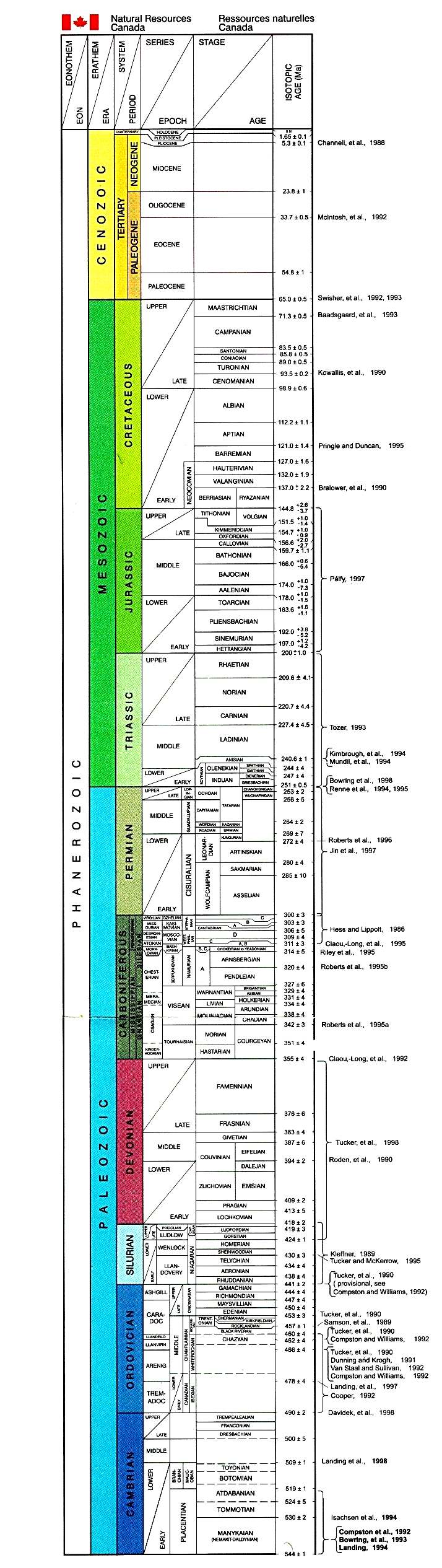
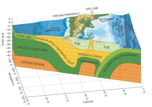
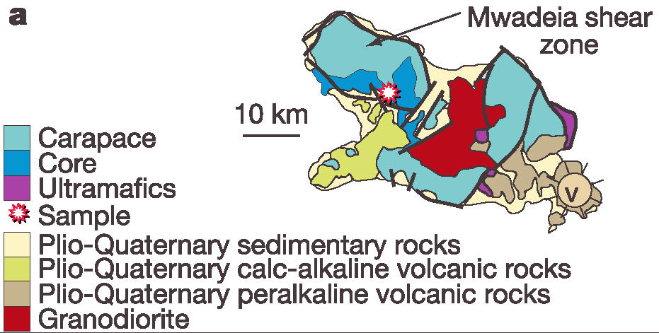
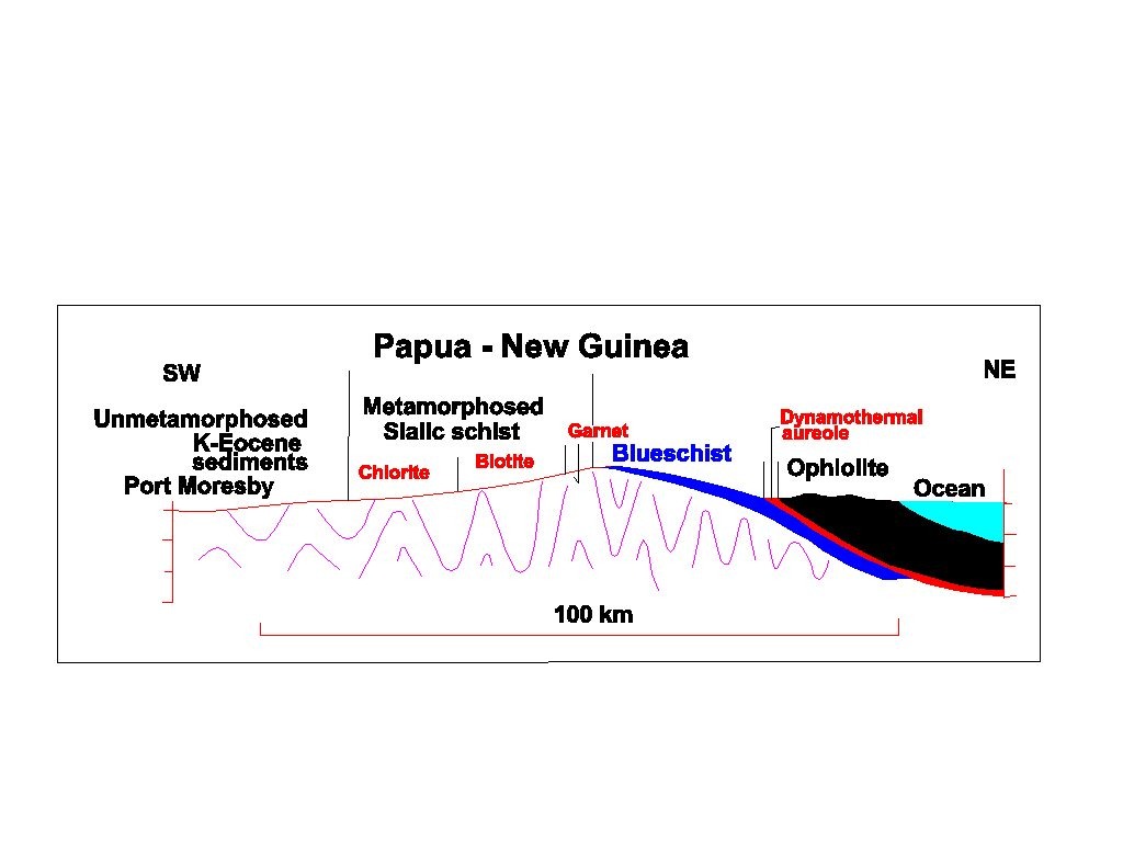
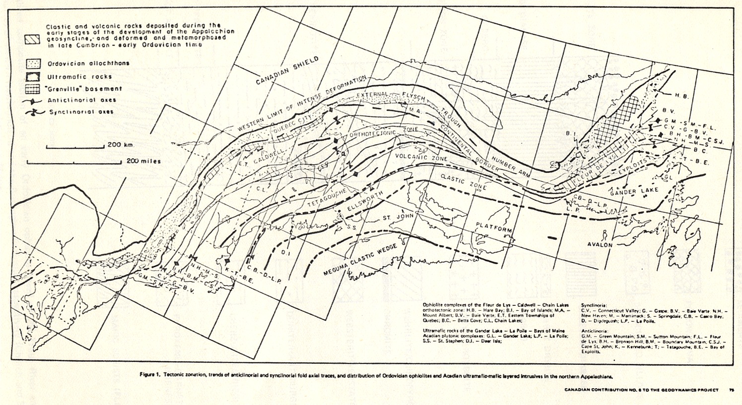
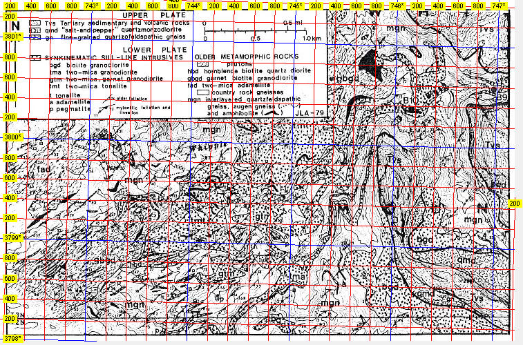
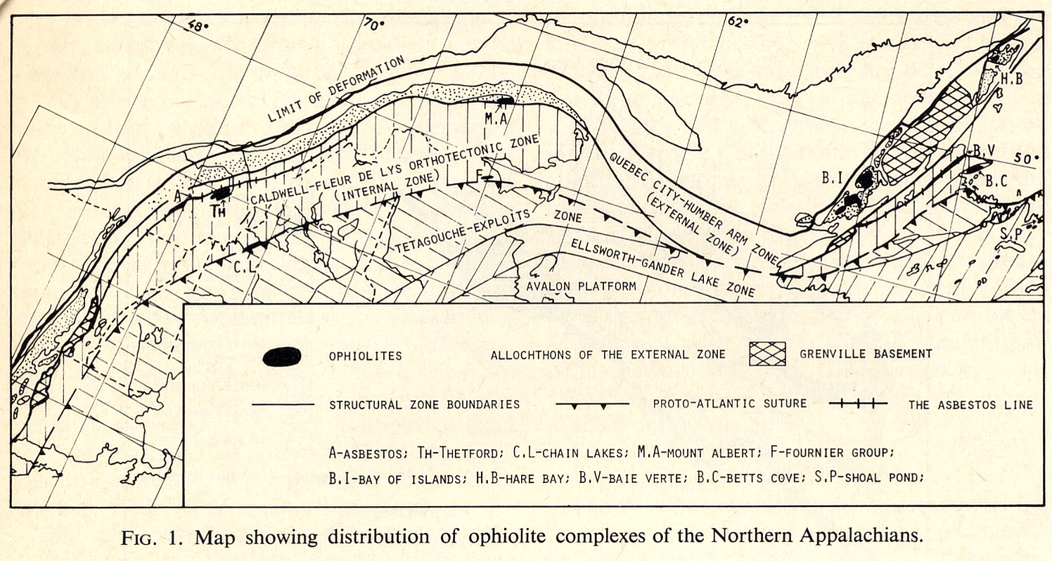
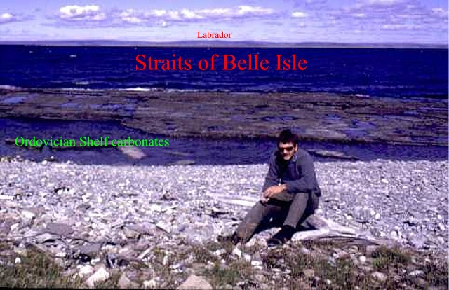
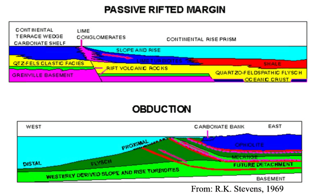
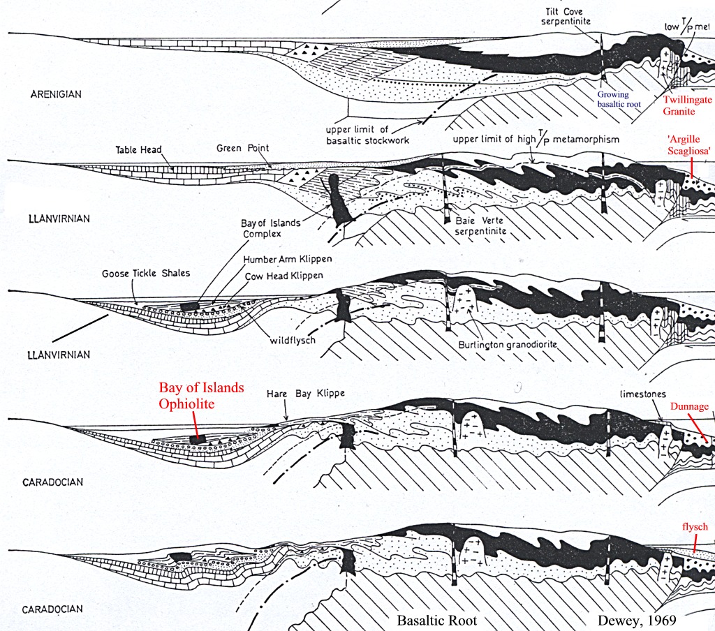
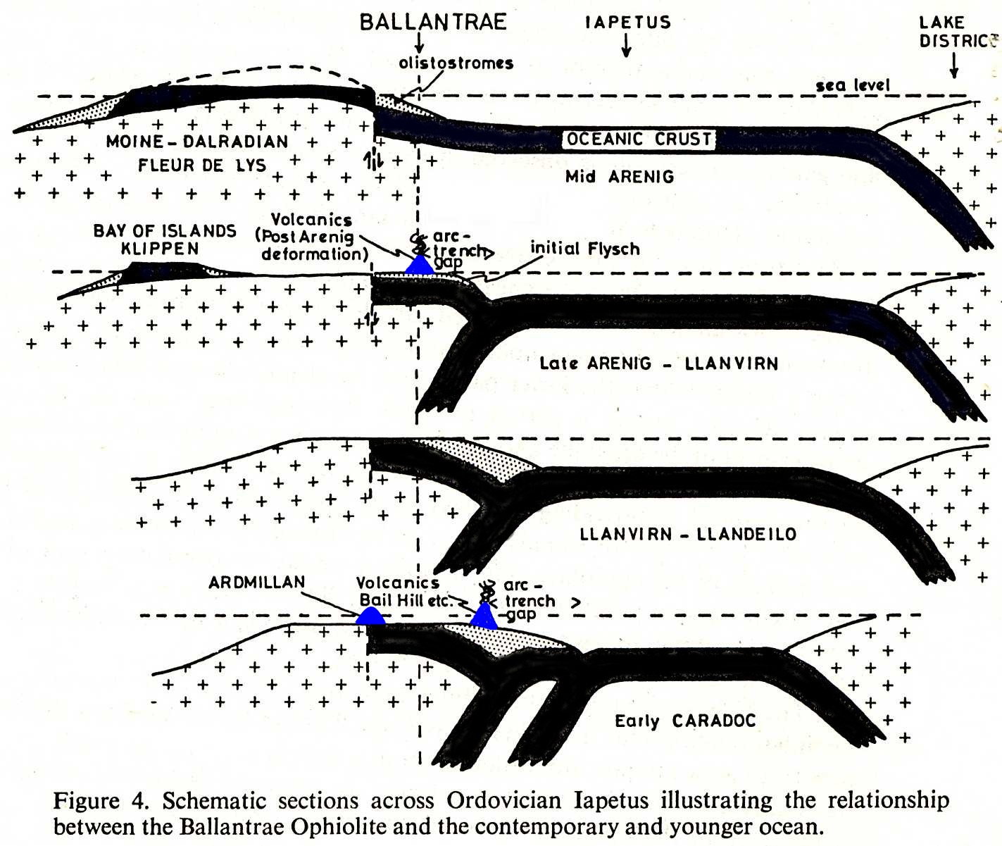
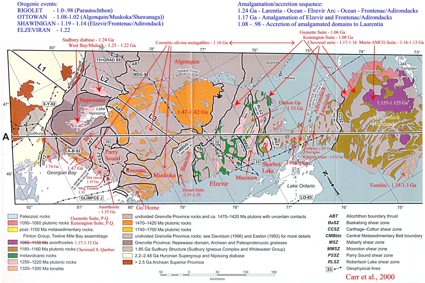
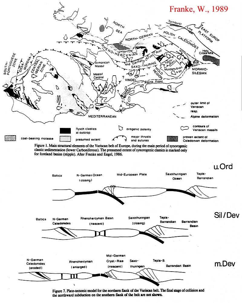
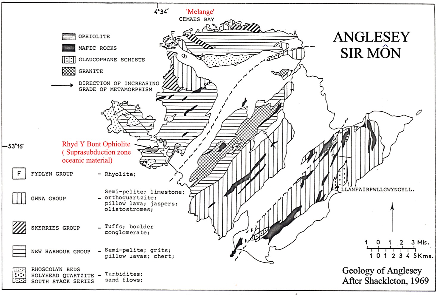
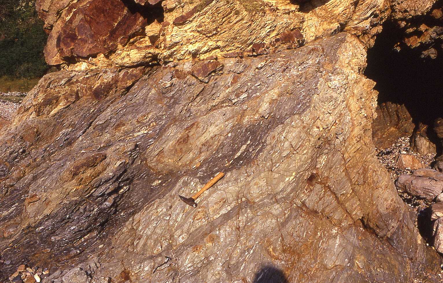
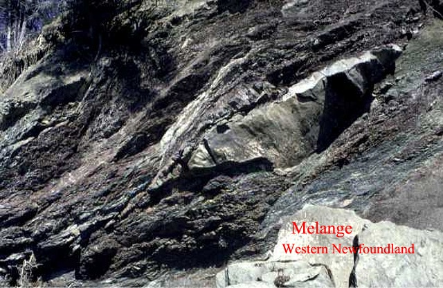
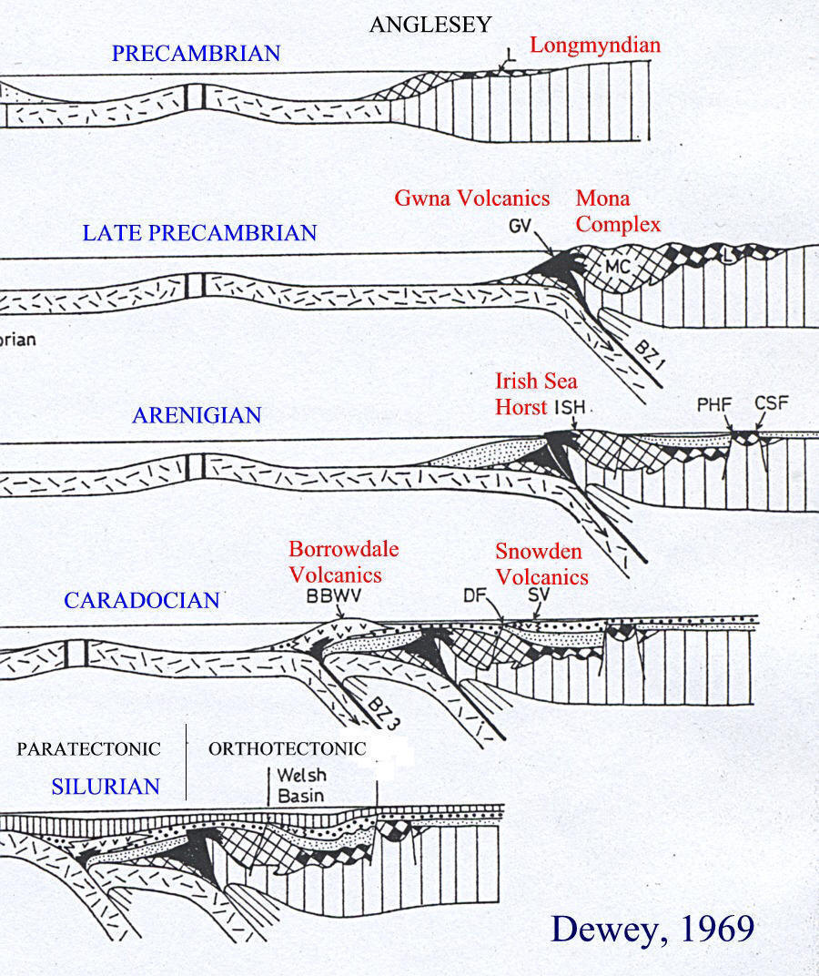
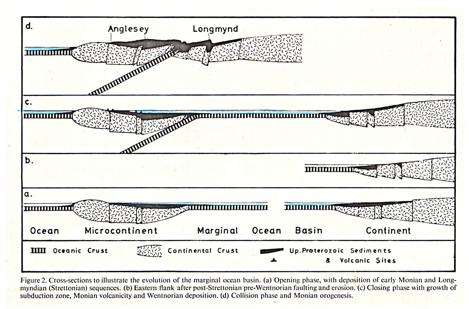
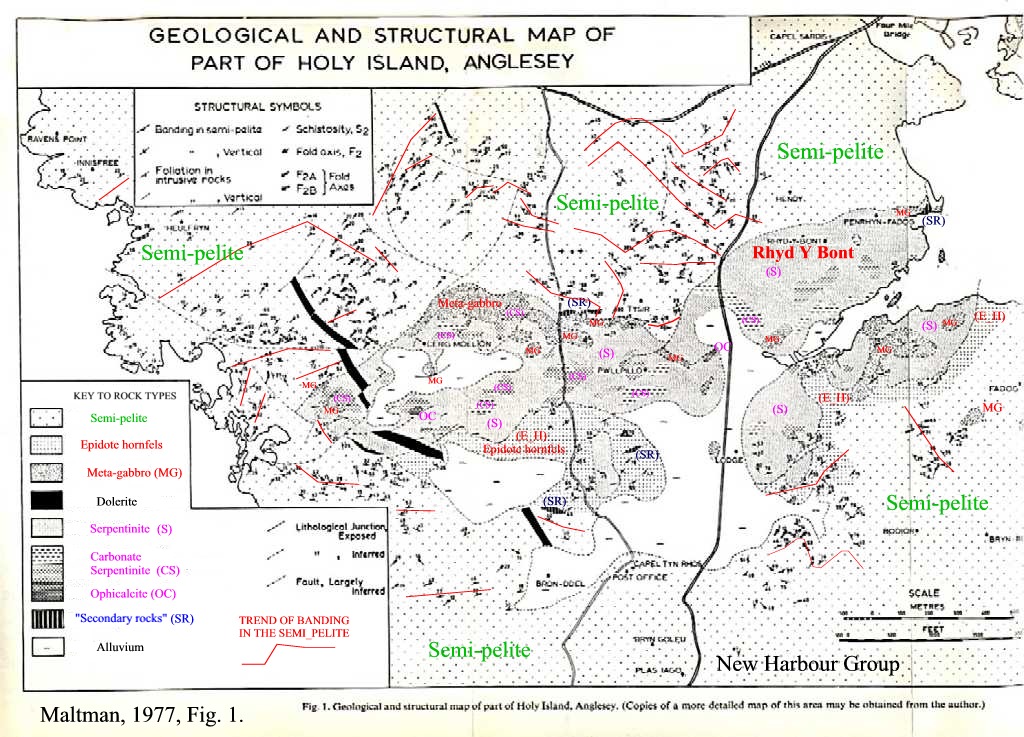
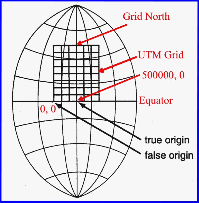
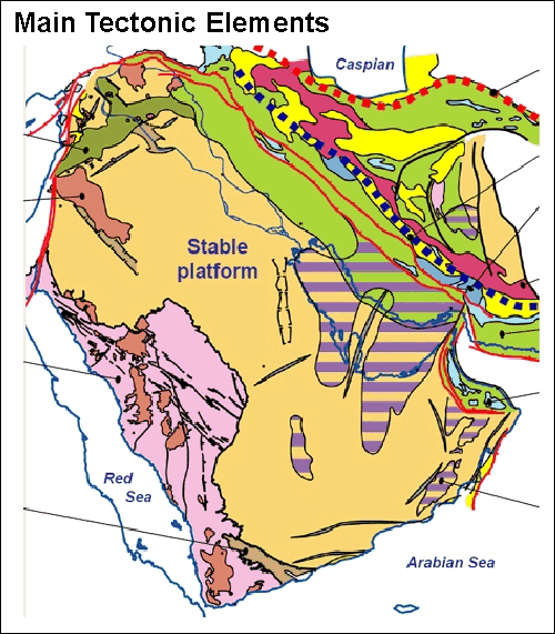
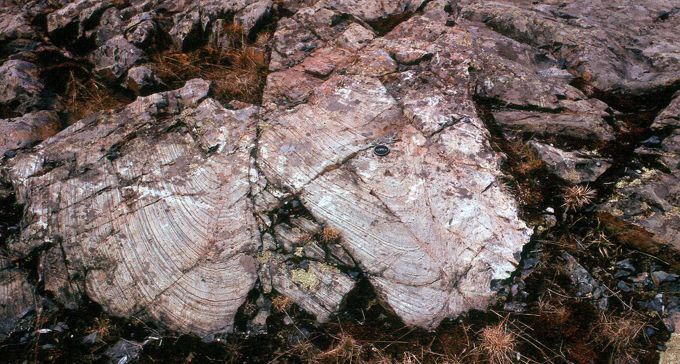
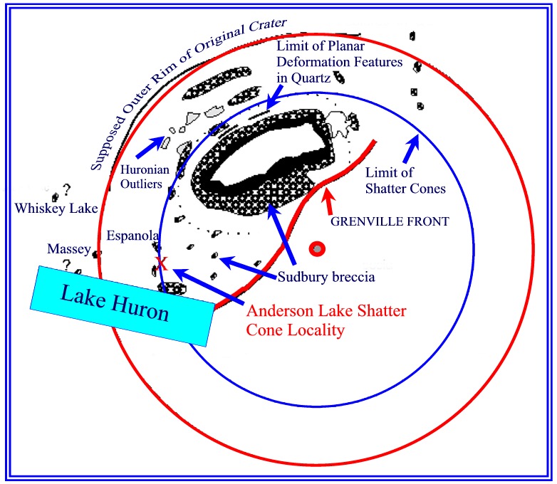
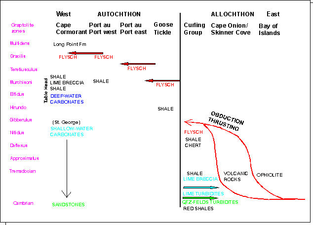
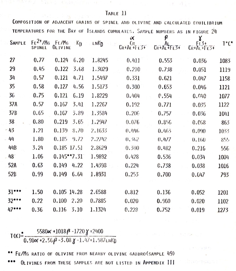
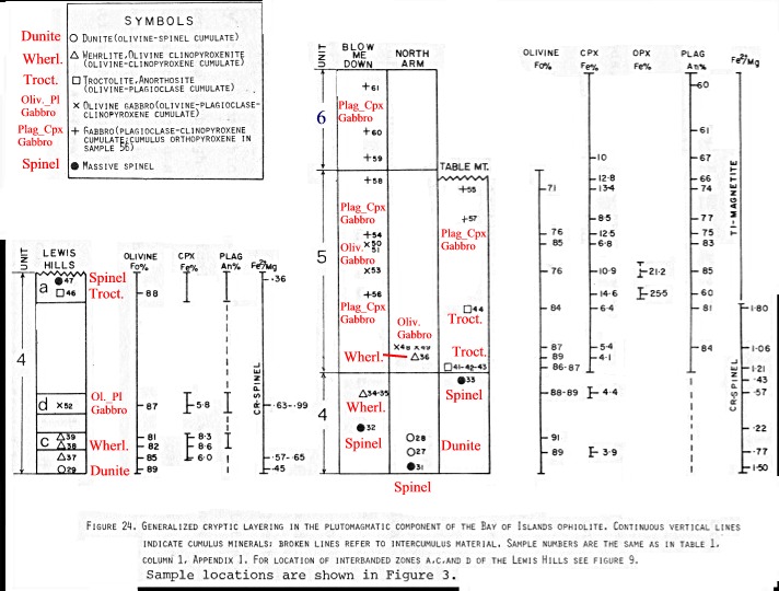
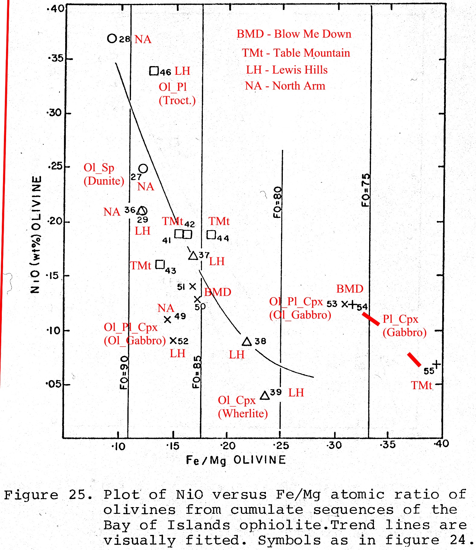
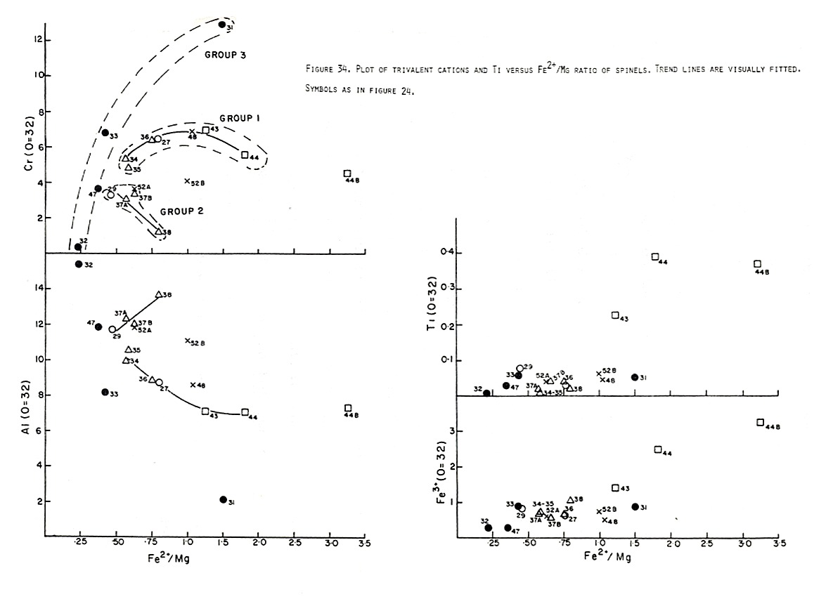
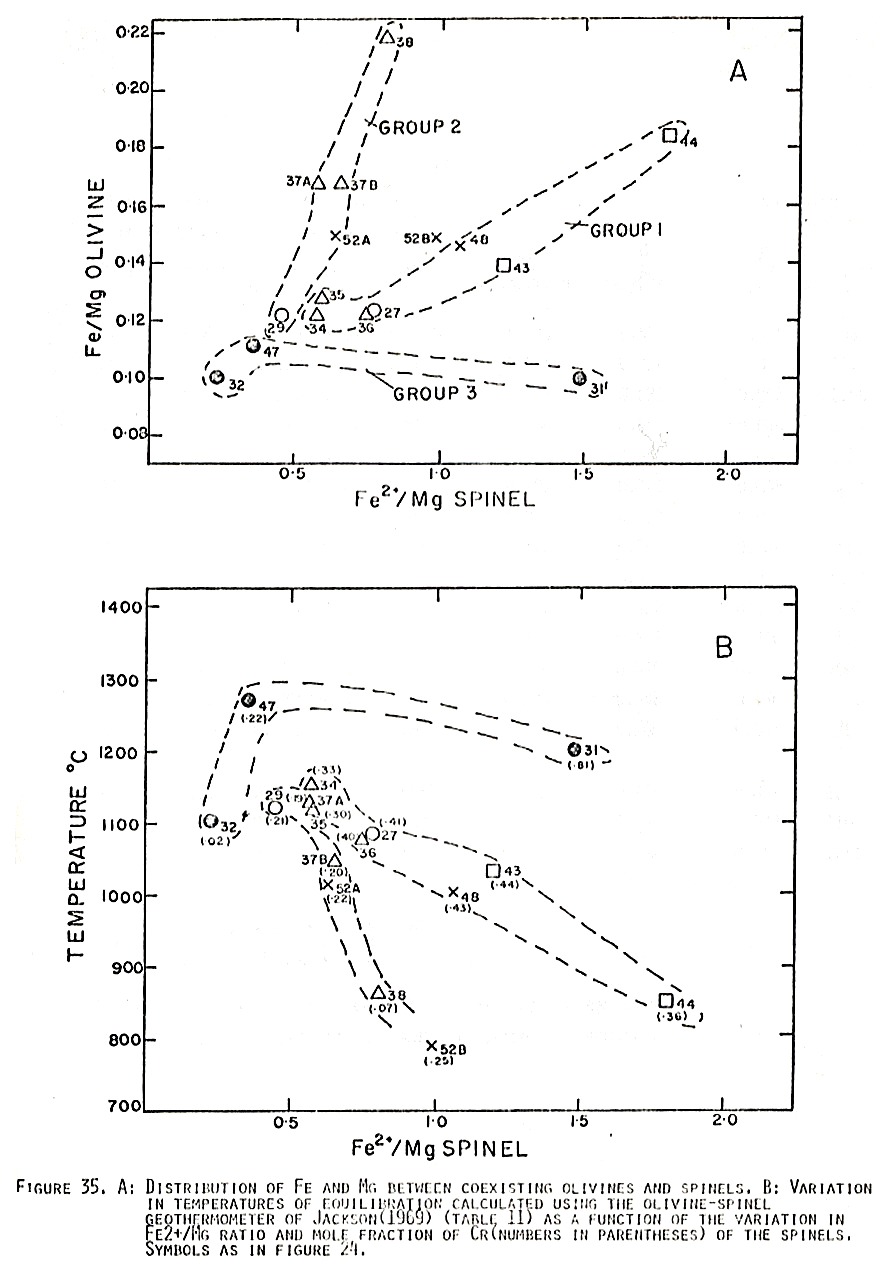
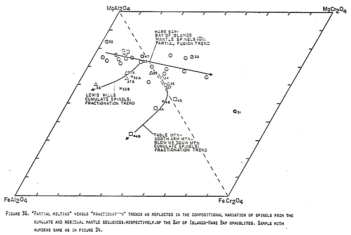
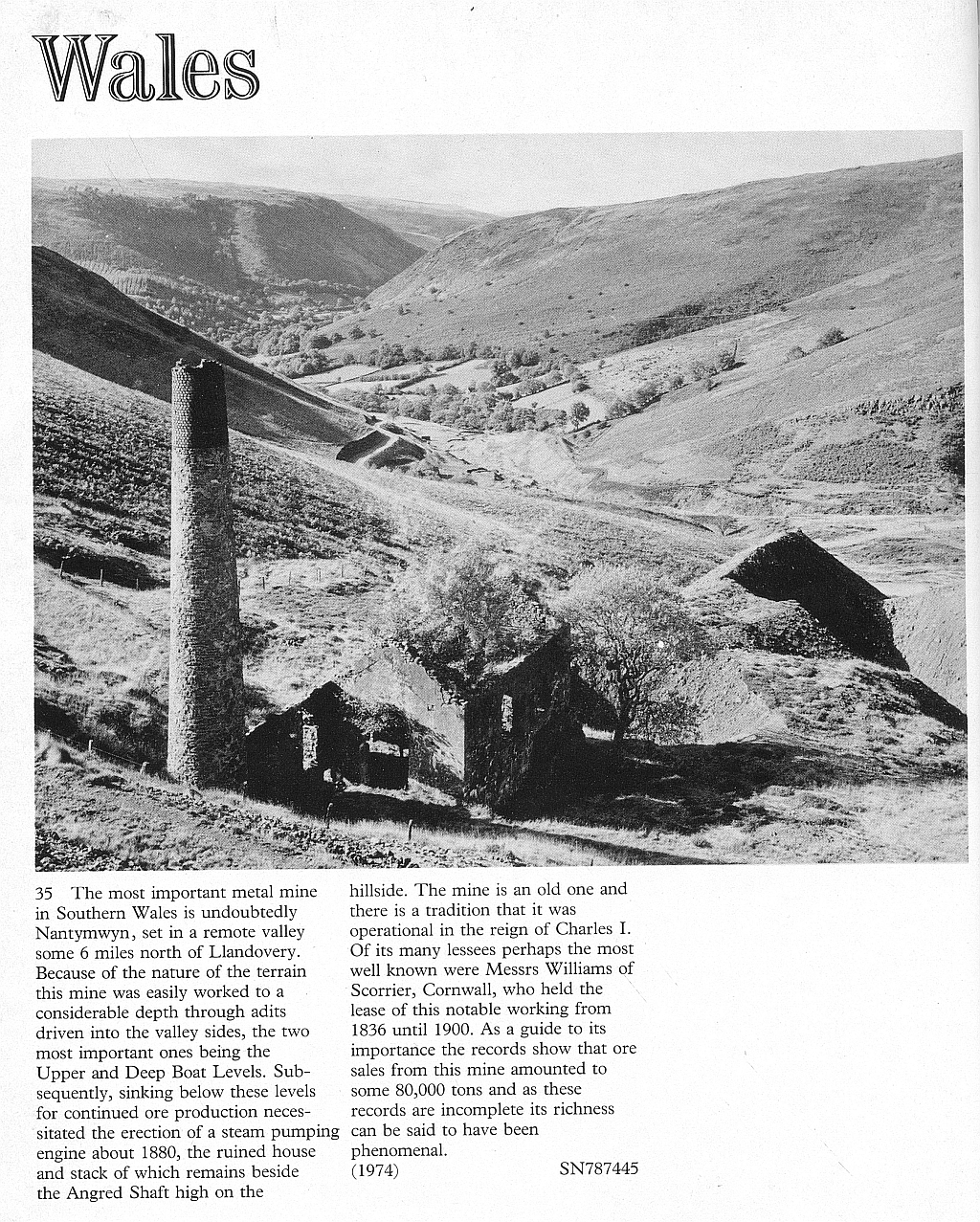
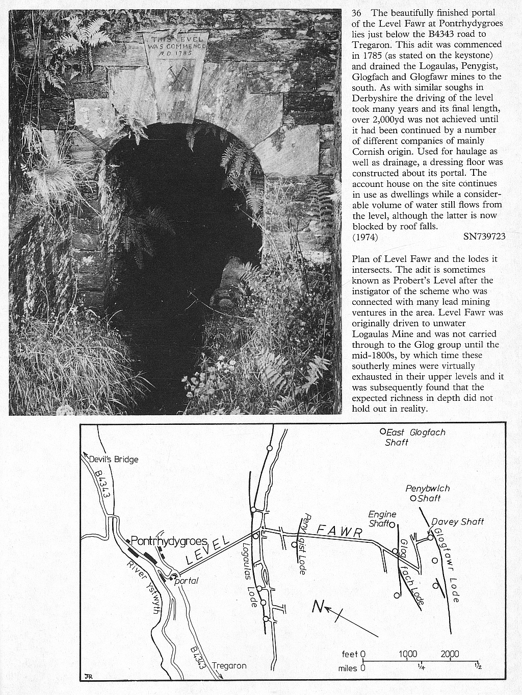
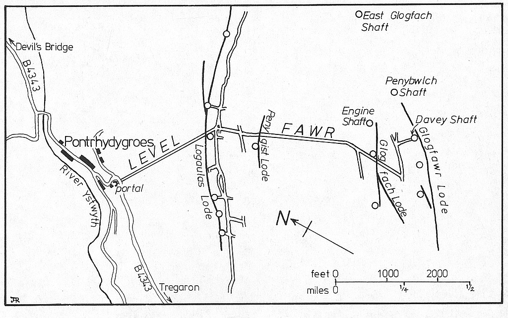
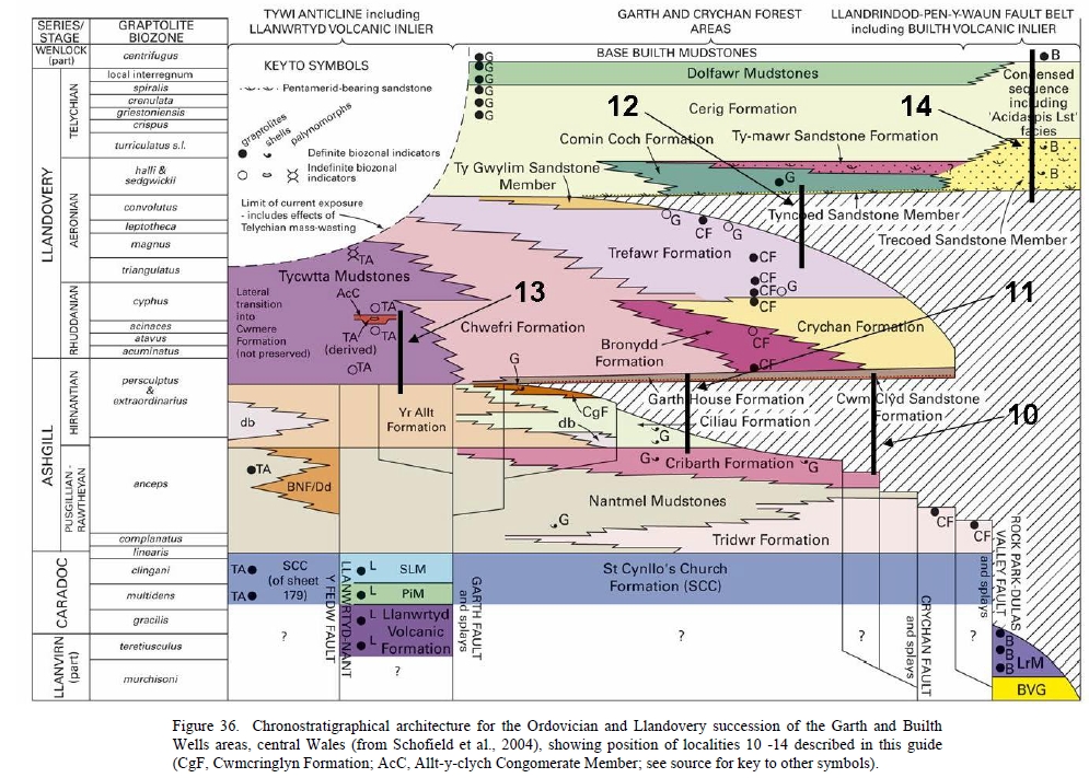
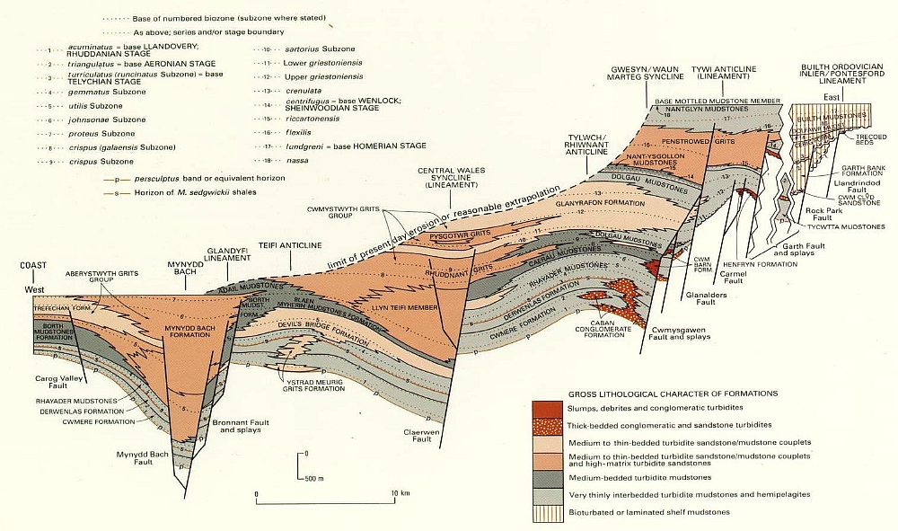
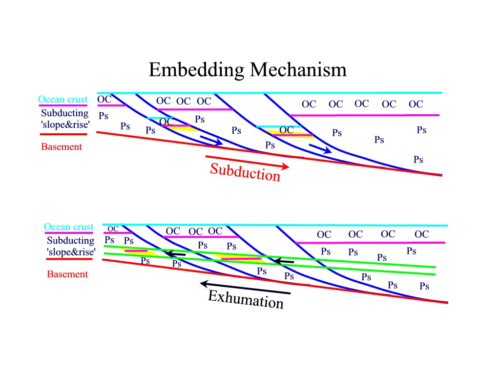
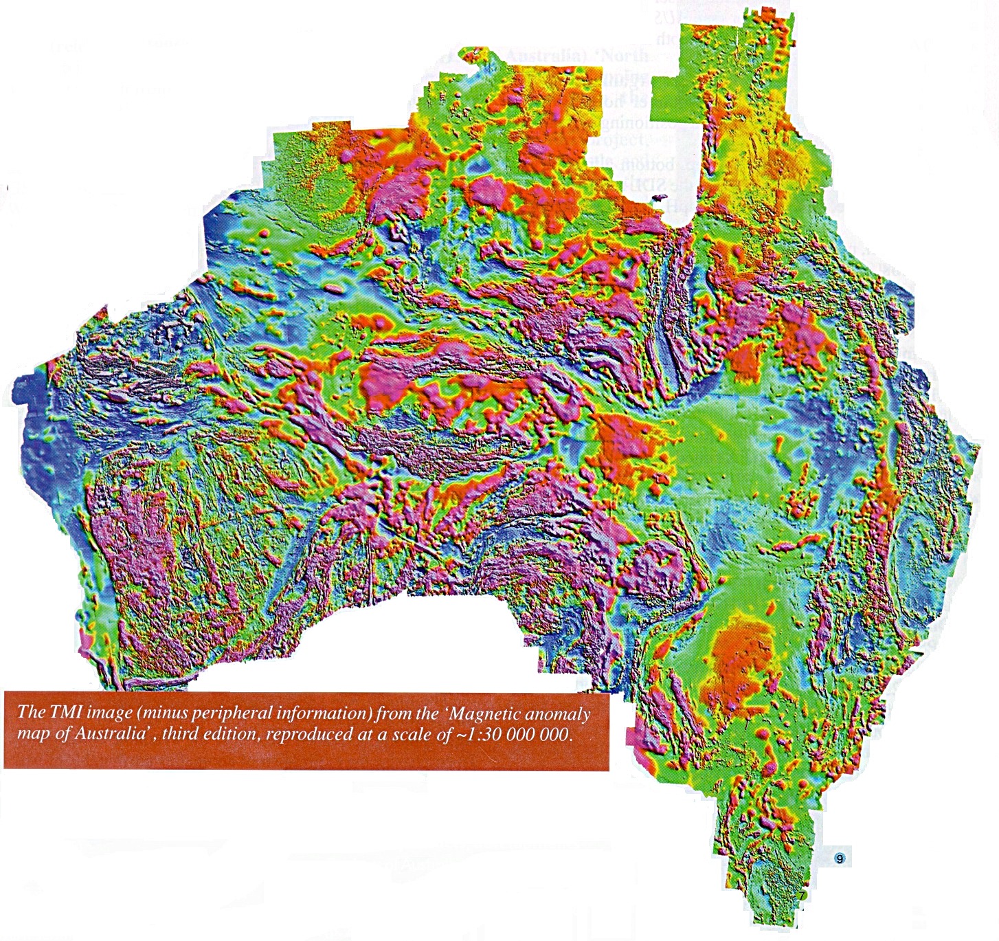
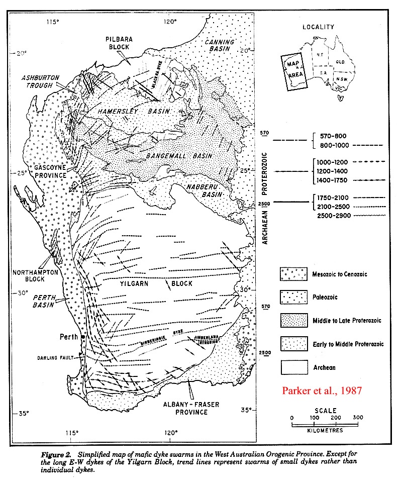
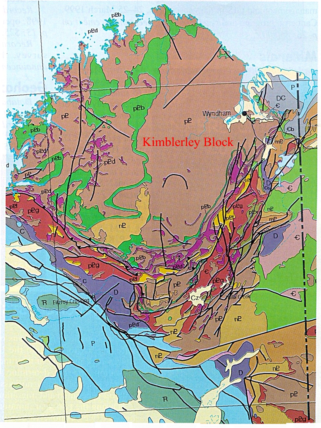